

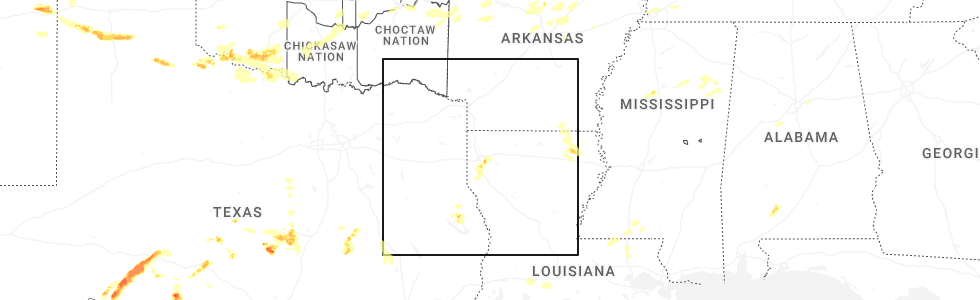
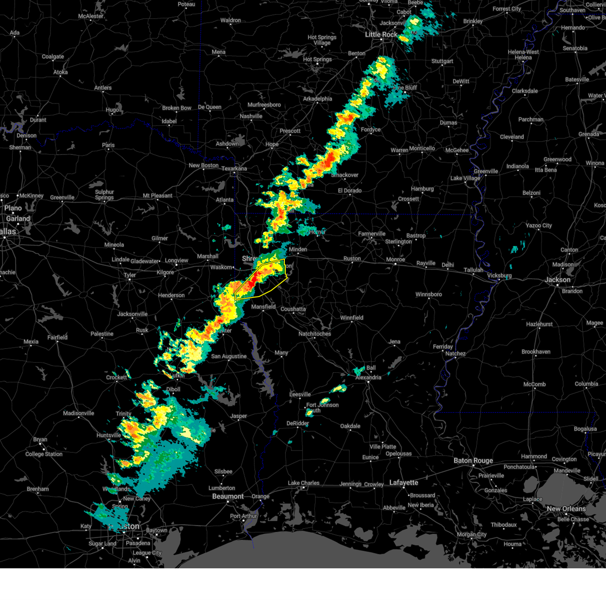
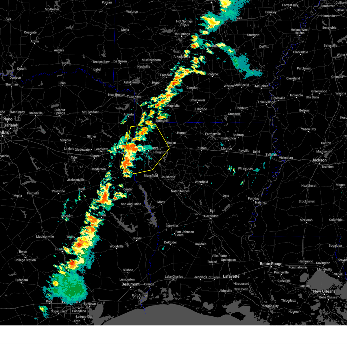
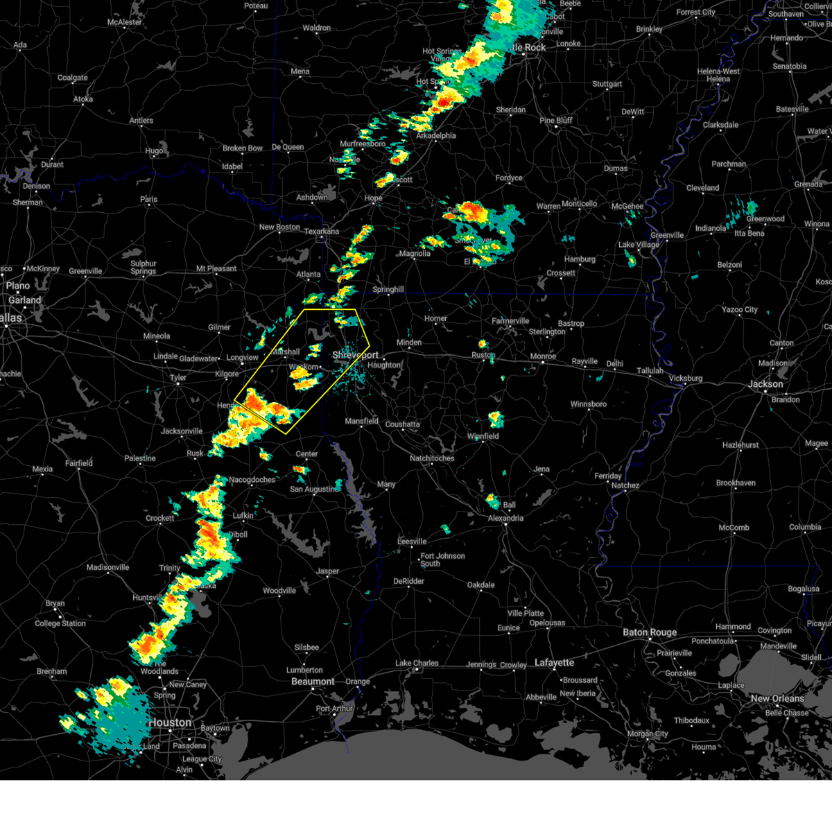
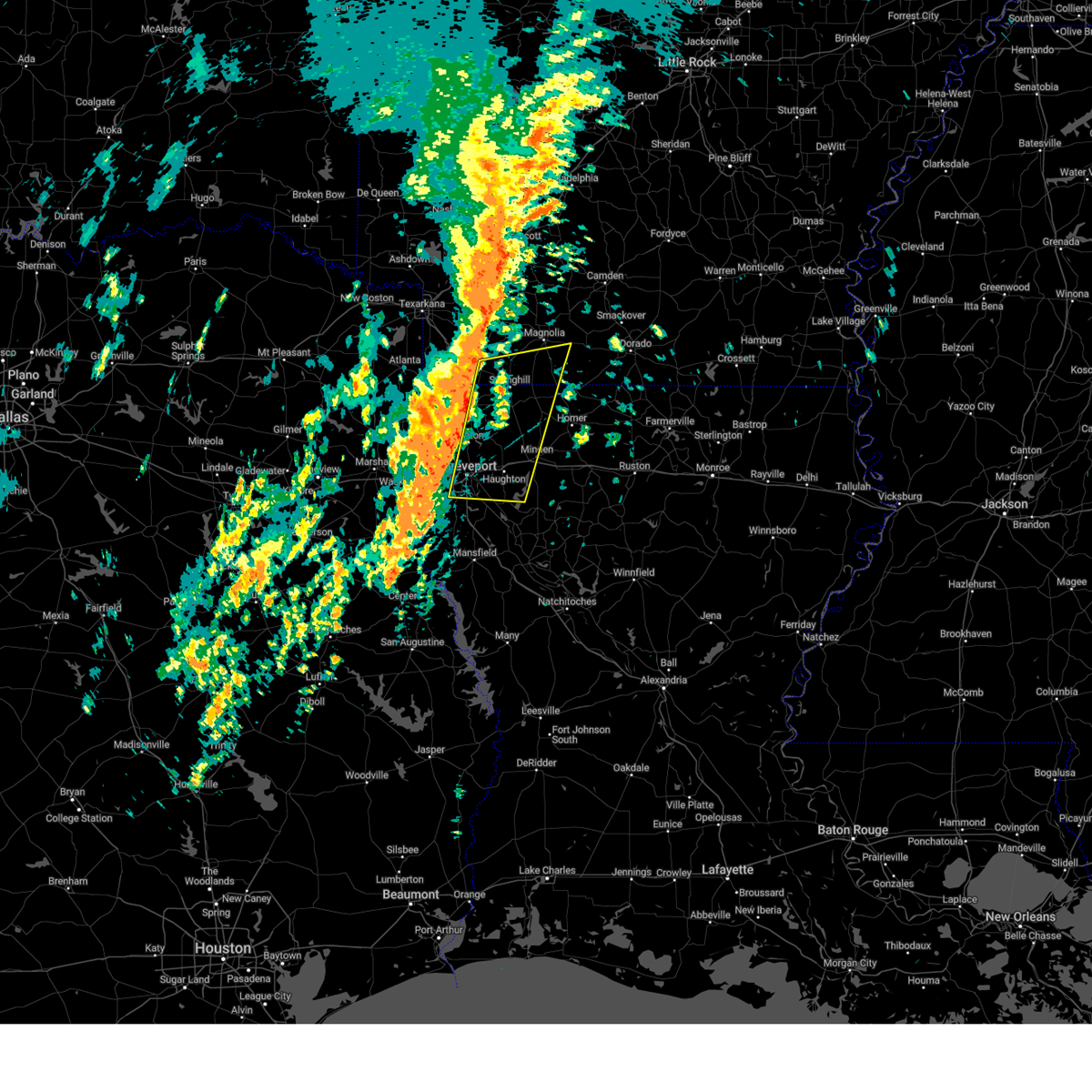
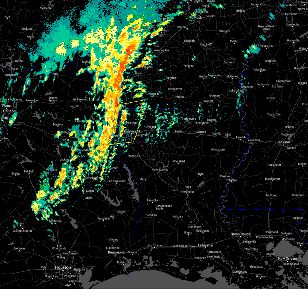
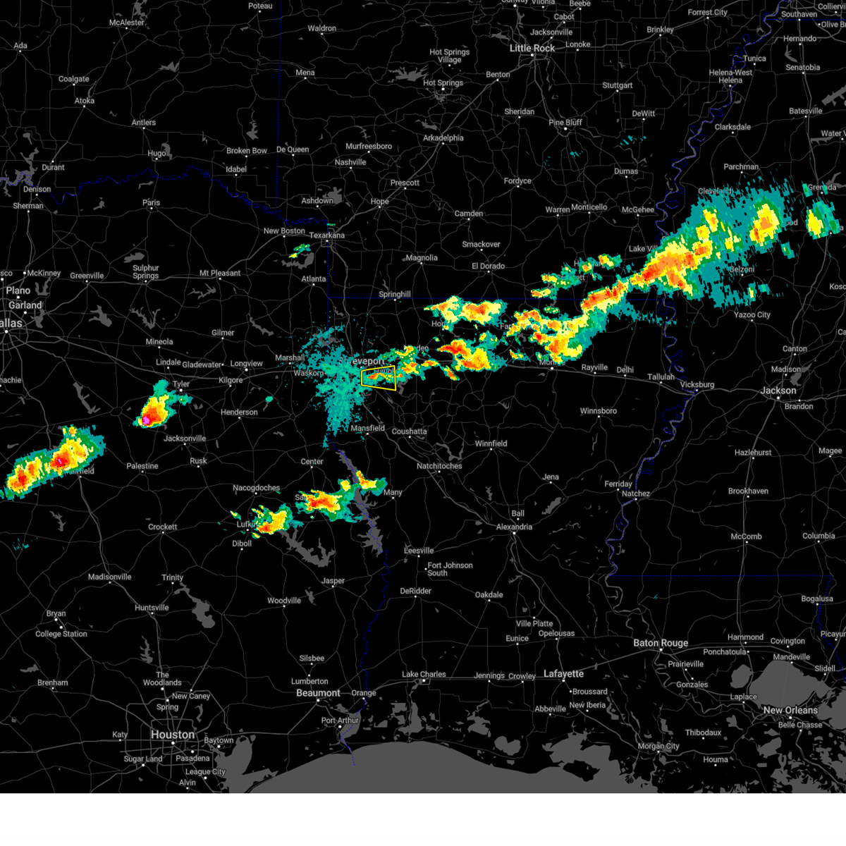
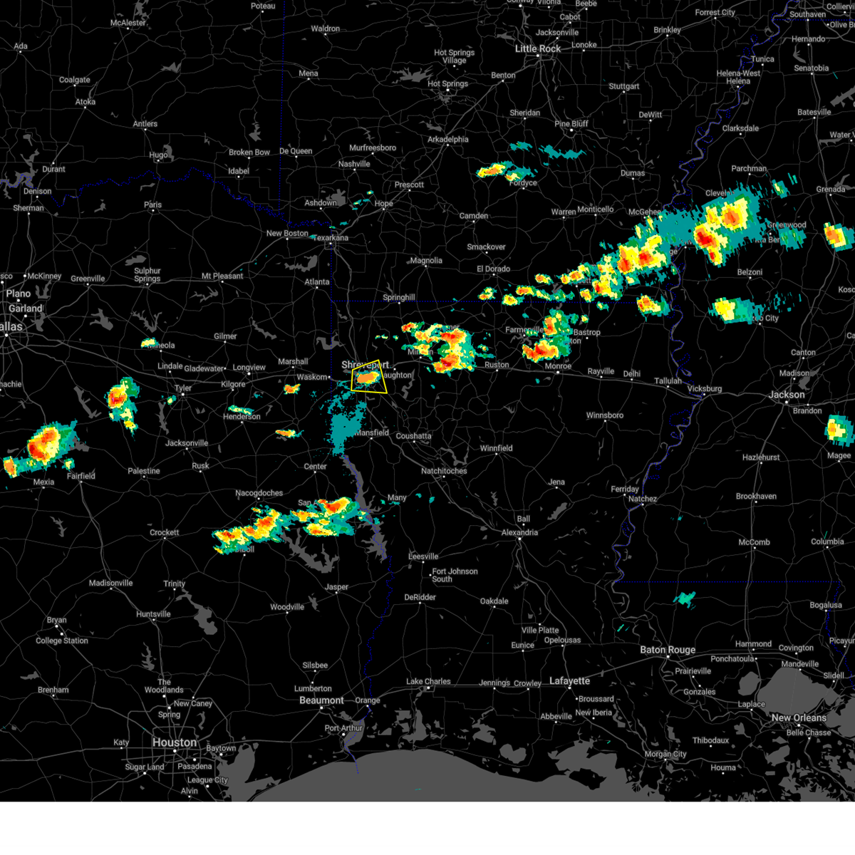
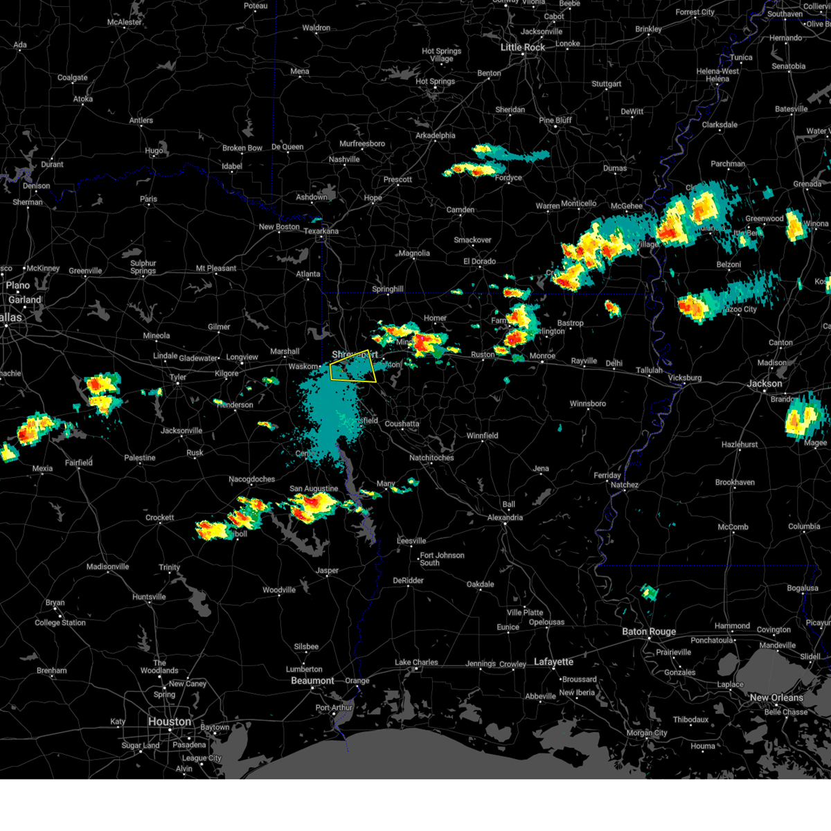
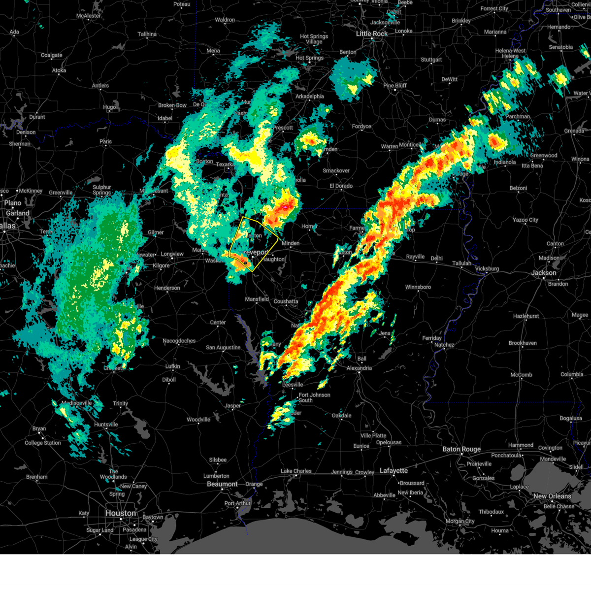
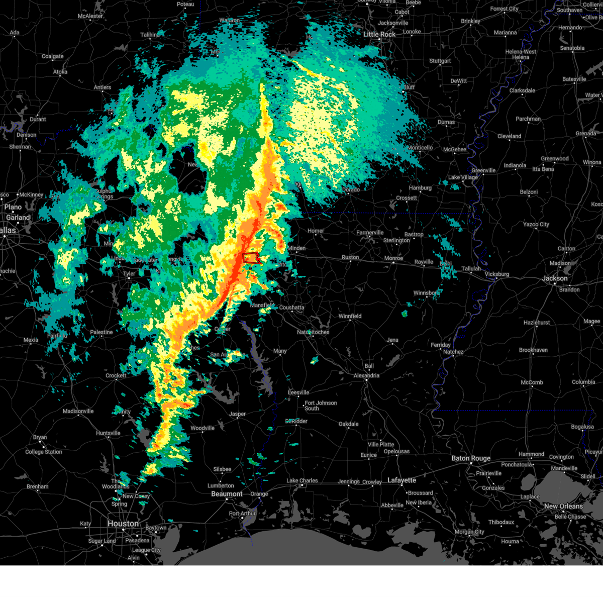
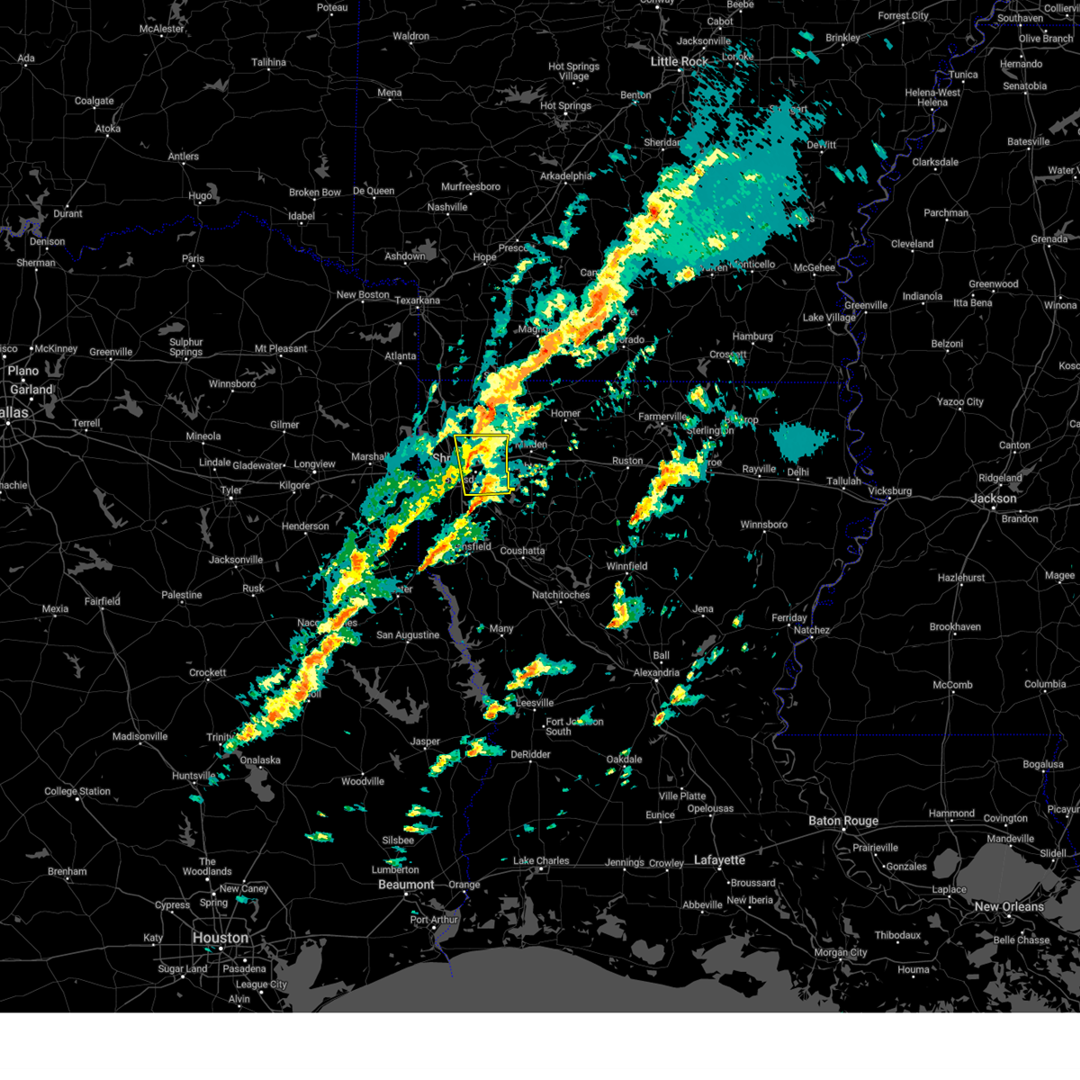
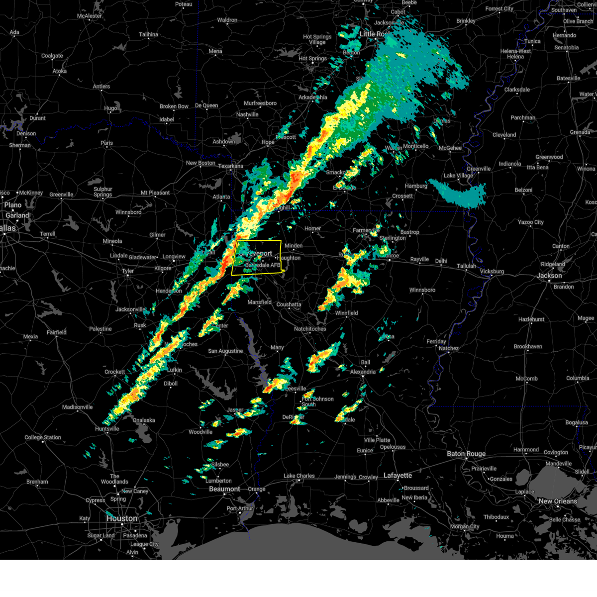
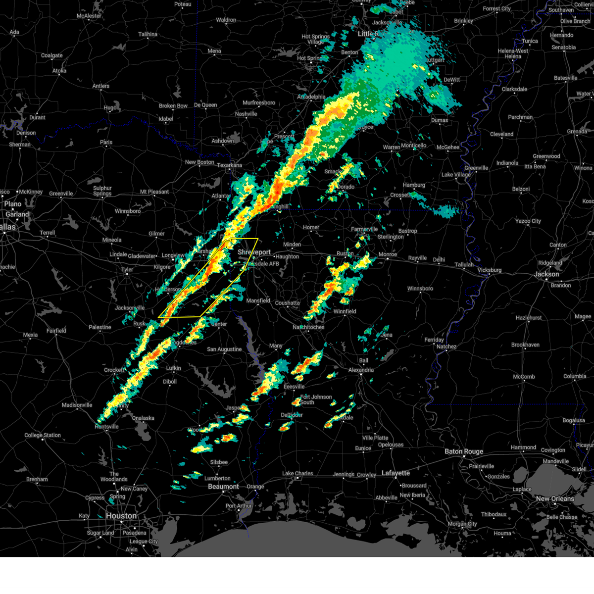
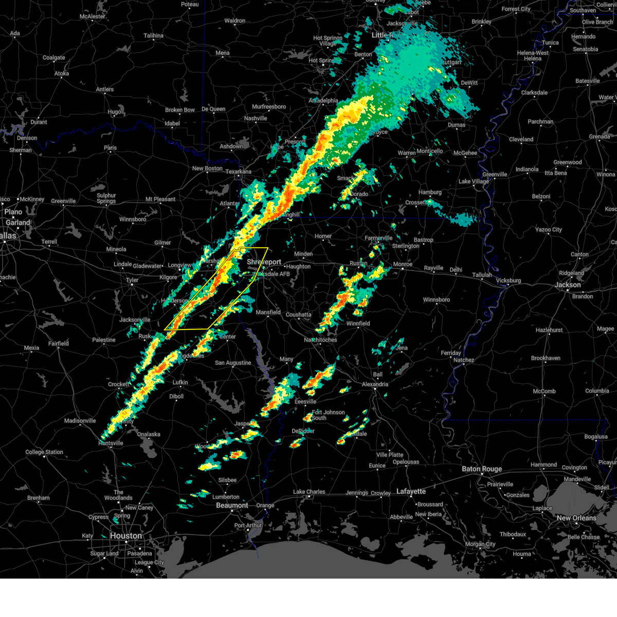
Hail Map for Shreveport, LA
The Shreveport, LA area has had 80 reports of on-the-ground hail by trained spotters, and has been under severe weather warnings 104 times during the past 12 months. Doppler radar has detected hail at or near Shreveport, LA on 97 occasions, including 5 occasions during the past year.
| Name: | Shreveport, LA |
| Where Located: | 5.2 miles SW of Shreveport, LA |
| Map: | Google Map for Shreveport, LA |
| Population: | 199311 |
| Housing Units: | 88253 |
| More Info: | Search Google for Shreveport, LA |
1
The Top Recent Hail Date for Shreveport, LA is Thursday, May 1, 2025 (25th out of 97)
Hail and Wind Damage Spotted near Shreveport, LA
| Date / Time | Report Details |
|---|---|
| 6/24/2025 6:27 PM CDT | Tree down on home off youree drive near stoner avenue in shrevepor in caddo county LA, 4.4 miles WSW of Shreveport, LA |
| 6/24/2025 6:27 PM CDT |
 Svrshv the national weather service in shreveport has issued a * severe thunderstorm warning for, southwestern caddo parish in northwestern louisiana, southwestern bossier parish in northwestern louisiana, * until 700 pm cdt. * at 627 pm cdt, a severe thunderstorm was located near shreveport, moving west at 20 mph (radar indicated). Hazards include 60 mph wind gusts and penny size hail. expect damage to roofs, siding, and trees Svrshv the national weather service in shreveport has issued a * severe thunderstorm warning for, southwestern caddo parish in northwestern louisiana, southwestern bossier parish in northwestern louisiana, * until 700 pm cdt. * at 627 pm cdt, a severe thunderstorm was located near shreveport, moving west at 20 mph (radar indicated). Hazards include 60 mph wind gusts and penny size hail. expect damage to roofs, siding, and trees
|
| 6/9/2025 1:34 AM CDT |
 the severe thunderstorm warning has been cancelled and is no longer in effect the severe thunderstorm warning has been cancelled and is no longer in effect
|
| 6/9/2025 1:34 AM CDT |
 At 133 am cdt, severe thunderstorms were located along a line extending from near shreveport to 11 miles southwest of fosters to near stonewall to joaquin to near tenaha, moving east at 40 mph (radar indicated). Hazards include 60 mph wind gusts and quarter size hail. Hail damage to vehicles is expected. expect wind damage to roofs, siding, and trees. Locations impacted include, shreveport, center, mansfield, greenwood, stonewall, logansport, tenaha, timpson, joaquin, converse, shelbyville, patroon, neuville, oak grove, huxley, south mansfield, keachi, grand cane, longstreet, and stanley. At 133 am cdt, severe thunderstorms were located along a line extending from near shreveport to 11 miles southwest of fosters to near stonewall to joaquin to near tenaha, moving east at 40 mph (radar indicated). Hazards include 60 mph wind gusts and quarter size hail. Hail damage to vehicles is expected. expect wind damage to roofs, siding, and trees. Locations impacted include, shreveport, center, mansfield, greenwood, stonewall, logansport, tenaha, timpson, joaquin, converse, shelbyville, patroon, neuville, oak grove, huxley, south mansfield, keachi, grand cane, longstreet, and stanley.
|
| 6/9/2025 12:51 AM CDT |
 Svrshv the national weather service in shreveport has issued a * severe thunderstorm warning for, de soto parish in northwestern louisiana, northwestern red river parish in northwestern louisiana, southern caddo parish in northwestern louisiana, south central bossier parish in northwestern louisiana, northwestern sabine parish in northwestern louisiana, south central marion county in northeastern texas, eastern harrison county in northeastern texas, panola county in northeastern texas, central rusk county in northeastern texas, shelby county in eastern texas, * until 200 am cdt. * at 1250 am cdt, severe thunderstorms were located along a line extending from near karnack to 9 miles southeast of woodlawn to 6 miles northwest of elysian fields to near beckville to near minden, moving southeast at 40 mph (radar indicated). Hazards include 70 mph wind gusts and quarter size hail. Hail damage to vehicles is expected. expect considerable tree damage. Wind damage is also likely to mobile homes, roofs, and outbuildings. Svrshv the national weather service in shreveport has issued a * severe thunderstorm warning for, de soto parish in northwestern louisiana, northwestern red river parish in northwestern louisiana, southern caddo parish in northwestern louisiana, south central bossier parish in northwestern louisiana, northwestern sabine parish in northwestern louisiana, south central marion county in northeastern texas, eastern harrison county in northeastern texas, panola county in northeastern texas, central rusk county in northeastern texas, shelby county in eastern texas, * until 200 am cdt. * at 1250 am cdt, severe thunderstorms were located along a line extending from near karnack to 9 miles southeast of woodlawn to 6 miles northwest of elysian fields to near beckville to near minden, moving southeast at 40 mph (radar indicated). Hazards include 70 mph wind gusts and quarter size hail. Hail damage to vehicles is expected. expect considerable tree damage. Wind damage is also likely to mobile homes, roofs, and outbuildings.
|
| 6/8/2025 9:28 PM CDT |
 the severe thunderstorm warning has been cancelled and is no longer in effect the severe thunderstorm warning has been cancelled and is no longer in effect
|
| 6/8/2025 8:55 PM CDT | Svrshv the national weather service in shreveport has issued a * severe thunderstorm warning for, west central caddo parish in northwestern louisiana, central marion county in northeastern texas, harrison county in northeastern texas, * until 1000 pm cdt. * at 855 pm cdt, a severe thunderstorm was located near harleton, or 17 miles northwest of marshall, moving southeast at 35 mph (radar indicated). Hazards include 60 mph wind gusts and quarter size hail. Hail damage to vehicles is expected. Expect wind damage to roofs, siding, and trees. |
| 5/26/2025 6:28 AM CDT |
 Svrshv the national weather service in shreveport has issued a * severe thunderstorm warning for, northwestern de soto parish in northwestern louisiana, southwestern caddo parish in northwestern louisiana, southeastern smith county in northeastern texas, harrison county in northeastern texas, panola county in northeastern texas, rusk county in northeastern texas, northwestern nacogdoches county in eastern texas, northwestern shelby county in eastern texas, cherokee county in northeastern texas, * until 730 am cdt. * at 627 am cdt, severe thunderstorms were located along a line extending from near marshall to near tatum to henderson to 8 miles north of ponta to near reese, moving east at 55 mph (radar indicated). Hazards include 60 mph wind gusts and quarter size hail. Hail damage to vehicles is expected. Expect wind damage to roofs, siding, and trees. Svrshv the national weather service in shreveport has issued a * severe thunderstorm warning for, northwestern de soto parish in northwestern louisiana, southwestern caddo parish in northwestern louisiana, southeastern smith county in northeastern texas, harrison county in northeastern texas, panola county in northeastern texas, rusk county in northeastern texas, northwestern nacogdoches county in eastern texas, northwestern shelby county in eastern texas, cherokee county in northeastern texas, * until 730 am cdt. * at 627 am cdt, severe thunderstorms were located along a line extending from near marshall to near tatum to henderson to 8 miles north of ponta to near reese, moving east at 55 mph (radar indicated). Hazards include 60 mph wind gusts and quarter size hail. Hail damage to vehicles is expected. Expect wind damage to roofs, siding, and trees.
|
| 5/6/2025 3:49 PM CDT | At 348 pm cdt, a severe thunderstorm capable of producing a tornado was located over fosters, or over bossier city, moving northeast at 60 mph (radar indicated rotation). Hazards include tornado. Flying debris will be dangerous to those caught without shelter. mobile homes will be damaged or destroyed. damage to roofs, windows, and vehicles will occur. tree damage is likely. this dangerous storm will be near, bossier city and eastwood around 355 pm cdt. Other locations impacted by this tornadic thunderstorm include ferguson, princeton, fillmore, bodcau, bellevue, barksdale air force base, and red chute. |
| 5/6/2025 3:39 PM CDT |
 At 338 pm cdt, a confirmed tornado was located near shreveport, moving northeast at 55 mph (radar confirmed tornado). Hazards include damaging tornado and quarter size hail. Flying debris will be dangerous to those caught without shelter. mobile homes will be damaged or destroyed. damage to roofs, windows, and vehicles will occur. tree damage is likely. this tornado will be near, bossier city, fosters, and shreveport around 345 pm cdt. eastwood around 350 pm cdt. haughton around 355 pm cdt. Other locations impacted by this tornadic thunderstorm include ferguson, princeton, fillmore, bodcau, forbing, bellevue, barksdale air force base, and red chute. At 338 pm cdt, a confirmed tornado was located near shreveport, moving northeast at 55 mph (radar confirmed tornado). Hazards include damaging tornado and quarter size hail. Flying debris will be dangerous to those caught without shelter. mobile homes will be damaged or destroyed. damage to roofs, windows, and vehicles will occur. tree damage is likely. this tornado will be near, bossier city, fosters, and shreveport around 345 pm cdt. eastwood around 350 pm cdt. haughton around 355 pm cdt. Other locations impacted by this tornadic thunderstorm include ferguson, princeton, fillmore, bodcau, forbing, bellevue, barksdale air force base, and red chute.
|
| 5/6/2025 3:29 PM CDT | Torshv the national weather service in shreveport has issued a * tornado warning for, southwestern caddo parish in northwestern louisiana, central bossier parish in northwestern louisiana, * until 415 pm cdt. * at 328 pm cdt, a tornado producing storm was located near greenwood, or 12 miles southwest of shreveport, moving northeast at 60 mph (radar confirmed tornado). Hazards include damaging tornado and quarter size hail. Flying debris will be dangerous to those caught without shelter. mobile homes will be damaged or destroyed. damage to roofs, windows, and vehicles will occur. tree damage is likely. this tornadic storm will be near, shreveport around 335 pm cdt. bossier city and fosters around 345 pm cdt. haughton and eastwood around 350 pm cdt. Other locations impacted by this tornadic thunderstorm include ferguson, princeton, keithville, spring ridge, fillmore, cross lake, bodcau, forbing, bellevue, and sligo. |
| 5/6/2025 3:17 PM CDT |
 Svrshv the national weather service in shreveport has issued a * severe thunderstorm warning for, southwestern webster parish in northwestern louisiana, north central de soto parish in northwestern louisiana, southern caddo parish in northwestern louisiana, central bossier parish in northwestern louisiana, * until 400 pm cdt. * at 316 pm cdt, severe thunderstorms were located along a line extending from near karnack to near deberry, moving east at 55 mph (radar indicated). Hazards include 60 mph wind gusts. expect damage to roofs, siding, and trees Svrshv the national weather service in shreveport has issued a * severe thunderstorm warning for, southwestern webster parish in northwestern louisiana, north central de soto parish in northwestern louisiana, southern caddo parish in northwestern louisiana, central bossier parish in northwestern louisiana, * until 400 pm cdt. * at 316 pm cdt, severe thunderstorms were located along a line extending from near karnack to near deberry, moving east at 55 mph (radar indicated). Hazards include 60 mph wind gusts. expect damage to roofs, siding, and trees
|
| 5/6/2025 1:56 PM CDT | At 156 pm cdt, a severe thunderstorm was located over mooringsport, or 17 miles northwest of shreveport, moving northeast at 40 mph (radar indicated). Hazards include 60 mph wind gusts and quarter size hail. Hail damage to vehicles is expected. expect wind damage to roofs, siding, and trees. Locations impacted include, oil city, dixie, caddo lake, gray, linton, mooringsport, benton, vivian, belcher, cavett, blanchard, uncertain, bethany, and shreveport. |
| 5/6/2025 1:55 PM CDT | Quarter sized hail reported 9.5 miles SSE of Shreveport, LA, social media report of quarter sized hail near northwood high school in blanchard. |
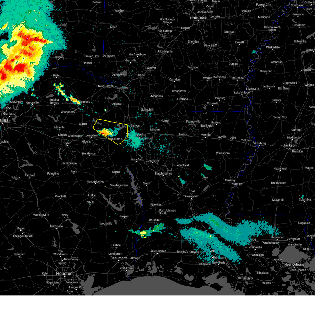
| 5/6/2025 1:36 PM CDT | Svrshv the national weather service in shreveport has issued a * severe thunderstorm warning for, northwestern caddo parish in northwestern louisiana, west central bossier parish in northwestern louisiana, eastern marion county in northeastern texas, eastern harrison county in northeastern texas, * until 215 pm cdt. * at 136 pm cdt, a severe thunderstorm was located near waskom, or 12 miles east of marshall, moving northeast at 40 mph (radar indicated). Hazards include 60 mph wind gusts and quarter size hail. Hail damage to vehicles is expected. Expect wind damage to roofs, siding, and trees. |
| 5/2/2025 4:09 PM CDT | At 409 pm cdt, severe thunderstorms were located along a line from 5 miles northwest of fosters to over haughton, or along a line from 5 miles northwest of bossier city to 10 miles east of bossier city, moving northeast at 25 mph (radar indicated). Hazards include 60 mph wind gusts and small hail. Expect damage to roofs, siding, and trees. Locations impacted include, shreveport, bossier city, haughton, benton, fosters, eastwood, ferguson, barksdale air force base, red chute, bodcau, sligo, fillmore, princeton and cross lake. |
| 5/2/2025 4:08 PM CDT | Dispatch report of a tree down on a powerline on choctaw trai in caddo county LA, 6 miles SSW of Shreveport, LA |
| 5/2/2025 4:06 PM CDT | Svrshv the national weather service in shreveport has issued a * severe thunderstorm warning for, central bossier parish in northwestern louisiana, central caddo parish in northwestern louisiana, central webster parish in northwestern louisiana, * until 445 pm cdt. * at 406 pm cdt, severe thunderstorms were located along a line from 6 miles northwest of fosters to over haughton, or along a line from 6 miles northwest of bossier city to 9 miles east of bossier city, moving northeast at 25 mph (radar indicated). Hazards include 60 mph wind gusts. expect damage to roofs, siding, and trees |
| 5/2/2025 3:49 PM CDT | At 349 pm cdt, severe thunderstorms were located along a line from over greenwood to near bossier city, or along a line from 11 miles west of shreveport to near bossier city, moving northeast at 25 mph. at 338 pm cdt, a wind gust of 64 mph was measured at shreveport regional airport (radar indicated). Hazards include 60 mph wind gusts and small hail. this storm has a history of producing strong, damaging winds. Expect damage to roofs, siding, and trees. Locations impacted include, shreveport, bossier city, haughton, greenwood, blanchard, benton, fosters, eastwood, ferguson, barksdale air force base, cross lake, red chute, bodcau, fillmore and princeton. |
| 5/2/2025 3:44 PM CDT | Dispatch report of a powerline down at intersection of peyton st and hollywood av in caddo county LA, 0.9 miles WNW of Shreveport, LA |
| 5/2/2025 3:38 PM CDT | 64 mph wind gust measured at nws shreveport aso in caddo county LA, 1.8 miles NE of Shreveport, LA |
| 5/2/2025 3:37 PM CDT |
 Svrshv the national weather service in shreveport has issued a * severe thunderstorm warning for, central bossier parish in northwestern louisiana, southwestern caddo parish in northwestern louisiana, * until 415 pm cdt. * at 337 pm cdt, severe thunderstorms were located along a line from over greenwood to 6 miles south of fosters, or along a line from 11 miles west of shreveport to 7 miles south of bossier city, moving northeast at 25 mph (radar indicated). Hazards include 60 mph wind gusts and small hail. expect damage to roofs, siding, and trees Svrshv the national weather service in shreveport has issued a * severe thunderstorm warning for, central bossier parish in northwestern louisiana, southwestern caddo parish in northwestern louisiana, * until 415 pm cdt. * at 337 pm cdt, severe thunderstorms were located along a line from over greenwood to 6 miles south of fosters, or along a line from 11 miles west of shreveport to 7 miles south of bossier city, moving northeast at 25 mph (radar indicated). Hazards include 60 mph wind gusts and small hail. expect damage to roofs, siding, and trees
|
| 5/1/2025 7:27 PM CDT | Half Dollar sized hail reported 7.4 miles WNW of Shreveport, LA, report of half dollar size hail in the southgate estates area. |
| 5/1/2025 7:24 PM CDT | At 724 pm cdt, a severe thunderstorm was located 6 miles south of fosters, or 7 miles south of bossier city, moving northeast at 25 mph. multiple reports of quarter to golf ball size hail have been received across northern desoto and southern caddo parish from this storm (radar indicated). Hazards include ping pong ball size hail and 60 mph wind gusts. People and animals outdoors will be injured. expect hail damage to roofs, siding, windows, and vehicles. expect wind damage to roofs, siding, and trees. Locations impacted include, shreveport, bossier city, haughton, fosters, eastwood, barksdale air force base, ferguson, forbing, sligo, bodcau, red chute, robson, taylortown and fillmore. |
| 5/1/2025 7:24 PM CDT | the severe thunderstorm warning has been cancelled and is no longer in effect |
| 5/1/2025 7:12 PM CDT | Quarter sized hail reported 9.4 miles NNW of Shreveport, LA, report from mping of 1 inch hail. |
| 5/1/2025 7:04 PM CDT | Quarter sized hail reported 9.7 miles NW of Shreveport, LA, subdivision off norris ferry road. |
| 5/1/2025 6:44 PM CDT | Svrshv the national weather service in shreveport has issued a * severe thunderstorm warning for, southern bossier parish in northwestern louisiana, southern caddo parish in northwestern louisiana, northwestern de soto parish in northwestern louisiana, * until 745 pm cdt. * at 644 pm cdt, a severe thunderstorm was located near stonewall, or 14 miles north of mansfield, moving northeast at 25 mph (radar indicated). Hazards include 60 mph wind gusts and quarter size hail. Hail damage to vehicles is expected. Expect wind damage to roofs, siding, and trees. |
| 4/30/2025 4:13 PM CDT |
 Svrshv the national weather service in shreveport has issued a * severe thunderstorm warning for, southwestern bossier parish in northwestern louisiana, southwestern caddo parish in northwestern louisiana, northern cherokee county in northeastern texas, southern gregg county in northeastern texas, harrison county in northeastern texas, panola county in northeastern texas, rusk county in northeastern texas, southeastern smith county in northeastern texas, * until 515 pm cdt. * at 413 pm cdt, severe thunderstorms were located along a line from near oil city to 5 miles northeast of joinerville, or along a line from 24 miles northeast of marshall to 6 miles north of henderson, moving southeast at 15 mph (radar indicated). Hazards include 60 mph wind gusts and small hail. expect damage to roofs, siding, and trees Svrshv the national weather service in shreveport has issued a * severe thunderstorm warning for, southwestern bossier parish in northwestern louisiana, southwestern caddo parish in northwestern louisiana, northern cherokee county in northeastern texas, southern gregg county in northeastern texas, harrison county in northeastern texas, panola county in northeastern texas, rusk county in northeastern texas, southeastern smith county in northeastern texas, * until 515 pm cdt. * at 413 pm cdt, severe thunderstorms were located along a line from near oil city to 5 miles northeast of joinerville, or along a line from 24 miles northeast of marshall to 6 miles north of henderson, moving southeast at 15 mph (radar indicated). Hazards include 60 mph wind gusts and small hail. expect damage to roofs, siding, and trees
|
| 4/24/2025 8:59 PM CDT |
 the severe thunderstorm warning has been cancelled and is no longer in effect the severe thunderstorm warning has been cancelled and is no longer in effect
|
| 4/24/2025 8:59 PM CDT |
 At 859 pm cdt, a severe thunderstorm was located near bossier city, moving north at 40 mph (radar indicated). Hazards include 60 mph wind gusts and quarter size hail. Hail damage to vehicles is expected. expect wind damage to roofs, siding, and trees. Locations impacted include, dixie, alden bridge, haughton, ferguson, princeton, fillmore, linton, cross lake, bodcau, benton, bellevue, bossier city, belcher, cavett, barksdale air force base, eastwood, blanchard, shreveport, fosters, and ivan. At 859 pm cdt, a severe thunderstorm was located near bossier city, moving north at 40 mph (radar indicated). Hazards include 60 mph wind gusts and quarter size hail. Hail damage to vehicles is expected. expect wind damage to roofs, siding, and trees. Locations impacted include, dixie, alden bridge, haughton, ferguson, princeton, fillmore, linton, cross lake, bodcau, benton, bellevue, bossier city, belcher, cavett, barksdale air force base, eastwood, blanchard, shreveport, fosters, and ivan.
|
| 4/24/2025 8:45 PM CDT | *** 1 inj *** tree fell into house; partial house collapse. one injur in caddo county LA, 1.1 miles NNW of Shreveport, LA |
| 4/24/2025 8:45 PM CDT | Tree fell into power lines and hous in caddo county LA, 2.6 miles SW of Shreveport, LA |
| 4/24/2025 8:35 PM CDT |
 Svrshv the national weather service in shreveport has issued a * severe thunderstorm warning for, southwestern webster parish in northwestern louisiana, north central de soto parish in northwestern louisiana, southwestern caddo parish in northwestern louisiana, central bossier parish in northwestern louisiana, * until 915 pm cdt. * at 835 pm cdt, a severe thunderstorm was located near shreveport, moving north at 40 mph (radar indicated). Hazards include 60 mph wind gusts and quarter size hail. Hail damage to vehicles is expected. Expect wind damage to roofs, siding, and trees. Svrshv the national weather service in shreveport has issued a * severe thunderstorm warning for, southwestern webster parish in northwestern louisiana, north central de soto parish in northwestern louisiana, southwestern caddo parish in northwestern louisiana, central bossier parish in northwestern louisiana, * until 915 pm cdt. * at 835 pm cdt, a severe thunderstorm was located near shreveport, moving north at 40 mph (radar indicated). Hazards include 60 mph wind gusts and quarter size hail. Hail damage to vehicles is expected. Expect wind damage to roofs, siding, and trees.
|
| 4/20/2025 9:00 PM CDT |
 At 900 pm cdt, severe thunderstorms were located along a line extending from near haughton to 10 miles south of eastwood to 8 miles east of stonewall, moving east at 10 mph (radar indicated). Hazards include 60 mph wind gusts and nickel size hail. Expect damage to roofs, siding, and trees. Locations impacted include, frierson, haughton, curtis, caspiana, taylortown, elm grove, robson, bodcau, mc dade, sligo, koran, and bossier city. At 900 pm cdt, severe thunderstorms were located along a line extending from near haughton to 10 miles south of eastwood to 8 miles east of stonewall, moving east at 10 mph (radar indicated). Hazards include 60 mph wind gusts and nickel size hail. Expect damage to roofs, siding, and trees. Locations impacted include, frierson, haughton, curtis, caspiana, taylortown, elm grove, robson, bodcau, mc dade, sligo, koran, and bossier city.
|
| 4/20/2025 8:40 PM CDT |
 At 839 pm cdt, severe thunderstorms were located along a line extending from near bossier city to 7 miles southeast of fosters to near stonewall, moving east at 25 mph (radar indicated). Hazards include 60 mph wind gusts and quarter size hail. Hail damage to vehicles is expected. expect wind damage to roofs, siding, and trees. Locations impacted include, frierson, haughton, curtis, caspiana, taylortown, elm grove, bodcau, koran, barksdale air force base, robson, mc dade, forbing, sligo, stonewall, bossier city, and shreveport. At 839 pm cdt, severe thunderstorms were located along a line extending from near bossier city to 7 miles southeast of fosters to near stonewall, moving east at 25 mph (radar indicated). Hazards include 60 mph wind gusts and quarter size hail. Hail damage to vehicles is expected. expect wind damage to roofs, siding, and trees. Locations impacted include, frierson, haughton, curtis, caspiana, taylortown, elm grove, bodcau, koran, barksdale air force base, robson, mc dade, forbing, sligo, stonewall, bossier city, and shreveport.
|
| 4/20/2025 8:09 PM CDT |
 Svrshv the national weather service in shreveport has issued a * severe thunderstorm warning for, northwestern de soto parish in northwestern louisiana, southern caddo parish in northwestern louisiana, southeastern bossier parish in northwestern louisiana, * until 915 pm cdt. * at 809 pm cdt, severe thunderstorms were located along a line extending from near shreveport to 11 miles southwest of stonewall, moving east at 10 mph (radar indicated). Hazards include 60 mph wind gusts and quarter size hail. Hail damage to vehicles is expected. Expect wind damage to roofs, siding, and trees. Svrshv the national weather service in shreveport has issued a * severe thunderstorm warning for, northwestern de soto parish in northwestern louisiana, southern caddo parish in northwestern louisiana, southeastern bossier parish in northwestern louisiana, * until 915 pm cdt. * at 809 pm cdt, severe thunderstorms were located along a line extending from near shreveport to 11 miles southwest of stonewall, moving east at 10 mph (radar indicated). Hazards include 60 mph wind gusts and quarter size hail. Hail damage to vehicles is expected. Expect wind damage to roofs, siding, and trees.
|
| 4/20/2025 7:51 PM CDT | the severe thunderstorm warning has been cancelled and is no longer in effect |
| 4/20/2025 7:51 PM CDT | At 751 pm cdt, a severe thunderstorm was located near bradley, or 9 miles northwest of springhill, moving northeast at 40 mph (radar indicated). Hazards include 60 mph wind gusts and quarter size hail. Hail damage to vehicles is expected. expect wind damage to roofs, siding, and trees. Locations impacted include, deberry, keat chie, alden bridge, haughton, ferguson, curtis, front, spring ridge, stonewall, fillmore, cross lake, bodcau, kingston, koran, eastwood, doyline, shreveport, midyett, kickapoo, and keithville. |
| 4/20/2025 6:58 PM CDT |
 Svrshv the national weather service in shreveport has issued a * severe thunderstorm warning for, southwestern webster parish in northwestern louisiana, northwestern de soto parish in northwestern louisiana, caddo parish in northwestern louisiana, bossier parish in northwestern louisiana, eastern marion county in northeastern texas, southeastern cass county in northeastern texas, eastern harrison county in northeastern texas, northeastern panola county in northeastern texas, * until 800 pm cdt. * at 658 pm cdt, a severe thunderstorm was located near mooringsport, or 14 miles northwest of shreveport, moving northeast at 40 mph (radar indicated). Hazards include 60 mph wind gusts and quarter size hail. Hail damage to vehicles is expected. Expect wind damage to roofs, siding, and trees. Svrshv the national weather service in shreveport has issued a * severe thunderstorm warning for, southwestern webster parish in northwestern louisiana, northwestern de soto parish in northwestern louisiana, caddo parish in northwestern louisiana, bossier parish in northwestern louisiana, eastern marion county in northeastern texas, southeastern cass county in northeastern texas, eastern harrison county in northeastern texas, northeastern panola county in northeastern texas, * until 800 pm cdt. * at 658 pm cdt, a severe thunderstorm was located near mooringsport, or 14 miles northwest of shreveport, moving northeast at 40 mph (radar indicated). Hazards include 60 mph wind gusts and quarter size hail. Hail damage to vehicles is expected. Expect wind damage to roofs, siding, and trees.
|
| 4/20/2025 6:48 PM CDT | At 647 pm cdt, a severe thunderstorm was located near mooringsport, or 17 miles northwest of shreveport, moving northeast at 45 mph (radar indicated). Hazards include 60 mph wind gusts and quarter size hail. Hail damage to vehicles is expected. expect wind damage to roofs, siding, and trees. Locations impacted include, deberry, alden bridge, elysian fields, mooringsport, cross lake, vivian, leigh, cavett, carthage, uncertain, smithland, midyett, hosston, oil city, dixie, waskom, caddo lake, gray, karnack, and greenwood. |
| 4/20/2025 6:48 PM CDT | the severe thunderstorm warning has been cancelled and is no longer in effect |
| 4/20/2025 6:07 PM CDT |
 Svrshv the national weather service in shreveport has issued a * severe thunderstorm warning for, northwestern caddo parish in northwestern louisiana, northwestern bossier parish in northwestern louisiana, eastern marion county in northeastern texas, southeastern cass county in northeastern texas, harrison county in northeastern texas, panola county in northeastern texas, northeastern rusk county in northeastern texas, southeastern gregg county in northeastern texas, * until 700 pm cdt. * at 607 pm cdt, a severe thunderstorm was located 8 miles east of beckville, or 8 miles north of carthage, moving northeast at 45 mph (radar indicated). Hazards include 60 mph wind gusts and half dollar size hail. Hail damage to vehicles is expected. Expect wind damage to roofs, siding, and trees. Svrshv the national weather service in shreveport has issued a * severe thunderstorm warning for, northwestern caddo parish in northwestern louisiana, northwestern bossier parish in northwestern louisiana, eastern marion county in northeastern texas, southeastern cass county in northeastern texas, harrison county in northeastern texas, panola county in northeastern texas, northeastern rusk county in northeastern texas, southeastern gregg county in northeastern texas, * until 700 pm cdt. * at 607 pm cdt, a severe thunderstorm was located 8 miles east of beckville, or 8 miles north of carthage, moving northeast at 45 mph (radar indicated). Hazards include 60 mph wind gusts and half dollar size hail. Hail damage to vehicles is expected. Expect wind damage to roofs, siding, and trees.
|
| 4/5/2025 10:02 AM CDT |
 Svrshv the national weather service in shreveport has issued a * severe thunderstorm warning for, south central lafayette county in southwestern arkansas, southern columbia county in southwestern arkansas, webster parish in northwestern louisiana, south central caddo parish in northwestern louisiana, northwestern claiborne parish in northwestern louisiana, west central bienville parish in northwestern louisiana, bossier parish in northwestern louisiana, * until 1115 am cdt. * at 1001 am cdt, severe thunderstorms were located along a line extending from near bradley to 6 miles south of greenwood, moving east at 30 mph (radar indicated). Hazards include 60 mph wind gusts and quarter size hail. Hail damage to vehicles is expected. Expect wind damage to roofs, siding, and trees. Svrshv the national weather service in shreveport has issued a * severe thunderstorm warning for, south central lafayette county in southwestern arkansas, southern columbia county in southwestern arkansas, webster parish in northwestern louisiana, south central caddo parish in northwestern louisiana, northwestern claiborne parish in northwestern louisiana, west central bienville parish in northwestern louisiana, bossier parish in northwestern louisiana, * until 1115 am cdt. * at 1001 am cdt, severe thunderstorms were located along a line extending from near bradley to 6 miles south of greenwood, moving east at 30 mph (radar indicated). Hazards include 60 mph wind gusts and quarter size hail. Hail damage to vehicles is expected. Expect wind damage to roofs, siding, and trees.
|
| 4/5/2025 9:14 AM CDT |
 Svrshv the national weather service in shreveport has issued a * severe thunderstorm warning for, southwestern miller county in southwestern arkansas, southwestern lafayette county in southwestern arkansas, caddo parish in northwestern louisiana, northwestern bossier parish in northwestern louisiana, eastern marion county in northeastern texas, southeastern cass county in northeastern texas, eastern harrison county in northeastern texas, northeastern panola county in northeastern texas, * until 1015 am cdt. * at 913 am cdt, severe thunderstorms were located along a line extending from ravanna to 6 miles southeast of karnack to near elysian fields, moving east at 35 mph (radar indicated). Hazards include 60 mph wind gusts and penny size hail. expect damage to roofs, siding, and trees Svrshv the national weather service in shreveport has issued a * severe thunderstorm warning for, southwestern miller county in southwestern arkansas, southwestern lafayette county in southwestern arkansas, caddo parish in northwestern louisiana, northwestern bossier parish in northwestern louisiana, eastern marion county in northeastern texas, southeastern cass county in northeastern texas, eastern harrison county in northeastern texas, northeastern panola county in northeastern texas, * until 1015 am cdt. * at 913 am cdt, severe thunderstorms were located along a line extending from ravanna to 6 miles southeast of karnack to near elysian fields, moving east at 35 mph (radar indicated). Hazards include 60 mph wind gusts and penny size hail. expect damage to roofs, siding, and trees
|
| 4/2/2025 5:04 PM CDT |
 Svrshv the national weather service in shreveport has issued a * severe thunderstorm warning for, southern webster parish in northwestern louisiana, southeastern caddo parish in northwestern louisiana, southwestern claiborne parish in northwestern louisiana, central bossier parish in northwestern louisiana, * until 545 pm cdt. * at 504 pm cdt, a severe thunderstorm was located near bossier city, moving northeast at 40 mph (radar indicated). Hazards include 60 mph wind gusts and quarter size hail. Hail damage to vehicles is expected. Expect wind damage to roofs, siding, and trees. Svrshv the national weather service in shreveport has issued a * severe thunderstorm warning for, southern webster parish in northwestern louisiana, southeastern caddo parish in northwestern louisiana, southwestern claiborne parish in northwestern louisiana, central bossier parish in northwestern louisiana, * until 545 pm cdt. * at 504 pm cdt, a severe thunderstorm was located near bossier city, moving northeast at 40 mph (radar indicated). Hazards include 60 mph wind gusts and quarter size hail. Hail damage to vehicles is expected. Expect wind damage to roofs, siding, and trees.
|
| 4/2/2025 4:59 PM CDT |
 At 458 pm cdt, a severe thunderstorm was located near shreveport, moving northeast at 40 mph (radar indicated). Hazards include 60 mph wind gusts and quarter size hail. Hail damage to vehicles is expected. expect wind damage to roofs, siding, and trees. Locations impacted include, taylortown, robson, forbing, sligo, barksdale air force base, shreveport, elm grove, and bossier city. At 458 pm cdt, a severe thunderstorm was located near shreveport, moving northeast at 40 mph (radar indicated). Hazards include 60 mph wind gusts and quarter size hail. Hail damage to vehicles is expected. expect wind damage to roofs, siding, and trees. Locations impacted include, taylortown, robson, forbing, sligo, barksdale air force base, shreveport, elm grove, and bossier city.
|
| 4/2/2025 4:34 PM CDT | Svrshv the national weather service in shreveport has issued a * severe thunderstorm warning for, northwestern de soto parish in northwestern louisiana, southeastern caddo parish in northwestern louisiana, southwestern bossier parish in northwestern louisiana, * until 515 pm cdt. * at 434 pm cdt, a severe thunderstorm was located 7 miles southwest of stonewall, or 15 miles northwest of mansfield, moving northeast at 40 mph (radar indicated). Hazards include 60 mph wind gusts and quarter size hail. Hail damage to vehicles is expected. Expect wind damage to roofs, siding, and trees. |
| 3/23/2025 10:58 PM CDT |
 At 1058 pm cdt, a severe thunderstorm was located 6 miles southwest of stonewall, or 17 miles northwest of mansfield, moving east at 30 mph (radar indicated). Hazards include 60 mph wind gusts and quarter size hail. Hail damage to vehicles is expected. expect wind damage to roofs, siding, and trees. Locations impacted include, shreveport, stonewall, logansport, keachi, grand cane, longstreet, gloster, reeds store, kickapoo, keat chie, kingston, frierson and keithville. At 1058 pm cdt, a severe thunderstorm was located 6 miles southwest of stonewall, or 17 miles northwest of mansfield, moving east at 30 mph (radar indicated). Hazards include 60 mph wind gusts and quarter size hail. Hail damage to vehicles is expected. expect wind damage to roofs, siding, and trees. Locations impacted include, shreveport, stonewall, logansport, keachi, grand cane, longstreet, gloster, reeds store, kickapoo, keat chie, kingston, frierson and keithville.
|
| 3/23/2025 10:58 PM CDT |
 the severe thunderstorm warning has been cancelled and is no longer in effect the severe thunderstorm warning has been cancelled and is no longer in effect
|
| 3/23/2025 10:39 PM CDT |
 At 1039 pm cdt, a severe thunderstorm was located 12 miles southeast of deberry, or 17 miles east of carthage, moving east at 30 mph (radar indicated). Hazards include 60 mph wind gusts and quarter size hail. Hail damage to vehicles is expected. expect wind damage to roofs, siding, and trees. Locations impacted include, shreveport, stonewall, logansport, keachi, grand cane, longstreet, keat chie, kickapoo, gloster, reeds store, keithville, kingston, deadwood, front, midyett and frierson. At 1039 pm cdt, a severe thunderstorm was located 12 miles southeast of deberry, or 17 miles east of carthage, moving east at 30 mph (radar indicated). Hazards include 60 mph wind gusts and quarter size hail. Hail damage to vehicles is expected. expect wind damage to roofs, siding, and trees. Locations impacted include, shreveport, stonewall, logansport, keachi, grand cane, longstreet, keat chie, kickapoo, gloster, reeds store, keithville, kingston, deadwood, front, midyett and frierson.
|
| 3/23/2025 10:29 PM CDT |
 Svrshv the national weather service in shreveport has issued a * severe thunderstorm warning for, bienville parish in northwestern louisiana, southeastern bossier parish in northwestern louisiana, southeastern caddo parish in northwestern louisiana, northeastern de soto parish in northwestern louisiana, northern red river parish in northwestern louisiana, southeastern webster parish in northwestern louisiana, * until 1130 pm cdt. * at 1029 pm cdt, a severe thunderstorm was located 12 miles south of fosters, or 12 miles south of bossier city, moving east at 30 mph (radar indicated). Hazards include 60 mph wind gusts and quarter size hail. Hail damage to vehicles is expected. Expect wind damage to roofs, siding, and trees. Svrshv the national weather service in shreveport has issued a * severe thunderstorm warning for, bienville parish in northwestern louisiana, southeastern bossier parish in northwestern louisiana, southeastern caddo parish in northwestern louisiana, northeastern de soto parish in northwestern louisiana, northern red river parish in northwestern louisiana, southeastern webster parish in northwestern louisiana, * until 1130 pm cdt. * at 1029 pm cdt, a severe thunderstorm was located 12 miles south of fosters, or 12 miles south of bossier city, moving east at 30 mph (radar indicated). Hazards include 60 mph wind gusts and quarter size hail. Hail damage to vehicles is expected. Expect wind damage to roofs, siding, and trees.
|
| 3/23/2025 10:19 PM CDT |
 At 1019 pm cdt, severe thunderstorms were located along a line from 9 miles southeast of heflin to 15 miles south of bossier city, or along a line from 18 miles southeast of minden to 15 miles south of bossier city, moving east at 10 mph (radar indicated). Hazards include quarter size hail. Damage to vehicles is expected. Locations impacted include, shreveport, ringgold, heflin, jamestown, lake bistineau south, plum orchard landing, curtis, ninock, koran, lake bistineau north, mc dade, elm grove, caspiana, ogden, taylortown, robson and sailes. At 1019 pm cdt, severe thunderstorms were located along a line from 9 miles southeast of heflin to 15 miles south of bossier city, or along a line from 18 miles southeast of minden to 15 miles south of bossier city, moving east at 10 mph (radar indicated). Hazards include quarter size hail. Damage to vehicles is expected. Locations impacted include, shreveport, ringgold, heflin, jamestown, lake bistineau south, plum orchard landing, curtis, ninock, koran, lake bistineau north, mc dade, elm grove, caspiana, ogden, taylortown, robson and sailes.
|
| 3/23/2025 10:15 PM CDT |
 Svrshv the national weather service in shreveport has issued a * severe thunderstorm warning for, southwestern caddo parish in northwestern louisiana, northwestern de soto parish in northwestern louisiana, southeastern panola county in northeastern texas, * until 1115 pm cdt. * at 1015 pm cdt, a severe thunderstorm was located 7 miles southeast of carthage, moving east at 30 mph (radar indicated). Hazards include ping pong ball size hail and 60 mph wind gusts. People and animals outdoors will be injured. expect hail damage to roofs, siding, windows, and vehicles. Expect wind damage to roofs, siding, and trees. Svrshv the national weather service in shreveport has issued a * severe thunderstorm warning for, southwestern caddo parish in northwestern louisiana, northwestern de soto parish in northwestern louisiana, southeastern panola county in northeastern texas, * until 1115 pm cdt. * at 1015 pm cdt, a severe thunderstorm was located 7 miles southeast of carthage, moving east at 30 mph (radar indicated). Hazards include ping pong ball size hail and 60 mph wind gusts. People and animals outdoors will be injured. expect hail damage to roofs, siding, windows, and vehicles. Expect wind damage to roofs, siding, and trees.
|
| 3/23/2025 9:28 PM CDT |
 Svrshv the national weather service in shreveport has issued a * severe thunderstorm warning for, west central bienville parish in northwestern louisiana, southeastern bossier parish in northwestern louisiana, southeastern caddo parish in northwestern louisiana, north central red river parish in northwestern louisiana, southeastern webster parish in northwestern louisiana, * until 1030 pm cdt. * at 928 pm cdt, severe thunderstorms were located along a line from over heflin to 9 miles northeast of stonewall, or along a line from 11 miles south of minden to 12 miles southeast of shreveport, moving southeast at 10 mph (radar indicated). Hazards include half dollar size hail. damage to vehicles is expected Svrshv the national weather service in shreveport has issued a * severe thunderstorm warning for, west central bienville parish in northwestern louisiana, southeastern bossier parish in northwestern louisiana, southeastern caddo parish in northwestern louisiana, north central red river parish in northwestern louisiana, southeastern webster parish in northwestern louisiana, * until 1030 pm cdt. * at 928 pm cdt, severe thunderstorms were located along a line from over heflin to 9 miles northeast of stonewall, or along a line from 11 miles south of minden to 12 miles southeast of shreveport, moving southeast at 10 mph (radar indicated). Hazards include half dollar size hail. damage to vehicles is expected
|
| 3/23/2025 8:24 PM CDT |
 Svrshv the national weather service in shreveport has issued a * severe thunderstorm warning for, southeastern bossier parish in northwestern louisiana, southeastern caddo parish in northwestern louisiana, * until 900 pm cdt. * at 824 pm cdt, a severe thunderstorm was located 6 miles south of fosters, or 6 miles south of bossier city, moving east at 20 mph (radar indicated). Hazards include 60 mph wind gusts and quarter size hail. Hail damage to vehicles is expected. Expect wind damage to roofs, siding, and trees. Svrshv the national weather service in shreveport has issued a * severe thunderstorm warning for, southeastern bossier parish in northwestern louisiana, southeastern caddo parish in northwestern louisiana, * until 900 pm cdt. * at 824 pm cdt, a severe thunderstorm was located 6 miles south of fosters, or 6 miles south of bossier city, moving east at 20 mph (radar indicated). Hazards include 60 mph wind gusts and quarter size hail. Hail damage to vehicles is expected. Expect wind damage to roofs, siding, and trees.
|
| 3/23/2025 7:43 PM CDT |
 At 743 pm cdt, a severe thunderstorm was located near shreveport, moving east at 25 mph (radar indicated). Hazards include 60 mph wind gusts and quarter size hail. Hail damage to vehicles is expected. expect wind damage to roofs, siding, and trees. Locations impacted include, shreveport, bossier city, fosters, barksdale air force base, forbing, ferguson, robson, taylortown and red chute. At 743 pm cdt, a severe thunderstorm was located near shreveport, moving east at 25 mph (radar indicated). Hazards include 60 mph wind gusts and quarter size hail. Hail damage to vehicles is expected. expect wind damage to roofs, siding, and trees. Locations impacted include, shreveport, bossier city, fosters, barksdale air force base, forbing, ferguson, robson, taylortown and red chute.
|
| 3/23/2025 7:23 PM CDT |
 Svrshv the national weather service in shreveport has issued a * severe thunderstorm warning for, southwestern bossier parish in northwestern louisiana, southwestern caddo parish in northwestern louisiana, * until 800 pm cdt. * at 723 pm cdt, a severe thunderstorm was located near greenwood, or 6 miles west of shreveport, moving east at 20 mph (radar indicated). Hazards include 60 mph wind gusts and half dollar size hail. Hail damage to vehicles is expected. Expect wind damage to roofs, siding, and trees. Svrshv the national weather service in shreveport has issued a * severe thunderstorm warning for, southwestern bossier parish in northwestern louisiana, southwestern caddo parish in northwestern louisiana, * until 800 pm cdt. * at 723 pm cdt, a severe thunderstorm was located near greenwood, or 6 miles west of shreveport, moving east at 20 mph (radar indicated). Hazards include 60 mph wind gusts and half dollar size hail. Hail damage to vehicles is expected. Expect wind damage to roofs, siding, and trees.
|
| 3/15/2025 6:44 AM CDT |
 Svrshv the national weather service in shreveport has issued a * severe thunderstorm warning for, central bossier parish in northwestern louisiana, western caddo parish in northwestern louisiana, * until 730 am cdt. * at 644 am cdt, severe thunderstorms were located along a line from 7 miles north of waskom to over shreveport, or along a line from 15 miles northwest of shreveport to over shreveport, moving northeast at 40 mph (radar indicated). Hazards include 60 mph wind gusts and quarter size hail. Hail damage to vehicles is expected. Expect wind damage to roofs, siding, and trees. Svrshv the national weather service in shreveport has issued a * severe thunderstorm warning for, central bossier parish in northwestern louisiana, western caddo parish in northwestern louisiana, * until 730 am cdt. * at 644 am cdt, severe thunderstorms were located along a line from 7 miles north of waskom to over shreveport, or along a line from 15 miles northwest of shreveport to over shreveport, moving northeast at 40 mph (radar indicated). Hazards include 60 mph wind gusts and quarter size hail. Hail damage to vehicles is expected. Expect wind damage to roofs, siding, and trees.
|
| 3/15/2025 6:31 AM CDT |
 At 631 am cdt, severe thunderstorms were located along a line from over waskom to 7 miles west of stonewall, or along a line from 16 miles east of marshall to 14 miles southwest of shreveport, moving northeast at 50 mph (radar indicated). Hazards include 70 mph wind gusts and half dollar size hail. Hail damage to vehicles is expected. expect considerable tree damage. wind damage is also likely to mobile homes, roofs, and outbuildings. Locations impacted include, shreveport, greenwood, waskom, stonewall, elysian fields, spring ridge, jonesville, bethany and keithville. At 631 am cdt, severe thunderstorms were located along a line from over waskom to 7 miles west of stonewall, or along a line from 16 miles east of marshall to 14 miles southwest of shreveport, moving northeast at 50 mph (radar indicated). Hazards include 70 mph wind gusts and half dollar size hail. Hail damage to vehicles is expected. expect considerable tree damage. wind damage is also likely to mobile homes, roofs, and outbuildings. Locations impacted include, shreveport, greenwood, waskom, stonewall, elysian fields, spring ridge, jonesville, bethany and keithville.
|
| 3/15/2025 6:31 AM CDT |
 the severe thunderstorm warning has been cancelled and is no longer in effect the severe thunderstorm warning has been cancelled and is no longer in effect
|
| 3/15/2025 6:01 AM CDT |
 Svrshv the national weather service in shreveport has issued a * severe thunderstorm warning for, southwestern caddo parish in northwestern louisiana, northwestern de soto parish in northwestern louisiana, southeastern harrison county in northeastern texas, panola county in northeastern texas, * until 645 am cdt. * at 601 am cdt, severe thunderstorms were located along a line from over beckville to 7 miles southeast of carthage, or along a line from 8 miles northwest of carthage to 7 miles southeast of carthage, moving northeast at 50 mph (radar indicated). Hazards include 70 mph wind gusts and ping pong ball size hail. People and animals outdoors will be injured. expect hail damage to roofs, siding, windows, and vehicles. expect considerable tree damage. Wind damage is also likely to mobile homes, roofs, and outbuildings. Svrshv the national weather service in shreveport has issued a * severe thunderstorm warning for, southwestern caddo parish in northwestern louisiana, northwestern de soto parish in northwestern louisiana, southeastern harrison county in northeastern texas, panola county in northeastern texas, * until 645 am cdt. * at 601 am cdt, severe thunderstorms were located along a line from over beckville to 7 miles southeast of carthage, or along a line from 8 miles northwest of carthage to 7 miles southeast of carthage, moving northeast at 50 mph (radar indicated). Hazards include 70 mph wind gusts and ping pong ball size hail. People and animals outdoors will be injured. expect hail damage to roofs, siding, windows, and vehicles. expect considerable tree damage. Wind damage is also likely to mobile homes, roofs, and outbuildings.
|
| 3/15/2025 5:57 AM CDT |
 Svrshv the national weather service in shreveport has issued a * severe thunderstorm warning for, south central lafayette county in southwestern arkansas, bossier parish in northwestern louisiana, northwestern caddo parish in northwestern louisiana, west central claiborne parish in northwestern louisiana, northwestern webster parish in northwestern louisiana, * until 645 am cdt. * at 557 am cdt, a severe thunderstorm was located near benton, or 14 miles northwest of bossier city, moving northeast at 40 mph (radar indicated). Hazards include two inch hail and 60 mph wind gusts. People and animals outdoors will be injured. expect hail damage to roofs, siding, windows, and vehicles. Expect wind damage to roofs, siding, and trees. Svrshv the national weather service in shreveport has issued a * severe thunderstorm warning for, south central lafayette county in southwestern arkansas, bossier parish in northwestern louisiana, northwestern caddo parish in northwestern louisiana, west central claiborne parish in northwestern louisiana, northwestern webster parish in northwestern louisiana, * until 645 am cdt. * at 557 am cdt, a severe thunderstorm was located near benton, or 14 miles northwest of bossier city, moving northeast at 40 mph (radar indicated). Hazards include two inch hail and 60 mph wind gusts. People and animals outdoors will be injured. expect hail damage to roofs, siding, windows, and vehicles. Expect wind damage to roofs, siding, and trees.
|
| 3/15/2025 5:54 AM CDT | the severe thunderstorm warning has been cancelled and is no longer in effect |
| 3/15/2025 5:54 AM CDT | At 554 am cdt, a severe thunderstorm was located 6 miles south of belcher, or 14 miles northwest of bossier city, moving northeast at 50 mph. this is a destructive storm for blanchard, north shreveport, north bossier city, benton (radar indicated). Hazards include baseball size hail and 60 mph wind gusts. People and animals outdoors will be severely injured. expect shattered windows, extensive damage to roofs, siding, and vehicles. Locations impacted include, shreveport, bossier city, greenwood, blanchard, benton, oil city, mooringsport, belcher, dixie, cross lake, caddo lake, ferguson and red chute. |
| 3/15/2025 5:46 AM CDT | Ping Pong Ball sized hail reported 9.9 miles SSE of Shreveport, LA, report from mping: ping pong ball (1.50 in.). |
| 3/15/2025 5:43 AM CDT | At 543 am cdt, a severe thunderstorm was located near blanchard, or 12 miles northwest of shreveport, moving northeast at 50 mph (radar indicated). Hazards include golf ball size hail and 60 mph wind gusts. People and animals outdoors will be injured. expect hail damage to roofs, siding, windows, and vehicles. expect wind damage to roofs, siding, and trees. Locations impacted include, shreveport, bossier city, greenwood, blanchard, waskom, benton, oil city, mooringsport, belcher, uncertain, cross lake, caddo lake, bethany, dixie, jonesville, leigh, ferguson and red chute. |
| 3/15/2025 5:43 AM CDT | the severe thunderstorm warning has been cancelled and is no longer in effect |
| 3/15/2025 5:22 AM CDT |
 Svrshv the national weather service in shreveport has issued a * severe thunderstorm warning for, west central bossier parish in northwestern louisiana, west central caddo parish in northwestern louisiana, southeastern harrison county in northeastern texas, southeastern marion county in northeastern texas, northeastern panola county in northeastern texas, * until 600 am cdt. * at 522 am cdt, a severe thunderstorm was located near elysian fields, or 12 miles southeast of marshall, moving northeast at 50 mph (radar indicated). Hazards include 60 mph wind gusts and quarter size hail. Hail damage to vehicles is expected. Expect wind damage to roofs, siding, and trees. Svrshv the national weather service in shreveport has issued a * severe thunderstorm warning for, west central bossier parish in northwestern louisiana, west central caddo parish in northwestern louisiana, southeastern harrison county in northeastern texas, southeastern marion county in northeastern texas, northeastern panola county in northeastern texas, * until 600 am cdt. * at 522 am cdt, a severe thunderstorm was located near elysian fields, or 12 miles southeast of marshall, moving northeast at 50 mph (radar indicated). Hazards include 60 mph wind gusts and quarter size hail. Hail damage to vehicles is expected. Expect wind damage to roofs, siding, and trees.
|
| 3/4/2025 9:24 AM CST | Social media report of trees down near the shreveport hilton on n spring s in caddo county LA, 5.3 miles SW of Shreveport, LA |
| 3/4/2025 9:23 AM CST |
 At 923 am cst, a tornado producing storm was located near fosters, or near bossier city, moving east at 50 mph (radar confirmed tornado). Hazards include damaging tornado. Flying debris will be dangerous to those caught without shelter. mobile homes will be damaged or destroyed. damage to roofs, windows and vehicles will occur. tree damage is likely. Locations impacted include, shreveport, bossier city, haughton, eastwood, fosters, red chute, bodcau, fillmore, princeton and ferguson. At 923 am cst, a tornado producing storm was located near fosters, or near bossier city, moving east at 50 mph (radar confirmed tornado). Hazards include damaging tornado. Flying debris will be dangerous to those caught without shelter. mobile homes will be damaged or destroyed. damage to roofs, windows and vehicles will occur. tree damage is likely. Locations impacted include, shreveport, bossier city, haughton, eastwood, fosters, red chute, bodcau, fillmore, princeton and ferguson.
|
| 3/4/2025 9:22 AM CST | Measured at wfo shv by aso in caddo county LA, 1.8 miles NE of Shreveport, LA |
| 3/4/2025 9:22 AM CST |
 Svrshv the national weather service in shreveport has issued a * severe thunderstorm warning for, western bienville parish in northwestern louisiana, bossier parish in northwestern louisiana, southern caddo parish in northwestern louisiana, claiborne parish in northwestern louisiana, north central de soto parish in northwestern louisiana, webster parish in northwestern louisiana, * until 1015 am cst. * at 922 am cst, severe thunderstorms were located along a line from over springhill to 7 miles southwest of stonewall, or along a line from over springhill to 17 miles northwest of mansfield, moving east at 40 mph (radar indicated). Hazards include 60 mph wind gusts. expect damage to roofs, siding, and trees Svrshv the national weather service in shreveport has issued a * severe thunderstorm warning for, western bienville parish in northwestern louisiana, bossier parish in northwestern louisiana, southern caddo parish in northwestern louisiana, claiborne parish in northwestern louisiana, north central de soto parish in northwestern louisiana, webster parish in northwestern louisiana, * until 1015 am cst. * at 922 am cst, severe thunderstorms were located along a line from over springhill to 7 miles southwest of stonewall, or along a line from over springhill to 17 miles northwest of mansfield, moving east at 40 mph (radar indicated). Hazards include 60 mph wind gusts. expect damage to roofs, siding, and trees
|
| 3/4/2025 9:20 AM CST |
 Torshv the national weather service in shreveport has issued a * tornado warning for, central bossier parish in northwestern louisiana, * until 1000 am cst. * at 920 am cst, a severe thunderstorm capable of producing a tornado was located 6 miles northwest of fosters, or 6 miles northwest of bossier city, moving east at 50 mph (radar indicated rotation). Hazards include tornado. Flying debris will be dangerous to those caught without shelter. mobile homes will be damaged or destroyed. damage to roofs, windows and vehicles will occur. Tree damage is likely. Torshv the national weather service in shreveport has issued a * tornado warning for, central bossier parish in northwestern louisiana, * until 1000 am cst. * at 920 am cst, a severe thunderstorm capable of producing a tornado was located 6 miles northwest of fosters, or 6 miles northwest of bossier city, moving east at 50 mph (radar indicated rotation). Hazards include tornado. Flying debris will be dangerous to those caught without shelter. mobile homes will be damaged or destroyed. damage to roofs, windows and vehicles will occur. Tree damage is likely.
|
| 3/4/2025 9:12 AM CST |
 At 912 am cst, a severe thunderstorm capable of producing a tornado was located over blanchard, or 8 miles northwest of shreveport, moving east at 50 mph (radar indicated rotation). Hazards include tornado. Flying debris will be dangerous to those caught without shelter. mobile homes will be damaged or destroyed. damage to roofs, windows and vehicles will occur. tree damage is likely. Locations impacted include, shreveport, bossier city and blanchard. At 912 am cst, a severe thunderstorm capable of producing a tornado was located over blanchard, or 8 miles northwest of shreveport, moving east at 50 mph (radar indicated rotation). Hazards include tornado. Flying debris will be dangerous to those caught without shelter. mobile homes will be damaged or destroyed. damage to roofs, windows and vehicles will occur. tree damage is likely. Locations impacted include, shreveport, bossier city and blanchard.
|
| 3/4/2025 9:05 AM CST |
 At 905 am cst, a tornado producing storm was located 7 miles northeast of waskom, or 13 miles northwest of shreveport, moving east at 45 mph (radar confirmed tornado). Hazards include damaging tornado. Flying debris will be dangerous to those caught without shelter. mobile homes will be damaged or destroyed. damage to roofs, windows and vehicles will occur. tree damage is likely. Locations impacted include, shreveport, bossier city, blanchard, cross lake and bethany. At 905 am cst, a tornado producing storm was located 7 miles northeast of waskom, or 13 miles northwest of shreveport, moving east at 45 mph (radar confirmed tornado). Hazards include damaging tornado. Flying debris will be dangerous to those caught without shelter. mobile homes will be damaged or destroyed. damage to roofs, windows and vehicles will occur. tree damage is likely. Locations impacted include, shreveport, bossier city, blanchard, cross lake and bethany.
|
| 3/4/2025 9:05 AM CST |
 the tornado warning has been cancelled and is no longer in effect the tornado warning has been cancelled and is no longer in effect
|
| 3/4/2025 8:56 AM CST |
 Torshv the national weather service in shreveport has issued a * tornado warning for, west central caddo parish in northwestern louisiana, east central harrison county in northeastern texas, * until 930 am cst. * at 856 am cst, a severe thunderstorm capable of producing a tornado was located near waskom, or 16 miles east of marshall, moving east at 50 mph (radar indicated rotation). Hazards include tornado. Flying debris will be dangerous to those caught without shelter. mobile homes will be damaged or destroyed. damage to roofs, windows and vehicles will occur. Tree damage is likely. Torshv the national weather service in shreveport has issued a * tornado warning for, west central caddo parish in northwestern louisiana, east central harrison county in northeastern texas, * until 930 am cst. * at 856 am cst, a severe thunderstorm capable of producing a tornado was located near waskom, or 16 miles east of marshall, moving east at 50 mph (radar indicated rotation). Hazards include tornado. Flying debris will be dangerous to those caught without shelter. mobile homes will be damaged or destroyed. damage to roofs, windows and vehicles will occur. Tree damage is likely.
|
| 3/4/2025 8:44 AM CST |
 Svrshv the national weather service in shreveport has issued a * severe thunderstorm warning for, bossier parish in northwestern louisiana, caddo parish in northwestern louisiana, north central de soto parish in northwestern louisiana, northwestern webster parish in northwestern louisiana, southeastern harrison county in northeastern texas, eastern marion county in northeastern texas, northeastern panola county in northeastern texas, * until 930 am cst. * at 844 am cst, severe thunderstorms were located along a line from near vivian to 8 miles south of beckville, or along a line from 18 miles south of atlanta to 8 miles west of carthage, moving east at 65 mph (radar indicated). Hazards include 70 mph wind gusts and small hail. Expect considerable tree damage. Damage is likely to mobile homes, roofs, and outbuildings. Svrshv the national weather service in shreveport has issued a * severe thunderstorm warning for, bossier parish in northwestern louisiana, caddo parish in northwestern louisiana, north central de soto parish in northwestern louisiana, northwestern webster parish in northwestern louisiana, southeastern harrison county in northeastern texas, eastern marion county in northeastern texas, northeastern panola county in northeastern texas, * until 930 am cst. * at 844 am cst, severe thunderstorms were located along a line from near vivian to 8 miles south of beckville, or along a line from 18 miles south of atlanta to 8 miles west of carthage, moving east at 65 mph (radar indicated). Hazards include 70 mph wind gusts and small hail. Expect considerable tree damage. Damage is likely to mobile homes, roofs, and outbuildings.
|
| 1/5/2025 12:33 PM CST |
 At 1233 pm cst, a severe thunderstorm was located near eastwood, or near bossier city, moving east at 50 mph (radar indicated). Hazards include 60 mph wind gusts and small hail. Expect damage to roofs, siding, and trees. Locations impacted include, shreveport, bossier city, haughton, benton, eastwood, fosters, red chute, bodcau, ferguson, barksdale air force base, fillmore, princeton, sligo, linton, bellevue, taylortown, robson, koran, forbing and curtis. At 1233 pm cst, a severe thunderstorm was located near eastwood, or near bossier city, moving east at 50 mph (radar indicated). Hazards include 60 mph wind gusts and small hail. Expect damage to roofs, siding, and trees. Locations impacted include, shreveport, bossier city, haughton, benton, eastwood, fosters, red chute, bodcau, ferguson, barksdale air force base, fillmore, princeton, sligo, linton, bellevue, taylortown, robson, koran, forbing and curtis.
|
| 1/5/2025 12:10 PM CST | Tree blown down at the 7100 block of north lakeshore driv in caddo county LA, 6.7 miles SE of Shreveport, LA |
| 1/5/2025 12:07 PM CST |
 Svrshv the national weather service in shreveport has issued a * severe thunderstorm warning for, central bossier parish in northwestern louisiana, southwestern caddo parish in northwestern louisiana, * until 100 pm cst. * at 1207 pm cst, a severe thunderstorm was located over greenwood, or 10 miles west of shreveport, moving east at 50 mph (radar indicated). Hazards include 60 mph wind gusts and small hail. expect damage to roofs, siding, and trees Svrshv the national weather service in shreveport has issued a * severe thunderstorm warning for, central bossier parish in northwestern louisiana, southwestern caddo parish in northwestern louisiana, * until 100 pm cst. * at 1207 pm cst, a severe thunderstorm was located over greenwood, or 10 miles west of shreveport, moving east at 50 mph (radar indicated). Hazards include 60 mph wind gusts and small hail. expect damage to roofs, siding, and trees
|
| 1/5/2025 11:48 AM CST |
 the severe thunderstorm warning has been cancelled and is no longer in effect the severe thunderstorm warning has been cancelled and is no longer in effect
|
| 1/5/2025 11:48 AM CST |
 At 1148 am cst, severe thunderstorms were located along a line from over oil city to 7 miles south of minden, or along a line from 20 miles northwest of shreveport to 17 miles south of henderson, moving east at 40 mph (radar indicated). Hazards include 60 mph wind gusts. Expect damage to roofs, siding, and trees. Locations impacted include, shreveport, carthage, greenwood, blanchard, waskom, benton, timpson, beckville, mooringsport, deberry, elysian fields, pinehill, minden, mount enterprise, scottsville, gary city, midyett, front, jonesville and spring ridge. At 1148 am cst, severe thunderstorms were located along a line from over oil city to 7 miles south of minden, or along a line from 20 miles northwest of shreveport to 17 miles south of henderson, moving east at 40 mph (radar indicated). Hazards include 60 mph wind gusts. Expect damage to roofs, siding, and trees. Locations impacted include, shreveport, carthage, greenwood, blanchard, waskom, benton, timpson, beckville, mooringsport, deberry, elysian fields, pinehill, minden, mount enterprise, scottsville, gary city, midyett, front, jonesville and spring ridge.
|
| 1/5/2025 11:19 AM CST |
 Svrshv the national weather service in shreveport has issued a * severe thunderstorm warning for, west central bossier parish in northwestern louisiana, southwestern caddo parish in northwestern louisiana, northwestern shelby county in eastern texas, northeastern cherokee county in northeastern texas, southeastern gregg county in northeastern texas, harrison county in northeastern texas, panola county in northeastern texas, central rusk county in northeastern texas, * until 1215 pm cst. * at 1119 am cst, severe thunderstorms were located along a line from near smithland to near new salem, or along a line from 18 miles northeast of marshall to 15 miles southwest of henderson, moving east at 35 mph (radar indicated). Hazards include 60 mph wind gusts. expect damage to roofs, siding, and trees Svrshv the national weather service in shreveport has issued a * severe thunderstorm warning for, west central bossier parish in northwestern louisiana, southwestern caddo parish in northwestern louisiana, northwestern shelby county in eastern texas, northeastern cherokee county in northeastern texas, southeastern gregg county in northeastern texas, harrison county in northeastern texas, panola county in northeastern texas, central rusk county in northeastern texas, * until 1215 pm cst. * at 1119 am cst, severe thunderstorms were located along a line from near smithland to near new salem, or along a line from 18 miles northeast of marshall to 15 miles southwest of henderson, moving east at 35 mph (radar indicated). Hazards include 60 mph wind gusts. expect damage to roofs, siding, and trees
|
| 12/28/2024 12:37 PM CST |
 the severe thunderstorm warning has been cancelled and is no longer in effect the severe thunderstorm warning has been cancelled and is no longer in effect
|
| 12/28/2024 12:03 PM CST |
 The storms which prompted the warning have moved out of the area. therefore, the warning has been allowed to expire. however, small hail is still possible with these thunderstorms. a severe thunderstorm warning still remains in effect for portions of de soto parish until 1245 pm cst. The storms which prompted the warning have moved out of the area. therefore, the warning has been allowed to expire. however, small hail is still possible with these thunderstorms. a severe thunderstorm warning still remains in effect for portions of de soto parish until 1245 pm cst.
|
| 12/28/2024 11:51 AM CST |
 Svrshv the national weather service in shreveport has issued a * severe thunderstorm warning for, northwestern bienville parish in northwestern louisiana, southeastern bossier parish in northwestern louisiana, southeastern caddo parish in northwestern louisiana, central de soto parish in northwestern louisiana, northwestern red river parish in northwestern louisiana, southern webster parish in northwestern louisiana, * until 1245 pm cst. * at 1151 am cst, severe thunderstorms were located along a line from over eastwood to 11 miles northeast of logansport, or along a line from 8 miles east of bossier city to 11 miles northwest of mansfield, moving southeast at 25 mph (radar indicated). Hazards include 60 mph wind gusts and small hail. expect damage to roofs, siding, and trees Svrshv the national weather service in shreveport has issued a * severe thunderstorm warning for, northwestern bienville parish in northwestern louisiana, southeastern bossier parish in northwestern louisiana, southeastern caddo parish in northwestern louisiana, central de soto parish in northwestern louisiana, northwestern red river parish in northwestern louisiana, southern webster parish in northwestern louisiana, * until 1245 pm cst. * at 1151 am cst, severe thunderstorms were located along a line from over eastwood to 11 miles northeast of logansport, or along a line from 8 miles east of bossier city to 11 miles northwest of mansfield, moving southeast at 25 mph (radar indicated). Hazards include 60 mph wind gusts and small hail. expect damage to roofs, siding, and trees
|
| 12/28/2024 11:49 AM CST |
 The severe thunderstorm warning that was previously in effect has been reissued for bossier and webster parishes and is in effect until 1230 pm cst. please refer to that bulletin for the latest severe weather information. The severe thunderstorm warning that was previously in effect has been reissued for bossier and webster parishes and is in effect until 1230 pm cst. please refer to that bulletin for the latest severe weather information.
|
| 12/28/2024 11:38 AM CST |
 At 1138 am cst, severe thunderstorms were located along a line from 6 miles west of stonewall to near shreveport, or along a line from 17 miles southwest of shreveport to near shreveport, moving east at 25 mph (radar indicated). Hazards include 60 mph wind gusts and small hail. Expect damage to roofs, siding, and trees. Locations impacted include, shreveport, bossier city, greenwood, stonewall, fosters, eastwood, keachi, keithville, forbing, spring ridge, cross lake, kickapoo, frierson, robson, gloster, reeds store, keat chie, barksdale air force base, ferguson and bodcau. At 1138 am cst, severe thunderstorms were located along a line from 6 miles west of stonewall to near shreveport, or along a line from 17 miles southwest of shreveport to near shreveport, moving east at 25 mph (radar indicated). Hazards include 60 mph wind gusts and small hail. Expect damage to roofs, siding, and trees. Locations impacted include, shreveport, bossier city, greenwood, stonewall, fosters, eastwood, keachi, keithville, forbing, spring ridge, cross lake, kickapoo, frierson, robson, gloster, reeds store, keat chie, barksdale air force base, ferguson and bodcau.
|
| 12/28/2024 11:38 AM CST |
 the severe thunderstorm warning has been cancelled and is no longer in effect the severe thunderstorm warning has been cancelled and is no longer in effect
|
| 12/28/2024 11:07 AM CST |
 Svrshv the national weather service in shreveport has issued a * severe thunderstorm warning for, southwestern bossier parish in northwestern louisiana, southwestern caddo parish in northwestern louisiana, northwestern de soto parish in northwestern louisiana, southeastern harrison county in northeastern texas, northeastern panola county in northeastern texas, * until noon cst. * at 1107 am cst, severe thunderstorms were located along a line from near deberry to near greenwood, or along a line from 14 miles northeast of carthage to 10 miles west of shreveport, moving east at 25 mph (radar indicated). Hazards include 60 mph wind gusts and small hail. expect damage to roofs, siding, and trees Svrshv the national weather service in shreveport has issued a * severe thunderstorm warning for, southwestern bossier parish in northwestern louisiana, southwestern caddo parish in northwestern louisiana, northwestern de soto parish in northwestern louisiana, southeastern harrison county in northeastern texas, northeastern panola county in northeastern texas, * until noon cst. * at 1107 am cst, severe thunderstorms were located along a line from near deberry to near greenwood, or along a line from 14 miles northeast of carthage to 10 miles west of shreveport, moving east at 25 mph (radar indicated). Hazards include 60 mph wind gusts and small hail. expect damage to roofs, siding, and trees
|
| 12/28/2024 11:01 AM CST |
 Svrshv the national weather service in shreveport has issued a * severe thunderstorm warning for, southern columbia county in southwestern arkansas, southwestern lafayette county in southwestern arkansas, bossier parish in northwestern louisiana, north central caddo parish in northwestern louisiana, western claiborne parish in northwestern louisiana, webster parish in northwestern louisiana, * until 1145 am cst. * at 1101 am cst, a severe thunderstorm was located near gilliam, or 20 miles north of bossier city, moving east at 35 mph (radar indicated). Hazards include 60 mph wind gusts and quarter size hail. Hail damage to vehicles is expected. Expect wind damage to roofs, siding, and trees. Svrshv the national weather service in shreveport has issued a * severe thunderstorm warning for, southern columbia county in southwestern arkansas, southwestern lafayette county in southwestern arkansas, bossier parish in northwestern louisiana, north central caddo parish in northwestern louisiana, western claiborne parish in northwestern louisiana, webster parish in northwestern louisiana, * until 1145 am cst. * at 1101 am cst, a severe thunderstorm was located near gilliam, or 20 miles north of bossier city, moving east at 35 mph (radar indicated). Hazards include 60 mph wind gusts and quarter size hail. Hail damage to vehicles is expected. Expect wind damage to roofs, siding, and trees.
|
| 12/28/2024 8:30 AM CST |
 The storm which prompted the warning has weakened below severe limits, and no longer poses an immediate threat to life or property. therefore, the warning has been allowed to expire. however, small hail and gusty winds are still possible with this thunderstorm. a tornado watch remains in effect until 300 pm cst saturday for a portion of northwest louisiana. The storm which prompted the warning has weakened below severe limits, and no longer poses an immediate threat to life or property. therefore, the warning has been allowed to expire. however, small hail and gusty winds are still possible with this thunderstorm. a tornado watch remains in effect until 300 pm cst saturday for a portion of northwest louisiana.
|
| 12/28/2024 8:18 AM CST |
 At 818 am cst, a severe thunderstorm was located 7 miles southwest of shreveport, moving north at 40 mph (radar indicated). Hazards include 60 mph wind gusts and quarter size hail. Hail damage to vehicles is expected. expect wind damage to roofs, siding, and trees. Locations impacted include, shreveport, bossier city, greenwood, stonewall, keachi, longstreet, keithville, spring ridge, kickapoo, gloster, keat chie, forbing, cross lake and barksdale air force base. At 818 am cst, a severe thunderstorm was located 7 miles southwest of shreveport, moving north at 40 mph (radar indicated). Hazards include 60 mph wind gusts and quarter size hail. Hail damage to vehicles is expected. expect wind damage to roofs, siding, and trees. Locations impacted include, shreveport, bossier city, greenwood, stonewall, keachi, longstreet, keithville, spring ridge, kickapoo, gloster, keat chie, forbing, cross lake and barksdale air force base.
|
| 12/28/2024 8:18 AM CST |
 the severe thunderstorm warning has been cancelled and is no longer in effect the severe thunderstorm warning has been cancelled and is no longer in effect
|
| 12/28/2024 7:41 AM CST |
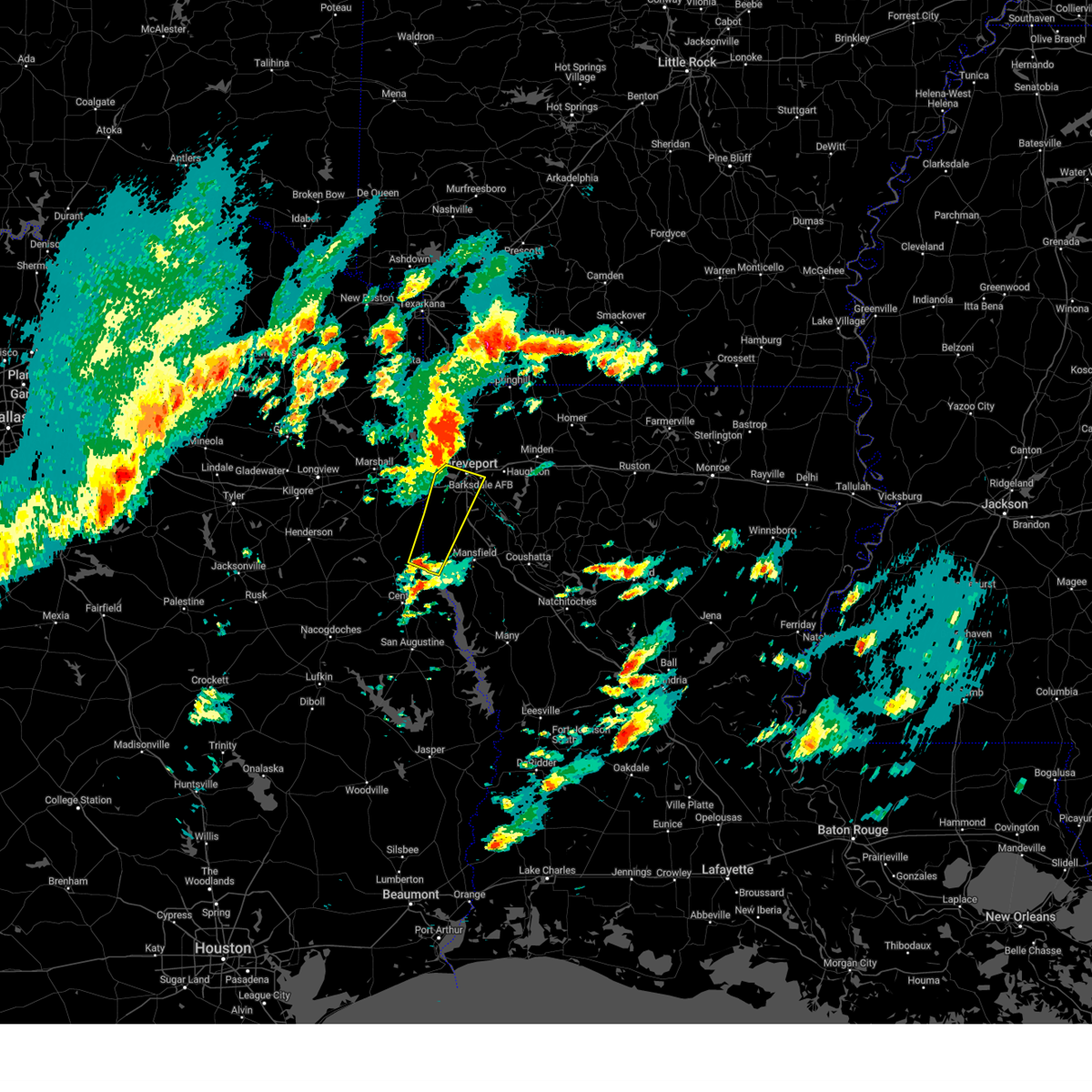 Svrshv the national weather service in shreveport has issued a * severe thunderstorm warning for, southwestern bossier parish in northwestern louisiana, southwestern caddo parish in northwestern louisiana, northwestern de soto parish in northwestern louisiana, southeastern panola county in northeastern texas, * until 830 am cst. * at 741 am cst, a severe thunderstorm was located near logansport, or 19 miles west of mansfield, moving north at 40 mph (radar indicated). Hazards include 60 mph wind gusts and quarter size hail. Hail damage to vehicles is expected. Expect wind damage to roofs, siding, and trees. Svrshv the national weather service in shreveport has issued a * severe thunderstorm warning for, southwestern bossier parish in northwestern louisiana, southwestern caddo parish in northwestern louisiana, northwestern de soto parish in northwestern louisiana, southeastern panola county in northeastern texas, * until 830 am cst. * at 741 am cst, a severe thunderstorm was located near logansport, or 19 miles west of mansfield, moving north at 40 mph (radar indicated). Hazards include 60 mph wind gusts and quarter size hail. Hail damage to vehicles is expected. Expect wind damage to roofs, siding, and trees.
|
| 7/8/2024 5:46 PM CDT |
 the tornado warning has been cancelled and is no longer in effect the tornado warning has been cancelled and is no longer in effect
|
| 7/8/2024 5:40 PM CDT |
 the tornado warning has been cancelled and is no longer in effect the tornado warning has been cancelled and is no longer in effect
|
| 7/8/2024 5:40 PM CDT |
 At 539 pm cdt, a confirmed tornado was located near shreveport, moving northwest at 20 mph (radar confirmed tornado). Hazards include damaging tornado. Flying debris will be dangerous to those caught without shelter. mobile homes will be damaged or destroyed. damage to roofs, windows, and vehicles will occur. tree damage is likely. this tornado will be near, shreveport around 545 pm cdt. Greenwood around 555 pm cdt. At 539 pm cdt, a confirmed tornado was located near shreveport, moving northwest at 20 mph (radar confirmed tornado). Hazards include damaging tornado. Flying debris will be dangerous to those caught without shelter. mobile homes will be damaged or destroyed. damage to roofs, windows, and vehicles will occur. tree damage is likely. this tornado will be near, shreveport around 545 pm cdt. Greenwood around 555 pm cdt.
|
| 7/8/2024 5:27 PM CDT |
 At 527 pm cdt, a confirmed tornado was located 7 miles northeast of stonewall, or 8 miles southeast of shreveport, moving northwest at 20 mph (radar confirmed tornado). Hazards include damaging tornado. Flying debris will be dangerous to those caught without shelter. mobile homes will be damaged or destroyed. damage to roofs, windows, and vehicles will occur. tree damage is likely. this tornado will be near, shreveport around 530 pm cdt. greenwood around 555 pm cdt. Other locations impacted by this tornadic thunderstorm include forbing. At 527 pm cdt, a confirmed tornado was located 7 miles northeast of stonewall, or 8 miles southeast of shreveport, moving northwest at 20 mph (radar confirmed tornado). Hazards include damaging tornado. Flying debris will be dangerous to those caught without shelter. mobile homes will be damaged or destroyed. damage to roofs, windows, and vehicles will occur. tree damage is likely. this tornado will be near, shreveport around 530 pm cdt. greenwood around 555 pm cdt. Other locations impacted by this tornadic thunderstorm include forbing.
|
| 7/8/2024 5:20 PM CDT |
 Torshv the national weather service in shreveport has issued a * tornado warning for, north central de soto parish in northwestern louisiana, southwestern caddo parish in northwestern louisiana, * until 600 pm cdt. * at 520 pm cdt, a severe thunderstorm capable of producing a tornado was located near stonewall, or 11 miles southeast of shreveport, moving northwest at 20 mph (radar indicated rotation). Hazards include tornado. Flying debris will be dangerous to those caught without shelter. mobile homes will be damaged or destroyed. damage to roofs, windows, and vehicles will occur. tree damage is likely. this dangerous storm will be near, shreveport around 525 pm cdt. Other locations impacted by this tornadic thunderstorm include forbing. Torshv the national weather service in shreveport has issued a * tornado warning for, north central de soto parish in northwestern louisiana, southwestern caddo parish in northwestern louisiana, * until 600 pm cdt. * at 520 pm cdt, a severe thunderstorm capable of producing a tornado was located near stonewall, or 11 miles southeast of shreveport, moving northwest at 20 mph (radar indicated rotation). Hazards include tornado. Flying debris will be dangerous to those caught without shelter. mobile homes will be damaged or destroyed. damage to roofs, windows, and vehicles will occur. tree damage is likely. this dangerous storm will be near, shreveport around 525 pm cdt. Other locations impacted by this tornadic thunderstorm include forbing.
|
| 7/8/2024 5:15 PM CDT |
 the tornado warning has been cancelled and is no longer in effect the tornado warning has been cancelled and is no longer in effect
|
| 7/8/2024 5:13 PM CDT |
 At 512 pm cdt, a severe thunderstorm capable of producing a tornado was located 7 miles east of stonewall, or 13 miles southeast of shreveport, moving north at 45 mph (radar indicated rotation). Hazards include tornado. Flying debris will be dangerous to those caught without shelter. mobile homes will be damaged or destroyed. damage to roofs, windows, and vehicles will occur. tree damage is likely. This tornadic thunderstorm will remain over mainly rural areas of north central de soto and south central caddo parishes, including the following locations, frierson. At 512 pm cdt, a severe thunderstorm capable of producing a tornado was located 7 miles east of stonewall, or 13 miles southeast of shreveport, moving north at 45 mph (radar indicated rotation). Hazards include tornado. Flying debris will be dangerous to those caught without shelter. mobile homes will be damaged or destroyed. damage to roofs, windows, and vehicles will occur. tree damage is likely. This tornadic thunderstorm will remain over mainly rural areas of north central de soto and south central caddo parishes, including the following locations, frierson.
|
| 7/8/2024 5:00 PM CDT |
 Torshv the national weather service in shreveport has issued a * tornado warning for, northwestern de soto parish in northwestern louisiana, southwestern caddo parish in northwestern louisiana, * until 545 pm cdt. * at 500 pm cdt, a severe thunderstorm capable of producing a tornado was located over stonewall, or 15 miles northwest of mansfield, moving northwest at 35 mph (radar indicated rotation). Hazards include tornado. Flying debris will be dangerous to those caught without shelter. mobile homes will be damaged or destroyed. damage to roofs, windows, and vehicles will occur. tree damage is likely. this dangerous storm will be near, stonewall around 505 pm cdt. shreveport around 510 pm cdt. Other locations impacted by this tornadic thunderstorm include keithville and spring ridge. Torshv the national weather service in shreveport has issued a * tornado warning for, northwestern de soto parish in northwestern louisiana, southwestern caddo parish in northwestern louisiana, * until 545 pm cdt. * at 500 pm cdt, a severe thunderstorm capable of producing a tornado was located over stonewall, or 15 miles northwest of mansfield, moving northwest at 35 mph (radar indicated rotation). Hazards include tornado. Flying debris will be dangerous to those caught without shelter. mobile homes will be damaged or destroyed. damage to roofs, windows, and vehicles will occur. tree damage is likely. this dangerous storm will be near, stonewall around 505 pm cdt. shreveport around 510 pm cdt. Other locations impacted by this tornadic thunderstorm include keithville and spring ridge.
|
| 7/8/2024 4:55 PM CDT |
 Torshv the national weather service in shreveport has issued a * tornado warning for, central de soto parish in northwestern louisiana, south central caddo parish in northwestern louisiana, * until 545 pm cdt. * at 455 pm cdt, a severe thunderstorm capable of producing a tornado was located near mansfield, moving north at 50 mph (radar indicated rotation). Hazards include tornado. Flying debris will be dangerous to those caught without shelter. mobile homes will be damaged or destroyed. damage to roofs, windows, and vehicles will occur. tree damage is likely. this dangerous storm will be near, shreveport around 510 pm cdt. Other locations impacted by this tornadic thunderstorm include south mansfield, carmel, frierson, and kingston. Torshv the national weather service in shreveport has issued a * tornado warning for, central de soto parish in northwestern louisiana, south central caddo parish in northwestern louisiana, * until 545 pm cdt. * at 455 pm cdt, a severe thunderstorm capable of producing a tornado was located near mansfield, moving north at 50 mph (radar indicated rotation). Hazards include tornado. Flying debris will be dangerous to those caught without shelter. mobile homes will be damaged or destroyed. damage to roofs, windows, and vehicles will occur. tree damage is likely. this dangerous storm will be near, shreveport around 510 pm cdt. Other locations impacted by this tornadic thunderstorm include south mansfield, carmel, frierson, and kingston.
|
| 7/8/2024 4:48 PM CDT |
 At 448 pm cdt, a severe thunderstorm capable of producing a tornado was located over bossier city, moving north at 45 mph (radar indicated rotation). Hazards include tornado. Flying debris will be dangerous to those caught without shelter. mobile homes will be damaged or destroyed. damage to roofs, windows, and vehicles will occur. tree damage is likely. this dangerous storm will be near, bossier city around 455 pm cdt. benton around 500 pm cdt. Other locations impacted by this tornadic thunderstorm include bodcau, ferguson, barksdale air force base, and red chute. At 448 pm cdt, a severe thunderstorm capable of producing a tornado was located over bossier city, moving north at 45 mph (radar indicated rotation). Hazards include tornado. Flying debris will be dangerous to those caught without shelter. mobile homes will be damaged or destroyed. damage to roofs, windows, and vehicles will occur. tree damage is likely. this dangerous storm will be near, bossier city around 455 pm cdt. benton around 500 pm cdt. Other locations impacted by this tornadic thunderstorm include bodcau, ferguson, barksdale air force base, and red chute.
|
| 7/8/2024 4:26 PM CDT |
 Torshv the national weather service in shreveport has issued a * tornado warning for, southeastern caddo parish in northwestern louisiana, southwestern bossier parish in northwestern louisiana, * until 515 pm cdt. * at 426 pm cdt, a severe thunderstorm capable of producing a tornado was located 14 miles south of haughton, or 15 miles southeast of bossier city, moving north at 35 mph (radar indicated rotation). Hazards include tornado. Flying debris will be dangerous to those caught without shelter. mobile homes will be damaged or destroyed. damage to roofs, windows, and vehicles will occur. tree damage is likely. this dangerous storm will be near, bossier city around 435 pm cdt. fosters and eastwood around 450 pm cdt. benton around 505 pm cdt. Other locations impacted by this tornadic thunderstorm include ferguson, caspiana, taylortown, elm grove, robson, bodcau, mc dade, sligo, barksdale air force base, and red chute. Torshv the national weather service in shreveport has issued a * tornado warning for, southeastern caddo parish in northwestern louisiana, southwestern bossier parish in northwestern louisiana, * until 515 pm cdt. * at 426 pm cdt, a severe thunderstorm capable of producing a tornado was located 14 miles south of haughton, or 15 miles southeast of bossier city, moving north at 35 mph (radar indicated rotation). Hazards include tornado. Flying debris will be dangerous to those caught without shelter. mobile homes will be damaged or destroyed. damage to roofs, windows, and vehicles will occur. tree damage is likely. this dangerous storm will be near, bossier city around 435 pm cdt. fosters and eastwood around 450 pm cdt. benton around 505 pm cdt. Other locations impacted by this tornadic thunderstorm include ferguson, caspiana, taylortown, elm grove, robson, bodcau, mc dade, sligo, barksdale air force base, and red chute.
|
| 7/8/2024 4:20 PM CDT |
 the tornado warning has been cancelled and is no longer in effect the tornado warning has been cancelled and is no longer in effect
|
| 7/8/2024 3:56 PM CDT |
 Torshv the national weather service in shreveport has issued a * tornado warning for, northeastern de soto parish in northwestern louisiana, northwestern red river parish in northwestern louisiana, southeastern caddo parish in northwestern louisiana, south central bossier parish in northwestern louisiana, * until 445 pm cdt. * at 356 pm cdt, a severe thunderstorm capable of producing a tornado was located near coushatta, or 16 miles east of mansfield, moving northwest at 35 mph (radar indicated rotation). Hazards include tornado. Flying debris will be dangerous to those caught without shelter. mobile homes will be damaged or destroyed. damage to roofs, windows, and vehicles will occur. tree damage is likely. This tornadic thunderstorm will remain over mainly rural areas of northeastern de soto, northwestern red river, southeastern caddo and south central bossier parishes, including the following locations, ninock, crichton, caspiana, grand bayou, taylortown, elm grove, robson, mc dade, and loggy bayou. Torshv the national weather service in shreveport has issued a * tornado warning for, northeastern de soto parish in northwestern louisiana, northwestern red river parish in northwestern louisiana, southeastern caddo parish in northwestern louisiana, south central bossier parish in northwestern louisiana, * until 445 pm cdt. * at 356 pm cdt, a severe thunderstorm capable of producing a tornado was located near coushatta, or 16 miles east of mansfield, moving northwest at 35 mph (radar indicated rotation). Hazards include tornado. Flying debris will be dangerous to those caught without shelter. mobile homes will be damaged or destroyed. damage to roofs, windows, and vehicles will occur. tree damage is likely. This tornadic thunderstorm will remain over mainly rural areas of northeastern de soto, northwestern red river, southeastern caddo and south central bossier parishes, including the following locations, ninock, crichton, caspiana, grand bayou, taylortown, elm grove, robson, mc dade, and loggy bayou.
|
| 7/8/2024 3:20 PM CDT |
 At 320 pm cdt, a severe thunderstorm capable of producing a tornado was located over shreveport, moving north at 35 mph (radar indicated rotation). Hazards include tornado. Flying debris will be dangerous to those caught without shelter. mobile homes will be damaged or destroyed. damage to roofs, windows, and vehicles will occur. tree damage is likely. this dangerous storm will be near, shreveport and blanchard around 325 pm cdt. Other locations impacted by this tornadic thunderstorm include cross lake and barksdale air force base. At 320 pm cdt, a severe thunderstorm capable of producing a tornado was located over shreveport, moving north at 35 mph (radar indicated rotation). Hazards include tornado. Flying debris will be dangerous to those caught without shelter. mobile homes will be damaged or destroyed. damage to roofs, windows, and vehicles will occur. tree damage is likely. this dangerous storm will be near, shreveport and blanchard around 325 pm cdt. Other locations impacted by this tornadic thunderstorm include cross lake and barksdale air force base.
|
| 7/8/2024 3:20 PM CDT |
 the tornado warning has been cancelled and is no longer in effect the tornado warning has been cancelled and is no longer in effect
|
| 7/8/2024 2:55 PM CDT |
 Torshv the national weather service in shreveport has issued a * tornado warning for, north central de soto parish in northwestern louisiana, southwestern caddo parish in northwestern louisiana, southwestern bossier parish in northwestern louisiana, * until 330 pm cdt. * at 254 pm cdt, a severe thunderstorm capable of producing a tornado was located near stonewall, or 13 miles south of shreveport, moving north at 35 mph (radar indicated rotation). Hazards include tornado. Flying debris will be dangerous to those caught without shelter. mobile homes will be damaged or destroyed. damage to roofs, windows, and vehicles will occur. tree damage is likely. this dangerous storm will be near, shreveport around 300 pm cdt. bossier city around 315 pm cdt. Other locations impacted by this tornadic thunderstorm include frierson, robson, cross lake, and forbing. Torshv the national weather service in shreveport has issued a * tornado warning for, north central de soto parish in northwestern louisiana, southwestern caddo parish in northwestern louisiana, southwestern bossier parish in northwestern louisiana, * until 330 pm cdt. * at 254 pm cdt, a severe thunderstorm capable of producing a tornado was located near stonewall, or 13 miles south of shreveport, moving north at 35 mph (radar indicated rotation). Hazards include tornado. Flying debris will be dangerous to those caught without shelter. mobile homes will be damaged or destroyed. damage to roofs, windows, and vehicles will occur. tree damage is likely. this dangerous storm will be near, shreveport around 300 pm cdt. bossier city around 315 pm cdt. Other locations impacted by this tornadic thunderstorm include frierson, robson, cross lake, and forbing.
|
| 7/8/2024 2:42 PM CDT |
 the tornado warning has been cancelled and is no longer in effect the tornado warning has been cancelled and is no longer in effect
|
| 7/8/2024 2:27 PM CDT |
 At 226 pm cdt, a confirmed tornado was located 11 miles west of ringgold, or 20 miles southeast of bossier city, moving northwest at 35 mph (radar confirmed tornado). Hazards include damaging tornado. Flying debris will be dangerous to those caught without shelter. mobile homes will be damaged or destroyed. damage to roofs, windows, and vehicles will occur. tree damage is likely. Locations impacted include, ninock, curtis, caspiana, taylortown, elm grove, robson, mc dade, sligo, and koran. At 226 pm cdt, a confirmed tornado was located 11 miles west of ringgold, or 20 miles southeast of bossier city, moving northwest at 35 mph (radar confirmed tornado). Hazards include damaging tornado. Flying debris will be dangerous to those caught without shelter. mobile homes will be damaged or destroyed. damage to roofs, windows, and vehicles will occur. tree damage is likely. Locations impacted include, ninock, curtis, caspiana, taylortown, elm grove, robson, mc dade, sligo, and koran.
|
| 7/8/2024 2:27 PM CDT |
 the tornado warning has been cancelled and is no longer in effect the tornado warning has been cancelled and is no longer in effect
|
| 7/8/2024 2:26 PM CDT |
 Torshv the national weather service in shreveport has issued a * tornado warning for, northern de soto parish in northwestern louisiana, northwestern red river parish in northwestern louisiana, southwestern caddo parish in northwestern louisiana, * until 315 pm cdt. * at 225 pm cdt, a severe thunderstorm capable of producing a tornado was located near stonewall, or 12 miles northwest of mansfield, moving northwest at 30 mph (radar indicated rotation). Hazards include tornado. Flying debris will be dangerous to those caught without shelter. mobile homes will be damaged or destroyed. damage to roofs, windows, and vehicles will occur. tree damage is likely. this dangerous storm will be near, stonewall around 230 pm cdt. Other locations impacted by this tornadic thunderstorm include gloster, carmel, frierson, kickapoo, keithville, spring ridge, kingston, and reeds store. Torshv the national weather service in shreveport has issued a * tornado warning for, northern de soto parish in northwestern louisiana, northwestern red river parish in northwestern louisiana, southwestern caddo parish in northwestern louisiana, * until 315 pm cdt. * at 225 pm cdt, a severe thunderstorm capable of producing a tornado was located near stonewall, or 12 miles northwest of mansfield, moving northwest at 30 mph (radar indicated rotation). Hazards include tornado. Flying debris will be dangerous to those caught without shelter. mobile homes will be damaged or destroyed. damage to roofs, windows, and vehicles will occur. tree damage is likely. this dangerous storm will be near, stonewall around 230 pm cdt. Other locations impacted by this tornadic thunderstorm include gloster, carmel, frierson, kickapoo, keithville, spring ridge, kingston, and reeds store.
|
| 7/8/2024 2:11 PM CDT |
 Torshv the national weather service in shreveport has issued a * tornado warning for, north central red river parish in northwestern louisiana, southeastern caddo parish in northwestern louisiana, west central bienville parish in northwestern louisiana, southeastern bossier parish in northwestern louisiana, * until 300 pm cdt. * at 211 pm cdt, a severe thunderstorm capable of producing a tornado was located 9 miles northwest of coushatta, or 18 miles northeast of mansfield, moving northwest at 35 mph (radar indicated rotation). Hazards include tornado. Flying debris will be dangerous to those caught without shelter. mobile homes will be damaged or destroyed. damage to roofs, windows, and vehicles will occur. tree damage is likely. This tornadic thunderstorm will remain over mainly rural areas of north central red river, southeastern caddo, west central bienville and southeastern bossier parishes, including the following locations, ninock, crichton, curtis, caspiana, taylortown, elm grove, robson, mc dade, sligo, and loggy bayou. Torshv the national weather service in shreveport has issued a * tornado warning for, north central red river parish in northwestern louisiana, southeastern caddo parish in northwestern louisiana, west central bienville parish in northwestern louisiana, southeastern bossier parish in northwestern louisiana, * until 300 pm cdt. * at 211 pm cdt, a severe thunderstorm capable of producing a tornado was located 9 miles northwest of coushatta, or 18 miles northeast of mansfield, moving northwest at 35 mph (radar indicated rotation). Hazards include tornado. Flying debris will be dangerous to those caught without shelter. mobile homes will be damaged or destroyed. damage to roofs, windows, and vehicles will occur. tree damage is likely. This tornadic thunderstorm will remain over mainly rural areas of north central red river, southeastern caddo, west central bienville and southeastern bossier parishes, including the following locations, ninock, crichton, curtis, caspiana, taylortown, elm grove, robson, mc dade, sligo, and loggy bayou.
|
| 6/26/2024 1:19 PM CDT | Shv regional airport reported a gust of 63 mp in caddo county LA, 1.4 miles NE of Shreveport, LA |
| 6/26/2024 1:11 PM CDT |
 At 111 pm cdt, severe thunderstorms were located along a line extending from near benton to near tatum to near lindale, moving southeast at 45 mph (radar indicated). Hazards include 60 mph wind gusts. Expect damage to roofs, siding, and trees. Locations impacted include, shreveport, tyler, longview, bossier city, marshall, henderson, kilgore, whitehouse, carthage, white oak, gladewater, mineola, lindale, hallsville, haughton, greenwood, blanchard, overton, waskom, and benton. At 111 pm cdt, severe thunderstorms were located along a line extending from near benton to near tatum to near lindale, moving southeast at 45 mph (radar indicated). Hazards include 60 mph wind gusts. Expect damage to roofs, siding, and trees. Locations impacted include, shreveport, tyler, longview, bossier city, marshall, henderson, kilgore, whitehouse, carthage, white oak, gladewater, mineola, lindale, hallsville, haughton, greenwood, blanchard, overton, waskom, and benton.
|
| 6/26/2024 12:42 PM CDT |
 Svrshv the national weather service in shreveport has issued a * severe thunderstorm warning for, southwestern webster parish in northwestern louisiana, northwestern de soto parish in northwestern louisiana, caddo parish in northwestern louisiana, central bossier parish in northwestern louisiana, smith county in northeastern texas, southern harrison county in northeastern texas, panola county in northeastern texas, northern rusk county in northeastern texas, southeastern wood county in northeastern texas, southwestern upshur county in northeastern texas, gregg county in northeastern texas, * until 145 pm cdt. * at 1241 pm cdt, severe thunderstorms were located along a line extending from near hosston to harleton to near quitman, moving south at 45 mph (radar indicated). Hazards include 70 mph wind gusts and penny size hail. Expect considerable tree damage. Damage is likely to mobile homes, roofs, and outbuildings. Svrshv the national weather service in shreveport has issued a * severe thunderstorm warning for, southwestern webster parish in northwestern louisiana, northwestern de soto parish in northwestern louisiana, caddo parish in northwestern louisiana, central bossier parish in northwestern louisiana, smith county in northeastern texas, southern harrison county in northeastern texas, panola county in northeastern texas, northern rusk county in northeastern texas, southeastern wood county in northeastern texas, southwestern upshur county in northeastern texas, gregg county in northeastern texas, * until 145 pm cdt. * at 1241 pm cdt, severe thunderstorms were located along a line extending from near hosston to harleton to near quitman, moving south at 45 mph (radar indicated). Hazards include 70 mph wind gusts and penny size hail. Expect considerable tree damage. Damage is likely to mobile homes, roofs, and outbuildings.
|
| 6/5/2024 3:42 AM CDT |
 At 341 am cdt, severe thunderstorms were located along a line extending from near buckner to near vivian, moving east at 50 mph (radar indicated). Hazards include 60 mph wind gusts and penny size hail. Expect damage to roofs, siding, and trees. Locations impacted include, magnolia, springhill, vivian, blanchard, benton, cullen, plain dealing, oil city, mooringsport, bradley, taylor, hosston, rodessa, belcher, ida, gilliam, bussey, smithland, mcleod, and canfield. At 341 am cdt, severe thunderstorms were located along a line extending from near buckner to near vivian, moving east at 50 mph (radar indicated). Hazards include 60 mph wind gusts and penny size hail. Expect damage to roofs, siding, and trees. Locations impacted include, magnolia, springhill, vivian, blanchard, benton, cullen, plain dealing, oil city, mooringsport, bradley, taylor, hosston, rodessa, belcher, ida, gilliam, bussey, smithland, mcleod, and canfield.
|
| 6/5/2024 3:16 AM CDT |
 Svrshv the national weather service in shreveport has issued a * severe thunderstorm warning for, miller county in southwestern arkansas, lafayette county in southwestern arkansas, northwestern columbia county in southwestern arkansas, northwestern webster parish in northwestern louisiana, northwestern caddo parish in northwestern louisiana, northwestern bossier parish in northwestern louisiana, marion county in northeastern texas, southeastern cass county in northeastern texas, northeastern harrison county in northeastern texas, * until 400 am cdt. * at 315 am cdt, severe thunderstorms were located along a line extending from 7 miles northeast of genoa to near berea, moving east at 50 mph (radar indicated). Hazards include 60 mph wind gusts and penny size hail. expect damage to roofs, siding, and trees Svrshv the national weather service in shreveport has issued a * severe thunderstorm warning for, miller county in southwestern arkansas, lafayette county in southwestern arkansas, northwestern columbia county in southwestern arkansas, northwestern webster parish in northwestern louisiana, northwestern caddo parish in northwestern louisiana, northwestern bossier parish in northwestern louisiana, marion county in northeastern texas, southeastern cass county in northeastern texas, northeastern harrison county in northeastern texas, * until 400 am cdt. * at 315 am cdt, severe thunderstorms were located along a line extending from 7 miles northeast of genoa to near berea, moving east at 50 mph (radar indicated). Hazards include 60 mph wind gusts and penny size hail. expect damage to roofs, siding, and trees
|
| 6/3/2024 10:15 PM CDT | A tree was downed across ellerbe roa in caddo county LA, 8.5 miles NW of Shreveport, LA |
| 6/3/2024 10:13 PM CDT |
 the severe thunderstorm warning has been cancelled and is no longer in effect the severe thunderstorm warning has been cancelled and is no longer in effect
|
| 6/3/2024 10:13 PM CDT |
 At 1013 pm cdt, severe thunderstorms were located along a line extending from 7 miles southeast of bossier city to 8 miles southeast of stonewall to near mansfield to near shelbyville, moving east at 50 mph (radar indicated. numerous trees and power lines have been downed throughout panola county from these storms). Hazards include 70 mph wind gusts. Expect considerable tree damage. damage is likely to mobile homes, roofs, and outbuildings. Locations impacted include, shreveport, bossier city, center, mansfield, haughton, stonewall, logansport, ringgold, joaquin, converse, heflin, fosters, shelbyville, oak grove, pleasant hill, huxley, south mansfield, hall summit, keachi, and noble. At 1013 pm cdt, severe thunderstorms were located along a line extending from 7 miles southeast of bossier city to 8 miles southeast of stonewall to near mansfield to near shelbyville, moving east at 50 mph (radar indicated. numerous trees and power lines have been downed throughout panola county from these storms). Hazards include 70 mph wind gusts. Expect considerable tree damage. damage is likely to mobile homes, roofs, and outbuildings. Locations impacted include, shreveport, bossier city, center, mansfield, haughton, stonewall, logansport, ringgold, joaquin, converse, heflin, fosters, shelbyville, oak grove, pleasant hill, huxley, south mansfield, hall summit, keachi, and noble.
|
| 6/3/2024 9:39 PM CDT |
 Svrshv the national weather service in shreveport has issued a * severe thunderstorm warning for, south central webster parish in northwestern louisiana, de soto parish in northwestern louisiana, northwestern red river parish in northwestern louisiana, southern caddo parish in northwestern louisiana, southwestern bienville parish in northwestern louisiana, southern bossier parish in northwestern louisiana, northwestern sabine parish in northwestern louisiana, southeastern harrison county in northeastern texas, eastern panola county in northeastern texas, northern shelby county in eastern texas, * until 1045 pm cdt. * at 939 pm cdt, severe thunderstorms were located along a line extending from near waskom to near deberry to 6 miles north of joaquin to near timpson, moving east at 50 mph (radar indicated. numerous trees and power lines have been downed from these storms across rusk and panola counties). Hazards include 70 mph wind gusts. Expect considerable tree damage. Damage is likely to mobile homes, roofs, and outbuildings. Svrshv the national weather service in shreveport has issued a * severe thunderstorm warning for, south central webster parish in northwestern louisiana, de soto parish in northwestern louisiana, northwestern red river parish in northwestern louisiana, southern caddo parish in northwestern louisiana, southwestern bienville parish in northwestern louisiana, southern bossier parish in northwestern louisiana, northwestern sabine parish in northwestern louisiana, southeastern harrison county in northeastern texas, eastern panola county in northeastern texas, northern shelby county in eastern texas, * until 1045 pm cdt. * at 939 pm cdt, severe thunderstorms were located along a line extending from near waskom to near deberry to 6 miles north of joaquin to near timpson, moving east at 50 mph (radar indicated. numerous trees and power lines have been downed from these storms across rusk and panola counties). Hazards include 70 mph wind gusts. Expect considerable tree damage. Damage is likely to mobile homes, roofs, and outbuildings.
|
| 6/3/2024 9:02 PM CDT |
 Svrshv the national weather service in shreveport has issued a * severe thunderstorm warning for, west central caddo parish in northwestern louisiana, harrison county in northeastern texas, panola county in northeastern texas, rusk county in northeastern texas, northern nacogdoches county in eastern texas, northwestern shelby county in eastern texas, southeastern gregg county in northeastern texas, northeastern cherokee county in northeastern texas, * until 1000 pm cdt. * at 902 pm cdt, severe thunderstorms were located along a line extending from 6 miles southeast of harleton to near pinehill to near new salem, moving east at 35 mph (radar indicated. winds speeds in excess of 70 mph have downed numerous trees across henderson in rusk county). Hazards include 70 mph wind gusts. Expect considerable tree damage. Damage is likely to mobile homes, roofs, and outbuildings. Svrshv the national weather service in shreveport has issued a * severe thunderstorm warning for, west central caddo parish in northwestern louisiana, harrison county in northeastern texas, panola county in northeastern texas, rusk county in northeastern texas, northern nacogdoches county in eastern texas, northwestern shelby county in eastern texas, southeastern gregg county in northeastern texas, northeastern cherokee county in northeastern texas, * until 1000 pm cdt. * at 902 pm cdt, severe thunderstorms were located along a line extending from 6 miles southeast of harleton to near pinehill to near new salem, moving east at 35 mph (radar indicated. winds speeds in excess of 70 mph have downed numerous trees across henderson in rusk county). Hazards include 70 mph wind gusts. Expect considerable tree damage. Damage is likely to mobile homes, roofs, and outbuildings.
|
| 6/3/2024 7:20 PM CDT |
 the severe thunderstorm warning has been cancelled and is no longer in effect the severe thunderstorm warning has been cancelled and is no longer in effect
|
| 6/3/2024 7:20 PM CDT |
 At 720 pm cdt, severe thunderstorms were located along a line extending from near tatum to near deberry to near shreveport to near dubberly, moving south at 15 mph (radar indicated). Hazards include 60 mph wind gusts and penny size hail. Expect damage to roofs, siding, and trees. Locations impacted include, shreveport, bossier city, marshall, minden, carthage, hallsville, haughton, greenwood, blanchard, waskom, stonewall, tatum, sibley, beckville, doyline, dixie inn, dubberly, heflin, deberry, and elysian fields. At 720 pm cdt, severe thunderstorms were located along a line extending from near tatum to near deberry to near shreveport to near dubberly, moving south at 15 mph (radar indicated). Hazards include 60 mph wind gusts and penny size hail. Expect damage to roofs, siding, and trees. Locations impacted include, shreveport, bossier city, marshall, minden, carthage, hallsville, haughton, greenwood, blanchard, waskom, stonewall, tatum, sibley, beckville, doyline, dixie inn, dubberly, heflin, deberry, and elysian fields.
|
| 6/3/2024 6:26 PM CDT |
 Svrshv the national weather service in shreveport has issued a * severe thunderstorm warning for, webster parish in northwestern louisiana, northwestern de soto parish in northwestern louisiana, caddo parish in northwestern louisiana, bossier parish in northwestern louisiana, southeastern marion county in northeastern texas, harrison county in northeastern texas, panola county in northeastern texas, northeastern rusk county in northeastern texas, * until 730 pm cdt. * at 626 pm cdt, severe thunderstorms were located along a line extending from near harleton to 7 miles west of blanchard to near sarepta, moving south at 30 mph (radar indicated. numerous trees and power lines have been downed with these storms across northeast texas and southwest arkansas). Hazards include 60 mph wind gusts and quarter size hail. Hail damage to vehicles is expected. Expect wind damage to roofs, siding, and trees. Svrshv the national weather service in shreveport has issued a * severe thunderstorm warning for, webster parish in northwestern louisiana, northwestern de soto parish in northwestern louisiana, caddo parish in northwestern louisiana, bossier parish in northwestern louisiana, southeastern marion county in northeastern texas, harrison county in northeastern texas, panola county in northeastern texas, northeastern rusk county in northeastern texas, * until 730 pm cdt. * at 626 pm cdt, severe thunderstorms were located along a line extending from near harleton to 7 miles west of blanchard to near sarepta, moving south at 30 mph (radar indicated. numerous trees and power lines have been downed with these storms across northeast texas and southwest arkansas). Hazards include 60 mph wind gusts and quarter size hail. Hail damage to vehicles is expected. Expect wind damage to roofs, siding, and trees.
|
| 6/2/2024 9:51 PM CDT |
 At 951 pm cdt, severe thunderstorms were located along a line extending from near shongaloo to dixie inn to 12 miles west of ringgold to 14 miles northwest of coushatta to 7 miles east of mansfield to 11 miles north of converse, moving east at 45 mph (radar indicated). Hazards include 70 mph wind gusts. Expect considerable tree damage. damage is likely to mobile homes, roofs, and outbuildings. Locations impacted include, shreveport, bossier city, minden, springhill, mansfield, homer, haughton, arcadia, haynesville, coushatta, stonewall, ringgold, sibley, cullen, cotton valley, gibsland, sarepta, doyline, dixie inn, and dubberly. At 951 pm cdt, severe thunderstorms were located along a line extending from near shongaloo to dixie inn to 12 miles west of ringgold to 14 miles northwest of coushatta to 7 miles east of mansfield to 11 miles north of converse, moving east at 45 mph (radar indicated). Hazards include 70 mph wind gusts. Expect considerable tree damage. damage is likely to mobile homes, roofs, and outbuildings. Locations impacted include, shreveport, bossier city, minden, springhill, mansfield, homer, haughton, arcadia, haynesville, coushatta, stonewall, ringgold, sibley, cullen, cotton valley, gibsland, sarepta, doyline, dixie inn, and dubberly.
|
| 6/2/2024 9:30 PM CDT |
 Svrshv the national weather service in shreveport has issued a * severe thunderstorm warning for, webster parish in northwestern louisiana, de soto parish in northwestern louisiana, red river parish in northwestern louisiana, southern caddo parish in northwestern louisiana, claiborne parish in northwestern louisiana, bienville parish in northwestern louisiana, bossier parish in northwestern louisiana, * until 1030 pm cdt. * at 929 pm cdt, severe thunderstorms were located along a line extending from near cullen to eastwood to 7 miles south of shreveport to near stonewall to near mansfield, moving east at 35 mph (radar indicated). Hazards include 60 mph wind gusts. expect damage to roofs, siding, and trees Svrshv the national weather service in shreveport has issued a * severe thunderstorm warning for, webster parish in northwestern louisiana, de soto parish in northwestern louisiana, red river parish in northwestern louisiana, southern caddo parish in northwestern louisiana, claiborne parish in northwestern louisiana, bienville parish in northwestern louisiana, bossier parish in northwestern louisiana, * until 1030 pm cdt. * at 929 pm cdt, severe thunderstorms were located along a line extending from near cullen to eastwood to 7 miles south of shreveport to near stonewall to near mansfield, moving east at 35 mph (radar indicated). Hazards include 60 mph wind gusts. expect damage to roofs, siding, and trees
|
| 6/2/2024 8:38 PM CDT |
 Svrshv the national weather service in shreveport has issued a * severe thunderstorm warning for, north central de soto parish in northwestern louisiana, caddo parish in northwestern louisiana, bossier parish in northwestern louisiana, eastern marion county in northeastern texas, southeastern cass county in northeastern texas, harrison county in northeastern texas, northeastern panola county in northeastern texas, * until 930 pm cdt. * at 838 pm cdt, severe thunderstorms were located along a line extending from rodessa to near karnack to near marshall, moving east at 40 mph (radar indicated. multiple trees and power lines have been downed with these storms across northeast texas). Hazards include 60 mph wind gusts and penny size hail. expect damage to roofs, siding, and trees Svrshv the national weather service in shreveport has issued a * severe thunderstorm warning for, north central de soto parish in northwestern louisiana, caddo parish in northwestern louisiana, bossier parish in northwestern louisiana, eastern marion county in northeastern texas, southeastern cass county in northeastern texas, harrison county in northeastern texas, northeastern panola county in northeastern texas, * until 930 pm cdt. * at 838 pm cdt, severe thunderstorms were located along a line extending from rodessa to near karnack to near marshall, moving east at 40 mph (radar indicated. multiple trees and power lines have been downed with these storms across northeast texas). Hazards include 60 mph wind gusts and penny size hail. expect damage to roofs, siding, and trees
|
| 6/1/2024 6:29 PM CDT |
 Svrshv the national weather service in shreveport has issued a * severe thunderstorm warning for, de soto parish in northwestern louisiana, red river parish in northwestern louisiana, southeastern caddo parish in northwestern louisiana, southwestern bienville parish in northwestern louisiana, southeastern bossier parish in northwestern louisiana, northwestern sabine parish in northwestern louisiana, northeastern shelby county in eastern texas, * until 715 pm cdt. * at 629 pm cdt, severe thunderstorms were located along a line extending from near shreveport to 6 miles northeast of stonewall to near mansfield to 8 miles southeast of logansport, moving east at 35 mph (radar indicated). Hazards include 60 mph wind gusts and quarter size hail. Hail damage to vehicles is expected. Expect wind damage to roofs, siding, and trees. Svrshv the national weather service in shreveport has issued a * severe thunderstorm warning for, de soto parish in northwestern louisiana, red river parish in northwestern louisiana, southeastern caddo parish in northwestern louisiana, southwestern bienville parish in northwestern louisiana, southeastern bossier parish in northwestern louisiana, northwestern sabine parish in northwestern louisiana, northeastern shelby county in eastern texas, * until 715 pm cdt. * at 629 pm cdt, severe thunderstorms were located along a line extending from near shreveport to 6 miles northeast of stonewall to near mansfield to 8 miles southeast of logansport, moving east at 35 mph (radar indicated). Hazards include 60 mph wind gusts and quarter size hail. Hail damage to vehicles is expected. Expect wind damage to roofs, siding, and trees.
|
| 6/1/2024 5:56 PM CDT |
 Svrshv the national weather service in shreveport has issued a * severe thunderstorm warning for, northwestern de soto parish in northwestern louisiana, southwestern caddo parish in northwestern louisiana, eastern panola county in northeastern texas, * until 645 pm cdt. * at 555 pm cdt, severe thunderstorms were located along a line extending from 6 miles southwest of greenwood to 8 miles east of deberry to 13 miles north of logansport to 8 miles northwest of joaquin, moving east at 35 mph (radar indicated). Hazards include 60 mph wind gusts and quarter size hail. Hail damage to vehicles is expected. Expect wind damage to roofs, siding, and trees. Svrshv the national weather service in shreveport has issued a * severe thunderstorm warning for, northwestern de soto parish in northwestern louisiana, southwestern caddo parish in northwestern louisiana, eastern panola county in northeastern texas, * until 645 pm cdt. * at 555 pm cdt, severe thunderstorms were located along a line extending from 6 miles southwest of greenwood to 8 miles east of deberry to 13 miles north of logansport to 8 miles northwest of joaquin, moving east at 35 mph (radar indicated). Hazards include 60 mph wind gusts and quarter size hail. Hail damage to vehicles is expected. Expect wind damage to roofs, siding, and trees.
|
| 5/30/2024 8:35 PM CDT |
 At 835 pm cdt, severe thunderstorms were located along a line extending from near shreveport to 6 miles south of haughton, moving northeast at 30 mph (radar indicated). Hazards include 60 mph wind gusts. Expect damage to roofs, siding, and trees. Locations impacted include, shreveport, bossier city, stonewall, frierson, curtis, caspiana, lake bistineau south, taylortown, elm grove, koran, keithville, robson, mc dade, forbing, and sligo. At 835 pm cdt, severe thunderstorms were located along a line extending from near shreveport to 6 miles south of haughton, moving northeast at 30 mph (radar indicated). Hazards include 60 mph wind gusts. Expect damage to roofs, siding, and trees. Locations impacted include, shreveport, bossier city, stonewall, frierson, curtis, caspiana, lake bistineau south, taylortown, elm grove, koran, keithville, robson, mc dade, forbing, and sligo.
|
| 5/30/2024 8:13 PM CDT |
 Svrshv the national weather service in shreveport has issued a * severe thunderstorm warning for, northwestern de soto parish in northwestern louisiana, southern caddo parish in northwestern louisiana, west central bienville parish in northwestern louisiana, southeastern bossier parish in northwestern louisiana, * until 900 pm cdt. * at 812 pm cdt, severe thunderstorms were located along a line extending from 6 miles northwest of stonewall to 15 miles southeast of shreveport, moving northeast at 30 mph (radar indicated). Hazards include 60 mph wind gusts. expect damage to roofs, siding, and trees Svrshv the national weather service in shreveport has issued a * severe thunderstorm warning for, northwestern de soto parish in northwestern louisiana, southern caddo parish in northwestern louisiana, west central bienville parish in northwestern louisiana, southeastern bossier parish in northwestern louisiana, * until 900 pm cdt. * at 812 pm cdt, severe thunderstorms were located along a line extending from 6 miles northwest of stonewall to 15 miles southeast of shreveport, moving northeast at 30 mph (radar indicated). Hazards include 60 mph wind gusts. expect damage to roofs, siding, and trees
|
| 5/30/2024 7:59 PM CDT |
 At 759 pm cdt, a confirmed tornado was located 7 miles east of stonewall, or 15 miles southeast of shreveport, moving north at 30 mph (radar confirmed tornado). Hazards include damaging tornado. Flying debris will be dangerous to those caught without shelter. mobile homes will be damaged or destroyed. damage to roofs, windows, and vehicles will occur. tree damage is likely. this tornado will be near, shreveport around 805 pm cdt. Other locations impacted by this tornadic thunderstorm include taylortown, elm grove, frierson, robson, and forbing. At 759 pm cdt, a confirmed tornado was located 7 miles east of stonewall, or 15 miles southeast of shreveport, moving north at 30 mph (radar confirmed tornado). Hazards include damaging tornado. Flying debris will be dangerous to those caught without shelter. mobile homes will be damaged or destroyed. damage to roofs, windows, and vehicles will occur. tree damage is likely. this tornado will be near, shreveport around 805 pm cdt. Other locations impacted by this tornadic thunderstorm include taylortown, elm grove, frierson, robson, and forbing.
|
| 5/30/2024 7:55 PM CDT |
 Torshv the national weather service in shreveport has issued a * tornado warning for, north central de soto parish in northwestern louisiana, southeastern caddo parish in northwestern louisiana, south central bossier parish in northwestern louisiana, * until 830 pm cdt. * at 754 pm cdt, a severe thunderstorm capable of producing a tornado was located 7 miles southeast of stonewall, or 13 miles north of mansfield, moving north at 35 mph (radar indicated rotation). Hazards include tornado. Flying debris will be dangerous to those caught without shelter. mobile homes will be damaged or destroyed. damage to roofs, windows, and vehicles will occur. tree damage is likely. this dangerous storm will be near, shreveport around 805 pm cdt. Other locations impacted by this tornadic thunderstorm include taylortown, elm grove, frierson, robson, and forbing. Torshv the national weather service in shreveport has issued a * tornado warning for, north central de soto parish in northwestern louisiana, southeastern caddo parish in northwestern louisiana, south central bossier parish in northwestern louisiana, * until 830 pm cdt. * at 754 pm cdt, a severe thunderstorm capable of producing a tornado was located 7 miles southeast of stonewall, or 13 miles north of mansfield, moving north at 35 mph (radar indicated rotation). Hazards include tornado. Flying debris will be dangerous to those caught without shelter. mobile homes will be damaged or destroyed. damage to roofs, windows, and vehicles will occur. tree damage is likely. this dangerous storm will be near, shreveport around 805 pm cdt. Other locations impacted by this tornadic thunderstorm include taylortown, elm grove, frierson, robson, and forbing.
|
| 5/30/2024 7:23 PM CDT |
 Svrshv the national weather service in shreveport has issued a * severe thunderstorm warning for, northwestern de soto parish in northwestern louisiana, southwestern caddo parish in northwestern louisiana, southwestern bossier parish in northwestern louisiana, southeastern harrison county in northeastern texas, eastern panola county in northeastern texas, * until 815 pm cdt. * at 723 pm cdt, severe thunderstorms were located along a line extending from 7 miles north of elysian fields to 11 miles southeast of deberry to logansport, moving east at 35 mph (radar indicated). Hazards include 60 mph wind gusts and penny size hail. expect damage to roofs, siding, and trees Svrshv the national weather service in shreveport has issued a * severe thunderstorm warning for, northwestern de soto parish in northwestern louisiana, southwestern caddo parish in northwestern louisiana, southwestern bossier parish in northwestern louisiana, southeastern harrison county in northeastern texas, eastern panola county in northeastern texas, * until 815 pm cdt. * at 723 pm cdt, severe thunderstorms were located along a line extending from 7 miles north of elysian fields to 11 miles southeast of deberry to logansport, moving east at 35 mph (radar indicated). Hazards include 60 mph wind gusts and penny size hail. expect damage to roofs, siding, and trees
|
| 5/30/2024 7:03 PM CDT |
 At 703 pm cdt, severe thunderstorms were located along a line extending from waskom to 11 miles north of joaquin to near center, moving east at 45 mph (radar indicated). Hazards include 70 mph wind gusts and penny size hail. Expect considerable tree damage. damage is likely to mobile homes, roofs, and outbuildings. Locations impacted include, shreveport, marshall, carthage, center, greenwood, waskom, logansport, tenaha, timpson, garrison, beckville, joaquin, deberry, elysian fields, shelbyville, scottsville, gary city, keachi, longstreet, and stanley. At 703 pm cdt, severe thunderstorms were located along a line extending from waskom to 11 miles north of joaquin to near center, moving east at 45 mph (radar indicated). Hazards include 70 mph wind gusts and penny size hail. Expect considerable tree damage. damage is likely to mobile homes, roofs, and outbuildings. Locations impacted include, shreveport, marshall, carthage, center, greenwood, waskom, logansport, tenaha, timpson, garrison, beckville, joaquin, deberry, elysian fields, shelbyville, scottsville, gary city, keachi, longstreet, and stanley.
|
| 5/30/2024 6:37 PM CDT |
 Svrshv the national weather service in shreveport has issued a * severe thunderstorm warning for, western de soto parish in northwestern louisiana, southwestern caddo parish in northwestern louisiana, southeastern harrison county in northeastern texas, panola county in northeastern texas, southeastern rusk county in northeastern texas, northeastern nacogdoches county in eastern texas, shelby county in eastern texas, * until 730 pm cdt. * at 637 pm cdt, severe thunderstorms were located along a line extending from marshall to near carthage to near garrison, moving east at 45 mph (radar indicated). Hazards include 60 mph wind gusts and penny size hail. expect damage to roofs, siding, and trees Svrshv the national weather service in shreveport has issued a * severe thunderstorm warning for, western de soto parish in northwestern louisiana, southwestern caddo parish in northwestern louisiana, southeastern harrison county in northeastern texas, panola county in northeastern texas, southeastern rusk county in northeastern texas, northeastern nacogdoches county in eastern texas, shelby county in eastern texas, * until 730 pm cdt. * at 637 pm cdt, severe thunderstorms were located along a line extending from marshall to near carthage to near garrison, moving east at 45 mph (radar indicated). Hazards include 60 mph wind gusts and penny size hail. expect damage to roofs, siding, and trees
|
| 5/22/2024 9:25 PM CDT |
 the severe thunderstorm warning has been cancelled and is no longer in effect the severe thunderstorm warning has been cancelled and is no longer in effect
|
| 5/22/2024 9:06 PM CDT |
 At 906 pm cdt, a severe thunderstorm was located 11 miles east of stonewall, or 15 miles southeast of shreveport, moving east at 20 mph (radar indicated). Hazards include 60 mph wind gusts and quarter size hail. Hail damage to vehicles is expected. expect wind damage to roofs, siding, and trees. Locations impacted include, shreveport, frierson, caspiana, taylortown, elm grove, robson, and mc dade. At 906 pm cdt, a severe thunderstorm was located 11 miles east of stonewall, or 15 miles southeast of shreveport, moving east at 20 mph (radar indicated). Hazards include 60 mph wind gusts and quarter size hail. Hail damage to vehicles is expected. expect wind damage to roofs, siding, and trees. Locations impacted include, shreveport, frierson, caspiana, taylortown, elm grove, robson, and mc dade.
|
| 5/22/2024 8:40 PM CDT |
 Svrshv the national weather service in shreveport has issued a * severe thunderstorm warning for, north central de soto parish in northwestern louisiana, northwestern red river parish in northwestern louisiana, southeastern caddo parish in northwestern louisiana, south central bossier parish in northwestern louisiana, * until 945 pm cdt. * at 840 pm cdt, a severe thunderstorm was located over stonewall, or 13 miles south of shreveport, moving east at 20 mph (radar indicated). Hazards include golf ball size hail and 70 mph wind gusts. People and animals outdoors will be injured. expect hail damage to roofs, siding, windows, and vehicles. expect considerable tree damage. Wind damage is also likely to mobile homes, roofs, and outbuildings. Svrshv the national weather service in shreveport has issued a * severe thunderstorm warning for, north central de soto parish in northwestern louisiana, northwestern red river parish in northwestern louisiana, southeastern caddo parish in northwestern louisiana, south central bossier parish in northwestern louisiana, * until 945 pm cdt. * at 840 pm cdt, a severe thunderstorm was located over stonewall, or 13 miles south of shreveport, moving east at 20 mph (radar indicated). Hazards include golf ball size hail and 70 mph wind gusts. People and animals outdoors will be injured. expect hail damage to roofs, siding, windows, and vehicles. expect considerable tree damage. Wind damage is also likely to mobile homes, roofs, and outbuildings.
|
| 5/22/2024 8:10 PM CDT |
 the severe thunderstorm warning has been cancelled and is no longer in effect the severe thunderstorm warning has been cancelled and is no longer in effect
|
| 5/22/2024 8:10 PM CDT |
 At 810 pm cdt, a severe thunderstorm was located 8 miles west of stonewall, or 17 miles southwest of shreveport, moving northeast at 25 mph (radar indicated). Hazards include 60 mph wind gusts and half dollar size hail. Hail damage to vehicles is expected. expect wind damage to roofs, siding, and trees. Locations impacted include, shreveport, stonewall, keachi, keat chie, frierson, kickapoo, keithville, and spring ridge. At 810 pm cdt, a severe thunderstorm was located 8 miles west of stonewall, or 17 miles southwest of shreveport, moving northeast at 25 mph (radar indicated). Hazards include 60 mph wind gusts and half dollar size hail. Hail damage to vehicles is expected. expect wind damage to roofs, siding, and trees. Locations impacted include, shreveport, stonewall, keachi, keat chie, frierson, kickapoo, keithville, and spring ridge.
|
| 5/22/2024 8:05 PM CDT |
 the severe thunderstorm warning has been cancelled and is no longer in effect the severe thunderstorm warning has been cancelled and is no longer in effect
|
| 5/22/2024 7:47 PM CDT |
 Svrshv the national weather service in shreveport has issued a * severe thunderstorm warning for, northwestern de soto parish in northwestern louisiana, southwestern caddo parish in northwestern louisiana, east central panola county in northeastern texas, * until 845 pm cdt. * at 747 pm cdt, a severe thunderstorm was located 8 miles southeast of deberry, or 14 miles east of carthage, moving northeast at 25 mph (radar indicated). Hazards include 60 mph wind gusts and half dollar size hail. Hail damage to vehicles is expected. Expect wind damage to roofs, siding, and trees. Svrshv the national weather service in shreveport has issued a * severe thunderstorm warning for, northwestern de soto parish in northwestern louisiana, southwestern caddo parish in northwestern louisiana, east central panola county in northeastern texas, * until 845 pm cdt. * at 747 pm cdt, a severe thunderstorm was located 8 miles southeast of deberry, or 14 miles east of carthage, moving northeast at 25 mph (radar indicated). Hazards include 60 mph wind gusts and half dollar size hail. Hail damage to vehicles is expected. Expect wind damage to roofs, siding, and trees.
|
| 5/22/2024 7:38 PM CDT |
 The storm which prompted the warning has moved out of the area. therefore, the warning will be allowed to expire. a severe thunderstorm watch remains in effect until 1100 pm cdt for northwestern louisiana. The storm which prompted the warning has moved out of the area. therefore, the warning will be allowed to expire. a severe thunderstorm watch remains in effect until 1100 pm cdt for northwestern louisiana.
|
| 5/22/2024 7:16 PM CDT |
 At 715 pm cdt, a severe thunderstorm was located near shreveport, moving east at 15 mph (radar indicated). Hazards include two inch hail and 70 mph wind gusts. People and animals outdoors will be injured. expect hail damage to roofs, siding, windows, and vehicles. expect considerable tree damage. wind damage is also likely to mobile homes, roofs, and outbuildings. Locations impacted include, shreveport, robson, and forbing. At 715 pm cdt, a severe thunderstorm was located near shreveport, moving east at 15 mph (radar indicated). Hazards include two inch hail and 70 mph wind gusts. People and animals outdoors will be injured. expect hail damage to roofs, siding, windows, and vehicles. expect considerable tree damage. wind damage is also likely to mobile homes, roofs, and outbuildings. Locations impacted include, shreveport, robson, and forbing.
|
| 5/22/2024 7:08 PM CDT | Quarter sized hail reported 8.2 miles WNW of Shreveport, LA, reported off of youree drive near stratmore drive in southeast shreveport. |
| 5/22/2024 7:08 PM CDT |
 Svrshv the national weather service in shreveport has issued a * severe thunderstorm warning for, southeastern caddo parish in northwestern louisiana, southeastern bossier parish in northwestern louisiana, * until 815 pm cdt. * at 708 pm cdt, a severe thunderstorm was located near shreveport, moving east at 20 mph (radar indicated). Hazards include two inch hail and 70 mph wind gusts. People and animals outdoors will be injured. expect hail damage to roofs, siding, windows, and vehicles. expect considerable tree damage. Wind damage is also likely to mobile homes, roofs, and outbuildings. Svrshv the national weather service in shreveport has issued a * severe thunderstorm warning for, southeastern caddo parish in northwestern louisiana, southeastern bossier parish in northwestern louisiana, * until 815 pm cdt. * at 708 pm cdt, a severe thunderstorm was located near shreveport, moving east at 20 mph (radar indicated). Hazards include two inch hail and 70 mph wind gusts. People and animals outdoors will be injured. expect hail damage to roofs, siding, windows, and vehicles. expect considerable tree damage. Wind damage is also likely to mobile homes, roofs, and outbuildings.
|
| 5/22/2024 7:03 PM CDT | Golf Ball sized hail reported 6 miles N of Shreveport, LA, large hail reported in deepwoods subdivision. also... estimated 60 mph winds. |
| 5/22/2024 7:01 PM CDT | Golf Ball sized hail reported 3.5 miles NNW of Shreveport, LA, reported just north of intersection of mansfield road inner loop 3132. |
| 5/22/2024 7:00 PM CDT | Hen Egg sized hail reported 3.2 miles N of Shreveport, LA, sheriff office sent photo of hail near meriwether and walker road intersection. |
| 5/22/2024 6:59 PM CDT | Golf Ball sized hail reported 5.3 miles N of Shreveport, LA, reported in chasewood subdivision. |
| 5/22/2024 6:53 PM CDT |
 At 652 pm cdt, a severe thunderstorm was located near shreveport, moving east at 20 mph. this is a destructive storm for south shreveport! (radar indicated). Hazards include baseball size hail and 70 mph wind gusts. People and animals outdoors will be severely injured. expect shattered windows, extensive damage to roofs, siding, and vehicles. Locations impacted include, shreveport, stonewall, robson, forbing, keithville, and spring ridge. At 652 pm cdt, a severe thunderstorm was located near shreveport, moving east at 20 mph. this is a destructive storm for south shreveport! (radar indicated). Hazards include baseball size hail and 70 mph wind gusts. People and animals outdoors will be severely injured. expect shattered windows, extensive damage to roofs, siding, and vehicles. Locations impacted include, shreveport, stonewall, robson, forbing, keithville, and spring ridge.
|
| 5/22/2024 6:48 PM CDT | Quarter sized hail reported 6 miles N of Shreveport, LA, reported in the deepwoods subdivision. |
| 5/22/2024 6:38 PM CDT |
 Svrshv the national weather service in shreveport has issued a * severe thunderstorm warning for, north central de soto parish in northwestern louisiana, southwestern caddo parish in northwestern louisiana, * until 745 pm cdt. * at 638 pm cdt, a severe thunderstorm was located near greenwood, or 10 miles southwest of shreveport, moving east at 20 mph (radar indicated). Hazards include golf ball size hail and 60 mph wind gusts. People and animals outdoors will be injured. expect hail damage to roofs, siding, windows, and vehicles. Expect wind damage to roofs, siding, and trees. Svrshv the national weather service in shreveport has issued a * severe thunderstorm warning for, north central de soto parish in northwestern louisiana, southwestern caddo parish in northwestern louisiana, * until 745 pm cdt. * at 638 pm cdt, a severe thunderstorm was located near greenwood, or 10 miles southwest of shreveport, moving east at 20 mph (radar indicated). Hazards include golf ball size hail and 60 mph wind gusts. People and animals outdoors will be injured. expect hail damage to roofs, siding, windows, and vehicles. Expect wind damage to roofs, siding, and trees.
|
| 5/22/2024 6:30 PM CDT | Quarter sized hail reported 9.7 miles NNE of Shreveport, LA, hail reported near keithville community at colquitt road and freedoms way. |
| 5/22/2024 6:25 PM CDT |
 At 625 pm cdt, a severe thunderstorm was located near greenwood, or 13 miles southwest of shreveport, moving east at 20 mph (radar indicated). Hazards include golf ball size hail and 60 mph wind gusts. People and animals outdoors will be injured. expect hail damage to roofs, siding, windows, and vehicles. expect wind damage to roofs, siding, and trees. Locations impacted include, shreveport, greenwood, cross lake, and spring ridge. At 625 pm cdt, a severe thunderstorm was located near greenwood, or 13 miles southwest of shreveport, moving east at 20 mph (radar indicated). Hazards include golf ball size hail and 60 mph wind gusts. People and animals outdoors will be injured. expect hail damage to roofs, siding, windows, and vehicles. expect wind damage to roofs, siding, and trees. Locations impacted include, shreveport, greenwood, cross lake, and spring ridge.
|
| 5/22/2024 6:18 PM CDT |
 At 617 pm cdt, a severe thunderstorm was located near greenwood, or 15 miles southwest of shreveport, moving east at 20 mph (radar indicated). Hazards include ping pong ball size hail and 60 mph wind gusts. People and animals outdoors will be injured. expect hail damage to roofs, siding, windows, and vehicles. expect wind damage to roofs, siding, and trees. Locations impacted include, shreveport, greenwood, waskom, cross lake, forbing, and spring ridge. At 617 pm cdt, a severe thunderstorm was located near greenwood, or 15 miles southwest of shreveport, moving east at 20 mph (radar indicated). Hazards include ping pong ball size hail and 60 mph wind gusts. People and animals outdoors will be injured. expect hail damage to roofs, siding, windows, and vehicles. expect wind damage to roofs, siding, and trees. Locations impacted include, shreveport, greenwood, waskom, cross lake, forbing, and spring ridge.
|
| 5/22/2024 6:02 PM CDT |
 Svrshv the national weather service in shreveport has issued a * severe thunderstorm warning for, southwestern caddo parish in northwestern louisiana, southeastern harrison county in northeastern texas, northeastern panola county in northeastern texas, * until 645 pm cdt. * at 602 pm cdt, a severe thunderstorm was located near deberry, or 18 miles northeast of carthage, moving northeast at 25 mph (radar indicated). Hazards include 60 mph wind gusts and quarter size hail. Hail damage to vehicles is expected. Expect wind damage to roofs, siding, and trees. Svrshv the national weather service in shreveport has issued a * severe thunderstorm warning for, southwestern caddo parish in northwestern louisiana, southeastern harrison county in northeastern texas, northeastern panola county in northeastern texas, * until 645 pm cdt. * at 602 pm cdt, a severe thunderstorm was located near deberry, or 18 miles northeast of carthage, moving northeast at 25 mph (radar indicated). Hazards include 60 mph wind gusts and quarter size hail. Hail damage to vehicles is expected. Expect wind damage to roofs, siding, and trees.
|
| 5/9/2024 8:17 PM CDT |
 the severe thunderstorm warning has been cancelled and is no longer in effect the severe thunderstorm warning has been cancelled and is no longer in effect
|
| 5/9/2024 8:15 PM CDT | Quarter sized hail reported 6 miles N of Shreveport, LA |
| 5/9/2024 8:09 PM CDT |
 At 809 pm cdt, a severe thunderstorm was located 9 miles south of fosters, or 9 miles south of bossier city, moving northeast at 15 mph (radar indicated). Hazards include golf ball size hail and 60 mph wind gusts. People and animals outdoors will be injured. expect hail damage to roofs, siding, windows, and vehicles. expect wind damage to roofs, siding, and trees. Locations impacted include, shreveport, bossier city, stonewall, frierson, keithville, caspiana, taylortown, elm grove, robson, mc dade, forbing, and sligo. At 809 pm cdt, a severe thunderstorm was located 9 miles south of fosters, or 9 miles south of bossier city, moving northeast at 15 mph (radar indicated). Hazards include golf ball size hail and 60 mph wind gusts. People and animals outdoors will be injured. expect hail damage to roofs, siding, windows, and vehicles. expect wind damage to roofs, siding, and trees. Locations impacted include, shreveport, bossier city, stonewall, frierson, keithville, caspiana, taylortown, elm grove, robson, mc dade, forbing, and sligo.
|
| 5/9/2024 8:00 PM CDT |
 the severe thunderstorm warning has been cancelled and is no longer in effect the severe thunderstorm warning has been cancelled and is no longer in effect
|
| 5/9/2024 8:00 PM CDT |
 At 759 pm cdt, a severe thunderstorm was located over greenwood, or 11 miles southwest of shreveport, moving east at 15 mph (radar indicated). Hazards include ping pong ball size hail and 60 mph wind gusts. People and animals outdoors will be injured. expect hail damage to roofs, siding, windows, and vehicles. expect wind damage to roofs, siding, and trees. Locations impacted include, shreveport, greenwood, and cross lake. At 759 pm cdt, a severe thunderstorm was located over greenwood, or 11 miles southwest of shreveport, moving east at 15 mph (radar indicated). Hazards include ping pong ball size hail and 60 mph wind gusts. People and animals outdoors will be injured. expect hail damage to roofs, siding, windows, and vehicles. expect wind damage to roofs, siding, and trees. Locations impacted include, shreveport, greenwood, and cross lake.
|
| 5/9/2024 7:55 PM CDT | Quarter sized hail reported 5.6 miles NE of Shreveport, LA, public report of hail up to quarter size along bert kouns industrial loop. |
| 5/9/2024 7:51 PM CDT | Quarter sized hail reported 9.2 miles NW of Shreveport, LA |
| 5/9/2024 7:43 PM CDT |
 At 742 pm cdt, a severe thunderstorm was located near stonewall, or 9 miles southeast of shreveport, moving northeast at 15 mph (radar indicated). Hazards include golf ball size hail and 60 mph wind gusts. People and animals outdoors will be injured. expect hail damage to roofs, siding, windows, and vehicles. expect wind damage to roofs, siding, and trees. Locations impacted include, shreveport, bossier city, stonewall, gloster, frierson, caspiana, taylortown, elm grove, kickapoo, keithville, robson, mc dade, forbing, and sligo. At 742 pm cdt, a severe thunderstorm was located near stonewall, or 9 miles southeast of shreveport, moving northeast at 15 mph (radar indicated). Hazards include golf ball size hail and 60 mph wind gusts. People and animals outdoors will be injured. expect hail damage to roofs, siding, windows, and vehicles. expect wind damage to roofs, siding, and trees. Locations impacted include, shreveport, bossier city, stonewall, gloster, frierson, caspiana, taylortown, elm grove, kickapoo, keithville, robson, mc dade, forbing, and sligo.
|
| 5/9/2024 7:42 PM CDT |
 At 742 pm cdt, a severe thunderstorm was located near greenwood, or 16 miles southwest of shreveport, moving east at 15 mph (radar indicated). Hazards include golf ball size hail and 60 mph wind gusts. People and animals outdoors will be injured. expect hail damage to roofs, siding, windows, and vehicles. expect wind damage to roofs, siding, and trees. Locations impacted include, shreveport, greenwood, blanchard, waskom, and cross lake. At 742 pm cdt, a severe thunderstorm was located near greenwood, or 16 miles southwest of shreveport, moving east at 15 mph (radar indicated). Hazards include golf ball size hail and 60 mph wind gusts. People and animals outdoors will be injured. expect hail damage to roofs, siding, windows, and vehicles. expect wind damage to roofs, siding, and trees. Locations impacted include, shreveport, greenwood, blanchard, waskom, and cross lake.
|
| 5/9/2024 7:34 PM CDT |
 Svrshv the national weather service in shreveport has issued a * severe thunderstorm warning for, southwestern caddo parish in northwestern louisiana, southeastern harrison county in northeastern texas, northeastern panola county in northeastern texas, * until 830 pm cdt. * at 734 pm cdt, a severe thunderstorm was located near elysian fields, or 18 miles west of shreveport, moving east at 20 mph (radar indicated). Hazards include 60 mph wind gusts and quarter size hail. Hail damage to vehicles is expected. Expect wind damage to roofs, siding, and trees. Svrshv the national weather service in shreveport has issued a * severe thunderstorm warning for, southwestern caddo parish in northwestern louisiana, southeastern harrison county in northeastern texas, northeastern panola county in northeastern texas, * until 830 pm cdt. * at 734 pm cdt, a severe thunderstorm was located near elysian fields, or 18 miles west of shreveport, moving east at 20 mph (radar indicated). Hazards include 60 mph wind gusts and quarter size hail. Hail damage to vehicles is expected. Expect wind damage to roofs, siding, and trees.
|
| 5/9/2024 7:32 PM CDT |
 Svrshv the national weather service in shreveport has issued a * severe thunderstorm warning for, north central de soto parish in northwestern louisiana, southern caddo parish in northwestern louisiana, south central bossier parish in northwestern louisiana, * until 830 pm cdt. * at 732 pm cdt, a severe thunderstorm was located near stonewall, or 10 miles south of shreveport, moving northeast at 15 mph (radar indicated). Hazards include 60 mph wind gusts and quarter size hail. Hail damage to vehicles is expected. Expect wind damage to roofs, siding, and trees. Svrshv the national weather service in shreveport has issued a * severe thunderstorm warning for, north central de soto parish in northwestern louisiana, southern caddo parish in northwestern louisiana, south central bossier parish in northwestern louisiana, * until 830 pm cdt. * at 732 pm cdt, a severe thunderstorm was located near stonewall, or 10 miles south of shreveport, moving northeast at 15 mph (radar indicated). Hazards include 60 mph wind gusts and quarter size hail. Hail damage to vehicles is expected. Expect wind damage to roofs, siding, and trees.
|
| 5/2/2024 9:41 AM CDT |
 the tornado warning has been cancelled and is no longer in effect the tornado warning has been cancelled and is no longer in effect
|
| 5/2/2024 9:30 AM CDT |
 Torshv the national weather service in shreveport has issued a * tornado warning for, central caddo parish in northwestern louisiana, west central bossier parish in northwestern louisiana, * until 1000 am cdt. * at 929 am cdt, a severe thunderstorm capable of producing a tornado was located near shreveport, moving north at 10 mph (radar indicated rotation). Hazards include tornado. Flying debris will be dangerous to those caught without shelter. mobile homes will be damaged or destroyed. damage to roofs, windows, and vehicles will occur. Tree damage is likely. Torshv the national weather service in shreveport has issued a * tornado warning for, central caddo parish in northwestern louisiana, west central bossier parish in northwestern louisiana, * until 1000 am cdt. * at 929 am cdt, a severe thunderstorm capable of producing a tornado was located near shreveport, moving north at 10 mph (radar indicated rotation). Hazards include tornado. Flying debris will be dangerous to those caught without shelter. mobile homes will be damaged or destroyed. damage to roofs, windows, and vehicles will occur. Tree damage is likely.
|
| 4/28/2024 8:26 PM CDT |
 Svrshv the national weather service in shreveport has issued a * severe thunderstorm warning for, northwestern de soto parish in northwestern louisiana, southwestern caddo parish in northwestern louisiana, southeastern harrison county in northeastern texas, panola county in northeastern texas, * until 915 pm cdt. * at 825 pm cdt, a severe thunderstorm was located 7 miles south of deberry, or 8 miles northeast of carthage, moving northeast at 35 mph (radar indicated). Hazards include 60 mph wind gusts and quarter size hail. Hail damage to vehicles is expected. Expect wind damage to roofs, siding, and trees. Svrshv the national weather service in shreveport has issued a * severe thunderstorm warning for, northwestern de soto parish in northwestern louisiana, southwestern caddo parish in northwestern louisiana, southeastern harrison county in northeastern texas, panola county in northeastern texas, * until 915 pm cdt. * at 825 pm cdt, a severe thunderstorm was located 7 miles south of deberry, or 8 miles northeast of carthage, moving northeast at 35 mph (radar indicated). Hazards include 60 mph wind gusts and quarter size hail. Hail damage to vehicles is expected. Expect wind damage to roofs, siding, and trees.
|
| 4/28/2024 7:23 PM CDT |
 Svrshv the national weather service in shreveport has issued a * severe thunderstorm warning for, lafayette county in southwestern arkansas, southwestern union county in south central arkansas, southeastern nevada county in southwestern arkansas, southern miller county in southwestern arkansas, columbia county in southwestern arkansas, webster parish in northwestern louisiana, eastern de soto parish in northwestern louisiana, red river parish in northwestern louisiana, north central natchitoches parish in northwestern louisiana, central caddo parish in northwestern louisiana, western jackson parish in north central louisiana, claiborne parish in northwestern louisiana, bienville parish in northwestern louisiana, bossier parish in northwestern louisiana, western lincoln parish in north central louisiana, northwestern winn parish in north central louisiana, * until 800 pm cdt. * at 722 pm cdt, severe thunderstorms were located along a line extending from near brightstar to near coushatta, moving east at 55 mph (radar indicated). Hazards include 70 mph wind gusts and nickel size hail. Expect considerable tree damage. Damage is likely to mobile homes, roofs, and outbuildings. Svrshv the national weather service in shreveport has issued a * severe thunderstorm warning for, lafayette county in southwestern arkansas, southwestern union county in south central arkansas, southeastern nevada county in southwestern arkansas, southern miller county in southwestern arkansas, columbia county in southwestern arkansas, webster parish in northwestern louisiana, eastern de soto parish in northwestern louisiana, red river parish in northwestern louisiana, north central natchitoches parish in northwestern louisiana, central caddo parish in northwestern louisiana, western jackson parish in north central louisiana, claiborne parish in northwestern louisiana, bienville parish in northwestern louisiana, bossier parish in northwestern louisiana, western lincoln parish in north central louisiana, northwestern winn parish in north central louisiana, * until 800 pm cdt. * at 722 pm cdt, severe thunderstorms were located along a line extending from near brightstar to near coushatta, moving east at 55 mph (radar indicated). Hazards include 70 mph wind gusts and nickel size hail. Expect considerable tree damage. Damage is likely to mobile homes, roofs, and outbuildings.
|
| 4/28/2024 7:14 PM CDT | Reported at kshv...shreveport regional airport aso in caddo county LA, 1.4 miles NE of Shreveport, LA |
| 4/28/2024 7:10 PM CDT | Trees snapped on tynneside way in south shrevepor in caddo county LA, 6 miles N of Shreveport, LA |
| 4/28/2024 7:10 PM CDT | Reported at kdtn...downtown shreveport airport aso in bossier county LA, 6.7 miles SW of Shreveport, LA |
| 4/28/2024 7:06 PM CDT |
 Torshv the national weather service in shreveport has issued a * tornado warning for, southwestern caddo parish in northwestern louisiana, central bossier parish in northwestern louisiana, * until 730 pm cdt. * at 705 pm cdt, a severe thunderstorm capable of producing a tornado was located near shreveport, moving northeast at 60 mph (radar indicated rotation). Hazards include tornado. Flying debris will be dangerous to those caught without shelter. mobile homes will be damaged or destroyed. damage to roofs, windows, and vehicles will occur. tree damage is likely. this dangerous storm will be near, shreveport and bossier city around 710 pm cdt. fosters around 715 pm cdt. eastwood around 720 pm cdt. haughton around 725 pm cdt. Other locations impacted by this tornadic thunderstorm include ferguson, princeton, fillmore, bodcau, forbing, sligo, barksdale air force base, and red chute. Torshv the national weather service in shreveport has issued a * tornado warning for, southwestern caddo parish in northwestern louisiana, central bossier parish in northwestern louisiana, * until 730 pm cdt. * at 705 pm cdt, a severe thunderstorm capable of producing a tornado was located near shreveport, moving northeast at 60 mph (radar indicated rotation). Hazards include tornado. Flying debris will be dangerous to those caught without shelter. mobile homes will be damaged or destroyed. damage to roofs, windows, and vehicles will occur. tree damage is likely. this dangerous storm will be near, shreveport and bossier city around 710 pm cdt. fosters around 715 pm cdt. eastwood around 720 pm cdt. haughton around 725 pm cdt. Other locations impacted by this tornadic thunderstorm include ferguson, princeton, fillmore, bodcau, forbing, sligo, barksdale air force base, and red chute.
|
| 4/28/2024 7:05 PM CDT | Multiple trees down along shirley francis road near woolworth roa in caddo county LA, 6.3 miles NE of Shreveport, LA |
| 4/28/2024 7:02 PM CDT | At least two trees were downed across woolworth road near walnut hill middle schoo in caddo county LA, 7.7 miles NE of Shreveport, LA |
| 4/28/2024 6:44 PM CDT |
 Svrshv the national weather service in shreveport has issued a * severe thunderstorm warning for, northwestern de soto parish in northwestern louisiana, caddo parish in northwestern louisiana, central bossier parish in northwestern louisiana, southern harrison county in northeastern texas, northern panola county in northeastern texas, northeastern rusk county in northeastern texas, * until 730 pm cdt. * at 644 pm cdt, a severe thunderstorm was located over elysian fields, or 16 miles northeast of carthage, moving east at 55 mph (radar indicated). Hazards include 60 mph wind gusts and nickel size hail. expect damage to roofs, siding, and trees Svrshv the national weather service in shreveport has issued a * severe thunderstorm warning for, northwestern de soto parish in northwestern louisiana, caddo parish in northwestern louisiana, central bossier parish in northwestern louisiana, southern harrison county in northeastern texas, northern panola county in northeastern texas, northeastern rusk county in northeastern texas, * until 730 pm cdt. * at 644 pm cdt, a severe thunderstorm was located over elysian fields, or 16 miles northeast of carthage, moving east at 55 mph (radar indicated). Hazards include 60 mph wind gusts and nickel size hail. expect damage to roofs, siding, and trees
|
| 4/9/2024 4:30 PM CDT | Tree down on corner of poinsetta and crabappl in caddo county LA, 5.4 miles NNW of Shreveport, LA |
| 4/9/2024 4:14 PM CDT |
 At 413 pm cdt, severe thunderstorms were located along a line extending from near shreveport to 10 miles east of stonewall to 19 miles northwest of coushatta to mansfield, moving northeast at 50 mph (radar indicated). Hazards include 60 mph wind gusts and penny size hail. Expect damage to roofs, siding, and trees. Locations impacted include, shreveport, bossier city, mansfield, haughton, greenwood, coushatta, stonewall, ringgold, doyline, eastwood, fosters, south mansfield, hall summit, keachi, grand cane, edgefield, stanley, ferguson, curtis, and grand bayou. At 413 pm cdt, severe thunderstorms were located along a line extending from near shreveport to 10 miles east of stonewall to 19 miles northwest of coushatta to mansfield, moving northeast at 50 mph (radar indicated). Hazards include 60 mph wind gusts and penny size hail. Expect damage to roofs, siding, and trees. Locations impacted include, shreveport, bossier city, mansfield, haughton, greenwood, coushatta, stonewall, ringgold, doyline, eastwood, fosters, south mansfield, hall summit, keachi, grand cane, edgefield, stanley, ferguson, curtis, and grand bayou.
|
| 4/9/2024 4:14 PM CDT |
 the severe thunderstorm warning has been cancelled and is no longer in effect the severe thunderstorm warning has been cancelled and is no longer in effect
|
| 4/9/2024 3:52 PM CDT |
 Svrshv the national weather service in shreveport has issued a * severe thunderstorm warning for, southwestern webster parish in northwestern louisiana, de soto parish in northwestern louisiana, northwestern red river parish in northwestern louisiana, southern caddo parish in northwestern louisiana, southwestern bienville parish in northwestern louisiana, southern bossier parish in northwestern louisiana, southeastern harrison county in northeastern texas, northeastern panola county in northeastern texas, northeastern shelby county in eastern texas, * until 430 pm cdt. * at 351 pm cdt, severe thunderstorms were located along a line extending from near deberry to 7 miles southwest of stonewall to 11 miles northwest of mansfield to near logansport, moving east at 50 mph (radar indicated). Hazards include 60 mph wind gusts and penny size hail. expect damage to roofs, siding, and trees Svrshv the national weather service in shreveport has issued a * severe thunderstorm warning for, southwestern webster parish in northwestern louisiana, de soto parish in northwestern louisiana, northwestern red river parish in northwestern louisiana, southern caddo parish in northwestern louisiana, southwestern bienville parish in northwestern louisiana, southern bossier parish in northwestern louisiana, southeastern harrison county in northeastern texas, northeastern panola county in northeastern texas, northeastern shelby county in eastern texas, * until 430 pm cdt. * at 351 pm cdt, severe thunderstorms were located along a line extending from near deberry to 7 miles southwest of stonewall to 11 miles northwest of mansfield to near logansport, moving east at 50 mph (radar indicated). Hazards include 60 mph wind gusts and penny size hail. expect damage to roofs, siding, and trees
|
| 2/11/2024 9:07 AM CST |
 At 905 am cst, severe thunderstorms were located along a line extending from oil city to near blanchard to near greenwood, moving east at 45 mph (radar indicated. at 905 am cst, a national weather service employee reported two inch hail on the southwest side of cross lake). Hazards include two inch hail and 60 mph wind gusts. People and animals outdoors will be injured. expect hail damage to roofs, siding, windows, and vehicles. expect wind damage to roofs, siding, and trees. locations impacted include, shreveport, bossier city, haughton, greenwood, blanchard, benton, oil city, mooringsport, hosston, belcher, gilliam, eastwood, fosters, dixie, alden bridge, caddo lake, ferguson, linton, cross lake, and bodcau. thunderstorm damage threat, considerable hail threat, observed max hail size, 2. 00 in wind threat, radar indicated max wind gust, 60 mph. At 905 am cst, severe thunderstorms were located along a line extending from oil city to near blanchard to near greenwood, moving east at 45 mph (radar indicated. at 905 am cst, a national weather service employee reported two inch hail on the southwest side of cross lake). Hazards include two inch hail and 60 mph wind gusts. People and animals outdoors will be injured. expect hail damage to roofs, siding, windows, and vehicles. expect wind damage to roofs, siding, and trees. locations impacted include, shreveport, bossier city, haughton, greenwood, blanchard, benton, oil city, mooringsport, hosston, belcher, gilliam, eastwood, fosters, dixie, alden bridge, caddo lake, ferguson, linton, cross lake, and bodcau. thunderstorm damage threat, considerable hail threat, observed max hail size, 2. 00 in wind threat, radar indicated max wind gust, 60 mph.
|
| 2/11/2024 9:03 AM CST | Ping Pong Ball sized hail reported 9.4 miles S of Shreveport, LA, report from mping: ping pong ball (1.50 in.). |
| 2/11/2024 9:01 AM CST | Hen Egg sized hail reported 4 miles SE of Shreveport, LA, reports of 2 inch hail near cross lake. |
| 2/11/2024 9:00 AM CST | Asos station kshv shreveport regional airpor in caddo county LA, 1.4 miles NE of Shreveport, LA |
| 2/11/2024 8:54 AM CST |
 At 853 am cst, severe thunderstorms were located along a line extending from near karnack to 6 miles west of blanchard to near greenwood, moving east at 45 mph (radar indicated). Hazards include two inch hail and 60 mph wind gusts. People and animals outdoors will be injured. expect hail damage to roofs, siding, windows, and vehicles. expect wind damage to roofs, siding, and trees. locations impacted include, shreveport, bossier city, haughton, greenwood, blanchard, waskom, benton, oil city, mooringsport, hosston, belcher, gilliam, eastwood, karnack, fosters, gray, uncertain, alden bridge, ferguson, and cross lake. thunderstorm damage threat, considerable hail threat, radar indicated max hail size, 2. 00 in wind threat, radar indicated max wind gust, 60 mph. At 853 am cst, severe thunderstorms were located along a line extending from near karnack to 6 miles west of blanchard to near greenwood, moving east at 45 mph (radar indicated). Hazards include two inch hail and 60 mph wind gusts. People and animals outdoors will be injured. expect hail damage to roofs, siding, windows, and vehicles. expect wind damage to roofs, siding, and trees. locations impacted include, shreveport, bossier city, haughton, greenwood, blanchard, waskom, benton, oil city, mooringsport, hosston, belcher, gilliam, eastwood, karnack, fosters, gray, uncertain, alden bridge, ferguson, and cross lake. thunderstorm damage threat, considerable hail threat, radar indicated max hail size, 2. 00 in wind threat, radar indicated max wind gust, 60 mph.
|
| 2/11/2024 8:50 AM CST | Golf Ball sized hail reported 4.1 miles WSW of Shreveport, LA, golf ball sized hail reported at the ksla studios on north line avenue. |
| 2/11/2024 8:50 AM CST | Ping Pong Ball sized hail reported 9 miles SSE of Shreveport, LA, hail measured in blanchard... louisiana. |
| 2/11/2024 8:42 AM CST |
 At 841 am cst, severe thunderstorms were located along a line extending from near karnack to near waskom to near elysian fields, moving northeast at 45 mph (radar indicated). Hazards include two inch hail and 60 mph wind gusts. People and animals outdoors will be injured. expect hail damage to roofs, siding, windows, and vehicles. Expect wind damage to roofs, siding, and trees. At 841 am cst, severe thunderstorms were located along a line extending from near karnack to near waskom to near elysian fields, moving northeast at 45 mph (radar indicated). Hazards include two inch hail and 60 mph wind gusts. People and animals outdoors will be injured. expect hail damage to roofs, siding, windows, and vehicles. Expect wind damage to roofs, siding, and trees.
|
| 2/11/2024 8:19 AM CST |
 At 818 am cst, a severe thunderstorm was located near marshall, moving east at 45 mph (radar indicated). Hazards include tennis ball size hail and 60 mph wind gusts. People and animals outdoors will be injured. expect hail damage to roofs, siding, windows, and vehicles. expect wind damage to roofs, siding, and trees. locations impacted include, shreveport, marshall, hallsville, greenwood, blanchard, waskom, mooringsport, karnack, woodlawn, gray, easton, scottsville, uncertain, nesbitt, caddo lake, cross lake, darco, leigh, jonesville, and bethany. thunderstorm damage threat, considerable hail threat, observed max hail size, 2. 50 in wind threat, radar indicated max wind gust, 60 mph. At 818 am cst, a severe thunderstorm was located near marshall, moving east at 45 mph (radar indicated). Hazards include tennis ball size hail and 60 mph wind gusts. People and animals outdoors will be injured. expect hail damage to roofs, siding, windows, and vehicles. expect wind damage to roofs, siding, and trees. locations impacted include, shreveport, marshall, hallsville, greenwood, blanchard, waskom, mooringsport, karnack, woodlawn, gray, easton, scottsville, uncertain, nesbitt, caddo lake, cross lake, darco, leigh, jonesville, and bethany. thunderstorm damage threat, considerable hail threat, observed max hail size, 2. 50 in wind threat, radar indicated max wind gust, 60 mph.
|
| 2/11/2024 7:46 AM CST |
 At 746 am cst, a severe thunderstorm was located near longview, moving east at 45 mph (radar indicated). Hazards include two inch hail. People and animals outdoors will be injured. Expect damage to roofs, siding, windows, and vehicles. At 746 am cst, a severe thunderstorm was located near longview, moving east at 45 mph (radar indicated). Hazards include two inch hail. People and animals outdoors will be injured. Expect damage to roofs, siding, windows, and vehicles.
|
| 2/11/2024 3:34 AM CST |
 At 334 am cst, a severe thunderstorm was located near shreveport, moving northeast at 45 mph (radar indicated). Hazards include 60 mph wind gusts and quarter size hail. Hail damage to vehicles is expected. Expect wind damage to roofs, siding, and trees. At 334 am cst, a severe thunderstorm was located near shreveport, moving northeast at 45 mph (radar indicated). Hazards include 60 mph wind gusts and quarter size hail. Hail damage to vehicles is expected. Expect wind damage to roofs, siding, and trees.
|
| 9/25/2023 12:24 AM CDT |
 At 1224 am cdt, a severe thunderstorm was located near shreveport, moving southeast at 30 mph (radar indicated). Hazards include 60 mph wind gusts. Expect damage to roofs, siding, and trees. locations impacted include, shreveport, stonewall, keachi, frierson, kickapoo, keithville, taylortown, robson, and forbing. hail threat, radar indicated max hail size, <. 75 in wind threat, radar indicated max wind gust, 60 mph. At 1224 am cdt, a severe thunderstorm was located near shreveport, moving southeast at 30 mph (radar indicated). Hazards include 60 mph wind gusts. Expect damage to roofs, siding, and trees. locations impacted include, shreveport, stonewall, keachi, frierson, kickapoo, keithville, taylortown, robson, and forbing. hail threat, radar indicated max hail size, <. 75 in wind threat, radar indicated max wind gust, 60 mph.
|
| 9/25/2023 12:15 AM CDT | Numerous trees and power lines were downed across the south highlands neighborhood of shreveport... including near pierremont ave and gilbert drive... and ockley drive in caddo county LA, 4.5 miles WNW of Shreveport, LA |
| 9/25/2023 12:13 AM CDT | A 66 mph (or 57kt) wind gust was measured at the shreveport regional airpor in caddo county LA, 1.8 miles N of Shreveport, LA |
| 9/25/2023 12:13 AM CDT | Trees and power lines were downed on jewella ave between dollarway drive and red bud lan in caddo county LA, 2 miles NNW of Shreveport, LA |
| 9/25/2023 12:13 AM CDT |
 At 1213 am cdt, a severe thunderstorm was located near shreveport, moving southeast at 30 mph (radar indicated). Hazards include 60 mph wind gusts. expect damage to roofs, siding, and trees At 1213 am cdt, a severe thunderstorm was located near shreveport, moving southeast at 30 mph (radar indicated). Hazards include 60 mph wind gusts. expect damage to roofs, siding, and trees
|
| 9/25/2023 12:05 AM CDT | Trees down over colquitt road between scout drive and woolworth roa in caddo county LA, 9.7 miles NNE of Shreveport, LA |
| 9/25/2023 12:01 AM CDT |
 At 1201 am cdt, a severe thunderstorm was located near shreveport, moving southeast at 35 mph (radar indicated). Hazards include 60 mph wind gusts. Expect damage to roofs, siding, and trees. locations impacted include, shreveport, greenwood, blanchard, and cross lake. hail threat, radar indicated max hail size, <. 75 in wind threat, radar indicated max wind gust, 60 mph. At 1201 am cdt, a severe thunderstorm was located near shreveport, moving southeast at 35 mph (radar indicated). Hazards include 60 mph wind gusts. Expect damage to roofs, siding, and trees. locations impacted include, shreveport, greenwood, blanchard, and cross lake. hail threat, radar indicated max hail size, <. 75 in wind threat, radar indicated max wind gust, 60 mph.
|
| 9/25/2023 12:00 AM CDT | A tree was downed on buncombe road near bert kouns industrial loop. another tree was also downed on bert kouns near pines roa in caddo county LA, 5.9 miles NE of Shreveport, LA |
| 9/24/2023 11:59 PM CDT | A tree was downed on woolworth road between sagewood drive and shirley francis roa in caddo county LA, 6.3 miles NE of Shreveport, LA |
| 9/24/2023 11:49 PM CDT |
 At 1149 pm cdt, a severe thunderstorm was located near blanchard, or 13 miles northwest of shreveport, moving southeast at 35 mph (radar indicated). Hazards include 60 mph wind gusts. expect damage to roofs, siding, and trees At 1149 pm cdt, a severe thunderstorm was located near blanchard, or 13 miles northwest of shreveport, moving southeast at 35 mph (radar indicated). Hazards include 60 mph wind gusts. expect damage to roofs, siding, and trees
|
| 9/24/2023 7:23 AM CDT |
 At 722 am cdt, a severe thunderstorm was located near greenwood, or near shreveport, moving southeast at 40 mph (radar indicated). Hazards include 60 mph wind gusts and penny size hail. expect damage to roofs, siding, and trees At 722 am cdt, a severe thunderstorm was located near greenwood, or near shreveport, moving southeast at 40 mph (radar indicated). Hazards include 60 mph wind gusts and penny size hail. expect damage to roofs, siding, and trees
|
| 9/24/2023 7:22 AM CDT | Trees down near shreveport blanchard road and north industry road near blanchard louisian in caddo county LA, 6.8 miles SSE of Shreveport, LA |
| 9/24/2023 6:53 AM CDT |
 At 651 am cdt, a severe thunderstorm was located near oil city, or 20 miles northeast of marshall, moving southeast at 40 mph. this is a destructive storm for uncertain, karnack, caddo lake, greenwood, waskom, longwood, blanchard, mooringsport (radar indicated). Hazards include 80 mph wind gusts and nickel size hail. Flying debris will be dangerous to those caught without shelter. mobile homes will be heavily damaged. expect considerable damage to roofs, windows, and vehicles. Extensive tree damage and power outages are likely. At 651 am cdt, a severe thunderstorm was located near oil city, or 20 miles northeast of marshall, moving southeast at 40 mph. this is a destructive storm for uncertain, karnack, caddo lake, greenwood, waskom, longwood, blanchard, mooringsport (radar indicated). Hazards include 80 mph wind gusts and nickel size hail. Flying debris will be dangerous to those caught without shelter. mobile homes will be heavily damaged. expect considerable damage to roofs, windows, and vehicles. Extensive tree damage and power outages are likely.
|
| 9/24/2023 6:17 AM CDT |
 At 616 am cdt, severe thunderstorms were located along a line extending from near garland to near bivins to near linden, moving southeast at 40 mph (radar indicated). Hazards include 70 mph wind gusts and penny size hail. Expect considerable tree damage. Damage is likely to mobile homes, roofs, and outbuildings. At 616 am cdt, severe thunderstorms were located along a line extending from near garland to near bivins to near linden, moving southeast at 40 mph (radar indicated). Hazards include 70 mph wind gusts and penny size hail. Expect considerable tree damage. Damage is likely to mobile homes, roofs, and outbuildings.
|
| 8/27/2023 9:25 PM CDT | Trees and power lines dow in caddo county LA, 13.5 miles NW of Shreveport, LA |
| 8/27/2023 9:25 PM CDT | Trees and power lines dow in caddo county LA, 12.6 miles NW of Shreveport, LA |
| 8/27/2023 7:57 PM CDT |
 At 757 pm cdt, a severe thunderstorm was located near karnack, or 17 miles northeast of marshall, moving south at 35 mph (radar indicated). Hazards include 60 mph wind gusts and quarter size hail. Hail damage to vehicles is expected. Expect wind damage to roofs, siding, and trees. At 757 pm cdt, a severe thunderstorm was located near karnack, or 17 miles northeast of marshall, moving south at 35 mph (radar indicated). Hazards include 60 mph wind gusts and quarter size hail. Hail damage to vehicles is expected. Expect wind damage to roofs, siding, and trees.
|
| 7/16/2023 2:38 PM CDT |
 At 238 pm cdt, severe thunderstorms were located along a line extending from near cullen to 6 miles north of eastwood to 7 miles southeast of bossier city, moving east at 60 mph (radar indicated. multiple trees and power lines have been downed across east texas and caddo parish from these storms). Hazards include 70 mph wind gusts. Expect considerable tree damage. Damage is likely to mobile homes, roofs, and outbuildings. At 238 pm cdt, severe thunderstorms were located along a line extending from near cullen to 6 miles north of eastwood to 7 miles southeast of bossier city, moving east at 60 mph (radar indicated. multiple trees and power lines have been downed across east texas and caddo parish from these storms). Hazards include 70 mph wind gusts. Expect considerable tree damage. Damage is likely to mobile homes, roofs, and outbuildings.
|
| 7/16/2023 2:32 PM CDT | Power lines down on hallmark drive between hallmark circle and hillsboro driv in caddo county LA, 6.1 miles NNW of Shreveport, LA |
| 7/16/2023 2:31 PM CDT | Power lines down on garfield driv in caddo county LA, 5.4 miles NNW of Shreveport, LA |
| 7/16/2023 2:30 PM CDT |
 At 230 pm cdt, severe thunderstorms were located along a line extending from 7 miles northeast of plain dealing to 8 miles northeast of benton to 6 miles northwest of eastwood to shreveport, moving east at 60 mph (radar indicated. multiple trees and power lines have been downed from these storms in east texas and western caddo parish). Hazards include 70 mph wind gusts. Expect considerable tree damage. damage is likely to mobile homes, roofs, and outbuildings. locations impacted include, shreveport, bossier city, greenwood, blanchard, waskom, benton, plain dealing, oil city, mooringsport, hosston, belcher, ida, gilliam, eastwood, karnack, fosters, scottsville, alden bridge, ferguson and cross lake. thunderstorm damage threat, considerable hail threat, radar indicated max hail size, <. 75 in wind threat, radar indicated max wind gust, 70 mph. At 230 pm cdt, severe thunderstorms were located along a line extending from 7 miles northeast of plain dealing to 8 miles northeast of benton to 6 miles northwest of eastwood to shreveport, moving east at 60 mph (radar indicated. multiple trees and power lines have been downed from these storms in east texas and western caddo parish). Hazards include 70 mph wind gusts. Expect considerable tree damage. damage is likely to mobile homes, roofs, and outbuildings. locations impacted include, shreveport, bossier city, greenwood, blanchard, waskom, benton, plain dealing, oil city, mooringsport, hosston, belcher, ida, gilliam, eastwood, karnack, fosters, scottsville, alden bridge, ferguson and cross lake. thunderstorm damage threat, considerable hail threat, radar indicated max hail size, <. 75 in wind threat, radar indicated max wind gust, 70 mph.
|
| 7/16/2023 2:27 PM CDT | Tree down across dixie shreveport highway near i-220 eas in caddo county LA, 7 miles SSW of Shreveport, LA |
| 7/16/2023 2:19 PM CDT | Trees down onto highway 169 near south lakeshore driv in caddo county LA, 9.6 miles ESE of Shreveport, LA |
| 7/16/2023 2:18 PM CDT | Power lines down on wilkinson street between linwood ave and william av in caddo county LA, 3.6 miles WSW of Shreveport, LA |
| 7/16/2023 2:10 PM CDT | Storm damage reported in caddo county LA, 3.2 miles W of Shreveport, LA |
| 7/16/2023 2:03 PM CDT | Trees and power lines down on fairfield ave and stephenson s in caddo county LA, 3.9 miles WSW of Shreveport, LA |
| 7/16/2023 1:56 PM CDT |
 At 156 pm cdt, severe thunderstorms were located along a line extending from bivins to near smithland to marshall, moving east at 50 mph (radar indicated. multiple trees and power lines have been downed across east texas from these storms). Hazards include 70 mph wind gusts. Expect considerable tree damage. Damage is likely to mobile homes, roofs, and outbuildings. At 156 pm cdt, severe thunderstorms were located along a line extending from bivins to near smithland to marshall, moving east at 50 mph (radar indicated. multiple trees and power lines have been downed across east texas from these storms). Hazards include 70 mph wind gusts. Expect considerable tree damage. Damage is likely to mobile homes, roofs, and outbuildings.
|
| 7/16/2023 1:49 PM CDT |
 At 148 pm cdt, a severe thunderstorm was located over shreveport, moving east northeast at 15 mph (radar indicated). Hazards include 60 mph wind gusts and penny size hail. expect damage to roofs, siding, and trees At 148 pm cdt, a severe thunderstorm was located over shreveport, moving east northeast at 15 mph (radar indicated). Hazards include 60 mph wind gusts and penny size hail. expect damage to roofs, siding, and trees
|
| 7/3/2023 4:15 PM CDT |
 At 415 pm cdt, a severe thunderstorm was located over greenwood, or 10 miles west of shreveport, and is nearly stationary (radar indicated). Hazards include 60 mph wind gusts and quarter size hail. Hail damage to vehicles is expected. Expect wind damage to roofs, siding, and trees. At 415 pm cdt, a severe thunderstorm was located over greenwood, or 10 miles west of shreveport, and is nearly stationary (radar indicated). Hazards include 60 mph wind gusts and quarter size hail. Hail damage to vehicles is expected. Expect wind damage to roofs, siding, and trees.
|
| 6/26/2023 7:32 AM CDT |
 At 731 am cdt, severe thunderstorms were located along a line extending from 16 miles south of gibsland to near stonewall, moving southeast at 60 mph (radar indicated). Hazards include 70 mph wind gusts and nickel size hail. Expect considerable tree damage. Damage is likely to mobile homes, roofs, and outbuildings. At 731 am cdt, severe thunderstorms were located along a line extending from 16 miles south of gibsland to near stonewall, moving southeast at 60 mph (radar indicated). Hazards include 70 mph wind gusts and nickel size hail. Expect considerable tree damage. Damage is likely to mobile homes, roofs, and outbuildings.
|
| 6/26/2023 7:30 AM CDT | A picture was posted to social media of a redbud tree that was snapped in front of a home on barron road in keithvill in caddo county LA, 8 miles N of Shreveport, LA |
| 6/26/2023 7:25 AM CDT |
 At 725 am cdt, severe thunderstorms were located along a line extending from near heflin to near shreveport, moving southeast at 40 mph (radar indicated). Hazards include 70 mph wind gusts and nickel size hail. Expect considerable tree damage. damage is likely to mobile homes, roofs, and outbuildings. locations impacted include, shreveport, bossier city, minden, haughton, greenwood, stonewall, ringgold, sibley, doyline, dubberly, dixie inn, heflin, eastwood, fosters, jamestown, ferguson, curtis, fillmore, cross lake and bodcau. thunderstorm damage threat, considerable hail threat, radar indicated max hail size, 0. 88 in wind threat, radar indicated max wind gust, 70 mph. At 725 am cdt, severe thunderstorms were located along a line extending from near heflin to near shreveport, moving southeast at 40 mph (radar indicated). Hazards include 70 mph wind gusts and nickel size hail. Expect considerable tree damage. damage is likely to mobile homes, roofs, and outbuildings. locations impacted include, shreveport, bossier city, minden, haughton, greenwood, stonewall, ringgold, sibley, doyline, dubberly, dixie inn, heflin, eastwood, fosters, jamestown, ferguson, curtis, fillmore, cross lake and bodcau. thunderstorm damage threat, considerable hail threat, radar indicated max hail size, 0. 88 in wind threat, radar indicated max wind gust, 70 mph.
|
| 6/26/2023 7:15 AM CDT | Damage to a house with rescue underway. power lines and trees dow in caddo county LA, 5.1 miles WNW of Shreveport, LA |
| 6/26/2023 7:12 AM CDT | Several large oak trees snapped. power lines dow in caddo county LA, 1.7 miles S of Shreveport, LA |
| 6/26/2023 6:51 AM CDT |
 At 651 am cdt, severe thunderstorms were located along a line extending from near cotton valley to near mooringsport, moving southeast at 45 mph. these are destructive storms for shreveport and bossier city! (radar indicated). Hazards include 80 mph wind gusts and quarter size hail. Flying debris will be dangerous to those caught without shelter. mobile homes will be heavily damaged. expect considerable damage to roofs, windows, and vehicles. Extensive tree damage and power outages are likely. At 651 am cdt, severe thunderstorms were located along a line extending from near cotton valley to near mooringsport, moving southeast at 45 mph. these are destructive storms for shreveport and bossier city! (radar indicated). Hazards include 80 mph wind gusts and quarter size hail. Flying debris will be dangerous to those caught without shelter. mobile homes will be heavily damaged. expect considerable damage to roofs, windows, and vehicles. Extensive tree damage and power outages are likely.
|
| 6/18/2023 9:52 AM CDT |
 At 952 am cdt, a severe thunderstorm was located over eastwood, or near bossier city, moving southeast at 35 mph (radar indicated). Hazards include two inch hail and 60 mph wind gusts. People and animals outdoors will be injured. expect hail damage to roofs, siding, windows, and vehicles. expect wind damage to roofs, siding, and trees. locations impacted include, shreveport, bossier city, fosters, ferguson, linton, barksdale air force base and red chute. thunderstorm damage threat, considerable hail threat, radar indicated max hail size, 2. 00 in wind threat, radar indicated max wind gust, 60 mph. At 952 am cdt, a severe thunderstorm was located over eastwood, or near bossier city, moving southeast at 35 mph (radar indicated). Hazards include two inch hail and 60 mph wind gusts. People and animals outdoors will be injured. expect hail damage to roofs, siding, windows, and vehicles. expect wind damage to roofs, siding, and trees. locations impacted include, shreveport, bossier city, fosters, ferguson, linton, barksdale air force base and red chute. thunderstorm damage threat, considerable hail threat, radar indicated max hail size, 2. 00 in wind threat, radar indicated max wind gust, 60 mph.
|
| 6/18/2023 9:48 AM CDT |
 At 948 am cdt, a severe thunderstorm was located near eastwood, or near bossier city, moving southeast at 40 mph (radar indicated). Hazards include two inch hail and 60 mph wind gusts. People and animals outdoors will be injured. expect hail damage to roofs, siding, windows, and vehicles. Expect wind damage to roofs, siding, and trees. At 948 am cdt, a severe thunderstorm was located near eastwood, or near bossier city, moving southeast at 40 mph (radar indicated). Hazards include two inch hail and 60 mph wind gusts. People and animals outdoors will be injured. expect hail damage to roofs, siding, windows, and vehicles. Expect wind damage to roofs, siding, and trees.
|
| 6/18/2023 9:27 AM CDT |
 At 926 am cdt, a severe thunderstorm was located near belcher, or 14 miles north of shreveport, moving southeast at 35 mph (radar indicated). Hazards include two inch hail and 60 mph wind gusts. People and animals outdoors will be injured. expect hail damage to roofs, siding, windows, and vehicles. expect wind damage to roofs, siding, and trees. locations impacted include, shreveport, bossier city, blanchard, benton, oil city, mooringsport, belcher, gilliam, fosters, dixie, alden bridge, rocky mount, caddo lake, ferguson, linton, cross lake, cavett, barksdale air force base, ivan and bethany. thunderstorm damage threat, considerable hail threat, radar indicated max hail size, 2. 00 in wind threat, radar indicated max wind gust, 60 mph. At 926 am cdt, a severe thunderstorm was located near belcher, or 14 miles north of shreveport, moving southeast at 35 mph (radar indicated). Hazards include two inch hail and 60 mph wind gusts. People and animals outdoors will be injured. expect hail damage to roofs, siding, windows, and vehicles. expect wind damage to roofs, siding, and trees. locations impacted include, shreveport, bossier city, blanchard, benton, oil city, mooringsport, belcher, gilliam, fosters, dixie, alden bridge, rocky mount, caddo lake, ferguson, linton, cross lake, cavett, barksdale air force base, ivan and bethany. thunderstorm damage threat, considerable hail threat, radar indicated max hail size, 2. 00 in wind threat, radar indicated max wind gust, 60 mph.
|
| 6/18/2023 9:14 AM CDT |
 At 913 am cdt, a severe thunderstorm was located over oil city, or 21 miles northwest of shreveport, moving southeast at 35 mph (radar indicated). Hazards include 60 mph wind gusts and quarter size hail. Hail damage to vehicles is expected. Expect wind damage to roofs, siding, and trees. At 913 am cdt, a severe thunderstorm was located over oil city, or 21 miles northwest of shreveport, moving southeast at 35 mph (radar indicated). Hazards include 60 mph wind gusts and quarter size hail. Hail damage to vehicles is expected. Expect wind damage to roofs, siding, and trees.
|
| 6/18/2023 8:46 AM CDT |
 At 845 am cdt, severe thunderstorms were located along a line extending from near haynesville to near cotton valley to 10 miles south of sarepta to near benton, moving southeast at 45 mph (radar indicated). Hazards include 60 mph wind gusts and nickel size hail. Expect damage to roofs, siding, and trees. locations impacted include, shreveport, bossier city, minden, homer, junction city, haughton, greenwood, blanchard, haynesville, benton, cotton valley, oil city, sarepta, mooringsport, dixie inn, belcher, shongaloo, eastwood, atlanta and fosters. hail threat, radar indicated max hail size, 0. 88 in wind threat, radar indicated max wind gust, 60 mph. At 845 am cdt, severe thunderstorms were located along a line extending from near haynesville to near cotton valley to 10 miles south of sarepta to near benton, moving southeast at 45 mph (radar indicated). Hazards include 60 mph wind gusts and nickel size hail. Expect damage to roofs, siding, and trees. locations impacted include, shreveport, bossier city, minden, homer, junction city, haughton, greenwood, blanchard, haynesville, benton, cotton valley, oil city, sarepta, mooringsport, dixie inn, belcher, shongaloo, eastwood, atlanta and fosters. hail threat, radar indicated max hail size, 0. 88 in wind threat, radar indicated max wind gust, 60 mph.
|
| 6/18/2023 8:24 AM CDT |
 At 824 am cdt, severe thunderstorms were located along a line extending from near stephens to 6 miles east of taylor to 6 miles northeast of plain dealing to near hosston, moving southeast at 50 mph (radar indicated). Hazards include 60 mph wind gusts and nickel size hail. expect damage to roofs, siding, and trees At 824 am cdt, severe thunderstorms were located along a line extending from near stephens to 6 miles east of taylor to 6 miles northeast of plain dealing to near hosston, moving southeast at 50 mph (radar indicated). Hazards include 60 mph wind gusts and nickel size hail. expect damage to roofs, siding, and trees
|
| 6/17/2023 6:25 PM CDT | Golf Ball sized hail reported 9 miles SSE of Shreveport, LA, hail larger than ping pong size in the town of blanchard... with golf ball size hail reported at elsie truck stop along highway 1. |
| 6/17/2023 6:20 PM CDT | Quarter sized hail reported 8.6 miles S of Shreveport, LA, quarter size hail posted near the intersection of highway 1 and highway 71 in north shreveport. |
| 6/17/2023 6:20 PM CDT | Tea Cup sized hail reported 10.3 miles SSE of Shreveport, LA, photo via social media of 3 inch hail just off old mooringsport road in the blanchard area. |
| 6/17/2023 6:20 PM CDT | Tea Cup sized hail reported 10.4 miles SSE of Shreveport, LA, report of 3 inch hail just off old mooringsport road in the blanchard area. |
| 6/17/2023 6:20 PM CDT | Quarter sized hail reported 7.9 miles S of Shreveport, LA, quarter size hail posted near the intersection of highway 1 and highway 71. |
| 6/17/2023 6:20 PM CDT | Hen Egg sized hail reported 9.8 miles SSE of Shreveport, LA, hail near 2 inches reported along highway 1 in the blanchard area. |
| 6/17/2023 6:20 PM CDT | Hen Egg sized hail reported 12.1 miles SSE of Shreveport, LA, hail reported larger than golf ball via social media along highway 1 near blanchard. |
| 6/17/2023 6:15 PM CDT | Quarter sized hail reported 9 miles SSE of Shreveport, LA, estimated dime to quarter size hail reported by police. |
| 6/17/2023 6:10 PM CDT |
 At 609 pm cdt, a severe thunderstorm was located near blanchard, or 11 miles northwest of shreveport, moving northeast at 20 mph (radar indicated). Hazards include ping pong ball size hail and 60 mph wind gusts. People and animals outdoors will be injured. expect hail damage to roofs, siding, windows, and vehicles. expect wind damage to roofs, siding, and trees. locations impacted include, blanchard, mooringsport, caddo lake and bethany. hail threat, radar indicated max hail size, 1. 50 in wind threat, radar indicated max wind gust, 60 mph. At 609 pm cdt, a severe thunderstorm was located near blanchard, or 11 miles northwest of shreveport, moving northeast at 20 mph (radar indicated). Hazards include ping pong ball size hail and 60 mph wind gusts. People and animals outdoors will be injured. expect hail damage to roofs, siding, windows, and vehicles. expect wind damage to roofs, siding, and trees. locations impacted include, blanchard, mooringsport, caddo lake and bethany. hail threat, radar indicated max hail size, 1. 50 in wind threat, radar indicated max wind gust, 60 mph.
|
| 6/17/2023 6:08 PM CDT |
 At 606 pm cdt, a severe thunderstorm was located near mooringsport, or 15 miles northwest of shreveport, moving northeast at 25 mph. this is a destructive storm for blanchard and mooringsport and around caddo lake (radar indicated). Hazards include baseball size hail and 70 mph wind gusts. People and animals outdoors will be severely injured. Expect shattered windows, extensive damage to roofs, siding, and vehicles. At 606 pm cdt, a severe thunderstorm was located near mooringsport, or 15 miles northwest of shreveport, moving northeast at 25 mph. this is a destructive storm for blanchard and mooringsport and around caddo lake (radar indicated). Hazards include baseball size hail and 70 mph wind gusts. People and animals outdoors will be severely injured. Expect shattered windows, extensive damage to roofs, siding, and vehicles.
|
| 6/17/2023 5:35 PM CDT |
 At 535 pm cdt, a severe thunderstorm was located near waskom, or 12 miles east of marshall, moving northeast at 15 mph (radar indicated). Hazards include ping pong ball size hail and 60 mph wind gusts. People and animals outdoors will be injured. expect hail damage to roofs, siding, windows, and vehicles. expect wind damage to roofs, siding, and trees. locations impacted include, shreveport, greenwood, blanchard, waskom, mooringsport, scottsville, jonesville, caddo lake, cross lake, bethany and leigh. hail threat, radar indicated max hail size, 1. 50 in wind threat, radar indicated max wind gust, 60 mph. At 535 pm cdt, a severe thunderstorm was located near waskom, or 12 miles east of marshall, moving northeast at 15 mph (radar indicated). Hazards include ping pong ball size hail and 60 mph wind gusts. People and animals outdoors will be injured. expect hail damage to roofs, siding, windows, and vehicles. expect wind damage to roofs, siding, and trees. locations impacted include, shreveport, greenwood, blanchard, waskom, mooringsport, scottsville, jonesville, caddo lake, cross lake, bethany and leigh. hail threat, radar indicated max hail size, 1. 50 in wind threat, radar indicated max wind gust, 60 mph.
|
| 6/17/2023 5:13 PM CDT |
 At 513 pm cdt, a severe thunderstorm was located near elysian fields, or 12 miles southeast of marshall, moving northeast at 20 mph (radar indicated). Hazards include 60 mph wind gusts and quarter size hail. Hail damage to vehicles is expected. Expect wind damage to roofs, siding, and trees. At 513 pm cdt, a severe thunderstorm was located near elysian fields, or 12 miles southeast of marshall, moving northeast at 20 mph (radar indicated). Hazards include 60 mph wind gusts and quarter size hail. Hail damage to vehicles is expected. Expect wind damage to roofs, siding, and trees.
|
| 6/16/2023 1:45 AM CDT | A wind gust of 80 mph was measured at a union pacific railroad weather mesonet station along highway 1 near the port of caddo-bossie in caddo county LA, 11.2 miles NW of Shreveport, LA |
| 6/16/2023 1:45 AM CDT | Numerous trees down in the long lake subdvision... including a couple trees on a home on chardonnay circl in caddo county LA, 9.9 miles NW of Shreveport, LA |
| 6/16/2023 1:43 AM CDT |
 At 141 am cdt, severe thunderstorms were located along a line extending from near bossier city to near logansport, moving east at 50 mph. these are destructive storms for portions of northeastern louisiana (radar indicated). Hazards include 80 mph wind gusts and ping pong ball size hail. Flying debris will be dangerous to those caught without shelter. mobile homes will be heavily damaged. expect considerable damage to roofs, windows, and vehicles. Extensive tree damage and power outages are likely. At 141 am cdt, severe thunderstorms were located along a line extending from near bossier city to near logansport, moving east at 50 mph. these are destructive storms for portions of northeastern louisiana (radar indicated). Hazards include 80 mph wind gusts and ping pong ball size hail. Flying debris will be dangerous to those caught without shelter. mobile homes will be heavily damaged. expect considerable damage to roofs, windows, and vehicles. Extensive tree damage and power outages are likely.
|
| 6/16/2023 1:35 AM CDT | Lots of trees and power lines down in the southern loop and ellerbe areas. tree down blocking ellerbe road at the flournoy lucas intersection. tree down on norris ferry in caddo county LA, 9 miles NW of Shreveport, LA |
| 6/16/2023 1:32 AM CDT | At least several large pines trees were snapped on ferry creek drive in the ellerbe woods subdivison of southeast shreveport. power is out to the area as well. winds we in caddo county LA, 8.1 miles NW of Shreveport, LA |
| 6/16/2023 1:30 AM CDT | Widespread trees down across the city of shreveport and caddo paris in caddo county LA, 0.9 miles WSW of Shreveport, LA |
| 6/16/2023 1:29 AM CDT | Shreveport downtown airport asos recorded a 66 mph wind gus in bossier county LA, 6.7 miles SW of Shreveport, LA |
| 6/16/2023 1:26 AM CDT | A 70 mph wind gust was recorded at shreveport regional airport aso in caddo county LA, 1.4 miles NE of Shreveport, LA |
| 6/16/2023 1:25 AM CDT | Widespread trees and power lines down in the blanchard are in caddo county LA, 9 miles SSE of Shreveport, LA |
| 6/16/2023 1:25 AM CDT | Several large limbs and a couple of trees down in blue ridge mobile home park on buncombe road in shreveport. one street blocke in caddo county LA, 5.9 miles NE of Shreveport, LA |
| 6/16/2023 1:14 AM CDT |
 At 113 am cdt, severe thunderstorms were located along a line extending from near rodessa to near waskom, moving east at 55 mph. these are destructive storms for shreveport and bossier city locations! (radar indicated). Hazards include 90 mph wind gusts and ping pong ball size hail. You are in a life-threatening situation. flying debris may be deadly to those caught without shelter. mobile homes will be heavily damaged or destroyed. homes and businesses will have substantial roof and window damage. expect extensive tree damage and power outages. Locations impacted include, shreveport, bossier city, vivian, haughton, greenwood, blanchard, benton, stonewall, plain dealing, oil city, mooringsport, hosston, rodessa, belcher, ida, gilliam, bivins, eastwood, smithland and mcleod. At 113 am cdt, severe thunderstorms were located along a line extending from near rodessa to near waskom, moving east at 55 mph. these are destructive storms for shreveport and bossier city locations! (radar indicated). Hazards include 90 mph wind gusts and ping pong ball size hail. You are in a life-threatening situation. flying debris may be deadly to those caught without shelter. mobile homes will be heavily damaged or destroyed. homes and businesses will have substantial roof and window damage. expect extensive tree damage and power outages. Locations impacted include, shreveport, bossier city, vivian, haughton, greenwood, blanchard, benton, stonewall, plain dealing, oil city, mooringsport, hosston, rodessa, belcher, ida, gilliam, bivins, eastwood, smithland and mcleod.
|
| 6/16/2023 12:50 AM CDT |
 At 1249 am cdt, severe thunderstorms were located along a line extending from near linden to near marshall, moving east at 55 mph. these are destructive storms for shreveport, stonewall, plain dealing, and bossier city (radar indicated). Hazards include 80 mph wind gusts and ping pong ball size hail. Flying debris will be dangerous to those caught without shelter. mobile homes will be heavily damaged. expect considerable damage to roofs, windows, and vehicles. Extensive tree damage and power outages are likely. At 1249 am cdt, severe thunderstorms were located along a line extending from near linden to near marshall, moving east at 55 mph. these are destructive storms for shreveport, stonewall, plain dealing, and bossier city (radar indicated). Hazards include 80 mph wind gusts and ping pong ball size hail. Flying debris will be dangerous to those caught without shelter. mobile homes will be heavily damaged. expect considerable damage to roofs, windows, and vehicles. Extensive tree damage and power outages are likely.
|
| 6/13/2023 12:45 PM CDT |
 At 1245 pm cdt, a severe thunderstorm was located near karnack, or 17 miles east of marshall, moving east at 55 mph (radar indicated). Hazards include ping pong ball size hail and 60 mph wind gusts. People and animals outdoors will be injured. expect hail damage to roofs, siding, windows, and vehicles. expect wind damage to roofs, siding, and trees. locations impacted include, shreveport, marshall, vivian, greenwood, blanchard, waskom, jefferson, oil city, mooringsport, belcher, gilliam, lodi, smithland, berea, harleton, karnack, woodlawn, gray, scottsville and uncertain. hail threat, radar indicated max hail size, 1. 50 in wind threat, radar indicated max wind gust, 60 mph. At 1245 pm cdt, a severe thunderstorm was located near karnack, or 17 miles east of marshall, moving east at 55 mph (radar indicated). Hazards include ping pong ball size hail and 60 mph wind gusts. People and animals outdoors will be injured. expect hail damage to roofs, siding, windows, and vehicles. expect wind damage to roofs, siding, and trees. locations impacted include, shreveport, marshall, vivian, greenwood, blanchard, waskom, jefferson, oil city, mooringsport, belcher, gilliam, lodi, smithland, berea, harleton, karnack, woodlawn, gray, scottsville and uncertain. hail threat, radar indicated max hail size, 1. 50 in wind threat, radar indicated max wind gust, 60 mph.
|
| 6/13/2023 12:39 PM CDT |
 At 1239 pm cdt, a severe thunderstorm was located near blanchard, or 13 miles northwest of shreveport, moving east at 55 mph (radar indicated). Hazards include 60 mph wind gusts and half dollar size hail. Hail damage to vehicles is expected. Expect wind damage to roofs, siding, and trees. At 1239 pm cdt, a severe thunderstorm was located near blanchard, or 13 miles northwest of shreveport, moving east at 55 mph (radar indicated). Hazards include 60 mph wind gusts and half dollar size hail. Hail damage to vehicles is expected. Expect wind damage to roofs, siding, and trees.
|
| 6/13/2023 12:10 PM CDT |
 At 1209 pm cdt, a severe thunderstorm was located near ore city, or 20 miles east of gilmer, moving east at 55 mph (radar indicated). Hazards include ping pong ball size hail and 60 mph wind gusts. People and animals outdoors will be injured. expect hail damage to roofs, siding, windows, and vehicles. Expect wind damage to roofs, siding, and trees. At 1209 pm cdt, a severe thunderstorm was located near ore city, or 20 miles east of gilmer, moving east at 55 mph (radar indicated). Hazards include ping pong ball size hail and 60 mph wind gusts. People and animals outdoors will be injured. expect hail damage to roofs, siding, windows, and vehicles. Expect wind damage to roofs, siding, and trees.
|
| 6/10/2023 2:18 PM CDT |
 At 217 pm cdt, severe thunderstorms were located along a line extending from 7 miles southeast of carthage to 11 miles southeast of deberry to 8 miles southeast of shreveport, moving southeast at 30 mph (radar indicated). Hazards include 60 mph wind gusts and quarter size hail. Hail damage to vehicles is expected. expect wind damage to roofs, siding, and trees. locations impacted include, shreveport, bossier city, carthage, haughton, stonewall, eastwood, gary city, keachi, keat chie, front, spring ridge, bodcau, midyett, kickapoo, keithville, deadwood, robson, forbing, sligo and red chute. hail threat, radar indicated max hail size, 1. 00 in wind threat, radar indicated max wind gust, 60 mph. At 217 pm cdt, severe thunderstorms were located along a line extending from 7 miles southeast of carthage to 11 miles southeast of deberry to 8 miles southeast of shreveport, moving southeast at 30 mph (radar indicated). Hazards include 60 mph wind gusts and quarter size hail. Hail damage to vehicles is expected. expect wind damage to roofs, siding, and trees. locations impacted include, shreveport, bossier city, carthage, haughton, stonewall, eastwood, gary city, keachi, keat chie, front, spring ridge, bodcau, midyett, kickapoo, keithville, deadwood, robson, forbing, sligo and red chute. hail threat, radar indicated max hail size, 1. 00 in wind threat, radar indicated max wind gust, 60 mph.
|
| 6/10/2023 1:28 PM CDT |
 At 127 pm cdt, severe thunderstorms were located along a line extending from tatum to 7 miles west of elysian fields to 7 miles north of waskom, moving southeast at 30 mph (radar indicated). Hazards include 60 mph wind gusts and quarter size hail. Hail damage to vehicles is expected. Expect wind damage to roofs, siding, and trees. At 127 pm cdt, severe thunderstorms were located along a line extending from tatum to 7 miles west of elysian fields to 7 miles north of waskom, moving southeast at 30 mph (radar indicated). Hazards include 60 mph wind gusts and quarter size hail. Hail damage to vehicles is expected. Expect wind damage to roofs, siding, and trees.
|
| 6/3/2023 5:19 PM CDT |
 At 519 pm cdt, severe thunderstorms were located along a line extending from near stonewall to 14 miles southeast of shreveport to 6 miles southwest of haughton, moving southeast at 15 mph (radar indicated. multiple trees and power lines have been downed across shreveport from these storms). Hazards include 60 mph wind gusts and penny size hail. expect damage to roofs, siding, and trees At 519 pm cdt, severe thunderstorms were located along a line extending from near stonewall to 14 miles southeast of shreveport to 6 miles southwest of haughton, moving southeast at 15 mph (radar indicated. multiple trees and power lines have been downed across shreveport from these storms). Hazards include 60 mph wind gusts and penny size hail. expect damage to roofs, siding, and trees
|
| 6/3/2023 5:11 PM CDT | Powerlines down in the vicinity of fairfield and e. 76th streets in shrevepor in caddo county LA, 4.2 miles WNW of Shreveport, LA |
| 6/3/2023 5:10 PM CDT | Large tree uprooted near stratford and broadmoor blvd near querbes golf course in shrevepor in caddo county LA, 5.6 miles W of Shreveport, LA |
| 6/3/2023 5:10 PM CDT | Powerlines downed in the vicinity of georgia and dee streets in shrevepor in caddo county LA, 6.3 miles WSW of Shreveport, LA |
| 6/3/2023 5:07 PM CDT |
 At 506 pm cdt, a severe thunderstorm was located near shreveport, and is nearly stationary (radar indicated. at 5 pm, nickel size hail continued to fall at the national weather service office in shreveport, and briefly covered the ground. a 58 mph wind gust was also measured at the shreveport regional airport). Hazards include 60 mph wind gusts and quarter size hail. Hail damage to vehicles is expected. expect wind damage to roofs, siding, and trees. locations impacted include, shreveport, bossier city, greenwood, fosters, ferguson, cross lake, forbing, sligo and barksdale air force base. hail threat, observed max hail size, 1. 00 in wind threat, observed max wind gust, 60 mph. At 506 pm cdt, a severe thunderstorm was located near shreveport, and is nearly stationary (radar indicated. at 5 pm, nickel size hail continued to fall at the national weather service office in shreveport, and briefly covered the ground. a 58 mph wind gust was also measured at the shreveport regional airport). Hazards include 60 mph wind gusts and quarter size hail. Hail damage to vehicles is expected. expect wind damage to roofs, siding, and trees. locations impacted include, shreveport, bossier city, greenwood, fosters, ferguson, cross lake, forbing, sligo and barksdale air force base. hail threat, observed max hail size, 1. 00 in wind threat, observed max wind gust, 60 mph.
|
| 6/3/2023 5:05 PM CDT | Powerlines downed in the vicinity of wilkinson and gilbert drives in shrevepor in caddo county LA, 4.7 miles WSW of Shreveport, LA |
| 6/3/2023 5:00 PM CDT | Powerlines downed at the vicinity of fairfield... ockley and avery streets in shrevepor in caddo county LA, 3.8 miles W of Shreveport, LA |
| 6/3/2023 4:52 PM CDT | Powerlines downed on walker road between green terrace road and bert kouns industrial loo in caddo county LA, 4.6 miles N of Shreveport, LA |
| 6/3/2023 4:50 PM CDT | Powerlines downed near avalon and mackey lane in southwest shrevepor in caddo county LA, 4 miles NNW of Shreveport, LA |
| 6/3/2023 4:41 PM CDT |
 At 441 pm cdt, a severe thunderstorm was located near shreveport, moving northeast at 15 mph. nickel size hail has fallen so far at the national weather service office in shreveport (radar indicated). Hazards include 60 mph wind gusts and quarter size hail. Hail damage to vehicles is expected. Expect wind damage to roofs, siding, and trees. At 441 pm cdt, a severe thunderstorm was located near shreveport, moving northeast at 15 mph. nickel size hail has fallen so far at the national weather service office in shreveport (radar indicated). Hazards include 60 mph wind gusts and quarter size hail. Hail damage to vehicles is expected. Expect wind damage to roofs, siding, and trees.
|
| 6/3/2023 4:29 PM CDT | Reports of several trees and power lines downed in the vicinity of the calumet plant in shrevepor in caddo county LA, 1.5 miles W of Shreveport, LA |
| 5/13/2023 6:38 PM CDT | Public reports a couple of downed trees at ellerbe road and norris ferry roa in caddo county LA, 8.5 miles NW of Shreveport, LA |
| 5/8/2023 5:15 PM CDT | Trees down in blanchard... including across highway 173 between smith and bostwick roads... as well as blanchard furrh road about 1/2 mile west of the railroad crossing in caddo county LA, 7.9 miles SSE of Shreveport, LA |
| 4/15/2023 8:04 PM CDT |
 At 803 pm cdt, a severe thunderstorm was located 13 miles south of bossier city, moving east at 35 mph (radar indicated). Hazards include 60 mph wind gusts and half dollar size hail. Hail damage to vehicles is expected. Expect wind damage to roofs, siding, and trees. At 803 pm cdt, a severe thunderstorm was located 13 miles south of bossier city, moving east at 35 mph (radar indicated). Hazards include 60 mph wind gusts and half dollar size hail. Hail damage to vehicles is expected. Expect wind damage to roofs, siding, and trees.
|
| 4/15/2023 5:11 PM CDT |
 At 510 pm cdt, a severe thunderstorm was located over fosters, or over bossier city, moving northeast at 20 mph (radar indicated). Hazards include 60 mph wind gusts and quarter size hail. Hail damage to vehicles is expected. expect wind damage to roofs, siding, and trees. locations impacted include, shreveport, bossier city, haughton, fosters, eastwood, ferguson, princeton, fillmore, bodcau, bellevue, barksdale air force base and red chute. hail threat, radar indicated max hail size, 1. 00 in wind threat, radar indicated max wind gust, 60 mph. At 510 pm cdt, a severe thunderstorm was located over fosters, or over bossier city, moving northeast at 20 mph (radar indicated). Hazards include 60 mph wind gusts and quarter size hail. Hail damage to vehicles is expected. expect wind damage to roofs, siding, and trees. locations impacted include, shreveport, bossier city, haughton, fosters, eastwood, ferguson, princeton, fillmore, bodcau, bellevue, barksdale air force base and red chute. hail threat, radar indicated max hail size, 1. 00 in wind threat, radar indicated max wind gust, 60 mph.
|
| 4/15/2023 4:58 PM CDT |
 At 457 pm cdt, a severe thunderstorm was located in shreveport, or near bossier city, moving northeast at 20 mph (radar indicated). Hazards include 60 mph wind gusts and quarter size hail. Hail damage to vehicles is expected. Expect wind damage to roofs, siding, and trees. At 457 pm cdt, a severe thunderstorm was located in shreveport, or near bossier city, moving northeast at 20 mph (radar indicated). Hazards include 60 mph wind gusts and quarter size hail. Hail damage to vehicles is expected. Expect wind damage to roofs, siding, and trees.
|
| 4/5/2023 9:31 PM CDT |
 At 931 pm cdt, a severe thunderstorm was located near north shreveport, moving northeast at 40 mph (radar indicated). Hazards include quarter size hail. Damage to vehicles is expected. locations impacted include, shreveport, bossier city, greenwood and cross lake. hail threat, radar indicated max hail size, 1. 00 in wind threat, radar indicated max wind gust, <50 mph. At 931 pm cdt, a severe thunderstorm was located near north shreveport, moving northeast at 40 mph (radar indicated). Hazards include quarter size hail. Damage to vehicles is expected. locations impacted include, shreveport, bossier city, greenwood and cross lake. hail threat, radar indicated max hail size, 1. 00 in wind threat, radar indicated max wind gust, <50 mph.
|
| 4/5/2023 9:20 PM CDT |
 At 920 pm cdt, a severe thunderstorm was located over greenwood, or 10 miles west of shreveport, moving northeast at 40 mph (radar indicated). Hazards include quarter size hail. Damage to vehicles is expected. locations impacted include, shreveport, bossier city, greenwood and cross lake. hail threat, radar indicated max hail size, 1. 00 in wind threat, radar indicated max wind gust, <50 mph. At 920 pm cdt, a severe thunderstorm was located over greenwood, or 10 miles west of shreveport, moving northeast at 40 mph (radar indicated). Hazards include quarter size hail. Damage to vehicles is expected. locations impacted include, shreveport, bossier city, greenwood and cross lake. hail threat, radar indicated max hail size, 1. 00 in wind threat, radar indicated max wind gust, <50 mph.
|
| 4/5/2023 8:57 PM CDT |
 At 857 pm cdt, a severe thunderstorm was located over deberry, or 14 miles northeast of carthage, moving northeast at 40 mph (radar indicated). Hazards include quarter size hail. damage to vehicles is expected At 857 pm cdt, a severe thunderstorm was located over deberry, or 14 miles northeast of carthage, moving northeast at 40 mph (radar indicated). Hazards include quarter size hail. damage to vehicles is expected
|
| 4/2/2023 10:27 PM CDT |
 The tornado warning for central caddo and central bossier parishes will expire at 1030 pm cdt, the tornado threat has diminished and the tornado warning has been cancelled. however, large hail and damaging winds remain likely and a severe thunderstorm warning remains in effect for the area. a tornado watch remains in effect until 100 am cdt for northwestern louisiana. to report severe weather, contact your nearest law enforcement agency. they will relay your report to the national weather service shreveport. remember, a severe thunderstorm warning still remains in effect for eastern bossier parish through 1115 pm. The tornado warning for central caddo and central bossier parishes will expire at 1030 pm cdt, the tornado threat has diminished and the tornado warning has been cancelled. however, large hail and damaging winds remain likely and a severe thunderstorm warning remains in effect for the area. a tornado watch remains in effect until 100 am cdt for northwestern louisiana. to report severe weather, contact your nearest law enforcement agency. they will relay your report to the national weather service shreveport. remember, a severe thunderstorm warning still remains in effect for eastern bossier parish through 1115 pm.
|
| 4/2/2023 10:14 PM CDT | At 1014 pm cdt, a severe thunderstorm capable of producing a tornado was located 7 miles north of bossier city, moving east at 45 mph (radar indicated rotation). Hazards include tornado and half dollar size hail. Flying debris will be dangerous to those caught without shelter. mobile homes will be damaged or destroyed. damage to roofs, windows, and vehicles will occur. tree damage is likely. this dangerous storm will be near, eastwood around 1020 pm cdt. haughton around 1025 pm cdt. Other locations impacted by this tornadic thunderstorm include ferguson, princeton, fillmore, linton, bodcau, bellevue and red chute. |
| 4/2/2023 9:56 PM CDT |
 At 956 pm cdt, a severe thunderstorm capable of producing a tornado was located just north of blanchard, or 12 miles north of shreveport, moving east at 40 mph (radar indicated rotation). Hazards include tornado and half dollar size hail. Flying debris will be dangerous to those caught without shelter. mobile homes will be damaged or destroyed. damage to roofs, windows, and vehicles will occur. tree damage is likely. this dangerous storm will be near, shreveport and benton around 1005 pm cdt. bossier city around 1010 pm cdt. haughton and eastwood around 1025 pm cdt. Other locations impacted by this tornadic thunderstorm include dixie, ferguson, princeton, fillmore, linton, bodcau, bellevue and red chute. At 956 pm cdt, a severe thunderstorm capable of producing a tornado was located just north of blanchard, or 12 miles north of shreveport, moving east at 40 mph (radar indicated rotation). Hazards include tornado and half dollar size hail. Flying debris will be dangerous to those caught without shelter. mobile homes will be damaged or destroyed. damage to roofs, windows, and vehicles will occur. tree damage is likely. this dangerous storm will be near, shreveport and benton around 1005 pm cdt. bossier city around 1010 pm cdt. haughton and eastwood around 1025 pm cdt. Other locations impacted by this tornadic thunderstorm include dixie, ferguson, princeton, fillmore, linton, bodcau, bellevue and red chute.
|
| 4/2/2023 9:46 PM CDT |
 At 946 pm cdt, a severe thunderstorm capable of producing a tornado was located just south of mooringsport, or 15 miles northwest of shreveport, moving east at 45 mph (radar indicated rotation). Hazards include tornado and half dollar size hail. Flying debris will be dangerous to those caught without shelter. mobile homes will be damaged or destroyed. damage to roofs, windows, and vehicles will occur. tree damage is likely. this dangerous storm will be near, blanchard around 950 pm cdt. shreveport and benton around 1000 pm cdt. bossier city around 1005 pm cdt. eastwood around 1015 pm cdt. haughton around 1020 pm cdt. Other locations impacted by this tornadic thunderstorm include dixie, caddo lake, ferguson, princeton, fillmore, linton, bodcau, bellevue, leigh and red chute. At 946 pm cdt, a severe thunderstorm capable of producing a tornado was located just south of mooringsport, or 15 miles northwest of shreveport, moving east at 45 mph (radar indicated rotation). Hazards include tornado and half dollar size hail. Flying debris will be dangerous to those caught without shelter. mobile homes will be damaged or destroyed. damage to roofs, windows, and vehicles will occur. tree damage is likely. this dangerous storm will be near, blanchard around 950 pm cdt. shreveport and benton around 1000 pm cdt. bossier city around 1005 pm cdt. eastwood around 1015 pm cdt. haughton around 1020 pm cdt. Other locations impacted by this tornadic thunderstorm include dixie, caddo lake, ferguson, princeton, fillmore, linton, bodcau, bellevue, leigh and red chute.
|
| 4/2/2023 9:19 PM CDT |
 At 918 pm cdt, a severe thunderstorm was located near jefferson, or 15 miles north of marshall, moving east at 40 mph (radar indicated). Hazards include ping pong ball size hail and 60 mph wind gusts. People and animals outdoors will be injured. expect hail damage to roofs, siding, windows, and vehicles. Expect wind damage to roofs, siding, and trees. At 918 pm cdt, a severe thunderstorm was located near jefferson, or 15 miles north of marshall, moving east at 40 mph (radar indicated). Hazards include ping pong ball size hail and 60 mph wind gusts. People and animals outdoors will be injured. expect hail damage to roofs, siding, windows, and vehicles. Expect wind damage to roofs, siding, and trees.
|
| 4/2/2023 8:20 PM CDT |
 At 819 pm cdt, severe thunderstorms were located along a line extending from 6 miles northwest of dixie inn to near doyline to 8 miles southeast of haughton to 10 miles northeast of stonewall, moving east at 50 mph (radar indicated. at 749 pm, a 73 mph wind gust was measured at the shreveport regional airport. nickel size hail also fell in the southern hills area of south shreveport). Hazards include 60 mph wind gusts and half dollar size hail. Hail damage to vehicles is expected. expect wind damage to roofs, siding, and trees. locations impacted include, shreveport, bossier city, minden, haughton, ringgold, sibley, cotton valley, doyline, dubberly, dixie inn, heflin, eastwood, fosters, martin, evergreen, hall summit, jamestown, curtis, fillmore and bodcau. hail threat, radar indicated max hail size, 1. 25 in wind threat, observed max wind gust, 60 mph. At 819 pm cdt, severe thunderstorms were located along a line extending from 6 miles northwest of dixie inn to near doyline to 8 miles southeast of haughton to 10 miles northeast of stonewall, moving east at 50 mph (radar indicated. at 749 pm, a 73 mph wind gust was measured at the shreveport regional airport. nickel size hail also fell in the southern hills area of south shreveport). Hazards include 60 mph wind gusts and half dollar size hail. Hail damage to vehicles is expected. expect wind damage to roofs, siding, and trees. locations impacted include, shreveport, bossier city, minden, haughton, ringgold, sibley, cotton valley, doyline, dubberly, dixie inn, heflin, eastwood, fosters, martin, evergreen, hall summit, jamestown, curtis, fillmore and bodcau. hail threat, radar indicated max hail size, 1. 25 in wind threat, observed max wind gust, 60 mph.
|
| 4/2/2023 7:56 PM CDT |
 The tornado warning for west central caddo parish will expire at 800 pm cdt, the tornado threat has diminished and the tornado warning has been cancelled. however, large hail and damaging winds remain likely and a severe thunderstorm warning remains in effect for the area. a 73 mph wind gust was measured at the shreveport regional airport with these storms. a tornado watch remains in effect until 100 am cdt for northwestern louisiana. to report severe weather, contact your nearest law enforcement agency. they will relay your report to the national weather service shreveport. remember, a severe thunderstorm warning still remains in effect for until 845 pm for caddo parish. The tornado warning for west central caddo parish will expire at 800 pm cdt, the tornado threat has diminished and the tornado warning has been cancelled. however, large hail and damaging winds remain likely and a severe thunderstorm warning remains in effect for the area. a 73 mph wind gust was measured at the shreveport regional airport with these storms. a tornado watch remains in effect until 100 am cdt for northwestern louisiana. to report severe weather, contact your nearest law enforcement agency. they will relay your report to the national weather service shreveport. remember, a severe thunderstorm warning still remains in effect for until 845 pm for caddo parish.
|
| 4/2/2023 7:53 PM CDT |
 At 751 pm cdt, severe thunderstorms were located along a line extending from belcher to 6 miles northwest of fosters to near shreveport to 8 miles south of greenwood, moving east at 50 mph (radar indicated. at 749 pm, the shreveport regional airport measured a 73 mph wind gust). Hazards include two inch hail and 70 mph wind gusts. People and animals outdoors will be injured. expect hail damage to roofs, siding, windows, and vehicles. expect considerable tree damage. wind damage is also likely to mobile homes, roofs, and outbuildings. locations impacted include, shreveport, bossier city, minden, haughton, greenwood, blanchard, benton, stonewall, ringgold, sibley, cotton valley, doyline, dixie inn, dubberly, belcher, heflin, eastwood, fosters, martin and evergreen. thunderstorm damage threat, considerable hail threat, radar indicated max hail size, 2. 00 in wind threat, radar indicated max wind gust, 70 mph. At 751 pm cdt, severe thunderstorms were located along a line extending from belcher to 6 miles northwest of fosters to near shreveport to 8 miles south of greenwood, moving east at 50 mph (radar indicated. at 749 pm, the shreveport regional airport measured a 73 mph wind gust). Hazards include two inch hail and 70 mph wind gusts. People and animals outdoors will be injured. expect hail damage to roofs, siding, windows, and vehicles. expect considerable tree damage. wind damage is also likely to mobile homes, roofs, and outbuildings. locations impacted include, shreveport, bossier city, minden, haughton, greenwood, blanchard, benton, stonewall, ringgold, sibley, cotton valley, doyline, dixie inn, dubberly, belcher, heflin, eastwood, fosters, martin and evergreen. thunderstorm damage threat, considerable hail threat, radar indicated max hail size, 2. 00 in wind threat, radar indicated max wind gust, 70 mph.
|
| 4/2/2023 7:52 PM CDT | Trees downed near dillingham ave and mitchell lane in shrevepor in caddo county LA, 4.5 miles WNW of Shreveport, LA |
| 4/2/2023 7:51 PM CDT | Trees downed near fairview street and line avenue in shrevepor in caddo county LA, 3.9 miles WSW of Shreveport, LA |
| 4/2/2023 7:50 PM CDT | Trees down on dixie shreveport road and george roa in caddo county LA, 7.6 miles SSW of Shreveport, LA |
| 4/2/2023 7:50 PM CDT | Tree downed near quinton street... orla ave and velva ave in shrevepor in caddo county LA, 2.2 miles WSW of Shreveport, LA |
| 4/2/2023 7:49 PM CDT | Storm damage reported in caddo county LA, 1.4 miles NE of Shreveport, LA |
| 4/2/2023 7:49 PM CDT | Tree downed into a kitchen of a home in willow ridge subdivision on the south side of cross lak in caddo county LA, 1.9 miles SSE of Shreveport, LA |
| 4/2/2023 7:44 PM CDT |
 At 743 pm cdt, severe thunderstorms were located along a line extending from near oil city to near blanchard to near greenwood to near deberry, moving east at 50 mph. the largest hail is associated with the southwest flank of the storm along the harrison and panola county line, and will affect mainly rural areas in southwest caddo parish and northern desoto parish (radar indicated). Hazards include two inch hail and 60 mph wind gusts. People and animals outdoors will be injured. expect hail damage to roofs, siding, windows, and vehicles. Expect wind damage to roofs, siding, and trees. At 743 pm cdt, severe thunderstorms were located along a line extending from near oil city to near blanchard to near greenwood to near deberry, moving east at 50 mph. the largest hail is associated with the southwest flank of the storm along the harrison and panola county line, and will affect mainly rural areas in southwest caddo parish and northern desoto parish (radar indicated). Hazards include two inch hail and 60 mph wind gusts. People and animals outdoors will be injured. expect hail damage to roofs, siding, windows, and vehicles. Expect wind damage to roofs, siding, and trees.
|
| 4/2/2023 7:43 PM CDT | Trees downed near katie circle and pine hill road in the blanchard communit in caddo county LA, 8.7 miles SSE of Shreveport, LA |
| 4/2/2023 7:42 PM CDT | Trees downed near w phelps avenue... n olney and w warriner ave in the community of blanchar in caddo county LA, 9.3 miles SSE of Shreveport, LA |
| 4/2/2023 7:40 PM CDT | Trees down on the north side of blanchar in caddo county LA, 10.9 miles SSE of Shreveport, LA |
| 4/2/2023 7:39 PM CDT |
 At 739 pm cdt, a severe thunderstorm capable of producing a tornado was located near blanchard, or 12 miles northwest of shreveport, moving east at 35 mph (radar indicated rotation). Hazards include tornado and quarter size hail. Flying debris will be dangerous to those caught without shelter. mobile homes will be damaged or destroyed. damage to roofs, windows, and vehicles will occur. tree damage is likely. this dangerous storm will be near, shreveport around 750 pm cdt. Other locations impacted by this tornadic thunderstorm include dixie and cross lake. At 739 pm cdt, a severe thunderstorm capable of producing a tornado was located near blanchard, or 12 miles northwest of shreveport, moving east at 35 mph (radar indicated rotation). Hazards include tornado and quarter size hail. Flying debris will be dangerous to those caught without shelter. mobile homes will be damaged or destroyed. damage to roofs, windows, and vehicles will occur. tree damage is likely. this dangerous storm will be near, shreveport around 750 pm cdt. Other locations impacted by this tornadic thunderstorm include dixie and cross lake.
|
| 4/2/2023 7:12 PM CDT |
 At 712 pm cdt, a severe thunderstorm capable of producing a tornado was located 8 miles south of karnack, or 9 miles east of marshall, moving east at 30 mph (radar indicated rotation). Hazards include tornado and quarter size hail. Flying debris will be dangerous to those caught without shelter. mobile homes will be damaged or destroyed. damage to roofs, windows, and vehicles will occur. tree damage is likely. this dangerous storm will be near, waskom around 725 pm cdt. greenwood around 735 pm cdt. blanchard around 745 pm cdt. shreveport around 755 pm cdt. Other locations impacted by this tornadic thunderstorm include dixie, jonesville, cross lake, bethany, scottsville and leigh. At 712 pm cdt, a severe thunderstorm capable of producing a tornado was located 8 miles south of karnack, or 9 miles east of marshall, moving east at 30 mph (radar indicated rotation). Hazards include tornado and quarter size hail. Flying debris will be dangerous to those caught without shelter. mobile homes will be damaged or destroyed. damage to roofs, windows, and vehicles will occur. tree damage is likely. this dangerous storm will be near, waskom around 725 pm cdt. greenwood around 735 pm cdt. blanchard around 745 pm cdt. shreveport around 755 pm cdt. Other locations impacted by this tornadic thunderstorm include dixie, jonesville, cross lake, bethany, scottsville and leigh.
|
| 4/2/2023 6:51 PM CDT |
 At 650 pm cdt, severe thunderstorms were located along a line extending from near woodlawn to near marshall to 7 miles east of hallsville, moving east at 30 mph (radar indicated). Hazards include 60 mph wind gusts and quarter size hail. Hail damage to vehicles is expected. Expect wind damage to roofs, siding, and trees. At 650 pm cdt, severe thunderstorms were located along a line extending from near woodlawn to near marshall to 7 miles east of hallsville, moving east at 30 mph (radar indicated). Hazards include 60 mph wind gusts and quarter size hail. Hail damage to vehicles is expected. Expect wind damage to roofs, siding, and trees.
|
| 3/16/2023 10:31 PM CDT |
 At 1031 pm cdt, severe thunderstorms were located along a line extending from near plain dealing to near blanchard, moving east at 50 mph (radar indicated). Hazards include 60 mph wind gusts and penny size hail. Expect damage to roofs, siding, and trees. locations impacted include, shreveport, bossier city, greenwood, blanchard, benton, sarepta, dixie, alden bridge, rocky mount, ferguson, linton, cross lake and ivan. hail threat, radar indicated max hail size, 0. 75 in wind threat, radar indicated max wind gust, 60 mph. At 1031 pm cdt, severe thunderstorms were located along a line extending from near plain dealing to near blanchard, moving east at 50 mph (radar indicated). Hazards include 60 mph wind gusts and penny size hail. Expect damage to roofs, siding, and trees. locations impacted include, shreveport, bossier city, greenwood, blanchard, benton, sarepta, dixie, alden bridge, rocky mount, ferguson, linton, cross lake and ivan. hail threat, radar indicated max hail size, 0. 75 in wind threat, radar indicated max wind gust, 60 mph.
|
| 3/16/2023 10:03 PM CDT |
 At 1002 pm cdt, severe thunderstorms were located along a line extending from near vivian to near elysian fields, moving east at 50 mph (radar indicated). Hazards include 60 mph wind gusts and penny size hail. expect damage to roofs, siding, and trees At 1002 pm cdt, severe thunderstorms were located along a line extending from near vivian to near elysian fields, moving east at 50 mph (radar indicated). Hazards include 60 mph wind gusts and penny size hail. expect damage to roofs, siding, and trees
|
| 3/3/2023 12:20 AM CST |
 At 1219 am cst, severe thunderstorms were located along a line extending from near stonewall to near rosevine, moving east at 40 mph (radar indicated). Hazards include 60 mph wind gusts and quarter size hail. Hail damage to vehicles is expected. expect wind damage to roofs, siding, and trees. locations impacted include, shreveport, bossier city, mansfield, milam, zwolle, converse, oak grove, huxley, south mansfield, noble, grand cane, carmel, curtis, kingston, koran, ninock, pelican, mc dade, reeds store and frierson. hail threat, radar indicated max hail size, 1. 00 in wind threat, radar indicated max wind gust, 60 mph. At 1219 am cst, severe thunderstorms were located along a line extending from near stonewall to near rosevine, moving east at 40 mph (radar indicated). Hazards include 60 mph wind gusts and quarter size hail. Hail damage to vehicles is expected. expect wind damage to roofs, siding, and trees. locations impacted include, shreveport, bossier city, mansfield, milam, zwolle, converse, oak grove, huxley, south mansfield, noble, grand cane, carmel, curtis, kingston, koran, ninock, pelican, mc dade, reeds store and frierson. hail threat, radar indicated max hail size, 1. 00 in wind threat, radar indicated max wind gust, 60 mph.
|
| 3/2/2023 11:50 PM CST |
 At 1149 pm cst, severe thunderstorms were located along a line extending from near waldo to sarepta to 7 miles southwest of cotton valley to near fosters, moving east at 30 mph (radar indicated). Hazards include 60 mph wind gusts and penny size hail. Expect damage to roofs, siding, and trees. Locations impacted include, shreveport, bossier city, magnolia, springhill, stamps, waldo, mcneil, haughton, greenwood, blanchard, benton, cullen, cotton valley, sarepta, doyline, taylor, emerson, buckner, dixie inn and shongaloo. At 1149 pm cst, severe thunderstorms were located along a line extending from near waldo to sarepta to 7 miles southwest of cotton valley to near fosters, moving east at 30 mph (radar indicated). Hazards include 60 mph wind gusts and penny size hail. Expect damage to roofs, siding, and trees. Locations impacted include, shreveport, bossier city, magnolia, springhill, stamps, waldo, mcneil, haughton, greenwood, blanchard, benton, cullen, cotton valley, sarepta, doyline, taylor, emerson, buckner, dixie inn and shongaloo.
|
| 3/2/2023 11:41 PM CST |
 At 1140 pm cst, severe thunderstorms were located along a line extending from deberry to near etoile, moving east at 40 mph (radar indicated). Hazards include 60 mph wind gusts and quarter size hail. Hail damage to vehicles is expected. Expect wind damage to roofs, siding, and trees. At 1140 pm cst, severe thunderstorms were located along a line extending from deberry to near etoile, moving east at 40 mph (radar indicated). Hazards include 60 mph wind gusts and quarter size hail. Hail damage to vehicles is expected. Expect wind damage to roofs, siding, and trees.
|
| 3/2/2023 11:22 PM CST | Tree down on roy road near blanchard... louisian in caddo county LA, 8.1 miles SSE of Shreveport, LA |
| 3/2/2023 11:14 PM CST |
 At 1113 pm cst, severe thunderstorms were located along a line extending from near garland to near belcher to near greenwood, moving east at 30 mph (radar indicated). Hazards include 60 mph wind gusts and penny size hail. expect damage to roofs, siding, and trees At 1113 pm cst, severe thunderstorms were located along a line extending from near garland to near belcher to near greenwood, moving east at 30 mph (radar indicated). Hazards include 60 mph wind gusts and penny size hail. expect damage to roofs, siding, and trees
|
| 3/2/2023 10:30 PM CST |
 At 1030 pm cst, a severe thunderstorm capable of producing a tornado was located over marshall, moving east at 40 mph (radar indicated rotation). Hazards include tornado. Flying debris will be dangerous to those caught without shelter. mobile homes will be damaged or destroyed. damage to roofs, windows, and vehicles will occur. tree damage is likely. this dangerous storm will be near, blanchard and mooringsport around 1105 pm cst. shreveport around 1115 pm cst. Other locations impacted by this tornadic thunderstorm include jonesville, caddo lake, bethany, scottsville and leigh. At 1030 pm cst, a severe thunderstorm capable of producing a tornado was located over marshall, moving east at 40 mph (radar indicated rotation). Hazards include tornado. Flying debris will be dangerous to those caught without shelter. mobile homes will be damaged or destroyed. damage to roofs, windows, and vehicles will occur. tree damage is likely. this dangerous storm will be near, blanchard and mooringsport around 1105 pm cst. shreveport around 1115 pm cst. Other locations impacted by this tornadic thunderstorm include jonesville, caddo lake, bethany, scottsville and leigh.
|
| 3/2/2023 10:28 PM CST |
 At 1028 pm cst, severe thunderstorms were located along a line extending from near texarkana to near kildare to near woodlawn to near marshall, moving east at 40 mph (radar indicated. numerous trees and power lines have been downed in longview and throughout much of east texas with these storms). Hazards include 60 mph wind gusts and penny size hail. expect damage to roofs, siding, and trees At 1028 pm cst, severe thunderstorms were located along a line extending from near texarkana to near kildare to near woodlawn to near marshall, moving east at 40 mph (radar indicated. numerous trees and power lines have been downed in longview and throughout much of east texas with these storms). Hazards include 60 mph wind gusts and penny size hail. expect damage to roofs, siding, and trees
|
| 3/2/2023 6:03 PM CST |
 At 602 pm cst, a severe thunderstorm capable of producing a tornado was located over bossier city, moving north at 40 mph. a second severe thunderstorm capable of producing a tornado was located between benton and north bossier city (radar indicated rotation. these storms have a history of producing tornadoes). Hazards include tornado. Flying debris will be dangerous to those caught without shelter. mobile homes will be damaged or destroyed. damage to roofs, windows, and vehicles will occur. tree damage is likely. This tornadic thunderstorm will remain over mainly rural areas of west central webster, central caddo and central bossier parishes, including the following locations, rocky mount, ferguson, princeton, fillmore, linton, bodcau, bellevue, barksdale air force base, ivan and sligo. At 602 pm cst, a severe thunderstorm capable of producing a tornado was located over bossier city, moving north at 40 mph. a second severe thunderstorm capable of producing a tornado was located between benton and north bossier city (radar indicated rotation. these storms have a history of producing tornadoes). Hazards include tornado. Flying debris will be dangerous to those caught without shelter. mobile homes will be damaged or destroyed. damage to roofs, windows, and vehicles will occur. tree damage is likely. This tornadic thunderstorm will remain over mainly rural areas of west central webster, central caddo and central bossier parishes, including the following locations, rocky mount, ferguson, princeton, fillmore, linton, bodcau, bellevue, barksdale air force base, ivan and sligo.
|
| 3/2/2023 5:50 PM CST |
 At 549 pm cst, a confirmed tornado was located over fosters, or over bossier city, moving north at 30 mph (weather spotters confirmed tornado. at 540 pm cst, a tornado was spotted in southeast shreveport). Hazards include damaging tornado. Flying debris will be dangerous to those caught without shelter. mobile homes will be damaged or destroyed. damage to roofs, windows, and vehicles will occur. tree damage is likely. the tornado will be near, eastwood around 605 pm cst. Other locations impacted by this tornadic thunderstorm include rocky mount, ferguson, princeton, fillmore, linton, bodcau, bellevue, barksdale air force base, ivan and sligo. At 549 pm cst, a confirmed tornado was located over fosters, or over bossier city, moving north at 30 mph (weather spotters confirmed tornado. at 540 pm cst, a tornado was spotted in southeast shreveport). Hazards include damaging tornado. Flying debris will be dangerous to those caught without shelter. mobile homes will be damaged or destroyed. damage to roofs, windows, and vehicles will occur. tree damage is likely. the tornado will be near, eastwood around 605 pm cst. Other locations impacted by this tornadic thunderstorm include rocky mount, ferguson, princeton, fillmore, linton, bodcau, bellevue, barksdale air force base, ivan and sligo.
|
| 1/18/2023 12:24 PM CST | Southern trace country club reported a tree down in the vicinity of the subdivisio in caddo county LA, 10.3 miles NNW of Shreveport, LA |
| 1/18/2023 12:20 PM CST |
 At 1219 pm cst, a severe thunderstorm capable of producing a tornado was located near stonewall, or 8 miles south of shreveport, moving east at 40 mph (radar indicated rotation). Hazards include tornado. Flying debris will be dangerous to those caught without shelter. mobile homes will be damaged or destroyed. damage to roofs, windows, and vehicles will occur. tree damage is likely. This tornadic thunderstorm will remain over mainly rural areas of southwestern webster, north central de soto, southeastern caddo, west central bienville and southeastern bossier parishes, including the following locations, curtis, taylortown, lake bistineau south, elm grove, robson, mc dade, forbing, sligo, koran and keithville. At 1219 pm cst, a severe thunderstorm capable of producing a tornado was located near stonewall, or 8 miles south of shreveport, moving east at 40 mph (radar indicated rotation). Hazards include tornado. Flying debris will be dangerous to those caught without shelter. mobile homes will be damaged or destroyed. damage to roofs, windows, and vehicles will occur. tree damage is likely. This tornadic thunderstorm will remain over mainly rural areas of southwestern webster, north central de soto, southeastern caddo, west central bienville and southeastern bossier parishes, including the following locations, curtis, taylortown, lake bistineau south, elm grove, robson, mc dade, forbing, sligo, koran and keithville.
|
| 1/18/2023 10:24 AM CST |
 At 1023 am cst, severe thunderstorms were located along a line extending from near vivian to 7 miles northeast of carthage, moving northeast at 45 mph (radar indicated). Hazards include 60 mph wind gusts and penny size hail. expect damage to roofs, siding, and trees At 1023 am cst, severe thunderstorms were located along a line extending from near vivian to 7 miles northeast of carthage, moving northeast at 45 mph (radar indicated). Hazards include 60 mph wind gusts and penny size hail. expect damage to roofs, siding, and trees
|
| 1/3/2023 4:14 AM CST |
 At 414 am cst, severe thunderstorms were located along a line extending from near blanchard to near shreveport to stonewall, moving northeast at 40 mph (radar indicated). Hazards include 60 mph wind gusts and quarter size hail. Hail damage to vehicles is expected. expect wind damage to roofs, siding, and trees. locations impacted include, shreveport, bossier city, haughton, benton, stonewall, eastwood, fosters, frierson, ferguson, princeton, caspiana, taylortown, elm grove, fillmore, linton, bodcau, bellevue, barksdale air force base, ivan and robson. hail threat, radar indicated max hail size, 1. 00 in wind threat, radar indicated max wind gust, 60 mph. At 414 am cst, severe thunderstorms were located along a line extending from near blanchard to near shreveport to stonewall, moving northeast at 40 mph (radar indicated). Hazards include 60 mph wind gusts and quarter size hail. Hail damage to vehicles is expected. expect wind damage to roofs, siding, and trees. locations impacted include, shreveport, bossier city, haughton, benton, stonewall, eastwood, fosters, frierson, ferguson, princeton, caspiana, taylortown, elm grove, fillmore, linton, bodcau, bellevue, barksdale air force base, ivan and robson. hail threat, radar indicated max hail size, 1. 00 in wind threat, radar indicated max wind gust, 60 mph.
|
| 1/3/2023 4:11 AM CST | Large tree down on the 500 block of college street. multiple power lines down as wel in caddo county LA, 4.7 miles WSW of Shreveport, LA |
| 1/3/2023 3:52 AM CST |
 At 351 am cst, severe thunderstorms were located along a line extending from greenwood to 8 miles west of stonewall to 12 miles north of logansport, moving northeast at 40 mph (radar indicated). Hazards include 60 mph wind gusts and quarter size hail. Hail damage to vehicles is expected. Expect wind damage to roofs, siding, and trees. At 351 am cst, severe thunderstorms were located along a line extending from greenwood to 8 miles west of stonewall to 12 miles north of logansport, moving northeast at 40 mph (radar indicated). Hazards include 60 mph wind gusts and quarter size hail. Hail damage to vehicles is expected. Expect wind damage to roofs, siding, and trees.
|
| 1/3/2023 3:44 AM CST |
 At 343 am cst, a severe thunderstorm was located near greenwood, or 10 miles southwest of shreveport, moving northeast at 50 mph (radar indicated). Hazards include 60 mph wind gusts and quarter size hail. Hail damage to vehicles is expected. expect wind damage to roofs, siding, and trees. locations impacted include, shreveport, greenwood, waskom, stonewall, keachi, keithville, spring ridge and cross lake. hail threat, radar indicated max hail size, 1. 00 in wind threat, radar indicated max wind gust, 60 mph. At 343 am cst, a severe thunderstorm was located near greenwood, or 10 miles southwest of shreveport, moving northeast at 50 mph (radar indicated). Hazards include 60 mph wind gusts and quarter size hail. Hail damage to vehicles is expected. expect wind damage to roofs, siding, and trees. locations impacted include, shreveport, greenwood, waskom, stonewall, keachi, keithville, spring ridge and cross lake. hail threat, radar indicated max hail size, 1. 00 in wind threat, radar indicated max wind gust, 60 mph.
|
| 1/3/2023 3:10 AM CST |
 At 310 am cst, a severe thunderstorm was located over carthage, moving northeast at 50 mph (radar indicated). Hazards include 60 mph wind gusts and quarter size hail. Hail damage to vehicles is expected. Expect wind damage to roofs, siding, and trees. At 310 am cst, a severe thunderstorm was located over carthage, moving northeast at 50 mph (radar indicated). Hazards include 60 mph wind gusts and quarter size hail. Hail damage to vehicles is expected. Expect wind damage to roofs, siding, and trees.
|
| 12/13/2022 5:06 PM CST |
 At 505 pm cst, a severe thunderstorm capable of producing a tornado was located near shreveport, moving northeast at 45 mph (radar indicated rotation). Hazards include tornado and quarter size hail. Flying debris will be dangerous to those caught without shelter. mobile homes will be damaged or destroyed. damage to roofs, windows, and vehicles will occur. tree damage is likely. Locations impacted include, shreveport, bossier city, fosters, ferguson, forbing, sligo and barksdale air force base. At 505 pm cst, a severe thunderstorm capable of producing a tornado was located near shreveport, moving northeast at 45 mph (radar indicated rotation). Hazards include tornado and quarter size hail. Flying debris will be dangerous to those caught without shelter. mobile homes will be damaged or destroyed. damage to roofs, windows, and vehicles will occur. tree damage is likely. Locations impacted include, shreveport, bossier city, fosters, ferguson, forbing, sligo and barksdale air force base.
|
| 12/13/2022 4:48 PM CST |
 At 448 pm cst, a confirmed large and extremely dangerous tornado was located near stonewall, or 13 miles southwest of shreveport, moving northeast at 45 mph. this is a particularly dangerous situation. take cover now! (law enforcement confirmed tornado). Hazards include damaging tornado. You are in a life-threatening situation. flying debris may be deadly to those caught without shelter. mobile homes will be destroyed. Considerable damage to homes, businesses, and vehicles is likely and complete destruction is possible. At 448 pm cst, a confirmed large and extremely dangerous tornado was located near stonewall, or 13 miles southwest of shreveport, moving northeast at 45 mph. this is a particularly dangerous situation. take cover now! (law enforcement confirmed tornado). Hazards include damaging tornado. You are in a life-threatening situation. flying debris may be deadly to those caught without shelter. mobile homes will be destroyed. Considerable damage to homes, businesses, and vehicles is likely and complete destruction is possible.
|
| 12/13/2022 4:18 PM CST |
 At 417 pm cst, a severe thunderstorm capable of producing a tornado was located near blanchard, or near shreveport, moving northeast at 45 mph (radar indicated rotation). Hazards include tornado and quarter size hail. Flying debris will be dangerous to those caught without shelter. mobile homes will be damaged or destroyed. damage to roofs, windows, and vehicles will occur. tree damage is likely. Locations impacted include, shreveport, bossier city, blanchard and benton. At 417 pm cst, a severe thunderstorm capable of producing a tornado was located near blanchard, or near shreveport, moving northeast at 45 mph (radar indicated rotation). Hazards include tornado and quarter size hail. Flying debris will be dangerous to those caught without shelter. mobile homes will be damaged or destroyed. damage to roofs, windows, and vehicles will occur. tree damage is likely. Locations impacted include, shreveport, bossier city, blanchard and benton.
|
| 12/13/2022 4:06 PM CST |
 At 406 pm cst, a confirmed large and extremely dangerous tornado was located near greenwood, or 7 miles west of shreveport, moving northeast at 45 mph. this is a particularly dangerous situation. take cover now! (weather spotters confirmed tornado). Hazards include damaging tornado. You are in a life-threatening situation. flying debris may be deadly to those caught without shelter. mobile homes will be destroyed. considerable damage to homes, businesses, and vehicles is likely and complete destruction is possible. Locations impacted include, shreveport, bossier city, greenwood, blanchard, benton, fosters, ferguson and cross lake. At 406 pm cst, a confirmed large and extremely dangerous tornado was located near greenwood, or 7 miles west of shreveport, moving northeast at 45 mph. this is a particularly dangerous situation. take cover now! (weather spotters confirmed tornado). Hazards include damaging tornado. You are in a life-threatening situation. flying debris may be deadly to those caught without shelter. mobile homes will be destroyed. considerable damage to homes, businesses, and vehicles is likely and complete destruction is possible. Locations impacted include, shreveport, bossier city, greenwood, blanchard, benton, fosters, ferguson and cross lake.
|
| 12/13/2022 3:54 PM CST |
 At 354 pm cst, a confirmed large and extremely dangerous tornado was located near waskom, or 14 miles west of shreveport, moving northeast at 45 mph. this is a particularly dangerous situation. take cover now! (weather spotters confirmed tornado). Hazards include damaging tornado. You are in a life-threatening situation. flying debris may be deadly to those caught without shelter. mobile homes will be destroyed. Considerable damage to homes, businesses, and vehicles is likely and complete destruction is possible. At 354 pm cst, a confirmed large and extremely dangerous tornado was located near waskom, or 14 miles west of shreveport, moving northeast at 45 mph. this is a particularly dangerous situation. take cover now! (weather spotters confirmed tornado). Hazards include damaging tornado. You are in a life-threatening situation. flying debris may be deadly to those caught without shelter. mobile homes will be destroyed. Considerable damage to homes, businesses, and vehicles is likely and complete destruction is possible.
|
| 12/13/2022 3:45 PM CST |
 At 345 pm cst, a confirmed large and extremely dangerous tornado was located near waskom, or 17 miles west of shreveport, moving northeast at 45 mph. this is a particularly dangerous situation. take cover now! (weather spotters confirmed tornado). Hazards include damaging tornado. You are in a life-threatening situation. flying debris may be deadly to those caught without shelter. mobile homes will be destroyed. considerable damage to homes, businesses, and vehicles is likely and complete destruction is possible. Locations impacted include, greenwood, waskom, deberry and elysian fields. At 345 pm cst, a confirmed large and extremely dangerous tornado was located near waskom, or 17 miles west of shreveport, moving northeast at 45 mph. this is a particularly dangerous situation. take cover now! (weather spotters confirmed tornado). Hazards include damaging tornado. You are in a life-threatening situation. flying debris may be deadly to those caught without shelter. mobile homes will be destroyed. considerable damage to homes, businesses, and vehicles is likely and complete destruction is possible. Locations impacted include, greenwood, waskom, deberry and elysian fields.
|
| 12/13/2022 3:41 PM CST |
 At 340 pm cst, a confirmed large and extremely dangerous tornado was located over elysian fields, or 17 miles southeast of marshall, moving northeast at 45 mph. this is a particularly dangerous situation. take cover now! (radar confirmed tornado). Hazards include damaging tornado. You are in a life-threatening situation. flying debris may be deadly to those caught without shelter. mobile homes will be destroyed. considerable damage to homes, businesses, and vehicles is likely and complete destruction is possible. Locations impacted include, greenwood, waskom, deberry and elysian fields. At 340 pm cst, a confirmed large and extremely dangerous tornado was located over elysian fields, or 17 miles southeast of marshall, moving northeast at 45 mph. this is a particularly dangerous situation. take cover now! (radar confirmed tornado). Hazards include damaging tornado. You are in a life-threatening situation. flying debris may be deadly to those caught without shelter. mobile homes will be destroyed. considerable damage to homes, businesses, and vehicles is likely and complete destruction is possible. Locations impacted include, greenwood, waskom, deberry and elysian fields.
|
| 12/13/2022 3:29 PM CST |
 At 329 pm cst, a severe thunderstorm capable of producing a tornado was located near deberry, or 11 miles northeast of carthage, moving northeast at 45 mph (radar indicated rotation). Hazards include tornado and quarter size hail. Flying debris will be dangerous to those caught without shelter. mobile homes will be damaged or destroyed. damage to roofs, windows, and vehicles will occur. tree damage is likely. this dangerous storm will be near, deberry around 335 pm cst. elysian fields around 340 pm cst. waskom around 350 pm cst. Greenwood around 355 pm cst. At 329 pm cst, a severe thunderstorm capable of producing a tornado was located near deberry, or 11 miles northeast of carthage, moving northeast at 45 mph (radar indicated rotation). Hazards include tornado and quarter size hail. Flying debris will be dangerous to those caught without shelter. mobile homes will be damaged or destroyed. damage to roofs, windows, and vehicles will occur. tree damage is likely. this dangerous storm will be near, deberry around 335 pm cst. elysian fields around 340 pm cst. waskom around 350 pm cst. Greenwood around 355 pm cst.
|
| 11/4/2022 10:12 PM CDT |
 At 1012 pm cdt, severe thunderstorms were located along a line extending from near shreveport to near joaquin, moving east at 10 mph (radar indicated). Hazards include 60 mph wind gusts. expect damage to roofs, siding, and trees At 1012 pm cdt, severe thunderstorms were located along a line extending from near shreveport to near joaquin, moving east at 10 mph (radar indicated). Hazards include 60 mph wind gusts. expect damage to roofs, siding, and trees
|
| 11/4/2022 9:27 PM CDT |
 At 927 pm cdt, a severe thunderstorm was located near waskom, or 12 miles east of marshall, moving northeast at 40 mph (radar indicated). Hazards include 70 mph wind gusts and quarter size hail. Hail damage to vehicles is expected. expect considerable tree damage. wind damage is also likely to mobile homes, roofs, and outbuildings. Locations impacted include, shreveport, greenwood, blanchard, waskom, oil city, mooringsport, belcher, dixie, caddo lake, cross lake, cavett, leigh, jonesville and bethany. At 927 pm cdt, a severe thunderstorm was located near waskom, or 12 miles east of marshall, moving northeast at 40 mph (radar indicated). Hazards include 70 mph wind gusts and quarter size hail. Hail damage to vehicles is expected. expect considerable tree damage. wind damage is also likely to mobile homes, roofs, and outbuildings. Locations impacted include, shreveport, greenwood, blanchard, waskom, oil city, mooringsport, belcher, dixie, caddo lake, cross lake, cavett, leigh, jonesville and bethany.
|
| 11/4/2022 9:11 PM CDT |
 At 911 pm cdt, a severe thunderstorm was located 7 miles northwest of elysian fields, or 8 miles southeast of marshall, moving northeast at 40 mph (radar indicated). Hazards include 70 mph wind gusts and quarter size hail. Hail damage to vehicles is expected. expect considerable tree damage. Wind damage is also likely to mobile homes, roofs, and outbuildings. At 911 pm cdt, a severe thunderstorm was located 7 miles northwest of elysian fields, or 8 miles southeast of marshall, moving northeast at 40 mph (radar indicated). Hazards include 70 mph wind gusts and quarter size hail. Hail damage to vehicles is expected. expect considerable tree damage. Wind damage is also likely to mobile homes, roofs, and outbuildings.
|
| 10/25/2022 1:58 AM CDT |
 At 157 am cdt, severe thunderstorms were located along a line extending from near sarepta to 6 miles north of doyline to 13 miles south of bossier city to 8 miles southwest of mansfield, moving east at 40 mph (trained weather spotters). Hazards include 60 mph wind gusts. expect damage to roofs, siding, and trees At 157 am cdt, severe thunderstorms were located along a line extending from near sarepta to 6 miles north of doyline to 13 miles south of bossier city to 8 miles southwest of mansfield, moving east at 40 mph (trained weather spotters). Hazards include 60 mph wind gusts. expect damage to roofs, siding, and trees
|
| 10/25/2022 1:42 AM CDT |
 At 141 am cdt, severe thunderstorms were located along a line extending from near benton to near shreveport to 10 miles southwest of stonewall, moving northeast at 45 mph (radar indicated). Hazards include 60 mph wind gusts. Expect damage to roofs, siding, and trees. locations impacted include, shreveport, bossier city, haughton, benton, stonewall, eastwood, fosters, keachi, grand cane, alden bridge, ferguson, fillmore, bodcau, kingston, kickapoo, keithville, ivan, mc dade, reeds store and gloster. hail threat, radar indicated max hail size, <. 75 in wind threat, radar indicated max wind gust, 60 mph. At 141 am cdt, severe thunderstorms were located along a line extending from near benton to near shreveport to 10 miles southwest of stonewall, moving northeast at 45 mph (radar indicated). Hazards include 60 mph wind gusts. Expect damage to roofs, siding, and trees. locations impacted include, shreveport, bossier city, haughton, benton, stonewall, eastwood, fosters, keachi, grand cane, alden bridge, ferguson, fillmore, bodcau, kingston, kickapoo, keithville, ivan, mc dade, reeds store and gloster. hail threat, radar indicated max hail size, <. 75 in wind threat, radar indicated max wind gust, 60 mph.
|
| 10/25/2022 1:36 AM CDT | Tree down on irving bluff roa in caddo county LA, 9.2 miles S of Shreveport, LA |
| 10/25/2022 1:28 AM CDT |
 At 127 am cdt, severe thunderstorms were located along a line extending from near mooringsport to near greenwood to 7 miles north of logansport, moving northeast at 45 mph (radar indicated). Hazards include 60 mph wind gusts. Expect damage to roofs, siding, and trees. locations impacted include, shreveport, bossier city, haughton, greenwood, blanchard, benton, stonewall, belcher, eastwood, fosters, keachi, grand cane, longstreet, keat chie, alden bridge, ferguson, spring ridge, fillmore, cross lake and bodcau. hail threat, radar indicated max hail size, <. 75 in wind threat, radar indicated max wind gust, 60 mph. At 127 am cdt, severe thunderstorms were located along a line extending from near mooringsport to near greenwood to 7 miles north of logansport, moving northeast at 45 mph (radar indicated). Hazards include 60 mph wind gusts. Expect damage to roofs, siding, and trees. locations impacted include, shreveport, bossier city, haughton, greenwood, blanchard, benton, stonewall, belcher, eastwood, fosters, keachi, grand cane, longstreet, keat chie, alden bridge, ferguson, spring ridge, fillmore, cross lake and bodcau. hail threat, radar indicated max hail size, <. 75 in wind threat, radar indicated max wind gust, 60 mph.
|
| 10/25/2022 1:01 AM CDT |
 At 101 am cdt, severe thunderstorms were located along a line extending from 7 miles south of karnack to near deberry to near tenaha, moving northeast at 45 mph (radar indicated). Hazards include 60 mph wind gusts. expect damage to roofs, siding, and trees At 101 am cdt, severe thunderstorms were located along a line extending from 7 miles south of karnack to near deberry to near tenaha, moving northeast at 45 mph (radar indicated). Hazards include 60 mph wind gusts. expect damage to roofs, siding, and trees
|
| 8/17/2022 6:36 PM CDT |
 The severe thunderstorm warning for west central caddo parish will expire at 645 pm cdt, the severe thunderstorm which prompted the warning has weakened. therefore, the warning will be allowed to expire. The severe thunderstorm warning for west central caddo parish will expire at 645 pm cdt, the severe thunderstorm which prompted the warning has weakened. therefore, the warning will be allowed to expire.
|
| 8/17/2022 6:18 PM CDT |
 At 618 pm cdt, a severe thunderstorm was located over mooringsport, or 16 miles northwest of shreveport, moving south at 10 mph (radar indicated). Hazards include 60 mph wind gusts and quarter size hail. Hail damage to vehicles is expected. expect wind damage to roofs, siding, and trees. locations impacted include, blanchard, mooringsport, bethany and dixie. hail threat, radar indicated max hail size, 1. 00 in wind threat, radar indicated max wind gust, 60 mph. At 618 pm cdt, a severe thunderstorm was located over mooringsport, or 16 miles northwest of shreveport, moving south at 10 mph (radar indicated). Hazards include 60 mph wind gusts and quarter size hail. Hail damage to vehicles is expected. expect wind damage to roofs, siding, and trees. locations impacted include, blanchard, mooringsport, bethany and dixie. hail threat, radar indicated max hail size, 1. 00 in wind threat, radar indicated max wind gust, 60 mph.
|
| 8/17/2022 5:47 PM CDT |
 At 546 pm cdt, a severe thunderstorm was located over oil city, or 20 miles northwest of shreveport, moving south at 10 mph (radar indicated). Hazards include 60 mph wind gusts and quarter size hail. Hail damage to vehicles is expected. Expect wind damage to roofs, siding, and trees. At 546 pm cdt, a severe thunderstorm was located over oil city, or 20 miles northwest of shreveport, moving south at 10 mph (radar indicated). Hazards include 60 mph wind gusts and quarter size hail. Hail damage to vehicles is expected. Expect wind damage to roofs, siding, and trees.
|
| 7/13/2022 9:07 PM CDT |
 At 907 pm cdt, a severe thunderstorm was located over shreveport, moving southeast at 5 mph (radar indicated). Hazards include 60 mph wind gusts and half dollar size hail. Hail damage to vehicles is expected. expect wind damage to roofs, siding, and trees. locations impacted include, shreveport, greenwood and keithville. hail threat, radar indicated max hail size, 1. 25 in wind threat, radar indicated max wind gust, 60 mph. At 907 pm cdt, a severe thunderstorm was located over shreveport, moving southeast at 5 mph (radar indicated). Hazards include 60 mph wind gusts and half dollar size hail. Hail damage to vehicles is expected. expect wind damage to roofs, siding, and trees. locations impacted include, shreveport, greenwood and keithville. hail threat, radar indicated max hail size, 1. 25 in wind threat, radar indicated max wind gust, 60 mph.
|
| 7/13/2022 8:26 PM CDT |
 At 826 pm cdt, a severe thunderstorm was located near shreveport, moving southeast at 5 mph (radar indicated). Hazards include 60 mph wind gusts and half dollar size hail. Hail damage to vehicles is expected. Expect wind damage to roofs, siding, and trees. At 826 pm cdt, a severe thunderstorm was located near shreveport, moving southeast at 5 mph (radar indicated). Hazards include 60 mph wind gusts and half dollar size hail. Hail damage to vehicles is expected. Expect wind damage to roofs, siding, and trees.
|
| 7/13/2022 8:21 PM CDT |
 At 820 pm cdt, a severe thunderstorm was located 10 miles northeast of stonewall, or 11 miles southeast of shreveport, moving southeast at 5 mph (radar indicated). Hazards include 60 mph wind gusts and half dollar size hail. Hail damage to vehicles is expected. expect wind damage to roofs, siding, and trees. locations impacted include, shreveport, taylortown, robson and frierson. hail threat, radar indicated max hail size, 1. 25 in wind threat, radar indicated max wind gust, 60 mph. At 820 pm cdt, a severe thunderstorm was located 10 miles northeast of stonewall, or 11 miles southeast of shreveport, moving southeast at 5 mph (radar indicated). Hazards include 60 mph wind gusts and half dollar size hail. Hail damage to vehicles is expected. expect wind damage to roofs, siding, and trees. locations impacted include, shreveport, taylortown, robson and frierson. hail threat, radar indicated max hail size, 1. 25 in wind threat, radar indicated max wind gust, 60 mph.
|
| 7/13/2022 7:58 PM CDT |
 At 757 pm cdt, a severe thunderstorm was located 8 miles southeast of shreveport, moving southeast at 5 mph (radar indicated). Hazards include 60 mph wind gusts and half dollar size hail. Hail damage to vehicles is expected. Expect wind damage to roofs, siding, and trees. At 757 pm cdt, a severe thunderstorm was located 8 miles southeast of shreveport, moving southeast at 5 mph (radar indicated). Hazards include 60 mph wind gusts and half dollar size hail. Hail damage to vehicles is expected. Expect wind damage to roofs, siding, and trees.
|
| 7/13/2022 7:56 PM CDT | A picture was posted to social media of a tree that was blown down across ellerbe road south of norris ferry roa in caddo county LA, 8.5 miles NW of Shreveport, LA |
| 5/21/2022 11:59 PM CDT |
 At 1159 pm cdt, severe thunderstorms were located along a line extending from near stephens to near macedonia to near vivian to near karnack, moving southeast at 25 mph (radar indicated). Hazards include 60 mph wind gusts and penny size hail. expect damage to roofs, siding, and trees At 1159 pm cdt, severe thunderstorms were located along a line extending from near stephens to near macedonia to near vivian to near karnack, moving southeast at 25 mph (radar indicated). Hazards include 60 mph wind gusts and penny size hail. expect damage to roofs, siding, and trees
|
| 5/5/2022 3:55 PM CDT | Multiple trees and power lines reported down across the paris in caddo county LA, 1.3 miles SW of Shreveport, LA |
| 5/5/2022 3:43 PM CDT |
 At 342 pm cdt, a severe thunderstorm was located near deberry, or 16 miles east of carthage, moving northeast at 35 mph (radar indicated). Hazards include golf ball size hail and 60 mph wind gusts. People and animals outdoors will be injured. expect hail damage to roofs, siding, windows, and vehicles. Expect wind damage to roofs, siding, and trees. At 342 pm cdt, a severe thunderstorm was located near deberry, or 16 miles east of carthage, moving northeast at 35 mph (radar indicated). Hazards include golf ball size hail and 60 mph wind gusts. People and animals outdoors will be injured. expect hail damage to roofs, siding, windows, and vehicles. Expect wind damage to roofs, siding, and trees.
|
| 5/5/2022 2:58 PM CDT |
 At 257 pm cdt, a severe thunderstorm was located near deberry, or 18 miles northeast of carthage, moving east at 25 mph (radar indicated). Hazards include 60 mph wind gusts and quarter size hail. Hail damage to vehicles is expected. Expect wind damage to roofs, siding, and trees. At 257 pm cdt, a severe thunderstorm was located near deberry, or 18 miles northeast of carthage, moving east at 25 mph (radar indicated). Hazards include 60 mph wind gusts and quarter size hail. Hail damage to vehicles is expected. Expect wind damage to roofs, siding, and trees.
|
| 5/5/2022 2:13 PM CDT |
 At 213 pm cdt, severe thunderstorms were located along a line extending from 8 miles northeast of genoa to near belcher, moving northeast at 55 mph (radar indicated). Hazards include 70 mph wind gusts and quarter size hail. Hail damage to vehicles is expected. expect considerable tree damage. wind damage is also likely to mobile homes, roofs, and outbuildings. Locations impacted include, springhill, stamps, lewisville, blanchard, benton, cullen, plain dealing, cotton valley, sarepta, fouke, bradley, taylor, hosston, buckner, belcher, garland, ida, gilliam, bussey and smithland. At 213 pm cdt, severe thunderstorms were located along a line extending from 8 miles northeast of genoa to near belcher, moving northeast at 55 mph (radar indicated). Hazards include 70 mph wind gusts and quarter size hail. Hail damage to vehicles is expected. expect considerable tree damage. wind damage is also likely to mobile homes, roofs, and outbuildings. Locations impacted include, springhill, stamps, lewisville, blanchard, benton, cullen, plain dealing, cotton valley, sarepta, fouke, bradley, taylor, hosston, buckner, belcher, garland, ida, gilliam, bussey and smithland.
|
| 5/5/2022 1:48 PM CDT |
 At 148 pm cdt, severe thunderstorms were located along a line extending from 9 miles south of wake village to 6 miles north of waskom, moving northeast at 55 mph (radar indicated). Hazards include 70 mph wind gusts and quarter size hail. Hail damage to vehicles is expected. expect considerable tree damage. Wind damage is also likely to mobile homes, roofs, and outbuildings. At 148 pm cdt, severe thunderstorms were located along a line extending from 9 miles south of wake village to 6 miles north of waskom, moving northeast at 55 mph (radar indicated). Hazards include 70 mph wind gusts and quarter size hail. Hail damage to vehicles is expected. expect considerable tree damage. Wind damage is also likely to mobile homes, roofs, and outbuildings.
|
| 4/17/2022 2:33 PM CDT |
 At 233 pm cdt, a severe thunderstorm was located over benton, or 15 miles north of bossier city, moving east at 35 mph (radar indicated). Hazards include 60 mph wind gusts and quarter size hail. Hail damage to vehicles is expected. expect wind damage to roofs, siding, and trees. locations impacted include, shreveport, bossier city, blanchard, benton, belcher, gilliam, fosters, dixie, alden bridge, ferguson, linton, cavett and barksdale air force base. hail threat, radar indicated max hail size, 1. 00 in wind threat, radar indicated max wind gust, 60 mph. At 233 pm cdt, a severe thunderstorm was located over benton, or 15 miles north of bossier city, moving east at 35 mph (radar indicated). Hazards include 60 mph wind gusts and quarter size hail. Hail damage to vehicles is expected. expect wind damage to roofs, siding, and trees. locations impacted include, shreveport, bossier city, blanchard, benton, belcher, gilliam, fosters, dixie, alden bridge, ferguson, linton, cavett and barksdale air force base. hail threat, radar indicated max hail size, 1. 00 in wind threat, radar indicated max wind gust, 60 mph.
|
| 4/17/2022 2:11 PM CDT |
 At 210 pm cdt, a severe thunderstorm was located over oil city, or 20 miles northwest of shreveport, moving southeast at 35 mph (radar indicated). Hazards include ping pong ball size hail and 60 mph wind gusts. People and animals outdoors will be injured. expect hail damage to roofs, siding, windows, and vehicles. expect wind damage to roofs, siding, and trees. locations impacted include, shreveport, bossier city, blanchard, benton, oil city, mooringsport, belcher, gilliam, fosters, dixie, alden bridge, caddo lake, ferguson, linton, cavett and barksdale air force base. hail threat, radar indicated max hail size, 1. 50 in wind threat, radar indicated max wind gust, 60 mph. At 210 pm cdt, a severe thunderstorm was located over oil city, or 20 miles northwest of shreveport, moving southeast at 35 mph (radar indicated). Hazards include ping pong ball size hail and 60 mph wind gusts. People and animals outdoors will be injured. expect hail damage to roofs, siding, windows, and vehicles. expect wind damage to roofs, siding, and trees. locations impacted include, shreveport, bossier city, blanchard, benton, oil city, mooringsport, belcher, gilliam, fosters, dixie, alden bridge, caddo lake, ferguson, linton, cavett and barksdale air force base. hail threat, radar indicated max hail size, 1. 50 in wind threat, radar indicated max wind gust, 60 mph.
|
| 4/17/2022 1:40 PM CDT |
 At 140 pm cdt, a severe thunderstorm was located over lodi, or 16 miles south of atlanta, moving east at 35 mph (radar indicated). Hazards include ping pong ball size hail and 60 mph wind gusts. People and animals outdoors will be injured. expect hail damage to roofs, siding, windows, and vehicles. Expect wind damage to roofs, siding, and trees. At 140 pm cdt, a severe thunderstorm was located over lodi, or 16 miles south of atlanta, moving east at 35 mph (radar indicated). Hazards include ping pong ball size hail and 60 mph wind gusts. People and animals outdoors will be injured. expect hail damage to roofs, siding, windows, and vehicles. Expect wind damage to roofs, siding, and trees.
|
| 4/12/2022 9:56 PM CDT |
 At 956 pm cdt, severe thunderstorms were located along a line extending from near red lick to near benton, moving northeast at 65 mph (radar indicated). Hazards include 60 mph wind gusts and penny size hail. Expect damage to roofs, siding, and trees. Locations impacted include, shreveport, bossier city, minden, springhill, haughton, greenwood, blanchard, benton, sibley, cullen, plain dealing, cotton valley, sarepta, doyline, mooringsport, dixie inn, belcher, gilliam, eastwood and fosters. At 956 pm cdt, severe thunderstorms were located along a line extending from near red lick to near benton, moving northeast at 65 mph (radar indicated). Hazards include 60 mph wind gusts and penny size hail. Expect damage to roofs, siding, and trees. Locations impacted include, shreveport, bossier city, minden, springhill, haughton, greenwood, blanchard, benton, sibley, cullen, plain dealing, cotton valley, sarepta, doyline, mooringsport, dixie inn, belcher, gilliam, eastwood and fosters.
|
| 4/12/2022 9:55 PM CDT | Numerous trees downed all throughout the city of shreveport and surrounding areas. powerlines downed as wel in caddo county LA, 5.3 miles SW of Shreveport, LA |
| 4/12/2022 9:54 PM CDT |
 At 953 pm cdt, severe thunderstorms were located along a line extending from near greenwood to melrose, moving east at 40 mph (radar indicated). Hazards include 60 mph wind gusts and penny size hail. Expect damage to roofs, siding, and trees. Locations impacted include, shreveport, bossier city, mansfield, greenwood, stonewall, logansport, joaquin, south mansfield, keachi, grand cane, longstreet, stanley, keat chie, spring ridge, kingston, kickapoo, keithville, reeds store, gloster and frierson. At 953 pm cdt, severe thunderstorms were located along a line extending from near greenwood to melrose, moving east at 40 mph (radar indicated). Hazards include 60 mph wind gusts and penny size hail. Expect damage to roofs, siding, and trees. Locations impacted include, shreveport, bossier city, mansfield, greenwood, stonewall, logansport, joaquin, south mansfield, keachi, grand cane, longstreet, stanley, keat chie, spring ridge, kingston, kickapoo, keithville, reeds store, gloster and frierson.
|
| 4/12/2022 9:52 PM CDT |
 At 952 pm cdt, a severe thunderstorm capable of producing a tornado was located near blanchard, or 11 miles north of shreveport, moving east at 55 mph (radar indicated rotation). Hazards include tornado. Flying debris will be dangerous to those caught without shelter. mobile homes will be damaged or destroyed. damage to roofs, windows, and vehicles will occur. tree damage is likely. this dangerous storm will be near, bossier city and benton around 1000 pm cdt. eastwood around 1010 pm cdt. Other locations impacted by this tornadic thunderstorm include dixie, gilark, princeton, ivan, linton, bellevue, couchwood and red chute. At 952 pm cdt, a severe thunderstorm capable of producing a tornado was located near blanchard, or 11 miles north of shreveport, moving east at 55 mph (radar indicated rotation). Hazards include tornado. Flying debris will be dangerous to those caught without shelter. mobile homes will be damaged or destroyed. damage to roofs, windows, and vehicles will occur. tree damage is likely. this dangerous storm will be near, bossier city and benton around 1000 pm cdt. eastwood around 1010 pm cdt. Other locations impacted by this tornadic thunderstorm include dixie, gilark, princeton, ivan, linton, bellevue, couchwood and red chute.
|
| 4/12/2022 9:50 PM CDT | Large tree downed on a mobile home just north of blanchar in caddo county LA, 10.9 miles SSE of Shreveport, LA |
| 4/12/2022 9:48 PM CDT |
 At 948 pm cdt, a severe thunderstorm capable of producing a tornado was located near shreveport, moving east at 55 mph (radar indicated rotation). Hazards include tornado. Flying debris will be dangerous to those caught without shelter. mobile homes will be damaged or destroyed. damage to roofs, windows, and vehicles will occur. tree damage is likely. this dangerous storm will be near, fosters around 1000 pm cdt. haughton around 1010 pm cdt. Other locations impacted by this tornadic thunderstorm include princeton, curtis, lake bistineau south, taylortown, elm grove, fillmore, bodcau, koran, barksdale air force base and keithville. At 948 pm cdt, a severe thunderstorm capable of producing a tornado was located near shreveport, moving east at 55 mph (radar indicated rotation). Hazards include tornado. Flying debris will be dangerous to those caught without shelter. mobile homes will be damaged or destroyed. damage to roofs, windows, and vehicles will occur. tree damage is likely. this dangerous storm will be near, fosters around 1000 pm cdt. haughton around 1010 pm cdt. Other locations impacted by this tornadic thunderstorm include princeton, curtis, lake bistineau south, taylortown, elm grove, fillmore, bodcau, koran, barksdale air force base and keithville.
|
| 4/12/2022 9:46 PM CDT |
 At 945 pm cdt, severe thunderstorms were located along a line extending from hooks to near blanchard, moving northeast at 65 mph (radar indicated). Hazards include 60 mph wind gusts and penny size hail. Expect damage to roofs, siding, and trees. Locations impacted include, shreveport, bossier city, minden, springhill, vivian, haughton, greenwood, blanchard, waskom, benton, sibley, cullen, plain dealing, cotton valley, oil city, sarepta, doyline, mooringsport, bradley and hosston. At 945 pm cdt, severe thunderstorms were located along a line extending from hooks to near blanchard, moving northeast at 65 mph (radar indicated). Hazards include 60 mph wind gusts and penny size hail. Expect damage to roofs, siding, and trees. Locations impacted include, shreveport, bossier city, minden, springhill, vivian, haughton, greenwood, blanchard, waskom, benton, sibley, cullen, plain dealing, cotton valley, oil city, sarepta, doyline, mooringsport, bradley and hosston.
|
| 4/12/2022 9:25 PM CDT |
 At 925 pm cdt, severe thunderstorms were located along a line extending from 6 miles west of elysian fields to near nacogdoches, moving east at 40 mph (radar indicated). Hazards include 60 mph wind gusts and penny size hail. expect damage to roofs, siding, and trees At 925 pm cdt, severe thunderstorms were located along a line extending from 6 miles west of elysian fields to near nacogdoches, moving east at 40 mph (radar indicated). Hazards include 60 mph wind gusts and penny size hail. expect damage to roofs, siding, and trees
|
| 4/12/2022 9:18 PM CDT |
 At 917 pm cdt, severe thunderstorms were located along a line extending from near dalby springs to near marshall, moving northeast at 65 mph (radar indicated). Hazards include 60 mph wind gusts and penny size hail. expect damage to roofs, siding, and trees At 917 pm cdt, severe thunderstorms were located along a line extending from near dalby springs to near marshall, moving northeast at 65 mph (radar indicated). Hazards include 60 mph wind gusts and penny size hail. expect damage to roofs, siding, and trees
|
| 4/5/2022 3:16 AM CDT |
 At 315 am cdt, severe thunderstorms were located along a line extending from 9 miles southeast of bossier city to 7 miles west of mansfield, moving east at 50 mph (radar indicated). Hazards include 60 mph wind gusts and quarter size hail. Hail damage to vehicles is expected. expect wind damage to roofs, siding, and trees. Locations impacted include, shreveport, mansfield, stonewall, logansport, ringgold, south mansfield, keachi, grand cane, longstreet, keat chie, carmel, grand bayou, kingston, loggy bayou, ninock, crichton, kickapoo, keithville, mc dade and reeds store. At 315 am cdt, severe thunderstorms were located along a line extending from 9 miles southeast of bossier city to 7 miles west of mansfield, moving east at 50 mph (radar indicated). Hazards include 60 mph wind gusts and quarter size hail. Hail damage to vehicles is expected. expect wind damage to roofs, siding, and trees. Locations impacted include, shreveport, mansfield, stonewall, logansport, ringgold, south mansfield, keachi, grand cane, longstreet, keat chie, carmel, grand bayou, kingston, loggy bayou, ninock, crichton, kickapoo, keithville, mc dade and reeds store.
|
| 4/5/2022 2:50 AM CDT | Tree down near dixie meadow road and dixie garden roa in caddo county LA, 7.3 miles W of Shreveport, LA |
| 4/5/2022 2:50 AM CDT | Powerlines down near east stoner and viking drive and river parkway driv in caddo county LA, 6 miles WSW of Shreveport, LA |
| 4/5/2022 2:50 AM CDT | Large tree fell on robinson plac in caddo county LA, 4.1 miles WSW of Shreveport, LA |
| 4/5/2022 2:44 AM CDT |
 At 244 am cdt, severe thunderstorms were located along a line extending from 6 miles west of emerson to 6 miles north of eastwood to near greenwood to near deberry, moving east at 45 mph (radar indicated). Hazards include 60 mph wind gusts and quarter size hail. Hail damage to vehicles is expected. Expect wind damage to roofs, siding, and trees. At 244 am cdt, severe thunderstorms were located along a line extending from 6 miles west of emerson to 6 miles north of eastwood to near greenwood to near deberry, moving east at 45 mph (radar indicated). Hazards include 60 mph wind gusts and quarter size hail. Hail damage to vehicles is expected. Expect wind damage to roofs, siding, and trees.
|
| 4/5/2022 2:37 AM CDT |
 At 237 am cdt, severe thunderstorms were located along a line extending from near elysian fields to 8 miles south of carthage, moving east at 50 mph (radar indicated). Hazards include 60 mph wind gusts and quarter size hail. Hail damage to vehicles is expected. Expect wind damage to roofs, siding, and trees. At 237 am cdt, severe thunderstorms were located along a line extending from near elysian fields to 8 miles south of carthage, moving east at 50 mph (radar indicated). Hazards include 60 mph wind gusts and quarter size hail. Hail damage to vehicles is expected. Expect wind damage to roofs, siding, and trees.
|
| 4/5/2022 1:47 AM CDT |
 At 146 am cdt, severe thunderstorms were located along a line extending from near ravanna to near smithland to jefferson to harleton to near east mountain to near liberty city, moving east at 65 mph (radar indicated). Hazards include 60 mph wind gusts and quarter size hail. Hail damage to vehicles is expected. Expect wind damage to roofs, siding, and trees. At 146 am cdt, severe thunderstorms were located along a line extending from near ravanna to near smithland to jefferson to harleton to near east mountain to near liberty city, moving east at 65 mph (radar indicated). Hazards include 60 mph wind gusts and quarter size hail. Hail damage to vehicles is expected. Expect wind damage to roofs, siding, and trees.
|
| 3/30/2022 11:23 AM CDT | Large old oak tree had large tree size limb split and break off at la state building on fairfiel in caddo county LA, 4.1 miles WSW of Shreveport, LA |
| 3/30/2022 11:20 AM CDT | Large pine trees snapped and damage to fencing for batting area where fences pieces blown off at ford park south end of cross lak in caddo county LA, 2.6 miles SE of Shreveport, LA |
| 3/30/2022 10:55 AM CDT |
 At 1054 am cdt, a severe thunderstorm capable of producing a tornado was located 7 miles south of bossier city, moving northeast at 60 mph (radar indicated rotation). Hazards include tornado. Flying debris will be dangerous to those caught without shelter. mobile homes will be damaged or destroyed. damage to roofs, windows, and vehicles will occur. tree damage is likely. this dangerous storm will be near, haughton and eastwood around 1105 am cdt. doyline around 1110 am cdt. sibley and dixie inn around 1115 am cdt. minden and dubberly around 1120 am cdt. Other locations impacted by this tornadic thunderstorm include princeton, curtis, taylortown, elm grove, fillmore, holly springs, bodcau, plum orchard landing, koran and barksdale air force base. At 1054 am cdt, a severe thunderstorm capable of producing a tornado was located 7 miles south of bossier city, moving northeast at 60 mph (radar indicated rotation). Hazards include tornado. Flying debris will be dangerous to those caught without shelter. mobile homes will be damaged or destroyed. damage to roofs, windows, and vehicles will occur. tree damage is likely. this dangerous storm will be near, haughton and eastwood around 1105 am cdt. doyline around 1110 am cdt. sibley and dixie inn around 1115 am cdt. minden and dubberly around 1120 am cdt. Other locations impacted by this tornadic thunderstorm include princeton, curtis, taylortown, elm grove, fillmore, holly springs, bodcau, plum orchard landing, koran and barksdale air force base.
|
| 3/30/2022 10:53 AM CDT | Tree dow in caddo county LA, 10.1 miles NW of Shreveport, LA |
| 3/22/2022 1:29 AM CDT |
 At 128 am cdt, severe thunderstorms were located along a line extending from near hosston to greenwood, moving northeast at 35 mph (radar indicated). Hazards include 60 mph wind gusts and penny size hail. expect damage to roofs, siding, and trees At 128 am cdt, severe thunderstorms were located along a line extending from near hosston to greenwood, moving northeast at 35 mph (radar indicated). Hazards include 60 mph wind gusts and penny size hail. expect damage to roofs, siding, and trees
|
| 3/22/2022 1:05 AM CDT |
 At 105 am cdt, a severe thunderstorm capable of producing a tornado was located over waskom, or 14 miles east of marshall, moving northeast at 45 mph (radar indicated rotation). Hazards include tornado and quarter size hail. Flying debris will be dangerous to those caught without shelter. mobile homes will be damaged or destroyed. damage to roofs, windows, and vehicles will occur. tree damage is likely. This tornadic thunderstorm will remain over mainly rural areas of west central caddo parish in northwestern louisiana and southeastern harrison counties, including the following locations, jonesville and bethany. At 105 am cdt, a severe thunderstorm capable of producing a tornado was located over waskom, or 14 miles east of marshall, moving northeast at 45 mph (radar indicated rotation). Hazards include tornado and quarter size hail. Flying debris will be dangerous to those caught without shelter. mobile homes will be damaged or destroyed. damage to roofs, windows, and vehicles will occur. tree damage is likely. This tornadic thunderstorm will remain over mainly rural areas of west central caddo parish in northwestern louisiana and southeastern harrison counties, including the following locations, jonesville and bethany.
|
| 3/22/2022 12:51 AM CDT |
 At 1251 am cdt, a severe thunderstorm capable of producing a tornado was located near elysian fields, or 11 miles southeast of marshall, moving northeast at 45 mph (radar indicated rotation). Hazards include tornado and quarter size hail. Flying debris will be dangerous to those caught without shelter. mobile homes will be damaged or destroyed. damage to roofs, windows, and vehicles will occur. tree damage is likely. this dangerous storm will be near, waskom around 110 am cdt. Other locations impacted by this tornadic thunderstorm include jonesville, bethany, leigh and scottsville. At 1251 am cdt, a severe thunderstorm capable of producing a tornado was located near elysian fields, or 11 miles southeast of marshall, moving northeast at 45 mph (radar indicated rotation). Hazards include tornado and quarter size hail. Flying debris will be dangerous to those caught without shelter. mobile homes will be damaged or destroyed. damage to roofs, windows, and vehicles will occur. tree damage is likely. this dangerous storm will be near, waskom around 110 am cdt. Other locations impacted by this tornadic thunderstorm include jonesville, bethany, leigh and scottsville.
|
| 1/19/2022 5:40 PM CST |
 At 539 pm cst, a severe thunderstorm was located near greenwood, or 10 miles west of shreveport, moving east at 35 mph (radar indicated). Hazards include 60 mph wind gusts and quarter size hail. Hail damage to vehicles is expected. expect wind damage to roofs, siding, and trees. locations impacted include, shreveport, greenwood, blanchard, cross lake and bethany. hail threat, radar indicated max hail size, 1. 00 in wind threat, radar indicated max wind gust, 60 mph. At 539 pm cst, a severe thunderstorm was located near greenwood, or 10 miles west of shreveport, moving east at 35 mph (radar indicated). Hazards include 60 mph wind gusts and quarter size hail. Hail damage to vehicles is expected. expect wind damage to roofs, siding, and trees. locations impacted include, shreveport, greenwood, blanchard, cross lake and bethany. hail threat, radar indicated max hail size, 1. 00 in wind threat, radar indicated max wind gust, 60 mph.
|
| 1/19/2022 5:26 PM CST |
 At 525 pm cst, a severe thunderstorm was located near waskom, or 14 miles east of marshall, moving east at 35 mph (radar indicated). Hazards include 60 mph wind gusts and half dollar size hail. Hail damage to vehicles is expected. expect wind damage to roofs, siding, and trees. locations impacted include, shreveport, greenwood, blanchard, waskom, jonesville, cross lake, bethany and leigh. hail threat, radar indicated max hail size, 1. 25 in wind threat, radar indicated max wind gust, 60 mph. At 525 pm cst, a severe thunderstorm was located near waskom, or 14 miles east of marshall, moving east at 35 mph (radar indicated). Hazards include 60 mph wind gusts and half dollar size hail. Hail damage to vehicles is expected. expect wind damage to roofs, siding, and trees. locations impacted include, shreveport, greenwood, blanchard, waskom, jonesville, cross lake, bethany and leigh. hail threat, radar indicated max hail size, 1. 25 in wind threat, radar indicated max wind gust, 60 mph.
|
| 1/19/2022 5:09 PM CST |
 At 508 pm cst, a severe thunderstorm was located near marshall, moving east at 35 mph (radar indicated). Hazards include ping pong ball size hail and 60 mph wind gusts. People and animals outdoors will be injured. expect hail damage to roofs, siding, windows, and vehicles. Expect wind damage to roofs, siding, and trees. At 508 pm cst, a severe thunderstorm was located near marshall, moving east at 35 mph (radar indicated). Hazards include ping pong ball size hail and 60 mph wind gusts. People and animals outdoors will be injured. expect hail damage to roofs, siding, windows, and vehicles. Expect wind damage to roofs, siding, and trees.
|
| 11/11/2021 1:32 AM CST |
 At 132 am cst, severe thunderstorms were located along a line extending from 7 miles southwest of cotton valley to 7 miles northeast of stonewall, moving east at 45 mph (radar indicated). Hazards include 60 mph wind gusts. expect damage to roofs, siding, and trees At 132 am cst, severe thunderstorms were located along a line extending from 7 miles southwest of cotton valley to 7 miles northeast of stonewall, moving east at 45 mph (radar indicated). Hazards include 60 mph wind gusts. expect damage to roofs, siding, and trees
|
| 11/11/2021 1:29 AM CST |
 At 128 am cst, a severe thunderstorm capable of producing a tornado was located near southeast bossier city near the jimmy davis bridge, moving east at 40 mph (radar indicated rotation). Hazards include tornado. Flying debris will be dangerous to those caught without shelter. mobile homes will be damaged or destroyed. damage to roofs, windows, and vehicles will occur. tree damage is likely. This tornadic thunderstorm will remain over mainly rural areas of southeastern caddo and south central bossier parishes, including the following locations, taylortown, ferguson, forbing, barksdale air force base and red chute. At 128 am cst, a severe thunderstorm capable of producing a tornado was located near southeast bossier city near the jimmy davis bridge, moving east at 40 mph (radar indicated rotation). Hazards include tornado. Flying debris will be dangerous to those caught without shelter. mobile homes will be damaged or destroyed. damage to roofs, windows, and vehicles will occur. tree damage is likely. This tornadic thunderstorm will remain over mainly rural areas of southeastern caddo and south central bossier parishes, including the following locations, taylortown, ferguson, forbing, barksdale air force base and red chute.
|
| 11/11/2021 1:14 AM CST |
 At 113 am cst, a line of severe thunderstorms capable of producing a tornado was located over shreveport, moving east at 45 mph (radar indicated rotation). Hazards include tornado. Flying debris will be dangerous to those caught without shelter. mobile homes will be damaged or destroyed. damage to roofs, windows, and vehicles will occur. tree damage is likely. this dangerous storm will be near, fosters around 125 am cst. Other locations impacted by this tornadic thunderstorm include ferguson, taylortown, linton, cross lake, forbing, barksdale air force base and red chute. At 113 am cst, a line of severe thunderstorms capable of producing a tornado was located over shreveport, moving east at 45 mph (radar indicated rotation). Hazards include tornado. Flying debris will be dangerous to those caught without shelter. mobile homes will be damaged or destroyed. damage to roofs, windows, and vehicles will occur. tree damage is likely. this dangerous storm will be near, fosters around 125 am cst. Other locations impacted by this tornadic thunderstorm include ferguson, taylortown, linton, cross lake, forbing, barksdale air force base and red chute.
|
| 11/11/2021 1:02 AM CST |
 At 102 am cst, a severe squall line capable of producing both tornadoes and extensive straight line wind damage was located over greenwood, or 10 miles west of shreveport, moving east at 50 mph (radar indicated rotation). Hazards include tornado. Flying debris will be dangerous to those caught without shelter. mobile homes will be damaged or destroyed. damage to roofs, windows, and vehicles will occur. tree damage is likely. This tornadic thunderstorm will remain over mainly rural areas of west central caddo parish. At 102 am cst, a severe squall line capable of producing both tornadoes and extensive straight line wind damage was located over greenwood, or 10 miles west of shreveport, moving east at 50 mph (radar indicated rotation). Hazards include tornado. Flying debris will be dangerous to those caught without shelter. mobile homes will be damaged or destroyed. damage to roofs, windows, and vehicles will occur. tree damage is likely. This tornadic thunderstorm will remain over mainly rural areas of west central caddo parish.
|
| 11/11/2021 1:00 AM CST | Several trees downed on pine island road. trees on a hom in caddo county LA, 7.6 miles SE of Shreveport, LA |
| 11/11/2021 1:00 AM CST | Trees down at the 6500 block of north lakeshore driv in caddo county LA, 5.8 miles SE of Shreveport, LA |
| 11/11/2021 12:57 AM CST | Trees down near lowry road and hwy. 16 in caddo county LA, 10.1 miles ESE of Shreveport, LA |
| 11/11/2021 12:50 AM CST |
 At 1250 am cst, severe thunderstorms capable of producing both tornadoes and extensive straight line wind damage were located near waskom, or 15 miles southeast of marshall, moving east at 50 mph (radar indicated rotation). Hazards include tornado. Flying debris will be dangerous to those caught without shelter. mobile homes will be damaged or destroyed. damage to roofs, windows, and vehicles will occur. tree damage is likely. These dangerous storms will be near, greenwood around 100 am cst. At 1250 am cst, severe thunderstorms capable of producing both tornadoes and extensive straight line wind damage were located near waskom, or 15 miles southeast of marshall, moving east at 50 mph (radar indicated rotation). Hazards include tornado. Flying debris will be dangerous to those caught without shelter. mobile homes will be damaged or destroyed. damage to roofs, windows, and vehicles will occur. tree damage is likely. These dangerous storms will be near, greenwood around 100 am cst.
|
| 10/27/2021 12:03 PM CDT |
 At 1202 pm cdt, severe thunderstorms were located along a line extending from 6 miles east of ida to near plain dealing to near benton to near bossier city to 12 miles south of fosters, moving east at 20 mph (radar indicated). Hazards include 60 mph wind gusts. Expect damage to roofs, siding, and trees. Locations impacted include, shreveport, bossier city, haughton, benton, plain dealing, ida, eastwood, fosters, alden bridge, ferguson, curtis, gin city, fillmore, bodcau, ivan, kiblah, rocky mount, princeton, pleasant valley and linton. At 1202 pm cdt, severe thunderstorms were located along a line extending from 6 miles east of ida to near plain dealing to near benton to near bossier city to 12 miles south of fosters, moving east at 20 mph (radar indicated). Hazards include 60 mph wind gusts. Expect damage to roofs, siding, and trees. Locations impacted include, shreveport, bossier city, haughton, benton, plain dealing, ida, eastwood, fosters, alden bridge, ferguson, curtis, gin city, fillmore, bodcau, ivan, kiblah, rocky mount, princeton, pleasant valley and linton.
|
| 10/27/2021 11:40 AM CDT |
 At 1139 am cdt, severe thunderstorms were located along a line extending from 7 miles northeast of stonewall to near mansfield to near zwolle, moving east at 25 mph (radar indicated). Hazards include 60 mph wind gusts. expect damage to roofs, siding, and trees At 1139 am cdt, severe thunderstorms were located along a line extending from 7 miles northeast of stonewall to near mansfield to near zwolle, moving east at 25 mph (radar indicated). Hazards include 60 mph wind gusts. expect damage to roofs, siding, and trees
|
| 10/27/2021 11:30 AM CDT |
 At 1130 am cdt, severe thunderstorms were located along a line extending from near rodessa to near hosston to near belcher to near shreveport to near stonewall, moving east at 20 mph (radar indicated). Hazards include 60 mph wind gusts. expect damage to roofs, siding, and trees At 1130 am cdt, severe thunderstorms were located along a line extending from near rodessa to near hosston to near belcher to near shreveport to near stonewall, moving east at 20 mph (radar indicated). Hazards include 60 mph wind gusts. expect damage to roofs, siding, and trees
|
| 10/27/2021 11:25 AM CDT | Tree down near financial plaza west of the airpor in caddo county LA, 2.3 miles ENE of Shreveport, LA |
| 10/27/2021 11:07 AM CDT |
 At 1106 am cdt, severe thunderstorms were located along a line extending from near vivian to oil city to near blanchard to near greenwood to 9 miles northwest of stonewall, moving east at 35 mph (radar indicated). Hazards include 60 mph wind gusts. Expect damage to roofs, siding, and trees. Locations impacted include, shreveport, vivian, greenwood, blanchard, waskom, oil city, mooringsport, hosston, rodessa, belcher, ida, gilliam, smithland, mcleod, kildare, karnack, gray, uncertain, spring ridge and cross lake. At 1106 am cdt, severe thunderstorms were located along a line extending from near vivian to oil city to near blanchard to near greenwood to 9 miles northwest of stonewall, moving east at 35 mph (radar indicated). Hazards include 60 mph wind gusts. Expect damage to roofs, siding, and trees. Locations impacted include, shreveport, vivian, greenwood, blanchard, waskom, oil city, mooringsport, hosston, rodessa, belcher, ida, gilliam, smithland, mcleod, kildare, karnack, gray, uncertain, spring ridge and cross lake.
|
| 10/27/2021 11:06 AM CDT |
 At 1105 am cdt, severe thunderstorms were located along a line extending from 7 miles south of greenwood to near logansport to near patroon, moving east at 30 mph (radar indicated). Hazards include 60 mph wind gusts. expect damage to roofs, siding, and trees At 1105 am cdt, severe thunderstorms were located along a line extending from 7 miles south of greenwood to near logansport to near patroon, moving east at 30 mph (radar indicated). Hazards include 60 mph wind gusts. expect damage to roofs, siding, and trees
|
| 10/27/2021 10:44 AM CDT |
 At 1042 am cdt, severe thunderstorms were located along a line extending from lodi to near smithland to near karnack to near waskom to elysian fields, moving east at 35 mph (radar indicated). Hazards include 60 mph wind gusts. expect damage to roofs, siding, and trees At 1042 am cdt, severe thunderstorms were located along a line extending from lodi to near smithland to near karnack to near waskom to elysian fields, moving east at 35 mph (radar indicated). Hazards include 60 mph wind gusts. expect damage to roofs, siding, and trees
|
| 9/1/2021 8:15 PM CDT |
 At 815 pm cdt, severe thunderstorms were located along a line extending from 7 miles south of plain dealing to 8 miles southwest of sarepta to near cotton valley, moving south at 15 mph (radar indicated). Hazards include 60 mph wind gusts and nickel size hail. Expect damage to roofs, siding, and trees. locations impacted include, shreveport, bossier city, minden, haughton, benton, sibley, cotton valley, doyline, dixie inn, dubberly, eastwood, evergreen, alden bridge, rocky mount, ferguson, princeton, fillmore, linton, bellevue and gilark. hail threat, radar indicated max hail size, 0. 88 in wind threat, radar indicated max wind gust, 60 mph. At 815 pm cdt, severe thunderstorms were located along a line extending from 7 miles south of plain dealing to 8 miles southwest of sarepta to near cotton valley, moving south at 15 mph (radar indicated). Hazards include 60 mph wind gusts and nickel size hail. Expect damage to roofs, siding, and trees. locations impacted include, shreveport, bossier city, minden, haughton, benton, sibley, cotton valley, doyline, dixie inn, dubberly, eastwood, evergreen, alden bridge, rocky mount, ferguson, princeton, fillmore, linton, bellevue and gilark. hail threat, radar indicated max hail size, 0. 88 in wind threat, radar indicated max wind gust, 60 mph.
|
| 9/1/2021 7:57 PM CDT |
 At 757 pm cdt, severe thunderstorms were located along a line extending from near plain dealing to near sarepta to near cotton valley, moving south at 15 mph (radar indicated). Hazards include 60 mph wind gusts and nickel size hail. expect damage to roofs, siding, and trees At 757 pm cdt, severe thunderstorms were located along a line extending from near plain dealing to near sarepta to near cotton valley, moving south at 15 mph (radar indicated). Hazards include 60 mph wind gusts and nickel size hail. expect damage to roofs, siding, and trees
|
| 6/13/2021 10:50 PM CDT |
 At 1049 pm cdt, severe thunderstorms were located along a line extending from stonewall to 17 miles south of shreveport to 16 miles northeast of logansport to near mansfield to 8 miles north of converse, moving southwest at 15 mph (radar indicated). Hazards include 60 mph wind gusts. Expect damage to roofs, siding, and trees. Locations impacted include, mansfield, stonewall, south mansfield, grand cane, gloster, carmel, frierson, kickapoo, keithville, kingston and reeds store. At 1049 pm cdt, severe thunderstorms were located along a line extending from stonewall to 17 miles south of shreveport to 16 miles northeast of logansport to near mansfield to 8 miles north of converse, moving southwest at 15 mph (radar indicated). Hazards include 60 mph wind gusts. Expect damage to roofs, siding, and trees. Locations impacted include, mansfield, stonewall, south mansfield, grand cane, gloster, carmel, frierson, kickapoo, keithville, kingston and reeds store.
|
| 6/13/2021 10:27 PM CDT |
 At 1026 pm cdt, severe thunderstorms were located along a line extending from 9 miles south of shreveport to 7 miles east of stonewall to near mansfield, moving southwest at 15 mph (radar indicated). Hazards include 60 mph wind gusts. Expect damage to roofs, siding, and trees. Locations impacted include, shreveport, mansfield, coushatta, stonewall, south mansfield, grand cane, edgefield, gloster, carmel, evelyn, frierson, caspiana, grand bayou, taylortown, kingston, loggy bayou, crichton, kickapoo, keithville and robson. At 1026 pm cdt, severe thunderstorms were located along a line extending from 9 miles south of shreveport to 7 miles east of stonewall to near mansfield, moving southwest at 15 mph (radar indicated). Hazards include 60 mph wind gusts. Expect damage to roofs, siding, and trees. Locations impacted include, shreveport, mansfield, coushatta, stonewall, south mansfield, grand cane, edgefield, gloster, carmel, evelyn, frierson, caspiana, grand bayou, taylortown, kingston, loggy bayou, crichton, kickapoo, keithville and robson.
|
| 6/13/2021 10:01 PM CDT |
 The national weather service in shreveport has issued a * severe thunderstorm warning for. central de soto parish in northwestern louisiana. northwestern red river parish in northwestern louisiana. southeastern caddo parish in northwestern louisiana. Southwestern bienville parish in northwestern louisiana. The national weather service in shreveport has issued a * severe thunderstorm warning for. central de soto parish in northwestern louisiana. northwestern red river parish in northwestern louisiana. southeastern caddo parish in northwestern louisiana. Southwestern bienville parish in northwestern louisiana.
|
| 6/8/2021 12:53 PM CDT |
 The severe thunderstorm warning for south central webster, central de soto, red river, southeastern caddo, southwestern bienville and southeastern bossier parishes will expire at 100 pm cdt, the storms which prompted the warning have weakened. therefore, the warning will be allowed to expire. a severe thunderstorm watch remains in effect until 700 pm cdt for northwestern louisiana. The severe thunderstorm warning for south central webster, central de soto, red river, southeastern caddo, southwestern bienville and southeastern bossier parishes will expire at 100 pm cdt, the storms which prompted the warning have weakened. therefore, the warning will be allowed to expire. a severe thunderstorm watch remains in effect until 700 pm cdt for northwestern louisiana.
|
| 6/8/2021 12:40 PM CDT |
 At 1239 pm cdt, severe thunderstorms were located along a line extending from 6 miles southwest of haughton to 16 miles southwest of ringgold to 7 miles southeast of mansfield, moving east at 50 mph (radar indicated). Hazards include 60 mph wind gusts. Expect damage to roofs, siding, and trees. Locations impacted include, shreveport, bossier city, mansfield, coushatta, ringgold, heflin, martin, south mansfield, hall summit, edgefield, jamestown, carmel, curtis, grand bayou, plum orchard landing, hanna, loggy bayou, koran, ninock and crichton. At 1239 pm cdt, severe thunderstorms were located along a line extending from 6 miles southwest of haughton to 16 miles southwest of ringgold to 7 miles southeast of mansfield, moving east at 50 mph (radar indicated). Hazards include 60 mph wind gusts. Expect damage to roofs, siding, and trees. Locations impacted include, shreveport, bossier city, mansfield, coushatta, ringgold, heflin, martin, south mansfield, hall summit, edgefield, jamestown, carmel, curtis, grand bayou, plum orchard landing, hanna, loggy bayou, koran, ninock and crichton.
|
| 6/8/2021 12:17 PM CDT |
 At 1217 pm cdt, severe thunderstorms were located along a line extending from near greenwood to near stonewall to 8 miles east of logansport, moving east at 50 mph (radar indicated). Hazards include 60 mph wind gusts. expect damage to roofs, siding, and trees At 1217 pm cdt, severe thunderstorms were located along a line extending from near greenwood to near stonewall to 8 miles east of logansport, moving east at 50 mph (radar indicated). Hazards include 60 mph wind gusts. expect damage to roofs, siding, and trees
|
| 6/8/2021 11:43 AM CDT |
 At 1143 am cdt, severe thunderstorms were located along a line extending from 6 miles northwest of elysian fields to 7 miles west of center, moving northeast at 40 mph (radar indicated). Hazards include 60 mph wind gusts. expect damage to roofs, siding, and trees At 1143 am cdt, severe thunderstorms were located along a line extending from 6 miles northwest of elysian fields to 7 miles west of center, moving northeast at 40 mph (radar indicated). Hazards include 60 mph wind gusts. expect damage to roofs, siding, and trees
|
| 6/7/2021 3:13 PM CDT |
 At 313 pm cdt, severe thunderstorms were located along a line extending from 8 miles southwest of cotton valley to near haughton to 12 miles east of stonewall to 6 miles north of mansfield, moving east at 45 mph (radar indicated). Hazards include 60 mph wind gusts and penny size hail. expect damage to roofs, siding, and trees At 313 pm cdt, severe thunderstorms were located along a line extending from 8 miles southwest of cotton valley to near haughton to 12 miles east of stonewall to 6 miles north of mansfield, moving east at 45 mph (radar indicated). Hazards include 60 mph wind gusts and penny size hail. expect damage to roofs, siding, and trees
|
| 5/28/2021 3:04 AM CDT |
 At 303 am cdt, severe thunderstorms were located along a line extending from near homer to 7 miles east of deberry, moving southeast at 40 mph (radar indicated). Hazards include 60 mph wind gusts and penny size hail. Expect damage to roofs, siding, and trees. Locations impacted include, shreveport, bossier city, minden, homer, haughton, greenwood, arcadia, stonewall, sibley, gibsland, doyline, dixie inn, dubberly, heflin, deberry, eastwood, fosters, evergreen, keachi and athens. At 303 am cdt, severe thunderstorms were located along a line extending from near homer to 7 miles east of deberry, moving southeast at 40 mph (radar indicated). Hazards include 60 mph wind gusts and penny size hail. Expect damage to roofs, siding, and trees. Locations impacted include, shreveport, bossier city, minden, homer, haughton, greenwood, arcadia, stonewall, sibley, gibsland, doyline, dixie inn, dubberly, heflin, deberry, eastwood, fosters, evergreen, keachi and athens.
|
| 5/28/2021 2:45 AM CDT | Storm damage reported in bossier county LA, 6.3 miles SW of Shreveport, LA |
| 5/28/2021 2:34 AM CDT |
 At 233 am cdt, severe thunderstorms were located along a line extending from near shongaloo to 6 miles west of elysian fields, moving southeast at 40 mph (radar indicated). Hazards include 60 mph wind gusts and penny size hail. expect damage to roofs, siding, and trees At 233 am cdt, severe thunderstorms were located along a line extending from near shongaloo to 6 miles west of elysian fields, moving southeast at 40 mph (radar indicated). Hazards include 60 mph wind gusts and penny size hail. expect damage to roofs, siding, and trees
|
| 5/25/2021 4:19 PM CDT |
 At 419 pm cdt, severe thunderstorms were located along a line extending from near mooringsport to 6 miles east of blanchard to near shreveport, moving northeast at 40 mph (radar indicated). Hazards include 60 mph wind gusts and penny size hail. Expect damage to roofs, siding, and trees. Locations impacted include, shreveport, bossier city, blanchard, benton, mooringsport, fosters, dixie, alden bridge, ferguson, linton, cross lake, barksdale air force base, red chute and forbing. At 419 pm cdt, severe thunderstorms were located along a line extending from near mooringsport to 6 miles east of blanchard to near shreveport, moving northeast at 40 mph (radar indicated). Hazards include 60 mph wind gusts and penny size hail. Expect damage to roofs, siding, and trees. Locations impacted include, shreveport, bossier city, blanchard, benton, mooringsport, fosters, dixie, alden bridge, ferguson, linton, cross lake, barksdale air force base, red chute and forbing.
|
| 5/25/2021 4:06 PM CDT |
 At 405 pm cdt, severe thunderstorms were located along a line extending from mooringsport to near blanchard to near greenwood, moving northeast at 40 mph (radar indicated). Hazards include 60 mph wind gusts and penny size hail. Expect damage to roofs, siding, and trees. Locations impacted include, shreveport, bossier city, greenwood, blanchard, waskom, benton, mooringsport, belcher, fosters, dixie, alden bridge, ferguson, linton, cross lake, barksdale air force base, bethany, red chute and forbing. At 405 pm cdt, severe thunderstorms were located along a line extending from mooringsport to near blanchard to near greenwood, moving northeast at 40 mph (radar indicated). Hazards include 60 mph wind gusts and penny size hail. Expect damage to roofs, siding, and trees. Locations impacted include, shreveport, bossier city, greenwood, blanchard, waskom, benton, mooringsport, belcher, fosters, dixie, alden bridge, ferguson, linton, cross lake, barksdale air force base, bethany, red chute and forbing.
|
| 5/25/2021 3:45 PM CDT |
 At 344 pm cdt, severe thunderstorms were located along a line extending from near karnack to waskom to near elysian fields, moving northeast at 40 mph (radar indicated). Hazards include 60 mph wind gusts and penny size hail. expect damage to roofs, siding, and trees At 344 pm cdt, severe thunderstorms were located along a line extending from near karnack to waskom to near elysian fields, moving northeast at 40 mph (radar indicated). Hazards include 60 mph wind gusts and penny size hail. expect damage to roofs, siding, and trees
|
| 5/10/2021 4:29 PM CDT | Quarter sized hail reported 4.9 miles WSW of Shreveport, LA, shreveport... la... overton brooks area and... by lsus reports quarter size hail. |
| 5/10/2021 4:17 PM CDT | Half Dollar sized hail reported 23.7 miles NW of Shreveport, LA, vehicles windows and windshields damaged at the lock and dam #5 site south of caspiana. hail estimated to be half dollar size or larger until verified. |
| 5/10/2021 4:05 PM CDT | Quarter sized hail reported 9 miles NW of Shreveport, LA, ellerbe road estates. |
| 5/10/2021 3:47 PM CDT |
 At 347 pm cdt, a severe thunderstorm was located over benton, or 15 miles north of bossier city, moving east at 20 mph (radar indicated). Hazards include 60 mph wind gusts and quarter size hail. Hail damage to vehicles is expected. expect wind damage to roofs, siding, and trees. Locations impacted include, shreveport, bossier city, haughton, blanchard, benton, eastwood, fosters, dixie, alden bridge, rocky mount, ferguson, princeton, fillmore, linton, cross lake, bodcau, bellevue, barksdale air force base, ivan and red chute. At 347 pm cdt, a severe thunderstorm was located over benton, or 15 miles north of bossier city, moving east at 20 mph (radar indicated). Hazards include 60 mph wind gusts and quarter size hail. Hail damage to vehicles is expected. expect wind damage to roofs, siding, and trees. Locations impacted include, shreveport, bossier city, haughton, blanchard, benton, eastwood, fosters, dixie, alden bridge, rocky mount, ferguson, princeton, fillmore, linton, cross lake, bodcau, bellevue, barksdale air force base, ivan and red chute.
|
| 5/10/2021 3:45 PM CDT |
 At 344 pm cdt, a severe thunderstorm was located 8 miles southeast of shreveport, moving east at 40 mph (radar indicated). Hazards include 60 mph wind gusts and quarter size hail. Hail damage to vehicles is expected. Expect wind damage to roofs, siding, and trees. At 344 pm cdt, a severe thunderstorm was located 8 miles southeast of shreveport, moving east at 40 mph (radar indicated). Hazards include 60 mph wind gusts and quarter size hail. Hail damage to vehicles is expected. Expect wind damage to roofs, siding, and trees.
|
| 5/10/2021 3:30 PM CDT |
 The national weather service in shreveport has issued a * severe thunderstorm warning for. northwestern caddo parish in northwestern louisiana. central bossier parish in northwestern louisiana. until 415 pm cdt. At 329 pm cdt, a severe thunderstorm was located over belcher, or. The national weather service in shreveport has issued a * severe thunderstorm warning for. northwestern caddo parish in northwestern louisiana. central bossier parish in northwestern louisiana. until 415 pm cdt. At 329 pm cdt, a severe thunderstorm was located over belcher, or.
|
| 5/10/2021 3:18 PM CDT |
 At 316 pm cdt, a severe thunderstorm was located near benton, or 18 miles north of bossier city, moving east at 35 mph (public. at 300 pm cdt, quarter size hail was reported in vivian). Hazards include 60 mph wind gusts and quarter size hail. Hail damage to vehicles is expected. expect wind damage to roofs, siding, and trees. Locations impacted include, shreveport, bossier city, vivian, blanchard, benton, plain dealing, oil city, mooringsport, hosston, rodessa, belcher, ida, gilliam, bivins, lodi, smithland, mcleod, kildare, karnack and gray. At 316 pm cdt, a severe thunderstorm was located near benton, or 18 miles north of bossier city, moving east at 35 mph (public. at 300 pm cdt, quarter size hail was reported in vivian). Hazards include 60 mph wind gusts and quarter size hail. Hail damage to vehicles is expected. expect wind damage to roofs, siding, and trees. Locations impacted include, shreveport, bossier city, vivian, blanchard, benton, plain dealing, oil city, mooringsport, hosston, rodessa, belcher, ida, gilliam, bivins, lodi, smithland, mcleod, kildare, karnack and gray.
|
| 5/10/2021 2:25 PM CDT |
 At 223 pm cdt, a severe thunderstorm was located over kildare, or 14 miles south of atlanta, moving east at 35 mph (trained weather spotters. at 225 pm cdt, golf ball size hail was reported in kildare). Hazards include golf ball size hail and 60 mph wind gusts. People and animals outdoors will be injured. expect hail damage to roofs, siding, windows, and vehicles. Expect wind damage to roofs, siding, and trees. At 223 pm cdt, a severe thunderstorm was located over kildare, or 14 miles south of atlanta, moving east at 35 mph (trained weather spotters. at 225 pm cdt, golf ball size hail was reported in kildare). Hazards include golf ball size hail and 60 mph wind gusts. People and animals outdoors will be injured. expect hail damage to roofs, siding, windows, and vehicles. Expect wind damage to roofs, siding, and trees.
|
| 5/4/2021 11:14 AM CDT |
 At 1114 am cdt, a severe thunderstorm was located near stonewall, or 12 miles south of shreveport, moving northeast at 25 mph (trained weather spotters). Hazards include 60 mph wind gusts and quarter size hail. Hail damage to vehicles is expected. Expect wind damage to roofs, siding, and trees. At 1114 am cdt, a severe thunderstorm was located near stonewall, or 12 miles south of shreveport, moving northeast at 25 mph (trained weather spotters). Hazards include 60 mph wind gusts and quarter size hail. Hail damage to vehicles is expected. Expect wind damage to roofs, siding, and trees.
|
| 5/4/2021 11:10 AM CDT |
 At 1109 am cdt, a severe thunderstorm was located 8 miles south of bossier city, moving northeast at 30 mph (trained weather spotters). Hazards include 60 mph wind gusts and quarter size hail. Hail damage to vehicles is expected. Expect wind damage to roofs, siding, and trees. At 1109 am cdt, a severe thunderstorm was located 8 miles south of bossier city, moving northeast at 30 mph (trained weather spotters). Hazards include 60 mph wind gusts and quarter size hail. Hail damage to vehicles is expected. Expect wind damage to roofs, siding, and trees.
|
| 4/13/2021 8:22 PM CDT |
 At 821 pm cdt, severe thunderstorms were located along a line extending from near elysian fields to near waskom to greenwood, moving north at 15 mph (radar indicated). Hazards include 60 mph wind gusts and quarter size hail. Hail damage to vehicles is expected. expect wind damage to roofs, siding, and trees. Locations impacted include, greenwood, waskom, mooringsport, jonesville, bethany and leigh. At 821 pm cdt, severe thunderstorms were located along a line extending from near elysian fields to near waskom to greenwood, moving north at 15 mph (radar indicated). Hazards include 60 mph wind gusts and quarter size hail. Hail damage to vehicles is expected. expect wind damage to roofs, siding, and trees. Locations impacted include, greenwood, waskom, mooringsport, jonesville, bethany and leigh.
|
| 4/13/2021 8:00 PM CDT |
 At 800 pm cdt, severe thunderstorms were located along a line extending from near elysian fields to near deberry to 7 miles southwest of greenwood, moving north at 25 mph (radar indicated). Hazards include 60 mph wind gusts and quarter size hail. Hail damage to vehicles is expected. Expect wind damage to roofs, siding, and trees. At 800 pm cdt, severe thunderstorms were located along a line extending from near elysian fields to near deberry to 7 miles southwest of greenwood, moving north at 25 mph (radar indicated). Hazards include 60 mph wind gusts and quarter size hail. Hail damage to vehicles is expected. Expect wind damage to roofs, siding, and trees.
|
| 4/7/2021 3:55 PM CDT | Tree down on norris ferry r in caddo county LA, 10.6 miles NW of Shreveport, LA |
| 3/27/2021 11:06 PM CDT |
 At 1105 pm cdt, a severe thunderstorm was located near shreveport, moving northeast at 60 mph (radar indicated). Hazards include 60 mph wind gusts and quarter size hail. Hail damage to vehicles is expected. expect wind damage to roofs, siding, and trees. Locations impacted include, shreveport, bossier city, haughton, eastwood, fosters, ferguson, princeton, fillmore, bodcau, bellevue, koran, barksdale air force base, keithville, robson, forbing, sligo, red chute, curtis and taylortown. At 1105 pm cdt, a severe thunderstorm was located near shreveport, moving northeast at 60 mph (radar indicated). Hazards include 60 mph wind gusts and quarter size hail. Hail damage to vehicles is expected. expect wind damage to roofs, siding, and trees. Locations impacted include, shreveport, bossier city, haughton, eastwood, fosters, ferguson, princeton, fillmore, bodcau, bellevue, koran, barksdale air force base, keithville, robson, forbing, sligo, red chute, curtis and taylortown.
|
| 3/27/2021 10:52 PM CDT | A large tree was down completely blocking buncombe road at woolworth roa in caddo county LA, 6.8 miles NE of Shreveport, LA |
| 3/27/2021 10:39 PM CDT |
 At 1038 pm cdt, a severe thunderstorm was located near elysian fields, or 19 miles southwest of shreveport, moving northeast at 55 mph (radar indicated). Hazards include 60 mph wind gusts and quarter size hail. Hail damage to vehicles is expected. Expect wind damage to roofs, siding, and trees. At 1038 pm cdt, a severe thunderstorm was located near elysian fields, or 19 miles southwest of shreveport, moving northeast at 55 mph (radar indicated). Hazards include 60 mph wind gusts and quarter size hail. Hail damage to vehicles is expected. Expect wind damage to roofs, siding, and trees.
|
| 3/27/2021 8:51 PM CDT |
 At 851 pm cdt, a severe thunderstorm capable of producing a tornado was located 7 miles southeast of shreveport, moving northeast at 30 mph (radar indicated rotation). Hazards include tornado and quarter size hail. Flying debris will be dangerous to those caught without shelter. mobile homes will be damaged or destroyed. damage to roofs, windows, and vehicles will occur. tree damage is likely. Locations impacted include, taylortown and robson. At 851 pm cdt, a severe thunderstorm capable of producing a tornado was located 7 miles southeast of shreveport, moving northeast at 30 mph (radar indicated rotation). Hazards include tornado and quarter size hail. Flying debris will be dangerous to those caught without shelter. mobile homes will be damaged or destroyed. damage to roofs, windows, and vehicles will occur. tree damage is likely. Locations impacted include, taylortown and robson.
|
| 3/27/2021 8:46 PM CDT |
 At 845 pm cdt, a severe thunderstorm capable of producing a tornado was located 13 miles east of stonewall, or 14 miles south of bossier city, moving east at 40 mph (radar indicated rotation). Hazards include tornado and quarter size hail. Flying debris will be dangerous to those caught without shelter. mobile homes will be damaged or destroyed. damage to roofs, windows, and vehicles will occur. Tree damage is likely. At 845 pm cdt, a severe thunderstorm capable of producing a tornado was located 13 miles east of stonewall, or 14 miles south of bossier city, moving east at 40 mph (radar indicated rotation). Hazards include tornado and quarter size hail. Flying debris will be dangerous to those caught without shelter. mobile homes will be damaged or destroyed. damage to roofs, windows, and vehicles will occur. Tree damage is likely.
|
| 3/27/2021 8:32 PM CDT |
 At 832 pm cdt, a severe thunderstorm capable of producing a tornado was located near stonewall, or 12 miles south of shreveport, moving northeast at 30 mph (radar indicated rotation). Hazards include tornado and quarter size hail. Flying debris will be dangerous to those caught without shelter. mobile homes will be damaged or destroyed. damage to roofs, windows, and vehicles will occur. tree damage is likely. Locations impacted include, shreveport, stonewall, kickapoo, keithville, taylortown, robson and forbing. At 832 pm cdt, a severe thunderstorm capable of producing a tornado was located near stonewall, or 12 miles south of shreveport, moving northeast at 30 mph (radar indicated rotation). Hazards include tornado and quarter size hail. Flying debris will be dangerous to those caught without shelter. mobile homes will be damaged or destroyed. damage to roofs, windows, and vehicles will occur. tree damage is likely. Locations impacted include, shreveport, stonewall, kickapoo, keithville, taylortown, robson and forbing.
|
| 3/27/2021 8:11 PM CDT |
 At 810 pm cdt, a severe thunderstorm capable of producing a tornado was located 10 miles southeast of deberry, or 18 miles east of carthage, moving northeast at 30 mph (radar indicated rotation). Hazards include tornado and quarter size hail. Flying debris will be dangerous to those caught without shelter. mobile homes will be damaged or destroyed. damage to roofs, windows, and vehicles will occur. Tree damage is likely. At 810 pm cdt, a severe thunderstorm capable of producing a tornado was located 10 miles southeast of deberry, or 18 miles east of carthage, moving northeast at 30 mph (radar indicated rotation). Hazards include tornado and quarter size hail. Flying debris will be dangerous to those caught without shelter. mobile homes will be damaged or destroyed. damage to roofs, windows, and vehicles will occur. Tree damage is likely.
|
| 3/17/2021 9:05 AM CDT |
 At 904 am cdt, severe thunderstorms were located along a line extending from 7 miles southeast of fouke to near waskom, moving east at 65 mph (radar indicated). Hazards include 60 mph wind gusts and quarter size hail. Hail damage to vehicles is expected. expect wind damage to roofs, siding, and trees. Locations impacted include, shreveport, marshall, atlanta, vivian, greenwood, blanchard, waskom, benton, plain dealing, oil city, mooringsport, bradley, hosston, rodessa, belcher, ida, gilliam, deberry, bivins and elysian fields. At 904 am cdt, severe thunderstorms were located along a line extending from 7 miles southeast of fouke to near waskom, moving east at 65 mph (radar indicated). Hazards include 60 mph wind gusts and quarter size hail. Hail damage to vehicles is expected. expect wind damage to roofs, siding, and trees. Locations impacted include, shreveport, marshall, atlanta, vivian, greenwood, blanchard, waskom, benton, plain dealing, oil city, mooringsport, bradley, hosston, rodessa, belcher, ida, gilliam, deberry, bivins and elysian fields.
|
| 3/17/2021 8:34 AM CDT |
 At 834 am cdt, severe thunderstorms were located along a line extending from near kildare to near tatum, moving northeast at 65 mph (radar indicated). Hazards include 60 mph wind gusts and quarter size hail. Hail damage to vehicles is expected. Expect wind damage to roofs, siding, and trees. At 834 am cdt, severe thunderstorms were located along a line extending from near kildare to near tatum, moving northeast at 65 mph (radar indicated). Hazards include 60 mph wind gusts and quarter size hail. Hail damage to vehicles is expected. Expect wind damage to roofs, siding, and trees.
|
| 11/25/2020 2:15 AM CST |
 At 215 am cst, a severe thunderstorm was located over bossier city, moving east at 40 mph (radar indicated). Hazards include 60 mph wind gusts. expect damage to roofs, siding, and trees At 215 am cst, a severe thunderstorm was located over bossier city, moving east at 40 mph (radar indicated). Hazards include 60 mph wind gusts. expect damage to roofs, siding, and trees
|
| 11/25/2020 2:01 AM CST | A 60 mph wind gust was measured at the shreveport regional airpor in caddo county LA, 1.1 miles NNE of Shreveport, LA |
| 5/26/2020 11:51 PM CDT |
 At 1151 pm cdt, a severe thunderstorm was located near stonewall, or 14 miles southeast of shreveport, moving northeast at 15 mph (radar indicated). Hazards include 60 mph wind gusts and quarter size hail. Hail damage to vehicles is expected. expect wind damage to roofs, siding, and trees. Locations impacted include, shreveport, stonewall, taylortown and robson. At 1151 pm cdt, a severe thunderstorm was located near stonewall, or 14 miles southeast of shreveport, moving northeast at 15 mph (radar indicated). Hazards include 60 mph wind gusts and quarter size hail. Hail damage to vehicles is expected. expect wind damage to roofs, siding, and trees. Locations impacted include, shreveport, stonewall, taylortown and robson.
|
| 5/26/2020 11:29 PM CDT |
 At 1129 pm cdt, a severe thunderstorm was located over stonewall, or 14 miles north of mansfield, moving northeast at 15 mph (radar indicated). Hazards include 60 mph wind gusts and quarter size hail. Hail damage to vehicles is expected. Expect wind damage to roofs, siding, and trees. At 1129 pm cdt, a severe thunderstorm was located over stonewall, or 14 miles north of mansfield, moving northeast at 15 mph (radar indicated). Hazards include 60 mph wind gusts and quarter size hail. Hail damage to vehicles is expected. Expect wind damage to roofs, siding, and trees.
|
| 5/25/2020 6:15 PM CDT |
 At 615 pm cdt, severe thunderstorms were located along a line extending from near greenwood to near shreveport to near stonewall to 10 miles northwest of mansfield, moving northeast at 25 mph (radar indicated). Hazards include 60 mph wind gusts and penny size hail. Expect damage to roofs, siding, and trees. Locations impacted include, shreveport, bossier city, greenwood, blanchard, benton, mooringsport, fosters, dixie, ferguson, cross lake, barksdale air force base, keithville, forbing and bethany. At 615 pm cdt, severe thunderstorms were located along a line extending from near greenwood to near shreveport to near stonewall to 10 miles northwest of mansfield, moving northeast at 25 mph (radar indicated). Hazards include 60 mph wind gusts and penny size hail. Expect damage to roofs, siding, and trees. Locations impacted include, shreveport, bossier city, greenwood, blanchard, benton, mooringsport, fosters, dixie, ferguson, cross lake, barksdale air force base, keithville, forbing and bethany.
|
| 5/25/2020 5:52 PM CDT |
 At 552 pm cdt, severe thunderstorms were located along a line extending from near waskom to near greenwood to 6 miles west of stonewall to 10 miles northeast of logansport, moving northeast at 25 mph (radar indicated). Hazards include 60 mph wind gusts and penny size hail. expect damage to roofs, siding, and trees At 552 pm cdt, severe thunderstorms were located along a line extending from near waskom to near greenwood to 6 miles west of stonewall to 10 miles northeast of logansport, moving northeast at 25 mph (radar indicated). Hazards include 60 mph wind gusts and penny size hail. expect damage to roofs, siding, and trees
|
| 5/24/2020 4:35 PM CDT | Tree down in saint charles neighborhood in southeast shrevepor in caddo county LA, 6.9 miles WNW of Shreveport, LA |
| 5/24/2020 4:30 PM CDT |
 At 430 pm cdt, severe thunderstorms were located along a line extending from 16 miles west of ringgold to 15 miles southeast of shreveport to near stonewall to 6 miles southeast of greenwood, moving north at 40 mph (radar indicated). Hazards include 60 mph wind gusts. Expect damage to roofs, siding, and trees. Locations impacted include, shreveport, bossier city, mansfield, greenwood, stonewall, fosters, eastwood, carmel, ferguson, spring ridge, grand bayou, cross lake, bodcau, kingston, loggy bayou, ninock, crichton, kickapoo, keithville and mc dade. At 430 pm cdt, severe thunderstorms were located along a line extending from 16 miles west of ringgold to 15 miles southeast of shreveport to near stonewall to 6 miles southeast of greenwood, moving north at 40 mph (radar indicated). Hazards include 60 mph wind gusts. Expect damage to roofs, siding, and trees. Locations impacted include, shreveport, bossier city, mansfield, greenwood, stonewall, fosters, eastwood, carmel, ferguson, spring ridge, grand bayou, cross lake, bodcau, kingston, loggy bayou, ninock, crichton, kickapoo, keithville and mc dade.
|
| 5/24/2020 4:10 PM CDT |
 At 410 pm cdt, severe thunderstorms were located along a line extending from 6 miles southwest of coushatta to 13 miles southeast of stonewall to 6 miles north of mansfield to 8 miles east of logansport, moving north at 40 mph (radar indicated). Hazards include 60 mph wind gusts. expect damage to roofs, siding, and trees At 410 pm cdt, severe thunderstorms were located along a line extending from 6 miles southwest of coushatta to 13 miles southeast of stonewall to 6 miles north of mansfield to 8 miles east of logansport, moving north at 40 mph (radar indicated). Hazards include 60 mph wind gusts. expect damage to roofs, siding, and trees
|
| 5/8/2020 6:15 AM CDT |
 At 615 am cdt, severe thunderstorms were located along a line extending from 9 miles southwest of junction city to 11 miles west of bernice to 8 miles north of arcadia to near gibsland to near heflin to 7 miles southeast of shreveport, moving southeast at 55 mph (radar indicated). Hazards include 60 mph wind gusts and penny size hail. Expect damage to roofs, siding, and trees. Locations impacted include, shreveport, bossier city, minden, haughton, greenwood, arcadia, stonewall, bernice, ringgold, sibley, gibsland, doyline, dubberly, dixie inn, heflin, fosters, eastwood, simsboro, lucky and castor. At 615 am cdt, severe thunderstorms were located along a line extending from 9 miles southwest of junction city to 11 miles west of bernice to 8 miles north of arcadia to near gibsland to near heflin to 7 miles southeast of shreveport, moving southeast at 55 mph (radar indicated). Hazards include 60 mph wind gusts and penny size hail. Expect damage to roofs, siding, and trees. Locations impacted include, shreveport, bossier city, minden, haughton, greenwood, arcadia, stonewall, bernice, ringgold, sibley, gibsland, doyline, dubberly, dixie inn, heflin, fosters, eastwood, simsboro, lucky and castor.
|
| 5/8/2020 6:01 AM CDT |
 At 601 am cdt, severe thunderstorms were located along a line extending from atlanta to near haynesville to near homer to near minden to near haughton to near blanchard, moving southeast at 55 mph (radar indicated). Hazards include 60 mph wind gusts and penny size hail. Expect damage to roofs, siding, and trees. Locations impacted include, shreveport, bossier city, minden, homer, junction city, haughton, greenwood, arcadia, blanchard, haynesville, benton, stonewall, bernice, ringgold, sibley, gibsland, doyline, mooringsport, dixie inn and dubberly. At 601 am cdt, severe thunderstorms were located along a line extending from atlanta to near haynesville to near homer to near minden to near haughton to near blanchard, moving southeast at 55 mph (radar indicated). Hazards include 60 mph wind gusts and penny size hail. Expect damage to roofs, siding, and trees. Locations impacted include, shreveport, bossier city, minden, homer, junction city, haughton, greenwood, arcadia, blanchard, haynesville, benton, stonewall, bernice, ringgold, sibley, gibsland, doyline, mooringsport, dixie inn and dubberly.
|
| 5/8/2020 5:46 AM CDT |
 At 545 am cdt, severe thunderstorms were located along a line extending from near macedonia to 6 miles southwest of emerson to near shongaloo to near benton to near blanchard to 6 miles southwest of mooringsport, moving southeast at 55 mph (radar indicated). Hazards include 60 mph wind gusts and penny size hail. expect damage to roofs, siding, and trees At 545 am cdt, severe thunderstorms were located along a line extending from near macedonia to 6 miles southwest of emerson to near shongaloo to near benton to near blanchard to 6 miles southwest of mooringsport, moving southeast at 55 mph (radar indicated). Hazards include 60 mph wind gusts and penny size hail. expect damage to roofs, siding, and trees
|
| 5/8/2020 5:39 AM CDT |
 A severe thunderstorm warning remains in effect until 600 am cdt for south central lafayette and southwestern columbia counties. northwestern webster. northwestern caddo and northern bossier parishes. southeastern marion and northeastern harrison counties. At 538 am cdt, severe thunderstorms were located along a line extending from near cullen to 7 miles southeast of plain dealing to. A severe thunderstorm warning remains in effect until 600 am cdt for south central lafayette and southwestern columbia counties. northwestern webster. northwestern caddo and northern bossier parishes. southeastern marion and northeastern harrison counties. At 538 am cdt, severe thunderstorms were located along a line extending from near cullen to 7 miles southeast of plain dealing to.
|
| 5/8/2020 5:39 AM CDT |
 At 538 am cdt, severe thunderstorms were located along a line extending from near cullen to 7 miles southeast of plain dealing to near belcher to near oil city, moving southeast at 40 mph (radar indicated). Hazards include 60 mph wind gusts and quarter size hail. Hail damage to vehicles is expected. expect wind damage to roofs, siding, and trees. Locations impacted include, shreveport, springhill, blanchard, waskom, benton, cullen, plain dealing, oil city, sarepta, mooringsport, hosston, belcher, shongaloo, gilliam, welcome, gray, uncertain, alden bridge, cross lake and cavett. At 538 am cdt, severe thunderstorms were located along a line extending from near cullen to 7 miles southeast of plain dealing to near belcher to near oil city, moving southeast at 40 mph (radar indicated). Hazards include 60 mph wind gusts and quarter size hail. Hail damage to vehicles is expected. expect wind damage to roofs, siding, and trees. Locations impacted include, shreveport, springhill, blanchard, waskom, benton, cullen, plain dealing, oil city, sarepta, mooringsport, hosston, belcher, shongaloo, gilliam, welcome, gray, uncertain, alden bridge, cross lake and cavett.
|
| 5/8/2020 5:39 AM CDT |
 At 511 am cdt, severe thunderstorms were located along a line extending from near brightstar to near mcleod to near lone star, moving south at 35 mph (radar indicated). Hazards include 60 mph wind gusts and quarter size hail. Hail damage to vehicles is expected. Expect wind damage to roofs, siding, and trees. At 511 am cdt, severe thunderstorms were located along a line extending from near brightstar to near mcleod to near lone star, moving south at 35 mph (radar indicated). Hazards include 60 mph wind gusts and quarter size hail. Hail damage to vehicles is expected. Expect wind damage to roofs, siding, and trees.
|
| 5/8/2020 5:11 AM CDT |
 At 511 am cdt, severe thunderstorms were located along a line extending from near brightstar to near mcleod to near lone star, moving south at 35 mph (radar indicated). Hazards include 60 mph wind gusts and quarter size hail. Hail damage to vehicles is expected. Expect wind damage to roofs, siding, and trees. At 511 am cdt, severe thunderstorms were located along a line extending from near brightstar to near mcleod to near lone star, moving south at 35 mph (radar indicated). Hazards include 60 mph wind gusts and quarter size hail. Hail damage to vehicles is expected. Expect wind damage to roofs, siding, and trees.
|
| 4/29/2020 1:30 AM CDT |
 At 129 am cdt, severe thunderstorms were located along a line extending from ruston to 8 miles southeast of heflin to 8 miles east of stonewall, moving southeast at 50 mph (radar indicated). Hazards include 60 mph wind gusts and quarter size hail. Hail damage to vehicles is expected. expect wind damage to roofs, siding, and trees. Locations impacted include, shreveport, bossier city, ruston, minden, grambling, haughton, greenwood, arcadia, stonewall, ringgold, sibley, gibsland, doyline, dixie inn, dubberly, heflin, eastwood, fosters, simsboro and vienna. At 129 am cdt, severe thunderstorms were located along a line extending from ruston to 8 miles southeast of heflin to 8 miles east of stonewall, moving southeast at 50 mph (radar indicated). Hazards include 60 mph wind gusts and quarter size hail. Hail damage to vehicles is expected. expect wind damage to roofs, siding, and trees. Locations impacted include, shreveport, bossier city, ruston, minden, grambling, haughton, greenwood, arcadia, stonewall, ringgold, sibley, gibsland, doyline, dixie inn, dubberly, heflin, eastwood, fosters, simsboro and vienna.
|
| 4/29/2020 1:24 AM CDT | Quarter sized hail reported 3.8 miles W of Shreveport, LA, quarter size hail reported. |
| 4/29/2020 1:15 AM CDT | Tree down on a home on dudley drive with several other trees down across the cit in caddo county LA, 3.8 miles W of Shreveport, LA |
| 4/29/2020 12:46 AM CDT |
 At 1245 am cdt, severe thunderstorms were located along a line extending from 6 miles southeast of atlanta to near cotton valley to near oil city, moving southeast at 50 mph (radar indicated). Hazards include 60 mph wind gusts and quarter size hail. Hail damage to vehicles is expected. Expect wind damage to roofs, siding, and trees. At 1245 am cdt, severe thunderstorms were located along a line extending from 6 miles southeast of atlanta to near cotton valley to near oil city, moving southeast at 50 mph (radar indicated). Hazards include 60 mph wind gusts and quarter size hail. Hail damage to vehicles is expected. Expect wind damage to roofs, siding, and trees.
|
| 4/28/2020 9:54 AM CDT |
 At 954 am cdt, severe thunderstorms were located along a line extending from 9 miles south of greenwood to near stonewall to near joaquin, moving east at 55 mph (radar indicated). Hazards include 60 mph wind gusts and quarter size hail. Hail damage to vehicles is expected. expect wind damage to roofs, siding, and trees. Locations impacted include, mansfield, stonewall, logansport, south mansfield, keachi, grand cane, longstreet, gloster, keat chie, carmel, frierson, caspiana, spring ridge, kingston, kickapoo, keithville and reeds store. At 954 am cdt, severe thunderstorms were located along a line extending from 9 miles south of greenwood to near stonewall to near joaquin, moving east at 55 mph (radar indicated). Hazards include 60 mph wind gusts and quarter size hail. Hail damage to vehicles is expected. expect wind damage to roofs, siding, and trees. Locations impacted include, mansfield, stonewall, logansport, south mansfield, keachi, grand cane, longstreet, gloster, keat chie, carmel, frierson, caspiana, spring ridge, kingston, kickapoo, keithville and reeds store.
|
| 4/28/2020 9:26 AM CDT |
 At 926 am cdt, severe thunderstorms were located along a line extending from 7 miles northeast of beckville to near carthage to 6 miles north of timpson, moving east at 55 mph (radar indicated). Hazards include 60 mph wind gusts and quarter size hail. Hail damage to vehicles is expected. Expect wind damage to roofs, siding, and trees. At 926 am cdt, severe thunderstorms were located along a line extending from 7 miles northeast of beckville to near carthage to 6 miles north of timpson, moving east at 55 mph (radar indicated). Hazards include 60 mph wind gusts and quarter size hail. Hail damage to vehicles is expected. Expect wind damage to roofs, siding, and trees.
|
| 4/24/2020 10:11 PM CDT |
 At 1011 pm cdt, severe thunderstorms were located along a line extending from near belcher to 6 miles southwest of deberry, moving east at 45 mph (radar indicated). Hazards include 60 mph wind gusts and half dollar size hail. Hail damage to vehicles is expected. Expect wind damage to roofs, siding, and trees. At 1011 pm cdt, severe thunderstorms were located along a line extending from near belcher to 6 miles southwest of deberry, moving east at 45 mph (radar indicated). Hazards include 60 mph wind gusts and half dollar size hail. Hail damage to vehicles is expected. Expect wind damage to roofs, siding, and trees.
|
| 4/24/2020 9:46 PM CDT | Half Dollar sized hail reported 9.3 miles S of Shreveport, LA, reported near the intersection of hwy 1 and interstate 49 in the northern shreveport and blanchard area. |
| 4/24/2020 9:41 PM CDT |
 At 940 pm cdt, a severe thunderstorm was located over blanchard, or 9 miles north of shreveport, moving southeast at 50 mph (radar indicated). Hazards include 60 mph wind gusts. expect damage to roofs, siding, and trees At 940 pm cdt, a severe thunderstorm was located over blanchard, or 9 miles north of shreveport, moving southeast at 50 mph (radar indicated). Hazards include 60 mph wind gusts. expect damage to roofs, siding, and trees
|
| 4/24/2020 9:31 PM CDT |
 At 931 pm cdt, a severe thunderstorm was located near mansfield, moving east at 50 mph (radar indicated). Hazards include golf ball size hail and 70 mph wind gusts. People and animals outdoors will be injured. expect hail damage to roofs, siding, windows, and vehicles. expect considerable tree damage. wind damage is also likely to mobile homes, roofs, and outbuildings. Locations impacted include, shreveport, mansfield, coushatta, pleasant hill, martin, south mansfield, hall summit, grand cane, edgefield, stanley, carmel, lake end, grand bayou, kingston, hanna, loggy bayou, ninock, pelican, crichton and mc dade. At 931 pm cdt, a severe thunderstorm was located near mansfield, moving east at 50 mph (radar indicated). Hazards include golf ball size hail and 70 mph wind gusts. People and animals outdoors will be injured. expect hail damage to roofs, siding, windows, and vehicles. expect considerable tree damage. wind damage is also likely to mobile homes, roofs, and outbuildings. Locations impacted include, shreveport, mansfield, coushatta, pleasant hill, martin, south mansfield, hall summit, grand cane, edgefield, stanley, carmel, lake end, grand bayou, kingston, hanna, loggy bayou, ninock, pelican, crichton and mc dade.
|
| 4/24/2020 9:31 PM CDT |
 At 930 pm cdt, a severe thunderstorm was located over belcher, or 21 miles northwest of bossier city, moving southeast at 55 mph. this is a very dangerous storm (radar indicated). Hazards include 80 mph wind gusts and golf ball size hail. Flying debris will be dangerous to those caught without shelter. mobile homes will be heavily damaged. expect considerable damage to roofs, windows, and vehicles. extensive tree damage and power outages are likely. Locations impacted include, shreveport, bossier city, vivian, haughton, blanchard, benton, plain dealing, oil city, mooringsport, hosston, belcher, ida, gilliam, eastwood, fosters, alden bridge, ferguson, curtis, fillmore and bodcau. At 930 pm cdt, a severe thunderstorm was located over belcher, or 21 miles northwest of bossier city, moving southeast at 55 mph. this is a very dangerous storm (radar indicated). Hazards include 80 mph wind gusts and golf ball size hail. Flying debris will be dangerous to those caught without shelter. mobile homes will be heavily damaged. expect considerable damage to roofs, windows, and vehicles. extensive tree damage and power outages are likely. Locations impacted include, shreveport, bossier city, vivian, haughton, blanchard, benton, plain dealing, oil city, mooringsport, hosston, belcher, ida, gilliam, eastwood, fosters, alden bridge, ferguson, curtis, fillmore and bodcau.
|
| 4/24/2020 9:17 PM CDT |
 At 917 pm cdt, a severe thunderstorm was located 9 miles southwest of stonewall, or 13 miles northwest of mansfield, moving east at 50 mph (radar indicated). Hazards include 70 mph wind gusts and half dollar size hail. Hail damage to vehicles is expected. expect considerable tree damage. Wind damage is also likely to mobile homes, roofs, and outbuildings. At 917 pm cdt, a severe thunderstorm was located 9 miles southwest of stonewall, or 13 miles northwest of mansfield, moving east at 50 mph (radar indicated). Hazards include 70 mph wind gusts and half dollar size hail. Hail damage to vehicles is expected. expect considerable tree damage. Wind damage is also likely to mobile homes, roofs, and outbuildings.
|
| 4/24/2020 9:13 PM CDT |
 At 912 pm cdt, a severe thunderstorm was located near mcleod, or 15 miles south of atlanta, moving southeast at 60 mph. this is a very dangerous storm (radar indicated). Hazards include 80 mph wind gusts and golf ball size hail. Flying debris will be dangerous to those caught without shelter. mobile homes will be heavily damaged. expect considerable damage to roofs, windows, and vehicles. Extensive tree damage and power outages are likely. At 912 pm cdt, a severe thunderstorm was located near mcleod, or 15 miles south of atlanta, moving southeast at 60 mph. this is a very dangerous storm (radar indicated). Hazards include 80 mph wind gusts and golf ball size hail. Flying debris will be dangerous to those caught without shelter. mobile homes will be heavily damaged. expect considerable damage to roofs, windows, and vehicles. Extensive tree damage and power outages are likely.
|
| 4/24/2020 9:02 PM CDT |
 At 902 pm cdt, a severe thunderstorm was located over greenwood, or 10 miles west of shreveport, moving east at 30 mph (radar indicated). Hazards include 60 mph wind gusts and quarter size hail. Hail damage to vehicles is expected. expect wind damage to roofs, siding, and trees. Locations impacted include, shreveport, bossier city, greenwood, stonewall, fosters, keithville, spring ridge, cross lake, forbing and barksdale air force base. At 902 pm cdt, a severe thunderstorm was located over greenwood, or 10 miles west of shreveport, moving east at 30 mph (radar indicated). Hazards include 60 mph wind gusts and quarter size hail. Hail damage to vehicles is expected. expect wind damage to roofs, siding, and trees. Locations impacted include, shreveport, bossier city, greenwood, stonewall, fosters, keithville, spring ridge, cross lake, forbing and barksdale air force base.
|
| 4/24/2020 8:43 PM CDT |
 At 843 pm cdt, a severe thunderstorm was located near fosters, or near bossier city, moving east at 30 mph (radar indicated). Hazards include 60 mph wind gusts and quarter size hail. Hail damage to vehicles is expected. Expect wind damage to roofs, siding, and trees. At 843 pm cdt, a severe thunderstorm was located near fosters, or near bossier city, moving east at 30 mph (radar indicated). Hazards include 60 mph wind gusts and quarter size hail. Hail damage to vehicles is expected. Expect wind damage to roofs, siding, and trees.
|
| 4/24/2020 8:42 PM CDT |
 At 842 pm cdt, a severe thunderstorm was located near waskom, or 12 miles southeast of marshall, moving east at 30 mph (radar indicated). Hazards include 60 mph wind gusts and quarter size hail. Hail damage to vehicles is expected. Expect wind damage to roofs, siding, and trees. At 842 pm cdt, a severe thunderstorm was located near waskom, or 12 miles southeast of marshall, moving east at 30 mph (radar indicated). Hazards include 60 mph wind gusts and quarter size hail. Hail damage to vehicles is expected. Expect wind damage to roofs, siding, and trees.
|
| 4/24/2020 8:40 PM CDT | Quarter sized hail reported 8.8 miles SSE of Shreveport, LA, reported on forest cove drive in the northern shreveport and blanchard area. |
| 4/24/2020 8:31 PM CDT |
 At 831 pm cdt, a severe thunderstorm was located over benton, or 10 miles north of bossier city, moving east at 30 mph (radar indicated). Hazards include 60 mph wind gusts and quarter size hail. Hail damage to vehicles is expected. expect wind damage to roofs, siding, and trees. Locations impacted include, shreveport, bossier city, haughton, blanchard, benton, belcher, eastwood, dixie, alden bridge, ferguson, princeton, fillmore, linton, bellevue, ivan and red chute. At 831 pm cdt, a severe thunderstorm was located over benton, or 10 miles north of bossier city, moving east at 30 mph (radar indicated). Hazards include 60 mph wind gusts and quarter size hail. Hail damage to vehicles is expected. expect wind damage to roofs, siding, and trees. Locations impacted include, shreveport, bossier city, haughton, blanchard, benton, belcher, eastwood, dixie, alden bridge, ferguson, princeton, fillmore, linton, bellevue, ivan and red chute.
|
| 4/24/2020 8:27 PM CDT | Half Dollar sized hail reported 9.4 miles S of Shreveport, LA, half dollar size hail fell off of north market street. |
| 4/24/2020 8:03 PM CDT |
 At 803 pm cdt, a severe thunderstorm was located over mooringsport, or 16 miles northwest of shreveport, moving east at 35 mph (radar indicated). Hazards include 60 mph wind gusts and quarter size hail. Hail damage to vehicles is expected. Expect wind damage to roofs, siding, and trees. At 803 pm cdt, a severe thunderstorm was located over mooringsport, or 16 miles northwest of shreveport, moving east at 35 mph (radar indicated). Hazards include 60 mph wind gusts and quarter size hail. Hail damage to vehicles is expected. Expect wind damage to roofs, siding, and trees.
|
| 4/22/2020 6:21 PM CDT |
 At 621 pm cdt, a severe thunderstorm was located near bossier city, moving east at 55 mph (radar indicated). Hazards include 60 mph wind gusts and quarter size hail. Hail damage to vehicles is expected. Expect wind damage to roofs, siding, and trees. At 621 pm cdt, a severe thunderstorm was located near bossier city, moving east at 55 mph (radar indicated). Hazards include 60 mph wind gusts and quarter size hail. Hail damage to vehicles is expected. Expect wind damage to roofs, siding, and trees.
|
| 4/22/2020 6:07 PM CDT | Half Dollar sized hail reported 5.6 miles W of Shreveport, LA, report from mping: half dollar (1.25 in.). |
| 4/22/2020 6:06 PM CDT | Report from mping: 1-inch tree limbs broken; shingles blown of in caddo county LA, 5.6 miles W of Shreveport, LA |
| 4/19/2020 11:26 AM CDT |
 The severe thunderstorm warning for northwestern de soto, southeastern caddo and southeastern bossier parishes will expire at 1130 am cdt, the storm which prompted the warning has weakened below severe limits, and no longer poses an immediate threat to life or property. therefore, the warning will be allowed to expire. a tornado watch remains in effect until 300 pm cdt for northwestern louisiana. The severe thunderstorm warning for northwestern de soto, southeastern caddo and southeastern bossier parishes will expire at 1130 am cdt, the storm which prompted the warning has weakened below severe limits, and no longer poses an immediate threat to life or property. therefore, the warning will be allowed to expire. a tornado watch remains in effect until 300 pm cdt for northwestern louisiana.
|
| 4/19/2020 11:17 AM CDT |
 At 1116 am cdt, a severe thunderstorm was located 12 miles east of stonewall, or 13 miles south of bossier city, moving northeast at 55 mph (radar indicated). Hazards include 60 mph wind gusts and half dollar size hail. Hail damage to vehicles is expected. expect wind damage to roofs, siding, and trees. Locations impacted include, shreveport, bossier city, stonewall, eastwood, keachi, gloster, keat chie, frierson, caspiana, taylortown, elm grove, bodcau, kingston, koran, kickapoo, keithville, robson, mc dade, forbing and sligo. At 1116 am cdt, a severe thunderstorm was located 12 miles east of stonewall, or 13 miles south of bossier city, moving northeast at 55 mph (radar indicated). Hazards include 60 mph wind gusts and half dollar size hail. Hail damage to vehicles is expected. expect wind damage to roofs, siding, and trees. Locations impacted include, shreveport, bossier city, stonewall, eastwood, keachi, gloster, keat chie, frierson, caspiana, taylortown, elm grove, bodcau, kingston, koran, kickapoo, keithville, robson, mc dade, forbing and sligo.
|
| 4/19/2020 11:01 AM CDT |
 At 1100 am cdt, a severe thunderstorm was located near stonewall, or 13 miles northwest of mansfield, moving northeast at 55 mph (radar indicated). Hazards include 60 mph wind gusts and half dollar size hail. Hail damage to vehicles is expected. expect wind damage to roofs, siding, and trees. Locations impacted include, shreveport, bossier city, stonewall, logansport, fosters, eastwood, keachi, longstreet, keat chie, ferguson, front, spring ridge, bodcau, kingston, koran, midyett, kickapoo, keithville, deadwood and mc dade. At 1100 am cdt, a severe thunderstorm was located near stonewall, or 13 miles northwest of mansfield, moving northeast at 55 mph (radar indicated). Hazards include 60 mph wind gusts and half dollar size hail. Hail damage to vehicles is expected. expect wind damage to roofs, siding, and trees. Locations impacted include, shreveport, bossier city, stonewall, logansport, fosters, eastwood, keachi, longstreet, keat chie, ferguson, front, spring ridge, bodcau, kingston, koran, midyett, kickapoo, keithville, deadwood and mc dade.
|
| 4/19/2020 10:47 AM CDT |
 At 1046 am cdt, a severe thunderstorm was located near joaquin, or 17 miles southeast of carthage, moving northeast at 55 mph (radar indicated). Hazards include 60 mph wind gusts and half dollar size hail. Hail damage to vehicles is expected. Expect wind damage to roofs, siding, and trees. At 1046 am cdt, a severe thunderstorm was located near joaquin, or 17 miles southeast of carthage, moving northeast at 55 mph (radar indicated). Hazards include 60 mph wind gusts and half dollar size hail. Hail damage to vehicles is expected. Expect wind damage to roofs, siding, and trees.
|
| 4/12/2020 8:37 PM CDT |
 At 835 pm cdt, a line of severe winds were located along a line from near bossier city south to mansfield, moving east at 40 mph (radar indicated). Hazards include 60 mph wind gusts. expect damage to roofs, siding, and trees At 835 pm cdt, a line of severe winds were located along a line from near bossier city south to mansfield, moving east at 40 mph (radar indicated). Hazards include 60 mph wind gusts. expect damage to roofs, siding, and trees
|
| 4/12/2020 8:12 PM CDT | A nws employee estimated 60-70 mph winds in the university terrace subdivision in southeast shreveport. numerous large limbs were snapped and power was out in the are in caddo county LA, 5.3 miles WNW of Shreveport, LA |
| 4/12/2020 8:10 PM CDT | A 60 mph wind gust was estimated by a nws employee in far south shrevepor in caddo county LA, 6 miles N of Shreveport, LA |
| 4/12/2020 7:59 PM CDT |
 At 758 pm cdt, a severe gust front was located along a line extending from near mooringsport to near greenwood to 6 miles east of deberry to near carthage to minden, moving east at 65 mph. severe winds will arrive before any thunderstorms (radar indicated). Hazards include 60 mph wind gusts. Expect damage to roofs, siding, and trees. Locations impacted include, shreveport, bossier city, carthage, haughton, greenwood, blanchard, waskom, benton, stonewall, logansport, tenaha, timpson, joaquin, mooringsport, deberry, elysian fields, eastwood, woodlawn, karnack and fosters. At 758 pm cdt, a severe gust front was located along a line extending from near mooringsport to near greenwood to 6 miles east of deberry to near carthage to minden, moving east at 65 mph. severe winds will arrive before any thunderstorms (radar indicated). Hazards include 60 mph wind gusts. Expect damage to roofs, siding, and trees. Locations impacted include, shreveport, bossier city, carthage, haughton, greenwood, blanchard, waskom, benton, stonewall, logansport, tenaha, timpson, joaquin, mooringsport, deberry, elysian fields, eastwood, woodlawn, karnack and fosters.
|
| 4/12/2020 7:50 PM CDT |
 At 749 pm cdt, a severe gust front was located along a line extending from near karnack to waskom to deberry to near carthage to minden, moving east at 60 mph. severe winds will arrive well before any thunderstorms (radar indicated). Hazards include 60 mph wind gusts. Expect damage to roofs, siding, and trees. Locations impacted include, shreveport, bossier city, marshall, carthage, haughton, greenwood, blanchard, waskom, jefferson, benton, stonewall, logansport, tenaha, timpson, oil city, beckville, joaquin, mooringsport, belcher and deberry. At 749 pm cdt, a severe gust front was located along a line extending from near karnack to waskom to deberry to near carthage to minden, moving east at 60 mph. severe winds will arrive well before any thunderstorms (radar indicated). Hazards include 60 mph wind gusts. Expect damage to roofs, siding, and trees. Locations impacted include, shreveport, bossier city, marshall, carthage, haughton, greenwood, blanchard, waskom, jefferson, benton, stonewall, logansport, tenaha, timpson, oil city, beckville, joaquin, mooringsport, belcher and deberry.
|
| 4/12/2020 7:29 PM CDT |
 At 728 pm cdt, a severe gust front was located along a line extending from 7 miles north of berea to woodlawn to 8 miles southwest of marshall to 7 miles southwest of tatum to near turnertown, moving east at 60 mph. these severe winds are arriving well ahead of the thunderstorms (radar indicated). Hazards include 60 mph wind gusts. expect damage to roofs, siding, and trees At 728 pm cdt, a severe gust front was located along a line extending from 7 miles north of berea to woodlawn to 8 miles southwest of marshall to 7 miles southwest of tatum to near turnertown, moving east at 60 mph. these severe winds are arriving well ahead of the thunderstorms (radar indicated). Hazards include 60 mph wind gusts. expect damage to roofs, siding, and trees
|
| 4/12/2020 12:40 PM CDT |
 At 1240 pm cdt, a severe thunderstorm was located 8 miles west of stonewall, or 18 miles southwest of shreveport, moving northeast at 65 mph (radar indicated). Hazards include 60 mph wind gusts and quarter size hail. Hail damage to vehicles is expected. expect wind damage to roofs, siding, and trees. Locations impacted include, shreveport, stonewall, keachi, longstreet, gloster, keat chie, frierson, caspiana, front, spring ridge, taylortown, kingston, midyett, kickapoo, keithville, robson, forbing and reeds store. At 1240 pm cdt, a severe thunderstorm was located 8 miles west of stonewall, or 18 miles southwest of shreveport, moving northeast at 65 mph (radar indicated). Hazards include 60 mph wind gusts and quarter size hail. Hail damage to vehicles is expected. expect wind damage to roofs, siding, and trees. Locations impacted include, shreveport, stonewall, keachi, longstreet, gloster, keat chie, frierson, caspiana, front, spring ridge, taylortown, kingston, midyett, kickapoo, keithville, robson, forbing and reeds store.
|
| 4/12/2020 12:16 PM CDT |
 At 1216 pm cdt, a severe thunderstorm was located 7 miles northwest of tenaha, or 9 miles south of carthage, moving northeast at 65 mph (radar indicated). Hazards include 60 mph wind gusts and quarter size hail. Hail damage to vehicles is expected. Expect wind damage to roofs, siding, and trees. At 1216 pm cdt, a severe thunderstorm was located 7 miles northwest of tenaha, or 9 miles south of carthage, moving northeast at 65 mph (radar indicated). Hazards include 60 mph wind gusts and quarter size hail. Hail damage to vehicles is expected. Expect wind damage to roofs, siding, and trees.
|
| 4/12/2020 10:02 AM CDT |
 At 1001 am cdt, severe thunderstorms were located along a line extending from plain dealing to near benton, moving east at 45 mph (radar indicated). Hazards include 70 mph wind gusts and penny size hail. Expect considerable tree damage. damage is likely to mobile homes, roofs, and outbuildings. Locations impacted include, bossier city, springhill, haughton, cullen, plain dealing, cotton valley, sarepta, doyline, eastwood, fosters, alden bridge, ferguson, curtis, fillmore, bodcau, koran, ivan, rocky mount, princeton and linton. At 1001 am cdt, severe thunderstorms were located along a line extending from plain dealing to near benton, moving east at 45 mph (radar indicated). Hazards include 70 mph wind gusts and penny size hail. Expect considerable tree damage. damage is likely to mobile homes, roofs, and outbuildings. Locations impacted include, bossier city, springhill, haughton, cullen, plain dealing, cotton valley, sarepta, doyline, eastwood, fosters, alden bridge, ferguson, curtis, fillmore, bodcau, koran, ivan, rocky mount, princeton and linton.
|
| 4/12/2020 9:56 AM CDT |
 At 956 am cdt, a severe thunderstorm capable of producing a tornado was located over benton, or 12 miles north of bossier city, moving northeast at 45 mph. a second area of strong rotation was located near cross lake, moving east at 45 mph (radar indicated rotation). Hazards include tornado. Flying debris will be dangerous to those caught without shelter. mobile homes will be damaged or destroyed. damage to roofs, windows, and vehicles will occur. tree damage is likely. Locations impacted include, shreveport, bossier city, haughton, blanchard, benton, mooringsport, belcher, eastwood, fosters, dixie, alden bridge, ferguson, princeton, fillmore, linton, cross lake, bodcau, red chute and rocky mount. At 956 am cdt, a severe thunderstorm capable of producing a tornado was located over benton, or 12 miles north of bossier city, moving northeast at 45 mph. a second area of strong rotation was located near cross lake, moving east at 45 mph (radar indicated rotation). Hazards include tornado. Flying debris will be dangerous to those caught without shelter. mobile homes will be damaged or destroyed. damage to roofs, windows, and vehicles will occur. tree damage is likely. Locations impacted include, shreveport, bossier city, haughton, blanchard, benton, mooringsport, belcher, eastwood, fosters, dixie, alden bridge, ferguson, princeton, fillmore, linton, cross lake, bodcau, red chute and rocky mount.
|
| 4/12/2020 9:52 AM CDT | Report from mping: 1-inch tree limbs broken; shingles blown of in caddo county LA, 3.8 miles W of Shreveport, LA |
| 4/12/2020 9:41 AM CDT |
 At 941 am cdt, a severe thunderstorm capable of producing a tornado was located near waskom, or 13 miles west of shreveport, moving northeast at 35 mph (radar indicated rotation). Hazards include tornado. Flying debris will be dangerous to those caught without shelter. mobile homes will be damaged or destroyed. damage to roofs, windows, and vehicles will occur. tree damage is likely. this dangerous storm will be near, blanchard around 1000 am cdt. shreveport around 1005 am cdt. bossier city around 1015 am cdt. benton around 1020 am cdt. eastwood around 1030 am cdt. Other locations impacted by this tornadic thunderstorm include dixie, alden bridge, ferguson, princeton, fillmore, linton, cross lake, bodcau, bethany and red chute. At 941 am cdt, a severe thunderstorm capable of producing a tornado was located near waskom, or 13 miles west of shreveport, moving northeast at 35 mph (radar indicated rotation). Hazards include tornado. Flying debris will be dangerous to those caught without shelter. mobile homes will be damaged or destroyed. damage to roofs, windows, and vehicles will occur. tree damage is likely. this dangerous storm will be near, blanchard around 1000 am cdt. shreveport around 1005 am cdt. bossier city around 1015 am cdt. benton around 1020 am cdt. eastwood around 1030 am cdt. Other locations impacted by this tornadic thunderstorm include dixie, alden bridge, ferguson, princeton, fillmore, linton, cross lake, bodcau, bethany and red chute.
|
| 4/12/2020 9:35 AM CDT |
 At 934 am cdt, a severe thunderstorm capable of producing a tornado was located near mooringsport, or 14 miles northwest of shreveport, moving northeast at 55 mph (radar indicated rotation). Hazards include tornado. Flying debris will be dangerous to those caught without shelter. mobile homes will be damaged or destroyed. damage to roofs, windows, and vehicles will occur. tree damage is likely. This tornadic thunderstorm will remain over mainly rural areas of west central caddo parish in northwestern louisiana and east central harrison counties, including the following locations, jonesville, bethany and leigh. At 934 am cdt, a severe thunderstorm capable of producing a tornado was located near mooringsport, or 14 miles northwest of shreveport, moving northeast at 55 mph (radar indicated rotation). Hazards include tornado. Flying debris will be dangerous to those caught without shelter. mobile homes will be damaged or destroyed. damage to roofs, windows, and vehicles will occur. tree damage is likely. This tornadic thunderstorm will remain over mainly rural areas of west central caddo parish in northwestern louisiana and east central harrison counties, including the following locations, jonesville, bethany and leigh.
|
| 4/12/2020 9:35 AM CDT |
 At 934 am cdt, severe thunderstorms were located along a line extending from near greenwood to 12 miles southeast of waskom to 7 miles southwest of stonewall to 7 miles north of logansport, moving east at 60 mph. these are very dangerous storms (radar indicated). Hazards include 80 mph wind gusts and quarter size hail. Flying debris will be dangerous to those caught without shelter. mobile homes will be heavily damaged. expect considerable damage to roofs, windows, and vehicles. extensive tree damage and power outages are likely. Locations impacted include, shreveport, bossier city, mansfield, haughton, greenwood, stonewall, ringgold, doyline, hall summit, keachi, grand cane, edgefield, longstreet, keat chie, carmel, curtis, spring ridge, grand bayou, kingston and plum orchard landing. At 934 am cdt, severe thunderstorms were located along a line extending from near greenwood to 12 miles southeast of waskom to 7 miles southwest of stonewall to 7 miles north of logansport, moving east at 60 mph. these are very dangerous storms (radar indicated). Hazards include 80 mph wind gusts and quarter size hail. Flying debris will be dangerous to those caught without shelter. mobile homes will be heavily damaged. expect considerable damage to roofs, windows, and vehicles. extensive tree damage and power outages are likely. Locations impacted include, shreveport, bossier city, mansfield, haughton, greenwood, stonewall, ringgold, doyline, hall summit, keachi, grand cane, edgefield, longstreet, keat chie, carmel, curtis, spring ridge, grand bayou, kingston and plum orchard landing.
|
| 4/12/2020 9:18 AM CDT |
 At 917 am cdt, a confirmed tornado was located near elysian fields, or 10 miles southeast of marshall, moving northeast at 55 mph (radar confirmed tornado). Hazards include damaging tornado. Flying debris will be dangerous to those caught without shelter. mobile homes will be damaged or destroyed. damage to roofs, windows, and vehicles will occur. tree damage is likely. this tornado will be near, waskom around 925 am cdt. blanchard around 940 am cdt. shreveport around 945 am cdt. Other locations impacted by this tornadic thunderstorm include jonesville, bethany and leigh. At 917 am cdt, a confirmed tornado was located near elysian fields, or 10 miles southeast of marshall, moving northeast at 55 mph (radar confirmed tornado). Hazards include damaging tornado. Flying debris will be dangerous to those caught without shelter. mobile homes will be damaged or destroyed. damage to roofs, windows, and vehicles will occur. tree damage is likely. this tornado will be near, waskom around 925 am cdt. blanchard around 940 am cdt. shreveport around 945 am cdt. Other locations impacted by this tornadic thunderstorm include jonesville, bethany and leigh.
|
| 4/12/2020 9:15 AM CDT |
 At 915 am cdt, a severe thunderstorm capable of producing a tornado was located near elysian fields, or 9 miles southeast of marshall, moving northeast at 55 mph (radar indicated rotation). Hazards include tornado. Flying debris will be dangerous to those caught without shelter. mobile homes will be damaged or destroyed. damage to roofs, windows, and vehicles will occur. tree damage is likely. this dangerous storm will be near, waskom around 925 am cdt. blanchard around 940 am cdt. shreveport around 945 am cdt. Other locations impacted by this tornadic thunderstorm include jonesville, bethany and leigh. At 915 am cdt, a severe thunderstorm capable of producing a tornado was located near elysian fields, or 9 miles southeast of marshall, moving northeast at 55 mph (radar indicated rotation). Hazards include tornado. Flying debris will be dangerous to those caught without shelter. mobile homes will be damaged or destroyed. damage to roofs, windows, and vehicles will occur. tree damage is likely. this dangerous storm will be near, waskom around 925 am cdt. blanchard around 940 am cdt. shreveport around 945 am cdt. Other locations impacted by this tornadic thunderstorm include jonesville, bethany and leigh.
|
| 4/12/2020 9:15 AM CDT |
 At 914 am cdt, severe thunderstorms were located along a line extending from deberry to 10 miles south of elysian fields to 7 miles east of carthage to 6 miles north of tenaha, moving east at 60 mph. these are very dangerous storms (radar indicated). Hazards include 80 mph wind gusts and quarter size hail. Flying debris will be dangerous to those caught without shelter. mobile homes will be heavily damaged. expect considerable damage to roofs, windows, and vehicles. Extensive tree damage and power outages are likely. At 914 am cdt, severe thunderstorms were located along a line extending from deberry to 10 miles south of elysian fields to 7 miles east of carthage to 6 miles north of tenaha, moving east at 60 mph. these are very dangerous storms (radar indicated). Hazards include 80 mph wind gusts and quarter size hail. Flying debris will be dangerous to those caught without shelter. mobile homes will be heavily damaged. expect considerable damage to roofs, windows, and vehicles. Extensive tree damage and power outages are likely.
|
| 4/12/2020 9:12 AM CDT |
 At 912 am cdt, severe thunderstorms were located along a line extending from 6 miles southwest of smithland to near karnack to 6 miles east of marshall, moving east at 45 mph (radar indicated). Hazards include 70 mph wind gusts and penny size hail. Expect considerable tree damage. Damage is likely to mobile homes, roofs, and outbuildings. At 912 am cdt, severe thunderstorms were located along a line extending from 6 miles southwest of smithland to near karnack to 6 miles east of marshall, moving east at 45 mph (radar indicated). Hazards include 70 mph wind gusts and penny size hail. Expect considerable tree damage. Damage is likely to mobile homes, roofs, and outbuildings.
|
| 3/4/2020 8:16 AM CST |
 At 816 am cst, a severe thunderstorm was located near deberry, or 13 miles northeast of carthage, moving northeast at 45 mph (radar indicated). Hazards include 60 mph wind gusts and penny size hail. Expect damage to roofs, siding, and trees. Locations impacted include, shreveport, greenwood, blanchard, waskom, stonewall, deberry, elysian fields, scottsville, keachi, longstreet, gloster, keat chie, front, spring ridge, cross lake, kingston, jonesville, midyett, kickapoo and keithville. At 816 am cst, a severe thunderstorm was located near deberry, or 13 miles northeast of carthage, moving northeast at 45 mph (radar indicated). Hazards include 60 mph wind gusts and penny size hail. Expect damage to roofs, siding, and trees. Locations impacted include, shreveport, greenwood, blanchard, waskom, stonewall, deberry, elysian fields, scottsville, keachi, longstreet, gloster, keat chie, front, spring ridge, cross lake, kingston, jonesville, midyett, kickapoo and keithville.
|
| 3/4/2020 8:04 AM CST |
 At 804 am cst, a severe thunderstorm was located 9 miles northeast of stonewall, or 12 miles southeast of shreveport, moving northeast at 40 mph (radar indicated). Hazards include 60 mph wind gusts and quarter size hail. Hail damage to vehicles is expected. expect wind damage to roofs, siding, and trees. Locations impacted include, shreveport, greenwood, stonewall, keachi, longstreet, gloster, keat chie, frierson, caspiana, spring ridge, kickapoo, keithville, robson, forbing and reeds store. At 804 am cst, a severe thunderstorm was located 9 miles northeast of stonewall, or 12 miles southeast of shreveport, moving northeast at 40 mph (radar indicated). Hazards include 60 mph wind gusts and quarter size hail. Hail damage to vehicles is expected. expect wind damage to roofs, siding, and trees. Locations impacted include, shreveport, greenwood, stonewall, keachi, longstreet, gloster, keat chie, frierson, caspiana, spring ridge, kickapoo, keithville, robson, forbing and reeds store.
|
| 3/4/2020 8:03 AM CST |
 At 802 am cst, a severe thunderstorm was located 10 miles east of stonewall, or 14 miles southeast of shreveport, moving northeast at 50 mph (radar indicated). Hazards include 60 mph wind gusts and quarter size hail. Hail damage to vehicles is expected. Expect wind damage to roofs, siding, and trees. At 802 am cst, a severe thunderstorm was located 10 miles east of stonewall, or 14 miles southeast of shreveport, moving northeast at 50 mph (radar indicated). Hazards include 60 mph wind gusts and quarter size hail. Hail damage to vehicles is expected. Expect wind damage to roofs, siding, and trees.
|
| 3/4/2020 7:53 AM CST | Quarter sized hail reported 5.9 miles NW of Shreveport, LA, dime to quarter size hail fell at brookwood baptist church. |
| 3/4/2020 7:52 AM CST |
 At 751 am cst, a severe thunderstorm was located near carthage, moving east at 45 mph (radar indicated). Hazards include 70 mph wind gusts and half dollar size hail. Hail damage to vehicles is expected. expect considerable tree damage. Wind damage is also likely to mobile homes, roofs, and outbuildings. At 751 am cst, a severe thunderstorm was located near carthage, moving east at 45 mph (radar indicated). Hazards include 70 mph wind gusts and half dollar size hail. Hail damage to vehicles is expected. expect considerable tree damage. Wind damage is also likely to mobile homes, roofs, and outbuildings.
|
| 3/4/2020 7:45 AM CST | Quarter sized hail reported 8 miles N of Shreveport, LA, penny to quarter size hail fell along barron road in keithville. |
| 3/4/2020 7:44 AM CST |
 At 744 am cst, a severe thunderstorm was located near stonewall, or 15 miles southwest of shreveport, moving northeast at 45 mph (radar indicated). Hazards include 60 mph wind gusts and quarter size hail. Hail damage to vehicles is expected. expect wind damage to roofs, siding, and trees. Locations impacted include, shreveport, greenwood, blanchard, stonewall, keachi, longstreet, gloster, keat chie, frierson, caspiana, spring ridge, cross lake, kickapoo, keithville, robson, forbing and reeds store. At 744 am cst, a severe thunderstorm was located near stonewall, or 15 miles southwest of shreveport, moving northeast at 45 mph (radar indicated). Hazards include 60 mph wind gusts and quarter size hail. Hail damage to vehicles is expected. expect wind damage to roofs, siding, and trees. Locations impacted include, shreveport, greenwood, blanchard, stonewall, keachi, longstreet, gloster, keat chie, frierson, caspiana, spring ridge, cross lake, kickapoo, keithville, robson, forbing and reeds store.
|
| 3/4/2020 7:26 AM CST |
 At 726 am cst, a severe thunderstorm was located 11 miles north of joaquin, or 15 miles east of carthage, moving northeast at 45 mph (radar indicated). Hazards include 60 mph wind gusts and quarter size hail. Hail damage to vehicles is expected. Expect wind damage to roofs, siding, and trees. At 726 am cst, a severe thunderstorm was located 11 miles north of joaquin, or 15 miles east of carthage, moving northeast at 45 mph (radar indicated). Hazards include 60 mph wind gusts and quarter size hail. Hail damage to vehicles is expected. Expect wind damage to roofs, siding, and trees.
|
| 3/4/2020 6:18 AM CST | Quarter sized hail reported 3.8 miles W of Shreveport, LA, report from mping: quarter (1.00 in.). |
| 1/11/2020 1:11 AM CST | Asos station kdtn shreveport downtown airpor in bossier county LA, 6.9 miles SSW of Shreveport, LA |
| 1/11/2020 1:11 AM CST |
 At 110 am cst, severe thunderstorms were located along a line extending from bradley to 6 miles north of eastwood to 8 miles northwest of mansfield, moving northeast at 40 mph (radar indicated). Hazards include 60 mph wind gusts. Expect damage to roofs, siding, and trees. Locations impacted include, shreveport, bossier city, stamps, lewisville, haughton, blanchard, benton, stonewall, plain dealing, bradley, hosston, belcher, gilliam, eastwood, canfield, fosters, keachi, grand cane, ferguson and gin city. At 110 am cst, severe thunderstorms were located along a line extending from bradley to 6 miles north of eastwood to 8 miles northwest of mansfield, moving northeast at 40 mph (radar indicated). Hazards include 60 mph wind gusts. Expect damage to roofs, siding, and trees. Locations impacted include, shreveport, bossier city, stamps, lewisville, haughton, blanchard, benton, stonewall, plain dealing, bradley, hosston, belcher, gilliam, eastwood, canfield, fosters, keachi, grand cane, ferguson and gin city.
|
| 1/11/2020 1:10 AM CST | Storm damage reported in caddo county LA, 8.1 miles NW of Shreveport, LA |
| 1/11/2020 12:40 AM CST |
 At 1240 am cst, severe thunderstorms were located along a line extending from near ravanna to 6 miles west of waskom to near tenaha, moving northeast at 55 mph (radar indicated. trees have been blown down with these storms across portions of east texas). Hazards include 60 mph wind gusts. expect damage to roofs, siding, and trees At 1240 am cst, severe thunderstorms were located along a line extending from near ravanna to 6 miles west of waskom to near tenaha, moving northeast at 55 mph (radar indicated. trees have been blown down with these storms across portions of east texas). Hazards include 60 mph wind gusts. expect damage to roofs, siding, and trees
|
| 12/16/2019 11:12 AM CST |
 The severe thunderstorm warning for southeastern bossier parish will expire at 1115 am cst, the storm which prompted the warning has moved out of the area. therefore, the warning will be allowed to expire. a tornado watch remains in effect until 600 pm cst for northwestern louisiana. The severe thunderstorm warning for southeastern bossier parish will expire at 1115 am cst, the storm which prompted the warning has moved out of the area. therefore, the warning will be allowed to expire. a tornado watch remains in effect until 600 pm cst for northwestern louisiana.
|
| 12/16/2019 10:44 AM CST |
 At 1043 am cst, a severe thunderstorm was located near bossier city, moving northeast at 40 mph (radar indicated). Hazards include 60 mph wind gusts and penny size hail. Expect damage to roofs, siding, and trees. Locations impacted include, bossier city, haughton, eastwood, princeton, curtis, taylortown, fillmore, bodcau, sligo, barksdale air force base, koran and red chute. At 1043 am cst, a severe thunderstorm was located near bossier city, moving northeast at 40 mph (radar indicated). Hazards include 60 mph wind gusts and penny size hail. Expect damage to roofs, siding, and trees. Locations impacted include, bossier city, haughton, eastwood, princeton, curtis, taylortown, fillmore, bodcau, sligo, barksdale air force base, koran and red chute.
|
| 12/16/2019 10:26 AM CST |
 At 1026 am cst, a severe thunderstorm was located 7 miles north of stonewall, or 7 miles south of shreveport, moving northeast at 35 mph (radar indicated). Hazards include 60 mph wind gusts and quarter size hail. Hail damage to vehicles is expected. Expect wind damage to roofs, siding, and trees. At 1026 am cst, a severe thunderstorm was located 7 miles north of stonewall, or 7 miles south of shreveport, moving northeast at 35 mph (radar indicated). Hazards include 60 mph wind gusts and quarter size hail. Hail damage to vehicles is expected. Expect wind damage to roofs, siding, and trees.
|
| 12/16/2019 9:35 AM CST |
 At 934 am cst, a severe thunderstorm was located near blanchard, or 9 miles northwest of shreveport, moving northeast at 35 mph (radar indicated). Hazards include 60 mph wind gusts and quarter size hail. Hail damage to vehicles is expected. Expect wind damage to roofs, siding, and trees. At 934 am cst, a severe thunderstorm was located near blanchard, or 9 miles northwest of shreveport, moving northeast at 35 mph (radar indicated). Hazards include 60 mph wind gusts and quarter size hail. Hail damage to vehicles is expected. Expect wind damage to roofs, siding, and trees.
|
| 10/21/2019 5:15 AM CDT |
 At 515 am cdt, a severe thunderstorm was located 7 miles southwest of stonewall, or 13 miles northwest of mansfield, moving east at 55 mph (radar indicated). Hazards include 60 mph wind gusts. Expect damage to roofs, siding, and trees. Locations impacted include, shreveport, mansfield, stonewall, south mansfield, keachi, grand cane, longstreet, gloster, keat chie, kingston, kickapoo, keithville, reeds store and frierson. At 515 am cdt, a severe thunderstorm was located 7 miles southwest of stonewall, or 13 miles northwest of mansfield, moving east at 55 mph (radar indicated). Hazards include 60 mph wind gusts. Expect damage to roofs, siding, and trees. Locations impacted include, shreveport, mansfield, stonewall, south mansfield, keachi, grand cane, longstreet, gloster, keat chie, kingston, kickapoo, keithville, reeds store and frierson.
|
| 10/21/2019 4:49 AM CDT |
 At 448 am cdt, a severe thunderstorm was located over carthage, moving east at 55 mph (radar indicated). Hazards include 60 mph wind gusts. expect damage to roofs, siding, and trees At 448 am cdt, a severe thunderstorm was located over carthage, moving east at 55 mph (radar indicated). Hazards include 60 mph wind gusts. expect damage to roofs, siding, and trees
|
| 10/20/2019 9:06 PM CDT |
 At 906 pm cdt, a severe thunderstorm capable of producing a tornado was located over shreveport, moving northeast at 30 mph (radar indicated rotation). Hazards include tornado and ping pong ball size hail. Flying debris will be dangerous to those caught without shelter. mobile homes will be damaged or destroyed. damage to roofs, windows, and vehicles will occur. tree damage is likely. this dangerous storm will be near, bossier city and fosters around 915 pm cdt. haughton and eastwood around 930 pm cdt. doyline and dixie inn around 945 pm cdt. Other locations impacted by this tornadic thunderstorm include gilark, ferguson, princeton, fillmore, linton, bodcau, bellevue, sligo, couchwood and barksdale air force base. At 906 pm cdt, a severe thunderstorm capable of producing a tornado was located over shreveport, moving northeast at 30 mph (radar indicated rotation). Hazards include tornado and ping pong ball size hail. Flying debris will be dangerous to those caught without shelter. mobile homes will be damaged or destroyed. damage to roofs, windows, and vehicles will occur. tree damage is likely. this dangerous storm will be near, bossier city and fosters around 915 pm cdt. haughton and eastwood around 930 pm cdt. doyline and dixie inn around 945 pm cdt. Other locations impacted by this tornadic thunderstorm include gilark, ferguson, princeton, fillmore, linton, bodcau, bellevue, sligo, couchwood and barksdale air force base.
|
| 10/20/2019 8:55 PM CDT | Asos station kshv shreveport regional airpor in caddo county LA, 1.4 miles NE of Shreveport, LA |
| 10/20/2019 8:52 PM CDT | Tree fell on house and displaced resident in caddo county LA, 1.5 miles W of Shreveport, LA |
| 10/20/2019 8:51 PM CDT | A power line was blown down onto a home in the area of montana street and mlk drive... which sparked a fire in the attic. the resident was able to safely escape the hom in caddo county LA, 5.9 miles S of Shreveport, LA |
| 10/20/2019 8:30 PM CDT |
 At 830 pm cdt, a severe thunderstorm capable of producing a tornado was located near the panola community, or 18 miles southwest of shreveport, moving northeast at 30 mph (radar indicated rotation). Hazards include tornado and half dollar size hail. Flying debris will be dangerous to those caught without shelter. mobile homes will be damaged or destroyed. damage to roofs, windows, and vehicles will occur. tree damage is likely. this dangerous storm will be near, greenwood around 845 pm cdt. Other locations impacted by this tornadic thunderstorm include cross lake, forbing, keithville and spring ridge. At 830 pm cdt, a severe thunderstorm capable of producing a tornado was located near the panola community, or 18 miles southwest of shreveport, moving northeast at 30 mph (radar indicated rotation). Hazards include tornado and half dollar size hail. Flying debris will be dangerous to those caught without shelter. mobile homes will be damaged or destroyed. damage to roofs, windows, and vehicles will occur. tree damage is likely. this dangerous storm will be near, greenwood around 845 pm cdt. Other locations impacted by this tornadic thunderstorm include cross lake, forbing, keithville and spring ridge.
|
| 6/29/2019 3:04 AM CDT |
 At 303 am cdt, a severe thunderstorm was located 9 miles west of cotton valley, or 16 miles southwest of springhill, moving south at 15 mph (radar indicated). Hazards include 60 mph wind gusts and quarter size hail. Hail damage to vehicles is expected. Expect wind damage to roofs, siding, and trees. At 303 am cdt, a severe thunderstorm was located 9 miles west of cotton valley, or 16 miles southwest of springhill, moving south at 15 mph (radar indicated). Hazards include 60 mph wind gusts and quarter size hail. Hail damage to vehicles is expected. Expect wind damage to roofs, siding, and trees.
|
| 6/26/2019 7:17 PM CDT | Several trees down near cooper rd and stafford s in caddo county LA, 5.1 miles S of Shreveport, LA |
| 6/26/2019 7:17 PM CDT |
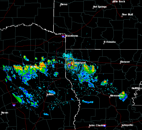 At 717 pm cdt, a severe thunderstorm was located near shreveport, moving north at 15 mph (radar indicated). Hazards include 60 mph wind gusts and nickel size hail. Expect damage to roofs, siding, and trees. Locations impacted include, shreveport, greenwood, blanchard, mooringsport and cross lake. At 717 pm cdt, a severe thunderstorm was located near shreveport, moving north at 15 mph (radar indicated). Hazards include 60 mph wind gusts and nickel size hail. Expect damage to roofs, siding, and trees. Locations impacted include, shreveport, greenwood, blanchard, mooringsport and cross lake.
|
| 6/26/2019 6:53 PM CDT |
 At 652 pm cdt, a severe thunderstorm was located near shreveport, moving north at 30 mph (radar indicated). Hazards include 60 mph wind gusts and half dollar size hail. Hail damage to vehicles is expected. Expect wind damage to roofs, siding, and trees. At 652 pm cdt, a severe thunderstorm was located near shreveport, moving north at 30 mph (radar indicated). Hazards include 60 mph wind gusts and half dollar size hail. Hail damage to vehicles is expected. Expect wind damage to roofs, siding, and trees.
|
| 6/23/2019 6:08 PM CDT |
 At 608 pm cdt, severe thunderstorms were located along a line extending from near benton to near haughton, moving northeast at 45 mph (radar indicated). Hazards include 60 mph wind gusts. Expect damage to roofs, siding, and trees. Locations impacted include, shreveport, bossier city, haughton, benton, sibley, doyline, dixie inn, belcher, heflin, eastwood, fosters, alden bridge, ferguson, curtis, fillmore, bodcau, plum orchard landing, koran, cavett and ninock. At 608 pm cdt, severe thunderstorms were located along a line extending from near benton to near haughton, moving northeast at 45 mph (radar indicated). Hazards include 60 mph wind gusts. Expect damage to roofs, siding, and trees. Locations impacted include, shreveport, bossier city, haughton, benton, sibley, doyline, dixie inn, belcher, heflin, eastwood, fosters, alden bridge, ferguson, curtis, fillmore, bodcau, plum orchard landing, koran, cavett and ninock.
|
| 6/23/2019 6:02 PM CDT |
 At 602 pm cdt, severe thunderstorms were located along a line extending from near blanchard to 15 miles east of stonewall, moving north at 35 mph (radar indicated). Hazards include 60 mph wind gusts. Expect damage to roofs, siding, and trees. Locations impacted include, shreveport, robson, cross lake, forbing and caspiana. At 602 pm cdt, severe thunderstorms were located along a line extending from near blanchard to 15 miles east of stonewall, moving north at 35 mph (radar indicated). Hazards include 60 mph wind gusts. Expect damage to roofs, siding, and trees. Locations impacted include, shreveport, robson, cross lake, forbing and caspiana.
|
| 6/23/2019 5:49 PM CDT |
 At 548 pm cdt, severe thunderstorms were located along a line extending from near belcher to 7 miles south of bossier city, moving east at 25 mph (radar indicated). Hazards include 60 mph wind gusts. expect damage to roofs, siding, and trees At 548 pm cdt, severe thunderstorms were located along a line extending from near belcher to 7 miles south of bossier city, moving east at 25 mph (radar indicated). Hazards include 60 mph wind gusts. expect damage to roofs, siding, and trees
|
| 6/23/2019 5:42 PM CDT | Utility line down at the intersection of corbitt st. and fairfax av in caddo county LA, 2.1 miles WNW of Shreveport, LA |
| 6/23/2019 5:42 PM CDT |
 At 541 pm cdt, severe thunderstorms were located along a line extending from near oil city to 11 miles east of stonewall, moving northeast at 30 mph (radar indicated). Hazards include 60 mph wind gusts. Expect damage to roofs, siding, and trees. Locations impacted include, shreveport, greenwood, blanchard, stonewall, oil city, mooringsport, caddo lake, frierson, caspiana, cross lake, kingston, keithville, robson, forbing and bethany. At 541 pm cdt, severe thunderstorms were located along a line extending from near oil city to 11 miles east of stonewall, moving northeast at 30 mph (radar indicated). Hazards include 60 mph wind gusts. Expect damage to roofs, siding, and trees. Locations impacted include, shreveport, greenwood, blanchard, stonewall, oil city, mooringsport, caddo lake, frierson, caspiana, cross lake, kingston, keithville, robson, forbing and bethany.
|
| 6/23/2019 5:41 PM CDT | Utility line reported down on missouri avenue... between mrytle st. & logan s in caddo county LA, 3.6 miles SSW of Shreveport, LA |
| 6/23/2019 5:31 PM CDT |
 At 530 pm cdt, severe thunderstorms were located along a line extending from near karnack to 8 miles southeast of stonewall, moving northeast at 35 mph (radar indicated). Hazards include 60 mph wind gusts. Expect damage to roofs, siding, and trees. Locations impacted include, shreveport, greenwood, blanchard, waskom, stonewall, oil city, mooringsport, karnack, keachi, keat chie, spring ridge, cross lake, kingston, leigh, kickapoo, keithville, reeds store, gloster, caddo lake and frierson. At 530 pm cdt, severe thunderstorms were located along a line extending from near karnack to 8 miles southeast of stonewall, moving northeast at 35 mph (radar indicated). Hazards include 60 mph wind gusts. Expect damage to roofs, siding, and trees. Locations impacted include, shreveport, greenwood, blanchard, waskom, stonewall, oil city, mooringsport, karnack, keachi, keat chie, spring ridge, cross lake, kingston, leigh, kickapoo, keithville, reeds store, gloster, caddo lake and frierson.
|
| 6/23/2019 5:25 PM CDT | Tree down at intersection of s lakeshore dr and hwy 16 in caddo county LA, 9.6 miles ESE of Shreveport, LA |
| 6/23/2019 5:24 PM CDT | Telephone pole fallen in roadway at corner of rice rd. & greenwood r in caddo county LA, 6.3 miles E of Shreveport, LA |
| 6/23/2019 5:10 PM CDT |
 At 510 pm cdt, severe thunderstorms were located along a line extending from near marshall to 10 miles northeast of logansport, moving northeast at 30 mph (radar indicated). Hazards include 60 mph wind gusts. expect damage to roofs, siding, and trees At 510 pm cdt, severe thunderstorms were located along a line extending from near marshall to 10 miles northeast of logansport, moving northeast at 30 mph (radar indicated). Hazards include 60 mph wind gusts. expect damage to roofs, siding, and trees
|
| 6/20/2019 12:16 AM CDT |
 At 1216 am cdt, severe thunderstorms were located along a line extending from near cotton valley to 7 miles north of minden to near sibley to 11 miles south of haughton, moving east at 55 mph (radar indicated). Hazards include 60 mph wind gusts and quarter size hail. Hail damage to vehicles is expected. expect wind damage to roofs, siding, and trees. Locations impacted include, shreveport, bossier city, minden, haughton, sibley, cotton valley, sarepta, doyline, dixie inn, eastwood, fosters, evergreen, leton, curtis, fillmore, bodcau, koran, gilark, ivan and couchwood. At 1216 am cdt, severe thunderstorms were located along a line extending from near cotton valley to 7 miles north of minden to near sibley to 11 miles south of haughton, moving east at 55 mph (radar indicated). Hazards include 60 mph wind gusts and quarter size hail. Hail damage to vehicles is expected. expect wind damage to roofs, siding, and trees. Locations impacted include, shreveport, bossier city, minden, haughton, sibley, cotton valley, sarepta, doyline, dixie inn, eastwood, fosters, evergreen, leton, curtis, fillmore, bodcau, koran, gilark, ivan and couchwood.
|
| 6/20/2019 12:05 AM CDT |
 At 1205 am cdt, severe thunderstorms were located along a line extending from near cotton valley to near doyline to 7 miles south of bossier city, moving east at 55 mph (radar indicated). Hazards include 60 mph wind gusts and quarter size hail. Hail damage to vehicles is expected. expect wind damage to roofs, siding, and trees. Locations impacted include, shreveport, bossier city, minden, haughton, greenwood, benton, sibley, cotton valley, sarepta, doyline, dixie inn, eastwood, fosters, evergreen, ferguson, leton, curtis, fillmore, bodcau and koran. At 1205 am cdt, severe thunderstorms were located along a line extending from near cotton valley to near doyline to 7 miles south of bossier city, moving east at 55 mph (radar indicated). Hazards include 60 mph wind gusts and quarter size hail. Hail damage to vehicles is expected. expect wind damage to roofs, siding, and trees. Locations impacted include, shreveport, bossier city, minden, haughton, greenwood, benton, sibley, cotton valley, sarepta, doyline, dixie inn, eastwood, fosters, evergreen, ferguson, leton, curtis, fillmore, bodcau and koran.
|
| 6/19/2019 11:31 PM CDT |
 At 1131 pm cdt, severe thunderstorms were located along a line extending from near hosston to near blanchard to near elysian fields, moving east at 50 mph (radar indicated). Hazards include 60 mph wind gusts and quarter size hail. Hail damage to vehicles is expected. Expect wind damage to roofs, siding, and trees. At 1131 pm cdt, severe thunderstorms were located along a line extending from near hosston to near blanchard to near elysian fields, moving east at 50 mph (radar indicated). Hazards include 60 mph wind gusts and quarter size hail. Hail damage to vehicles is expected. Expect wind damage to roofs, siding, and trees.
|
| 6/19/2019 10:24 PM CDT |
 At 1023 pm cdt, severe thunderstorms were located along a line extending from near ida to near woodlawn, moving east at 40 mph (radar indicated). Hazards include 60 mph wind gusts and quarter size hail. Hail damage to vehicles is expected. Expect wind damage to roofs, siding, and trees. At 1023 pm cdt, severe thunderstorms were located along a line extending from near ida to near woodlawn, moving east at 40 mph (radar indicated). Hazards include 60 mph wind gusts and quarter size hail. Hail damage to vehicles is expected. Expect wind damage to roofs, siding, and trees.
|
| 6/19/2019 7:12 AM CDT | A power line was downed on southern avenue and east 75th stree in caddo county LA, 4.2 miles WNW of Shreveport, LA |
| 6/19/2019 7:11 AM CDT |
 At 711 am cdt, severe thunderstorms were located along a line extending from near benton to near eastwood to near bossier city to stonewall, moving east at 55 mph (radar indicated. numerous trees have been downed across east texas and northwest louisiana with these storms). Hazards include 60 mph wind gusts. expect damage to roofs, siding, and trees At 711 am cdt, severe thunderstorms were located along a line extending from near benton to near eastwood to near bossier city to stonewall, moving east at 55 mph (radar indicated. numerous trees have been downed across east texas and northwest louisiana with these storms). Hazards include 60 mph wind gusts. expect damage to roofs, siding, and trees
|
| 6/19/2019 7:05 AM CDT | Light pole down near the intersection of millcent way and e. bert kouns. several large limbs were down in the university terrace subdivisio in caddo county LA, 6.1 miles WNW of Shreveport, LA |
| 6/19/2019 7:04 AM CDT |
 At 703 am cdt, severe thunderstorms were located along a line extending from near welcome to near cotton valley to near eastwood to shreveport, moving east at 55 mph (radar indicated). Hazards include 60 mph wind gusts. Expect damage to roofs, siding, and trees. Locations impacted include, shreveport, bossier city, vivian, greenwood, blanchard, benton, oil city, mooringsport, hosston, belcher, gilliam, fosters, dixie, alden bridge, rocky mount, ferguson, spring ridge, linton, cross lake and cavett. At 703 am cdt, severe thunderstorms were located along a line extending from near welcome to near cotton valley to near eastwood to shreveport, moving east at 55 mph (radar indicated). Hazards include 60 mph wind gusts. Expect damage to roofs, siding, and trees. Locations impacted include, shreveport, bossier city, vivian, greenwood, blanchard, benton, oil city, mooringsport, hosston, belcher, gilliam, fosters, dixie, alden bridge, rocky mount, ferguson, spring ridge, linton, cross lake and cavett.
|
| 6/19/2019 6:29 AM CDT |
 At 629 am cdt, severe thunderstorms were located along a line extending from near mcleod to near karnack to 8 miles north of elysian fields to near tatum, moving east at 70 mph (radar indicated). Hazards include 60 mph wind gusts. expect damage to roofs, siding, and trees At 629 am cdt, severe thunderstorms were located along a line extending from near mcleod to near karnack to 8 miles north of elysian fields to near tatum, moving east at 70 mph (radar indicated). Hazards include 60 mph wind gusts. expect damage to roofs, siding, and trees
|
| 5/19/2019 12:15 AM CDT |
 The national weather service in shreveport has issued a * severe thunderstorm warning for. southeastern webster parish in northwestern louisiana. de soto parish in northwestern louisiana. red river parish in northwestern louisiana. Northwestern natchitoches parish in northwestern louisiana. The national weather service in shreveport has issued a * severe thunderstorm warning for. southeastern webster parish in northwestern louisiana. de soto parish in northwestern louisiana. red river parish in northwestern louisiana. Northwestern natchitoches parish in northwestern louisiana.
|
| 5/18/2019 11:37 PM CDT |
 The national weather service in shreveport has issued a * severe thunderstorm warning for. de soto parish in northwestern louisiana. southwestern caddo parish in northwestern louisiana. northwestern sabine parish in northwestern louisiana. Eastern panola county in northeastern texas. The national weather service in shreveport has issued a * severe thunderstorm warning for. de soto parish in northwestern louisiana. southwestern caddo parish in northwestern louisiana. northwestern sabine parish in northwestern louisiana. Eastern panola county in northeastern texas.
|
| 5/18/2019 11:37 PM CDT |
 At 1136 pm cdt, severe thunderstorms were located along a line extending from near deberry to 12 miles east of carthage to near joaquin to 7 miles west of neuville to 6 miles north of lufkin, moving east at 35 mph (radar indicated). Hazards include 60 mph wind gusts and quarter size hail. Hail damage to vehicles is expected. Expect wind damage to roofs, siding, and trees. At 1136 pm cdt, severe thunderstorms were located along a line extending from near deberry to 12 miles east of carthage to near joaquin to 7 miles west of neuville to 6 miles north of lufkin, moving east at 35 mph (radar indicated). Hazards include 60 mph wind gusts and quarter size hail. Hail damage to vehicles is expected. Expect wind damage to roofs, siding, and trees.
|
| 5/18/2019 8:12 PM CDT |
 At 812 pm cdt, severe thunderstorms were located along a line extending from plain dealing to near benton to near blanchard, moving northeast at 55 mph (radar indicated). Hazards include 60 mph wind gusts and quarter size hail. Hail damage to vehicles is expected. expect wind damage to roofs, siding, and trees. Locations impacted include, shreveport, bossier city, greenwood, blanchard, waskom, benton, plain dealing, oil city, mooringsport, belcher, gilliam, eastwood, fosters, scottsville, alden bridge, ferguson, fillmore, cross lake, cavett and leigh. At 812 pm cdt, severe thunderstorms were located along a line extending from plain dealing to near benton to near blanchard, moving northeast at 55 mph (radar indicated). Hazards include 60 mph wind gusts and quarter size hail. Hail damage to vehicles is expected. expect wind damage to roofs, siding, and trees. Locations impacted include, shreveport, bossier city, greenwood, blanchard, waskom, benton, plain dealing, oil city, mooringsport, belcher, gilliam, eastwood, fosters, scottsville, alden bridge, ferguson, fillmore, cross lake, cavett and leigh.
|
| 5/18/2019 7:41 PM CDT |
 At 741 pm cdt, severe thunderstorms were located along a line extending from near karnack to 7 miles northwest of waskom to near elysian fields, moving northeast at 45 mph (radar indicated). Hazards include 60 mph wind gusts. expect damage to roofs, siding, and trees At 741 pm cdt, severe thunderstorms were located along a line extending from near karnack to 7 miles northwest of waskom to near elysian fields, moving northeast at 45 mph (radar indicated). Hazards include 60 mph wind gusts. expect damage to roofs, siding, and trees
|
| 5/8/2019 4:12 PM CDT |
 At 412 pm cdt, severe thunderstorms were located along a line extending from 9 miles southwest of lamont to near hampton to near calion to 7 miles northwest of bernice to 11 miles north of arcadia, moving northeast at 115 mph (radar indicated). Hazards include 60 mph wind gusts and penny size hail. Expect damage to roofs, siding, and trees. Locations impacted include, shreveport, bossier city, minden, magnolia, springhill, mansfield, stamps, waldo, lewisville, haughton, coushatta, ringgold, sibley, cullen, cotton valley, sarepta, doyline, bradley, taylor and buckner. At 412 pm cdt, severe thunderstorms were located along a line extending from 9 miles southwest of lamont to near hampton to near calion to 7 miles northwest of bernice to 11 miles north of arcadia, moving northeast at 115 mph (radar indicated). Hazards include 60 mph wind gusts and penny size hail. Expect damage to roofs, siding, and trees. Locations impacted include, shreveport, bossier city, minden, magnolia, springhill, mansfield, stamps, waldo, lewisville, haughton, coushatta, ringgold, sibley, cullen, cotton valley, sarepta, doyline, bradley, taylor and buckner.
|
| 5/8/2019 3:58 PM CDT |
 At 358 pm cdt, a severe thunderstorm capable of producing a tornado was located near stonewall, or 13 miles south of shreveport, moving northeast at 35 mph (radar indicated rotation). Hazards include tornado. Flying debris will be dangerous to those caught without shelter. mobile homes will be damaged or destroyed. damage to roofs, windows, and vehicles will occur. tree damage is likely. Locations impacted include, shreveport, bossier city, stonewall, frierson, caspiana, taylortown, robson, kingston and forbing. At 358 pm cdt, a severe thunderstorm capable of producing a tornado was located near stonewall, or 13 miles south of shreveport, moving northeast at 35 mph (radar indicated rotation). Hazards include tornado. Flying debris will be dangerous to those caught without shelter. mobile homes will be damaged or destroyed. damage to roofs, windows, and vehicles will occur. tree damage is likely. Locations impacted include, shreveport, bossier city, stonewall, frierson, caspiana, taylortown, robson, kingston and forbing.
|
| 5/8/2019 3:57 PM CDT | 60 mph wind reporte in caddo county LA, 6.4 miles WNW of Shreveport, LA |
| 5/8/2019 3:52 PM CDT |
 At 352 pm cdt, a severe thunderstorm capable of producing a tornado was located near fosters, or near bossier city, moving northeast at 35 mph (radar indicated rotation). Hazards include tornado. Flying debris will be dangerous to those caught without shelter. mobile homes will be damaged or destroyed. damage to roofs, windows, and vehicles will occur. tree damage is likely. Locations impacted include, shreveport, cross lake and forbing. At 352 pm cdt, a severe thunderstorm capable of producing a tornado was located near fosters, or near bossier city, moving northeast at 35 mph (radar indicated rotation). Hazards include tornado. Flying debris will be dangerous to those caught without shelter. mobile homes will be damaged or destroyed. damage to roofs, windows, and vehicles will occur. tree damage is likely. Locations impacted include, shreveport, cross lake and forbing.
|
| 5/8/2019 3:48 PM CDT |
 At 347 pm cdt, a severe thunderstorm capable of producing a tornado was located over stonewall, or 15 miles south of shreveport, moving northeast at 35 mph (radar indicated rotation). Hazards include tornado. Flying debris will be dangerous to those caught without shelter. mobile homes will be damaged or destroyed. damage to roofs, windows, and vehicles will occur. tree damage is likely. This tornadic thunderstorm will remain over mainly rural areas of north central de soto, northwestern red river, south central caddo and south central bossier parishes, including the following locations, gloster, frierson, keithville, caspiana, taylortown, robson, kingston, forbing and reeds store. At 347 pm cdt, a severe thunderstorm capable of producing a tornado was located over stonewall, or 15 miles south of shreveport, moving northeast at 35 mph (radar indicated rotation). Hazards include tornado. Flying debris will be dangerous to those caught without shelter. mobile homes will be damaged or destroyed. damage to roofs, windows, and vehicles will occur. tree damage is likely. This tornadic thunderstorm will remain over mainly rural areas of north central de soto, northwestern red river, south central caddo and south central bossier parishes, including the following locations, gloster, frierson, keithville, caspiana, taylortown, robson, kingston, forbing and reeds store.
|
| 5/8/2019 3:44 PM CDT |
 At 344 pm cdt, a severe thunderstorm capable of producing a tornado was located over shreveport, moving east at 25 mph (radar indicated rotation). Hazards include tornado. Flying debris will be dangerous to those caught without shelter. mobile homes will be damaged or destroyed. damage to roofs, windows, and vehicles will occur. tree damage is likely. this dangerous storm will be near, bossier city and fosters around 405 pm cdt. haughton and eastwood around 425 pm cdt. Other locations impacted by this tornadic thunderstorm include fillmore, bodcau, ferguson, princeton, barksdale air force base and red chute. At 344 pm cdt, a severe thunderstorm capable of producing a tornado was located over shreveport, moving east at 25 mph (radar indicated rotation). Hazards include tornado. Flying debris will be dangerous to those caught without shelter. mobile homes will be damaged or destroyed. damage to roofs, windows, and vehicles will occur. tree damage is likely. this dangerous storm will be near, bossier city and fosters around 405 pm cdt. haughton and eastwood around 425 pm cdt. Other locations impacted by this tornadic thunderstorm include fillmore, bodcau, ferguson, princeton, barksdale air force base and red chute.
|
| 5/8/2019 3:37 PM CDT |
 At 337 pm cdt, severe thunderstorms were located along a line extending from near willisville to taylor to 7 miles west of cotton valley to 7 miles southeast of shreveport to near stonewall, moving northeast at 55 mph (radar indicated). Hazards include 60 mph wind gusts and penny size hail. Expect damage to roofs, siding, and trees. Locations impacted include, shreveport, bossier city, minden, magnolia, springhill, mansfield, stamps, waldo, lewisville, haughton, greenwood, blanchard, coushatta, benton, stonewall, logansport, ringgold, sibley, cullen and plain dealing. At 337 pm cdt, severe thunderstorms were located along a line extending from near willisville to taylor to 7 miles west of cotton valley to 7 miles southeast of shreveport to near stonewall, moving northeast at 55 mph (radar indicated). Hazards include 60 mph wind gusts and penny size hail. Expect damage to roofs, siding, and trees. Locations impacted include, shreveport, bossier city, minden, magnolia, springhill, mansfield, stamps, waldo, lewisville, haughton, greenwood, blanchard, coushatta, benton, stonewall, logansport, ringgold, sibley, cullen and plain dealing.
|
| 5/8/2019 3:35 PM CDT |
 At 326 pm cdt, a severe thunderstorm capable of producing a tornado was located 12 miles southeast of deberry, or 18 miles east of carthage, moving northeast at 35 mph (radar indicated rotation). Hazards include tornado. Flying debris will be dangerous to those caught without shelter. mobile homes will be damaged or destroyed. damage to roofs, windows, and vehicles will occur. tree damage is likely. this dangerous storm will be near, stonewall around 350 pm cdt. Other locations impacted by this tornadic thunderstorm include gloster, keat chie, frierson, keachi, caspiana, spring ridge, taylortown, kingston, longstreet and kickapoo. At 326 pm cdt, a severe thunderstorm capable of producing a tornado was located 12 miles southeast of deberry, or 18 miles east of carthage, moving northeast at 35 mph (radar indicated rotation). Hazards include tornado. Flying debris will be dangerous to those caught without shelter. mobile homes will be damaged or destroyed. damage to roofs, windows, and vehicles will occur. tree damage is likely. this dangerous storm will be near, stonewall around 350 pm cdt. Other locations impacted by this tornadic thunderstorm include gloster, keat chie, frierson, keachi, caspiana, spring ridge, taylortown, kingston, longstreet and kickapoo.
|
| 5/8/2019 3:33 PM CDT |
 At 333 pm cdt, a severe thunderstorm capable of producing a tornado was located near greenwood, or 7 miles southwest of shreveport, moving east at 35 mph (radar indicated rotation). Hazards include tornado. Flying debris will be dangerous to those caught without shelter. mobile homes will be damaged or destroyed. damage to roofs, windows, and vehicles will occur. tree damage is likely. This tornadic thunderstorm will remain over mainly rural areas of southwestern caddo parish, including the following locations, cross lake, spring ridge and forbing. At 333 pm cdt, a severe thunderstorm capable of producing a tornado was located near greenwood, or 7 miles southwest of shreveport, moving east at 35 mph (radar indicated rotation). Hazards include tornado. Flying debris will be dangerous to those caught without shelter. mobile homes will be damaged or destroyed. damage to roofs, windows, and vehicles will occur. tree damage is likely. This tornadic thunderstorm will remain over mainly rural areas of southwestern caddo parish, including the following locations, cross lake, spring ridge and forbing.
|
| 5/8/2019 3:30 PM CDT |
 The national weather service in shreveport has issued a * severe thunderstorm warning for. southern miller county in southwestern arkansas. lafayette county in southwestern arkansas. western columbia county in southwestern arkansas. Webster parish in northwestern louisiana. The national weather service in shreveport has issued a * severe thunderstorm warning for. southern miller county in southwestern arkansas. lafayette county in southwestern arkansas. western columbia county in southwestern arkansas. Webster parish in northwestern louisiana.
|
| 5/8/2019 3:30 PM CDT |
 At 330 pm cdt, severe thunderstorms were located along a line extending from near stamps to 7 miles southeast of bradley to benton to near stonewall to 10 miles north of logansport, moving northeast at 115 mph (radar indicated). Hazards include 60 mph wind gusts and penny size hail. expect damage to roofs, siding, and trees At 330 pm cdt, severe thunderstorms were located along a line extending from near stamps to 7 miles southeast of bradley to benton to near stonewall to 10 miles north of logansport, moving northeast at 115 mph (radar indicated). Hazards include 60 mph wind gusts and penny size hail. expect damage to roofs, siding, and trees
|
| 5/8/2019 3:27 PM CDT |
 At 326 pm cdt, a severe thunderstorm capable of producing a tornado was located 12 miles southeast of deberry, or 18 miles east of carthage, moving northeast at 35 mph (radar indicated rotation). Hazards include tornado. Flying debris will be dangerous to those caught without shelter. mobile homes will be damaged or destroyed. damage to roofs, windows, and vehicles will occur. tree damage is likely. this dangerous storm will be near, stonewall around 350 pm cdt. Other locations impacted by this tornadic thunderstorm include gloster, keat chie, frierson, keachi, caspiana, spring ridge, taylortown, kingston, longstreet and kickapoo. At 326 pm cdt, a severe thunderstorm capable of producing a tornado was located 12 miles southeast of deberry, or 18 miles east of carthage, moving northeast at 35 mph (radar indicated rotation). Hazards include tornado. Flying debris will be dangerous to those caught without shelter. mobile homes will be damaged or destroyed. damage to roofs, windows, and vehicles will occur. tree damage is likely. this dangerous storm will be near, stonewall around 350 pm cdt. Other locations impacted by this tornadic thunderstorm include gloster, keat chie, frierson, keachi, caspiana, spring ridge, taylortown, kingston, longstreet and kickapoo.
|
| 5/8/2019 3:21 PM CDT |
 The national weather service in shreveport has issued a * tornado warning for. southwestern caddo parish in northwestern louisiana. eastern harrison county in northeastern texas. northeastern panola county in northeastern texas. Until 400 pm cdt. The national weather service in shreveport has issued a * tornado warning for. southwestern caddo parish in northwestern louisiana. eastern harrison county in northeastern texas. northeastern panola county in northeastern texas. Until 400 pm cdt.
|
| 5/8/2019 2:50 PM CDT |
 The national weather service in shreveport has issued a * severe thunderstorm warning for. de soto parish in northwestern louisiana. northwestern red river parish in northwestern louisiana. caddo parish in northwestern louisiana. Bossier parish in northwestern louisiana. The national weather service in shreveport has issued a * severe thunderstorm warning for. de soto parish in northwestern louisiana. northwestern red river parish in northwestern louisiana. caddo parish in northwestern louisiana. Bossier parish in northwestern louisiana.
|
| 5/8/2019 2:50 PM CDT |
 At 249 pm cdt, severe thunderstorms were located along a line extending from kildare to near woodlawn to 7 miles northwest of elysian fields to near carthage to 9 miles north of timpson, moving east at 55 mph (radar indicated). Hazards include 60 mph wind gusts and penny size hail. expect damage to roofs, siding, and trees At 249 pm cdt, severe thunderstorms were located along a line extending from kildare to near woodlawn to 7 miles northwest of elysian fields to near carthage to 9 miles north of timpson, moving east at 55 mph (radar indicated). Hazards include 60 mph wind gusts and penny size hail. expect damage to roofs, siding, and trees
|
| 5/2/2019 6:32 AM CDT |
 At 632 am cdt, a severe thunderstorm was located over greenwood, or 8 miles west of shreveport, moving northeast at 30 mph (radar indicated). Hazards include 60 mph wind gusts. Expect damage to roofs, siding, and trees. Locations impacted include, shreveport, greenwood, stonewall, keachi, keat chie, keithville, spring ridge, cross lake, bethany and kickapoo. At 632 am cdt, a severe thunderstorm was located over greenwood, or 8 miles west of shreveport, moving northeast at 30 mph (radar indicated). Hazards include 60 mph wind gusts. Expect damage to roofs, siding, and trees. Locations impacted include, shreveport, greenwood, stonewall, keachi, keat chie, keithville, spring ridge, cross lake, bethany and kickapoo.
|
| 5/2/2019 5:41 AM CDT |
 At 540 am cdt, a severe thunderstorm was located near carthage, moving northeast at 30 mph (radar indicated). Hazards include 60 mph wind gusts. expect damage to roofs, siding, and trees At 540 am cdt, a severe thunderstorm was located near carthage, moving northeast at 30 mph (radar indicated). Hazards include 60 mph wind gusts. expect damage to roofs, siding, and trees
|
| 4/18/2019 5:08 AM CDT |
 At 507 am cdt, severe thunderstorms were located along a line extending from 7 miles southwest of mooringsport to 6 miles south of greenwood to 11 miles southwest of stonewall to near logansport, moving northeast at 40 mph (radar indicated). Hazards include 60 mph wind gusts and penny size hail. Expect damage to roofs, siding, and trees. Locations impacted include, shreveport, bossier city, mansfield, greenwood, blanchard, benton, stonewall, fosters, south mansfield, keachi, grand cane, longstreet, keat chie, alden bridge, carmel, ferguson, spring ridge, cross lake, kingston and kickapoo. At 507 am cdt, severe thunderstorms were located along a line extending from 7 miles southwest of mooringsport to 6 miles south of greenwood to 11 miles southwest of stonewall to near logansport, moving northeast at 40 mph (radar indicated). Hazards include 60 mph wind gusts and penny size hail. Expect damage to roofs, siding, and trees. Locations impacted include, shreveport, bossier city, mansfield, greenwood, blanchard, benton, stonewall, fosters, south mansfield, keachi, grand cane, longstreet, keat chie, alden bridge, carmel, ferguson, spring ridge, cross lake, kingston and kickapoo.
|
| 4/18/2019 4:51 AM CDT |
 At 451 am cdt, severe thunderstorms were located along a line extending from near marshall to near deberry to 8 miles northwest of logansport to near joaquin, moving east at 35 mph (radar indicated). Hazards include 60 mph wind gusts and penny size hail. Expect damage to roofs, siding, and trees. Locations impacted include, shreveport, bossier city, marshall, mansfield, greenwood, blanchard, waskom, benton, stonewall, logansport, joaquin, mooringsport, deberry, elysian fields, fosters, scottsville, south mansfield, keachi, grand cane and longstreet. At 451 am cdt, severe thunderstorms were located along a line extending from near marshall to near deberry to 8 miles northwest of logansport to near joaquin, moving east at 35 mph (radar indicated). Hazards include 60 mph wind gusts and penny size hail. Expect damage to roofs, siding, and trees. Locations impacted include, shreveport, bossier city, marshall, mansfield, greenwood, blanchard, waskom, benton, stonewall, logansport, joaquin, mooringsport, deberry, elysian fields, fosters, scottsville, south mansfield, keachi, grand cane and longstreet.
|
| 4/18/2019 4:23 AM CDT |
 At 422 am cdt, severe thunderstorms were located along a line extending from near hallsville to near carthage to 6 miles west of tenaha to near timpson, moving east at 40 mph (radar indicated). Hazards include 70 mph wind gusts and penny size hail. Expect considerable tree damage. Damage is likely to mobile homes, roofs, and outbuildings. At 422 am cdt, severe thunderstorms were located along a line extending from near hallsville to near carthage to 6 miles west of tenaha to near timpson, moving east at 40 mph (radar indicated). Hazards include 70 mph wind gusts and penny size hail. Expect considerable tree damage. Damage is likely to mobile homes, roofs, and outbuildings.
|
| 4/13/2019 3:55 PM CDT | Trees dow in red river county LA, 22.1 miles NW of Shreveport, LA |
| 4/13/2019 3:34 PM CDT |
 At 334 pm cdt, severe thunderstorms were located along a line extending from near mooringsport to near shreveport to near stonewall to 7 miles south of mansfield, moving east at 50 mph (radar indicated). Hazards include 60 mph wind gusts. Expect damage to roofs, siding, and trees. Locations impacted include, shreveport, bossier city, mansfield, greenwood, blanchard, benton, stonewall, oil city, mooringsport, belcher, eastwood, fosters, south mansfield, keachi, grand cane, keat chie, alden bridge, carmel, ferguson and spring ridge. At 334 pm cdt, severe thunderstorms were located along a line extending from near mooringsport to near shreveport to near stonewall to 7 miles south of mansfield, moving east at 50 mph (radar indicated). Hazards include 60 mph wind gusts. Expect damage to roofs, siding, and trees. Locations impacted include, shreveport, bossier city, mansfield, greenwood, blanchard, benton, stonewall, oil city, mooringsport, belcher, eastwood, fosters, south mansfield, keachi, grand cane, keat chie, alden bridge, carmel, ferguson and spring ridge.
|
| 4/13/2019 3:13 PM CDT |
 At 313 pm cdt, severe thunderstorms were located along a line extending from near woodlawn to 6 miles south of joaquin, moving east at 35 mph (radar indicated). Hazards include 70 mph wind gusts. Expect considerable tree damage. Damage is likely to mobile homes, roofs, and outbuildings. At 313 pm cdt, severe thunderstorms were located along a line extending from near woodlawn to 6 miles south of joaquin, moving east at 35 mph (radar indicated). Hazards include 70 mph wind gusts. Expect considerable tree damage. Damage is likely to mobile homes, roofs, and outbuildings.
|
| 4/13/2019 12:06 PM CDT |
 At 1206 pm cdt, a severe thunderstorm was located near eastwood, or 11 miles northeast of bossier city, moving north at 50 mph (radar indicated). Hazards include 60 mph wind gusts and quarter size hail. Hail damage to vehicles is expected. expect wind damage to roofs, siding, and trees. Locations impacted include, shreveport, bossier city, haughton, benton, plain dealing, cotton valley, sarepta, eastwood, fosters, alden bridge, ferguson, fillmore, bodcau, keithville, ivan, mc dade, couchwood, rocky mount, princeton and caspiana. At 1206 pm cdt, a severe thunderstorm was located near eastwood, or 11 miles northeast of bossier city, moving north at 50 mph (radar indicated). Hazards include 60 mph wind gusts and quarter size hail. Hail damage to vehicles is expected. expect wind damage to roofs, siding, and trees. Locations impacted include, shreveport, bossier city, haughton, benton, plain dealing, cotton valley, sarepta, eastwood, fosters, alden bridge, ferguson, fillmore, bodcau, keithville, ivan, mc dade, couchwood, rocky mount, princeton and caspiana.
|
| 4/13/2019 11:37 AM CDT |
 At 1137 am cdt, a severe thunderstorm was located 10 miles east of stonewall, or 16 miles southeast of shreveport, moving north at 70 mph (radar indicated). Hazards include 60 mph wind gusts and quarter size hail. Hail damage to vehicles is expected. Expect wind damage to roofs, siding, and trees. At 1137 am cdt, a severe thunderstorm was located 10 miles east of stonewall, or 16 miles southeast of shreveport, moving north at 70 mph (radar indicated). Hazards include 60 mph wind gusts and quarter size hail. Hail damage to vehicles is expected. Expect wind damage to roofs, siding, and trees.
|
| 4/13/2019 11:27 AM CDT | Downed trees in southern hills neighborhoo in caddo county LA, 4.6 miles N of Shreveport, LA |
| 4/13/2019 11:10 AM CDT | Tree on home on kingston road between williamson way and flournoy luca in caddo county LA, 5.6 miles NNW of Shreveport, LA |
| 4/13/2019 10:48 AM CDT |
 At 1048 am cdt, a severe thunderstorm was located near deberry, or 17 miles northeast of carthage, moving north at 45 mph (radar indicated). Hazards include 60 mph wind gusts and quarter size hail. Hail damage to vehicles is expected. expect wind damage to roofs, siding, and trees. Locations impacted include, shreveport, greenwood, keachi, longstreet, cross lake and spring ridge. At 1048 am cdt, a severe thunderstorm was located near deberry, or 17 miles northeast of carthage, moving north at 45 mph (radar indicated). Hazards include 60 mph wind gusts and quarter size hail. Hail damage to vehicles is expected. expect wind damage to roofs, siding, and trees. Locations impacted include, shreveport, greenwood, keachi, longstreet, cross lake and spring ridge.
|
| 4/13/2019 10:29 AM CDT |
 At 1029 am cdt, a severe thunderstorm was located 9 miles northwest of joaquin, or 13 miles east of carthage, moving north at 45 mph (radar indicated). Hazards include quarter size hail. damage to vehicles is expected At 1029 am cdt, a severe thunderstorm was located 9 miles northwest of joaquin, or 13 miles east of carthage, moving north at 45 mph (radar indicated). Hazards include quarter size hail. damage to vehicles is expected
|
| 4/13/2019 5:18 AM CDT |
 At 517 am cdt, severe thunderstorms were located along a line extending from belcher to near benton to 7 miles east of blanchard, moving east at 40 mph (radar indicated). Hazards include 70 mph wind gusts and penny size hail. Expect considerable tree damage. damage is likely to mobile homes, roofs, and outbuildings. Locations impacted include, benton, belcher, dixie, alden bridge, linton and rocky mount. At 517 am cdt, severe thunderstorms were located along a line extending from belcher to near benton to 7 miles east of blanchard, moving east at 40 mph (radar indicated). Hazards include 70 mph wind gusts and penny size hail. Expect considerable tree damage. damage is likely to mobile homes, roofs, and outbuildings. Locations impacted include, benton, belcher, dixie, alden bridge, linton and rocky mount.
|
| 4/13/2019 5:04 AM CDT |
 At 503 am cdt, severe thunderstorms were located along a line extending from near mooringsport to 6 miles south of oil city to blanchard, moving east at 30 mph (radar indicated). Hazards include 70 mph wind gusts and penny size hail. Expect considerable tree damage. damage is likely to mobile homes, roofs, and outbuildings. Locations impacted include, blanchard, benton, mooringsport, belcher, dixie, alden bridge, rocky mount, caddo lake and linton. At 503 am cdt, severe thunderstorms were located along a line extending from near mooringsport to 6 miles south of oil city to blanchard, moving east at 30 mph (radar indicated). Hazards include 70 mph wind gusts and penny size hail. Expect considerable tree damage. damage is likely to mobile homes, roofs, and outbuildings. Locations impacted include, blanchard, benton, mooringsport, belcher, dixie, alden bridge, rocky mount, caddo lake and linton.
|
| 4/13/2019 4:46 AM CDT |
 At 445 am cdt, severe thunderstorms were located along a line extending from karnack to 12 miles southwest of mooringsport to near waskom, moving east at 40 mph (radar indicated). Hazards include 70 mph wind gusts and penny size hail. Expect considerable tree damage. Damage is likely to mobile homes, roofs, and outbuildings. At 445 am cdt, severe thunderstorms were located along a line extending from karnack to 12 miles southwest of mooringsport to near waskom, moving east at 40 mph (radar indicated). Hazards include 70 mph wind gusts and penny size hail. Expect considerable tree damage. Damage is likely to mobile homes, roofs, and outbuildings.
|
| 4/7/2019 4:48 PM CDT |
 At 448 pm cdt, severe thunderstorms were located along a line extending from 8 miles west of homer to shreveport, moving northwest at 40 mph (radar indicated). Hazards include 60 mph wind gusts and penny size hail. Expect damage to roofs, siding, and trees. Locations impacted include, shreveport, bossier city, minden, haughton, greenwood, blanchard, benton, cotton valley, eastwood, fosters, evergreen, ferguson, leton, spring ridge, fillmore, cross lake, bodcau, keithville, ivan and couchwood. At 448 pm cdt, severe thunderstorms were located along a line extending from 8 miles west of homer to shreveport, moving northwest at 40 mph (radar indicated). Hazards include 60 mph wind gusts and penny size hail. Expect damage to roofs, siding, and trees. Locations impacted include, shreveport, bossier city, minden, haughton, greenwood, blanchard, benton, cotton valley, eastwood, fosters, evergreen, ferguson, leton, spring ridge, fillmore, cross lake, bodcau, keithville, ivan and couchwood.
|
| 4/7/2019 4:35 PM CDT |
 At 435 pm cdt, severe thunderstorms were located along a line extending from 9 miles northeast of minden to 8 miles northeast of stonewall, moving northwest at 40 mph (radar indicated). Hazards include 60 mph wind gusts and penny size hail. Expect damage to roofs, siding, and trees. Locations impacted include, shreveport, bossier city, minden, haughton, greenwood, blanchard, benton, stonewall, sibley, cotton valley, gibsland, doyline, dixie inn, dubberly, heflin, eastwood, fosters, evergreen, keachi and mount lebanon. At 435 pm cdt, severe thunderstorms were located along a line extending from 9 miles northeast of minden to 8 miles northeast of stonewall, moving northwest at 40 mph (radar indicated). Hazards include 60 mph wind gusts and penny size hail. Expect damage to roofs, siding, and trees. Locations impacted include, shreveport, bossier city, minden, haughton, greenwood, blanchard, benton, stonewall, sibley, cotton valley, gibsland, doyline, dixie inn, dubberly, heflin, eastwood, fosters, evergreen, keachi and mount lebanon.
|
| 4/7/2019 3:57 PM CDT |
 At 357 pm cdt, severe thunderstorms were located along a line extending from 12 miles south of arcadia to 10 miles west of coushatta, moving northwest at 40 mph (radar indicated). Hazards include 60 mph wind gusts and quarter size hail. Hail damage to vehicles is expected. Expect wind damage to roofs, siding, and trees. At 357 pm cdt, severe thunderstorms were located along a line extending from 12 miles south of arcadia to 10 miles west of coushatta, moving northwest at 40 mph (radar indicated). Hazards include 60 mph wind gusts and quarter size hail. Hail damage to vehicles is expected. Expect wind damage to roofs, siding, and trees.
|
| 4/4/2019 2:52 AM CDT |
 At 252 am cdt, a severe thunderstorm was located near shreveport, moving northeast at 50 mph (radar indicated). Hazards include quarter size hail. Damage to vehicles is expected. Locations impacted include, shreveport, blanchard and cross lake. At 252 am cdt, a severe thunderstorm was located near shreveport, moving northeast at 50 mph (radar indicated). Hazards include quarter size hail. Damage to vehicles is expected. Locations impacted include, shreveport, blanchard and cross lake.
|
| 4/4/2019 2:44 AM CDT |
 At 244 am cdt, a severe thunderstorm was located over greenwood, or 9 miles west of shreveport, moving northeast at 50 mph (radar indicated). Hazards include half dollar size hail. Damage to vehicles is expected. Locations impacted include, shreveport, greenwood, blanchard and cross lake. At 244 am cdt, a severe thunderstorm was located over greenwood, or 9 miles west of shreveport, moving northeast at 50 mph (radar indicated). Hazards include half dollar size hail. Damage to vehicles is expected. Locations impacted include, shreveport, greenwood, blanchard and cross lake.
|
| 4/4/2019 2:36 AM CDT |
 At 235 am cdt, a severe thunderstorm was located near elysian fields, or 18 miles southwest of shreveport, moving northeast at 50 mph (radar indicated). Hazards include half dollar size hail. damage to vehicles is expected At 235 am cdt, a severe thunderstorm was located near elysian fields, or 18 miles southwest of shreveport, moving northeast at 50 mph (radar indicated). Hazards include half dollar size hail. damage to vehicles is expected
|
| 3/25/2019 3:32 AM CDT |
 At 332 am cdt, severe thunderstorms were located along a line extending from cotton valley to 9 miles northwest of minden to near dixie inn to doyline to 9 miles southeast of bossier city to 7 miles northeast of stonewall, moving east at 50 mph (radar indicated). Hazards include 60 mph wind gusts and penny size hail. Expect damage to roofs, siding, and trees. Locations impacted include, shreveport, bossier city, minden, grambling, homer, haughton, arcadia, ringgold, sibley, cotton valley, gibsland, doyline, dixie inn, dubberly, heflin, simsboro, evergreen, athens, bienville and lisbon. At 332 am cdt, severe thunderstorms were located along a line extending from cotton valley to 9 miles northwest of minden to near dixie inn to doyline to 9 miles southeast of bossier city to 7 miles northeast of stonewall, moving east at 50 mph (radar indicated). Hazards include 60 mph wind gusts and penny size hail. Expect damage to roofs, siding, and trees. Locations impacted include, shreveport, bossier city, minden, grambling, homer, haughton, arcadia, ringgold, sibley, cotton valley, gibsland, doyline, dixie inn, dubberly, heflin, simsboro, evergreen, athens, bienville and lisbon.
|
| 3/25/2019 3:13 AM CDT | Small tree limbs broken and shingles removed from a roof. reported via mpin in caddo county LA, 3.8 miles W of Shreveport, LA |
| 3/25/2019 3:13 AM CDT |
 At 312 am cdt, severe thunderstorms were located along a line extending from near plain dealing to near benton to near eastwood to fosters to near shreveport to near greenwood, moving east at 45 mph (radar indicated). Hazards include 60 mph wind gusts and penny size hail. expect damage to roofs, siding, and trees At 312 am cdt, severe thunderstorms were located along a line extending from near plain dealing to near benton to near eastwood to fosters to near shreveport to near greenwood, moving east at 45 mph (radar indicated). Hazards include 60 mph wind gusts and penny size hail. expect damage to roofs, siding, and trees
|
| 3/25/2019 3:07 AM CDT |
 At 307 am cdt, severe thunderstorms were located along a line extending from near gilliam to near benton to 6 miles northwest of fosters to shreveport to near greenwood to near waskom to near elysian fields to 6 miles north of tatum, moving southeast at 35 mph (radar indicated). Hazards include 70 mph wind gusts and quarter size hail. Hail damage to vehicles is expected. expect considerable tree damage. wind damage is also likely to mobile homes, roofs, and outbuildings. Locations impacted include, shreveport, longview, bossier city, marshall, hallsville, greenwood, waskom, benton, gilliam, elysian fields, eastwood, fosters, easton, scottsville, alden bridge, nesbitt, ferguson, cross lake, bodcau and darco. At 307 am cdt, severe thunderstorms were located along a line extending from near gilliam to near benton to 6 miles northwest of fosters to shreveport to near greenwood to near waskom to near elysian fields to 6 miles north of tatum, moving southeast at 35 mph (radar indicated). Hazards include 70 mph wind gusts and quarter size hail. Hail damage to vehicles is expected. expect considerable tree damage. wind damage is also likely to mobile homes, roofs, and outbuildings. Locations impacted include, shreveport, longview, bossier city, marshall, hallsville, greenwood, waskom, benton, gilliam, elysian fields, eastwood, fosters, easton, scottsville, alden bridge, nesbitt, ferguson, cross lake, bodcau and darco.
|
| 3/25/2019 2:50 AM CDT |
 At 249 am cdt, severe thunderstorms were located along a line extending from vivian to near oil city to near mooringsport to near waskom to near elysian fields to 8 miles south of marshall to 6 miles southeast of longview, moving east at 35 mph (radar indicated). Hazards include 70 mph wind gusts and quarter size hail. Hail damage to vehicles is expected. expect considerable tree damage. wind damage is also likely to mobile homes, roofs, and outbuildings. Locations impacted include, shreveport, longview, bossier city, marshall, vivian, hallsville, greenwood, blanchard, waskom, benton, tatum, oil city, mooringsport, hosston, belcher, gilliam, deberry, elysian fields, eastwood and fosters. At 249 am cdt, severe thunderstorms were located along a line extending from vivian to near oil city to near mooringsport to near waskom to near elysian fields to 8 miles south of marshall to 6 miles southeast of longview, moving east at 35 mph (radar indicated). Hazards include 70 mph wind gusts and quarter size hail. Hail damage to vehicles is expected. expect considerable tree damage. wind damage is also likely to mobile homes, roofs, and outbuildings. Locations impacted include, shreveport, longview, bossier city, marshall, vivian, hallsville, greenwood, blanchard, waskom, benton, tatum, oil city, mooringsport, hosston, belcher, gilliam, deberry, elysian fields, eastwood and fosters.
|
| 3/25/2019 2:32 AM CDT |
 At 232 am cdt, severe thunderstorms were located along a line extending from near kildare to near smithland to near karnack to 8 miles southeast of woodlawn to near marshall to near hallsville, moving east at 35 mph (radar indicated). Hazards include 70 mph wind gusts and quarter size hail. Hail damage to vehicles is expected. expect considerable tree damage. wind damage is also likely to mobile homes, roofs, and outbuildings. Locations impacted include, shreveport, longview, bossier city, marshall, vivian, hallsville, greenwood, blanchard, waskom, benton, tatum, oil city, mooringsport, hosston, belcher, gilliam, deberry, elysian fields, eastwood and smithland. At 232 am cdt, severe thunderstorms were located along a line extending from near kildare to near smithland to near karnack to 8 miles southeast of woodlawn to near marshall to near hallsville, moving east at 35 mph (radar indicated). Hazards include 70 mph wind gusts and quarter size hail. Hail damage to vehicles is expected. expect considerable tree damage. wind damage is also likely to mobile homes, roofs, and outbuildings. Locations impacted include, shreveport, longview, bossier city, marshall, vivian, hallsville, greenwood, blanchard, waskom, benton, tatum, oil city, mooringsport, hosston, belcher, gilliam, deberry, elysian fields, eastwood and smithland.
|
| 3/25/2019 2:16 AM CDT |
 At 216 am cdt, severe thunderstorms were located along a line extending from near linden to near lodi to near jefferson to 6 miles southwest of woodlawn to near harleton to near longview, moving southeast at 35 mph (radar indicated). Hazards include 70 mph wind gusts and quarter size hail. Hail damage to vehicles is expected. expect considerable tree damage. Wind damage is also likely to mobile homes, roofs, and outbuildings. At 216 am cdt, severe thunderstorms were located along a line extending from near linden to near lodi to near jefferson to 6 miles southwest of woodlawn to near harleton to near longview, moving southeast at 35 mph (radar indicated). Hazards include 70 mph wind gusts and quarter size hail. Hail damage to vehicles is expected. expect considerable tree damage. Wind damage is also likely to mobile homes, roofs, and outbuildings.
|
| 3/14/2019 4:53 AM CDT |
 At 453 am cdt, severe thunderstorms were located along a line extending from near shongaloo to near cotton valley to 7 miles southeast of bossier city, moving east at 35 mph (radar indicated). Hazards include 60 mph wind gusts. Expect damage to roofs, siding, and trees. Locations impacted include, shreveport, bossier city, minden, homer, haughton, sibley, cotton valley, doyline, dixie inn, shongaloo, eastwood, evergreen, leton, curtis, fillmore, bodcau, plum orchard landing, koran, gilark and noles landing. At 453 am cdt, severe thunderstorms were located along a line extending from near shongaloo to near cotton valley to 7 miles southeast of bossier city, moving east at 35 mph (radar indicated). Hazards include 60 mph wind gusts. Expect damage to roofs, siding, and trees. Locations impacted include, shreveport, bossier city, minden, homer, haughton, sibley, cotton valley, doyline, dixie inn, shongaloo, eastwood, evergreen, leton, curtis, fillmore, bodcau, plum orchard landing, koran, gilark and noles landing.
|
| 3/14/2019 4:46 AM CDT |
 At 446 am cdt, severe thunderstorms were located along a line extending from near cullen to near cotton valley to 7 miles south of bossier city, moving east at 35 mph (radar indicated). Hazards include 60 mph wind gusts. Expect damage to roofs, siding, and trees. Locations impacted include, shreveport, bossier city, minden, homer, haughton, sibley, cotton valley, sarepta, doyline, dixie inn, shongaloo, eastwood, fosters, evergreen, ferguson, leton, curtis, fillmore, bodcau and plum orchard landing. At 446 am cdt, severe thunderstorms were located along a line extending from near cullen to near cotton valley to 7 miles south of bossier city, moving east at 35 mph (radar indicated). Hazards include 60 mph wind gusts. Expect damage to roofs, siding, and trees. Locations impacted include, shreveport, bossier city, minden, homer, haughton, sibley, cotton valley, sarepta, doyline, dixie inn, shongaloo, eastwood, fosters, evergreen, ferguson, leton, curtis, fillmore, bodcau and plum orchard landing.
|
| 3/14/2019 4:45 AM CDT |
 At 444 am cdt, severe thunderstorms were located along a line extending from 7 miles southeast of shreveport to 6 miles southeast of timpson, moving east at 40 mph (radar indicated). Hazards include 60 mph wind gusts. Expect damage to roofs, siding, and trees. Locations impacted include, shreveport, stonewall, tenaha, timpson, joaquin, keachi, longstreet, keat chie, front, spring ridge, midyett, kickapoo, keithville, deadwood, woods, forbing and paxton. At 444 am cdt, severe thunderstorms were located along a line extending from 7 miles southeast of shreveport to 6 miles southeast of timpson, moving east at 40 mph (radar indicated). Hazards include 60 mph wind gusts. Expect damage to roofs, siding, and trees. Locations impacted include, shreveport, stonewall, tenaha, timpson, joaquin, keachi, longstreet, keat chie, front, spring ridge, midyett, kickapoo, keithville, deadwood, woods, forbing and paxton.
|
| 3/14/2019 4:26 AM CDT |
 At 425 am cdt, severe thunderstorms were located along a line extending from 6 miles west of sarepta to near greenwood, moving east at 35 mph (radar indicated). Hazards include 60 mph wind gusts. expect damage to roofs, siding, and trees At 425 am cdt, severe thunderstorms were located along a line extending from 6 miles west of sarepta to near greenwood, moving east at 35 mph (radar indicated). Hazards include 60 mph wind gusts. expect damage to roofs, siding, and trees
|
| 3/14/2019 4:19 AM CDT |
 At 419 am cdt, severe thunderstorms were located along a line extending from near welcome to greenwood, moving east at 35 mph (radar indicated). Hazards include 60 mph wind gusts and penny size hail. Expect damage to roofs, siding, and trees. Locations impacted include, shreveport, bossier city, greenwood, blanchard, waskom, benton, plain dealing, belcher, dixie, alden bridge, rocky mount, ferguson, linton, cross lake, cavett, bolinger, ivan and bethany. At 419 am cdt, severe thunderstorms were located along a line extending from near welcome to greenwood, moving east at 35 mph (radar indicated). Hazards include 60 mph wind gusts and penny size hail. Expect damage to roofs, siding, and trees. Locations impacted include, shreveport, bossier city, greenwood, blanchard, waskom, benton, plain dealing, belcher, dixie, alden bridge, rocky mount, ferguson, linton, cross lake, cavett, bolinger, ivan and bethany.
|
| 3/14/2019 4:11 AM CDT |
 At 411 am cdt, severe thunderstorms were located along a line extending from near elysian fields to near trawick, moving east at 40 mph (radar indicated). Hazards include 60 mph wind gusts. expect damage to roofs, siding, and trees At 411 am cdt, severe thunderstorms were located along a line extending from near elysian fields to near trawick, moving east at 40 mph (radar indicated). Hazards include 60 mph wind gusts. expect damage to roofs, siding, and trees
|
| 3/14/2019 4:03 AM CDT |
 At 402 am cdt, severe thunderstorms were located along a line extending from 6 miles south of bradley to near elysian fields, moving east at 40 mph (radar indicated). Hazards include 60 mph wind gusts and penny size hail. Expect damage to roofs, siding, and trees. Locations impacted include, shreveport, bossier city, marshall, vivian, greenwood, blanchard, waskom, benton, plain dealing, oil city, mooringsport, hosston, belcher, ida, gilliam, gray, scottsville, uncertain, alden bridge and ferguson. At 402 am cdt, severe thunderstorms were located along a line extending from 6 miles south of bradley to near elysian fields, moving east at 40 mph (radar indicated). Hazards include 60 mph wind gusts and penny size hail. Expect damage to roofs, siding, and trees. Locations impacted include, shreveport, bossier city, marshall, vivian, greenwood, blanchard, waskom, benton, plain dealing, oil city, mooringsport, hosston, belcher, ida, gilliam, gray, scottsville, uncertain, alden bridge and ferguson.
|
| 3/14/2019 3:42 AM CDT |
 At 342 am cdt, severe thunderstorms were located along a line extending from ida to 8 miles northwest of elysian fields, moving east at 40 mph (radar indicated). Hazards include 60 mph wind gusts and penny size hail. Expect damage to roofs, siding, and trees. Locations impacted include, shreveport, bossier city, marshall, vivian, greenwood, blanchard, waskom, benton, plain dealing, oil city, mooringsport, hosston, rodessa, belcher, ida, gilliam, smithland, mcleod, karnack and gray. At 342 am cdt, severe thunderstorms were located along a line extending from ida to 8 miles northwest of elysian fields, moving east at 40 mph (radar indicated). Hazards include 60 mph wind gusts and penny size hail. Expect damage to roofs, siding, and trees. Locations impacted include, shreveport, bossier city, marshall, vivian, greenwood, blanchard, waskom, benton, plain dealing, oil city, mooringsport, hosston, rodessa, belcher, ida, gilliam, smithland, mcleod, karnack and gray.
|
| 3/14/2019 3:26 AM CDT |
 At 326 am cdt, severe thunderstorms were located along a line extending from near mcleod to near tatum, moving east at 35 mph (radar indicated). Hazards include 60 mph wind gusts and penny size hail. expect damage to roofs, siding, and trees At 326 am cdt, severe thunderstorms were located along a line extending from near mcleod to near tatum, moving east at 35 mph (radar indicated). Hazards include 60 mph wind gusts and penny size hail. expect damage to roofs, siding, and trees
|
| 3/9/2019 11:42 AM CST |
 At 1140 am cst, severe thunderstorms were located along a line extending from 6 miles south of benton to pinehill, moving east at 35 mph (radar indicated). Hazards include 60 mph wind gusts. Expect damage to roofs, siding, and trees. Locations impacted include, shreveport, bossier city, henderson, carthage, haughton, greenwood, blanchard, waskom, stonewall, tatum, beckville, deberry, elysian fields, eastwood, pinehill, fosters, scottsville, keachi, grand cane and longstreet. At 1140 am cst, severe thunderstorms were located along a line extending from 6 miles south of benton to pinehill, moving east at 35 mph (radar indicated). Hazards include 60 mph wind gusts. Expect damage to roofs, siding, and trees. Locations impacted include, shreveport, bossier city, henderson, carthage, haughton, greenwood, blanchard, waskom, stonewall, tatum, beckville, deberry, elysian fields, eastwood, pinehill, fosters, scottsville, keachi, grand cane and longstreet.
|
| 3/9/2019 11:17 AM CST |
 At 1116 am cst, severe thunderstorms were located along a line extending from 6 miles southwest of mooringsport to near minden, moving southeast at 40 mph (radar indicated). Hazards include 60 mph wind gusts. expect damage to roofs, siding, and trees At 1116 am cst, severe thunderstorms were located along a line extending from 6 miles southwest of mooringsport to near minden, moving southeast at 40 mph (radar indicated). Hazards include 60 mph wind gusts. expect damage to roofs, siding, and trees
|
| 12/27/2018 2:23 AM CST |
 The severe thunderstorm warning for southeastern miller and southwestern lafayette counties, northwestern caddo, northwestern bossier parishes in northwestern louisiana and east central harrison counties will expire at 230 am cst, the storms which prompted the warning have moved out of the warned area. therefore, the warning will be allowed to expire. a severe thunderstorm watch remains in effect until 500 am cst for southwestern arkansas, and northwestern louisiana. The severe thunderstorm warning for southeastern miller and southwestern lafayette counties, northwestern caddo, northwestern bossier parishes in northwestern louisiana and east central harrison counties will expire at 230 am cst, the storms which prompted the warning have moved out of the warned area. therefore, the warning will be allowed to expire. a severe thunderstorm watch remains in effect until 500 am cst for southwestern arkansas, and northwestern louisiana.
|
| 12/27/2018 2:18 AM CST | Tree down on hermosa drive in shreveport reported on social medi in caddo county LA, 3.3 miles E of Shreveport, LA |
| 12/27/2018 2:07 AM CST |
 At 207 am cst, severe thunderstorms capable of producing both tornadoes and extensive straight line wind damage were located 9 miles east of deberry, or 19 miles southwest of shreveport, moving east at 30 mph (radar indicated rotation). Hazards include tornado. Flying debris will be dangerous to those caught without shelter. mobile homes will be damaged or destroyed. damage to roofs, windows, and vehicles will occur. tree damage is likely. these dangerous storms will be near, stonewall around 230 am cst. Other locations impacted by this tornadic thunderstorm include keithville and spring ridge. At 207 am cst, severe thunderstorms capable of producing both tornadoes and extensive straight line wind damage were located 9 miles east of deberry, or 19 miles southwest of shreveport, moving east at 30 mph (radar indicated rotation). Hazards include tornado. Flying debris will be dangerous to those caught without shelter. mobile homes will be damaged or destroyed. damage to roofs, windows, and vehicles will occur. tree damage is likely. these dangerous storms will be near, stonewall around 230 am cst. Other locations impacted by this tornadic thunderstorm include keithville and spring ridge.
|
| 12/27/2018 1:56 AM CST |
 At 155 am cst, severe thunderstorms were located along a line extending from canfield to waskom, moving east at 30 mph (radar indicated). Hazards include 60 mph wind gusts. Expect damage to roofs, siding, and trees. Locations impacted include, shreveport, greenwood, blanchard, waskom, benton, plain dealing, oil city, mooringsport, bradley, hosston, belcher, ida, gilliam, canfield, alden bridge, gin city, cross lake, cavett, dixie and caddo lake. At 155 am cst, severe thunderstorms were located along a line extending from canfield to waskom, moving east at 30 mph (radar indicated). Hazards include 60 mph wind gusts. Expect damage to roofs, siding, and trees. Locations impacted include, shreveport, greenwood, blanchard, waskom, benton, plain dealing, oil city, mooringsport, bradley, hosston, belcher, ida, gilliam, canfield, alden bridge, gin city, cross lake, cavett, dixie and caddo lake.
|
| 12/27/2018 1:51 AM CST |
 At 150 am cst, a severe thunderstorm capable of producing a tornado was located near belcher, or 15 miles northwest of bossier city, moving northeast at 55 mph (radar indicated rotation). Hazards include tornado. Flying debris will be dangerous to those caught without shelter. mobile homes will be damaged or destroyed. damage to roofs, windows, and vehicles will occur. tree damage is likely. This tornadic thunderstorm will remain over mainly rural areas of west central caddo and west central bossier parishes, including the following locations, dixie. At 150 am cst, a severe thunderstorm capable of producing a tornado was located near belcher, or 15 miles northwest of bossier city, moving northeast at 55 mph (radar indicated rotation). Hazards include tornado. Flying debris will be dangerous to those caught without shelter. mobile homes will be damaged or destroyed. damage to roofs, windows, and vehicles will occur. tree damage is likely. This tornadic thunderstorm will remain over mainly rural areas of west central caddo and west central bossier parishes, including the following locations, dixie.
|
| 12/27/2018 1:37 AM CST |
 At 137 am cst, a severe thunderstorm capable of producing a tornado was located near blanchard, or 13 miles northwest of shreveport, moving northeast at 55 mph (radar indicated rotation). Hazards include tornado. Flying debris will be dangerous to those caught without shelter. mobile homes will be damaged or destroyed. damage to roofs, windows, and vehicles will occur. tree damage is likely. this dangerous storm will be near, benton and belcher around 155 am cst. Other locations impacted by this tornadic thunderstorm include dixie, bethany and cavett. At 137 am cst, a severe thunderstorm capable of producing a tornado was located near blanchard, or 13 miles northwest of shreveport, moving northeast at 55 mph (radar indicated rotation). Hazards include tornado. Flying debris will be dangerous to those caught without shelter. mobile homes will be damaged or destroyed. damage to roofs, windows, and vehicles will occur. tree damage is likely. this dangerous storm will be near, benton and belcher around 155 am cst. Other locations impacted by this tornadic thunderstorm include dixie, bethany and cavett.
|
| 12/27/2018 1:30 AM CST |
 At 129 am cst, severe thunderstorms were located along a line extending from near fouke to near marshall, moving southeast at 20 mph (radar indicated). Hazards include 60 mph wind gusts. expect damage to roofs, siding, and trees At 129 am cst, severe thunderstorms were located along a line extending from near fouke to near marshall, moving southeast at 20 mph (radar indicated). Hazards include 60 mph wind gusts. expect damage to roofs, siding, and trees
|
| 12/27/2018 12:53 AM CST |
 At 1252 am cst, severe thunderstorms were located along a line extending from 9 miles south of wake village to 6 miles southwest of woodlawn, moving southeast at 20 mph (radar indicated). Hazards include 60 mph wind gusts. expect damage to roofs, siding, and trees At 1252 am cst, severe thunderstorms were located along a line extending from 9 miles south of wake village to 6 miles southwest of woodlawn, moving southeast at 20 mph (radar indicated). Hazards include 60 mph wind gusts. expect damage to roofs, siding, and trees
|
| 10/31/2018 8:36 PM CDT |
 At 836 pm cdt, severe thunderstorms were located along a line extending from near stonewall to near mansfield to near patroon, moving northeast at 45 mph (radar indicated. numerous trees have been downed across portions of east texas from these storms). Hazards include 60 mph wind gusts. expect damage to roofs, siding, and trees At 836 pm cdt, severe thunderstorms were located along a line extending from near stonewall to near mansfield to near patroon, moving northeast at 45 mph (radar indicated. numerous trees have been downed across portions of east texas from these storms). Hazards include 60 mph wind gusts. expect damage to roofs, siding, and trees
|
| 10/31/2018 8:25 PM CDT |
 At 825 pm cdt, severe thunderstorms were located along a line extending from near gilliam to near mooringsport to near blanchard, greenwood, to near stonewall, moving east at 35 mph (radar indicated. around 8 pm, trees and power lines were downed across eastern harrison county texas with these storms). Hazards include 60 mph wind gusts. Expect damage to roofs, siding, and trees. locations impacted include, shreveport, bossier city, haughton, greenwood, blanchard, benton, oil city, mooringsport, belcher, gilliam, eastwood, fosters, alden bridge, ferguson, spring ridge, fillmore, cross lake, bodcau, cavett and keithville. A tornado watch remains in effect until 1000 pm cdt for northwestern louisiana. At 825 pm cdt, severe thunderstorms were located along a line extending from near gilliam to near mooringsport to near blanchard, greenwood, to near stonewall, moving east at 35 mph (radar indicated. around 8 pm, trees and power lines were downed across eastern harrison county texas with these storms). Hazards include 60 mph wind gusts. Expect damage to roofs, siding, and trees. locations impacted include, shreveport, bossier city, haughton, greenwood, blanchard, benton, oil city, mooringsport, belcher, gilliam, eastwood, fosters, alden bridge, ferguson, spring ridge, fillmore, cross lake, bodcau, cavett and keithville. A tornado watch remains in effect until 1000 pm cdt for northwestern louisiana.
|
| 10/31/2018 8:24 PM CDT | Reports of trees down blocking gorman road just outside of blanchar in caddo county LA, 8.7 miles SE of Shreveport, LA |
| 10/31/2018 7:56 PM CDT |
 At 755 pm cdt, severe thunderstorms were located along a line extending from near karnack to 7 miles south of deberry, moving northeast at 40 mph (radar indicated). Hazards include 60 mph wind gusts. expect damage to roofs, siding, and trees At 755 pm cdt, severe thunderstorms were located along a line extending from near karnack to 7 miles south of deberry, moving northeast at 40 mph (radar indicated). Hazards include 60 mph wind gusts. expect damage to roofs, siding, and trees
|
| 8/12/2018 5:28 PM CDT |
 At 527 pm cdt, severe thunderstorms were located along a line extending from near elysian fields to near greenwood to 8 miles east of stonewall, moving northeast at 35 mph (radar indicated). Hazards include 60 mph wind gusts. Expect damage to roofs, siding, and trees. Locations impacted include, shreveport, bossier city, greenwood, blanchard, waskom, elysian fields, eastwood, fosters, ferguson, spring ridge, cross lake, bodcau, barksdale air force base, keithville, forbing, bethany and red chute. At 527 pm cdt, severe thunderstorms were located along a line extending from near elysian fields to near greenwood to 8 miles east of stonewall, moving northeast at 35 mph (radar indicated). Hazards include 60 mph wind gusts. Expect damage to roofs, siding, and trees. Locations impacted include, shreveport, bossier city, greenwood, blanchard, waskom, elysian fields, eastwood, fosters, ferguson, spring ridge, cross lake, bodcau, barksdale air force base, keithville, forbing, bethany and red chute.
|
| 8/12/2018 5:13 PM CDT |
 At 512 pm cdt, severe thunderstorms were located along a line extending from near elysian fields to 8 miles south of greenwood to near stonewall, moving northeast at 50 mph (radar indicated). Hazards include 60 mph wind gusts. Expect damage to roofs, siding, and trees. Locations impacted include, shreveport, bossier city, haughton, greenwood, blanchard, waskom, stonewall, deberry, elysian fields, eastwood, fosters, keachi, keat chie, ferguson, curtis, front, spring ridge, cross lake, bodcau and koran. At 512 pm cdt, severe thunderstorms were located along a line extending from near elysian fields to 8 miles south of greenwood to near stonewall, moving northeast at 50 mph (radar indicated). Hazards include 60 mph wind gusts. Expect damage to roofs, siding, and trees. Locations impacted include, shreveport, bossier city, haughton, greenwood, blanchard, waskom, stonewall, deberry, elysian fields, eastwood, fosters, keachi, keat chie, ferguson, curtis, front, spring ridge, cross lake, bodcau and koran.
|
| 8/12/2018 4:48 PM CDT |
 At 446 pm cdt, severe thunderstorms were located along a line extending from near carthage to 11 miles northwest of joaquin to 6 miles north of logansport, moving northeast at 40 mph (radar indicated). Hazards include 60 mph wind gusts. expect damage to roofs, siding, and trees At 446 pm cdt, severe thunderstorms were located along a line extending from near carthage to 11 miles northwest of joaquin to 6 miles north of logansport, moving northeast at 40 mph (radar indicated). Hazards include 60 mph wind gusts. expect damage to roofs, siding, and trees
|
| 7/29/2018 2:48 PM CDT |
 At 246 pm cdt, a severe thunderstorm was located directly over shreveport, moving south at 25 mph (radar indicated). Hazards include 60 mph wind gusts and penny size hail. Expect damage to roofs, siding, and trees. Locations impacted include, shreveport, bossier city, greenwood, blanchard, stonewall, oil city, mooringsport, keachi, grand cane, longstreet, keat chie, spring ridge, cross lake, kingston, kickapoo, keithville, mc dade, reeds store, dixie and gloster. At 246 pm cdt, a severe thunderstorm was located directly over shreveport, moving south at 25 mph (radar indicated). Hazards include 60 mph wind gusts and penny size hail. Expect damage to roofs, siding, and trees. Locations impacted include, shreveport, bossier city, greenwood, blanchard, stonewall, oil city, mooringsport, keachi, grand cane, longstreet, keat chie, spring ridge, cross lake, kingston, kickapoo, keithville, mc dade, reeds store, dixie and gloster.
|
| 7/29/2018 2:43 PM CDT | Trained weather spotter reported limbs and trees down along greenway place. includes that that a large limb or tree fell on a parked truc in caddo county LA, 5 miles W of Shreveport, LA |
| 7/29/2018 2:35 PM CDT | A utility pole was snapped with power lines down across south lakeshore driv in caddo county LA, 5 miles ESE of Shreveport, LA |
| 7/29/2018 2:30 PM CDT | Tree and power lines down on albany avenue between anniston avenue and east kings highwa in caddo county LA, 5.5 miles W of Shreveport, LA |
| 7/29/2018 2:30 PM CDT | Sheriff department reports trees and power lines down near cross lake on lake forest hills driv in caddo county LA, 2.5 miles SSW of Shreveport, LA |
| 7/29/2018 2:30 PM CDT | A large tree was blown down across dalzell street near fairfield avenue in shrevepor in caddo county LA, 4.1 miles WSW of Shreveport, LA |
| 7/29/2018 2:27 PM CDT | Nws employee estimates 60mph wind gusts. small limbs are down in his vicinit in caddo county LA, 6.6 miles WNW of Shreveport, LA |
| 7/29/2018 2:25 PM CDT | Sheriff department reports trees and power lines down near intersection of castle dale and henderson gin roa in caddo county LA, 12 miles SSE of Shreveport, LA |
| 7/29/2018 2:21 PM CDT |
 At 221 pm cdt, a severe thunderstorm was located near shreveport, moving south at 35 mph (radar indicated). Hazards include 60 mph wind gusts and penny size hail. expect damage to roofs, siding, and trees At 221 pm cdt, a severe thunderstorm was located near shreveport, moving south at 35 mph (radar indicated). Hazards include 60 mph wind gusts and penny size hail. expect damage to roofs, siding, and trees
|
| 7/27/2018 2:00 PM CDT | Several large trees snapped and a wooden fence damaged in windwood estates subdivision just off hilry huckaby r in caddo county LA, 7 miles SSE of Shreveport, LA |
| 7/5/2018 4:25 PM CDT |
 At 425 pm cdt, a severe thunderstorm was located near greenwood, or near shreveport, moving southwest at 25 mph (radar indicated). Hazards include 60 mph wind gusts. Expect damage to roofs, siding, and trees. Locations impacted include, shreveport and greenwood. At 425 pm cdt, a severe thunderstorm was located near greenwood, or near shreveport, moving southwest at 25 mph (radar indicated). Hazards include 60 mph wind gusts. Expect damage to roofs, siding, and trees. Locations impacted include, shreveport and greenwood.
|
| 7/5/2018 4:16 PM CDT | Powerlines down on huron stree in caddo county LA, 4.4 miles W of Shreveport, LA |
| 7/5/2018 3:59 PM CDT |
 At 358 pm cdt, a severe thunderstorm was located over shreveport, moving southwest at 15 mph (radar indicated). Hazards include 60 mph wind gusts. expect damage to roofs, siding, and trees At 358 pm cdt, a severe thunderstorm was located over shreveport, moving southwest at 15 mph (radar indicated). Hazards include 60 mph wind gusts. expect damage to roofs, siding, and trees
|
| 7/5/2018 3:15 PM CDT | Tree down along roy road near blanchar in caddo county LA, 8.1 miles SSE of Shreveport, LA |
| 4/14/2018 12:41 AM CDT |
 At 1240 am cdt, severe thunderstorms were located along a line extending from welcome to near cotton valley to 8 miles north of converse, moving east at 50 mph (radar indicated). Hazards include 60 mph wind gusts and penny size hail. Expect damage to roofs, siding, and trees. locations impacted include, shreveport, bossier city, minden, springhill, mansfield, stamps, waldo, lewisville, haughton, coushatta, benton, stonewall, ringgold, sibley, cullen, plain dealing, cotton valley, sarepta, doyline and bradley. A tornado watch remains in effect until 600 am cdt for southwestern arkansas, and northwestern louisiana. At 1240 am cdt, severe thunderstorms were located along a line extending from welcome to near cotton valley to 8 miles north of converse, moving east at 50 mph (radar indicated). Hazards include 60 mph wind gusts and penny size hail. Expect damage to roofs, siding, and trees. locations impacted include, shreveport, bossier city, minden, springhill, mansfield, stamps, waldo, lewisville, haughton, coushatta, benton, stonewall, ringgold, sibley, cullen, plain dealing, cotton valley, sarepta, doyline and bradley. A tornado watch remains in effect until 600 am cdt for southwestern arkansas, and northwestern louisiana.
|
| 4/14/2018 12:41 AM CDT |
 At 1214 am cdt, severe thunderstorms were located along a line extending from 8 miles southeast of fouke to near plain dealing to near logansport, moving southeast at 50 mph (radar indicated). Hazards include 60 mph wind gusts and penny size hail. expect damage to roofs, siding, and trees At 1214 am cdt, severe thunderstorms were located along a line extending from 8 miles southeast of fouke to near plain dealing to near logansport, moving southeast at 50 mph (radar indicated). Hazards include 60 mph wind gusts and penny size hail. expect damage to roofs, siding, and trees
|
| 4/14/2018 12:27 AM CDT |
 At 1227 am cdt, a severe thunderstorm capable of producing a tornado was located over fosters, or over bossier city, moving northeast at 45 mph (radar indicated rotation). Hazards include tornado and quarter size hail. Flying debris will be dangerous to those caught without shelter. mobile homes will be damaged or destroyed. damage to roofs, windows, and vehicles will occur. tree damage is likely. this dangerous storm will be near, eastwood around 1235 am cdt. Other locations impacted by this tornadic thunderstorm include fillmore, linton, ferguson, princeton and red chute. At 1227 am cdt, a severe thunderstorm capable of producing a tornado was located over fosters, or over bossier city, moving northeast at 45 mph (radar indicated rotation). Hazards include tornado and quarter size hail. Flying debris will be dangerous to those caught without shelter. mobile homes will be damaged or destroyed. damage to roofs, windows, and vehicles will occur. tree damage is likely. this dangerous storm will be near, eastwood around 1235 am cdt. Other locations impacted by this tornadic thunderstorm include fillmore, linton, ferguson, princeton and red chute.
|
| 4/14/2018 12:20 AM CDT |
 At 1220 am cdt, a severe thunderstorm capable of producing a tornado was located near benton, or 8 miles north of bossier city, moving northeast at 95 mph (radar indicated rotation). Hazards include tornado and quarter size hail. Flying debris will be dangerous to those caught without shelter. mobile homes will be damaged or destroyed. damage to roofs, windows, and vehicles will occur. tree damage is likely. This tornadic thunderstorm will remain over mainly rural areas of northwestern caddo and central bossier parishes, including the following locations: dixie, ferguson, princeton, fillmore, linton, barksdale air force base, cavett and red chute. At 1220 am cdt, a severe thunderstorm capable of producing a tornado was located near benton, or 8 miles north of bossier city, moving northeast at 95 mph (radar indicated rotation). Hazards include tornado and quarter size hail. Flying debris will be dangerous to those caught without shelter. mobile homes will be damaged or destroyed. damage to roofs, windows, and vehicles will occur. tree damage is likely. This tornadic thunderstorm will remain over mainly rural areas of northwestern caddo and central bossier parishes, including the following locations: dixie, ferguson, princeton, fillmore, linton, barksdale air force base, cavett and red chute.
|
| 4/14/2018 12:15 AM CDT |
 At 1214 am cdt, severe thunderstorms were located along a line extending from 8 miles southeast of fouke to near plain dealing to near logansport, moving southeast at 50 mph (radar indicated). Hazards include 60 mph wind gusts and penny size hail. expect damage to roofs, siding, and trees At 1214 am cdt, severe thunderstorms were located along a line extending from 8 miles southeast of fouke to near plain dealing to near logansport, moving southeast at 50 mph (radar indicated). Hazards include 60 mph wind gusts and penny size hail. expect damage to roofs, siding, and trees
|
| 4/14/2018 12:14 AM CDT |
 At 1214 am cdt, a severe thunderstorm capable of producing a tornado was located near shreveport, moving northeast at 95 mph (radar indicated rotation). Hazards include tornado and quarter size hail. Flying debris will be dangerous to those caught without shelter. mobile homes will be damaged or destroyed. damage to roofs, windows, and vehicles will occur. tree damage is likely. this dangerous storm will be near, benton around 1220 am cdt. Other locations impacted by this tornadic thunderstorm include dixie, ferguson, princeton, fillmore, linton, cross lake, barksdale air force base, cavett and red chute. At 1214 am cdt, a severe thunderstorm capable of producing a tornado was located near shreveport, moving northeast at 95 mph (radar indicated rotation). Hazards include tornado and quarter size hail. Flying debris will be dangerous to those caught without shelter. mobile homes will be damaged or destroyed. damage to roofs, windows, and vehicles will occur. tree damage is likely. this dangerous storm will be near, benton around 1220 am cdt. Other locations impacted by this tornadic thunderstorm include dixie, ferguson, princeton, fillmore, linton, cross lake, barksdale air force base, cavett and red chute.
|
| 4/14/2018 12:00 AM CDT |
 At 1159 pm cdt, severe thunderstorms were located along a line extending from near redwater to near queen city to near rodessa to near vivian to near waskom to deberry, moving northeast at 60 mph (radar indicated). Hazards include 60 mph wind gusts and penny size hail. Expect damage to roofs, siding, and trees. locations impacted include, shreveport, texarkana, carthage, atlanta, wake village, new boston, vivian, greenwood, nash, blanchard, hooks, waskom, linden, queen city, redwater, maud, red lick, oil city, fouke and mooringsport. A tornado watch remains in effect until 600 am cdt for southwestern arkansas, northwestern louisiana, and northeastern texas. At 1159 pm cdt, severe thunderstorms were located along a line extending from near redwater to near queen city to near rodessa to near vivian to near waskom to deberry, moving northeast at 60 mph (radar indicated). Hazards include 60 mph wind gusts and penny size hail. Expect damage to roofs, siding, and trees. locations impacted include, shreveport, texarkana, carthage, atlanta, wake village, new boston, vivian, greenwood, nash, blanchard, hooks, waskom, linden, queen city, redwater, maud, red lick, oil city, fouke and mooringsport. A tornado watch remains in effect until 600 am cdt for southwestern arkansas, northwestern louisiana, and northeastern texas.
|
| 4/13/2018 11:58 PM CDT |
 At 1158 pm cdt, a severe thunderstorm capable of producing a tornado was located near greenwood, or 14 miles west of shreveport, moving east at 40 mph (radar indicated rotation). Hazards include tornado and quarter size hail. Flying debris will be dangerous to those caught without shelter. mobile homes will be damaged or destroyed. damage to roofs, windows, and vehicles will occur. tree damage is likely. This tornadic thunderstorm will remain over mainly rural areas of southwestern caddo parish in northwestern louisiana and southeastern harrison counties, including the following locations: cross lake and forbing. At 1158 pm cdt, a severe thunderstorm capable of producing a tornado was located near greenwood, or 14 miles west of shreveport, moving east at 40 mph (radar indicated rotation). Hazards include tornado and quarter size hail. Flying debris will be dangerous to those caught without shelter. mobile homes will be damaged or destroyed. damage to roofs, windows, and vehicles will occur. tree damage is likely. This tornadic thunderstorm will remain over mainly rural areas of southwestern caddo parish in northwestern louisiana and southeastern harrison counties, including the following locations: cross lake and forbing.
|
| 4/13/2018 11:54 PM CDT |
 At 1154 pm cdt, a severe thunderstorm capable of producing a tornado was located near waskom, or 15 miles west of shreveport, moving east at 40 mph (radar indicated rotation). Hazards include tornado and quarter size hail. Flying debris will be dangerous to those caught without shelter. mobile homes will be damaged or destroyed. damage to roofs, windows, and vehicles will occur. tree damage is likely. this dangerous storm will be near, greenwood around 1200 am cdt. Other locations impacted by this tornadic thunderstorm include cross lake and forbing. At 1154 pm cdt, a severe thunderstorm capable of producing a tornado was located near waskom, or 15 miles west of shreveport, moving east at 40 mph (radar indicated rotation). Hazards include tornado and quarter size hail. Flying debris will be dangerous to those caught without shelter. mobile homes will be damaged or destroyed. damage to roofs, windows, and vehicles will occur. tree damage is likely. this dangerous storm will be near, greenwood around 1200 am cdt. Other locations impacted by this tornadic thunderstorm include cross lake and forbing.
|
| 4/13/2018 11:30 PM CDT |
 At 1130 pm cdt, severe thunderstorms were located along a line extending from near hughes springs to 8 miles southwest of linden to jefferson to marshall to beckville to near pinehill, moving northeast at 60 mph (radar indicated). Hazards include 60 mph wind gusts and quarter size hail. Hail damage to vehicles is expected. Expect wind damage to roofs, siding, and trees. At 1130 pm cdt, severe thunderstorms were located along a line extending from near hughes springs to 8 miles southwest of linden to jefferson to marshall to beckville to near pinehill, moving northeast at 60 mph (radar indicated). Hazards include 60 mph wind gusts and quarter size hail. Hail damage to vehicles is expected. Expect wind damage to roofs, siding, and trees.
|
| 4/6/2018 7:41 PM CDT |
 At 741 pm cdt, a severe thunderstorm was located near deberry, or 8 miles northeast of carthage, moving east at 35 mph (radar indicated). Hazards include 60 mph wind gusts and half dollar size hail. Hail damage to vehicles is expected. expect wind damage to roofs, siding, and trees. locations impacted include, shreveport, carthage, greenwood, stonewall, beckville, deberry, elysian fields, keachi, grand cane, longstreet, gloster, keat chie, front, spring ridge, midyett, kickapoo, keithville, deadwood and reeds store. A tornado watch remains in effect until 1100 pm cdt for northwestern louisiana, and northeastern texas. At 741 pm cdt, a severe thunderstorm was located near deberry, or 8 miles northeast of carthage, moving east at 35 mph (radar indicated). Hazards include 60 mph wind gusts and half dollar size hail. Hail damage to vehicles is expected. expect wind damage to roofs, siding, and trees. locations impacted include, shreveport, carthage, greenwood, stonewall, beckville, deberry, elysian fields, keachi, grand cane, longstreet, gloster, keat chie, front, spring ridge, midyett, kickapoo, keithville, deadwood and reeds store. A tornado watch remains in effect until 1100 pm cdt for northwestern louisiana, and northeastern texas.
|
| 4/6/2018 7:30 PM CDT |
 At 730 pm cdt, a severe thunderstorm was located near mansfield, moving southeast at 60 mph (radar indicated). Hazards include 60 mph wind gusts and quarter size hail. Hail damage to vehicles is expected. Expect wind damage to roofs, siding, and trees. At 730 pm cdt, a severe thunderstorm was located near mansfield, moving southeast at 60 mph (radar indicated). Hazards include 60 mph wind gusts and quarter size hail. Hail damage to vehicles is expected. Expect wind damage to roofs, siding, and trees.
|
| 4/6/2018 7:24 PM CDT |
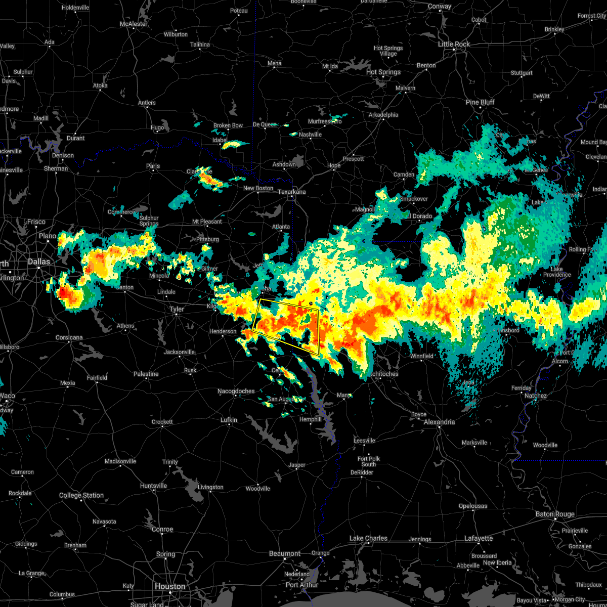 At 723 pm cdt, a severe thunderstorm was located over deberry, or 13 miles northeast of carthage, moving east at 25 mph (radar indicated). Hazards include 60 mph wind gusts and quarter size hail. Hail damage to vehicles is expected. Expect wind damage to roofs, siding, and trees. At 723 pm cdt, a severe thunderstorm was located over deberry, or 13 miles northeast of carthage, moving east at 25 mph (radar indicated). Hazards include 60 mph wind gusts and quarter size hail. Hail damage to vehicles is expected. Expect wind damage to roofs, siding, and trees.
|
| 4/6/2018 6:42 PM CDT |
 At 642 pm cdt, severe thunderstorms were located along a line extending from 6 miles southeast of cotton valley to bossier city to near greenwood, moving southeast at 40 mph (radar indicated). Hazards include two inch hail and 70 mph wind gusts. People and animals outdoors will be injured. expect hail damage to roofs, siding, windows, and vehicles. expect considerable tree damage. Wind damage is also likely to mobile homes, roofs, and outbuildings. At 642 pm cdt, severe thunderstorms were located along a line extending from 6 miles southeast of cotton valley to bossier city to near greenwood, moving southeast at 40 mph (radar indicated). Hazards include two inch hail and 70 mph wind gusts. People and animals outdoors will be injured. expect hail damage to roofs, siding, windows, and vehicles. expect considerable tree damage. Wind damage is also likely to mobile homes, roofs, and outbuildings.
|
| 4/6/2018 6:25 PM CDT | Golf Ball sized hail reported 6.7 miles W of Shreveport, LA |
| 4/6/2018 6:24 PM CDT |
 At 623 pm cdt, a severe thunderstorm was located over elysian fields, or 15 miles northeast of carthage, moving east at 45 mph (radar indicated). Hazards include 60 mph wind gusts and quarter size hail. Hail damage to vehicles is expected. Expect wind damage to roofs, siding, and trees. At 623 pm cdt, a severe thunderstorm was located over elysian fields, or 15 miles northeast of carthage, moving east at 45 mph (radar indicated). Hazards include 60 mph wind gusts and quarter size hail. Hail damage to vehicles is expected. Expect wind damage to roofs, siding, and trees.
|
| 4/6/2018 6:20 PM CDT | Golf Ball sized hail reported 6.4 miles WNW of Shreveport, LA |
| 4/6/2018 6:15 PM CDT | Half Dollar sized hail reported 6.7 miles NNW of Shreveport, LA |
| 4/6/2018 6:12 PM CDT | Quarter sized hail reported 6.3 miles NW of Shreveport, LA |
| 4/6/2018 6:08 PM CDT | Quarter sized hail reported 3.4 miles ENE of Shreveport, LA |
| 4/6/2018 6:04 PM CDT |
 At 603 pm cdt, a severe thunderstorm was located 8 miles south of karnack, or 9 miles east of marshall, moving east at 45 mph (radar indicated). Hazards include 60 mph wind gusts and quarter size hail. Hail damage to vehicles is expected. Expect wind damage to roofs, siding, and trees. At 603 pm cdt, a severe thunderstorm was located 8 miles south of karnack, or 9 miles east of marshall, moving east at 45 mph (radar indicated). Hazards include 60 mph wind gusts and quarter size hail. Hail damage to vehicles is expected. Expect wind damage to roofs, siding, and trees.
|
| 4/6/2018 5:57 PM CDT |
 At 557 pm cdt, a severe thunderstorm was located 8 miles east of stonewall, or 15 miles north of mansfield, moving east at 40 mph (radar indicated). Hazards include 60 mph wind gusts and quarter size hail. Hail damage to vehicles is expected. Expect wind damage to roofs, siding, and trees. At 557 pm cdt, a severe thunderstorm was located 8 miles east of stonewall, or 15 miles north of mansfield, moving east at 40 mph (radar indicated). Hazards include 60 mph wind gusts and quarter size hail. Hail damage to vehicles is expected. Expect wind damage to roofs, siding, and trees.
|
| 4/6/2018 5:54 PM CDT |
 At 554 pm cdt, severe thunderstorms were located along a line extending from plain dealing to belcher to near karnack, moving southeast at 45 mph. these are very dangerous storms (radar indicated). Hazards include baseball size hail and 70 mph wind gusts. People and animals outdoors will be severely injured. Expect shattered windows, extensive damage to roofs, siding, and vehicles. At 554 pm cdt, severe thunderstorms were located along a line extending from plain dealing to belcher to near karnack, moving southeast at 45 mph. these are very dangerous storms (radar indicated). Hazards include baseball size hail and 70 mph wind gusts. People and animals outdoors will be severely injured. Expect shattered windows, extensive damage to roofs, siding, and vehicles.
|
| 4/3/2018 4:31 PM CDT |
 At 430 pm cdt, severe thunderstorms were located along a line extending from near cullen to near minden to 14 miles east of stonewall, moving east northeast at 40 mph (radar indicated. at 400 pm, quarter size hail was reported in south shreveport. trees have also been blown down near the louisiana line with these storms). Hazards include 70 mph wind gusts and quarter size hail. Hail damage to vehicles is expected. expect considerable tree damage. Wind damage is also likely to mobile homes, roofs, and outbuildings. At 430 pm cdt, severe thunderstorms were located along a line extending from near cullen to near minden to 14 miles east of stonewall, moving east northeast at 40 mph (radar indicated. at 400 pm, quarter size hail was reported in south shreveport. trees have also been blown down near the louisiana line with these storms). Hazards include 70 mph wind gusts and quarter size hail. Hail damage to vehicles is expected. expect considerable tree damage. Wind damage is also likely to mobile homes, roofs, and outbuildings.
|
| 4/3/2018 4:22 PM CDT | Quarter sized hail reported 8.5 miles NW of Shreveport, LA, nickel to quarter size hail reported ellerbe estates south shreveport. |
| 4/3/2018 4:15 PM CDT |
 At 415 pm cdt, severe thunderstorms were located along a line extending from 7 miles west of cotton valley to 6 miles north of eastwood to near haughton to near stonewall, moving east at 40 mph (radar indicated). Hazards include 70 mph wind gusts and quarter size hail. Hail damage to vehicles is expected. expect considerable tree damage. wind damage is also likely to mobile homes, roofs, and outbuildings. Locations impacted include, shreveport, bossier city, minden, springhill, homer, haughton, greenwood, blanchard, benton, stonewall, ringgold, sibley, cullen, cotton valley, gibsland, sarepta, doyline, dixie inn, dubberly and heflin. At 415 pm cdt, severe thunderstorms were located along a line extending from 7 miles west of cotton valley to 6 miles north of eastwood to near haughton to near stonewall, moving east at 40 mph (radar indicated). Hazards include 70 mph wind gusts and quarter size hail. Hail damage to vehicles is expected. expect considerable tree damage. wind damage is also likely to mobile homes, roofs, and outbuildings. Locations impacted include, shreveport, bossier city, minden, springhill, homer, haughton, greenwood, blanchard, benton, stonewall, ringgold, sibley, cullen, cotton valley, gibsland, sarepta, doyline, dixie inn, dubberly and heflin.
|
| 4/3/2018 3:55 PM CDT | Transformer blows sparking fire outside royal inn on north market stree in caddo county LA, 5.3 miles SW of Shreveport, LA |
| 4/3/2018 3:55 PM CDT | Tree and power lines down on anna street in shrevepor in caddo county LA, 3.6 miles SSW of Shreveport, LA |
| 4/3/2018 3:50 PM CDT | Large tree down in highland neighborhood per ksla social medi in caddo county LA, 4.7 miles WSW of Shreveport, LA |
| 4/3/2018 3:50 PM CDT | Large tree down across old mooringsport roa in caddo county LA, 10.3 miles SSE of Shreveport, LA |
| 4/3/2018 3:48 PM CDT |
 At 347 pm cdt, a severe thunderstorm was located over greenwood, or 9 miles west of shreveport, moving east at 50 mph (radar indicated). Hazards include 70 mph wind gusts and quarter size hail. Hail damage to vehicles is expected. expect considerable tree damage. Wind damage is also likely to mobile homes, roofs, and outbuildings. At 347 pm cdt, a severe thunderstorm was located over greenwood, or 9 miles west of shreveport, moving east at 50 mph (radar indicated). Hazards include 70 mph wind gusts and quarter size hail. Hail damage to vehicles is expected. expect considerable tree damage. Wind damage is also likely to mobile homes, roofs, and outbuildings.
|
| 4/3/2018 3:21 PM CDT |
 At 320 pm cdt, a severe thunderstorm was located over deberry, or 14 miles northeast of carthage, moving northeast at 55 mph (radar indicated). Hazards include 60 mph wind gusts and quarter size hail. Hail damage to vehicles is expected. Expect wind damage to roofs, siding, and trees. At 320 pm cdt, a severe thunderstorm was located over deberry, or 14 miles northeast of carthage, moving northeast at 55 mph (radar indicated). Hazards include 60 mph wind gusts and quarter size hail. Hail damage to vehicles is expected. Expect wind damage to roofs, siding, and trees.
|
| 4/3/2018 3:21 PM CDT |
 The national weather service in shreveport has issued a * severe thunderstorm warning for. northwestern de soto parish in northwestern louisiana. southwestern caddo parish in northwestern louisiana. harrison county in northeastern texas. Panola county in northeastern texas. The national weather service in shreveport has issued a * severe thunderstorm warning for. northwestern de soto parish in northwestern louisiana. southwestern caddo parish in northwestern louisiana. harrison county in northeastern texas. Panola county in northeastern texas.
|
| 3/1/2018 3:17 AM CST |
 At 317 am cst, severe thunderstorms were located along a line extending from 10 miles east of haynesville to 6 miles northeast of minden to haughton, moving east at 35 mph (radar indicated). Hazards include 60 mph wind gusts. Expect damage to roofs, siding, and trees. Locations impacted include, shreveport, bossier city, minden, homer, haughton, arcadia, haynesville, sibley, gibsland, doyline, dubberly, dixie inn, eastwood, fosters, evergreen, athens, lisbon, mount lebanon, ferguson and leton. At 317 am cst, severe thunderstorms were located along a line extending from 10 miles east of haynesville to 6 miles northeast of minden to haughton, moving east at 35 mph (radar indicated). Hazards include 60 mph wind gusts. Expect damage to roofs, siding, and trees. Locations impacted include, shreveport, bossier city, minden, homer, haughton, arcadia, haynesville, sibley, gibsland, doyline, dubberly, dixie inn, eastwood, fosters, evergreen, athens, lisbon, mount lebanon, ferguson and leton.
|
| 3/1/2018 3:06 AM CST |
 At 306 am cst, severe thunderstorms were located along a line extending from near benton to near elysian fields to near pinehill, moving east at 55 mph (radar indicated). Hazards include 60 mph wind gusts. Expect damage to roofs, siding, and trees. Locations impacted include, shreveport, carthage, greenwood, blanchard, waskom, beckville, mooringsport, deberry, elysian fields, pinehill, chapman, spring ridge, cross lake, fairplay, jonesville, church hill, bethany and midyett. At 306 am cst, severe thunderstorms were located along a line extending from near benton to near elysian fields to near pinehill, moving east at 55 mph (radar indicated). Hazards include 60 mph wind gusts. Expect damage to roofs, siding, and trees. Locations impacted include, shreveport, carthage, greenwood, blanchard, waskom, beckville, mooringsport, deberry, elysian fields, pinehill, chapman, spring ridge, cross lake, fairplay, jonesville, church hill, bethany and midyett.
|
| 3/1/2018 2:49 AM CST |
 At 249 am cst, severe thunderstorms were located along a line extending from near mooringsport to 9 miles south of marshall to near henderson, moving east at 55 mph (radar indicated). Hazards include 60 mph wind gusts. Expect damage to roofs, siding, and trees. Locations impacted include, shreveport, longview, marshall, henderson, kilgore, carthage, hallsville, greenwood, blanchard, waskom, tatum, new london, beckville, mooringsport, deberry, elysian fields, pinehill, karnack, woodlawn and joinerville. At 249 am cst, severe thunderstorms were located along a line extending from near mooringsport to 9 miles south of marshall to near henderson, moving east at 55 mph (radar indicated). Hazards include 60 mph wind gusts. Expect damage to roofs, siding, and trees. Locations impacted include, shreveport, longview, marshall, henderson, kilgore, carthage, hallsville, greenwood, blanchard, waskom, tatum, new london, beckville, mooringsport, deberry, elysian fields, pinehill, karnack, woodlawn and joinerville.
|
| 3/1/2018 2:46 AM CST |
 At 246 am cst, severe thunderstorms were located along a line extending from near haynesville to near cotton valley to near benton, moving east at 45 mph (radar indicated). Hazards include 60 mph wind gusts. expect damage to roofs, siding, and trees At 246 am cst, severe thunderstorms were located along a line extending from near haynesville to near cotton valley to near benton, moving east at 45 mph (radar indicated). Hazards include 60 mph wind gusts. expect damage to roofs, siding, and trees
|
| 3/1/2018 2:28 AM CST |
 The national weather service in shreveport has issued a * severe thunderstorm warning for. southwestern caddo parish in northwestern louisiana. southeastern smith county in northeastern texas. harrison county in northeastern texas. Northern panola county in northeastern texas. The national weather service in shreveport has issued a * severe thunderstorm warning for. southwestern caddo parish in northwestern louisiana. southeastern smith county in northeastern texas. harrison county in northeastern texas. Northern panola county in northeastern texas.
|
| 3/1/2018 2:28 AM CST |
 At 228 am cst, severe thunderstorms were located along a line extending from near woodlawn to 6 miles southwest of hallsville to near arp, moving east at 55 mph (radar indicated). Hazards include 60 mph wind gusts. expect damage to roofs, siding, and trees At 228 am cst, severe thunderstorms were located along a line extending from near woodlawn to 6 miles southwest of hallsville to near arp, moving east at 55 mph (radar indicated). Hazards include 60 mph wind gusts. expect damage to roofs, siding, and trees
|
| 2/24/2018 5:07 PM CST |
 At 506 pm cst, severe thunderstorms were located along a line extending from near plain dealing to 7 miles east of belcher to near benton to near blanchard to 8 miles south of mooringsport, moving east at 40 mph (radar indicated). Hazards include 60 mph wind gusts and quarter size hail. Hail damage to vehicles is expected. expect wind damage to roofs, siding, and trees. locations impacted include, shreveport, bossier city, haughton, blanchard, benton, cullen, plain dealing, cotton valley, oil city, sarepta, doyline, mooringsport, hosston, dixie inn, belcher, shongaloo, gilliam, eastwood, fosters and alden bridge. A tornado watch remains in effect until 600 pm cst for northwestern louisiana. At 506 pm cst, severe thunderstorms were located along a line extending from near plain dealing to 7 miles east of belcher to near benton to near blanchard to 8 miles south of mooringsport, moving east at 40 mph (radar indicated). Hazards include 60 mph wind gusts and quarter size hail. Hail damage to vehicles is expected. expect wind damage to roofs, siding, and trees. locations impacted include, shreveport, bossier city, haughton, blanchard, benton, cullen, plain dealing, cotton valley, oil city, sarepta, doyline, mooringsport, hosston, dixie inn, belcher, shongaloo, gilliam, eastwood, fosters and alden bridge. A tornado watch remains in effect until 600 pm cst for northwestern louisiana.
|
| 2/24/2018 4:43 PM CST |
 At 442 pm cst, severe thunderstorms were located along a line extending from near oil city to 6 miles south of karnack to 6 miles northwest of elysian fields, moving east at 40 mph (radar indicated). Hazards include 60 mph wind gusts and quarter size hail. Hail damage to vehicles is expected. Expect wind damage to roofs, siding, and trees. At 442 pm cst, severe thunderstorms were located along a line extending from near oil city to 6 miles south of karnack to 6 miles northwest of elysian fields, moving east at 40 mph (radar indicated). Hazards include 60 mph wind gusts and quarter size hail. Hail damage to vehicles is expected. Expect wind damage to roofs, siding, and trees.
|
| 9/5/2017 6:08 PM CDT |
 At 608 pm cdt, severe thunderstorms were located along a line extending from near homer to near blanchard, moving southeast at 20 mph (radar indicated). Hazards include 60 mph wind gusts and quarter size hail. Hail damage to vehicles is expected. expect wind damage to roofs, siding, and trees. Locations impacted include, shreveport, bossier city, ruston, minden, grambling, homer, haughton, arcadia, blanchard, benton, sibley, cotton valley, oil city, gibsland, doyline, mooringsport, dixie inn, dubberly, belcher and heflin. At 608 pm cdt, severe thunderstorms were located along a line extending from near homer to near blanchard, moving southeast at 20 mph (radar indicated). Hazards include 60 mph wind gusts and quarter size hail. Hail damage to vehicles is expected. expect wind damage to roofs, siding, and trees. Locations impacted include, shreveport, bossier city, ruston, minden, grambling, homer, haughton, arcadia, blanchard, benton, sibley, cotton valley, oil city, gibsland, doyline, mooringsport, dixie inn, dubberly, belcher and heflin.
|
| 9/5/2017 5:59 PM CDT |
 At 559 pm cdt, severe thunderstorms were located along a line extending from 8 miles west of homer to near mooringsport, moving southeast at 10 mph (radar indicated). Hazards include quarter size hail. Damage to vehicles is expected. Locations impacted include, shreveport, bossier city, ruston, minden, grambling, homer, haughton, arcadia, blanchard, benton, sibley, cotton valley, oil city, gibsland, doyline, mooringsport, dixie inn, dubberly, belcher and heflin. At 559 pm cdt, severe thunderstorms were located along a line extending from 8 miles west of homer to near mooringsport, moving southeast at 10 mph (radar indicated). Hazards include quarter size hail. Damage to vehicles is expected. Locations impacted include, shreveport, bossier city, ruston, minden, grambling, homer, haughton, arcadia, blanchard, benton, sibley, cotton valley, oil city, gibsland, doyline, mooringsport, dixie inn, dubberly, belcher and heflin.
|
| 9/5/2017 5:53 PM CDT |
 At 552 pm cdt, severe thunderstorms were located along a line extending from 8 miles west of homer to near mooringsport, moving southeast at 10 mph (radar indicated). Hazards include 60 mph wind gusts and quarter size hail. Hail damage to vehicles is expected. Expect wind damage to roofs, siding, and trees. At 552 pm cdt, severe thunderstorms were located along a line extending from 8 miles west of homer to near mooringsport, moving southeast at 10 mph (radar indicated). Hazards include 60 mph wind gusts and quarter size hail. Hail damage to vehicles is expected. Expect wind damage to roofs, siding, and trees.
|
| 7/14/2017 3:59 PM CDT |
 At 359 pm cdt, a severe thunderstorm was located over blanchard, or 7 miles northwest of shreveport, and is nearly stationary (radar indicated). Hazards include 60 mph wind gusts and penny size hail. expect damage to roofs, siding, and trees At 359 pm cdt, a severe thunderstorm was located over blanchard, or 7 miles northwest of shreveport, and is nearly stationary (radar indicated). Hazards include 60 mph wind gusts and penny size hail. expect damage to roofs, siding, and trees
|
| 7/8/2017 4:23 PM CDT |
 At 423 pm cdt, a severe thunderstorm was located near hoard, or 8 miles southeast of mineola, moving southeast at 15 mph (radar indicated). Hazards include 60 mph wind gusts and quarter size hail. Hail damage to vehicles is expected. Expect wind damage to roofs, siding, and trees. At 423 pm cdt, a severe thunderstorm was located near hoard, or 8 miles southeast of mineola, moving southeast at 15 mph (radar indicated). Hazards include 60 mph wind gusts and quarter size hail. Hail damage to vehicles is expected. Expect wind damage to roofs, siding, and trees.
|
| 7/8/2017 4:22 PM CDT |
 At 422 pm cdt, a severe thunderstorm was located near karnack, or 16 miles northeast of marshall, moving southeast at 15 mph (radar indicated). Hazards include 60 mph wind gusts and quarter size hail. Hail damage to vehicles is expected. Expect wind damage to roofs, siding, and trees. At 422 pm cdt, a severe thunderstorm was located near karnack, or 16 miles northeast of marshall, moving southeast at 15 mph (radar indicated). Hazards include 60 mph wind gusts and quarter size hail. Hail damage to vehicles is expected. Expect wind damage to roofs, siding, and trees.
|
| 7/8/2017 4:07 PM CDT |
 At 407 pm cdt, a severe thunderstorm was located near shreveport, moving southeast at 15 mph (radar indicated). Hazards include 60 mph wind gusts and penny size hail. expect damage to roofs, siding, and trees At 407 pm cdt, a severe thunderstorm was located near shreveport, moving southeast at 15 mph (radar indicated). Hazards include 60 mph wind gusts and penny size hail. expect damage to roofs, siding, and trees
|
| 7/6/2017 6:05 PM CDT | Tree down by ac steere elementary schoo in caddo county LA, 5.5 miles W of Shreveport, LA |
| 7/6/2017 5:20 PM CDT | Trees dow in caddo county LA, 6.9 miles WNW of Shreveport, LA |
| 7/6/2017 5:20 PM CDT | Tree dow in caddo county LA, 7.4 miles WNW of Shreveport, LA |
| 7/6/2017 5:20 PM CDT |
 At 520 pm cdt, a severe thunderstorm was located near stonewall, or 10 miles southwest of shreveport, moving east at 25 mph (radar indicated). Hazards include 60 mph wind gusts and nickel size hail. expect damage to roofs, siding, and trees At 520 pm cdt, a severe thunderstorm was located near stonewall, or 10 miles southwest of shreveport, moving east at 25 mph (radar indicated). Hazards include 60 mph wind gusts and nickel size hail. expect damage to roofs, siding, and trees
|
| 7/6/2017 5:15 PM CDT | Tree dow in caddo county LA, 4.5 miles WNW of Shreveport, LA |
| 7/6/2017 5:15 PM CDT | Tree dow in caddo county LA, 3.8 miles NNW of Shreveport, LA |
| 7/6/2017 5:12 PM CDT | Tree dow in caddo county LA, 3.3 miles WSW of Shreveport, LA |
| 7/6/2017 5:10 PM CDT | Powerlines dow in caddo county LA, 4.2 miles WNW of Shreveport, LA |
| 7/6/2017 5:10 PM CDT | Tree dow in caddo county LA, 2.2 miles WSW of Shreveport, LA |
| 7/6/2017 5:10 PM CDT | Tree dow in caddo county LA, 2.7 miles SSW of Shreveport, LA |
| 7/6/2017 5:09 PM CDT | Tree dow in caddo county LA, 2.6 miles SW of Shreveport, LA |
| 7/6/2017 5:07 PM CDT |
 At 506 pm cdt, a severe thunderstorm was located over shreveport moving south southeast near 15 mph (radar indicated). Hazards include 60 mph wind gusts and pea size hail. Expect damage to roofs, siding, and trees. Locations impacted include, shreveport, bossier city, greenwood, fosters, ferguson, taylortown, robson, cross lake, forbing, barksdale air force base and red chute. At 506 pm cdt, a severe thunderstorm was located over shreveport moving south southeast near 15 mph (radar indicated). Hazards include 60 mph wind gusts and pea size hail. Expect damage to roofs, siding, and trees. Locations impacted include, shreveport, bossier city, greenwood, fosters, ferguson, taylortown, robson, cross lake, forbing, barksdale air force base and red chute.
|
| 7/6/2017 5:04 PM CDT | Tree dow in caddo county LA, 2.1 miles E of Shreveport, LA |
| 7/6/2017 4:55 PM CDT | Tree dow in caddo county LA, 6.8 miles SSW of Shreveport, LA |
| 7/6/2017 4:55 PM CDT | Tree dow in caddo county LA, 6.8 miles NE of Shreveport, LA |
| 7/6/2017 4:55 PM CDT | Tree dow in caddo county LA, 7.2 miles NE of Shreveport, LA |
| 7/6/2017 4:55 PM CDT | Power lines dow in caddo county LA, 3.7 miles ENE of Shreveport, LA |
| 7/6/2017 4:54 PM CDT | Tree dow in caddo county LA, 10.2 miles E of Shreveport, LA |
| 7/6/2017 4:54 PM CDT | Tree dow in caddo county LA, 9.1 miles E of Shreveport, LA |
| 7/6/2017 4:50 PM CDT | Tree dow in caddo county LA, 5.7 miles SSE of Shreveport, LA |
| 7/6/2017 4:50 PM CDT | Tree dow in caddo county LA, 8.7 miles SE of Shreveport, LA |
| 7/6/2017 4:45 PM CDT |
 At 445 pm cdt, a severe thunderstorm was located over waskom, or 14 miles west of shreveport, moving east at 10 mph (radar indicated). Hazards include 60 mph wind gusts and nickel size hail. expect damage to roofs, siding, and trees At 445 pm cdt, a severe thunderstorm was located over waskom, or 14 miles west of shreveport, moving east at 10 mph (radar indicated). Hazards include 60 mph wind gusts and nickel size hail. expect damage to roofs, siding, and trees
|
| 7/1/2017 2:42 PM CDT |
 At 241 pm cdt, severe thunderstorms were located along a line extending from near smithland to near oil city to near blanchard to near greenwood, moving east at 65 mph (radar indicated). Hazards include 60 mph wind gusts and nickel size hail. expect damage to roofs, siding, and trees At 241 pm cdt, severe thunderstorms were located along a line extending from near smithland to near oil city to near blanchard to near greenwood, moving east at 65 mph (radar indicated). Hazards include 60 mph wind gusts and nickel size hail. expect damage to roofs, siding, and trees
|
| 7/1/2017 2:23 PM CDT |
 At 223 pm cdt, a severe thunderstorm was located near elysian fields, or 11 miles southeast of marshall, moving east at 30 mph (radar indicated). Hazards include 70 mph wind gusts and quarter size hail. Hail damage to vehicles is expected. expect considerable tree damage. Wind damage is also likely to mobile homes, roofs, and outbuildings. At 223 pm cdt, a severe thunderstorm was located near elysian fields, or 11 miles southeast of marshall, moving east at 30 mph (radar indicated). Hazards include 70 mph wind gusts and quarter size hail. Hail damage to vehicles is expected. expect considerable tree damage. Wind damage is also likely to mobile homes, roofs, and outbuildings.
|
| 5/28/2017 6:22 PM CDT |
 At 622 pm cdt, severe thunderstorms were located along a line extending from 6 miles southeast of shreveport to near logansport, moving east at 40 mph (radar indicated). Hazards include 60 mph wind gusts and quarter size hail. Hail damage to vehicles is expected. Expect wind damage to roofs, siding, and trees. At 622 pm cdt, severe thunderstorms were located along a line extending from 6 miles southeast of shreveport to near logansport, moving east at 40 mph (radar indicated). Hazards include 60 mph wind gusts and quarter size hail. Hail damage to vehicles is expected. Expect wind damage to roofs, siding, and trees.
|
| 5/28/2017 6:22 PM CDT |
 The national weather service in shreveport has issued a * severe thunderstorm warning for. southwestern webster parish in northwestern louisiana. de soto parish in northwestern louisiana. northwestern red river parish in northwestern louisiana. Southeastern caddo parish in northwestern louisiana. The national weather service in shreveport has issued a * severe thunderstorm warning for. southwestern webster parish in northwestern louisiana. de soto parish in northwestern louisiana. northwestern red river parish in northwestern louisiana. Southeastern caddo parish in northwestern louisiana.
|
| 5/28/2017 6:20 PM CDT | A large snapped tree branch was pushed through a bedroom window at a home in se shrevepor in caddo county LA, 6.9 miles WNW of Shreveport, LA |
| 5/28/2017 5:41 PM CDT |
 At 540 pm cdt, a severe thunderstorm was located over greenwood, or 12 miles west of shreveport, moving east at 15 mph (radar indicated). Hazards include 60 mph wind gusts and quarter size hail. Hail damage to vehicles is expected. Expect wind damage to roofs, siding, and trees. At 540 pm cdt, a severe thunderstorm was located over greenwood, or 12 miles west of shreveport, moving east at 15 mph (radar indicated). Hazards include 60 mph wind gusts and quarter size hail. Hail damage to vehicles is expected. Expect wind damage to roofs, siding, and trees.
|
| 5/28/2017 5:41 PM CDT |
 The national weather service in shreveport has issued a * severe thunderstorm warning for. north central de soto parish in northwestern louisiana. southwestern caddo parish in northwestern louisiana. southwestern bossier parish in northwestern louisiana. Southeastern harrison county in northeastern texas. The national weather service in shreveport has issued a * severe thunderstorm warning for. north central de soto parish in northwestern louisiana. southwestern caddo parish in northwestern louisiana. southwestern bossier parish in northwestern louisiana. Southeastern harrison county in northeastern texas.
|
| 5/21/2017 9:17 AM CDT |
 At 916 am cdt, severe thunderstorms were located along a line extending from jefferson to near karnack to near waskom to near greenwood, moving northeast at 45 mph (radar indicated). Hazards include 60 mph wind gusts and quarter size hail. Hail damage to vehicles is expected. expect wind damage to roofs, siding, and trees. Locations impacted include, shreveport, marshall, greenwood, blanchard, waskom, jefferson, oil city, mooringsport, belcher, karnack, woodlawn, smithland, gray, scottsville, uncertain, dixie, nesbitt, caddo lake, cross lake and cavett. At 916 am cdt, severe thunderstorms were located along a line extending from jefferson to near karnack to near waskom to near greenwood, moving northeast at 45 mph (radar indicated). Hazards include 60 mph wind gusts and quarter size hail. Hail damage to vehicles is expected. expect wind damage to roofs, siding, and trees. Locations impacted include, shreveport, marshall, greenwood, blanchard, waskom, jefferson, oil city, mooringsport, belcher, karnack, woodlawn, smithland, gray, scottsville, uncertain, dixie, nesbitt, caddo lake, cross lake and cavett.
|
| 5/21/2017 8:54 AM CDT |
 At 853 am cdt, severe thunderstorms were located along a line extending from near hallsville to 6 miles southwest of marshall to near elysian fields, moving northeast at 30 mph (radar indicated). Hazards include 60 mph wind gusts and quarter size hail. Hail damage to vehicles is expected. expect wind damage to roofs, siding, and trees. Locations impacted include, shreveport, marshall, hallsville, greenwood, blanchard, waskom, jefferson, oil city, mooringsport, belcher, deberry, elysian fields, smithland, karnack, woodlawn, gray, scottsville, uncertain, nesbitt and cross lake. At 853 am cdt, severe thunderstorms were located along a line extending from near hallsville to 6 miles southwest of marshall to near elysian fields, moving northeast at 30 mph (radar indicated). Hazards include 60 mph wind gusts and quarter size hail. Hail damage to vehicles is expected. expect wind damage to roofs, siding, and trees. Locations impacted include, shreveport, marshall, hallsville, greenwood, blanchard, waskom, jefferson, oil city, mooringsport, belcher, deberry, elysian fields, smithland, karnack, woodlawn, gray, scottsville, uncertain, nesbitt and cross lake.
|
| 5/21/2017 8:31 AM CDT |
 At 830 am cdt, severe thunderstorms were located along a line extending from 7 miles south of longview to 6 miles south of hallsville to 6 miles east of tatum to near carthage, moving northeast at 45 mph (radar indicated). Hazards include 60 mph wind gusts and quarter size hail. Hail damage to vehicles is expected. Expect wind damage to roofs, siding, and trees. At 830 am cdt, severe thunderstorms were located along a line extending from 7 miles south of longview to 6 miles south of hallsville to 6 miles east of tatum to near carthage, moving northeast at 45 mph (radar indicated). Hazards include 60 mph wind gusts and quarter size hail. Hail damage to vehicles is expected. Expect wind damage to roofs, siding, and trees.
|
| 5/20/2017 11:18 PM CDT | Trees and power lines down bayou drive between dixie garden and bermuda... power ou in caddo county LA, 6.7 miles W of Shreveport, LA |
| 5/20/2017 11:16 PM CDT |
 At 1116 pm cdt, severe thunderstorms were located from downtown shreveport to near doyline, moving east northeast at 25 mph (radar indicated). Hazards include 60 mph wind gusts and quarter size hail. Hail damage to vehicles is expected. Expect wind damage to roofs, siding, and trees. At 1116 pm cdt, severe thunderstorms were located from downtown shreveport to near doyline, moving east northeast at 25 mph (radar indicated). Hazards include 60 mph wind gusts and quarter size hail. Hail damage to vehicles is expected. Expect wind damage to roofs, siding, and trees.
|
| 5/20/2017 10:59 PM CDT |
 At 1059 pm cdt, a severe thunderstorm was located 9 miles south of bossier city, moving northeast at 25 mph (radar indicated). Hazards include 60 mph wind gusts and half dollar size hail. Hail damage to vehicles is expected. expect wind damage to roofs, siding, and trees. Locations impacted include, shreveport, bossier city, haughton, eastwood, frierson, princeton, caspiana, taylortown, elm grove, fillmore, bodcau, koran, robson, mc dade, forbing, sligo and red chute. At 1059 pm cdt, a severe thunderstorm was located 9 miles south of bossier city, moving northeast at 25 mph (radar indicated). Hazards include 60 mph wind gusts and half dollar size hail. Hail damage to vehicles is expected. expect wind damage to roofs, siding, and trees. Locations impacted include, shreveport, bossier city, haughton, eastwood, frierson, princeton, caspiana, taylortown, elm grove, fillmore, bodcau, koran, robson, mc dade, forbing, sligo and red chute.
|
| 5/20/2017 10:44 PM CDT |
 At 1044 pm cdt, a severe thunderstorm was located near stonewall, or 11 miles south of shreveport, moving northeast at 25 mph (radar indicated). Hazards include 60 mph wind gusts and half dollar size hail. Hail damage to vehicles is expected. Expect wind damage to roofs, siding, and trees. At 1044 pm cdt, a severe thunderstorm was located near stonewall, or 11 miles south of shreveport, moving northeast at 25 mph (radar indicated). Hazards include 60 mph wind gusts and half dollar size hail. Hail damage to vehicles is expected. Expect wind damage to roofs, siding, and trees.
|
| 5/11/2017 8:11 PM CDT |
 At 810 pm cdt, severe thunderstorms were located along a line extending from near oil city to 6 miles northeast of waskom, moving east at 35 mph (radar indicated). Hazards include 60 mph wind gusts. expect damage to roofs, siding, and trees At 810 pm cdt, severe thunderstorms were located along a line extending from near oil city to 6 miles northeast of waskom, moving east at 35 mph (radar indicated). Hazards include 60 mph wind gusts. expect damage to roofs, siding, and trees
|
| 5/3/2017 5:20 PM CDT |
 At 520 pm cdt, severe thunderstorms were located along a line extending from near bossier city to 10 miles east of stonewall to 10 miles west of coushatta to 11 miles southeast of mansfield to 7 miles northeast of converse, moving east at 65 mph (radar indicated). Hazards include 60 mph wind gusts and quarter size hail. Hail damage to vehicles is expected. expect wind damage to roofs, siding, and trees. Locations impacted include, bossier city, coushatta, hall summit, edgefield, lake end, curtis, grand bayou, hanna, loggy bayou, koran, ninock, pelican, crichton, mc dade, armistead, ajax, evelyn, frierson, caspiana and lake bistineau south. At 520 pm cdt, severe thunderstorms were located along a line extending from near bossier city to 10 miles east of stonewall to 10 miles west of coushatta to 11 miles southeast of mansfield to 7 miles northeast of converse, moving east at 65 mph (radar indicated). Hazards include 60 mph wind gusts and quarter size hail. Hail damage to vehicles is expected. expect wind damage to roofs, siding, and trees. Locations impacted include, bossier city, coushatta, hall summit, edgefield, lake end, curtis, grand bayou, hanna, loggy bayou, koran, ninock, pelican, crichton, mc dade, armistead, ajax, evelyn, frierson, caspiana and lake bistineau south.
|
| 5/3/2017 5:15 PM CDT |
 At 514 pm cdt, severe thunderstorms were located along a line extending from near shreveport to 7 miles east of stonewall to 6 miles northeast of mansfield to 17 miles west of coushatta to 6 miles north of converse, moving east at 65 mph (radar indicated). Hazards include 60 mph wind gusts and quarter size hail. Hail damage to vehicles is expected. expect wind damage to roofs, siding, and trees. Locations impacted include, shreveport, bossier city, mansfield, coushatta, stonewall, hall summit, edgefield, carmel, lake end, curtis, grand bayou, kingston, hanna, loggy bayou, koran, ninock, pelican, crichton, mc dade and armistead. At 514 pm cdt, severe thunderstorms were located along a line extending from near shreveport to 7 miles east of stonewall to 6 miles northeast of mansfield to 17 miles west of coushatta to 6 miles north of converse, moving east at 65 mph (radar indicated). Hazards include 60 mph wind gusts and quarter size hail. Hail damage to vehicles is expected. expect wind damage to roofs, siding, and trees. Locations impacted include, shreveport, bossier city, mansfield, coushatta, stonewall, hall summit, edgefield, carmel, lake end, curtis, grand bayou, kingston, hanna, loggy bayou, koran, ninock, pelican, crichton, mc dade and armistead.
|
| 5/3/2017 5:07 PM CDT |
 At 507 pm cdt, severe thunderstorms were located along a line extending from near shreveport to stonewall to near mansfield to 15 miles east of logansport to 8 miles northwest of converse, moving east at 50 mph (radar indicated). Hazards include 60 mph wind gusts and quarter size hail. Hail damage to vehicles is expected. expect wind damage to roofs, siding, and trees. Locations impacted include, shreveport, bossier city, mansfield, greenwood, coushatta, stonewall, south mansfield, hall summit, grand cane, edgefield, carmel, lake end, curtis, grand bayou, kingston, hanna, loggy bayou, koran, ninock and pelican. At 507 pm cdt, severe thunderstorms were located along a line extending from near shreveport to stonewall to near mansfield to 15 miles east of logansport to 8 miles northwest of converse, moving east at 50 mph (radar indicated). Hazards include 60 mph wind gusts and quarter size hail. Hail damage to vehicles is expected. expect wind damage to roofs, siding, and trees. Locations impacted include, shreveport, bossier city, mansfield, greenwood, coushatta, stonewall, south mansfield, hall summit, grand cane, edgefield, carmel, lake end, curtis, grand bayou, kingston, hanna, loggy bayou, koran, ninock and pelican.
|
| 5/3/2017 4:42 PM CDT |
 At 441 pm cdt, severe thunderstorms were located along a line extending from near waskom to joaquin, moving east at 65 mph (radar indicated). Hazards include 70 mph wind gusts and quarter size hail. Hail damage to vehicles is expected. expect considerable tree damage. Wind damage is also likely to mobile homes, roofs, and outbuildings. At 441 pm cdt, severe thunderstorms were located along a line extending from near waskom to joaquin, moving east at 65 mph (radar indicated). Hazards include 70 mph wind gusts and quarter size hail. Hail damage to vehicles is expected. expect considerable tree damage. Wind damage is also likely to mobile homes, roofs, and outbuildings.
|
| 4/2/2017 1:44 PM CDT |
 At 143 pm cdt, a severe thunderstorm was located 8 miles west of stonewall, or 15 miles southwest of shreveport, moving northeast at 35 mph (radar indicated). Hazards include 70 mph wind gusts and quarter size hail. Hail damage to vehicles is expected. expect considerable tree damage. Wind damage is also likely to mobile homes, roofs, and outbuildings. At 143 pm cdt, a severe thunderstorm was located 8 miles west of stonewall, or 15 miles southwest of shreveport, moving northeast at 35 mph (radar indicated). Hazards include 70 mph wind gusts and quarter size hail. Hail damage to vehicles is expected. expect considerable tree damage. Wind damage is also likely to mobile homes, roofs, and outbuildings.
|
| 4/2/2017 1:36 PM CDT |
 At 135 pm cdt, a severe thunderstorm capable of producing a tornado was located 10 miles east of deberry, or 19 miles southwest of shreveport, moving northeast at 35 mph (radar indicated rotation). Hazards include tornado. Flying debris will be dangerous to those caught without shelter. mobile homes will be damaged or destroyed. damage to roofs, windows, and vehicles will occur. tree damage is likely. this dangerous storm will be near, stonewall around 145 pm cdt. Other locations impacted by this tornadic thunderstorm include cross lake, forbing, keithville and spring ridge. At 135 pm cdt, a severe thunderstorm capable of producing a tornado was located 10 miles east of deberry, or 19 miles southwest of shreveport, moving northeast at 35 mph (radar indicated rotation). Hazards include tornado. Flying debris will be dangerous to those caught without shelter. mobile homes will be damaged or destroyed. damage to roofs, windows, and vehicles will occur. tree damage is likely. this dangerous storm will be near, stonewall around 145 pm cdt. Other locations impacted by this tornadic thunderstorm include cross lake, forbing, keithville and spring ridge.
|
| 4/2/2017 1:27 PM CDT |
 At 127 pm cdt, a severe thunderstorm capable of producing a tornado was located near deberry, or 19 miles southwest of shreveport, moving northeast at 50 mph (radar indicated rotation). Hazards include tornado. Flying debris will be dangerous to those caught without shelter. mobile homes will be damaged or destroyed. damage to roofs, windows, and vehicles will occur. tree damage is likely. this dangerous storm will be near, greenwood around 140 pm cdt. Other locations impacted by this tornadic thunderstorm include midyett, keithville, front, spring ridge, cross lake, forbing and keachi. At 127 pm cdt, a severe thunderstorm capable of producing a tornado was located near deberry, or 19 miles southwest of shreveport, moving northeast at 50 mph (radar indicated rotation). Hazards include tornado. Flying debris will be dangerous to those caught without shelter. mobile homes will be damaged or destroyed. damage to roofs, windows, and vehicles will occur. tree damage is likely. this dangerous storm will be near, greenwood around 140 pm cdt. Other locations impacted by this tornadic thunderstorm include midyett, keithville, front, spring ridge, cross lake, forbing and keachi.
|
| 4/2/2017 1:02 PM CDT |
 At 102 pm cdt, a severe thunderstorm capable of producing a tornado was located near carthage, moving northeast at 50 mph (radar indicated rotation). Hazards include tornado. Flying debris will be dangerous to those caught without shelter. mobile homes will be damaged or destroyed. damage to roofs, windows, and vehicles will occur. tree damage is likely. this dangerous storm will be near, deberry around 120 pm cdt. greenwood around 140 pm cdt. Other locations impacted by this tornadic thunderstorm include midyett, keithville, deadwood, front, spring ridge, woods, cross lake, gary city, forbing and keachi. At 102 pm cdt, a severe thunderstorm capable of producing a tornado was located near carthage, moving northeast at 50 mph (radar indicated rotation). Hazards include tornado. Flying debris will be dangerous to those caught without shelter. mobile homes will be damaged or destroyed. damage to roofs, windows, and vehicles will occur. tree damage is likely. this dangerous storm will be near, deberry around 120 pm cdt. greenwood around 140 pm cdt. Other locations impacted by this tornadic thunderstorm include midyett, keithville, deadwood, front, spring ridge, woods, cross lake, gary city, forbing and keachi.
|
| 4/2/2017 12:29 PM CDT |
 At 1229 pm cdt, a severe thunderstorm was located near stonewall, or 16 miles northwest of mansfield, moving northeast at 50 mph (radar indicated). Hazards include 70 mph wind gusts and quarter size hail. Hail damage to vehicles is expected. expect considerable tree damage. Wind damage is also likely to mobile homes, roofs, and outbuildings. At 1229 pm cdt, a severe thunderstorm was located near stonewall, or 16 miles northwest of mansfield, moving northeast at 50 mph (radar indicated). Hazards include 70 mph wind gusts and quarter size hail. Hail damage to vehicles is expected. expect considerable tree damage. Wind damage is also likely to mobile homes, roofs, and outbuildings.
|
| 4/2/2017 12:20 PM CDT |
 At 1220 pm cdt, severe thunderstorms were located along a line extending from near waskom to near stonewall to 8 miles west of mansfield, moving northeast at 45 mph (radar indicated). Hazards include 70 mph wind gusts and quarter size hail. Hail damage to vehicles is expected. expect considerable tree damage. wind damage is also likely to mobile homes, roofs, and outbuildings. locations impacted include, shreveport, mansfield, greenwood, blanchard, waskom, stonewall, logansport, south mansfield, keachi, grand cane, longstreet, stanley, gloster, keat chie, carmel, frierson, spring ridge, cross lake, kingston and kickapoo. A tornado watch remains in effect until 600 pm cdt for northwestern louisiana, and eastern and northeastern texas. At 1220 pm cdt, severe thunderstorms were located along a line extending from near waskom to near stonewall to 8 miles west of mansfield, moving northeast at 45 mph (radar indicated). Hazards include 70 mph wind gusts and quarter size hail. Hail damage to vehicles is expected. expect considerable tree damage. wind damage is also likely to mobile homes, roofs, and outbuildings. locations impacted include, shreveport, mansfield, greenwood, blanchard, waskom, stonewall, logansport, south mansfield, keachi, grand cane, longstreet, stanley, gloster, keat chie, carmel, frierson, spring ridge, cross lake, kingston and kickapoo. A tornado watch remains in effect until 600 pm cdt for northwestern louisiana, and eastern and northeastern texas.
|
| 4/2/2017 12:07 PM CDT |
 At 1206 pm cdt, severe thunderstorms were located along a line extending from near waskom to 12 miles southeast of deberry to near logansport, moving northeast at 45 mph (radar indicated). Hazards include 70 mph wind gusts and quarter size hail. Hail damage to vehicles is expected. expect considerable tree damage. wind damage is also likely to mobile homes, roofs, and outbuildings. locations impacted include, shreveport, mansfield, greenwood, blanchard, waskom, stonewall, logansport, joaquin, deberry, elysian fields, south mansfield, keachi, grand cane, longstreet, stanley, keat chie, carmel, front, spring ridge and cross lake. A tornado watch remains in effect until 600 pm cdt for northwestern louisiana, and eastern and northeastern texas. At 1206 pm cdt, severe thunderstorms were located along a line extending from near waskom to 12 miles southeast of deberry to near logansport, moving northeast at 45 mph (radar indicated). Hazards include 70 mph wind gusts and quarter size hail. Hail damage to vehicles is expected. expect considerable tree damage. wind damage is also likely to mobile homes, roofs, and outbuildings. locations impacted include, shreveport, mansfield, greenwood, blanchard, waskom, stonewall, logansport, joaquin, deberry, elysian fields, south mansfield, keachi, grand cane, longstreet, stanley, keat chie, carmel, front, spring ridge and cross lake. A tornado watch remains in effect until 600 pm cdt for northwestern louisiana, and eastern and northeastern texas.
|
| 4/2/2017 11:34 AM CDT | At 1133 am cdt, severe thunderstorms were located along a line extending from near carthage to near tenaha to near neuville, moving northeast at 45 mph (radar indicated). Hazards include 70 mph wind gusts and quarter size hail. Hail damage to vehicles is expected. expect considerable tree damage. Wind damage is also likely to mobile homes, roofs, and outbuildings. |
| 4/2/2017 11:34 AM CDT | At 1133 am cdt, severe thunderstorms were located along a line extending from near carthage to near tenaha to near neuville, moving northeast at 45 mph (radar indicated). Hazards include 70 mph wind gusts and quarter size hail. Hail damage to vehicles is expected. expect considerable tree damage. Wind damage is also likely to mobile homes, roofs, and outbuildings. |
| 4/2/2017 10:22 AM CDT | At 1021 am cdt, severe thunderstorms were located along a line extending from near heflin to 6 miles south of doyline to 7 miles southwest of haughton to 9 miles southeast of shreveport, moving north at 40 mph (radar indicated). Hazards include 60 mph wind gusts and quarter size hail. Hail damage to vehicles is expected. expect wind damage to roofs, siding, and trees. Locations impacted include, shreveport, bossier city, minden, haughton, stonewall, ringgold, sibley, doyline, dubberly, dixie inn, heflin, eastwood, fosters, jamestown, curtis, fillmore, bodcau, plum orchard landing, koran and noles landing. |
| 4/2/2017 9:48 AM CDT | At 947 am cdt, severe thunderstorms were located along a line extending from near coushatta to 18 miles southwest of ringgold to 13 miles southeast of stonewall to near mansfield, moving north at 40 mph (radar indicated). Hazards include 60 mph wind gusts and quarter size hail. Hail damage to vehicles is expected. Expect wind damage to roofs, siding, and trees. |
| 3/24/2017 9:21 PM CDT |
 At 919 pm cdt, severe thunderstorms were located along a line extending from near gilliam to near belcher to near benton to blanchard to 8 miles south of mooringsport to waskom, moving northeast at 40 mph (radar indicated). Hazards include 60 mph wind gusts. Expect damage to roofs, siding, and trees. Locations impacted include, shreveport, bossier city, vivian, haughton, greenwood, blanchard, waskom, benton, oil city, mooringsport, hosston, belcher, gilliam, eastwood, karnack, fosters, gray, scottsville, uncertain and alden bridge. At 919 pm cdt, severe thunderstorms were located along a line extending from near gilliam to near belcher to near benton to blanchard to 8 miles south of mooringsport to waskom, moving northeast at 40 mph (radar indicated). Hazards include 60 mph wind gusts. Expect damage to roofs, siding, and trees. Locations impacted include, shreveport, bossier city, vivian, haughton, greenwood, blanchard, waskom, benton, oil city, mooringsport, hosston, belcher, gilliam, eastwood, karnack, fosters, gray, scottsville, uncertain and alden bridge.
|
| 3/24/2017 9:00 PM CDT |
 At 859 pm cdt, severe thunderstorms were located along a line extending from near smithland to near karnack to near waskom to 6 miles north of elysian fields, moving northeast at 45 mph (radar indicated). Hazards include 60 mph wind gusts. expect damage to roofs, siding, and trees At 859 pm cdt, severe thunderstorms were located along a line extending from near smithland to near karnack to near waskom to 6 miles north of elysian fields, moving northeast at 45 mph (radar indicated). Hazards include 60 mph wind gusts. expect damage to roofs, siding, and trees
|
| 8/16/2016 4:22 PM CDT |
 At 421 pm cdt, severe thunderstorms were located along a line extending from near deberry to near greenwood to near shreveport, moving north at 30 mph (radar indicated). Hazards include 60 mph wind gusts. Expect damage to roofs. siding. and trees. Locations impacted include, shreveport, bossier city, greenwood, blanchard, waskom, elysian fields, deberry, fosters, scottsville, bethany, red chute, ferguson, midyett, keithville, bellevue, jonesville, barksdale air force base, spring ridge, leigh and cross lake. At 421 pm cdt, severe thunderstorms were located along a line extending from near deberry to near greenwood to near shreveport, moving north at 30 mph (radar indicated). Hazards include 60 mph wind gusts. Expect damage to roofs. siding. and trees. Locations impacted include, shreveport, bossier city, greenwood, blanchard, waskom, elysian fields, deberry, fosters, scottsville, bethany, red chute, ferguson, midyett, keithville, bellevue, jonesville, barksdale air force base, spring ridge, leigh and cross lake.
|
| 8/16/2016 3:56 PM CDT |
 At 355 pm cdt, severe thunderstorms were located along a line extending from 6 miles southeast of carthage to 10 miles southeast of deberry to 6 miles south of stonewall, moving north at 25 mph (radar indicated). Hazards include 60 mph wind gusts. Expect damage to roofs. siding. And trees. At 355 pm cdt, severe thunderstorms were located along a line extending from 6 miles southeast of carthage to 10 miles southeast of deberry to 6 miles south of stonewall, moving north at 25 mph (radar indicated). Hazards include 60 mph wind gusts. Expect damage to roofs. siding. And trees.
|
| 7/15/2016 8:49 PM CDT |
 At 848 pm cdt, a severe thunderstorm was located 7 miles northeast of stonewall, or 12 miles southeast of shreveport, moving southeast at 30 mph (radar indicated). Hazards include 60 mph wind gusts. Expect damage to roofs. siding. And trees. At 848 pm cdt, a severe thunderstorm was located 7 miles northeast of stonewall, or 12 miles southeast of shreveport, moving southeast at 30 mph (radar indicated). Hazards include 60 mph wind gusts. Expect damage to roofs. siding. And trees.
|
| 7/15/2016 8:36 PM CDT | Trees snapped or uprooted and power lines down at boswick road at pleasant grove drive in caddo county LA, 0.9 miles WSW of Shreveport, LA |
| 7/15/2016 8:34 PM CDT | Nws employee est 60 mph gust at deep wood subdv. power out in caddo county LA, 0.9 miles WSW of Shreveport, LA |
| 7/15/2016 8:25 PM CDT | Large tree limb down southern hill residence at kingston road near loop in caddo county LA, 0.9 miles WSW of Shreveport, LA |
| 7/15/2016 8:14 PM CDT |
 At 814 pm cdt, a severe thunderstorm was located near shreveport, moving southeast at 20 mph (radar indicated). Hazards include 60 mph wind gusts. Expect damage to roofs. siding. And trees. At 814 pm cdt, a severe thunderstorm was located near shreveport, moving southeast at 20 mph (radar indicated). Hazards include 60 mph wind gusts. Expect damage to roofs. siding. And trees.
|
| 7/15/2016 6:12 PM CDT |
 At 611 pm cdt, severe thunderstorms were located along a line extending from near oil city to near waskom, moving east at 45 mph (radar indicated). Hazards include 60 mph wind gusts and quarter size hail. Hail damage to vehicles is expected. Expect wind damage to roofs, siding, and trees. At 611 pm cdt, severe thunderstorms were located along a line extending from near oil city to near waskom, moving east at 45 mph (radar indicated). Hazards include 60 mph wind gusts and quarter size hail. Hail damage to vehicles is expected. Expect wind damage to roofs, siding, and trees.
|
| 7/15/2016 6:06 PM CDT |
 At 605 pm cdt, severe thunderstorms were located along a line extending from near smithland to near karnack to 6 miles northwest of waskom to 6 miles southeast of marshall, moving east at 35 mph (radar indicated). Hazards include 60 mph wind gusts and quarter size hail. Hail damage to vehicles is expected. expect wind damage to roofs, siding, and trees. Locations impacted include, marshall, blanchard, waskom, oil city, mooringsport, smithland, karnack, gray, scottsville, uncertain, bethany, jonesville, leigh and caddo lake. At 605 pm cdt, severe thunderstorms were located along a line extending from near smithland to near karnack to 6 miles northwest of waskom to 6 miles southeast of marshall, moving east at 35 mph (radar indicated). Hazards include 60 mph wind gusts and quarter size hail. Hail damage to vehicles is expected. expect wind damage to roofs, siding, and trees. Locations impacted include, marshall, blanchard, waskom, oil city, mooringsport, smithland, karnack, gray, scottsville, uncertain, bethany, jonesville, leigh and caddo lake.
|
| 7/15/2016 5:39 PM CDT |
 At 538 pm cdt, severe thunderstorms were located along a line extending from near berea to near jefferson to near marshall to near hallsville, moving east at 20 mph (radar indicated). Hazards include 60 mph wind gusts and quarter size hail. Hail damage to vehicles is expected. Expect wind damage to roofs, siding, and trees. At 538 pm cdt, severe thunderstorms were located along a line extending from near berea to near jefferson to near marshall to near hallsville, moving east at 20 mph (radar indicated). Hazards include 60 mph wind gusts and quarter size hail. Hail damage to vehicles is expected. Expect wind damage to roofs, siding, and trees.
|
| 6/18/2016 2:29 PM CDT |
 At 229 pm cdt, severe thunderstorms were located along a line extending from near mooringsport to 9 miles west of stonewall to 8 miles southeast of logansport, moving west at 20 mph (radar indicated). Hazards include 60 mph wind gusts. Expect damage to roofs. siding. and trees. Locations impacted include, shreveport, bossier city, greenwood, blanchard, benton, stonewall, logansport, mooringsport, fosters, south mansfield, keachi, grand cane, longstreet, stanley, bethany, dixie, ferguson, keat chie, kickapoo and gloster. At 229 pm cdt, severe thunderstorms were located along a line extending from near mooringsport to 9 miles west of stonewall to 8 miles southeast of logansport, moving west at 20 mph (radar indicated). Hazards include 60 mph wind gusts. Expect damage to roofs. siding. and trees. Locations impacted include, shreveport, bossier city, greenwood, blanchard, benton, stonewall, logansport, mooringsport, fosters, south mansfield, keachi, grand cane, longstreet, stanley, bethany, dixie, ferguson, keat chie, kickapoo and gloster.
|
| 6/18/2016 1:51 PM CDT | Tree fell on home on greywood drive in keithville in caddo county LA, 6.1 miles NNW of Shreveport, LA |
| 6/18/2016 1:42 PM CDT |
 At 142 pm cdt, severe thunderstorms were located along a line extending from near fosters to 9 miles east of stonewall to 10 miles southwest of coushatta, moving west at 10 mph (radar indicated). Hazards include 60 mph wind gusts. Expect damage to roofs. siding. And trees. At 142 pm cdt, severe thunderstorms were located along a line extending from near fosters to 9 miles east of stonewall to 10 miles southwest of coushatta, moving west at 10 mph (radar indicated). Hazards include 60 mph wind gusts. Expect damage to roofs. siding. And trees.
|
| 6/18/2016 12:46 PM CDT |
 At 1246 pm cdt, severe thunderstorms were located along a line extending from minden to near ringgold to 6 miles north of campti, moving west at 20 mph (radar indicated). Hazards include 60 mph wind gusts. Expect damage to roofs. siding. And trees. At 1246 pm cdt, severe thunderstorms were located along a line extending from minden to near ringgold to 6 miles north of campti, moving west at 20 mph (radar indicated). Hazards include 60 mph wind gusts. Expect damage to roofs. siding. And trees.
|
| 5/1/2016 9:46 PM CDT |
 At 945 pm cdt, a severe thunderstorm was located near grand cane, moving northeast at 20 mph (radar indicated). Hazards include 60 mph wind gusts and quarter size hail. Hail damage to vehicles is expected. Expect wind damage to roofs, siding, and trees. At 945 pm cdt, a severe thunderstorm was located near grand cane, moving northeast at 20 mph (radar indicated). Hazards include 60 mph wind gusts and quarter size hail. Hail damage to vehicles is expected. Expect wind damage to roofs, siding, and trees.
|
| 4/30/2016 1:12 AM CDT | Swepco reports 4000 customers without power in caddo and bossier parishes as well as harrison county in caddo county LA, 0.9 miles WSW of Shreveport, LA |
| 4/30/2016 12:58 AM CDT |
 At 1258 am cdt, a severe thunderstorm capable of producing a tornado was located near karnack, or 17 miles northeast of marshall, moving east at 30 mph (radar indicated rotation). Hazards include tornado. Flying debris will be dangerous to those caught without shelter. mobile homes will be damaged or destroyed. damage to roofs, windows, and vehicles will occur. tree damage is likely. this dangerous storm will be near, oil city and mooringsport around 115 am cdt. blanchard around 125 am cdt. belcher around 130 am cdt. shreveport around 135 am cdt. Other locations impacted by this tornadic thunderstorm include bethany, dixie, uncertain, leigh, cavett, caddo lake and gray. At 1258 am cdt, a severe thunderstorm capable of producing a tornado was located near karnack, or 17 miles northeast of marshall, moving east at 30 mph (radar indicated rotation). Hazards include tornado. Flying debris will be dangerous to those caught without shelter. mobile homes will be damaged or destroyed. damage to roofs, windows, and vehicles will occur. tree damage is likely. this dangerous storm will be near, oil city and mooringsport around 115 am cdt. blanchard around 125 am cdt. belcher around 130 am cdt. shreveport around 135 am cdt. Other locations impacted by this tornadic thunderstorm include bethany, dixie, uncertain, leigh, cavett, caddo lake and gray.
|
| 4/30/2016 12:35 AM CDT |
 At 1235 am cdt, a severe thunderstorm capable of producing a tornado was located near woodlawn, or near marshall, moving east at 35 mph (radar indicated rotation). Hazards include tornado. Flying debris will be dangerous to those caught without shelter. mobile homes will be damaged or destroyed. damage to roofs, windows, and vehicles will occur. tree damage is likely. this dangerous storm will be near, karnack around 1255 am cdt. mooringsport around 115 am cdt. blanchard around 120 am cdt. shreveport around 130 am cdt. Other locations impacted by this tornadic thunderstorm include bethany, leigh, caddo lake, scottsville, jonesville and cross lake. At 1235 am cdt, a severe thunderstorm capable of producing a tornado was located near woodlawn, or near marshall, moving east at 35 mph (radar indicated rotation). Hazards include tornado. Flying debris will be dangerous to those caught without shelter. mobile homes will be damaged or destroyed. damage to roofs, windows, and vehicles will occur. tree damage is likely. this dangerous storm will be near, karnack around 1255 am cdt. mooringsport around 115 am cdt. blanchard around 120 am cdt. shreveport around 130 am cdt. Other locations impacted by this tornadic thunderstorm include bethany, leigh, caddo lake, scottsville, jonesville and cross lake.
|
| 4/30/2016 12:13 AM CDT |
 At 1212 am cdt, severe thunderstorms were located along a line extending from 6 miles southeast of hughes springs to 8 miles southeast of longview to 8 miles southeast of kilgore to turnertown, moving east at 30 mph (radar indicated). Hazards include 60 mph wind gusts and penny size hail. Expect damage to roofs. siding. And trees. At 1212 am cdt, severe thunderstorms were located along a line extending from 6 miles southeast of hughes springs to 8 miles southeast of longview to 8 miles southeast of kilgore to turnertown, moving east at 30 mph (radar indicated). Hazards include 60 mph wind gusts and penny size hail. Expect damage to roofs. siding. And trees.
|
| 4/29/2016 12:25 PM CDT | Quarter sized hail reported 2.1 miles WNW of Shreveport, LA, picture posted to our facebook page of 1 inch hail in the mooretown area. |
| 4/11/2016 7:31 PM CDT |
 At 730 pm cdt, a severe thunderstorm was located over karnack, or 13 miles northeast of marshall, moving east at 40 mph (radar indicated). Hazards include quarter size hail. damage to vehicles is expected At 730 pm cdt, a severe thunderstorm was located over karnack, or 13 miles northeast of marshall, moving east at 40 mph (radar indicated). Hazards include quarter size hail. damage to vehicles is expected
|
| 4/11/2016 4:29 PM CDT |
 At 429 pm cdt, a severe thunderstorm was located near blanchard, or 8 miles north of shreveport, moving northeast at 40 mph (radar indicated). Hazards include 60 mph wind gusts and quarter size hail. Hail damage to vehicles is expected. Expect wind damage to roofs, siding, and trees. At 429 pm cdt, a severe thunderstorm was located near blanchard, or 8 miles north of shreveport, moving northeast at 40 mph (radar indicated). Hazards include 60 mph wind gusts and quarter size hail. Hail damage to vehicles is expected. Expect wind damage to roofs, siding, and trees.
|
| 3/18/2016 1:14 PM CDT |
 At 113 pm cdt, a severe thunderstorm was located over eastwood, or 8 miles northeast of bossier city, moving east at 30 mph. hail to golfball size was reported earlier in north bossier city (radar indicated). Hazards include 60 mph wind gusts and quarter size hail. Hail damage to vehicles is expected. expect wind damage to roofs, siding, and trees. Locations impacted include, bossier city, haughton, eastwood, fosters, princeton, fillmore, red chute, linton, ferguson, bodcau, bellevue and barksdale air force base. At 113 pm cdt, a severe thunderstorm was located over eastwood, or 8 miles northeast of bossier city, moving east at 30 mph. hail to golfball size was reported earlier in north bossier city (radar indicated). Hazards include 60 mph wind gusts and quarter size hail. Hail damage to vehicles is expected. expect wind damage to roofs, siding, and trees. Locations impacted include, bossier city, haughton, eastwood, fosters, princeton, fillmore, red chute, linton, ferguson, bodcau, bellevue and barksdale air force base.
|
| 3/18/2016 12:57 PM CDT |
 At 1257 pm cdt, a severe thunderstorm was located near fosters, or near bossier city, moving east at 30 mph (radar indicated). Hazards include 60 mph wind gusts and quarter size hail. Hail damage to vehicles is expected. Expect wind damage to roofs, siding, and trees. At 1257 pm cdt, a severe thunderstorm was located near fosters, or near bossier city, moving east at 30 mph (radar indicated). Hazards include 60 mph wind gusts and quarter size hail. Hail damage to vehicles is expected. Expect wind damage to roofs, siding, and trees.
|
| 3/17/2016 3:22 PM CDT |
 The severe thunderstorm warning for west central caddo parish in northwestern louisiana and east central harrison counties will expire at 330 pm cdt, the severe thunderstorm which prompted the warning has weakened. therefore the warning will be allowed to expire. The severe thunderstorm warning for west central caddo parish in northwestern louisiana and east central harrison counties will expire at 330 pm cdt, the severe thunderstorm which prompted the warning has weakened. therefore the warning will be allowed to expire.
|
| 3/17/2016 3:04 PM CDT |
 A severe thunderstorm warning remains in effect until 330 pm cdt for west central caddo parish in northwestern louisiana and east central harrison counties. at 304 pm cdt. a severe thunderstorm was located near waskom. or 12 miles west of shreveport. moving east at 30 mph. hazard. 60 mph wind gusts and quarter size hail. A severe thunderstorm warning remains in effect until 330 pm cdt for west central caddo parish in northwestern louisiana and east central harrison counties. at 304 pm cdt. a severe thunderstorm was located near waskom. or 12 miles west of shreveport. moving east at 30 mph. hazard. 60 mph wind gusts and quarter size hail.
|
| 3/17/2016 2:35 PM CDT |
 At 235 pm cdt, a severe thunderstorm was located near marshall, moving east at 30 mph (radar indicated). Hazards include ping pong ball size hail and 60 mph wind gusts. People and animals outdoors will be injured. expect hail damage to roofs, siding, windows, and vehicles. Expect wind damage to roofs, siding, and trees. At 235 pm cdt, a severe thunderstorm was located near marshall, moving east at 30 mph (radar indicated). Hazards include ping pong ball size hail and 60 mph wind gusts. People and animals outdoors will be injured. expect hail damage to roofs, siding, windows, and vehicles. Expect wind damage to roofs, siding, and trees.
|
| 3/9/2016 9:19 AM CST | Multiple trees uprooted to saturated soils...winds were estimated to be 35 mp in caddo county LA, 5 miles WNW of Shreveport, LA |
| 3/8/2016 3:47 PM CST | Tree down mt zion road and kingston in caddo county LA, 0.9 miles WSW of Shreveport, LA |
| 3/8/2016 3:45 PM CST | Tree across 9600 block of norris ferry road in caddo county LA, 0.9 miles WSW of Shreveport, LA |
| 3/8/2016 3:45 PM CST | Tree across 9600 block of norris ferry road in caddo county LA, 0.9 miles WSW of Shreveport, LA |
| 3/8/2016 3:31 PM CST |
 At 330 pm cst, a severe thunderstorm was located near mansfield, moving northeast at 55 mph (radar indicated). Hazards include 60 mph wind gusts and penny size hail. Expect damage to roofs. siding. And trees. At 330 pm cst, a severe thunderstorm was located near mansfield, moving northeast at 55 mph (radar indicated). Hazards include 60 mph wind gusts and penny size hail. Expect damage to roofs. siding. And trees.
|
| 12/27/2015 10:10 PM CST | Trees down on n hwy 169 in caddo county LA, 0.9 miles WSW of Shreveport, LA |
| 12/27/2015 10:00 PM CST |
 At 959 pm cst, a severe thunderstorm was located near fosters, or near bossier city, moving north at 30 mph (radar indicated). Hazards include 60 mph wind gusts. Expect damage to roofs. siding. And trees. At 959 pm cst, a severe thunderstorm was located near fosters, or near bossier city, moving north at 30 mph (radar indicated). Hazards include 60 mph wind gusts. Expect damage to roofs. siding. And trees.
|
| 12/27/2015 9:01 PM CST | Dixie blanchard rd at sue nation rd in caddo county LA, 9.6 miles SSE of Shreveport, LA |
| 12/27/2015 8:45 PM CST | 5 mobile homes destroyed. trees snapped and twiste in caddo county LA, 10.9 miles SSE of Shreveport, LA |
| 12/27/2015 8:19 PM CST | House damaged intersection of highway one and dixie blanchard road in caddo county LA, 10.9 miles SSE of Shreveport, LA |
| 12/13/2015 9:00 AM CST | A line of showers...containing strong winds...knocked down numerous trees and powerlines across the cit in caddo county LA, 0.9 miles WSW of Shreveport, LA |
| 11/17/2015 11:58 AM CST | Tree down on gilbert drive near e 70th street in caddo county LA, 0.9 miles WSW of Shreveport, LA |
| 8/19/2015 5:40 PM CDT | A large tree was down over the road in the 10000 block of thornwood dr. other large limbs were downed on ellerbe church road and other nearby streets. report from retir in caddo county LA, 0.9 miles WSW of Shreveport, LA |
| 6/29/2015 5:13 PM CDT | Half Dollar sized hail reported 9.6 miles SSE of Shreveport, LA, hail reported near blanchard. |
| 6/18/2015 6:50 AM CDT |
 At 649 am cdt, a severe thunderstorm capable of producing a tornado was located near stonewall, or 14 miles south of shreveport, moving northeast at 30 mph (radar indicated rotation). Hazards include tornado. Flying debris will be dangerous to those caught without shelter. mobile homes will be damaged or destroyed. damage to roofs, windows and vehicles will occur. Tree damage is likely. At 649 am cdt, a severe thunderstorm capable of producing a tornado was located near stonewall, or 14 miles south of shreveport, moving northeast at 30 mph (radar indicated rotation). Hazards include tornado. Flying debris will be dangerous to those caught without shelter. mobile homes will be damaged or destroyed. damage to roofs, windows and vehicles will occur. Tree damage is likely.
|
| 6/18/2015 6:47 AM CDT |
 At 647 am cdt, a severe thunderstorm capable of producing a tornado was located over stonewall, or 14 miles south of shreveport, moving northeast at 45 mph (radar indicated rotation). Hazards include tornado. Flying debris will be dangerous to those caught without shelter. mobile homes will be damaged or destroyed. damage to roofs, windows and vehicles will occur. tree damage is likely. this dangerous storm will be near, eastwood around 725 am cdt. Other locations impacted by this tornadic thunderstorm include taylortown, forbing, koran, robson, sligo, bodcau and red chute. At 647 am cdt, a severe thunderstorm capable of producing a tornado was located over stonewall, or 14 miles south of shreveport, moving northeast at 45 mph (radar indicated rotation). Hazards include tornado. Flying debris will be dangerous to those caught without shelter. mobile homes will be damaged or destroyed. damage to roofs, windows and vehicles will occur. tree damage is likely. this dangerous storm will be near, eastwood around 725 am cdt. Other locations impacted by this tornadic thunderstorm include taylortown, forbing, koran, robson, sligo, bodcau and red chute.
|
| 6/17/2015 1:19 PM CDT |
 At 119 pm cdt, a severe thunderstorm was located near blanchard, or 13 miles north of shreveport, moving northeast at 25 mph (radar indicated). Hazards include 60 mph wind gusts. Expect damage to roofs. Siding and trees. At 119 pm cdt, a severe thunderstorm was located near blanchard, or 13 miles north of shreveport, moving northeast at 25 mph (radar indicated). Hazards include 60 mph wind gusts. Expect damage to roofs. Siding and trees.
|
| 5/30/2015 10:52 AM CDT | 6 to 8 inch diameter tree branches fell on a garage roof in caddo county LA, 0.9 miles WSW of Shreveport, LA |
| 5/30/2015 10:46 AM CDT | At 1043 am cdt, a severe thunderstorm was located over shreveport, moving northeast at 45 mph (radar indicated). Hazards include 60 mph wind gusts. Expect damage to roofs. siding and trees. Locations impacted include, shreveport, bossier city, haughton, greenwood, blanchard, waskom, benton, stonewall, elysian fields, fosters, eastwood, deberry, keachi, front, mc dade, robson, ferguson, keat chie, ninock and bellevue. |
| 5/30/2015 10:46 AM CDT | At 1043 am cdt, a severe thunderstorm was located over shreveport, moving northeast at 45 mph (radar indicated). Hazards include 60 mph wind gusts. Expect damage to roofs. siding and trees. Locations impacted include, shreveport, bossier city, haughton, greenwood, blanchard, waskom, benton, stonewall, elysian fields, fosters, eastwood, deberry, keachi, front, mc dade, robson, ferguson, keat chie, ninock and bellevue. |
| 5/30/2015 10:25 AM CDT | At 1023 am cdt, a severe thunderstorm was located near greenwood louisiana and just south of waskom texas, or 15 miles west of shreveport, moving northeast at 40 mph (radar indicated). Hazards include 60 mph wind gusts. Expect damage to roofs. Siding and trees. |
| 5/30/2015 10:25 AM CDT | At 1023 am cdt, a severe thunderstorm was located near greenwood louisiana and just south of waskom texas, or 15 miles west of shreveport, moving northeast at 40 mph (radar indicated). Hazards include 60 mph wind gusts. Expect damage to roofs. Siding and trees. |
| 5/26/2015 7:44 PM CDT | Golf Ball sized hail reported 0.9 miles WSW of Shreveport, LA |
| 5/26/2015 7:37 PM CDT | Quarter sized hail reported 0.9 miles WSW of Shreveport, LA, one inch hail at the nws office |
| 5/26/2015 7:33 PM CDT | Quarter sized hail reported 0.9 miles WSW of Shreveport, LA, nws staff reported 1 inch hail at their home in shreveport. |
| 5/26/2015 7:24 PM CDT | At 724 pm cdt, a severe thunderstorm was located near greenwood, or 8 miles southwest of shreveport, moving northeast at 20 mph (radar indicated). Hazards include 60 mph wind gusts and quarter size hail. Hail damage to vehicles is expected. Expect wind damage to roofs, siding and trees. |
| 5/25/2015 8:26 PM CDT | At 826 pm cdt, severe thunderstorms were located along a line extending from 7 miles west of springhill to 6 miles west of cotton valley to near eastwood to 9 miles east of stonewall to near mansfield, moving east at 50 mph (radar indicated). Hazards include 70 mph wind gusts and quarter size hail. Hail damage to vehicles is expected. expect considerable tree damage. Wind damage is also likely to mobile homes, roofs and outbuildings. |
| 5/25/2015 8:16 PM CDT | Storm damage reported in caddo county LA, 7 miles NNW of Shreveport, LA |
| 5/25/2015 8:15 PM CDT | Several large tree limbs est 20 feet long down on pine grove street in southwest shreveport in caddo county LA, 0.9 miles WSW of Shreveport, LA |
| 5/25/2015 8:15 PM CDT | At 814 pm cdt, severe thunderstorms were located along a line extending from 6 miles northeast of plain dealing to 8 miles west of cotton valley to 6 miles southeast of shreveport to 11 miles west of converse to 9 miles south of macune, moving east at 65 mph (radar indicated). Hazards include 70 mph wind gusts and quarter size hail. Hail damage to vehicles is expected. expect considerable tree damage. wind damage is also likely to mobile homes, roofs and outbuildings. locations impacted include, shreveport, bossier city, center, mansfield, milam, haughton, greenwood, blanchard, huntington, san augustine, benton, stonewall, zwolle, logansport, hemphill, plain dealing, pineland, mooringsport, converse and hosston. a tornado watch remains in effect until 1000 pm cdt for eastern texas. A tornado watch also remains in effect until 200 am cdt for northwestern louisiana and eastern texas. |
| 5/25/2015 8:15 PM CDT | At 814 pm cdt, severe thunderstorms were located along a line extending from 6 miles northeast of plain dealing to 8 miles west of cotton valley to 6 miles southeast of shreveport to 11 miles west of converse to 9 miles south of macune, moving east at 65 mph (radar indicated). Hazards include 70 mph wind gusts and quarter size hail. Hail damage to vehicles is expected. expect considerable tree damage. wind damage is also likely to mobile homes, roofs and outbuildings. locations impacted include, shreveport, bossier city, center, mansfield, milam, haughton, greenwood, blanchard, huntington, san augustine, benton, stonewall, zwolle, logansport, hemphill, plain dealing, pineland, mooringsport, converse and hosston. a tornado watch remains in effect until 1000 pm cdt for eastern texas. A tornado watch also remains in effect until 200 am cdt for northwestern louisiana and eastern texas. |
| 5/25/2015 8:12 PM CDT | Storm damage reported in caddo county LA, 5 miles NNW of Shreveport, LA |
| 5/25/2015 8:12 PM CDT | Tree down across the roa in caddo county LA, 5.6 miles NNW of Shreveport, LA |
| 5/25/2015 8:12 PM CDT | Half of roof blown of in caddo county LA, 5.4 miles NNW of Shreveport, LA |
| 5/25/2015 8:12 PM CDT | Trees down blocking the roa in caddo county LA, 5.3 miles N of Shreveport, LA |
| 5/25/2015 8:12 PM CDT | Tree fell on a house on boxwood drive in caddo county LA, 8.4 miles NNE of Shreveport, LA |
| 5/25/2015 8:10 PM CDT | Storm damage reported in caddo county LA, 0.9 miles WSW of Shreveport, LA |
| 5/25/2015 8:10 PM CDT | At 809 pm cdt, a severe thunderstorm capable of producing a tornado was located over south shreveport, moving east at 35 mph (radar indicated rotation). Hazards include tornado. Flying debris will be dangerous to those caught without shelter. mobile homes will be damaged or destroyed. damage to roofs, windows and vehicles will occur. tree damage is likely. This tornadic thunderstorm will remain over mainly rural areas of southeastern bossier, southeastern caddo and northern de soto parishes, including the following locations, taylortown, sligo, forbing, elm grove, robson and keithville. |
| 5/25/2015 8:02 PM CDT | At 801 pm cdt, a confirmed tornado was located near greenwood, or 8 miles southwest of shreveport, moving east at 40 mph. will cross south shreveport and a rope tornado was spotted 5 miles south of greenwood louisiana (weather spotters confirmed tornado). Hazards include damaging tornado. Flying debris will be dangerous to those caught without shelter. mobile homes will be damaged or destroyed. damage to roofs, windows and vehicles will occur. tree damage is likely. This tornadic thunderstorm will remain over mainly rural areas of southwestern caddo and northern de soto parishes, including the following locations, spring ridge, forbing, robson, keithville and cross lake. |
| 5/25/2015 7:52 PM CDT | At 751 pm cdt, severe thunderstorms were located along a line extending from near hosston to near belcher to 7 miles east of deberry to center to near huntington, moving east at 65 mph (radar indicated). Hazards include 70 mph wind gusts and quarter size hail. Hail damage to vehicles is expected. expect considerable tree damage. wind damage is also likely to mobile homes, roofs and outbuildings. locations impacted include, shreveport, bossier city, lufkin, marshall, carthage, center, mansfield, milam, vivian, haughton, greenwood, blanchard, waskom, huntington, san augustine, benton, stonewall, zwolle, logansport and hemphill. a tornado watch remains in effect until 1000 pm cdt for northeastern texas. A tornado watch also remains in effect until 200 am cdt for northwestern louisiana and eastern texas. |
| 5/25/2015 7:52 PM CDT | At 751 pm cdt, severe thunderstorms were located along a line extending from near hosston to near belcher to 7 miles east of deberry to center to near huntington, moving east at 65 mph (radar indicated). Hazards include 70 mph wind gusts and quarter size hail. Hail damage to vehicles is expected. expect considerable tree damage. wind damage is also likely to mobile homes, roofs and outbuildings. locations impacted include, shreveport, bossier city, lufkin, marshall, carthage, center, mansfield, milam, vivian, haughton, greenwood, blanchard, waskom, huntington, san augustine, benton, stonewall, zwolle, logansport and hemphill. a tornado watch remains in effect until 1000 pm cdt for northeastern texas. A tornado watch also remains in effect until 200 am cdt for northwestern louisiana and eastern texas. |
| 5/25/2015 7:36 PM CDT | At 735 pm cdt, a severe thunderstorm capable of producing a tornado was located near deberry, or 11 miles north of carthage, moving east northeast at 40 mph (radar indicated rotation). Hazards include tornado. Flying debris will be dangerous to those caught without shelter. mobile homes will be damaged or destroyed. damage to roofs, windows and vehicles will occur. tree damage is likely. this dangerous storm will be near, deberry around 740 pm cdt. elysian fields around 745 pm cdt. waskom around 755 pm cdt. greenwood around 800 pm cdt. shreveport and bossier city and stonewall around 815 pm cdt. Other locations impacted by this tornadic thunderstorm include front, gloster, keachi, reeds store, forbing, midyett, keithville, keat chie, deadwood and frierson. |
| 5/25/2015 7:36 PM CDT | At 735 pm cdt, a severe thunderstorm capable of producing a tornado was located near deberry, or 11 miles north of carthage, moving east northeast at 40 mph (radar indicated rotation). Hazards include tornado. Flying debris will be dangerous to those caught without shelter. mobile homes will be damaged or destroyed. damage to roofs, windows and vehicles will occur. tree damage is likely. this dangerous storm will be near, deberry around 740 pm cdt. elysian fields around 745 pm cdt. waskom around 755 pm cdt. greenwood around 800 pm cdt. shreveport and bossier city and stonewall around 815 pm cdt. Other locations impacted by this tornadic thunderstorm include front, gloster, keachi, reeds store, forbing, midyett, keithville, keat chie, deadwood and frierson. |
| 5/25/2015 7:27 PM CDT | At 726 pm cdt, severe thunderstorms were located along a line extending from berea to near woodlawn to 8 miles northeast of beckville to near garrison to diboll, moving east at 65 mph (radar indicated). Hazards include 70 mph wind gusts and quarter size hail. Hail damage to vehicles is expected. expect considerable tree damage. Wind damage is also likely to mobile homes, roofs and outbuildings. |
| 5/25/2015 7:27 PM CDT | At 726 pm cdt, severe thunderstorms were located along a line extending from berea to near woodlawn to 8 miles northeast of beckville to near garrison to diboll, moving east at 65 mph (radar indicated). Hazards include 70 mph wind gusts and quarter size hail. Hail damage to vehicles is expected. expect considerable tree damage. Wind damage is also likely to mobile homes, roofs and outbuildings. |
| 5/11/2015 4:11 AM CDT | At 411 am cdt, strong to severe thunderstorms were located along a line extending from near belcher to 8 miles southeast of deberry to near garrison, moving east at 25 mph. these storms have shown a weakening trend over the last few minutes as they move into caddo and desoto parishes (radar indicated). Hazards include 60 mph wind gusts. Expect damage to roofs. siding and trees. these severe storms will be near, blanchard, mooringsport and belcher around 415 am cdt. shreveport around 420 am cdt. bossier city around 430 am cdt. other locations impacted by these severe thunderstorms include bethany, dixie, front, woods, keat chie, paxton, gary city, dotson, stanley and mount enterprise. a tornado watch remains in effect until 500 am cdt for northwestern louisiana and northeastern texas. 75in. |
| 5/11/2015 4:11 AM CDT | At 411 am cdt, strong to severe thunderstorms were located along a line extending from near belcher to 8 miles southeast of deberry to near garrison, moving east at 25 mph. these storms have shown a weakening trend over the last few minutes as they move into caddo and desoto parishes (radar indicated). Hazards include 60 mph wind gusts. Expect damage to roofs. siding and trees. these severe storms will be near, blanchard, mooringsport and belcher around 415 am cdt. shreveport around 420 am cdt. bossier city around 430 am cdt. other locations impacted by these severe thunderstorms include bethany, dixie, front, woods, keat chie, paxton, gary city, dotson, stanley and mount enterprise. a tornado watch remains in effect until 500 am cdt for northwestern louisiana and northeastern texas. 75in. |
| 5/11/2015 3:31 AM CDT | At 331 am cdt, severe thunderstorms were located along a line extending from near hallsville to near beckville to 8 miles south of minden, moving east at 45 mph (radar indicated. winds in excess of 60 mph...and trees have been blown down across rusk county). Hazards include 60 mph wind gusts. Expect damage to roofs. siding and trees. severe thunderstorms will be near, carthage around 335 am cdt. marshall, garrison and deberry around 345 am cdt. timpson and elysian fields around 350 am cdt. waskom around 400 am cdt. greenwood and tenaha around 405 am cdt. stonewall and mooringsport around 415 am cdt. blanchard around 420 am cdt. shreveport, logansport and joaquin around 425 am cdt. other locations impacted by these severe thunderstorms include bethany, dixie, front, woods, keat chie, cushing, lilbert, looneyville, paxton and gary city. a tornado watch remains in effect until 500 am cdt for northwestern louisiana and northeastern texas. 75in. |
| 5/11/2015 3:31 AM CDT | At 331 am cdt, severe thunderstorms were located along a line extending from near hallsville to near beckville to 8 miles south of minden, moving east at 45 mph (radar indicated. winds in excess of 60 mph...and trees have been blown down across rusk county). Hazards include 60 mph wind gusts. Expect damage to roofs. siding and trees. severe thunderstorms will be near, carthage around 335 am cdt. marshall, garrison and deberry around 345 am cdt. timpson and elysian fields around 350 am cdt. waskom around 400 am cdt. greenwood and tenaha around 405 am cdt. stonewall and mooringsport around 415 am cdt. blanchard around 420 am cdt. shreveport, logansport and joaquin around 425 am cdt. other locations impacted by these severe thunderstorms include bethany, dixie, front, woods, keat chie, cushing, lilbert, looneyville, paxton and gary city. a tornado watch remains in effect until 500 am cdt for northwestern louisiana and northeastern texas. 75in. |
| 5/11/2015 2:13 AM CDT | At 212 am cdt, severe thunderstorms were located along a line extending from near bradley to near plain dealing to near mooringsport to near waskom to 8 miles northeast of tatum, moving east at 45 mph (radar indicated). Hazards include 60 mph wind gusts. Expect damage to roofs. siding and trees. locations impacted include, shreveport, bossier city, marshall, vivian, haughton, greenwood, blanchard, waskom, benton, plain dealing, oil city, sarepta, mooringsport, bradley, hosston, rodessa, belcher, ida, gilliam and elysian fields. a tornado watch remains in effect until 500 am cdt for southwestern arkansas, northwestern louisiana and northeastern texas. 75in. |
| 5/11/2015 2:13 AM CDT | At 212 am cdt, severe thunderstorms were located along a line extending from near bradley to near plain dealing to near mooringsport to near waskom to 8 miles northeast of tatum, moving east at 45 mph (radar indicated). Hazards include 60 mph wind gusts. Expect damage to roofs. siding and trees. locations impacted include, shreveport, bossier city, marshall, vivian, haughton, greenwood, blanchard, waskom, benton, plain dealing, oil city, sarepta, mooringsport, bradley, hosston, rodessa, belcher, ida, gilliam and elysian fields. a tornado watch remains in effect until 500 am cdt for southwestern arkansas, northwestern louisiana and northeastern texas. 75in. |
| 5/11/2015 2:13 AM CDT | At 212 am cdt, severe thunderstorms were located along a line extending from near bradley to near plain dealing to near mooringsport to near waskom to 8 miles northeast of tatum, moving east at 45 mph (radar indicated). Hazards include 60 mph wind gusts. Expect damage to roofs. siding and trees. locations impacted include, shreveport, bossier city, marshall, vivian, haughton, greenwood, blanchard, waskom, benton, plain dealing, oil city, sarepta, mooringsport, bradley, hosston, rodessa, belcher, ida, gilliam and elysian fields. a tornado watch remains in effect until 500 am cdt for southwestern arkansas, northwestern louisiana and northeastern texas. 75in. |
| 5/11/2015 1:47 AM CDT | At 147 am cdt, severe thunderstorms were located along a line extending from near ravanna to 6 miles southeast of smithland to 8 miles northeast of tatum, moving east at 45 mph (radar indicated). Hazards include 60 mph wind gusts. Expect damage to roofs. Siding and trees. |
| 5/11/2015 1:47 AM CDT | At 147 am cdt, severe thunderstorms were located along a line extending from near ravanna to 6 miles southeast of smithland to 8 miles northeast of tatum, moving east at 45 mph (radar indicated). Hazards include 60 mph wind gusts. Expect damage to roofs. Siding and trees. |
| 5/11/2015 1:47 AM CDT | At 147 am cdt, severe thunderstorms were located along a line extending from near ravanna to 6 miles southeast of smithland to 8 miles northeast of tatum, moving east at 45 mph (radar indicated). Hazards include 60 mph wind gusts. Expect damage to roofs. Siding and trees. |
| 4/24/2015 11:02 PM CDT | At 1101 pm cdt, severe thunderstorms were located along a line extending from 6 miles west of marshall to 6 miles east of tatum to near beckville to near pinehill to 6 miles northwest of trawick, moving east at 55 mph (radar indicated). Hazards include 70 mph wind gusts and quarter size hail. Hail damage to vehicles is expected. expect considerable tree damage. wind damage is also likely to mobile homes, roofs and outbuildings. severe thunderstorms will be near, beckville around 1105 pm cdt. marshall and carthage around 1110 pm cdt. garrison, deberry and elysian fields around 1120 pm cdt. waskom and tenaha around 1125 pm cdt. greenwood, logansport and joaquin around 1135 pm cdt. stonewall around 1145 pm cdt. mansfield around 1155 pm cdt. other locations impacted by these severe thunderstorms include front, jericho, woods, keat chie, paxton, gary city, dotson, stanley, mount enterprise and oak ridge. a tornado watch remains in effect until 400 am cdt for northwestern louisiana and northeastern texas. Possible. |
| 4/24/2015 11:02 PM CDT | At 1101 pm cdt, severe thunderstorms were located along a line extending from 6 miles west of marshall to 6 miles east of tatum to near beckville to near pinehill to 6 miles northwest of trawick, moving east at 55 mph (radar indicated). Hazards include 70 mph wind gusts and quarter size hail. Hail damage to vehicles is expected. expect considerable tree damage. wind damage is also likely to mobile homes, roofs and outbuildings. severe thunderstorms will be near, beckville around 1105 pm cdt. marshall and carthage around 1110 pm cdt. garrison, deberry and elysian fields around 1120 pm cdt. waskom and tenaha around 1125 pm cdt. greenwood, logansport and joaquin around 1135 pm cdt. stonewall around 1145 pm cdt. mansfield around 1155 pm cdt. other locations impacted by these severe thunderstorms include front, jericho, woods, keat chie, paxton, gary city, dotson, stanley, mount enterprise and oak ridge. a tornado watch remains in effect until 400 am cdt for northwestern louisiana and northeastern texas. Possible. |
| 4/24/2015 10:26 PM CDT | At 1024 pm cdt, a severe thunderstorm was located over bossier city , or 5 miles southeast of carthage, moving east at 50 mph (radar indicated). Hazards include 60 mph wind gusts and quarter size hail. Hail damage to vehicles is expected. expect wind damage to roofs, siding and trees. locations impacted include, shreveport, bossier city, henderson, carthage, greenwood, blanchard, stonewall, beckville, fosters, eastwood, minden, deberry, pinehill, mount enterprise, gary city, keachi, longstreet, front, robson and ferguson. a tornado watch remains in effect until 400 am cdt for northwestern louisiana and northeastern texas. 1. 00in. |
| 4/24/2015 10:26 PM CDT | At 1024 pm cdt, a severe thunderstorm was located over bossier city , or 5 miles southeast of carthage, moving east at 50 mph (radar indicated). Hazards include 60 mph wind gusts and quarter size hail. Hail damage to vehicles is expected. expect wind damage to roofs, siding and trees. locations impacted include, shreveport, bossier city, henderson, carthage, greenwood, blanchard, stonewall, beckville, fosters, eastwood, minden, deberry, pinehill, mount enterprise, gary city, keachi, longstreet, front, robson and ferguson. a tornado watch remains in effect until 400 am cdt for northwestern louisiana and northeastern texas. 1. 00in. |
| 4/24/2015 9:57 PM CDT | At 957 pm cdt, a severe thunderstorm was located near blanchard, or 12 miles northwest of shreveport, moving east at 65 mph (radar indicated). Hazards include 60 mph wind gusts and quarter size hail. Hail damage to vehicles is expected. Expect wind damage to roofs, siding and trees. |
| 4/24/2015 9:57 PM CDT | At 957 pm cdt, a severe thunderstorm was located near blanchard, or 12 miles northwest of shreveport, moving east at 65 mph (radar indicated). Hazards include 60 mph wind gusts and quarter size hail. Hail damage to vehicles is expected. Expect wind damage to roofs, siding and trees. |
| 4/19/2015 6:40 PM CDT | Quarter sized hail reported 2 miles NNW of Shreveport, LA, quarter size hail fell along barron road just south of the shreveport city limits. |
| 4/19/2015 6:38 PM CDT | At 635 pm cdt, a severe thunderstorm capable of producing a tornado was located near stonewall, or 11 miles southwest of shreveport, moving east at 35 mph. this storm was in southern caddo parish and will enter extreme northern de soto parish north of stonewall.06 (radar indicated rotation). Hazards include tornado and quarter size hail. Flying debris will be dangerous to those caught without shelter. mobile homes will be damaged or destroyed. damage to roofs, windows and vehicles will occur. tree damage is likely. this dangerous storm will be near, stonewall around 645 pm cdt. other locations impacted by this tornadic thunderstorm include spring ridge, forbing, keithville and frierson. Radar indicated. |
| 4/19/2015 6:17 PM CDT | At 617 pm cdt, a severe thunderstorm capable of producing a tornado was located 8 miles east of deberry, or 16 miles southwest of shreveport, moving east at 35 mph (radar indicated rotation). Hazards include tornado and quarter size hail. Flying debris will be dangerous to those caught without shelter. mobile homes will be damaged or destroyed. damage to roofs, windows and vehicles will occur. tree damage is likely. this dangerous storm will be near, greenwood around 620 pm cdt. stonewall around 640 pm cdt. other locations impacted by this tornadic thunderstorm include spring ridge, forbing, keithville and frierson. Radar indicated. |
| 4/19/2015 6:17 PM CDT | The national weather service in shreveport has issued a * tornado warning for. southwestern caddo parish in northwestern louisiana. northwestern red river parish in northwestern louisiana. northwestern de soto parish in northwestern louisiana. Southeastern harrison county in northeastern texas. |
| 4/19/2015 6:00 PM CDT | The national weather service in shreveport has issued a * severe thunderstorm warning for. southwestern caddo parish in northwestern louisiana. northwestern red river parish in northwestern louisiana. northwestern de soto parish in northwestern louisiana. Southeastern harrison county in northeastern texas. |
| 4/19/2015 6:00 PM CDT | At 600 pm cdt, a severe thunderstorm was located over elysian fields, or 16 miles southeast of marshall, moving east at 30 mph (radar indicated). Hazards include 60 mph wind gusts and quarter size hail. Hail damage to vehicles is expected. expect wind damage to roofs, siding and trees. this severe thunderstorm will be near, greenwood around 625 pm cdt. stonewall around 640 pm cdt. other locations impacted by this severe thunderstorm include spring ridge, forbing, midyett, keithville, cross lake and frierson. a tornado watch remains in effect until 100 am cdt for northwestern louisiana and northeastern texas. 1. 00in. |
| 4/19/2015 12:37 AM CDT | At 1236 am cdt, severe thunderstorms were located along a line extending from near karnack to 9 miles southwest of mooringsport to 8 miles northwest of greenwood to near waskom to near elysian fields, moving east at 30 mph (radar indicated). Hazards include 60 mph wind gusts. expect downed trees and powerlines with this line of severe thunderstorms |
| 4/19/2015 12:37 AM CDT | At 1236 am cdt, severe thunderstorms were located along a line extending from near karnack to 9 miles southwest of mooringsport to 8 miles northwest of greenwood to near waskom to near elysian fields, moving east at 30 mph (radar indicated). Hazards include 60 mph wind gusts. expect downed trees and powerlines with this line of severe thunderstorms |
| 4/9/2015 9:30 PM CDT | The national weather service in shreveport has issued a * severe thunderstorm warning for. southwestern claiborne parish in northwestern louisiana. southern bossier parish in northwestern louisiana. south central caddo parish in northwestern louisiana. Northwestern bienville parish in northwestern louisiana. |
| 4/9/2015 9:23 PM CDT | A severe thunderstorm warning remains in effect until 930 pm cdt for central bossier and southwestern caddo parishes. at 923 pm cdt. severe thunderstorms were located along a line extending from shreveport to 6 miles south of shreveport. moving east at 45 mph. these storms have shown a weaken trend. But the strong wind gusts may still result in damage to trees and power lines across. |
| 4/9/2015 8:34 PM CDT | The national weather service in shreveport has issued a * severe thunderstorm warning for. central bossier parish in northwestern louisiana. caddo parish in northwestern louisiana. east central harrison county in northeastern texas. Southeastern marion county in northeastern texas. |
| 4/9/2015 8:34 PM CDT | The national weather service in shreveport has issued a * severe thunderstorm warning for. central bossier parish in northwestern louisiana. caddo parish in northwestern louisiana. east central harrison county in northeastern texas. Southeastern marion county in northeastern texas. |
| 10/6/2014 7:31 AM CDT | Quarter sized hail reported 0.9 miles WSW of Shreveport, LA |
| 10/6/2014 7:26 AM CDT | Quarter sized hail reported 0.9 miles WSW of Shreveport, LA |
| 10/6/2014 7:20 AM CDT | Golf Ball sized hail reported 4.7 miles WNW of Shreveport, LA |
| 10/6/2014 7:15 AM CDT | Quarter sized hail reported 0.9 miles WSW of Shreveport, LA |
| 10/2/2014 9:14 PM CDT | Tree fell on vehicle in broadmoor neighborhood in caddo county LA, 0.9 miles WSW of Shreveport, LA |
| 10/2/2014 8:40 PM CDT | A tree fell on the corner unit of the woodlawn terrace apartments on west 68th stree in caddo county LA, 0.9 miles WSW of Shreveport, LA |
| 10/2/2014 6:25 PM CDT | Numerous trees down...power lines down in caddo county LA, 0.9 miles WSW of Shreveport, LA |
| 7/23/2014 7:20 PM CDT | Large tree - 80 foot - fell on melba street near kingston road in caddo county LA, 0.9 miles WSW of Shreveport, LA |
| 7/23/2014 7:15 PM CDT | Tree down on duplex on ratcliff street in caddo county LA, 0.9 miles WSW of Shreveport, LA |
| 7/23/2014 6:21 PM CDT | Tree on a home near williamson way and kingston r in caddo county LA, 6 miles N of Shreveport, LA |
| 5/9/2014 6:35 PM CDT | Quarter sized hail reported 0.9 miles WSW of Shreveport, LA, hail reported over the cross lake bridge. |
| 4/14/2014 2:50 PM CDT | Tree down on fairfield street in caddo county LA, 0.9 miles WSW of Shreveport, LA |
| 4/14/2014 1:45 PM CDT | Tree down on fairfield street in caddo county LA, 0.9 miles WSW of Shreveport, LA |
| 3/28/2014 6:55 PM CDT | Trees down near jewela and penick in caddo county LA, 0.9 miles WSW of Shreveport, LA |
| 3/28/2014 6:37 PM CDT | Golf Ball sized hail reported 0.9 miles WSW of Shreveport, LA |
| 3/28/2014 6:32 PM CDT | Golf Ball sized hail reported 1.8 miles NE of Shreveport, LA, golfball size hail fell at the national weather service in shreveport. |
| 3/28/2014 6:30 PM CDT | Quarter sized hail reported 0.9 miles WSW of Shreveport, LA, 1 inch hail at nws office in shreveport |
| 3/28/2014 6:30 PM CDT | Hen Egg sized hail reported 0.9 miles WSW of Shreveport, LA, hail slightly larger than golfballs fell in west shreveport |
| 7/11/2013 9:35 PM CDT | A 6 inch diameter tree limb was blown down on hedges drive. other smaller limbs were blown down as well. wind estimated at 50 mph with the passage of a strong gust fron in caddo county LA, 0.9 miles WSW of Shreveport, LA |
| 7/11/2013 9:30 PM CDT | Trees down south shreveport near dixie garden... lsus... youree drive... southern trace in caddo county LA, 0.9 miles WSW of Shreveport, LA |
| 7/11/2013 9:25 PM CDT | Trees and power lines down on mcdaniel street near north marke in caddo county LA, 0.9 miles WSW of Shreveport, LA |
| 6/18/2013 1:50 PM CDT | Numerous pine and hardwood trees were snapped near the norton art gallery. another tree was snapped about a half block east of the intersection of orchid st and sandife in caddo county LA, 0.9 miles WSW of Shreveport, LA |
| 6/18/2013 1:50 PM CDT | Tree down in front of a home on lister st near coty s in caddo county LA, 0.9 miles WSW of Shreveport, LA |
| 6/18/2013 1:50 PM CDT | One tree down on riding club lane...a second down on overton brooks road...and a third down on turkey trai in caddo county LA, 0.9 miles WNW of Shreveport, LA |
| 6/6/2013 9:55 AM CDT | Multiple trees down near barrons marina - s. lakeshore drive at pines road in caddo county LA, 0.9 miles WSW of Shreveport, LA |
| 6/6/2013 9:55 AM CDT | Power poles snapped on wichita street...which brought power lines dow in caddo county LA, 0.9 miles WSW of Shreveport, LA |
| 6/6/2013 9:55 AM CDT | Tree down on a home on college street near gilbert and highland av in caddo county LA, 0.9 miles WSW of Shreveport, LA |
| 6/6/2013 9:55 AM CDT | Tree down on maxs pawn shop on jewella av in caddo county LA, 0.9 miles WSW of Shreveport, LA |
| 5/21/2013 7:55 PM CDT | Tree down near crabapple in southern hills in caddo county LA, 0.9 miles WSW of Shreveport, LA |
| 5/21/2013 7:34 PM CDT | Tree on a house on green terrace in caddo county LA, 0.9 miles WSW of Shreveport, LA |
| 5/21/2013 7:15 PM CDT | Trees down on crabapple drive in southern hills subdivision in caddo county LA, 5.4 miles NNW of Shreveport, LA |
| 5/16/2013 3:15 PM CDT | Hail damaged vehicles...trees down...power lines down in caddo county LA, 0.9 miles WSW of Shreveport, LA |
| 5/16/2013 3:15 PM CDT | Quarter sized hail reported 0.9 miles WSW of Shreveport, LA, hail damaged vehicles...trees down...power lines down |
| 5/16/2013 3:15 PM CDT | Ping Pong Ball sized hail reported 0.9 miles WSW of Shreveport, LA |
| 5/16/2013 3:13 PM CDT | Trees blocking half of roa in caddo county LA, 6.1 miles NNE of Shreveport, LA |
| 5/16/2013 3:08 PM CDT | House had roof peeled back . porch knocked of in caddo county LA, 0.9 miles WSW of Shreveport, LA |
| 5/16/2013 3:08 PM CDT | Golf Ball sized hail reported 0.9 miles WSW of Shreveport, LA, house had roof peeled back . porch knocked off. |
| 5/16/2013 3:05 PM CDT | Quarter sized hail reported 0.9 miles WSW of Shreveport, LA |
| 5/16/2013 3:00 PM CDT | Heavy rain nickle size hail tree down in caddo county LA, 4.1 miles NE of Shreveport, LA |
| 5/16/2013 3:00 PM CDT | Heavy rain nickle size hail tree down in caddo county LA, 8.1 miles NE of Shreveport, LA |
| 5/16/2013 2:55 PM CDT | Half Dollar sized hail reported 0.9 miles WSW of Shreveport, LA, hail covering the ground...a few trees down on shed |
| 5/16/2013 2:55 PM CDT | Hail covering the ground...a few trees down on shed in caddo county LA, 0.9 miles WSW of Shreveport, LA |
| 5/16/2013 2:55 PM CDT | Hail covering the ground...a few trees down on shed..winds estimated at 70 mp in caddo county LA, 0.9 miles WSW of Shreveport, LA |
| 3/31/2013 10:47 AM CDT | Northwood high school in caddo county LA, 0.9 miles WSW of Shreveport, LA |
| 3/31/2013 10:45 AM CDT | A large tree fell onto an apartment building at the old salem apartments on pines road. trees down on cars at the shirewood apartments. numerous other reports of trees in caddo county LA, 0.9 miles WSW of Shreveport, LA |
| 3/31/2013 10:40 AM CDT | A large tree was blown down on a home on dodd street. other trees were down on power lines on wesley street and another was blown across truett stree in caddo county LA, 0.9 miles WSW of Shreveport, LA |
| 3/31/2013 10:40 AM CDT | Large trees fell on at least 2 homes on hickory ridge road. other trees fell onto power lines on the road as wel in caddo county LA, 0.9 miles WSW of Shreveport, LA |
| 3/31/2013 10:40 AM CDT | House damaged by tree in the north highlands neighborhood in caddo county LA, 7.4 miles SSW of Shreveport, LA |
| 3/31/2013 10:39 AM CDT | Near intersection of u.s. 71 and old moorningsport road far north shrevepor in caddo county LA, 0.9 miles WSW of Shreveport, LA |
| 3/31/2013 10:35 AM CDT | Trees down at hwy 71 and mooringsport road in caddo county LA, 8.6 miles S of Shreveport, LA |
| 3/31/2013 9:40 AM CDT | House damaged by tree in the north highlands neighborhood in caddo county LA, 7.4 miles SSW of Shreveport, LA |
| 3/30/2013 2:50 PM CDT | 50-60 mph winds just off williamson way in far south shrevepor in caddo county LA, 6 miles N of Shreveport, LA |
| 3/30/2013 2:48 PM CDT | Half Dollar sized hail reported 6 miles N of Shreveport, LA |
| 3/30/2013 2:45 PM CDT | A large tree was blown down in an open field at the old atandt plant just north of williamson way along mansfield road. other large branches were blown down along willi in caddo county LA, 0.9 miles WSW of Shreveport, LA |
| 3/30/2013 2:45 PM CDT | Roof partially torn off barron road baptist church and numerous power lines down on barron road in keithville in caddo county LA, 6.7 miles N of Shreveport, LA |
| 3/30/2013 2:43 PM CDT | Several trees downs along 70th street between pines rd and highway 3132 in caddo county LA, 4.2 miles ENE of Shreveport, LA |
| 3/30/2013 2:40 PM CDT | Trees down on bert kouns east of flournoy lucas in southeast shreveport in caddo county LA, 0.9 miles WSW of Shreveport, LA |
| 3/30/2013 2:40 PM CDT | Large tree downed on a house on green terrace road in caddo county LA, 3.2 miles N of Shreveport, LA |
| 3/30/2013 2:40 PM CDT | Large trees down on at least 3 homes on green terrace road in caddo county LA, 3.2 miles N of Shreveport, LA |
| 3/30/2013 2:40 PM CDT | Trees down on green terrace road in caddo county LA, 3.2 miles N of Shreveport, LA |
| 3/30/2013 2:35 PM CDT | Trees down on meriwether road in caddo county LA, 0.9 miles WSW of Shreveport, LA |
| 3/30/2013 2:34 PM CDT | Storm damage reported in caddo county LA, 1.1 miles NNE of Shreveport, LA |
| 3/30/2013 2:30 PM CDT | Trees down near intersection of hwy 169 and lowry road in caddo county LA, 9.6 miles ESE of Shreveport, LA |
| 1/29/2013 8:53 PM CST | Utility poles were downed in the 3200 block of dearborn street as well as david raines roa in caddo county LA, 0.9 miles WSW of Shreveport, LA |
| 1/29/2013 8:50 PM CST | Large tree fell on a car near walker roa in caddo county LA, 0.9 miles WSW of Shreveport, LA |
| 1/29/2013 8:53 AM CST | Utility poles were downed in the 3200 block of dearborn street as well as david raines roa in caddo county LA, 0.9 miles WSW of Shreveport, LA |
| 12/20/2012 1:10 AM CST | A large number of bricks were blown off a multi-story building owned by christus schumpert health system at the corner of jordan street and southern avenue. the bricks in caddo county LA, 0.9 miles WSW of Shreveport, LA |
| 12/20/2012 1:10 AM CST | A large pine tree fell on a home and car on fairway stree in caddo county LA, 0.9 miles WSW of Shreveport, LA |
| 12/20/2012 1:05 AM CST | A large pine tree fell on a home on pine grove street in south shrevepor in caddo county LA, 0.9 miles WSW of Shreveport, LA |
| 12/20/2012 1:00 AM CST | A few trees reported down near west lakeshore driv in caddo county LA, 0.9 miles WSW of Shreveport, LA |
| 8/17/2012 6:30 AM CDT | Tree down on a house on harvard stree in caddo county LA, 0.9 miles WSW of Shreveport, LA |
| 8/5/2012 8:45 PM CDT | A large oak tree was blown down on unidilla stree in caddo county LA, 0.9 miles WSW of Shreveport, LA |
| 8/5/2012 8:45 PM CDT | A large tree was downed on a house on woodrow stree in caddo county LA, 0.9 miles WSW of Shreveport, LA |
| 6/15/2012 6:45 PM CDT | Large tree limb on a car near grimmet driv in caddo county LA, 0.9 miles WSW of Shreveport, LA |
| 6/15/2012 6:35 PM CDT | Golf Ball sized hail reported 0.9 miles WSW of Shreveport, LA, golf ball sized hail in the highland area |
| 6/15/2012 6:25 PM CDT | Golf Ball sized hail reported 0.9 miles WSW of Shreveport, LA |
| 6/15/2012 6:15 PM CDT | Golf Ball sized hail reported 0.9 miles WSW of Shreveport, LA, golf ball sized hail near byrd high school. |
| 6/15/2012 6:10 PM CDT | Quarter sized hail reported 0.9 miles WSW of Shreveport, LA, quarter sized hail in south shreveport. |
| 6/13/2012 9:39 PM CDT | Tree down in shreveport in caddo county LA, 0.9 miles WSW of Shreveport, LA |
| 6/13/2012 9:39 PM CDT | Trees down in shreveport in caddo county LA, 0.9 miles WSW of Shreveport, LA |
| 6/12/2012 4:40 AM CDT | Large tree down on fairfield avenu in caddo county LA, 0.9 miles WSW of Shreveport, LA |
| 6/12/2012 4:30 AM CDT | Trees down off of dixie/shreveport road on the north side of tow in caddo county LA, 0.9 miles WSW of Shreveport, LA |
| 4/3/2012 9:10 PM CDT | Quarter sized hail reported 4.1 miles NE of Shreveport, LA, quarter size hail reported in keithville. |
| 4/3/2012 9:07 PM CDT | Ping Pong Ball sized hail reported 0.9 miles WSW of Shreveport, LA, one inch hail at lsus. ping pong ball sized hail at the haven east of lsus. |
| 4/3/2012 9:01 PM CDT | Golf Ball sized hail reported 0.9 miles WSW of Shreveport, LA, golfball sized hail on stratmore circle in southeast shreveport between youree and kings hwy. |
| 4/3/2012 9:00 PM CDT | Quarter sized hail reported 0.9 miles WSW of Shreveport, LA, 1 inch hail in southeast shreveport in the ellerbe road area. |
| 4/2/2012 1:35 PM CDT | Powerlines downed on allen street near ford stree in caddo county LA, 0.9 miles WSW of Shreveport, LA |
| 4/2/2012 1:35 PM CDT | Powwerlines downed on curtis lane and south lakeshore driv in caddo county LA, 0.9 miles WSW of Shreveport, LA |
| 4/2/2012 1:30 PM CDT | Tree downed on a home in the 3800 block of ninock stree in caddo county LA, 0.9 miles WSW of Shreveport, LA |
| 4/2/2012 1:30 PM CDT | Large 50 lb trashcans blown over in caddo county LA, 5.9 miles WNW of Shreveport, LA |
| 4/2/2012 1:25 PM CDT | Tree down on automobiles on linden avenue near line avenu in caddo county LA, 0.9 miles WSW of Shreveport, LA |
| 4/2/2012 1:25 PM CDT | Tree on home on stratmore drive in caddo county LA, 0.9 miles WSW of Shreveport, LA |
| 1/1/0001 12:00 AM | Old mooringsport road and eds in caddo county LA, 3 miles S of Shreveport, LA |
| 1/1/0001 12:00 AM | Old mooringsport road and eds in caddo county LA, 8.5 miles S of Shreveport, LA |
| 1/1/0001 12:00 AM | Trees down bert kouns ind loop at in caddo county LA, 0.9 miles WSW of Shreveport, LA |
| 1/1/0001 12:00 AM | Roof damage at shreveport wfo in caddo county LA, 0.9 miles WSW of Shreveport, LA |
| 1/1/0001 12:00 AM | Trees blown over on fence in wallace lake estate in caddo county LA, 10 miles NNW of Shreveport, LA |
| 1/1/0001 12:00 AM | A microburst snapped and uprooted a number of trees near the intersection of buncomb and woolworth road in far southwest shreveport. other trees were snapped and blown in caddo county LA, 0.9 miles WSW of Shreveport, LA |
| 1/1/0001 12:00 AM | Powerlines down on woolworth roa in caddo county LA, 4.1 miles NE of Shreveport, LA |
| 1/1/0001 12:00 AM | Several trees were snapped and uprooted in the spring ridge are in caddo county LA, 12.8 miles NE of Shreveport, LA |
| 1/1/0001 12:00 AM | Few trees down with a tree down on a house on sydney rd. a gas station had roof damage at intersection of hilry huckaby and david raines rd in caddo county LA, 6.8 miles SSE of Shreveport, LA |
| 1/1/0001 12:00 AM | Trees and power lines down across at least 10 locations within the city of shreveport and the surrounding areas of the paris in caddo county LA, 0.9 miles WSW of Shreveport, LA |
| 1/1/0001 12:00 AM | Ping Pong Ball sized hail reported 4.1 miles NW of Shreveport, LA, ping pong ball size hail off of norris ferry road extension |
| 1/1/0001 12:00 AM | Quarter sized hail reported 0.9 miles WSW of Shreveport, LA, broadcast media reported 1 inch hail. |
| 1/1/0001 12:00 AM | Tree downed on mobile home in the 1600 block of jefferson paige r in caddo county LA, 4.5 miles ESE of Shreveport, LA |
| 1/1/0001 12:00 AM | Tree down at hillry huckaby drive and lakeshore driv in caddo county LA, 0.9 miles WSW of Shreveport, LA |
| 1/1/0001 12:00 AM | Tree down at pierremont road and gilmer driv in caddo county LA, 0.9 miles WSW of Shreveport, LA |
| 1/1/0001 12:00 AM | Tree downed on looney stree in caddo county LA, 0.9 miles WSW of Shreveport, LA |
| 1/1/0001 12:00 AM | Quarter sized hail reported 9.4 miles NW of Shreveport, LA |
| 1/1/0001 12:00 AM | Quarter sized hail reported 8.7 miles N of Shreveport, LA |
| 1/1/0001 12:00 AM | Quarter sized hail reported 0.9 miles WSW of Shreveport, LA, in the southeast part of town |
| 1/1/0001 12:00 AM | Half Dollar sized hail reported 0.9 miles WSW of Shreveport, LA, bayou bend dr. near leonard rd. |
| 2/11/2009 1:00 AM CST | Penny sized hail reported 12.6 miles NE of Shreveport, LA, penny sized hail in bethany |
Hail Maps for Shreveport, LA

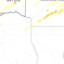
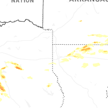
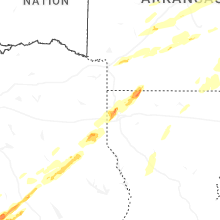


Connect with Interactive Hail Maps