

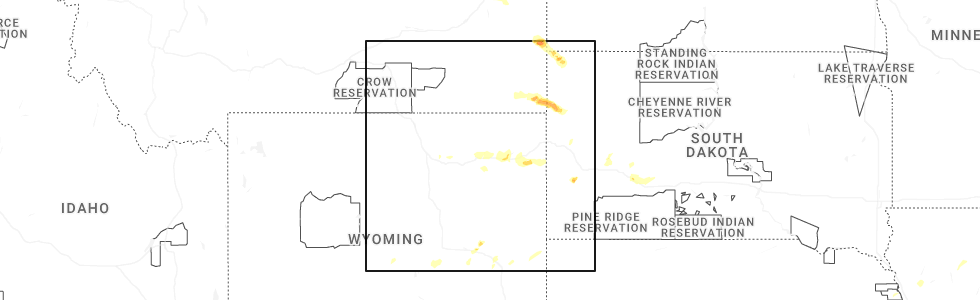
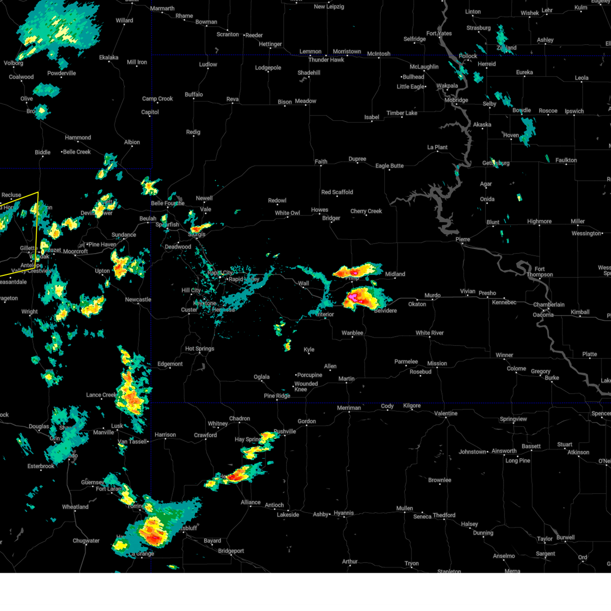
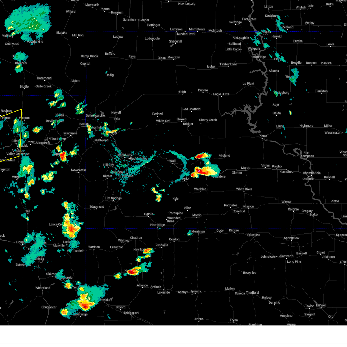
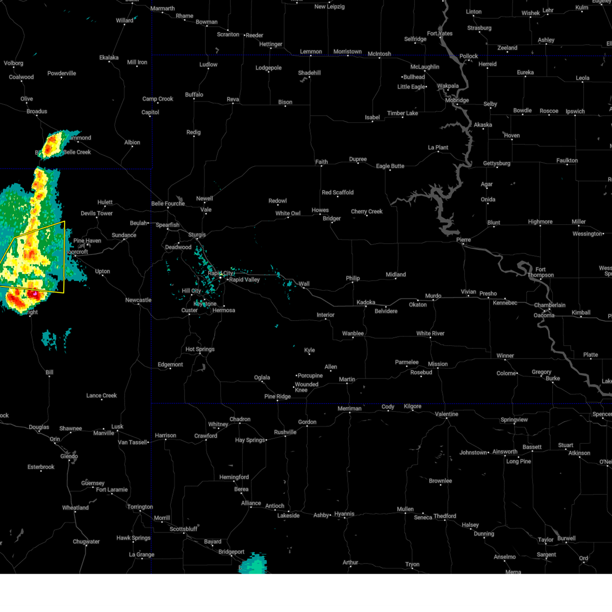
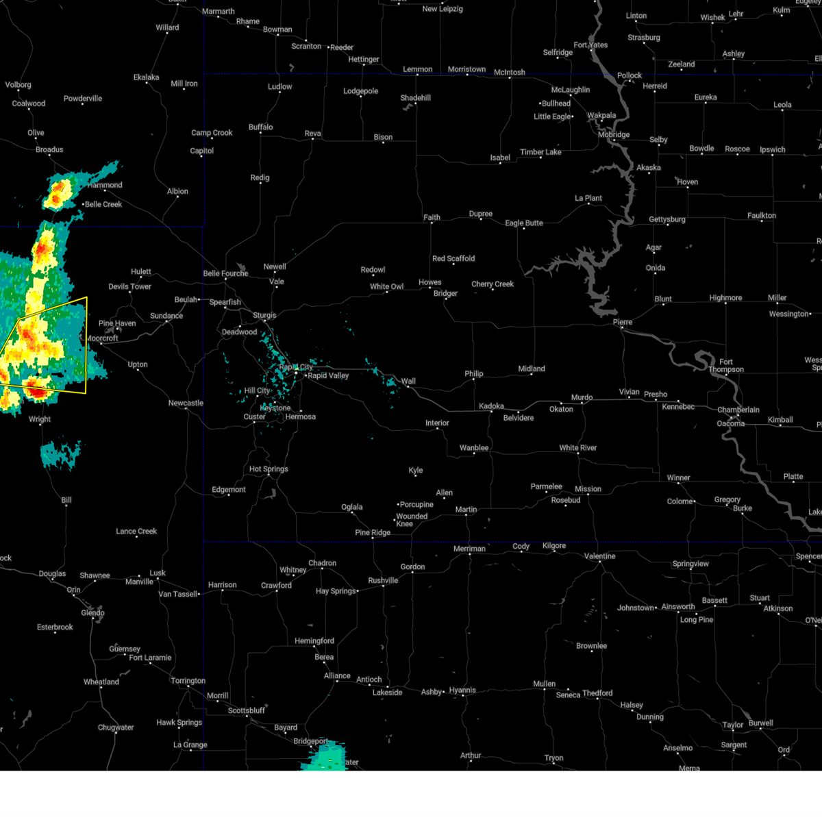
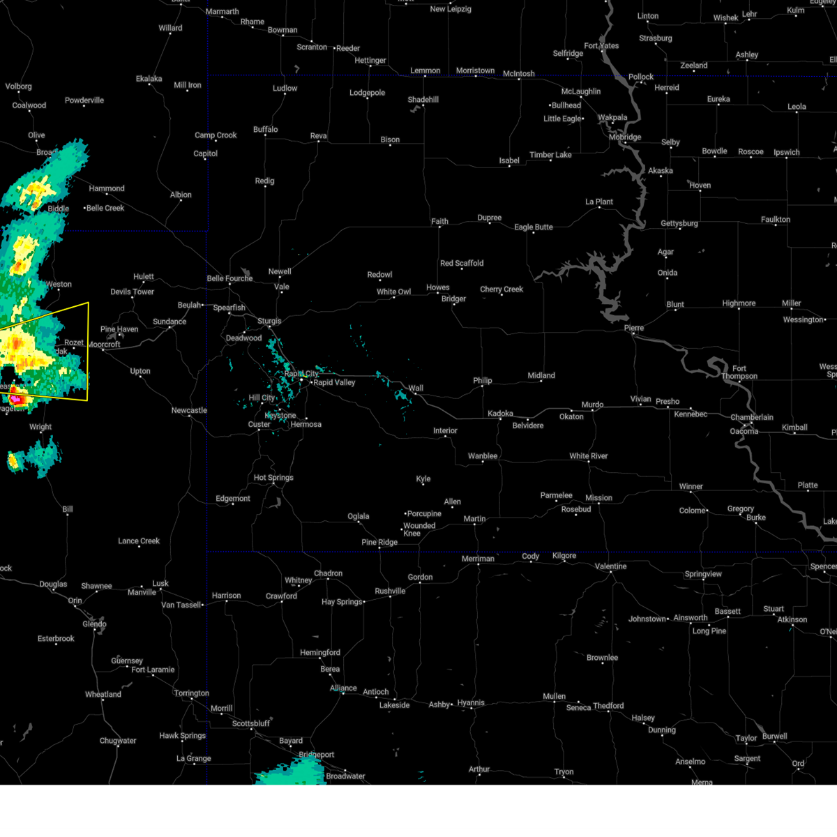
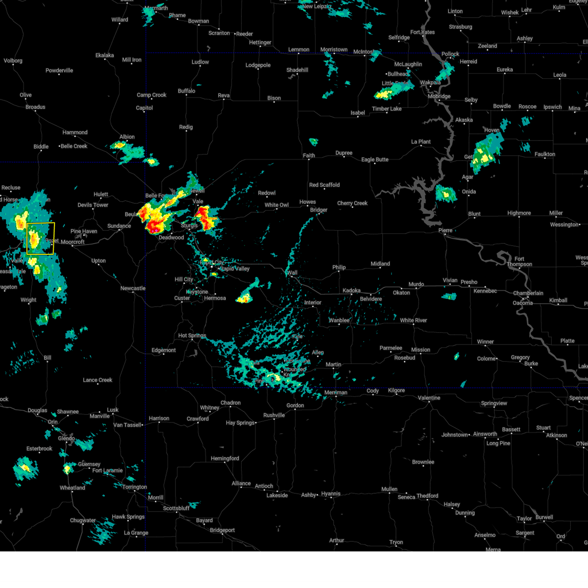
Hail Map for Sleepy Hollow, WY
The Sleepy Hollow, WY area has had 0 reports of on-the-ground hail by trained spotters, and has been under severe weather warnings 22 times during the past 12 months. Doppler radar has detected hail at or near Sleepy Hollow, WY on 43 occasions, including 2 occasions during the past year.
| Name: | Sleepy Hollow, WY |
| Where Located: | 5.6 miles SE of Gillette, WY |
| Map: | Google Map for Sleepy Hollow, WY |
| Population: | 1308 |
| Housing Units: | 447 |
| More Info: | Search Google for Sleepy Hollow, WY |
0
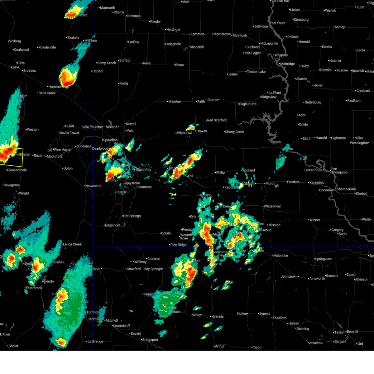
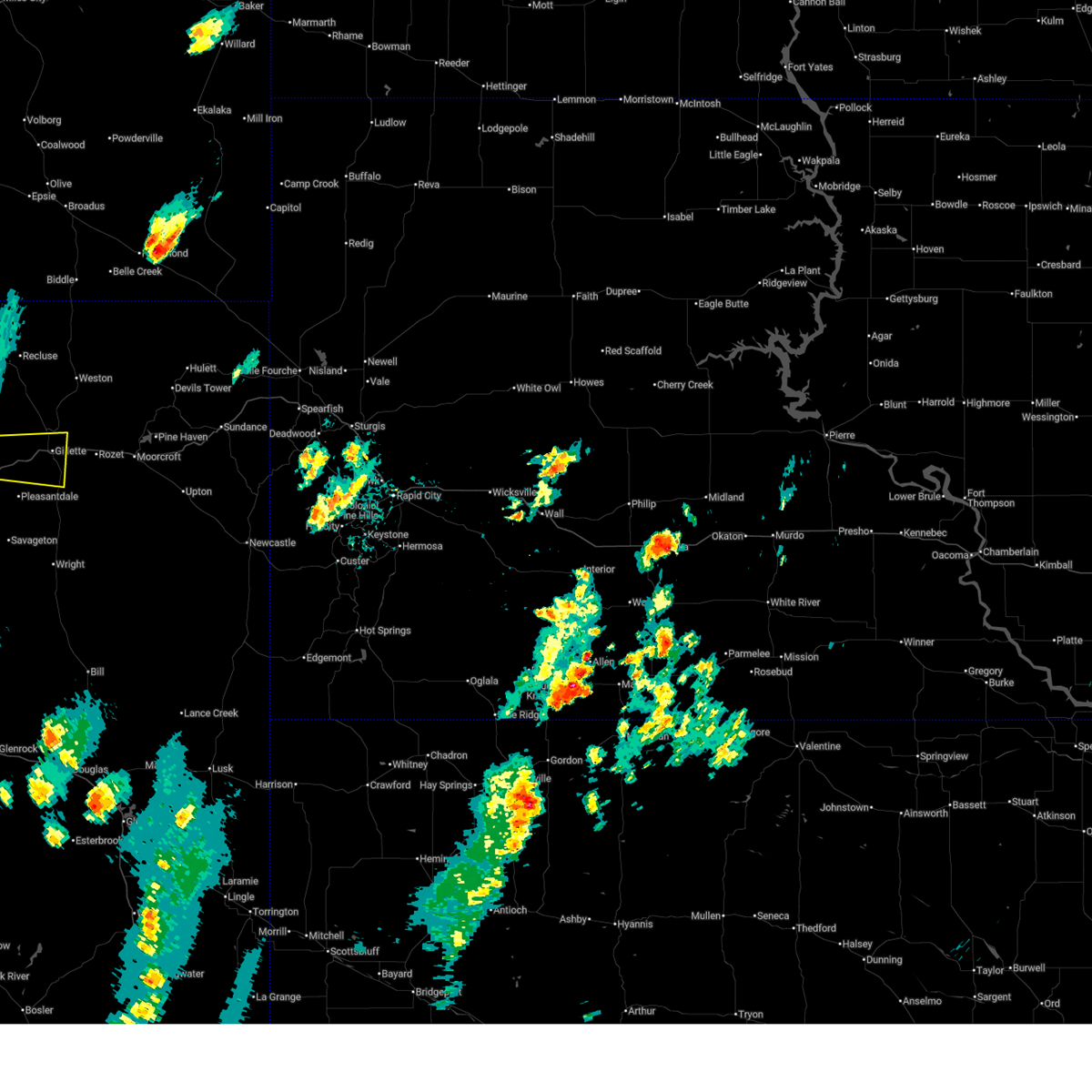
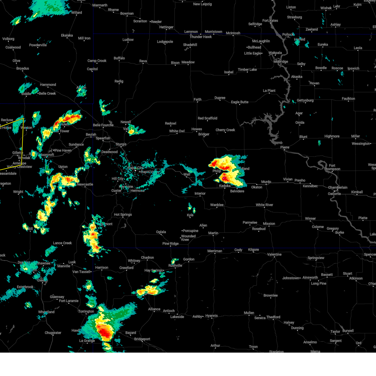
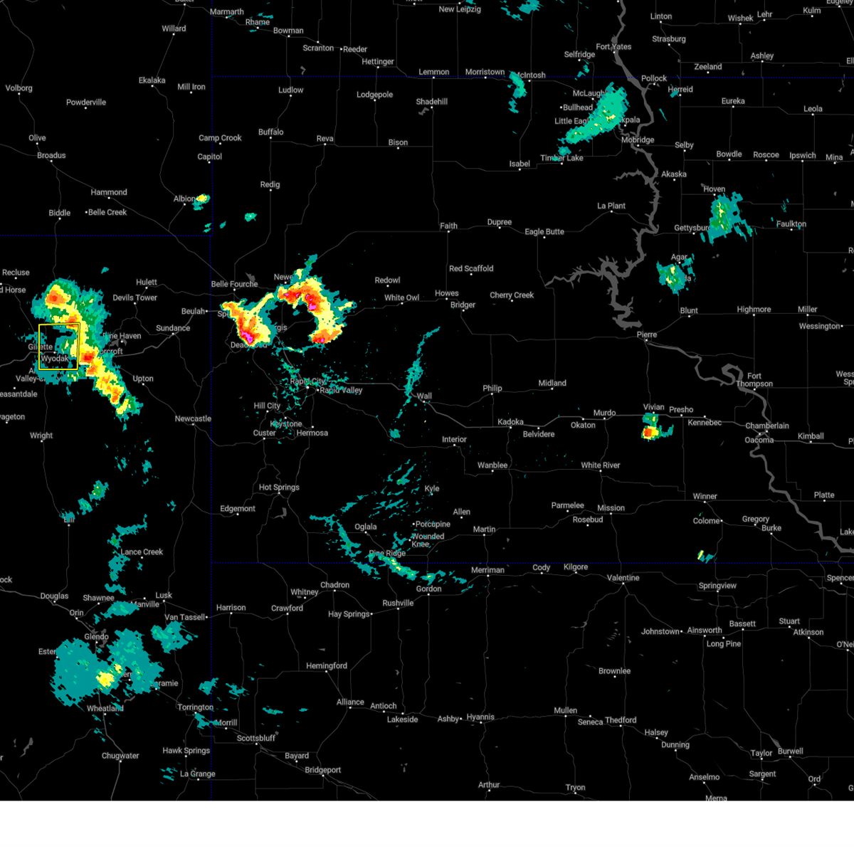
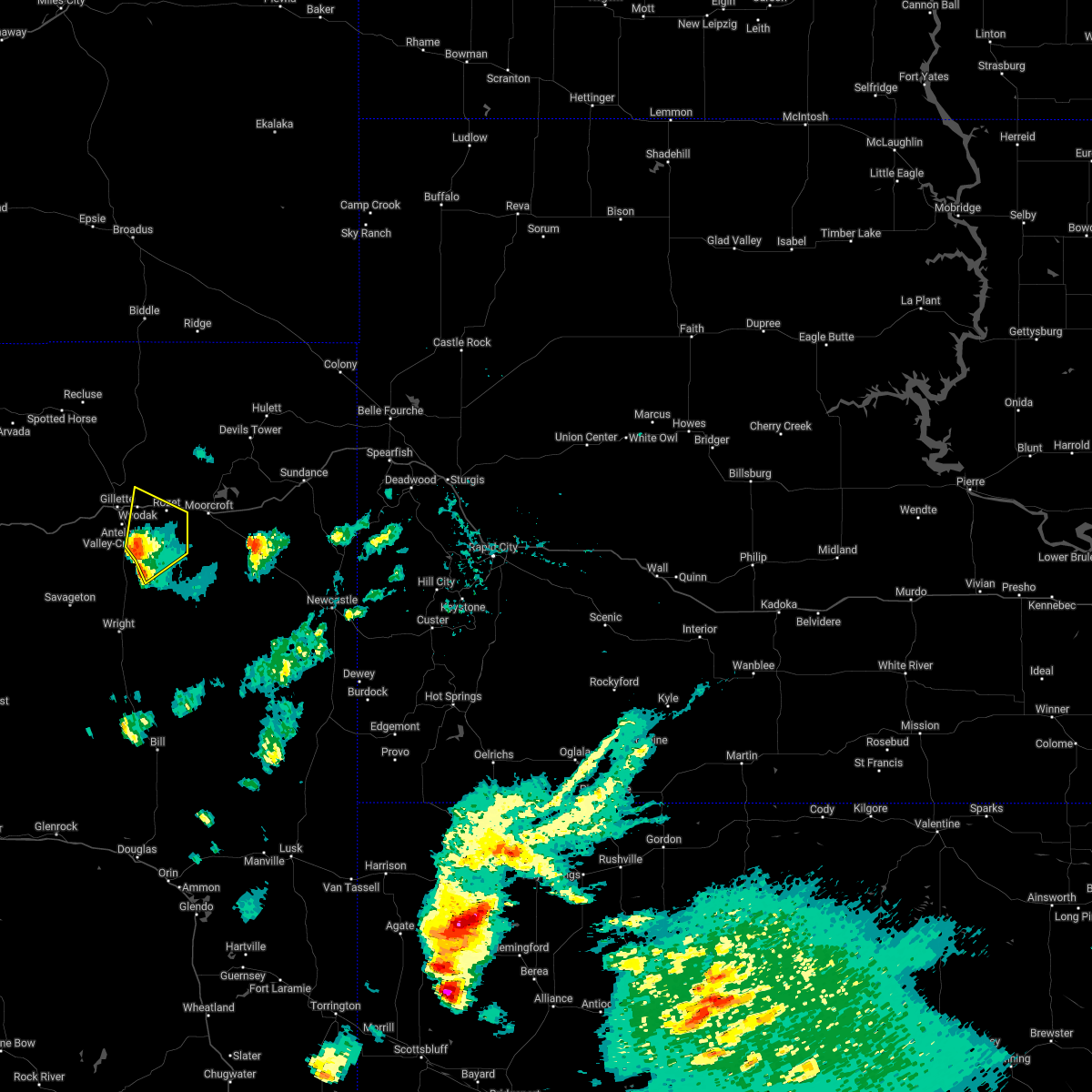
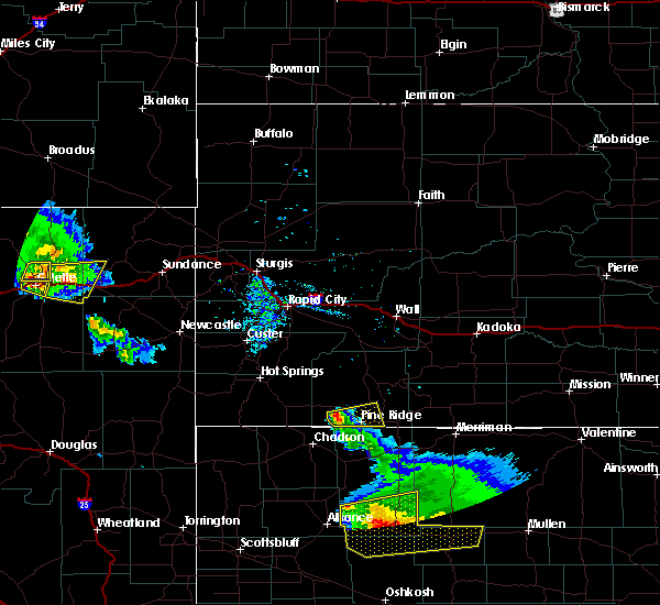
The Top Recent Hail Date for Sleepy Hollow, WY is Wednesday, June 25, 2025 (43rd out of 43)
Hail and Wind Damage Spotted near Sleepy Hollow, WY
| Date / Time | Report Details |
|---|---|
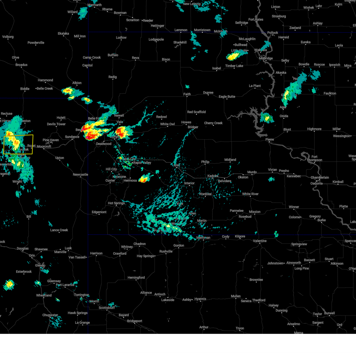
| 6/25/2025 3:56 PM MDT | Svrunr the national weather service in rapid city has issued a * severe thunderstorm warning for, east central campbell county in northeastern wyoming, northwestern weston county in northeastern wyoming, southwestern crook county in northeastern wyoming, * until 500 pm mdt. * at 355 pm mdt, a severe thunderstorm was located 3 miles northeast of wyodak mine, or 8 miles east of gillette, moving east at 30 mph (radar indicated). Hazards include 60 mph wind gusts and quarter size hail. Hail damage to vehicles is expected. expect wind damage to roofs, siding, and trees. this severe thunderstorm will be near, rozet around 400 pm mdt. moorcroft around 410 pm mdt. keyhole reservoir around 415 pm mdt. other locations in the path of this severe thunderstorm include pine haven. This includes interstate 90 in wyoming between mile markers 125 and 165. |
| 6/25/2025 3:31 PM MDT |
 At 330 pm mdt, a severe thunderstorm was located 9 miles southwest of gillette airport, or 10 miles west of gillette, moving east at 30 mph (radar indicated). Hazards include 60 mph wind gusts and quarter size hail. Hail damage to vehicles is expected. expect wind damage to roofs, siding, and trees. locations impacted include, gillette, gillette airport and camplex event facility. This includes interstate 90 in wyoming between mile markers 105 and 131. At 330 pm mdt, a severe thunderstorm was located 9 miles southwest of gillette airport, or 10 miles west of gillette, moving east at 30 mph (radar indicated). Hazards include 60 mph wind gusts and quarter size hail. Hail damage to vehicles is expected. expect wind damage to roofs, siding, and trees. locations impacted include, gillette, gillette airport and camplex event facility. This includes interstate 90 in wyoming between mile markers 105 and 131.
|
| 6/25/2025 3:13 PM MDT | At 313 pm mdt, a severe thunderstorm was located 12 miles south of echeta, or 17 miles west of gillette, moving east at 30 mph (radar indicated). Hazards include 60 mph wind gusts and half dollar size hail. Hail damage to vehicles is expected. expect wind damage to roofs, siding, and trees. locations impacted include, gillette, camplex event facility, and gillette airport. This includes interstate 90 in wyoming between mile markers 98 and 131. |
| 6/25/2025 2:55 PM MDT |
 Svrunr the national weather service in rapid city has issued a * severe thunderstorm warning for, west central campbell county in northeastern wyoming, * until 400 pm mdt. * at 255 pm mdt, a severe thunderstorm was located 9 miles northeast of powder river rest area, or 25 miles west of gillette, moving east at 30 mph (radar indicated). Hazards include 60 mph wind gusts and quarter size hail. Hail damage to vehicles is expected. Expect wind damage to roofs, siding, and trees. Svrunr the national weather service in rapid city has issued a * severe thunderstorm warning for, west central campbell county in northeastern wyoming, * until 400 pm mdt. * at 255 pm mdt, a severe thunderstorm was located 9 miles northeast of powder river rest area, or 25 miles west of gillette, moving east at 30 mph (radar indicated). Hazards include 60 mph wind gusts and quarter size hail. Hail damage to vehicles is expected. Expect wind damage to roofs, siding, and trees.
|
| 8/21/2024 4:44 PM MDT |
 the severe thunderstorm warning has been cancelled and is no longer in effect the severe thunderstorm warning has been cancelled and is no longer in effect
|
| 8/21/2024 4:20 PM MDT |
 At 420 pm mdt, severe thunderstorms were located along a line extending from 8 miles southeast of spotted horse to 14 miles east of powder river rest area, moving northeast at 30 mph (radar indicated). Hazards include 70 mph wind gusts. Expect considerable tree damage. damage is likely to mobile homes, roofs, and outbuildings. these severe storms will be near, gillette, eagle butte mine, buckskin mine, echeta, and gillette airport around 425 pm mdt. other locations in the path of these severe thunderstorms include rawhide mine, dry fork mine and camplex event facility. This includes interstate 90 in wyoming between mile markers 96 and 130. At 420 pm mdt, severe thunderstorms were located along a line extending from 8 miles southeast of spotted horse to 14 miles east of powder river rest area, moving northeast at 30 mph (radar indicated). Hazards include 70 mph wind gusts. Expect considerable tree damage. damage is likely to mobile homes, roofs, and outbuildings. these severe storms will be near, gillette, eagle butte mine, buckskin mine, echeta, and gillette airport around 425 pm mdt. other locations in the path of these severe thunderstorms include rawhide mine, dry fork mine and camplex event facility. This includes interstate 90 in wyoming between mile markers 96 and 130.
|
| 8/21/2024 4:09 PM MDT |
 Svrunr the national weather service in rapid city has issued a * severe thunderstorm warning for, northwestern campbell county in northeastern wyoming, * until 515 pm mdt. * at 408 pm mdt, severe thunderstorms were located along a line extending from 8 miles north of echeta to 14 miles northwest of savageton, moving northeast at 30 mph (radar indicated). Hazards include 70 mph wind gusts. Expect considerable tree damage. damage is likely to mobile homes, roofs, and outbuildings. severe thunderstorms will be near, echeta around 415 pm mdt. gillette, buckskin mine, and gillette airport around 425 pm mdt. other locations in the path of these severe thunderstorms include eagle butte mine, rawhide mine, dry fork mine and camplex event facility. This includes interstate 90 in wyoming between mile markers 96 and 130. Svrunr the national weather service in rapid city has issued a * severe thunderstorm warning for, northwestern campbell county in northeastern wyoming, * until 515 pm mdt. * at 408 pm mdt, severe thunderstorms were located along a line extending from 8 miles north of echeta to 14 miles northwest of savageton, moving northeast at 30 mph (radar indicated). Hazards include 70 mph wind gusts. Expect considerable tree damage. damage is likely to mobile homes, roofs, and outbuildings. severe thunderstorms will be near, echeta around 415 pm mdt. gillette, buckskin mine, and gillette airport around 425 pm mdt. other locations in the path of these severe thunderstorms include eagle butte mine, rawhide mine, dry fork mine and camplex event facility. This includes interstate 90 in wyoming between mile markers 96 and 130.
|
| 8/6/2024 6:29 PM MDT |
 The storms which prompted the warning have weakened below severe limits, and no longer pose an immediate threat to life or property. therefore, the warning will be allowed to expire. however, gusty winds and heavy rain are still possible with these thunderstorms. a severe thunderstorm watch remains in effect until midnight mdt for northeastern wyoming. remember, a severe thunderstorm warning still remains in effect for southeastern campbell county until 7pm mdt!. The storms which prompted the warning have weakened below severe limits, and no longer pose an immediate threat to life or property. therefore, the warning will be allowed to expire. however, gusty winds and heavy rain are still possible with these thunderstorms. a severe thunderstorm watch remains in effect until midnight mdt for northeastern wyoming. remember, a severe thunderstorm warning still remains in effect for southeastern campbell county until 7pm mdt!.
|
| 8/6/2024 6:20 PM MDT |
 At 619 pm mdt, severe thunderstorms were located along a line extending from near rawhide mine to 2 miles south of camplex event facility to 8 miles southwest of belle ayr mine, moving east at 25 mph (radar indicated). Hazards include 70 mph wind gusts and penny size hail. Expect considerable tree damage. damage is likely to mobile homes, roofs, and outbuildings. locations impacted include, gillette, buckskin mine, eagle butte mine, dry fork mine, cordero rojo mine, coal creek mine, wyodak mine, belle ayr mine, caballo mine and rawhide mine. This includes interstate 90 in wyoming between mile markers 107 and 147. At 619 pm mdt, severe thunderstorms were located along a line extending from near rawhide mine to 2 miles south of camplex event facility to 8 miles southwest of belle ayr mine, moving east at 25 mph (radar indicated). Hazards include 70 mph wind gusts and penny size hail. Expect considerable tree damage. damage is likely to mobile homes, roofs, and outbuildings. locations impacted include, gillette, buckskin mine, eagle butte mine, dry fork mine, cordero rojo mine, coal creek mine, wyodak mine, belle ayr mine, caballo mine and rawhide mine. This includes interstate 90 in wyoming between mile markers 107 and 147.
|
| 8/6/2024 6:04 PM MDT |
 At 604 pm mdt, severe thunderstorms were located along a line extending from 5 miles west of rawhide mine to 2 miles south of gillette to 12 miles southwest of belle ayr mine, moving east at 30 mph (radar indicated). Hazards include 70 mph wind gusts and penny size hail. Expect considerable tree damage. damage is likely to mobile homes, roofs, and outbuildings. these severe storms will be near, gillette, buckskin mine, eagle butte mine, dry fork mine, cordero rojo mine, coal creek mine, wyodak mine, belle ayr mine, caballo mine, and rawhide mine around 610 pm mdt. This includes interstate 90 in wyoming between mile markers 100 and 147. At 604 pm mdt, severe thunderstorms were located along a line extending from 5 miles west of rawhide mine to 2 miles south of gillette to 12 miles southwest of belle ayr mine, moving east at 30 mph (radar indicated). Hazards include 70 mph wind gusts and penny size hail. Expect considerable tree damage. damage is likely to mobile homes, roofs, and outbuildings. these severe storms will be near, gillette, buckskin mine, eagle butte mine, dry fork mine, cordero rojo mine, coal creek mine, wyodak mine, belle ayr mine, caballo mine, and rawhide mine around 610 pm mdt. This includes interstate 90 in wyoming between mile markers 100 and 147.
|
| 8/6/2024 5:50 PM MDT |
 At 550 pm mdt, severe thunderstorms were located along a line extending from 9 miles west of gillette airport to 7 miles southwest of gillette to 9 miles northeast of savageton, moving east at 40 mph (radar indicated). Hazards include 70 mph wind gusts and penny size hail. Expect considerable tree damage. damage is likely to mobile homes, roofs, and outbuildings. these severe storms will be near, gillette, buckskin mine, eagle butte mine, dry fork mine, cordero rojo mine, wyodak mine, belle ayr mine, caballo mine, rawhide mine, and camplex event facility around 555 pm mdt. other locations in the path of these severe thunderstorms include coal creek mine and rozet. This includes interstate 90 in wyoming between mile markers 98 and 147. At 550 pm mdt, severe thunderstorms were located along a line extending from 9 miles west of gillette airport to 7 miles southwest of gillette to 9 miles northeast of savageton, moving east at 40 mph (radar indicated). Hazards include 70 mph wind gusts and penny size hail. Expect considerable tree damage. damage is likely to mobile homes, roofs, and outbuildings. these severe storms will be near, gillette, buckskin mine, eagle butte mine, dry fork mine, cordero rojo mine, wyodak mine, belle ayr mine, caballo mine, rawhide mine, and camplex event facility around 555 pm mdt. other locations in the path of these severe thunderstorms include coal creek mine and rozet. This includes interstate 90 in wyoming between mile markers 98 and 147.
|
| 8/6/2024 5:38 PM MDT |
 Svrunr the national weather service in rapid city has issued a * severe thunderstorm warning for, central campbell county in northeastern wyoming, southwestern crook county in northeastern wyoming, * until 630 pm mdt. * at 538 pm mdt, severe thunderstorms were located along a line extending from 7 miles south of echeta to 13 miles north of savageton, moving east at 35 mph (radar indicated). Hazards include 70 mph wind gusts and penny size hail. Expect considerable tree damage. damage is likely to mobile homes, roofs, and outbuildings. severe thunderstorms will be near, gillette, eagle butte mine, and gillette airport around 545 pm mdt. buckskin mine, dry fork mine, belle ayr mine, rawhide mine, and camplex event facility around 550 pm mdt. cordero rojo mine, wyodak mine, and caballo mine around 555 pm mdt. coal creek mine around 600 pm mdt. This includes interstate 90 in wyoming between mile markers 98 and 147. Svrunr the national weather service in rapid city has issued a * severe thunderstorm warning for, central campbell county in northeastern wyoming, southwestern crook county in northeastern wyoming, * until 630 pm mdt. * at 538 pm mdt, severe thunderstorms were located along a line extending from 7 miles south of echeta to 13 miles north of savageton, moving east at 35 mph (radar indicated). Hazards include 70 mph wind gusts and penny size hail. Expect considerable tree damage. damage is likely to mobile homes, roofs, and outbuildings. severe thunderstorms will be near, gillette, eagle butte mine, and gillette airport around 545 pm mdt. buckskin mine, dry fork mine, belle ayr mine, rawhide mine, and camplex event facility around 550 pm mdt. cordero rojo mine, wyodak mine, and caballo mine around 555 pm mdt. coal creek mine around 600 pm mdt. This includes interstate 90 in wyoming between mile markers 98 and 147.
|
| 7/28/2024 5:20 PM MDT |
 The storm which prompted the warning has moved out of the area. therefore, the warning will be allowed to expire. The storm which prompted the warning has moved out of the area. therefore, the warning will be allowed to expire.
|
| 7/28/2024 4:49 PM MDT |
 At 449 pm mdt, a severe thunderstorm was located over wyodak mine, or 5 miles northeast of gillette, moving east at 25 mph (radar indicated). Hazards include 70 mph wind gusts. Expect considerable tree damage. damage is likely to mobile homes, roofs, and outbuildings. locations impacted include, gillette, wyodak mine, dry fork mine, rawhide mine, rozet, and camplex event facility. This includes interstate 90 in wyoming between mile markers 126 and 142. At 449 pm mdt, a severe thunderstorm was located over wyodak mine, or 5 miles northeast of gillette, moving east at 25 mph (radar indicated). Hazards include 70 mph wind gusts. Expect considerable tree damage. damage is likely to mobile homes, roofs, and outbuildings. locations impacted include, gillette, wyodak mine, dry fork mine, rawhide mine, rozet, and camplex event facility. This includes interstate 90 in wyoming between mile markers 126 and 142.
|
| 7/28/2024 4:39 PM MDT |
 At 439 pm mdt, a severe thunderstorm was located over gillette airport, or 4 miles north of gillette, moving east at 25 mph (radar indicated). Hazards include 70 mph wind gusts. Expect considerable tree damage. damage is likely to mobile homes, roofs, and outbuildings. locations impacted include, gillette, dry fork mine, rawhide mine, eagle butte mine, buckskin mine, wyodak mine, rozet, camplex event facility, and gillette airport. This includes interstate 90 in wyoming between mile markers 111 and 142. At 439 pm mdt, a severe thunderstorm was located over gillette airport, or 4 miles north of gillette, moving east at 25 mph (radar indicated). Hazards include 70 mph wind gusts. Expect considerable tree damage. damage is likely to mobile homes, roofs, and outbuildings. locations impacted include, gillette, dry fork mine, rawhide mine, eagle butte mine, buckskin mine, wyodak mine, rozet, camplex event facility, and gillette airport. This includes interstate 90 in wyoming between mile markers 111 and 142.
|
| 7/28/2024 4:36 PM MDT |
 At 436 pm mdt, a severe thunderstorm was located over gillette airport, or 4 miles north of gillette, moving east at 25 mph (radar indicated). Hazards include 60 mph wind gusts. Expect damage to roofs, siding, and trees. locations impacted include, gillette, rawhide mine, wyodak mine, dry fork mine, camplex event facility and rozet. This includes interstate 90 in wyoming between mile markers 111 and 142. At 436 pm mdt, a severe thunderstorm was located over gillette airport, or 4 miles north of gillette, moving east at 25 mph (radar indicated). Hazards include 60 mph wind gusts. Expect damage to roofs, siding, and trees. locations impacted include, gillette, rawhide mine, wyodak mine, dry fork mine, camplex event facility and rozet. This includes interstate 90 in wyoming between mile markers 111 and 142.
|
| 7/28/2024 4:17 PM MDT |
 Svrunr the national weather service in rapid city has issued a * severe thunderstorm warning for, central campbell county in northeastern wyoming, * until 530 pm mdt. * at 417 pm mdt, a severe thunderstorm was located 8 miles west of gillette airport, or 11 miles west of gillette, moving east at 20 mph (radar indicated). Hazards include 60 mph wind gusts. Expect damage to roofs, siding, and trees. this severe thunderstorm will be near, gillette, rawhide mine, eagle butte mine, buckskin mine, dry fork mine, camplex event facility, and gillette airport around 420 pm mdt. wyodak mine around 430 pm mdt. rozet around 455 pm mdt. This includes interstate 90 in wyoming between mile markers 108 and 142. Svrunr the national weather service in rapid city has issued a * severe thunderstorm warning for, central campbell county in northeastern wyoming, * until 530 pm mdt. * at 417 pm mdt, a severe thunderstorm was located 8 miles west of gillette airport, or 11 miles west of gillette, moving east at 20 mph (radar indicated). Hazards include 60 mph wind gusts. Expect damage to roofs, siding, and trees. this severe thunderstorm will be near, gillette, rawhide mine, eagle butte mine, buckskin mine, dry fork mine, camplex event facility, and gillette airport around 420 pm mdt. wyodak mine around 430 pm mdt. rozet around 455 pm mdt. This includes interstate 90 in wyoming between mile markers 108 and 142.
|
| 7/6/2024 5:08 PM MDT |
 The storms which prompted the warning have weakened below severe limits, and have exited the warned area. therefore, the warning will be allowed to expire. however, gusty winds are still possible with these thunderstorms. The storms which prompted the warning have weakened below severe limits, and have exited the warned area. therefore, the warning will be allowed to expire. however, gusty winds are still possible with these thunderstorms.
|
| 7/6/2024 5:02 PM MDT |
 At 502 pm mdt, severe thunderstorms were located along a line extending from 5 miles east of weston to 4 miles south of gillette, moving southeast at 25 mph (radar and observations). Hazards include 60 mph wind gusts. Expect damage to roofs, siding, and trees. locations impacted include, southeastern gillette, wyodak mine and camplex event facility. This includes interstate 90 in wyoming between mile markers 116 and 133. At 502 pm mdt, severe thunderstorms were located along a line extending from 5 miles east of weston to 4 miles south of gillette, moving southeast at 25 mph (radar and observations). Hazards include 60 mph wind gusts. Expect damage to roofs, siding, and trees. locations impacted include, southeastern gillette, wyodak mine and camplex event facility. This includes interstate 90 in wyoming between mile markers 116 and 133.
|
| 7/6/2024 4:35 PM MDT |
 At 435 pm mdt, severe thunderstorms were located along a line extending from 6 miles south of biddle to 10 miles west of gillette, moving southeast at 30 mph (radar indicated). Hazards include 60 mph wind gusts. Expect damage to roofs, siding, and trees. these severe storms will be near, gillette, rawhide mine, eagle butte mine, wyodak mine, dry fork mine, buckskin mine, weston, rockypoint, camplex event facility, and gillette airport around 440 pm mdt. This includes interstate 90 in wyoming between mile markers 107 and 133. At 435 pm mdt, severe thunderstorms were located along a line extending from 6 miles south of biddle to 10 miles west of gillette, moving southeast at 30 mph (radar indicated). Hazards include 60 mph wind gusts. Expect damage to roofs, siding, and trees. these severe storms will be near, gillette, rawhide mine, eagle butte mine, wyodak mine, dry fork mine, buckskin mine, weston, rockypoint, camplex event facility, and gillette airport around 440 pm mdt. This includes interstate 90 in wyoming between mile markers 107 and 133.
|
| 7/6/2024 4:26 PM MDT |
 At 426 pm mdt, severe thunderstorms were located along a line extending from 4 miles south of biddle to 12 miles southwest of gillette airport, moving east at 45 mph (radar indicated). Hazards include 60 mph wind gusts. Expect damage to roofs, siding, and trees. these severe storms will be near, gillette, rawhide mine, eagle butte mine, wyodak mine, dry fork mine, buckskin mine, weston, rockypoint, camplex event facility, and gillette airport around 430 pm mdt. This includes interstate 90 in wyoming between mile markers 107 and 133. At 426 pm mdt, severe thunderstorms were located along a line extending from 4 miles south of biddle to 12 miles southwest of gillette airport, moving east at 45 mph (radar indicated). Hazards include 60 mph wind gusts. Expect damage to roofs, siding, and trees. these severe storms will be near, gillette, rawhide mine, eagle butte mine, wyodak mine, dry fork mine, buckskin mine, weston, rockypoint, camplex event facility, and gillette airport around 430 pm mdt. This includes interstate 90 in wyoming between mile markers 107 and 133.
|
| 7/6/2024 4:18 PM MDT |
 Svrunr the national weather service in rapid city has issued a * severe thunderstorm warning for, northern campbell county in northeastern wyoming, * until 515 pm mdt. * at 417 pm mdt, severe thunderstorms were located along a line extending from 10 miles west of biddle to 11 miles south of echeta, moving southeast at 25 mph (radar indicated). Hazards include 60 mph wind gusts. Expect damage to roofs, siding, and trees. severe thunderstorms will be near, buckskin mine, echeta, and recluse around 425 pm mdt. gillette, eagle butte mine, and gillette airport around 430 pm mdt. rawhide mine, dry fork mine, and weston around 435 pm mdt. rockypoint and camplex event facility around 445 pm mdt. wyodak mine around 450 pm mdt. This includes interstate 90 in wyoming between mile markers 107 and 133. Svrunr the national weather service in rapid city has issued a * severe thunderstorm warning for, northern campbell county in northeastern wyoming, * until 515 pm mdt. * at 417 pm mdt, severe thunderstorms were located along a line extending from 10 miles west of biddle to 11 miles south of echeta, moving southeast at 25 mph (radar indicated). Hazards include 60 mph wind gusts. Expect damage to roofs, siding, and trees. severe thunderstorms will be near, buckskin mine, echeta, and recluse around 425 pm mdt. gillette, eagle butte mine, and gillette airport around 430 pm mdt. rawhide mine, dry fork mine, and weston around 435 pm mdt. rockypoint and camplex event facility around 445 pm mdt. wyodak mine around 450 pm mdt. This includes interstate 90 in wyoming between mile markers 107 and 133.
|
| 6/27/2024 6:08 PM MDT |
 The storms which prompted the warning have moved out of the area. therefore, the warning will be allowed to expire. however, gusty winds are still possible with these thunderstorms. a severe thunderstorm watch remains in effect until 900 pm mdt for northeastern wyoming. remember, a severe thunderstorm warning still remains in effect for northeastern crook county until 700 pm mdt. The storms which prompted the warning have moved out of the area. therefore, the warning will be allowed to expire. however, gusty winds are still possible with these thunderstorms. a severe thunderstorm watch remains in effect until 900 pm mdt for northeastern wyoming. remember, a severe thunderstorm warning still remains in effect for northeastern crook county until 700 pm mdt.
|
| 6/27/2024 5:49 PM MDT |
 At 548 pm mdt, severe thunderstorms were located along a line extending from 10 miles east of ridgeway to 6 miles east of pumpkin buttes, moving east at 40 mph (radar indicated). Hazards include 60 mph wind gusts. Expect damage to roofs, siding, and trees. locations impacted include, gillette, wright, moorcroft, hulett, eagle butte mine, cordero rojo mine, dry fork mine, hilight gas plant, coal creek mine, caballo mine, reno junction, belle ayr mine, wyodak mine, rawhide mine, oshoto, lightning flat, rozet, rockypoint, carlile, and new haven. This includes interstate 90 in wyoming between mile markers 118 and 156. At 548 pm mdt, severe thunderstorms were located along a line extending from 10 miles east of ridgeway to 6 miles east of pumpkin buttes, moving east at 40 mph (radar indicated). Hazards include 60 mph wind gusts. Expect damage to roofs, siding, and trees. locations impacted include, gillette, wright, moorcroft, hulett, eagle butte mine, cordero rojo mine, dry fork mine, hilight gas plant, coal creek mine, caballo mine, reno junction, belle ayr mine, wyodak mine, rawhide mine, oshoto, lightning flat, rozet, rockypoint, carlile, and new haven. This includes interstate 90 in wyoming between mile markers 118 and 156.
|
| 6/27/2024 5:29 PM MDT |
 At 529 pm mdt, severe thunderstorms were located along a line extending from 2 miles northwest of ridgeway to 6 miles northwest of pumpkin buttes, moving east at 40 mph (radar indicated). Hazards include 60 mph wind gusts. Expect damage to roofs, siding, and trees. locations impacted include, gillette, wright, moorcroft, hulett, rawhide mine, eagle butte mine, cordero rojo mine, dry fork mine, hilight gas plant, coal creek mine, caballo mine, reno junction, belle ayr mine, wyodak mine, buckskin mine, echeta, oshoto, weston, lightning flat, and rozet. This includes interstate 90 in wyoming between mile markers 96 and 156. At 529 pm mdt, severe thunderstorms were located along a line extending from 2 miles northwest of ridgeway to 6 miles northwest of pumpkin buttes, moving east at 40 mph (radar indicated). Hazards include 60 mph wind gusts. Expect damage to roofs, siding, and trees. locations impacted include, gillette, wright, moorcroft, hulett, rawhide mine, eagle butte mine, cordero rojo mine, dry fork mine, hilight gas plant, coal creek mine, caballo mine, reno junction, belle ayr mine, wyodak mine, buckskin mine, echeta, oshoto, weston, lightning flat, and rozet. This includes interstate 90 in wyoming between mile markers 96 and 156.
|
| 6/27/2024 5:10 PM MDT |
 Svrunr the national weather service in rapid city has issued a * severe thunderstorm warning for, campbell county in northeastern wyoming, northwestern weston county in northeastern wyoming, western crook county in northeastern wyoming, * until 615 pm mdt. * at 509 pm mdt, severe thunderstorms were located along a line extending from 14 miles northwest of ridgeway to near fort reno historical site, moving east at 40 mph (radar indicated). Hazards include 60 mph wind gusts. Expect damage to roofs, siding, and trees. severe thunderstorms will be near, gillette, rawhide mine, eagle butte mine, dry fork mine, buckskin mine, weston, lightning flat, rockypoint, and gillette airport around 515 pm mdt. wyodak mine, savageton, camplex event facility, and pumpkin buttes around 520 pm mdt. other locations in the path of these severe thunderstorms include new haven, caballo mine, belle ayr mine, rozet, oshoto, cordero rojo mine, wright, reno junction, coal creek mine, moorcroft, hulett, carlile, devils tower national monument and keyhole reservoir. This includes interstate 90 in wyoming between mile markers 96 and 156. Svrunr the national weather service in rapid city has issued a * severe thunderstorm warning for, campbell county in northeastern wyoming, northwestern weston county in northeastern wyoming, western crook county in northeastern wyoming, * until 615 pm mdt. * at 509 pm mdt, severe thunderstorms were located along a line extending from 14 miles northwest of ridgeway to near fort reno historical site, moving east at 40 mph (radar indicated). Hazards include 60 mph wind gusts. Expect damage to roofs, siding, and trees. severe thunderstorms will be near, gillette, rawhide mine, eagle butte mine, dry fork mine, buckskin mine, weston, lightning flat, rockypoint, and gillette airport around 515 pm mdt. wyodak mine, savageton, camplex event facility, and pumpkin buttes around 520 pm mdt. other locations in the path of these severe thunderstorms include new haven, caballo mine, belle ayr mine, rozet, oshoto, cordero rojo mine, wright, reno junction, coal creek mine, moorcroft, hulett, carlile, devils tower national monument and keyhole reservoir. This includes interstate 90 in wyoming between mile markers 96 and 156.
|
| 7/17/2023 6:10 PM MDT |
 At 610 pm mdt, a severe thunderstorm was located over southeastern gillette, moving east at 30 mph (radar indicated). Hazards include golf ball size hail and 60 mph wind gusts. People and animals outdoors will be injured. expect hail damage to roofs, siding, windows, and vehicles. expect wind damage to roofs, siding, and trees. locations impacted include, rozet and moorcroft. this includes interstate 90 in wyoming between mile markers 124 and 156. thunderstorm damage threat, considerable hail threat, radar indicated max hail size, 1. 75 in wind threat, radar indicated max wind gust, 60 mph. At 610 pm mdt, a severe thunderstorm was located over southeastern gillette, moving east at 30 mph (radar indicated). Hazards include golf ball size hail and 60 mph wind gusts. People and animals outdoors will be injured. expect hail damage to roofs, siding, windows, and vehicles. expect wind damage to roofs, siding, and trees. locations impacted include, rozet and moorcroft. this includes interstate 90 in wyoming between mile markers 124 and 156. thunderstorm damage threat, considerable hail threat, radar indicated max hail size, 1. 75 in wind threat, radar indicated max wind gust, 60 mph.
|
| 7/17/2023 6:04 PM MDT |
 At 604 pm mdt, a severe thunderstorm was located near gillette, moving east at 30 mph (radar indicated). Hazards include 60 mph wind gusts and quarter size hail. Hail damage to vehicles is expected. expect wind damage to roofs, siding, and trees. this severe thunderstorm will be near, camplex event facility around 610 pm mdt. other locations in the path of this severe thunderstorm include rozet and moorcroft. this includes interstate 90 in wyoming between mile markers 117 and 156. hail threat, radar indicated max hail size, 1. 00 in wind threat, radar indicated max wind gust, 60 mph. At 604 pm mdt, a severe thunderstorm was located near gillette, moving east at 30 mph (radar indicated). Hazards include 60 mph wind gusts and quarter size hail. Hail damage to vehicles is expected. expect wind damage to roofs, siding, and trees. this severe thunderstorm will be near, camplex event facility around 610 pm mdt. other locations in the path of this severe thunderstorm include rozet and moorcroft. this includes interstate 90 in wyoming between mile markers 117 and 156. hail threat, radar indicated max hail size, 1. 00 in wind threat, radar indicated max wind gust, 60 mph.
|
| 7/6/2023 5:13 PM MDT |
 At 512 pm mdt, a severe thunderstorm was located 9 miles east of echeta, or 17 miles northwest of gillette, moving southeast at 20 mph (radar indicated). Hazards include quarter size hail. damage to vehicles is expected At 512 pm mdt, a severe thunderstorm was located 9 miles east of echeta, or 17 miles northwest of gillette, moving southeast at 20 mph (radar indicated). Hazards include quarter size hail. damage to vehicles is expected
|
| 6/23/2023 5:04 PM MDT |
 At 504 pm mdt, severe thunderstorms were located along a line extending from 7 miles south of biddle to 9 miles south of weston to 10 miles southeast of camplex event facility, moving northeast at 55 mph (radar indicated). Hazards include 60 mph wind gusts. Expect damage to roofs, siding, and trees. locations impacted include, gillette, rozet, weston, rockypoint and camplex event facility. this includes interstate 90 in wyoming between mile markers 126 and 147. hail threat, radar indicated max hail size, <. 75 in wind threat, radar indicated max wind gust, 60 mph. At 504 pm mdt, severe thunderstorms were located along a line extending from 7 miles south of biddle to 9 miles south of weston to 10 miles southeast of camplex event facility, moving northeast at 55 mph (radar indicated). Hazards include 60 mph wind gusts. Expect damage to roofs, siding, and trees. locations impacted include, gillette, rozet, weston, rockypoint and camplex event facility. this includes interstate 90 in wyoming between mile markers 126 and 147. hail threat, radar indicated max hail size, <. 75 in wind threat, radar indicated max wind gust, 60 mph.
|
| 6/23/2023 4:44 PM MDT |
 At 444 pm mdt, severe thunderstorms were located along a line extending from 19 miles north of spotted horse to 10 miles southeast of recluse to 3 miles west of gillette, moving northeast at 50 mph (radar indicated). Hazards include 60 mph wind gusts. Expect damage to roofs, siding, and trees. locations impacted include, gillette, weston, recluse, rockypoint, rozet, camplex event facility and gillette airport. this includes interstate 90 in wyoming between mile markers 113 and 147. hail threat, radar indicated max hail size, <. 75 in wind threat, radar indicated max wind gust, 60 mph. At 444 pm mdt, severe thunderstorms were located along a line extending from 19 miles north of spotted horse to 10 miles southeast of recluse to 3 miles west of gillette, moving northeast at 50 mph (radar indicated). Hazards include 60 mph wind gusts. Expect damage to roofs, siding, and trees. locations impacted include, gillette, weston, recluse, rockypoint, rozet, camplex event facility and gillette airport. this includes interstate 90 in wyoming between mile markers 113 and 147. hail threat, radar indicated max hail size, <. 75 in wind threat, radar indicated max wind gust, 60 mph.
|
| 6/23/2023 4:31 PM MDT |
 At 430 pm mdt, severe thunderstorms were located along a line extending from 19 miles northwest of spotted horse to 5 miles northeast of echeta to 13 miles north of savageton, moving northeast at 40 mph (radar indicated). Hazards include 60 mph wind gusts. expect damage to roofs, siding, and trees At 430 pm mdt, severe thunderstorms were located along a line extending from 19 miles northwest of spotted horse to 5 miles northeast of echeta to 13 miles north of savageton, moving northeast at 40 mph (radar indicated). Hazards include 60 mph wind gusts. expect damage to roofs, siding, and trees
|
| 7/14/2022 7:21 PM MDT |
 At 721 pm mdt, severe thunderstorms were located along a line extending from 11 miles northeast of echeta to 2 miles northwest of gillette airport to 9 miles west of gillette, moving east at 35 mph (radar indicated). Hazards include 60 mph wind gusts. Expect damage to roofs, siding, and trees. locations impacted include, gillette, camplex event facility and gillette airport. this includes interstate 90 in wyoming between mile markers 112 and 134. hail threat, radar indicated max hail size, <. 75 in wind threat, radar indicated max wind gust, 60 mph. At 721 pm mdt, severe thunderstorms were located along a line extending from 11 miles northeast of echeta to 2 miles northwest of gillette airport to 9 miles west of gillette, moving east at 35 mph (radar indicated). Hazards include 60 mph wind gusts. Expect damage to roofs, siding, and trees. locations impacted include, gillette, camplex event facility and gillette airport. this includes interstate 90 in wyoming between mile markers 112 and 134. hail threat, radar indicated max hail size, <. 75 in wind threat, radar indicated max wind gust, 60 mph.
|
| 7/14/2022 6:55 PM MDT |
 At 655 pm mdt, a severe thunderstorm was located near echeta, or 24 miles northwest of gillette, moving east at 30 mph (radar indicated). Hazards include 60 mph wind gusts and quarter size hail. Hail damage to vehicles is expected. Expect wind damage to roofs, siding, and trees. At 655 pm mdt, a severe thunderstorm was located near echeta, or 24 miles northwest of gillette, moving east at 30 mph (radar indicated). Hazards include 60 mph wind gusts and quarter size hail. Hail damage to vehicles is expected. Expect wind damage to roofs, siding, and trees.
|
| 7/5/2022 7:06 PM MDT |
 At 706 pm mdt, severe thunderstorms were located along a line extending from 8 miles southeast of camplex event facility to 14 miles southwest of rozet to 19 miles northeast of wright, moving northeast at 25 mph (radar indicated). Hazards include ping pong ball size hail and 60 mph wind gusts. People and animals outdoors will be injured. expect hail damage to roofs, siding, windows, and vehicles. expect wind damage to roofs, siding, and trees. locations impacted include, rozet. this includes interstate 90 in wyoming between mile markers 131 and 145. hail threat, radar indicated max hail size, 1. 50 in wind threat, radar indicated max wind gust, 60 mph. At 706 pm mdt, severe thunderstorms were located along a line extending from 8 miles southeast of camplex event facility to 14 miles southwest of rozet to 19 miles northeast of wright, moving northeast at 25 mph (radar indicated). Hazards include ping pong ball size hail and 60 mph wind gusts. People and animals outdoors will be injured. expect hail damage to roofs, siding, windows, and vehicles. expect wind damage to roofs, siding, and trees. locations impacted include, rozet. this includes interstate 90 in wyoming between mile markers 131 and 145. hail threat, radar indicated max hail size, 1. 50 in wind threat, radar indicated max wind gust, 60 mph.
|
| 7/5/2022 6:59 PM MDT |
 At 659 pm mdt, a severe thunderstorm was located 11 miles south of camplex event facility, or 11 miles southeast of gillette, moving northeast at 25 mph (radar indicated). Hazards include quarter size hail. Damage to vehicles is expected. locations impacted include, southeastern gillette and rozet. this includes interstate 90 in wyoming between mile markers 130 and 145. hail threat, radar indicated max hail size, 1. 00 in wind threat, radar indicated max wind gust, <50 mph. At 659 pm mdt, a severe thunderstorm was located 11 miles south of camplex event facility, or 11 miles southeast of gillette, moving northeast at 25 mph (radar indicated). Hazards include quarter size hail. Damage to vehicles is expected. locations impacted include, southeastern gillette and rozet. this includes interstate 90 in wyoming between mile markers 130 and 145. hail threat, radar indicated max hail size, 1. 00 in wind threat, radar indicated max wind gust, <50 mph.
|
| 7/5/2022 6:49 PM MDT |
 At 649 pm mdt, a severe thunderstorm was located 15 miles south of gillette, moving northeast at 20 mph (radar indicated). Hazards include ping pong ball size hail and 60 mph wind gusts. People and animals outdoors will be injured. expect hail damage to roofs, siding, windows, and vehicles. Expect wind damage to roofs, siding, and trees. At 649 pm mdt, a severe thunderstorm was located 15 miles south of gillette, moving northeast at 20 mph (radar indicated). Hazards include ping pong ball size hail and 60 mph wind gusts. People and animals outdoors will be injured. expect hail damage to roofs, siding, windows, and vehicles. Expect wind damage to roofs, siding, and trees.
|
| 6/4/2022 9:13 PM MDT |
 The severe thunderstorm warning for central campbell county will expire at 915 pm mdt, the storm which prompted the warning has weakened below severe limits and has exited the warned area. therefore, the warning will be allowed to expire. The severe thunderstorm warning for central campbell county will expire at 915 pm mdt, the storm which prompted the warning has weakened below severe limits and has exited the warned area. therefore, the warning will be allowed to expire.
|
| 6/4/2022 8:59 PM MDT |
 At 858 pm mdt, a severe thunderstorm was located 6 miles south of gillette, moving east at 25 mph (radar indicated). Hazards include ping pong ball size hail and 60 mph wind gusts. People and animals outdoors will be injured. expect hail damage to roofs, siding, windows, and vehicles. expect wind damage to roofs, siding, and trees. this severe thunderstorm will impact portions of central campbell county, including southern gillette. hail threat, radar indicated max hail size, 1. 50 in wind threat, radar indicated max wind gust, 60 mph. At 858 pm mdt, a severe thunderstorm was located 6 miles south of gillette, moving east at 25 mph (radar indicated). Hazards include ping pong ball size hail and 60 mph wind gusts. People and animals outdoors will be injured. expect hail damage to roofs, siding, windows, and vehicles. expect wind damage to roofs, siding, and trees. this severe thunderstorm will impact portions of central campbell county, including southern gillette. hail threat, radar indicated max hail size, 1. 50 in wind threat, radar indicated max wind gust, 60 mph.
|
| 6/4/2022 8:48 PM MDT |
 At 847 pm mdt, a severe thunderstorm was located 8 miles southwest of gillette, moving east at 25 mph (radar indicated). Hazards include two inch hail and 60 mph wind gusts. People and animals outdoors will be injured. expect hail damage to roofs, siding, windows, and vehicles. expect wind damage to roofs, siding, and trees. this severe storm will be near, southern gillette around 855 pm mdt. this includes interstate 90 in wyoming between mile markers 116 and 117. thunderstorm damage threat, considerable hail threat, radar indicated max hail size, 2. 00 in wind threat, radar indicated max wind gust, 60 mph. At 847 pm mdt, a severe thunderstorm was located 8 miles southwest of gillette, moving east at 25 mph (radar indicated). Hazards include two inch hail and 60 mph wind gusts. People and animals outdoors will be injured. expect hail damage to roofs, siding, windows, and vehicles. expect wind damage to roofs, siding, and trees. this severe storm will be near, southern gillette around 855 pm mdt. this includes interstate 90 in wyoming between mile markers 116 and 117. thunderstorm damage threat, considerable hail threat, radar indicated max hail size, 2. 00 in wind threat, radar indicated max wind gust, 60 mph.
|
| 6/4/2022 8:44 PM MDT |
 At 843 pm mdt, a severe thunderstorm was located 8 miles southwest of gillette, moving east at 25 mph (radar indicated). Hazards include ping pong ball size hail and 60 mph wind gusts. People and animals outdoors will be injured. expect hail damage to roofs, siding, windows, and vehicles. expect wind damage to roofs, siding, and trees. this severe storm will be near, gillette around 850 pm mdt. this includes interstate 90 in wyoming between mile markers 115 and 119. hail threat, radar indicated max hail size, 1. 50 in wind threat, radar indicated max wind gust, 60 mph. At 843 pm mdt, a severe thunderstorm was located 8 miles southwest of gillette, moving east at 25 mph (radar indicated). Hazards include ping pong ball size hail and 60 mph wind gusts. People and animals outdoors will be injured. expect hail damage to roofs, siding, windows, and vehicles. expect wind damage to roofs, siding, and trees. this severe storm will be near, gillette around 850 pm mdt. this includes interstate 90 in wyoming between mile markers 115 and 119. hail threat, radar indicated max hail size, 1. 50 in wind threat, radar indicated max wind gust, 60 mph.
|
| 6/4/2022 8:36 PM MDT |
 At 836 pm mdt, a severe thunderstorm was located 10 miles southwest of gillette, moving east at 30 mph (radar indicated). Hazards include ping pong ball size hail and 60 mph wind gusts. People and animals outdoors will be injured. expect hail damage to roofs, siding, windows, and vehicles. expect wind damage to roofs, siding, and trees. this severe thunderstorm will be near, gillette around 850 pm mdt. other locations in the path of this severe thunderstorm include camplex event facility. this includes interstate 90 in wyoming between mile markers 107 and 121, and between mile markers 125 and 127. hail threat, radar indicated max hail size, 1. 50 in wind threat, radar indicated max wind gust, 60 mph. At 836 pm mdt, a severe thunderstorm was located 10 miles southwest of gillette, moving east at 30 mph (radar indicated). Hazards include ping pong ball size hail and 60 mph wind gusts. People and animals outdoors will be injured. expect hail damage to roofs, siding, windows, and vehicles. expect wind damage to roofs, siding, and trees. this severe thunderstorm will be near, gillette around 850 pm mdt. other locations in the path of this severe thunderstorm include camplex event facility. this includes interstate 90 in wyoming between mile markers 107 and 121, and between mile markers 125 and 127. hail threat, radar indicated max hail size, 1. 50 in wind threat, radar indicated max wind gust, 60 mph.
|
| 5/28/2022 3:28 PM MDT |
 At 328 pm mdt, severe thunderstorms were located along a line extending from 11 miles southwest of weston to 4 miles southwest of moorcroft to 6 miles southwest of upton, moving east at 45 mph (trained weather spotters reported 60 mph winds 6 sse of gillette, wy). Hazards include 60 mph wind gusts and quarter size hail. Hail damage to vehicles is expected. expect wind damage to roofs, siding, and trees. locations impacted include, upton, moorcroft, oshoto, carlile, inyan kara mountain, devils tower junction, devils tower national monument, moskee and sundance. this includes interstate 90 in wyoming between mile markers 115 and 186. hail threat, radar indicated max hail size, 1. 00 in wind threat, radar indicated max wind gust, 60 mph. At 328 pm mdt, severe thunderstorms were located along a line extending from 11 miles southwest of weston to 4 miles southwest of moorcroft to 6 miles southwest of upton, moving east at 45 mph (trained weather spotters reported 60 mph winds 6 sse of gillette, wy). Hazards include 60 mph wind gusts and quarter size hail. Hail damage to vehicles is expected. expect wind damage to roofs, siding, and trees. locations impacted include, upton, moorcroft, oshoto, carlile, inyan kara mountain, devils tower junction, devils tower national monument, moskee and sundance. this includes interstate 90 in wyoming between mile markers 115 and 186. hail threat, radar indicated max hail size, 1. 00 in wind threat, radar indicated max wind gust, 60 mph.
|
| 5/28/2022 3:08 PM MDT |
 At 308 pm mdt, severe thunderstorms were located along a line extending from 3 miles southwest of gillette airport to 18 miles south of rozet to 15 miles northwest of clareton, moving northeast at 45 mph (radar indicated). Hazards include 60 mph wind gusts and quarter size hail. Hail damage to vehicles is expected. expect wind damage to roofs, siding, and trees. severe thunderstorms will be near, gillette airport and camplex event facility around 315 pm mdt. other locations in the path of these severe thunderstorms include moorcroft, upton, pine haven, weston, keyhole reservoir, carlile, devils tower junction, oshoto and devils tower national monument. this includes interstate 90 in wyoming between mile markers 113 and 186. hail threat, radar indicated max hail size, 1. 00 in wind threat, radar indicated max wind gust, 60 mph. At 308 pm mdt, severe thunderstorms were located along a line extending from 3 miles southwest of gillette airport to 18 miles south of rozet to 15 miles northwest of clareton, moving northeast at 45 mph (radar indicated). Hazards include 60 mph wind gusts and quarter size hail. Hail damage to vehicles is expected. expect wind damage to roofs, siding, and trees. severe thunderstorms will be near, gillette airport and camplex event facility around 315 pm mdt. other locations in the path of these severe thunderstorms include moorcroft, upton, pine haven, weston, keyhole reservoir, carlile, devils tower junction, oshoto and devils tower national monument. this includes interstate 90 in wyoming between mile markers 113 and 186. hail threat, radar indicated max hail size, 1. 00 in wind threat, radar indicated max wind gust, 60 mph.
|
| 7/9/2021 5:59 PM MDT |
 At 559 pm mdt, a severe thunderstorm was located 8 miles north of gillette airport, or 14 miles north of gillette, moving southeast at 50 mph (radar indicated). Hazards include 60 mph wind gusts and half dollar size hail. Hail damage to vehicles is expected. expect wind damage to roofs, siding, and trees. locations impacted include, gillette, rozet, camplex event facility and gillette airport. This includes interstate 90 in wyoming between mile markers 123 and 144. At 559 pm mdt, a severe thunderstorm was located 8 miles north of gillette airport, or 14 miles north of gillette, moving southeast at 50 mph (radar indicated). Hazards include 60 mph wind gusts and half dollar size hail. Hail damage to vehicles is expected. expect wind damage to roofs, siding, and trees. locations impacted include, gillette, rozet, camplex event facility and gillette airport. This includes interstate 90 in wyoming between mile markers 123 and 144.
|
| 7/9/2021 5:44 PM MDT |
 At 544 pm mdt, a severe thunderstorm was located 8 miles northeast of echeta, or 24 miles northwest of gillette, moving southeast at 50 mph (radar indicated). Hazards include 60 mph wind gusts and quarter size hail. Hail damage to vehicles is expected. expect wind damage to roofs, siding, and trees. locations impacted include, gillette airport, camplex event facility and rozet. This includes interstate 90 in wyoming between mile markers 117 and 144. At 544 pm mdt, a severe thunderstorm was located 8 miles northeast of echeta, or 24 miles northwest of gillette, moving southeast at 50 mph (radar indicated). Hazards include 60 mph wind gusts and quarter size hail. Hail damage to vehicles is expected. expect wind damage to roofs, siding, and trees. locations impacted include, gillette airport, camplex event facility and rozet. This includes interstate 90 in wyoming between mile markers 117 and 144.
|
| 7/9/2021 5:27 PM MDT |
 At 527 pm mdt, a severe thunderstorm was located 9 miles west of spotted horse, or 38 miles northwest of gillette, moving southeast at 50 mph (radar indicated). Hazards include 60 mph wind gusts and half dollar size hail. Hail damage to vehicles is expected. expect wind damage to roofs, siding, and trees. this severe thunderstorm will be near, spotted horse around 535 pm mdt. echeta around 545 pm mdt. other locations in the path of this severe thunderstorm include gillette airport, camplex event facility and rozet. This includes interstate 90 in wyoming between mile markers 117 and 144. At 527 pm mdt, a severe thunderstorm was located 9 miles west of spotted horse, or 38 miles northwest of gillette, moving southeast at 50 mph (radar indicated). Hazards include 60 mph wind gusts and half dollar size hail. Hail damage to vehicles is expected. expect wind damage to roofs, siding, and trees. this severe thunderstorm will be near, spotted horse around 535 pm mdt. echeta around 545 pm mdt. other locations in the path of this severe thunderstorm include gillette airport, camplex event facility and rozet. This includes interstate 90 in wyoming between mile markers 117 and 144.
|
| 7/26/2020 4:40 PM MDT |
 The severe thunderstorm warning for central campbell county will expire at 445 pm mdt, the storm which prompted the warning has weakened below severe limits, and no longer poses an immediate threat to life or property. therefore, the warning will be allowed to expire. however small hail and heavy rain are still possible with this thunderstorm. The severe thunderstorm warning for central campbell county will expire at 445 pm mdt, the storm which prompted the warning has weakened below severe limits, and no longer poses an immediate threat to life or property. therefore, the warning will be allowed to expire. however small hail and heavy rain are still possible with this thunderstorm.
|
| 7/26/2020 4:16 PM MDT |
 At 416 pm mdt, a severe thunderstorm was located near gillette, moving east at 20 mph (radar indicated). Hazards include quarter size hail. Damage to vehicles is expected. this severe storm will be near, gillette around 420 pm mdt. camplex event facility around 430 pm mdt. This includes interstate 90 in wyoming between mile markers 121 and 132. At 416 pm mdt, a severe thunderstorm was located near gillette, moving east at 20 mph (radar indicated). Hazards include quarter size hail. Damage to vehicles is expected. this severe storm will be near, gillette around 420 pm mdt. camplex event facility around 430 pm mdt. This includes interstate 90 in wyoming between mile markers 121 and 132.
|
| 7/26/2020 4:02 PM MDT |
 At 402 pm mdt, a severe thunderstorm was located 7 miles west of gillette, moving east at 15 mph (radar indicated). Hazards include quarter size hail. Damage to vehicles is expected. this severe thunderstorm will be near, gillette around 420 pm mdt. gillette airport around 425 pm mdt. camplex event facility around 440 pm mdt. This includes interstate 90 in wyoming between mile markers 114 and 132. At 402 pm mdt, a severe thunderstorm was located 7 miles west of gillette, moving east at 15 mph (radar indicated). Hazards include quarter size hail. Damage to vehicles is expected. this severe thunderstorm will be near, gillette around 420 pm mdt. gillette airport around 425 pm mdt. camplex event facility around 440 pm mdt. This includes interstate 90 in wyoming between mile markers 114 and 132.
|
| 7/9/2020 9:25 PM MDT |
 At 925 pm mdt, severe thunderstorms were located along a line extending from 3 miles northeast of rozet to 5 miles southeast of camplex event facility, moving southeast at 20 mph (radar indicated). Hazards include golf ball size hail and 60 mph wind gusts. People and animals outdoors will be injured. expect hail damage to roofs, siding, windows, and vehicles. expect wind damage to roofs, siding, and trees. locations impacted include, rozet. This includes interstate 90 in wyoming between mile markers 133 and 152. At 925 pm mdt, severe thunderstorms were located along a line extending from 3 miles northeast of rozet to 5 miles southeast of camplex event facility, moving southeast at 20 mph (radar indicated). Hazards include golf ball size hail and 60 mph wind gusts. People and animals outdoors will be injured. expect hail damage to roofs, siding, windows, and vehicles. expect wind damage to roofs, siding, and trees. locations impacted include, rozet. This includes interstate 90 in wyoming between mile markers 133 and 152.
|
| 7/9/2020 9:02 PM MDT |
 At 902 pm mdt, severe thunderstorms were located along a line extending from 3 miles northwest of rozet to near gillette airport, moving east at 15 mph (radar indicated). Hazards include two inch hail and 60 mph wind gusts. People and animals outdoors will be injured. expect hail damage to roofs, siding, windows, and vehicles. Expect wind damage to roofs, siding, and trees. At 902 pm mdt, severe thunderstorms were located along a line extending from 3 miles northwest of rozet to near gillette airport, moving east at 15 mph (radar indicated). Hazards include two inch hail and 60 mph wind gusts. People and animals outdoors will be injured. expect hail damage to roofs, siding, windows, and vehicles. Expect wind damage to roofs, siding, and trees.
|
| 7/9/2020 8:54 PM MDT |
 At 854 pm mdt, a severe thunderstorm was located over northwestern gillette, moving east at 25 mph (radar indicated). Hazards include two inch hail and 60 mph wind gusts. People and animals outdoors will be injured. expect hail damage to roofs, siding, windows, and vehicles. expect wind damage to roofs, siding, and trees. this severe storm will be near, gillette around 900 pm mdt. camplex event facility around 905 pm mdt. This includes interstate 90 in wyoming between mile markers 118 and 131. At 854 pm mdt, a severe thunderstorm was located over northwestern gillette, moving east at 25 mph (radar indicated). Hazards include two inch hail and 60 mph wind gusts. People and animals outdoors will be injured. expect hail damage to roofs, siding, windows, and vehicles. expect wind damage to roofs, siding, and trees. this severe storm will be near, gillette around 900 pm mdt. camplex event facility around 905 pm mdt. This includes interstate 90 in wyoming between mile markers 118 and 131.
|
| 7/9/2020 8:43 PM MDT |
 At 842 pm mdt, a severe thunderstorm was located 7 miles west of gillette airport, or 10 miles west of gillette, moving east at 25 mph (radar indicated). Hazards include ping pong ball size hail and 60 mph wind gusts. People and animals outdoors will be injured. expect hail damage to roofs, siding, windows, and vehicles. expect wind damage to roofs, siding, and trees. this severe thunderstorm will be near, gillette airport around 855 pm mdt. gillette around 900 pm mdt. camplex event facility around 910 pm mdt. This includes interstate 90 in wyoming between mile markers 113 and 131. At 842 pm mdt, a severe thunderstorm was located 7 miles west of gillette airport, or 10 miles west of gillette, moving east at 25 mph (radar indicated). Hazards include ping pong ball size hail and 60 mph wind gusts. People and animals outdoors will be injured. expect hail damage to roofs, siding, windows, and vehicles. expect wind damage to roofs, siding, and trees. this severe thunderstorm will be near, gillette airport around 855 pm mdt. gillette around 900 pm mdt. camplex event facility around 910 pm mdt. This includes interstate 90 in wyoming between mile markers 113 and 131.
|
| 6/28/2020 2:34 PM MDT |
 At 234 pm mdt, a severe thunderstorm was located 4 miles southwest of gillette, moving northeast at 40 mph (radar indicated). Hazards include 70 mph wind gusts and half dollar size hail. this storm has a history of producing winds in excess of 70 mph as reported by trained spotters. Hail damage to vehicles is expected. expect considerable tree damage. wind damage is also likely to mobile homes, roofs, and outbuildings. this severe storm will be near, camplex event facility around 240 pm mdt. This includes interstate 90 in wyoming between mile markers 115 and 137. At 234 pm mdt, a severe thunderstorm was located 4 miles southwest of gillette, moving northeast at 40 mph (radar indicated). Hazards include 70 mph wind gusts and half dollar size hail. this storm has a history of producing winds in excess of 70 mph as reported by trained spotters. Hail damage to vehicles is expected. expect considerable tree damage. wind damage is also likely to mobile homes, roofs, and outbuildings. this severe storm will be near, camplex event facility around 240 pm mdt. This includes interstate 90 in wyoming between mile markers 115 and 137.
|
| 6/28/2020 2:19 PM MDT |
 At 218 pm mdt, a severe thunderstorm was located 12 miles southwest of gillette, moving northeast at 45 mph (radar indicated). Hazards include 70 mph wind gusts and half dollar size hail. this storm has a history of producing wind damage as reported by trained spotters. Hail damage to vehicles is expected. expect considerable tree damage. wind damage is also likely to mobile homes, roofs, and outbuildings. this severe storm will be near, gillette around 235 pm mdt. camplex event facility around 240 pm mdt. This includes interstate 90 in wyoming between mile markers 99 and 137. At 218 pm mdt, a severe thunderstorm was located 12 miles southwest of gillette, moving northeast at 45 mph (radar indicated). Hazards include 70 mph wind gusts and half dollar size hail. this storm has a history of producing wind damage as reported by trained spotters. Hail damage to vehicles is expected. expect considerable tree damage. wind damage is also likely to mobile homes, roofs, and outbuildings. this severe storm will be near, gillette around 235 pm mdt. camplex event facility around 240 pm mdt. This includes interstate 90 in wyoming between mile markers 99 and 137.
|
| 6/28/2020 1:56 PM MDT |
 At 156 pm mdt, a severe thunderstorm was located 12 miles southeast of powder river rest area, or 29 miles southwest of gillette, moving northeast at 45 mph (radar indicated). Hazards include 60 mph wind gusts and quarter size hail. Hail damage to vehicles is expected. expect wind damage to roofs, siding, and trees. this severe thunderstorm will be near, gillette and gillette airport around 235 pm mdt. camplex event facility around 240 pm mdt. This includes interstate 90 in wyoming between mile markers 97 and 137. At 156 pm mdt, a severe thunderstorm was located 12 miles southeast of powder river rest area, or 29 miles southwest of gillette, moving northeast at 45 mph (radar indicated). Hazards include 60 mph wind gusts and quarter size hail. Hail damage to vehicles is expected. expect wind damage to roofs, siding, and trees. this severe thunderstorm will be near, gillette and gillette airport around 235 pm mdt. camplex event facility around 240 pm mdt. This includes interstate 90 in wyoming between mile markers 97 and 137.
|
| 6/19/2020 5:56 PM MDT |
 The severe thunderstorm warning for central campbell county will expire at 600 pm mdt, the storm which prompted the warning has weakened below severe limits and no longer poses an immediate threat to life or property. therefore, the warning will be allowed to expire. however, small hail, gusty winds, and heavy rain are still possible with this thunderstorm. remember, a severe thunderstorm warning still remains in effect for northeastern campbell county until 630 pm mdt. The severe thunderstorm warning for central campbell county will expire at 600 pm mdt, the storm which prompted the warning has weakened below severe limits and no longer poses an immediate threat to life or property. therefore, the warning will be allowed to expire. however, small hail, gusty winds, and heavy rain are still possible with this thunderstorm. remember, a severe thunderstorm warning still remains in effect for northeastern campbell county until 630 pm mdt.
|
| 6/19/2020 5:45 PM MDT |
 At 544 pm mdt, a severe thunderstorm was located 7 miles south of gillette, moving southeast at 20 mph. quarter sized hail was recently reported 1 mile south of gillette (trained weather spotters). Hazards include 60 mph wind gusts and quarter size hail. Hail damage to vehicles is expected. expect wind damage to roofs, siding, and trees. This severe thunderstorm will remain over mainly rural areas of central campbell county. At 544 pm mdt, a severe thunderstorm was located 7 miles south of gillette, moving southeast at 20 mph. quarter sized hail was recently reported 1 mile south of gillette (trained weather spotters). Hazards include 60 mph wind gusts and quarter size hail. Hail damage to vehicles is expected. expect wind damage to roofs, siding, and trees. This severe thunderstorm will remain over mainly rural areas of central campbell county.
|
| 6/19/2020 5:23 PM MDT |
 At 523 pm mdt, a severe thunderstorm was located over northwestern gillette, moving southeast at 10 mph (radar indicated). Hazards include 60 mph wind gusts and half dollar size hail. Hail damage to vehicles is expected. expect wind damage to roofs, siding, and trees. this severe thunderstorm will be near, gillette around 530 pm mdt. camplex event facility around 540 pm mdt. This includes interstate 90 in wyoming between mile markers 118 and 140. At 523 pm mdt, a severe thunderstorm was located over northwestern gillette, moving southeast at 10 mph (radar indicated). Hazards include 60 mph wind gusts and half dollar size hail. Hail damage to vehicles is expected. expect wind damage to roofs, siding, and trees. this severe thunderstorm will be near, gillette around 530 pm mdt. camplex event facility around 540 pm mdt. This includes interstate 90 in wyoming between mile markers 118 and 140.
|
| 6/6/2020 5:22 PM MDT |
 The severe thunderstorm warning for campbell, western weston and southwestern crook counties will expire at 530 pm mdt, the storms which prompted the warning have moved out of the area. therefore, the warning will be allowed to expire. however gusty winds are still possible with these thunderstorms. a severe thunderstorm watch remains in effect until 800 pm mdt for northeastern wyoming. remember, a severe thunderstorm warning still remains in effect for crook, weston, and far northern campbell counties in wyoming until 615 pm mdt. The severe thunderstorm warning for campbell, western weston and southwestern crook counties will expire at 530 pm mdt, the storms which prompted the warning have moved out of the area. therefore, the warning will be allowed to expire. however gusty winds are still possible with these thunderstorms. a severe thunderstorm watch remains in effect until 800 pm mdt for northeastern wyoming. remember, a severe thunderstorm warning still remains in effect for crook, weston, and far northern campbell counties in wyoming until 615 pm mdt.
|
| 6/6/2020 4:43 PM MDT |
 At 441 pm mdt, severe thunderstorms were located along a line extending from 14 miles south of buffalo to 10 miles west of savageton to 8 miles south of wright to near bill, moving northeast at 65 mph (radar indicated. at 432 pm mdt, a wind gust of 69 mph was measured at pine tree junction, 17 miles west southwest of wright, wy). Hazards include 70 mph wind gusts. Expect considerable tree damage. damage is likely to mobile homes, roofs, and outbuildings. these severe storms will be near, wright around 445 pm mdt. reno junction around 450 pm mdt. rochelle around 510 pm mdt. gillette, gillette airport and camplex event facility around 515 pm mdt. This includes interstate 90 in wyoming between mile markers 96 and 149. At 441 pm mdt, severe thunderstorms were located along a line extending from 14 miles south of buffalo to 10 miles west of savageton to 8 miles south of wright to near bill, moving northeast at 65 mph (radar indicated. at 432 pm mdt, a wind gust of 69 mph was measured at pine tree junction, 17 miles west southwest of wright, wy). Hazards include 70 mph wind gusts. Expect considerable tree damage. damage is likely to mobile homes, roofs, and outbuildings. these severe storms will be near, wright around 445 pm mdt. reno junction around 450 pm mdt. rochelle around 510 pm mdt. gillette, gillette airport and camplex event facility around 515 pm mdt. This includes interstate 90 in wyoming between mile markers 96 and 149.
|
| 6/6/2020 4:29 PM MDT |
 At 429 pm mdt, severe thunderstorms were located along a line extending from 18 miles northeast of mayoworth to 5 miles southeast of fort reno historical site to 11 miles southeast of pine tree junction to 15 miles southwest of bill, moving north at 70 mph (radar indicated). Hazards include 70 mph wind gusts. Expect considerable tree damage. damage is likely to mobile homes, roofs, and outbuildings. severe thunderstorms will be near, wright and reno junction around 445 pm mdt. echeta around 510 pm mdt. rozet around 520 pm mdt. spotted horse around 525 pm mdt. recluse around 530 pm mdt. This includes interstate 90 in wyoming between mile markers 96 and 149. At 429 pm mdt, severe thunderstorms were located along a line extending from 18 miles northeast of mayoworth to 5 miles southeast of fort reno historical site to 11 miles southeast of pine tree junction to 15 miles southwest of bill, moving north at 70 mph (radar indicated). Hazards include 70 mph wind gusts. Expect considerable tree damage. damage is likely to mobile homes, roofs, and outbuildings. severe thunderstorms will be near, wright and reno junction around 445 pm mdt. echeta around 510 pm mdt. rozet around 520 pm mdt. spotted horse around 525 pm mdt. recluse around 530 pm mdt. This includes interstate 90 in wyoming between mile markers 96 and 149.
|
| 6/4/2020 7:11 PM MDT |
 At 711 pm mdt, a severe thunderstorm was located 4 miles southeast of camplex event facility, or 5 miles southeast of gillette, moving southeast at 50 mph (radar indicated). Hazards include ping pong ball size hail and 60 mph wind gusts. People and animals outdoors will be injured. expect hail damage to roofs, siding, windows, and vehicles. expect wind damage to roofs, siding, and trees. this severe thunderstorm will remain over mainly rural areas of east central campbell, northwestern weston and southwestern crook counties southeast of gillette. This includes interstate 90 in wyoming between mile markers 125 and 136. At 711 pm mdt, a severe thunderstorm was located 4 miles southeast of camplex event facility, or 5 miles southeast of gillette, moving southeast at 50 mph (radar indicated). Hazards include ping pong ball size hail and 60 mph wind gusts. People and animals outdoors will be injured. expect hail damage to roofs, siding, windows, and vehicles. expect wind damage to roofs, siding, and trees. this severe thunderstorm will remain over mainly rural areas of east central campbell, northwestern weston and southwestern crook counties southeast of gillette. This includes interstate 90 in wyoming between mile markers 125 and 136.
|
| 6/4/2020 7:00 PM MDT |
 At 700 pm mdt, a severe thunderstorm was located 4 miles southwest of gillette airport, or 5 miles west of gillette, moving east at 45 mph (radar indicated). Hazards include ping pong ball size hail and 60 mph wind gusts. People and animals outdoors will be injured. expect hail damage to roofs, siding, windows, and vehicles. expect wind damage to roofs, siding, and trees. this severe storm will be near, gillette around 705 pm mdt. camplex event facility around 710 pm mdt. rozet around 725 pm mdt. This includes interstate 90 in wyoming between mile markers 111 and 157. At 700 pm mdt, a severe thunderstorm was located 4 miles southwest of gillette airport, or 5 miles west of gillette, moving east at 45 mph (radar indicated). Hazards include ping pong ball size hail and 60 mph wind gusts. People and animals outdoors will be injured. expect hail damage to roofs, siding, windows, and vehicles. expect wind damage to roofs, siding, and trees. this severe storm will be near, gillette around 705 pm mdt. camplex event facility around 710 pm mdt. rozet around 725 pm mdt. This includes interstate 90 in wyoming between mile markers 111 and 157.
|
| 6/4/2020 6:48 PM MDT |
 At 648 pm mdt, a severe thunderstorm was located 8 miles southeast of echeta, or 15 miles west of gillette, moving east at 45 mph (radar indicated). Hazards include 60 mph wind gusts and half dollar size hail. Hail damage to vehicles is expected. expect wind damage to roofs, siding, and trees. this severe thunderstorm will be near, gillette airport around 700 pm mdt. gillette around 705 pm mdt. camplex event facility around 710 pm mdt. rozet around 725 pm mdt. This includes interstate 90 in wyoming between mile markers 111 and 157. At 648 pm mdt, a severe thunderstorm was located 8 miles southeast of echeta, or 15 miles west of gillette, moving east at 45 mph (radar indicated). Hazards include 60 mph wind gusts and half dollar size hail. Hail damage to vehicles is expected. expect wind damage to roofs, siding, and trees. this severe thunderstorm will be near, gillette airport around 700 pm mdt. gillette around 705 pm mdt. camplex event facility around 710 pm mdt. rozet around 725 pm mdt. This includes interstate 90 in wyoming between mile markers 111 and 157.
|
| 5/20/2020 4:24 PM MDT |
 At 424 pm mdt, a severe thunderstorm was located 4 miles northeast of camplex event facility, or 6 miles northeast of gillette, moving northwest at 35 mph (radar indicated). Hazards include 60 mph wind gusts and quarter size hail. Hail damage to vehicles is expected. expect wind damage to roofs, siding, and trees. locations impacted include, gillette, rozet, camplex event facility and gillette airport. This includes interstate 90 in wyoming between mile markers 122 and 143. At 424 pm mdt, a severe thunderstorm was located 4 miles northeast of camplex event facility, or 6 miles northeast of gillette, moving northwest at 35 mph (radar indicated). Hazards include 60 mph wind gusts and quarter size hail. Hail damage to vehicles is expected. expect wind damage to roofs, siding, and trees. locations impacted include, gillette, rozet, camplex event facility and gillette airport. This includes interstate 90 in wyoming between mile markers 122 and 143.
|
| 5/20/2020 4:05 PM MDT |
 At 405 pm mdt, a severe thunderstorm was located 9 miles southeast of camplex event facility, or 10 miles southeast of gillette, moving northwest at 35 mph (radar indicated). Hazards include 60 mph wind gusts and quarter size hail. Hail damage to vehicles is expected. Expect wind damage to roofs, siding, and trees. At 405 pm mdt, a severe thunderstorm was located 9 miles southeast of camplex event facility, or 10 miles southeast of gillette, moving northwest at 35 mph (radar indicated). Hazards include 60 mph wind gusts and quarter size hail. Hail damage to vehicles is expected. Expect wind damage to roofs, siding, and trees.
|
| 8/25/2019 6:45 PM MDT |
 At 644 pm mdt, severe thunderstorms were located along a line extending from 9 miles northeast of gillette airport to 9 miles south of gillette, moving east at 40 mph (radar indicated. at 635 pm mdt, a 71 mph gust was reported at the gillette airport). Hazards include golf ball size hail and 70 mph wind gusts. People and animals outdoors will be injured. expect hail damage to roofs, siding, windows, and vehicles. expect considerable tree damage. wind damage is also likely to mobile homes, roofs, and outbuildings. locations impacted include, gillette, rozet, camplex event facility and gillette airport. This includes interstate 90 in wyoming between mile markers 111 and 143. At 644 pm mdt, severe thunderstorms were located along a line extending from 9 miles northeast of gillette airport to 9 miles south of gillette, moving east at 40 mph (radar indicated. at 635 pm mdt, a 71 mph gust was reported at the gillette airport). Hazards include golf ball size hail and 70 mph wind gusts. People and animals outdoors will be injured. expect hail damage to roofs, siding, windows, and vehicles. expect considerable tree damage. wind damage is also likely to mobile homes, roofs, and outbuildings. locations impacted include, gillette, rozet, camplex event facility and gillette airport. This includes interstate 90 in wyoming between mile markers 111 and 143.
|
| 8/25/2019 6:36 PM MDT |
 At 636 pm mdt, severe thunderstorms were located along a line extending from 7 miles north of gillette airport to 9 miles southwest of gillette, moving east at 40 mph (trained weather spotters). Hazards include ping pong ball size hail and 60 mph wind gusts. People and animals outdoors will be injured. expect hail damage to roofs, siding, windows, and vehicles. expect wind damage to roofs, siding, and trees. locations impacted include, gillette, rozet, camplex event facility and gillette airport. This includes interstate 90 in wyoming between mile markers 111 and 143. At 636 pm mdt, severe thunderstorms were located along a line extending from 7 miles north of gillette airport to 9 miles southwest of gillette, moving east at 40 mph (trained weather spotters). Hazards include ping pong ball size hail and 60 mph wind gusts. People and animals outdoors will be injured. expect hail damage to roofs, siding, windows, and vehicles. expect wind damage to roofs, siding, and trees. locations impacted include, gillette, rozet, camplex event facility and gillette airport. This includes interstate 90 in wyoming between mile markers 111 and 143.
|
| 8/25/2019 6:21 PM MDT |
 At 619 pm mdt, severe thunderstorms were located along a line extending from 12 miles south of recluse to 13 miles south of echeta, moving east at 50 mph (trained weather spotters. at 615 pm mdt, 60 mph wind gusts were reported 7 miles southwest of echeta). Hazards include 60 mph wind gusts and quarter size hail. Hail damage to vehicles is expected. expect wind damage to roofs, siding, and trees. locations impacted include, gillette, echeta, rozet, camplex event facility and gillette airport. This includes interstate 90 in wyoming between mile markers 108 and 143. At 619 pm mdt, severe thunderstorms were located along a line extending from 12 miles south of recluse to 13 miles south of echeta, moving east at 50 mph (trained weather spotters. at 615 pm mdt, 60 mph wind gusts were reported 7 miles southwest of echeta). Hazards include 60 mph wind gusts and quarter size hail. Hail damage to vehicles is expected. expect wind damage to roofs, siding, and trees. locations impacted include, gillette, echeta, rozet, camplex event facility and gillette airport. This includes interstate 90 in wyoming between mile markers 108 and 143.
|
| 8/25/2019 6:07 PM MDT |
 The national weather service in rapid city has issued a * severe thunderstorm warning for. central campbell county in northeastern wyoming. until 700 pm mdt. At 606 pm mdt, severe thunderstorms were located along a line extending from 5 miles south of spotted horse to 10 miles northeast. The national weather service in rapid city has issued a * severe thunderstorm warning for. central campbell county in northeastern wyoming. until 700 pm mdt. At 606 pm mdt, severe thunderstorms were located along a line extending from 5 miles south of spotted horse to 10 miles northeast.
|
| 8/23/2019 7:54 PM MDT |
 The severe thunderstorm warning for northern campbell county will expire at 800 pm mdt, the storms which prompted the warning have weakened. therefore, the warning will be allowed to expire. a severe thunderstorm watch remains in effect until 1000 pm mdt for northeastern wyoming. The severe thunderstorm warning for northern campbell county will expire at 800 pm mdt, the storms which prompted the warning have weakened. therefore, the warning will be allowed to expire. a severe thunderstorm watch remains in effect until 1000 pm mdt for northeastern wyoming.
|
| 8/23/2019 7:33 PM MDT |
 At 733 pm mdt, severe thunderstorms were located along a line extending from 16 miles west of spotted horse to 8 miles northeast of gillette airport to 17 miles northeast of reno junction, moving east at 30 mph (radar indicated). Hazards include 60 mph wind gusts. Expect damage to roofs, siding, and trees. locations impacted include, gillette, spotted horse, recluse, camplex event facility and gillette airport. This includes interstate 90 in wyoming between mile markers 119 and 138. At 733 pm mdt, severe thunderstorms were located along a line extending from 16 miles west of spotted horse to 8 miles northeast of gillette airport to 17 miles northeast of reno junction, moving east at 30 mph (radar indicated). Hazards include 60 mph wind gusts. Expect damage to roofs, siding, and trees. locations impacted include, gillette, spotted horse, recluse, camplex event facility and gillette airport. This includes interstate 90 in wyoming between mile markers 119 and 138.
|
| 8/23/2019 7:22 PM MDT |
 At 722 pm mdt, severe thunderstorms were located along a line extending from 19 miles west of spotted horse to gillette to 11 miles northeast of reno junction, moving north at 40 mph (radar indicated). Hazards include 60 mph wind gusts. Expect damage to roofs, siding, and trees. locations impacted include, gillette, echeta, spotted horse, recluse, camplex event facility and gillette airport. This includes interstate 90 in wyoming between mile markers 117 and 138. At 722 pm mdt, severe thunderstorms were located along a line extending from 19 miles west of spotted horse to gillette to 11 miles northeast of reno junction, moving north at 40 mph (radar indicated). Hazards include 60 mph wind gusts. Expect damage to roofs, siding, and trees. locations impacted include, gillette, echeta, spotted horse, recluse, camplex event facility and gillette airport. This includes interstate 90 in wyoming between mile markers 117 and 138.
|
| 8/23/2019 7:04 PM MDT |
 At 703 pm mdt, severe thunderstorms were located along a line extending from 9 miles west of echeta to 6 miles northeast of reno junction, moving northeast at 20 mph (radar indicated). Hazards include 60 mph wind gusts. expect damage to roofs, siding, and trees At 703 pm mdt, severe thunderstorms were located along a line extending from 9 miles west of echeta to 6 miles northeast of reno junction, moving northeast at 20 mph (radar indicated). Hazards include 60 mph wind gusts. expect damage to roofs, siding, and trees
|
| 8/14/2019 10:13 PM MDT |
 At 1013 pm mdt, a severe thunderstorm was located 4 miles east of camplex event facility, or 5 miles east of gillette, moving southeast at 35 mph (radar indicated). Hazards include two inch hail and 60 mph wind gusts. People and animals outdoors will be injured. expect hail damage to roofs, siding, windows, and vehicles. Expect wind damage to roofs, siding, and trees. At 1013 pm mdt, a severe thunderstorm was located 4 miles east of camplex event facility, or 5 miles east of gillette, moving southeast at 35 mph (radar indicated). Hazards include two inch hail and 60 mph wind gusts. People and animals outdoors will be injured. expect hail damage to roofs, siding, windows, and vehicles. Expect wind damage to roofs, siding, and trees.
|
| 8/14/2019 10:04 PM MDT |
 At 1004 pm mdt, a severe thunderstorm was located 3 miles north of camplex event facility, or 4 miles north of gillette, moving southeast at 35 mph (radar indicated). Hazards include golf ball size hail and 60 mph wind gusts. People and animals outdoors will be injured. expect hail damage to roofs, siding, windows, and vehicles. expect wind damage to roofs, siding, and trees. locations impacted include, gillette, camplex event facility and gillette airport. This includes interstate 90 in wyoming between mile markers 120 and 135. At 1004 pm mdt, a severe thunderstorm was located 3 miles north of camplex event facility, or 4 miles north of gillette, moving southeast at 35 mph (radar indicated). Hazards include golf ball size hail and 60 mph wind gusts. People and animals outdoors will be injured. expect hail damage to roofs, siding, windows, and vehicles. expect wind damage to roofs, siding, and trees. locations impacted include, gillette, camplex event facility and gillette airport. This includes interstate 90 in wyoming between mile markers 120 and 135.
|
| 8/14/2019 9:52 PM MDT |
 At 951 pm mdt, a severe thunderstorm was located near gillette airport, or 8 miles northwest of gillette, moving southeast at 35 mph (radar indicated). Hazards include golf ball size hail and 60 mph wind gusts. People and animals outdoors will be injured. expect hail damage to roofs, siding, windows, and vehicles. expect wind damage to roofs, siding, and trees. locations impacted include, gillette, camplex event facility and gillette airport. This includes interstate 90 in wyoming between mile markers 120 and 135. At 951 pm mdt, a severe thunderstorm was located near gillette airport, or 8 miles northwest of gillette, moving southeast at 35 mph (radar indicated). Hazards include golf ball size hail and 60 mph wind gusts. People and animals outdoors will be injured. expect hail damage to roofs, siding, windows, and vehicles. expect wind damage to roofs, siding, and trees. locations impacted include, gillette, camplex event facility and gillette airport. This includes interstate 90 in wyoming between mile markers 120 and 135.
|
| 8/14/2019 9:47 PM MDT |
 At 947 pm mdt, a severe thunderstorm was located 5 miles northwest of gillette airport, or 11 miles northwest of gillette, moving southeast at 40 mph (radar indicated). Hazards include 60 mph wind gusts and half dollar size hail. Hail damage to vehicles is expected. expect wind damage to roofs, siding, and trees. locations impacted include, gillette, echeta, camplex event facility and gillette airport. This includes interstate 90 in wyoming between mile markers 121 and 135. At 947 pm mdt, a severe thunderstorm was located 5 miles northwest of gillette airport, or 11 miles northwest of gillette, moving southeast at 40 mph (radar indicated). Hazards include 60 mph wind gusts and half dollar size hail. Hail damage to vehicles is expected. expect wind damage to roofs, siding, and trees. locations impacted include, gillette, echeta, camplex event facility and gillette airport. This includes interstate 90 in wyoming between mile markers 121 and 135.
|
| 8/14/2019 9:34 PM MDT |
 At 934 pm mdt, a severe thunderstorm was located 8 miles northeast of echeta, or 20 miles northwest of gillette, moving southeast at 40 mph (radar indicated). Hazards include 60 mph wind gusts and half dollar size hail. Hail damage to vehicles is expected. expect wind damage to roofs, siding, and trees. locations impacted include, gillette, echeta, weston, camplex event facility and gillette airport. This includes interstate 90 in wyoming between mile markers 121 and 135. At 934 pm mdt, a severe thunderstorm was located 8 miles northeast of echeta, or 20 miles northwest of gillette, moving southeast at 40 mph (radar indicated). Hazards include 60 mph wind gusts and half dollar size hail. Hail damage to vehicles is expected. expect wind damage to roofs, siding, and trees. locations impacted include, gillette, echeta, weston, camplex event facility and gillette airport. This includes interstate 90 in wyoming between mile markers 121 and 135.
|
| 8/14/2019 9:19 PM MDT |
 At 919 pm mdt, a severe thunderstorm was located 5 miles south of spotted horse, or 31 miles northwest of gillette, moving southeast at 35 mph (radar indicated). Hazards include 60 mph wind gusts and quarter size hail. Hail damage to vehicles is expected. Expect wind damage to roofs, siding, and trees. At 919 pm mdt, a severe thunderstorm was located 5 miles south of spotted horse, or 31 miles northwest of gillette, moving southeast at 35 mph (radar indicated). Hazards include 60 mph wind gusts and quarter size hail. Hail damage to vehicles is expected. Expect wind damage to roofs, siding, and trees.
|
| 7/17/2019 5:22 PM MDT |
 At 522 pm mdt, a severe thunderstorm was located over rozet, or 15 miles east of gillette, moving east at 25 mph (public). Hazards include golf ball size hail and 60 mph wind gusts. People and animals outdoors will be injured. expect hail damage to roofs, siding, windows, and vehicles. expect wind damage to roofs, siding, and trees. locations impacted include, gillette, moorcroft, pine haven, rozet, camplex event facility and keyhole reservoir. This includes interstate 90 in wyoming between mile markers 125 and 160. At 522 pm mdt, a severe thunderstorm was located over rozet, or 15 miles east of gillette, moving east at 25 mph (public). Hazards include golf ball size hail and 60 mph wind gusts. People and animals outdoors will be injured. expect hail damage to roofs, siding, windows, and vehicles. expect wind damage to roofs, siding, and trees. locations impacted include, gillette, moorcroft, pine haven, rozet, camplex event facility and keyhole reservoir. This includes interstate 90 in wyoming between mile markers 125 and 160.
|
| 7/17/2019 5:05 PM MDT |
 At 504 pm mdt, a severe thunderstorm was located 6 miles northeast of camplex event facility, or 8 miles northeast of gillette, moving east at 25 mph (public). Hazards include golf ball size hail and 60 mph wind gusts. People and animals outdoors will be injured. expect hail damage to roofs, siding, windows, and vehicles. expect wind damage to roofs, siding, and trees. Hail may accumulate on roadways causing hazardous travel. At 504 pm mdt, a severe thunderstorm was located 6 miles northeast of camplex event facility, or 8 miles northeast of gillette, moving east at 25 mph (public). Hazards include golf ball size hail and 60 mph wind gusts. People and animals outdoors will be injured. expect hail damage to roofs, siding, windows, and vehicles. expect wind damage to roofs, siding, and trees. Hail may accumulate on roadways causing hazardous travel.
|
| 7/16/2019 7:53 PM MDT |
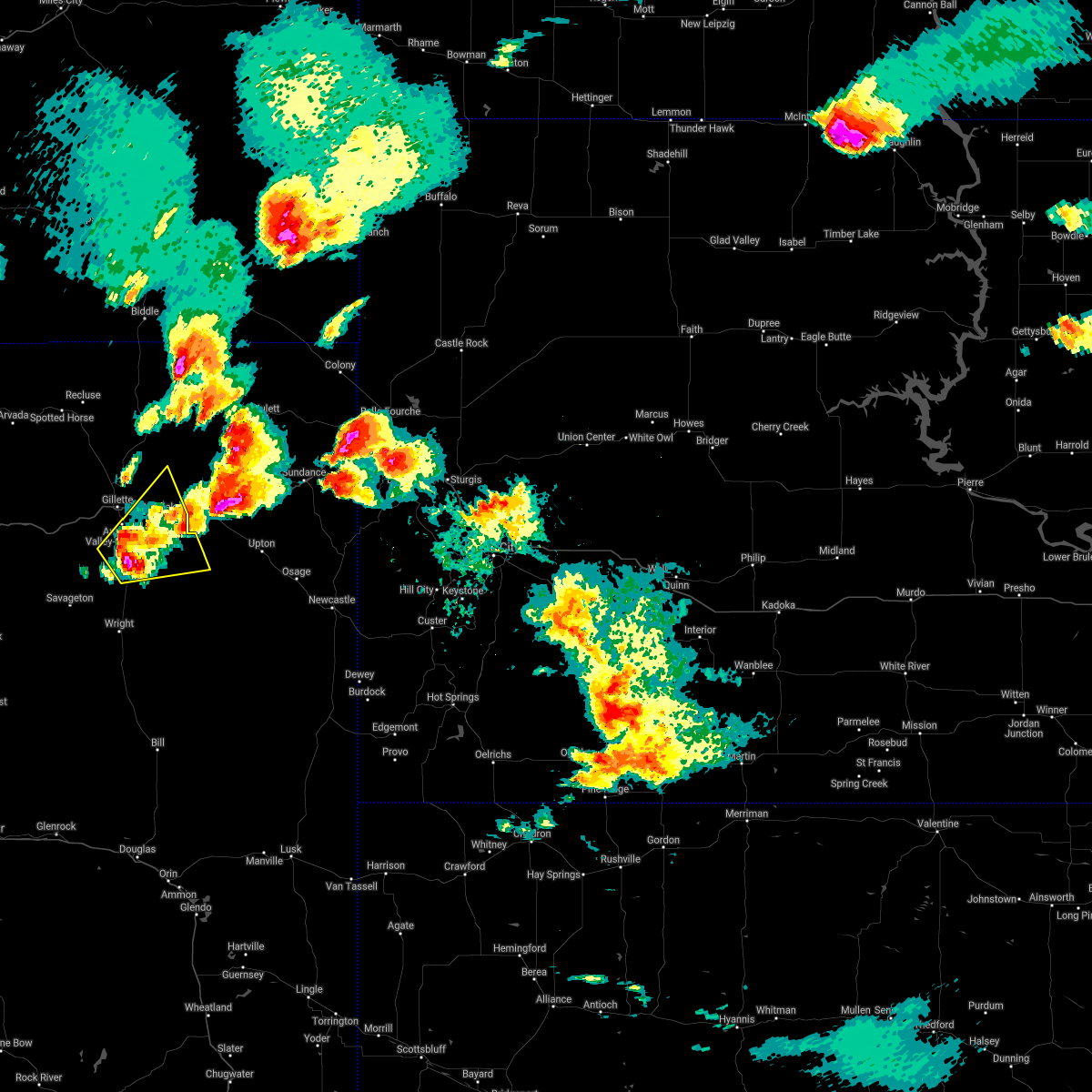 At 752 pm mdt, a severe thunderstorm was located 11 miles south of camplex event facility, or 11 miles southeast of gillette, moving northeast at 20 mph (radar indicated). Hazards include 60 mph wind gusts and half dollar size hail. Hail damage to vehicles is expected. Expect wind damage to roofs, siding, and trees. At 752 pm mdt, a severe thunderstorm was located 11 miles south of camplex event facility, or 11 miles southeast of gillette, moving northeast at 20 mph (radar indicated). Hazards include 60 mph wind gusts and half dollar size hail. Hail damage to vehicles is expected. Expect wind damage to roofs, siding, and trees.
|
| 7/11/2019 6:42 PM MDT |
 The severe thunderstorm warning for east central campbell county will expire at 645 pm mdt, the storms which prompted the warning have weakened below severe limits, and no longer pose an immediate threat to life or property. therefore, the warning will be allowed to expire. however gusty winds are still possible with these thunderstorms. The severe thunderstorm warning for east central campbell county will expire at 645 pm mdt, the storms which prompted the warning have weakened below severe limits, and no longer pose an immediate threat to life or property. therefore, the warning will be allowed to expire. however gusty winds are still possible with these thunderstorms.
|
| 7/11/2019 6:36 PM MDT |
 At 636 pm mdt, severe thunderstorms were located along a line extending from 7 miles south of weston to 6 miles northwest of rozet to 16 miles south of gillette, moving east at 30 mph (radar indicated). Hazards include 60 mph wind gusts. Expect damage to roofs, siding, and trees. locations impacted include, eastern gillette, rozet and camplex event facility. This includes interstate 90 in wyoming between mile markers 127 and 143. At 636 pm mdt, severe thunderstorms were located along a line extending from 7 miles south of weston to 6 miles northwest of rozet to 16 miles south of gillette, moving east at 30 mph (radar indicated). Hazards include 60 mph wind gusts. Expect damage to roofs, siding, and trees. locations impacted include, eastern gillette, rozet and camplex event facility. This includes interstate 90 in wyoming between mile markers 127 and 143.
|
| 7/11/2019 6:10 PM MDT |
 A severe thunderstorm warning remains in effect until 645 pm mdt for central campbell county. At 610 pm mdt, severe thunderstorms were located along a line extending from 13 miles southeast of recluse to 2 miles south of gillette airport to 11 miles east of savageton, moving east at 30 mph. A severe thunderstorm warning remains in effect until 645 pm mdt for central campbell county. At 610 pm mdt, severe thunderstorms were located along a line extending from 13 miles southeast of recluse to 2 miles south of gillette airport to 11 miles east of savageton, moving east at 30 mph.
|
| 7/11/2019 5:51 PM MDT |
 At 551 pm mdt, severe thunderstorms were located along a line extending from 6 miles north of echeta to 11 miles west of gillette airport to 3 miles north of savageton, moving east at 30 mph (radar indicated). Hazards include 60 mph wind gusts. expect damage to roofs, siding, and trees At 551 pm mdt, severe thunderstorms were located along a line extending from 6 miles north of echeta to 11 miles west of gillette airport to 3 miles north of savageton, moving east at 30 mph (radar indicated). Hazards include 60 mph wind gusts. expect damage to roofs, siding, and trees
|
| 7/9/2019 1:42 PM MDT |
 At 142 pm mdt, a severe thunderstorm was located 9 miles south of gillette, moving east at 45 mph (radar indicated). Hazards include 60 mph wind gusts and quarter size hail. Hail damage to vehicles is expected. expect wind damage to roofs, siding, and trees. locations impacted include, southern gillette. This includes interstate 90 in wyoming between mile markers 114 and 118. At 142 pm mdt, a severe thunderstorm was located 9 miles south of gillette, moving east at 45 mph (radar indicated). Hazards include 60 mph wind gusts and quarter size hail. Hail damage to vehicles is expected. expect wind damage to roofs, siding, and trees. locations impacted include, southern gillette. This includes interstate 90 in wyoming between mile markers 114 and 118.
|
| 7/9/2019 1:18 PM MDT |
 At 117 pm mdt, a severe thunderstorm was located 12 miles east of powder river rest area, or 21 miles west of gillette, moving east at 40 mph (radar indicated). Hazards include 60 mph wind gusts and quarter size hail. Hail damage to vehicles is expected. Expect wind damage to roofs, siding, and trees. At 117 pm mdt, a severe thunderstorm was located 12 miles east of powder river rest area, or 21 miles west of gillette, moving east at 40 mph (radar indicated). Hazards include 60 mph wind gusts and quarter size hail. Hail damage to vehicles is expected. Expect wind damage to roofs, siding, and trees.
|
| 7/2/2019 4:42 PM MDT |
 At 442 pm mdt, a severe thunderstorm was located 6 miles southwest of rozet, or 10 miles east of gillette, moving northeast at 35 mph (radar indicated). Hazards include 60 mph wind gusts and half dollar size hail. Hail damage to vehicles is expected. expect wind damage to roofs, siding, and trees. locations impacted include, gillette, rozet and camplex event facility. This includes interstate 90 in wyoming between mile markers 126 and 145. At 442 pm mdt, a severe thunderstorm was located 6 miles southwest of rozet, or 10 miles east of gillette, moving northeast at 35 mph (radar indicated). Hazards include 60 mph wind gusts and half dollar size hail. Hail damage to vehicles is expected. expect wind damage to roofs, siding, and trees. locations impacted include, gillette, rozet and camplex event facility. This includes interstate 90 in wyoming between mile markers 126 and 145.
|
| 7/2/2019 4:28 PM MDT |
 At 427 pm mdt, a severe thunderstorm was located 8 miles south of gillette, moving northeast at 35 mph (radar indicated). Hazards include 60 mph wind gusts and quarter size hail. Hail damage to vehicles is expected. Expect wind damage to roofs, siding, and trees. At 427 pm mdt, a severe thunderstorm was located 8 miles south of gillette, moving northeast at 35 mph (radar indicated). Hazards include 60 mph wind gusts and quarter size hail. Hail damage to vehicles is expected. Expect wind damage to roofs, siding, and trees.
|
| 7/2/2019 4:02 PM MDT |
 At 402 pm mdt, a severe thunderstorm was located 14 miles north of savageton, or 20 miles southwest of gillette, moving northeast at 30 mph (radar indicated). Hazards include ping pong ball size hail and 60 mph wind gusts. People and animals outdoors will be injured. expect hail damage to roofs, siding, windows, and vehicles. expect wind damage to roofs, siding, and trees. locations impacted include, gillette and camplex event facility. This includes interstate 90 in wyoming between mile markers 117 and 120, and between mile markers 122 and 129. At 402 pm mdt, a severe thunderstorm was located 14 miles north of savageton, or 20 miles southwest of gillette, moving northeast at 30 mph (radar indicated). Hazards include ping pong ball size hail and 60 mph wind gusts. People and animals outdoors will be injured. expect hail damage to roofs, siding, windows, and vehicles. expect wind damage to roofs, siding, and trees. locations impacted include, gillette and camplex event facility. This includes interstate 90 in wyoming between mile markers 117 and 120, and between mile markers 122 and 129.
|
| 7/2/2019 3:45 PM MDT |
 The national weather service in rapid city has issued a * severe thunderstorm warning for. central campbell county in northeastern wyoming. until 430 pm mdt. At 344 pm mdt, a severe thunderstorm was located 7 miles north of savageton, or 21 miles northwest of wright, moving northeast at 40. The national weather service in rapid city has issued a * severe thunderstorm warning for. central campbell county in northeastern wyoming. until 430 pm mdt. At 344 pm mdt, a severe thunderstorm was located 7 miles north of savageton, or 21 miles northwest of wright, moving northeast at 40.
|
| 6/26/2019 9:35 PM MDT |
 At 934 pm mdt, a severe thunderstorm was located near camplex event facility, or 4 miles northeast of gillette, moving east at 20 mph (radar indicated). Hazards include golf ball size hail. People and animals outdoors will be injured. expect damage to roofs, siding, windows, and vehicles. locations impacted include, gillette, rozet and camplex event facility. This includes interstate 90 in wyoming between mile markers 125 and 147. At 934 pm mdt, a severe thunderstorm was located near camplex event facility, or 4 miles northeast of gillette, moving east at 20 mph (radar indicated). Hazards include golf ball size hail. People and animals outdoors will be injured. expect damage to roofs, siding, windows, and vehicles. locations impacted include, gillette, rozet and camplex event facility. This includes interstate 90 in wyoming between mile markers 125 and 147.
|
| 6/26/2019 9:24 PM MDT |
 At 924 pm mdt, a severe thunderstorm was located near gillette airport, or 3 miles north of gillette, moving east at 20 mph (radar indicated). Hazards include half dollar size hail. damage to vehicles is expected At 924 pm mdt, a severe thunderstorm was located near gillette airport, or 3 miles north of gillette, moving east at 20 mph (radar indicated). Hazards include half dollar size hail. damage to vehicles is expected
|
| 6/19/2019 7:24 PM MDT |
 At 724 pm mdt, a severe thunderstorm was located 4 miles north of gillette airport, or 9 miles north of gillette, moving east at 45 mph (radar indicated). Hazards include 60 mph wind gusts and quarter size hail. Hail damage to vehicles is expected. expect wind damage to roofs, siding, and trees. locations impacted include, gillette, rozet, camplex event facility and gillette airport. This includes interstate 90 in wyoming between mile markers 120 and 147. At 724 pm mdt, a severe thunderstorm was located 4 miles north of gillette airport, or 9 miles north of gillette, moving east at 45 mph (radar indicated). Hazards include 60 mph wind gusts and quarter size hail. Hail damage to vehicles is expected. expect wind damage to roofs, siding, and trees. locations impacted include, gillette, rozet, camplex event facility and gillette airport. This includes interstate 90 in wyoming between mile markers 120 and 147.
|
| 6/19/2019 7:08 PM MDT |
 At 708 pm mdt, a severe thunderstorm was located 5 miles east of echeta, or 18 miles northwest of gillette, moving east at 45 mph (radar indicated). Hazards include 60 mph wind gusts and quarter size hail. Hail damage to vehicles is expected. Expect wind damage to roofs, siding, and trees. At 708 pm mdt, a severe thunderstorm was located 5 miles east of echeta, or 18 miles northwest of gillette, moving east at 45 mph (radar indicated). Hazards include 60 mph wind gusts and quarter size hail. Hail damage to vehicles is expected. Expect wind damage to roofs, siding, and trees.
|
| 8/14/2018 7:06 PM MDT |
 At 706 pm mdt, a severe thunderstorm was located 11 miles southeast of camplex event facility, or 12 miles southeast of gillette, moving east at 35 mph (radar indicated). Hazards include 60 mph wind gusts. Expect damage to roofs, siding, and trees. locations impacted include, eastern gillette, moorcroft, pine haven, rozet, camplex event facility and keyhole reservoir. This includes interstate 90 in wyoming between mile markers 127 and 176. At 706 pm mdt, a severe thunderstorm was located 11 miles southeast of camplex event facility, or 12 miles southeast of gillette, moving east at 35 mph (radar indicated). Hazards include 60 mph wind gusts. Expect damage to roofs, siding, and trees. locations impacted include, eastern gillette, moorcroft, pine haven, rozet, camplex event facility and keyhole reservoir. This includes interstate 90 in wyoming between mile markers 127 and 176.
|
| 8/14/2018 6:56 PM MDT |
 At 655 pm mdt, a severe thunderstorm was located 8 miles south of gillette, moving east at 40 mph (radar indicated). Hazards include 70 mph wind gusts. Expect considerable tree damage. Damage is likely to mobile homes, roofs, and outbuildings. At 655 pm mdt, a severe thunderstorm was located 8 miles south of gillette, moving east at 40 mph (radar indicated). Hazards include 70 mph wind gusts. Expect considerable tree damage. Damage is likely to mobile homes, roofs, and outbuildings.
|
| 8/14/2018 6:45 PM MDT |
 At 645 pm mdt, a severe thunderstorm was located near gillette, moving east at 35 mph (radar indicated). Hazards include 60 mph wind gusts and quarter size hail. Hail damage to vehicles is expected. expect wind damage to roofs, siding, and trees. locations impacted include, gillette, camplex event facility and gillette airport. This includes interstate 90 in wyoming between mile markers 112 and 140. At 645 pm mdt, a severe thunderstorm was located near gillette, moving east at 35 mph (radar indicated). Hazards include 60 mph wind gusts and quarter size hail. Hail damage to vehicles is expected. expect wind damage to roofs, siding, and trees. locations impacted include, gillette, camplex event facility and gillette airport. This includes interstate 90 in wyoming between mile markers 112 and 140.
|
| 8/14/2018 6:29 PM MDT |
 At 628 pm mdt, a severe thunderstorm was located 5 miles west of gillette airport, or 9 miles northwest of gillette, moving east at 40 mph (public). Hazards include 60 mph wind gusts and quarter size hail. Hail damage to vehicles is expected. expect wind damage to roofs, siding, and trees. locations impacted include, gillette, camplex event facility and gillette airport. This includes interstate 90 in wyoming between mile markers 107 and 140. At 628 pm mdt, a severe thunderstorm was located 5 miles west of gillette airport, or 9 miles northwest of gillette, moving east at 40 mph (public). Hazards include 60 mph wind gusts and quarter size hail. Hail damage to vehicles is expected. expect wind damage to roofs, siding, and trees. locations impacted include, gillette, camplex event facility and gillette airport. This includes interstate 90 in wyoming between mile markers 107 and 140.
|
| 8/14/2018 6:02 PM MDT |
 At 601 pm mdt, a severe thunderstorm was located near echeta, or 21 miles northwest of gillette, moving east at 35 mph (radar indicated). Hazards include 60 mph wind gusts and quarter size hail. Hail damage to vehicles is expected. Expect wind damage to roofs, siding, and trees. At 601 pm mdt, a severe thunderstorm was located near echeta, or 21 miles northwest of gillette, moving east at 35 mph (radar indicated). Hazards include 60 mph wind gusts and quarter size hail. Hail damage to vehicles is expected. Expect wind damage to roofs, siding, and trees.
|
| 8/3/2018 6:03 PM MDT |
 At 602 pm mdt, severe thunderstorms were located along a line extending from 5 miles southeast of spotted horse to 9 miles west of gillette to 2 miles northeast of savageton, moving east at 25 mph (radar indicated). Hazards include 60 mph wind gusts. Expect damage to roofs, siding, and trees. locations impacted include, gillette, echeta, spotted horse, savageton, camplex event facility and gillette airport. This includes interstate 90 in wyoming between mile markers 97 and 131. At 602 pm mdt, severe thunderstorms were located along a line extending from 5 miles southeast of spotted horse to 9 miles west of gillette to 2 miles northeast of savageton, moving east at 25 mph (radar indicated). Hazards include 60 mph wind gusts. Expect damage to roofs, siding, and trees. locations impacted include, gillette, echeta, spotted horse, savageton, camplex event facility and gillette airport. This includes interstate 90 in wyoming between mile markers 97 and 131.
|
| 8/3/2018 5:39 PM MDT |
 At 538 pm mdt, severe thunderstorms were located along a line extending from 9 miles southwest of spotted horse to 17 miles south of echeta to 11 miles west of savageton, moving east at 25 mph (radar indicated). Hazards include 60 mph wind gusts. expect damage to roofs, siding, and trees At 538 pm mdt, severe thunderstorms were located along a line extending from 9 miles southwest of spotted horse to 17 miles south of echeta to 11 miles west of savageton, moving east at 25 mph (radar indicated). Hazards include 60 mph wind gusts. expect damage to roofs, siding, and trees
|
| 7/28/2018 10:19 PM MDT |
 At 1005 pm mdt, severe thunderstorms were located along a line extending from 10 miles south of weston to 2 miles south of gillette to 14 miles north of savageton, moving southeast at 50 mph (radar indicated). Hazards include 60 mph wind gusts. expect damage to roofs, siding, and trees At 1005 pm mdt, severe thunderstorms were located along a line extending from 10 miles south of weston to 2 miles south of gillette to 14 miles north of savageton, moving southeast at 50 mph (radar indicated). Hazards include 60 mph wind gusts. expect damage to roofs, siding, and trees
|
| 7/28/2018 10:05 PM MDT |
 At 1005 pm mdt, severe thunderstorms were located along a line extending from 10 miles south of weston to 2 miles south of gillette to 14 miles north of savageton, moving southeast at 50 mph (radar indicated). Hazards include 60 mph wind gusts. expect damage to roofs, siding, and trees At 1005 pm mdt, severe thunderstorms were located along a line extending from 10 miles south of weston to 2 miles south of gillette to 14 miles north of savageton, moving southeast at 50 mph (radar indicated). Hazards include 60 mph wind gusts. expect damage to roofs, siding, and trees
|
| 7/27/2018 8:27 PM MDT |
 At 826 pm mdt, severe thunderstorms were located along a line extending from 8 miles southwest of spotted horse to 14 miles southwest of gillette to 13 miles west of savageton, moving southeast at 40 mph (radar indicated). Hazards include 60 mph wind gusts and nickel size hail. Expect damage to roofs, siding, and trees. locations impacted include, gillette, wright, reno junction, echeta, rozet, savageton, camplex event facility and gillette airport. This includes interstate 90 in wyoming between mile markers 97 and 147. At 826 pm mdt, severe thunderstorms were located along a line extending from 8 miles southwest of spotted horse to 14 miles southwest of gillette to 13 miles west of savageton, moving southeast at 40 mph (radar indicated). Hazards include 60 mph wind gusts and nickel size hail. Expect damage to roofs, siding, and trees. locations impacted include, gillette, wright, reno junction, echeta, rozet, savageton, camplex event facility and gillette airport. This includes interstate 90 in wyoming between mile markers 97 and 147.
|
| 7/27/2018 8:06 PM MDT |
 At 806 pm mdt, severe thunderstorms were located along a line extending from 12 miles west of spotted horse to 12 miles south of echeta to 23 miles west of savageton, moving east at 50 mph (radar indicated). Hazards include 60 mph wind gusts and nickel size hail. expect damage to roofs, siding, and trees At 806 pm mdt, severe thunderstorms were located along a line extending from 12 miles west of spotted horse to 12 miles south of echeta to 23 miles west of savageton, moving east at 50 mph (radar indicated). Hazards include 60 mph wind gusts and nickel size hail. expect damage to roofs, siding, and trees
|
| 7/21/2018 5:11 PM MDT |
 At 511 pm mdt, a severe thunderstorm was located 9 miles south of gillette, moving southeast at 10 mph (public). Hazards include 60 mph wind gusts and quarter size hail. Hail damage to vehicles is expected. expect wind damage to roofs, siding, and trees. Locations impacted include, southeastern gillette. At 511 pm mdt, a severe thunderstorm was located 9 miles south of gillette, moving southeast at 10 mph (public). Hazards include 60 mph wind gusts and quarter size hail. Hail damage to vehicles is expected. expect wind damage to roofs, siding, and trees. Locations impacted include, southeastern gillette.
|
| 7/21/2018 4:49 PM MDT |
 At 449 pm mdt, a severe thunderstorm was located 8 miles south of gillette, moving southeast at 25 mph (radar indicated). Hazards include 60 mph wind gusts and half dollar size hail. Hail damage to vehicles is expected. Expect wind damage to roofs, siding, and trees. At 449 pm mdt, a severe thunderstorm was located 8 miles south of gillette, moving southeast at 25 mph (radar indicated). Hazards include 60 mph wind gusts and half dollar size hail. Hail damage to vehicles is expected. Expect wind damage to roofs, siding, and trees.
|
| 7/17/2018 5:54 PM MDT |
 The severe thunderstorm warning for east central campbell county will expire at 600 pm mdt, the storm which prompted the warning has weakened below severe limits, and no longer poses an immediate threat to life or property. therefore, the warning will be allowed to expire. a severe thunderstorm watch remains in effect until 1100 pm mdt for northeastern wyoming. remember, a severe thunderstorm warning still remains in effect for southern campbell county. The severe thunderstorm warning for east central campbell county will expire at 600 pm mdt, the storm which prompted the warning has weakened below severe limits, and no longer poses an immediate threat to life or property. therefore, the warning will be allowed to expire. a severe thunderstorm watch remains in effect until 1100 pm mdt for northeastern wyoming. remember, a severe thunderstorm warning still remains in effect for southern campbell county.
|
| 7/17/2018 5:35 PM MDT |
 At 534 pm mdt, a severe thunderstorm was located near camplex event facility, or 3 miles east of gillette, moving northeast at 20 mph (radar indicated). Hazards include 60 mph wind gusts and quarter size hail. Hail damage to vehicles is expected. expect wind damage to roofs, siding, and trees. locations impacted include, gillette, rozet, camplex event facility and gillette airport. This includes interstate 90 in wyoming between mile markers 123 and 145. At 534 pm mdt, a severe thunderstorm was located near camplex event facility, or 3 miles east of gillette, moving northeast at 20 mph (radar indicated). Hazards include 60 mph wind gusts and quarter size hail. Hail damage to vehicles is expected. expect wind damage to roofs, siding, and trees. locations impacted include, gillette, rozet, camplex event facility and gillette airport. This includes interstate 90 in wyoming between mile markers 123 and 145.
|
| 7/17/2018 5:18 PM MDT |
 At 518 pm mdt, a severe thunderstorm was located 6 miles south of gillette, moving northeast at 20 mph (radar indicated). Hazards include 60 mph wind gusts and quarter size hail. Hail damage to vehicles is expected. Expect wind damage to roofs, siding, and trees. At 518 pm mdt, a severe thunderstorm was located 6 miles south of gillette, moving northeast at 20 mph (radar indicated). Hazards include 60 mph wind gusts and quarter size hail. Hail damage to vehicles is expected. Expect wind damage to roofs, siding, and trees.
|
| 7/17/2018 4:37 PM MDT |
 At 437 pm mdt, a severe thunderstorm was located 10 miles southwest of gillette, moving east at 30 mph (radar indicated). Hazards include 60 mph wind gusts and half dollar size hail. Hail damage to vehicles is expected. expect wind damage to roofs, siding, and trees. locations impacted include, southern gillette. This includes interstate 90 in wyoming between mile markers 104 and 117. At 437 pm mdt, a severe thunderstorm was located 10 miles southwest of gillette, moving east at 30 mph (radar indicated). Hazards include 60 mph wind gusts and half dollar size hail. Hail damage to vehicles is expected. expect wind damage to roofs, siding, and trees. locations impacted include, southern gillette. This includes interstate 90 in wyoming between mile markers 104 and 117.
|
| 7/17/2018 4:19 PM MDT |
 At 419 pm mdt, a severe thunderstorm was located 17 miles southwest of gillette, moving east at 30 mph (radar indicated). Hazards include 60 mph wind gusts and half dollar size hail. Hail damage to vehicles is expected. expect wind damage to roofs, siding, and trees. locations impacted include, gillette and camplex event facility. This includes interstate 90 in wyoming between mile markers 99 and 120, and between mile markers 124 and 131. At 419 pm mdt, a severe thunderstorm was located 17 miles southwest of gillette, moving east at 30 mph (radar indicated). Hazards include 60 mph wind gusts and half dollar size hail. Hail damage to vehicles is expected. expect wind damage to roofs, siding, and trees. locations impacted include, gillette and camplex event facility. This includes interstate 90 in wyoming between mile markers 99 and 120, and between mile markers 124 and 131.
|
| 7/17/2018 4:04 PM MDT |
 At 403 pm mdt, a severe thunderstorm was located 20 miles south of echeta, or 24 miles west of gillette, moving east at 30 mph (radar indicated). Hazards include 60 mph wind gusts and half dollar size hail. Hail damage to vehicles is expected. Expect wind damage to roofs, siding, and trees. At 403 pm mdt, a severe thunderstorm was located 20 miles south of echeta, or 24 miles west of gillette, moving east at 30 mph (radar indicated). Hazards include 60 mph wind gusts and half dollar size hail. Hail damage to vehicles is expected. Expect wind damage to roofs, siding, and trees.
|
| 6/29/2018 2:46 PM MDT |
 At 245 pm mdt, a severe thunderstorm was located near camplex event facility, or 3 miles northeast of gillette, moving east at 35 mph (radar indicated). Hazards include two inch hail and 60 mph wind gusts. People and animals outdoors will be injured. expect hail damage to roofs, siding, windows, and vehicles. expect wind damage to roofs, siding, and trees. locations impacted include, gillette, camplex event facility and gillette airport. This includes interstate 90 in wyoming between mile markers 116 and 139. At 245 pm mdt, a severe thunderstorm was located near camplex event facility, or 3 miles northeast of gillette, moving east at 35 mph (radar indicated). Hazards include two inch hail and 60 mph wind gusts. People and animals outdoors will be injured. expect hail damage to roofs, siding, windows, and vehicles. expect wind damage to roofs, siding, and trees. locations impacted include, gillette, camplex event facility and gillette airport. This includes interstate 90 in wyoming between mile markers 116 and 139.
|
| 6/29/2018 2:31 PM MDT |
 At 231 pm mdt, a severe thunderstorm was located 5 miles southwest of gillette airport, or 7 miles west of gillette, moving east at 35 mph (radar indicated). Hazards include two inch hail and 60 mph wind gusts. People and animals outdoors will be injured. expect hail damage to roofs, siding, windows, and vehicles. expect wind damage to roofs, siding, and trees. locations impacted include, gillette, camplex event facility and gillette airport. This includes interstate 90 in wyoming between mile markers 108 and 139. At 231 pm mdt, a severe thunderstorm was located 5 miles southwest of gillette airport, or 7 miles west of gillette, moving east at 35 mph (radar indicated). Hazards include two inch hail and 60 mph wind gusts. People and animals outdoors will be injured. expect hail damage to roofs, siding, windows, and vehicles. expect wind damage to roofs, siding, and trees. locations impacted include, gillette, camplex event facility and gillette airport. This includes interstate 90 in wyoming between mile markers 108 and 139.
|
| 6/29/2018 2:13 PM MDT |
 At 213 pm mdt, a severe thunderstorm was located 12 miles south of echeta, or 17 miles west of gillette, moving east at 35 mph (radar indicated). Hazards include 60 mph wind gusts and half dollar size hail. Hail damage to vehicles is expected. Expect wind damage to roofs, siding, and trees. At 213 pm mdt, a severe thunderstorm was located 12 miles south of echeta, or 17 miles west of gillette, moving east at 35 mph (radar indicated). Hazards include 60 mph wind gusts and half dollar size hail. Hail damage to vehicles is expected. Expect wind damage to roofs, siding, and trees.
|
| 6/21/2018 7:26 PM MDT |
 The severe thunderstorm warning for southwestern campbell county will expire at 730 pm mdt, the storms which prompted the warning have weakened below severe limits, and no longer pose an immediate threat to life or property. therefore, the warning will be allowed to expire. however gusty winds and heavy rain are still possible with these thunderstorms. The severe thunderstorm warning for southwestern campbell county will expire at 730 pm mdt, the storms which prompted the warning have weakened below severe limits, and no longer pose an immediate threat to life or property. therefore, the warning will be allowed to expire. however gusty winds and heavy rain are still possible with these thunderstorms.
|
| 6/21/2018 7:12 PM MDT |
 At 712 pm mdt, severe thunderstorms were located along a line extending from 4 miles northeast of echeta to 13 miles southwest of gillette to 5 miles southeast of pine tree junction, moving east at 30 mph (radar indicated). Hazards include 60 mph wind gusts. Expect damage to roofs, siding, and trees. locations impacted include, gillette, wright, pine tree junction, reno junction, echeta, savageton, camplex event facility, gillette airport and pumpkin buttes. This includes interstate 90 in wyoming between mile markers 105 and 129. At 712 pm mdt, severe thunderstorms were located along a line extending from 4 miles northeast of echeta to 13 miles southwest of gillette to 5 miles southeast of pine tree junction, moving east at 30 mph (radar indicated). Hazards include 60 mph wind gusts. Expect damage to roofs, siding, and trees. locations impacted include, gillette, wright, pine tree junction, reno junction, echeta, savageton, camplex event facility, gillette airport and pumpkin buttes. This includes interstate 90 in wyoming between mile markers 105 and 129.
|
| 6/21/2018 6:55 PM MDT |
 At 655 pm mdt, severe thunderstorms were located along a line extending from 8 miles northwest of echeta to 17 miles north of savageton to 7 miles west of pine tree junction, moving east at 30 mph (radar indicated). Hazards include 60 mph wind gusts. Expect damage to roofs, siding, and trees. locations impacted include, gillette, wright, pine tree junction, reno junction, echeta, savageton, camplex event facility, gillette airport and pumpkin buttes. This includes interstate 90 in wyoming between mile markers 96 and 129. At 655 pm mdt, severe thunderstorms were located along a line extending from 8 miles northwest of echeta to 17 miles north of savageton to 7 miles west of pine tree junction, moving east at 30 mph (radar indicated). Hazards include 60 mph wind gusts. Expect damage to roofs, siding, and trees. locations impacted include, gillette, wright, pine tree junction, reno junction, echeta, savageton, camplex event facility, gillette airport and pumpkin buttes. This includes interstate 90 in wyoming between mile markers 96 and 129.
|
| 6/21/2018 6:35 PM MDT |
 At 635 pm mdt, severe thunderstorms were located along a line extending from 13 miles west of echeta to 19 miles northwest of savageton to 12 miles southwest of pumpkin buttes, moving east at 30 mph (radar indicated). Hazards include 60 mph wind gusts. expect damage to roofs, siding, and trees At 635 pm mdt, severe thunderstorms were located along a line extending from 13 miles west of echeta to 19 miles northwest of savageton to 12 miles southwest of pumpkin buttes, moving east at 30 mph (radar indicated). Hazards include 60 mph wind gusts. expect damage to roofs, siding, and trees
|
| 6/9/2018 4:59 PM MDT |
 At 459 pm mdt, a severe thunderstorm was located 8 miles west of gillette airport, or 12 miles northwest of gillette, moving east at 20 mph (radar indicated). Hazards include 60 mph wind gusts and quarter size hail. Hail damage to vehicles is expected. Expect wind damage to roofs, siding, and trees. At 459 pm mdt, a severe thunderstorm was located 8 miles west of gillette airport, or 12 miles northwest of gillette, moving east at 20 mph (radar indicated). Hazards include 60 mph wind gusts and quarter size hail. Hail damage to vehicles is expected. Expect wind damage to roofs, siding, and trees.
|
| 7/12/2017 5:12 PM MDT |
 At 512 pm mdt, a severe thunderstorm was located 14 miles northwest of savageton, or 26 miles southwest of gillette, moving southeast at 20 mph (radar indicated). Hazards include ping pong ball size hail and 60 mph wind gusts. People and animals outdoors will be injured. expect hail damage to roofs, siding, windows, and vehicles. Expect wind damage to roofs, siding, and trees. At 512 pm mdt, a severe thunderstorm was located 14 miles northwest of savageton, or 26 miles southwest of gillette, moving southeast at 20 mph (radar indicated). Hazards include ping pong ball size hail and 60 mph wind gusts. People and animals outdoors will be injured. expect hail damage to roofs, siding, windows, and vehicles. Expect wind damage to roofs, siding, and trees.
|
| 10/2/2016 7:32 PM MDT |
 At 730 pm mdt, a severe thunderstorm was located west of gillette, moving northeast at 20 mph (radar indicated. at 720 pm mdt...dime sized hail was reported 11 miles southwest of downtown gillette). Hazards include 60 mph wind gusts and quarter size hail. Hail damage to vehicles is expected. expect wind damage to roofs, siding, and trees. Locations impacted include, gillette, weston and gillette airport. At 730 pm mdt, a severe thunderstorm was located west of gillette, moving northeast at 20 mph (radar indicated. at 720 pm mdt...dime sized hail was reported 11 miles southwest of downtown gillette). Hazards include 60 mph wind gusts and quarter size hail. Hail damage to vehicles is expected. expect wind damage to roofs, siding, and trees. Locations impacted include, gillette, weston and gillette airport.
|
| 10/2/2016 7:07 PM MDT |
 At 707 pm mdt, a severe thunderstorm was located near gillette airport, or west of gillette, moving northeast at 35 mph (radar indicated). Hazards include 60 mph wind gusts and quarter size hail. Hail damage to vehicles is expected. Expect wind damage to roofs, siding, and trees. At 707 pm mdt, a severe thunderstorm was located near gillette airport, or west of gillette, moving northeast at 35 mph (radar indicated). Hazards include 60 mph wind gusts and quarter size hail. Hail damage to vehicles is expected. Expect wind damage to roofs, siding, and trees.
|
| 8/7/2016 8:11 PM MDT | The severe thunderstorm warning for east central campbell and southwestern crook counties will expire at 815 pm mdt, the storm which prompted the warning has weakened below severe limits, and no longer pose an immediate threat to life or property. therefore the warning will be allowed to expire. however small hail, gusty winds and heavy rain are still possible with this thunderstorm. |
| 8/7/2016 7:47 PM MDT |
 At 747 pm mdt, a severe thunderstorm was located near gillette, moving east at 25 mph (radar indicated). Hazards include 60 mph wind gusts and half dollar size hail. Hail damage to vehicles is expected. Expect wind damage to roofs, siding, and trees. At 747 pm mdt, a severe thunderstorm was located near gillette, moving east at 25 mph (radar indicated). Hazards include 60 mph wind gusts and half dollar size hail. Hail damage to vehicles is expected. Expect wind damage to roofs, siding, and trees.
|
| 8/7/2016 7:08 PM MDT |
 At 707 pm mdt, a severe thunderstorm was located near gillette airport, or near gillette, moving east at 30 mph (radar indicated). Hazards include 60 mph wind gusts and half dollar size hail. Hail damage to vehicles is expected. expect wind damage to roofs, siding, and trees. Locations impacted include, gillette and gillette airport. At 707 pm mdt, a severe thunderstorm was located near gillette airport, or near gillette, moving east at 30 mph (radar indicated). Hazards include 60 mph wind gusts and half dollar size hail. Hail damage to vehicles is expected. expect wind damage to roofs, siding, and trees. Locations impacted include, gillette and gillette airport.
|
| 8/7/2016 6:50 PM MDT |
 At 650 pm mdt, a severe thunderstorm was located 10 miles southwest of gillette airport, or 10 miles west of gillette, moving northeast at 20 mph (radar indicated). Hazards include 60 mph wind gusts and half dollar size hail. Hail damage to vehicles is expected. Expect wind damage to roofs, siding, and trees. At 650 pm mdt, a severe thunderstorm was located 10 miles southwest of gillette airport, or 10 miles west of gillette, moving northeast at 20 mph (radar indicated). Hazards include 60 mph wind gusts and half dollar size hail. Hail damage to vehicles is expected. Expect wind damage to roofs, siding, and trees.
|
| 7/30/2016 5:31 PM MDT |
 At 529 pm mdt, a severe thunderstorm was located 7 miles northeast of gillette, moving east at 20 mph (emergency management. at 520 pm mdt...penny sized hail was reported 2 miles north of gillette). Hazards include 60 mph wind gusts and nickel size hail. Expect damage to roofs. siding. and trees. Locations impacted include, gillette and rozet. At 529 pm mdt, a severe thunderstorm was located 7 miles northeast of gillette, moving east at 20 mph (emergency management. at 520 pm mdt...penny sized hail was reported 2 miles north of gillette). Hazards include 60 mph wind gusts and nickel size hail. Expect damage to roofs. siding. and trees. Locations impacted include, gillette and rozet.
|
| 7/30/2016 5:15 PM MDT |
 At 514 pm mdt, a severe thunderstorm was located near gillette, moving east at 35 mph (radar indicated). Hazards include 60 mph wind gusts and penny size hail. Expect damage to roofs. siding. and trees. Locations impacted include, gillette, rozet and gillette airport. At 514 pm mdt, a severe thunderstorm was located near gillette, moving east at 35 mph (radar indicated). Hazards include 60 mph wind gusts and penny size hail. Expect damage to roofs. siding. and trees. Locations impacted include, gillette, rozet and gillette airport.
|
| 7/30/2016 4:51 PM MDT |
 At 450 pm mdt, a severe thunderstorm was located 6 miles west of gillette airport, or 10 miles northwest of gillette, moving east-southeast at 30 mph (radar indicated). Hazards include 60 mph wind gusts and penny size hail. Expect damage to roofs. siding. And trees. At 450 pm mdt, a severe thunderstorm was located 6 miles west of gillette airport, or 10 miles northwest of gillette, moving east-southeast at 30 mph (radar indicated). Hazards include 60 mph wind gusts and penny size hail. Expect damage to roofs. siding. And trees.
|
| 7/18/2016 4:24 PM MDT |
 The severe thunderstorm warning for central campbell county will expire at 430 pm mdt, the storm which prompted the warning has weakened below severe limits, and no longer pose an immediate threat to life or property. therefore the warning will be allowed to expire. however gusty winds are still possible with this thunderstorm. The severe thunderstorm warning for central campbell county will expire at 430 pm mdt, the storm which prompted the warning has weakened below severe limits, and no longer pose an immediate threat to life or property. therefore the warning will be allowed to expire. however gusty winds are still possible with this thunderstorm.
|
| 7/18/2016 3:58 PM MDT |
 At 358 pm mdt, a severe thunderstorm was located over gillette, moving east at 15 mph (radar indicated). Hazards include 60 mph wind gusts and quarter size hail. Hail damage to vehicles is expected. expect wind damage to roofs, siding, and trees. Locations impacted include, gillette and gillette airport. At 358 pm mdt, a severe thunderstorm was located over gillette, moving east at 15 mph (radar indicated). Hazards include 60 mph wind gusts and quarter size hail. Hail damage to vehicles is expected. expect wind damage to roofs, siding, and trees. Locations impacted include, gillette and gillette airport.
|
| 7/18/2016 3:38 PM MDT |
 At 338 pm mdt, a severe thunderstorm was located over southern gillette, moving northeast at 30 mph (radar indicated). Hazards include 60 mph wind gusts and quarter size hail. Hail damage to vehicles is expected. expect wind damage to roofs, siding, and trees. Locations impacted include, gillette and gillette airport. At 338 pm mdt, a severe thunderstorm was located over southern gillette, moving northeast at 30 mph (radar indicated). Hazards include 60 mph wind gusts and quarter size hail. Hail damage to vehicles is expected. expect wind damage to roofs, siding, and trees. Locations impacted include, gillette and gillette airport.
|
| 7/18/2016 3:25 PM MDT |
 At 325 pm mdt, a severe thunderstorm was located 7 miles west of gillette, moving northeast at 15 mph (radar indicated). Hazards include 60 mph wind gusts and half dollar size hail. Hail damage to vehicles is expected. Expect wind damage to roofs, siding, and trees. At 325 pm mdt, a severe thunderstorm was located 7 miles west of gillette, moving northeast at 15 mph (radar indicated). Hazards include 60 mph wind gusts and half dollar size hail. Hail damage to vehicles is expected. Expect wind damage to roofs, siding, and trees.
|
| 7/16/2016 3:15 PM MDT |
 At 315 pm mdt, a severe thunderstorm was located near echeta, or 17 miles northwest of gillette, moving east at 30 mph (radar indicated). Hazards include 60 mph wind gusts and half dollar size hail. Hail damage to vehicles is expected. Expect wind damage to roofs, siding, and trees. At 315 pm mdt, a severe thunderstorm was located near echeta, or 17 miles northwest of gillette, moving east at 30 mph (radar indicated). Hazards include 60 mph wind gusts and half dollar size hail. Hail damage to vehicles is expected. Expect wind damage to roofs, siding, and trees.
|
| 6/28/2016 2:20 PM MDT |
 The severe thunderstorm warning for east central campbell county will expire at 230 pm mdt, the storm which prompted the warning has moved out of the area. therefore the warning will be allowed to expire. a severe thunderstorm watch remains in effect until 900 pm mdt for northeastern wyoming. The severe thunderstorm warning for east central campbell county will expire at 230 pm mdt, the storm which prompted the warning has moved out of the area. therefore the warning will be allowed to expire. a severe thunderstorm watch remains in effect until 900 pm mdt for northeastern wyoming.
|
| 6/28/2016 1:44 PM MDT |
 At 144 pm mdt, a severe thunderstorm was located 8 miles southwest of rozet, or 10 miles southeast of gillette, moving east at 20 mph (radar indicated). Hazards include ping pong ball size hail and 60 mph wind gusts. People and animals outdoors will be injured. expect hail damage to roofs, siding, windows, and vehicles. expect wind damage to roofs, siding, and trees. Locations impacted include, southeastern gillette and rozet. At 144 pm mdt, a severe thunderstorm was located 8 miles southwest of rozet, or 10 miles southeast of gillette, moving east at 20 mph (radar indicated). Hazards include ping pong ball size hail and 60 mph wind gusts. People and animals outdoors will be injured. expect hail damage to roofs, siding, windows, and vehicles. expect wind damage to roofs, siding, and trees. Locations impacted include, southeastern gillette and rozet.
|
| 6/28/2016 1:24 PM MDT |
 At 124 pm mdt, a severe thunderstorm was located near gillette, moving east at 20 mph (radar indicated). Hazards include ping pong ball size hail and 60 mph wind gusts. People and animals outdoors will be injured. expect hail damage to roofs, siding, windows, and vehicles. Expect wind damage to roofs, siding, and trees. At 124 pm mdt, a severe thunderstorm was located near gillette, moving east at 20 mph (radar indicated). Hazards include ping pong ball size hail and 60 mph wind gusts. People and animals outdoors will be injured. expect hail damage to roofs, siding, windows, and vehicles. Expect wind damage to roofs, siding, and trees.
|
| 8/17/2015 7:11 PM MDT |
 At 706 pm mdt, severe thunderstorms were located along a line extending from 13 miles southwest of biddle to 16 miles south of gillette, moving east at 35 mph (radar indicated). Hazards include 60 mph wind gusts and nickel size hail. a 62 mph wind gust was reported at the gillette asos at 704 pm mdt. Expect damage to roofs. siding and trees. locations impacted include, gillette, recluse, rockypoint, rozet, spotted horse, echeta, weston and gillette airport. This includes interstate 90 in wyoming between mile markers 97 and 147. At 706 pm mdt, severe thunderstorms were located along a line extending from 13 miles southwest of biddle to 16 miles south of gillette, moving east at 35 mph (radar indicated). Hazards include 60 mph wind gusts and nickel size hail. a 62 mph wind gust was reported at the gillette asos at 704 pm mdt. Expect damage to roofs. siding and trees. locations impacted include, gillette, recluse, rockypoint, rozet, spotted horse, echeta, weston and gillette airport. This includes interstate 90 in wyoming between mile markers 97 and 147.
|
| 8/17/2015 6:22 PM MDT |
 At 621 pm mdt, severe thunderstorms were located along a line extending from 19 miles northwest of spotted horse to 12 miles southeast of powder river rest area, moving east at 35 mph (radar indicated). Hazards include 60 mph wind gusts and nickel size hail. Expect damage to roofs. Siding and trees. At 621 pm mdt, severe thunderstorms were located along a line extending from 19 miles northwest of spotted horse to 12 miles southeast of powder river rest area, moving east at 35 mph (radar indicated). Hazards include 60 mph wind gusts and nickel size hail. Expect damage to roofs. Siding and trees.
|
| 8/5/2015 5:08 PM MDT |
 At 507 pm mdt, a severe thunderstorm was located near gillette, moving northeast at 25 mph (radar indicated). Hazards include 60 mph wind gusts. Expect damage to roofs. siding and trees. this severe thunderstorm will be near, rozet around 525 pm mdt. This includes interstate 90 in wyoming between mile markers 118 and 155. At 507 pm mdt, a severe thunderstorm was located near gillette, moving northeast at 25 mph (radar indicated). Hazards include 60 mph wind gusts. Expect damage to roofs. siding and trees. this severe thunderstorm will be near, rozet around 525 pm mdt. This includes interstate 90 in wyoming between mile markers 118 and 155.
|
| 7/25/2015 1:27 AM MDT | The severe thunderstorm warning for central campbell county will expire at 130 am mdt, the storm which prompted the warning has weakened below severe limits, and no longer pose an immediate threat to life or property. therefore the warning will be allowed to expire. however small hail and gusty winds are still possible with this thunderstorm. |
| 7/25/2015 12:50 AM MDT |
 At 1250 am mdt, a severe thunderstorm was located 9 miles south of echeta, or 14 miles west of gillette, moving east at 30 mph (radar indicated). Hazards include 60 mph wind gusts and nickel size hail. Expect damage to roofs. siding and trees. locations impacted include, gillette, echeta and gillette airport. This includes interstate 90 in wyoming between mile markers 98 and 135. At 1250 am mdt, a severe thunderstorm was located 9 miles south of echeta, or 14 miles west of gillette, moving east at 30 mph (radar indicated). Hazards include 60 mph wind gusts and nickel size hail. Expect damage to roofs. siding and trees. locations impacted include, gillette, echeta and gillette airport. This includes interstate 90 in wyoming between mile markers 98 and 135.
|
| 7/25/2015 12:27 AM MDT |
 At 1227 am mdt, a severe thunderstorm was located 11 miles northeast of powder river rest area, or 25 miles west of gillette, moving east at 30 mph (radar indicated). Hazards include 60 mph wind gusts and quarter size hail. Hail damage to vehicles is expected. Expect wind damage to roofs, siding and trees. At 1227 am mdt, a severe thunderstorm was located 11 miles northeast of powder river rest area, or 25 miles west of gillette, moving east at 30 mph (radar indicated). Hazards include 60 mph wind gusts and quarter size hail. Hail damage to vehicles is expected. Expect wind damage to roofs, siding and trees.
|
| 7/1/2015 9:04 PM MDT |
 At 904 pm mdt, severe thunderstorms were located along a line extending from near oshoto to 13 miles southeast of weston to 8 miles northeast of gillette airport, moving southeast at 45 mph (trained weather spotters. at 850 pm...60 mph wind was reported 1 mile east of weston). Hazards include 60 mph wind gusts and quarter size hail. Hail damage to vehicles is expected. expect wind damage to roofs, siding and trees. locations impacted include, gillette, moorcroft, pine haven, oshoto, carlile, rozet, keyhole reservoir, devils tower junction and gillette airport. This includes interstate 90 in wyoming between mile markers 125 and 177. At 904 pm mdt, severe thunderstorms were located along a line extending from near oshoto to 13 miles southeast of weston to 8 miles northeast of gillette airport, moving southeast at 45 mph (trained weather spotters. at 850 pm...60 mph wind was reported 1 mile east of weston). Hazards include 60 mph wind gusts and quarter size hail. Hail damage to vehicles is expected. expect wind damage to roofs, siding and trees. locations impacted include, gillette, moorcroft, pine haven, oshoto, carlile, rozet, keyhole reservoir, devils tower junction and gillette airport. This includes interstate 90 in wyoming between mile markers 125 and 177.
|
| 7/1/2015 8:47 PM MDT |
 At 847 pm mdt, a severe thunderstorm was located over weston, or 25 miles north of gillette, moving southeast at 45 mph (radar indicated). Hazards include ping pong ball size hail and 60 mph wind gusts. People and animals outdoors will be injured. expect hail damage to roofs, siding, windows and vehicles. expect wind damage to roofs, siding and trees. locations impacted include, gillette, moorcroft, pine haven, oshoto, recluse, carlile, rockypoint, rozet, weston, keyhole reservoir, devils tower junction and gillette airport. This includes interstate 90 in wyoming between mile markers 113 and 177. At 847 pm mdt, a severe thunderstorm was located over weston, or 25 miles north of gillette, moving southeast at 45 mph (radar indicated). Hazards include ping pong ball size hail and 60 mph wind gusts. People and animals outdoors will be injured. expect hail damage to roofs, siding, windows and vehicles. expect wind damage to roofs, siding and trees. locations impacted include, gillette, moorcroft, pine haven, oshoto, recluse, carlile, rockypoint, rozet, weston, keyhole reservoir, devils tower junction and gillette airport. This includes interstate 90 in wyoming between mile markers 113 and 177.
|
| 7/1/2015 8:40 PM MDT |
 At 839 pm mdt, a severe thunderstorm was located near weston, or 30 miles north of gillette, moving southeast at 45 mph (radar indicated). Hazards include 60 mph wind gusts and quarter size hail. Hail damage to vehicles is expected. Expect wind damage to roofs, siding and trees. At 839 pm mdt, a severe thunderstorm was located near weston, or 30 miles north of gillette, moving southeast at 45 mph (radar indicated). Hazards include 60 mph wind gusts and quarter size hail. Hail damage to vehicles is expected. Expect wind damage to roofs, siding and trees.
|
| 6/24/2015 12:01 AM MDT |
 At 1200 am mdt, severe thunderstorms were located along a line extending from near rozet to 14 miles northeast of savageton, moving east at 25 mph (radar indicated). Hazards include golf ball size hail and 60 mph wind gusts. People and animals outdoors will be injured. expect hail damage to roofs, siding, windows and vehicles. Expect wind damage to roofs, siding and trees. At 1200 am mdt, severe thunderstorms were located along a line extending from near rozet to 14 miles northeast of savageton, moving east at 25 mph (radar indicated). Hazards include golf ball size hail and 60 mph wind gusts. People and animals outdoors will be injured. expect hail damage to roofs, siding, windows and vehicles. Expect wind damage to roofs, siding and trees.
|
| 6/23/2015 11:38 PM MDT |
 At 1136 pm mdt, a severe thunderstorm was located 15 miles southwest of gillette, moving southeast at 30 mph (radar indicated). Hazards include tennis ball size hail and 60 mph wind gusts. People and animals outdoors will be injured. expect hail damage to roofs, siding, windows and vehicles. expect wind damage to roofs, siding and trees. locations impacted include, highways 50 and 59 south of gillette. This includes interstate 90 in wyoming between mile markers 104 and 118. At 1136 pm mdt, a severe thunderstorm was located 15 miles southwest of gillette, moving southeast at 30 mph (radar indicated). Hazards include tennis ball size hail and 60 mph wind gusts. People and animals outdoors will be injured. expect hail damage to roofs, siding, windows and vehicles. expect wind damage to roofs, siding and trees. locations impacted include, highways 50 and 59 south of gillette. This includes interstate 90 in wyoming between mile markers 104 and 118.
|
| 6/23/2015 11:28 PM MDT |
 At 1127 pm mdt, severe thunderstorms were located along a line extending from weston to gillette, moving east at 25 mph (trained weather spotters. at 1120 pm...golf ball size hail was reported at the eagle butte mine northwest of gillette). Hazards include tennis ball size hail and 60 mph wind gusts. People and animals outdoors will be injured. expect hail damage to roofs, siding, windows and vehicles. expect wind damage to roofs, siding and trees. locations impacted include, gillette, rozet, weston and gillette airport. This includes interstate 90 in wyoming between mile markers 118 and 144. At 1127 pm mdt, severe thunderstorms were located along a line extending from weston to gillette, moving east at 25 mph (trained weather spotters. at 1120 pm...golf ball size hail was reported at the eagle butte mine northwest of gillette). Hazards include tennis ball size hail and 60 mph wind gusts. People and animals outdoors will be injured. expect hail damage to roofs, siding, windows and vehicles. expect wind damage to roofs, siding and trees. locations impacted include, gillette, rozet, weston and gillette airport. This includes interstate 90 in wyoming between mile markers 118 and 144.
|
| 6/23/2015 11:11 PM MDT |
 At 1110 pm mdt, severe thunderstorms were located along a line extending from 9 miles west of weston to near gillette airport, moving east at 25 mph (radar indicated). Hazards include golf ball size hail and 60 mph wind gusts. People and animals outdoors will be injured. expect hail damage to roofs, siding, windows and vehicles. Expect wind damage to roofs, siding and trees. At 1110 pm mdt, severe thunderstorms were located along a line extending from 9 miles west of weston to near gillette airport, moving east at 25 mph (radar indicated). Hazards include golf ball size hail and 60 mph wind gusts. People and animals outdoors will be injured. expect hail damage to roofs, siding, windows and vehicles. Expect wind damage to roofs, siding and trees.
|
| 6/23/2015 11:02 PM MDT |
 At 1101 pm mdt, a severe thunderstorm was located 8 miles east of powder river rest area, or 26 miles west of gillette, moving east at 35 mph (radar indicated). Hazards include tennis ball size hail and 60 mph wind gusts. People and animals outdoors will be injured. expect hail damage to roofs, siding, windows and vehicles. Expect wind damage to roofs, siding and trees. At 1101 pm mdt, a severe thunderstorm was located 8 miles east of powder river rest area, or 26 miles west of gillette, moving east at 35 mph (radar indicated). Hazards include tennis ball size hail and 60 mph wind gusts. People and animals outdoors will be injured. expect hail damage to roofs, siding, windows and vehicles. Expect wind damage to roofs, siding and trees.
|
| 7/17/2012 3:38 PM MDT | Storm damage reported in campbell county WY, 3.8 miles NW of Sleepy Hollow, WY |
Hail Maps for Sleepy Hollow, WY
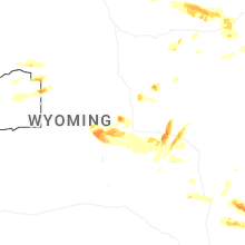


Connect with Interactive Hail Maps