

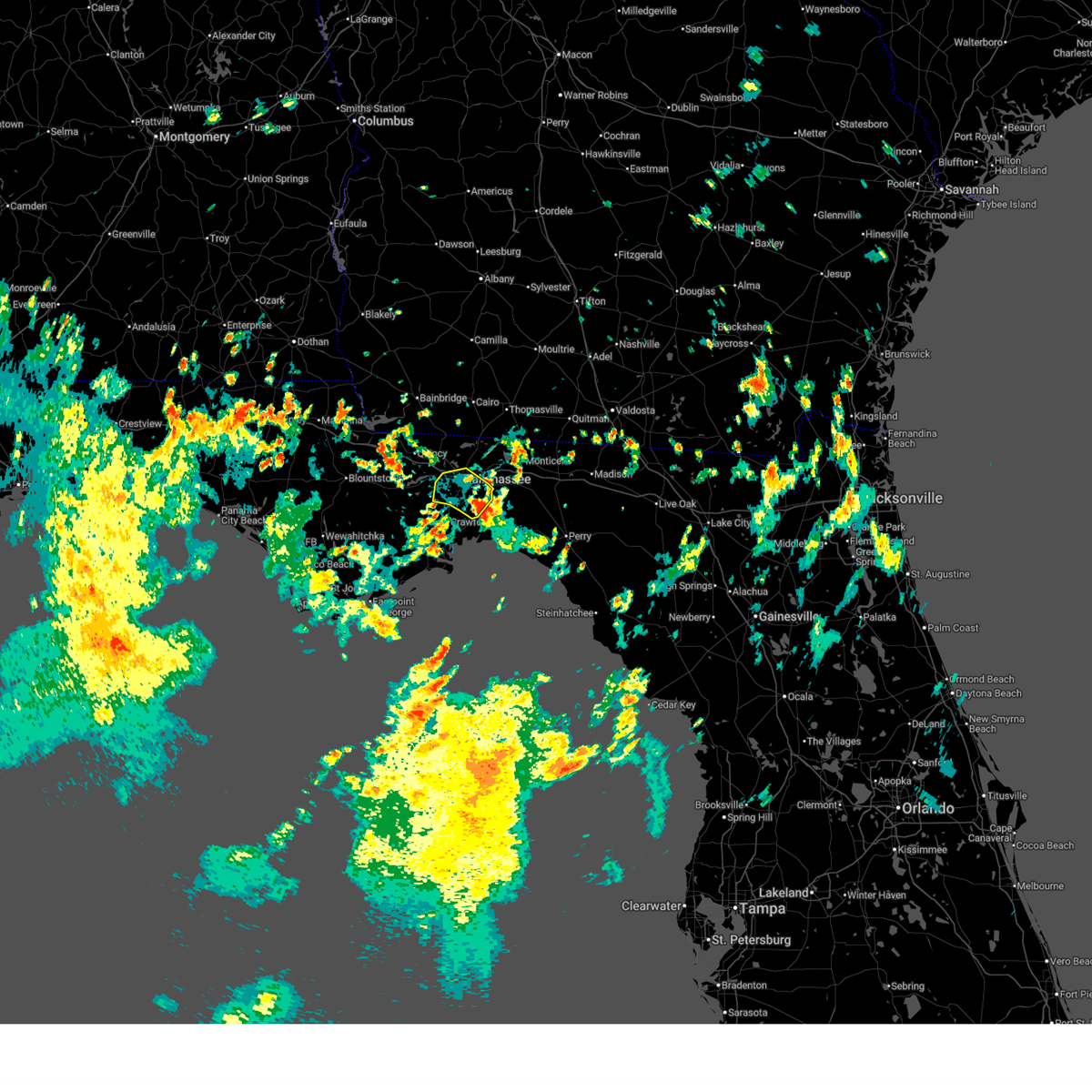
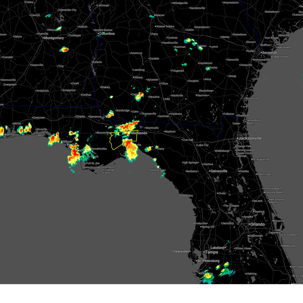
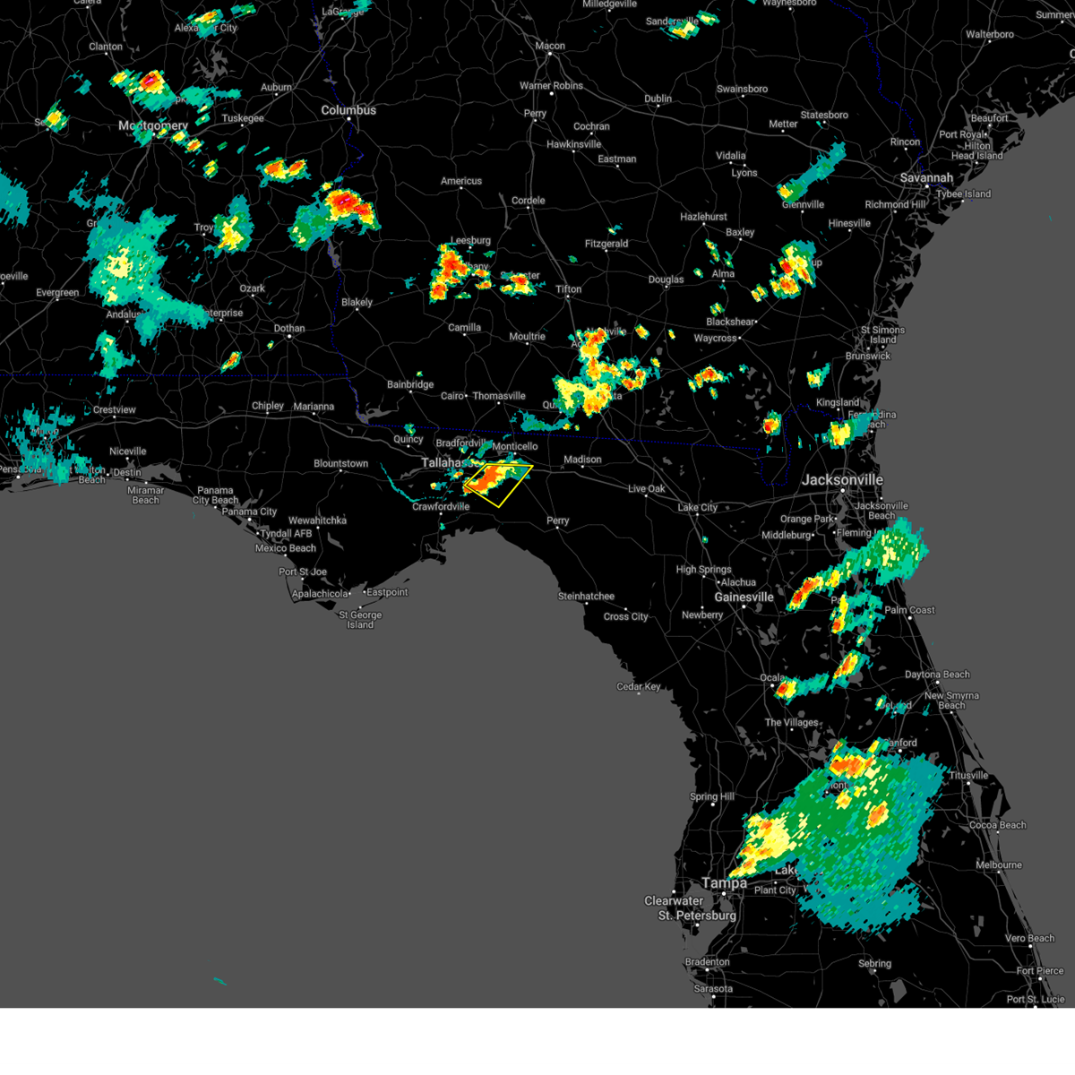
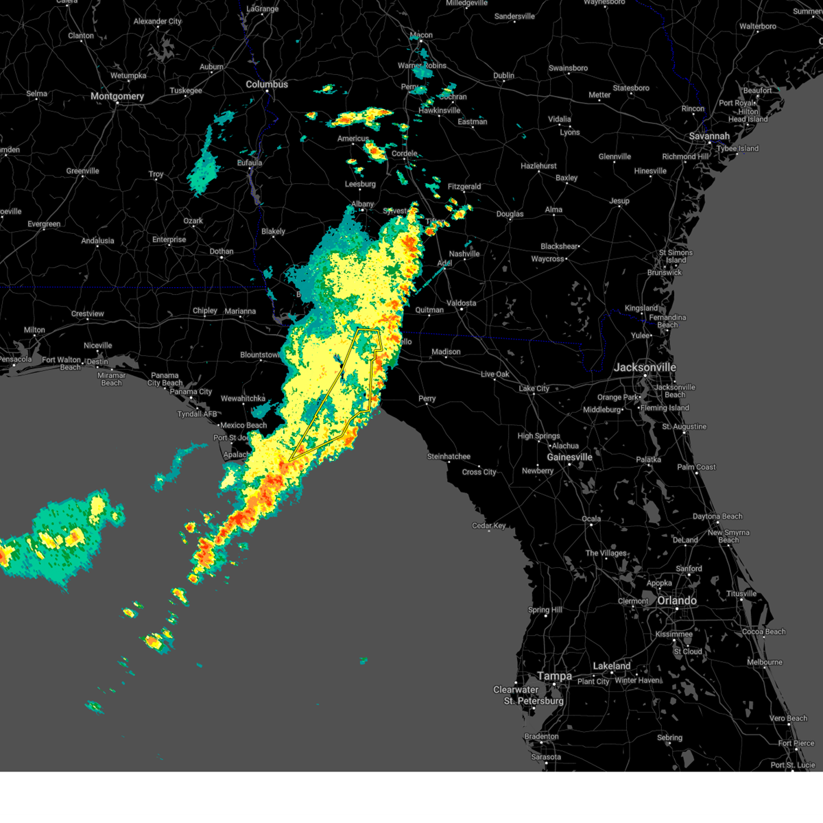
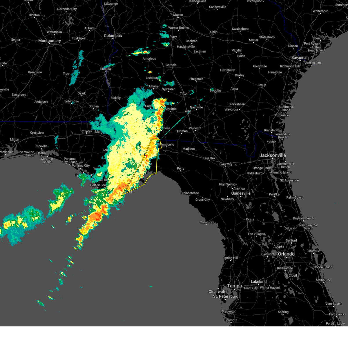
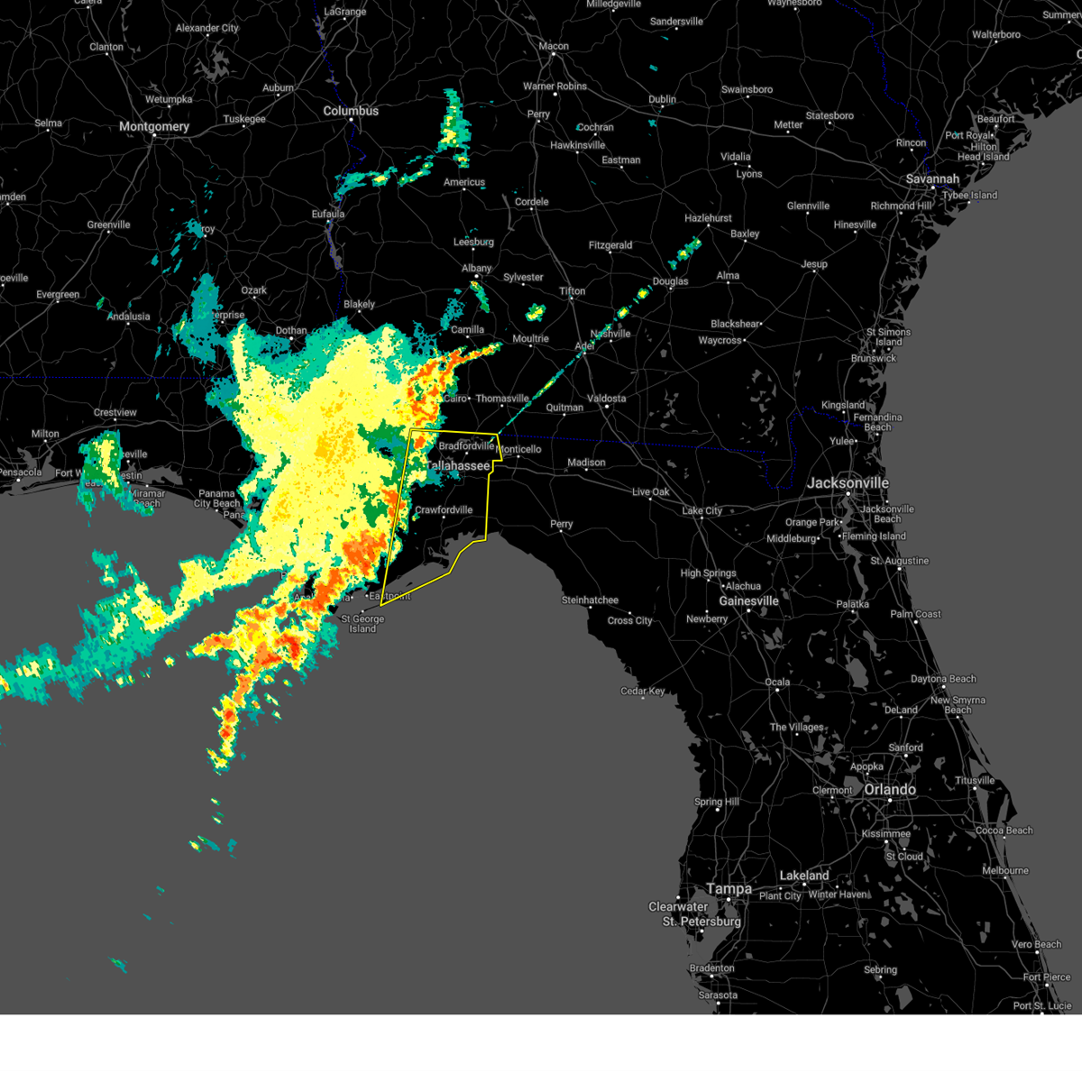
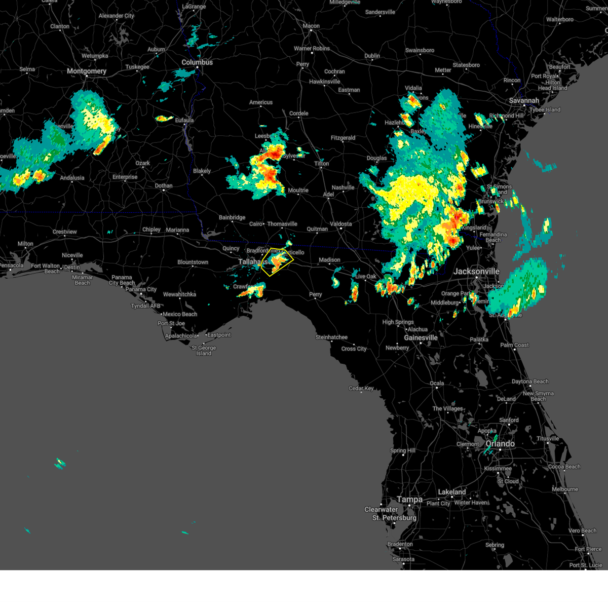
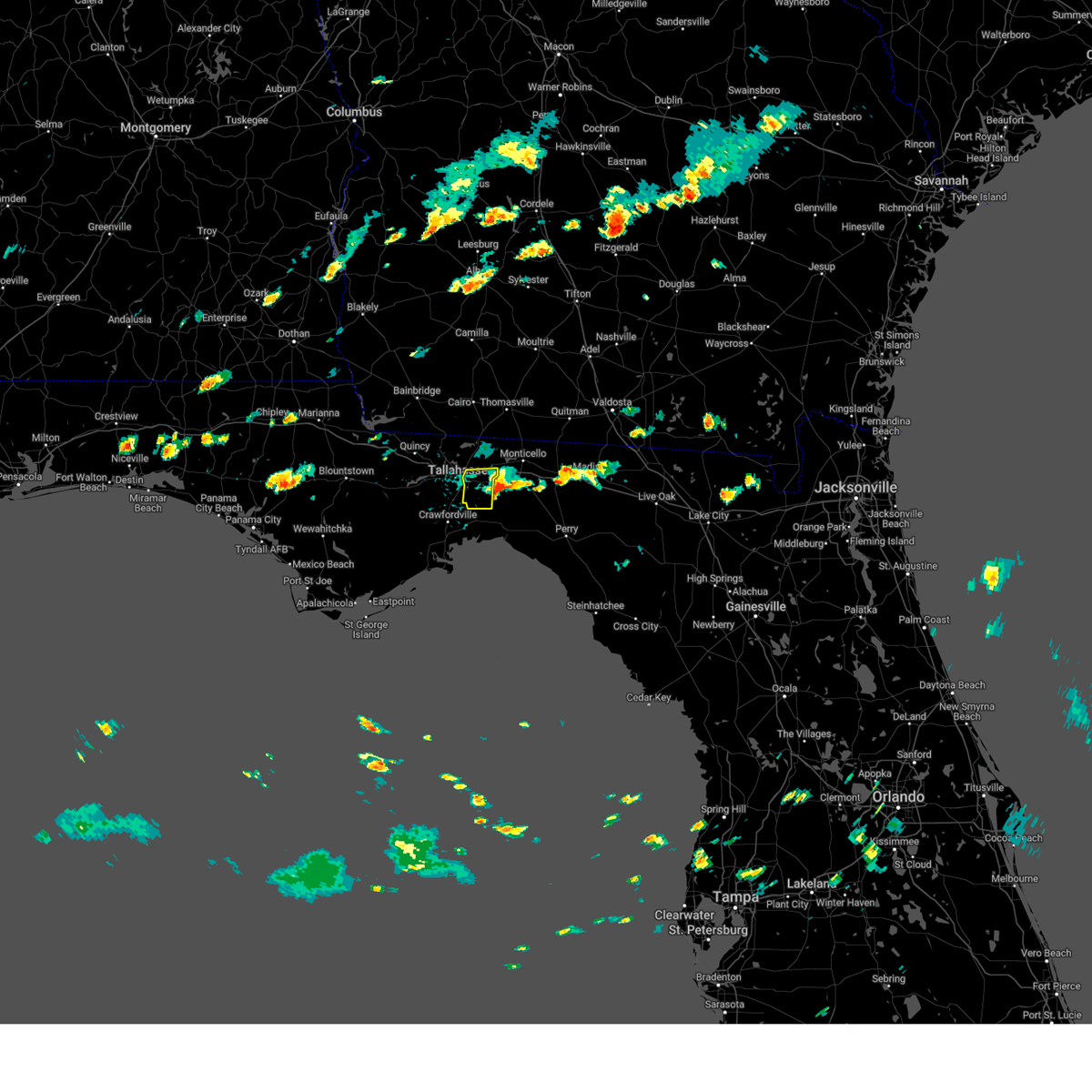
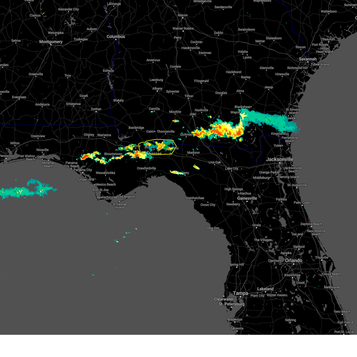
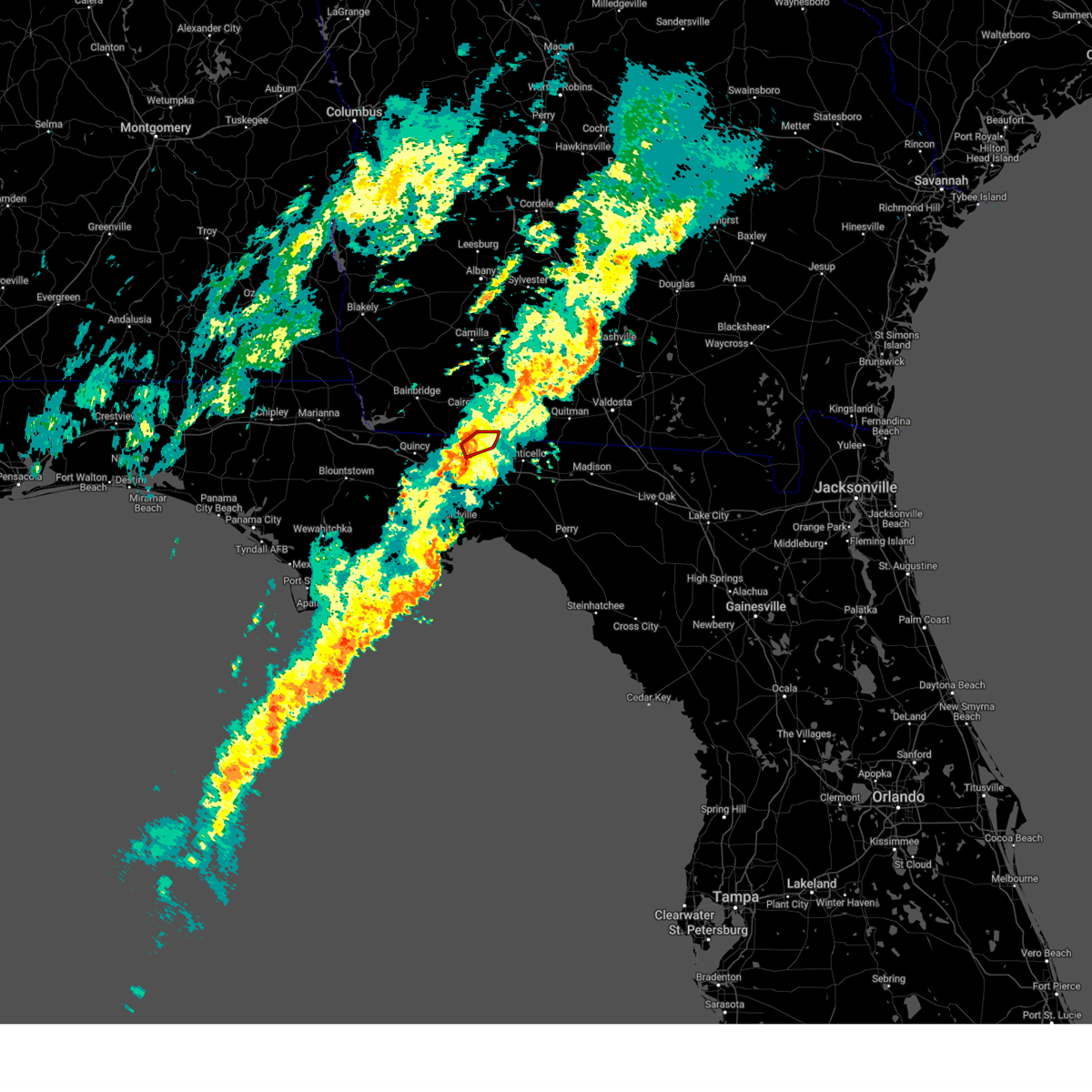
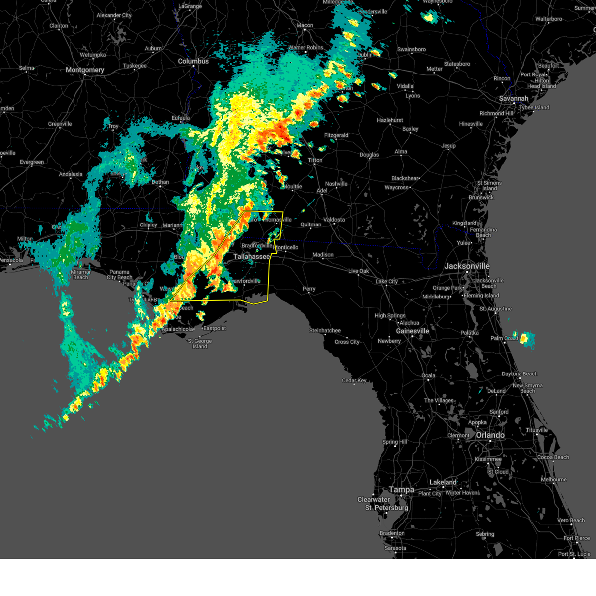
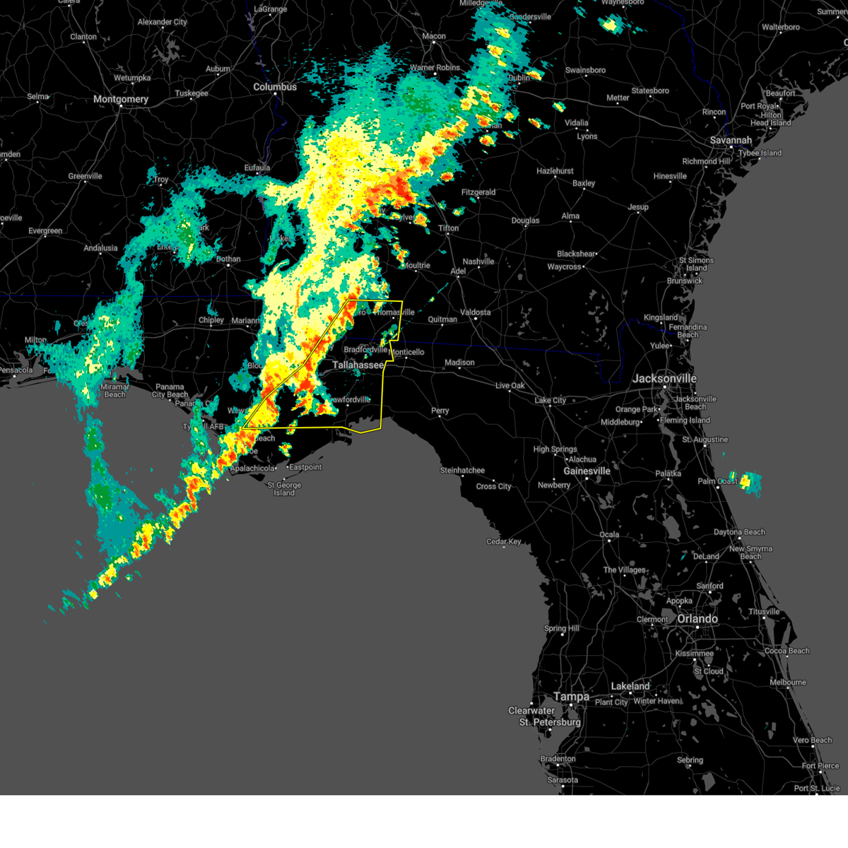
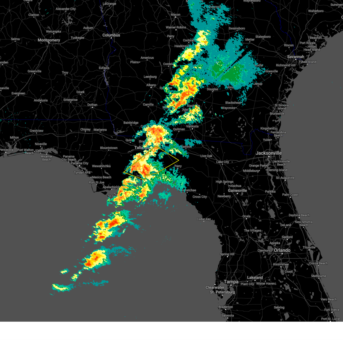
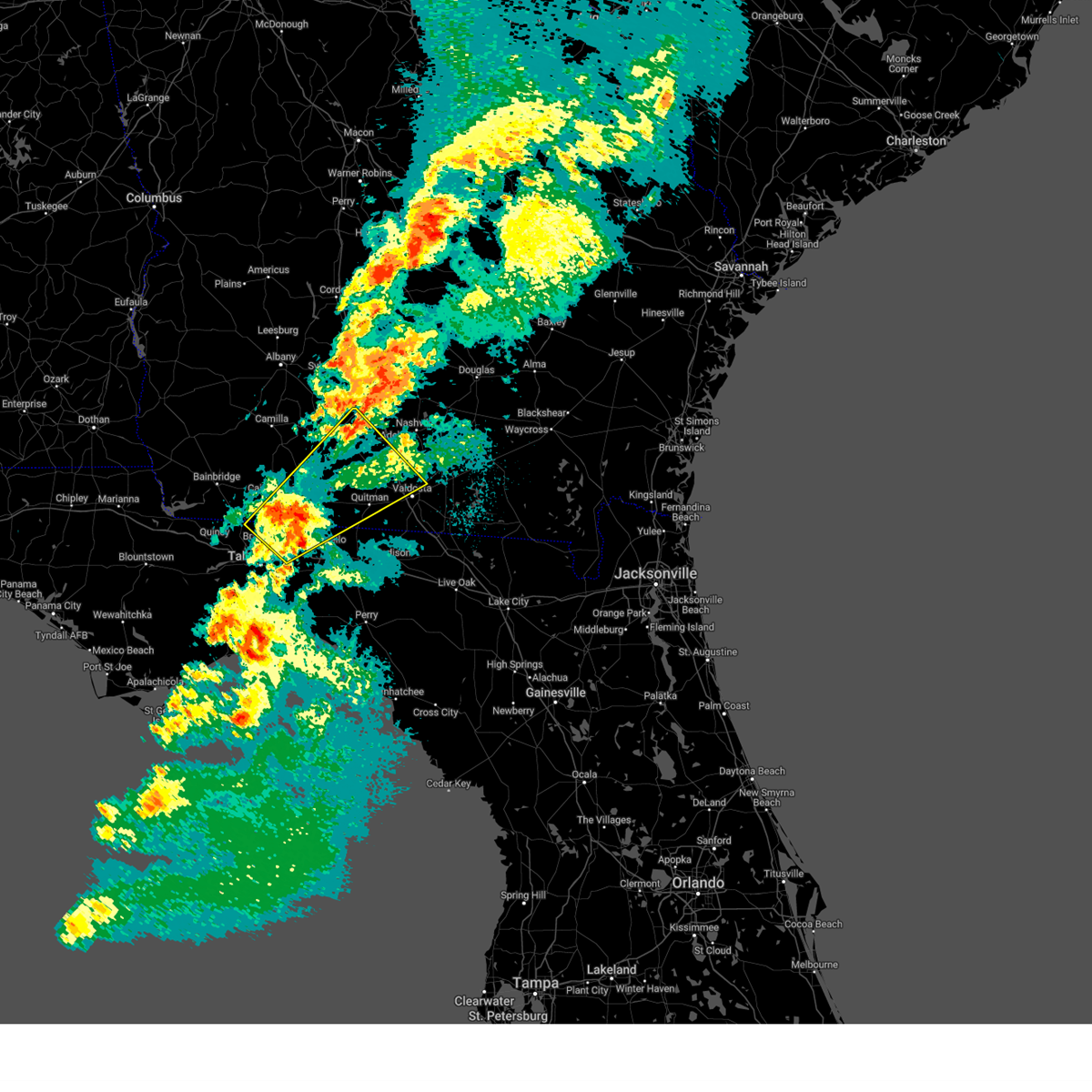
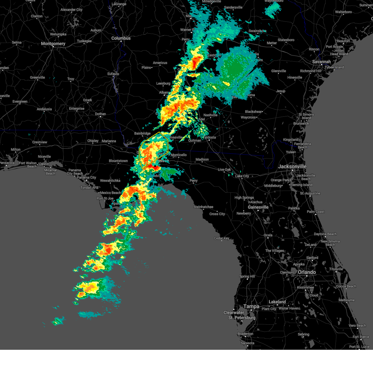
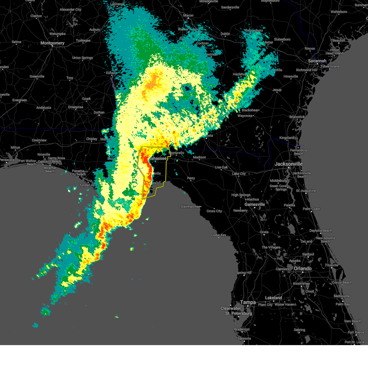
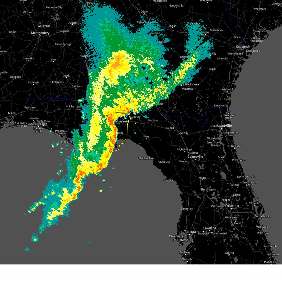
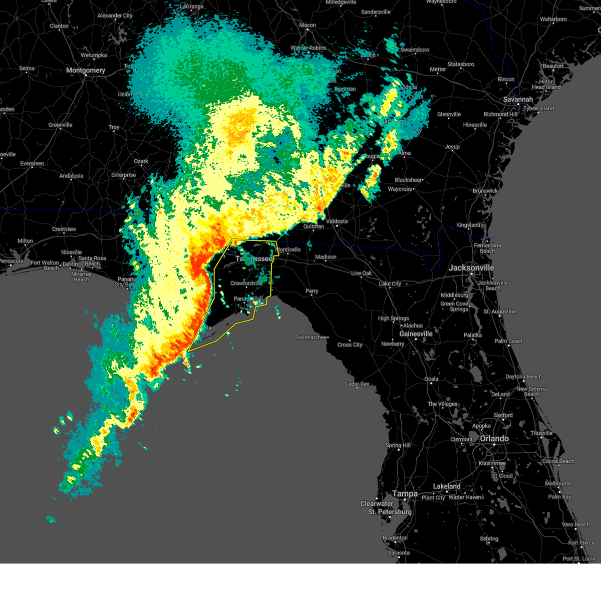
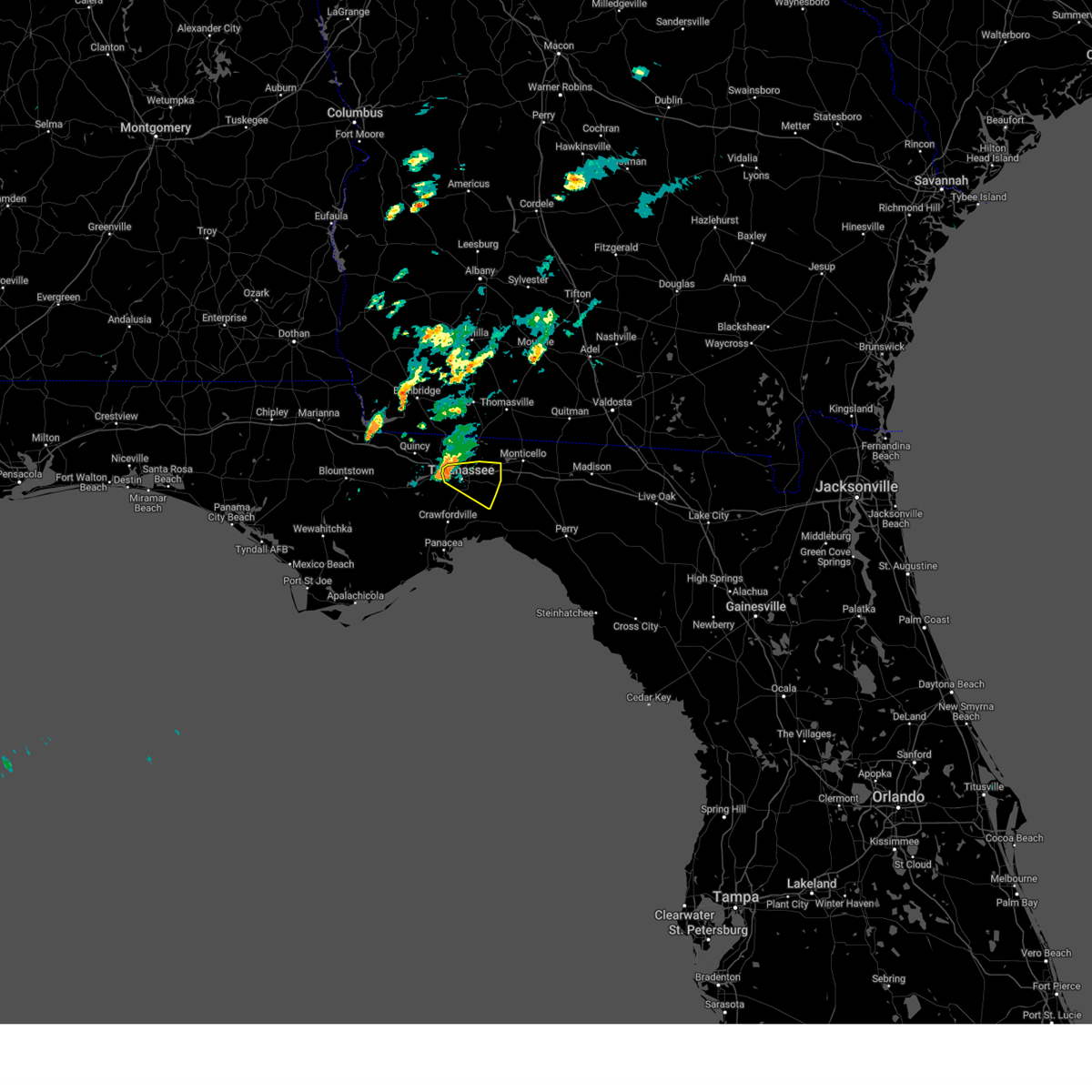
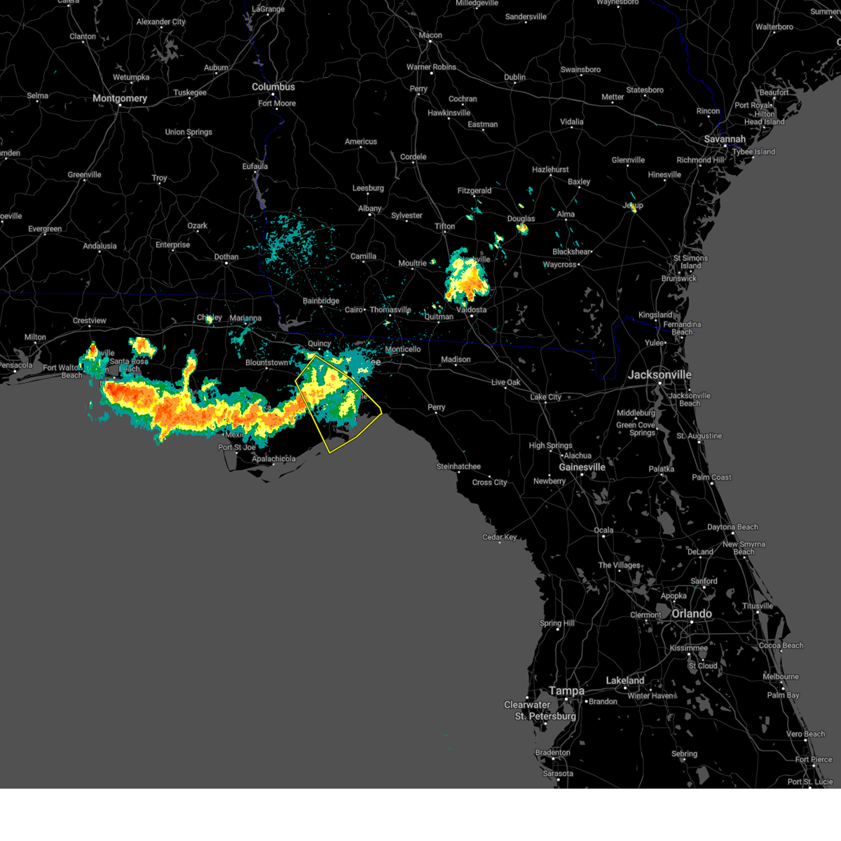
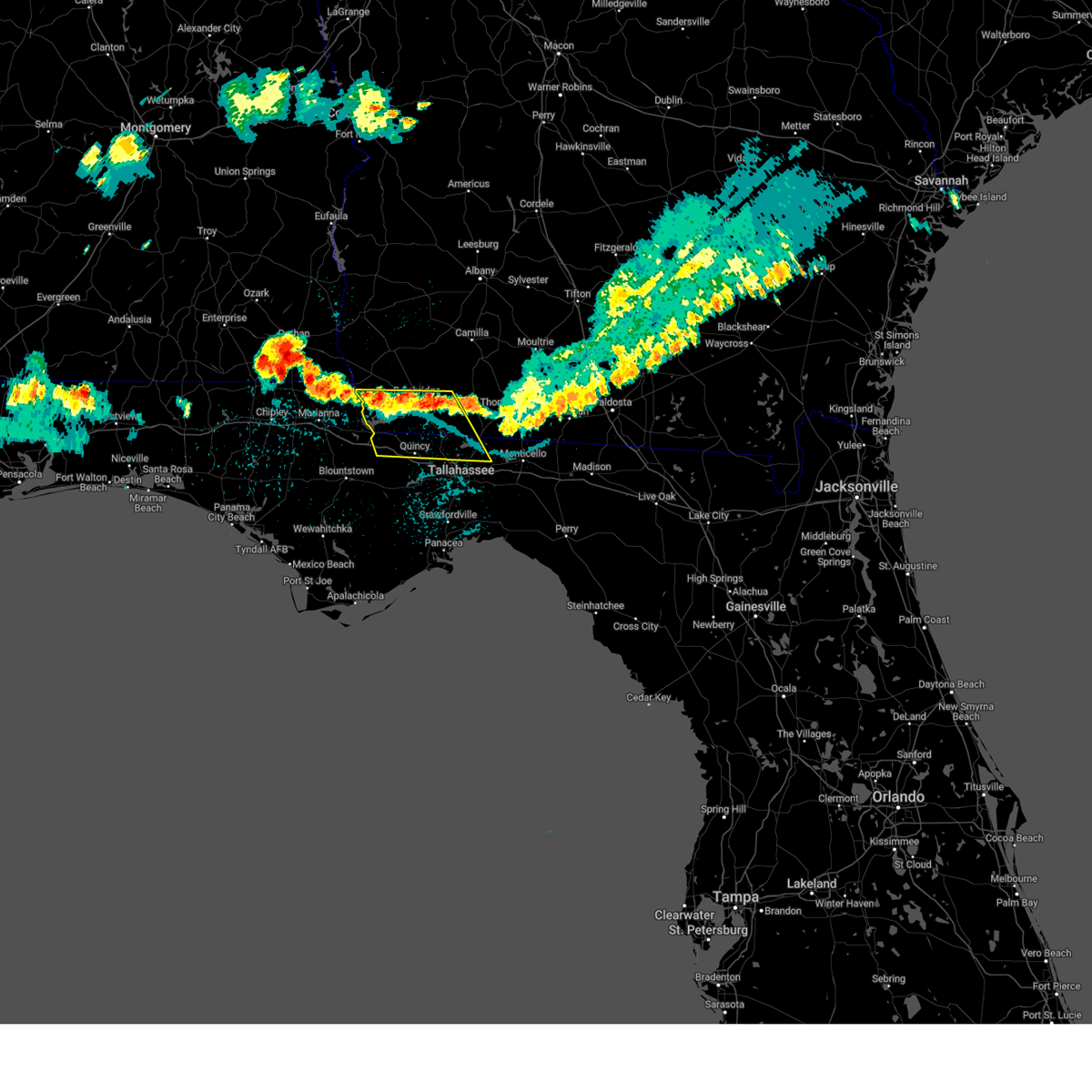
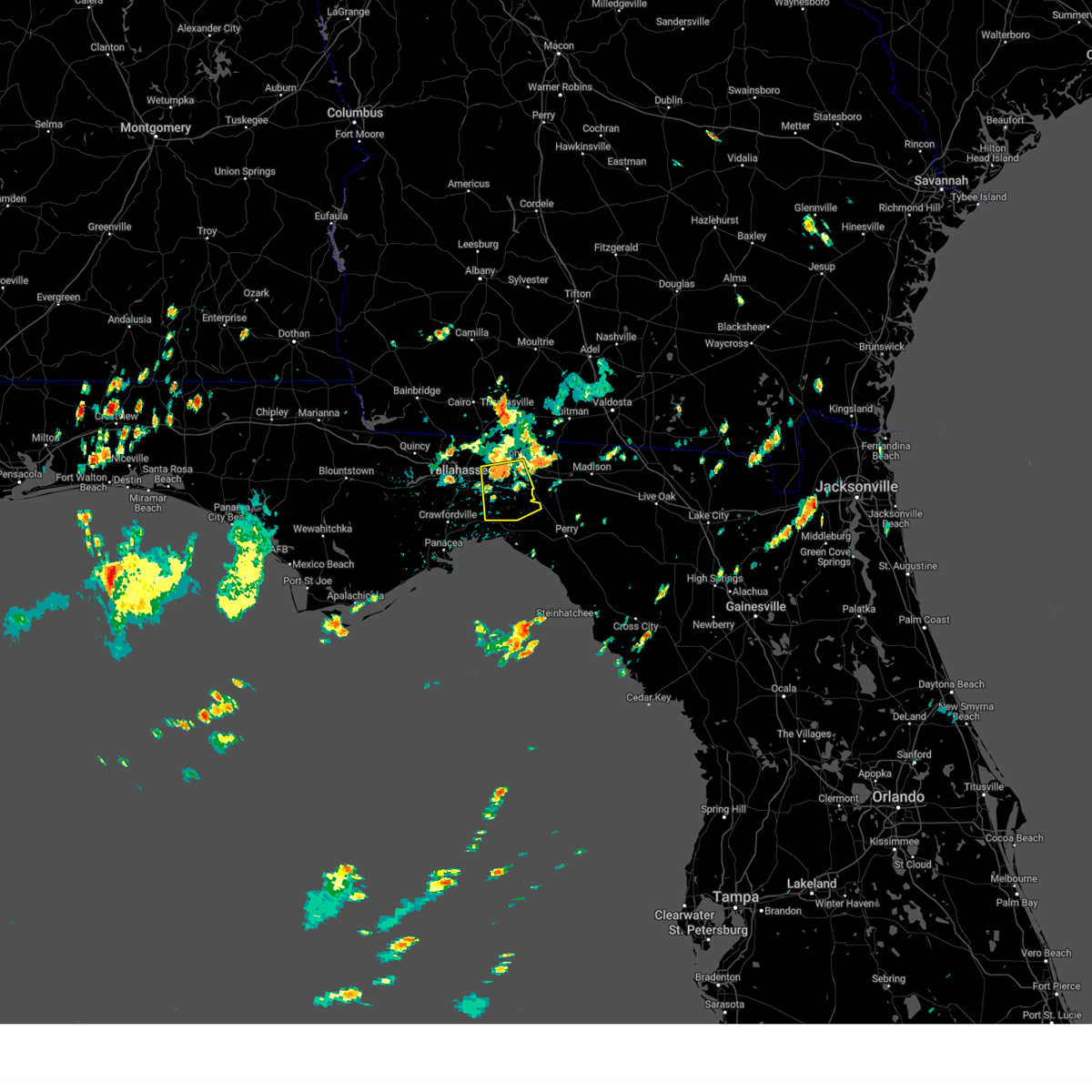
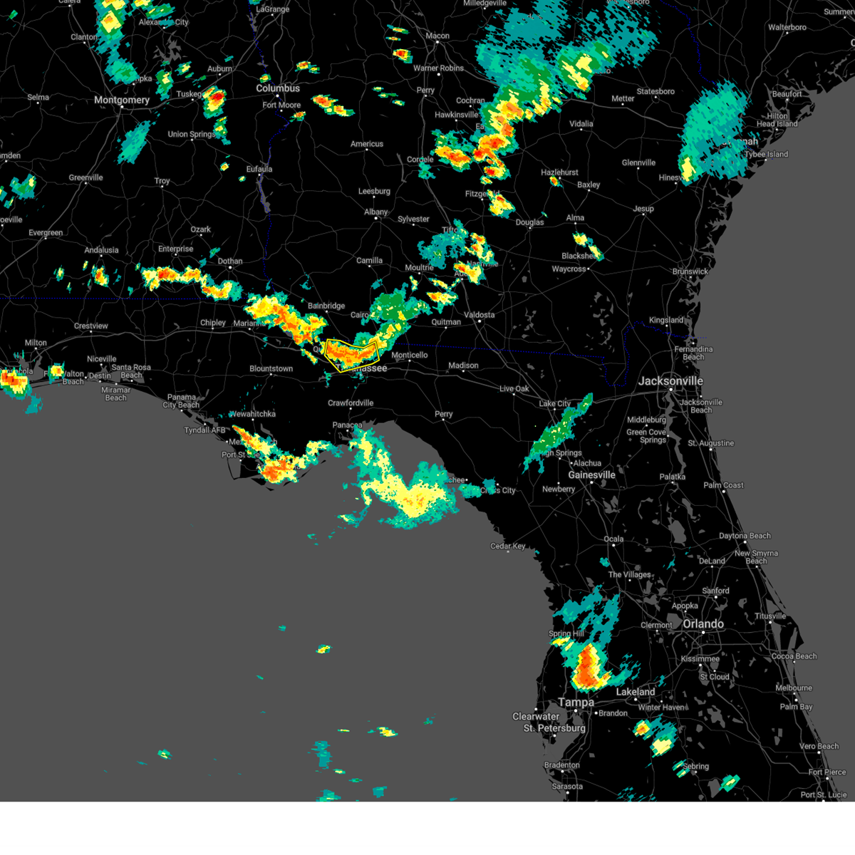
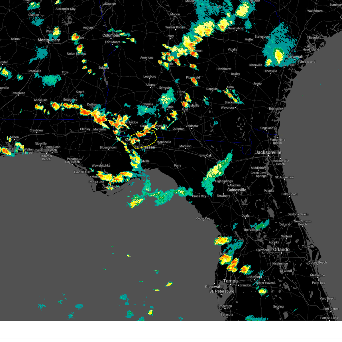
Hail Map for Tallahassee, FL
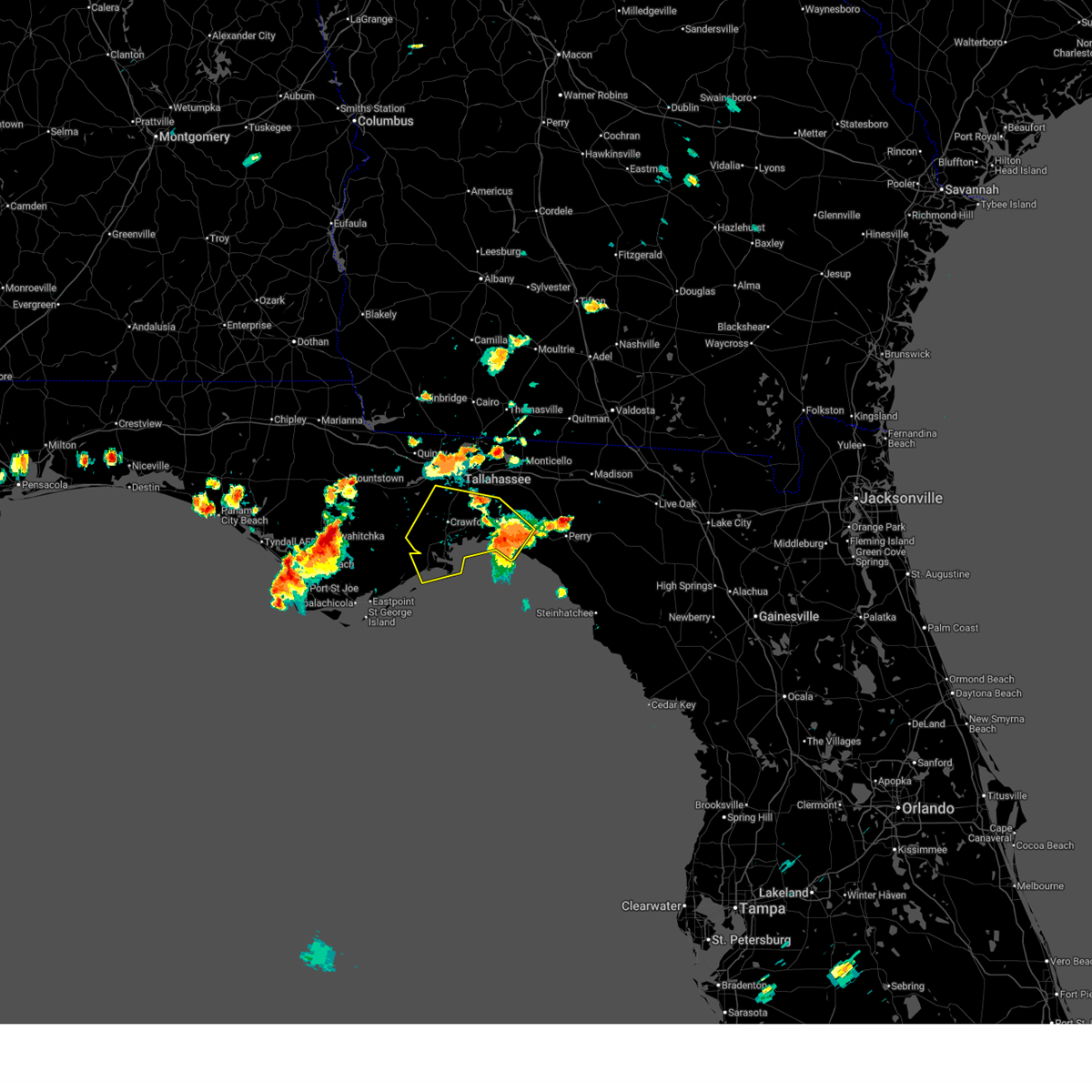
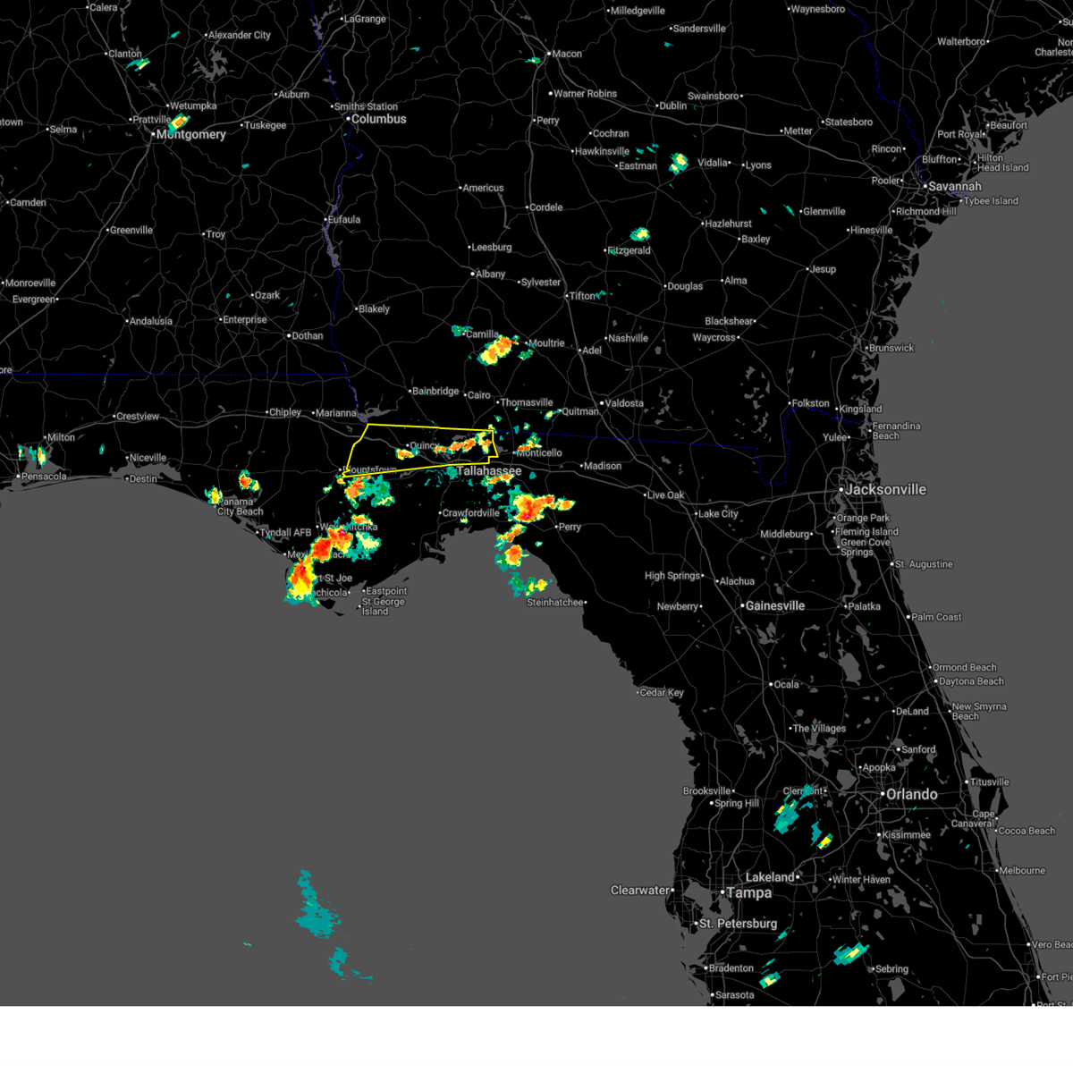
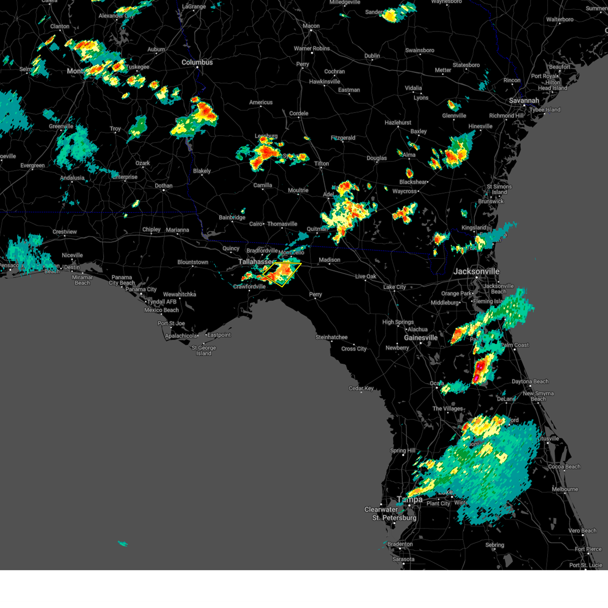
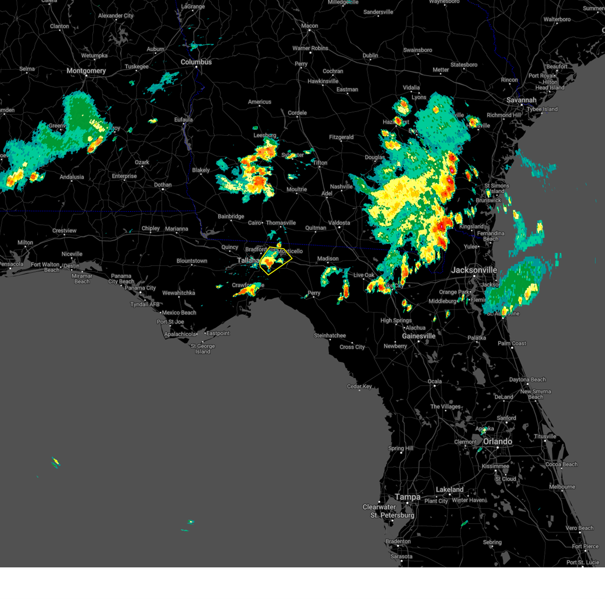
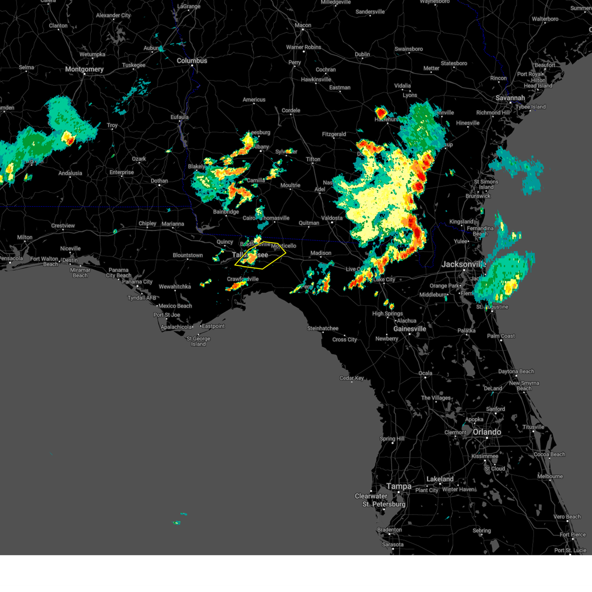
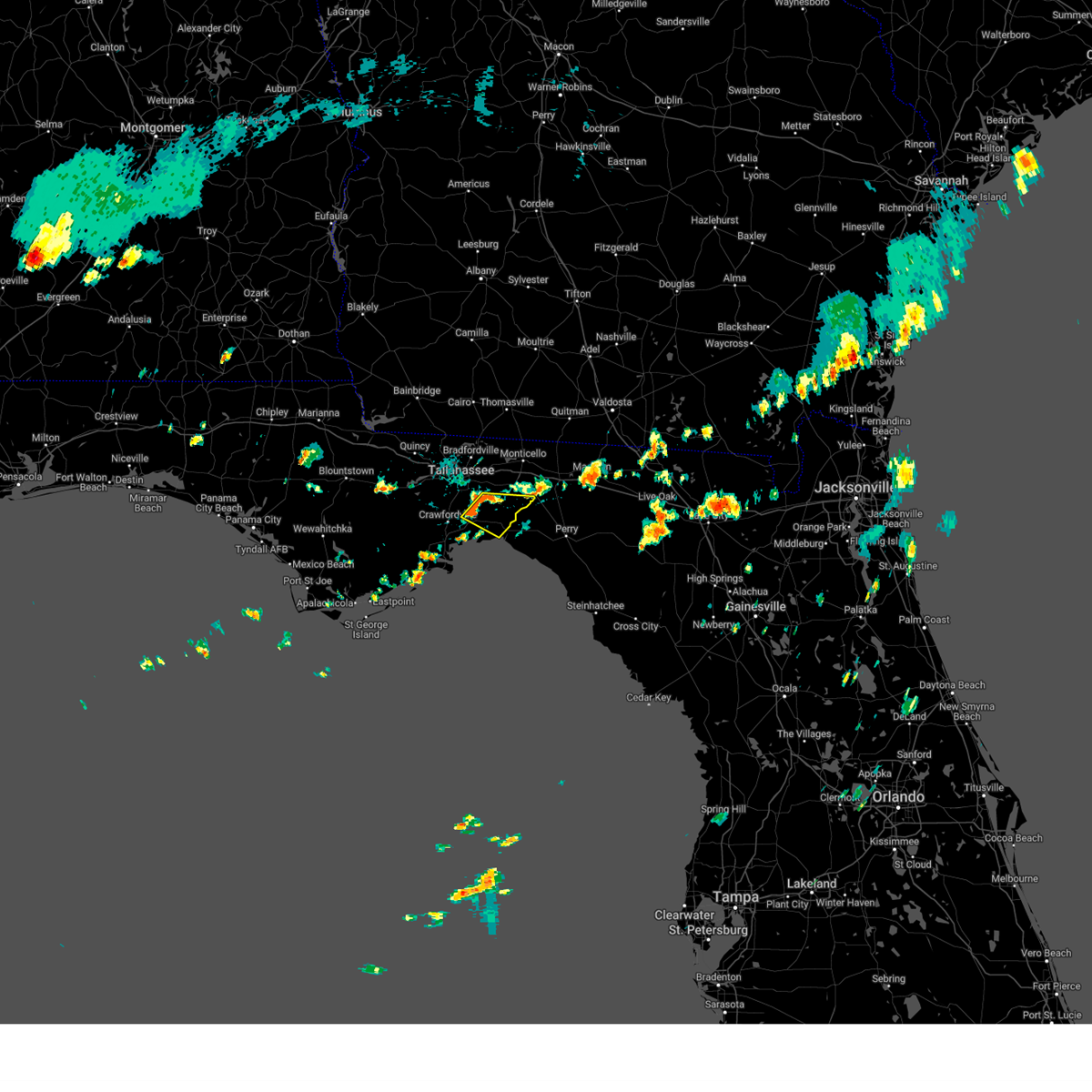
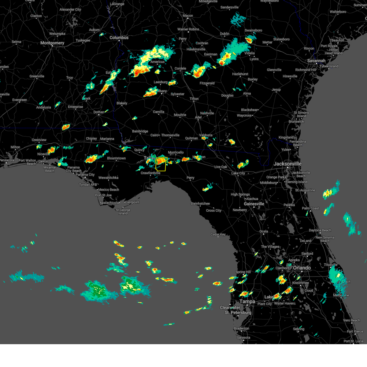
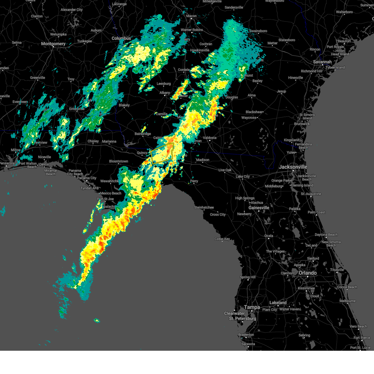
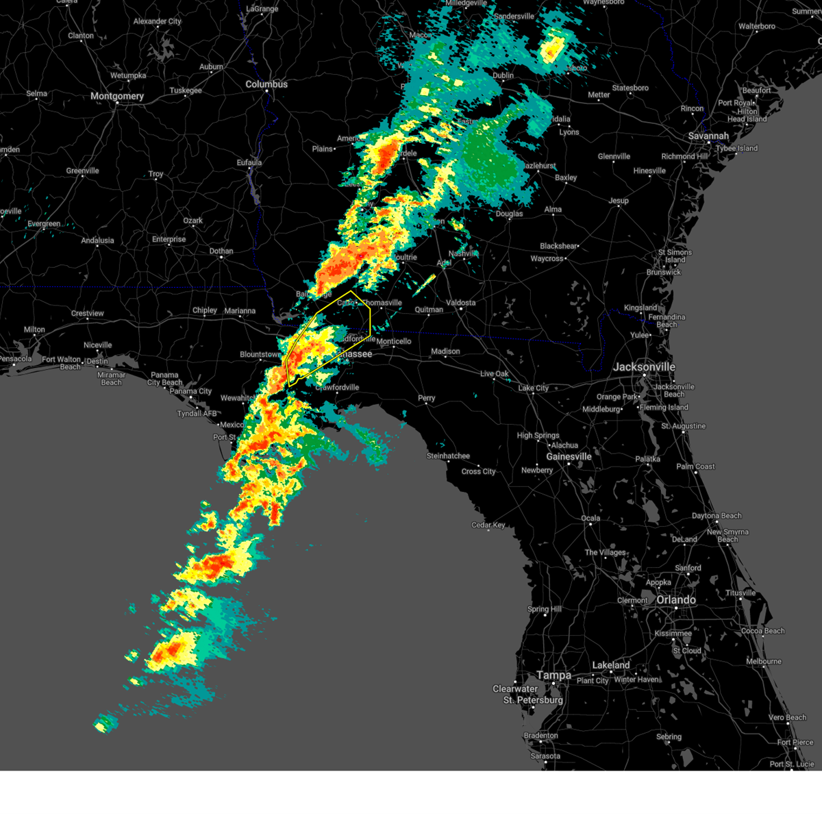
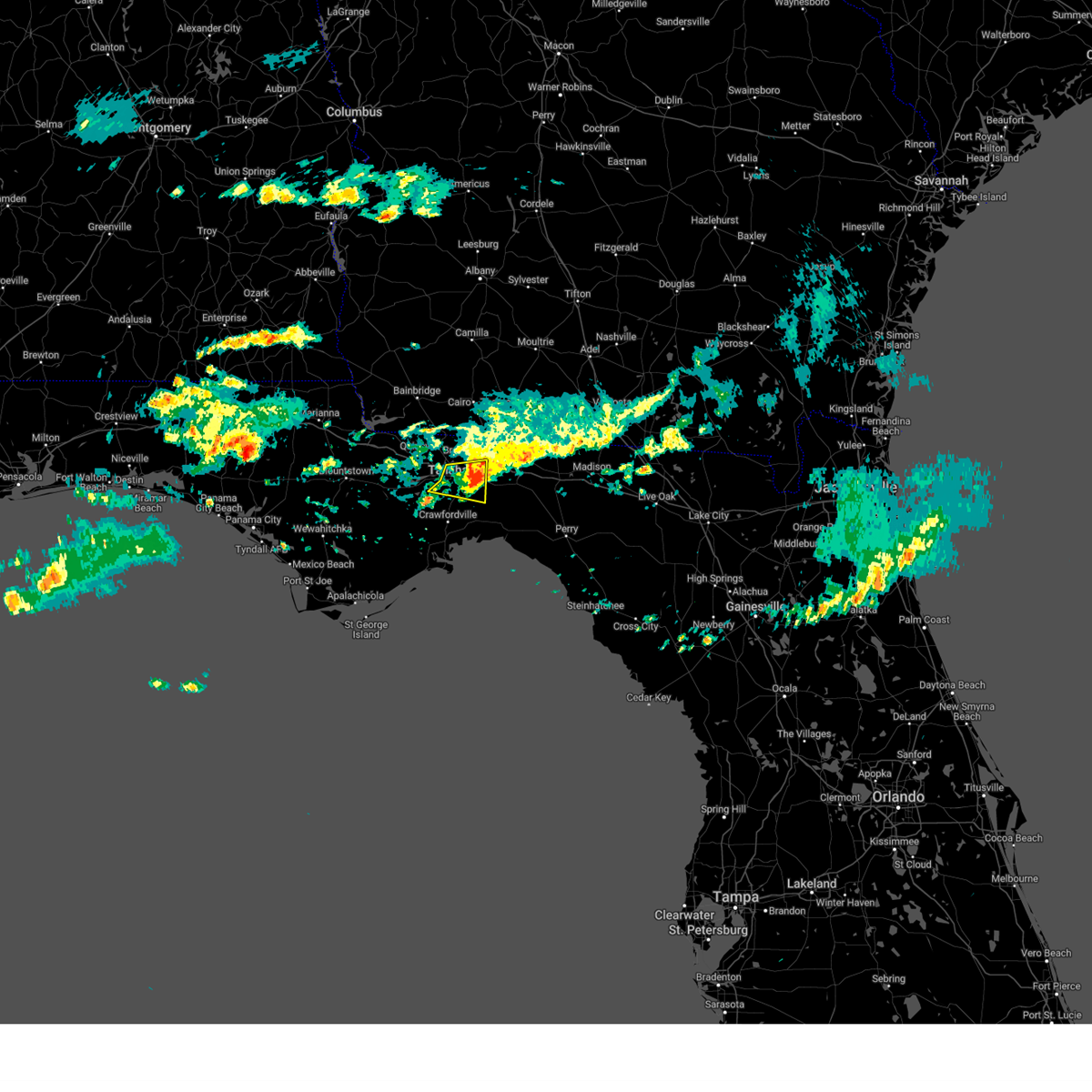
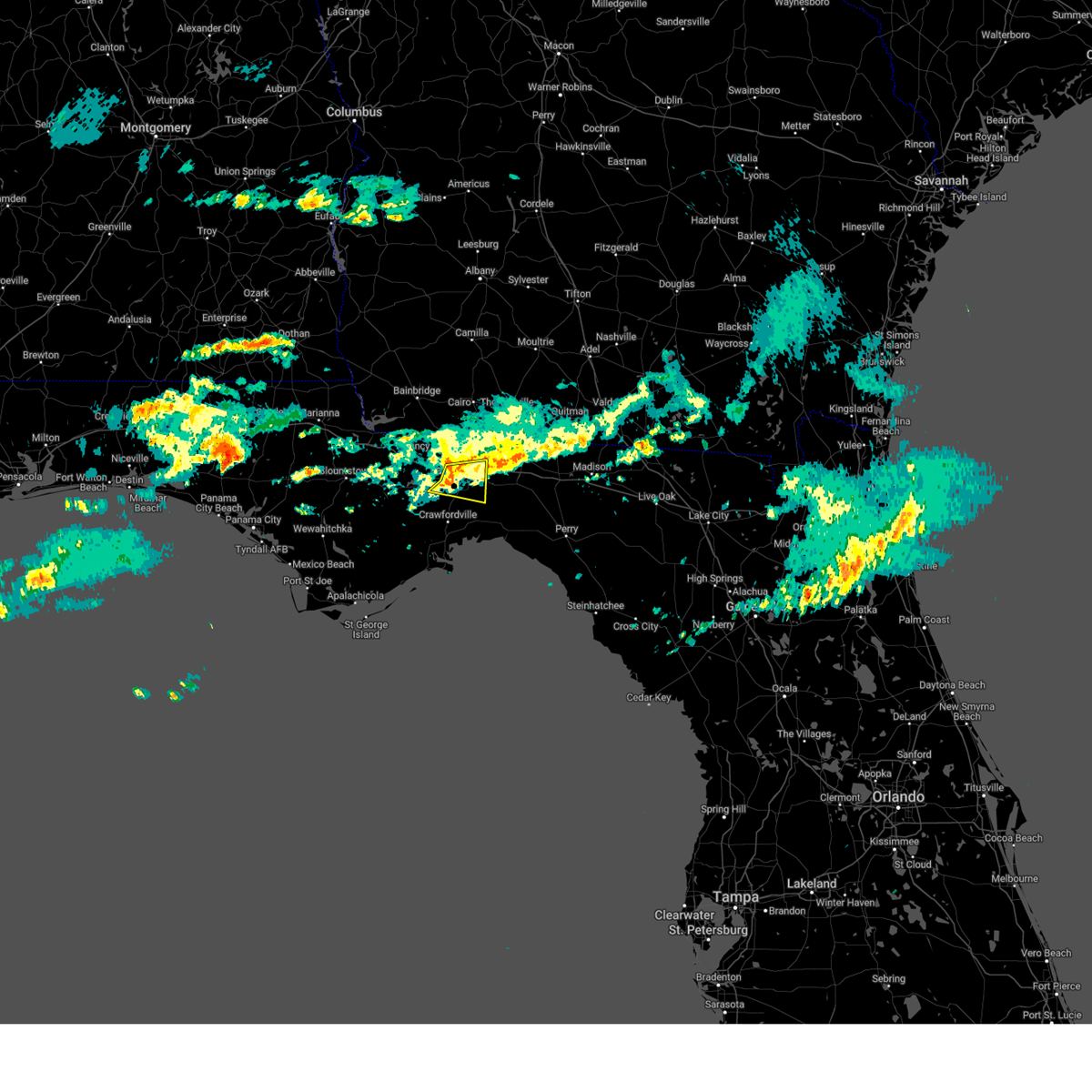
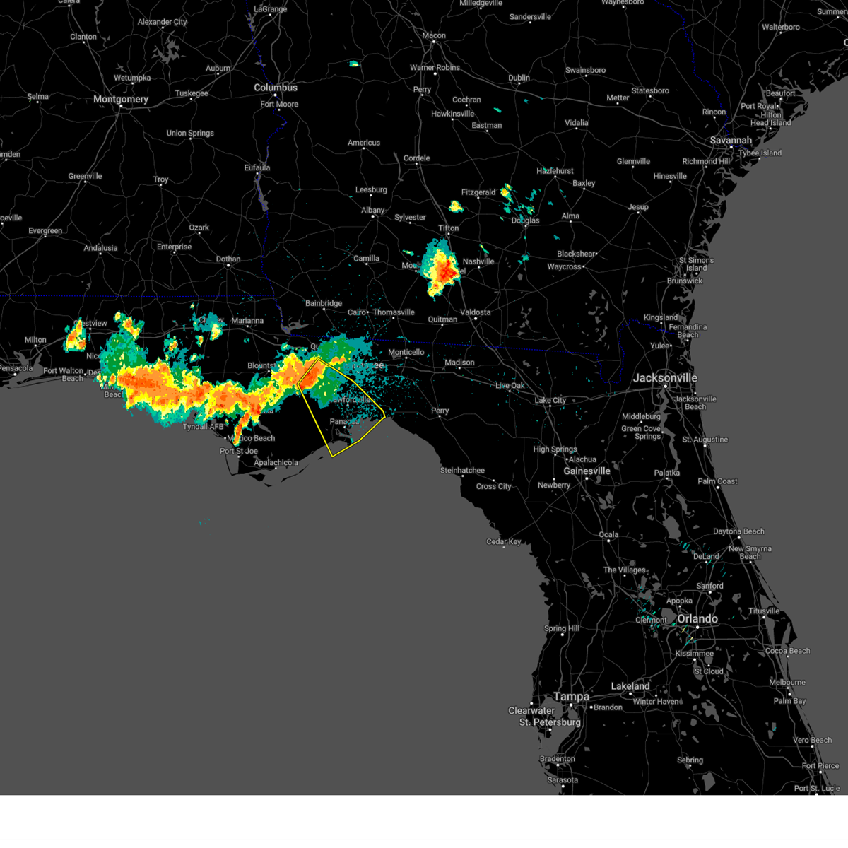
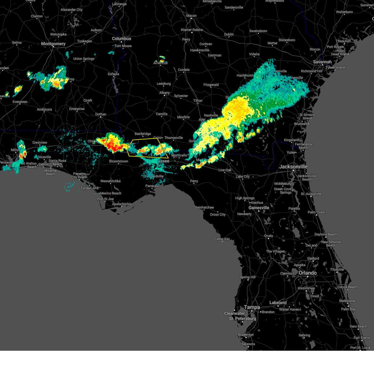
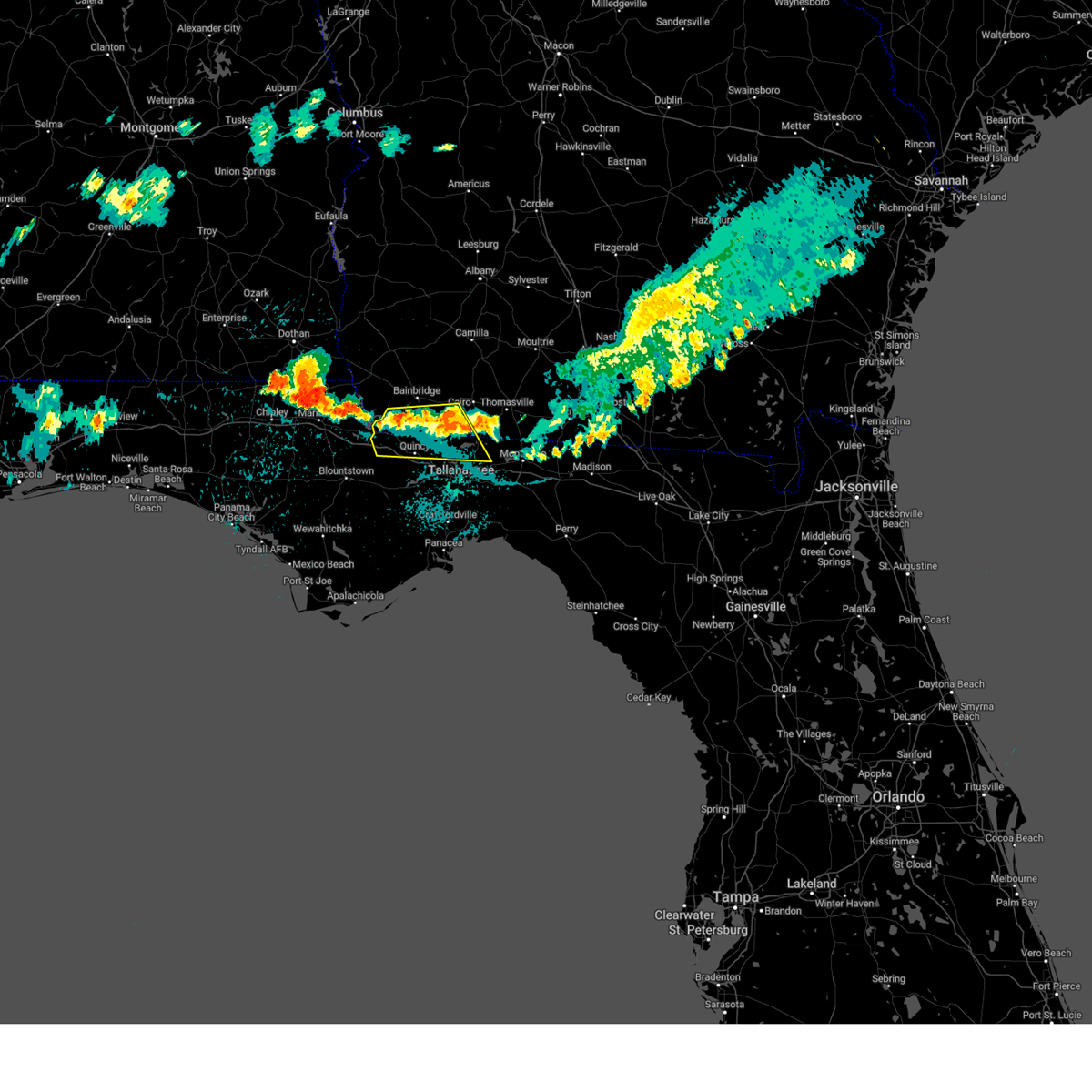
The Tallahassee, FL area has had 18 reports of on-the-ground hail by trained spotters, and has been under severe weather warnings 78 times during the past 12 months. Doppler radar has detected hail at or near Tallahassee, FL on 106 occasions, including 4 occasions during the past year.
| Name: | Tallahassee, FL |
| Where Located: | 1.7 miles NNE of Tallahassee, FL |
| Map: | Google Map for Tallahassee, FL |
| Population: | 181376 |
| Housing Units: | 84248 |
| More Info: | Search Google for Tallahassee, FL |
3
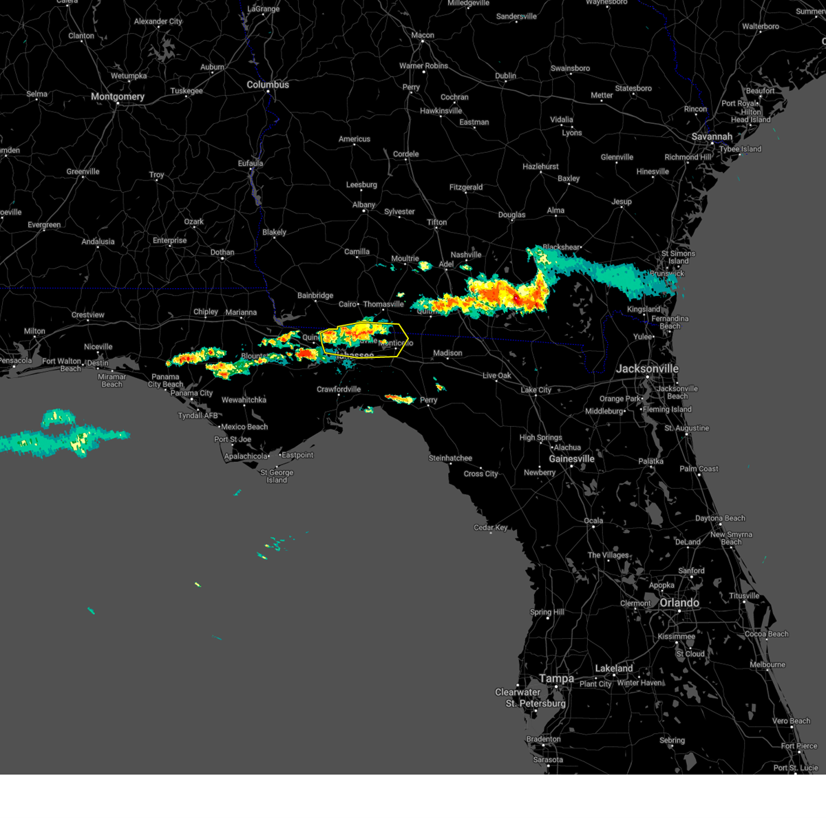
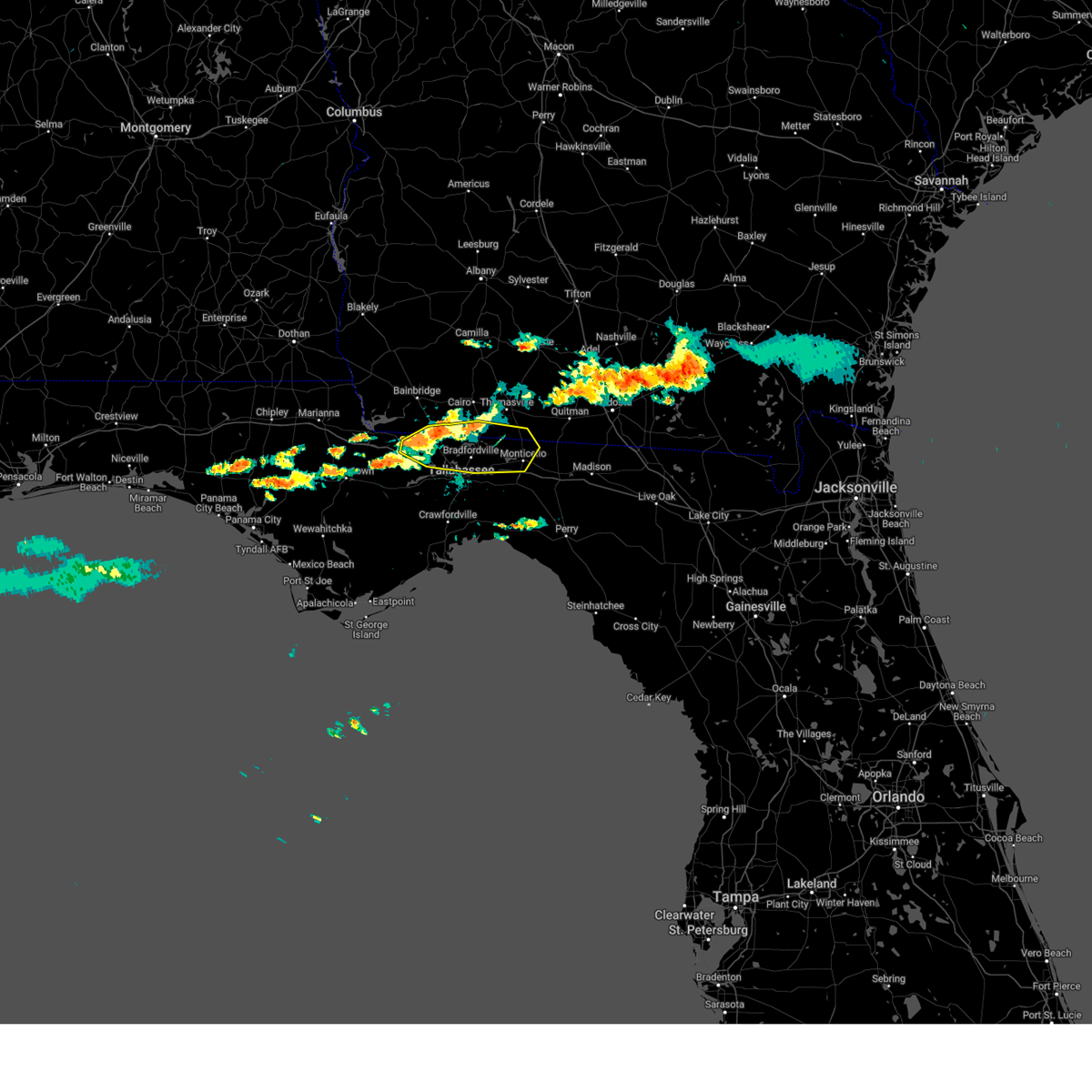
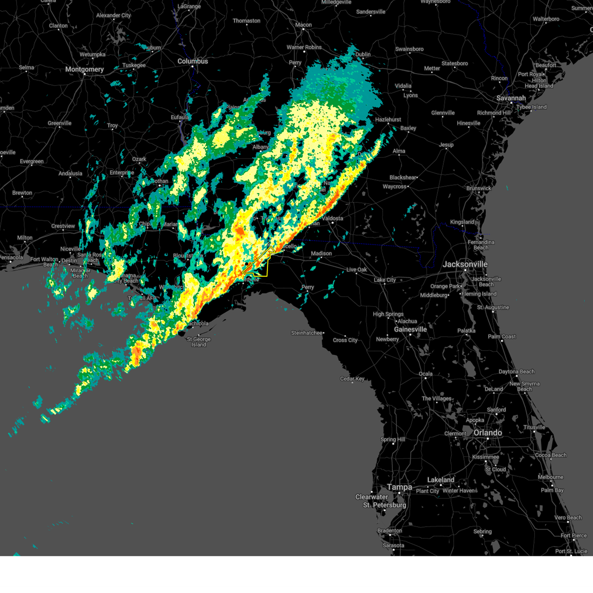
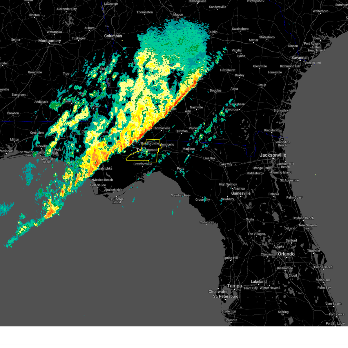
The Top Recent Hail Date for Tallahassee, FL is Wednesday, June 25, 2025 (4th out of 106)

Hail and Wind Damage Spotted near Tallahassee, FL
| Date / Time | Report Details |
|---|---|
| 6/30/2025 3:26 PM EDT |
 Svrtae the national weather service in tallahassee has issued a * severe thunderstorm warning for, northeastern wakulla county in big bend florida, southeastern leon county in big bend florida, * until 415 pm edt. * at 326 pm edt, a severe thunderstorm was located over woodville, moving west at 10 mph (radar indicated). Hazards include 60 mph wind gusts. expect damage to roofs, siding, and trees Svrtae the national weather service in tallahassee has issued a * severe thunderstorm warning for, northeastern wakulla county in big bend florida, southeastern leon county in big bend florida, * until 415 pm edt. * at 326 pm edt, a severe thunderstorm was located over woodville, moving west at 10 mph (radar indicated). Hazards include 60 mph wind gusts. expect damage to roofs, siding, and trees
|
| 6/26/2025 7:05 PM EDT |
 the severe thunderstorm warning has been cancelled and is no longer in effect the severe thunderstorm warning has been cancelled and is no longer in effect
|
| 6/26/2025 6:19 PM EDT | the severe thunderstorm warning has been cancelled and is no longer in effect |
| 6/26/2025 6:19 PM EDT | At 619 pm edt, severe thunderstorms were located along a line extending from 6 miles southeast of cairo to 16 miles west of perry, moving west at 25 mph (radar indicated). Hazards include 60 mph wind gusts. Expect damage to roofs, siding, and trees. locations impacted include, tallahassee, woodville, monticello, tallahassee state college, florida state university, thomasville, havana, st. Marks, midway, crawfordville, florida a and m, cairo, bainbridge, whigham, doak campbell stadium, wakulla, attapulgus, climax, lake bradford, and alma. |
| 6/26/2025 5:52 PM EDT |
 Svrtae the national weather service in tallahassee has issued a * severe thunderstorm warning for, eastern wakulla county in big bend florida, eastern gadsden county in big bend florida, jefferson county in big bend florida, northwestern taylor county in big bend florida, leon county in big bend florida, southwestern madison county in big bend florida, southeastern decatur county in southwestern georgia, southern grady county in southwestern georgia, southwestern thomas county in south central georgia, * until 730 pm edt. * at 552 pm edt, severe thunderstorms were located along a line extending from 6 miles south of thomasville to near perry, moving west at 30 mph (radar indicated). Hazards include 60 mph wind gusts. expect damage to roofs, siding, and trees Svrtae the national weather service in tallahassee has issued a * severe thunderstorm warning for, eastern wakulla county in big bend florida, eastern gadsden county in big bend florida, jefferson county in big bend florida, northwestern taylor county in big bend florida, leon county in big bend florida, southwestern madison county in big bend florida, southeastern decatur county in southwestern georgia, southern grady county in southwestern georgia, southwestern thomas county in south central georgia, * until 730 pm edt. * at 552 pm edt, severe thunderstorms were located along a line extending from 6 miles south of thomasville to near perry, moving west at 30 mph (radar indicated). Hazards include 60 mph wind gusts. expect damage to roofs, siding, and trees
|
| 6/25/2025 5:34 PM EDT |
 the severe thunderstorm warning has been cancelled and is no longer in effect the severe thunderstorm warning has been cancelled and is no longer in effect
|
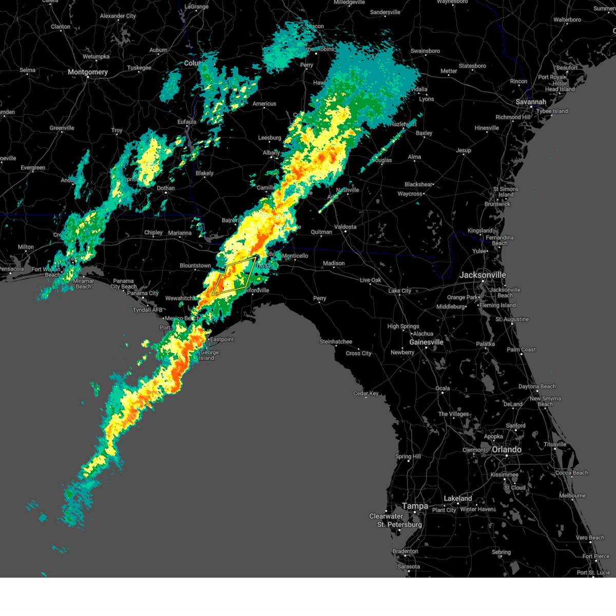
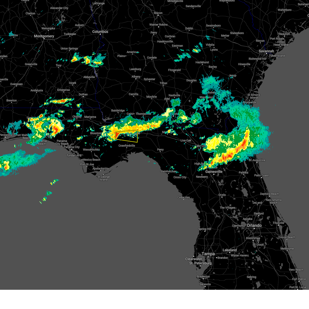
| 6/25/2025 4:58 PM EDT | Half Dollar sized hail reported 3.4 miles NE of Tallahassee, FL, levy ave and engineering way. |
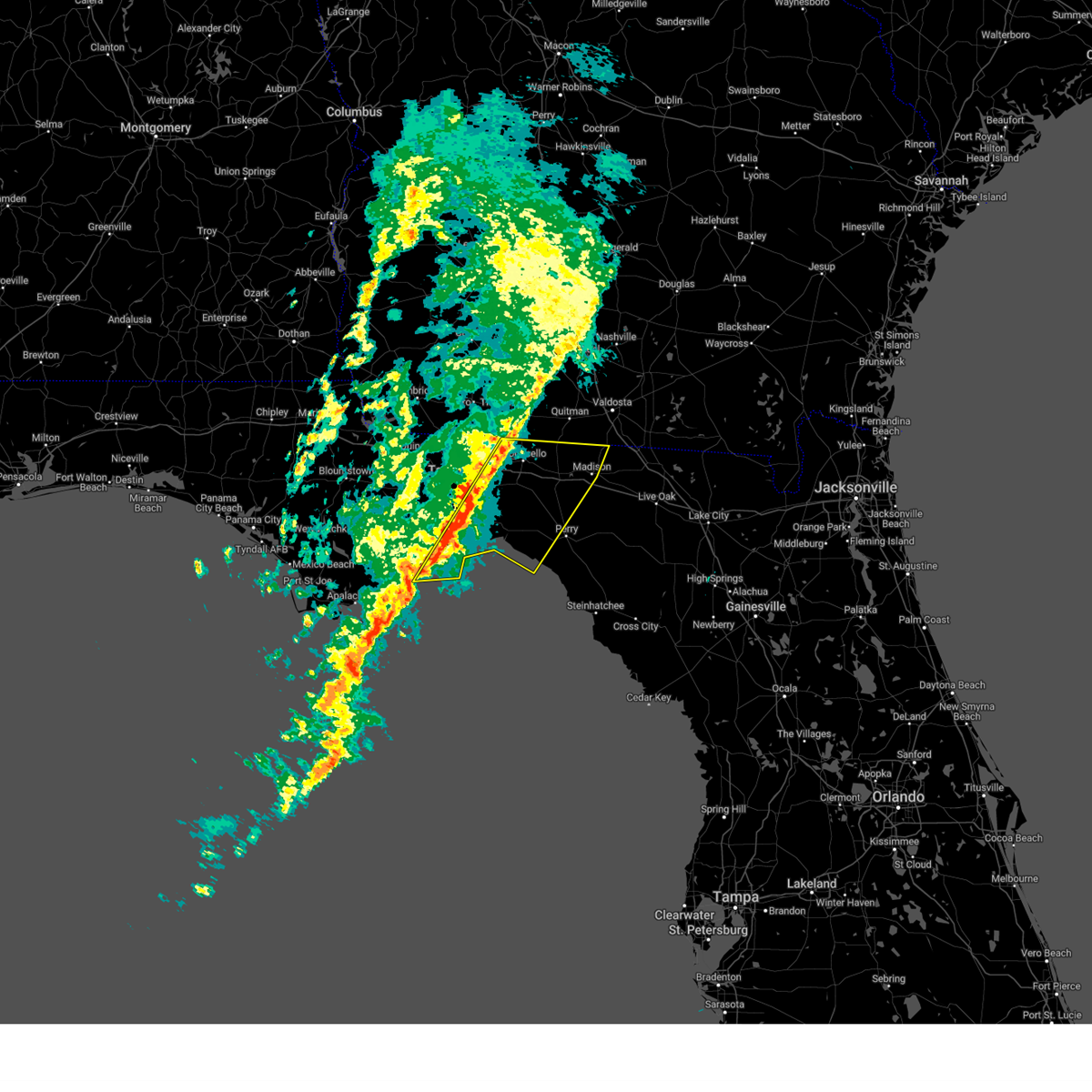
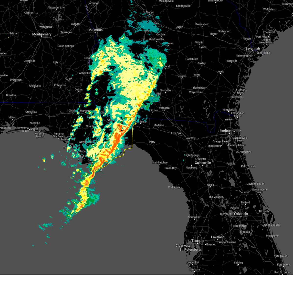
| 6/25/2025 4:56 PM EDT | Svrtae the national weather service in tallahassee has issued a * severe thunderstorm warning for, gadsden county in big bend florida, northern liberty county in big bend florida, northern leon county in big bend florida, * until 600 pm edt. * at 456 pm edt, a severe thunderstorm was located near midway, moving west at 40 mph (radar indicated). Hazards include 60 mph wind gusts and quarter size hail. Hail damage to vehicles is expected. Expect wind damage to roofs, siding, and trees. |
| 6/25/2025 4:55 PM EDT | Tree reported down on ox bow and ox bottom r in leon county FL, 6.1 miles S of Tallahassee, FL |
| 6/25/2025 4:55 PM EDT | Tree reported down on iamonia landing and cr1 in leon county FL, 14.2 miles SSW of Tallahassee, FL |
| 6/25/2025 4:55 PM EDT | Quarter sized hail reported 1.7 miles NNE of Tallahassee, FL, 1 inch hail observed in downtown tallahassee. |
| 6/25/2025 4:55 PM EDT | Ping Pong Ball sized hail reported 2.2 miles N of Tallahassee, FL, hail of 1.5 inches was reported in indian head acres. |
| 6/25/2025 4:50 PM EDT | Trees reported down near deer lake w and waters meet driv in leon county FL, 10.4 miles S of Tallahassee, FL |
| 6/25/2025 4:45 PM EDT | Tree reported down on natural bridge rd... e of country oak in leon county FL, 11.7 miles NNW of Tallahassee, FL |
| 6/25/2025 4:41 PM EDT |
 Svrtae the national weather service in tallahassee has issued a * severe thunderstorm warning for, northern wakulla county in big bend florida, south central gadsden county in big bend florida, southern leon county in big bend florida, * until 545 pm edt. * at 441 pm edt, a severe thunderstorm was located over doak campbell stadium, or over florida state university, moving west at 25 mph (radar indicated). Hazards include 60 mph wind gusts and quarter size hail. Hail damage to vehicles is expected. Expect wind damage to roofs, siding, and trees. Svrtae the national weather service in tallahassee has issued a * severe thunderstorm warning for, northern wakulla county in big bend florida, south central gadsden county in big bend florida, southern leon county in big bend florida, * until 545 pm edt. * at 441 pm edt, a severe thunderstorm was located over doak campbell stadium, or over florida state university, moving west at 25 mph (radar indicated). Hazards include 60 mph wind gusts and quarter size hail. Hail damage to vehicles is expected. Expect wind damage to roofs, siding, and trees.
|
| 6/25/2025 4:08 PM EDT |
 Svrtae the national weather service in tallahassee has issued a * severe thunderstorm warning for, wakulla county in big bend florida, southwestern jefferson county in big bend florida, northwestern taylor county in big bend florida, southeastern leon county in big bend florida, northeastern franklin county in big bend florida, * until 545 pm edt. * at 408 pm edt, a severe thunderstorm was located 15 miles east of st. marks, moving northwest at 15 mph (radar indicated). Hazards include 60 mph wind gusts and penny size hail. expect damage to roofs, siding, and trees Svrtae the national weather service in tallahassee has issued a * severe thunderstorm warning for, wakulla county in big bend florida, southwestern jefferson county in big bend florida, northwestern taylor county in big bend florida, southeastern leon county in big bend florida, northeastern franklin county in big bend florida, * until 545 pm edt. * at 408 pm edt, a severe thunderstorm was located 15 miles east of st. marks, moving northwest at 15 mph (radar indicated). Hazards include 60 mph wind gusts and penny size hail. expect damage to roofs, siding, and trees
|
| 6/25/2025 3:36 PM EDT |
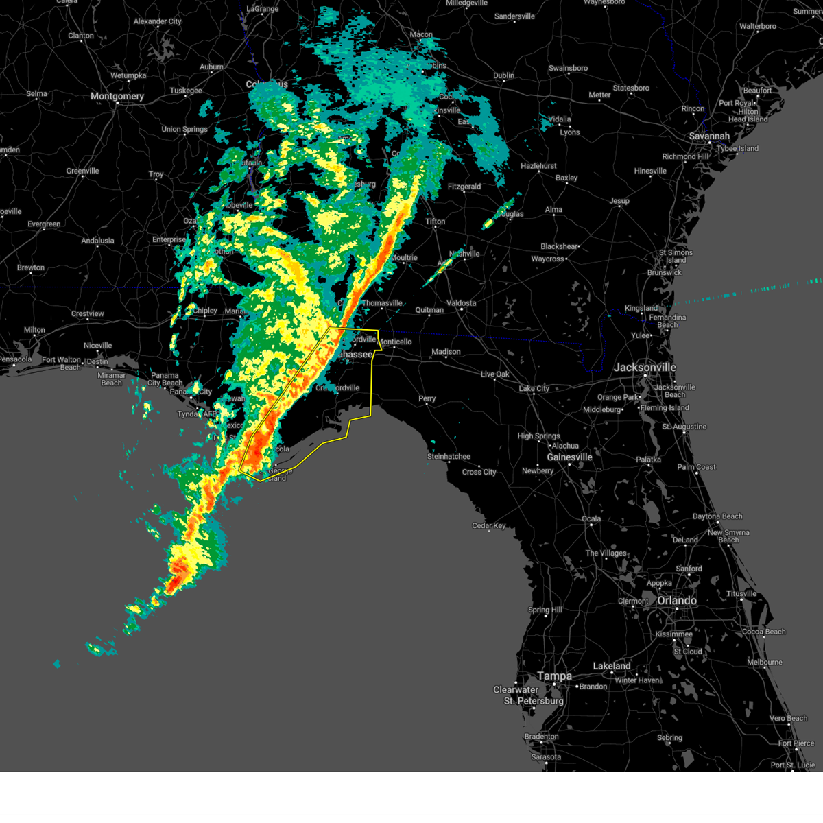
 Svrtae the national weather service in tallahassee has issued a * severe thunderstorm warning for, gadsden county in big bend florida, northwestern liberty county in big bend florida, northeastern leon county in big bend florida, * until 500 pm edt. * at 336 pm edt, a severe thunderstorm was located 9 miles northeast of tallahassee, moving west at 25 mph (radar indicated). Hazards include 60 mph wind gusts and quarter size hail. Hail damage to vehicles is expected. Expect wind damage to roofs, siding, and trees. Svrtae the national weather service in tallahassee has issued a * severe thunderstorm warning for, gadsden county in big bend florida, northwestern liberty county in big bend florida, northeastern leon county in big bend florida, * until 500 pm edt. * at 336 pm edt, a severe thunderstorm was located 9 miles northeast of tallahassee, moving west at 25 mph (radar indicated). Hazards include 60 mph wind gusts and quarter size hail. Hail damage to vehicles is expected. Expect wind damage to roofs, siding, and trees.
|
| 6/10/2025 7:47 PM EDT |
 the severe thunderstorm warning has been cancelled and is no longer in effect the severe thunderstorm warning has been cancelled and is no longer in effect
|
| 6/10/2025 7:22 PM EDT |
 Svrtae the national weather service in tallahassee has issued a * severe thunderstorm warning for, west central jefferson county in big bend florida, southeastern leon county in big bend florida, * until 800 pm edt. * at 721 pm edt, a severe thunderstorm was located 12 miles northeast of woodville, moving southeast at 10 mph (radar indicated). Hazards include 60 mph wind gusts. expect damage to roofs, siding, and trees Svrtae the national weather service in tallahassee has issued a * severe thunderstorm warning for, west central jefferson county in big bend florida, southeastern leon county in big bend florida, * until 800 pm edt. * at 721 pm edt, a severe thunderstorm was located 12 miles northeast of woodville, moving southeast at 10 mph (radar indicated). Hazards include 60 mph wind gusts. expect damage to roofs, siding, and trees
|
| 6/10/2025 5:10 AM EDT |
 The storms which prompted the warning have moved out of the area. therefore, the warning will be allowed to expire. to report severe weather, contact your nearest law enforcement agency. they will relay your report to the national weather service tallahassee. The storms which prompted the warning have moved out of the area. therefore, the warning will be allowed to expire. to report severe weather, contact your nearest law enforcement agency. they will relay your report to the national weather service tallahassee.
|
| 6/10/2025 4:37 AM EDT |
 At 437 am edt, severe thunderstorms were located along a line extending from 15 miles northwest of monticello to 20 miles east of carrabelle, moving east at 30 mph (radar indicated). Hazards include 60 mph wind gusts. Expect damage to roofs, siding, and trees. locations impacted include, tallahassee, woodville, carrabelle, florida state university, st. Marks, crawfordville, florida a and m, wakulla, sopchoppy, shadeville, leon sinks, gaither community center, wakulla springs, tallahassee memorial hosp, walker ford community center, st george island st pk, miccosukee, south city, eight mile pond, and panacea. At 437 am edt, severe thunderstorms were located along a line extending from 15 miles northwest of monticello to 20 miles east of carrabelle, moving east at 30 mph (radar indicated). Hazards include 60 mph wind gusts. Expect damage to roofs, siding, and trees. locations impacted include, tallahassee, woodville, carrabelle, florida state university, st. Marks, crawfordville, florida a and m, wakulla, sopchoppy, shadeville, leon sinks, gaither community center, wakulla springs, tallahassee memorial hosp, walker ford community center, st george island st pk, miccosukee, south city, eight mile pond, and panacea.
|
| 6/10/2025 4:37 AM EDT |
 the severe thunderstorm warning has been cancelled and is no longer in effect the severe thunderstorm warning has been cancelled and is no longer in effect
|
| 6/10/2025 3:48 AM EDT |
 Svrtae the national weather service in tallahassee has issued a * severe thunderstorm warning for, wakulla county in big bend florida, eastern gadsden county in big bend florida, southeastern liberty county in big bend florida, leon county in big bend florida, northeastern franklin county in big bend florida, * until 515 am edt. * at 348 am edt, severe thunderstorms were located along a line extending from 6 miles northwest of havana to near carrabelle, moving east at 30 mph (radar indicated). Hazards include 60 mph wind gusts. expect damage to roofs, siding, and trees Svrtae the national weather service in tallahassee has issued a * severe thunderstorm warning for, wakulla county in big bend florida, eastern gadsden county in big bend florida, southeastern liberty county in big bend florida, leon county in big bend florida, northeastern franklin county in big bend florida, * until 515 am edt. * at 348 am edt, severe thunderstorms were located along a line extending from 6 miles northwest of havana to near carrabelle, moving east at 30 mph (radar indicated). Hazards include 60 mph wind gusts. expect damage to roofs, siding, and trees
|
| 6/9/2025 3:22 PM EDT |
 The storms which prompted the warning have weakened below severe limits, and no longer pose an immediate threat to life or property. therefore, the warning will be allowed to expire. however, gusty winds to 40 mph and heavy rain are still possible with these thunderstorms. The storms which prompted the warning have weakened below severe limits, and no longer pose an immediate threat to life or property. therefore, the warning will be allowed to expire. however, gusty winds to 40 mph and heavy rain are still possible with these thunderstorms.
|
| 6/9/2025 3:12 PM EDT |
 At 312 pm edt, severe thunderstorms were located along a line extending from 12 miles west of monticello to florida a and m, moving east at 15 mph (radar indicated). Hazards include 60 mph wind gusts. Expect damage to roofs, siding, and trees. locations impacted include, tallahassee, monticello, apalachee regional park, miccosukee road greenway, chaires crossroads, festus, baum, lois, j r alford greenway, miccosukee, drifton, capitola, st. Marks headwaters greenway, casa blanco, chaires, montivilla, lloyd, tom brown park, pisgah church, and lake miccosukee. At 312 pm edt, severe thunderstorms were located along a line extending from 12 miles west of monticello to florida a and m, moving east at 15 mph (radar indicated). Hazards include 60 mph wind gusts. Expect damage to roofs, siding, and trees. locations impacted include, tallahassee, monticello, apalachee regional park, miccosukee road greenway, chaires crossroads, festus, baum, lois, j r alford greenway, miccosukee, drifton, capitola, st. Marks headwaters greenway, casa blanco, chaires, montivilla, lloyd, tom brown park, pisgah church, and lake miccosukee.
|
| 6/9/2025 2:52 PM EDT | Debris on powerlines near the intersection of marion ave and miccosukee roa in leon county FL, 0.8 miles NNW of Tallahassee, FL |
| 6/9/2025 2:51 PM EDT |
 Svrtae the national weather service in tallahassee has issued a * severe thunderstorm warning for, northwestern jefferson county in big bend florida, eastern leon county in big bend florida, * until 330 pm edt. * at 250 pm edt, severe thunderstorms were located along a line extending from 6 miles east of tallahassee to near tallahassee state college, moving east at 15 mph (radar indicated). Hazards include 60 mph wind gusts and penny size hail. expect damage to roofs, siding, and trees Svrtae the national weather service in tallahassee has issued a * severe thunderstorm warning for, northwestern jefferson county in big bend florida, eastern leon county in big bend florida, * until 330 pm edt. * at 250 pm edt, severe thunderstorms were located along a line extending from 6 miles east of tallahassee to near tallahassee state college, moving east at 15 mph (radar indicated). Hazards include 60 mph wind gusts and penny size hail. expect damage to roofs, siding, and trees
|
| 6/8/2025 2:36 PM EDT |
 Svrtae the national weather service in tallahassee has issued a * severe thunderstorm warning for, northeastern wakulla county in big bend florida, southwestern jefferson county in big bend florida, southeastern leon county in big bend florida, * until 315 pm edt. * at 235 pm edt, severe thunderstorms were located along a line extending from 9 miles northeast of woodville to near st. marks, moving southeast at 20 mph (radar indicated). Hazards include 60 mph wind gusts. expect damage to roofs, siding, and trees Svrtae the national weather service in tallahassee has issued a * severe thunderstorm warning for, northeastern wakulla county in big bend florida, southwestern jefferson county in big bend florida, southeastern leon county in big bend florida, * until 315 pm edt. * at 235 pm edt, severe thunderstorms were located along a line extending from 9 miles northeast of woodville to near st. marks, moving southeast at 20 mph (radar indicated). Hazards include 60 mph wind gusts. expect damage to roofs, siding, and trees
|
| 5/30/2025 5:28 PM EDT |
 the severe thunderstorm warning has been cancelled and is no longer in effect the severe thunderstorm warning has been cancelled and is no longer in effect
|
| 5/30/2025 5:13 PM EDT |
 At 512 pm edt, a severe thunderstorm was located near florida a and m, moving east at 20 mph (radar indicated). Hazards include 60 mph wind gusts. Expect damage to roofs, siding, and trees. locations impacted include, tallahassee, woodville, apalachee regional park, miccosukee road greenway, indian head acres, chaires crossroads, tallahassee memorial hosp, baum, j r alford greenway, vereen, capitola, st. Marks headwaters greenway, chaires, southwood, tom brown park, governors square mall, and natural bridge. At 512 pm edt, a severe thunderstorm was located near florida a and m, moving east at 20 mph (radar indicated). Hazards include 60 mph wind gusts. Expect damage to roofs, siding, and trees. locations impacted include, tallahassee, woodville, apalachee regional park, miccosukee road greenway, indian head acres, chaires crossroads, tallahassee memorial hosp, baum, j r alford greenway, vereen, capitola, st. Marks headwaters greenway, chaires, southwood, tom brown park, governors square mall, and natural bridge.
|
| 5/30/2025 5:03 PM EDT |
 the severe thunderstorm warning has been cancelled and is no longer in effect the severe thunderstorm warning has been cancelled and is no longer in effect
|
| 5/30/2025 5:03 PM EDT |
 At 503 pm edt, a severe thunderstorm was located near florida state university, moving east at 20 mph (radar indicated). Hazards include 60 mph wind gusts. Expect damage to roofs, siding, and trees. Locations impacted include, tallahassee, woodville, tallahassee state college, florida state university, florida a and m, doak campbell stadium, lake bradford, leon sinks, gaither community center, tallahassee memorial hosp, walker ford community center, south city, eight mile pond, griffin heights, tallahassee regional a/p, governors square mall, natural bridge, midtown, apalachee ridge estates, and levy park. At 503 pm edt, a severe thunderstorm was located near florida state university, moving east at 20 mph (radar indicated). Hazards include 60 mph wind gusts. Expect damage to roofs, siding, and trees. Locations impacted include, tallahassee, woodville, tallahassee state college, florida state university, florida a and m, doak campbell stadium, lake bradford, leon sinks, gaither community center, tallahassee memorial hosp, walker ford community center, south city, eight mile pond, griffin heights, tallahassee regional a/p, governors square mall, natural bridge, midtown, apalachee ridge estates, and levy park.
|
| 5/30/2025 4:50 PM EDT |
 Svrtae the national weather service in tallahassee has issued a * severe thunderstorm warning for, southeastern gadsden county in big bend florida, east central liberty county in big bend florida, leon county in big bend florida, * until 545 pm edt. * at 450 pm edt, a severe thunderstorm was located over tallahassee state college, moving east at 20 mph (radar indicated). Hazards include 60 mph wind gusts. expect damage to roofs, siding, and trees Svrtae the national weather service in tallahassee has issued a * severe thunderstorm warning for, southeastern gadsden county in big bend florida, east central liberty county in big bend florida, leon county in big bend florida, * until 545 pm edt. * at 450 pm edt, a severe thunderstorm was located over tallahassee state college, moving east at 20 mph (radar indicated). Hazards include 60 mph wind gusts. expect damage to roofs, siding, and trees
|
| 5/21/2025 1:24 PM EDT |
 The storms which prompted the warning have weakened below severe limits, and no longer pose an immediate threat to life or property. therefore, the warning will be allowed to expire. however, small hail and gusty winds are still possible with these thunderstorms. The storms which prompted the warning have weakened below severe limits, and no longer pose an immediate threat to life or property. therefore, the warning will be allowed to expire. however, small hail and gusty winds are still possible with these thunderstorms.
|
| 5/21/2025 1:10 PM EDT |
 the severe thunderstorm warning has been cancelled and is no longer in effect the severe thunderstorm warning has been cancelled and is no longer in effect
|
| 5/21/2025 1:10 PM EDT |
 At 110 pm edt, severe thunderstorms were located along a line extending from 12 miles northwest of monticello to 9 miles north of tallahassee to near havana, moving east at 35 mph (radar indicated). Hazards include 60 mph wind gusts and penny size hail. Expect damage to roofs, siding, and trees. Locations impacted include, tallahassee, monticello, havana, alma, freemont, dills, macon community park, littman, miccosukee road greenway, darsey, florence, scotland, jamieson, rocky hill, miccosukee, drifton, fred george park, killearn estates, shady rest, and casa blanco. At 110 pm edt, severe thunderstorms were located along a line extending from 12 miles northwest of monticello to 9 miles north of tallahassee to near havana, moving east at 35 mph (radar indicated). Hazards include 60 mph wind gusts and penny size hail. Expect damage to roofs, siding, and trees. Locations impacted include, tallahassee, monticello, havana, alma, freemont, dills, macon community park, littman, miccosukee road greenway, darsey, florence, scotland, jamieson, rocky hill, miccosukee, drifton, fred george park, killearn estates, shady rest, and casa blanco.
|
| 5/21/2025 12:48 PM EDT |
 Svrtae the national weather service in tallahassee has issued a * severe thunderstorm warning for, northeastern gadsden county in big bend florida, northwestern jefferson county in big bend florida, northeastern leon county in big bend florida, southeastern decatur county in southwestern georgia, southern grady county in southwestern georgia, southwestern thomas county in south central georgia, * until 130 pm edt. * at 1248 pm edt, severe thunderstorms were located along a line extending from 10 miles south of cairo to near havana to near quincy, moving east at 30 mph (radar indicated). Hazards include 60 mph wind gusts and quarter size hail. Hail damage to vehicles is expected. Expect wind damage to roofs, siding, and trees. Svrtae the national weather service in tallahassee has issued a * severe thunderstorm warning for, northeastern gadsden county in big bend florida, northwestern jefferson county in big bend florida, northeastern leon county in big bend florida, southeastern decatur county in southwestern georgia, southern grady county in southwestern georgia, southwestern thomas county in south central georgia, * until 130 pm edt. * at 1248 pm edt, severe thunderstorms were located along a line extending from 10 miles south of cairo to near havana to near quincy, moving east at 30 mph (radar indicated). Hazards include 60 mph wind gusts and quarter size hail. Hail damage to vehicles is expected. Expect wind damage to roofs, siding, and trees.
|
| 4/7/2025 12:37 PM EDT |
 The storm which prompted the warning has moved out of the area. therefore, the warning will be allowed to expire. a tornado watch remains in effect until 600 pm edt for big bend florida, and south central and southwestern georgia. remember, a tornado warning still remains in effect for portions of leon, grady, and thomas county. The storm which prompted the warning has moved out of the area. therefore, the warning will be allowed to expire. a tornado watch remains in effect until 600 pm edt for big bend florida, and south central and southwestern georgia. remember, a tornado warning still remains in effect for portions of leon, grady, and thomas county.
|
| 4/7/2025 12:24 PM EDT | Trees reported down on deer lake rd and buck point r in leon county FL, 11.1 miles S of Tallahassee, FL |
| 4/7/2025 12:15 PM EDT |
 Tortae the national weather service in tallahassee has issued a * tornado warning for, northeastern leon county in big bend florida, southeastern grady county in southwestern georgia, southwestern thomas county in south central georgia, * until 1245 pm edt. * at 1215 pm edt, a severe thunderstorm capable of producing a tornado was located 8 miles northeast of tallahassee, moving northeast at 40 mph (radar indicated rotation). Hazards include tornado. Flying debris will be dangerous to those caught without shelter. mobile homes will be damaged or destroyed. damage to roofs, windows, and vehicles will occur. tree damage is likely. This tornadic thunderstorm will remain over mainly rural areas of northeastern leon, southeastern grady and southwestern thomas counties, including the following locations, bradfordville, killearn lakes, and lake iamonia. Tortae the national weather service in tallahassee has issued a * tornado warning for, northeastern leon county in big bend florida, southeastern grady county in southwestern georgia, southwestern thomas county in south central georgia, * until 1245 pm edt. * at 1215 pm edt, a severe thunderstorm capable of producing a tornado was located 8 miles northeast of tallahassee, moving northeast at 40 mph (radar indicated rotation). Hazards include tornado. Flying debris will be dangerous to those caught without shelter. mobile homes will be damaged or destroyed. damage to roofs, windows, and vehicles will occur. tree damage is likely. This tornadic thunderstorm will remain over mainly rural areas of northeastern leon, southeastern grady and southwestern thomas counties, including the following locations, bradfordville, killearn lakes, and lake iamonia.
|
| 4/7/2025 12:05 PM EDT |
 the tornado warning has been cancelled and is no longer in effect the tornado warning has been cancelled and is no longer in effect
|
| 4/7/2025 12:02 PM EDT |
 Svrtae the national weather service in tallahassee has issued a * severe thunderstorm warning for, northeastern gadsden county in big bend florida, northeastern leon county in big bend florida, southeastern grady county in southwestern georgia, southwestern thomas county in south central georgia, * until 1245 pm edt. * at 1202 pm edt, a severe thunderstorm was located near havana, moving northeast at 40 mph (radar indicated). Hazards include 60 mph wind gusts. expect damage to roofs, siding, and trees Svrtae the national weather service in tallahassee has issued a * severe thunderstorm warning for, northeastern gadsden county in big bend florida, northeastern leon county in big bend florida, southeastern grady county in southwestern georgia, southwestern thomas county in south central georgia, * until 1245 pm edt. * at 1202 pm edt, a severe thunderstorm was located near havana, moving northeast at 40 mph (radar indicated). Hazards include 60 mph wind gusts. expect damage to roofs, siding, and trees
|
| 4/7/2025 11:51 AM EDT |
 Tortae the national weather service in tallahassee has issued a * tornado warning for, southeastern gadsden county in big bend florida, central leon county in big bend florida, * until 1215 pm edt. * at 1151 am edt, a tornado producing storm was located near midway, moving northeast at 35 mph (radar confirmed tornado). Hazards include damaging tornado. Flying debris will be dangerous to those caught without shelter. mobile homes will be damaged or destroyed. damage to roofs, windows, and vehicles will occur. tree damage is likely. This tornadic storm will be near, midway and tallahassee around 1155 am edt. Tortae the national weather service in tallahassee has issued a * tornado warning for, southeastern gadsden county in big bend florida, central leon county in big bend florida, * until 1215 pm edt. * at 1151 am edt, a tornado producing storm was located near midway, moving northeast at 35 mph (radar confirmed tornado). Hazards include damaging tornado. Flying debris will be dangerous to those caught without shelter. mobile homes will be damaged or destroyed. damage to roofs, windows, and vehicles will occur. tree damage is likely. This tornadic storm will be near, midway and tallahassee around 1155 am edt.
|
| 4/7/2025 11:10 AM EDT |
 Svrtae the national weather service in tallahassee has issued a * severe thunderstorm warning for, northwestern wakulla county in big bend florida, southeastern gadsden county in big bend florida, east central liberty county in big bend florida, southwestern leon county in big bend florida, * until noon edt. * at 1110 am edt, severe thunderstorms were located along a line extending from 11 miles southwest of midway to 22 miles east of stonemill creek, moving northeast at 35 mph (radar indicated). Hazards include 60 mph wind gusts. expect damage to roofs, siding, and trees Svrtae the national weather service in tallahassee has issued a * severe thunderstorm warning for, northwestern wakulla county in big bend florida, southeastern gadsden county in big bend florida, east central liberty county in big bend florida, southwestern leon county in big bend florida, * until noon edt. * at 1110 am edt, severe thunderstorms were located along a line extending from 11 miles southwest of midway to 22 miles east of stonemill creek, moving northeast at 35 mph (radar indicated). Hazards include 60 mph wind gusts. expect damage to roofs, siding, and trees
|
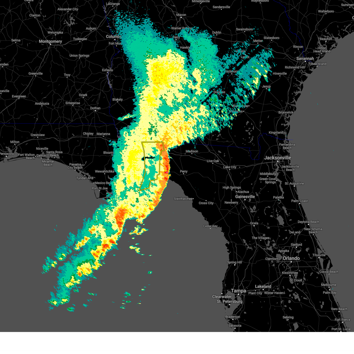
| 3/31/2025 3:52 PM EDT |
 Svrtae the national weather service in tallahassee has issued a * severe thunderstorm warning for, eastern wakulla county in big bend florida, jefferson county in big bend florida, northwestern taylor county in big bend florida, southeastern leon county in big bend florida, western madison county in big bend florida, * until 445 pm edt. * at 352 pm edt, severe thunderstorms were located along a line extending from 10 miles west of monticello to 6 miles northeast of woodville to 12 miles south of crawfordville, moving east at 40 mph (radar indicated). Hazards include 60 mph wind gusts and penny size hail. expect damage to roofs, siding, and trees Svrtae the national weather service in tallahassee has issued a * severe thunderstorm warning for, eastern wakulla county in big bend florida, jefferson county in big bend florida, northwestern taylor county in big bend florida, southeastern leon county in big bend florida, western madison county in big bend florida, * until 445 pm edt. * at 352 pm edt, severe thunderstorms were located along a line extending from 10 miles west of monticello to 6 miles northeast of woodville to 12 miles south of crawfordville, moving east at 40 mph (radar indicated). Hazards include 60 mph wind gusts and penny size hail. expect damage to roofs, siding, and trees
|
| 3/31/2025 3:40 PM EDT | Emergency manager reports much of tram road covered in branches and about 4 trees down near and west of the intersection of tram road and saint joe roa in leon county FL, 9.3 miles NW of Tallahassee, FL |
| 3/31/2025 3:35 PM EDT |
 the severe thunderstorm warning has been cancelled and is no longer in effect the severe thunderstorm warning has been cancelled and is no longer in effect
|
| 3/31/2025 3:35 PM EDT |
 At 334 pm edt, severe thunderstorms were located along a line extending from near thomasville to doak campbell stadium to 8 miles northwest of crawfordville to 14 miles north of carrabelle, moving east at 65 mph (radar indicated. at the national weather service office on florida state university, a gust of 51 mph was repoprted at 3:32 pm et). Hazards include 60 mph wind gusts and quarter size hail. Hail damage to vehicles is expected. expect wind damage to roofs, siding, and trees. locations impacted include, lake bradford, tallahassee state college, wakulla springs, florida state university, south city, medart, tallahassee regional a/p, natural bridge, liveoak island, apalachee ridge estates, levy park, indian head acres, hyde park, baum, orchard pond, plum orchard, st. Marks headwaters greenway, shell point, port leon, and southwood. At 334 pm edt, severe thunderstorms were located along a line extending from near thomasville to doak campbell stadium to 8 miles northwest of crawfordville to 14 miles north of carrabelle, moving east at 65 mph (radar indicated. at the national weather service office on florida state university, a gust of 51 mph was repoprted at 3:32 pm et). Hazards include 60 mph wind gusts and quarter size hail. Hail damage to vehicles is expected. expect wind damage to roofs, siding, and trees. locations impacted include, lake bradford, tallahassee state college, wakulla springs, florida state university, south city, medart, tallahassee regional a/p, natural bridge, liveoak island, apalachee ridge estates, levy park, indian head acres, hyde park, baum, orchard pond, plum orchard, st. Marks headwaters greenway, shell point, port leon, and southwood.
|
| 3/31/2025 3:32 PM EDT | Emergency manager reported a tree down on a hous in leon county FL, 6.9 miles SSW of Tallahassee, FL |
| 3/31/2025 3:32 PM EDT | Emergency manager reports a tree down near the intersection of pimlico drive and jamaica cour in leon county FL, 7 miles SW of Tallahassee, FL |
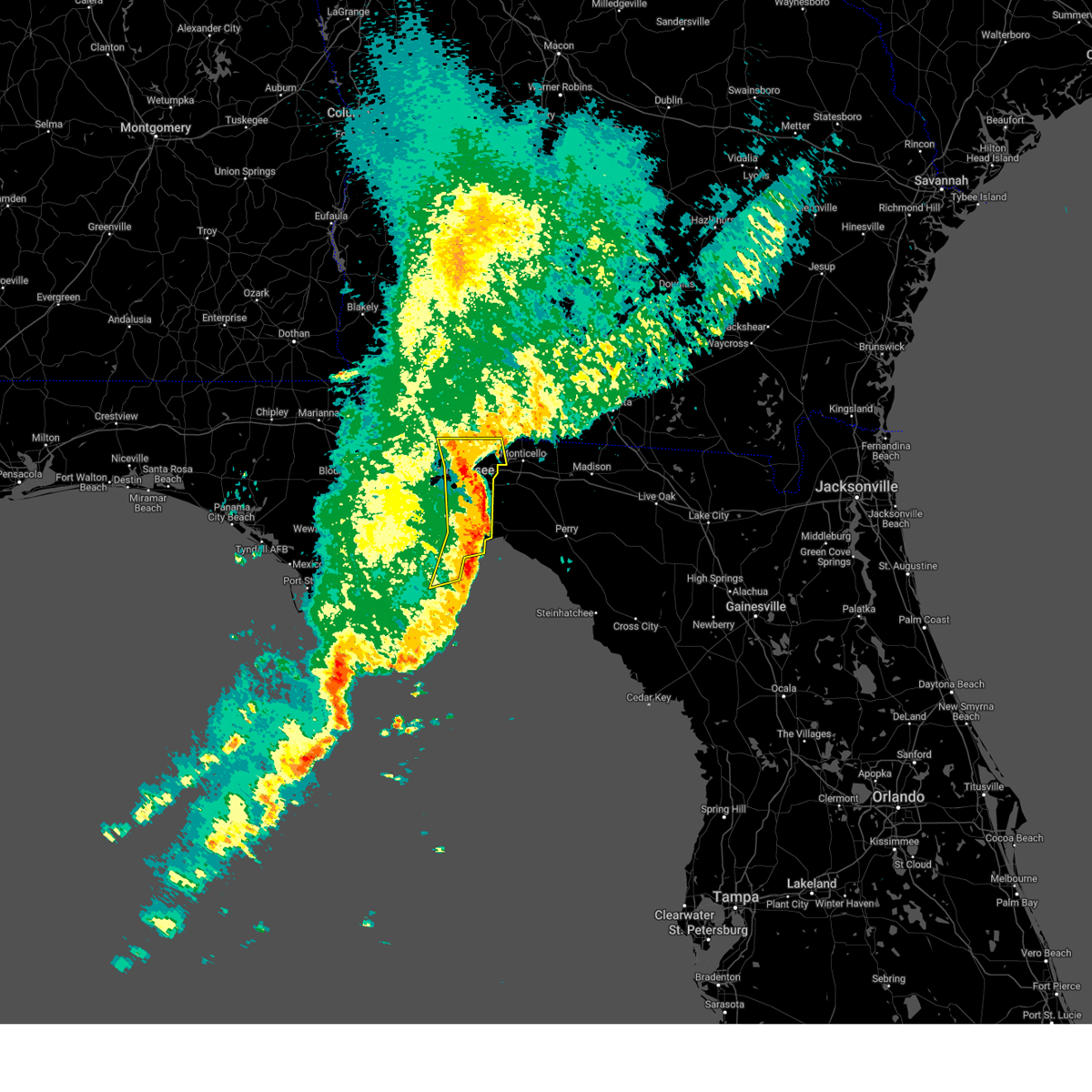
| 3/31/2025 3:20 PM EDT |
 the severe thunderstorm warning has been cancelled and is no longer in effect the severe thunderstorm warning has been cancelled and is no longer in effect
|
| 3/31/2025 3:20 PM EDT |
 At 319 pm edt, severe thunderstorms were located along a line extending from near cairo to near midway to 16 miles east of stonemill creek to 10 miles northeast of port st. joe, moving east at 35 mph (radar indicated). Hazards include 60 mph wind gusts and quarter size hail. Hail damage to vehicles is expected. expect wind damage to roofs, siding, and trees. Locations impacted include, lake bradford, tallahassee state college, jewel fire tower, wakulla springs, vilas, florence, florida state university, south city, calvary, medart, nixon garden, bloxham, nickleville, tallahassee regional a/p, natural bridge, liveoak island, apalachee ridge estates, levy park, indian head acres, and hyde park. At 319 pm edt, severe thunderstorms were located along a line extending from near cairo to near midway to 16 miles east of stonemill creek to 10 miles northeast of port st. joe, moving east at 35 mph (radar indicated). Hazards include 60 mph wind gusts and quarter size hail. Hail damage to vehicles is expected. expect wind damage to roofs, siding, and trees. Locations impacted include, lake bradford, tallahassee state college, jewel fire tower, wakulla springs, vilas, florence, florida state university, south city, calvary, medart, nixon garden, bloxham, nickleville, tallahassee regional a/p, natural bridge, liveoak island, apalachee ridge estates, levy park, indian head acres, and hyde park.
|
| 3/31/2025 3:08 PM EDT |
 the severe thunderstorm warning has been cancelled and is no longer in effect the severe thunderstorm warning has been cancelled and is no longer in effect
|
| 3/31/2025 3:08 PM EDT |
 At 308 pm edt/208 pm cdt/, severe thunderstorms were located along a line extending from near whigham to 7 miles southwest of quincy to 11 miles east of stonemill creek to 6 miles northeast of port st. joe, moving east at 35 mph (radar indicated). Hazards include 60 mph wind gusts and quarter size hail. Hail damage to vehicles is expected. expect wind damage to roofs, siding, and trees. Locations impacted include, lake bradford, tallahassee state college, honeyville, jewel fire tower, wakulla springs, vilas, florence, chipola cutoff, florida state university, orange, south city, laingkat, calvary, climax, medart, kern, quincy airport, lowry, nixon garden, and bloxham. At 308 pm edt/208 pm cdt/, severe thunderstorms were located along a line extending from near whigham to 7 miles southwest of quincy to 11 miles east of stonemill creek to 6 miles northeast of port st. joe, moving east at 35 mph (radar indicated). Hazards include 60 mph wind gusts and quarter size hail. Hail damage to vehicles is expected. expect wind damage to roofs, siding, and trees. Locations impacted include, lake bradford, tallahassee state college, honeyville, jewel fire tower, wakulla springs, vilas, florence, chipola cutoff, florida state university, orange, south city, laingkat, calvary, climax, medart, kern, quincy airport, lowry, nixon garden, and bloxham.
|
| 3/31/2025 2:54 PM EDT | Svrtae the national weather service in tallahassee has issued a * severe thunderstorm warning for, northwestern gulf county in the panhandle of florida, southeastern calhoun county in the panhandle of florida, wakulla county in big bend florida, gadsden county in big bend florida, liberty county in big bend florida, leon county in big bend florida, southeastern decatur county in southwestern georgia, grady county in southwestern georgia, southwestern thomas county in south central georgia, * until 400 pm edt/300 pm cdt/. * at 254 pm edt/154 pm cdt/, severe thunderstorms were located along a line extending from near whigham to 6 miles south of greensboro to near wewahitchka to near mexico beach, moving east at 35 mph (radar indicated). Hazards include 60 mph wind gusts. expect damage to roofs, siding, and trees |
| 3/16/2025 7:14 AM EDT |
 Svrtae the national weather service in tallahassee has issued a * severe thunderstorm warning for, wakulla county in big bend florida, southeastern liberty county in big bend florida, northwestern taylor county in big bend florida, southwestern jefferson county in big bend florida, southeastern leon county in big bend florida, northeastern franklin county in big bend florida, southwestern madison county in big bend florida, * until 800 am edt. * at 714 am edt, severe thunderstorms were located along a line extending from 14 miles north of carrabelle to 18 miles south of st. marks, moving northeast at 45 mph (radar indicated). Hazards include 60 mph wind gusts and quarter size hail. Hail damage to vehicles is expected. Expect wind damage to roofs, siding, and trees. Svrtae the national weather service in tallahassee has issued a * severe thunderstorm warning for, wakulla county in big bend florida, southeastern liberty county in big bend florida, northwestern taylor county in big bend florida, southwestern jefferson county in big bend florida, southeastern leon county in big bend florida, northeastern franklin county in big bend florida, southwestern madison county in big bend florida, * until 800 am edt. * at 714 am edt, severe thunderstorms were located along a line extending from 14 miles north of carrabelle to 18 miles south of st. marks, moving northeast at 45 mph (radar indicated). Hazards include 60 mph wind gusts and quarter size hail. Hail damage to vehicles is expected. Expect wind damage to roofs, siding, and trees.
|
| 3/16/2025 7:09 AM EDT |
 Svrtae the national weather service in tallahassee has issued a * severe thunderstorm warning for, northeastern gadsden county in big bend florida, northwestern jefferson county in big bend florida, northeastern leon county in big bend florida, southwestern cook county in south central georgia, southeastern grady county in southwestern georgia, northwestern lowndes county in south central georgia, thomas county in south central georgia, brooks county in south central georgia, central colquitt county in south central georgia, * until 800 am edt. * at 708 am edt, severe thunderstorms were located along a line extending from 10 miles northeast of havana to 9 miles west of monticello, moving northeast at 65 mph (radar indicated). Hazards include 60 mph wind gusts and quarter size hail. Hail damage to vehicles is expected. Expect wind damage to roofs, siding, and trees. Svrtae the national weather service in tallahassee has issued a * severe thunderstorm warning for, northeastern gadsden county in big bend florida, northwestern jefferson county in big bend florida, northeastern leon county in big bend florida, southwestern cook county in south central georgia, southeastern grady county in southwestern georgia, northwestern lowndes county in south central georgia, thomas county in south central georgia, brooks county in south central georgia, central colquitt county in south central georgia, * until 800 am edt. * at 708 am edt, severe thunderstorms were located along a line extending from 10 miles northeast of havana to 9 miles west of monticello, moving northeast at 65 mph (radar indicated). Hazards include 60 mph wind gusts and quarter size hail. Hail damage to vehicles is expected. Expect wind damage to roofs, siding, and trees.
|
| 3/16/2025 6:44 AM EDT |
 At 644 am edt, a severe thunderstorm was located near havana, moving northeast at 45 mph (radar indicated). Hazards include 60 mph wind gusts and quarter size hail. Hail damage to vehicles is expected. expect wind damage to roofs, siding, and trees. Locations impacted include, freemont, littman, darsey, quincy, florence, scotland, jamieson, whigham, rocky hill, fred george park, laingkat, calvary, santa clara, shady rest, princes still, amsterdam, quincy airport, wetumpka, branchville, and nickleville. At 644 am edt, a severe thunderstorm was located near havana, moving northeast at 45 mph (radar indicated). Hazards include 60 mph wind gusts and quarter size hail. Hail damage to vehicles is expected. expect wind damage to roofs, siding, and trees. Locations impacted include, freemont, littman, darsey, quincy, florence, scotland, jamieson, whigham, rocky hill, fred george park, laingkat, calvary, santa clara, shady rest, princes still, amsterdam, quincy airport, wetumpka, branchville, and nickleville.
|
| 3/16/2025 6:44 AM EDT |
 the severe thunderstorm warning has been cancelled and is no longer in effect the severe thunderstorm warning has been cancelled and is no longer in effect
|
| 3/16/2025 6:20 AM EDT |
 Svrtae the national weather service in tallahassee has issued a * severe thunderstorm warning for, gadsden county in big bend florida, northeastern liberty county in big bend florida, central leon county in big bend florida, southeastern decatur county in southwestern georgia, grady county in southwestern georgia, * until 715 am edt. * at 620 am edt, a severe thunderstorm was located 11 miles south of greensboro, or 14 miles southwest of quincy, moving northeast at 45 mph (radar indicated). Hazards include 60 mph wind gusts and quarter size hail. Hail damage to vehicles is expected. Expect wind damage to roofs, siding, and trees. Svrtae the national weather service in tallahassee has issued a * severe thunderstorm warning for, gadsden county in big bend florida, northeastern liberty county in big bend florida, central leon county in big bend florida, southeastern decatur county in southwestern georgia, grady county in southwestern georgia, * until 715 am edt. * at 620 am edt, a severe thunderstorm was located 11 miles south of greensboro, or 14 miles southwest of quincy, moving northeast at 45 mph (radar indicated). Hazards include 60 mph wind gusts and quarter size hail. Hail damage to vehicles is expected. Expect wind damage to roofs, siding, and trees.
|
| 3/9/2025 11:08 AM EDT |
 the severe thunderstorm warning has been cancelled and is no longer in effect the severe thunderstorm warning has been cancelled and is no longer in effect
|
| 3/9/2025 10:56 AM EDT |
 At 1056 am edt, a severe thunderstorm was located over tallahassee state college, moving east at 35 mph (radar indicated). Hazards include 60 mph wind gusts. Expect damage to roofs, siding, and trees. Locations impacted include, lake bradford, tallahassee state college, gaither community center, tallahassee memorial hosp, walker ford community center, florida state university, south city, griffin heights, tallahassee regional a/p, governors square mall, midtown, apalachee ridge estates, levy park, indian head acres, chaires crossroads, maclay state gardens, bragg stadium, j r alford greenway, all saints district, and silver lake rec area. At 1056 am edt, a severe thunderstorm was located over tallahassee state college, moving east at 35 mph (radar indicated). Hazards include 60 mph wind gusts. Expect damage to roofs, siding, and trees. Locations impacted include, lake bradford, tallahassee state college, gaither community center, tallahassee memorial hosp, walker ford community center, florida state university, south city, griffin heights, tallahassee regional a/p, governors square mall, midtown, apalachee ridge estates, levy park, indian head acres, chaires crossroads, maclay state gardens, bragg stadium, j r alford greenway, all saints district, and silver lake rec area.
|
| 3/9/2025 10:56 AM EDT |
 the severe thunderstorm warning has been cancelled and is no longer in effect the severe thunderstorm warning has been cancelled and is no longer in effect
|
| 3/9/2025 10:39 AM EDT |
 Svrtae the national weather service in tallahassee has issued a * severe thunderstorm warning for, southeastern gadsden county in big bend florida, southern leon county in big bend florida, * until 1130 am edt. * at 1039 am edt, a severe thunderstorm was located 7 miles southwest of midway, moving east at 35 mph (radar indicated). Hazards include 60 mph wind gusts. expect damage to roofs, siding, and trees Svrtae the national weather service in tallahassee has issued a * severe thunderstorm warning for, southeastern gadsden county in big bend florida, southern leon county in big bend florida, * until 1130 am edt. * at 1039 am edt, a severe thunderstorm was located 7 miles southwest of midway, moving east at 35 mph (radar indicated). Hazards include 60 mph wind gusts. expect damage to roofs, siding, and trees
|
| 3/5/2025 5:13 AM EST |
 Svrtae the national weather service in tallahassee has issued a * severe thunderstorm warning for, eastern wakulla county in big bend florida, northwestern taylor county in big bend florida, jefferson county in big bend florida, eastern leon county in big bend florida, northeastern franklin county in big bend florida, madison county in big bend florida, * until 645 am est. * at 513 am est, severe thunderstorms were located along a line extending from 9 miles northwest of monticello to 12 miles northeast of carrabelle, moving east at 30 mph (radar indicated). Hazards include 60 mph wind gusts. expect damage to roofs, siding, and trees Svrtae the national weather service in tallahassee has issued a * severe thunderstorm warning for, eastern wakulla county in big bend florida, northwestern taylor county in big bend florida, jefferson county in big bend florida, eastern leon county in big bend florida, northeastern franklin county in big bend florida, madison county in big bend florida, * until 645 am est. * at 513 am est, severe thunderstorms were located along a line extending from 9 miles northwest of monticello to 12 miles northeast of carrabelle, moving east at 30 mph (radar indicated). Hazards include 60 mph wind gusts. expect damage to roofs, siding, and trees
|
| 3/5/2025 4:56 AM EST |
 At 455 am est, severe thunderstorms were located along a line extending from 12 miles northwest of monticello to 12 miles south of apalachicola, moving east at 35 mph (radar indicated). Hazards include 60 mph wind gusts. Expect damage to roofs, siding, and trees. Locations impacted include, lake bradford, franklin, tallahassee state college, wakulla springs, florida state university, st george island st pk, south city, eastpoint, medart, tallahassee regional a/p, apalachicola, natural bridge, liveoak island, curtis mill, apalachee ridge estates, levy park, indian head acres, bald point, hyde park, and high bluff. At 455 am est, severe thunderstorms were located along a line extending from 12 miles northwest of monticello to 12 miles south of apalachicola, moving east at 35 mph (radar indicated). Hazards include 60 mph wind gusts. Expect damage to roofs, siding, and trees. Locations impacted include, lake bradford, franklin, tallahassee state college, wakulla springs, florida state university, st george island st pk, south city, eastpoint, medart, tallahassee regional a/p, apalachicola, natural bridge, liveoak island, curtis mill, apalachee ridge estates, levy park, indian head acres, bald point, hyde park, and high bluff.
|
| 3/5/2025 4:56 AM EST |
 the severe thunderstorm warning has been cancelled and is no longer in effect the severe thunderstorm warning has been cancelled and is no longer in effect
|
| 3/5/2025 4:24 AM EST |
 At 424 am est/324 am cst/, severe thunderstorms were located along a line extending from 9 miles east of havana to 28 miles south of port st. joe, moving east at 35 mph (radar indicated). Hazards include 60 mph wind gusts. Expect damage to roofs, siding, and trees. Locations impacted include, lake bradford, franklin, tallahassee state college, jewel fire tower, wakulla springs, florence, florida state university, st george island st pk, south city, eastpoint, medart, bloxham, tallahassee regional a/p, apalachicola, natural bridge, liveoak island, curtis mill, apalachee ridge estates, levy park, and indian head acres. At 424 am est/324 am cst/, severe thunderstorms were located along a line extending from 9 miles east of havana to 28 miles south of port st. joe, moving east at 35 mph (radar indicated). Hazards include 60 mph wind gusts. Expect damage to roofs, siding, and trees. Locations impacted include, lake bradford, franklin, tallahassee state college, jewel fire tower, wakulla springs, florence, florida state university, st george island st pk, south city, eastpoint, medart, bloxham, tallahassee regional a/p, apalachicola, natural bridge, liveoak island, curtis mill, apalachee ridge estates, levy park, and indian head acres.
|
| 3/5/2025 3:46 AM EST |
 Svrtae the national weather service in tallahassee has issued a * severe thunderstorm warning for, gulf county in the panhandle of florida, wakulla county in big bend florida, gadsden county in big bend florida, liberty county in big bend florida, leon county in big bend florida, franklin county in big bend florida, * until 515 am est/415 am cst/. * at 346 am est/246 am cst/, severe thunderstorms were located along a line extending from 7 miles north of quincy to 34 miles southwest of port st. joe, moving east at 35 mph (radar indicated). Hazards include 60 mph wind gusts. expect damage to roofs, siding, and trees Svrtae the national weather service in tallahassee has issued a * severe thunderstorm warning for, gulf county in the panhandle of florida, wakulla county in big bend florida, gadsden county in big bend florida, liberty county in big bend florida, leon county in big bend florida, franklin county in big bend florida, * until 515 am est/415 am cst/. * at 346 am est/246 am cst/, severe thunderstorms were located along a line extending from 7 miles north of quincy to 34 miles southwest of port st. joe, moving east at 35 mph (radar indicated). Hazards include 60 mph wind gusts. expect damage to roofs, siding, and trees
|
| 2/16/2025 8:35 AM EST | Leon county em reports a tree down on natural bridge rd at whisper ridge wa in leon county FL, 13.3 miles NNW of Tallahassee, FL |
| 2/16/2025 8:35 AM EST |
 At 834 am est, severe thunderstorms were located along a line extending from 10 miles east of tallahassee to 10 miles west of crawfordville, moving southeast at 30 mph (radar indicated). Hazards include 60 mph wind gusts. Expect damage to roofs, siding, and trees. locations impacted include, tallahassee, woodville, ralford greenway, apalachee regional park, leon sinks, chaires crossroads, baum, eight mile pond, vereen, capitola, st. Marks headwaters greenway, chaires, southwood, and natural bridge. At 834 am est, severe thunderstorms were located along a line extending from 10 miles east of tallahassee to 10 miles west of crawfordville, moving southeast at 30 mph (radar indicated). Hazards include 60 mph wind gusts. Expect damage to roofs, siding, and trees. locations impacted include, tallahassee, woodville, ralford greenway, apalachee regional park, leon sinks, chaires crossroads, baum, eight mile pond, vereen, capitola, st. Marks headwaters greenway, chaires, southwood, and natural bridge.
|
| 2/16/2025 8:28 AM EST |
 At 828 am est, severe thunderstorms were located along a line extending from 6 miles northwest of monticello to 13 miles west of crawfordville, moving east at 40 mph (radar indicated). Hazards include 60 mph wind gusts. Expect damage to roofs, siding, and trees. Locations impacted include, tallahassee, woodville, tallahassee state college, florida state university, florida a and m, doak campbell stadium, lake bradford, leon sinks, gaither community center, tallahassee memorial hosp, walker ford community center, miccosukee, south city, eight mile pond, griffin heights, tallahassee regional a/p, governors square mall, natural bridge, midtown, and apalachee ridge estates. At 828 am est, severe thunderstorms were located along a line extending from 6 miles northwest of monticello to 13 miles west of crawfordville, moving east at 40 mph (radar indicated). Hazards include 60 mph wind gusts. Expect damage to roofs, siding, and trees. Locations impacted include, tallahassee, woodville, tallahassee state college, florida state university, florida a and m, doak campbell stadium, lake bradford, leon sinks, gaither community center, tallahassee memorial hosp, walker ford community center, miccosukee, south city, eight mile pond, griffin heights, tallahassee regional a/p, governors square mall, natural bridge, midtown, and apalachee ridge estates.
|
| 2/16/2025 8:15 AM EST | 5 pine trees snapped in leon county FL, 10.4 miles W of Tallahassee, FL |
| 2/16/2025 8:10 AM EST | An off-duty nws employee reports a tree on a power line on thomasville rd near dorothy b oven par in leon county FL, 2.2 miles SSW of Tallahassee, FL |
| 2/16/2025 7:38 AM EST |
 Svrtae the national weather service in tallahassee has issued a * severe thunderstorm warning for, leon county in big bend florida, * until 915 am est. * at 738 am est, severe thunderstorms were located along a line extending from near havana to 10 miles south of blountstown, moving east at 40 mph (radar indicated). Hazards include 60 mph wind gusts. expect damage to roofs, siding, and trees Svrtae the national weather service in tallahassee has issued a * severe thunderstorm warning for, leon county in big bend florida, * until 915 am est. * at 738 am est, severe thunderstorms were located along a line extending from near havana to 10 miles south of blountstown, moving east at 40 mph (radar indicated). Hazards include 60 mph wind gusts. expect damage to roofs, siding, and trees
|
| 12/29/2024 8:58 AM EST |
 The storms which prompted the warning have moved out of the area. therefore, the warning will be allowed to expire. a tornado watch remains in effect until 300 pm est for big bend florida. The storms which prompted the warning have moved out of the area. therefore, the warning will be allowed to expire. a tornado watch remains in effect until 300 pm est for big bend florida.
|
| 12/29/2024 8:41 AM EST |
 At 841 am est, severe thunderstorms were located along a line extending from near havana to near tallahassee to near st. marks to 20 miles east of carrabelle, moving east at 45 mph (radar indicated). Hazards include 60 mph wind gusts and penny size hail. Expect damage to roofs, siding, and trees. locations impacted include, tallahassee, woodville, tallahassee state college, florida state university, st. Marks, havana, crawfordville, florida a and m, doak campbell stadium, wakulla, lake bradford, shadeville, leon sinks, gaither community center, wakulla springs, tallahassee memorial hosp, walker ford community center, miccosukee, south city, and eight mile pond. At 841 am est, severe thunderstorms were located along a line extending from near havana to near tallahassee to near st. marks to 20 miles east of carrabelle, moving east at 45 mph (radar indicated). Hazards include 60 mph wind gusts and penny size hail. Expect damage to roofs, siding, and trees. locations impacted include, tallahassee, woodville, tallahassee state college, florida state university, st. Marks, havana, crawfordville, florida a and m, doak campbell stadium, wakulla, lake bradford, shadeville, leon sinks, gaither community center, wakulla springs, tallahassee memorial hosp, walker ford community center, miccosukee, south city, and eight mile pond.
|
| 12/29/2024 8:30 AM EST | Power line down at 5051 tram roa in leon county FL, 7.7 miles NW of Tallahassee, FL |
| 12/29/2024 8:18 AM EST |
 the severe thunderstorm warning has been cancelled and is no longer in effect the severe thunderstorm warning has been cancelled and is no longer in effect
|
| 12/29/2024 8:18 AM EST |
 At 818 am est, severe thunderstorms were located along a line extending from 12 miles east of havana to near tallahassee state college to near crawfordville to 12 miles southeast of carrabelle, moving east at 40 mph (radar indicated). Hazards include 60 mph wind gusts and penny size hail. Expect damage to roofs, siding, and trees. locations impacted include, tallahassee, woodville, tallahassee state college, florida state university, quincy, havana, st. Marks, midway, crawfordville, florida a and m, doak campbell stadium, wakulla, sopchoppy, lake bradford, wakulla springs, florence, south city, medart, quincy airport, and bloxham. At 818 am est, severe thunderstorms were located along a line extending from 12 miles east of havana to near tallahassee state college to near crawfordville to 12 miles southeast of carrabelle, moving east at 40 mph (radar indicated). Hazards include 60 mph wind gusts and penny size hail. Expect damage to roofs, siding, and trees. locations impacted include, tallahassee, woodville, tallahassee state college, florida state university, quincy, havana, st. Marks, midway, crawfordville, florida a and m, doak campbell stadium, wakulla, sopchoppy, lake bradford, wakulla springs, florence, south city, medart, quincy airport, and bloxham.
|
| 12/29/2024 7:42 AM EST |
 Svrtae the national weather service in tallahassee has issued a * severe thunderstorm warning for, wakulla county in big bend florida, eastern gadsden county in big bend florida, southeastern liberty county in big bend florida, leon county in big bend florida, eastern franklin county in big bend florida, * until 900 am est. * at 741 am est, severe thunderstorms were located along a line extending from near quincy to 12 miles south of greensboro to 18 miles north of carrabelle to eastpoint, moving east at 40 mph (radar indicated). Hazards include 60 mph wind gusts and penny size hail. expect damage to roofs, siding, and trees Svrtae the national weather service in tallahassee has issued a * severe thunderstorm warning for, wakulla county in big bend florida, eastern gadsden county in big bend florida, southeastern liberty county in big bend florida, leon county in big bend florida, eastern franklin county in big bend florida, * until 900 am est. * at 741 am est, severe thunderstorms were located along a line extending from near quincy to 12 miles south of greensboro to 18 miles north of carrabelle to eastpoint, moving east at 40 mph (radar indicated). Hazards include 60 mph wind gusts and penny size hail. expect damage to roofs, siding, and trees
|
| 12/18/2024 8:27 PM EST | Tree down off tram r in leon county FL, 4.9 miles N of Tallahassee, FL |
| 12/18/2024 8:07 PM EST |
 Svrtae the national weather service in tallahassee has issued a * severe thunderstorm warning for, west central jefferson county in big bend florida, southeastern leon county in big bend florida, * until 845 pm est. * at 806 pm est, a severe thunderstorm was located over tallahassee state college, moving east at 25 mph (radar indicated). Hazards include quarter size hail and gusts to 50 mph. damage to vehicles is expected Svrtae the national weather service in tallahassee has issued a * severe thunderstorm warning for, west central jefferson county in big bend florida, southeastern leon county in big bend florida, * until 845 pm est. * at 806 pm est, a severe thunderstorm was located over tallahassee state college, moving east at 25 mph (radar indicated). Hazards include quarter size hail and gusts to 50 mph. damage to vehicles is expected
|
| 8/19/2024 4:17 AM EDT |
 the severe thunderstorm warning has been cancelled and is no longer in effect the severe thunderstorm warning has been cancelled and is no longer in effect
|
| 8/19/2024 3:46 AM EDT |
 Svrtae the national weather service in tallahassee has issued a * severe thunderstorm warning for, wakulla county in big bend florida, south central gadsden county in big bend florida, southeastern liberty county in big bend florida, southwestern leon county in big bend florida, northeastern franklin county in big bend florida, * until 515 am edt. * at 346 am edt, a severe thunderstorm was located 12 miles southwest of midway, moving southeast at 35 mph (radar indicated). Hazards include 60 mph wind gusts. expect damage to roofs, siding, and trees Svrtae the national weather service in tallahassee has issued a * severe thunderstorm warning for, wakulla county in big bend florida, south central gadsden county in big bend florida, southeastern liberty county in big bend florida, southwestern leon county in big bend florida, northeastern franklin county in big bend florida, * until 515 am edt. * at 346 am edt, a severe thunderstorm was located 12 miles southwest of midway, moving southeast at 35 mph (radar indicated). Hazards include 60 mph wind gusts. expect damage to roofs, siding, and trees
|
| 8/18/2024 11:24 PM EDT |
 The storms which prompted the warning have weakened below severe limits, and no longer pose an immediate threat to life or property. therefore, the warning will be allowed to expire. however, small hail and gusty winds are still possible with these thunderstorms. a severe thunderstorm watch remains in effect until 200 am edt for big bend and the panhandle of florida, and southwestern georgia. The storms which prompted the warning have weakened below severe limits, and no longer pose an immediate threat to life or property. therefore, the warning will be allowed to expire. however, small hail and gusty winds are still possible with these thunderstorms. a severe thunderstorm watch remains in effect until 200 am edt for big bend and the panhandle of florida, and southwestern georgia.
|
| 8/18/2024 10:56 PM EDT |
 At 1055 pm edt, severe thunderstorms were located along a line extending from 8 miles southwest of bainbridge to near whigham, moving southeast at 20 mph (radar indicated). Hazards include 60 mph wind gusts and penny size hail. Expect damage to roofs, siding, and trees. Locations impacted include, tallahassee, quincy, havana, greensboro, chattahoochee, gretna, attapulgus, freemont, littman, douglas city, darsey, florence, scotland, rosedale, jamieson, rocky hill, recovery, laingkat, calvary, and santa clara. At 1055 pm edt, severe thunderstorms were located along a line extending from 8 miles southwest of bainbridge to near whigham, moving southeast at 20 mph (radar indicated). Hazards include 60 mph wind gusts and penny size hail. Expect damage to roofs, siding, and trees. Locations impacted include, tallahassee, quincy, havana, greensboro, chattahoochee, gretna, attapulgus, freemont, littman, douglas city, darsey, florence, scotland, rosedale, jamieson, rocky hill, recovery, laingkat, calvary, and santa clara.
|
| 8/18/2024 10:29 PM EDT |
 Svrtae the national weather service in tallahassee has issued a * severe thunderstorm warning for, northern gadsden county in big bend florida, northeastern leon county in big bend florida, decatur county in southwestern georgia, southwestern grady county in southwestern georgia, central seminole county in southwestern georgia, * until 1130 pm edt. * at 1029 pm edt, severe thunderstorms were located along a line extending from 8 miles west of west bainbridge to near whigham, moving southeast at 20 mph (radar indicated). Hazards include 60 mph wind gusts and penny size hail. expect damage to roofs, siding, and trees Svrtae the national weather service in tallahassee has issued a * severe thunderstorm warning for, northern gadsden county in big bend florida, northeastern leon county in big bend florida, decatur county in southwestern georgia, southwestern grady county in southwestern georgia, central seminole county in southwestern georgia, * until 1130 pm edt. * at 1029 pm edt, severe thunderstorms were located along a line extending from 8 miles west of west bainbridge to near whigham, moving southeast at 20 mph (radar indicated). Hazards include 60 mph wind gusts and penny size hail. expect damage to roofs, siding, and trees
|
| 8/2/2024 12:00 PM EDT |
 Svrtae the national weather service in tallahassee has issued a * severe thunderstorm warning for, eastern wakulla county in big bend florida, northwestern taylor county in big bend florida, western jefferson county in big bend florida, southeastern leon county in big bend florida, * until 1245 pm edt. * at 1200 pm edt, a severe thunderstorm was located 8 miles southwest of monticello, moving south at 20 mph (radar indicated). Hazards include 60 mph wind gusts and penny size hail. expect damage to roofs, siding, and trees Svrtae the national weather service in tallahassee has issued a * severe thunderstorm warning for, eastern wakulla county in big bend florida, northwestern taylor county in big bend florida, western jefferson county in big bend florida, southeastern leon county in big bend florida, * until 1245 pm edt. * at 1200 pm edt, a severe thunderstorm was located 8 miles southwest of monticello, moving south at 20 mph (radar indicated). Hazards include 60 mph wind gusts and penny size hail. expect damage to roofs, siding, and trees
|
| 7/29/2024 6:30 PM EDT |
 the severe thunderstorm warning has been cancelled and is no longer in effect the severe thunderstorm warning has been cancelled and is no longer in effect
|
| 7/29/2024 6:30 PM EDT |
 At 629 pm edt, a severe thunderstorm was located 7 miles north of tallahassee, moving south at 20 mph (radar indicated). Hazards include 60 mph wind gusts and penny size hail. Expect damage to roofs, siding, and trees. Locations impacted include, tallahassee, quincy, midway, havana, freemont, littman, florence, scotland, jamieson, fred george park, santa clara, killearn estates, shady rest, quincy airport, branchville, hinson, dogtown, forest meadows park, pisgah church, and lake iamonia. At 629 pm edt, a severe thunderstorm was located 7 miles north of tallahassee, moving south at 20 mph (radar indicated). Hazards include 60 mph wind gusts and penny size hail. Expect damage to roofs, siding, and trees. Locations impacted include, tallahassee, quincy, midway, havana, freemont, littman, florence, scotland, jamieson, fred george park, santa clara, killearn estates, shady rest, quincy airport, branchville, hinson, dogtown, forest meadows park, pisgah church, and lake iamonia.
|
| 7/29/2024 6:01 PM EDT |
 Svrtae the national weather service in tallahassee has issued a * severe thunderstorm warning for, northeastern gadsden county in big bend florida, northeastern leon county in big bend florida, southeastern decatur county in southwestern georgia, southern grady county in southwestern georgia, southwestern thomas county in south central georgia, * until 645 pm edt. * at 600 pm edt, a severe thunderstorm was located 9 miles northeast of havana, moving south at 20 mph (radar indicated). Hazards include 60 mph wind gusts and quarter size hail. Hail damage to vehicles is expected. Expect wind damage to roofs, siding, and trees. Svrtae the national weather service in tallahassee has issued a * severe thunderstorm warning for, northeastern gadsden county in big bend florida, northeastern leon county in big bend florida, southeastern decatur county in southwestern georgia, southern grady county in southwestern georgia, southwestern thomas county in south central georgia, * until 645 pm edt. * at 600 pm edt, a severe thunderstorm was located 9 miles northeast of havana, moving south at 20 mph (radar indicated). Hazards include 60 mph wind gusts and quarter size hail. Hail damage to vehicles is expected. Expect wind damage to roofs, siding, and trees.
|
| 7/20/2024 3:40 PM EDT | Leon county 911 reports a power line down at jefferson rd and maha in leon county FL, 12.3 miles WSW of Tallahassee, FL |
| 7/20/2024 3:31 PM EDT |
 At 331 pm edt, severe thunderstorms were located along a line extending from 9 miles south of cairo to near florida a and m, moving east at 20 mph (radar indicated). Hazards include 60 mph wind gusts. Expect damage to roofs, siding, and trees. Locations impacted include, tallahassee, monticello, florida state university, thomasville, florida a and m, doak campbell stadium, alma, gaither community center, tallahassee memorial hosp, walker ford community center, rocky hill, miccosukee, south city, griffin heights, drifton, governors square mall, midtown, lake miccosukee, apalachee ridge estates, and levy park. At 331 pm edt, severe thunderstorms were located along a line extending from 9 miles south of cairo to near florida a and m, moving east at 20 mph (radar indicated). Hazards include 60 mph wind gusts. Expect damage to roofs, siding, and trees. Locations impacted include, tallahassee, monticello, florida state university, thomasville, florida a and m, doak campbell stadium, alma, gaither community center, tallahassee memorial hosp, walker ford community center, rocky hill, miccosukee, south city, griffin heights, drifton, governors square mall, midtown, lake miccosukee, apalachee ridge estates, and levy park.
|
| 7/20/2024 3:31 PM EDT |
 the severe thunderstorm warning has been cancelled and is no longer in effect the severe thunderstorm warning has been cancelled and is no longer in effect
|
| 7/20/2024 3:03 PM EDT |
 Svrtae the national weather service in tallahassee has issued a * severe thunderstorm warning for, northeastern gadsden county in big bend florida, northwestern jefferson county in big bend florida, eastern leon county in big bend florida, grady county in southwestern georgia, western thomas county in south central georgia, * until 400 pm edt. * at 303 pm edt, a severe thunderstorm was located near tallahassee community college, moving northeast at 20 mph (radar indicated). Hazards include 60 mph wind gusts. expect damage to roofs, siding, and trees Svrtae the national weather service in tallahassee has issued a * severe thunderstorm warning for, northeastern gadsden county in big bend florida, northwestern jefferson county in big bend florida, eastern leon county in big bend florida, grady county in southwestern georgia, western thomas county in south central georgia, * until 400 pm edt. * at 303 pm edt, a severe thunderstorm was located near tallahassee community college, moving northeast at 20 mph (radar indicated). Hazards include 60 mph wind gusts. expect damage to roofs, siding, and trees
|
| 5/28/2024 2:45 AM EDT |
 the severe thunderstorm warning has been cancelled and is no longer in effect the severe thunderstorm warning has been cancelled and is no longer in effect
|
| 5/28/2024 2:28 AM EDT |
 The storm which prompted the warning has moved out of the area. therefore, the warning will be allowed to expire. however, gusty winds are still possible with this thunderstorm. remember, a severe thunderstorm warning still remains in effect for leon county until 2 am edt. The storm which prompted the warning has moved out of the area. therefore, the warning will be allowed to expire. however, gusty winds are still possible with this thunderstorm. remember, a severe thunderstorm warning still remains in effect for leon county until 2 am edt.
|
| 5/28/2024 2:27 AM EDT |
 Svrtae the national weather service in tallahassee has issued a * severe thunderstorm warning for, eastern leon county in big bend florida, * until 300 am edt. * at 226 am edt, a severe thunderstorm was located over tallahassee, moving southeast at 10 mph (radar indicated). Hazards include 60 mph wind gusts and nickel size hail. expect damage to roofs, siding, and trees Svrtae the national weather service in tallahassee has issued a * severe thunderstorm warning for, eastern leon county in big bend florida, * until 300 am edt. * at 226 am edt, a severe thunderstorm was located over tallahassee, moving southeast at 10 mph (radar indicated). Hazards include 60 mph wind gusts and nickel size hail. expect damage to roofs, siding, and trees
|
| 5/28/2024 2:26 AM EDT | Large tree down near meridian rd and bradford rd. time estimated by rada in leon county FL, 1.1 miles SE of Tallahassee, FL |
| 5/28/2024 2:01 AM EDT |
 At 200 am edt, a severe thunderstorm was located near tallahassee, moving southeast at 15 mph (radar indicated). Hazards include 60 mph wind gusts and quarter size hail. Hail damage to vehicles is expected. expect wind damage to roofs, siding, and trees. Locations impacted include, tallahassee, florida state university, tallahassee community college, florida a and m, midway, doak campbell stadium, lake bradford, gaither community center, tallahassee memorial hosp, walker ford community center, south city, griffin heights, tallahassee regional a/p, governors square mall, midtown, apalachee ridge estates, levy park, indian head acres, orchard pond, and maclay state gardens. At 200 am edt, a severe thunderstorm was located near tallahassee, moving southeast at 15 mph (radar indicated). Hazards include 60 mph wind gusts and quarter size hail. Hail damage to vehicles is expected. expect wind damage to roofs, siding, and trees. Locations impacted include, tallahassee, florida state university, tallahassee community college, florida a and m, midway, doak campbell stadium, lake bradford, gaither community center, tallahassee memorial hosp, walker ford community center, south city, griffin heights, tallahassee regional a/p, governors square mall, midtown, apalachee ridge estates, levy park, indian head acres, orchard pond, and maclay state gardens.
|
| 5/28/2024 1:49 AM EDT |
 Svrtae the national weather service in tallahassee has issued a * severe thunderstorm warning for, northeastern gadsden county in big bend florida, central leon county in big bend florida, * until 230 am edt. * at 148 am edt, a severe thunderstorm was located near havana, moving southeast at 20 mph (radar indicated). Hazards include 60 mph wind gusts. expect damage to roofs, siding, and trees Svrtae the national weather service in tallahassee has issued a * severe thunderstorm warning for, northeastern gadsden county in big bend florida, central leon county in big bend florida, * until 230 am edt. * at 148 am edt, a severe thunderstorm was located near havana, moving southeast at 20 mph (radar indicated). Hazards include 60 mph wind gusts. expect damage to roofs, siding, and trees
|
| 5/17/2024 10:28 PM EDT |
 Svrtae the national weather service in tallahassee has issued a * severe thunderstorm warning for, northeastern wakulla county in big bend florida, northwestern taylor county in big bend florida, jefferson county in big bend florida, southeastern leon county in big bend florida, southwestern madison county in big bend florida, * until 1130 pm edt. * at 1028 pm edt, severe thunderstorms were located along a line extending from 8 miles southwest of monticello to 15 miles northeast of st. marks to near woodville, moving east at 30 mph (radar indicated). Hazards include 60 mph wind gusts and penny size hail. expect damage to roofs, siding, and trees Svrtae the national weather service in tallahassee has issued a * severe thunderstorm warning for, northeastern wakulla county in big bend florida, northwestern taylor county in big bend florida, jefferson county in big bend florida, southeastern leon county in big bend florida, southwestern madison county in big bend florida, * until 1130 pm edt. * at 1028 pm edt, severe thunderstorms were located along a line extending from 8 miles southwest of monticello to 15 miles northeast of st. marks to near woodville, moving east at 30 mph (radar indicated). Hazards include 60 mph wind gusts and penny size hail. expect damage to roofs, siding, and trees
|
| 5/17/2024 10:10 PM EDT |
 The storms which prompted the warning have weakened below severe limits, and no longer pose an immediate threat to life or property. therefore, the warning will be allowed to expire. however, gusty winds and heavy rain are still possible with these thunderstorms. a tornado watch remains in effect until 100 am edt for big bend florida. to report severe weather, contact your nearest law enforcement agency. they will relay your report to the national weather service tallahassee. The storms which prompted the warning have weakened below severe limits, and no longer pose an immediate threat to life or property. therefore, the warning will be allowed to expire. however, gusty winds and heavy rain are still possible with these thunderstorms. a tornado watch remains in effect until 100 am edt for big bend florida. to report severe weather, contact your nearest law enforcement agency. they will relay your report to the national weather service tallahassee.
|
| 5/17/2024 9:53 PM EDT | Tree limb fell on a power line and resulted in a power outage near centerville road and shamrock stree in leon county FL, 5.6 miles SW of Tallahassee, FL |
| 5/17/2024 9:53 PM EDT |
 the severe thunderstorm warning has been cancelled and is no longer in effect the severe thunderstorm warning has been cancelled and is no longer in effect
|
| 5/17/2024 9:53 PM EDT |
 At 953 pm edt, severe thunderstorms were located along a line extending from 7 miles northeast of tallahassee to florida a and m to 10 miles southwest of tallahassee community college, moving southeast at 20 mph (radar indicated). Hazards include 60 mph wind gusts and quarter size hail. Hail damage to vehicles is expected. expect wind damage to roofs, siding, and trees. these severe storms will be near, tallahassee and woodville around 1000 pm edt. Other locations impacted by these severe thunderstorms include lake bradford, gaither community center, tallahassee memorial hosp, walker ford community center, south city, eight mile pond, griffin heights, tallahassee regional a/p, governors square mall, and midtown. At 953 pm edt, severe thunderstorms were located along a line extending from 7 miles northeast of tallahassee to florida a and m to 10 miles southwest of tallahassee community college, moving southeast at 20 mph (radar indicated). Hazards include 60 mph wind gusts and quarter size hail. Hail damage to vehicles is expected. expect wind damage to roofs, siding, and trees. these severe storms will be near, tallahassee and woodville around 1000 pm edt. Other locations impacted by these severe thunderstorms include lake bradford, gaither community center, tallahassee memorial hosp, walker ford community center, south city, eight mile pond, griffin heights, tallahassee regional a/p, governors square mall, and midtown.
|
| 5/17/2024 9:46 PM EDT | Tree limb fell on a power line resulting in a power outage near maclay road and n meridian roa in leon county FL, 4.2 miles SSE of Tallahassee, FL |
| 5/17/2024 9:17 PM EDT |
 At 916 pm edt, severe thunderstorms were located along a line extending from near havana to 12 miles south of greensboro, moving east at 25 mph (radar indicated). Hazards include 60 mph wind gusts and quarter size hail. Hail damage to vehicles is expected. expect wind damage to roofs, siding, and trees. these severe storms will be near, tallahassee and midway around 920 pm edt. tallahassee community college around 935 pm edt. doak campbell stadium around 940 pm edt. florida state university and florida a and m around 945 pm edt. woodville around 1005 pm edt. Other locations impacted by these severe thunderstorms include lake bradford, gaither community center, tallahassee memorial hosp, walker ford community center, miccosukee, south city, eight mile pond, griffin heights, tallahassee regional a/p, and governors square mall. At 916 pm edt, severe thunderstorms were located along a line extending from near havana to 12 miles south of greensboro, moving east at 25 mph (radar indicated). Hazards include 60 mph wind gusts and quarter size hail. Hail damage to vehicles is expected. expect wind damage to roofs, siding, and trees. these severe storms will be near, tallahassee and midway around 920 pm edt. tallahassee community college around 935 pm edt. doak campbell stadium around 940 pm edt. florida state university and florida a and m around 945 pm edt. woodville around 1005 pm edt. Other locations impacted by these severe thunderstorms include lake bradford, gaither community center, tallahassee memorial hosp, walker ford community center, miccosukee, south city, eight mile pond, griffin heights, tallahassee regional a/p, and governors square mall.
|
| 5/17/2024 8:48 PM EDT |
 Svrtae the national weather service in tallahassee has issued a * severe thunderstorm warning for, southeastern gadsden county in big bend florida, northwestern jefferson county in big bend florida, leon county in big bend florida, * until 1015 pm edt. * at 848 pm edt, severe thunderstorms were located along a line extending from 6 miles northeast of quincy to 11 miles east of blountstown, moving east at 25 mph (radar indicated). Hazards include 60 mph wind gusts and quarter size hail. Hail damage to vehicles is expected. Expect wind damage to roofs, siding, and trees. Svrtae the national weather service in tallahassee has issued a * severe thunderstorm warning for, southeastern gadsden county in big bend florida, northwestern jefferson county in big bend florida, leon county in big bend florida, * until 1015 pm edt. * at 848 pm edt, severe thunderstorms were located along a line extending from 6 miles northeast of quincy to 11 miles east of blountstown, moving east at 25 mph (radar indicated). Hazards include 60 mph wind gusts and quarter size hail. Hail damage to vehicles is expected. Expect wind damage to roofs, siding, and trees.
|
| 5/10/2024 7:25 AM EDT |
 The storms which prompted the warning have moved out of the area. therefore, the warning will be allowed to expire. a severe thunderstorm watch remains in effect until 1100 am edt for big bend florida. to report severe weather, contact your nearest law enforcement agency. they will relay your report to the national weather service tallahassee. The storms which prompted the warning have moved out of the area. therefore, the warning will be allowed to expire. a severe thunderstorm watch remains in effect until 1100 am edt for big bend florida. to report severe weather, contact your nearest law enforcement agency. they will relay your report to the national weather service tallahassee.
|
| 5/10/2024 6:54 AM EDT |
 the severe thunderstorm warning has been cancelled and is no longer in effect the severe thunderstorm warning has been cancelled and is no longer in effect
|
| 5/10/2024 6:54 AM EDT |
 At 654 am edt/554 am cdt/, severe thunderstorms were located along a line extending from near tallahassee to 18 miles west of crawfordville to 11 miles northeast of port st. joe, moving east at 70 mph (radar indicated). Hazards include 70 mph wind gusts and penny size hail. Expect considerable tree damage. damage is likely to mobile homes, roofs, and outbuildings. locations impacted include, tallahassee, woodville, carrabelle, monticello, havana, perry, midway, florida state university, eastpoint, apalachicola, tallahassee community college, st. marks, madison, crawfordville, florida a and m, st george island, port st. Joe, mexico beach, doak campbell stadium, and wewahitchka. At 654 am edt/554 am cdt/, severe thunderstorms were located along a line extending from near tallahassee to 18 miles west of crawfordville to 11 miles northeast of port st. joe, moving east at 70 mph (radar indicated). Hazards include 70 mph wind gusts and penny size hail. Expect considerable tree damage. damage is likely to mobile homes, roofs, and outbuildings. locations impacted include, tallahassee, woodville, carrabelle, monticello, havana, perry, midway, florida state university, eastpoint, apalachicola, tallahassee community college, st. marks, madison, crawfordville, florida a and m, st george island, port st. Joe, mexico beach, doak campbell stadium, and wewahitchka.
|
| 5/10/2024 6:50 AM EDT |
 Tortae the national weather service in tallahassee has issued a * tornado warning for, northeastern wakulla county in big bend florida, leon county in big bend florida, * until 730 am edt. * at 650 am edt, tornado producing storms were located along a line extending from near midway to 14 miles southwest of tallahassee community college, moving east at 45 mph (radar confirmed tornado). Hazards include damaging tornado. Flying debris will be dangerous to those caught without shelter. mobile homes will be damaged or destroyed. damage to roofs, windows, and vehicles will occur. tree damage is likely. these tornadic storms will be near, tallahassee around 655 am edt. florida state university, tallahassee community college, and doak campbell stadium around 700 am edt. florida a and m around 705 am edt. woodville around 710 am edt. Other locations impacted by these tornadic storms include lake bradford, leon sinks, gaither community center, wakulla springs, tallahassee memorial hosp, walker ford community center, south city, eight mile pond, griffin heights, and bethel. Tortae the national weather service in tallahassee has issued a * tornado warning for, northeastern wakulla county in big bend florida, leon county in big bend florida, * until 730 am edt. * at 650 am edt, tornado producing storms were located along a line extending from near midway to 14 miles southwest of tallahassee community college, moving east at 45 mph (radar confirmed tornado). Hazards include damaging tornado. Flying debris will be dangerous to those caught without shelter. mobile homes will be damaged or destroyed. damage to roofs, windows, and vehicles will occur. tree damage is likely. these tornadic storms will be near, tallahassee around 655 am edt. florida state university, tallahassee community college, and doak campbell stadium around 700 am edt. florida a and m around 705 am edt. woodville around 710 am edt. Other locations impacted by these tornadic storms include lake bradford, leon sinks, gaither community center, wakulla springs, tallahassee memorial hosp, walker ford community center, south city, eight mile pond, griffin heights, and bethel.
|
| 5/10/2024 6:46 AM EDT |
 At 646 am edt, a confirmed tornado was located 11 miles southwest of midway, moving east at 60 mph (radar confirmed tornado). Hazards include damaging tornado. Flying debris will be dangerous to those caught without shelter. mobile homes will be damaged or destroyed. damage to roofs, windows, and vehicles will occur. tree damage is likely. Locations impacted include, tallahassee, crawfordville, lake bradford, lake talquin, leon sinks, lake munson, hilliardville, eight mile pond, fort braden, silver lake rec area, bloxham, bethel, and tallahassee regional a/p. At 646 am edt, a confirmed tornado was located 11 miles southwest of midway, moving east at 60 mph (radar confirmed tornado). Hazards include damaging tornado. Flying debris will be dangerous to those caught without shelter. mobile homes will be damaged or destroyed. damage to roofs, windows, and vehicles will occur. tree damage is likely. Locations impacted include, tallahassee, crawfordville, lake bradford, lake talquin, leon sinks, lake munson, hilliardville, eight mile pond, fort braden, silver lake rec area, bloxham, bethel, and tallahassee regional a/p.
|
| 5/10/2024 6:46 AM EDT |
 the tornado warning has been cancelled and is no longer in effect the tornado warning has been cancelled and is no longer in effect
|
| 5/10/2024 6:44 AM EDT |
 Tortae the national weather service in tallahassee has issued a * tornado warning for, north central wakulla county in big bend florida, south central gadsden county in big bend florida, east central liberty county in big bend florida, southwestern leon county in big bend florida, * until 715 am edt. * at 644 am edt, a severe thunderstorm capable of producing a tornado was located 12 miles southwest of midway, moving southeast at 60 mph (radar indicated rotation). Hazards include tornado. Flying debris will be dangerous to those caught without shelter. mobile homes will be damaged or destroyed. damage to roofs, windows, and vehicles will occur. tree damage is likely. This tornadic thunderstorm will remain over mainly rural areas of north central wakulla, south central gadsden, east central liberty and southwestern leon counties, including the following locations, lake bradford, lake talquin, leon sinks, gaither community center, lake munson, hilliardville, eight mile pond, fort braden, silver lake rec area, and wetumpka. Tortae the national weather service in tallahassee has issued a * tornado warning for, north central wakulla county in big bend florida, south central gadsden county in big bend florida, east central liberty county in big bend florida, southwestern leon county in big bend florida, * until 715 am edt. * at 644 am edt, a severe thunderstorm capable of producing a tornado was located 12 miles southwest of midway, moving southeast at 60 mph (radar indicated rotation). Hazards include tornado. Flying debris will be dangerous to those caught without shelter. mobile homes will be damaged or destroyed. damage to roofs, windows, and vehicles will occur. tree damage is likely. This tornadic thunderstorm will remain over mainly rural areas of north central wakulla, south central gadsden, east central liberty and southwestern leon counties, including the following locations, lake bradford, lake talquin, leon sinks, gaither community center, lake munson, hilliardville, eight mile pond, fort braden, silver lake rec area, and wetumpka.
|
| 5/10/2024 6:21 AM EDT |
 Svrtae the national weather service in tallahassee has issued a * severe thunderstorm warning for, southeastern jackson county in the panhandle of florida, gulf county in the panhandle of florida, southeastern bay county in the panhandle of florida, calhoun county in the panhandle of florida, wakulla county in big bend florida, gadsden county in big bend florida, liberty county in big bend florida, taylor county in big bend florida, jefferson county in big bend florida, leon county in big bend florida, franklin county in big bend florida, madison county in big bend florida, * until 745 am edt/645 am cdt/. * at 620 am edt/520 am cdt/, severe thunderstorms were located along a line extending from chattahoochee to 14 miles northwest of stonemill creek to 9 miles southwest of panama city, moving east at 70 mph (radar indicated). Hazards include 70 mph wind gusts. Expect considerable tree damage. Damage is likely to mobile homes, roofs, and outbuildings. Svrtae the national weather service in tallahassee has issued a * severe thunderstorm warning for, southeastern jackson county in the panhandle of florida, gulf county in the panhandle of florida, southeastern bay county in the panhandle of florida, calhoun county in the panhandle of florida, wakulla county in big bend florida, gadsden county in big bend florida, liberty county in big bend florida, taylor county in big bend florida, jefferson county in big bend florida, leon county in big bend florida, franklin county in big bend florida, madison county in big bend florida, * until 745 am edt/645 am cdt/. * at 620 am edt/520 am cdt/, severe thunderstorms were located along a line extending from chattahoochee to 14 miles northwest of stonemill creek to 9 miles southwest of panama city, moving east at 70 mph (radar indicated). Hazards include 70 mph wind gusts. Expect considerable tree damage. Damage is likely to mobile homes, roofs, and outbuildings.
|
| 5/6/2024 4:54 PM EDT |
 the severe thunderstorm warning has been cancelled and is no longer in effect the severe thunderstorm warning has been cancelled and is no longer in effect
|
| 5/6/2024 4:40 PM EDT | Tree down near old bainbridge and capital circle nw in tallahassee... f in leon county FL, 7.4 miles SE of Tallahassee, FL |
| 5/6/2024 4:37 PM EDT |
 At 436 pm edt, a severe thunderstorm was located over tallahassee comm college, and is nearly stationary (radar indicated). Hazards include 60 mph wind gusts and quarter size hail. Hail damage to vehicles is expected. expect wind damage to roofs, siding, and trees. Locations impacted include, tallahassee comm college, florida state university, tallahassee, doak campbell stadium, macon community park, levy park, andrew, maclay state gardens, lake ella, lake jackson, tallahassee mall, innovation park, forest meadows park, mission san luis, lake bradford, and tallahassee regional a/p. At 436 pm edt, a severe thunderstorm was located over tallahassee comm college, and is nearly stationary (radar indicated). Hazards include 60 mph wind gusts and quarter size hail. Hail damage to vehicles is expected. expect wind damage to roofs, siding, and trees. Locations impacted include, tallahassee comm college, florida state university, tallahassee, doak campbell stadium, macon community park, levy park, andrew, maclay state gardens, lake ella, lake jackson, tallahassee mall, innovation park, forest meadows park, mission san luis, lake bradford, and tallahassee regional a/p.
|
| 5/6/2024 4:35 PM EDT | Half Dollar sized hail reported 4.7 miles SE of Tallahassee, FL, half dollar sized hail reported on social media. |
| 5/6/2024 4:30 PM EDT | Half Dollar sized hail reported 4.9 miles ESE of Tallahassee, FL, half dollar sized hail reported via social media. |
| 5/6/2024 4:23 PM EDT |
 Svrtae the national weather service in tallahassee has issued a * severe thunderstorm warning for, central leon county in big bend florida, * until 515 pm edt. * at 422 pm edt, a severe thunderstorm was located over tallahassee comm college, and is nearly stationary (radar indicated). Hazards include 60 mph wind gusts and penny size hail. expect damage to roofs, siding, and trees Svrtae the national weather service in tallahassee has issued a * severe thunderstorm warning for, central leon county in big bend florida, * until 515 pm edt. * at 422 pm edt, a severe thunderstorm was located over tallahassee comm college, and is nearly stationary (radar indicated). Hazards include 60 mph wind gusts and penny size hail. expect damage to roofs, siding, and trees
|
| 4/11/2024 2:53 AM EDT | Nws employee reported a downed tree at meridian and john knox rd. time estimated by rada in leon county FL, 1.1 miles SE of Tallahassee, FL |
| 4/11/2024 12:47 AM EDT |
 Svrtae the national weather service in tallahassee has issued a * severe thunderstorm warning for, gulf county in the panhandle of florida, calhoun county in the panhandle of florida, wakulla county in big bend florida, gadsden county in big bend florida, liberty county in big bend florida, leon county in big bend florida, franklin county in big bend florida, * until 215 am edt/115 am cdt/. * at 1247 am edt/1147 pm cdt/, severe thunderstorms were located along a line extending from 13 miles northwest of stonemill creek to near port st. joe, moving northeast at 55 mph (radar indicated). Hazards include 60 mph wind gusts. expect damage to roofs, siding, and trees Svrtae the national weather service in tallahassee has issued a * severe thunderstorm warning for, gulf county in the panhandle of florida, calhoun county in the panhandle of florida, wakulla county in big bend florida, gadsden county in big bend florida, liberty county in big bend florida, leon county in big bend florida, franklin county in big bend florida, * until 215 am edt/115 am cdt/. * at 1247 am edt/1147 pm cdt/, severe thunderstorms were located along a line extending from 13 miles northwest of stonemill creek to near port st. joe, moving northeast at 55 mph (radar indicated). Hazards include 60 mph wind gusts. expect damage to roofs, siding, and trees
|
| 3/27/2024 6:32 AM EDT |
 the severe thunderstorm warning has been cancelled and is no longer in effect the severe thunderstorm warning has been cancelled and is no longer in effect
|
| 3/27/2024 6:13 AM EDT |
 Svrtae the national weather service in tallahassee has issued a * severe thunderstorm warning for, north central jefferson county in big bend florida, northeastern leon county in big bend florida, southern thomas county in south central georgia, southwestern brooks county in south central georgia, * until 700 am edt. * at 613 am edt, a severe thunderstorm was located near tallahassee, moving northeast at 50 mph (public reported quarter size hail in northern leon county). Hazards include quarter size hail. damage to vehicles is expected Svrtae the national weather service in tallahassee has issued a * severe thunderstorm warning for, north central jefferson county in big bend florida, northeastern leon county in big bend florida, southern thomas county in south central georgia, southwestern brooks county in south central georgia, * until 700 am edt. * at 613 am edt, a severe thunderstorm was located near tallahassee, moving northeast at 50 mph (public reported quarter size hail in northern leon county). Hazards include quarter size hail. damage to vehicles is expected
|
| 3/27/2024 3:06 AM EDT |
 the severe thunderstorm warning has been cancelled and is no longer in effect the severe thunderstorm warning has been cancelled and is no longer in effect
|
| 3/27/2024 2:46 AM EDT |
 the severe thunderstorm warning has been cancelled and is no longer in effect the severe thunderstorm warning has been cancelled and is no longer in effect
|
| 3/27/2024 2:46 AM EDT |
 At 246 am edt, a severe thunderstorm was located over midway, moving east at 55 mph (radar indicated). Hazards include quarter size hail. Damage to vehicles is expected. Locations impacted include, tallahassee, quincy, midway, havana, freemont, littman, florence, scotland, jamieson, fred george park, santa clara, shady rest, quincy airport, wetumpka, branchville, hinson, forest meadows park, lake talquin, lake iamonia, and concord. At 246 am edt, a severe thunderstorm was located over midway, moving east at 55 mph (radar indicated). Hazards include quarter size hail. Damage to vehicles is expected. Locations impacted include, tallahassee, quincy, midway, havana, freemont, littman, florence, scotland, jamieson, fred george park, santa clara, shady rest, quincy airport, wetumpka, branchville, hinson, forest meadows park, lake talquin, lake iamonia, and concord.
|
| 3/27/2024 2:30 AM EDT |
 Svrtae the national weather service in tallahassee has issued a * severe thunderstorm warning for, eastern gadsden county in big bend florida, east central liberty county in big bend florida, central leon county in big bend florida, * until 330 am edt. * at 230 am edt, a severe thunderstorm was located 13 miles south of greensboro, or 14 miles southwest of quincy, moving northeast at 55 mph (radar indicated). Hazards include golf ball size hail. People and animals outdoors will be injured. Expect damage to roofs, siding, windows, and vehicles. Svrtae the national weather service in tallahassee has issued a * severe thunderstorm warning for, eastern gadsden county in big bend florida, east central liberty county in big bend florida, central leon county in big bend florida, * until 330 am edt. * at 230 am edt, a severe thunderstorm was located 13 miles south of greensboro, or 14 miles southwest of quincy, moving northeast at 55 mph (radar indicated). Hazards include golf ball size hail. People and animals outdoors will be injured. Expect damage to roofs, siding, windows, and vehicles.
|
| 3/27/2024 12:05 AM EDT |
 The storm which prompted the warning has weakened below severe limits, and no longer poses an immediate threat to life or property. therefore, the warning will be allowed to expire. however, small hail is still possible with this thunderstorm. to report severe weather, contact your nearest law enforcement agency. they will relay your report to the national weather service tallahassee. The storm which prompted the warning has weakened below severe limits, and no longer poses an immediate threat to life or property. therefore, the warning will be allowed to expire. however, small hail is still possible with this thunderstorm. to report severe weather, contact your nearest law enforcement agency. they will relay your report to the national weather service tallahassee.
|
| 3/26/2024 11:50 PM EDT |
 At 1150 pm edt, a severe thunderstorm was located near midway, moving east at 40 mph (radar indicated). Hazards include quarter size hail. Damage to vehicles is expected. Locations impacted include, tallahassee, florida state university, midway, tallahassee community college, florida a and m, doak campbell stadium, lake bradford, gaither community center, tallahassee memorial hosp, walker ford community center, south city, griffin heights, tallahassee regional a/p, governors square mall, midtown, apalachee ridge estates, lake talquin, levy park, indian head acres, and orchard pond. At 1150 pm edt, a severe thunderstorm was located near midway, moving east at 40 mph (radar indicated). Hazards include quarter size hail. Damage to vehicles is expected. Locations impacted include, tallahassee, florida state university, midway, tallahassee community college, florida a and m, doak campbell stadium, lake bradford, gaither community center, tallahassee memorial hosp, walker ford community center, south city, griffin heights, tallahassee regional a/p, governors square mall, midtown, apalachee ridge estates, lake talquin, levy park, indian head acres, and orchard pond.
|
| 3/26/2024 11:34 PM EDT |
 At 1134 pm edt, a severe thunderstorm was located near midway, moving northeast at 35 mph (radar indicated). Hazards include quarter size hail. Damage to vehicles is expected. Locations impacted include, tallahassee, florida state university, midway, tallahassee community college, florida a and m, doak campbell stadium, lake bradford, gaither community center, tallahassee memorial hosp, walker ford community center, south city, griffin heights, bloxham, tallahassee regional a/p, governors square mall, midtown, apalachee ridge estates, lake talquin, levy park, and indian head acres. At 1134 pm edt, a severe thunderstorm was located near midway, moving northeast at 35 mph (radar indicated). Hazards include quarter size hail. Damage to vehicles is expected. Locations impacted include, tallahassee, florida state university, midway, tallahassee community college, florida a and m, doak campbell stadium, lake bradford, gaither community center, tallahassee memorial hosp, walker ford community center, south city, griffin heights, bloxham, tallahassee regional a/p, governors square mall, midtown, apalachee ridge estates, lake talquin, levy park, and indian head acres.
|
| 3/26/2024 11:34 PM EDT |
 the severe thunderstorm warning has been cancelled and is no longer in effect the severe thunderstorm warning has been cancelled and is no longer in effect
|
| 3/26/2024 11:13 PM EDT |
 Svrtae the national weather service in tallahassee has issued a * severe thunderstorm warning for, southeastern gadsden county in big bend florida, northeastern liberty county in big bend florida, leon county in big bend florida, * until 1215 am edt. * at 1113 pm edt, a severe thunderstorm was located 14 miles south of greensboro, or 15 miles southwest of quincy, moving east at 40 mph (radar indicated). Hazards include quarter size hail. damage to vehicles is expected Svrtae the national weather service in tallahassee has issued a * severe thunderstorm warning for, southeastern gadsden county in big bend florida, northeastern liberty county in big bend florida, leon county in big bend florida, * until 1215 am edt. * at 1113 pm edt, a severe thunderstorm was located 14 miles south of greensboro, or 15 miles southwest of quincy, moving east at 40 mph (radar indicated). Hazards include quarter size hail. damage to vehicles is expected
|
| 3/26/2024 10:55 PM EDT |
 At 1055 pm edt, a severe thunderstorm was located near havana, moving east at 40 mph (radar indicated). Hazards include quarter size hail. Damage to vehicles is expected. Locations impacted include, tallahassee, havana, lake iamonia, concord, orchard pond, maclay state gardens, gibson, killearn lakes, miccosukee, killearn estates, lake jackson, bradfordville, forest meadows park, pisgah church, and darsey. At 1055 pm edt, a severe thunderstorm was located near havana, moving east at 40 mph (radar indicated). Hazards include quarter size hail. Damage to vehicles is expected. Locations impacted include, tallahassee, havana, lake iamonia, concord, orchard pond, maclay state gardens, gibson, killearn lakes, miccosukee, killearn estates, lake jackson, bradfordville, forest meadows park, pisgah church, and darsey.
|
| 3/26/2024 10:45 PM EDT |
 Svrtae the national weather service in tallahassee has issued a * severe thunderstorm warning for, northeastern gadsden county in big bend florida, northeastern leon county in big bend florida, * until 1130 pm edt. * at 1045 pm edt, a severe thunderstorm was located near havana, moving east at 40 mph (radar indicated). Hazards include quarter size hail. damage to vehicles is expected Svrtae the national weather service in tallahassee has issued a * severe thunderstorm warning for, northeastern gadsden county in big bend florida, northeastern leon county in big bend florida, * until 1130 pm edt. * at 1045 pm edt, a severe thunderstorm was located near havana, moving east at 40 mph (radar indicated). Hazards include quarter size hail. damage to vehicles is expected
|
| 3/9/2024 10:42 AM EST | Leon county emergency manager reported a tree down on some power lines along veterans memorial drive near miccosukee. timing estimated by rada in leon county FL, 16.1 miles SW of Tallahassee, FL |
| 2/12/2024 12:47 PM EST |
 At 1247 pm est, severe thunderstorms were located along a line extending from 8 miles west of woodville to 13 miles southwest of crawfordville to 7 miles southeast of carrabelle, moving southeast at 30 mph (radar indicated). Hazards include 60 mph wind gusts. Expect damage to roofs, siding, and trees. locations impacted include, tallahassee, woodville, st. Marks, crawfordville, wakulla, sopchoppy, newport, shadeville, leon sinks, lake munson, wakulla springs, eight mile pond, panacea, chaires, medart, buckhorn, bethel, natural bridge, liveoak island, and curtis mill. At 1247 pm est, severe thunderstorms were located along a line extending from 8 miles west of woodville to 13 miles southwest of crawfordville to 7 miles southeast of carrabelle, moving southeast at 30 mph (radar indicated). Hazards include 60 mph wind gusts. Expect damage to roofs, siding, and trees. locations impacted include, tallahassee, woodville, st. Marks, crawfordville, wakulla, sopchoppy, newport, shadeville, leon sinks, lake munson, wakulla springs, eight mile pond, panacea, chaires, medart, buckhorn, bethel, natural bridge, liveoak island, and curtis mill.
|
| 2/12/2024 12:09 PM EST |
 At 1208 pm est, severe thunderstorms were located along a line extending from 20 miles south of greensboro to 18 miles north of carrabelle to 7 miles north of eastpoint, moving northeast at 50 mph (radar indicated). Hazards include 60 mph wind gusts. expect damage to roofs, siding, and trees At 1208 pm est, severe thunderstorms were located along a line extending from 20 miles south of greensboro to 18 miles north of carrabelle to 7 miles north of eastpoint, moving northeast at 50 mph (radar indicated). Hazards include 60 mph wind gusts. expect damage to roofs, siding, and trees
|
| 1/12/2024 6:50 PM EST |
 At 650 pm est, a severe thunderstorm was located 12 miles northeast of tallahassee, moving northeast at 60 mph (radar indicated). Hazards include 60 mph wind gusts. expect damage to roofs, siding, and trees At 650 pm est, a severe thunderstorm was located 12 miles northeast of tallahassee, moving northeast at 60 mph (radar indicated). Hazards include 60 mph wind gusts. expect damage to roofs, siding, and trees
|
| 1/9/2024 11:20 AM EST |
 At 1120 am est, a severe squall line capable of producing both tornadoes and extensive straight line wind damage was located 13 miles east of tallahassee, moving northeast at 60 mph (radar indicated rotation). Hazards include tornado. Flying debris will be dangerous to those caught without shelter. mobile homes will be damaged or destroyed. damage to roofs, windows, and vehicles will occur. tree damage is likely. this tornadic thunderstorm will remain over mainly rural areas of northeastern wakulla, northwestern jefferson and southeastern leon counties, including the following locations, ralford greenway, newport, apalachee regional park, cody, chaires crossroads, festus, baum, thomas city, capitola, and st. Marks headwaters greenway. At 1120 am est, a severe squall line capable of producing both tornadoes and extensive straight line wind damage was located 13 miles east of tallahassee, moving northeast at 60 mph (radar indicated rotation). Hazards include tornado. Flying debris will be dangerous to those caught without shelter. mobile homes will be damaged or destroyed. damage to roofs, windows, and vehicles will occur. tree damage is likely. this tornadic thunderstorm will remain over mainly rural areas of northeastern wakulla, northwestern jefferson and southeastern leon counties, including the following locations, ralford greenway, newport, apalachee regional park, cody, chaires crossroads, festus, baum, thomas city, capitola, and st. Marks headwaters greenway.
|
| 1/9/2024 11:16 AM EST |
 At 1115 am est, severe thunderstorms were located along a line extending from near omega to 9 miles south of st. marks, moving northeast at 50 mph (radar indicated). Hazards include 70 mph wind gusts and quarter size hail. Hail damage to vehicles is expected. expect considerable tree damage. wind damage is also likely to mobile homes, roofs, and outbuildings. locations impacted include, tallahassee, woodville, monticello, florida state university, thomasville, st. Marks, crawfordville, florida a and m, cairo, boston, ochlocknee, pavo, coolidge, doak campbell stadium, wakulla, sopchoppy, barwick, alma, lake bradford, and cody. At 1115 am est, severe thunderstorms were located along a line extending from near omega to 9 miles south of st. marks, moving northeast at 50 mph (radar indicated). Hazards include 70 mph wind gusts and quarter size hail. Hail damage to vehicles is expected. expect considerable tree damage. wind damage is also likely to mobile homes, roofs, and outbuildings. locations impacted include, tallahassee, woodville, monticello, florida state university, thomasville, st. Marks, crawfordville, florida a and m, cairo, boston, ochlocknee, pavo, coolidge, doak campbell stadium, wakulla, sopchoppy, barwick, alma, lake bradford, and cody.
|
| 1/9/2024 11:15 AM EST | Tree down at buck lake road and green hill trac in leon county FL, 10.4 miles W of Tallahassee, FL |
| 1/9/2024 11:10 AM EST | Powerline down on welaka trai in leon county FL, 6.3 miles WSW of Tallahassee, FL |
| 1/9/2024 11:00 AM EST | Trees and powerlines down at hawks glen and timberlane roa in leon county FL, 2.7 miles S of Tallahassee, FL |
| 1/9/2024 11:00 AM EST | Tree down between on mahan drive between franklin blvd. and magnolia driv in leon county FL, 0.8 miles NNE of Tallahassee, FL |
| 1/9/2024 11:00 AM EST | Trees and powerlines down with road closed along north meridia in leon county FL, 13 miles S of Tallahassee, FL |
| 1/9/2024 11:00 AM EST | Tree down miccosukee and crump roa in leon county FL, 9 miles WSW of Tallahassee, FL |
| 1/9/2024 11:00 AM EST |
 At 1100 am est, severe thunderstorms capable of producing both tornadoes and extensive straight line wind damage were located near crawfordville, moving northeast at 60 mph (radar indicated rotation). Hazards include tornado. Flying debris will be dangerous to those caught without shelter. mobile homes will be damaged or destroyed. damage to roofs, windows, and vehicles will occur. tree damage is likely. these dangerous storms will be near, tallahassee and woodville around 1105 am est. Other locations impacted by this tornadic thunderstorm include ralford greenway, newport, cody, shadeville, leon sinks, lake munson, wakulla springs, eight mile pond, thomas city, and chaires. At 1100 am est, severe thunderstorms capable of producing both tornadoes and extensive straight line wind damage were located near crawfordville, moving northeast at 60 mph (radar indicated rotation). Hazards include tornado. Flying debris will be dangerous to those caught without shelter. mobile homes will be damaged or destroyed. damage to roofs, windows, and vehicles will occur. tree damage is likely. these dangerous storms will be near, tallahassee and woodville around 1105 am est. Other locations impacted by this tornadic thunderstorm include ralford greenway, newport, cody, shadeville, leon sinks, lake munson, wakulla springs, eight mile pond, thomas city, and chaires.
|
| 1/9/2024 10:56 AM EST |
 At 1056 am est, a severe thunderstorm capable of producing a tornado was located near tallahassee, moving northeast at 55 mph (radar indicated rotation). Hazards include tornado and quarter size hail. Flying debris will be dangerous to those caught without shelter. mobile homes will be damaged or destroyed. damage to roofs, windows, and vehicles will occur. tree damage is likely. this dangerous storm will be near, tallahassee around 1100 am est. Other locations impacted by this tornadic thunderstorm include gaither community center, tallahassee memorial hosp, walker ford community center, rocky hill, miccosukee, south city, griffin heights, governors square mall, midtown, and apalachee ridge estates. At 1056 am est, a severe thunderstorm capable of producing a tornado was located near tallahassee, moving northeast at 55 mph (radar indicated rotation). Hazards include tornado and quarter size hail. Flying debris will be dangerous to those caught without shelter. mobile homes will be damaged or destroyed. damage to roofs, windows, and vehicles will occur. tree damage is likely. this dangerous storm will be near, tallahassee around 1100 am est. Other locations impacted by this tornadic thunderstorm include gaither community center, tallahassee memorial hosp, walker ford community center, rocky hill, miccosukee, south city, griffin heights, governors square mall, midtown, and apalachee ridge estates.
|
| 1/9/2024 10:55 AM EST | Tree and powerline down at belle vue way and south ocala roa in leon county FL, 3.6 miles ENE of Tallahassee, FL |
| 1/9/2024 10:55 AM EST | Trees down with road closure along s. lake bradford roa in leon county FL, 5.2 miles NE of Tallahassee, FL |
| 1/9/2024 10:50 AM EST | Tree blocking jackson bluff roa in leon county FL, 5.5 miles ENE of Tallahassee, FL |
| 1/9/2024 10:50 AM EST | Trees and powerlines down. gloria drive and pecan roa in leon county FL, 4.5 miles E of Tallahassee, FL |
| 1/9/2024 10:43 AM EST |
 The national weather service in tallahassee has issued a * tornado warning for. southeastern gadsden county in big bend florida. leon county in big bend florida. southeastern grady county in southwestern georgia. Southwestern thomas county in south central georgia. The national weather service in tallahassee has issued a * tornado warning for. southeastern gadsden county in big bend florida. leon county in big bend florida. southeastern grady county in southwestern georgia. Southwestern thomas county in south central georgia.
|
| 1/9/2024 10:43 AM EST |
 At 1043 am est, a severe thunderstorm capable of producing a tornado was located over midway, moving northeast at 55 mph (radar indicated rotation). Hazards include tornado and quarter size hail. Flying debris will be dangerous to those caught without shelter. mobile homes will be damaged or destroyed. damage to roofs, windows, and vehicles will occur. tree damage is likely. this dangerous storm will be near, tallahassee and tallahassee community college around 1050 am est. Other locations impacted by this tornadic thunderstorm include lake bradford, gaither community center, tallahassee memorial hosp, walker ford community center, rocky hill, miccosukee, south city, griffin heights, tallahassee regional a/p, and governors square mall. At 1043 am est, a severe thunderstorm capable of producing a tornado was located over midway, moving northeast at 55 mph (radar indicated rotation). Hazards include tornado and quarter size hail. Flying debris will be dangerous to those caught without shelter. mobile homes will be damaged or destroyed. damage to roofs, windows, and vehicles will occur. tree damage is likely. this dangerous storm will be near, tallahassee and tallahassee community college around 1050 am est. Other locations impacted by this tornadic thunderstorm include lake bradford, gaither community center, tallahassee memorial hosp, walker ford community center, rocky hill, miccosukee, south city, griffin heights, tallahassee regional a/p, and governors square mall.
|
| 1/9/2024 10:36 AM EST |
 At 1036 am est, a confirmed tornado was located 10 miles southwest of midway, moving northeast at 50 mph (radar confirmed tornado). Hazards include damaging tornado and quarter size hail. Flying debris will be dangerous to those caught without shelter. mobile homes will be damaged or destroyed. damage to roofs, windows, and vehicles will occur. tree damage is likely. this tornado will be near, midway around 1040 am est. havana around 1055 am est. Other locations impacted by this tornadic thunderstorm include freemont, shady rest, lake talquin, littman, silver lake rec area, florence, scotland, wetumpka, branchville, and jamieson. At 1036 am est, a confirmed tornado was located 10 miles southwest of midway, moving northeast at 50 mph (radar confirmed tornado). Hazards include damaging tornado and quarter size hail. Flying debris will be dangerous to those caught without shelter. mobile homes will be damaged or destroyed. damage to roofs, windows, and vehicles will occur. tree damage is likely. this tornado will be near, midway around 1040 am est. havana around 1055 am est. Other locations impacted by this tornadic thunderstorm include freemont, shady rest, lake talquin, littman, silver lake rec area, florence, scotland, wetumpka, branchville, and jamieson.
|
| 1/9/2024 10:22 AM EST |
 At 1022 am est, severe thunderstorms capable of producing both tornadoes and extensive straight line wind damage were located 16 miles south of greensboro, or 18 miles southeast of blountstown, moving northeast at 50 mph (radar indicated rotation). Hazards include tornado and quarter size hail. Flying debris will be dangerous to those caught without shelter. mobile homes will be damaged or destroyed. damage to roofs, windows, and vehicles will occur. tree damage is likely. these dangerous storms will be near, midway around 1040 am est. Other locations impacted by this tornadic thunderstorm include freemont, lake talquin, littman, florence, scotland, jamieson, fort braden, santa clara, shady rest, and silver lake rec area. At 1022 am est, severe thunderstorms capable of producing both tornadoes and extensive straight line wind damage were located 16 miles south of greensboro, or 18 miles southeast of blountstown, moving northeast at 50 mph (radar indicated rotation). Hazards include tornado and quarter size hail. Flying debris will be dangerous to those caught without shelter. mobile homes will be damaged or destroyed. damage to roofs, windows, and vehicles will occur. tree damage is likely. these dangerous storms will be near, midway around 1040 am est. Other locations impacted by this tornadic thunderstorm include freemont, lake talquin, littman, florence, scotland, jamieson, fort braden, santa clara, shady rest, and silver lake rec area.
|
| 1/9/2024 9:53 AM EST |
 At 953 am est, severe thunderstorms were located along a line extending from 8 miles west of west bainbridge to 12 miles south of port st. joe, moving northeast at 50 mph (radar indicated). Hazards include 70 mph wind gusts and quarter size hail. Hail damage to vehicles is expected. expect considerable tree damage. Wind damage is also likely to mobile homes, roofs, and outbuildings. At 953 am est, severe thunderstorms were located along a line extending from 8 miles west of west bainbridge to 12 miles south of port st. joe, moving northeast at 50 mph (radar indicated). Hazards include 70 mph wind gusts and quarter size hail. Hail damage to vehicles is expected. expect considerable tree damage. Wind damage is also likely to mobile homes, roofs, and outbuildings.
|
| 1/9/2024 7:45 AM EST | Tree fell on home on panther creek road. non-thunderstorm wind in leon county FL, 2.7 miles WSW of Tallahassee, FL |
| 1/6/2024 3:40 AM EST |
 At 340 am est, severe thunderstorms were located along a line extending from 9 miles west of monticello to 14 miles south of carrabelle, moving east at 30 mph (radar indicated). Hazards include 60 mph wind gusts. Expect damage to roofs, siding, and trees. locations impacted include, tallahassee, woodville, monticello, st. marks, crawfordville, wakulla, sopchoppy, cody, shadeville, wakulla springs, panacea, drifton, medart, natural bridge, liveoak island, saint teresa, chaires crossroads, bald point, hyde park, and aucilla. hail threat, radar indicated max hail size, <. 75 in wind threat, radar indicated max wind gust, 60 mph. At 340 am est, severe thunderstorms were located along a line extending from 9 miles west of monticello to 14 miles south of carrabelle, moving east at 30 mph (radar indicated). Hazards include 60 mph wind gusts. Expect damage to roofs, siding, and trees. locations impacted include, tallahassee, woodville, monticello, st. marks, crawfordville, wakulla, sopchoppy, cody, shadeville, wakulla springs, panacea, drifton, medart, natural bridge, liveoak island, saint teresa, chaires crossroads, bald point, hyde park, and aucilla. hail threat, radar indicated max hail size, <. 75 in wind threat, radar indicated max wind gust, 60 mph.
|
| 1/6/2024 3:21 AM EST |
 At 321 am est, severe thunderstorms were located along a line extending from near florida a and m to 8 miles east of st george island, moving east at 25 mph (radar indicated). Hazards include 60 mph wind gusts. expect damage to roofs, siding, and trees At 321 am est, severe thunderstorms were located along a line extending from near florida a and m to 8 miles east of st george island, moving east at 25 mph (radar indicated). Hazards include 60 mph wind gusts. expect damage to roofs, siding, and trees
|
| 12/10/2023 9:00 AM EST |
 At 900 am est, severe thunderstorms were located along a line extending from 7 miles northwest of havana to 16 miles northwest of carrabelle, moving east at 25 mph (radar indicated). Hazards include 60 mph wind gusts. expect damage to roofs, siding, and trees At 900 am est, severe thunderstorms were located along a line extending from 7 miles northwest of havana to 16 miles northwest of carrabelle, moving east at 25 mph (radar indicated). Hazards include 60 mph wind gusts. expect damage to roofs, siding, and trees
|
| 9/12/2023 3:14 PM EDT |
 At 314 pm edt, a severe thunderstorm was located 10 miles northeast of woodville, moving east at 30 mph (radar indicated). Hazards include 60 mph wind gusts. expect damage to roofs, siding, and trees At 314 pm edt, a severe thunderstorm was located 10 miles northeast of woodville, moving east at 30 mph (radar indicated). Hazards include 60 mph wind gusts. expect damage to roofs, siding, and trees
|
| 9/12/2023 3:04 PM EDT |
 At 304 pm edt, a severe thunderstorm was located 7 miles east of florida a and m, moving east at 30 mph (radar indicated). Hazards include 60 mph wind gusts. Expect damage to roofs, siding, and trees. locations impacted include, tallahassee, woodville, florida state university, florida a and m, doak campbell stadium, lake bradford, ralford greenway, cody, leon sinks, gaither community center, lake munson, walker ford community center, south city, eight mile pond, chaires, callen neighborhood, state capital complex, governors square mall, natural bridge, and springsax park. hail threat, radar indicated max hail size, <. 75 in wind threat, radar indicated max wind gust, 60 mph. At 304 pm edt, a severe thunderstorm was located 7 miles east of florida a and m, moving east at 30 mph (radar indicated). Hazards include 60 mph wind gusts. Expect damage to roofs, siding, and trees. locations impacted include, tallahassee, woodville, florida state university, florida a and m, doak campbell stadium, lake bradford, ralford greenway, cody, leon sinks, gaither community center, lake munson, walker ford community center, south city, eight mile pond, chaires, callen neighborhood, state capital complex, governors square mall, natural bridge, and springsax park. hail threat, radar indicated max hail size, <. 75 in wind threat, radar indicated max wind gust, 60 mph.
|
| 9/12/2023 2:50 PM EDT | Leon county law enforcement reported a tree down on a powerline on sunflower rd and celia rd or c in leon county FL, 10.4 miles N of Tallahassee, FL |
| 9/12/2023 2:44 PM EDT |
 At 243 pm edt, a severe thunderstorm was located near florida a and m, moving east at 25 mph (radar indicated). Hazards include 60 mph wind gusts. expect damage to roofs, siding, and trees At 243 pm edt, a severe thunderstorm was located near florida a and m, moving east at 25 mph (radar indicated). Hazards include 60 mph wind gusts. expect damage to roofs, siding, and trees
|
| 9/7/2023 8:10 PM EDT |
 At 809 pm edt, severe thunderstorms were located along a line extending from near woodville to 10 miles northwest of crawfordville to 14 miles southwest of midway, moving south at 20 mph (radar indicated). Hazards include 60 mph wind gusts and penny size hail. Expect damage to roofs, siding, and trees. locations impacted include, woodville, crawfordville, wakulla, leon sinks, wakulla springs, bloxham, hilliardville, bethel, natural bridge, eight mile pond, and vereen. hail threat, radar indicated max hail size, 0. 75 in wind threat, radar indicated max wind gust, 60 mph. At 809 pm edt, severe thunderstorms were located along a line extending from near woodville to 10 miles northwest of crawfordville to 14 miles southwest of midway, moving south at 20 mph (radar indicated). Hazards include 60 mph wind gusts and penny size hail. Expect damage to roofs, siding, and trees. locations impacted include, woodville, crawfordville, wakulla, leon sinks, wakulla springs, bloxham, hilliardville, bethel, natural bridge, eight mile pond, and vereen. hail threat, radar indicated max hail size, 0. 75 in wind threat, radar indicated max wind gust, 60 mph.
|
| 9/7/2023 7:45 PM EDT | Leon county dispatch reports a power line down on windy pine wa in leon county FL, 5.3 miles NE of Tallahassee, FL |
| 9/7/2023 7:39 PM EDT |
 At 737 pm edt, severe thunderstorms were located along a line extending from tallahassee to near midway to near quincy, moving southwest at 20 mph (radar indicated). Hazards include 60 mph wind gusts and penny size hail. expect damage to roofs, siding, and trees At 737 pm edt, severe thunderstorms were located along a line extending from tallahassee to near midway to near quincy, moving southwest at 20 mph (radar indicated). Hazards include 60 mph wind gusts and penny size hail. expect damage to roofs, siding, and trees
|
| 9/7/2023 7:35 PM EDT | Leon county dispatch reports a tree fell on a power line on osceola st at main s in leon county FL, 3.2 miles NNE of Tallahassee, FL |
| 9/7/2023 7:27 PM EDT | Leon county dispatch reports a tree down on n gadsden st at beard s in leon county FL, 0.9 miles E of Tallahassee, FL |
| 9/7/2023 7:27 PM EDT | Leon county dispatch reports a power line down and on fire in betton hill in leon county FL, 0.7 miles SSE of Tallahassee, FL |
| 9/7/2023 7:27 PM EDT | Leon county dispatch reports a power line down on john knox rd at meridian r in leon county FL, 1.1 miles SE of Tallahassee, FL |
| 9/7/2023 7:27 PM EDT | Leon county dispatch reports a tree on a power line on spottswood d in leon county FL, 0.8 miles NNW of Tallahassee, FL |
| 9/7/2023 7:27 PM EDT | Leon county dispatch reports a tree down on richview park circl in leon county FL, 2.5 miles NW of Tallahassee, FL |
| 9/7/2023 7:27 PM EDT | Leon county dispatch reports a tree fell on a power line on pennlyn d in leon county FL, 2.9 miles SW of Tallahassee, FL |
| 9/7/2023 7:27 PM EDT | Leon county dispatch reports a tree blocking all lanes of traffic on governors square blvd at blair stone r in leon county FL, 1.7 miles NNW of Tallahassee, FL |
| 9/7/2023 7:05 PM EDT |
 At 705 pm edt, severe thunderstorms were located along a line extending from 10 miles northwest of monticello to 8 miles north of tallahassee to 6 miles northwest of havana, moving southeast at 20 mph (radar indicated). Hazards include 60 mph wind gusts and penny size hail. Expect damage to roofs, siding, and trees. locations impacted include, tallahassee, florida state university, midway, tallahassee community college, havana, florida a and m, quincy, doak campbell stadium, lake bradford, gaither community center, tallahassee memorial hosp, florence, walker ford community center, miccosukee, south city, griffin heights, quincy airport, governors square mall, midtown, and apalachee ridge estates. hail threat, radar indicated max hail size, 0. 75 in wind threat, radar indicated max wind gust, 60 mph. At 705 pm edt, severe thunderstorms were located along a line extending from 10 miles northwest of monticello to 8 miles north of tallahassee to 6 miles northwest of havana, moving southeast at 20 mph (radar indicated). Hazards include 60 mph wind gusts and penny size hail. Expect damage to roofs, siding, and trees. locations impacted include, tallahassee, florida state university, midway, tallahassee community college, havana, florida a and m, quincy, doak campbell stadium, lake bradford, gaither community center, tallahassee memorial hosp, florence, walker ford community center, miccosukee, south city, griffin heights, quincy airport, governors square mall, midtown, and apalachee ridge estates. hail threat, radar indicated max hail size, 0. 75 in wind threat, radar indicated max wind gust, 60 mph.
|
| 9/7/2023 6:54 PM EDT |
 At 654 pm edt, severe thunderstorms were located along a line extending from 11 miles south of thomasville to 6 miles east of havana to 8 miles north of quincy, moving southeast at 20 mph (radar indicated). Hazards include 60 mph wind gusts. expect damage to roofs, siding, and trees At 654 pm edt, severe thunderstorms were located along a line extending from 11 miles south of thomasville to 6 miles east of havana to 8 miles north of quincy, moving southeast at 20 mph (radar indicated). Hazards include 60 mph wind gusts. expect damage to roofs, siding, and trees
|
| 8/25/2023 11:56 PM EDT |
 At 1155 pm edt, a severe thunderstorm was located near tallahassee community college, moving southwest at 30 mph (radar indicated). Hazards include 60 mph wind gusts. expect damage to roofs, siding, and trees At 1155 pm edt, a severe thunderstorm was located near tallahassee community college, moving southwest at 30 mph (radar indicated). Hazards include 60 mph wind gusts. expect damage to roofs, siding, and trees
|
| 8/6/2023 5:56 PM EDT |
 The severe thunderstorm warning for jefferson and southeastern leon counties will expire at 600 pm edt, the storm which prompted the warning has weakened below severe limits, and no longer poses an immediate threat to life or property. therefore, the warning will be allowed to expire. to report severe weather, contact your nearest law enforcement agency. they will relay your report to the national weather service tallahassee. The severe thunderstorm warning for jefferson and southeastern leon counties will expire at 600 pm edt, the storm which prompted the warning has weakened below severe limits, and no longer poses an immediate threat to life or property. therefore, the warning will be allowed to expire. to report severe weather, contact your nearest law enforcement agency. they will relay your report to the national weather service tallahassee.
|
| 8/6/2023 5:11 PM EDT | A tree was blown down along rockbrook c in leon county FL, 3.9 miles WNW of Tallahassee, FL |
| 8/6/2023 5:06 PM EDT |
 At 506 pm edt, a severe thunderstorm was located 13 miles northeast of woodville, moving north at 5 mph (radar indicated). Hazards include 60 mph wind gusts. expect damage to roofs, siding, and trees At 506 pm edt, a severe thunderstorm was located 13 miles northeast of woodville, moving north at 5 mph (radar indicated). Hazards include 60 mph wind gusts. expect damage to roofs, siding, and trees
|
| 8/5/2023 7:13 PM EDT |
 The severe thunderstorm warning for northern wakulla, southeastern gadsden and southwestern leon counties will expire at 715 pm edt, the storm which prompted the warning has weakened below severe limits, and no longer poses an immediate threat to life or property. therefore, the warning will be allowed to expire. however gusty winds are still possible with this thunderstorm. The severe thunderstorm warning for northern wakulla, southeastern gadsden and southwestern leon counties will expire at 715 pm edt, the storm which prompted the warning has weakened below severe limits, and no longer poses an immediate threat to life or property. therefore, the warning will be allowed to expire. however gusty winds are still possible with this thunderstorm.
|
| 8/5/2023 6:24 PM EDT |
 At 624 pm edt, a severe thunderstorm was located over midway, moving south at 20 mph (radar indicated). Hazards include 60 mph wind gusts. expect damage to roofs, siding, and trees At 624 pm edt, a severe thunderstorm was located over midway, moving south at 20 mph (radar indicated). Hazards include 60 mph wind gusts. expect damage to roofs, siding, and trees
|
| 8/5/2023 5:38 PM EDT |
 At 537 pm edt, a severe thunderstorm was located 7 miles northwest of havana, moving south at 20 mph (radar indicated). Hazards include 60 mph wind gusts. expect damage to roofs, siding, and trees At 537 pm edt, a severe thunderstorm was located 7 miles northwest of havana, moving south at 20 mph (radar indicated). Hazards include 60 mph wind gusts. expect damage to roofs, siding, and trees
|
| 8/4/2023 10:08 PM EDT |
 At 1008 pm edt, severe thunderstorms were located along a line extending from 7 miles southwest of tallahassee community college to near carrabelle, moving southeast at 25 mph (radar indicated). Hazards include 60 mph wind gusts. Expect damage to roofs, siding, and trees. locations impacted include, tallahassee, woodville, carrabelle, st. marks, crawfordville, wakulla, sopchoppy, lake bradford, newport, shadeville, leon sinks, lake munson, wakulla springs, eight mile pond, panacea, smith creek, medart, buckhorn, bethel and tallahassee regional a/p. hail threat, radar indicated max hail size, <. 75 in wind threat, radar indicated max wind gust, 60 mph. At 1008 pm edt, severe thunderstorms were located along a line extending from 7 miles southwest of tallahassee community college to near carrabelle, moving southeast at 25 mph (radar indicated). Hazards include 60 mph wind gusts. Expect damage to roofs, siding, and trees. locations impacted include, tallahassee, woodville, carrabelle, st. marks, crawfordville, wakulla, sopchoppy, lake bradford, newport, shadeville, leon sinks, lake munson, wakulla springs, eight mile pond, panacea, smith creek, medart, buckhorn, bethel and tallahassee regional a/p. hail threat, radar indicated max hail size, <. 75 in wind threat, radar indicated max wind gust, 60 mph.
|
| 8/4/2023 9:55 PM EDT |
 At 955 pm edt, severe thunderstorms were located along a line extending from 6 miles southeast of havana to 9 miles northwest of carrabelle, moving east at 30 mph (radar indicated). Hazards include 60 mph wind gusts. Expect damage to roofs, siding, and trees. locations impacted include, tallahassee, woodville, carrabelle, florida state university, tallahassee community college, st. marks, midway, crawfordville, florida a and m, doak campbell stadium, wakulla, sopchoppy, lake bradford, jewel fire tower, wakulla springs, south city, medart, bloxham, tallahassee regional a/p and natural bridge. hail threat, radar indicated max hail size, <. 75 in wind threat, radar indicated max wind gust, 60 mph. At 955 pm edt, severe thunderstorms were located along a line extending from 6 miles southeast of havana to 9 miles northwest of carrabelle, moving east at 30 mph (radar indicated). Hazards include 60 mph wind gusts. Expect damage to roofs, siding, and trees. locations impacted include, tallahassee, woodville, carrabelle, florida state university, tallahassee community college, st. marks, midway, crawfordville, florida a and m, doak campbell stadium, wakulla, sopchoppy, lake bradford, jewel fire tower, wakulla springs, south city, medart, bloxham, tallahassee regional a/p and natural bridge. hail threat, radar indicated max hail size, <. 75 in wind threat, radar indicated max wind gust, 60 mph.
|
| 8/4/2023 9:44 PM EDT |
 At 944 pm edt, severe thunderstorms were located along a line extending from havana to 10 miles northwest of carrabelle, moving southeast at 30 mph (radar indicated). Hazards include 60 mph wind gusts. Expect damage to roofs, siding, and trees. locations impacted include, tallahassee, woodville, carrabelle, florida state university, tallahassee community college, quincy, havana, st. marks, midway, crawfordville, florida a and m, doak campbell stadium, wakulla, sopchoppy, lake bradford, jewel fire tower, wakulla springs, florence, south city and medart. hail threat, radar indicated max hail size, <. 75 in wind threat, radar indicated max wind gust, 60 mph. At 944 pm edt, severe thunderstorms were located along a line extending from havana to 10 miles northwest of carrabelle, moving southeast at 30 mph (radar indicated). Hazards include 60 mph wind gusts. Expect damage to roofs, siding, and trees. locations impacted include, tallahassee, woodville, carrabelle, florida state university, tallahassee community college, quincy, havana, st. marks, midway, crawfordville, florida a and m, doak campbell stadium, wakulla, sopchoppy, lake bradford, jewel fire tower, wakulla springs, florence, south city and medart. hail threat, radar indicated max hail size, <. 75 in wind threat, radar indicated max wind gust, 60 mph.
|
| 8/4/2023 9:23 PM EDT |
 At 922 pm edt, severe thunderstorms were located along a line extending from 8 miles north of quincy to 14 miles southeast of blountstown, moving east at 30 mph (radar indicated). Hazards include 60 mph wind gusts. expect damage to roofs, siding, and trees At 922 pm edt, severe thunderstorms were located along a line extending from 8 miles north of quincy to 14 miles southeast of blountstown, moving east at 30 mph (radar indicated). Hazards include 60 mph wind gusts. expect damage to roofs, siding, and trees
|
| 8/4/2023 7:03 PM EDT |
 At 703 pm edt, a severe thunderstorm was located near tallahassee, moving southeast at 25 mph (radar indicated). Hazards include 60 mph wind gusts. Expect damage to roofs, siding, and trees. locations impacted include, woodville, goose pasture, iddo, fanlew, lamont, wacissa springs, eridu, natural bridge and cabbage grove. hail threat, radar indicated max hail size, <. 75 in wind threat, radar indicated max wind gust, 60 mph. At 703 pm edt, a severe thunderstorm was located near tallahassee, moving southeast at 25 mph (radar indicated). Hazards include 60 mph wind gusts. Expect damage to roofs, siding, and trees. locations impacted include, woodville, goose pasture, iddo, fanlew, lamont, wacissa springs, eridu, natural bridge and cabbage grove. hail threat, radar indicated max hail size, <. 75 in wind threat, radar indicated max wind gust, 60 mph.
|
| 8/4/2023 6:55 PM EDT |
 At 654 pm edt, a severe thunderstorm was located near tallahassee, moving southeast at 25 mph (radar indicated). Hazards include 60 mph wind gusts. Expect damage to roofs, siding, and trees. locations impacted include, tallahassee, woodville, florida state university, tallahassee community college, florida a and m, doak campbell stadium, lake bradford, cody, gaither community center, tallahassee memorial hosp, walker ford community center, south city, griffin heights, tallahassee regional a/p, governors square mall, natural bridge, midtown, apalachee ridge estates, iddo and levy park. hail threat, radar indicated max hail size, <. 75 in wind threat, radar indicated max wind gust, 60 mph. At 654 pm edt, a severe thunderstorm was located near tallahassee, moving southeast at 25 mph (radar indicated). Hazards include 60 mph wind gusts. Expect damage to roofs, siding, and trees. locations impacted include, tallahassee, woodville, florida state university, tallahassee community college, florida a and m, doak campbell stadium, lake bradford, cody, gaither community center, tallahassee memorial hosp, walker ford community center, south city, griffin heights, tallahassee regional a/p, governors square mall, natural bridge, midtown, apalachee ridge estates, iddo and levy park. hail threat, radar indicated max hail size, <. 75 in wind threat, radar indicated max wind gust, 60 mph.
|
| 8/4/2023 6:34 PM EDT |
 At 634 pm edt, a severe thunderstorm was located near tallahassee, moving southeast at 25 mph (radar indicated). Hazards include 60 mph wind gusts. expect damage to roofs, siding, and trees At 634 pm edt, a severe thunderstorm was located near tallahassee, moving southeast at 25 mph (radar indicated). Hazards include 60 mph wind gusts. expect damage to roofs, siding, and trees
|
| 7/30/2023 5:50 PM EDT | Tree down at paces ferry and moores mill road. time estimated by rada in leon county FL, 6.7 miles SSW of Tallahassee, FL |
| 7/30/2023 5:44 PM EDT |
 At 544 pm edt, severe thunderstorms were located along a line extending from near midway to near tallahassee to 8 miles east of florida a and m, moving northeast at 10 mph (radar indicated). Hazards include 60 mph wind gusts. expect damage to roofs, siding, and trees At 544 pm edt, severe thunderstorms were located along a line extending from near midway to near tallahassee to 8 miles east of florida a and m, moving northeast at 10 mph (radar indicated). Hazards include 60 mph wind gusts. expect damage to roofs, siding, and trees
|
| 7/30/2023 5:42 PM EDT | Tree down at ocala rd and rumba way. time estimated by rada in leon county FL, 3.3 miles E of Tallahassee, FL |
| 7/30/2023 5:41 PM EDT | Tree down at east 6th ave and beard street. time estimated by rada in leon county FL, 0.3 miles ENE of Tallahassee, FL |
| 7/30/2023 5:34 PM EDT | Tree down at old st augustine road and hendrix road. time estimated by rada in leon county FL, 3.2 miles NNW of Tallahassee, FL |
| 7/30/2023 5:22 PM EDT | Tree down on st augustine at paul russell road. time estimated by rada in leon county FL, 2.6 miles NW of Tallahassee, FL |
| 7/30/2023 5:05 PM EDT |
 At 504 pm edt, a severe thunderstorm was located 7 miles northeast of woodville, moving east at 5 mph (radar indicated). Hazards include 60 mph wind gusts. expect damage to roofs, siding, and trees At 504 pm edt, a severe thunderstorm was located 7 miles northeast of woodville, moving east at 5 mph (radar indicated). Hazards include 60 mph wind gusts. expect damage to roofs, siding, and trees
|
| 7/30/2023 5:03 PM EDT | Tree down on bloxham cutoff at national forest road 307. time estimated by rada in leon county FL, 17.9 miles ENE of Tallahassee, FL |
| 7/30/2023 4:53 PM EDT |
 At 453 pm edt, a severe thunderstorm was located 8 miles northwest of crawfordville, moving northeast at 10 mph (radar indicated). Hazards include 60 mph wind gusts. expect damage to roofs, siding, and trees At 453 pm edt, a severe thunderstorm was located 8 miles northwest of crawfordville, moving northeast at 10 mph (radar indicated). Hazards include 60 mph wind gusts. expect damage to roofs, siding, and trees
|
| 7/30/2023 4:32 PM EDT |
 At 432 pm edt, a severe thunderstorm was located 7 miles east of woodville, and is nearly stationary (radar indicated). Hazards include 60 mph wind gusts. expect damage to roofs, siding, and trees At 432 pm edt, a severe thunderstorm was located 7 miles east of woodville, and is nearly stationary (radar indicated). Hazards include 60 mph wind gusts. expect damage to roofs, siding, and trees
|
| 7/24/2023 4:26 PM EDT | A large oak tree blew over at the northwest corner of u.s. hwy 27 and fred george r in leon county FL, 4.7 miles SE of Tallahassee, FL |
| 7/22/2023 4:11 PM EDT |
 At 410 pm edt, severe thunderstorms were located along a line extending from 9 miles southwest of monticello to st. marks, moving southeast at 10 mph (radar indicated). Hazards include 60 mph wind gusts and penny size hail. Expect damage to roofs, siding, and trees. locations impacted include, woodville, st. marks, crawfordville, wakulla, newport, cody, shadeville, hells half acre, wakulla springs, lamont, nash, cabbage grove, thomas city, drifton, scanlon, waukeenah, wacissa, wacissa springs, natural bridge and goose pasture. hail threat, radar indicated max hail size, 0. 75 in wind threat, radar indicated max wind gust, 60 mph. At 410 pm edt, severe thunderstorms were located along a line extending from 9 miles southwest of monticello to st. marks, moving southeast at 10 mph (radar indicated). Hazards include 60 mph wind gusts and penny size hail. Expect damage to roofs, siding, and trees. locations impacted include, woodville, st. marks, crawfordville, wakulla, newport, cody, shadeville, hells half acre, wakulla springs, lamont, nash, cabbage grove, thomas city, drifton, scanlon, waukeenah, wacissa, wacissa springs, natural bridge and goose pasture. hail threat, radar indicated max hail size, 0. 75 in wind threat, radar indicated max wind gust, 60 mph.
|
| 7/22/2023 3:47 PM EDT |
 At 346 pm edt, severe thunderstorms were located along a line extending from 11 miles southwest of monticello to near woodville, moving east at 10 mph (radar indicated). Hazards include 60 mph wind gusts and penny size hail. expect damage to roofs, siding, and trees At 346 pm edt, severe thunderstorms were located along a line extending from 11 miles southwest of monticello to near woodville, moving east at 10 mph (radar indicated). Hazards include 60 mph wind gusts and penny size hail. expect damage to roofs, siding, and trees
|
| 7/22/2023 3:12 PM EDT |
 The severe thunderstorm warning for northern jefferson, northeastern leon and northwestern madison counties will expire at 315 pm edt, the storm which prompted the warning has moved out of the area. therefore, the warning will be allowed to expire. a severe thunderstorm watch remains in effect until 800 pm edt for big bend of florida, and south central georgia. remember, a severe thunderstorm warning still remains in effect for northeast jefferson and northern madison counties. The severe thunderstorm warning for northern jefferson, northeastern leon and northwestern madison counties will expire at 315 pm edt, the storm which prompted the warning has moved out of the area. therefore, the warning will be allowed to expire. a severe thunderstorm watch remains in effect until 800 pm edt for big bend of florida, and south central georgia. remember, a severe thunderstorm warning still remains in effect for northeast jefferson and northern madison counties.
|
| 7/22/2023 2:31 PM EDT |
 At 231 pm edt, a severe thunderstorm was located 10 miles west of monticello, moving east at 30 mph (radar indicated). Hazards include 60 mph wind gusts and penny size hail. expect damage to roofs, siding, and trees At 231 pm edt, a severe thunderstorm was located 10 miles west of monticello, moving east at 30 mph (radar indicated). Hazards include 60 mph wind gusts and penny size hail. expect damage to roofs, siding, and trees
|
| 7/22/2023 2:15 PM EDT | 911 call center reported tree down at meridian and de sot in leon county FL, 0.9 miles E of Tallahassee, FL |
| 7/22/2023 2:15 PM EDT | Wctv media member received a call from a viewer about a downed tree near the killearn lakes plantation area on folkstone roa in leon county FL, 9.6 miles S of Tallahassee, FL |
| 7/16/2023 4:06 PM EDT |
 The severe thunderstorm warning for eastern gadsden, leon, southeastern decatur and grady counties will expire at 415 pm edt, the storms which prompted the warning have moved out of the area. therefore, the warning will be allowed to expire. to report severe weather, contact your nearest law enforcement agency. they will relay your report to the national weather service tallahassee. The severe thunderstorm warning for eastern gadsden, leon, southeastern decatur and grady counties will expire at 415 pm edt, the storms which prompted the warning have moved out of the area. therefore, the warning will be allowed to expire. to report severe weather, contact your nearest law enforcement agency. they will relay your report to the national weather service tallahassee.
|
| 7/16/2023 4:02 PM EDT |
 At 402 pm edt, severe thunderstorms were located along a line extending from cairo to near tallahassee, moving east at 35 mph (radar indicated). Hazards include 60 mph wind gusts. expect damage to roofs, siding, and trees At 402 pm edt, severe thunderstorms were located along a line extending from cairo to near tallahassee, moving east at 35 mph (radar indicated). Hazards include 60 mph wind gusts. expect damage to roofs, siding, and trees
|
| 7/16/2023 3:49 PM EDT | A tree limb fell on a power line and resulted in a power outage near south duval street and bronough stree in leon county FL, 2.3 miles NNE of Tallahassee, FL |
| 7/16/2023 3:48 PM EDT |
 At 348 pm edt, severe thunderstorms were located along a line extending from near whigham to 9 miles southwest of tallahassee community college, moving east at 30 mph (radar indicated). Hazards include 60 mph wind gusts. Expect damage to roofs, siding, and trees. locations impacted include, tallahassee, woodville, florida state university, midway, tallahassee community college, havana, florida a and m, cairo, whigham, doak campbell stadium, attapulgus, climax, lake bradford, leon sinks, gaither community center, tallahassee memorial hosp, florence, walker ford community center, jamieson and rocky hill. hail threat, radar indicated max hail size, <. 75 in wind threat, radar indicated max wind gust, 60 mph. At 348 pm edt, severe thunderstorms were located along a line extending from near whigham to 9 miles southwest of tallahassee community college, moving east at 30 mph (radar indicated). Hazards include 60 mph wind gusts. Expect damage to roofs, siding, and trees. locations impacted include, tallahassee, woodville, florida state university, midway, tallahassee community college, havana, florida a and m, cairo, whigham, doak campbell stadium, attapulgus, climax, lake bradford, leon sinks, gaither community center, tallahassee memorial hosp, florence, walker ford community center, jamieson and rocky hill. hail threat, radar indicated max hail size, <. 75 in wind threat, radar indicated max wind gust, 60 mph.
|
| 7/16/2023 3:25 PM EDT |
 At 324 pm edt, severe thunderstorms were located along a line extending from bainbridge to 14 miles south of greensboro, moving east at 25 mph (radar indicated). Hazards include 60 mph wind gusts. Expect damage to roofs, siding, and trees. locations impacted include, tallahassee, woodville, florida state university, tallahassee community college, quincy, havana, bainbridge, midway, florida a and m, cairo, whigham, doak campbell stadium, greensboro, west bainbridge, gretna, attapulgus, climax, lake bradford, florence and south city. hail threat, radar indicated max hail size, <. 75 in wind threat, radar indicated max wind gust, 60 mph. At 324 pm edt, severe thunderstorms were located along a line extending from bainbridge to 14 miles south of greensboro, moving east at 25 mph (radar indicated). Hazards include 60 mph wind gusts. Expect damage to roofs, siding, and trees. locations impacted include, tallahassee, woodville, florida state university, tallahassee community college, quincy, havana, bainbridge, midway, florida a and m, cairo, whigham, doak campbell stadium, greensboro, west bainbridge, gretna, attapulgus, climax, lake bradford, florence and south city. hail threat, radar indicated max hail size, <. 75 in wind threat, radar indicated max wind gust, 60 mph.
|
| 7/16/2023 3:12 PM EDT |
 At 312 pm edt/212 pm cdt/, a severe thunderstorm was located over greensboro, or 7 miles west of quincy, moving east at 30 mph (radar indicated). Hazards include 60 mph wind gusts. Expect damage to roofs, siding, and trees. locations impacted include, tallahassee, woodville, florida state university, tallahassee community college, quincy, havana, bainbridge, midway, florida a and m, cairo, whigham, doak campbell stadium, chattahoochee, greensboro, west bainbridge, gretna, bristol, attapulgus, climax and lake bradford. hail threat, radar indicated max hail size, <. 75 in wind threat, radar indicated max wind gust, 60 mph. At 312 pm edt/212 pm cdt/, a severe thunderstorm was located over greensboro, or 7 miles west of quincy, moving east at 30 mph (radar indicated). Hazards include 60 mph wind gusts. Expect damage to roofs, siding, and trees. locations impacted include, tallahassee, woodville, florida state university, tallahassee community college, quincy, havana, bainbridge, midway, florida a and m, cairo, whigham, doak campbell stadium, chattahoochee, greensboro, west bainbridge, gretna, bristol, attapulgus, climax and lake bradford. hail threat, radar indicated max hail size, <. 75 in wind threat, radar indicated max wind gust, 60 mph.
|
| 7/16/2023 2:55 PM EDT | Power lines down on i-10wb mm 20 in leon county FL, 3.8 miles SW of Tallahassee, FL |
| 7/16/2023 2:37 PM EDT |
 At 237 pm edt/137 pm cdt/, a severe thunderstorm was located 11 miles north of blountstown, moving east at 25 mph (radar indicated). Hazards include 60 mph wind gusts. expect damage to roofs, siding, and trees At 237 pm edt/137 pm cdt/, a severe thunderstorm was located 11 miles north of blountstown, moving east at 25 mph (radar indicated). Hazards include 60 mph wind gusts. expect damage to roofs, siding, and trees
|
| 7/10/2023 8:37 AM EDT | Tree limb fell on a power line resulting in a power outage along orange ave between jim lee road and s monroe stree in leon county FL, 3.5 miles N of Tallahassee, FL |
| 7/10/2023 8:27 AM EDT |
 At 827 am edt, a severe thunderstorm was located near midway, moving east at 35 mph (radar indicated). Hazards include 60 mph wind gusts. Expect damage to roofs, siding, and trees. locations impacted include, tallahassee, woodville, florida state university, midway, tallahassee community college, florida a and m, doak campbell stadium, lake bradford, leon sinks, gaither community center, tallahassee memorial hosp, walker ford community center, miccosukee, south city, eight mile pond, griffin heights, bloxham, tallahassee regional a/p, governors square mall and natural bridge. hail threat, radar indicated max hail size, <. 75 in wind threat, radar indicated max wind gust, 60 mph. At 827 am edt, a severe thunderstorm was located near midway, moving east at 35 mph (radar indicated). Hazards include 60 mph wind gusts. Expect damage to roofs, siding, and trees. locations impacted include, tallahassee, woodville, florida state university, midway, tallahassee community college, florida a and m, doak campbell stadium, lake bradford, leon sinks, gaither community center, tallahassee memorial hosp, walker ford community center, miccosukee, south city, eight mile pond, griffin heights, bloxham, tallahassee regional a/p, governors square mall and natural bridge. hail threat, radar indicated max hail size, <. 75 in wind threat, radar indicated max wind gust, 60 mph.
|
| 7/10/2023 8:15 AM EDT | A tree limb fell onto power lines and resulted in a power outage in the lake talquin are in leon county FL, 20.5 miles ENE of Tallahassee, FL |
| 7/10/2023 8:10 AM EDT |
 At 810 am edt, a severe thunderstorm was located 10 miles south of quincy, moving east at 40 mph (radar indicated). Hazards include 60 mph wind gusts. Expect damage to roofs, siding, and trees. locations impacted include, tallahassee, woodville, florida state university, midway, tallahassee community college, quincy, havana, florida a and m, doak campbell stadium, greensboro, lake bradford, leon sinks, juniper, gaither community center, tallahassee memorial hosp, florence, walker ford community center, miccosukee, south city and eight mile pond. hail threat, radar indicated max hail size, <. 75 in wind threat, radar indicated max wind gust, 60 mph. At 810 am edt, a severe thunderstorm was located 10 miles south of quincy, moving east at 40 mph (radar indicated). Hazards include 60 mph wind gusts. Expect damage to roofs, siding, and trees. locations impacted include, tallahassee, woodville, florida state university, midway, tallahassee community college, quincy, havana, florida a and m, doak campbell stadium, greensboro, lake bradford, leon sinks, juniper, gaither community center, tallahassee memorial hosp, florence, walker ford community center, miccosukee, south city and eight mile pond. hail threat, radar indicated max hail size, <. 75 in wind threat, radar indicated max wind gust, 60 mph.
|
| 7/10/2023 7:55 AM EDT |
 At 755 am edt, a severe thunderstorm was located 13 miles east of blountstown, moving east at 40 mph (radar indicated). Hazards include 60 mph wind gusts. expect damage to roofs, siding, and trees At 755 am edt, a severe thunderstorm was located 13 miles east of blountstown, moving east at 40 mph (radar indicated). Hazards include 60 mph wind gusts. expect damage to roofs, siding, and trees
|
| 7/9/2023 3:16 PM EDT |
 At 316 pm edt, a severe thunderstorm was located near tallahassee, moving east at 30 mph (radar indicated). Hazards include 60 mph wind gusts. Expect damage to roofs, siding, and trees. locations impacted include, tallahassee, monticello, alma, ralford greenway, cody, miccosukee road greenway, tallahassee memorial hosp, nash, miccosukee, south city, thomas city, drifton, killearn estates, casa blanco, chaires, lake ella, waukeenah, wacissa, wacissa springs and governors square mall. hail threat, radar indicated max hail size, <. 75 in wind threat, radar indicated max wind gust, 60 mph. At 316 pm edt, a severe thunderstorm was located near tallahassee, moving east at 30 mph (radar indicated). Hazards include 60 mph wind gusts. Expect damage to roofs, siding, and trees. locations impacted include, tallahassee, monticello, alma, ralford greenway, cody, miccosukee road greenway, tallahassee memorial hosp, nash, miccosukee, south city, thomas city, drifton, killearn estates, casa blanco, chaires, lake ella, waukeenah, wacissa, wacissa springs and governors square mall. hail threat, radar indicated max hail size, <. 75 in wind threat, radar indicated max wind gust, 60 mph.
|
| 7/9/2023 3:05 PM EDT | A large tree was blown down along blairstone road between park ave and mahan d in leon county FL, 1.2 miles NW of Tallahassee, FL |
| 7/9/2023 2:54 PM EDT |
 At 253 pm edt, a severe thunderstorm was located over tallahassee community college, moving east at 30 mph (radar indicated). Hazards include 60 mph wind gusts. expect damage to roofs, siding, and trees At 253 pm edt, a severe thunderstorm was located over tallahassee community college, moving east at 30 mph (radar indicated). Hazards include 60 mph wind gusts. expect damage to roofs, siding, and trees
|
| 7/9/2023 2:45 PM EDT |
 At 245 pm edt, severe thunderstorms were located along a line extending from 6 miles northwest of whigham to 9 miles southwest of cairo to 7 miles northwest of woodville, moving east at 40 mph (radar indicated). Hazards include 60 mph wind gusts. Expect damage to roofs, siding, and trees. locations impacted include, tallahassee, florida state university, midway, tallahassee community college, havana, florida a and m, bainbridge, whigham, doak campbell stadium, attapulgus, climax, lake bradford, leon sinks, gaither community center, tallahassee memorial hosp, florence, walker ford community center, jamieson, south city and eight mile pond. hail threat, radar indicated max hail size, <. 75 in wind threat, radar indicated max wind gust, 60 mph. At 245 pm edt, severe thunderstorms were located along a line extending from 6 miles northwest of whigham to 9 miles southwest of cairo to 7 miles northwest of woodville, moving east at 40 mph (radar indicated). Hazards include 60 mph wind gusts. Expect damage to roofs, siding, and trees. locations impacted include, tallahassee, florida state university, midway, tallahassee community college, havana, florida a and m, bainbridge, whigham, doak campbell stadium, attapulgus, climax, lake bradford, leon sinks, gaither community center, tallahassee memorial hosp, florence, walker ford community center, jamieson, south city and eight mile pond. hail threat, radar indicated max hail size, <. 75 in wind threat, radar indicated max wind gust, 60 mph.
|
| 7/9/2023 2:32 PM EDT |
 At 231 pm edt, severe thunderstorms were located along a line extending from bainbridge to 10 miles north of havana to 10 miles southwest of tallahassee community college, moving east at 40 mph (radar indicated). Hazards include 60 mph wind gusts. Expect damage to roofs, siding, and trees. locations impacted include, tallahassee, florida state university, bainbridge, midway, tallahassee community college, quincy, havana, florida a and m, whigham, west bainbridge, doak campbell stadium, gretna, attapulgus, climax, lake bradford, leon sinks, douglas city, gaither community center, tallahassee memorial hosp and florence. hail threat, radar indicated max hail size, <. 75 in wind threat, radar indicated max wind gust, 60 mph. At 231 pm edt, severe thunderstorms were located along a line extending from bainbridge to 10 miles north of havana to 10 miles southwest of tallahassee community college, moving east at 40 mph (radar indicated). Hazards include 60 mph wind gusts. Expect damage to roofs, siding, and trees. locations impacted include, tallahassee, florida state university, bainbridge, midway, tallahassee community college, quincy, havana, florida a and m, whigham, west bainbridge, doak campbell stadium, gretna, attapulgus, climax, lake bradford, leon sinks, douglas city, gaither community center, tallahassee memorial hosp and florence. hail threat, radar indicated max hail size, <. 75 in wind threat, radar indicated max wind gust, 60 mph.
|
| 7/9/2023 2:05 PM EDT |
 At 204 pm edt, severe thunderstorms were located along a line extending from 7 miles south of donalsonville to 8 miles northeast of chattahoochee to 17 miles south of greensboro, moving east at 40 mph (radar indicated). Hazards include 60 mph wind gusts. expect damage to roofs, siding, and trees At 204 pm edt, severe thunderstorms were located along a line extending from 7 miles south of donalsonville to 8 miles northeast of chattahoochee to 17 miles south of greensboro, moving east at 40 mph (radar indicated). Hazards include 60 mph wind gusts. expect damage to roofs, siding, and trees
|
| 7/8/2023 8:39 PM EDT |
 The severe thunderstorm warning for eastern gadsden and central leon counties will expire at 845 pm edt, the storms which prompted the warning have weakened below severe limits, and no longer pose an immediate threat to life or property. therefore, the warning will be allowed to expire. however gusty winds are still possible with these thunderstorms. The severe thunderstorm warning for eastern gadsden and central leon counties will expire at 845 pm edt, the storms which prompted the warning have weakened below severe limits, and no longer pose an immediate threat to life or property. therefore, the warning will be allowed to expire. however gusty winds are still possible with these thunderstorms.
|
| 7/8/2023 8:29 PM EDT |
 At 828 pm edt, severe thunderstorms were located along a line extending from whigham to near tallahassee to 8 miles northwest of crawfordville, moving east at 25 mph (radar indicated). Hazards include 60 mph wind gusts. Expect damage to roofs, siding, and trees. locations impacted include, tallahassee, midway, havana, tallahassee community college, quincy, lake bradford, freemont, macon community park, littman, florence, scotland, jamieson, griffin heights, fred george park, shady rest, branchville, tallahassee regional a/p, hinson, forest meadows park and lake talquin. hail threat, radar indicated max hail size, <. 75 in wind threat, radar indicated max wind gust, 60 mph. At 828 pm edt, severe thunderstorms were located along a line extending from whigham to near tallahassee to 8 miles northwest of crawfordville, moving east at 25 mph (radar indicated). Hazards include 60 mph wind gusts. Expect damage to roofs, siding, and trees. locations impacted include, tallahassee, midway, havana, tallahassee community college, quincy, lake bradford, freemont, macon community park, littman, florence, scotland, jamieson, griffin heights, fred george park, shady rest, branchville, tallahassee regional a/p, hinson, forest meadows park and lake talquin. hail threat, radar indicated max hail size, <. 75 in wind threat, radar indicated max wind gust, 60 mph.
|
| 7/8/2023 8:11 PM EDT |
 At 809 pm edt, severe thunderstorms were located along a line extending from near bainbridge to near havana to 14 miles southwest of midway, moving east at 25 mph (radar indicated). Hazards include 60 mph wind gusts. Expect damage to roofs, siding, and trees. locations impacted include, tallahassee, quincy, midway, havana, tallahassee community college, gretna, attapulgus, lake bradford, freemont, macon community park, littman, douglas city, darsey, florence, scotland, jamieson, griffin heights, fred george park, laingkat and calvary. hail threat, radar indicated max hail size, <. 75 in wind threat, radar indicated max wind gust, 60 mph. At 809 pm edt, severe thunderstorms were located along a line extending from near bainbridge to near havana to 14 miles southwest of midway, moving east at 25 mph (radar indicated). Hazards include 60 mph wind gusts. Expect damage to roofs, siding, and trees. locations impacted include, tallahassee, quincy, midway, havana, tallahassee community college, gretna, attapulgus, lake bradford, freemont, macon community park, littman, douglas city, darsey, florence, scotland, jamieson, griffin heights, fred george park, laingkat and calvary. hail threat, radar indicated max hail size, <. 75 in wind threat, radar indicated max wind gust, 60 mph.
|
| 7/8/2023 7:47 PM EDT |
 At 747 pm edt, severe thunderstorms were located along a line extending from west bainbridge to quincy to 16 miles south of greensboro, moving east at 25 mph (radar indicated). Hazards include 60 mph wind gusts. expect damage to roofs, siding, and trees At 747 pm edt, severe thunderstorms were located along a line extending from west bainbridge to quincy to 16 miles south of greensboro, moving east at 25 mph (radar indicated). Hazards include 60 mph wind gusts. expect damage to roofs, siding, and trees
|
| 7/7/2023 4:43 PM EDT |
 At 443 pm edt, a severe thunderstorm was located over st. marks, moving southeast at 15 mph (radar indicated). Hazards include 60 mph wind gusts. Expect damage to roofs, siding, and trees. locations impacted include, woodville, st. marks, crawfordville, wakulla, newport, cody, shadeville, hells half acre, thomas city, panacea, medart, wacissa, wacissa springs, natural bridge, liveoak island, goose pasture, hyde park, panacea-wakulla airport, tully and vereen. hail threat, radar indicated max hail size, <. 75 in wind threat, radar indicated max wind gust, 60 mph. At 443 pm edt, a severe thunderstorm was located over st. marks, moving southeast at 15 mph (radar indicated). Hazards include 60 mph wind gusts. Expect damage to roofs, siding, and trees. locations impacted include, woodville, st. marks, crawfordville, wakulla, newport, cody, shadeville, hells half acre, thomas city, panacea, medart, wacissa, wacissa springs, natural bridge, liveoak island, goose pasture, hyde park, panacea-wakulla airport, tully and vereen. hail threat, radar indicated max hail size, <. 75 in wind threat, radar indicated max wind gust, 60 mph.
|
| 7/7/2023 4:17 PM EDT |
 At 417 pm edt, a severe thunderstorm was located near woodville, moving east at 15 mph (radar indicated). Hazards include 60 mph wind gusts. expect damage to roofs, siding, and trees At 417 pm edt, a severe thunderstorm was located near woodville, moving east at 15 mph (radar indicated). Hazards include 60 mph wind gusts. expect damage to roofs, siding, and trees
|
| 6/23/2023 8:05 PM EDT |
 The severe thunderstorm warning for northwestern jefferson and northeastern leon counties will expire at 815 pm edt, the storm which prompted the warning has weakened below severe limits, and no longer poses an immediate threat to life or property. therefore, the warning will be allowed to expire. to report severe weather, contact your nearest law enforcement agency. they will relay your report to the national weather service tallahassee. The severe thunderstorm warning for northwestern jefferson and northeastern leon counties will expire at 815 pm edt, the storm which prompted the warning has weakened below severe limits, and no longer poses an immediate threat to life or property. therefore, the warning will be allowed to expire. to report severe weather, contact your nearest law enforcement agency. they will relay your report to the national weather service tallahassee.
|
| 6/23/2023 8:00 PM EDT | Tree down near mahan and baum roa in leon county FL, 11.5 miles WSW of Tallahassee, FL |
| 6/23/2023 7:59 PM EDT |
 At 759 pm edt, a severe thunderstorm was located 11 miles northeast of tallahassee, moving east at 15 mph (radar indicated). Hazards include 60 mph wind gusts. Expect damage to roofs, siding, and trees. locations impacted include, tallahassee, monticello, alma, fincher, dills, festus, lois, miccosukee, drifton, casa blanco, jarrott, montivilla, pisgah church and lake miccosukee. hail threat, radar indicated max hail size, <. 75 in wind threat, radar indicated max wind gust, 60 mph. At 759 pm edt, a severe thunderstorm was located 11 miles northeast of tallahassee, moving east at 15 mph (radar indicated). Hazards include 60 mph wind gusts. Expect damage to roofs, siding, and trees. locations impacted include, tallahassee, monticello, alma, fincher, dills, festus, lois, miccosukee, drifton, casa blanco, jarrott, montivilla, pisgah church and lake miccosukee. hail threat, radar indicated max hail size, <. 75 in wind threat, radar indicated max wind gust, 60 mph.
|
| 6/23/2023 7:50 PM EDT | Tree down near centerville road and mclaughlin d in leon county FL, 6.5 miles SW of Tallahassee, FL |
| 6/23/2023 7:50 PM EDT | Tree down near centerville road and pimlico d in leon county FL, 6.9 miles SW of Tallahassee, FL |
| 6/23/2023 7:46 PM EDT |
 At 746 pm edt, severe thunderstorms were located along a line extending from 8 miles northeast of pavo to near tallahassee, moving east at 30 mph (radar indicated). Hazards include 60 mph wind gusts. Expect damage to roofs, siding, and trees. locations impacted include, tallahassee, monticello, boston, pavo, morven, barwick, alma, dills, grooverville, everett, rocky hill, miccosukee, drifton, casa blanco, forest meadows park, pisgah church, lake miccosukee, fincher, dixie and barney. hail threat, radar indicated max hail size, <. 75 in wind threat, radar indicated max wind gust, 60 mph. At 746 pm edt, severe thunderstorms were located along a line extending from 8 miles northeast of pavo to near tallahassee, moving east at 30 mph (radar indicated). Hazards include 60 mph wind gusts. Expect damage to roofs, siding, and trees. locations impacted include, tallahassee, monticello, boston, pavo, morven, barwick, alma, dills, grooverville, everett, rocky hill, miccosukee, drifton, casa blanco, forest meadows park, pisgah church, lake miccosukee, fincher, dixie and barney. hail threat, radar indicated max hail size, <. 75 in wind threat, radar indicated max wind gust, 60 mph.
|
| 6/23/2023 7:26 PM EDT |
 At 726 pm edt, severe thunderstorms were located along a line extending from near pavo to 6 miles north of tallahassee, moving east at 25 mph (radar indicated). Hazards include 60 mph wind gusts. Expect damage to roofs, siding, and trees. locations impacted include, tallahassee, monticello, thomasville, boston, pavo, coolidge, morven, barwick, alma, dills, thomasville municipal a/p, grooverville, dillon, enon, everett, rocky hill, miccosukee, merrillville, drifton and killearn estates. hail threat, radar indicated max hail size, <. 75 in wind threat, radar indicated max wind gust, 60 mph. At 726 pm edt, severe thunderstorms were located along a line extending from near pavo to 6 miles north of tallahassee, moving east at 25 mph (radar indicated). Hazards include 60 mph wind gusts. Expect damage to roofs, siding, and trees. locations impacted include, tallahassee, monticello, thomasville, boston, pavo, coolidge, morven, barwick, alma, dills, thomasville municipal a/p, grooverville, dillon, enon, everett, rocky hill, miccosukee, merrillville, drifton and killearn estates. hail threat, radar indicated max hail size, <. 75 in wind threat, radar indicated max wind gust, 60 mph.
|
| 6/23/2023 6:52 PM EDT |
 At 652 pm edt, severe thunderstorms were located along a line extending from near ochlocknee to 7 miles north of tallahassee, moving east at 30 mph (radar indicated). Hazards include 60 mph wind gusts. expect damage to roofs, siding, and trees At 652 pm edt, severe thunderstorms were located along a line extending from near ochlocknee to 7 miles north of tallahassee, moving east at 30 mph (radar indicated). Hazards include 60 mph wind gusts. expect damage to roofs, siding, and trees
|
| 6/23/2023 6:34 PM EDT |
 At 633 pm edt, severe thunderstorms were located along a line extending from near ochlocknee to 6 miles east of havana, moving east at 20 mph (radar indicated). Hazards include 60 mph wind gusts. Expect damage to roofs, siding, and trees. locations impacted include, tallahassee, cairo, thomasville, ochlocknee, coolidge, alma, thomasville municipal a/p, capel, darsey, dillon, rocky hill, miccosukee, merrillville, chastain, calvary, princes still, quality, fincher, akridge and grady co a/p. hail threat, radar indicated max hail size, <. 75 in wind threat, radar indicated max wind gust, 60 mph. At 633 pm edt, severe thunderstorms were located along a line extending from near ochlocknee to 6 miles east of havana, moving east at 20 mph (radar indicated). Hazards include 60 mph wind gusts. Expect damage to roofs, siding, and trees. locations impacted include, tallahassee, cairo, thomasville, ochlocknee, coolidge, alma, thomasville municipal a/p, capel, darsey, dillon, rocky hill, miccosukee, merrillville, chastain, calvary, princes still, quality, fincher, akridge and grady co a/p. hail threat, radar indicated max hail size, <. 75 in wind threat, radar indicated max wind gust, 60 mph.
|
| 6/23/2023 6:19 PM EDT |
 At 619 pm edt, severe thunderstorms were located along a line extending from near cairo to 7 miles northeast of havana, moving east at 25 mph (radar indicated). Hazards include 60 mph wind gusts. expect damage to roofs, siding, and trees At 619 pm edt, severe thunderstorms were located along a line extending from near cairo to 7 miles northeast of havana, moving east at 25 mph (radar indicated). Hazards include 60 mph wind gusts. expect damage to roofs, siding, and trees
|
| 6/22/2023 9:58 PM EDT | Power line down along county road 1 in leon county FL, 14.1 miles SSW of Tallahassee, FL |
| 6/22/2023 9:45 PM EDT |
 At 944 pm edt, a severe thunderstorm was located 7 miles east of havana, moving northeast at 35 mph (radar indicated). Hazards include 60 mph wind gusts. expect damage to roofs, siding, and trees At 944 pm edt, a severe thunderstorm was located 7 miles east of havana, moving northeast at 35 mph (radar indicated). Hazards include 60 mph wind gusts. expect damage to roofs, siding, and trees
|
| 6/21/2023 10:43 AM EDT |
 The severe thunderstorm warning for eastern leon county will expire at 1045 am edt, the storm which prompted the warning has weakened below severe limits, and no longer poses an immediate threat to life or property. therefore, the warning will be allowed to expire. The severe thunderstorm warning for eastern leon county will expire at 1045 am edt, the storm which prompted the warning has weakened below severe limits, and no longer poses an immediate threat to life or property. therefore, the warning will be allowed to expire.
|
| 6/21/2023 10:22 AM EDT |
 At 1022 am edt, a severe thunderstorm was located over florida a and m, moving east at 10 mph (radar indicated). Hazards include 60 mph wind gusts and penny size hail. Expect damage to roofs, siding, and trees. locations impacted include, tallahassee, florida state university, tallahassee community college, florida a and m, doak campbell stadium, lake bradford, gaither community center, tallahassee memorial hosp, walker ford community center, south city, griffin heights, tallahassee regional a/p, governors square mall, midtown, apalachee ridge estates, levy park, indian head acres, chaires crossroads, baum and maclay state gardens. hail threat, radar indicated max hail size, 0. 75 in wind threat, radar indicated max wind gust, 60 mph. At 1022 am edt, a severe thunderstorm was located over florida a and m, moving east at 10 mph (radar indicated). Hazards include 60 mph wind gusts and penny size hail. Expect damage to roofs, siding, and trees. locations impacted include, tallahassee, florida state university, tallahassee community college, florida a and m, doak campbell stadium, lake bradford, gaither community center, tallahassee memorial hosp, walker ford community center, south city, griffin heights, tallahassee regional a/p, governors square mall, midtown, apalachee ridge estates, levy park, indian head acres, chaires crossroads, baum and maclay state gardens. hail threat, radar indicated max hail size, 0. 75 in wind threat, radar indicated max wind gust, 60 mph.
|
| 6/21/2023 10:14 AM EDT | Tree down on chaires cross road and hill n barnes lan in leon county FL, 8.1 miles W of Tallahassee, FL |
| 6/21/2023 10:00 AM EDT | At 1000 am edt, a severe thunderstorm was located over doak campbell stadium, or over florida a and m, moving east at 15 mph (radar indicated). Hazards include 60 mph wind gusts. expect damage to roofs, siding, and trees |
| 6/21/2023 9:30 AM EDT |
 At 930 am edt, severe thunderstorms were located along a line extending from near midway to 8 miles southwest of tallahassee community college, moving northeast at 20 mph (radar indicated). Hazards include 60 mph wind gusts. expect damage to roofs, siding, and trees At 930 am edt, severe thunderstorms were located along a line extending from near midway to 8 miles southwest of tallahassee community college, moving northeast at 20 mph (radar indicated). Hazards include 60 mph wind gusts. expect damage to roofs, siding, and trees
|
| 6/21/2023 9:11 AM EDT | Large tree down blocking meridian road at sinclair roa in leon county FL, 1.6 miles SE of Tallahassee, FL |
| 6/21/2023 9:03 AM EDT | Large tree down blocking meridian road at waverly roa in leon county FL, 1.6 miles SE of Tallahassee, FL |
| 6/21/2023 8:57 AM EDT |
 At 857 am edt, severe thunderstorms were located along a line extending from tallahassee to near midway, moving east at 25 mph (radar indicated). Hazards include 60 mph wind gusts. expect damage to roofs, siding, and trees At 857 am edt, severe thunderstorms were located along a line extending from tallahassee to near midway, moving east at 25 mph (radar indicated). Hazards include 60 mph wind gusts. expect damage to roofs, siding, and trees
|
| 6/19/2023 10:05 AM EDT |
 At 1005 am edt, severe thunderstorms were located along a line extending from 7 miles west of monticello to near woodville, moving east at 25 mph (radar indicated). Hazards include 60 mph wind gusts. expect damage to roofs, siding, and trees At 1005 am edt, severe thunderstorms were located along a line extending from 7 miles west of monticello to near woodville, moving east at 25 mph (radar indicated). Hazards include 60 mph wind gusts. expect damage to roofs, siding, and trees
|
| 6/19/2023 10:00 AM EDT | Tree debris in road in 2300 block of centerville roa in leon county FL, 2 miles SW of Tallahassee, FL |
| 6/19/2023 10:00 AM EDT | Tree down on powerlines along buck lake road... just east of walden roa in leon county FL, 6.2 miles W of Tallahassee, FL |
| 6/19/2023 9:51 AM EDT | Tree down with powerlines on roadway at mahan and james c in leon county FL, 1.5 miles W of Tallahassee, FL |
| 6/19/2023 9:50 AM EDT | Tree down across mahan at phillip in leon county FL, 1.5 miles W of Tallahassee, FL |
| 6/19/2023 9:40 AM EDT |
 At 940 am edt, severe thunderstorms were located along a line extending from 8 miles north of tallahassee to 12 miles southwest of midway, moving east at 45 mph (radar indicated). Hazards include 70 mph wind gusts. Expect considerable tree damage. damage is likely to mobile homes, roofs, and outbuildings. locations impacted include, tallahassee, woodville, monticello, florida state university, tallahassee community college, florida a and m, doak campbell stadium, wakulla, alma, lake bradford, cody, leon sinks, gaither community center, wakulla springs, tallahassee memorial hosp, walker ford community center, miccosukee, south city, eight mile pond and griffin heights. thunderstorm damage threat, considerable hail threat, radar indicated max hail size, <. 75 in wind threat, radar indicated max wind gust, 70 mph. At 940 am edt, severe thunderstorms were located along a line extending from 8 miles north of tallahassee to 12 miles southwest of midway, moving east at 45 mph (radar indicated). Hazards include 70 mph wind gusts. Expect considerable tree damage. damage is likely to mobile homes, roofs, and outbuildings. locations impacted include, tallahassee, woodville, monticello, florida state university, tallahassee community college, florida a and m, doak campbell stadium, wakulla, alma, lake bradford, cody, leon sinks, gaither community center, wakulla springs, tallahassee memorial hosp, walker ford community center, miccosukee, south city, eight mile pond and griffin heights. thunderstorm damage threat, considerable hail threat, radar indicated max hail size, <. 75 in wind threat, radar indicated max wind gust, 70 mph.
|
| 6/19/2023 9:19 AM EDT |
 At 919 am edt, severe thunderstorms were located along a line extending from near havana to 12 miles south of greensboro, moving east at 45 mph (radar indicated). Hazards include 70 mph wind gusts. Expect considerable tree damage. damage is likely to mobile homes, roofs, and outbuildings. locations impacted include, tallahassee, woodville, monticello, florida state university, tallahassee community college, quincy, havana, midway, florida a and m, st. marks, crawfordville, doak campbell stadium, greensboro, wakulla, gretna, alma, lake bradford, cody, wakulla springs and florence. thunderstorm damage threat, considerable hail threat, radar indicated max hail size, <. 75 in wind threat, radar indicated max wind gust, 70 mph. At 919 am edt, severe thunderstorms were located along a line extending from near havana to 12 miles south of greensboro, moving east at 45 mph (radar indicated). Hazards include 70 mph wind gusts. Expect considerable tree damage. damage is likely to mobile homes, roofs, and outbuildings. locations impacted include, tallahassee, woodville, monticello, florida state university, tallahassee community college, quincy, havana, midway, florida a and m, st. marks, crawfordville, doak campbell stadium, greensboro, wakulla, gretna, alma, lake bradford, cody, wakulla springs and florence. thunderstorm damage threat, considerable hail threat, radar indicated max hail size, <. 75 in wind threat, radar indicated max wind gust, 70 mph.
|
| 6/19/2023 9:02 AM EDT |
 At 902 am edt, severe thunderstorms were located along a line extending from 8 miles northwest of quincy to near blountstown, moving east at 45 mph (radar indicated). Hazards include 60 mph wind gusts. expect damage to roofs, siding, and trees At 902 am edt, severe thunderstorms were located along a line extending from 8 miles northwest of quincy to near blountstown, moving east at 45 mph (radar indicated). Hazards include 60 mph wind gusts. expect damage to roofs, siding, and trees
|
| 6/17/2023 6:54 PM EDT | Multiple trees down on miccosukee rd. causing several cars to be trapped on the roadwa in leon county FL, 13 miles WSW of Tallahassee, FL |
| 6/17/2023 6:40 PM EDT | Tree down at the intersection of veterans memorial drive and mahan drive in leon county florid in leon county FL, 13.4 miles WSW of Tallahassee, FL |
| 6/17/2023 6:40 PM EDT | Tree down at 15978 mahan dr. in leon county florid in leon county FL, 15.9 miles WSW of Tallahassee, FL |
| 6/17/2023 6:30 PM EDT | Tree down at the intersection of miccosukee rd and wiley rd in leon county florid in leon county FL, 13.8 miles WSW of Tallahassee, FL |
| 6/17/2023 6:30 PM EDT | Corrects previous tstm wnd dmg report from 2 w concord. multiple trees down on miccosukee rd. causing several cars to be trapped on the roadwa in leon county FL, 13 miles WSW of Tallahassee, FL |
| 6/17/2023 6:25 PM EDT | Tree down at the intersection of baum road and wadesboro rd. in leon county florid in leon county FL, 10.6 miles W of Tallahassee, FL |
| 6/17/2023 6:25 PM EDT | Tree down at the intersection of baum road and mahan driv in leon county FL, 11.5 miles WSW of Tallahassee, FL |
| 6/17/2023 6:25 PM EDT | Corrects previous tstm wnd dmg report from 3 s concord. tree down at the intersection of veterans memorial drive and mahan drive in leon county florid in leon county FL, 13.4 miles WSW of Tallahassee, FL |
| 6/17/2023 6:25 PM EDT | Corrects previous tstm wnd dmg report from 3 se concord. tree down at 15978 mahan dr. in leon county florid in leon county FL, 15.9 miles WSW of Tallahassee, FL |
| 6/17/2023 6:20 PM EDT | Trees down across the intersection of old st. augustine road and miners road in leon county florid in leon county FL, 9.1 miles WNW of Tallahassee, FL |
| 6/17/2023 6:15 PM EDT | Public reported six trees knocked dow in leon county FL, 9.8 miles W of Tallahassee, FL |
| 6/17/2023 6:02 PM EDT |
 At 602 pm edt, a severe thunderstorm was located 8 miles northeast of tallahassee, moving southeast at 35 mph (radar indicated). Hazards include 60 mph wind gusts and quarter size hail. Hail damage to vehicles is expected. expect wind damage to roofs, siding, and trees. locations impacted include, tallahassee, ralford greenway, macon community park, miccosukee road greenway, tallahassee memorial hosp, miccosukee, fred george park, killearn estates, chaires, lake ella, forest meadows park, midtown, pisgah church, levy park, lake iamonia, baum, orchard pond, maclay state gardens, killearn lakes and capitola. hail threat, radar indicated max hail size, 1. 00 in wind threat, radar indicated max wind gust, 60 mph. At 602 pm edt, a severe thunderstorm was located 8 miles northeast of tallahassee, moving southeast at 35 mph (radar indicated). Hazards include 60 mph wind gusts and quarter size hail. Hail damage to vehicles is expected. expect wind damage to roofs, siding, and trees. locations impacted include, tallahassee, ralford greenway, macon community park, miccosukee road greenway, tallahassee memorial hosp, miccosukee, fred george park, killearn estates, chaires, lake ella, forest meadows park, midtown, pisgah church, levy park, lake iamonia, baum, orchard pond, maclay state gardens, killearn lakes and capitola. hail threat, radar indicated max hail size, 1. 00 in wind threat, radar indicated max wind gust, 60 mph.
|
| 6/17/2023 5:34 PM EDT |
 At 534 pm edt, a severe thunderstorm was located over quincy, moving east at 35 mph (radar indicated). Hazards include 60 mph wind gusts and quarter size hail. Hail damage to vehicles is expected. expect wind damage to roofs, siding, and trees. locations impacted include, tallahassee, quincy, midway, havana, ralford greenway, freemont, macon community park, littman, miccosukee road greenway, darsey, tallahassee memorial hosp, florence, scotland, jamieson, miccosukee, fred george park, santa clara, killearn estates, shady rest and chaires. hail threat, radar indicated max hail size, 1. 00 in wind threat, radar indicated max wind gust, 60 mph. At 534 pm edt, a severe thunderstorm was located over quincy, moving east at 35 mph (radar indicated). Hazards include 60 mph wind gusts and quarter size hail. Hail damage to vehicles is expected. expect wind damage to roofs, siding, and trees. locations impacted include, tallahassee, quincy, midway, havana, ralford greenway, freemont, macon community park, littman, miccosukee road greenway, darsey, tallahassee memorial hosp, florence, scotland, jamieson, miccosukee, fred george park, santa clara, killearn estates, shady rest and chaires. hail threat, radar indicated max hail size, 1. 00 in wind threat, radar indicated max wind gust, 60 mph.
|
| 6/17/2023 5:16 PM EDT |
 At 515 pm edt, a severe thunderstorm was located near quincy, moving east at 40 mph (radar indicated). Hazards include 60 mph wind gusts and quarter size hail. Hail damage to vehicles is expected. Expect wind damage to roofs, siding, and trees. At 515 pm edt, a severe thunderstorm was located near quincy, moving east at 40 mph (radar indicated). Hazards include 60 mph wind gusts and quarter size hail. Hail damage to vehicles is expected. Expect wind damage to roofs, siding, and trees.
|
| 6/16/2023 12:46 PM EDT |
 At 1245 pm edt, severe thunderstorms were located along a line extending from 12 miles east of tallahassee to 11 miles east of st. marks to 28 miles southeast of crawfordville to 33 miles east of carrabelle, moving east at 60 mph (radar indicated). Hazards include 60 mph wind gusts and penny size hail. Expect damage to roofs, siding, and trees. locations impacted include, woodville, st. marks, crawfordville, wakulla, newport, cody, hells half acre, lamont, cabbage grove, thomas city, scanlon, wacissa, wacissa springs, natural bridge, liveoak island, alligator point, goose pasture, bald point, hyde park and panacea-wakulla airport. hail threat, radar indicated max hail size, 0. 75 in wind threat, observed max wind gust, 60 mph. At 1245 pm edt, severe thunderstorms were located along a line extending from 12 miles east of tallahassee to 11 miles east of st. marks to 28 miles southeast of crawfordville to 33 miles east of carrabelle, moving east at 60 mph (radar indicated). Hazards include 60 mph wind gusts and penny size hail. Expect damage to roofs, siding, and trees. locations impacted include, woodville, st. marks, crawfordville, wakulla, newport, cody, hells half acre, lamont, cabbage grove, thomas city, scanlon, wacissa, wacissa springs, natural bridge, liveoak island, alligator point, goose pasture, bald point, hyde park and panacea-wakulla airport. hail threat, radar indicated max hail size, 0. 75 in wind threat, observed max wind gust, 60 mph.
|
| 6/16/2023 12:25 PM EDT |
 At 1224 pm edt, severe thunderstorms were located along a line extending from doak campbell stadium to 7 miles southwest of st. marks to 13 miles east of carrabelle to 7 miles south of st george island, moving east at 40 mph (radar indicated). Hazards include 60 mph wind gusts. expect damage to roofs, siding, and trees At 1224 pm edt, severe thunderstorms were located along a line extending from doak campbell stadium to 7 miles southwest of st. marks to 13 miles east of carrabelle to 7 miles south of st george island, moving east at 40 mph (radar indicated). Hazards include 60 mph wind gusts. expect damage to roofs, siding, and trees
|
| 6/16/2023 12:11 PM EDT |
 At 1211 pm edt/1111 am cdt/, severe thunderstorms were located along a line extending from 9 miles northeast of havana to near crawfordville to 10 miles northeast of carrabelle to near st george island, moving east at 65 mph (radar indicated). Hazards include 60 mph wind gusts. Expect damage to roofs, siding, and trees. locations impacted include, tallahassee, woodville, carrabelle, quincy, havana, midway, florida state university, eastpoint, apalachicola, tallahassee community college, st. marks, crawfordville, florida a and m, st george island, port st. joe, mexico beach, stonemill creek, doak campbell stadium, chattahoochee and greensboro. hail threat, radar indicated max hail size, <. 75 in wind threat, observed max wind gust, 60 mph. At 1211 pm edt/1111 am cdt/, severe thunderstorms were located along a line extending from 9 miles northeast of havana to near crawfordville to 10 miles northeast of carrabelle to near st george island, moving east at 65 mph (radar indicated). Hazards include 60 mph wind gusts. Expect damage to roofs, siding, and trees. locations impacted include, tallahassee, woodville, carrabelle, quincy, havana, midway, florida state university, eastpoint, apalachicola, tallahassee community college, st. marks, crawfordville, florida a and m, st george island, port st. joe, mexico beach, stonemill creek, doak campbell stadium, chattahoochee and greensboro. hail threat, radar indicated max hail size, <. 75 in wind threat, observed max wind gust, 60 mph.
|
| 6/16/2023 11:24 AM EDT |
 At 1122 am edt/1022 am cdt/, severe thunderstorms were located along a line extending from 11 miles west of donalsonville to near blountstown to 6 miles northwest of stonemill creek to 7 miles south of tyndall air force base, moving east at 65 mph (radar indicated). Hazards include 70 mph wind gusts. Expect considerable tree damage. Damage is likely to mobile homes, roofs, and outbuildings. At 1122 am edt/1022 am cdt/, severe thunderstorms were located along a line extending from 11 miles west of donalsonville to near blountstown to 6 miles northwest of stonemill creek to 7 miles south of tyndall air force base, moving east at 65 mph (radar indicated). Hazards include 70 mph wind gusts. Expect considerable tree damage. Damage is likely to mobile homes, roofs, and outbuildings.
|
| 6/15/2023 12:48 AM EDT |
 At 1247 am edt, severe thunderstorms were located along a line extending from 11 miles east of chattahoochee to near quincy to 13 miles southeast of blountstown, moving east at 40 mph (radar indicated). Hazards include 60 mph wind gusts. expect damage to roofs, siding, and trees At 1247 am edt, severe thunderstorms were located along a line extending from 11 miles east of chattahoochee to near quincy to 13 miles southeast of blountstown, moving east at 40 mph (radar indicated). Hazards include 60 mph wind gusts. expect damage to roofs, siding, and trees
|
| 6/14/2023 9:37 PM EDT | Tree down on road with powerlines down... old plank rd / natural bridge r in leon county FL, 13.3 miles NNW of Tallahassee, FL |
| 6/14/2023 9:34 PM EDT |
 At 934 pm edt, severe thunderstorms were located along a line extending from 6 miles northeast of monticello to 18 miles east of tallahassee to 6 miles east of woodville to near st. marks to 16 miles west of crawfordville, moving southeast at 55 mph (radar indicated). Hazards include 60 mph wind gusts and penny size hail. Expect damage to roofs, siding, and trees. locations impacted include, tallahassee, woodville, monticello, florida state university, tallahassee community college, florida a and m, doak campbell stadium, alma, lake bradford, cody, leon sinks, gaither community center, tallahassee memorial hosp, walker ford community center, miccosukee, south city, eight mile pond, griffin heights, drifton and tallahassee regional a/p. hail threat, radar indicated max hail size, 0. 75 in wind threat, radar indicated max wind gust, 60 mph. At 934 pm edt, severe thunderstorms were located along a line extending from 6 miles northeast of monticello to 18 miles east of tallahassee to 6 miles east of woodville to near st. marks to 16 miles west of crawfordville, moving southeast at 55 mph (radar indicated). Hazards include 60 mph wind gusts and penny size hail. Expect damage to roofs, siding, and trees. locations impacted include, tallahassee, woodville, monticello, florida state university, tallahassee community college, florida a and m, doak campbell stadium, alma, lake bradford, cody, leon sinks, gaither community center, tallahassee memorial hosp, walker ford community center, miccosukee, south city, eight mile pond, griffin heights, drifton and tallahassee regional a/p. hail threat, radar indicated max hail size, 0. 75 in wind threat, radar indicated max wind gust, 60 mph.
|
| 6/14/2023 9:32 PM EDT | Tree on road... southern park dr / oak ridge r in leon county FL, 9.1 miles N of Tallahassee, FL |
| 6/14/2023 9:25 PM EDT | Tree down on road... woodville hwy northbound / longevity l in leon county FL, 7.6 miles N of Tallahassee, FL |
| 6/14/2023 9:23 PM EDT | Trees down affecting power lines... e call st and belmont r in leon county FL, 0.8 miles NNW of Tallahassee, FL |
| 6/14/2023 9:20 PM EDT | Tree down on roadway with powerlines... springhill rd / cox r in leon county FL, 11.2 miles NE of Tallahassee, FL |
| 6/14/2023 9:20 PM EDT | Tree down on house on paula d in leon county FL, 3.9 miles ESE of Tallahassee, FL |
| 6/14/2023 9:20 PM EDT | Tree down on road... jackson bluff rd near jacqueline l in leon county FL, 3.9 miles ENE of Tallahassee, FL |
| 6/14/2023 9:20 PM EDT | Tree down on house on pimlico d in leon county FL, 6.7 miles SW of Tallahassee, FL |
| 6/14/2023 9:19 PM EDT | Tree down on road in southbound lanes... thomasville rd / horseshoe plantation r in leon county FL, 11.6 miles SSW of Tallahassee, FL |
| 6/14/2023 9:19 PM EDT | Tree down on road... swatts rd / n monroe s in leon county FL, 4.7 miles SE of Tallahassee, FL |
| 6/14/2023 9:16 PM EDT | Tree down on road... old bainbridge rd / westbury d in leon county FL, 5.6 miles SE of Tallahassee, FL |
| 6/14/2023 9:15 PM EDT | Tree down on house on caracus c in leon county FL, 5.2 miles ESE of Tallahassee, FL |
| 6/14/2023 8:53 PM EDT |
 At 853 pm edt, severe thunderstorms were located along a line extending from 6 miles north of cairo to 9 miles north of havana to near quincy to near greensboro to 10 miles north of blountstown, moving southeast at 55 mph (radar indicated). Hazards include 60 mph wind gusts and penny size hail. expect damage to roofs, siding, and trees At 853 pm edt, severe thunderstorms were located along a line extending from 6 miles north of cairo to 9 miles north of havana to near quincy to near greensboro to 10 miles north of blountstown, moving southeast at 55 mph (radar indicated). Hazards include 60 mph wind gusts and penny size hail. expect damage to roofs, siding, and trees
|
| 6/12/2023 11:48 AM EDT |
 At 1148 am edt, a severe thunderstorm was located 10 miles east of tallahassee, moving east at 15 mph (radar indicated). Hazards include 60 mph wind gusts and quarter size hail. Hail damage to vehicles is expected. Expect wind damage to roofs, siding, and trees. At 1148 am edt, a severe thunderstorm was located 10 miles east of tallahassee, moving east at 15 mph (radar indicated). Hazards include 60 mph wind gusts and quarter size hail. Hail damage to vehicles is expected. Expect wind damage to roofs, siding, and trees.
|
| 6/4/2023 3:48 PM EDT |
 At 348 pm edt, a severe thunderstorm was located 10 miles northwest of crawfordville, moving southwest at 25 mph (radar indicated). Hazards include 60 mph wind gusts and penny size hail. Expect damage to roofs, siding, and trees. locations impacted include, crawfordville, hilliardville, silver lake rec area, leon sinks, eight mile pond and arran. hail threat, radar indicated max hail size, 0. 75 in wind threat, radar indicated max wind gust, 60 mph. At 348 pm edt, a severe thunderstorm was located 10 miles northwest of crawfordville, moving southwest at 25 mph (radar indicated). Hazards include 60 mph wind gusts and penny size hail. Expect damage to roofs, siding, and trees. locations impacted include, crawfordville, hilliardville, silver lake rec area, leon sinks, eight mile pond and arran. hail threat, radar indicated max hail size, 0. 75 in wind threat, radar indicated max wind gust, 60 mph.
|
| 6/4/2023 3:28 PM EDT |
 At 328 pm edt, a severe thunderstorm was located near tallahassee community college, moving southwest at 25 mph (radar indicated). Hazards include 60 mph wind gusts and penny size hail. expect damage to roofs, siding, and trees At 328 pm edt, a severe thunderstorm was located near tallahassee community college, moving southwest at 25 mph (radar indicated). Hazards include 60 mph wind gusts and penny size hail. expect damage to roofs, siding, and trees
|
| 5/15/2023 3:51 PM EDT |
 The severe thunderstorm warning for south central leon county will expire at 400 pm edt, the storm which prompted the warning has weakened below severe limits, and no longer poses an immediate threat to life or property. therefore, the warning will be allowed to expire. The severe thunderstorm warning for south central leon county will expire at 400 pm edt, the storm which prompted the warning has weakened below severe limits, and no longer poses an immediate threat to life or property. therefore, the warning will be allowed to expire.
|
| 5/15/2023 3:41 PM EDT | Tree down along tram roa in leon county FL, 5.9 miles NNW of Tallahassee, FL |
| 5/15/2023 3:35 PM EDT |
 At 335 pm edt, a severe thunderstorm was located over florida a and m, moving south at 5 mph (radar indicated). Hazards include 60 mph wind gusts and penny size hail. expect damage to roofs, siding, and trees At 335 pm edt, a severe thunderstorm was located over florida a and m, moving south at 5 mph (radar indicated). Hazards include 60 mph wind gusts and penny size hail. expect damage to roofs, siding, and trees
|
| 5/15/2023 3:15 PM EDT | Tree down along centerville roa in leon county FL, 1.1 miles SW of Tallahassee, FL |
| 5/15/2023 3:12 PM EDT |
 At 312 pm edt, a severe thunderstorm was located over tallahassee, moving south at 5 mph (radar indicated). Hazards include 60 mph wind gusts and penny size hail. expect damage to roofs, siding, and trees At 312 pm edt, a severe thunderstorm was located over tallahassee, moving south at 5 mph (radar indicated). Hazards include 60 mph wind gusts and penny size hail. expect damage to roofs, siding, and trees
|
| 4/27/2023 6:30 PM EDT | Tree down over roadwa in leon county FL, 8 miles SSW of Tallahassee, FL |
| 4/27/2023 6:30 PM EDT | Tree down across roadway bannerman and tequest in leon county FL, 8.9 miles S of Tallahassee, FL |
| 4/27/2023 6:25 PM EDT | Trees down meridian and orchard pon in leon county FL, 8.3 miles S of Tallahassee, FL |
| 4/27/2023 6:20 PM EDT | Trees down on trimble roa in leon county FL, 4.5 miles E of Tallahassee, FL |
| 4/27/2023 6:20 PM EDT | Trees down on trimble roa in leon county FL, 4.5 miles E of Tallahassee, FL |
| 4/27/2023 6:15 PM EDT | Tree down on home in the 2900 block of stokley lan in leon county FL, 5.2 miles SE of Tallahassee, FL |
| 4/27/2023 6:15 PM EDT |
 At 615 pm edt, a tornado producing storm was located over havana, moving east at 30 mph (radar confirmed tornado). Hazards include damaging tornado. Flying debris will be dangerous to those caught without shelter. mobile homes will be damaged or destroyed. damage to roofs, windows, and vehicles will occur. tree damage is likely. This tornadic thunderstorm will remain over mainly rural areas of northeastern leon county, including the following locations, killearn estates, lake iamonia, lake jackson, bradfordville, orchard pond, maclay state gardens, killearn lakes, miccosukee, forest meadows park and pisgah church. At 615 pm edt, a tornado producing storm was located over havana, moving east at 30 mph (radar confirmed tornado). Hazards include damaging tornado. Flying debris will be dangerous to those caught without shelter. mobile homes will be damaged or destroyed. damage to roofs, windows, and vehicles will occur. tree damage is likely. This tornadic thunderstorm will remain over mainly rural areas of northeastern leon county, including the following locations, killearn estates, lake iamonia, lake jackson, bradfordville, orchard pond, maclay state gardens, killearn lakes, miccosukee, forest meadows park and pisgah church.
|
| 4/27/2023 5:47 PM EDT |
 At 547 pm edt, severe thunderstorms were located along a line extending from 10 miles north of quincy to 6 miles east of carrabelle, moving east at 25 mph (radar indicated). Hazards include 60 mph wind gusts. expect damage to roofs, siding, and trees At 547 pm edt, severe thunderstorms were located along a line extending from 10 miles north of quincy to 6 miles east of carrabelle, moving east at 25 mph (radar indicated). Hazards include 60 mph wind gusts. expect damage to roofs, siding, and trees
|
| 4/27/2023 4:51 PM EDT |
 At 451 pm edt/351 pm cdt/, severe thunderstorms were located along a line extending from 11 miles north of blountstown to 8 miles north of apalachicola, moving east at 30 mph (radar indicated). Hazards include 60 mph wind gusts. expect damage to roofs, siding, and trees At 451 pm edt/351 pm cdt/, severe thunderstorms were located along a line extending from 11 miles north of blountstown to 8 miles north of apalachicola, moving east at 30 mph (radar indicated). Hazards include 60 mph wind gusts. expect damage to roofs, siding, and trees
|
| 4/15/2023 8:45 PM EDT | Tree down along n meridian road near iamoni in leon county FL, 13.7 miles S of Tallahassee, FL |
| 4/15/2023 8:37 PM EDT | Tree down along west tharpe roa in leon county FL, 5.1 miles E of Tallahassee, FL |
| 4/15/2023 8:34 PM EDT |
 At 834 pm edt, severe thunderstorms were located along a line extending from 6 miles southeast of bainbridge to near doak campbell stadium to 14 miles northeast of carrabelle, moving east at 40 mph (radar indicated). Hazards include 60 mph wind gusts. Expect damage to roofs, siding, and trees. locations impacted include, tallahassee, woodville, florida state university, tallahassee community college, crawfordville, florida a and m, st. marks, whigham, doak campbell stadium, wakulla, sopchoppy, lake bradford, shadeville, leon sinks, gaither community center, wakulla springs, tallahassee memorial hosp, walker ford community center, rocky hill and south city. hail threat, radar indicated max hail size, <. 75 in wind threat, radar indicated max wind gust, 60 mph. At 834 pm edt, severe thunderstorms were located along a line extending from 6 miles southeast of bainbridge to near doak campbell stadium to 14 miles northeast of carrabelle, moving east at 40 mph (radar indicated). Hazards include 60 mph wind gusts. Expect damage to roofs, siding, and trees. locations impacted include, tallahassee, woodville, florida state university, tallahassee community college, crawfordville, florida a and m, st. marks, whigham, doak campbell stadium, wakulla, sopchoppy, lake bradford, shadeville, leon sinks, gaither community center, wakulla springs, tallahassee memorial hosp, walker ford community center, rocky hill and south city. hail threat, radar indicated max hail size, <. 75 in wind threat, radar indicated max wind gust, 60 mph.
|
| 4/15/2023 7:52 PM EDT |
 At 752 pm edt, severe thunderstorms were located along a line extending from 12 miles south of donalsonville to 10 miles south of greensboro to 16 miles southeast of wewahitchka, moving east at 40 mph (radar indicated). Hazards include 60 mph wind gusts. expect damage to roofs, siding, and trees At 752 pm edt, severe thunderstorms were located along a line extending from 12 miles south of donalsonville to 10 miles south of greensboro to 16 miles southeast of wewahitchka, moving east at 40 mph (radar indicated). Hazards include 60 mph wind gusts. expect damage to roofs, siding, and trees
|
| 4/3/2023 3:25 PM EDT |
 At 325 pm edt, severe thunderstorms were located along a line extending from quitman to 15 miles southeast of boston to monticello, moving east at 30 mph (radar indicated). Hazards include 60 mph wind gusts and quarter size hail. Hail damage to vehicles is expected. expect wind damage to roofs, siding, and trees. Locations impacted include, tallahassee, monticello, quitman, alma, dills, hamburg, nash, miccosukee, drifton, lovett, nankin, casa blanco, empress, brooks co a/p, pisgah church, lake miccosukee, fincher, festus, lake iamonia and aucilla. At 325 pm edt, severe thunderstorms were located along a line extending from quitman to 15 miles southeast of boston to monticello, moving east at 30 mph (radar indicated). Hazards include 60 mph wind gusts and quarter size hail. Hail damage to vehicles is expected. expect wind damage to roofs, siding, and trees. Locations impacted include, tallahassee, monticello, quitman, alma, dills, hamburg, nash, miccosukee, drifton, lovett, nankin, casa blanco, empress, brooks co a/p, pisgah church, lake miccosukee, fincher, festus, lake iamonia and aucilla.
|
| 4/3/2023 2:43 PM EDT |
 At 242 pm edt, severe thunderstorms were located along a line extending from near thomasville to 11 miles northwest of monticello to 10 miles north of tallahassee, moving east at 30 mph (radar indicated). Hazards include 60 mph wind gusts and quarter size hail. Hail damage to vehicles is expected. Expect wind damage to roofs, siding, and trees. At 242 pm edt, severe thunderstorms were located along a line extending from near thomasville to 11 miles northwest of monticello to 10 miles north of tallahassee, moving east at 30 mph (radar indicated). Hazards include 60 mph wind gusts and quarter size hail. Hail damage to vehicles is expected. Expect wind damage to roofs, siding, and trees.
|
| 4/3/2023 2:35 PM EDT | Powerline down on bethpage road. time estimated by rada in leon county FL, 15.7 miles SSW of Tallahassee, FL |
| 3/12/2023 4:51 PM EDT |
 At 451 pm edt, a severe thunderstorm was located 15 miles southwest of midway, moving east at 35 mph (radar indicated). Hazards include 60 mph wind gusts and quarter size hail. Hail damage to vehicles is expected. expect wind damage to roofs, siding, and trees. locations impacted include, tallahassee, bloxham, hilliardville, silver lake rec area and fort braden. hail threat, radar indicated max hail size, 1. 00 in wind threat, radar indicated max wind gust, 60 mph. At 451 pm edt, a severe thunderstorm was located 15 miles southwest of midway, moving east at 35 mph (radar indicated). Hazards include 60 mph wind gusts and quarter size hail. Hail damage to vehicles is expected. expect wind damage to roofs, siding, and trees. locations impacted include, tallahassee, bloxham, hilliardville, silver lake rec area and fort braden. hail threat, radar indicated max hail size, 1. 00 in wind threat, radar indicated max wind gust, 60 mph.
|
| 3/12/2023 4:18 PM EDT |
 At 418 pm edt, doppler radar indicated a severe thunderstorm capable of producing quarter size hail and damaging winds in excess of 60 mph. this storm was located 8 miles southeast of blountstown, and moving east at 40 mph. At 418 pm edt, doppler radar indicated a severe thunderstorm capable of producing quarter size hail and damaging winds in excess of 60 mph. this storm was located 8 miles southeast of blountstown, and moving east at 40 mph.
|
| 3/10/2023 3:31 PM EST | Nws employee reports limbs down on sisters house. neighbor had minor roof damag in leon county FL, 4.7 miles SW of Tallahassee, FL |
| 3/10/2023 3:31 PM EST | Multiple reports of electrical wires down in killearn estates... including tredington park drive... shamrock street south... thomasville road and foxcroft drive... and in leon county FL, 4.9 miles SSW of Tallahassee, FL |
| 3/10/2023 2:47 PM EST | Power lines down near jefferson road and wadesboro roa in leon county FL, 12.1 miles WSW of Tallahassee, FL |
| 3/10/2023 2:45 PM EST | Several trees down between crump rd and imaginary rd along miccosukee r in leon county FL, 9 miles WSW of Tallahassee, FL |
| 3/10/2023 2:45 PM EST | Tree down at wadesboro rd and baum r in leon county FL, 10.6 miles W of Tallahassee, FL |
| 3/10/2023 2:45 PM EST | Tree down at mahan dr and powderhorn av in leon county FL, 8.9 miles WSW of Tallahassee, FL |
| 3/10/2023 2:42 PM EST |
 At 241 pm est, severe thunderstorms were located along a line extending from 7 miles west of monticello to 7 miles east of tallahassee to midway, moving east at 25 mph (radar indicated). Hazards include ping pong ball size hail and 60 mph wind gusts. People and animals outdoors will be injured. expect hail damage to roofs, siding, windows, and vehicles. expect wind damage to roofs, siding, and trees. locations impacted include, tallahassee, woodville, monticello, florida state university, midway, tallahassee community college, florida a and m, doak campbell stadium, alma, lake bradford, cody, leon sinks, gaither community center, tallahassee memorial hosp, walker ford community center, miccosukee, south city, eight mile pond, griffin heights and drifton. hail threat, radar indicated max hail size, 1. 50 in wind threat, radar indicated max wind gust, 60 mph. At 241 pm est, severe thunderstorms were located along a line extending from 7 miles west of monticello to 7 miles east of tallahassee to midway, moving east at 25 mph (radar indicated). Hazards include ping pong ball size hail and 60 mph wind gusts. People and animals outdoors will be injured. expect hail damage to roofs, siding, windows, and vehicles. expect wind damage to roofs, siding, and trees. locations impacted include, tallahassee, woodville, monticello, florida state university, midway, tallahassee community college, florida a and m, doak campbell stadium, alma, lake bradford, cody, leon sinks, gaither community center, tallahassee memorial hosp, walker ford community center, miccosukee, south city, eight mile pond, griffin heights and drifton. hail threat, radar indicated max hail size, 1. 50 in wind threat, radar indicated max wind gust, 60 mph.
|
| 3/10/2023 2:40 PM EST | All lanes of i-10 going westbound are closed at mile marker 207 due to a tree blocking all lanes in tallahasse in leon county FL, 6 miles WSW of Tallahassee, FL |
| 3/10/2023 2:37 PM EST |
 At 236 pm est, severe thunderstorms were located along a line extending from 13 miles west of monticello to near tallahassee to near midway, moving southeast at 20 mph (radar indicated). Hazards include 60 mph wind gusts and quarter size hail. Hail damage to vehicles is expected. Expect wind damage to roofs, siding, and trees. At 236 pm est, severe thunderstorms were located along a line extending from 13 miles west of monticello to near tallahassee to near midway, moving southeast at 20 mph (radar indicated). Hazards include 60 mph wind gusts and quarter size hail. Hail damage to vehicles is expected. Expect wind damage to roofs, siding, and trees.
|
| 3/10/2023 2:31 PM EST | Corrects previous tstm wnd dmg report from 1 ne killearn estates. multiple reports of electrical wires down in killearn estates... including tredington park drive... sh in leon county FL, 4.9 miles SSW of Tallahassee, FL |
| 3/10/2023 12:53 PM EST |
 The severe thunderstorm warning for northwestern jefferson and northeastern leon counties will expire at 100 pm est, the storm which prompted the warning has weakened below severe limits, and no longer poses an immediate threat to life or property. therefore, the warning will be allowed to expire. however small hail and gusty winds are still possible with this thunderstorm. The severe thunderstorm warning for northwestern jefferson and northeastern leon counties will expire at 100 pm est, the storm which prompted the warning has weakened below severe limits, and no longer poses an immediate threat to life or property. therefore, the warning will be allowed to expire. however small hail and gusty winds are still possible with this thunderstorm.
|
| 3/10/2023 12:38 PM EST |
 At 1238 pm est, a severe thunderstorm was located 11 miles west of monticello, moving east at 35 mph (radar indicated). Hazards include 60 mph wind gusts and quarter size hail. Hail damage to vehicles is expected. expect wind damage to roofs, siding, and trees. locations impacted include, fincher, miccosukee, festus, jarrott and lake miccosukee. hail threat, radar indicated max hail size, 1. 00 in wind threat, radar indicated max wind gust, 60 mph. At 1238 pm est, a severe thunderstorm was located 11 miles west of monticello, moving east at 35 mph (radar indicated). Hazards include 60 mph wind gusts and quarter size hail. Hail damage to vehicles is expected. expect wind damage to roofs, siding, and trees. locations impacted include, fincher, miccosukee, festus, jarrott and lake miccosukee. hail threat, radar indicated max hail size, 1. 00 in wind threat, radar indicated max wind gust, 60 mph.
|
| 3/10/2023 12:21 PM EST |
 At 1221 pm est, a severe thunderstorm was located 12 miles northeast of tallahassee, moving east at 30 mph (radar indicated). Hazards include 60 mph wind gusts and quarter size hail. Hail damage to vehicles is expected. expect wind damage to roofs, siding, and trees. locations impacted include, tallahassee, alma, fincher, moncrief, festus, lake iamonia, lois, rocky hill, killearn lakes, miccosukee, jarrott, bradfordville, metcalf, pisgah church and lake miccosukee. hail threat, radar indicated max hail size, 1. 00 in wind threat, radar indicated max wind gust, 60 mph. At 1221 pm est, a severe thunderstorm was located 12 miles northeast of tallahassee, moving east at 30 mph (radar indicated). Hazards include 60 mph wind gusts and quarter size hail. Hail damage to vehicles is expected. expect wind damage to roofs, siding, and trees. locations impacted include, tallahassee, alma, fincher, moncrief, festus, lake iamonia, lois, rocky hill, killearn lakes, miccosukee, jarrott, bradfordville, metcalf, pisgah church and lake miccosukee. hail threat, radar indicated max hail size, 1. 00 in wind threat, radar indicated max wind gust, 60 mph.
|
| 3/10/2023 12:09 PM EST |
 At 1208 pm est, a severe thunderstorm was located 7 miles east of havana, moving east at 30 mph (radar indicated). Hazards include 60 mph wind gusts and quarter size hail. Hail damage to vehicles is expected. Expect wind damage to roofs, siding, and trees. At 1208 pm est, a severe thunderstorm was located 7 miles east of havana, moving east at 30 mph (radar indicated). Hazards include 60 mph wind gusts and quarter size hail. Hail damage to vehicles is expected. Expect wind damage to roofs, siding, and trees.
|
| 1/25/2023 11:14 AM EST |
 At 1113 am est, severe thunderstorms were located along a line extending from 11 miles northeast of woodville to 6 miles southeast of carrabelle, moving east at 40 mph (radar indicated). Hazards include 60 mph wind gusts. expect damage to roofs, siding, and trees At 1113 am est, severe thunderstorms were located along a line extending from 11 miles northeast of woodville to 6 miles southeast of carrabelle, moving east at 40 mph (radar indicated). Hazards include 60 mph wind gusts. expect damage to roofs, siding, and trees
|
| 1/25/2023 11:00 AM EST |
 At 1059 am est, severe thunderstorms were located along a line extending from 6 miles east of woodville to 8 miles south of st george island, moving east at 20 mph (radar indicated). Hazards include 60 mph wind gusts. Expect damage to roofs, siding, and trees. locations impacted include, carrabelle, st. Marks, eastpoint, woodville, crawfordville, st george island, wakulla, franklin, sopchoppy, cody, shadeville, royal bluff, wakulla springs, st george island st pk, eight mile pond, panacea, medart, bethel, natural bridge and liveoak island. At 1059 am est, severe thunderstorms were located along a line extending from 6 miles east of woodville to 8 miles south of st george island, moving east at 20 mph (radar indicated). Hazards include 60 mph wind gusts. Expect damage to roofs, siding, and trees. locations impacted include, carrabelle, st. Marks, eastpoint, woodville, crawfordville, st george island, wakulla, franklin, sopchoppy, cody, shadeville, royal bluff, wakulla springs, st george island st pk, eight mile pond, panacea, medart, bethel, natural bridge and liveoak island.
|
| 1/25/2023 10:36 AM EST | A wwof listener reported trees down on victory garden driv in leon county FL, 2.1 miles NW of Tallahassee, FL |
| 1/25/2023 10:31 AM EST |
 At 1031 am est, a tornado producing storm was located near florida a and m, or 7 miles southwest of tallahassee, moving northeast at 35 mph (radar confirmed tornado). Hazards include damaging tornado. Flying debris will be dangerous to those caught without shelter. mobile homes will be damaged or destroyed. damage to roofs, windows, and vehicles will occur. tree damage is likely. this tornadic storm will be near, florida a and m, florida state university and doak campbell stadium around 1040 am est. tallahassee around 1045 am est. Other locations impacted by this tornadic thunderstorm include ralford greenway, macon community park, gaither community center, lake munson, tallahassee memorial hosp, killearn estates, lake ella, tallahassee mall, state capital complex and governors square mall. At 1031 am est, a tornado producing storm was located near florida a and m, or 7 miles southwest of tallahassee, moving northeast at 35 mph (radar confirmed tornado). Hazards include damaging tornado. Flying debris will be dangerous to those caught without shelter. mobile homes will be damaged or destroyed. damage to roofs, windows, and vehicles will occur. tree damage is likely. this tornadic storm will be near, florida a and m, florida state university and doak campbell stadium around 1040 am est. tallahassee around 1045 am est. Other locations impacted by this tornadic thunderstorm include ralford greenway, macon community park, gaither community center, lake munson, tallahassee memorial hosp, killearn estates, lake ella, tallahassee mall, state capital complex and governors square mall.
|
| 1/25/2023 10:27 AM EST |
 At 1027 am est, a confirmed tornado was located 8 miles southwest of florida a and m, or 8 miles northwest of woodville, moving east at 35 mph (radar confirmed tornado). Hazards include damaging tornado. Flying debris will be dangerous to those caught without shelter. mobile homes will be damaged or destroyed. damage to roofs, windows, and vehicles will occur. tree damage is likely. this tornado will be near, woodville around 1035 am est. tallahassee around 1045 am est. Other locations impacted by this tornadic thunderstorm include apalachee regional park, cody, chaires, southwood, chaires crossroads, lutterloh, eight mile pond and capitola. At 1027 am est, a confirmed tornado was located 8 miles southwest of florida a and m, or 8 miles northwest of woodville, moving east at 35 mph (radar confirmed tornado). Hazards include damaging tornado. Flying debris will be dangerous to those caught without shelter. mobile homes will be damaged or destroyed. damage to roofs, windows, and vehicles will occur. tree damage is likely. this tornado will be near, woodville around 1035 am est. tallahassee around 1045 am est. Other locations impacted by this tornadic thunderstorm include apalachee regional park, cody, chaires, southwood, chaires crossroads, lutterloh, eight mile pond and capitola.
|
| 1/25/2023 10:24 AM EST |
 At 1024 am est, a severe thunderstorm capable of producing a tornado was located 8 miles north of crawfordville, moving east at 35 mph (radar indicated rotation). Hazards include tornado. Flying debris will be dangerous to those caught without shelter. mobile homes will be damaged or destroyed. damage to roofs, windows, and vehicles will occur. tree damage is likely. this dangerous storm will be near, woodville around 1035 am est. tallahassee around 1045 am est. Other locations impacted by this tornadic thunderstorm include apalachee regional park, cody, chaires, leon sinks, southwood, chaires crossroads, lutterloh, eight mile pond and capitola. At 1024 am est, a severe thunderstorm capable of producing a tornado was located 8 miles north of crawfordville, moving east at 35 mph (radar indicated rotation). Hazards include tornado. Flying debris will be dangerous to those caught without shelter. mobile homes will be damaged or destroyed. damage to roofs, windows, and vehicles will occur. tree damage is likely. this dangerous storm will be near, woodville around 1035 am est. tallahassee around 1045 am est. Other locations impacted by this tornadic thunderstorm include apalachee regional park, cody, chaires, leon sinks, southwood, chaires crossroads, lutterloh, eight mile pond and capitola.
|
| 1/25/2023 10:11 AM EST |
 At 1011 am est, severe thunderstorms were located along a line extending from near crawfordville to 17 miles southwest of st george island, moving east at 20 mph (radar indicated). Hazards include 60 mph wind gusts. expect damage to roofs, siding, and trees At 1011 am est, severe thunderstorms were located along a line extending from near crawfordville to 17 miles southwest of st george island, moving east at 20 mph (radar indicated). Hazards include 60 mph wind gusts. expect damage to roofs, siding, and trees
|
| 1/25/2023 9:45 AM EST |
 At 945 am est/845 am cst/, severe thunderstorms were located along a line extending from 18 miles west of crawfordville to 20 miles south of port st. joe, moving east at 25 mph (radar indicated). Hazards include 60 mph wind gusts. expect damage to roofs, siding, and trees At 945 am est/845 am cst/, severe thunderstorms were located along a line extending from 18 miles west of crawfordville to 20 miles south of port st. joe, moving east at 25 mph (radar indicated). Hazards include 60 mph wind gusts. expect damage to roofs, siding, and trees
|
| 1/25/2023 9:35 AM EST |
 At 934 am est, severe thunderstorms were located along a line extending from 7 miles southwest of pelham to 19 miles north of carrabelle, moving east at 20 mph (radar indicated). Hazards include 60 mph wind gusts. Expect damage to roofs, siding, and trees. Locations impacted include, midway, quincy, tallahassee, havana, cairo, bainbridge, ochlocknee, whigham, florida state university, florida a and m, tallahassee comm college, doak campbell stadium, attapulgus, climax, lake bradford, jewel fire tower, douglas city, capel, gaither community center and tallahassee memorial hosp. At 934 am est, severe thunderstorms were located along a line extending from 7 miles southwest of pelham to 19 miles north of carrabelle, moving east at 20 mph (radar indicated). Hazards include 60 mph wind gusts. Expect damage to roofs, siding, and trees. Locations impacted include, midway, quincy, tallahassee, havana, cairo, bainbridge, ochlocknee, whigham, florida state university, florida a and m, tallahassee comm college, doak campbell stadium, attapulgus, climax, lake bradford, jewel fire tower, douglas city, capel, gaither community center and tallahassee memorial hosp.
|
| 1/25/2023 8:46 AM EST |
 The national weather service in tallahassee has issued a * severe thunderstorm warning for. northwestern wakulla county in big bend of florida. gadsden county in big bend of florida. central liberty county in big bend of florida. Leon county in big bend of florida. The national weather service in tallahassee has issued a * severe thunderstorm warning for. northwestern wakulla county in big bend of florida. gadsden county in big bend of florida. central liberty county in big bend of florida. Leon county in big bend of florida.
|
| 1/25/2023 8:46 AM EST |
 At 845 am est, severe thunderstorms were located along a line extending from 9 miles north of west bainbridge to 10 miles east of stonemill creek, moving east at 20 mph (radar indicated). Hazards include 60 mph wind gusts. expect damage to roofs, siding, and trees At 845 am est, severe thunderstorms were located along a line extending from 9 miles north of west bainbridge to 10 miles east of stonemill creek, moving east at 20 mph (radar indicated). Hazards include 60 mph wind gusts. expect damage to roofs, siding, and trees
|
| 1/22/2023 5:06 PM EST |
 At 506 pm est, severe thunderstorms were located along a line extending from 10 miles south of thomasville to 10 miles southwest of crawfordville, moving east at 35 mph (radar indicated). Hazards include 60 mph wind gusts. Expect damage to roofs, siding, and trees. locations impacted include, st. Marks, crawfordville, woodville, tallahassee, wakulla, sopchoppy, ralford greenway, newport, shadeville, leon sinks, lake munson, wakulla springs, miccosukee, eight mile pond, chaires, medart, buckhorn, bethel, governors square mall and natural bridge. At 506 pm est, severe thunderstorms were located along a line extending from 10 miles south of thomasville to 10 miles southwest of crawfordville, moving east at 35 mph (radar indicated). Hazards include 60 mph wind gusts. Expect damage to roofs, siding, and trees. locations impacted include, st. Marks, crawfordville, woodville, tallahassee, wakulla, sopchoppy, ralford greenway, newport, shadeville, leon sinks, lake munson, wakulla springs, miccosukee, eight mile pond, chaires, medart, buckhorn, bethel, governors square mall and natural bridge.
|
| 1/22/2023 4:41 PM EST |
 At 440 pm est, severe thunderstorms were located along a line extending from 11 miles northeast of havana to 13 miles north of carrabelle, moving east at 35 mph (radar indicated). Hazards include 60 mph wind gusts. Expect damage to roofs, siding, and trees. locations impacted include, st. Marks, midway, woodville, tallahassee, crawfordville, havana, florida state university, florida a and m, tallahassee comm college, doak campbell stadium, wakulla, sopchoppy, lake bradford, shadeville, leon sinks, gaither community center, wakulla springs, tallahassee memorial hosp, miccosukee and iamonia. At 440 pm est, severe thunderstorms were located along a line extending from 11 miles northeast of havana to 13 miles north of carrabelle, moving east at 35 mph (radar indicated). Hazards include 60 mph wind gusts. Expect damage to roofs, siding, and trees. locations impacted include, st. Marks, midway, woodville, tallahassee, crawfordville, havana, florida state university, florida a and m, tallahassee comm college, doak campbell stadium, wakulla, sopchoppy, lake bradford, shadeville, leon sinks, gaither community center, wakulla springs, tallahassee memorial hosp, miccosukee and iamonia.
|
| 1/22/2023 4:22 PM EST |
 At 422 pm est, severe thunderstorms were located along a line extending from 6 miles north of havana to 18 miles northwest of carrabelle, moving northeast at 45 mph (radar indicated). Hazards include 60 mph wind gusts. expect damage to roofs, siding, and trees At 422 pm est, severe thunderstorms were located along a line extending from 6 miles north of havana to 18 miles northwest of carrabelle, moving northeast at 45 mph (radar indicated). Hazards include 60 mph wind gusts. expect damage to roofs, siding, and trees
|
| 1/4/2023 9:50 AM EST |
 At 949 am est, severe thunderstorms were located along a line extending from 7 miles south of bainbridge to 8 miles south of greensboro to 20 miles east of stonemill creek to 11 miles east of port st. joe, moving northeast at 70 mph (radar indicated). Hazards include 60 mph wind gusts. expect damage to roofs, siding, and trees At 949 am est, severe thunderstorms were located along a line extending from 7 miles south of bainbridge to 8 miles south of greensboro to 20 miles east of stonemill creek to 11 miles east of port st. joe, moving northeast at 70 mph (radar indicated). Hazards include 60 mph wind gusts. expect damage to roofs, siding, and trees
|
| 12/14/2022 10:37 PM EST |
 The tornado warning for south central leon county will expire at 1045 pm est, the storm which prompted the warning has weakened below severe limits, and has exited the warned area. therefore, the warning will be allowed to expire. a tornado watch remains in effect until 200 am est for big bend of florida. The tornado warning for south central leon county will expire at 1045 pm est, the storm which prompted the warning has weakened below severe limits, and has exited the warned area. therefore, the warning will be allowed to expire. a tornado watch remains in effect until 200 am est for big bend of florida.
|
| 12/14/2022 10:23 PM EST |
 At 1022 pm est, a confirmed tornado was located near florida a and m, or 7 miles northwest of woodville, moving northeast at 25 mph (radar confirmed tornado). Hazards include damaging tornado. Flying debris will be dangerous to those caught without shelter. mobile homes will be damaged or destroyed. damage to roofs, windows, and vehicles will occur. tree damage is likely. This tornadic thunderstorm will remain over mainly rural areas of south central leon county, including the following locations, lutterloh, eight mile pond, lake munson and leon sinks. At 1022 pm est, a confirmed tornado was located near florida a and m, or 7 miles northwest of woodville, moving northeast at 25 mph (radar confirmed tornado). Hazards include damaging tornado. Flying debris will be dangerous to those caught without shelter. mobile homes will be damaged or destroyed. damage to roofs, windows, and vehicles will occur. tree damage is likely. This tornadic thunderstorm will remain over mainly rural areas of south central leon county, including the following locations, lutterloh, eight mile pond, lake munson and leon sinks.
|
| 12/14/2022 10:15 PM EST |
 At 1015 pm est, a severe thunderstorm capable of producing a tornado was located 7 miles north of crawfordville, moving northeast at 25 mph (radar indicated rotation). Hazards include tornado. Flying debris will be dangerous to those caught without shelter. mobile homes will be damaged or destroyed. damage to roofs, windows, and vehicles will occur. tree damage is likely. this dangerous storm will be near, woodville around 1020 pm est. tallahassee around 1045 pm est. Other locations impacted by this tornadic thunderstorm include lutterloh, hilliardville, leon sinks, bethel, eight mile pond and lake munson. At 1015 pm est, a severe thunderstorm capable of producing a tornado was located 7 miles north of crawfordville, moving northeast at 25 mph (radar indicated rotation). Hazards include tornado. Flying debris will be dangerous to those caught without shelter. mobile homes will be damaged or destroyed. damage to roofs, windows, and vehicles will occur. tree damage is likely. this dangerous storm will be near, woodville around 1020 pm est. tallahassee around 1045 pm est. Other locations impacted by this tornadic thunderstorm include lutterloh, hilliardville, leon sinks, bethel, eight mile pond and lake munson.
|
| 11/30/2022 10:27 AM EST |
 At 1026 am est/926 am cst/, severe thunderstorms were located along a line extending from near tallahassee to near tallahassee comm college to 17 miles south of greensboro to 11 miles south of blountstown to near mexico beach, moving southeast at 30 mph (radar indicated). Hazards include 60 mph wind gusts. Expect damage to roofs, siding, and trees. locations impacted include, tallahassee, st. marks, woodville, crawfordville, port st. Joe, midway, mexico beach, florida state university, tallahassee comm college, doak campbell stadium, florida a and m, wakulla, sopchoppy, lake bradford, honeyville, jewel fire tower, wakulla springs, vilas, cape san blas and medart. At 1026 am est/926 am cst/, severe thunderstorms were located along a line extending from near tallahassee to near tallahassee comm college to 17 miles south of greensboro to 11 miles south of blountstown to near mexico beach, moving southeast at 30 mph (radar indicated). Hazards include 60 mph wind gusts. Expect damage to roofs, siding, and trees. locations impacted include, tallahassee, st. marks, woodville, crawfordville, port st. Joe, midway, mexico beach, florida state university, tallahassee comm college, doak campbell stadium, florida a and m, wakulla, sopchoppy, lake bradford, honeyville, jewel fire tower, wakulla springs, vilas, cape san blas and medart.
|
| 11/30/2022 9:21 AM EST |
 At 921 am est/821 am cst/, severe thunderstorms were located along a line extending from 9 miles east of chattahoochee to near greensboro to 16 miles west of blountstown to 6 miles north of lynn haven to 8 miles southwest of panama city beach, moving southeast at 30 mph (radar indicated). Hazards include 60 mph wind gusts. expect damage to roofs, siding, and trees At 921 am est/821 am cst/, severe thunderstorms were located along a line extending from 9 miles east of chattahoochee to near greensboro to 16 miles west of blountstown to 6 miles north of lynn haven to 8 miles southwest of panama city beach, moving southeast at 30 mph (radar indicated). Hazards include 60 mph wind gusts. expect damage to roofs, siding, and trees
|
| 9/11/2022 2:58 PM EDT | Tree limb down on power lines in the 1000 block of waverly roa in leon county FL, 1.4 miles SSE of Tallahassee, FL |
| 9/11/2022 2:11 PM EDT |
 The severe thunderstorm warning for eastern gadsden, northwestern jefferson, leon and southwestern grady counties will expire at 215 pm edt, the storms which prompted the warning have weakened below severe limits, and no longer pose an immediate threat to life or property. therefore, the warning will be allowed to expire. however gusty winds in excess of 40 mph and torrential rainfall are likely with these thunderstorms. The severe thunderstorm warning for eastern gadsden, northwestern jefferson, leon and southwestern grady counties will expire at 215 pm edt, the storms which prompted the warning have weakened below severe limits, and no longer pose an immediate threat to life or property. therefore, the warning will be allowed to expire. however gusty winds in excess of 40 mph and torrential rainfall are likely with these thunderstorms.
|
| 9/11/2022 1:55 PM EDT | Power lines down off ferns glen driv in leon county FL, 5.8 miles SW of Tallahassee, FL |
| 9/11/2022 1:50 PM EDT |
 At 149 pm edt, severe thunderstorms were located along a line extending from near havana to 6 miles northeast of tallahassee to 13 miles east of florida a and m, moving east at 45 mph. a wind gust to 59 mph was recently measured in northeast tallahassee (radar indicated). Hazards include 60 mph wind gusts. Expect damage to roofs, siding, and trees. locations impacted include, monticello, midway, tallahassee, havana, quincy, florida state university, florida a and m, tallahassee comm college, doak campbell stadium, lake bradford, cody, gaither community center, tallahassee memorial hosp, florence, rocky hill, miccosukee, iamonia, drifton, tallahassee mall and tallahassee regional a/p. hail threat, radar indicated max hail size, <. 75 in wind threat, radar indicated max wind gust, 60 mph. At 149 pm edt, severe thunderstorms were located along a line extending from near havana to 6 miles northeast of tallahassee to 13 miles east of florida a and m, moving east at 45 mph. a wind gust to 59 mph was recently measured in northeast tallahassee (radar indicated). Hazards include 60 mph wind gusts. Expect damage to roofs, siding, and trees. locations impacted include, monticello, midway, tallahassee, havana, quincy, florida state university, florida a and m, tallahassee comm college, doak campbell stadium, lake bradford, cody, gaither community center, tallahassee memorial hosp, florence, rocky hill, miccosukee, iamonia, drifton, tallahassee mall and tallahassee regional a/p. hail threat, radar indicated max hail size, <. 75 in wind threat, radar indicated max wind gust, 60 mph.
|
| 9/11/2022 1:46 PM EDT | Northeast tallahassee weatherstem reported a gust to 59 mp in leon county FL, 2.2 miles SSW of Tallahassee, FL |
| 9/11/2022 1:46 PM EDT | Corrects previous tstm wnd dmg report from 1 ese macon community park. tree limb down on power lines in the 1000 block of waverly roa in leon county FL, 1.4 miles SSE of Tallahassee, FL |
| 9/11/2022 1:45 PM EDT | Tree limb down on power line near the intersection of magnolia and miccosuke in leon county FL, 0.3 miles WNW of Tallahassee, FL |
| 9/11/2022 1:45 PM EDT | One powerline down at magnolia and tennessee stree in leon county FL, 0.8 miles NNW of Tallahassee, FL |
| 9/11/2022 1:40 PM EDT | Tree limb down on power lines on south meridian street south of orange avenu in leon county FL, 3.6 miles NNE of Tallahassee, FL |
| 9/11/2022 1:35 PM EDT | 911 center reported one powerline down at taff road and register roa in leon county FL, 9.8 miles N of Tallahassee, FL |
| 9/11/2022 1:33 PM EDT |
 At 132 pm edt, severe thunderstorms were located along a line extending from near midway to doak campbell stadium to near woodville, moving northeast at 40 mph (radar indicated). Hazards include 60 mph wind gusts. expect damage to roofs, siding, and trees At 132 pm edt, severe thunderstorms were located along a line extending from near midway to doak campbell stadium to near woodville, moving northeast at 40 mph (radar indicated). Hazards include 60 mph wind gusts. expect damage to roofs, siding, and trees
|
| 9/11/2022 1:16 PM EDT | Caller reported a few trees dow in leon county FL, 22.9 miles ENE of Tallahassee, FL |
| 9/11/2022 1:03 PM EDT | Corrects previous tstm wnd dmg report from bloxham. caller reported a few trees dow in leon county FL, 22.9 miles ENE of Tallahassee, FL |
| 8/16/2022 1:15 PM EDT | Media reported a downed tree on fontaine drive between piedmont dr and live oak plantation r in leon county FL, 2.7 miles S of Tallahassee, FL |
| 8/16/2022 1:12 PM EDT | Tree on eastbound land of centerville road near pimlico driv in leon county FL, 6.9 miles SW of Tallahassee, FL |
| 8/9/2022 3:46 PM EDT |
 At 346 pm edt, a severe thunderstorm was located 10 miles northeast of tallahassee, moving north at 15 mph (radar indicated). Hazards include 60 mph wind gusts. Expect damage to roofs, siding, and trees. locations impacted include, tallahassee, moccasin gap, lake iamonia, bradfordville, killearn lakes, iamonia and pisgah church. hail threat, radar indicated max hail size, <. 75 in wind threat, radar indicated max wind gust, 60 mph. At 346 pm edt, a severe thunderstorm was located 10 miles northeast of tallahassee, moving north at 15 mph (radar indicated). Hazards include 60 mph wind gusts. Expect damage to roofs, siding, and trees. locations impacted include, tallahassee, moccasin gap, lake iamonia, bradfordville, killearn lakes, iamonia and pisgah church. hail threat, radar indicated max hail size, <. 75 in wind threat, radar indicated max wind gust, 60 mph.
|
| 8/9/2022 3:38 PM EDT |
 At 338 pm edt, a severe thunderstorm was located 8 miles northeast of tallahassee, moving northeast at 15 mph (radar indicated). Hazards include 60 mph wind gusts. Expect damage to roofs, siding, and trees. locations impacted include, tallahassee, moccasin gap, killearn estates, lake iamonia, bradfordville, killearn lakes, iamonia, pisgah church and miccosukee. hail threat, radar indicated max hail size, <. 75 in wind threat, radar indicated max wind gust, 60 mph. At 338 pm edt, a severe thunderstorm was located 8 miles northeast of tallahassee, moving northeast at 15 mph (radar indicated). Hazards include 60 mph wind gusts. Expect damage to roofs, siding, and trees. locations impacted include, tallahassee, moccasin gap, killearn estates, lake iamonia, bradfordville, killearn lakes, iamonia, pisgah church and miccosukee. hail threat, radar indicated max hail size, <. 75 in wind threat, radar indicated max wind gust, 60 mph.
|
| 8/9/2022 3:30 PM EDT | Large branches were blown down in the area of 3200 shannon lakes in leon county FL, 5.8 miles SW of Tallahassee, FL |
| 8/9/2022 3:30 PM EDT | Tree down on a power line partially blocking the road near alan a dale and joe cotton trai in leon county FL, 6.3 miles SSW of Tallahassee, FL |
| 8/9/2022 3:24 PM EDT |
 At 324 pm edt, a severe thunderstorm was located near tallahassee, moving north at 10 mph (radar indicated). Hazards include 60 mph wind gusts. expect damage to roofs, siding, and trees At 324 pm edt, a severe thunderstorm was located near tallahassee, moving north at 10 mph (radar indicated). Hazards include 60 mph wind gusts. expect damage to roofs, siding, and trees
|
| 8/8/2022 3:35 PM EDT |
 The severe thunderstorm warning for central leon county will expire at 345 pm edt, the storm which prompted the warning has weakened below severe limits, and no longer poses an immediate threat to life or property. therefore, the warning will be allowed to expire. however gusty winds are still possible with this thunderstorm. The severe thunderstorm warning for central leon county will expire at 345 pm edt, the storm which prompted the warning has weakened below severe limits, and no longer poses an immediate threat to life or property. therefore, the warning will be allowed to expire. however gusty winds are still possible with this thunderstorm.
|
| 8/8/2022 3:19 PM EDT |
 At 319 pm edt, a severe thunderstorm was located over tallahassee comm college, or near tallahassee, moving northeast at 5 mph (radar indicated). Hazards include 60 mph wind gusts. expect damage to roofs, siding, and trees At 319 pm edt, a severe thunderstorm was located over tallahassee comm college, or near tallahassee, moving northeast at 5 mph (radar indicated). Hazards include 60 mph wind gusts. expect damage to roofs, siding, and trees
|
| 7/23/2022 3:35 PM EDT | Tree limb fell on a power line along orange ave and resulted in a power outag in leon county FL, 3.6 miles NNW of Tallahassee, FL |
| 7/23/2022 3:27 PM EDT |
 At 327 pm edt, a severe thunderstorm was located near florida a and m, or near tallahassee, moving east at 10 mph (radar indicated). Hazards include 60 mph wind gusts and penny size hail. expect damage to roofs, siding, and trees At 327 pm edt, a severe thunderstorm was located near florida a and m, or near tallahassee, moving east at 10 mph (radar indicated). Hazards include 60 mph wind gusts and penny size hail. expect damage to roofs, siding, and trees
|
| 7/1/2022 6:50 PM EDT |
 The severe thunderstorm warning for southeastern leon county will expire at 700 pm edt, the storm which prompted the warning has weakened below severe limits, and no longer poses an immediate threat to life or property. therefore, the warning will be allowed to expire. however gusty winds are still possible with this thunderstorm. The severe thunderstorm warning for southeastern leon county will expire at 700 pm edt, the storm which prompted the warning has weakened below severe limits, and no longer poses an immediate threat to life or property. therefore, the warning will be allowed to expire. however gusty winds are still possible with this thunderstorm.
|
| 7/1/2022 6:24 PM EDT |
 At 624 pm edt, a severe thunderstorm was located near florida a and m, or near tallahassee, moving east at 25 mph (radar indicated). Hazards include 60 mph wind gusts. expect damage to roofs, siding, and trees At 624 pm edt, a severe thunderstorm was located near florida a and m, or near tallahassee, moving east at 25 mph (radar indicated). Hazards include 60 mph wind gusts. expect damage to roofs, siding, and trees
|
| 6/29/2022 3:35 PM EDT |
 The severe thunderstorm warning for central leon county will expire at 345 pm edt, the storm which prompted the warning has weakened below severe limits, and no longer poses an immediate threat to life or property. therefore, the warning will be allowed to expire. to report severe weather, contact your nearest law enforcement agency. they will relay your report to the national weather service tallahassee. The severe thunderstorm warning for central leon county will expire at 345 pm edt, the storm which prompted the warning has weakened below severe limits, and no longer poses an immediate threat to life or property. therefore, the warning will be allowed to expire. to report severe weather, contact your nearest law enforcement agency. they will relay your report to the national weather service tallahassee.
|
| 6/29/2022 3:27 PM EDT | Tree limb fell on a power line resulting in a power outage along meridian roa in leon county FL, 4.2 miles SSE of Tallahassee, FL |
| 6/29/2022 3:27 PM EDT | Tree limb fell on a power line resulting in a power outage along ox bottom roa in leon county FL, 6.2 miles S of Tallahassee, FL |
| 6/29/2022 2:53 PM EDT |
 At 253 pm edt, a severe thunderstorm was located near tallahassee comm college, or near tallahassee, moving east at 10 mph (radar indicated). Hazards include 60 mph wind gusts. expect damage to roofs, siding, and trees At 253 pm edt, a severe thunderstorm was located near tallahassee comm college, or near tallahassee, moving east at 10 mph (radar indicated). Hazards include 60 mph wind gusts. expect damage to roofs, siding, and trees
|
| 6/24/2022 6:30 PM EDT | Tree down at chaires cross rd. and parkhill r in leon county FL, 8.8 miles W of Tallahassee, FL |
| 6/24/2022 6:30 PM EDT | Tree down on st augustine and southwood plantatio in leon county FL, 4.3 miles NW of Tallahassee, FL |
| 6/24/2022 6:19 PM EDT | Tree down in roadwa in leon county FL, 11.6 miles WNW of Tallahassee, FL |
| 6/24/2022 6:13 PM EDT | Tree down at old centerville rd. and bradley r in leon county FL, 12.9 miles SW of Tallahassee, FL |
| 6/24/2022 6:11 PM EDT | Tree and power line dow in leon county FL, 3 miles WSW of Tallahassee, FL |
| 6/24/2022 5:51 PM EDT |
 At 551 pm edt, a severe thunderstorm was located near tallahassee, moving south at 15 mph (radar indicated). Hazards include 60 mph wind gusts. expect damage to roofs, siding, and trees At 551 pm edt, a severe thunderstorm was located near tallahassee, moving south at 15 mph (radar indicated). Hazards include 60 mph wind gusts. expect damage to roofs, siding, and trees
|
| 6/14/2022 6:25 PM EDT | Tree down on house on ada ct. no injurie in leon county FL, 4.9 miles N of Tallahassee, FL |
| 6/14/2022 6:24 PM EDT |
 The severe thunderstorm warning for eastern gadsden and leon counties will expire at 630 pm edt, the storm which prompted the warning has moved out of the area. therefore, the warning will be allowed to expire. The severe thunderstorm warning for eastern gadsden and leon counties will expire at 630 pm edt, the storm which prompted the warning has moved out of the area. therefore, the warning will be allowed to expire.
|
| 6/14/2022 6:05 PM EDT | A user via twitter posted a picture of a tree limb on powerlines on laura st. user also reported that the power was out at their location. time and location estimate in leon county FL, 4.2 miles N of Tallahassee, FL |
| 6/14/2022 6:00 PM EDT | Tree down on a house on morgan roa in leon county FL, 5.1 miles NNE of Tallahassee, FL |
| 6/14/2022 6:00 PM EDT | Tree down on house on mclaughlin dr. no injurie in leon county FL, 6.1 miles SW of Tallahassee, FL |
| 6/14/2022 5:52 PM EDT | Tree down in roadway at intersection of old bainbridge road and capital circle n in leon county FL, 7.4 miles SE of Tallahassee, FL |
| 6/14/2022 5:50 PM EDT | Tree down in roadway at intersection of meridian road and bannerman roa in leon county FL, 8.9 miles S of Tallahassee, FL |
| 6/14/2022 5:45 PM EDT | Picture of tree down via social media near capital circle ne and hermitage blv in leon county FL, 2.5 miles SW of Tallahassee, FL |
| 6/14/2022 5:41 PM EDT | Couple larger tree limbs down along timberlane road. report via social medi in leon county FL, 2.7 miles S of Tallahassee, FL |
| 6/14/2022 5:41 PM EDT |
 At 541 pm edt, a severe thunderstorm was located 9 miles north of tallahassee, moving southwest at 30 mph (radar indicated). Hazards include 60 mph wind gusts. expect damage to roofs, siding, and trees At 541 pm edt, a severe thunderstorm was located 9 miles north of tallahassee, moving southwest at 30 mph (radar indicated). Hazards include 60 mph wind gusts. expect damage to roofs, siding, and trees
|
| 5/23/2022 3:13 PM EDT |
 At 312 pm edt, a severe thunderstorm was located 11 miles southwest of midway, moving northeast at 35 mph (radar indicated). Hazards include 60 mph wind gusts. expect damage to roofs, siding, and trees At 312 pm edt, a severe thunderstorm was located 11 miles southwest of midway, moving northeast at 35 mph (radar indicated). Hazards include 60 mph wind gusts. expect damage to roofs, siding, and trees
|
| 5/6/2022 5:05 PM EDT | Tree reported down on road near homewood rd and old bainbridge r in leon county FL, 4.4 miles ESE of Tallahassee, FL |
| 5/6/2022 5:05 PM EDT | Tree reported down on roadway near old bainbridge rd and fred george r in leon county FL, 4.7 miles SE of Tallahassee, FL |
| 5/6/2022 5:05 PM EDT |
 At 505 pm edt, a severe thunderstorm was located over tallahassee comm college, or near midway, moving east at 35 mph (radar indicated). Hazards include 60 mph wind gusts and penny size hail. Expect damage to roofs, siding, and trees. locations impacted include, tallahassee, woodville, florida a and m, tallahassee comm college, florida state university, doak campbell stadium, lake bradford, ralford greenway, macon community park, gaither community center, lake munson, tallahassee memorial hosp, eight mile pond, killearn estates, chaires, lake ella, tallahassee mall, tallahassee regional a/p, state capital complex and governors square mall. hail threat, radar indicated max hail size, 0. 75 in wind threat, radar indicated max wind gust, 60 mph. At 505 pm edt, a severe thunderstorm was located over tallahassee comm college, or near midway, moving east at 35 mph (radar indicated). Hazards include 60 mph wind gusts and penny size hail. Expect damage to roofs, siding, and trees. locations impacted include, tallahassee, woodville, florida a and m, tallahassee comm college, florida state university, doak campbell stadium, lake bradford, ralford greenway, macon community park, gaither community center, lake munson, tallahassee memorial hosp, eight mile pond, killearn estates, chaires, lake ella, tallahassee mall, tallahassee regional a/p, state capital complex and governors square mall. hail threat, radar indicated max hail size, 0. 75 in wind threat, radar indicated max wind gust, 60 mph.
|
| 5/6/2022 4:48 PM EDT |
 At 447 pm edt, a severe thunderstorm was located near tallahassee comm college, or near midway, moving east at 60 mph (radar indicated). Hazards include 60 mph wind gusts. Expect damage to roofs, siding, and trees. locations impacted include, midway, havana, tallahassee, lake talquin, scotland, bloxham, gibson, fort braden and tallahassee coml airport. hail threat, radar indicated max hail size, <. 75 in wind threat, radar indicated max wind gust, 60 mph. At 447 pm edt, a severe thunderstorm was located near tallahassee comm college, or near midway, moving east at 60 mph (radar indicated). Hazards include 60 mph wind gusts. Expect damage to roofs, siding, and trees. locations impacted include, midway, havana, tallahassee, lake talquin, scotland, bloxham, gibson, fort braden and tallahassee coml airport. hail threat, radar indicated max hail size, <. 75 in wind threat, radar indicated max wind gust, 60 mph.
|
| 5/6/2022 4:43 PM EDT | Report of a tree down on bloxham cutoff between fr360 and fr34 in leon county FL, 18.2 miles ENE of Tallahassee, FL |
| 5/6/2022 4:40 PM EDT |
 At 440 pm edt, a severe thunderstorm was located 8 miles southwest of midway, moving east at 35 mph (radar indicated). Hazards include 60 mph wind gusts and nickel size hail. expect damage to roofs, siding, and trees At 440 pm edt, a severe thunderstorm was located 8 miles southwest of midway, moving east at 35 mph (radar indicated). Hazards include 60 mph wind gusts and nickel size hail. expect damage to roofs, siding, and trees
|
| 5/6/2022 4:23 PM EDT |
 At 423 pm edt, a severe thunderstorm was located 11 miles south of greensboro, or 15 miles east of blountstown, moving east at 55 mph (radar indicated). Hazards include 60 mph wind gusts. expect damage to roofs, siding, and trees At 423 pm edt, a severe thunderstorm was located 11 miles south of greensboro, or 15 miles east of blountstown, moving east at 55 mph (radar indicated). Hazards include 60 mph wind gusts. expect damage to roofs, siding, and trees
|
| 5/3/2022 4:02 PM EDT | Quarter sized hail reported 10.7 miles ENE of Tallahassee, FL, 1 inch hail reported nw of ktlh. |
| 5/3/2022 4:00 PM EDT |
 At 359 pm edt, a severe thunderstorm was located near midway, moving southwest at 10 mph (radar indicated). Hazards include 60 mph wind gusts and quarter size hail. Hail damage to vehicles is expected. Expect wind damage to roofs, siding, and trees. At 359 pm edt, a severe thunderstorm was located near midway, moving southwest at 10 mph (radar indicated). Hazards include 60 mph wind gusts and quarter size hail. Hail damage to vehicles is expected. Expect wind damage to roofs, siding, and trees.
|
| 5/3/2022 3:28 PM EDT |
 At 328 pm edt, a severe thunderstorm was located near tallahassee comm college, or near tallahassee, and is nearly stationary (radar indicated). Hazards include 60 mph wind gusts and quarter size hail. Hail damage to vehicles is expected. Expect wind damage to roofs, siding, and trees. At 328 pm edt, a severe thunderstorm was located near tallahassee comm college, or near tallahassee, and is nearly stationary (radar indicated). Hazards include 60 mph wind gusts and quarter size hail. Hail damage to vehicles is expected. Expect wind damage to roofs, siding, and trees.
|
| 4/17/2022 8:12 PM EDT |
 The severe thunderstorm warning for northeastern wakulla and eastern leon counties will expire at 815 pm edt, the storms which prompted the warning have moved out of the area. therefore, the warning will be allowed to expire. to report severe weather, contact your nearest law enforcement agency. they will relay your report to the national weather service tallahassee. The severe thunderstorm warning for northeastern wakulla and eastern leon counties will expire at 815 pm edt, the storms which prompted the warning have moved out of the area. therefore, the warning will be allowed to expire. to report severe weather, contact your nearest law enforcement agency. they will relay your report to the national weather service tallahassee.
|
| 4/17/2022 7:49 PM EDT |
 At 748 pm edt, severe thunderstorms were located along a line extending from 10 miles northeast of tallahassee to crawfordville, moving east at 20 mph (radar indicated). Hazards include 60 mph wind gusts. Expect damage to roofs, siding, and trees. locations impacted include, st. marks, tallahassee, crawfordville, woodville, florida a and m, wakulla, ralford greenway, newport, shadeville, leon sinks, gaither community center, lake munson, wakulla springs, tallahassee memorial hosp, miccosukee, eight mile pond, killearn estates, chaires, bethel and state capital complex. hail threat, radar indicated max hail size, <. 75 in wind threat, radar indicated max wind gust, 60 mph. At 748 pm edt, severe thunderstorms were located along a line extending from 10 miles northeast of tallahassee to crawfordville, moving east at 20 mph (radar indicated). Hazards include 60 mph wind gusts. Expect damage to roofs, siding, and trees. locations impacted include, st. marks, tallahassee, crawfordville, woodville, florida a and m, wakulla, ralford greenway, newport, shadeville, leon sinks, gaither community center, lake munson, wakulla springs, tallahassee memorial hosp, miccosukee, eight mile pond, killearn estates, chaires, bethel and state capital complex. hail threat, radar indicated max hail size, <. 75 in wind threat, radar indicated max wind gust, 60 mph.
|
| 4/17/2022 7:42 PM EDT | Tree down on north meridian road south of maclay roa in leon county FL, 4.2 miles SSE of Tallahassee, FL |
| 4/17/2022 7:27 PM EDT |
 At 727 pm edt, severe thunderstorms were located along a line extending from 7 miles north of tallahassee to near crawfordville, moving east at 20 mph (radar indicated). Hazards include 60 mph wind gusts. expect damage to roofs, siding, and trees At 727 pm edt, severe thunderstorms were located along a line extending from 7 miles north of tallahassee to near crawfordville, moving east at 20 mph (radar indicated). Hazards include 60 mph wind gusts. expect damage to roofs, siding, and trees
|
| 4/17/2022 7:10 PM EDT |
 At 710 pm edt, severe thunderstorms were located along a line extending from near havana to 11 miles northwest of crawfordville, moving east at 25 mph (radar indicated). Hazards include 60 mph wind gusts. Expect damage to roofs, siding, and trees. locations impacted include, quincy, midway, havana, tallahassee, freemont, littman, darsey, florence, scotland, jamieson, santa clara, shady rest, quincy airport, wetumpka, branchville, bloxham, hinson, dogtown, lake talquin and andrew. hail threat, radar indicated max hail size, <. 75 in wind threat, radar indicated max wind gust, 60 mph. At 710 pm edt, severe thunderstorms were located along a line extending from near havana to 11 miles northwest of crawfordville, moving east at 25 mph (radar indicated). Hazards include 60 mph wind gusts. Expect damage to roofs, siding, and trees. locations impacted include, quincy, midway, havana, tallahassee, freemont, littman, darsey, florence, scotland, jamieson, santa clara, shady rest, quincy airport, wetumpka, branchville, bloxham, hinson, dogtown, lake talquin and andrew. hail threat, radar indicated max hail size, <. 75 in wind threat, radar indicated max wind gust, 60 mph.
|
| 4/17/2022 6:55 PM EDT |
 At 655 pm edt, severe thunderstorms were located along a line extending from 10 miles east of chattahoochee to 13 miles northwest of crawfordville, moving east at 25 mph (radar indicated). Hazards include 60 mph wind gusts. Expect damage to roofs, siding, and trees. locations impacted include, quincy, midway, havana, tallahassee, greensboro, gretna, attapulgus, freemont, littman, douglas city, darsey, florence, scotland, jamieson, laingkat, calvary, santa clara, shady rest, princes still and amsterdam. hail threat, radar indicated max hail size, <. 75 in wind threat, radar indicated max wind gust, 60 mph. At 655 pm edt, severe thunderstorms were located along a line extending from 10 miles east of chattahoochee to 13 miles northwest of crawfordville, moving east at 25 mph (radar indicated). Hazards include 60 mph wind gusts. Expect damage to roofs, siding, and trees. locations impacted include, quincy, midway, havana, tallahassee, greensboro, gretna, attapulgus, freemont, littman, douglas city, darsey, florence, scotland, jamieson, laingkat, calvary, santa clara, shady rest, princes still and amsterdam. hail threat, radar indicated max hail size, <. 75 in wind threat, radar indicated max wind gust, 60 mph.
|
| 4/17/2022 6:50 PM EDT | Golf Ball sized hail reported 22.2 miles E of Tallahassee, FL, social media picture of hail around golf ball size near the lake talquin dam. |
| 4/17/2022 6:44 PM EDT | Quarter sized hail reported 22.4 miles ENE of Tallahassee, FL, quarter sized hail reported near the intersection of sr 20 and bloxham cutoff rd. |
| 4/17/2022 6:38 PM EDT |
 At 638 pm edt, severe thunderstorms were located along a line extending from near chattahoochee to 14 miles southwest of midway, moving east at 25 mph (radar indicated). Hazards include 60 mph wind gusts and quarter size hail. Hail damage to vehicles is expected. expect wind damage to roofs, siding, and trees. locations impacted include, quincy, midway, havana, tallahassee, greensboro, chattahoochee, gretna, attapulgus, freemont, littman, juniper, douglas city, darsey, florence, scotland, rosedale, jamieson, recovery, laingkat and calvary. hail threat, radar indicated max hail size, 1. 00 in wind threat, radar indicated max wind gust, 60 mph. At 638 pm edt, severe thunderstorms were located along a line extending from near chattahoochee to 14 miles southwest of midway, moving east at 25 mph (radar indicated). Hazards include 60 mph wind gusts and quarter size hail. Hail damage to vehicles is expected. expect wind damage to roofs, siding, and trees. locations impacted include, quincy, midway, havana, tallahassee, greensboro, chattahoochee, gretna, attapulgus, freemont, littman, juniper, douglas city, darsey, florence, scotland, rosedale, jamieson, recovery, laingkat and calvary. hail threat, radar indicated max hail size, 1. 00 in wind threat, radar indicated max wind gust, 60 mph.
|
| 4/17/2022 6:21 PM EDT |
 At 621 pm edt/521 pm cdt/, severe thunderstorms were located along a line extending from near chattahoochee to 15 miles south of greensboro, moving east at 25 mph (radar indicated). Hazards include 60 mph wind gusts and quarter size hail. Hail damage to vehicles is expected. Expect wind damage to roofs, siding, and trees. At 621 pm edt/521 pm cdt/, severe thunderstorms were located along a line extending from near chattahoochee to 15 miles south of greensboro, moving east at 25 mph (radar indicated). Hazards include 60 mph wind gusts and quarter size hail. Hail damage to vehicles is expected. Expect wind damage to roofs, siding, and trees.
|
| 4/6/2022 5:44 PM EDT |
 At 544 pm edt, a severe thunderstorm was located 12 miles west of monticello, moving east at 25 mph (radar indicated). Hazards include 60 mph wind gusts and penny size hail. Expect damage to roofs, siding, and trees. locations impacted include, monticello, tallahassee, alma, fincher, moncrief, festus, lake iamonia, lois, killearn lakes, miccosukee, iamonia, moccasin gap, casa blanco, jarrott, bradfordville, montivilla, metcalf, pisgah church and lake miccosukee. hail threat, radar indicated max hail size, 0. 75 in wind threat, radar indicated max wind gust, 60 mph. At 544 pm edt, a severe thunderstorm was located 12 miles west of monticello, moving east at 25 mph (radar indicated). Hazards include 60 mph wind gusts and penny size hail. Expect damage to roofs, siding, and trees. locations impacted include, monticello, tallahassee, alma, fincher, moncrief, festus, lake iamonia, lois, killearn lakes, miccosukee, iamonia, moccasin gap, casa blanco, jarrott, bradfordville, montivilla, metcalf, pisgah church and lake miccosukee. hail threat, radar indicated max hail size, 0. 75 in wind threat, radar indicated max wind gust, 60 mph.
|
| 4/6/2022 5:36 PM EDT |
 At 535 pm edt, a severe thunderstorm capable of producing a tornado was located 11 miles northeast of tallahassee, moving east at 25 mph (radar indicated rotation). Hazards include tornado and quarter size hail. Flying debris will be dangerous to those caught without shelter. mobile homes will be damaged or destroyed. damage to roofs, windows, and vehicles will occur. tree damage is likely. this dangerous storm will be near, monticello around 600 pm edt. Other locations impacted by this tornadic thunderstorm include moccasin gap, alma, fincher, casa blanco, festus, jarrott, montivilla, lois, miccosukee and pisgah church. At 535 pm edt, a severe thunderstorm capable of producing a tornado was located 11 miles northeast of tallahassee, moving east at 25 mph (radar indicated rotation). Hazards include tornado and quarter size hail. Flying debris will be dangerous to those caught without shelter. mobile homes will be damaged or destroyed. damage to roofs, windows, and vehicles will occur. tree damage is likely. this dangerous storm will be near, monticello around 600 pm edt. Other locations impacted by this tornadic thunderstorm include moccasin gap, alma, fincher, casa blanco, festus, jarrott, montivilla, lois, miccosukee and pisgah church.
|
| 4/6/2022 5:30 PM EDT |
 At 529 pm edt, a severe thunderstorm capable of producing a tornado was located 8 miles northeast of tallahassee, moving east at 25 mph (radar indicated rotation). Hazards include tornado. Flying debris will be dangerous to those caught without shelter. mobile homes will be damaged or destroyed. damage to roofs, windows, and vehicles will occur. tree damage is likely. this dangerous storm will be near, monticello around 600 pm edt. Other locations impacted by this tornadic thunderstorm include alma, fincher, festus, lois, killearn lakes, miccosukee, drifton, moccasin gap, casa blanco and jarrott. At 529 pm edt, a severe thunderstorm capable of producing a tornado was located 8 miles northeast of tallahassee, moving east at 25 mph (radar indicated rotation). Hazards include tornado. Flying debris will be dangerous to those caught without shelter. mobile homes will be damaged or destroyed. damage to roofs, windows, and vehicles will occur. tree damage is likely. this dangerous storm will be near, monticello around 600 pm edt. Other locations impacted by this tornadic thunderstorm include alma, fincher, festus, lois, killearn lakes, miccosukee, drifton, moccasin gap, casa blanco and jarrott.
|
| 4/6/2022 5:13 PM EDT |
 At 513 pm edt, a severe thunderstorm was located near tallahassee, moving east at 25 mph (radar indicated). Hazards include 60 mph wind gusts and penny size hail. expect damage to roofs, siding, and trees At 513 pm edt, a severe thunderstorm was located near tallahassee, moving east at 25 mph (radar indicated). Hazards include 60 mph wind gusts and penny size hail. expect damage to roofs, siding, and trees
|
| 4/6/2022 4:44 PM EDT |
 At 444 pm edt, doppler radar indicated a severe thunderstorm capable of producing quarter size hail and damaging winds in excess of 60 mph. this storm was located near midway, and moving northeast at 30 mph. At 444 pm edt, doppler radar indicated a severe thunderstorm capable of producing quarter size hail and damaging winds in excess of 60 mph. this storm was located near midway, and moving northeast at 30 mph.
|
| 4/6/2022 4:06 PM EDT |
 At 406 pm edt, a severe thunderstorm was located 10 miles south of cairo, moving east at 30 mph (radar indicated). Hazards include 60 mph wind gusts and half dollar size hail. Hail damage to vehicles is expected. Expect wind damage to roofs, siding, and trees. At 406 pm edt, a severe thunderstorm was located 10 miles south of cairo, moving east at 30 mph (radar indicated). Hazards include 60 mph wind gusts and half dollar size hail. Hail damage to vehicles is expected. Expect wind damage to roofs, siding, and trees.
|
| 4/6/2022 4:03 PM EDT |
 At 402 pm edt, a severe thunderstorm capable of producing a tornado was located 8 miles east of havana, moving east at 25 mph (radar indicated rotation). Hazards include tornado. Flying debris will be dangerous to those caught without shelter. mobile homes will be damaged or destroyed. damage to roofs, windows, and vehicles will occur. tree damage is likely. Locations impacted include, tallahassee, iamonia and lake iamonia. At 402 pm edt, a severe thunderstorm capable of producing a tornado was located 8 miles east of havana, moving east at 25 mph (radar indicated rotation). Hazards include tornado. Flying debris will be dangerous to those caught without shelter. mobile homes will be damaged or destroyed. damage to roofs, windows, and vehicles will occur. tree damage is likely. Locations impacted include, tallahassee, iamonia and lake iamonia.
|
| 4/6/2022 3:52 PM EDT |
 At 352 pm edt, a severe thunderstorm capable of producing a tornado was located near havana, moving east at 25 mph (radar indicated rotation). Hazards include tornado. Flying debris will be dangerous to those caught without shelter. mobile homes will be damaged or destroyed. damage to roofs, windows, and vehicles will occur. tree damage is likely. This tornadic thunderstorm will remain over mainly rural areas of east central gadsden and northeastern leon counties, including the following locations, bradfordville, orchard pond, killearn lakes, iamonia, lake iamonia and pisgah church. At 352 pm edt, a severe thunderstorm capable of producing a tornado was located near havana, moving east at 25 mph (radar indicated rotation). Hazards include tornado. Flying debris will be dangerous to those caught without shelter. mobile homes will be damaged or destroyed. damage to roofs, windows, and vehicles will occur. tree damage is likely. This tornadic thunderstorm will remain over mainly rural areas of east central gadsden and northeastern leon counties, including the following locations, bradfordville, orchard pond, killearn lakes, iamonia, lake iamonia and pisgah church.
|
| 4/5/2022 5:32 PM EDT | Trees down at deer lake west and hunters ridge trail and at deer lake west and folkstone road. time estimated by rada in leon county FL, 8.6 miles SSW of Tallahassee, FL |
| 4/5/2022 5:22 PM EDT | Trees down at deer lake west and hunters ridge trail and at deer lake west and folkstone road. time estimated by rada in leon county FL, 8.6 miles SSW of Tallahassee, FL |
| 4/5/2022 4:35 PM EDT |
 At 435 pm edt, severe thunderstorms were located along a line extending from 7 miles southeast of pelham to 8 miles southwest of whigham to 6 miles southwest of greensboro, moving east at 50 mph (radar indicated). Hazards include 60 mph wind gusts and penny size hail. expect damage to roofs, siding, and trees At 435 pm edt, severe thunderstorms were located along a line extending from 7 miles southeast of pelham to 8 miles southwest of whigham to 6 miles southwest of greensboro, moving east at 50 mph (radar indicated). Hazards include 60 mph wind gusts and penny size hail. expect damage to roofs, siding, and trees
|
| 3/31/2022 9:52 AM EDT |
 At 952 am edt, severe thunderstorms were located along a line extending from 13 miles northeast of tallahassee to near st george island, moving east at 20 mph (radar indicated). Hazards include 60 mph wind gusts. Expect damage to roofs, siding, and trees. locations impacted include, carrabelle, eastpoint, apalachicola, tallahassee, st. Marks, woodville, crawfordville, st george island, midway, florida state university, tallahassee comm college, doak campbell stadium, florida a and m, wakulla, franklin, sopchoppy, lake bradford, wakulla springs, st george island st pk and medart. At 952 am edt, severe thunderstorms were located along a line extending from 13 miles northeast of tallahassee to near st george island, moving east at 20 mph (radar indicated). Hazards include 60 mph wind gusts. Expect damage to roofs, siding, and trees. locations impacted include, carrabelle, eastpoint, apalachicola, tallahassee, st. Marks, woodville, crawfordville, st george island, midway, florida state university, tallahassee comm college, doak campbell stadium, florida a and m, wakulla, franklin, sopchoppy, lake bradford, wakulla springs, st george island st pk and medart.
|
| 3/31/2022 9:47 AM EDT | Power lines and trees down at sunflower road and elgin roa in leon county FL, 10.4 miles N of Tallahassee, FL |
| 3/31/2022 9:40 AM EDT | Tree down in roadway on i-10 e at thomasville r in leon county FL, 2.8 miles SSW of Tallahassee, FL |
| 3/31/2022 9:18 AM EDT | Tree down approx 14 inches diameter whitehouse rd/mamie l in leon county FL, 11 miles W of Tallahassee, FL |
| 3/31/2022 8:54 AM EDT |
 At 853 am edt, severe thunderstorms were located along a line extending from 7 miles northwest of havana to 14 miles southwest of apalachicola, moving east at 20 mph (radar indicated). Hazards include 60 mph wind gusts. expect damage to roofs, siding, and trees At 853 am edt, severe thunderstorms were located along a line extending from 7 miles northwest of havana to 14 miles southwest of apalachicola, moving east at 20 mph (radar indicated). Hazards include 60 mph wind gusts. expect damage to roofs, siding, and trees
|
| 3/18/2022 5:48 PM EDT | Several one-inch tree limbs broken and some roof shingle damag in leon county FL, 2.2 miles ESE of Tallahassee, FL |
| 3/12/2022 5:58 AM EST | Tree down at miccosukee road and thornton roa in leon county FL, 5.7 miles WSW of Tallahassee, FL |
| 3/12/2022 5:52 AM EST | Tree down at 4000 centerville roa in leon county FL, 3.8 miles WSW of Tallahassee, FL |
| 3/12/2022 5:46 AM EST | Power lines down on 11000 block of eva roa in leon county FL, 10.5 miles W of Tallahassee, FL |
| 3/12/2022 5:41 AM EST | Tree down at bannerman rd. and n meridian r in leon county FL, 8.9 miles S of Tallahassee, FL |
| 3/12/2022 5:38 AM EST | Downed power lines off bull headley road at jeffrey roa in leon county FL, 8.9 miles S of Tallahassee, FL |
| 3/12/2022 5:33 AM EST | Tree down across road on 9400 block of n meridian roa in leon county FL, 8.9 miles S of Tallahassee, FL |
| 3/12/2022 5:33 AM EST | Tree across road at apalachee parkway and march roa in leon county FL, 4.9 miles WNW of Tallahassee, FL |
| 3/12/2022 5:30 AM EST | Tree down at apalachee parkway and raymond tucker toa in leon county FL, 6.9 miles WNW of Tallahassee, FL |
| 3/12/2022 5:29 AM EST | Tree blocking right lane on i-10 at mile marker 19 in leon county FL, 3 miles ESE of Tallahassee, FL |
| 3/12/2022 5:23 AM EST | Trees down at meridian road and orchard pond parkwa in leon county FL, 8.9 miles S of Tallahassee, FL |
| 3/12/2022 5:23 AM EST | Tree down at springhill road and helen guard station roa in leon county FL, 13.2 miles NE of Tallahassee, FL |
| 3/12/2022 5:23 AM EST | Tree down at i-10 at mile marker 200 near sharer roa in leon county FL, 2.9 miles SE of Tallahassee, FL |
| 3/12/2022 4:48 AM EST |
 At 448 am est, severe thunderstorms were located along a line extending from near pelham to 12 miles southeast of blountstown, moving east at 45 mph (radar indicated). Hazards include 60 mph wind gusts. expect damage to roofs, siding, and trees At 448 am est, severe thunderstorms were located along a line extending from near pelham to 12 miles southeast of blountstown, moving east at 45 mph (radar indicated). Hazards include 60 mph wind gusts. expect damage to roofs, siding, and trees
|
| 1/2/2022 9:42 PM EST | Tree down on n meridian north of bannerman roa in leon county FL, 9.8 miles SSE of Tallahassee, FL |
| 1/2/2022 9:40 PM EST |
 At 939 pm est, severe thunderstorms were located along a line extending from near florida a and m to 13 miles east of st george island, moving northeast at 35 mph (radar indicated). Hazards include 60 mph wind gusts. expect damage to roofs, siding, and trees At 939 pm est, severe thunderstorms were located along a line extending from near florida a and m to 13 miles east of st george island, moving northeast at 35 mph (radar indicated). Hazards include 60 mph wind gusts. expect damage to roofs, siding, and trees
|
| 1/2/2022 9:19 PM EST |
 At 919 pm est, severe thunderstorms were located along a line extending from 13 miles south of cairo to 9 miles south of st george island, moving east at 20 mph (radar indicated). Hazards include 60 mph wind gusts. Expect damage to roofs, siding, and trees. locations impacted include, carrabelle, eastpoint, tallahassee, st. marks, woodville, crawfordville, st george island, florida state university, tallahassee comm college, doak campbell stadium, florida a and m, wakulla, franklin, sopchoppy, lake bradford, wakulla springs, st george island st pk, medart, tallahassee mall and tallahassee regional a/p. hail threat, radar indicated max hail size, <. 75 in wind threat, radar indicated max wind gust, 60 mph. At 919 pm est, severe thunderstorms were located along a line extending from 13 miles south of cairo to 9 miles south of st george island, moving east at 20 mph (radar indicated). Hazards include 60 mph wind gusts. Expect damage to roofs, siding, and trees. locations impacted include, carrabelle, eastpoint, tallahassee, st. marks, woodville, crawfordville, st george island, florida state university, tallahassee comm college, doak campbell stadium, florida a and m, wakulla, franklin, sopchoppy, lake bradford, wakulla springs, st george island st pk, medart, tallahassee mall and tallahassee regional a/p. hail threat, radar indicated max hail size, <. 75 in wind threat, radar indicated max wind gust, 60 mph.
|
| 1/2/2022 8:31 PM EST | Tree down on miller landing road and clippys driv in leon county FL, 6.1 miles SSE of Tallahassee, FL |
| 1/2/2022 8:10 PM EST |
 At 810 pm est/710 pm cst/, severe thunderstorms were located along a line extending from 8 miles north of quincy to 7 miles southwest of port st. joe, moving east at 30 mph (radar indicated). Hazards include 60 mph wind gusts. expect damage to roofs, siding, and trees At 810 pm est/710 pm cst/, severe thunderstorms were located along a line extending from 8 miles north of quincy to 7 miles southwest of port st. joe, moving east at 30 mph (radar indicated). Hazards include 60 mph wind gusts. expect damage to roofs, siding, and trees
|
| 8/31/2021 2:20 PM EDT |
 At 220 pm edt, severe thunderstorms were located along a line extending from near havana to 8 miles south of midway to near crawfordville, moving east at 35 mph (radar indicated). Hazards include 60 mph wind gusts. Expect damage to roofs, siding, and trees. locations impacted include, havana, midway, tallahassee, freemont, shady rest, florence, scotland, gibson, hinson and tallahassee coml airport. hail threat, radar indicated max hail size, <. 75 in wind threat, radar indicated max wind gust, 60 mph. At 220 pm edt, severe thunderstorms were located along a line extending from near havana to 8 miles south of midway to near crawfordville, moving east at 35 mph (radar indicated). Hazards include 60 mph wind gusts. Expect damage to roofs, siding, and trees. locations impacted include, havana, midway, tallahassee, freemont, shady rest, florence, scotland, gibson, hinson and tallahassee coml airport. hail threat, radar indicated max hail size, <. 75 in wind threat, radar indicated max wind gust, 60 mph.
|
| 8/31/2021 2:18 PM EDT |
 At 218 pm edt, a severe thunderstorm was located over havana, moving east at 35 mph (radar indicated). Hazards include 60 mph wind gusts. expect damage to roofs, siding, and trees At 218 pm edt, a severe thunderstorm was located over havana, moving east at 35 mph (radar indicated). Hazards include 60 mph wind gusts. expect damage to roofs, siding, and trees
|
| 8/31/2021 2:06 PM EDT |
 At 206 pm edt, severe thunderstorms were located along a line extending from near quincy to 12 miles southwest of midway to 9 miles west of crawfordville, moving east at 40 mph (radar indicated). Hazards include 60 mph wind gusts. Expect damage to roofs, siding, and trees. locations impacted include, quincy, midway, havana, crawfordville, tallahassee, greensboro, tallahassee comm college, sopchoppy, lake bradford, freemont, shadeville, littman, brown house, leon sinks, juniper, douglas city, wakulla springs, florence, scotland and panacea. hail threat, radar indicated max hail size, <. 75 in wind threat, radar indicated max wind gust, 60 mph. At 206 pm edt, severe thunderstorms were located along a line extending from near quincy to 12 miles southwest of midway to 9 miles west of crawfordville, moving east at 40 mph (radar indicated). Hazards include 60 mph wind gusts. Expect damage to roofs, siding, and trees. locations impacted include, quincy, midway, havana, crawfordville, tallahassee, greensboro, tallahassee comm college, sopchoppy, lake bradford, freemont, shadeville, littman, brown house, leon sinks, juniper, douglas city, wakulla springs, florence, scotland and panacea. hail threat, radar indicated max hail size, <. 75 in wind threat, radar indicated max wind gust, 60 mph.
|
| 8/31/2021 1:24 PM EDT |
 At 124 pm edt, severe thunderstorms were located along a line extending from 9 miles east of blountstown to 14 miles northeast of stonemill creek to 19 miles east of wewahitchka, moving east at 35 mph (radar indicated). Hazards include 60 mph wind gusts. expect damage to roofs, siding, and trees At 124 pm edt, severe thunderstorms were located along a line extending from 9 miles east of blountstown to 14 miles northeast of stonemill creek to 19 miles east of wewahitchka, moving east at 35 mph (radar indicated). Hazards include 60 mph wind gusts. expect damage to roofs, siding, and trees
|
| 8/27/2021 7:08 PM EDT | Report of a tree on a home near otter cree in leon county FL, 10.3 miles S of Tallahassee, FL |
| 8/27/2021 7:00 PM EDT | Multiple trees and power lines reported down across leon count in leon county FL, 1.6 miles SE of Tallahassee, FL |
| 8/27/2021 6:48 PM EDT | Duke energy reported a power outage due to fallen trees on equipmen in leon county FL, 17.1 miles WSW of Tallahassee, FL |
| 8/27/2021 6:42 PM EDT | Half of a large live oak tree fell across mossy creek l in leon county FL, 5 miles NNW of Tallahassee, FL |
| 8/27/2021 6:41 PM EDT |
 At 641 pm edt, severe thunderstorms were located along a line extending from near monticello to 16 miles east of tallahassee to 9 miles east of woodville to 11 miles east of st. marks to 18 miles west of perry, moving northwest at 30 mph (radar indicated). Hazards include 60 mph wind gusts. expect damage to roofs, siding, and trees At 641 pm edt, severe thunderstorms were located along a line extending from near monticello to 16 miles east of tallahassee to 9 miles east of woodville to 11 miles east of st. marks to 18 miles west of perry, moving northwest at 30 mph (radar indicated). Hazards include 60 mph wind gusts. expect damage to roofs, siding, and trees
|
| 6/15/2021 3:44 PM EDT |
 At 344 pm edt, a severe thunderstorm was located 14 miles north of carrabelle, moving east at 25 mph (radar indicated). Hazards include 60 mph wind gusts and nickel size hail. expect damage to roofs, siding, and trees At 344 pm edt, a severe thunderstorm was located 14 miles north of carrabelle, moving east at 25 mph (radar indicated). Hazards include 60 mph wind gusts and nickel size hail. expect damage to roofs, siding, and trees
|
| 4/24/2021 1:03 PM EDT |
 At 103 pm edt, severe thunderstorms were located along a line extending from 8 miles south of whigham to near quincy, moving east at 45 mph (radar indicated). Hazards include 60 mph wind gusts and quarter size hail. Hail damage to vehicles is expected. Expect wind damage to roofs, siding, and trees. At 103 pm edt, severe thunderstorms were located along a line extending from 8 miles south of whigham to near quincy, moving east at 45 mph (radar indicated). Hazards include 60 mph wind gusts and quarter size hail. Hail damage to vehicles is expected. Expect wind damage to roofs, siding, and trees.
|
| 4/24/2021 12:45 PM EDT |
 At 1245 pm edt, a severe thunderstorm was located near chattahoochee, or 13 miles northwest of quincy, moving east at 40 mph (radar indicated). Hazards include 60 mph wind gusts and quarter size hail. Hail damage to vehicles is expected. Expect wind damage to roofs, siding, and trees. At 1245 pm edt, a severe thunderstorm was located near chattahoochee, or 13 miles northwest of quincy, moving east at 40 mph (radar indicated). Hazards include 60 mph wind gusts and quarter size hail. Hail damage to vehicles is expected. Expect wind damage to roofs, siding, and trees.
|
| 4/24/2021 12:40 PM EDT | Hen Egg sized hail reported 14.5 miles S of Tallahassee, FL, received a storm report of 2 inch hail during storm passage. |
| 4/24/2021 12:30 PM EDT |
 At 1230 pm edt, a severe thunderstorm was located 8 miles northeast of havana, moving east at 40 mph (radar indicated). Hazards include two inch hail and 60 mph wind gusts. People and animals outdoors will be injured. expect hail damage to roofs, siding, windows, and vehicles. Expect wind damage to roofs, siding, and trees. At 1230 pm edt, a severe thunderstorm was located 8 miles northeast of havana, moving east at 40 mph (radar indicated). Hazards include two inch hail and 60 mph wind gusts. People and animals outdoors will be injured. expect hail damage to roofs, siding, windows, and vehicles. Expect wind damage to roofs, siding, and trees.
|
| 4/10/2021 11:54 AM EDT |
 The tornado warning for south central leon county will expire at noon edt, the tornado threat has diminished and the tornado warning has been cancelled. however, damaging winds remain likely and a severe thunderstorm warning remains in effect for the area. a tornado watch remains in effect until 200 pm edt for big bend of florida. to report severe weather, contact your nearest law enforcement agency. they will relay your report to the national weather service tallahassee. remember, a severe thunderstorm warning still remains in effect for leon county until 1230 pm. The tornado warning for south central leon county will expire at noon edt, the tornado threat has diminished and the tornado warning has been cancelled. however, damaging winds remain likely and a severe thunderstorm warning remains in effect for the area. a tornado watch remains in effect until 200 pm edt for big bend of florida. to report severe weather, contact your nearest law enforcement agency. they will relay your report to the national weather service tallahassee. remember, a severe thunderstorm warning still remains in effect for leon county until 1230 pm.
|
| 4/10/2021 11:46 AM EDT | Tree down blocking roadway at n meridian and millers landin in leon county FL, 5.5 miles S of Tallahassee, FL |
| 4/10/2021 11:29 AM EDT |
 At 1129 am edt, a severe thunderstorm capable of producing a tornado was located 8 miles south of midway, moving east at 40 mph (radar indicated rotation). Hazards include tornado and quarter size hail. Flying debris will be dangerous to those caught without shelter. mobile homes will be damaged or destroyed. damage to roofs, windows, and vehicles will occur. tree damage is likely. this dangerous storm will be near, doak campbell stadium and tallahassee comm college around 1145 am edt. florida a and m and florida state university around 1150 am edt. tallahassee around 1200 pm edt. Other locations impacted by this tornadic thunderstorm include springsax park, lake bradford, belair, levy park, indian head acres, andrew, gaither community center, lake munson, tallahassee memorial hosp and bragg stadium. At 1129 am edt, a severe thunderstorm capable of producing a tornado was located 8 miles south of midway, moving east at 40 mph (radar indicated rotation). Hazards include tornado and quarter size hail. Flying debris will be dangerous to those caught without shelter. mobile homes will be damaged or destroyed. damage to roofs, windows, and vehicles will occur. tree damage is likely. this dangerous storm will be near, doak campbell stadium and tallahassee comm college around 1145 am edt. florida a and m and florida state university around 1150 am edt. tallahassee around 1200 pm edt. Other locations impacted by this tornadic thunderstorm include springsax park, lake bradford, belair, levy park, indian head acres, andrew, gaither community center, lake munson, tallahassee memorial hosp and bragg stadium.
|
| 4/10/2021 10:56 AM EDT |
 At 1055 am edt, severe thunderstorms were located along a line extending from chattahoochee to 10 miles west of apalachicola, moving east at 40 mph (radar indicated). Hazards include 60 mph wind gusts. expect damage to roofs, siding, and trees At 1055 am edt, severe thunderstorms were located along a line extending from chattahoochee to 10 miles west of apalachicola, moving east at 40 mph (radar indicated). Hazards include 60 mph wind gusts. expect damage to roofs, siding, and trees
|
| 3/18/2021 10:15 AM EDT | Report a tree and power lines down along old st augustine rd near williams r in leon county FL, 7.2 miles WNW of Tallahassee, FL |
| 3/18/2021 10:08 AM EDT |
 The severe thunderstorm warning for wakulla, northeastern gadsden, southeastern liberty, western jefferson, leon and northeastern franklin counties will expire at 1015 am edt, the storms which prompted the warning have weakened below severe limits, and no longer pose an immediate threat to life or property. therefore, the warning will be allowed to expire. however gusty winds are still possible with these thunderstorms. a tornado watch remains in effect until 100 pm edt for big bend of florida, and southwestern georgia. The severe thunderstorm warning for wakulla, northeastern gadsden, southeastern liberty, western jefferson, leon and northeastern franklin counties will expire at 1015 am edt, the storms which prompted the warning have weakened below severe limits, and no longer pose an immediate threat to life or property. therefore, the warning will be allowed to expire. however gusty winds are still possible with these thunderstorms. a tornado watch remains in effect until 100 pm edt for big bend of florida, and southwestern georgia.
|
| 3/18/2021 9:53 AM EDT |
 At 953 am edt, severe thunderstorms were located along a line extending from 11 miles southwest of thomasville to 7 miles southeast of st george island, moving east at 40 mph (radar indicated). Hazards include 60 mph wind gusts. Expect damage to roofs, siding, and trees. locations impacted include, carrabelle, monticello, tallahassee, st. Marks, woodville, crawfordville, florida state university, tallahassee comm college, doak campbell stadium, florida a and m, wakulla, sopchoppy, lake bradford, alma, cody, wakulla springs, st george island st pk, medart, tallahassee mall and tallahassee regional a/p. At 953 am edt, severe thunderstorms were located along a line extending from 11 miles southwest of thomasville to 7 miles southeast of st george island, moving east at 40 mph (radar indicated). Hazards include 60 mph wind gusts. Expect damage to roofs, siding, and trees. locations impacted include, carrabelle, monticello, tallahassee, st. Marks, woodville, crawfordville, florida state university, tallahassee comm college, doak campbell stadium, florida a and m, wakulla, sopchoppy, lake bradford, alma, cody, wakulla springs, st george island st pk, medart, tallahassee mall and tallahassee regional a/p.
|
| 3/18/2021 9:15 AM EDT | Tree down on powerline on oscar harvey road and starr hill roa in leon county FL, 17.2 miles E of Tallahassee, FL |
| 3/18/2021 9:11 AM EDT |
 At 911 am edt/811 am cdt/, severe thunderstorms were located along a line extending from 9 miles north of quincy to 18 miles south of port st. joe, moving northeast at 40 mph (radar indicated). Hazards include 60 mph wind gusts. expect damage to roofs, siding, and trees At 911 am edt/811 am cdt/, severe thunderstorms were located along a line extending from 9 miles north of quincy to 18 miles south of port st. joe, moving northeast at 40 mph (radar indicated). Hazards include 60 mph wind gusts. expect damage to roofs, siding, and trees
|
| 3/18/2021 8:19 AM EDT |
 At 818 am edt/718 am cdt/, severe thunderstorms were located along a line extending from 7 miles southwest of donalsonville to near chattahoochee to 14 miles northeast of stonemill creek to 19 miles south of port st. joe, moving northeast at 45 mph (radar indicated). Hazards include 60 mph wind gusts. expect damage to roofs, siding, and trees At 818 am edt/718 am cdt/, severe thunderstorms were located along a line extending from 7 miles southwest of donalsonville to near chattahoochee to 14 miles northeast of stonemill creek to 19 miles south of port st. joe, moving northeast at 45 mph (radar indicated). Hazards include 60 mph wind gusts. expect damage to roofs, siding, and trees
|
| 1/27/2021 11:57 AM EST | At 1157 am est, a confirmed tornado was located 9 miles east of florida a and m, or 9 miles northeast of woodville, moving east at 55 mph. damage has been reported near the tlh airport and across southwood. please take cover! (emergency management confirmed tornado). Hazards include damaging tornado. Flying debris will be dangerous to those caught without shelter. mobile homes will be damaged or destroyed. damage to roofs, windows, and vehicles will occur. tree damage is likely. Locations impacted include, tallahassee, woodville, ralford greenway, cody, lamont, tallahassee memorial hosp, nash, thomas city, drifton, chaires, waukeenah, wacissa, wacissa springs, governors square mall, belair, apalachee regional park, indian head acres, chaires crossroads, aucilla and capps. |
| 1/27/2021 11:50 AM EST | At 1150 am est, a confirmed tornado was located near florida a and m, or near tallahassee, moving east at 55 mph (emergency management confirmed tornado). Hazards include damaging tornado. Flying debris will be dangerous to those caught without shelter. mobile homes will be damaged or destroyed. damage to roofs, windows, and vehicles will occur. tree damage is likely. This tornadic thunderstorm will remain over mainly rural areas of west central jefferson and southeastern leon counties, including the following locations, lake bradford, ralford greenway, cody, gaither community center, lake munson, lamont, tallahassee memorial hosp, nash, eight mile pond and thomas city. |
| 1/27/2021 11:43 AM EST |
 At 1142 am est, a confirmed tornado was located near tallahassee comm college, or 7 miles southwest of tallahassee, moving east at 40 mph (radar confirmed tornado). Hazards include damaging tornado. Flying debris will be dangerous to those caught without shelter. mobile homes will be damaged or destroyed. damage to roofs, windows, and vehicles will occur. tree damage is likely. this tornado will be near, tallahassee around 1200 pm est. Other locations impacted by this tornadic thunderstorm include lake bradford, ralford greenway, cody, gaither community center, lake munson, tallahassee memorial hosp, thomas city, chaires, lake ella and tallahassee mall. At 1142 am est, a confirmed tornado was located near tallahassee comm college, or 7 miles southwest of tallahassee, moving east at 40 mph (radar confirmed tornado). Hazards include damaging tornado. Flying debris will be dangerous to those caught without shelter. mobile homes will be damaged or destroyed. damage to roofs, windows, and vehicles will occur. tree damage is likely. this tornado will be near, tallahassee around 1200 pm est. Other locations impacted by this tornadic thunderstorm include lake bradford, ralford greenway, cody, gaither community center, lake munson, tallahassee memorial hosp, thomas city, chaires, lake ella and tallahassee mall.
|
| 1/27/2021 11:34 AM EST |
 At 1134 am est, a severe thunderstorm capable of producing a tornado was located near midway, moving east at 55 mph (radar indicated rotation). Hazards include tornado. Flying debris will be dangerous to those caught without shelter. mobile homes will be damaged or destroyed. damage to roofs, windows, and vehicles will occur. tree damage is likely. this dangerous storm will be near, doak campbell stadium around 1140 am est. florida a and m and florida state university around 1145 am est. tallahassee around 1150 am est. Other locations impacted by this tornadic thunderstorm include lake bradford, ralford greenway, cody, macon community park, gaither community center, lake munson, tallahassee memorial hosp, eight mile pond, thomas city and killearn estates. At 1134 am est, a severe thunderstorm capable of producing a tornado was located near midway, moving east at 55 mph (radar indicated rotation). Hazards include tornado. Flying debris will be dangerous to those caught without shelter. mobile homes will be damaged or destroyed. damage to roofs, windows, and vehicles will occur. tree damage is likely. this dangerous storm will be near, doak campbell stadium around 1140 am est. florida a and m and florida state university around 1145 am est. tallahassee around 1150 am est. Other locations impacted by this tornadic thunderstorm include lake bradford, ralford greenway, cody, macon community park, gaither community center, lake munson, tallahassee memorial hosp, eight mile pond, thomas city and killearn estates.
|
| 1/27/2021 11:20 AM EST |
 At 1119 am est, a severe thunderstorm capable of producing a tornado was located 7 miles southwest of midway, moving east at 30 mph (radar indicated rotation). Hazards include tornado. Flying debris will be dangerous to those caught without shelter. mobile homes will be damaged or destroyed. damage to roofs, windows, and vehicles will occur. tree damage is likely. this dangerous storm will be near, midway around 1135 am est. Other locations impacted by this tornadic thunderstorm include lake talquin, tallahassee regional a/p, andrew and fort braden. At 1119 am est, a severe thunderstorm capable of producing a tornado was located 7 miles southwest of midway, moving east at 30 mph (radar indicated rotation). Hazards include tornado. Flying debris will be dangerous to those caught without shelter. mobile homes will be damaged or destroyed. damage to roofs, windows, and vehicles will occur. tree damage is likely. this dangerous storm will be near, midway around 1135 am est. Other locations impacted by this tornadic thunderstorm include lake talquin, tallahassee regional a/p, andrew and fort braden.
|
| 1/27/2021 11:16 AM EST |
 At 1116 am est, a severe thunderstorm was located 7 miles southwest of midway, moving east at 30 mph (radar indicated). Hazards include 60 mph wind gusts. Expect damage to roofs, siding, and trees. Locations impacted include, midway, quincy, tallahassee, lake talquin, andrew, wetumpka, bloxham, tallahassee regional a/p, gibson, fort braden and tallahassee coml airport. At 1116 am est, a severe thunderstorm was located 7 miles southwest of midway, moving east at 30 mph (radar indicated). Hazards include 60 mph wind gusts. Expect damage to roofs, siding, and trees. Locations impacted include, midway, quincy, tallahassee, lake talquin, andrew, wetumpka, bloxham, tallahassee regional a/p, gibson, fort braden and tallahassee coml airport.
|
| 12/24/2020 2:36 PM EST |
 At 236 pm est, severe thunderstorms were located along a line extending from 9 miles northwest of monticello to 9 miles south of st. marks, moving east at 35 mph (radar indicated). Hazards include 60 mph wind gusts. Expect damage to roofs, siding, and trees. locations impacted include, monticello, st. Marks, woodville, alma, newport, dills, cody, hells half acre, lamont, nash, miccosukee, thomas city, drifton, casa blanco, waukeenah, wacissa, wacissa springs, natural bridge, liveoak island and lake miccosukee. At 236 pm est, severe thunderstorms were located along a line extending from 9 miles northwest of monticello to 9 miles south of st. marks, moving east at 35 mph (radar indicated). Hazards include 60 mph wind gusts. Expect damage to roofs, siding, and trees. locations impacted include, monticello, st. Marks, woodville, alma, newport, dills, cody, hells half acre, lamont, nash, miccosukee, thomas city, drifton, casa blanco, waukeenah, wacissa, wacissa springs, natural bridge, liveoak island and lake miccosukee.
|
| 12/24/2020 2:20 PM EST |
 At 220 pm est, severe thunderstorms were located along a line extending from 13 miles southwest of thomasville to 10 miles south of crawfordville, moving east at 30 mph (radar indicated). Hazards include 60 mph wind gusts. Expect damage to roofs, siding, and trees. locations impacted include, monticello, st. Marks, woodville, crawfordville, tallahassee, wakulla, alma, cody, shadeville, wakulla springs, miccosukee, panacea, drifton, medart, bethel, natural bridge, liveoak island, lake miccosukee, chaires crossroads and festus. At 220 pm est, severe thunderstorms were located along a line extending from 13 miles southwest of thomasville to 10 miles south of crawfordville, moving east at 30 mph (radar indicated). Hazards include 60 mph wind gusts. Expect damage to roofs, siding, and trees. locations impacted include, monticello, st. Marks, woodville, crawfordville, tallahassee, wakulla, alma, cody, shadeville, wakulla springs, miccosukee, panacea, drifton, medart, bethel, natural bridge, liveoak island, lake miccosukee, chaires crossroads and festus.
|
| 12/24/2020 2:08 PM EST |
 At 208 pm est, severe thunderstorms were located along a line extending from 12 miles south of cairo to 12 miles southwest of crawfordville, moving east at 30 mph (radar indicated). Hazards include 60 mph wind gusts. Expect damage to roofs, siding, and trees. locations impacted include, monticello, tallahassee, st. Marks, woodville, crawfordville, florida state university, tallahassee comm college, doak campbell stadium, florida a and m, wakulla, sopchoppy, lake bradford, alma, cody, wakulla springs, medart, tallahassee mall, tallahassee regional a/p, natural bridge and liveoak island. At 208 pm est, severe thunderstorms were located along a line extending from 12 miles south of cairo to 12 miles southwest of crawfordville, moving east at 30 mph (radar indicated). Hazards include 60 mph wind gusts. Expect damage to roofs, siding, and trees. locations impacted include, monticello, tallahassee, st. Marks, woodville, crawfordville, florida state university, tallahassee comm college, doak campbell stadium, florida a and m, wakulla, sopchoppy, lake bradford, alma, cody, wakulla springs, medart, tallahassee mall, tallahassee regional a/p, natural bridge and liveoak island.
|
| 12/24/2020 1:58 PM EST |
 At 158 pm est, severe thunderstorms were located along a line extending from 9 miles south of whigham to 7 miles northwest of crawfordville, moving northeast at 35 mph (radar indicated). Hazards include 60 mph wind gusts. Expect damage to roofs, siding, and trees. Locations impacted include, midway, tallahassee, brown house, concord, orchard pond, gibson and tallahassee coml airport. At 158 pm est, severe thunderstorms were located along a line extending from 9 miles south of whigham to 7 miles northwest of crawfordville, moving northeast at 35 mph (radar indicated). Hazards include 60 mph wind gusts. Expect damage to roofs, siding, and trees. Locations impacted include, midway, tallahassee, brown house, concord, orchard pond, gibson and tallahassee coml airport.
|
| 12/24/2020 1:31 PM EST |
 At 130 pm est, severe thunderstorms were located along a line extending from 8 miles north of quincy to 21 miles west of crawfordville, moving northeast at 45 mph (radar indicated). Hazards include 60 mph wind gusts. Expect damage to roofs, siding, and trees. Locations impacted include, quincy, midway, havana, tallahassee, gretna, freemont, jewel fire tower, littman, brown house, douglas city, darsey, florence, scotland, jamieson, santa clara, shady rest, quincy airport, wetumpka, branchville and bloxham. At 130 pm est, severe thunderstorms were located along a line extending from 8 miles north of quincy to 21 miles west of crawfordville, moving northeast at 45 mph (radar indicated). Hazards include 60 mph wind gusts. Expect damage to roofs, siding, and trees. Locations impacted include, quincy, midway, havana, tallahassee, gretna, freemont, jewel fire tower, littman, brown house, douglas city, darsey, florence, scotland, jamieson, santa clara, shady rest, quincy airport, wetumpka, branchville and bloxham.
|
| 12/24/2020 1:29 PM EST |
 At 129 pm est, severe thunderstorms were located along a line extending from 7 miles northwest of havana to 22 miles southeast of blountstown, moving east at 30 mph (radar indicated). Hazards include 60 mph wind gusts. expect damage to roofs, siding, and trees At 129 pm est, severe thunderstorms were located along a line extending from 7 miles northwest of havana to 22 miles southeast of blountstown, moving east at 30 mph (radar indicated). Hazards include 60 mph wind gusts. expect damage to roofs, siding, and trees
|
| 12/24/2020 1:09 PM EST |
 At 109 pm est, severe thunderstorms were located along a line extending from near greensboro to 15 miles southeast of blountstown, moving northeast at 50 mph (radar indicated). Hazards include 60 mph wind gusts. expect damage to roofs, siding, and trees At 109 pm est, severe thunderstorms were located along a line extending from near greensboro to 15 miles southeast of blountstown, moving northeast at 50 mph (radar indicated). Hazards include 60 mph wind gusts. expect damage to roofs, siding, and trees
|
| 9/16/2020 2:05 PM EDT |
 At 205 pm edt, severe thunderstorms were located along a line extending from 14 miles northeast of west bainbridge to 12 miles southwest of monticello, moving east at 30 mph (radar indicated). Hazards include 60 mph wind gusts. expect damage to roofs, siding, and trees At 205 pm edt, severe thunderstorms were located along a line extending from 14 miles northeast of west bainbridge to 12 miles southwest of monticello, moving east at 30 mph (radar indicated). Hazards include 60 mph wind gusts. expect damage to roofs, siding, and trees
|
| 9/16/2020 1:35 PM EDT | Tree down on mahan drive near i-1 in leon county FL, 6.6 miles WSW of Tallahassee, FL |
| 9/16/2020 1:30 PM EDT | Tree on powerlines near deer park circl in leon county FL, 9.8 miles NW of Tallahassee, FL |
| 9/16/2020 1:23 PM EDT | Tree on roadway near n monroe st and home c in leon county FL, 4.7 miles SE of Tallahassee, FL |
| 9/16/2020 1:23 PM EDT | Tree reported down on centerville rd near hodges d in leon county FL, 0.3 miles WNW of Tallahassee, FL |
| 9/16/2020 1:20 PM EDT | Report of tree on power lines near louvinia d in leon county FL, 8.5 miles WNW of Tallahassee, FL |
| 9/16/2020 1:19 PM EDT | Corrects previous flash flood report from 1 w fallschase. tree reported down on home near jaydell ci in leon county FL, 2.1 miles W of Tallahassee, FL |
| 9/16/2020 1:00 PM EDT | Report of tree down near bayberry d in leon county FL, 5.1 miles E of Tallahassee, FL |
| 9/16/2020 12:25 PM EDT |
 At 1225 pm edt, severe thunderstorms were located along a line extending from 9 miles southwest of bainbridge to 16 miles south of crawfordville, moving east at 25 mph (radar indicated). Hazards include 60 mph wind gusts. expect damage to roofs, siding, and trees At 1225 pm edt, severe thunderstorms were located along a line extending from 9 miles southwest of bainbridge to 16 miles south of crawfordville, moving east at 25 mph (radar indicated). Hazards include 60 mph wind gusts. expect damage to roofs, siding, and trees
|
| 9/12/2020 4:34 PM EDT | Tree down on power lines and a house near carver and oliver street in leon county FL, 3.5 miles NE of Tallahassee, FL |
| 9/12/2020 4:28 PM EDT | Tree limb down on a power line near 1564 marion driv in leon county FL, 0.3 miles ENE of Tallahassee, FL |
| 9/12/2020 4:28 PM EDT |
 At 428 pm edt, a severe thunderstorm was located over florida a and m, or near tallahassee, moving west at 30 mph (radar indicated). Hazards include 60 mph wind gusts. expect damage to roofs, siding, and trees At 428 pm edt, a severe thunderstorm was located over florida a and m, or near tallahassee, moving west at 30 mph (radar indicated). Hazards include 60 mph wind gusts. expect damage to roofs, siding, and trees
|
| 8/18/2020 3:01 PM EDT | Tree down blocking a lane of traffi in leon county FL, 3.5 miles NW of Tallahassee, FL |
| 8/18/2020 2:49 PM EDT |
 At 249 pm edt, a severe thunderstorm was located near tallahassee, moving southeast at 5 mph (radar indicated). Hazards include 60 mph wind gusts. Expect damage to roofs, siding, and trees. Locations impacted include, tallahassee, florida a and m, tallahassee comm college, florida state university, doak campbell stadium, ralford greenway, macon community park, gaither community center, tallahassee memorial hosp, killearn estates, chaires, lake ella, tallahassee mall, state capital complex, governors square mall, forest meadows park, pisgah church, springsax park, belair and apalachee regional park. At 249 pm edt, a severe thunderstorm was located near tallahassee, moving southeast at 5 mph (radar indicated). Hazards include 60 mph wind gusts. Expect damage to roofs, siding, and trees. Locations impacted include, tallahassee, florida a and m, tallahassee comm college, florida state university, doak campbell stadium, ralford greenway, macon community park, gaither community center, tallahassee memorial hosp, killearn estates, chaires, lake ella, tallahassee mall, state capital complex, governors square mall, forest meadows park, pisgah church, springsax park, belair and apalachee regional park.
|
| 8/18/2020 2:45 PM EDT | Tree on apalachee pkwy at richardson roa in leon county FL, 2.6 miles NW of Tallahassee, FL |
| 8/18/2020 2:45 PM EDT | Trees and wires down on centerville roa in leon county FL, 0.9 miles W of Tallahassee, FL |
| 8/18/2020 2:45 PM EDT | Tree down on mahan with the right hand lane blocke in leon county FL, 3.3 miles W of Tallahassee, FL |
| 8/18/2020 2:45 PM EDT | Trees down on power line in leon county FL, 2.4 miles WSW of Tallahassee, FL |
| 8/18/2020 2:43 PM EDT | Trees down across both lanes on fleischmann roa in leon county FL, 3 miles WSW of Tallahassee, FL |
| 8/18/2020 2:43 PM EDT | Trees down on power line in leon county FL, 2.4 miles WSW of Tallahassee, FL |
| 8/18/2020 2:29 PM EDT |
 At 229 pm edt, a severe thunderstorm was located over tallahassee, moving east at 5 mph (radar indicated). Hazards include 60 mph wind gusts. expect damage to roofs, siding, and trees At 229 pm edt, a severe thunderstorm was located over tallahassee, moving east at 5 mph (radar indicated). Hazards include 60 mph wind gusts. expect damage to roofs, siding, and trees
|
| 8/11/2020 2:11 PM EDT |
 The severe thunderstorm warning for southeastern jackson and northeastern calhoun counties in the panhandle of florida, north central wakulla, gadsden, northeastern liberty and southwestern leon counties in big bend of florida will expire at 215 pm edt/115 pm cdt/, the storms which prompted the warning have weakened below severe limits, and no longer pose an immediate threat to life or property. therefore, the warning will be allowed to expire. to report severe weather, contact your nearest law enforcement agency. they will relay your report to the national weather service tallahassee. The severe thunderstorm warning for southeastern jackson and northeastern calhoun counties in the panhandle of florida, north central wakulla, gadsden, northeastern liberty and southwestern leon counties in big bend of florida will expire at 215 pm edt/115 pm cdt/, the storms which prompted the warning have weakened below severe limits, and no longer pose an immediate threat to life or property. therefore, the warning will be allowed to expire. to report severe weather, contact your nearest law enforcement agency. they will relay your report to the national weather service tallahassee.
|
| 8/11/2020 1:36 PM EDT |
 At 136 pm edt/1236 pm cdt/, severe thunderstorms were located along a line extending from near chattahoochee to near tallahassee comm college, and are nearly stationary (radar indicated). Hazards include 60 mph wind gusts. expect damage to roofs, siding, and trees At 136 pm edt/1236 pm cdt/, severe thunderstorms were located along a line extending from near chattahoochee to near tallahassee comm college, and are nearly stationary (radar indicated). Hazards include 60 mph wind gusts. expect damage to roofs, siding, and trees
|
| 7/22/2020 4:53 PM EDT |
 At 453 pm edt, severe thunderstorms were located along a line extending from 6 miles north of tallahassee to 13 miles south of crawfordville, moving west at 35 mph (radar indicated). Hazards include 60 mph wind gusts. Expect damage to roofs, siding, and trees. locations impacted include, carrabelle, tallahassee, st. Marks, midway, woodville, crawfordville, havana, quincy, florida state university, tallahassee comm college, doak campbell stadium, florida a and m, wakulla, sopchoppy, lake bradford, jewel fire tower, wakulla springs, florence, medart and tallahassee mall. At 453 pm edt, severe thunderstorms were located along a line extending from 6 miles north of tallahassee to 13 miles south of crawfordville, moving west at 35 mph (radar indicated). Hazards include 60 mph wind gusts. Expect damage to roofs, siding, and trees. locations impacted include, carrabelle, tallahassee, st. Marks, midway, woodville, crawfordville, havana, quincy, florida state university, tallahassee comm college, doak campbell stadium, florida a and m, wakulla, sopchoppy, lake bradford, jewel fire tower, wakulla springs, florence, medart and tallahassee mall.
|
| 7/22/2020 4:47 PM EDT | Tree and wires down off bloxham cutoff roa in leon county FL, 16.5 miles ENE of Tallahassee, FL |
| 7/22/2020 4:37 PM EDT | Tree down on hunter woods lan in leon county FL, 9.4 miles WNW of Tallahassee, FL |
| 7/22/2020 4:23 PM EDT |
 At 423 pm edt, severe thunderstorms were located along a line extending from 6 miles south of monticello to 10 miles southeast of st. marks, moving northwest at 30 mph (radar indicated). Hazards include 60 mph wind gusts. Expect damage to roofs, siding, and trees. locations impacted include, carrabelle, monticello, tallahassee, st. Marks, midway, woodville, crawfordville, havana, quincy, florida state university, tallahassee comm college, doak campbell stadium, florida a and m, wakulla, sopchoppy, lake bradford, cody, jewel fire tower, wakulla springs and florence. At 423 pm edt, severe thunderstorms were located along a line extending from 6 miles south of monticello to 10 miles southeast of st. marks, moving northwest at 30 mph (radar indicated). Hazards include 60 mph wind gusts. Expect damage to roofs, siding, and trees. locations impacted include, carrabelle, monticello, tallahassee, st. Marks, midway, woodville, crawfordville, havana, quincy, florida state university, tallahassee comm college, doak campbell stadium, florida a and m, wakulla, sopchoppy, lake bradford, cody, jewel fire tower, wakulla springs and florence.
|
| 7/22/2020 3:57 PM EDT |
 At 357 pm edt, severe thunderstorms were located along a line extending from 16 miles southeast of monticello to 17 miles southwest of perry, moving west at 20 mph (radar indicated). Hazards include 60 mph wind gusts. expect damage to roofs, siding, and trees At 357 pm edt, severe thunderstorms were located along a line extending from 16 miles southeast of monticello to 17 miles southwest of perry, moving west at 20 mph (radar indicated). Hazards include 60 mph wind gusts. expect damage to roofs, siding, and trees
|
| 7/21/2020 7:55 PM EDT |
 The severe thunderstorm warning for wakulla, west central jefferson, leon and northeastern franklin counties will expire at 800 pm edt, the storms which prompted the warning have weakened below severe limits, and no longer pose an immediate threat to life or property. therefore, the warning will be allowed to expire. to report severe weather, contact your nearest law enforcement agency. they will relay your report to the national weather service tallahassee. The severe thunderstorm warning for wakulla, west central jefferson, leon and northeastern franklin counties will expire at 800 pm edt, the storms which prompted the warning have weakened below severe limits, and no longer pose an immediate threat to life or property. therefore, the warning will be allowed to expire. to report severe weather, contact your nearest law enforcement agency. they will relay your report to the national weather service tallahassee.
|
| 7/21/2020 7:30 PM EDT |
 At 730 pm edt, severe thunderstorms were located along a line extending from 13 miles southwest of crawfordville to 14 miles southwest of thomasville, moving northwest at 25 mph (radar indicated). Hazards include 60 mph wind gusts. Expect damage to roofs, siding, and trees. locations impacted include, st. Marks, woodville, tallahassee, crawfordville, florida state university, florida a and m, tallahassee comm college, doak campbell stadium, wakulla, sopchoppy, lake bradford, cody, shadeville, leon sinks, gaither community center, wakulla springs, tallahassee memorial hosp, eight mile pond, panacea and medart. At 730 pm edt, severe thunderstorms were located along a line extending from 13 miles southwest of crawfordville to 14 miles southwest of thomasville, moving northwest at 25 mph (radar indicated). Hazards include 60 mph wind gusts. Expect damage to roofs, siding, and trees. locations impacted include, st. Marks, woodville, tallahassee, crawfordville, florida state university, florida a and m, tallahassee comm college, doak campbell stadium, wakulla, sopchoppy, lake bradford, cody, shadeville, leon sinks, gaither community center, wakulla springs, tallahassee memorial hosp, eight mile pond, panacea and medart.
|
| 7/21/2020 7:21 PM EDT | Several trees down blocking roadways in leon count in leon county FL, 5.8 miles NNW of Tallahassee, FL |
| 7/21/2020 6:48 PM EDT |
 The national weather service in tallahassee has issued a * severe thunderstorm warning for. wakulla county in big bend of florida. northwestern taylor county in big bend of florida. jefferson county in big bend of florida. Leon county in big bend of florida. The national weather service in tallahassee has issued a * severe thunderstorm warning for. wakulla county in big bend of florida. northwestern taylor county in big bend of florida. jefferson county in big bend of florida. Leon county in big bend of florida.
|
| 7/10/2020 6:54 PM EDT |
 At 654 pm edt, a severe thunderstorm was located over midway, moving southeast at 15 mph (radar indicated). Hazards include 60 mph wind gusts. expect damage to roofs, siding, and trees At 654 pm edt, a severe thunderstorm was located over midway, moving southeast at 15 mph (radar indicated). Hazards include 60 mph wind gusts. expect damage to roofs, siding, and trees
|
| 6/27/2020 6:02 PM EDT |
 At 602 pm edt, a severe thunderstorm was located 9 miles northeast of woodville, moving northeast at 20 mph (radar indicated). Hazards include 60 mph wind gusts and nickel size hail. expect damage to roofs, siding, and trees At 602 pm edt, a severe thunderstorm was located 9 miles northeast of woodville, moving northeast at 20 mph (radar indicated). Hazards include 60 mph wind gusts and nickel size hail. expect damage to roofs, siding, and trees
|
| 6/27/2020 5:31 PM EDT |
 At 531 pm edt, a severe thunderstorm was located near crawfordville, moving northeast at 15 mph (radar indicated). Hazards include 60 mph wind gusts. expect damage to roofs, siding, and trees At 531 pm edt, a severe thunderstorm was located near crawfordville, moving northeast at 15 mph (radar indicated). Hazards include 60 mph wind gusts. expect damage to roofs, siding, and trees
|
| 6/23/2020 4:45 PM EDT | One tree down and blocking the road at country club drive and east magnolia driv in leon county FL, 2.8 miles N of Tallahassee, FL |
| 6/23/2020 4:39 PM EDT | Tree down blocking the road at domingo drive and solana av in leon county FL, 4 miles E of Tallahassee, FL |
| 6/23/2020 1:36 PM EDT | Tree down on paul russell road a quarter mile from orange avenu in leon county FL, 3.2 miles NNW of Tallahassee, FL |
| 6/23/2020 1:19 PM EDT |
 At 119 pm edt, severe thunderstorms were located along a line extending from 7 miles southwest of bainbridge to near havana to near florida a and m, moving east at 35 mph (radar indicated). Hazards include 60 mph wind gusts. Expect damage to roofs, siding, and trees. Locations impacted include, woodville, tallahassee, ralford greenway, apalachee regional park, cody, chaires crossroads, thomas city, capitola, killearn estates, chaires, fanlew, bradfordville, wacissa, wacissa springs and natural bridge. At 119 pm edt, severe thunderstorms were located along a line extending from 7 miles southwest of bainbridge to near havana to near florida a and m, moving east at 35 mph (radar indicated). Hazards include 60 mph wind gusts. Expect damage to roofs, siding, and trees. Locations impacted include, woodville, tallahassee, ralford greenway, apalachee regional park, cody, chaires crossroads, thomas city, capitola, killearn estates, chaires, fanlew, bradfordville, wacissa, wacissa springs and natural bridge.
|
| 6/23/2020 1:16 PM EDT | Tree down across wadesboro road at baum roa in leon county FL, 11.5 miles WSW of Tallahassee, FL |
| 6/23/2020 1:07 PM EDT | Wires down across apalachee parkway at chaires cross roa in leon county FL, 9.1 miles WNW of Tallahassee, FL |
| 6/23/2020 1:03 PM EDT |
 At 103 pm edt, severe thunderstorms were located along a line extending from 8 miles northeast of chattahoochee to near quincy to near tallahassee comm college, moving east at 35 mph (radar indicated). Hazards include 60 mph wind gusts. Expect damage to roofs, siding, and trees. Locations impacted include, midway, woodville, tallahassee, florida state university, florida a and m, tallahassee comm college, doak campbell stadium, wakulla, lake bradford, cody, leon sinks, gaither community center, wakulla springs, tallahassee memorial hosp, eight mile pond, tallahassee mall, bloxham, bethel, tallahassee regional a/p and governors square mall. At 103 pm edt, severe thunderstorms were located along a line extending from 8 miles northeast of chattahoochee to near quincy to near tallahassee comm college, moving east at 35 mph (radar indicated). Hazards include 60 mph wind gusts. Expect damage to roofs, siding, and trees. Locations impacted include, midway, woodville, tallahassee, florida state university, florida a and m, tallahassee comm college, doak campbell stadium, wakulla, lake bradford, cody, leon sinks, gaither community center, wakulla springs, tallahassee memorial hosp, eight mile pond, tallahassee mall, bloxham, bethel, tallahassee regional a/p and governors square mall.
|
| 6/23/2020 1:02 PM EDT | Wires downed by falling tree at miccosukee road and dempsey mayo roa in leon county FL, 3.5 miles WSW of Tallahassee, FL |
| 6/23/2020 1:00 PM EDT | Pine tree dow in leon county FL, 11.5 miles WSW of Tallahassee, FL |
| 6/23/2020 12:57 PM EDT |
 At 1257 pm edt, severe thunderstorms were located along a line extending from 7 miles southwest of whigham to 11 miles east of havana to 9 miles east of tallahassee to 7 miles northeast of woodville, moving east at 35 mph (radar indicated). Hazards include 60 mph wind gusts. expect damage to roofs, siding, and trees At 1257 pm edt, severe thunderstorms were located along a line extending from 7 miles southwest of whigham to 11 miles east of havana to 9 miles east of tallahassee to 7 miles northeast of woodville, moving east at 35 mph (radar indicated). Hazards include 60 mph wind gusts. expect damage to roofs, siding, and trees
|
| 6/23/2020 12:57 PM EDT |
 The national weather service in tallahassee has issued a * severe thunderstorm warning for. northeastern wakulla county in big bend of florida. northeastern gadsden county in big bend of florida. north central taylor county in big bend of florida. Jefferson county in big bend of florida. The national weather service in tallahassee has issued a * severe thunderstorm warning for. northeastern wakulla county in big bend of florida. northeastern gadsden county in big bend of florida. north central taylor county in big bend of florida. Jefferson county in big bend of florida.
|
| 6/23/2020 12:57 PM EDT |
 At 1257 pm edt, severe thunderstorms were located along a line extending from 7 miles southwest of whigham to 11 miles east of havana to 9 miles east of tallahassee to 7 miles northeast of woodville, moving east at 35 mph (radar indicated). Hazards include 60 mph wind gusts. expect damage to roofs, siding, and trees At 1257 pm edt, severe thunderstorms were located along a line extending from 7 miles southwest of whigham to 11 miles east of havana to 9 miles east of tallahassee to 7 miles northeast of woodville, moving east at 35 mph (radar indicated). Hazards include 60 mph wind gusts. expect damage to roofs, siding, and trees
|
| 6/23/2020 12:48 PM EDT | Power line down on 6600 block of man o war trai in leon county FL, 6.3 miles SSW of Tallahassee, FL |
| 6/23/2020 12:47 PM EDT | Tree down on roadway on 5200 block of velda dairy road. a branch hit a transforme in leon county FL, 6.9 miles SSW of Tallahassee, FL |
| 6/23/2020 12:44 PM EDT | Large dead pine tree blocking two southbound lanes on south blairstone road at kay avenu in leon county FL, 3.6 miles NNW of Tallahassee, FL |
| 6/23/2020 12:29 PM EDT |
 At 1229 pm edt, severe thunderstorms were located along a line extending from 11 miles southeast of marianna to 7 miles west of greensboro to 17 miles southwest of midway, moving east at 35 mph (radar indicated). Hazards include 60 mph wind gusts. expect damage to roofs, siding, and trees At 1229 pm edt, severe thunderstorms were located along a line extending from 11 miles southeast of marianna to 7 miles west of greensboro to 17 miles southwest of midway, moving east at 35 mph (radar indicated). Hazards include 60 mph wind gusts. expect damage to roofs, siding, and trees
|
| 6/23/2020 12:15 PM EDT |
 At 1215 pm edt/1115 am cdt/, severe thunderstorms were located along a line extending from 6 miles west of chattahoochee to near greensboro to 9 miles southwest of midway, moving east at 25 mph (radar indicated). Hazards include 60 mph wind gusts. Expect damage to roofs, siding, and trees. Locations impacted include, midway, quincy, tallahassee, havana, greensboro, florida state university, florida a and m, tallahassee comm college, doak campbell stadium, chattahoochee, sneads, gretna, grand ridge, lake bradford, juniper, douglas city, gaither community center, tallahassee memorial hosp, florence and jamieson. At 1215 pm edt/1115 am cdt/, severe thunderstorms were located along a line extending from 6 miles west of chattahoochee to near greensboro to 9 miles southwest of midway, moving east at 25 mph (radar indicated). Hazards include 60 mph wind gusts. Expect damage to roofs, siding, and trees. Locations impacted include, midway, quincy, tallahassee, havana, greensboro, florida state university, florida a and m, tallahassee comm college, doak campbell stadium, chattahoochee, sneads, gretna, grand ridge, lake bradford, juniper, douglas city, gaither community center, tallahassee memorial hosp, florence and jamieson.
|
| 6/23/2020 12:00 PM EDT |
 At 1200 pm edt/1100 am cdt/, severe thunderstorms were located along a line extending from 11 miles west of chattahoochee to near greensboro to 13 miles southwest of midway, moving east at 25 mph (radar indicated). Hazards include 60 mph wind gusts. expect damage to roofs, siding, and trees At 1200 pm edt/1100 am cdt/, severe thunderstorms were located along a line extending from 11 miles west of chattahoochee to near greensboro to 13 miles southwest of midway, moving east at 25 mph (radar indicated). Hazards include 60 mph wind gusts. expect damage to roofs, siding, and trees
|
| 6/22/2020 7:22 PM EDT |
 The severe thunderstorm warning for northwestern jefferson and northeastern leon counties will expire at 730 pm edt, the storm which prompted the warning has weakened below severe limits, and no longer poses an immediate threat to life or property. therefore, the warning will be allowed to expire. to report severe weather, contact your nearest law enforcement agency. they will relay your report to the national weather service tallahassee. The severe thunderstorm warning for northwestern jefferson and northeastern leon counties will expire at 730 pm edt, the storm which prompted the warning has weakened below severe limits, and no longer poses an immediate threat to life or property. therefore, the warning will be allowed to expire. to report severe weather, contact your nearest law enforcement agency. they will relay your report to the national weather service tallahassee.
|
| 6/22/2020 7:01 PM EDT |
 At 646 pm edt, a severe thunderstorm was located over tallahassee, moving east at 20 mph (radar indicated). Hazards include 60 mph wind gusts. Expect damage to roofs, siding, and trees. This severe thunderstorm will remain over mainly rural areas of northwestern jefferson and northeastern leon counties, including the following locations, ralford greenway, macon community park, tallahassee memorial hosp, miccosukee, killearn estates, chaires, lake ella, waukeenah, tallahassee mall and state capital complex. At 646 pm edt, a severe thunderstorm was located over tallahassee, moving east at 20 mph (radar indicated). Hazards include 60 mph wind gusts. Expect damage to roofs, siding, and trees. This severe thunderstorm will remain over mainly rural areas of northwestern jefferson and northeastern leon counties, including the following locations, ralford greenway, macon community park, tallahassee memorial hosp, miccosukee, killearn estates, chaires, lake ella, waukeenah, tallahassee mall and state capital complex.
|
| 6/22/2020 6:46 PM EDT |
 At 646 pm edt, a severe thunderstorm was located over tallahassee, moving east at 20 mph (radar indicated). Hazards include 60 mph wind gusts. Expect damage to roofs, siding, and trees. This severe thunderstorm will remain over mainly rural areas of northwestern jefferson and northeastern leon counties, including the following locations, ralford greenway, macon community park, tallahassee memorial hosp, miccosukee, killearn estates, chaires, lake ella, waukeenah, tallahassee mall and state capital complex. At 646 pm edt, a severe thunderstorm was located over tallahassee, moving east at 20 mph (radar indicated). Hazards include 60 mph wind gusts. Expect damage to roofs, siding, and trees. This severe thunderstorm will remain over mainly rural areas of northwestern jefferson and northeastern leon counties, including the following locations, ralford greenway, macon community park, tallahassee memorial hosp, miccosukee, killearn estates, chaires, lake ella, waukeenah, tallahassee mall and state capital complex.
|
| 5/23/2020 3:40 PM EDT | Tree reported down at mission san luis par in leon county FL, 3.4 miles ENE of Tallahassee, FL |
| 4/23/2020 11:58 PM EDT |
 At 1157 pm edt, severe thunderstorms were located along a line extending from 7 miles southeast of pavo to 10 miles south of crawfordville, moving east at 40 mph (radar indicated). Hazards include 60 mph wind gusts. expect damage to roofs, siding, and trees At 1157 pm edt, severe thunderstorms were located along a line extending from 7 miles southeast of pavo to 10 miles south of crawfordville, moving east at 40 mph (radar indicated). Hazards include 60 mph wind gusts. expect damage to roofs, siding, and trees
|
| 4/23/2020 6:46 PM EDT | Trees and power lines on roa in leon county FL, 11.9 miles N of Tallahassee, FL |
| 4/23/2020 6:45 PM EDT | Trees and powerlines dow in leon county FL, 10.4 miles N of Tallahassee, FL |
| 4/23/2020 6:45 PM EDT |
 At 645 pm edt, a confirmed tornado was located 10 miles west of monticello, moving east at 45 mph (radar confirmed tornado). Hazards include damaging tornado and quarter size hail. Flying debris will be dangerous to those caught without shelter. mobile homes will be damaged or destroyed. damage to roofs, windows, and vehicles will occur. tree damage is likely. this tornado will be near, monticello around 700 pm edt. Other locations impacted by this tornadic thunderstorm include moccasin gap, alma, casa blanco, festus, jarrott, baum, montivilla, lois, miccosukee and drifton. At 645 pm edt, a confirmed tornado was located 10 miles west of monticello, moving east at 45 mph (radar confirmed tornado). Hazards include damaging tornado and quarter size hail. Flying debris will be dangerous to those caught without shelter. mobile homes will be damaged or destroyed. damage to roofs, windows, and vehicles will occur. tree damage is likely. this tornado will be near, monticello around 700 pm edt. Other locations impacted by this tornadic thunderstorm include moccasin gap, alma, casa blanco, festus, jarrott, baum, montivilla, lois, miccosukee and drifton.
|
| 4/23/2020 6:40 PM EDT | Multiple trees down with powerline entanglemen in leon county FL, 6.7 miles SW of Tallahassee, FL |
| 4/23/2020 6:35 PM EDT | Trees dow in leon county FL, 5.8 miles SSW of Tallahassee, FL |
| 4/23/2020 6:34 PM EDT |
 At 634 pm edt, a confirmed tornado was located near tallahassee, moving east at 45 mph (radar confirmed tornado). Hazards include damaging tornado and quarter size hail. Flying debris will be dangerous to those caught without shelter. mobile homes will be damaged or destroyed. damage to roofs, windows, and vehicles will occur. tree damage is likely. this tornado will be near, monticello around 700 pm edt. Other locations impacted by this tornadic thunderstorm include alma, festus, baum, lois, nash, maclay state gardens, killearn lakes, miccosukee, drifton and moccasin gap. At 634 pm edt, a confirmed tornado was located near tallahassee, moving east at 45 mph (radar confirmed tornado). Hazards include damaging tornado and quarter size hail. Flying debris will be dangerous to those caught without shelter. mobile homes will be damaged or destroyed. damage to roofs, windows, and vehicles will occur. tree damage is likely. this tornado will be near, monticello around 700 pm edt. Other locations impacted by this tornadic thunderstorm include alma, festus, baum, lois, nash, maclay state gardens, killearn lakes, miccosukee, drifton and moccasin gap.
|
| 4/23/2020 6:30 PM EDT | Tree blocking the roa in leon county FL, 6.7 miles SSW of Tallahassee, FL |
| 4/23/2020 6:30 PM EDT | Tree in roadwa in leon county FL, 6.3 miles SSW of Tallahassee, FL |
| 4/23/2020 6:29 PM EDT |
 At 629 pm edt, a confirmed tornado was located near tallahassee, moving east at 45 mph (radar confirmed tornado). Hazards include damaging tornado and quarter size hail. Flying debris will be dangerous to those caught without shelter. mobile homes will be damaged or destroyed. damage to roofs, windows, and vehicles will occur. tree damage is likely. this tornado will be near, monticello around 700 pm edt. Other locations impacted by this tornadic thunderstorm include alma, macon community park, festus, baum, capps, lois, nash, maclay state gardens, killearn lakes and miccosukee. At 629 pm edt, a confirmed tornado was located near tallahassee, moving east at 45 mph (radar confirmed tornado). Hazards include damaging tornado and quarter size hail. Flying debris will be dangerous to those caught without shelter. mobile homes will be damaged or destroyed. damage to roofs, windows, and vehicles will occur. tree damage is likely. this tornado will be near, monticello around 700 pm edt. Other locations impacted by this tornadic thunderstorm include alma, macon community park, festus, baum, capps, lois, nash, maclay state gardens, killearn lakes and miccosukee.
|
| 4/23/2020 6:25 PM EDT | Tree blocking roa in leon county FL, 6.1 miles SE of Tallahassee, FL |
| 4/23/2020 6:25 PM EDT |
 At 625 pm edt, a tornado was reported near tallahassee, moving east at 40 mph (radar indicated rotation). Hazards include tornado and quarter size hail. Flying debris will be dangerous to those caught without shelter. mobile homes will be damaged or destroyed. damage to roofs, windows, and vehicles will occur. tree damage is likely. this tornadic storm will be near, tallahassee around 635 pm edt. monticello around 700 pm edt. Other locations impacted by this tornadic thunderstorm include alma, macon community park, festus, baum, capps, lois, nash, maclay state gardens, killearn lakes and miccosukee. At 625 pm edt, a tornado was reported near tallahassee, moving east at 40 mph (radar indicated rotation). Hazards include tornado and quarter size hail. Flying debris will be dangerous to those caught without shelter. mobile homes will be damaged or destroyed. damage to roofs, windows, and vehicles will occur. tree damage is likely. this tornadic storm will be near, tallahassee around 635 pm edt. monticello around 700 pm edt. Other locations impacted by this tornadic thunderstorm include alma, macon community park, festus, baum, capps, lois, nash, maclay state gardens, killearn lakes and miccosukee.
|
| 4/23/2020 6:24 PM EDT | Tree blocking roadwa in leon county FL, 6.1 miles SE of Tallahassee, FL |
| 4/23/2020 6:24 PM EDT | Tree limbs in the roa in leon county FL, 7 miles SE of Tallahassee, FL |
| 4/23/2020 6:24 PM EDT |
 At 624 pm edt, severe thunderstorms were located along a line extending from near ochlocknee to near eastpoint, moving east at 35 mph (radar indicated). Hazards include 60 mph wind gusts. expect damage to roofs, siding, and trees At 624 pm edt, severe thunderstorms were located along a line extending from near ochlocknee to near eastpoint, moving east at 35 mph (radar indicated). Hazards include 60 mph wind gusts. expect damage to roofs, siding, and trees
|
| 4/23/2020 5:59 PM EDT |
 A severe thunderstorm warning remains in effect until 645 pm edt/545 pm cdt/ for gulf and southeastern calhoun counties in the panhandle of florida. wakulla. gadsden. liberty. leon and franklin counties in big bend of florida. decatur and grady counties in southwestern georgia. At 558 pm edt/458 pm cdt/, severe thunderstorms were located along a. A severe thunderstorm warning remains in effect until 645 pm edt/545 pm cdt/ for gulf and southeastern calhoun counties in the panhandle of florida. wakulla. gadsden. liberty. leon and franklin counties in big bend of florida. decatur and grady counties in southwestern georgia. At 558 pm edt/458 pm cdt/, severe thunderstorms were located along a.
|
| 4/23/2020 5:44 PM EDT |
 At 543 pm edt/443 pm cdt/, severe thunderstorms were located along a line extending from 12 miles northwest of whigham to 6 miles northwest of quincy to near blountstown to port st. joe, moving east at 50 mph (radar indicated). Hazards include 60 mph wind gusts. expect damage to roofs, siding, and trees At 543 pm edt/443 pm cdt/, severe thunderstorms were located along a line extending from 12 miles northwest of whigham to 6 miles northwest of quincy to near blountstown to port st. joe, moving east at 50 mph (radar indicated). Hazards include 60 mph wind gusts. expect damage to roofs, siding, and trees
|
| 4/20/2020 5:10 AM EDT | One tree down blocking half of the road at west tenneessee and blountstown street. time estimated based on rada in leon county FL, 4.5 miles E of Tallahassee, FL |
| 4/20/2020 4:50 AM EDT | Tree down across bloxham cutoff road near ben stoutamire r in leon county FL, 21.2 miles ENE of Tallahassee, FL |
| 4/13/2020 7:25 AM EDT |
 At 724 am edt/624 am cdt/, doppler radar indicated a line of severe thunderstorms capable of producing damaging winds in excess of 60 mph. these storms were located along a line extending from 6 miles northwest of monticello to 16 miles southwest of apalachicola, and moving east at 30 mph. At 724 am edt/624 am cdt/, doppler radar indicated a line of severe thunderstorms capable of producing damaging winds in excess of 60 mph. these storms were located along a line extending from 6 miles northwest of monticello to 16 miles southwest of apalachicola, and moving east at 30 mph.
|
| 4/13/2020 6:58 AM EDT | Large tree down near anniebell road and iamonia landing road. time estimated by rada in leon county FL, 13.6 miles SSW of Tallahassee, FL |
| 4/13/2020 6:35 AM EDT |
 At 635 am edt/535 am cdt/, doppler radar indicated a line of severe thunderstorms capable of producing damaging winds in excess of 60 mph. these storms were located along a line extending from 9 miles northeast of havana to near wewahitchka, and moving east at 45 mph. At 635 am edt/535 am cdt/, doppler radar indicated a line of severe thunderstorms capable of producing damaging winds in excess of 60 mph. these storms were located along a line extending from 9 miles northeast of havana to near wewahitchka, and moving east at 45 mph.
|
| 2/6/2020 6:10 PM EST | Trees down on roa in leon county FL, 3.6 miles NNW of Tallahassee, FL |
| 2/6/2020 6:10 PM EST | Trees down on capital circl in leon county FL, 5.8 miles NNW of Tallahassee, FL |
| 2/6/2020 5:55 PM EST | Tree on road on oak ridge rd east near woodville highwa in leon county FL, 9.7 miles N of Tallahassee, FL |
| 2/6/2020 5:52 PM EST |
 At 551 pm est, severe thunderstorms were located along a line extending from near thomasville to 28 miles south of st. marks, moving northeast at 60 mph (radar indicated). Hazards include 60 mph wind gusts. expect damage to roofs, siding, and trees At 551 pm est, severe thunderstorms were located along a line extending from near thomasville to 28 miles south of st. marks, moving northeast at 60 mph (radar indicated). Hazards include 60 mph wind gusts. expect damage to roofs, siding, and trees
|
| 2/6/2020 5:50 PM EST | Tree down on bradfordville rd near thomasville r in leon county FL, 7.8 miles SSW of Tallahassee, FL |
| 2/6/2020 5:40 PM EST | Tree down on transforme in leon county FL, 4.3 miles SSE of Tallahassee, FL |
| 2/6/2020 5:40 PM EST | Tree down orchard point pwky and n meridan roa in leon county FL, 8.9 miles S of Tallahassee, FL |
| 2/6/2020 5:35 PM EST | Tree down... possibly over pensacola st and white d in leon county FL, 4.2 miles ENE of Tallahassee, FL |
| 2/6/2020 5:34 PM EST |
 At 534 pm est, severe thunderstorms were located along a line extending from 6 miles southeast of cairo to 14 miles southeast of st george island, moving east at 25 mph (radar indicated). Hazards include 70 mph wind gusts. Expect considerable tree damage. damage is likely to mobile homes, roofs, and outbuildings. locations impacted include, thomasville, tallahassee, havana, st. Marks, midway, woodville, crawfordville, florida state university, tallahassee comm college, doak campbell stadium, florida a and m, wakulla, sopchoppy, lake bradford, wakulla springs, calvary, medart, tallahassee mall, nickleville and tallahassee regional a/p. At 534 pm est, severe thunderstorms were located along a line extending from 6 miles southeast of cairo to 14 miles southeast of st george island, moving east at 25 mph (radar indicated). Hazards include 70 mph wind gusts. Expect considerable tree damage. damage is likely to mobile homes, roofs, and outbuildings. locations impacted include, thomasville, tallahassee, havana, st. Marks, midway, woodville, crawfordville, florida state university, tallahassee comm college, doak campbell stadium, florida a and m, wakulla, sopchoppy, lake bradford, wakulla springs, calvary, medart, tallahassee mall, nickleville and tallahassee regional a/p.
|
| 2/6/2020 4:47 PM EST |
 At 446 pm est, severe thunderstorms were located along a line extending from near whigham to 16 miles southwest of st george island, moving east at 30 mph (radar indicated). Hazards include 70 mph wind gusts. Expect considerable tree damage. Damage is likely to mobile homes, roofs, and outbuildings. At 446 pm est, severe thunderstorms were located along a line extending from near whigham to 16 miles southwest of st george island, moving east at 30 mph (radar indicated). Hazards include 70 mph wind gusts. Expect considerable tree damage. Damage is likely to mobile homes, roofs, and outbuildings.
|
| 2/6/2020 4:30 PM EST | Tree across roadway in the area of miccosukee rd/moccasin gap... 1/4 mile north of waste collectio in leon county FL, 15.6 miles SW of Tallahassee, FL |
| 2/6/2020 3:50 PM EST | Tree down on baum r in leon county FL, 10.8 miles WSW of Tallahassee, FL |
| 2/6/2020 3:43 PM EST |
 At 343 pm est, a severe thunderstorm was located 11 miles east of tallahassee, moving northeast at 45 mph (radar indicated). Hazards include 60 mph wind gusts. expect damage to roofs, siding, and trees At 343 pm est, a severe thunderstorm was located 11 miles east of tallahassee, moving northeast at 45 mph (radar indicated). Hazards include 60 mph wind gusts. expect damage to roofs, siding, and trees
|
| 8/10/2019 6:43 PM EDT |
 At 643 pm edt, a severe thunderstorm was located near woodville, moving east at 20 mph (radar indicated). Hazards include 60 mph wind gusts. Expect damage to roofs, siding, and trees. locations impacted include, crawfordville, woodville, st. Marks, wakulla, newport, shadeville, leon sinks, lake munson, hyde park, wakulla springs, lutterloh, hilliardville, eight mile pond, vereen, spring creek, bethel, natural bridge, helen and wakulla beach. At 643 pm edt, a severe thunderstorm was located near woodville, moving east at 20 mph (radar indicated). Hazards include 60 mph wind gusts. Expect damage to roofs, siding, and trees. locations impacted include, crawfordville, woodville, st. Marks, wakulla, newport, shadeville, leon sinks, lake munson, hyde park, wakulla springs, lutterloh, hilliardville, eight mile pond, vereen, spring creek, bethel, natural bridge, helen and wakulla beach.
|
| 8/10/2019 6:24 PM EDT |
 At 624 pm edt, a severe thunderstorm was located 9 miles northwest of crawfordville, moving east at 25 mph (radar indicated). Hazards include 60 mph wind gusts. expect damage to roofs, siding, and trees At 624 pm edt, a severe thunderstorm was located 9 miles northwest of crawfordville, moving east at 25 mph (radar indicated). Hazards include 60 mph wind gusts. expect damage to roofs, siding, and trees
|
| 8/5/2019 3:03 PM EDT |
 At 303 pm edt, a severe thunderstorm was located near tallahassee, moving east at 25 mph (radar indicated). Hazards include 60 mph wind gusts. expect damage to roofs, siding, and trees At 303 pm edt, a severe thunderstorm was located near tallahassee, moving east at 25 mph (radar indicated). Hazards include 60 mph wind gusts. expect damage to roofs, siding, and trees
|
| 7/7/2019 9:17 PM EDT |
 At 916 pm edt, a severe thunderstorm was located 11 miles south of bainbridge, moving east at 10 mph (radar indicated). Hazards include 60 mph wind gusts. Expect damage to roofs, siding, and trees. Locations impacted include, bainbridge, quincy, havana, cairo, tallahassee, ochlocknee, whigham, greensboro, west bainbridge, gretna, attapulgus, climax, douglas city, capel, florence, jamieson, rocky hill, recovery, iamonia and harrells still. At 916 pm edt, a severe thunderstorm was located 11 miles south of bainbridge, moving east at 10 mph (radar indicated). Hazards include 60 mph wind gusts. Expect damage to roofs, siding, and trees. Locations impacted include, bainbridge, quincy, havana, cairo, tallahassee, ochlocknee, whigham, greensboro, west bainbridge, gretna, attapulgus, climax, douglas city, capel, florence, jamieson, rocky hill, recovery, iamonia and harrells still.
|
| 7/7/2019 8:53 PM EDT |
 At 852 pm edt/752 pm cdt/, a severe thunderstorm was located 10 miles north of quincy, moving east at 10 mph (radar indicated). Hazards include 60 mph wind gusts. expect damage to roofs, siding, and trees At 852 pm edt/752 pm cdt/, a severe thunderstorm was located 10 miles north of quincy, moving east at 10 mph (radar indicated). Hazards include 60 mph wind gusts. expect damage to roofs, siding, and trees
|
| 7/7/2019 8:53 PM EDT |
 The national weather service in tallahassee has issued a * severe thunderstorm warning for. southeastern jackson county in the panhandle of florida. northeastern calhoun county in the panhandle of florida. gadsden county in big bend of florida. Northern liberty county in big bend of florida. The national weather service in tallahassee has issued a * severe thunderstorm warning for. southeastern jackson county in the panhandle of florida. northeastern calhoun county in the panhandle of florida. gadsden county in big bend of florida. Northern liberty county in big bend of florida.
|
| 6/23/2019 7:49 PM EDT | A few trees down in the area of rifle road and crump roa in leon county FL, 9.3 miles WSW of Tallahassee, FL |
| 6/23/2019 7:49 PM EDT |
 At 747 pm edt, doppler radar indicated a severe thunderstorm capable of producing damaging winds in excess of 60 mph. this storm was located 12 miles northeast of tallahassee, and moving northeast at 10 mph. penny size hail may also accompany the damaging winds. At 747 pm edt, doppler radar indicated a severe thunderstorm capable of producing damaging winds in excess of 60 mph. this storm was located 12 miles northeast of tallahassee, and moving northeast at 10 mph. penny size hail may also accompany the damaging winds.
|
| 6/10/2019 5:16 PM EDT |
 At 515 pm edt, a severe thunderstorm was located 8 miles northeast of tallahassee, moving east at 10 mph (radar indicated). Hazards include 60 mph wind gusts. expect damage to roofs, siding, and trees At 515 pm edt, a severe thunderstorm was located 8 miles northeast of tallahassee, moving east at 10 mph (radar indicated). Hazards include 60 mph wind gusts. expect damage to roofs, siding, and trees
|
| 4/26/2019 12:15 AM EDT |
 At 1215 am edt, a severe thunderstorm was located near monticello, moving northeast at 35 mph (radar indicated). Hazards include 60 mph wind gusts. Expect damage to roofs, siding, and trees. locations impacted include, monticello, st. marks, woodville, tallahassee, newport, cody, hells half acre, nash, thomas city, casa blanco, chaires, waukeenah, wacissa, wacissa springs, natural bridge, apalachee regional park, goose pasture, chaires crossroads, capps and lois. A tornado watch remains in effect until 100 am edt for big bend of florida. At 1215 am edt, a severe thunderstorm was located near monticello, moving northeast at 35 mph (radar indicated). Hazards include 60 mph wind gusts. Expect damage to roofs, siding, and trees. locations impacted include, monticello, st. marks, woodville, tallahassee, newport, cody, hells half acre, nash, thomas city, casa blanco, chaires, waukeenah, wacissa, wacissa springs, natural bridge, apalachee regional park, goose pasture, chaires crossroads, capps and lois. A tornado watch remains in effect until 100 am edt for big bend of florida.
|
| 4/25/2019 11:49 PM EDT |
 At 1148 pm edt, a severe thunderstorm was located over woodville, moving northeast at 35 mph (radar indicated). Hazards include 60 mph wind gusts. expect damage to roofs, siding, and trees At 1148 pm edt, a severe thunderstorm was located over woodville, moving northeast at 35 mph (radar indicated). Hazards include 60 mph wind gusts. expect damage to roofs, siding, and trees
|
| 4/19/2019 9:41 AM EDT |
 At 940 am edt, a severe thunderstorm was located 11 miles northwest of monticello, moving northeast at 75 mph (radar indicated). Hazards include 60 mph wind gusts. Expect damage to roofs, siding, and trees. locations impacted include, monticello, thomasville, tallahassee, boston, pavo, coolidge, morven, barwick, alma, dills, thomasville municipal a/p, grooverville, dillon, enon, everett, miccosukee, merrillville, chaires, lake miccosukee and fincher. A tornado watch remains in effect until 1100 am edt for big bend of florida, and south central and southwestern georgia. At 940 am edt, a severe thunderstorm was located 11 miles northwest of monticello, moving northeast at 75 mph (radar indicated). Hazards include 60 mph wind gusts. Expect damage to roofs, siding, and trees. locations impacted include, monticello, thomasville, tallahassee, boston, pavo, coolidge, morven, barwick, alma, dills, thomasville municipal a/p, grooverville, dillon, enon, everett, miccosukee, merrillville, chaires, lake miccosukee and fincher. A tornado watch remains in effect until 1100 am edt for big bend of florida, and south central and southwestern georgia.
|
| 4/19/2019 9:35 AM EDT | Tree down on walden rd at atascadera l in leon county FL, 6.4 miles WSW of Tallahassee, FL |
| 4/19/2019 9:30 AM EDT | Tree down at disston stree in leon county FL, 3 miles NE of Tallahassee, FL |
| 4/19/2019 9:30 AM EDT | Tree down at shamrock e at ardara d in leon county FL, 5.6 miles SW of Tallahassee, FL |
| 4/19/2019 9:30 AM EDT | Tree down on brewer stree in leon county FL, 2.2 miles ENE of Tallahassee, FL |
| 4/19/2019 9:23 AM EDT |
 At 923 am edt, doppler radar indicated a severe thunderstorm capable of producing damaging winds in excess of 60 mph. this storm was located near florida a and m, or 7 miles north of woodville, and moving northeast at 75 mph. At 923 am edt, doppler radar indicated a severe thunderstorm capable of producing damaging winds in excess of 60 mph. this storm was located near florida a and m, or 7 miles north of woodville, and moving northeast at 75 mph.
|
| 4/19/2019 9:20 AM EDT | Tree down at i-10 at mile marker 201 eastboun in leon county FL, 2 miles S of Tallahassee, FL |
| 4/19/2019 9:16 AM EDT | Tree down on oaks edge roa in leon county FL, 5.1 miles W of Tallahassee, FL |
| 4/19/2019 9:14 AM EDT | Tree down on ox bow rd at ox bottom r in leon county FL, 6.1 miles S of Tallahassee, FL |
| 4/19/2019 9:12 AM EDT |
 At 912 am edt, severe thunderstorms were located along a line extending from near tallahassee to 15 miles south of crawfordville, moving northeast at 65 mph (radar indicated). Hazards include 60 mph wind gusts. Expect damage to roofs, siding, and trees. locations impacted include, st. marks, woodville, tallahassee, crawfordville, florida state university, florida a and m, doak campbell stadium, wakulla, lake bradford, shadeville, leon sinks, gaither community center, wakulla springs, tallahassee memorial hosp, eight mile pond, panacea, medart, tallahassee mall, bethel and governors square mall. A tornado watch remains in effect until 1100 am edt for big bend of florida. At 912 am edt, severe thunderstorms were located along a line extending from near tallahassee to 15 miles south of crawfordville, moving northeast at 65 mph (radar indicated). Hazards include 60 mph wind gusts. Expect damage to roofs, siding, and trees. locations impacted include, st. marks, woodville, tallahassee, crawfordville, florida state university, florida a and m, doak campbell stadium, wakulla, lake bradford, shadeville, leon sinks, gaither community center, wakulla springs, tallahassee memorial hosp, eight mile pond, panacea, medart, tallahassee mall, bethel and governors square mall. A tornado watch remains in effect until 1100 am edt for big bend of florida.
|
| 4/19/2019 9:10 AM EDT | Several trees down in the golden eagle are in leon county FL, 9.8 miles SSW of Tallahassee, FL |
| 4/19/2019 9:10 AM EDT | Tree over roadway at the intersection of bannerman road and bull headley roa in leon county FL, 8.9 miles S of Tallahassee, FL |
| 4/19/2019 9:10 AM EDT |
 At 910 am edt, a severe thunderstorm capable of producing a tornado was located 10 miles north of tallahassee, moving northeast at 70 mph (radar indicated rotation). Hazards include tornado. Flying debris will be dangerous to those caught without shelter. mobile homes will be damaged or destroyed. damage to roofs, windows, and vehicles will occur. tree damage is likely. this dangerous storm will be near, thomasville around 925 am edt. ochlocknee around 935 am edt. Other locations impacted by this tornadic thunderstorm include grady co a/p, dawesville, moncrief, lake iamonia, pine park, bradfordville, pasco, rocky hill, killearn lakes and beachton. At 910 am edt, a severe thunderstorm capable of producing a tornado was located 10 miles north of tallahassee, moving northeast at 70 mph (radar indicated rotation). Hazards include tornado. Flying debris will be dangerous to those caught without shelter. mobile homes will be damaged or destroyed. damage to roofs, windows, and vehicles will occur. tree damage is likely. this dangerous storm will be near, thomasville around 925 am edt. ochlocknee around 935 am edt. Other locations impacted by this tornadic thunderstorm include grady co a/p, dawesville, moncrief, lake iamonia, pine park, bradfordville, pasco, rocky hill, killearn lakes and beachton.
|
| 4/19/2019 9:07 AM EDT |
 At 906 am edt, severe thunderstorms were located along a line extending from 10 miles west of camilla to near tallahassee, moving northeast at 70 mph (radar indicated). Hazards include 60 mph wind gusts. Expect damage to roofs, siding, and trees. locations impacted include, bainbridge, tallahassee, havana, cairo, pelham, whigham, attapulgus, climax, capel, jamieson, rocky hill, iamonia, harrells still, laingkat, calvary, princes still, tallahassee mall, nickleville, vada and akridge. A tornado watch remains in effect until 1100 am edt for big bend of florida, and south central and southwestern georgia. At 906 am edt, severe thunderstorms were located along a line extending from 10 miles west of camilla to near tallahassee, moving northeast at 70 mph (radar indicated). Hazards include 60 mph wind gusts. Expect damage to roofs, siding, and trees. locations impacted include, bainbridge, tallahassee, havana, cairo, pelham, whigham, attapulgus, climax, capel, jamieson, rocky hill, iamonia, harrells still, laingkat, calvary, princes still, tallahassee mall, nickleville, vada and akridge. A tornado watch remains in effect until 1100 am edt for big bend of florida, and south central and southwestern georgia.
|
| 4/19/2019 9:02 AM EDT | Tree down on the side of an apartment building near gadsden and carolina stree in leon county FL, 1.2 miles NE of Tallahassee, FL |
| 4/19/2019 9:00 AM EDT | Mping report of trees uprooted or snappe in leon county FL, 2.2 miles ESE of Tallahassee, FL |
| 4/19/2019 9:00 AM EDT | Asos station ktlh tallahassee international airpor in leon county FL, 6.6 miles NE of Tallahassee, FL |
| 4/19/2019 9:00 AM EDT | Tree down on stone road near lakeshore driv in leon county FL, 2.5 miles ESE of Tallahassee, FL |
| 4/19/2019 8:54 AM EDT | Tree down on power lines near roberts ave and paul dirac d in leon county FL, 3.9 miles ENE of Tallahassee, FL |
| 4/19/2019 8:50 AM EDT |
 At 850 am edt, severe thunderstorms were located along a line extending from 9 miles north of west bainbridge to 6 miles northeast of quincy, moving northeast at 60 mph (radar indicated). Hazards include 60 mph wind gusts. Expect damage to roofs, siding, and trees. locations impacted include, bainbridge, midway, quincy, havana, tallahassee, florida state university, tallahassee comm college, west bainbridge, doak campbell stadium, gretna, attapulgus, lake bradford, leon sinks, douglas city, gaither community center, florence, jamieson, recovery, eight mile pond and laingkat. A tornado watch remains in effect until 1100 am edt for big bend of florida, and southwestern georgia. At 850 am edt, severe thunderstorms were located along a line extending from 9 miles north of west bainbridge to 6 miles northeast of quincy, moving northeast at 60 mph (radar indicated). Hazards include 60 mph wind gusts. Expect damage to roofs, siding, and trees. locations impacted include, bainbridge, midway, quincy, havana, tallahassee, florida state university, tallahassee comm college, west bainbridge, doak campbell stadium, gretna, attapulgus, lake bradford, leon sinks, douglas city, gaither community center, florence, jamieson, recovery, eight mile pond and laingkat. A tornado watch remains in effect until 1100 am edt for big bend of florida, and southwestern georgia.
|
| 4/19/2019 8:49 AM EDT |
 At 849 am edt, doppler radar indicated a line of severe thunderstorms capable of producing damaging winds in excess of 60 mph. these storms were located along a line extending from near bainbridge to 11 miles northwest of crawfordville, and moving northeast at 70 mph. At 849 am edt, doppler radar indicated a line of severe thunderstorms capable of producing damaging winds in excess of 60 mph. these storms were located along a line extending from near bainbridge to 11 miles northwest of crawfordville, and moving northeast at 70 mph.
|
| 4/19/2019 8:45 AM EDT |
 At 845 am edt, severe thunderstorms were located along a line extending from 12 miles west of crawfordville to 14 miles east of st george island, moving northeast at 65 mph (radar indicated). Hazards include 60 mph wind gusts. expect damage to roofs, siding, and trees At 845 am edt, severe thunderstorms were located along a line extending from 12 miles west of crawfordville to 14 miles east of st george island, moving northeast at 65 mph (radar indicated). Hazards include 60 mph wind gusts. expect damage to roofs, siding, and trees
|
| 4/19/2019 8:42 AM EDT |
 At 842 am edt, severe thunderstorms were located along a line extending from near west bainbridge to quincy, moving northeast at 60 mph (radar indicated). Hazards include 60 mph wind gusts. Expect damage to roofs, siding, and trees. locations impacted include, bainbridge, midway, quincy, havana, tallahassee, greensboro, florida state university, tallahassee comm college, west bainbridge, doak campbell stadium, chattahoochee, gretna, attapulgus, brinson, lake bradford, leon sinks, juniper, douglas city, gaither community center and florence. A tornado watch remains in effect until 1100 am edt for big bend of florida, and southwestern georgia. At 842 am edt, severe thunderstorms were located along a line extending from near west bainbridge to quincy, moving northeast at 60 mph (radar indicated). Hazards include 60 mph wind gusts. Expect damage to roofs, siding, and trees. locations impacted include, bainbridge, midway, quincy, havana, tallahassee, greensboro, florida state university, tallahassee comm college, west bainbridge, doak campbell stadium, chattahoochee, gretna, attapulgus, brinson, lake bradford, leon sinks, juniper, douglas city, gaither community center and florence. A tornado watch remains in effect until 1100 am edt for big bend of florida, and southwestern georgia.
|
| 4/19/2019 8:15 AM EDT | Tree down on capitola road at benjamin chaires roa in leon county FL, 9.3 miles W of Tallahassee, FL |
| 4/19/2019 8:14 AM EDT | Tree down on a home near woodville hw in leon county FL, 9.1 miles N of Tallahassee, FL |
| 4/19/2019 8:14 AM EDT | Report of a tree down on a home near woodville highwa in leon county FL, 12.6 miles N of Tallahassee, FL |
| 4/19/2019 8:11 AM EDT |
 At 811 am edt/711 am cdt/, severe thunderstorms were located along a line extending from near chattahoochee to 16 miles southeast of blountstown, moving northeast at 60 mph (radar indicated). Hazards include 60 mph wind gusts. expect damage to roofs, siding, and trees At 811 am edt/711 am cdt/, severe thunderstorms were located along a line extending from near chattahoochee to 16 miles southeast of blountstown, moving northeast at 60 mph (radar indicated). Hazards include 60 mph wind gusts. expect damage to roofs, siding, and trees
|
| 4/19/2019 8:00 AM EDT | Tree reported down on stone rd near lakeshore driv in leon county FL, 2.5 miles ESE of Tallahassee, FL |
| 4/14/2019 2:19 PM EDT |
 At 218 pm edt, a severe thunderstorm was located near tallahassee, moving northeast at 45 mph (radar indicated). Hazards include 60 mph wind gusts. Expect damage to roofs, siding, and trees. locations impacted include, tallahassee, havana, florida state university, florida a and m, tallahassee comm college, doak campbell stadium, lake bradford, gaither community center, tallahassee memorial hosp, rocky hill, miccosukee, iamonia, calvary, tallahassee mall, tallahassee regional a/p, governors square mall, belair, levy park, indian head acres and baum. A tornado watch remains in effect until 400 pm edt for big bend of florida, and south central and southwestern georgia. At 218 pm edt, a severe thunderstorm was located near tallahassee, moving northeast at 45 mph (radar indicated). Hazards include 60 mph wind gusts. Expect damage to roofs, siding, and trees. locations impacted include, tallahassee, havana, florida state university, florida a and m, tallahassee comm college, doak campbell stadium, lake bradford, gaither community center, tallahassee memorial hosp, rocky hill, miccosukee, iamonia, calvary, tallahassee mall, tallahassee regional a/p, governors square mall, belair, levy park, indian head acres and baum. A tornado watch remains in effect until 400 pm edt for big bend of florida, and south central and southwestern georgia.
|
| 4/14/2019 2:16 PM EDT | Tree on power lin in leon county FL, 2 miles SE of Tallahassee, FL |
| 4/14/2019 2:01 PM EDT |
 At 200 pm edt, a severe thunderstorm was located near midway, moving northeast at 50 mph (radar indicated). Hazards include 60 mph wind gusts. expect damage to roofs, siding, and trees At 200 pm edt, a severe thunderstorm was located near midway, moving northeast at 50 mph (radar indicated). Hazards include 60 mph wind gusts. expect damage to roofs, siding, and trees
|
| 4/14/2019 1:43 PM EDT |
 At 143 pm edt, severe thunderstorms were located along a line extending from 21 miles south of greensboro to 21 miles west of crawfordville to 15 miles northwest of carrabelle, moving northeast at 50 mph (radar indicated). Hazards include 60 mph wind gusts. expect damage to roofs, siding, and trees At 143 pm edt, severe thunderstorms were located along a line extending from 21 miles south of greensboro to 21 miles west of crawfordville to 15 miles northwest of carrabelle, moving northeast at 50 mph (radar indicated). Hazards include 60 mph wind gusts. expect damage to roofs, siding, and trees
|
| 3/3/2019 8:43 PM EST |
 At 842 pm est/742 pm cst/, severe thunderstorms were located along a line extending from 14 miles northwest of madison to 12 miles south of st. marks to 11 miles south of port st. joe, moving east at 65 mph (radar indicated). Hazards include 60 mph wind gusts. expect damage to roofs, siding, and trees At 842 pm est/742 pm cst/, severe thunderstorms were located along a line extending from 14 miles northwest of madison to 12 miles south of st. marks to 11 miles south of port st. joe, moving east at 65 mph (radar indicated). Hazards include 60 mph wind gusts. expect damage to roofs, siding, and trees
|
| 3/3/2019 8:20 PM EST | Trees and power lines down on mahan d in leon county FL, 9.4 miles WSW of Tallahassee, FL |
| 3/3/2019 8:17 PM EST |
 At 817 pm est, a severe thunderstorm capable of producing a tornado was located 7 miles east of tallahassee, moving east at 45 mph (radar indicated rotation). Hazards include tornado. Flying debris will be dangerous to those caught without shelter. mobile homes will be damaged or destroyed. damage to roofs, windows, and vehicles will occur. tree damage is likely. This tornadic thunderstorm will remain over mainly rural areas of west central jefferson and east central leon counties, including the following locations, chaires, lamont, waukeenah, aucilla, baum, capps, lloyd, nash, drifton and capitola. At 817 pm est, a severe thunderstorm capable of producing a tornado was located 7 miles east of tallahassee, moving east at 45 mph (radar indicated rotation). Hazards include tornado. Flying debris will be dangerous to those caught without shelter. mobile homes will be damaged or destroyed. damage to roofs, windows, and vehicles will occur. tree damage is likely. This tornadic thunderstorm will remain over mainly rural areas of west central jefferson and east central leon counties, including the following locations, chaires, lamont, waukeenah, aucilla, baum, capps, lloyd, nash, drifton and capitola.
|
| 3/3/2019 8:12 PM EST |
 At 812 pm est/712 pm cst/, severe thunderstorms were located along a line extending from 9 miles northwest of monticello to near crawfordville to near port st. joe, moving east at 60 mph (radar indicated). Hazards include 60 mph wind gusts. expect damage to roofs, siding, and trees At 812 pm est/712 pm cst/, severe thunderstorms were located along a line extending from 9 miles northwest of monticello to near crawfordville to near port st. joe, moving east at 60 mph (radar indicated). Hazards include 60 mph wind gusts. expect damage to roofs, siding, and trees
|
| 3/3/2019 7:58 PM EST |
 At 758 pm est, a confirmed tornado was located near midway, moving east at 45 mph (radar confirmed tornado). Hazards include damaging tornado. Flying debris will be dangerous to those caught without shelter. mobile homes will be damaged or destroyed. damage to roofs, windows, and vehicles will occur. tree damage is likely. this tornado will be near, tallahassee comm college around 805 pm est. florida state university, doak campbell stadium and florida a and m around 810 pm est. tallahassee around 815 pm est. Other locations impacted by this tornadic thunderstorm include macon community park, gaither community center, tallahassee memorial hosp, scotland, killearn estates, lake ella, tallahassee mall, state capital complex, governors square mall and forest meadows park. At 758 pm est, a confirmed tornado was located near midway, moving east at 45 mph (radar confirmed tornado). Hazards include damaging tornado. Flying debris will be dangerous to those caught without shelter. mobile homes will be damaged or destroyed. damage to roofs, windows, and vehicles will occur. tree damage is likely. this tornado will be near, tallahassee comm college around 805 pm est. florida state university, doak campbell stadium and florida a and m around 810 pm est. tallahassee around 815 pm est. Other locations impacted by this tornadic thunderstorm include macon community park, gaither community center, tallahassee memorial hosp, scotland, killearn estates, lake ella, tallahassee mall, state capital complex, governors square mall and forest meadows park.
|
| 3/3/2019 7:50 PM EST |
 At 750 pm est, a confirmed tornado was located near midway, moving east at 45 mph (radar confirmed tornado). Hazards include damaging tornado. Flying debris will be dangerous to those caught without shelter. mobile homes will be damaged or destroyed. damage to roofs, windows, and vehicles will occur. tree damage is likely. this tornado will be near, midway around 755 pm est. tallahassee comm college around 805 pm est. florida state university, doak campbell stadium and florida a and m around 810 pm est. tallahassee around 815 pm est. Other locations impacted by this tornadic thunderstorm include macon community park, littman, gaither community center, tallahassee memorial hosp, florence, scotland, santa clara, killearn estates, shady rest and lake ella. At 750 pm est, a confirmed tornado was located near midway, moving east at 45 mph (radar confirmed tornado). Hazards include damaging tornado. Flying debris will be dangerous to those caught without shelter. mobile homes will be damaged or destroyed. damage to roofs, windows, and vehicles will occur. tree damage is likely. this tornado will be near, midway around 755 pm est. tallahassee comm college around 805 pm est. florida state university, doak campbell stadium and florida a and m around 810 pm est. tallahassee around 815 pm est. Other locations impacted by this tornadic thunderstorm include macon community park, littman, gaither community center, tallahassee memorial hosp, florence, scotland, santa clara, killearn estates, shady rest and lake ella.
|
| 3/3/2019 7:44 PM EST |
 At 743 pm est, a severe thunderstorm capable of producing a tornado was located over quincy, moving southeast at 50 mph (radar indicated rotation). Hazards include tornado. Flying debris will be dangerous to those caught without shelter. mobile homes will be damaged or destroyed. damage to roofs, windows, and vehicles will occur. tree damage is likely. this dangerous storm will be near, midway around 755 pm est. florida state university, doak campbell stadium, florida a and m and tallahassee comm college around 805 pm est. tallahassee around 815 pm est. Other locations impacted by this tornadic thunderstorm include lake bradford, freemont, macon community park, littman, douglas city, gaither community center, tallahassee memorial hosp, florence, scotland and santa clara. At 743 pm est, a severe thunderstorm capable of producing a tornado was located over quincy, moving southeast at 50 mph (radar indicated rotation). Hazards include tornado. Flying debris will be dangerous to those caught without shelter. mobile homes will be damaged or destroyed. damage to roofs, windows, and vehicles will occur. tree damage is likely. this dangerous storm will be near, midway around 755 pm est. florida state university, doak campbell stadium, florida a and m and tallahassee comm college around 805 pm est. tallahassee around 815 pm est. Other locations impacted by this tornadic thunderstorm include lake bradford, freemont, macon community park, littman, douglas city, gaither community center, tallahassee memorial hosp, florence, scotland and santa clara.
|
| 3/3/2019 7:31 PM EST |
 At 731 pm est/631 pm cst/, severe thunderstorms were located along a line extending from 6 miles north of quincy to 15 miles southeast of blountstown to near tyndall air force base, moving southeast at 35 mph (radar indicated). Hazards include 60 mph wind gusts. expect damage to roofs, siding, and trees At 731 pm est/631 pm cst/, severe thunderstorms were located along a line extending from 6 miles north of quincy to 15 miles southeast of blountstown to near tyndall air force base, moving southeast at 35 mph (radar indicated). Hazards include 60 mph wind gusts. expect damage to roofs, siding, and trees
|
| 3/2/2019 7:39 AM EST |
 The severe thunderstorm warning for south central leon county will expire at 745 am est, the storm which prompted the warning has weakened below severe limits, and no longer poses an immediate threat to life or property. therefore, the warning will be allowed to expire. however small hail and gusty winds are still possible with this thunderstorm. The severe thunderstorm warning for south central leon county will expire at 745 am est, the storm which prompted the warning has weakened below severe limits, and no longer poses an immediate threat to life or property. therefore, the warning will be allowed to expire. however small hail and gusty winds are still possible with this thunderstorm.
|
| 3/2/2019 7:25 AM EST | Debris covering springhill road for at least 2 miles south of the airport. also reported twisted and broken tree in leon county FL, 9.4 miles NE of Tallahassee, FL |
| 3/2/2019 7:25 AM EST |
 At 725 am est, a severe thunderstorm was located near tallahassee comm college, or 7 miles southwest of tallahassee, moving east at 25 mph (radar indicated). Hazards include 60 mph wind gusts and quarter size hail. Hail damage to vehicles is expected. expect wind damage to roofs, siding, and trees. Locations impacted include, tallahassee, woodville, florida a and m, tallahassee comm college, florida state university, doak campbell stadium, lake bradford, leon sinks, gaither community center, lake munson, tallahassee memorial hosp, eight mile pond, lake ella, tallahassee mall, tallahassee regional a/p, state capital complex, governors square mall, springsax park, belair and levy park. At 725 am est, a severe thunderstorm was located near tallahassee comm college, or 7 miles southwest of tallahassee, moving east at 25 mph (radar indicated). Hazards include 60 mph wind gusts and quarter size hail. Hail damage to vehicles is expected. expect wind damage to roofs, siding, and trees. Locations impacted include, tallahassee, woodville, florida a and m, tallahassee comm college, florida state university, doak campbell stadium, lake bradford, leon sinks, gaither community center, lake munson, tallahassee memorial hosp, eight mile pond, lake ella, tallahassee mall, tallahassee regional a/p, state capital complex, governors square mall, springsax park, belair and levy park.
|
| 3/2/2019 7:12 AM EST |
 At 711 am est, a severe thunderstorm was located near midway, moving east at 25 mph (radar indicated). Hazards include 60 mph wind gusts and quarter size hail. Hail damage to vehicles is expected. expect wind damage to roofs, siding, and trees. Locations impacted include, tallahassee, woodville, florida a and m, tallahassee comm college, florida state university, doak campbell stadium, lake bradford, leon sinks, gaither community center, lake munson, tallahassee memorial hosp, eight mile pond, lake ella, tallahassee mall, tallahassee regional a/p, state capital complex, governors square mall, springsax park, belair and levy park. At 711 am est, a severe thunderstorm was located near midway, moving east at 25 mph (radar indicated). Hazards include 60 mph wind gusts and quarter size hail. Hail damage to vehicles is expected. expect wind damage to roofs, siding, and trees. Locations impacted include, tallahassee, woodville, florida a and m, tallahassee comm college, florida state university, doak campbell stadium, lake bradford, leon sinks, gaither community center, lake munson, tallahassee memorial hosp, eight mile pond, lake ella, tallahassee mall, tallahassee regional a/p, state capital complex, governors square mall, springsax park, belair and levy park.
|
| 1/23/2019 11:29 PM EST |
 At 1129 pm est, severe thunderstorms were located along a line extending from 6 miles northwest of havana to near eastpoint, moving east at 30 mph (radar indicated). Hazards include 60 mph wind gusts. Expect damage to roofs, siding, and trees. Locations impacted include, carrabelle, eastpoint, quincy, tallahassee, havana, midway, woodville, crawfordville, st george island, florida state university, tallahassee comm college, doak campbell stadium, florida a and m, wakulla, franklin, sopchoppy, lake bradford, jewel fire tower, wakulla springs and florence. At 1129 pm est, severe thunderstorms were located along a line extending from 6 miles northwest of havana to near eastpoint, moving east at 30 mph (radar indicated). Hazards include 60 mph wind gusts. Expect damage to roofs, siding, and trees. Locations impacted include, carrabelle, eastpoint, quincy, tallahassee, havana, midway, woodville, crawfordville, st george island, florida state university, tallahassee comm college, doak campbell stadium, florida a and m, wakulla, franklin, sopchoppy, lake bradford, jewel fire tower, wakulla springs and florence.
|
| 1/23/2019 11:02 PM EST |
 At 1102 pm est, severe thunderstorms were located along a line extending from 8 miles east of chattahoochee to 9 miles west of apalachicola, moving east at 30 mph (radar indicated). Hazards include 60 mph wind gusts. expect damage to roofs, siding, and trees At 1102 pm est, severe thunderstorms were located along a line extending from 8 miles east of chattahoochee to 9 miles west of apalachicola, moving east at 30 mph (radar indicated). Hazards include 60 mph wind gusts. expect damage to roofs, siding, and trees
|
| 1/4/2019 9:06 AM EST |
 At 906 am est, a severe thunderstorm was located over woodville, moving northeast at 40 mph (radar indicated). Hazards include 60 mph wind gusts. expect damage to roofs, siding, and trees At 906 am est, a severe thunderstorm was located over woodville, moving northeast at 40 mph (radar indicated). Hazards include 60 mph wind gusts. expect damage to roofs, siding, and trees
|
| 1/4/2019 8:48 AM EST |
 At 848 am est, a severe thunderstorm was located near crawfordville, moving northeast at 40 mph (radar indicated). Hazards include 60 mph wind gusts. expect damage to roofs, siding, and trees At 848 am est, a severe thunderstorm was located near crawfordville, moving northeast at 40 mph (radar indicated). Hazards include 60 mph wind gusts. expect damage to roofs, siding, and trees
|
| 1/4/2019 8:48 AM EST |
 At 847 am est, a severe thunderstorm was located 10 miles south of cairo, moving northeast at 40 mph (radar indicated). Hazards include 60 mph wind gusts. Expect damage to roofs, siding, and trees. Locations impacted include, cairo, tallahassee, grady co a/p, moncrief, lake iamonia, rocky hill, killearn lakes, iamonia, princes still, pine park, bradfordville, beachton and moccasin gap. At 847 am est, a severe thunderstorm was located 10 miles south of cairo, moving northeast at 40 mph (radar indicated). Hazards include 60 mph wind gusts. Expect damage to roofs, siding, and trees. Locations impacted include, cairo, tallahassee, grady co a/p, moncrief, lake iamonia, rocky hill, killearn lakes, iamonia, princes still, pine park, bradfordville, beachton and moccasin gap.
|
| 1/4/2019 8:30 AM EST |
 At 829 am est, a severe thunderstorm was located near havana, moving northeast at 35 mph (radar indicated). Hazards include 60 mph wind gusts. expect damage to roofs, siding, and trees At 829 am est, a severe thunderstorm was located near havana, moving northeast at 35 mph (radar indicated). Hazards include 60 mph wind gusts. expect damage to roofs, siding, and trees
|
| 9/17/2018 2:38 PM EDT |
 At 237 pm edt, a severe thunderstorm was located near midway, moving east at 5 mph (radar indicated). Hazards include 60 mph wind gusts. expect damage to roofs, siding, and trees At 237 pm edt, a severe thunderstorm was located near midway, moving east at 5 mph (radar indicated). Hazards include 60 mph wind gusts. expect damage to roofs, siding, and trees
|
| 9/17/2018 2:11 PM EDT |
 At 211 pm edt, a severe thunderstorm was located over tallahassee, moving northeast at 20 mph (radar indicated). Hazards include 60 mph wind gusts. expect damage to roofs, siding, and trees At 211 pm edt, a severe thunderstorm was located over tallahassee, moving northeast at 20 mph (radar indicated). Hazards include 60 mph wind gusts. expect damage to roofs, siding, and trees
|
| 9/3/2018 4:00 PM EDT |
 At 400 pm edt, a severe thunderstorm was located near florida a and m, or near tallahassee, moving west at 35 mph (radar indicated). Hazards include 60 mph wind gusts. Expect damage to roofs, siding, and trees. Locations impacted include, woodville, tallahassee, florida state university, florida a and m, tallahassee comm college, doak campbell stadium, wakulla, lake bradford, leon sinks, gaither community center, wakulla springs, tallahassee memorial hosp, eight mile pond, tallahassee mall, bethel, tallahassee regional a/p, governors square mall, natural bridge, belair and levy park. At 400 pm edt, a severe thunderstorm was located near florida a and m, or near tallahassee, moving west at 35 mph (radar indicated). Hazards include 60 mph wind gusts. Expect damage to roofs, siding, and trees. Locations impacted include, woodville, tallahassee, florida state university, florida a and m, tallahassee comm college, doak campbell stadium, wakulla, lake bradford, leon sinks, gaither community center, wakulla springs, tallahassee memorial hosp, eight mile pond, tallahassee mall, bethel, tallahassee regional a/p, governors square mall, natural bridge, belair and levy park.
|
| 9/3/2018 3:50 PM EDT | Tree down on wakulla springs rd and cr-61 blocking roa in wakulla county FL, 12.6 miles N of Tallahassee, FL |
| 9/3/2018 3:40 PM EDT |
 At 340 pm edt, doppler radar indicated a severe thunderstorm capable of producing damaging winds in excess of 60 mph. this storm was located 11 miles northeast of woodville, and moving west at 35 mph. At 340 pm edt, doppler radar indicated a severe thunderstorm capable of producing damaging winds in excess of 60 mph. this storm was located 11 miles northeast of woodville, and moving west at 35 mph.
|
| 8/31/2018 3:48 PM EDT |
 At 348 pm edt, a severe thunderstorm was located over tallahassee comm college, or near midway, moving northwest at 25 mph (radar indicated). Hazards include 60 mph wind gusts. expect damage to roofs, siding, and trees At 348 pm edt, a severe thunderstorm was located over tallahassee comm college, or near midway, moving northwest at 25 mph (radar indicated). Hazards include 60 mph wind gusts. expect damage to roofs, siding, and trees
|
| 8/20/2018 3:55 PM EDT | 3 trees down in neighborhood on northeast side of tallahasse in leon county FL, 10.5 miles SSW of Tallahassee, FL |
| 8/20/2018 3:46 PM EDT |
 At 346 pm edt, a severe thunderstorm was located 10 miles northeast of tallahassee, moving northeast at 25 mph (radar indicated). Hazards include 60 mph wind gusts. expect damage to roofs, siding, and trees At 346 pm edt, a severe thunderstorm was located 10 miles northeast of tallahassee, moving northeast at 25 mph (radar indicated). Hazards include 60 mph wind gusts. expect damage to roofs, siding, and trees
|
| 8/6/2018 5:06 PM EDT |
 The severe thunderstorm warning for northeastern wakulla, west central jefferson and southeastern leon counties will expire at 515 pm edt, the storm which prompted the warning has weakened below severe limits, and no longer poses an immediate threat to life or property. therefore, the warning will be allowed to expire. to report severe weather, contact your nearest law enforcement agency. they will relay your report to the national weather service tallahassee. The severe thunderstorm warning for northeastern wakulla, west central jefferson and southeastern leon counties will expire at 515 pm edt, the storm which prompted the warning has weakened below severe limits, and no longer poses an immediate threat to life or property. therefore, the warning will be allowed to expire. to report severe weather, contact your nearest law enforcement agency. they will relay your report to the national weather service tallahassee.
|
| 8/6/2018 5:00 PM EDT | Tree down near the intersection of natural wells dr and blue waters roa in leon county FL, 11.2 miles N of Tallahassee, FL |
| 8/6/2018 4:45 PM EDT |
 At 445 pm edt, a severe thunderstorm was located near woodville, moving east at 20 mph (radar indicated). Hazards include 60 mph wind gusts. expect damage to roofs, siding, and trees At 445 pm edt, a severe thunderstorm was located near woodville, moving east at 20 mph (radar indicated). Hazards include 60 mph wind gusts. expect damage to roofs, siding, and trees
|
| 8/6/2018 4:24 PM EDT |
 At 424 pm edt, a severe thunderstorm was located 11 miles west of monticello, moving southwest at 20 mph (radar indicated). Hazards include 60 mph wind gusts. expect damage to roofs, siding, and trees At 424 pm edt, a severe thunderstorm was located 11 miles west of monticello, moving southwest at 20 mph (radar indicated). Hazards include 60 mph wind gusts. expect damage to roofs, siding, and trees
|
| 7/22/2018 6:01 PM EDT |
 At 601 pm edt, a severe thunderstorm was located 12 miles northeast of tallahassee, moving east at 40 mph (radar indicated). Hazards include 60 mph wind gusts and quarter size hail. Hail damage to vehicles is expected. expect wind damage to roofs, siding, and trees. Locations impacted include, tallahassee, ralford greenway, apalachee regional park, moncrief, chaires crossroads, lake iamonia, tallahassee memorial hosp, baum, maclay state gardens, rocky hill, killearn lakes, miccosukee, iamonia, capitola, moccasin gap, killearn estates, fallschase, chaires, bradfordville and tom brown park. At 601 pm edt, a severe thunderstorm was located 12 miles northeast of tallahassee, moving east at 40 mph (radar indicated). Hazards include 60 mph wind gusts and quarter size hail. Hail damage to vehicles is expected. expect wind damage to roofs, siding, and trees. Locations impacted include, tallahassee, ralford greenway, apalachee regional park, moncrief, chaires crossroads, lake iamonia, tallahassee memorial hosp, baum, maclay state gardens, rocky hill, killearn lakes, miccosukee, iamonia, capitola, moccasin gap, killearn estates, fallschase, chaires, bradfordville and tom brown park.
|
| 7/22/2018 6:00 PM EDT |
 At 600 pm edt, a severe thunderstorm was located 12 miles northeast of tallahassee, moving east at 40 mph (radar indicated). Hazards include 60 mph wind gusts and quarter size hail. Hail damage to vehicles is expected. Expect wind damage to roofs, siding, and trees. At 600 pm edt, a severe thunderstorm was located 12 miles northeast of tallahassee, moving east at 40 mph (radar indicated). Hazards include 60 mph wind gusts and quarter size hail. Hail damage to vehicles is expected. Expect wind damage to roofs, siding, and trees.
|
| 7/22/2018 5:38 PM EDT |
 At 538 pm edt/438 pm cdt/, a severe thunderstorm was located near blountstown, moving east at 45 mph (radar indicated). Hazards include 60 mph wind gusts and quarter size hail. Hail damage to vehicles is expected. Expect wind damage to roofs, siding, and trees. At 538 pm edt/438 pm cdt/, a severe thunderstorm was located near blountstown, moving east at 45 mph (radar indicated). Hazards include 60 mph wind gusts and quarter size hail. Hail damage to vehicles is expected. Expect wind damage to roofs, siding, and trees.
|
| 7/22/2018 5:37 PM EDT | Tree down near the intersection of north meridian and sinclair roa in leon county FL, 1.6 miles SE of Tallahassee, FL |
| 7/22/2018 5:36 PM EDT |
 At 536 pm edt, a severe thunderstorm was located 10 miles southwest of whigham, or 11 miles north of havana, moving southeast at 45 mph (radar indicated). Hazards include 60 mph wind gusts and quarter size hail. Hail damage to vehicles is expected. Expect wind damage to roofs, siding, and trees. At 536 pm edt, a severe thunderstorm was located 10 miles southwest of whigham, or 11 miles north of havana, moving southeast at 45 mph (radar indicated). Hazards include 60 mph wind gusts and quarter size hail. Hail damage to vehicles is expected. Expect wind damage to roofs, siding, and trees.
|
| 7/22/2018 5:28 PM EDT | Fallen tree reported at lakeshore dr... tallahasse in leon county FL, 3.4 miles SE of Tallahassee, FL |
| 7/22/2018 12:00 AM EDT | Tree down near the intersection of magnolia drive and s meridian stree in leon county FL, 3 miles NNE of Tallahassee, FL |
| 7/22/2018 12:00 AM EDT | Tree down at 2181 orange ave eas in leon county FL, 3.8 miles NNW of Tallahassee, FL |
| 7/21/2018 11:55 PM EDT | Oak tree down near 6th street and terrace stree in leon county FL, 0.3 miles ENE of Tallahassee, FL |
| 7/21/2018 11:55 PM EDT | Tree down at 3028 walden roa in leon county FL, 6.4 miles WSW of Tallahassee, FL |
| 7/21/2018 11:50 PM EDT | Tree down at delta and pinewood roa in leon county FL, 1.1 miles SE of Tallahassee, FL |
| 7/21/2018 11:50 PM EDT | Tree down near the intersection of wadesboro road and baum roa in leon county FL, 11.3 miles WSW of Tallahassee, FL |
| 7/21/2018 11:31 PM EDT |
 At 1130 pm edt, severe thunderstorms were located along a line extending from 7 miles northwest of havana to 13 miles south of cairo, moving southeast at 20 mph (radar indicated). Hazards include 60 mph wind gusts. expect damage to roofs, siding, and trees At 1130 pm edt, severe thunderstorms were located along a line extending from 7 miles northwest of havana to 13 miles south of cairo, moving southeast at 20 mph (radar indicated). Hazards include 60 mph wind gusts. expect damage to roofs, siding, and trees
|
| 7/21/2018 11:30 PM EDT | Tree across the road at meridian and county road 1 in leon county FL, 14.4 miles S of Tallahassee, FL |
| 7/21/2018 11:25 PM EDT |
 At 1125 pm edt, a severe thunderstorm was located 9 miles northeast of havana, moving south at 35 mph (radar indicated). Hazards include 60 mph wind gusts. Expect damage to roofs, siding, and trees. Locations impacted include, quincy, havana, cairo, tallahassee, attapulgus, freemont, littman, darsey, florence, scotland, jamieson, rocky hill, iamonia, laingkat, calvary, santa clara, shady rest, princes still, amsterdam and quincy airport. At 1125 pm edt, a severe thunderstorm was located 9 miles northeast of havana, moving south at 35 mph (radar indicated). Hazards include 60 mph wind gusts. Expect damage to roofs, siding, and trees. Locations impacted include, quincy, havana, cairo, tallahassee, attapulgus, freemont, littman, darsey, florence, scotland, jamieson, rocky hill, iamonia, laingkat, calvary, santa clara, shady rest, princes still, amsterdam and quincy airport.
|
| 7/21/2018 11:15 PM EDT |
 At 1115 pm edt, a severe thunderstorm was located near whigham, or 8 miles southwest of cairo, moving south at 35 mph (radar indicated). Hazards include 70 mph wind gusts. Expect considerable tree damage. damage is likely to mobile homes, roofs, and outbuildings. Locations impacted include, quincy, havana, cairo, thomasville, bainbridge, tallahassee, whigham, attapulgus, climax, alma, florence, jamieson, rocky hill, miccosukee, iamonia, laingkat, calvary, princes still, quincy airport and nickleville. At 1115 pm edt, a severe thunderstorm was located near whigham, or 8 miles southwest of cairo, moving south at 35 mph (radar indicated). Hazards include 70 mph wind gusts. Expect considerable tree damage. damage is likely to mobile homes, roofs, and outbuildings. Locations impacted include, quincy, havana, cairo, thomasville, bainbridge, tallahassee, whigham, attapulgus, climax, alma, florence, jamieson, rocky hill, miccosukee, iamonia, laingkat, calvary, princes still, quincy airport and nickleville.
|
| 7/21/2018 10:49 PM EDT |
 At 1048 pm edt, a severe thunderstorm was located 10 miles northwest of whigham, or 12 miles northeast of bainbridge, moving south at 35 mph (radar indicated). Hazards include 70 mph wind gusts. Expect considerable tree damage. Damage is likely to mobile homes, roofs, and outbuildings. At 1048 pm edt, a severe thunderstorm was located 10 miles northwest of whigham, or 12 miles northeast of bainbridge, moving south at 35 mph (radar indicated). Hazards include 70 mph wind gusts. Expect considerable tree damage. Damage is likely to mobile homes, roofs, and outbuildings.
|
| 7/21/2018 2:04 PM EDT |
 At 204 pm edt, a severe thunderstorm was located 13 miles east of st. marks, moving southeast at 45 mph (radar indicated). Hazards include 60 mph wind gusts and nickel size hail. Expect damage to roofs, siding, and trees. locations impacted include, st. Marks, perry, woodville, crawfordville, wakulla, pinland, newport, cody, shadeville, hells half acre, lake munson, wakulla springs, lamont, eridu, cabbage grove, eight mile pond, thomas city, scanlon, foley and wacissa. At 204 pm edt, a severe thunderstorm was located 13 miles east of st. marks, moving southeast at 45 mph (radar indicated). Hazards include 60 mph wind gusts and nickel size hail. Expect damage to roofs, siding, and trees. locations impacted include, st. Marks, perry, woodville, crawfordville, wakulla, pinland, newport, cody, shadeville, hells half acre, lake munson, wakulla springs, lamont, eridu, cabbage grove, eight mile pond, thomas city, scanlon, foley and wacissa.
|
| 7/21/2018 1:42 PM EDT | Trees and power lines reported down across leon county... mostly from tallahassee eastwar in leon county FL, 2.5 miles NW of Tallahassee, FL |
| 7/21/2018 1:40 PM EDT |
 At 139 pm edt, a severe thunderstorm was located near woodville, moving southeast at 45 mph (radar indicated). Hazards include 60 mph wind gusts and nickel size hail. expect damage to roofs, siding, and trees At 139 pm edt, a severe thunderstorm was located near woodville, moving southeast at 45 mph (radar indicated). Hazards include 60 mph wind gusts and nickel size hail. expect damage to roofs, siding, and trees
|
| 7/21/2018 1:30 PM EDT | Tree down on power lines at 6303 miccosukee road. reported via twitte in leon county FL, 6.3 miles WSW of Tallahassee, FL |
| 7/21/2018 1:21 PM EDT |
 The tornado warning for northeastern gadsden, northeastern leon and southwestern grady counties will expire at 130 pm edt, the storm which prompted the warning has no longer appears capable of producing a tornado. therefore, the warning will be allowed to expire. a severe thunderstorm watch remains in effect until 600 pm edt for big bend of florida, and southwestern georgia. remember, a severe thunderstorm warning still remains in effect for grady, gadsden, and leon counties. The tornado warning for northeastern gadsden, northeastern leon and southwestern grady counties will expire at 130 pm edt, the storm which prompted the warning has no longer appears capable of producing a tornado. therefore, the warning will be allowed to expire. a severe thunderstorm watch remains in effect until 600 pm edt for big bend of florida, and southwestern georgia. remember, a severe thunderstorm warning still remains in effect for grady, gadsden, and leon counties.
|
| 7/21/2018 1:16 PM EDT |
 At 116 pm edt, severe thunderstorms were located along a line extending from 7 miles north of monticello to 15 miles northeast of tallahassee to 6 miles southwest of tallahassee comm college, moving southeast at 50 mph (radar indicated). Hazards include 60 mph wind gusts and quarter size hail. Hail damage to vehicles is expected. expect wind damage to roofs, siding, and trees. locations impacted include, monticello, thomasville, quincy, tallahassee, havana, midway, woodville, crawfordville, cairo, st. Marks, boston, florida state university, tallahassee comm college, doak campbell stadium, florida a and m, wakulla, greenville, lake bradford, alma and cody. At 116 pm edt, severe thunderstorms were located along a line extending from 7 miles north of monticello to 15 miles northeast of tallahassee to 6 miles southwest of tallahassee comm college, moving southeast at 50 mph (radar indicated). Hazards include 60 mph wind gusts and quarter size hail. Hail damage to vehicles is expected. expect wind damage to roofs, siding, and trees. locations impacted include, monticello, thomasville, quincy, tallahassee, havana, midway, woodville, crawfordville, cairo, st. Marks, boston, florida state university, tallahassee comm college, doak campbell stadium, florida a and m, wakulla, greenville, lake bradford, alma and cody.
|
| 7/21/2018 1:15 PM EDT |
 At 115 pm edt/1215 pm cdt/, severe thunderstorms were located along a line extending from 7 miles southwest of midway to near wewahitchka, moving east at 25 mph (radar indicated). Hazards include 60 mph wind gusts and quarter size hail. Hail damage to vehicles is expected. expect wind damage to roofs, siding, and trees. Locations impacted include, quincy, midway, tallahassee, stonemill creek, orange, wewahitchka, honeyville, jewel fire tower, brown house, douglas city, vilas, chipola cutoff, hosford, jensen place, central city, red hill, clio, santa clara, estiffanulga and kern. At 115 pm edt/1215 pm cdt/, severe thunderstorms were located along a line extending from 7 miles southwest of midway to near wewahitchka, moving east at 25 mph (radar indicated). Hazards include 60 mph wind gusts and quarter size hail. Hail damage to vehicles is expected. expect wind damage to roofs, siding, and trees. Locations impacted include, quincy, midway, tallahassee, stonemill creek, orange, wewahitchka, honeyville, jewel fire tower, brown house, douglas city, vilas, chipola cutoff, hosford, jensen place, central city, red hill, clio, santa clara, estiffanulga and kern.
|
| 7/21/2018 1:02 PM EDT |
 At 102 pm edt, a severe thunderstorm capable of producing a tornado was located 10 miles south of whigham, or 10 miles southwest of cairo, moving south at 40 mph (radar indicated rotation). Hazards include tornado and quarter size hail. Flying debris will be dangerous to those caught without shelter. mobile homes will be damaged or destroyed. damage to roofs, windows, and vehicles will occur. tree damage is likely. this dangerous storm will be near, tallahassee around 130 pm edt. Other locations impacted by this tornadic thunderstorm include macon community park, lake iamonia, tallahassee memorial hosp, baum, maclay state gardens, rocky hill, killearn lakes, iamonia, calvary and moccasin gap. At 102 pm edt, a severe thunderstorm capable of producing a tornado was located 10 miles south of whigham, or 10 miles southwest of cairo, moving south at 40 mph (radar indicated rotation). Hazards include tornado and quarter size hail. Flying debris will be dangerous to those caught without shelter. mobile homes will be damaged or destroyed. damage to roofs, windows, and vehicles will occur. tree damage is likely. this dangerous storm will be near, tallahassee around 130 pm edt. Other locations impacted by this tornadic thunderstorm include macon community park, lake iamonia, tallahassee memorial hosp, baum, maclay state gardens, rocky hill, killearn lakes, iamonia, calvary and moccasin gap.
|
| 7/21/2018 12:54 PM EDT |
 At 1254 pm edt, severe thunderstorms were located along a line extending from thomasville to near cairo to quincy, moving southeast at 50 mph (radar indicated). Hazards include 60 mph wind gusts and quarter size hail. Hail damage to vehicles is expected. Expect wind damage to roofs, siding, and trees. At 1254 pm edt, severe thunderstorms were located along a line extending from thomasville to near cairo to quincy, moving southeast at 50 mph (radar indicated). Hazards include 60 mph wind gusts and quarter size hail. Hail damage to vehicles is expected. Expect wind damage to roofs, siding, and trees.
|
| 7/21/2018 12:48 PM EDT |
 At 1248 pm edt/1148 am cdt/, severe thunderstorms were located along a line extending from near quincy to 9 miles northwest of stonemill creek, moving southeast at 25 mph (radar indicated). Hazards include 60 mph wind gusts and quarter size hail. Hail damage to vehicles is expected. Expect wind damage to roofs, siding, and trees. At 1248 pm edt/1148 am cdt/, severe thunderstorms were located along a line extending from near quincy to 9 miles northwest of stonemill creek, moving southeast at 25 mph (radar indicated). Hazards include 60 mph wind gusts and quarter size hail. Hail damage to vehicles is expected. Expect wind damage to roofs, siding, and trees.
|
| 7/14/2018 3:20 PM EDT | Report of a tree down off helen guard road near highway 267 in wakulla count in wakulla county FL, 14.8 miles NE of Tallahassee, FL |
| 7/3/2018 9:23 PM EDT |
 The severe thunderstorm warning for west central jefferson and southeastern leon counties will expire at 930 pm edt, the storm which prompted the warning has weakened below severe limits, and has exited the warned area. therefore, the warning will be allowed to expire. The severe thunderstorm warning for west central jefferson and southeastern leon counties will expire at 930 pm edt, the storm which prompted the warning has weakened below severe limits, and has exited the warned area. therefore, the warning will be allowed to expire.
|
| 7/3/2018 8:40 PM EDT | Tree down off mahan r in leon county FL, 8.9 miles WSW of Tallahassee, FL |
| 7/3/2018 8:38 PM EDT |
 At 838 pm edt, a severe thunderstorm was located 8 miles east of tallahassee, moving southwest at 25 mph (radar indicated). Hazards include 60 mph wind gusts. expect damage to roofs, siding, and trees At 838 pm edt, a severe thunderstorm was located 8 miles east of tallahassee, moving southwest at 25 mph (radar indicated). Hazards include 60 mph wind gusts. expect damage to roofs, siding, and trees
|
| 7/3/2018 7:43 PM EDT |
 At 742 pm edt, a severe thunderstorm was located 10 miles southwest of monticello, moving west at 25 mph (radar indicated). Hazards include 60 mph wind gusts. expect damage to roofs, siding, and trees At 742 pm edt, a severe thunderstorm was located 10 miles southwest of monticello, moving west at 25 mph (radar indicated). Hazards include 60 mph wind gusts. expect damage to roofs, siding, and trees
|
| 6/28/2018 8:00 PM EDT | Tree down on a power line near the intersection of eisenhower road and orange ave wes in leon county FL, 4.8 miles NE of Tallahassee, FL |
| 6/28/2018 7:45 PM EDT | Tree down on a power line on timberlane road west of woodley roa in leon county FL, 3.4 miles S of Tallahassee, FL |
| 6/28/2018 7:41 PM EDT |
 At 741 pm edt, doppler radar indicated a severe thunderstorm capable of producing damaging winds in excess of 60 mph. this storm was located over tallahassee comm college, or near tallahassee, and moving south at 15 mph. At 741 pm edt, doppler radar indicated a severe thunderstorm capable of producing damaging winds in excess of 60 mph. this storm was located over tallahassee comm college, or near tallahassee, and moving south at 15 mph.
|
| 6/28/2018 7:40 PM EDT | Tree down on a power line near the intersection of thomasville road and loma farm roa in leon county FL, 7.3 miles SSW of Tallahassee, FL |
| 6/28/2018 7:20 PM EDT |
 At 719 pm edt, a severe thunderstorm was located 9 miles northeast of tallahassee, moving southeast at 5 mph (radar indicated). Hazards include 60 mph wind gusts. expect damage to roofs, siding, and trees At 719 pm edt, a severe thunderstorm was located 9 miles northeast of tallahassee, moving southeast at 5 mph (radar indicated). Hazards include 60 mph wind gusts. expect damage to roofs, siding, and trees
|
| 6/28/2018 6:38 PM EDT |
 At 638 pm edt, a severe thunderstorm was located 9 miles south of midway, moving east at 15 mph (radar indicated). Hazards include 60 mph wind gusts. expect damage to roofs, siding, and trees At 638 pm edt, a severe thunderstorm was located 9 miles south of midway, moving east at 15 mph (radar indicated). Hazards include 60 mph wind gusts. expect damage to roofs, siding, and trees
|
| 6/16/2018 1:28 PM EDT |
 At 128 pm edt, a severe thunderstorm was located 9 miles southeast of tallahassee, moving east at 20 mph (radar indicated). Hazards include 60 mph wind gusts. expect damage to roofs, siding, and trees At 128 pm edt, a severe thunderstorm was located 9 miles southeast of tallahassee, moving east at 20 mph (radar indicated). Hazards include 60 mph wind gusts. expect damage to roofs, siding, and trees
|
| 6/15/2018 1:59 PM EDT |
 At 159 pm edt, a severe thunderstorm was located 9 miles southeast of tallahassee, moving east at 15 mph (radar indicated). Hazards include 60 mph wind gusts. Expect damage to roofs, siding, and trees. Locations impacted include, tallahassee, ralford greenway, apalachee regional park, cody, chaires crossroads, baum, capps, lois, nash, thomas city, capitola, chaires, waukeenah, wacissa, lloyd, wacissa springs and casa blanco. At 159 pm edt, a severe thunderstorm was located 9 miles southeast of tallahassee, moving east at 15 mph (radar indicated). Hazards include 60 mph wind gusts. Expect damage to roofs, siding, and trees. Locations impacted include, tallahassee, ralford greenway, apalachee regional park, cody, chaires crossroads, baum, capps, lois, nash, thomas city, capitola, chaires, waukeenah, wacissa, lloyd, wacissa springs and casa blanco.
|
| 6/15/2018 1:55 PM EDT | Report relayed through social media of tree down on powerlines at old st augustine rd and louvinia drive. time estimated by rada in leon county FL, 8.2 miles WNW of Tallahassee, FL |
| 6/15/2018 1:46 PM EDT |
 At 146 pm edt, a severe thunderstorm was located near florida a and m, or 7 miles southeast of tallahassee, moving east at 15 mph (radar indicated). Hazards include 60 mph wind gusts. expect damage to roofs, siding, and trees At 146 pm edt, a severe thunderstorm was located near florida a and m, or 7 miles southeast of tallahassee, moving east at 15 mph (radar indicated). Hazards include 60 mph wind gusts. expect damage to roofs, siding, and trees
|
| 6/8/2018 7:17 PM EDT |
 At 717 pm edt, a severe thunderstorm was located near midway, moving southwest at 15 mph (radar indicated). Hazards include 60 mph wind gusts. Expect damage to roofs, siding, and trees. Locations impacted include, tallahassee, doak campbell stadium, florida state university, macon community park, levy park, lake ella, tallahassee memorial hosp, tallahassee mall, winthrop park, maclay state gardens, forest meadows park and mission san luis. At 717 pm edt, a severe thunderstorm was located near midway, moving southwest at 15 mph (radar indicated). Hazards include 60 mph wind gusts. Expect damage to roofs, siding, and trees. Locations impacted include, tallahassee, doak campbell stadium, florida state university, macon community park, levy park, lake ella, tallahassee memorial hosp, tallahassee mall, winthrop park, maclay state gardens, forest meadows park and mission san luis.
|
| 6/8/2018 7:07 PM EDT |
 At 707 pm edt, a severe thunderstorm was located near tallahassee, moving southwest at 10 mph (radar indicated). Hazards include 60 mph wind gusts. expect damage to roofs, siding, and trees At 707 pm edt, a severe thunderstorm was located near tallahassee, moving southwest at 10 mph (radar indicated). Hazards include 60 mph wind gusts. expect damage to roofs, siding, and trees
|
| 6/8/2018 7:02 PM EDT |
 A severe thunderstorm warning remains in effect until 715 pm edt for north central leon county. at 701 pm edt, a severe thunderstorm was located over northern leon county. hazard. 60 mph wind gusts. source. Radar indicated. A severe thunderstorm warning remains in effect until 715 pm edt for north central leon county. at 701 pm edt, a severe thunderstorm was located over northern leon county. hazard. 60 mph wind gusts. source. Radar indicated.
|
| 6/8/2018 6:56 PM EDT | Tree reported down on meridian between ox bottom rd and rose hil in leon county FL, 6.2 miles S of Tallahassee, FL |
| 6/8/2018 6:55 PM EDT |
 At 654 pm edt, a severe thunderstorm was located near tallahassee, moving south at 10mph (radar indicated). Hazards include 60 mph wind gusts. expect damage to roofs, siding, and trees At 654 pm edt, a severe thunderstorm was located near tallahassee, moving south at 10mph (radar indicated). Hazards include 60 mph wind gusts. expect damage to roofs, siding, and trees
|
| 6/8/2018 6:42 PM EDT |
 At 641 pm edt, a severe thunderstorm was located in northern leon county, moving west at 10 mph (radar indicated). Hazards include 60 mph wind gusts and quarter size hail. Hail damage to vehicles is expected. Expect wind damage to roofs, siding, and trees. At 641 pm edt, a severe thunderstorm was located in northern leon county, moving west at 10 mph (radar indicated). Hazards include 60 mph wind gusts and quarter size hail. Hail damage to vehicles is expected. Expect wind damage to roofs, siding, and trees.
|
| 6/2/2018 6:53 PM EDT |
 At 653 pm edt, a severe thunderstorm was located 9 miles south of bainbridge, moving southeast at 55 mph (radar indicated). Hazards include 60 mph wind gusts. expect damage to roofs, siding, and trees At 653 pm edt, a severe thunderstorm was located 9 miles south of bainbridge, moving southeast at 55 mph (radar indicated). Hazards include 60 mph wind gusts. expect damage to roofs, siding, and trees
|
| 6/2/2018 3:25 PM EDT | Several large limbs down and some snapped trees reported in the woodville area. one large limb damaged a ca in leon county FL, 9.7 miles N of Tallahassee, FL |
| 6/2/2018 3:15 PM EDT |
 At 315 pm edt, a severe thunderstorm was located near woodville, moving southeast at 25 mph (radar indicated). Hazards include 60 mph wind gusts. expect damage to roofs, siding, and trees At 315 pm edt, a severe thunderstorm was located near woodville, moving southeast at 25 mph (radar indicated). Hazards include 60 mph wind gusts. expect damage to roofs, siding, and trees
|
| 6/2/2018 3:11 PM EDT |
 At 310 pm edt, a severe thunderstorm was located 9 miles southwest of monticello, moving southeast at 25 mph (radar indicated). Hazards include 60 mph wind gusts. expect damage to roofs, siding, and trees At 310 pm edt, a severe thunderstorm was located 9 miles southwest of monticello, moving southeast at 25 mph (radar indicated). Hazards include 60 mph wind gusts. expect damage to roofs, siding, and trees
|
| 6/2/2018 2:51 PM EDT |
 At 250 pm edt, a severe thunderstorm was located near tallahassee comm college, or near midway, moving southeast at 30 mph (radar indicated). Hazards include 60 mph wind gusts. expect damage to roofs, siding, and trees At 250 pm edt, a severe thunderstorm was located near tallahassee comm college, or near midway, moving southeast at 30 mph (radar indicated). Hazards include 60 mph wind gusts. expect damage to roofs, siding, and trees
|
| 5/17/2018 3:28 PM EDT | Tree down on powerlines on williams road just south of apalachee parkway. time estimated by rada in leon county FL, 6.9 miles WNW of Tallahassee, FL |
| 5/17/2018 3:23 PM EDT | Powerlines down across apalachee parkway near harrison hill. time estimated by rada in leon county FL, 6 miles WNW of Tallahassee, FL |
| 5/17/2018 3:23 PM EDT |
 At 323 pm edt, a severe thunderstorm was located 8 miles northeast of woodville, moving east at 20 mph (radar indicated). Hazards include 60 mph wind gusts. Expect damage to roofs, siding, and trees. Locations impacted include, tallahassee, ralford greenway, apalachee regional park, cody, chaires, chaires crossroads, wacissa, lloyd, wacissa springs, thomas city and capitola. At 323 pm edt, a severe thunderstorm was located 8 miles northeast of woodville, moving east at 20 mph (radar indicated). Hazards include 60 mph wind gusts. Expect damage to roofs, siding, and trees. Locations impacted include, tallahassee, ralford greenway, apalachee regional park, cody, chaires, chaires crossroads, wacissa, lloyd, wacissa springs, thomas city and capitola.
|
| 5/17/2018 3:14 PM EDT |
 At 314 pm edt, a severe thunderstorm was located near florida a and m, or 7 miles north of woodville, moving east at 20 mph (radar indicated). Hazards include 60 mph wind gusts. expect damage to roofs, siding, and trees At 314 pm edt, a severe thunderstorm was located near florida a and m, or 7 miles north of woodville, moving east at 20 mph (radar indicated). Hazards include 60 mph wind gusts. expect damage to roofs, siding, and trees
|
| 4/15/2018 9:00 AM EDT | Tree down on tram roa in leon county FL, 10.2 miles NW of Tallahassee, FL |
| 4/15/2018 8:58 AM EDT | Tree down on wire on bridal trai in leon county FL, 9.7 miles SW of Tallahassee, FL |
| 4/15/2018 8:58 AM EDT | Tree blocking the roadwa in leon county FL, 11.7 miles WSW of Tallahassee, FL |
| 4/15/2018 8:52 AM EDT | Very large branch of a tree snapped off near the eastside librar in leon county FL, 5.1 miles W of Tallahassee, FL |
| 4/15/2018 8:50 AM EDT | Viewer reported 20 feet of privacy fence blown down northeast of tallahasse in leon county FL, 7.8 miles SW of Tallahassee, FL |
| 4/15/2018 8:48 AM EDT |
 The national weather service in tallahassee has issued a * severe thunderstorm warning for. jefferson county in big bend of florida. eastern leon county in big bend of florida. northwestern madison county in big bend of florida. Eastern grady county in southwestern georgia. The national weather service in tallahassee has issued a * severe thunderstorm warning for. jefferson county in big bend of florida. eastern leon county in big bend of florida. northwestern madison county in big bend of florida. Eastern grady county in southwestern georgia.
|
| 4/15/2018 8:34 AM EDT |
 At 834 am edt, severe thunderstorms were located along a line extending from 6 miles northeast of woodville to 26 miles south of st. marks, moving northeast at 45 mph (radar indicated). Hazards include 60 mph wind gusts. expect damage to roofs, siding, and trees At 834 am edt, severe thunderstorms were located along a line extending from 6 miles northeast of woodville to 26 miles south of st. marks, moving northeast at 45 mph (radar indicated). Hazards include 60 mph wind gusts. expect damage to roofs, siding, and trees
|
| 4/15/2018 8:27 AM EDT | Downed tre in leon county FL, 4.8 miles S of Tallahassee, FL |
| 4/15/2018 8:20 AM EDT | Tree down on bradford stree in leon county FL, 1.1 miles SE of Tallahassee, FL |
| 4/15/2018 8:18 AM EDT | Tree down on delaware stree in leon county FL, 2.2 miles ENE of Tallahassee, FL |
| 4/15/2018 8:17 AM EDT | Downed wire near springsax roa in leon county FL, 4.8 miles NE of Tallahassee, FL |
| 4/15/2018 8:16 AM EDT |
 At 816 am edt, a severe thunderstorm was located 12 miles northwest of crawfordville, moving northeast at 55 mph (radar indicated). Hazards include 60 mph wind gusts. expect damage to roofs, siding, and trees At 816 am edt, a severe thunderstorm was located 12 miles northwest of crawfordville, moving northeast at 55 mph (radar indicated). Hazards include 60 mph wind gusts. expect damage to roofs, siding, and trees
|
| 3/19/2018 4:43 AM EDT |
 At 442 am edt, a severe thunderstorm was located near woodville, moving east at 30 mph (radar indicated). Hazards include 60 mph wind gusts and penny size hail. expect damage to roofs, siding, and trees At 442 am edt, a severe thunderstorm was located near woodville, moving east at 30 mph (radar indicated). Hazards include 60 mph wind gusts and penny size hail. expect damage to roofs, siding, and trees
|
| 3/19/2018 4:22 AM EDT |
 At 422 am edt, a severe thunderstorm was located over midway, moving east at 50 mph (radar indicated). Hazards include 60 mph wind gusts. expect damage to roofs, siding, and trees At 422 am edt, a severe thunderstorm was located over midway, moving east at 50 mph (radar indicated). Hazards include 60 mph wind gusts. expect damage to roofs, siding, and trees
|
| 8/31/2017 7:25 PM EDT | 1 tree down at north barn way in leon county FL, 3.3 miles W of Tallahassee, FL |
| 8/30/2017 1:51 PM EDT |
 At 151 pm edt, a severe thunderstorm was located over midway, moving northeast at 25 mph (radar indicated). Hazards include 60 mph wind gusts. expect damage to roofs, siding, and trees At 151 pm edt, a severe thunderstorm was located over midway, moving northeast at 25 mph (radar indicated). Hazards include 60 mph wind gusts. expect damage to roofs, siding, and trees
|
| 8/25/2017 11:36 PM EDT |
 At 1136 pm edt, a severe thunderstorm was located 10 miles southwest of monticello, moving southwest at 20 mph. multiple trees have been blown down in jefferson county (radar indicated). Hazards include 60 mph wind gusts. Expect damage to roofs, siding, and trees. Locations impacted include, tallahassee, cody, chaires crossroads, lamont, baum, capps, nash, thomas city, drifton, capitola, chaires, waukeenah, wacissa, lloyd and wacissa springs. At 1136 pm edt, a severe thunderstorm was located 10 miles southwest of monticello, moving southwest at 20 mph. multiple trees have been blown down in jefferson county (radar indicated). Hazards include 60 mph wind gusts. Expect damage to roofs, siding, and trees. Locations impacted include, tallahassee, cody, chaires crossroads, lamont, baum, capps, nash, thomas city, drifton, capitola, chaires, waukeenah, wacissa, lloyd and wacissa springs.
|
| 8/25/2017 11:26 PM EDT |
 At 1126 pm edt, a severe thunderstorm was located 9 miles southwest of monticello, moving southwest at 25 mph. trees have been reported down in jefferson county (radar indicated). Hazards include 60 mph wind gusts. Expect damage to roofs, siding, and trees. Locations impacted include, monticello, tallahassee, cody, chaires crossroads, lamont, baum, capps, lois, nash, thomas city, drifton, capitola, casa blanco, chaires, waukeenah, montivilla, wacissa, lloyd, wacissa springs and lake miccosukee. At 1126 pm edt, a severe thunderstorm was located 9 miles southwest of monticello, moving southwest at 25 mph. trees have been reported down in jefferson county (radar indicated). Hazards include 60 mph wind gusts. Expect damage to roofs, siding, and trees. Locations impacted include, monticello, tallahassee, cody, chaires crossroads, lamont, baum, capps, lois, nash, thomas city, drifton, capitola, casa blanco, chaires, waukeenah, montivilla, wacissa, lloyd, wacissa springs and lake miccosukee.
|
| 8/25/2017 11:19 PM EDT |
 At 1119 pm edt, a severe thunderstorm was located near monticello, moving southwest at 25 mph (radar indicated). Hazards include 60 mph wind gusts. Expect damage to roofs, siding, and trees. Locations impacted include, monticello, tallahassee, alma, cody, dills, lamont, eridu, nash, miccosukee, thomas city, drifton, casa blanco, chaires, waukeenah, wacissa, wacissa springs, lake miccosukee, fincher, chaires crossroads and festus. At 1119 pm edt, a severe thunderstorm was located near monticello, moving southwest at 25 mph (radar indicated). Hazards include 60 mph wind gusts. Expect damage to roofs, siding, and trees. Locations impacted include, monticello, tallahassee, alma, cody, dills, lamont, eridu, nash, miccosukee, thomas city, drifton, casa blanco, chaires, waukeenah, wacissa, wacissa springs, lake miccosukee, fincher, chaires crossroads and festus.
|
| 8/25/2017 10:58 PM EDT |
 At 1058 pm edt, a severe thunderstorm was located near monticello, moving southwest at 25 mph (radar indicated). Hazards include 60 mph wind gusts. expect damage to roofs, siding, and trees At 1058 pm edt, a severe thunderstorm was located near monticello, moving southwest at 25 mph (radar indicated). Hazards include 60 mph wind gusts. expect damage to roofs, siding, and trees
|
| 8/20/2017 10:37 PM EDT |
 At 1037 pm edt, a severe thunderstorm was located near midway, moving southwest at 20 mph (radar indicated). Hazards include 60 mph wind gusts. expect damage to roofs, siding, and trees At 1037 pm edt, a severe thunderstorm was located near midway, moving southwest at 20 mph (radar indicated). Hazards include 60 mph wind gusts. expect damage to roofs, siding, and trees
|
| 7/21/2017 3:35 PM EDT | Florida highway patrol website reports trees and power lines down in killearn cente in leon county FL, 3.5 miles SSW of Tallahassee, FL |
| 7/21/2017 3:35 PM EDT | Tree down blocking fred george road near springwood elementary in leon county FL, 5.8 miles ESE of Tallahassee, FL |
| 7/21/2017 3:31 PM EDT |
 At 331 pm edt, a severe thunderstorm was located over tallahassee, moving south at 15 mph (radar indicated). Hazards include 60 mph wind gusts. expect damage to roofs, siding, and trees At 331 pm edt, a severe thunderstorm was located over tallahassee, moving south at 15 mph (radar indicated). Hazards include 60 mph wind gusts. expect damage to roofs, siding, and trees
|
| 7/21/2017 3:10 PM EDT |
 At 308 pm edt, a severe thunderstorm was located near havana, moving south at 15 mph (radar indicated). Hazards include 60 mph wind gusts. expect damage to roofs, siding, and trees At 308 pm edt, a severe thunderstorm was located near havana, moving south at 15 mph (radar indicated). Hazards include 60 mph wind gusts. expect damage to roofs, siding, and trees
|
| 7/13/2017 6:00 PM EDT | Tree down at velda dairy road and velda dairy drive in leon county FL, 7.6 miles SSW of Tallahassee, FL |
| 7/13/2017 6:00 PM EDT | Tree down at jamaica ct. and pimlico d in leon county FL, 7 miles SW of Tallahassee, FL |
| 7/7/2017 4:16 PM EDT |
 At 415 pm edt, doppler radar indicated a line of severe thunderstorms capable of producing quarter size hail and damaging winds in excess of 60 mph. these storms were located along a line extending from tallahassee to 13 miles southwest of monticello, and moving north at 15 mph. At 415 pm edt, doppler radar indicated a line of severe thunderstorms capable of producing quarter size hail and damaging winds in excess of 60 mph. these storms were located along a line extending from tallahassee to 13 miles southwest of monticello, and moving north at 15 mph.
|
| 7/7/2017 3:53 PM EDT | Tree down in midtown tallahassee on cherry st in leon county FL, 1.2 miles NE of Tallahassee, FL |
| 7/7/2017 3:50 PM EDT |
 The national weather service in tallahassee has issued a * severe thunderstorm warning for. west central jefferson county in big bend of florida. southeastern leon county in big bend of florida. Until 415 pm edt * at 350 pm edt, severe thunderstorms were located along a line. The national weather service in tallahassee has issued a * severe thunderstorm warning for. west central jefferson county in big bend of florida. southeastern leon county in big bend of florida. Until 415 pm edt * at 350 pm edt, severe thunderstorms were located along a line.
|
| 7/7/2017 3:15 PM EDT |
 At 315 pm edt, a severe thunderstorm was located near crawfordville, moving northeast at 5 mph (radar indicated). Hazards include 60 mph wind gusts and quarter size hail. Hail damage to vehicles is expected. Expect wind damage to roofs, siding, and trees. At 315 pm edt, a severe thunderstorm was located near crawfordville, moving northeast at 5 mph (radar indicated). Hazards include 60 mph wind gusts and quarter size hail. Hail damage to vehicles is expected. Expect wind damage to roofs, siding, and trees.
|
| 7/5/2017 6:05 PM EDT | Tree down near intersection of maclay road and bobbin mill road in leon county FL, 4.1 miles S of Tallahassee, FL |
| 7/5/2017 6:00 PM EDT | Power line down at 5144 louvinia dr in leon county FL, 9.8 miles NW of Tallahassee, FL |
| 7/5/2017 5:49 PM EDT |
 At 549 pm edt, a severe thunderstorm was located near florida a and m, or near woodville, moving northeast at 15 mph (radar indicated). Hazards include 60 mph wind gusts. Expect damage to roofs, siding, and trees. Locations impacted include, tallahassee, woodville, florida state university, florida a and m, tallahassee comm college, doak campbell stadium, lake bradford, leon sinks, gaither community center, tallahassee memorial hosp, eight mile pond, tallahassee mall, tallahassee regional a/p, governors square mall, natural bridge, belair, levy park, indian head acres, chaires crossroads and baum. At 549 pm edt, a severe thunderstorm was located near florida a and m, or near woodville, moving northeast at 15 mph (radar indicated). Hazards include 60 mph wind gusts. Expect damage to roofs, siding, and trees. Locations impacted include, tallahassee, woodville, florida state university, florida a and m, tallahassee comm college, doak campbell stadium, lake bradford, leon sinks, gaither community center, tallahassee memorial hosp, eight mile pond, tallahassee mall, tallahassee regional a/p, governors square mall, natural bridge, belair, levy park, indian head acres, chaires crossroads and baum.
|
| 7/5/2017 5:34 PM EDT |
 At 534 pm edt, a severe thunderstorm was located near tallahassee comm college, or 8 miles southwest of tallahassee, moving northeast at 15 mph (radar indicated). Hazards include 60 mph wind gusts. expect damage to roofs, siding, and trees At 534 pm edt, a severe thunderstorm was located near tallahassee comm college, or 8 miles southwest of tallahassee, moving northeast at 15 mph (radar indicated). Hazards include 60 mph wind gusts. expect damage to roofs, siding, and trees
|
| 5/24/2017 3:53 PM EDT |
 At 353 pm edt, severe thunderstorms were located along a line extending from near midway to 19 miles north of carrabelle, moving northeast at 45 mph (radar indicated). Hazards include 60 mph wind gusts. Expect damage to roofs, siding, and trees. locations impacted include, st. Marks, woodville, tallahassee, crawfordville, florida state university, florida a and m, tallahassee comm college, doak campbell stadium, wakulla, lake bradford, shadeville, leon sinks, gaither community center, wakulla springs, tallahassee memorial hosp, eight mile pond, poplar camp, tallahassee mall, bethel and tallahassee regional a/p. At 353 pm edt, severe thunderstorms were located along a line extending from near midway to 19 miles north of carrabelle, moving northeast at 45 mph (radar indicated). Hazards include 60 mph wind gusts. Expect damage to roofs, siding, and trees. locations impacted include, st. Marks, woodville, tallahassee, crawfordville, florida state university, florida a and m, tallahassee comm college, doak campbell stadium, wakulla, lake bradford, shadeville, leon sinks, gaither community center, wakulla springs, tallahassee memorial hosp, eight mile pond, poplar camp, tallahassee mall, bethel and tallahassee regional a/p.
|
| 5/24/2017 3:41 PM EDT |
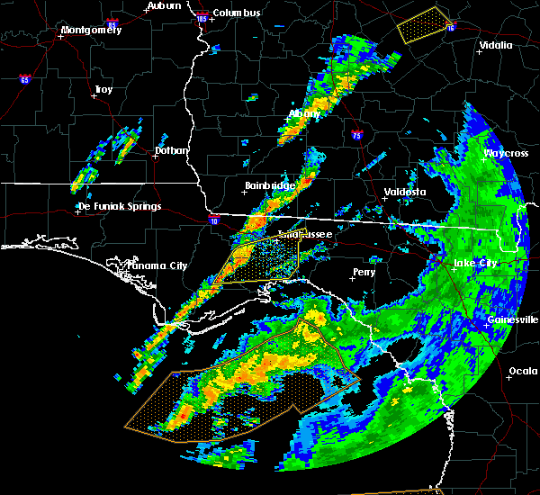 At 341 pm edt, severe thunderstorms were located along a line extending from 9 miles southwest of midway to 18 miles northwest of carrabelle, moving east at 30 mph (radar indicated). Hazards include 60 mph wind gusts. Expect damage to roofs, siding, and trees. locations impacted include, st. Marks, woodville, tallahassee, crawfordville, florida state university, florida a and m, tallahassee comm college, doak campbell stadium, wakulla, lake bradford, jewel fire tower, shadeville, leon sinks, gaither community center, wakulla springs, tallahassee memorial hosp, eight mile pond, poplar camp, tallahassee mall and bloxham. At 341 pm edt, severe thunderstorms were located along a line extending from 9 miles southwest of midway to 18 miles northwest of carrabelle, moving east at 30 mph (radar indicated). Hazards include 60 mph wind gusts. Expect damage to roofs, siding, and trees. locations impacted include, st. Marks, woodville, tallahassee, crawfordville, florida state university, florida a and m, tallahassee comm college, doak campbell stadium, wakulla, lake bradford, jewel fire tower, shadeville, leon sinks, gaither community center, wakulla springs, tallahassee memorial hosp, eight mile pond, poplar camp, tallahassee mall and bloxham.
|
| 5/24/2017 3:23 PM EDT |
 At 323 pm edt, severe thunderstorms were located along a line extending from 14 miles south of greensboro to 16 miles east of stonemill creek, moving northeast at 45 mph (radar indicated). Hazards include 60 mph wind gusts. expect damage to roofs, siding, and trees At 323 pm edt, severe thunderstorms were located along a line extending from 14 miles south of greensboro to 16 miles east of stonemill creek, moving northeast at 45 mph (radar indicated). Hazards include 60 mph wind gusts. expect damage to roofs, siding, and trees
|
| 5/12/2017 8:21 PM EDT |
 At 821 pm edt, a severe thunderstorm was located 7 miles east of florida a and m, or 7 miles southeast of tallahassee, moving east at 35 mph. this storm has a history of producing high winds across leon county (radar indicated). Hazards include 60 mph wind gusts. expect damage to roofs, siding, and trees At 821 pm edt, a severe thunderstorm was located 7 miles east of florida a and m, or 7 miles southeast of tallahassee, moving east at 35 mph. this storm has a history of producing high winds across leon county (radar indicated). Hazards include 60 mph wind gusts. expect damage to roofs, siding, and trees
|
| 5/12/2017 8:15 PM EDT | Report of tree down on s monroe st in leon county FL, 1.2 miles NE of Tallahassee, FL |
| 5/12/2017 8:12 PM EDT |
 At 811 pm edt, a severe thunderstorm was located 7 miles east of tallahassee, moving east at 45 mph. a wind gust of 59 mph was recorded at 806 pm edt at the nws tallahassee office (national weather service observations). Hazards include 60 mph wind gusts. Expect damage to roofs, siding, and trees. Locations impacted include, tallahassee, woodville, florida a and m, tallahassee comm college, florida state university, doak campbell stadium, lake bradford, ralford greenway, macon community park, gaither community center, lake munson, tallahassee memorial hosp, eight mile pond, killearn estates, chaires, lake ella, tallahassee mall, tallahassee regional a/p, state capital complex and governors square mall. At 811 pm edt, a severe thunderstorm was located 7 miles east of tallahassee, moving east at 45 mph. a wind gust of 59 mph was recorded at 806 pm edt at the nws tallahassee office (national weather service observations). Hazards include 60 mph wind gusts. Expect damage to roofs, siding, and trees. Locations impacted include, tallahassee, woodville, florida a and m, tallahassee comm college, florida state university, doak campbell stadium, lake bradford, ralford greenway, macon community park, gaither community center, lake munson, tallahassee memorial hosp, eight mile pond, killearn estates, chaires, lake ella, tallahassee mall, tallahassee regional a/p, state capital complex and governors square mall.
|
| 5/12/2017 8:07 PM EDT | Tree down near meridian road and ox bottom roa in leon county FL, 7 miles SSW of Tallahassee, FL |
| 5/12/2017 8:06 PM EDT | Wind gust of 59 mph recorded at fsu in leon county FL, 2.6 miles NE of Tallahassee, FL |
| 5/12/2017 8:02 PM EDT | Report of tree down on west tn street in leon county FL, 5.7 miles E of Tallahassee, FL |
| 5/12/2017 8:01 PM EDT |
 At 800 pm edt, a severe thunderstorm was located near tallahassee, moving east at 45 mph (radar indicated). Hazards include 60 mph wind gusts. Expect damage to roofs, siding, and trees. Locations impacted include, midway, tallahassee, woodville, florida state university, florida a and m, tallahassee comm college, doak campbell stadium, lake bradford, gaither community center, tallahassee memorial hosp, eight mile pond, tallahassee mall, tallahassee regional a/p, governors square mall, belair, levy park, indian head acres, andrew, chaires crossroads and baum. At 800 pm edt, a severe thunderstorm was located near tallahassee, moving east at 45 mph (radar indicated). Hazards include 60 mph wind gusts. Expect damage to roofs, siding, and trees. Locations impacted include, midway, tallahassee, woodville, florida state university, florida a and m, tallahassee comm college, doak campbell stadium, lake bradford, gaither community center, tallahassee memorial hosp, eight mile pond, tallahassee mall, tallahassee regional a/p, governors square mall, belair, levy park, indian head acres, andrew, chaires crossroads and baum.
|
| 5/12/2017 7:39 PM EDT |
 At 739 pm edt, a severe thunderstorm was located 7 miles west of midway, moving east at 45 mph (radar indicated). Hazards include 60 mph wind gusts. expect damage to roofs, siding, and trees At 739 pm edt, a severe thunderstorm was located 7 miles west of midway, moving east at 45 mph (radar indicated). Hazards include 60 mph wind gusts. expect damage to roofs, siding, and trees
|
| 5/4/2017 10:44 AM EDT |
 At 1044 am edt, a severe thunderstorm was located 10 miles east of tallahassee, moving northeast at 45 mph (radar indicated). Hazards include 60 mph wind gusts. expect damage to roofs, siding, and trees At 1044 am edt, a severe thunderstorm was located 10 miles east of tallahassee, moving northeast at 45 mph (radar indicated). Hazards include 60 mph wind gusts. expect damage to roofs, siding, and trees
|
| 5/4/2017 10:29 AM EDT |
 At 1029 am edt, a severe thunderstorm was located near florida a and m, or 7 miles northwest of woodville, moving northeast at 45 mph (radar indicated). Hazards include 60 mph wind gusts. expect damage to roofs, siding, and trees At 1029 am edt, a severe thunderstorm was located near florida a and m, or 7 miles northwest of woodville, moving northeast at 45 mph (radar indicated). Hazards include 60 mph wind gusts. expect damage to roofs, siding, and trees
|
| 4/3/2017 4:15 PM EDT | Quarter sized hail reported 8.3 miles WSW of Tallahassee, FL, spotter reports quarter sized hail on the east side of tallahassee |
| 4/3/2017 4:13 PM EDT |
 At 412 pm edt, a severe thunderstorm was located 10 miles northeast of tallahassee, moving northeast at 75 mph (radar indicated). Hazards include 60 mph wind gusts and quarter size hail. Hail damage to vehicles is expected. Expect wind damage to roofs, siding, and trees. At 412 pm edt, a severe thunderstorm was located 10 miles northeast of tallahassee, moving northeast at 75 mph (radar indicated). Hazards include 60 mph wind gusts and quarter size hail. Hail damage to vehicles is expected. Expect wind damage to roofs, siding, and trees.
|
| 4/3/2017 4:10 PM EDT | Tree down at 1925 benjamin chaires in leon county FL, 9.2 miles W of Tallahassee, FL |
| 4/3/2017 4:10 PM EDT | Two large trees down along cap tram road near apalachee pkwy in leon county FL, 11.4 miles WNW of Tallahassee, FL |
| 4/3/2017 4:09 PM EDT | Tree down at 6775 natchez ct in leon county FL, 6.9 miles WNW of Tallahassee, FL |
| 4/3/2017 4:09 PM EDT | Tree down at 3448 louvenia road in leon county FL, 8.2 miles WNW of Tallahassee, FL |
| 4/3/2017 4:09 PM EDT | Tree down on williams road near apalachee pkwy in leon county FL, 7.2 miles WNW of Tallahassee, FL |
| 4/3/2017 4:09 PM EDT | Multiple large trees down near apalachee regional park. the west-bound portion of apalachee parkway is partially blocked. trees also down on chaires cross road and ww k in leon county FL, 7.7 miles WNW of Tallahassee, FL |
| 4/3/2017 4:03 PM EDT | Tree down at meridian road and ox bottom in leon county FL, 6.2 miles S of Tallahassee, FL |
| 4/3/2017 4:03 PM EDT | Tree down at ox bottom and thomasville road in leon county FL, 5.8 miles SSW of Tallahassee, FL |
| 4/3/2017 4:03 PM EDT | Tree down at 3511 meridian in leon county FL, 3.5 miles SSE of Tallahassee, FL |
| 4/3/2017 3:55 PM EDT | Tree down on the csx railroad tracks at capital circle n in leon county FL, 7 miles SE of Tallahassee, FL |
| 4/3/2017 3:42 PM EDT |
 At 342 pm edt, a severe thunderstorm was located over midway, moving east at 45 mph (radar indicated). Hazards include 60 mph wind gusts and quarter size hail. Hail damage to vehicles is expected. Expect wind damage to roofs, siding, and trees. At 342 pm edt, a severe thunderstorm was located over midway, moving east at 45 mph (radar indicated). Hazards include 60 mph wind gusts and quarter size hail. Hail damage to vehicles is expected. Expect wind damage to roofs, siding, and trees.
|
| 2/7/2017 7:01 PM EST |
 At 700 pm est, a severe thunderstorm was located near woodville, moving east at 50 mph (radar indicated). Hazards include 60 mph wind gusts. Expect damage to roofs, siding, and trees. locations impacted include, monticello, woodville, crawfordville, tallahassee, st. Marks, doak campbell stadium, florida state university, tallahassee comm college, florida a and m, wakulla, sopchoppy, casa blanco, bethel, montivilla, waukeenah, state capital complex, lloyd, eight mile pond, tallahassee mall and newport. At 700 pm est, a severe thunderstorm was located near woodville, moving east at 50 mph (radar indicated). Hazards include 60 mph wind gusts. Expect damage to roofs, siding, and trees. locations impacted include, monticello, woodville, crawfordville, tallahassee, st. Marks, doak campbell stadium, florida state university, tallahassee comm college, florida a and m, wakulla, sopchoppy, casa blanco, bethel, montivilla, waukeenah, state capital complex, lloyd, eight mile pond, tallahassee mall and newport.
|
| 2/7/2017 7:00 PM EST | Tree reported down in intersection in leon county FL, 8.8 miles W of Tallahassee, FL |
| 2/7/2017 7:00 PM EST | Tree and powerline reported down in leon county FL, 3 miles NE of Tallahassee, FL |
| 2/7/2017 6:57 PM EST |
 At 656 pm est, a severe thunderstorm was located 13 miles south of cairo, moving east at 50 mph (radar indicated). Hazards include 60 mph wind gusts. Expect damage to roofs, siding, and trees. Locations impacted include, carrabelle, midway, tallahassee, tallahassee coml airport, buck siding, lake jackson, yent place, morgan place, brown house, concord, gibson, carrabelle beach, andrew, sanborn and orchard pond. At 656 pm est, a severe thunderstorm was located 13 miles south of cairo, moving east at 50 mph (radar indicated). Hazards include 60 mph wind gusts. Expect damage to roofs, siding, and trees. Locations impacted include, carrabelle, midway, tallahassee, tallahassee coml airport, buck siding, lake jackson, yent place, morgan place, brown house, concord, gibson, carrabelle beach, andrew, sanborn and orchard pond.
|
| 2/7/2017 6:43 PM EST |
 At 643 pm est/543 pm cst/, a severe thunderstorm was located near havana, moving east at 50 mph (radar indicated). Hazards include 70 mph wind gusts. Expect considerable tree damage. damage is likely to mobile homes, roofs, and outbuildings. Locations impacted include, carrabelle, midway, quincy, havana, tallahassee, jewel fire tower, quincy airport, lake talquin, jamieson, branchville, buck siding, lake jackson, east camp, concord, florence, howard creek, bloxham, andrew, orchard pond and santa clara. At 643 pm est/543 pm cst/, a severe thunderstorm was located near havana, moving east at 50 mph (radar indicated). Hazards include 70 mph wind gusts. Expect considerable tree damage. damage is likely to mobile homes, roofs, and outbuildings. Locations impacted include, carrabelle, midway, quincy, havana, tallahassee, jewel fire tower, quincy airport, lake talquin, jamieson, branchville, buck siding, lake jackson, east camp, concord, florence, howard creek, bloxham, andrew, orchard pond and santa clara.
|
| 2/7/2017 6:30 PM EST |
 At 629 pm est, a severe thunderstorm was located 15 miles southwest of midway, moving east at 50 mph (radar indicated). Hazards include 70 mph wind gusts. Expect considerable tree damage. Damage is likely to mobile homes, roofs, and outbuildings. At 629 pm est, a severe thunderstorm was located 15 miles southwest of midway, moving east at 50 mph (radar indicated). Hazards include 70 mph wind gusts. Expect considerable tree damage. Damage is likely to mobile homes, roofs, and outbuildings.
|
| 2/7/2017 6:08 PM EST |
 At 607 pm est/507 pm cst/, a severe thunderstorm was located 7 miles west of greensboro, or 15 miles northeast of blountstown, moving east at 50 mph (radar indicated). Hazards include 70 mph wind gusts. Expect considerable tree damage. Damage is likely to mobile homes, roofs, and outbuildings. At 607 pm est/507 pm cst/, a severe thunderstorm was located 7 miles west of greensboro, or 15 miles northeast of blountstown, moving east at 50 mph (radar indicated). Hazards include 70 mph wind gusts. Expect considerable tree damage. Damage is likely to mobile homes, roofs, and outbuildings.
|
| 1/22/2017 3:39 PM EST |
 At 339 pm est, a severe thunderstorm was located near tallahassee, moving northeast at 60 mph (public). Hazards include 60 mph wind gusts. Expect damage to roofs, siding, and trees. locations impacted include, monticello, tallahassee, fallschase, montivilla, moccasin gap, lake miccosukee, pisgah church, lloyd, ralford greenway, macon community park, beachton, chaires, jarrott, fincher, winthrop park, baum, maclay state gardens, chaires crossroads, killearn lakes and lake ella. A tornado watch remains in effect until 800 pm est for big bend of florida, and south central and southwestern georgia. At 339 pm est, a severe thunderstorm was located near tallahassee, moving northeast at 60 mph (public). Hazards include 60 mph wind gusts. Expect damage to roofs, siding, and trees. locations impacted include, monticello, tallahassee, fallschase, montivilla, moccasin gap, lake miccosukee, pisgah church, lloyd, ralford greenway, macon community park, beachton, chaires, jarrott, fincher, winthrop park, baum, maclay state gardens, chaires crossroads, killearn lakes and lake ella. A tornado watch remains in effect until 800 pm est for big bend of florida, and south central and southwestern georgia.
|
| 1/22/2017 3:35 PM EST | Trees down near polos on park in leon county FL, 0.8 miles NNW of Tallahassee, FL |
| 1/22/2017 3:28 PM EST | Trees down on capital circle ne in leon county FL, 2 miles SW of Tallahassee, FL |
| 1/22/2017 3:26 PM EST |
 At 326 pm est, a severe thunderstorm was located near florida a and m, or 7 miles southwest of tallahassee, moving northeast at 55 mph (radar indicated). Hazards include 60 mph wind gusts. expect damage to roofs, siding, and trees At 326 pm est, a severe thunderstorm was located near florida a and m, or 7 miles southwest of tallahassee, moving northeast at 55 mph (radar indicated). Hazards include 60 mph wind gusts. expect damage to roofs, siding, and trees
|
| 1/22/2017 3:10 PM EST |
 At 310 pm est, a severe thunderstorm was located 13 miles northwest of crawfordville, moving northeast at 70 mph (radar indicated). Hazards include 70 mph wind gusts. Expect considerable tree damage. Damage is likely to mobile homes, roofs, and outbuildings. At 310 pm est, a severe thunderstorm was located 13 miles northwest of crawfordville, moving northeast at 70 mph (radar indicated). Hazards include 70 mph wind gusts. Expect considerable tree damage. Damage is likely to mobile homes, roofs, and outbuildings.
|
| 1/22/2017 10:38 AM EST |
 At 1038 am est, a severe thunderstorm capable of producing a tornado was located near quincy, moving northeast at 65 mph (radar indicated rotation). Hazards include tornado. Flying debris will be dangerous to those caught without shelter. mobile homes will be damaged or destroyed. damage to roofs, windows, and vehicles will occur. tree damage is likely. this dangerous storm will be near, havana around 1050 am est. Other locations impacted by this tornadic thunderstorm include lake iamonia, iamonia, quincy airport, princes still, shady rest, moncrief, tallahassee coml airport, jamieson, branchville and littman. At 1038 am est, a severe thunderstorm capable of producing a tornado was located near quincy, moving northeast at 65 mph (radar indicated rotation). Hazards include tornado. Flying debris will be dangerous to those caught without shelter. mobile homes will be damaged or destroyed. damage to roofs, windows, and vehicles will occur. tree damage is likely. this dangerous storm will be near, havana around 1050 am est. Other locations impacted by this tornadic thunderstorm include lake iamonia, iamonia, quincy airport, princes still, shady rest, moncrief, tallahassee coml airport, jamieson, branchville and littman.
|
| 1/22/2017 9:02 AM EST |
 At 900 am est, a severe thunderstorm capable of producing a tornado was located 9 miles north of tallahassee, moving east at 55 mph (radar indicated rotation). Hazards include tornado and quarter size hail. Flying debris will be dangerous to those caught without shelter. mobile homes will be damaged or destroyed. damage to roofs, windows, and vehicles will occur. tree damage is likely. Locations impacted include, tallahassee, lake iamonia, iamonia, forest meadows park, tallahassee coml airport, moncrief, moccasin gap, pisgah church, lake jackson, bradfordville, orchard pond, killearn lakes and miccosukee. At 900 am est, a severe thunderstorm capable of producing a tornado was located 9 miles north of tallahassee, moving east at 55 mph (radar indicated rotation). Hazards include tornado and quarter size hail. Flying debris will be dangerous to those caught without shelter. mobile homes will be damaged or destroyed. damage to roofs, windows, and vehicles will occur. tree damage is likely. Locations impacted include, tallahassee, lake iamonia, iamonia, forest meadows park, tallahassee coml airport, moncrief, moccasin gap, pisgah church, lake jackson, bradfordville, orchard pond, killearn lakes and miccosukee.
|
| 1/22/2017 9:00 AM EST | Several large trees down near killearn lakes and deerlake in leon county FL, 8.6 miles SSW of Tallahassee, FL |
| 1/22/2017 9:00 AM EST | Trees down in leon county FL, 7.5 miles S of Tallahassee, FL |
| 1/22/2017 8:44 AM EST |
 At 843 am est, a severe thunderstorm capable of producing a tornado was located near havana, moving east at 55 mph (radar indicated rotation). Hazards include tornado. Flying debris will be dangerous to those caught without shelter. mobile homes will be damaged or destroyed. damage to roofs, windows, and vehicles will occur. tree damage is likely. This tornadic thunderstorm will remain over mainly rural areas of northeastern gadsden, northeastern leon, southwestern thomas and southeastern grady counties, including the following locations: lake iamonia, iamonia, forest meadows park, shady rest, moncrief, tallahassee coml airport, moccasin gap, pisgah church, lake jackson and littman. At 843 am est, a severe thunderstorm capable of producing a tornado was located near havana, moving east at 55 mph (radar indicated rotation). Hazards include tornado. Flying debris will be dangerous to those caught without shelter. mobile homes will be damaged or destroyed. damage to roofs, windows, and vehicles will occur. tree damage is likely. This tornadic thunderstorm will remain over mainly rural areas of northeastern gadsden, northeastern leon, southwestern thomas and southeastern grady counties, including the following locations: lake iamonia, iamonia, forest meadows park, shady rest, moncrief, tallahassee coml airport, moccasin gap, pisgah church, lake jackson and littman.
|
| 1/22/2017 8:37 AM EST |
 At 837 am est, a severe thunderstorm was located near quincy, moving northeast at 55 mph (radar indicated). Hazards include 60 mph wind gusts and nickel size hail. expect damage to roofs, siding, and trees At 837 am est, a severe thunderstorm was located near quincy, moving northeast at 55 mph (radar indicated). Hazards include 60 mph wind gusts and nickel size hail. expect damage to roofs, siding, and trees
|
| 1/22/2017 7:09 AM EST |
 At 708 am est, a severe thunderstorm was located near midway, moving northeast at 55 mph (radar indicated). Hazards include 60 mph wind gusts and quarter size hail. Hail damage to vehicles is expected. Expect wind damage to roofs, siding, and trees. At 708 am est, a severe thunderstorm was located near midway, moving northeast at 55 mph (radar indicated). Hazards include 60 mph wind gusts and quarter size hail. Hail damage to vehicles is expected. Expect wind damage to roofs, siding, and trees.
|
| 1/22/2017 6:51 AM EST |
 At 651 am est/551 am cst/, a severe thunderstorm was located near midway, moving northeast at 60 mph (radar indicated). Hazards include 60 mph wind gusts and nickel size hail. Expect damage to roofs, siding, and trees. locations impacted include, havana, midway, tallahassee, quincy, blountstown, greensboro, tallahassee comm college, gretna, bristol, quincy airport, forest meadows park, branchville, tallahassee mall, juniper, clio, bloxham, calvary, santa clara, hosford and killearn estates. A tornado watch remains in effect until 1000 am est/900 am cst/ for big bend of florida, and southwestern georgia. At 651 am est/551 am cst/, a severe thunderstorm was located near midway, moving northeast at 60 mph (radar indicated). Hazards include 60 mph wind gusts and nickel size hail. Expect damage to roofs, siding, and trees. locations impacted include, havana, midway, tallahassee, quincy, blountstown, greensboro, tallahassee comm college, gretna, bristol, quincy airport, forest meadows park, branchville, tallahassee mall, juniper, clio, bloxham, calvary, santa clara, hosford and killearn estates. A tornado watch remains in effect until 1000 am est/900 am cst/ for big bend of florida, and southwestern georgia.
|
| 1/22/2017 6:33 AM EST |
 At 633 am est/533 am cst/, a severe thunderstorm was located 13 miles south of greensboro, or 15 miles east of blountstown, moving northeast at 60 mph (radar indicated). Hazards include 60 mph wind gusts and penny size hail. expect damage to roofs, siding, and trees At 633 am est/533 am cst/, a severe thunderstorm was located 13 miles south of greensboro, or 15 miles east of blountstown, moving northeast at 60 mph (radar indicated). Hazards include 60 mph wind gusts and penny size hail. expect damage to roofs, siding, and trees
|
| 8/14/2016 3:55 PM EDT | Tree down in eastbound lane of us 9 in leon county FL, 12.3 miles WSW of Tallahassee, FL |
| 8/14/2016 3:18 PM EDT |
 At 318 pm edt, a severe thunderstorm was located 17 miles east of woodville, moving northwest at 15 mph (radar indicated). Hazards include 60 mph wind gusts and nickel size hail. Expect damage to roofs. siding. And trees. At 318 pm edt, a severe thunderstorm was located 17 miles east of woodville, moving northwest at 15 mph (radar indicated). Hazards include 60 mph wind gusts and nickel size hail. Expect damage to roofs. siding. And trees.
|
| 7/18/2016 1:05 PM EDT | 3 trees down on miller landing road in leon county FL, 5.8 miles SSE of Tallahassee, FL |
| 7/15/2016 2:50 PM EDT |
 At 249 pm edt, the national weather service has detected a severe thunderstorm capable of producing damaging winds in excess of 60 mph. this storm was located near midway. this storm was nearly stationary. At 249 pm edt, the national weather service has detected a severe thunderstorm capable of producing damaging winds in excess of 60 mph. this storm was located near midway. this storm was nearly stationary.
|
| 7/14/2016 6:53 PM EDT |
 At 653 pm edt, a severe thunderstorm was located near florida a and m, or 9 miles southwest of tallahassee, and is nearly stationary (radar indicated). Hazards include 60 mph wind gusts. Expect damage to roofs. siding. And trees. At 653 pm edt, a severe thunderstorm was located near florida a and m, or 9 miles southwest of tallahassee, and is nearly stationary (radar indicated). Hazards include 60 mph wind gusts. Expect damage to roofs. siding. And trees.
|
| 6/16/2016 3:45 PM EDT | Tree down on miccosukee road near edenfield roa in leon county FL, 4.1 miles WSW of Tallahassee, FL |
| 6/16/2016 3:45 PM EDT | Powerline down near miccosukee rd and thornton rd. time estimated by rada in leon county FL, 5.4 miles WSW of Tallahassee, FL |
| 6/16/2016 3:24 PM EDT |
 At 323 pm edt, a severe thunderstorm was located 10 miles east of tallahassee, moving east at 25 mph (radar indicated). Hazards include 60 mph wind gusts. Expect damage to roofs. siding. And trees. At 323 pm edt, a severe thunderstorm was located 10 miles east of tallahassee, moving east at 25 mph (radar indicated). Hazards include 60 mph wind gusts. Expect damage to roofs. siding. And trees.
|
| 5/20/2016 8:20 AM EDT | A tree blew down across old bainbridge road near swatts road and blocked the roa in leon county FL, 4.4 miles ESE of Tallahassee, FL |
| 5/20/2016 8:18 AM EDT | A severe thunderstorm warning remains in effect until 845 am edt for wakulla. franklin. leon. southern grady and southwestern thomas counties. at 817 am edt. severe thunderstorms were located along a line extending from cairo to 15 miles southeast of carrabelle. Moving east at 35 mph. |
| 5/20/2016 8:18 AM EDT | A severe thunderstorm warning remains in effect until 845 am edt for wakulla. franklin. leon. southern grady and southwestern thomas counties. at 817 am edt. severe thunderstorms were located along a line extending from cairo to 15 miles southeast of carrabelle. Moving east at 35 mph. |
| 5/3/2016 7:12 PM EDT | The severe thunderstorm warning for southeastern gadsden. northeastern leon and south central grady counties will expire at 715 pm edt. the storm which prompted the warning has weakened below severe limits. and no longer pose an immediate threat to life or property. Therefore the warning will be allowed to expire. |
| 5/3/2016 7:12 PM EDT | The severe thunderstorm warning for southeastern gadsden. northeastern leon and south central grady counties will expire at 715 pm edt. the storm which prompted the warning has weakened below severe limits. and no longer pose an immediate threat to life or property. Therefore the warning will be allowed to expire. |
| 5/3/2016 7:10 PM EDT | Quarter sized hail reported 4.8 miles S of Tallahassee, FL, public reports hail of at least quarter sized |
| 5/3/2016 6:45 PM EDT |
 At 645 pm edt, a severe thunderstorm was located near midway, moving east at 40 mph (radar indicated). Hazards include 60 mph wind gusts and quarter size hail. Hail damage to vehicles is expected. Expect wind damage to roofs, siding, and trees. At 645 pm edt, a severe thunderstorm was located near midway, moving east at 40 mph (radar indicated). Hazards include 60 mph wind gusts and quarter size hail. Hail damage to vehicles is expected. Expect wind damage to roofs, siding, and trees.
|
| 5/3/2016 4:21 PM EDT |
 At 421 pm edt, a severe thunderstorm was located 10 miles northeast of tallahassee, moving east at 25 mph (radar indicated). Hazards include 60 mph wind gusts and quarter size hail. Hail damage to vehicles is expected. Expect wind damage to roofs, siding, and trees. At 421 pm edt, a severe thunderstorm was located 10 miles northeast of tallahassee, moving east at 25 mph (radar indicated). Hazards include 60 mph wind gusts and quarter size hail. Hail damage to vehicles is expected. Expect wind damage to roofs, siding, and trees.
|
| 3/24/2016 7:53 PM EDT |
 At 753 pm edt, a severe thunderstorm was located near woodville, moving east at 40 mph (radar indicated). Hazards include 60 mph wind gusts. Expect damage to roofs. siding. And trees. At 753 pm edt, a severe thunderstorm was located near woodville, moving east at 40 mph (radar indicated). Hazards include 60 mph wind gusts. Expect damage to roofs. siding. And trees.
|
| 3/24/2016 7:30 PM EDT | Emergency manager reported trees down across the county. one tree is down at birschbach way near deerlake w. another tree was reported down on power lines at thomasvill in leon county FL, 1.7 miles NNE of Tallahassee, FL |
| 3/18/2016 1:56 AM EDT |
 At 156 am edt, a severe thunderstorm was located near midway, moving east at 45 mph (radar indicated). Hazards include 60 mph wind gusts. Expect damage to roofs. siding. and trees. Locations impacted include, midway, tallahassee, quincy, florida a and m, doak campbell stadium, florida state university, tallahassee comm college, innovation park, lake talquin, state capital complex, tallahassee mall, lake jackson, macon community park, leon county civic center, mission san luis, winthrop park, lake bradford, andrew, maclay state gardens and lake ella. At 156 am edt, a severe thunderstorm was located near midway, moving east at 45 mph (radar indicated). Hazards include 60 mph wind gusts. Expect damage to roofs. siding. and trees. Locations impacted include, midway, tallahassee, quincy, florida a and m, doak campbell stadium, florida state university, tallahassee comm college, innovation park, lake talquin, state capital complex, tallahassee mall, lake jackson, macon community park, leon county civic center, mission san luis, winthrop park, lake bradford, andrew, maclay state gardens and lake ella.
|
| 3/18/2016 1:50 AM EDT | Tree down on smith creek road south of bloxham in leon county FL, 23.1 miles ENE of Tallahassee, FL |
| 3/18/2016 1:43 AM EDT |
 At 143 am edt, a severe thunderstorm was located near quincy, moving east at 45 mph (radar indicated). Hazards include 60 mph wind gusts. Expect damage to roofs. siding. and trees. Locations impacted include, midway, tallahassee, quincy, florida a and m, doak campbell stadium, florida state university, tallahassee comm college, innovation park, lake talquin, state capital complex, tallahassee mall, lake jackson, macon community park, leon county civic center, bloxham, mission san luis, winthrop park, lake bradford, andrew and maclay state gardens. At 143 am edt, a severe thunderstorm was located near quincy, moving east at 45 mph (radar indicated). Hazards include 60 mph wind gusts. Expect damage to roofs. siding. and trees. Locations impacted include, midway, tallahassee, quincy, florida a and m, doak campbell stadium, florida state university, tallahassee comm college, innovation park, lake talquin, state capital complex, tallahassee mall, lake jackson, macon community park, leon county civic center, bloxham, mission san luis, winthrop park, lake bradford, andrew and maclay state gardens.
|
| 3/18/2016 1:26 AM EDT |
 At 125 am edt, a severe thunderstorm was located near greensboro, or 13 miles west of quincy, moving east at 45 mph (radar indicated). Hazards include 60 mph wind gusts. Expect damage to roofs. siding. And trees. At 125 am edt, a severe thunderstorm was located near greensboro, or 13 miles west of quincy, moving east at 45 mph (radar indicated). Hazards include 60 mph wind gusts. Expect damage to roofs. siding. And trees.
|
| 3/17/2016 12:34 PM EDT | Powerlines down at capital circle sw and springhill in leon county FL, 5.9 miles NE of Tallahassee, FL |
| 3/17/2016 12:25 PM EDT |
 At 1224 pm edt, a severe thunderstorm was located near woodville, moving southeast at 50 mph (radar indicated). Hazards include 60 mph wind gusts. Expect damage to roofs. siding. and trees. locations impacted include, tallahassee, woodville, st. Marks, florida a and m, doak campbell stadium, florida state university, tallahassee comm college, wakulla, innovation park, natural bridge, fallschase, bethel, state capital complex, eight mile pond, belair, tallahassee mall, ralford greenway, macon community park, leon county civic center and hilliardville. At 1224 pm edt, a severe thunderstorm was located near woodville, moving southeast at 50 mph (radar indicated). Hazards include 60 mph wind gusts. Expect damage to roofs. siding. and trees. locations impacted include, tallahassee, woodville, st. Marks, florida a and m, doak campbell stadium, florida state university, tallahassee comm college, wakulla, innovation park, natural bridge, fallschase, bethel, state capital complex, eight mile pond, belair, tallahassee mall, ralford greenway, macon community park, leon county civic center and hilliardville.
|
| 3/17/2016 12:11 PM EDT |
 At 1211 pm edt, a severe thunderstorm was located near tallahassee comm college, or 8 miles southwest of tallahassee, moving southeast at 50 mph (radar indicated). Hazards include 60 mph wind gusts. Expect damage to roofs. siding. And trees. At 1211 pm edt, a severe thunderstorm was located near tallahassee comm college, or 8 miles southwest of tallahassee, moving southeast at 50 mph (radar indicated). Hazards include 60 mph wind gusts. Expect damage to roofs. siding. And trees.
|
| 3/3/2016 11:02 PM EST |
 At 1101 pm est, severe thunderstorms were located along a line extending from 11 miles northeast of monticello to 7 miles west of woodville, moving east at 50 mph. some reports of trees down have been received from leon county (radar indicated). Hazards include 60 mph wind gusts. Expect damage to roofs. siding. And trees. At 1101 pm est, severe thunderstorms were located along a line extending from 11 miles northeast of monticello to 7 miles west of woodville, moving east at 50 mph. some reports of trees down have been received from leon county (radar indicated). Hazards include 60 mph wind gusts. Expect damage to roofs. siding. And trees.
|
| 3/3/2016 10:46 PM EST | Tree down on power line causing fire at thorton road and mahan dr in leon county FL, 7.7 miles WSW of Tallahassee, FL |
| 3/3/2016 10:45 PM EST | Tree down on miccosukee road at edenfield road in leon county FL, 4.9 miles WSW of Tallahassee, FL |
| 3/3/2016 10:38 PM EST | One tree down at fermanagh drive and waterford driv in leon county FL, 5.2 miles SW of Tallahassee, FL |
| 3/3/2016 10:35 PM EST |
 At 1035 pm est/935 pm cst/, severe thunderstorms were located along a line extending from near thomasville to 9 miles southeast of blountstown, moving east at 60 mph (radar indicated). Hazards include 60 mph wind gusts. Expect damage to roofs. siding. and trees. Locations impacted include, thomasville, midway, quincy, havana, tallahassee, cairo, greensboro, bristol, quincy airport, lake talquin, forest meadows park, jamieson, branchville, moccasin gap, pisgah church, pine park, lake jackson, juniper, macon community park and beachton. At 1035 pm est/935 pm cst/, severe thunderstorms were located along a line extending from near thomasville to 9 miles southeast of blountstown, moving east at 60 mph (radar indicated). Hazards include 60 mph wind gusts. Expect damage to roofs. siding. and trees. Locations impacted include, thomasville, midway, quincy, havana, tallahassee, cairo, greensboro, bristol, quincy airport, lake talquin, forest meadows park, jamieson, branchville, moccasin gap, pisgah church, pine park, lake jackson, juniper, macon community park and beachton.
|
| 3/3/2016 10:27 PM EST |
 At 1027 pm est/927 pm cst/, severe thunderstorms were located along a line extending from near thomasville to 7 miles east of blountstown, moving east at 70 mph (radar indicated). Hazards include 60 mph wind gusts. Expect damage to roofs. siding. and trees. Locations impacted include, blountstown, thomasville, havana, cairo, midway, quincy, tallahassee, greensboro, gretna, bristol, attapulgus, red oak, quincy airport, forest meadows park, rock bluff, nettle ridge, branchville, blountstown airport, pine park and amsterdam. At 1027 pm est/927 pm cst/, severe thunderstorms were located along a line extending from near thomasville to 7 miles east of blountstown, moving east at 70 mph (radar indicated). Hazards include 60 mph wind gusts. Expect damage to roofs. siding. and trees. Locations impacted include, blountstown, thomasville, havana, cairo, midway, quincy, tallahassee, greensboro, gretna, bristol, attapulgus, red oak, quincy airport, forest meadows park, rock bluff, nettle ridge, branchville, blountstown airport, pine park and amsterdam.
|
| 3/3/2016 10:08 PM EST |
 At 1007 pm est/907 pm cst/, severe thunderstorms were located along a line extending from near whigham to 14 miles west of blountstown, moving east at 70 mph (radar indicated). Hazards include 60 mph wind gusts. Expect damage to roofs. siding. And trees. At 1007 pm est/907 pm cst/, severe thunderstorms were located along a line extending from near whigham to 14 miles west of blountstown, moving east at 70 mph (radar indicated). Hazards include 60 mph wind gusts. Expect damage to roofs. siding. And trees.
|
| 2/24/2016 3:55 AM EST |
 At 354 am est, severe thunderstorms were located along a line extending from 10 miles northwest of monticello to 10 miles southwest of st. marks, moving east at 40 mph (radar indicated). Hazards include 60 mph wind gusts. Expect damage to roofs. Siding and trees. At 354 am est, severe thunderstorms were located along a line extending from 10 miles northwest of monticello to 10 miles southwest of st. marks, moving east at 40 mph (radar indicated). Hazards include 60 mph wind gusts. Expect damage to roofs. Siding and trees.
|
| 2/24/2016 3:16 AM EST | Powerline down east of veterans memorial r in leon county FL, 16.1 miles SW of Tallahassee, FL |
| 2/24/2016 3:10 AM EST | Tree down at doomar dr and miccosukee rd in leon county FL, 2.1 miles W of Tallahassee, FL |
| 2/24/2016 3:07 AM EST | Tree down on powerline at mabry st and bell vue wa in leon county FL, 3.9 miles ENE of Tallahassee, FL |
| 2/24/2016 3:05 AM EST |
 At 305 am est, severe thunderstorms were located along a line extending from near havana to 9 miles northwest of carrabelle, moving east at 50 mph (radar indicated). Hazards include 60 mph wind gusts. Expect damage to roofs. Siding and trees. At 305 am est, severe thunderstorms were located along a line extending from near havana to 9 miles northwest of carrabelle, moving east at 50 mph (radar indicated). Hazards include 60 mph wind gusts. Expect damage to roofs. Siding and trees.
|
| 2/15/2016 11:23 PM EST |
 At 1123 pm est, severe thunderstorms were located along a line extending from 6 miles east of tallahassee to 10 miles south of st. marks, moving east at 35 mph (radar indicated). Hazards include 60 mph wind gusts. Expect damage to roofs. Siding and trees. At 1123 pm est, severe thunderstorms were located along a line extending from 6 miles east of tallahassee to 10 miles south of st. marks, moving east at 35 mph (radar indicated). Hazards include 60 mph wind gusts. Expect damage to roofs. Siding and trees.
|
| 2/15/2016 11:06 PM EST |
 At 1106 pm est, severe thunderstorms were located along a line extending from near tallahassee to 16 miles east of st george island, moving east at 40 mph (radar indicated). Hazards include 60 mph wind gusts and penny size hail. Expect damage to roofs. siding and trees. locations impacted include, monticello, st. marks, woodville, crawfordville, tallahassee, doak campbell stadium, florida state university, tallahassee comm college, florida a and m, wakulla, sopchoppy, hyde park, capps, panacea, forest meadows park, casa blanco, fallschase, bethel, montivilla and panacea-wakulla airport. A tornado watch remains in effect until 100 am est for north florida. At 1106 pm est, severe thunderstorms were located along a line extending from near tallahassee to 16 miles east of st george island, moving east at 40 mph (radar indicated). Hazards include 60 mph wind gusts and penny size hail. Expect damage to roofs. siding and trees. locations impacted include, monticello, st. marks, woodville, crawfordville, tallahassee, doak campbell stadium, florida state university, tallahassee comm college, florida a and m, wakulla, sopchoppy, hyde park, capps, panacea, forest meadows park, casa blanco, fallschase, bethel, montivilla and panacea-wakulla airport. A tornado watch remains in effect until 100 am est for north florida.
|
| 2/15/2016 10:45 PM EST |
 At 1044 pm est, severe thunderstorms were located along a line extending from near quincy to near st george island, moving east at 40 mph (radar indicated). Hazards include 60 mph wind gusts and penny size hail. Expect damage to roofs. Siding and trees. At 1044 pm est, severe thunderstorms were located along a line extending from near quincy to near st george island, moving east at 40 mph (radar indicated). Hazards include 60 mph wind gusts and penny size hail. Expect damage to roofs. Siding and trees.
|
| 1/22/2016 6:42 AM EST | At 642 am est, a severe thunderstorm was located near tallahassee, moving northeast at 45 mph (radar indicated). Hazards include 60 mph wind gusts. Expect damage to roofs. Siding and trees. |
| 8/25/2015 4:27 PM EDT |
 At 427 pm edt, the national weather service has detected a severe thunderstorm capable of producing quarter size hail and damaging winds of 60 mph. this storm was located near woodville. this storm was nearly stationary. At 427 pm edt, the national weather service has detected a severe thunderstorm capable of producing quarter size hail and damaging winds of 60 mph. this storm was located near woodville. this storm was nearly stationary.
|
| 8/14/2015 4:15 PM EDT | Tree down on power line near the intersection of woodward and brevard street in leon county FL, 2.2 miles ENE of Tallahassee, FL |
| 8/14/2015 4:15 PM EDT | Power line also down near blairstone and apalachee. reported by retired usaf meteorologist. also 6 inches of water on the roa in leon county FL, 3 miles NNW of Tallahassee, FL |
| 8/14/2015 4:15 PM EDT | Picture submitted on social media of a tree down on a power line along redbud ave in leon county FL, 2.2 miles ESE of Tallahassee, FL |
| 8/14/2015 4:14 PM EDT |
 At 414 pm edt, the national weather service has detected a severe thunderstorm capable of producing damaging winds in excess of 60 mph. this storm was located near tallahassee, and moving southwest at 20 mph. At 414 pm edt, the national weather service has detected a severe thunderstorm capable of producing damaging winds in excess of 60 mph. this storm was located near tallahassee, and moving southwest at 20 mph.
|
| 8/11/2015 7:20 PM EDT |
 The severe thunderstorm warning for west central jefferson and southeastern leon counties will expire at 730 pm edt, the storm which prompted the warning has weakened below severe limits, and no longer poses an immediate threat to life or property. therefore the warning will be allowed to expire. to report severe weather, contact your nearest law enforcement agency. they will relay your report to the national weather service tallahassee. The severe thunderstorm warning for west central jefferson and southeastern leon counties will expire at 730 pm edt, the storm which prompted the warning has weakened below severe limits, and no longer poses an immediate threat to life or property. therefore the warning will be allowed to expire. to report severe weather, contact your nearest law enforcement agency. they will relay your report to the national weather service tallahassee.
|
| 8/11/2015 7:07 PM EDT | Tree blown down along the side of tram road near the intersection with capital circle not impacting the road in leon county FL, 5.9 miles NNW of Tallahassee, FL |
| 8/11/2015 7:06 PM EDT |
 At 706 pm edt, the national weather service has detected a severe thunderstorm capable of producing damaging winds in excess of 60 mph. this storm was located 7 miles northeast of woodville, and moving east at 30 mph. At 706 pm edt, the national weather service has detected a severe thunderstorm capable of producing damaging winds in excess of 60 mph. this storm was located 7 miles northeast of woodville, and moving east at 30 mph.
|
| 8/7/2015 7:00 PM EDT | Large tree down near natural bridge road and old plank road in leon county FL, 13.6 miles NNW of Tallahassee, FL |
| 8/7/2015 6:45 PM EDT |
 At 645 pm edt, doppler radar indicated a severe thunderstorm capable of producing damaging winds in excess of 60 mph. this storm was located near crawfordville. this storm was nearly stationary. locations impacted include, carrabelle, st. marks, woodville, crawfordville, tallahassee, wakulla, sopchoppy, jewel fire tower, hyde park, panacea, fallschase, bethel, panacea-wakulla airport, curtis mill, state capital complex, eight mile pond, belair, chaires, clio and newport. At 645 pm edt, doppler radar indicated a severe thunderstorm capable of producing damaging winds in excess of 60 mph. this storm was located near crawfordville. this storm was nearly stationary. locations impacted include, carrabelle, st. marks, woodville, crawfordville, tallahassee, wakulla, sopchoppy, jewel fire tower, hyde park, panacea, fallschase, bethel, panacea-wakulla airport, curtis mill, state capital complex, eight mile pond, belair, chaires, clio and newport.
|
| 8/7/2015 6:38 PM EDT |
 At 638 pm edt, doppler radar indicated a severe thunderstorm capable of producing damaging winds in excess of 60 mph. this storm was located 11 miles northwest of crawfordville, and moving southeast at 40 mph. At 638 pm edt, doppler radar indicated a severe thunderstorm capable of producing damaging winds in excess of 60 mph. this storm was located 11 miles northwest of crawfordville, and moving southeast at 40 mph.
|
| 8/7/2015 6:28 PM EDT |
 At 628 pm edt, doppler radar indicated a severe thunderstorm capable of producing damaging winds in excess of 60 mph. this storm was located 11 miles northwest of crawfordville, moving southeast at 25 mph. locations impacted include, woodville, midway, crawfordville, tallahassee, wakulla, innovation park, lake talquin, bethel, eight mile pond, hilliardville, bloxham, lake bradford, andrew, lutterloh, lake munson, arran, smith creek, leon sinks, helen and springsax park. At 628 pm edt, doppler radar indicated a severe thunderstorm capable of producing damaging winds in excess of 60 mph. this storm was located 11 miles northwest of crawfordville, moving southeast at 25 mph. locations impacted include, woodville, midway, crawfordville, tallahassee, wakulla, innovation park, lake talquin, bethel, eight mile pond, hilliardville, bloxham, lake bradford, andrew, lutterloh, lake munson, arran, smith creek, leon sinks, helen and springsax park.
|
| 8/7/2015 6:13 PM EDT | The severe thunderstorm warning for southeastern leon and west central jefferson counties will expire at 615 pm edt. the storm which prompted the warning has moved out of the area. Therefore the warning will be allowed to expire. |
| 8/7/2015 5:58 PM EDT |
 At 558 pm edt, doppler radar indicated a severe thunderstorm capable of producing damaging winds in excess of 60 mph. this storm was located 11 miles southeast of tallahassee, moving southeast at 25 mph. locations impacted include, chaires crossroads. At 558 pm edt, doppler radar indicated a severe thunderstorm capable of producing damaging winds in excess of 60 mph. this storm was located 11 miles southeast of tallahassee, moving southeast at 25 mph. locations impacted include, chaires crossroads.
|
| 8/7/2015 5:58 PM EDT |
 At 557 pm edt, the national weather service has detected a severe thunderstorm capable of producing damaging winds in excess of 60 mph. this storm was located 8 miles west of midway, and moving southeast at 25 mph. At 557 pm edt, the national weather service has detected a severe thunderstorm capable of producing damaging winds in excess of 60 mph. this storm was located 8 miles west of midway, and moving southeast at 25 mph.
|
| 8/7/2015 5:46 PM EDT |
 At 545 pm edt, doppler radar indicated a severe thunderstorm capable of producing damaging winds in excess of 60 mph. this storm was located 7 miles east of tallahassee, moving southeast at 25 mph. locations impacted include, tallahassee and baum. At 545 pm edt, doppler radar indicated a severe thunderstorm capable of producing damaging winds in excess of 60 mph. this storm was located 7 miles east of tallahassee, moving southeast at 25 mph. locations impacted include, tallahassee and baum.
|
| 8/7/2015 5:44 PM EDT |
 At 544 pm edt, the national weather service has detected a severe thunderstorm capable of producing damaging winds in excess of 60 mph. this storm was located near tallahassee, and moving southeast at 25 mph. At 544 pm edt, the national weather service has detected a severe thunderstorm capable of producing damaging winds in excess of 60 mph. this storm was located near tallahassee, and moving southeast at 25 mph.
|
| 8/7/2015 5:42 PM EDT |
 At 542 pm edt, the national weather service has detected a severe thunderstorm capable of producing damaging winds in excess of 60 mph. this storm was located near tallahassee, and moving southeast at 25 mph. At 542 pm edt, the national weather service has detected a severe thunderstorm capable of producing damaging winds in excess of 60 mph. this storm was located near tallahassee, and moving southeast at 25 mph.
|
| 8/7/2015 5:35 PM EDT |
 At 535 pm edt, the national weather service has detected a severe thunderstorm capable of producing damaging winds in excess of 60 mph. this storm was located near quincy, and moving southeast at 30 mph. At 535 pm edt, the national weather service has detected a severe thunderstorm capable of producing damaging winds in excess of 60 mph. this storm was located near quincy, and moving southeast at 30 mph.
|
| 7/24/2015 7:02 PM EDT | Tree down on tram roa in leon county FL, 9.3 miles NW of Tallahassee, FL |
| 7/24/2015 6:55 PM EDT |
 At 655 pm edt, the national weather service has detected a severe thunderstorm capable of producing damaging winds of 60 mph. this storm was located near woodville, and moving southeast at 30 mph. At 655 pm edt, the national weather service has detected a severe thunderstorm capable of producing damaging winds of 60 mph. this storm was located near woodville, and moving southeast at 30 mph.
|
| 7/24/2015 6:50 PM EDT | Large tree snapped in emerald woods subdivisio in leon county FL, 9.2 miles SW of Tallahassee, FL |
| 7/24/2015 6:43 PM EDT | Powerlines down at capital circle ne and miccosukee in leon county FL, 2 miles SW of Tallahassee, FL |
| 7/24/2015 6:43 PM EDT | Fhp reports tree in the road at us 319 and cr 1 in leon county FL, 15.7 miles SSW of Tallahassee, FL |
| 7/24/2015 6:41 PM EDT |
 At 639 pm edt, the national weather service continued to track a severe thunderstorm producing damaging winds near 60 mph. this storm was located 10 miles northeast of havana, and moving south at 20 mph. there have been several reports of trees down with this storm. At 639 pm edt, the national weather service continued to track a severe thunderstorm producing damaging winds near 60 mph. this storm was located 10 miles northeast of havana, and moving south at 20 mph. there have been several reports of trees down with this storm.
|
| 7/24/2015 6:37 PM EDT |
 At 635 pm edt, the public reported a severe thunderstorm producing damaging winds of 60 mph. this storm was located 7 miles northeast of tallahassee, moving southeast at 45 mph. several trees have been blown down with this storm. locations impacted include, havana, tallahassee, woodville, , chaires, calvary, lake bradford, chaires crossroads, miccosukee. At 635 pm edt, the public reported a severe thunderstorm producing damaging winds of 60 mph. this storm was located 7 miles northeast of tallahassee, moving southeast at 45 mph. several trees have been blown down with this storm. locations impacted include, havana, tallahassee, woodville, , chaires, calvary, lake bradford, chaires crossroads, miccosukee.
|
| 7/24/2015 6:21 PM EDT |
 At 620 pm edt, the national weather service has detected a severe thunderstorm capable of producing damaging winds in excess of 60 mph. this storm was located 10 miles south of whigham, or 10 miles northeast of havana, and moving southeast at 45 mph. At 620 pm edt, the national weather service has detected a severe thunderstorm capable of producing damaging winds in excess of 60 mph. this storm was located 10 miles south of whigham, or 10 miles northeast of havana, and moving southeast at 45 mph.
|
| 7/24/2015 6:02 PM EDT |
 At 601 pm edt, the national weather service has detected a line of severe thunderstorms capable of producing damaging winds of 60 mph. these storms were located along a line extending from near whigham to bainbridge, and moving southeast at 45 mph. At 601 pm edt, the national weather service has detected a line of severe thunderstorms capable of producing damaging winds of 60 mph. these storms were located along a line extending from near whigham to bainbridge, and moving southeast at 45 mph.
|
| 7/23/2015 3:55 PM EDT | Large tree down on powerline in killearn acre in leon county FL, 6.7 miles SW of Tallahassee, FL |
| 7/23/2015 3:54 PM EDT |
 At 353 pm edt, damaging winds in excess of 60 mph. this storm was located over tallahassee, moving northeast at 30 mph. locations impacted include, tallahassee, killearn estates, lake iamonia, bradfordville, forest meadows park, moccasin gap, pisgah church, maclay state gardens, killearn lakes and miccosukee. At 353 pm edt, damaging winds in excess of 60 mph. this storm was located over tallahassee, moving northeast at 30 mph. locations impacted include, tallahassee, killearn estates, lake iamonia, bradfordville, forest meadows park, moccasin gap, pisgah church, maclay state gardens, killearn lakes and miccosukee.
|
| 7/23/2015 3:49 PM EDT |
 At 349 pm edt, the national weather service has detected a severe thunderstorm capable of producing damaging winds in excess of 60 mph. this storm was located over tallahassee, and moving northeast at 30 mph. At 349 pm edt, the national weather service has detected a severe thunderstorm capable of producing damaging winds in excess of 60 mph. this storm was located over tallahassee, and moving northeast at 30 mph.
|
| 7/22/2015 7:59 PM EDT | Tree in the right lane westbound on i-10 in leon county FL, 8.7 miles W of Tallahassee, FL |
| 7/22/2015 7:13 PM EDT |
 At 712 pm edt, the national weather service has detected a line of severe thunderstorms capable of producing quarter size hail and damaging winds in excess of 60 mph. these storms were located along a line extending from 6 miles southeast of cairo to near havana, and moving southeast at 15 mph. At 712 pm edt, the national weather service has detected a line of severe thunderstorms capable of producing quarter size hail and damaging winds in excess of 60 mph. these storms were located along a line extending from 6 miles southeast of cairo to near havana, and moving southeast at 15 mph.
|
| 7/19/2015 7:15 PM EDT | Trees down on the west bound side of the road near chaires crossroads and highway 90 in leon county FL, 8.3 miles WSW of Tallahassee, FL |
| 7/19/2015 7:10 PM EDT | Wires down in the sunrise and mccracken roads area. from the city of tallahassee twitter accoun in leon county FL, 10.6 miles WSW of Tallahassee, FL |
| 7/19/2015 6:58 PM EDT |
 At 658 pm edt, doppler radar indicated a line of severe thunderstorms capable of producing quarter size hail and damaging winds in excess of 60 mph. these storms were located along a line extending from 10 miles east of tallahassee to near crawfordville, and moving southeast at 30 mph. At 658 pm edt, doppler radar indicated a line of severe thunderstorms capable of producing quarter size hail and damaging winds in excess of 60 mph. these storms were located along a line extending from 10 miles east of tallahassee to near crawfordville, and moving southeast at 30 mph.
|
| 7/15/2015 8:15 PM EDT | Tree down at shady grove way and applewood wa in leon county FL, 7.6 miles S of Tallahassee, FL |
| 7/15/2015 8:11 PM EDT | Tree down at meridian rd and bannerman r in leon county FL, 8.9 miles S of Tallahassee, FL |
| 7/15/2015 8:10 PM EDT | Tree down at county rd 12 and meridian r in leon county FL, 14.4 miles S of Tallahassee, FL |
| 7/15/2015 8:10 PM EDT | Tree down at county rd 12 and beadle r in leon county FL, 14.5 miles S of Tallahassee, FL |
| 7/15/2015 7:40 PM EDT |
 At 740 pm edt, the national weather service has detected a line of severe thunderstorms capable of producing damaging winds in excess of 60 mph. these storms were located along a line extending from 7 miles southeast of bainbridge to near thomasville, and moving southwest at 30 mph. At 740 pm edt, the national weather service has detected a line of severe thunderstorms capable of producing damaging winds in excess of 60 mph. these storms were located along a line extending from 7 miles southeast of bainbridge to near thomasville, and moving southwest at 30 mph.
|
| 7/13/2015 6:09 PM EDT |
 The national weather service in tallahassee has issued a * severe thunderstorm warning for. southwestern leon county in the big bend of florida. western wakulla county in the big bend of florida. southeastern liberty county in the big bend of florida. Until 700 pm edt. The national weather service in tallahassee has issued a * severe thunderstorm warning for. southwestern leon county in the big bend of florida. western wakulla county in the big bend of florida. southeastern liberty county in the big bend of florida. Until 700 pm edt.
|
| 7/8/2015 4:15 PM EDT | Tree down across old saint augustine roa in leon county FL, 3.9 miles NW of Tallahassee, FL |
| 7/8/2015 4:15 PM EDT | Large tree branches down along side tram roa in leon county FL, 6.5 miles NNW of Tallahassee, FL |
| 7/8/2015 4:07 PM EDT |
 The national weather service in tallahassee has issued a * severe thunderstorm warning for. leon county in the big bend of florida. until 430 pm edt * at 406 pm edt. The national weather service has detected a severe thunderstorm capable of producing damaging winds in excess of 60. The national weather service in tallahassee has issued a * severe thunderstorm warning for. leon county in the big bend of florida. until 430 pm edt * at 406 pm edt. The national weather service has detected a severe thunderstorm capable of producing damaging winds in excess of 60.
|
| 7/5/2015 1:08 PM EDT |
 At 108 pm edt, doppler radar indicated a line of severe thunderstorms capable of producing damaging winds in excess of 60 mph. these storms were located along a line extending from 12 miles southeast of wewahitchka to near woodville, moving east at 50 mph. locations impacted include, st. marks, woodville, crawfordville, tallahassee, wakulla, sopchoppy, jewel fire tower, hyde park, natural bridge, bethel, curtis mill, central city, eight mile pond, wilma, port leon, belair, tully, hilliardville, east camp and newport. At 108 pm edt, doppler radar indicated a line of severe thunderstorms capable of producing damaging winds in excess of 60 mph. these storms were located along a line extending from 12 miles southeast of wewahitchka to near woodville, moving east at 50 mph. locations impacted include, st. marks, woodville, crawfordville, tallahassee, wakulla, sopchoppy, jewel fire tower, hyde park, natural bridge, bethel, curtis mill, central city, eight mile pond, wilma, port leon, belair, tully, hilliardville, east camp and newport.
|
| 7/5/2015 12:56 PM EDT |
 At 1256 pm edt /1156 am cdt/, doppler radar indicated a line of severe thunderstorms capable of producing damaging winds in excess of 60 mph. these storms were located along a line extending from near wewahitchka to 7 miles south of tallahassee, moving east at 40 mph. locations impacted include, woodville, crawfordville, tallahassee, st. marks, havana, midway, quincy, stonemill creek, orange, wakulla, wewahitchka, sopchoppy, bethel, state capital complex, eight mile pond, tallahassee mall, clio, newport, lake bradford and chaires crossroads. At 1256 pm edt /1156 am cdt/, doppler radar indicated a line of severe thunderstorms capable of producing damaging winds in excess of 60 mph. these storms were located along a line extending from near wewahitchka to 7 miles south of tallahassee, moving east at 40 mph. locations impacted include, woodville, crawfordville, tallahassee, st. marks, havana, midway, quincy, stonemill creek, orange, wakulla, wewahitchka, sopchoppy, bethel, state capital complex, eight mile pond, tallahassee mall, clio, newport, lake bradford and chaires crossroads.
|
| 7/5/2015 12:55 PM EDT | Tree down on power lines on tan mouse road in leon county FL, 9.5 miles WSW of Tallahassee, FL |
| 7/5/2015 12:55 PM EDT | Tree down in leon county FL, 5.6 miles NNW of Tallahassee, FL |
| 7/5/2015 12:48 PM EDT | Tree down on power lines near intersection of springhill road and helen guard station road in leon county FL, 13.2 miles NE of Tallahassee, FL |
| 7/5/2015 12:48 PM EDT | Tree down on power lines along waverly road in leon county FL, 1.4 miles SSE of Tallahassee, FL |
| 7/5/2015 12:48 PM EDT | Power lines downed and some tree limbs on 6th street. via a tweet and photo from the city of tallahasse in leon county FL, 0.3 miles ENE of Tallahassee, FL |
| 7/5/2015 12:28 PM EDT |
 At 1228 pm edt /1128 am cdt/, the national weather service has detected a line of severe thunderstorm capable of producing damaging winds in excess of 60 mph. these storms were located near stonemill creek, or 15 miles southwest of blountstown, and moving northeast at 45 mph. At 1228 pm edt /1128 am cdt/, the national weather service has detected a line of severe thunderstorm capable of producing damaging winds in excess of 60 mph. these storms were located near stonemill creek, or 15 miles southwest of blountstown, and moving northeast at 45 mph.
|
| 7/4/2015 3:15 PM EDT | Tree of 2 ft diameter fell on veterans memorial drive near moccasin gap and is blocking roa in leon county FL, 16.1 miles SW of Tallahassee, FL |
| 7/4/2015 3:03 PM EDT | Tree down blocking a road off centerville rd north of bradforville rd. also reports of lights out in the are in leon county FL, 10.5 miles SW of Tallahassee, FL |
| 7/2/2015 2:37 PM EDT |
 The severe thunderstorm warning for southeastern leon and west central jefferson counties will expire at 245 pm edt, the storm which prompted the warning has weakened below severe limits, and no longer poses an immediate threat to life or property. therefore the warning will be allowed to expire. to report severe weather, contact your nearest law enforcement agency. they will relay your report to the national weather service tallahassee. The severe thunderstorm warning for southeastern leon and west central jefferson counties will expire at 245 pm edt, the storm which prompted the warning has weakened below severe limits, and no longer poses an immediate threat to life or property. therefore the warning will be allowed to expire. to report severe weather, contact your nearest law enforcement agency. they will relay your report to the national weather service tallahassee.
|
| 7/2/2015 2:14 PM EDT | Twitter post of large tree down on cochran drive in leon county FL, 3.5 miles N of Tallahassee, FL |
| 7/2/2015 2:03 PM EDT |
 At 203 pm edt, the national weather service has detected a severe thunderstorm capable of producing damaging winds in excess of 60 mph. this storm was located near tallahassee, and moving east at 45 mph. At 203 pm edt, the national weather service has detected a severe thunderstorm capable of producing damaging winds in excess of 60 mph. this storm was located near tallahassee, and moving east at 45 mph.
|
| 6/30/2015 6:23 PM EDT | Roof damage to two buildings on campus with a few trees dow in leon county FL, 4.7 miles ENE of Tallahassee, FL |
| 6/30/2015 6:15 PM EDT | Tree down near governors square in leon county FL, 1.7 miles NNW of Tallahassee, FL |
| 6/30/2015 6:12 PM EDT |
 At 612 pm edt, the national weather service has detected a line of severe thunderstorms capable of producing destructive winds in excess of 70 mph. these storms were located along a line extending from near cairo to near crawfordville, and moving east at 40 mph. measured wind gusts in excess of 60 mph have occurred in tallahassee. At 612 pm edt, the national weather service has detected a line of severe thunderstorms capable of producing destructive winds in excess of 70 mph. these storms were located along a line extending from near cairo to near crawfordville, and moving east at 40 mph. measured wind gusts in excess of 60 mph have occurred in tallahassee.
|
| 6/30/2015 6:10 PM EDT | Tree down blocking 6th ave between monroe and thomasville in leon county FL, 0.9 miles E of Tallahassee, FL |
| 6/30/2015 6:10 PM EDT | Large pine tree blown onto house on 6th avenue near levy park in midtown. photo posted to faceboo in leon county FL, 1.7 miles NNE of Tallahassee, FL |
| 6/30/2015 6:10 PM EDT | Large tree limb down on north lipona road. report received via twitte in leon county FL, 3.1 miles ENE of Tallahassee, FL |
| 6/30/2015 6:09 PM EDT | Tree snapped on stiles avenu in leon county FL, 1.6 miles ESE of Tallahassee, FL |
| 6/30/2015 6:09 PM EDT | Tree snapped on syles avenu in leon county FL, 1.6 miles ESE of Tallahassee, FL |
| 6/30/2015 6:08 PM EDT | Also power lines dow in leon county FL, 2.2 miles ESE of Tallahassee, FL |
| 6/30/2015 6:07 PM EDT | 61 mph gust measured at the nws office on the fsu campus in leon county FL, 2.2 miles ENE of Tallahassee, FL |
| 6/30/2015 6:06 PM EDT | Storm damage reported in leon county FL, 6.6 miles NE of Tallahassee, FL |
| 6/30/2015 6:05 PM EDT | Huge trees down blocking access to half the street at nekoma cour in leon county FL, 5.1 miles E of Tallahassee, FL |
| 6/30/2015 5:38 PM EDT |
 At 537 pm edt, the national weather service has detected a line of severe thunderstorms capable of producing destructive winds in excess of 70 mph. these storms were located along a line extending from 6 miles southwest of west bainbridge to near stonemill creek, and moving southeast at 45 mph. these storms have a history of producing significant wind damage. At 537 pm edt, the national weather service has detected a line of severe thunderstorms capable of producing destructive winds in excess of 70 mph. these storms were located along a line extending from 6 miles southwest of west bainbridge to near stonemill creek, and moving southeast at 45 mph. these storms have a history of producing significant wind damage.
|
| 6/30/2015 2:33 PM EDT |
 At 233 pm edt, doppler radar indicated a severe thunderstorm capable of producing damaging winds in excess of 60 mph. this storm was located near tallahassee, moving east at 35 mph. locations impacted include, monticello, tallahassee, woodville, capps, forest meadows park, casa blanco, fallschase, montivilla, waukeenah, state capital complex, lloyd, eight mile pond, belair, tallahassee mall, chaires, baum, lake bradford, chaires crossroads, lake munson and doak campbell stadium. At 233 pm edt, doppler radar indicated a severe thunderstorm capable of producing damaging winds in excess of 60 mph. this storm was located near tallahassee, moving east at 35 mph. locations impacted include, monticello, tallahassee, woodville, capps, forest meadows park, casa blanco, fallschase, montivilla, waukeenah, state capital complex, lloyd, eight mile pond, belair, tallahassee mall, chaires, baum, lake bradford, chaires crossroads, lake munson and doak campbell stadium.
|
| 6/30/2015 2:28 PM EDT |
 At 228 pm edt, doppler radar indicated a severe thunderstorm capable of producing damaging winds in excess of 60 mph. this storm was located 12 miles southwest of thomasville, moving east at 45 mph. locations impacted include, monticello, thomasville, cairo, tallahassee, ochlocknee, coolidge, forest meadows park, montivilla, moccasin gap, lake miccosukee, pisgah church, pine park, thomasville municipal a/p, beachton, jarrott, fincher, dawesville, maclay state gardens, grady co a/p and killearn lakes. At 228 pm edt, doppler radar indicated a severe thunderstorm capable of producing damaging winds in excess of 60 mph. this storm was located 12 miles southwest of thomasville, moving east at 45 mph. locations impacted include, monticello, thomasville, cairo, tallahassee, ochlocknee, coolidge, forest meadows park, montivilla, moccasin gap, lake miccosukee, pisgah church, pine park, thomasville municipal a/p, beachton, jarrott, fincher, dawesville, maclay state gardens, grady co a/p and killearn lakes.
|
| 6/30/2015 2:25 PM EDT | Tree down on village square blvd. debris in the roa in leon county FL, 2.9 miles SW of Tallahassee, FL |
| 6/30/2015 2:25 PM EDT | Numerous trees down near velda dairy road. trees down in arbor hil in leon county FL, 7.6 miles SSW of Tallahassee, FL |
| 6/30/2015 2:21 PM EDT | Numerous trees down in killearn estates between thomasville road and centerville road. killearny way is impassible. trees down on shamrock south near centerville. tree in leon county FL, 4.3 miles SW of Tallahassee, FL |
| 6/30/2015 1:58 PM EDT |
 At 157 pm edt, the national weather service has detected a severe thunderstorm capable of producing damaging winds in excess of 60 mph. this storm was located 9 miles southwest of midway, and moving east at 35 mph. At 157 pm edt, the national weather service has detected a severe thunderstorm capable of producing damaging winds in excess of 60 mph. this storm was located 9 miles southwest of midway, and moving east at 35 mph.
|
| 6/30/2015 1:45 PM EDT |
 At 145 pm edt, the national weather service has detected a severe thunderstorm capable of producing damaging winds in excess of 60 mph. this storm was located 7 miles north of quincy, and moving east at 40 mph. At 145 pm edt, the national weather service has detected a severe thunderstorm capable of producing damaging winds in excess of 60 mph. this storm was located 7 miles north of quincy, and moving east at 40 mph.
|
| 6/30/2015 12:19 PM EDT |
 At 1219 pm edt, doppler radar indicated a severe thunderstorm capable of producing damaging winds in excess of 60 mph. this storm was located 8 miles north of woodville, moving east at 35 mph. locations impacted include, monticello, tallahassee, woodville, florida a and m, innovation park, capps, casa blanco, fallschase, montivilla, lake miccosukee, waukeenah, state capital complex, lloyd, drifton, belair, ralford greenway, leon county civic center, chaires, jarrott and winthrop park. At 1219 pm edt, doppler radar indicated a severe thunderstorm capable of producing damaging winds in excess of 60 mph. this storm was located 8 miles north of woodville, moving east at 35 mph. locations impacted include, monticello, tallahassee, woodville, florida a and m, innovation park, capps, casa blanco, fallschase, montivilla, lake miccosukee, waukeenah, state capital complex, lloyd, drifton, belair, ralford greenway, leon county civic center, chaires, jarrott and winthrop park.
|
| 6/30/2015 12:15 PM EDT | A couple trees down on st joe roa in leon county FL, 5.6 miles NNW of Tallahassee, FL |
| 6/30/2015 11:58 AM EDT |
 At 1157 am edt, doppler radar indicated a severe thunderstorm capable of producing damaging winds in excess of 60 mph. this storm was located 7 miles southwest of tallahassee, and moving east at 35 mph. At 1157 am edt, doppler radar indicated a severe thunderstorm capable of producing damaging winds in excess of 60 mph. this storm was located 7 miles southwest of tallahassee, and moving east at 35 mph.
|
| 6/27/2015 3:29 PM EDT |
 At 329 pm edt, the national weather service has detected a severe thunderstorm capable of producing damaging winds in excess of 60 mph. this storm was located 11 miles east of tallahassee, and moving east at 40 mph. At 329 pm edt, the national weather service has detected a severe thunderstorm capable of producing damaging winds in excess of 60 mph. this storm was located 11 miles east of tallahassee, and moving east at 40 mph.
|
| 6/27/2015 3:20 PM EDT | Tree down near golden eagle drive and wingfoot dr in leon county FL, 11.9 miles SSW of Tallahassee, FL |
| 6/27/2015 3:15 PM EDT | Tree down near county road 12 and meridian road intersection in leon county FL, 14.4 miles S of Tallahassee, FL |
| 6/27/2015 3:10 PM EDT | Tree down near woodgate and centerville road intersection in leon county FL, 1.6 miles WSW of Tallahassee, FL |
| 6/22/2015 3:53 PM EDT |
 At 352 pm edt, the national weather service has detected a severe thunderstorm capable of producing damaging winds in excess of 60 mph. this storm was located 8 miles northwest of woodville, and moving south at 10 mph. At 352 pm edt, the national weather service has detected a severe thunderstorm capable of producing damaging winds in excess of 60 mph. this storm was located 8 miles northwest of woodville, and moving south at 10 mph.
|
| 6/17/2015 6:30 PM EDT | Tree down on a power line and blocking a roa in leon county FL, 12.9 miles SSW of Tallahassee, FL |
| 6/17/2015 6:10 PM EDT | Power line draped over a roa in leon county FL, 14.4 miles S of Tallahassee, FL |
| 6/17/2015 6:05 PM EDT | Power line down in road blocking traffi in leon county FL, 14.2 miles SSW of Tallahassee, FL |
| 6/17/2015 6:00 PM EDT | Tree down on a power line and blocking a road. corrected time of event in leon county FL, 12.9 miles SSW of Tallahassee, FL |
| 6/17/2015 5:54 PM EDT |
 At 553 pm edt, doppler radar indicated a severe thunderstorm capable of producing quarter size hail and damaging winds in excess of 60 mph. this storm was located 10 miles northeast of tallahassee, moving west at 30 mph. locations impacted include, tallahassee, lake iamonia, bradfordville, iamonia, forest meadows park, moccasin gap, maclay state gardens, pisgah church, killearn lakes, orchard pond and lake jackson. At 553 pm edt, doppler radar indicated a severe thunderstorm capable of producing quarter size hail and damaging winds in excess of 60 mph. this storm was located 10 miles northeast of tallahassee, moving west at 30 mph. locations impacted include, tallahassee, lake iamonia, bradfordville, iamonia, forest meadows park, moccasin gap, maclay state gardens, pisgah church, killearn lakes, orchard pond and lake jackson.
|
| 6/17/2015 5:45 PM EDT | Tree down blocking the roa in leon county FL, 16.1 miles SW of Tallahassee, FL |
| 6/17/2015 5:39 PM EDT |
 At 539 pm edt, the national weather service has detected a severe thunderstorm capable of producing damaging winds in excess of 60 mph. this storm was located near tallahassee, and moving west at 5 mph. At 539 pm edt, the national weather service has detected a severe thunderstorm capable of producing damaging winds in excess of 60 mph. this storm was located near tallahassee, and moving west at 5 mph.
|
| 6/17/2015 5:26 PM EDT |
 At 526 pm edt, the national weather service has detected a severe thunderstorm capable of producing quarter size hail and damaging winds in excess of 60 mph. this storm was located near monticello, and moving west at 25 mph. At 526 pm edt, the national weather service has detected a severe thunderstorm capable of producing quarter size hail and damaging winds in excess of 60 mph. this storm was located near monticello, and moving west at 25 mph.
|
| 6/17/2015 5:16 PM EDT |
 At 516 pm edt, doppler radar indicated a line of severe thunderstorms capable of producing damaging winds in excess of 60 mph. these storms were located along a line extending from near monticello to near woodville, moving northwest at 5 mph. locations impacted include, monticello, woodville, tallahassee, dills, capps, natural bridge, casa blanco, montivilla, lake miccosukee, waukeenah, lloyd, drifton, chaires, jarrott, baum, chaires crossroads, festus, alma, capitola and fanlew. At 516 pm edt, doppler radar indicated a line of severe thunderstorms capable of producing damaging winds in excess of 60 mph. these storms were located along a line extending from near monticello to near woodville, moving northwest at 5 mph. locations impacted include, monticello, woodville, tallahassee, dills, capps, natural bridge, casa blanco, montivilla, lake miccosukee, waukeenah, lloyd, drifton, chaires, jarrott, baum, chaires crossroads, festus, alma, capitola and fanlew.
|
| 6/17/2015 4:56 PM EDT |
 At 455 pm edt, the national weather service has detected a line of severe thunderstorms capable of producing damaging winds in excess of 60 mph. these storms were located along a line extending from near monticello to near woodville, and moving northwest at 5 mph. At 455 pm edt, the national weather service has detected a line of severe thunderstorms capable of producing damaging winds in excess of 60 mph. these storms were located along a line extending from near monticello to near woodville, and moving northwest at 5 mph.
|
| 5/31/2015 1:50 PM EDT | Power line down on bull headley road in leon county FL, 11 miles S of Tallahassee, FL |
| 5/31/2015 1:40 PM EDT | The severe thunderstorm warning for northeastern gadsden and central leon counties will expire at 145 pm edt, the storm which prompted the warning has weakened below severe limits, and no longer poses an immediate threat to life or property. therefore the warning will be allowed to expire. to report severe weather, contact your nearest law enforcement agency. they will relay your report to the national weather service tallahassee. |
| 5/31/2015 1:19 PM EDT | At 119 pm edt, the national weather service has detected a severe thunderstorm capable of producing damaging winds in excess of 60 mph. this storm was located near midway, and moving north at 15 mph. |
| 5/19/2015 7:25 PM EDT | At 725 pm edt, doppler radar indicated a severe thunderstorm capable of producing damaging winds in excess of 60 mph. this storm was located near the south side of tallahassee, moving east at 15 mph. the tallahassee airport measured a 60 mph wind gust with this storm. locations impacted include, tallahassee, governors square mall, florida a and m, lake bradford, gaither community center, bragg stadium, north florida fairgrounds, indian head acres, springsax park and belair. |
| 5/19/2015 7:23 PM EDT | At 722 pm edt, doppler radar indicated a severe thunderstorm capable of producing damaging winds in excess of 60 mph. this storm was located near tallahassee, moving northeast at 10 mph. this storm produced a 60 mph wind gust at the tallahassee airport. locations impacted include, tallahassee, tallahassee regional airport, lake bradford and lake munson. |
| 5/19/2015 7:18 PM EDT | At 718 pm edt, a severe thunderstorm was reported, producing damaging winds in excess of 60 mph. this storm was located near tallahassee, moving northeast at 15 mph. the tallahassee airport measured a 60 mph wind gust with this storm. locations impacted include, tallahassee, doak campbell stadium, florida a and m, innovation park, kleman plaza, florida state university, state capital complex, north florida fairgrounds, springsax park, belair, leon county civic center, governors square mall, levy park, mission san luis, tallahassee comm college, tallahassee regional a/p, lake bradford, gaither community center, bragg stadium and lake ella. |
| 5/19/2015 7:10 PM EDT | At 710 pm edt, the national weather service has detected a severe thunderstorm capable of producing damaging winds in excess of 60 mph. this storm was located near tallahassee, and moving northeast at 15 mph. |
| 5/19/2015 7:09 PM EDT | Ktlh recorded peak gust of 60 mp in leon county FL, 7.1 miles NE of Tallahassee, FL |
| 5/19/2015 6:57 PM EDT | At 657 pm edt, the national weather service has detected a severe thunderstorm capable of producing quarter size hail and damaging winds in excess of 60 mph. this storm was located 10 miles south of midway, and moving northeast at 5 mph. |
| 4/25/2015 11:22 AM EDT | At 1122 am edt, doppler radar indicated a severe thunderstorm capable of producing a tornado. this dangerous storm was located over tallahassee, and moving east at 25 mph. |
| 4/20/2015 10:48 AM EDT | At 1048 am edt, doppler radar indicated a line of severe thunderstorms capable of producing damaging winds in excess of 60 mph. these storms were located along a line extending from 12 miles south of cairo to 9 miles west of monticello to 12 miles east of woodville, moving east at 50 mph. locations impacted include, woodville, tallahassee, capitola, killearn estates, lake iamonia, iamonia, natural bridge, apalachee regional park, fallschase, moccasin gap, pisgah church, ralford greenway, southwood, chaires, newport, bradfordville, baum, chaires crossroads, killearn lakes and tom brown park. |
| 4/20/2015 10:38 AM EDT | Large pine tree blown down in tom brown park in leon county FL, 3.6 miles WNW of Tallahassee, FL |
| 4/20/2015 10:38 AM EDT | Tree down at the 1600 block of pedrick road blocking the road in leon county FL, 5.1 miles W of Tallahassee, FL |
| 4/20/2015 10:38 AM EDT | Tree down on lonnie road in leon county FL, 2.7 miles WSW of Tallahassee, FL |
| 4/20/2015 10:38 AM EDT | Power line down near the intersection of tennessee street and hill street in leon county FL, 0.8 miles NNE of Tallahassee, FL |
| 4/20/2015 10:38 AM EDT | Tree down on hendry street. reported on fsu weather twitter page in leon county FL, 3.1 miles ENE of Tallahassee, FL |
| 4/20/2015 10:36 AM EDT | Tree down on house on okaloosa street in leon county FL, 3.2 miles NNE of Tallahassee, FL |
| 4/20/2015 10:36 AM EDT | Multiple trees down around miccosukee road and ginger road in leon county FL, 2.2 miles WSW of Tallahassee, FL |
| 4/20/2015 10:36 AM EDT | Trees down around seminole drive in leon county FL, 2.2 miles N of Tallahassee, FL |
| 4/20/2015 10:36 AM EDT | Tree down on tharpe street in leon county FL, 1.5 miles E of Tallahassee, FL |
| 4/20/2015 10:36 AM EDT | Tree down near meridian and monroe street in leon county FL, 1.1 miles SE of Tallahassee, FL |
| 4/20/2015 10:36 AM EDT | Tree down near park ave and oak street in leon county FL, 1.5 miles NNE of Tallahassee, FL |
| 4/20/2015 10:36 AM EDT | Large tree down on lucy street in leon county FL, 0.8 miles NNW of Tallahassee, FL |
| 4/20/2015 10:36 AM EDT | Trees and power lines down with a power pole down at thomasville road and 7th ave in leon county FL, 0.9 miles E of Tallahassee, FL |
| 4/20/2015 10:36 AM EDT | At 1036 am edt, doppler radar indicated a line of severe thunderstorms capable of producing damaging winds in excess of 60 mph. these storms were located along a line extending from 6 miles east of havana to 6 miles northeast of tallahassee to near st. marks, moving east at 50 mph. locations impacted include, woodville, crawfordville, havana, tallahassee, wakulla, hyde park, forest meadows park, fallschase, bethel, state capital complex, eight mile pond, belair, tallahassee mall, chaires, newport, baum, lake bradford, chaires crossroads, lake munson and doak campbell stadium. |
| 4/20/2015 10:35 AM EDT | Tree down on mcclure road in leon county FL, 7.7 miles S of Tallahassee, FL |
| 4/20/2015 10:35 AM EDT | Tree down blocking the road at hernando road and summerville road in leon county FL, 3 miles NE of Tallahassee, FL |
| 4/20/2015 10:34 AM EDT | Tree across the road near intersection of orchard pond and north meridian road in leon county FL, 9.1 miles SSE of Tallahassee, FL |
| 4/20/2015 10:31 AM EDT | Tree down near old bainbridge and sherbourne road blocking southbound lane in leon county FL, 6.1 miles ESE of Tallahassee, FL |
| 4/20/2015 10:31 AM EDT | Tree down and damage to vehicles at fsu visitor lot near the stadium as well as lorene street. tree on structure with no significant damage at w lafayette st. palm tree in leon county FL, 2.6 miles NE of Tallahassee, FL |
| 4/20/2015 10:30 AM EDT | Downed tree and power line off sunset lane. picture on social media shows the tree fell on the back of a car in leon county FL, 2.8 miles ESE of Tallahassee, FL |
| 4/20/2015 10:30 AM EDT | Tree fell on a house on castleberry drive in leon county FL, 5.6 miles SE of Tallahassee, FL |
| 4/20/2015 10:28 AM EDT | Large tree down on paul dirac blocking three lanes in leon county FL, 4.8 miles NE of Tallahassee, FL |
| 4/20/2015 10:16 AM EDT | At 1015 am edt, the national weather service has detected a line of severe thunderstorms capable of producing damaging winds in excess of 60 mph. these storms were located along a line extending from near quincy to near midway to 8 miles southwest of crawfordville, and moving east at 50 mph. |
| 4/20/2015 9:53 AM EDT | At 953 am edt, the national weather service has detected a line of severe thunderstorms capable of producing damaging winds in excess of 60 mph. these storms were located along a line extending from near blountstown to 16 miles south of greensboro to 22 miles west of crawfordville, and moving northeast at 45 mph. |
| 4/19/2015 1:00 PM EDT | Tree down on vehicle at meridian and maclay in leon county FL, 4.2 miles SSE of Tallahassee, FL |
| 4/19/2015 12:59 PM EDT | The national weather service in tallahassee has issued a * tornado warning for. northeastern leon county in the big bend of florida. until 130 pm edt * at 1259 pm edt. doppler radar indicated a severe thunderstorm capable of producing a tornado. This dangerous storm was located. |
| 4/19/2015 12:58 PM EDT | Trees down on lakeshore drive in leon county FL, 3.7 miles SSE of Tallahassee, FL |
| 4/19/2015 12:58 PM EDT | Trees down at hermitage road and thomasville road in leon county FL, 2 miles S of Tallahassee, FL |
| 4/19/2015 12:55 PM EDT | At 1255 pm edt, the national weather service has detected a severe thunderstorm capable of producing damaging winds in excess of 60 mph. this storm was located near tallahassee, and moving northeast at 30 mph. |
| 2/25/2015 8:30 PM EST | Tree down on wire at old st. augustine rd and southwood plantation r in leon county FL, 4.8 miles NW of Tallahassee, FL |
| 12/24/2014 9:48 AM EST | Cotnews twitter reported that a tree fell on a transmission line...causing a power outage to 4549 customers in northern tallahassee in leon county FL, 1.2 miles NE of Tallahassee, FL |
| 12/23/2014 7:05 PM EST | Tree fell on roo in leon county FL, 1.7 miles WNW of Tallahassee, FL |
| 12/23/2014 7:01 PM EST | Large oak down tree covering entire road at lothian dr and waverly r in leon county FL, 1.3 miles SSW of Tallahassee, FL |
| 10/14/2014 11:30 AM EDT | Tree down on tram road east of capital circl in leon county FL, 7.4 miles NNW of Tallahassee, FL |
| 8/24/2014 5:08 PM EDT | Trees and several large branches down along williams road off of apalachee pkwy in leon county FL, 7.9 miles NW of Tallahassee, FL |
| 8/21/2014 5:35 PM EDT | Trees down near the intersection of old saint augustine road and southwood plantation road in leon county FL, 4.8 miles NW of Tallahassee, FL |
| 7/28/2014 8:16 PM EDT | Powerlines down on robinhood r in leon county FL, 8.8 miles SE of Tallahassee, FL |
| 7/28/2014 8:16 PM EDT | Powerlines down on robinhood rd. corrected lat-lon locatio in leon county FL, 3.1 miles SSE of Tallahassee, FL |
| 7/9/2014 4:09 PM EDT | Tree down at the intersection of sunrise road and mccracken roa in leon county FL, 5.6 miles W of Tallahassee, FL |
| 7/9/2014 4:00 PM EDT | Tree down in the 3000 block of lakeshore driv in leon county FL, 1.7 miles NNE of Tallahassee, FL |
| 6/26/2014 4:05 PM EDT | Tree down in the trailwood court...louvinia drive are in leon county FL, 9.4 miles WNW of Tallahassee, FL |
| 6/26/2014 4:00 PM EDT | Trees down in the ranch road...louvinia drive area in leon county FL, 8.5 miles WNW of Tallahassee, FL |
| 6/21/2014 4:25 PM EDT | Trees down on meridian road in leon county FL, 8.8 miles SE of Tallahassee, FL |
| 6/21/2014 4:10 PM EDT | Trees down on old bainbridge rd and capital circle in leon county FL, 8.8 miles SE of Tallahassee, FL |
| 6/21/2014 3:55 PM EDT | Trees down on springhill rd and capital circle in leon county FL, 8.8 miles SE of Tallahassee, FL |
| 6/8/2014 4:55 PM EDT | Multiple trees down on baum roa in leon county FL, 10.6 miles W of Tallahassee, FL |
| 6/8/2014 4:50 PM EDT | Tree down on crump and opal road in leon county FL, 9 miles WSW of Tallahassee, FL |
| 6/8/2014 4:40 PM EDT | Multiple trees down on miccosukee r in leon county FL, 5.4 miles WSW of Tallahassee, FL |
| 6/8/2014 4:36 PM EDT | Multiple trees down on fred george road at mission and old bainbridge road in leon county FL, 4.4 miles ESE of Tallahassee, FL |
| 6/8/2014 4:30 PM EDT | Large tree branch blown onto west carolina street in leon county FL, 1.2 miles NE of Tallahassee, FL |
| 6/8/2014 4:30 PM EDT | Tree down on grey fox run in leon county FL, 5.3 miles WNW of Tallahassee, FL |
| 6/8/2014 4:26 PM EDT | Multiple trees down on fred george road at mission and old bainbridge road in leon county FL, 4.4 miles ESE of Tallahassee, FL |
| 6/6/2014 11:43 PM EDT | Social media report from the public of a tree down near savannah trace and thomasville road in leon county FL, 1.3 miles SSW of Tallahassee, FL |
| 6/6/2014 11:40 PM EDT | Tree down and road closed at belle vue way and ocala road in tallahassee. reported via social medi in leon county FL, 3.6 miles ENE of Tallahassee, FL |
| 6/6/2014 11:40 PM EDT | Trees...tree limbs and power lines down in several locations across leon count in leon county FL, 1.7 miles NNE of Tallahassee, FL |
| 4/29/2014 10:10 AM EDT | A few trees down in northern and eastern leon county. a couple down on power line in leon county FL, 1.7 miles NNE of Tallahassee, FL |
| 4/7/2014 5:23 PM EDT | A few trees reported down in the vicinity of williams road and louvinia road. one large tree into powerlines on yashuntafun roa in leon county FL, 8.8 miles NW of Tallahassee, FL |
| 4/7/2014 5:23 PM EDT | Two trees were down and one tree was leaning on power lines about 1 mile west of st joe road along tram road. corrected time of event in leon county FL, 9.3 miles NW of Tallahassee, FL |
| 4/7/2014 1:23 PM EDT | Two trees were down and one tree was leaning on power lines about 1 mile west of st joe road along tram road in leon county FL, 9.3 miles NW of Tallahassee, FL |
| 11/26/2013 4:00 PM EST | Several trees down in northeast leon county. time estimated using rada in leon county FL, 6.9 miles SSW of Tallahassee, FL |
| 8/30/2013 9:00 PM EDT | Numerous trees and power lines down across the county. locations include but are not limited to centerville rd...killarney way...and e magnolia d in leon county FL, 1.7 miles NNE of Tallahassee, FL |
| 8/30/2013 9:00 PM EDT | Tree down on foxcroft r in leon county FL, 0.3 miles WNW of Tallahassee, FL |
| 8/30/2013 9:00 PM EDT | Trees down and power outage near old saint augustine rd and apalachee pkw in leon county FL, 3.6 miles NNW of Tallahassee, FL |
| 8/30/2013 8:45 PM EDT | Large oak tree down on route 59 and moccasin gap r in leon county FL, 8.3 miles SW of Tallahassee, FL |
| 7/23/2013 8:55 PM EDT | Tree down on centerville road and cameron chase drive in tallahassee blocking the road in leon county FL, 5.1 miles SW of Tallahassee, FL |
| 7/22/2013 10:38 AM EDT | Large oak tree down across old st. augustine road near verdura way. time estimated by rada in leon county FL, 2.5 miles NW of Tallahassee, FL |
| 7/4/2013 3:33 PM EDT | The cot news twitter feed reported 6 trees down in tallahasse in leon county FL, 1.7 miles NNE of Tallahassee, FL |
| 7/3/2013 7:45 PM EDT | The cot news twitter feed reported 17 trees down in tallahassee. corrected magnitude of initial repor in leon county FL, 1.7 miles NNE of Tallahassee, FL |
| 7/3/2013 7:45 PM EDT | A couple reports of trees and power lines down in the city of tallahasse in leon county FL, 1.7 miles NNE of Tallahassee, FL |
| 6/28/2013 7:27 PM EDT | Tree down near old st. augustine rd and louvenia r in leon county FL, 8.8 miles WNW of Tallahassee, FL |
| 3/24/2013 7:50 AM EDT | Pine tree blown onto truc in leon county FL, 1.5 miles E of Tallahassee, FL |
| 3/24/2013 7:50 AM EDT | Trees blocking eastbound lanes of i10 at mile marker 199. time estimated from rada in leon county FL, 3 miles ESE of Tallahassee, FL |
| 2/26/2013 5:45 AM EST | 75 foot pine tree blown down at apartment complex near southwood and capital circle southeas in leon county FL, 5.6 miles NNW of Tallahassee, FL |
| 2/26/2013 5:45 AM EST | Tree down along hidden lakes dr in leon county FL, 9.7 miles NW of Tallahassee, FL |
| 2/24/2013 5:27 PM EST | Quarter sized hail reported 1.7 miles NNE of Tallahassee, FL, nickle to quarter inch hail reported around 900 riggins rd |
| 2/24/2013 5:27 PM EST | Golf Ball sized hail reported 1.7 miles NNE of Tallahassee, FL, golf ball hail reported around bucklake. mostly a lot of marble size hail with across south and east tallahassee. |
| 2/24/2013 5:20 PM EST | Quarter sized hail reported 1.7 miles NNW of Tallahassee, FL |
| 1/30/2013 7:05 PM EST | Measured 54 mph wind gust at nws o in leon county FL, 1.7 miles NNE of Tallahassee, FL |
| 1/30/2013 7:00 PM EST | City of tallahassee reported via twitter that a tree blew down on a power line causing a power outage in the mabry are in leon county FL, 4.2 miles ENE of Tallahassee, FL |
| 12/17/2012 2:35 PM EST | Numerous power outages in the lake jackson and harbinwood subdivisions reported by talquin electri in leon county FL, 6.1 miles SE of Tallahassee, FL |
| 9/18/2012 7:40 AM EDT | Leon county eoc reported a tree down on county road 12 between meridian road and thomasville roa in leon county FL, 14 miles S of Tallahassee, FL |
| 9/18/2012 7:40 AM EDT | Leon county eoc reported a tree down on county road 12 between meridian and thomasvill in leon county FL, 14 miles S of Tallahassee, FL |
| 9/18/2012 7:31 AM EDT | Leon county eoc reported a large tree down across fred george road blocking all 4 lanes between old bainbridge road and north monro in leon county FL, 4.7 miles SE of Tallahassee, FL |
| 7/25/2012 5:00 PM EDT | Tree down near intersection of old st augustine road and verdura roa in leon county FL, 6.7 miles WNW of Tallahassee, FL |
| 7/25/2012 4:55 PM EDT | Power line down near intersection of weems road and acadian blv in leon county FL, 2.7 miles W of Tallahassee, FL |
| 7/25/2012 4:15 PM EDT | Tree down near intersection of north meridian road and fairbanks ferry roa in leon county FL, 14.4 miles S of Tallahassee, FL |
| 7/17/2012 4:30 PM EDT | Trees down at corner of la france and river road in leon county FL, 8.1 miles NNE of Tallahassee, FL |
| 7/17/2012 4:28 PM EDT | Trees down on rivers road and lafrance in leon county FL, 7.7 miles NNE of Tallahassee, FL |
| 7/17/2012 4:27 PM EDT | Tree on roadway at stone road at old bainbridge roa in leon county FL, 3 miles ESE of Tallahassee, FL |
| 7/17/2012 4:14 PM EDT | Tree on road at march road at apalachee parkwa in leon county FL, 4.9 miles WNW of Tallahassee, FL |
| 7/17/2012 4:13 PM EDT | Trees and limbs on powerlines at old st. augustine road at southwood plantation roa in leon county FL, 4.3 miles NW of Tallahassee, FL |
| 7/17/2012 4:02 PM EDT | Tree down on springhill road one mile south of orange avenu in leon county FL, 4.8 miles NE of Tallahassee, FL |
| 7/17/2012 3:58 PM EDT | Tree down on power line at bucklake road at pedrick roa in leon county FL, 5.1 miles W of Tallahassee, FL |
| 7/17/2012 3:58 PM EDT | A car crashed into a tree on bucklake road at chaires roa in leon county FL, 8.6 miles W of Tallahassee, FL |
| 7/17/2012 3:54 PM EDT | Tree on house at 5504 hampton oak plac in leon county FL, 5.3 miles WNW of Tallahassee, FL |
| 7/17/2012 3:53 PM EDT | Roof damage at piney in leon county FL, 3.6 miles WNW of Tallahassee, FL |
| 7/3/2012 6:00 PM EDT | Tree down partially blocking road near 11427 moccasin gap roa in leon county FL, 14.2 miles SW of Tallahassee, FL |
| 7/3/2012 5:35 PM EDT | Two trees and some powerlines down along boxwood lan in leon county FL, 8.4 miles SE of Tallahassee, FL |
| 7/3/2012 5:05 PM EDT | Tree down near homewood rd. and lang r in leon county FL, 3.9 miles ESE of Tallahassee, FL |
| 7/2/2012 12:42 AM EDT | One tree downed on a power line near capital city nw and village way. tree caught fir in leon county FL, 7.5 miles ESE of Tallahassee, FL |
| 7/1/2012 11:42 PM EDT | One tree downed on a power line near capital city nw and village way. tree caught fir in leon county FL, 7.5 miles ESE of Tallahassee, FL |
| 6/11/2012 4:06 PM EDT | Tree down at north meridian and bannerman road in leon county FL, 8.9 miles S of Tallahassee, FL |
| 6/11/2012 4:06 PM EDT | Leon county dispatch reports tree down blocking southbound lane of county road 12 in leon county FL, 15.5 miles SSW of Tallahassee, FL |
| 6/5/2012 4:36 PM EDT | Several trees were broken near old chemonie road and starhawk drive including a healthy 30 foot pine snapped in half and the crown of a hickory broken of in leon county FL, 11.4 miles SW of Tallahassee, FL |
| 6/5/2012 4:36 PM EDT | Tree on the roadway on moccasin gap road just east of bradleys country stor in leon county FL, 14.1 miles SW of Tallahassee, FL |
| 6/5/2012 4:35 PM EDT | Trees down on roadway near intersection of miccosukee road and crump roa in leon county FL, 9 miles WSW of Tallahassee, FL |
| 6/5/2012 4:35 PM EDT | Trees down on roadway in leon county FL, 9 miles WSW of Tallahassee, FL |
| 6/5/2012 4:12 PM EDT | Tree down on powerline by bucklake road and pedric in leon county FL, 5.1 miles W of Tallahassee, FL |
| 6/5/2012 4:12 PM EDT | Two trees down in backyard avondale subdivisio in leon county FL, 5.1 miles W of Tallahassee, FL |
| 6/5/2012 4:12 PM EDT | Trees down around the dempsy mayo road are in leon county FL, 3.3 miles W of Tallahassee, FL |
| 6/5/2012 4:12 PM EDT | Trees down around the fleishmann road and miccosukee road are in leon county FL, 3 miles WSW of Tallahassee, FL |
| 6/5/2012 4:10 PM EDT | Large tree snapped across road in apartment complex in leon county FL, 2.2 miles WSW of Tallahassee, FL |
| 6/5/2012 4:03 PM EDT | Tree down capital circle ne in front of capital lanes in leon county FL, 2.2 miles WNW of Tallahassee, FL |
| 6/5/2012 4:03 PM EDT | Tree down capital circle ne in front of capital lanes in leon county FL, 2.2 miles WNW of Tallahassee, FL |
| 5/31/2012 4:20 PM EDT | Tree down on thomasville road between hermitage blvd and i-1 in leon county FL, 2.2 miles SSW of Tallahassee, FL |
| 5/22/2012 5:10 PM EDT | Golf Ball sized hail reported 22.4 miles ENE of Tallahassee, FL, golf ball hail reported around bloxham via wmbb-tv facebook page. |
| 5/13/2012 4:05 PM EDT | Large oak tree down across the southbound lane of thomasville rd. just south of the little theater. time of event based on rada in leon county FL, 1.2 miles NE of Tallahassee, FL |
| 5/7/2012 5:25 PM EDT | Two trees down on louvinia drive between apalachee pkwy and old st. augustine roa in leon county FL, 8 miles WNW of Tallahassee, FL |
| 5/6/2012 5:34 PM EDT | Tree down near old bainbridge and valley farm roa in leon county FL, 8.9 miles SE of Tallahassee, FL |
| 5/6/2012 5:33 PM EDT | Power line down near 5135 meadowlark l in leon county FL, 8.8 miles SE of Tallahassee, FL |
| 5/6/2012 5:30 PM EDT | Tree down near 1100 maclay roa in leon county FL, 4.1 miles S of Tallahassee, FL |
| 5/6/2012 5:30 PM EDT | Tree down near the intersection of meridian road and maclay roa in leon county FL, 4.2 miles SSE of Tallahassee, FL |
| 4/3/2012 4:22 PM EDT | Tree down on chemonie plantation near miccosukee roa in leon county FL, 13.7 miles WSW of Tallahassee, FL |
| 4/3/2012 4:19 PM EDT | Tree down near miccosukee road and baum road in leon county FL, 11.8 miles WSW of Tallahassee, FL |
| 4/3/2012 4:08 PM EDT | Tree down near centerville road and treasure oaks in leon county FL, 8.3 miles SW of Tallahassee, FL |
| 4/3/2012 4:03 PM EDT | Quarter sized hail reported 16.1 miles SW of Tallahassee, FL, quarter sized hail reported at 14000 moccasin gap road in miccosukee. |
| 4/3/2012 3:59 PM EDT | Quarter sized hail reported 13.8 miles WSW of Tallahassee, FL, dime to quarter sized hail covering yard near moccasin gap and miccosukee road. report relayed by wctv. |
| 4/3/2012 3:49 PM EDT | Tree down near meridian hills road and buckhorn drive in leon county FL, 13.7 miles S of Tallahassee, FL |
| 4/3/2012 3:49 PM EDT | Tree down in the county road 12 area of gallien road in leon county FL, 14.2 miles SSW of Tallahassee, FL |
| 4/3/2012 3:31 PM EDT | Tree down on kinhega drive near thomasville roa in leon county FL, 8 miles SSW of Tallahassee, FL |
| 4/3/2012 3:31 PM EDT | Tree on a car near intersection of north meridian and orchard pond roa in leon county FL, 9 miles S of Tallahassee, FL |
| 4/3/2012 3:22 PM EDT | Tree down at old bainbridge and valley farm roa in leon county FL, 8.9 miles SE of Tallahassee, FL |
| 4/3/2012 3:21 PM EDT | Tree down blocking old bainbridge road near the intersection of jackson cove road and old bainbridge. update...possible injuries in the vicinity near intersection with in leon county FL, 7.4 miles SE of Tallahassee, FL |
| 4/3/2012 3:21 PM EDT | Tree down blocking old bainbridge near the intersection of bryant street and old bainbridge. also pea sized hail in the are in leon county FL, 7.9 miles SE of Tallahassee, FL |
| 4/3/2012 3:21 PM EDT | *** 1 fatal *** tree down blocking old bainbridge road near the intersection of jackson cove road and old bainbridge. update...possible injuries in the vicinity near in in leon county FL, 7.4 miles SE of Tallahassee, FL |
| 4/3/2012 3:21 PM EDT | Tree down blocking old bainbridge road near the intersection of jackson cove road and old bainbridg in leon county FL, 7.4 miles SE of Tallahassee, FL |
| 4/3/2012 3:17 PM EDT | Tree down near betton and marion ave near lake winthrop park in leon county FL, 0.7 miles SSE of Tallahassee, FL |
| 4/3/2012 3:14 PM EDT | Tree down on kendall drive in leon county FL, 3.5 miles N of Tallahassee, FL |
| 4/3/2012 2:59 PM EDT | Ktlh measured a 256/54 knot gust at 259 pm and 274/52 knot gust at 300 p in leon county FL, 6.6 miles NE of Tallahassee, FL |
| 3/14/2012 9:02 PM EDT | Utility line down at the intersection of sams lane and bradfordville roa in leon county FL, 7.9 miles SW of Tallahassee, FL |
| 3/14/2012 8:58 PM EDT | Tree down on deer lake roa in leon county FL, 9.3 miles SSW of Tallahassee, FL |
| 3/14/2012 7:44 PM EDT | Quarter sized hail reported 9.1 miles WNW of Tallahassee, FL, nickel and quarter size hail 2 mi west of appalachee parkway and chaires crossroads intersection. |
| 3/3/2012 2:45 PM EST | Tree and powerline down on the road in leon county FL, 4.2 miles N of Tallahassee, FL |
| 3/3/2012 2:45 PM EST | Tree and power line down on tram roa in leon county FL, 4.2 miles N of Tallahassee, FL |
| 3/3/2012 2:40 PM EST | Tree down on hous in leon county FL, 9.2 miles W of Tallahassee, FL |
| 3/3/2012 2:40 PM EST | Tree down on house in leon county FL, 8.7 miles W of Tallahassee, FL |
| 1/1/0001 12:00 AM | Tree down making road impassable at centerville road near chemonie crossin in leon county FL, 11.5 miles SW of Tallahassee, FL |
| 1/1/0001 12:00 AM | Tre down on veterans memorial drive about 2 miles south of the florida/georgia state line blocking 1 lane of traffic in leon county FL, 18.7 miles SW of Tallahassee, FL |
| 1/1/0001 12:00 AM | 1 tree down on capital circle and village way in leon county FL, 1.7 miles NNE of Tallahassee, FL |
| 1/1/0001 12:00 AM | Possible tornado. power pole fell onto house on vogue d in leon county FL, 3 miles NW of Tallahassee, FL |
| 1/1/0001 12:00 AM | Possible tornado. oak tree fell on car near intersection of us 319 and us 2 in leon county FL, 3 miles NW of Tallahassee, FL |
| 1/1/0001 12:00 AM | Trees down and traffic lights ou in leon county FL, 8 miles SSW of Tallahassee, FL |
| 1/1/0001 12:00 AM | Trees down around bull run and kerry forest pkw in leon county FL, 5.8 miles SSW of Tallahassee, FL |
| 1/1/0001 12:00 AM | Numerous trees down along county road 12 in northern leon count in leon county FL, 14.4 miles S of Tallahassee, FL |
| 1/1/0001 12:00 AM | 60 mph wind gust measured by weather equipment at florida high school in southwoo in leon county FL, 5.6 miles NNW of Tallahassee, FL |
| 1/1/0001 12:00 AM | Tree uprooted and stop sign blown down in southwoo in leon county FL, 5.6 miles NNW of Tallahassee, FL |
| 1/1/0001 12:00 AM | Trees down near the intersection of blairstone rd and cap. cir. ne as well as the intersection of tram rd and merchants row blv in leon county FL, 4.4 miles NNW of Tallahassee, FL |
| 1/1/0001 12:00 AM | 6 trees and a powerline dow in leon county FL, 2.6 miles NE of Tallahassee, FL |
| 1/1/0001 12:00 AM | 56 knot gust measured on roof of nws buildin in leon county FL, 2.6 miles NE of Tallahassee, FL |
| 1/1/0001 12:00 AM | Trees down on old bainbridge road north of west brevard street. old bainbridge was closed at that location at that tim in leon county FL, 1.7 miles ENE of Tallahassee, FL |
| 1/1/0001 12:00 AM | Trees down at the intersection of w. call st. and chapel d in leon county FL, 2.8 miles ENE of Tallahassee, FL |
| 1/1/0001 12:00 AM | Trees down at the intersection of ocala rd and honeysuckle r in leon county FL, 3.6 miles ENE of Tallahassee, FL |
| 1/1/0001 12:00 AM | Trees down at the intersection of san luis rd. and don andres d in leon county FL, 3.3 miles E of Tallahassee, FL |
| 1/1/0001 12:00 AM | Trees down near the intersection of capital circle ne and miccosukee r in leon county FL, 2.2 miles WSW of Tallahassee, FL |
| 1/1/0001 12:00 AM | Foxcroft drive near giles place closed due to fallen tree in leon county FL, 5.2 miles SSW of Tallahassee, FL |
| 1/1/0001 12:00 AM | Trees down at the intersection of noble dr. and goose pond c in leon county FL, 1.6 miles SSW of Tallahassee, FL |
| 1/1/0001 12:00 AM | Multiple trees down in the town of chaire in leon county FL, 9.1 miles WNW of Tallahassee, FL |
| 1/1/0001 12:00 AM | Numerous trees down across the city of tallahassee including on centerville road...chaires road...buck lake road...and old bainbridge roa in leon county FL, 1.7 miles NNE of Tallahassee, FL |
| 1/1/0001 12:00 AM | Large tree reported down on two car in leon county FL, 4.3 miles SW of Tallahassee, FL |
| 1/1/0001 12:00 AM | Several trees reported down with power outage in leon county FL, 4.3 miles SW of Tallahassee, FL |
| 1/1/0001 12:00 AM | Tree limbs down and nickel size hai in leon county FL, 4.3 miles SW of Tallahassee, FL |
| 1/1/0001 12:00 AM | Several trees down on the south side of doak campbell stadiu in leon county FL, 1.7 miles NNE of Tallahassee, FL |
| 1/1/0001 12:00 AM | Seven trees reported down across the county. one car damaged by a fallen tree. over 10000 residents without power...mostly west of meridian road and north of tennessee in leon county FL, 1.7 miles NNE of Tallahassee, FL |
| 1/1/0001 12:00 AM | A few trees reported down across the county. time estimated by rada in leon county FL, 1.7 miles NNE of Tallahassee, FL |
| 1/1/0001 12:00 AM | Several trees and power lines knocked down both city and county wide...blocking several roads and intersection in leon county FL, 1.7 miles NNE of Tallahassee, FL |
| 1/1/0001 12:00 AM | Numerous trees down...hail...and power outages across northern leon county have been reported. storm survey in the area confirmed straight line wind damage up to 65 mph in leon county FL, 4.9 miles SSW of Tallahassee, FL |
| 1/1/0001 12:00 AM | Possible tornado near bradfordville and centerville rds. spotter reported a funnel cloud just northeast of capital regional medical center. trees down...hail...and powe in leon county FL, 1.7 miles NNE of Tallahassee, FL |
Hail Maps for Tallahassee, FL

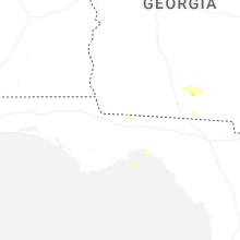
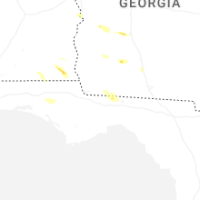
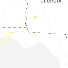


Connect with Interactive Hail Maps