

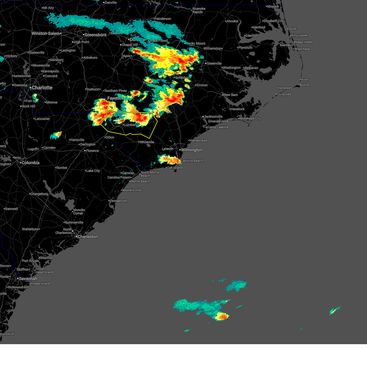
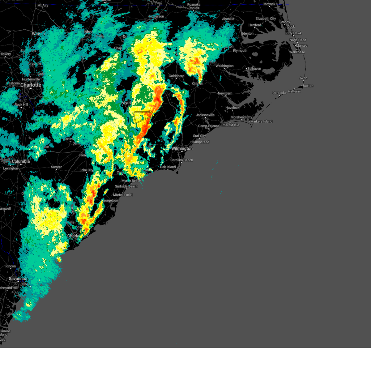
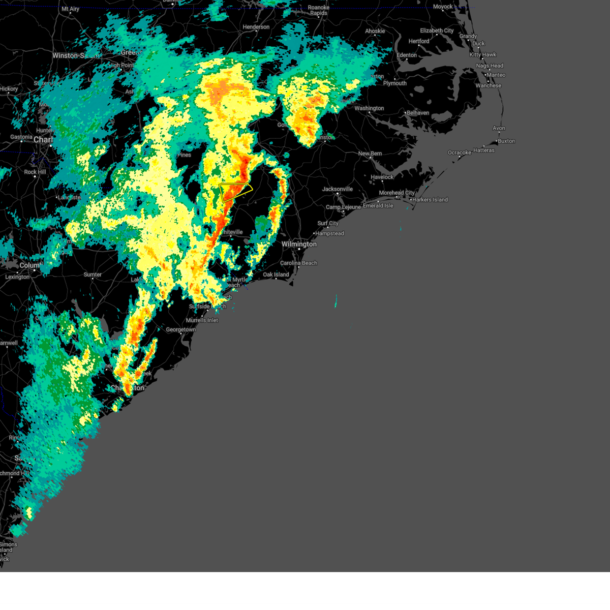
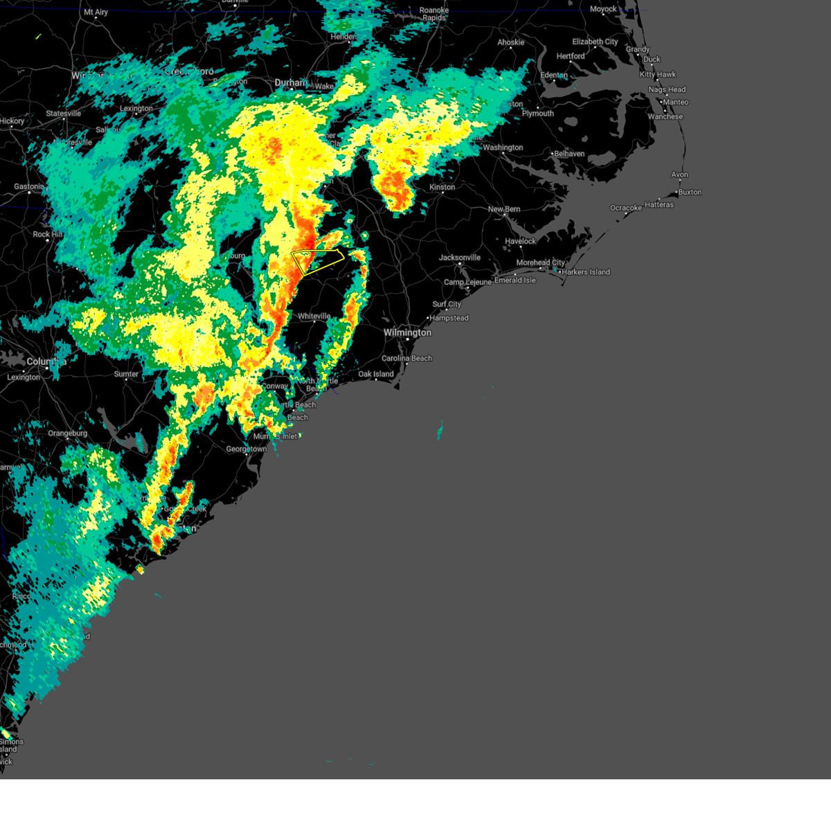
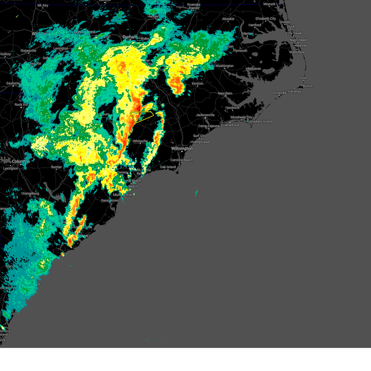
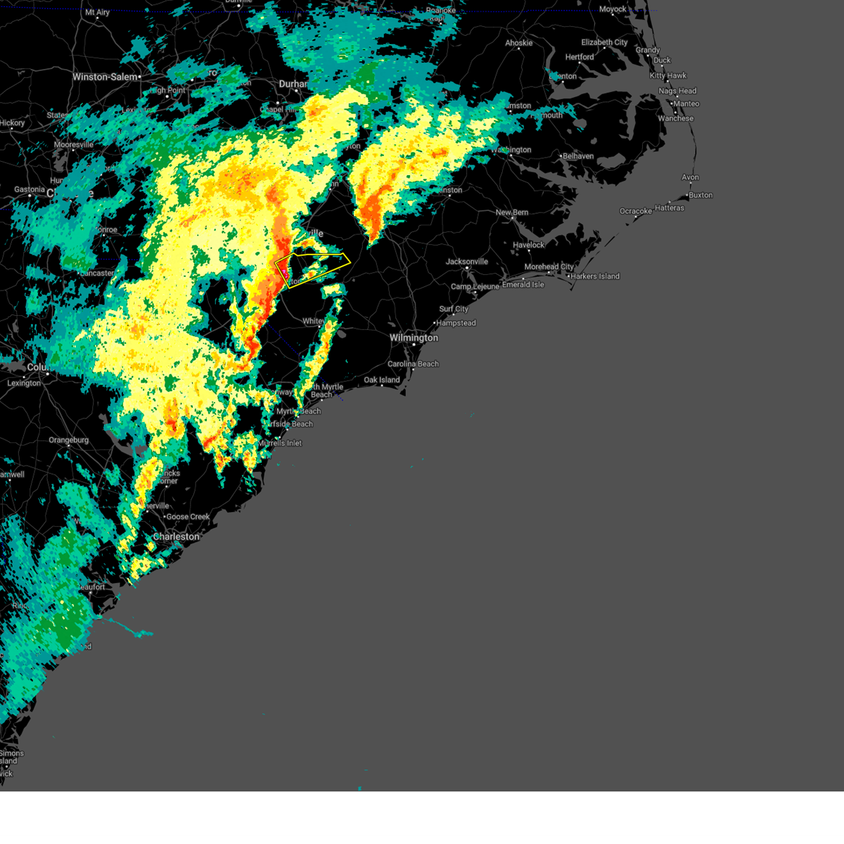
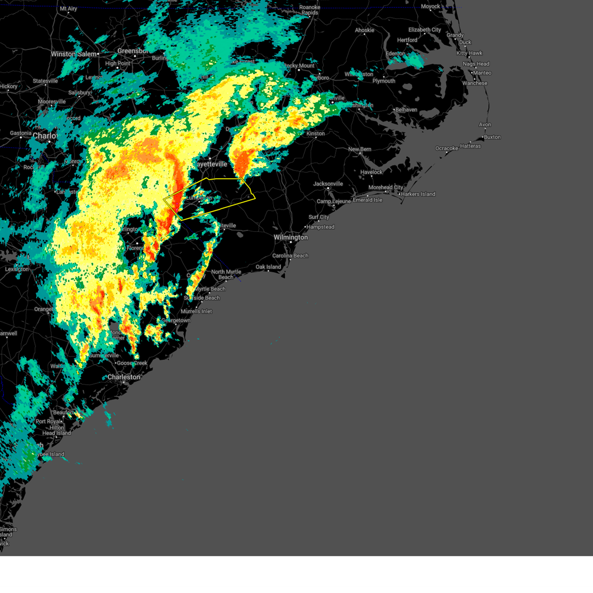
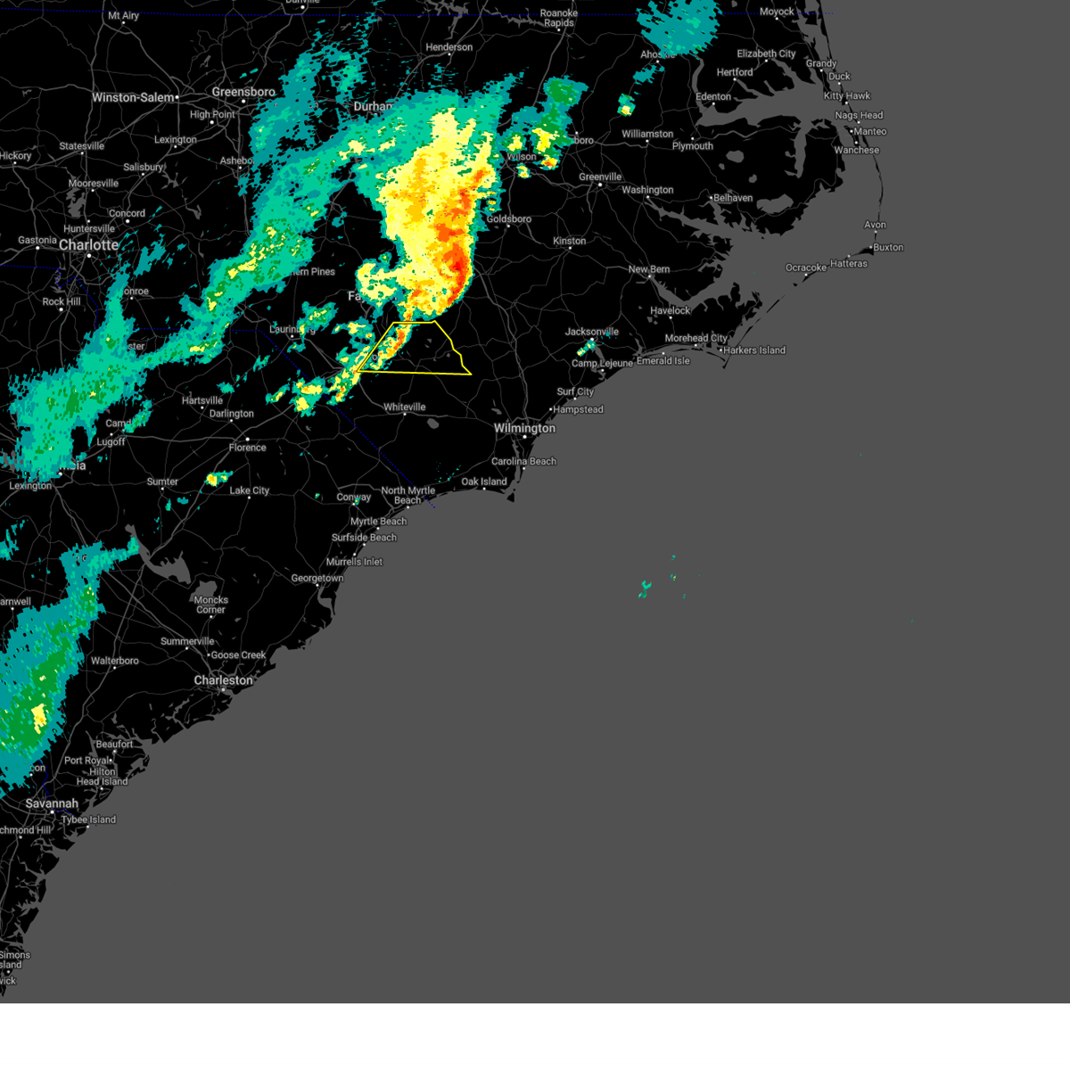
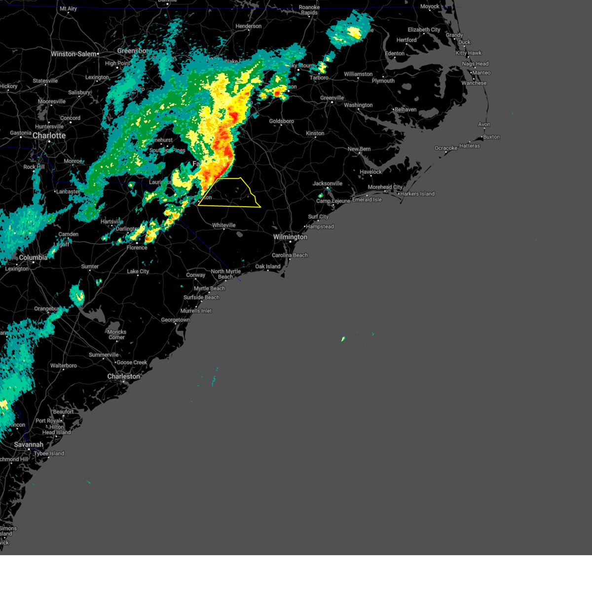
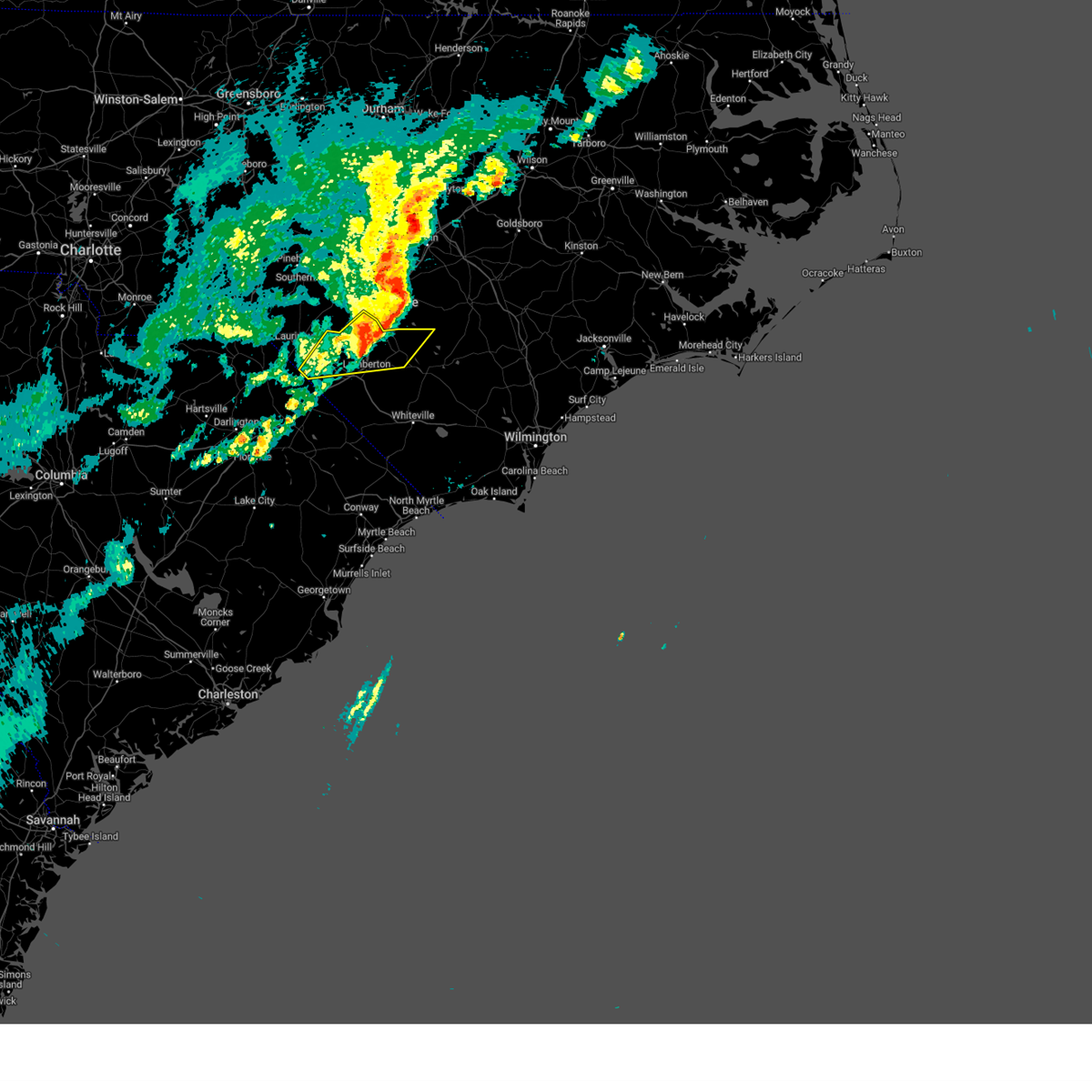
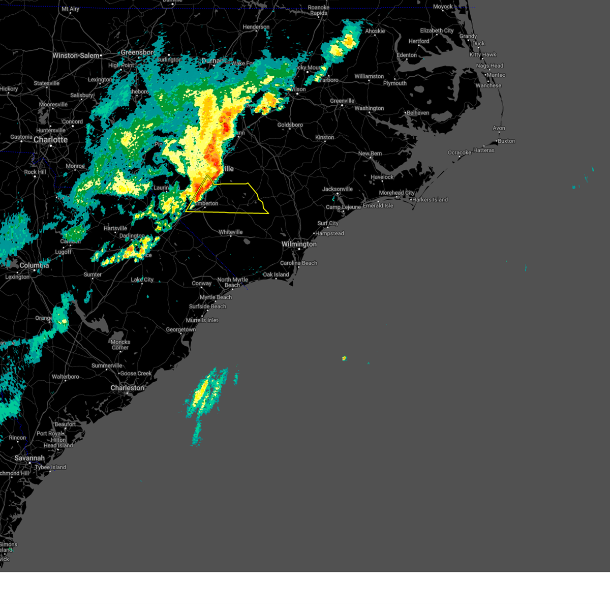
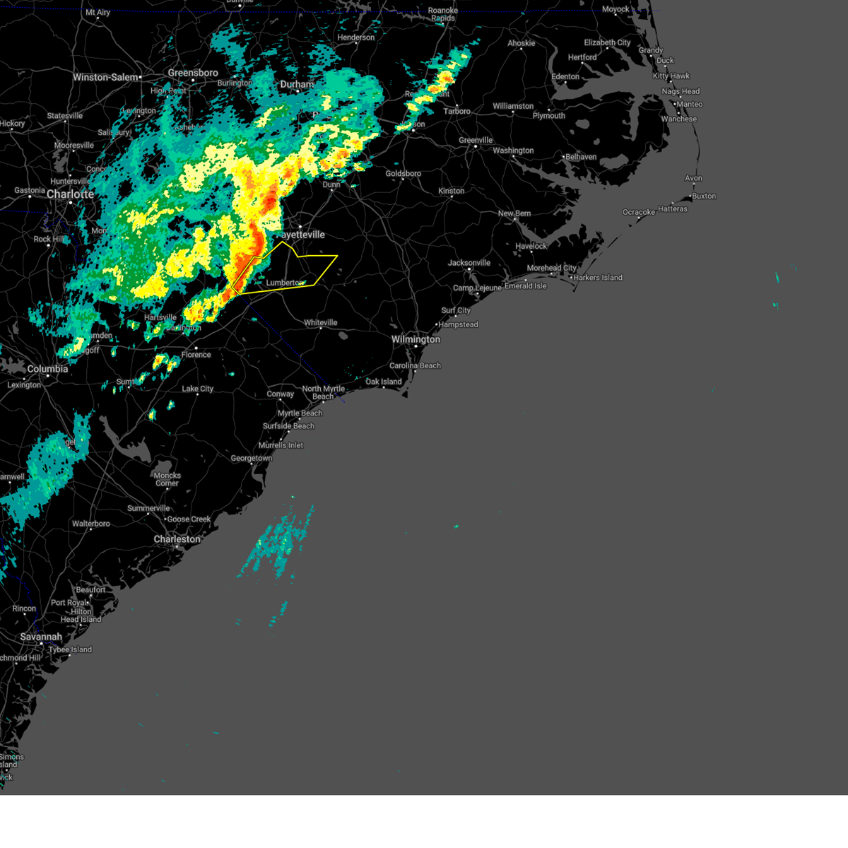
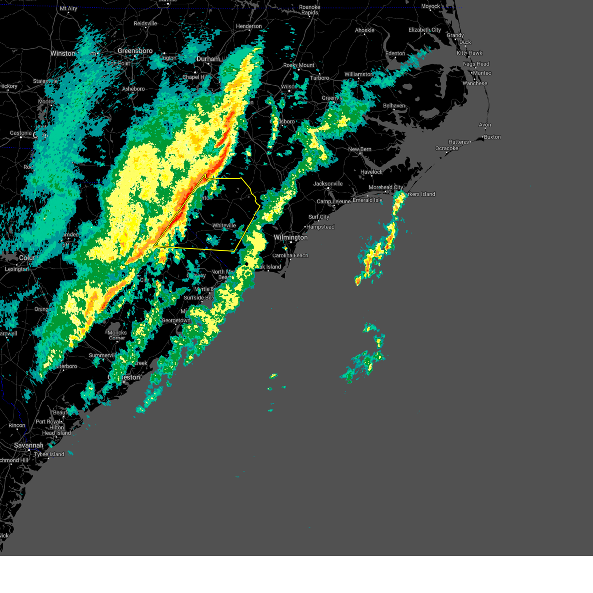
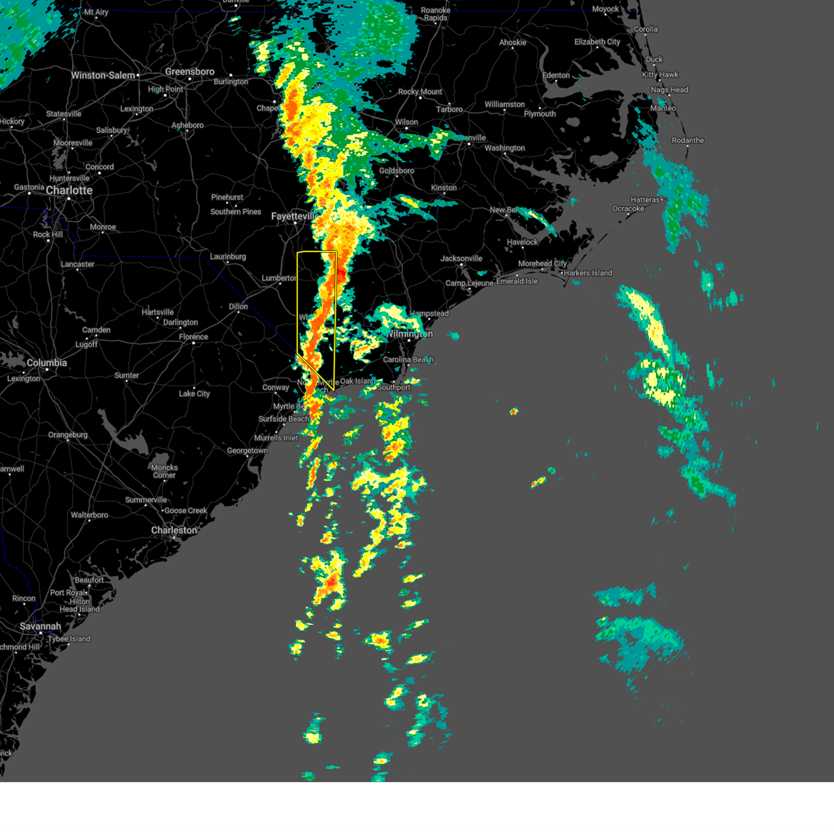
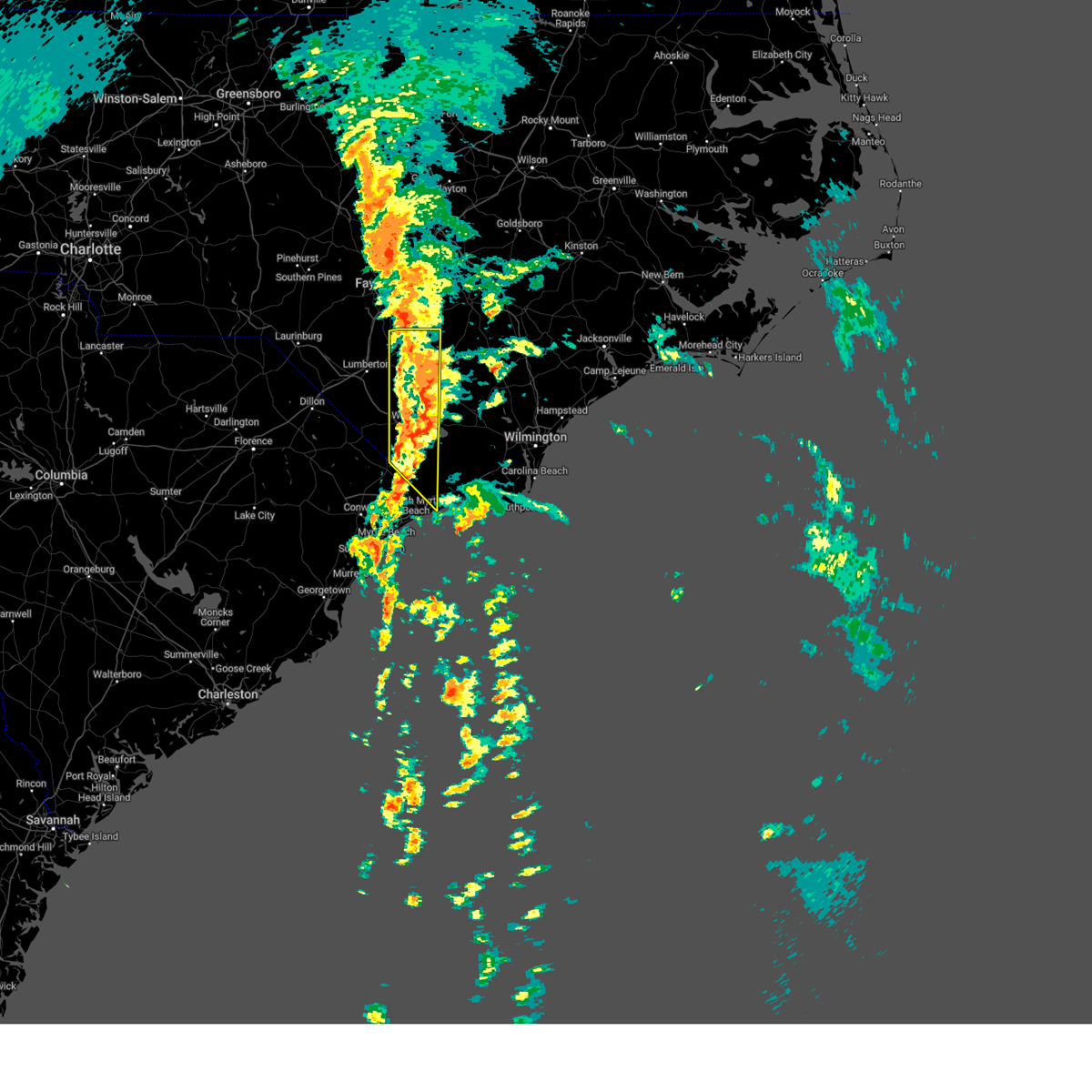
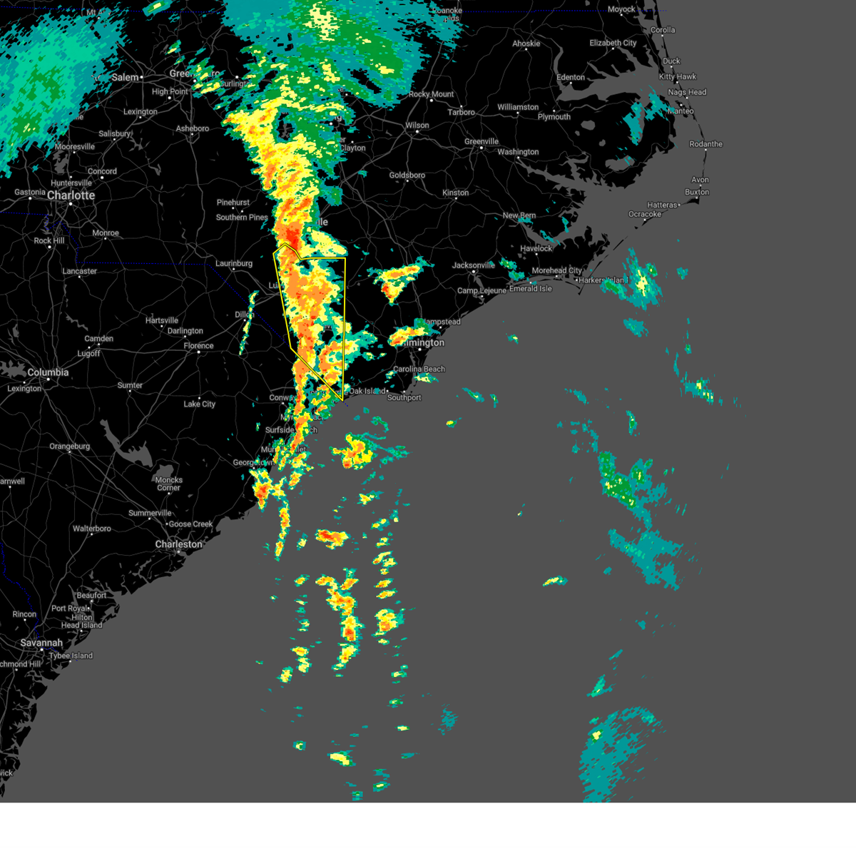
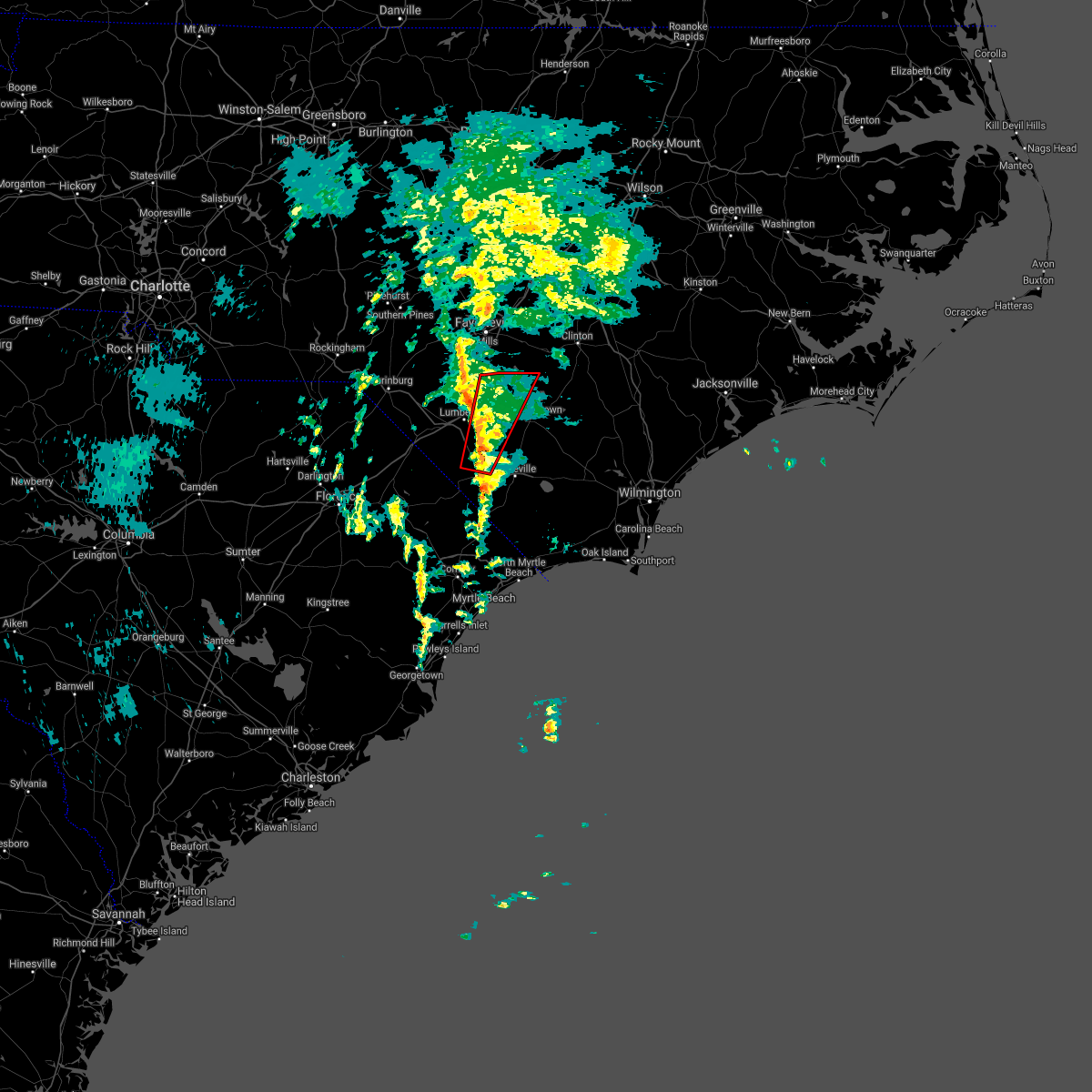
Hail Map for Tar Heel, NC
The Tar Heel, NC area has had 3 reports of on-the-ground hail by trained spotters, and has been under severe weather warnings 22 times during the past 12 months. Doppler radar has detected hail at or near Tar Heel, NC on 44 occasions, including 5 occasions during the past year.
| Name: | Tar Heel, NC |
| Where Located: | 59.2 miles NW of Wilmington, NC |
| Map: | Google Map for Tar Heel, NC |
| Population: | 117 |
| Housing Units: | 65 |
| More Info: | Search Google for Tar Heel, NC |
5
The Top Recent Hail Date for Tar Heel, NC is Monday, July 15, 2024 (6th out of 44)

Hail and Wind Damage Spotted near Tar Heel, NC
| Date / Time | Report Details |
|---|---|
| 6/25/2025 4:32 PM EDT |
 At 432 pm edt, severe thunderstorms were located along a line extending from near elizabethtown to near laurinburg, moving southwest at 25 mph (radar indicated). Hazards include 60 mph wind gusts and quarter size hail. Minor hail damage to vehicles is possible. expect wind damage to trees and power lines. locations impacted include, lumberton, elizabethtown, red springs, pembroke, fairmont, maxton, st. Pauls, bladenboro, rowland, bladen community college, ammon, butters, hestertown, buie, robeson community college, wakulla, white oak, elrod, smiths, and howellsville. At 432 pm edt, severe thunderstorms were located along a line extending from near elizabethtown to near laurinburg, moving southwest at 25 mph (radar indicated). Hazards include 60 mph wind gusts and quarter size hail. Minor hail damage to vehicles is possible. expect wind damage to trees and power lines. locations impacted include, lumberton, elizabethtown, red springs, pembroke, fairmont, maxton, st. Pauls, bladenboro, rowland, bladen community college, ammon, butters, hestertown, buie, robeson community college, wakulla, white oak, elrod, smiths, and howellsville.
|
| 6/25/2025 4:16 PM EDT | At 416 pm edt, severe thunderstorms were located along a line extending from 8 miles southeast of ammon to near wakulla, moving southwest at 20 mph. a recent public report indicated quarter size hail was falling in red springs, nc (radar indicated). Hazards include 60 mph wind gusts and quarter size hail. Minor hail damage to vehicles is possible. expect wind damage to trees and power lines. locations impacted include, lumberton, elizabethtown, red springs, pembroke, fairmont, maxton, st. Pauls, bladenboro, rowland, rex, ammon, hestertown, shannon, white oak, carvers, smiths, howellsville, raemon, lisbon, and elkton. |
| 6/25/2025 4:01 PM EDT |
 At 400 pm edt, severe thunderstorms were located along a line extending from garland to near jerome to red springs, moving south at 20 mph (radar indicated). Hazards include 60 mph wind gusts. Expect wind damage to trees and power lines. locations impacted include, lumberton, elizabethtown, red springs, pembroke, fairmont, maxton, st. Pauls, bladenboro, rowland, rex, ammon, hestertown, shannon, white oak, carvers, smiths, howellsville, raemon, lisbon, and elkton. At 400 pm edt, severe thunderstorms were located along a line extending from garland to near jerome to red springs, moving south at 20 mph (radar indicated). Hazards include 60 mph wind gusts. Expect wind damage to trees and power lines. locations impacted include, lumberton, elizabethtown, red springs, pembroke, fairmont, maxton, st. Pauls, bladenboro, rowland, rex, ammon, hestertown, shannon, white oak, carvers, smiths, howellsville, raemon, lisbon, and elkton.
|
| 6/25/2025 3:41 PM EDT |
 Svrilm the national weather service in wilmington has issued a * severe thunderstorm warning for, robeson county in southeastern north carolina, bladen county in southeastern north carolina, * until 500 pm edt. * at 340 pm edt, severe thunderstorms were located along a line extending from 11 miles northwest of harrells to antioch, moving south at 25 mph (radar indicated). Hazards include 60 mph wind gusts. expect wind damage to trees and power lines Svrilm the national weather service in wilmington has issued a * severe thunderstorm warning for, robeson county in southeastern north carolina, bladen county in southeastern north carolina, * until 500 pm edt. * at 340 pm edt, severe thunderstorms were located along a line extending from 11 miles northwest of harrells to antioch, moving south at 25 mph (radar indicated). Hazards include 60 mph wind gusts. expect wind damage to trees and power lines
|
| 6/1/2025 7:14 PM EDT |
 Svrilm the national weather service in wilmington has issued a * severe thunderstorm warning for, eastern robeson county in southeastern north carolina, bladen county in southeastern north carolina, * until 815 pm edt. * at 713 pm edt, a severe thunderstorm was located over white oak, or 8 miles northwest of elizabethtown, moving southeast at 20 mph (radar indicated). Hazards include 60 mph wind gusts and penny size hail. expect wind damage to trees and power lines Svrilm the national weather service in wilmington has issued a * severe thunderstorm warning for, eastern robeson county in southeastern north carolina, bladen county in southeastern north carolina, * until 815 pm edt. * at 713 pm edt, a severe thunderstorm was located over white oak, or 8 miles northwest of elizabethtown, moving southeast at 20 mph (radar indicated). Hazards include 60 mph wind gusts and penny size hail. expect wind damage to trees and power lines
|
| 4/7/2025 8:51 PM EDT |
 The storm which prompted the warning has moved out of the area. therefore, the warning will be allowed to expire. a severe thunderstorm watch remains in effect until 1000 pm edt for southeastern north carolina. please send your reports of hail and/or wind damage, including trees or large limbs downed, by calling the national weather service office in wilmington at 1-800-697-3901. The storm which prompted the warning has moved out of the area. therefore, the warning will be allowed to expire. a severe thunderstorm watch remains in effect until 1000 pm edt for southeastern north carolina. please send your reports of hail and/or wind damage, including trees or large limbs downed, by calling the national weather service office in wilmington at 1-800-697-3901.
|
| 4/7/2025 8:42 PM EDT |
 At 842 pm edt, a severe thunderstorm was located over ammon, or 13 miles north of elizabethtown, moving northeast at 75 mph (radar indicated). Hazards include 60 mph wind gusts. Expect wind damage to trees and power lines. Locations impacted include, white oak, jerome, tar heel, duart, ammon, and ruskin. At 842 pm edt, a severe thunderstorm was located over ammon, or 13 miles north of elizabethtown, moving northeast at 75 mph (radar indicated). Hazards include 60 mph wind gusts. Expect wind damage to trees and power lines. Locations impacted include, white oak, jerome, tar heel, duart, ammon, and ruskin.
|
| 4/7/2025 8:28 PM EDT |
 the severe thunderstorm warning has been cancelled and is no longer in effect the severe thunderstorm warning has been cancelled and is no longer in effect
|
| 4/7/2025 8:28 PM EDT |
 At 828 pm edt, a severe thunderstorm was located over jerome, or 15 miles north of elizabethtown, moving northeast at 60 mph (radar indicated). Hazards include 70 mph wind gusts and quarter size hail. Minor hail damage to vehicles is possible. expect considerable tree damage. wind damage is also likely to mobile homes, roofs, and outbuildings. Locations impacted include, tobermory, tar heel, duart, ammon, white oak, jerome, and ruskin. At 828 pm edt, a severe thunderstorm was located over jerome, or 15 miles north of elizabethtown, moving northeast at 60 mph (radar indicated). Hazards include 70 mph wind gusts and quarter size hail. Minor hail damage to vehicles is possible. expect considerable tree damage. wind damage is also likely to mobile homes, roofs, and outbuildings. Locations impacted include, tobermory, tar heel, duart, ammon, white oak, jerome, and ruskin.
|
| 4/7/2025 8:15 PM EDT |
 At 815 pm edt, a severe thunderstorm was located over tolarsville, or 9 miles northeast of lumberton, moving northeast at 65 mph (radar indicated). Hazards include 70 mph wind gusts and penny size hail. Expect considerable tree damage. damage is likely to mobile homes, roofs, and outbuildings. locations impacted include, smiths, howellsville, duart, tolarsville, ammon, tobermory, tar heel, ruskin, barker ten mile, white oak, jerome, st. Pauls, and lumberton. At 815 pm edt, a severe thunderstorm was located over tolarsville, or 9 miles northeast of lumberton, moving northeast at 65 mph (radar indicated). Hazards include 70 mph wind gusts and penny size hail. Expect considerable tree damage. damage is likely to mobile homes, roofs, and outbuildings. locations impacted include, smiths, howellsville, duart, tolarsville, ammon, tobermory, tar heel, ruskin, barker ten mile, white oak, jerome, st. Pauls, and lumberton.
|
| 4/7/2025 7:55 PM EDT |
 Svrilm the national weather service in wilmington has issued a * severe thunderstorm warning for, robeson county in southeastern north carolina, northern bladen county in southeastern north carolina, * until 900 pm edt. * at 755 pm edt, a severe thunderstorm was located over purvis, or 13 miles west of lumberton, moving northeast at 50 mph (radar indicated). Hazards include 60 mph wind gusts. expect wind damage to trees and power lines Svrilm the national weather service in wilmington has issued a * severe thunderstorm warning for, robeson county in southeastern north carolina, northern bladen county in southeastern north carolina, * until 900 pm edt. * at 755 pm edt, a severe thunderstorm was located over purvis, or 13 miles west of lumberton, moving northeast at 50 mph (radar indicated). Hazards include 60 mph wind gusts. expect wind damage to trees and power lines
|
| 4/7/2025 3:12 PM EDT |
 the severe thunderstorm warning has been cancelled and is no longer in effect the severe thunderstorm warning has been cancelled and is no longer in effect
|
| 4/7/2025 2:55 PM EDT |
 At 255 pm edt, severe thunderstorms were located along a line extending from near benson to 9 miles west of clinton to near smiths, moving east at 55 mph (radar indicated). Hazards include 60 mph wind gusts. Expect wind damage to trees and power lines. Locations impacted include, smiths, howellsville, bladen community college, duart, ammon, dublin, hestertown, tar heel, ruskin, white lake, bladen county hospital, white oak, elizabethtown, jerome, and lumberton. At 255 pm edt, severe thunderstorms were located along a line extending from near benson to 9 miles west of clinton to near smiths, moving east at 55 mph (radar indicated). Hazards include 60 mph wind gusts. Expect wind damage to trees and power lines. Locations impacted include, smiths, howellsville, bladen community college, duart, ammon, dublin, hestertown, tar heel, ruskin, white lake, bladen county hospital, white oak, elizabethtown, jerome, and lumberton.
|
| 4/7/2025 2:42 PM EDT |
 A severe thunderstorm warning still remains in effect for portions of robeson and bladen counties. a severe thunderstorm watch remains in effect until 1000 pm edt for southeastern north carolina, and northeastern south carolina. please send your reports of hail and/or wind damage, including trees or large limbs downed, by calling the national weather service office in wilmington at 1-800-697-3901. A severe thunderstorm warning still remains in effect for portions of robeson and bladen counties. a severe thunderstorm watch remains in effect until 1000 pm edt for southeastern north carolina, and northeastern south carolina. please send your reports of hail and/or wind damage, including trees or large limbs downed, by calling the national weather service office in wilmington at 1-800-697-3901.
|
| 4/7/2025 2:40 PM EDT |
 Svrilm the national weather service in wilmington has issued a * severe thunderstorm warning for, northeastern robeson county in southeastern north carolina, northern bladen county in southeastern north carolina, * until 345 pm edt. * at 239 pm edt, severe thunderstorms were located along a line extending from 7 miles east of lillington to 11 miles east of fayetteville to near lumberton, moving east at 65 mph (radar indicated). Hazards include 60 mph wind gusts. expect wind damage to trees and power lines Svrilm the national weather service in wilmington has issued a * severe thunderstorm warning for, northeastern robeson county in southeastern north carolina, northern bladen county in southeastern north carolina, * until 345 pm edt. * at 239 pm edt, severe thunderstorms were located along a line extending from 7 miles east of lillington to 11 miles east of fayetteville to near lumberton, moving east at 65 mph (radar indicated). Hazards include 60 mph wind gusts. expect wind damage to trees and power lines
|
| 4/7/2025 2:17 PM EDT |
 Svrilm the national weather service in wilmington has issued a * severe thunderstorm warning for, northern robeson county in southeastern north carolina, northwestern bladen county in southeastern north carolina, * until 245 pm edt. * at 217 pm edt, severe thunderstorms were located along a line extending from raeford to near antioch to near raemon, moving east at 65 mph (radar indicated). Hazards include 60 mph wind gusts. expect wind damage to trees and power lines Svrilm the national weather service in wilmington has issued a * severe thunderstorm warning for, northern robeson county in southeastern north carolina, northwestern bladen county in southeastern north carolina, * until 245 pm edt. * at 217 pm edt, severe thunderstorms were located along a line extending from raeford to near antioch to near raemon, moving east at 65 mph (radar indicated). Hazards include 60 mph wind gusts. expect wind damage to trees and power lines
|
| 2/16/2025 9:35 AM EST |
 Svrilm the national weather service in wilmington has issued a * severe thunderstorm warning for, eastern robeson county in southeastern north carolina, bladen county in southeastern north carolina, columbus county in southeastern north carolina, southeastern dillon county in northeastern south carolina, northwestern horry county in northeastern south carolina, northern marion county in northeastern south carolina, * until 1030 am est. * at 935 am est, severe thunderstorms were located along a line extending from near tobermory to fairmont to near marion, moving east at 45 mph (radar indicated). Hazards include 60 mph wind gusts. expect wind damage to trees and power lines Svrilm the national weather service in wilmington has issued a * severe thunderstorm warning for, eastern robeson county in southeastern north carolina, bladen county in southeastern north carolina, columbus county in southeastern north carolina, southeastern dillon county in northeastern south carolina, northwestern horry county in northeastern south carolina, northern marion county in northeastern south carolina, * until 1030 am est. * at 935 am est, severe thunderstorms were located along a line extending from near tobermory to fairmont to near marion, moving east at 45 mph (radar indicated). Hazards include 60 mph wind gusts. expect wind damage to trees and power lines
|
| 9/27/2024 11:16 AM EDT |
 The storms which prompted the warning have moved out of the area. therefore, the warning has been allowed to expire. a tornado watch remains in effect until 600 pm edt for southeastern north carolina, and northeastern south carolina. please send your reports of hail and/or wind damage, including trees or large limbs downed, by calling the national weather service office in wilmington at 1-800-697-3901. The storms which prompted the warning have moved out of the area. therefore, the warning has been allowed to expire. a tornado watch remains in effect until 600 pm edt for southeastern north carolina, and northeastern south carolina. please send your reports of hail and/or wind damage, including trees or large limbs downed, by calling the national weather service office in wilmington at 1-800-697-3901.
|
| 9/27/2024 10:50 AM EDT |
 At 1049 am edt, severe thunderstorms were located along a line extending from jerome to near emerson to near pireway, moving north at 55 mph (radar indicated). Hazards include 60 mph wind gusts. Expect wind damage to trees and power lines. Locations impacted include, whiteville, elizabethtown, iredell, carolina shores, chadbourn, calabash, bladenboro, bethel, lake waccamaw, hallsboro, bladen community college, ammon, nakina, butters, redbug, bughill, longwood, southeastern community college, williams, and white oak. At 1049 am edt, severe thunderstorms were located along a line extending from jerome to near emerson to near pireway, moving north at 55 mph (radar indicated). Hazards include 60 mph wind gusts. Expect wind damage to trees and power lines. Locations impacted include, whiteville, elizabethtown, iredell, carolina shores, chadbourn, calabash, bladenboro, bethel, lake waccamaw, hallsboro, bladen community college, ammon, nakina, butters, redbug, bughill, longwood, southeastern community college, williams, and white oak.
|
| 9/27/2024 10:18 AM EDT |
 Svrilm the national weather service in wilmington has issued a * severe thunderstorm warning for, eastern robeson county in southeastern north carolina, western bladen county in southeastern north carolina, southwestern brunswick county in southeastern north carolina, columbus county in southeastern north carolina, * until 1115 am edt. * at 1015 am edt, severe thunderstorms were located along a line extending from 7 miles south of fayetteville to near bladen community college to sidney, moving north at 65 mph (radar indicated). Hazards include 60 mph wind gusts. expect wind damage to trees and power lines Svrilm the national weather service in wilmington has issued a * severe thunderstorm warning for, eastern robeson county in southeastern north carolina, western bladen county in southeastern north carolina, southwestern brunswick county in southeastern north carolina, columbus county in southeastern north carolina, * until 1115 am edt. * at 1015 am edt, severe thunderstorms were located along a line extending from 7 miles south of fayetteville to near bladen community college to sidney, moving north at 65 mph (radar indicated). Hazards include 60 mph wind gusts. expect wind damage to trees and power lines
|
| 7/15/2024 5:30 PM EDT |
 At 530 pm edt, a severe thunderstorm was located near bladen community college, or 10 miles northwest of elizabethtown, moving northeast at 5 mph (radar indicated). Hazards include 60 mph wind gusts and nickel size hail. Expect wind damage to trees and power lines. Locations impacted include, elizabethtown, bladenboro, smiths, ruskin, howellsville, bladen community college, butters, white oak, dublin, and tar heel. At 530 pm edt, a severe thunderstorm was located near bladen community college, or 10 miles northwest of elizabethtown, moving northeast at 5 mph (radar indicated). Hazards include 60 mph wind gusts and nickel size hail. Expect wind damage to trees and power lines. Locations impacted include, elizabethtown, bladenboro, smiths, ruskin, howellsville, bladen community college, butters, white oak, dublin, and tar heel.
|
| 7/15/2024 5:10 PM EDT | Svrilm the national weather service in wilmington has issued a * severe thunderstorm warning for, east central robeson county in southeastern north carolina, northwestern bladen county in southeastern north carolina, * until 600 pm edt. * at 510 pm edt, a severe thunderstorm was located near smiths, or 11 miles west of elizabethtown, moving east at 5 mph (radar indicated). Hazards include 60 mph wind gusts and penny size hail. expect wind damage to trees and power lines |
| 6/27/2024 3:12 PM EDT |
 Svrilm the national weather service in wilmington has issued a * severe thunderstorm warning for, northwestern bladen county in southeastern north carolina, * until 345 pm edt. * at 312 pm edt, a severe thunderstorm was located over white oak, or 9 miles north of elizabethtown, moving east at 10 mph (radar indicated). Hazards include 60 mph wind gusts and quarter size hail. Minor hail damage to vehicles is possible. Expect wind damage to trees and power lines. Svrilm the national weather service in wilmington has issued a * severe thunderstorm warning for, northwestern bladen county in southeastern north carolina, * until 345 pm edt. * at 312 pm edt, a severe thunderstorm was located over white oak, or 9 miles north of elizabethtown, moving east at 10 mph (radar indicated). Hazards include 60 mph wind gusts and quarter size hail. Minor hail damage to vehicles is possible. Expect wind damage to trees and power lines.
|
| 5/10/2024 8:17 PM EDT |
 Svrilm the national weather service in wilmington has issued a * severe thunderstorm warning for, bladen county in southeastern north carolina, * until 915 pm edt. * at 817 pm edt, a severe thunderstorm was located near bladen community college, or 8 miles west of elizabethtown, moving southeast at 35 mph (radar indicated). Hazards include 60 mph wind gusts and penny size hail. Expect wind damage to trees and power lines. this severe thunderstorm will be near, bladen community college around 820 pm edt. elizabethtown around 825 pm edt. lisbon around 840 pm edt. lagoon around 845 pm edt. carvers around 850 pm edt. kelly around 900 pm edt. Other locations impacted by this severe thunderstorm include dublin, tar heel, clarkton, white lake, and bladen county hospital. Svrilm the national weather service in wilmington has issued a * severe thunderstorm warning for, bladen county in southeastern north carolina, * until 915 pm edt. * at 817 pm edt, a severe thunderstorm was located near bladen community college, or 8 miles west of elizabethtown, moving southeast at 35 mph (radar indicated). Hazards include 60 mph wind gusts and penny size hail. Expect wind damage to trees and power lines. this severe thunderstorm will be near, bladen community college around 820 pm edt. elizabethtown around 825 pm edt. lisbon around 840 pm edt. lagoon around 845 pm edt. carvers around 850 pm edt. kelly around 900 pm edt. Other locations impacted by this severe thunderstorm include dublin, tar heel, clarkton, white lake, and bladen county hospital.
|
| 5/10/2024 3:33 PM EDT |
 At 332 pm edt, a severe thunderstorm was located over tobermory, or 15 miles northeast of lumberton, moving east at 25 mph (radar indicated). Hazards include 60 mph wind gusts and quarter size hail. Minor hail damage to vehicles is possible. expect wind damage to trees and power lines. Locations impacted include, tobermory, jerome, duart, and tar heel. At 332 pm edt, a severe thunderstorm was located over tobermory, or 15 miles northeast of lumberton, moving east at 25 mph (radar indicated). Hazards include 60 mph wind gusts and quarter size hail. Minor hail damage to vehicles is possible. expect wind damage to trees and power lines. Locations impacted include, tobermory, jerome, duart, and tar heel.
|
| 5/10/2024 3:33 PM EDT |
 the severe thunderstorm warning has been cancelled and is no longer in effect the severe thunderstorm warning has been cancelled and is no longer in effect
|
| 5/10/2024 3:08 PM EDT |
 At 308 pm edt, a severe thunderstorm was located over rex, or 9 miles east of red springs, moving east at 20 mph (radar indicated). Hazards include 60 mph wind gusts and quarter size hail. Minor hail damage to vehicles is possible. expect wind damage to trees and power lines. locations impacted include, st. Pauls, tobermory, rex, tolarsville, duart, jerome, shannon, parkton, rennert, tar heel, and lumber bridge. At 308 pm edt, a severe thunderstorm was located over rex, or 9 miles east of red springs, moving east at 20 mph (radar indicated). Hazards include 60 mph wind gusts and quarter size hail. Minor hail damage to vehicles is possible. expect wind damage to trees and power lines. locations impacted include, st. Pauls, tobermory, rex, tolarsville, duart, jerome, shannon, parkton, rennert, tar heel, and lumber bridge.
|
| 5/10/2024 2:56 PM EDT |
 Svrilm the national weather service in wilmington has issued a * severe thunderstorm warning for, northeastern robeson county in southeastern north carolina, northwestern bladen county in southeastern north carolina, * until 345 pm edt. * at 255 pm edt, a severe thunderstorm was located over shannon, or near red springs, moving east at 20 mph (radar indicated). Hazards include 60 mph wind gusts and quarter size hail. Minor hail damage to vehicles is possible. Expect wind damage to trees and power lines. Svrilm the national weather service in wilmington has issued a * severe thunderstorm warning for, northeastern robeson county in southeastern north carolina, northwestern bladen county in southeastern north carolina, * until 345 pm edt. * at 255 pm edt, a severe thunderstorm was located over shannon, or near red springs, moving east at 20 mph (radar indicated). Hazards include 60 mph wind gusts and quarter size hail. Minor hail damage to vehicles is possible. Expect wind damage to trees and power lines.
|
| 5/8/2024 7:37 PM EDT |
 The storms which prompted the warning have weakened below severe limits. therefore, the warning will be allowed to expire. a severe thunderstorm watch remains in effect until 1000 pm edt for southeastern north carolina. please send your reports of hail and/or wind damage, including trees or large limbs downed, by calling the national weather service office in wilmington at 1-800-697-3901. The storms which prompted the warning have weakened below severe limits. therefore, the warning will be allowed to expire. a severe thunderstorm watch remains in effect until 1000 pm edt for southeastern north carolina. please send your reports of hail and/or wind damage, including trees or large limbs downed, by calling the national weather service office in wilmington at 1-800-697-3901.
|
| 5/8/2024 7:16 PM EDT |
 At 716 pm edt, severe thunderstorms were located along a line extending from 9 miles northeast of jerome to bladen community college to near fair bluff, moving southeast at 40 mph (radar indicated). Hazards include 60 mph wind gusts and quarter size hail. Minor hail damage to vehicles is possible. expect wind damage to trees and power lines. Locations impacted include, lumberton, whiteville, elizabethtown, fairmont, chadbourn, bladenboro, fair bluff, boardman, bladen community college, ammon, butters, hestertown, southeastern community college, robeson community college, white oak, carvers, smiths, howellsville, abbottsburg, and tolarsville. At 716 pm edt, severe thunderstorms were located along a line extending from 9 miles northeast of jerome to bladen community college to near fair bluff, moving southeast at 40 mph (radar indicated). Hazards include 60 mph wind gusts and quarter size hail. Minor hail damage to vehicles is possible. expect wind damage to trees and power lines. Locations impacted include, lumberton, whiteville, elizabethtown, fairmont, chadbourn, bladenboro, fair bluff, boardman, bladen community college, ammon, butters, hestertown, southeastern community college, robeson community college, white oak, carvers, smiths, howellsville, abbottsburg, and tolarsville.
|
| 5/8/2024 7:01 PM EDT |
 Svrilm the national weather service in wilmington has issued a * severe thunderstorm warning for, robeson county in southeastern north carolina, bladen county in southeastern north carolina, northwestern columbus county in southeastern north carolina, * until 745 pm edt. * at 701 pm edt, severe thunderstorms were located along a line extending from 6 miles southeast of fayetteville to howellsville to near lake view, moving southeast at 40 mph (radar indicated). Hazards include 60 mph wind gusts and quarter size hail. Minor hail damage to vehicles is possible. Expect wind damage to trees and power lines. Svrilm the national weather service in wilmington has issued a * severe thunderstorm warning for, robeson county in southeastern north carolina, bladen county in southeastern north carolina, northwestern columbus county in southeastern north carolina, * until 745 pm edt. * at 701 pm edt, severe thunderstorms were located along a line extending from 6 miles southeast of fayetteville to howellsville to near lake view, moving southeast at 40 mph (radar indicated). Hazards include 60 mph wind gusts and quarter size hail. Minor hail damage to vehicles is possible. Expect wind damage to trees and power lines.
|
| 4/20/2024 6:22 PM EDT |
 Svrilm the national weather service in wilmington has issued a * severe thunderstorm warning for, robeson county in southeastern north carolina, northwestern bladen county in southeastern north carolina, northern dillon county in northeastern south carolina, east central marlboro county in northeastern south carolina, * until 715 pm edt. * at 622 pm edt, a severe thunderstorm was located over prospect, or near red springs, moving east at 30 mph (radar indicated). Hazards include 60 mph wind gusts and quarter size hail. Minor hail damage to vehicles is possible. Expect wind damage to trees and power lines. Svrilm the national weather service in wilmington has issued a * severe thunderstorm warning for, robeson county in southeastern north carolina, northwestern bladen county in southeastern north carolina, northern dillon county in northeastern south carolina, east central marlboro county in northeastern south carolina, * until 715 pm edt. * at 622 pm edt, a severe thunderstorm was located over prospect, or near red springs, moving east at 30 mph (radar indicated). Hazards include 60 mph wind gusts and quarter size hail. Minor hail damage to vehicles is possible. Expect wind damage to trees and power lines.
|
| 4/20/2024 5:15 PM EDT |
 Svrilm the national weather service in wilmington has issued a * severe thunderstorm warning for, northwestern pender county in southeastern north carolina, southeastern robeson county in southeastern north carolina, bladen county in southeastern north carolina, northwestern columbus county in southeastern north carolina, * until 630 pm edt. * at 513 pm edt, severe thunderstorms were located along a line extending from ammon to lumberton, moving southeast at 30 mph (public. golf ball size hail was recently reported near pembroke). Hazards include ping pong ball size hail and 60 mph wind gusts. People and animals outdoors will be injured. expect hail damage to roofs, siding, windows, and vehicles. Expect wind damage to trees and power lines. Svrilm the national weather service in wilmington has issued a * severe thunderstorm warning for, northwestern pender county in southeastern north carolina, southeastern robeson county in southeastern north carolina, bladen county in southeastern north carolina, northwestern columbus county in southeastern north carolina, * until 630 pm edt. * at 513 pm edt, severe thunderstorms were located along a line extending from ammon to lumberton, moving southeast at 30 mph (public. golf ball size hail was recently reported near pembroke). Hazards include ping pong ball size hail and 60 mph wind gusts. People and animals outdoors will be injured. expect hail damage to roofs, siding, windows, and vehicles. Expect wind damage to trees and power lines.
|
| 4/20/2024 5:01 PM EDT |
 At 458 pm edt, severe thunderstorms were located along a line extending from near ammon to near buie, moving southeast at 30 mph (public recently reported golf ball size hail in prospect). Hazards include golf ball size hail and 60 mph wind gusts. People and animals outdoors will be injured. expect hail damage to roofs, siding, windows, and vehicles. expect wind damage to trees and power lines. locations impacted include, lumberton, elizabethtown, red springs, pembroke, fairmont, maxton, st. Pauls, bladenboro, rex, bladen community college, ammon, butters, hestertown, shannon, buie, robeson community college, wakulla, white oak, smiths, and howellsville. At 458 pm edt, severe thunderstorms were located along a line extending from near ammon to near buie, moving southeast at 30 mph (public recently reported golf ball size hail in prospect). Hazards include golf ball size hail and 60 mph wind gusts. People and animals outdoors will be injured. expect hail damage to roofs, siding, windows, and vehicles. expect wind damage to trees and power lines. locations impacted include, lumberton, elizabethtown, red springs, pembroke, fairmont, maxton, st. Pauls, bladenboro, rex, bladen community college, ammon, butters, hestertown, shannon, buie, robeson community college, wakulla, white oak, smiths, and howellsville.
|
| 4/20/2024 4:40 PM EDT |
 At 438 pm edt, severe thunderstorms were located along a line extending from near jerome to near wakulla, moving southeast at 30 mph (radar indicated). Hazards include ping pong ball size hail and 60 mph wind gusts. People and animals outdoors will be injured. expect hail damage to roofs, siding, windows, and vehicles. expect wind damage to trees and power lines. locations impacted include, lumberton, elizabethtown, red springs, pembroke, fairmont, maxton, st. Pauls, bladenboro, rowland, rex, bladen community college, ammon, butters, hestertown, shannon, buie, robeson community college, wakulla, white oak, and elrod. At 438 pm edt, severe thunderstorms were located along a line extending from near jerome to near wakulla, moving southeast at 30 mph (radar indicated). Hazards include ping pong ball size hail and 60 mph wind gusts. People and animals outdoors will be injured. expect hail damage to roofs, siding, windows, and vehicles. expect wind damage to trees and power lines. locations impacted include, lumberton, elizabethtown, red springs, pembroke, fairmont, maxton, st. Pauls, bladenboro, rowland, rex, bladen community college, ammon, butters, hestertown, shannon, buie, robeson community college, wakulla, white oak, and elrod.
|
| 4/20/2024 4:12 PM EDT |
 Svrilm the national weather service in wilmington has issued a * severe thunderstorm warning for, robeson county in southeastern north carolina, northwestern bladen county in southeastern north carolina, * until 515 pm edt. * at 411 pm edt, severe thunderstorms were located along a line extending from 7 miles south of fayetteville to 7 miles northwest of laurinburg, moving southeast at 40 mph (radar indicated). Hazards include 60 mph wind gusts and quarter size hail. Minor hail damage to vehicles is possible. Expect wind damage to trees and power lines. Svrilm the national weather service in wilmington has issued a * severe thunderstorm warning for, robeson county in southeastern north carolina, northwestern bladen county in southeastern north carolina, * until 515 pm edt. * at 411 pm edt, severe thunderstorms were located along a line extending from 7 miles south of fayetteville to 7 miles northwest of laurinburg, moving southeast at 40 mph (radar indicated). Hazards include 60 mph wind gusts and quarter size hail. Minor hail damage to vehicles is possible. Expect wind damage to trees and power lines.
|
| 4/12/2024 7:15 PM EDT |
 The severe thunderstorm which prompted the warning has moved out of the warned area. please send your reports of hail and/or wind damage, including trees or large limbs downed, by calling the national weather service office in wilmington at 1-800-697-3901. The severe thunderstorm which prompted the warning has moved out of the warned area. please send your reports of hail and/or wind damage, including trees or large limbs downed, by calling the national weather service office in wilmington at 1-800-697-3901.
|
| 4/12/2024 7:01 PM EDT |
 At 701 pm edt, a severe thunderstorm was located over white oak, or 9 miles north of elizabethtown, moving east at 40 mph (radar indicated). Hazards include 60 mph wind gusts and quarter size hail. Minor hail damage to vehicles is possible. expect wind damage to trees and power lines. Locations impacted include, elizabethtown, smiths, howellsville, bladen community college, tolarsville, duart, ammon, tobermory, ruskin, white oak, white lake, dublin, tar heel, and bladen county hospital. At 701 pm edt, a severe thunderstorm was located over white oak, or 9 miles north of elizabethtown, moving east at 40 mph (radar indicated). Hazards include 60 mph wind gusts and quarter size hail. Minor hail damage to vehicles is possible. expect wind damage to trees and power lines. Locations impacted include, elizabethtown, smiths, howellsville, bladen community college, tolarsville, duart, ammon, tobermory, ruskin, white oak, white lake, dublin, tar heel, and bladen county hospital.
|
| 4/12/2024 6:45 PM EDT | Reports of multiple large trees and power lines dow in robeson county NC, 4.9 miles ESE of Tar Heel, NC |
| 4/12/2024 6:39 PM EDT |
 At 638 pm edt, a severe thunderstorm was located near st. pauls, or 8 miles north of lumberton, moving east at 40 mph (radar indicated). Hazards include 60 mph wind gusts and quarter size hail. Minor hail damage to vehicles is possible. expect wind damage to trees and power lines. locations impacted include, lumberton, elizabethtown, red springs, pembroke, st. Pauls, bladen community college, ammon, shannon, buie, robeson community college, white oak, smiths, howellsville, tolarsville, duart, tobermory, ruskin, barker ten mile, jerome, and rex. At 638 pm edt, a severe thunderstorm was located near st. pauls, or 8 miles north of lumberton, moving east at 40 mph (radar indicated). Hazards include 60 mph wind gusts and quarter size hail. Minor hail damage to vehicles is possible. expect wind damage to trees and power lines. locations impacted include, lumberton, elizabethtown, red springs, pembroke, st. Pauls, bladen community college, ammon, shannon, buie, robeson community college, white oak, smiths, howellsville, tolarsville, duart, tobermory, ruskin, barker ten mile, jerome, and rex.
|
| 4/12/2024 6:18 PM EDT |
 Svrilm the national weather service in wilmington has issued a * severe thunderstorm warning for, northern bladen county in southeastern north carolina, central robeson county in southeastern north carolina, * until 715 pm edt. * at 617 pm edt, a severe thunderstorm was located over prospect, or near red springs, moving east at 40 mph (radar indicated). Hazards include 60 mph wind gusts and quarter size hail. Minor hail damage to vehicles is possible. Expect wind damage to trees and power lines. Svrilm the national weather service in wilmington has issued a * severe thunderstorm warning for, northern bladen county in southeastern north carolina, central robeson county in southeastern north carolina, * until 715 pm edt. * at 617 pm edt, a severe thunderstorm was located over prospect, or near red springs, moving east at 40 mph (radar indicated). Hazards include 60 mph wind gusts and quarter size hail. Minor hail damage to vehicles is possible. Expect wind damage to trees and power lines.
|
| 1/9/2024 6:21 PM EST |
 At 618 pm est, severe thunderstorms were located along a line extending from 6 miles northeast of jerome to near winyah bay entrance, moving east at 65 mph (radar indicated). Hazards include 60 mph wind gusts. Expect wind damage to trees and power lines. Locations impacted include, myrtle beach, conway, north myrtle beach, georgetown, whiteville, debordieu colony, surfside beach, elizabethtown, pawleys island, myrtle beach airport, yawkey south island, murrells inlet, winyah bay entrance, socastee, red hill, springmaid pier, garden city, north myrtle beach airport, little river, and tabor city. At 618 pm est, severe thunderstorms were located along a line extending from 6 miles northeast of jerome to near winyah bay entrance, moving east at 65 mph (radar indicated). Hazards include 60 mph wind gusts. Expect wind damage to trees and power lines. Locations impacted include, myrtle beach, conway, north myrtle beach, georgetown, whiteville, debordieu colony, surfside beach, elizabethtown, pawleys island, myrtle beach airport, yawkey south island, murrells inlet, winyah bay entrance, socastee, red hill, springmaid pier, garden city, north myrtle beach airport, little river, and tabor city.
|
| 1/9/2024 5:45 PM EST |
 At 544 pm est, severe thunderstorms were located along a line extending from 9 miles north of rex to near hampton plantation state park, moving east at 45 mph (radar indicated). Hazards include 60 mph wind gusts. expect wind damage to trees and power lines At 544 pm est, severe thunderstorms were located along a line extending from 9 miles north of rex to near hampton plantation state park, moving east at 45 mph (radar indicated). Hazards include 60 mph wind gusts. expect wind damage to trees and power lines
|
| 12/17/2023 2:39 PM EST |
 At 239 pm est, severe thunderstorms were located along a line extending from elizabethtown to near council, moving north at 80 mph (radar indicated). Hazards include 60 mph wind gusts. expect wind damage to trees and power lines At 239 pm est, severe thunderstorms were located along a line extending from elizabethtown to near council, moving north at 80 mph (radar indicated). Hazards include 60 mph wind gusts. expect wind damage to trees and power lines
|
| 8/7/2023 7:41 PM EDT |
 At 741 pm edt, a severe thunderstorm was located over elrod, or 13 miles southwest of red springs, moving southeast at 45 mph (radar indicated). Hazards include 60 mph wind gusts and penny size hail. expect wind damage to trees and power lines At 741 pm edt, a severe thunderstorm was located over elrod, or 13 miles southwest of red springs, moving southeast at 45 mph (radar indicated). Hazards include 60 mph wind gusts and penny size hail. expect wind damage to trees and power lines
|
| 7/9/2023 3:08 PM EDT |
 At 307 pm edt, severe thunderstorms were located along a line extending from near ammon to near bladenboro, moving east at 45 mph (radar indicated). Hazards include 60 mph wind gusts. expect wind damage to trees and power lines At 307 pm edt, severe thunderstorms were located along a line extending from near ammon to near bladenboro, moving east at 45 mph (radar indicated). Hazards include 60 mph wind gusts. expect wind damage to trees and power lines
|
| 11/11/2022 7:25 AM EST |
 At 725 am est, a severe thunderstorm capable of producing a tornado was located near southeastern community college, or 7 miles northwest of whiteville, moving north at 30 mph (radar indicated rotation). Hazards include tornado. Expect damage to mobile homes, roofs, and vehicles. this dangerous storm will be near, abbottsburg around 740 am est. bladenboro and butters around 745 am est. elizabethtown and bladen community college around 800 am est. Other locations impacted by this tornadic thunderstorm include tar heel, dublin, clarkton, columbus regional healthcare system, bladen county hospital, white lake and brunswick. At 725 am est, a severe thunderstorm capable of producing a tornado was located near southeastern community college, or 7 miles northwest of whiteville, moving north at 30 mph (radar indicated rotation). Hazards include tornado. Expect damage to mobile homes, roofs, and vehicles. this dangerous storm will be near, abbottsburg around 740 am est. bladenboro and butters around 745 am est. elizabethtown and bladen community college around 800 am est. Other locations impacted by this tornadic thunderstorm include tar heel, dublin, clarkton, columbus regional healthcare system, bladen county hospital, white lake and brunswick.
|
| 6/17/2022 8:18 PM EDT |
 At 818 pm edt, severe thunderstorms were located along a line extending from 6 miles east of ammon to 6 miles southwest of fairmont, moving southeast at 40 mph (radar indicated). Hazards include 60 mph wind gusts. Expect wind damage to trees and power lines. locations impacted include, lumberton, dillon, elizabethtown, fairmont, bladenboro, rowland, lake view, hamer, bladen community college, ammon, butters, south of the border, hestertown, robeson community college, white oak, elrod, smiths, howellsville, tolarsville and duart. hail threat, radar indicated max hail size, <. 75 in wind threat, radar indicated max wind gust, 60 mph. At 818 pm edt, severe thunderstorms were located along a line extending from 6 miles east of ammon to 6 miles southwest of fairmont, moving southeast at 40 mph (radar indicated). Hazards include 60 mph wind gusts. Expect wind damage to trees and power lines. locations impacted include, lumberton, dillon, elizabethtown, fairmont, bladenboro, rowland, lake view, hamer, bladen community college, ammon, butters, south of the border, hestertown, robeson community college, white oak, elrod, smiths, howellsville, tolarsville and duart. hail threat, radar indicated max hail size, <. 75 in wind threat, radar indicated max wind gust, 60 mph.
|
| 6/17/2022 8:01 PM EDT |
 At 801 pm edt, a severe thunderstorm capable of producing a tornado was located over smiths, or 9 miles northeast of lumberton, moving southeast at 25 mph (radar indicated rotation). Hazards include tornado. Flying debris will be dangerous to those caught without shelter. mobile homes will be damaged or destroyed. damage to roofs, windows, and vehicles will occur. tree damage is likely. this dangerous storm will be near, bladen community college and butters around 815 pm edt. bladenboro around 825 pm edt. elizabethtown and abbottsburg around 830 pm edt. Other locations impacted by this tornadic thunderstorm include dublin, bladen county hospital and tar heel. At 801 pm edt, a severe thunderstorm capable of producing a tornado was located over smiths, or 9 miles northeast of lumberton, moving southeast at 25 mph (radar indicated rotation). Hazards include tornado. Flying debris will be dangerous to those caught without shelter. mobile homes will be damaged or destroyed. damage to roofs, windows, and vehicles will occur. tree damage is likely. this dangerous storm will be near, bladen community college and butters around 815 pm edt. bladenboro around 825 pm edt. elizabethtown and abbottsburg around 830 pm edt. Other locations impacted by this tornadic thunderstorm include dublin, bladen county hospital and tar heel.
|
| 6/17/2022 7:24 PM EDT |
 At 724 pm edt, severe thunderstorms were located along a line extending from near fayetteville to 8 miles northeast of chavistown, moving southeast at 40 mph (radar indicated). Hazards include 60 mph wind gusts. expect wind damage to trees and power lines At 724 pm edt, severe thunderstorms were located along a line extending from near fayetteville to 8 miles northeast of chavistown, moving southeast at 40 mph (radar indicated). Hazards include 60 mph wind gusts. expect wind damage to trees and power lines
|
| 5/3/2022 6:59 PM EDT |
 At 658 pm edt, a severe thunderstorm was located over duart, or 15 miles northeast of lumberton, moving east at 5 mph (radar indicated). Hazards include quarter size hail. Minor damage to vehicles is possible. locations impacted include, st. pauls, tobermory, howellsville, tolarsville, duart and tar heel. hail threat, radar indicated max hail size, 1. 00 in wind threat, radar indicated max wind gust, <50 mph. At 658 pm edt, a severe thunderstorm was located over duart, or 15 miles northeast of lumberton, moving east at 5 mph (radar indicated). Hazards include quarter size hail. Minor damage to vehicles is possible. locations impacted include, st. pauls, tobermory, howellsville, tolarsville, duart and tar heel. hail threat, radar indicated max hail size, 1. 00 in wind threat, radar indicated max wind gust, <50 mph.
|
| 5/3/2022 6:39 PM EDT |
 At 639 pm edt, a severe thunderstorm was located over st. pauls, or 12 miles north of lumberton, moving east at 15 mph (radar indicated). Hazards include quarter size hail. minor damage to vehicles is possible At 639 pm edt, a severe thunderstorm was located over st. pauls, or 12 miles north of lumberton, moving east at 15 mph (radar indicated). Hazards include quarter size hail. minor damage to vehicles is possible
|
| 4/6/2022 9:15 PM EDT |
 At 915 pm edt, a severe thunderstorm was located over tolarsville, or 9 miles northeast of lumberton, moving northeast at 40 mph (radar indicated). Hazards include 60 mph wind gusts and quarter size hail. Minor hail damage to vehicles is possible. expect wind damage to trees and power lines. locations impacted include, lumberton, st. pauls, smiths, howellsville, tolarsville, duart, robeson community college, tobermory, barker ten mile, white oak, jerome, hestertown and tar heel. hail threat, radar indicated max hail size, 1. 00 in wind threat, radar indicated max wind gust, 60 mph. At 915 pm edt, a severe thunderstorm was located over tolarsville, or 9 miles northeast of lumberton, moving northeast at 40 mph (radar indicated). Hazards include 60 mph wind gusts and quarter size hail. Minor hail damage to vehicles is possible. expect wind damage to trees and power lines. locations impacted include, lumberton, st. pauls, smiths, howellsville, tolarsville, duart, robeson community college, tobermory, barker ten mile, white oak, jerome, hestertown and tar heel. hail threat, radar indicated max hail size, 1. 00 in wind threat, radar indicated max wind gust, 60 mph.
|
| 4/6/2022 8:58 PM EDT |
 At 858 pm edt, a severe thunderstorm was located near lumberton, moving northeast at 40 mph (radar indicated). Hazards include 60 mph wind gusts and quarter size hail. Minor hail damage to vehicles is possible. Expect wind damage to trees and power lines. At 858 pm edt, a severe thunderstorm was located near lumberton, moving northeast at 40 mph (radar indicated). Hazards include 60 mph wind gusts and quarter size hail. Minor hail damage to vehicles is possible. Expect wind damage to trees and power lines.
|
| 1/3/2022 7:07 AM EST |
 The severe thunderstorm warning for robeson, western bladen, western columbus, eastern georgetown, southeastern dillon, horry and eastern marion counties will expire at 715 am est, the storms which prompted the warning have moved out of the area. therefore, the warning will be allowed to expire. however gusty winds are still possible with these thunderstorms. a tornado watch remains in effect until 1100 am est for southeastern north carolina, and northeastern south carolina. remember, a severe thunderstorm warning still remains in effect for portions of central and eastern bladen, eastern columbus, and extreme northeastern horry county. The severe thunderstorm warning for robeson, western bladen, western columbus, eastern georgetown, southeastern dillon, horry and eastern marion counties will expire at 715 am est, the storms which prompted the warning have moved out of the area. therefore, the warning will be allowed to expire. however gusty winds are still possible with these thunderstorms. a tornado watch remains in effect until 1100 am est for southeastern north carolina, and northeastern south carolina. remember, a severe thunderstorm warning still remains in effect for portions of central and eastern bladen, eastern columbus, and extreme northeastern horry county.
|
| 1/3/2022 6:50 AM EST |
 At 649 am est, severe thunderstorms were located along a line extending from rex to nixonville, moving east at 50 mph (radar indicated). Hazards include 60 mph wind gusts. expect wind damage to trees and power lines At 649 am est, severe thunderstorms were located along a line extending from rex to nixonville, moving east at 50 mph (radar indicated). Hazards include 60 mph wind gusts. expect wind damage to trees and power lines
|
| 1/3/2022 6:41 AM EST |
 At 640 am est, severe thunderstorms were located along a line extending from near rowland to near plantersville, moving east at 40 mph (radar indicated). Hazards include 60 mph wind gusts. Expect wind damage to trees and power lines. locations impacted include, myrtle beach, lumberton, conway, georgetown, debordieu colony, mullins, surfside beach, red springs, pawleys island, murrells inlet, garden city, north myrtle beach airport, myrtle beach airport, yawkey south island, winyah bay entrance, socastee, red hill, horry, pembroke and fairmont. hail threat, radar indicated max hail size, <. 75 in wind threat, observed max wind gust, 60 mph. At 640 am est, severe thunderstorms were located along a line extending from near rowland to near plantersville, moving east at 40 mph (radar indicated). Hazards include 60 mph wind gusts. Expect wind damage to trees and power lines. locations impacted include, myrtle beach, lumberton, conway, georgetown, debordieu colony, mullins, surfside beach, red springs, pawleys island, murrells inlet, garden city, north myrtle beach airport, myrtle beach airport, yawkey south island, winyah bay entrance, socastee, red hill, horry, pembroke and fairmont. hail threat, radar indicated max hail size, <. 75 in wind threat, observed max wind gust, 60 mph.
|
| 1/3/2022 6:16 AM EST |
 At 615 am est, severe thunderstorms were located along a line extending from near minturn to near warsaw, moving east at 40 mph (radar indicated). Hazards include 60 mph wind gusts. Expect wind damage to trees and power lines. locations impacted include, myrtle beach, lumberton, conway, georgetown, marion, dillon, debordieu colony, mullins, surfside beach, red springs, pawleys island, murrells inlet, garden city, north myrtle beach airport, myrtle beach airport, yawkey south island, winyah bay entrance, socastee, red hill and horry. hail threat, radar indicated max hail size, <. 75 in wind threat, radar indicated max wind gust, 60 mph. At 615 am est, severe thunderstorms were located along a line extending from near minturn to near warsaw, moving east at 40 mph (radar indicated). Hazards include 60 mph wind gusts. Expect wind damage to trees and power lines. locations impacted include, myrtle beach, lumberton, conway, georgetown, marion, dillon, debordieu colony, mullins, surfside beach, red springs, pawleys island, murrells inlet, garden city, north myrtle beach airport, myrtle beach airport, yawkey south island, winyah bay entrance, socastee, red hill and horry. hail threat, radar indicated max hail size, <. 75 in wind threat, radar indicated max wind gust, 60 mph.
|
| 1/3/2022 5:48 AM EST |
 At 548 am est, severe thunderstorms were located along a line extending from near mont clare to near trio, moving east at 40 mph (radar indicated). Hazards include 60 mph wind gusts. expect wind damage to trees and power lines At 548 am est, severe thunderstorms were located along a line extending from near mont clare to near trio, moving east at 40 mph (radar indicated). Hazards include 60 mph wind gusts. expect wind damage to trees and power lines
|
| 12/24/2020 12:03 PM EST |
 At 1202 pm est, a severe thunderstorm capable of producing a tornado was located near boardman, or 13 miles southeast of lumberton, moving north at 50 mph (radar indicated rotation). Hazards include tornado. Flying debris will be dangerous to those caught without shelter. mobile homes will be damaged or destroyed. damage to roofs, windows, and vehicles will occur. tree damage is likely. this dangerous storm will be near, bladenboro and butters around 1210 pm est. smiths, bladen community college and howellsville around 1220 pm est. tolarsville and ruskin around 1225 pm est. duart, white oak, jerome and tobermory around 1230 pm est. other locations impacted by this tornadic thunderstorm include dublin, tar heel and orrum. This includes us route 74 between mile markers 370 and 383. At 1202 pm est, a severe thunderstorm capable of producing a tornado was located near boardman, or 13 miles southeast of lumberton, moving north at 50 mph (radar indicated rotation). Hazards include tornado. Flying debris will be dangerous to those caught without shelter. mobile homes will be damaged or destroyed. damage to roofs, windows, and vehicles will occur. tree damage is likely. this dangerous storm will be near, bladenboro and butters around 1210 pm est. smiths, bladen community college and howellsville around 1220 pm est. tolarsville and ruskin around 1225 pm est. duart, white oak, jerome and tobermory around 1230 pm est. other locations impacted by this tornadic thunderstorm include dublin, tar heel and orrum. This includes us route 74 between mile markers 370 and 383.
|
| 9/29/2020 7:47 PM EDT |
 At 747 pm edt, a severe thunderstorm capable of producing a tornado was located near smiths, or near lumberton, moving east at 30 mph (radar indicated rotation). Hazards include tornado. Flying debris will be dangerous to those caught without shelter. mobile homes will be damaged or destroyed. damage to roofs, windows, and vehicles will occur. tree damage is likely. this dangerous storm will be near, butters around 750 pm edt. smiths around 755 pm edt. bladen community college around 805 pm edt. Other locations impacted by this tornadic thunderstorm include tar heel. At 747 pm edt, a severe thunderstorm capable of producing a tornado was located near smiths, or near lumberton, moving east at 30 mph (radar indicated rotation). Hazards include tornado. Flying debris will be dangerous to those caught without shelter. mobile homes will be damaged or destroyed. damage to roofs, windows, and vehicles will occur. tree damage is likely. this dangerous storm will be near, butters around 750 pm edt. smiths around 755 pm edt. bladen community college around 805 pm edt. Other locations impacted by this tornadic thunderstorm include tar heel.
|
| 5/22/2020 6:24 PM EDT |
 At 623 pm edt, severe thunderstorms were located along a line extending from near rex to near kemper, moving east at 50 mph (radar indicated). Hazards include 60 mph wind gusts. expect wind damage to trees and power lines At 623 pm edt, severe thunderstorms were located along a line extending from near rex to near kemper, moving east at 50 mph (radar indicated). Hazards include 60 mph wind gusts. expect wind damage to trees and power lines
|
| 5/5/2020 8:53 PM EDT |
 At 853 pm edt, severe thunderstorms were located along a line extending from duart to 6 miles northwest of kemper, moving east at 40 mph (radar indicated). Hazards include 60 mph wind gusts and quarter size hail. Minor hail damage to vehicles is possible. Expect wind damage to trees and power lines. At 853 pm edt, severe thunderstorms were located along a line extending from duart to 6 miles northwest of kemper, moving east at 40 mph (radar indicated). Hazards include 60 mph wind gusts and quarter size hail. Minor hail damage to vehicles is possible. Expect wind damage to trees and power lines.
|
| 4/13/2020 8:27 AM EDT |
 At 827 am edt, a severe thunderstorm was located near ammon, or 13 miles north of elizabethtown, moving northeast at 65 mph (radar indicated). Hazards include 70 mph wind gusts. Expect considerable tree damage. damage is likely to mobile homes, roofs, and outbuildings. locations impacted include, whiteville, elizabethtown, chadbourn, bladenboro, fair bluff, boardman, bladen community college, ammon, butters, southeastern community college, white oak, abbottsburg, lisbon, cherry grove, lagoon, elkton, emerson, ruskin, evergreen and clarkton. People attending bladen county hospital outdoor tent facilities should seek safe shelter immediately!. At 827 am edt, a severe thunderstorm was located near ammon, or 13 miles north of elizabethtown, moving northeast at 65 mph (radar indicated). Hazards include 70 mph wind gusts. Expect considerable tree damage. damage is likely to mobile homes, roofs, and outbuildings. locations impacted include, whiteville, elizabethtown, chadbourn, bladenboro, fair bluff, boardman, bladen community college, ammon, butters, southeastern community college, white oak, abbottsburg, lisbon, cherry grove, lagoon, elkton, emerson, ruskin, evergreen and clarkton. People attending bladen county hospital outdoor tent facilities should seek safe shelter immediately!.
|
| 4/13/2020 7:53 AM EDT |
 At 752 am edt, a severe thunderstorm was located near lumberton, moving northeast at 90 mph (radar indicated). Hazards include 70 mph wind gusts. Expect considerable tree damage. Damage is likely to mobile homes, roofs, and outbuildings. At 752 am edt, a severe thunderstorm was located near lumberton, moving northeast at 90 mph (radar indicated). Hazards include 70 mph wind gusts. Expect considerable tree damage. Damage is likely to mobile homes, roofs, and outbuildings.
|
| 4/13/2020 7:32 AM EDT |
 At 732 am edt, a severe thunderstorm was located near minturn, or 11 miles north of dillon, moving northeast at 90 mph (radar indicated). Hazards include 60 mph wind gusts. expect wind damage to trees and power lines At 732 am edt, a severe thunderstorm was located near minturn, or 11 miles north of dillon, moving northeast at 90 mph (radar indicated). Hazards include 60 mph wind gusts. expect wind damage to trees and power lines
|
| 1/12/2020 1:57 AM EST |
 The severe thunderstorm warning for northwestern bladen county will expire at 200 am est, the storms which prompted the warning have moved out of the area. therefore, the warning will be allowed to expire. The severe thunderstorm warning for northwestern bladen county will expire at 200 am est, the storms which prompted the warning have moved out of the area. therefore, the warning will be allowed to expire.
|
| 1/12/2020 1:50 AM EST |
 At 149 am est, severe thunderstorms were located along a line extending from 8 miles west of clinton to near smiths, moving northeast at 40 mph (radar indicated). Hazards include 60 mph wind gusts. Expect wind damage to trees and power lines. Locations impacted include, white oak, ruskin, ammon and tar heel. At 149 am est, severe thunderstorms were located along a line extending from 8 miles west of clinton to near smiths, moving northeast at 40 mph (radar indicated). Hazards include 60 mph wind gusts. Expect wind damage to trees and power lines. Locations impacted include, white oak, ruskin, ammon and tar heel.
|
| 1/12/2020 1:39 AM EST |
 At 138 am est, severe thunderstorms were located along a line extending from 11 miles north of ammon to near smiths, moving northeast at 40 mph (radar indicated). Hazards include 60 mph wind gusts. Expect wind damage to trees and power lines. Locations impacted include, tobermory, smiths, howellsville, ruskin, bladen community college, tolarsville, duart, ammon, white oak, jerome, dublin and tar heel. At 138 am est, severe thunderstorms were located along a line extending from 11 miles north of ammon to near smiths, moving northeast at 40 mph (radar indicated). Hazards include 60 mph wind gusts. Expect wind damage to trees and power lines. Locations impacted include, tobermory, smiths, howellsville, ruskin, bladen community college, tolarsville, duart, ammon, white oak, jerome, dublin and tar heel.
|
| 1/12/2020 1:20 AM EST |
 At 120 am est, severe thunderstorms were located along a line extending from near jerome to near fairmont, moving northeast at 40 mph (radar indicated). Hazards include 60 mph wind gusts. Expect wind damage to trees and power lines. locations impacted include, lumberton, elizabethtown, fairmont, st. Pauls, bladenboro, rex, bladen community college, ammon, butters, hestertown, robeson community college, white oak, smiths, howellsville, tolarsville, duart, tobermory, ruskin, barker ten mile and jerome. At 120 am est, severe thunderstorms were located along a line extending from near jerome to near fairmont, moving northeast at 40 mph (radar indicated). Hazards include 60 mph wind gusts. Expect wind damage to trees and power lines. locations impacted include, lumberton, elizabethtown, fairmont, st. Pauls, bladenboro, rex, bladen community college, ammon, butters, hestertown, robeson community college, white oak, smiths, howellsville, tolarsville, duart, tobermory, ruskin, barker ten mile and jerome.
|
| 1/12/2020 1:13 AM EST |
 The severe thunderstorm warning for robeson. northwestern bladen. dillon and southeastern marlboro counties will expire at 115 am est. the storms which prompted the warning have moved out of the area. therefore, the warning will be allowed to expire. However gusty winds are still possible with these thunderstorms. The severe thunderstorm warning for robeson. northwestern bladen. dillon and southeastern marlboro counties will expire at 115 am est. the storms which prompted the warning have moved out of the area. therefore, the warning will be allowed to expire. However gusty winds are still possible with these thunderstorms.
|
| 1/12/2020 1:13 AM EST |
 The severe thunderstorm warning for robeson, northwestern bladen, dillon and southeastern marlboro counties will expire at 115 am est, the storms which prompted the warning have moved out of the area. therefore, the warning will be allowed to expire. however gusty winds are still possible with these thunderstorms. a severe thunderstorm watch remains in effect until 200 am est for southeastern north carolina, and northeastern south carolina. remember, a severe thunderstorm warning still remains in effect for robeson and northwest bladen counties until 2 am. remember, a tornado warning still remains in effect for central robeson county until 1:30 am. The severe thunderstorm warning for robeson, northwestern bladen, dillon and southeastern marlboro counties will expire at 115 am est, the storms which prompted the warning have moved out of the area. therefore, the warning will be allowed to expire. however gusty winds are still possible with these thunderstorms. a severe thunderstorm watch remains in effect until 200 am est for southeastern north carolina, and northeastern south carolina. remember, a severe thunderstorm warning still remains in effect for robeson and northwest bladen counties until 2 am. remember, a tornado warning still remains in effect for central robeson county until 1:30 am.
|
| 1/12/2020 1:10 AM EST |
 At 109 am est, severe thunderstorms were located along a line extending from near tobermory to near fairmont, moving northeast at 40 mph (radar indicated). Hazards include 60 mph wind gusts. expect wind damage to trees and power lines At 109 am est, severe thunderstorms were located along a line extending from near tobermory to near fairmont, moving northeast at 40 mph (radar indicated). Hazards include 60 mph wind gusts. expect wind damage to trees and power lines
|
| 1/12/2020 12:28 AM EST |
 At 1228 am est, severe thunderstorms were located along a line extending from 8 miles north of raeford to 7 miles northwest of brownsville, moving northeast at 75 mph (radar indicated). Hazards include 60 mph wind gusts. expect wind damage to trees and power lines At 1228 am est, severe thunderstorms were located along a line extending from 8 miles north of raeford to 7 miles northwest of brownsville, moving northeast at 75 mph (radar indicated). Hazards include 60 mph wind gusts. expect wind damage to trees and power lines
|
| 1/11/2020 11:39 PM EST |
 At 1138 pm est, severe thunderstorms were located along a line extending from fort bragg to 7 miles northeast of mulberry, moving east at 45 mph (radar indicated). Hazards include 60 mph wind gusts. expect wind damage to trees and power lines At 1138 pm est, severe thunderstorms were located along a line extending from fort bragg to 7 miles northeast of mulberry, moving east at 45 mph (radar indicated). Hazards include 60 mph wind gusts. expect wind damage to trees and power lines
|
| 5/31/2019 3:10 PM EDT |
 At 310 pm edt, a severe thunderstorm was located 10 miles east of lumberton, moving east at 30 mph (radar indicated). Hazards include 60 mph wind gusts and quarter size hail. Minor hail damage to vehicles is possible. expect wind damage to trees and powerlines. Locations impacted include, lumberton, robeson community college, smiths, ruskin, howellsville, bladen community college, barker ten mile and white oak. At 310 pm edt, a severe thunderstorm was located 10 miles east of lumberton, moving east at 30 mph (radar indicated). Hazards include 60 mph wind gusts and quarter size hail. Minor hail damage to vehicles is possible. expect wind damage to trees and powerlines. Locations impacted include, lumberton, robeson community college, smiths, ruskin, howellsville, bladen community college, barker ten mile and white oak.
|
| 5/31/2019 2:53 PM EDT |
 At 253 pm edt, a severe thunderstorm was located over lumberton, moving east at 35 mph (radar indicated). Hazards include 60 mph wind gusts and quarter size hail. Minor hail damage to vehicles is possible. Expect wind damage to trees and powerlines. At 253 pm edt, a severe thunderstorm was located over lumberton, moving east at 35 mph (radar indicated). Hazards include 60 mph wind gusts and quarter size hail. Minor hail damage to vehicles is possible. Expect wind damage to trees and powerlines.
|
| 4/26/2019 5:16 PM EDT |
 At 515 pm edt, a severe thunderstorm was located over tolarsville, or 13 miles northeast of lumberton, moving east at 45 mph (radar indicated). Hazards include 60 mph wind gusts and quarter size hail. Minor hail damage to vehicles is possible. Expect wind damage to trees and power lines. At 515 pm edt, a severe thunderstorm was located over tolarsville, or 13 miles northeast of lumberton, moving east at 45 mph (radar indicated). Hazards include 60 mph wind gusts and quarter size hail. Minor hail damage to vehicles is possible. Expect wind damage to trees and power lines.
|
| 4/19/2019 4:57 PM EDT |
 At 457 pm edt, severe thunderstorms were located along a line extending from 6 miles northeast of jerome to near sunset beach, moving east at 45 mph (radar indicated). Hazards include 60 mph wind gusts. expect wind damage to trees and power lines At 457 pm edt, severe thunderstorms were located along a line extending from 6 miles northeast of jerome to near sunset beach, moving east at 45 mph (radar indicated). Hazards include 60 mph wind gusts. expect wind damage to trees and power lines
|
| 4/19/2019 4:49 PM EDT |
 At 449 pm edt, severe thunderstorms were located along a line extending from 10 miles southeast of pittsboro to 9 miles south of godwin, moving north at 75 mph (radar indicated). Hazards include 60 mph wind gusts. Expect wind damage to trees and power lines. Locations impacted include, elizabethtown, bladenboro, bladen community college, abbottsburg, duart, ammon, butters, tobermory, ruskin, white oak, jerome, clarkton, white lake, dublin, tar heel and bladen county hospital. At 449 pm edt, severe thunderstorms were located along a line extending from 10 miles southeast of pittsboro to 9 miles south of godwin, moving north at 75 mph (radar indicated). Hazards include 60 mph wind gusts. Expect wind damage to trees and power lines. Locations impacted include, elizabethtown, bladenboro, bladen community college, abbottsburg, duart, ammon, butters, tobermory, ruskin, white oak, jerome, clarkton, white lake, dublin, tar heel and bladen county hospital.
|
| 4/19/2019 4:13 PM EDT |
 At 412 pm edt, severe thunderstorms were located along a line extending from raeford to boardman, moving north at 75 mph (radar indicated). Hazards include 70 mph wind gusts. Expect considerable tree damage. Damage is likely to mobile homes, roofs, and outbuildings. At 412 pm edt, severe thunderstorms were located along a line extending from raeford to boardman, moving north at 75 mph (radar indicated). Hazards include 70 mph wind gusts. Expect considerable tree damage. Damage is likely to mobile homes, roofs, and outbuildings.
|
| 12/28/2018 4:43 PM EST |
 At 443 pm est, severe thunderstorms were located along a line extending from near duart to fair bluff, moving northeast at 45 mph (radar indicated). Hazards include 60 mph wind gusts. expect wind damage to trees and power lines At 443 pm est, severe thunderstorms were located along a line extending from near duart to fair bluff, moving northeast at 45 mph (radar indicated). Hazards include 60 mph wind gusts. expect wind damage to trees and power lines
|
| 8/2/2018 1:36 PM EDT |
 The severe thunderstorm warning for northeastern robeson and northwestern bladen counties will expire at 145 pm edt, the storm which prompted the warning has weakened below severe limits, and no longer poses an immediate threat to life or property. therefore, the warning will be allowed to expire. The severe thunderstorm warning for northeastern robeson and northwestern bladen counties will expire at 145 pm edt, the storm which prompted the warning has weakened below severe limits, and no longer poses an immediate threat to life or property. therefore, the warning will be allowed to expire.
|
| 8/2/2018 1:11 PM EDT |
 At 111 pm edt, a severe thunderstorm was located over hestertown, or near lumberton, moving north at 35 mph (radar indicated). Hazards include 60 mph wind gusts. Minor hail damage to vehicles is possible. Expect wind damage to trees and power lines. At 111 pm edt, a severe thunderstorm was located over hestertown, or near lumberton, moving north at 35 mph (radar indicated). Hazards include 60 mph wind gusts. Minor hail damage to vehicles is possible. Expect wind damage to trees and power lines.
|
| 3/1/2018 5:57 PM EST |
 The severe thunderstorm warning for western bladen. southeastern robeson. western columbus and northwestern horry counties will expire at 600 pm est. the storms which prompted the warning have moved out of the area. Therefore the warning will be allowed to expire at 6 pm est. The severe thunderstorm warning for western bladen. southeastern robeson. western columbus and northwestern horry counties will expire at 600 pm est. the storms which prompted the warning have moved out of the area. Therefore the warning will be allowed to expire at 6 pm est.
|
| 3/1/2018 5:36 PM EST |
 At 534 pm est, severe thunderstorms were located along a line extending from near jerome to dublin, cerro gordo, and north of galivants ferry, moving east at 50 mph (radar indicated). Hazards include 60 mph wind gusts. Expect damage to trees and power lines, especially in the areas that receive the highest winds. this line of storms has a history of producing wind damage. Locations impacted include, whiteville, elizabethtown, tabor city, loris, chadbourn, bladenboro, fair bluff, boardman, ammon, goretown, white oak, smiths, abbottsburg, mollie and sidney. At 534 pm est, severe thunderstorms were located along a line extending from near jerome to dublin, cerro gordo, and north of galivants ferry, moving east at 50 mph (radar indicated). Hazards include 60 mph wind gusts. Expect damage to trees and power lines, especially in the areas that receive the highest winds. this line of storms has a history of producing wind damage. Locations impacted include, whiteville, elizabethtown, tabor city, loris, chadbourn, bladenboro, fair bluff, boardman, ammon, goretown, white oak, smiths, abbottsburg, mollie and sidney.
|
| 3/1/2018 5:22 PM EST |
 At 521 pm est, severe thunderstorms were located along a line extending from near tolarsville to proctorville, nichols, and rains, moving east at 50 to 55 mph (radar indicated). Hazards include 60 mph wind gusts. Expect downed trees and power lines in the areas that receive the strongest winds. locations impacted include, lumberton, marion, whiteville, mullins, elizabethtown, fairmont, tabor city, loris, st. Pauls, chadbourn, bladenboro, fair bluff, lake view, boardman, ammon, hestertown, white oak, smiths and howellsville. At 521 pm est, severe thunderstorms were located along a line extending from near tolarsville to proctorville, nichols, and rains, moving east at 50 to 55 mph (radar indicated). Hazards include 60 mph wind gusts. Expect downed trees and power lines in the areas that receive the strongest winds. locations impacted include, lumberton, marion, whiteville, mullins, elizabethtown, fairmont, tabor city, loris, st. Pauls, chadbourn, bladenboro, fair bluff, lake view, boardman, ammon, hestertown, white oak, smiths and howellsville.
|
| 3/1/2018 5:04 PM EST |
 At 502 pm est, severe thunderstorms were located along a line extending from near parkton to rowland to near latta to just southwest of sellers, moving east at 40 to 50 mph (radar indicated). Hazards include 60 mph wind gusts. expect downed trees and power lines with the strongest winds At 502 pm est, severe thunderstorms were located along a line extending from near parkton to rowland to near latta to just southwest of sellers, moving east at 40 to 50 mph (radar indicated). Hazards include 60 mph wind gusts. expect downed trees and power lines with the strongest winds
|
| 7/15/2017 7:13 PM EDT |
 At 712 pm edt, a severe thunderstorm was located near duart, or 13 miles northwest of elizabethtown, moving east at 30 mph (radar indicated). Hazards include 60 mph wind gusts and nickel size hail. Expect damage trees and power lines. Locations impacted include, bladenboro, tobermory, ruskin, bladen community college, abbottsburg, duart, butters, white oak, jerome, dublin and tar heel. At 712 pm edt, a severe thunderstorm was located near duart, or 13 miles northwest of elizabethtown, moving east at 30 mph (radar indicated). Hazards include 60 mph wind gusts and nickel size hail. Expect damage trees and power lines. Locations impacted include, bladenboro, tobermory, ruskin, bladen community college, abbottsburg, duart, butters, white oak, jerome, dublin and tar heel.
|
| 7/15/2017 6:47 PM EDT |
 At 647 pm edt, a severe thunderstorm was located near barker ten mile, or 7 miles north of lumberton, moving east at 30 mph (radar indicated). Hazards include 60 mph wind gusts and nickel size hail. expect damage trees and power lines At 647 pm edt, a severe thunderstorm was located near barker ten mile, or 7 miles north of lumberton, moving east at 30 mph (radar indicated). Hazards include 60 mph wind gusts and nickel size hail. expect damage trees and power lines
|
| 7/10/2017 6:25 PM EDT |
 The severe thunderstorm warning for northeastern robeson and northwestern bladen counties will expire at 630 pm edt, the storm which prompted the warning has weakened below severe limits, and no longer poses an immediate threat to life or property. therefore the warning will be allowed to expire. however heavy rain is still possible with this thunderstorm. The severe thunderstorm warning for northeastern robeson and northwestern bladen counties will expire at 630 pm edt, the storm which prompted the warning has weakened below severe limits, and no longer poses an immediate threat to life or property. therefore the warning will be allowed to expire. however heavy rain is still possible with this thunderstorm.
|
| 7/10/2017 5:36 PM EDT |
 At 536 pm edt, a severe thunderstorm was located over st. pauls, or 10 miles north of lumberton, moving east at 25 mph (radar indicated). Hazards include 70 mph wind gusts and quarter size hail. Minor hail damage to vehicles is possible. expect considerable tree damage. Wind damage is also likely to mobile homes, roofs, and outbuildings. At 536 pm edt, a severe thunderstorm was located over st. pauls, or 10 miles north of lumberton, moving east at 25 mph (radar indicated). Hazards include 70 mph wind gusts and quarter size hail. Minor hail damage to vehicles is possible. expect considerable tree damage. Wind damage is also likely to mobile homes, roofs, and outbuildings.
|
| 5/24/2017 4:44 PM EDT |
 At 444 pm edt, a severe thunderstorm capable of producing a tornado was located near bladen community college, or 10 miles northwest of elizabethtown, moving north at 35 mph (radar indicated rotation). Hazards include tornado. Expect damage to mobile homes, roofs, and vehicles. Locations impacted include, ruskin, bladen community college, duart, ammon, white oak, jerome, dublin and tar heel. At 444 pm edt, a severe thunderstorm capable of producing a tornado was located near bladen community college, or 10 miles northwest of elizabethtown, moving north at 35 mph (radar indicated rotation). Hazards include tornado. Expect damage to mobile homes, roofs, and vehicles. Locations impacted include, ruskin, bladen community college, duart, ammon, white oak, jerome, dublin and tar heel.
|
| 5/24/2017 4:33 PM EDT |
 At 433 pm edt, a severe thunderstorm capable of producing a tornado was located near bladen community college, or 10 miles west of elizabethtown, moving north at 35 mph (radar indicated rotation). Hazards include tornado. expect damage to mobile homes, roofs, and vehicles At 433 pm edt, a severe thunderstorm capable of producing a tornado was located near bladen community college, or 10 miles west of elizabethtown, moving north at 35 mph (radar indicated rotation). Hazards include tornado. expect damage to mobile homes, roofs, and vehicles
|
| 5/5/2017 4:47 AM EDT |
 At 446 am edt, severe thunderstorms were located along a line extending from near duart to near chadbourn, moving northeast at 40 mph (radar indicated). Hazards include 60 mph wind gusts. Expect damage trees and power lines. locations impacted include, whiteville, elizabethtown, tabor city, chadbourn, bladenboro, ammon, butters, white oak, lisbon, abbottsburg, duart, lagoon, elkton, emerson, clarendon, tobermory, ruskin and jerome. this includes us route 74 between mile markers 380 and 395. A tornado watch remains in effect until 900 am edt for southeastern north carolina, and northeastern south carolina. At 446 am edt, severe thunderstorms were located along a line extending from near duart to near chadbourn, moving northeast at 40 mph (radar indicated). Hazards include 60 mph wind gusts. Expect damage trees and power lines. locations impacted include, whiteville, elizabethtown, tabor city, chadbourn, bladenboro, ammon, butters, white oak, lisbon, abbottsburg, duart, lagoon, elkton, emerson, clarendon, tobermory, ruskin and jerome. this includes us route 74 between mile markers 380 and 395. A tornado watch remains in effect until 900 am edt for southeastern north carolina, and northeastern south carolina.
|
| 5/5/2017 4:30 AM EDT |
 At 430 am edt, severe thunderstorms were located along a line extending from robeson community college to near fair bluff, moving northeast at 50 mph (radar indicated). Hazards include 60 mph wind gusts. Expect damage trees and power lines. locations impacted include, lumberton, whiteville, elizabethtown, tabor city, st. pauls, chadbourn, bladenboro, fair bluff, boardman, bladen community college, ammon, butters, hestertown, white oak, smiths, howellsville, lisbon and abbottsburg. this includes the following highways, interstate 74 mile marker 213 and near mile marker 214. interstate 95 in north carolina between mile markers 17 and 37. us route 74 between mile markers 365 and 395. A tornado watch remains in effect until 900 am edt for southeastern north carolina, and northeastern south carolina. At 430 am edt, severe thunderstorms were located along a line extending from robeson community college to near fair bluff, moving northeast at 50 mph (radar indicated). Hazards include 60 mph wind gusts. Expect damage trees and power lines. locations impacted include, lumberton, whiteville, elizabethtown, tabor city, st. pauls, chadbourn, bladenboro, fair bluff, boardman, bladen community college, ammon, butters, hestertown, white oak, smiths, howellsville, lisbon and abbottsburg. this includes the following highways, interstate 74 mile marker 213 and near mile marker 214. interstate 95 in north carolina between mile markers 17 and 37. us route 74 between mile markers 365 and 395. A tornado watch remains in effect until 900 am edt for southeastern north carolina, and northeastern south carolina.
|
| 5/5/2017 4:11 AM EDT |
 At 411 am edt, severe thunderstorms were located along a line extending from near fairmont to 7 miles northeast of galivants ferry, moving northeast at 50 mph (radar indicated). Hazards include 60 mph wind gusts. expect damage trees and power lines At 411 am edt, severe thunderstorms were located along a line extending from near fairmont to 7 miles northeast of galivants ferry, moving northeast at 50 mph (radar indicated). Hazards include 60 mph wind gusts. expect damage trees and power lines
|
| 4/5/2017 5:59 PM EDT |
 At 558 pm edt, a severe thunderstorm was located over abbottsburg, or 9 miles southwest of elizabethtown, moving east at 35 mph (radar indicated). Hazards include 60 mph wind gusts and quarter size hail. Hail damage to vehicles is expected. Expect wind damage to roofs, siding, and trees. At 558 pm edt, a severe thunderstorm was located over abbottsburg, or 9 miles southwest of elizabethtown, moving east at 35 mph (radar indicated). Hazards include 60 mph wind gusts and quarter size hail. Hail damage to vehicles is expected. Expect wind damage to roofs, siding, and trees.
|
| 4/5/2017 5:42 PM EDT |
 At 542 pm edt, a severe thunderstorm was located near boardman, or 11 miles southeast of lumberton, moving northeast at 35 mph (radar indicated). Hazards include 60 mph wind gusts and quarter size hail. Hail damage to vehicles is expected. expect wind damage to roofs, siding, and trees. locations impacted include, lumberton, whiteville, chadbourn, bladenboro, fair bluff, boardman, bladen community college, butters, hestertown, southeastern community college, smiths, howellsville, abbottsburg, elkton, barnesville, emerson, evergreen, barker ten mile, clarkton and dublin. this includes the following highways, interstate 74 between mile markers 212 and 208, and between mile markers 209 and 210, and near mile marker 214. interstate 95 in north carolina between mile markers 12 and 21. us route 74 between mile markers 365 and 396. A tornado watch remains in effect until 800 pm edt for southeastern north carolina, and northeastern south carolina. At 542 pm edt, a severe thunderstorm was located near boardman, or 11 miles southeast of lumberton, moving northeast at 35 mph (radar indicated). Hazards include 60 mph wind gusts and quarter size hail. Hail damage to vehicles is expected. expect wind damage to roofs, siding, and trees. locations impacted include, lumberton, whiteville, chadbourn, bladenboro, fair bluff, boardman, bladen community college, butters, hestertown, southeastern community college, smiths, howellsville, abbottsburg, elkton, barnesville, emerson, evergreen, barker ten mile, clarkton and dublin. this includes the following highways, interstate 74 between mile markers 212 and 208, and between mile markers 209 and 210, and near mile marker 214. interstate 95 in north carolina between mile markers 12 and 21. us route 74 between mile markers 365 and 396. A tornado watch remains in effect until 800 pm edt for southeastern north carolina, and northeastern south carolina.
|
| 4/5/2017 5:29 PM EDT |
 At 529 pm edt, a severe thunderstorm was located over barnesville, or 13 miles south of lumberton, moving northeast at 35 mph (radar indicated). Hazards include 60 mph wind gusts and quarter size hail. Hail damage to vehicles is expected. expect wind damage to roofs, siding, and trees. locations impacted include, lumberton, whiteville, fairmont, chadbourn, bladenboro, fair bluff, boardman, bladen community college, butters, hestertown, southeastern community college, smiths, howellsville, abbottsburg, elkton, barnesville, emerson, evergreen, barker ten mile and clarkton. this includes the following highways, interstate 74 between mile markers 212 and 208, and between mile markers 209 and 210, and near mile marker 214. interstate 95 in north carolina between mile markers 1 and 21. us route 74 between mile markers 365 and 396. A tornado watch remains in effect until 800 pm edt for southeastern north carolina, and northeastern south carolina. At 529 pm edt, a severe thunderstorm was located over barnesville, or 13 miles south of lumberton, moving northeast at 35 mph (radar indicated). Hazards include 60 mph wind gusts and quarter size hail. Hail damage to vehicles is expected. expect wind damage to roofs, siding, and trees. locations impacted include, lumberton, whiteville, fairmont, chadbourn, bladenboro, fair bluff, boardman, bladen community college, butters, hestertown, southeastern community college, smiths, howellsville, abbottsburg, elkton, barnesville, emerson, evergreen, barker ten mile and clarkton. this includes the following highways, interstate 74 between mile markers 212 and 208, and between mile markers 209 and 210, and near mile marker 214. interstate 95 in north carolina between mile markers 1 and 21. us route 74 between mile markers 365 and 396. A tornado watch remains in effect until 800 pm edt for southeastern north carolina, and northeastern south carolina.
|
| 4/5/2017 5:02 PM EDT |
 At 502 pm edt, a severe thunderstorm was located over floydale, or near dillon, moving northeast at 35 mph (radar indicated). Hazards include 60 mph wind gusts and quarter size hail. Hail damage to vehicles is expected. Expect wind damage to roofs, siding, and trees. At 502 pm edt, a severe thunderstorm was located over floydale, or near dillon, moving northeast at 35 mph (radar indicated). Hazards include 60 mph wind gusts and quarter size hail. Hail damage to vehicles is expected. Expect wind damage to roofs, siding, and trees.
|
| 3/18/2017 7:18 PM EDT |
 At 718 pm edt, a severe thunderstorm was located near bladen community college, or near elizabethtown, moving east at 40 mph (radar indicated). Hazards include 60 mph wind gusts and quarter size hail. Hail damage to vehicles is expected. expect wind damage to roofs, siding, and trees. Locations impacted include, elizabethtown, rowan, bladenboro, carvers, bladen community college, lisbon, abbottsburg, duart, ammon, butters, lagoon, elkton, emerson, council, kelly, tobermory, ruskin, white oak, clarkton and white lake. At 718 pm edt, a severe thunderstorm was located near bladen community college, or near elizabethtown, moving east at 40 mph (radar indicated). Hazards include 60 mph wind gusts and quarter size hail. Hail damage to vehicles is expected. expect wind damage to roofs, siding, and trees. Locations impacted include, elizabethtown, rowan, bladenboro, carvers, bladen community college, lisbon, abbottsburg, duart, ammon, butters, lagoon, elkton, emerson, council, kelly, tobermory, ruskin, white oak, clarkton and white lake.
|
| 3/18/2017 6:59 PM EDT |
 At 659 pm edt, a severe thunderstorm was located over smiths, or near lumberton, moving east at 40 mph (radar indicated). Hazards include 60 mph wind gusts and quarter size hail. Hail damage to vehicles is expected. Expect wind damage to roofs, siding, and trees. At 659 pm edt, a severe thunderstorm was located over smiths, or near lumberton, moving east at 40 mph (radar indicated). Hazards include 60 mph wind gusts and quarter size hail. Hail damage to vehicles is expected. Expect wind damage to roofs, siding, and trees.
|
| 3/1/2017 11:10 PM EST |
 At 1109 pm est, a severe thunderstorm was located near elizabethtown, moving east at 55 mph (radar indicated). Hazards include 60 mph wind gusts and penny size hail. Expect damage to roofs, siding, and trees. Locations impacted include, elizabethtown, rowan, bladenboro, bladen community college, lisbon, ammon, lagoon, kelly, ruskin, white oak, jerome, butters, white lake, dublin, tar heel and bladen county hospital. At 1109 pm est, a severe thunderstorm was located near elizabethtown, moving east at 55 mph (radar indicated). Hazards include 60 mph wind gusts and penny size hail. Expect damage to roofs, siding, and trees. Locations impacted include, elizabethtown, rowan, bladenboro, bladen community college, lisbon, ammon, lagoon, kelly, ruskin, white oak, jerome, butters, white lake, dublin, tar heel and bladen county hospital.
|
| 3/1/2017 10:55 PM EST |
 At 1055 pm est, a severe thunderstorm was located near smiths, or 10 miles east of lumberton, moving east at 55 mph (radar indicated). Hazards include 60 mph wind gusts and penny size hail. expect damage to roofs, siding, and trees At 1055 pm est, a severe thunderstorm was located near smiths, or 10 miles east of lumberton, moving east at 55 mph (radar indicated). Hazards include 60 mph wind gusts and penny size hail. expect damage to roofs, siding, and trees
|
| 7/19/2016 8:56 PM EDT |
 At 856 pm edt, a severe thunderstorm was located over howellsville, or near lumberton, moving south at 25 mph (radar indicated). Hazards include 60 mph wind gusts and quarter size hail. Hail damage to vehicles is expected. Expect wind damage to roofs, siding, and trees. At 856 pm edt, a severe thunderstorm was located over howellsville, or near lumberton, moving south at 25 mph (radar indicated). Hazards include 60 mph wind gusts and quarter size hail. Hail damage to vehicles is expected. Expect wind damage to roofs, siding, and trees.
|
| 5/3/2016 7:52 PM EDT | Quarter sized hail reported 0.2 miles NNW of Tar Heel, NC, at the marathon gas station. relayed by nws employee. |
| 5/3/2016 7:52 PM EDT |
 At 751 pm edt, a severe thunderstorm was located near ammon, or 16 miles north of elizabethtown, moving east at 40 mph (radar indicated. several reports of hail to golf ball size have been received). Hazards include golf ball size hail and 60 mph wind gusts. People and animals outdoors will be injured. expect hail damage to roofs, siding, windows, and vehicles. expect wind damage to roofs, siding, and trees. Locations impacted include, ammon, white oak, jerome, duart, tobermory, ruskin and tar heel. At 751 pm edt, a severe thunderstorm was located near ammon, or 16 miles north of elizabethtown, moving east at 40 mph (radar indicated. several reports of hail to golf ball size have been received). Hazards include golf ball size hail and 60 mph wind gusts. People and animals outdoors will be injured. expect hail damage to roofs, siding, windows, and vehicles. expect wind damage to roofs, siding, and trees. Locations impacted include, ammon, white oak, jerome, duart, tobermory, ruskin and tar heel.
|
| 5/3/2016 7:42 PM EDT | Golf Ball sized hail reported 4.3 miles SSE of Tar Heel, NC, bladen county deputy sheriff reports golf ball sized hail near nc 87 and and nc 20. relayed by em |
| 5/3/2016 7:39 PM EDT | Half Dollar sized hail reported 4.9 miles ESE of Tar Heel, NC, relayed by media |
| 5/3/2016 7:32 PM EDT |
 At 731 pm edt, a severe thunderstorm was located over duart, or 17 miles south of fayetteville, moving east at 40 mph (radar indicated. at 730 pm edt quarter to golf ball sized hail was reported in tobermory). Hazards include ping pong ball size hail and 60 mph wind gusts. People and animals outdoors will be injured. expect hail damage to roofs, siding, windows, and vehicles. expect wind damage to roofs, siding, and trees. locations impacted include, st. Pauls, ammon, white oak, jerome, rex, tolarsville, duart, tobermory, ruskin, rennert and tar heel. At 731 pm edt, a severe thunderstorm was located over duart, or 17 miles south of fayetteville, moving east at 40 mph (radar indicated. at 730 pm edt quarter to golf ball sized hail was reported in tobermory). Hazards include ping pong ball size hail and 60 mph wind gusts. People and animals outdoors will be injured. expect hail damage to roofs, siding, windows, and vehicles. expect wind damage to roofs, siding, and trees. locations impacted include, st. Pauls, ammon, white oak, jerome, rex, tolarsville, duart, tobermory, ruskin, rennert and tar heel.
|
| 5/3/2016 7:23 PM EDT |
 At 723 pm edt, a severe thunderstorm was located over tobermory, or 14 miles northeast of lumberton, moving east at 40 mph (radar indicated). Hazards include 60 mph wind gusts and quarter size hail. Hail damage to vehicles is expected. Expect wind damage to roofs, siding, and trees. At 723 pm edt, a severe thunderstorm was located over tobermory, or 14 miles northeast of lumberton, moving east at 40 mph (radar indicated). Hazards include 60 mph wind gusts and quarter size hail. Hail damage to vehicles is expected. Expect wind damage to roofs, siding, and trees.
|
| 5/2/2016 3:55 PM EDT |
 At 355 pm edt, a severe thunderstorm was located over smiths, or 9 miles east of lumberton, moving east at 15 mph (radar indicated). Hazards include 60 mph wind gusts and quarter size hail. Hail damage to vehicles is expected. expect wind damage to roofs, siding, and trees. Locations impacted include, elizabethtown, smiths, ruskin, white oak, bladen community college, butters, dublin, tar heel and bladen county hospital. At 355 pm edt, a severe thunderstorm was located over smiths, or 9 miles east of lumberton, moving east at 15 mph (radar indicated). Hazards include 60 mph wind gusts and quarter size hail. Hail damage to vehicles is expected. expect wind damage to roofs, siding, and trees. Locations impacted include, elizabethtown, smiths, ruskin, white oak, bladen community college, butters, dublin, tar heel and bladen county hospital.
|
| 5/2/2016 3:39 PM EDT |
 At 339 pm edt, a severe thunderstorm was located near smiths, or near lumberton, moving east at 15 mph (radar indicated). Hazards include 60 mph wind gusts and quarter size hail. Hail damage to vehicles is expected. Expect wind damage to roofs, siding, and trees. At 339 pm edt, a severe thunderstorm was located near smiths, or near lumberton, moving east at 15 mph (radar indicated). Hazards include 60 mph wind gusts and quarter size hail. Hail damage to vehicles is expected. Expect wind damage to roofs, siding, and trees.
|
| 2/24/2016 6:18 PM EST |
 At 618 pm est, doppler radar indicated a severe thunderstorm capable of producing a tornado. this dangerous storm was located over white oak, or 13 miles northwest of elizabethtown, moving northeast at 60 mph. locations impacted include, ammon, ruskin, white oak, jerome, duart, tobermory and tar heel. At 618 pm est, doppler radar indicated a severe thunderstorm capable of producing a tornado. this dangerous storm was located over white oak, or 13 miles northwest of elizabethtown, moving northeast at 60 mph. locations impacted include, ammon, ruskin, white oak, jerome, duart, tobermory and tar heel.
|
| 2/24/2016 6:04 PM EST |
 At 604 pm est, doppler radar indicated a severe thunderstorm capable of producing a tornado. this dangerous storm was located over smiths, or near lumberton, moving northeast at 60 mph. locations impacted include, lumberton, st. pauls, smiths, ruskin, white oak, howellsville, tolarsville, robeson community college, tobermory, ammon, hestertown, jerome, duart, barker ten mile, bladen community college, dublin, tar heel and southeastern regional medical center. this includes interstate 95 in north carolina between mile markers 17 and 31, and near mile marker 34. At 604 pm est, doppler radar indicated a severe thunderstorm capable of producing a tornado. this dangerous storm was located over smiths, or near lumberton, moving northeast at 60 mph. locations impacted include, lumberton, st. pauls, smiths, ruskin, white oak, howellsville, tolarsville, robeson community college, tobermory, ammon, hestertown, jerome, duart, barker ten mile, bladen community college, dublin, tar heel and southeastern regional medical center. this includes interstate 95 in north carolina between mile markers 17 and 31, and near mile marker 34.
|
| 2/24/2016 5:52 PM EST |
 At 552 pm est, doppler radar indicated a severe thunderstorm capable of producing a tornado. this dangerous storm was located over fairmont, or 9 miles southwest of lumberton, moving northeast at 60 mph. locations impacted include, lumberton, fairmont, st. pauls, smiths, ruskin, white oak, howellsville, tolarsville, robeson community college, tobermory, butters, ammon, hestertown, jerome, duart, barker ten mile, bladen community college, dublin, tar heel and proctorville. this includes the following highways, interstate 74 between mile markers 212 and 207, and between mile markers 209 and 210, and near mile marker 214. interstate 95 in north carolina between mile markers 8 and 35. us route 74 between mile markers 365 and 371. At 552 pm est, doppler radar indicated a severe thunderstorm capable of producing a tornado. this dangerous storm was located over fairmont, or 9 miles southwest of lumberton, moving northeast at 60 mph. locations impacted include, lumberton, fairmont, st. pauls, smiths, ruskin, white oak, howellsville, tolarsville, robeson community college, tobermory, butters, ammon, hestertown, jerome, duart, barker ten mile, bladen community college, dublin, tar heel and proctorville. this includes the following highways, interstate 74 between mile markers 212 and 207, and between mile markers 209 and 210, and near mile marker 214. interstate 95 in north carolina between mile markers 8 and 35. us route 74 between mile markers 365 and 371.
|
| 2/24/2016 5:44 PM EST |
 At 543 pm est, doppler radar indicated a severe thunderstorm capable of producing a tornado. this dangerous storm was located near lake view, or 10 miles east of dillon, and moving northeast at 60 mph. At 543 pm est, doppler radar indicated a severe thunderstorm capable of producing a tornado. this dangerous storm was located near lake view, or 10 miles east of dillon, and moving northeast at 60 mph.
|
| 2/24/2016 11:18 AM EST | Measured by homeowner weather station. gusts shifted from south to north. some small limbs dow in bladen county NC, 4.3 miles SSE of Tar Heel, NC |
| 2/24/2016 11:14 AM EST |
 At 1113 am est, doppler radar indicated a severe thunderstorm capable of producing a tornado. this dangerous storm was located near jerome, or 13 miles southeast of fayetteville, moving northeast at 45 mph. a secondary storm was producing strong rotation near tarheel and moving northeast. locations impacted include, ammon, duart, tobermory, white oak, jerome and tar heel. At 1113 am est, doppler radar indicated a severe thunderstorm capable of producing a tornado. this dangerous storm was located near jerome, or 13 miles southeast of fayetteville, moving northeast at 45 mph. a secondary storm was producing strong rotation near tarheel and moving northeast. locations impacted include, ammon, duart, tobermory, white oak, jerome and tar heel.
|
| 2/24/2016 11:03 AM EST | Measured by homeowner weather station. gusts shifted from south to north. some small limbs dow in bladen county NC, 4.3 miles SSE of Tar Heel, NC |
| 2/24/2016 10:58 AM EST |
 At 1058 am est, doppler radar indicated a severe thunderstorm capable of producing a tornado. this dangerous storm was located over tolarsville, or 11 miles northeast of lumberton, moving northeast at 45 mph. locations impacted include, st. pauls, ammon, white oak, jerome, howellsville, tolarsville, duart, tobermory and tar heel. this includes interstate 95 in north carolina between mile markers 26 and 38. At 1058 am est, doppler radar indicated a severe thunderstorm capable of producing a tornado. this dangerous storm was located over tolarsville, or 11 miles northeast of lumberton, moving northeast at 45 mph. locations impacted include, st. pauls, ammon, white oak, jerome, howellsville, tolarsville, duart, tobermory and tar heel. this includes interstate 95 in north carolina between mile markers 26 and 38.
|
| 2/24/2016 10:48 AM EST |
 At 1048 am est, doppler radar indicated a severe thunderstorm capable of producing a tornado. this dangerous storm was located over barker ten mile, or near lumberton, and moving northeast at 45 mph. At 1048 am est, doppler radar indicated a severe thunderstorm capable of producing a tornado. this dangerous storm was located over barker ten mile, or near lumberton, and moving northeast at 45 mph.
|
| 12/30/2015 2:49 PM EST |
 At 248 pm est, doppler radar indicated a severe thunderstorm capable of producing quarter size hail and damaging winds in excess of 60 mph. this storm was located over bladen community college, or 8 miles west of elizabethtown, moving northeast at 30 mph. locations impacted include, elizabethtown, ruskin, white oak, bladen community college, dublin, tar heel and bladen county hospital. At 248 pm est, doppler radar indicated a severe thunderstorm capable of producing quarter size hail and damaging winds in excess of 60 mph. this storm was located over bladen community college, or 8 miles west of elizabethtown, moving northeast at 30 mph. locations impacted include, elizabethtown, ruskin, white oak, bladen community college, dublin, tar heel and bladen county hospital.
|
| 12/30/2015 2:33 PM EST |
 At 233 pm est, doppler radar indicated a severe thunderstorm capable of producing quarter size hail and damaging winds in excess of 60 mph. this storm was located over butters, or 7 miles southeast of lumberton, moving northeast at 25 mph. locations impacted include, lumberton, elizabethtown, bladenboro, smiths, ruskin, white oak, howellsville, tolarsville, robeson community college, tobermory, butters, jerome, duart, barker ten mile, bladen community college, hestertown, dublin, tar heel, southeastern regional medical center and bladen county hospital. this includes interstate 95 in north carolina between mile markers 19 and 25. At 233 pm est, doppler radar indicated a severe thunderstorm capable of producing quarter size hail and damaging winds in excess of 60 mph. this storm was located over butters, or 7 miles southeast of lumberton, moving northeast at 25 mph. locations impacted include, lumberton, elizabethtown, bladenboro, smiths, ruskin, white oak, howellsville, tolarsville, robeson community college, tobermory, butters, jerome, duart, barker ten mile, bladen community college, hestertown, dublin, tar heel, southeastern regional medical center and bladen county hospital. this includes interstate 95 in north carolina between mile markers 19 and 25.
|
| 12/30/2015 2:24 PM EST |
 At 224 pm est, doppler radar indicated a severe thunderstorm capable of producing quarter size hail and damaging winds in excess of 60 mph. this storm was located near butters, or 7 miles southeast of lumberton, and moving northeast at 25 mph. At 224 pm est, doppler radar indicated a severe thunderstorm capable of producing quarter size hail and damaging winds in excess of 60 mph. this storm was located near butters, or 7 miles southeast of lumberton, and moving northeast at 25 mph.
|
| 8/6/2015 3:43 PM EDT |
 At 343 pm edt, doppler radar indicated a severe thunderstorm capable of producing quarter size hail and damaging winds in excess of 60 mph. this storm was located over white oak, or 11 miles north of elizabethtown, moving east at 15 mph. locations impacted include, ammon, duart, white oak, jerome and tar heel. At 343 pm edt, doppler radar indicated a severe thunderstorm capable of producing quarter size hail and damaging winds in excess of 60 mph. this storm was located over white oak, or 11 miles north of elizabethtown, moving east at 15 mph. locations impacted include, ammon, duart, white oak, jerome and tar heel.
|
| 8/6/2015 3:23 PM EDT |
 At 323 pm edt, doppler radar indicated a severe thunderstorm capable of producing quarter size hail and damaging winds in excess of 60 mph. this storm was located over jerome, or 15 miles northwest of elizabethtown, and moving east at 30 mph. At 323 pm edt, doppler radar indicated a severe thunderstorm capable of producing quarter size hail and damaging winds in excess of 60 mph. this storm was located over jerome, or 15 miles northwest of elizabethtown, and moving east at 30 mph.
|
| 7/13/2015 1:31 PM EDT |
 At 131 pm edt, doppler radar indicated a severe thunderstorm capable of producing quarter size hail and damaging winds in excess of 60 mph. this storm was located near bladen community college, or 10 miles west of elizabethtown, and moving southeast at 35 mph. At 131 pm edt, doppler radar indicated a severe thunderstorm capable of producing quarter size hail and damaging winds in excess of 60 mph. this storm was located near bladen community college, or 10 miles west of elizabethtown, and moving southeast at 35 mph.
|
| 6/27/2015 8:50 PM EDT |
 At 849 pm edt, doppler radar indicated a severe thunderstorm capable of producing a tornado. this dangerous storm was located over smiths, or 8 miles east of lumberton, moving east at 50 mph. locations impacted include, lumberton, bladenboro, smiths, white oak, howellsville, bladen community college, butters, barker ten mile, dublin and tar heel. At 849 pm edt, doppler radar indicated a severe thunderstorm capable of producing a tornado. this dangerous storm was located over smiths, or 8 miles east of lumberton, moving east at 50 mph. locations impacted include, lumberton, bladenboro, smiths, white oak, howellsville, bladen community college, butters, barker ten mile, dublin and tar heel.
|
| 6/27/2015 8:29 PM EDT |
 At 829 pm edt, doppler radar indicated a severe thunderstorm capable of producing a tornado. this dangerous storm was located near lumberton, and moving east at 30 mph. At 829 pm edt, doppler radar indicated a severe thunderstorm capable of producing a tornado. this dangerous storm was located near lumberton, and moving east at 30 mph.
|
| 6/27/2015 8:23 PM EDT |
 At 823 pm edt, doppler radar indicated a severe thunderstorm capable of producing quarter size hail and damaging winds in excess of 60 mph. this storm was located near elrod, or 9 miles west of lumberton, and moving east at 25 mph. At 823 pm edt, doppler radar indicated a severe thunderstorm capable of producing quarter size hail and damaging winds in excess of 60 mph. this storm was located near elrod, or 9 miles west of lumberton, and moving east at 25 mph.
|
| 6/26/2015 9:25 PM EDT | At 925 pm edt, doppler radar indicated a severe thunderstorm capable of producing quarter size hail and damaging winds in excess of 60 mph. this storm was located over tobermory, or 13 miles northeast of lumberton, moving southeast at 20 mph. in addition, trees have been reported down near red springs with this storm. locations impacted include, lumberton, red springs, pembroke, maxton, st. pauls, howellsville, tolarsville, buie, robeson community college, shannon, tobermory, hestertown, jerome, wakulla, prospect, rex, duart, barker ten mile, smiths and parkton. this includes the following highways, interstate 74 between mile markers 191 and 207, near mile marker 206, near mile marker 201, and between mile markers 209 and 214. interstate 95 in north carolina between mile markers 11 and 38. us route 74 between mile markers 365 and 368. |
| 6/26/2015 9:11 PM EDT | At 911 pm edt, doppler radar indicated a severe thunderstorm capable of producing quarter size hail and damaging winds in excess of 60 mph. this storm was located over st. pauls, or 12 miles east of red springs, moving southeast at 20 mph. locations impacted include, lumberton, red springs, pembroke, maxton, st. pauls, howellsville, tolarsville, buie, robeson community college, shannon, tobermory, hestertown, jerome, wakulla, prospect, rex, duart, barker ten mile, smiths and parkton. this includes the following highways, interstate 74 between mile markers 191 and 207, near mile marker 206, near mile marker 201, and between mile markers 209 and 214. interstate 95 in north carolina between mile markers 11 and 38. us route 74 between mile markers 365 and 368. |
| 6/26/2015 8:57 PM EDT | At 856 pm edt, doppler radar indicated a severe thunderstorm capable of producing quarter size hail and damaging winds in excess of 60 mph. this storm was located over rex, or 8 miles east of red springs, and moving southeast at 20 mph. |
| 6/19/2015 7:57 PM EDT |
 At 757 pm edt, doppler radar indicated a severe thunderstorm capable of producing quarter size hail and damaging winds in excess of 60 mph. this storm was located over rex, or 8 miles east of red springs, and moving east at 20 mph. At 757 pm edt, doppler radar indicated a severe thunderstorm capable of producing quarter size hail and damaging winds in excess of 60 mph. this storm was located over rex, or 8 miles east of red springs, and moving east at 20 mph.
|
| 6/9/2015 8:27 PM EDT |
 At 826 pm edt, doppler radar indicated a severe thunderstorm capable of producing quarter size hail and damaging winds in excess of 60 mph. this storm was located near ammon, or near elizabethtown, moving east at 35 mph. locations impacted include, elizabethtown, ammon, lisbon, ruskin, white oak, jerome, bladen community college, white lake, dublin, tar heel and bladen county hospital. At 826 pm edt, doppler radar indicated a severe thunderstorm capable of producing quarter size hail and damaging winds in excess of 60 mph. this storm was located near ammon, or near elizabethtown, moving east at 35 mph. locations impacted include, elizabethtown, ammon, lisbon, ruskin, white oak, jerome, bladen community college, white lake, dublin, tar heel and bladen county hospital.
|
| 6/9/2015 8:05 PM EDT |
 At 805 pm edt, doppler radar indicated a severe thunderstorm capable of producing quarter size hail and damaging winds in excess of 60 mph. this storm was located near white oak, or 12 miles northwest of elizabethtown, moving east at 35 mph. locations impacted include, lumberton, elizabethtown, st. pauls, smiths, ruskin, white oak, howellsville, tolarsville, tobermory, ammon, lisbon, hestertown, jerome, duart, bladen community college, barker ten mile, butters, white lake, dublin and tar heel. this includes interstate 95 in north carolina between mile markers 35 and 38. At 805 pm edt, doppler radar indicated a severe thunderstorm capable of producing quarter size hail and damaging winds in excess of 60 mph. this storm was located near white oak, or 12 miles northwest of elizabethtown, moving east at 35 mph. locations impacted include, lumberton, elizabethtown, st. pauls, smiths, ruskin, white oak, howellsville, tolarsville, tobermory, ammon, lisbon, hestertown, jerome, duart, bladen community college, barker ten mile, butters, white lake, dublin and tar heel. this includes interstate 95 in north carolina between mile markers 35 and 38.
|
| 6/9/2015 7:48 PM EDT |
 At 748 pm edt, doppler radar indicated a severe thunderstorm capable of producing quarter size hail and damaging winds in excess of 60 mph. this storm was located over tobermory, or 11 miles northeast of lumberton, and moving east at 35 mph. At 748 pm edt, doppler radar indicated a severe thunderstorm capable of producing quarter size hail and damaging winds in excess of 60 mph. this storm was located over tobermory, or 11 miles northeast of lumberton, and moving east at 35 mph.
|
| 5/27/2014 8:09 PM EDT | 911 center and emergency manager reported hwy 131 about 1.5 miles south of tar heel is closed due to a downed tree. time estimated based on rada in bladen county NC, 1.6 miles N of Tar Heel, NC |
| 2/21/2014 12:50 PM EST | Canopy collapse at smithfield packing facility damaged several vehicles - time estimated based on radar in bladen county NC, 0.7 miles SE of Tar Heel, NC |
| 9/3/2013 5:45 PM EDT | Approximately 15 trees blown down .. including 1 on a home near the intersection of chickenfoot road and tar heel roa in bladen county NC, 1.4 miles NE of Tar Heel, NC |
| 9/3/2013 5:34 PM EDT | Tree down in roadway on tar heel road near robeson county line - time estimated based on radar in bladen county NC, 2.4 miles ENE of Tar Heel, NC |
| 7/29/2013 5:50 PM EDT | Numerous trees down on old nc 20 and hwy 87 just south of lock and dam in bladen county NC, 4.3 miles SSE of Tar Heel, NC |
Hail Maps for Tar Heel, NC

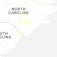
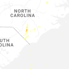
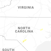


Connect with Interactive Hail Maps