

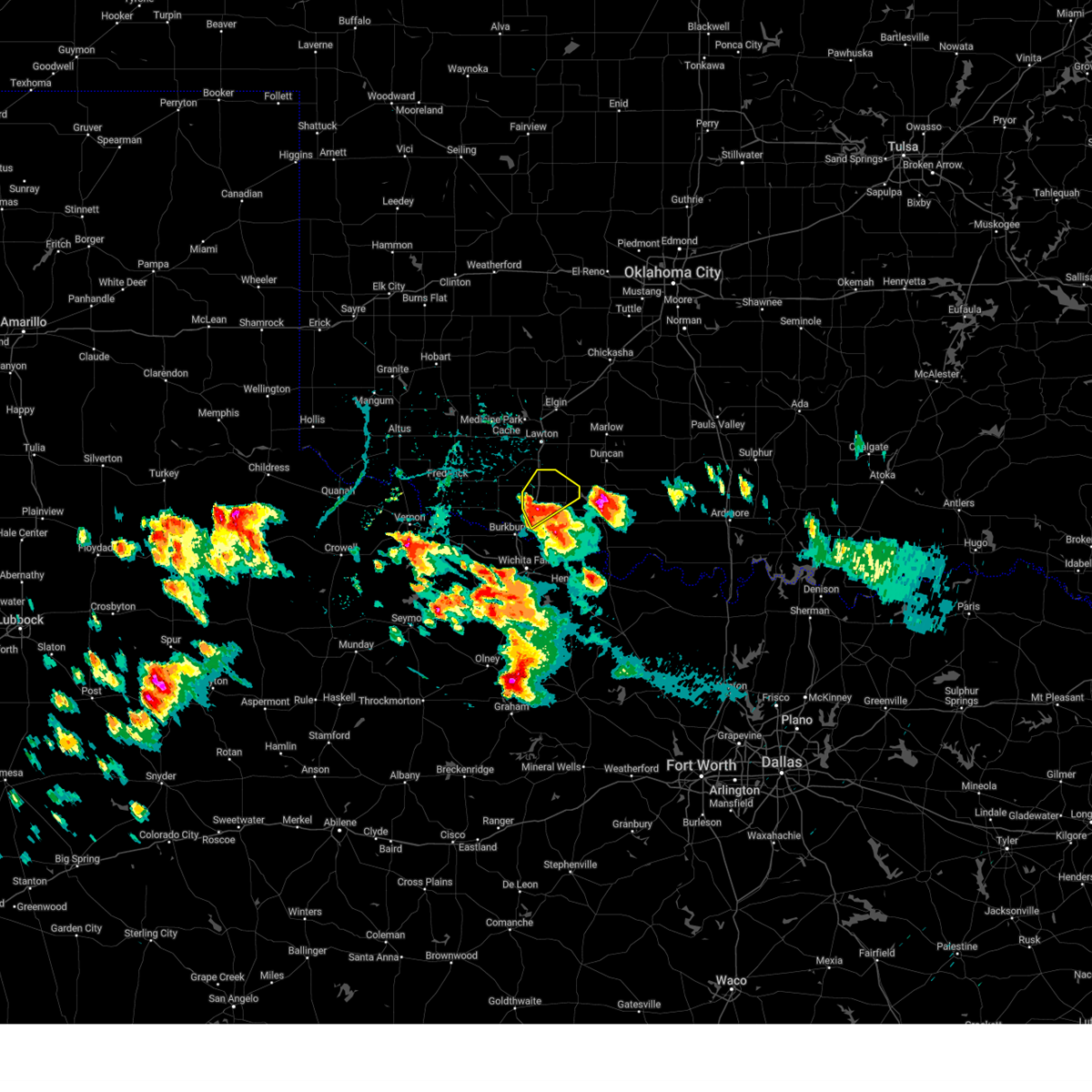
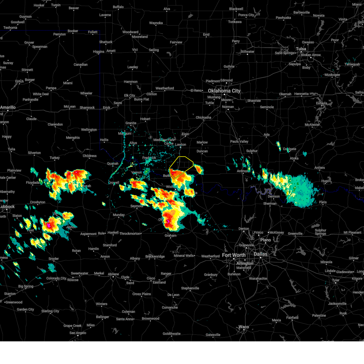
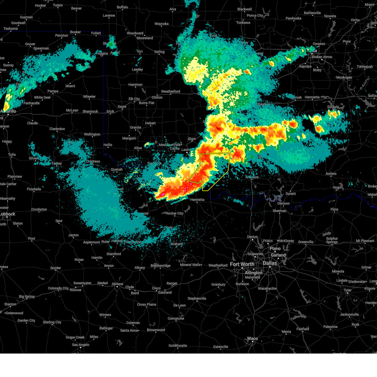
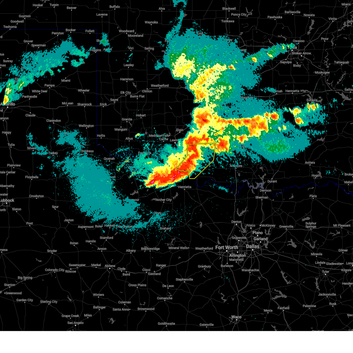
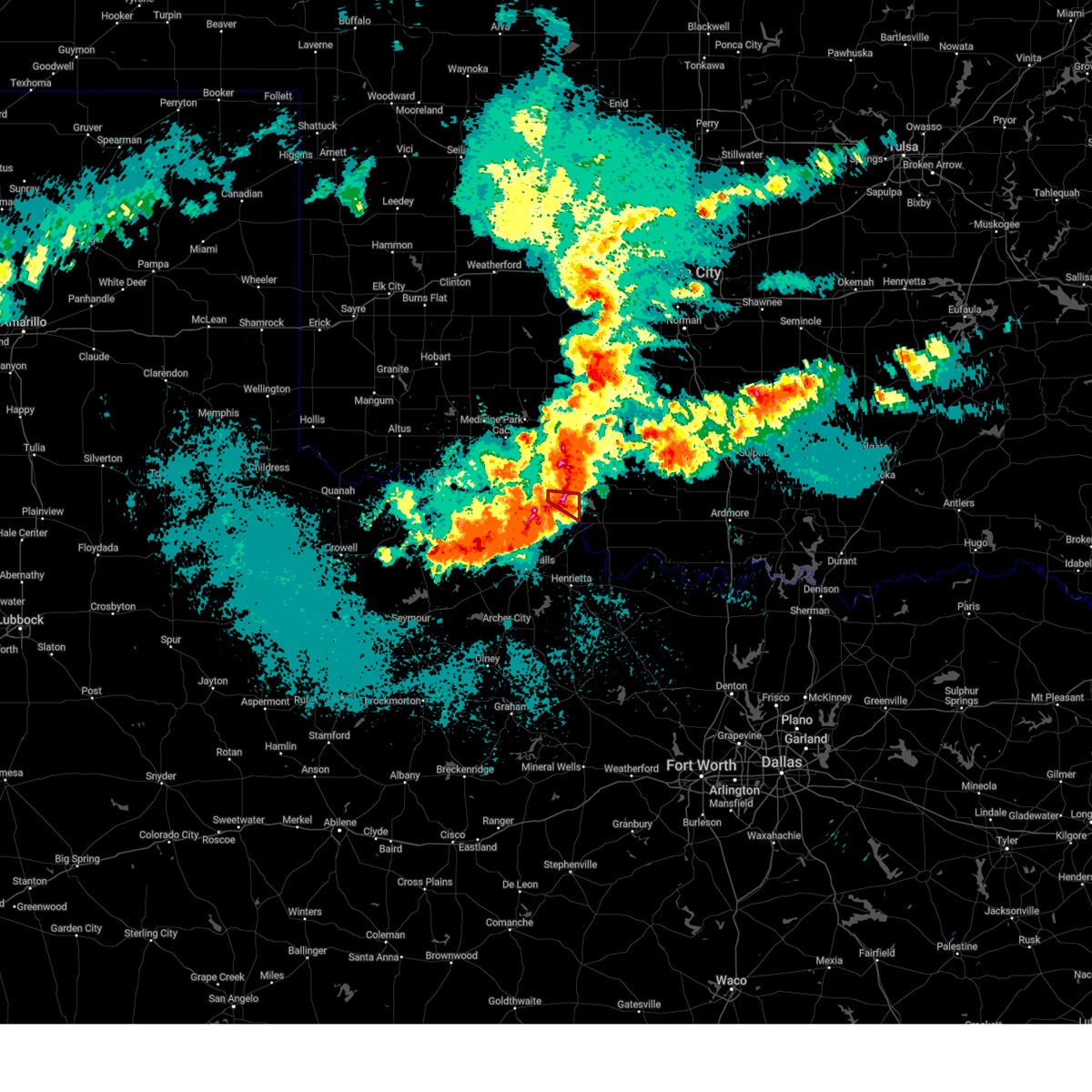
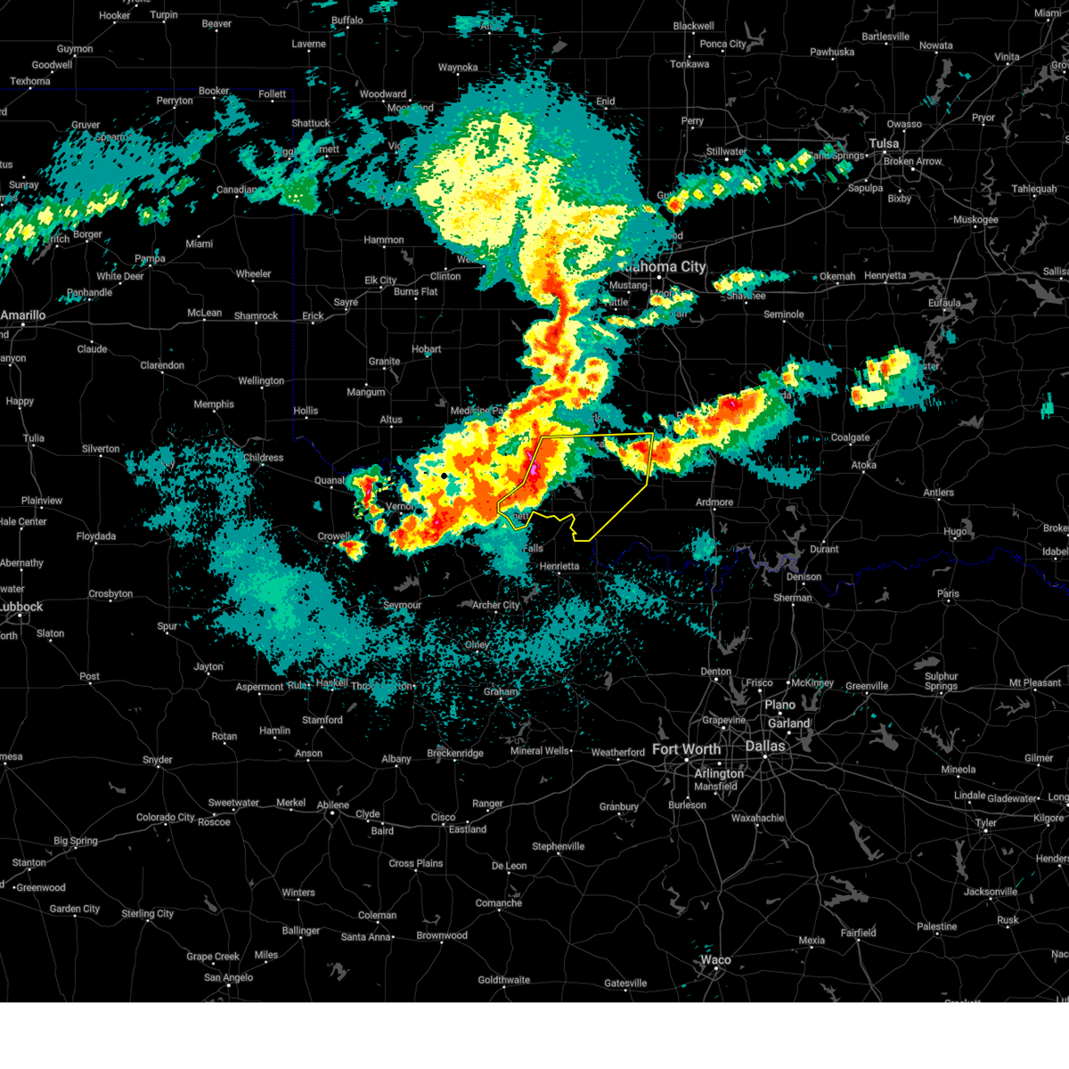
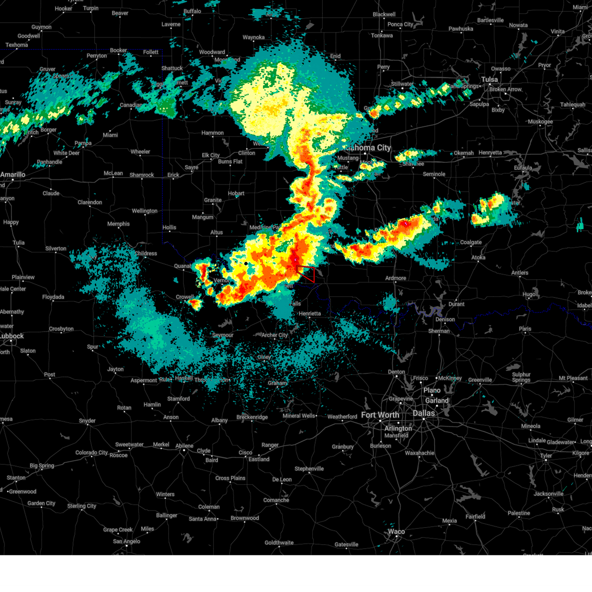
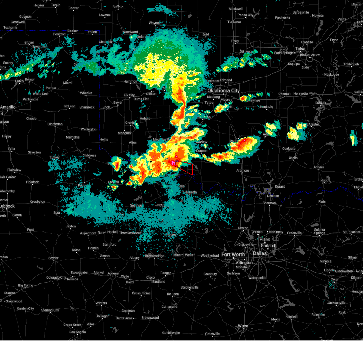
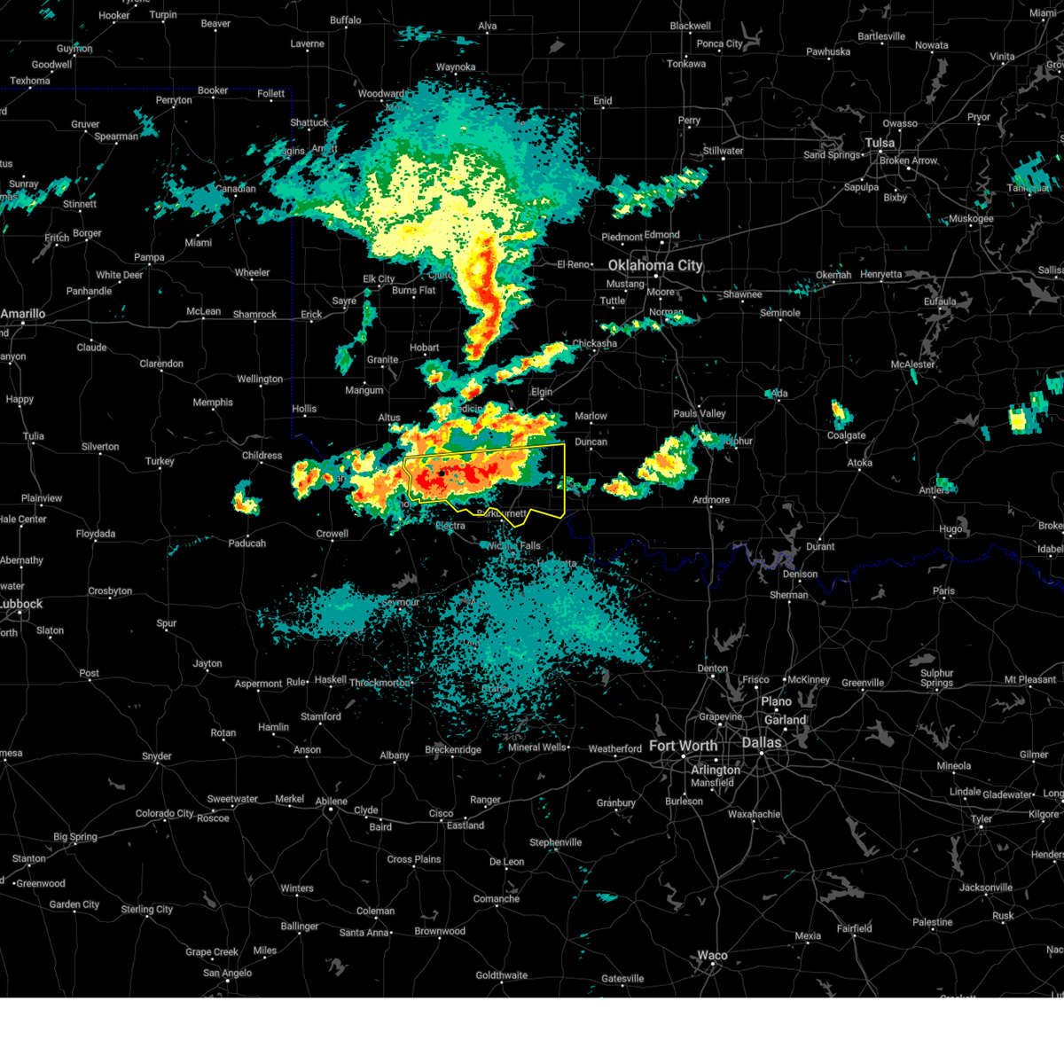
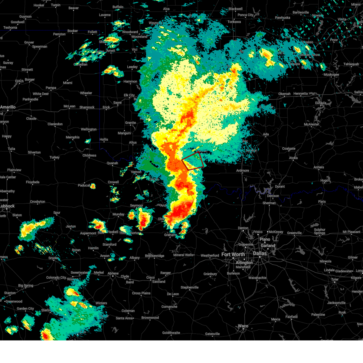
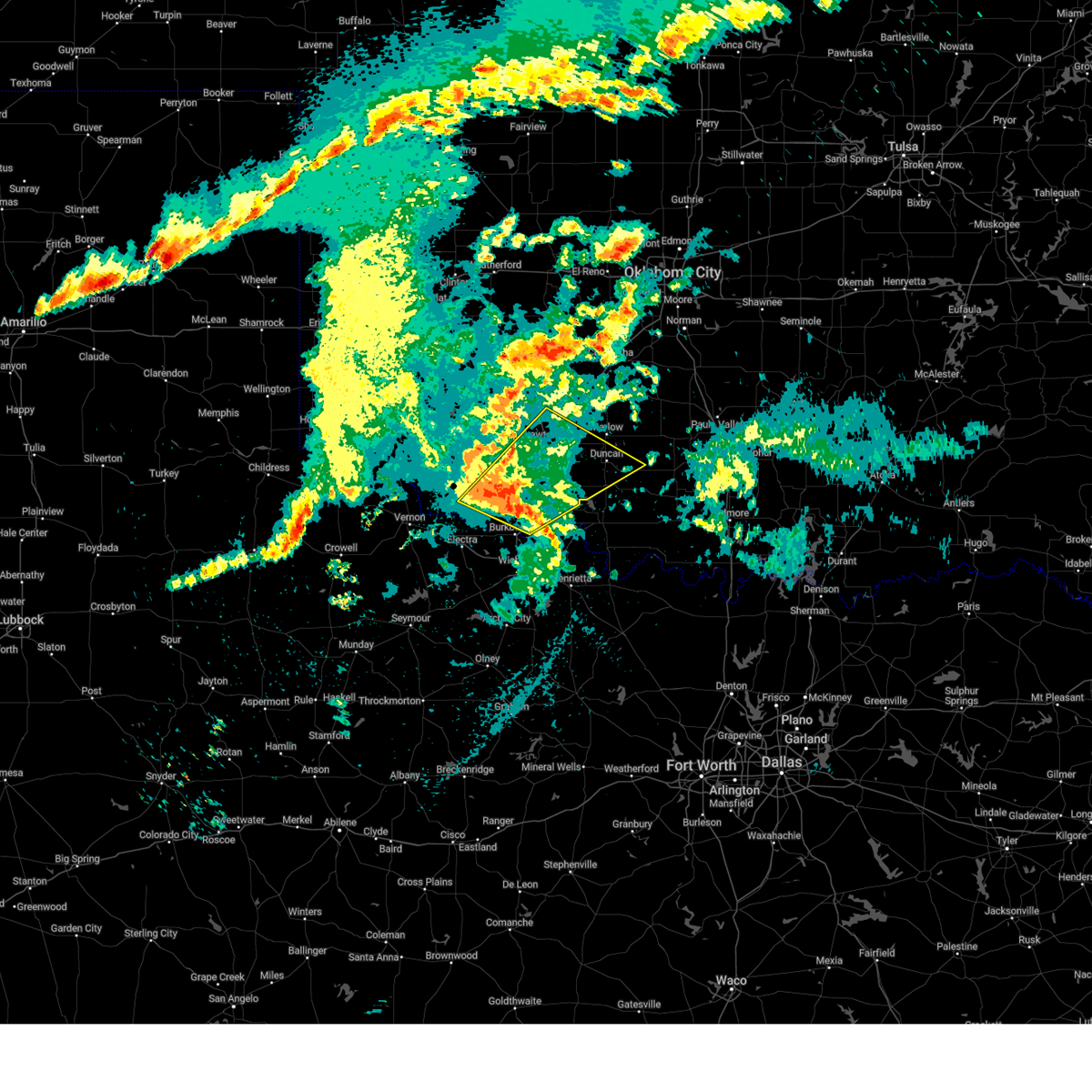
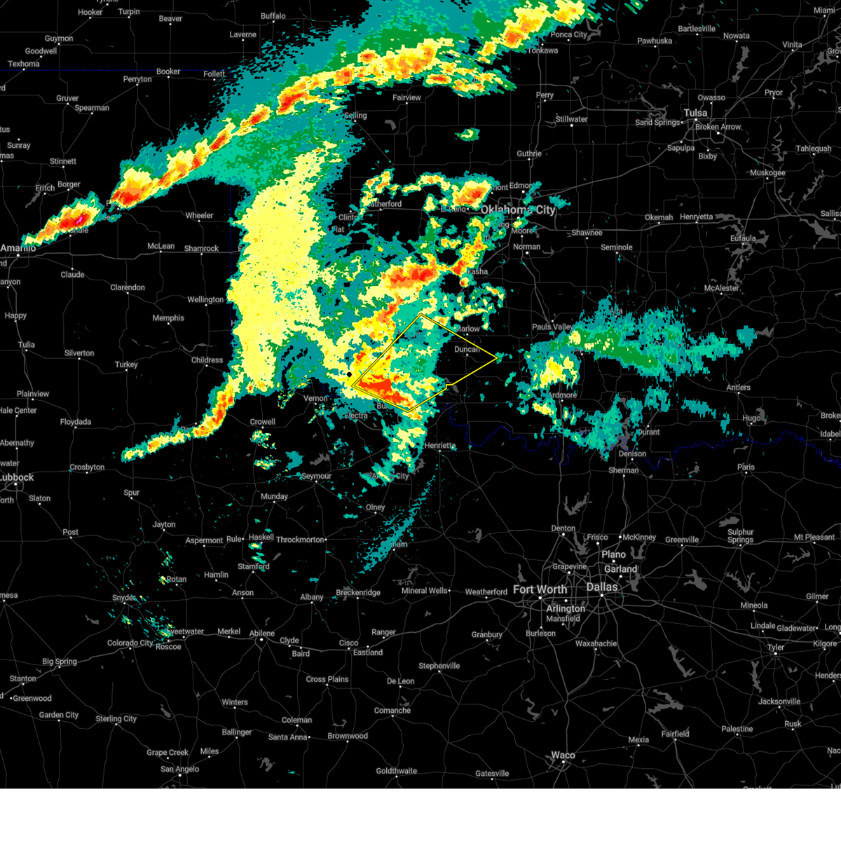
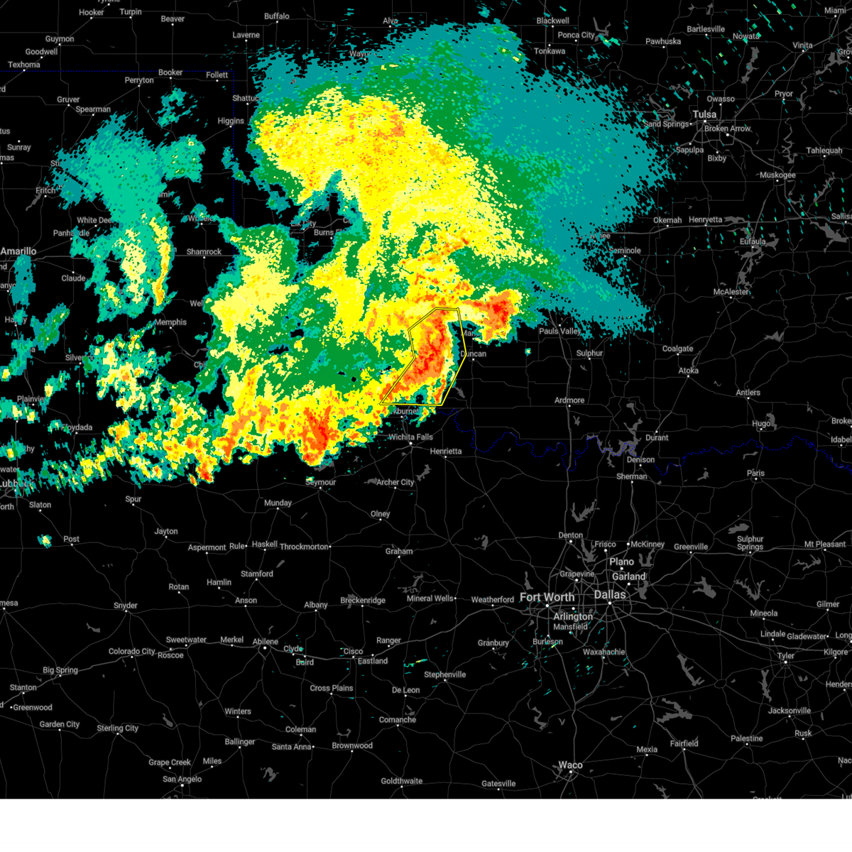
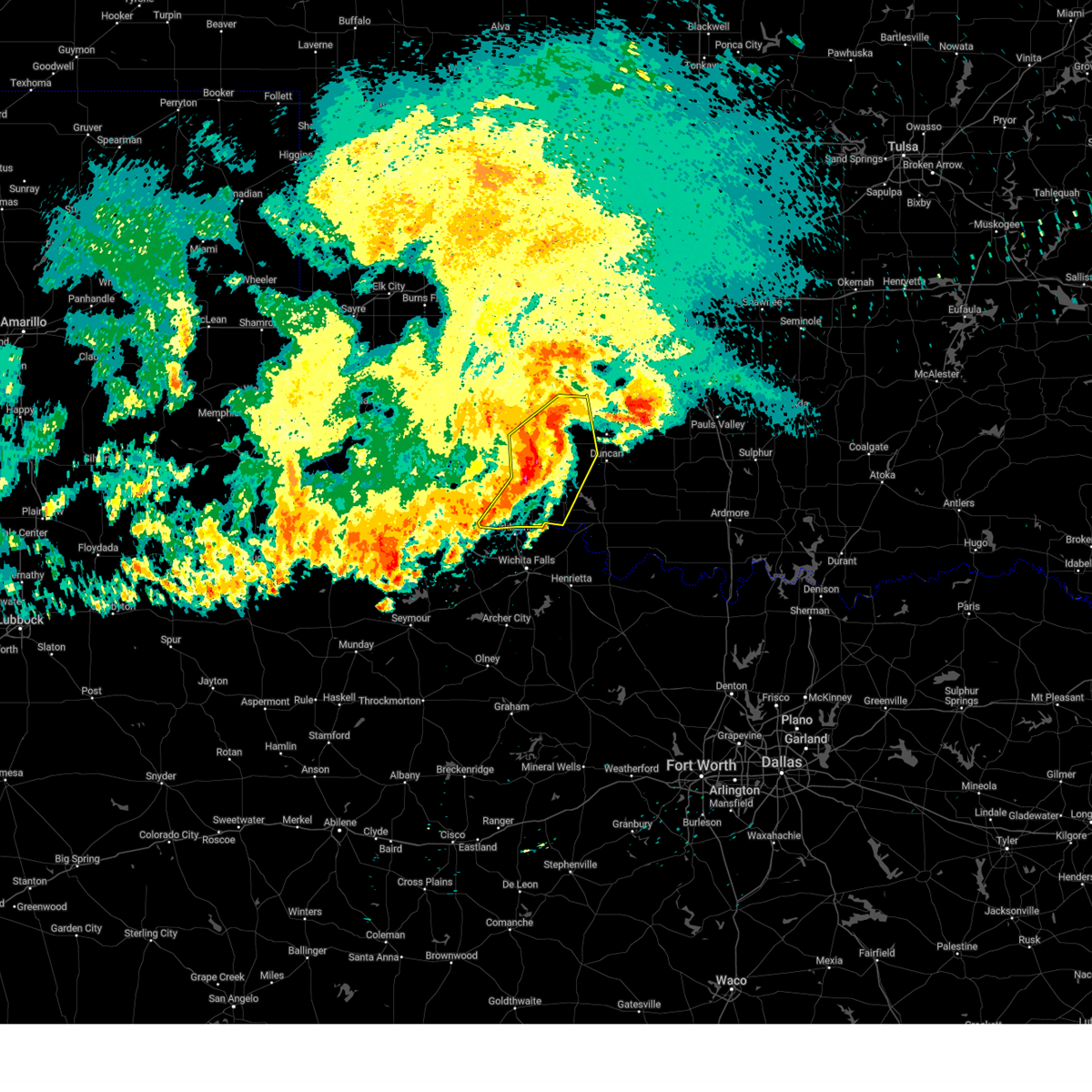
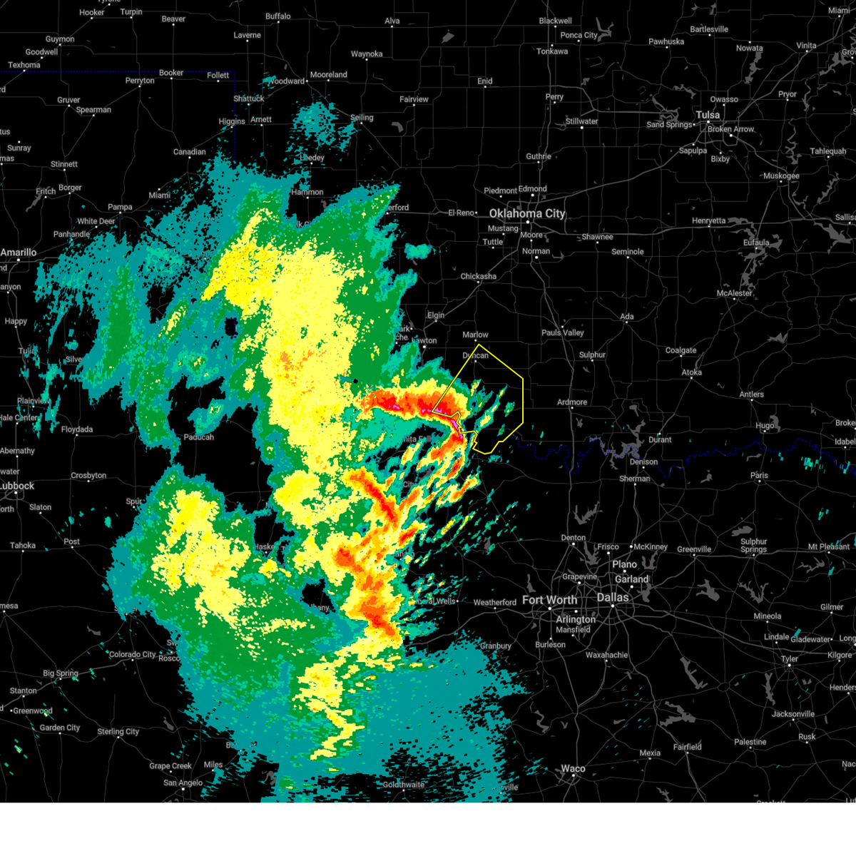
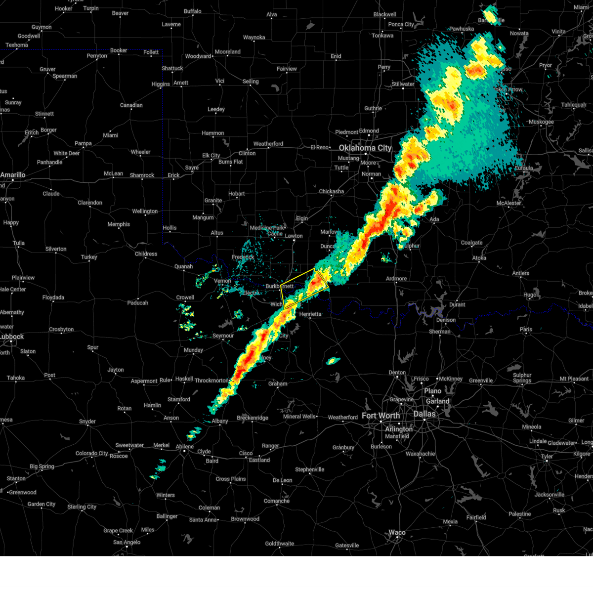
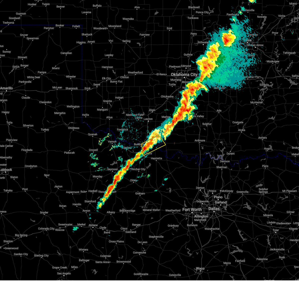
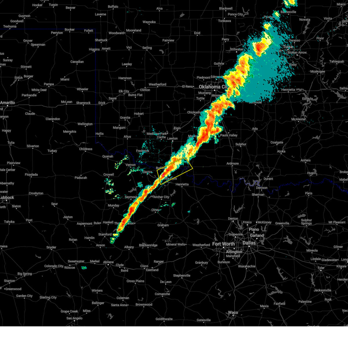
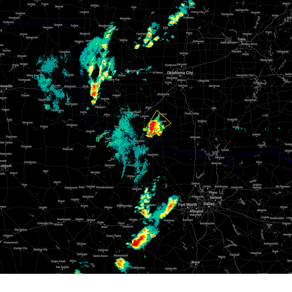
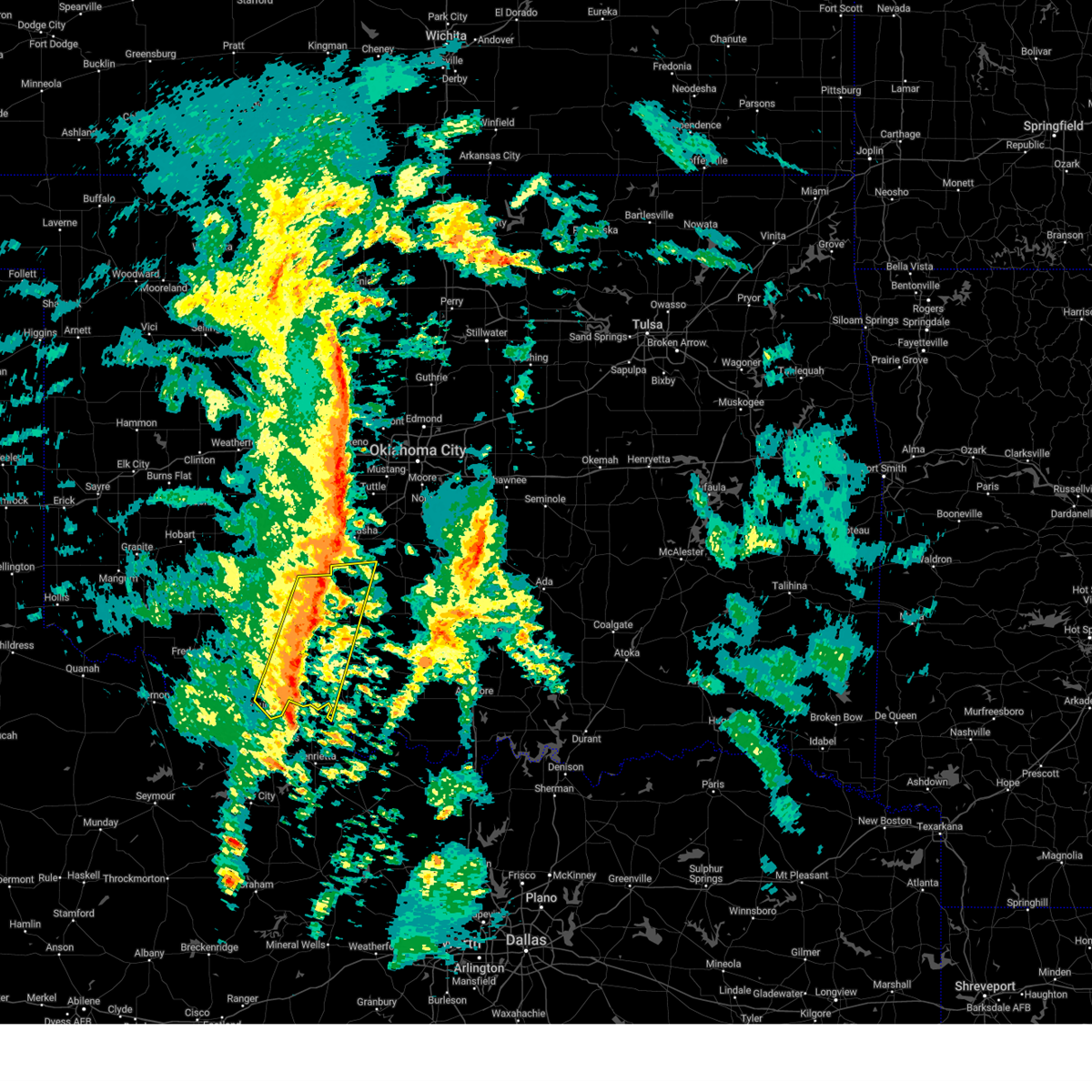
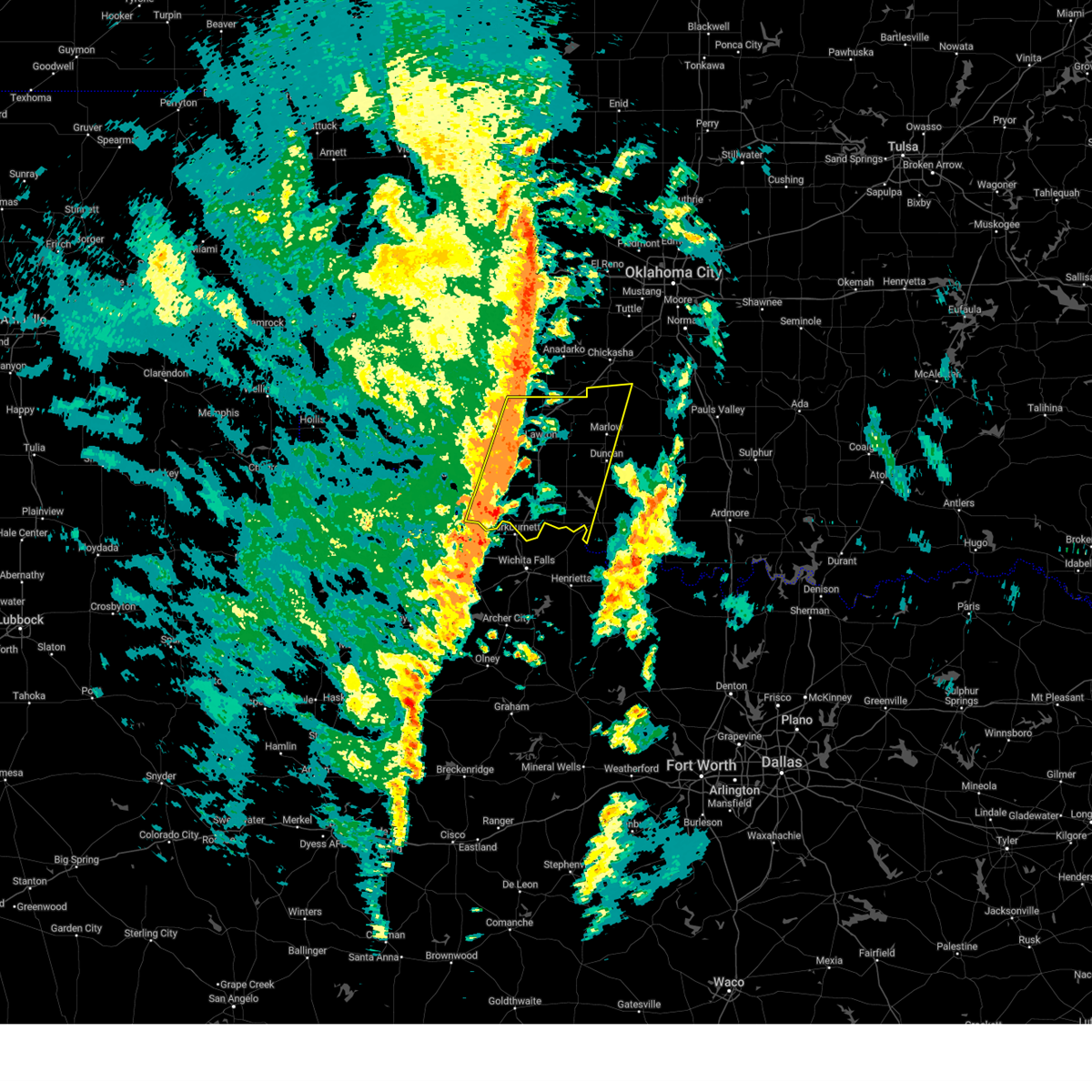
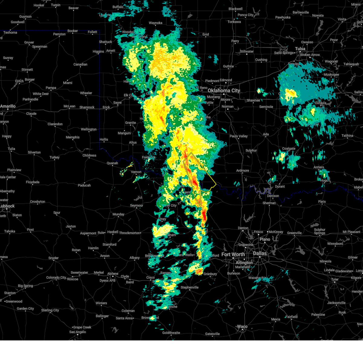
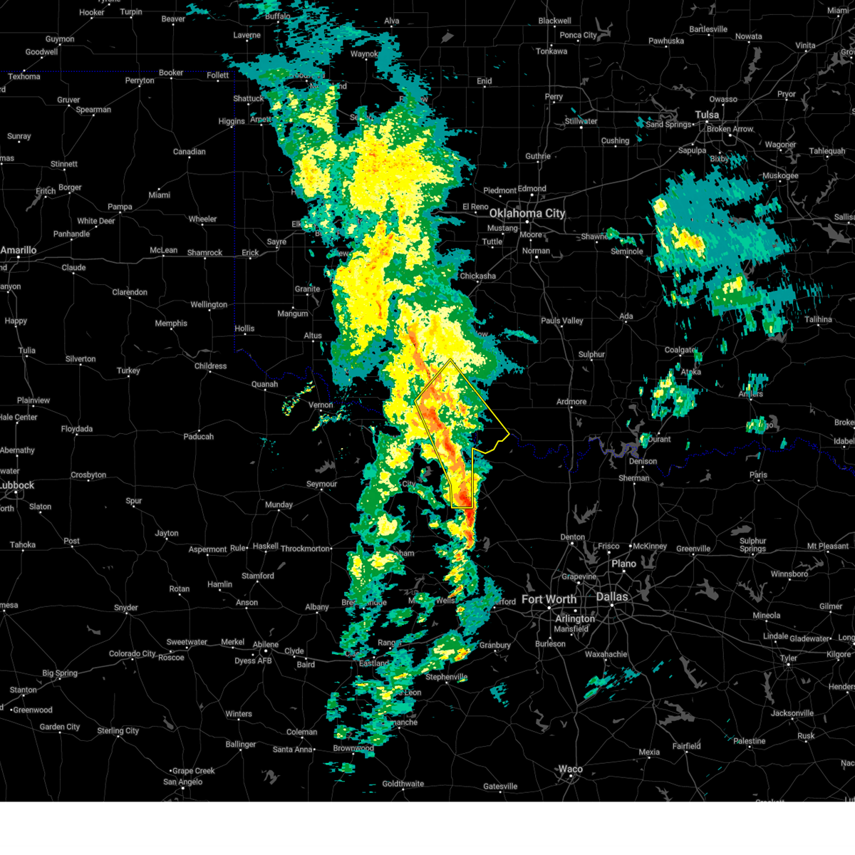
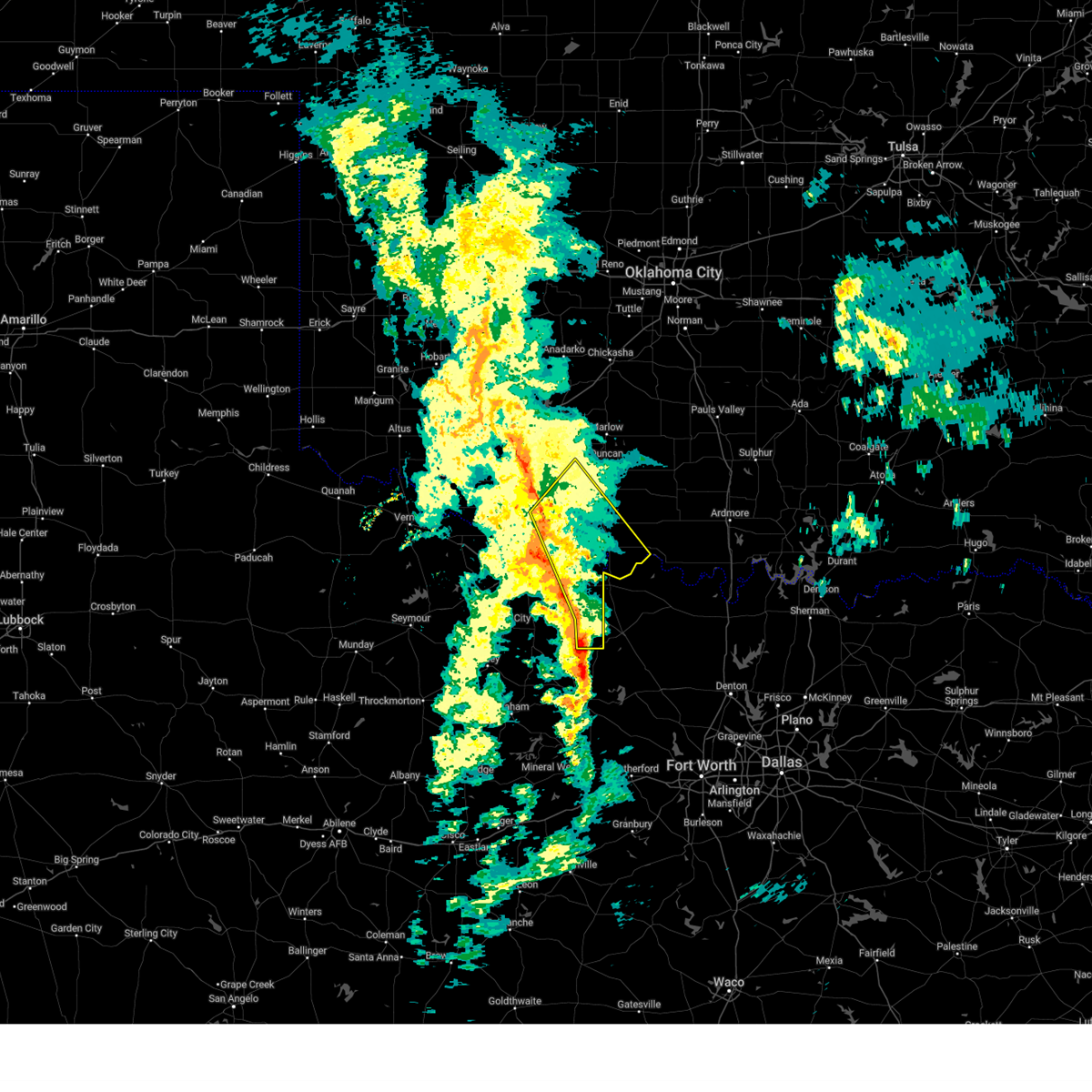
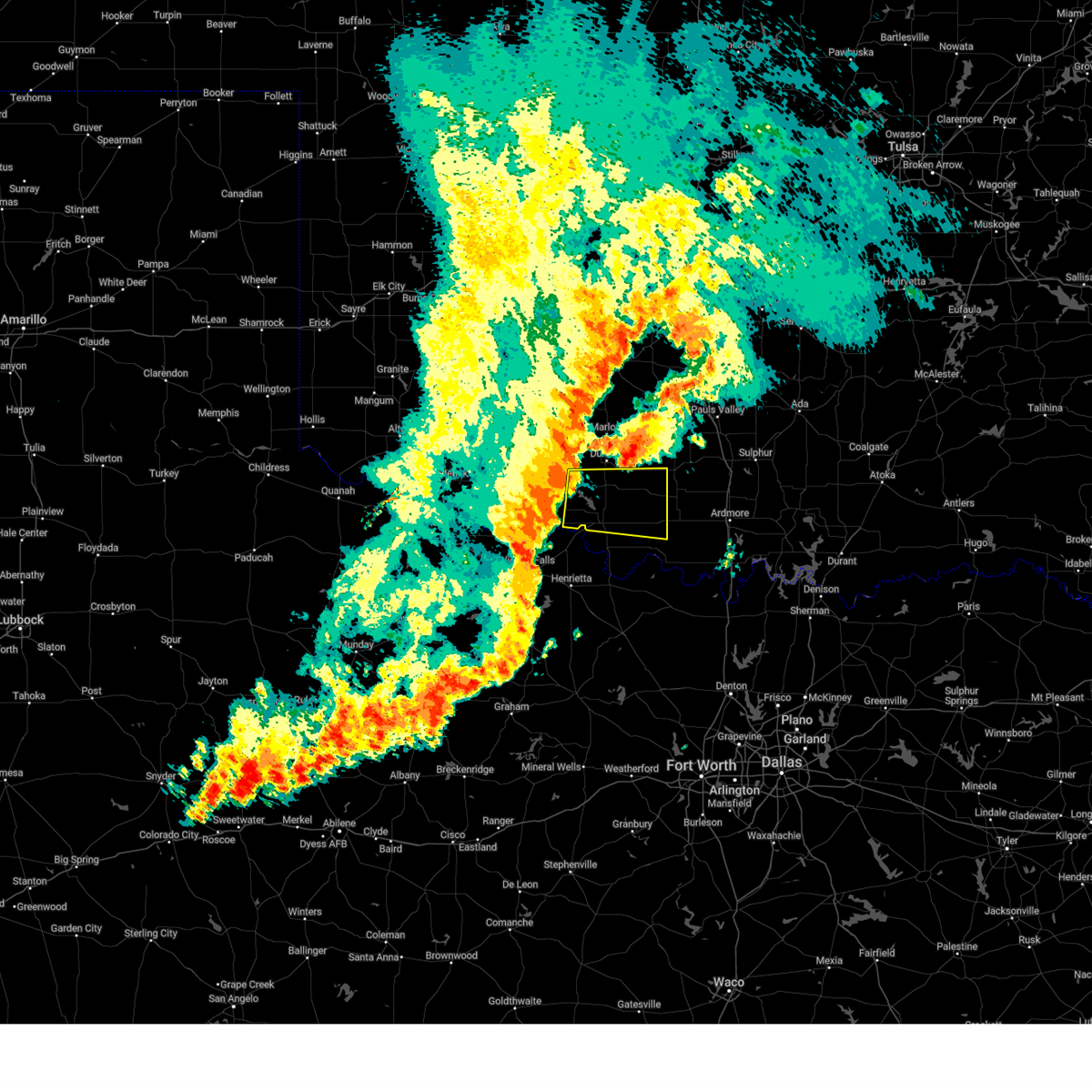
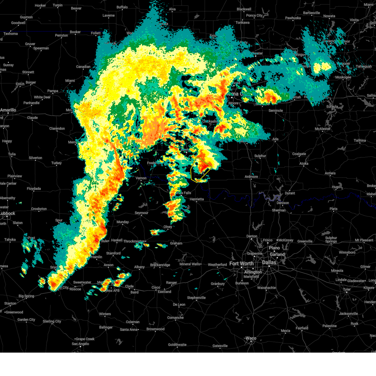
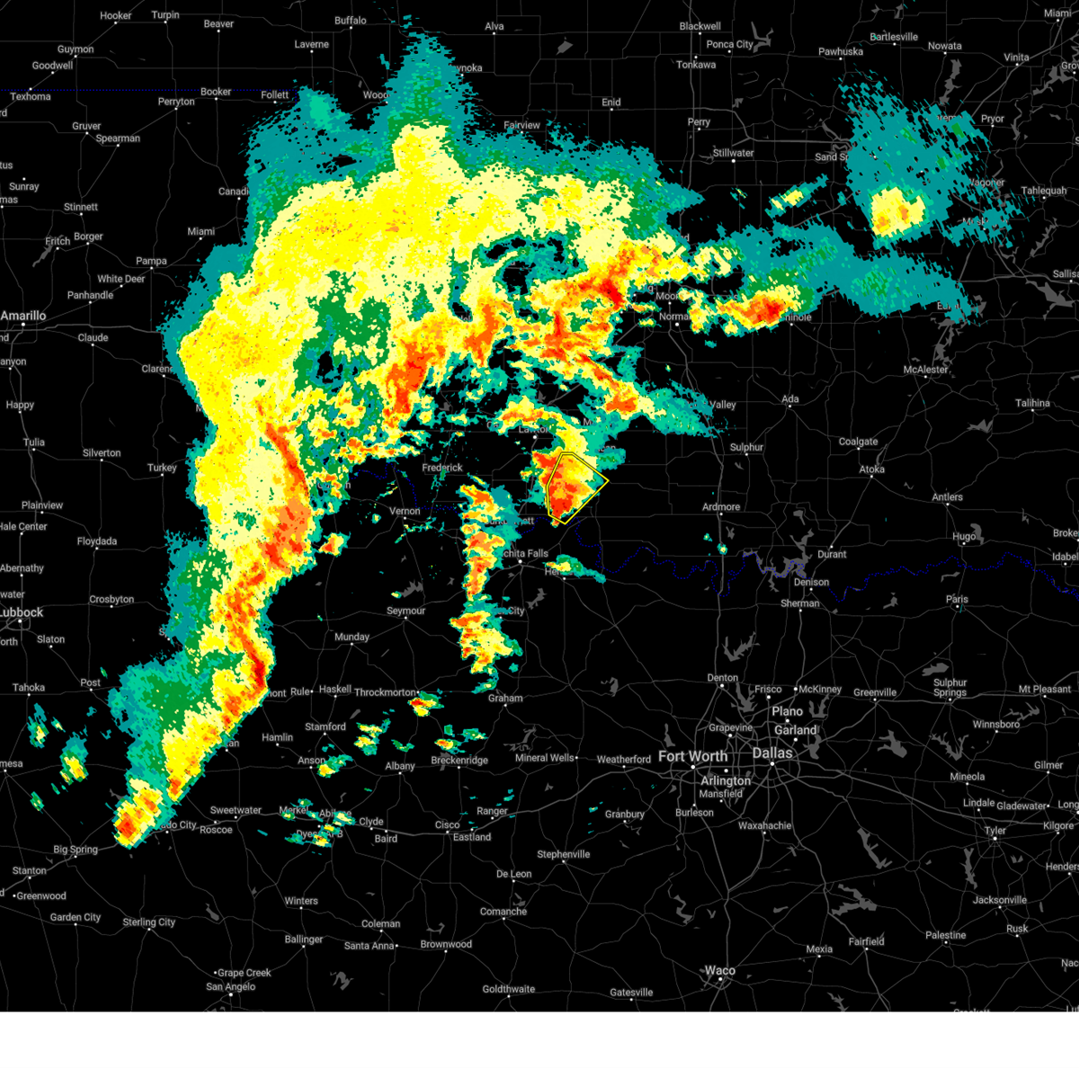
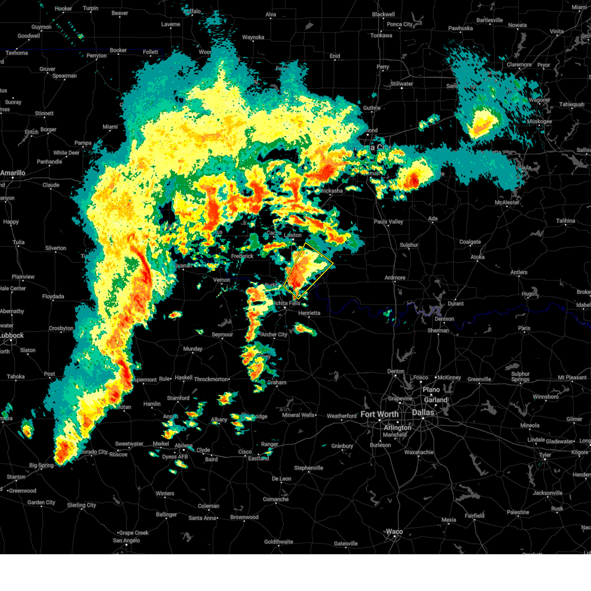
Hail Map for Temple, OK
The Temple, OK area has had 5 reports of on-the-ground hail by trained spotters, and has been under severe weather warnings 73 times during the past 12 months. Doppler radar has detected hail at or near Temple, OK on 97 occasions, including 7 occasions during the past year.
| Name: | Temple, OK |
| Where Located: | 29.2 miles NNE of Wichita Falls, TX |
| Map: | Google Map for Temple, OK |
| Population: | 1002 |
| Housing Units: | 542 |
| More Info: | Search Google for Temple, OK |
1
The Top Recent Hail Date for Temple, OK is Friday, April 4, 2025 (13th out of 97)

Hail and Wind Damage Spotted near Temple, OK
| Date / Time | Report Details |
|---|---|
| 6/3/2025 6:23 PM CDT |
 The storms which prompted the warning have weakened below severe limits, and no longer pose an immediate threat to life or property. therefore, the warning will be allowed to expire. however, gusty winds and heavy rain are still possible with these thunderstorms. The storms which prompted the warning have weakened below severe limits, and no longer pose an immediate threat to life or property. therefore, the warning will be allowed to expire. however, gusty winds and heavy rain are still possible with these thunderstorms.
|
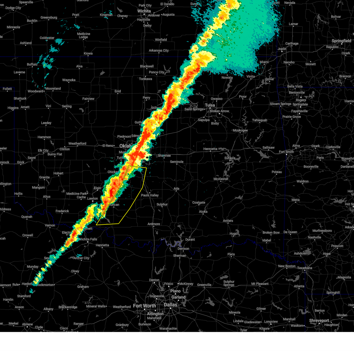
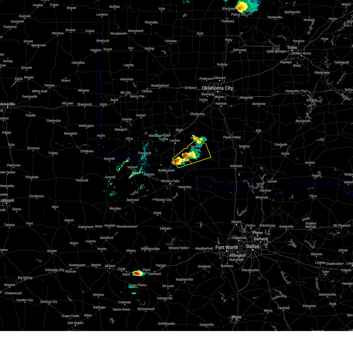
| 6/3/2025 5:43 PM CDT | Svroun the national weather service in norman has issued a * severe thunderstorm warning for, northern jefferson county in southern oklahoma, northeastern cotton county in southwestern oklahoma, stephens county in southern oklahoma, * until 630 pm cdt. * at 543 pm cdt, severe thunderstorms were located along a line extending from 6 miles west of duncan to near hastings, moving east at 30 mph (radar indicated). Hazards include 60 mph wind gusts and quarter size hail. Hail damage to vehicles is expected. expect wind damage to roofs, siding, and trees. Locations in or near the path include, addington, waurika lake, ringling, marlow, hastings, loco, empire city, central high, cornish, temple, bray, velma, corum, duncan, comanche,. |
| 6/3/2025 5:26 PM CDT |
 At 526 pm cdt, severe thunderstorms were located along a line extending from 9 miles south of sterling to 3 miles southeast of cookietown, moving southeast at 25 mph (radar indicated). Hazards include 60 mph wind gusts and quarter size hail. Hail damage to vehicles is expected. expect wind damage to roofs, siding, and trees. Locations in or near the path include, cookietown, grandfield, hulen, taylor, marlow, burkburnett, central high, temple, cashion, walters, geronimo, corum, randlett, devol, sheppard afb, sterling, duncan, rush springs, wichita falls, lawton,. At 526 pm cdt, severe thunderstorms were located along a line extending from 9 miles south of sterling to 3 miles southeast of cookietown, moving southeast at 25 mph (radar indicated). Hazards include 60 mph wind gusts and quarter size hail. Hail damage to vehicles is expected. expect wind damage to roofs, siding, and trees. Locations in or near the path include, cookietown, grandfield, hulen, taylor, marlow, burkburnett, central high, temple, cashion, walters, geronimo, corum, randlett, devol, sheppard afb, sterling, duncan, rush springs, wichita falls, lawton,.
|
| 6/3/2025 5:13 PM CDT |
 Svroun the national weather service in norman has issued a * severe thunderstorm warning for, eastern comanche county in southwestern oklahoma, southwestern grady county in central oklahoma, cotton county in southwestern oklahoma, northwestern stephens county in southern oklahoma, southeastern tillman county in southwestern oklahoma, central wichita county in northern texas, * until 600 pm cdt. * at 513 pm cdt, severe thunderstorms were located along a line extending from 7 miles southwest of sterling to 2 miles southeast of grandfield, moving southeast at 25 mph (radar indicated). Hazards include 60 mph wind gusts and quarter size hail. Hail damage to vehicles is expected. expect wind damage to roofs, siding, and trees. Locations in or near the path include, sterling, grandfield, central high, faxon, cashion, walters, corum, elgin, chattanooga, cookietown, hulen, taylor, rush springs, marlow, burkburnett, lawton, temple, loveland, geronimo, randlett,. Svroun the national weather service in norman has issued a * severe thunderstorm warning for, eastern comanche county in southwestern oklahoma, southwestern grady county in central oklahoma, cotton county in southwestern oklahoma, northwestern stephens county in southern oklahoma, southeastern tillman county in southwestern oklahoma, central wichita county in northern texas, * until 600 pm cdt. * at 513 pm cdt, severe thunderstorms were located along a line extending from 7 miles southwest of sterling to 2 miles southeast of grandfield, moving southeast at 25 mph (radar indicated). Hazards include 60 mph wind gusts and quarter size hail. Hail damage to vehicles is expected. expect wind damage to roofs, siding, and trees. Locations in or near the path include, sterling, grandfield, central high, faxon, cashion, walters, corum, elgin, chattanooga, cookietown, hulen, taylor, rush springs, marlow, burkburnett, lawton, temple, loveland, geronimo, randlett,.
|
| 6/3/2025 4:43 PM CDT |
 Svroun the national weather service in norman has issued a * severe thunderstorm warning for, southern comanche county in southwestern oklahoma, cotton county in southwestern oklahoma, central tillman county in southwestern oklahoma, * until 530 pm cdt. * at 442 pm cdt, severe thunderstorms were located along a line extending from 4 miles south of indiahoma to 4 miles southwest of chattanooga to 4 miles east of davidson, moving east at 35 mph (radar indicated). Hazards include 60 mph wind gusts and quarter size hail. Hail damage to vehicles is expected. expect wind damage to roofs, siding, and trees. Locations in or near the path include, chattanooga, frederick, cookietown, grandfield, hulen, faxon, temple, loveland, walters, geronimo, randlett, hollister, devol, taylor, lawton,. Svroun the national weather service in norman has issued a * severe thunderstorm warning for, southern comanche county in southwestern oklahoma, cotton county in southwestern oklahoma, central tillman county in southwestern oklahoma, * until 530 pm cdt. * at 442 pm cdt, severe thunderstorms were located along a line extending from 4 miles south of indiahoma to 4 miles southwest of chattanooga to 4 miles east of davidson, moving east at 35 mph (radar indicated). Hazards include 60 mph wind gusts and quarter size hail. Hail damage to vehicles is expected. expect wind damage to roofs, siding, and trees. Locations in or near the path include, chattanooga, frederick, cookietown, grandfield, hulen, faxon, temple, loveland, walters, geronimo, randlett, hollister, devol, taylor, lawton,.
|
| 5/29/2025 8:09 AM CDT |
 Svroun the national weather service in norman has issued a * severe thunderstorm warning for, central cotton county in southwestern oklahoma, north central clay county in northern texas, * until 845 am cdt. * at 809 am cdt, a severe thunderstorm was located near cookietown, moving southeast at 25 mph (radar indicated). Hazards include 60 mph wind gusts and quarter size hail. Hail damage to vehicles is expected. Expect wind damage to roofs, siding, and trees. Svroun the national weather service in norman has issued a * severe thunderstorm warning for, central cotton county in southwestern oklahoma, north central clay county in northern texas, * until 845 am cdt. * at 809 am cdt, a severe thunderstorm was located near cookietown, moving southeast at 25 mph (radar indicated). Hazards include 60 mph wind gusts and quarter size hail. Hail damage to vehicles is expected. Expect wind damage to roofs, siding, and trees.
|
| 5/29/2025 7:52 AM CDT |
 the severe thunderstorm warning has been cancelled and is no longer in effect the severe thunderstorm warning has been cancelled and is no longer in effect
|
| 5/29/2025 7:52 AM CDT |
 At 752 am cdt, a severe thunderstorm was located 6 miles north of cookietown, moving east at 25 mph (radar indicated). Hazards include 60 mph wind gusts and half dollar size hail. Hail damage to vehicles is expected. expect wind damage to roofs, siding, and trees. Locations impacted include, walters, temple, and cookietown. At 752 am cdt, a severe thunderstorm was located 6 miles north of cookietown, moving east at 25 mph (radar indicated). Hazards include 60 mph wind gusts and half dollar size hail. Hail damage to vehicles is expected. expect wind damage to roofs, siding, and trees. Locations impacted include, walters, temple, and cookietown.
|
| 5/29/2025 7:42 AM CDT |
 At 742 am cdt, a severe thunderstorm was located 5 miles south of faxon, moving southeast at 25 mph (radar indicated). Hazards include 60 mph wind gusts and half dollar size hail. Hail damage to vehicles is expected. expect wind damage to roofs, siding, and trees. Locations impacted include, walters, geronimo, temple, chattanooga, faxon, and cookietown. At 742 am cdt, a severe thunderstorm was located 5 miles south of faxon, moving southeast at 25 mph (radar indicated). Hazards include 60 mph wind gusts and half dollar size hail. Hail damage to vehicles is expected. expect wind damage to roofs, siding, and trees. Locations impacted include, walters, geronimo, temple, chattanooga, faxon, and cookietown.
|
| 5/29/2025 7:36 AM CDT |
 Svroun the national weather service in norman has issued a * severe thunderstorm warning for, southwestern comanche county in southwestern oklahoma, northern cotton county in southwestern oklahoma, east central tillman county in southwestern oklahoma, * until 815 am cdt. * at 736 am cdt, a severe thunderstorm was located near faxon, moving east at 25 mph (radar indicated). Hazards include 60 mph wind gusts and quarter size hail. Hail damage to vehicles is expected. Expect wind damage to roofs, siding, and trees. Svroun the national weather service in norman has issued a * severe thunderstorm warning for, southwestern comanche county in southwestern oklahoma, northern cotton county in southwestern oklahoma, east central tillman county in southwestern oklahoma, * until 815 am cdt. * at 736 am cdt, a severe thunderstorm was located near faxon, moving east at 25 mph (radar indicated). Hazards include 60 mph wind gusts and quarter size hail. Hail damage to vehicles is expected. Expect wind damage to roofs, siding, and trees.
|
| 5/25/2025 10:03 PM CDT | At 1003 pm cdt, the leading edge of a line of severe thunderstorms extended from near rush springs to near waurika lake to near dean, moving east at 30 mph (radar indicated). Hazards include 60 mph wind gusts and nickel size hail. Expect damage to roofs, siding, and trees. Locations impacted include, northern wichita falls, duncan, marlow, walters, waurika, comanche, rush springs, bray, fletcher, temple, sterling, petrolia, byers, dean, hastings, addington, corum, waurika lake, sheppard afb, and southeastern fort sill. |
| 5/25/2025 9:45 PM CDT |
 At 944 pm cdt, severe thunderstorms were located along a line extending from near sterling to near temple to near sheppard afb, moving east at 30 mph (radar indicated). Hazards include 60 mph wind gusts and nickel size hail. Expect damage to roofs, siding, and trees. Locations impacted include, northern wichita falls, lawton, duncan, burkburnett, marlow, walters, waurika, iowa park, elgin, comanche, geronimo, rush springs, bray, fletcher, temple, sterling, petrolia, byers, dean, and randlett. At 944 pm cdt, severe thunderstorms were located along a line extending from near sterling to near temple to near sheppard afb, moving east at 30 mph (radar indicated). Hazards include 60 mph wind gusts and nickel size hail. Expect damage to roofs, siding, and trees. Locations impacted include, northern wichita falls, lawton, duncan, burkburnett, marlow, walters, waurika, iowa park, elgin, comanche, geronimo, rush springs, bray, fletcher, temple, sterling, petrolia, byers, dean, and randlett.
|
| 5/25/2025 9:29 PM CDT |
 Svroun the national weather service in norman has issued a * severe thunderstorm warning for, eastern comanche county in southwestern oklahoma, northwestern jefferson county in southern oklahoma, southwestern grady county in central oklahoma, western stephens county in southern oklahoma, cotton county in southwestern oklahoma, northwestern clay county in northern texas, northeastern wichita county in northern texas, * until 1015 pm cdt. * at 929 pm cdt, severe thunderstorms were located along a line extending from near lake ellsworth to 4 miles northeast of cookietown to 3 miles north of iowa park, moving east at 30 mph (radar indicated). Hazards include 60 mph wind gusts and nickel size hail. expect damage to roofs, siding, and trees Svroun the national weather service in norman has issued a * severe thunderstorm warning for, eastern comanche county in southwestern oklahoma, northwestern jefferson county in southern oklahoma, southwestern grady county in central oklahoma, western stephens county in southern oklahoma, cotton county in southwestern oklahoma, northwestern clay county in northern texas, northeastern wichita county in northern texas, * until 1015 pm cdt. * at 929 pm cdt, severe thunderstorms were located along a line extending from near lake ellsworth to 4 miles northeast of cookietown to 3 miles north of iowa park, moving east at 30 mph (radar indicated). Hazards include 60 mph wind gusts and nickel size hail. expect damage to roofs, siding, and trees
|
| 5/25/2025 1:13 AM CDT |
 Svroun the national weather service in norman has issued a * severe thunderstorm warning for, northwestern jefferson county in southern oklahoma, southwestern stephens county in southern oklahoma, cotton county in southwestern oklahoma, southeastern tillman county in southwestern oklahoma, northwestern clay county in northern texas, wichita county in northern texas, * until 200 am cdt. * at 113 am cdt, severe thunderstorms were located along a line extending from 5 miles west of temple to 4 miles west of wichita falls, moving northeast at 30 mph (radar indicated). Hazards include 60 mph wind gusts and quarter size hail. Hail damage to vehicles is expected. Expect wind damage to roofs, siding, and trees. Svroun the national weather service in norman has issued a * severe thunderstorm warning for, northwestern jefferson county in southern oklahoma, southwestern stephens county in southern oklahoma, cotton county in southwestern oklahoma, southeastern tillman county in southwestern oklahoma, northwestern clay county in northern texas, wichita county in northern texas, * until 200 am cdt. * at 113 am cdt, severe thunderstorms were located along a line extending from 5 miles west of temple to 4 miles west of wichita falls, moving northeast at 30 mph (radar indicated). Hazards include 60 mph wind gusts and quarter size hail. Hail damage to vehicles is expected. Expect wind damage to roofs, siding, and trees.
|
| 5/22/2025 5:09 PM CDT |
 Svroun the national weather service in norman has issued a * severe thunderstorm warning for, southwestern stephens county in southern oklahoma, northeastern cotton county in southwestern oklahoma, * until 600 pm cdt. * at 509 pm cdt, a severe thunderstorm was located 4 miles east of walters, moving northeast at 25 mph (radar indicated). Hazards include golf ball size hail and 60 mph wind gusts. People and animals outdoors will be injured. expect hail damage to roofs, siding, windows, and vehicles. Expect wind damage to roofs, siding, and trees. Svroun the national weather service in norman has issued a * severe thunderstorm warning for, southwestern stephens county in southern oklahoma, northeastern cotton county in southwestern oklahoma, * until 600 pm cdt. * at 509 pm cdt, a severe thunderstorm was located 4 miles east of walters, moving northeast at 25 mph (radar indicated). Hazards include golf ball size hail and 60 mph wind gusts. People and animals outdoors will be injured. expect hail damage to roofs, siding, windows, and vehicles. Expect wind damage to roofs, siding, and trees.
|
| 5/22/2025 5:01 PM CDT |
 At 501 pm cdt, a severe thunderstorm was located near walters, moving northeast at 30 mph (radar indicated). Hazards include ping pong ball size hail and 60 mph wind gusts. People and animals outdoors will be injured. expect hail damage to roofs, siding, windows, and vehicles. expect wind damage to roofs, siding, and trees. Locations impacted include, walters and temple. At 501 pm cdt, a severe thunderstorm was located near walters, moving northeast at 30 mph (radar indicated). Hazards include ping pong ball size hail and 60 mph wind gusts. People and animals outdoors will be injured. expect hail damage to roofs, siding, windows, and vehicles. expect wind damage to roofs, siding, and trees. Locations impacted include, walters and temple.
|
| 5/22/2025 4:47 PM CDT |
 At 447 pm cdt, a severe thunderstorm was located near cookietown, moving northeast at 25 mph. ping pong ball size hail was reported at cookietown (radar indicated). Hazards include golf ball size hail and 60 mph wind gusts. People and animals outdoors will be injured. expect hail damage to roofs, siding, windows, and vehicles. expect wind damage to roofs, siding, and trees. Locations impacted include, walters, temple, randlett, and cookietown. At 447 pm cdt, a severe thunderstorm was located near cookietown, moving northeast at 25 mph. ping pong ball size hail was reported at cookietown (radar indicated). Hazards include golf ball size hail and 60 mph wind gusts. People and animals outdoors will be injured. expect hail damage to roofs, siding, windows, and vehicles. expect wind damage to roofs, siding, and trees. Locations impacted include, walters, temple, randlett, and cookietown.
|
| 5/22/2025 4:29 PM CDT |
 Svroun the national weather service in norman has issued a * severe thunderstorm warning for, cotton county in southwestern oklahoma, * until 515 pm cdt. * at 428 pm cdt, a severe thunderstorm was located near randlett, moving northeast at 25 mph (radar indicated). Hazards include tennis ball size hail and 60 mph wind gusts. People and animals outdoors will be injured. expect hail damage to roofs, siding, windows, and vehicles. Expect wind damage to roofs, siding, and trees. Svroun the national weather service in norman has issued a * severe thunderstorm warning for, cotton county in southwestern oklahoma, * until 515 pm cdt. * at 428 pm cdt, a severe thunderstorm was located near randlett, moving northeast at 25 mph (radar indicated). Hazards include tennis ball size hail and 60 mph wind gusts. People and animals outdoors will be injured. expect hail damage to roofs, siding, windows, and vehicles. Expect wind damage to roofs, siding, and trees.
|
| 5/2/2025 2:45 AM CDT |
 At 245 am cdt, severe thunderstorms were located along a line extending from near duncan to 4 miles northeast of comanche to 5 miles north of byers, moving east at 45 mph (radar indicated). Hazards include 60 mph wind gusts and quarter size hail. Hail damage to vehicles is expected. expect wind damage to roofs, siding, and trees. Locations impacted include, duncan, waurika, comanche, temple, ryan, velma, hastings, loco, addington, sugden, waurika lake, corum, empire city, and taylor. At 245 am cdt, severe thunderstorms were located along a line extending from near duncan to 4 miles northeast of comanche to 5 miles north of byers, moving east at 45 mph (radar indicated). Hazards include 60 mph wind gusts and quarter size hail. Hail damage to vehicles is expected. expect wind damage to roofs, siding, and trees. Locations impacted include, duncan, waurika, comanche, temple, ryan, velma, hastings, loco, addington, sugden, waurika lake, corum, empire city, and taylor.
|
| 5/2/2025 2:45 AM CDT |
 the severe thunderstorm warning has been cancelled and is no longer in effect the severe thunderstorm warning has been cancelled and is no longer in effect
|
| 5/2/2025 2:29 AM CDT |
 The rotation in the severe thunderstorm has weakened and does not appear capable of producing a tornado at this time. however the storm is still severe and capable of producing large hail and damaging winds. The rotation in the severe thunderstorm has weakened and does not appear capable of producing a tornado at this time. however the storm is still severe and capable of producing large hail and damaging winds.
|
| 5/2/2025 2:12 AM CDT |
 Svroun the national weather service in norman has issued a * severe thunderstorm warning for, southeastern comanche county in southwestern oklahoma, northwestern jefferson county in southern oklahoma, stephens county in southern oklahoma, cotton county in southwestern oklahoma, * until 300 am cdt. * at 212 am cdt, severe thunderstorms were located along a line extending from 7 miles northeast of geronimo to 3 miles northwest of temple to 3 miles north of burkburnett, moving east at 40 mph (radar indicated). Hazards include ping pong ball size hail and 60 mph wind gusts. People and animals outdoors will be injured. expect hail damage to roofs, siding, windows, and vehicles. Expect wind damage to roofs, siding, and trees. Svroun the national weather service in norman has issued a * severe thunderstorm warning for, southeastern comanche county in southwestern oklahoma, northwestern jefferson county in southern oklahoma, stephens county in southern oklahoma, cotton county in southwestern oklahoma, * until 300 am cdt. * at 212 am cdt, severe thunderstorms were located along a line extending from 7 miles northeast of geronimo to 3 miles northwest of temple to 3 miles north of burkburnett, moving east at 40 mph (radar indicated). Hazards include ping pong ball size hail and 60 mph wind gusts. People and animals outdoors will be injured. expect hail damage to roofs, siding, windows, and vehicles. Expect wind damage to roofs, siding, and trees.
|
| 5/2/2025 2:09 AM CDT |
 At 208 am cdt, a severe thunderstorm capable of producing a tornado was located 5 miles northwest of temple, moving east-southeast at 40 mph (radar indicated rotation). Hazards include tornado and golf ball size hail. Flying debris will be dangerous to those caught without shelter. mobile homes will be damaged or destroyed. damage to roofs, windows, and vehicles will occur. tree damage is likely. Locations impacted include, temple. At 208 am cdt, a severe thunderstorm capable of producing a tornado was located 5 miles northwest of temple, moving east-southeast at 40 mph (radar indicated rotation). Hazards include tornado and golf ball size hail. Flying debris will be dangerous to those caught without shelter. mobile homes will be damaged or destroyed. damage to roofs, windows, and vehicles will occur. tree damage is likely. Locations impacted include, temple.
|
| 5/2/2025 1:58 AM CDT |
 Toroun the national weather service in norman has issued a * tornado warning for, east central cotton county in southwestern oklahoma, * until 230 am cdt. * at 157 am cdt, a severe thunderstorm capable of producing a tornado was located 3 miles northeast of cookietown, moving east- southeast at 30 mph (radar indicated rotation). Hazards include tornado and golf ball size hail. Flying debris will be dangerous to those caught without shelter. mobile homes will be damaged or destroyed. damage to roofs, windows, and vehicles will occur. Tree damage is likely. Toroun the national weather service in norman has issued a * tornado warning for, east central cotton county in southwestern oklahoma, * until 230 am cdt. * at 157 am cdt, a severe thunderstorm capable of producing a tornado was located 3 miles northeast of cookietown, moving east- southeast at 30 mph (radar indicated rotation). Hazards include tornado and golf ball size hail. Flying debris will be dangerous to those caught without shelter. mobile homes will be damaged or destroyed. damage to roofs, windows, and vehicles will occur. Tree damage is likely.
|
| 5/2/2025 1:29 AM CDT |
 Svroun the national weather service in norman has issued a * severe thunderstorm warning for, southeastern comanche county in southwestern oklahoma, cotton county in southwestern oklahoma, tillman county in southwestern oklahoma, * until 215 am cdt. * at 128 am cdt, severe thunderstorms were located 3 miles southeast of chattanooga, 4 miles north of loveland, and 5 miles north of davidson, moving east at 25 mph (radar indicated). Hazards include golf ball size hail and 60 mph wind gusts. People and animals outdoors will be injured. expect hail damage to roofs, siding, windows, and vehicles. Expect wind damage to roofs, siding, and trees. Svroun the national weather service in norman has issued a * severe thunderstorm warning for, southeastern comanche county in southwestern oklahoma, cotton county in southwestern oklahoma, tillman county in southwestern oklahoma, * until 215 am cdt. * at 128 am cdt, severe thunderstorms were located 3 miles southeast of chattanooga, 4 miles north of loveland, and 5 miles north of davidson, moving east at 25 mph (radar indicated). Hazards include golf ball size hail and 60 mph wind gusts. People and animals outdoors will be injured. expect hail damage to roofs, siding, windows, and vehicles. Expect wind damage to roofs, siding, and trees.
|
| 4/30/2025 5:50 AM CDT |
 Svroun the national weather service in norman has issued a * severe thunderstorm warning for, comanche county in southwestern oklahoma, northwestern jefferson county in southern oklahoma, western stephens county in southern oklahoma, cotton county in southwestern oklahoma, northwestern clay county in northern texas, southeastern wichita county in northern texas, * until 630 am cdt. * at 550 am cdt, severe thunderstorms were located along a line extending from 3 miles southwest of cache to 5 miles west of walters to 6 miles southeast of randlett to near sheppard afb, moving northeast at 40 mph (radar indicated). Hazards include 60 mph wind gusts. expect damage to roofs, siding, and trees Svroun the national weather service in norman has issued a * severe thunderstorm warning for, comanche county in southwestern oklahoma, northwestern jefferson county in southern oklahoma, western stephens county in southern oklahoma, cotton county in southwestern oklahoma, northwestern clay county in northern texas, southeastern wichita county in northern texas, * until 630 am cdt. * at 550 am cdt, severe thunderstorms were located along a line extending from 3 miles southwest of cache to 5 miles west of walters to 6 miles southeast of randlett to near sheppard afb, moving northeast at 40 mph (radar indicated). Hazards include 60 mph wind gusts. expect damage to roofs, siding, and trees
|
| 4/30/2025 3:15 AM CDT |
 The storms which prompted the warning have weakened below severe limits, therefore the warning has been allowed to expire. however winds of 50 mph and penny size hail will remain possible. The storms which prompted the warning have weakened below severe limits, therefore the warning has been allowed to expire. however winds of 50 mph and penny size hail will remain possible.
|
| 4/30/2025 2:34 AM CDT |
 Svroun the national weather service in norman has issued a * severe thunderstorm warning for, southeastern comanche county in southwestern oklahoma, northwestern jefferson county in southern oklahoma, stephens county in southern oklahoma, northeastern cotton county in southwestern oklahoma, * until 315 am cdt. * at 233 am cdt, severe thunderstorms were located along a line extending from 8 miles east of geronimo to 6 miles southwest of temple, moving east at 50 mph. 60 mph winds were measured near walters (radar indicated). Hazards include 60 mph wind gusts and nickel size hail. expect damage to roofs, siding, and trees Svroun the national weather service in norman has issued a * severe thunderstorm warning for, southeastern comanche county in southwestern oklahoma, northwestern jefferson county in southern oklahoma, stephens county in southern oklahoma, northeastern cotton county in southwestern oklahoma, * until 315 am cdt. * at 233 am cdt, severe thunderstorms were located along a line extending from 8 miles east of geronimo to 6 miles southwest of temple, moving east at 50 mph. 60 mph winds were measured near walters (radar indicated). Hazards include 60 mph wind gusts and nickel size hail. expect damage to roofs, siding, and trees
|
| 4/29/2025 8:47 PM CDT |
 the tornado warning has been cancelled and is no longer in effect the tornado warning has been cancelled and is no longer in effect
|
| 4/29/2025 8:47 PM CDT |
 At 847 pm cdt, a severe squall line capable of producing both tornadoes and extensive straight line wind damage was located near temple, moving northeast at 45 mph (radar indicated rotation). Hazards include tornado and quarter size hail. Flying debris will be dangerous to those caught without shelter. mobile homes will be damaged or destroyed. damage to roofs, windows, and vehicles will occur. tree damage is likely. Locations impacted include, duncan, walters, comanche, temple, waurika lake, corum, and empire city. At 847 pm cdt, a severe squall line capable of producing both tornadoes and extensive straight line wind damage was located near temple, moving northeast at 45 mph (radar indicated rotation). Hazards include tornado and quarter size hail. Flying debris will be dangerous to those caught without shelter. mobile homes will be damaged or destroyed. damage to roofs, windows, and vehicles will occur. tree damage is likely. Locations impacted include, duncan, walters, comanche, temple, waurika lake, corum, and empire city.
|
| 4/29/2025 8:41 PM CDT | Svroun the national weather service in norman has issued a * severe thunderstorm warning for, southeastern comanche county in southwestern oklahoma, jefferson county in southern oklahoma, stephens county in southern oklahoma, cotton county in southwestern oklahoma, * until 930 pm cdt. * at 840 pm cdt, severe thunderstorms were located along a line extending from 4 miles south of geronimo to 7 miles southwest of temple into clay county texas, moving northeast at 45 mph (radar indicated). Hazards include 70 mph wind gusts and quarter size hail. Hail damage to vehicles is expected. expect considerable tree damage. Wind damage is also likely to mobile homes, roofs, and outbuildings. |
| 4/29/2025 8:35 PM CDT | Toroun the national weather service in norman has issued a * tornado warning for, northwestern jefferson county in southern oklahoma, southwestern stephens county in southern oklahoma, eastern cotton county in southwestern oklahoma, north central clay county in northern texas, * until 900 pm cdt. * at 835 pm cdt, a severe thunderstorm capable of producing a tornado was located 6 miles southwest of temple, moving northeast at 50 mph (radar indicated rotation). Hazards include tornado and quarter size hail. Flying debris will be dangerous to those caught without shelter. mobile homes will be damaged or destroyed. damage to roofs, windows, and vehicles will occur. Tree damage is likely. |
| 4/29/2025 4:40 AM CDT |
 At 438 am cdt, severe thunderstorms were located along a line extending from near hollister to 3 miles southeast of randlett, moving east at 55 mph. these are destructive storms for grandfield to randlett to cookietown and chattanooga (radar indicated). Hazards include 80 mph wind gusts and penny size hail. Flying debris will be dangerous to those caught without shelter. mobile homes will be heavily damaged. expect considerable damage to roofs, windows, and vehicles. extensive tree damage and power outages are likely. Locations impacted include, lawton, duncan, walters, comanche, geronimo, grandfield, temple, chattanooga, randlett, devol, faxon, hollister, loveland, cookietown, eastern fort sill, corum, northern waurika lake, central high, empire city, and taylor. At 438 am cdt, severe thunderstorms were located along a line extending from near hollister to 3 miles southeast of randlett, moving east at 55 mph. these are destructive storms for grandfield to randlett to cookietown and chattanooga (radar indicated). Hazards include 80 mph wind gusts and penny size hail. Flying debris will be dangerous to those caught without shelter. mobile homes will be heavily damaged. expect considerable damage to roofs, windows, and vehicles. extensive tree damage and power outages are likely. Locations impacted include, lawton, duncan, walters, comanche, geronimo, grandfield, temple, chattanooga, randlett, devol, faxon, hollister, loveland, cookietown, eastern fort sill, corum, northern waurika lake, central high, empire city, and taylor.
|
| 4/29/2025 4:36 AM CDT |
 Svroun the national weather service in norman has issued a * severe thunderstorm warning for, central comanche county in southwestern oklahoma, western stephens county in southern oklahoma, cotton county in southwestern oklahoma, southeastern tillman county in southwestern oklahoma, * until 515 am cdt. * at 436 am cdt, severe thunderstorms were located along a line extending from near hollister to 3 miles east of randlett, moving northeast at 55 mph (radar indicated). Hazards include 60 mph wind gusts and penny size hail. expect damage to roofs, siding, and trees Svroun the national weather service in norman has issued a * severe thunderstorm warning for, central comanche county in southwestern oklahoma, western stephens county in southern oklahoma, cotton county in southwestern oklahoma, southeastern tillman county in southwestern oklahoma, * until 515 am cdt. * at 436 am cdt, severe thunderstorms were located along a line extending from near hollister to 3 miles east of randlett, moving northeast at 55 mph (radar indicated). Hazards include 60 mph wind gusts and penny size hail. expect damage to roofs, siding, and trees
|
| 4/26/2025 8:33 AM CDT |
 At 833 am cdt, severe thunderstorms were located along a line extending from 5 miles southwest of elgin to 9 miles east of geronimo to 3 miles east of randlett, moving east at 30 mph (radar indicated). Hazards include 60 mph wind gusts and quarter size hail. Hail damage to vehicles is expected. expect wind damage to roofs, siding, and trees. Locations impacted include, lawton, walters, elgin, geronimo, fletcher, grandfield, temple, sterling, medicine park, devol, cookietown, eastern fort sill, southeastern lake ellsworth, central high, and hulen. At 833 am cdt, severe thunderstorms were located along a line extending from 5 miles southwest of elgin to 9 miles east of geronimo to 3 miles east of randlett, moving east at 30 mph (radar indicated). Hazards include 60 mph wind gusts and quarter size hail. Hail damage to vehicles is expected. expect wind damage to roofs, siding, and trees. Locations impacted include, lawton, walters, elgin, geronimo, fletcher, grandfield, temple, sterling, medicine park, devol, cookietown, eastern fort sill, southeastern lake ellsworth, central high, and hulen.
|
| 4/26/2025 8:33 AM CDT |
 the severe thunderstorm warning has been cancelled and is no longer in effect the severe thunderstorm warning has been cancelled and is no longer in effect
|
| 4/26/2025 8:14 AM CDT |
 Svroun the national weather service in norman has issued a * severe thunderstorm warning for, eastern comanche county in southwestern oklahoma, southwestern grady county in central oklahoma, northwestern stephens county in southern oklahoma, cotton county in southwestern oklahoma, southeastern tillman county in southwestern oklahoma, north central wichita county in northern texas, * until 900 am cdt. * at 813 am cdt, severe thunderstorms were located along a line extending from near fort sill to 3 miles southwest of geronimo to 3 miles northwest of burkburnett, moving east at 30 mph (radar indicated). Hazards include 70 mph wind gusts and quarter size hail. Hail damage to vehicles is expected. expect considerable tree damage. Wind damage is also likely to mobile homes, roofs, and outbuildings. Svroun the national weather service in norman has issued a * severe thunderstorm warning for, eastern comanche county in southwestern oklahoma, southwestern grady county in central oklahoma, northwestern stephens county in southern oklahoma, cotton county in southwestern oklahoma, southeastern tillman county in southwestern oklahoma, north central wichita county in northern texas, * until 900 am cdt. * at 813 am cdt, severe thunderstorms were located along a line extending from near fort sill to 3 miles southwest of geronimo to 3 miles northwest of burkburnett, moving east at 30 mph (radar indicated). Hazards include 70 mph wind gusts and quarter size hail. Hail damage to vehicles is expected. expect considerable tree damage. Wind damage is also likely to mobile homes, roofs, and outbuildings.
|
| 4/24/2025 5:10 AM CDT |
 the severe thunderstorm warning has been cancelled and is no longer in effect the severe thunderstorm warning has been cancelled and is no longer in effect
|
| 4/24/2025 5:10 AM CDT |
 At 510 am cdt, severe thunderstorms were located along a line extending from near comanche to near ryan to 5 miles east of bluegrove, moving east at 35 mph (radar indicated). Hazards include 60 mph wind gusts. Expect damage to roofs, siding, and trees. Locations impacted include, henrietta, waurika, comanche, ringling, temple, ryan, petrolia, scotland, byers, dean, terral, bellevue, jolly, hastings, loco, addington, sugden, bluegrove, grady, and corum. At 510 am cdt, severe thunderstorms were located along a line extending from near comanche to near ryan to 5 miles east of bluegrove, moving east at 35 mph (radar indicated). Hazards include 60 mph wind gusts. Expect damage to roofs, siding, and trees. Locations impacted include, henrietta, waurika, comanche, ringling, temple, ryan, petrolia, scotland, byers, dean, terral, bellevue, jolly, hastings, loco, addington, sugden, bluegrove, grady, and corum.
|
| 4/24/2025 4:57 AM CDT |
 Svroun the national weather service in norman has issued a * severe thunderstorm warning for, jefferson county in southern oklahoma, southern stephens county in southern oklahoma, eastern cotton county in southwestern oklahoma, clay county in northern texas, southeastern wichita county in northern texas, * until 545 am cdt. * at 457 am cdt, severe thunderstorms were located along a line extending from near corum to 6 miles west of ryan to near bluegrove, moving east at 35 mph (radar indicated). Hazards include 60 mph wind gusts. expect damage to roofs, siding, and trees Svroun the national weather service in norman has issued a * severe thunderstorm warning for, jefferson county in southern oklahoma, southern stephens county in southern oklahoma, eastern cotton county in southwestern oklahoma, clay county in northern texas, southeastern wichita county in northern texas, * until 545 am cdt. * at 457 am cdt, severe thunderstorms were located along a line extending from near corum to 6 miles west of ryan to near bluegrove, moving east at 35 mph (radar indicated). Hazards include 60 mph wind gusts. expect damage to roofs, siding, and trees
|
| 4/5/2025 2:19 AM CDT |
 the severe thunderstorm warning has been cancelled and is no longer in effect the severe thunderstorm warning has been cancelled and is no longer in effect
|
| 4/5/2025 2:19 AM CDT |
 At 218 am cdt, a severe thunderstorm was located 6 miles southwest waurika, moving northeast at 55 mph (trained weather spotters). Hazards include half dollar size hail. Damage to vehicles is expected. Locations impacted include, addington, waurika lake, terral, ringling, hastings, loco, sugden, empire city, waurika, cornish, ryan, grady, corum, duncan, oscar, comanche, temple, and velma. At 218 am cdt, a severe thunderstorm was located 6 miles southwest waurika, moving northeast at 55 mph (trained weather spotters). Hazards include half dollar size hail. Damage to vehicles is expected. Locations impacted include, addington, waurika lake, terral, ringling, hastings, loco, sugden, empire city, waurika, cornish, ryan, grady, corum, duncan, oscar, comanche, temple, and velma.
|
| 4/5/2025 2:03 AM CDT | Svroun the national weather service in norman has issued a * severe thunderstorm warning for, southeastern comanche county in southwestern oklahoma, jefferson county in southern oklahoma, cotton county in southwestern oklahoma, stephens county in southern oklahoma, northern clay county in northern texas, * until 245 am cdt. * at 202 am cdt, a severe thunderstorm was located 7 miles north of dean, moving northeast at 55 mph (trained weather spotters). Hazards include golf ball size hail and 60 mph wind gusts. People and animals outdoors will be injured. expect hail damage to roofs, siding, windows, and vehicles. Expect wind damage to roofs, siding, and trees. |
| 4/2/2025 6:16 AM CDT |
 the severe thunderstorm warning has been cancelled and is no longer in effect the severe thunderstorm warning has been cancelled and is no longer in effect
|
| 4/2/2025 5:55 AM CDT |
 At 554 am cdt, a severe thunderstorm was located 7 miles northeast of sheppard afb, moving northeast at 60 mph (trained weather spotters reported quarter size hail). Hazards include 60 mph wind gusts and quarter size hail. Hail damage to vehicles is expected. expect wind damage to roofs, siding, and trees. Locations impacted include, waurika, temple, sheppard afb, byers, taylor, charlie, cashion, hastings, randlett, and wichita falls. At 554 am cdt, a severe thunderstorm was located 7 miles northeast of sheppard afb, moving northeast at 60 mph (trained weather spotters reported quarter size hail). Hazards include 60 mph wind gusts and quarter size hail. Hail damage to vehicles is expected. expect wind damage to roofs, siding, and trees. Locations impacted include, waurika, temple, sheppard afb, byers, taylor, charlie, cashion, hastings, randlett, and wichita falls.
|
| 4/2/2025 5:50 AM CDT |
 Svroun the national weather service in norman has issued a * severe thunderstorm warning for, northwestern jefferson county in southern oklahoma, southern cotton county in southwestern oklahoma, northwestern clay county in northern texas, eastern wichita county in northern texas, * until 630 am cdt. * at 550 am cdt, a severe thunderstorm was located near sheppard afb, moving northeast at 60 mph (radar indicated). Hazards include 60 mph wind gusts and quarter size hail. Hail damage to vehicles is expected. Expect wind damage to roofs, siding, and trees. Svroun the national weather service in norman has issued a * severe thunderstorm warning for, northwestern jefferson county in southern oklahoma, southern cotton county in southwestern oklahoma, northwestern clay county in northern texas, eastern wichita county in northern texas, * until 630 am cdt. * at 550 am cdt, a severe thunderstorm was located near sheppard afb, moving northeast at 60 mph (radar indicated). Hazards include 60 mph wind gusts and quarter size hail. Hail damage to vehicles is expected. Expect wind damage to roofs, siding, and trees.
|
| 4/2/2025 5:27 AM CDT |
 Svroun the national weather service in norman has issued a * severe thunderstorm warning for, northwestern jefferson county in southern oklahoma, northwestern garvin county in southern oklahoma, southeastern grady county in central oklahoma, east central cotton county in southwestern oklahoma, stephens county in southern oklahoma, central cleveland county in central oklahoma, mcclain county in central oklahoma, * until 615 am cdt. * at 526 am cdt, severe thunderstorms were located along a line extending from 4 miles northeast of blanchard to near bradley to near duncan to 5 miles southwest of temple, moving east at 40 mph (radar indicated). Hazards include 60 mph wind gusts and quarter size hail. Hail damage to vehicles is expected. Expect wind damage to roofs, siding, and trees. Svroun the national weather service in norman has issued a * severe thunderstorm warning for, northwestern jefferson county in southern oklahoma, northwestern garvin county in southern oklahoma, southeastern grady county in central oklahoma, east central cotton county in southwestern oklahoma, stephens county in southern oklahoma, central cleveland county in central oklahoma, mcclain county in central oklahoma, * until 615 am cdt. * at 526 am cdt, severe thunderstorms were located along a line extending from 4 miles northeast of blanchard to near bradley to near duncan to 5 miles southwest of temple, moving east at 40 mph (radar indicated). Hazards include 60 mph wind gusts and quarter size hail. Hail damage to vehicles is expected. Expect wind damage to roofs, siding, and trees.
|
| 4/1/2025 7:35 PM CDT |
 At 734 pm cdt, a severe thunderstorm was located 6 miles southwest of duncan, moving northeast at 40 mph (radar indicated). Hazards include 60 mph wind gusts and half dollar size hail. Hail damage to vehicles is expected. expect wind damage to roofs, siding, and trees. Locations impacted include, waurika lake, temple, marlow, walters, corum, duncan, empire city, and comanche. At 734 pm cdt, a severe thunderstorm was located 6 miles southwest of duncan, moving northeast at 40 mph (radar indicated). Hazards include 60 mph wind gusts and half dollar size hail. Hail damage to vehicles is expected. expect wind damage to roofs, siding, and trees. Locations impacted include, waurika lake, temple, marlow, walters, corum, duncan, empire city, and comanche.
|
| 4/1/2025 7:22 PM CDT |
 At 721 pm cdt, a severe thunderstorm was located 4 miles northeast of cookietown, moving northeast at 55 mph (trained weather spotters reported quarter size hail 1 mile east of walters). Hazards include 60 mph wind gusts and half dollar size hail. Hail damage to vehicles is expected. expect wind damage to roofs, siding, and trees. Locations impacted include, cookietown, waurika lake, temple, hulen, taylor, walters, geronimo, corum, empire city, comanche, and duncan. At 721 pm cdt, a severe thunderstorm was located 4 miles northeast of cookietown, moving northeast at 55 mph (trained weather spotters reported quarter size hail 1 mile east of walters). Hazards include 60 mph wind gusts and half dollar size hail. Hail damage to vehicles is expected. expect wind damage to roofs, siding, and trees. Locations impacted include, cookietown, waurika lake, temple, hulen, taylor, walters, geronimo, corum, empire city, comanche, and duncan.
|
| 4/1/2025 7:22 PM CDT |
 the severe thunderstorm warning has been cancelled and is no longer in effect the severe thunderstorm warning has been cancelled and is no longer in effect
|
| 4/1/2025 7:20 PM CDT |
 At 720 pm cdt, a severe thunderstorm was located 5 miles northwest of corum, moving northeast at 45 mph (trained weather spotters reported quarter size hail 1 mile east of walters). Hazards include ping pong ball size hail and 60 mph wind gusts. People and animals outdoors will be injured. expect hail damage to roofs, siding, windows, and vehicles. expect wind damage to roofs, siding, and trees. Locations impacted include, waurika lake, temple, marlow, walters, corum, duncan, empire city, and comanche. At 720 pm cdt, a severe thunderstorm was located 5 miles northwest of corum, moving northeast at 45 mph (trained weather spotters reported quarter size hail 1 mile east of walters). Hazards include ping pong ball size hail and 60 mph wind gusts. People and animals outdoors will be injured. expect hail damage to roofs, siding, windows, and vehicles. expect wind damage to roofs, siding, and trees. Locations impacted include, waurika lake, temple, marlow, walters, corum, duncan, empire city, and comanche.
|
| 4/1/2025 7:13 PM CDT |
 Svroun the national weather service in norman has issued a * severe thunderstorm warning for, southeastern comanche county in southwestern oklahoma, northwestern jefferson county in southern oklahoma, cotton county in southwestern oklahoma, southwestern stephens county in southern oklahoma, southeastern tillman county in southwestern oklahoma, northwestern clay county in northern texas, * until 745 pm cdt. * at 713 pm cdt, a severe thunderstorm was located near cookietown, moving northeast at 55 mph (radar indicated). Hazards include 60 mph wind gusts and half dollar size hail. Hail damage to vehicles is expected. Expect wind damage to roofs, siding, and trees. Svroun the national weather service in norman has issued a * severe thunderstorm warning for, southeastern comanche county in southwestern oklahoma, northwestern jefferson county in southern oklahoma, cotton county in southwestern oklahoma, southwestern stephens county in southern oklahoma, southeastern tillman county in southwestern oklahoma, northwestern clay county in northern texas, * until 745 pm cdt. * at 713 pm cdt, a severe thunderstorm was located near cookietown, moving northeast at 55 mph (radar indicated). Hazards include 60 mph wind gusts and half dollar size hail. Hail damage to vehicles is expected. Expect wind damage to roofs, siding, and trees.
|
| 4/1/2025 7:09 PM CDT |
 Svroun the national weather service in norman has issued a * severe thunderstorm warning for, northwestern jefferson county in southern oklahoma, northeastern cotton county in southwestern oklahoma, stephens county in southern oklahoma, * until 800 pm cdt. * at 708 pm cdt, a severe thunderstorm was located near walters, moving northeast at 45 mph (radar indicated). Hazards include golf ball size hail and 60 mph wind gusts. People and animals outdoors will be injured. expect hail damage to roofs, siding, windows, and vehicles. Expect wind damage to roofs, siding, and trees. Svroun the national weather service in norman has issued a * severe thunderstorm warning for, northwestern jefferson county in southern oklahoma, northeastern cotton county in southwestern oklahoma, stephens county in southern oklahoma, * until 800 pm cdt. * at 708 pm cdt, a severe thunderstorm was located near walters, moving northeast at 45 mph (radar indicated). Hazards include golf ball size hail and 60 mph wind gusts. People and animals outdoors will be injured. expect hail damage to roofs, siding, windows, and vehicles. Expect wind damage to roofs, siding, and trees.
|
| 4/1/2025 6:31 PM CDT |
 Svroun the national weather service in norman has issued a * severe thunderstorm warning for, southeastern comanche county in southwestern oklahoma, northwestern jefferson county in southern oklahoma, cotton county in southwestern oklahoma, southwestern stephens county in southern oklahoma, southeastern tillman county in southwestern oklahoma, northwestern clay county in northern texas, central wichita county in northern texas, * until 715 pm cdt. * at 630 pm cdt, a severe thunderstorm was located 7 miles west of burkburnett, moving northeast at 55 mph (radar indicated). Hazards include 60 mph wind gusts and half dollar size hail. Hail damage to vehicles is expected. Expect wind damage to roofs, siding, and trees. Svroun the national weather service in norman has issued a * severe thunderstorm warning for, southeastern comanche county in southwestern oklahoma, northwestern jefferson county in southern oklahoma, cotton county in southwestern oklahoma, southwestern stephens county in southern oklahoma, southeastern tillman county in southwestern oklahoma, northwestern clay county in northern texas, central wichita county in northern texas, * until 715 pm cdt. * at 630 pm cdt, a severe thunderstorm was located 7 miles west of burkburnett, moving northeast at 55 mph (radar indicated). Hazards include 60 mph wind gusts and half dollar size hail. Hail damage to vehicles is expected. Expect wind damage to roofs, siding, and trees.
|
| 3/29/2025 9:05 PM CDT |
 Svroun the national weather service in norman has issued a * severe thunderstorm warning for, southeastern comanche county in southwestern oklahoma, southwestern grady county in central oklahoma, northeastern cotton county in southwestern oklahoma, western stephens county in southern oklahoma, * until 945 pm cdt. * at 903 pm cdt, a severe thunderstorm was located 5 miles northeast of walters, moving northeast at 35 mph (radar indicated). Hazards include 60 mph wind gusts and quarter size hail. Hail damage to vehicles is expected. Expect wind damage to roofs, siding, and trees. Svroun the national weather service in norman has issued a * severe thunderstorm warning for, southeastern comanche county in southwestern oklahoma, southwestern grady county in central oklahoma, northeastern cotton county in southwestern oklahoma, western stephens county in southern oklahoma, * until 945 pm cdt. * at 903 pm cdt, a severe thunderstorm was located 5 miles northeast of walters, moving northeast at 35 mph (radar indicated). Hazards include 60 mph wind gusts and quarter size hail. Hail damage to vehicles is expected. Expect wind damage to roofs, siding, and trees.
|
| 3/29/2025 8:54 PM CDT |
 At 854 pm cdt, a severe thunderstorm was located near walters, moving northeast at 35 mph (radar indicated). Hazards include 60 mph wind gusts and quarter size hail. Hail damage to vehicles is expected. expect wind damage to roofs, siding, and trees. Locations impacted include, waurika lake, temple, hulen, taylor, walters, corum, empire city, and comanche. At 854 pm cdt, a severe thunderstorm was located near walters, moving northeast at 35 mph (radar indicated). Hazards include 60 mph wind gusts and quarter size hail. Hail damage to vehicles is expected. expect wind damage to roofs, siding, and trees. Locations impacted include, waurika lake, temple, hulen, taylor, walters, corum, empire city, and comanche.
|
| 3/29/2025 8:27 PM CDT |
 Svroun the national weather service in norman has issued a * severe thunderstorm warning for, southeastern comanche county in southwestern oklahoma, northwestern jefferson county in southern oklahoma, cotton county in southwestern oklahoma, southwestern stephens county in southern oklahoma, * until 915 pm cdt. * at 827 pm cdt, a severe thunderstorm was located 5 miles east of randlett, moving northeast at 35 mph (trained weather spotters). Hazards include 60 mph wind gusts and quarter size hail. Hail damage to vehicles is expected. Expect wind damage to roofs, siding, and trees. Svroun the national weather service in norman has issued a * severe thunderstorm warning for, southeastern comanche county in southwestern oklahoma, northwestern jefferson county in southern oklahoma, cotton county in southwestern oklahoma, southwestern stephens county in southern oklahoma, * until 915 pm cdt. * at 827 pm cdt, a severe thunderstorm was located 5 miles east of randlett, moving northeast at 35 mph (trained weather spotters). Hazards include 60 mph wind gusts and quarter size hail. Hail damage to vehicles is expected. Expect wind damage to roofs, siding, and trees.
|
| 11/18/2024 6:12 AM CST |
 Svroun the national weather service in norman has issued a * severe thunderstorm warning for, eastern comanche county in southwestern oklahoma, jefferson county in southern oklahoma, western garvin county in southern oklahoma, southern grady county in central oklahoma, cotton county in southwestern oklahoma, stephens county in southern oklahoma, northwestern carter county in southern oklahoma, southwestern mcclain county in central oklahoma, * until 700 am cst. * at 611 am cst, severe thunderstorms were located along a line extending from near agawam to 4 miles west of hastings, moving northeast at 70 mph (radar indicated). Hazards include 60 mph wind gusts. expect damage to roofs, siding, and trees Svroun the national weather service in norman has issued a * severe thunderstorm warning for, eastern comanche county in southwestern oklahoma, jefferson county in southern oklahoma, western garvin county in southern oklahoma, southern grady county in central oklahoma, cotton county in southwestern oklahoma, stephens county in southern oklahoma, northwestern carter county in southern oklahoma, southwestern mcclain county in central oklahoma, * until 700 am cst. * at 611 am cst, severe thunderstorms were located along a line extending from near agawam to 4 miles west of hastings, moving northeast at 70 mph (radar indicated). Hazards include 60 mph wind gusts. expect damage to roofs, siding, and trees
|
| 11/18/2024 6:05 AM CST |
 the severe thunderstorm warning has been cancelled and is no longer in effect the severe thunderstorm warning has been cancelled and is no longer in effect
|
| 11/18/2024 6:05 AM CST |
 At 604 am cst, severe thunderstorms were located along a line extending from 6 miles south of cement to 8 miles east of randlett, moving northeast at 50 mph (radar indicated). Hazards include 60 mph wind gusts and penny size hail. Expect damage to roofs, siding, and trees. Locations impacted include, eastern lawton, duncan, marlow, walters, elgin, comanche, geronimo, rush springs, fletcher, temple, sterling, alex, randlett, devol, hastings, corum, cookietown, waurika lake, agawam, and eastern fort sill. At 604 am cst, severe thunderstorms were located along a line extending from 6 miles south of cement to 8 miles east of randlett, moving northeast at 50 mph (radar indicated). Hazards include 60 mph wind gusts and penny size hail. Expect damage to roofs, siding, and trees. Locations impacted include, eastern lawton, duncan, marlow, walters, elgin, comanche, geronimo, rush springs, fletcher, temple, sterling, alex, randlett, devol, hastings, corum, cookietown, waurika lake, agawam, and eastern fort sill.
|
| 11/18/2024 5:26 AM CST |
 Svroun the national weather service in norman has issued a * severe thunderstorm warning for, comanche county in southwestern oklahoma, northwestern jefferson county in southern oklahoma, southwestern grady county in central oklahoma, cotton county in southwestern oklahoma, western stephens county in southern oklahoma, southeastern tillman county in southwestern oklahoma, * until 615 am cst. * at 526 am cst, severe thunderstorms were located along a line extending from 3 miles southeast of boone to 3 miles southwest of devol, moving northeast at 55 mph (radar indicated). Hazards include 60 mph wind gusts and penny size hail. expect damage to roofs, siding, and trees Svroun the national weather service in norman has issued a * severe thunderstorm warning for, comanche county in southwestern oklahoma, northwestern jefferson county in southern oklahoma, southwestern grady county in central oklahoma, cotton county in southwestern oklahoma, western stephens county in southern oklahoma, southeastern tillman county in southwestern oklahoma, * until 615 am cst. * at 526 am cst, severe thunderstorms were located along a line extending from 3 miles southeast of boone to 3 miles southwest of devol, moving northeast at 55 mph (radar indicated). Hazards include 60 mph wind gusts and penny size hail. expect damage to roofs, siding, and trees
|
| 11/8/2024 2:47 PM CST |
 At 246 pm cst, severe thunderstorms were located along a line extending from 3 miles southeast of temple to 5 miles southwest of ryan to 3 miles east of bellevue, moving northeast at 40 mph (radar indicated). Hazards include 70 mph wind gusts. Expect considerable tree damage. damage is likely to mobile homes, roofs, and outbuildings. Locations impacted include, walters, waurika, temple, ryan, byers, terral, hastings, addington, sugden, waurika lake, corum, and oscar. At 246 pm cst, severe thunderstorms were located along a line extending from 3 miles southeast of temple to 5 miles southwest of ryan to 3 miles east of bellevue, moving northeast at 40 mph (radar indicated). Hazards include 70 mph wind gusts. Expect considerable tree damage. damage is likely to mobile homes, roofs, and outbuildings. Locations impacted include, walters, waurika, temple, ryan, byers, terral, hastings, addington, sugden, waurika lake, corum, and oscar.
|
| 11/8/2024 2:32 PM CST |
 At 232 pm cst, severe thunderstorms were located along a line extending from near petrolia to 7 miles southeast of henrietta to 4 miles south of newport, moving northeast at 30 mph (radar indicated). Hazards include 70 mph wind gusts. Expect considerable tree damage. damage is likely to mobile homes, roofs, and outbuildings. Locations impacted include, henrietta, walters, waurika, temple, ryan, petrolia, byers, terral, bellevue, hastings, addington, sugden, newport, waurika lake, corum, oscar, taylor, charlie, and vashti. At 232 pm cst, severe thunderstorms were located along a line extending from near petrolia to 7 miles southeast of henrietta to 4 miles south of newport, moving northeast at 30 mph (radar indicated). Hazards include 70 mph wind gusts. Expect considerable tree damage. damage is likely to mobile homes, roofs, and outbuildings. Locations impacted include, henrietta, walters, waurika, temple, ryan, petrolia, byers, terral, bellevue, hastings, addington, sugden, newport, waurika lake, corum, oscar, taylor, charlie, and vashti.
|
| 11/8/2024 2:25 PM CST |
 Svroun the national weather service in norman has issued a * severe thunderstorm warning for, southwestern jefferson county in southern oklahoma, eastern cotton county in southwestern oklahoma, southwestern stephens county in southern oklahoma, clay county in northern texas, * until 315 pm cst. * at 224 pm cst, severe thunderstorms were located along a line extending from 4 miles southwest of petrolia to 6 miles northeast of bluegrove to 7 miles south of newport, moving northeast at 30 mph (radar indicated). Hazards include 60 mph wind gusts. expect damage to roofs, siding, and trees Svroun the national weather service in norman has issued a * severe thunderstorm warning for, southwestern jefferson county in southern oklahoma, eastern cotton county in southwestern oklahoma, southwestern stephens county in southern oklahoma, clay county in northern texas, * until 315 pm cst. * at 224 pm cst, severe thunderstorms were located along a line extending from 4 miles southwest of petrolia to 6 miles northeast of bluegrove to 7 miles south of newport, moving northeast at 30 mph (radar indicated). Hazards include 60 mph wind gusts. expect damage to roofs, siding, and trees
|
| 11/8/2024 1:59 PM CST |
 Svroun the national weather service in norman has issued a * severe thunderstorm warning for, comanche county in southwestern oklahoma, northwestern jefferson county in southern oklahoma, southwestern caddo county in southwestern oklahoma, cotton county in southwestern oklahoma, southwestern stephens county in southern oklahoma, east central tillman county in southwestern oklahoma, northwestern clay county in northern texas, northeastern archer county in northern texas, eastern wichita county in northern texas, * until 245 pm cst. * at 159 pm cst, severe thunderstorms were located along a line extending from 3 miles northwest of chattanooga to 3 miles northeast of devol to near wichita falls, moving northeast at 30 mph (radar indicated). Hazards include 60 mph wind gusts and quarter size hail. Hail damage to vehicles is expected. Expect wind damage to roofs, siding, and trees. Svroun the national weather service in norman has issued a * severe thunderstorm warning for, comanche county in southwestern oklahoma, northwestern jefferson county in southern oklahoma, southwestern caddo county in southwestern oklahoma, cotton county in southwestern oklahoma, southwestern stephens county in southern oklahoma, east central tillman county in southwestern oklahoma, northwestern clay county in northern texas, northeastern archer county in northern texas, eastern wichita county in northern texas, * until 245 pm cst. * at 159 pm cst, severe thunderstorms were located along a line extending from 3 miles northwest of chattanooga to 3 miles northeast of devol to near wichita falls, moving northeast at 30 mph (radar indicated). Hazards include 60 mph wind gusts and quarter size hail. Hail damage to vehicles is expected. Expect wind damage to roofs, siding, and trees.
|
| 11/3/2024 12:53 AM CST |
 At 153 am cdt, a severe thunderstorm was located 5 miles south of faxon, moving east at 40 mph (radar indicated). Hazards include 60 mph wind gusts. Expect damage to roofs, siding, and trees. Locations impacted include, walters, temple, and cookietown. At 153 am cdt, a severe thunderstorm was located 5 miles south of faxon, moving east at 40 mph (radar indicated). Hazards include 60 mph wind gusts. Expect damage to roofs, siding, and trees. Locations impacted include, walters, temple, and cookietown.
|
| 11/3/2024 12:53 AM CST |
 the severe thunderstorm warning has been cancelled and is no longer in effect the severe thunderstorm warning has been cancelled and is no longer in effect
|
| 11/3/2024 12:38 AM CST |
 Svroun the national weather service in norman has issued a * severe thunderstorm warning for, southern comanche county in southwestern oklahoma, cotton county in southwestern oklahoma, southeastern tillman county in southwestern oklahoma, * until 130 am cst. * at 137 am cdt, a severe thunderstorm was located near loveland, moving east at 40 mph (radar indicated). Hazards include 60 mph wind gusts. expect damage to roofs, siding, and trees Svroun the national weather service in norman has issued a * severe thunderstorm warning for, southern comanche county in southwestern oklahoma, cotton county in southwestern oklahoma, southeastern tillman county in southwestern oklahoma, * until 130 am cst. * at 137 am cdt, a severe thunderstorm was located near loveland, moving east at 40 mph (radar indicated). Hazards include 60 mph wind gusts. expect damage to roofs, siding, and trees
|
| 11/3/2024 12:30 AM CST |
 Svroun the national weather service in norman has issued a * severe thunderstorm warning for, northern jefferson county in southern oklahoma, southeastern cotton county in southwestern oklahoma, southern stephens county in southern oklahoma, * until 215 am cst. * at 130 am cst, severe thunderstorms were located along a line extending from 8 miles northwest of corum to 6 miles northwest of byers, moving east at 45 mph. a 65 mph gust was recorded at the walters mesonet site at 120 cst (public). Hazards include 70 mph wind gusts. Expect considerable tree damage. Damage is likely to mobile homes, roofs, and outbuildings. Svroun the national weather service in norman has issued a * severe thunderstorm warning for, northern jefferson county in southern oklahoma, southeastern cotton county in southwestern oklahoma, southern stephens county in southern oklahoma, * until 215 am cst. * at 130 am cst, severe thunderstorms were located along a line extending from 8 miles northwest of corum to 6 miles northwest of byers, moving east at 45 mph. a 65 mph gust was recorded at the walters mesonet site at 120 cst (public). Hazards include 70 mph wind gusts. Expect considerable tree damage. Damage is likely to mobile homes, roofs, and outbuildings.
|
| 11/2/2024 11:27 PM CST |
 The severe thunderstorm which prompted the warning has weakened. moved out of the warned area. therefore, the warning will be allowed to expire. The severe thunderstorm which prompted the warning has weakened. moved out of the warned area. therefore, the warning will be allowed to expire.
|
| 11/2/2024 11:01 PM CST |
 At 1200 am cdt, a severe thunderstorm was located near temple, moving northeast at 35 mph (radar indicated). Hazards include 60 mph wind gusts and quarter size hail. Hail damage to vehicles is expected. expect wind damage to roofs, siding, and trees. Locations impacted include, comanche, temple, hastings, corum, waurika lake, and empire city. At 1200 am cdt, a severe thunderstorm was located near temple, moving northeast at 35 mph (radar indicated). Hazards include 60 mph wind gusts and quarter size hail. Hail damage to vehicles is expected. expect wind damage to roofs, siding, and trees. Locations impacted include, comanche, temple, hastings, corum, waurika lake, and empire city.
|
| 11/2/2024 11:01 PM CST |
 the severe thunderstorm warning has been cancelled and is no longer in effect the severe thunderstorm warning has been cancelled and is no longer in effect
|
| 11/2/2024 10:43 PM CST |
 Svroun the national weather service in norman has issued a * severe thunderstorm warning for, southeastern comanche county in southwestern oklahoma, northwestern jefferson county in southern oklahoma, eastern cotton county in southwestern oklahoma, southwestern stephens county in southern oklahoma, northwestern clay county in northern texas, * until 1230 am cdt. * at 1142 pm cdt, a severe thunderstorm was located 7 miles southeast of randlett, moving northeast at 40 mph (radar indicated). Hazards include 60 mph wind gusts and quarter size hail. Hail damage to vehicles is expected. Expect wind damage to roofs, siding, and trees. Svroun the national weather service in norman has issued a * severe thunderstorm warning for, southeastern comanche county in southwestern oklahoma, northwestern jefferson county in southern oklahoma, eastern cotton county in southwestern oklahoma, southwestern stephens county in southern oklahoma, northwestern clay county in northern texas, * until 1230 am cdt. * at 1142 pm cdt, a severe thunderstorm was located 7 miles southeast of randlett, moving northeast at 40 mph (radar indicated). Hazards include 60 mph wind gusts and quarter size hail. Hail damage to vehicles is expected. Expect wind damage to roofs, siding, and trees.
|
| 7/4/2024 7:52 PM CDT |
 Svroun the national weather service in norman has issued a * severe thunderstorm warning for, southern cotton county in southwestern oklahoma, southeastern tillman county in southwestern oklahoma, northwestern clay county in northern texas, northeastern wichita county in northern texas, * until 815 pm cdt. * at 752 pm cdt, severe thunderstorms were located along a line extending from 3 miles southwest of corum to 4 miles northeast of randlett to 3 miles southwest of grandfield, moving south at 35 mph (radar indicated). Hazards include 70 mph wind gusts. Expect considerable tree damage. Damage is likely to mobile homes, roofs, and outbuildings. Svroun the national weather service in norman has issued a * severe thunderstorm warning for, southern cotton county in southwestern oklahoma, southeastern tillman county in southwestern oklahoma, northwestern clay county in northern texas, northeastern wichita county in northern texas, * until 815 pm cdt. * at 752 pm cdt, severe thunderstorms were located along a line extending from 3 miles southwest of corum to 4 miles northeast of randlett to 3 miles southwest of grandfield, moving south at 35 mph (radar indicated). Hazards include 70 mph wind gusts. Expect considerable tree damage. Damage is likely to mobile homes, roofs, and outbuildings.
|
| 5/30/2024 7:20 AM CDT |
 the severe thunderstorm warning has been cancelled and is no longer in effect the severe thunderstorm warning has been cancelled and is no longer in effect
|
| 5/30/2024 7:20 AM CDT |
 At 720 am cdt, severe thunderstorms were located along a line extending from 4 miles west of walters to 8 miles southwest of temple to near dean, moving east at 40 mph (radar indicated). Hazards include 60 mph wind gusts and penny size hail. Expect damage to roofs, siding, and trees. Locations impacted include, wichita falls, burkburnett, walters, temple, petrolia, byers, dean, randlett, devol, hastings, cookietown, waurika lake, sheppard afb, corum, pleasant valley, taylor, charlie, and cashion. At 720 am cdt, severe thunderstorms were located along a line extending from 4 miles west of walters to 8 miles southwest of temple to near dean, moving east at 40 mph (radar indicated). Hazards include 60 mph wind gusts and penny size hail. Expect damage to roofs, siding, and trees. Locations impacted include, wichita falls, burkburnett, walters, temple, petrolia, byers, dean, randlett, devol, hastings, cookietown, waurika lake, sheppard afb, corum, pleasant valley, taylor, charlie, and cashion.
|
| 5/30/2024 6:53 AM CDT |
 Svroun the national weather service in norman has issued a * severe thunderstorm warning for, northwestern jefferson county in southern oklahoma, cotton county in southwestern oklahoma, southwestern stephens county in southern oklahoma, southeastern tillman county in southwestern oklahoma, northwestern clay county in northern texas, eastern wichita county in northern texas, * until 745 am cdt. * at 653 am cdt, severe thunderstorms were located along a line extending from 5 miles northeast of grandfield to near burkburnett to near iowa park, moving east at 40 mph (radar indicated). Hazards include 60 mph wind gusts and quarter size hail. Hail damage to vehicles is expected. Expect wind damage to roofs, siding, and trees. Svroun the national weather service in norman has issued a * severe thunderstorm warning for, northwestern jefferson county in southern oklahoma, cotton county in southwestern oklahoma, southwestern stephens county in southern oklahoma, southeastern tillman county in southwestern oklahoma, northwestern clay county in northern texas, eastern wichita county in northern texas, * until 745 am cdt. * at 653 am cdt, severe thunderstorms were located along a line extending from 5 miles northeast of grandfield to near burkburnett to near iowa park, moving east at 40 mph (radar indicated). Hazards include 60 mph wind gusts and quarter size hail. Hail damage to vehicles is expected. Expect wind damage to roofs, siding, and trees.
|
| 5/28/2024 5:01 AM CDT |
 Svroun the national weather service in norman has issued a * severe thunderstorm warning for, southwestern jefferson county in southern oklahoma, cotton county in southwestern oklahoma, east central tillman county in southwestern oklahoma, northern clay county in northern texas, northeastern wichita county in northern texas, * until 545 am cdt. * at 501 am cdt, severe thunderstorms were located along a line extending from 6 miles northwest of cookietown to 7 miles southeast of petrolia, moving east at 15 mph (radar indicated). Hazards include 60 mph wind gusts and half dollar size hail. Hail damage to vehicles is expected. Expect wind damage to roofs, siding, and trees. Svroun the national weather service in norman has issued a * severe thunderstorm warning for, southwestern jefferson county in southern oklahoma, cotton county in southwestern oklahoma, east central tillman county in southwestern oklahoma, northern clay county in northern texas, northeastern wichita county in northern texas, * until 545 am cdt. * at 501 am cdt, severe thunderstorms were located along a line extending from 6 miles northwest of cookietown to 7 miles southeast of petrolia, moving east at 15 mph (radar indicated). Hazards include 60 mph wind gusts and half dollar size hail. Hail damage to vehicles is expected. Expect wind damage to roofs, siding, and trees.
|
| 5/28/2024 1:20 AM CDT | Golf Ball sized hail reported 0.8 miles NNE of Temple, OK, report from mping: golf ball (1.75 in.). radar estimated time. |
| 5/28/2024 1:17 AM CDT |
 At 115 am cdt, a severe thunderstorm was located near temple, moving east at 10 mph. this storm is capable of producing golf ball size hail. other severe storms were located near empire city, near loco and east of ryan. these storms are capable of producing quarter size hail (radar indicated). Hazards include golf ball size hail and 60 mph wind gusts. People and animals outdoors will be injured. expect hail damage to roofs, siding, windows, and vehicles. expect wind damage to roofs, siding, and trees. Locations impacted include, walters, waurika, comanche, temple, ryan, hastings, loco, addington, sugden, waurika lake, corum, and empire city. At 115 am cdt, a severe thunderstorm was located near temple, moving east at 10 mph. this storm is capable of producing golf ball size hail. other severe storms were located near empire city, near loco and east of ryan. these storms are capable of producing quarter size hail (radar indicated). Hazards include golf ball size hail and 60 mph wind gusts. People and animals outdoors will be injured. expect hail damage to roofs, siding, windows, and vehicles. expect wind damage to roofs, siding, and trees. Locations impacted include, walters, waurika, comanche, temple, ryan, hastings, loco, addington, sugden, waurika lake, corum, and empire city.
|
| 5/28/2024 12:49 AM CDT |
 Svroun the national weather service in norman has issued a * severe thunderstorm warning for, northern jefferson county in southern oklahoma, northeastern cotton county in southwestern oklahoma, southern stephens county in southern oklahoma, * until 130 am cdt. * at 1249 am cdt, severe thunderstorms were located 3 miles northwest of temple and 5 miles southeast of addington, moving northeast at 20 mph (radar indicated). Hazards include 60 mph wind gusts and quarter size hail. Hail damage to vehicles is expected. Expect wind damage to roofs, siding, and trees. Svroun the national weather service in norman has issued a * severe thunderstorm warning for, northern jefferson county in southern oklahoma, northeastern cotton county in southwestern oklahoma, southern stephens county in southern oklahoma, * until 130 am cdt. * at 1249 am cdt, severe thunderstorms were located 3 miles northwest of temple and 5 miles southeast of addington, moving northeast at 20 mph (radar indicated). Hazards include 60 mph wind gusts and quarter size hail. Hail damage to vehicles is expected. Expect wind damage to roofs, siding, and trees.
|
| 5/25/2024 5:13 PM CDT |
 At 512 pm cdt, a severe thunderstorm was located 4 miles east of cookietown, moving northeast at 40 mph (radar indicated). Hazards include 60 mph wind gusts and half dollar size hail. Hail damage to vehicles is expected. expect wind damage to roofs, siding, and trees. Locations impacted include, walters, temple, randlett, cookietown, taylor, and charlie. At 512 pm cdt, a severe thunderstorm was located 4 miles east of cookietown, moving northeast at 40 mph (radar indicated). Hazards include 60 mph wind gusts and half dollar size hail. Hail damage to vehicles is expected. expect wind damage to roofs, siding, and trees. Locations impacted include, walters, temple, randlett, cookietown, taylor, and charlie.
|
| 5/25/2024 5:13 PM CDT |
 the severe thunderstorm warning has been cancelled and is no longer in effect the severe thunderstorm warning has been cancelled and is no longer in effect
|
| 5/25/2024 4:57 PM CDT |
 Svroun the national weather service in norman has issued a * severe thunderstorm warning for, cotton county in southwestern oklahoma, southeastern tillman county in southwestern oklahoma, northwestern clay county in northern texas, central wichita county in northern texas, * until 545 pm cdt. * at 456 pm cdt, a severe thunderstorm was located near devol, moving northeast at 40 mph (radar indicated). Hazards include 60 mph wind gusts and half dollar size hail. Hail damage to vehicles is expected. Expect wind damage to roofs, siding, and trees. Svroun the national weather service in norman has issued a * severe thunderstorm warning for, cotton county in southwestern oklahoma, southeastern tillman county in southwestern oklahoma, northwestern clay county in northern texas, central wichita county in northern texas, * until 545 pm cdt. * at 456 pm cdt, a severe thunderstorm was located near devol, moving northeast at 40 mph (radar indicated). Hazards include 60 mph wind gusts and half dollar size hail. Hail damage to vehicles is expected. Expect wind damage to roofs, siding, and trees.
|
| 5/25/2024 4:31 PM CDT |
 Svroun the national weather service in norman has issued a * severe thunderstorm warning for, cotton county in southwestern oklahoma, southeastern tillman county in southwestern oklahoma, northwestern clay county in northern texas, central wichita county in northern texas, * until 500 pm cdt. * at 431 pm cdt, a severe thunderstorm was located 9 miles south of grandfield, moving northeast at 55 mph (radar indicated). Hazards include golf ball size hail and 60 mph wind gusts. People and animals outdoors will be injured. expect hail damage to roofs, siding, windows, and vehicles. Expect wind damage to roofs, siding, and trees. Svroun the national weather service in norman has issued a * severe thunderstorm warning for, cotton county in southwestern oklahoma, southeastern tillman county in southwestern oklahoma, northwestern clay county in northern texas, central wichita county in northern texas, * until 500 pm cdt. * at 431 pm cdt, a severe thunderstorm was located 9 miles south of grandfield, moving northeast at 55 mph (radar indicated). Hazards include golf ball size hail and 60 mph wind gusts. People and animals outdoors will be injured. expect hail damage to roofs, siding, windows, and vehicles. Expect wind damage to roofs, siding, and trees.
|
| 5/9/2024 1:03 PM CDT |
 At 102 pm cdt, a severe thunderstorm was located near temple, moving northeast at 40 mph (trained weather spotters reported golf ball size hail in temple at 1 pm). Hazards include two inch hail. People and animals outdoors will be injured. expect damage to roofs, siding, windows, and vehicles. Locations impacted include, duncan, marlow, walters, comanche, temple, hastings, waurika lake, corum, central high, empire city, and hulen. At 102 pm cdt, a severe thunderstorm was located near temple, moving northeast at 40 mph (trained weather spotters reported golf ball size hail in temple at 1 pm). Hazards include two inch hail. People and animals outdoors will be injured. expect damage to roofs, siding, windows, and vehicles. Locations impacted include, duncan, marlow, walters, comanche, temple, hastings, waurika lake, corum, central high, empire city, and hulen.
|
| 5/9/2024 1:00 PM CDT | Golf Ball sized hail reported 0.4 miles WNW of Temple, OK |
| 5/9/2024 12:51 PM CDT |
 Svroun the national weather service in norman has issued a * severe thunderstorm warning for, southeastern comanche county in southwestern oklahoma, northwestern jefferson county in southern oklahoma, northeastern cotton county in southwestern oklahoma, western stephens county in southern oklahoma, * until 145 pm cdt. * at 1250 pm cdt, a severe thunderstorm was located near temple, moving northeast at 40 mph (radar indicated). Hazards include two inch hail. People and animals outdoors will be injured. Expect damage to roofs, siding, windows, and vehicles. Svroun the national weather service in norman has issued a * severe thunderstorm warning for, southeastern comanche county in southwestern oklahoma, northwestern jefferson county in southern oklahoma, northeastern cotton county in southwestern oklahoma, western stephens county in southern oklahoma, * until 145 pm cdt. * at 1250 pm cdt, a severe thunderstorm was located near temple, moving northeast at 40 mph (radar indicated). Hazards include two inch hail. People and animals outdoors will be injured. Expect damage to roofs, siding, windows, and vehicles.
|
| 5/9/2024 12:37 PM CDT |
 the severe thunderstorm warning has been cancelled and is no longer in effect the severe thunderstorm warning has been cancelled and is no longer in effect
|
| 5/9/2024 12:37 PM CDT |
 At 1236 pm cdt, a severe thunderstorm was located 8 miles southeast of randlett, moving northeast at 40 mph (radar indicated). Hazards include golf ball size hail. People and animals outdoors will be injured. expect damage to roofs, siding, windows, and vehicles. Locations impacted include, temple, hastings, taylor, and charlie. At 1236 pm cdt, a severe thunderstorm was located 8 miles southeast of randlett, moving northeast at 40 mph (radar indicated). Hazards include golf ball size hail. People and animals outdoors will be injured. expect damage to roofs, siding, windows, and vehicles. Locations impacted include, temple, hastings, taylor, and charlie.
|
| 5/9/2024 12:26 PM CDT |
 At 1226 pm cdt, a severe thunderstorm was located 4 miles northeast of sheppard afb, moving northeast at 35 mph (radar indicated). Hazards include golf ball size hail. People and animals outdoors will be injured. expect damage to roofs, siding, windows, and vehicles. Locations impacted include, northern wichita falls, temple, dean, hastings, sheppard afb, taylor, charlie, and cashion. At 1226 pm cdt, a severe thunderstorm was located 4 miles northeast of sheppard afb, moving northeast at 35 mph (radar indicated). Hazards include golf ball size hail. People and animals outdoors will be injured. expect damage to roofs, siding, windows, and vehicles. Locations impacted include, northern wichita falls, temple, dean, hastings, sheppard afb, taylor, charlie, and cashion.
|
| 5/9/2024 12:09 PM CDT |
 Svroun the national weather service in norman has issued a * severe thunderstorm warning for, west central jefferson county in southern oklahoma, southeastern cotton county in southwestern oklahoma, northwestern clay county in northern texas, southeastern wichita county in northern texas, * until 100 pm cdt. * at 1209 pm cdt, a severe thunderstorm was located over southeastern wichita falls, moving northeast at 40 mph (radar indicated). Hazards include ping pong ball size hail. People and animals outdoors will be injured. Expect damage to roofs, siding, windows, and vehicles. Svroun the national weather service in norman has issued a * severe thunderstorm warning for, west central jefferson county in southern oklahoma, southeastern cotton county in southwestern oklahoma, northwestern clay county in northern texas, southeastern wichita county in northern texas, * until 100 pm cdt. * at 1209 pm cdt, a severe thunderstorm was located over southeastern wichita falls, moving northeast at 40 mph (radar indicated). Hazards include ping pong ball size hail. People and animals outdoors will be injured. Expect damage to roofs, siding, windows, and vehicles.
|
| 5/2/2024 12:25 AM CDT |
 At 1224 am cdt, severe thunderstorms were located along a line extending from near fort sill to 4 miles east of geronimo to 3 miles west of temple to 5 miles north of dean, moving northeast at 50 mph (radar indicated). Hazards include 70 mph wind gusts and nickel size hail. Expect considerable tree damage. damage is likely to mobile homes, roofs, and outbuildings. Locations impacted include, lawton, burkburnett, walters, waurika, cache, elgin, comanche, geronimo, fletcher, temple, sterling, petrolia, byers, dean, randlett, medicine park, hastings, faxon, meers, and corum. At 1224 am cdt, severe thunderstorms were located along a line extending from near fort sill to 4 miles east of geronimo to 3 miles west of temple to 5 miles north of dean, moving northeast at 50 mph (radar indicated). Hazards include 70 mph wind gusts and nickel size hail. Expect considerable tree damage. damage is likely to mobile homes, roofs, and outbuildings. Locations impacted include, lawton, burkburnett, walters, waurika, cache, elgin, comanche, geronimo, fletcher, temple, sterling, petrolia, byers, dean, randlett, medicine park, hastings, faxon, meers, and corum.
|
| 5/2/2024 12:25 AM CDT |
 the severe thunderstorm warning has been cancelled and is no longer in effect the severe thunderstorm warning has been cancelled and is no longer in effect
|
| 5/2/2024 12:06 AM CDT |
 Svroun the national weather service in norman has issued a * severe thunderstorm warning for, comanche county in southwestern oklahoma, northwestern jefferson county in southern oklahoma, cotton county in southwestern oklahoma, western stephens county in southern oklahoma, southeastern tillman county in southwestern oklahoma, northern clay county in northern texas, northeastern wichita county in northern texas, * until 1245 am cdt. * at 1206 am cdt, severe thunderstorms were located along a line extending from 4 miles north of cache to 6 miles southeast of faxon to near wichita falls, moving east at 45 mph (radar indicated). Hazards include 70 mph wind gusts and nickel size hail. Expect considerable tree damage. Damage is likely to mobile homes, roofs, and outbuildings. Svroun the national weather service in norman has issued a * severe thunderstorm warning for, comanche county in southwestern oklahoma, northwestern jefferson county in southern oklahoma, cotton county in southwestern oklahoma, western stephens county in southern oklahoma, southeastern tillman county in southwestern oklahoma, northern clay county in northern texas, northeastern wichita county in northern texas, * until 1245 am cdt. * at 1206 am cdt, severe thunderstorms were located along a line extending from 4 miles north of cache to 6 miles southeast of faxon to near wichita falls, moving east at 45 mph (radar indicated). Hazards include 70 mph wind gusts and nickel size hail. Expect considerable tree damage. Damage is likely to mobile homes, roofs, and outbuildings.
|
| 5/1/2024 12:41 AM CDT |
 The storms which prompted the warning have weakened below severe limits, therefore the warning will be allowed to expire. however, gusty winds and heavy rain are still possible with these thunderstorms. The storms which prompted the warning have weakened below severe limits, therefore the warning will be allowed to expire. however, gusty winds and heavy rain are still possible with these thunderstorms.
|
| 5/1/2024 12:06 AM CDT |
 Svroun the national weather service in norman has issued a * severe thunderstorm warning for, jefferson county in southern oklahoma, southeastern cotton county in southwestern oklahoma, northern clay county in northern texas, * until 1245 am cdt. * at 1206 am cdt, severe thunderstorms were located along a line extending from near temple to 8 miles southeast of randlett, moving east at 35 mph (radar indicated). Hazards include 60 mph wind gusts and quarter size hail. Hail damage to vehicles is expected. Expect wind damage to roofs, siding, and trees. Svroun the national weather service in norman has issued a * severe thunderstorm warning for, jefferson county in southern oklahoma, southeastern cotton county in southwestern oklahoma, northern clay county in northern texas, * until 1245 am cdt. * at 1206 am cdt, severe thunderstorms were located along a line extending from near temple to 8 miles southeast of randlett, moving east at 35 mph (radar indicated). Hazards include 60 mph wind gusts and quarter size hail. Hail damage to vehicles is expected. Expect wind damage to roofs, siding, and trees.
|
| 4/30/2024 11:48 PM CDT |
 the severe thunderstorm warning has been cancelled and is no longer in effect the severe thunderstorm warning has been cancelled and is no longer in effect
|
| 4/30/2024 11:48 PM CDT |
 At 1148 pm cdt, severe thunderstorms were located along a line extending from near loco to 3 miles northwest of randlett, moving east at 25 mph (radar indicated). Hazards include 60 mph wind gusts and half dollar size hail. Hail damage to vehicles is expected. expect wind damage to roofs, siding, and trees. Locations impacted include, duncan, burkburnett, walters, waurika, comanche, ringling, temple, velma, byers, randlett, devol, hastings, loco, addington, sugden, cookietown, waurika lake, corum, empire city, and cornish. At 1148 pm cdt, severe thunderstorms were located along a line extending from near loco to 3 miles northwest of randlett, moving east at 25 mph (radar indicated). Hazards include 60 mph wind gusts and half dollar size hail. Hail damage to vehicles is expected. expect wind damage to roofs, siding, and trees. Locations impacted include, duncan, burkburnett, walters, waurika, comanche, ringling, temple, velma, byers, randlett, devol, hastings, loco, addington, sugden, cookietown, waurika lake, corum, empire city, and cornish.
|
| 4/30/2024 11:13 PM CDT |
 Svroun the national weather service in norman has issued a * severe thunderstorm warning for, northern jefferson county in southern oklahoma, cotton county in southwestern oklahoma, southern stephens county in southern oklahoma, southeastern tillman county in southwestern oklahoma, northwestern clay county in northern texas, central wichita county in northern texas, * until 1215 am cdt. * at 1112 pm cdt, severe thunderstorms were located along a line extending from near comanche to 4 miles southwest of walters to near loveland, moving southeast at 20 mph (radar indicated). Hazards include 60 mph wind gusts and half dollar size hail. Hail damage to vehicles is expected. Expect wind damage to roofs, siding, and trees. Svroun the national weather service in norman has issued a * severe thunderstorm warning for, northern jefferson county in southern oklahoma, cotton county in southwestern oklahoma, southern stephens county in southern oklahoma, southeastern tillman county in southwestern oklahoma, northwestern clay county in northern texas, central wichita county in northern texas, * until 1215 am cdt. * at 1112 pm cdt, severe thunderstorms were located along a line extending from near comanche to 4 miles southwest of walters to near loveland, moving southeast at 20 mph (radar indicated). Hazards include 60 mph wind gusts and half dollar size hail. Hail damage to vehicles is expected. Expect wind damage to roofs, siding, and trees.
|
| 4/27/2024 9:54 PM CDT |
 Svroun the national weather service in norman has issued a * severe thunderstorm warning for, jefferson county in southern oklahoma, garvin county in southern oklahoma, southeastern grady county in central oklahoma, southeastern cotton county in southwestern oklahoma, stephens county in southern oklahoma, northwestern carter county in southern oklahoma, southwestern mcclain county in central oklahoma, * until 1045 pm cdt. * at 954 pm cdt, severe thunderstorms were located along a line extending from 3 miles west of wayne to 3 miles south of hastings, moving southeast at 15 mph (radar indicated). Hazards include 60 mph wind gusts and nickel size hail. expect damage to roofs, siding, and trees Svroun the national weather service in norman has issued a * severe thunderstorm warning for, jefferson county in southern oklahoma, garvin county in southern oklahoma, southeastern grady county in central oklahoma, southeastern cotton county in southwestern oklahoma, stephens county in southern oklahoma, northwestern carter county in southern oklahoma, southwestern mcclain county in central oklahoma, * until 1045 pm cdt. * at 954 pm cdt, severe thunderstorms were located along a line extending from 3 miles west of wayne to 3 miles south of hastings, moving southeast at 15 mph (radar indicated). Hazards include 60 mph wind gusts and nickel size hail. expect damage to roofs, siding, and trees
|
| 4/27/2024 9:21 PM CDT |
 Svroun the national weather service in norman has issued a * severe thunderstorm warning for, jefferson county in southern oklahoma, western garvin county in southern oklahoma, eastern grady county in central oklahoma, southwestern lincoln county in central oklahoma, oklahoma county in central oklahoma, eastern cotton county in southwestern oklahoma, stephens county in southern oklahoma, northwestern carter county in southern oklahoma, cleveland county in central oklahoma, southeastern canadian county in central oklahoma, western pottawatomie county in central oklahoma, mcclain county in central oklahoma, * until 1000 pm cdt. * at 921 pm cdt, severe thunderstorms were located along a line extending from near norman to near wayne to 3 miles northwest of byers, moving northeast at 35 mph (radar indicated). Hazards include 70 mph wind gusts and half dollar size hail. Hail damage to vehicles is expected. expect considerable tree damage. Wind damage is also likely to mobile homes, roofs, and outbuildings. Svroun the national weather service in norman has issued a * severe thunderstorm warning for, jefferson county in southern oklahoma, western garvin county in southern oklahoma, eastern grady county in central oklahoma, southwestern lincoln county in central oklahoma, oklahoma county in central oklahoma, eastern cotton county in southwestern oklahoma, stephens county in southern oklahoma, northwestern carter county in southern oklahoma, cleveland county in central oklahoma, southeastern canadian county in central oklahoma, western pottawatomie county in central oklahoma, mcclain county in central oklahoma, * until 1000 pm cdt. * at 921 pm cdt, severe thunderstorms were located along a line extending from near norman to near wayne to 3 miles northwest of byers, moving northeast at 35 mph (radar indicated). Hazards include 70 mph wind gusts and half dollar size hail. Hail damage to vehicles is expected. expect considerable tree damage. Wind damage is also likely to mobile homes, roofs, and outbuildings.
|
| 4/27/2024 8:45 PM CDT |
 Svroun the national weather service in norman has issued a * severe thunderstorm warning for, southeastern comanche county in southwestern oklahoma, jefferson county in southern oklahoma, garvin county in southern oklahoma, southeastern grady county in central oklahoma, cotton county in southwestern oklahoma, stephens county in southern oklahoma, northwestern carter county in southern oklahoma, southeastern cleveland county in central oklahoma, southwestern mcclain county in central oklahoma, * until 930 pm cdt. * at 845 pm cdt, severe thunderstorms were located along a line extending from near bradley to 9 miles east of bray to 7 miles northwest of byers, moving east at 45 mph (radar indicated). Hazards include 60 mph wind gusts and quarter size hail. Hail damage to vehicles is expected. Expect wind damage to roofs, siding, and trees. Svroun the national weather service in norman has issued a * severe thunderstorm warning for, southeastern comanche county in southwestern oklahoma, jefferson county in southern oklahoma, garvin county in southern oklahoma, southeastern grady county in central oklahoma, cotton county in southwestern oklahoma, stephens county in southern oklahoma, northwestern carter county in southern oklahoma, southeastern cleveland county in central oklahoma, southwestern mcclain county in central oklahoma, * until 930 pm cdt. * at 845 pm cdt, severe thunderstorms were located along a line extending from near bradley to 9 miles east of bray to 7 miles northwest of byers, moving east at 45 mph (radar indicated). Hazards include 60 mph wind gusts and quarter size hail. Hail damage to vehicles is expected. Expect wind damage to roofs, siding, and trees.
|
| 4/27/2024 8:20 PM CDT |
 At 820 pm cdt, severe thunderstorms were located along a line extending from 5 miles southeast of rush springs to 3 miles southeast of iowa park, moving northeast at 35 mph (trained weather spotters reported golf ball hail in iowa park). Hazards include golf ball size hail and 70 mph wind gusts. People and animals outdoors will be injured. expect hail damage to roofs, siding, windows, and vehicles. expect considerable tree damage. wind damage is also likely to mobile homes, roofs, and outbuildings. Locations impacted include, wichita falls, duncan, burkburnett, marlow, henrietta, walters, waurika, iowa park, comanche, geronimo, bray, temple, sterling, petrolia, byers, dean, randlett, jolly, devol, and hastings. At 820 pm cdt, severe thunderstorms were located along a line extending from 5 miles southeast of rush springs to 3 miles southeast of iowa park, moving northeast at 35 mph (trained weather spotters reported golf ball hail in iowa park). Hazards include golf ball size hail and 70 mph wind gusts. People and animals outdoors will be injured. expect hail damage to roofs, siding, windows, and vehicles. expect considerable tree damage. wind damage is also likely to mobile homes, roofs, and outbuildings. Locations impacted include, wichita falls, duncan, burkburnett, marlow, henrietta, walters, waurika, iowa park, comanche, geronimo, bray, temple, sterling, petrolia, byers, dean, randlett, jolly, devol, and hastings.
|
| 4/27/2024 8:03 PM CDT | Quarter sized hail reported 0.4 miles WNW of Temple, OK, nwschat report. |
| 4/27/2024 7:56 PM CDT |
 Svroun the national weather service in norman has issued a * severe thunderstorm warning for, southeastern comanche county in southwestern oklahoma, northwestern jefferson county in southern oklahoma, west central garvin county in southern oklahoma, southern grady county in central oklahoma, cotton county in southwestern oklahoma, stephens county in southern oklahoma, southeastern tillman county in southwestern oklahoma, northwestern clay county in northern texas, wichita county in northern texas, * until 845 pm cdt. * at 756 pm cdt, severe thunderstorms were located along a line extending from near marlow to 4 miles north of mankins, moving northeast at 40 mph (radar indicated). Hazards include 70 mph wind gusts and half dollar size hail. Hail damage to vehicles is expected. expect considerable tree damage. Wind damage is also likely to mobile homes, roofs, and outbuildings. Svroun the national weather service in norman has issued a * severe thunderstorm warning for, southeastern comanche county in southwestern oklahoma, northwestern jefferson county in southern oklahoma, west central garvin county in southern oklahoma, southern grady county in central oklahoma, cotton county in southwestern oklahoma, stephens county in southern oklahoma, southeastern tillman county in southwestern oklahoma, northwestern clay county in northern texas, wichita county in northern texas, * until 845 pm cdt. * at 756 pm cdt, severe thunderstorms were located along a line extending from near marlow to 4 miles north of mankins, moving northeast at 40 mph (radar indicated). Hazards include 70 mph wind gusts and half dollar size hail. Hail damage to vehicles is expected. expect considerable tree damage. Wind damage is also likely to mobile homes, roofs, and outbuildings.
|
| 4/27/2024 7:45 PM CDT |
 At 744 pm cdt, severe thunderstorms were located along a line extending from 4 miles southwest of duncan to 5 miles north of dean, moving east at 45 mph (trained weather spotters reported quarter sized hail in duncan). Hazards include golf ball size hail and 70 mph wind gusts. People and animals outdoors will be injured. expect hail damage to roofs, siding, windows, and vehicles. expect considerable tree damage. wind damage is also likely to mobile homes, roofs, and outbuildings. Locations impacted include, wichita falls, duncan, burkburnett, walters, iowa park, holliday, temple, dean, randlett, devol, cookietown, sheppard afb, corum, northwestern waurika lake, northeastern lake diversion, lakeside city, empire city, pleasant valley, taylor, and charlie. At 744 pm cdt, severe thunderstorms were located along a line extending from 4 miles southwest of duncan to 5 miles north of dean, moving east at 45 mph (trained weather spotters reported quarter sized hail in duncan). Hazards include golf ball size hail and 70 mph wind gusts. People and animals outdoors will be injured. expect hail damage to roofs, siding, windows, and vehicles. expect considerable tree damage. wind damage is also likely to mobile homes, roofs, and outbuildings. Locations impacted include, wichita falls, duncan, burkburnett, walters, iowa park, holliday, temple, dean, randlett, devol, cookietown, sheppard afb, corum, northwestern waurika lake, northeastern lake diversion, lakeside city, empire city, pleasant valley, taylor, and charlie.
|
| 4/27/2024 7:31 PM CDT |
 At 731 pm cdt, a severe thunderstorm capable of producing a tornado was located over walters, moving northeast at 40 mph (radar indicated rotation). Hazards include tornado and ping pong ball size hail. Flying debris will be dangerous to those caught without shelter. mobile homes will be damaged or destroyed. damage to roofs, windows, and vehicles will occur. tree damage is likely. locations impacted include, duncan, walters, comanche, geronimo, temple, corum, northwestern waurika lake, central high, empire city, and hulen. This includes interstate 44 between mile markers 22 and 27. At 731 pm cdt, a severe thunderstorm capable of producing a tornado was located over walters, moving northeast at 40 mph (radar indicated rotation). Hazards include tornado and ping pong ball size hail. Flying debris will be dangerous to those caught without shelter. mobile homes will be damaged or destroyed. damage to roofs, windows, and vehicles will occur. tree damage is likely. locations impacted include, duncan, walters, comanche, geronimo, temple, corum, northwestern waurika lake, central high, empire city, and hulen. This includes interstate 44 between mile markers 22 and 27.
|
| 4/27/2024 7:24 PM CDT |
 Toroun the national weather service in norman has issued a * tornado warning for, southeastern comanche county in southwestern oklahoma, northeastern cotton county in southwestern oklahoma, western stephens county in southern oklahoma, * until 800 pm cdt. * at 723 pm cdt, a severe thunderstorm capable of producing a tornado was located over walters, moving northeast at 50 mph (radar indicated rotation). Hazards include tornado and ping pong ball size hail. Flying debris will be dangerous to those caught without shelter. mobile homes will be damaged or destroyed. damage to roofs, windows, and vehicles will occur. Tree damage is likely. Toroun the national weather service in norman has issued a * tornado warning for, southeastern comanche county in southwestern oklahoma, northeastern cotton county in southwestern oklahoma, western stephens county in southern oklahoma, * until 800 pm cdt. * at 723 pm cdt, a severe thunderstorm capable of producing a tornado was located over walters, moving northeast at 50 mph (radar indicated rotation). Hazards include tornado and ping pong ball size hail. Flying debris will be dangerous to those caught without shelter. mobile homes will be damaged or destroyed. damage to roofs, windows, and vehicles will occur. Tree damage is likely.
|
| 4/27/2024 7:12 PM CDT |
 Svroun the national weather service in norman has issued a * severe thunderstorm warning for, cotton county in southwestern oklahoma, southwestern stephens county in southern oklahoma, southeastern tillman county in southwestern oklahoma, northwestern clay county in northern texas, northern archer county in northern texas, wichita county in northern texas, northeastern baylor county in northern texas, * until 800 pm cdt. * at 712 pm cdt, severe thunderstorms were located along a line extending from 5 miles west of walters to 7 miles northwest of holliday, moving east at 45 mph (radar indicated). Hazards include golf ball size hail and 70 mph wind gusts. People and animals outdoors will be injured. expect hail damage to roofs, siding, windows, and vehicles. expect considerable tree damage. Wind damage is also likely to mobile homes, roofs, and outbuildings. Svroun the national weather service in norman has issued a * severe thunderstorm warning for, cotton county in southwestern oklahoma, southwestern stephens county in southern oklahoma, southeastern tillman county in southwestern oklahoma, northwestern clay county in northern texas, northern archer county in northern texas, wichita county in northern texas, northeastern baylor county in northern texas, * until 800 pm cdt. * at 712 pm cdt, severe thunderstorms were located along a line extending from 5 miles west of walters to 7 miles northwest of holliday, moving east at 45 mph (radar indicated). Hazards include golf ball size hail and 70 mph wind gusts. People and animals outdoors will be injured. expect hail damage to roofs, siding, windows, and vehicles. expect considerable tree damage. Wind damage is also likely to mobile homes, roofs, and outbuildings.
|
| 4/26/2024 3:39 AM CDT |
 the severe thunderstorm warning has been cancelled and is no longer in effect the severe thunderstorm warning has been cancelled and is no longer in effect
|
| 4/26/2024 3:39 AM CDT |
 At 338 am cdt, severe thunderstorms were located along a line extending from 8 miles east of geronimo to near byers to 4 miles southwest of windthorst, moving east at 50 mph (radar indicated). Hazards include 60 mph wind gusts and nickel size hail. Expect damage to roofs, siding, and trees. Locations impacted include, wichita falls, lawton, walters, archer city, iowa park, holliday, geronimo, temple, petrolia, scotland, byers, dean, randlett, windthorst, megargel, jolly, mankins, cookietown, lake arrowhead, and sheppard afb. At 338 am cdt, severe thunderstorms were located along a line extending from 8 miles east of geronimo to near byers to 4 miles southwest of windthorst, moving east at 50 mph (radar indicated). Hazards include 60 mph wind gusts and nickel size hail. Expect damage to roofs, siding, and trees. Locations impacted include, wichita falls, lawton, walters, archer city, iowa park, holliday, geronimo, temple, petrolia, scotland, byers, dean, randlett, windthorst, megargel, jolly, mankins, cookietown, lake arrowhead, and sheppard afb.
|
| 4/26/2024 2:56 AM CDT |
 Svroun the national weather service in norman has issued a * severe thunderstorm warning for, southern comanche county in southwestern oklahoma, cotton county in southwestern oklahoma, southeastern tillman county in southwestern oklahoma, northwestern clay county in northern texas, archer county in northern texas, wichita county in northern texas, * until 345 am cdt. * at 255 am cdt, severe thunderstorms were located along a line extending from near loveland to 4 miles west of iowa park to 7 miles southwest of westover, moving east at 50 mph (radar indicated). Hazards include 60 mph wind gusts and quarter size hail. Hail damage to vehicles is expected. Expect wind damage to roofs, siding, and trees. Svroun the national weather service in norman has issued a * severe thunderstorm warning for, southern comanche county in southwestern oklahoma, cotton county in southwestern oklahoma, southeastern tillman county in southwestern oklahoma, northwestern clay county in northern texas, archer county in northern texas, wichita county in northern texas, * until 345 am cdt. * at 255 am cdt, severe thunderstorms were located along a line extending from near loveland to 4 miles west of iowa park to 7 miles southwest of westover, moving east at 50 mph (radar indicated). Hazards include 60 mph wind gusts and quarter size hail. Hail damage to vehicles is expected. Expect wind damage to roofs, siding, and trees.
|
| 10/4/2023 4:36 PM CDT |
 The severe thunderstorm warning for northwestern jefferson, southwestern stephens, southeastern cotton and north central clay counties will expire at 445 pm cdt, the storm which prompted the warning has weakened below severe limits, therefore the warning will be allowed to expire. however, heavy rain is still possible with this thunderstorm. The severe thunderstorm warning for northwestern jefferson, southwestern stephens, southeastern cotton and north central clay counties will expire at 445 pm cdt, the storm which prompted the warning has weakened below severe limits, therefore the warning will be allowed to expire. however, heavy rain is still possible with this thunderstorm.
|
| 10/4/2023 4:23 PM CDT |
 At 423 pm cdt, a severe thunderstorm was located near hastings, moving east at 40 mph (radar indicated). Hazards include 60 mph wind gusts and quarter size hail. Hail damage to vehicles is expected. expect wind damage to roofs, siding, and trees. locations impacted include, waurika, temple, ryan, byers, hastings, addington, sugden, waurika lake, taylor, and charlie. hail threat, radar indicated max hail size, 1. 00 in wind threat, radar indicated max wind gust, 60 mph. At 423 pm cdt, a severe thunderstorm was located near hastings, moving east at 40 mph (radar indicated). Hazards include 60 mph wind gusts and quarter size hail. Hail damage to vehicles is expected. expect wind damage to roofs, siding, and trees. locations impacted include, waurika, temple, ryan, byers, hastings, addington, sugden, waurika lake, taylor, and charlie. hail threat, radar indicated max hail size, 1. 00 in wind threat, radar indicated max wind gust, 60 mph.
|
| 10/4/2023 3:53 PM CDT |
 At 353 pm cdt, a severe thunderstorm was located near randlett, moving east at 40 mph (radar indicated). Hazards include golf ball size hail and 70 mph wind gusts. People and animals outdoors will be injured. expect hail damage to roofs, siding, windows, and vehicles. expect considerable tree damage. Wind damage is also likely to mobile homes, roofs, and outbuildings. At 353 pm cdt, a severe thunderstorm was located near randlett, moving east at 40 mph (radar indicated). Hazards include golf ball size hail and 70 mph wind gusts. People and animals outdoors will be injured. expect hail damage to roofs, siding, windows, and vehicles. expect considerable tree damage. Wind damage is also likely to mobile homes, roofs, and outbuildings.
|
| 9/8/2023 6:26 PM CDT |
 The severe thunderstorm warning for central cotton county will expire at 630 pm cdt, the storm which prompted the warning has weakened below severe limits, therefore the warning will be allowed to expire. however, small hail and gusty winds are still possible with this thunderstorm. an additional severe thunderstorm in tillman county may impact parts of southwestern cotton county. The severe thunderstorm warning for central cotton county will expire at 630 pm cdt, the storm which prompted the warning has weakened below severe limits, therefore the warning will be allowed to expire. however, small hail and gusty winds are still possible with this thunderstorm. an additional severe thunderstorm in tillman county may impact parts of southwestern cotton county.
|
| 9/8/2023 6:20 PM CDT |
 At 618 pm cdt, a severe thunderstorm was located 4 miles east of cookietown, moving southeast at 20 mph (radar indicated). Hazards include 60 mph wind gusts and quarter size hail. Hail damage to vehicles is expected. expect wind damage to roofs, siding, and trees. locations impacted include, walters, temple, cookietown, and taylor. hail threat, radar indicated max hail size, 1. 00 in wind threat, radar indicated max wind gust, 60 mph. At 618 pm cdt, a severe thunderstorm was located 4 miles east of cookietown, moving southeast at 20 mph (radar indicated). Hazards include 60 mph wind gusts and quarter size hail. Hail damage to vehicles is expected. expect wind damage to roofs, siding, and trees. locations impacted include, walters, temple, cookietown, and taylor. hail threat, radar indicated max hail size, 1. 00 in wind threat, radar indicated max wind gust, 60 mph.
|
| 9/8/2023 5:46 PM CDT |
 At 546 pm cdt, a severe thunderstorm was located 7 miles northwest of cookietown, moving southeast at 20 mph (radar indicated). Hazards include 60 mph wind gusts and quarter size hail. Hail damage to vehicles is expected. Expect wind damage to roofs, siding, and trees. At 546 pm cdt, a severe thunderstorm was located 7 miles northwest of cookietown, moving southeast at 20 mph (radar indicated). Hazards include 60 mph wind gusts and quarter size hail. Hail damage to vehicles is expected. Expect wind damage to roofs, siding, and trees.
|
| 7/13/2023 7:18 PM CDT |
 At 718 pm cdt, severe thunderstorms were located along a line extending from 3 miles west of corum to near hastings to 4 miles north of byers to 5 miles east of petrolia, moving east at 15 mph (radar indicated). Hazards include 70 mph wind gusts and quarter size hail. Hail damage to vehicles is expected. expect considerable tree damage. wind damage is also likely to mobile homes, roofs, and outbuildings. locations impacted include, duncan, walters, waurika, comanche, temple, petrolia, byers, dean, hastings, addington, sugden, waurika lake, corum, and empire city. thunderstorm damage threat, considerable hail threat, radar indicated max hail size, 1. 00 in wind threat, radar indicated max wind gust, 70 mph. At 718 pm cdt, severe thunderstorms were located along a line extending from 3 miles west of corum to near hastings to 4 miles north of byers to 5 miles east of petrolia, moving east at 15 mph (radar indicated). Hazards include 70 mph wind gusts and quarter size hail. Hail damage to vehicles is expected. expect considerable tree damage. wind damage is also likely to mobile homes, roofs, and outbuildings. locations impacted include, duncan, walters, waurika, comanche, temple, petrolia, byers, dean, hastings, addington, sugden, waurika lake, corum, and empire city. thunderstorm damage threat, considerable hail threat, radar indicated max hail size, 1. 00 in wind threat, radar indicated max wind gust, 70 mph.
|
| 7/13/2023 6:55 PM CDT |
 At 655 pm cdt, severe thunderstorms were located along a line extending from 3 miles northwest of corum to near temple to 4 miles northwest of byers to 3 miles northeast of dean, moving east at 20 mph (radar indicated). Hazards include golf ball size hail and 70 mph wind gusts. People and animals outdoors will be injured. expect hail damage to roofs, siding, windows, and vehicles. expect considerable tree damage. Wind damage is also likely to mobile homes, roofs, and outbuildings. At 655 pm cdt, severe thunderstorms were located along a line extending from 3 miles northwest of corum to near temple to 4 miles northwest of byers to 3 miles northeast of dean, moving east at 20 mph (radar indicated). Hazards include golf ball size hail and 70 mph wind gusts. People and animals outdoors will be injured. expect hail damage to roofs, siding, windows, and vehicles. expect considerable tree damage. Wind damage is also likely to mobile homes, roofs, and outbuildings.
|
| 7/13/2023 6:34 PM CDT |
 At 634 pm cdt, a severe thunderstorm was located near temple, moving east at 15 mph (radar indicated). Hazards include golf ball size hail and 70 mph wind gusts. People and animals outdoors will be injured. expect hail damage to roofs, siding, windows, and vehicles. expect considerable tree damage. wind damage is also likely to mobile homes, roofs, and outbuildings. locations impacted include, walters, temple, hastings, corum, and waurika lake. thunderstorm damage threat, considerable hail threat, radar indicated max hail size, 1. 75 in wind threat, radar indicated max wind gust, 70 mph. At 634 pm cdt, a severe thunderstorm was located near temple, moving east at 15 mph (radar indicated). Hazards include golf ball size hail and 70 mph wind gusts. People and animals outdoors will be injured. expect hail damage to roofs, siding, windows, and vehicles. expect considerable tree damage. wind damage is also likely to mobile homes, roofs, and outbuildings. locations impacted include, walters, temple, hastings, corum, and waurika lake. thunderstorm damage threat, considerable hail threat, radar indicated max hail size, 1. 75 in wind threat, radar indicated max wind gust, 70 mph.
|
| 7/13/2023 6:23 PM CDT |
 At 623 pm cdt, a severe thunderstorm was located near temple, moving northeast at 20 mph (radar indicated). Hazards include 60 mph wind gusts and quarter size hail. Hail damage to vehicles is expected. Expect wind damage to roofs, siding, and trees. At 623 pm cdt, a severe thunderstorm was located near temple, moving northeast at 20 mph (radar indicated). Hazards include 60 mph wind gusts and quarter size hail. Hail damage to vehicles is expected. Expect wind damage to roofs, siding, and trees.
|
| 7/9/2023 4:51 AM CDT |
 At 449 am cdt, severe thunderstorms were located along a line extending from 5 miles west of loco to 5 miles west of iowa park, moving east at 45 mph. these are destructive storms for wichita falls, henrietta, ryan, and waurika (emergency management reported 76 mph wind gust in wichita falls). Hazards include 80 mph wind gusts and penny size hail. Flying debris will be dangerous to those caught without shelter. mobile homes will be heavily damaged. expect considerable damage to roofs, windows, and vehicles. Extensive tree damage and power outages are likely. At 449 am cdt, severe thunderstorms were located along a line extending from 5 miles west of loco to 5 miles west of iowa park, moving east at 45 mph. these are destructive storms for wichita falls, henrietta, ryan, and waurika (emergency management reported 76 mph wind gust in wichita falls). Hazards include 80 mph wind gusts and penny size hail. Flying debris will be dangerous to those caught without shelter. mobile homes will be heavily damaged. expect considerable damage to roofs, windows, and vehicles. Extensive tree damage and power outages are likely.
|
| 7/9/2023 4:24 AM CDT |
 At 423 am cdt, severe thunderstorms were located along a line extending from near marlow to 3 miles southwest of walters to near oklaunion, moving southeast at 55 mph (radar indicated). Hazards include 70 mph wind gusts and nickel size hail. Expect considerable tree damage. Damage is likely to mobile homes, roofs, and outbuildings. At 423 am cdt, severe thunderstorms were located along a line extending from near marlow to 3 miles southwest of walters to near oklaunion, moving southeast at 55 mph (radar indicated). Hazards include 70 mph wind gusts and nickel size hail. Expect considerable tree damage. Damage is likely to mobile homes, roofs, and outbuildings.
|
| 7/9/2023 3:58 AM CDT |
 At 358 am cdt, severe thunderstorms were located along a line extending from near cement to 4 miles west of lawton to near fargo, moving southeast at 35 mph (radar indicated). Hazards include 70 mph wind gusts and nickel size hail. Expect considerable tree damage. Damage is likely to mobile homes, roofs, and outbuildings. At 358 am cdt, severe thunderstorms were located along a line extending from near cement to 4 miles west of lawton to near fargo, moving southeast at 35 mph (radar indicated). Hazards include 70 mph wind gusts and nickel size hail. Expect considerable tree damage. Damage is likely to mobile homes, roofs, and outbuildings.
|
| 7/7/2023 9:03 AM CDT |
 At 901 am cdt, a severe thunderstorm was located over duncan, moving east at 30 mph. a 60 mph gust was recorded at kduc, near duncan at 855 am (public). Hazards include 70 mph wind gusts. Expect considerable tree damage. damage is likely to mobile homes, roofs, and outbuildings. locations impacted include, duncan, marlow, walters, waurika, comanche, bray, temple, velma, hastings, loco, addington, waurika lake, corum, central high, empire city, and hulen. thunderstorm damage threat, considerable hail threat, radar indicated max hail size, <. 75 in wind threat, radar indicated max wind gust, 70 mph. At 901 am cdt, a severe thunderstorm was located over duncan, moving east at 30 mph. a 60 mph gust was recorded at kduc, near duncan at 855 am (public). Hazards include 70 mph wind gusts. Expect considerable tree damage. damage is likely to mobile homes, roofs, and outbuildings. locations impacted include, duncan, marlow, walters, waurika, comanche, bray, temple, velma, hastings, loco, addington, waurika lake, corum, central high, empire city, and hulen. thunderstorm damage threat, considerable hail threat, radar indicated max hail size, <. 75 in wind threat, radar indicated max wind gust, 70 mph.
|
| 7/7/2023 8:41 AM CDT |
 At 841 am cdt, a severe thunderstorm was located 10 miles west of duncan, moving east at 30 mph (radar indicated). Hazards include 70 mph wind gusts. Expect considerable tree damage. Damage is likely to mobile homes, roofs, and outbuildings. At 841 am cdt, a severe thunderstorm was located 10 miles west of duncan, moving east at 30 mph (radar indicated). Hazards include 70 mph wind gusts. Expect considerable tree damage. Damage is likely to mobile homes, roofs, and outbuildings.
|
| 7/7/2023 8:28 AM CDT |
 At 828 am cdt, severe thunderstorms were located along a line extending from 7 miles east of lawton to 3 miles southwest of chattanooga, moving southeast at 35 mph. wind gusts near 70 mph have been reported with this storm (public). Hazards include 70 mph wind gusts. Expect considerable tree damage. damage is likely to mobile homes, roofs, and outbuildings. locations impacted include, lawton, duncan, walters, cache, elgin, comanche, geronimo, grandfield, temple, chattanooga, randlett, medicine park, indiahoma, devol, faxon, hollister, loveland, corum, cookietown, and fort sill. thunderstorm damage threat, considerable hail threat, radar indicated max hail size, <. 75 in wind threat, radar indicated max wind gust, 70 mph. At 828 am cdt, severe thunderstorms were located along a line extending from 7 miles east of lawton to 3 miles southwest of chattanooga, moving southeast at 35 mph. wind gusts near 70 mph have been reported with this storm (public). Hazards include 70 mph wind gusts. Expect considerable tree damage. damage is likely to mobile homes, roofs, and outbuildings. locations impacted include, lawton, duncan, walters, cache, elgin, comanche, geronimo, grandfield, temple, chattanooga, randlett, medicine park, indiahoma, devol, faxon, hollister, loveland, corum, cookietown, and fort sill. thunderstorm damage threat, considerable hail threat, radar indicated max hail size, <. 75 in wind threat, radar indicated max wind gust, 70 mph.
|
| 7/7/2023 8:08 AM CDT |
 At 807 am cdt, severe thunderstorms were located along a line extending from 6 miles southwest of elgin to 5 miles southwest of indiahoma, moving southeast at 35 mph (radar indicated). Hazards include 60 mph wind gusts. expect damage to roofs, siding, and trees At 807 am cdt, severe thunderstorms were located along a line extending from 6 miles southwest of elgin to 5 miles southwest of indiahoma, moving southeast at 35 mph (radar indicated). Hazards include 60 mph wind gusts. expect damage to roofs, siding, and trees
|
| 7/5/2023 11:57 PM CDT |
 At 1156 pm cdt, severe thunderstorms were located along a line extending from 6 miles northwest of byers to near dean to 5 miles east of holliday, moving southeast at 25 mph (a 57 mph wind gust was reported at sheppard air force base). Hazards include 60 mph wind gusts and quarter size hail. Hail damage to vehicles is expected. expect wind damage to roofs, siding, and trees. locations impacted include, wichita falls, burkburnett, henrietta, archer city, iowa park, holliday, temple, petrolia, scotland, byers, dean, randlett, windthorst, jolly, lake arrowhead, sheppard afb, bluegrove, lakeside city, pleasant valley, and taylor. hail threat, radar indicated max hail size, 1. 00 in wind threat, observed max wind gust, 60 mph. At 1156 pm cdt, severe thunderstorms were located along a line extending from 6 miles northwest of byers to near dean to 5 miles east of holliday, moving southeast at 25 mph (a 57 mph wind gust was reported at sheppard air force base). Hazards include 60 mph wind gusts and quarter size hail. Hail damage to vehicles is expected. expect wind damage to roofs, siding, and trees. locations impacted include, wichita falls, burkburnett, henrietta, archer city, iowa park, holliday, temple, petrolia, scotland, byers, dean, randlett, windthorst, jolly, lake arrowhead, sheppard afb, bluegrove, lakeside city, pleasant valley, and taylor. hail threat, radar indicated max hail size, 1. 00 in wind threat, observed max wind gust, 60 mph.
|
| 6/17/2023 9:02 PM CDT |
 At 902 pm cdt, severe thunderstorms were located along a line extending from 3 miles west of duncan to near hastings, moving east at 35 mph (radar indicated). Hazards include 60 mph wind gusts and quarter size hail. Hail damage to vehicles is expected. expect wind damage to roofs, siding, and trees. locations impacted include, duncan, walters, waurika, comanche, temple, hastings, addington, cookietown, waurika lake, corum, empire city, and hulen. hail threat, radar indicated max hail size, 1. 00 in wind threat, radar indicated max wind gust, 60 mph. At 902 pm cdt, severe thunderstorms were located along a line extending from 3 miles west of duncan to near hastings, moving east at 35 mph (radar indicated). Hazards include 60 mph wind gusts and quarter size hail. Hail damage to vehicles is expected. expect wind damage to roofs, siding, and trees. locations impacted include, duncan, walters, waurika, comanche, temple, hastings, addington, cookietown, waurika lake, corum, empire city, and hulen. hail threat, radar indicated max hail size, 1. 00 in wind threat, radar indicated max wind gust, 60 mph.
|
| 6/15/2023 9:00 PM CDT |
 At 900 pm cdt, a severe thunderstorm was located 4 miles northwest of walters, moving east at 35 mph (radar indicated). Hazards include 60 mph wind gusts and quarter size hail. Hail damage to vehicles is expected. Expect wind damage to roofs, siding, and trees. At 900 pm cdt, a severe thunderstorm was located 4 miles northwest of walters, moving east at 35 mph (radar indicated). Hazards include 60 mph wind gusts and quarter size hail. Hail damage to vehicles is expected. Expect wind damage to roofs, siding, and trees.
|
| 6/15/2023 5:32 PM CDT |
 At 532 pm cdt, a severe thunderstorm capable of producing a tornado was located 4 miles west of corum, moving southeast at 30 mph (radar indicated rotation). Hazards include tornado and golf ball size hail. Flying debris will be dangerous to those caught without shelter. mobile homes will be damaged or destroyed. damage to roofs, windows, and vehicles will occur. Tree damage is likely. At 532 pm cdt, a severe thunderstorm capable of producing a tornado was located 4 miles west of corum, moving southeast at 30 mph (radar indicated rotation). Hazards include tornado and golf ball size hail. Flying debris will be dangerous to those caught without shelter. mobile homes will be damaged or destroyed. damage to roofs, windows, and vehicles will occur. Tree damage is likely.
|
| 6/15/2023 5:31 PM CDT |
 At 530 pm cdt, a severe thunderstorm capable of producing a tornado was located 4 miles west of corum, moving southeast at 35 mph. another possible tornado was located near temple, also moving southeast at 35 mmph (radar indicated rotation). Hazards include tornado and golf ball size hail. Flying debris will be dangerous to those caught without shelter. mobile homes will be damaged or destroyed. damage to roofs, windows, and vehicles will occur. tree damage is likely. Locations impacted include, walters, temple, and hulen. At 530 pm cdt, a severe thunderstorm capable of producing a tornado was located 4 miles west of corum, moving southeast at 35 mph. another possible tornado was located near temple, also moving southeast at 35 mmph (radar indicated rotation). Hazards include tornado and golf ball size hail. Flying debris will be dangerous to those caught without shelter. mobile homes will be damaged or destroyed. damage to roofs, windows, and vehicles will occur. tree damage is likely. Locations impacted include, walters, temple, and hulen.
|
| 6/15/2023 5:15 PM CDT |
 At 515 pm cdt, a confirmed tornado was located 4 miles northwest of walters, or 5 miles south of geronimo, moving southeast at 40 mph (emergency management confirmed tornado). Hazards include damaging tornado and golf ball size hail. Flying debris will be dangerous to those caught without shelter. mobile homes will be damaged or destroyed. damage to roofs, windows, and vehicles will occur. tree damage is likely. locations impacted include, walters, geronimo, temple, and hulen. This includes interstate 44 between mile markers 20 and 31. At 515 pm cdt, a confirmed tornado was located 4 miles northwest of walters, or 5 miles south of geronimo, moving southeast at 40 mph (emergency management confirmed tornado). Hazards include damaging tornado and golf ball size hail. Flying debris will be dangerous to those caught without shelter. mobile homes will be damaged or destroyed. damage to roofs, windows, and vehicles will occur. tree damage is likely. locations impacted include, walters, geronimo, temple, and hulen. This includes interstate 44 between mile markers 20 and 31.
|
| 6/15/2023 5:03 PM CDT |
 At 503 pm cdt, a confirmed tornado was located 5 miles east of faxon, moving east at 45 mph (weather spotters confirmed tornado). Hazards include damaging tornado and golf ball size hail. Flying debris will be dangerous to those caught without shelter. mobile homes will be damaged or destroyed. damage to roofs, windows, and vehicles will occur. Tree damage is likely. At 503 pm cdt, a confirmed tornado was located 5 miles east of faxon, moving east at 45 mph (weather spotters confirmed tornado). Hazards include damaging tornado and golf ball size hail. Flying debris will be dangerous to those caught without shelter. mobile homes will be damaged or destroyed. damage to roofs, windows, and vehicles will occur. Tree damage is likely.
|
| 6/13/2023 11:41 PM CDT |
 At 1140 pm cdt, a severe thunderstorm was located 4 miles south of temple, moving east at 40 mph (radar indicated). Hazards include quarter size hail. Damage to vehicles is expected. locations impacted include, waurika, temple, ryan, byers, hastings, addington, sugden, waurika lake, and taylor. hail threat, radar indicated max hail size, 1. 00 in wind threat, radar indicated max wind gust, <50 mph. At 1140 pm cdt, a severe thunderstorm was located 4 miles south of temple, moving east at 40 mph (radar indicated). Hazards include quarter size hail. Damage to vehicles is expected. locations impacted include, waurika, temple, ryan, byers, hastings, addington, sugden, waurika lake, and taylor. hail threat, radar indicated max hail size, 1. 00 in wind threat, radar indicated max wind gust, <50 mph.
|
| 6/13/2023 11:31 PM CDT |
 At 1131 pm cdt, a severe thunderstorm was located 4 miles west of temple, moving east at 40 mph (radar indicated). Hazards include quarter size hail. damage to vehicles is expected At 1131 pm cdt, a severe thunderstorm was located 4 miles west of temple, moving east at 40 mph (radar indicated). Hazards include quarter size hail. damage to vehicles is expected
|
| 6/12/2023 3:52 PM CDT |
 At 351 pm cdt, a severe thunderstorm was located near temple, moving east at 45 mph (radar indicated). Hazards include 60 mph wind gusts and quarter size hail. Hail damage to vehicles is expected. expect wind damage to roofs, siding, and trees. locations impacted include, walters, waurika, comanche, temple, randlett, hastings, addington, cookietown, waurika lake, corum, empire city, and taylor. hail threat, radar indicated max hail size, 1. 00 in wind threat, radar indicated max wind gust, 60 mph. At 351 pm cdt, a severe thunderstorm was located near temple, moving east at 45 mph (radar indicated). Hazards include 60 mph wind gusts and quarter size hail. Hail damage to vehicles is expected. expect wind damage to roofs, siding, and trees. locations impacted include, walters, waurika, comanche, temple, randlett, hastings, addington, cookietown, waurika lake, corum, empire city, and taylor. hail threat, radar indicated max hail size, 1. 00 in wind threat, radar indicated max wind gust, 60 mph.
|
| 6/12/2023 3:34 PM CDT |
 At 334 pm cdt, a severe thunderstorm was located near cookietown, moving east at 45 mph (radar indicated). Hazards include 60 mph wind gusts and quarter size hail. Hail damage to vehicles is expected. Expect wind damage to roofs, siding, and trees. At 334 pm cdt, a severe thunderstorm was located near cookietown, moving east at 45 mph (radar indicated). Hazards include 60 mph wind gusts and quarter size hail. Hail damage to vehicles is expected. Expect wind damage to roofs, siding, and trees.
|
| 6/12/2023 4:23 AM CDT |
 At 423 am cdt, a severe thunderstorm was located near temple, moving east at 25 mph (radar indicated). Hazards include 60 mph wind gusts and quarter size hail. Hail damage to vehicles is expected. Expect wind damage to roofs, siding, and trees. At 423 am cdt, a severe thunderstorm was located near temple, moving east at 25 mph (radar indicated). Hazards include 60 mph wind gusts and quarter size hail. Hail damage to vehicles is expected. Expect wind damage to roofs, siding, and trees.
|
| 5/11/2023 5:43 PM CDT |
 At 543 pm cdt, a severe thunderstorm was located near temple, moving northeast at 15 mph (radar indicated). Hazards include ping pong ball size hail and 60 mph wind gusts. People and animals outdoors will be injured. expect hail damage to roofs, siding, windows, and vehicles. Expect wind damage to roofs, siding, and trees. At 543 pm cdt, a severe thunderstorm was located near temple, moving northeast at 15 mph (radar indicated). Hazards include ping pong ball size hail and 60 mph wind gusts. People and animals outdoors will be injured. expect hail damage to roofs, siding, windows, and vehicles. Expect wind damage to roofs, siding, and trees.
|
| 5/11/2023 5:08 PM CDT |
 At 508 pm cdt, a severe thunderstorm was located 4 miles west of temple, moving northeast at 30 mph (radar indicated). Hazards include ping pong ball size hail and 60 mph wind gusts. People and animals outdoors will be injured. expect hail damage to roofs, siding, windows, and vehicles. expect wind damage to roofs, siding, and trees. locations impacted include, duncan, walters, comanche, temple, cookietown, waurika lake, corum, empire city, and taylor. hail threat, radar indicated max hail size, 1. 50 in wind threat, radar indicated max wind gust, 60 mph. At 508 pm cdt, a severe thunderstorm was located 4 miles west of temple, moving northeast at 30 mph (radar indicated). Hazards include ping pong ball size hail and 60 mph wind gusts. People and animals outdoors will be injured. expect hail damage to roofs, siding, windows, and vehicles. expect wind damage to roofs, siding, and trees. locations impacted include, duncan, walters, comanche, temple, cookietown, waurika lake, corum, empire city, and taylor. hail threat, radar indicated max hail size, 1. 50 in wind threat, radar indicated max wind gust, 60 mph.
|
| 5/11/2023 5:02 PM CDT |
 At 502 pm cdt, a severe thunderstorm was located 6 miles southeast of cookietown, moving northeast at 25 mph (radar indicated). Hazards include 60 mph wind gusts and quarter size hail. Hail damage to vehicles is expected. Expect wind damage to roofs, siding, and trees. At 502 pm cdt, a severe thunderstorm was located 6 miles southeast of cookietown, moving northeast at 25 mph (radar indicated). Hazards include 60 mph wind gusts and quarter size hail. Hail damage to vehicles is expected. Expect wind damage to roofs, siding, and trees.
|
| 4/19/2023 8:14 PM CDT |
 At 814 pm cdt, a severe thunderstorm was located 6 miles east of walters, moving northeast at 35 mph (radar indicated). Hazards include 60 mph wind gusts and half dollar size hail. Hail damage to vehicles is expected. expect wind damage to roofs, siding, and trees. locations impacted include, walters, hastings, corum, and waurika lake. hail threat, radar indicated max hail size, 1. 25 in wind threat, radar indicated max wind gust, 60 mph. At 814 pm cdt, a severe thunderstorm was located 6 miles east of walters, moving northeast at 35 mph (radar indicated). Hazards include 60 mph wind gusts and half dollar size hail. Hail damage to vehicles is expected. expect wind damage to roofs, siding, and trees. locations impacted include, walters, hastings, corum, and waurika lake. hail threat, radar indicated max hail size, 1. 25 in wind threat, radar indicated max wind gust, 60 mph.
|
| 4/19/2023 7:46 PM CDT |
 At 745 pm cdt, a severe thunderstorm was located near cookietown, moving northeast at 35 mph (radar indicated). Hazards include 60 mph wind gusts and half dollar size hail. Hail damage to vehicles is expected. Expect wind damage to roofs, siding, and trees. At 745 pm cdt, a severe thunderstorm was located near cookietown, moving northeast at 35 mph (radar indicated). Hazards include 60 mph wind gusts and half dollar size hail. Hail damage to vehicles is expected. Expect wind damage to roofs, siding, and trees.
|
| 4/19/2023 7:45 PM CDT |
 At 745 pm cdt, a severe thunderstorm was located near cookietown, moving northeast at 35 mph (radar indicated). Hazards include 60 mph wind gusts and half dollar size hail. Hail damage to vehicles is expected. Expect wind damage to roofs, siding, and trees. At 745 pm cdt, a severe thunderstorm was located near cookietown, moving northeast at 35 mph (radar indicated). Hazards include 60 mph wind gusts and half dollar size hail. Hail damage to vehicles is expected. Expect wind damage to roofs, siding, and trees.
|
| 3/23/2023 8:37 PM CDT |
 At 837 pm cdt, a severe thunderstorm was located near temple, moving east at 45 mph (radar indicated). Hazards include 60 mph wind gusts and half dollar size hail. Hail damage to vehicles is expected. Expect wind damage to roofs, siding, and trees. At 837 pm cdt, a severe thunderstorm was located near temple, moving east at 45 mph (radar indicated). Hazards include 60 mph wind gusts and half dollar size hail. Hail damage to vehicles is expected. Expect wind damage to roofs, siding, and trees.
|
| 2/26/2023 9:05 PM CST |
 At 905 pm cst, severe thunderstorms were located along a line extending from near tuttle to 3 miles north of alex to 10 miles northwest of duncan to 5 miles east of randlett, moving east at 60 mph (trained weather spotters). Hazards include 70 mph wind gusts and quarter size hail. Hail damage to vehicles is expected. expect considerable tree damage. wind damage is also likely to mobile homes, roofs, and outbuildings. Locations impacted include, oklahoma city, norman, moore, midwest city, duncan, del city, chickasha, newcastle, blanchard, purcell, marlow, walters, waurika, yukon, bethany, mustang, choctaw, warr acres, noble and tuttle. At 905 pm cst, severe thunderstorms were located along a line extending from near tuttle to 3 miles north of alex to 10 miles northwest of duncan to 5 miles east of randlett, moving east at 60 mph (trained weather spotters). Hazards include 70 mph wind gusts and quarter size hail. Hail damage to vehicles is expected. expect considerable tree damage. wind damage is also likely to mobile homes, roofs, and outbuildings. Locations impacted include, oklahoma city, norman, moore, midwest city, duncan, del city, chickasha, newcastle, blanchard, purcell, marlow, walters, waurika, yukon, bethany, mustang, choctaw, warr acres, noble and tuttle.
|
| 2/26/2023 8:45 PM CST |
 At 845 pm cst, severe thunderstorms were located along a line extending from 4 miles east of cogar to 3 miles northeast of cement to near lawton to 3 miles south of grandfield, moving east at 60 mph (radar indicated). Hazards include 70 mph wind gusts and quarter size hail. Hail damage to vehicles is expected. expect considerable tree damage. Wind damage is also likely to mobile homes, roofs, and outbuildings. At 845 pm cst, severe thunderstorms were located along a line extending from 4 miles east of cogar to 3 miles northeast of cement to near lawton to 3 miles south of grandfield, moving east at 60 mph (radar indicated). Hazards include 70 mph wind gusts and quarter size hail. Hail damage to vehicles is expected. expect considerable tree damage. Wind damage is also likely to mobile homes, roofs, and outbuildings.
|
| 12/13/2022 4:03 AM CST |
 At 403 am cst, a severe thunderstorm was located near temple, moving northeast at 40 mph (radar indicated). Hazards include 60 mph wind gusts. expect damage to roofs, siding, and trees At 403 am cst, a severe thunderstorm was located near temple, moving northeast at 40 mph (radar indicated). Hazards include 60 mph wind gusts. expect damage to roofs, siding, and trees
|
| 12/13/2022 3:50 AM CST |
 At 350 am cst, a severe thunderstorm was located 6 miles west of temple, moving northeast at 45 mph (radar indicated). Hazards include 60 mph wind gusts and penny size hail. Expect damage to roofs, siding, and trees. locations impacted include, temple, randlett and taylor. hail threat, radar indicated max hail size, 0. 75 in wind threat, radar indicated max wind gust, 60 mph. At 350 am cst, a severe thunderstorm was located 6 miles west of temple, moving northeast at 45 mph (radar indicated). Hazards include 60 mph wind gusts and penny size hail. Expect damage to roofs, siding, and trees. locations impacted include, temple, randlett and taylor. hail threat, radar indicated max hail size, 0. 75 in wind threat, radar indicated max wind gust, 60 mph.
|
| 12/13/2022 3:37 AM CST |
 At 337 am cst, a severe thunderstorm was located 5 miles east of burkburnett, moving northeast at 40 mph (radar indicated). Hazards include 60 mph wind gusts and quarter size hail. Hail damage to vehicles is expected. expect wind damage to roofs, siding, and trees. locations impacted include, burkburnett, temple, randlett and taylor. hail threat, radar indicated max hail size, 1. 00 in wind threat, radar indicated max wind gust, 60 mph. At 337 am cst, a severe thunderstorm was located 5 miles east of burkburnett, moving northeast at 40 mph (radar indicated). Hazards include 60 mph wind gusts and quarter size hail. Hail damage to vehicles is expected. expect wind damage to roofs, siding, and trees. locations impacted include, burkburnett, temple, randlett and taylor. hail threat, radar indicated max hail size, 1. 00 in wind threat, radar indicated max wind gust, 60 mph.
|
| 12/13/2022 3:15 AM CST |
 At 315 am cst, a severe thunderstorm was located near iowa park, moving northeast at 40 mph (radar indicated). Hazards include 60 mph wind gusts and quarter size hail. Hail damage to vehicles is expected. Expect wind damage to roofs, siding, and trees. At 315 am cst, a severe thunderstorm was located near iowa park, moving northeast at 40 mph (radar indicated). Hazards include 60 mph wind gusts and quarter size hail. Hail damage to vehicles is expected. Expect wind damage to roofs, siding, and trees.
|
| 12/13/2022 3:07 AM CST |
 At 307 am cst, severe thunderstorms were located along a line extending from near lake ellsworth to 5 miles northeast of geronimo to 4 miles northeast of iowa park, moving east at 30 mph (radar indicated). Hazards include 60 mph wind gusts. Expect damage to roofs, siding, and trees. Locations impacted include, northwestern wichita falls, lawton, duncan, burkburnett, marlow, walters, iowa park, elgin, comanche, geronimo, rush springs, fletcher, grandfield, temple, sterling, byers, chattanooga, randlett, medicine park and devol. At 307 am cst, severe thunderstorms were located along a line extending from near lake ellsworth to 5 miles northeast of geronimo to 4 miles northeast of iowa park, moving east at 30 mph (radar indicated). Hazards include 60 mph wind gusts. Expect damage to roofs, siding, and trees. Locations impacted include, northwestern wichita falls, lawton, duncan, burkburnett, marlow, walters, iowa park, elgin, comanche, geronimo, rush springs, fletcher, grandfield, temple, sterling, byers, chattanooga, randlett, medicine park and devol.
|
| 12/13/2022 2:32 AM CST |
 At 231 am cst, severe thunderstorms were located along a line extending from 3 miles northwest of meers to 4 miles northwest of faxon to 4 miles southeast of electra, moving east at 45 mph (radar indicated). Hazards include 70 mph wind gusts. Expect considerable tree damage. Damage is likely to mobile homes, roofs, and outbuildings. At 231 am cst, severe thunderstorms were located along a line extending from 3 miles northwest of meers to 4 miles northwest of faxon to 4 miles southeast of electra, moving east at 45 mph (radar indicated). Hazards include 70 mph wind gusts. Expect considerable tree damage. Damage is likely to mobile homes, roofs, and outbuildings.
|
| 8/10/2022 6:20 PM CDT |
 At 620 pm cdt, a severe thunderstorm was located 5 miles southwest of temple, moving south at 10 mph (radar indicated). Hazards include 60 mph wind gusts and quarter size hail. Hail damage to vehicles is expected. Expect wind damage to roofs, siding, and trees. At 620 pm cdt, a severe thunderstorm was located 5 miles southwest of temple, moving south at 10 mph (radar indicated). Hazards include 60 mph wind gusts and quarter size hail. Hail damage to vehicles is expected. Expect wind damage to roofs, siding, and trees.
|
| 7/8/2022 7:35 PM CDT |
 The severe thunderstorm warning for southeastern comanche, southwestern stephens and northeastern cotton counties will expire at 745 pm cdt, the storm which prompted the warning has weakened below severe limits, therefore the warning will be allowed to expire. however gusty winds and heavy rain are still possible with this thunderstorm. The severe thunderstorm warning for southeastern comanche, southwestern stephens and northeastern cotton counties will expire at 745 pm cdt, the storm which prompted the warning has weakened below severe limits, therefore the warning will be allowed to expire. however gusty winds and heavy rain are still possible with this thunderstorm.
|
| 7/8/2022 7:02 PM CDT |
 At 702 pm cdt, a severe thunderstorm was located near corum, moving west at 5 mph (radar indicated). Hazards include 60 mph wind gusts and quarter size hail. Hail damage to vehicles is expected. Expect wind damage to roofs, siding, and trees. At 702 pm cdt, a severe thunderstorm was located near corum, moving west at 5 mph (radar indicated). Hazards include 60 mph wind gusts and quarter size hail. Hail damage to vehicles is expected. Expect wind damage to roofs, siding, and trees.
|
| 6/10/2022 1:35 AM CDT |
 At 134 am cdt, the leading edge of winds from a line of severe thunderstorms was located along a line extending from 3 miles north of corum to near petrolia to 4 miles northwest of archer city, moving southeast at 50 mph (trained weather spotters measured a 73 mph wind gust southwest of wichita falls). Hazards include 70 mph wind gusts and penny size hail. Expect considerable tree damage. Damage is likely to mobile homes, roofs, and outbuildings. At 134 am cdt, the leading edge of winds from a line of severe thunderstorms was located along a line extending from 3 miles north of corum to near petrolia to 4 miles northwest of archer city, moving southeast at 50 mph (trained weather spotters measured a 73 mph wind gust southwest of wichita falls). Hazards include 70 mph wind gusts and penny size hail. Expect considerable tree damage. Damage is likely to mobile homes, roofs, and outbuildings.
|
| 6/10/2022 1:29 AM CDT |
 At 129 am cdt, the leading edge of winds from severe thunderstorms was located along a line extending from 5 miles west of corum to 5 miles northwest of petrolia to 6 miles southeast of holliday, moving east at 55 mph. these are destructive storms for locations near walters to randlett (radar indicated). Hazards include 80 mph wind gusts. Flying debris will be dangerous to those caught without shelter. mobile homes will be heavily damaged. expect considerable damage to roofs, windows, and vehicles. extensive tree damage and power outages are likely. locations impacted include, wichita falls, burkburnett, walters, waurika, iowa park, electra, holliday, comanche, geronimo, temple, petrolia, byers, dean, randlett, jolly, devol, hastings, addington, sugden and corum. thunderstorm damage threat, destructive hail threat, radar indicated max hail size, <. 75 in wind threat, radar indicated max wind gust, 80 mph. At 129 am cdt, the leading edge of winds from severe thunderstorms was located along a line extending from 5 miles west of corum to 5 miles northwest of petrolia to 6 miles southeast of holliday, moving east at 55 mph. these are destructive storms for locations near walters to randlett (radar indicated). Hazards include 80 mph wind gusts. Flying debris will be dangerous to those caught without shelter. mobile homes will be heavily damaged. expect considerable damage to roofs, windows, and vehicles. extensive tree damage and power outages are likely. locations impacted include, wichita falls, burkburnett, walters, waurika, iowa park, electra, holliday, comanche, geronimo, temple, petrolia, byers, dean, randlett, jolly, devol, hastings, addington, sugden and corum. thunderstorm damage threat, destructive hail threat, radar indicated max hail size, <. 75 in wind threat, radar indicated max wind gust, 80 mph.
|
| 6/10/2022 1:03 AM CDT |
 At 102 am cdt, severe thunderstorms were located along a line extending from near faxon to near grandfield to 3 miles west of electra, moving southeast at 55 mph. these are destructive storms for locations near grandfield to electra (the vernon awos measured a 84 mph wind gust). Hazards include 80 mph wind gusts. Flying debris will be dangerous to those caught without shelter. mobile homes will be heavily damaged. expect considerable damage to roofs, windows, and vehicles. Extensive tree damage and power outages are likely. At 102 am cdt, severe thunderstorms were located along a line extending from near faxon to near grandfield to 3 miles west of electra, moving southeast at 55 mph. these are destructive storms for locations near grandfield to electra (the vernon awos measured a 84 mph wind gust). Hazards include 80 mph wind gusts. Flying debris will be dangerous to those caught without shelter. mobile homes will be heavily damaged. expect considerable damage to roofs, windows, and vehicles. Extensive tree damage and power outages are likely.
|
| 6/8/2022 10:01 AM CDT |
 At 1000 am cdt, severe thunderstorms were located along a line extending from 6 miles east of waurika to 6 miles northwest of scotland to 3 miles north of bomarton, moving southeast at 25 mph (trained weather spotters measured 68 mph wind gust southwest of wichita falls). Hazards include 70 mph wind gusts and penny size hail. Expect considerable tree damage. damage is likely to mobile homes, roofs, and outbuildings. locations impacted include, wichita falls, burkburnett, henrietta, seymour, waurika, archer city, munday, knox city, benjamin, iowa park, holliday, comanche, temple, ryan, petrolia, scotland, byers, dean, randlett and windthorst. thunderstorm damage threat, considerable hail threat, radar indicated max hail size, 0. 75 in wind threat, observed max wind gust, 70 mph. At 1000 am cdt, severe thunderstorms were located along a line extending from 6 miles east of waurika to 6 miles northwest of scotland to 3 miles north of bomarton, moving southeast at 25 mph (trained weather spotters measured 68 mph wind gust southwest of wichita falls). Hazards include 70 mph wind gusts and penny size hail. Expect considerable tree damage. damage is likely to mobile homes, roofs, and outbuildings. locations impacted include, wichita falls, burkburnett, henrietta, seymour, waurika, archer city, munday, knox city, benjamin, iowa park, holliday, comanche, temple, ryan, petrolia, scotland, byers, dean, randlett and windthorst. thunderstorm damage threat, considerable hail threat, radar indicated max hail size, 0. 75 in wind threat, observed max wind gust, 70 mph.
|
| 6/8/2022 9:09 AM CDT |
 At 908 am cdt, severe thunderstorms were located along a line extending from 9 miles south of sterling to 6 miles southwest of grandfield to near margaret, moving south at 35 mph (there have been several measured wind gusts of 60 mph or higher along and behind this line of thunderstorms). Hazards include 60 mph wind gusts and penny size hail. expect damage to roofs, siding, and trees At 908 am cdt, severe thunderstorms were located along a line extending from 9 miles south of sterling to 6 miles southwest of grandfield to near margaret, moving south at 35 mph (there have been several measured wind gusts of 60 mph or higher along and behind this line of thunderstorms). Hazards include 60 mph wind gusts and penny size hail. expect damage to roofs, siding, and trees
|
| 5/13/2022 7:40 PM CDT |
 At 740 pm cdt, severe thunderstorms were located along a line extending from 7 miles southwest of temple to 3 miles southeast of walters, moving southeast at 5 mph (radar indicated). Hazards include ping pong ball size hail and 60 mph wind gusts. People and animals outdoors will be injured. expect hail damage to roofs, siding, windows, and vehicles. expect wind damage to roofs, siding, and trees. locations impacted include, walters, temple, randlett, cookietown and taylor. hail threat, radar indicated max hail size, 1. 50 in wind threat, radar indicated max wind gust, 60 mph. At 740 pm cdt, severe thunderstorms were located along a line extending from 7 miles southwest of temple to 3 miles southeast of walters, moving southeast at 5 mph (radar indicated). Hazards include ping pong ball size hail and 60 mph wind gusts. People and animals outdoors will be injured. expect hail damage to roofs, siding, windows, and vehicles. expect wind damage to roofs, siding, and trees. locations impacted include, walters, temple, randlett, cookietown and taylor. hail threat, radar indicated max hail size, 1. 50 in wind threat, radar indicated max wind gust, 60 mph.
|
| 5/13/2022 7:15 PM CDT |
 At 715 pm cdt, severe thunderstorms were located along a line extending from near temple to near cookietown, moving east at 5 mph (radar indicated). Hazards include ping pong ball size hail and 60 mph wind gusts. People and animals outdoors will be injured. expect hail damage to roofs, siding, windows, and vehicles. Expect wind damage to roofs, siding, and trees. At 715 pm cdt, severe thunderstorms were located along a line extending from near temple to near cookietown, moving east at 5 mph (radar indicated). Hazards include ping pong ball size hail and 60 mph wind gusts. People and animals outdoors will be injured. expect hail damage to roofs, siding, windows, and vehicles. Expect wind damage to roofs, siding, and trees.
|
| 5/13/2022 6:43 PM CDT |
 At 643 pm cdt, a severe thunderstorm was located near temple, moving east at 10 mph (radar indicated). Hazards include 60 mph wind gusts and quarter size hail. Hail damage to vehicles is expected. Expect wind damage to roofs, siding, and trees. At 643 pm cdt, a severe thunderstorm was located near temple, moving east at 10 mph (radar indicated). Hazards include 60 mph wind gusts and quarter size hail. Hail damage to vehicles is expected. Expect wind damage to roofs, siding, and trees.
|
| 5/13/2022 6:17 PM CDT |
 At 617 pm cdt, a severe thunderstorm was located 5 miles south of walters, moving east at 10 mph (radar indicated). Hazards include 60 mph wind gusts and quarter size hail. Hail damage to vehicles is expected. Expect wind damage to roofs, siding, and trees. At 617 pm cdt, a severe thunderstorm was located 5 miles south of walters, moving east at 10 mph (radar indicated). Hazards include 60 mph wind gusts and quarter size hail. Hail damage to vehicles is expected. Expect wind damage to roofs, siding, and trees.
|
| 5/2/2022 9:07 PM CDT |
 At 907 pm cdt, severe thunderstorms were located along a line extending from near roff to 3 miles west of graham to 6 miles southeast of randlett, moving southeast at 30 mph (radar indicated). Hazards include 60 mph wind gusts and quarter size hail. Hail damage to vehicles is expected. expect wind damage to roofs, siding, and trees. locations impacted include, sulphur, davis, waurika, lone grove, healdton, wynnewood, wilson, comanche, ringling, temple, ryan, roff, springer, petrolia, velma, byers, dean, randlett, katie and dougherty. hail threat, radar indicated max hail size, 1. 00 in wind threat, radar indicated max wind gust, 60 mph. At 907 pm cdt, severe thunderstorms were located along a line extending from near roff to 3 miles west of graham to 6 miles southeast of randlett, moving southeast at 30 mph (radar indicated). Hazards include 60 mph wind gusts and quarter size hail. Hail damage to vehicles is expected. expect wind damage to roofs, siding, and trees. locations impacted include, sulphur, davis, waurika, lone grove, healdton, wynnewood, wilson, comanche, ringling, temple, ryan, roff, springer, petrolia, velma, byers, dean, randlett, katie and dougherty. hail threat, radar indicated max hail size, 1. 00 in wind threat, radar indicated max wind gust, 60 mph.
|
| 5/2/2022 8:50 PM CDT |
 At 850 pm cdt, severe thunderstorms were located along a line extending from 5 miles southwest of vanoss to near ratliff city to near randlett, moving southeast at 30 mph (radar indicated). Hazards include ping pong ball size hail and 60 mph wind gusts. People and animals outdoors will be injured. expect hail damage to roofs, siding, windows, and vehicles. Expect wind damage to roofs, siding, and trees. At 850 pm cdt, severe thunderstorms were located along a line extending from 5 miles southwest of vanoss to near ratliff city to near randlett, moving southeast at 30 mph (radar indicated). Hazards include ping pong ball size hail and 60 mph wind gusts. People and animals outdoors will be injured. expect hail damage to roofs, siding, windows, and vehicles. Expect wind damage to roofs, siding, and trees.
|
| 5/2/2022 8:39 PM CDT |
 At 839 pm cdt, severe thunderstorms were located along a line extending from 3 miles west of stratford to 6 miles southwest of foster to 5 miles east of walters, moving southeast at 20 mph (radar indicated). Hazards include ping pong ball size hail and 60 mph wind gusts. People and animals outdoors will be injured. expect hail damage to roofs, siding, windows, and vehicles. expect wind damage to roofs, siding, and trees. locations impacted include, duncan, pauls valley, marlow, walters, wynnewood, comanche, stratford, bray, temple, roff, elmore city, velma, paoli, katie, fitzhugh, foster, tatums, ratliff city, corum and pooleville. hail threat, radar indicated max hail size, 1. 50 in wind threat, radar indicated max wind gust, 60 mph. At 839 pm cdt, severe thunderstorms were located along a line extending from 3 miles west of stratford to 6 miles southwest of foster to 5 miles east of walters, moving southeast at 20 mph (radar indicated). Hazards include ping pong ball size hail and 60 mph wind gusts. People and animals outdoors will be injured. expect hail damage to roofs, siding, windows, and vehicles. expect wind damage to roofs, siding, and trees. locations impacted include, duncan, pauls valley, marlow, walters, wynnewood, comanche, stratford, bray, temple, roff, elmore city, velma, paoli, katie, fitzhugh, foster, tatums, ratliff city, corum and pooleville. hail threat, radar indicated max hail size, 1. 50 in wind threat, radar indicated max wind gust, 60 mph.
|
| 5/2/2022 8:21 PM CDT |
 At 821 pm cdt, severe thunderstorms were located along a line extending from near byars to 6 miles west of foster to 7 miles east of geronimo, moving southeast at 20 mph (radar indicated). Hazards include ping pong ball size hail and 60 mph wind gusts. People and animals outdoors will be injured. expect hail damage to roofs, siding, windows, and vehicles. Expect wind damage to roofs, siding, and trees. At 821 pm cdt, severe thunderstorms were located along a line extending from near byars to 6 miles west of foster to 7 miles east of geronimo, moving southeast at 20 mph (radar indicated). Hazards include ping pong ball size hail and 60 mph wind gusts. People and animals outdoors will be injured. expect hail damage to roofs, siding, windows, and vehicles. Expect wind damage to roofs, siding, and trees.
|
| 4/23/2022 10:59 PM CDT |
 At 1059 pm cdt, a severe thunderstorm was located 4 miles northeast of temple, moving east at 40 mph (radar indicated). Hazards include 60 mph wind gusts and quarter size hail. Hail damage to vehicles is expected. expect wind damage to roofs, siding, and trees. locations impacted include, walters, waurika, temple, hastings, waurika lake, corum, empire city and taylor. hail threat, radar indicated max hail size, 1. 00 in wind threat, radar indicated max wind gust, 60 mph. At 1059 pm cdt, a severe thunderstorm was located 4 miles northeast of temple, moving east at 40 mph (radar indicated). Hazards include 60 mph wind gusts and quarter size hail. Hail damage to vehicles is expected. expect wind damage to roofs, siding, and trees. locations impacted include, walters, waurika, temple, hastings, waurika lake, corum, empire city and taylor. hail threat, radar indicated max hail size, 1. 00 in wind threat, radar indicated max wind gust, 60 mph.
|
| 4/23/2022 10:43 PM CDT |
 At 1043 pm cdt, a severe thunderstorm was located 4 miles east of cookietown, moving east at 40 mph (radar indicated). Hazards include 60 mph wind gusts and quarter size hail. Hail damage to vehicles is expected. Expect wind damage to roofs, siding, and trees. At 1043 pm cdt, a severe thunderstorm was located 4 miles east of cookietown, moving east at 40 mph (radar indicated). Hazards include 60 mph wind gusts and quarter size hail. Hail damage to vehicles is expected. Expect wind damage to roofs, siding, and trees.
|
| 4/23/2022 10:27 PM CDT |
 At 1027 pm cdt, a severe thunderstorm was located 4 miles southwest of corum, moving east at 35 mph (radar indicated). Hazards include 60 mph wind gusts and quarter size hail. Hail damage to vehicles is expected. Expect wind damage to roofs, siding, and trees. At 1027 pm cdt, a severe thunderstorm was located 4 miles southwest of corum, moving east at 35 mph (radar indicated). Hazards include 60 mph wind gusts and quarter size hail. Hail damage to vehicles is expected. Expect wind damage to roofs, siding, and trees.
|
| 10/10/2021 7:33 PM CDT |
 At 733 pm cdt, a severe thunderstorm was located near waurika lake, moving east at 40 mph (radar indicated). Hazards include 60 mph wind gusts and quarter size hail. Hail damage to vehicles is expected. Expect wind damage to roofs, siding, and trees. At 733 pm cdt, a severe thunderstorm was located near waurika lake, moving east at 40 mph (radar indicated). Hazards include 60 mph wind gusts and quarter size hail. Hail damage to vehicles is expected. Expect wind damage to roofs, siding, and trees.
|
| 10/10/2021 6:53 PM CDT |
 At 653 pm cdt, a severe thunderstorm was located near burkburnett, moving northeast at 50 mph (broadcast media). Hazards include 70 mph wind gusts and quarter size hail. Hail damage to vehicles is expected. expect considerable tree damage. Wind damage is also likely to mobile homes, roofs, and outbuildings. At 653 pm cdt, a severe thunderstorm was located near burkburnett, moving northeast at 50 mph (broadcast media). Hazards include 70 mph wind gusts and quarter size hail. Hail damage to vehicles is expected. expect considerable tree damage. Wind damage is also likely to mobile homes, roofs, and outbuildings.
|
| 7/11/2021 12:23 AM CDT |
 At 1223 am cdt, severe thunderstorms were located along a line extending from 5 miles west of chattanooga to 4 miles northeast of sugden to 6 miles southeast of milo, moving southeast at 25 mph (trained weather spotters estimated 60 mph winds near comanche). Hazards include 60 mph wind gusts and penny size hail. expect damage to roofs, siding, and trees At 1223 am cdt, severe thunderstorms were located along a line extending from 5 miles west of chattanooga to 4 miles northeast of sugden to 6 miles southeast of milo, moving southeast at 25 mph (trained weather spotters estimated 60 mph winds near comanche). Hazards include 60 mph wind gusts and penny size hail. expect damage to roofs, siding, and trees
|
| 7/10/2021 11:38 PM CDT |
 At 1137 pm cdt, severe thunderstorms were located along a line extending from 5 miles south of cache to 9 miles east of geronimo to 3 miles northwest of duncan, moving southeast at 35 mph (radar indicated). Hazards include 60 mph wind gusts and quarter size hail. Hail damage to vehicles is expected. Expect wind damage to roofs, siding, and trees. At 1137 pm cdt, severe thunderstorms were located along a line extending from 5 miles south of cache to 9 miles east of geronimo to 3 miles northwest of duncan, moving southeast at 35 mph (radar indicated). Hazards include 60 mph wind gusts and quarter size hail. Hail damage to vehicles is expected. Expect wind damage to roofs, siding, and trees.
|
| 6/27/2021 2:22 AM CDT |
 The severe thunderstorm warning for eastern cotton county will expire at 230 am cdt, the storms which prompted the warning have weakened below severe limits, therefore the warning will be allowed to expire. however gusty winds and heavy rain are still possible with these thunderstorms. The severe thunderstorm warning for eastern cotton county will expire at 230 am cdt, the storms which prompted the warning have weakened below severe limits, therefore the warning will be allowed to expire. however gusty winds and heavy rain are still possible with these thunderstorms.
|
| 6/27/2021 2:10 AM CDT |
 At 210 am cdt, severe thunderstorms were located along a line extending from 3 miles northwest of walters to 4 miles south of temple, moving northeast at 30 mph (radar indicated). Hazards include 60 mph wind gusts. Expect damage to roofs, siding, and trees. Locations impacted include, walters and temple. At 210 am cdt, severe thunderstorms were located along a line extending from 3 miles northwest of walters to 4 miles south of temple, moving northeast at 30 mph (radar indicated). Hazards include 60 mph wind gusts. Expect damage to roofs, siding, and trees. Locations impacted include, walters and temple.
|
| 6/27/2021 1:54 AM CDT |
 At 154 am cdt, severe thunderstorms were located along a line extending from 5 miles north of cookietown to 6 miles east of randlett, moving east at 35 mph. the most dangerous part of the line was near randlett (radar indicated). Hazards include 70 mph wind gusts. Expect considerable tree damage. damage is likely to mobile homes, roofs, and outbuildings. Locations impacted include, walters, temple, randlett, cookietown and taylor. At 154 am cdt, severe thunderstorms were located along a line extending from 5 miles north of cookietown to 6 miles east of randlett, moving east at 35 mph. the most dangerous part of the line was near randlett (radar indicated). Hazards include 70 mph wind gusts. Expect considerable tree damage. damage is likely to mobile homes, roofs, and outbuildings. Locations impacted include, walters, temple, randlett, cookietown and taylor.
|
| 6/27/2021 1:47 AM CDT |
 At 147 am cdt, severe thunderstorms were located along a line extending from 7 miles northeast of grandfield to 7 miles south of randlett, moving northeast at 30 mph (radar indicated). Hazards include 60 mph wind gusts. expect damage to roofs, siding, and trees At 147 am cdt, severe thunderstorms were located along a line extending from 7 miles northeast of grandfield to 7 miles south of randlett, moving northeast at 30 mph (radar indicated). Hazards include 60 mph wind gusts. expect damage to roofs, siding, and trees
|
| 6/12/2021 4:29 AM CDT |
 At 429 am cdt, severe thunderstorms were located along a line extending from near ravia to near ardmore to 5 miles south of ringling to 4 miles west of ryan, moving southeast at 30 mph (radar indicated). Hazards include 70 mph wind gusts and quarter size hail. Hail damage to vehicles is expected. expect considerable tree damage. wind damage is also likely to mobile homes, roofs, and outbuildings. Locations impacted include, ardmore, sulphur, madill, tishomingo, davis, waurika, lone grove, healdton, wynnewood, wilson, comanche, dickson, ringling, temple, mannsville, ryan, springer, velma, ravia and terral. At 429 am cdt, severe thunderstorms were located along a line extending from near ravia to near ardmore to 5 miles south of ringling to 4 miles west of ryan, moving southeast at 30 mph (radar indicated). Hazards include 70 mph wind gusts and quarter size hail. Hail damage to vehicles is expected. expect considerable tree damage. wind damage is also likely to mobile homes, roofs, and outbuildings. Locations impacted include, ardmore, sulphur, madill, tishomingo, davis, waurika, lone grove, healdton, wynnewood, wilson, comanche, dickson, ringling, temple, mannsville, ryan, springer, velma, ravia and terral.
|
| 6/12/2021 4:17 AM CDT |
 At 417 am cdt, severe thunderstorms were located along a line extending from near mill creek to 5 miles southeast of milo to 6 miles west of ringling to 5 miles northeast of byers, moving southeast at 35 mph (radar indicated). Hazards include 60 mph wind gusts and quarter size hail. Hail damage to vehicles is expected. Expect wind damage to roofs, siding, and trees. At 417 am cdt, severe thunderstorms were located along a line extending from near mill creek to 5 miles southeast of milo to 6 miles west of ringling to 5 miles northeast of byers, moving southeast at 35 mph (radar indicated). Hazards include 60 mph wind gusts and quarter size hail. Hail damage to vehicles is expected. Expect wind damage to roofs, siding, and trees.
|
| 6/12/2021 4:06 AM CDT |
 At 406 am cdt, severe thunderstorms were located along a line extending from 5 miles southwest of wynnewood to 4 miles west of healdton to 5 miles south of hastings, moving east at 40 mph (radar indicated). Hazards include 60 mph wind gusts and quarter size hail. Hail damage to vehicles is expected. expect wind damage to roofs, siding, and trees. Locations impacted include, duncan, pauls valley, sulphur, davis, waurika, healdton, wynnewood, wilson, comanche, ringling, temple, elmore city, velma, paoli, katie, foster, tatums, hastings, loco and ratliff city. At 406 am cdt, severe thunderstorms were located along a line extending from 5 miles southwest of wynnewood to 4 miles west of healdton to 5 miles south of hastings, moving east at 40 mph (radar indicated). Hazards include 60 mph wind gusts and quarter size hail. Hail damage to vehicles is expected. expect wind damage to roofs, siding, and trees. Locations impacted include, duncan, pauls valley, sulphur, davis, waurika, healdton, wynnewood, wilson, comanche, ringling, temple, elmore city, velma, paoli, katie, foster, tatums, hastings, loco and ratliff city.
|
| 6/12/2021 3:39 AM CDT |
 At 338 am cdt, severe thunderstorms were located along a line extending from 4 miles southwest of paoli to near velma to 3 miles east of walters, moving southeast at 35 mph (radar indicated). Hazards include 60 mph wind gusts and penny size hail. expect damage to roofs, siding, and trees At 338 am cdt, severe thunderstorms were located along a line extending from 4 miles southwest of paoli to near velma to 3 miles east of walters, moving southeast at 35 mph (radar indicated). Hazards include 60 mph wind gusts and penny size hail. expect damage to roofs, siding, and trees
|
| 8/30/2020 2:28 AM CDT |
 At 227 am cdt, severe thunderstorms were located along a line extending from near sterling oklahoma to near dean texas, moving east at 35 mph (radar indicated). Hazards include 70 mph wind gusts and quarter size hail. Hail damage to vehicles is expected. expect considerable tree damage. Wind damage is also likely to mobile homes, roofs, and outbuildings. At 227 am cdt, severe thunderstorms were located along a line extending from near sterling oklahoma to near dean texas, moving east at 35 mph (radar indicated). Hazards include 70 mph wind gusts and quarter size hail. Hail damage to vehicles is expected. expect considerable tree damage. Wind damage is also likely to mobile homes, roofs, and outbuildings.
|
| 8/30/2020 2:18 AM CDT |
 At 217 am cdt, severe thunderstorms were located along a line extending from near cookietown to 6 miles northeast of sheppard afb, moving east at 40 mph. winds of 68 mph have been reported near grandfield and burkburnett with these storms (radar indicated). Hazards include 70 mph wind gusts. Expect considerable tree damage. damage is likely to mobile homes, roofs, and outbuildings. Locations impacted include, northern wichita falls, burkburnett, walters, temple, petrolia, dean, randlett, cookietown, sheppard afb, taylor, charlie and cashion. At 217 am cdt, severe thunderstorms were located along a line extending from near cookietown to 6 miles northeast of sheppard afb, moving east at 40 mph. winds of 68 mph have been reported near grandfield and burkburnett with these storms (radar indicated). Hazards include 70 mph wind gusts. Expect considerable tree damage. damage is likely to mobile homes, roofs, and outbuildings. Locations impacted include, northern wichita falls, burkburnett, walters, temple, petrolia, dean, randlett, cookietown, sheppard afb, taylor, charlie and cashion.
|
| 8/30/2020 1:52 AM CDT |
 At 152 am cdt, severe thunderstorms were located along a line extending from 4 miles north of grandfield to 6 miles west of burkburnett, moving east-southeast at 30 mph (radar indicated). Hazards include 60 mph wind gusts. expect damage to roofs, siding, and trees At 152 am cdt, severe thunderstorms were located along a line extending from 4 miles north of grandfield to 6 miles west of burkburnett, moving east-southeast at 30 mph (radar indicated). Hazards include 60 mph wind gusts. expect damage to roofs, siding, and trees
|
| 8/16/2020 8:32 PM CDT |
 At 831 pm cdt, the leading edge of winds from severe thunderstorms was located along a line extending from 7 miles northwest of byers to near ryan to near terral, moving east at 35 mph (radar indicated). Hazards include 60 mph wind gusts. Expect damage to roofs, siding, and trees. Locations impacted include, northeastern wichita falls, burkburnett, henrietta, temple, ryan, petrolia, byers, dean, randlett, terral, jolly, sugden, sheppard afb, taylor, charlie and cashion. At 831 pm cdt, the leading edge of winds from severe thunderstorms was located along a line extending from 7 miles northwest of byers to near ryan to near terral, moving east at 35 mph (radar indicated). Hazards include 60 mph wind gusts. Expect damage to roofs, siding, and trees. Locations impacted include, northeastern wichita falls, burkburnett, henrietta, temple, ryan, petrolia, byers, dean, randlett, terral, jolly, sugden, sheppard afb, taylor, charlie and cashion.
|
| 8/16/2020 8:10 PM CDT |
 At 809 pm cdt, the leading edge of winds from a line of severe thunderstorms was located along a line extending from 4 miles southwest of randlett to near dean to 3 miles southeast of jolly, moving east at 30 mph (radar indicated). Hazards include 60 mph wind gusts. expect damage to roofs, siding, and trees At 809 pm cdt, the leading edge of winds from a line of severe thunderstorms was located along a line extending from 4 miles southwest of randlett to near dean to 3 miles southeast of jolly, moving east at 30 mph (radar indicated). Hazards include 60 mph wind gusts. expect damage to roofs, siding, and trees
|
| 8/11/2020 12:46 AM CDT |
 At 1246 am cdt, the leading edge of winds from severe thunderstorms was located along a line extending from near wayne to 3 miles northwest of foster to 8 miles southeast of duncan to near temple, moving southeast at 25 mph (radar indicated). Hazards include 60 mph wind gusts. Expect damage to roofs, siding, and trees. Locations impacted include, duncan, marlow, walters, lindsay, comanche, geronimo, maysville, rush springs, bray, temple, dibble, wayne, velma, alex, randlett, foster, devol, hastings, bradley and addington. At 1246 am cdt, the leading edge of winds from severe thunderstorms was located along a line extending from near wayne to 3 miles northwest of foster to 8 miles southeast of duncan to near temple, moving southeast at 25 mph (radar indicated). Hazards include 60 mph wind gusts. Expect damage to roofs, siding, and trees. Locations impacted include, duncan, marlow, walters, lindsay, comanche, geronimo, maysville, rush springs, bray, temple, dibble, wayne, velma, alex, randlett, foster, devol, hastings, bradley and addington.
|
| 8/11/2020 12:09 AM CDT |
 At 1208 am cdt, the leading edge of winds from a line of severe thunderstorms was located along a line extending from near dibble to 7 miles east of rush springs to 6 miles southwest of marlow to 3 miles northwest of cookietown, moving southeast at 35 mph (radar indicated). Hazards include 60 mph wind gusts. expect damage to roofs, siding, and trees At 1208 am cdt, the leading edge of winds from a line of severe thunderstorms was located along a line extending from near dibble to 7 miles east of rush springs to 6 miles southwest of marlow to 3 miles northwest of cookietown, moving southeast at 35 mph (radar indicated). Hazards include 60 mph wind gusts. expect damage to roofs, siding, and trees
|
| 7/31/2020 1:25 AM CDT |
 The severe thunderstorm warning for south central comanche and northeastern cotton counties will expire at 130 am cdt, the storm which prompted the warning has weakened below severe limits, therefore the warning will be allowed to expire. however small hail is still possible with this thunderstorm. The severe thunderstorm warning for south central comanche and northeastern cotton counties will expire at 130 am cdt, the storm which prompted the warning has weakened below severe limits, therefore the warning will be allowed to expire. however small hail is still possible with this thunderstorm.
|
| 7/31/2020 1:17 AM CDT |
 At 116 am cdt, a severe thunderstorm was located near geronimo, moving southeast at 30 mph (radar indicated). Hazards include 60 mph wind gusts and quarter size hail. Hail damage to vehicles is expected. expect wind damage to roofs, siding, and trees. Locations impacted include, southwestern lawton, walters, geronimo and temple. At 116 am cdt, a severe thunderstorm was located near geronimo, moving southeast at 30 mph (radar indicated). Hazards include 60 mph wind gusts and quarter size hail. Hail damage to vehicles is expected. expect wind damage to roofs, siding, and trees. Locations impacted include, southwestern lawton, walters, geronimo and temple.
|
| 7/31/2020 12:39 AM CDT |
 At 1239 am cdt, a severe thunderstorm was located 4 miles northwest of geronimo, moving southeast at 30 mph (radar indicated). Hazards include 60 mph wind gusts and quarter size hail. Hail damage to vehicles is expected. Expect wind damage to roofs, siding, and trees. At 1239 am cdt, a severe thunderstorm was located 4 miles northwest of geronimo, moving southeast at 30 mph (radar indicated). Hazards include 60 mph wind gusts and quarter size hail. Hail damage to vehicles is expected. Expect wind damage to roofs, siding, and trees.
|
| 7/30/2020 7:10 PM CDT |
 At 710 pm cdt, severe thunderstorms were located along a line extending from 3 miles northeast of walters to near grandfield, moving southeast at 40 mph (radar indicated). Hazards include 60 mph wind gusts and quarter size hail. Hail damage to vehicles is expected. Expect wind damage to roofs, siding, and trees. At 710 pm cdt, severe thunderstorms were located along a line extending from 3 miles northeast of walters to near grandfield, moving southeast at 40 mph (radar indicated). Hazards include 60 mph wind gusts and quarter size hail. Hail damage to vehicles is expected. Expect wind damage to roofs, siding, and trees.
|
| 7/30/2020 6:58 PM CDT |
 At 657 pm cdt, severe thunderstorms were located along a line extending from near sulphur to near ringling to near jolly, moving southeast at 35 mph (radar indicated). Hazards include 70 mph wind gusts and quarter size hail. Hail damage to vehicles is expected. expect considerable tree damage. wind damage is also likely to mobile homes, roofs, and outbuildings. locations impacted include, ardmore, burkburnett, pauls valley, sulphur, henrietta, davis, walters, waurika, lone grove, healdton, wynnewood, wilson, comanche, grandfield, ringling, temple, ryan, roff, springer and elmore city. this includes the following highways, interstate 35 between mile markers 35 and 70. Interstate 44 between mile markers 0 and 18. At 657 pm cdt, severe thunderstorms were located along a line extending from near sulphur to near ringling to near jolly, moving southeast at 35 mph (radar indicated). Hazards include 70 mph wind gusts and quarter size hail. Hail damage to vehicles is expected. expect considerable tree damage. wind damage is also likely to mobile homes, roofs, and outbuildings. locations impacted include, ardmore, burkburnett, pauls valley, sulphur, henrietta, davis, walters, waurika, lone grove, healdton, wynnewood, wilson, comanche, grandfield, ringling, temple, ryan, roff, springer and elmore city. this includes the following highways, interstate 35 between mile markers 35 and 70. Interstate 44 between mile markers 0 and 18.
|
| 7/30/2020 6:27 PM CDT |
 At 627 pm cdt, severe thunderstorms were located along a line extending from 7 miles northeast of wynnewood to 4 miles northwest of loco to 4 miles east of burkburnett, moving southeast at 35 mph (radar indicated). Hazards include 60 mph wind gusts and quarter size hail. Hail damage to vehicles is expected. Expect wind damage to roofs, siding, and trees. At 627 pm cdt, severe thunderstorms were located along a line extending from 7 miles northeast of wynnewood to 4 miles northwest of loco to 4 miles east of burkburnett, moving southeast at 35 mph (radar indicated). Hazards include 60 mph wind gusts and quarter size hail. Hail damage to vehicles is expected. Expect wind damage to roofs, siding, and trees.
|
| 7/30/2020 6:14 PM CDT |
 At 613 pm cdt, severe thunderstorms were located along a line extending from 3 miles west of waurika lake to 4 miles southwest of devol, moving southeast at 40 mph (radar indicated). Hazards include 70 mph wind gusts and ping pong ball size hail. People and animals outdoors will be injured. expect hail damage to roofs, siding, windows, and vehicles. expect considerable tree damage. Wind damage is also likely to mobile homes, roofs, and outbuildings. At 613 pm cdt, severe thunderstorms were located along a line extending from 3 miles west of waurika lake to 4 miles southwest of devol, moving southeast at 40 mph (radar indicated). Hazards include 70 mph wind gusts and ping pong ball size hail. People and animals outdoors will be injured. expect hail damage to roofs, siding, windows, and vehicles. expect considerable tree damage. Wind damage is also likely to mobile homes, roofs, and outbuildings.
|
| 7/30/2020 6:05 PM CDT | Storm damage reported in cotton county OK, 0.4 miles WNW of Temple, OK |
| 6/22/2020 1:13 AM CDT |
 At 113 am cdt, severe thunderstorms were located along a line extending from near loveland to 3 miles southeast of devol to 7 miles northwest of byers to 3 miles southwest of waurika, moving south at 35 mph (radar indicated). Hazards include 60 mph wind gusts and quarter size hail. Hail damage to vehicles is expected. expect wind damage to roofs, siding, and trees. Locations impacted include, wichita falls, burkburnett, henrietta, walters, waurika, iowa park, grandfield, temple, ryan, petrolia, byers, dean, randlett, terral, jolly, devol, hastings, sugden, loveland and corum. At 113 am cdt, severe thunderstorms were located along a line extending from near loveland to 3 miles southeast of devol to 7 miles northwest of byers to 3 miles southwest of waurika, moving south at 35 mph (radar indicated). Hazards include 60 mph wind gusts and quarter size hail. Hail damage to vehicles is expected. expect wind damage to roofs, siding, and trees. Locations impacted include, wichita falls, burkburnett, henrietta, walters, waurika, iowa park, grandfield, temple, ryan, petrolia, byers, dean, randlett, terral, jolly, devol, hastings, sugden, loveland and corum.
|
| 6/22/2020 12:57 AM CDT |
 At 1257 am cdt, severe thunderstorms were located along a line extending from 10 miles northeast of hollister to 6 miles southeast of chattanooga to 6 miles southwest of temple to near hastings, moving south at 30 mph (radar indicated). Hazards include 60 mph wind gusts. expect damage to roofs, siding, and trees At 1257 am cdt, severe thunderstorms were located along a line extending from 10 miles northeast of hollister to 6 miles southeast of chattanooga to 6 miles southwest of temple to near hastings, moving south at 30 mph (radar indicated). Hazards include 60 mph wind gusts. expect damage to roofs, siding, and trees
|
| 6/22/2020 12:46 AM CDT |
 At 1246 am cdt, severe thunderstorms were located along a line extending from near velma to near temple to near hollister, moving southeast at 45 mph (radar indicated). Hazards include 60 mph wind gusts. Expect damage to roofs, siding, and trees. Locations impacted include, lawton, duncan, marlow, frederick, walters, cache, elgin, comanche, snyder, geronimo, rush springs, bray, fletcher, grandfield, temple, tipton, sterling, velma, chattanooga and randlett. At 1246 am cdt, severe thunderstorms were located along a line extending from near velma to near temple to near hollister, moving southeast at 45 mph (radar indicated). Hazards include 60 mph wind gusts. Expect damage to roofs, siding, and trees. Locations impacted include, lawton, duncan, marlow, frederick, walters, cache, elgin, comanche, snyder, geronimo, rush springs, bray, fletcher, grandfield, temple, tipton, sterling, velma, chattanooga and randlett.
|
| 6/22/2020 12:13 AM CDT |
 At 1212 am cdt, severe thunderstorms were located along a line extending from near rush springs to near lawton to 5 miles northeast of headrick, moving southeast at 20 mph (radar indicated). Hazards include 60 mph wind gusts. expect damage to roofs, siding, and trees At 1212 am cdt, severe thunderstorms were located along a line extending from near rush springs to near lawton to 5 miles northeast of headrick, moving southeast at 20 mph (radar indicated). Hazards include 60 mph wind gusts. expect damage to roofs, siding, and trees
|
| 6/21/2020 2:04 AM CDT |
 At 204 am cdt, a severe thunderstorm was located 4 miles southeast of temple, moving east at 10 mph (radar indicated). Hazards include 60 mph wind gusts and quarter size hail. Hail damage to vehicles is expected. expect wind damage to roofs, siding, and trees. Locations impacted include, waurika, comanche, temple, hastings, addington and waurika lake. At 204 am cdt, a severe thunderstorm was located 4 miles southeast of temple, moving east at 10 mph (radar indicated). Hazards include 60 mph wind gusts and quarter size hail. Hail damage to vehicles is expected. expect wind damage to roofs, siding, and trees. Locations impacted include, waurika, comanche, temple, hastings, addington and waurika lake.
|
| 6/21/2020 1:35 AM CDT |
 At 134 am cdt, a severe thunderstorm was located near temple, moving east at 15 mph (radar indicated). Hazards include 60 mph wind gusts and quarter size hail. Hail damage to vehicles is expected. Expect wind damage to roofs, siding, and trees. At 134 am cdt, a severe thunderstorm was located near temple, moving east at 15 mph (radar indicated). Hazards include 60 mph wind gusts and quarter size hail. Hail damage to vehicles is expected. Expect wind damage to roofs, siding, and trees.
|
| 6/4/2020 9:06 PM CDT |
 At 905 pm cdt, severe thunderstorms were located along a line extending from 3 miles northwest of davidson to near geronimo, moving southeast at 35 mph (radar indicated). Hazards include 60 mph wind gusts. Expect damage to roofs, siding, and trees. Locations impacted include, burkburnett, frederick, walters, cache, electra, grandfield, temple, chattanooga, randlett, indiahoma, davidson, devol, faxon, hollister, loveland, cookietown, southwestern fort sill, taylor, haynesville and cashion. At 905 pm cdt, severe thunderstorms were located along a line extending from 3 miles northwest of davidson to near geronimo, moving southeast at 35 mph (radar indicated). Hazards include 60 mph wind gusts. Expect damage to roofs, siding, and trees. Locations impacted include, burkburnett, frederick, walters, cache, electra, grandfield, temple, chattanooga, randlett, indiahoma, davidson, devol, faxon, hollister, loveland, cookietown, southwestern fort sill, taylor, haynesville and cashion.
|
| 6/4/2020 8:44 PM CDT |
 At 843 pm cdt, severe thunderstorms were located along a line extending from 8 miles north of fargo to near cache, moving southeast at 35 mph (radar indicated. a 65 mph wind gust was measured in tipton. this line of storms has a history of producing damaging winds). Hazards include 70 mph wind gusts and quarter size hail. Hail damage to vehicles is expected. expect considerable tree damage. Wind damage is also likely to mobile homes, roofs, and outbuildings. At 843 pm cdt, severe thunderstorms were located along a line extending from 8 miles north of fargo to near cache, moving southeast at 35 mph (radar indicated. a 65 mph wind gust was measured in tipton. this line of storms has a history of producing damaging winds). Hazards include 70 mph wind gusts and quarter size hail. Hail damage to vehicles is expected. expect considerable tree damage. Wind damage is also likely to mobile homes, roofs, and outbuildings.
|
| 5/15/2020 8:55 PM CDT |
 At 853 pm cdt, severe thunderstorms were located along a line extending from 4 miles southwest of temple to 4 miles north of dean to 5 miles northwest of lake arrowhead to 5 miles west of windthorst to 8 miles east of olney, moving east at 40 mph (radar indicated). Hazards include 60 mph wind gusts and quarter size hail. Hail damage to vehicles is expected. expect wind damage to roofs, siding, and trees. Locations impacted include, wichita falls, burkburnett, henrietta, archer city, iowa park, holliday, temple, petrolia, scotland, byers, dean, randlett, windthorst, megargel, jolly, devol, bluegrove, mankins, cookietown and lake arrowhead. At 853 pm cdt, severe thunderstorms were located along a line extending from 4 miles southwest of temple to 4 miles north of dean to 5 miles northwest of lake arrowhead to 5 miles west of windthorst to 8 miles east of olney, moving east at 40 mph (radar indicated). Hazards include 60 mph wind gusts and quarter size hail. Hail damage to vehicles is expected. expect wind damage to roofs, siding, and trees. Locations impacted include, wichita falls, burkburnett, henrietta, archer city, iowa park, holliday, temple, petrolia, scotland, byers, dean, randlett, windthorst, megargel, jolly, devol, bluegrove, mankins, cookietown and lake arrowhead.
|
| 5/15/2020 8:25 PM CDT |
 At 824 pm cdt, severe thunderstorms were located along a line extending from 5 miles northeast of loveland to near iowa park to 3 miles northeast of lake kickapoo to 6 miles south of megargel, moving east at 30 mph (trained weather spotters). Hazards include golf ball size hail and 70 mph wind gusts. People and animals outdoors will be injured. expect hail damage to roofs, siding, windows, and vehicles. expect considerable tree damage. Wind damage is also likely to mobile homes, roofs, and outbuildings. At 824 pm cdt, severe thunderstorms were located along a line extending from 5 miles northeast of loveland to near iowa park to 3 miles northeast of lake kickapoo to 6 miles south of megargel, moving east at 30 mph (trained weather spotters). Hazards include golf ball size hail and 70 mph wind gusts. People and animals outdoors will be injured. expect hail damage to roofs, siding, windows, and vehicles. expect considerable tree damage. Wind damage is also likely to mobile homes, roofs, and outbuildings.
|
| 4/28/2020 8:14 PM CDT |
 At 813 pm cdt, a severe thunderstorm was located near temple, moving south at 30 mph (radar indicated). Hazards include 60 mph wind gusts and quarter size hail. Hail damage to vehicles is expected. expect wind damage to roofs, siding, and trees. Locations impacted include, temple, hastings, addington, corum and waurika lake. At 813 pm cdt, a severe thunderstorm was located near temple, moving south at 30 mph (radar indicated). Hazards include 60 mph wind gusts and quarter size hail. Hail damage to vehicles is expected. expect wind damage to roofs, siding, and trees. Locations impacted include, temple, hastings, addington, corum and waurika lake.
|
| 4/28/2020 7:52 PM CDT |
 At 752 pm cdt, a severe thunderstorm was located 5 miles northeast of walters, moving southeast at 20 mph (radar indicated). Hazards include 60 mph wind gusts and quarter size hail. Hail damage to vehicles is expected. Expect wind damage to roofs, siding, and trees. At 752 pm cdt, a severe thunderstorm was located 5 miles northeast of walters, moving southeast at 20 mph (radar indicated). Hazards include 60 mph wind gusts and quarter size hail. Hail damage to vehicles is expected. Expect wind damage to roofs, siding, and trees.
|
| 4/21/2020 11:47 PM CDT |
 At 1147 pm cdt, a severe thunderstorm was located near cookietown, moving northeast at 50 mph (radar indicated). Hazards include quarter size hail. damage to vehicles is expected At 1147 pm cdt, a severe thunderstorm was located near cookietown, moving northeast at 50 mph (radar indicated). Hazards include quarter size hail. damage to vehicles is expected
|
| 4/11/2020 9:47 PM CDT |
 At 946 pm cdt, severe thunderstorms were located along a line extending from near marlow to 3 miles southeast of duncan to 3 miles southeast of temple, moving east at 40 mph (trained weather spotters reported golf ball size hail 2 miles north of duncan at 944 pm). Hazards include golf ball size hail and 60 mph wind gusts. People and animals outdoors will be injured. expect hail damage to roofs, siding, windows, and vehicles. expect wind damage to roofs, siding, and trees. Locations impacted include, duncan, marlow, comanche, bray, temple, waurika lake, corum, central high and empire city. At 946 pm cdt, severe thunderstorms were located along a line extending from near marlow to 3 miles southeast of duncan to 3 miles southeast of temple, moving east at 40 mph (trained weather spotters reported golf ball size hail 2 miles north of duncan at 944 pm). Hazards include golf ball size hail and 60 mph wind gusts. People and animals outdoors will be injured. expect hail damage to roofs, siding, windows, and vehicles. expect wind damage to roofs, siding, and trees. Locations impacted include, duncan, marlow, comanche, bray, temple, waurika lake, corum, central high and empire city.
|
| 4/11/2020 9:33 PM CDT |
 At 932 pm cdt, severe thunderstorms were located along a line extending from 3 miles southwest of sterling to 7 miles west of duncan to 3 miles southwest of walters, moving east at 45 mph (trained weather spotters). Hazards include golf ball size hail and 60 mph wind gusts. People and animals outdoors will be injured. expect hail damage to roofs, siding, windows, and vehicles. expect wind damage to roofs, siding, and trees. Locations impacted include, duncan, marlow, walters, comanche, rush springs, bray, temple, sterling, waurika lake, corum, eastern fort sill, central high, empire city and hulen. At 932 pm cdt, severe thunderstorms were located along a line extending from 3 miles southwest of sterling to 7 miles west of duncan to 3 miles southwest of walters, moving east at 45 mph (trained weather spotters). Hazards include golf ball size hail and 60 mph wind gusts. People and animals outdoors will be injured. expect hail damage to roofs, siding, windows, and vehicles. expect wind damage to roofs, siding, and trees. Locations impacted include, duncan, marlow, walters, comanche, rush springs, bray, temple, sterling, waurika lake, corum, eastern fort sill, central high, empire city and hulen.
|
| 4/11/2020 9:14 PM CDT |
 At 913 pm cdt, severe thunderstorms were located along a line extending from near lawton to 4 miles east of geronimo to 7 miles northwest of cookietown, moving east at 40 mph (trained weather spotters). Hazards include golf ball size hail and 60 mph wind gusts. People and animals outdoors will be injured. expect hail damage to roofs, siding, windows, and vehicles. Expect wind damage to roofs, siding, and trees. At 913 pm cdt, severe thunderstorms were located along a line extending from near lawton to 4 miles east of geronimo to 7 miles northwest of cookietown, moving east at 40 mph (trained weather spotters). Hazards include golf ball size hail and 60 mph wind gusts. People and animals outdoors will be injured. expect hail damage to roofs, siding, windows, and vehicles. Expect wind damage to roofs, siding, and trees.
|
| 4/11/2020 2:45 PM CDT |
 At 245 pm cdt, a severe thunderstorm was located near walters, moving east at 50 mph (radar indicated). Hazards include golf ball size hail and 60 mph wind gusts. People and animals outdoors will be injured. expect hail damage to roofs, siding, windows, and vehicles. expect wind damage to roofs, siding, and trees. Locations impacted include, duncan, marlow, walters, comanche, bray, temple, corum, waurika lake, central high, empire city and hulen. At 245 pm cdt, a severe thunderstorm was located near walters, moving east at 50 mph (radar indicated). Hazards include golf ball size hail and 60 mph wind gusts. People and animals outdoors will be injured. expect hail damage to roofs, siding, windows, and vehicles. expect wind damage to roofs, siding, and trees. Locations impacted include, duncan, marlow, walters, comanche, bray, temple, corum, waurika lake, central high, empire city and hulen.
|
| 4/11/2020 2:41 PM CDT |
 At 241 pm cdt, a severe thunderstorm was located near walters, moving east at 50 mph (radar indicated). Hazards include 60 mph wind gusts and quarter size hail. Hail damage to vehicles is expected. Expect wind damage to roofs, siding, and trees. At 241 pm cdt, a severe thunderstorm was located near walters, moving east at 50 mph (radar indicated). Hazards include 60 mph wind gusts and quarter size hail. Hail damage to vehicles is expected. Expect wind damage to roofs, siding, and trees.
|
| 9/20/2019 10:42 PM CDT |
 At 1042 pm cdt, severe thunderstorms were located along a line extending from 6 miles southwest of marlow to 3 miles east of corum to 6 miles northwest of byers to near dean, moving northeast at 30 mph (radar indicated). Hazards include 60 mph wind gusts. Expect damage to roofs, siding, and trees. Locations impacted include, eastern wichita falls, duncan, marlow, walters, waurika, comanche, temple, petrolia, byers, dean, hastings, addington, waurika lake, corum, central high, empire city, hulen, taylor and charlie. At 1042 pm cdt, severe thunderstorms were located along a line extending from 6 miles southwest of marlow to 3 miles east of corum to 6 miles northwest of byers to near dean, moving northeast at 30 mph (radar indicated). Hazards include 60 mph wind gusts. Expect damage to roofs, siding, and trees. Locations impacted include, eastern wichita falls, duncan, marlow, walters, waurika, comanche, temple, petrolia, byers, dean, hastings, addington, waurika lake, corum, central high, empire city, hulen, taylor and charlie.
|
| 9/20/2019 9:59 PM CDT |
 At 958 pm cdt, severe thunderstorms were located along a line extending from near geronimo to 4 miles southeast of cookietown to near wichita falls, moving northeast at 30 mph (radar and observations indicated. the wichita falls weather station reported a 60 mph gust with this line of storms). Hazards include 60 mph wind gusts. expect damage to roofs, siding, and trees At 958 pm cdt, severe thunderstorms were located along a line extending from near geronimo to 4 miles southeast of cookietown to near wichita falls, moving northeast at 30 mph (radar and observations indicated. the wichita falls weather station reported a 60 mph gust with this line of storms). Hazards include 60 mph wind gusts. expect damage to roofs, siding, and trees
|
| 8/27/2019 4:35 AM CDT |
 The severe thunderstorm warning for eastern comanche, northern jefferson, stephens, cotton and western carter counties will expire at 445 am cdt, the storms which prompted the warning have weakened below severe limits, and no longer pose an immediate threat to life or property. therefore, the warning will be allowed to expire. however gusty winds and heavy rain are still possible with these thunderstorms. The severe thunderstorm warning for eastern comanche, northern jefferson, stephens, cotton and western carter counties will expire at 445 am cdt, the storms which prompted the warning have weakened below severe limits, and no longer pose an immediate threat to life or property. therefore, the warning will be allowed to expire. however gusty winds and heavy rain are still possible with these thunderstorms.
|
| 8/27/2019 4:25 AM CDT |
 At 425 am cdt, severe thunderstorms were located along a line extending from 6 miles northwest of healdton to near comanche to 4 miles south of geronimo, moving southeast at 40 mph (radar indicated). Hazards include 60 mph wind gusts and nickel size hail. Expect damage to roofs, siding, and trees. Locations impacted include, eastern lawton, duncan, marlow, walters, waurika, healdton, elgin, comanche, geronimo, ringling, temple, sterling, velma, randlett, hastings, loco, addington, corum, cookietown and waurika lake. At 425 am cdt, severe thunderstorms were located along a line extending from 6 miles northwest of healdton to near comanche to 4 miles south of geronimo, moving southeast at 40 mph (radar indicated). Hazards include 60 mph wind gusts and nickel size hail. Expect damage to roofs, siding, and trees. Locations impacted include, eastern lawton, duncan, marlow, walters, waurika, healdton, elgin, comanche, geronimo, ringling, temple, sterling, velma, randlett, hastings, loco, addington, corum, cookietown and waurika lake.
|
| 8/27/2019 4:01 AM CDT |
 The national weather service in norman has issued a * severe thunderstorm warning for. comanche county in southwestern oklahoma. northern jefferson county in southern oklahoma. southwestern grady county in central oklahoma. South central caddo county in southwestern oklahoma. The national weather service in norman has issued a * severe thunderstorm warning for. comanche county in southwestern oklahoma. northern jefferson county in southern oklahoma. southwestern grady county in central oklahoma. South central caddo county in southwestern oklahoma.
|
| 8/27/2019 4:01 AM CDT |
 At 401 am cdt, severe thunderstorms were located along a line extending from near velma to 7 miles northeast of geronimo to near fort sill, moving southeast at 40 mph (radar indicated). Hazards include 60 mph wind gusts and quarter size hail. Hail damage to vehicles is expected. Expect wind damage to roofs, siding, and trees. At 401 am cdt, severe thunderstorms were located along a line extending from near velma to 7 miles northeast of geronimo to near fort sill, moving southeast at 40 mph (radar indicated). Hazards include 60 mph wind gusts and quarter size hail. Hail damage to vehicles is expected. Expect wind damage to roofs, siding, and trees.
|
| 8/22/2019 3:40 PM CDT |
 At 339 pm cdt, severe thunderstorms were located 7 miles north of cookietown and near temple, moving northeast at 25 mph (radar indicated). Hazards include 60 mph wind gusts and quarter size hail. Hail damage to vehicles is expected. Expect wind damage to roofs, siding, and trees. At 339 pm cdt, severe thunderstorms were located 7 miles north of cookietown and near temple, moving northeast at 25 mph (radar indicated). Hazards include 60 mph wind gusts and quarter size hail. Hail damage to vehicles is expected. Expect wind damage to roofs, siding, and trees.
|
| 6/23/2019 5:33 PM CDT |
 At 531 pm cdt, a severe thunderstorm was located 6 miles south of temple, moving northeast at 25 mph (radar indicated). Hazards include golf ball size hail and 60 mph wind gusts. People and animals outdoors will be injured. expect hail damage to roofs, siding, windows, and vehicles. expect wind damage to roofs, siding, and trees. Locations impacted include, temple and taylor. At 531 pm cdt, a severe thunderstorm was located 6 miles south of temple, moving northeast at 25 mph (radar indicated). Hazards include golf ball size hail and 60 mph wind gusts. People and animals outdoors will be injured. expect hail damage to roofs, siding, windows, and vehicles. expect wind damage to roofs, siding, and trees. Locations impacted include, temple and taylor.
|
| 6/23/2019 5:04 PM CDT |
 At 503 pm cdt, a severe thunderstorm was located 6 miles southeast of randlett, moving northeast at 30 mph (radar indicated). Hazards include 60 mph wind gusts and quarter size hail. Hail damage to vehicles is expected. Expect wind damage to roofs, siding, and trees. At 503 pm cdt, a severe thunderstorm was located 6 miles southeast of randlett, moving northeast at 30 mph (radar indicated). Hazards include 60 mph wind gusts and quarter size hail. Hail damage to vehicles is expected. Expect wind damage to roofs, siding, and trees.
|
| 6/23/2019 4:02 PM CDT |
 At 401 pm cdt, severe thunderstorms were located 5 miles southwest of duncan and 8 miles east of addington, moving northeast at 40 mph. another strong storm was increasing in intensity just southeast of walters (radar indicated). Hazards include ping pong ball size hail and 60 mph wind gusts. People and animals outdoors will be injured. expect hail damage to roofs, siding, windows, and vehicles. expect wind damage to roofs, siding, and trees. Locations impacted include, duncan, waurika, comanche, bray, temple, hastings, loco, addington, waurika lake, corum and empire city. At 401 pm cdt, severe thunderstorms were located 5 miles southwest of duncan and 8 miles east of addington, moving northeast at 40 mph. another strong storm was increasing in intensity just southeast of walters (radar indicated). Hazards include ping pong ball size hail and 60 mph wind gusts. People and animals outdoors will be injured. expect hail damage to roofs, siding, windows, and vehicles. expect wind damage to roofs, siding, and trees. Locations impacted include, duncan, waurika, comanche, bray, temple, hastings, loco, addington, waurika lake, corum and empire city.
|
| 6/23/2019 3:36 PM CDT |
 At 335 pm cdt, severe thunderstorms were located near coru, near temple, and 3 miles west of waurika, moving northeast at 20 mph (radar indicated). Hazards include ping pong ball size hail and 60 mph wind gusts. People and animals outdoors will be injured. expect hail damage to roofs, siding, windows, and vehicles. Expect wind damage to roofs, siding, and trees. At 335 pm cdt, severe thunderstorms were located near coru, near temple, and 3 miles west of waurika, moving northeast at 20 mph (radar indicated). Hazards include ping pong ball size hail and 60 mph wind gusts. People and animals outdoors will be injured. expect hail damage to roofs, siding, windows, and vehicles. Expect wind damage to roofs, siding, and trees.
|
| 6/19/2019 12:49 AM CDT |
 At 1248 am cdt, severe thunderstorms were located along a line extending from near apache to near lawton to 8 miles east of davidson, moving southeast at 50 mph (radar indicated. this line of storms produced measured wind gust of 62 mph at frederick and 65 mph at altus). Hazards include 60 mph wind gusts. Expect damage to roofs, siding, and trees. winds may begin before the rain starts. Locations impacted include, lawton, burkburnett, walters, cache, electra, elgin, apache, geronimo, fletcher, cyril, grandfield, temple, sterling, chattanooga, randlett, medicine park, indiahoma, davidson, devol and faxon. At 1248 am cdt, severe thunderstorms were located along a line extending from near apache to near lawton to 8 miles east of davidson, moving southeast at 50 mph (radar indicated. this line of storms produced measured wind gust of 62 mph at frederick and 65 mph at altus). Hazards include 60 mph wind gusts. Expect damage to roofs, siding, and trees. winds may begin before the rain starts. Locations impacted include, lawton, burkburnett, walters, cache, electra, elgin, apache, geronimo, fletcher, cyril, grandfield, temple, sterling, chattanooga, randlett, medicine park, indiahoma, davidson, devol and faxon.
|
| 6/19/2019 12:29 AM CDT |
 At 1229 am cdt, severe thunderstorms were located along a line extending from 4 miles east of cooperton to 4 miles southeast of snyder to 3 miles southeast of altus air force base, moving east at 55 mph (radar indicated). Hazards include 60 mph wind gusts and nickel size hail. expect damage to roofs, siding, and trees At 1229 am cdt, severe thunderstorms were located along a line extending from 4 miles east of cooperton to 4 miles southeast of snyder to 3 miles southeast of altus air force base, moving east at 55 mph (radar indicated). Hazards include 60 mph wind gusts and nickel size hail. expect damage to roofs, siding, and trees
|
| 6/15/2019 10:39 PM CDT |
 At 1039 pm cdt, severe thunderstorms were located along a line extending from near verden to 4 miles northwest of corum to 5 miles southwest of temple to 6 miles north of iowa park, moving east at 45 mph (radar indicated). Hazards include 70 mph wind gusts and quarter size hail. Hail damage to vehicles is expected. expect considerable tree damage. Wind damage is also likely to mobile homes, roofs, and outbuildings. At 1039 pm cdt, severe thunderstorms were located along a line extending from near verden to 4 miles northwest of corum to 5 miles southwest of temple to 6 miles north of iowa park, moving east at 45 mph (radar indicated). Hazards include 70 mph wind gusts and quarter size hail. Hail damage to vehicles is expected. expect considerable tree damage. Wind damage is also likely to mobile homes, roofs, and outbuildings.
|
| 6/15/2019 10:29 PM CDT |
 At 1029 pm cdt, severe thunderstorms were located along a line extending from 4 miles south of anadarko to 3 miles northeast of walters to 3 miles northwest of burkburnett, moving east at 40 mph (radar indicated). Hazards include 70 mph wind gusts and quarter size hail. Hail damage to vehicles is expected. expect considerable tree damage. wind damage is also likely to mobile homes, roofs, and outbuildings. Locations impacted include, northern wichita falls, lawton, duncan, chickasha, burkburnett, anadarko, marlow, walters, cache, electra, elgin, carnegie, comanche, apache, geronimo, rush springs, fletcher, cyril, grandfield and temple. At 1029 pm cdt, severe thunderstorms were located along a line extending from 4 miles south of anadarko to 3 miles northeast of walters to 3 miles northwest of burkburnett, moving east at 40 mph (radar indicated). Hazards include 70 mph wind gusts and quarter size hail. Hail damage to vehicles is expected. expect considerable tree damage. wind damage is also likely to mobile homes, roofs, and outbuildings. Locations impacted include, northern wichita falls, lawton, duncan, chickasha, burkburnett, anadarko, marlow, walters, cache, electra, elgin, carnegie, comanche, apache, geronimo, rush springs, fletcher, cyril, grandfield and temple.
|
| 6/15/2019 10:10 PM CDT |
 At 1010 pm cdt, severe thunderstorms were located along a line extending from 5 miles south of fort cobb to 7 miles southwest of geronimo to 7 miles northwest of iowa park, moving east at 40 mph (radar indicated). Hazards include 70 mph wind gusts and quarter size hail. Hail damage to vehicles is expected. expect considerable tree damage. Wind damage is also likely to mobile homes, roofs, and outbuildings. At 1010 pm cdt, severe thunderstorms were located along a line extending from 5 miles south of fort cobb to 7 miles southwest of geronimo to 7 miles northwest of iowa park, moving east at 40 mph (radar indicated). Hazards include 70 mph wind gusts and quarter size hail. Hail damage to vehicles is expected. expect considerable tree damage. Wind damage is also likely to mobile homes, roofs, and outbuildings.
|
| 5/28/2019 8:16 PM CDT |
 At 816 pm cdt, a severe thunderstorm was located near temple, moving northeast at 20 mph (radar indicated). Hazards include ping pong ball size hail. People and animals outdoors will be injured. Expect damage to roofs, siding, windows, and vehicles. At 816 pm cdt, a severe thunderstorm was located near temple, moving northeast at 20 mph (radar indicated). Hazards include ping pong ball size hail. People and animals outdoors will be injured. Expect damage to roofs, siding, windows, and vehicles.
|
| 5/28/2019 7:51 PM CDT |
 At 750 pm cdt, a severe thunderstorm was located 5 miles southwest of temple, moving northeast at 25 mph (radar indicated). Hazards include 60 mph wind gusts and quarter size hail. Hail damage to vehicles is expected. expect wind damage to roofs, siding, and trees. Locations impacted include, walters, temple, cookietown and taylor. At 750 pm cdt, a severe thunderstorm was located 5 miles southwest of temple, moving northeast at 25 mph (radar indicated). Hazards include 60 mph wind gusts and quarter size hail. Hail damage to vehicles is expected. expect wind damage to roofs, siding, and trees. Locations impacted include, walters, temple, cookietown and taylor.
|
| 5/28/2019 7:35 PM CDT |
 At 734 pm cdt, a severe thunderstorm was located near cookietown, moving northeast at 35 mph (radar indicated). Hazards include 60 mph wind gusts and quarter size hail. Hail damage to vehicles is expected. expect wind damage to roofs, siding, and trees. Locations impacted include, walters, temple, randlett, devol, cookietown and taylor. At 734 pm cdt, a severe thunderstorm was located near cookietown, moving northeast at 35 mph (radar indicated). Hazards include 60 mph wind gusts and quarter size hail. Hail damage to vehicles is expected. expect wind damage to roofs, siding, and trees. Locations impacted include, walters, temple, randlett, devol, cookietown and taylor.
|
| 5/28/2019 7:18 PM CDT |
 At 718 pm cdt, a severe thunderstorm was located near devol, moving northeast at 25 mph (radar indicated). Hazards include ping pong ball size hail and 60 mph wind gusts. People and animals outdoors will be injured. expect hail damage to roofs, siding, windows, and vehicles. Expect wind damage to roofs, siding, and trees. At 718 pm cdt, a severe thunderstorm was located near devol, moving northeast at 25 mph (radar indicated). Hazards include ping pong ball size hail and 60 mph wind gusts. People and animals outdoors will be injured. expect hail damage to roofs, siding, windows, and vehicles. Expect wind damage to roofs, siding, and trees.
|
| 5/24/2019 8:37 PM CDT |
 The severe thunderstorm warning for southern comanche, cotton, tillman, northwestern wichita and east central wilbarger counties will expire at 845 pm cdt, the storms which prompted the warning have weakened below severe limits. therefore, the warning will be allowed to expire. however gusty winds are still possible with these thunderstorms. The severe thunderstorm warning for southern comanche, cotton, tillman, northwestern wichita and east central wilbarger counties will expire at 845 pm cdt, the storms which prompted the warning have weakened below severe limits. therefore, the warning will be allowed to expire. however gusty winds are still possible with these thunderstorms.
|
| 5/24/2019 7:59 PM CDT |
 At 758 pm cdt, severe thunderstorms were located along a line extending from near indiahoma to near frederick to near davidson, moving east at 25 mph (radar indicated). Hazards include 60 mph wind gusts and nickel size hail. Expect damage to roofs, siding, and trees. Locations impacted include, lawton, frederick, walters, cache, geronimo, grandfield, temple, chattanooga, randlett, davidson, devol, faxon, hollister, loveland, cookietown, southeastern fort sill, hulen and taylor. At 758 pm cdt, severe thunderstorms were located along a line extending from near indiahoma to near frederick to near davidson, moving east at 25 mph (radar indicated). Hazards include 60 mph wind gusts and nickel size hail. Expect damage to roofs, siding, and trees. Locations impacted include, lawton, frederick, walters, cache, geronimo, grandfield, temple, chattanooga, randlett, davidson, devol, faxon, hollister, loveland, cookietown, southeastern fort sill, hulen and taylor.
|
| 5/24/2019 7:45 PM CDT |
 At 744 pm cdt, severe thunderstorms were located along a line extending from near manitou to near frederick to near oklaunion, moving east at 40 mph (radar indicated). Hazards include 60 mph wind gusts and quarter size hail. Hail damage to vehicles is possible. Expect wind damage to roofs, siding, and trees. At 744 pm cdt, severe thunderstorms were located along a line extending from near manitou to near frederick to near oklaunion, moving east at 40 mph (radar indicated). Hazards include 60 mph wind gusts and quarter size hail. Hail damage to vehicles is possible. Expect wind damage to roofs, siding, and trees.
|
| 5/22/2019 8:17 PM CDT |
 At 817 pm cdt, a severe thunderstorm was located 6 miles east of randlett, moving northeast at 25 mph (radar indicated). Hazards include 60 mph wind gusts and quarter size hail. Hail damage to vehicles is expected. Expect wind damage to roofs, siding, and trees. At 817 pm cdt, a severe thunderstorm was located 6 miles east of randlett, moving northeast at 25 mph (radar indicated). Hazards include 60 mph wind gusts and quarter size hail. Hail damage to vehicles is expected. Expect wind damage to roofs, siding, and trees.
|
| 5/21/2019 2:23 AM CDT |
 At 223 am cdt, severe thunderstorms were located along a line extending from 12 miles northeast of geronimo to 3 miles south of hastings, moving northeast at 60 mph (radar indicated). Hazards include 70 mph wind gusts and quarter size hail. Hail damage to vehicles is expected. expect considerable tree damage. wind damage is also likely to mobile homes, roofs, and outbuildings. Locations impacted include, duncan, marlow, walters, waurika, comanche, geronimo, temple, hastings, addington, waurika lake, corum, central high, empire city and hulen. At 223 am cdt, severe thunderstorms were located along a line extending from 12 miles northeast of geronimo to 3 miles south of hastings, moving northeast at 60 mph (radar indicated). Hazards include 70 mph wind gusts and quarter size hail. Hail damage to vehicles is expected. expect considerable tree damage. wind damage is also likely to mobile homes, roofs, and outbuildings. Locations impacted include, duncan, marlow, walters, waurika, comanche, geronimo, temple, hastings, addington, waurika lake, corum, central high, empire city and hulen.
|
| 5/21/2019 2:10 AM CDT |
 At 209 am cdt, severe thunderstorms were located along a line extending from 4 miles south of geronimo to near byers, moving east at 65 mph (radar indicated). Hazards include 70 mph wind gusts and quarter size hail. Hail damage to vehicles is expected. expect considerable tree damage. wind damage is also likely to mobile homes, roofs, and outbuildings. Locations impacted include, duncan, marlow, walters, waurika, comanche, geronimo, temple, ryan, petrolia, byers, hastings, addington, sugden, cookietown, waurika lake, corum, central high, empire city, cornish and hulen. At 209 am cdt, severe thunderstorms were located along a line extending from 4 miles south of geronimo to near byers, moving east at 65 mph (radar indicated). Hazards include 70 mph wind gusts and quarter size hail. Hail damage to vehicles is expected. expect considerable tree damage. wind damage is also likely to mobile homes, roofs, and outbuildings. Locations impacted include, duncan, marlow, walters, waurika, comanche, geronimo, temple, ryan, petrolia, byers, hastings, addington, sugden, cookietown, waurika lake, corum, central high, empire city, cornish and hulen.
|
| 5/21/2019 1:56 AM CDT |
 At 155 am cdt, severe thunderstorms were located along a line extending from 6 miles south of chattanooga to 4 miles northwest of dean, moving east at 65 mph. winds of 74 mph were measured 3 miles west of grandfield. these are very dangerous storms (radar indicated). Hazards include 80 mph wind gusts and quarter size hail. Flying debris will be dangerous to those caught without shelter. mobile homes will be heavily damaged. expect considerable damage to roofs, windows, and vehicles. extensive tree damage and power outages are likely. Locations impacted include, northeastern wichita falls, duncan, burkburnett, marlow, walters, waurika, comanche, geronimo, grandfield, temple, ryan, petrolia, byers, dean, randlett, devol, hastings, addington, sugden and loveland. At 155 am cdt, severe thunderstorms were located along a line extending from 6 miles south of chattanooga to 4 miles northwest of dean, moving east at 65 mph. winds of 74 mph were measured 3 miles west of grandfield. these are very dangerous storms (radar indicated). Hazards include 80 mph wind gusts and quarter size hail. Flying debris will be dangerous to those caught without shelter. mobile homes will be heavily damaged. expect considerable damage to roofs, windows, and vehicles. extensive tree damage and power outages are likely. Locations impacted include, northeastern wichita falls, duncan, burkburnett, marlow, walters, waurika, comanche, geronimo, grandfield, temple, ryan, petrolia, byers, dean, randlett, devol, hastings, addington, sugden and loveland.
|
| 5/21/2019 1:43 AM CDT |
 At 143 am cdt, severe thunderstorms were located along a line extending from 3 miles southwest of loveland to 4 miles east of iowa park, moving east-northeast at 65 mph (radar indicated). Hazards include 60 mph wind gusts and quarter size hail. Hail damage to vehicles is expected. Expect wind damage to roofs, siding, and trees. At 143 am cdt, severe thunderstorms were located along a line extending from 3 miles southwest of loveland to 4 miles east of iowa park, moving east-northeast at 65 mph (radar indicated). Hazards include 60 mph wind gusts and quarter size hail. Hail damage to vehicles is expected. Expect wind damage to roofs, siding, and trees.
|
| 5/20/2019 10:30 PM CDT |
 At 1030 pm cdt, severe thunderstorms were located along a line extending from 3 miles west of geronimo to 7 miles west of grandfield, moving northeast at 45 mph (radar indicated). Hazards include 70 mph wind gusts and quarter size hail. Hail damage to vehicles is expected. expect considerable tree damage. wind damage is also likely to mobile homes, roofs, and outbuildings. Locations impacted include, lawton, burkburnett, walters, cache, electra, elgin, geronimo, fletcher, grandfield, temple, sterling, chattanooga, randlett, medicine park, indiahoma, devol, faxon, hollister, loveland and meers. At 1030 pm cdt, severe thunderstorms were located along a line extending from 3 miles west of geronimo to 7 miles west of grandfield, moving northeast at 45 mph (radar indicated). Hazards include 70 mph wind gusts and quarter size hail. Hail damage to vehicles is expected. expect considerable tree damage. wind damage is also likely to mobile homes, roofs, and outbuildings. Locations impacted include, lawton, burkburnett, walters, cache, electra, elgin, geronimo, fletcher, grandfield, temple, sterling, chattanooga, randlett, medicine park, indiahoma, devol, faxon, hollister, loveland and meers.
|
| 5/20/2019 10:22 PM CDT |
 At 1022 pm cdt, severe thunderstorms were located along a line extending from 4 miles southeast of faxon to 7 miles north of electra, moving northeast at 45 mph (radar indicated). Hazards include 70 mph wind gusts and quarter size hail. Hail damage to vehicles is expected. expect considerable tree damage. Wind damage is also likely to mobile homes, roofs, and outbuildings. At 1022 pm cdt, severe thunderstorms were located along a line extending from 4 miles southeast of faxon to 7 miles north of electra, moving northeast at 45 mph (radar indicated). Hazards include 70 mph wind gusts and quarter size hail. Hail damage to vehicles is expected. expect considerable tree damage. Wind damage is also likely to mobile homes, roofs, and outbuildings.
|
| 5/18/2019 6:45 AM CDT |
 At 645 am cdt, severe thunderstorms were located along a line extending from near devol to near temple, moving north at 40 mph (radar indicated). Hazards include ping pong ball size hail and 60 mph wind gusts. People and animals outdoors will be injured. expect hail damage to roofs, siding, windows, and vehicles. Expect wind damage to roofs, siding, and trees. At 645 am cdt, severe thunderstorms were located along a line extending from near devol to near temple, moving north at 40 mph (radar indicated). Hazards include ping pong ball size hail and 60 mph wind gusts. People and animals outdoors will be injured. expect hail damage to roofs, siding, windows, and vehicles. Expect wind damage to roofs, siding, and trees.
|
| 12/26/2018 6:56 PM CST |
 At 655 pm cst, severe thunderstorms were located along a line extending from 4 miles east of lake lawtonka to 7 miles east of geronimo to near waurika to near terral, moving northeast at 60 mph (radar indicated). Hazards include 70 mph wind gusts. Expect considerable tree damage. damage is likely to mobile homes, roofs, and outbuildings. Locations impacted include, lawton, duncan, anadarko, marlow, henrietta, walters, waurika, cache, elgin, comanche, apache, geronimo, rush springs, bray, fletcher, cyril, temple, ryan, sterling and petrolia. At 655 pm cst, severe thunderstorms were located along a line extending from 4 miles east of lake lawtonka to 7 miles east of geronimo to near waurika to near terral, moving northeast at 60 mph (radar indicated). Hazards include 70 mph wind gusts. Expect considerable tree damage. damage is likely to mobile homes, roofs, and outbuildings. Locations impacted include, lawton, duncan, anadarko, marlow, henrietta, walters, waurika, cache, elgin, comanche, apache, geronimo, rush springs, bray, fletcher, cyril, temple, ryan, sterling and petrolia.
|
| 12/26/2018 6:38 PM CST |
 At 637 pm cst, severe thunderstorms were located along a line extending from near cache to near cookietown to 4 miles southeast of petrolia to 7 miles northwest of newport, moving northeast at 60 mph (radar indicated). Hazards include 70 mph wind gusts. Expect considerable tree damage. Damage is likely to mobile homes, roofs, and outbuildings. At 637 pm cst, severe thunderstorms were located along a line extending from near cache to near cookietown to 4 miles southeast of petrolia to 7 miles northwest of newport, moving northeast at 60 mph (radar indicated). Hazards include 70 mph wind gusts. Expect considerable tree damage. Damage is likely to mobile homes, roofs, and outbuildings.
|
| 12/26/2018 6:08 PM CST |
 At 607 pm cst, severe thunderstorms were located along a line extending from near frederick to 5 miles north of electra to near holliday to 3 miles south of archer city, moving east at 60 mph (radar indicated). Hazards include 70 mph wind gusts. Expect considerable tree damage. damage is likely to mobile homes, roofs, and outbuildings. Locations impacted include, wichita falls, western lawton, vernon, burkburnett, frederick, henrietta, walters, archer city, iowa park, cache, electra, holliday, geronimo, grandfield, temple, petrolia, scotland, byers, dean and chattanooga. At 607 pm cst, severe thunderstorms were located along a line extending from near frederick to 5 miles north of electra to near holliday to 3 miles south of archer city, moving east at 60 mph (radar indicated). Hazards include 70 mph wind gusts. Expect considerable tree damage. damage is likely to mobile homes, roofs, and outbuildings. Locations impacted include, wichita falls, western lawton, vernon, burkburnett, frederick, henrietta, walters, archer city, iowa park, cache, electra, holliday, geronimo, grandfield, temple, petrolia, scotland, byers, dean and chattanooga.
|
| 12/26/2018 5:55 PM CST |
 At 555 pm cst, severe thunderstorms were located along a line extending from 5 miles northwest of davidson to 4 miles south of harrold to 4 miles north of lake kickapoo to 5 miles north of olney, moving northeast at 60 mph (radar indicated). Hazards include 70 mph wind gusts. Expect considerable tree damage. Damage is likely to mobile homes, roofs, and outbuildings. At 555 pm cst, severe thunderstorms were located along a line extending from 5 miles northwest of davidson to 4 miles south of harrold to 4 miles north of lake kickapoo to 5 miles north of olney, moving northeast at 60 mph (radar indicated). Hazards include 70 mph wind gusts. Expect considerable tree damage. Damage is likely to mobile homes, roofs, and outbuildings.
|
| 11/30/2018 7:31 PM CST |
 At 730 pm cst, a severe thunderstorm was moving into southwest lawton that is capable of producing golf ball size hail. another severe storm was located 5 miles northwest of walters. the storms were moving northeast at 50 mph (radar indicated). Hazards include golf ball size hail and 60 mph wind gusts. People and animals outdoors will be injured. expect hail damage to roofs, siding, windows, and vehicles. expect wind damage to roofs, siding, and trees. Locations impacted include, lawton, walters, elgin, geronimo, fletcher, temple, faxon, eastern fort sill, cookietown and hulen. At 730 pm cst, a severe thunderstorm was moving into southwest lawton that is capable of producing golf ball size hail. another severe storm was located 5 miles northwest of walters. the storms were moving northeast at 50 mph (radar indicated). Hazards include golf ball size hail and 60 mph wind gusts. People and animals outdoors will be injured. expect hail damage to roofs, siding, windows, and vehicles. expect wind damage to roofs, siding, and trees. Locations impacted include, lawton, walters, elgin, geronimo, fletcher, temple, faxon, eastern fort sill, cookietown and hulen.
|
| 11/30/2018 7:20 PM CST |
 At 719 pm cst, severe thunderstorms were located along a line extending from near faxon to 4 miles northwest of cookietown, moving northeast at 60 mph (radar indicated). Hazards include 60 mph wind gusts and quarter size hail. Hail damage to vehicles is expected. expect wind damage to roofs, siding, and trees. Locations impacted include, lawton, walters, elgin, geronimo, fletcher, temple, chattanooga, devol, faxon, eastern fort sill, cookietown and hulen. At 719 pm cst, severe thunderstorms were located along a line extending from near faxon to 4 miles northwest of cookietown, moving northeast at 60 mph (radar indicated). Hazards include 60 mph wind gusts and quarter size hail. Hail damage to vehicles is expected. expect wind damage to roofs, siding, and trees. Locations impacted include, lawton, walters, elgin, geronimo, fletcher, temple, chattanooga, devol, faxon, eastern fort sill, cookietown and hulen.
|
| 11/30/2018 7:04 PM CST |
 At 703 pm cst, severe thunderstorms were located 8 miles northwest of iowa park texas, and also near loveland oklahoma. the storms were moving northeast at 50 mph (radar indicated). Hazards include 60 mph wind gusts and quarter size hail. Hail damage to vehicles is expected. Expect wind damage to roofs, siding, and trees. At 703 pm cst, severe thunderstorms were located 8 miles northwest of iowa park texas, and also near loveland oklahoma. the storms were moving northeast at 50 mph (radar indicated). Hazards include 60 mph wind gusts and quarter size hail. Hail damage to vehicles is expected. Expect wind damage to roofs, siding, and trees.
|
| 8/18/2018 2:37 PM CDT |
 At 236 pm cdt, a severe thunderstorm was located 4 miles north of corum, moving east at 15 mph. this storm will move into the empire city area. this was part of line of storm that extended from just north of corum to just west of waurkia lake (radar indicated). Hazards include ping pong ball size hail and 60 mph wind gusts. People and animals outdoors will be injured. expect hail damage to roofs, siding, windows, and vehicles. expect wind damage to roofs, siding, and trees. Locations impacted include, duncan, comanche, temple, addington, waurika lake, corum and empire city. At 236 pm cdt, a severe thunderstorm was located 4 miles north of corum, moving east at 15 mph. this storm will move into the empire city area. this was part of line of storm that extended from just north of corum to just west of waurkia lake (radar indicated). Hazards include ping pong ball size hail and 60 mph wind gusts. People and animals outdoors will be injured. expect hail damage to roofs, siding, windows, and vehicles. expect wind damage to roofs, siding, and trees. Locations impacted include, duncan, comanche, temple, addington, waurika lake, corum and empire city.
|
| 8/18/2018 2:24 PM CDT |
 At 223 pm cdt, a severe thunderstorm was located near walters, moving east at 20 mph. winds of 58 mph have been reported just northwest of walters (radar indicated). Hazards include 60 mph wind gusts and quarter size hail. Hail damage to vehicles is expected. Expect wind damage to roofs, siding, and trees. At 223 pm cdt, a severe thunderstorm was located near walters, moving east at 20 mph. winds of 58 mph have been reported just northwest of walters (radar indicated). Hazards include 60 mph wind gusts and quarter size hail. Hail damage to vehicles is expected. Expect wind damage to roofs, siding, and trees.
|
| 7/15/2018 5:40 PM CDT |
 At 505 pm cdt, a severe thunderstorm was located near temple, moving northwest at 5 mph (radar indicated). Hazards include 60 mph wind gusts and quarter size hail. Hail damage to vehicles is expected. Expect wind damage to roofs, siding, and trees. At 505 pm cdt, a severe thunderstorm was located near temple, moving northwest at 5 mph (radar indicated). Hazards include 60 mph wind gusts and quarter size hail. Hail damage to vehicles is expected. Expect wind damage to roofs, siding, and trees.
|
| 7/15/2018 5:05 PM CDT |
 At 505 pm cdt, a severe thunderstorm was located near temple, moving northwest at 5 mph (radar indicated). Hazards include 60 mph wind gusts and quarter size hail. Hail damage to vehicles is expected. Expect wind damage to roofs, siding, and trees. At 505 pm cdt, a severe thunderstorm was located near temple, moving northwest at 5 mph (radar indicated). Hazards include 60 mph wind gusts and quarter size hail. Hail damage to vehicles is expected. Expect wind damage to roofs, siding, and trees.
|
| 6/25/2018 3:52 AM CDT |
 At 352 am cdt, severe thunderstorms were located along a line extending from near sugden to near jolly to 3 miles south of dundee, moving south at 60 mph (radar indicated). Hazards include 60 mph wind gusts and penny size hail. Expect damage to roofs, siding, and trees. locations impacted include, wichita falls, burkburnett, henrietta, waurika, archer city, iowa park, electra, holliday, comanche, temple, ryan, petrolia, scotland, byers, dean, randlett, terral, jolly, hastings and sugden. This includes interstate 44 between mile markers 0 and 8. At 352 am cdt, severe thunderstorms were located along a line extending from near sugden to near jolly to 3 miles south of dundee, moving south at 60 mph (radar indicated). Hazards include 60 mph wind gusts and penny size hail. Expect damage to roofs, siding, and trees. locations impacted include, wichita falls, burkburnett, henrietta, waurika, archer city, iowa park, electra, holliday, comanche, temple, ryan, petrolia, scotland, byers, dean, randlett, terral, jolly, hastings and sugden. This includes interstate 44 between mile markers 0 and 8.
|
| 6/25/2018 3:31 AM CDT |
 At 331 am cdt, severe thunderstorms were located along a line extending from 4 miles south of duncan to near randlett to 3 miles southeast of grayback, moving south at 60 mph (radar indicated). Hazards include 60 mph wind gusts and penny size hail. expect damage to roofs, siding, and trees At 331 am cdt, severe thunderstorms were located along a line extending from 4 miles south of duncan to near randlett to 3 miles southeast of grayback, moving south at 60 mph (radar indicated). Hazards include 60 mph wind gusts and penny size hail. expect damage to roofs, siding, and trees
|
| 6/25/2018 3:24 AM CDT |
 At 323 am cdt, severe thunderstorms were located along a line extending from 5 miles northeast of corum to near temple to 7 miles southeast of grayback, moving southeast at 65 mph (radar indicated). Hazards include 70 mph wind gusts and penny size hail. Expect considerable tree damage. damage is likely to mobile homes, roofs, and outbuildings. locations impacted include, wichita falls, lawton, duncan, vernon, burkburnett, frederick, walters, waurika, iowa park, cache, electra, elgin, holliday, apache, geronimo, fletcher, cyril, grandfield, temple and tipton. This includes interstate 44 between mile markers 0 and 70. At 323 am cdt, severe thunderstorms were located along a line extending from 5 miles northeast of corum to near temple to 7 miles southeast of grayback, moving southeast at 65 mph (radar indicated). Hazards include 70 mph wind gusts and penny size hail. Expect considerable tree damage. damage is likely to mobile homes, roofs, and outbuildings. locations impacted include, wichita falls, lawton, duncan, vernon, burkburnett, frederick, walters, waurika, iowa park, cache, electra, elgin, holliday, apache, geronimo, fletcher, cyril, grandfield, temple and tipton. This includes interstate 44 between mile markers 0 and 70.
|
| 6/25/2018 3:06 AM CDT |
 At 306 am cdt, severe thunderstorms were located along a line extending from 5 miles southeast of sterling to near geronimo to near vernon, moving southeast at 35 mph (radar indicated). Hazards include 70 mph wind gusts and penny size hail. Expect considerable tree damage. damage is likely to mobile homes, roofs, and outbuildings. locations impacted include, wichita falls, lawton, duncan, altus, vernon, burkburnett, anadarko, frederick, hobart, walters, waurika, iowa park, cache, electra, elgin, holliday, carnegie, apache, snyder and geronimo. This includes interstate 44 between mile markers 0 and 70. At 306 am cdt, severe thunderstorms were located along a line extending from 5 miles southeast of sterling to near geronimo to near vernon, moving southeast at 35 mph (radar indicated). Hazards include 70 mph wind gusts and penny size hail. Expect considerable tree damage. damage is likely to mobile homes, roofs, and outbuildings. locations impacted include, wichita falls, lawton, duncan, altus, vernon, burkburnett, anadarko, frederick, hobart, walters, waurika, iowa park, cache, electra, elgin, holliday, carnegie, apache, snyder and geronimo. This includes interstate 44 between mile markers 0 and 70.
|
| 6/25/2018 2:47 AM CDT |
 At 246 am cdt, severe thunderstorms were located along a line extending from 4 miles northeast of cement to 6 miles north of faxon to 3 miles southeast of quanah, moving southeast at 65 mph (radar indicated). Hazards include 70 mph wind gusts and quarter size hail. Hail damage to vehicles is expected. expect considerable tree damage. Wind damage is also likely to mobile homes, roofs, and outbuildings. At 246 am cdt, severe thunderstorms were located along a line extending from 4 miles northeast of cement to 6 miles north of faxon to 3 miles southeast of quanah, moving southeast at 65 mph (radar indicated). Hazards include 70 mph wind gusts and quarter size hail. Hail damage to vehicles is expected. expect considerable tree damage. Wind damage is also likely to mobile homes, roofs, and outbuildings.
|
| 6/22/2018 11:51 PM CDT |
 At 1151 pm cdt, severe thunderstorms were located along a line extending from near cement to 3 miles southwest of sentinel, moving east at 45 mph (radar indicated). Hazards include 70 mph wind gusts and quarter size hail. Hail damage to vehicles is expected. expect considerable tree damage. Wind damage is also likely to mobile homes, roofs, and outbuildings. At 1151 pm cdt, severe thunderstorms were located along a line extending from near cement to 3 miles southwest of sentinel, moving east at 45 mph (radar indicated). Hazards include 70 mph wind gusts and quarter size hail. Hail damage to vehicles is expected. expect considerable tree damage. Wind damage is also likely to mobile homes, roofs, and outbuildings.
|
| 5/20/2018 12:14 AM CDT |
 At 1214 am cdt, a severe thunderstorm was located near cookietown, moving east at 30 mph (radar indicated). Hazards include 60 mph wind gusts and quarter size hail. Hail damage to vehicles is expected. Expect wind damage to roofs, siding, and trees. At 1214 am cdt, a severe thunderstorm was located near cookietown, moving east at 30 mph (radar indicated). Hazards include 60 mph wind gusts and quarter size hail. Hail damage to vehicles is expected. Expect wind damage to roofs, siding, and trees.
|
| 5/19/2018 10:31 PM CDT |
 At 1030 pm cdt, severe thunderstorms were located along a line extending from 6 miles west of corum to near randlett to 5 miles northeast of sheppard afb, moving northeast at 25 mph (radar indicated). Hazards include ping pong ball size hail and 60 mph wind gusts. People and animals outdoors will be injured. expect hail damage to roofs, siding, windows, and vehicles. expect wind damage to roofs, siding, and trees. locations impacted include, burkburnett, walters, temple, randlett, devol, cookietown, sheppard afb, taylor, charlie and cashion. This includes interstate 44 between mile markers 0 and 22. At 1030 pm cdt, severe thunderstorms were located along a line extending from 6 miles west of corum to near randlett to 5 miles northeast of sheppard afb, moving northeast at 25 mph (radar indicated). Hazards include ping pong ball size hail and 60 mph wind gusts. People and animals outdoors will be injured. expect hail damage to roofs, siding, windows, and vehicles. expect wind damage to roofs, siding, and trees. locations impacted include, burkburnett, walters, temple, randlett, devol, cookietown, sheppard afb, taylor, charlie and cashion. This includes interstate 44 between mile markers 0 and 22.
|
| 5/19/2018 10:08 PM CDT |
 At 1007 pm cdt, severe thunderstorms were located along a line extending from 4 miles northeast of cookietown to 4 miles east of iowa park, moving northeast at 30 mph (radar indicated). Hazards include ping pong ball size hail and 60 mph wind gusts. People and animals outdoors will be injured. expect hail damage to roofs, siding, windows, and vehicles. Expect wind damage to roofs, siding, and trees. At 1007 pm cdt, severe thunderstorms were located along a line extending from 4 miles northeast of cookietown to 4 miles east of iowa park, moving northeast at 30 mph (radar indicated). Hazards include ping pong ball size hail and 60 mph wind gusts. People and animals outdoors will be injured. expect hail damage to roofs, siding, windows, and vehicles. Expect wind damage to roofs, siding, and trees.
|
| 5/3/2018 6:37 AM CDT |
 At 636 am cdt, severe thunderstorms were located along a line extending from 5 miles southwest of marlow to near waurika lake, moving east at 50 mph (radar indicated). Hazards include 60 mph wind gusts and quarter size hail. Hail damage to vehicles is expected. expect wind damage to roofs, siding, and trees. Locations impacted include, duncan, marlow, comanche, rush springs, bray, temple, alex, corum, northwestern waurika lake, central high and empire city. At 636 am cdt, severe thunderstorms were located along a line extending from 5 miles southwest of marlow to near waurika lake, moving east at 50 mph (radar indicated). Hazards include 60 mph wind gusts and quarter size hail. Hail damage to vehicles is expected. expect wind damage to roofs, siding, and trees. Locations impacted include, duncan, marlow, comanche, rush springs, bray, temple, alex, corum, northwestern waurika lake, central high and empire city.
|
| 5/3/2018 6:20 AM CDT |
 At 619 am cdt, severe thunderstorms were located along a line extending from 11 miles east of lawton to 3 miles east of temple, moving northeast at 65 mph (radar indicated). Hazards include 60 mph wind gusts and quarter size hail. Hail damage to vehicles is expected. Expect wind damage to roofs, siding, and trees. At 619 am cdt, severe thunderstorms were located along a line extending from 11 miles east of lawton to 3 miles east of temple, moving northeast at 65 mph (radar indicated). Hazards include 60 mph wind gusts and quarter size hail. Hail damage to vehicles is expected. Expect wind damage to roofs, siding, and trees.
|
| 5/3/2018 6:17 AM CDT |
 At 617 am cdt, severe thunderstorms were located along a line extending from 9 miles northeast of geronimo to near temple, moving northeast at 65 mph (radar indicated). Hazards include 60 mph wind gusts and quarter size hail. Hail damage to vehicles is expected. expect wind damage to roofs, siding, and trees. locations impacted include, walters, geronimo, temple, sterling, randlett, devol, cookietown, hulen and taylor. This includes interstate 44 between mile markers 5 and 30. At 617 am cdt, severe thunderstorms were located along a line extending from 9 miles northeast of geronimo to near temple, moving northeast at 65 mph (radar indicated). Hazards include 60 mph wind gusts and quarter size hail. Hail damage to vehicles is expected. expect wind damage to roofs, siding, and trees. locations impacted include, walters, geronimo, temple, sterling, randlett, devol, cookietown, hulen and taylor. This includes interstate 44 between mile markers 5 and 30.
|
| 5/3/2018 6:02 AM CDT |
 At 602 am cdt, severe thunderstorms were located along a line extending from near cache to 3 miles north of cookietown, moving northeast at 70 mph (radar indicated). Hazards include 60 mph wind gusts and quarter size hail. Hail damage to vehicles is expected. Expect wind damage to roofs, siding, and trees. At 602 am cdt, severe thunderstorms were located along a line extending from near cache to 3 miles north of cookietown, moving northeast at 70 mph (radar indicated). Hazards include 60 mph wind gusts and quarter size hail. Hail damage to vehicles is expected. Expect wind damage to roofs, siding, and trees.
|
| 5/3/2018 12:59 AM CDT |
 The national weather service in norman has issued a * severe thunderstorm warning for. comanche county in southwestern oklahoma. northwestern garvin county in southern oklahoma. grady county in central oklahoma. Southeastern caddo county in southwestern oklahoma. The national weather service in norman has issued a * severe thunderstorm warning for. comanche county in southwestern oklahoma. northwestern garvin county in southern oklahoma. grady county in central oklahoma. Southeastern caddo county in southwestern oklahoma.
|
| 5/3/2018 12:35 AM CDT |
 At 1235 am cdt, a severe thunderstorm was located 6 miles north of faxon, moving northeast at 65 mph. this is a very dangerous storm (radar indicated). Hazards include 80 mph wind gusts and nickel size hail. Flying debris will be dangerous to those caught without shelter. mobile homes will be heavily damaged. expect considerable damage to roofs, windows, and vehicles. extensive tree damage and power outages are likely. locations impacted include, lawton, duncan, burkburnett, marlow, frederick, walters, cache, elgin, comanche, apache, snyder, geronimo, fletcher, grandfield, temple, sterling, chattanooga, randlett, mountain park and medicine park. This includes interstate 44 between mile markers 0 and 62. At 1235 am cdt, a severe thunderstorm was located 6 miles north of faxon, moving northeast at 65 mph. this is a very dangerous storm (radar indicated). Hazards include 80 mph wind gusts and nickel size hail. Flying debris will be dangerous to those caught without shelter. mobile homes will be heavily damaged. expect considerable damage to roofs, windows, and vehicles. extensive tree damage and power outages are likely. locations impacted include, lawton, duncan, burkburnett, marlow, frederick, walters, cache, elgin, comanche, apache, snyder, geronimo, fletcher, grandfield, temple, sterling, chattanooga, randlett, mountain park and medicine park. This includes interstate 44 between mile markers 0 and 62.
|
| 5/3/2018 12:17 AM CDT |
 At 1216 am cdt, a severe thunderstorm was located near loveland, moving northeast at 65 mph (radar indicated). Hazards include 60 mph wind gusts and nickel size hail. expect damage to roofs, siding, and trees At 1216 am cdt, a severe thunderstorm was located near loveland, moving northeast at 65 mph (radar indicated). Hazards include 60 mph wind gusts and nickel size hail. expect damage to roofs, siding, and trees
|
| 5/2/2018 7:46 PM CDT |
 At 746 pm cdt, severe thunderstorms were located along a line extending from 6 miles southwest of sterling to near waurika lake, moving east at 45 mph (radar indicated). Hazards include 70 mph wind gusts and nickel size hail. Expect considerable tree damage. damage is likely to mobile homes, roofs, and outbuildings. locations impacted include, lawton, duncan, marlow, walters, waurika, comanche, geronimo, rush springs, bray, temple, velma, hastings, bradley, loco, addington, waurika lake, corum, southeastern fort sill, central high and empire city. This includes interstate 44 between mile markers 33 and 41. At 746 pm cdt, severe thunderstorms were located along a line extending from 6 miles southwest of sterling to near waurika lake, moving east at 45 mph (radar indicated). Hazards include 70 mph wind gusts and nickel size hail. Expect considerable tree damage. damage is likely to mobile homes, roofs, and outbuildings. locations impacted include, lawton, duncan, marlow, walters, waurika, comanche, geronimo, rush springs, bray, temple, velma, hastings, bradley, loco, addington, waurika lake, corum, southeastern fort sill, central high and empire city. This includes interstate 44 between mile markers 33 and 41.
|
| 5/2/2018 7:40 PM CDT |
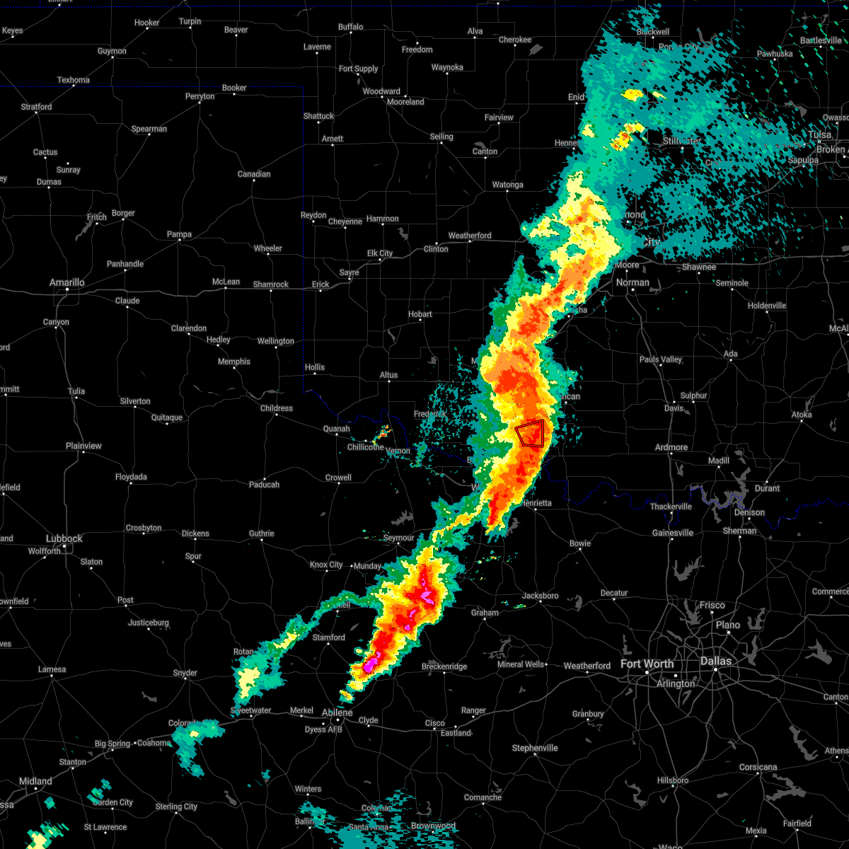 The tornado warning for east central cotton county will expire at 745 pm cdt, the tornado potential has decreased but strong damaging winds are still possible with this line of storms. The tornado warning for east central cotton county will expire at 745 pm cdt, the tornado potential has decreased but strong damaging winds are still possible with this line of storms.
|
| 5/2/2018 7:33 PM CDT |
 At 732 pm cdt, a confirmed tornado was located near temple, moving northeast at 50 mph (storm chasers reported a tornado). Hazards include damaging tornado and quarter size hail. Flying debris will be dangerous to those caught without shelter. mobile homes will be damaged or destroyed. damage to roofs, windows, and vehicles will occur. tree damage is likely. Locations impacted include, walters and temple. At 732 pm cdt, a confirmed tornado was located near temple, moving northeast at 50 mph (storm chasers reported a tornado). Hazards include damaging tornado and quarter size hail. Flying debris will be dangerous to those caught without shelter. mobile homes will be damaged or destroyed. damage to roofs, windows, and vehicles will occur. tree damage is likely. Locations impacted include, walters and temple.
|
| 5/2/2018 7:30 PM CDT |
 At 730 pm cdt, severe thunderstorms were located along a line extending from near fort sill to near temple, moving east at 30 mph (radar indicated). Hazards include 70 mph wind gusts and nickel size hail. Expect considerable tree damage. Damage is likely to mobile homes, roofs, and outbuildings. At 730 pm cdt, severe thunderstorms were located along a line extending from near fort sill to near temple, moving east at 30 mph (radar indicated). Hazards include 70 mph wind gusts and nickel size hail. Expect considerable tree damage. Damage is likely to mobile homes, roofs, and outbuildings.
|
| 5/2/2018 7:22 PM CDT |
 At 722 pm cdt, a severe thunderstorm capable of producing a tornado was located 4 miles southeast of cookietown, moving east at 40 mph (radar indicated rotation). Hazards include tornado, straight line winds to 80 mph, and ping pong ball size hail. Flying debris will be dangerous to those caught without shelter. mobile homes will be damaged or destroyed. damage to roofs, windows, and vehicles will occur. tree damage is likely. Locations impacted include, walters, temple and cookietown. At 722 pm cdt, a severe thunderstorm capable of producing a tornado was located 4 miles southeast of cookietown, moving east at 40 mph (radar indicated rotation). Hazards include tornado, straight line winds to 80 mph, and ping pong ball size hail. Flying debris will be dangerous to those caught without shelter. mobile homes will be damaged or destroyed. damage to roofs, windows, and vehicles will occur. tree damage is likely. Locations impacted include, walters, temple and cookietown.
|
| 5/2/2018 7:14 PM CDT |
 At 714 pm cdt, a severe thunderstorm capable of producing a tornado was located near randlett, moving east at 45 mph (radar indicated rotation). Hazards include tornado and golf ball size hail. Flying debris will be dangerous to those caught without shelter. mobile homes will be damaged or destroyed. damage to roofs, windows, and vehicles will occur. Tree damage is likely. At 714 pm cdt, a severe thunderstorm capable of producing a tornado was located near randlett, moving east at 45 mph (radar indicated rotation). Hazards include tornado and golf ball size hail. Flying debris will be dangerous to those caught without shelter. mobile homes will be damaged or destroyed. damage to roofs, windows, and vehicles will occur. Tree damage is likely.
|
| 5/2/2018 7:05 PM CDT |
 At 705 pm cdt, severe thunderstorms were located along a line extending from near grandfield to 3 miles northwest of holliday to 5 miles southwest of megargel, moving east at 50 mph (radar indicated). Hazards include 70 mph wind gusts and nickel size hail. Expect considerable tree damage. Damage is likely to mobile homes, roofs, and outbuildings. At 705 pm cdt, severe thunderstorms were located along a line extending from near grandfield to 3 miles northwest of holliday to 5 miles southwest of megargel, moving east at 50 mph (radar indicated). Hazards include 70 mph wind gusts and nickel size hail. Expect considerable tree damage. Damage is likely to mobile homes, roofs, and outbuildings.
|
| 5/2/2018 7:05 PM CDT |
 The national weather service in norman has issued a * severe thunderstorm warning for. southern cotton county in southwestern oklahoma. southeastern tillman county in southwestern oklahoma. clay county in northern texas. Archer county in northern texas. The national weather service in norman has issued a * severe thunderstorm warning for. southern cotton county in southwestern oklahoma. southeastern tillman county in southwestern oklahoma. clay county in northern texas. Archer county in northern texas.
|
| 3/26/2018 3:04 PM CDT |
 At 304 pm cdt, severe thunderstorms were located along a line extending from near burkburnett to 4 miles northeast of sheppard afb, moving northeast at 40 mph (radar indicated). Hazards include 60 mph wind gusts and penny size hail. Expect damage to roofs, siding, and trees. Locations impacted include, northern wichita falls, burkburnett, temple, petrolia, byers, dean, randlett, sheppard afb, taylor, charlie and cashion. At 304 pm cdt, severe thunderstorms were located along a line extending from near burkburnett to 4 miles northeast of sheppard afb, moving northeast at 40 mph (radar indicated). Hazards include 60 mph wind gusts and penny size hail. Expect damage to roofs, siding, and trees. Locations impacted include, northern wichita falls, burkburnett, temple, petrolia, byers, dean, randlett, sheppard afb, taylor, charlie and cashion.
|
| 3/26/2018 2:57 PM CDT |
 At 256 pm cdt, severe thunderstorms were located along a line extending from near burkburnett to near wichita falls to near holliday, moving northeast at 35 mph (radar indicated). Hazards include 60 mph wind gusts and penny size hail. Expect damage to roofs, siding, and trees. Locations impacted include, wichita falls, burkburnett, iowa park, temple, petrolia, byers, dean, randlett, jolly, sheppard afb, pleasant valley, taylor, charlie and cashion. At 256 pm cdt, severe thunderstorms were located along a line extending from near burkburnett to near wichita falls to near holliday, moving northeast at 35 mph (radar indicated). Hazards include 60 mph wind gusts and penny size hail. Expect damage to roofs, siding, and trees. Locations impacted include, wichita falls, burkburnett, iowa park, temple, petrolia, byers, dean, randlett, jolly, sheppard afb, pleasant valley, taylor, charlie and cashion.
|
| 3/26/2018 2:57 PM CDT |
 At 248 pm cdt, a severe thunderstorm was located over northwestern wichita falls, moving northeast at 40 mph (radar indicated). Hazards include 60 mph wind gusts and nickel size hail. expect damage to roofs, siding, and trees At 248 pm cdt, a severe thunderstorm was located over northwestern wichita falls, moving northeast at 40 mph (radar indicated). Hazards include 60 mph wind gusts and nickel size hail. expect damage to roofs, siding, and trees
|
| 3/26/2018 2:48 PM CDT |
 At 248 pm cdt, a severe thunderstorm was located over northwestern wichita falls, moving northeast at 40 mph (radar indicated). Hazards include 60 mph wind gusts and nickel size hail. expect damage to roofs, siding, and trees At 248 pm cdt, a severe thunderstorm was located over northwestern wichita falls, moving northeast at 40 mph (radar indicated). Hazards include 60 mph wind gusts and nickel size hail. expect damage to roofs, siding, and trees
|
| 3/25/2018 7:06 PM CDT |
 The severe thunderstorm warning for northwestern jefferson, southwestern stephens and east central cotton counties will expire at 715 pm cdt, the storms which prompted the warning have moved out of the area. therefore the warning will be allowed to expire. The severe thunderstorm warning for northwestern jefferson, southwestern stephens and east central cotton counties will expire at 715 pm cdt, the storms which prompted the warning have moved out of the area. therefore the warning will be allowed to expire.
|
| 3/25/2018 6:41 PM CDT |
 At 641 pm cdt, severe thunderstorms were located along a line extending from near temple to near waurika, moving northeast at 35 mph (radar indicated). Hazards include 60 mph wind gusts and quarter size hail. Hail damage to vehicles is expected. expect wind damage to roofs, siding, and trees. Locations impacted include, waurika, comanche, temple, hastings, addington, waurika lake, corum and taylor. At 641 pm cdt, severe thunderstorms were located along a line extending from near temple to near waurika, moving northeast at 35 mph (radar indicated). Hazards include 60 mph wind gusts and quarter size hail. Hail damage to vehicles is expected. expect wind damage to roofs, siding, and trees. Locations impacted include, waurika, comanche, temple, hastings, addington, waurika lake, corum and taylor.
|
| 3/25/2018 6:27 PM CDT |
 At 627 pm cdt, severe thunderstorms were located along a line extending from 8 miles east of randlett to 5 miles southwest of waurika, moving northeast at 30 mph (radar indicated). Hazards include 60 mph wind gusts and half dollar size hail. Hail damage to vehicles is expected. Expect wind damage to roofs, siding, and trees. At 627 pm cdt, severe thunderstorms were located along a line extending from 8 miles east of randlett to 5 miles southwest of waurika, moving northeast at 30 mph (radar indicated). Hazards include 60 mph wind gusts and half dollar size hail. Hail damage to vehicles is expected. Expect wind damage to roofs, siding, and trees.
|
| 2/24/2018 6:13 AM CST |
 At 612 am cst, a severe thunderstorm was located near temple, moving northeast at 60 mph (radar indicated). Hazards include quarter size hail. Damage to vehicles is expected. Locations impacted include, duncan, walters, temple, corum, northwestern waurika lake, central high, empire city and hulen. At 612 am cst, a severe thunderstorm was located near temple, moving northeast at 60 mph (radar indicated). Hazards include quarter size hail. Damage to vehicles is expected. Locations impacted include, duncan, walters, temple, corum, northwestern waurika lake, central high, empire city and hulen.
|
| 10/21/2017 7:59 PM CDT |
 At 759 pm cdt, severe thunderstorms were located along a line extending from 4 miles southwest of elgin to 6 miles north of faxon oklahoma to near burkburnett texas to 7 miles south of electra, moving northeast at 70 mph (radar indicated). Hazards include tennis ball size hail and 60 mph wind gusts. People and animals outdoors will be injured. expect hail damage to roofs, siding, windows, and vehicles. Expect wind damage to roofs, siding, and trees. At 759 pm cdt, severe thunderstorms were located along a line extending from 4 miles southwest of elgin to 6 miles north of faxon oklahoma to near burkburnett texas to 7 miles south of electra, moving northeast at 70 mph (radar indicated). Hazards include tennis ball size hail and 60 mph wind gusts. People and animals outdoors will be injured. expect hail damage to roofs, siding, windows, and vehicles. Expect wind damage to roofs, siding, and trees.
|
| 10/15/2017 1:07 AM CDT |
 The severe thunderstorm warning for comanche, southern caddo, cotton, eastern jackson, kiowa, tillman, northern wichita and central wilbarger counties will expire at 115 am cdt, the storms which prompted the warning have weakened below severe limits, therefore the warning will be allowed to expire. however gusty winds of 40 to 55 mph will still be possible across a wide area behind the cold front. The severe thunderstorm warning for comanche, southern caddo, cotton, eastern jackson, kiowa, tillman, northern wichita and central wilbarger counties will expire at 115 am cdt, the storms which prompted the warning have weakened below severe limits, therefore the warning will be allowed to expire. however gusty winds of 40 to 55 mph will still be possible across a wide area behind the cold front.
|
| 10/15/2017 12:32 AM CDT |
 At 1231 am cdt, the leading edge of winds from severe thunderstorms was located along a line extending from near sterling to near davidson, moving east-southeast at 40 mph. winds of 62 mph were measured at grandfield (radar indicated). Hazards include 70 mph wind gusts. Expect considerable tree damage. Damage is likely to mobile homes, roofs, and outbuildings. At 1231 am cdt, the leading edge of winds from severe thunderstorms was located along a line extending from near sterling to near davidson, moving east-southeast at 40 mph. winds of 62 mph were measured at grandfield (radar indicated). Hazards include 70 mph wind gusts. Expect considerable tree damage. Damage is likely to mobile homes, roofs, and outbuildings.
|
| 8/17/2017 2:10 AM CDT |
 At 209 am cdt, severe thunderstorms were located along a line extending from 5 miles northwest of byers to near dean, moving east at 20 mph (radar indicated). Hazards include 60 mph wind gusts and penny size hail. Expect damage to roofs, siding, and trees. Locations impacted include, temple, petrolia, byers, dean, taylor and charlie. At 209 am cdt, severe thunderstorms were located along a line extending from 5 miles northwest of byers to near dean, moving east at 20 mph (radar indicated). Hazards include 60 mph wind gusts and penny size hail. Expect damage to roofs, siding, and trees. Locations impacted include, temple, petrolia, byers, dean, taylor and charlie.
|
| 8/17/2017 1:52 AM CDT |
 At 152 am cdt, severe thunderstorms were located along a line extending from near randlett to near wichita falls, moving east at 30 mph (radar indicated). Hazards include 70 mph wind gusts and penny size hail. Expect considerable tree damage. damage is likely to mobile homes, roofs, and outbuildings. locations impacted include, northern wichita falls, temple, petrolia, byers, dean, randlett, sheppard afb, taylor, charlie and cashion. This includes interstate 44 between mile markers 1 and 8. At 152 am cdt, severe thunderstorms were located along a line extending from near randlett to near wichita falls, moving east at 30 mph (radar indicated). Hazards include 70 mph wind gusts and penny size hail. Expect considerable tree damage. damage is likely to mobile homes, roofs, and outbuildings. locations impacted include, northern wichita falls, temple, petrolia, byers, dean, randlett, sheppard afb, taylor, charlie and cashion. This includes interstate 44 between mile markers 1 and 8.
|
| 8/17/2017 1:47 AM CDT |
 At 147 am cdt, severe thunderstorms were located along a line extending from near randlett to near wichita falls, moving east at 30 mph (radar indicated). Hazards include 60 mph wind gusts and penny size hail. Expect damage to roofs, siding, and trees. locations impacted include, northern wichita falls, burkburnett, iowa park, temple, petrolia, byers, dean, randlett, sheppard afb, pleasant valley, taylor, charlie and cashion. This includes interstate 44 between mile markers 0 and 12. At 147 am cdt, severe thunderstorms were located along a line extending from near randlett to near wichita falls, moving east at 30 mph (radar indicated). Hazards include 60 mph wind gusts and penny size hail. Expect damage to roofs, siding, and trees. locations impacted include, northern wichita falls, burkburnett, iowa park, temple, petrolia, byers, dean, randlett, sheppard afb, pleasant valley, taylor, charlie and cashion. This includes interstate 44 between mile markers 0 and 12.
|
| 8/17/2017 1:39 AM CDT |
 At 139 am cdt, severe thunderstorms were located along a line extending from 3 miles northwest of devol to near iowa park, moving east at 25 mph (radar indicated). Hazards include 60 mph wind gusts and penny size hail. expect damage to roofs, siding, and trees At 139 am cdt, severe thunderstorms were located along a line extending from 3 miles northwest of devol to near iowa park, moving east at 25 mph (radar indicated). Hazards include 60 mph wind gusts and penny size hail. expect damage to roofs, siding, and trees
|
| 8/10/2017 6:04 PM CDT |
 At 604 pm cdt, a severe thunderstorm was located 4 miles northeast of corum, moving south at 15 mph (radar indicated). Hazards include two inch hail and 60 mph wind gusts. People and animals outdoors will be injured. expect hail damage to roofs, siding, windows, and vehicles. Expect wind damage to roofs, siding, and trees. At 604 pm cdt, a severe thunderstorm was located 4 miles northeast of corum, moving south at 15 mph (radar indicated). Hazards include two inch hail and 60 mph wind gusts. People and animals outdoors will be injured. expect hail damage to roofs, siding, windows, and vehicles. Expect wind damage to roofs, siding, and trees.
|
| 7/8/2017 8:23 PM CDT |
 At 823 pm cdt, severe thunderstorms were located along a line extending from 3 miles north of temple to 6 miles southwest of walters to 3 miles west of cookietown, moving south at 20 mph (radar indicated). Hazards include ping pong ball size hail and 60 mph wind gusts. People and animals outdoors will be injured. expect hail damage to roofs, siding, windows, and vehicles. expect wind damage to roofs, siding, and trees. locations impacted include, walters, temple, cookietown and taylor. This includes interstate 44 between mile markers 9 and 19. At 823 pm cdt, severe thunderstorms were located along a line extending from 3 miles north of temple to 6 miles southwest of walters to 3 miles west of cookietown, moving south at 20 mph (radar indicated). Hazards include ping pong ball size hail and 60 mph wind gusts. People and animals outdoors will be injured. expect hail damage to roofs, siding, windows, and vehicles. expect wind damage to roofs, siding, and trees. locations impacted include, walters, temple, cookietown and taylor. This includes interstate 44 between mile markers 9 and 19.
|
| 7/8/2017 8:06 PM CDT |
 At 806 pm cdt, severe thunderstorms were located along a line extending from 6 miles west of corum to 4 miles west of walters to 4 miles south of faxon, moving south at 20 mph (radar indicated). Hazards include ping pong ball size hail and 60 mph wind gusts. People and animals outdoors will be injured. expect hail damage to roofs, siding, windows, and vehicles. expect wind damage to roofs, siding, and trees. locations impacted include, walters, temple, faxon, cookietown and taylor. This includes interstate 44 between mile markers 9 and 25. At 806 pm cdt, severe thunderstorms were located along a line extending from 6 miles west of corum to 4 miles west of walters to 4 miles south of faxon, moving south at 20 mph (radar indicated). Hazards include ping pong ball size hail and 60 mph wind gusts. People and animals outdoors will be injured. expect hail damage to roofs, siding, windows, and vehicles. expect wind damage to roofs, siding, and trees. locations impacted include, walters, temple, faxon, cookietown and taylor. This includes interstate 44 between mile markers 9 and 25.
|
| 7/8/2017 8:00 PM CDT |
 At 800 pm cdt, severe thunderstorms were located along a line extending from 7 miles northwest of corum to 5 miles west of walters to near faxon, moving south at 20 mph (radar indicated). Hazards include 60 mph wind gusts and quarter size hail. Hail damage to vehicles is expected. Expect wind damage to roofs, siding, and trees. At 800 pm cdt, severe thunderstorms were located along a line extending from 7 miles northwest of corum to 5 miles west of walters to near faxon, moving south at 20 mph (radar indicated). Hazards include 60 mph wind gusts and quarter size hail. Hail damage to vehicles is expected. Expect wind damage to roofs, siding, and trees.
|
| 7/5/2017 2:11 AM CDT |
 At 211 am cdt, severe thunderstorms were located along a line extending from 3 miles southeast of faxon to 4 miles west of terral, moving east at 10 mph (radar indicated). Hazards include 60 mph wind gusts and quarter size hail. Hail damage to vehicles is expected. Expect wind damage to roofs, siding, and trees. At 211 am cdt, severe thunderstorms were located along a line extending from 3 miles southeast of faxon to 4 miles west of terral, moving east at 10 mph (radar indicated). Hazards include 60 mph wind gusts and quarter size hail. Hail damage to vehicles is expected. Expect wind damage to roofs, siding, and trees.
|
| 7/3/2017 11:32 PM CDT |
 At 1132 pm cdt, severe thunderstorms were located along a line extending from 8 miles northwest of petrolia to near holliday to 4 miles northwest of seymour, moving east at 45 mph (radar indicated). Hazards include 60 mph wind gusts and quarter size hail. Hail damage to vehicles is expected. Expect wind damage to roofs, siding, and trees. At 1132 pm cdt, severe thunderstorms were located along a line extending from 8 miles northwest of petrolia to near holliday to 4 miles northwest of seymour, moving east at 45 mph (radar indicated). Hazards include 60 mph wind gusts and quarter size hail. Hail damage to vehicles is expected. Expect wind damage to roofs, siding, and trees.
|
| 7/3/2017 10:13 PM CDT |
 At 1012 pm cdt, severe thunderstorms were located along a line extending from near rush springs to 7 miles northwest of chattanooga, moving southeast at 35 mph (weather stations have recorded gusts over 60 mph with this line of storms). Hazards include 60 mph wind gusts and penny size hail. expect damage to roofs, siding, and trees At 1012 pm cdt, severe thunderstorms were located along a line extending from near rush springs to 7 miles northwest of chattanooga, moving southeast at 35 mph (weather stations have recorded gusts over 60 mph with this line of storms). Hazards include 60 mph wind gusts and penny size hail. expect damage to roofs, siding, and trees
|
| 5/22/2017 9:10 PM CDT |
 At 910 pm cdt, a severe thunderstorm was located near chattanooga, moving southeast at 30 mph (radar indicated). Hazards include two inch hail and 70 mph wind gusts. People and animals outdoors will be injured. expect hail damage to roofs, siding, windows, and vehicles. expect considerable tree damage. Wind damage is also likely to mobile homes, roofs, and outbuildings. At 910 pm cdt, a severe thunderstorm was located near chattanooga, moving southeast at 30 mph (radar indicated). Hazards include two inch hail and 70 mph wind gusts. People and animals outdoors will be injured. expect hail damage to roofs, siding, windows, and vehicles. expect considerable tree damage. Wind damage is also likely to mobile homes, roofs, and outbuildings.
|
| 5/19/2017 4:48 PM CDT |
 At 447 pm cdt, severe thunderstorms were located along a line extending from 4 miles southeast of marlow to 3 miles southwest of duncan to near comanche to 5 miles northeast of byers, moving northeast at 50 mph (radar indicated). Hazards include 60 mph wind gusts and half dollar size hail. Hail damage to vehicles is expected. expect wind damage to roofs, siding, and trees. Locations impacted include, duncan, marlow, waurika, lindsay, comanche, rush springs, bray, temple, ryan, petrolia, velma, alex, byers, foster, hastings, bradley, loco, addington, sugden and corum. At 447 pm cdt, severe thunderstorms were located along a line extending from 4 miles southeast of marlow to 3 miles southwest of duncan to near comanche to 5 miles northeast of byers, moving northeast at 50 mph (radar indicated). Hazards include 60 mph wind gusts and half dollar size hail. Hail damage to vehicles is expected. expect wind damage to roofs, siding, and trees. Locations impacted include, duncan, marlow, waurika, lindsay, comanche, rush springs, bray, temple, ryan, petrolia, velma, alex, byers, foster, hastings, bradley, loco, addington, sugden and corum.
|
| 5/19/2017 4:29 PM CDT |
 At 429 pm cdt, severe thunderstorms were located along a line extending from 9 miles west of duncan to 5 miles west of corum to 3 miles southeast of temple to 4 miles west of petrolia, moving northeast at 50 mph (radar indicated). Hazards include 60 mph wind gusts and half dollar size hail. Hail damage to vehicles is expected. Expect wind damage to roofs, siding, and trees. At 429 pm cdt, severe thunderstorms were located along a line extending from 9 miles west of duncan to 5 miles west of corum to 3 miles southeast of temple to 4 miles west of petrolia, moving northeast at 50 mph (radar indicated). Hazards include 60 mph wind gusts and half dollar size hail. Hail damage to vehicles is expected. Expect wind damage to roofs, siding, and trees.
|
| 5/19/2017 4:05 PM CDT |
 At 404 pm cdt, a severe thunderstorm was located 4 miles northeast of randlett, moving northeast at 35 mph (trained weather spotters). Hazards include golf ball size hail and 60 mph wind gusts. People and animals outdoors will be injured. expect hail damage to roofs, siding, windows, and vehicles. expect wind damage to roofs, siding, and trees. locations impacted include, walters, geronimo, temple, randlett, hastings, cookietown and taylor. This includes interstate 44 between mile markers 8 and 28. At 404 pm cdt, a severe thunderstorm was located 4 miles northeast of randlett, moving northeast at 35 mph (trained weather spotters). Hazards include golf ball size hail and 60 mph wind gusts. People and animals outdoors will be injured. expect hail damage to roofs, siding, windows, and vehicles. expect wind damage to roofs, siding, and trees. locations impacted include, walters, geronimo, temple, randlett, hastings, cookietown and taylor. This includes interstate 44 between mile markers 8 and 28.
|
| 5/19/2017 3:49 PM CDT |
 At 348 pm cdt, a severe thunderstorm was located near randlett, moving northeast at 40 mph (trained weather spotters). Hazards include two inch hail and 60 mph wind gusts. People and animals outdoors will be injured. expect hail damage to roofs, siding, windows, and vehicles. expect wind damage to roofs, siding, and trees. locations impacted include, burkburnett, walters, geronimo, temple, randlett, devol, cookietown, sheppard afb, taylor, charlie and cashion. This includes interstate 44 between mile markers 0 and 29. At 348 pm cdt, a severe thunderstorm was located near randlett, moving northeast at 40 mph (trained weather spotters). Hazards include two inch hail and 60 mph wind gusts. People and animals outdoors will be injured. expect hail damage to roofs, siding, windows, and vehicles. expect wind damage to roofs, siding, and trees. locations impacted include, burkburnett, walters, geronimo, temple, randlett, devol, cookietown, sheppard afb, taylor, charlie and cashion. This includes interstate 44 between mile markers 0 and 29.
|
| 5/19/2017 3:36 PM CDT |
 At 335 pm cdt, a severe thunderstorm was located near burkburnett, moving northeast at 40 mph. this is a very dangerous storm (radar indicated). Hazards include baseball size hail and 60 mph wind gusts. People and animals outdoors will be severely injured. Expect shattered windows, extensive damage to roofs, siding, and vehicles. At 335 pm cdt, a severe thunderstorm was located near burkburnett, moving northeast at 40 mph. this is a very dangerous storm (radar indicated). Hazards include baseball size hail and 60 mph wind gusts. People and animals outdoors will be severely injured. Expect shattered windows, extensive damage to roofs, siding, and vehicles.
|
| 5/18/2017 9:17 PM CDT |
 At 917 pm cdt, a severe thunderstorm was located near temple, moving east at 30 mph (radar indicated). Hazards include ping pong ball size hail and 60 mph wind gusts. People and animals outdoors will be injured. expect hail damage to roofs, siding, windows, and vehicles. Expect wind damage to roofs, siding, and trees. At 917 pm cdt, a severe thunderstorm was located near temple, moving east at 30 mph (radar indicated). Hazards include ping pong ball size hail and 60 mph wind gusts. People and animals outdoors will be injured. expect hail damage to roofs, siding, windows, and vehicles. Expect wind damage to roofs, siding, and trees.
|
| 5/18/2017 9:04 PM CDT |
 At 904 pm cdt, a severe thunderstorm was located 4 miles east of cookietown, moving northeast at 35 mph (radar indicated). Hazards include ping pong ball size hail and 60 mph wind gusts. People and animals outdoors will be injured. expect hail damage to roofs, siding, windows, and vehicles. expect wind damage to roofs, siding, and trees. locations impacted include, walters, temple, randlett and cookietown. This includes interstate 44 between mile markers 9 and 26. At 904 pm cdt, a severe thunderstorm was located 4 miles east of cookietown, moving northeast at 35 mph (radar indicated). Hazards include ping pong ball size hail and 60 mph wind gusts. People and animals outdoors will be injured. expect hail damage to roofs, siding, windows, and vehicles. expect wind damage to roofs, siding, and trees. locations impacted include, walters, temple, randlett and cookietown. This includes interstate 44 between mile markers 9 and 26.
|
| 5/18/2017 8:37 PM CDT |
 At 837 pm cdt, a severe thunderstorm was located near devol, moving northeast at 35 mph (radar indicated). Hazards include golf ball size hail and 60 mph wind gusts. People and animals outdoors will be injured. expect hail damage to roofs, siding, windows, and vehicles. Expect wind damage to roofs, siding, and trees. At 837 pm cdt, a severe thunderstorm was located near devol, moving northeast at 35 mph (radar indicated). Hazards include golf ball size hail and 60 mph wind gusts. People and animals outdoors will be injured. expect hail damage to roofs, siding, windows, and vehicles. Expect wind damage to roofs, siding, and trees.
|
| 5/18/2017 7:34 PM CDT |
 At 733 pm cdt, severe thunderstorms were located along a line extending from 8 miles southwest of lindsay to near loco to 3 miles east of byers to 4 miles northwest of westover, moving east at 35 mph (radar indicated). Hazards include 70 mph wind gusts and ping pong ball size hail. People and animals outdoors will be injured. expect hail damage to roofs, siding, windows, and vehicles. expect considerable tree damage. Wind damage is also likely to mobile homes, roofs, and outbuildings. At 733 pm cdt, severe thunderstorms were located along a line extending from 8 miles southwest of lindsay to near loco to 3 miles east of byers to 4 miles northwest of westover, moving east at 35 mph (radar indicated). Hazards include 70 mph wind gusts and ping pong ball size hail. People and animals outdoors will be injured. expect hail damage to roofs, siding, windows, and vehicles. expect considerable tree damage. Wind damage is also likely to mobile homes, roofs, and outbuildings.
|
| 5/18/2017 7:17 PM CDT |
 At 717 pm cdt, severe thunderstorms were located along a line extending from 7 miles east of duncan to 4 miles east of addington to near byers to 5 miles southeast of iowa park to 7 miles west of westover, moving east at 35 mph (radar indicated). Hazards include golf ball size hail and 70 mph wind gusts. People and animals outdoors will be injured. expect hail damage to roofs, siding, windows, and vehicles. expect considerable tree damage. wind damage is also likely to mobile homes, roofs, and outbuildings. locations impacted include, wichita falls, lawton, duncan, burkburnett, marlow, seymour, walters, waurika, archer city, iowa park, electra, elgin, holliday, comanche, geronimo, rush springs, bray, fletcher, grandfield and temple. This includes interstate 44 between mile markers 0 and 42, and between mile markers 57 and 61. At 717 pm cdt, severe thunderstorms were located along a line extending from 7 miles east of duncan to 4 miles east of addington to near byers to 5 miles southeast of iowa park to 7 miles west of westover, moving east at 35 mph (radar indicated). Hazards include golf ball size hail and 70 mph wind gusts. People and animals outdoors will be injured. expect hail damage to roofs, siding, windows, and vehicles. expect considerable tree damage. wind damage is also likely to mobile homes, roofs, and outbuildings. locations impacted include, wichita falls, lawton, duncan, burkburnett, marlow, seymour, walters, waurika, archer city, iowa park, electra, elgin, holliday, comanche, geronimo, rush springs, bray, fletcher, grandfield and temple. This includes interstate 44 between mile markers 0 and 42, and between mile markers 57 and 61.
|
| 5/18/2017 6:55 PM CDT |
 At 654 pm cdt, severe thunderstorms were located along a line extending from 4 miles west of marlow to near corum to 3 miles southwest of randlett to 5 miles southwest of iowa park to 9 miles west of westover, moving northeast at 35 mph (radar indicated). Hazards include golf ball size hail and 70 mph wind gusts. People and animals outdoors will be injured. expect hail damage to roofs, siding, windows, and vehicles. expect considerable tree damage. Wind damage is also likely to mobile homes, roofs, and outbuildings. At 654 pm cdt, severe thunderstorms were located along a line extending from 4 miles west of marlow to near corum to 3 miles southwest of randlett to 5 miles southwest of iowa park to 9 miles west of westover, moving northeast at 35 mph (radar indicated). Hazards include golf ball size hail and 70 mph wind gusts. People and animals outdoors will be injured. expect hail damage to roofs, siding, windows, and vehicles. expect considerable tree damage. Wind damage is also likely to mobile homes, roofs, and outbuildings.
|
| 5/18/2017 6:12 PM CDT |
 At 612 pm cdt, severe thunderstorms were located along a line extending from 4 miles southeast of lawton to 5 miles northwest of cookietown to 3 miles west of grandfield to 4 miles north of electra to 7 miles north of lake kemp, moving northeast at 35 mph (radar indicated). Hazards include golf ball size hail and 60 mph wind gusts. People and animals outdoors will be injured. expect hail damage to roofs, siding, windows, and vehicles. Expect wind damage to roofs, siding, and trees. At 612 pm cdt, severe thunderstorms were located along a line extending from 4 miles southeast of lawton to 5 miles northwest of cookietown to 3 miles west of grandfield to 4 miles north of electra to 7 miles north of lake kemp, moving northeast at 35 mph (radar indicated). Hazards include golf ball size hail and 60 mph wind gusts. People and animals outdoors will be injured. expect hail damage to roofs, siding, windows, and vehicles. Expect wind damage to roofs, siding, and trees.
|
| 5/18/2017 5:48 PM CDT |
 At 548 pm cdt, a severe thunderstorm was located near cookietown, moving northeast at 35 mph (radar indicated). Hazards include golf ball size hail and 60 mph wind gusts. People and animals outdoors will be injured. expect hail damage to roofs, siding, windows, and vehicles. Expect wind damage to roofs, siding, and trees. At 548 pm cdt, a severe thunderstorm was located near cookietown, moving northeast at 35 mph (radar indicated). Hazards include golf ball size hail and 60 mph wind gusts. People and animals outdoors will be injured. expect hail damage to roofs, siding, windows, and vehicles. Expect wind damage to roofs, siding, and trees.
|
| 5/17/2017 12:46 AM CDT |
 At 1245 am cdt, severe thunderstorms were located along a line extending from near fort sill to near temple to 3 miles east of dean, moving northeast at 65 mph (radar indicated). Hazards include 70 mph wind gusts and nickel size hail. Expect considerable tree damage. Damage is likely to mobile homes, roofs, and outbuildings. At 1245 am cdt, severe thunderstorms were located along a line extending from near fort sill to near temple to 3 miles east of dean, moving northeast at 65 mph (radar indicated). Hazards include 70 mph wind gusts and nickel size hail. Expect considerable tree damage. Damage is likely to mobile homes, roofs, and outbuildings.
|
| 5/10/2017 8:28 PM CDT |
 At 827 pm cdt, a severe thunderstorm was located 5 miles northeast of loveland, moving east at 30 mph (radar indicated). Hazards include golf ball size hail and 60 mph wind gusts. People and animals outdoors will be injured. expect hail damage to roofs, siding, windows, and vehicles. Expect wind damage to roofs, siding, and trees. At 827 pm cdt, a severe thunderstorm was located 5 miles northeast of loveland, moving east at 30 mph (radar indicated). Hazards include golf ball size hail and 60 mph wind gusts. People and animals outdoors will be injured. expect hail damage to roofs, siding, windows, and vehicles. Expect wind damage to roofs, siding, and trees.
|
| 10/6/2016 9:11 PM CDT |
 At 911 pm cdt, severe thunderstorms were located along a line extending from 3 miles south of temple to 3 miles east of petrolia, moving east at 25 mph (radar indicated). Hazards include 60 mph wind gusts and quarter size hail. Hail damage to vehicles is expected. Expect wind damage to roofs, siding, and trees. At 911 pm cdt, severe thunderstorms were located along a line extending from 3 miles south of temple to 3 miles east of petrolia, moving east at 25 mph (radar indicated). Hazards include 60 mph wind gusts and quarter size hail. Hail damage to vehicles is expected. Expect wind damage to roofs, siding, and trees.
|
| 10/6/2016 8:28 PM CDT |
 At 827 pm cdt, the leading edge of a large severe thunderstorm extended from 5 miles northeast of cookietown to 6 miles north of dean, moving east at 30 mph (radar indicated). Hazards include ping pong ball size hail and 60 mph wind gusts. People and animals outdoors will be injured. expect hail damage to roofs, siding, windows, and vehicles. Expect wind damage to roofs, siding, and trees. At 827 pm cdt, the leading edge of a large severe thunderstorm extended from 5 miles northeast of cookietown to 6 miles north of dean, moving east at 30 mph (radar indicated). Hazards include ping pong ball size hail and 60 mph wind gusts. People and animals outdoors will be injured. expect hail damage to roofs, siding, windows, and vehicles. Expect wind damage to roofs, siding, and trees.
|
| 9/10/2016 1:00 AM CDT |
 At 100 am cdt, the leading edge of winds from a line of severe thunderstorms was located along a line extending from 7 miles northwest of vernon to 3 miles southwest of hastings, moving south at 30 mph (radar indicated). Hazards include 60 mph wind gusts. Expect damage to roofs. siding. And trees. At 100 am cdt, the leading edge of winds from a line of severe thunderstorms was located along a line extending from 7 miles northwest of vernon to 3 miles southwest of hastings, moving south at 30 mph (radar indicated). Hazards include 60 mph wind gusts. Expect damage to roofs. siding. And trees.
|
| 9/10/2016 12:11 AM CDT |
 At 1211 am cdt, the leading edge of winds from a line of severe thunderstorms was located along a line extending from near humphreys to 9 miles east of fort sill, moving south at 30 mph (radar indicated). Hazards include 60 mph wind gusts. Expect damage to roofs. siding. And trees. At 1211 am cdt, the leading edge of winds from a line of severe thunderstorms was located along a line extending from near humphreys to 9 miles east of fort sill, moving south at 30 mph (radar indicated). Hazards include 60 mph wind gusts. Expect damage to roofs. siding. And trees.
|
| 7/16/2016 1:06 AM CDT |
 At 105 am cdt, severe thunderstorms were located along a line extending from near binger to 3 miles northeast of cement to 6 miles southeast of sterling to 4 miles west of temple to 3 miles northeast of burkburnett, moving southeast at 35 mph (radar indicated). Hazards include 60 mph wind gusts and penny size hail. Expect damage to roofs. siding. and trees. locations impacted include, lawton, anadarko, walters, cache, elgin, apache, geronimo, fletcher, cyril, grandfield, temple, sterling, binger, fort cobb, verden, cement, chattanooga, randlett, medicine park and eakly. This includes interstate 44 between mile markers 3 and 75. At 105 am cdt, severe thunderstorms were located along a line extending from near binger to 3 miles northeast of cement to 6 miles southeast of sterling to 4 miles west of temple to 3 miles northeast of burkburnett, moving southeast at 35 mph (radar indicated). Hazards include 60 mph wind gusts and penny size hail. Expect damage to roofs. siding. and trees. locations impacted include, lawton, anadarko, walters, cache, elgin, apache, geronimo, fletcher, cyril, grandfield, temple, sterling, binger, fort cobb, verden, cement, chattanooga, randlett, medicine park and eakly. This includes interstate 44 between mile markers 3 and 75.
|
| 7/16/2016 12:43 AM CDT |
 At 1242 am cdt, severe thunderstorms were located along a line extending from 5 miles northeast of eakly to near anadarko to near elgin to near cookietown to 7 miles southwest of grandfield, moving southeast at 40 mph (radar indicated). Hazards include 60 mph wind gusts and quarter size hail. Hail damage to vehicles is expected. Expect wind damage to roofs, siding, and trees. At 1242 am cdt, severe thunderstorms were located along a line extending from 5 miles northeast of eakly to near anadarko to near elgin to near cookietown to 7 miles southwest of grandfield, moving southeast at 40 mph (radar indicated). Hazards include 60 mph wind gusts and quarter size hail. Hail damage to vehicles is expected. Expect wind damage to roofs, siding, and trees.
|
| 7/6/2016 9:55 PM CDT |
 At 954 pm cdt, the leading edge of winds from severe thunderstorms was located along a line extending from cooperton to indiahoma to 7 miles southwest of grandfield, moving east at 55 mph (radar indicated). Hazards include 60 mph wind gusts. Expect damage to roofs. siding. and trees. Locations impacted include, lawton, anadarko, frederick, hobart, walters, cache, elgin, apache, snyder, geronimo, fletcher, cyril, grandfield, temple, tipton, sterling, verden, cement, chattanooga and randlett. At 954 pm cdt, the leading edge of winds from severe thunderstorms was located along a line extending from cooperton to indiahoma to 7 miles southwest of grandfield, moving east at 55 mph (radar indicated). Hazards include 60 mph wind gusts. Expect damage to roofs. siding. and trees. Locations impacted include, lawton, anadarko, frederick, hobart, walters, cache, elgin, apache, snyder, geronimo, fletcher, cyril, grandfield, temple, tipton, sterling, verden, cement, chattanooga and randlett.
|
| 7/6/2016 9:28 PM CDT |
 At 927 pm cdt, the leading edge of winds from a line of severe thunderstorms was located along a line extending from near lone wolf to 4 miles west of snyder to 5 miles northwest of davidson, moving east at 60 mph. winds of 70 mph have been measured with these storms (radar indicated). Hazards include 70 mph wind gusts. Expect considerable tree damage. Damage is likely to mobile homes, roofs, and outbuildings. At 927 pm cdt, the leading edge of winds from a line of severe thunderstorms was located along a line extending from near lone wolf to 4 miles west of snyder to 5 miles northwest of davidson, moving east at 60 mph. winds of 70 mph have been measured with these storms (radar indicated). Hazards include 70 mph wind gusts. Expect considerable tree damage. Damage is likely to mobile homes, roofs, and outbuildings.
|
| 7/3/2016 6:40 PM CDT |
 At 640 pm cdt, a severe thunderstorm was located just north of dean, moving northeast at 30 mph (radar indicated). Hazards include 60 mph wind gusts and quarter size hail. Hail damage to vehicles is expected. Expect wind damage to roofs, siding, and trees. At 640 pm cdt, a severe thunderstorm was located just north of dean, moving northeast at 30 mph (radar indicated). Hazards include 60 mph wind gusts and quarter size hail. Hail damage to vehicles is expected. Expect wind damage to roofs, siding, and trees.
|
| 6/12/2016 6:23 AM CDT |
 At 623 am cdt, a severe thunderstorm was located near walters, moving northeast at 25 mph (radar indicated). Hazards include 60 mph wind gusts and penny size hail. Expect damage to roofs. siding. and trees. locations impacted include, walters and temple. This includes interstate 44 between mile markers 17 and 18. At 623 am cdt, a severe thunderstorm was located near walters, moving northeast at 25 mph (radar indicated). Hazards include 60 mph wind gusts and penny size hail. Expect damage to roofs. siding. and trees. locations impacted include, walters and temple. This includes interstate 44 between mile markers 17 and 18.
|
| 6/12/2016 6:02 AM CDT |
 At 602 am cdt, a severe thunderstorm was located over cookietown, moving northeast at 25 mph (radar indicated). Hazards include 60 mph wind gusts and quarter size hail. Hail damage to vehicles is expected. Expect wind damage to roofs, siding, and trees. At 602 am cdt, a severe thunderstorm was located over cookietown, moving northeast at 25 mph (radar indicated). Hazards include 60 mph wind gusts and quarter size hail. Hail damage to vehicles is expected. Expect wind damage to roofs, siding, and trees.
|
| 5/26/2016 9:45 PM CDT |
 At 944 pm cdt, severe thunderstorms were located along a line extending from 5 miles east of manitou to near hollister, moving east at 40 mph. winds of 60 mph were estimated at frederick with these storms (radar indicated). Hazards include 60 mph wind gusts and half dollar size hail. Hail damage to vehicles is expected. Expect wind damage to roofs, siding, and trees. At 944 pm cdt, severe thunderstorms were located along a line extending from 5 miles east of manitou to near hollister, moving east at 40 mph. winds of 60 mph were estimated at frederick with these storms (radar indicated). Hazards include 60 mph wind gusts and half dollar size hail. Hail damage to vehicles is expected. Expect wind damage to roofs, siding, and trees.
|
| 5/24/2016 3:34 AM CDT |
 At 334 am cdt, a severe thunderstorm was located 8 miles southwest of temple, moving east at 35 mph (radar indicated). Hazards include ping pong ball size hail and 60 mph wind gusts. People and animals outdoors will be injured. expect hail damage to roofs, siding, windows, and vehicles. Expect wind damage to roofs, siding, and trees. At 334 am cdt, a severe thunderstorm was located 8 miles southwest of temple, moving east at 35 mph (radar indicated). Hazards include ping pong ball size hail and 60 mph wind gusts. People and animals outdoors will be injured. expect hail damage to roofs, siding, windows, and vehicles. Expect wind damage to roofs, siding, and trees.
|
| 5/24/2016 3:25 AM CDT |
 At 325 am cdt, a severe thunderstorm was located near randlett, moving southeast at 30 mph (radar indicated). Hazards include 60 mph wind gusts and quarter size hail. Hail damage to vehicles is expected. expect wind damage to roofs, siding, and trees. locations impacted include, walters, temple, randlett, cookietown and taylor. This includes interstate 44 between mile markers 0 and 22. At 325 am cdt, a severe thunderstorm was located near randlett, moving southeast at 30 mph (radar indicated). Hazards include 60 mph wind gusts and quarter size hail. Hail damage to vehicles is expected. expect wind damage to roofs, siding, and trees. locations impacted include, walters, temple, randlett, cookietown and taylor. This includes interstate 44 between mile markers 0 and 22.
|
| 5/24/2016 3:11 AM CDT | A severe thunderstorm warning remains in effect until 345 am cdt for cotton county. at 310 am cdt. a severe thunderstorm was located near devol. moving east at 15 mph. hazard. 70 mph wind gusts and half dollar size hail. source. Radar indicated. |
| 5/24/2016 2:57 AM CDT |
 At 256 am cdt, a severe thunderstorm was located near devol, moving southeast at 20 mph (radar indicated). Hazards include tennis ball size hail and 70 mph wind gusts. People and animals outdoors will be injured. expect hail damage to roofs, siding, windows, and vehicles. expect considerable tree damage. wind damage is also likely to mobile homes, roofs, and outbuildings. locations impacted include, walters, temple, randlett, devol, cookietown and taylor. This includes interstate 44 between mile markers 0 and 22. At 256 am cdt, a severe thunderstorm was located near devol, moving southeast at 20 mph (radar indicated). Hazards include tennis ball size hail and 70 mph wind gusts. People and animals outdoors will be injured. expect hail damage to roofs, siding, windows, and vehicles. expect considerable tree damage. wind damage is also likely to mobile homes, roofs, and outbuildings. locations impacted include, walters, temple, randlett, devol, cookietown and taylor. This includes interstate 44 between mile markers 0 and 22.
|
| 5/23/2016 2:10 AM CDT | Relayed by county deputies to ham radio net contro in cotton county OK, 0.4 miles WNW of Temple, OK |
| 5/23/2016 1:43 AM CDT | The national weather service in norman has issued a * severe thunderstorm warning for. cotton county in southwestern oklahoma. northwestern jefferson county in southern oklahoma. southeastern tillman county in southwestern oklahoma. Southwestern stephens county in southern oklahoma. |
| 5/23/2016 1:43 AM CDT | The national weather service in norman has issued a * severe thunderstorm warning for. cotton county in southwestern oklahoma. northwestern jefferson county in southern oklahoma. southeastern tillman county in southwestern oklahoma. Southwestern stephens county in southern oklahoma. |
| 5/17/2016 2:23 AM CDT |
 At 222 am cdt, a severe thunderstorm was located 3 miles southwest of randlett, moving east at 35 mph (radar indicated). Hazards include golf ball size hail and 60 mph wind gusts. People and animals outdoors will be injured. expect hail damage to roofs, siding, windows, and vehicles. expect wind damage to roofs, siding, and trees. Locations impacted include, burkburnett, temple, byers, randlett, devol, charlie and taylor. At 222 am cdt, a severe thunderstorm was located 3 miles southwest of randlett, moving east at 35 mph (radar indicated). Hazards include golf ball size hail and 60 mph wind gusts. People and animals outdoors will be injured. expect hail damage to roofs, siding, windows, and vehicles. expect wind damage to roofs, siding, and trees. Locations impacted include, burkburnett, temple, byers, randlett, devol, charlie and taylor.
|
| 5/17/2016 2:07 AM CDT |
 At 207 am cdt, a severe thunderstorm was located near devol, moving east at 25 mph (radar indicated). Hazards include ping pong ball size hail and 60 mph wind gusts. People and animals outdoors will be injured. expect hail damage to roofs, siding, windows, and vehicles. Expect wind damage to roofs, siding, and trees. At 207 am cdt, a severe thunderstorm was located near devol, moving east at 25 mph (radar indicated). Hazards include ping pong ball size hail and 60 mph wind gusts. People and animals outdoors will be injured. expect hail damage to roofs, siding, windows, and vehicles. Expect wind damage to roofs, siding, and trees.
|
| 5/12/2016 3:02 AM CDT |
 At 300 am cdt, a severe thunderstorm was located near corum, moving southeast at 35 mph (the walters mesonet measured a 75 mph wind gust at 240 am). Hazards include 70 mph wind gusts and half dollar size hail. Hail damage to vehicles is expected. expect considerable tree damage. wind damage is also likely to mobile homes, roofs, and outbuildings. Locations impacted include, duncan, walters, comanche, temple, addington, corum, waurika lake, empire city and hulen. At 300 am cdt, a severe thunderstorm was located near corum, moving southeast at 35 mph (the walters mesonet measured a 75 mph wind gust at 240 am). Hazards include 70 mph wind gusts and half dollar size hail. Hail damage to vehicles is expected. expect considerable tree damage. wind damage is also likely to mobile homes, roofs, and outbuildings. Locations impacted include, duncan, walters, comanche, temple, addington, corum, waurika lake, empire city and hulen.
|
| 5/12/2016 2:42 AM CDT |
 At 241 am cdt, a severe thunderstorm was located 5 miles southeast of geronimo, moving southeast at 35 mph. this is a very dangerous storm (media reported baseball size hail in geronimo). Hazards include baseball size hail and 60 mph wind gusts. People and animals outdoors will be severely injured. Expect shattered windows, extensive damage to roofs, siding, and vehicles. At 241 am cdt, a severe thunderstorm was located 5 miles southeast of geronimo, moving southeast at 35 mph. this is a very dangerous storm (media reported baseball size hail in geronimo). Hazards include baseball size hail and 60 mph wind gusts. People and animals outdoors will be severely injured. Expect shattered windows, extensive damage to roofs, siding, and vehicles.
|
| 4/29/2016 4:28 PM CDT |
 At 427 pm cdt, severe thunderstorms were located along a line extending from 4 miles south of rush springs to near waurika lake, moving east at 45 mph (radar indicated). Hazards include golf ball size hail and 70 mph wind gusts. People and animals outdoors will be injured. expect hail damage to roofs, siding, windows, and vehicles. expect considerable tree damage. wind damage is also likely to mobile homes, roofs, and outbuildings. Locations impacted include, duncan, marlow, comanche, rush springs, bray, temple, sterling, hastings, addington, corum, waurika lake, central high and empire city. At 427 pm cdt, severe thunderstorms were located along a line extending from 4 miles south of rush springs to near waurika lake, moving east at 45 mph (radar indicated). Hazards include golf ball size hail and 70 mph wind gusts. People and animals outdoors will be injured. expect hail damage to roofs, siding, windows, and vehicles. expect considerable tree damage. wind damage is also likely to mobile homes, roofs, and outbuildings. Locations impacted include, duncan, marlow, comanche, rush springs, bray, temple, sterling, hastings, addington, corum, waurika lake, central high and empire city.
|
| 4/29/2016 4:05 PM CDT |
 At 404 pm cdt, severe thunderstorms were located along a line extending from near sterling to 3 miles southwest of walters, moving northeast at 35 mph (radar indicated). Hazards include golf ball size hail and 70 mph wind gusts. People and animals outdoors will be injured. expect hail damage to roofs, siding, windows, and vehicles. expect considerable tree damage. Wind damage is also likely to mobile homes, roofs, and outbuildings. At 404 pm cdt, severe thunderstorms were located along a line extending from near sterling to 3 miles southwest of walters, moving northeast at 35 mph (radar indicated). Hazards include golf ball size hail and 70 mph wind gusts. People and animals outdoors will be injured. expect hail damage to roofs, siding, windows, and vehicles. expect considerable tree damage. Wind damage is also likely to mobile homes, roofs, and outbuildings.
|
| 4/26/2016 7:46 PM CDT |
 At 746 pm cdt, severe thunderstorms were located along a line extending from near faxon to near randlett to near dean to near lake arrowhead to 12 miles southeast of windthorst, moving east at 35 to 45 mph (radar indicated). Hazards include 60 mph wind gusts and half dollar size hail. Hail damage to vehicles is expected. Expect wind damage to roofs, siding, and trees. At 746 pm cdt, severe thunderstorms were located along a line extending from near faxon to near randlett to near dean to near lake arrowhead to 12 miles southeast of windthorst, moving east at 35 to 45 mph (radar indicated). Hazards include 60 mph wind gusts and half dollar size hail. Hail damage to vehicles is expected. Expect wind damage to roofs, siding, and trees.
|
| 4/10/2016 11:21 PM CDT |
 At 1121 pm cdt, severe thunderstorms were located along a line extending from near geronimo to near devol, moving east at 55 mph (radar indicated). Hazards include tennis ball size hail and 60 mph wind gusts. People and animals outdoors will be injured. expect hail damage to roofs, siding, windows, and vehicles. Expect wind damage to roofs, siding, and trees. At 1121 pm cdt, severe thunderstorms were located along a line extending from near geronimo to near devol, moving east at 55 mph (radar indicated). Hazards include tennis ball size hail and 60 mph wind gusts. People and animals outdoors will be injured. expect hail damage to roofs, siding, windows, and vehicles. Expect wind damage to roofs, siding, and trees.
|
| 4/10/2016 10:00 PM CDT |
 At 1000 pm cdt, a severe thunderstorm was located 6 miles north of byers, moving east at 25 mph (radar indicated). Hazards include tennis ball size hail and 60 mph wind gusts. People and animals outdoors will be injured. expect hail damage to roofs, siding, windows, and vehicles. Expect wind damage to roofs, siding, and trees. At 1000 pm cdt, a severe thunderstorm was located 6 miles north of byers, moving east at 25 mph (radar indicated). Hazards include tennis ball size hail and 60 mph wind gusts. People and animals outdoors will be injured. expect hail damage to roofs, siding, windows, and vehicles. Expect wind damage to roofs, siding, and trees.
|
| 4/10/2016 9:36 PM CDT |
 At 934 pm cdt, a severe thunderstorm was located near randlett, moving east at 35 mph. in addition, a torando warnings is also in effect for a small portion of northeast wichita county, northwestern clay county and far southwestern cotton county with this storm (radar indicated). Hazards include two inch hail and 70 mph wind gusts. People and animals outdoors will be injured. expect hail damage to roofs, siding, windows, and vehicles. expect considerable tree damage. wind damage is also likely to mobile homes, roofs, and outbuildings. locations impacted include, temple, petrolia, byers, randlett, charlie, cashion and taylor. This includes interstate 44 between mile markers 1 and 13. At 934 pm cdt, a severe thunderstorm was located near randlett, moving east at 35 mph. in addition, a torando warnings is also in effect for a small portion of northeast wichita county, northwestern clay county and far southwestern cotton county with this storm (radar indicated). Hazards include two inch hail and 70 mph wind gusts. People and animals outdoors will be injured. expect hail damage to roofs, siding, windows, and vehicles. expect considerable tree damage. wind damage is also likely to mobile homes, roofs, and outbuildings. locations impacted include, temple, petrolia, byers, randlett, charlie, cashion and taylor. This includes interstate 44 between mile markers 1 and 13.
|
| 4/10/2016 9:16 PM CDT |
 At 916 pm cdt, a severe thunderstorm was located near devol, moving east at 30 mph (radar indicated). Hazards include 70 mph wind gusts and ping pong ball size hail. People and animals outdoors will be injured. expect hail damage to roofs, siding, windows, and vehicles. expect considerable tree damage. Wind damage is also likely to mobile homes, roofs, and outbuildings. At 916 pm cdt, a severe thunderstorm was located near devol, moving east at 30 mph (radar indicated). Hazards include 70 mph wind gusts and ping pong ball size hail. People and animals outdoors will be injured. expect hail damage to roofs, siding, windows, and vehicles. expect considerable tree damage. Wind damage is also likely to mobile homes, roofs, and outbuildings.
|
| 3/27/2016 1:30 AM CDT |
 At 129 am cdt, severe thunderstorms were located along a line extending from 5 miles east of walters to near hastings to 5 miles northeast of byers, moving east at 40 mph (radar indicated). Hazards include 60 mph wind gusts and quarter size hail. Hail damage to vehicles is expected. expect wind damage to roofs, siding, and trees. Locations impacted include, duncan, walters, waurika, comanche, temple, hastings, addington, corum, waurika lake and empire city. At 129 am cdt, severe thunderstorms were located along a line extending from 5 miles east of walters to near hastings to 5 miles northeast of byers, moving east at 40 mph (radar indicated). Hazards include 60 mph wind gusts and quarter size hail. Hail damage to vehicles is expected. expect wind damage to roofs, siding, and trees. Locations impacted include, duncan, walters, waurika, comanche, temple, hastings, addington, corum, waurika lake and empire city.
|
| 3/27/2016 1:05 AM CDT |
 At 104 am cdt, severe thunderstorms were located along a line extending from 3 miles north of cookietown to 3 miles northeast of randlett to 9 miles east of burkburnett, moving east at 50 mph (radar indicated). Hazards include 60 mph wind gusts and quarter size hail. Hail damage to vehicles is expected. Expect wind damage to roofs, siding, and trees. At 104 am cdt, severe thunderstorms were located along a line extending from 3 miles north of cookietown to 3 miles northeast of randlett to 9 miles east of burkburnett, moving east at 50 mph (radar indicated). Hazards include 60 mph wind gusts and quarter size hail. Hail damage to vehicles is expected. Expect wind damage to roofs, siding, and trees.
|
| 3/27/2016 12:52 AM CDT |
 At 1251 am cdt, a severe thunderstorm was located 4 miles north of walters, moving east at 40 mph. another severe storm was located near grandfield (radar indicated). Hazards include half dollar size hail. Damage to vehicles is expected. locations impacted include, walters, geronimo, grandfield, temple, chattanooga, devol, faxon, loveland, cookietown and hulen. This includes interstate 44 between mile markers 8 and 29. At 1251 am cdt, a severe thunderstorm was located 4 miles north of walters, moving east at 40 mph. another severe storm was located near grandfield (radar indicated). Hazards include half dollar size hail. Damage to vehicles is expected. locations impacted include, walters, geronimo, grandfield, temple, chattanooga, devol, faxon, loveland, cookietown and hulen. This includes interstate 44 between mile markers 8 and 29.
|
| 3/27/2016 12:28 AM CDT |
 At 1227 am cdt, a severe thunderstorm was located 5 miles southeast of chattanooga, moving east at 40 mph. another line of strong to severe storms were along a line from near frederick to davidson (radar indicated). Hazards include quarter size hail. damage to vehicles is expected At 1227 am cdt, a severe thunderstorm was located 5 miles southeast of chattanooga, moving east at 40 mph. another line of strong to severe storms were along a line from near frederick to davidson (radar indicated). Hazards include quarter size hail. damage to vehicles is expected
|
| 11/17/2015 1:25 AM CST |
 At 125 am cst, severe thunderstorms were located along a line extending from 4 miles west of corum to 5 miles south of temple to 6 miles northeast of jolly to 6 miles east of windthorst, moving east at 50 mph (radar indicated). Hazards include 60 mph wind gusts and penny size hail. Expect damage to roofs. Siding and trees. At 125 am cst, severe thunderstorms were located along a line extending from 4 miles west of corum to 5 miles south of temple to 6 miles northeast of jolly to 6 miles east of windthorst, moving east at 50 mph (radar indicated). Hazards include 60 mph wind gusts and penny size hail. Expect damage to roofs. Siding and trees.
|
| 11/17/2015 1:07 AM CST |
 At 106 am cst, severe thunderstorms were located along a line extending from 5 miles east of randlett to 6 miles south of wichita falls, moving northeast at 60 mph. a 60 mph wind gust was recorded at sheppard air force base (radar indicated). Hazards include 60 mph wind gusts. Expect damage to roofs. Siding and trees. At 106 am cst, severe thunderstorms were located along a line extending from 5 miles east of randlett to 6 miles south of wichita falls, moving northeast at 60 mph. a 60 mph wind gust was recorded at sheppard air force base (radar indicated). Hazards include 60 mph wind gusts. Expect damage to roofs. Siding and trees.
|
| 11/5/2015 10:19 AM CST |
 At 1018 am cst, a severe thunderstorm was located 5 miles east of randlett, moving northeast at 50 mph (radar indicated). Hazards include 60 mph wind gusts and quarter size hail. Hail damage to vehicles is expected. expect wind damage to roofs, siding and trees. Locations impacted include, temple and taylor. At 1018 am cst, a severe thunderstorm was located 5 miles east of randlett, moving northeast at 50 mph (radar indicated). Hazards include 60 mph wind gusts and quarter size hail. Hail damage to vehicles is expected. expect wind damage to roofs, siding and trees. Locations impacted include, temple and taylor.
|
| 11/5/2015 10:01 AM CST |
 At 1001 am cst, a severe thunderstorm was located near burkburnett, moving northeast at 45 mph (radar indicated). Hazards include 60 mph wind gusts and quarter size hail. Hail damage to vehicles is expected. Expect wind damage to roofs, siding and trees. At 1001 am cst, a severe thunderstorm was located near burkburnett, moving northeast at 45 mph (radar indicated). Hazards include 60 mph wind gusts and quarter size hail. Hail damage to vehicles is expected. Expect wind damage to roofs, siding and trees.
|
| 5/28/2015 7:28 PM CDT | At 727 pm cdt, severe thunderstorms were located along a line extending from 7 miles northwest of corum to near waurika to 4 miles northeast of ryan to 4 miles southwest of terral to 5 miles northwest of newport, moving northeast at 30 mph (radar indicated). Hazards include 70 mph wind gusts and quarter size hail. Hail damage to vehicles is expected. expect considerable tree damage. wind damage is also likely to mobile homes, roofs and outbuildings. Locations impacted include, duncan, marlow, henrietta, walters, waurika, comanche, bray, ringling, temple, ryan, velma, byers, terral, bellevue, hastings, loco, addington, sugden, oscar and newport. |
| 5/28/2015 7:28 PM CDT | At 727 pm cdt, severe thunderstorms were located along a line extending from 7 miles northwest of corum to near waurika to 4 miles northeast of ryan to 4 miles southwest of terral to 5 miles northwest of newport, moving northeast at 30 mph (radar indicated). Hazards include 70 mph wind gusts and quarter size hail. Hail damage to vehicles is expected. expect considerable tree damage. wind damage is also likely to mobile homes, roofs and outbuildings. Locations impacted include, duncan, marlow, henrietta, walters, waurika, comanche, bray, ringling, temple, ryan, velma, byers, terral, bellevue, hastings, loco, addington, sugden, oscar and newport. |
| 5/28/2015 7:03 PM CDT | At 702 pm cdt, severe thunderstorms were located along a line extending from 4 miles west of walters to 3 miles east of byers to 5 miles east of henrietta to 11 miles south of bluegrove, moving northeast at 35 mph (radar indicated. there have also been numerous reports of 60 to 80 mph wind gusts and damage across southwest oklahoma and western north texas. seek shelter and stay away from windows!). Hazards include 70 mph wind gusts and half dollar size hail. Hail damage to vehicles is expected. expect considerable tree damage. Wind damage is also likely to mobile homes, roofs and outbuildings. |
| 5/28/2015 7:03 PM CDT | At 702 pm cdt, severe thunderstorms were located along a line extending from 4 miles west of walters to 3 miles east of byers to 5 miles east of henrietta to 11 miles south of bluegrove, moving northeast at 35 mph (radar indicated. there have also been numerous reports of 60 to 80 mph wind gusts and damage across southwest oklahoma and western north texas. seek shelter and stay away from windows!). Hazards include 70 mph wind gusts and half dollar size hail. Hail damage to vehicles is expected. expect considerable tree damage. Wind damage is also likely to mobile homes, roofs and outbuildings. |
| 5/28/2015 6:43 PM CDT | At 642 pm cdt, severe thunderstorms were located along a line extending from 3 miles north of grandfield to 4 miles east of randlett to 3 miles east of dean to 3 miles south of windthorst, moving northeast at 30 mph (radar indicated. there have also been numerous reports of 60 to 80 mph wind gusts with damage across the red river valley and northern texas). Hazards include 70 mph wind gusts and half dollar size hail. Hail damage to vehicles is expected. expect considerable tree damage. wind damage is also likely to mobile homes, roofs and outbuildings. Locations impacted include, wichita falls, burkburnett, henrietta, walters, waurika, archer city, iowa park, comanche, geronimo, grandfield, temple, ryan, petrolia, scotland, byers, dean, chattanooga, randlett, windthorst and terral. |
| 5/28/2015 6:43 PM CDT | At 642 pm cdt, severe thunderstorms were located along a line extending from 3 miles north of grandfield to 4 miles east of randlett to 3 miles east of dean to 3 miles south of windthorst, moving northeast at 30 mph (radar indicated. there have also been numerous reports of 60 to 80 mph wind gusts with damage across the red river valley and northern texas). Hazards include 70 mph wind gusts and half dollar size hail. Hail damage to vehicles is expected. expect considerable tree damage. wind damage is also likely to mobile homes, roofs and outbuildings. Locations impacted include, wichita falls, burkburnett, henrietta, walters, waurika, archer city, iowa park, comanche, geronimo, grandfield, temple, ryan, petrolia, scotland, byers, dean, chattanooga, randlett, windthorst and terral. |
| 5/28/2015 6:17 PM CDT | At 616 pm cdt, severe thunderstorms were located along a line extending from 10 miles southwest of loveland to near burkburnett to 5 miles south of wichita falls to 8 miles northeast of olney, moving northeast at 30 mph. these are very dangerous storms (radar indicated. storm spotters also measured winds near 80 mph east of electra and haynesville at 607 pm). Hazards include 80 mph wind gusts and half dollar size hail. Flying debris will be dangerous to those caught without shelter. mobile homes will be heavily damaged. expect considerable damage to roofs, windows and vehicles. Extensive tree damage and power outages are likely. |
| 5/28/2015 6:17 PM CDT | At 616 pm cdt, severe thunderstorms were located along a line extending from 10 miles southwest of loveland to near burkburnett to 5 miles south of wichita falls to 8 miles northeast of olney, moving northeast at 30 mph. these are very dangerous storms (radar indicated. storm spotters also measured winds near 80 mph east of electra and haynesville at 607 pm). Hazards include 80 mph wind gusts and half dollar size hail. Flying debris will be dangerous to those caught without shelter. mobile homes will be heavily damaged. expect considerable damage to roofs, windows and vehicles. Extensive tree damage and power outages are likely. |
| 5/26/2015 6:24 PM CDT | At 624 pm cdt, a severe thunderstorm was located near hastings, moving northeast at 40 mph (radar indicated). Hazards include golf ball size hail and 60 mph wind gusts. People and animals outdoors will be injured. expect hail damage to roofs, siding, windows and vehicles. Expect wind damage to roofs, siding and trees. |
| 5/26/2015 6:07 PM CDT | At 607 pm cdt, severe thunderstorms were located along a line extending from 4 miles southeast of devol to 6 miles southeast of randlett to near petrolia, moving northeast at 40 mph (radar indicated). Hazards include golf ball size hail and 60 mph wind gusts. People and animals outdoors will be injured. expect hail damage to roofs, siding, windows and vehicles. expect wind damage to roofs, siding and trees. Locations impacted include, burkburnett, walters, waurika, temple, petrolia, byers, randlett, devol, hastings, cookietown, southern waurika lake, charlie, taylor and cashion. |
| 5/26/2015 6:07 PM CDT | At 607 pm cdt, severe thunderstorms were located along a line extending from 4 miles southeast of devol to 6 miles southeast of randlett to near petrolia, moving northeast at 40 mph (radar indicated). Hazards include golf ball size hail and 60 mph wind gusts. People and animals outdoors will be injured. expect hail damage to roofs, siding, windows and vehicles. expect wind damage to roofs, siding and trees. Locations impacted include, burkburnett, walters, waurika, temple, petrolia, byers, randlett, devol, hastings, cookietown, southern waurika lake, charlie, taylor and cashion. |
| 5/26/2015 5:42 PM CDT | At 541 pm cdt, severe thunderstorms were located along a line extending from near iowa park to near wichita falls to 4 miles southeast of jolly, moving north-northeast at 35 mph (radar indicated). Hazards include golf ball size hail and 60 mph wind gusts. People and animals outdoors will be injured. expect hail damage to roofs, siding, windows and vehicles. Expect wind damage to roofs, siding and trees. |
| 5/26/2015 5:42 PM CDT | At 541 pm cdt, severe thunderstorms were located along a line extending from near iowa park to near wichita falls to 4 miles southeast of jolly, moving north-northeast at 35 mph (radar indicated). Hazards include golf ball size hail and 60 mph wind gusts. People and animals outdoors will be injured. expect hail damage to roofs, siding, windows and vehicles. Expect wind damage to roofs, siding and trees. |
| 5/25/2015 1:36 PM CDT | At 135 pm cdt, severe thunderstorms were located along a line extending from near devol to 5 miles north of bellevue, moving northeast at 35 mph (radar indicated). Hazards include 70 mph wind gusts and quarter size hail. Hail damage to vehicles is expected. expect considerable tree damage. wind damage is also likely to mobile homes, roofs and outbuildings. Locations impacted include, wichita falls, duncan, burkburnett, henrietta, walters, waurika, comanche, geronimo, grandfield, temple, ryan, petrolia, byers, dean, randlett, terral, bellevue, jolly, devol and hastings. |
| 5/25/2015 1:36 PM CDT | At 135 pm cdt, severe thunderstorms were located along a line extending from near devol to 5 miles north of bellevue, moving northeast at 35 mph (radar indicated). Hazards include 70 mph wind gusts and quarter size hail. Hail damage to vehicles is expected. expect considerable tree damage. wind damage is also likely to mobile homes, roofs and outbuildings. Locations impacted include, wichita falls, duncan, burkburnett, henrietta, walters, waurika, comanche, geronimo, grandfield, temple, ryan, petrolia, byers, dean, randlett, terral, bellevue, jolly, devol and hastings. |
| 5/25/2015 1:14 PM CDT | At 114 pm cdt, severe thunderstorms were located along a line extending from 8 miles northeast of electra to 9 miles northwest of newport, moving northeast at 60 mph (radar indicated). Hazards include 70 mph wind gusts and quarter size hail. Hail damage to vehicles is expected. expect considerable tree damage. Wind damage is also likely to mobile homes, roofs and outbuildings. |
| 5/25/2015 1:14 PM CDT | At 114 pm cdt, severe thunderstorms were located along a line extending from 8 miles northeast of electra to 9 miles northwest of newport, moving northeast at 60 mph (radar indicated). Hazards include 70 mph wind gusts and quarter size hail. Hail damage to vehicles is expected. expect considerable tree damage. Wind damage is also likely to mobile homes, roofs and outbuildings. |
| 5/19/2015 5:23 PM CDT | At 522 pm cdt, a severe thunderstorm capable of producing a tornado was located near corum, moving east at 30 mph (radar indicated rotation). Hazards include tornado and half dollar size hail. Flying debris will be dangerous to those caught without shelter. mobile homes will be damaged or destroyed. damage to roofs, windows and vehicles will occur. tree damage is likely. Locations impacted include, duncan, comanche, temple, addington, corum, waurika lake and empire city. |
| 5/19/2015 5:13 PM CDT | At 512 pm cdt, a severe thunderstorm capable of producing a tornado was located southeast of walters, moving east at 25 mph (radar indicated rotation). Hazards include tornado and half dollar size hail. Flying debris will be dangerous to those caught without shelter. mobile homes will be damaged or destroyed. damage to roofs, windows and vehicles will occur. Tree damage is likely. |
| 5/19/2015 5:03 PM CDT | At 503 pm cdt, a severe thunderstorm capable of producing a tornado was located 4 miles northeast of cookietown, moving northeast at 15 mph (radar indicated rotation). Hazards include tornado and half dollar size hail. Flying debris will be dangerous to those caught without shelter. mobile homes will be damaged or destroyed. damage to roofs, windows and vehicles will occur. tree damage is likely. Locations impacted include, walters, temple and cookietown. |
| 5/19/2015 4:52 PM CDT | At 451 pm cdt, a severe thunderstorm capable of producing a tornado was located 4 miles southwest of walters, moving east at 20 mph (radar indicated rotation). Hazards include tornado and 70 mph winds and half dollar size hail. Flying debris will be dangerous to those caught without shelter. mobile homes will be damaged or destroyed. damage to roofs, windows and vehicles will occur. tree damage is likely. Locations impacted include, walters, temple and cookietown. |
| 5/19/2015 4:36 PM CDT | At 435 pm cdt, a severe thunderstorm capable of producing a tornado was located near cookietown, moving northeast at 20 mph (radar indicated rotation). Hazards include tornado and ping pong ball size hail. Flying debris will be dangerous to those caught without shelter. mobile homes will be damaged or destroyed. damage to roofs, windows and vehicles will occur. Tree damage is likely. |
| 5/16/2015 9:11 PM CDT | At 911 pm cdt, severe thunderstorms were located along a line extending from 5 miles southwest of lindsay to 7 miles east of duncan to near addington to 4 miles south of petrolia, moving northeast at 45 mph (radar indicated). Hazards include 60 mph wind gusts and quarter size hail. Hail damage to vehicles is expected. Expect wind damage to roofs, siding and trees. |
| 5/16/2015 9:11 PM CDT | At 911 pm cdt, severe thunderstorms were located along a line extending from 5 miles southwest of lindsay to 7 miles east of duncan to near addington to 4 miles south of petrolia, moving northeast at 45 mph (radar indicated). Hazards include 60 mph wind gusts and quarter size hail. Hail damage to vehicles is expected. Expect wind damage to roofs, siding and trees. |
| 5/16/2015 8:45 PM CDT | At 845 pm cdt, a severe thunderstorm capable of producing a tornado was located near temple, moving northeast at 45 mph. another severe thunderstorm capable of producing a tornado was located 3 miles west of charlie (radar indicated rotation). Hazards include tornado and golf ball size hail. Flying debris will be dangerous to those caught without shelter. mobile homes will be damaged or destroyed. damage to roofs, windows and vehicles will occur. Tree damage is likely. |
| 5/16/2015 8:45 PM CDT | At 845 pm cdt, a severe thunderstorm capable of producing a tornado was located near temple, moving northeast at 45 mph. another severe thunderstorm capable of producing a tornado was located 3 miles west of charlie (radar indicated rotation). Hazards include tornado and golf ball size hail. Flying debris will be dangerous to those caught without shelter. mobile homes will be damaged or destroyed. damage to roofs, windows and vehicles will occur. Tree damage is likely. |
| 5/16/2015 8:43 PM CDT | At 843 pm cdt, severe thunderstorms were located along a line extending from near marlow to 3 miles west of duncan to 3 miles west of waurika lake, moving northeast at 55 mph (radar indicated). Hazards include 60 mph wind gusts and quarter size hail. Hail damage to vehicles is expected. Expect wind damage to roofs, siding and trees. |
| 5/16/2015 8:18 PM CDT | At 818 pm cdt, severe thunderstorms were located along a line extending from 5 miles west of burkburnett to near mabelle, moving northeast at 50 mph (radar indicated). Hazards include 60 mph wind gusts and half dollar size hail. Hail damage to vehicles is expected. Expect wind damage to roofs, siding and trees. |
| 5/16/2015 8:18 PM CDT | At 818 pm cdt, severe thunderstorms were located along a line extending from 5 miles west of burkburnett to near mabelle, moving northeast at 50 mph (radar indicated). Hazards include 60 mph wind gusts and half dollar size hail. Hail damage to vehicles is expected. Expect wind damage to roofs, siding and trees. |
| 5/9/2015 7:17 PM CDT | At 716 pm cdt, a severe thunderstorm was located near corum, moving northeast at 25 mph (radar indicated). Hazards include ping pong ball size hail and 60 mph wind gusts. People and animals outdoors will be injured. expect hail damage to roofs, siding, windows and vehicles. expect wind damage to roofs, siding and trees. locations impacted include, duncan, comanche, temple, sterling, corum, waurika lake, central high, empire city and hulen. Possible. |
| 5/9/2015 7:06 PM CDT | At 706 pm cdt, a severe thunderstorm was located 4 miles west of corum, moving northeast at 30 mph. another severe storm was located 5 miles north of devol (radar indicated). Hazards include 60 mph wind gusts and half dollar size hail. Hail damage to vehicles is expected. expect wind damage to roofs, siding and trees. locations impacted include, southeastern lawton, duncan, walters, comanche, geronimo, temple, sterling, randlett, devol, cookietown, corum, waurika lake, southeastern fort sill, central high, empire city, hulen and taylor. Possible. |
| 5/9/2015 7:03 PM CDT | Half Dollar sized hail reported 1.3 miles SSW of Temple, OK |
| 5/9/2015 6:44 PM CDT | At 643 pm cdt, a severe thunderstorm was located near walters, moving northeast at 30 mph. other strong to severe thunderstorms were located near central high (radar indicated). Hazards include 60 mph wind gusts and half dollar size hail. Hail damage to vehicles is expected. Expect wind damage to roofs, siding and trees. |
| 5/8/2015 6:45 PM CDT | At 644 pm cdt, severe thunderstorms were located along a line extending from 11 miles south of sterling to near corum to 3 miles east of byers to near petrolia to near jolly to 7 miles south of wichita falls, moving east at 15 mph (trained weather spotters). Hazards include golf ball size hail and 70 mph wind gusts. People and animals outdoors will be injured. expect hail damage to roofs, siding, windows and vehicles. expect considerable tree damage. Wind damage is also likely to mobile homes, roofs and outbuildings. |
| 5/8/2015 6:45 PM CDT | At 644 pm cdt, severe thunderstorms were located along a line extending from 11 miles south of sterling to near corum to 3 miles east of byers to near petrolia to near jolly to 7 miles south of wichita falls, moving east at 15 mph (trained weather spotters). Hazards include golf ball size hail and 70 mph wind gusts. People and animals outdoors will be injured. expect hail damage to roofs, siding, windows and vehicles. expect considerable tree damage. Wind damage is also likely to mobile homes, roofs and outbuildings. |
| 5/8/2015 6:27 PM CDT | At 626 pm cdt, severe thunderstorms were located along a line extending from near hastings to near byers to 3 miles southwest of petrolia to 5 miles southeast of wichita falls, moving east at 35 mph. these are very dangerous storms (radar indicated). Hazards include 80 mph wind gusts and golf ball size hail. Flying debris will be dangerous to those caught without shelter. mobile homes will be heavily damaged. expect considerable damage to roofs, windows and vehicles. extensive tree damage and power outages are likely. locations impacted include, wichita falls, burkburnett, henrietta, walters, waurika, comanche, temple, ryan, petrolia, byers, dean, randlett, terral, jolly, hastings, addington, sugden, corum, sheppard afb and cookietown. 1. 75in. |
| 5/8/2015 6:27 PM CDT | At 626 pm cdt, severe thunderstorms were located along a line extending from near hastings to near byers to 3 miles southwest of petrolia to 5 miles southeast of wichita falls, moving east at 35 mph. these are very dangerous storms (radar indicated). Hazards include 80 mph wind gusts and golf ball size hail. Flying debris will be dangerous to those caught without shelter. mobile homes will be heavily damaged. expect considerable damage to roofs, windows and vehicles. extensive tree damage and power outages are likely. locations impacted include, wichita falls, burkburnett, henrietta, walters, waurika, comanche, temple, ryan, petrolia, byers, dean, randlett, terral, jolly, hastings, addington, sugden, corum, sheppard afb and cookietown. 1. 75in. |
| 5/8/2015 5:53 PM CDT | At 552 pm cdt, severe thunderstorms were located along a line extending from near cookietown to near devol to near burkburnett to 4 miles northwest of sheppard afb to 4 miles south of iowa park, moving east at 35 mph. these are very dangerous storms (radar indicated). Hazards include 80 mph wind gusts and golf ball size hail. Flying debris will be dangerous to those caught without shelter. mobile homes will be heavily damaged. expect considerable damage to roofs, windows and vehicles. extensive tree damage and power outages are likely. locations impacted include, wichita falls, burkburnett, henrietta, walters, waurika, iowa park, electra, comanche, grandfield, temple, ryan, petrolia, byers, dean, randlett, terral, jolly, devol, hastings and addington. 1. 75in. |
| 5/8/2015 5:53 PM CDT | At 552 pm cdt, severe thunderstorms were located along a line extending from near cookietown to near devol to near burkburnett to 4 miles northwest of sheppard afb to 4 miles south of iowa park, moving east at 35 mph. these are very dangerous storms (radar indicated). Hazards include 80 mph wind gusts and golf ball size hail. Flying debris will be dangerous to those caught without shelter. mobile homes will be heavily damaged. expect considerable damage to roofs, windows and vehicles. extensive tree damage and power outages are likely. locations impacted include, wichita falls, burkburnett, henrietta, walters, waurika, iowa park, electra, comanche, grandfield, temple, ryan, petrolia, byers, dean, randlett, terral, jolly, devol, hastings and addington. 1. 75in. |
| 5/8/2015 5:37 PM CDT | At 536 pm cdt, severe thunderstorms were located along a line extending from 7 miles north of devol to near grandfield to 7 miles west of burkburnett to 6 miles north of iowa park to 6 miles north of kamay, moving east at 35 mph. these are very dangerous storms (trained weather spotters). Hazards include 80 mph wind gusts and golf ball size hail. Flying debris will be dangerous to those caught without shelter. mobile homes will be heavily damaged. expect considerable damage to roofs, windows and vehicles. Extensive tree damage and power outages are likely. |
| 5/8/2015 5:37 PM CDT | At 536 pm cdt, severe thunderstorms were located along a line extending from 7 miles north of devol to near grandfield to 7 miles west of burkburnett to 6 miles north of iowa park to 6 miles north of kamay, moving east at 35 mph. these are very dangerous storms (trained weather spotters). Hazards include 80 mph wind gusts and golf ball size hail. Flying debris will be dangerous to those caught without shelter. mobile homes will be heavily damaged. expect considerable damage to roofs, windows and vehicles. Extensive tree damage and power outages are likely. |
| 5/7/2015 4:19 PM CDT | At 418 pm cdt, severe thunderstorms were located along a line extending from near fort sill to 3 miles southeast of cookietown, moving north-northeast at 50 mph (radar indicated). Hazards include 60 mph wind gusts and quarter size hail. Hail damage to vehicles is expected. Expect wind damage to roofs, siding and trees. |
| 5/6/2015 7:35 PM CDT | At 735 pm cdt, a severe thunderstorm was located 4 miles northeast of devol, moving northeast at 35 mph (radar indicated). Hazards include two inch hail and 70 mph wind gusts. People and animals outdoors will be injured. expect hail damage to roofs, siding, windows and vehicles. expect considerable tree damage. Wind damage is also likely to mobile homes, roofs and outbuildings. |
| 5/6/2015 7:35 PM CDT | At 735 pm cdt, a severe thunderstorm was located 4 miles northeast of devol, moving northeast at 35 mph (radar indicated). Hazards include two inch hail and 70 mph wind gusts. People and animals outdoors will be injured. expect hail damage to roofs, siding, windows and vehicles. expect considerable tree damage. Wind damage is also likely to mobile homes, roofs and outbuildings. |
| 10/12/2014 10:40 PM CDT | Tree damage and shingles blown off roof in cotton county OK, 0.4 miles WNW of Temple, OK |
| 5/7/2014 7:41 PM CDT | Quarter sized hail reported 7 miles N of Temple, OK |
Hail Maps for Temple, OK
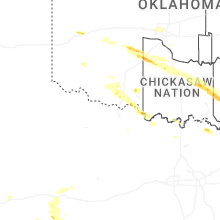
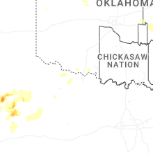


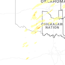


Connect with Interactive Hail Maps