

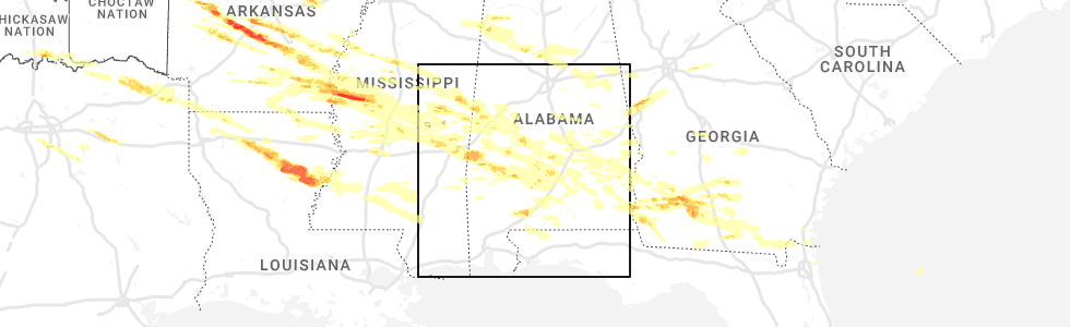
Hail Map for Thomasville, AL
The Thomasville, AL area has had 10 reports of on-the-ground hail by trained spotters, and has been under severe weather warnings 33 times during the past 12 months. Doppler radar has detected hail at or near Thomasville, AL on 51 occasions, including 6 occasions during the past year.
| Name: | Thomasville, AL |
| Where Located: | 27.4 miles WSW of Camden, AL |
| Map: | Google Map for Thomasville, AL |
| Population: | 4209 |
| Housing Units: | 1983 |
| More Info: | Search Google for Thomasville, AL |
2
The Top Recent Hail Date for Thomasville, AL is Wednesday, June 14, 2023 (7th out of 51)
Hail and Wind Damage Spotted near Thomasville, AL
| Date / Time | Report Details |
|---|---|
| 2/11/2024 2:36 PM CST |
 The severe thunderstorm warning for northeastern clarke and southwestern wilcox counties will expire at 245 pm cst, the storm which prompted the warning has weakened below severe limits, therefore, the warning will be allowed to expire. however, gusty winds are still possible with this thunderstorm. The severe thunderstorm warning for northeastern clarke and southwestern wilcox counties will expire at 245 pm cst, the storm which prompted the warning has weakened below severe limits, therefore, the warning will be allowed to expire. however, gusty winds are still possible with this thunderstorm.
|
| 2/11/2024 2:19 PM CST |
 At 219 pm cst, a severe thunderstorm was located 6 miles west of grove hill, moving northeast at 40 mph (radar indicated). Hazards include 60 mph wind gusts. Expect damage to roofs, siding, and trees. locations impacted include, thomasville, grove hill, pine hill, and fulton. hail threat, radar indicated max hail size, <. 75 in wind threat, radar indicated max wind gust, 60 mph. At 219 pm cst, a severe thunderstorm was located 6 miles west of grove hill, moving northeast at 40 mph (radar indicated). Hazards include 60 mph wind gusts. Expect damage to roofs, siding, and trees. locations impacted include, thomasville, grove hill, pine hill, and fulton. hail threat, radar indicated max hail size, <. 75 in wind threat, radar indicated max wind gust, 60 mph.
|
| 2/11/2024 2:00 PM CST |
 At 200 pm cst, a severe thunderstorm was located 6 miles north of saint stephens, or 13 miles northwest of jackson, moving northeast at 45 mph (radar indicated). Hazards include 60 mph wind gusts and penny size hail. expect damage to roofs, siding, and trees At 200 pm cst, a severe thunderstorm was located 6 miles north of saint stephens, or 13 miles northwest of jackson, moving northeast at 45 mph (radar indicated). Hazards include 60 mph wind gusts and penny size hail. expect damage to roofs, siding, and trees
|
| 1/9/2024 1:18 AM CST |
 A severe thunderstorm warning remains in effect until 145 am cst for northwestern monroe. east central washington. central clarke and southwestern wilcox counties. at 118 am cst, a severe thunderstorm was located over grove hill, moving northeast at 65 mph. hazard. 70 mph wind gusts. A severe thunderstorm warning remains in effect until 145 am cst for northwestern monroe. east central washington. central clarke and southwestern wilcox counties. at 118 am cst, a severe thunderstorm was located over grove hill, moving northeast at 65 mph. hazard. 70 mph wind gusts.
|
| 1/9/2024 12:55 AM CST |
 At 1254 am cst, a severe thunderstorm was located over wagarville, or 11 miles southwest of jackson, moving northeast at 65 mph (radar indicated). Hazards include 70 mph wind gusts. Expect considerable tree damage. Damage is likely to mobile homes, roofs, and outbuildings. At 1254 am cst, a severe thunderstorm was located over wagarville, or 11 miles southwest of jackson, moving northeast at 65 mph (radar indicated). Hazards include 70 mph wind gusts. Expect considerable tree damage. Damage is likely to mobile homes, roofs, and outbuildings.
|
| 1/8/2024 11:43 PM CST |
 At 1142 pm cst, a severe thunderstorm was located 5 miles north of saint stephens, or 12 miles northwest of jackson, moving northeast at 90 mph (radar indicated). Hazards include 70 mph wind gusts. Expect considerable tree damage. damage is likely to mobile homes, roofs, and outbuildings. locations impacted include, thomasville, grove hill, and fulton. thunderstorm damage threat, considerable hail threat, radar indicated max hail size, <. 75 in wind threat, radar indicated max wind gust, 70 mph. At 1142 pm cst, a severe thunderstorm was located 5 miles north of saint stephens, or 12 miles northwest of jackson, moving northeast at 90 mph (radar indicated). Hazards include 70 mph wind gusts. Expect considerable tree damage. damage is likely to mobile homes, roofs, and outbuildings. locations impacted include, thomasville, grove hill, and fulton. thunderstorm damage threat, considerable hail threat, radar indicated max hail size, <. 75 in wind threat, radar indicated max wind gust, 70 mph.
|
| 1/8/2024 11:31 PM CST |
 At 1131 pm cst, a severe thunderstorm was located 5 miles southwest of saint stephens, or 7 miles east of chatom, moving northeast at 55 mph (radar indicated). Hazards include 70 mph wind gusts. Expect considerable tree damage. damage is likely to mobile homes, roofs, and outbuildings. Locations impacted include, jackson, thomasville, grove hill, saint stephens, wagarville, leroy, whatley, and fulton. At 1131 pm cst, a severe thunderstorm was located 5 miles southwest of saint stephens, or 7 miles east of chatom, moving northeast at 55 mph (radar indicated). Hazards include 70 mph wind gusts. Expect considerable tree damage. damage is likely to mobile homes, roofs, and outbuildings. Locations impacted include, jackson, thomasville, grove hill, saint stephens, wagarville, leroy, whatley, and fulton.
|
| 1/8/2024 11:26 PM CST |
 At 1126 pm cst, a severe thunderstorm was located over chatom, moving northeast at 55 mph (radar indicated). Hazards include 70 mph wind gusts. Expect considerable tree damage. Damage is likely to mobile homes, roofs, and outbuildings. At 1126 pm cst, a severe thunderstorm was located over chatom, moving northeast at 55 mph (radar indicated). Hazards include 70 mph wind gusts. Expect considerable tree damage. Damage is likely to mobile homes, roofs, and outbuildings.
|
| 6/26/2023 1:17 AM CDT |
 At 117 am cdt, severe thunderstorms were located along a line extending from 5 miles southwest of sweet water to 7 miles south of putnam to 4 miles northeast of silas to near waynesboro, moving east at 35 mph (radar indicated). Hazards include 60 mph wind gusts. Expect damage to roofs, siding, and trees. locations impacted include, thomasville, millry, silas and coffeeville. hail threat, radar indicated max hail size, <. 75 in wind threat, radar indicated max wind gust, 60 mph. At 117 am cdt, severe thunderstorms were located along a line extending from 5 miles southwest of sweet water to 7 miles south of putnam to 4 miles northeast of silas to near waynesboro, moving east at 35 mph (radar indicated). Hazards include 60 mph wind gusts. Expect damage to roofs, siding, and trees. locations impacted include, thomasville, millry, silas and coffeeville. hail threat, radar indicated max hail size, <. 75 in wind threat, radar indicated max wind gust, 60 mph.
|
| 6/26/2023 12:46 AM CDT |
 At 1246 am cdt, severe thunderstorms were located along a line extending from butler to 4 miles north of toxey to 8 miles south of crandall to 6 miles northeast of mill creek, moving east at 35 mph (radar indicated). Hazards include 60 mph wind gusts. expect damage to roofs, siding, and trees At 1246 am cdt, severe thunderstorms were located along a line extending from butler to 4 miles north of toxey to 8 miles south of crandall to 6 miles northeast of mill creek, moving east at 35 mph (radar indicated). Hazards include 60 mph wind gusts. expect damage to roofs, siding, and trees
|
| 6/19/2023 3:23 AM CDT |
 At 323 am cdt, severe thunderstorms were located along a line extending from 3 miles east of lisman to 7 miles southwest of butler to crandall, moving southeast at 50 mph (radar indicated). Hazards include 60 mph wind gusts and nickel size hail. expect damage to roofs, siding, and trees At 323 am cdt, severe thunderstorms were located along a line extending from 3 miles east of lisman to 7 miles southwest of butler to crandall, moving southeast at 50 mph (radar indicated). Hazards include 60 mph wind gusts and nickel size hail. expect damage to roofs, siding, and trees
|
| 6/18/2023 12:05 PM CDT | Large oak tree uprooted at tallahatta springs rd and rush r in clarke county AL, 7.4 miles E of Thomasville, AL |
| 6/18/2023 12:01 PM CDT |
 At 1201 pm cdt, severe thunderstorms were located along a line extending from near vineland to 5 miles northeast of jackson, moving east at 55 mph (radar indicated). Hazards include 60 mph wind gusts and quarter size hail. Hail damage to vehicles is expected. expect wind damage to roofs, siding, and trees. locations impacted include, thomasville, camden, frisco city, grove hill, whatley, pine hill, vredenburgh, fulton and yellow bluff. hail threat, radar indicated max hail size, 1. 00 in wind threat, radar indicated max wind gust, 60 mph. At 1201 pm cdt, severe thunderstorms were located along a line extending from near vineland to 5 miles northeast of jackson, moving east at 55 mph (radar indicated). Hazards include 60 mph wind gusts and quarter size hail. Hail damage to vehicles is expected. expect wind damage to roofs, siding, and trees. locations impacted include, thomasville, camden, frisco city, grove hill, whatley, pine hill, vredenburgh, fulton and yellow bluff. hail threat, radar indicated max hail size, 1. 00 in wind threat, radar indicated max wind gust, 60 mph.
|
| 6/18/2023 11:42 AM CDT | Tree down on sumter rodgers r in marengo county AL, 10.5 miles SE of Thomasville, AL |
| 6/18/2023 11:36 AM CDT |
 At 1135 am cdt, severe thunderstorms were located along a line extending from near nanafalia to chatom, moving east at 55 mph (radar indicated). Hazards include 70 mph wind gusts and quarter size hail. Hail damage to vehicles is expected. expect considerable tree damage. Wind damage is also likely to mobile homes, roofs, and outbuildings. At 1135 am cdt, severe thunderstorms were located along a line extending from near nanafalia to chatom, moving east at 55 mph (radar indicated). Hazards include 70 mph wind gusts and quarter size hail. Hail damage to vehicles is expected. expect considerable tree damage. Wind damage is also likely to mobile homes, roofs, and outbuildings.
|
| 6/16/2023 9:30 PM CDT |
 At 929 pm cdt, severe thunderstorms were located along a line extending from 10 miles south of crandall to 4 miles east of coffeeville to 9 miles east of fulton, moving south at 35 mph (radar indicated). Hazards include 60 mph wind gusts and half dollar size hail. Hail damage to vehicles is expected. expect wind damage to roofs, siding, and trees. locations impacted include, monroeville, jackson, thomasville, camden, frisco city, grove hill, chatom, peterman, saint stephens, wagarville, leroy, whatley, millry, silas, beatrice, coffeeville, vredenburgh, fulton, gilbertown and yellow bluff. hail threat, radar indicated max hail size, 1. 25 in wind threat, radar indicated max wind gust, 60 mph. At 929 pm cdt, severe thunderstorms were located along a line extending from 10 miles south of crandall to 4 miles east of coffeeville to 9 miles east of fulton, moving south at 35 mph (radar indicated). Hazards include 60 mph wind gusts and half dollar size hail. Hail damage to vehicles is expected. expect wind damage to roofs, siding, and trees. locations impacted include, monroeville, jackson, thomasville, camden, frisco city, grove hill, chatom, peterman, saint stephens, wagarville, leroy, whatley, millry, silas, beatrice, coffeeville, vredenburgh, fulton, gilbertown and yellow bluff. hail threat, radar indicated max hail size, 1. 25 in wind threat, radar indicated max wind gust, 60 mph.
|
| 6/16/2023 8:52 PM CDT |
 At 851 pm cdt, severe thunderstorms were located along a line extending from 7 miles southwest of lisman to 4 miles northwest of thomasville to 5 miles southwest of old cahaba park, moving south at 35 mph (radar indicated). Hazards include 60 mph wind gusts and half dollar size hail. Hail damage to vehicles is expected. Expect wind damage to roofs, siding, and trees. At 851 pm cdt, severe thunderstorms were located along a line extending from 7 miles southwest of lisman to 4 miles northwest of thomasville to 5 miles southwest of old cahaba park, moving south at 35 mph (radar indicated). Hazards include 60 mph wind gusts and half dollar size hail. Hail damage to vehicles is expected. Expect wind damage to roofs, siding, and trees.
|
| 6/16/2023 8:35 PM CDT |
 At 835 pm cdt, severe thunderstorms were located along a line extending from 6 miles east of snell to sweet water to 3 miles southwest of bogue chitto, moving south at 35 mph (radar indicated). Hazards include 60 mph wind gusts and quarter size hail. Hail damage to vehicles is expected. expect wind damage to roofs, siding, and trees. locations impacted include, thomasville, camden, butler, pine hill, lisman, pennington, gilbertown, yellow bluff and toxey. hail threat, radar indicated max hail size, 1. 00 in wind threat, radar indicated max wind gust, 60 mph. At 835 pm cdt, severe thunderstorms were located along a line extending from 6 miles east of snell to sweet water to 3 miles southwest of bogue chitto, moving south at 35 mph (radar indicated). Hazards include 60 mph wind gusts and quarter size hail. Hail damage to vehicles is expected. expect wind damage to roofs, siding, and trees. locations impacted include, thomasville, camden, butler, pine hill, lisman, pennington, gilbertown, yellow bluff and toxey. hail threat, radar indicated max hail size, 1. 00 in wind threat, radar indicated max wind gust, 60 mph.
|
| 6/16/2023 8:00 PM CDT |
 At 759 pm cdt, severe thunderstorms were located along a line extending from 3 miles southeast of lauderdale to 4 miles west of jefferson to 5 miles east of newbern, moving south at 25 mph (radar indicated). Hazards include 60 mph wind gusts and quarter size hail. Hail damage to vehicles is expected. Expect wind damage to roofs, siding, and trees. At 759 pm cdt, severe thunderstorms were located along a line extending from 3 miles southeast of lauderdale to 4 miles west of jefferson to 5 miles east of newbern, moving south at 25 mph (radar indicated). Hazards include 60 mph wind gusts and quarter size hail. Hail damage to vehicles is expected. Expect wind damage to roofs, siding, and trees.
|
| 6/16/2023 7:42 PM CDT | Corrects previous tstm wnd dmg report from 3 sse dixons mill. trees down and power outages south of dixons mills along hwy 4 in marengo county AL, 8.3 miles S of Thomasville, AL |
| 6/16/2023 7:27 PM CDT |
 At 726 pm cdt, severe thunderstorms were located along a line extending from 3 miles south of thomasville to 11 miles northwest of monroeville, moving east at 35 mph (radar indicated). Hazards include 60 mph wind gusts and quarter size hail. Hail damage to vehicles is expected. Expect wind damage to roofs, siding, and trees. At 726 pm cdt, severe thunderstorms were located along a line extending from 3 miles south of thomasville to 11 miles northwest of monroeville, moving east at 35 mph (radar indicated). Hazards include 60 mph wind gusts and quarter size hail. Hail damage to vehicles is expected. Expect wind damage to roofs, siding, and trees.
|
| 6/16/2023 8:03 AM CDT |
 At 802 am cdt, severe thunderstorms were located along a line extending from near yellow bluff to 10 miles west of uriah to 3 miles southeast of creola, moving east at 55 mph (radar indicated). Hazards include 70 mph wind gusts and quarter size hail. Hail damage to vehicles is expected. expect considerable tree damage. Wind damage is also likely to mobile homes, roofs, and outbuildings. At 802 am cdt, severe thunderstorms were located along a line extending from near yellow bluff to 10 miles west of uriah to 3 miles southeast of creola, moving east at 55 mph (radar indicated). Hazards include 70 mph wind gusts and quarter size hail. Hail damage to vehicles is expected. expect considerable tree damage. Wind damage is also likely to mobile homes, roofs, and outbuildings.
|
| 6/16/2023 7:56 AM CDT |
 At 756 am cdt, severe thunderstorms were located along a line extending from 5 miles northeast of magnolia to 4 miles east of fulton to 10 miles south of jackson, moving east at 55 mph (radar indicated). Hazards include 70 mph wind gusts. Expect considerable tree damage. damage is likely to mobile homes, roofs, and outbuildings. locations impacted include, jackson, waynesboro, thomasville, camden, butler, grove hill, chatom, wagarville, saint stephens, leroy, clara, whatley, pine hill, lisman, millry, state line, buckatunna, silas, coffeeville and pennington. thunderstorm damage threat, considerable hail threat, radar indicated max hail size, <. 75 in wind threat, radar indicated max wind gust, 70 mph. At 756 am cdt, severe thunderstorms were located along a line extending from 5 miles northeast of magnolia to 4 miles east of fulton to 10 miles south of jackson, moving east at 55 mph (radar indicated). Hazards include 70 mph wind gusts. Expect considerable tree damage. damage is likely to mobile homes, roofs, and outbuildings. locations impacted include, jackson, waynesboro, thomasville, camden, butler, grove hill, chatom, wagarville, saint stephens, leroy, clara, whatley, pine hill, lisman, millry, state line, buckatunna, silas, coffeeville and pennington. thunderstorm damage threat, considerable hail threat, radar indicated max hail size, <. 75 in wind threat, radar indicated max wind gust, 70 mph.
|
| 6/16/2023 7:42 AM CDT | Trees down and power outages south of dixons mills along hwy 4 in marengo county AL, 8.3 miles S of Thomasville, AL |
| 6/16/2023 7:16 AM CDT |
 At 715 am cdt, severe thunderstorms were located along a line extending from 7 miles west of pennington to 5 miles southeast of gilbertown to 3 miles east of state line, moving east at 55 mph (radar indicated). Hazards include 60 mph wind gusts and quarter size hail. Hail damage to vehicles is expected. Expect wind damage to roofs, siding, and trees. At 715 am cdt, severe thunderstorms were located along a line extending from 7 miles west of pennington to 5 miles southeast of gilbertown to 3 miles east of state line, moving east at 55 mph (radar indicated). Hazards include 60 mph wind gusts and quarter size hail. Hail damage to vehicles is expected. Expect wind damage to roofs, siding, and trees.
|
| 6/15/2023 11:59 AM CDT |
 At 1159 am cdt, severe thunderstorms were located along a line extending from 6 miles northwest of camden to yellow bluff to thomasville, moving east at 35 mph (radar indicated). Hazards include 60 mph wind gusts and quarter size hail. Hail damage to vehicles is expected. Expect wind damage to roofs, siding, and trees. At 1159 am cdt, severe thunderstorms were located along a line extending from 6 miles northwest of camden to yellow bluff to thomasville, moving east at 35 mph (radar indicated). Hazards include 60 mph wind gusts and quarter size hail. Hail damage to vehicles is expected. Expect wind damage to roofs, siding, and trees.
|
| 6/15/2023 1:28 AM CDT |
 At 127 am cdt, a severe thunderstorm was located over dixons mill, or 9 miles northwest of thomasville, moving east at 40 mph (radar indicated). Hazards include golf ball size hail and 60 mph wind gusts. People and animals outdoors will be injured. expect hail damage to roofs, siding, windows, and vehicles. Expect wind damage to roofs, siding, and trees. At 127 am cdt, a severe thunderstorm was located over dixons mill, or 9 miles northwest of thomasville, moving east at 40 mph (radar indicated). Hazards include golf ball size hail and 60 mph wind gusts. People and animals outdoors will be injured. expect hail damage to roofs, siding, windows, and vehicles. Expect wind damage to roofs, siding, and trees.
|
| 6/14/2023 5:44 PM CDT |
 At 544 pm cdt, a severe thunderstorm was located 5 miles northwest of grove hill, moving east at 45 mph (radar indicated). Hazards include 60 mph wind gusts and nickel size hail. expect damage to roofs, siding, and trees At 544 pm cdt, a severe thunderstorm was located 5 miles northwest of grove hill, moving east at 45 mph (radar indicated). Hazards include 60 mph wind gusts and nickel size hail. expect damage to roofs, siding, and trees
|
| 6/14/2023 5:29 PM CDT | Report of tree blocking both lanes of tallahatta springs rd around the 10000 block. time estimated using rada in clarke county AL, 8.6 miles E of Thomasville, AL |
| 6/14/2023 5:26 PM CDT | Report of tree down blocking road around 5000 block of tallahatta springs rd. time estimated from rada in clarke county AL, 2.7 miles ESE of Thomasville, AL |
| 6/14/2023 5:08 PM CDT |
 At 508 pm cdt, a severe thunderstorm was located 6 miles southwest of thomasville, moving east at 35 mph (radar indicated). Hazards include 60 mph wind gusts and quarter size hail. Hail damage to vehicles is expected. Expect wind damage to roofs, siding, and trees. At 508 pm cdt, a severe thunderstorm was located 6 miles southwest of thomasville, moving east at 35 mph (radar indicated). Hazards include 60 mph wind gusts and quarter size hail. Hail damage to vehicles is expected. Expect wind damage to roofs, siding, and trees.
|
| 6/10/2023 6:08 PM CDT |
 The severe thunderstorm warning for northeastern clarke and southwestern wilcox counties will expire at 615 pm cdt, the storm which prompted the warning has weakened below severe limits. therefore, the warning will be allowed to expire. however gusty winds and heavy rain are still possible with this thunderstorm. The severe thunderstorm warning for northeastern clarke and southwestern wilcox counties will expire at 615 pm cdt, the storm which prompted the warning has weakened below severe limits. therefore, the warning will be allowed to expire. however gusty winds and heavy rain are still possible with this thunderstorm.
|
| 6/10/2023 5:57 PM CDT |
 At 557 pm cdt, a severe thunderstorm was located over thomasville, moving east at 15 mph (radar indicated). Hazards include 60 mph wind gusts and penny size hail. Expect damage to roofs, siding, and trees. locations impacted include, thomasville, pine hill and fulton. hail threat, radar indicated max hail size, 0. 75 in wind threat, radar indicated max wind gust, 60 mph. At 557 pm cdt, a severe thunderstorm was located over thomasville, moving east at 15 mph (radar indicated). Hazards include 60 mph wind gusts and penny size hail. Expect damage to roofs, siding, and trees. locations impacted include, thomasville, pine hill and fulton. hail threat, radar indicated max hail size, 0. 75 in wind threat, radar indicated max wind gust, 60 mph.
|
| 6/10/2023 5:34 PM CDT |
 At 533 pm cdt, a severe thunderstorm was located 5 miles west of thomasville, moving east at 20 mph (radar indicated). Hazards include 60 mph wind gusts and penny size hail. expect damage to roofs, siding, and trees At 533 pm cdt, a severe thunderstorm was located 5 miles west of thomasville, moving east at 20 mph (radar indicated). Hazards include 60 mph wind gusts and penny size hail. expect damage to roofs, siding, and trees
|
| 3/26/2023 9:17 PM CDT |
 At 916 pm cdt, a severe thunderstorm was located over fulton, or 7 miles south of thomasville, moving east at 55 mph (radar indicated). Hazards include 60 mph wind gusts and quarter size hail. Hail damage to vehicles is expected. Expect wind damage to roofs, siding, and trees. At 916 pm cdt, a severe thunderstorm was located over fulton, or 7 miles south of thomasville, moving east at 55 mph (radar indicated). Hazards include 60 mph wind gusts and quarter size hail. Hail damage to vehicles is expected. Expect wind damage to roofs, siding, and trees.
|
| 3/26/2023 9:01 PM CDT |
 At 901 pm cdt, severe thunderstorms were located along a line extending from 9 miles northeast of pine hill to 5 miles southwest of yellow bluff to 5 miles east of fulton to grove hill, moving east at 45 mph (radar indicated). Hazards include 60 mph wind gusts and quarter size hail. Hail damage to vehicles is expected. expect wind damage to roofs, siding, and trees. locations impacted include, thomasville, grove hill, whatley, vredenburgh and fulton. hail threat, radar indicated max hail size, 1. 00 in wind threat, radar indicated max wind gust, 60 mph. At 901 pm cdt, severe thunderstorms were located along a line extending from 9 miles northeast of pine hill to 5 miles southwest of yellow bluff to 5 miles east of fulton to grove hill, moving east at 45 mph (radar indicated). Hazards include 60 mph wind gusts and quarter size hail. Hail damage to vehicles is expected. expect wind damage to roofs, siding, and trees. locations impacted include, thomasville, grove hill, whatley, vredenburgh and fulton. hail threat, radar indicated max hail size, 1. 00 in wind threat, radar indicated max wind gust, 60 mph.
|
| 3/26/2023 8:51 PM CDT | Trees down on round hill road approximately 3 miles east of old highway in clarke county AL, 3.8 miles W of Thomasville, AL |
| 3/26/2023 8:30 PM CDT |
 At 830 pm cdt, severe thunderstorms were located along a line extending from 3 miles southwest of dixons mill to 11 miles west of thomasville to 5 miles east of coffeeville to 9 miles east of millry, moving east at 45 mph (radar indicated). Hazards include 60 mph wind gusts and quarter size hail. Hail damage to vehicles is expected. Expect wind damage to roofs, siding, and trees. At 830 pm cdt, severe thunderstorms were located along a line extending from 3 miles southwest of dixons mill to 11 miles west of thomasville to 5 miles east of coffeeville to 9 miles east of millry, moving east at 45 mph (radar indicated). Hazards include 60 mph wind gusts and quarter size hail. Hail damage to vehicles is expected. Expect wind damage to roofs, siding, and trees.
|
| 3/26/2023 8:11 PM CDT |
 At 811 pm cdt, severe thunderstorms were located along a line extending from 5 miles south of putnam to 6 miles west of coffeeville to 6 miles east of waynesboro, moving east at 55 mph (radar indicated). Hazards include 60 mph wind gusts and quarter size hail. Hail damage to vehicles is expected. expect wind damage to roofs, siding, and trees. Locations impacted include, waynesboro, clara, millry, silas, coffeeville and gilbertown. At 811 pm cdt, severe thunderstorms were located along a line extending from 5 miles south of putnam to 6 miles west of coffeeville to 6 miles east of waynesboro, moving east at 55 mph (radar indicated). Hazards include 60 mph wind gusts and quarter size hail. Hail damage to vehicles is expected. expect wind damage to roofs, siding, and trees. Locations impacted include, waynesboro, clara, millry, silas, coffeeville and gilbertown.
|
| 3/26/2023 7:42 PM CDT |
 At 741 pm cdt, severe thunderstorms were located along a line extending from 3 miles northwest of toxey to 8 miles southeast of mill creek, moving east at 40 mph (radar indicated). Hazards include 60 mph wind gusts and quarter size hail. Hail damage to vehicles is expected. Expect wind damage to roofs, siding, and trees. At 741 pm cdt, severe thunderstorms were located along a line extending from 3 miles northwest of toxey to 8 miles southeast of mill creek, moving east at 40 mph (radar indicated). Hazards include 60 mph wind gusts and quarter size hail. Hail damage to vehicles is expected. Expect wind damage to roofs, siding, and trees.
|
| 3/26/2023 6:33 PM CDT |
 At 633 pm cdt, a severe thunderstorm was located near thomasville, moving east at 40 mph (radar indicated). Hazards include 60 mph wind gusts and half dollar size hail. Hail damage to vehicles is expected. expect wind damage to roofs, siding, and trees. Locations impacted include, thomasville. At 633 pm cdt, a severe thunderstorm was located near thomasville, moving east at 40 mph (radar indicated). Hazards include 60 mph wind gusts and half dollar size hail. Hail damage to vehicles is expected. expect wind damage to roofs, siding, and trees. Locations impacted include, thomasville.
|
| 3/26/2023 6:32 PM CDT |
 At 632 pm cdt, a severe thunderstorm capable of producing a tornado was located 4 miles southeast of thomasville, moving east at 35 mph (radar indicated rotation). Hazards include tornado and half dollar size hail. Flying debris will be dangerous to those caught without shelter. mobile homes will be damaged or destroyed. damage to roofs, windows, and vehicles will occur. tree damage is likely. this dangerous storm will be near, pine hill around 650 pm cdt. yellow bluff around 700 pm cdt. Camden around 715 pm cdt. At 632 pm cdt, a severe thunderstorm capable of producing a tornado was located 4 miles southeast of thomasville, moving east at 35 mph (radar indicated rotation). Hazards include tornado and half dollar size hail. Flying debris will be dangerous to those caught without shelter. mobile homes will be damaged or destroyed. damage to roofs, windows, and vehicles will occur. tree damage is likely. this dangerous storm will be near, pine hill around 650 pm cdt. yellow bluff around 700 pm cdt. Camden around 715 pm cdt.
|
| 3/26/2023 6:25 PM CDT | A barn and large portable storage building destroyed on kelly road. a home had minor damage just to the west on sandflat r in clarke county AL, 4.4 miles NNE of Thomasville, AL |
| 3/26/2023 6:24 PM CDT | Emergency manager reports billboard signs and traffic signals down at highway 43 and north clark industrial roa in clarke county AL, 4.3 miles N of Thomasville, AL |
| 3/26/2023 6:22 PM CDT | Emergency manager reports multiple trees down... minor structural damage to a mobile home... and small debris in the general vicinity of sandflat road and london roa in clarke county AL, 5.1 miles N of Thomasville, AL |
| 3/26/2023 6:21 PM CDT |
 At 621 pm cdt, a severe thunderstorm capable of producing a tornado was located 5 miles northwest of fulton, or 7 miles southwest of thomasville, moving east at 35 mph (radar indicated rotation). Hazards include tornado and golf ball size hail. Flying debris will be dangerous to those caught without shelter. mobile homes will be damaged or destroyed. damage to roofs, windows, and vehicles will occur. tree damage is likely. this dangerous storm will be near, thomasville and fulton around 630 pm cdt. pine hill around 650 pm cdt. Yellow bluff around 700 pm cdt. At 621 pm cdt, a severe thunderstorm capable of producing a tornado was located 5 miles northwest of fulton, or 7 miles southwest of thomasville, moving east at 35 mph (radar indicated rotation). Hazards include tornado and golf ball size hail. Flying debris will be dangerous to those caught without shelter. mobile homes will be damaged or destroyed. damage to roofs, windows, and vehicles will occur. tree damage is likely. this dangerous storm will be near, thomasville and fulton around 630 pm cdt. pine hill around 650 pm cdt. Yellow bluff around 700 pm cdt.
|
| 3/26/2023 6:18 PM CDT | Quarter sized hail reported 7.4 miles E of Thomasville, AL, quarter size hail reported on tallahatta spring rd at huggins rd. |
| 3/26/2023 6:15 PM CDT |
 At 615 pm cdt, a severe thunderstorm was located 9 miles southwest of thomasville, moving east at 35 mph (radar indicated). Hazards include golf ball size hail and 60 mph wind gusts. People and animals outdoors will be injured. expect hail damage to roofs, siding, windows, and vehicles. expect wind damage to roofs, siding, and trees. Locations impacted include, thomasville. At 615 pm cdt, a severe thunderstorm was located 9 miles southwest of thomasville, moving east at 35 mph (radar indicated). Hazards include golf ball size hail and 60 mph wind gusts. People and animals outdoors will be injured. expect hail damage to roofs, siding, windows, and vehicles. expect wind damage to roofs, siding, and trees. Locations impacted include, thomasville.
|
| 3/26/2023 5:55 PM CDT |
 At 554 pm cdt, a severe thunderstorm was located 6 miles north of coffeeville, or 18 miles southeast of butler, moving northeast at 40 mph (radar indicated). Hazards include golf ball size hail and 60 mph wind gusts. People and animals outdoors will be injured. expect hail damage to roofs, siding, windows, and vehicles. Expect wind damage to roofs, siding, and trees. At 554 pm cdt, a severe thunderstorm was located 6 miles north of coffeeville, or 18 miles southeast of butler, moving northeast at 40 mph (radar indicated). Hazards include golf ball size hail and 60 mph wind gusts. People and animals outdoors will be injured. expect hail damage to roofs, siding, windows, and vehicles. Expect wind damage to roofs, siding, and trees.
|
| 3/26/2023 1:40 PM CDT |
 The severe thunderstorm warning for north central monroe, northeastern clarke and southwestern wilcox counties will expire at 145 pm cdt, the storm which prompted the warning has weakened below severe limits. therefore, the warning will be allowed to expire. a severe thunderstorm watch remains in effect until 600 pm cdt for south central and southwestern alabama. The severe thunderstorm warning for north central monroe, northeastern clarke and southwestern wilcox counties will expire at 145 pm cdt, the storm which prompted the warning has weakened below severe limits. therefore, the warning will be allowed to expire. a severe thunderstorm watch remains in effect until 600 pm cdt for south central and southwestern alabama.
|
| 3/26/2023 1:21 PM CDT |
 At 120 pm cdt, a severe thunderstorm was located 6 miles east of thomasville, moving east at 30 mph (radar indicated). Hazards include 60 mph wind gusts and quarter size hail. Hail damage to vehicles is expected. expect wind damage to roofs, siding, and trees. locations impacted include, pine hill and yellow bluff. hail threat, radar indicated max hail size, 1. 00 in wind threat, radar indicated max wind gust, 60 mph. At 120 pm cdt, a severe thunderstorm was located 6 miles east of thomasville, moving east at 30 mph (radar indicated). Hazards include 60 mph wind gusts and quarter size hail. Hail damage to vehicles is expected. expect wind damage to roofs, siding, and trees. locations impacted include, pine hill and yellow bluff. hail threat, radar indicated max hail size, 1. 00 in wind threat, radar indicated max wind gust, 60 mph.
|
| 3/26/2023 1:12 PM CDT | Quarter sized hail reported 1.3 miles S of Thomasville, AL, em reports hail ranging in size from dime to quarter. time using radar. |
| 3/26/2023 12:59 PM CDT |
 At 1258 pm cdt, a severe thunderstorm was located 5 miles west of thomasville, moving east at 35 mph (radar indicated). Hazards include 60 mph wind gusts and quarter size hail. Hail damage to vehicles is expected. Expect wind damage to roofs, siding, and trees. At 1258 pm cdt, a severe thunderstorm was located 5 miles west of thomasville, moving east at 35 mph (radar indicated). Hazards include 60 mph wind gusts and quarter size hail. Hail damage to vehicles is expected. Expect wind damage to roofs, siding, and trees.
|
| 3/12/2023 6:09 PM CDT |
 The severe thunderstorm warning for north central clarke county will expire at 615 pm cdt, the storm which prompted the warning has weakened below severe limits, and has exited the warned area. therefore, the warning will be allowed to expire. The severe thunderstorm warning for north central clarke county will expire at 615 pm cdt, the storm which prompted the warning has weakened below severe limits, and has exited the warned area. therefore, the warning will be allowed to expire.
|
| 3/12/2023 6:00 PM CDT |
 At 559 pm cdt, a severe thunderstorm was located 5 miles west of thomasville, moving east at 65 mph (radar indicated). Hazards include quarter size hail. Damage to vehicles is expected. locations impacted include, thomasville. hail threat, radar indicated max hail size, 1. 00 in wind threat, radar indicated max wind gust, <50 mph. At 559 pm cdt, a severe thunderstorm was located 5 miles west of thomasville, moving east at 65 mph (radar indicated). Hazards include quarter size hail. Damage to vehicles is expected. locations impacted include, thomasville. hail threat, radar indicated max hail size, 1. 00 in wind threat, radar indicated max wind gust, <50 mph.
|
| 3/12/2023 5:40 PM CDT |
 At 538 pm cdt, a severe thunderstorm was located 6 miles east of toxey, or 10 miles south of butler, moving east at 60 mph (radar indicated). Hazards include quarter size hail. damage to vehicles is expected At 538 pm cdt, a severe thunderstorm was located 6 miles east of toxey, or 10 miles south of butler, moving east at 60 mph (radar indicated). Hazards include quarter size hail. damage to vehicles is expected
|
| 1/12/2023 1:13 PM CST |
 At 113 pm cst, a severe thunderstorm was located near grove hill, moving east at 60 mph (radar indicated). Hazards include 60 mph wind gusts and quarter size hail. Hail damage to vehicles is expected. expect wind damage to roofs, siding, and trees. locations impacted include, grove hill, vredenburgh and fulton. hail threat, radar indicated max hail size, 1. 00 in wind threat, radar indicated max wind gust, 60 mph. At 113 pm cst, a severe thunderstorm was located near grove hill, moving east at 60 mph (radar indicated). Hazards include 60 mph wind gusts and quarter size hail. Hail damage to vehicles is expected. expect wind damage to roofs, siding, and trees. locations impacted include, grove hill, vredenburgh and fulton. hail threat, radar indicated max hail size, 1. 00 in wind threat, radar indicated max wind gust, 60 mph.
|
| 1/12/2023 12:43 PM CST |
 At 1242 pm cst, severe thunderstorms were located along a line extending from near central mills to 4 miles southeast of silas, moving east at 45 mph (radar indicated). Hazards include 60 mph wind gusts and quarter size hail. Hail damage to vehicles is expected. expect wind damage to roofs, siding, and trees. locations impacted include, thomasville, saint stephens, pine hill, millry and coffeeville. hail threat, radar indicated max hail size, 1. 00 in wind threat, radar indicated max wind gust, 60 mph. At 1242 pm cst, severe thunderstorms were located along a line extending from near central mills to 4 miles southeast of silas, moving east at 45 mph (radar indicated). Hazards include 60 mph wind gusts and quarter size hail. Hail damage to vehicles is expected. expect wind damage to roofs, siding, and trees. locations impacted include, thomasville, saint stephens, pine hill, millry and coffeeville. hail threat, radar indicated max hail size, 1. 00 in wind threat, radar indicated max wind gust, 60 mph.
|
| 1/12/2023 11:54 AM CST |
 At 1154 am cst, severe thunderstorms were located along a line extending from 4 miles south of myrtlewood to 8 miles west of clara, moving east at 45 mph (radar indicated). Hazards include 60 mph wind gusts and quarter size hail. Hail damage to vehicles is expected. Expect wind damage to roofs, siding, and trees. At 1154 am cst, severe thunderstorms were located along a line extending from 4 miles south of myrtlewood to 8 miles west of clara, moving east at 45 mph (radar indicated). Hazards include 60 mph wind gusts and quarter size hail. Hail damage to vehicles is expected. Expect wind damage to roofs, siding, and trees.
|
| 1/4/2023 12:55 AM CST |
 At 1255 am cst, a severe thunderstorm was located near fulton, or 6 miles south of thomasville, moving east at 45 mph (radar indicated). Hazards include 60 mph wind gusts. Expect damage to roofs, siding, and trees. Locations impacted include, fulton. At 1255 am cst, a severe thunderstorm was located near fulton, or 6 miles south of thomasville, moving east at 45 mph (radar indicated). Hazards include 60 mph wind gusts. Expect damage to roofs, siding, and trees. Locations impacted include, fulton.
|
| 1/4/2023 12:38 AM CST |
 At 1237 am cst, a severe thunderstorm was located 6 miles east of coffeeville, or 12 miles west of grove hill, moving east at 45 mph (radar indicated). Hazards include 60 mph wind gusts. expect damage to roofs, siding, and trees At 1237 am cst, a severe thunderstorm was located 6 miles east of coffeeville, or 12 miles west of grove hill, moving east at 45 mph (radar indicated). Hazards include 60 mph wind gusts. expect damage to roofs, siding, and trees
|
| 10/12/2022 4:37 PM CDT |
 At 437 pm cdt, a severe thunderstorm was located 7 miles southwest of thomasville, moving east at 30 mph (radar indicated). Hazards include 60 mph wind gusts and quarter size hail. Hail damage to vehicles is expected. expect wind damage to roofs, siding, and trees. locations impacted include, thomasville and pine hill. hail threat, radar indicated max hail size, 1. 00 in wind threat, radar indicated max wind gust, 60 mph. At 437 pm cdt, a severe thunderstorm was located 7 miles southwest of thomasville, moving east at 30 mph (radar indicated). Hazards include 60 mph wind gusts and quarter size hail. Hail damage to vehicles is expected. expect wind damage to roofs, siding, and trees. locations impacted include, thomasville and pine hill. hail threat, radar indicated max hail size, 1. 00 in wind threat, radar indicated max wind gust, 60 mph.
|
| 10/12/2022 4:25 PM CDT |
 At 425 pm cdt, a severe thunderstorm was located 11 miles west of thomasville, moving east at 30 mph (radar indicated). Hazards include 60 mph wind gusts and penny size hail. expect damage to roofs, siding, and trees At 425 pm cdt, a severe thunderstorm was located 11 miles west of thomasville, moving east at 30 mph (radar indicated). Hazards include 60 mph wind gusts and penny size hail. expect damage to roofs, siding, and trees
|
| 8/30/2022 3:15 PM CDT | Emergency manager reports a couple sporadic trees down spread out along tallahatta springs rd. from elam rd east towards thomasville al. a couple of the trees landed on in clarke county AL, 6.8 miles E of Thomasville, AL |
| 7/21/2022 9:42 PM CDT |
 At 942 pm cdt, severe thunderstorms were located along a line extending from 3 miles south of nellieburg to near putnam to 7 miles south of yellow bluff, moving southwest at 25 mph (radar indicated). Hazards include 60 mph wind gusts and penny size hail. expect damage to roofs, siding, and trees At 942 pm cdt, severe thunderstorms were located along a line extending from 3 miles south of nellieburg to near putnam to 7 miles south of yellow bluff, moving southwest at 25 mph (radar indicated). Hazards include 60 mph wind gusts and penny size hail. expect damage to roofs, siding, and trees
|
| 7/21/2022 9:36 PM CDT |
 At 936 pm cdt, severe thunderstorms were located along a line extending from 3 miles south of lisman to 7 miles northwest of peterman to 5 miles north of gantt to 6 miles west of ariton, moving south at 35 mph (radar indicated). Hazards include 60 mph wind gusts and quarter size hail. Hail damage to vehicles is expected. expect wind damage to roofs, siding, and trees. locations impacted include, greenville, monroeville, thomasville, camden, butler, grove hill, peterman, georgiana, whatley, pine hill, lisman, mckenzie, red level, beatrice, coffeeville, pennington, vredenburgh, fulton, gilbertown and yellow bluff. hail threat, radar indicated max hail size, 1. 00 in wind threat, radar indicated max wind gust, 60 mph. At 936 pm cdt, severe thunderstorms were located along a line extending from 3 miles south of lisman to 7 miles northwest of peterman to 5 miles north of gantt to 6 miles west of ariton, moving south at 35 mph (radar indicated). Hazards include 60 mph wind gusts and quarter size hail. Hail damage to vehicles is expected. expect wind damage to roofs, siding, and trees. locations impacted include, greenville, monroeville, thomasville, camden, butler, grove hill, peterman, georgiana, whatley, pine hill, lisman, mckenzie, red level, beatrice, coffeeville, pennington, vredenburgh, fulton, gilbertown and yellow bluff. hail threat, radar indicated max hail size, 1. 00 in wind threat, radar indicated max wind gust, 60 mph.
|
| 7/21/2022 8:45 PM CDT |
 At 844 pm cdt, severe thunderstorms were located along a line extending from near lauderdale to 7 miles north of yellow bluff to 3 miles northwest of greenville to 6 miles north of troy municipal airport, moving south at 35 mph (public). Hazards include 60 mph wind gusts and quarter size hail. Hail damage to vehicles is expected. expect wind damage to roofs, siding, and trees. locations impacted include, greenville, monroeville, thomasville, luverne, camden, butler, grove hill, peterman, georgiana, whatley, pine hill, brantley, lisman, mckenzie, red level, rutledge, beatrice, dozier, coffeeville and pennington. hail threat, radar indicated max hail size, 1. 00 in wind threat, observed max wind gust, 60 mph. At 844 pm cdt, severe thunderstorms were located along a line extending from near lauderdale to 7 miles north of yellow bluff to 3 miles northwest of greenville to 6 miles north of troy municipal airport, moving south at 35 mph (public). Hazards include 60 mph wind gusts and quarter size hail. Hail damage to vehicles is expected. expect wind damage to roofs, siding, and trees. locations impacted include, greenville, monroeville, thomasville, luverne, camden, butler, grove hill, peterman, georgiana, whatley, pine hill, brantley, lisman, mckenzie, red level, rutledge, beatrice, dozier, coffeeville and pennington. hail threat, radar indicated max hail size, 1. 00 in wind threat, observed max wind gust, 60 mph.
|
| 7/21/2022 8:11 PM CDT |
 At 810 pm cdt, severe thunderstorms were located along a line extending from 4 miles southeast of alamucha to near thomaston to mosses to 5 miles south of pike road, moving south at 35 mph (public). Hazards include 60 mph wind gusts and quarter size hail. Hail damage to vehicles is expected. Expect wind damage to roofs, siding, and trees. At 810 pm cdt, severe thunderstorms were located along a line extending from 4 miles southeast of alamucha to near thomaston to mosses to 5 miles south of pike road, moving south at 35 mph (public). Hazards include 60 mph wind gusts and quarter size hail. Hail damage to vehicles is expected. Expect wind damage to roofs, siding, and trees.
|
| 6/25/2022 2:45 PM CDT | Emergency manager reports multiple trees down near the highway 43 and al highway 5 intersection near thomasvill in clarke county AL, 2.6 miles S of Thomasville, AL |
| 6/23/2022 4:05 PM CDT | Reports of trees and tree limbs down in the thomasville... bashi... and glover communities in northern clarke count in clarke county AL, 2.6 miles S of Thomasville, AL |
| 6/23/2022 4:05 PM CDT | Damage to mobile home from fallen tre in clarke county AL, 8 miles E of Thomasville, AL |
| 6/23/2022 3:58 PM CDT |
 At 357 pm cdt, a severe thunderstorm was located 6 miles southwest of thomasville, moving south at 15 mph (radar indicated). Hazards include 60 mph wind gusts and quarter size hail. Hail damage to vehicles is expected. Expect wind damage to roofs, siding, and trees. At 357 pm cdt, a severe thunderstorm was located 6 miles southwest of thomasville, moving south at 15 mph (radar indicated). Hazards include 60 mph wind gusts and quarter size hail. Hail damage to vehicles is expected. Expect wind damage to roofs, siding, and trees.
|
| 6/17/2022 5:38 PM CDT |
 At 538 pm cdt, a severe thunderstorm was located 5 miles northeast of fulton, or 6 miles southeast of thomasville, moving southeast at 10 mph (radar indicated). Hazards include 60 mph wind gusts and quarter size hail. Hail damage to vehicles is expected. Expect wind damage to roofs, siding, and trees. At 538 pm cdt, a severe thunderstorm was located 5 miles northeast of fulton, or 6 miles southeast of thomasville, moving southeast at 10 mph (radar indicated). Hazards include 60 mph wind gusts and quarter size hail. Hail damage to vehicles is expected. Expect wind damage to roofs, siding, and trees.
|
| 5/25/2022 6:46 PM CDT |
 At 645 pm cdt, severe thunderstorms were located along a line extending from near shawnee to 8 miles east of fulton, moving north at 30 mph (radar indicated). Hazards include 60 mph wind gusts and penny size hail. expect damage to roofs, siding, and trees At 645 pm cdt, severe thunderstorms were located along a line extending from near shawnee to 8 miles east of fulton, moving north at 30 mph (radar indicated). Hazards include 60 mph wind gusts and penny size hail. expect damage to roofs, siding, and trees
|
| 5/24/2022 1:01 PM CDT |
 At 100 pm cdt, a severe thunderstorm was located 5 miles west of grove hill, moving north at 40 mph (radar indicated). Hazards include 60 mph wind gusts and quarter size hail. Hail damage to vehicles is expected. Expect wind damage to roofs, siding, and trees. At 100 pm cdt, a severe thunderstorm was located 5 miles west of grove hill, moving north at 40 mph (radar indicated). Hazards include 60 mph wind gusts and quarter size hail. Hail damage to vehicles is expected. Expect wind damage to roofs, siding, and trees.
|
| 4/16/2022 3:10 PM CDT |
 The tornado warning for north central clarke county will expire at 315 pm cdt, the storm which prompted the warning has weakened below severe limits, and has exited the warned area. therefore, the warning will be allowed to expire. The tornado warning for north central clarke county will expire at 315 pm cdt, the storm which prompted the warning has weakened below severe limits, and has exited the warned area. therefore, the warning will be allowed to expire.
|
| 4/16/2022 2:57 PM CDT |
 The severe thunderstorm warning for northern clarke county will expire at 300 pm cdt, the storm which prompted the warning has weakened below severe limits. therefore, the warning will be allowed to expire. however gusty winds are still possible with this thunderstorm. The severe thunderstorm warning for northern clarke county will expire at 300 pm cdt, the storm which prompted the warning has weakened below severe limits. therefore, the warning will be allowed to expire. however gusty winds are still possible with this thunderstorm.
|
| 4/16/2022 2:53 PM CDT |
 At 252 pm cdt, a severe thunderstorm capable of producing a tornado was located near thomasville, moving east at 20 mph (radar indicated rotation). Hazards include tornado. Flying debris will be dangerous to those caught without shelter. mobile homes will be damaged or destroyed. damage to roofs, windows, and vehicles will occur. tree damage is likely. This tornadic thunderstorm will remain over mainly rural areas of north central clarke county. At 252 pm cdt, a severe thunderstorm capable of producing a tornado was located near thomasville, moving east at 20 mph (radar indicated rotation). Hazards include tornado. Flying debris will be dangerous to those caught without shelter. mobile homes will be damaged or destroyed. damage to roofs, windows, and vehicles will occur. tree damage is likely. This tornadic thunderstorm will remain over mainly rural areas of north central clarke county.
|
| 4/16/2022 2:33 PM CDT |
 At 232 pm cdt, a severe thunderstorm capable of producing a tornado was located 9 miles west of thomasville, moving east at 20 mph (radar indicated rotation). Hazards include tornado. Flying debris will be dangerous to those caught without shelter. mobile homes will be damaged or destroyed. damage to roofs, windows, and vehicles will occur. tree damage is likely. this dangerous storm will be near, thomasville around 255 pm cdt. Fulton around 300 pm cdt. At 232 pm cdt, a severe thunderstorm capable of producing a tornado was located 9 miles west of thomasville, moving east at 20 mph (radar indicated rotation). Hazards include tornado. Flying debris will be dangerous to those caught without shelter. mobile homes will be damaged or destroyed. damage to roofs, windows, and vehicles will occur. tree damage is likely. this dangerous storm will be near, thomasville around 255 pm cdt. Fulton around 300 pm cdt.
|
| 4/16/2022 2:21 PM CDT |
 At 220 pm cdt, a severe thunderstorm was located 8 miles southeast of putnam, or 12 miles west of thomasville, moving east at 35 mph (radar indicated). Hazards include 60 mph wind gusts and nickel size hail. expect damage to roofs, siding, and trees At 220 pm cdt, a severe thunderstorm was located 8 miles southeast of putnam, or 12 miles west of thomasville, moving east at 35 mph (radar indicated). Hazards include 60 mph wind gusts and nickel size hail. expect damage to roofs, siding, and trees
|
| 4/13/2022 10:25 PM CDT |
 At 1024 pm cdt, severe thunderstorms were located along a line extending from central mills to 4 miles northeast of fulton to 3 miles southeast of tibbie, moving east at 60 mph (radar indicated). Hazards include 70 mph wind gusts and penny size hail. Expect considerable tree damage. damage is likely to mobile homes, roofs, and outbuildings. Locations impacted include, jackson, thomasville, camden, grove hill, chatom, saint stephens, wagarville, leroy, whatley, tibbie, pine hill, fruitdale, vredenburgh, fulton and yellow bluff. At 1024 pm cdt, severe thunderstorms were located along a line extending from central mills to 4 miles northeast of fulton to 3 miles southeast of tibbie, moving east at 60 mph (radar indicated). Hazards include 70 mph wind gusts and penny size hail. Expect considerable tree damage. damage is likely to mobile homes, roofs, and outbuildings. Locations impacted include, jackson, thomasville, camden, grove hill, chatom, saint stephens, wagarville, leroy, whatley, tibbie, pine hill, fruitdale, vredenburgh, fulton and yellow bluff.
|
| 4/13/2022 9:43 PM CDT |
 At 943 pm cdt, severe thunderstorms were located along a line extending from 7 miles northwest of pennington to 4 miles southwest of gilbertown to 3 miles southeast of richton, moving east at 55 mph (radar indicated). Hazards include 70 mph wind gusts and penny size hail. Expect considerable tree damage. Damage is likely to mobile homes, roofs, and outbuildings. At 943 pm cdt, severe thunderstorms were located along a line extending from 7 miles northwest of pennington to 4 miles southwest of gilbertown to 3 miles southeast of richton, moving east at 55 mph (radar indicated). Hazards include 70 mph wind gusts and penny size hail. Expect considerable tree damage. Damage is likely to mobile homes, roofs, and outbuildings.
|
| 4/6/2022 9:01 PM CDT |
 At 900 pm cdt, a severe thunderstorm was located over shawnee, or near thomasville, moving east at 35 mph (radar indicated). Hazards include 60 mph wind gusts and quarter size hail. Hail damage to vehicles is expected. Expect wind damage to roofs, siding, and trees. At 900 pm cdt, a severe thunderstorm was located over shawnee, or near thomasville, moving east at 35 mph (radar indicated). Hazards include 60 mph wind gusts and quarter size hail. Hail damage to vehicles is expected. Expect wind damage to roofs, siding, and trees.
|
| 4/5/2022 9:43 AM CDT |
 At 942 am cdt, severe thunderstorms were located along a line extending from 8 miles northeast of mcintosh to 9 miles east of jackson to 10 miles east of fulton to near pine hill, moving east at 55 mph (radar indicated). Hazards include 70 mph wind gusts and nickel size hail. Expect considerable tree damage. damage is likely to mobile homes, roofs, and outbuildings. Locations impacted include, monroeville, jackson, thomasville, camden, frisco city, grove hill, chatom, peterman, saint stephens, wagarville, leroy, georgiana, whatley, tibbie, pine hill, mckenzie, excel, beatrice, vredenburgh and fulton. At 942 am cdt, severe thunderstorms were located along a line extending from 8 miles northeast of mcintosh to 9 miles east of jackson to 10 miles east of fulton to near pine hill, moving east at 55 mph (radar indicated). Hazards include 70 mph wind gusts and nickel size hail. Expect considerable tree damage. damage is likely to mobile homes, roofs, and outbuildings. Locations impacted include, monroeville, jackson, thomasville, camden, frisco city, grove hill, chatom, peterman, saint stephens, wagarville, leroy, georgiana, whatley, tibbie, pine hill, mckenzie, excel, beatrice, vredenburgh and fulton.
|
| 4/5/2022 9:27 AM CDT |
 At 927 am cdt, a severe thunderstorm capable of producing a tornado was located near thomasville, moving east at 65 mph (radar indicated rotation). Hazards include tornado. Flying debris will be dangerous to those caught without shelter. mobile homes will be damaged or destroyed. damage to roofs, windows, and vehicles will occur. tree damage is likely. this dangerous storm will be near, pine hill around 940 am cdt. Yellow bluff around 945 am cdt. At 927 am cdt, a severe thunderstorm capable of producing a tornado was located near thomasville, moving east at 65 mph (radar indicated rotation). Hazards include tornado. Flying debris will be dangerous to those caught without shelter. mobile homes will be damaged or destroyed. damage to roofs, windows, and vehicles will occur. tree damage is likely. this dangerous storm will be near, pine hill around 940 am cdt. Yellow bluff around 945 am cdt.
|
| 4/5/2022 9:26 AM CDT |
 At 925 am cdt, severe thunderstorms were located along a line extending from new augusta to near wagarville to grove hill to shawnee, moving east at 70 mph (radar indicated). Hazards include 70 mph wind gusts and nickel size hail. Expect considerable tree damage. Damage is likely to mobile homes, roofs, and outbuildings. At 925 am cdt, severe thunderstorms were located along a line extending from new augusta to near wagarville to grove hill to shawnee, moving east at 70 mph (radar indicated). Hazards include 70 mph wind gusts and nickel size hail. Expect considerable tree damage. Damage is likely to mobile homes, roofs, and outbuildings.
|
| 4/5/2022 9:16 AM CDT |
 At 916 am cdt, a confirmed tornado was located 8 miles northeast of coffeeville, or 15 miles northwest of grove hill, moving east at 55 mph (radar confirmed tornado). Hazards include damaging tornado and quarter size hail. Flying debris will be dangerous to those caught without shelter. mobile homes will be damaged or destroyed. damage to roofs, windows, and vehicles will occur. tree damage is likely. this tornado will be near, thomasville around 935 am cdt. pine hill around 945 am cdt. Yellow bluff around 950 am cdt. At 916 am cdt, a confirmed tornado was located 8 miles northeast of coffeeville, or 15 miles northwest of grove hill, moving east at 55 mph (radar confirmed tornado). Hazards include damaging tornado and quarter size hail. Flying debris will be dangerous to those caught without shelter. mobile homes will be damaged or destroyed. damage to roofs, windows, and vehicles will occur. tree damage is likely. this tornado will be near, thomasville around 935 am cdt. pine hill around 945 am cdt. Yellow bluff around 950 am cdt.
|
| 4/5/2022 9:08 AM CDT |
 At 908 am cdt, a tornado producing storm was located over coffeeville, or 20 miles west of grove hill, moving east at 55 mph (radar confirmed tornado). Hazards include damaging tornado and quarter size hail. Flying debris will be dangerous to those caught without shelter. mobile homes will be damaged or destroyed. damage to roofs, windows, and vehicles will occur. tree damage is likely. this tornadic storm will be near, fulton around 930 am cdt. thomasville around 935 am cdt. pine hill around 945 am cdt. Yellow bluff around 950 am cdt. At 908 am cdt, a tornado producing storm was located over coffeeville, or 20 miles west of grove hill, moving east at 55 mph (radar confirmed tornado). Hazards include damaging tornado and quarter size hail. Flying debris will be dangerous to those caught without shelter. mobile homes will be damaged or destroyed. damage to roofs, windows, and vehicles will occur. tree damage is likely. this tornadic storm will be near, fulton around 930 am cdt. thomasville around 935 am cdt. pine hill around 945 am cdt. Yellow bluff around 950 am cdt.
|
| 4/5/2022 8:57 AM CDT |
 At 856 am cdt, severe thunderstorms were located along a line extending from near myrtlewood to 3 miles northeast of millry to near buckatunna, moving east at 65 mph (radar indicated). Hazards include 70 mph wind gusts and quarter size hail. Hail damage to vehicles is expected. expect considerable tree damage. wind damage is also likely to mobile homes, roofs, and outbuildings. Locations impacted include, jackson, thomasville, butler, grove hill, chatom, saint stephens, leroy, pine hill, millry, buckatunna, silas, coffeeville, pennington, fulton, gilbertown and toxey. At 856 am cdt, severe thunderstorms were located along a line extending from near myrtlewood to 3 miles northeast of millry to near buckatunna, moving east at 65 mph (radar indicated). Hazards include 70 mph wind gusts and quarter size hail. Hail damage to vehicles is expected. expect considerable tree damage. wind damage is also likely to mobile homes, roofs, and outbuildings. Locations impacted include, jackson, thomasville, butler, grove hill, chatom, saint stephens, leroy, pine hill, millry, buckatunna, silas, coffeeville, pennington, fulton, gilbertown and toxey.
|
| 4/5/2022 8:40 AM CDT |
 At 839 am cdt, severe thunderstorms were located along a line extending from 5 miles south of kinterbish to 6 miles southeast of waynesboro to 10 miles southwest of clara, moving east at 60 mph (radar indicated). Hazards include 60 mph wind gusts and quarter size hail. Hail damage to vehicles is expected. Expect wind damage to roofs, siding, and trees. At 839 am cdt, severe thunderstorms were located along a line extending from 5 miles south of kinterbish to 6 miles southeast of waynesboro to 10 miles southwest of clara, moving east at 60 mph (radar indicated). Hazards include 60 mph wind gusts and quarter size hail. Hail damage to vehicles is expected. Expect wind damage to roofs, siding, and trees.
|
| 4/5/2022 8:34 AM CDT |
 At 834 am cdt, a severe thunderstorm capable of producing a tornado was located over thomasville, moving northeast at 50 mph (radar indicated rotation). Hazards include tornado. Flying debris will be dangerous to those caught without shelter. mobile homes will be damaged or destroyed. damage to roofs, windows, and vehicles will occur. tree damage is likely. this dangerous storm will be near, pine hill around 845 am cdt. yellow bluff around 855 am cdt. Camden around 905 am cdt. At 834 am cdt, a severe thunderstorm capable of producing a tornado was located over thomasville, moving northeast at 50 mph (radar indicated rotation). Hazards include tornado. Flying debris will be dangerous to those caught without shelter. mobile homes will be damaged or destroyed. damage to roofs, windows, and vehicles will occur. tree damage is likely. this dangerous storm will be near, pine hill around 845 am cdt. yellow bluff around 855 am cdt. Camden around 905 am cdt.
|
| 4/5/2022 8:12 AM CDT |
 At 812 am cdt, a severe thunderstorm was located 10 miles east of coffeeville, or 10 miles northwest of grove hill, moving northeast at 60 mph (radar indicated). Hazards include 60 mph wind gusts and penny size hail. expect damage to roofs, siding, and trees At 812 am cdt, a severe thunderstorm was located 10 miles east of coffeeville, or 10 miles northwest of grove hill, moving northeast at 60 mph (radar indicated). Hazards include 60 mph wind gusts and penny size hail. expect damage to roofs, siding, and trees
|
| 3/30/2022 10:03 PM CDT |
 At 1002 pm cdt, a severe thunderstorm capable of producing a tornado was located over jackson, moving northeast at 60 mph (radar indicated rotation). Hazards include tornado. Flying debris will be dangerous to those caught without shelter. mobile homes will be damaged or destroyed. damage to roofs, windows, and vehicles will occur. tree damage is likely. this dangerous storm will be near, grove hill and whatley around 1020 pm cdt. Fulton around 1025 pm cdt. At 1002 pm cdt, a severe thunderstorm capable of producing a tornado was located over jackson, moving northeast at 60 mph (radar indicated rotation). Hazards include tornado. Flying debris will be dangerous to those caught without shelter. mobile homes will be damaged or destroyed. damage to roofs, windows, and vehicles will occur. tree damage is likely. this dangerous storm will be near, grove hill and whatley around 1020 pm cdt. Fulton around 1025 pm cdt.
|
| 3/30/2022 9:37 PM CDT |
 At 936 pm cdt, severe thunderstorms were located along a line extending from 4 miles west of putnam to 5 miles south of coffeeville, moving east at 50 mph (radar indicated). Hazards include 70 mph wind gusts. Expect considerable tree damage. Damage is likely to mobile homes, roofs, and outbuildings. At 936 pm cdt, severe thunderstorms were located along a line extending from 4 miles west of putnam to 5 miles south of coffeeville, moving east at 50 mph (radar indicated). Hazards include 70 mph wind gusts. Expect considerable tree damage. Damage is likely to mobile homes, roofs, and outbuildings.
|
| 3/30/2022 8:54 PM CDT |
 The tornado warning for north central clarke and west central wilcox counties will expire at 900 pm cdt, the storm which prompted the warning has moved out of the area. therefore, the warning will be allowed to expire. a tornado watch remains in effect until 400 am cdt for south central and southwestern alabama. remember, a severe thunderstorm warning still remains in effect for western clarke county unti 945 pm cdt. The tornado warning for north central clarke and west central wilcox counties will expire at 900 pm cdt, the storm which prompted the warning has moved out of the area. therefore, the warning will be allowed to expire. a tornado watch remains in effect until 400 am cdt for south central and southwestern alabama. remember, a severe thunderstorm warning still remains in effect for western clarke county unti 945 pm cdt.
|
| 3/30/2022 8:34 PM CDT |
 At 834 pm cdt, a severe thunderstorm capable of producing a tornado was located over thomasville, moving northeast at 50 mph (radar indicated rotation). Hazards include tornado. Flying debris will be dangerous to those caught without shelter. mobile homes will be damaged or destroyed. damage to roofs, windows, and vehicles will occur. tree damage is likely. This tornadic thunderstorm will remain over mainly rural areas of north central clarke and west central wilcox counties. At 834 pm cdt, a severe thunderstorm capable of producing a tornado was located over thomasville, moving northeast at 50 mph (radar indicated rotation). Hazards include tornado. Flying debris will be dangerous to those caught without shelter. mobile homes will be damaged or destroyed. damage to roofs, windows, and vehicles will occur. tree damage is likely. This tornadic thunderstorm will remain over mainly rural areas of north central clarke and west central wilcox counties.
|
| 3/22/2022 7:09 PM CDT |
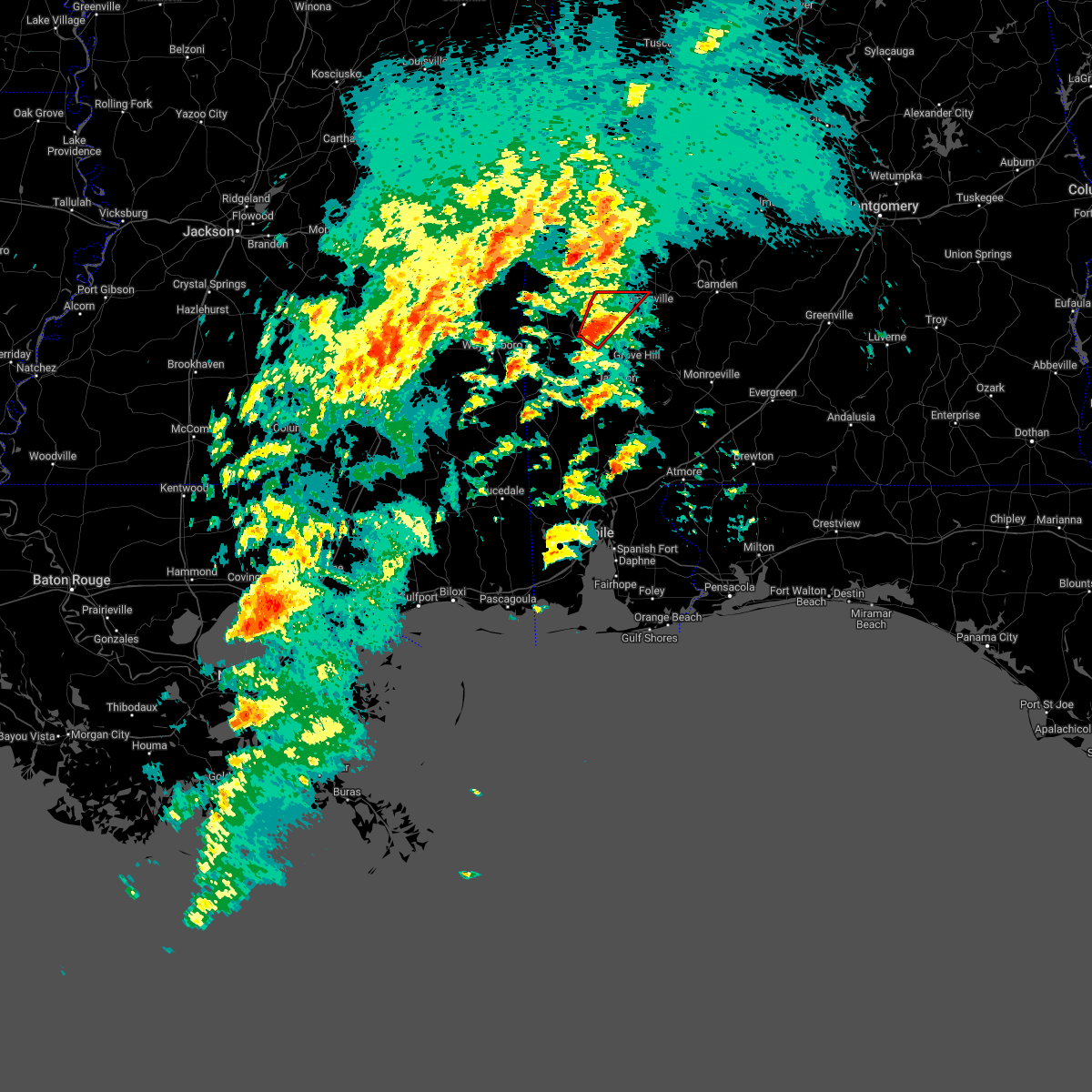 At 709 pm cdt, a severe thunderstorm capable of producing a tornado was located near coffeeville, or 16 miles west of grove hill, moving northeast at 55 mph (radar indicated rotation). Hazards include tornado. Flying debris will be dangerous to those caught without shelter. mobile homes will be damaged or destroyed. damage to roofs, windows, and vehicles will occur. tree damage is likely. This tornadic thunderstorm will remain over mainly rural areas of northwestern clarke county. At 709 pm cdt, a severe thunderstorm capable of producing a tornado was located near coffeeville, or 16 miles west of grove hill, moving northeast at 55 mph (radar indicated rotation). Hazards include tornado. Flying debris will be dangerous to those caught without shelter. mobile homes will be damaged or destroyed. damage to roofs, windows, and vehicles will occur. tree damage is likely. This tornadic thunderstorm will remain over mainly rural areas of northwestern clarke county.
|
| 3/18/2022 7:57 AM CDT |
 The severe thunderstorm warning for north central clarke and wilcox counties will expire at 800 am cdt, the storms which prompted the warning have weakened below severe limits. therefore, the warning will be allowed to expire. however gusty winds are still possible with these thunderstorms. a tornado watch remains in effect until 1000 am cdt for southwestern alabama. a tornado watch also remains in effect until 200 pm cdt for south central alabama. The severe thunderstorm warning for north central clarke and wilcox counties will expire at 800 am cdt, the storms which prompted the warning have weakened below severe limits. therefore, the warning will be allowed to expire. however gusty winds are still possible with these thunderstorms. a tornado watch remains in effect until 1000 am cdt for southwestern alabama. a tornado watch also remains in effect until 200 pm cdt for south central alabama.
|
| 3/18/2022 7:27 AM CDT |
 At 726 am cdt, severe thunderstorms were located along a line extending from near potter station to thomasville, moving east at 45 mph (radar indicated). Hazards include 60 mph wind gusts and penny size hail. Expect damage to roofs, siding, and trees. locations impacted include, thomasville, camden, pine hill and yellow bluff. hail threat, radar indicated max hail size, 0. 75 in wind threat, radar indicated max wind gust, 60 mph. At 726 am cdt, severe thunderstorms were located along a line extending from near potter station to thomasville, moving east at 45 mph (radar indicated). Hazards include 60 mph wind gusts and penny size hail. Expect damage to roofs, siding, and trees. locations impacted include, thomasville, camden, pine hill and yellow bluff. hail threat, radar indicated max hail size, 0. 75 in wind threat, radar indicated max wind gust, 60 mph.
|
| 3/18/2022 6:57 AM CDT |
 At 656 am cdt, severe thunderstorms were located along a line extending from near uniontown to near thomasville, moving east at 45 mph (radar indicated). Hazards include 60 mph wind gusts and penny size hail. expect damage to roofs, siding, and trees At 656 am cdt, severe thunderstorms were located along a line extending from near uniontown to near thomasville, moving east at 45 mph (radar indicated). Hazards include 60 mph wind gusts and penny size hail. expect damage to roofs, siding, and trees
|
| 3/18/2022 6:33 AM CDT |
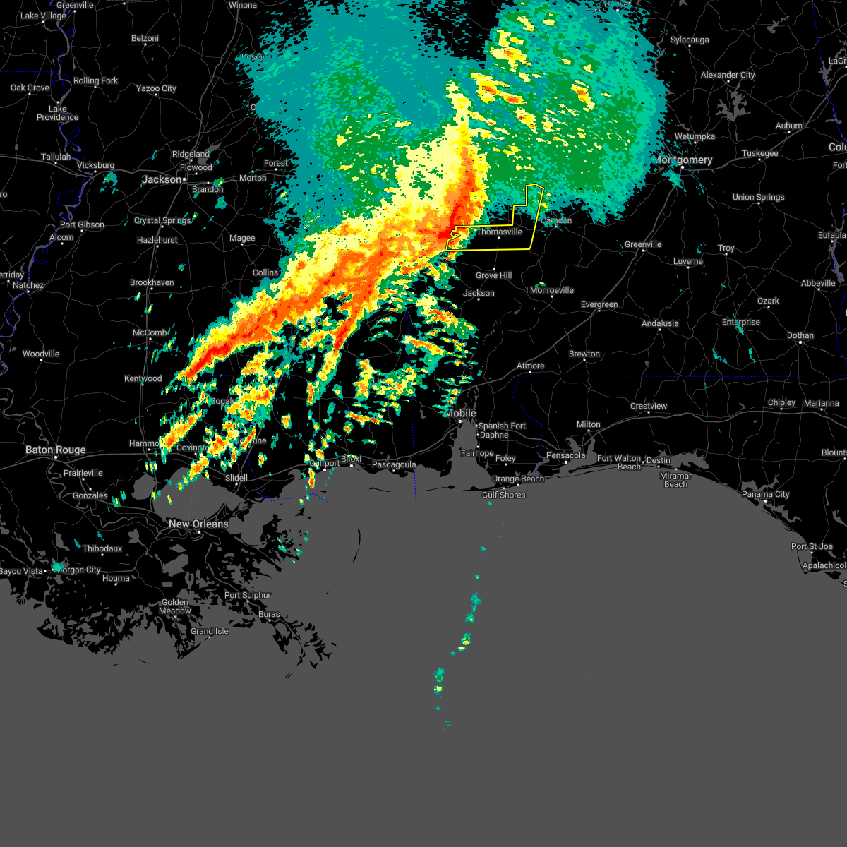 At 633 am cdt, severe thunderstorms were located along a line extending from myrtlewood to 6 miles northeast of coffeeville, moving east at 55 mph (radar indicated). Hazards include 70 mph wind gusts and penny size hail. Expect considerable tree damage. damage is likely to mobile homes, roofs, and outbuildings. locations impacted include, thomasville, pine hill and yellow bluff. thunderstorm damage threat, considerable hail threat, radar indicated max hail size, 0. 75 in wind threat, radar indicated max wind gust, 70 mph. At 633 am cdt, severe thunderstorms were located along a line extending from myrtlewood to 6 miles northeast of coffeeville, moving east at 55 mph (radar indicated). Hazards include 70 mph wind gusts and penny size hail. Expect considerable tree damage. damage is likely to mobile homes, roofs, and outbuildings. locations impacted include, thomasville, pine hill and yellow bluff. thunderstorm damage threat, considerable hail threat, radar indicated max hail size, 0. 75 in wind threat, radar indicated max wind gust, 70 mph.
|
| 3/18/2022 6:18 AM CDT |
 At 618 am cdt, severe thunderstorms were located along a line extending from 4 miles north of lisman to 4 miles southwest of silas, moving east at 65 mph (radar indicated). Hazards include 70 mph wind gusts and nickel size hail. Expect considerable tree damage. Damage is likely to mobile homes, roofs, and outbuildings. At 618 am cdt, severe thunderstorms were located along a line extending from 4 miles north of lisman to 4 miles southwest of silas, moving east at 65 mph (radar indicated). Hazards include 70 mph wind gusts and nickel size hail. Expect considerable tree damage. Damage is likely to mobile homes, roofs, and outbuildings.
|
| 3/15/2022 10:54 PM CDT |
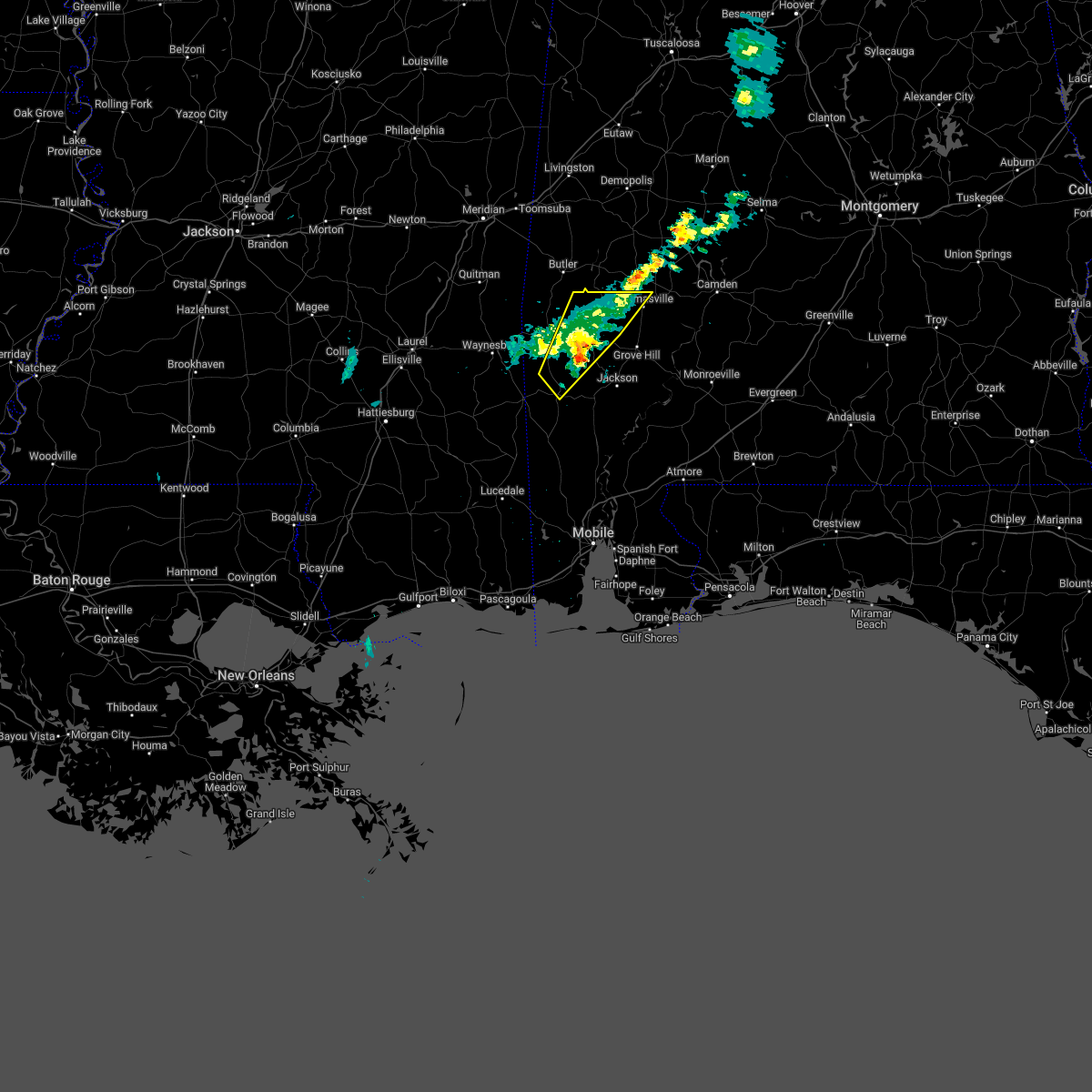 The severe thunderstorm warning for south central choctaw, northwestern washington and northwestern clarke counties will expire at 1100 pm cdt, the storms which prompted the warning have weakened below severe limits. therefore, the warning will be allowed to expire. The severe thunderstorm warning for south central choctaw, northwestern washington and northwestern clarke counties will expire at 1100 pm cdt, the storms which prompted the warning have weakened below severe limits. therefore, the warning will be allowed to expire.
|
| 3/15/2022 10:22 PM CDT |
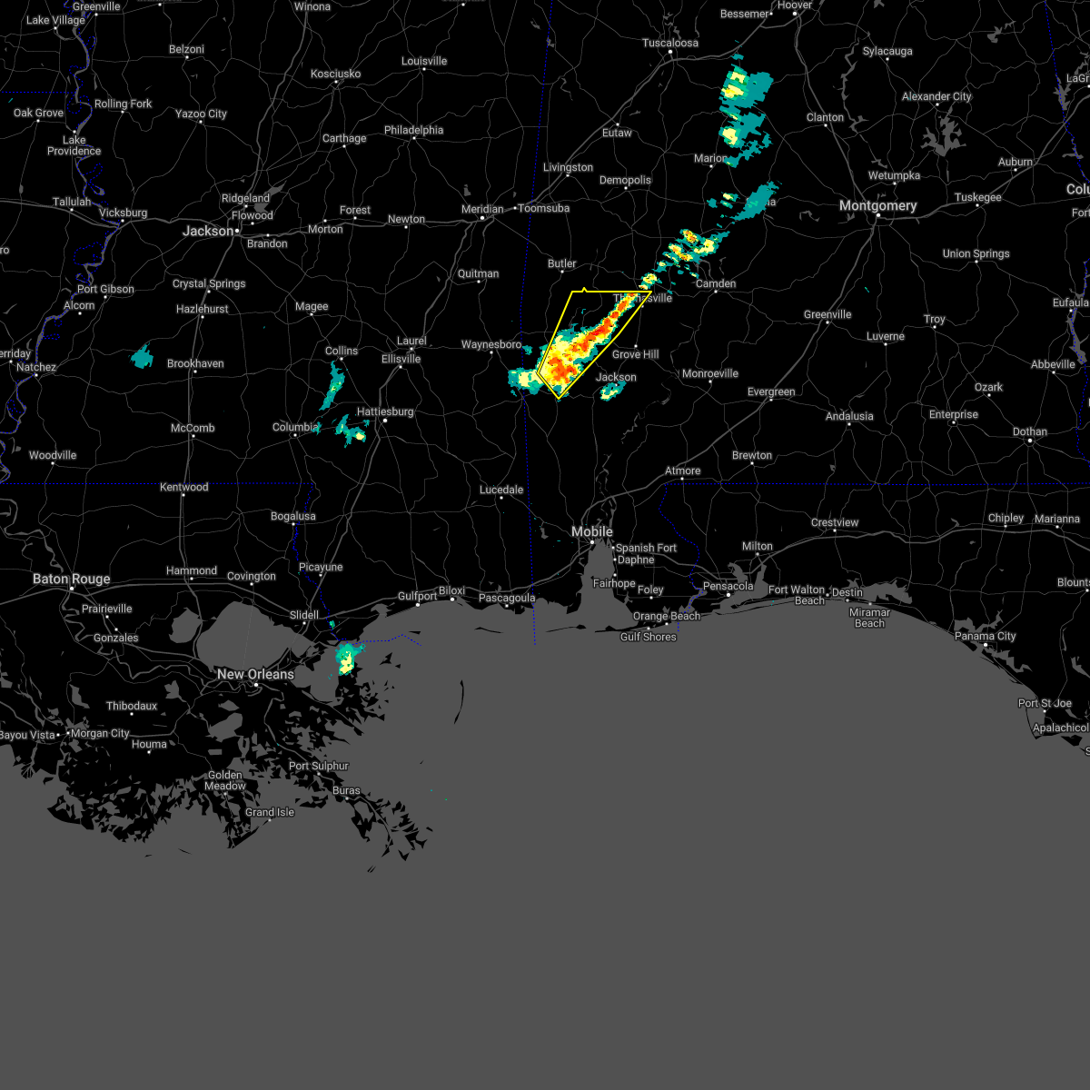 At 1022 pm cdt, severe thunderstorms were located along a line extending from 5 miles west of thomasville to 3 miles north of chatom, moving northeast at 25 mph (radar indicated). Hazards include half dollar size hail. damage to vehicles is expected At 1022 pm cdt, severe thunderstorms were located along a line extending from 5 miles west of thomasville to 3 miles north of chatom, moving northeast at 25 mph (radar indicated). Hazards include half dollar size hail. damage to vehicles is expected
|
| 2/3/2022 3:51 PM CST |
 At 350 pm cst, a severe thunderstorm was located near yellow bluff, or 8 miles southwest of camden, moving east at 55 mph (radar indicated). Hazards include 60 mph wind gusts. expect damage to roofs, siding, and trees At 350 pm cst, a severe thunderstorm was located near yellow bluff, or 8 miles southwest of camden, moving east at 55 mph (radar indicated). Hazards include 60 mph wind gusts. expect damage to roofs, siding, and trees
|
| 2/3/2022 3:05 PM CST | Corrects previous tstm wnd gst report from thomasville. thomasville county officials estimate 50 to 60mph thunderstorm wind gust in clarke county AL, 0.6 miles SSW of Thomasville, AL |
| 2/3/2022 3:05 PM CST | Corrects previous tstm wnd gst report from thomasville. thomasville county officials estimate 50 to 60mph thunderstorm wind gust in clarke county AL, 0.6 miles SSW of Thomasville, AL |
| 2/3/2022 2:23 PM CST |
 At 223 pm cst, severe thunderstorms were located along a line extending from millry to 5 miles northwest of chatom to 5 miles northeast of fruitdale, moving east at 50 mph (radar indicated). Hazards include 60 mph wind gusts. expect damage to roofs, siding, and trees At 223 pm cst, severe thunderstorms were located along a line extending from millry to 5 miles northwest of chatom to 5 miles northeast of fruitdale, moving east at 50 mph (radar indicated). Hazards include 60 mph wind gusts. expect damage to roofs, siding, and trees
|
| 2/3/2022 2:06 PM CST |
 At 206 pm cst, a severe thunderstorm was located 9 miles east of coffeeville, or 9 miles west of grove hill, moving northeast at 45 mph (radar indicated). Hazards include 60 mph wind gusts. expect damage to roofs, siding, and trees At 206 pm cst, a severe thunderstorm was located 9 miles east of coffeeville, or 9 miles west of grove hill, moving northeast at 45 mph (radar indicated). Hazards include 60 mph wind gusts. expect damage to roofs, siding, and trees
|
| 8/30/2021 2:10 PM CDT |
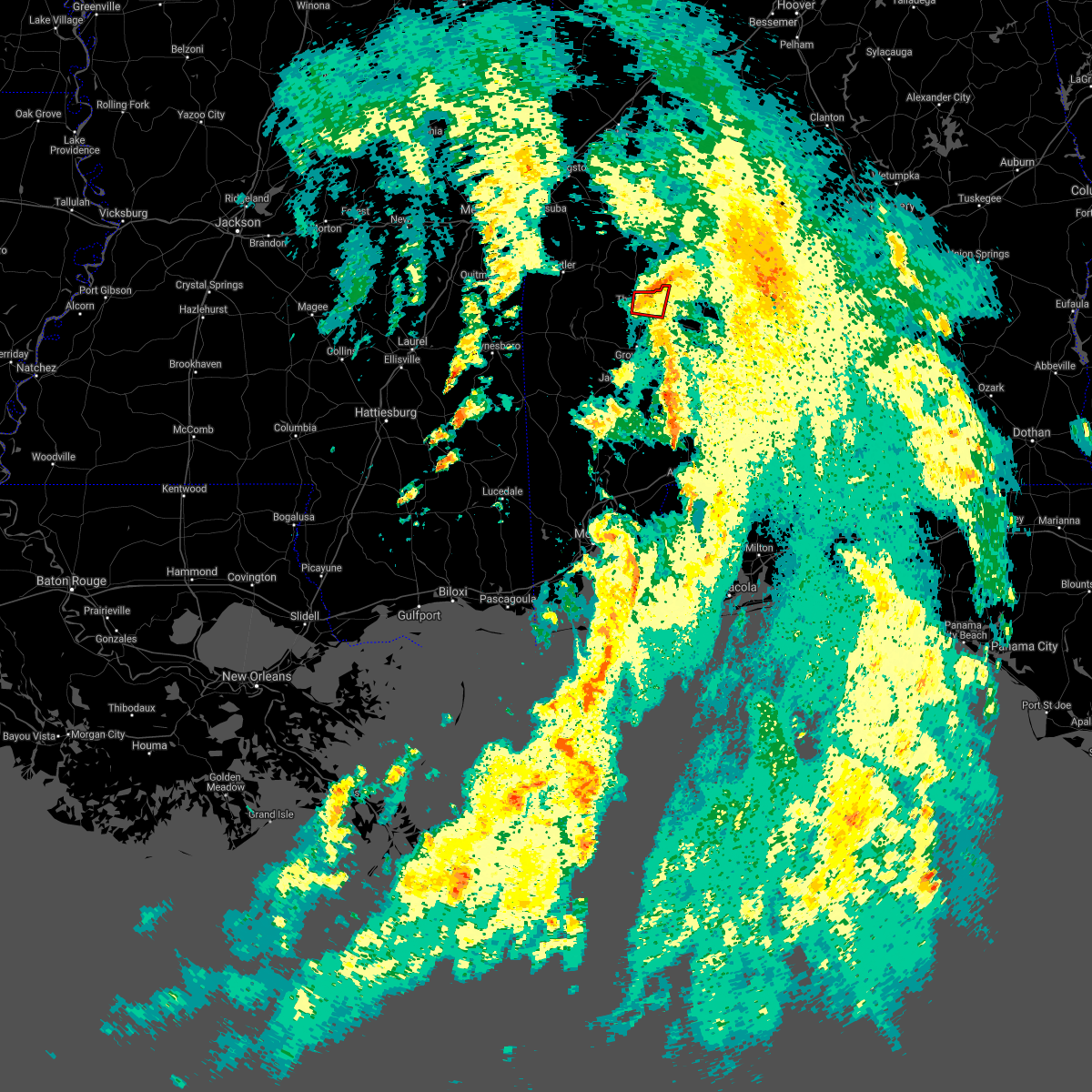 At 210 pm cdt, a severe thunderstorm capable of producing a tornado was located near thomasville, moving north at 45 mph (radar indicated rotation). Hazards include tornado. Flying debris will be dangerous to those caught without shelter. mobile homes will be damaged or destroyed. damage to roofs, windows, and vehicles will occur. tree damage is likely. This tornadic thunderstorm will remain over mainly rural areas of north central clarke and west central wilcox counties. At 210 pm cdt, a severe thunderstorm capable of producing a tornado was located near thomasville, moving north at 45 mph (radar indicated rotation). Hazards include tornado. Flying debris will be dangerous to those caught without shelter. mobile homes will be damaged or destroyed. damage to roofs, windows, and vehicles will occur. tree damage is likely. This tornadic thunderstorm will remain over mainly rural areas of north central clarke and west central wilcox counties.
|
| 8/30/2021 2:04 PM CDT |
 At 204 pm cdt, a severe thunderstorm capable of producing a tornado was located near thomasville, moving north at 35 mph (radar indicated rotation). Hazards include tornado. Flying debris will be dangerous to those caught without shelter. mobile homes will be damaged or destroyed. damage to roofs, windows, and vehicles will occur. tree damage is likely. This dangerous storm will be near, pine hill around 220 pm cdt. At 204 pm cdt, a severe thunderstorm capable of producing a tornado was located near thomasville, moving north at 35 mph (radar indicated rotation). Hazards include tornado. Flying debris will be dangerous to those caught without shelter. mobile homes will be damaged or destroyed. damage to roofs, windows, and vehicles will occur. tree damage is likely. This dangerous storm will be near, pine hill around 220 pm cdt.
|
| 8/30/2021 1:50 PM CDT |
 At 149 pm cdt, a confirmed tornado was located over fulton, or 4 miles northeast of grove hill, moving north at 50 mph (radar confirmed tornado). Hazards include damaging tornado. Flying debris will be dangerous to those caught without shelter. mobile homes will be damaged or destroyed. damage to roofs, windows, and vehicles will occur. tree damage is likely. this tornado will be near, thomasville around 200 pm cdt. Pine hill around 210 pm cdt. At 149 pm cdt, a confirmed tornado was located over fulton, or 4 miles northeast of grove hill, moving north at 50 mph (radar confirmed tornado). Hazards include damaging tornado. Flying debris will be dangerous to those caught without shelter. mobile homes will be damaged or destroyed. damage to roofs, windows, and vehicles will occur. tree damage is likely. this tornado will be near, thomasville around 200 pm cdt. Pine hill around 210 pm cdt.
|
| 8/30/2021 1:39 PM CDT |
 At 139 pm cdt, a tornado producing storm was located 6 miles southwest of whatley, or 8 miles south of grove hill, moving north at 45 mph (radar confirmed tornado). Hazards include damaging tornado. Flying debris will be dangerous to those caught without shelter. mobile homes will be damaged or destroyed. damage to roofs, windows, and vehicles will occur. tree damage is likely. this tornadic storm will be near, whatley around 145 pm cdt. grove hill around 150 pm cdt. fulton around 200 pm cdt. thomasville around 210 pm cdt. Pine hill around 220 pm cdt. At 139 pm cdt, a tornado producing storm was located 6 miles southwest of whatley, or 8 miles south of grove hill, moving north at 45 mph (radar confirmed tornado). Hazards include damaging tornado. Flying debris will be dangerous to those caught without shelter. mobile homes will be damaged or destroyed. damage to roofs, windows, and vehicles will occur. tree damage is likely. this tornadic storm will be near, whatley around 145 pm cdt. grove hill around 150 pm cdt. fulton around 200 pm cdt. thomasville around 210 pm cdt. Pine hill around 220 pm cdt.
|
| 7/12/2021 1:53 PM CDT |
 The severe thunderstorm warning for northeastern clarke and southwestern wilcox counties will expire at 200 pm cdt, the storm which prompted the warning has weakened below severe limits, and no longer poses an immediate threat to life or property. therefore, the warning will be allowed to expire. however gusty winds are still possible with this thunderstorm. The severe thunderstorm warning for northeastern clarke and southwestern wilcox counties will expire at 200 pm cdt, the storm which prompted the warning has weakened below severe limits, and no longer poses an immediate threat to life or property. therefore, the warning will be allowed to expire. however gusty winds are still possible with this thunderstorm.
|
| 7/12/2021 1:46 PM CDT |
 At 146 pm cdt, a severe thunderstorm was located near grove hill, moving northeast at 25 mph (radar indicated). Hazards include 60 mph wind gusts and quarter size hail. Hail damage to vehicles is expected. expect wind damage to roofs, siding, and trees. Locations impacted include, thomasville, grove hill, whatley and fulton. At 146 pm cdt, a severe thunderstorm was located near grove hill, moving northeast at 25 mph (radar indicated). Hazards include 60 mph wind gusts and quarter size hail. Hail damage to vehicles is expected. expect wind damage to roofs, siding, and trees. Locations impacted include, thomasville, grove hill, whatley and fulton.
|
| 7/12/2021 1:19 PM CDT |
 At 119 pm cdt, a severe thunderstorm was located 6 miles southwest of whatley, or 7 miles south of grove hill, moving northeast at 30 mph (radar indicated). Hazards include 60 mph wind gusts and quarter size hail. Hail damage to vehicles is expected. Expect wind damage to roofs, siding, and trees. At 119 pm cdt, a severe thunderstorm was located 6 miles southwest of whatley, or 7 miles south of grove hill, moving northeast at 30 mph (radar indicated). Hazards include 60 mph wind gusts and quarter size hail. Hail damage to vehicles is expected. Expect wind damage to roofs, siding, and trees.
|
| 5/4/2021 5:35 PM CDT |
 At 534 pm cdt, severe thunderstorms were located along a line extending from 3 miles northeast of vineland to 10 miles west of fulton to 7 miles east of millry to near buckatunna, moving east at 40 mph (radar indicated). Hazards include 60 mph wind gusts. Expect damage to roofs, siding, and trees. Locations impacted include, jackson, thomasville, grove hill, saint stephens, leroy, pine hill, millry, buckatunna, coffeeville, fulton and yellow bluff. At 534 pm cdt, severe thunderstorms were located along a line extending from 3 miles northeast of vineland to 10 miles west of fulton to 7 miles east of millry to near buckatunna, moving east at 40 mph (radar indicated). Hazards include 60 mph wind gusts. Expect damage to roofs, siding, and trees. Locations impacted include, jackson, thomasville, grove hill, saint stephens, leroy, pine hill, millry, buckatunna, coffeeville, fulton and yellow bluff.
|
| 5/4/2021 5:33 PM CDT |
 At 532 pm cdt, severe thunderstorms were located along a line extending from 3 miles southeast of consul to 3 miles southeast of thomasville to 8 miles northwest of grove hill to 4 miles southwest of coffeeville, moving east at 55 mph (radar indicated). Hazards include 60 mph wind gusts. expect damage to roofs, siding, and trees At 532 pm cdt, severe thunderstorms were located along a line extending from 3 miles southeast of consul to 3 miles southeast of thomasville to 8 miles northwest of grove hill to 4 miles southwest of coffeeville, moving east at 55 mph (radar indicated). Hazards include 60 mph wind gusts. expect damage to roofs, siding, and trees
|
| 5/4/2021 5:25 PM CDT | Trees down in the thomasville are in clarke county AL, 1.3 miles S of Thomasville, AL |
| 5/4/2021 5:23 PM CDT |
 At 523 pm cdt, severe thunderstorms were located along a line extending from surginer to 7 miles northeast of coffeeville to 4 miles north of millry to 3 miles west of buckatunna, moving east at 45 mph (radar indicated). Hazards include 60 mph wind gusts. Expect damage to roofs, siding, and trees. Locations impacted include, jackson, waynesboro, thomasville, grove hill, saint stephens, leroy, clara, pine hill, millry, buckatunna, silas, coffeeville, fulton and yellow bluff. At 523 pm cdt, severe thunderstorms were located along a line extending from surginer to 7 miles northeast of coffeeville to 4 miles north of millry to 3 miles west of buckatunna, moving east at 45 mph (radar indicated). Hazards include 60 mph wind gusts. Expect damage to roofs, siding, and trees. Locations impacted include, jackson, waynesboro, thomasville, grove hill, saint stephens, leroy, clara, pine hill, millry, buckatunna, silas, coffeeville, fulton and yellow bluff.
|
| 5/4/2021 5:20 PM CDT | Trees and power lines down along bashi r in clarke county AL, 7.8 miles SE of Thomasville, AL |
| 5/4/2021 5:10 PM CDT | Trees down along highway 69 near campbells landing rd (blocking the road in clarke county AL, 15.7 miles ESE of Thomasville, AL |
| 5/4/2021 4:59 PM CDT |
 The national weather service in mobile has issued a * severe thunderstorm warning for. choctaw county in southwestern alabama. northern washington county in southwestern alabama. clarke county in southwestern alabama. Western wilcox county in south central alabama. The national weather service in mobile has issued a * severe thunderstorm warning for. choctaw county in southwestern alabama. northern washington county in southwestern alabama. clarke county in southwestern alabama. Western wilcox county in south central alabama.
|
| 4/24/2021 3:37 PM CDT | Quarter sized hail reported 0.6 miles SSW of Thomasville, AL, em reports quarter-size hail in thomasville. |
| 4/24/2021 3:36 PM CDT | Quarter sized hail reported 0.6 miles SSW of Thomasville, AL, em reports quarter size hail in thomasville... al at current time. |
| 4/24/2021 3:36 PM CDT | Golf Ball sized hail reported 2.2 miles N of Thomasville, AL, em reports golf ball size hail south of thomasville. |
| 4/24/2021 3:36 PM CDT | Baseball sized hail reported 4.4 miles NNE of Thomasville, AL, em reports baseball size hail just south of thomasville... al with pictures provided. |
| 4/24/2021 3:32 PM CDT |
 At 331 pm cdt, a severe thunderstorm was located 8 miles west of fulton, or 9 miles southwest of thomasville, moving east at 50 mph (radar indicated). Hazards include golf ball size hail and 60 mph wind gusts. People and animals outdoors will be injured. expect hail damage to roofs, siding, windows, and vehicles. expect wind damage to roofs, siding, and trees. Locations impacted include, thomasville, grove hill and fulton. At 331 pm cdt, a severe thunderstorm was located 8 miles west of fulton, or 9 miles southwest of thomasville, moving east at 50 mph (radar indicated). Hazards include golf ball size hail and 60 mph wind gusts. People and animals outdoors will be injured. expect hail damage to roofs, siding, windows, and vehicles. expect wind damage to roofs, siding, and trees. Locations impacted include, thomasville, grove hill and fulton.
|
| 4/24/2021 3:27 PM CDT |
 At 327 pm cdt, a severe thunderstorm capable of producing a tornado was located 10 miles northeast of coffeeville, or 11 miles northwest of grove hill, moving east at 60 mph (radar indicated rotation). Hazards include tornado and golf ball size hail. Flying debris will be dangerous to those caught without shelter. mobile homes will be damaged or destroyed. damage to roofs, windows, and vehicles will occur. tree damage is likely. This dangerous storm will be near, thomasville and fulton around 340 pm cdt. At 327 pm cdt, a severe thunderstorm capable of producing a tornado was located 10 miles northeast of coffeeville, or 11 miles northwest of grove hill, moving east at 60 mph (radar indicated rotation). Hazards include tornado and golf ball size hail. Flying debris will be dangerous to those caught without shelter. mobile homes will be damaged or destroyed. damage to roofs, windows, and vehicles will occur. tree damage is likely. This dangerous storm will be near, thomasville and fulton around 340 pm cdt.
|
| 4/24/2021 3:15 PM CDT |
 At 315 pm cdt, a severe thunderstorm was located over coffeeville, or 20 miles west of grove hill, moving east at 50 mph (radar indicated). Hazards include 60 mph wind gusts and half dollar size hail. Hail damage to vehicles is expected. Expect wind damage to roofs, siding, and trees. At 315 pm cdt, a severe thunderstorm was located over coffeeville, or 20 miles west of grove hill, moving east at 50 mph (radar indicated). Hazards include 60 mph wind gusts and half dollar size hail. Hail damage to vehicles is expected. Expect wind damage to roofs, siding, and trees.
|
| 4/10/2021 2:54 AM CDT | More homes on the east side of highway 43 have trees on them. at least two homes have partially missing roof in clarke county AL, 1.5 miles N of Thomasville, AL |
| 4/10/2021 2:54 AM CDT | Power outages throughout the entire county. multiple power lines down county-wide. several homes have large pine trees through them near the windsorwood subdivisio in clarke county AL, 1.6 miles NNE of Thomasville, AL |
| 4/10/2021 2:54 AM CDT | Several large trees down. trees snapped. roads blocke in clarke county AL, 1.6 miles NNE of Thomasville, AL |
| 4/10/2021 2:44 AM CDT |
 At 244 am cdt, severe thunderstorms were located along a line extending from 3 miles north of thomasville to 5 miles southeast of wagarville to 5 miles south of deer park, moving east at 65 mph (radar indicated). Hazards include 60 mph wind gusts. Expect damage to roofs, siding, and trees. Locations impacted include, jackson, thomasville, grove hill, chatom, saint stephens, wagarville, leroy, deer park, whatley, tibbie, pine hill, calvert, fulton, mcintosh and yellow bluff. At 244 am cdt, severe thunderstorms were located along a line extending from 3 miles north of thomasville to 5 miles southeast of wagarville to 5 miles south of deer park, moving east at 65 mph (radar indicated). Hazards include 60 mph wind gusts. Expect damage to roofs, siding, and trees. Locations impacted include, jackson, thomasville, grove hill, chatom, saint stephens, wagarville, leroy, deer park, whatley, tibbie, pine hill, calvert, fulton, mcintosh and yellow bluff.
|
| 4/10/2021 2:25 AM CDT |
 At 224 am cdt, severe thunderstorms were located along a line extending from 4 miles east of putnam to 4 miles east of fruitdale to 7 miles southwest of leakesville, moving east at 60 mph (radar indicated). Hazards include 60 mph wind gusts. Expect damage to roofs, siding, and trees. Locations impacted include, jackson, thomasville, grove hill, chatom, leakesville, saint stephens, wagarville, leroy, deer park, whatley, tibbie, pine hill, calvert, millry, state line, fruitdale, coffeeville, fulton, mcintosh and yellow bluff. At 224 am cdt, severe thunderstorms were located along a line extending from 4 miles east of putnam to 4 miles east of fruitdale to 7 miles southwest of leakesville, moving east at 60 mph (radar indicated). Hazards include 60 mph wind gusts. Expect damage to roofs, siding, and trees. Locations impacted include, jackson, thomasville, grove hill, chatom, leakesville, saint stephens, wagarville, leroy, deer park, whatley, tibbie, pine hill, calvert, millry, state line, fruitdale, coffeeville, fulton, mcintosh and yellow bluff.
|
| 4/10/2021 1:58 AM CDT |
 At 157 am cdt, severe thunderstorms were located along a line extending from 8 miles northwest of pennington to beaumont, moving east at 65 mph (radar indicated). Hazards include 70 mph wind gusts and quarter size hail. Hail damage to vehicles is expected. expect considerable tree damage. Wind damage is also likely to mobile homes, roofs, and outbuildings. At 157 am cdt, severe thunderstorms were located along a line extending from 8 miles northwest of pennington to beaumont, moving east at 65 mph (radar indicated). Hazards include 70 mph wind gusts and quarter size hail. Hail damage to vehicles is expected. expect considerable tree damage. Wind damage is also likely to mobile homes, roofs, and outbuildings.
|
| 4/9/2021 7:22 AM CDT | Tennis Ball sized hail reported 8.3 miles SE of Thomasville, AL, hen egg to tennis ball size hail reported in bashi. pictures relayed via social media. time estimated by radar. |
| 4/9/2021 7:20 AM CDT | Golf Ball sized hail reported 12.2 miles ESE of Thomasville, AL, golf ball size hail reported near bashi rd about 3 to 4 miles east of highway 69. |
| 4/9/2021 7:10 AM CDT |
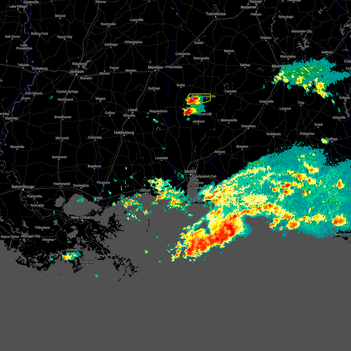 At 710 am cdt, a severe thunderstorm was located 9 miles southeast of putnam, or 12 miles west of thomasville, moving northeast at 35 mph (radar indicated). Hazards include ping pong ball size hail and 60 mph wind gusts. People and animals outdoors will be injured. expect hail damage to roofs, siding, windows, and vehicles. expect wind damage to roofs, siding, and trees. Locations impacted include, thomasville. At 710 am cdt, a severe thunderstorm was located 9 miles southeast of putnam, or 12 miles west of thomasville, moving northeast at 35 mph (radar indicated). Hazards include ping pong ball size hail and 60 mph wind gusts. People and animals outdoors will be injured. expect hail damage to roofs, siding, windows, and vehicles. expect wind damage to roofs, siding, and trees. Locations impacted include, thomasville.
|
| 4/9/2021 6:54 AM CDT |
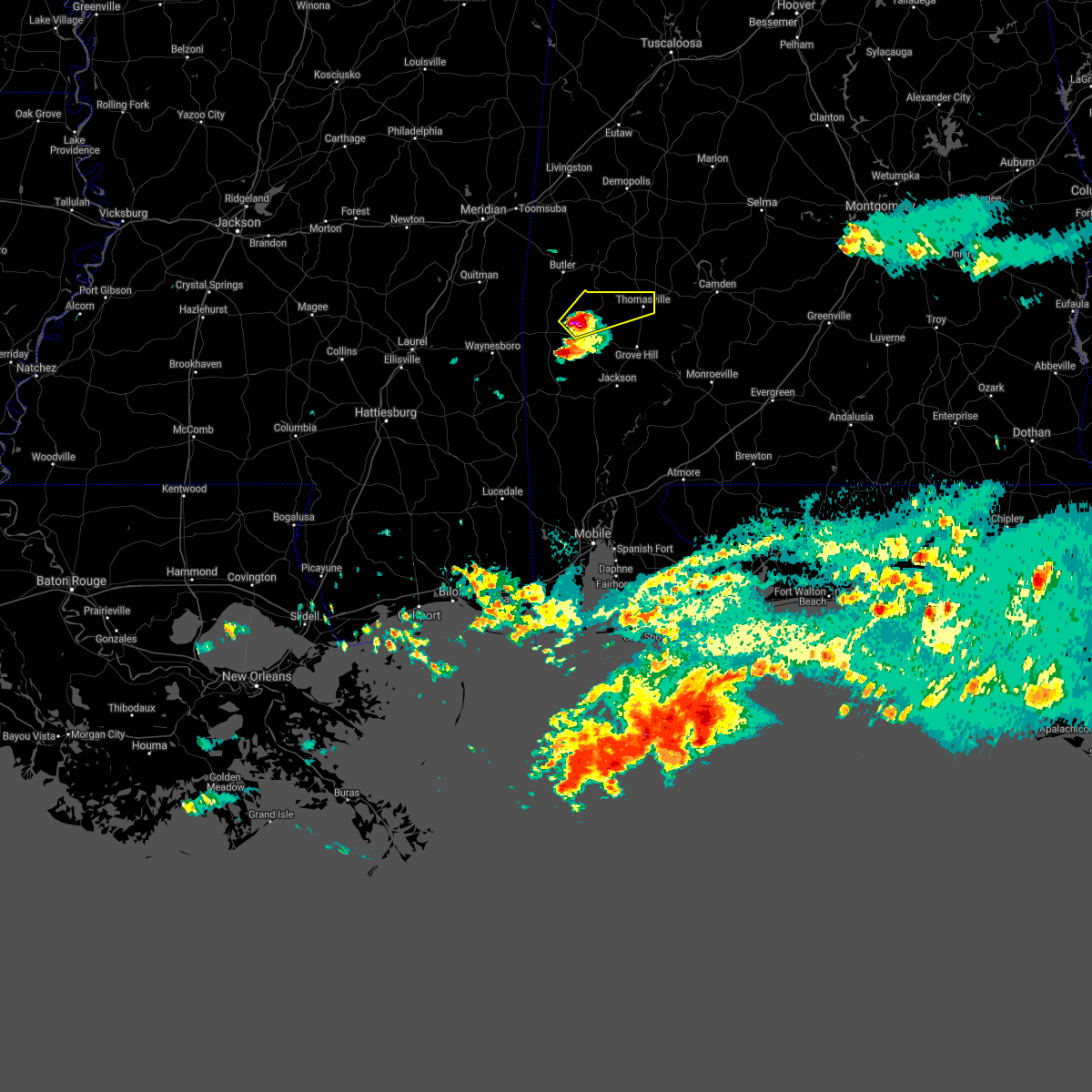 At 653 am cdt, a severe thunderstorm was located 5 miles north of coffeeville, or 18 miles south of butler, moving northeast at 35 mph (radar indicated). Hazards include 60 mph wind gusts and quarter size hail. Hail damage to vehicles is expected. Expect wind damage to roofs, siding, and trees. At 653 am cdt, a severe thunderstorm was located 5 miles north of coffeeville, or 18 miles south of butler, moving northeast at 35 mph (radar indicated). Hazards include 60 mph wind gusts and quarter size hail. Hail damage to vehicles is expected. Expect wind damage to roofs, siding, and trees.
|
| 3/31/2021 1:49 PM CDT |
 At 148 pm cdt, severe thunderstorms were located along a line extending from 5 miles west of putnam to 7 miles north of coffeeville to 6 miles east of silas, moving east at 55 mph (radar indicated). Hazards include 60 mph wind gusts and half dollar size hail. Hail damage to vehicles is expected. expect wind damage to roofs, siding, and trees. Locations impacted include, thomasville, grove hill, whatley, coffeeville and fulton. At 148 pm cdt, severe thunderstorms were located along a line extending from 5 miles west of putnam to 7 miles north of coffeeville to 6 miles east of silas, moving east at 55 mph (radar indicated). Hazards include 60 mph wind gusts and half dollar size hail. Hail damage to vehicles is expected. expect wind damage to roofs, siding, and trees. Locations impacted include, thomasville, grove hill, whatley, coffeeville and fulton.
|
| 3/31/2021 1:29 PM CDT |
 At 129 pm cdt, severe thunderstorms were located along a line extending from 4 miles northeast of crandall to 7 miles west of gilbertown to 10 miles north of waynesboro, moving east at 45 mph (radar indicated). Hazards include 60 mph wind gusts and quarter size hail. Hail damage to vehicles is expected. Expect wind damage to roofs, siding, and trees. At 129 pm cdt, severe thunderstorms were located along a line extending from 4 miles northeast of crandall to 7 miles west of gilbertown to 10 miles north of waynesboro, moving east at 45 mph (radar indicated). Hazards include 60 mph wind gusts and quarter size hail. Hail damage to vehicles is expected. Expect wind damage to roofs, siding, and trees.
|
| 3/17/2021 8:31 PM CDT |
 At 831 pm cdt, severe thunderstorms were located along a line extending from wayne to 5 miles west of thomasville to near leroy to 6 miles northwest of mcintosh, moving northeast at 60 mph (radar indicated). Hazards include 60 mph wind gusts. expect damage to roofs, siding, and trees At 831 pm cdt, severe thunderstorms were located along a line extending from wayne to 5 miles west of thomasville to near leroy to 6 miles northwest of mcintosh, moving northeast at 60 mph (radar indicated). Hazards include 60 mph wind gusts. expect damage to roofs, siding, and trees
|
| 3/17/2021 6:21 PM CDT |
 At 621 pm cdt, a severe thunderstorm was located near fulton, or 6 miles south of thomasville, moving northeast at 40 mph (radar indicated). Hazards include 60 mph wind gusts. Expect damage to roofs, siding, and trees. Locations impacted include, thomasville and fulton. At 621 pm cdt, a severe thunderstorm was located near fulton, or 6 miles south of thomasville, moving northeast at 40 mph (radar indicated). Hazards include 60 mph wind gusts. Expect damage to roofs, siding, and trees. Locations impacted include, thomasville and fulton.
|
| 3/17/2021 6:13 PM CDT |
 At 612 pm cdt, a severe thunderstorm was located 5 miles northwest of grove hill, moving northeast at 40 mph (radar indicated). Hazards include 60 mph wind gusts. Expect damage to roofs, siding, and trees. Locations impacted include, thomasville, grove hill and fulton. At 612 pm cdt, a severe thunderstorm was located 5 miles northwest of grove hill, moving northeast at 40 mph (radar indicated). Hazards include 60 mph wind gusts. Expect damage to roofs, siding, and trees. Locations impacted include, thomasville, grove hill and fulton.
|
| 3/17/2021 5:59 PM CDT |
 At 559 pm cdt, a severe thunderstorm was located 9 miles southeast of coffeeville, or 10 miles west of grove hill, moving northeast at 40 mph (radar indicated). Hazards include 60 mph wind gusts. expect damage to roofs, siding, and trees At 559 pm cdt, a severe thunderstorm was located 9 miles southeast of coffeeville, or 10 miles west of grove hill, moving northeast at 40 mph (radar indicated). Hazards include 60 mph wind gusts. expect damage to roofs, siding, and trees
|
| 3/17/2021 5:44 PM CDT |
 At 544 pm cdt, a severe thunderstorm capable of producing a tornado was located over shawnee, or 5 miles northeast of thomasville, moving northeast at 40 mph (radar indicated rotation). Hazards include tornado. Flying debris will be dangerous to those caught without shelter. mobile homes will be damaged or destroyed. damage to roofs, windows, and vehicles will occur. tree damage is likely. This dangerous storm will be near, pine hill around 550 pm cdt. At 544 pm cdt, a severe thunderstorm capable of producing a tornado was located over shawnee, or 5 miles northeast of thomasville, moving northeast at 40 mph (radar indicated rotation). Hazards include tornado. Flying debris will be dangerous to those caught without shelter. mobile homes will be damaged or destroyed. damage to roofs, windows, and vehicles will occur. tree damage is likely. This dangerous storm will be near, pine hill around 550 pm cdt.
|
| 3/17/2021 5:32 PM CDT |
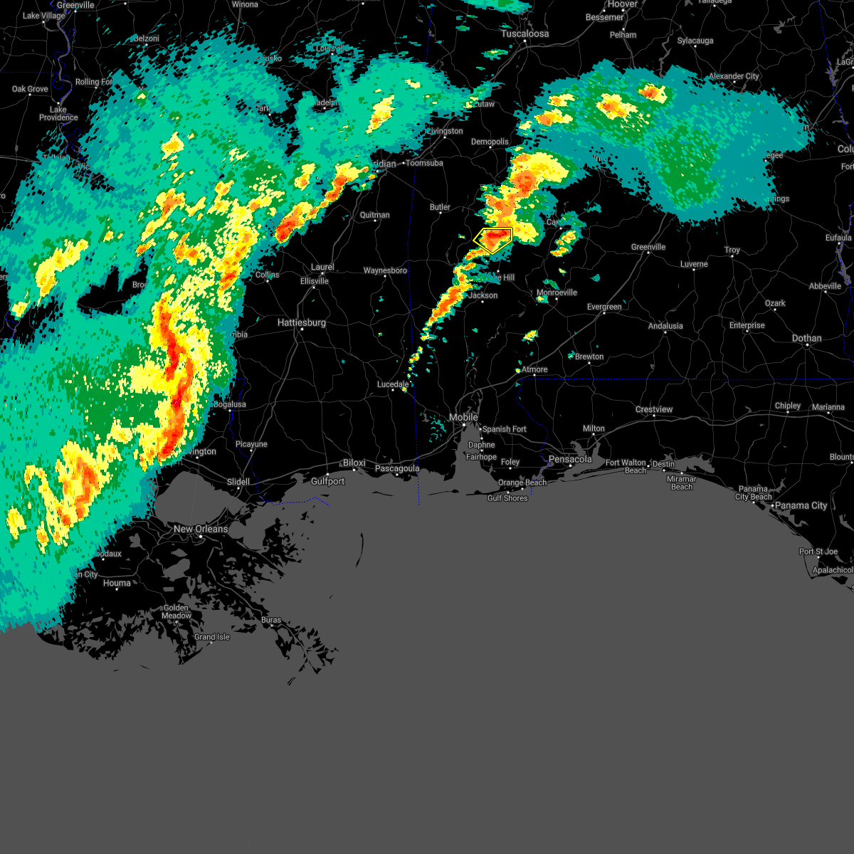 At 532 pm cdt, a severe thunderstorm was located 4 miles west of thomasville, moving northeast at 40 mph (radar indicated). Hazards include 60 mph wind gusts and quarter size hail. Hail damage to vehicles is expected. expect wind damage to roofs, siding, and trees. Locations impacted include, thomasville. At 532 pm cdt, a severe thunderstorm was located 4 miles west of thomasville, moving northeast at 40 mph (radar indicated). Hazards include 60 mph wind gusts and quarter size hail. Hail damage to vehicles is expected. expect wind damage to roofs, siding, and trees. Locations impacted include, thomasville.
|
| 3/17/2021 5:31 PM CDT |
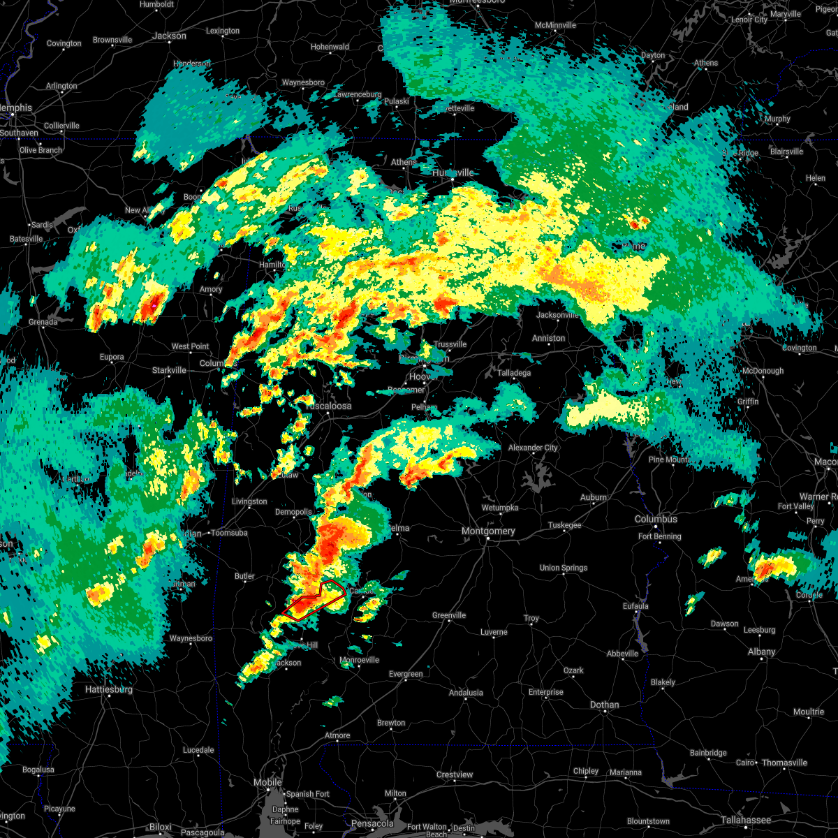 At 531 pm cdt, a severe thunderstorm capable of producing a tornado was located 4 miles west of thomasville, moving northeast at 40 mph (radar indicated rotation). Hazards include tornado. Flying debris will be dangerous to those caught without shelter. mobile homes will be damaged or destroyed. damage to roofs, windows, and vehicles will occur. tree damage is likely. this dangerous storm will be near, thomasville around 535 pm cdt. Pine hill around 550 pm cdt. At 531 pm cdt, a severe thunderstorm capable of producing a tornado was located 4 miles west of thomasville, moving northeast at 40 mph (radar indicated rotation). Hazards include tornado. Flying debris will be dangerous to those caught without shelter. mobile homes will be damaged or destroyed. damage to roofs, windows, and vehicles will occur. tree damage is likely. this dangerous storm will be near, thomasville around 535 pm cdt. Pine hill around 550 pm cdt.
|
| 3/17/2021 5:20 PM CDT |
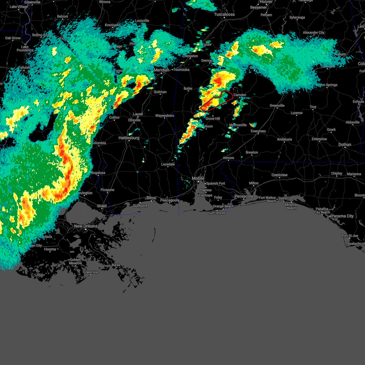 At 520 pm cdt, a severe thunderstorm capable of producing a tornado was located 10 miles west of fulton, or 10 miles northwest of grove hill, moving northeast at 40 mph (radar indicated rotation). Hazards include tornado. Flying debris will be dangerous to those caught without shelter. mobile homes will be damaged or destroyed. damage to roofs, windows, and vehicles will occur. tree damage is likely. this dangerous storm will be near, thomasville around 540 pm cdt. pine hill around 555 pm cdt. Yellow bluff around 600 pm cdt. At 520 pm cdt, a severe thunderstorm capable of producing a tornado was located 10 miles west of fulton, or 10 miles northwest of grove hill, moving northeast at 40 mph (radar indicated rotation). Hazards include tornado. Flying debris will be dangerous to those caught without shelter. mobile homes will be damaged or destroyed. damage to roofs, windows, and vehicles will occur. tree damage is likely. this dangerous storm will be near, thomasville around 540 pm cdt. pine hill around 555 pm cdt. Yellow bluff around 600 pm cdt.
|
| 3/17/2021 5:15 PM CDT |
 At 515 pm cdt, a severe thunderstorm was located 8 miles northeast of coffeeville, or 13 miles northwest of grove hill, moving northeast at 40 mph (radar indicated). Hazards include 60 mph wind gusts and quarter size hail. Hail damage to vehicles is expected. Expect wind damage to roofs, siding, and trees. At 515 pm cdt, a severe thunderstorm was located 8 miles northeast of coffeeville, or 13 miles northwest of grove hill, moving northeast at 40 mph (radar indicated). Hazards include 60 mph wind gusts and quarter size hail. Hail damage to vehicles is expected. Expect wind damage to roofs, siding, and trees.
|
| 3/17/2021 2:52 PM CDT |
 At 251 pm cdt, a severe thunderstorm capable of producing a tornado was located 8 miles northeast of coffeeville, or 15 miles northwest of grove hill, moving northeast at 30 mph (radar indicated rotation). Hazards include tornado. Flying debris will be dangerous to those caught without shelter. mobile homes will be damaged or destroyed. damage to roofs, windows, and vehicles will occur. tree damage is likely. This tornadic thunderstorm will remain over mainly rural areas of northwestern clarke county. At 251 pm cdt, a severe thunderstorm capable of producing a tornado was located 8 miles northeast of coffeeville, or 15 miles northwest of grove hill, moving northeast at 30 mph (radar indicated rotation). Hazards include tornado. Flying debris will be dangerous to those caught without shelter. mobile homes will be damaged or destroyed. damage to roofs, windows, and vehicles will occur. tree damage is likely. This tornadic thunderstorm will remain over mainly rural areas of northwestern clarke county.
|
| 3/17/2021 2:36 PM CDT |
 At 236 pm cdt, a severe thunderstorm capable of producing a tornado was located over coffeeville, or 18 miles west of grove hill, moving northeast at 30 mph (radar indicated rotation). Hazards include tornado. Flying debris will be dangerous to those caught without shelter. mobile homes will be damaged or destroyed. damage to roofs, windows, and vehicles will occur. tree damage is likely. This tornadic thunderstorm will impact coffeeville and over mainly rural areas of northwestern clarke county. At 236 pm cdt, a severe thunderstorm capable of producing a tornado was located over coffeeville, or 18 miles west of grove hill, moving northeast at 30 mph (radar indicated rotation). Hazards include tornado. Flying debris will be dangerous to those caught without shelter. mobile homes will be damaged or destroyed. damage to roofs, windows, and vehicles will occur. tree damage is likely. This tornadic thunderstorm will impact coffeeville and over mainly rural areas of northwestern clarke county.
|
| 8/27/2020 12:21 PM CDT |
 The severe thunderstorm warning for north central clarke county will expire at 1230 pm cdt, the storm which prompted the warning has moved out of the area. therefore, the warning will be allowed to expire. The severe thunderstorm warning for north central clarke county will expire at 1230 pm cdt, the storm which prompted the warning has moved out of the area. therefore, the warning will be allowed to expire.
|
| 8/27/2020 12:03 PM CDT |
 At 1202 pm cdt, a severe thunderstorm was located 8 miles west of thomasville, moving north at 35 mph (radar indicated). Hazards include 60 mph wind gusts. expect damage to roofs, siding, and trees At 1202 pm cdt, a severe thunderstorm was located 8 miles west of thomasville, moving north at 35 mph (radar indicated). Hazards include 60 mph wind gusts. expect damage to roofs, siding, and trees
|
| 7/12/2020 4:56 PM CDT |
 At 456 pm cdt, a severe thunderstorm was located 5 miles northeast of fulton, or 6 miles southeast of thomasville, moving east at 30 mph (radar indicated). Hazards include 60 mph wind gusts and quarter size hail. Hail damage to vehicles is expected. Expect wind damage to roofs, siding, and trees. At 456 pm cdt, a severe thunderstorm was located 5 miles northeast of fulton, or 6 miles southeast of thomasville, moving east at 30 mph (radar indicated). Hazards include 60 mph wind gusts and quarter size hail. Hail damage to vehicles is expected. Expect wind damage to roofs, siding, and trees.
|
| 6/25/2020 7:40 PM CDT |
 The national weather service in mobile has issued a * severe thunderstorm warning for. northern clarke county in southwestern alabama. western wilcox county in south central alabama. until 830 pm cdt. At 740 pm cdt, severe thunderstorms were located along a line. The national weather service in mobile has issued a * severe thunderstorm warning for. northern clarke county in southwestern alabama. western wilcox county in south central alabama. until 830 pm cdt. At 740 pm cdt, severe thunderstorms were located along a line.
|
| 6/24/2020 3:23 PM CDT |
 The severe thunderstorm warning for southwestern butler, monroe, northeastern clarke, northwestern escambia, wilcox and conecuh counties will expire at 330 pm cdt, the storms which prompted the warning have weakened below severe limits, and no longer pose an immediate threat to life or property. therefore, the warning will be allowed to expire. a severe thunderstorm watch remains in effect until 900 pm cdt for south central and southwestern alabama. The severe thunderstorm warning for southwestern butler, monroe, northeastern clarke, northwestern escambia, wilcox and conecuh counties will expire at 330 pm cdt, the storms which prompted the warning have weakened below severe limits, and no longer pose an immediate threat to life or property. therefore, the warning will be allowed to expire. a severe thunderstorm watch remains in effect until 900 pm cdt for south central and southwestern alabama.
|
| 6/24/2020 2:50 PM CDT |
 At 249 pm cdt, severe thunderstorms were located along a line extending from 7 miles west of fulton to 6 miles northeast of mccullough, moving northeast at 55 mph (radar indicated). Hazards include 60 mph wind gusts. expect damage to roofs, siding, and trees At 249 pm cdt, severe thunderstorms were located along a line extending from 7 miles west of fulton to 6 miles northeast of mccullough, moving northeast at 55 mph (radar indicated). Hazards include 60 mph wind gusts. expect damage to roofs, siding, and trees
|
| 6/5/2020 7:31 PM CDT |
 At 730 pm cdt, severe thunderstorms were located along a line extending from 3 miles south of coatopa to 6 miles west of lisman to 4 miles southeast of turnerville, moving southeast at 30 mph (radar indicated). Hazards include 60 mph wind gusts. expect damage to roofs, siding, and trees At 730 pm cdt, severe thunderstorms were located along a line extending from 3 miles south of coatopa to 6 miles west of lisman to 4 miles southeast of turnerville, moving southeast at 30 mph (radar indicated). Hazards include 60 mph wind gusts. expect damage to roofs, siding, and trees
|
| 5/27/2020 3:49 PM CDT | Tree down on tallahatta springs r in clarke county AL, 11.5 miles E of Thomasville, AL |
| 5/27/2020 3:40 PM CDT |
 At 340 pm cdt, a severe thunderstorm was located 7 miles southwest of coffeeville, or 16 miles north of chatom, moving northeast at 40 mph (radar indicated). Hazards include 60 mph wind gusts and nickel size hail. Expect damage to roofs, siding, and trees. Locations impacted include, coffeeville. At 340 pm cdt, a severe thunderstorm was located 7 miles southwest of coffeeville, or 16 miles north of chatom, moving northeast at 40 mph (radar indicated). Hazards include 60 mph wind gusts and nickel size hail. Expect damage to roofs, siding, and trees. Locations impacted include, coffeeville.
|
| 5/27/2020 3:09 PM CDT |
 At 309 pm cdt, a severe thunderstorm was located 7 miles east of millry, or 13 miles north of chatom, moving northeast at 35 mph (radar indicated). Hazards include 60 mph wind gusts and quarter size hail. Hail damage to vehicles is expected. Expect wind damage to roofs, siding, and trees. At 309 pm cdt, a severe thunderstorm was located 7 miles east of millry, or 13 miles north of chatom, moving northeast at 35 mph (radar indicated). Hazards include 60 mph wind gusts and quarter size hail. Hail damage to vehicles is expected. Expect wind damage to roofs, siding, and trees.
|
| 5/17/2020 7:29 PM CDT |
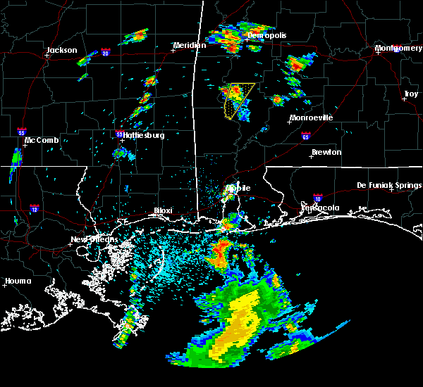 At 729 pm cdt, a severe thunderstorm was located 9 miles southeast of putnam, or 10 miles west of thomasville, moving northeast at 45 mph (radar indicated). Hazards include 60 mph wind gusts and penny size hail. Expect damage to roofs, siding, and trees. This severe thunderstorm will remain over mainly rural areas of northwestern clarke county. At 729 pm cdt, a severe thunderstorm was located 9 miles southeast of putnam, or 10 miles west of thomasville, moving northeast at 45 mph (radar indicated). Hazards include 60 mph wind gusts and penny size hail. Expect damage to roofs, siding, and trees. This severe thunderstorm will remain over mainly rural areas of northwestern clarke county.
|
| 5/17/2020 7:04 PM CDT |
 At 704 pm cdt, a severe thunderstorm was located 6 miles southeast of coffeeville, or 14 miles northwest of jackson, moving northeast at 45 mph (radar indicated). Hazards include 60 mph wind gusts and penny size hail. Expect damage to roofs, siding, and trees. This severe thunderstorm will remain over mainly rural areas of northwestern clarke county. At 704 pm cdt, a severe thunderstorm was located 6 miles southeast of coffeeville, or 14 miles northwest of jackson, moving northeast at 45 mph (radar indicated). Hazards include 60 mph wind gusts and penny size hail. Expect damage to roofs, siding, and trees. This severe thunderstorm will remain over mainly rural areas of northwestern clarke county.
|
| 4/23/2020 5:45 AM CDT |
 At 545 am cdt, severe thunderstorms were located along a line extending from 3 miles east of thomasville to 8 miles southwest of grove hill, moving east at 60 mph (radar indicated). Hazards include 60 mph wind gusts. Expect damage to roofs, siding, and trees. Locations impacted include, thomasville, grove hill, whatley, pine hill, fulton and yellow bluff. At 545 am cdt, severe thunderstorms were located along a line extending from 3 miles east of thomasville to 8 miles southwest of grove hill, moving east at 60 mph (radar indicated). Hazards include 60 mph wind gusts. Expect damage to roofs, siding, and trees. Locations impacted include, thomasville, grove hill, whatley, pine hill, fulton and yellow bluff.
|
| 4/23/2020 5:34 AM CDT |
 At 534 am cdt, severe thunderstorms were located along a line extending from 5 miles northwest of thomasville to 6 miles west of saint stephens, moving east at 50 mph (radar indicated). Hazards include 60 mph wind gusts. Expect damage to roofs, siding, and trees. Locations impacted include, jackson, thomasville, grove hill, saint stephens, leroy, whatley, pine hill, coffeeville, fulton and yellow bluff. At 534 am cdt, severe thunderstorms were located along a line extending from 5 miles northwest of thomasville to 6 miles west of saint stephens, moving east at 50 mph (radar indicated). Hazards include 60 mph wind gusts. Expect damage to roofs, siding, and trees. Locations impacted include, jackson, thomasville, grove hill, saint stephens, leroy, whatley, pine hill, coffeeville, fulton and yellow bluff.
|
| 4/23/2020 5:23 AM CDT |
 At 522 am cdt, a severe thunderstorm capable of producing a tornado was located near coffeeville, or 16 miles west of grove hill, moving east at 55 mph (radar indicated rotation). Hazards include tornado. Flying debris will be dangerous to those caught without shelter. mobile homes will be damaged or destroyed. damage to roofs, windows, and vehicles will occur. tree damage is likely. This dangerous storm will be near, fulton around 540 am cdt. At 522 am cdt, a severe thunderstorm capable of producing a tornado was located near coffeeville, or 16 miles west of grove hill, moving east at 55 mph (radar indicated rotation). Hazards include tornado. Flying debris will be dangerous to those caught without shelter. mobile homes will be damaged or destroyed. damage to roofs, windows, and vehicles will occur. tree damage is likely. This dangerous storm will be near, fulton around 540 am cdt.
|
| 4/23/2020 5:12 AM CDT |
 At 512 am cdt, severe thunderstorms were located along a line extending from 5 miles east of toxey to 6 miles northeast of buckatunna, moving east at 50 mph (radar indicated). Hazards include 60 mph wind gusts. expect damage to roofs, siding, and trees At 512 am cdt, severe thunderstorms were located along a line extending from 5 miles east of toxey to 6 miles northeast of buckatunna, moving east at 50 mph (radar indicated). Hazards include 60 mph wind gusts. expect damage to roofs, siding, and trees
|
| 4/23/2020 5:08 AM CDT |
 At 507 am cdt, a severe thunderstorm capable of producing a tornado was located over silas, or 20 miles east of waynesboro, moving east at 60 mph (radar indicated rotation). Hazards include tornado. Flying debris will be dangerous to those caught without shelter. mobile homes will be damaged or destroyed. damage to roofs, windows, and vehicles will occur. tree damage is likely. this dangerous storm will be near, coffeeville around 520 am cdt. Fulton around 545 am cdt. At 507 am cdt, a severe thunderstorm capable of producing a tornado was located over silas, or 20 miles east of waynesboro, moving east at 60 mph (radar indicated rotation). Hazards include tornado. Flying debris will be dangerous to those caught without shelter. mobile homes will be damaged or destroyed. damage to roofs, windows, and vehicles will occur. tree damage is likely. this dangerous storm will be near, coffeeville around 520 am cdt. Fulton around 545 am cdt.
|
| 4/23/2020 4:55 AM CDT |
 At 455 am cdt, a severe thunderstorm capable of producing a tornado was located 9 miles south of crandall, or 12 miles northeast of waynesboro, moving east at 55 mph (radar indicated rotation). Hazards include tornado. Flying debris will be dangerous to those caught without shelter. mobile homes will be damaged or destroyed. damage to roofs, windows, and vehicles will occur. tree damage is likely. this dangerous storm will be near, silas, gilbertown and toxey around 510 am cdt. coffeeville around 525 am cdt. Thomasville and fulton around 545 am cdt. At 455 am cdt, a severe thunderstorm capable of producing a tornado was located 9 miles south of crandall, or 12 miles northeast of waynesboro, moving east at 55 mph (radar indicated rotation). Hazards include tornado. Flying debris will be dangerous to those caught without shelter. mobile homes will be damaged or destroyed. damage to roofs, windows, and vehicles will occur. tree damage is likely. this dangerous storm will be near, silas, gilbertown and toxey around 510 am cdt. coffeeville around 525 am cdt. Thomasville and fulton around 545 am cdt.
|
| 4/19/2020 6:42 PM CDT |
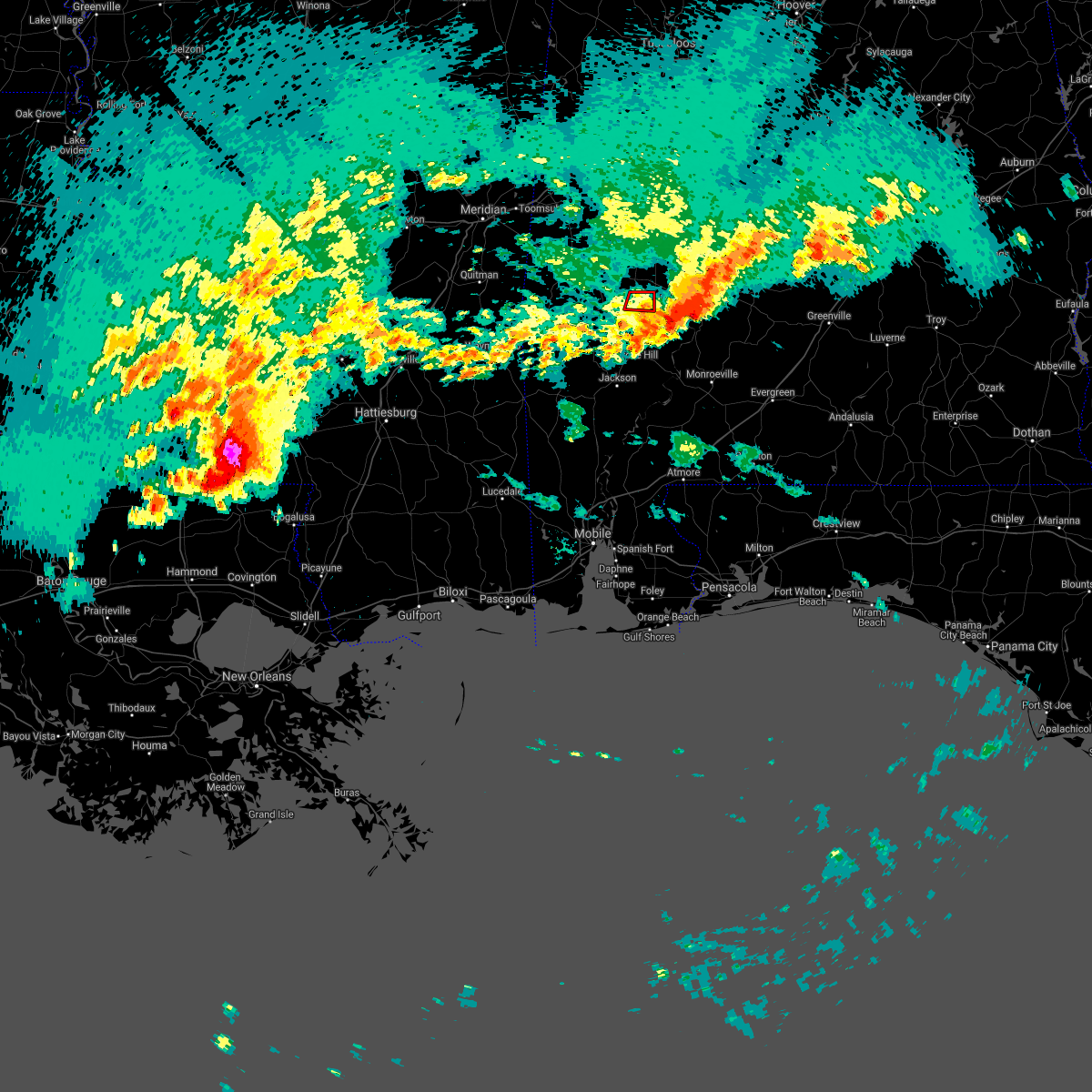 The tornado warning for northern clarke county will expire at 645 pm cdt, the tornadic thunderstorm which prompted the warning has moved out of the warned area. therefore, the warning will be allowed to expire. a tornado watch remains in effect until 1100 pm cdt for southwestern alabama. The tornado warning for northern clarke county will expire at 645 pm cdt, the tornadic thunderstorm which prompted the warning has moved out of the warned area. therefore, the warning will be allowed to expire. a tornado watch remains in effect until 1100 pm cdt for southwestern alabama.
|
| 4/19/2020 6:32 PM CDT |
 At 631 pm cdt, severe thunderstorms capable of producing both tornadoes and extensive straight line wind damage were located along a line extending from 3 miles southeast of thomasville to grove hill, moving east at 50 mph (radar indicated rotation). Hazards include tornado and quarter size hail. Flying debris will be dangerous to those caught without shelter. mobile homes will be damaged or destroyed. damage to roofs, windows, and vehicles will occur. tree damage is likely. these dangerous storms will be near, vredenburgh around 700 pm cdt. Peterman and beatrice around 710 pm cdt. At 631 pm cdt, severe thunderstorms capable of producing both tornadoes and extensive straight line wind damage were located along a line extending from 3 miles southeast of thomasville to grove hill, moving east at 50 mph (radar indicated rotation). Hazards include tornado and quarter size hail. Flying debris will be dangerous to those caught without shelter. mobile homes will be damaged or destroyed. damage to roofs, windows, and vehicles will occur. tree damage is likely. these dangerous storms will be near, vredenburgh around 700 pm cdt. Peterman and beatrice around 710 pm cdt.
|
| 4/19/2020 6:24 PM CDT |
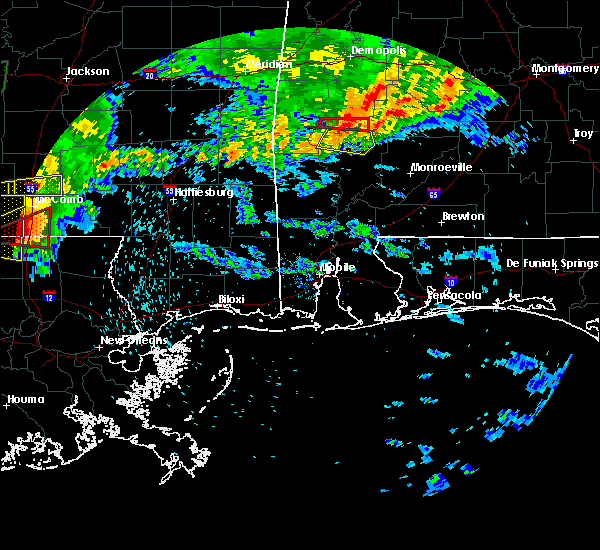 At 624 pm cdt, tornado located 8 miles southeast of putnam, or 11 miles west of thomasville, moving east at 40 mph (radar indicated). Hazards include tornado and 70 mph wind gusts. Flying debris will be dangerous to those caught without shelter. mobile homes will be damaged or destroyed. damage to roofs, windows, and vehicles will occur. tree damage is likely. Locations impacted include, thomasville. At 624 pm cdt, tornado located 8 miles southeast of putnam, or 11 miles west of thomasville, moving east at 40 mph (radar indicated). Hazards include tornado and 70 mph wind gusts. Flying debris will be dangerous to those caught without shelter. mobile homes will be damaged or destroyed. damage to roofs, windows, and vehicles will occur. tree damage is likely. Locations impacted include, thomasville.
|
| 4/19/2020 6:14 PM CDT |
 At 613 pm cdt, severe thunderstorms were located along a line extending from 8 miles southwest of dixons mill to 13 miles northwest of grove hill to coffeeville, moving east at 45 mph (radar indicated). Hazards include 60 mph wind gusts. expect damage to roofs, siding, and trees At 613 pm cdt, severe thunderstorms were located along a line extending from 8 miles southwest of dixons mill to 13 miles northwest of grove hill to coffeeville, moving east at 45 mph (radar indicated). Hazards include 60 mph wind gusts. expect damage to roofs, siding, and trees
|
| 4/19/2020 5:57 PM CDT |
 At 557 pm cdt, a severe thunderstorm capable of producing a tornado was located 6 miles southwest of putnam, or 8 miles southeast of butler, moving east at 40 mph (radar indicated rotation). Hazards include tornado. Flying debris will be dangerous to those caught without shelter. mobile homes will be damaged or destroyed. damage to roofs, windows, and vehicles will occur. tree damage is likely. This dangerous storm will be near, thomasville around 635 pm cdt. At 557 pm cdt, a severe thunderstorm capable of producing a tornado was located 6 miles southwest of putnam, or 8 miles southeast of butler, moving east at 40 mph (radar indicated rotation). Hazards include tornado. Flying debris will be dangerous to those caught without shelter. mobile homes will be damaged or destroyed. damage to roofs, windows, and vehicles will occur. tree damage is likely. This dangerous storm will be near, thomasville around 635 pm cdt.
|
| 4/12/2020 9:43 PM CDT |
 At 942 pm cdt, a severe thunderstorm capable of producing a tornado was located over fulton, or 7 miles south of thomasville, moving northeast at 65 mph (radar indicated rotation). Hazards include tornado. Flying debris will be dangerous to those caught without shelter. mobile homes will be damaged or destroyed. damage to roofs, windows, and vehicles will occur. tree damage is likely. this dangerous storm will be near, yellow bluff around 955 pm cdt. Camden around 1010 pm cdt. At 942 pm cdt, a severe thunderstorm capable of producing a tornado was located over fulton, or 7 miles south of thomasville, moving northeast at 65 mph (radar indicated rotation). Hazards include tornado. Flying debris will be dangerous to those caught without shelter. mobile homes will be damaged or destroyed. damage to roofs, windows, and vehicles will occur. tree damage is likely. this dangerous storm will be near, yellow bluff around 955 pm cdt. Camden around 1010 pm cdt.
|
| 4/12/2020 9:13 PM CDT |
 At 913 pm cdt, severe thunderstorms were located along a line extending from near putnam to near coffeeville to 5 miles south of millry, moving east at 70 mph (radar indicated). Hazards include 70 mph wind gusts and penny size hail. Expect considerable tree damage. Damage is likely to mobile homes, roofs, and outbuildings. At 913 pm cdt, severe thunderstorms were located along a line extending from near putnam to near coffeeville to 5 miles south of millry, moving east at 70 mph (radar indicated). Hazards include 70 mph wind gusts and penny size hail. Expect considerable tree damage. Damage is likely to mobile homes, roofs, and outbuildings.
|
| 3/31/2020 8:37 AM CDT |
 At 837 am cdt, severe thunderstorms were located along a line extending from yellow bluff to 9 miles east of fulton to grove hill to near state line, moving east at 70 mph (radar indicated). Hazards include 60 mph wind gusts. expect damage to roofs, siding, and trees At 837 am cdt, severe thunderstorms were located along a line extending from yellow bluff to 9 miles east of fulton to grove hill to near state line, moving east at 70 mph (radar indicated). Hazards include 60 mph wind gusts. expect damage to roofs, siding, and trees
|
| 3/31/2020 8:31 AM CDT |
 At 831 am cdt, severe thunderstorms were located along a line extending from pine hill to near fulton to 8 miles southeast of coffeeville, moving east at 70 mph (radar indicated). Hazards include 70 mph wind gusts. Expect considerable tree damage. damage is likely to mobile homes, roofs, and outbuildings. Locations impacted include, thomasville, grove hill, pine hill, coffeeville and fulton. At 831 am cdt, severe thunderstorms were located along a line extending from pine hill to near fulton to 8 miles southeast of coffeeville, moving east at 70 mph (radar indicated). Hazards include 70 mph wind gusts. Expect considerable tree damage. damage is likely to mobile homes, roofs, and outbuildings. Locations impacted include, thomasville, grove hill, pine hill, coffeeville and fulton.
|
| 3/31/2020 8:25 AM CDT | Several reports of trees down in and around thomasvill in clarke county AL, 1.3 miles S of Thomasville, AL |
| 3/31/2020 8:25 AM CDT | Significant wind damage with numerous trees and power lines reported down near the community of thomasville. time estimated from rada in clarke county AL, 0.6 miles SSW of Thomasville, AL |
| 3/31/2020 8:19 AM CDT |
 At 818 am cdt, a severe thunderstorm was located over coffeeville, or 18 miles west of grove hill, moving east at 70 mph. residents near coffeeville should seek safe shelter immediately (radar indicated). Hazards include 70 mph wind gusts. Expect considerable tree damage. damage is likely to mobile homes, roofs, and outbuildings. Locations impacted include, thomasville, grove hill, pine hill, coffeeville and fulton. At 818 am cdt, a severe thunderstorm was located over coffeeville, or 18 miles west of grove hill, moving east at 70 mph. residents near coffeeville should seek safe shelter immediately (radar indicated). Hazards include 70 mph wind gusts. Expect considerable tree damage. damage is likely to mobile homes, roofs, and outbuildings. Locations impacted include, thomasville, grove hill, pine hill, coffeeville and fulton.
|
| 3/31/2020 7:50 AM CDT |
 At 750 am cdt, severe thunderstorms were located along a line extending from 4 miles west of nanafalia to 4 miles southwest of putnam to 9 miles east of toxey to 3 miles northwest of silas, moving east at 45 mph (radar indicated). Hazards include 60 mph wind gusts. expect damage to roofs, siding, and trees At 750 am cdt, severe thunderstorms were located along a line extending from 4 miles west of nanafalia to 4 miles southwest of putnam to 9 miles east of toxey to 3 miles northwest of silas, moving east at 45 mph (radar indicated). Hazards include 60 mph wind gusts. expect damage to roofs, siding, and trees
|
| 3/4/2020 5:36 AM CST |
 The severe thunderstorm warning for northern clarke county will expire at 545 am cst, the storm which prompted the warning has moved out of the area. therefore, the warning will be allowed to expire. a tornado watch remains in effect until 1000 am cst for south central and southwestern alabama. The severe thunderstorm warning for northern clarke county will expire at 545 am cst, the storm which prompted the warning has moved out of the area. therefore, the warning will be allowed to expire. a tornado watch remains in effect until 1000 am cst for south central and southwestern alabama.
|
| 3/4/2020 4:55 AM CST |
 At 455 am cst, a severe thunderstorm was located 8 miles northeast of coffeeville, or 16 miles west of thomasville, moving east at 45 mph (radar indicated). Hazards include 60 mph wind gusts and quarter size hail. Hail damage to vehicles is expected. Expect wind damage to roofs, siding, and trees. At 455 am cst, a severe thunderstorm was located 8 miles northeast of coffeeville, or 16 miles west of thomasville, moving east at 45 mph (radar indicated). Hazards include 60 mph wind gusts and quarter size hail. Hail damage to vehicles is expected. Expect wind damage to roofs, siding, and trees.
|
| 2/6/2020 4:00 AM CST |
 At 358 am cst, a severe thunderstorm capable of producing a tornado was located over thomasville, moving northeast at 55 mph (radar indicated rotation). Hazards include tornado. Flying debris will be dangerous to those caught without shelter. mobile homes will be damaged or destroyed. damage to roofs, windows, and vehicles will occur. tree damage is likely. Locations impacted include, thomasville and pine hill. At 358 am cst, a severe thunderstorm capable of producing a tornado was located over thomasville, moving northeast at 55 mph (radar indicated rotation). Hazards include tornado. Flying debris will be dangerous to those caught without shelter. mobile homes will be damaged or destroyed. damage to roofs, windows, and vehicles will occur. tree damage is likely. Locations impacted include, thomasville and pine hill.
|
| 2/6/2020 3:50 AM CST |
 At 349 am cst, a severe thunderstorm capable of producing a tornado was located 6 miles southwest of thomasville, moving northeast at 50 mph (radar indicated rotation). Hazards include tornado. Flying debris will be dangerous to those caught without shelter. mobile homes will be damaged or destroyed. damage to roofs, windows, and vehicles will occur. Tree damage is likely. At 349 am cst, a severe thunderstorm capable of producing a tornado was located 6 miles southwest of thomasville, moving northeast at 50 mph (radar indicated rotation). Hazards include tornado. Flying debris will be dangerous to those caught without shelter. mobile homes will be damaged or destroyed. damage to roofs, windows, and vehicles will occur. Tree damage is likely.
|
| 2/6/2020 3:43 AM CST |
 At 342 am cst, a severe thunderstorm was located 8 miles northwest of grove hill, moving northeast at 65 mph (radar indicated). Hazards include 60 mph wind gusts. expect damage to roofs, siding, and trees At 342 am cst, a severe thunderstorm was located 8 miles northwest of grove hill, moving northeast at 65 mph (radar indicated). Hazards include 60 mph wind gusts. expect damage to roofs, siding, and trees
|
| 1/11/2020 12:51 PM CST | Tree down on a home on peach tree rd in thomasvill in clarke county AL, 1 miles WSW of Thomasville, AL |
| 1/11/2020 12:51 PM CST | Trees and power lines down at highway 43 and tanglewood circl in clarke county AL, 4 miles S of Thomasville, AL |
| 1/11/2020 12:50 PM CST | Receiving additional reports of several trees and power lines down in thomasvill in clarke county AL, 0.6 miles SSW of Thomasville, AL |
| 1/11/2020 12:50 PM CST |
 At 1250 pm cst, severe thunderstorms were located along a line extending from 9 miles south of consul to 3 miles southeast of thomasville to near fulton, moving northeast at 55 mph (radar indicated). Hazards include 60 mph wind gusts. Expect damage to roofs, siding, and trees. Locations impacted include, thomasville, grove hill, pine hill, vredenburgh, fulton and yellow bluff. At 1250 pm cst, severe thunderstorms were located along a line extending from 9 miles south of consul to 3 miles southeast of thomasville to near fulton, moving northeast at 55 mph (radar indicated). Hazards include 60 mph wind gusts. Expect damage to roofs, siding, and trees. Locations impacted include, thomasville, grove hill, pine hill, vredenburgh, fulton and yellow bluff.
|
| 1/11/2020 12:28 PM CST |
 At 1227 pm cst, severe thunderstorms were located along a line extending from 5 miles west of shawnee to 5 miles east of coffeeville to 5 miles northeast of saint stephens, moving northeast at 55 mph (emergency management). Hazards include 60 mph wind gusts. expect damage to roofs, siding, and trees At 1227 pm cst, severe thunderstorms were located along a line extending from 5 miles west of shawnee to 5 miles east of coffeeville to 5 miles northeast of saint stephens, moving northeast at 55 mph (emergency management). Hazards include 60 mph wind gusts. expect damage to roofs, siding, and trees
|
| 4/18/2019 6:58 PM CDT |
 At 658 pm cdt, severe thunderstorms were located along a line extending from 8 miles southeast of consul to near leroy, moving east at 25 mph (radar indicated). Hazards include 60 mph wind gusts. Expect damage to roofs, siding, and trees. Locations impacted include, jackson, thomasville, grove hill, saint stephens, leroy, whatley, pine hill, fulton and yellow bluff. At 658 pm cdt, severe thunderstorms were located along a line extending from 8 miles southeast of consul to near leroy, moving east at 25 mph (radar indicated). Hazards include 60 mph wind gusts. Expect damage to roofs, siding, and trees. Locations impacted include, jackson, thomasville, grove hill, saint stephens, leroy, whatley, pine hill, fulton and yellow bluff.
|
| 4/18/2019 6:18 PM CDT |
 At 618 pm cdt, severe thunderstorms were located along a line extending from 7 miles south of sweet water to chatom, moving east at 35 mph (radar indicated). Hazards include 60 mph wind gusts. expect damage to roofs, siding, and trees At 618 pm cdt, severe thunderstorms were located along a line extending from 7 miles south of sweet water to chatom, moving east at 35 mph (radar indicated). Hazards include 60 mph wind gusts. expect damage to roofs, siding, and trees
|
| 3/3/2019 1:09 PM CST |
 At 109 pm cst, a severe thunderstorm was located over whatley, or 6 miles southeast of grove hill, moving east at 50 mph (radar indicated). Hazards include 60 mph wind gusts and penny size hail. expect damage to roofs, siding, and trees At 109 pm cst, a severe thunderstorm was located over whatley, or 6 miles southeast of grove hill, moving east at 50 mph (radar indicated). Hazards include 60 mph wind gusts and penny size hail. expect damage to roofs, siding, and trees
|
| 1/23/2019 12:40 PM CST |
 At 1239 pm cst, severe thunderstorms were located along a line extending from thomasville to 3 miles northeast of fulton to 3 miles northeast of grove hill, moving northeast at 55 mph (radar indicated). Hazards include 60 mph wind gusts. Expect damage to roofs, siding, and trees. Locations impacted include, thomasville, pine hill, fulton and yellow bluff. At 1239 pm cst, severe thunderstorms were located along a line extending from thomasville to 3 miles northeast of fulton to 3 miles northeast of grove hill, moving northeast at 55 mph (radar indicated). Hazards include 60 mph wind gusts. Expect damage to roofs, siding, and trees. Locations impacted include, thomasville, pine hill, fulton and yellow bluff.
|
| 1/23/2019 12:25 PM CST |
 At 1224 pm cst, severe thunderstorms were located along a line extending from 9 miles west of fulton to 4 miles west of grove hill to 7 miles north of jackson, moving northeast at 55 mph (radar indicated). Hazards include 60 mph wind gusts. expect damage to roofs, siding, and trees At 1224 pm cst, severe thunderstorms were located along a line extending from 9 miles west of fulton to 4 miles west of grove hill to 7 miles north of jackson, moving northeast at 55 mph (radar indicated). Hazards include 60 mph wind gusts. expect damage to roofs, siding, and trees
|
| 1/19/2019 12:40 PM CST |
 At 1240 pm cst, severe thunderstorms were located along a line extending from near miller to near saint stephens, moving east at 40 mph (radar indicated). Hazards include 60 mph wind gusts. Expect damage to roofs, siding, and trees. locations impacted include, jackson, thomasville, grove hill, saint stephens, leroy, whatley, pine hill, fulton and yellow bluff. A tornado watch remains in effect until 500 pm cst for south central and southwestern alabama. At 1240 pm cst, severe thunderstorms were located along a line extending from near miller to near saint stephens, moving east at 40 mph (radar indicated). Hazards include 60 mph wind gusts. Expect damage to roofs, siding, and trees. locations impacted include, jackson, thomasville, grove hill, saint stephens, leroy, whatley, pine hill, fulton and yellow bluff. A tornado watch remains in effect until 500 pm cst for south central and southwestern alabama.
|
| 1/19/2019 12:15 PM CST |
 At 1215 pm cst, severe thunderstorms were located along a line extending from near nanafalia to chatom, moving east at 40 mph (radar indicated). Hazards include 60 mph wind gusts. expect damage to roofs, siding, and trees At 1215 pm cst, severe thunderstorms were located along a line extending from near nanafalia to chatom, moving east at 40 mph (radar indicated). Hazards include 60 mph wind gusts. expect damage to roofs, siding, and trees
|
| 12/27/2018 5:16 PM CST | Windows blown out of a building on front st in thomasville. trees blown down along highway 43 through thomasville. port-o-pots blown 50 yard in clarke county AL, 1 miles WSW of Thomasville, AL |
| 12/27/2018 5:16 PM CST | Trees and power lines down in the southern part of thomasville... a in clarke county AL, 0.8 miles W of Thomasville, AL |
| 12/27/2018 5:15 PM CST | Trees down along huggins rd off tallahatta springs r in clarke county AL, 7.4 miles E of Thomasville, AL |
| 12/27/2018 5:15 PM CST | Trees down near harper hill rd and tallahatta springs roads west of thomasvill in clarke county AL, 2.7 miles ESE of Thomasville, AL |
| 11/1/2018 8:00 AM CDT |
 At 759 am cdt, severe thunderstorms were located along a line extending from 6 miles southeast of fulton to 11 miles west of monroeville to 6 miles west of frisco city, moving northeast at 50 mph (radar indicated). Hazards include 60 mph wind gusts. expect damage to roofs, siding, and trees At 759 am cdt, severe thunderstorms were located along a line extending from 6 miles southeast of fulton to 11 miles west of monroeville to 6 miles west of frisco city, moving northeast at 50 mph (radar indicated). Hazards include 60 mph wind gusts. expect damage to roofs, siding, and trees
|
| 11/1/2018 7:40 AM CDT |
 At 739 am cdt, severe thunderstorms were located along a line extending from 3 miles northeast of myrtlewood to 8 miles southeast of putnam to 11 miles southeast of jackson, moving east at 40 mph (radar indicated). Hazards include 60 mph wind gusts. Expect damage to roofs, siding, and trees. locations impacted include, jackson, thomasville, grove hill, whatley and fulton. A tornado watch remains in effect until 100 pm cdt for south central and southwestern alabama. At 739 am cdt, severe thunderstorms were located along a line extending from 3 miles northeast of myrtlewood to 8 miles southeast of putnam to 11 miles southeast of jackson, moving east at 40 mph (radar indicated). Hazards include 60 mph wind gusts. Expect damage to roofs, siding, and trees. locations impacted include, jackson, thomasville, grove hill, whatley and fulton. A tornado watch remains in effect until 100 pm cdt for south central and southwestern alabama.
|
| 11/1/2018 7:18 AM CDT |
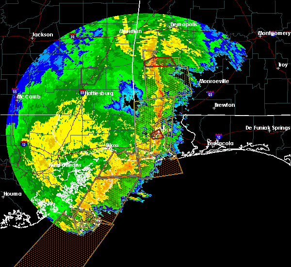 At 717 am cdt, a severe thunderstorm capable of producing a tornado was located 7 miles east of toxey, or 12 miles south of butler, moving northeast at 35 mph (radar indicated rotation). Hazards include tornado. Flying debris will be dangerous to those caught without shelter. mobile homes will be damaged or destroyed. damage to roofs, windows, and vehicles will occur. tree damage is likely. This tornadic thunderstorm will remain over mainly rural areas of south central choctaw and northwestern clarke counties. At 717 am cdt, a severe thunderstorm capable of producing a tornado was located 7 miles east of toxey, or 12 miles south of butler, moving northeast at 35 mph (radar indicated rotation). Hazards include tornado. Flying debris will be dangerous to those caught without shelter. mobile homes will be damaged or destroyed. damage to roofs, windows, and vehicles will occur. tree damage is likely. This tornadic thunderstorm will remain over mainly rural areas of south central choctaw and northwestern clarke counties.
|
| 11/1/2018 7:15 AM CDT |
 At 715 am cdt, severe thunderstorms were located along a line extending from 7 miles west of pennington to 6 miles east of gilbertown to 3 miles northwest of mcintosh, moving east at 40 mph (radar indicated). Hazards include 60 mph wind gusts. expect damage to roofs, siding, and trees At 715 am cdt, severe thunderstorms were located along a line extending from 7 miles west of pennington to 6 miles east of gilbertown to 3 miles northwest of mcintosh, moving east at 40 mph (radar indicated). Hazards include 60 mph wind gusts. expect damage to roofs, siding, and trees
|
| 11/1/2018 7:02 AM CDT |
 At 702 am cdt, a severe thunderstorm capable of producing a tornado was located over silas, or 20 miles south of butler, moving northeast at 45 mph (radar indicated rotation). Hazards include tornado. Flying debris will be dangerous to those caught without shelter. mobile homes will be damaged or destroyed. damage to roofs, windows, and vehicles will occur. tree damage is likely. This tornadic thunderstorm will remain over mainly rural areas of southwestern choctaw and northwestern clarke counties. At 702 am cdt, a severe thunderstorm capable of producing a tornado was located over silas, or 20 miles south of butler, moving northeast at 45 mph (radar indicated rotation). Hazards include tornado. Flying debris will be dangerous to those caught without shelter. mobile homes will be damaged or destroyed. damage to roofs, windows, and vehicles will occur. tree damage is likely. This tornadic thunderstorm will remain over mainly rural areas of southwestern choctaw and northwestern clarke counties.
|
| 11/1/2018 6:33 AM CDT |
 At 632 am cdt, severe thunderstorms were located along a line extending from near alamucha to 7 miles south of crandall to 5 miles north of leakesville, moving northeast at 50 mph (radar indicated). Hazards include 70 mph wind gusts. Expect considerable tree damage. Damage is likely to mobile homes, roofs, and outbuildings. At 632 am cdt, severe thunderstorms were located along a line extending from near alamucha to 7 miles south of crandall to 5 miles north of leakesville, moving northeast at 50 mph (radar indicated). Hazards include 70 mph wind gusts. Expect considerable tree damage. Damage is likely to mobile homes, roofs, and outbuildings.
|
| 7/22/2018 12:25 PM CDT |
 At 1205 pm cdt, a severe thunderstorm was located 9 miles west of thomasville, moving southeast at 25 mph (radar indicated). Hazards include 60 mph wind gusts. expect damage to roofs, siding, and trees At 1205 pm cdt, a severe thunderstorm was located 9 miles west of thomasville, moving southeast at 25 mph (radar indicated). Hazards include 60 mph wind gusts. expect damage to roofs, siding, and trees
|
| 7/22/2018 12:15 PM CDT | Quarter sized hail reported 7.4 miles E of Thomasville, AL, quarter size hail reported approx 10 miles west of the thomasville area. |
| 7/22/2018 12:11 PM CDT |
 At 1211 pm cdt, a severe thunderstorm was located 5 miles south of pine hill, or 9 miles east of thomasville, moving southeast at 20 mph (radar indicated). Hazards include 60 mph wind gusts. Expect damage to roofs, siding, and trees. Locations impacted include, pine hill and yellow bluff. At 1211 pm cdt, a severe thunderstorm was located 5 miles south of pine hill, or 9 miles east of thomasville, moving southeast at 20 mph (radar indicated). Hazards include 60 mph wind gusts. Expect damage to roofs, siding, and trees. Locations impacted include, pine hill and yellow bluff.
|
| 7/22/2018 12:06 PM CDT |
 At 1205 pm cdt, a severe thunderstorm was located 9 miles west of thomasville, moving southeast at 25 mph (radar indicated). Hazards include 60 mph wind gusts. expect damage to roofs, siding, and trees At 1205 pm cdt, a severe thunderstorm was located 9 miles west of thomasville, moving southeast at 25 mph (radar indicated). Hazards include 60 mph wind gusts. expect damage to roofs, siding, and trees
|
| 7/22/2018 11:40 AM CDT |
 The national weather service in mobile has issued a * severe thunderstorm warning for. northeastern clarke county in southwestern alabama. southwestern wilcox county in south central alabama. until 1245 pm cdt. At 1140 am cdt, a severe thunderstorm was located over vineland, or. The national weather service in mobile has issued a * severe thunderstorm warning for. northeastern clarke county in southwestern alabama. southwestern wilcox county in south central alabama. until 1245 pm cdt. At 1140 am cdt, a severe thunderstorm was located over vineland, or.
|
| 6/28/2018 6:24 PM CDT |
 At 623 pm cdt, severe thunderstorms were located along a line extending from 5 miles south of kinterbish to 9 miles west of thomasville to 11 miles northwest of monroeville, moving south at 50 mph (radar indicated). Hazards include 60 mph wind gusts. expect damage to roofs, siding, and trees At 623 pm cdt, severe thunderstorms were located along a line extending from 5 miles south of kinterbish to 9 miles west of thomasville to 11 miles northwest of monroeville, moving south at 50 mph (radar indicated). Hazards include 60 mph wind gusts. expect damage to roofs, siding, and trees
|
| 6/28/2018 6:15 PM CDT | Several trees down in the thomasville are in clarke county AL, 1.3 miles S of Thomasville, AL |
| 4/22/2018 6:15 PM CDT |
 At 614 pm cdt, severe thunderstorms were located along a line extending from 3 miles southeast of putnam to 12 miles south of nanafalia to 8 miles northeast of coffeeville, moving east at 35 mph (radar indicated). Hazards include 60 mph wind gusts. Expect damage to roofs, siding, and trees. Locations impacted include, thomasville. At 614 pm cdt, severe thunderstorms were located along a line extending from 3 miles southeast of putnam to 12 miles south of nanafalia to 8 miles northeast of coffeeville, moving east at 35 mph (radar indicated). Hazards include 60 mph wind gusts. Expect damage to roofs, siding, and trees. Locations impacted include, thomasville.
|
| 4/22/2018 6:00 PM CDT |
 The national weather service in mobile has issued a * severe thunderstorm warning for. eastern choctaw county in southwestern alabama. northwestern clarke county in southwestern alabama. until 645 pm cdt. At 559 pm cdt, severe thunderstorms were located along a line. The national weather service in mobile has issued a * severe thunderstorm warning for. eastern choctaw county in southwestern alabama. northwestern clarke county in southwestern alabama. until 645 pm cdt. At 559 pm cdt, severe thunderstorms were located along a line.
|
| 4/14/2018 12:47 PM CDT |
 At 1246 pm cdt, severe thunderstorms were located along a line extending from 7 miles northwest of pennington to 3 miles southwest of chatom, moving northeast at 60 mph (radar indicated). Hazards include 60 mph wind gusts. Expect damage to roofs, siding, and trees. locations impacted include, jackson, thomasville, butler, grove hill, chatom, saint stephens, leroy, lisman, millry, silas, fruitdale, coffeeville, pennington, gilbertown and toxey. A tornado watch remains in effect until 700 pm cdt for southwestern alabama. At 1246 pm cdt, severe thunderstorms were located along a line extending from 7 miles northwest of pennington to 3 miles southwest of chatom, moving northeast at 60 mph (radar indicated). Hazards include 60 mph wind gusts. Expect damage to roofs, siding, and trees. locations impacted include, jackson, thomasville, butler, grove hill, chatom, saint stephens, leroy, lisman, millry, silas, fruitdale, coffeeville, pennington, gilbertown and toxey. A tornado watch remains in effect until 700 pm cdt for southwestern alabama.
|
| 4/14/2018 11:59 AM CDT |
 At 1158 am cdt, severe thunderstorms were located along a line extending from near snell to 12 miles southwest of state line, moving northeast at 65 mph (radar indicated). Hazards include 60 mph wind gusts. expect damage to roofs, siding, and trees At 1158 am cdt, severe thunderstorms were located along a line extending from near snell to 12 miles southwest of state line, moving northeast at 65 mph (radar indicated). Hazards include 60 mph wind gusts. expect damage to roofs, siding, and trees
|
| 6/16/2017 8:44 PM CDT |
 At 844 pm cdt, a severe thunderstorm was located over grove hill, moving east at 15 mph (radar indicated). Hazards include 60 mph wind gusts and quarter size hail. Hail damage to vehicles is expected. Expect wind damage to roofs, siding, and trees. At 844 pm cdt, a severe thunderstorm was located over grove hill, moving east at 15 mph (radar indicated). Hazards include 60 mph wind gusts and quarter size hail. Hail damage to vehicles is expected. Expect wind damage to roofs, siding, and trees.
|
| 6/15/2017 2:43 PM CDT |
 At 242 pm cdt, severe thunderstorms were located along a line extending from near thomasville to 7 miles west of dannelly reservoir, moving southeast at 20 mph (radar indicated). Hazards include 60 mph wind gusts and quarter size hail. Hail damage to vehicles is expected. Expect wind damage to roofs, siding, and trees. At 242 pm cdt, severe thunderstorms were located along a line extending from near thomasville to 7 miles west of dannelly reservoir, moving southeast at 20 mph (radar indicated). Hazards include 60 mph wind gusts and quarter size hail. Hail damage to vehicles is expected. Expect wind damage to roofs, siding, and trees.
|
| 5/1/2017 12:55 AM CDT |
 The severe thunderstorm warning for northern clarke and wilcox counties will expire at 100 am cdt, the storms which prompted the warning have weakened below severe limits, and no longer pose an immediate threat to life or property. therefore the warning will be allowed to expire. The severe thunderstorm warning for northern clarke and wilcox counties will expire at 100 am cdt, the storms which prompted the warning have weakened below severe limits, and no longer pose an immediate threat to life or property. therefore the warning will be allowed to expire.
|
| 5/1/2017 12:13 AM CDT |
 At 1212 am cdt, severe thunderstorms were located along a line extending from near myrtlewood to 7 miles south of sweet water to near coffeeville, moving northeast at 55 mph (radar indicated). Hazards include 60 mph wind gusts and nickel size hail. expect damage to roofs, siding, and trees At 1212 am cdt, severe thunderstorms were located along a line extending from near myrtlewood to 7 miles south of sweet water to near coffeeville, moving northeast at 55 mph (radar indicated). Hazards include 60 mph wind gusts and nickel size hail. expect damage to roofs, siding, and trees
|
| 4/30/2017 2:33 PM CDT |
 At 232 pm cdt, severe thunderstorms were located along a line extending from near shawnee to jackson to near tibbie, moving east at 25 mph (radar indicated). Hazards include 60 mph wind gusts. Expect damage to roofs, siding, and trees. locations impacted include, jackson, thomasville, grove hill, chatom, saint stephens, wagarville, leroy, whatley, tibbie, fruitdale, coffeeville, fulton and mcintosh. a tornado watch remains in effect until 300 pm cdt for southeastern mississippi. A tornado watch also remains in effect until 700 pm cdt for south central and southwestern alabama. At 232 pm cdt, severe thunderstorms were located along a line extending from near shawnee to jackson to near tibbie, moving east at 25 mph (radar indicated). Hazards include 60 mph wind gusts. Expect damage to roofs, siding, and trees. locations impacted include, jackson, thomasville, grove hill, chatom, saint stephens, wagarville, leroy, whatley, tibbie, fruitdale, coffeeville, fulton and mcintosh. a tornado watch remains in effect until 300 pm cdt for southeastern mississippi. A tornado watch also remains in effect until 700 pm cdt for south central and southwestern alabama.
|
| 4/30/2017 1:46 PM CDT |
 At 146 pm cdt, severe thunderstorms were located along a line extending from near putnam to near chatom to near fruitdale, moving east at 25 mph (radar indicated). Hazards include 60 mph wind gusts. expect damage to roofs, siding, and trees At 146 pm cdt, severe thunderstorms were located along a line extending from near putnam to near chatom to near fruitdale, moving east at 25 mph (radar indicated). Hazards include 60 mph wind gusts. expect damage to roofs, siding, and trees
|
| 4/30/2017 1:39 PM CDT |
 At 138 pm cdt, severe thunderstorms were located along a line extending from near putnam to near chatom, moving east at 20 mph. a new severe thunderstorm warning may be issued soon for much of this area (radar indicated). Hazards include 60 mph wind gusts. Expect damage to roofs, siding, and trees. locations impacted include, thomasville, butler, chatom, saint stephens, millry, buckatunna, silas, coffeeville, pennington, gilbertown and toxey. a tornado watch remains in effect until 300 pm cdt for southeastern mississippi. A tornado watch also remains in effect until 700 pm cdt for southwestern alabama. At 138 pm cdt, severe thunderstorms were located along a line extending from near putnam to near chatom, moving east at 20 mph. a new severe thunderstorm warning may be issued soon for much of this area (radar indicated). Hazards include 60 mph wind gusts. Expect damage to roofs, siding, and trees. locations impacted include, thomasville, butler, chatom, saint stephens, millry, buckatunna, silas, coffeeville, pennington, gilbertown and toxey. a tornado watch remains in effect until 300 pm cdt for southeastern mississippi. A tornado watch also remains in effect until 700 pm cdt for southwestern alabama.
|
| 4/30/2017 1:06 PM CDT |
 At 105 pm cdt, severe thunderstorms were located along a line extending from near putnam to near state line, moving east at 25 mph (radar indicated). Hazards include 60 mph wind gusts. expect damage to roofs, siding, and trees At 105 pm cdt, severe thunderstorms were located along a line extending from near putnam to near state line, moving east at 25 mph (radar indicated). Hazards include 60 mph wind gusts. expect damage to roofs, siding, and trees
|
| 4/27/2017 3:50 AM CDT |
 At 349 am cdt, a severe thunderstorm was located near fulton, or near thomasville, moving northeast at 45 mph (radar indicated). Hazards include 60 mph wind gusts. expect damage to roofs, siding, and trees At 349 am cdt, a severe thunderstorm was located near fulton, or near thomasville, moving northeast at 45 mph (radar indicated). Hazards include 60 mph wind gusts. expect damage to roofs, siding, and trees
|
| 4/5/2017 8:19 AM CDT |
 At 818 am cdt, a severe thunderstorm was located near grove hill, moving northeast at 50 mph (radar indicated). Hazards include 60 mph wind gusts and half dollar size hail. Hail damage to vehicles is expected. Expect wind damage to roofs, siding, and trees. At 818 am cdt, a severe thunderstorm was located near grove hill, moving northeast at 50 mph (radar indicated). Hazards include 60 mph wind gusts and half dollar size hail. Hail damage to vehicles is expected. Expect wind damage to roofs, siding, and trees.
|
| 4/3/2017 6:22 AM CDT |
 At 621 am cdt, severe thunderstorms were located along a line extending from 8 miles northwest of fulton to saint stephens, moving east at 35 mph. a new warning may be issued soon for a portion of this area (radar indicated). Hazards include 60 mph wind gusts. Expect damage to roofs, siding, and trees. locations impacted include, jackson, thomasville, grove hill, saint stephens, leroy and fulton. A tornado watch remains in effect until 900 am cdt for southwestern alabama. At 621 am cdt, severe thunderstorms were located along a line extending from 8 miles northwest of fulton to saint stephens, moving east at 35 mph. a new warning may be issued soon for a portion of this area (radar indicated). Hazards include 60 mph wind gusts. Expect damage to roofs, siding, and trees. locations impacted include, jackson, thomasville, grove hill, saint stephens, leroy and fulton. A tornado watch remains in effect until 900 am cdt for southwestern alabama.
|
| 4/3/2017 5:45 AM CDT |
 At 544 am cdt, severe thunderstorms were located along a line extending from 7 miles northwest of coffeeville to near state line, moving east at 35 mph (radar indicated). Hazards include 60 mph wind gusts. expect damage to roofs, siding, and trees At 544 am cdt, severe thunderstorms were located along a line extending from 7 miles northwest of coffeeville to near state line, moving east at 35 mph (radar indicated). Hazards include 60 mph wind gusts. expect damage to roofs, siding, and trees
|
| 3/1/2017 6:23 PM CST |
 The severe thunderstorm warning for northwestern clarke county will expire at 630 pm cst, the storm which prompted the warning has weakened below severe limits. therefore the warning will be allowed to expire. The severe thunderstorm warning for northwestern clarke county will expire at 630 pm cst, the storm which prompted the warning has weakened below severe limits. therefore the warning will be allowed to expire.
|
| 3/1/2017 6:05 PM CST |
 At 604 pm cst, a severe thunderstorm was located near tallahatta springs, moving east at 40 mph (radar indicated). Hazards include 60 mph wind gusts and penny size hail. Expect damage to roofs, siding, and trees. Locations impacted include, thomasville and fulton. At 604 pm cst, a severe thunderstorm was located near tallahatta springs, moving east at 40 mph (radar indicated). Hazards include 60 mph wind gusts and penny size hail. Expect damage to roofs, siding, and trees. Locations impacted include, thomasville and fulton.
|
| 3/1/2017 5:57 PM CST | Clarke county 911 has reports of multiple trees down on campbells landing r in clarke county AL, 15.7 miles ESE of Thomasville, AL |
| 3/1/2017 5:53 PM CST |
 At 553 pm cst, a severe thunderstorm was located 8 miles southeast of putnam, or 13 miles west of thomasville, moving east at 40 mph (radar indicated). Hazards include 60 mph wind gusts and nickel size hail. Expect damage to roofs, siding, and trees. Locations impacted include, thomasville and fulton. At 553 pm cst, a severe thunderstorm was located 8 miles southeast of putnam, or 13 miles west of thomasville, moving east at 40 mph (radar indicated). Hazards include 60 mph wind gusts and nickel size hail. Expect damage to roofs, siding, and trees. Locations impacted include, thomasville and fulton.
|
| 3/1/2017 5:38 PM CST |
 At 538 pm cst, a severe thunderstorm was located 7 miles southwest of putnam, or 12 miles southeast of butler, moving east at 40 mph (radar indicated). Hazards include 60 mph wind gusts and nickel size hail. expect damage to roofs, siding, and trees At 538 pm cst, a severe thunderstorm was located 7 miles southwest of putnam, or 12 miles southeast of butler, moving east at 40 mph (radar indicated). Hazards include 60 mph wind gusts and nickel size hail. expect damage to roofs, siding, and trees
|
| 1/22/2017 11:36 AM CST |
 At 1136 am cst, a severe thunderstorm was located 8 miles southwest of yellow bluff, or 11 miles east of thomasville, moving northeast at 65 mph (radar indicated). Hazards include 60 mph wind gusts. Expect damage to roofs, siding, and trees. locations impacted include, thomasville, grove hill, vredenburgh and fulton. A tornado watch remains in effect until 200 pm cst for south central alabama. At 1136 am cst, a severe thunderstorm was located 8 miles southwest of yellow bluff, or 11 miles east of thomasville, moving northeast at 65 mph (radar indicated). Hazards include 60 mph wind gusts. Expect damage to roofs, siding, and trees. locations impacted include, thomasville, grove hill, vredenburgh and fulton. A tornado watch remains in effect until 200 pm cst for south central alabama.
|
| 1/22/2017 11:13 AM CST |
 At 1112 am cst, a severe thunderstorm was located near jackson, moving northeast at 65 mph (radar indicated). Hazards include 60 mph wind gusts and quarter size hail. Hail damage to vehicles is expected. Expect wind damage to roofs, siding, and trees. At 1112 am cst, a severe thunderstorm was located near jackson, moving northeast at 65 mph (radar indicated). Hazards include 60 mph wind gusts and quarter size hail. Hail damage to vehicles is expected. Expect wind damage to roofs, siding, and trees.
|
| 1/21/2017 11:24 PM CST |
 At 1124 pm cst, a severe thunderstorm was located near fulton, or near thomasville, moving northeast at 50 mph (radar indicated). Hazards include 60 mph wind gusts and quarter size hail. Hail damage to vehicles is expected. Expect wind damage to roofs, siding, and trees. At 1124 pm cst, a severe thunderstorm was located near fulton, or near thomasville, moving northeast at 50 mph (radar indicated). Hazards include 60 mph wind gusts and quarter size hail. Hail damage to vehicles is expected. Expect wind damage to roofs, siding, and trees.
|
| 1/21/2017 5:45 AM CST |
 At 545 am cst, a severe thunderstorm was located 8 miles west of thomasville, moving east at 45 mph (radar indicated). Hazards include 60 mph wind gusts. expect damage to roofs, siding, and trees At 545 am cst, a severe thunderstorm was located 8 miles west of thomasville, moving east at 45 mph (radar indicated). Hazards include 60 mph wind gusts. expect damage to roofs, siding, and trees
|
| 1/21/2017 5:06 AM CST |
 At 506 am cst, a large and extremely dangerous tornado was located near silas, or 18 miles northeast of waynesboro, moving northeast at 55 mph. this is a particularly dangerous situation. take cover now! (radar indicated rotation). Hazards include damaging tornado. You are in a life-threatening situation. flying debris may be deadly to those caught without shelter. mobile homes will be destroyed. considerable damage to homes, businesses, and vehicles is likely and complete destruction is possible. the tornado will be near, gilbertown around 510 am cst. Toxey around 515 am cst. At 506 am cst, a large and extremely dangerous tornado was located near silas, or 18 miles northeast of waynesboro, moving northeast at 55 mph. this is a particularly dangerous situation. take cover now! (radar indicated rotation). Hazards include damaging tornado. You are in a life-threatening situation. flying debris may be deadly to those caught without shelter. mobile homes will be destroyed. considerable damage to homes, businesses, and vehicles is likely and complete destruction is possible. the tornado will be near, gilbertown around 510 am cst. Toxey around 515 am cst.
|
| 1/21/2017 3:09 AM CST |
 The severe thunderstorm warning for north central monroe, southwestern wilcox and northeastern clarke counties will expire at 315 am cst, the storm which prompted the warning has weakened below severe limits. therefore the warning will be allowed to expire. The severe thunderstorm warning for north central monroe, southwestern wilcox and northeastern clarke counties will expire at 315 am cst, the storm which prompted the warning has weakened below severe limits. therefore the warning will be allowed to expire.
|
| 1/21/2017 2:31 AM CST |
 At 230 am cst, a severe thunderstorm was located over whatley, or near grove hill, moving northeast at 40 mph (radar indicated). Hazards include 60 mph wind gusts and quarter size hail. Hail damage to vehicles is expected. Expect wind damage to roofs, siding, and trees. At 230 am cst, a severe thunderstorm was located over whatley, or near grove hill, moving northeast at 40 mph (radar indicated). Hazards include 60 mph wind gusts and quarter size hail. Hail damage to vehicles is expected. Expect wind damage to roofs, siding, and trees.
|
| 1/2/2017 4:32 PM CST |
 At 430 pm cst, severe thunderstorms were located along a line extending from linden to near thomasville to 6 miles southeast of wagarville to calvert to semmes, moving east at 60 mph (radar indicated). Hazards include 70 mph wind gusts and quarter size hail. Hail damage to vehicles is expected. expect considerable tree damage. wind damage is also likely to mobile homes, roofs, and outbuildings. locations impacted include, jackson, thomasville, citronelle, creola, grove hill, chunchula, stockton, saint stephens, wagarville, leroy, gulfcrest, deer park, axis, whatley, tibbie, pine hill, mount vernon, calvert, fulton and mcintosh. A tornado watch remains in effect until 800 pm cst for south central and southwestern alabama. At 430 pm cst, severe thunderstorms were located along a line extending from linden to near thomasville to 6 miles southeast of wagarville to calvert to semmes, moving east at 60 mph (radar indicated). Hazards include 70 mph wind gusts and quarter size hail. Hail damage to vehicles is expected. expect considerable tree damage. wind damage is also likely to mobile homes, roofs, and outbuildings. locations impacted include, jackson, thomasville, citronelle, creola, grove hill, chunchula, stockton, saint stephens, wagarville, leroy, gulfcrest, deer park, axis, whatley, tibbie, pine hill, mount vernon, calvert, fulton and mcintosh. A tornado watch remains in effect until 800 pm cst for south central and southwestern alabama.
|
| 1/2/2017 3:59 PM CST |
 At 358 pm cst, severe thunderstorms were located along a line extending from kinterbish to 7 miles east of toxey to near fruitdale to near leakesville to 12 miles northwest of wade, moving northeast at 55 mph. damage has been reported from this line of thunderstorms as it moved through new augusta mississippi (radar indicated). Hazards include 70 mph wind gusts and quarter size hail. Hail damage to vehicles is expected. expect considerable tree damage. Wind damage is also likely to mobile homes, roofs, and outbuildings. At 358 pm cst, severe thunderstorms were located along a line extending from kinterbish to 7 miles east of toxey to near fruitdale to near leakesville to 12 miles northwest of wade, moving northeast at 55 mph. damage has been reported from this line of thunderstorms as it moved through new augusta mississippi (radar indicated). Hazards include 70 mph wind gusts and quarter size hail. Hail damage to vehicles is expected. expect considerable tree damage. Wind damage is also likely to mobile homes, roofs, and outbuildings.
|
| 8/2/2016 6:21 PM CDT |
 The severe thunderstorm warning for northeastern clarke county will expire at 630 pm cdt, the storm which prompted the warning has weakened below severe limits, and no longer pose an immediate threat to life or property. therefore, the warning will be allowed to expire. however gusty winds and heavy rain are still possible with this thunderstorm. The severe thunderstorm warning for northeastern clarke county will expire at 630 pm cdt, the storm which prompted the warning has weakened below severe limits, and no longer pose an immediate threat to life or property. therefore, the warning will be allowed to expire. however gusty winds and heavy rain are still possible with this thunderstorm.
|
| 8/2/2016 5:55 PM CDT |
 At 555 pm cdt, a severe thunderstorm was located near shawnee, or near thomasville, moving south at 25 mph (radar indicated). Hazards include 60 mph wind gusts. Expect damage to roofs. siding. And trees. At 555 pm cdt, a severe thunderstorm was located near shawnee, or near thomasville, moving south at 25 mph (radar indicated). Hazards include 60 mph wind gusts. Expect damage to roofs. siding. And trees.
|
| 7/5/2016 1:26 PM CDT |
 The severe thunderstorm warning for south central choctaw, northeastern washington and northwestern clarke counties will expire at 130 pm cdt, the storms which prompted the warning have weakened below severe limits, and no longer pose an immediate threat to life or property. therefore the warning will be allowed to expire. however gusty winds are still possible with these thunderstorms. additional updates will be issued on this line of thunderstorms as conditions warrant. The severe thunderstorm warning for south central choctaw, northeastern washington and northwestern clarke counties will expire at 130 pm cdt, the storms which prompted the warning have weakened below severe limits, and no longer pose an immediate threat to life or property. therefore the warning will be allowed to expire. however gusty winds are still possible with these thunderstorms. additional updates will be issued on this line of thunderstorms as conditions warrant.
|
| 7/5/2016 1:11 PM CDT |
 At 110 pm cdt, severe thunderstorms were located along a line extending from 13 miles south of putnam to coffeeville to 8 miles east of silas, moving east at 20 mph (radar indicated). Hazards include 60 mph wind gusts. Expect damage to roofs. siding. and trees. Locations impacted include, thomasville and coffeeville. At 110 pm cdt, severe thunderstorms were located along a line extending from 13 miles south of putnam to coffeeville to 8 miles east of silas, moving east at 20 mph (radar indicated). Hazards include 60 mph wind gusts. Expect damage to roofs. siding. and trees. Locations impacted include, thomasville and coffeeville.
|
| 7/5/2016 12:56 PM CDT |
 At 1256 pm cdt, severe thunderstorms were located along a line extending from 12 miles south of putnam to near coffeeville to near silas, moving east at 20 mph (radar indicated). Hazards include 60 mph wind gusts and penny size hail. Expect damage to roofs. siding. And trees. At 1256 pm cdt, severe thunderstorms were located along a line extending from 12 miles south of putnam to near coffeeville to near silas, moving east at 20 mph (radar indicated). Hazards include 60 mph wind gusts and penny size hail. Expect damage to roofs. siding. And trees.
|
| 6/17/2016 5:26 PM CDT |
 At 523 pm cdt, severe thunderstorms were located along a line extending from near pintlala to near pine apple to near silas to bay springs, moving south at 45 mph (radar indicated. several reports of winds around 60 mph have been received with this line of storms. trees have been blown down in choctaw and clarke counties). Hazards include 60 mph wind gusts and quarter size hail. Hail damage to vehicles is expected. expect wind damage to roofs, siding, and trees. Locations impacted include, greenville, monroeville, jackson, waynesboro, thomasville, luverne, camden, butler, frisco city, grove hill, chatom, peterman, saint stephens, wagarville, leroy, clara, georgiana, whatley, pine hill and mckenzie. At 523 pm cdt, severe thunderstorms were located along a line extending from near pintlala to near pine apple to near silas to bay springs, moving south at 45 mph (radar indicated. several reports of winds around 60 mph have been received with this line of storms. trees have been blown down in choctaw and clarke counties). Hazards include 60 mph wind gusts and quarter size hail. Hail damage to vehicles is expected. expect wind damage to roofs, siding, and trees. Locations impacted include, greenville, monroeville, jackson, waynesboro, thomasville, luverne, camden, butler, frisco city, grove hill, chatom, peterman, saint stephens, wagarville, leroy, clara, georgiana, whatley, pine hill and mckenzie.
|
| 6/17/2016 5:13 PM CDT | Additional reports recieved of powerlines and trees down in thomasvill in clarke county AL, 0.6 miles SSW of Thomasville, AL |
| 6/17/2016 5:09 PM CDT | Large tree down on hwy-43 south of the marengo county lin in marengo county AL, 6.8 miles S of Thomasville, AL |
| 6/17/2016 5:02 PM CDT |
 At 500 pm cdt, severe thunderstorms were located along a line extending from near dannelly field to 10 miles southeast of dannelly reservoir to near butler to near conehatta, moving south at 45 mph. additional severe thunderstorm development is possible ahead of the main line (radar indicated). Hazards include 60 mph wind gusts and quarter size hail. Hail damage to vehicles is expected. Expect wind damage to roofs, siding, and trees. At 500 pm cdt, severe thunderstorms were located along a line extending from near dannelly field to 10 miles southeast of dannelly reservoir to near butler to near conehatta, moving south at 45 mph. additional severe thunderstorm development is possible ahead of the main line (radar indicated). Hazards include 60 mph wind gusts and quarter size hail. Hail damage to vehicles is expected. Expect wind damage to roofs, siding, and trees.
|
| 6/17/2016 4:51 PM CDT |
 At 451 pm cdt, severe thunderstorms were located along a line extending from deatsville to near white hall to near dannelly reservoir to near nanafalia, moving south at 50 mph (radar indicated). Hazards include 60 mph wind gusts and quarter size hail. Hail damage to vehicles is expected. expect wind damage to roofs, siding, and trees. Locations impacted include, thomasville, camden, pine hill, yellow bluff, pine apple, shawnee and dannelly reservoir. At 451 pm cdt, severe thunderstorms were located along a line extending from deatsville to near white hall to near dannelly reservoir to near nanafalia, moving south at 50 mph (radar indicated). Hazards include 60 mph wind gusts and quarter size hail. Hail damage to vehicles is expected. expect wind damage to roofs, siding, and trees. Locations impacted include, thomasville, camden, pine hill, yellow bluff, pine apple, shawnee and dannelly reservoir.
|
| 6/17/2016 4:33 PM CDT |
 At 433 pm cdt, severe thunderstorms were located along a line extending from higgins ferry park to near mulberry to near bogue chitto to 9 miles north of pennington, moving south at 50 mph (radar indicated). Hazards include 60 mph wind gusts and quarter size hail. Hail damage to vehicles is expected. Expect wind damage to roofs, siding, and trees. At 433 pm cdt, severe thunderstorms were located along a line extending from higgins ferry park to near mulberry to near bogue chitto to 9 miles north of pennington, moving south at 50 mph (radar indicated). Hazards include 60 mph wind gusts and quarter size hail. Hail damage to vehicles is expected. Expect wind damage to roofs, siding, and trees.
|
| 3/31/2016 7:02 PM CDT | Awning damage at the chevron in thomasville. structural damage reported at the clarke county pole company on bashi road in thomasville in clarke county AL, 2.6 miles S of Thomasville, AL |
| 3/31/2016 7:00 PM CDT | Report of roof blown off of a house on bashi road. tree down on vehicles on old linden roa in clarke county AL, 3 miles SSE of Thomasville, AL |
| 3/31/2016 7:00 PM CDT | Tree down on a power line on bashi road west of thomasville in clarke county AL, 8.3 miles SE of Thomasville, AL |
| 3/31/2016 6:59 PM CDT | Report of one structure with roof...front porch...and back porch blown off in clarke county AL, 4.8 miles SE of Thomasville, AL |
| 3/31/2016 6:54 PM CDT |
 At 653 pm cdt, a severe thunderstorm capable of producing a tornado was located 8 miles west of thomasville, moving east at 45 mph. the strength of the circulation has considerbaly weakened (radar indicated rotation). Hazards include tornado. Flying debris will be dangerous to those caught without shelter. mobile homes will be damaged or destroyed. damage to roofs, windows, and vehicles will occur. tree damage is likely. This tornadic thunderstorm will remain over mainly rural areas of northeastern clarke county. At 653 pm cdt, a severe thunderstorm capable of producing a tornado was located 8 miles west of thomasville, moving east at 45 mph. the strength of the circulation has considerbaly weakened (radar indicated rotation). Hazards include tornado. Flying debris will be dangerous to those caught without shelter. mobile homes will be damaged or destroyed. damage to roofs, windows, and vehicles will occur. tree damage is likely. This tornadic thunderstorm will remain over mainly rural areas of northeastern clarke county.
|
| 3/31/2016 6:48 PM CDT |
 At 647 pm cdt, a severe thunderstorm capable of producing a tornado was located 10 miles southeast of putnam, or 11 miles west of thomasville, moving east at 40 mph (radar indicated rotation). Hazards include tornado and half dollar size hail. Flying debris will be dangerous to those caught without shelter. mobile homes will be damaged or destroyed. damage to roofs, windows, and vehicles will occur. tree damage is likely. This dangerous storm will be near, thomasville around 700 pm cdt. At 647 pm cdt, a severe thunderstorm capable of producing a tornado was located 10 miles southeast of putnam, or 11 miles west of thomasville, moving east at 40 mph (radar indicated rotation). Hazards include tornado and half dollar size hail. Flying debris will be dangerous to those caught without shelter. mobile homes will be damaged or destroyed. damage to roofs, windows, and vehicles will occur. tree damage is likely. This dangerous storm will be near, thomasville around 700 pm cdt.
|
| 3/31/2016 6:41 PM CDT |
 At 639 pm cdt, a severe thunderstorm capable of producing a tornado was located 7 miles near smyer, or west of opine, moving east at 45 mph (radar indicated rotation). Hazards include tornado and ping pong ball size hail. Flying debris will be dangerous to those caught without shelter. mobile homes will be damaged or destroyed. damage to roofs, windows, and vehicles will occur. tree damage is likely. This dangerous storm will be near, thomasville around 700 pm cdt. At 639 pm cdt, a severe thunderstorm capable of producing a tornado was located 7 miles near smyer, or west of opine, moving east at 45 mph (radar indicated rotation). Hazards include tornado and ping pong ball size hail. Flying debris will be dangerous to those caught without shelter. mobile homes will be damaged or destroyed. damage to roofs, windows, and vehicles will occur. tree damage is likely. This dangerous storm will be near, thomasville around 700 pm cdt.
|
| 3/31/2016 6:33 PM CDT |
 At 632 pm cdt, a severe thunderstorm capable of producing a tornado was located 9 miles southwest of putnam, or 14 miles southeast of butler, moving east at 45 mph (radar indicated rotation). Hazards include tornado and golf ball size hail. Flying debris will be dangerous to those caught without shelter. mobile homes will be damaged or destroyed. damage to roofs, windows, and vehicles will occur. tree damage is likely. This dangerous storm will be near, thomasville around 700 pm cdt. At 632 pm cdt, a severe thunderstorm capable of producing a tornado was located 9 miles southwest of putnam, or 14 miles southeast of butler, moving east at 45 mph (radar indicated rotation). Hazards include tornado and golf ball size hail. Flying debris will be dangerous to those caught without shelter. mobile homes will be damaged or destroyed. damage to roofs, windows, and vehicles will occur. tree damage is likely. This dangerous storm will be near, thomasville around 700 pm cdt.
|
| 3/31/2016 6:15 PM CDT |
 At 615 pm cdt, a large and extremely dangerous tornado was located near gilbertown, or 16 miles south of butler, moving east at 50 mph. this is a particularly dangerous situation. take cover now! (radar indicated rotation). Hazards include damaging tornado. You are in a life-threatening situation. flying debris may be deadly to those caught without shelter. mobile homes will be destroyed. considerable damage to homes, businesses, and vehicles is likely and complete destruction is possible. The tornado will be near, thomasville around 655 pm cdt. At 615 pm cdt, a large and extremely dangerous tornado was located near gilbertown, or 16 miles south of butler, moving east at 50 mph. this is a particularly dangerous situation. take cover now! (radar indicated rotation). Hazards include damaging tornado. You are in a life-threatening situation. flying debris may be deadly to those caught without shelter. mobile homes will be destroyed. considerable damage to homes, businesses, and vehicles is likely and complete destruction is possible. The tornado will be near, thomasville around 655 pm cdt.
|
| 2/23/2016 7:52 PM CST |
 At 752 pm cst, severe thunderstorms were located along a line extending from near marion junction to near boykin to near fulton, moving northeast at 55 mph (radar indicated). Hazards include 70 mph wind gusts and quarter size hail. Hail damage to vehicles is expected. expect considerable tree damage. wind damage is also likely to mobile homes, roofs, and outbuildings. locations impacted include, jackson, thomasville, camden, grove hill, pine hill, vredenburgh, beatrice, fulton, yellow bluff, pine apple, oak hill, whatley, wagarville, catherine, boykin, peterman and leroy. A tornado watch remains in effect until 1000 pm cst for southwestern alabama. At 752 pm cst, severe thunderstorms were located along a line extending from near marion junction to near boykin to near fulton, moving northeast at 55 mph (radar indicated). Hazards include 70 mph wind gusts and quarter size hail. Hail damage to vehicles is expected. expect considerable tree damage. wind damage is also likely to mobile homes, roofs, and outbuildings. locations impacted include, jackson, thomasville, camden, grove hill, pine hill, vredenburgh, beatrice, fulton, yellow bluff, pine apple, oak hill, whatley, wagarville, catherine, boykin, peterman and leroy. A tornado watch remains in effect until 1000 pm cst for southwestern alabama.
|
| 2/23/2016 7:35 PM CST |
 At 734 pm cst, severe thunderstorms were located along a line extending from near central mills to yellow bluff to 7 miles northeast of jackson, moving northeast at 60 mph (radar indicated). Hazards include 70 mph wind gusts and quarter size hail. Hail damage to vehicles is expected. expect considerable tree damage. wind damage is also likely to mobile homes, roofs, and outbuildings. locations impacted include, jackson, thomasville, camden, grove hill, pine hill, vredenburgh, beatrice, fulton, yellow bluff, pine apple, oak hill, whatley, wagarville, catherine, boykin, peterman and leroy. A tornado watch remains in effect until 1000 pm cst for southwestern alabama. At 734 pm cst, severe thunderstorms were located along a line extending from near central mills to yellow bluff to 7 miles northeast of jackson, moving northeast at 60 mph (radar indicated). Hazards include 70 mph wind gusts and quarter size hail. Hail damage to vehicles is expected. expect considerable tree damage. wind damage is also likely to mobile homes, roofs, and outbuildings. locations impacted include, jackson, thomasville, camden, grove hill, pine hill, vredenburgh, beatrice, fulton, yellow bluff, pine apple, oak hill, whatley, wagarville, catherine, boykin, peterman and leroy. A tornado watch remains in effect until 1000 pm cst for southwestern alabama.
|
| 2/23/2016 7:14 PM CST |
 At 713 pm cst, severe thunderstorms were located along a line extending from near pine hill to fulton to wagarville, moving east at 70 mph (radar indicated). Hazards include 70 mph wind gusts and penny size hail. Expect considerable tree damage. Damage is likely to mobile homes, roofs, and outbuildings. At 713 pm cst, severe thunderstorms were located along a line extending from near pine hill to fulton to wagarville, moving east at 70 mph (radar indicated). Hazards include 70 mph wind gusts and penny size hail. Expect considerable tree damage. Damage is likely to mobile homes, roofs, and outbuildings.
|
| 2/23/2016 6:56 PM CST |
 At 655 pm cst, severe thunderstorms were located along a line extending from near pine hill to near fulton to near tibbie, moving northeast at 50 mph (radar indicated). Hazards include 70 mph wind gusts and penny size hail. Expect considerable tree damage. damage is likely to mobile homes, roofs, and outbuildings. locations impacted include, jackson, thomasville, camden, grove hill, chatom, pine hill, vredenburgh, fulton, mcintosh, yellow bluff, mowa choctaw reservation, saint stephens, deer park, whatley, wagarville, calvert, vinegar bend, boykin, fruitdale and malcolm. A tornado watch remains in effect until 1000 pm cst for southwestern alabama. At 655 pm cst, severe thunderstorms were located along a line extending from near pine hill to near fulton to near tibbie, moving northeast at 50 mph (radar indicated). Hazards include 70 mph wind gusts and penny size hail. Expect considerable tree damage. damage is likely to mobile homes, roofs, and outbuildings. locations impacted include, jackson, thomasville, camden, grove hill, chatom, pine hill, vredenburgh, fulton, mcintosh, yellow bluff, mowa choctaw reservation, saint stephens, deer park, whatley, wagarville, calvert, vinegar bend, boykin, fruitdale and malcolm. A tornado watch remains in effect until 1000 pm cst for southwestern alabama.
|
| 2/23/2016 6:39 PM CST |
 At 638 pm cst, a severe thunderstorm capable of producing a tornado was located near grove hill, moving northeast at 40 mph (radar indicated rotation). Hazards include tornado and quarter size hail. Flying debris will be dangerous to those caught without shelter. mobile homes will be damaged or destroyed. damage to roofs, windows, and vehicles will occur. tree damage is likely. this dangerous storm will be near, fulton around 650 pm cst. Thomasville around 655 pm cst. At 638 pm cst, a severe thunderstorm capable of producing a tornado was located near grove hill, moving northeast at 40 mph (radar indicated rotation). Hazards include tornado and quarter size hail. Flying debris will be dangerous to those caught without shelter. mobile homes will be damaged or destroyed. damage to roofs, windows, and vehicles will occur. tree damage is likely. this dangerous storm will be near, fulton around 650 pm cst. Thomasville around 655 pm cst.
|
| 2/23/2016 6:31 PM CST |
 At 630 pm cst, severe thunderstorms were located along a line extending from 6 miles southwest of thomasville to 8 miles northeast of saint stephens to near fruitdale, moving northeast at 55 mph (radar indicated). Hazards include 70 mph wind gusts and quarter size hail. Hail damage to vehicles is expected. expect considerable tree damage. Wind damage is also likely to mobile homes, roofs, and outbuildings. At 630 pm cst, severe thunderstorms were located along a line extending from 6 miles southwest of thomasville to 8 miles northeast of saint stephens to near fruitdale, moving northeast at 55 mph (radar indicated). Hazards include 70 mph wind gusts and quarter size hail. Hail damage to vehicles is expected. expect considerable tree damage. Wind damage is also likely to mobile homes, roofs, and outbuildings.
|
| 2/23/2016 6:26 PM CST |
 At 626 pm cst, a severe thunderstorm capable of producing a tornado was located near saint stephens, or 9 miles northwest of jackson, moving northeast at 50 mph (radar indicated rotation). Hazards include tornado and quarter size hail. Flying debris will be dangerous to those caught without shelter. mobile homes will be damaged or destroyed. damage to roofs, windows, and vehicles will occur. tree damage is likely. this dangerous storm will be near, grove hill and whatley around 645 pm cst. Fulton around 650 pm cst. At 626 pm cst, a severe thunderstorm capable of producing a tornado was located near saint stephens, or 9 miles northwest of jackson, moving northeast at 50 mph (radar indicated rotation). Hazards include tornado and quarter size hail. Flying debris will be dangerous to those caught without shelter. mobile homes will be damaged or destroyed. damage to roofs, windows, and vehicles will occur. tree damage is likely. this dangerous storm will be near, grove hill and whatley around 645 pm cst. Fulton around 650 pm cst.
|
| 2/23/2016 6:16 PM CST |
 At 615 pm cst, severe thunderstorms were located along a line extending from near coffeeville to near wagarville to 6 miles southwest of leakesville, moving northeast at 55 mph (radar indicated). Hazards include 70 mph wind gusts and quarter size hail. Hail damage to vehicles is expected. expect considerable tree damage. wind damage is also likely to mobile homes, roofs, and outbuildings. locations impacted include, jackson, wiggins, thomasville, citronelle, lucedale, grove hill, chatom, leakesville, state line, millry, coffeeville, fulton, mcintosh, saint stephens, deer park, whatley, wagarville, vinegar bend, fruitdale and tibbie. A tornado watch remains in effect until 1000 pm cst for southwestern alabama and southeastern mississippi. At 615 pm cst, severe thunderstorms were located along a line extending from near coffeeville to near wagarville to 6 miles southwest of leakesville, moving northeast at 55 mph (radar indicated). Hazards include 70 mph wind gusts and quarter size hail. Hail damage to vehicles is expected. expect considerable tree damage. wind damage is also likely to mobile homes, roofs, and outbuildings. locations impacted include, jackson, wiggins, thomasville, citronelle, lucedale, grove hill, chatom, leakesville, state line, millry, coffeeville, fulton, mcintosh, saint stephens, deer park, whatley, wagarville, vinegar bend, fruitdale and tibbie. A tornado watch remains in effect until 1000 pm cst for southwestern alabama and southeastern mississippi.
|
| 2/23/2016 6:10 PM CST |
 At 610 pm cst, a severe thunderstorm capable of producing a tornado was located near chatom, moving northeast at 50 mph (radar indicated rotation). Hazards include tornado and quarter size hail. Flying debris will be dangerous to those caught without shelter. mobile homes will be damaged or destroyed. damage to roofs, windows, and vehicles will occur. tree damage is likely. this dangerous storm will be near, saint stephens around 620 pm cst. coffeeville around 630 pm cst. fulton around 650 pm cst. Thomasville around 655 pm cst. At 610 pm cst, a severe thunderstorm capable of producing a tornado was located near chatom, moving northeast at 50 mph (radar indicated rotation). Hazards include tornado and quarter size hail. Flying debris will be dangerous to those caught without shelter. mobile homes will be damaged or destroyed. damage to roofs, windows, and vehicles will occur. tree damage is likely. this dangerous storm will be near, saint stephens around 620 pm cst. coffeeville around 630 pm cst. fulton around 650 pm cst. Thomasville around 655 pm cst.
|
| 2/23/2016 5:44 PM CST |
 At 544 pm cst, severe thunderstorms were located along a line extending from 6 miles northeast of buckatunna to 7 miles southwest of fruitdale to near wiggins, moving northeast at 55 mph (radar indicated). Hazards include 60 mph wind gusts and quarter size hail. Hail damage to vehicles is expected. Expect wind damage to roofs, siding, and trees. At 544 pm cst, severe thunderstorms were located along a line extending from 6 miles northeast of buckatunna to 7 miles southwest of fruitdale to near wiggins, moving northeast at 55 mph (radar indicated). Hazards include 60 mph wind gusts and quarter size hail. Hail damage to vehicles is expected. Expect wind damage to roofs, siding, and trees.
|
| 2/15/2016 4:05 PM CST | Clarke county ema reports trees down in the thomasville communit in clarke county AL, 1 miles WSW of Thomasville, AL |
| 2/15/2016 3:19 PM CST |
 At 319 pm cst, severe thunderstorms were located along a line extending from near lisman to 6 miles southwest of fruitdale to 10 miles south of mclain to saucier, moving east at 50 mph (radar indicated). Hazards include 70 mph wind gusts and quarter size hail. Hail damage to vehicles is expected. expect considerable tree damage. Wind damage is also likely to mobile homes, roofs, and outbuildings. At 319 pm cst, severe thunderstorms were located along a line extending from near lisman to 6 miles southwest of fruitdale to 10 miles south of mclain to saucier, moving east at 50 mph (radar indicated). Hazards include 70 mph wind gusts and quarter size hail. Hail damage to vehicles is expected. expect considerable tree damage. Wind damage is also likely to mobile homes, roofs, and outbuildings.
|
| 2/15/2016 1:51 PM CST |
 At 150 pm cst, a severe thunderstorm capable of producing a tornado was located 9 miles west of grove hill. another thunderstorm capable of producing a tornado was located just southwest of chatom. both storms were moving northeast at 40 mph (radar indicated rotation). Hazards include tornado and half dollar size hail. Flying debris will be dangerous to those caught without shelter. mobile homes will be damaged or destroyed. damage to roofs, windows, and vehicles will occur. tree damage is likely. This dangerous storm will be near, grove hill and fulton around 200 pm cst. At 150 pm cst, a severe thunderstorm capable of producing a tornado was located 9 miles west of grove hill. another thunderstorm capable of producing a tornado was located just southwest of chatom. both storms were moving northeast at 40 mph (radar indicated rotation). Hazards include tornado and half dollar size hail. Flying debris will be dangerous to those caught without shelter. mobile homes will be damaged or destroyed. damage to roofs, windows, and vehicles will occur. tree damage is likely. This dangerous storm will be near, grove hill and fulton around 200 pm cst.
|
| 2/15/2016 1:25 PM CST |
 At 124 pm cst, a severe thunderstorm capable of producing a tornado was located near saint stephens, or 7 miles northeast of chatom, moving northeast at 40 mph (radar indicated rotation). Hazards include tornado and quarter size hail. Flying debris will be dangerous to those caught without shelter. mobile homes will be damaged or destroyed. damage to roofs, windows, and vehicles will occur. tree damage is likely. this dangerous storm will be near, saint stephens around 135 pm cst. Grove hill around 200 pm cst. At 124 pm cst, a severe thunderstorm capable of producing a tornado was located near saint stephens, or 7 miles northeast of chatom, moving northeast at 40 mph (radar indicated rotation). Hazards include tornado and quarter size hail. Flying debris will be dangerous to those caught without shelter. mobile homes will be damaged or destroyed. damage to roofs, windows, and vehicles will occur. tree damage is likely. this dangerous storm will be near, saint stephens around 135 pm cst. Grove hill around 200 pm cst.
|
| 2/15/2016 1:13 PM CST |
 At 113 pm cst, a severe thunderstorm capable of producing a tornado was located over chatom, moving northeast at 40 mph (radar indicated rotation). Hazards include tornado and quarter size hail. Flying debris will be dangerous to those caught without shelter. mobile homes will be damaged or destroyed. damage to roofs, windows, and vehicles will occur. tree damage is likely. this dangerous storm will be near, saint stephens around 130 pm cst. Grove hill and fulton around 200 pm cst. At 113 pm cst, a severe thunderstorm capable of producing a tornado was located over chatom, moving northeast at 40 mph (radar indicated rotation). Hazards include tornado and quarter size hail. Flying debris will be dangerous to those caught without shelter. mobile homes will be damaged or destroyed. damage to roofs, windows, and vehicles will occur. tree damage is likely. this dangerous storm will be near, saint stephens around 130 pm cst. Grove hill and fulton around 200 pm cst.
|
| 2/15/2016 12:59 PM CST |
 At 1259 pm cst, a severe thunderstorm capable of producing a tornado was located near thomasville, moving northeast at 40 mph (weather spotters reported a funnel cloud). Hazards include tornado and quarter size hail. Flying debris will be dangerous to those caught without shelter. mobile homes will be damaged or destroyed. damage to roofs, windows, and vehicles will occur. tree damage is likely. This dangerous storm will be near, pine hill around 110 pm cst. At 1259 pm cst, a severe thunderstorm capable of producing a tornado was located near thomasville, moving northeast at 40 mph (weather spotters reported a funnel cloud). Hazards include tornado and quarter size hail. Flying debris will be dangerous to those caught without shelter. mobile homes will be damaged or destroyed. damage to roofs, windows, and vehicles will occur. tree damage is likely. This dangerous storm will be near, pine hill around 110 pm cst.
|
| 2/15/2016 12:47 PM CST |
 At 1246 pm cst, a severe thunderstorm capable of producing a tornado was located near thomasville, moving northeast at 40 mph (radar indicated rotation). Hazards include tornado and quarter size hail. Flying debris will be dangerous to those caught without shelter. mobile homes will be damaged or destroyed. damage to roofs, windows, and vehicles will occur. tree damage is likely. this dangerous storm will be near, thomasville around 1255 pm cst. pine hill around 110 pm cst. Stay tuned for further updates from your national weather service in mobile. At 1246 pm cst, a severe thunderstorm capable of producing a tornado was located near thomasville, moving northeast at 40 mph (radar indicated rotation). Hazards include tornado and quarter size hail. Flying debris will be dangerous to those caught without shelter. mobile homes will be damaged or destroyed. damage to roofs, windows, and vehicles will occur. tree damage is likely. this dangerous storm will be near, thomasville around 1255 pm cst. pine hill around 110 pm cst. Stay tuned for further updates from your national weather service in mobile.
|
| 2/15/2016 12:32 PM CST |
 At 1232 pm cst, a severe thunderstorm capable of producing a tornado was located 8 miles northwest of grove hill, moving northeast at 40 mph (radar indicated rotation). Hazards include tornado and quarter size hail. Flying debris will be dangerous to those caught without shelter. mobile homes will be damaged or destroyed. damage to roofs, windows, and vehicles will occur. tree damage is likely. this dangerous storm will be near, fulton around 1245 pm cst. thomasville around 1255 pm cst. Pine hill around 110 pm cst. At 1232 pm cst, a severe thunderstorm capable of producing a tornado was located 8 miles northwest of grove hill, moving northeast at 40 mph (radar indicated rotation). Hazards include tornado and quarter size hail. Flying debris will be dangerous to those caught without shelter. mobile homes will be damaged or destroyed. damage to roofs, windows, and vehicles will occur. tree damage is likely. this dangerous storm will be near, fulton around 1245 pm cst. thomasville around 1255 pm cst. Pine hill around 110 pm cst.
|
| 12/28/2015 8:46 AM CST |
 At 845 am cst, severe thunderstorms were located along a line extending from near coffeeville to near tibbie to near chunchula to near tillmans corner, moving northeast at 30 mph (radar indicated). Hazards include 60 mph wind gusts. Expect damage to roofs. siding and trees. locations impacted include, mobile, prichard, saraland, satsuma, chickasaw, jackson, thomasville, citronelle, bayou la batre, creola, grove hill and chatom. A tornado watch remains in effect until noon cst for southwestern alabama. At 845 am cst, severe thunderstorms were located along a line extending from near coffeeville to near tibbie to near chunchula to near tillmans corner, moving northeast at 30 mph (radar indicated). Hazards include 60 mph wind gusts. Expect damage to roofs. siding and trees. locations impacted include, mobile, prichard, saraland, satsuma, chickasaw, jackson, thomasville, citronelle, bayou la batre, creola, grove hill and chatom. A tornado watch remains in effect until noon cst for southwestern alabama.
|
| 12/28/2015 8:13 AM CST |
 At 812 am cst, a line of severe thunderstorms capable of producing damaging winds over 60 mph was located along a line extending from near buckatunna to 8 miles southeast of leakesville to near hurley to 6 miles east of pascagoula, and moving northeast at 65 mph. At 812 am cst, a line of severe thunderstorms capable of producing damaging winds over 60 mph was located along a line extending from near buckatunna to 8 miles southeast of leakesville to near hurley to 6 miles east of pascagoula, and moving northeast at 65 mph.
|
| 12/23/2015 1:59 PM CST | At 158 pm cst, a severe thunderstorm was located near thomasville, moving northeast at 45 mph (radar indicated). Hazards include 70 mph wind gusts and nickel size hail. Expect considerable tree damage. Damage is likely to mobile homes, roofs and outbuildings. |
| 12/23/2015 1:51 PM CST | At 150 pm cst, a severe thunderstorm was located 8 miles west of fulton, or 9 miles northwest of grove hill, moving northeast at 40 mph (radar indicated). Hazards include 70 mph wind gusts and nickel size hail. Expect considerable tree damage. damage is likely to mobile homes, roofs and outbuildings. Locations impacted include, thomasville and fulton. |
| 12/23/2015 1:34 PM CST | At 133 pm cst, a severe thunderstorm was located near coffeeville, or 14 miles west of grove hill, moving northeast at 40 mph (radar indicated). Hazards include 60 mph wind gusts and nickel size hail. Expect damage to roofs. siding and trees. Locations impacted include, thomasville, coffeeville and fulton. |
| 12/23/2015 1:17 PM CST | At 116 pm cst, a severe thunderstorm was located 7 miles northwest of saint stephens, or 10 miles northeast of chatom, moving northeast at 40 mph (radar indicated). Hazards include 60 mph wind gusts and nickel size hail. Expect damage to roofs. Siding and trees. |
| 10/31/2015 7:33 PM CDT |
 At 732 pm cdt, a severe thunderstorm was located over fulton, or near grove hill, moving northeast at 40 mph (radar indicated). Hazards include 60 mph wind gusts. Expect damage to roofs. Siding and trees. At 732 pm cdt, a severe thunderstorm was located over fulton, or near grove hill, moving northeast at 40 mph (radar indicated). Hazards include 60 mph wind gusts. Expect damage to roofs. Siding and trees.
|
| 10/31/2015 6:56 PM CDT |
 The severe thunderstorm warning for northwestern mobile, south central choctaw, washington, northwestern clarke and east central greene counties will expire at 700 pm cdt, the storms which prompted the warning have weakened below severe limits, and no longer pose an immediate threat to life or property. therefore the warning will be allowed to expire. a tornado watch remains in effect until 1000 pm cdt for southwestern alabama. The severe thunderstorm warning for northwestern mobile, south central choctaw, washington, northwestern clarke and east central greene counties will expire at 700 pm cdt, the storms which prompted the warning have weakened below severe limits, and no longer pose an immediate threat to life or property. therefore the warning will be allowed to expire. a tornado watch remains in effect until 1000 pm cdt for southwestern alabama.
|
| 10/31/2015 6:37 PM CDT |
 At 637 pm cdt, severe thunderstorms were located along a line extending from 6 miles south of putnam to 8 miles southwest of deer park, moving east at 30 mph (radar indicated). Hazards include 60 mph wind gusts. Expect damage to roofs. siding and trees. locations impacted include, jackson, thomasville, chatom, coffeeville, mcintosh, vinegar bend, saint stephens, deer park, wagarville, tibbie and leroy. a tornado watch remains in effect until 700 pm cdt for southeastern mississippi. A tornado watch also remains in effect until 1000 pm cdt for southwestern alabama. At 637 pm cdt, severe thunderstorms were located along a line extending from 6 miles south of putnam to 8 miles southwest of deer park, moving east at 30 mph (radar indicated). Hazards include 60 mph wind gusts. Expect damage to roofs. siding and trees. locations impacted include, jackson, thomasville, chatom, coffeeville, mcintosh, vinegar bend, saint stephens, deer park, wagarville, tibbie and leroy. a tornado watch remains in effect until 700 pm cdt for southeastern mississippi. A tornado watch also remains in effect until 1000 pm cdt for southwestern alabama.
|
| 10/31/2015 6:11 PM CDT |
 At 611 pm cdt, severe thunderstorms were located along a line extending from 6 miles east of toxey to 6 miles south of leakesville, moving east at 30 mph (radar indicated). Hazards include 60 mph wind gusts. Expect damage to roofs. Siding and trees. At 611 pm cdt, severe thunderstorms were located along a line extending from 6 miles east of toxey to 6 miles south of leakesville, moving east at 30 mph (radar indicated). Hazards include 60 mph wind gusts. Expect damage to roofs. Siding and trees.
|
| 7/5/2015 2:01 PM CDT |
 At 201 pm cdt, a line of severe thunderstorms capable of producing damaging winds over 60 mph was located along a line extending from near putnam to near saint stephens to near deer park, and moving east at 35 mph. At 201 pm cdt, a line of severe thunderstorms capable of producing damaging winds over 60 mph was located along a line extending from near putnam to near saint stephens to near deer park, and moving east at 35 mph.
|
| 7/4/2015 4:12 PM CDT |
 At 411 pm cdt, a line of severe thunderstorms capable of producing damaging winds over 60 mph were located along a line extending from 10 miles east of coffeeville to near mcintosh, moving east at 40 mph. At 411 pm cdt, a line of severe thunderstorms capable of producing damaging winds over 60 mph were located along a line extending from 10 miles east of coffeeville to near mcintosh, moving east at 40 mph.
|
| 7/4/2015 3:50 PM CDT | Em reports tree down on power line on sand flat rd.... 3.5 sw of thomasville... a in clarke county AL, 1.7 miles ENE of Thomasville, AL |
| 7/4/2015 3:50 PM CDT | Em reports tree down on power line on sand flat rd.... 3.5 sw of thomasville... a in clarke county AL, 2.2 miles NE of Thomasville, AL |
| 7/4/2015 3:46 PM CDT |
 At 345 pm cdt, a line of severe thunderstorms capable of producing damaging winds over 60 mph was located along a line extending from silas to 7 miles northeast of leakesville, and moving east at 35 mph. At 345 pm cdt, a line of severe thunderstorms capable of producing damaging winds over 60 mph was located along a line extending from silas to 7 miles northeast of leakesville, and moving east at 35 mph.
|
| 6/24/2015 11:45 PM CDT |
 At 1144 pm cdt, a line of severe thunderstorms capable of producing damaging winds over 60 mph were located along a line extending from near thomaston, to near fulton, to monroeville, moving west at 30 mph. locations impacted include, monroeville, thomasville, grove hill, frisco city, pine hill, excel, fulton, yellow bluff, catherine, whatley, megargel, peterman,. At 1144 pm cdt, a line of severe thunderstorms capable of producing damaging winds over 60 mph were located along a line extending from near thomaston, to near fulton, to monroeville, moving west at 30 mph. locations impacted include, monroeville, thomasville, grove hill, frisco city, pine hill, excel, fulton, yellow bluff, catherine, whatley, megargel, peterman,.
|
| 6/24/2015 11:28 PM CDT |
 At 1127 pm cdt, a line of severe thunderstorms capable of producing damaging winds over 60 mph were located along a line extending from near consul, to 10 miles south of yellow bluff, to near peterman, moving west at 30 mph. locations impacted include, monroeville, thomasville, camden, grove hill, frisco city, pine hill, excel, vredenburgh, beatrice, fulton, yellow bluff, whatley,. At 1127 pm cdt, a line of severe thunderstorms capable of producing damaging winds over 60 mph were located along a line extending from near consul, to 10 miles south of yellow bluff, to near peterman, moving west at 30 mph. locations impacted include, monroeville, thomasville, camden, grove hill, frisco city, pine hill, excel, vredenburgh, beatrice, fulton, yellow bluff, whatley,.
|
| 6/24/2015 11:07 PM CDT |
 At 1106 pm cdt, a line of severe thunderstorms capable of producing damaging winds over 60 mph was located along a line extending from near bogue chitto, to near vredenburgh, to 10 miles northwest of i65 and cr 29, and moving west at 30 mph. wind damage was reported in wilcox county with this line of storms. At 1106 pm cdt, a line of severe thunderstorms capable of producing damaging winds over 60 mph was located along a line extending from near bogue chitto, to near vredenburgh, to 10 miles northwest of i65 and cr 29, and moving west at 30 mph. wind damage was reported in wilcox county with this line of storms.
|
| 10/13/2014 1:40 PM CDT | Thomasville police reported tree down across hwy 5...5 n of thomasvill in clarke county AL, 6.1 miles S of Thomasville, AL |
| 6/10/2014 12:50 PM CDT | Tree fell on mobile home. time estimate in clarke county AL, 3.3 miles S of Thomasville, AL |
| 5/25/2014 7:59 PM CDT | Trees down south of thomasvill in clarke county AL, 1.6 miles WNW of Thomasville, AL |
| 7/23/2013 3:14 PM CDT | Em reports trees down at hwy 43 and in clarke county AL, 4.7 miles S of Thomasville, AL |
| 7/18/2013 8:25 PM CDT | Emergency mgr. reported trees and power lines down on tallahatta rd. 8 miles west of thomasville. also reported pea size hai in clarke county AL, 7.4 miles E of Thomasville, AL |
| 2/11/2013 2:30 AM CST | Wind damage to two homes on crestview road in thomasville. reported by calrke coounty ema in clarke county AL, 0.6 miles SSW of Thomasville, AL |
| 6/11/2012 10:05 PM CDT | Thunderstorm wind gusts at thomasville estimated at 60 mp in clarke county AL, 0.6 miles SSW of Thomasville, AL |
| 5/29/2012 5:07 PM CDT | Trees and powerlines down...also a roof was blown off a hous in clarke county AL, 0.6 miles SSW of Thomasville, AL |
| 3/2/2012 4:39 PM CST | Quarter sized hail reported 19.7 miles E of Thomasville, AL, clarke county emergency manager reported quarter size hail in cunningham. |
| 1/1/0001 12:00 AM | One-quarter mile swath of 6 inch diameter young pine tree trucks snapped off about 5 feet above the groun in clarke county AL, 3.9 miles E of Thomasville, AL |
| 1/1/0001 12:00 AM | Trees and power lines down along county road 44 near tallahatta springs.also several power poles down on county road 4 in clarke county AL, 3.3 miles E of Thomasville, AL |
| 1/1/0001 12:00 AM | Tree down on highway 5 in thomasville in clarke county AL, 0.6 miles SSW of Thomasville, AL |
| 1/1/0001 12:00 AM | Power lines reported down by downed tre in clarke county AL, 6.8 miles E of Thomasville, AL |
Hail Maps for Thomasville, AL


Connect with Interactive Hail Maps