

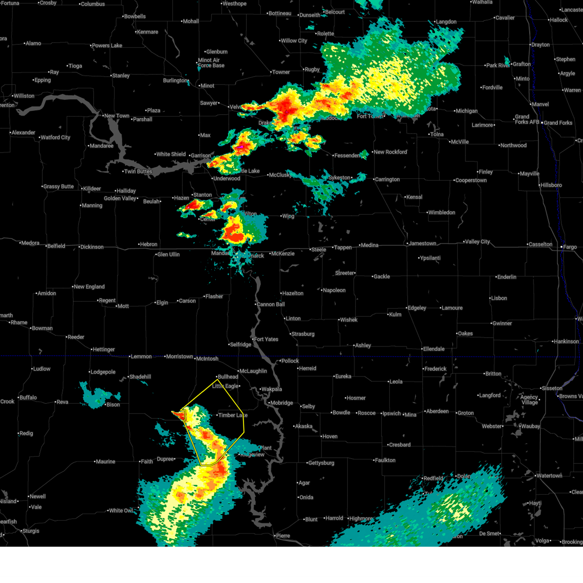
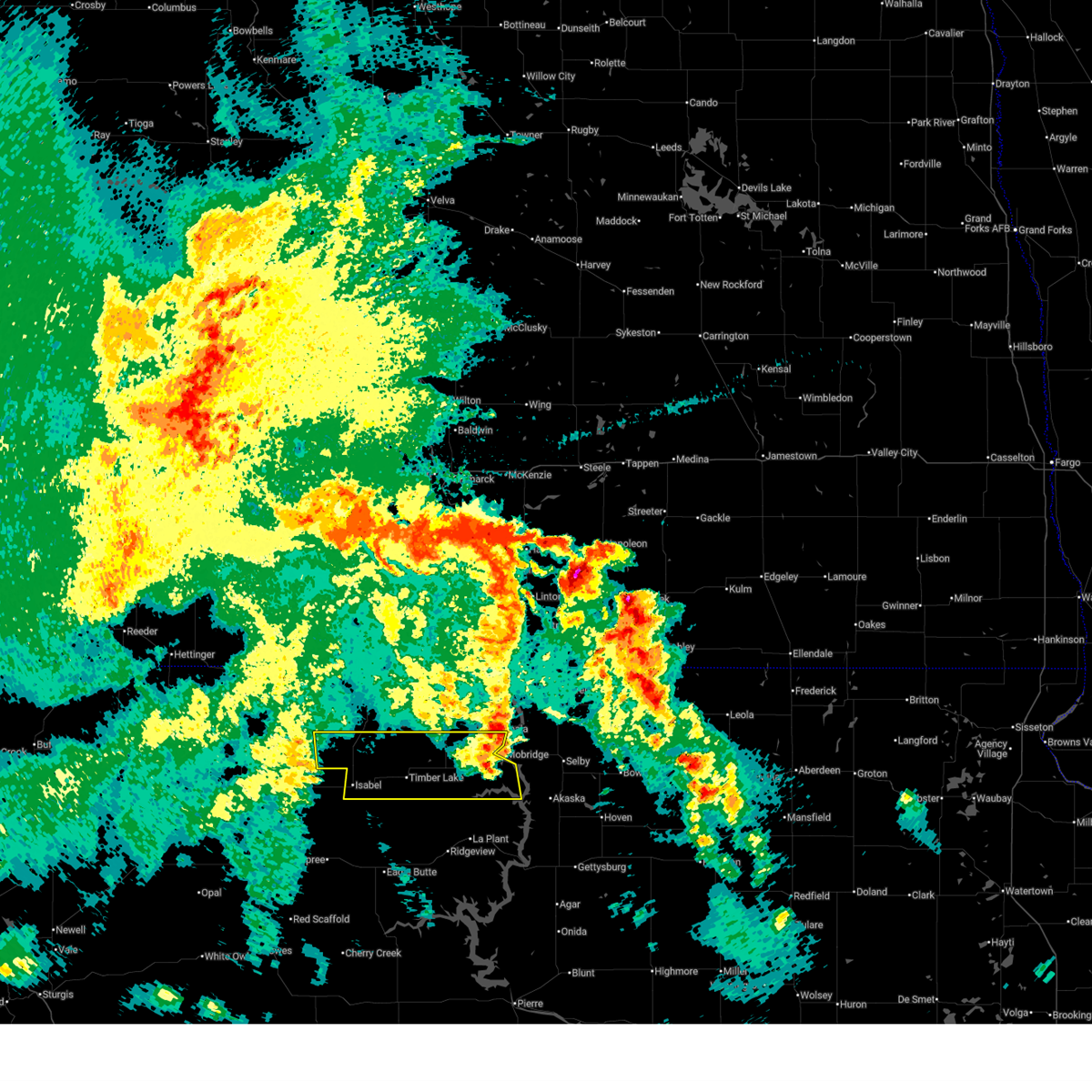
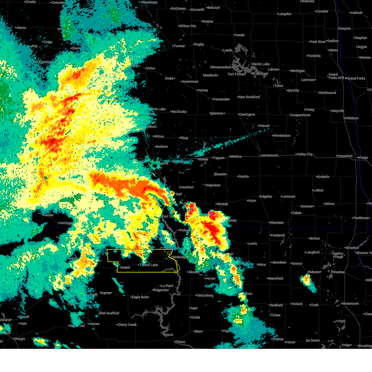
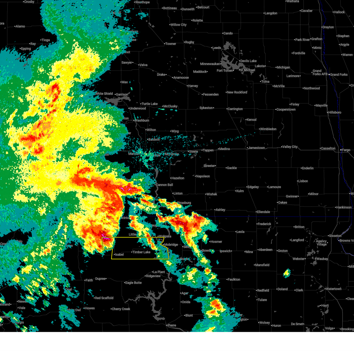
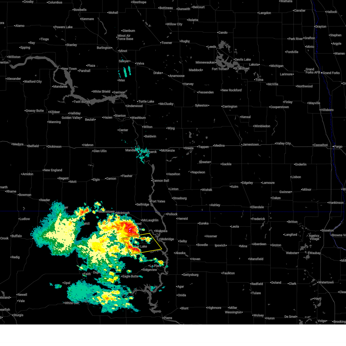
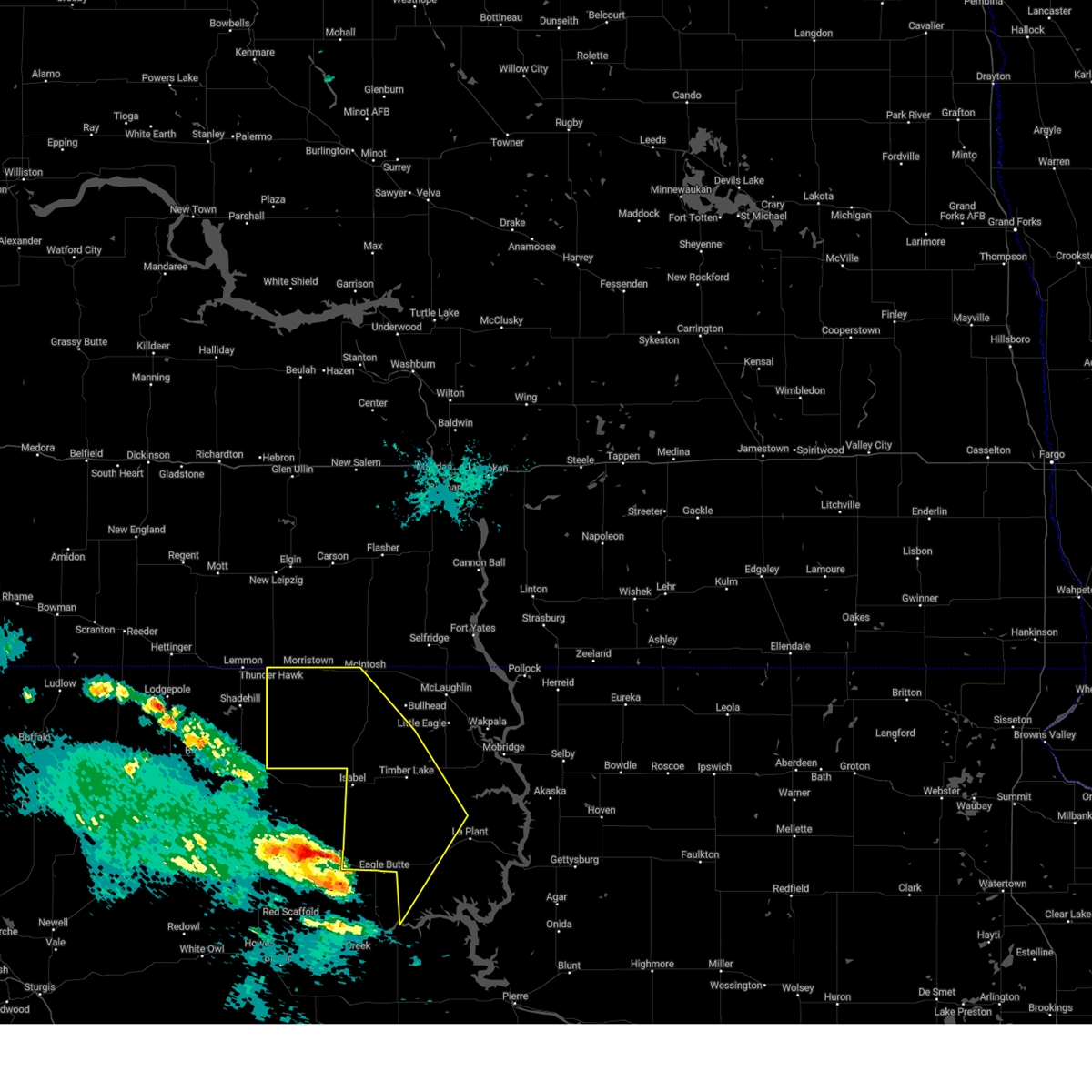
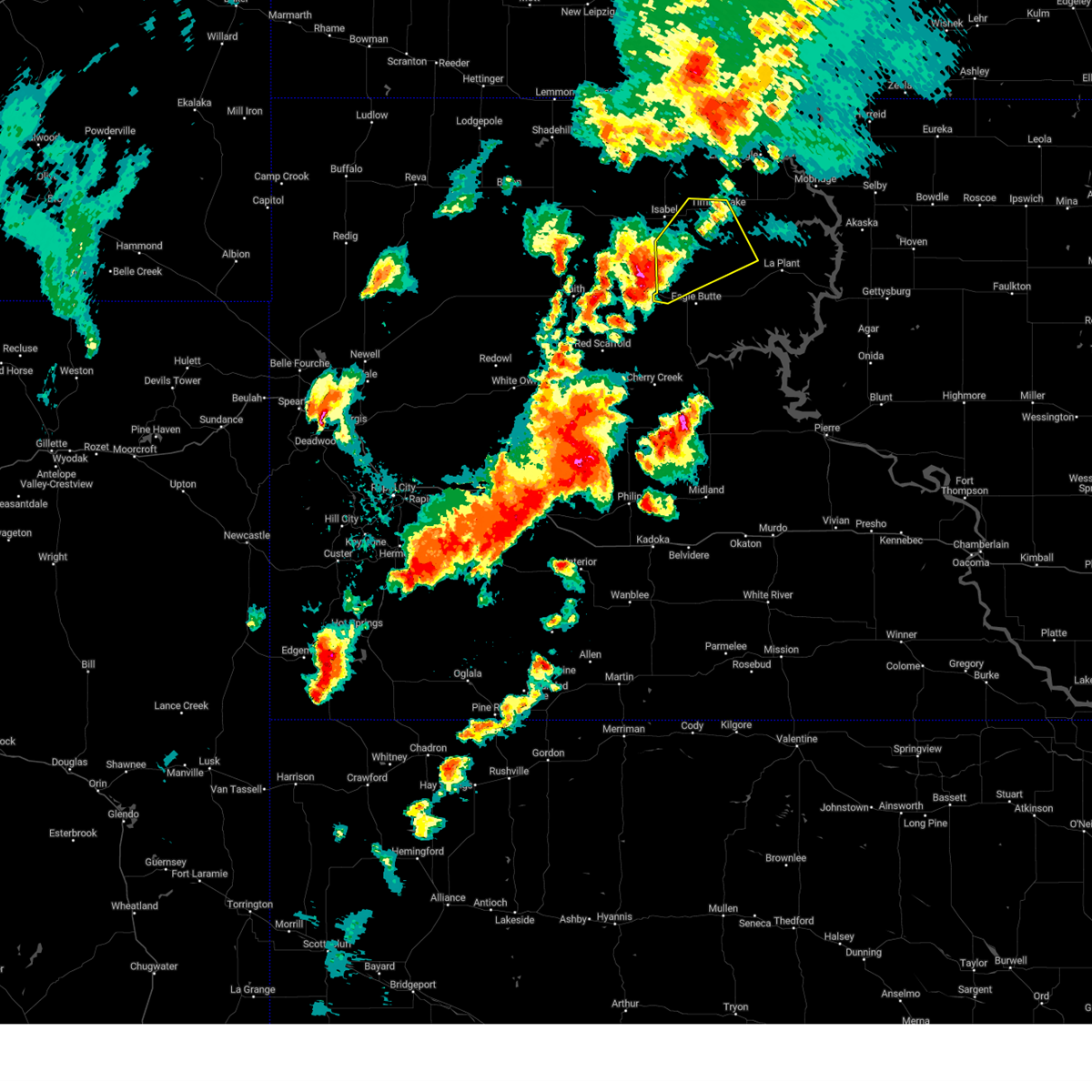
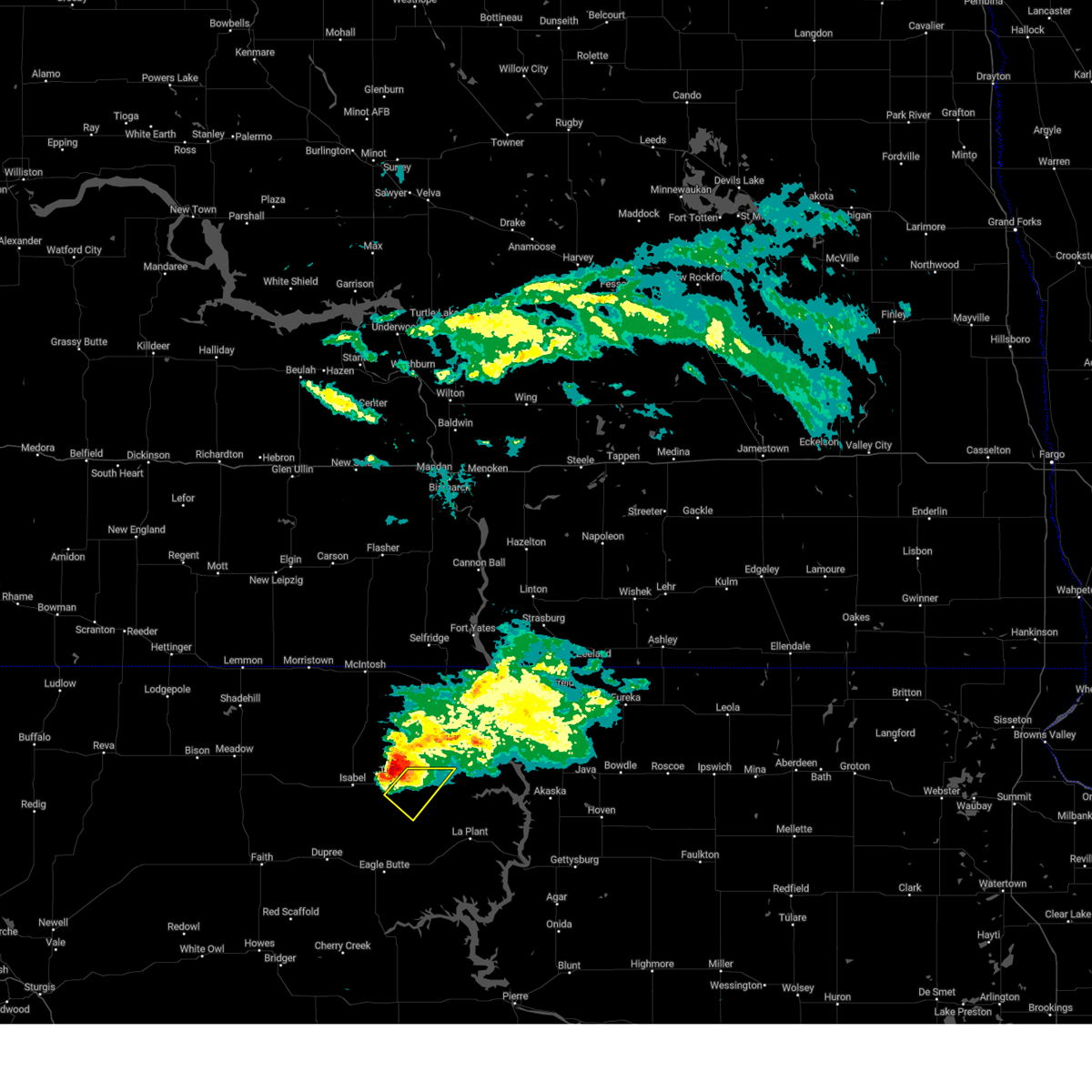
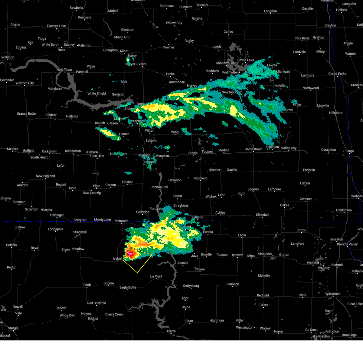
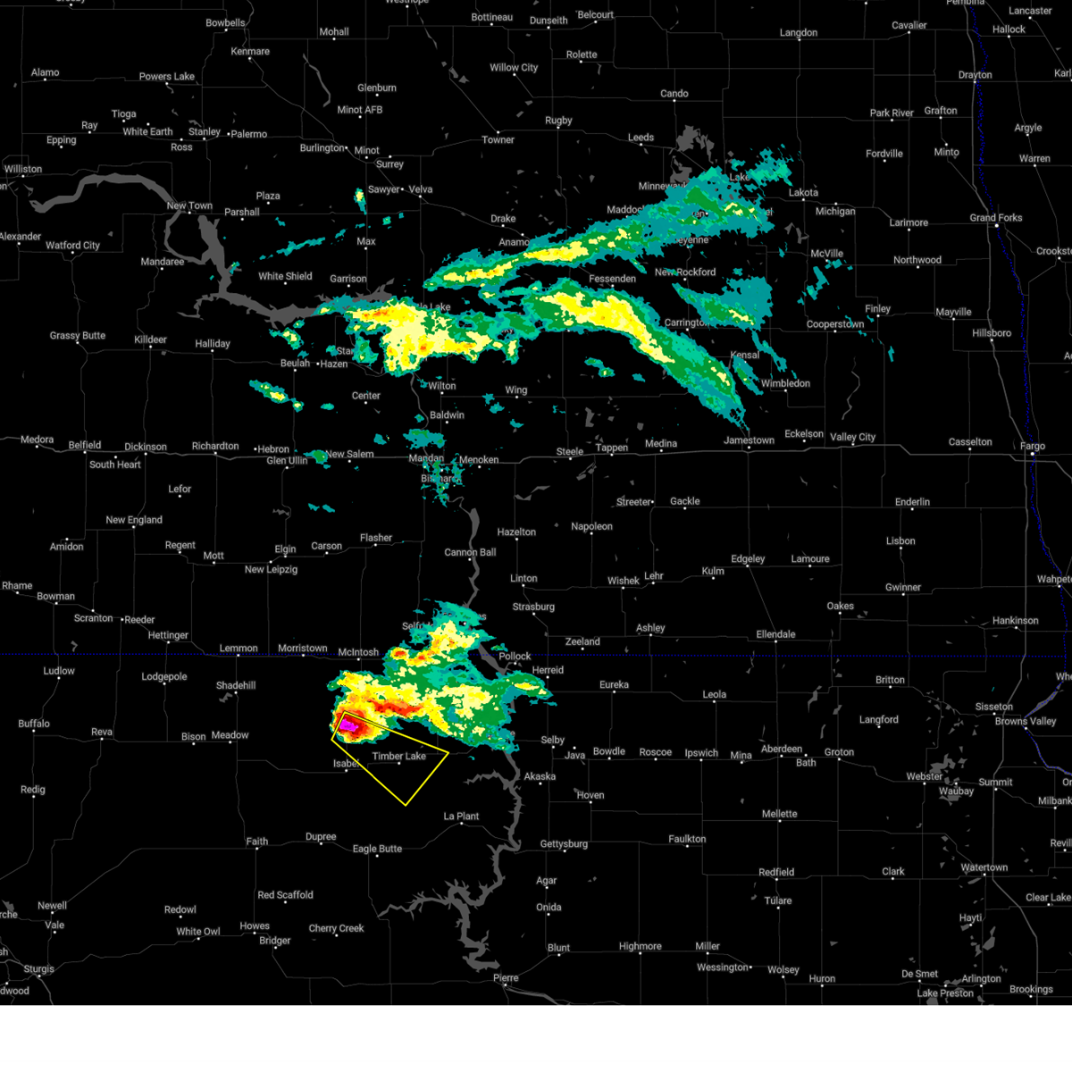
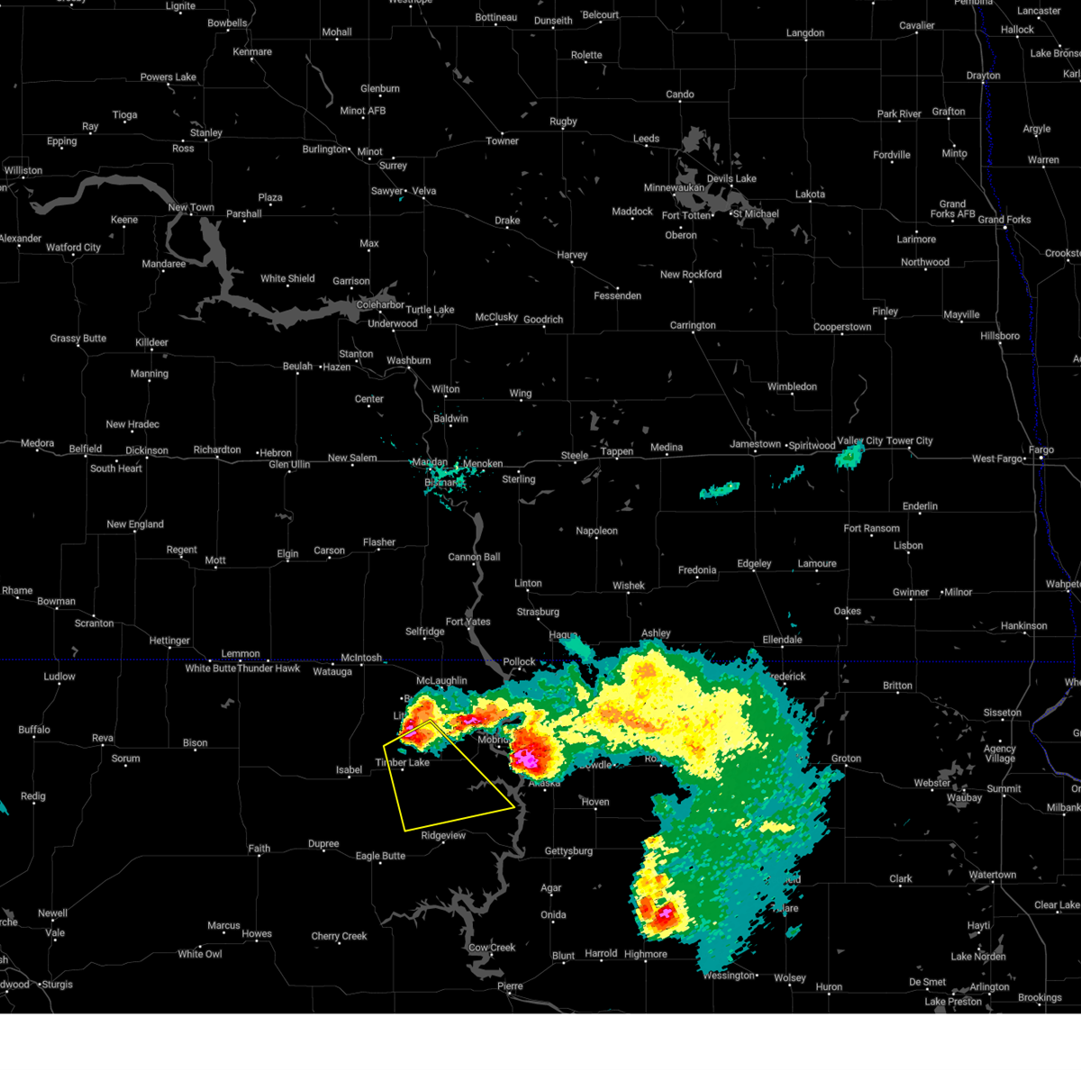
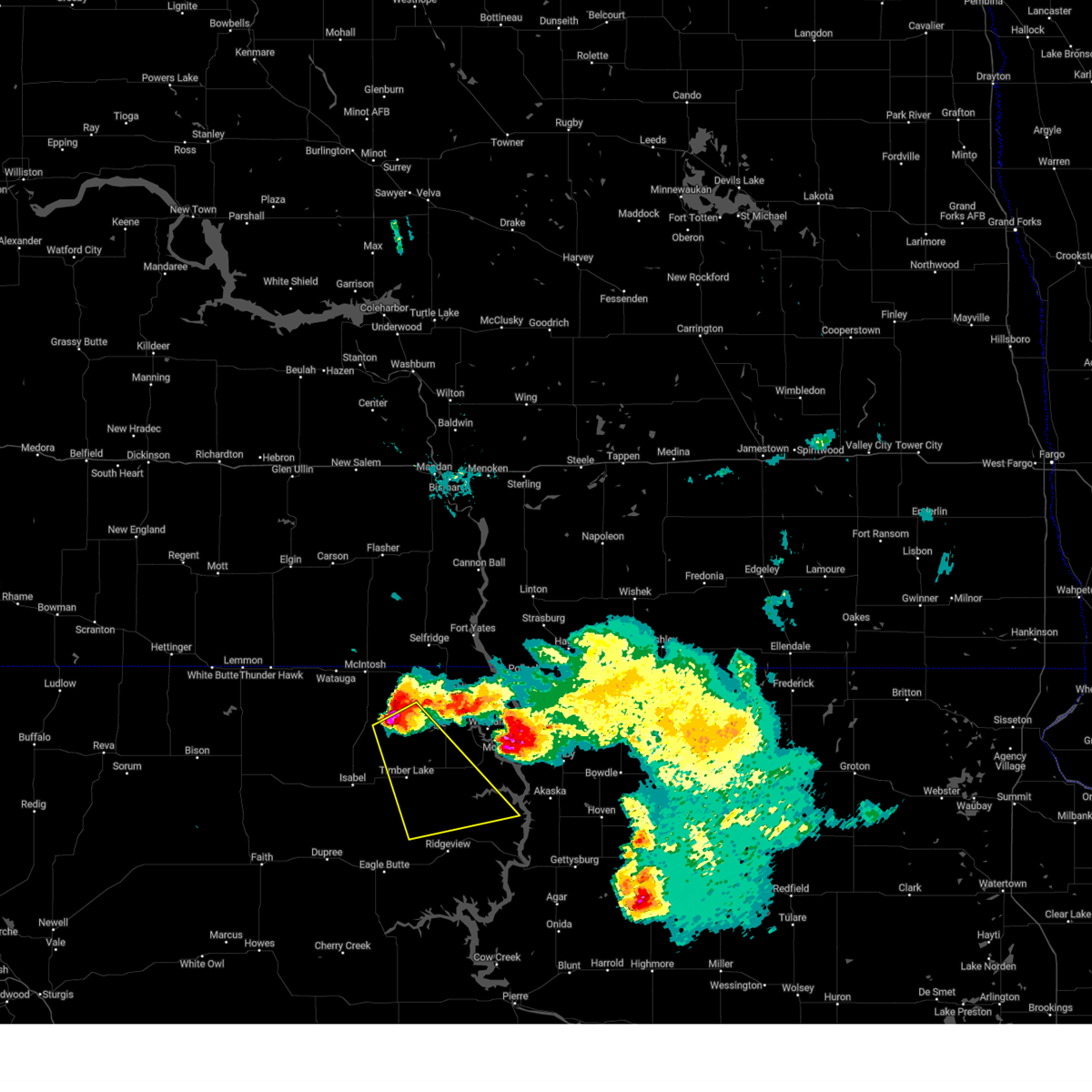
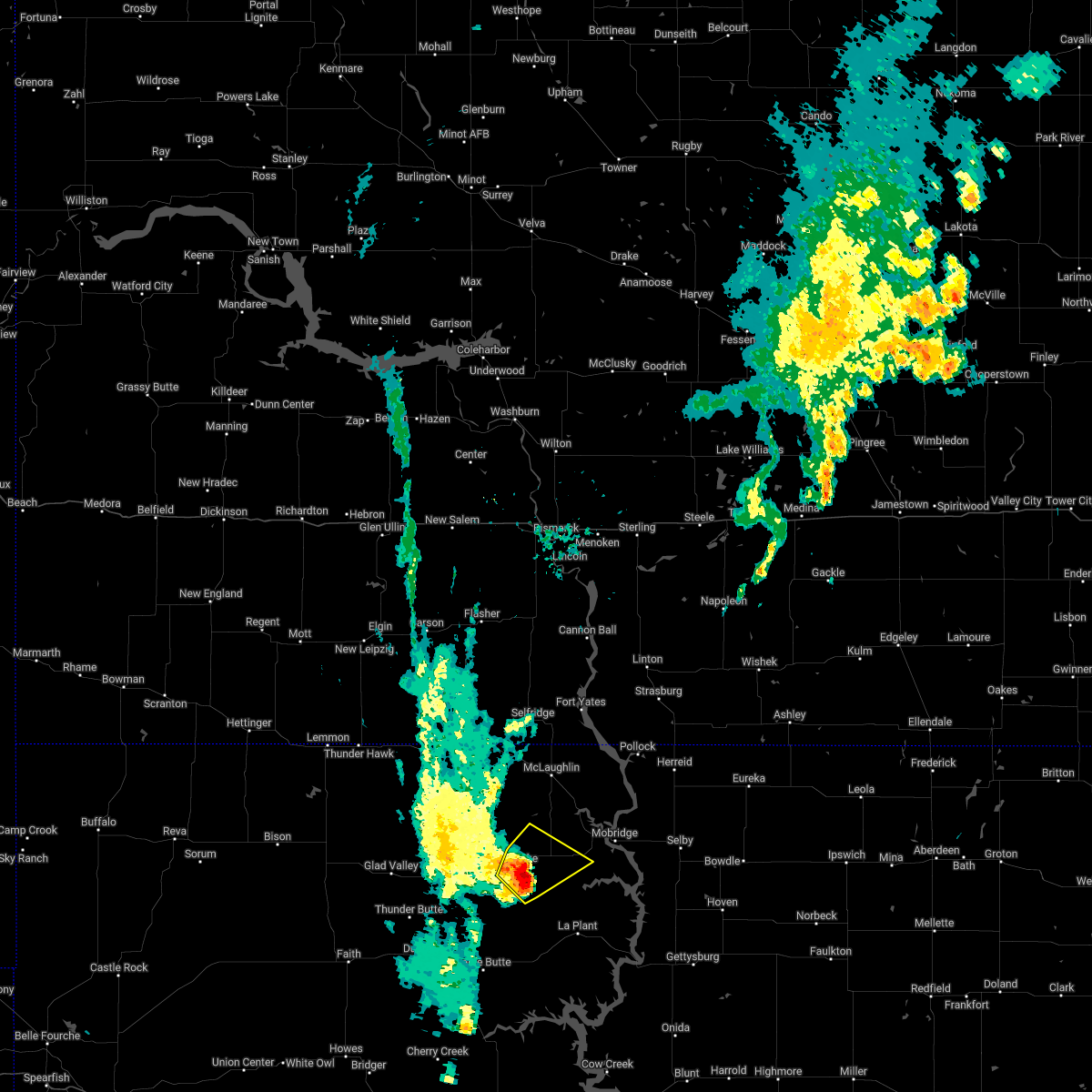
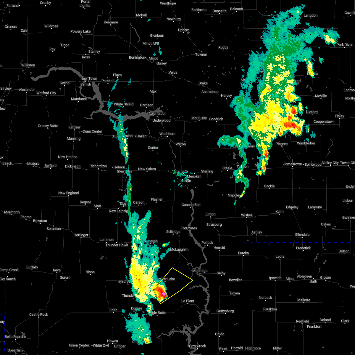
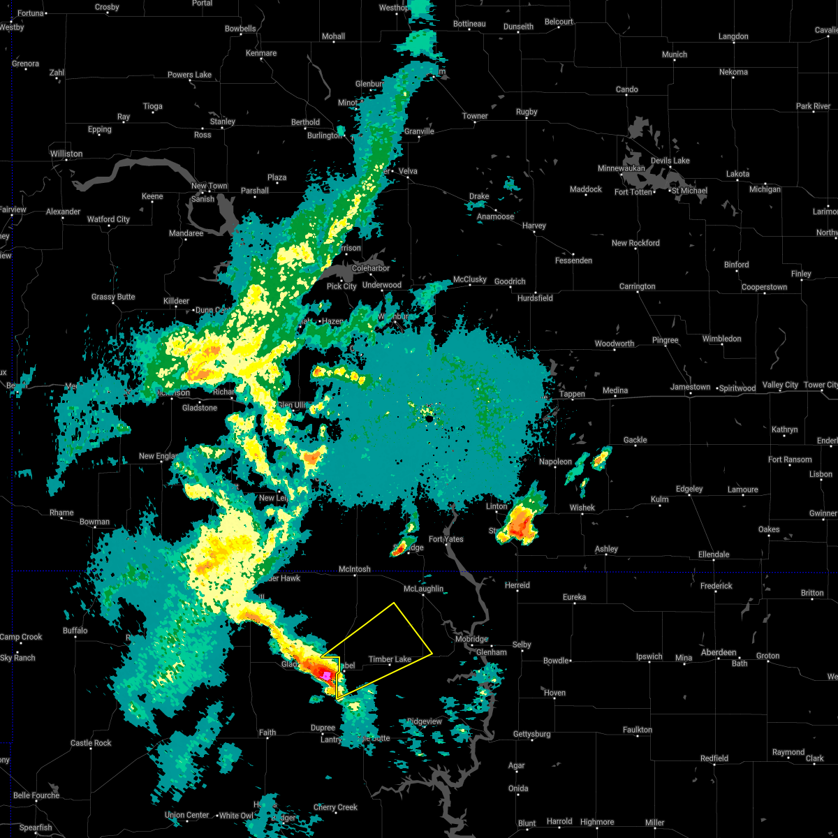
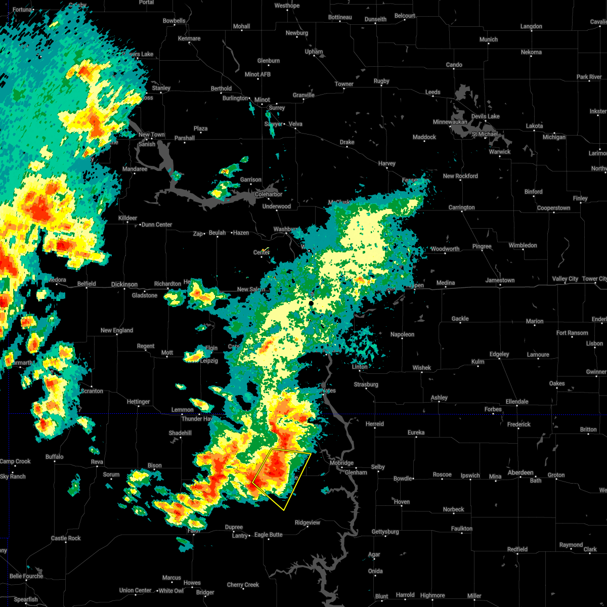
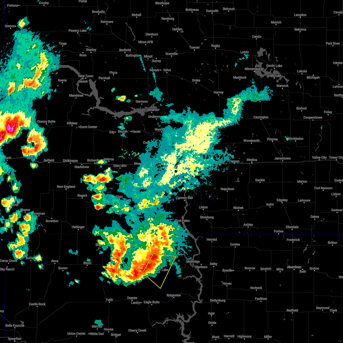
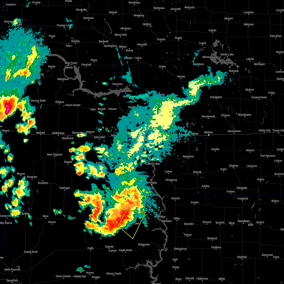
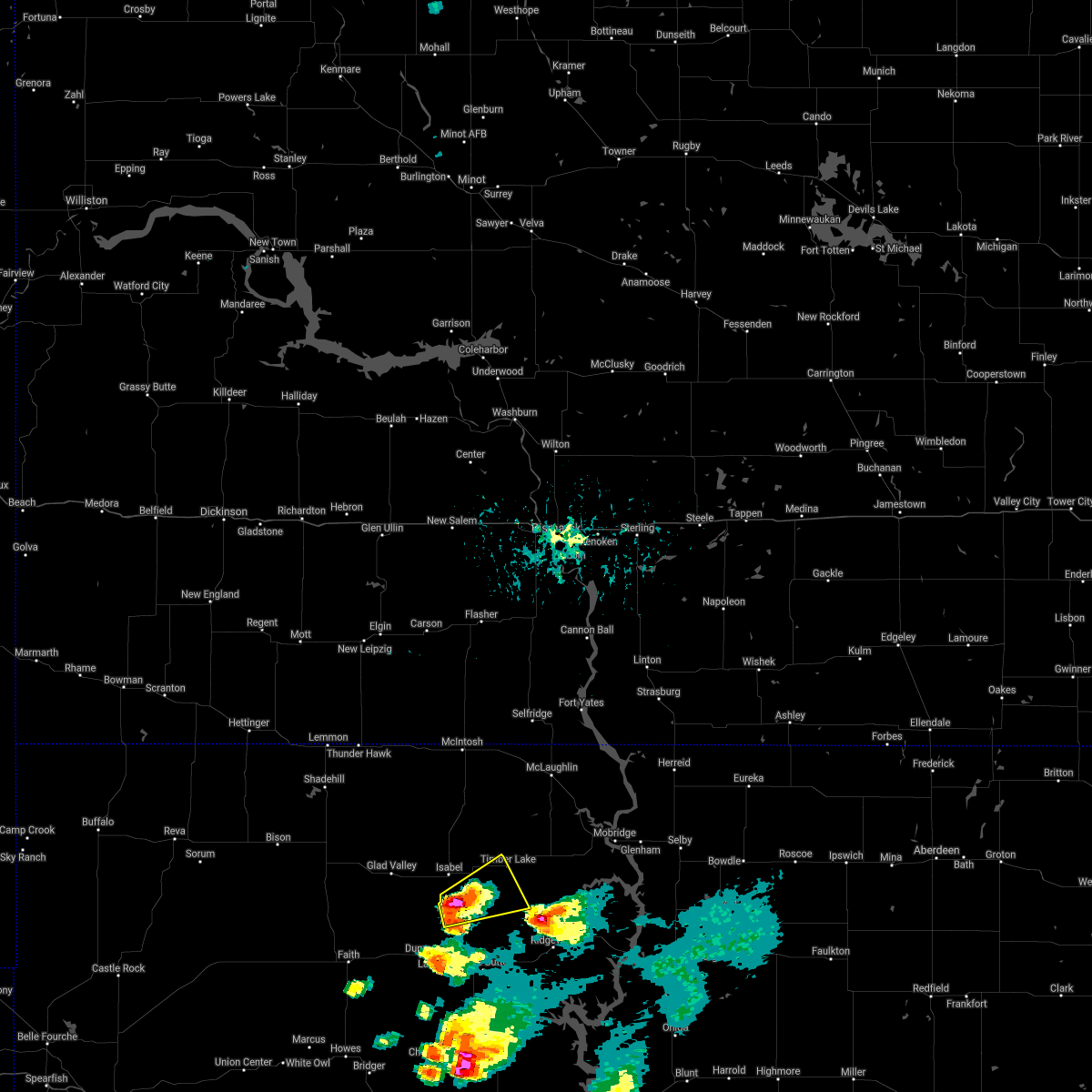
Hail Map for Timber Lake, SD
The Timber Lake, SD area has had 26 reports of on-the-ground hail by trained spotters, and has been under severe weather warnings 10 times during the past 12 months. Doppler radar has detected hail at or near Timber Lake, SD on 51 occasions.
| Name: | Timber Lake, SD |
| Where Located: | 81.5 miles NNW of Pierre, SD |
| Map: | Google Map for Timber Lake, SD |
| Population: | 443 |
| Housing Units: | 208 |
| More Info: | Search Google for Timber Lake, SD |
2
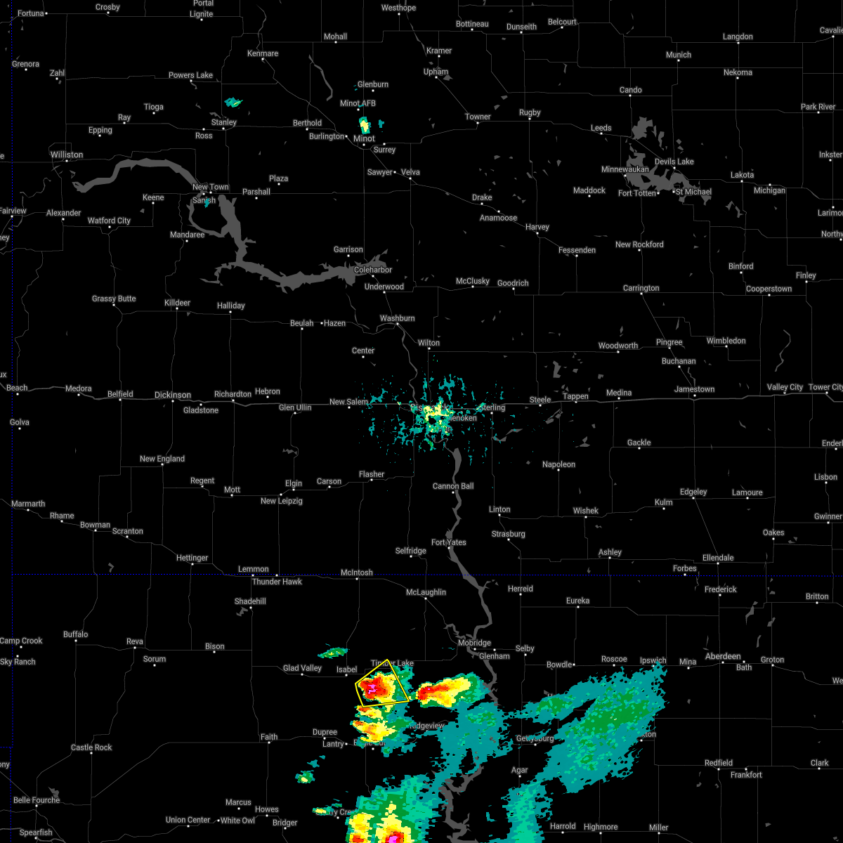
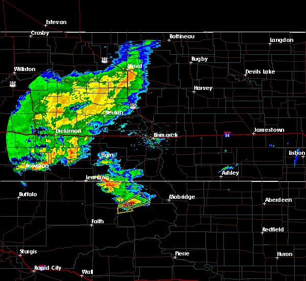
The Top Recent Hail Date for Timber Lake, SD is Friday, June 7, 2024 (4th out of 51)

Hail and Wind Damage Spotted near Timber Lake, SD
| Date / Time | Report Details |
|---|---|
| 7/9/2025 5:39 PM MDT | Mesonet station 178 trail city (sddot in corson county SD, 13.2 miles WSW of Timber Lake, SD |
| 7/9/2025 5:30 PM MDT | Mesonet station tims2 timber lake (sd mesonet in dewey county SD, 1 miles NE of Timber Lake, SD |
| 6/27/2025 7:58 PM MDT |
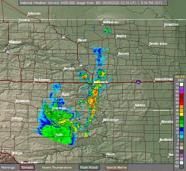
 At 758 pm mdt, severe thunderstorms were located along a line extending from 6 miles northwest of timber lake to near white horse to 9 miles northwest of ridgeview to near parade, moving east at 50 mph (radar indicated). Hazards include 60 mph wind gusts and quarter size hail. Hail damage to vehicles is expected. expect wind damage to roofs, siding, and trees. Locations impacted include, white horse, spring lake and glencross. At 758 pm mdt, severe thunderstorms were located along a line extending from 6 miles northwest of timber lake to near white horse to 9 miles northwest of ridgeview to near parade, moving east at 50 mph (radar indicated). Hazards include 60 mph wind gusts and quarter size hail. Hail damage to vehicles is expected. expect wind damage to roofs, siding, and trees. Locations impacted include, white horse, spring lake and glencross.
|
| 6/27/2025 7:32 PM MDT |
 At 731 pm mdt, severe thunderstorms were located along a line extending from near isabel to near green grass to near eagle butte to 7 miles east of intersection of cherry creek and sunnybrook roads, moving northeast at 45 mph (radar indicated). Hazards include 60 mph wind gusts and quarter size hail. Hail damage to vehicles is expected. expect wind damage to roofs, siding, and trees. these severe storms will be near, eagle butte, lantry, isabel, green grass, and south eagle butte around 735 pm mdt. Other locations in the path of these severe thunderstorms include firesteel, parade, little moreau rec area, timber lake, white horse, spring lake and glencross. At 731 pm mdt, severe thunderstorms were located along a line extending from near isabel to near green grass to near eagle butte to 7 miles east of intersection of cherry creek and sunnybrook roads, moving northeast at 45 mph (radar indicated). Hazards include 60 mph wind gusts and quarter size hail. Hail damage to vehicles is expected. expect wind damage to roofs, siding, and trees. these severe storms will be near, eagle butte, lantry, isabel, green grass, and south eagle butte around 735 pm mdt. Other locations in the path of these severe thunderstorms include firesteel, parade, little moreau rec area, timber lake, white horse, spring lake and glencross.
|
| 6/27/2025 7:15 PM MDT |
 Svrabr the national weather service in aberdeen has issued a * severe thunderstorm warning for, south central corson county in north central south dakota, northwestern dewey county in north central south dakota, * until 815 pm mdt. * at 714 pm mdt, severe thunderstorms were located along a line extending from near thunder butte to near bear creek to 7 miles southwest of lantry to near intersection of cherry creek and sunnybrook roads, moving northeast at 45 mph (radar indicated). Hazards include 60 mph wind gusts and quarter size hail. Hail damage to vehicles is expected. expect wind damage to roofs, siding, and trees. severe thunderstorms will be near, lantry and bear creek around 720 pm mdt. eagle butte, isabel, green grass, and south eagle butte around 725 pm mdt. Other locations in the path of these severe thunderstorms include firesteel, parade, timber lake, little moreau rec area, white horse, glencross and spring lake. Svrabr the national weather service in aberdeen has issued a * severe thunderstorm warning for, south central corson county in north central south dakota, northwestern dewey county in north central south dakota, * until 815 pm mdt. * at 714 pm mdt, severe thunderstorms were located along a line extending from near thunder butte to near bear creek to 7 miles southwest of lantry to near intersection of cherry creek and sunnybrook roads, moving northeast at 45 mph (radar indicated). Hazards include 60 mph wind gusts and quarter size hail. Hail damage to vehicles is expected. expect wind damage to roofs, siding, and trees. severe thunderstorms will be near, lantry and bear creek around 720 pm mdt. eagle butte, isabel, green grass, and south eagle butte around 725 pm mdt. Other locations in the path of these severe thunderstorms include firesteel, parade, timber lake, little moreau rec area, white horse, glencross and spring lake.
|
| 6/20/2025 7:17 PM MDT |
 Svrabr the national weather service in aberdeen has issued a * severe thunderstorm warning for, corson county in north central south dakota, northwestern dewey county in north central south dakota, * until 830 pm mdt. * at 716 pm mdt, a severe thunderstorm was located near shadehill reservoir, or 20 miles south of lemmon, moving east at 50 mph (radar indicated). Hazards include tennis ball size hail and 70 mph wind gusts. People and animals outdoors will be injured. expect hail damage to roofs, siding, windows, and vehicles. expect considerable tree damage. wind damage is also likely to mobile homes, roofs, and outbuildings. this severe thunderstorm will be near, shambo ranch around 735 pm mdt. Other locations in the path of this severe thunderstorm include timber lake. Svrabr the national weather service in aberdeen has issued a * severe thunderstorm warning for, corson county in north central south dakota, northwestern dewey county in north central south dakota, * until 830 pm mdt. * at 716 pm mdt, a severe thunderstorm was located near shadehill reservoir, or 20 miles south of lemmon, moving east at 50 mph (radar indicated). Hazards include tennis ball size hail and 70 mph wind gusts. People and animals outdoors will be injured. expect hail damage to roofs, siding, windows, and vehicles. expect considerable tree damage. wind damage is also likely to mobile homes, roofs, and outbuildings. this severe thunderstorm will be near, shambo ranch around 735 pm mdt. Other locations in the path of this severe thunderstorm include timber lake.
|
| 6/16/2025 2:16 AM MDT |
 Svrabr the national weather service in aberdeen has issued a * severe thunderstorm warning for, southern corson county in north central south dakota, northern dewey county in north central south dakota, * until 300 am mdt. * at 214 am mdt, a severe thunderstorm was located near little eagle, moving east at 40 mph (radar indicated. at 150 am mdt a wind gust of 69 mph was reported at trail city). Hazards include 60 mph wind gusts and penny size hail. Expect damage to roofs, siding, and trees. This severe thunderstorm will be near, indian memorial rec area and grand river casino around 225 am mdt. Svrabr the national weather service in aberdeen has issued a * severe thunderstorm warning for, southern corson county in north central south dakota, northern dewey county in north central south dakota, * until 300 am mdt. * at 214 am mdt, a severe thunderstorm was located near little eagle, moving east at 40 mph (radar indicated. at 150 am mdt a wind gust of 69 mph was reported at trail city). Hazards include 60 mph wind gusts and penny size hail. Expect damage to roofs, siding, and trees. This severe thunderstorm will be near, indian memorial rec area and grand river casino around 225 am mdt.
|
| 6/16/2025 1:58 AM MDT | Mesonet station grrs2 bullhead 10 s. time estimated based on rada in corson county SD, 12.5 miles S of Timber Lake, SD |
| 6/16/2025 1:56 AM MDT | Mesonet station 178 trail city (sddot in corson county SD, 13.2 miles WSW of Timber Lake, SD |
| 6/16/2025 1:56 AM MDT |
 At 154 am mdt, a severe thunderstorm was located 7 miles northwest of spring lake, or 11 miles southwest of little eagle, moving east at 40 mph (radar indicated. at 125 mdt a 58 mph wind gust was reported in isabel, sd and at 140 mdt a 61 mph wind gust was reported in timber lake, sd). Hazards include 60 mph wind gusts and penny size hail. Expect damage to roofs, siding, and trees. Locations impacted include, timber lake, isabel, firesteel, little moreau rec area, trail city, blackfoot, indian memorial rec area, spring lake, grand river casino, glencross, and promise. At 154 am mdt, a severe thunderstorm was located 7 miles northwest of spring lake, or 11 miles southwest of little eagle, moving east at 40 mph (radar indicated. at 125 mdt a 58 mph wind gust was reported in isabel, sd and at 140 mdt a 61 mph wind gust was reported in timber lake, sd). Hazards include 60 mph wind gusts and penny size hail. Expect damage to roofs, siding, and trees. Locations impacted include, timber lake, isabel, firesteel, little moreau rec area, trail city, blackfoot, indian memorial rec area, spring lake, grand river casino, glencross, and promise.
|
| 6/16/2025 1:40 AM MDT | Mesonet station tims2 timber lake (sd mesonet in dewey county SD, 1 miles NE of Timber Lake, SD |
| 6/16/2025 1:40 AM MDT | Mesonet station 293 timber lake (sddot in dewey county SD, 0.3 miles W of Timber Lake, SD |
| 6/16/2025 1:26 AM MDT |
 Svrabr the national weather service in aberdeen has issued a * severe thunderstorm warning for, southern corson county in north central south dakota, northern dewey county in north central south dakota, * until 230 am mdt. * at 125 am mdt, a severe thunderstorm was located near klein ranch, or 18 miles southwest of bullhead, moving east at 40 mph (radar indicated). Hazards include 70 mph wind gusts and penny size hail. Expect considerable tree damage. Damage is likely to mobile homes, roofs, and outbuildings. Svrabr the national weather service in aberdeen has issued a * severe thunderstorm warning for, southern corson county in north central south dakota, northern dewey county in north central south dakota, * until 230 am mdt. * at 125 am mdt, a severe thunderstorm was located near klein ranch, or 18 miles southwest of bullhead, moving east at 40 mph (radar indicated). Hazards include 70 mph wind gusts and penny size hail. Expect considerable tree damage. Damage is likely to mobile homes, roofs, and outbuildings.
|
| 6/15/2025 6:06 AM MDT | Mesonet station grrs2 bullhead 10 in corson county SD, 12.5 miles S of Timber Lake, SD |
| 6/15/2025 3:00 AM MDT |
 Svrabr the national weather service in aberdeen has issued a * severe thunderstorm warning for, southeastern corson county in north central south dakota, northeastern dewey county in north central south dakota, * until 345 am mdt. * at 300 am mdt, a severe thunderstorm was located over glencross, or 9 miles east of timber lake, moving northeast at 25 mph (radar indicated). Hazards include quarter size hail. Damage to vehicles is expected. This severe thunderstorm will be near, spring lake and trail city around 305 am mdt. Svrabr the national weather service in aberdeen has issued a * severe thunderstorm warning for, southeastern corson county in north central south dakota, northeastern dewey county in north central south dakota, * until 345 am mdt. * at 300 am mdt, a severe thunderstorm was located over glencross, or 9 miles east of timber lake, moving northeast at 25 mph (radar indicated). Hazards include quarter size hail. Damage to vehicles is expected. This severe thunderstorm will be near, spring lake and trail city around 305 am mdt.
|
| 9/17/2024 10:04 PM MDT |
 Svrabr the national weather service in aberdeen has issued a * severe thunderstorm warning for, western corson county in north central south dakota, western dewey county in north central south dakota, * until 1100 pm mdt. * at 1003 pm mdt, severe thunderstorms were located along a line extending from 9 miles southeast of shadehill to near bear creek to 13 miles southeast of intersection of highway 63 and bia road 8, moving northeast at 40 mph (radar indicated). Hazards include 60 mph wind gusts and penny size hail. Expect damage to roofs, siding, and trees. severe thunderstorms will be near, eagle butte, isabel, green grass, shambo ranch, and parade around 1010 pm mdt. firesteel around 1020 pm mdt. Other locations in the path of these severe thunderstorms include thunder hawk, little moreau rec area, keldron, timber lake, morristown, klein ranch, white horse, black horse and watauga. Svrabr the national weather service in aberdeen has issued a * severe thunderstorm warning for, western corson county in north central south dakota, western dewey county in north central south dakota, * until 1100 pm mdt. * at 1003 pm mdt, severe thunderstorms were located along a line extending from 9 miles southeast of shadehill to near bear creek to 13 miles southeast of intersection of highway 63 and bia road 8, moving northeast at 40 mph (radar indicated). Hazards include 60 mph wind gusts and penny size hail. Expect damage to roofs, siding, and trees. severe thunderstorms will be near, eagle butte, isabel, green grass, shambo ranch, and parade around 1010 pm mdt. firesteel around 1020 pm mdt. Other locations in the path of these severe thunderstorms include thunder hawk, little moreau rec area, keldron, timber lake, morristown, klein ranch, white horse, black horse and watauga.
|
| 7/13/2024 10:30 PM MDT |
 Svrabr the national weather service in aberdeen has issued a * severe thunderstorm warning for, corson county in north central south dakota, northwestern dewey county in north central south dakota, * until 1130 pm mdt. * at 1029 pm mdt, severe thunderstorms were located along a line extending from thunder hawk to near maurine, moving east at 70 mph (radar indicated). Hazards include 60 mph wind gusts. Expect damage to roofs, siding, and trees. severe thunderstorms will be near, morristown and keldron around 1035 pm mdt. watauga and shambo ranch around 1040 pm mdt. Other locations in the path of these severe thunderstorms include mcintosh, klein ranch, black horse, isabel, walker, bullhead, firesteel, bear creek, lantry, green grass, eagle butte, mclaughlin, timber lake, little eagle, spring lake and little moreau rec area. Svrabr the national weather service in aberdeen has issued a * severe thunderstorm warning for, corson county in north central south dakota, northwestern dewey county in north central south dakota, * until 1130 pm mdt. * at 1029 pm mdt, severe thunderstorms were located along a line extending from thunder hawk to near maurine, moving east at 70 mph (radar indicated). Hazards include 60 mph wind gusts. Expect damage to roofs, siding, and trees. severe thunderstorms will be near, morristown and keldron around 1035 pm mdt. watauga and shambo ranch around 1040 pm mdt. Other locations in the path of these severe thunderstorms include mcintosh, klein ranch, black horse, isabel, walker, bullhead, firesteel, bear creek, lantry, green grass, eagle butte, mclaughlin, timber lake, little eagle, spring lake and little moreau rec area.
|
| 6/27/2024 9:00 PM MDT | Mesonet station tims2 timber lake (sd mesonet in dewey county SD, 1 miles NE of Timber Lake, SD |
| 6/17/2024 11:30 PM MDT |
 The storm which prompted the warning has weakened below severe limits, and no longer poses an immediate threat to life or property. therefore, the warning has been allowed to expire. however, gusty winds and heavy rain are still possible with this thunderstorm. a severe thunderstorm watch remains in effect until 500 am mdt for north central south dakota. The storm which prompted the warning has weakened below severe limits, and no longer poses an immediate threat to life or property. therefore, the warning has been allowed to expire. however, gusty winds and heavy rain are still possible with this thunderstorm. a severe thunderstorm watch remains in effect until 500 am mdt for north central south dakota.
|
| 6/17/2024 11:19 PM MDT |
 At 1119 pm mdt, a severe thunderstorm was located over little moreau rec area, or 7 miles south of timber lake, moving northeast at 50 mph (radar indicated). Hazards include 60 mph wind gusts and quarter size hail. Hail damage to vehicles is expected. expect wind damage to roofs, siding, and trees. Locations impacted include, timber lake, white horse, little moreau rec area, and northern cheyenne river reservation. At 1119 pm mdt, a severe thunderstorm was located over little moreau rec area, or 7 miles south of timber lake, moving northeast at 50 mph (radar indicated). Hazards include 60 mph wind gusts and quarter size hail. Hail damage to vehicles is expected. expect wind damage to roofs, siding, and trees. Locations impacted include, timber lake, white horse, little moreau rec area, and northern cheyenne river reservation.
|
| 6/17/2024 10:51 PM MDT |
 At 1051 pm mdt, a severe thunderstorm was located near green grass, or 13 miles north of lantry, moving northeast at 45 mph (radar indicated). Hazards include 60 mph wind gusts and quarter size hail. Hail damage to vehicles is expected. expect wind damage to roofs, siding, and trees. Locations impacted include, green grass, little moreau rec area and timber lake. At 1051 pm mdt, a severe thunderstorm was located near green grass, or 13 miles north of lantry, moving northeast at 45 mph (radar indicated). Hazards include 60 mph wind gusts and quarter size hail. Hail damage to vehicles is expected. expect wind damage to roofs, siding, and trees. Locations impacted include, green grass, little moreau rec area and timber lake.
|
| 6/17/2024 10:30 PM MDT |
 Svrabr the national weather service in aberdeen has issued a * severe thunderstorm warning for, northwestern dewey county in north central south dakota, * until 1130 pm mdt. * at 1030 pm mdt, a severe thunderstorm was located near dupree, moving northeast at 35 mph (radar indicated). Hazards include 60 mph wind gusts and quarter size hail. Hail damage to vehicles is expected. expect wind damage to roofs, siding, and trees. this severe thunderstorm will be near, bear creek around 1035 pm mdt. green grass around 1045 pm mdt. Other locations in the path of this severe thunderstorm include little moreau rec area and timber lake. Svrabr the national weather service in aberdeen has issued a * severe thunderstorm warning for, northwestern dewey county in north central south dakota, * until 1130 pm mdt. * at 1030 pm mdt, a severe thunderstorm was located near dupree, moving northeast at 35 mph (radar indicated). Hazards include 60 mph wind gusts and quarter size hail. Hail damage to vehicles is expected. expect wind damage to roofs, siding, and trees. this severe thunderstorm will be near, bear creek around 1035 pm mdt. green grass around 1045 pm mdt. Other locations in the path of this severe thunderstorm include little moreau rec area and timber lake.
|
| 6/7/2024 7:03 PM MDT |
 At 703 pm mdt, a severe thunderstorm was located near glencross, or near timber lake, moving southeast at 35 mph (radar indicated). Hazards include 60 mph wind gusts and quarter size hail. Hail damage to vehicles is expected. expect wind damage to roofs, siding, and trees. Locations impacted include, timber lake, little moreau rec area, and glencross. At 703 pm mdt, a severe thunderstorm was located near glencross, or near timber lake, moving southeast at 35 mph (radar indicated). Hazards include 60 mph wind gusts and quarter size hail. Hail damage to vehicles is expected. expect wind damage to roofs, siding, and trees. Locations impacted include, timber lake, little moreau rec area, and glencross.
|
| 6/7/2024 7:03 PM MDT |
 the severe thunderstorm warning has been cancelled and is no longer in effect the severe thunderstorm warning has been cancelled and is no longer in effect
|
| 6/7/2024 6:57 PM MDT | Quarter sized hail reported 1.4 miles N of Timber Lake, SD, no damage noticeable. |
| 6/7/2024 6:57 PM MDT | Timber lake airport attendant reported no damage noticeable after the storm had passe in dewey county SD, 1.4 miles N of Timber Lake, SD |
| 6/7/2024 6:51 PM MDT |
 At 651 pm mdt, a severe thunderstorm was located over timber lake, moving southeast at 35 mph (radar indicated). Hazards include 60 mph wind gusts and quarter size hail. Hail damage to vehicles is expected. expect wind damage to roofs, siding, and trees. Locations impacted include, timber lake, little moreau rec area and glencross. At 651 pm mdt, a severe thunderstorm was located over timber lake, moving southeast at 35 mph (radar indicated). Hazards include 60 mph wind gusts and quarter size hail. Hail damage to vehicles is expected. expect wind damage to roofs, siding, and trees. Locations impacted include, timber lake, little moreau rec area and glencross.
|
| 6/7/2024 6:31 PM MDT |
 Svrabr the national weather service in aberdeen has issued a * severe thunderstorm warning for, south central corson county in north central south dakota, north central dewey county in north central south dakota, * until 715 pm mdt. * at 630 pm mdt, a severe thunderstorm was located 7 miles south of klein ranch, or 15 miles northwest of timber lake, moving southeast at 35 mph (radar indicated). Hazards include 60 mph wind gusts and half dollar size hail. Hail damage to vehicles is expected. expect wind damage to roofs, siding, and trees. this severe thunderstorm will be near, firesteel around 640 pm mdt. timber lake around 645 pm mdt. Other locations in the path of this severe thunderstorm include little moreau rec area and glencross. Svrabr the national weather service in aberdeen has issued a * severe thunderstorm warning for, south central corson county in north central south dakota, north central dewey county in north central south dakota, * until 715 pm mdt. * at 630 pm mdt, a severe thunderstorm was located 7 miles south of klein ranch, or 15 miles northwest of timber lake, moving southeast at 35 mph (radar indicated). Hazards include 60 mph wind gusts and half dollar size hail. Hail damage to vehicles is expected. expect wind damage to roofs, siding, and trees. this severe thunderstorm will be near, firesteel around 640 pm mdt. timber lake around 645 pm mdt. Other locations in the path of this severe thunderstorm include little moreau rec area and glencross.
|
| 5/17/2024 6:40 PM MDT | Mesonet station 293 timber lake (sddot in dewey county SD, 0.3 miles W of Timber Lake, SD |
| 7/30/2023 9:52 AM MDT | Quarter sized hail reported 7.7 miles W of Timber Lake, SD, video via facebook. |
| 7/30/2023 9:44 AM MDT |
 At 944 am mdt, a severe thunderstorm was located over spring lake, or 8 miles northeast of timber lake, moving southeast at 45 mph (radar indicated). Hazards include 60 mph wind gusts and quarter size hail. Hail damage to vehicles is expected. expect wind damage to roofs, siding, and trees. locations impacted include, trail city, white horse and promise. hail threat, radar indicated max hail size, 1. 00 in wind threat, radar indicated max wind gust, 60 mph. At 944 am mdt, a severe thunderstorm was located over spring lake, or 8 miles northeast of timber lake, moving southeast at 45 mph (radar indicated). Hazards include 60 mph wind gusts and quarter size hail. Hail damage to vehicles is expected. expect wind damage to roofs, siding, and trees. locations impacted include, trail city, white horse and promise. hail threat, radar indicated max hail size, 1. 00 in wind threat, radar indicated max wind gust, 60 mph.
|
| 7/30/2023 9:27 AM MDT |
 At 927 am mdt, a severe thunderstorm was located 8 miles south of bullhead, moving southeast at 45 mph (radar indicated). Hazards include 60 mph wind gusts and half dollar size hail. Hail damage to vehicles is expected. expect wind damage to roofs, siding, and trees. this severe thunderstorm will be near, spring lake around 945 am mdt. other locations in the path of this severe thunderstorm include glencross, trail city, white horse and promise. hail threat, radar indicated max hail size, 1. 25 in wind threat, radar indicated max wind gust, 60 mph. At 927 am mdt, a severe thunderstorm was located 8 miles south of bullhead, moving southeast at 45 mph (radar indicated). Hazards include 60 mph wind gusts and half dollar size hail. Hail damage to vehicles is expected. expect wind damage to roofs, siding, and trees. this severe thunderstorm will be near, spring lake around 945 am mdt. other locations in the path of this severe thunderstorm include glencross, trail city, white horse and promise. hail threat, radar indicated max hail size, 1. 25 in wind threat, radar indicated max wind gust, 60 mph.
|
| 7/5/2022 8:55 AM MDT | Golf Ball sized hail reported 8.1 miles W of Timber Lake, SD, heavy rain... out of electricity for 30 minutes. |
| 7/5/2022 8:41 AM MDT |
 At 940 am cdt/840 am mdt/, a severe thunderstorm was located near white horse, or 24 miles southwest of mobridge, moving east at 40 mph (radar indicated). Hazards include 80 mph wind gusts and tennis ball size hail. Flying debris will be dangerous to those caught without shelter. mobile homes will be heavily damaged. expect considerable damage to roofs, windows, and vehicles. extensive tree damage and power outages are likely. this severe thunderstorm will be near, promise around 855 am mdt. thunderstorm damage threat, destructive hail threat, radar indicated max hail size, 2. 50 in wind threat, radar indicated max wind gust, 80 mph. At 940 am cdt/840 am mdt/, a severe thunderstorm was located near white horse, or 24 miles southwest of mobridge, moving east at 40 mph (radar indicated). Hazards include 80 mph wind gusts and tennis ball size hail. Flying debris will be dangerous to those caught without shelter. mobile homes will be heavily damaged. expect considerable damage to roofs, windows, and vehicles. extensive tree damage and power outages are likely. this severe thunderstorm will be near, promise around 855 am mdt. thunderstorm damage threat, destructive hail threat, radar indicated max hail size, 2. 50 in wind threat, radar indicated max wind gust, 80 mph.
|
| 7/5/2022 8:40 AM MDT | Sdsu mesone in dewey county SD, 0.7 miles NNE of Timber Lake, SD |
| 7/5/2022 8:37 AM MDT | Grapefruit sized hail reported 2.1 miles S of Timber Lake, SD, relayed via social media picture... comparing to dollar bill. time estimated by radar. |
| 7/5/2022 8:20 AM MDT | Tennis Ball sized hail reported 8 miles ESE of Timber Lake, SD, winds estimated at 70-80 mph. skylights broke out of house. damage to pvc fence. tree branches down. |
| 7/5/2022 8:14 AM MDT |
 At 814 am mdt, a severe thunderstorm was located 8 miles northwest of firesteel, or 32 miles southwest of mclaughlin, moving east at 30 mph (radar indicated). Hazards include tennis ball size hail and 60 mph wind gusts. People and animals outdoors will be injured. expect hail damage to roofs, siding, windows, and vehicles. expect wind damage to roofs, siding, and trees. this severe thunderstorm will be near, firesteel around 825 am mdt. other locations in the path of this severe thunderstorm include timber lake, spring lake and glencross. thunderstorm damage threat, considerable hail threat, radar indicated max hail size, 2. 50 in wind threat, radar indicated max wind gust, 60 mph. At 814 am mdt, a severe thunderstorm was located 8 miles northwest of firesteel, or 32 miles southwest of mclaughlin, moving east at 30 mph (radar indicated). Hazards include tennis ball size hail and 60 mph wind gusts. People and animals outdoors will be injured. expect hail damage to roofs, siding, windows, and vehicles. expect wind damage to roofs, siding, and trees. this severe thunderstorm will be near, firesteel around 825 am mdt. other locations in the path of this severe thunderstorm include timber lake, spring lake and glencross. thunderstorm damage threat, considerable hail threat, radar indicated max hail size, 2. 50 in wind threat, radar indicated max wind gust, 60 mph.
|
| 6/20/2022 6:30 PM MDT | Storm damage reported in dewey county SD, 1 miles NE of Timber Lake, SD |
| 6/20/2022 12:20 PM MDT |
 At 1219 pm mdt, a severe thunderstorm was located near glencross, or 27 miles west of mobridge, moving northeast at 40 mph (radar indicated). Hazards include 60 mph wind gusts and quarter size hail. Hail damage to vehicles is expected. expect wind damage to roofs, siding, and trees. locations impacted include, timber lake, spring lake, trail city and glencross. hail threat, radar indicated max hail size, 1. 00 in wind threat, radar indicated max wind gust, 60 mph. At 1219 pm mdt, a severe thunderstorm was located near glencross, or 27 miles west of mobridge, moving northeast at 40 mph (radar indicated). Hazards include 60 mph wind gusts and quarter size hail. Hail damage to vehicles is expected. expect wind damage to roofs, siding, and trees. locations impacted include, timber lake, spring lake, trail city and glencross. hail threat, radar indicated max hail size, 1. 00 in wind threat, radar indicated max wind gust, 60 mph.
|
| 6/20/2022 12:04 PM MDT |
 At 1204 pm mdt, a severe thunderstorm was located near little moreau rec area, or 20 miles north of eagle butte, moving northeast at 40 mph (radar indicated). Hazards include 60 mph wind gusts and quarter size hail. Hail damage to vehicles is expected. expect wind damage to roofs, siding, and trees. locations impacted include, timber lake, glencross, spring lake and trail city. hail threat, radar indicated max hail size, 1. 00 in wind threat, radar indicated max wind gust, 60 mph. At 1204 pm mdt, a severe thunderstorm was located near little moreau rec area, or 20 miles north of eagle butte, moving northeast at 40 mph (radar indicated). Hazards include 60 mph wind gusts and quarter size hail. Hail damage to vehicles is expected. expect wind damage to roofs, siding, and trees. locations impacted include, timber lake, glencross, spring lake and trail city. hail threat, radar indicated max hail size, 1. 00 in wind threat, radar indicated max wind gust, 60 mph.
|
| 6/20/2022 11:52 AM MDT |
 At 1152 am mdt, a severe thunderstorm was located near green grass, or 13 miles north of eagle butte, moving northeast at 40 mph (radar indicated). Hazards include 60 mph wind gusts and quarter size hail. Hail damage to vehicles is expected. expect wind damage to roofs, siding, and trees. this severe thunderstorm will be near, little moreau rec area around 1210 pm mdt. other locations in the path of this severe thunderstorm include timber lake, glencross, spring lake and trail city. hail threat, radar indicated max hail size, 1. 00 in wind threat, radar indicated max wind gust, 60 mph. At 1152 am mdt, a severe thunderstorm was located near green grass, or 13 miles north of eagle butte, moving northeast at 40 mph (radar indicated). Hazards include 60 mph wind gusts and quarter size hail. Hail damage to vehicles is expected. expect wind damage to roofs, siding, and trees. this severe thunderstorm will be near, little moreau rec area around 1210 pm mdt. other locations in the path of this severe thunderstorm include timber lake, glencross, spring lake and trail city. hail threat, radar indicated max hail size, 1. 00 in wind threat, radar indicated max wind gust, 60 mph.
|
| 6/13/2022 1:02 AM MDT | Mesonet station 178 trail city (sddot in corson county SD, 13.2 miles WSW of Timber Lake, SD |
| 6/13/2022 12:30 AM MDT |
 At 1229 am mdt, a severe thunderstorm was located near bear creek, or 9 miles north of lantry, moving east at 55 mph (radar indicated). Hazards include 60 mph wind gusts and penny size hail. Expect damage to roofs, siding, and trees. this severe thunderstorm will be near, green grass around 1240 am mdt. other locations in the path of this severe thunderstorm include white horse. hail threat, radar indicated max hail size, 0. 75 in wind threat, radar indicated max wind gust, 60 mph. At 1229 am mdt, a severe thunderstorm was located near bear creek, or 9 miles north of lantry, moving east at 55 mph (radar indicated). Hazards include 60 mph wind gusts and penny size hail. Expect damage to roofs, siding, and trees. this severe thunderstorm will be near, green grass around 1240 am mdt. other locations in the path of this severe thunderstorm include white horse. hail threat, radar indicated max hail size, 0. 75 in wind threat, radar indicated max wind gust, 60 mph.
|
| 5/12/2022 3:57 AM MDT |
 The severe thunderstorm warning for south central corson and central dewey counties will expire at 400 am mdt, the storm which prompted the warning has moved out of the area. therefore, the warning will be allowed to expire. The severe thunderstorm warning for south central corson and central dewey counties will expire at 400 am mdt, the storm which prompted the warning has moved out of the area. therefore, the warning will be allowed to expire.
|
| 5/12/2022 3:33 AM MDT |
 At 332 am mdt, a severe thunderstorm was located near little moreau rec area, or 22 miles northeast of eagle butte, moving northeast at 60 mph (radar indicated). Hazards include 70 mph wind gusts and half dollar size hail. Hail damage to vehicles is expected. expect considerable tree damage. wind damage is also likely to mobile homes, roofs, and outbuildings. locations impacted include, glencross and spring lake. thunderstorm damage threat, considerable hail threat, radar indicated max hail size, 1. 25 in wind threat, radar indicated max wind gust, 70 mph. At 332 am mdt, a severe thunderstorm was located near little moreau rec area, or 22 miles northeast of eagle butte, moving northeast at 60 mph (radar indicated). Hazards include 70 mph wind gusts and half dollar size hail. Hail damage to vehicles is expected. expect considerable tree damage. wind damage is also likely to mobile homes, roofs, and outbuildings. locations impacted include, glencross and spring lake. thunderstorm damage threat, considerable hail threat, radar indicated max hail size, 1. 25 in wind threat, radar indicated max wind gust, 70 mph.
|
| 5/12/2022 3:06 AM MDT |
 At 306 am mdt, a severe thunderstorm was located near bear creek, or near lantry, moving northeast at 65 mph (radar indicated). Hazards include 70 mph wind gusts and half dollar size hail. Hail damage to vehicles is expected. expect considerable tree damage. wind damage is also likely to mobile homes, roofs, and outbuildings. this severe thunderstorm will be near, green grass around 315 am mdt. little moreau rec area around 325 am mdt. other locations in the path of this severe thunderstorm include white horse, glencross and spring lake. thunderstorm damage threat, considerable hail threat, radar indicated max hail size, 1. 25 in wind threat, radar indicated max wind gust, 70 mph. At 306 am mdt, a severe thunderstorm was located near bear creek, or near lantry, moving northeast at 65 mph (radar indicated). Hazards include 70 mph wind gusts and half dollar size hail. Hail damage to vehicles is expected. expect considerable tree damage. wind damage is also likely to mobile homes, roofs, and outbuildings. this severe thunderstorm will be near, green grass around 315 am mdt. little moreau rec area around 325 am mdt. other locations in the path of this severe thunderstorm include white horse, glencross and spring lake. thunderstorm damage threat, considerable hail threat, radar indicated max hail size, 1. 25 in wind threat, radar indicated max wind gust, 70 mph.
|
| 5/12/2022 2:57 AM MDT |
 At 257 am mdt, a severe thunderstorm was located near little eagle, or 14 miles south of mclaughlin, moving northeast at 65 mph (public. at 250 am mdt 69 mph winds were reported near timber lake). Hazards include 70 mph wind gusts and quarter size hail. Hail damage to vehicles is expected. expect considerable tree damage. wind damage is also likely to mobile homes, roofs, and outbuildings. this severe thunderstorm will be near, wakpala and mahto around 305 am mdt. kenel around 315 am mdt. thunderstorm damage threat, considerable hail threat, radar indicated max hail size, 1. 00 in wind threat, observed max wind gust, 70 mph. At 257 am mdt, a severe thunderstorm was located near little eagle, or 14 miles south of mclaughlin, moving northeast at 65 mph (public. at 250 am mdt 69 mph winds were reported near timber lake). Hazards include 70 mph wind gusts and quarter size hail. Hail damage to vehicles is expected. expect considerable tree damage. wind damage is also likely to mobile homes, roofs, and outbuildings. this severe thunderstorm will be near, wakpala and mahto around 305 am mdt. kenel around 315 am mdt. thunderstorm damage threat, considerable hail threat, radar indicated max hail size, 1. 00 in wind threat, observed max wind gust, 70 mph.
|
| 5/12/2022 2:50 AM MDT | Storm damage reported in dewey county SD, 1 miles NE of Timber Lake, SD |
| 5/12/2022 2:46 AM MDT |
 At 246 am mdt, a severe thunderstorm was located near glencross, or 24 miles southwest of mobridge, moving northeast at 55 mph (radar indicated). Hazards include 70 mph wind gusts and nickel size hail. Expect considerable tree damage. damage is likely to mobile homes, roofs, and outbuildings. locations impacted include, timber lake, spring lake, little moreau rec area, white horse, glencross and northern cheyenne river reservation. thunderstorm damage threat, considerable hail threat, radar indicated max hail size, 0. 88 in wind threat, radar indicated max wind gust, 70 mph. At 246 am mdt, a severe thunderstorm was located near glencross, or 24 miles southwest of mobridge, moving northeast at 55 mph (radar indicated). Hazards include 70 mph wind gusts and nickel size hail. Expect considerable tree damage. damage is likely to mobile homes, roofs, and outbuildings. locations impacted include, timber lake, spring lake, little moreau rec area, white horse, glencross and northern cheyenne river reservation. thunderstorm damage threat, considerable hail threat, radar indicated max hail size, 0. 88 in wind threat, radar indicated max wind gust, 70 mph.
|
| 5/12/2022 2:35 AM MDT |
 At 235 am mdt, a severe thunderstorm was located near little moreau rec area, or 21 miles northeast of eagle butte, moving northeast at 55 mph (radar indicated). Hazards include 70 mph wind gusts and half dollar size hail. Hail damage to vehicles is expected. expect considerable tree damage. wind damage is also likely to mobile homes, roofs, and outbuildings. locations impacted include, eagle butte, timber lake, firesteel, south eagle butte, little moreau rec area, white horse, green grass, laplant, parade, ridgeview, tiospaye topa school, spring lake, glencross and cheyenne river reservation. thunderstorm damage threat, considerable hail threat, radar indicated max hail size, 1. 25 in wind threat, radar indicated max wind gust, 70 mph. At 235 am mdt, a severe thunderstorm was located near little moreau rec area, or 21 miles northeast of eagle butte, moving northeast at 55 mph (radar indicated). Hazards include 70 mph wind gusts and half dollar size hail. Hail damage to vehicles is expected. expect considerable tree damage. wind damage is also likely to mobile homes, roofs, and outbuildings. locations impacted include, eagle butte, timber lake, firesteel, south eagle butte, little moreau rec area, white horse, green grass, laplant, parade, ridgeview, tiospaye topa school, spring lake, glencross and cheyenne river reservation. thunderstorm damage threat, considerable hail threat, radar indicated max hail size, 1. 25 in wind threat, radar indicated max wind gust, 70 mph.
|
| 5/12/2022 2:04 AM MDT |
 At 204 am mdt, a severe thunderstorm was located near bear creek, or near lantry, moving northeast at 35 mph (radar indicated). Hazards include two inch hail and 70 mph wind gusts. People and animals outdoors will be injured. expect hail damage to roofs, siding, windows, and vehicles. expect considerable tree damage. Wind damage is also likely to mobile homes, roofs, and outbuildings. At 204 am mdt, a severe thunderstorm was located near bear creek, or near lantry, moving northeast at 35 mph (radar indicated). Hazards include two inch hail and 70 mph wind gusts. People and animals outdoors will be injured. expect hail damage to roofs, siding, windows, and vehicles. expect considerable tree damage. Wind damage is also likely to mobile homes, roofs, and outbuildings.
|
| 4/22/2022 9:04 PM MDT | Mesonet station 178 trail city (sddot). possible thunderstorm outflow win in corson county SD, 13.2 miles WSW of Timber Lake, SD |
| 9/19/2021 9:42 PM MDT | Grand river raws. time estimated via rada in corson county SD, 12.5 miles S of Timber Lake, SD |
| 9/19/2021 9:09 PM MDT |
 At 908 pm mdt, a severe thunderstorm was located near isabel, or 22 miles north of dupree, moving northeast at 50 mph (radar indicated). Hazards include 60 mph wind gusts and quarter size hail. Hail damage to vehicles is expected. expect wind damage to roofs, siding, and trees. this severe thunderstorm will be near, firesteel around 925 pm mdt. other locations in the path of this severe thunderstorm include timber lake and spring lake. hail threat, radar indicated max hail size, 1. 00 in wind threat, radar indicated max wind gust, 60 mph. At 908 pm mdt, a severe thunderstorm was located near isabel, or 22 miles north of dupree, moving northeast at 50 mph (radar indicated). Hazards include 60 mph wind gusts and quarter size hail. Hail damage to vehicles is expected. expect wind damage to roofs, siding, and trees. this severe thunderstorm will be near, firesteel around 925 pm mdt. other locations in the path of this severe thunderstorm include timber lake and spring lake. hail threat, radar indicated max hail size, 1. 00 in wind threat, radar indicated max wind gust, 60 mph.
|
| 8/23/2021 9:08 PM MDT | Mesonet station 178 trail city (sddot in dewey county SD, 13.2 miles WSW of Timber Lake, SD |
| 8/23/2021 8:54 PM MDT |
 At 853 pm mdt, a severe thunderstorm was located over spring lake, or 23 miles south of mclaughlin, moving east at 45 mph (radar indicated). Hazards include 70 mph wind gusts and quarter size hail. Hail damage to vehicles is expected. expect considerable tree damage. wind damage is also likely to mobile homes, roofs, and outbuildings. Locations impacted include, mclaughlin, timber lake, spring lake, trail city, mahto, little eagle and glencross. At 853 pm mdt, a severe thunderstorm was located over spring lake, or 23 miles south of mclaughlin, moving east at 45 mph (radar indicated). Hazards include 70 mph wind gusts and quarter size hail. Hail damage to vehicles is expected. expect considerable tree damage. wind damage is also likely to mobile homes, roofs, and outbuildings. Locations impacted include, mclaughlin, timber lake, spring lake, trail city, mahto, little eagle and glencross.
|
| 8/23/2021 8:47 PM MDT | Quarter sized hail reported 2.1 miles S of Timber Lake, SD, social media report. |
| 8/23/2021 8:46 PM MDT | Mesonet station 293 timber lake (sddot in dewey county SD, 0.3 miles W of Timber Lake, SD |
| 8/23/2021 8:35 PM MDT |
 At 834 pm mdt, a severe thunderstorm was located near little eagle, or 12 miles southwest of mclaughlin, moving east at 55 mph (radar indicated). Hazards include 70 mph wind gusts and quarter size hail. Hail damage to vehicles is expected. expect considerable tree damage. wind damage is also likely to mobile homes, roofs, and outbuildings. Locations impacted include, mclaughlin, timber lake, isabel, firesteel, trail city, mahto, little eagle, bullhead, black horse, spring lake, klein ranch, glencross and southeastern standing rock nation. At 834 pm mdt, a severe thunderstorm was located near little eagle, or 12 miles southwest of mclaughlin, moving east at 55 mph (radar indicated). Hazards include 70 mph wind gusts and quarter size hail. Hail damage to vehicles is expected. expect considerable tree damage. wind damage is also likely to mobile homes, roofs, and outbuildings. Locations impacted include, mclaughlin, timber lake, isabel, firesteel, trail city, mahto, little eagle, bullhead, black horse, spring lake, klein ranch, glencross and southeastern standing rock nation.
|
| 8/23/2021 8:25 PM MDT | Roof blown off bar in corson county SD, 11.1 miles S of Timber Lake, SD |
| 8/23/2021 8:13 PM MDT |
 At 813 pm mdt, a severe thunderstorm was located 8 miles southeast of klein ranch, or 26 miles southwest of mclaughlin, moving east at 45 mph (radar indicated). Hazards include 60 mph wind gusts and quarter size hail. Hail damage to vehicles is expected. Expect wind damage to roofs, siding, and trees. At 813 pm mdt, a severe thunderstorm was located 8 miles southeast of klein ranch, or 26 miles southwest of mclaughlin, moving east at 45 mph (radar indicated). Hazards include 60 mph wind gusts and quarter size hail. Hail damage to vehicles is expected. Expect wind damage to roofs, siding, and trees.
|
| 7/22/2021 7:35 PM MDT |
 The severe thunderstorm warning for northwestern dewey county will expire at 745 pm mdt, the storm which prompted the warning has weakened below severe limits, and no longer poses an immediate threat to life or property. therefore, the warning will be allowed to expire. however gusty winds are still possible with this thunderstorm. to report severe weather, contact your nearest law enforcement agency. they will relay your report to the national weather service aberdeen. The severe thunderstorm warning for northwestern dewey county will expire at 745 pm mdt, the storm which prompted the warning has weakened below severe limits, and no longer poses an immediate threat to life or property. therefore, the warning will be allowed to expire. however gusty winds are still possible with this thunderstorm. to report severe weather, contact your nearest law enforcement agency. they will relay your report to the national weather service aberdeen.
|
| 7/22/2021 6:45 PM MDT |
 At 644 pm mdt, a severe thunderstorm was located 8 miles east of thunder butte, or 13 miles north of dupree, moving east at 30 mph (radar indicated). Hazards include 70 mph wind gusts. Expect considerable tree damage. Damage is likely to mobile homes, roofs, and outbuildings. At 644 pm mdt, a severe thunderstorm was located 8 miles east of thunder butte, or 13 miles north of dupree, moving east at 30 mph (radar indicated). Hazards include 70 mph wind gusts. Expect considerable tree damage. Damage is likely to mobile homes, roofs, and outbuildings.
|
| 6/11/2021 12:31 AM MDT |
 At 1231 am mdt, severe thunderstorms were located along a line extending from 8 miles north of mclaughlin to near parade, moving east at 30 mph (radar indicated). Hazards include 60 mph wind gusts and penny size hail. Expect damage to roofs, siding, and trees. Locations impacted include, ridgeview. At 1231 am mdt, severe thunderstorms were located along a line extending from 8 miles north of mclaughlin to near parade, moving east at 30 mph (radar indicated). Hazards include 60 mph wind gusts and penny size hail. Expect damage to roofs, siding, and trees. Locations impacted include, ridgeview.
|
| 6/11/2021 12:04 AM MDT | Time estimated based on rada in corson county SD, 12.4 miles S of Timber Lake, SD |
| 6/11/2021 12:02 AM MDT |
 At 1201 am mdt, severe thunderstorms were located along a line extending from walker to bear creek, moving east at 30 mph (radar indicated). Hazards include 60 mph wind gusts and penny size hail. Expect damage to roofs, siding, and trees. severe thunderstorms will be near, walker around 1205 am mdt. eagle butte and south eagle butte around 1220 am mdt. Other locations in the path of these severe thunderstorms include mclaughlin and parade. At 1201 am mdt, severe thunderstorms were located along a line extending from walker to bear creek, moving east at 30 mph (radar indicated). Hazards include 60 mph wind gusts and penny size hail. Expect damage to roofs, siding, and trees. severe thunderstorms will be near, walker around 1205 am mdt. eagle butte and south eagle butte around 1220 am mdt. Other locations in the path of these severe thunderstorms include mclaughlin and parade.
|
| 6/8/2021 11:34 PM MDT |
 At 1134 pm mdt, severe thunderstorms were located along a line extending from 9 miles north of keldron to 9 miles southwest of klein ranch to near green grass to 9 miles southeast of intersection of cherry creek and sunnybrook roads, moving northeast at 40 mph (radar indicated). Hazards include 60 mph wind gusts and penny size hail. Expect damage to roofs, siding, and trees. Locations impacted include, klein ranch, black horse, little moreau rec area, eagle butte, timber lake and parade. At 1134 pm mdt, severe thunderstorms were located along a line extending from 9 miles north of keldron to 9 miles southwest of klein ranch to near green grass to 9 miles southeast of intersection of cherry creek and sunnybrook roads, moving northeast at 40 mph (radar indicated). Hazards include 60 mph wind gusts and penny size hail. Expect damage to roofs, siding, and trees. Locations impacted include, klein ranch, black horse, little moreau rec area, eagle butte, timber lake and parade.
|
| 6/8/2021 10:54 PM MDT |
 At 1054 pm mdt, severe thunderstorms were located along a line extending from near shadehill to 7 miles north of iron lightning to near intersection of cherry creek and sunnybrook roads to near bridger, moving northeast at 40 mph (radar indicated). Hazards include 60 mph wind gusts and penny size hail. Expect damage to roofs, siding, and trees. severe thunderstorms will be near, thunder hawk around 1110 pm mdt. Other locations in the path of these severe thunderstorms include lantry, bear creek, keldron, green grass, klein ranch, black horse, eagle butte, timber lake, little moreau rec area and parade. At 1054 pm mdt, severe thunderstorms were located along a line extending from near shadehill to 7 miles north of iron lightning to near intersection of cherry creek and sunnybrook roads to near bridger, moving northeast at 40 mph (radar indicated). Hazards include 60 mph wind gusts and penny size hail. Expect damage to roofs, siding, and trees. severe thunderstorms will be near, thunder hawk around 1110 pm mdt. Other locations in the path of these severe thunderstorms include lantry, bear creek, keldron, green grass, klein ranch, black horse, eagle butte, timber lake, little moreau rec area and parade.
|
| 6/8/2021 8:08 PM MDT |
 The severe thunderstorm warning for southeastern corson and north central dewey counties will expire at 815 pm mdt, the storm which prompted the warning has weakened below severe limits, and no longer poses an immediate threat to life or property. therefore, the warning will be allowed to expire. however gusty winds and heavy rain are still possible with this thunderstorm. The severe thunderstorm warning for southeastern corson and north central dewey counties will expire at 815 pm mdt, the storm which prompted the warning has weakened below severe limits, and no longer poses an immediate threat to life or property. therefore, the warning will be allowed to expire. however gusty winds and heavy rain are still possible with this thunderstorm.
|
| 6/8/2021 7:55 PM MDT |
 At 755 pm mdt, a severe thunderstorm was located near spring lake, or 24 miles south of mclaughlin, moving northeast at 20 mph (radar indicated). Hazards include 60 mph wind gusts and quarter size hail. Hail damage to vehicles is expected. expect wind damage to roofs, siding, and trees. Locations impacted include, glencross and spring lake. At 755 pm mdt, a severe thunderstorm was located near spring lake, or 24 miles south of mclaughlin, moving northeast at 20 mph (radar indicated). Hazards include 60 mph wind gusts and quarter size hail. Hail damage to vehicles is expected. expect wind damage to roofs, siding, and trees. Locations impacted include, glencross and spring lake.
|
| 6/8/2021 7:54 PM MDT | Mesonet station 293 timber lake (sddot in dewey county SD, 0.3 miles W of Timber Lake, SD |
| 6/8/2021 7:49 PM MDT | Quarter sized hail reported 0.3 miles W of Timber Lake, SD |
| 6/8/2021 7:39 PM MDT | Mesonet station 293 timber lake (sddot in dewey county SD, 0.3 miles W of Timber Lake, SD |
| 6/8/2021 7:25 PM MDT |
 At 725 pm mdt, a severe thunderstorm was located near timber lake, or 29 miles north of eagle butte, moving northeast at 20 mph (radar indicated). Hazards include 60 mph wind gusts and quarter size hail. Hail damage to vehicles is expected. expect wind damage to roofs, siding, and trees. this severe thunderstorm will be near, timber lake around 735 pm mdt. Other locations in the path of this severe thunderstorm include glencross and spring lake. At 725 pm mdt, a severe thunderstorm was located near timber lake, or 29 miles north of eagle butte, moving northeast at 20 mph (radar indicated). Hazards include 60 mph wind gusts and quarter size hail. Hail damage to vehicles is expected. expect wind damage to roofs, siding, and trees. this severe thunderstorm will be near, timber lake around 735 pm mdt. Other locations in the path of this severe thunderstorm include glencross and spring lake.
|
| 6/8/2021 7:19 PM MDT | Mesonet station 293 timber lake (sddot in dewey county SD, 0.3 miles W of Timber Lake, SD |
| 6/8/2021 7:11 PM MDT |
 At 711 pm mdt, a severe thunderstorm was located near spring lake, or 21 miles south of mclaughlin, moving east at 15 mph (radar indicated). Hazards include 60 mph wind gusts and quarter size hail. Hail damage to vehicles is expected. expect wind damage to roofs, siding, and trees. this severe thunderstorm will be near, glencross around 720 pm mdt. spring lake around 725 pm mdt. Other locations in the path of this severe thunderstorm include trail city. At 711 pm mdt, a severe thunderstorm was located near spring lake, or 21 miles south of mclaughlin, moving east at 15 mph (radar indicated). Hazards include 60 mph wind gusts and quarter size hail. Hail damage to vehicles is expected. expect wind damage to roofs, siding, and trees. this severe thunderstorm will be near, glencross around 720 pm mdt. spring lake around 725 pm mdt. Other locations in the path of this severe thunderstorm include trail city.
|
| 6/8/2021 6:53 PM MDT |
 The severe thunderstorm warning for south central corson and north central dewey counties will expire at 700 pm mdt, the storms which prompted the warning have weakened below severe limits, and no longer pose an immediate threat to life or property. therefore, the warning will be allowed to expire. however small hail, gusty winds and heavy rain are still possible with these thunderstorms. The severe thunderstorm warning for south central corson and north central dewey counties will expire at 700 pm mdt, the storms which prompted the warning have weakened below severe limits, and no longer pose an immediate threat to life or property. therefore, the warning will be allowed to expire. however small hail, gusty winds and heavy rain are still possible with these thunderstorms.
|
| 6/8/2021 6:40 PM MDT | Mesonet station grrs2 bullhead 10 s. time estimate in corson county SD, 12.5 miles S of Timber Lake, SD |
| 6/8/2021 6:25 PM MDT |
 At 625 pm mdt, severe thunderstorms were located along a line extending from 9 miles northwest of spring lake to near firesteel, moving southeast at 20 mph (radar indicated). Hazards include 60 mph wind gusts and quarter size hail. Hail damage to vehicles is expected. expect wind damage to roofs, siding, and trees. Locations impacted include, timber lake, firesteel, spring lake, little moreau rec area and glencross. At 625 pm mdt, severe thunderstorms were located along a line extending from 9 miles northwest of spring lake to near firesteel, moving southeast at 20 mph (radar indicated). Hazards include 60 mph wind gusts and quarter size hail. Hail damage to vehicles is expected. expect wind damage to roofs, siding, and trees. Locations impacted include, timber lake, firesteel, spring lake, little moreau rec area and glencross.
|
| 6/8/2021 6:17 PM MDT |
 At 616 pm mdt, severe thunderstorms were located along a line extending from 11 miles east of klein ranch to firesteel, moving southeast at 25 mph (radar indicated). Hazards include 60 mph wind gusts and quarter size hail. Hail damage to vehicles is expected. Expect wind damage to roofs, siding, and trees. At 616 pm mdt, severe thunderstorms were located along a line extending from 11 miles east of klein ranch to firesteel, moving southeast at 25 mph (radar indicated). Hazards include 60 mph wind gusts and quarter size hail. Hail damage to vehicles is expected. Expect wind damage to roofs, siding, and trees.
|
| 6/8/2021 4:59 PM MDT |
 At 459 pm mdt, a severe thunderstorm was located 7 miles south of firesteel, or 21 miles north of eagle butte, moving north at 15 mph (radar indicated). Hazards include 70 mph wind gusts and ping pong ball size hail. People and animals outdoors will be injured. expect hail damage to roofs, siding, windows, and vehicles. expect considerable tree damage. wind damage is also likely to mobile homes, roofs, and outbuildings. Locations impacted include, isabel, firesteel and northern cheyenne river reservation. At 459 pm mdt, a severe thunderstorm was located 7 miles south of firesteel, or 21 miles north of eagle butte, moving north at 15 mph (radar indicated). Hazards include 70 mph wind gusts and ping pong ball size hail. People and animals outdoors will be injured. expect hail damage to roofs, siding, windows, and vehicles. expect considerable tree damage. wind damage is also likely to mobile homes, roofs, and outbuildings. Locations impacted include, isabel, firesteel and northern cheyenne river reservation.
|
| 6/8/2021 4:46 PM MDT |
 At 446 pm mdt, a severe thunderstorm was located near green grass, or 18 miles north of eagle butte, moving north at 15 mph (radar indicated). Hazards include 60 mph wind gusts and quarter size hail. Hail damage to vehicles is expected. Expect wind damage to roofs, siding, and trees. At 446 pm mdt, a severe thunderstorm was located near green grass, or 18 miles north of eagle butte, moving north at 15 mph (radar indicated). Hazards include 60 mph wind gusts and quarter size hail. Hail damage to vehicles is expected. Expect wind damage to roofs, siding, and trees.
|
| 8/26/2020 5:30 PM MDT | Mesonet station grrs2 bullhead 10 s. estimated tim in corson county SD, 12.5 miles S of Timber Lake, SD |
| 8/26/2020 5:20 PM MDT | Hen Egg sized hail reported 0.8 miles SSW of Timber Lake, SD, report of golfball and larger. |
| 8/26/2020 5:17 PM MDT | Hen Egg sized hail reported 0.3 miles W of Timber Lake, SD, update to previous report. |
| 8/26/2020 5:13 PM MDT | Golf Ball sized hail reported 0.3 miles W of Timber Lake, SD, relayed through spotter. |
| 8/26/2020 5:13 PM MDT | Relayed through spotte in dewey county SD, 0.2 miles E of Timber Lake, SD |
| 8/26/2020 5:11 PM MDT |
 At 510 pm mdt, a severe thunderstorm was located over timber lake, or 27 miles southwest of mclaughlin, moving northeast at 30 mph (radar indicated). Hazards include golf ball size hail and 60 mph wind gusts. People and animals outdoors will be injured. expect hail damage to roofs, siding, windows, and vehicles. Expect wind damage to roofs, siding, and trees. At 510 pm mdt, a severe thunderstorm was located over timber lake, or 27 miles southwest of mclaughlin, moving northeast at 30 mph (radar indicated). Hazards include golf ball size hail and 60 mph wind gusts. People and animals outdoors will be injured. expect hail damage to roofs, siding, windows, and vehicles. Expect wind damage to roofs, siding, and trees.
|
| 8/26/2020 4:46 PM MDT |
 At 444 pm mdt, a severe thunderstorm was located near little moreau rec area, or 22 miles north of eagle butte, moving east at 20 mph (radar indicated). Hazards include ping pong ball size hail and 60 mph wind gusts. People and animals outdoors will be injured. expect hail damage to roofs, siding, windows, and vehicles. expect wind damage to roofs, siding, and trees. Locations impacted include, timber lake and little moreau rec area. At 444 pm mdt, a severe thunderstorm was located near little moreau rec area, or 22 miles north of eagle butte, moving east at 20 mph (radar indicated). Hazards include ping pong ball size hail and 60 mph wind gusts. People and animals outdoors will be injured. expect hail damage to roofs, siding, windows, and vehicles. expect wind damage to roofs, siding, and trees. Locations impacted include, timber lake and little moreau rec area.
|
| 8/26/2020 4:18 PM MDT |
 At 417 pm mdt, a severe thunderstorm was located 7 miles south of isabel, or 18 miles north of lantry, moving east at 20 mph (radar indicated). Hazards include 60 mph wind gusts and half dollar size hail. Hail damage to vehicles is expected. Expect wind damage to roofs, siding, and trees. At 417 pm mdt, a severe thunderstorm was located 7 miles south of isabel, or 18 miles north of lantry, moving east at 20 mph (radar indicated). Hazards include 60 mph wind gusts and half dollar size hail. Hail damage to vehicles is expected. Expect wind damage to roofs, siding, and trees.
|
| 8/12/2020 12:06 AM MDT | Mesonet station grrs2 bullhead 10 in corson county SD, 12.5 miles S of Timber Lake, SD |
| 7/22/2020 7:07 AM MDT |
 At 707 am mdt, a severe thunderstorm was located over little moreau rec area, or 24 miles north of eagle butte, moving east at 10 mph (radar indicated). Hazards include 60 mph wind gusts and quarter size hail. Hail damage to vehicles is expected. Expect wind damage to roofs, siding, and trees. At 707 am mdt, a severe thunderstorm was located over little moreau rec area, or 24 miles north of eagle butte, moving east at 10 mph (radar indicated). Hazards include 60 mph wind gusts and quarter size hail. Hail damage to vehicles is expected. Expect wind damage to roofs, siding, and trees.
|
| 7/4/2020 3:06 AM MDT | Storm damage reported in corson county SD, 12.5 miles S of Timber Lake, SD |
| 6/28/2020 8:38 PM MDT |
 At 838 pm mdt, severe thunderstorms were located along a line extending from 10 miles northeast of shambo ranch to near little moreau rec area, moving northeast at 40 mph (radar indicated). Hazards include 60 mph wind gusts. Expect damage to roofs, siding, and trees. Locations impacted include, timber lake, firesteel and little moreau rec area. At 838 pm mdt, severe thunderstorms were located along a line extending from 10 miles northeast of shambo ranch to near little moreau rec area, moving northeast at 40 mph (radar indicated). Hazards include 60 mph wind gusts. Expect damage to roofs, siding, and trees. Locations impacted include, timber lake, firesteel and little moreau rec area.
|
| 6/28/2020 8:09 PM MDT |
 At 808 pm mdt, severe thunderstorms were located along a line extending from 8 miles southeast of meadow to near dupree, moving northeast at 35 mph (radar indicated). Hazards include 60 mph wind gusts and penny size hail. expect damage to roofs, siding, and trees At 808 pm mdt, severe thunderstorms were located along a line extending from 8 miles southeast of meadow to near dupree, moving northeast at 35 mph (radar indicated). Hazards include 60 mph wind gusts and penny size hail. expect damage to roofs, siding, and trees
|
| 6/6/2020 9:35 PM MDT |
 At 935 pm mdt, severe thunderstorms were located along a line extending from 10 miles northeast of mcintosh to near little eagle to near lake oahe, moving north at 70 mph (radar indicated). Hazards include 60 mph wind gusts. Expect damage to roofs, siding, and trees. Locations impacted include, mclaughlin, timber lake, wakpala, mcintosh, watauga, trail city, mahto, swiftbird, black horse, laplant, kenel, tiospaye topa school, swiftbird day school, grand river casino, northern lake oahe, white horse, bullhead, little eagle, walker and blackfoot. At 935 pm mdt, severe thunderstorms were located along a line extending from 10 miles northeast of mcintosh to near little eagle to near lake oahe, moving north at 70 mph (radar indicated). Hazards include 60 mph wind gusts. Expect damage to roofs, siding, and trees. Locations impacted include, mclaughlin, timber lake, wakpala, mcintosh, watauga, trail city, mahto, swiftbird, black horse, laplant, kenel, tiospaye topa school, swiftbird day school, grand river casino, northern lake oahe, white horse, bullhead, little eagle, walker and blackfoot.
|
| 6/6/2020 9:12 PM MDT |
 At 912 pm mdt, severe thunderstorms were located along a line extending from 7 miles east of glad valley to near green grass to lake oahe, moving north at 70 mph (radar indicated). Hazards include 70 mph wind gusts and nickel size hail. Expect considerable tree damage. Damage is likely to mobile homes, roofs, and outbuildings. At 912 pm mdt, severe thunderstorms were located along a line extending from 7 miles east of glad valley to near green grass to lake oahe, moving north at 70 mph (radar indicated). Hazards include 70 mph wind gusts and nickel size hail. Expect considerable tree damage. Damage is likely to mobile homes, roofs, and outbuildings.
|
| 6/6/2020 9:06 PM MDT | Time between 907pm and 1006p in corson county SD, 12.5 miles S of Timber Lake, SD |
| 9/29/2019 11:05 PM MDT |
 At 1105 pm mdt, a severe thunderstorm was located near isabel, or 24 miles north of dupree, moving northeast at 45 mph (radar indicated). Hazards include 60 mph wind gusts and quarter size hail. Hail damage to vehicles is expected. Expect wind damage to roofs, siding, and trees. At 1105 pm mdt, a severe thunderstorm was located near isabel, or 24 miles north of dupree, moving northeast at 45 mph (radar indicated). Hazards include 60 mph wind gusts and quarter size hail. Hail damage to vehicles is expected. Expect wind damage to roofs, siding, and trees.
|
| 9/20/2019 11:08 PM MDT |
 At 1107 pm mdt, severe thunderstorms were located along a line extending from 13 miles east of shadehill to 7 miles southwest of klein ranch to near little moreau rec area, moving northeast at 35 mph (trained weather spotters). Hazards include 60 mph wind gusts and penny size hail. expect damage to roofs, siding, and trees At 1107 pm mdt, severe thunderstorms were located along a line extending from 13 miles east of shadehill to 7 miles southwest of klein ranch to near little moreau rec area, moving northeast at 35 mph (trained weather spotters). Hazards include 60 mph wind gusts and penny size hail. expect damage to roofs, siding, and trees
|
| 8/6/2019 4:04 PM MDT | Storm damage reported in dewey county SD, 13.2 miles WSW of Timber Lake, SD |
| 7/20/2019 12:59 AM MDT |
 The national weather service in aberdeen has issued a * severe thunderstorm warning for. northern dewey county in north central south dakota. until 145 am mdt. At 1258 am mdt, a severe thunderstorm was located 9 miles south of isabel, or 16 miles north of lantry, moving east at 60 mph. The national weather service in aberdeen has issued a * severe thunderstorm warning for. northern dewey county in north central south dakota. until 145 am mdt. At 1258 am mdt, a severe thunderstorm was located 9 miles south of isabel, or 16 miles north of lantry, moving east at 60 mph.
|
| 8/26/2018 5:15 AM MDT |
 The national weather service in aberdeen has issued a * severe thunderstorm warning for. southeastern corson county in north central south dakota. northeastern dewey county in north central south dakota. western walworth county in north central south dakota. Until 700 am cdt/600 am mdt/. The national weather service in aberdeen has issued a * severe thunderstorm warning for. southeastern corson county in north central south dakota. northeastern dewey county in north central south dakota. western walworth county in north central south dakota. Until 700 am cdt/600 am mdt/.
|
| 8/26/2018 5:08 AM MDT |
 At 508 am mdt, severe thunderstorms were located along a line extending from near klein ranch to near glencross, moving east at 55 mph (radar indicated). Hazards include 60 mph wind gusts and quarter size hail. Hail damage to vehicles is expected. expect wind damage to roofs, siding, and trees. Locations impacted include, timber lake, firesteel, little moreau rec area, spring lake, trail city, white horse, bullhead, klein ranch, glencross and black horse. At 508 am mdt, severe thunderstorms were located along a line extending from near klein ranch to near glencross, moving east at 55 mph (radar indicated). Hazards include 60 mph wind gusts and quarter size hail. Hail damage to vehicles is expected. expect wind damage to roofs, siding, and trees. Locations impacted include, timber lake, firesteel, little moreau rec area, spring lake, trail city, white horse, bullhead, klein ranch, glencross and black horse.
|
| 8/26/2018 4:50 AM MDT |
 At 450 am mdt, severe thunderstorms were located along a line extending from 8 miles west of black horse to near firesteel, moving east at 50 mph (radar indicated). Hazards include 60 mph wind gusts and quarter size hail. Hail damage to vehicles is expected. expect wind damage to roofs, siding, and trees. Locations impacted include, timber lake, isabel, firesteel, little moreau rec area, trail city, white horse, bullhead, black horse, laplant, tiospaye topa school, spring lake, klein ranch and glencross. At 450 am mdt, severe thunderstorms were located along a line extending from 8 miles west of black horse to near firesteel, moving east at 50 mph (radar indicated). Hazards include 60 mph wind gusts and quarter size hail. Hail damage to vehicles is expected. expect wind damage to roofs, siding, and trees. Locations impacted include, timber lake, isabel, firesteel, little moreau rec area, trail city, white horse, bullhead, black horse, laplant, tiospaye topa school, spring lake, klein ranch and glencross.
|
| 8/26/2018 4:19 AM MDT |
 At 418 am mdt, severe thunderstorms were located along a line extending from 10 miles northeast of meadow to 7 miles northwest of thunder butte, moving east at 55 mph (radar indicated). Hazards include 60 mph wind gusts and half dollar size hail. Hail damage to vehicles is expected. Expect wind damage to roofs, siding, and trees. At 418 am mdt, severe thunderstorms were located along a line extending from 10 miles northeast of meadow to 7 miles northwest of thunder butte, moving east at 55 mph (radar indicated). Hazards include 60 mph wind gusts and half dollar size hail. Hail damage to vehicles is expected. Expect wind damage to roofs, siding, and trees.
|
| 8/3/2018 11:06 PM MDT |
 At 1105 pm mdt, a severe thunderstorm was located near red elm, or near dupree, moving northeast at 45 mph (radar indicated). Hazards include 60 mph wind gusts. expect damage to roofs, siding, and trees At 1105 pm mdt, a severe thunderstorm was located near red elm, or near dupree, moving northeast at 45 mph (radar indicated). Hazards include 60 mph wind gusts. expect damage to roofs, siding, and trees
|
| 7/19/2018 8:08 PM MDT | Report via dewey county sherif in dewey county SD, 0.8 miles SSW of Timber Lake, SD |
| 7/19/2018 8:07 PM MDT |
 At 807 pm mdt, a severe thunderstorm was located near glencross, or 27 miles southwest of mobridge, moving southeast at 30 mph (radar indicated). Hazards include ping pong ball size hail and 60 mph wind gusts. People and animals outdoors will be injured. expect hail damage to roofs, siding, windows, and vehicles. expect wind damage to roofs, siding, and trees. Locations impacted include, timber lake, white horse, glencross and little moreau rec area. At 807 pm mdt, a severe thunderstorm was located near glencross, or 27 miles southwest of mobridge, moving southeast at 30 mph (radar indicated). Hazards include ping pong ball size hail and 60 mph wind gusts. People and animals outdoors will be injured. expect hail damage to roofs, siding, windows, and vehicles. expect wind damage to roofs, siding, and trees. Locations impacted include, timber lake, white horse, glencross and little moreau rec area.
|
| 7/19/2018 8:02 PM MDT | Quarter sized hail reported 2.1 miles S of Timber Lake, SD |
| 7/19/2018 7:57 PM MDT |
 At 757 pm mdt, a severe thunderstorm was located near timber lake, or 27 miles south of mclaughlin, moving southeast at 35 mph (radar indicated). Hazards include 60 mph wind gusts and quarter size hail. Hail damage to vehicles is expected. expect wind damage to roofs, siding, and trees. Locations impacted include, timber lake, little moreau rec area, white horse and glencross. At 757 pm mdt, a severe thunderstorm was located near timber lake, or 27 miles south of mclaughlin, moving southeast at 35 mph (radar indicated). Hazards include 60 mph wind gusts and quarter size hail. Hail damage to vehicles is expected. expect wind damage to roofs, siding, and trees. Locations impacted include, timber lake, little moreau rec area, white horse and glencross.
|
| 7/19/2018 7:42 PM MDT |
 At 741 pm mdt, a severe thunderstorm was located 10 miles east of klein ranch, or 21 miles southwest of mclaughlin, moving southeast at 30 mph (radar indicated). Hazards include 60 mph wind gusts and quarter size hail. Hail damage to vehicles is expected. Expect wind damage to roofs, siding, and trees. At 741 pm mdt, a severe thunderstorm was located 10 miles east of klein ranch, or 21 miles southwest of mclaughlin, moving southeast at 30 mph (radar indicated). Hazards include 60 mph wind gusts and quarter size hail. Hail damage to vehicles is expected. Expect wind damage to roofs, siding, and trees.
|
| 7/7/2018 11:41 PM MDT | Time estimated based on rada in corson county SD, 12.5 miles S of Timber Lake, SD |
| 7/4/2018 12:46 AM MDT |
 At 1246 am mdt, a severe thunderstorm was located near spring lake, or 18 miles south of mclaughlin, moving north at 45 mph (radar indicated). Hazards include 70 mph wind gusts and quarter size hail. Hail damage to vehicles is expected. expect considerable tree damage. wind damage is also likely to mobile homes, roofs, and outbuildings. Locations impacted include, timber lake, spring lake, trail city and glencross. At 1246 am mdt, a severe thunderstorm was located near spring lake, or 18 miles south of mclaughlin, moving north at 45 mph (radar indicated). Hazards include 70 mph wind gusts and quarter size hail. Hail damage to vehicles is expected. expect considerable tree damage. wind damage is also likely to mobile homes, roofs, and outbuildings. Locations impacted include, timber lake, spring lake, trail city and glencross.
|
| 7/4/2018 12:31 AM MDT |
 At 1230 am mdt, a severe thunderstorm was located near green grass, or 13 miles northeast of lantry, moving northeast at 60 mph (radar indicated). Hazards include 70 mph wind gusts and quarter size hail. Hail damage to vehicles is expected. expect considerable tree damage. Wind damage is also likely to mobile homes, roofs, and outbuildings. At 1230 am mdt, a severe thunderstorm was located near green grass, or 13 miles northeast of lantry, moving northeast at 60 mph (radar indicated). Hazards include 70 mph wind gusts and quarter size hail. Hail damage to vehicles is expected. expect considerable tree damage. Wind damage is also likely to mobile homes, roofs, and outbuildings.
|
| 6/27/2018 12:58 AM MDT |
 At 1258 am mdt, a severe thunderstorm was located 8 miles south of firesteel, or 21 miles north of eagle butte, moving southeast at 50 mph (radar indicated). Hazards include 60 mph wind gusts and quarter size hail. Hail damage to vehicles is expected. Expect wind damage to roofs, siding, and trees. At 1258 am mdt, a severe thunderstorm was located 8 miles south of firesteel, or 21 miles north of eagle butte, moving southeast at 50 mph (radar indicated). Hazards include 60 mph wind gusts and quarter size hail. Hail damage to vehicles is expected. Expect wind damage to roofs, siding, and trees.
|
| 6/27/2018 12:18 AM MDT |
 At 1218 am mdt, a severe thunderstorm was located over shambo ranch, or 32 miles southeast of lemmon, moving east at 45 mph (radar indicated). Hazards include 60 mph wind gusts and penny size hail. expect damage to roofs, siding, and trees At 1218 am mdt, a severe thunderstorm was located over shambo ranch, or 32 miles southeast of lemmon, moving east at 45 mph (radar indicated). Hazards include 60 mph wind gusts and penny size hail. expect damage to roofs, siding, and trees
|
| 6/16/2018 8:08 AM MDT |
 At 807 am mdt, a severe thunderstorm was located 7 miles north of timber lake, or 23 miles southwest of mclaughlin, moving northeast at 30 mph (radar indicated). Hazards include quarter size hail. Damage to vehicles is expected. Locations impacted include, timber lake, firesteel and spring lake. At 807 am mdt, a severe thunderstorm was located 7 miles north of timber lake, or 23 miles southwest of mclaughlin, moving northeast at 30 mph (radar indicated). Hazards include quarter size hail. Damage to vehicles is expected. Locations impacted include, timber lake, firesteel and spring lake.
|
| 6/16/2018 8:05 AM MDT | Half Dollar sized hail reported 8 miles ESE of Timber Lake, SD, dime to nickel hail covered the ground. half dollar was the largest size. |
| 6/16/2018 7:53 AM MDT |
 At 752 am mdt, a severe thunderstorm was located near firesteel, or 31 miles north of eagle butte, moving northeast at 30 mph (radar indicated). Hazards include quarter size hail. damage to vehicles is expected At 752 am mdt, a severe thunderstorm was located near firesteel, or 31 miles north of eagle butte, moving northeast at 30 mph (radar indicated). Hazards include quarter size hail. damage to vehicles is expected
|
| 6/16/2018 7:05 AM MDT | Half Dollar sized hail reported 8 miles ESE of Timber Lake, SD, dime to nickel hail covered the ground. half dollar was the largest size. |
| 6/14/2018 8:06 PM MDT | Grand river raws statio in corson county SD, 13.1 miles S of Timber Lake, SD |
| 6/1/2018 5:02 PM MDT | Ping Pong Ball sized hail reported 8.6 miles WSW of Timber Lake, SD, likely larger stones in yard. |
| 6/1/2018 4:35 PM MDT |
 At 434 pm mdt, a severe thunderstorm was located near spring lake, or 16 miles south of mclaughlin, moving north at 35 mph (law enforcement. at 420 pm mdt, golf ball size hail was reported 5 miles east of timber lake). Hazards include golf ball size hail and 60 mph wind gusts. People and animals outdoors will be injured. expect hail damage to roofs, siding, windows, and vehicles. expect wind damage to roofs, siding, and trees. Locations impacted include, timber lake, spring lake, glencross and little eagle. At 434 pm mdt, a severe thunderstorm was located near spring lake, or 16 miles south of mclaughlin, moving north at 35 mph (law enforcement. at 420 pm mdt, golf ball size hail was reported 5 miles east of timber lake). Hazards include golf ball size hail and 60 mph wind gusts. People and animals outdoors will be injured. expect hail damage to roofs, siding, windows, and vehicles. expect wind damage to roofs, siding, and trees. Locations impacted include, timber lake, spring lake, glencross and little eagle.
|
| 6/1/2018 4:27 PM MDT |
 At 427 pm mdt, a severe thunderstorm was located over spring lake, or 20 miles south of mclaughlin, moving north at 35 mph (radar indicated). Hazards include golf ball size hail and 60 mph wind gusts. People and animals outdoors will be injured. expect hail damage to roofs, siding, windows, and vehicles. expect wind damage to roofs, siding, and trees. Locations impacted include, timber lake, spring lake, glencross and little eagle. At 427 pm mdt, a severe thunderstorm was located over spring lake, or 20 miles south of mclaughlin, moving north at 35 mph (radar indicated). Hazards include golf ball size hail and 60 mph wind gusts. People and animals outdoors will be injured. expect hail damage to roofs, siding, windows, and vehicles. expect wind damage to roofs, siding, and trees. Locations impacted include, timber lake, spring lake, glencross and little eagle.
|
| 6/1/2018 4:22 PM MDT |
 At 421 pm mdt, a severe thunderstorm was located near spring lake, or 24 miles south of mclaughlin, moving north at 30 mph (radar indicated). Hazards include ping pong ball size hail and 60 mph wind gusts. People and animals outdoors will be injured. expect hail damage to roofs, siding, windows, and vehicles. expect wind damage to roofs, siding, and trees. Locations impacted include, timber lake, spring lake, glencross and little eagle. At 421 pm mdt, a severe thunderstorm was located near spring lake, or 24 miles south of mclaughlin, moving north at 30 mph (radar indicated). Hazards include ping pong ball size hail and 60 mph wind gusts. People and animals outdoors will be injured. expect hail damage to roofs, siding, windows, and vehicles. expect wind damage to roofs, siding, and trees. Locations impacted include, timber lake, spring lake, glencross and little eagle.
|
| 6/1/2018 4:20 PM MDT | Golf Ball sized hail reported 5.2 miles W of Timber Lake, SD |
| 6/1/2018 4:10 PM MDT | Hen Egg sized hail reported 3.5 miles N of Timber Lake, SD, actual measurement was two and a quarter inch. |
| 6/1/2018 4:04 PM MDT |
 At 404 pm mdt, a severe thunderstorm was located near little moreau rec area, or 27 miles north of eagle butte, moving north at 35 mph (radar indicated). Hazards include 60 mph wind gusts and quarter size hail. Hail damage to vehicles is expected. Expect wind damage to roofs, siding, and trees. At 404 pm mdt, a severe thunderstorm was located near little moreau rec area, or 27 miles north of eagle butte, moving north at 35 mph (radar indicated). Hazards include 60 mph wind gusts and quarter size hail. Hail damage to vehicles is expected. Expect wind damage to roofs, siding, and trees.
|
| 7/20/2017 9:09 PM MDT |
 The severe thunderstorm warning for eastern corson and northwestern dewey counties will expire at 915 pm mdt, the storms which prompted the warning have moved out of the area. therefore the warning will be allowed to expire. remember, a severe thunderstorm warning still remains in effect for eastern corson and dewey counties until 945 pm mdt. The severe thunderstorm warning for eastern corson and northwestern dewey counties will expire at 915 pm mdt, the storms which prompted the warning have moved out of the area. therefore the warning will be allowed to expire. remember, a severe thunderstorm warning still remains in effect for eastern corson and dewey counties until 945 pm mdt.
|
| 7/20/2017 8:50 PM MDT |
 At 848 pm mdt, severe thunderstorms were located along a line extending from near kenel to trail city to 6 miles east of green grass, moving southeast at 40 mph (trained weather spotters. at 845 pm mdt, a 63 mph gust was reported in mahto). Hazards include 70 mph wind gusts and nickel size hail. Expect considerable tree damage. damage is likely to mobile homes, roofs, and outbuildings. Locations impacted include, mclaughlin, timber lake, little moreau rec area, spring lake, trail city, white horse, mahto, green grass, little eagle, kenel and glencross. At 848 pm mdt, severe thunderstorms were located along a line extending from near kenel to trail city to 6 miles east of green grass, moving southeast at 40 mph (trained weather spotters. at 845 pm mdt, a 63 mph gust was reported in mahto). Hazards include 70 mph wind gusts and nickel size hail. Expect considerable tree damage. damage is likely to mobile homes, roofs, and outbuildings. Locations impacted include, mclaughlin, timber lake, little moreau rec area, spring lake, trail city, white horse, mahto, green grass, little eagle, kenel and glencross.
|
| 7/20/2017 8:29 PM MDT |
 At 827 pm mdt, severe thunderstorms were located along a line extending from near mclaughlin to 8 miles southwest of little moreau rec area, moving southeast at 40 mph (trained weather spotters. at 800 pm mdt, a 60 to 70 mph wind gust was reported 4 miles northwest of isabel. a 66 mph gust was also reported 11 miles south of bullhead at 806 pm mdt). Hazards include 70 mph wind gusts and nickel size hail. Expect considerable tree damage. damage is likely to mobile homes, roofs, and outbuildings. Locations impacted include, mclaughlin, timber lake, firesteel, little moreau rec area, trail city, white horse, mahto, bullhead, green grass, little eagle, kenel, spring lake and glencross. At 827 pm mdt, severe thunderstorms were located along a line extending from near mclaughlin to 8 miles southwest of little moreau rec area, moving southeast at 40 mph (trained weather spotters. at 800 pm mdt, a 60 to 70 mph wind gust was reported 4 miles northwest of isabel. a 66 mph gust was also reported 11 miles south of bullhead at 806 pm mdt). Hazards include 70 mph wind gusts and nickel size hail. Expect considerable tree damage. damage is likely to mobile homes, roofs, and outbuildings. Locations impacted include, mclaughlin, timber lake, firesteel, little moreau rec area, trail city, white horse, mahto, bullhead, green grass, little eagle, kenel, spring lake and glencross.
|
| 7/20/2017 8:15 PM MDT | Storm damage reported in corson county SD, 12.5 miles S of Timber Lake, SD |
| 7/20/2017 8:13 PM MDT |
 At 813 pm mdt, severe thunderstorms were located along a line extending from near bullhead to near isabel, moving east at 30 mph (radar indicated. at 805 pm mdt, a 60 to 70 mph wind was reported 4 miles northwest of isabel). Hazards include 70 mph wind gusts and nickel size hail. Expect considerable tree damage. Damage is likely to mobile homes, roofs, and outbuildings. At 813 pm mdt, severe thunderstorms were located along a line extending from near bullhead to near isabel, moving east at 30 mph (radar indicated. at 805 pm mdt, a 60 to 70 mph wind was reported 4 miles northwest of isabel). Hazards include 70 mph wind gusts and nickel size hail. Expect considerable tree damage. Damage is likely to mobile homes, roofs, and outbuildings.
|
| 7/20/2017 8:06 PM MDT | Storm damage reported in corson county SD, 12.5 miles S of Timber Lake, SD |
| 7/18/2017 1:24 AM MDT | Radar estimated time (gust front in corson county SD, 12.5 miles S of Timber Lake, SD |
| 7/5/2017 5:54 PM MDT |
 The severe thunderstorm warning for south central corson and northwestern dewey counties will expire at 600 pm mdt, the storm which prompted the warning has weakened below severe limits, and no longer poses an immediate threat to life or property. therefore the warning will be allowed to expire. however gusty winds are still possible with this thunderstorm. The severe thunderstorm warning for south central corson and northwestern dewey counties will expire at 600 pm mdt, the storm which prompted the warning has weakened below severe limits, and no longer poses an immediate threat to life or property. therefore the warning will be allowed to expire. however gusty winds are still possible with this thunderstorm.
|
| 7/5/2017 5:47 PM MDT |
 At 547 pm mdt, a severe thunderstorm was located near firesteel, or 22 miles north of lantry, moving southeast at 25 mph (radar indicated). Hazards include 60 mph wind gusts and penny size hail. Expect damage to roofs, siding, and trees. Locations impacted include, timber lake, isabel and firesteel. At 547 pm mdt, a severe thunderstorm was located near firesteel, or 22 miles north of lantry, moving southeast at 25 mph (radar indicated). Hazards include 60 mph wind gusts and penny size hail. Expect damage to roofs, siding, and trees. Locations impacted include, timber lake, isabel and firesteel.
|
| 7/5/2017 5:29 PM MDT |
 At 529 pm mdt, a severe thunderstorm was located over firesteel, or 31 miles north of lantry, moving southeast at 45 mph (radar indicated). Hazards include 60 mph wind gusts and quarter size hail. Hail damage to vehicles is expected. expect wind damage to roofs, siding, and trees. Locations impacted include, timber lake, isabel and firesteel. At 529 pm mdt, a severe thunderstorm was located over firesteel, or 31 miles north of lantry, moving southeast at 45 mph (radar indicated). Hazards include 60 mph wind gusts and quarter size hail. Hail damage to vehicles is expected. expect wind damage to roofs, siding, and trees. Locations impacted include, timber lake, isabel and firesteel.
|
| 7/5/2017 5:16 PM MDT |
 At 516 pm mdt, a severe thunderstorm was located 10 miles southwest of klein ranch, or 34 miles north of dupree, moving southeast at 35 mph (radar indicated). Hazards include 60 mph wind gusts and quarter size hail. Hail damage to vehicles is expected. expect wind damage to roofs, siding, and trees. this severe thunderstorm will be near, isabel around 530 pm mdt. firesteel around 540 pm mdt. Timber lake around 555 pm mdt. At 516 pm mdt, a severe thunderstorm was located 10 miles southwest of klein ranch, or 34 miles north of dupree, moving southeast at 35 mph (radar indicated). Hazards include 60 mph wind gusts and quarter size hail. Hail damage to vehicles is expected. expect wind damage to roofs, siding, and trees. this severe thunderstorm will be near, isabel around 530 pm mdt. firesteel around 540 pm mdt. Timber lake around 555 pm mdt.
|
| 10/3/2016 6:05 PM MDT |
 At 605 pm mdt, a severe thunderstorm was located over bear creek, or near lantry, moving north at 25 mph (radar indicated). Hazards include 60 mph wind gusts and penny size hail. Expect damage to roofs. siding. and trees. this severe storm will be near, green grass around 630 pm mdt. Isabel and firesteel around 700 pm mdt. At 605 pm mdt, a severe thunderstorm was located over bear creek, or near lantry, moving north at 25 mph (radar indicated). Hazards include 60 mph wind gusts and penny size hail. Expect damage to roofs. siding. and trees. this severe storm will be near, green grass around 630 pm mdt. Isabel and firesteel around 700 pm mdt.
|
| 10/3/2016 5:37 PM MDT |
 At 537 pm mdt, a severe thunderstorm was located 8 miles south of lantry, moving north at 30 mph (radar indicated). Hazards include 60 mph wind gusts and quarter size hail. Hail damage to vehicles is expected. expect wind damage to roofs, siding, and trees. this severe thunderstorm will be near, eagle butte and lantry around 555 pm mdt. bear creek around 600 pm mdt. green grass around 620 pm mdt. isabel around 650 pm mdt. Firesteel around 655 pm mdt. At 537 pm mdt, a severe thunderstorm was located 8 miles south of lantry, moving north at 30 mph (radar indicated). Hazards include 60 mph wind gusts and quarter size hail. Hail damage to vehicles is expected. expect wind damage to roofs, siding, and trees. this severe thunderstorm will be near, eagle butte and lantry around 555 pm mdt. bear creek around 600 pm mdt. green grass around 620 pm mdt. isabel around 650 pm mdt. Firesteel around 655 pm mdt.
|
| 8/9/2016 11:20 PM MDT |
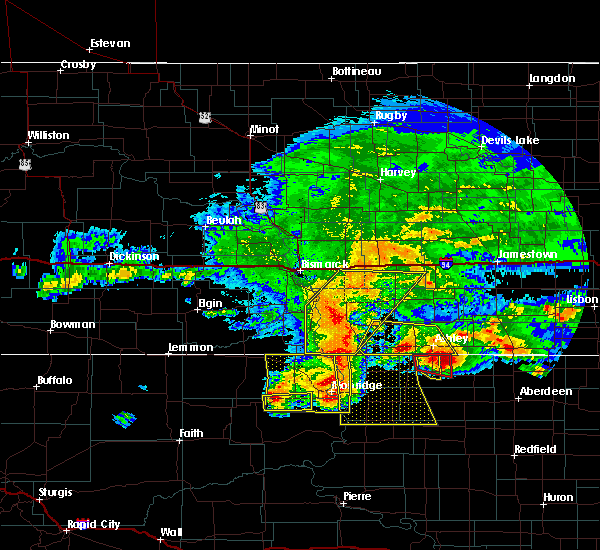 At 1120 pm mdt, a severe thunderstorm was located over glencross, or 27 miles west of mobridge, moving east at 40 mph (radar indicated). Hazards include 60 mph wind gusts and quarter size hail. Hail damage to vehicles is expected. expect wind damage to roofs, siding, and trees. This severe storm will be near, trail city around 1140 pm mdt. At 1120 pm mdt, a severe thunderstorm was located over glencross, or 27 miles west of mobridge, moving east at 40 mph (radar indicated). Hazards include 60 mph wind gusts and quarter size hail. Hail damage to vehicles is expected. expect wind damage to roofs, siding, and trees. This severe storm will be near, trail city around 1140 pm mdt.
|
| 8/9/2016 11:00 PM MDT |
 At 1059 pm mdt, a severe thunderstorm was located over firesteel, or 29 miles north of eagle butte, moving east at 40 mph (radar indicated). Hazards include 60 mph wind gusts and quarter size hail. Hail damage to vehicles is expected. expect wind damage to roofs, siding, and trees. this severe thunderstorm will be near, timber lake and little moreau rec area around 1110 pm mdt. glencross and spring lake around 1125 pm mdt. Trail city around 1140 pm mdt. At 1059 pm mdt, a severe thunderstorm was located over firesteel, or 29 miles north of eagle butte, moving east at 40 mph (radar indicated). Hazards include 60 mph wind gusts and quarter size hail. Hail damage to vehicles is expected. expect wind damage to roofs, siding, and trees. this severe thunderstorm will be near, timber lake and little moreau rec area around 1110 pm mdt. glencross and spring lake around 1125 pm mdt. Trail city around 1140 pm mdt.
|
| 8/9/2016 10:55 PM MDT |
 At 1154 pm cdt/1054 pm mdt/, severe thunderstorms were located along a line extending from 8 miles south of fort yates to near mahto to near trail city, moving east at 45 mph (mesonet observations near trail city measured 62 mph. also 68 mph winds were reported at mclaughlin). Hazards include two inch hail and 70 mph wind gusts. People and animals outdoors will be injured. expect hail damage to roofs, siding, windows, and vehicles. expect considerable tree damage. wind damage is also likely to mobile homes, roofs, and outbuildings. these severe storms will be near, wakpala around 1100 pm mdt. kenel around 1110 pm mdt. blackfoot around 1115 pm mdt. Pollock and new everets resort around 1220 am cdt. At 1154 pm cdt/1054 pm mdt/, severe thunderstorms were located along a line extending from 8 miles south of fort yates to near mahto to near trail city, moving east at 45 mph (mesonet observations near trail city measured 62 mph. also 68 mph winds were reported at mclaughlin). Hazards include two inch hail and 70 mph wind gusts. People and animals outdoors will be injured. expect hail damage to roofs, siding, windows, and vehicles. expect considerable tree damage. wind damage is also likely to mobile homes, roofs, and outbuildings. these severe storms will be near, wakpala around 1100 pm mdt. kenel around 1110 pm mdt. blackfoot around 1115 pm mdt. Pollock and new everets resort around 1220 am cdt.
|
| 8/9/2016 10:43 PM MDT |
 At 1143 pm cdt/1043 pm mdt/, severe thunderstorms were located along a line extending from near selfridge to near little eagle to near glencross, moving east at 35 mph (radar indicated). Hazards include two inch hail and 70 mph wind gusts. People and animals outdoors will be injured. expect hail damage to roofs, siding, windows, and vehicles. expect considerable tree damage. wind damage is also likely to mobile homes, roofs, and outbuildings. severe thunderstorms will be near, mahto and trail city around 1055 pm mdt. wakpala around 1105 pm mdt. blackfoot, indian creek rec area and revheim bay rec area around 1125 pm mdt. Pollock and new everets resort around 1230 am cdt. At 1143 pm cdt/1043 pm mdt/, severe thunderstorms were located along a line extending from near selfridge to near little eagle to near glencross, moving east at 35 mph (radar indicated). Hazards include two inch hail and 70 mph wind gusts. People and animals outdoors will be injured. expect hail damage to roofs, siding, windows, and vehicles. expect considerable tree damage. wind damage is also likely to mobile homes, roofs, and outbuildings. severe thunderstorms will be near, mahto and trail city around 1055 pm mdt. wakpala around 1105 pm mdt. blackfoot, indian creek rec area and revheim bay rec area around 1125 pm mdt. Pollock and new everets resort around 1230 am cdt.
|
| 8/9/2016 10:30 PM MDT |
 At 1030 pm mdt, a severe thunderstorm was located 7 miles west of little eagle, or 9 miles southwest of mclaughlin, moving east at 40 mph (radar indicated). Hazards include golf ball size hail and 70 mph wind gusts. People and animals outdoors will be injured. expect hail damage to roofs, siding, windows, and vehicles. expect considerable tree damage. wind damage is also likely to mobile homes, roofs, and outbuildings. this severe storm will be near, little eagle around 1040 pm mdt. Mahto around 1045 pm mdt. At 1030 pm mdt, a severe thunderstorm was located 7 miles west of little eagle, or 9 miles southwest of mclaughlin, moving east at 40 mph (radar indicated). Hazards include golf ball size hail and 70 mph wind gusts. People and animals outdoors will be injured. expect hail damage to roofs, siding, windows, and vehicles. expect considerable tree damage. wind damage is also likely to mobile homes, roofs, and outbuildings. this severe storm will be near, little eagle around 1040 pm mdt. Mahto around 1045 pm mdt.
|
| 8/9/2016 10:20 PM MDT | Time estimate in corson county SD, 12.5 miles S of Timber Lake, SD |
| 8/9/2016 9:45 PM MDT |
 At 945 pm mdt, a severe thunderstorm was located near watauga, or 31 miles east of lemmon, moving east at 45 mph (radar indicated). Hazards include golf ball size hail and 70 mph wind gusts. People and animals outdoors will be injured. expect hail damage to roofs, siding, windows, and vehicles. expect considerable tree damage. wind damage is also likely to mobile homes, roofs, and outbuildings. this severe thunderstorm will be near, mcintosh and black horse around 955 pm mdt. walker around 1010 pm mdt. bullhead around 1015 pm mdt. mclaughlin around 1030 pm mdt. Mahto around 1040 pm mdt. At 945 pm mdt, a severe thunderstorm was located near watauga, or 31 miles east of lemmon, moving east at 45 mph (radar indicated). Hazards include golf ball size hail and 70 mph wind gusts. People and animals outdoors will be injured. expect hail damage to roofs, siding, windows, and vehicles. expect considerable tree damage. wind damage is also likely to mobile homes, roofs, and outbuildings. this severe thunderstorm will be near, mcintosh and black horse around 955 pm mdt. walker around 1010 pm mdt. bullhead around 1015 pm mdt. mclaughlin around 1030 pm mdt. Mahto around 1040 pm mdt.
|
| 7/23/2016 4:00 AM MDT |
 At 400 am mdt, a severe thunderstorm was located 7 miles east of green grass, or 14 miles northeast of eagle butte, moving north at 40 mph (radar indicated). Hazards include 60 mph wind gusts and quarter size hail. Hail damage to vehicles is expected. expect wind damage to roofs, siding, and trees. this severe thunderstorm will be near, little moreau rec area around 415 am mdt. timber lake around 425 am mdt. glencross around 430 am mdt. Spring lake around 435 am mdt. At 400 am mdt, a severe thunderstorm was located 7 miles east of green grass, or 14 miles northeast of eagle butte, moving north at 40 mph (radar indicated). Hazards include 60 mph wind gusts and quarter size hail. Hail damage to vehicles is expected. expect wind damage to roofs, siding, and trees. this severe thunderstorm will be near, little moreau rec area around 415 am mdt. timber lake around 425 am mdt. glencross around 430 am mdt. Spring lake around 435 am mdt.
|
| 7/22/2016 6:13 PM MDT |
 At 613 pm mdt, a severe thunderstorm was located over isabel, or 25 miles northeast of dupree, moving east at 35 mph (radar indicated). Hazards include two inch hail and 60 mph wind gusts. People and animals outdoors will be injured. expect hail damage to roofs, siding, windows, and vehicles. expect wind damage to roofs, siding, and trees. this severe thunderstorm will be near, firesteel around 620 pm mdt. little moreau rec area around 635 pm mdt. timber lake around 640 pm mdt. Glencross and spring lake around 650 pm mdt. At 613 pm mdt, a severe thunderstorm was located over isabel, or 25 miles northeast of dupree, moving east at 35 mph (radar indicated). Hazards include two inch hail and 60 mph wind gusts. People and animals outdoors will be injured. expect hail damage to roofs, siding, windows, and vehicles. expect wind damage to roofs, siding, and trees. this severe thunderstorm will be near, firesteel around 620 pm mdt. little moreau rec area around 635 pm mdt. timber lake around 640 pm mdt. Glencross and spring lake around 650 pm mdt.
|
| 7/22/2016 5:35 PM MDT |
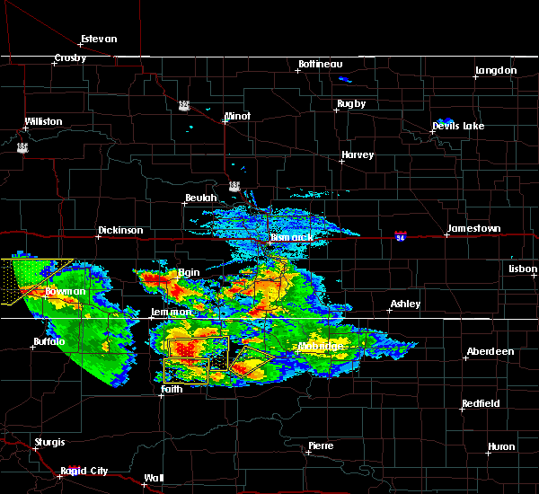 At 535 pm mdt, a severe thunderstorm was located over little moreau rec area, or 24 miles north of eagle butte, moving northeast at 10 mph (radar indicated). Hazards include ping pong ball size hail and 60 mph wind gusts. People and animals outdoors will be injured. expect hail damage to roofs, siding, windows, and vehicles. expect wind damage to roofs, siding, and trees. this severe storm will be near, timber lake around 555 pm mdt. Glencross around 600 pm mdt. At 535 pm mdt, a severe thunderstorm was located over little moreau rec area, or 24 miles north of eagle butte, moving northeast at 10 mph (radar indicated). Hazards include ping pong ball size hail and 60 mph wind gusts. People and animals outdoors will be injured. expect hail damage to roofs, siding, windows, and vehicles. expect wind damage to roofs, siding, and trees. this severe storm will be near, timber lake around 555 pm mdt. Glencross around 600 pm mdt.
|
| 7/22/2016 5:29 PM MDT | Golf Ball sized hail reported 10.3 miles NE of Timber Lake, SD, . |
| 7/22/2016 5:24 PM MDT | Quarter sized hail reported 8.9 miles NE of Timber Lake, SD, . |
| 7/22/2016 5:10 PM MDT | Tennis Ball sized hail reported 10.3 miles NE of Timber Lake, SD, relayed via social media. radar estimated time and location. |
| 7/22/2016 5:07 PM MDT | Golf Ball sized hail reported 7 miles E of Timber Lake, SD, . |
| 7/22/2016 4:53 PM MDT | Hen Egg sized hail reported 9.9 miles E of Timber Lake, SD, 2.2 inch size hail measured. |
| 7/22/2016 4:52 PM MDT |
 At 452 pm mdt, a severe thunderstorm was located near little moreau rec area, or 24 miles north of eagle butte, moving northeast at 20 mph (radar indicated). Hazards include quarter size hail. Damage to vehicles is expected. this severe thunderstorm will be near, little moreau rec area around 500 pm mdt. timber lake around 515 pm mdt. glencross around 530 pm mdt. Spring lake around 540 pm mdt. At 452 pm mdt, a severe thunderstorm was located near little moreau rec area, or 24 miles north of eagle butte, moving northeast at 20 mph (radar indicated). Hazards include quarter size hail. Damage to vehicles is expected. this severe thunderstorm will be near, little moreau rec area around 500 pm mdt. timber lake around 515 pm mdt. glencross around 530 pm mdt. Spring lake around 540 pm mdt.
|
| 7/22/2016 4:51 PM MDT | Golf Ball sized hail reported 9.9 miles E of Timber Lake, SD, hail of all sizes... up to golf ball. . |
| 7/22/2016 4:45 PM MDT | Quarter sized hail reported 9.9 miles E of Timber Lake, SD, . |
| 7/16/2016 8:38 PM MDT | . in dewey county SD, 13.2 miles WSW of Timber Lake, SD |
| 7/16/2016 8:28 PM MDT | . in dewey county SD, 13.2 miles WSW of Timber Lake, SD |
| 7/16/2016 8:08 PM MDT | . in dewey county SD, 7 miles E of Timber Lake, SD |
| 7/16/2016 7:50 PM MDT |
 At 750 pm mdt, a severe thunderstorm was located 7 miles northwest of isabel, or 29 miles north of dupree, moving east at 50 mph (radar indicated). Hazards include 70 mph wind gusts. Expect considerable tree damage. damage is likely to mobile homes, roofs, and outbuildings. this severe thunderstorm will be near, firesteel around 800 pm mdt. timber lake around 805 pm mdt. spring lake and glencross around 815 pm mdt. Trail city around 820 pm mdt. At 750 pm mdt, a severe thunderstorm was located 7 miles northwest of isabel, or 29 miles north of dupree, moving east at 50 mph (radar indicated). Hazards include 70 mph wind gusts. Expect considerable tree damage. damage is likely to mobile homes, roofs, and outbuildings. this severe thunderstorm will be near, firesteel around 800 pm mdt. timber lake around 805 pm mdt. spring lake and glencross around 815 pm mdt. Trail city around 820 pm mdt.
|
| 7/10/2016 10:38 PM CDT |
 At 1037 pm cdt/937 pm mdt/, severe thunderstorms were located along a line extending from near zeeland to near white horse, moving east at 30 mph (radar indicated). Hazards include 70 mph wind gusts. Expect considerable tree damage. damage is likely to mobile homes, roofs, and outbuildings. severe thunderstorms will be near, artas and greenway around 1045 pm cdt. Promise around 1110 pm cdt. At 1037 pm cdt/937 pm mdt/, severe thunderstorms were located along a line extending from near zeeland to near white horse, moving east at 30 mph (radar indicated). Hazards include 70 mph wind gusts. Expect considerable tree damage. damage is likely to mobile homes, roofs, and outbuildings. severe thunderstorms will be near, artas and greenway around 1045 pm cdt. Promise around 1110 pm cdt.
|
| 7/9/2016 8:19 PM MDT | Grand river raws. gust time estimated by rada in corson county SD, 13.1 miles S of Timber Lake, SD |
| 5/30/2016 4:26 PM MDT |
 At 426 pm mdt, severe thunderstorms were located along a line extending from near spring lake to near white horse to 6 miles northwest of ridgeview, moving northeast at 15 mph (radar indicated). Hazards include ping pong ball size hail and 60 mph wind gusts. People and animals outdoors will be injured. expect hail damage to roofs, siding, windows, and vehicles. expect wind damage to roofs, siding, and trees. severe thunderstorms will be near, glencross around 430 pm mdt. spring lake around 435 pm mdt. laplant and tiospaye topa school around 500 pm mdt. trail city around 510 pm mdt. little eagle around 515 pm mdt. Promise around 530 pm mdt. At 426 pm mdt, severe thunderstorms were located along a line extending from near spring lake to near white horse to 6 miles northwest of ridgeview, moving northeast at 15 mph (radar indicated). Hazards include ping pong ball size hail and 60 mph wind gusts. People and animals outdoors will be injured. expect hail damage to roofs, siding, windows, and vehicles. expect wind damage to roofs, siding, and trees. severe thunderstorms will be near, glencross around 430 pm mdt. spring lake around 435 pm mdt. laplant and tiospaye topa school around 500 pm mdt. trail city around 510 pm mdt. little eagle around 515 pm mdt. Promise around 530 pm mdt.
|
| 5/30/2016 4:13 PM MDT |
 At 412 pm mdt, a severe thunderstorm was located near green grass, or 17 miles north of lantry, moving northeast at 25 mph. two other strong storms were located near firesteel and timber lake (radar indicated). Hazards include 60 mph wind gusts and penny size hail. Expect damage to roofs. siding. and trees. this severe storm will be near, little moreau rec area around 440 pm mdt. Timber lake around 445 pm mdt. At 412 pm mdt, a severe thunderstorm was located near green grass, or 17 miles north of lantry, moving northeast at 25 mph. two other strong storms were located near firesteel and timber lake (radar indicated). Hazards include 60 mph wind gusts and penny size hail. Expect damage to roofs. siding. and trees. this severe storm will be near, little moreau rec area around 440 pm mdt. Timber lake around 445 pm mdt.
|
| 5/30/2016 3:43 PM MDT |
 At 343 pm mdt, a severe thunderstorm was located near bear creek, or 7 miles northeast of dupree, moving northeast at 30 mph (radar indicated). Hazards include ping pong ball size hail and 60 mph wind gusts. People and animals outdoors will be injured. expect hail damage to roofs, siding, windows, and vehicles. expect wind damage to roofs, siding, and trees. this severe thunderstorm will be near, isabel around 415 pm mdt. firesteel and little moreau rec area around 425 pm mdt. Timber lake around 435 pm mdt. At 343 pm mdt, a severe thunderstorm was located near bear creek, or 7 miles northeast of dupree, moving northeast at 30 mph (radar indicated). Hazards include ping pong ball size hail and 60 mph wind gusts. People and animals outdoors will be injured. expect hail damage to roofs, siding, windows, and vehicles. expect wind damage to roofs, siding, and trees. this severe thunderstorm will be near, isabel around 415 pm mdt. firesteel and little moreau rec area around 425 pm mdt. Timber lake around 435 pm mdt.
|
| 7/27/2015 9:18 PM MDT | Storm damage reported in corson county SD, 13.2 miles WSW of Timber Lake, SD |
| 7/27/2015 9:08 PM MDT | Peak wind gust in corson county SD, 13.2 miles WSW of Timber Lake, SD |
| 7/27/2015 7:45 PM MDT |
 At 745 pm mdt, severe thunderstorms were located along a line extending from lemmon to 9 miles southwest of shambo ranch to near thunder butte to 8 miles northwest of cherry creek, moving northeast at 55 mph (radar indicated). Hazards include 60 mph wind gusts and nickel size hail. Expect damage to roofs. siding and trees. severe thunderstorms will be near, shambo ranch and thunder hawk around 755 pm mdt. keldron around 800 pm mdt. morristown around 805 pm mdt. firesteel around 810 pm mdt. little moreau rec area around 815 pm mdt. timber lake, klein ranch and black horse around 820 pm mdt. glencross around 825 pm mdt. Spring lake around 830 pm mdt. At 745 pm mdt, severe thunderstorms were located along a line extending from lemmon to 9 miles southwest of shambo ranch to near thunder butte to 8 miles northwest of cherry creek, moving northeast at 55 mph (radar indicated). Hazards include 60 mph wind gusts and nickel size hail. Expect damage to roofs. siding and trees. severe thunderstorms will be near, shambo ranch and thunder hawk around 755 pm mdt. keldron around 800 pm mdt. morristown around 805 pm mdt. firesteel around 810 pm mdt. little moreau rec area around 815 pm mdt. timber lake, klein ranch and black horse around 820 pm mdt. glencross around 825 pm mdt. Spring lake around 830 pm mdt.
|
| 7/4/2015 6:00 PM MDT | Quarter sized hail reported 3.5 miles N of Timber Lake, SD, dewey county sheriffs office relayed report from public... no damage reported |
| 7/4/2015 5:52 PM MDT |
 At 552 pm mdt, a severe thunderstorm was located near glencross, or 28 miles west of mobridge, moving east at 20 mph (radar indicated). Hazards include quarter size hail. Damage to vehicles is expected. This severe thunderstorm will be near, glencross around 605 pm mdt. At 552 pm mdt, a severe thunderstorm was located near glencross, or 28 miles west of mobridge, moving east at 20 mph (radar indicated). Hazards include quarter size hail. Damage to vehicles is expected. This severe thunderstorm will be near, glencross around 605 pm mdt.
|
| 9/18/2013 6:25 PM MDT | Driving from timber lake northward experienced wind gusts up to 70 mph in corson county SD, 5.5 miles S of Timber Lake, SD |
| 8/27/2013 11:15 PM MDT | Quarter sized hail reported 10.5 miles ENE of Timber Lake, SD |
| 8/25/2013 6:52 PM MDT | 1.25 inch hail also reported. trees knocked over... still raining heavily in dewey county SD, 10 miles W of Timber Lake, SD |
| 7/8/2013 11:20 PM MDT | Trees down in timber lake on homes and cars in dewey county SD, 0.3 miles W of Timber Lake, SD |
| 7/8/2013 11:15 PM MDT | Peak wind from the timber lake sdsu mesonet sit in dewey county SD, 0.7 miles NNE of Timber Lake, SD |
| 7/8/2013 11:15 PM MDT | Peak wind from the timber lake sdsu mesonet sit in dewey county SD, 0.7 miles NNE of Timber Lake, SD |
| 5/25/2013 9:58 PM MDT | Quarter sized hail reported 0.3 miles W of Timber Lake, SD |
| 3/26/2012 7:45 PM MDT | Timber lake sdsu observation site. trees toppled around the tow in dewey county SD, 0.7 miles NNE of Timber Lake, SD |
| 1/1/0001 12:00 AM | Sdsu mesonet sit in dewey county SD, 0.3 miles W of Timber Lake, SD |
Hail Maps for Timber Lake, SD


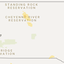


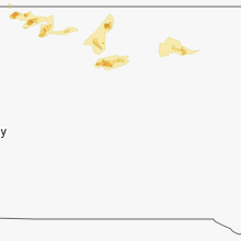


Connect with Interactive Hail Maps