

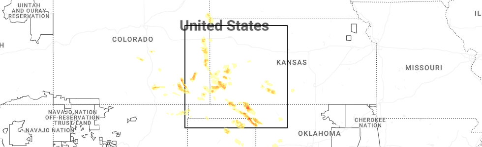
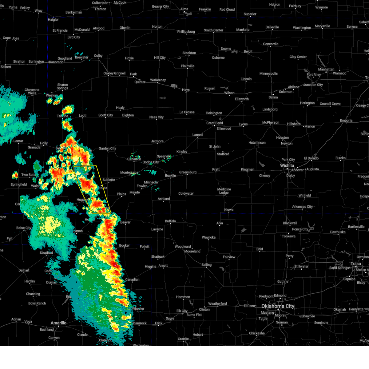
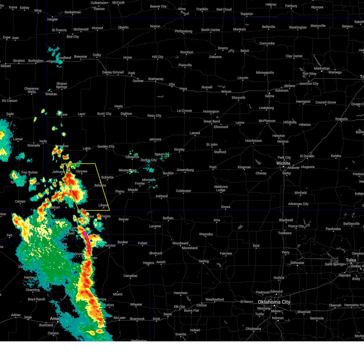
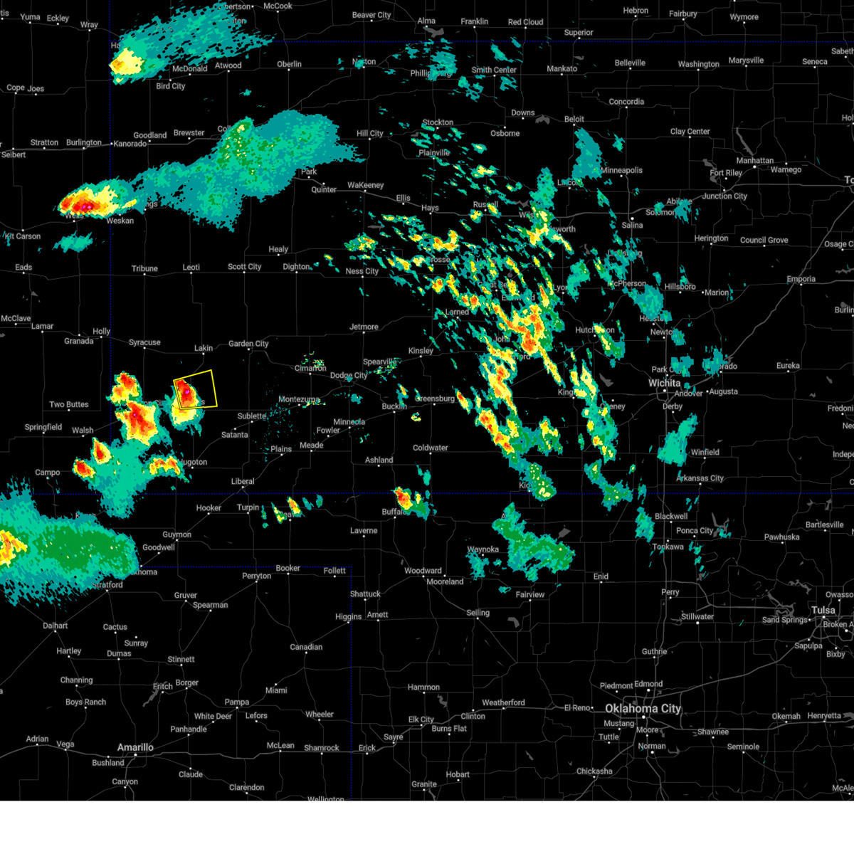
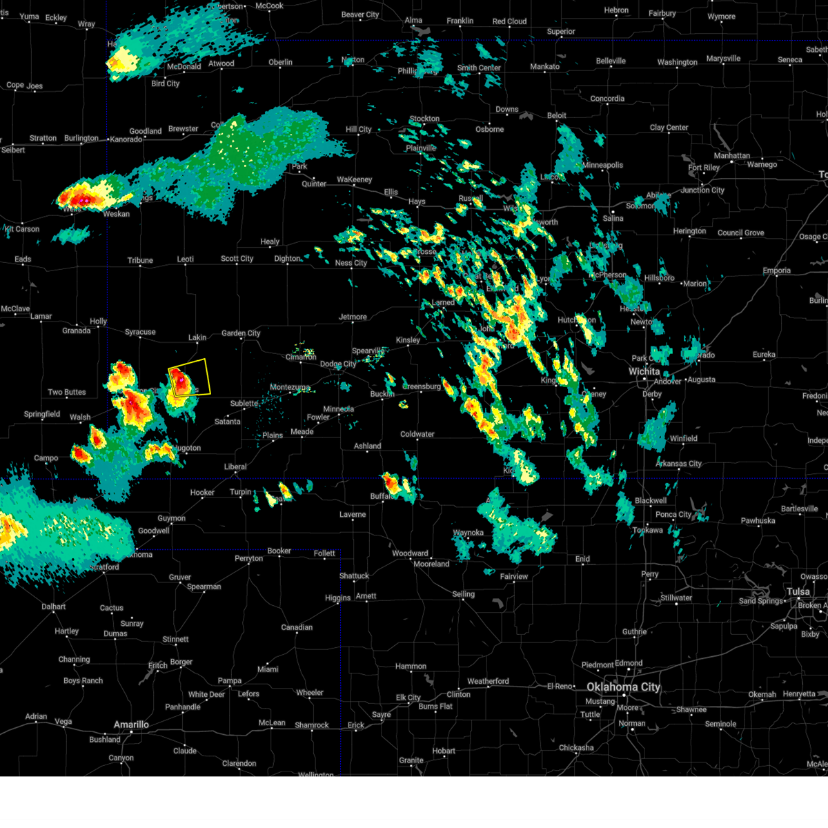
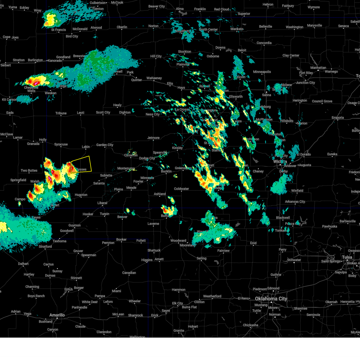
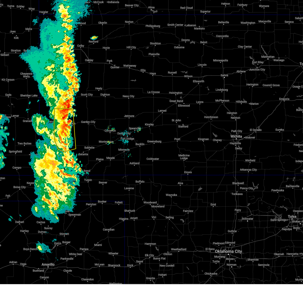
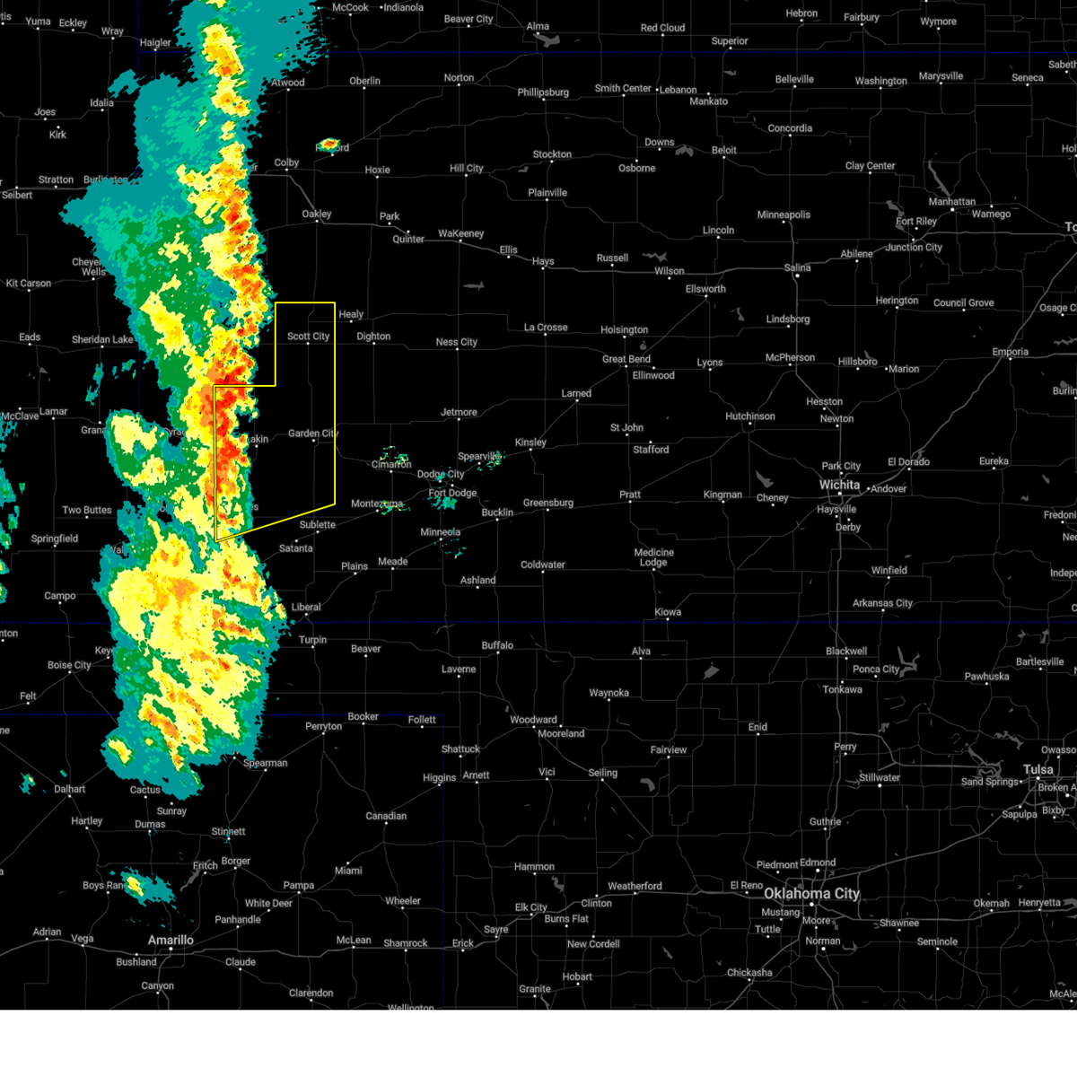
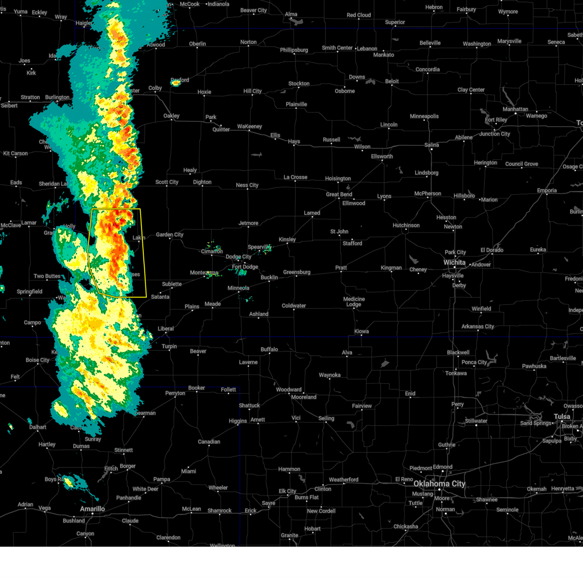
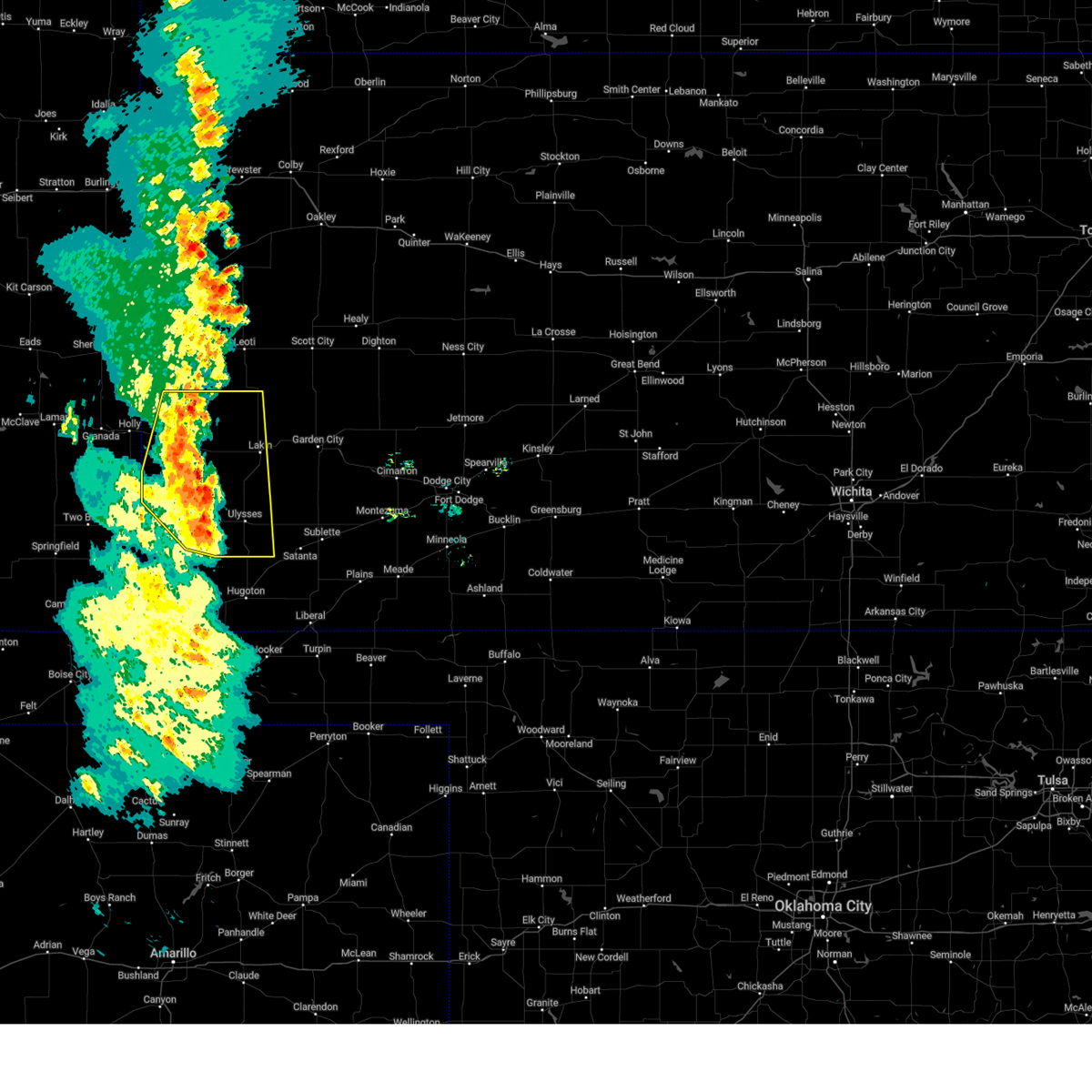
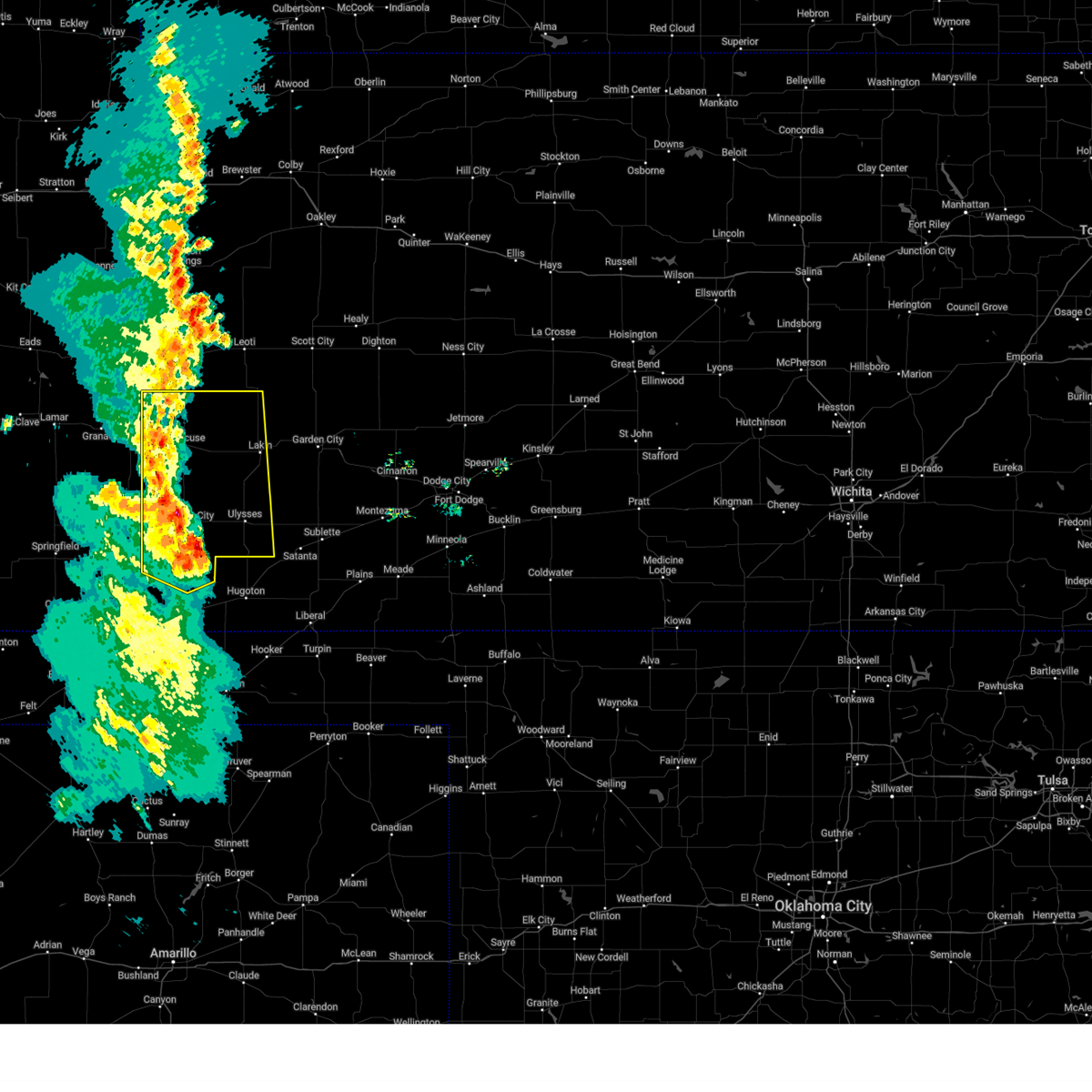
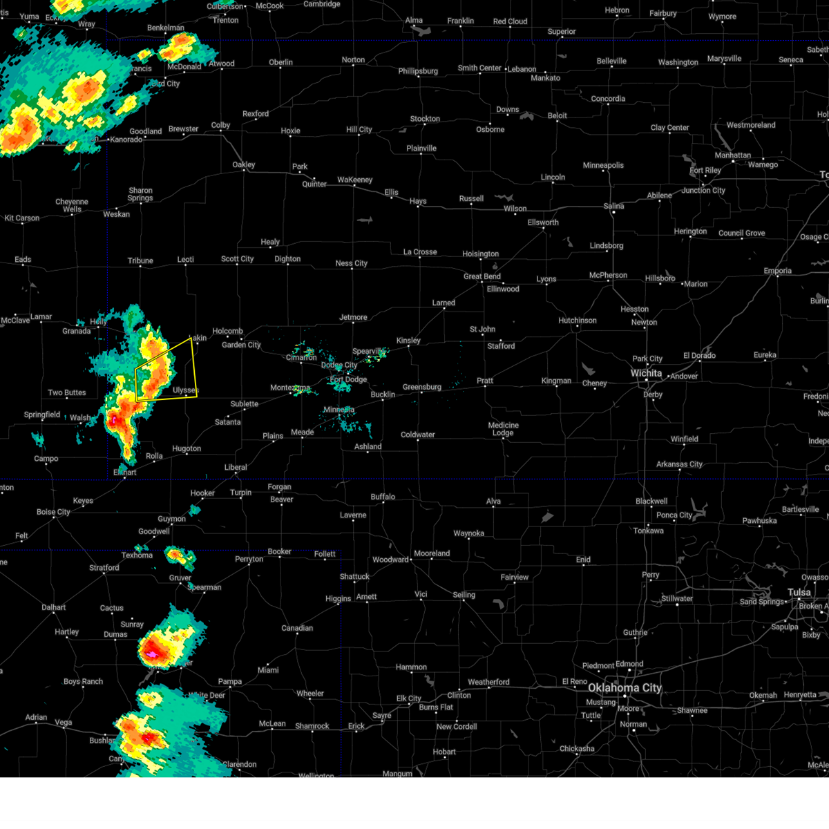
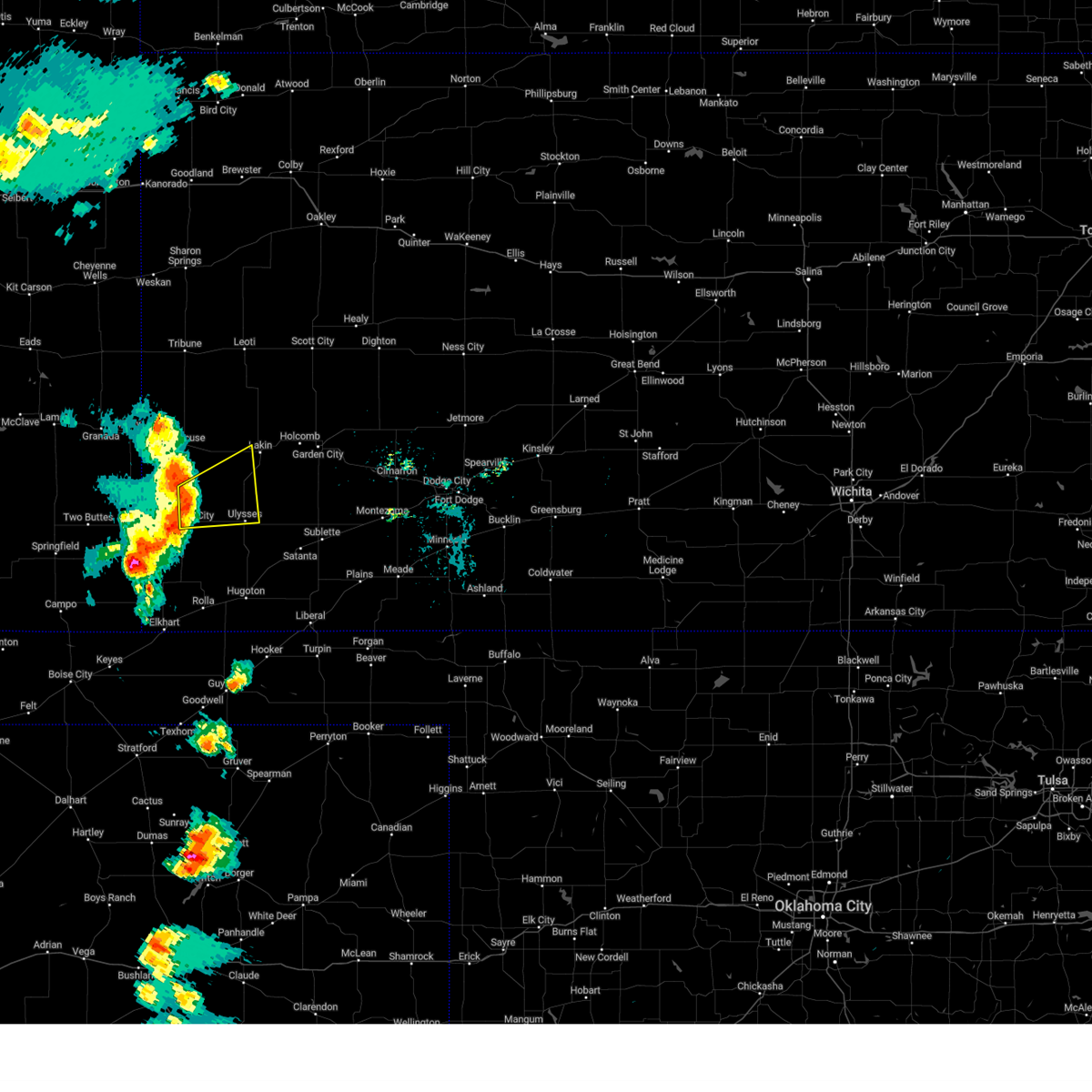
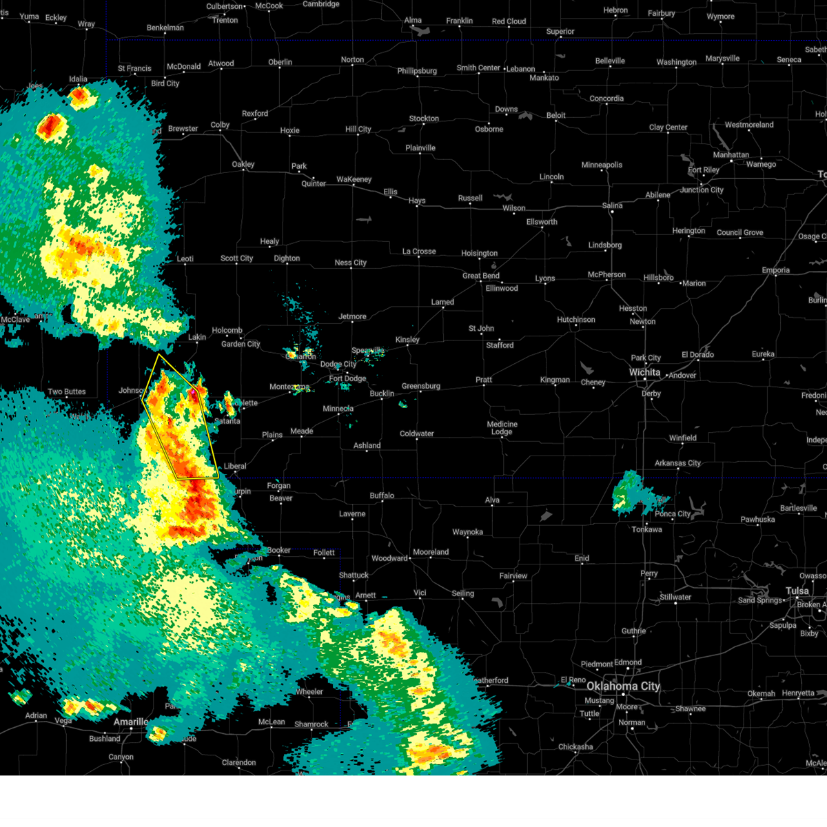
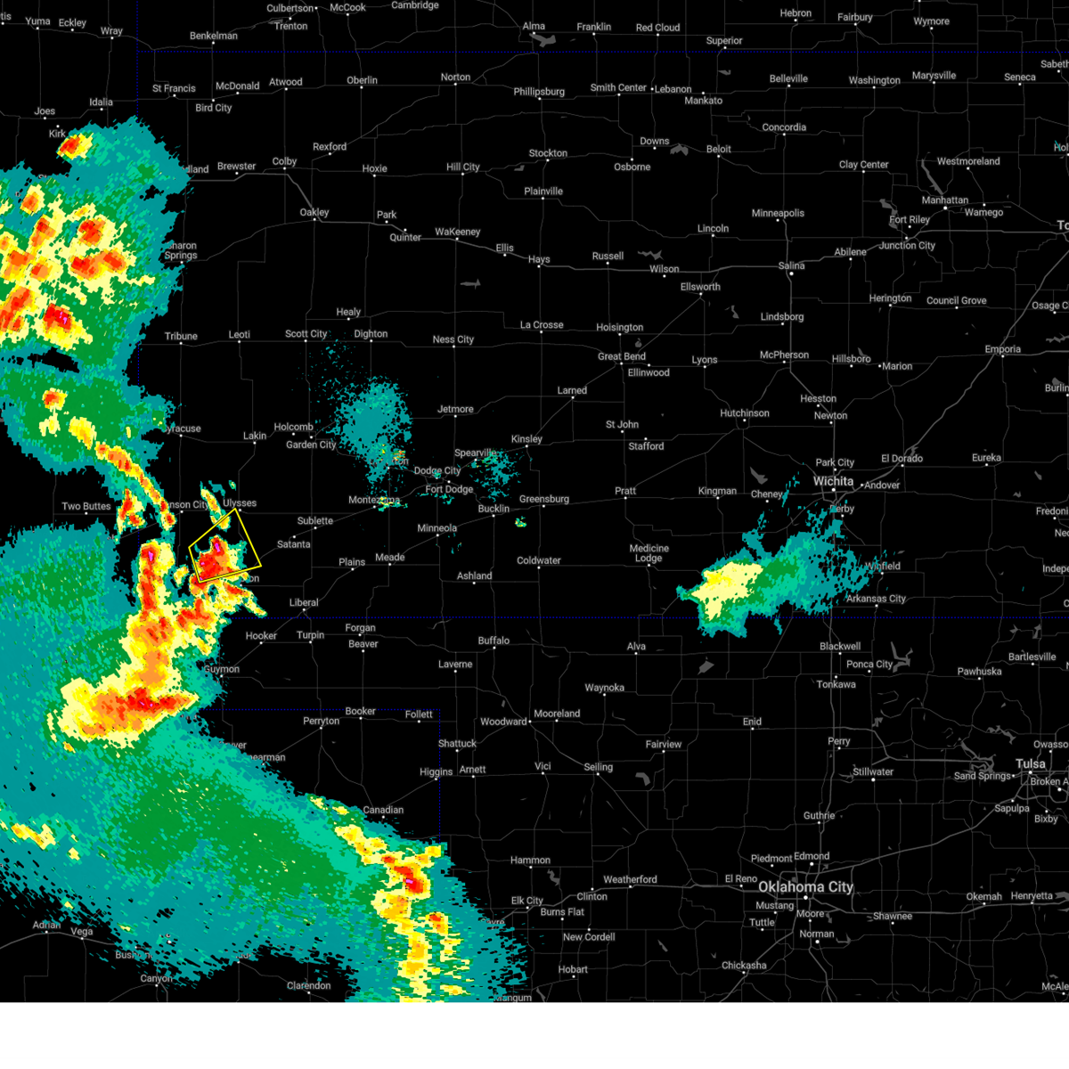
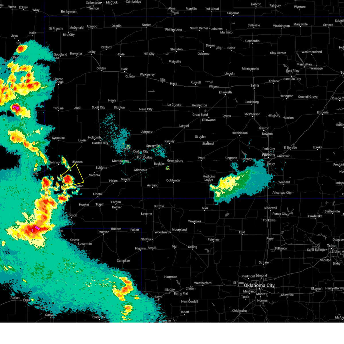
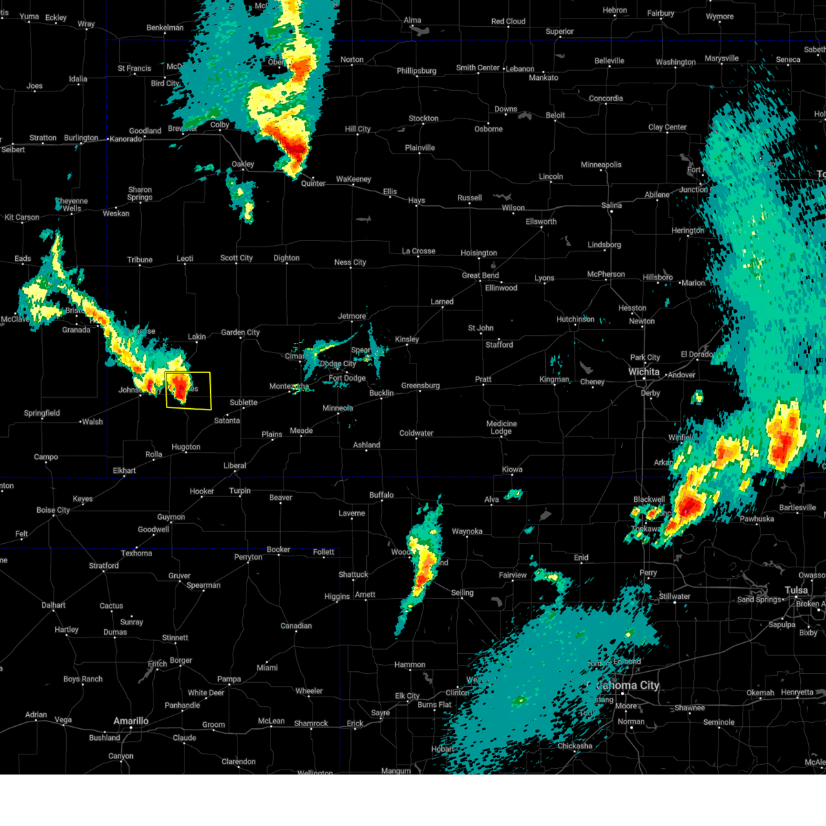
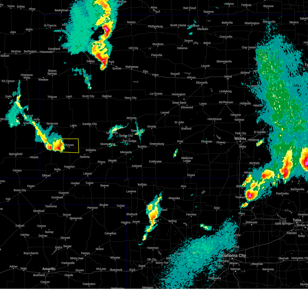
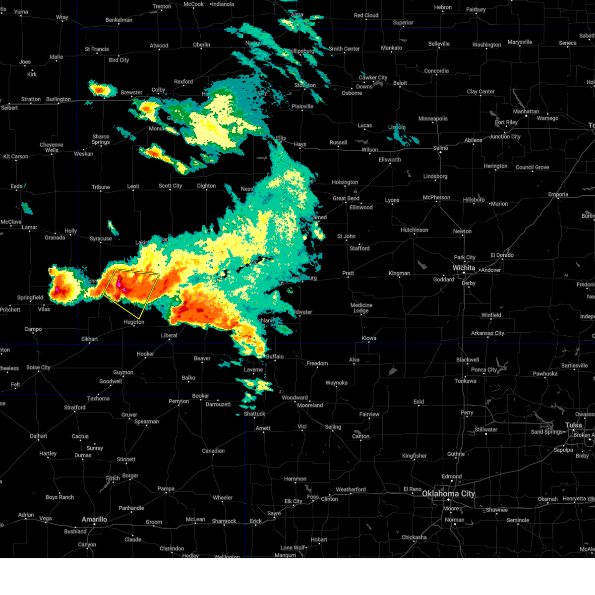
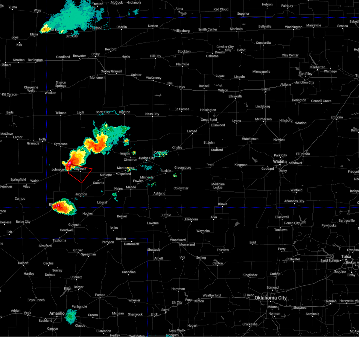
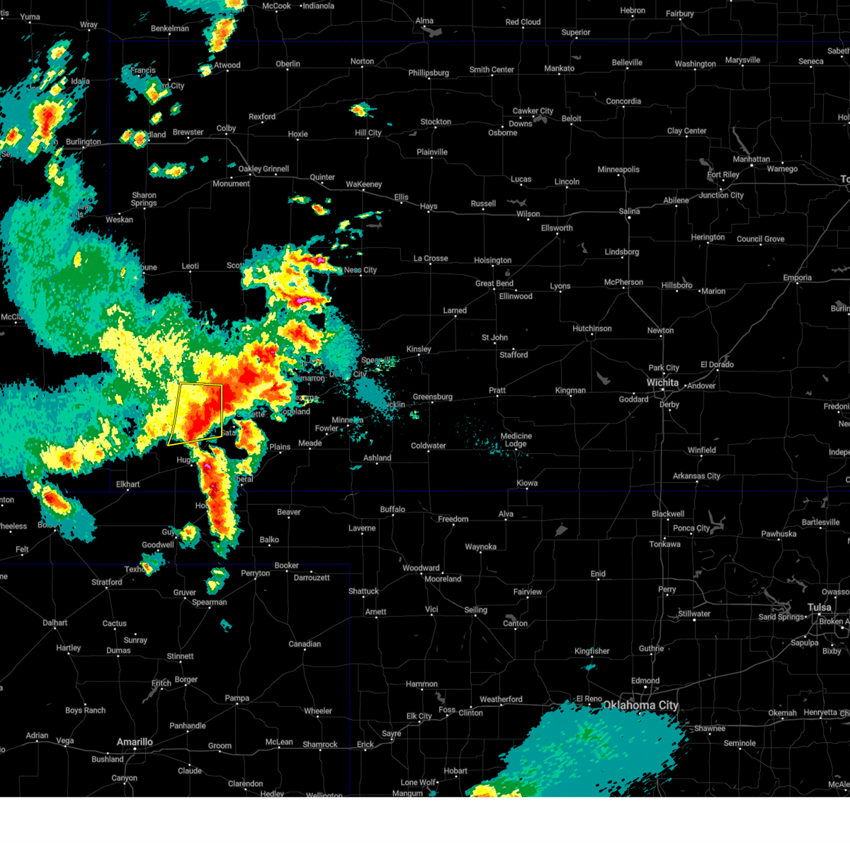
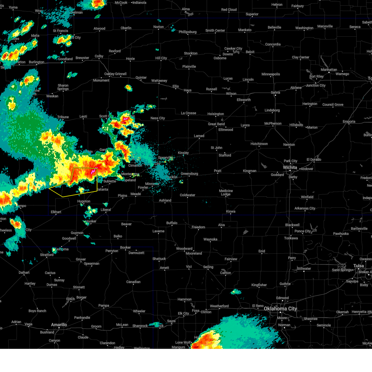
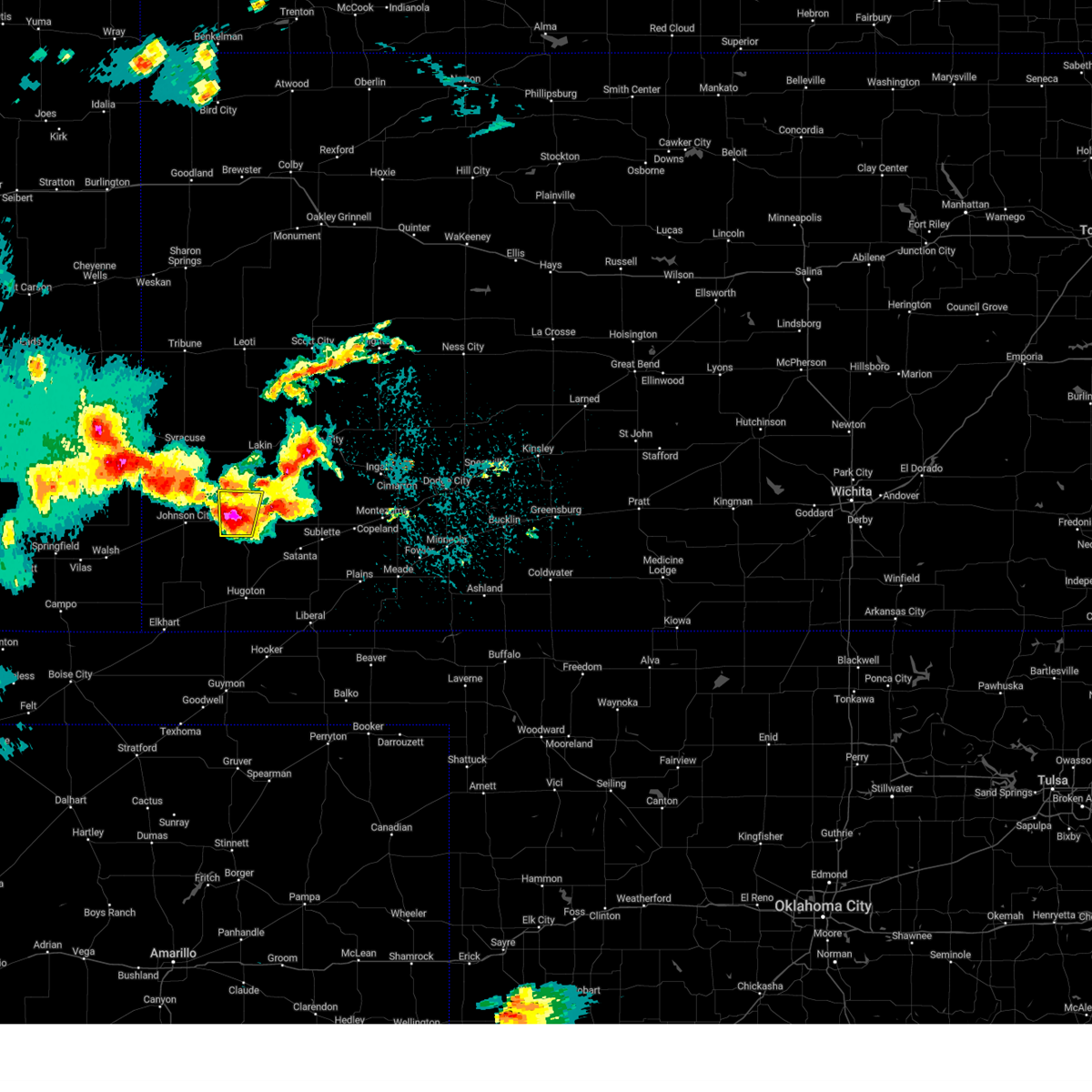
Hail Map for Ulysses, KS
The Ulysses, KS area has had 95 reports of on-the-ground hail by trained spotters, and has been under severe weather warnings 22 times during the past 12 months. Doppler radar has detected hail at or near Ulysses, KS on 79 occasions, including 7 occasions during the past year.
| Name: | Ulysses, KS |
| Where Located: | 38 miles SW of Garden City, KS |
| Map: | Google Map for Ulysses, KS |
| Population: | 6161 |
| Housing Units: | 2295 |
| More Info: | Search Google for Ulysses, KS |
2
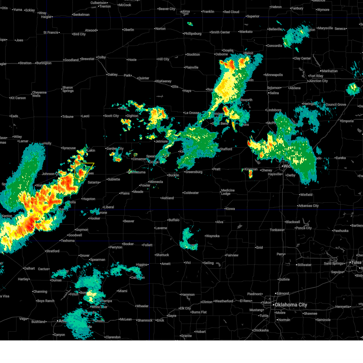
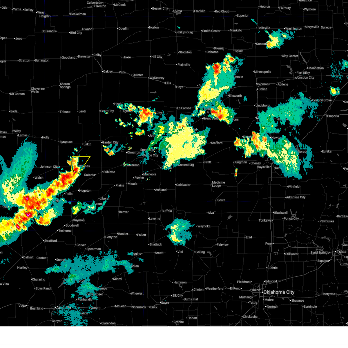
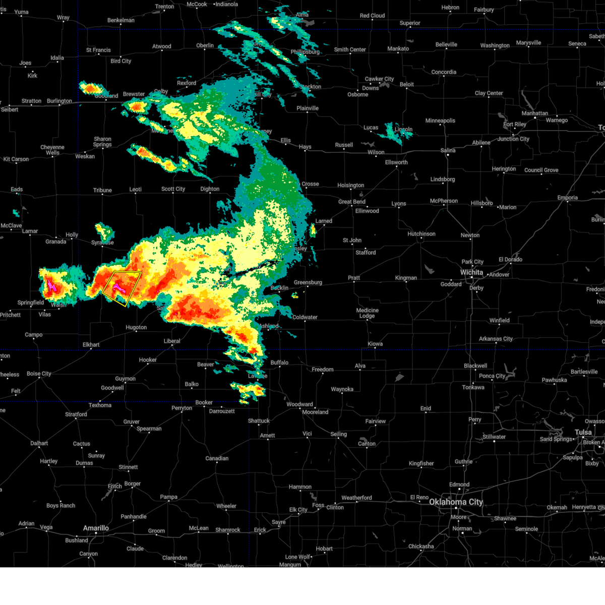
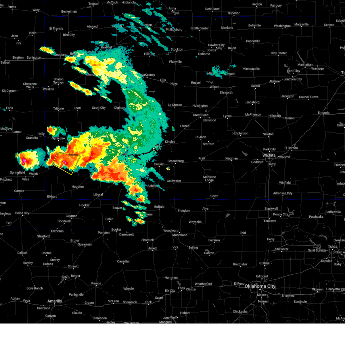
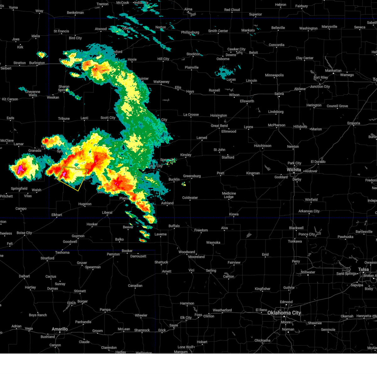
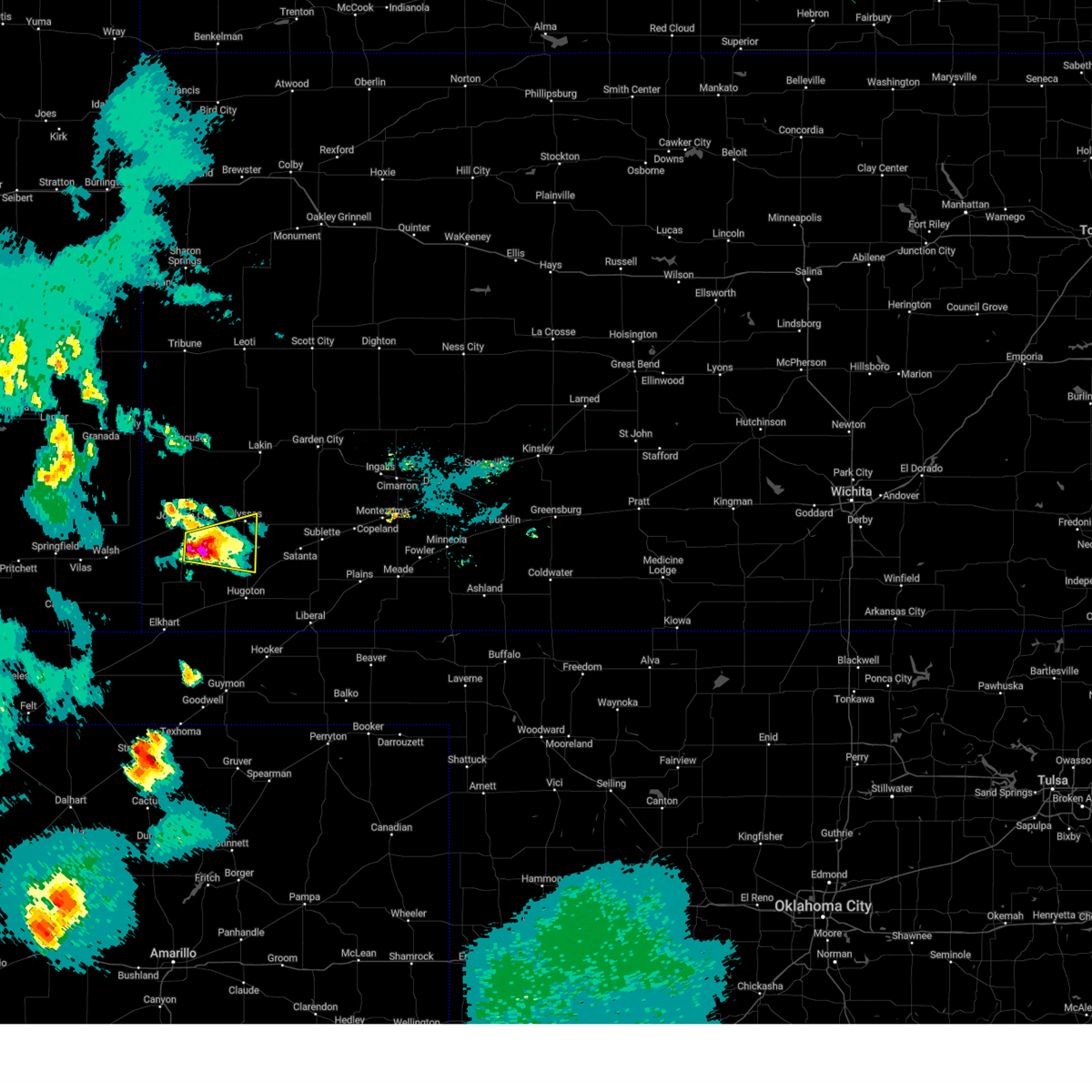
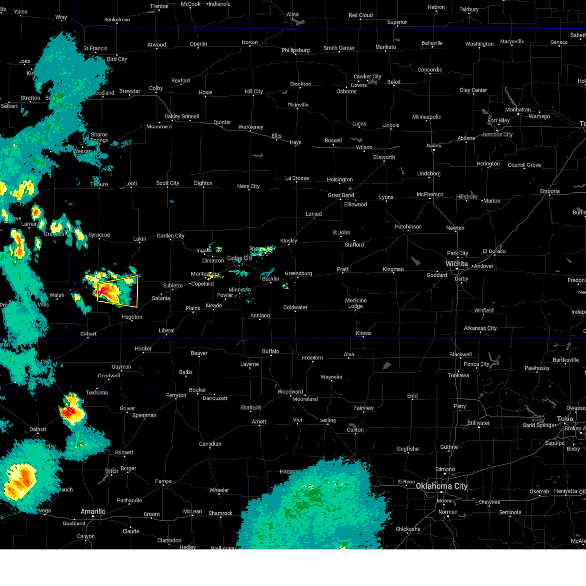
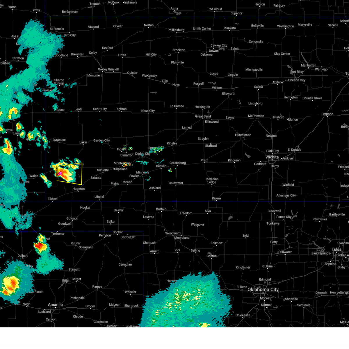
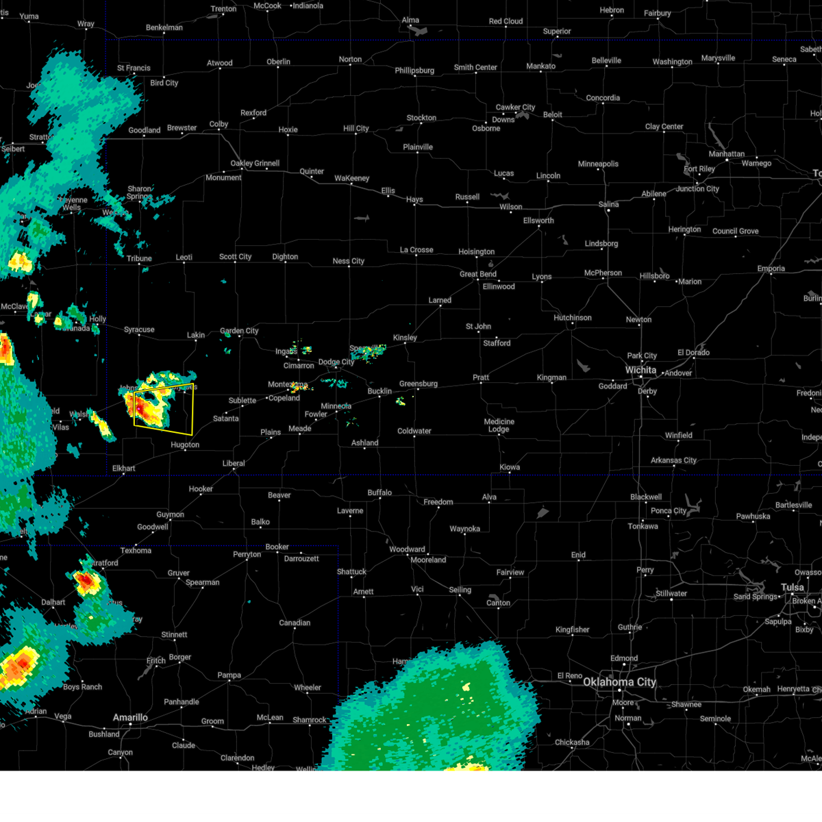
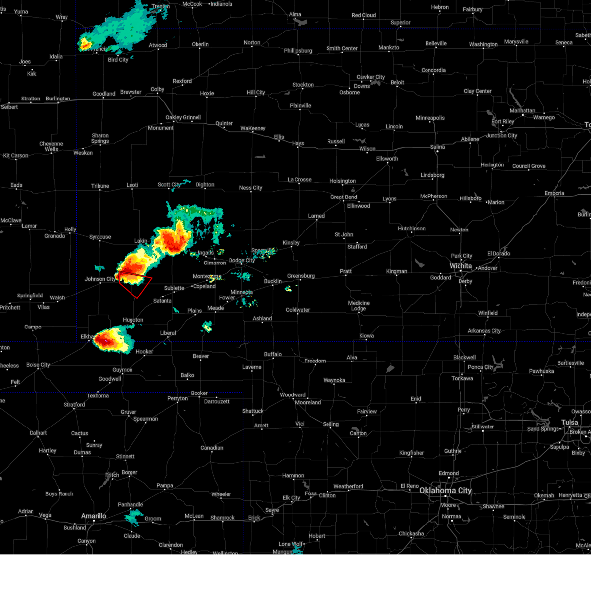
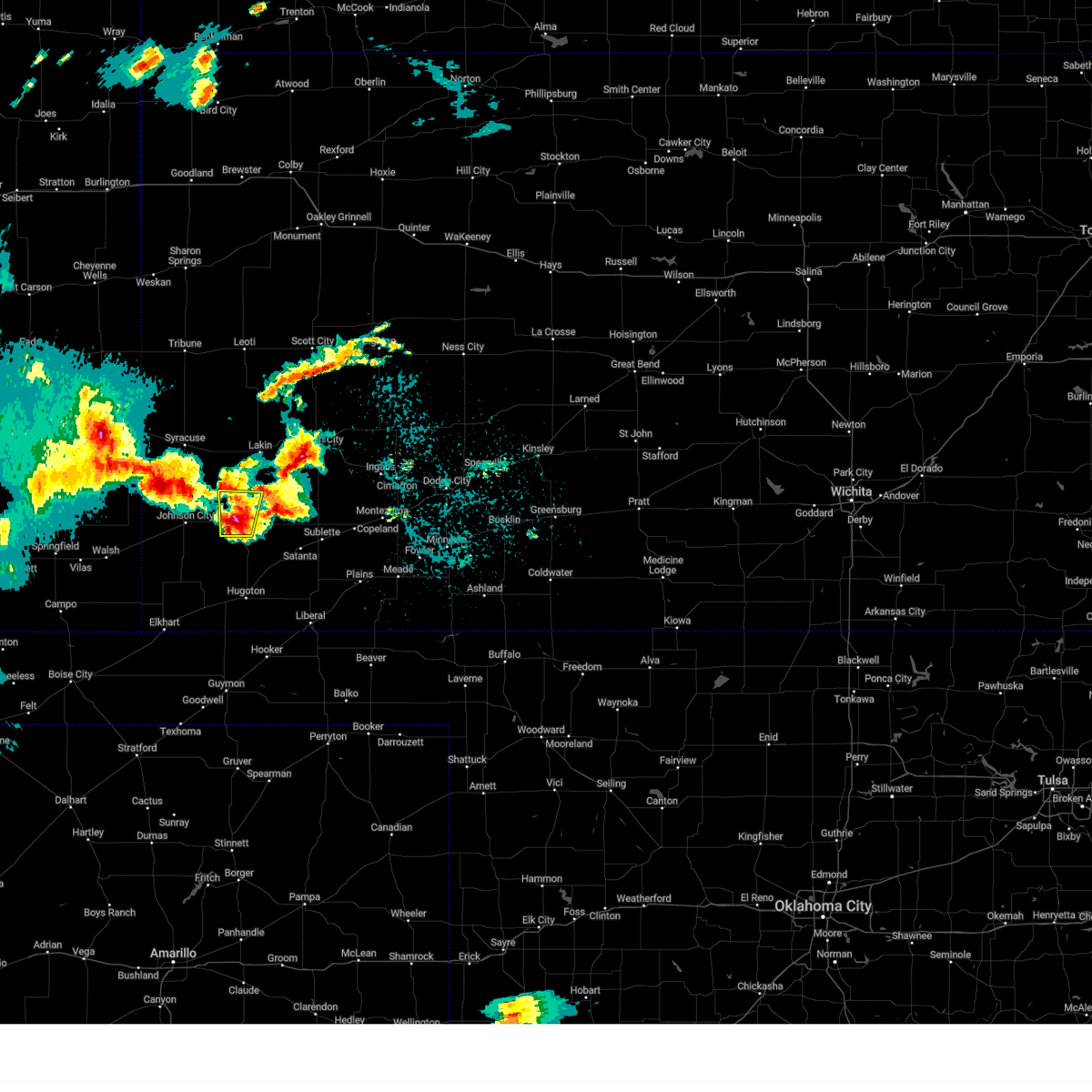
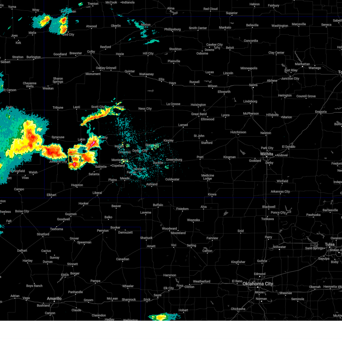
The Top Recent Hail Date for Ulysses, KS is Wednesday, May 28, 2025 (8th out of 79)
Hail and Wind Damage Spotted near Ulysses, KS
| Date / Time | Report Details |
|---|---|
| 6/23/2025 8:14 PM CDT |
 the severe thunderstorm warning has been cancelled and is no longer in effect the severe thunderstorm warning has been cancelled and is no longer in effect
|
| 6/23/2025 7:54 PM CDT |
 Svrddc the national weather service in dodge city has issued a * severe thunderstorm warning for, northwestern grant county in southwestern kansas, * until 830 pm cdt. * at 754 pm cdt, a severe thunderstorm was located near ulysses, moving northeast at 20 mph (radar indicated). Hazards include 60 mph wind gusts and nickel size hail. Expect damage to roofs, siding, and trees. This severe thunderstorm will be near, ulysses around 800 pm cdt. Svrddc the national weather service in dodge city has issued a * severe thunderstorm warning for, northwestern grant county in southwestern kansas, * until 830 pm cdt. * at 754 pm cdt, a severe thunderstorm was located near ulysses, moving northeast at 20 mph (radar indicated). Hazards include 60 mph wind gusts and nickel size hail. Expect damage to roofs, siding, and trees. This severe thunderstorm will be near, ulysses around 800 pm cdt.
|
| 6/5/2025 7:55 PM CDT |
 At 755 pm cdt, a severe thunderstorm was located near richfield, moving east at 30 mph (radar indicated). Hazards include golf ball size hail and 60 mph wind gusts. People and animals outdoors will be injured. expect hail damage to roofs, siding, windows, and vehicles. expect wind damage to roofs, siding, and trees. Locations impacted include, ulysses, hugoton, johnson city, rolla, manter, richfield, big bow, and feterita. At 755 pm cdt, a severe thunderstorm was located near richfield, moving east at 30 mph (radar indicated). Hazards include golf ball size hail and 60 mph wind gusts. People and animals outdoors will be injured. expect hail damage to roofs, siding, windows, and vehicles. expect wind damage to roofs, siding, and trees. Locations impacted include, ulysses, hugoton, johnson city, rolla, manter, richfield, big bow, and feterita.
|
| 6/5/2025 7:41 PM CDT | Svrddc the national weather service in dodge city has issued a * severe thunderstorm warning for, northern morton county in southwestern kansas, southwestern grant county in southwestern kansas, western stevens county in southwestern kansas, southern stanton county in southwestern kansas, * until 845 pm cdt. * at 740 pm cdt, a severe thunderstorm was located 9 miles southeast of the saunders elevator, moving east at 30 mph (radar indicated). Hazards include ping pong ball size hail and 60 mph wind gusts. People and animals outdoors will be injured. expect hail damage to roofs, siding, windows, and vehicles. expect wind damage to roofs, siding, and trees. This severe thunderstorm will remain over mainly rural areas of northern morton, southwestern grant, western stevens and southern stanton counties. |
| 6/2/2025 5:44 PM CDT |
 the severe thunderstorm warning has been cancelled and is no longer in effect the severe thunderstorm warning has been cancelled and is no longer in effect
|
| 6/2/2025 5:44 PM CDT |
 At 544 pm cdt, severe thunderstorms were located along a line extending from 10 miles north of ulysses to near cave, moving east at 20 mph (radar indicated). Hazards include 70 mph wind gusts and nickel size hail. Expect considerable tree damage. damage is likely to mobile homes, roofs, and outbuildings. these severe storms will be near, hickok, ryus, and cave around 550 pm cdt. Other locations in the path of these severe thunderstorms include satanta. At 544 pm cdt, severe thunderstorms were located along a line extending from 10 miles north of ulysses to near cave, moving east at 20 mph (radar indicated). Hazards include 70 mph wind gusts and nickel size hail. Expect considerable tree damage. damage is likely to mobile homes, roofs, and outbuildings. these severe storms will be near, hickok, ryus, and cave around 550 pm cdt. Other locations in the path of these severe thunderstorms include satanta.
|
| 6/2/2025 5:32 PM CDT | At 531 pm cdt, severe thunderstorms were located along a line extending from 8 miles northwest of ulysses to moscow, moving northeast at 20 mph (emergency management. at 530 pm cdt, emergency management reported 70 mph winds 5 miles west of liberal). Hazards include 70 mph wind gusts and nickel size hail. Expect considerable tree damage. damage is likely to mobile homes, roofs, and outbuildings. Locations impacted include, ulysses, moscow, hickok, cave, ryus and satanta. |
| 6/2/2025 4:56 PM CDT |
 Svrddc the national weather service in dodge city has issued a * severe thunderstorm warning for, western seward county in southwestern kansas, grant county in southwestern kansas, stevens county in southwestern kansas, eastern stanton county in southwestern kansas, western haskell county in southwestern kansas, * until 600 pm cdt. * at 456 pm cdt, severe thunderstorms were located along a line extending from near big bow to near hugoton, moving northeast at 20 mph (radar indicated). Hazards include 70 mph wind gusts and nickel size hail. Expect considerable tree damage. damage is likely to mobile homes, roofs, and outbuildings. severe thunderstorms will be near, ulysses around 510 pm cdt. moscow around 515 pm cdt. Other locations in the path of these severe thunderstorms include hickok and cave. Svrddc the national weather service in dodge city has issued a * severe thunderstorm warning for, western seward county in southwestern kansas, grant county in southwestern kansas, stevens county in southwestern kansas, eastern stanton county in southwestern kansas, western haskell county in southwestern kansas, * until 600 pm cdt. * at 456 pm cdt, severe thunderstorms were located along a line extending from near big bow to near hugoton, moving northeast at 20 mph (radar indicated). Hazards include 70 mph wind gusts and nickel size hail. Expect considerable tree damage. damage is likely to mobile homes, roofs, and outbuildings. severe thunderstorms will be near, ulysses around 510 pm cdt. moscow around 515 pm cdt. Other locations in the path of these severe thunderstorms include hickok and cave.
|
| 5/28/2025 7:28 PM CDT |
 At 728 pm cdt/628 pm mdt/, a severe thunderstorm was located 7 miles northeast of big bow, moving southeast at 35 mph (radar indicated). Hazards include 60 mph wind gusts and quarter size hail. Hail damage to vehicles is expected. expect wind damage to roofs, siding, and trees. Locations impacted include, big bow. At 728 pm cdt/628 pm mdt/, a severe thunderstorm was located 7 miles northeast of big bow, moving southeast at 35 mph (radar indicated). Hazards include 60 mph wind gusts and quarter size hail. Hail damage to vehicles is expected. expect wind damage to roofs, siding, and trees. Locations impacted include, big bow.
|
| 5/28/2025 7:13 PM CDT |
 Svrddc the national weather service in dodge city has issued a * severe thunderstorm warning for, southeastern hamilton county in southwestern kansas, southwestern kearny county in southwestern kansas, northwestern grant county in southwestern kansas, northeastern stanton county in southwestern kansas, * until 800 pm cdt/700 pm mdt/. * at 712 pm cdt/612 pm mdt/, a severe thunderstorm was located 12 miles south of kendall, moving southeast at 30 mph (radar indicated). Hazards include 60 mph wind gusts and quarter size hail. Hail damage to vehicles is expected. expect wind damage to roofs, siding, and trees. This severe thunderstorm will remain over mainly rural areas of southeastern hamilton, southwestern kearny, northwestern grant and northeastern stanton counties. Svrddc the national weather service in dodge city has issued a * severe thunderstorm warning for, southeastern hamilton county in southwestern kansas, southwestern kearny county in southwestern kansas, northwestern grant county in southwestern kansas, northeastern stanton county in southwestern kansas, * until 800 pm cdt/700 pm mdt/. * at 712 pm cdt/612 pm mdt/, a severe thunderstorm was located 12 miles south of kendall, moving southeast at 30 mph (radar indicated). Hazards include 60 mph wind gusts and quarter size hail. Hail damage to vehicles is expected. expect wind damage to roofs, siding, and trees. This severe thunderstorm will remain over mainly rural areas of southeastern hamilton, southwestern kearny, northwestern grant and northeastern stanton counties.
|
| 5/28/2025 5:04 PM CDT | the severe thunderstorm warning has been cancelled and is no longer in effect |
| 5/28/2025 4:43 PM CDT |
 the severe thunderstorm warning has been cancelled and is no longer in effect the severe thunderstorm warning has been cancelled and is no longer in effect
|
| 5/28/2025 4:43 PM CDT |
 At 442 pm cdt, a severe thunderstorm was located 8 miles north of ulysses, moving east at 30 mph (radar indicated). Hazards include 60 mph wind gusts and quarter size hail. Hail damage to vehicles is expected. expect wind damage to roofs, siding, and trees. Locations impacted include, ulysses. At 442 pm cdt, a severe thunderstorm was located 8 miles north of ulysses, moving east at 30 mph (radar indicated). Hazards include 60 mph wind gusts and quarter size hail. Hail damage to vehicles is expected. expect wind damage to roofs, siding, and trees. Locations impacted include, ulysses.
|
| 5/28/2025 4:40 PM CDT | Half Dollar sized hail reported 9.7 miles SSE of Ulysses, KS |
| 5/28/2025 4:32 PM CDT | Hen Egg sized hail reported 8.2 miles SE of Ulysses, KS |
| 5/28/2025 4:28 PM CDT |
 Svrddc the national weather service in dodge city has issued a * severe thunderstorm warning for, southwestern kearny county in southwestern kansas, northern grant county in southwestern kansas, northeastern stanton county in southwestern kansas, * until 515 pm cdt. * at 428 pm cdt, a severe thunderstorm was located 7 miles north of big bow, moving east at 30 mph (radar indicated). Hazards include 60 mph wind gusts and quarter size hail. Hail damage to vehicles is expected. expect wind damage to roofs, siding, and trees. This severe thunderstorm will remain over mainly rural areas of southwestern kearny, northern grant and northeastern stanton counties. Svrddc the national weather service in dodge city has issued a * severe thunderstorm warning for, southwestern kearny county in southwestern kansas, northern grant county in southwestern kansas, northeastern stanton county in southwestern kansas, * until 515 pm cdt. * at 428 pm cdt, a severe thunderstorm was located 7 miles north of big bow, moving east at 30 mph (radar indicated). Hazards include 60 mph wind gusts and quarter size hail. Hail damage to vehicles is expected. expect wind damage to roofs, siding, and trees. This severe thunderstorm will remain over mainly rural areas of southwestern kearny, northern grant and northeastern stanton counties.
|
| 9/17/2024 8:26 PM CDT |
 At 825 pm cdt, severe thunderstorms were located along a line extending from near leoti to near hickok, moving northeast at 45 mph (radar indicated). Hazards include 70 mph wind gusts. Expect considerable tree damage. damage is likely to mobile homes, roofs, and outbuildings. these severe storms will be near, lakin and hickok around 830 pm cdt. deerfield around 840 pm cdt. Other locations in the path of these severe thunderstorms include holcomb. At 825 pm cdt, severe thunderstorms were located along a line extending from near leoti to near hickok, moving northeast at 45 mph (radar indicated). Hazards include 70 mph wind gusts. Expect considerable tree damage. damage is likely to mobile homes, roofs, and outbuildings. these severe storms will be near, lakin and hickok around 830 pm cdt. deerfield around 840 pm cdt. Other locations in the path of these severe thunderstorms include holcomb.
|
| 9/17/2024 8:24 PM CDT |
 At 824 pm cdt/724 pm mdt/, severe thunderstorms were located along a line extending from 7 miles north of leoti to 8 miles north of hickok, moving northeast at 45 mph (radar indicated). Hazards include 70 mph wind gusts. Expect considerable tree damage. damage is likely to mobile homes, roofs, and outbuildings. These severe thunderstorms will remain over mainly rural areas of eastern hamilton, kearny, grant and northeastern stanton counties. At 824 pm cdt/724 pm mdt/, severe thunderstorms were located along a line extending from 7 miles north of leoti to 8 miles north of hickok, moving northeast at 45 mph (radar indicated). Hazards include 70 mph wind gusts. Expect considerable tree damage. damage is likely to mobile homes, roofs, and outbuildings. These severe thunderstorms will remain over mainly rural areas of eastern hamilton, kearny, grant and northeastern stanton counties.
|
| 9/17/2024 8:21 PM CDT |
 Svrddc the national weather service in dodge city has issued a * severe thunderstorm warning for, kearny county in southwestern kansas, western finney county in southwestern kansas, scott county in west central kansas, grant county in southwestern kansas, northern haskell county in southwestern kansas, * until 900 pm cdt. * at 820 pm cdt, severe thunderstorms were located along a line extending from 6 miles southwest of leoti to near hickok, moving northeast at 45 mph (radar indicated). Hazards include 60 mph wind gusts. Expect damage to roofs, siding, and trees. severe thunderstorms will be near, lakin and hickok around 825 pm cdt. deerfield around 835 pm cdt. Other locations in the path of these severe thunderstorms include holcomb and modoc. Svrddc the national weather service in dodge city has issued a * severe thunderstorm warning for, kearny county in southwestern kansas, western finney county in southwestern kansas, scott county in west central kansas, grant county in southwestern kansas, northern haskell county in southwestern kansas, * until 900 pm cdt. * at 820 pm cdt, severe thunderstorms were located along a line extending from 6 miles southwest of leoti to near hickok, moving northeast at 45 mph (radar indicated). Hazards include 60 mph wind gusts. Expect damage to roofs, siding, and trees. severe thunderstorms will be near, lakin and hickok around 825 pm cdt. deerfield around 835 pm cdt. Other locations in the path of these severe thunderstorms include holcomb and modoc.
|
| 9/17/2024 7:11 PM MDT |
 At 809 pm cdt/709 pm mdt/, severe thunderstorms were located along a line extending from 10 miles west of leoti to near ulysses, moving northeast at 45 mph (radar indicated. at 802 pm cdt a 60 mph wind gust was reported 9 miles ssw of kendall). Hazards include 60 mph wind gusts. Expect damage to roofs, siding, and trees. These severe storms will be near, lakin around 815 pm cdt. At 809 pm cdt/709 pm mdt/, severe thunderstorms were located along a line extending from 10 miles west of leoti to near ulysses, moving northeast at 45 mph (radar indicated. at 802 pm cdt a 60 mph wind gust was reported 9 miles ssw of kendall). Hazards include 60 mph wind gusts. Expect damage to roofs, siding, and trees. These severe storms will be near, lakin around 815 pm cdt.
|
| 9/17/2024 6:59 PM MDT |
 At 757 pm cdt/657 pm mdt/, severe thunderstorms were located along a line extending from 6 miles southeast of tribune to 7 miles southeast of big bow, moving northeast at 45 mph (radar indicated). Hazards include 60 mph wind gusts. Expect damage to roofs, siding, and trees. these severe storms will be near, ulysses and kendall around 800 pm cdt. Other locations in the path of these severe thunderstorms include hickok and lakin. At 757 pm cdt/657 pm mdt/, severe thunderstorms were located along a line extending from 6 miles southeast of tribune to 7 miles southeast of big bow, moving northeast at 45 mph (radar indicated). Hazards include 60 mph wind gusts. Expect damage to roofs, siding, and trees. these severe storms will be near, ulysses and kendall around 800 pm cdt. Other locations in the path of these severe thunderstorms include hickok and lakin.
|
| 9/17/2024 6:59 PM MDT |
 the severe thunderstorm warning has been cancelled and is no longer in effect the severe thunderstorm warning has been cancelled and is no longer in effect
|
| 9/17/2024 7:43 PM CDT |
 Svrddc the national weather service in dodge city has issued a * severe thunderstorm warning for, hamilton county in southwestern kansas, northern morton county in southwestern kansas, kearny county in southwestern kansas, grant county in southwestern kansas, stanton county in southwestern kansas, * until 845 pm cdt/745 pm mdt/. * at 742 pm cdt/642 pm mdt/, severe thunderstorms were located along a line extending from 14 miles southwest of horace to 9 miles northeast of richfield, moving northeast at 45 mph (radar indicated). Hazards include 60 mph wind gusts and penny size hail. Expect damage to roofs, siding, and trees. blowing dust could lower visibilities. severe thunderstorms will be near, syracuse around 645 pm mdt. big bow around 750 pm cdt. kendall around 755 pm cdt. ulysses around 800 pm cdt. Other locations in the path of these severe thunderstorms include lakin. Svrddc the national weather service in dodge city has issued a * severe thunderstorm warning for, hamilton county in southwestern kansas, northern morton county in southwestern kansas, kearny county in southwestern kansas, grant county in southwestern kansas, stanton county in southwestern kansas, * until 845 pm cdt/745 pm mdt/. * at 742 pm cdt/642 pm mdt/, severe thunderstorms were located along a line extending from 14 miles southwest of horace to 9 miles northeast of richfield, moving northeast at 45 mph (radar indicated). Hazards include 60 mph wind gusts and penny size hail. Expect damage to roofs, siding, and trees. blowing dust could lower visibilities. severe thunderstorms will be near, syracuse around 645 pm mdt. big bow around 750 pm cdt. kendall around 755 pm cdt. ulysses around 800 pm cdt. Other locations in the path of these severe thunderstorms include lakin.
|
| 7/16/2024 8:35 PM CDT | Awos station kuls ulysse in grant county KS, 1.6 miles SSE of Ulysses, KS |
| 7/16/2024 8:15 PM CDT | Awos station kuls ulysse in grant county KS, 1.6 miles SSE of Ulysses, KS |
| 7/16/2024 8:10 PM CDT |
 Svrddc the national weather service in dodge city has issued a * severe thunderstorm warning for, northeastern morton county in southwestern kansas, grant county in southwestern kansas, northern stevens county in southwestern kansas, eastern stanton county in southwestern kansas, * until 900 pm cdt. * at 809 pm cdt, severe thunderstorms were located along a line extending from 6 miles north of johnson city to near big bow to 7 miles north of rolla, moving east at 25 mph (radar indicated). Hazards include 60 mph wind gusts. Expect damage to roofs, siding, and trees. severe thunderstorms will be near, big bow around 815 pm cdt. this new warning replaces the previous warning which was in effect for stanton and morton county. Other locations in the path of these severe thunderstorms include ulysses and hickok. Svrddc the national weather service in dodge city has issued a * severe thunderstorm warning for, northeastern morton county in southwestern kansas, grant county in southwestern kansas, northern stevens county in southwestern kansas, eastern stanton county in southwestern kansas, * until 900 pm cdt. * at 809 pm cdt, severe thunderstorms were located along a line extending from 6 miles north of johnson city to near big bow to 7 miles north of rolla, moving east at 25 mph (radar indicated). Hazards include 60 mph wind gusts. Expect damage to roofs, siding, and trees. severe thunderstorms will be near, big bow around 815 pm cdt. this new warning replaces the previous warning which was in effect for stanton and morton county. Other locations in the path of these severe thunderstorms include ulysses and hickok.
|
| 6/14/2024 7:34 PM CDT |
 Svrddc the national weather service in dodge city has issued a * severe thunderstorm warning for, western seward county in southwestern kansas, eastern morton county in southwestern kansas, grant county in southwestern kansas, stevens county in southwestern kansas, southeastern stanton county in southwestern kansas, southwestern haskell county in southwestern kansas, * until 830 pm cdt. * at 733 pm cdt, severe thunderstorms were located along a line extending from 6 miles southeast of manter to near hough, moving east at 45 mph (radar indicated). Hazards include 70 mph wind gusts and penny size hail. areas of blowing dust will reduce visibility. Expect considerable tree damage. damage is likely to mobile homes, roofs, and outbuildings. severe thunderstorms will be near, rolla and feterita around 740 pm cdt. hugoton around 750 pm cdt. Other locations in the path of these severe thunderstorms include moscow, cave, woods and ryus. Svrddc the national weather service in dodge city has issued a * severe thunderstorm warning for, western seward county in southwestern kansas, eastern morton county in southwestern kansas, grant county in southwestern kansas, stevens county in southwestern kansas, southeastern stanton county in southwestern kansas, southwestern haskell county in southwestern kansas, * until 830 pm cdt. * at 733 pm cdt, severe thunderstorms were located along a line extending from 6 miles southeast of manter to near hough, moving east at 45 mph (radar indicated). Hazards include 70 mph wind gusts and penny size hail. areas of blowing dust will reduce visibility. Expect considerable tree damage. damage is likely to mobile homes, roofs, and outbuildings. severe thunderstorms will be near, rolla and feterita around 740 pm cdt. hugoton around 750 pm cdt. Other locations in the path of these severe thunderstorms include moscow, cave, woods and ryus.
|
| 6/8/2024 10:41 PM CDT |
 The storms which prompted the warning have moved out of the area. therefore, the warning will be allowed to expire. a severe thunderstorm watch remains in effect until 300 am cdt for southwestern kansas. The storms which prompted the warning have moved out of the area. therefore, the warning will be allowed to expire. a severe thunderstorm watch remains in effect until 300 am cdt for southwestern kansas.
|
| 6/8/2024 10:25 PM CDT |
 At 1024 pm cdt, severe thunderstorms were located along a line extending from 6 miles east of friend to 6 miles north of garden city to near ryus, moving southeast at 25 mph. these are destructive storms for garden city (public report of 80 mph 3 miles north of garden city). Hazards include 80 mph wind gusts and golf ball size hail. Flying debris will be dangerous to those caught without shelter. mobile homes will be heavily damaged. expect considerable damage to roofs, windows, and vehicles. extensive tree damage and power outages are likely. Locations impacted include, garden city, ulysses, lakin, holcomb, deerfield, ryus, friend, hickok, and big bow. At 1024 pm cdt, severe thunderstorms were located along a line extending from 6 miles east of friend to 6 miles north of garden city to near ryus, moving southeast at 25 mph. these are destructive storms for garden city (public report of 80 mph 3 miles north of garden city). Hazards include 80 mph wind gusts and golf ball size hail. Flying debris will be dangerous to those caught without shelter. mobile homes will be heavily damaged. expect considerable damage to roofs, windows, and vehicles. extensive tree damage and power outages are likely. Locations impacted include, garden city, ulysses, lakin, holcomb, deerfield, ryus, friend, hickok, and big bow.
|
| 6/8/2024 10:15 PM CDT | Tennis Ball sized hail reported 13.1 miles WSW of Ulysses, KS |
| 6/8/2024 10:11 PM CDT |
 At 1011 pm cdt, severe thunderstorms were located along a line extending from near shallow water to near holcomb to 7 miles southwest of ulysses, moving east at 35 mph (radar indicated). Hazards include 70 mph wind gusts and quarter size hail. Hail damage to vehicles is expected. expect considerable tree damage. wind damage is also likely to mobile homes, roofs, and outbuildings. Locations impacted include, garden city, ulysses, holcomb, hickok, friend and ryus. At 1011 pm cdt, severe thunderstorms were located along a line extending from near shallow water to near holcomb to 7 miles southwest of ulysses, moving east at 35 mph (radar indicated). Hazards include 70 mph wind gusts and quarter size hail. Hail damage to vehicles is expected. expect considerable tree damage. wind damage is also likely to mobile homes, roofs, and outbuildings. Locations impacted include, garden city, ulysses, holcomb, hickok, friend and ryus.
|
| 6/8/2024 9:49 PM CDT |
 Svrddc the national weather service in dodge city has issued a * severe thunderstorm warning for, kearny county in southwestern kansas, western finney county in southwestern kansas, grant county in southwestern kansas, northeastern stanton county in southwestern kansas, northwestern haskell county in southwestern kansas, * until 1045 pm cdt. * at 948 pm cdt, severe thunderstorms were located along a line extending from near modoc to 7 miles northeast of kendall to near johnson city, moving east at 30 mph (radar indicated). Hazards include 70 mph wind gusts and penny size hail. Expect considerable tree damage. damage is likely to mobile homes, roofs, and outbuildings. severe thunderstorms will be near, big bow around 955 pm cdt. lakin around 1000 pm cdt. Other locations in the path of these severe thunderstorms include ulysses, deerfield, friend, holcomb and hickok. Svrddc the national weather service in dodge city has issued a * severe thunderstorm warning for, kearny county in southwestern kansas, western finney county in southwestern kansas, grant county in southwestern kansas, northeastern stanton county in southwestern kansas, northwestern haskell county in southwestern kansas, * until 1045 pm cdt. * at 948 pm cdt, severe thunderstorms were located along a line extending from near modoc to 7 miles northeast of kendall to near johnson city, moving east at 30 mph (radar indicated). Hazards include 70 mph wind gusts and penny size hail. Expect considerable tree damage. damage is likely to mobile homes, roofs, and outbuildings. severe thunderstorms will be near, big bow around 955 pm cdt. lakin around 1000 pm cdt. Other locations in the path of these severe thunderstorms include ulysses, deerfield, friend, holcomb and hickok.
|
| 6/2/2024 6:32 PM CDT |
 the severe thunderstorm warning has been cancelled and is no longer in effect the severe thunderstorm warning has been cancelled and is no longer in effect
|
| 6/2/2024 6:11 PM CDT |
 Svrddc the national weather service in dodge city has issued a * severe thunderstorm warning for, southeastern hamilton county in southwestern kansas, southwestern kearny county in southwestern kansas, northwestern grant county in southwestern kansas, northeastern stanton county in southwestern kansas, * until 700 pm cdt/600 pm mdt/. * at 610 pm cdt/510 pm mdt/, a severe thunderstorm was located 8 miles north of johnson city, moving east at 30 mph (radar indicated). Hazards include 70 mph wind gusts and quarter size hail. Hail damage to vehicles is expected. expect considerable tree damage. wind damage is also likely to mobile homes, roofs, and outbuildings. This severe thunderstorm will remain over mainly rural areas of southeastern hamilton, southwestern kearny, northwestern grant and northeastern stanton counties. Svrddc the national weather service in dodge city has issued a * severe thunderstorm warning for, southeastern hamilton county in southwestern kansas, southwestern kearny county in southwestern kansas, northwestern grant county in southwestern kansas, northeastern stanton county in southwestern kansas, * until 700 pm cdt/600 pm mdt/. * at 610 pm cdt/510 pm mdt/, a severe thunderstorm was located 8 miles north of johnson city, moving east at 30 mph (radar indicated). Hazards include 70 mph wind gusts and quarter size hail. Hail damage to vehicles is expected. expect considerable tree damage. wind damage is also likely to mobile homes, roofs, and outbuildings. This severe thunderstorm will remain over mainly rural areas of southeastern hamilton, southwestern kearny, northwestern grant and northeastern stanton counties.
|
| 5/28/2024 8:00 PM CDT | Half Dollar sized hail reported 14.3 miles SW of Ulysses, KS, quarters to half dollar size hail was reported. |
| 5/28/2024 7:49 PM CDT |
 At 749 pm cdt/649 pm mdt/, severe thunderstorms were located along a line extending from 9 miles south of kendall to near hickok to 9 miles southwest of woods, moving northeast at 20 mph (radar indicated). Hazards include 60 mph wind gusts and quarter size hail. Hail damage to vehicles is expected. expect wind damage to roofs, siding, and trees. Locations impacted include, moscow. At 749 pm cdt/649 pm mdt/, severe thunderstorms were located along a line extending from 9 miles south of kendall to near hickok to 9 miles southwest of woods, moving northeast at 20 mph (radar indicated). Hazards include 60 mph wind gusts and quarter size hail. Hail damage to vehicles is expected. expect wind damage to roofs, siding, and trees. Locations impacted include, moscow.
|
| 5/28/2024 7:45 PM CDT | Quarter sized hail reported 3.6 miles WNW of Ulysses, KS, dimes to nickels mostly... with a few quarter size hailstones were reported. |
| 5/28/2024 7:34 PM CDT |
 At 733 pm cdt/633 pm mdt/, severe thunderstorms were located along a line extending from 13 miles north of big bow to near ulysses to 10 miles south of hugoton, moving northeast at 20 mph (radar indicated). Hazards include 60 mph wind gusts and quarter size hail. Hail damage to vehicles is expected. expect wind damage to roofs, siding, and trees. These severe storms will be near, ulysses and moscow around 740 pm cdt. At 733 pm cdt/633 pm mdt/, severe thunderstorms were located along a line extending from 13 miles north of big bow to near ulysses to 10 miles south of hugoton, moving northeast at 20 mph (radar indicated). Hazards include 60 mph wind gusts and quarter size hail. Hail damage to vehicles is expected. expect wind damage to roofs, siding, and trees. These severe storms will be near, ulysses and moscow around 740 pm cdt.
|
| 5/28/2024 7:27 PM CDT |
 At 726 pm cdt/626 pm mdt/, severe thunderstorms were located along a line extending from near coolidge to near ulysses to 11 miles south of hugoton, moving northeast at 20 mph (radar indicated). Hazards include 60 mph wind gusts and quarter size hail. Hail damage to vehicles is expected. expect wind damage to roofs, siding, and trees. these severe storms will be near, ulysses and hugoton around 730 pm cdt. coolidge around 630 pm mdt. Moscow around 740 pm cdt. At 726 pm cdt/626 pm mdt/, severe thunderstorms were located along a line extending from near coolidge to near ulysses to 11 miles south of hugoton, moving northeast at 20 mph (radar indicated). Hazards include 60 mph wind gusts and quarter size hail. Hail damage to vehicles is expected. expect wind damage to roofs, siding, and trees. these severe storms will be near, ulysses and hugoton around 730 pm cdt. coolidge around 630 pm mdt. Moscow around 740 pm cdt.
|
| 5/28/2024 7:23 PM CDT | Half Dollar sized hail reported 4 miles N of Ulysses, KS, social media photo. |
| 5/28/2024 7:23 PM CDT |
 At 723 pm cdt/623 pm mdt/, severe thunderstorms were located along a line extending from near coolidge to near ulysses to 11 miles south of hugoton, moving northeast at 20 mph (radar indicated). Hazards include quarter size hail. Damage to vehicles is expected. these severe storms will be near, ulysses around 730 pm cdt. Other locations in the path of these severe thunderstorms include moscow. At 723 pm cdt/623 pm mdt/, severe thunderstorms were located along a line extending from near coolidge to near ulysses to 11 miles south of hugoton, moving northeast at 20 mph (radar indicated). Hazards include quarter size hail. Damage to vehicles is expected. these severe storms will be near, ulysses around 730 pm cdt. Other locations in the path of these severe thunderstorms include moscow.
|
| 5/28/2024 7:14 PM CDT |
 Svrddc the national weather service in dodge city has issued a * severe thunderstorm warning for, southern hamilton county in southwestern kansas, morton county in southwestern kansas, southwestern kearny county in southwestern kansas, western grant county in southwestern kansas, stevens county in southwestern kansas, stanton county in southwestern kansas, * until 800 pm cdt/700 pm mdt/. * at 714 pm cdt/614 pm mdt/, severe thunderstorms were located along a line extending from near coolidge to near ulysses to 11 miles northwest of hooker, moving northeast at 20 mph (radar indicated). Hazards include quarter size hail. Damage to vehicles is expected. severe thunderstorms will be near, ulysses and hugoton around 720 pm cdt. coolidge around 620 pm mdt. Other locations in the path of these severe thunderstorms include moscow. Svrddc the national weather service in dodge city has issued a * severe thunderstorm warning for, southern hamilton county in southwestern kansas, morton county in southwestern kansas, southwestern kearny county in southwestern kansas, western grant county in southwestern kansas, stevens county in southwestern kansas, stanton county in southwestern kansas, * until 800 pm cdt/700 pm mdt/. * at 714 pm cdt/614 pm mdt/, severe thunderstorms were located along a line extending from near coolidge to near ulysses to 11 miles northwest of hooker, moving northeast at 20 mph (radar indicated). Hazards include quarter size hail. Damage to vehicles is expected. severe thunderstorms will be near, ulysses and hugoton around 720 pm cdt. coolidge around 620 pm mdt. Other locations in the path of these severe thunderstorms include moscow.
|
| 5/28/2024 6:43 PM CDT |
 At 643 pm cdt, a severe thunderstorm was located 13 miles northwest of hugoton, moving east at 15 mph (radar indicated). Hazards include half dollar size hail. Damage to vehicles is expected. Locations impacted include, ulysses. At 643 pm cdt, a severe thunderstorm was located 13 miles northwest of hugoton, moving east at 15 mph (radar indicated). Hazards include half dollar size hail. Damage to vehicles is expected. Locations impacted include, ulysses.
|
| 5/28/2024 6:29 PM CDT |
 Svrddc the national weather service in dodge city has issued a * severe thunderstorm warning for, northeastern morton county in southwestern kansas, southwestern grant county in southwestern kansas, northwestern stevens county in southwestern kansas, southeastern stanton county in southwestern kansas, * until 715 pm cdt. * at 629 pm cdt, a severe thunderstorm was located 12 miles north of feterita, moving east at 15 mph (radar indicated). Hazards include half dollar size hail. Damage to vehicles is expected. This severe thunderstorm will remain over mainly rural areas of northeastern morton, southwestern grant, northwestern stevens and southeastern stanton counties. Svrddc the national weather service in dodge city has issued a * severe thunderstorm warning for, northeastern morton county in southwestern kansas, southwestern grant county in southwestern kansas, northwestern stevens county in southwestern kansas, southeastern stanton county in southwestern kansas, * until 715 pm cdt. * at 629 pm cdt, a severe thunderstorm was located 12 miles north of feterita, moving east at 15 mph (radar indicated). Hazards include half dollar size hail. Damage to vehicles is expected. This severe thunderstorm will remain over mainly rural areas of northeastern morton, southwestern grant, northwestern stevens and southeastern stanton counties.
|
| 5/19/2024 4:44 PM CDT |
 Svrddc the national weather service in dodge city has issued a * severe thunderstorm warning for, seward county in southwestern kansas, grant county in southwestern kansas, meade county in southwestern kansas, eastern stevens county in southwestern kansas, southern gray county in southwestern kansas, haskell county in southwestern kansas, * until 545 pm cdt. * at 444 pm cdt, severe thunderstorms were located along a line extending from near plymell to 8 miles northwest of hayne, moving northeast at 40 mph (radar indicated). Hazards include 70 mph wind gusts and quarter size hail. Hail damage to vehicles is expected. expect considerable tree damage. wind damage is also likely to mobile homes, roofs, and outbuildings. severe thunderstorms will be near, sublette around 450 pm cdt. tice around 455 pm cdt. kismet around 500 pm cdt. Other locations in the path of these severe thunderstorms include copeland, plains, montezuma, missler and the haggard elev. Svrddc the national weather service in dodge city has issued a * severe thunderstorm warning for, seward county in southwestern kansas, grant county in southwestern kansas, meade county in southwestern kansas, eastern stevens county in southwestern kansas, southern gray county in southwestern kansas, haskell county in southwestern kansas, * until 545 pm cdt. * at 444 pm cdt, severe thunderstorms were located along a line extending from near plymell to 8 miles northwest of hayne, moving northeast at 40 mph (radar indicated). Hazards include 70 mph wind gusts and quarter size hail. Hail damage to vehicles is expected. expect considerable tree damage. wind damage is also likely to mobile homes, roofs, and outbuildings. severe thunderstorms will be near, sublette around 450 pm cdt. tice around 455 pm cdt. kismet around 500 pm cdt. Other locations in the path of these severe thunderstorms include copeland, plains, montezuma, missler and the haggard elev.
|
| 5/19/2024 4:25 PM CDT |
 At 425 pm cdt, severe thunderstorms were located along a line extending from near deerfield to near woods, moving east at 35 mph (radar indicated). Hazards include 70 mph wind gusts and quarter size hail. Hail damage to vehicles is expected. expect considerable tree damage. wind damage is also likely to mobile homes, roofs, and outbuildings. Locations impacted include, liberal, ulysses, hugoton, sublette, satanta, moscow, cave, ryus, hayne, hickok, and woods. At 425 pm cdt, severe thunderstorms were located along a line extending from near deerfield to near woods, moving east at 35 mph (radar indicated). Hazards include 70 mph wind gusts and quarter size hail. Hail damage to vehicles is expected. expect considerable tree damage. wind damage is also likely to mobile homes, roofs, and outbuildings. Locations impacted include, liberal, ulysses, hugoton, sublette, satanta, moscow, cave, ryus, hayne, hickok, and woods.
|
| 5/19/2024 4:25 PM CDT |
 the severe thunderstorm warning has been cancelled and is no longer in effect the severe thunderstorm warning has been cancelled and is no longer in effect
|
| 5/19/2024 4:15 PM CDT | Awos station kuls ulysse in grant county KS, 1.6 miles SSE of Ulysses, KS |
| 5/19/2024 4:06 PM CDT |
 At 406 pm cdt, severe thunderstorms were located along a line extending from near lakin to 7 miles southwest of woods, moving east at 35 mph (radar indicated). Hazards include 70 mph wind gusts and quarter size hail. Hail damage to vehicles is expected. expect considerable tree damage. wind damage is also likely to mobile homes, roofs, and outbuildings. Locations impacted include, moscow, cave, woods, hickok, ryus, satanta and sublette. At 406 pm cdt, severe thunderstorms were located along a line extending from near lakin to 7 miles southwest of woods, moving east at 35 mph (radar indicated). Hazards include 70 mph wind gusts and quarter size hail. Hail damage to vehicles is expected. expect considerable tree damage. wind damage is also likely to mobile homes, roofs, and outbuildings. Locations impacted include, moscow, cave, woods, hickok, ryus, satanta and sublette.
|
| 5/19/2024 3:43 PM CDT |
 Svrddc the national weather service in dodge city has issued a * severe thunderstorm warning for, seward county in southwestern kansas, eastern morton county in southwestern kansas, grant county in southwestern kansas, stevens county in southwestern kansas, eastern stanton county in southwestern kansas, haskell county in southwestern kansas, * until 445 pm cdt. * at 343 pm cdt, severe thunderstorms were located along a line extending from 6 miles south of kendall to near feterita, moving east at 35 mph (radar indicated). Hazards include 70 mph wind gusts and penny size hail. Expect considerable tree damage. damage is likely to mobile homes, roofs, and outbuildings. severe thunderstorms will be near, ulysses and hugoton around 350 pm cdt. moscow and hickok around 400 pm cdt. Other locations in the path of these severe thunderstorms include cave, woods, ryus, satanta and sublette. Svrddc the national weather service in dodge city has issued a * severe thunderstorm warning for, seward county in southwestern kansas, eastern morton county in southwestern kansas, grant county in southwestern kansas, stevens county in southwestern kansas, eastern stanton county in southwestern kansas, haskell county in southwestern kansas, * until 445 pm cdt. * at 343 pm cdt, severe thunderstorms were located along a line extending from 6 miles south of kendall to near feterita, moving east at 35 mph (radar indicated). Hazards include 70 mph wind gusts and penny size hail. Expect considerable tree damage. damage is likely to mobile homes, roofs, and outbuildings. severe thunderstorms will be near, ulysses and hugoton around 350 pm cdt. moscow and hickok around 400 pm cdt. Other locations in the path of these severe thunderstorms include cave, woods, ryus, satanta and sublette.
|
| 5/19/2024 3:25 PM CDT |
 At 325 pm cdt/225 pm mdt/, severe thunderstorms were located along a line extending from 12 miles north of johnson city to near wilburton, moving east at 50 mph (radar indicated). Hazards include 70 mph wind gusts and penny size hail. Expect considerable tree damage. damage is likely to mobile homes, roofs, and outbuildings. Locations impacted include, rolla, big bow, feterita, ulysses and hugoton. At 325 pm cdt/225 pm mdt/, severe thunderstorms were located along a line extending from 12 miles north of johnson city to near wilburton, moving east at 50 mph (radar indicated). Hazards include 70 mph wind gusts and penny size hail. Expect considerable tree damage. damage is likely to mobile homes, roofs, and outbuildings. Locations impacted include, rolla, big bow, feterita, ulysses and hugoton.
|
| 5/19/2024 2:52 PM CDT |
 Svrddc the national weather service in dodge city has issued a * severe thunderstorm warning for, southern hamilton county in southwestern kansas, morton county in southwestern kansas, southwestern kearny county in southwestern kansas, grant county in southwestern kansas, stevens county in southwestern kansas, stanton county in southwestern kansas, * until 345 pm cdt/245 pm mdt/. * at 252 pm cdt/152 pm mdt/, severe thunderstorms were located along a line extending from 13 miles northwest of the saunders elevator to 15 miles north of keyes, moving east at 50 mph (radar indicated). Hazards include 70 mph wind gusts and penny size hail. Expect considerable tree damage. damage is likely to mobile homes, roofs, and outbuildings. severe thunderstorms will be near, the saunders elevator around 255 pm cdt. manter around 305 pm cdt. Other locations in the path of these severe thunderstorms include johnson city, richfield, wilburton, rolla and big bow. Svrddc the national weather service in dodge city has issued a * severe thunderstorm warning for, southern hamilton county in southwestern kansas, morton county in southwestern kansas, southwestern kearny county in southwestern kansas, grant county in southwestern kansas, stevens county in southwestern kansas, stanton county in southwestern kansas, * until 345 pm cdt/245 pm mdt/. * at 252 pm cdt/152 pm mdt/, severe thunderstorms were located along a line extending from 13 miles northwest of the saunders elevator to 15 miles north of keyes, moving east at 50 mph (radar indicated). Hazards include 70 mph wind gusts and penny size hail. Expect considerable tree damage. damage is likely to mobile homes, roofs, and outbuildings. severe thunderstorms will be near, the saunders elevator around 255 pm cdt. manter around 305 pm cdt. Other locations in the path of these severe thunderstorms include johnson city, richfield, wilburton, rolla and big bow.
|
| 5/3/2024 8:05 PM CDT |
 At 805 pm cdt, severe thunderstorms were located along a line extending from 10 miles southwest of plymell to near tyrone, moving east at 50 mph (radar indicated). Hazards include 60 mph wind gusts and nickel size hail. Expect damage to roofs, siding, and trees. these severe storms will be near, liberal and satanta around 810 pm cdt. sublette around 815 pm cdt. hayne around 820 pm cdt. Kismet and tice around 825 pm cdt. At 805 pm cdt, severe thunderstorms were located along a line extending from 10 miles southwest of plymell to near tyrone, moving east at 50 mph (radar indicated). Hazards include 60 mph wind gusts and nickel size hail. Expect damage to roofs, siding, and trees. these severe storms will be near, liberal and satanta around 810 pm cdt. sublette around 815 pm cdt. hayne around 820 pm cdt. Kismet and tice around 825 pm cdt.
|
| 5/3/2024 7:53 PM CDT |
 Svrddc the national weather service in dodge city has issued a * severe thunderstorm warning for, seward county in southwestern kansas, grant county in southwestern kansas, stevens county in southwestern kansas, haskell county in southwestern kansas, * until 845 pm cdt. * at 753 pm cdt, severe thunderstorms were located along a line extending from 12 miles south of lakin to 10 miles north of hooker, moving east at 30 mph (radar indicated). Hazards include 60 mph wind gusts and nickel size hail. Expect damage to roofs, siding, and trees. severe thunderstorms will be near, cave, woods, and ryus around 800 pm cdt. liberal and satanta around 805 pm cdt. sublette around 815 pm cdt. hayne around 820 pm cdt. Kismet and tice around 825 pm cdt. Svrddc the national weather service in dodge city has issued a * severe thunderstorm warning for, seward county in southwestern kansas, grant county in southwestern kansas, stevens county in southwestern kansas, haskell county in southwestern kansas, * until 845 pm cdt. * at 753 pm cdt, severe thunderstorms were located along a line extending from 12 miles south of lakin to 10 miles north of hooker, moving east at 30 mph (radar indicated). Hazards include 60 mph wind gusts and nickel size hail. Expect damage to roofs, siding, and trees. severe thunderstorms will be near, cave, woods, and ryus around 800 pm cdt. liberal and satanta around 805 pm cdt. sublette around 815 pm cdt. hayne around 820 pm cdt. Kismet and tice around 825 pm cdt.
|
| 4/27/2024 7:56 PM CDT | Quarter sized hail reported 4.4 miles SW of Ulysses, KS |
| 4/27/2024 7:55 PM CDT | Video of a gustnad in grant county KS, 1.2 miles N of Ulysses, KS |
| 4/27/2024 7:50 PM CDT | Quarter sized hail reported 0.2 miles SSW of Ulysses, KS |
| 4/27/2024 7:49 PM CDT | Quarter sized hail reported 1 miles E of Ulysses, KS |
| 4/27/2024 7:49 PM CDT |
 the severe thunderstorm warning has been cancelled and is no longer in effect the severe thunderstorm warning has been cancelled and is no longer in effect
|
| 4/27/2024 7:49 PM CDT |
 At 748 pm cdt, a severe thunderstorm was located near ulysses, moving east at 35 mph (radar indicated). Hazards include tennis ball size hail and 70 mph wind gusts. People and animals outdoors will be injured. expect hail damage to roofs, siding, windows, and vehicles. expect considerable tree damage. wind damage is also likely to mobile homes, roofs, and outbuildings. This severe thunderstorm will remain over mainly rural areas of grant county. At 748 pm cdt, a severe thunderstorm was located near ulysses, moving east at 35 mph (radar indicated). Hazards include tennis ball size hail and 70 mph wind gusts. People and animals outdoors will be injured. expect hail damage to roofs, siding, windows, and vehicles. expect considerable tree damage. wind damage is also likely to mobile homes, roofs, and outbuildings. This severe thunderstorm will remain over mainly rural areas of grant county.
|
| 4/27/2024 7:42 PM CDT | Quarter sized hail reported 0.8 miles S of Ulysses, KS |
| 4/27/2024 7:35 PM CDT |
 Svrddc the national weather service in dodge city has issued a * severe thunderstorm warning for, grant county in southwestern kansas, northeastern stanton county in southwestern kansas, * until 815 pm cdt. * at 734 pm cdt, a severe thunderstorm was located near big bow, moving east at 35 mph (radar indicated). Hazards include tennis ball size hail and 70 mph wind gusts. People and animals outdoors will be injured. expect hail damage to roofs, siding, windows, and vehicles. expect considerable tree damage. wind damage is also likely to mobile homes, roofs, and outbuildings. this severe thunderstorm will be near, ulysses around 740 pm cdt. Other locations in the path of this severe thunderstorm include hickok. Svrddc the national weather service in dodge city has issued a * severe thunderstorm warning for, grant county in southwestern kansas, northeastern stanton county in southwestern kansas, * until 815 pm cdt. * at 734 pm cdt, a severe thunderstorm was located near big bow, moving east at 35 mph (radar indicated). Hazards include tennis ball size hail and 70 mph wind gusts. People and animals outdoors will be injured. expect hail damage to roofs, siding, windows, and vehicles. expect considerable tree damage. wind damage is also likely to mobile homes, roofs, and outbuildings. this severe thunderstorm will be near, ulysses around 740 pm cdt. Other locations in the path of this severe thunderstorm include hickok.
|
| 7/8/2023 9:58 PM CDT |
 At 958 pm cdt, severe thunderstorms were located along a line extending from near charleston to near ulysses, moving southeast at 30 mph (radar indicated). Hazards include 60 mph wind gusts and penny size hail. Expect damage to roofs, siding, and trees. locations impacted include, ryus and satanta. hail threat, radar indicated max hail size, 0. 75 in wind threat, radar indicated max wind gust, 60 mph. At 958 pm cdt, severe thunderstorms were located along a line extending from near charleston to near ulysses, moving southeast at 30 mph (radar indicated). Hazards include 60 mph wind gusts and penny size hail. Expect damage to roofs, siding, and trees. locations impacted include, ryus and satanta. hail threat, radar indicated max hail size, 0. 75 in wind threat, radar indicated max wind gust, 60 mph.
|
| 7/8/2023 9:41 PM CDT |
 At 941 pm cdt, severe thunderstorms were located along a line extending from near pierceville to 13 miles north of big bow, moving southeast at 30 mph (radar indicated). Hazards include 60 mph wind gusts and penny size hail. Expect damage to roofs, siding, and trees. severe thunderstorms will be near, pierceville around 945 pm cdt. other locations in the path of these severe thunderstorms include ulysses, hickok and ryus. hail threat, radar indicated max hail size, 0. 75 in wind threat, radar indicated max wind gust, 60 mph. At 941 pm cdt, severe thunderstorms were located along a line extending from near pierceville to 13 miles north of big bow, moving southeast at 30 mph (radar indicated). Hazards include 60 mph wind gusts and penny size hail. Expect damage to roofs, siding, and trees. severe thunderstorms will be near, pierceville around 945 pm cdt. other locations in the path of these severe thunderstorms include ulysses, hickok and ryus. hail threat, radar indicated max hail size, 0. 75 in wind threat, radar indicated max wind gust, 60 mph.
|
| 7/7/2023 2:24 AM CDT |
 At 224 am cdt, a severe thunderstorm was located near ulysses, moving southeast at 25 mph (radar indicated). Hazards include tennis ball size hail and 70 mph wind gusts. People and animals outdoors will be injured. expect hail damage to roofs, siding, windows, and vehicles. expect considerable tree damage. wind damage is also likely to mobile homes, roofs, and outbuildings. locations impacted include, hickok. thunderstorm damage threat, considerable hail threat, radar indicated max hail size, 2. 50 in wind threat, radar indicated max wind gust, 70 mph. At 224 am cdt, a severe thunderstorm was located near ulysses, moving southeast at 25 mph (radar indicated). Hazards include tennis ball size hail and 70 mph wind gusts. People and animals outdoors will be injured. expect hail damage to roofs, siding, windows, and vehicles. expect considerable tree damage. wind damage is also likely to mobile homes, roofs, and outbuildings. locations impacted include, hickok. thunderstorm damage threat, considerable hail threat, radar indicated max hail size, 2. 50 in wind threat, radar indicated max wind gust, 70 mph.
|
| 7/7/2023 2:21 AM CDT | Golf Ball sized hail reported 6.8 miles N of Ulysses, KS |
| 7/7/2023 2:10 AM CDT |
 At 210 am cdt, a severe thunderstorm was located near ulysses, moving southeast at 25 mph (radar indicated). Hazards include two inch hail and 60 mph wind gusts. People and animals outdoors will be injured. expect hail damage to roofs, siding, windows, and vehicles. expect wind damage to roofs, siding, and trees. this severe storm will be near, ulysses around 215 am cdt. other locations in the path of this severe thunderstorm include hickok. thunderstorm damage threat, considerable hail threat, radar indicated max hail size, 2. 00 in wind threat, radar indicated max wind gust, 60 mph. At 210 am cdt, a severe thunderstorm was located near ulysses, moving southeast at 25 mph (radar indicated). Hazards include two inch hail and 60 mph wind gusts. People and animals outdoors will be injured. expect hail damage to roofs, siding, windows, and vehicles. expect wind damage to roofs, siding, and trees. this severe storm will be near, ulysses around 215 am cdt. other locations in the path of this severe thunderstorm include hickok. thunderstorm damage threat, considerable hail threat, radar indicated max hail size, 2. 00 in wind threat, radar indicated max wind gust, 60 mph.
|
| 7/7/2023 2:02 AM CDT |
 At 202 am cdt, a severe thunderstorm was located near big bow, moving southeast at 25 mph (radar indicated). Hazards include ping pong ball size hail and 60 mph wind gusts. People and animals outdoors will be injured. expect hail damage to roofs, siding, windows, and vehicles. expect wind damage to roofs, siding, and trees. this severe thunderstorm will be near, ulysses around 215 am cdt. other locations in the path of this severe thunderstorm include hickok. hail threat, radar indicated max hail size, 1. 50 in wind threat, radar indicated max wind gust, 60 mph. At 202 am cdt, a severe thunderstorm was located near big bow, moving southeast at 25 mph (radar indicated). Hazards include ping pong ball size hail and 60 mph wind gusts. People and animals outdoors will be injured. expect hail damage to roofs, siding, windows, and vehicles. expect wind damage to roofs, siding, and trees. this severe thunderstorm will be near, ulysses around 215 am cdt. other locations in the path of this severe thunderstorm include hickok. hail threat, radar indicated max hail size, 1. 50 in wind threat, radar indicated max wind gust, 60 mph.
|
| 7/7/2023 1:52 AM CDT |
 At 152 am cdt, a severe thunderstorm was located near big bow, moving east at 20 mph (radar indicated). Hazards include ping pong ball size hail and 60 mph wind gusts. People and animals outdoors will be injured. expect hail damage to roofs, siding, windows, and vehicles. expect wind damage to roofs, siding, and trees. locations impacted include, ulysses and big bow. hail threat, radar indicated max hail size, 1. 50 in wind threat, radar indicated max wind gust, 60 mph. At 152 am cdt, a severe thunderstorm was located near big bow, moving east at 20 mph (radar indicated). Hazards include ping pong ball size hail and 60 mph wind gusts. People and animals outdoors will be injured. expect hail damage to roofs, siding, windows, and vehicles. expect wind damage to roofs, siding, and trees. locations impacted include, ulysses and big bow. hail threat, radar indicated max hail size, 1. 50 in wind threat, radar indicated max wind gust, 60 mph.
|
| 7/7/2023 1:43 AM CDT |
 At 142 am cdt/1242 am mdt/, a severe thunderstorm was located 7 miles northwest of big bow, moving east at 20 mph (radar indicated). Hazards include 60 mph wind gusts and quarter size hail. Hail damage to vehicles is expected. expect wind damage to roofs, siding, and trees. locations impacted include, ulysses, johnson city and big bow. hail threat, radar indicated max hail size, 1. 00 in wind threat, radar indicated max wind gust, 60 mph. At 142 am cdt/1242 am mdt/, a severe thunderstorm was located 7 miles northwest of big bow, moving east at 20 mph (radar indicated). Hazards include 60 mph wind gusts and quarter size hail. Hail damage to vehicles is expected. expect wind damage to roofs, siding, and trees. locations impacted include, ulysses, johnson city and big bow. hail threat, radar indicated max hail size, 1. 00 in wind threat, radar indicated max wind gust, 60 mph.
|
| 7/7/2023 1:25 AM CDT |
 At 125 am cdt/1225 am mdt/, a severe thunderstorm was located near johnson city, moving east at 15 mph (radar indicated). Hazards include 60 mph wind gusts and half dollar size hail. Hail damage to vehicles is expected. Expect wind damage to roofs, siding, and trees. At 125 am cdt/1225 am mdt/, a severe thunderstorm was located near johnson city, moving east at 15 mph (radar indicated). Hazards include 60 mph wind gusts and half dollar size hail. Hail damage to vehicles is expected. Expect wind damage to roofs, siding, and trees.
|
| 7/5/2023 9:57 PM CDT |
 At 955 pm cdt, a severe thunderstorm was located 9 miles south of big bow, moving east at 20 mph. this is a destructive storm for rural areas of southeast stanton and southwest grant counties (radar indicated). Hazards include baseball size hail and 60 mph wind gusts. People and animals outdoors will be severely injured. expect shattered windows, extensive damage to roofs, siding, and vehicles. this severe thunderstorm will remain over mainly rural areas of northeastern morton, southwestern grant, northwestern stevens and southeastern stanton counties. thunderstorm damage threat, destructive hail threat, radar indicated max hail size, 2. 75 in wind threat, radar indicated max wind gust, 60 mph. At 955 pm cdt, a severe thunderstorm was located 9 miles south of big bow, moving east at 20 mph. this is a destructive storm for rural areas of southeast stanton and southwest grant counties (radar indicated). Hazards include baseball size hail and 60 mph wind gusts. People and animals outdoors will be severely injured. expect shattered windows, extensive damage to roofs, siding, and vehicles. this severe thunderstorm will remain over mainly rural areas of northeastern morton, southwestern grant, northwestern stevens and southeastern stanton counties. thunderstorm damage threat, destructive hail threat, radar indicated max hail size, 2. 75 in wind threat, radar indicated max wind gust, 60 mph.
|
| 7/5/2023 9:42 PM CDT |
 At 940 pm cdt, a severe thunderstorm was located 9 miles southwest of big bow, moving east at 20 mph. this is a destructive storm for southeast stanton and southwest grant countes (radar indicated). Hazards include baseball size hail and 60 mph wind gusts. People and animals outdoors will be severely injured. expect shattered windows, extensive damage to roofs, siding, and vehicles. this severe thunderstorm will be near, big bow around 1000 pm cdt. thunderstorm damage threat, destructive hail threat, radar indicated max hail size, 2. 75 in wind threat, radar indicated max wind gust, 60 mph. At 940 pm cdt, a severe thunderstorm was located 9 miles southwest of big bow, moving east at 20 mph. this is a destructive storm for southeast stanton and southwest grant countes (radar indicated). Hazards include baseball size hail and 60 mph wind gusts. People and animals outdoors will be severely injured. expect shattered windows, extensive damage to roofs, siding, and vehicles. this severe thunderstorm will be near, big bow around 1000 pm cdt. thunderstorm damage threat, destructive hail threat, radar indicated max hail size, 2. 75 in wind threat, radar indicated max wind gust, 60 mph.
|
| 7/5/2023 9:34 PM CDT |
 At 933 pm cdt, a severe thunderstorm was located 8 miles southwest of big bow, moving east at 30 mph (radar indicated). Hazards include two inch hail and 60 mph wind gusts. People and animals outdoors will be injured. expect hail damage to roofs, siding, windows, and vehicles. expect wind damage to roofs, siding, and trees. this severe thunderstorm will be near, big bow around 945 pm cdt. other locations in the path of this severe thunderstorm include ulysses. thunderstorm damage threat, considerable hail threat, radar indicated max hail size, 2. 00 in wind threat, radar indicated max wind gust, 60 mph. At 933 pm cdt, a severe thunderstorm was located 8 miles southwest of big bow, moving east at 30 mph (radar indicated). Hazards include two inch hail and 60 mph wind gusts. People and animals outdoors will be injured. expect hail damage to roofs, siding, windows, and vehicles. expect wind damage to roofs, siding, and trees. this severe thunderstorm will be near, big bow around 945 pm cdt. other locations in the path of this severe thunderstorm include ulysses. thunderstorm damage threat, considerable hail threat, radar indicated max hail size, 2. 00 in wind threat, radar indicated max wind gust, 60 mph.
|
| 7/5/2023 9:24 PM CDT |
 At 924 pm cdt, a severe thunderstorm was located 9 miles south of johnson city, moving east at 30 mph (radar indicated). Hazards include 60 mph wind gusts. Expect damage to roofs, siding, and trees. this severe thunderstorm will remain over mainly rural areas of northeastern morton, southwestern grant, northwestern stevens and southeastern stanton counties. hail threat, radar indicated max hail size, <. 75 in wind threat, radar indicated max wind gust, 60 mph. At 924 pm cdt, a severe thunderstorm was located 9 miles south of johnson city, moving east at 30 mph (radar indicated). Hazards include 60 mph wind gusts. Expect damage to roofs, siding, and trees. this severe thunderstorm will remain over mainly rural areas of northeastern morton, southwestern grant, northwestern stevens and southeastern stanton counties. hail threat, radar indicated max hail size, <. 75 in wind threat, radar indicated max wind gust, 60 mph.
|
| 7/4/2023 7:59 PM CDT |
 At 758 pm cdt/658 pm mdt/, severe thunderstorms were located along a line extending from 10 miles northwest of deerfield to 6 miles east of kendall, moving east at 35 mph (broadcast media). Hazards include 70 mph wind gusts and quarter size hail. Hail damage to vehicles is expected. expect considerable tree damage. wind damage is also likely to mobile homes, roofs, and outbuildings. broadcast media reported storm chasers estimating up to 70 mph gusts northwest of lakin. locations impacted include, garden city, ulysses, lakin, holcomb, syracuse, deerfield, kendall and friend. thunderstorm damage threat, considerable hail threat, radar indicated max hail size, 1. 00 in wind threat, radar indicated max wind gust, 70 mph. At 758 pm cdt/658 pm mdt/, severe thunderstorms were located along a line extending from 10 miles northwest of deerfield to 6 miles east of kendall, moving east at 35 mph (broadcast media). Hazards include 70 mph wind gusts and quarter size hail. Hail damage to vehicles is expected. expect considerable tree damage. wind damage is also likely to mobile homes, roofs, and outbuildings. broadcast media reported storm chasers estimating up to 70 mph gusts northwest of lakin. locations impacted include, garden city, ulysses, lakin, holcomb, syracuse, deerfield, kendall and friend. thunderstorm damage threat, considerable hail threat, radar indicated max hail size, 1. 00 in wind threat, radar indicated max wind gust, 70 mph.
|
| 7/4/2023 7:45 PM CDT |
 At 744 pm cdt/644 pm mdt/, severe thunderstorms were located along a line extending from 15 miles northwest of lakin to near kendall, moving east at 40 mph (radar indicated). Hazards include 60 mph wind gusts and quarter size hail. Hail damage to vehicles is expected. Expect wind damage to roofs, siding, and trees. At 744 pm cdt/644 pm mdt/, severe thunderstorms were located along a line extending from 15 miles northwest of lakin to near kendall, moving east at 40 mph (radar indicated). Hazards include 60 mph wind gusts and quarter size hail. Hail damage to vehicles is expected. Expect wind damage to roofs, siding, and trees.
|
| 6/30/2023 7:18 PM CDT |
 At 717 pm cdt/617 pm mdt/, severe thunderstorms were located along a line extending from 14 miles south of syracuse to 12 miles north of keyes, moving east at 40 mph. blowing dust and low visibility will also be a concern (radar indicated). Hazards include 60 mph wind gusts and nickel size hail. Expect damage to roofs, siding, and trees. locations impacted include, ulysses, hugoton, elkhart, johnson city, rolla, moscow, manter, richfield, the saunders elevator, big bow, feterita, wilburton and hickok. hail threat, radar indicated max hail size, 0. 88 in wind threat, radar indicated max wind gust, 60 mph. At 717 pm cdt/617 pm mdt/, severe thunderstorms were located along a line extending from 14 miles south of syracuse to 12 miles north of keyes, moving east at 40 mph. blowing dust and low visibility will also be a concern (radar indicated). Hazards include 60 mph wind gusts and nickel size hail. Expect damage to roofs, siding, and trees. locations impacted include, ulysses, hugoton, elkhart, johnson city, rolla, moscow, manter, richfield, the saunders elevator, big bow, feterita, wilburton and hickok. hail threat, radar indicated max hail size, 0. 88 in wind threat, radar indicated max wind gust, 60 mph.
|
| 6/30/2023 7:15 PM CDT |
 At 714 pm cdt/614 pm mdt/, severe thunderstorms were located along a line extending from 14 miles north of johnson city to 12 miles north of keyes, moving east at 40 mph (radar indicated). Hazards include 60 mph wind gusts and nickel size hail. expect damage to roofs, siding, and trees At 714 pm cdt/614 pm mdt/, severe thunderstorms were located along a line extending from 14 miles north of johnson city to 12 miles north of keyes, moving east at 40 mph (radar indicated). Hazards include 60 mph wind gusts and nickel size hail. expect damage to roofs, siding, and trees
|
| 6/23/2023 9:34 PM CDT |
 At 934 pm cdt, a severe thunderstorm capable of producing a tornado was located near ulysses, moving east at 25 mph (radar indicated rotation). Hazards include tornado and tennis ball size hail. Flying debris will be dangerous to those caught without shelter. mobile homes will be damaged or destroyed. damage to roofs, windows, and vehicles will occur. tree damage is likely. Locations impacted include, ulysses and hickok. At 934 pm cdt, a severe thunderstorm capable of producing a tornado was located near ulysses, moving east at 25 mph (radar indicated rotation). Hazards include tornado and tennis ball size hail. Flying debris will be dangerous to those caught without shelter. mobile homes will be damaged or destroyed. damage to roofs, windows, and vehicles will occur. tree damage is likely. Locations impacted include, ulysses and hickok.
|
| 6/23/2023 9:25 PM CDT |
 At 923 pm cdt, a confirmed tornado was located 7 miles west northwest of ulysses, moving east southeast at 25 mph (weather spotters confirmed tornado). Hazards include damaging tornado and tennis ball size hail. Flying debris will be dangerous to those caught without shelter. mobile homes will be damaged or destroyed. damage to roofs, windows, and vehicles will occur. tree damage is likely. Locations impacted include, ulysses and hickok. At 923 pm cdt, a confirmed tornado was located 7 miles west northwest of ulysses, moving east southeast at 25 mph (weather spotters confirmed tornado). Hazards include damaging tornado and tennis ball size hail. Flying debris will be dangerous to those caught without shelter. mobile homes will be damaged or destroyed. damage to roofs, windows, and vehicles will occur. tree damage is likely. Locations impacted include, ulysses and hickok.
|
| 6/23/2023 9:11 PM CDT |
 At 911 pm cdt, a confirmed tornado was located about 4 miles north of big bow, moving southeast at 30 mph (weather spotters confirmed tornado). Hazards include damaging tornado and tennis ball size hail. Flying debris will be dangerous to those caught without shelter. mobile homes will be damaged or destroyed. damage to roofs, windows, and vehicles will occur. tree damage is likely. the tornado will be near, ulysses around 930 pm cdt. Other locations in the path of this tornadic thunderstorm include hickok. At 911 pm cdt, a confirmed tornado was located about 4 miles north of big bow, moving southeast at 30 mph (weather spotters confirmed tornado). Hazards include damaging tornado and tennis ball size hail. Flying debris will be dangerous to those caught without shelter. mobile homes will be damaged or destroyed. damage to roofs, windows, and vehicles will occur. tree damage is likely. the tornado will be near, ulysses around 930 pm cdt. Other locations in the path of this tornadic thunderstorm include hickok.
|
| 6/17/2023 7:01 PM CDT |
 At 701 pm cdt/601 pm mdt/, severe thunderstorms were located along a line extending from 14 miles west of friend to 9 miles southwest of woods, moving east at 30 mph (radar indicated). Hazards include 70 mph wind gusts and quarter size hail. Hail damage to vehicles is expected. expect considerable tree damage. wind damage is also likely to mobile homes, roofs, and outbuildings. Locations impacted include, ulysses, hugoton, lakin, deerfield, moscow, kendall, ryus, cave, hickok, woods, big bow and feterita. At 701 pm cdt/601 pm mdt/, severe thunderstorms were located along a line extending from 14 miles west of friend to 9 miles southwest of woods, moving east at 30 mph (radar indicated). Hazards include 70 mph wind gusts and quarter size hail. Hail damage to vehicles is expected. expect considerable tree damage. wind damage is also likely to mobile homes, roofs, and outbuildings. Locations impacted include, ulysses, hugoton, lakin, deerfield, moscow, kendall, ryus, cave, hickok, woods, big bow and feterita.
|
| 6/17/2023 6:27 PM CDT |
 At 626 pm cdt/526 pm mdt/, severe thunderstorms were located along a line extending from 17 miles southeast of tribune to 6 miles south of rolla, moving east at 40 mph (radar indicated). Hazards include 70 mph wind gusts and quarter size hail. Hail damage to vehicles is expected. expect considerable tree damage. Wind damage is also likely to mobile homes, roofs, and outbuildings. At 626 pm cdt/526 pm mdt/, severe thunderstorms were located along a line extending from 17 miles southeast of tribune to 6 miles south of rolla, moving east at 40 mph (radar indicated). Hazards include 70 mph wind gusts and quarter size hail. Hail damage to vehicles is expected. expect considerable tree damage. Wind damage is also likely to mobile homes, roofs, and outbuildings.
|
| 6/15/2023 4:10 PM CDT |
 At 409 pm cdt, severe thunderstorms were located along a line extending from 13 miles northeast of hickok to 6 miles southwest of ryus to 12 miles east of richfield, moving east at 30 mph (radar indicated). Hazards include 70 mph wind gusts and half dollar size hail. Hail damage to vehicles is expected. expect considerable tree damage. wind damage is also likely to mobile homes, roofs, and outbuildings. locations impacted include, ulysses, hickok and ryus. thunderstorm damage threat, considerable hail threat, radar indicated max hail size, 1. 25 in wind threat, radar indicated max wind gust, 70 mph. At 409 pm cdt, severe thunderstorms were located along a line extending from 13 miles northeast of hickok to 6 miles southwest of ryus to 12 miles east of richfield, moving east at 30 mph (radar indicated). Hazards include 70 mph wind gusts and half dollar size hail. Hail damage to vehicles is expected. expect considerable tree damage. wind damage is also likely to mobile homes, roofs, and outbuildings. locations impacted include, ulysses, hickok and ryus. thunderstorm damage threat, considerable hail threat, radar indicated max hail size, 1. 25 in wind threat, radar indicated max wind gust, 70 mph.
|
| 6/15/2023 3:41 PM CDT |
 At 340 pm cdt, severe thunderstorms were located along a line extending from 13 miles south of kendall to 6 miles southeast of big bow to 7 miles southeast of the saunders elevator, moving east at 20 mph (radar indicated). Hazards include 70 mph wind gusts and half dollar size hail. Hail damage to vehicles is expected. expect considerable tree damage. Wind damage is also likely to mobile homes, roofs, and outbuildings. At 340 pm cdt, severe thunderstorms were located along a line extending from 13 miles south of kendall to 6 miles southeast of big bow to 7 miles southeast of the saunders elevator, moving east at 20 mph (radar indicated). Hazards include 70 mph wind gusts and half dollar size hail. Hail damage to vehicles is expected. expect considerable tree damage. Wind damage is also likely to mobile homes, roofs, and outbuildings.
|
| 6/15/2023 3:15 PM CDT | Golf Ball sized hail reported 5.3 miles SW of Ulysses, KS |
| 6/15/2023 2:40 PM CDT | Ping Pong Ball sized hail reported 0.8 miles S of Ulysses, KS |
| 6/15/2023 2:37 PM CDT |
 At 237 pm cdt, a severe thunderstorm was located near ulysses, moving north at 15 mph (trained weather spotters reported golf ball sized hail 8 miles west of ulysses at 236 pm). Hazards include tennis ball size hail and 60 mph wind gusts. People and animals outdoors will be injured. expect hail damage to roofs, siding, windows, and vehicles. expect wind damage to roofs, siding, and trees. locations impacted include, ulysses. thunderstorm damage threat, considerable hail threat, radar indicated max hail size, 2. 50 in wind threat, radar indicated max wind gust, 60 mph. At 237 pm cdt, a severe thunderstorm was located near ulysses, moving north at 15 mph (trained weather spotters reported golf ball sized hail 8 miles west of ulysses at 236 pm). Hazards include tennis ball size hail and 60 mph wind gusts. People and animals outdoors will be injured. expect hail damage to roofs, siding, windows, and vehicles. expect wind damage to roofs, siding, and trees. locations impacted include, ulysses. thunderstorm damage threat, considerable hail threat, radar indicated max hail size, 2. 50 in wind threat, radar indicated max wind gust, 60 mph.
|
| 6/15/2023 2:35 PM CDT | Golf Ball sized hail reported 7.6 miles E of Ulysses, KS |
| 6/15/2023 2:34 PM CDT |
 At 234 pm cdt, a severe thunderstorm was located near ulysses, moving north at 15 mph (radar indicated). Hazards include tennis ball size hail and 60 mph wind gusts. People and animals outdoors will be injured. expect hail damage to roofs, siding, windows, and vehicles. expect wind damage to roofs, siding, and trees. locations impacted include, ulysses. thunderstorm damage threat, considerable hail threat, radar indicated max hail size, 2. 50 in wind threat, radar indicated max wind gust, 60 mph. At 234 pm cdt, a severe thunderstorm was located near ulysses, moving north at 15 mph (radar indicated). Hazards include tennis ball size hail and 60 mph wind gusts. People and animals outdoors will be injured. expect hail damage to roofs, siding, windows, and vehicles. expect wind damage to roofs, siding, and trees. locations impacted include, ulysses. thunderstorm damage threat, considerable hail threat, radar indicated max hail size, 2. 50 in wind threat, radar indicated max wind gust, 60 mph.
|
| 6/15/2023 2:25 PM CDT |
 At 225 pm cdt, a severe thunderstorm was located near ulysses, moving north at 15 mph (radar indicated). Hazards include two inch hail and 60 mph wind gusts. People and animals outdoors will be injured. expect hail damage to roofs, siding, windows, and vehicles. Expect wind damage to roofs, siding, and trees. At 225 pm cdt, a severe thunderstorm was located near ulysses, moving north at 15 mph (radar indicated). Hazards include two inch hail and 60 mph wind gusts. People and animals outdoors will be injured. expect hail damage to roofs, siding, windows, and vehicles. Expect wind damage to roofs, siding, and trees.
|
| 5/30/2023 9:36 PM CDT |
 The severe thunderstorm warning for southeastern hamilton, morton, southern kearny, grant, western stevens and stanton counties will expire at 945 pm cdt/845 pm mdt/, the storms which prompted the warning have weakened below severe limits, and no longer pose an immediate threat to life or property. therefore, the warning will be allowed to expire. however gusty winds and heavy rain are still possible with these thunderstorms. a severe thunderstorm watch remains in effect until 1100 pm cdt/1000 pm mdt/ for southwestern kansas. The severe thunderstorm warning for southeastern hamilton, morton, southern kearny, grant, western stevens and stanton counties will expire at 945 pm cdt/845 pm mdt/, the storms which prompted the warning have weakened below severe limits, and no longer pose an immediate threat to life or property. therefore, the warning will be allowed to expire. however gusty winds and heavy rain are still possible with these thunderstorms. a severe thunderstorm watch remains in effect until 1100 pm cdt/1000 pm mdt/ for southwestern kansas.
|
| 5/30/2023 9:28 PM CDT |
 At 928 pm cdt/828 pm mdt/, severe thunderstorms were located along a line extending from near lakin to 9 miles southwest of hickok to 7 miles south of rolla, moving east at 40 mph (radar indicated). Hazards include 60 mph wind gusts and penny size hail. Expect damage to roofs, siding, and trees. locations impacted include, ulysses, hugoton, lakin, elkhart, syracuse, johnson city, deerfield, rolla, moscow, kendall, richfield, big bow, feterita, wilburton and hickok. hail threat, radar indicated max hail size, 0. 75 in wind threat, radar indicated max wind gust, 60 mph. At 928 pm cdt/828 pm mdt/, severe thunderstorms were located along a line extending from near lakin to 9 miles southwest of hickok to 7 miles south of rolla, moving east at 40 mph (radar indicated). Hazards include 60 mph wind gusts and penny size hail. Expect damage to roofs, siding, and trees. locations impacted include, ulysses, hugoton, lakin, elkhart, syracuse, johnson city, deerfield, rolla, moscow, kendall, richfield, big bow, feterita, wilburton and hickok. hail threat, radar indicated max hail size, 0. 75 in wind threat, radar indicated max wind gust, 60 mph.
|
| 5/30/2023 9:11 PM CDT |
 At 911 pm cdt/811 pm mdt/, severe thunderstorms were located along a line extending from near kendall to 8 miles south of big bow to near elkhart, moving east at 40 mph (radar indicated). Hazards include 60 mph wind gusts and penny size hail. Expect damage to roofs, siding, and trees. locations impacted include, lakin, rolla, hickok and deerfield. hail threat, radar indicated max hail size, 0. 75 in wind threat, radar indicated max wind gust, 60 mph. At 911 pm cdt/811 pm mdt/, severe thunderstorms were located along a line extending from near kendall to 8 miles south of big bow to near elkhart, moving east at 40 mph (radar indicated). Hazards include 60 mph wind gusts and penny size hail. Expect damage to roofs, siding, and trees. locations impacted include, lakin, rolla, hickok and deerfield. hail threat, radar indicated max hail size, 0. 75 in wind threat, radar indicated max wind gust, 60 mph.
|
| 5/30/2023 9:00 PM CDT |
 At 859 pm cdt/759 pm mdt/, severe thunderstorms were located along a line extending from near kendall to 9 miles southwest of big bow to near elkhart, moving east at 40 mph (radar indicated). Hazards include 60 mph wind gusts and quarter size hail. Hail damage to vehicles is expected. expect wind damage to roofs, siding, and trees. severe thunderstorms will be near, kendall around 905 pm cdt. wilburton around 915 pm cdt. other locations in the path of these severe thunderstorms include rolla, lakin, deerfield and moscow. hail threat, radar indicated max hail size, 1. 00 in wind threat, radar indicated max wind gust, 60 mph. At 859 pm cdt/759 pm mdt/, severe thunderstorms were located along a line extending from near kendall to 9 miles southwest of big bow to near elkhart, moving east at 40 mph (radar indicated). Hazards include 60 mph wind gusts and quarter size hail. Hail damage to vehicles is expected. expect wind damage to roofs, siding, and trees. severe thunderstorms will be near, kendall around 905 pm cdt. wilburton around 915 pm cdt. other locations in the path of these severe thunderstorms include rolla, lakin, deerfield and moscow. hail threat, radar indicated max hail size, 1. 00 in wind threat, radar indicated max wind gust, 60 mph.
|
| 5/30/2023 8:27 PM CDT |
 At 826 pm cdt/726 pm mdt/, severe thunderstorms were located along a line extending from 12 miles southwest of syracuse to 8 miles south of johnson city to near elkhart, moving east at 45 mph (radar indicated). Hazards include 60 mph wind gusts and nickel size hail. Expect damage to roofs, siding, and trees. locations impacted include, big bow, syracuse, rolla and kendall. hail threat, radar indicated max hail size, 0. 88 in wind threat, radar indicated max wind gust, 60 mph. At 826 pm cdt/726 pm mdt/, severe thunderstorms were located along a line extending from 12 miles southwest of syracuse to 8 miles south of johnson city to near elkhart, moving east at 45 mph (radar indicated). Hazards include 60 mph wind gusts and nickel size hail. Expect damage to roofs, siding, and trees. locations impacted include, big bow, syracuse, rolla and kendall. hail threat, radar indicated max hail size, 0. 88 in wind threat, radar indicated max wind gust, 60 mph.
|
| 5/30/2023 8:10 PM CDT |
 At 810 pm cdt/710 pm mdt/, severe thunderstorms were located along a line extending from 17 miles south of coolidge to 7 miles southeast of the saunders elevator to 13 miles west of elkhart, moving east at 40 mph (radar indicated). Hazards include 60 mph wind gusts and quarter size hail. Hail damage to vehicles is expected. expect wind damage to roofs, siding, and trees. severe thunderstorms will be near, manter around 815 pm cdt. other locations in the path of these severe thunderstorms include wilburton, big bow, syracuse, rolla and kendall. hail threat, radar indicated max hail size, 1. 00 in wind threat, radar indicated max wind gust, 60 mph. At 810 pm cdt/710 pm mdt/, severe thunderstorms were located along a line extending from 17 miles south of coolidge to 7 miles southeast of the saunders elevator to 13 miles west of elkhart, moving east at 40 mph (radar indicated). Hazards include 60 mph wind gusts and quarter size hail. Hail damage to vehicles is expected. expect wind damage to roofs, siding, and trees. severe thunderstorms will be near, manter around 815 pm cdt. other locations in the path of these severe thunderstorms include wilburton, big bow, syracuse, rolla and kendall. hail threat, radar indicated max hail size, 1. 00 in wind threat, radar indicated max wind gust, 60 mph.
|
| 2/26/2023 4:31 PM CST | Quarter sized hail reported 14.4 miles WSW of Ulysses, KS |
| 2/26/2023 4:28 PM CST |
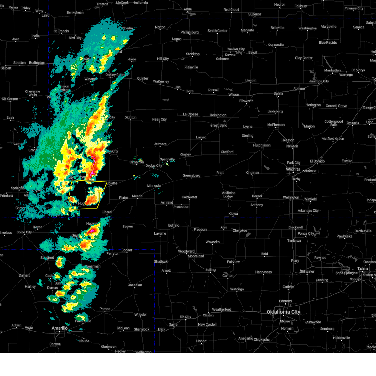 At 428 pm cst, a severe thunderstorm was located near moscow, moving northeast at 60 mph (radar indicated). Hazards include 70 mph wind gusts and nickel size hail. Expect considerable tree damage. damage is likely to mobile homes, roofs, and outbuildings. locations impacted include, cave and ryus. thunderstorm damage threat, considerable hail threat, radar indicated max hail size, 0. 88 in wind threat, radar indicated max wind gust, 70 mph. At 428 pm cst, a severe thunderstorm was located near moscow, moving northeast at 60 mph (radar indicated). Hazards include 70 mph wind gusts and nickel size hail. Expect considerable tree damage. damage is likely to mobile homes, roofs, and outbuildings. locations impacted include, cave and ryus. thunderstorm damage threat, considerable hail threat, radar indicated max hail size, 0. 88 in wind threat, radar indicated max wind gust, 70 mph.
|
| 2/26/2023 4:25 PM CST |
 At 425 pm cst, a severe thunderstorm was located 9 miles north of ulysses, moving northeast at 50 mph (radar indicated). Hazards include 70 mph wind gusts and nickel size hail. Expect considerable tree damage. damage is likely to mobile homes, roofs, and outbuildings. locations impacted include, ulysses, lakin, holcomb and deerfield. thunderstorm damage threat, considerable hail threat, radar indicated max hail size, 0. 88 in wind threat, radar indicated max wind gust, 70 mph. At 425 pm cst, a severe thunderstorm was located 9 miles north of ulysses, moving northeast at 50 mph (radar indicated). Hazards include 70 mph wind gusts and nickel size hail. Expect considerable tree damage. damage is likely to mobile homes, roofs, and outbuildings. locations impacted include, ulysses, lakin, holcomb and deerfield. thunderstorm damage threat, considerable hail threat, radar indicated max hail size, 0. 88 in wind threat, radar indicated max wind gust, 70 mph.
|
| 2/26/2023 4:20 PM CST | Quarter sized hail reported 0.2 miles SSW of Ulysses, KS, report received through social media with photos. |
| 2/26/2023 4:17 PM CST |
 At 417 pm cst, a severe thunderstorm was located near ulysses, moving northeast at 50 mph (radar indicated). Hazards include 70 mph wind gusts and nickel size hail. Expect considerable tree damage. Damage is likely to mobile homes, roofs, and outbuildings. At 417 pm cst, a severe thunderstorm was located near ulysses, moving northeast at 50 mph (radar indicated). Hazards include 70 mph wind gusts and nickel size hail. Expect considerable tree damage. Damage is likely to mobile homes, roofs, and outbuildings.
|
| 2/26/2023 4:15 PM CST | Quarter sized hail reported 0.2 miles SSW of Ulysses, KS, corrects time of previous hail report from ulysses. report received through social media with photos. |
| 2/26/2023 4:11 PM CST |
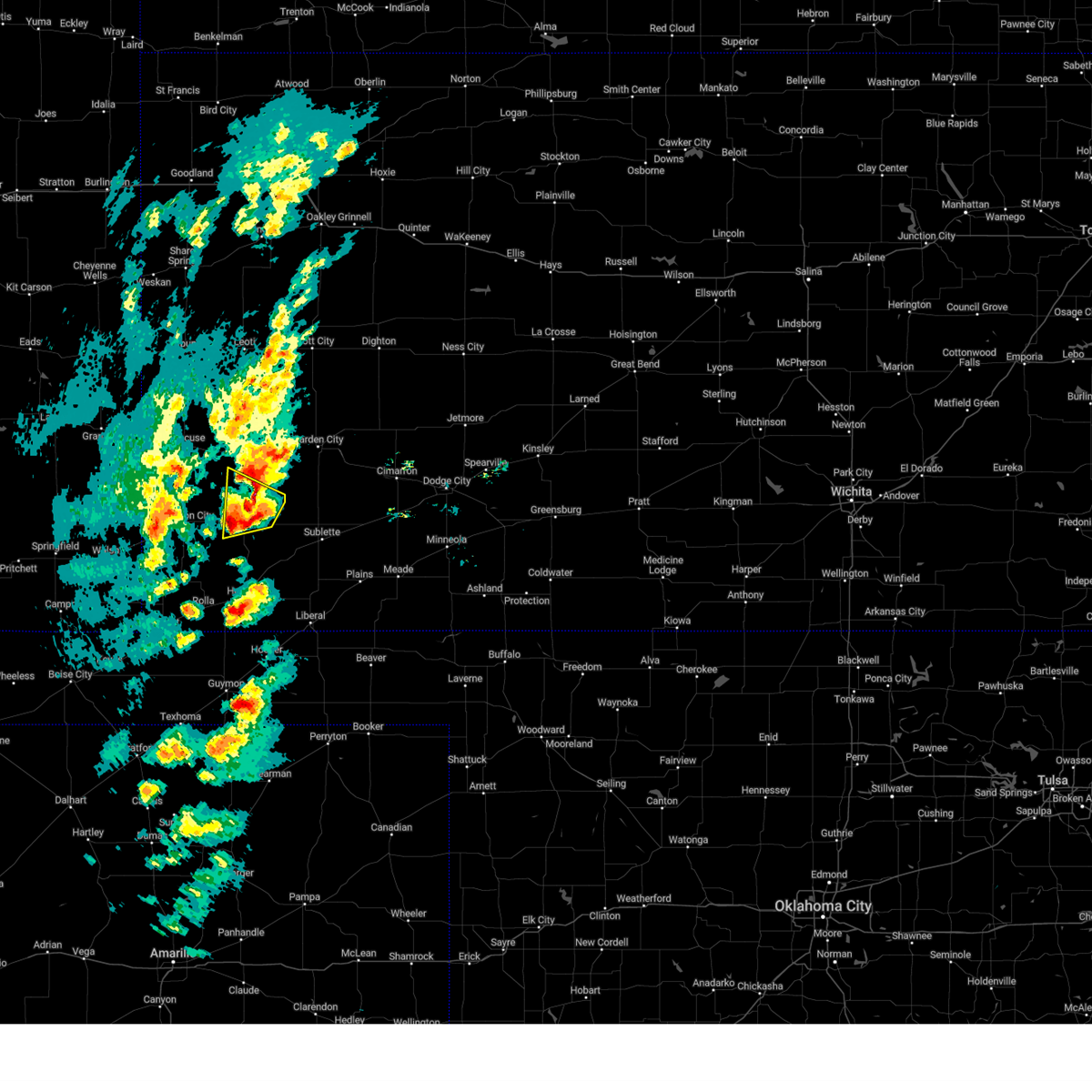 At 410 pm cst, a severe thunderstorm was located near big bow, moving northeast at 50 mph (radar indicated). Hazards include 70 mph wind gusts and quarter size hail. Hail damage to vehicles is expected. expect considerable tree damage. wind damage is also likely to mobile homes, roofs, and outbuildings. locations impacted include, ulysses and hickok. thunderstorm damage threat, considerable hail threat, radar indicated max hail size, 1. 00 in wind threat, radar indicated max wind gust, 70 mph. At 410 pm cst, a severe thunderstorm was located near big bow, moving northeast at 50 mph (radar indicated). Hazards include 70 mph wind gusts and quarter size hail. Hail damage to vehicles is expected. expect considerable tree damage. wind damage is also likely to mobile homes, roofs, and outbuildings. locations impacted include, ulysses and hickok. thunderstorm damage threat, considerable hail threat, radar indicated max hail size, 1. 00 in wind threat, radar indicated max wind gust, 70 mph.
|
| 2/26/2023 4:10 PM CST |
 At 409 pm cst, a severe thunderstorm was located near feterita, moving northeast at 60 mph (radar indicated). Hazards include 70 mph wind gusts and nickel size hail. Expect considerable tree damage. damage is likely to mobile homes, roofs, and outbuildings. this severe thunderstorm will be near, hugoton around 420 pm cst. other locations in the path of this severe thunderstorm include moscow, cave and ryus. thunderstorm damage threat, considerable hail threat, radar indicated max hail size, 0. 88 in wind threat, radar indicated max wind gust, 70 mph. At 409 pm cst, a severe thunderstorm was located near feterita, moving northeast at 60 mph (radar indicated). Hazards include 70 mph wind gusts and nickel size hail. Expect considerable tree damage. damage is likely to mobile homes, roofs, and outbuildings. this severe thunderstorm will be near, hugoton around 420 pm cst. other locations in the path of this severe thunderstorm include moscow, cave and ryus. thunderstorm damage threat, considerable hail threat, radar indicated max hail size, 0. 88 in wind threat, radar indicated max wind gust, 70 mph.
|
| 2/26/2023 4:02 PM CST |
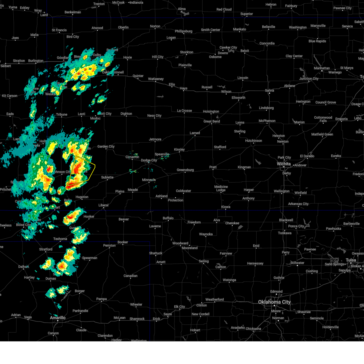 At 402 pm cst, a severe thunderstorm was located 7 miles south of big bow, moving northeast at 50 mph (radar indicated). Hazards include 70 mph wind gusts and quarter size hail. Hail damage to vehicles is expected. expect considerable tree damage. wind damage is also likely to mobile homes, roofs, and outbuildings. locations impacted include, ulysses, big bow and hickok. thunderstorm damage threat, considerable hail threat, radar indicated max hail size, 1. 00 in wind threat, radar indicated max wind gust, 70 mph. At 402 pm cst, a severe thunderstorm was located 7 miles south of big bow, moving northeast at 50 mph (radar indicated). Hazards include 70 mph wind gusts and quarter size hail. Hail damage to vehicles is expected. expect considerable tree damage. wind damage is also likely to mobile homes, roofs, and outbuildings. locations impacted include, ulysses, big bow and hickok. thunderstorm damage threat, considerable hail threat, radar indicated max hail size, 1. 00 in wind threat, radar indicated max wind gust, 70 mph.
|
| 2/26/2023 3:54 PM CST |
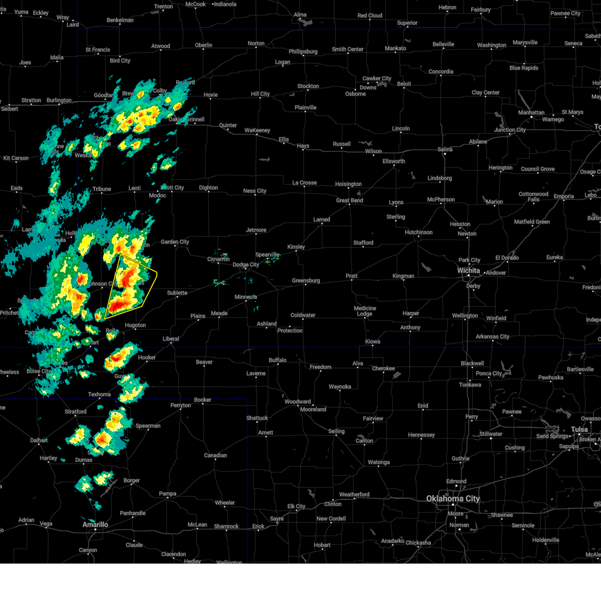 At 353 pm cst/253 pm mst/, a severe thunderstorm was located 12 miles northeast of richfield, moving northeast at 50 mph. this is a destructive storm for big bow and ulysses (radar indicated). Hazards include 80 mph wind gusts and half dollar size hail. Flying debris will be dangerous to those caught without shelter. mobile homes will be heavily damaged. expect considerable damage to roofs, windows, and vehicles. extensive tree damage and power outages are likely. locations impacted include, big bow and ulysses. thunderstorm damage threat, destructive hail threat, radar indicated max hail size, 1. 25 in wind threat, radar indicated max wind gust, 80 mph. At 353 pm cst/253 pm mst/, a severe thunderstorm was located 12 miles northeast of richfield, moving northeast at 50 mph. this is a destructive storm for big bow and ulysses (radar indicated). Hazards include 80 mph wind gusts and half dollar size hail. Flying debris will be dangerous to those caught without shelter. mobile homes will be heavily damaged. expect considerable damage to roofs, windows, and vehicles. extensive tree damage and power outages are likely. locations impacted include, big bow and ulysses. thunderstorm damage threat, destructive hail threat, radar indicated max hail size, 1. 25 in wind threat, radar indicated max wind gust, 80 mph.
|
| 2/26/2023 3:45 PM CST |
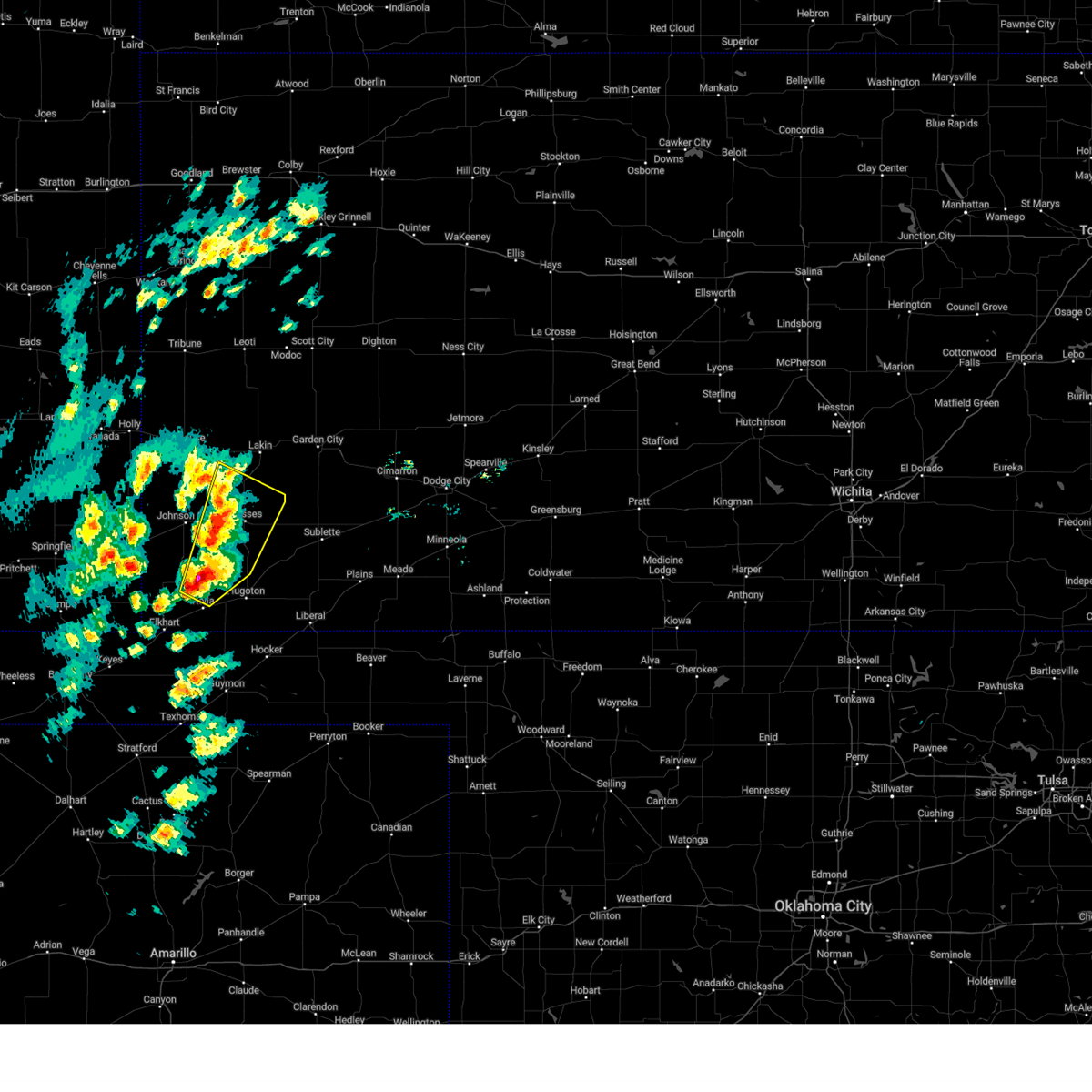 At 344 pm cst/244 pm mst/, a severe thunderstorm was located 7 miles east of richfield, moving northeast at 50 mph. this is a destructive storm for big bow and ulysses (radar indicated). Hazards include 80 mph wind gusts and ping pong ball size hail. Flying debris will be dangerous to those caught without shelter. mobile homes will be heavily damaged. expect considerable damage to roofs, windows, and vehicles. extensive tree damage and power outages are likely. this severe thunderstorm will be near, big bow around 410 pm cst. ulysses around 415 pm cst. thunderstorm damage threat, destructive hail threat, radar indicated max hail size, 1. 50 in wind threat, radar indicated max wind gust, 80 mph. At 344 pm cst/244 pm mst/, a severe thunderstorm was located 7 miles east of richfield, moving northeast at 50 mph. this is a destructive storm for big bow and ulysses (radar indicated). Hazards include 80 mph wind gusts and ping pong ball size hail. Flying debris will be dangerous to those caught without shelter. mobile homes will be heavily damaged. expect considerable damage to roofs, windows, and vehicles. extensive tree damage and power outages are likely. this severe thunderstorm will be near, big bow around 410 pm cst. ulysses around 415 pm cst. thunderstorm damage threat, destructive hail threat, radar indicated max hail size, 1. 50 in wind threat, radar indicated max wind gust, 80 mph.
|
| 6/12/2022 7:27 PM CDT |
 At 725 pm cdt, severe thunderstorm winds were located across much of grant and haskell counties, moving east at 45 mph (automated equipment. these storms have a history of wind gusts to near 70 mph). Hazards include 70 mph wind gusts. Expect considerable tree damage. damage is likely to mobile homes, roofs, and outbuildings. this severe thunderstorm will remain over mainly rural areas of southern kearny, southwestern finney, grant and western haskell counties. thunderstorm damage threat, considerable hail threat, radar indicated max hail size, <. 75 in wind threat, radar indicated max wind gust, 70 mph. At 725 pm cdt, severe thunderstorm winds were located across much of grant and haskell counties, moving east at 45 mph (automated equipment. these storms have a history of wind gusts to near 70 mph). Hazards include 70 mph wind gusts. Expect considerable tree damage. damage is likely to mobile homes, roofs, and outbuildings. this severe thunderstorm will remain over mainly rural areas of southern kearny, southwestern finney, grant and western haskell counties. thunderstorm damage threat, considerable hail threat, radar indicated max hail size, <. 75 in wind threat, radar indicated max wind gust, 70 mph.
|
| 6/12/2022 7:03 PM CDT |
 At 702 pm cdt, a severe thunderstorm was located near big bow, moving east at 60 mph (automated equipment. the johnson airport measured a gust of 70 mph at 655 pm cdt). Hazards include 70 mph wind gusts. areas of blowing dust are likely. Expect considerable tree damage. damage is likely to mobile homes, roofs, and outbuildings. this severe thunderstorm will be near, hickok around 715 pm cdt. thunderstorm damage threat, considerable hail threat, radar indicated max hail size, <. 75 in wind threat, radar indicated max wind gust, 70 mph. At 702 pm cdt, a severe thunderstorm was located near big bow, moving east at 60 mph (automated equipment. the johnson airport measured a gust of 70 mph at 655 pm cdt). Hazards include 70 mph wind gusts. areas of blowing dust are likely. Expect considerable tree damage. damage is likely to mobile homes, roofs, and outbuildings. this severe thunderstorm will be near, hickok around 715 pm cdt. thunderstorm damage threat, considerable hail threat, radar indicated max hail size, <. 75 in wind threat, radar indicated max wind gust, 70 mph.
|
| 6/7/2022 12:01 AM CDT |
 At 1200 am cdt, severe thunderstorms were located along a line extending from 6 miles northeast of ryus to near rolla, moving southeast at 30 mph (radar indicated). Hazards include 60 mph wind gusts and quarter size hail. Hail damage to vehicles is expected. expect wind damage to roofs, siding, and trees. locations impacted include, hugoton, sublette, satanta, rolla, moscow, wilburton, ryus, cave, hickok and feterita. hail threat, radar indicated max hail size, 1. 00 in wind threat, radar indicated max wind gust, 60 mph. At 1200 am cdt, severe thunderstorms were located along a line extending from 6 miles northeast of ryus to near rolla, moving southeast at 30 mph (radar indicated). Hazards include 60 mph wind gusts and quarter size hail. Hail damage to vehicles is expected. expect wind damage to roofs, siding, and trees. locations impacted include, hugoton, sublette, satanta, rolla, moscow, wilburton, ryus, cave, hickok and feterita. hail threat, radar indicated max hail size, 1. 00 in wind threat, radar indicated max wind gust, 60 mph.
|
| 6/6/2022 11:37 PM CDT |
 At 1137 pm cdt, severe thunderstorms were located along a line extending from 8 miles north of ulysses to 10 miles southwest of richfield, moving southeast at 40 mph (radar indicated). Hazards include 60 mph wind gusts and half dollar size hail. Hail damage to vehicles is expected. expect wind damage to roofs, siding, and trees. locations impacted include, hickok, wilburton, rolla, feterita and sublette. hail threat, radar indicated max hail size, 1. 25 in wind threat, radar indicated max wind gust, 60 mph. At 1137 pm cdt, severe thunderstorms were located along a line extending from 8 miles north of ulysses to 10 miles southwest of richfield, moving southeast at 40 mph (radar indicated). Hazards include 60 mph wind gusts and half dollar size hail. Hail damage to vehicles is expected. expect wind damage to roofs, siding, and trees. locations impacted include, hickok, wilburton, rolla, feterita and sublette. hail threat, radar indicated max hail size, 1. 25 in wind threat, radar indicated max wind gust, 60 mph.
|
| 6/6/2022 11:29 PM CDT |
 At 1128 pm cdt, severe thunderstorms were located along a line extending from 10 miles north of ulysses to 10 miles southeast of stonington, moving east at 40 mph (radar indicated). Hazards include 60 mph wind gusts and penny size hail. Expect damage to roofs, siding, and trees. severe thunderstorms will be near, richfield around 1145 pm cdt. other locations in the path of these severe thunderstorms include hickok, wilburton, rolla, sublette and feterita. hail threat, radar indicated max hail size, 0. 75 in wind threat, radar indicated max wind gust, 60 mph. At 1128 pm cdt, severe thunderstorms were located along a line extending from 10 miles north of ulysses to 10 miles southeast of stonington, moving east at 40 mph (radar indicated). Hazards include 60 mph wind gusts and penny size hail. Expect damage to roofs, siding, and trees. severe thunderstorms will be near, richfield around 1145 pm cdt. other locations in the path of these severe thunderstorms include hickok, wilburton, rolla, sublette and feterita. hail threat, radar indicated max hail size, 0. 75 in wind threat, radar indicated max wind gust, 60 mph.
|
| 6/6/2022 9:17 PM CDT |
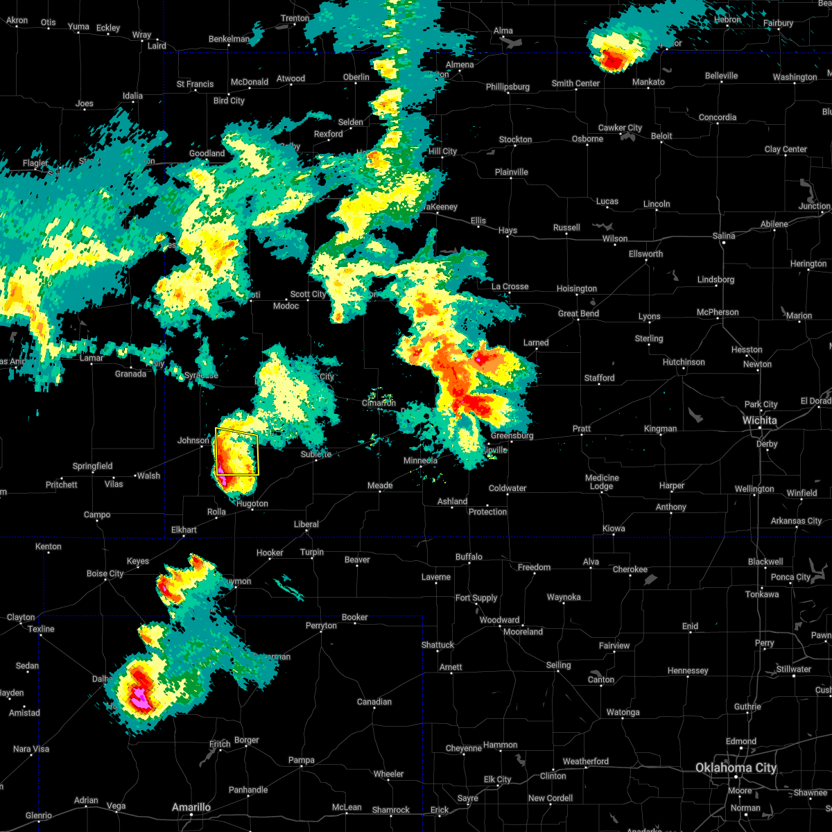 At 917 pm cdt, a severe thunderstorm was located 8 miles south of big bow, moving southeast at 30 mph (radar indicated). Hazards include quarter size hail. Damage to vehicles is expected. this severe thunderstorm will remain over mainly rural areas of southwestern grant and eastern stanton counties. hail threat, radar indicated max hail size, 1. 00 in wind threat, radar indicated max wind gust, <50 mph. At 917 pm cdt, a severe thunderstorm was located 8 miles south of big bow, moving southeast at 30 mph (radar indicated). Hazards include quarter size hail. Damage to vehicles is expected. this severe thunderstorm will remain over mainly rural areas of southwestern grant and eastern stanton counties. hail threat, radar indicated max hail size, 1. 00 in wind threat, radar indicated max wind gust, <50 mph.
|
| 6/6/2022 9:04 PM CDT |
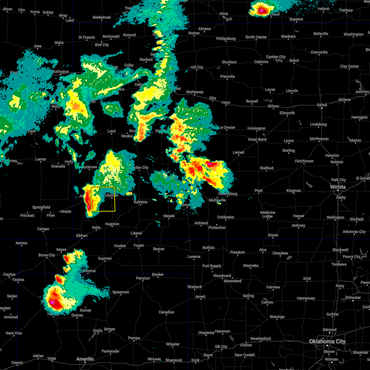 At 904 pm cdt, a severe thunderstorm was located 8 miles southwest of big bow, moving east at 35 mph (radar indicated). Hazards include quarter size hail. Damage to vehicles is expected. this severe storm will be near, big bow around 910 pm cdt. hail threat, radar indicated max hail size, 1. 00 in wind threat, radar indicated max wind gust, <50 mph. At 904 pm cdt, a severe thunderstorm was located 8 miles southwest of big bow, moving east at 35 mph (radar indicated). Hazards include quarter size hail. Damage to vehicles is expected. this severe storm will be near, big bow around 910 pm cdt. hail threat, radar indicated max hail size, 1. 00 in wind threat, radar indicated max wind gust, <50 mph.
|
| 6/6/2022 8:52 PM CDT |
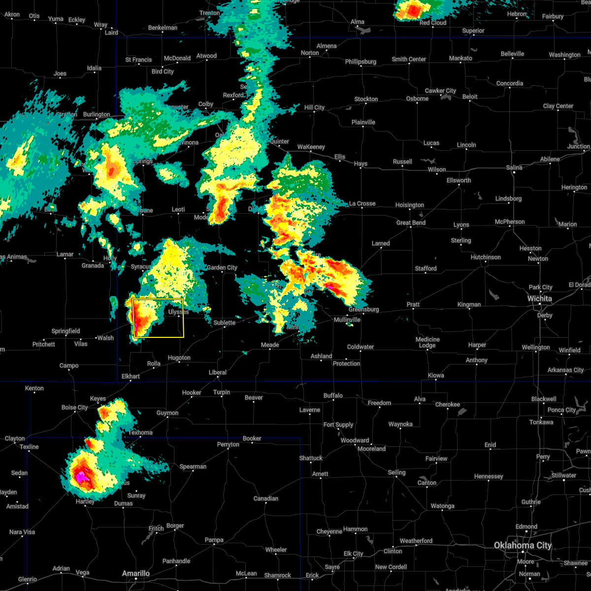 At 852 pm cdt, a severe thunderstorm was located near johnson city, moving east at 35 mph (radar indicated). Hazards include quarter size hail. Damage to vehicles is expected. this severe thunderstorm will be near, johnson city around 900 pm cdt. other locations in the path of this severe thunderstorm include big bow and ulysses. hail threat, radar indicated max hail size, 1. 00 in wind threat, radar indicated max wind gust, <50 mph. At 852 pm cdt, a severe thunderstorm was located near johnson city, moving east at 35 mph (radar indicated). Hazards include quarter size hail. Damage to vehicles is expected. this severe thunderstorm will be near, johnson city around 900 pm cdt. other locations in the path of this severe thunderstorm include big bow and ulysses. hail threat, radar indicated max hail size, 1. 00 in wind threat, radar indicated max wind gust, <50 mph.
|
| 6/3/2022 10:20 PM CDT |
 The severe thunderstorm warning for southeastern kearny, finney, northeastern grant, northwestern gray and northwestern haskell counties will expire at 1030 pm cdt, the storms which prompted the warning have weakened below severe limits, and no longer pose an immediate threat to life or property. therefore, the warning will be allowed to expire. however heavy rain is still possible with these thunderstorms. a severe thunderstorm watch remains in effect until 1100 pm cdt for southwestern kansas. The severe thunderstorm warning for southeastern kearny, finney, northeastern grant, northwestern gray and northwestern haskell counties will expire at 1030 pm cdt, the storms which prompted the warning have weakened below severe limits, and no longer pose an immediate threat to life or property. therefore, the warning will be allowed to expire. however heavy rain is still possible with these thunderstorms. a severe thunderstorm watch remains in effect until 1100 pm cdt for southwestern kansas.
|
| 6/3/2022 10:16 PM CDT |
 At 1015 pm cdt, severe thunderstorms were located along a line extending from 15 miles southeast of friend to near ulysses, moving east at 30 mph (radar indicated). Hazards include 60 mph wind gusts and penny size hail. Expect damage to roofs, siding, and trees. locations impacted include, garden city, ulysses, lakin, holcomb, deerfield, pierceville, hickok and plymell. hail threat, radar indicated max hail size, 0. 75 in wind threat, radar indicated max wind gust, 60 mph. At 1015 pm cdt, severe thunderstorms were located along a line extending from 15 miles southeast of friend to near ulysses, moving east at 30 mph (radar indicated). Hazards include 60 mph wind gusts and penny size hail. Expect damage to roofs, siding, and trees. locations impacted include, garden city, ulysses, lakin, holcomb, deerfield, pierceville, hickok and plymell. hail threat, radar indicated max hail size, 0. 75 in wind threat, radar indicated max wind gust, 60 mph.
|
| 6/3/2022 9:59 PM CDT |
 At 959 pm cdt, severe thunderstorms were located along a line extending from 9 miles southeast of friend to near big bow, moving east at 30 mph (radar indicated). Hazards include 60 mph wind gusts and penny size hail. Expect damage to roofs, siding, and trees. locations impacted include, hickok. hail threat, radar indicated max hail size, 0. 75 in wind threat, radar indicated max wind gust, 60 mph. At 959 pm cdt, severe thunderstorms were located along a line extending from 9 miles southeast of friend to near big bow, moving east at 30 mph (radar indicated). Hazards include 60 mph wind gusts and penny size hail. Expect damage to roofs, siding, and trees. locations impacted include, hickok. hail threat, radar indicated max hail size, 0. 75 in wind threat, radar indicated max wind gust, 60 mph.
|
| 6/3/2022 9:44 PM CDT |
 At 944 pm cdt, severe thunderstorms were located along a line extending from near friend to near big bow, moving east at 30 mph (radar indicated). Hazards include 60 mph wind gusts and nickel size hail. Expect damage to roofs, siding, and trees. severe thunderstorms will be near, friend around 950 pm cdt. other locations in the path of these severe thunderstorms include ulysses, hickok and ryus. hail threat, radar indicated max hail size, 0. 88 in wind threat, radar indicated max wind gust, 60 mph. At 944 pm cdt, severe thunderstorms were located along a line extending from near friend to near big bow, moving east at 30 mph (radar indicated). Hazards include 60 mph wind gusts and nickel size hail. Expect damage to roofs, siding, and trees. severe thunderstorms will be near, friend around 950 pm cdt. other locations in the path of these severe thunderstorms include ulysses, hickok and ryus. hail threat, radar indicated max hail size, 0. 88 in wind threat, radar indicated max wind gust, 60 mph.
|
| 6/3/2022 9:32 PM CDT |
 At 932 pm cdt/832 pm mdt/, severe thunderstorms were located along a line extending from near friend to near lakin to near big bow, moving east at 40 mph (radar indicated). Hazards include 60 mph wind gusts and nickel size hail. Expect damage to roofs, siding, and trees. locations impacted include, garden city, ulysses, lakin, holcomb, johnson city, deerfield, manter, kendall, hickok, big bow and friend. hail threat, radar indicated max hail size, 0. 88 in wind threat, radar indicated max wind gust, 60 mph. At 932 pm cdt/832 pm mdt/, severe thunderstorms were located along a line extending from near friend to near lakin to near big bow, moving east at 40 mph (radar indicated). Hazards include 60 mph wind gusts and nickel size hail. Expect damage to roofs, siding, and trees. locations impacted include, garden city, ulysses, lakin, holcomb, johnson city, deerfield, manter, kendall, hickok, big bow and friend. hail threat, radar indicated max hail size, 0. 88 in wind threat, radar indicated max wind gust, 60 mph.
|
| 6/3/2022 9:25 PM CDT |
 At 925 pm cdt/825 pm mdt/, severe thunderstorms were located along a line extending from 7 miles west of friend to near lakin to near big bow, moving east at 40 mph (radar indicated). Hazards include 60 mph wind gusts. Expect damage to roofs, siding, and trees. locations impacted include, lakin, deerfield, friend, ulysses and hickok. hail threat, radar indicated max hail size, <. 75 in wind threat, radar indicated max wind gust, 60 mph. At 925 pm cdt/825 pm mdt/, severe thunderstorms were located along a line extending from 7 miles west of friend to near lakin to near big bow, moving east at 40 mph (radar indicated). Hazards include 60 mph wind gusts. Expect damage to roofs, siding, and trees. locations impacted include, lakin, deerfield, friend, ulysses and hickok. hail threat, radar indicated max hail size, <. 75 in wind threat, radar indicated max wind gust, 60 mph.
|
| 6/3/2022 8:48 PM CDT |
 At 848 pm cdt/748 pm mdt/, severe thunderstorms were located along a line extending from 16 miles south of leoti to near kendall to 7 miles north of the saunders elevator, moving east at 40 mph (radar indicated). Hazards include 60 mph wind gusts. Expect damage to roofs, siding, and trees. severe thunderstorms will be near, kendall around 755 pm mdt. other locations in the path of these severe thunderstorms include johnson city, lakin, deerfield, big bow, friend and ulysses. hail threat, radar indicated max hail size, <. 75 in wind threat, radar indicated max wind gust, 60 mph. At 848 pm cdt/748 pm mdt/, severe thunderstorms were located along a line extending from 16 miles south of leoti to near kendall to 7 miles north of the saunders elevator, moving east at 40 mph (radar indicated). Hazards include 60 mph wind gusts. Expect damage to roofs, siding, and trees. severe thunderstorms will be near, kendall around 755 pm mdt. other locations in the path of these severe thunderstorms include johnson city, lakin, deerfield, big bow, friend and ulysses. hail threat, radar indicated max hail size, <. 75 in wind threat, radar indicated max wind gust, 60 mph.
|
| 5/16/2022 11:41 PM CDT |
 The severe thunderstorm warning for morton, grant, southeastern stanton and stevens counties will expire at 1145 pm cdt, the storm which prompted the warning has weakened below severe limits, and no longer poses an immediate threat to life or property. therefore, the warning will be allowed to expire. however gusty winds are still possible with this thunderstorm. The severe thunderstorm warning for morton, grant, southeastern stanton and stevens counties will expire at 1145 pm cdt, the storm which prompted the warning has weakened below severe limits, and no longer poses an immediate threat to life or property. therefore, the warning will be allowed to expire. however gusty winds are still possible with this thunderstorm.
|
| 5/16/2022 11:22 PM CDT |
 At 1121 pm cdt, a severe thunderstorm was located 11 miles north of feterita, moving east at 30 mph (radar indicated). Hazards include 70 mph wind gusts. Expect considerable tree damage. damage is likely to mobile homes, roofs, and outbuildings. locations impacted include, ulysses, hugoton, rolla, moscow, richfield, wilburton, ryus, cave, hickok, woods, big bow and feterita. thunderstorm damage threat, considerable hail threat, radar indicated max hail size, <. 75 in wind threat, radar indicated max wind gust, 70 mph. At 1121 pm cdt, a severe thunderstorm was located 11 miles north of feterita, moving east at 30 mph (radar indicated). Hazards include 70 mph wind gusts. Expect considerable tree damage. damage is likely to mobile homes, roofs, and outbuildings. locations impacted include, ulysses, hugoton, rolla, moscow, richfield, wilburton, ryus, cave, hickok, woods, big bow and feterita. thunderstorm damage threat, considerable hail threat, radar indicated max hail size, <. 75 in wind threat, radar indicated max wind gust, 70 mph.
|
| 5/16/2022 11:07 PM CDT |
 At 1105 pm cdt, a severe thunderstorm was located 11 miles east of richfield, moving east at 35 mph. this replaces the previous warning for stanton and morton counties (radar indicated). Hazards include 70 mph wind gusts. Expect considerable tree damage. Damage is likely to mobile homes, roofs, and outbuildings. At 1105 pm cdt, a severe thunderstorm was located 11 miles east of richfield, moving east at 35 mph. this replaces the previous warning for stanton and morton counties (radar indicated). Hazards include 70 mph wind gusts. Expect considerable tree damage. Damage is likely to mobile homes, roofs, and outbuildings.
|
| 4/23/2022 1:39 AM CDT |
 At 139 am cdt, severe thunderstorms were located along a line extending from 9 miles north of deerfield to near rolla, moving east at 35 mph (radar indicated). Hazards include 60 mph wind gusts. Expect damage to roofs, siding, and trees. locations impacted include, garden city, ulysses, hugoton, lakin, holcomb, satanta, deerfield, moscow, ryus, feterita, plymell, cave, hickok and woods. hail threat, radar indicated max hail size, <. 75 in wind threat, radar indicated max wind gust, 60 mph. At 139 am cdt, severe thunderstorms were located along a line extending from 9 miles north of deerfield to near rolla, moving east at 35 mph (radar indicated). Hazards include 60 mph wind gusts. Expect damage to roofs, siding, and trees. locations impacted include, garden city, ulysses, hugoton, lakin, holcomb, satanta, deerfield, moscow, ryus, feterita, plymell, cave, hickok and woods. hail threat, radar indicated max hail size, <. 75 in wind threat, radar indicated max wind gust, 60 mph.
|
| 4/23/2022 1:32 AM CDT |
 At 132 am cdt, severe thunderstorms were located along a line extending from 10 miles northwest of deerfield to near rolla, moving east at 35 mph (radar indicated). Hazards include 60 mph wind gusts. Expect damage to roofs, siding, and trees. locations impacted include, garden city, ulysses, hugoton, lakin, holcomb, satanta, deerfield, rolla, moscow, ryus, big bow, feterita, plymell, wilburton, cave, hickok and woods. hail threat, radar indicated max hail size, <. 75 in wind threat, radar indicated max wind gust, 60 mph. At 132 am cdt, severe thunderstorms were located along a line extending from 10 miles northwest of deerfield to near rolla, moving east at 35 mph (radar indicated). Hazards include 60 mph wind gusts. Expect damage to roofs, siding, and trees. locations impacted include, garden city, ulysses, hugoton, lakin, holcomb, satanta, deerfield, rolla, moscow, ryus, big bow, feterita, plymell, wilburton, cave, hickok and woods. hail threat, radar indicated max hail size, <. 75 in wind threat, radar indicated max wind gust, 60 mph.
|
| 4/23/2022 1:03 AM CDT |
 At 102 am cdt, severe thunderstorms were located along a line extending from 7 miles north of kendall to near elkhart, moving east at 35 mph (radar indicated). Hazards include 60 mph wind gusts and quarter size hail. Hail damage to vehicles is expected. Expect wind damage to roofs, siding, and trees. At 102 am cdt, severe thunderstorms were located along a line extending from 7 miles north of kendall to near elkhart, moving east at 35 mph (radar indicated). Hazards include 60 mph wind gusts and quarter size hail. Hail damage to vehicles is expected. Expect wind damage to roofs, siding, and trees.
|
| 4/22/2022 7:44 PM CDT | Quarter sized hail reported 2.6 miles N of Ulysses, KS |
| 4/22/2022 7:35 PM CDT | Hen Egg sized hail reported 0.2 miles SSW of Ulysses, KS, report received via social media. time estimated from radar. |
| 4/22/2022 7:35 PM CDT | Hen Egg sized hail reported 2.7 miles NNW of Ulysses, KS, social media. |
| 4/22/2022 7:30 PM CDT |
 At 730 pm cdt, a severe thunderstorm was located very near hickok, moving northeast at 45 mph (radar indicated). Hazards include two inch hail and 60 mph wind gusts. People and animals outdoors will be injured. expect hail damage to roofs, siding, windows, and vehicles. expect wind damage to roofs, siding, and trees. locations impacted include, ulysses, satanta, moscow, ryus, cave and hickok. thunderstorm damage threat, considerable hail threat, radar indicated max hail size, 2. 00 in wind threat, radar indicated max wind gust, 60 mph. At 730 pm cdt, a severe thunderstorm was located very near hickok, moving northeast at 45 mph (radar indicated). Hazards include two inch hail and 60 mph wind gusts. People and animals outdoors will be injured. expect hail damage to roofs, siding, windows, and vehicles. expect wind damage to roofs, siding, and trees. locations impacted include, ulysses, satanta, moscow, ryus, cave and hickok. thunderstorm damage threat, considerable hail threat, radar indicated max hail size, 2. 00 in wind threat, radar indicated max wind gust, 60 mph.
|
| 4/22/2022 7:21 PM CDT |
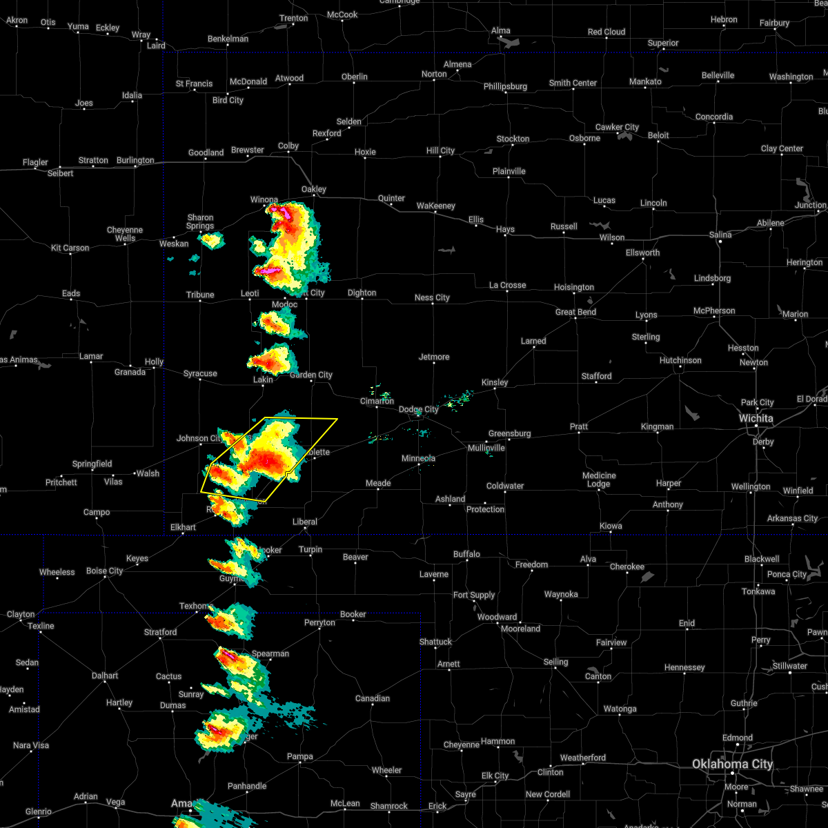 At 721 pm cdt, a severe thunderstorm was located very near hickok, moving northeast at 45 mph (radar indicated). Hazards include two inch hail and 60 mph wind gusts. People and animals outdoors will be injured. expect hail damage to roofs, siding, windows, and vehicles. expect wind damage to roofs, siding, and trees. this severe thunderstorm will remain over mainly rural areas of northeastern morton, grant, southeastern stanton, northern stevens and northwestern haskell counties. thunderstorm damage threat, considerable hail threat, radar indicated max hail size, 2. 00 in wind threat, radar indicated max wind gust, 60 mph. At 721 pm cdt, a severe thunderstorm was located very near hickok, moving northeast at 45 mph (radar indicated). Hazards include two inch hail and 60 mph wind gusts. People and animals outdoors will be injured. expect hail damage to roofs, siding, windows, and vehicles. expect wind damage to roofs, siding, and trees. this severe thunderstorm will remain over mainly rural areas of northeastern morton, grant, southeastern stanton, northern stevens and northwestern haskell counties. thunderstorm damage threat, considerable hail threat, radar indicated max hail size, 2. 00 in wind threat, radar indicated max wind gust, 60 mph.
|
| 4/22/2022 6:56 PM CDT |
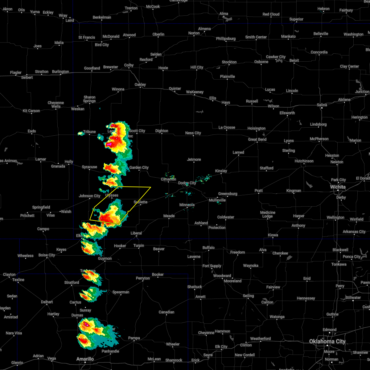 At 656 pm cdt, a severe thunderstorm was located 10 miles west of moscow, moving northeast at 50 mph (radar indicated). Hazards include tennis ball size hail and 60 mph wind gusts. People and animals outdoors will be injured. expect hail damage to roofs, siding, windows, and vehicles. expect wind damage to roofs, siding, and trees. this severe thunderstorm will be near, hickok and ryus around 710 pm cdt. thunderstorm damage threat, considerable hail threat, radar indicated max hail size, 2. 50 in wind threat, radar indicated max wind gust, 60 mph. At 656 pm cdt, a severe thunderstorm was located 10 miles west of moscow, moving northeast at 50 mph (radar indicated). Hazards include tennis ball size hail and 60 mph wind gusts. People and animals outdoors will be injured. expect hail damage to roofs, siding, windows, and vehicles. expect wind damage to roofs, siding, and trees. this severe thunderstorm will be near, hickok and ryus around 710 pm cdt. thunderstorm damage threat, considerable hail threat, radar indicated max hail size, 2. 50 in wind threat, radar indicated max wind gust, 60 mph.
|
| 10/12/2021 8:37 PM CDT |
 At 837 pm cdt, severe thunderstorms were located along a line extending from near lakin to near ryus to 9 miles southeast of feterita, moving northeast at 50 mph (radar indicated). Hazards include 70 mph wind gusts and half dollar size hail. Hail damage to vehicles is expected. expect considerable tree damage. wind damage is also likely to mobile homes, roofs, and outbuildings. severe thunderstorms will be near, lakin, ryus and hickok around 840 pm cdt. deerfield around 845 pm cdt. hugoton and holcomb around 850 pm cdt. garden city around 855 pm cdt. Other locations in the path of these severe thunderstorms include moscow, woods, plymell, cave, satanta and pierceville. At 837 pm cdt, severe thunderstorms were located along a line extending from near lakin to near ryus to 9 miles southeast of feterita, moving northeast at 50 mph (radar indicated). Hazards include 70 mph wind gusts and half dollar size hail. Hail damage to vehicles is expected. expect considerable tree damage. wind damage is also likely to mobile homes, roofs, and outbuildings. severe thunderstorms will be near, lakin, ryus and hickok around 840 pm cdt. deerfield around 845 pm cdt. hugoton and holcomb around 850 pm cdt. garden city around 855 pm cdt. Other locations in the path of these severe thunderstorms include moscow, woods, plymell, cave, satanta and pierceville.
|
| 10/12/2021 8:28 PM CDT |
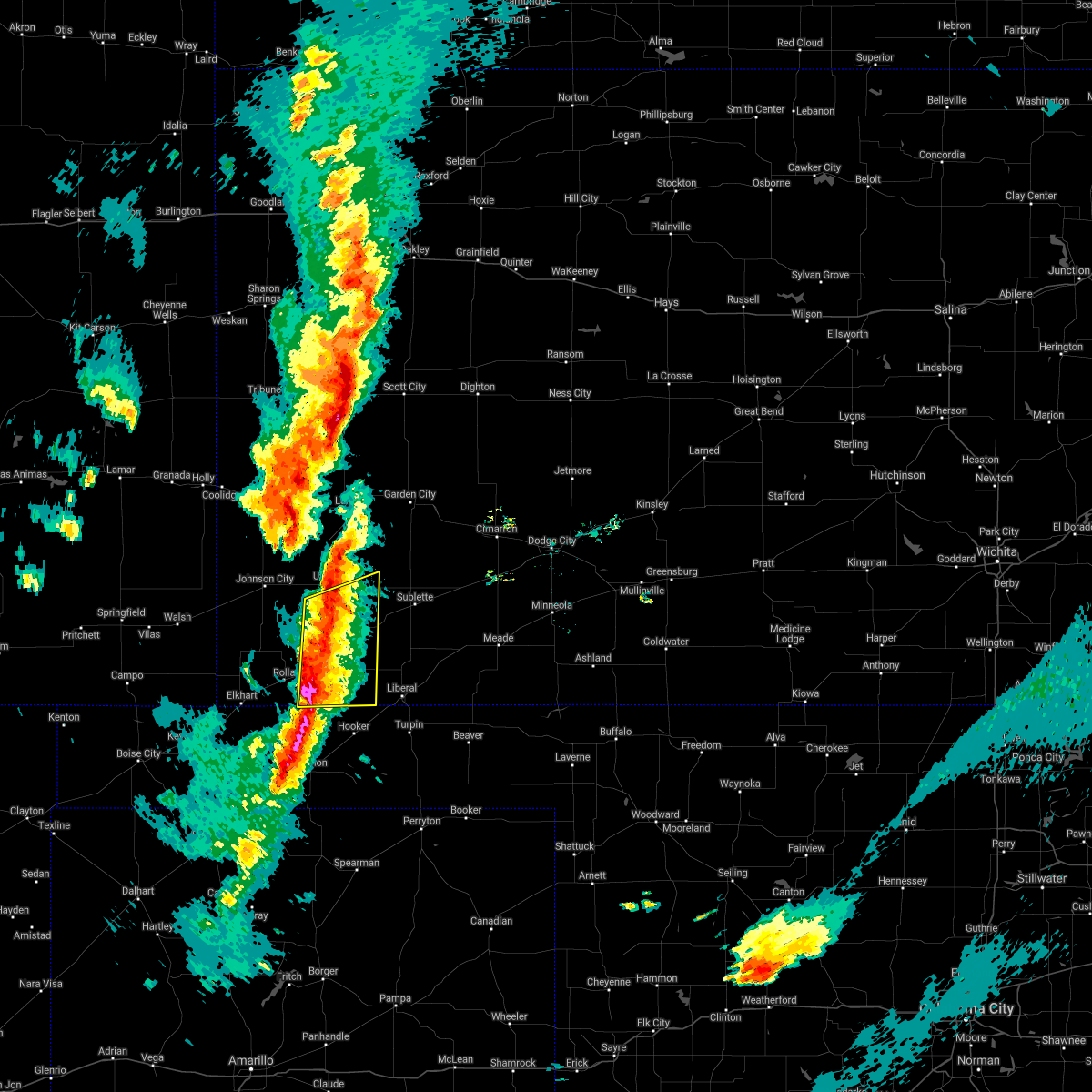 At 827 pm cdt, severe thunderstorms were located along a line extending from near ulysses to near hugoton to 11 miles south of feterita, moving east at 45 mph (radar indicated). Hazards include 70 mph wind gusts and half dollar size hail. Hail damage to vehicles is expected. expect considerable tree damage. wind damage is also likely to mobile homes, roofs, and outbuildings. Locations impacted include, hugoton, moscow, ryus, cave, hickok, woods and feterita. At 827 pm cdt, severe thunderstorms were located along a line extending from near ulysses to near hugoton to 11 miles south of feterita, moving east at 45 mph (radar indicated). Hazards include 70 mph wind gusts and half dollar size hail. Hail damage to vehicles is expected. expect considerable tree damage. wind damage is also likely to mobile homes, roofs, and outbuildings. Locations impacted include, hugoton, moscow, ryus, cave, hickok, woods and feterita.
|
| 10/12/2021 8:18 PM CDT | Mesonet station ew7515 johnso in stanton county KS, 15.7 miles NE of Ulysses, KS |
| 10/12/2021 8:18 PM CDT |
 At 818 pm cdt, severe thunderstorms were located along a line extending from 8 miles south of big bow to near feterita to 7 miles north of hough, moving east at 45 mph (radar indicated). Hazards include 70 mph wind gusts and half dollar size hail. Hail damage to vehicles is expected. expect considerable tree damage. wind damage is also likely to mobile homes, roofs, and outbuildings. Locations impacted include, ulysses, hugoton, rolla, moscow, ryus, cave, hickok, woods and feterita. At 818 pm cdt, severe thunderstorms were located along a line extending from 8 miles south of big bow to near feterita to 7 miles north of hough, moving east at 45 mph (radar indicated). Hazards include 70 mph wind gusts and half dollar size hail. Hail damage to vehicles is expected. expect considerable tree damage. wind damage is also likely to mobile homes, roofs, and outbuildings. Locations impacted include, ulysses, hugoton, rolla, moscow, ryus, cave, hickok, woods and feterita.
|
| 10/12/2021 8:02 PM CDT |
 At 802 pm cdt, severe thunderstorms were located along a line extending from 10 miles south of big bow to near hough, moving east at 50 mph (radar indicated). Hazards include 60 mph wind gusts and half dollar size hail. Hail damage to vehicles is expected. Expect wind damage to roofs, siding, and trees. At 802 pm cdt, severe thunderstorms were located along a line extending from 10 miles south of big bow to near hough, moving east at 50 mph (radar indicated). Hazards include 60 mph wind gusts and half dollar size hail. Hail damage to vehicles is expected. Expect wind damage to roofs, siding, and trees.
|
| 8/7/2021 6:53 PM CDT |
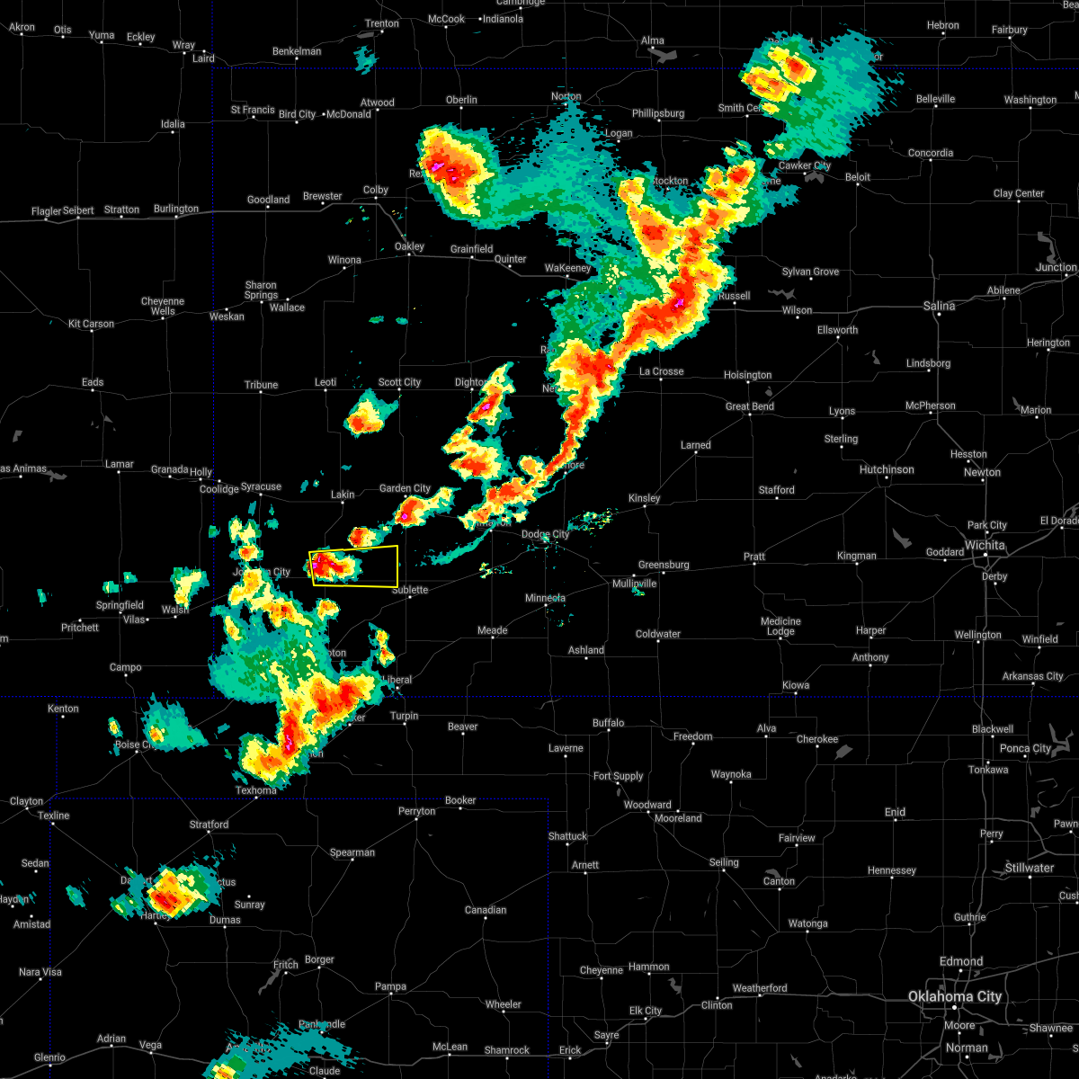 At 652 pm cdt, a severe thunderstorm was located near hickok, moving east at 25 mph (radar indicated). Hazards include 60 mph wind gusts and half dollar size hail. Hail damage to vehicles is expected. expect wind damage to roofs, siding, and trees. this severe thunderstorm will remain over mainly rural areas of northern grant and northwestern haskell counties. hail threat, radar indicated max hail size, 1. 25 in wind threat, radar indicated max wind gust, 60 mph. At 652 pm cdt, a severe thunderstorm was located near hickok, moving east at 25 mph (radar indicated). Hazards include 60 mph wind gusts and half dollar size hail. Hail damage to vehicles is expected. expect wind damage to roofs, siding, and trees. this severe thunderstorm will remain over mainly rural areas of northern grant and northwestern haskell counties. hail threat, radar indicated max hail size, 1. 25 in wind threat, radar indicated max wind gust, 60 mph.
|
| 5/24/2021 10:49 PM CDT |
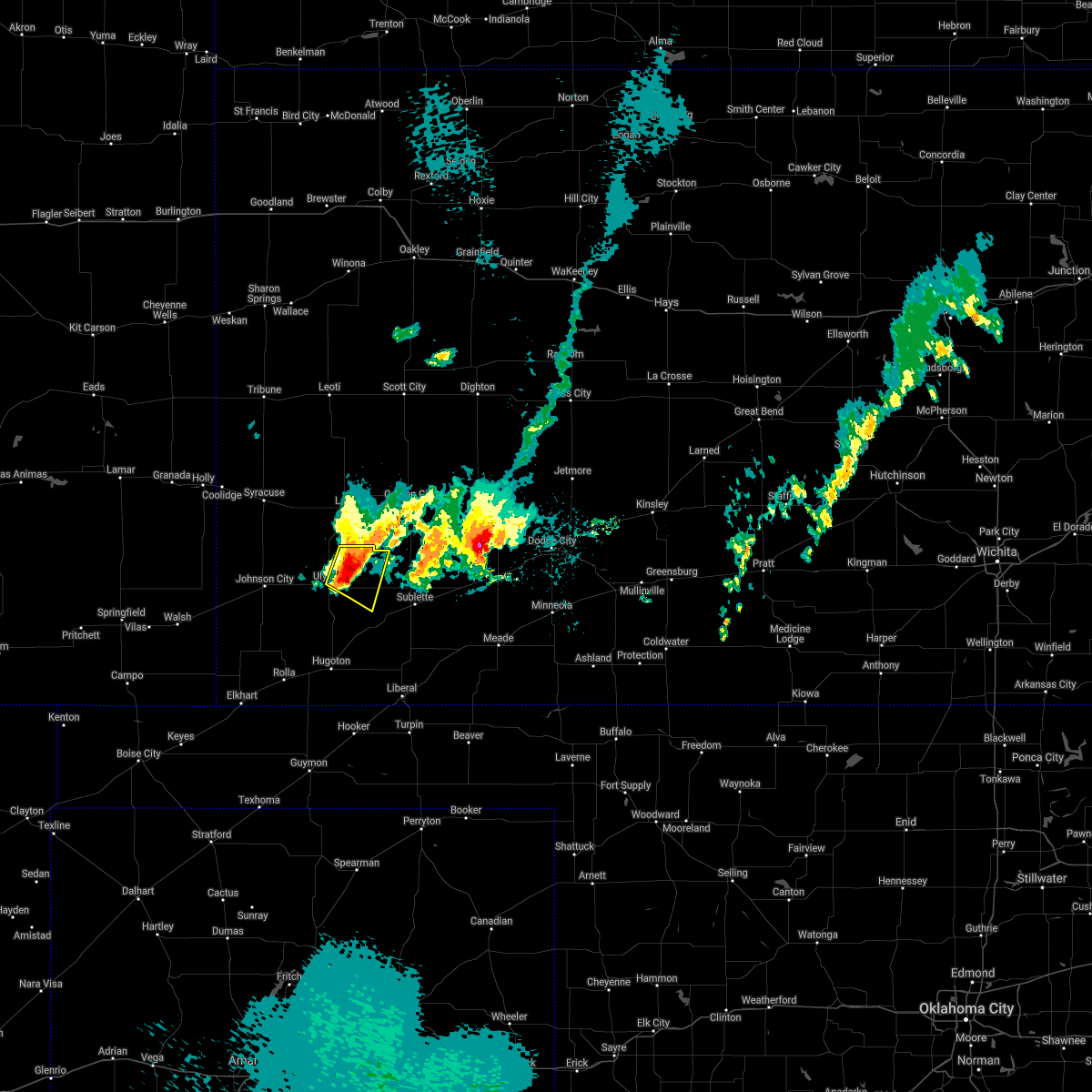 At 1048 pm cdt, a severe thunderstorm was located near hickok, moving southeast at 15 mph (radar indicated). Hazards include ping pong ball size hail and 60 mph wind gusts. People and animals outdoors will be injured. expect hail damage to roofs, siding, windows, and vehicles. expect wind damage to roofs, siding, and trees. Locations impacted include, ulysses, hickok and ryus. At 1048 pm cdt, a severe thunderstorm was located near hickok, moving southeast at 15 mph (radar indicated). Hazards include ping pong ball size hail and 60 mph wind gusts. People and animals outdoors will be injured. expect hail damage to roofs, siding, windows, and vehicles. expect wind damage to roofs, siding, and trees. Locations impacted include, ulysses, hickok and ryus.
|
| 5/24/2021 10:24 PM CDT |
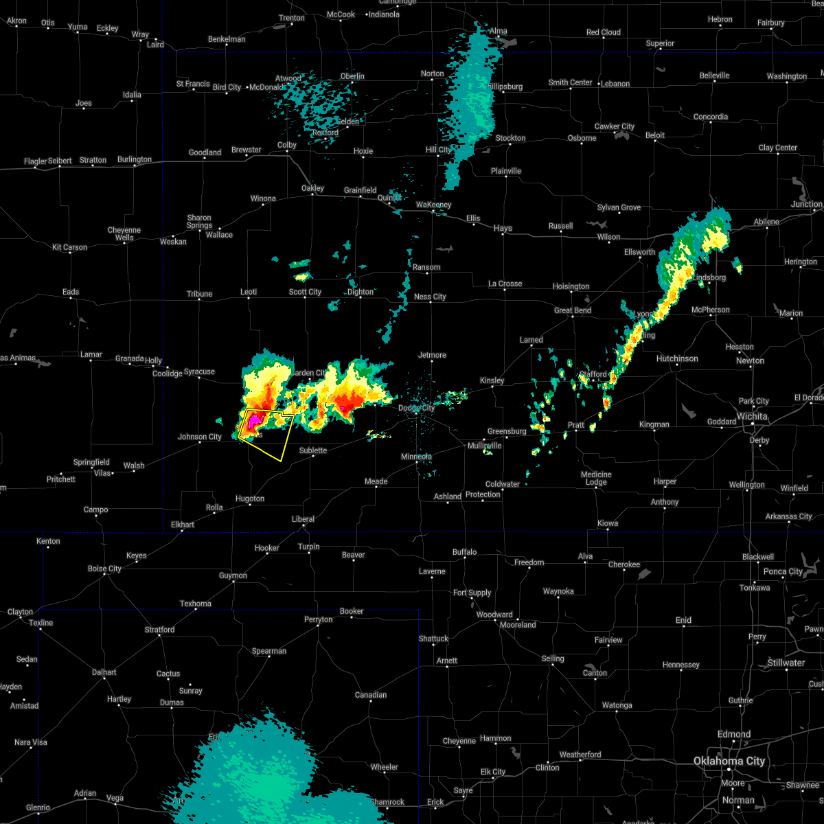 At 1024 pm cdt, a severe thunderstorm was located 7 miles north of ulysses, moving east at 10 mph (radar indicated). Hazards include two inch hail and 70 mph wind gusts. People and animals outdoors will be injured. expect hail damage to roofs, siding, windows, and vehicles. expect considerable tree damage. Wind damage is also likely to mobile homes, roofs, and outbuildings. At 1024 pm cdt, a severe thunderstorm was located 7 miles north of ulysses, moving east at 10 mph (radar indicated). Hazards include two inch hail and 70 mph wind gusts. People and animals outdoors will be injured. expect hail damage to roofs, siding, windows, and vehicles. expect considerable tree damage. Wind damage is also likely to mobile homes, roofs, and outbuildings.
|
| 5/24/2021 9:57 PM CDT | Quarter sized hail reported 10.1 miles SSE of Ulysses, KS, quarter size hail reported by grant county em. |
| 5/17/2021 12:25 AM CDT | Awos station kuls ulysse in grant county KS, 1.6 miles SSE of Ulysses, KS |
| 8/16/2020 10:27 PM CDT |
 The severe thunderstorm warning for northwestern seward, grant, southeastern stanton, northern stevens and western haskell counties will expire at 1030 pm cdt, the severe thunderstorm which prompted the warning is weakening below severe limits. heavy rain and wind gusts to near 50 mph will continue for the next 30 minutes. therefore, the warning will be allowed to expire. a severe thunderstorm watch remains in effect until 1100 pm cdt for southwestern kansas. The severe thunderstorm warning for northwestern seward, grant, southeastern stanton, northern stevens and western haskell counties will expire at 1030 pm cdt, the severe thunderstorm which prompted the warning is weakening below severe limits. heavy rain and wind gusts to near 50 mph will continue for the next 30 minutes. therefore, the warning will be allowed to expire. a severe thunderstorm watch remains in effect until 1100 pm cdt for southwestern kansas.
|
| 8/16/2020 10:01 PM CDT |
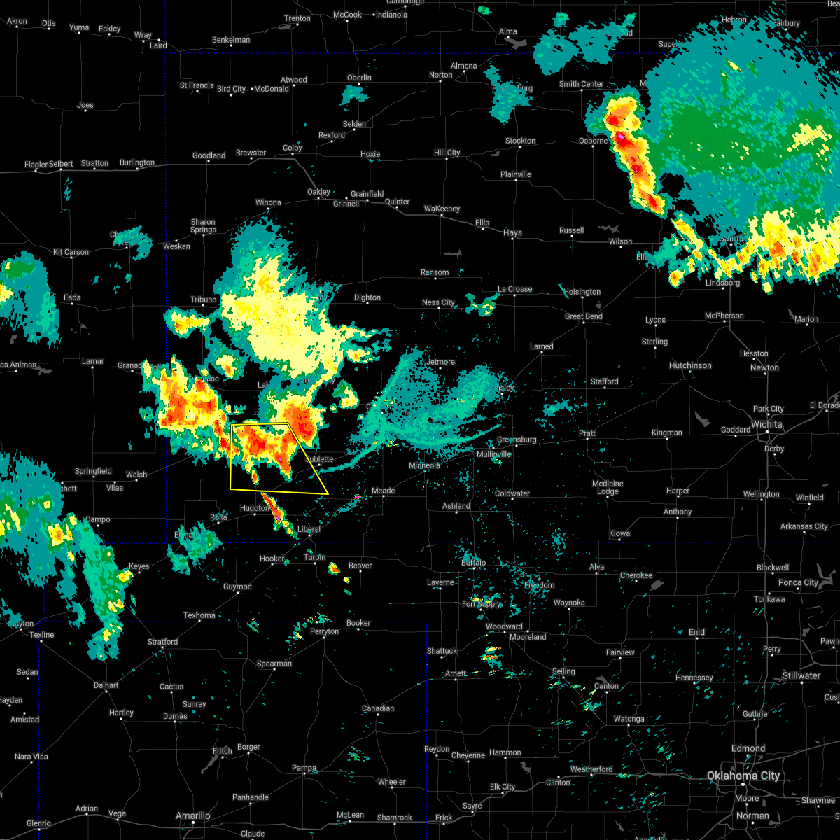 At 1001 pm cdt, a severe thunderstorm was located very near hickok, moving southeast at 25 mph (radar indicated). Hazards include 60 mph wind gusts. Expect damage to roofs, siding, and trees. Locations impacted include, ulysses, satanta, moscow, ryus, cave and hickok. At 1001 pm cdt, a severe thunderstorm was located very near hickok, moving southeast at 25 mph (radar indicated). Hazards include 60 mph wind gusts. Expect damage to roofs, siding, and trees. Locations impacted include, ulysses, satanta, moscow, ryus, cave and hickok.
|
| 8/16/2020 9:42 PM CDT |
 At 942 pm cdt, a severe thunderstorm was located near ulysses, moving southeast at 25 mph (radar indicated). Hazards include 60 mph wind gusts. expect damage to roofs, siding, and trees At 942 pm cdt, a severe thunderstorm was located near ulysses, moving southeast at 25 mph (radar indicated). Hazards include 60 mph wind gusts. expect damage to roofs, siding, and trees
|
| 7/30/2020 12:42 AM CDT |
 The severe thunderstorm warning for southeastern hamilton, kearny, western finney, northwestern grant and northeastern stanton counties will expire at 1245 am cdt/1145 pm mdt/, the storm which prompted the warning has weakened below severe limits, and no longer poses an immediate threat to life or property. therefore, the warning will be allowed to expire. however gusty winds are still possible with this thunderstorm. to report severe weather, contact your nearest law enforcement agency. they will relay your report to the national weather service dodge city. The severe thunderstorm warning for southeastern hamilton, kearny, western finney, northwestern grant and northeastern stanton counties will expire at 1245 am cdt/1145 pm mdt/, the storm which prompted the warning has weakened below severe limits, and no longer poses an immediate threat to life or property. therefore, the warning will be allowed to expire. however gusty winds are still possible with this thunderstorm. to report severe weather, contact your nearest law enforcement agency. they will relay your report to the national weather service dodge city.
|
| 7/30/2020 12:27 AM CDT |
 At 1227 am cdt/1127 pm mdt/, a severe thunderstorm was located 9 miles south of lakin, moving southeast at 35 mph (radar indicated). Hazards include 60 mph wind gusts and penny size hail. Expect damage to roofs, siding, and trees. Locations impacted include, garden city, ulysses, lakin, holcomb, deerfield, kendall and big bow. At 1227 am cdt/1127 pm mdt/, a severe thunderstorm was located 9 miles south of lakin, moving southeast at 35 mph (radar indicated). Hazards include 60 mph wind gusts and penny size hail. Expect damage to roofs, siding, and trees. Locations impacted include, garden city, ulysses, lakin, holcomb, deerfield, kendall and big bow.
|
| 7/30/2020 12:18 AM CDT |
 At 1217 am cdt/1117 pm mdt/, a severe thunderstorm was located near kendall, moving southeast at 35 mph. 62 mph was reported in syracuse and 58 mph reported in coolidge (radar indicated). Hazards include 60 mph wind gusts and penny size hail. Expect damage to roofs, siding, and trees. Locations impacted include, garden city, ulysses, lakin, holcomb, syracuse, deerfield, kendall, big bow and friend. At 1217 am cdt/1117 pm mdt/, a severe thunderstorm was located near kendall, moving southeast at 35 mph. 62 mph was reported in syracuse and 58 mph reported in coolidge (radar indicated). Hazards include 60 mph wind gusts and penny size hail. Expect damage to roofs, siding, and trees. Locations impacted include, garden city, ulysses, lakin, holcomb, syracuse, deerfield, kendall, big bow and friend.
|
| 7/30/2020 12:06 AM CDT |
 At 1205 am cdt/1105 pm mdt/, a severe thunderstorm was located near kendall, moving southeast at 35 mph (radar indicated). Hazards include 60 mph wind gusts and penny size hail. expect damage to roofs, siding, and trees At 1205 am cdt/1105 pm mdt/, a severe thunderstorm was located near kendall, moving southeast at 35 mph (radar indicated). Hazards include 60 mph wind gusts and penny size hail. expect damage to roofs, siding, and trees
|
| 7/26/2020 5:49 PM CDT |
 At 548 pm cdt, a severe thunderstorm was located near big bow, moving northeast at 20 mph (radar indicated). Hazards include 60 mph wind gusts. expect damage to roofs, siding, and trees At 548 pm cdt, a severe thunderstorm was located near big bow, moving northeast at 20 mph (radar indicated). Hazards include 60 mph wind gusts. expect damage to roofs, siding, and trees
|
| 7/20/2020 10:07 PM CDT |
 The severe thunderstorm warning for morton, hamilton, southwestern kearny, western grant, stanton and northwestern stevens counties will expire at 1015 pm cdt/915 pm mdt/, the storms which prompted the warning have weakened below severe limits, and no longer pose an immediate threat to life or property. therefore, the warning will be allowed to expire. however gusty winds and heavy rain are still possible with these thunderstorms. The severe thunderstorm warning for morton, hamilton, southwestern kearny, western grant, stanton and northwestern stevens counties will expire at 1015 pm cdt/915 pm mdt/, the storms which prompted the warning have weakened below severe limits, and no longer pose an immediate threat to life or property. therefore, the warning will be allowed to expire. however gusty winds and heavy rain are still possible with these thunderstorms.
|
| 7/20/2020 9:44 PM CDT |
 At 943 pm cdt/843 pm mdt/, severe thunderstorms were located along a line extending from 6 miles east of coolidge to near manter to near walsh, moving southeast at 40 mph (radar indicated). Hazards include 60 mph wind gusts and penny size hail. Expect damage to roofs, siding, and trees. Locations impacted include, ulysses, hugoton, lakin, syracuse, johnson city, rolla, manter, kendall, richfield, the saunders elevator, big bow, feterita and wilburton. At 943 pm cdt/843 pm mdt/, severe thunderstorms were located along a line extending from 6 miles east of coolidge to near manter to near walsh, moving southeast at 40 mph (radar indicated). Hazards include 60 mph wind gusts and penny size hail. Expect damage to roofs, siding, and trees. Locations impacted include, ulysses, hugoton, lakin, syracuse, johnson city, rolla, manter, kendall, richfield, the saunders elevator, big bow, feterita and wilburton.
|
| 7/20/2020 9:32 PM CDT |
 At 931 pm cdt/831 pm mdt/, severe thunderstorms were located along a line extending from near coolidge to near manter to near vilas, moving southeast at 40 mph (radar indicated). Hazards include 60 mph wind gusts and penny size hail. expect damage to roofs, siding, and trees At 931 pm cdt/831 pm mdt/, severe thunderstorms were located along a line extending from near coolidge to near manter to near vilas, moving southeast at 40 mph (radar indicated). Hazards include 60 mph wind gusts and penny size hail. expect damage to roofs, siding, and trees
|
| 7/14/2020 11:07 PM CDT |
 At 1107 pm cdt, severe thunderstorms were located along a line extending from 8 miles northeast of ulysses to 11 miles northwest of hooker, moving east at 20 mph (radar indicated). Hazards include 60 mph wind gusts and quarter size hail. Hail damage to vehicles is expected. Expect wind damage to roofs, siding, and trees. At 1107 pm cdt, severe thunderstorms were located along a line extending from 8 miles northeast of ulysses to 11 miles northwest of hooker, moving east at 20 mph (radar indicated). Hazards include 60 mph wind gusts and quarter size hail. Hail damage to vehicles is expected. Expect wind damage to roofs, siding, and trees.
|
| 7/14/2020 10:27 PM CDT |
 The severe thunderstorm warning for morton, hamilton, southwestern kearny, northwestern grant and stanton counties will expire at 1030 pm cdt/930 pm mdt/, the storms which prompted the warning have weakened below severe limits, and no longer pose an immediate threat to life or property. therefore, the warning will be allowed to expire. a severe thunderstorm watch remains in effect until 300 am cdt/200 am mdt/ for southwestern kansas. The severe thunderstorm warning for morton, hamilton, southwestern kearny, northwestern grant and stanton counties will expire at 1030 pm cdt/930 pm mdt/, the storms which prompted the warning have weakened below severe limits, and no longer pose an immediate threat to life or property. therefore, the warning will be allowed to expire. a severe thunderstorm watch remains in effect until 300 am cdt/200 am mdt/ for southwestern kansas.
|
| 7/14/2020 9:48 PM CDT |
 At 948 pm cdt/848 pm mdt/, severe thunderstorms were located along a line extending from near hartman to 11 miles northwest of manter to 13 miles east of campo, moving east at 45 mph (radar indicated). Hazards include 70 mph wind gusts and quarter size hail. Hail damage to vehicles is expected. expect considerable tree damage. wind damage is also likely to mobile homes, roofs, and outbuildings. Locations impacted include, ulysses, elkhart, syracuse, johnson city, manter, coolidge, kendall, richfield, the saunders elevator and big bow. At 948 pm cdt/848 pm mdt/, severe thunderstorms were located along a line extending from near hartman to 11 miles northwest of manter to 13 miles east of campo, moving east at 45 mph (radar indicated). Hazards include 70 mph wind gusts and quarter size hail. Hail damage to vehicles is expected. expect considerable tree damage. wind damage is also likely to mobile homes, roofs, and outbuildings. Locations impacted include, ulysses, elkhart, syracuse, johnson city, manter, coolidge, kendall, richfield, the saunders elevator and big bow.
|
| 7/14/2020 9:24 PM CDT |
 At 924 pm cdt/824 pm mdt/, severe thunderstorms were located along a line extending from near lamar to 10 miles northeast of two buttes to 12 miles south of pritchett, moving east at 45 mph (radar indicated). Hazards include 70 mph wind gusts and quarter size hail. Hail damage to vehicles is expected. expect considerable tree damage. Wind damage is also likely to mobile homes, roofs, and outbuildings. At 924 pm cdt/824 pm mdt/, severe thunderstorms were located along a line extending from near lamar to 10 miles northeast of two buttes to 12 miles south of pritchett, moving east at 45 mph (radar indicated). Hazards include 70 mph wind gusts and quarter size hail. Hail damage to vehicles is expected. expect considerable tree damage. Wind damage is also likely to mobile homes, roofs, and outbuildings.
|
| 7/13/2020 12:12 AM CDT |
 The severe thunderstorm warning for seward, grant, west central meade, stevens and haskell counties will expire at 1215 am cdt, the severe thunderstorm which prompted the warning has moved out of the warned area. therefore, the warning will be allowed to expire. a severe thunderstorm watch remains in effect until 300 am cdt for southwestern kansas. The severe thunderstorm warning for seward, grant, west central meade, stevens and haskell counties will expire at 1215 am cdt, the severe thunderstorm which prompted the warning has moved out of the warned area. therefore, the warning will be allowed to expire. a severe thunderstorm watch remains in effect until 300 am cdt for southwestern kansas.
|
| 7/12/2020 11:43 PM CDT |
 At 1122 pm cdt, a severe thunderstorm was located 9 miles north of ryus, moving south at 40 mph (radar indicated). Hazards include 70 mph wind gusts and half dollar size hail. Hail damage to vehicles is expected. expect considerable tree damage. Wind damage is also likely to mobile homes, roofs, and outbuildings. At 1122 pm cdt, a severe thunderstorm was located 9 miles north of ryus, moving south at 40 mph (radar indicated). Hazards include 70 mph wind gusts and half dollar size hail. Hail damage to vehicles is expected. expect considerable tree damage. Wind damage is also likely to mobile homes, roofs, and outbuildings.
|
| 7/12/2020 11:34 PM CDT |
 At 1134 pm cdt, a severe thunderstorm was located 13 miles northeast of hickok, moving southeast at 20 mph (radar indicated). Hazards include 70 mph wind gusts and quarter size hail. Hail damage to vehicles is expected. expect considerable tree damage. wind damage is also likely to mobile homes, roofs, and outbuildings. Locations impacted include, ulysses, holcomb, sublette, satanta, tice, ryus, hickok and plymell. At 1134 pm cdt, a severe thunderstorm was located 13 miles northeast of hickok, moving southeast at 20 mph (radar indicated). Hazards include 70 mph wind gusts and quarter size hail. Hail damage to vehicles is expected. expect considerable tree damage. wind damage is also likely to mobile homes, roofs, and outbuildings. Locations impacted include, ulysses, holcomb, sublette, satanta, tice, ryus, hickok and plymell.
|
| 7/12/2020 11:23 PM CDT |
 At 1122 pm cdt, a severe thunderstorm was located 9 miles north of ryus, moving south at 40 mph (radar indicated). Hazards include 70 mph wind gusts and half dollar size hail. Hail damage to vehicles is expected. expect considerable tree damage. Wind damage is also likely to mobile homes, roofs, and outbuildings. At 1122 pm cdt, a severe thunderstorm was located 9 miles north of ryus, moving south at 40 mph (radar indicated). Hazards include 70 mph wind gusts and half dollar size hail. Hail damage to vehicles is expected. expect considerable tree damage. Wind damage is also likely to mobile homes, roofs, and outbuildings.
|
| 7/12/2020 11:13 PM CDT |
 At 1112 pm cdt, a severe thunderstorm was located near lakin, moving south at 20 mph (radar indicated). Hazards include 70 mph wind gusts and half dollar size hail. Hail damage to vehicles is expected. expect considerable tree damage. Wind damage is also likely to mobile homes, roofs, and outbuildings. At 1112 pm cdt, a severe thunderstorm was located near lakin, moving south at 20 mph (radar indicated). Hazards include 70 mph wind gusts and half dollar size hail. Hail damage to vehicles is expected. expect considerable tree damage. Wind damage is also likely to mobile homes, roofs, and outbuildings.
|
| 7/12/2020 11:05 PM CDT |
 At 1104 pm cdt, a severe thunderstorm was located 7 miles south of lakin, moving south at 25 mph (public. this storm has a history of producing wind damage). Hazards include 70 mph wind gusts and half dollar size hail. Hail damage to vehicles is expected. expect considerable tree damage. wind damage is also likely to mobile homes, roofs, and outbuildings. Locations impacted include, ulysses, lakin, holcomb, sublette, satanta, deerfield, tice, ryus, hickok and plymell. At 1104 pm cdt, a severe thunderstorm was located 7 miles south of lakin, moving south at 25 mph (public. this storm has a history of producing wind damage). Hazards include 70 mph wind gusts and half dollar size hail. Hail damage to vehicles is expected. expect considerable tree damage. wind damage is also likely to mobile homes, roofs, and outbuildings. Locations impacted include, ulysses, lakin, holcomb, sublette, satanta, deerfield, tice, ryus, hickok and plymell.
|
| 7/12/2020 10:51 PM CDT |
 At 1051 pm cdt, a severe thunderstorm was located near lakin, moving south at 30 mph (public. reports of wind damage have been received near lakin in kearny county). Hazards include 70 mph wind gusts and quarter size hail. Hail damage to vehicles is expected. expect considerable tree damage. wind damage is also likely to mobile homes, roofs, and outbuildings. Locations impacted include, ulysses, lakin, holcomb, sublette, satanta, deerfield, tice, ryus, hickok and plymell. At 1051 pm cdt, a severe thunderstorm was located near lakin, moving south at 30 mph (public. reports of wind damage have been received near lakin in kearny county). Hazards include 70 mph wind gusts and quarter size hail. Hail damage to vehicles is expected. expect considerable tree damage. wind damage is also likely to mobile homes, roofs, and outbuildings. Locations impacted include, ulysses, lakin, holcomb, sublette, satanta, deerfield, tice, ryus, hickok and plymell.
|
| 7/12/2020 10:33 PM CDT |
 At 1032 pm cdt, a severe thunderstorm was located 7 miles northwest of deerfield, moving south at 30 mph (radar indicated). Hazards include 70 mph wind gusts and quarter size hail. Hail damage to vehicles is expected. expect considerable tree damage. Wind damage is also likely to mobile homes, roofs, and outbuildings. At 1032 pm cdt, a severe thunderstorm was located 7 miles northwest of deerfield, moving south at 30 mph (radar indicated). Hazards include 70 mph wind gusts and quarter size hail. Hail damage to vehicles is expected. expect considerable tree damage. Wind damage is also likely to mobile homes, roofs, and outbuildings.
|
| 7/1/2020 7:28 PM CDT | Golf Ball sized hail reported 19.3 miles NW of Ulysses, KS |
| 6/4/2020 8:54 PM CDT |
 The severe thunderstorm warning for southeastern grant, northeastern stevens and southwestern haskell counties will expire at 900 pm cdt, the severe thunderstorm which prompted the warning is moving out of the warned area. therefore, the warning will be allowed to expire. The severe thunderstorm warning for southeastern grant, northeastern stevens and southwestern haskell counties will expire at 900 pm cdt, the severe thunderstorm which prompted the warning is moving out of the warned area. therefore, the warning will be allowed to expire.
|
| 6/4/2020 8:41 PM CDT |
 At 840 pm cdt, a severe thunderstorm was located near cave, moving southeast at 20 mph (emergency management). Hazards include ping pong ball size hail and 60 mph wind gusts. People and animals outdoors will be injured. expect hail damage to roofs, siding, windows, and vehicles. expect wind damage to roofs, siding, and trees. Locations impacted include, ulysses, sublette, satanta, moscow, ryus, cave and hickok. At 840 pm cdt, a severe thunderstorm was located near cave, moving southeast at 20 mph (emergency management). Hazards include ping pong ball size hail and 60 mph wind gusts. People and animals outdoors will be injured. expect hail damage to roofs, siding, windows, and vehicles. expect wind damage to roofs, siding, and trees. Locations impacted include, ulysses, sublette, satanta, moscow, ryus, cave and hickok.
|
| 6/4/2020 8:27 PM CDT |
 At 826 pm cdt, a severe thunderstorm was located near ryus, moving southeast at 15 mph. an additional sever thunderstorm was near ulysses, also moving southeast (emergency management). Hazards include ping pong ball size hail and 60 mph wind gusts. People and animals outdoors will be injured. expect hail damage to roofs, siding, windows, and vehicles. expect wind damage to roofs, siding, and trees. Locations impacted include, ulysses, sublette, satanta, moscow, ryus, cave and hickok. At 826 pm cdt, a severe thunderstorm was located near ryus, moving southeast at 15 mph. an additional sever thunderstorm was near ulysses, also moving southeast (emergency management). Hazards include ping pong ball size hail and 60 mph wind gusts. People and animals outdoors will be injured. expect hail damage to roofs, siding, windows, and vehicles. expect wind damage to roofs, siding, and trees. Locations impacted include, ulysses, sublette, satanta, moscow, ryus, cave and hickok.
|
| 6/4/2020 8:20 PM CDT | Quarter sized hail reported 12.3 miles WNW of Ulysses, KS |
| 6/4/2020 8:17 PM CDT |
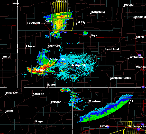 At 816 pm cdt, a severe thunderstorm was located near hickok, moving southeast at 15 mph (emergency management. emergency management reported quarter size hail 3 miles east of ulysses with this storm). Hazards include ping pong ball size hail and 60 mph wind gusts. People and animals outdoors will be injured. expect hail damage to roofs, siding, windows, and vehicles. expect wind damage to roofs, siding, and trees. Locations impacted include, ulysses, sublette, satanta, moscow, ryus, cave and hickok. At 816 pm cdt, a severe thunderstorm was located near hickok, moving southeast at 15 mph (emergency management. emergency management reported quarter size hail 3 miles east of ulysses with this storm). Hazards include ping pong ball size hail and 60 mph wind gusts. People and animals outdoors will be injured. expect hail damage to roofs, siding, windows, and vehicles. expect wind damage to roofs, siding, and trees. Locations impacted include, ulysses, sublette, satanta, moscow, ryus, cave and hickok.
|
| 6/4/2020 8:11 PM CDT |
 At 811 pm cdt, a severe thunderstorm was located very near hickok, moving southeast at 20 mph (radar indicated). Hazards include golf ball size hail and 60 mph wind gusts. People and animals outdoors will be injured. expect hail damage to roofs, siding, windows, and vehicles. Expect wind damage to roofs, siding, and trees. At 811 pm cdt, a severe thunderstorm was located very near hickok, moving southeast at 20 mph (radar indicated). Hazards include golf ball size hail and 60 mph wind gusts. People and animals outdoors will be injured. expect hail damage to roofs, siding, windows, and vehicles. Expect wind damage to roofs, siding, and trees.
|
| 6/4/2020 8:08 PM CDT |
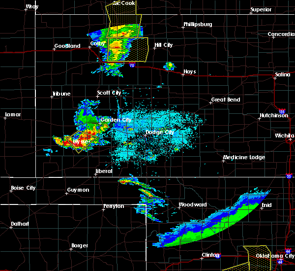 At 808 pm cdt, a severe thunderstorm was located near hickok, moving southeast at 30 mph (radar indicated). Hazards include ping pong ball size hail and 60 mph wind gusts. People and animals outdoors will be injured. expect hail damage to roofs, siding, windows, and vehicles. expect wind damage to roofs, siding, and trees. Locations impacted include, ulysses and hickok. At 808 pm cdt, a severe thunderstorm was located near hickok, moving southeast at 30 mph (radar indicated). Hazards include ping pong ball size hail and 60 mph wind gusts. People and animals outdoors will be injured. expect hail damage to roofs, siding, windows, and vehicles. expect wind damage to roofs, siding, and trees. Locations impacted include, ulysses and hickok.
|
| 6/4/2020 8:05 PM CDT |
 At 803 pm cdt, a doppler radar indicated two severe thunderstorms, one two miles northeast of ulysses, and the other over far northwest haskell county, moving southeast at 20 mph (radar indicated). Hazards include 60 mph wind gusts and quarter size hail. Hail damage to vehicles is expected. expect wind damage to roofs, siding, and trees. Locations impacted include, ulysses and hickok. At 803 pm cdt, a doppler radar indicated two severe thunderstorms, one two miles northeast of ulysses, and the other over far northwest haskell county, moving southeast at 20 mph (radar indicated). Hazards include 60 mph wind gusts and quarter size hail. Hail damage to vehicles is expected. expect wind damage to roofs, siding, and trees. Locations impacted include, ulysses and hickok.
|
| 6/4/2020 8:03 PM CDT | Quarter sized hail reported 4.2 miles WSW of Ulysses, KS |
| 6/4/2020 7:52 PM CDT |
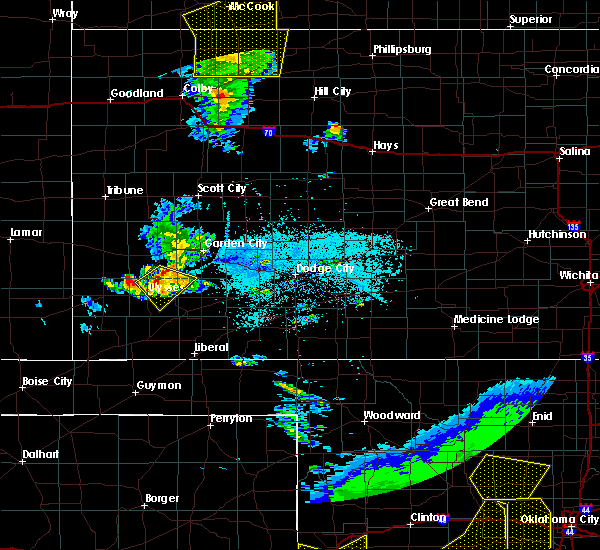 At 752 pm cdt, a severe thunderstorm was located 8 miles north of ulysses, moving southeast at 20 mph (radar indicated). Hazards include 60 mph wind gusts and quarter size hail. Hail damage to vehicles is expected. Expect wind damage to roofs, siding, and trees. At 752 pm cdt, a severe thunderstorm was located 8 miles north of ulysses, moving southeast at 20 mph (radar indicated). Hazards include 60 mph wind gusts and quarter size hail. Hail damage to vehicles is expected. Expect wind damage to roofs, siding, and trees.
|
| 5/21/2020 9:26 PM CDT |
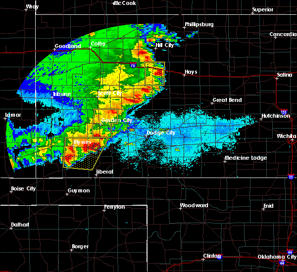 At 925 pm cdt, severe thunderstorms were located along a line extending from near ulysses to near hugoton, moving east at 15 mph. another severe thunderstorm was located 10 miles north northwest of satanta, which was moving northeast at 10 mph (radar indicated). Hazards include two inch hail and 70 mph wind gusts. People and animals outdoors will be injured. expect hail damage to roofs, siding, windows, and vehicles. expect considerable tree damage. wind damage is also likely to mobile homes, roofs, and outbuildings. Locations impacted include, ulysses, hugoton, sublette, satanta, moscow, ryus, cave, hickok and woods. At 925 pm cdt, severe thunderstorms were located along a line extending from near ulysses to near hugoton, moving east at 15 mph. another severe thunderstorm was located 10 miles north northwest of satanta, which was moving northeast at 10 mph (radar indicated). Hazards include two inch hail and 70 mph wind gusts. People and animals outdoors will be injured. expect hail damage to roofs, siding, windows, and vehicles. expect considerable tree damage. wind damage is also likely to mobile homes, roofs, and outbuildings. Locations impacted include, ulysses, hugoton, sublette, satanta, moscow, ryus, cave, hickok and woods.
|
| 5/21/2020 8:55 PM CDT | Hen Egg sized hail reported 16 miles WNW of Ulysses, KS, from fb. |
| 5/21/2020 8:53 PM CDT |
 At 851 pm cdt, severe thunderstorms were located along a line extending from 10 miles north of hickok to near feterita, moving east at 20 mph. out ahead of this line, a severe thunderstorm was located 6 miles north of satanta (radar indicated). Hazards include two inch hail with the storm north of satanta. up to 70 mph winds with the main line of storms. People and animals outdoors will be injured. expect hail damage to roofs, siding, windows, and vehicles. expect considerable tree damage. Wind damage is also likely to mobile homes, roofs, and outbuildings. At 851 pm cdt, severe thunderstorms were located along a line extending from 10 miles north of hickok to near feterita, moving east at 20 mph. out ahead of this line, a severe thunderstorm was located 6 miles north of satanta (radar indicated). Hazards include two inch hail with the storm north of satanta. up to 70 mph winds with the main line of storms. People and animals outdoors will be injured. expect hail damage to roofs, siding, windows, and vehicles. expect considerable tree damage. Wind damage is also likely to mobile homes, roofs, and outbuildings.
|
| 5/21/2020 8:50 PM CDT | Half Dollar sized hail reported 0.5 miles ESE of Ulysses, KS |
| 5/21/2020 8:24 PM CDT |
 At 824 pm cdt, a severe thunderstorm was located very near big bow, moving east at 20 mph. this is a very dangerous storm (radar indicated). Hazards include baseball size hail and 60 mph wind gusts. People and animals outdoors will be severely injured. expect shattered windows, extensive damage to roofs, siding, and vehicles. Locations impacted include, ulysses and big bow. At 824 pm cdt, a severe thunderstorm was located very near big bow, moving east at 20 mph. this is a very dangerous storm (radar indicated). Hazards include baseball size hail and 60 mph wind gusts. People and animals outdoors will be severely injured. expect shattered windows, extensive damage to roofs, siding, and vehicles. Locations impacted include, ulysses and big bow.
|
| 5/21/2020 8:20 PM CDT | Hen Egg sized hail reported 14.8 miles NW of Ulysses, KS |
| 5/21/2020 8:08 PM CDT |
 At 808 pm cdt, a severe thunderstorm was located near big bow, moving east at 25 mph (radar indicated). Hazards include two inch hail and 60 mph wind gusts. People and animals outdoors will be injured. expect hail damage to roofs, siding, windows, and vehicles. Expect wind damage to roofs, siding, and trees. At 808 pm cdt, a severe thunderstorm was located near big bow, moving east at 25 mph (radar indicated). Hazards include two inch hail and 60 mph wind gusts. People and animals outdoors will be injured. expect hail damage to roofs, siding, windows, and vehicles. Expect wind damage to roofs, siding, and trees.
|
| 5/21/2020 8:01 PM CDT |
 At 800 pm cdt, a severe thunderstorm was located 8 miles south of lakin, moving east at 15 mph. this is a very dangerous storm (radar indicated). Hazards include baseball size hail, 60 mph wind gusts, and landspout tornadoes. People and animals outdoors will be severely injured. expect shattered windows, extensive damage to roofs, siding, and vehicles. Locations impacted include, ulysses, lakin, deerfield and hickok. At 800 pm cdt, a severe thunderstorm was located 8 miles south of lakin, moving east at 15 mph. this is a very dangerous storm (radar indicated). Hazards include baseball size hail, 60 mph wind gusts, and landspout tornadoes. People and animals outdoors will be severely injured. expect shattered windows, extensive damage to roofs, siding, and vehicles. Locations impacted include, ulysses, lakin, deerfield and hickok.
|
| 5/21/2020 7:37 PM CDT |
 At 736 pm cdt, a severe thunderstorm was located 11 miles southeast of kendall, moving east at 30 mph. this is a very dangerous storm (radar indicated). Hazards include baseball size hail and 60 mph wind gusts. People and animals outdoors will be severely injured. Expect shattered windows, extensive damage to roofs, siding, and vehicles. At 736 pm cdt, a severe thunderstorm was located 11 miles southeast of kendall, moving east at 30 mph. this is a very dangerous storm (radar indicated). Hazards include baseball size hail and 60 mph wind gusts. People and animals outdoors will be severely injured. Expect shattered windows, extensive damage to roofs, siding, and vehicles.
|
| 5/21/2020 6:22 PM CDT |
 The severe thunderstorm warning for northwestern seward, eastern grant, northeastern stevens and western haskell counties will expire at 630 pm cdt, the storm which prompted the warning has weakened below severe limits, and has exited the warned area. therefore, the warning will be allowed to expire. a severe thunderstorm watch remains in effect until 1000 pm cdt for southwestern kansas. The severe thunderstorm warning for northwestern seward, eastern grant, northeastern stevens and western haskell counties will expire at 630 pm cdt, the storm which prompted the warning has weakened below severe limits, and has exited the warned area. therefore, the warning will be allowed to expire. a severe thunderstorm watch remains in effect until 1000 pm cdt for southwestern kansas.
|
| 5/21/2020 6:02 PM CDT |
 At 602 pm cdt, a severe thunderstorm was located near ryus, moving north at 35 mph (radar indicated). Hazards include ping pong ball size hail and 60 mph wind gusts. People and animals outdoors will be injured. expect hail damage to roofs, siding, windows, and vehicles. expect wind damage to roofs, siding, and trees. Locations impacted include, ulysses, satanta, ryus, cave and hickok. At 602 pm cdt, a severe thunderstorm was located near ryus, moving north at 35 mph (radar indicated). Hazards include ping pong ball size hail and 60 mph wind gusts. People and animals outdoors will be injured. expect hail damage to roofs, siding, windows, and vehicles. expect wind damage to roofs, siding, and trees. Locations impacted include, ulysses, satanta, ryus, cave and hickok.
|
| 5/21/2020 5:48 PM CDT |
 At 548 pm cdt, a severe thunderstorm was located near cave, moving north at 25 mph (radar indicated). Hazards include ping pong ball size hail. People and animals outdoors will be injured. Expect damage to roofs, siding, windows, and vehicles. At 548 pm cdt, a severe thunderstorm was located near cave, moving north at 25 mph (radar indicated). Hazards include ping pong ball size hail. People and animals outdoors will be injured. Expect damage to roofs, siding, windows, and vehicles.
|
| 3/30/2020 5:10 PM CDT |
 At 510 pm cdt, a severe thunderstorm was located 9 miles south of ulysses, moving east at 20 mph (radar indicated). Hazards include 60 mph wind gusts and quarter size hail. Hail damage to vehicles is expected. Expect wind damage to roofs, siding, and trees. At 510 pm cdt, a severe thunderstorm was located 9 miles south of ulysses, moving east at 20 mph (radar indicated). Hazards include 60 mph wind gusts and quarter size hail. Hail damage to vehicles is expected. Expect wind damage to roofs, siding, and trees.
|
| 3/30/2020 5:00 PM CDT |
 At 500 pm cdt, a severe thunderstorm capable of producing a tornado was located near big bow, moving east at 20 mph (radar indicated rotation). Hazards include tornado and quarter size hail. Flying debris will be dangerous to those caught without shelter. mobile homes will be damaged or destroyed. damage to roofs, windows, and vehicles will occur. tree damage is likely. This dangerous storm will be near, ulysses around 520 pm cdt. At 500 pm cdt, a severe thunderstorm capable of producing a tornado was located near big bow, moving east at 20 mph (radar indicated rotation). Hazards include tornado and quarter size hail. Flying debris will be dangerous to those caught without shelter. mobile homes will be damaged or destroyed. damage to roofs, windows, and vehicles will occur. tree damage is likely. This dangerous storm will be near, ulysses around 520 pm cdt.
|
| 3/30/2020 4:48 PM CDT |
 At 446 pm cdt, a severe thunderstorm capable of producing a tornado was located near big bow, moving east at 30 mph (radar indicated rotation). Hazards include tornado and quarter size hail. Flying debris will be dangerous to those caught without shelter. mobile homes will be damaged or destroyed. damage to roofs, windows, and vehicles will occur. tree damage is likely. this dangerous storm will be near, ulysses around 500 pm cdt. Hickok around 515 pm cdt. At 446 pm cdt, a severe thunderstorm capable of producing a tornado was located near big bow, moving east at 30 mph (radar indicated rotation). Hazards include tornado and quarter size hail. Flying debris will be dangerous to those caught without shelter. mobile homes will be damaged or destroyed. damage to roofs, windows, and vehicles will occur. tree damage is likely. this dangerous storm will be near, ulysses around 500 pm cdt. Hickok around 515 pm cdt.
|
| 3/30/2020 4:21 PM CDT |
 At 421 pm cdt, a severe thunderstorm was located 7 miles southwest of big bow, moving east at 15 mph (radar indicated). Hazards include 60 mph wind gusts and quarter size hail. Hail damage to vehicles is expected. expect wind damage to roofs, siding, and trees. Locations impacted include, ulysses, johnson city and big bow. At 421 pm cdt, a severe thunderstorm was located 7 miles southwest of big bow, moving east at 15 mph (radar indicated). Hazards include 60 mph wind gusts and quarter size hail. Hail damage to vehicles is expected. expect wind damage to roofs, siding, and trees. Locations impacted include, ulysses, johnson city and big bow.
|
| 3/30/2020 4:10 PM CDT |
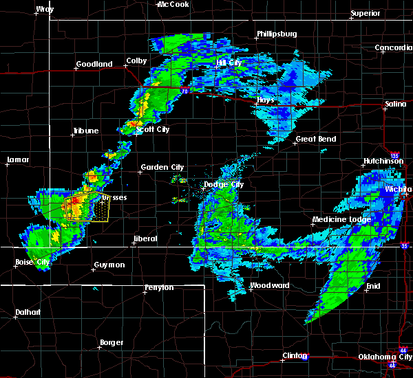 At 410 pm cdt, a severe thunderstorm was located near johnson city, moving east at 10 mph (radar indicated). Hazards include 60 mph wind gusts and quarter size hail. Hail damage to vehicles is expected. Expect wind damage to roofs, siding, and trees. At 410 pm cdt, a severe thunderstorm was located near johnson city, moving east at 10 mph (radar indicated). Hazards include 60 mph wind gusts and quarter size hail. Hail damage to vehicles is expected. Expect wind damage to roofs, siding, and trees.
|
| 8/24/2019 10:10 PM CDT | Ping Pong Ball sized hail reported 8.2 miles E of Ulysses, KS |
| 8/24/2019 10:07 PM CDT |
 The severe thunderstorm warning for southwestern grant and southeastern stanton counties will expire at 1015 pm cdt, the severe thunderstorm which prompted the warning has weakened. therefore, the warning will be allowed to expire. a tornado watch remains in effect until midnight cdt for southwestern kansas. The severe thunderstorm warning for southwestern grant and southeastern stanton counties will expire at 1015 pm cdt, the severe thunderstorm which prompted the warning has weakened. therefore, the warning will be allowed to expire. a tornado watch remains in effect until midnight cdt for southwestern kansas.
|
| 8/24/2019 9:54 PM CDT |
 At 954 pm cdt, a severe thunderstorm was located near big bow, moving southeast at 15 mph (radar indicated). Hazards include golf ball size hail and 60 mph wind gusts. People and animals outdoors will be injured. expect hail damage to roofs, siding, windows, and vehicles. expect wind damage to roofs, siding, and trees. Locations impacted include, ulysses, big bow and hickok. At 954 pm cdt, a severe thunderstorm was located near big bow, moving southeast at 15 mph (radar indicated). Hazards include golf ball size hail and 60 mph wind gusts. People and animals outdoors will be injured. expect hail damage to roofs, siding, windows, and vehicles. expect wind damage to roofs, siding, and trees. Locations impacted include, ulysses, big bow and hickok.
|
| 8/24/2019 9:34 PM CDT |
 At 934 pm cdt, a severe thunderstorm was located near big bow, moving southeast at 25 mph (radar indicated). Hazards include golf ball size hail and 60 mph wind gusts. People and animals outdoors will be injured. expect hail damage to roofs, siding, windows, and vehicles. expect wind damage to roofs, siding, and trees. Locations impacted include, ulysses, big bow and hickok. At 934 pm cdt, a severe thunderstorm was located near big bow, moving southeast at 25 mph (radar indicated). Hazards include golf ball size hail and 60 mph wind gusts. People and animals outdoors will be injured. expect hail damage to roofs, siding, windows, and vehicles. expect wind damage to roofs, siding, and trees. Locations impacted include, ulysses, big bow and hickok.
|
| 8/24/2019 9:21 PM CDT |
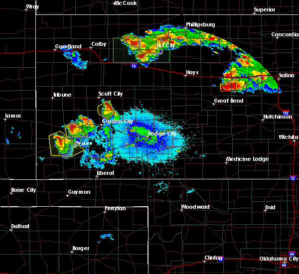 At 920 pm cdt/820 pm mdt/, a severe thunderstorm was located 9 miles northwest of big bow, moving southeast at 25 mph (radar indicated). Hazards include two inch hail and 60 mph wind gusts. People and animals outdoors will be injured. expect hail damage to roofs, siding, windows, and vehicles. expect wind damage to roofs, siding, and trees. Locations impacted include, ulysses, johnson city, big bow and hickok. At 920 pm cdt/820 pm mdt/, a severe thunderstorm was located 9 miles northwest of big bow, moving southeast at 25 mph (radar indicated). Hazards include two inch hail and 60 mph wind gusts. People and animals outdoors will be injured. expect hail damage to roofs, siding, windows, and vehicles. expect wind damage to roofs, siding, and trees. Locations impacted include, ulysses, johnson city, big bow and hickok.
|
| 8/24/2019 9:09 PM CDT |
 At 908 pm cdt/808 pm mdt/, a severe thunderstorm was located 13 miles southwest of kendall, moving southeast at 25 mph (radar indicated). Hazards include two inch hail and 60 mph wind gusts. People and animals outdoors will be injured. expect hail damage to roofs, siding, windows, and vehicles. Expect wind damage to roofs, siding, and trees. At 908 pm cdt/808 pm mdt/, a severe thunderstorm was located 13 miles southwest of kendall, moving southeast at 25 mph (radar indicated). Hazards include two inch hail and 60 mph wind gusts. People and animals outdoors will be injured. expect hail damage to roofs, siding, windows, and vehicles. Expect wind damage to roofs, siding, and trees.
|
| 8/23/2019 7:25 PM CDT | Two to three inch diameter limbs were blown from an elm tre in grant county KS, 15.3 miles WSW of Ulysses, KS |
| 7/5/2019 6:04 PM CDT |
 At 604 pm cdt, a severe thunderstorm was located 10 miles west of moscow, moving east at 5 mph (radar indicated). Hazards include 60 mph wind gusts and quarter size hail. Hail damage to vehicles is expected. expect wind damage to roofs, siding, and trees. Locations impacted include, ulysses, moscow, ryus and hickok. At 604 pm cdt, a severe thunderstorm was located 10 miles west of moscow, moving east at 5 mph (radar indicated). Hazards include 60 mph wind gusts and quarter size hail. Hail damage to vehicles is expected. expect wind damage to roofs, siding, and trees. Locations impacted include, ulysses, moscow, ryus and hickok.
|
| 7/5/2019 5:43 PM CDT |
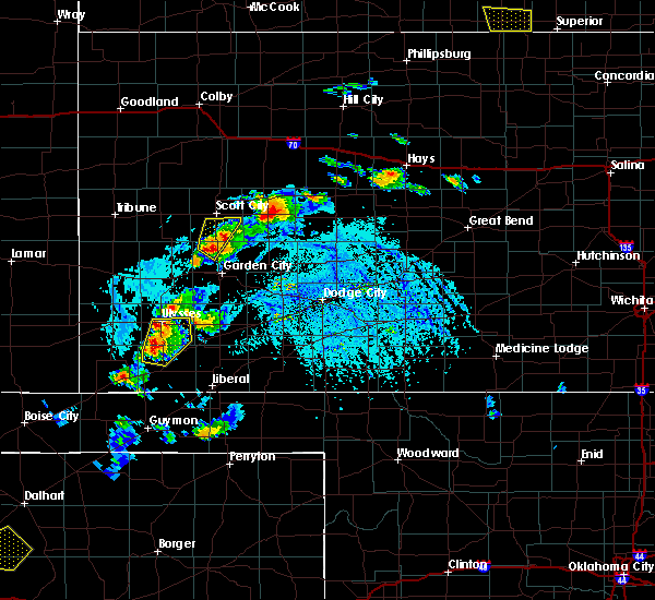 At 542 pm cdt, a severe thunderstorm was located 12 miles south of ulysses, moving northeast at 10 mph (radar indicated). Hazards include 60 mph wind gusts and half dollar size hail. Hail damage to vehicles is expected. Expect wind damage to roofs, siding, and trees. At 542 pm cdt, a severe thunderstorm was located 12 miles south of ulysses, moving northeast at 10 mph (radar indicated). Hazards include 60 mph wind gusts and half dollar size hail. Hail damage to vehicles is expected. Expect wind damage to roofs, siding, and trees.
|
| 6/23/2019 12:11 AM CDT |
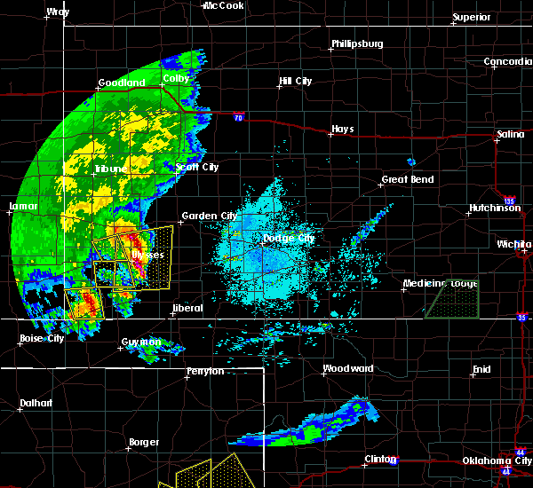 The severe thunderstorm warning for northeastern morton, southwestern grant, southeastern stanton and northwestern stevens counties will expire at 1215 am cdt, the severe thunderstorm which prompted the warning has moved out of the warned area. thereefore, the warning will be allowed to expire. a severe thunderstorm watch remains in effect until 500 am cdt for southwestern kansas. The severe thunderstorm warning for northeastern morton, southwestern grant, southeastern stanton and northwestern stevens counties will expire at 1215 am cdt, the severe thunderstorm which prompted the warning has moved out of the warned area. thereefore, the warning will be allowed to expire. a severe thunderstorm watch remains in effect until 500 am cdt for southwestern kansas.
|
| 6/23/2019 12:03 AM CDT |
 At 1202 am cdt, severe thunderstorms were located along a line extending from 9 miles south of lakin to 6 miles west of moscow, moving northeast at 20 mph (trained weather spotters and automated weather equipment. these storms have a history of producing damaging winds and hail). Hazards include two inch hail and 70 mph wind gusts. People and animals outdoors will be injured. expect hail damage to roofs, siding, windows, and vehicles. expect considerable tree damage. wind damage is also likely to mobile homes, roofs, and outbuildings. Locations impacted include, ulysses, satanta, moscow, ryus, cave and hickok. At 1202 am cdt, severe thunderstorms were located along a line extending from 9 miles south of lakin to 6 miles west of moscow, moving northeast at 20 mph (trained weather spotters and automated weather equipment. these storms have a history of producing damaging winds and hail). Hazards include two inch hail and 70 mph wind gusts. People and animals outdoors will be injured. expect hail damage to roofs, siding, windows, and vehicles. expect considerable tree damage. wind damage is also likely to mobile homes, roofs, and outbuildings. Locations impacted include, ulysses, satanta, moscow, ryus, cave and hickok.
|
| 6/23/2019 12:00 AM CDT | Quarter sized hail reported 0.2 miles SSW of Ulysses, KS, emergency manager report of quarter size hail in ulysses. |
| 6/22/2019 11:48 PM CDT |
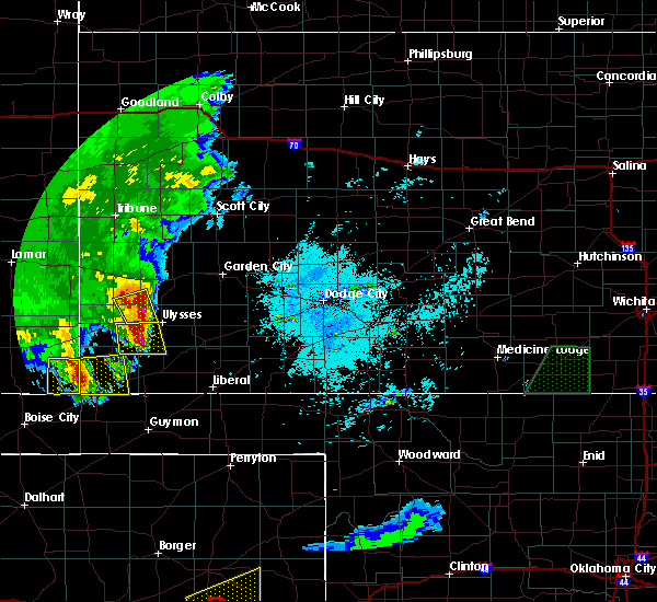 At 1146 pm cdt, severe thunderstorms were located along a line extending from 13 miles north of ulysses to 8 miles northwest of hugoton, moving east at 35 mph (trained weather spotters and automated weather equipment. the johnson airport measured a wind gust of 71 mph at 11:35 pm cdt. trained spotters have reported golf ball size hail with these storms). Hazards include 70 mph wind gusts and ping pong ball size hail. People and animals outdoors will be injured. expect hail damage to roofs, siding, windows, and vehicles. expect considerable tree damage. Wind damage is also likely to mobile homes, roofs, and outbuildings. At 1146 pm cdt, severe thunderstorms were located along a line extending from 13 miles north of ulysses to 8 miles northwest of hugoton, moving east at 35 mph (trained weather spotters and automated weather equipment. the johnson airport measured a wind gust of 71 mph at 11:35 pm cdt. trained spotters have reported golf ball size hail with these storms). Hazards include 70 mph wind gusts and ping pong ball size hail. People and animals outdoors will be injured. expect hail damage to roofs, siding, windows, and vehicles. expect considerable tree damage. Wind damage is also likely to mobile homes, roofs, and outbuildings.
|
| 6/22/2019 11:40 PM CDT |
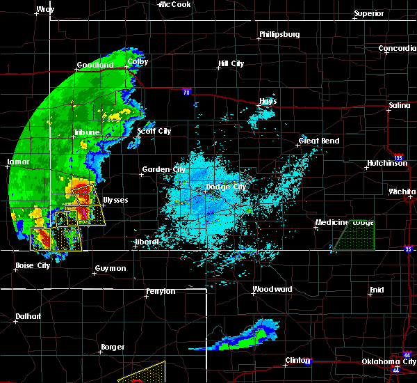 At 1139 pm cdt, a severe thunderstorm was located near big bow, moving east at 40 mph (trained weather spotters and automated weather equipment. johhson city airport measured a wind gust of 71 mph at 11:35 pm cdt). Hazards include two inch hail and 70 mph wind gusts. People and animals outdoors will be injured. expect hail damage to roofs, siding, windows, and vehicles. expect considerable tree damage. wind damage is also likely to mobile homes, roofs, and outbuildings. Locations impacted include, big bow. At 1139 pm cdt, a severe thunderstorm was located near big bow, moving east at 40 mph (trained weather spotters and automated weather equipment. johhson city airport measured a wind gust of 71 mph at 11:35 pm cdt). Hazards include two inch hail and 70 mph wind gusts. People and animals outdoors will be injured. expect hail damage to roofs, siding, windows, and vehicles. expect considerable tree damage. wind damage is also likely to mobile homes, roofs, and outbuildings. Locations impacted include, big bow.
|
| 6/22/2019 11:27 PM CDT |
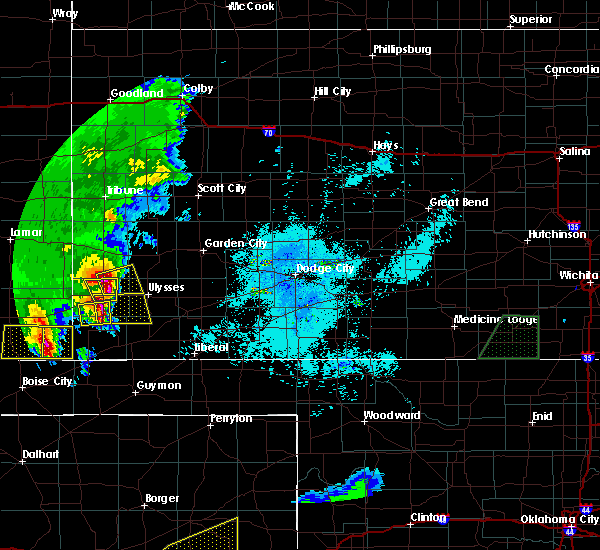 At 1127 pm cdt, a severe thunderstorm was located 7 miles south of johnson city, moving east at 25 mph (radar indicated). Hazards include two inch hail and 60 mph wind gusts. People and animals outdoors will be injured. expect hail damage to roofs, siding, windows, and vehicles. Expect wind damage to roofs, siding, and trees. At 1127 pm cdt, a severe thunderstorm was located 7 miles south of johnson city, moving east at 25 mph (radar indicated). Hazards include two inch hail and 60 mph wind gusts. People and animals outdoors will be injured. expect hail damage to roofs, siding, windows, and vehicles. Expect wind damage to roofs, siding, and trees.
|
| 6/14/2019 9:13 PM CDT |
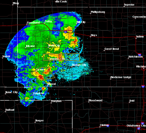 At 912 pm cdt, a severe thunderstorm was located very near ryus, moving northeast at 45 mph. at 905 pm cdt, quarter size hail was reported in moscow (emergency management). Hazards include 60 mph wind gusts and quarter size hail. Hail damage to vehicles is expected. expect wind damage to roofs, siding, and trees. Locations impacted include, ulysses, sublette, satanta, moscow, ryus, cave and hickok. At 912 pm cdt, a severe thunderstorm was located very near ryus, moving northeast at 45 mph. at 905 pm cdt, quarter size hail was reported in moscow (emergency management). Hazards include 60 mph wind gusts and quarter size hail. Hail damage to vehicles is expected. expect wind damage to roofs, siding, and trees. Locations impacted include, ulysses, sublette, satanta, moscow, ryus, cave and hickok.
|
| 6/14/2019 8:58 PM CDT |
 At 857 pm cdt, a severe thunderstorm was located 8 miles northwest of moscow, moving northeast at 45 mph (radar indicated). Hazards include 60 mph wind gusts and quarter size hail. Hail damage to vehicles is expected. Expect wind damage to roofs, siding, and trees. At 857 pm cdt, a severe thunderstorm was located 8 miles northwest of moscow, moving northeast at 45 mph (radar indicated). Hazards include 60 mph wind gusts and quarter size hail. Hail damage to vehicles is expected. Expect wind damage to roofs, siding, and trees.
|
| 6/14/2019 8:51 PM CDT |
 At 837 pm cdt, a severe thunderstorm was located 11 miles northeast of richfield, moving east at 40 mph (radar indicated). Hazards include 60 mph wind gusts and quarter size hail. Hail damage to vehicles is expected. expect wind damage to roofs, siding, and trees. Locations impacted include, ulysses, hugoton, johnson city, manter, richfield, big bow and feterita. At 837 pm cdt, a severe thunderstorm was located 11 miles northeast of richfield, moving east at 40 mph (radar indicated). Hazards include 60 mph wind gusts and quarter size hail. Hail damage to vehicles is expected. expect wind damage to roofs, siding, and trees. Locations impacted include, ulysses, hugoton, johnson city, manter, richfield, big bow and feterita.
|
| 6/14/2019 8:37 PM CDT |
 At 837 pm cdt, a severe thunderstorm was located 11 miles northeast of richfield, moving east at 40 mph (radar indicated). Hazards include 60 mph wind gusts and quarter size hail. Hail damage to vehicles is expected. expect wind damage to roofs, siding, and trees. Locations impacted include, ulysses, hugoton, johnson city, manter, richfield, big bow and feterita. At 837 pm cdt, a severe thunderstorm was located 11 miles northeast of richfield, moving east at 40 mph (radar indicated). Hazards include 60 mph wind gusts and quarter size hail. Hail damage to vehicles is expected. expect wind damage to roofs, siding, and trees. Locations impacted include, ulysses, hugoton, johnson city, manter, richfield, big bow and feterita.
|
| 6/14/2019 8:15 PM CDT |
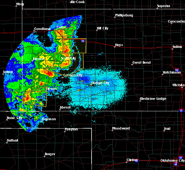 At 814 pm cdt, a severe thunderstorm was located 7 miles northwest of richfield, moving east at 40 mph (radar indicated). Hazards include 60 mph wind gusts and quarter size hail. Hail damage to vehicles is expected. Expect wind damage to roofs, siding, and trees. At 814 pm cdt, a severe thunderstorm was located 7 miles northwest of richfield, moving east at 40 mph (radar indicated). Hazards include 60 mph wind gusts and quarter size hail. Hail damage to vehicles is expected. Expect wind damage to roofs, siding, and trees.
|
| 6/13/2019 9:00 PM CDT | Quarter sized hail reported 1.9 miles N of Ulysses, KS, emergency reported quarter size hail covering the highway 25 at road 14. |
| 6/13/2019 8:58 PM CDT | Ping Pong Ball sized hail reported 0.5 miles ESE of Ulysses, KS, social media report of ping pong size hail on west side of ulysses. |
| 6/3/2019 8:09 PM CDT |
 The severe thunderstorm warning for southeastern kearny, western finney, central grant and northern haskell counties will expire at 815 pm cdt, the severe thunderstorm which prompted the warning is weakening below severe limits. winds near 5o mph are still possible. heavy rain and lightning will continue over the next 30 minutes as the storm weakens. therefore, the warning will be allowed to expire at 8:15 pm cdt. a severe thunderstorm watch remains in effect until 1100 pm cdt for southwestern kansas. The severe thunderstorm warning for southeastern kearny, western finney, central grant and northern haskell counties will expire at 815 pm cdt, the severe thunderstorm which prompted the warning is weakening below severe limits. winds near 5o mph are still possible. heavy rain and lightning will continue over the next 30 minutes as the storm weakens. therefore, the warning will be allowed to expire at 8:15 pm cdt. a severe thunderstorm watch remains in effect until 1100 pm cdt for southwestern kansas.
|
| 6/3/2019 7:52 PM CDT |
 At 752 pm cdt, a severe thunderstorm was located 14 miles southeast of lakin, moving east at 40 mph (radar indicated). Hazards include 70 mph wind gusts and penny size hail. Expect considerable tree damage. damage is likely to mobile homes, roofs, and outbuildings. Locations impacted include, garden city, ulysses, lakin, holcomb, deerfield, ryus, hickok and plymell. At 752 pm cdt, a severe thunderstorm was located 14 miles southeast of lakin, moving east at 40 mph (radar indicated). Hazards include 70 mph wind gusts and penny size hail. Expect considerable tree damage. damage is likely to mobile homes, roofs, and outbuildings. Locations impacted include, garden city, ulysses, lakin, holcomb, deerfield, ryus, hickok and plymell.
|
| 6/3/2019 7:35 PM CDT |
 At 735 pm cdt/635 pm mdt/, a severe thunderstorm was located 5 miles north of ulysses, moving east at 35 mph (radar indicated). Hazards include 70 mph wind gusts and penny size hail. Expect considerable tree damage. damage is likely to mobile homes, roofs, and outbuildings. Locations impacted include, ulysses, big bow and hickok. At 735 pm cdt/635 pm mdt/, a severe thunderstorm was located 5 miles north of ulysses, moving east at 35 mph (radar indicated). Hazards include 70 mph wind gusts and penny size hail. Expect considerable tree damage. damage is likely to mobile homes, roofs, and outbuildings. Locations impacted include, ulysses, big bow and hickok.
|
| 6/3/2019 7:31 PM CDT |
 At 730 pm cdt, a severe thunderstorm was located 8 miles north of ulysses, moving east at 30 mph (radar indicated. this storm has a history of producing damaging winds across stanton and grant counties. strong winds are likely). Hazards include 70 mph wind gusts and nickel size hail. Expect considerable tree damage. Damage is likely to mobile homes, roofs, and outbuildings. At 730 pm cdt, a severe thunderstorm was located 8 miles north of ulysses, moving east at 30 mph (radar indicated. this storm has a history of producing damaging winds across stanton and grant counties. strong winds are likely). Hazards include 70 mph wind gusts and nickel size hail. Expect considerable tree damage. Damage is likely to mobile homes, roofs, and outbuildings.
|
| 6/3/2019 7:17 PM CDT |
 At 716 pm cdt/616 pm mdt/, a severe thunderstorm was located near big bow, moving east at 30 mph (emergency management and automated observations. this storm has a history of producing damaging winds in stanton county). Hazards include 70 mph wind gusts and penny size hail. Expect considerable tree damage. damage is likely to mobile homes, roofs, and outbuildings. Locations impacted include, ulysses, big bow and hickok. At 716 pm cdt/616 pm mdt/, a severe thunderstorm was located near big bow, moving east at 30 mph (emergency management and automated observations. this storm has a history of producing damaging winds in stanton county). Hazards include 70 mph wind gusts and penny size hail. Expect considerable tree damage. damage is likely to mobile homes, roofs, and outbuildings. Locations impacted include, ulysses, big bow and hickok.
|
| 6/3/2019 7:03 PM CDT |
 At 702 pm cdt/602 pm mdt/, a severe thunderstorm was located 7 miles northeast of johnson city, moving east at 20 mph (automated observations. johnson city airport reported a wind gust of 63 mph at 6:55 pm cdt. this storm has a history of producing damaging winds). Hazards include 70 mph wind gusts and nickel size hail. Expect considerable tree damage. Damage is likely to mobile homes, roofs, and outbuildings. At 702 pm cdt/602 pm mdt/, a severe thunderstorm was located 7 miles northeast of johnson city, moving east at 20 mph (automated observations. johnson city airport reported a wind gust of 63 mph at 6:55 pm cdt. this storm has a history of producing damaging winds). Hazards include 70 mph wind gusts and nickel size hail. Expect considerable tree damage. Damage is likely to mobile homes, roofs, and outbuildings.
|
| 5/23/2019 6:32 PM CDT |
 At 632 pm cdt/532 pm mdt/, a severe thunderstorm was located 7 miles south of lakin, moving northeast at 45 mph (radar indicated). Hazards include 60 mph wind gusts and quarter size hail. Hail damage to vehicles is expected. expect wind damage to roofs, siding, and trees. Locations impacted include, lakin, deerfield, kendall and hickok. At 632 pm cdt/532 pm mdt/, a severe thunderstorm was located 7 miles south of lakin, moving northeast at 45 mph (radar indicated). Hazards include 60 mph wind gusts and quarter size hail. Hail damage to vehicles is expected. expect wind damage to roofs, siding, and trees. Locations impacted include, lakin, deerfield, kendall and hickok.
|
| 5/23/2019 6:22 PM CDT |
 At 621 pm cdt/521 pm mdt/, a severe thunderstorm was located 10 miles north of ulysses, moving northeast at 45 mph (radar indicated). Hazards include 60 mph wind gusts and half dollar size hail. Hail damage to vehicles is expected. expect wind damage to roofs, siding, and trees. Locations impacted include, lakin, deerfield, kendall and hickok. At 621 pm cdt/521 pm mdt/, a severe thunderstorm was located 10 miles north of ulysses, moving northeast at 45 mph (radar indicated). Hazards include 60 mph wind gusts and half dollar size hail. Hail damage to vehicles is expected. expect wind damage to roofs, siding, and trees. Locations impacted include, lakin, deerfield, kendall and hickok.
|
| 5/23/2019 6:10 PM CDT |
 At 610 pm cdt/510 pm mdt/, a severe thunderstorm was located near ulysses, moving northeast at 45 mph (radar indicated). Hazards include 60 mph wind gusts and quarter size hail. Hail damage to vehicles is expected. Expect wind damage to roofs, siding, and trees. At 610 pm cdt/510 pm mdt/, a severe thunderstorm was located near ulysses, moving northeast at 45 mph (radar indicated). Hazards include 60 mph wind gusts and quarter size hail. Hail damage to vehicles is expected. Expect wind damage to roofs, siding, and trees.
|
| 5/23/2019 7:01 AM CDT |
 The national weather service in dodge city has issued a * severe thunderstorm warning for. eastern kearny county in southwestern kansas. southwestern finney county in southwestern kansas. northern grant county in southwestern kansas. Until 745 am cdt. The national weather service in dodge city has issued a * severe thunderstorm warning for. eastern kearny county in southwestern kansas. southwestern finney county in southwestern kansas. northern grant county in southwestern kansas. Until 745 am cdt.
|
| 5/6/2019 8:37 PM CDT |
 At 836 pm cdt/736 pm mdt/, severe thunderstorms were located along a line extending from 6 miles southeast of lakin to 6 miles northwest of cave to near rolla, moving east at 30 mph (radar indicated). Hazards include 60 mph wind gusts and quarter size hail. Hail damage to vehicles is expected. expect wind damage to roofs, siding, and trees. Locations impacted include, ulysses, hugoton, lakin, johnson city, deerfield, rolla, moscow, kendall, richfield, big bow, feterita, wilburton and hickok. At 836 pm cdt/736 pm mdt/, severe thunderstorms were located along a line extending from 6 miles southeast of lakin to 6 miles northwest of cave to near rolla, moving east at 30 mph (radar indicated). Hazards include 60 mph wind gusts and quarter size hail. Hail damage to vehicles is expected. expect wind damage to roofs, siding, and trees. Locations impacted include, ulysses, hugoton, lakin, johnson city, deerfield, rolla, moscow, kendall, richfield, big bow, feterita, wilburton and hickok.
|
| 5/6/2019 8:09 PM CDT |
 The national weather service in dodge city has issued a * severe thunderstorm warning for. morton county in southwestern kansas. southeastern hamilton county in southwestern kansas. southern kearny county in southwestern kansas. Grant county in southwestern kansas. The national weather service in dodge city has issued a * severe thunderstorm warning for. morton county in southwestern kansas. southeastern hamilton county in southwestern kansas. southern kearny county in southwestern kansas. Grant county in southwestern kansas.
|
| 8/18/2018 8:49 PM CDT | Hen Egg sized hail reported 7.9 miles WSW of Ulysses, KS, hen egg sized hail reported from earlier storm by a phone call 10 miles northeast of ulysses. |
| 8/18/2018 8:18 PM CDT | Quarter sized hail reported 9.7 miles SW of Ulysses, KS, quarter sized hail reported by em. |
| 8/18/2018 7:55 PM CDT | Quarter sized hail reported 7.2 miles SSW of Ulysses, KS, quarter sized hail reported by em. |
| 8/18/2018 7:42 PM CDT | Quarter sized hail reported 10.6 miles S of Ulysses, KS, quarter sized hail reported. |
| 7/27/2018 10:14 PM CDT |
 At 1014 pm cdt, severe thunderstorms were located along a line extending from 2 miles northwest of charleston to 8 miles northeast of hickok to 9 miles south of ulysses, moving southeast at 45 mph (radar indicated). Hazards include 70 mph wind gusts and penny size hail. Expect considerable tree damage. damage is likely to mobile homes, roofs, and outbuildings. Locations impacted include, garden city, ulysses, lakin, cimarron, holcomb, deerfield, pierceville, ingalls, charleston, ryus, big bow, plymell and hickok. At 1014 pm cdt, severe thunderstorms were located along a line extending from 2 miles northwest of charleston to 8 miles northeast of hickok to 9 miles south of ulysses, moving southeast at 45 mph (radar indicated). Hazards include 70 mph wind gusts and penny size hail. Expect considerable tree damage. damage is likely to mobile homes, roofs, and outbuildings. Locations impacted include, garden city, ulysses, lakin, cimarron, holcomb, deerfield, pierceville, ingalls, charleston, ryus, big bow, plymell and hickok.
|
| 7/27/2018 10:10 PM CDT | Storm damage reported in grant county KS, 1.6 miles SSE of Ulysses, KS |
| 7/27/2018 10:01 PM CDT |
 At 1001 pm cdt/901 pm mdt/, severe thunderstorms were located along a line extending from 6 miles north of pierceville to 11 miles south of lakin to 7 miles northeast of johnson city, moving southeast at 45 mph (radar indicated). Hazards include 70 mph wind gusts and penny size hail. Expect considerable tree damage. damage is likely to mobile homes, roofs, and outbuildings. Locations impacted include, garden city, ulysses, lakin, cimarron, holcomb, deerfield, pierceville, ingalls, kendall, charleston, ryus, big bow, plymell and hickok. At 1001 pm cdt/901 pm mdt/, severe thunderstorms were located along a line extending from 6 miles north of pierceville to 11 miles south of lakin to 7 miles northeast of johnson city, moving southeast at 45 mph (radar indicated). Hazards include 70 mph wind gusts and penny size hail. Expect considerable tree damage. damage is likely to mobile homes, roofs, and outbuildings. Locations impacted include, garden city, ulysses, lakin, cimarron, holcomb, deerfield, pierceville, ingalls, kendall, charleston, ryus, big bow, plymell and hickok.
|
| 7/27/2018 9:39 PM CDT |
 At 938 pm cdt/838 pm mdt/, severe thunderstorms were located along a line extending from 8 miles south of friend to 2 miles east of kendall to 11 miles north of big bow, moving southeast at 45 mph. this replaces the previous warnings for hamilton, kearny, and finney counties (radar indicated). Hazards include 70 mph wind gusts and penny size hail. Expect considerable tree damage. Damage is likely to mobile homes, roofs, and outbuildings. At 938 pm cdt/838 pm mdt/, severe thunderstorms were located along a line extending from 8 miles south of friend to 2 miles east of kendall to 11 miles north of big bow, moving southeast at 45 mph. this replaces the previous warnings for hamilton, kearny, and finney counties (radar indicated). Hazards include 70 mph wind gusts and penny size hail. Expect considerable tree damage. Damage is likely to mobile homes, roofs, and outbuildings.
|
| 7/20/2018 7:30 PM CDT | Hen Egg sized hail reported 10.1 miles SW of Ulysses, KS, picture of hail was forwarded via social media from ksn news. |
| 7/20/2018 7:17 PM CDT | Golf Ball sized hail reported 9.3 miles SW of Ulysses, KS, hail was at least the size of golfballs. |
| 7/20/2018 7:07 PM CDT |
 At 707 pm cdt, a severe thunderstorm was located very near ulysses, moving southeast at 15 mph (radar indicated). Hazards include 70 mph wind gusts. Expect considerable tree damage. Damage is likely to mobile homes, roofs, and outbuildings. At 707 pm cdt, a severe thunderstorm was located very near ulysses, moving southeast at 15 mph (radar indicated). Hazards include 70 mph wind gusts. Expect considerable tree damage. Damage is likely to mobile homes, roofs, and outbuildings.
|
| 7/19/2018 7:02 PM CDT |
 The national weather service in dodge city has issued a * severe thunderstorm warning for. southern kearny county in southwestern kansas. northern grant county in southwestern kansas. until 745 pm cdt. At 701 pm cdt, a severe thunderstorm was located 11 miles north of. The national weather service in dodge city has issued a * severe thunderstorm warning for. southern kearny county in southwestern kansas. northern grant county in southwestern kansas. until 745 pm cdt. At 701 pm cdt, a severe thunderstorm was located 11 miles north of.
|
| 6/24/2018 8:51 PM CDT |
 At 851 pm cdt, a severe thunderstorm was located 5 miles southwest of hickok, moving east at 40 mph (radar indicated). Hazards include 60 mph wind gusts and nickel size hail. Expect damage to roofs, siding, and trees. Locations impacted include, ulysses, sublette, satanta, moscow, ryus, cave and hickok. At 851 pm cdt, a severe thunderstorm was located 5 miles southwest of hickok, moving east at 40 mph (radar indicated). Hazards include 60 mph wind gusts and nickel size hail. Expect damage to roofs, siding, and trees. Locations impacted include, ulysses, sublette, satanta, moscow, ryus, cave and hickok.
|
| 6/24/2018 8:24 PM CDT | Ulysses awo in grant county KS, 1.6 miles SSE of Ulysses, KS |
| 6/24/2018 8:23 PM CDT |
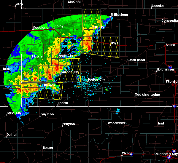 At 822 pm cdt, a severe thunderstorm was located 4 miles east of johnson city, moving east at 55 mph (automated weather station). Hazards include 60 mph wind gusts and nickel size hail. expect damage to roofs, siding, and trees At 822 pm cdt, a severe thunderstorm was located 4 miles east of johnson city, moving east at 55 mph (automated weather station). Hazards include 60 mph wind gusts and nickel size hail. expect damage to roofs, siding, and trees
|
| 6/23/2018 11:08 PM CDT |
 At 1107 pm cdt, a severe thunderstorm was located 3 miles southeast of ulysses, moving east at 35 mph. this replaces the previous warning for grant county (radar indicated). Hazards include 60 mph wind gusts and quarter size hail. Hail damage to vehicles is expected. Expect wind damage to roofs, siding, and trees. At 1107 pm cdt, a severe thunderstorm was located 3 miles southeast of ulysses, moving east at 35 mph. this replaces the previous warning for grant county (radar indicated). Hazards include 60 mph wind gusts and quarter size hail. Hail damage to vehicles is expected. Expect wind damage to roofs, siding, and trees.
|
| 6/23/2018 10:58 PM CDT |
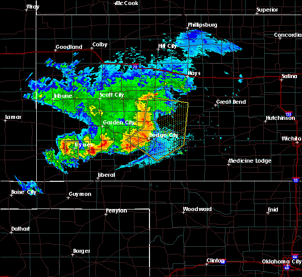 At 1057 pm cdt, a severe thunderstorm was located 5 miles southwest of ulysses, moving southeast at 35 mph (radar indicated). Hazards include ping pong ball size hail and 60 mph wind gusts. People and animals outdoors will be injured. expect hail damage to roofs, siding, windows, and vehicles. expect wind damage to roofs, siding, and trees. Locations impacted include, ulysses. At 1057 pm cdt, a severe thunderstorm was located 5 miles southwest of ulysses, moving southeast at 35 mph (radar indicated). Hazards include ping pong ball size hail and 60 mph wind gusts. People and animals outdoors will be injured. expect hail damage to roofs, siding, windows, and vehicles. expect wind damage to roofs, siding, and trees. Locations impacted include, ulysses.
|
| 6/23/2018 10:55 PM CDT | Baseball sized hail reported 8.2 miles E of Ulysses, KS |
| 6/23/2018 10:46 PM CDT |
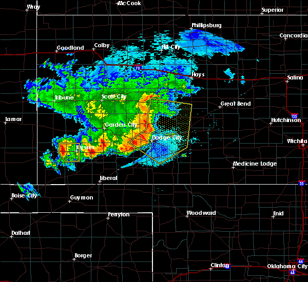 At 1046 pm cdt, a severe thunderstorm was located very near big bow, moving southeast at 35 mph (radar indicated). Hazards include ping pong ball size hail and 60 mph wind gusts. People and animals outdoors will be injured. expect hail damage to roofs, siding, windows, and vehicles. expect wind damage to roofs, siding, and trees. Locations impacted include, ulysses and big bow. At 1046 pm cdt, a severe thunderstorm was located very near big bow, moving southeast at 35 mph (radar indicated). Hazards include ping pong ball size hail and 60 mph wind gusts. People and animals outdoors will be injured. expect hail damage to roofs, siding, windows, and vehicles. expect wind damage to roofs, siding, and trees. Locations impacted include, ulysses and big bow.
|
| 6/23/2018 10:27 PM CDT |
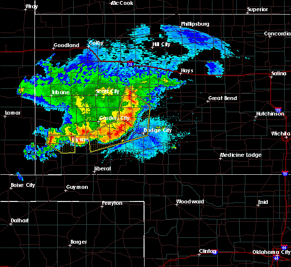 At 1027 pm cdt, a severe thunderstorm was located 5 miles north of johnson city, moving southeast at 35 mph (radar indicated). Hazards include 60 mph wind gusts and quarter size hail. Hail damage to vehicles is expected. Expect wind damage to roofs, siding, and trees. At 1027 pm cdt, a severe thunderstorm was located 5 miles north of johnson city, moving southeast at 35 mph (radar indicated). Hazards include 60 mph wind gusts and quarter size hail. Hail damage to vehicles is expected. Expect wind damage to roofs, siding, and trees.
|
| 6/19/2018 11:00 PM CDT |
 At 1100 pm cdt, severe thunderstorms were located along a line extending from 5 miles south of johnson city to 8 miles north of missler, moving southeast at 50 mph (radar indicated). Hazards include two inch hail and 70 mph wind gusts. People and animals outdoors will be injured. expect hail damage to roofs, siding, windows, and vehicles. expect considerable tree damage. Wind damage is also likely to mobile homes, roofs, and outbuildings. At 1100 pm cdt, severe thunderstorms were located along a line extending from 5 miles south of johnson city to 8 miles north of missler, moving southeast at 50 mph (radar indicated). Hazards include two inch hail and 70 mph wind gusts. People and animals outdoors will be injured. expect hail damage to roofs, siding, windows, and vehicles. expect considerable tree damage. Wind damage is also likely to mobile homes, roofs, and outbuildings.
|
| 6/19/2018 10:27 PM CDT |
 At 1026 pm cdt, severe thunderstorms were located along a line extending from 12 miles southwest of plymell to 2 miles southwest of the saunders elevator, moving southeast at 60 mph (radar indicated). Hazards include two inch hail and 70 mph wind gusts. People and animals outdoors will be injured. expect hail damage to roofs, siding, windows, and vehicles. expect considerable tree damage. Wind damage is also likely to mobile homes, roofs, and outbuildings. At 1026 pm cdt, severe thunderstorms were located along a line extending from 12 miles southwest of plymell to 2 miles southwest of the saunders elevator, moving southeast at 60 mph (radar indicated). Hazards include two inch hail and 70 mph wind gusts. People and animals outdoors will be injured. expect hail damage to roofs, siding, windows, and vehicles. expect considerable tree damage. Wind damage is also likely to mobile homes, roofs, and outbuildings.
|
| 6/19/2018 10:18 PM CDT |
 At 1018 pm cdt, severe thunderstorms were located along a line extending from 2 miles south of ryus to 10 miles south of big bow to 4 miles west of the saunders elevator, moving southeast at 40 mph (radar indicated). Hazards include 70 mph wind gusts and quarter size hail. Hail damage to vehicles is expected. expect considerable tree damage. wind damage is also likely to mobile homes, roofs, and outbuildings. Locations impacted include, ulysses, hugoton, elkhart, johnson city, rolla, moscow, manter, richfield, the saunders elevator, big bow, feterita, wilburton and hickok. At 1018 pm cdt, severe thunderstorms were located along a line extending from 2 miles south of ryus to 10 miles south of big bow to 4 miles west of the saunders elevator, moving southeast at 40 mph (radar indicated). Hazards include 70 mph wind gusts and quarter size hail. Hail damage to vehicles is expected. expect considerable tree damage. wind damage is also likely to mobile homes, roofs, and outbuildings. Locations impacted include, ulysses, hugoton, elkhart, johnson city, rolla, moscow, manter, richfield, the saunders elevator, big bow, feterita, wilburton and hickok.
|
| 6/19/2018 10:15 PM CDT | Ulysses aso in grant county KS, 2.3 miles SSE of Ulysses, KS |
| 6/19/2018 10:15 PM CDT | Power lost to all of ulysses... ks due to wind strong gusts. power was regained at approximately 10:35pm. time matched with 60 mph wind gust reported at the airport (10 in grant county KS, 0.2 miles SSW of Ulysses, KS |
| 6/19/2018 9:56 PM CDT |
 At 955 pm cdt/855 pm mdt/, the leading edge of severe thunderstorms were located along a line extending from 7 miles south of lakin to 3 miles east of johnson city to 5 miles east of two buttes, moving southeast at 50 mph (radar indicated). Hazards include 70 mph wind gusts and quarter size hail. Hail damage to vehicles is expected. expect considerable tree damage. wind damage is also likely to mobile homes, roofs, and outbuildings. Locations impacted include, ulysses, hugoton, elkhart, johnson city, rolla, moscow, manter, richfield, the saunders elevator, big bow, feterita, wilburton and hickok. At 955 pm cdt/855 pm mdt/, the leading edge of severe thunderstorms were located along a line extending from 7 miles south of lakin to 3 miles east of johnson city to 5 miles east of two buttes, moving southeast at 50 mph (radar indicated). Hazards include 70 mph wind gusts and quarter size hail. Hail damage to vehicles is expected. expect considerable tree damage. wind damage is also likely to mobile homes, roofs, and outbuildings. Locations impacted include, ulysses, hugoton, elkhart, johnson city, rolla, moscow, manter, richfield, the saunders elevator, big bow, feterita, wilburton and hickok.
|
| 6/19/2018 9:28 PM CDT |
 At 928 pm cdt/828 pm mdt/, severe thunderstorms were located along a line extending from 3 miles southwest of kendall to 13 miles northwest of manter to 2 miles northwest of two buttes, moving southeast at 40 mph (radar indicated). Hazards include 70 mph wind gusts and penny size hail. Expect considerable tree damage. Damage is likely to mobile homes, roofs, and outbuildings. At 928 pm cdt/828 pm mdt/, severe thunderstorms were located along a line extending from 3 miles southwest of kendall to 13 miles northwest of manter to 2 miles northwest of two buttes, moving southeast at 40 mph (radar indicated). Hazards include 70 mph wind gusts and penny size hail. Expect considerable tree damage. Damage is likely to mobile homes, roofs, and outbuildings.
|
| 6/19/2018 3:57 PM CDT |
 At 357 pm cdt, a severe thunderstorm was located 5 miles north of hickok, moving northeast at 15 mph (radar indicated). Hazards include 60 mph wind gusts and half dollar size hail. Hail damage to vehicles is expected. expect wind damage to roofs, siding, and trees. Locations impacted include, ulysses and hickok. At 357 pm cdt, a severe thunderstorm was located 5 miles north of hickok, moving northeast at 15 mph (radar indicated). Hazards include 60 mph wind gusts and half dollar size hail. Hail damage to vehicles is expected. expect wind damage to roofs, siding, and trees. Locations impacted include, ulysses and hickok.
|
| 6/19/2018 3:48 PM CDT |
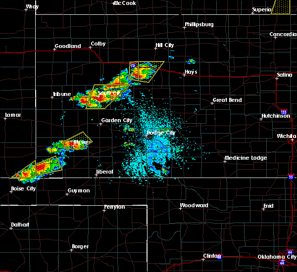 At 348 pm cdt, a severe thunderstorm was located near ulysses, moving northeast at 15 mph (radar indicated). Hazards include 60 mph wind gusts and half dollar size hail. Hail damage to vehicles is expected. Expect wind damage to roofs, siding, and trees. At 348 pm cdt, a severe thunderstorm was located near ulysses, moving northeast at 15 mph (radar indicated). Hazards include 60 mph wind gusts and half dollar size hail. Hail damage to vehicles is expected. Expect wind damage to roofs, siding, and trees.
|
| 6/13/2018 12:55 AM CDT |
 The severe thunderstorm warning for grant county will expire at 100 am cdt, the storm which prompted the warning has weakened below severe limits, and no longer poses an immediate threat to life or property. therefore, the warning will be allowed to expire. however small hail and gusty winds are still possible with this thunderstorm. The severe thunderstorm warning for grant county will expire at 100 am cdt, the storm which prompted the warning has weakened below severe limits, and no longer poses an immediate threat to life or property. therefore, the warning will be allowed to expire. however small hail and gusty winds are still possible with this thunderstorm.
|
| 6/13/2018 12:24 AM CDT |
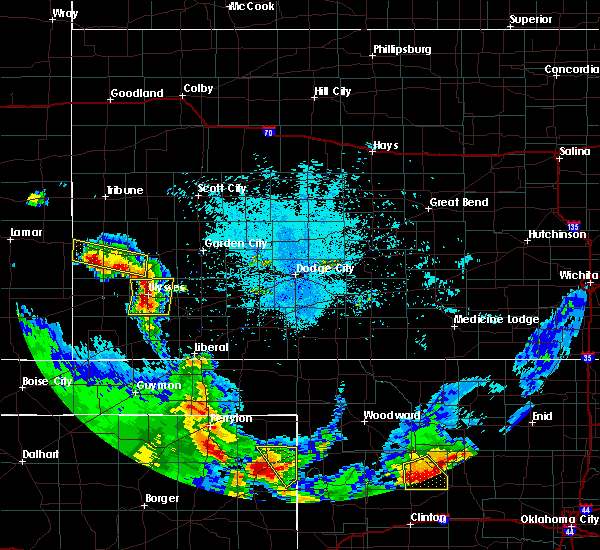 At 1223 am cdt, a severe thunderstorm was located very near ulysses, moving east at 25 mph (radar indicated). Hazards include ping pong ball size hail and 60 mph wind gusts. People and animals outdoors will be injured. expect hail damage to roofs, siding, windows, and vehicles. expect wind damage to roofs, siding, and trees. Locations impacted include, ulysses and hickok. At 1223 am cdt, a severe thunderstorm was located very near ulysses, moving east at 25 mph (radar indicated). Hazards include ping pong ball size hail and 60 mph wind gusts. People and animals outdoors will be injured. expect hail damage to roofs, siding, windows, and vehicles. expect wind damage to roofs, siding, and trees. Locations impacted include, ulysses and hickok.
|
| 6/13/2018 12:10 AM CDT |
 At 1209 am cdt, a severe thunderstorm was located 6 miles southeast of big bow, moving east at 25 mph (radar indicated). Hazards include two inch hail and 60 mph wind gusts. People and animals outdoors will be injured. expect hail damage to roofs, siding, windows, and vehicles. Expect wind damage to roofs, siding, and trees. At 1209 am cdt, a severe thunderstorm was located 6 miles southeast of big bow, moving east at 25 mph (radar indicated). Hazards include two inch hail and 60 mph wind gusts. People and animals outdoors will be injured. expect hail damage to roofs, siding, windows, and vehicles. Expect wind damage to roofs, siding, and trees.
|
| 6/12/2018 11:23 PM CDT |
 At 1123 pm cdt, a severe thunderstorm was located 8 miles southeast of johnson city, moving northeast at 10 mph (radar indicated). Hazards include 60 mph wind gusts and half dollar size hail. Hail damage to vehicles is expected. Expect wind damage to roofs, siding, and trees. At 1123 pm cdt, a severe thunderstorm was located 8 miles southeast of johnson city, moving northeast at 10 mph (radar indicated). Hazards include 60 mph wind gusts and half dollar size hail. Hail damage to vehicles is expected. Expect wind damage to roofs, siding, and trees.
|
| 5/30/2018 8:23 PM CDT | Mesonet station kuls... 1 nw ulysse in grant county KS, 1.6 miles SSE of Ulysses, KS |
| 5/28/2018 7:55 PM CDT |
 At 754 pm cdt, a severe thunderstorm was located 6 miles north of ryus, moving northeast at 35 mph (radar indicated). Hazards include 60 mph wind gusts and quarter size hail. Hail damage to vehicles is expected. expect wind damage to roofs, siding, and trees. Locations impacted include, hugoton, moscow, ryus, cave, hickok, woods and feterita. At 754 pm cdt, a severe thunderstorm was located 6 miles north of ryus, moving northeast at 35 mph (radar indicated). Hazards include 60 mph wind gusts and quarter size hail. Hail damage to vehicles is expected. expect wind damage to roofs, siding, and trees. Locations impacted include, hugoton, moscow, ryus, cave, hickok, woods and feterita.
|
| 5/28/2018 7:35 PM CDT |
 At 735 pm cdt, a severe thunderstorm was located 6 miles west of moscow, moving northeast at 85 mph (radar indicated). Hazards include 60 mph wind gusts and quarter size hail. Hail damage to vehicles is expected. expect wind damage to roofs, siding, and trees. Locations impacted include, ulysses, hugoton, moscow, ryus, cave, hickok, woods and feterita. At 735 pm cdt, a severe thunderstorm was located 6 miles west of moscow, moving northeast at 85 mph (radar indicated). Hazards include 60 mph wind gusts and quarter size hail. Hail damage to vehicles is expected. expect wind damage to roofs, siding, and trees. Locations impacted include, ulysses, hugoton, moscow, ryus, cave, hickok, woods and feterita.
|
| 5/28/2018 7:23 PM CDT |
 At 722 pm cdt, a severe thunderstorm was located 7 miles south of feterita, moving northeast at 45 mph (radar indicated). Hazards include 60 mph wind gusts and quarter size hail. Hail damage to vehicles is expected. Expect wind damage to roofs, siding, and trees. At 722 pm cdt, a severe thunderstorm was located 7 miles south of feterita, moving northeast at 45 mph (radar indicated). Hazards include 60 mph wind gusts and quarter size hail. Hail damage to vehicles is expected. Expect wind damage to roofs, siding, and trees.
|
| 5/28/2018 6:37 PM CDT |
 At 637 pm cdt, a severe thunderstorm was located 13 miles southeast of big bow, moving northeast at 25 mph (radar indicated). Hazards include two inch hail and 60 mph wind gusts. People and animals outdoors will be injured. expect hail damage to roofs, siding, windows, and vehicles. expect wind damage to roofs, siding, and trees. Locations impacted include, ulysses, hugoton, moscow, feterita and hickok. At 637 pm cdt, a severe thunderstorm was located 13 miles southeast of big bow, moving northeast at 25 mph (radar indicated). Hazards include two inch hail and 60 mph wind gusts. People and animals outdoors will be injured. expect hail damage to roofs, siding, windows, and vehicles. expect wind damage to roofs, siding, and trees. Locations impacted include, ulysses, hugoton, moscow, feterita and hickok.
|
| 5/28/2018 6:31 PM CDT |
 At 631 pm cdt, a severe thunderstorm was located 10 miles west of moscow, moving east at 40 mph (radar indicated). Hazards include 60 mph wind gusts and half dollar size hail. Hail damage to vehicles is expected. Expect wind damage to roofs, siding, and trees. At 631 pm cdt, a severe thunderstorm was located 10 miles west of moscow, moving east at 40 mph (radar indicated). Hazards include 60 mph wind gusts and half dollar size hail. Hail damage to vehicles is expected. Expect wind damage to roofs, siding, and trees.
|
| 5/28/2018 6:25 PM CDT |
 The severe thunderstorm warning for eastern kearny, southwestern finney and northern grant counties will expire at 630 pm cdt, a severe thunderstorm watch remains in effect until 1000 pm cdt for southwestern kansas. remember, a severe thunderstorm warning still remains in effect for kearny, grant, and finney counties until 7:15 pm. The severe thunderstorm warning for eastern kearny, southwestern finney and northern grant counties will expire at 630 pm cdt, a severe thunderstorm watch remains in effect until 1000 pm cdt for southwestern kansas. remember, a severe thunderstorm warning still remains in effect for kearny, grant, and finney counties until 7:15 pm.
|
| 5/28/2018 6:23 PM CDT | Quarter sized hail reported 4.3 miles S of Ulysses, KS |
| 5/28/2018 6:18 PM CDT | Mesonet station kuls... 1 nw ulysse in grant county KS, 1.6 miles SSE of Ulysses, KS |
| 5/28/2018 6:08 PM CDT | Quarter sized hail reported 2.4 miles SSE of Ulysses, KS |
| 5/28/2018 6:05 PM CDT |
 At 604 pm cdt, a severe thunderstorm was located 9 miles north of ulysses, moving north at 20 mph (public at 5:58 pm quarter sized hail was reported in ulysses). Hazards include 60 mph wind gusts and half dollar size hail. Hail damage to vehicles is expected. expect wind damage to roofs, siding, and trees. Locations impacted include, ulysses, lakin, holcomb and deerfield. At 604 pm cdt, a severe thunderstorm was located 9 miles north of ulysses, moving north at 20 mph (public at 5:58 pm quarter sized hail was reported in ulysses). Hazards include 60 mph wind gusts and half dollar size hail. Hail damage to vehicles is expected. expect wind damage to roofs, siding, and trees. Locations impacted include, ulysses, lakin, holcomb and deerfield.
|
| 5/28/2018 5:56 PM CDT |
 At 556 pm cdt, a severe thunderstorm was located 10 miles north of ulysses, moving north at 40 mph (radar indicated). Hazards include 60 mph wind gusts and half dollar size hail. Hail damage to vehicles is expected. expect wind damage to roofs, siding, and trees. Locations impacted include, ulysses, lakin, holcomb, deerfield and hickok. At 556 pm cdt, a severe thunderstorm was located 10 miles north of ulysses, moving north at 40 mph (radar indicated). Hazards include 60 mph wind gusts and half dollar size hail. Hail damage to vehicles is expected. expect wind damage to roofs, siding, and trees. Locations impacted include, ulysses, lakin, holcomb, deerfield and hickok.
|
| 5/28/2018 5:55 PM CDT | Quarter sized hail reported 8.2 miles E of Ulysses, KS |
| 5/28/2018 5:37 PM CDT |
 At 536 pm cdt, a severe thunderstorm was located 5 miles southwest of ulysses, moving northeast at 45 mph (radar indicated). Hazards include ping pong ball size hail and 60 mph wind gusts. People and animals outdoors will be injured. expect hail damage to roofs, siding, windows, and vehicles. expect wind damage to roofs, siding, and trees. Locations impacted include, ulysses, lakin, holcomb, deerfield and hickok. At 536 pm cdt, a severe thunderstorm was located 5 miles southwest of ulysses, moving northeast at 45 mph (radar indicated). Hazards include ping pong ball size hail and 60 mph wind gusts. People and animals outdoors will be injured. expect hail damage to roofs, siding, windows, and vehicles. expect wind damage to roofs, siding, and trees. Locations impacted include, ulysses, lakin, holcomb, deerfield and hickok.
|
| 5/28/2018 5:27 PM CDT |
 At 527 pm cdt, a severe thunderstorm was located 12 miles south of ulysses, moving north at 40 mph (radar indicated). Hazards include ping pong ball size hail and 60 mph wind gusts. People and animals outdoors will be injured. expect hail damage to roofs, siding, windows, and vehicles. Expect wind damage to roofs, siding, and trees. At 527 pm cdt, a severe thunderstorm was located 12 miles south of ulysses, moving north at 40 mph (radar indicated). Hazards include ping pong ball size hail and 60 mph wind gusts. People and animals outdoors will be injured. expect hail damage to roofs, siding, windows, and vehicles. Expect wind damage to roofs, siding, and trees.
|
| 5/27/2018 4:25 PM CDT | Half Dollar sized hail reported 9.5 miles SE of Ulysses, KS |
| 5/27/2018 4:15 PM CDT |
 At 415 pm cdt/315 pm mdt/, a severe thunderstorm was located 5 miles northeast of big bow, moving north at 45 mph (radar indicated). Hazards include ping pong ball size hail and 60 mph wind gusts. People and animals outdoors will be injured. expect hail damage to roofs, siding, windows, and vehicles. Expect wind damage to roofs, siding, and trees. At 415 pm cdt/315 pm mdt/, a severe thunderstorm was located 5 miles northeast of big bow, moving north at 45 mph (radar indicated). Hazards include ping pong ball size hail and 60 mph wind gusts. People and animals outdoors will be injured. expect hail damage to roofs, siding, windows, and vehicles. Expect wind damage to roofs, siding, and trees.
|
| 4/29/2018 8:22 PM CDT | Quarter sized hail reported 13.9 miles SSE of Ulysses, KS, several quarter inch hail stones. |
| 4/29/2018 8:17 PM CDT | Ping Pong Ball sized hail reported 10 miles SE of Ulysses, KS, photo from social media with a quarter to compare size. |
| 4/29/2018 7:55 PM CDT | Quarter sized hail reported 8.9 miles ESE of Ulysses, KS, nickel to quarter size hail. |
| 10/6/2017 6:47 PM CDT |
 At 647 pm cdt, a severe thunderstorm was located 3 miles north of hickok, or 7 miles east of ulysses, moving northeast at 40 mph (radar indicated). Hazards include ping pong ball size hail and 60 mph wind gusts. People and animals outdoors will be injured. expect hail damage to roofs, siding, windows, and vehicles. Expect wind damage to roofs, siding, and trees. At 647 pm cdt, a severe thunderstorm was located 3 miles north of hickok, or 7 miles east of ulysses, moving northeast at 40 mph (radar indicated). Hazards include ping pong ball size hail and 60 mph wind gusts. People and animals outdoors will be injured. expect hail damage to roofs, siding, windows, and vehicles. Expect wind damage to roofs, siding, and trees.
|
| 10/6/2017 5:21 PM CDT |
 At 521 pm cdt, a severe thunderstorm was located 5 miles east of johnson city, moving east at 45 mph (radar indicated). Hazards include ping pong ball size hail and 60 mph wind gusts. People and animals outdoors will be injured. expect hail damage to roofs, siding, windows, and vehicles. expect wind damage to roofs, siding, and trees. Locations impacted include, ulysses, johnson city, big bow and the milepost elevator. At 521 pm cdt, a severe thunderstorm was located 5 miles east of johnson city, moving east at 45 mph (radar indicated). Hazards include ping pong ball size hail and 60 mph wind gusts. People and animals outdoors will be injured. expect hail damage to roofs, siding, windows, and vehicles. expect wind damage to roofs, siding, and trees. Locations impacted include, ulysses, johnson city, big bow and the milepost elevator.
|
| 10/6/2017 5:00 PM CDT |
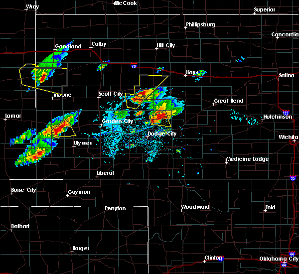 At 500 pm cdt, a severe thunderstorm was located 5 miles southwest of manter, or 12 miles southwest of johnson city, moving northeast at 45 mph (radar indicated). Hazards include 70 mph wind gusts and ping pong ball size hail. People and animals outdoors will be injured. expect hail damage to roofs, siding, windows, and vehicles. expect considerable tree damage. Wind damage is also likely to mobile homes, roofs, and outbuildings. At 500 pm cdt, a severe thunderstorm was located 5 miles southwest of manter, or 12 miles southwest of johnson city, moving northeast at 45 mph (radar indicated). Hazards include 70 mph wind gusts and ping pong ball size hail. People and animals outdoors will be injured. expect hail damage to roofs, siding, windows, and vehicles. expect considerable tree damage. Wind damage is also likely to mobile homes, roofs, and outbuildings.
|
| 7/8/2017 12:11 AM CDT |
 The severe thunderstorm warning for northwestern seward, southeastern kearny, southwestern finney, grant, northeastern stevens and haskell counties will expire at 1215 am cdt, the storms which prompted the warning have weakened below severe limits, and no longer pose an immediate threat to life or property. therefore the warning will be allowed to expire. however gusty winds and heavy rain are still possible with these thunderstorms. The severe thunderstorm warning for northwestern seward, southeastern kearny, southwestern finney, grant, northeastern stevens and haskell counties will expire at 1215 am cdt, the storms which prompted the warning have weakened below severe limits, and no longer pose an immediate threat to life or property. therefore the warning will be allowed to expire. however gusty winds and heavy rain are still possible with these thunderstorms.
|
| 7/7/2017 11:41 PM CDT |
 At 1140 pm cdt, the gust front from severe thunderstorms was located along a line extending from 5 miles southeast of deerfield to 6 miles north of ryus to 4 miles north of woods, moving east at 30 mph (radar indicated). Hazards include 60 mph wind gusts and penny size hail. Expect damage to roofs, siding, and trees. Locations impacted include, garden city, ulysses, sublette, satanta, moscow, plymell, hickok, ryus, cave, tice and garden city regional airport. At 1140 pm cdt, the gust front from severe thunderstorms was located along a line extending from 5 miles southeast of deerfield to 6 miles north of ryus to 4 miles north of woods, moving east at 30 mph (radar indicated). Hazards include 60 mph wind gusts and penny size hail. Expect damage to roofs, siding, and trees. Locations impacted include, garden city, ulysses, sublette, satanta, moscow, plymell, hickok, ryus, cave, tice and garden city regional airport.
|
| 7/7/2017 11:16 PM CDT | Mesonet station kuls... 1 nw ulysse in grant county KS, 1.6 miles SSE of Ulysses, KS |
| 7/7/2017 11:16 PM CDT |
 At 1115 pm cdt, severe thunderstorms were located along a line extending from 4 miles south of deerfield to near moscow, moving east at 30 mph (radar indicated). Hazards include 60 mph wind gusts and penny size hail. expect damage to roofs, siding, and trees At 1115 pm cdt, severe thunderstorms were located along a line extending from 4 miles south of deerfield to near moscow, moving east at 30 mph (radar indicated). Hazards include 60 mph wind gusts and penny size hail. expect damage to roofs, siding, and trees
|
| 6/22/2017 6:28 PM CDT |
 At 626 pm cdt, a severe thunderstorm was located 7 miles north of richfield, or 13 miles south of johnson city. another severe thunderstorm was located 10 miles southeast of big bow. both storms were moving south at 20 mph (radar indicated). Hazards include ping pong ball size hail and 60 mph wind gusts. People and animals outdoors will be injured. expect hail damage to roofs, siding, windows, and vehicles. expect wind damage to roofs, siding, and trees. Locations impacted include, ulysses, hugoton, elkhart, rolla, richfield, big bow, feterita, wilburton, point of rocks at cimarron grassland, cimarron grassland recreation area and the milepost elevator. At 626 pm cdt, a severe thunderstorm was located 7 miles north of richfield, or 13 miles south of johnson city. another severe thunderstorm was located 10 miles southeast of big bow. both storms were moving south at 20 mph (radar indicated). Hazards include ping pong ball size hail and 60 mph wind gusts. People and animals outdoors will be injured. expect hail damage to roofs, siding, windows, and vehicles. expect wind damage to roofs, siding, and trees. Locations impacted include, ulysses, hugoton, elkhart, rolla, richfield, big bow, feterita, wilburton, point of rocks at cimarron grassland, cimarron grassland recreation area and the milepost elevator.
|
| 6/22/2017 6:08 PM CDT |
 At 608 pm cdt, a severe thunderstorm was located 4 miles southeast of big bow, or 9 miles southwest of ulysses, moving south at 20 mph (radar indicated). Hazards include 60 mph wind gusts and quarter size hail. Hail damage to vehicles is expected. Expect wind damage to roofs, siding, and trees. At 608 pm cdt, a severe thunderstorm was located 4 miles southeast of big bow, or 9 miles southwest of ulysses, moving south at 20 mph (radar indicated). Hazards include 60 mph wind gusts and quarter size hail. Hail damage to vehicles is expected. Expect wind damage to roofs, siding, and trees.
|
| 6/21/2017 6:21 PM CDT |
 At 621 pm cdt, a severe thunderstorm was located 4 miles southwest of hickok, or 5 miles southeast of ulysses, moving southeast at 20 mph (radar indicated). Hazards include 60 mph wind gusts and nickel size hail. Expect damage to roofs, siding, and trees. Locations impacted include, ulysses, sublette, satanta, moscow, hickok, ryus, cave and tice. At 621 pm cdt, a severe thunderstorm was located 4 miles southwest of hickok, or 5 miles southeast of ulysses, moving southeast at 20 mph (radar indicated). Hazards include 60 mph wind gusts and nickel size hail. Expect damage to roofs, siding, and trees. Locations impacted include, ulysses, sublette, satanta, moscow, hickok, ryus, cave and tice.
|
| 6/21/2017 6:15 PM CDT | Storm damage reported in grant county KS, 4.8 miles NNE of Ulysses, KS |
| 6/21/2017 5:56 PM CDT |
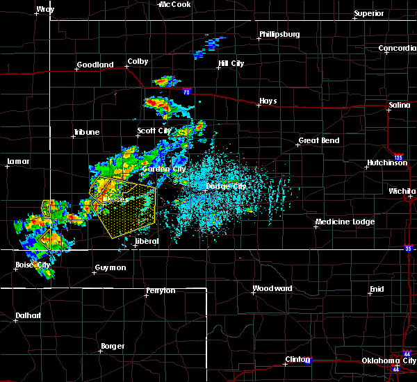 At 556 pm cdt, severe thunderstorms were located along a line extending from 5 miles south of deerfield to 6 miles north of hickok to 6 miles southwest of ulysses, moving southeast at 35 mph (radar indicated). Hazards include 60 mph wind gusts and quarter size hail. Hail damage to vehicles is expected. Expect wind damage to roofs, siding, and trees. At 556 pm cdt, severe thunderstorms were located along a line extending from 5 miles south of deerfield to 6 miles north of hickok to 6 miles southwest of ulysses, moving southeast at 35 mph (radar indicated). Hazards include 60 mph wind gusts and quarter size hail. Hail damage to vehicles is expected. Expect wind damage to roofs, siding, and trees.
|
| 6/20/2017 8:23 PM CDT | Storm damage reported in grant county KS, 19.3 miles NW of Ulysses, KS |
| 6/20/2017 8:17 PM CDT | Quarter sized hail reported 4.4 miles WNW of Ulysses, KS |
| 6/20/2017 8:00 PM CDT |
 At 800 pm cdt, a severe thunderstorm was located 6 miles northwest of cave, or 12 miles southeast of ulysses, moving southeast at 20 mph (radar indicated). Hazards include golf ball size hail and 60 mph wind gusts. People and animals outdoors will be injured. expect hail damage to roofs, siding, windows, and vehicles. expect wind damage to roofs, siding, and trees. Locations impacted include, ulysses, moscow and hickok. At 800 pm cdt, a severe thunderstorm was located 6 miles northwest of cave, or 12 miles southeast of ulysses, moving southeast at 20 mph (radar indicated). Hazards include golf ball size hail and 60 mph wind gusts. People and animals outdoors will be injured. expect hail damage to roofs, siding, windows, and vehicles. expect wind damage to roofs, siding, and trees. Locations impacted include, ulysses, moscow and hickok.
|
| 6/20/2017 7:46 PM CDT | Ping Pong Ball sized hail reported 6.1 miles NNW of Ulysses, KS, also estimated 50 mph wind. |
| 6/20/2017 7:34 PM CDT |
 At 733 pm cdt, a severe thunderstorm was located 4 miles south of ulysses, moving south at 20 mph (radar and spotter indicated). Hazards include tennis ball size hail and 60 mph wind gusts. People and animals outdoors will be injured. expect hail damage to roofs, siding, windows, and vehicles. Expect wind damage to roofs, siding, and trees. At 733 pm cdt, a severe thunderstorm was located 4 miles south of ulysses, moving south at 20 mph (radar and spotter indicated). Hazards include tennis ball size hail and 60 mph wind gusts. People and animals outdoors will be injured. expect hail damage to roofs, siding, windows, and vehicles. Expect wind damage to roofs, siding, and trees.
|
| 6/20/2017 7:23 PM CDT | Grapefruit sized hail reported 1 miles SW of Ulysses, KS, delayed report. |
| 6/20/2017 7:23 PM CDT | Hen Egg sized hail reported 1 miles SW of Ulysses, KS |
| 6/20/2017 7:22 PM CDT |
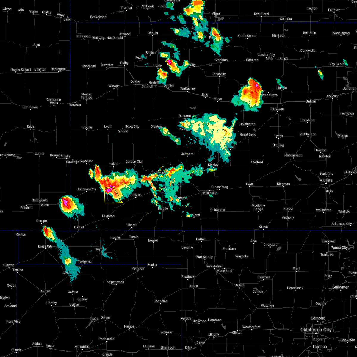 At 721 pm cdt, a severe thunderstorm was located very near ulysses, moving south at 20 mph (radar indicated). Hazards include tennis ball size hail and 70 mph wind gusts. People and animals outdoors will be injured. expect hail damage to roofs, siding, windows, and vehicles. expect considerable tree damage. wind damage is also likely to mobile homes, roofs, and outbuildings. locations impacted include, ulysses and hickok. Numerous reports of windshields broken along k-25 north of ulysses from hail around 2 inches in diameter from around 705 to 715 pm. At 721 pm cdt, a severe thunderstorm was located very near ulysses, moving south at 20 mph (radar indicated). Hazards include tennis ball size hail and 70 mph wind gusts. People and animals outdoors will be injured. expect hail damage to roofs, siding, windows, and vehicles. expect considerable tree damage. wind damage is also likely to mobile homes, roofs, and outbuildings. locations impacted include, ulysses and hickok. Numerous reports of windshields broken along k-25 north of ulysses from hail around 2 inches in diameter from around 705 to 715 pm.
|
| 6/20/2017 7:18 PM CDT | Tennis Ball sized hail reported 0.2 miles SSW of Ulysses, KS, from social media photo. also reports of broken windshields in ulysses. |
| 6/20/2017 7:16 PM CDT | Storm damage reported in grant county KS, 1.8 miles SE of Ulysses, KS |
| 6/20/2017 7:15 PM CDT | Quarter sized hail reported 0.2 miles SSW of Ulysses, KS |
| 6/20/2017 7:14 PM CDT | Ping Pong Ball sized hail reported 0.8 miles S of Ulysses, KS |
| 6/20/2017 7:10 PM CDT | Quarter sized hail reported 2.2 miles S of Ulysses, KS |
| 6/20/2017 7:05 PM CDT | Golf Ball sized hail reported 9.9 miles S of Ulysses, KS, also reported windows broken. |
| 6/20/2017 7:04 PM CDT |
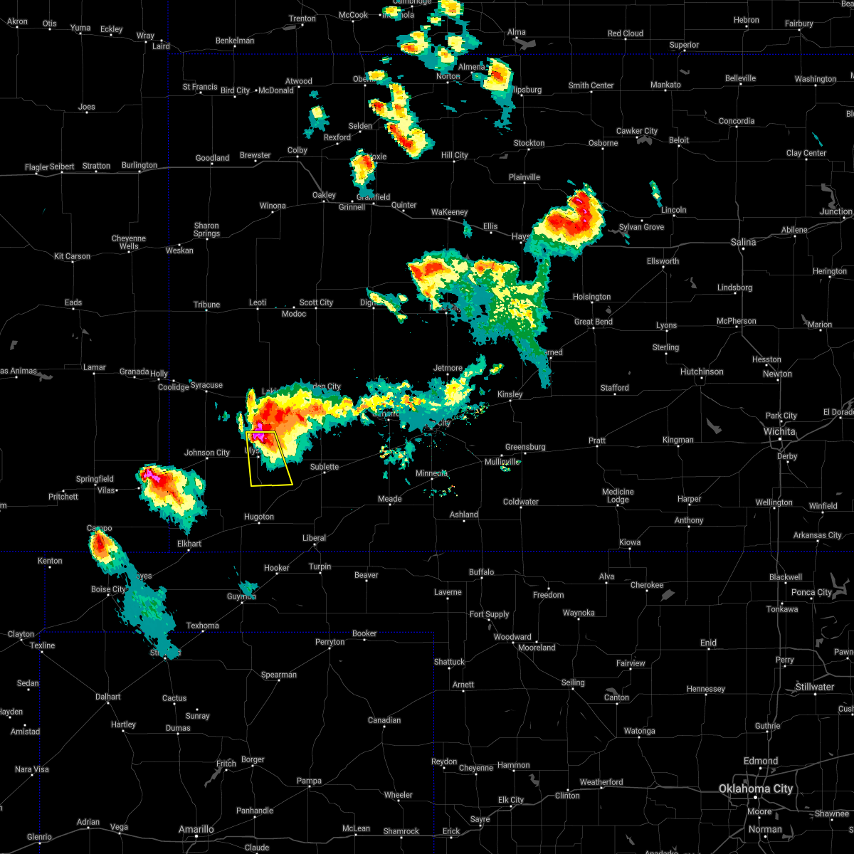 At 703 pm cdt, a severe thunderstorm was located 6 miles north of ulysses, moving south at 20 mph (radar indicated). Hazards include tennis ball size hail and 70 mph wind gusts. People and animals outdoors will be injured. expect hail damage to roofs, siding, windows, and vehicles. expect considerable tree damage. wind damage is also likely to mobile homes, roofs, and outbuildings. locations impacted include, ulysses and hickok. On the current path, ulysses is directly in the path of the core of this very severe thunderstorm!. At 703 pm cdt, a severe thunderstorm was located 6 miles north of ulysses, moving south at 20 mph (radar indicated). Hazards include tennis ball size hail and 70 mph wind gusts. People and animals outdoors will be injured. expect hail damage to roofs, siding, windows, and vehicles. expect considerable tree damage. wind damage is also likely to mobile homes, roofs, and outbuildings. locations impacted include, ulysses and hickok. On the current path, ulysses is directly in the path of the core of this very severe thunderstorm!.
|
| 6/20/2017 6:53 PM CDT |
 At 652 pm cdt, a severe thunderstorm was located 9 miles north of ulysses, moving southeast at 15 mph (radar indicated). Hazards include tennis ball size hail and 60 mph wind gusts. People and animals outdoors will be injured. expect hail damage to roofs, siding, windows, and vehicles. expect wind damage to roofs, siding, and trees. Locations impacted include, ulysses, satanta, hickok and ryus. At 652 pm cdt, a severe thunderstorm was located 9 miles north of ulysses, moving southeast at 15 mph (radar indicated). Hazards include tennis ball size hail and 60 mph wind gusts. People and animals outdoors will be injured. expect hail damage to roofs, siding, windows, and vehicles. expect wind damage to roofs, siding, and trees. Locations impacted include, ulysses, satanta, hickok and ryus.
|
| 6/20/2017 6:39 PM CDT |
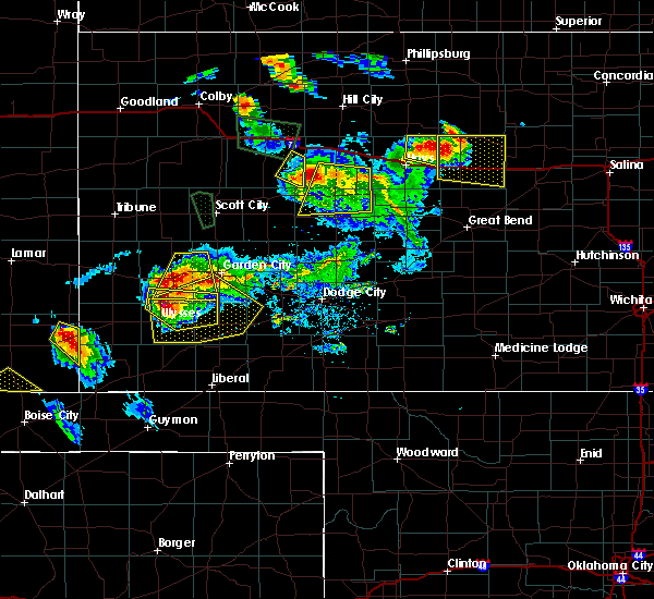 At 638 pm cdt, severe thunderstorms were located along a line extending from 2 miles southwest of garden city to 7 miles north of ulysses, moving southeast at 20 mph (radar indicated). Hazards include two inch hail and 60 mph wind gusts. People and animals outdoors will be injured. expect hail damage to roofs, siding, windows, and vehicles. Expect wind damage to roofs, siding, and trees. At 638 pm cdt, severe thunderstorms were located along a line extending from 2 miles southwest of garden city to 7 miles north of ulysses, moving southeast at 20 mph (radar indicated). Hazards include two inch hail and 60 mph wind gusts. People and animals outdoors will be injured. expect hail damage to roofs, siding, windows, and vehicles. Expect wind damage to roofs, siding, and trees.
|
| 6/20/2017 6:17 PM CDT |
 At 617 pm cdt, a severe thunderstorm was located 13 miles north of ulysses, moving east at 20 mph (radar indicated). Hazards include tennis ball size hail and 60 mph wind gusts. People and animals outdoors will be injured. expect hail damage to roofs, siding, windows, and vehicles. expect wind damage to roofs, siding, and trees. locations impacted include, ulysses and hickok. At 607 pm, baseball size hail was reported 9 miles south of kendall. At 617 pm cdt, a severe thunderstorm was located 13 miles north of ulysses, moving east at 20 mph (radar indicated). Hazards include tennis ball size hail and 60 mph wind gusts. People and animals outdoors will be injured. expect hail damage to roofs, siding, windows, and vehicles. expect wind damage to roofs, siding, and trees. locations impacted include, ulysses and hickok. At 607 pm, baseball size hail was reported 9 miles south of kendall.
|
| 6/20/2017 6:00 PM CDT |
 At 559 pm cdt, a severe thunderstorm was located 9 miles south of kendall, or 15 miles southwest of lakin, moving east at 20 mph (radar indicated). Hazards include golf ball size hail and 60 mph wind gusts. People and animals outdoors will be injured. expect hail damage to roofs, siding, windows, and vehicles. Expect wind damage to roofs, siding, and trees. At 559 pm cdt, a severe thunderstorm was located 9 miles south of kendall, or 15 miles southwest of lakin, moving east at 20 mph (radar indicated). Hazards include golf ball size hail and 60 mph wind gusts. People and animals outdoors will be injured. expect hail damage to roofs, siding, windows, and vehicles. Expect wind damage to roofs, siding, and trees.
|
| 5/25/2017 6:20 PM CDT | Quarter sized hail reported 13.9 miles SW of Ulysses, KS |
| 5/15/2017 7:07 PM CDT |
 At 707 pm cdt/607 pm mdt/, a severe thunderstorm was located 8 miles northeast of big bow, or 9 miles northwest of ulysses, moving north at 50 mph (radar indicated). Hazards include up to ping pong ball size hail and 60 mph wind gusts. People and animals outdoors will be injured. expect hail damage to roofs, siding, windows, and vehicles. Expect wind damage to roofs, siding, and trees. At 707 pm cdt/607 pm mdt/, a severe thunderstorm was located 8 miles northeast of big bow, or 9 miles northwest of ulysses, moving north at 50 mph (radar indicated). Hazards include up to ping pong ball size hail and 60 mph wind gusts. People and animals outdoors will be injured. expect hail damage to roofs, siding, windows, and vehicles. Expect wind damage to roofs, siding, and trees.
|
| 5/15/2017 6:59 PM CDT | Ping Pong Ball sized hail reported 1 miles E of Ulysses, KS, reports of half dollar to ping pong sized hail. |
| 5/15/2017 6:54 PM CDT | Storm damage reported in grant county KS, 7.5 miles ENE of Ulysses, KS |
| 5/15/2017 6:54 PM CDT |
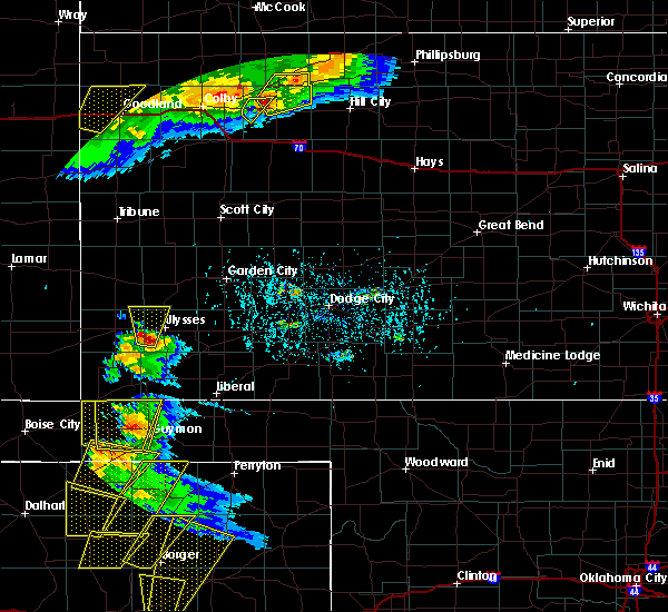 At 653 pm cdt/553 pm mdt/, a severe thunderstorm was located 5 miles south of big bow, or 12 miles southeast of johnson city, moving north at 45 mph (radar indicated). Hazards include up to ping pong ball size hail and 60 mph wind gusts. People and animals outdoors will be injured. expect hail damage to roofs, siding, windows, and vehicles. expect wind damage to roofs, siding, and trees. Locations impacted include, big bow and the milepost elevator. At 653 pm cdt/553 pm mdt/, a severe thunderstorm was located 5 miles south of big bow, or 12 miles southeast of johnson city, moving north at 45 mph (radar indicated). Hazards include up to ping pong ball size hail and 60 mph wind gusts. People and animals outdoors will be injured. expect hail damage to roofs, siding, windows, and vehicles. expect wind damage to roofs, siding, and trees. Locations impacted include, big bow and the milepost elevator.
|
| 5/15/2017 6:52 PM CDT | Quarter sized hail reported 10.6 miles ENE of Ulysses, KS |
| 5/15/2017 6:46 PM CDT |
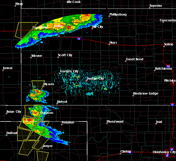 At 645 pm cdt/545 pm mdt/, a severe thunderstorm was located 11 miles south of big bow, or 15 miles southeast of johnson city, moving north at 45 mph (radar indicated). Hazards include up to ping pong ball size hail and 60 mph wind gusts. People and animals outdoors will be injured. expect hail damage to roofs, siding, windows, and vehicles. expect wind damage to roofs, siding, and trees. Locations impacted include, ulysses, big bow and the milepost elevator. At 645 pm cdt/545 pm mdt/, a severe thunderstorm was located 11 miles south of big bow, or 15 miles southeast of johnson city, moving north at 45 mph (radar indicated). Hazards include up to ping pong ball size hail and 60 mph wind gusts. People and animals outdoors will be injured. expect hail damage to roofs, siding, windows, and vehicles. expect wind damage to roofs, siding, and trees. Locations impacted include, ulysses, big bow and the milepost elevator.
|
| 5/15/2017 6:31 PM CDT |
 At 631 pm cdt/531 pm mdt/, a severe thunderstorm was located 7 miles east of richfield, or 17 miles west of hugoton, moving north at 45 mph (radar indicated). Hazards include up to ping pong ball size hail and 60 mph wind gusts. People and animals outdoors will be injured. expect hail damage to roofs, siding, windows, and vehicles. Expect wind damage to roofs, siding, and trees. At 631 pm cdt/531 pm mdt/, a severe thunderstorm was located 7 miles east of richfield, or 17 miles west of hugoton, moving north at 45 mph (radar indicated). Hazards include up to ping pong ball size hail and 60 mph wind gusts. People and animals outdoors will be injured. expect hail damage to roofs, siding, windows, and vehicles. Expect wind damage to roofs, siding, and trees.
|
| 5/14/2017 6:11 PM CDT | Golf Ball sized hail reported 14.3 miles W of Ulysses, KS |
| 5/14/2017 6:08 PM CDT | Quarter sized hail reported 12.1 miles W of Ulysses, KS, mostly nickels with a few hail stones up to a quarter. |
| 5/9/2017 11:38 PM CDT |
 The severe thunderstorm warning for western seward, southern kearny, southwestern finney, grant, stevens and western haskell counties will expire at 1145 pm cdt, the storms which prompted the warning have weakened. therefore, the warning will be allowed to expire. a severe thunderstorm watch remains in effect until 200 am cdt for southwestern kansas. The severe thunderstorm warning for western seward, southern kearny, southwestern finney, grant, stevens and western haskell counties will expire at 1145 pm cdt, the storms which prompted the warning have weakened. therefore, the warning will be allowed to expire. a severe thunderstorm watch remains in effect until 200 am cdt for southwestern kansas.
|
| 5/9/2017 11:12 PM CDT |
 At 1111 pm cdt, severe thunderstorms were located along a line extending from 7 miles south of lakin to 6 miles south of woods, moving east at 35 mph (radar indicated). Hazards include 70 mph wind gusts and nickel size hail. Expect considerable tree damage. damage is likely to mobile homes, roofs, and outbuildings. this line of storms has hsd a history of 60 to 70 mph wind gusts. Locations impacted include, ulysses, hugoton, satanta, moscow, hickok, ryus, cave and woods. At 1111 pm cdt, severe thunderstorms were located along a line extending from 7 miles south of lakin to 6 miles south of woods, moving east at 35 mph (radar indicated). Hazards include 70 mph wind gusts and nickel size hail. Expect considerable tree damage. damage is likely to mobile homes, roofs, and outbuildings. this line of storms has hsd a history of 60 to 70 mph wind gusts. Locations impacted include, ulysses, hugoton, satanta, moscow, hickok, ryus, cave and woods.
|
| 5/9/2017 11:00 PM CDT |
 At 1059 pm cdt, severe thunderstorms were located along a line extending from 10 miles southeast of kendall to 9 miles southeast of hugoton, moving east at 35 mph (radar indicated). Hazards include 70 mph wind gusts and nickel10 size hail. wind gusts of 70 mph were reported at ulysses at 10 51 pm. Expect considerable tree damage. Damage is likely to mobile homes, roofs, and outbuildings. At 1059 pm cdt, severe thunderstorms were located along a line extending from 10 miles southeast of kendall to 9 miles southeast of hugoton, moving east at 35 mph (radar indicated). Hazards include 70 mph wind gusts and nickel10 size hail. wind gusts of 70 mph were reported at ulysses at 10 51 pm. Expect considerable tree damage. Damage is likely to mobile homes, roofs, and outbuildings.
|
| 5/9/2017 10:51 PM CDT | Storm damage reported in grant county KS, 1.6 miles SSE of Ulysses, KS |
| 3/23/2017 8:21 PM CDT |
 At 821 pm cdt, severe thunderstorms were located along a line extending from 3 miles northeast of ulysses to near hooker, moving north at 55 mph (radar indicated). Hazards include up to 70 mph wind gusts and up to half dollar size hail. Hail damage to vehicles is expected. expect considerable tree damage. Wind damage is also likely to mobile homes, roofs, and outbuildings. At 821 pm cdt, severe thunderstorms were located along a line extending from 3 miles northeast of ulysses to near hooker, moving north at 55 mph (radar indicated). Hazards include up to 70 mph wind gusts and up to half dollar size hail. Hail damage to vehicles is expected. expect considerable tree damage. Wind damage is also likely to mobile homes, roofs, and outbuildings.
|
| 3/23/2017 8:15 PM CDT |
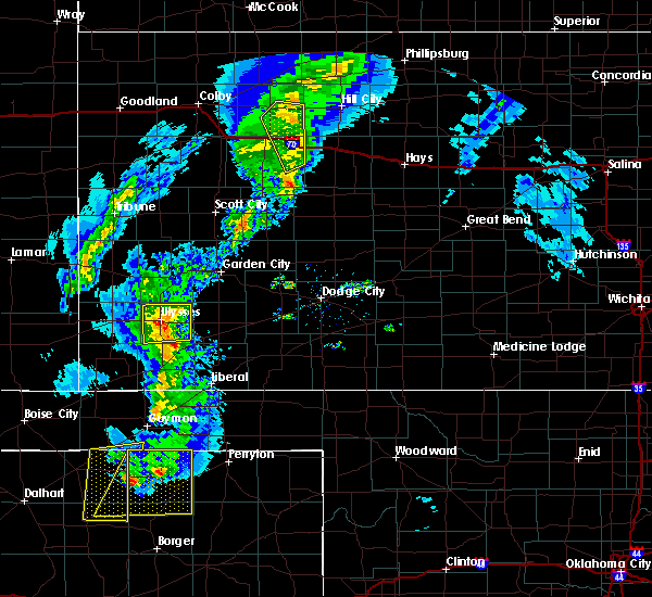 At 815 pm cdt, a severe thunderstorm was located 10 miles north of hickok, or 5 miles northeast of ulysses, moving northeast at 45 mph (radar indicated). Hazards include 70 mph wind gusts and quarter size hail. Hail damage to vehicles is expected. expect considerable tree damage. wind damage is also likely to mobile homes, roofs, and outbuildings. Locations impacted include, ulysses, hickok, ryus and the milepost elevator. At 815 pm cdt, a severe thunderstorm was located 10 miles north of hickok, or 5 miles northeast of ulysses, moving northeast at 45 mph (radar indicated). Hazards include 70 mph wind gusts and quarter size hail. Hail damage to vehicles is expected. expect considerable tree damage. wind damage is also likely to mobile homes, roofs, and outbuildings. Locations impacted include, ulysses, hickok, ryus and the milepost elevator.
|
| 3/23/2017 7:47 PM CDT | Reported at the ulysses airpor in grant county KS, 1 miles SSE of Ulysses, KS |
| 3/23/2017 7:43 PM CDT |
 At 743 pm cdt, a severe thunderstorm was located 5 miles southwest of ulysses, moving northeast at 30 mph. this is a very dangerous storm (radar indicated). Hazards include 80 mph wind gusts and ping pong ball size hail. Flying debris will be dangerous to those caught without shelter. mobile homes will be heavily damaged. expect considerable damage to roofs, windows, and vehicles. Extensive tree damage and power outages are likely. At 743 pm cdt, a severe thunderstorm was located 5 miles southwest of ulysses, moving northeast at 30 mph. this is a very dangerous storm (radar indicated). Hazards include 80 mph wind gusts and ping pong ball size hail. Flying debris will be dangerous to those caught without shelter. mobile homes will be heavily damaged. expect considerable damage to roofs, windows, and vehicles. Extensive tree damage and power outages are likely.
|
| 3/23/2017 6:43 PM CDT |
 At 642 pm cdt/542 pm mdt/, a severe thunderstorm was located 7 miles southwest of lakin, moving north at 50 mph (radar indicated). Hazards include 60 mph wind gusts and quarter size hail. Hail damage to vehicles is expected. expect wind damage to roofs, siding, and trees. Locations impacted include, ulysses, lakin, deerfield, big bow, hickok and the milepost elevator. At 642 pm cdt/542 pm mdt/, a severe thunderstorm was located 7 miles southwest of lakin, moving north at 50 mph (radar indicated). Hazards include 60 mph wind gusts and quarter size hail. Hail damage to vehicles is expected. expect wind damage to roofs, siding, and trees. Locations impacted include, ulysses, lakin, deerfield, big bow, hickok and the milepost elevator.
|
| 3/23/2017 6:29 PM CDT | Also had 1 in. hai in grant county KS, 7 miles S of Ulysses, KS |
| 3/23/2017 6:22 PM CDT | Pea sized hail covering the groun in grant county KS, 8.6 miles SE of Ulysses, KS |
| 3/23/2017 6:21 PM CDT |
 At 621 pm cdt/521 pm mdt/, a severe thunderstorm was located 10 miles northeast of big bow, or 10 miles northwest of ulysses, moving north at 50 mph (radar indicated). Hazards include 60 mph wind gusts and quarter size hail. Hail damage to vehicles is expected. expect wind damage to roofs, siding, and trees. Locations impacted include, ulysses, lakin, johnson city, deerfield, kendall, big bow, hickok and the milepost elevator. At 621 pm cdt/521 pm mdt/, a severe thunderstorm was located 10 miles northeast of big bow, or 10 miles northwest of ulysses, moving north at 50 mph (radar indicated). Hazards include 60 mph wind gusts and quarter size hail. Hail damage to vehicles is expected. expect wind damage to roofs, siding, and trees. Locations impacted include, ulysses, lakin, johnson city, deerfield, kendall, big bow, hickok and the milepost elevator.
|
| 3/23/2017 6:20 PM CDT | Quarter sized hail reported 4.3 miles SE of Ulysses, KS, most of the hail was about the size of dimes with a few quarters mixed in. |
| 3/23/2017 6:15 PM CDT | . in grant county KS, 5.5 miles E of Ulysses, KS |
| 3/23/2017 6:05 PM CDT | Quarter sized hail reported 10.6 miles ENE of Ulysses, KS, the hail covered the ground. |
| 3/23/2017 6:03 PM CDT |
 At 603 pm cdt/503 pm mdt/, a severe thunderstorm was located near big bow, or 10 miles west of ulysses, moving north at 50 mph (radar indicated). Hazards include up to ping pong ball size hail and 60 mph wind gusts. People and animals outdoors will be injured. expect hail damage to roofs, siding, windows, and vehicles. Expect wind damage to roofs, siding, and trees. At 603 pm cdt/503 pm mdt/, a severe thunderstorm was located near big bow, or 10 miles west of ulysses, moving north at 50 mph (radar indicated). Hazards include up to ping pong ball size hail and 60 mph wind gusts. People and animals outdoors will be injured. expect hail damage to roofs, siding, windows, and vehicles. Expect wind damage to roofs, siding, and trees.
|
| 7/27/2016 6:00 PM CDT | Visibility down to a 100 yards in blowing dust for a short tim in grant county KS, 11.8 miles WNW of Ulysses, KS |
| 7/15/2016 5:33 PM CDT |
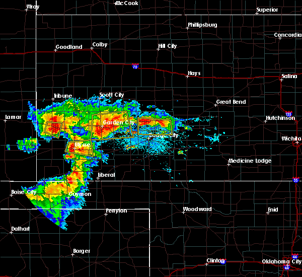 At 533 pm cdt, a severe thunderstorm was located 4 miles north of hickok, moving east at 25 mph (radar indicated). Hazards include 60 mph wind gusts and quarter size hail. Hail damage to vehicles is expected. expect wind damage to roofs, siding, and trees. Locations impacted include, ulysses, hickok and ryus. At 533 pm cdt, a severe thunderstorm was located 4 miles north of hickok, moving east at 25 mph (radar indicated). Hazards include 60 mph wind gusts and quarter size hail. Hail damage to vehicles is expected. expect wind damage to roofs, siding, and trees. Locations impacted include, ulysses, hickok and ryus.
|
| 7/15/2016 5:10 PM CDT |
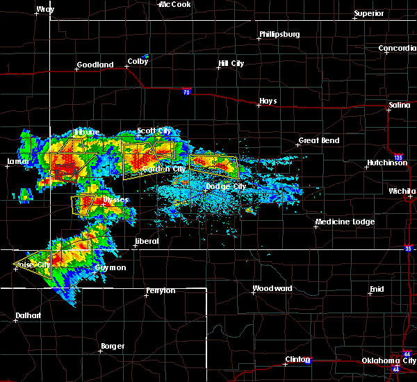 At 510 pm cdt, a severe thunderstorm was located near ulysses, moving east at 25 mph (radar indicated). Hazards include ping pong ball size hail and 60 mph wind gusts. People and animals outdoors will be injured. expect hail damage to roofs, siding, windows, and vehicles. Expect wind damage to roofs, siding, and trees. At 510 pm cdt, a severe thunderstorm was located near ulysses, moving east at 25 mph (radar indicated). Hazards include ping pong ball size hail and 60 mph wind gusts. People and animals outdoors will be injured. expect hail damage to roofs, siding, windows, and vehicles. Expect wind damage to roofs, siding, and trees.
|
| 6/29/2016 3:19 AM CDT |
 At 319 am cdt, severe thunderstorms were located along a line extending from 6 miles south of ulysses to near sublette, moving south at 35 mph (radar indicated). Hazards include 70 mph wind gusts and nickel size hail. Expect considerable tree damage. damage is likely to mobile homes, roofs and outbuildings. Locations impacted include, liberal, ulysses, hugoton, sublette, satanta, kismet, moscow, ryus, feterita, tice, hickok, woods, cave and hayne. At 319 am cdt, severe thunderstorms were located along a line extending from 6 miles south of ulysses to near sublette, moving south at 35 mph (radar indicated). Hazards include 70 mph wind gusts and nickel size hail. Expect considerable tree damage. damage is likely to mobile homes, roofs and outbuildings. Locations impacted include, liberal, ulysses, hugoton, sublette, satanta, kismet, moscow, ryus, feterita, tice, hickok, woods, cave and hayne.
|
| 6/29/2016 2:54 AM CDT |
 At 253 am cdt, severe thunderstorms were located along a line extending from 6 miles north of ulysses to 9 miles south of plymell, moving south at 40 mph (radar indicated). Hazards include 70 mph wind gusts and nickel size hail. Expect considerable tree damage. Damage is likely to mobile homes, roofs and outbuildings. At 253 am cdt, severe thunderstorms were located along a line extending from 6 miles north of ulysses to 9 miles south of plymell, moving south at 40 mph (radar indicated). Hazards include 70 mph wind gusts and nickel size hail. Expect considerable tree damage. Damage is likely to mobile homes, roofs and outbuildings.
|
| 6/29/2016 2:50 AM CDT | Mesonet station 1 nw ulysses /kuls in grant county KS, 1.6 miles SSE of Ulysses, KS |
| 6/25/2016 5:59 PM CDT | . in grant county KS, 6.9 miles NNE of Ulysses, KS |
| 6/25/2016 5:56 PM CDT |
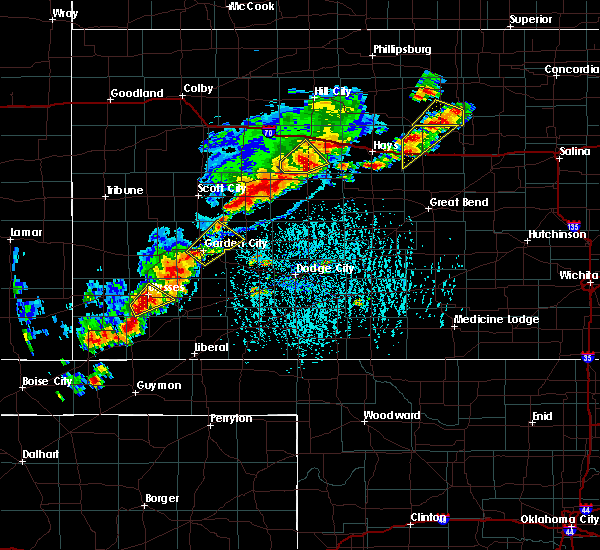 At 556 pm cdt, a severe thunderstorm was located 7 miles south of ulysses, moving northeast at 20 mph (radar indicated). Hazards include 60 mph wind gusts and quarter size hail. Hail damage to vehicles is expected. expect wind damage to roofs, siding and trees. Locations impacted include, ulysses and hickok. At 556 pm cdt, a severe thunderstorm was located 7 miles south of ulysses, moving northeast at 20 mph (radar indicated). Hazards include 60 mph wind gusts and quarter size hail. Hail damage to vehicles is expected. expect wind damage to roofs, siding and trees. Locations impacted include, ulysses and hickok.
|
| 6/25/2016 5:39 PM CDT |
 At 539 pm cdt, a severe thunderstorm was located 11 miles southeast of big bow, moving northeast at 20 mph (radar indicated). Hazards include 60 mph wind gusts and quarter size hail. Hail damage to vehicles is expected. Expect wind damage to roofs, siding and trees. At 539 pm cdt, a severe thunderstorm was located 11 miles southeast of big bow, moving northeast at 20 mph (radar indicated). Hazards include 60 mph wind gusts and quarter size hail. Hail damage to vehicles is expected. Expect wind damage to roofs, siding and trees.
|
| 6/23/2016 11:05 PM CDT |
 At 1105 pm cdt/1005 pm mdt/, severe thunderstorms were located along a line extending from 10 miles northeast of kendall to 12 miles south of lakin to 4 miles southeast of big bow, moving east at 25 mph (radar indicated). Hazards include 60 mph wind gusts. Expect damage to roofs. siding and trees. Locations impacted include, garden city, ulysses, lakin, holcomb, syracuse, johnson city, deerfield, kendall, ryus, big bow, plymell and hickok. At 1105 pm cdt/1005 pm mdt/, severe thunderstorms were located along a line extending from 10 miles northeast of kendall to 12 miles south of lakin to 4 miles southeast of big bow, moving east at 25 mph (radar indicated). Hazards include 60 mph wind gusts. Expect damage to roofs. siding and trees. Locations impacted include, garden city, ulysses, lakin, holcomb, syracuse, johnson city, deerfield, kendall, ryus, big bow, plymell and hickok.
|
| 6/23/2016 10:45 PM CDT |
 At 1045 pm cdt/945 pm mdt/, severe thunderstorms were located along a line extending from 11 miles north of syracuse to 9 miles southeast of kendall to johnson city, moving east at 45 mph (radar indicated). Hazards include 60 mph wind gusts and penny size hail. Expect damage to roofs. Siding and trees. At 1045 pm cdt/945 pm mdt/, severe thunderstorms were located along a line extending from 11 miles north of syracuse to 9 miles southeast of kendall to johnson city, moving east at 45 mph (radar indicated). Hazards include 60 mph wind gusts and penny size hail. Expect damage to roofs. Siding and trees.
|
| 6/13/2016 7:25 PM CDT |
 At 724 pm cdt, severe thunderstorms were located along a line extending from 8 miles southeast of kendall to 12 miles southeast of hugoton, moving east at 30 mph (radar indicated). Hazards include 60 mph wind gusts and nickel size hail. Expect damage to roofs. siding and trees. Locations impacted include, liberal, ulysses, hugoton, lakin, moscow, ryus, woods, cave and hickok. At 724 pm cdt, severe thunderstorms were located along a line extending from 8 miles southeast of kendall to 12 miles southeast of hugoton, moving east at 30 mph (radar indicated). Hazards include 60 mph wind gusts and nickel size hail. Expect damage to roofs. siding and trees. Locations impacted include, liberal, ulysses, hugoton, lakin, moscow, ryus, woods, cave and hickok.
|
| 6/13/2016 6:51 PM CDT |
 At 649 pm cdt/549 pm mdt/, severe thunderstorms were located along a line extending from 9 miles south of syracuse to 7 miles south of rolla, moving east at 40 mph. this replaces the previous warning for hamilton, stanton, and morton counties (radar indicated). Hazards include 70 mph wind gusts and nickel size hail. Expect considerable tree damage. Damage is likely to mobile homes, roofs and outbuildings. At 649 pm cdt/549 pm mdt/, severe thunderstorms were located along a line extending from 9 miles south of syracuse to 7 miles south of rolla, moving east at 40 mph. this replaces the previous warning for hamilton, stanton, and morton counties (radar indicated). Hazards include 70 mph wind gusts and nickel size hail. Expect considerable tree damage. Damage is likely to mobile homes, roofs and outbuildings.
|
| 4/15/2016 10:27 PM CDT |
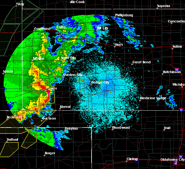 At 1027 pm cdt, a severe thunderstorm was located very near hickok, moving northeast at 35 mph (radar indicated). Hazards include ping pong ball size hail and 60 mph wind gusts. People and animals outdoors will be injured. expect hail damage to roofs, siding, windows and vehicles. expect wind damage to roofs, siding and trees. Locations impacted include, ulysses, moscow, ryus, cave and hickok. At 1027 pm cdt, a severe thunderstorm was located very near hickok, moving northeast at 35 mph (radar indicated). Hazards include ping pong ball size hail and 60 mph wind gusts. People and animals outdoors will be injured. expect hail damage to roofs, siding, windows and vehicles. expect wind damage to roofs, siding and trees. Locations impacted include, ulysses, moscow, ryus, cave and hickok.
|
| 4/15/2016 10:21 PM CDT | Quarter sized hail reported 0.2 miles SSW of Ulysses, KS |
| 4/15/2016 10:20 PM CDT | Ping Pong Ball sized hail reported 1.3 miles NNE of Ulysses, KS |
| 4/15/2016 10:14 PM CDT |
 At 1013 pm cdt, a severe thunderstorm was located 6 miles south of ulysses, moving northeast at 35 mph (radar indicated). Hazards include golf ball size hail and 60 mph wind gusts. People and animals outdoors will be injured. expect hail damage to roofs, siding, windows and vehicles. expect wind damage to roofs, siding and trees. Locations impacted include, ulysses, moscow, ryus, cave and hickok. At 1013 pm cdt, a severe thunderstorm was located 6 miles south of ulysses, moving northeast at 35 mph (radar indicated). Hazards include golf ball size hail and 60 mph wind gusts. People and animals outdoors will be injured. expect hail damage to roofs, siding, windows and vehicles. expect wind damage to roofs, siding and trees. Locations impacted include, ulysses, moscow, ryus, cave and hickok.
|
| 4/15/2016 10:10 PM CDT | Golf Ball sized hail reported 7.7 miles NNE of Ulysses, KS |
| 4/15/2016 10:08 PM CDT | Quarter sized hail reported 4.9 miles E of Ulysses, KS |
| 4/15/2016 9:55 PM CDT |
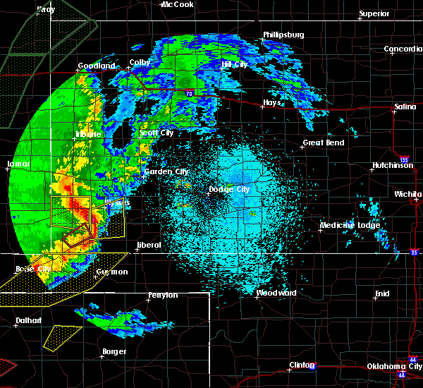 At 955 pm cdt, a severe thunderstorm was located 13 miles south of big bow, moving northeast at 30 mph (radar indicated). Hazards include 60 mph wind gusts and half dollar size hail. Hail damage to vehicles is expected. Expect wind damage to roofs, siding and trees. At 955 pm cdt, a severe thunderstorm was located 13 miles south of big bow, moving northeast at 30 mph (radar indicated). Hazards include 60 mph wind gusts and half dollar size hail. Hail damage to vehicles is expected. Expect wind damage to roofs, siding and trees.
|
| 11/16/2015 7:43 PM CST |
 At 742 pm cst, severe thunderstorms were located along a line extending from 5 miles northwest of ulysses to 14 miles southwest of liberal, moving northeast at 45 mph (radar indicated). Hazards include 70 mph wind gusts and nickel size hail. Expect considerable tree damage. damage is likely to mobile homes, roofs and outbuildings. locations impacted include, liberal, ulysses, sublette, satanta, kismet, moscow, ryus, woods, cave, hickok, hayne and plains. A tornado watch remains in effect until 900 pm cst for southwestern kansas. At 742 pm cst, severe thunderstorms were located along a line extending from 5 miles northwest of ulysses to 14 miles southwest of liberal, moving northeast at 45 mph (radar indicated). Hazards include 70 mph wind gusts and nickel size hail. Expect considerable tree damage. damage is likely to mobile homes, roofs and outbuildings. locations impacted include, liberal, ulysses, sublette, satanta, kismet, moscow, ryus, woods, cave, hickok, hayne and plains. A tornado watch remains in effect until 900 pm cst for southwestern kansas.
|
| 11/16/2015 7:33 PM CST |
 At 732 pm cst, severe thunderstorms were located along a line extending from 3 miles southeast of big bow to 24 miles southwest of liberal, moving northeast at 45 mph (radar indicated). Hazards include 70 mph wind gusts and quarter size hail. Hail damage to vehicles is expected. expect considerable tree damage. Wind damage is also likely to mobile homes, roofs and outbuildings. At 732 pm cst, severe thunderstorms were located along a line extending from 3 miles southeast of big bow to 24 miles southwest of liberal, moving northeast at 45 mph (radar indicated). Hazards include 70 mph wind gusts and quarter size hail. Hail damage to vehicles is expected. expect considerable tree damage. Wind damage is also likely to mobile homes, roofs and outbuildings.
|
| 11/16/2015 4:06 PM CST |
 At 404 pm cst, a confirmed tornado was located 7 miles southwest of hickok, moving northeast at 60 mph (radar confirmed tornado. a tornado has also been confirmed by storm spotters). Hazards include damaging tornado and ping pong ball size hail. Flying debris will be dangerous to those caught without shelter. mobile homes will be damaged or destroyed. damage to roofs, windows and vehicles will occur. tree damage is likely. This tornadic thunderstorm will remain over mainly rural areas of southeastern kearny, eastern grant and northwestern haskell counties. At 404 pm cst, a confirmed tornado was located 7 miles southwest of hickok, moving northeast at 60 mph (radar confirmed tornado. a tornado has also been confirmed by storm spotters). Hazards include damaging tornado and ping pong ball size hail. Flying debris will be dangerous to those caught without shelter. mobile homes will be damaged or destroyed. damage to roofs, windows and vehicles will occur. tree damage is likely. This tornadic thunderstorm will remain over mainly rural areas of southeastern kearny, eastern grant and northwestern haskell counties.
|
| 11/16/2015 4:02 PM CST |
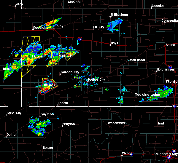 At 401 pm cst, a severe thunderstorm was located 4 miles south of ulysses, moving northeast at 40 mph (radar indicated). Hazards include 60 mph wind gusts and half dollar size hail. Hail damage to vehicles is expected. expect wind damage to roofs, siding and trees. locations impacted include, ulysses and hickok. A tornado watch remains in effect until 900 pm cst for southwestern kansas. At 401 pm cst, a severe thunderstorm was located 4 miles south of ulysses, moving northeast at 40 mph (radar indicated). Hazards include 60 mph wind gusts and half dollar size hail. Hail damage to vehicles is expected. expect wind damage to roofs, siding and trees. locations impacted include, ulysses and hickok. A tornado watch remains in effect until 900 pm cst for southwestern kansas.
|
| 11/16/2015 4:00 PM CST | Quarter sized hail reported 5.4 miles N of Ulysses, KS, dime to quarter size hail covering the ground. |
| 11/16/2015 3:52 PM CST |
 At 352 pm cst, a severe thunderstorm capable of producing a tornado was located 10 miles south of ulysses, moving northeast at 55 mph (radar indicated rotation). Hazards include tornado and ping pong ball size hail. Flying debris will be dangerous to those caught without shelter. mobile homes will be damaged or destroyed. damage to roofs, windows and vehicles will occur. tree damage is likely. this dangerous storm will be near, ulysses around 400 pm cst. Hickok around 405 pm cst. At 352 pm cst, a severe thunderstorm capable of producing a tornado was located 10 miles south of ulysses, moving northeast at 55 mph (radar indicated rotation). Hazards include tornado and ping pong ball size hail. Flying debris will be dangerous to those caught without shelter. mobile homes will be damaged or destroyed. damage to roofs, windows and vehicles will occur. tree damage is likely. this dangerous storm will be near, ulysses around 400 pm cst. Hickok around 405 pm cst.
|
| 11/16/2015 3:45 PM CST |
 At 344 pm cst, a severe thunderstorm was located 14 miles south of big bow, moving northeast at 45 mph (radar indicated). Hazards include 60 mph wind gusts and half dollar size hail. Hail damage to vehicles is expected. Expect wind damage to roofs, siding and trees. At 344 pm cst, a severe thunderstorm was located 14 miles south of big bow, moving northeast at 45 mph (radar indicated). Hazards include 60 mph wind gusts and half dollar size hail. Hail damage to vehicles is expected. Expect wind damage to roofs, siding and trees.
|
| 10/27/2015 9:16 PM CDT | Storm damage reported in grant county KS, 1.6 miles SSE of Ulysses, KS |
| 9/10/2015 6:59 PM CDT |
 At 659 pm cdt, a severe thunderstorm was located 4 miles southeast of ulysses, moving southeast at 15 mph (radar indicated). Hazards include 60 mph wind gusts and quarter size hail. Hail damage to vehicles is expected. expect wind damage to roofs, siding and trees. Locations impacted include, ulysses, moscow, ryus and hickok. At 659 pm cdt, a severe thunderstorm was located 4 miles southeast of ulysses, moving southeast at 15 mph (radar indicated). Hazards include 60 mph wind gusts and quarter size hail. Hail damage to vehicles is expected. expect wind damage to roofs, siding and trees. Locations impacted include, ulysses, moscow, ryus and hickok.
|
| 9/10/2015 6:55 PM CDT | Storm damage reported in grant county KS, 3.3 miles E of Ulysses, KS |
| 9/10/2015 6:36 PM CDT |
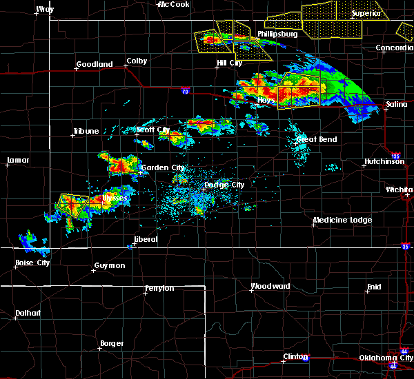 At 636 pm cdt, a severe thunderstorm was located very near ulysses, moving southeast at 15 mph (radar indicated). Hazards include 60 mph wind gusts and half dollar size hail. Hail damage to vehicles is expected. Expect wind damage to roofs, siding and trees. At 636 pm cdt, a severe thunderstorm was located very near ulysses, moving southeast at 15 mph (radar indicated). Hazards include 60 mph wind gusts and half dollar size hail. Hail damage to vehicles is expected. Expect wind damage to roofs, siding and trees.
|
| 8/17/2015 11:26 PM CDT |
 At 1124 pm cdt, severe thunderstorms were located along a line extending from 10 miles north of hickok to 3 miles southwest of satanta to 2 miles southeast of woods to 24 miles southwest of liberal, moving southeast at 40 mph (radar indicated. at 1104 pm a wind gust of 61 mph was reported at the ulyssyes airport). Hazards include up to 70 mph wind gusts and quarter size hail. Wind damage is likely to mobile homes. roofs and outbuildings. Locations impacted include, liberal, ulysses, hugoton, lakin, sublette, satanta, kismet, moscow, ryus, feterita, tice, hickok, woods, cave and hayne. At 1124 pm cdt, severe thunderstorms were located along a line extending from 10 miles north of hickok to 3 miles southwest of satanta to 2 miles southeast of woods to 24 miles southwest of liberal, moving southeast at 40 mph (radar indicated. at 1104 pm a wind gust of 61 mph was reported at the ulyssyes airport). Hazards include up to 70 mph wind gusts and quarter size hail. Wind damage is likely to mobile homes. roofs and outbuildings. Locations impacted include, liberal, ulysses, hugoton, lakin, sublette, satanta, kismet, moscow, ryus, feterita, tice, hickok, woods, cave and hayne.
|
| 8/17/2015 11:04 PM CDT | Storm damage reported in grant county KS, 0.2 miles SSW of Ulysses, KS |
| 8/17/2015 10:56 PM CDT |
 At 1056 pm cdt, severe thunderstorms were located along a line extending from 4 miles southeast of kendall to 2 miles northeast of ulysses to 8 miles west of moscow to 12 miles south of feterita, moving southeast at 40 mph (radar indicated). Hazards include up to 70 mph wind gusts and quarter size hail. Hail damage to vehicles is expected. expect considerable tree damage. Wind damage is also likely to mobile homes, roofs and outbuildings. At 1056 pm cdt, severe thunderstorms were located along a line extending from 4 miles southeast of kendall to 2 miles northeast of ulysses to 8 miles west of moscow to 12 miles south of feterita, moving southeast at 40 mph (radar indicated). Hazards include up to 70 mph wind gusts and quarter size hail. Hail damage to vehicles is expected. expect considerable tree damage. Wind damage is also likely to mobile homes, roofs and outbuildings.
|
| 8/17/2015 10:53 PM CDT | Storm damage reported in grant county KS, 0.2 miles SSW of Ulysses, KS |
| 8/8/2015 8:58 PM CDT | The severe thunderstorm warning for southwestern finney, northern stevens, southeastern kearny, northwestern seward, grant and western haskell counties will expire at 900 pm cdt, the line of storms which prompted the warning have weakened. therefore the warning will be allowed to expire. however gusty winds and heavy rain are still possible with these thunderstorms. |
| 8/8/2015 8:33 PM CDT |
 A severe thunderstorm warning remains in effect until 900 pm cdt for southwestern finney. northern stevens. southeastern kearny. northwestern seward. grant and western haskell counties. at 832 pm cdt. severe thunderstorms were located along a line extending from 5 miles southwest of lakin to 3 miles west of hickok to 8 miles west of moscow. Moving northeast at 45 mph. A severe thunderstorm warning remains in effect until 900 pm cdt for southwestern finney. northern stevens. southeastern kearny. northwestern seward. grant and western haskell counties. at 832 pm cdt. severe thunderstorms were located along a line extending from 5 miles southwest of lakin to 3 miles west of hickok to 8 miles west of moscow. Moving northeast at 45 mph.
|
| 8/8/2015 8:23 PM CDT |
 A severe thunderstorm warning remains in effect until 900 pm cdt for southwestern finney. southeastern stanton. northern stevens. southeastern kearny. northwestern seward. grant and western haskell counties. at 822 pm cdt. Severe thunderstorms were located along a line extending from 11 miles southeast of kendall to 4 miles south of. A severe thunderstorm warning remains in effect until 900 pm cdt for southwestern finney. southeastern stanton. northern stevens. southeastern kearny. northwestern seward. grant and western haskell counties. at 822 pm cdt. Severe thunderstorms were located along a line extending from 11 miles southeast of kendall to 4 miles south of.
|
| 8/8/2015 8:11 PM CDT |
 At 810 pm cdt /710 pm mdt/, severe thunderstorms were located along a line extending from 14 miles south of kendall to 9 miles south of big bow to 4 miles northeast of rolla, moving northeast at 40 mph (radar indicated). Hazards include 60 mph wind gusts and penny size hail. Expect damage to roofs. Siding and trees. At 810 pm cdt /710 pm mdt/, severe thunderstorms were located along a line extending from 14 miles south of kendall to 9 miles south of big bow to 4 miles northeast of rolla, moving northeast at 40 mph (radar indicated). Hazards include 60 mph wind gusts and penny size hail. Expect damage to roofs. Siding and trees.
|
| 8/8/2015 7:57 PM CDT | Storm damage reported in grant county KS, 1.8 miles SE of Ulysses, KS |
| 7/19/2015 9:23 PM CDT |
 At 922 pm cdt, the leading edge of severe thunderstorms were located along a line extending from 13 miles northeast of hickok to 7 miles northeast of ryus to 8 miles northeast of woods, moving northeast at 80 mph (radar indicated). Hazards include 70 mph wind gusts and quarter size hail. Hail damage to vehicles is expected. expect considerable tree damage. wind damage is also likely to mobile homes, roofs and outbuildings. At 916 pm, a 70 mph wind gust was reported along the stevens grant county line about 3 miles east of highway 25 locations impacted include, garden city, ulysses, holcomb, sublette, satanta, pierceville, moscow, ryus, plymell, tice, cave and hickok. At 922 pm cdt, the leading edge of severe thunderstorms were located along a line extending from 13 miles northeast of hickok to 7 miles northeast of ryus to 8 miles northeast of woods, moving northeast at 80 mph (radar indicated). Hazards include 70 mph wind gusts and quarter size hail. Hail damage to vehicles is expected. expect considerable tree damage. wind damage is also likely to mobile homes, roofs and outbuildings. At 916 pm, a 70 mph wind gust was reported along the stevens grant county line about 3 miles east of highway 25 locations impacted include, garden city, ulysses, holcomb, sublette, satanta, pierceville, moscow, ryus, plymell, tice, cave and hickok.
|
| 7/19/2015 9:16 PM CDT | Storm damage reported in stanton county KS, 10.4 miles ENE of Ulysses, KS |
| 7/19/2015 9:12 PM CDT |
 At 912 pm cdt, a severe thunderstorm was located 8 miles northwest of cave, moving northeast at 45 mph. a second severe thunderstorm was located 7 miles south of garden city, moving northeast at 20 mph (radar indicated). Hazards include 70 mph wind gusts and quarter size hail. Hail damage to vehicles is expected. expect considerable tree damage. Wind damage is also likely to mobile homes, roofs and outbuildings. At 912 pm cdt, a severe thunderstorm was located 8 miles northwest of cave, moving northeast at 45 mph. a second severe thunderstorm was located 7 miles south of garden city, moving northeast at 20 mph (radar indicated). Hazards include 70 mph wind gusts and quarter size hail. Hail damage to vehicles is expected. expect considerable tree damage. Wind damage is also likely to mobile homes, roofs and outbuildings.
|
| 7/3/2015 6:03 PM CDT |
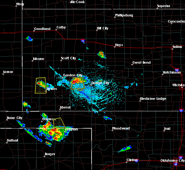 At 603 pm cdt /503 pm mdt/, a severe thunderstorm was located 12 miles south of kendall, moving south at 20 mph (radar indicated). Hazards include 60 mph wind gusts and quarter size hail. Hail damage to vehicles is expected. expect wind damage to roofs, siding and trees. Locations impacted include, ulysses and big bow. At 603 pm cdt /503 pm mdt/, a severe thunderstorm was located 12 miles south of kendall, moving south at 20 mph (radar indicated). Hazards include 60 mph wind gusts and quarter size hail. Hail damage to vehicles is expected. expect wind damage to roofs, siding and trees. Locations impacted include, ulysses and big bow.
|
| 7/3/2015 5:32 PM CDT |
 At 532 pm cdt /432 pm mdt/, a severe thunderstorm was located near kendall, moving south at 25 mph (radar indicated). Hazards include 60 mph wind gusts and quarter size hail. Hail damage to vehicles is expected. Expect wind damage to roofs, siding and trees. At 532 pm cdt /432 pm mdt/, a severe thunderstorm was located near kendall, moving south at 25 mph (radar indicated). Hazards include 60 mph wind gusts and quarter size hail. Hail damage to vehicles is expected. Expect wind damage to roofs, siding and trees.
|
| 7/2/2015 4:51 PM CDT |
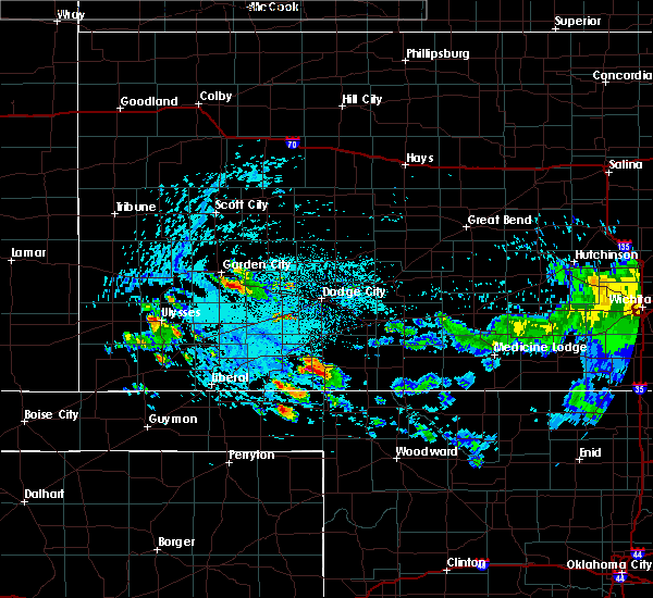 At 451 pm cdt, a severe thunderstorm was located near ulysses, moving southeast at 20 mph (radar indicated). Hazards include 60 mph wind gusts and half dollar size hail. Hail damage to vehicles is expected. expect wind damage to roofs, siding and trees. Locations impacted include, ulysses, moscow and cave. At 451 pm cdt, a severe thunderstorm was located near ulysses, moving southeast at 20 mph (radar indicated). Hazards include 60 mph wind gusts and half dollar size hail. Hail damage to vehicles is expected. expect wind damage to roofs, siding and trees. Locations impacted include, ulysses, moscow and cave.
|
| 7/2/2015 4:37 PM CDT |
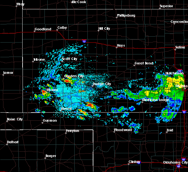 At 437 pm cdt, a severe thunderstorm was located 4 miles west of ulysses, moving southeast at 20 mph (radar indicated). Hazards include 60 mph wind gusts and half dollar size hail. Hail damage to vehicles is expected. Expect wind damage to roofs, siding and trees. At 437 pm cdt, a severe thunderstorm was located 4 miles west of ulysses, moving southeast at 20 mph (radar indicated). Hazards include 60 mph wind gusts and half dollar size hail. Hail damage to vehicles is expected. Expect wind damage to roofs, siding and trees.
|
| 6/7/2015 10:55 PM CDT | At 1054 pm cdt, a severe thunderstorm was located 3 miles west of ryus, moving southeast at 30 mph (radar indicated). Hazards include 60 mph wind gusts. Expect damage to roofs. siding and trees. Locations impacted include, ulysses, satanta, cave, ryus and hickok. |
| 6/7/2015 10:36 PM CDT | Storm damage reported in grant county KS, 1.6 miles SSE of Ulysses, KS |
| 6/7/2015 10:36 PM CDT | At 1036 pm cdt, a severe thunderstorm was located near ulysses, moving southeast at 35 mph (radar indicated). Hazards include 60 mph wind gusts and quarter size hail. Hail damage to vehicles is expected. Expect wind damage to roofs, siding and trees. |
| 5/27/2015 7:00 PM CDT | Golf Ball sized hail reported 13.9 miles SW of Ulysses, KS |
| 5/24/2015 10:08 PM CDT | At 1008 pm cdt, severe thunderstorms were located along a line extending from 12 miles northeast of ulysses to 5 miles northeast of hugoton, moving east at 15 mph (radar indicated). Hazards include 60 mph wind gusts and up to half dollar size hail. Hail damage to vehicles is expected. expect wind damage to roofs, siding and trees. locations impacted include, ulysses, hugoton, satanta, moscow, ryus, woods, cave and hickok. A tornado watch remains in effect until 100 am cdt for southwestern kansas. |
| 5/24/2015 9:41 PM CDT | At 941 pm cdt, severe thunderstorms were located along a line extending from 10 miles north of ulysses to 4 miles northwest of hugoton, moving east at 15 mph (radar indicated). Hazards include 60 mph wind gusts and up to half dollar size hail. Hail damage to vehicles is expected. Expect wind damage to roofs, siding and trees. |
| 5/24/2015 9:27 PM CDT | Quarter sized hail reported 7.6 miles E of Ulysses, KS |
| 5/24/2015 9:12 PM CDT | Quarter sized hail reported 7.6 miles E of Ulysses, KS |
| 5/24/2015 8:56 PM CDT | At 855 pm cdt /755 pm mdt/, severe thunderstorms were located along a line extending from 10 miles south of kendall to 9 miles south of big bow, moving east at 20 mph (radar indicated). Hazards include 60 mph wind gusts and up to half dollar size hail. Hail damage to vehicles is expected. Expect wind damage to roofs, siding and trees. |
| 5/16/2015 4:23 PM CDT | The severe thunderstorm warning for grant, northern stevens, northwestern seward and western haskell counties will expire at 430 pm cdt, the storm which prompted the warning has moved out of the area. therefore the warning will be allowed to expire. however gusty winds and heavy rain are still possible with this thunderstorm. a tornado watch remains in effect until 900 pm cdt for southwestern kansas. to report severe weather, contact your nearest law enforcement agency. they will relay your report to the national weather service dodge city. |
| 5/16/2015 4:05 PM CDT | Quarter sized hail reported 3.6 miles S of Ulysses, KS |
| 5/16/2015 4:04 PM CDT | Large tree limbs down at the 4 h building in ulysses in grant county KS, 0.8 miles S of Ulysses, KS |
| 5/16/2015 4:03 PM CDT | At 403 pm cdt, a severe thunderstorm was located 4 miles southeast of ulysses, moving east at 50 mph (radar indicated). Hazards include 60 mph wind gusts and quarter size hail. Hail damage to vehicles is expected. Expect wind damage to roofs, siding and trees. |
| 5/16/2015 4:00 PM CDT | Storm damage reported in grant county KS, 3.6 miles S of Ulysses, KS |
| 4/11/2015 8:31 PM CDT | Half Dollar sized hail reported 8.3 miles NE of Ulysses, KS |
| 4/11/2015 8:31 PM CDT | Quarter sized hail reported 8.1 miles N of Ulysses, KS, hail covering the ground. |
| 4/11/2015 8:29 PM CDT | The national weather service in dodge city has issued a * severe thunderstorm warning for. southern grant county in southwestern kansas. northern stevens county in southwestern kansas. northwestern seward county in southwestern kansas. Southwestern haskell county in southwestern kansas. |
| 4/11/2015 8:24 PM CDT | Quarter sized hail reported 2.9 miles NE of Ulysses, KS |
| 8/30/2014 9:07 PM CDT | Estimated close to 60 mph in grant county KS, 11.3 miles WSW of Ulysses, KS |
| 8/30/2014 8:45 PM CDT | Quarter sized hail reported 7 miles S of Ulysses, KS |
| 8/30/2014 6:05 PM CDT | Golf Ball sized hail reported 11.2 miles ESE of Ulysses, KS |
| 8/30/2014 5:56 PM CDT | Quarter sized hail reported 8.9 miles ESE of Ulysses, KS |
| 8/30/2014 5:37 PM CDT | Quarter sized hail reported 11.2 miles ESE of Ulysses, KS |
| 7/21/2014 7:30 PM CDT | Several power poles were reported down along road h just south of hwy 160 in grant county KS, 2.2 miles ENE of Ulysses, KS |
| 6/27/2014 10:57 PM CDT | Quarter sized hail reported 12.2 miles W of Ulysses, KS |
| 6/14/2014 9:28 PM CDT | Quarter sized hail reported 17.8 miles SW of Ulysses, KS |
| 6/14/2014 9:04 PM CDT | Storm damage reported in grant county KS, 4.3 miles SE of Ulysses, KS |
| 6/6/2014 7:06 PM CDT | Several trees blown down in the city of ulysse in grant county KS, 0.2 miles SSW of Ulysses, KS |
| 6/1/2014 6:08 PM CDT | Golf Ball sized hail reported 8.5 miles NE of Ulysses, KS |
| 6/1/2014 6:07 PM CDT | Quarter sized hail reported 1.2 miles N of Ulysses, KS, hail ranged from pea to quarter sized. |
| 6/1/2014 5:48 PM CDT | Quarter sized hail reported 11.7 miles ENE of Ulysses, KS |
| 6/1/2014 2:10 AM CDT | Quarter sized hail reported 0.2 miles SSW of Ulysses, KS, the county emergency manager reported quite a bit of quarter size hail in ulysses. |
| 6/1/2014 1:58 AM CDT | Quarter sized hail reported 0.2 miles SSW of Ulysses, KS |
| 8/6/2013 6:15 PM CDT | Storm damage reported in grant county KS, 11.5 miles SSW of Ulysses, KS |
| 6/16/2013 8:45 PM CDT | One to two inch diameter tree limbs were blown dow in grant county KS, 10.8 miles NE of Ulysses, KS |
| 5/29/2013 7:05 PM CDT | Quarter sized hail reported 14.1 miles SSE of Ulysses, KS |
| 5/29/2013 7:00 PM CDT | Quarter sized hail reported 14.5 miles SSE of Ulysses, KS |
| 5/8/2013 5:40 PM CDT | This report was a measured wind gust at the hickok grade schoo in grant county KS, 7.3 miles W of Ulysses, KS |
| 5/8/2013 5:40 PM CDT | A garage roof was blown of in grant county KS, 2.2 miles NNE of Ulysses, KS |
| 5/8/2013 5:32 PM CDT | A semi was blown off the highway on the east side of ulysse in grant county KS, 0.6 miles WSW of Ulysses, KS |
| 6/14/2012 6:15 PM CDT | Storm damage reported in grant county KS, 9.5 miles SE of Ulysses, KS |
| 10/7/2011 7:23 PM CDT | Golf Ball sized hail reported 13.8 miles SE of Ulysses, KS |
| 1/1/0001 12:00 AM | Storm damage reported in stanton county KS, 10.2 miles ESE of Ulysses, KS |
| 1/1/0001 12:00 AM | Storm damage reported in grant county KS, 12.4 miles WSW of Ulysses, KS |
| 1/1/0001 12:00 AM | The emergency manager reported a semi blown over...several power poles blown down...and the roof of an out building blown off...all around the east side the ulysse in grant county KS, 0.2 miles SSW of Ulysses, KS |
| 1/1/0001 12:00 AM | Report relayed from ks in grant county KS, 7.3 miles W of Ulysses, KS |
| 10/7/2011 6:30 PM CDT | Golf Ball sized hail reported 0.2 miles SSW of Ulysses, KS |
| 10/7/2011 6:00 PM CDT | Tennis Ball sized hail reported 14 miles W of Ulysses, KS |
| 1/1/0001 12:00 AM | Storm damage reported in grant county KS, 14 miles W of Ulysses, KS |
| 9/16/2011 9:25 PM CDT | Quarter sized hail reported 16.1 miles WNW of Ulysses, KS |
| 1/1/0001 12:00 AM | Spotter reported a snapped power pole 3 miles east of ulysses on road m just off of highway 16 in grant county KS, 4.2 miles WSW of Ulysses, KS |
| 1/1/0001 12:00 AM | Storm damage reported in grant county KS, 1.8 miles SE of Ulysses, KS |
| 1/1/0001 12:00 AM | Storm damage reported in grant county KS, 1.6 miles SSE of Ulysses, KS |
| 1/1/0001 12:00 AM | A hayshed was destroyed by the storms which swept through overnigh in grant county KS, 11.5 miles SSW of Ulysses, KS |
| 1/1/0001 12:00 AM | 60 to 70 mph wind gust estimated based on tree limbs down and also multiple 4x8 foot bales of hay blown off a 12 foot stac in grant county KS, 14.4 miles WSW of Ulysses, KS |
| 1/1/0001 12:00 AM | Storm damage reported in grant county KS, 0.2 miles SSW of Ulysses, KS |
| 1/1/0001 12:00 AM | Two telephone poles were blow down near mile marker 56 on highway 16 in grant county KS, 4.9 miles E of Ulysses, KS |
| 1/1/0001 12:00 AM | Storm damage reported in grant county KS, 11.5 miles SSW of Ulysses, KS |
| 1/1/0001 12:00 AM | Quarter sized hail reported 8.3 miles E of Ulysses, KS |
| 6/20/2011 9:30 AM CDT | Storm damage reported in grant county KS, 8.3 miles E of Ulysses, KS |
| 1/1/0001 12:00 AM | A semi was blown over two miles north of the grant/kearny county line on k2 in kearny county KS, 12.6 miles S of Ulysses, KS |
| 1/1/0001 12:00 AM | Quarter sized hail reported 5.7 miles SE of Ulysses, KS, the hail was observed near the intersection of road 5 and road f. |
| 1/1/0001 12:00 AM | Wind was measured by awos in ulysse in grant county KS, 0.2 miles SSW of Ulysses, KS |
| 1/1/0001 12:00 AM | Windows were blown from a house by high winds. a funnel cloud was reporte in grant county KS, 8.6 miles SE of Ulysses, KS |
| 1/1/0001 12:00 AM | Hail the size of quarters accompanied the stor in grant county KS, 8.3 miles E of Ulysses, KS |
| 1/1/0001 12:00 AM | A power pole was blown dow in grant county KS, 8.9 miles NNE of Ulysses, KS |
| 1/1/0001 12:00 AM | Golf Ball sized hail reported 8.3 miles E of Ulysses, KS, previous report was quarter size |
| 1/1/0001 12:00 AM | Storm damage reported in grant county KS, 0.2 miles SSW of Ulysses, KS |
| 1/1/0001 12:00 AM | Quarter sized hail reported 14.1 miles NNE of Ulysses, KS |
| 1/1/0001 12:00 AM | Quarter sized hail reported 13.3 miles W of Ulysses, KS |
Hail Maps for Ulysses, KS
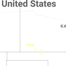
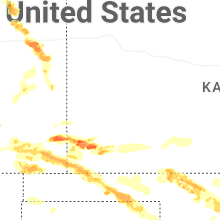
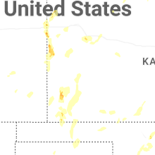


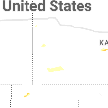


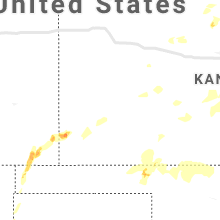


Connect with Interactive Hail Maps