

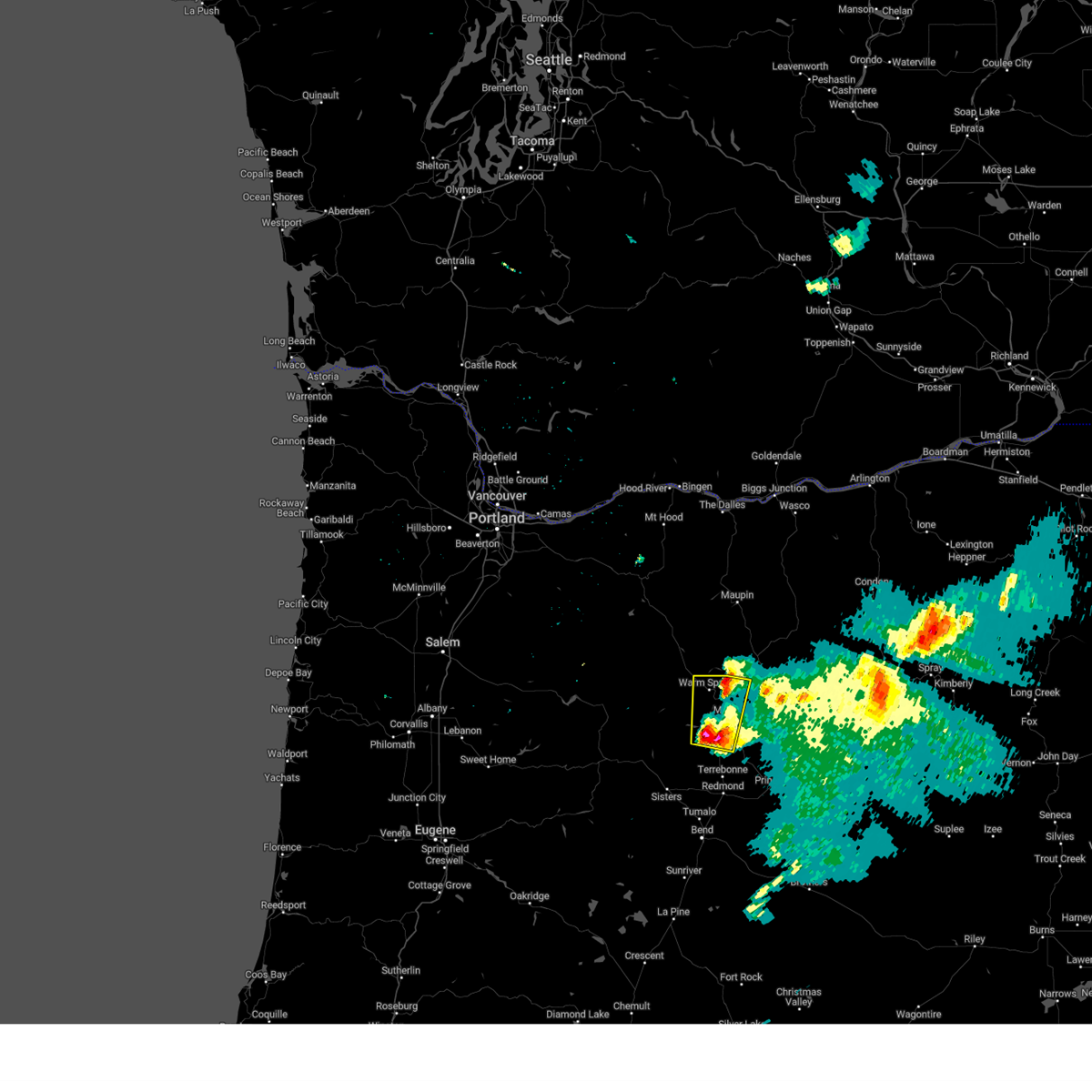
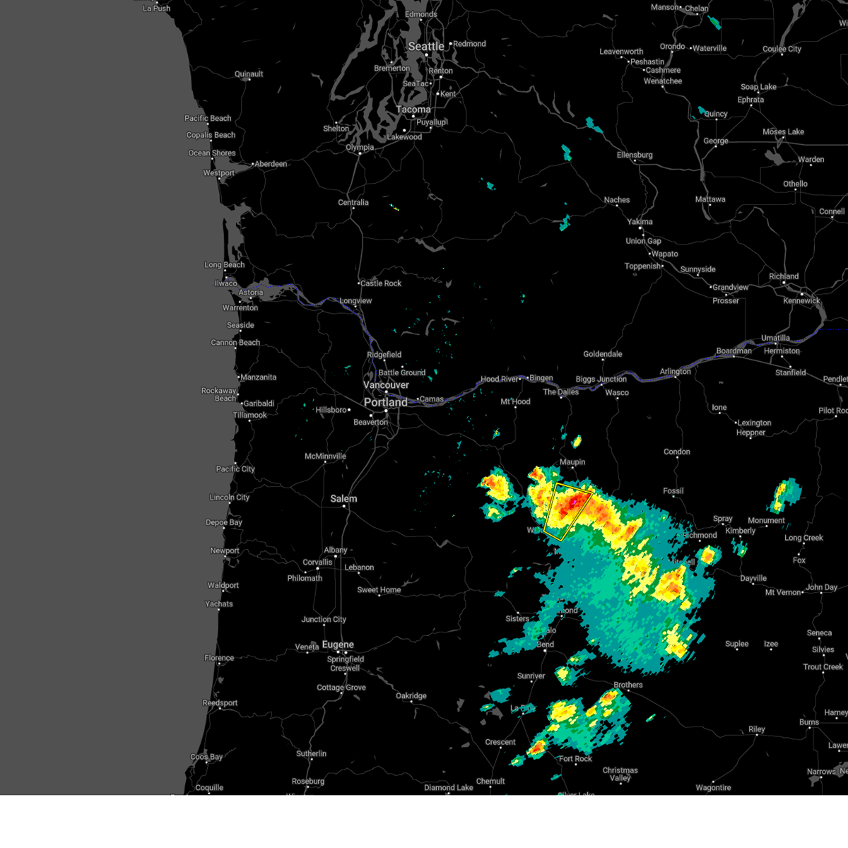
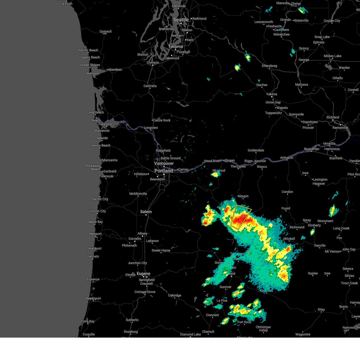
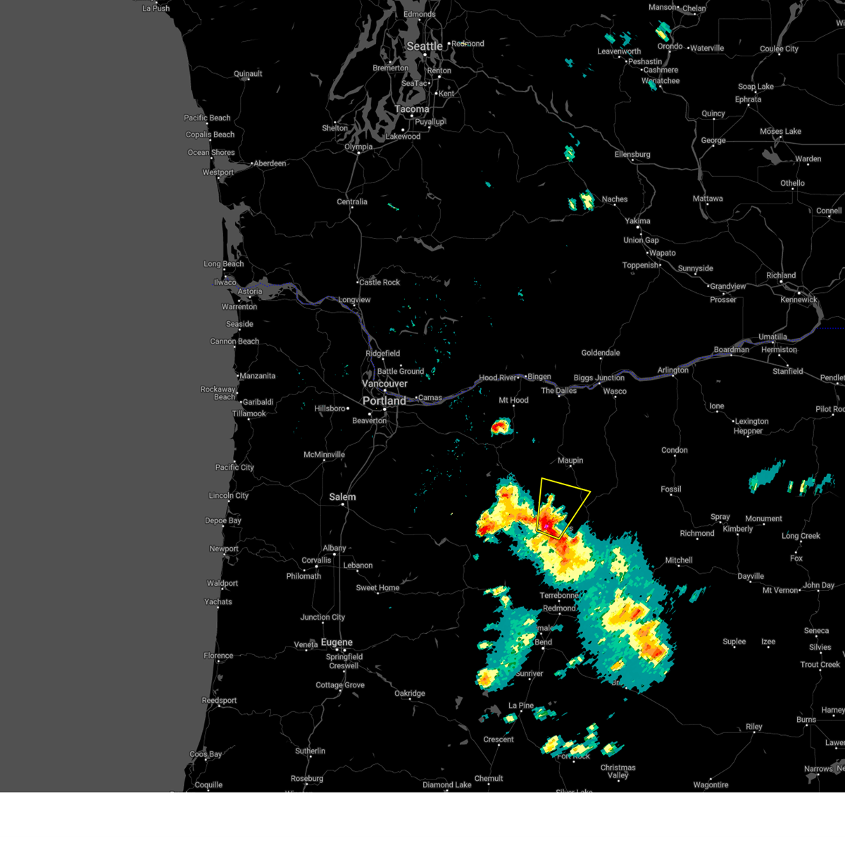
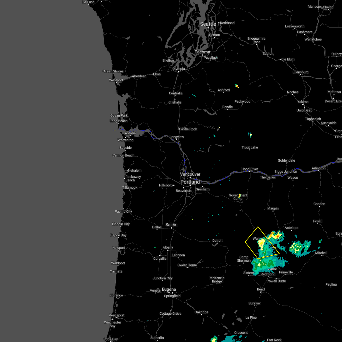
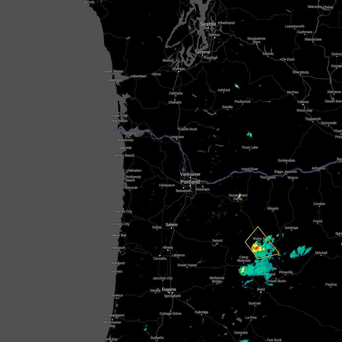
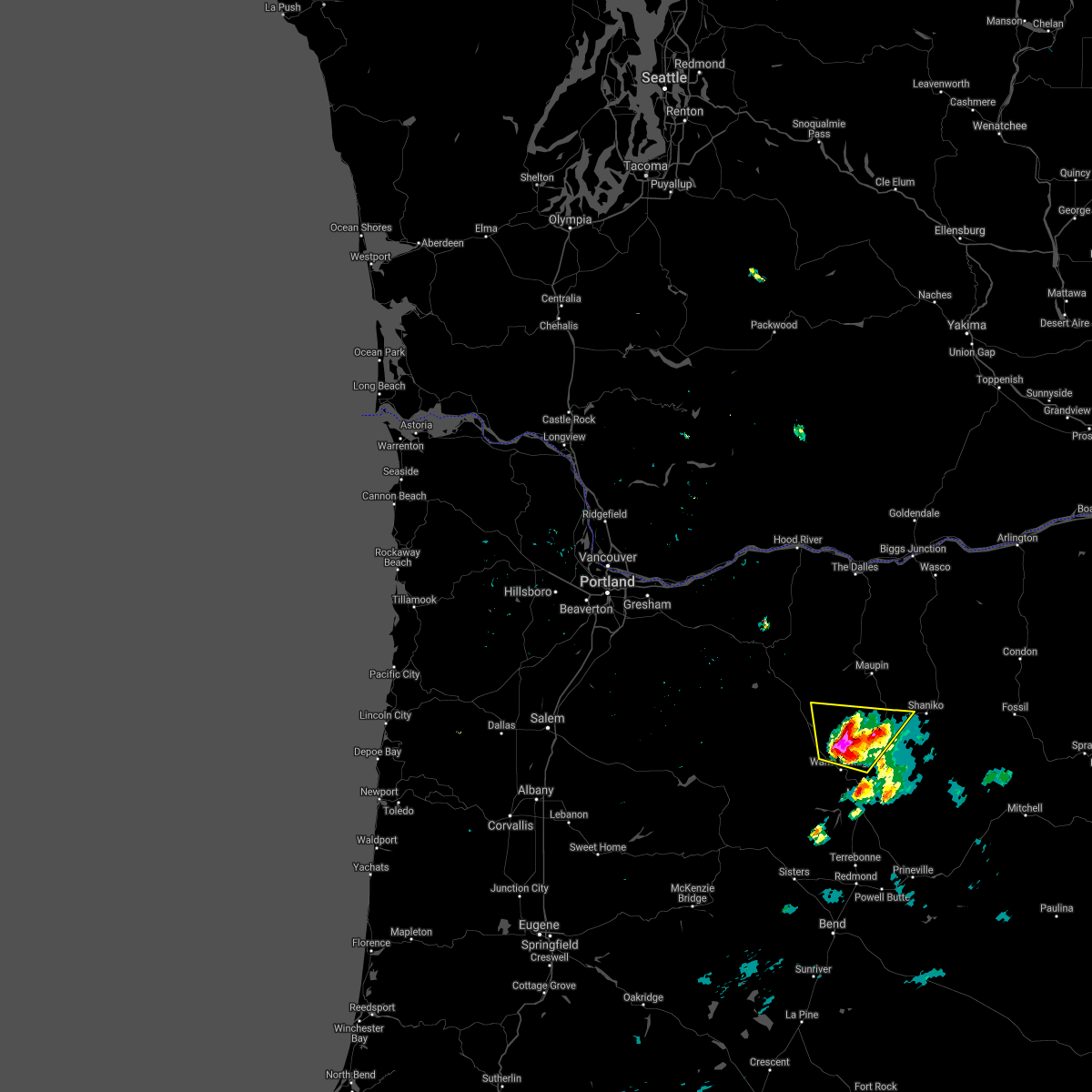
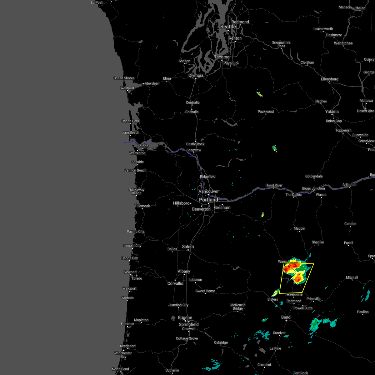
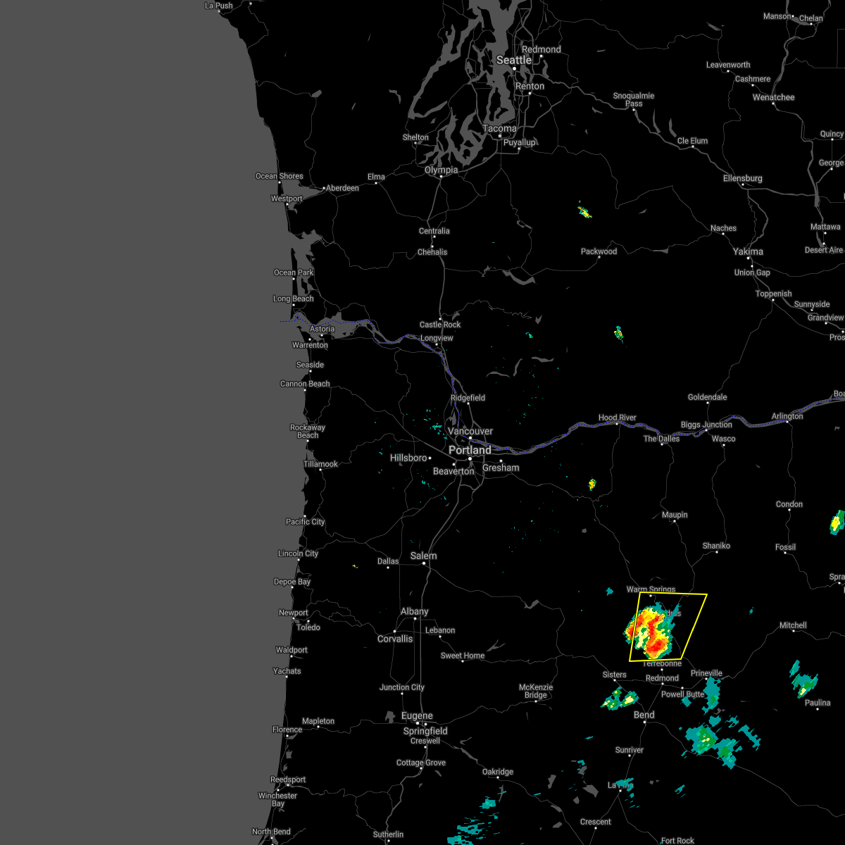
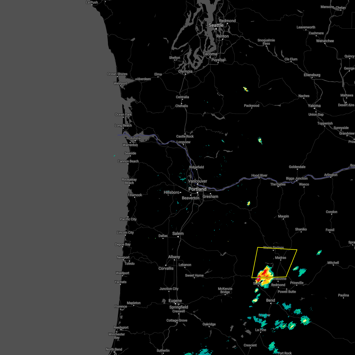
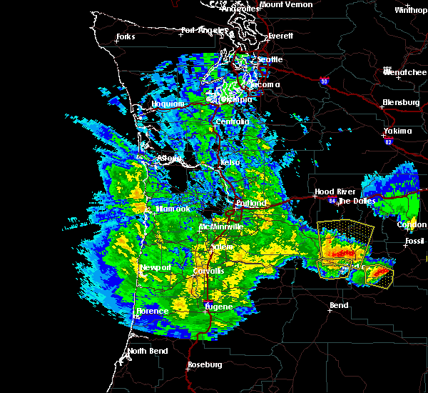
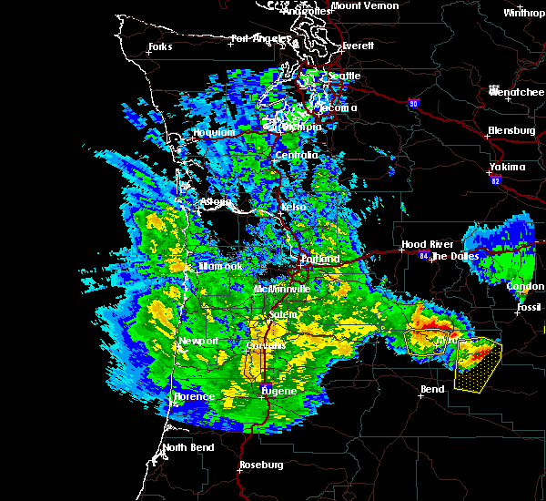
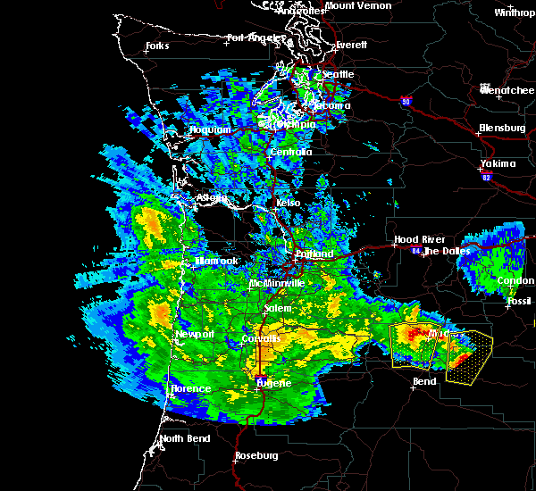
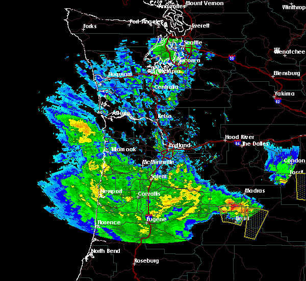
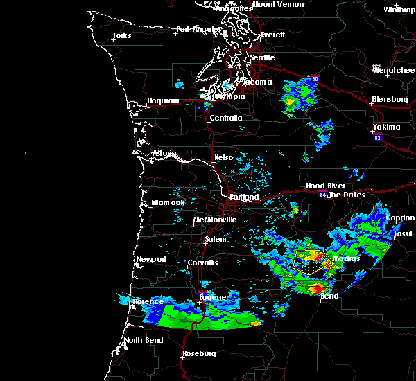
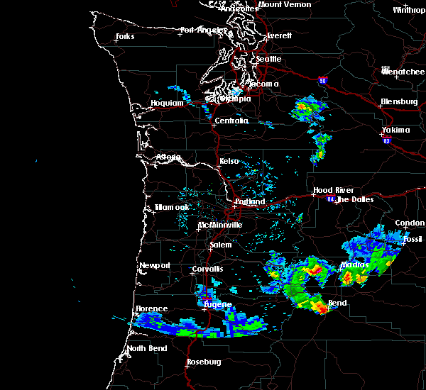
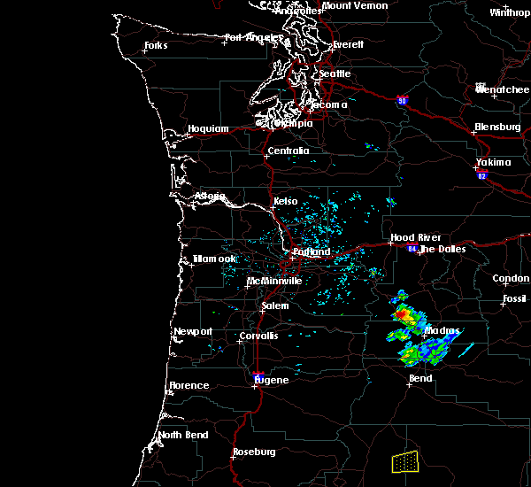
Hail Map for Warm Springs, OR
The Warm Springs, OR area has had 3 reports of on-the-ground hail by trained spotters, and has been under severe weather warnings 0 times during the past 12 months. Doppler radar has detected hail at or near Warm Springs, OR on 15 occasions, including 1 occasion during the past year.
| Name: | Warm Springs, OR |
| Where Located: | 38.6 miles NW of Bend, OR |
| Map: | Google Map for Warm Springs, OR |
| Population: | 2945 |
| Housing Units: | 747 |
| More Info: | Search Google for Warm Springs, OR |
1
The Top Recent Hail Date for Warm Springs, OR is Saturday, August 17, 2024 (9th out of 15)

Hail and Wind Damage Spotted near Warm Springs, OR
| Date / Time | Report Details |
|---|---|
| 5/20/2023 8:08 PM PDT |
 At 808 pm pdt, a severe thunderstorm was located near metolius, or near madras, moving north at 20 mph (radar indicated). Hazards include 60 mph wind gusts and quarter size hail. Hail damage to vehicles is expected. Expect wind damage to roofs, siding, and trees. At 808 pm pdt, a severe thunderstorm was located near metolius, or near madras, moving north at 20 mph (radar indicated). Hazards include 60 mph wind gusts and quarter size hail. Hail damage to vehicles is expected. Expect wind damage to roofs, siding, and trees.
|
| 5/19/2023 6:06 PM PDT |
 The severe thunderstorm warning for north central jefferson and south central wasco counties will expire at 615 pm pdt, the storm which prompted the warning has weakened below severe limits, and no longer poses an immediate threat to life or property. therefore, the warning will be allowed to expire. however heavy rain is still possible with this thunderstorm. The severe thunderstorm warning for north central jefferson and south central wasco counties will expire at 615 pm pdt, the storm which prompted the warning has weakened below severe limits, and no longer poses an immediate threat to life or property. therefore, the warning will be allowed to expire. however heavy rain is still possible with this thunderstorm.
|
| 5/19/2023 5:48 PM PDT |
 At 548 pm pdt, a severe thunderstorm was located over eastern warm springs reservation, or 20 miles north of madras, moving northeast at 20 mph (radar indicated). Hazards include 60 mph wind gusts and quarter size hail. Hail damage to vehicles is expected. expect wind damage to roofs, siding, and trees. locations impacted include, south junction and northeastern warm springs reservation. hail threat, radar indicated max hail size, 1. 00 in wind threat, radar indicated max wind gust, 60 mph. At 548 pm pdt, a severe thunderstorm was located over eastern warm springs reservation, or 20 miles north of madras, moving northeast at 20 mph (radar indicated). Hazards include 60 mph wind gusts and quarter size hail. Hail damage to vehicles is expected. expect wind damage to roofs, siding, and trees. locations impacted include, south junction and northeastern warm springs reservation. hail threat, radar indicated max hail size, 1. 00 in wind threat, radar indicated max wind gust, 60 mph.
|
| 5/19/2023 5:45 PM PDT | Mesonet station mdxo moody farms control statio in wasco county OR, 14.6 miles SW of Warm Springs, OR |
| 5/19/2023 5:21 PM PDT |
 At 521 pm pdt, a severe thunderstorm was located over eastern warm springs reservation, or 15 miles north of madras, moving northeast at 20 mph (radar indicated). Hazards include quarter size hail. damage to vehicles is expected At 521 pm pdt, a severe thunderstorm was located over eastern warm springs reservation, or 15 miles north of madras, moving northeast at 20 mph (radar indicated). Hazards include quarter size hail. damage to vehicles is expected
|
| 7/30/2022 6:53 PM PDT |
 At 648 pm pdt, a severe thunderstorm was located over southern warm springs reservation, or 15 miles northwest of madras, moving northeast at 5 mph (radar indicated. also, a nws employee visiting the area reported thunderstorm wind damage of fences blown down, with visibility reduced to 0 miles in blowing dust). Hazards include up to 70 mph wind gusts. Expect considerable tree damage. damage is likely to mobile homes, roofs, and outbuildings. locations impacted include, madras, metolius, warm springs reservation and warm springs. thunderstorm damage threat, considerable hail threat, radar indicated max hail size, <. 75 in wind threat, radar indicated max wind gust, 70 mph. At 648 pm pdt, a severe thunderstorm was located over southern warm springs reservation, or 15 miles northwest of madras, moving northeast at 5 mph (radar indicated. also, a nws employee visiting the area reported thunderstorm wind damage of fences blown down, with visibility reduced to 0 miles in blowing dust). Hazards include up to 70 mph wind gusts. Expect considerable tree damage. damage is likely to mobile homes, roofs, and outbuildings. locations impacted include, madras, metolius, warm springs reservation and warm springs. thunderstorm damage threat, considerable hail threat, radar indicated max hail size, <. 75 in wind threat, radar indicated max wind gust, 70 mph.
|
| 7/30/2022 6:13 PM PDT |
 At 612 pm pdt, a severe thunderstorm was located over southern warm springs reservation, or 15 miles west of madras, moving northeast at 5 mph (radar indicated). Hazards include 70 mph wind gusts and quarter size hail. Hail damage to vehicles is expected. expect considerable tree damage. Wind damage is also likely to mobile homes, roofs, and outbuildings. At 612 pm pdt, a severe thunderstorm was located over southern warm springs reservation, or 15 miles west of madras, moving northeast at 5 mph (radar indicated). Hazards include 70 mph wind gusts and quarter size hail. Hail damage to vehicles is expected. expect considerable tree damage. Wind damage is also likely to mobile homes, roofs, and outbuildings.
|
| 8/17/2020 5:03 PM PDT |
 At 502 pm pdt, a severe thunderstorm was located over eastern warm springs reservation, or 16 miles north of madras, moving north at 25 mph (spotters report marble size hail an gusty winds around 5 mph). Hazards include 60 mph wind gusts, quarter size hail and brief heavy rain is possible. Hail damage to vehicles is expected. Expect wind damage to roofs, siding, and trees. At 502 pm pdt, a severe thunderstorm was located over eastern warm springs reservation, or 16 miles north of madras, moving north at 25 mph (spotters report marble size hail an gusty winds around 5 mph). Hazards include 60 mph wind gusts, quarter size hail and brief heavy rain is possible. Hail damage to vehicles is expected. Expect wind damage to roofs, siding, and trees.
|
| 8/17/2020 4:42 PM PDT |
 The severe thunderstorm warning for central jefferson county will expire at 445 pm pdt, the storm which prompted the warning has weakened below severe limits, and no longer poses an immediate threat to life or property. therefore, the warning will be allowed to expire. however gusty winds and heavy rain are still possible with this thunderstorm. a severe thunderstorm watch remains in effect until 1000 pm pdt for central oregon. The severe thunderstorm warning for central jefferson county will expire at 445 pm pdt, the storm which prompted the warning has weakened below severe limits, and no longer poses an immediate threat to life or property. therefore, the warning will be allowed to expire. however gusty winds and heavy rain are still possible with this thunderstorm. a severe thunderstorm watch remains in effect until 1000 pm pdt for central oregon.
|
| 8/17/2020 4:21 PM PDT |
 At 420 pm pdt, a severe thunderstorm was located near culver, or 9 miles southwest of madras, moving northeast at 25 mph (spotters report brief heavy rain and small hail). Hazards include 60 mph wind gusts, penny size hail and brief heavy rainfall. Expect damage to roofs, siding, and trees. Locations impacted include, madras, culver, metolius, warm springs and southern warm springs reservation. At 420 pm pdt, a severe thunderstorm was located near culver, or 9 miles southwest of madras, moving northeast at 25 mph (spotters report brief heavy rain and small hail). Hazards include 60 mph wind gusts, penny size hail and brief heavy rainfall. Expect damage to roofs, siding, and trees. Locations impacted include, madras, culver, metolius, warm springs and southern warm springs reservation.
|
| 8/17/2020 3:52 PM PDT |
 At 352 pm pdt, a severe thunderstorm was located 11 miles east of camp sherman, or 16 miles northwest of redmond, moving northeast at 25 mph (radar indicated). Hazards include 60 mph wind gusts and quarter size hail possible. Hail damage to vehicles is expected. Expect wind damage to roofs, siding, and trees. At 352 pm pdt, a severe thunderstorm was located 11 miles east of camp sherman, or 16 miles northwest of redmond, moving northeast at 25 mph (radar indicated). Hazards include 60 mph wind gusts and quarter size hail possible. Hail damage to vehicles is expected. Expect wind damage to roofs, siding, and trees.
|
| 6/11/2020 6:09 PM PDT |
 The severe thunderstorm warning for north central jefferson and southwestern wasco counties will expire at 615 pm pdt, the storm which prompted the warning has weakened below severe limits, and no longer poses an immediate threat to life or property. therefore, the warning will be allowed to expire. however small hail and heavy rain are still possible with this thunderstorm. The severe thunderstorm warning for north central jefferson and southwestern wasco counties will expire at 615 pm pdt, the storm which prompted the warning has weakened below severe limits, and no longer poses an immediate threat to life or property. therefore, the warning will be allowed to expire. however small hail and heavy rain are still possible with this thunderstorm.
|
| 6/11/2020 5:34 PM PDT |
 At 534 pm pdt, a severe thunderstorm was located over northeastern warm springs reservation, or 21 miles northwest of madras, moving north at 25 mph (radar indicated). Hazards include 60 mph wind gusts and half dollar size hail. Hail damage to vehicles is expected. expect wind damage to roofs, siding, and trees. Locations impacted include, maupin, warm springs reservation, wapinitia, pine grove, wamic, warm springs, simnasho and tygh valley. At 534 pm pdt, a severe thunderstorm was located over northeastern warm springs reservation, or 21 miles northwest of madras, moving north at 25 mph (radar indicated). Hazards include 60 mph wind gusts and half dollar size hail. Hail damage to vehicles is expected. expect wind damage to roofs, siding, and trees. Locations impacted include, maupin, warm springs reservation, wapinitia, pine grove, wamic, warm springs, simnasho and tygh valley.
|
| 6/11/2020 5:22 PM PDT | Quarter sized hail reported 8.3 miles SSE of Warm Springs, OR, warm springs police department received reports of a large hail storm along highway 26. received a report of hail at least a quarter size from the public. |
| 6/11/2020 5:13 PM PDT |
 At 512 pm pdt, a severe thunderstorm was located over southeastern warm springs reservation, or 13 miles northwest of madras, moving north at 25 mph (radar indicated). Hazards include 60 mph wind gusts and quarter size hail. Hail damage to vehicles is expected. Expect wind damage to roofs, siding, and trees. At 512 pm pdt, a severe thunderstorm was located over southeastern warm springs reservation, or 13 miles northwest of madras, moving north at 25 mph (radar indicated). Hazards include 60 mph wind gusts and quarter size hail. Hail damage to vehicles is expected. Expect wind damage to roofs, siding, and trees.
|
| 5/30/2020 3:06 PM PDT |
 At 304 pm pdt, severe thunderstorms were located along a line extending from warm springs reservation to near south junction to willowdale, moving north at 45 mph. these are very dangerous storms (storm spotters and weather stations have measured winds of 60 to 80 mph with these storms). Hazards include 80 mph wind gusts and quarter size hail. Flying debris will be dangerous to those caught without shelter. mobile homes will be heavily damaged. expect considerable damage to roofs, windows, and vehicles. extensive tree damage and power outages are likely. Locations impacted include, maupin, kent, wapinitia, pine grove, wamic, south junction, willowdale, tygh valley, simnasho and eastern warm springs reservation. At 304 pm pdt, severe thunderstorms were located along a line extending from warm springs reservation to near south junction to willowdale, moving north at 45 mph. these are very dangerous storms (storm spotters and weather stations have measured winds of 60 to 80 mph with these storms). Hazards include 80 mph wind gusts and quarter size hail. Flying debris will be dangerous to those caught without shelter. mobile homes will be heavily damaged. expect considerable damage to roofs, windows, and vehicles. extensive tree damage and power outages are likely. Locations impacted include, maupin, kent, wapinitia, pine grove, wamic, south junction, willowdale, tygh valley, simnasho and eastern warm springs reservation.
|
| 5/30/2020 2:58 PM PDT |
 At 257 pm pdt, severe thunderstorms were located along a line extending from warm springs reservation to near gateway to near willowdale, moving north at 45 mph (radar indicated and spotter verified with several reports of wind damage in and around madras). Hazards include 70 mph wind gusts and quarter size hail. Hail damage to vehicles is expected. expect considerable tree damage. Wind damage is also likely to mobile homes, roofs, and outbuildings. At 257 pm pdt, severe thunderstorms were located along a line extending from warm springs reservation to near gateway to near willowdale, moving north at 45 mph (radar indicated and spotter verified with several reports of wind damage in and around madras). Hazards include 70 mph wind gusts and quarter size hail. Hail damage to vehicles is expected. expect considerable tree damage. Wind damage is also likely to mobile homes, roofs, and outbuildings.
|
| 5/30/2020 2:46 PM PDT |
 At 246 pm pdt, a severe thunderstorm was located over southeastern warm springs reservation, or 8 miles west of madras, moving north at 35 mph (radar indicated). Hazards include 60 mph wind gusts and quarter size hail. Hail damage to vehicles is expected. expect wind damage to roofs, siding, and trees. Locations impacted include, madras, metolius, warm springs, gateway and southeastern warm springs reservation. At 246 pm pdt, a severe thunderstorm was located over southeastern warm springs reservation, or 8 miles west of madras, moving north at 35 mph (radar indicated). Hazards include 60 mph wind gusts and quarter size hail. Hail damage to vehicles is expected. expect wind damage to roofs, siding, and trees. Locations impacted include, madras, metolius, warm springs, gateway and southeastern warm springs reservation.
|
| 5/30/2020 2:24 PM PDT |
 At 223 pm pdt, a severe thunderstorm was located 9 miles northwest of terrebonne, or 12 miles northwest of redmond, moving north at 35 mph (radar indicated and spotter verified. this storm has multiple reports of wind damage and hail up to half dollar size). Hazards include 60 mph wind gusts and half dollar size hail. Hail damage to vehicles is expected. Expect wind damage to roofs, siding, and trees. At 223 pm pdt, a severe thunderstorm was located 9 miles northwest of terrebonne, or 12 miles northwest of redmond, moving north at 35 mph (radar indicated and spotter verified. this storm has multiple reports of wind damage and hail up to half dollar size). Hazards include 60 mph wind gusts and half dollar size hail. Hail damage to vehicles is expected. Expect wind damage to roofs, siding, and trees.
|
| 5/30/2020 2:00 PM PDT | Power lines and trees down. roof blown off. estimated winds at least 70 mp in jefferson county OR, 1.9 miles SW of Warm Springs, OR |
| 8/9/2019 5:56 PM PDT |
 The severe thunderstorm warning for western jefferson county will expire at 600 pm pdt, the storm which prompted the warning has weakened below severe limits, and no longer poses an immediate threat to life or property. therefore, the warning will be allowed to expire. however small hail is still possible with this thunderstorm. a severe thunderstorm watch remains in effect until 1000 pm pdt for central oregon. The severe thunderstorm warning for western jefferson county will expire at 600 pm pdt, the storm which prompted the warning has weakened below severe limits, and no longer poses an immediate threat to life or property. therefore, the warning will be allowed to expire. however small hail is still possible with this thunderstorm. a severe thunderstorm watch remains in effect until 1000 pm pdt for central oregon.
|
| 8/9/2019 5:38 PM PDT |
 At 537 pm pdt, a severe thunderstorm was located over southeastern warm springs reservation, or 12 miles northwest of madras, moving northeast at 25 mph (radar indicated). Hazards include 60 mph wind gusts and quarter size hail. Hail damage to vehicles is expected. expect wind damage to roofs, siding, and trees. Locations impacted include, madras, warm springs and southern warm springs reservation. At 537 pm pdt, a severe thunderstorm was located over southeastern warm springs reservation, or 12 miles northwest of madras, moving northeast at 25 mph (radar indicated). Hazards include 60 mph wind gusts and quarter size hail. Hail damage to vehicles is expected. expect wind damage to roofs, siding, and trees. Locations impacted include, madras, warm springs and southern warm springs reservation.
|
| 8/9/2019 5:20 PM PDT |
 At 520 pm pdt, a severe thunderstorm was located over southern warm springs reservation, or 14 miles west of madras, moving northeast at 25 mph (radar indicated). Hazards include 60 mph wind gusts and quarter size hail. Hail damage to vehicles is expected. Expect wind damage to roofs, siding, and trees. At 520 pm pdt, a severe thunderstorm was located over southern warm springs reservation, or 14 miles west of madras, moving northeast at 25 mph (radar indicated). Hazards include 60 mph wind gusts and quarter size hail. Hail damage to vehicles is expected. Expect wind damage to roofs, siding, and trees.
|
| 6/12/2019 5:58 PM PDT |
 At 557 pm pdt, a severe thunderstorm was located over northeastern warm springs reservation, or 26 miles northwest of madras, moving north at 15 mph (radar indicated). Hazards include 60 mph wind gusts and half dollar size hail. Hail damage to vehicles is expected. expect wind damage to roofs, siding, and trees. Locations impacted include, maupin, warm springs reservation, wamic, wapinitia, simnasho and pine grove. At 557 pm pdt, a severe thunderstorm was located over northeastern warm springs reservation, or 26 miles northwest of madras, moving north at 15 mph (radar indicated). Hazards include 60 mph wind gusts and half dollar size hail. Hail damage to vehicles is expected. expect wind damage to roofs, siding, and trees. Locations impacted include, maupin, warm springs reservation, wamic, wapinitia, simnasho and pine grove.
|
| 6/12/2019 5:34 PM PDT |
 At 533 pm pdt, a severe thunderstorm was located over northern warm springs reservation, or 23 miles northwest of madras, moving north at 20 mph (radar indicated). Hazards include 60 mph wind gusts and quarter size hail. Hail damage to vehicles is expected. Expect wind damage to roofs, siding, and trees. At 533 pm pdt, a severe thunderstorm was located over northern warm springs reservation, or 23 miles northwest of madras, moving north at 20 mph (radar indicated). Hazards include 60 mph wind gusts and quarter size hail. Hail damage to vehicles is expected. Expect wind damage to roofs, siding, and trees.
|
| 6/26/2017 2:23 PM PDT | Golf Ball sized hail reported 8.5 miles S of Warm Springs, OR, trained spotter relayed report from the public of golf ball sized hail |
| 5/4/2017 11:26 PM PDT |
 At 1125 pm pdt, trained weather spotters reported a severe thunderstorm producing large damaging hail up to two inches in diameter and damaging winds in excess of 60 mph. this storm was located over willowdale, or 16 miles northeast of madras, moving northeast at 45 mph. locations impacted include, madras, antelope, gateway, south junction, warm springs, willowdale, simnasho and warm springs reservation. At 1125 pm pdt, trained weather spotters reported a severe thunderstorm producing large damaging hail up to two inches in diameter and damaging winds in excess of 60 mph. this storm was located over willowdale, or 16 miles northeast of madras, moving northeast at 45 mph. locations impacted include, madras, antelope, gateway, south junction, warm springs, willowdale, simnasho and warm springs reservation.
|
| 5/4/2017 10:53 PM PDT |
 At 1045 pm pdt, trained weather spotters reported a severe thunderstorm producing large damaging hail up to golf ball size and damaging winds in excess of 60 mph. this storm was located near culver, or 9 miles southwest of madras, and moving northeast at 45 mph. At 1045 pm pdt, trained weather spotters reported a severe thunderstorm producing large damaging hail up to golf ball size and damaging winds in excess of 60 mph. this storm was located near culver, or 9 miles southwest of madras, and moving northeast at 45 mph.
|
| 8/2/2014 5:10 PM PDT | Half Dollar sized hail reported 1.9 miles SW of Warm Springs, OR |
| 9/5/2013 4:00 PM PDT | 4 two foot diameter trees uprooted. irrigation pivots overturne in jefferson county OR, 1.9 miles SW of Warm Springs, OR |
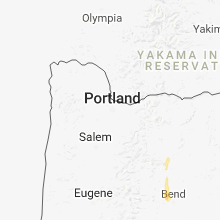
Hail Maps for Warm Springs, OR


Connect with Interactive Hail Maps