

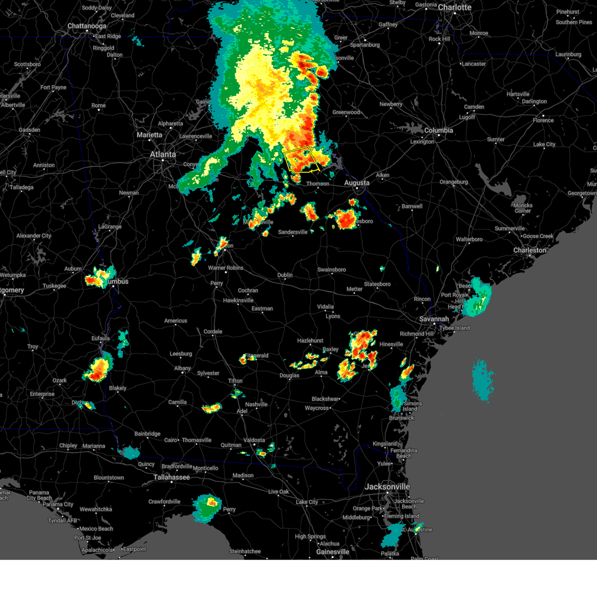
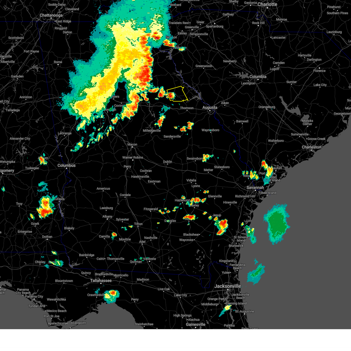
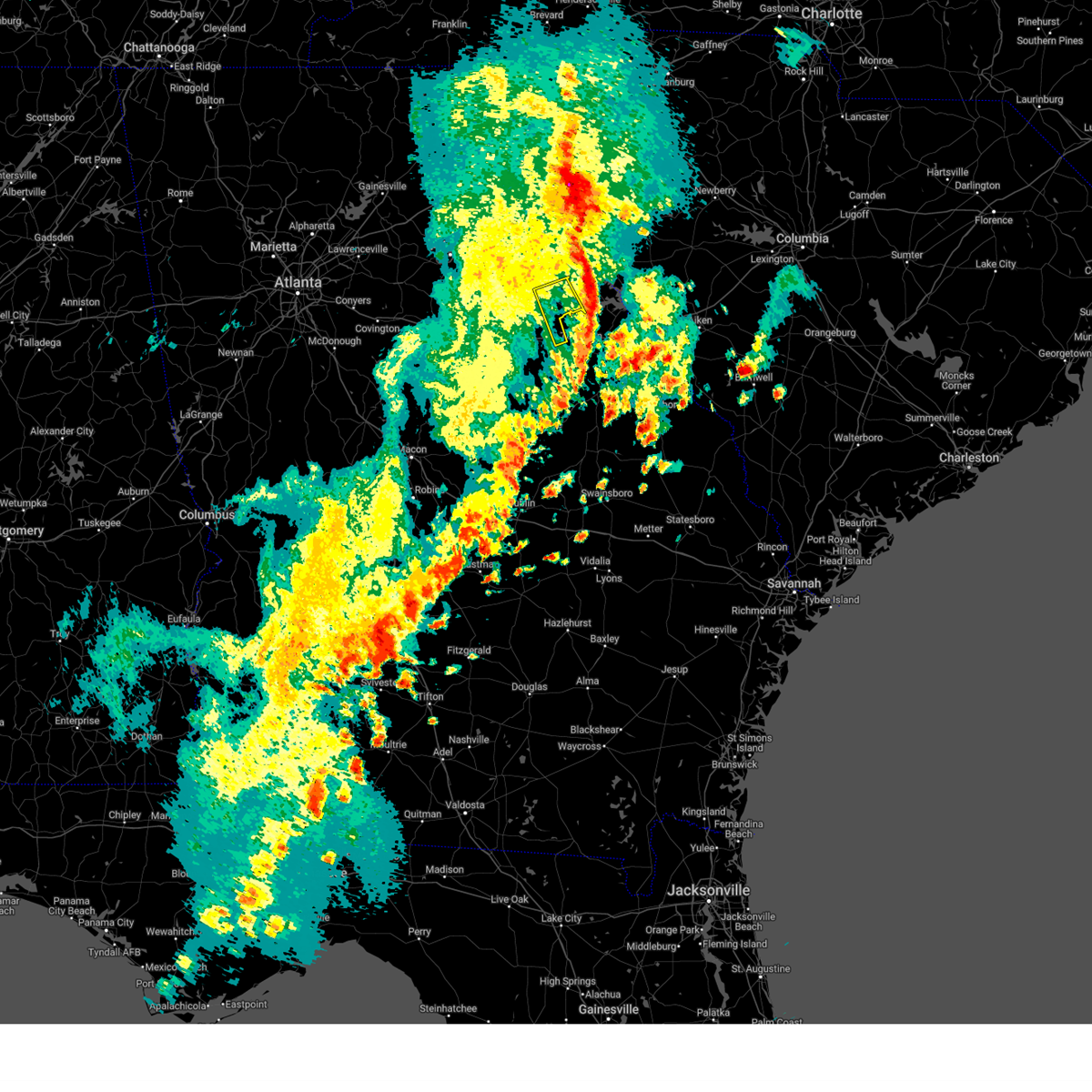
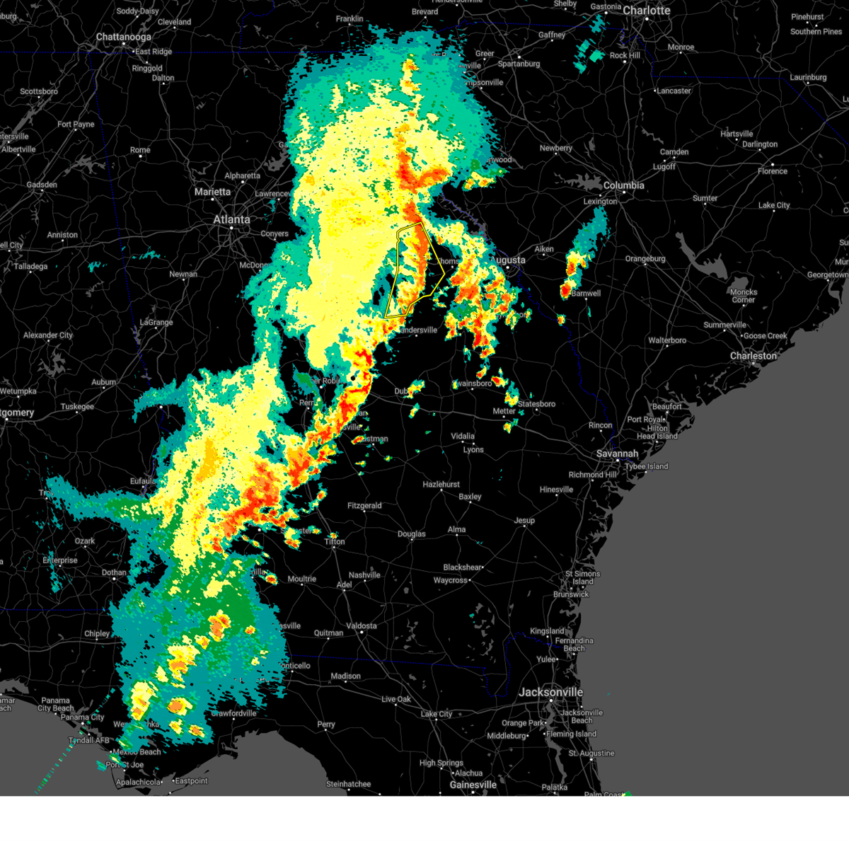
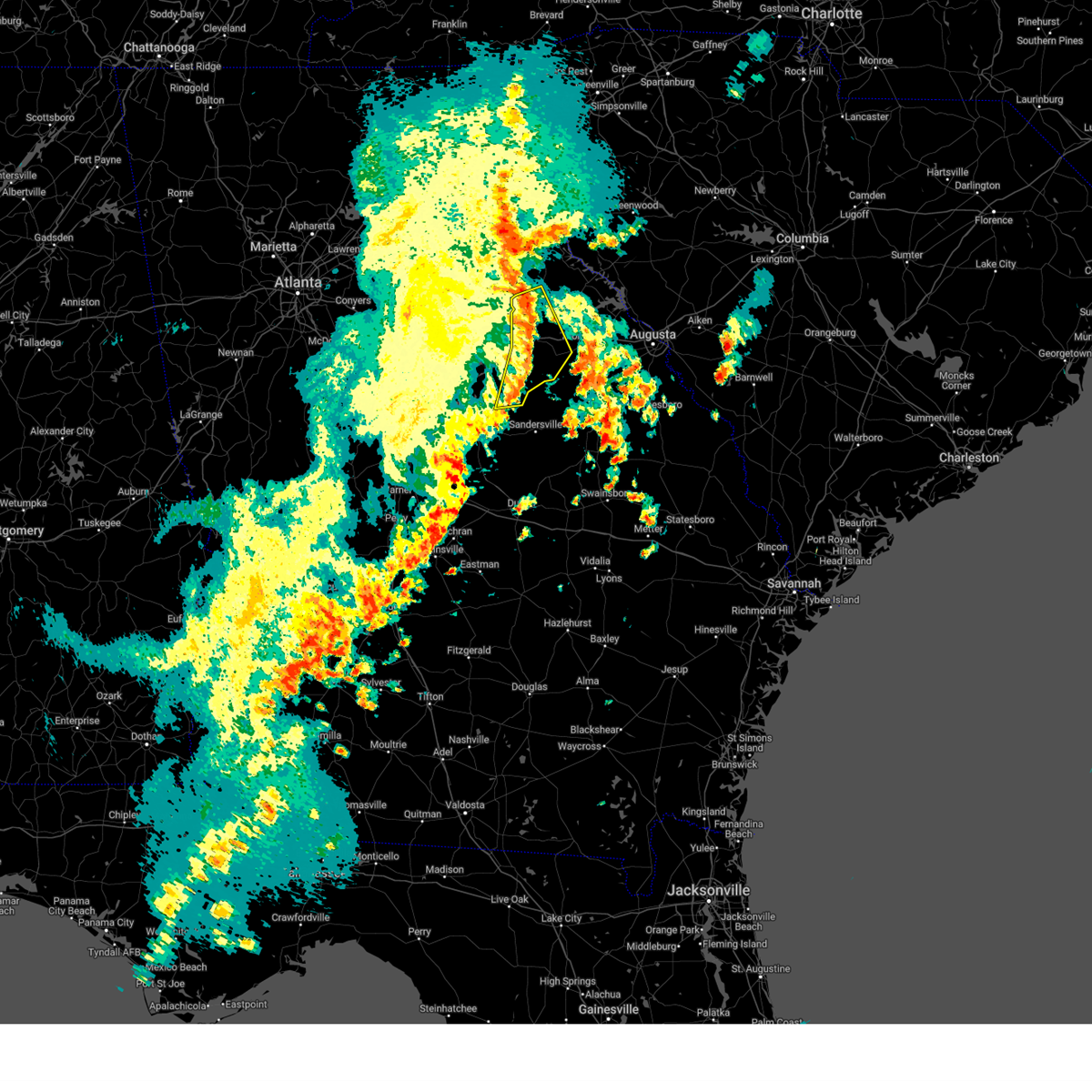
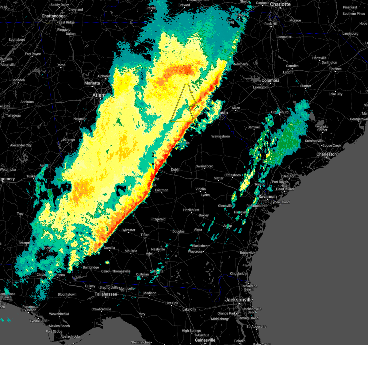
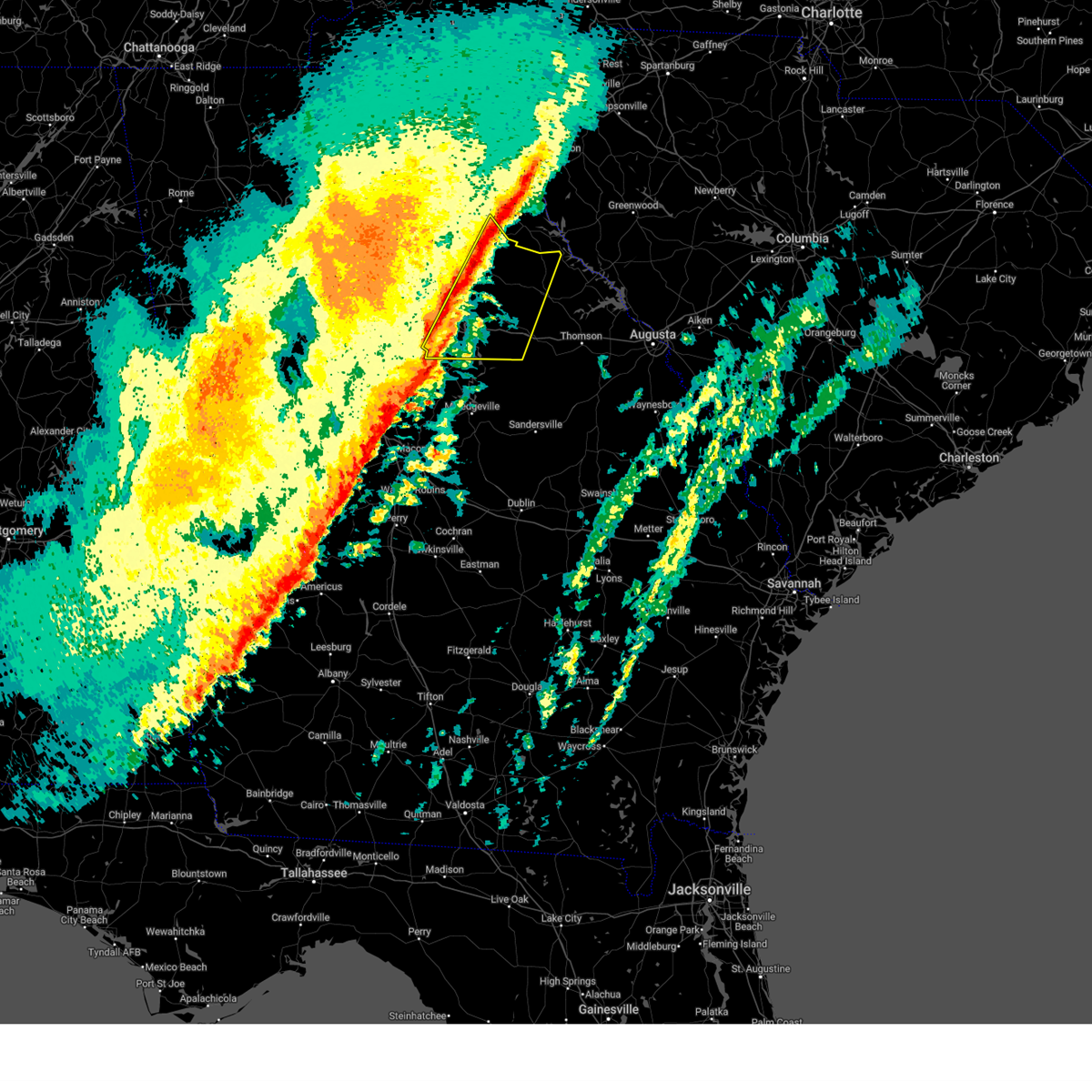
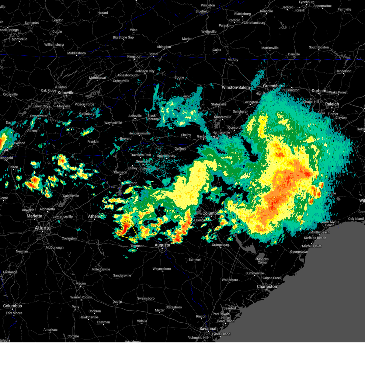
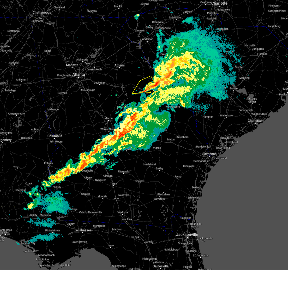
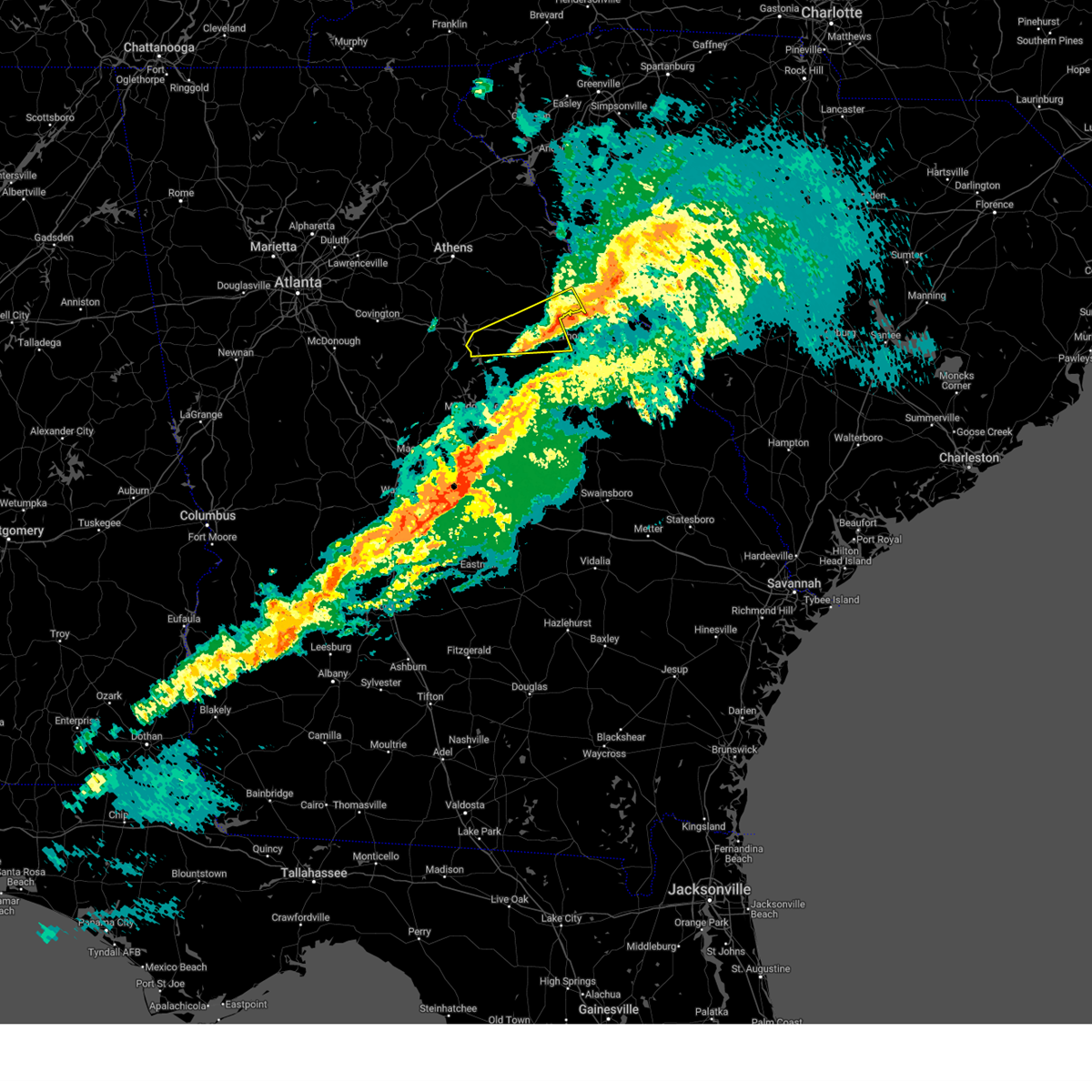
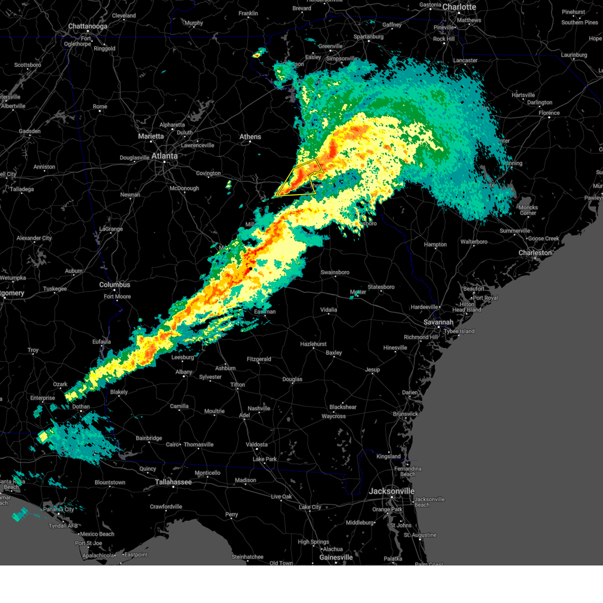
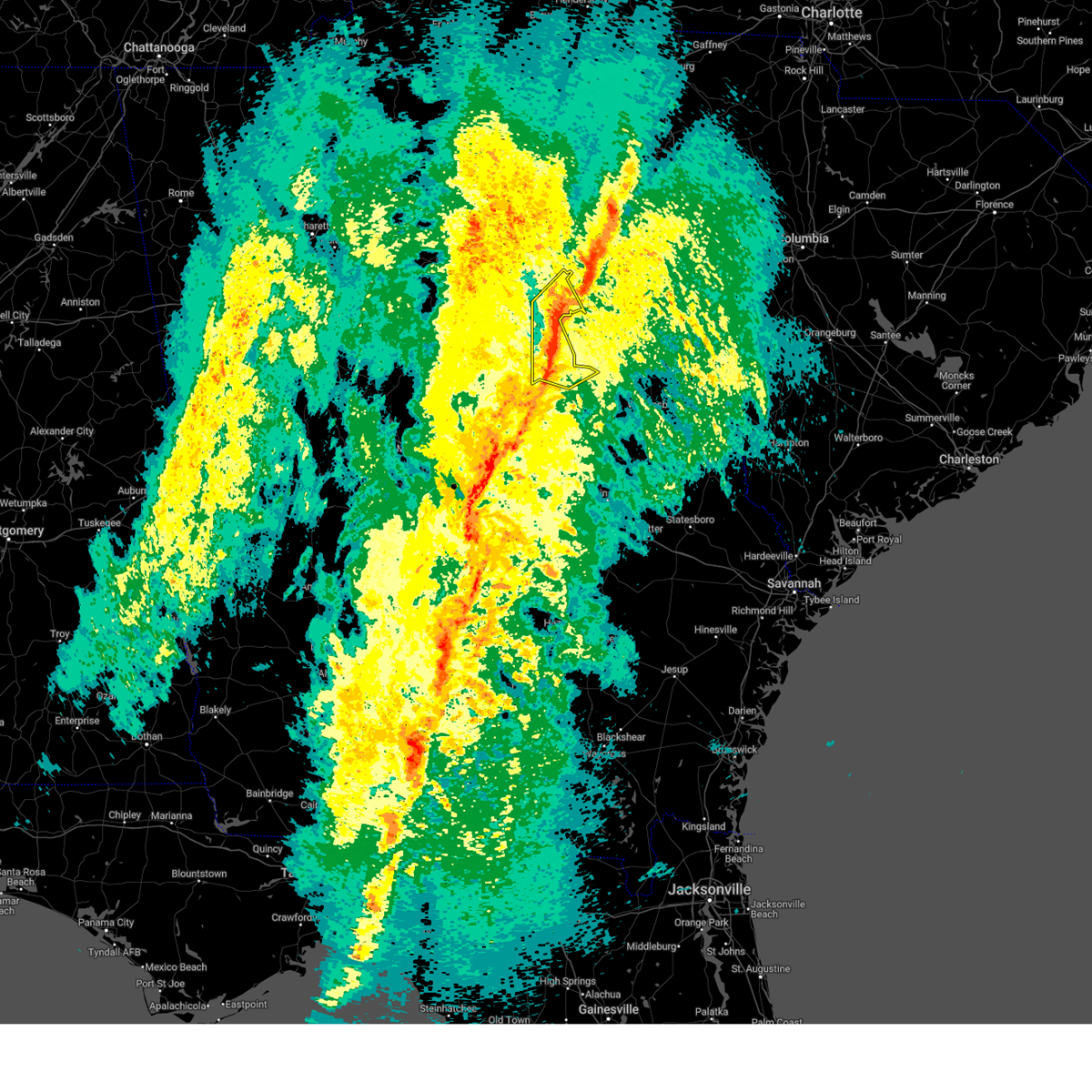
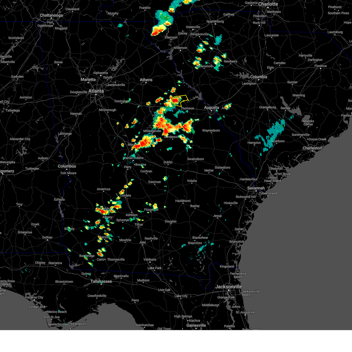
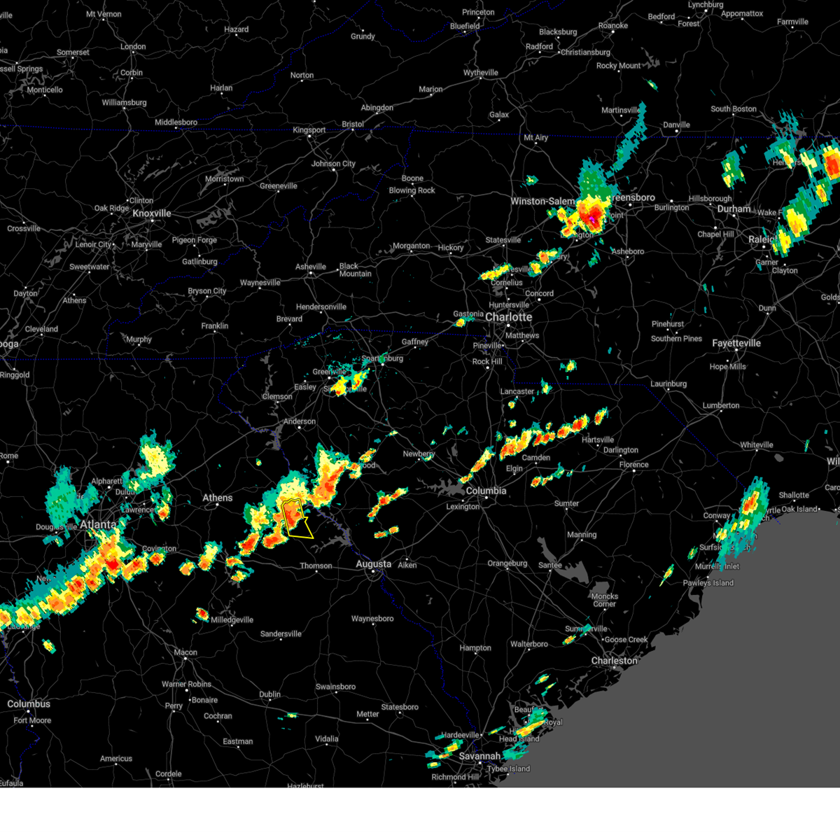
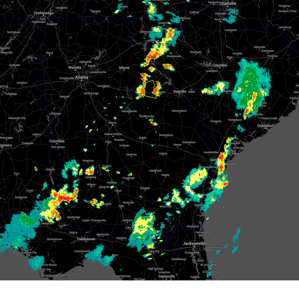
Hail Map for Washington, GA
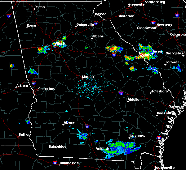
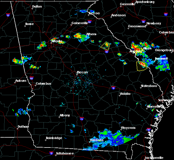
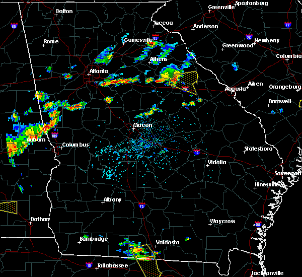
The Washington, GA area has had 2 reports of on-the-ground hail by trained spotters, and has been under severe weather warnings 18 times during the past 12 months. Doppler radar has detected hail at or near Washington, GA on 47 occasions, including 4 occasions during the past year.
| Name: | Washington, GA |
| Where Located: | 47.8 miles WNW of Augusta, GA |
| Map: | Google Map for Washington, GA |
| Population: | 4134 |
| Housing Units: | 1961 |
| More Info: | Search Google for Washington, GA |
0
The Top Recent Hail Date for Washington, GA is Wednesday, April 23, 2025 (47th out of 47)

Hail and Wind Damage Spotted near Washington, GA
| Date / Time | Report Details |
|---|---|
| 6/7/2025 7:42 PM EDT |
 The storm which prompted the warning has weakened below severe limits, and has exited the warned area. therefore, the warning will be allowed to expire. however, gusty winds and heavy rain are still possible with this thunderstorm. a severe thunderstorm watch remains in effect until 1100 pm edt for east central georgia. remember, a severe thunderstorm warning still remains in effect for northern wilkes county. The storm which prompted the warning has weakened below severe limits, and has exited the warned area. therefore, the warning will be allowed to expire. however, gusty winds and heavy rain are still possible with this thunderstorm. a severe thunderstorm watch remains in effect until 1100 pm edt for east central georgia. remember, a severe thunderstorm warning still remains in effect for northern wilkes county.
|
| 6/7/2025 6:56 PM EDT |
 Svrffc the national weather service in peachtree city has issued a * severe thunderstorm warning for, wilkes county in east central georgia, * until 745 pm edt. * at 656 pm edt, a severe thunderstorm was located near washington, moving east at 25 mph (radar indicated). Hazards include 60 mph wind gusts. expect damage to roofs, siding, and trees Svrffc the national weather service in peachtree city has issued a * severe thunderstorm warning for, wilkes county in east central georgia, * until 745 pm edt. * at 656 pm edt, a severe thunderstorm was located near washington, moving east at 25 mph (radar indicated). Hazards include 60 mph wind gusts. expect damage to roofs, siding, and trees
|
| 3/31/2025 3:12 PM EDT |
 the severe thunderstorm warning has been cancelled and is no longer in effect the severe thunderstorm warning has been cancelled and is no longer in effect
|
| 3/31/2025 2:55 PM EDT |
 The storms which prompted the warning have moved out of the area. therefore, the warning will be allowed to expire. a severe thunderstorm watch remains in effect until 700 pm edt for east central georgia. The storms which prompted the warning have moved out of the area. therefore, the warning will be allowed to expire. a severe thunderstorm watch remains in effect until 700 pm edt for east central georgia.
|
| 3/31/2025 2:47 PM EDT |
 At 247 pm edt, severe thunderstorms were located along a line extending from near celeste to near mayfield to near hamburg state park, moving east at 55 mph (radar indicated). Hazards include 60 mph wind gusts. Expect damage to roofs, siding, and trees. Locations impacted include, ficklin, cadley, crawfordville, lundberg, sparta, jewell, camak, beulah, warrenton, beall springs, mayfield, sharon, washington, powelton, norwood, barnett, springfield, lyneville, raytown, and alexander stephens park. At 247 pm edt, severe thunderstorms were located along a line extending from near celeste to near mayfield to near hamburg state park, moving east at 55 mph (radar indicated). Hazards include 60 mph wind gusts. Expect damage to roofs, siding, and trees. Locations impacted include, ficklin, cadley, crawfordville, lundberg, sparta, jewell, camak, beulah, warrenton, beall springs, mayfield, sharon, washington, powelton, norwood, barnett, springfield, lyneville, raytown, and alexander stephens park.
|
| 3/31/2025 2:47 PM EDT |
 the severe thunderstorm warning has been cancelled and is no longer in effect the severe thunderstorm warning has been cancelled and is no longer in effect
|
| 3/31/2025 2:44 PM EDT |
 Svrffc the national weather service in peachtree city has issued a * severe thunderstorm warning for, north central warren county in east central georgia, east central taliaferro county in east central georgia, southeastern wilkes county in east central georgia, * until 330 pm edt. * at 244 pm edt, severe thunderstorms were located along a line extending from near carters grove to barnett, moving east at 50 mph (radar indicated). Hazards include 60 mph wind gusts. expect damage to roofs, siding, and trees Svrffc the national weather service in peachtree city has issued a * severe thunderstorm warning for, north central warren county in east central georgia, east central taliaferro county in east central georgia, southeastern wilkes county in east central georgia, * until 330 pm edt. * at 244 pm edt, severe thunderstorms were located along a line extending from near carters grove to barnett, moving east at 50 mph (radar indicated). Hazards include 60 mph wind gusts. expect damage to roofs, siding, and trees
|
| 3/31/2025 2:35 PM EDT |
 At 234 pm edt, severe thunderstorms were located along a line extending from near philomath to near springfield to beulah, moving east at 55 mph (radar indicated). Hazards include 60 mph wind gusts. Expect damage to roofs, siding, and trees. Locations impacted include, shoals, camak, beulah, warrenton, sharon, washington, powelton, norwood, shoulderbone, lyneville, carters grove, ficklin, cadley, crawfordville, lundberg, sparta, robinson, devereux, jewell, and beall springs. At 234 pm edt, severe thunderstorms were located along a line extending from near philomath to near springfield to beulah, moving east at 55 mph (radar indicated). Hazards include 60 mph wind gusts. Expect damage to roofs, siding, and trees. Locations impacted include, shoals, camak, beulah, warrenton, sharon, washington, powelton, norwood, shoulderbone, lyneville, carters grove, ficklin, cadley, crawfordville, lundberg, sparta, robinson, devereux, jewell, and beall springs.
|
| 3/31/2025 2:35 PM EDT |
 the severe thunderstorm warning has been cancelled and is no longer in effect the severe thunderstorm warning has been cancelled and is no longer in effect
|
| 3/31/2025 2:09 PM EDT |
 Svrffc the national weather service in peachtree city has issued a * severe thunderstorm warning for, northern baldwin county in central georgia, warren county in east central georgia, southeastern morgan county in north central georgia, putnam county in central georgia, hancock county in east central georgia, greene county in east central georgia, taliaferro county in east central georgia, southwestern wilkes county in east central georgia, northeastern jones county in central georgia, * until 300 pm edt. * at 209 pm edt, severe thunderstorms were located along a line extending from near madison to near warfield to near blountsville, moving east at 55 mph (radar indicated). Hazards include 60 mph wind gusts. expect damage to roofs, siding, and trees Svrffc the national weather service in peachtree city has issued a * severe thunderstorm warning for, northern baldwin county in central georgia, warren county in east central georgia, southeastern morgan county in north central georgia, putnam county in central georgia, hancock county in east central georgia, greene county in east central georgia, taliaferro county in east central georgia, southwestern wilkes county in east central georgia, northeastern jones county in central georgia, * until 300 pm edt. * at 209 pm edt, severe thunderstorms were located along a line extending from near madison to near warfield to near blountsville, moving east at 55 mph (radar indicated). Hazards include 60 mph wind gusts. expect damage to roofs, siding, and trees
|
| 2/16/2025 6:40 AM EST |
 The storms which prompted the warning have moved out of the area. therefore, the warning will be allowed to expire. a tornado watch remains in effect until 900 am est for east central georgia. The storms which prompted the warning have moved out of the area. therefore, the warning will be allowed to expire. a tornado watch remains in effect until 900 am est for east central georgia.
|
| 2/16/2025 6:26 AM EST |
 At 625 am est, severe thunderstorms were located along a line extending from near bradley to warrenton, moving east at 65 mph (radar indicated). Hazards include 60 mph wind gusts. Expect damage to roofs, siding, and trees. Locations impacted include, washington, warrenton, crawfordville, tignall, norwood, sharon, camak, springfield, delhi, holliday park, powelton, danburg, mesena, ficklin, cadley, lundberg, metasville, floral hill, aonia, and barnett. At 625 am est, severe thunderstorms were located along a line extending from near bradley to warrenton, moving east at 65 mph (radar indicated). Hazards include 60 mph wind gusts. Expect damage to roofs, siding, and trees. Locations impacted include, washington, warrenton, crawfordville, tignall, norwood, sharon, camak, springfield, delhi, holliday park, powelton, danburg, mesena, ficklin, cadley, lundberg, metasville, floral hill, aonia, and barnett.
|
| 2/16/2025 6:26 AM EST |
 the severe thunderstorm warning has been cancelled and is no longer in effect the severe thunderstorm warning has been cancelled and is no longer in effect
|
| 2/16/2025 5:54 AM EST |
 The storms which prompted the warning have moved out of the area. therefore, the warning will be allowed to expire. a tornado watch remains in effect until 900 am est for central georgia. remember, a severe thunderstorm warning still remains in effect for eastern oglethorpe and greene counties, as well as taliaferro, wilkes, and northern hancock counties. The storms which prompted the warning have moved out of the area. therefore, the warning will be allowed to expire. a tornado watch remains in effect until 900 am est for central georgia. remember, a severe thunderstorm warning still remains in effect for eastern oglethorpe and greene counties, as well as taliaferro, wilkes, and northern hancock counties.
|
| 2/16/2025 5:53 AM EST |
 Svrffc the national weather service in peachtree city has issued a * severe thunderstorm warning for, warren county in east central georgia, northeastern putnam county in central georgia, northeastern hancock county in east central georgia, greene county in east central georgia, taliaferro county in east central georgia, wilkes county in east central georgia, central oglethorpe county in northeastern georgia, * until 645 am est. * at 552 am est, severe thunderstorms were located along a line extending from elberton to phoenix, moving east at 65 mph (radar indicated). Hazards include 60 mph wind gusts. expect damage to roofs, siding, and trees Svrffc the national weather service in peachtree city has issued a * severe thunderstorm warning for, warren county in east central georgia, northeastern putnam county in central georgia, northeastern hancock county in east central georgia, greene county in east central georgia, taliaferro county in east central georgia, wilkes county in east central georgia, central oglethorpe county in northeastern georgia, * until 645 am est. * at 552 am est, severe thunderstorms were located along a line extending from elberton to phoenix, moving east at 65 mph (radar indicated). Hazards include 60 mph wind gusts. expect damage to roofs, siding, and trees
|
| 2/16/2025 5:46 AM EST |
 the severe thunderstorm warning has been cancelled and is no longer in effect the severe thunderstorm warning has been cancelled and is no longer in effect
|
| 2/16/2025 5:46 AM EST |
 At 545 am est, severe thunderstorms were located along a line extending from near point peter to eatonton, moving east at 60 mph (radar indicated). Hazards include 60 mph wind gusts. Expect damage to roofs, siding, and trees. Locations impacted include, washington, madison, greensboro, crawfordville, lexington, union point, comer, crawford, tignall, arnoldsville, woodville, white plains, siloam, carlton, maxeys, rayle, buckhead, reynolds at lake oconee, phoenix, and athens-clarke county. At 545 am est, severe thunderstorms were located along a line extending from near point peter to eatonton, moving east at 60 mph (radar indicated). Hazards include 60 mph wind gusts. Expect damage to roofs, siding, and trees. Locations impacted include, washington, madison, greensboro, crawfordville, lexington, union point, comer, crawford, tignall, arnoldsville, woodville, white plains, siloam, carlton, maxeys, rayle, buckhead, reynolds at lake oconee, phoenix, and athens-clarke county.
|
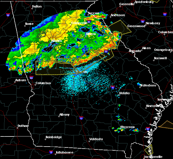
| 2/16/2025 5:16 AM EST | Svrffc the national weather service in peachtree city has issued a * severe thunderstorm warning for, north central hancock county in east central georgia, clarke county in northeastern georgia, taliaferro county in east central georgia, southeastern jackson county in northeastern georgia, western wilkes county in east central georgia, madison county in northeastern georgia, southeastern newton county in north central georgia, oconee county in northeastern georgia, morgan county in north central georgia, northern putnam county in central georgia, southeastern banks county in northeastern georgia, eastern walton county in north central georgia, greene county in east central georgia, oglethorpe county in northeastern georgia, northern jasper county in central georgia, * until 600 am est. * at 516 am est, severe thunderstorms were located along a line extending from near westgate park to turtle cove, moving east at 60 mph (radar indicated). Hazards include 60 mph wind gusts. expect damage to roofs, siding, and trees |
| 5/9/2024 5:49 AM EDT |
 the severe thunderstorm warning has been cancelled and is no longer in effect the severe thunderstorm warning has been cancelled and is no longer in effect
|
| 5/9/2024 5:49 AM EDT |
 At 549 am edt, a severe thunderstorm was located near washington, moving east at 50 mph (radar indicated). Hazards include 60 mph wind gusts and quarter size hail. Hail damage to vehicles is expected. expect wind damage to roofs, siding, and trees. locations impacted include, washington, tignall, aonia, newtown, danburg, rocky creek fire dept. Metasville, floral hill, holliday park, delhi, and fishing creek public hunting area. At 549 am edt, a severe thunderstorm was located near washington, moving east at 50 mph (radar indicated). Hazards include 60 mph wind gusts and quarter size hail. Hail damage to vehicles is expected. expect wind damage to roofs, siding, and trees. locations impacted include, washington, tignall, aonia, newtown, danburg, rocky creek fire dept. Metasville, floral hill, holliday park, delhi, and fishing creek public hunting area.
|
| 5/9/2024 5:35 AM EDT |
 Svrffc the national weather service in peachtree city has issued a * severe thunderstorm warning for, wilkes county in east central georgia, eastern oglethorpe county in northeastern georgia, * until 615 am edt. * at 535 am edt, a severe thunderstorm was located over rayle, or 10 miles northwest of washington, moving east at 50 mph (radar indicated). Hazards include 60 mph wind gusts and quarter size hail. Hail damage to vehicles is expected. Expect wind damage to roofs, siding, and trees. Svrffc the national weather service in peachtree city has issued a * severe thunderstorm warning for, wilkes county in east central georgia, eastern oglethorpe county in northeastern georgia, * until 615 am edt. * at 535 am edt, a severe thunderstorm was located over rayle, or 10 miles northwest of washington, moving east at 50 mph (radar indicated). Hazards include 60 mph wind gusts and quarter size hail. Hail damage to vehicles is expected. Expect wind damage to roofs, siding, and trees.
|
| 4/3/2024 4:29 AM EDT |
 the severe thunderstorm warning has been cancelled and is no longer in effect the severe thunderstorm warning has been cancelled and is no longer in effect
|
| 4/3/2024 4:13 AM EDT |
 the severe thunderstorm warning has been cancelled and is no longer in effect the severe thunderstorm warning has been cancelled and is no longer in effect
|
| 4/3/2024 4:11 AM EDT |
 Svrffc the national weather service in peachtree city has issued a * severe thunderstorm warning for, northwestern warren county in east central georgia, north central hancock county in east central georgia, taliaferro county in east central georgia, southeastern wilkes county in east central georgia, * until 500 am edt. * at 411 am edt, a severe thunderstorm was located over aonia, or near washington, moving northeast at 65 mph (radar indicated). Hazards include 60 mph wind gusts. expect damage to roofs, siding, and trees Svrffc the national weather service in peachtree city has issued a * severe thunderstorm warning for, northwestern warren county in east central georgia, north central hancock county in east central georgia, taliaferro county in east central georgia, southeastern wilkes county in east central georgia, * until 500 am edt. * at 411 am edt, a severe thunderstorm was located over aonia, or near washington, moving northeast at 65 mph (radar indicated). Hazards include 60 mph wind gusts. expect damage to roofs, siding, and trees
|
| 4/3/2024 3:57 AM EDT |
 the tornado warning has been cancelled and is no longer in effect the tornado warning has been cancelled and is no longer in effect
|
| 4/3/2024 3:39 AM EDT |
 Svrffc the national weather service in peachtree city has issued a * severe thunderstorm warning for, northwestern warren county in east central georgia, north central hancock county in east central georgia, southeastern greene county in east central georgia, taliaferro county in east central georgia, southeastern wilkes county in east central georgia, * until 430 am edt. * at 339 am edt, a severe thunderstorm was located near reynolds at lake oconee, or 7 miles south of greensboro, moving northeast at 65 mph (radar indicated). Hazards include 60 mph wind gusts. expect damage to roofs, siding, and trees Svrffc the national weather service in peachtree city has issued a * severe thunderstorm warning for, northwestern warren county in east central georgia, north central hancock county in east central georgia, southeastern greene county in east central georgia, taliaferro county in east central georgia, southeastern wilkes county in east central georgia, * until 430 am edt. * at 339 am edt, a severe thunderstorm was located near reynolds at lake oconee, or 7 miles south of greensboro, moving northeast at 65 mph (radar indicated). Hazards include 60 mph wind gusts. expect damage to roofs, siding, and trees
|
| 4/3/2024 3:28 AM EDT |
 Torffc the national weather service in peachtree city has issued a * tornado warning for, northern wilkes county in east central georgia, * until 415 am edt. * at 327 am edt, a severe thunderstorm capable of producing a tornado was located over rayle, or 9 miles northwest of washington, moving northeast at 55 mph (radar indicated rotation). Hazards include tornado. Flying debris will be dangerous to those caught without shelter. mobile homes will be damaged or destroyed. damage to roofs, windows, and vehicles will occur. Tree damage is likely. Torffc the national weather service in peachtree city has issued a * tornado warning for, northern wilkes county in east central georgia, * until 415 am edt. * at 327 am edt, a severe thunderstorm capable of producing a tornado was located over rayle, or 9 miles northwest of washington, moving northeast at 55 mph (radar indicated rotation). Hazards include tornado. Flying debris will be dangerous to those caught without shelter. mobile homes will be damaged or destroyed. damage to roofs, windows, and vehicles will occur. Tree damage is likely.
|
| 2/28/2024 5:01 PM EST |
 Svrffc the national weather service in peachtree city has issued a * severe thunderstorm warning for, northwestern warren county in east central georgia, east central greene county in east central georgia, taliaferro county in east central georgia, wilkes county in east central georgia, * until 545 pm est. * at 501 pm est, severe thunderstorms were located along a line extending from chennault to near carters grove to near greensboro, moving east at 50 mph (radar indicated). Hazards include 60 mph wind gusts. expect damage to roofs, siding, and trees Svrffc the national weather service in peachtree city has issued a * severe thunderstorm warning for, northwestern warren county in east central georgia, east central greene county in east central georgia, taliaferro county in east central georgia, wilkes county in east central georgia, * until 545 pm est. * at 501 pm est, severe thunderstorms were located along a line extending from chennault to near carters grove to near greensboro, moving east at 50 mph (radar indicated). Hazards include 60 mph wind gusts. expect damage to roofs, siding, and trees
|
| 2/28/2024 4:42 PM EST |
 At 441 pm est, severe thunderstorms were located along a line extending from vesta to near lexington to greshamville, moving east at 50 mph (radar indicated). Hazards include 60 mph wind gusts. Expect damage to roofs, siding, and trees. Locations impacted include, washington, greensboro, lexington, union point, tignall, woodville, maxeys, rayle, stephens, delhi, wrayswood, hutchings, greshamville, newtown, danburg, penfield, lyneville, vesta, carters grove, and apalachee. At 441 pm est, severe thunderstorms were located along a line extending from vesta to near lexington to greshamville, moving east at 50 mph (radar indicated). Hazards include 60 mph wind gusts. Expect damage to roofs, siding, and trees. Locations impacted include, washington, greensboro, lexington, union point, tignall, woodville, maxeys, rayle, stephens, delhi, wrayswood, hutchings, greshamville, newtown, danburg, penfield, lyneville, vesta, carters grove, and apalachee.
|
| 2/28/2024 4:25 PM EST |
 Svrffc the national weather service in peachtree city has issued a * severe thunderstorm warning for, southeastern oconee county in northeastern georgia, northern morgan county in north central georgia, southeastern clarke county in northeastern georgia, northern greene county in east central georgia, northwestern taliaferro county in east central georgia, wilkes county in east central georgia, oglethorpe county in northeastern georgia, * until 515 pm est. * at 424 pm est, severe thunderstorms were located along a line extending from near smithonia to barnett shoals to near hard labor creek state park, moving east at 50 mph (radar indicated). Hazards include 60 mph wind gusts. expect damage to roofs, siding, and trees Svrffc the national weather service in peachtree city has issued a * severe thunderstorm warning for, southeastern oconee county in northeastern georgia, northern morgan county in north central georgia, southeastern clarke county in northeastern georgia, northern greene county in east central georgia, northwestern taliaferro county in east central georgia, wilkes county in east central georgia, oglethorpe county in northeastern georgia, * until 515 pm est. * at 424 pm est, severe thunderstorms were located along a line extending from near smithonia to barnett shoals to near hard labor creek state park, moving east at 50 mph (radar indicated). Hazards include 60 mph wind gusts. expect damage to roofs, siding, and trees
|
| 1/9/2024 11:48 AM EST |
 At 1148 am est, severe thunderstorms were located along a line extending from near hester`s ferry campground to near beall springs, moving northeast at 45 mph (radar indicated). Hazards include 60 mph wind gusts. expect damage to roofs, siding, and trees At 1148 am est, severe thunderstorms were located along a line extending from near hester`s ferry campground to near beall springs, moving northeast at 45 mph (radar indicated). Hazards include 60 mph wind gusts. expect damage to roofs, siding, and trees
|
| 1/9/2024 11:15 AM EST | Mesonet station wsng1 washingto in wilkes county GA, 4.9 miles SE of Washington, GA |
| 9/7/2023 3:00 PM EDT |
 At 300 pm edt, a severe thunderstorm was located over lundberg, or near washington, moving east at 10 mph (radar indicated). Hazards include 60 mph wind gusts and quarter size hail. Hail damage to vehicles is expected. expect wind damage to roofs, siding, and trees. locations impacted include, washington, aonia, ficklin, lundberg, rocky creek fire dept. raytown, and holliday park. hail threat, radar indicated max hail size, 1. 00 in wind threat, radar indicated max wind gust, 60 mph. At 300 pm edt, a severe thunderstorm was located over lundberg, or near washington, moving east at 10 mph (radar indicated). Hazards include 60 mph wind gusts and quarter size hail. Hail damage to vehicles is expected. expect wind damage to roofs, siding, and trees. locations impacted include, washington, aonia, ficklin, lundberg, rocky creek fire dept. raytown, and holliday park. hail threat, radar indicated max hail size, 1. 00 in wind threat, radar indicated max wind gust, 60 mph.
|
| 9/7/2023 2:55 PM EDT | Golf Ball sized hail reported 5.2 miles NNE of Washington, GA, emergency manager reported golf ball sized hail large enough to crack a windshield on hwy 49 near hwy 195. |
| 9/7/2023 2:50 PM EDT |
 At 250 pm edt, a severe thunderstorm was located over ficklin, or near washington, moving east at 10 mph (radar indicated). Hazards include 60 mph wind gusts and quarter size hail. Hail damage to vehicles is expected. Expect wind damage to roofs, siding, and trees. At 250 pm edt, a severe thunderstorm was located over ficklin, or near washington, moving east at 10 mph (radar indicated). Hazards include 60 mph wind gusts and quarter size hail. Hail damage to vehicles is expected. Expect wind damage to roofs, siding, and trees.
|
| 8/27/2023 3:45 PM EDT |
 At 345 pm edt, a severe thunderstorm was located over ficklin, or near washington, moving northeast at 5 mph (radar indicated). Hazards include 60 mph wind gusts. expect damage to roofs, siding, and trees At 345 pm edt, a severe thunderstorm was located over ficklin, or near washington, moving northeast at 5 mph (radar indicated). Hazards include 60 mph wind gusts. expect damage to roofs, siding, and trees
|
| 8/15/2023 3:06 PM EDT |
 At 306 pm edt, a severe thunderstorm was located over hickory knob state resort park, or 18 miles northeast of washington, moving east at 40 mph (radar indicated). Hazards include 60 mph wind gusts and quarter size hail. Hail damage to vehicles is expected. expect wind damage to roofs, siding, and trees. locations impacted include, washington, tignall, mallorysville, delhi, norman, danburg, metasville, and floral hill. hail threat, radar indicated max hail size, 1. 00 in wind threat, radar indicated max wind gust, 60 mph. At 306 pm edt, a severe thunderstorm was located over hickory knob state resort park, or 18 miles northeast of washington, moving east at 40 mph (radar indicated). Hazards include 60 mph wind gusts and quarter size hail. Hail damage to vehicles is expected. expect wind damage to roofs, siding, and trees. locations impacted include, washington, tignall, mallorysville, delhi, norman, danburg, metasville, and floral hill. hail threat, radar indicated max hail size, 1. 00 in wind threat, radar indicated max wind gust, 60 mph.
|
| 8/15/2023 2:30 PM EDT |
 At 230 pm edt, a severe thunderstorm was located over jacksons crossroads, or 13 miles northwest of washington, moving east at 40 mph (radar indicated). Hazards include 60 mph wind gusts and quarter size hail. Hail damage to vehicles is expected. Expect wind damage to roofs, siding, and trees. At 230 pm edt, a severe thunderstorm was located over jacksons crossroads, or 13 miles northwest of washington, moving east at 40 mph (radar indicated). Hazards include 60 mph wind gusts and quarter size hail. Hail damage to vehicles is expected. Expect wind damage to roofs, siding, and trees.
|
| 8/7/2023 7:01 PM EDT |
 At 701 pm edt, severe thunderstorms were located along a line extending from near point peter to near daniel springs to near plant harlee branch, moving east at 45 mph (radar indicated). Hazards include 60 mph wind gusts and penny size hail. expect damage to roofs, siding, and trees At 701 pm edt, severe thunderstorms were located along a line extending from near point peter to near daniel springs to near plant harlee branch, moving east at 45 mph (radar indicated). Hazards include 60 mph wind gusts and penny size hail. expect damage to roofs, siding, and trees
|
| 8/3/2023 5:26 PM EDT |
 The severe thunderstorm warning for southeastern oconee, northern greene, central taliaferro, wilkes and central oglethorpe counties will expire at 530 pm edt, the storms which prompted the warning have weakened below severe limits, and no longer pose an immediate threat to life or property. therefore, the warning will be allowed to expire. however, gusty winds and heavy rain are still possible with these thunderstorms. a severe thunderstorm watch remains in effect until 900 pm edt for northeastern and east central georgia. The severe thunderstorm warning for southeastern oconee, northern greene, central taliaferro, wilkes and central oglethorpe counties will expire at 530 pm edt, the storms which prompted the warning have weakened below severe limits, and no longer pose an immediate threat to life or property. therefore, the warning will be allowed to expire. however, gusty winds and heavy rain are still possible with these thunderstorms. a severe thunderstorm watch remains in effect until 900 pm edt for northeastern and east central georgia.
|
| 8/3/2023 5:02 PM EDT |
 At 502 pm edt, severe thunderstorms were located along a line extending from near delhi to near woodville to wrayswood, moving southeast at 30 mph (radar indicated). Hazards include 60 mph wind gusts. Expect damage to roofs, siding, and trees. locations impacted include, washington, greensboro, crawfordville, lexington, union point, tignall, woodville, siloam, maxeys, rayle, stephens, delhi, wrayswood, hutchings, holliday park, newtown, danburg, penfield, lyneville, and vesta. hail threat, radar indicated max hail size, <. 75 in wind threat, radar indicated max wind gust, 60 mph. At 502 pm edt, severe thunderstorms were located along a line extending from near delhi to near woodville to wrayswood, moving southeast at 30 mph (radar indicated). Hazards include 60 mph wind gusts. Expect damage to roofs, siding, and trees. locations impacted include, washington, greensboro, crawfordville, lexington, union point, tignall, woodville, siloam, maxeys, rayle, stephens, delhi, wrayswood, hutchings, holliday park, newtown, danburg, penfield, lyneville, and vesta. hail threat, radar indicated max hail size, <. 75 in wind threat, radar indicated max wind gust, 60 mph.
|
| 8/3/2023 4:46 PM EDT |
 At 446 pm edt, severe thunderstorms were located along a line extending from near vesta to near apalachee, moving southeast at 35 mph (radar indicated). Hazards include 60 mph wind gusts. expect damage to roofs, siding, and trees At 446 pm edt, severe thunderstorms were located along a line extending from near vesta to near apalachee, moving southeast at 35 mph (radar indicated). Hazards include 60 mph wind gusts. expect damage to roofs, siding, and trees
|
| 7/20/2023 7:43 PM EDT |
 At 743 pm edt, severe thunderstorms were located along a line extending from curry hill to near liberty, moving southeast at 45 mph (radar indicated). Hazards include 60 mph wind gusts. expect damage to roofs, siding, and trees At 743 pm edt, severe thunderstorms were located along a line extending from curry hill to near liberty, moving southeast at 45 mph (radar indicated). Hazards include 60 mph wind gusts. expect damage to roofs, siding, and trees
|
| 7/20/2023 7:30 PM EDT | Awos station kiiy washingto in wilkes county GA, 5.4 miles SE of Washington, GA |
| 7/20/2023 6:46 PM EDT |
 At 646 pm edt, severe thunderstorms were located along a line extending from near carlton to conyers, moving southeast at 50 mph (radar indicated). Hazards include 60 mph wind gusts and nickel size hail. expect damage to roofs, siding, and trees At 646 pm edt, severe thunderstorms were located along a line extending from near carlton to conyers, moving southeast at 50 mph (radar indicated). Hazards include 60 mph wind gusts and nickel size hail. expect damage to roofs, siding, and trees
|
| 7/15/2023 6:38 PM EDT |
 At 637 pm edt, a severe thunderstorm was located near mesena, or near thomson. another severe thunderstorm was centered just east of crawfordville. both storms were moving east at 15 mph (radar indicated). Hazards include 60 mph wind gusts. Expect damage to roofs, siding, and trees. locations impacted include, washington, warrenton, crawfordville, norwood, sharon, camak, ficklin, cadley, lundberg, barnett, rocky creek fire dept. mesena, raytown, alexander stephens park and sandy cross. hail threat, radar indicated max hail size, <. 75 in wind threat, radar indicated max wind gust, 60 mph. At 637 pm edt, a severe thunderstorm was located near mesena, or near thomson. another severe thunderstorm was centered just east of crawfordville. both storms were moving east at 15 mph (radar indicated). Hazards include 60 mph wind gusts. Expect damage to roofs, siding, and trees. locations impacted include, washington, warrenton, crawfordville, norwood, sharon, camak, ficklin, cadley, lundberg, barnett, rocky creek fire dept. mesena, raytown, alexander stephens park and sandy cross. hail threat, radar indicated max hail size, <. 75 in wind threat, radar indicated max wind gust, 60 mph.
|
| 7/15/2023 6:24 PM EDT |
 At 623 pm edt, severe thunderstorms were located along a line extending from robinson to near white plains to near springfield, moving east at 30 mph (radar indicated). Hazards include 60 mph wind gusts. expect damage to roofs, siding, and trees At 623 pm edt, severe thunderstorms were located along a line extending from robinson to near white plains to near springfield, moving east at 30 mph (radar indicated). Hazards include 60 mph wind gusts. expect damage to roofs, siding, and trees
|
| 1/12/2023 5:45 PM EST |
 At 544 pm est, severe thunderstorms were located along a line extending from near rayle to springfield to near sparta, moving east at 45 mph (radar indicated). Hazards include 60 mph wind gusts. expect damage to roofs, siding, and trees At 544 pm est, severe thunderstorms were located along a line extending from near rayle to springfield to near sparta, moving east at 45 mph (radar indicated). Hazards include 60 mph wind gusts. expect damage to roofs, siding, and trees
|
| 1/4/2023 8:13 AM EST |
 At 812 am est, a severe thunderstorm was located over tignall, or 8 miles north of washington, moving northeast at 30 mph (radar indicated). Hazards include 60 mph wind gusts. expect damage to roofs, siding, and trees At 812 am est, a severe thunderstorm was located over tignall, or 8 miles north of washington, moving northeast at 30 mph (radar indicated). Hazards include 60 mph wind gusts. expect damage to roofs, siding, and trees
|
| 8/3/2022 4:32 PM EDT |
 At 431 pm edt, a severe thunderstorm was located over mainly rural areas of wilkes county north of tignall, moving northwest at 15 mph (radar indicated). Hazards include 60 mph wind gusts and quarter size hail. Hail damage to vehicles is expected. expect wind damage to roofs, siding, and trees. locations impacted include, washington, tignall, jacksons crossroads, mallorysville, newtown, delhi, norman, danburg, celeste and floral hill. hail threat, radar indicated max hail size, 1. 00 in wind threat, radar indicated max wind gust, 60 mph. At 431 pm edt, a severe thunderstorm was located over mainly rural areas of wilkes county north of tignall, moving northwest at 15 mph (radar indicated). Hazards include 60 mph wind gusts and quarter size hail. Hail damage to vehicles is expected. expect wind damage to roofs, siding, and trees. locations impacted include, washington, tignall, jacksons crossroads, mallorysville, newtown, delhi, norman, danburg, celeste and floral hill. hail threat, radar indicated max hail size, 1. 00 in wind threat, radar indicated max wind gust, 60 mph.
|
| 8/3/2022 4:10 PM EDT |
 At 409 pm edt, a severe thunderstorm was located over newtown, or near washington, moving northwest at 20 mph (radar indicated). Hazards include 60 mph wind gusts and quarter size hail. Hail damage to vehicles is expected. Expect wind damage to roofs, siding, and trees. At 409 pm edt, a severe thunderstorm was located over newtown, or near washington, moving northwest at 20 mph (radar indicated). Hazards include 60 mph wind gusts and quarter size hail. Hail damage to vehicles is expected. Expect wind damage to roofs, siding, and trees.
|
| 4/26/2022 12:46 PM EDT |
 At 1246 pm edt, a severe thunderstorm was located over carters grove, or 10 miles north of crawfordville, moving east at 40 mph (radar indicated). Hazards include 60 mph wind gusts and quarter size hail. Hail damage to vehicles is expected. expect wind damage to roofs, siding, and trees. locations impacted include, washington, union point, woodville, rayle, ficklin, lundberg, daniel springs, newtown, celeste, lyneville, philomath, sandy cross and carters grove. hail threat, radar indicated max hail size, 1. 00 in wind threat, radar indicated max wind gust, 60 mph. At 1246 pm edt, a severe thunderstorm was located over carters grove, or 10 miles north of crawfordville, moving east at 40 mph (radar indicated). Hazards include 60 mph wind gusts and quarter size hail. Hail damage to vehicles is expected. expect wind damage to roofs, siding, and trees. locations impacted include, washington, union point, woodville, rayle, ficklin, lundberg, daniel springs, newtown, celeste, lyneville, philomath, sandy cross and carters grove. hail threat, radar indicated max hail size, 1. 00 in wind threat, radar indicated max wind gust, 60 mph.
|
| 4/26/2022 12:26 PM EDT |
 At 1225 pm edt, a severe thunderstorm was located over penfield, or near greensboro, moving east at 40 mph (radar indicated). Hazards include 60 mph wind gusts and quarter size hail. Hail damage to vehicles is expected. Expect wind damage to roofs, siding, and trees. At 1225 pm edt, a severe thunderstorm was located over penfield, or near greensboro, moving east at 40 mph (radar indicated). Hazards include 60 mph wind gusts and quarter size hail. Hail damage to vehicles is expected. Expect wind damage to roofs, siding, and trees.
|
| 3/26/2021 2:40 PM EDT |
 At 240 pm edt, a severe thunderstorm was located over washington, moving northeast at 60 mph (radar indicated). Hazards include 60 mph wind gusts and nickel size hail. expect damage to roofs, siding, and trees At 240 pm edt, a severe thunderstorm was located over washington, moving northeast at 60 mph (radar indicated). Hazards include 60 mph wind gusts and nickel size hail. expect damage to roofs, siding, and trees
|
| 8/7/2020 7:53 PM EDT |
 At 752 pm edt, a severe thunderstorm was located near philomath, or 11 miles south of lexington, moving east at 15 mph (radar indicated). Hazards include 60 mph wind gusts and quarter size hail. Hail damage to vehicles is expected. Expect wind damage to roofs, siding, and trees. At 752 pm edt, a severe thunderstorm was located near philomath, or 11 miles south of lexington, moving east at 15 mph (radar indicated). Hazards include 60 mph wind gusts and quarter size hail. Hail damage to vehicles is expected. Expect wind damage to roofs, siding, and trees.
|
| 7/21/2020 3:51 PM EDT |
 At 317 pm edt, a severe thunderstorm was located near celeste, or near washington, and is nearly stationary (radar indicated). Hazards include 60 mph wind gusts and half dollar size hail. Hail damage to vehicles is expected. Expect wind damage to roofs, siding, and trees. At 317 pm edt, a severe thunderstorm was located near celeste, or near washington, and is nearly stationary (radar indicated). Hazards include 60 mph wind gusts and half dollar size hail. Hail damage to vehicles is expected. Expect wind damage to roofs, siding, and trees.
|
| 7/21/2020 3:17 PM EDT |
 At 317 pm edt, a severe thunderstorm was located near celeste, or near washington, and is nearly stationary (radar indicated). Hazards include 60 mph wind gusts and half dollar size hail. Hail damage to vehicles is expected. Expect wind damage to roofs, siding, and trees. At 317 pm edt, a severe thunderstorm was located near celeste, or near washington, and is nearly stationary (radar indicated). Hazards include 60 mph wind gusts and half dollar size hail. Hail damage to vehicles is expected. Expect wind damage to roofs, siding, and trees.
|
| 7/10/2020 7:03 PM EDT |
 At 703 pm edt, a severe thunderstorm was located near metasville, or near washington, moving east-southeast at 20 mph (radar indicated). Hazards include 60 mph wind gusts and nickel size hail. Expect damage to roofs, siding, and trees. Locations impacted include, washington, metasville and holliday park. At 703 pm edt, a severe thunderstorm was located near metasville, or near washington, moving east-southeast at 20 mph (radar indicated). Hazards include 60 mph wind gusts and nickel size hail. Expect damage to roofs, siding, and trees. Locations impacted include, washington, metasville and holliday park.
|
| 7/10/2020 6:39 PM EDT |
 The national weather service in peachtree city has issued a * severe thunderstorm warning for. central wilkes county in east central georgia. until 715 pm edt. At 639 pm edt, a severe thunderstorm was located near newtown, or near washington, moving east at 20 mph. The national weather service in peachtree city has issued a * severe thunderstorm warning for. central wilkes county in east central georgia. until 715 pm edt. At 639 pm edt, a severe thunderstorm was located near newtown, or near washington, moving east at 20 mph.
|
| 6/27/2020 6:20 PM EDT | Several tree limbs the size of small trees were downed across elizabeth driv in wilkes county GA, 0.9 miles NNW of Washington, GA |
| 6/27/2020 6:02 PM EDT |
 At 601 pm edt, severe thunderstorms were located along a line extending from point peter to near maxeys, moving east at 40 mph (radar indicated). Hazards include 60 mph wind gusts and penny size hail. expect damage to roofs, siding, and trees At 601 pm edt, severe thunderstorms were located along a line extending from point peter to near maxeys, moving east at 40 mph (radar indicated). Hazards include 60 mph wind gusts and penny size hail. expect damage to roofs, siding, and trees
|
| 6/24/2020 4:41 PM EDT |
 At 440 pm edt, a severe thunderstorm was located over rayle, or 11 miles east of lexington, moving east at 40 mph (radar indicated). Hazards include 60 mph wind gusts and quarter size hail. Hail damage to vehicles is expected. expect wind damage to roofs, siding, and trees. Locations impacted include, washington, tignall, rayle, jacksons crossroads, mallorysville, delhi, metasville, floral hill, aonia, newtown, danburg, celeste and philomath. At 440 pm edt, a severe thunderstorm was located over rayle, or 11 miles east of lexington, moving east at 40 mph (radar indicated). Hazards include 60 mph wind gusts and quarter size hail. Hail damage to vehicles is expected. expect wind damage to roofs, siding, and trees. Locations impacted include, washington, tignall, rayle, jacksons crossroads, mallorysville, delhi, metasville, floral hill, aonia, newtown, danburg, celeste and philomath.
|
| 6/24/2020 4:20 PM EDT |
 At 420 pm edt, a severe thunderstorm was located over hutchings, or over lexington, moving east at 40 mph (radar indicated). Hazards include 60 mph wind gusts and quarter size hail. Hail damage to vehicles is expected. Expect wind damage to roofs, siding, and trees. At 420 pm edt, a severe thunderstorm was located over hutchings, or over lexington, moving east at 40 mph (radar indicated). Hazards include 60 mph wind gusts and quarter size hail. Hail damage to vehicles is expected. Expect wind damage to roofs, siding, and trees.
|
| 5/28/2020 4:27 PM EDT |
 At 426 pm edt, a severe thunderstorm was located over rayle, or 9 miles northwest of washington, moving northeast at 15 mph (radar indicated). Hazards include 60 mph wind gusts and quarter size hail. Hail damage to vehicles is expected. Expect wind damage to roofs, siding, and trees. At 426 pm edt, a severe thunderstorm was located over rayle, or 9 miles northwest of washington, moving northeast at 15 mph (radar indicated). Hazards include 60 mph wind gusts and quarter size hail. Hail damage to vehicles is expected. Expect wind damage to roofs, siding, and trees.
|
| 5/28/2020 3:52 PM EDT |
 At 352 pm edt, a severe thunderstorm was located near philomath, or 9 miles southeast of lexington, moving east at 30 mph (radar indicated). Hazards include 60 mph wind gusts and quarter size hail. Hail damage to vehicles is expected. Expect wind damage to roofs, siding, and trees. At 352 pm edt, a severe thunderstorm was located near philomath, or 9 miles southeast of lexington, moving east at 30 mph (radar indicated). Hazards include 60 mph wind gusts and quarter size hail. Hail damage to vehicles is expected. Expect wind damage to roofs, siding, and trees.
|
| 4/13/2020 4:17 AM EDT |
 At 417 am edt, severe thunderstorms were located along a line extending from washington to near rocky creek fire dept. to beall springs, moving northeast at 55 mph (radar indicated). Hazards include 60 mph wind gusts. Expect damage to roofs, siding, and trees. locations impacted include, washington, warrenton, norwood, camak, cadley, beall springs, metasville, floral hill, holliday park, aonia, danburg, rocky creek fire dept. Reese, mesena and bastonville. At 417 am edt, severe thunderstorms were located along a line extending from washington to near rocky creek fire dept. to beall springs, moving northeast at 55 mph (radar indicated). Hazards include 60 mph wind gusts. Expect damage to roofs, siding, and trees. locations impacted include, washington, warrenton, norwood, camak, cadley, beall springs, metasville, floral hill, holliday park, aonia, danburg, rocky creek fire dept. Reese, mesena and bastonville.
|
| 4/13/2020 3:50 AM EDT |
 At 350 am edt, severe thunderstorms were located along a line extending from near siloam to near white plains to devereux, moving northeast at 55 mph (radar indicated). Hazards include 60 mph wind gusts. expect damage to roofs, siding, and trees At 350 am edt, severe thunderstorms were located along a line extending from near siloam to near white plains to devereux, moving northeast at 55 mph (radar indicated). Hazards include 60 mph wind gusts. expect damage to roofs, siding, and trees
|
| 2/6/2020 1:53 PM EST |
 The tornado warning for central wilkes county will expire at 200 pm est, the storm which prompted the warning has moved out of the area. therefore, the warning will be allowed to expire. a tornado watch remains in effect until 800 pm est for east central georgia. The tornado warning for central wilkes county will expire at 200 pm est, the storm which prompted the warning has moved out of the area. therefore, the warning will be allowed to expire. a tornado watch remains in effect until 800 pm est for east central georgia.
|
| 2/6/2020 1:28 PM EST |
 At 127 pm est, a severe thunderstorm capable of producing a tornado was located near lundberg, or near washington, moving northeast at 55 mph (radar indicated rotation). Hazards include tornado. Flying debris will be dangerous to those caught without shelter. mobile homes will be damaged or destroyed. damage to roofs, windows, and vehicles will occur. Tree damage is likely. At 127 pm est, a severe thunderstorm capable of producing a tornado was located near lundberg, or near washington, moving northeast at 55 mph (radar indicated rotation). Hazards include tornado. Flying debris will be dangerous to those caught without shelter. mobile homes will be damaged or destroyed. damage to roofs, windows, and vehicles will occur. Tree damage is likely.
|
| 1/11/2020 8:21 PM EST |
 The severe thunderstorm warning for central wilkes county will expire at 830 pm est, the storm which prompted the warning has weakened below severe limits, and has exited the warned area. therefore, the warning will be allowed to expire. however heavy rain is still possible with this thunderstorm. a tornado watch remains in effect until midnight est for east central georgia. The severe thunderstorm warning for central wilkes county will expire at 830 pm est, the storm which prompted the warning has weakened below severe limits, and has exited the warned area. therefore, the warning will be allowed to expire. however heavy rain is still possible with this thunderstorm. a tornado watch remains in effect until midnight est for east central georgia.
|
| 1/11/2020 8:07 PM EST |
 At 807 pm est, a severe thunderstorm capable of producing a tornado was located over newtown, or near washington, moving east at 40 mph (radar indicated rotation). Hazards include tornado. Flying debris will be dangerous to those caught without shelter. mobile homes will be damaged or destroyed. damage to roofs, windows, and vehicles will occur. Tree damage is likely. At 807 pm est, a severe thunderstorm capable of producing a tornado was located over newtown, or near washington, moving east at 40 mph (radar indicated rotation). Hazards include tornado. Flying debris will be dangerous to those caught without shelter. mobile homes will be damaged or destroyed. damage to roofs, windows, and vehicles will occur. Tree damage is likely.
|
| 1/11/2020 8:01 PM EST |
 At 800 pm est, a severe thunderstorm was located over newtown, or near washington, moving east at 40 mph (radar indicated). Hazards include 60 mph wind gusts. expect damage to roofs, siding, and trees At 800 pm est, a severe thunderstorm was located over newtown, or near washington, moving east at 40 mph (radar indicated). Hazards include 60 mph wind gusts. expect damage to roofs, siding, and trees
|
| 7/18/2019 5:46 PM EDT |
 At 546 pm edt, a severe thunderstorm was located over lundberg, or near washington, moving southeast at 10 mph (radar indicated). Hazards include 60 mph wind gusts and penny size hail. Expect damage to roofs, siding, and trees. locations impacted include, washington, crawfordville, sharon, aonia, ficklin, lundberg, rocky creek fire dept. Raytown, sandy cross, metasville, holliday park and floral hill. At 546 pm edt, a severe thunderstorm was located over lundberg, or near washington, moving southeast at 10 mph (radar indicated). Hazards include 60 mph wind gusts and penny size hail. Expect damage to roofs, siding, and trees. locations impacted include, washington, crawfordville, sharon, aonia, ficklin, lundberg, rocky creek fire dept. Raytown, sandy cross, metasville, holliday park and floral hill.
|
| 7/18/2019 5:23 PM EDT |
 At 522 pm edt, a severe thunderstorm was located over lundberg, or near washington, moving southeast at 10 mph (radar indicated). Hazards include 60 mph wind gusts and penny size hail. expect damage to roofs, siding, and trees At 522 pm edt, a severe thunderstorm was located over lundberg, or near washington, moving southeast at 10 mph (radar indicated). Hazards include 60 mph wind gusts and penny size hail. expect damage to roofs, siding, and trees
|
| 6/22/2019 4:05 PM EDT |
 At 405 pm edt, a severe thunderstorm was located over celeste, or 8 miles northwest of washington, moving southeast at 20 mph (radar indicated). Hazards include ping pong ball size hail and 60 mph wind gusts. People and animals outdoors will be injured. expect hail damage to roofs, siding, windows, and vehicles. Expect wind damage to roofs, siding, and trees. At 405 pm edt, a severe thunderstorm was located over celeste, or 8 miles northwest of washington, moving southeast at 20 mph (radar indicated). Hazards include ping pong ball size hail and 60 mph wind gusts. People and animals outdoors will be injured. expect hail damage to roofs, siding, windows, and vehicles. Expect wind damage to roofs, siding, and trees.
|
| 6/5/2019 6:03 PM EDT |
 At 603 pm edt, a severe thunderstorm was located over metasville, or near washington, moving southeast at 15 mph (radar indicated). Hazards include 60 mph wind gusts. expect damage to roofs, siding, and trees At 603 pm edt, a severe thunderstorm was located over metasville, or near washington, moving southeast at 15 mph (radar indicated). Hazards include 60 mph wind gusts. expect damage to roofs, siding, and trees
|
| 5/4/2019 11:12 PM EDT | Several trees reported down by 911 near intersection of braxton and lundberg roa in wilkes county GA, 2.4 miles NNW of Washington, GA |
| 5/4/2019 11:09 PM EDT |
 At 1109 pm edt, a severe thunderstorm was located near celeste, or near washington, moving east at 30 mph (radar indicated). Hazards include 60 mph wind gusts. Expect damage to roofs, siding, and trees. Locations impacted include, washington, tignall, rayle, jacksons crossroads, mallorysville, newtown, delhi, norman, danburg, celeste, vesta and floral hill. At 1109 pm edt, a severe thunderstorm was located near celeste, or near washington, moving east at 30 mph (radar indicated). Hazards include 60 mph wind gusts. Expect damage to roofs, siding, and trees. Locations impacted include, washington, tignall, rayle, jacksons crossroads, mallorysville, newtown, delhi, norman, danburg, celeste, vesta and floral hill.
|
| 5/4/2019 10:50 PM EDT |
 At 1049 pm edt, a severe thunderstorm was located over lyneville, or near crawfordville, moving northeast at 30 mph (radar indicated). Hazards include 60 mph wind gusts. expect damage to roofs, siding, and trees At 1049 pm edt, a severe thunderstorm was located over lyneville, or near crawfordville, moving northeast at 30 mph (radar indicated). Hazards include 60 mph wind gusts. expect damage to roofs, siding, and trees
|
| 5/4/2019 6:51 PM EDT |
 The severe thunderstorm warning for southeastern wilkes county will expire at 700 pm edt, the storm which prompted the warning has weakened below severe limits, and no longer poses an immediate threat to life or property. therefore, the warning will be allowed to expire. however heavy rain is still possible with this thunderstorm. The severe thunderstorm warning for southeastern wilkes county will expire at 700 pm edt, the storm which prompted the warning has weakened below severe limits, and no longer poses an immediate threat to life or property. therefore, the warning will be allowed to expire. however heavy rain is still possible with this thunderstorm.
|
| 5/4/2019 6:42 PM EDT |
 At 642 pm edt, a severe thunderstorm was located over washington, moving east at 30 mph (radar indicated). Hazards include golf ball size hail and 60 mph wind gusts. People and animals outdoors will be injured. expect hail damage to roofs, siding, windows, and vehicles. expect wind damage to roofs, siding, and trees. Locations impacted include, washington, metasville and floral hill. At 642 pm edt, a severe thunderstorm was located over washington, moving east at 30 mph (radar indicated). Hazards include golf ball size hail and 60 mph wind gusts. People and animals outdoors will be injured. expect hail damage to roofs, siding, windows, and vehicles. expect wind damage to roofs, siding, and trees. Locations impacted include, washington, metasville and floral hill.
|
| 5/4/2019 6:26 PM EDT |
 At 626 pm edt, a severe thunderstorm was located near carters grove, or 8 miles west of washington, moving northeast at 30 mph (radar indicated). Hazards include 60 mph wind gusts and quarter size hail. Hail damage to vehicles is expected. Expect wind damage to roofs, siding, and trees. At 626 pm edt, a severe thunderstorm was located near carters grove, or 8 miles west of washington, moving northeast at 30 mph (radar indicated). Hazards include 60 mph wind gusts and quarter size hail. Hail damage to vehicles is expected. Expect wind damage to roofs, siding, and trees.
|
| 8/1/2018 8:45 PM EDT |
 At 845 pm edt, a severe thunderstorm was located over tignall, or 7 miles north of washington, moving northeast at 20 mph (radar indicated). Hazards include 60 mph wind gusts. expect damage to roofs, siding, and trees At 845 pm edt, a severe thunderstorm was located over tignall, or 7 miles north of washington, moving northeast at 20 mph (radar indicated). Hazards include 60 mph wind gusts. expect damage to roofs, siding, and trees
|
| 7/21/2018 11:41 PM EDT |
 The severe thunderstorm warning for central wilkes and northeastern oglethorpe counties will expire at 1145 pm edt, the severe thunderstorm which prompted the warning has weakened. therefore, the warning will be allowed to expire. however small hail and gusty winds are still possible with this thunderstorm. a severe thunderstorm watch remains in effect until 200 am edt for northeastern and east central georgia. The severe thunderstorm warning for central wilkes and northeastern oglethorpe counties will expire at 1145 pm edt, the severe thunderstorm which prompted the warning has weakened. therefore, the warning will be allowed to expire. however small hail and gusty winds are still possible with this thunderstorm. a severe thunderstorm watch remains in effect until 200 am edt for northeastern and east central georgia.
|
| 7/21/2018 11:16 PM EDT |
 At 1116 pm edt, a severe thunderstorm was located near jacksons crossroads, or 11 miles south of elberton, moving east at 30 mph (radar indicated). Hazards include 60 mph wind gusts and half dollar size hail. Hail damage to vehicles is expected. Expect wind damage to roofs, siding, and trees. At 1116 pm edt, a severe thunderstorm was located near jacksons crossroads, or 11 miles south of elberton, moving east at 30 mph (radar indicated). Hazards include 60 mph wind gusts and half dollar size hail. Hail damage to vehicles is expected. Expect wind damage to roofs, siding, and trees.
|
| 7/3/2018 5:56 PM EDT | Multiple trees down on branham rd... along with a power pole. well house destroyed at a hom in wilkes county GA, 3.8 miles NNW of Washington, GA |
| 6/26/2018 9:58 PM EDT |
 At 958 pm edt, a severe thunderstorm was located near rayle, or 10 miles east of lexington, moving southeast at 15 mph (radar indicated). Hazards include 60 mph wind gusts and quarter size hail. Hail damage to vehicles is expected. Expect wind damage to roofs, siding, and trees. At 958 pm edt, a severe thunderstorm was located near rayle, or 10 miles east of lexington, moving southeast at 15 mph (radar indicated). Hazards include 60 mph wind gusts and quarter size hail. Hail damage to vehicles is expected. Expect wind damage to roofs, siding, and trees.
|
| 6/24/2018 9:08 PM EDT |
 At 908 pm edt, a severe thunderstorm was located near carters grove, or 8 miles southwest of washington, moving south at 25 mph (radar indicated). Hazards include 60 mph wind gusts and quarter size hail. Hail damage to vehicles is expected. expect wind damage to roofs, siding, and trees. Locations impacted include, washington, rayle, jacksons crossroads, newtown and celeste. At 908 pm edt, a severe thunderstorm was located near carters grove, or 8 miles southwest of washington, moving south at 25 mph (radar indicated). Hazards include 60 mph wind gusts and quarter size hail. Hail damage to vehicles is expected. expect wind damage to roofs, siding, and trees. Locations impacted include, washington, rayle, jacksons crossroads, newtown and celeste.
|
| 6/24/2018 8:48 PM EDT |
 At 848 pm edt, a severe thunderstorm was located over rayle, or 11 miles northwest of washington, moving southeast at 20 mph (radar indicated). Hazards include 60 mph wind gusts and quarter size hail. Hail damage to vehicles is expected. Expect wind damage to roofs, siding, and trees. At 848 pm edt, a severe thunderstorm was located over rayle, or 11 miles northwest of washington, moving southeast at 20 mph (radar indicated). Hazards include 60 mph wind gusts and quarter size hail. Hail damage to vehicles is expected. Expect wind damage to roofs, siding, and trees.
|
| 6/15/2018 7:55 PM EDT |
 The severe thunderstorm warning for central taliaferro and southwestern wilkes counties will expire at 800 pm edt, the storm which prompted the warning has weakened below severe limits, and no longer poses an immediate threat to life or property. therefore, the warning will be allowed to expire. however gusty winds and heavy rain are still possible with this thunderstorm. The severe thunderstorm warning for central taliaferro and southwestern wilkes counties will expire at 800 pm edt, the storm which prompted the warning has weakened below severe limits, and no longer poses an immediate threat to life or property. therefore, the warning will be allowed to expire. however gusty winds and heavy rain are still possible with this thunderstorm.
|
| 6/15/2018 7:13 PM EDT |
 At 713 pm edt, a severe thunderstorm was located near washington, and is nearly stationary (radar indicated). Hazards include 60 mph wind gusts and quarter size hail. Hail damage to vehicles is expected. Expect wind damage to roofs, siding, and trees. At 713 pm edt, a severe thunderstorm was located near washington, and is nearly stationary (radar indicated). Hazards include 60 mph wind gusts and quarter size hail. Hail damage to vehicles is expected. Expect wind damage to roofs, siding, and trees.
|
| 6/1/2018 5:35 PM EDT |
 At 534 pm edt, severe thunderstorms were located along a line extending from holliday park to near white plains, moving east at 30 mph (radar indicated). Hazards include 60 mph wind gusts and penny size hail. expect damage to roofs, siding, and trees At 534 pm edt, severe thunderstorms were located along a line extending from holliday park to near white plains, moving east at 30 mph (radar indicated). Hazards include 60 mph wind gusts and penny size hail. expect damage to roofs, siding, and trees
|
| 6/1/2018 5:14 PM EDT |
 At 513 pm edt, severe thunderstorms with very heavy rainfall were located along a line extending from near danburg to rocky creek fire department to near white plains, moving east at 35 mph (radar indicated). Hazards include 60 mph wind gusts and penny size hail. Expect damage to roofs, siding, and trees. Locations impacted include, washington, greensboro, warrenton, crawfordville, union point, tignall, woodville, white plains, siloam, norwood, rayle, sharon, camak, springfield, delhi, veazey, holliday park, powelton, newtown and danburg. At 513 pm edt, severe thunderstorms with very heavy rainfall were located along a line extending from near danburg to rocky creek fire department to near white plains, moving east at 35 mph (radar indicated). Hazards include 60 mph wind gusts and penny size hail. Expect damage to roofs, siding, and trees. Locations impacted include, washington, greensboro, warrenton, crawfordville, union point, tignall, woodville, white plains, siloam, norwood, rayle, sharon, camak, springfield, delhi, veazey, holliday park, powelton, newtown and danburg.
|
| 6/1/2018 5:01 PM EDT |
 At 501 pm edt, severe thunderstorms were located along a line extending from near vesta to near parks mill, moving east at 30 mph (radar indicated). Hazards include 60 mph wind gusts and penny size hail. expect damage to roofs, siding, and trees At 501 pm edt, severe thunderstorms were located along a line extending from near vesta to near parks mill, moving east at 30 mph (radar indicated). Hazards include 60 mph wind gusts and penny size hail. expect damage to roofs, siding, and trees
|
| 6/1/2018 4:30 PM EDT |
 At 429 pm edt, severe thunderstorms were located along a line extending from near barnett shoals to buckhead, moving east at 30 mph (radar indicated). Hazards include 60 mph wind gusts and penny size hail. expect damage to roofs, siding, and trees At 429 pm edt, severe thunderstorms were located along a line extending from near barnett shoals to buckhead, moving east at 30 mph (radar indicated). Hazards include 60 mph wind gusts and penny size hail. expect damage to roofs, siding, and trees
|
| 7/7/2017 5:50 PM EDT | A tree was blown down on hill st in washington in wilkes county GA, 1.6 miles WSW of Washington, GA |
| 7/7/2017 5:50 PM EDT | A tree was blown over on sharon rd... south of washington in wilkes county GA, 5.9 miles NNE of Washington, GA |
| 7/7/2017 5:46 PM EDT |
 A severe thunderstorm warning remains in effect until 615 pm edt for northwestern warren. central taliaferro and southern wilkes counties. at 545 pm edt, a severe thunderstorm was located over sandy cross, or near crawfordville, moving east at 20 mph. hazard. 60 mph wind gusts and quarter size hail. A severe thunderstorm warning remains in effect until 615 pm edt for northwestern warren. central taliaferro and southern wilkes counties. at 545 pm edt, a severe thunderstorm was located over sandy cross, or near crawfordville, moving east at 20 mph. hazard. 60 mph wind gusts and quarter size hail.
|
| 7/7/2017 5:32 PM EDT |
 At 531 pm edt, a severe thunderstorm was located over daniel springs, or 8 miles north of crawfordville, moving east at 20 mph (radar indicated). Hazards include 60 mph wind gusts and quarter size hail. Hail damage to vehicles is expected. Expect wind damage to roofs, siding, and trees. At 531 pm edt, a severe thunderstorm was located over daniel springs, or 8 miles north of crawfordville, moving east at 20 mph (radar indicated). Hazards include 60 mph wind gusts and quarter size hail. Hail damage to vehicles is expected. Expect wind damage to roofs, siding, and trees.
|
| 5/29/2017 6:37 PM EDT |
 The severe thunderstorm warning for wilkes county will expire at 645 pm edt, the storm which prompted the warning will be moving out of the area shortly. therefore the warning will be allowed to expire. a severe thunderstorm watch remains in effect until 900 pm edt for east central georgia. The severe thunderstorm warning for wilkes county will expire at 645 pm edt, the storm which prompted the warning will be moving out of the area shortly. therefore the warning will be allowed to expire. a severe thunderstorm watch remains in effect until 900 pm edt for east central georgia.
|
| 5/29/2017 6:20 PM EDT | Tree/tree limbs down at pope st... orchard st... n alexander ave... and barnett st. power outages reported in various areas in washington and in the county in wilkes county GA, 0.6 miles SW of Washington, GA |
| 5/29/2017 6:20 PM EDT | Tree blown down over roadway on tignall rd at mm 15... one vehical involved in an accident but no injuies in wilkes county GA, 4 miles SSE of Washington, GA |
| 5/29/2017 6:04 PM EDT |
 At 603 pm edt, a severe thunderstorm was located over carters grove, or 11 miles west of washington, moving east at 50 mph (radar indicated). Hazards include 60 mph wind gusts and quarter size hail. Hail damage to vehicles is expected. Expect wind damage to roofs, siding, and trees. At 603 pm edt, a severe thunderstorm was located over carters grove, or 11 miles west of washington, moving east at 50 mph (radar indicated). Hazards include 60 mph wind gusts and quarter size hail. Hail damage to vehicles is expected. Expect wind damage to roofs, siding, and trees.
|
| 5/29/2017 5:22 PM EDT |
 The severe thunderstorm warning for southeastern wilkes county will expire at 530 pm edt, the storm which prompted the warning has moved out of the area. therefore the warning will be allowed to expire. however heavy rain is still possible with additional thunderstorm. a severe thunderstorm watch remains in effect until 900 pm edt for east central georgia. The severe thunderstorm warning for southeastern wilkes county will expire at 530 pm edt, the storm which prompted the warning has moved out of the area. therefore the warning will be allowed to expire. however heavy rain is still possible with additional thunderstorm. a severe thunderstorm watch remains in effect until 900 pm edt for east central georgia.
|
| 5/29/2017 5:01 PM EDT |
 At 501 pm edt, a severe thunderstorm was located near metasville, or near washington, moving east at 25 mph (radar indicated). Hazards include 60 mph wind gusts and half dollar size hail. Hail damage to vehicles is expected. expect wind damage to roofs, siding, and trees. locations impacted include, washington, aonia, lundberg, rocky creek fire dept. Metasville, floral hill, holliday park and danburg. At 501 pm edt, a severe thunderstorm was located near metasville, or near washington, moving east at 25 mph (radar indicated). Hazards include 60 mph wind gusts and half dollar size hail. Hail damage to vehicles is expected. expect wind damage to roofs, siding, and trees. locations impacted include, washington, aonia, lundberg, rocky creek fire dept. Metasville, floral hill, holliday park and danburg.
|
| 5/29/2017 4:55 PM EDT | Tree blown down in washington at s alexander and baltimore rd in wilkes county GA, 0.4 miles WNW of Washington, GA |
| 5/29/2017 4:55 PM EDT | Tree was blown over in washington along baker st in wilkes county GA, 0.9 miles WNW of Washington, GA |
| 5/29/2017 4:54 PM EDT |
 At 453 pm edt, a severe thunderstorm was located over washington, moving east at 25 mph (radar indicated). Hazards include 60 mph wind gusts and quarter size hail. Hail damage to vehicles is expected. Expect wind damage to roofs, siding, and trees. At 453 pm edt, a severe thunderstorm was located over washington, moving east at 25 mph (radar indicated). Hazards include 60 mph wind gusts and quarter size hail. Hail damage to vehicles is expected. Expect wind damage to roofs, siding, and trees.
|
| 5/29/2017 3:55 PM EDT | Tree blown down in washington at s alexander and baltimore rd in wilkes county GA, 0.4 miles WNW of Washington, GA |
| 5/29/2017 3:55 PM EDT | Tree was blown over in washington along baker st in wilkes county GA, 0.9 miles WNW of Washington, GA |
| 4/6/2017 2:15 PM EDT | Several trees reported down across the southern portion of the count in wilkes county GA, 7.2 miles NNW of Washington, GA |
| 4/5/2017 2:05 PM EDT |
 At 205 pm edt, a severe thunderstorm was located near floral hill, or 12 miles northeast of washington, moving east at 45 mph (radar indicated). Hazards include 60 mph wind gusts and quarter size hail. Hail damage to vehicles is expected. expect wind damage to roofs, siding, and trees. locations impacted include, washington, tignall, mallorysville, delhi, danburg, metasville and floral hill. A tornado watch remains in effect until 800 pm edt for east central georgia. At 205 pm edt, a severe thunderstorm was located near floral hill, or 12 miles northeast of washington, moving east at 45 mph (radar indicated). Hazards include 60 mph wind gusts and quarter size hail. Hail damage to vehicles is expected. expect wind damage to roofs, siding, and trees. locations impacted include, washington, tignall, mallorysville, delhi, danburg, metasville and floral hill. A tornado watch remains in effect until 800 pm edt for east central georgia.
|
| 4/5/2017 1:51 PM EDT |
 At 151 pm edt, a severe thunderstorm was located near washington, moving east at 45 mph (radar indicated). Hazards include 60 mph wind gusts and quarter size hail. Hail damage to vehicles is expected. Expect wind damage to roofs, siding, and trees. At 151 pm edt, a severe thunderstorm was located near washington, moving east at 45 mph (radar indicated). Hazards include 60 mph wind gusts and quarter size hail. Hail damage to vehicles is expected. Expect wind damage to roofs, siding, and trees.
|
| 4/5/2017 1:35 PM EDT |
 At 135 pm edt, a severe thunderstorm was located over rayle, or 9 miles northwest of washington, moving northeast at 60 mph (radar indicated). Hazards include 60 mph wind gusts and quarter size hail. Hail damage to vehicles is expected. expect wind damage to roofs, siding, and trees. locations impacted include, washington, greensboro, union point, tignall, woodville, rayle, jacksons crossroads, ficklin, mallorysville, lundberg, robinson, daniel springs, newtown, rocky creek fire dept. celeste, penfield, lyneville, philomath, sandy cross and carters grove. A tornado watch remains in effect until 800 pm edt for east central georgia. At 135 pm edt, a severe thunderstorm was located over rayle, or 9 miles northwest of washington, moving northeast at 60 mph (radar indicated). Hazards include 60 mph wind gusts and quarter size hail. Hail damage to vehicles is expected. expect wind damage to roofs, siding, and trees. locations impacted include, washington, greensboro, union point, tignall, woodville, rayle, jacksons crossroads, ficklin, mallorysville, lundberg, robinson, daniel springs, newtown, rocky creek fire dept. celeste, penfield, lyneville, philomath, sandy cross and carters grove. A tornado watch remains in effect until 800 pm edt for east central georgia.
|
| 4/5/2017 1:07 PM EDT |
 At 107 pm edt, a severe thunderstorm was located over greshamville, or 8 miles northwest of greensboro, moving northeast at 55 mph (radar indicated). Hazards include 60 mph wind gusts and quarter size hail. Hail damage to vehicles is expected. Expect wind damage to roofs, siding, and trees. At 107 pm edt, a severe thunderstorm was located over greshamville, or 8 miles northwest of greensboro, moving northeast at 55 mph (radar indicated). Hazards include 60 mph wind gusts and quarter size hail. Hail damage to vehicles is expected. Expect wind damage to roofs, siding, and trees.
|
| 4/5/2017 11:41 AM EDT |
 At 1141 am edt, severe thunderstorms were located along a line extending from near sweet city to near vesta to near maxeys, moving east at 45 mph (radar indicated). Hazards include 60 mph wind gusts and quarter size hail. Hail damage to vehicles is expected. Expect wind damage to roofs, siding, and trees. At 1141 am edt, severe thunderstorms were located along a line extending from near sweet city to near vesta to near maxeys, moving east at 45 mph (radar indicated). Hazards include 60 mph wind gusts and quarter size hail. Hail damage to vehicles is expected. Expect wind damage to roofs, siding, and trees.
|
| 4/3/2017 2:50 PM EDT |
 At 250 pm edt, severe thunderstorms were located along a line extending from rice town to rocky creek fire dept. to near warthen, moving east at 50 mph (radar indicated). Hazards include 60 mph wind gusts and penny size hail. expect damage to roofs, siding, and trees At 250 pm edt, severe thunderstorms were located along a line extending from rice town to rocky creek fire dept. to near warthen, moving east at 50 mph (radar indicated). Hazards include 60 mph wind gusts and penny size hail. expect damage to roofs, siding, and trees
|
| 4/3/2017 2:07 PM EDT |
 At 207 pm edt, severe thunderstorms were located along a line extending from near dunlap to near wrayswood to eatonton, moving east at 40 mph (radar indicated). Hazards include 60 mph wind gusts and penny size hail. expect damage to roofs, siding, and trees At 207 pm edt, severe thunderstorms were located along a line extending from near dunlap to near wrayswood to eatonton, moving east at 40 mph (radar indicated). Hazards include 60 mph wind gusts and penny size hail. expect damage to roofs, siding, and trees
|
| 3/21/2017 9:45 PM EDT |
 At 1018 pm edt, severe thunderstorms were located extending from near cadley to near hamburg state park to linton, moving southeast at 60 mph (radar indicated). Hazards include 60 mph wind gusts and quarter size hail. Hail damage to vehicles is expected. expect wind damage to roofs, siding, and trees. Locations impacted include, warrenton, sparta, norwood, mitchell, camak, phoenix, springfield, hamburg state park, cadley, shoals, devereux, jewell, beulah, beall springs, mayfield, oconee springs park, rockville, powelton, barnett and agricola. At 1018 pm edt, severe thunderstorms were located extending from near cadley to near hamburg state park to linton, moving southeast at 60 mph (radar indicated). Hazards include 60 mph wind gusts and quarter size hail. Hail damage to vehicles is expected. expect wind damage to roofs, siding, and trees. Locations impacted include, warrenton, sparta, norwood, mitchell, camak, phoenix, springfield, hamburg state park, cadley, shoals, devereux, jewell, beulah, beall springs, mayfield, oconee springs park, rockville, powelton, barnett and agricola.
|
| 3/21/2017 9:45 PM EDT |
 At 944 pm edt, severe thunderstorms were located extending from near vesta to near union point to near buckhead to newborn, moving southeast at 55 mph (radar indicated, plus numerous reports of downed trees and powerlines across north georgia). Hazards include 60 mph wind gusts and quarter size hail. Hail damage to vehicles is expected. Expect wind damage to roofs, siding, and trees. At 944 pm edt, severe thunderstorms were located extending from near vesta to near union point to near buckhead to newborn, moving southeast at 55 mph (radar indicated, plus numerous reports of downed trees and powerlines across north georgia). Hazards include 60 mph wind gusts and quarter size hail. Hail damage to vehicles is expected. Expect wind damage to roofs, siding, and trees.
|
| 3/21/2017 9:42 PM EDT |
 At 941 pm edt, severe thunderstorms were located extending from vesta to woodville to near swords, moving southeast at 55 mph (radar indicated). Hazards include 60 mph wind gusts and penny size hail. Expect damage to roofs, siding, and trees. Locations impacted include, washington, greensboro, lexington, union point, comer, crawford, tignall, woodville, carlton, maxeys, rayle, stephens, delhi, wrayswood, hutchings, greshamville, newtown, danburg, penfield and lyneville. At 941 pm edt, severe thunderstorms were located extending from vesta to woodville to near swords, moving southeast at 55 mph (radar indicated). Hazards include 60 mph wind gusts and penny size hail. Expect damage to roofs, siding, and trees. Locations impacted include, washington, greensboro, lexington, union point, comer, crawford, tignall, woodville, carlton, maxeys, rayle, stephens, delhi, wrayswood, hutchings, greshamville, newtown, danburg, penfield and lyneville.
|
| 3/21/2017 9:22 PM EDT |
 At 921 pm edt, severe thunderstorms were located extending from near bowman to arnoldsville to good hope, moving southeast at 60 mph (radar indicated, plus numerous reports of downed trees and powerlines across north georgia). Hazards include 60 mph wind gusts and penny size hail. expect damage to roofs, siding, and trees At 921 pm edt, severe thunderstorms were located extending from near bowman to arnoldsville to good hope, moving southeast at 60 mph (radar indicated, plus numerous reports of downed trees and powerlines across north georgia). Hazards include 60 mph wind gusts and penny size hail. expect damage to roofs, siding, and trees
|
| 8/2/2016 4:08 PM EDT |
 At 408 pm edt, a severe thunderstorm was located near woodville, or 12 miles southeast of lexington, moving east at 25 mph (radar indicated). Hazards include 60 mph wind gusts and penny size hail. Expect damage to roofs. siding. and trees. other locations in the warning include but are not limited to washington, crawfordville, union point, woodville, rayle, sharon, lyneville, celeste, penfield, lundberg, alexander stephens park, carters grove, raytown, robinson, sandy cross, rocky creek fire dept,. Daniel springs, philomath and ficklin. At 408 pm edt, a severe thunderstorm was located near woodville, or 12 miles southeast of lexington, moving east at 25 mph (radar indicated). Hazards include 60 mph wind gusts and penny size hail. Expect damage to roofs. siding. and trees. other locations in the warning include but are not limited to washington, crawfordville, union point, woodville, rayle, sharon, lyneville, celeste, penfield, lundberg, alexander stephens park, carters grove, raytown, robinson, sandy cross, rocky creek fire dept,. Daniel springs, philomath and ficklin.
|
| 7/21/2016 3:10 PM EDT | 911 call center received numerous reports of trees down...mainly near washington. locations include one tree on hwy 44...one on hwy 47...one on oak st...and one tree on in wilkes county GA, 0.6 miles SW of Washington, GA |
| 7/21/2016 3:04 PM EDT |
 At 304 pm edt, a severe thunderstorm was located over tignall, or near washington, moving south at 10 mph (radar indicated). Hazards include 60 mph wind gusts and quarter size hail. Hail damage to vehicles is expected. expect wind damage to roofs, siding, and trees. other locations in the warning include but are not limited to washington, tignall, newtown, holliday park, metasville, lundberg, aonia, floral hill, mallorysville, rocky creek fire dept,. Delhi and danburg. At 304 pm edt, a severe thunderstorm was located over tignall, or near washington, moving south at 10 mph (radar indicated). Hazards include 60 mph wind gusts and quarter size hail. Hail damage to vehicles is expected. expect wind damage to roofs, siding, and trees. other locations in the warning include but are not limited to washington, tignall, newtown, holliday park, metasville, lundberg, aonia, floral hill, mallorysville, rocky creek fire dept,. Delhi and danburg.
|
| 7/6/2016 2:25 PM EDT |
 At 225 pm edt, severe thunderstorms were located along a line extending from near comer to 10 miles southeast of carlton to near rayle, moving east at 35 mph (radar indicated). Hazards include 60 mph wind gusts. Expect damage to roofs. siding. and trees. Other locations in the warning include but are not limited to washington, tignall, rayle, celeste, vesta, point peter, jacksons crossroads, delhi, newtown, metasville, floral hill, mallorysville, norman and danburg. At 225 pm edt, severe thunderstorms were located along a line extending from near comer to 10 miles southeast of carlton to near rayle, moving east at 35 mph (radar indicated). Hazards include 60 mph wind gusts. Expect damage to roofs. siding. and trees. Other locations in the warning include but are not limited to washington, tignall, rayle, celeste, vesta, point peter, jacksons crossroads, delhi, newtown, metasville, floral hill, mallorysville, norman and danburg.
|
| 8/6/2015 4:10 PM EDT |
 At 409 pm edt, severe thunderstorms were located extending from near tignall to near white plains to 9 miles south of eatonton, moving east at 35 mph (radar indicated). Hazards include 60 mph wind gusts and quarter size hail. Hail damage to vehicles is expected. expect wind damage to roofs, siding and trees. Other locations in the warning include but are not limited to eatonton, washington, greensboro, crawfordville, union point, tignall, woodville, white plains, siloam, rayle, phoenix, reynolds plantation, liberty, meriwether, penfield, warfield, alexander stephens park, harmony, stanfordville and rockville. At 409 pm edt, severe thunderstorms were located extending from near tignall to near white plains to 9 miles south of eatonton, moving east at 35 mph (radar indicated). Hazards include 60 mph wind gusts and quarter size hail. Hail damage to vehicles is expected. expect wind damage to roofs, siding and trees. Other locations in the warning include but are not limited to eatonton, washington, greensboro, crawfordville, union point, tignall, woodville, white plains, siloam, rayle, phoenix, reynolds plantation, liberty, meriwether, penfield, warfield, alexander stephens park, harmony, stanfordville and rockville.
|
| 8/6/2015 3:48 PM EDT |
 At 347 pm edt, severe thunderstorms were located extending from near rayle to near phoenix to 9 miles south of monticello, moving east at 25 mph (radar indicated). Hazards include 60 mph wind gusts and quarter size hail. Hail damage to vehicles is expected. expect wind damage to roofs, siding and trees. Other locations in the warning include but are not limited to eatonton, washington, greensboro, crawfordville, union point, tignall, woodville, white plains, siloam, rayle, phoenix, reynolds plantation, liberty, meriwether, penfield, warfield, alexander stephens park, harmony, stanfordville and rockville. At 347 pm edt, severe thunderstorms were located extending from near rayle to near phoenix to 9 miles south of monticello, moving east at 25 mph (radar indicated). Hazards include 60 mph wind gusts and quarter size hail. Hail damage to vehicles is expected. expect wind damage to roofs, siding and trees. Other locations in the warning include but are not limited to eatonton, washington, greensboro, crawfordville, union point, tignall, woodville, white plains, siloam, rayle, phoenix, reynolds plantation, liberty, meriwether, penfield, warfield, alexander stephens park, harmony, stanfordville and rockville.
|
| 7/14/2015 8:00 PM EDT |
 At 759 pm edt, severe thunderstorms were located extending from near bowman to near danielsville to near commerce, moving southeast at 50 mph (radar indicated). Hazards include 60 mph wind gusts. Expect damage to roofs. siding and trees. Other locations in the warning include but are not limited to washington, danielsville, lexington, comer, winterville, crawford, colbert, tignall, arnoldsville, carlton, rayle, hull, smithonia, jacksons crossroads, watson mill bridge state park, metasville, floral hill, mallorysville, norman and dunlap. At 759 pm edt, severe thunderstorms were located extending from near bowman to near danielsville to near commerce, moving southeast at 50 mph (radar indicated). Hazards include 60 mph wind gusts. Expect damage to roofs. siding and trees. Other locations in the warning include but are not limited to washington, danielsville, lexington, comer, winterville, crawford, colbert, tignall, arnoldsville, carlton, rayle, hull, smithonia, jacksons crossroads, watson mill bridge state park, metasville, floral hill, mallorysville, norman and dunlap.
|
| 6/24/2015 2:23 PM EDT |
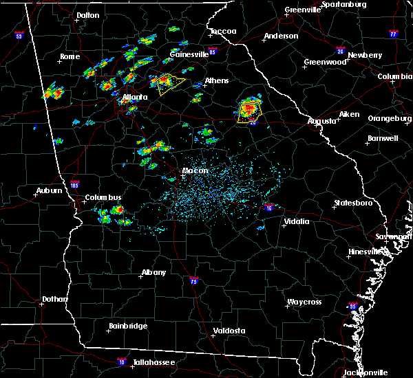 At 223 pm edt, a severe thunderstorm was located near sharon, or 7 miles northeast of crawfordville, moving south at 10 mph (radar indicated). Hazards include 60 mph wind gusts and penny size hail. Expect damage to roofs. siding and trees. other locations in the warning include but are not limited to washington, crawfordville, sharon, lyneville, lundberg, sandy cross, alexander stephens park, raytown, rocky creek fire dept. And ficklin. At 223 pm edt, a severe thunderstorm was located near sharon, or 7 miles northeast of crawfordville, moving south at 10 mph (radar indicated). Hazards include 60 mph wind gusts and penny size hail. Expect damage to roofs. siding and trees. other locations in the warning include but are not limited to washington, crawfordville, sharon, lyneville, lundberg, sandy cross, alexander stephens park, raytown, rocky creek fire dept. And ficklin.
|
| 6/18/2015 4:50 PM EDT | Em reports dozens of trees and two barns damaged near lincolnton and metasville r in wilkes county GA, 2.8 miles WNW of Washington, GA |
| 6/9/2015 2:07 PM EDT |
 At 206 pm edt, a cluster of severe thunderstorms were located near rayle, or 7 miles west of washington, moving east at 25 mph (radar indicated). Hazards include 60 mph wind gusts and quarter size hail. Hail damage to vehicles is expected. expect wind damage to roofs, siding and trees. other locations in the warning include but are not limited to washington, tignall, woodville, maxeys, rayle, stephens, lyneville, celeste, holliday park, lundberg, carters grove, newtown, metasville, aonia, floral hill, rocky creek fire dept,. Daniel springs, danburg, philomath and ficklin. At 206 pm edt, a cluster of severe thunderstorms were located near rayle, or 7 miles west of washington, moving east at 25 mph (radar indicated). Hazards include 60 mph wind gusts and quarter size hail. Hail damage to vehicles is expected. expect wind damage to roofs, siding and trees. other locations in the warning include but are not limited to washington, tignall, woodville, maxeys, rayle, stephens, lyneville, celeste, holliday park, lundberg, carters grove, newtown, metasville, aonia, floral hill, rocky creek fire dept,. Daniel springs, danburg, philomath and ficklin.
|
| 6/9/2015 1:37 PM EDT |
 At 137 pm edt, a severe thunderstorm was located near maxeys, or 7 miles south of lexington, moving east at 25 mph (radar indicated). Hazards include 60 mph wind gusts and quarter size hail. Hail damage to vehicles is expected. expect wind damage to roofs, siding and trees. other locations in the warning include but are not limited to washington, tignall, woodville, maxeys, rayle, stephens, lyneville, celeste, holliday park, lundberg, carters grove, newtown, metasville, aonia, floral hill, rocky creek fire dept,. Daniel springs, danburg, philomath and ficklin. At 137 pm edt, a severe thunderstorm was located near maxeys, or 7 miles south of lexington, moving east at 25 mph (radar indicated). Hazards include 60 mph wind gusts and quarter size hail. Hail damage to vehicles is expected. expect wind damage to roofs, siding and trees. other locations in the warning include but are not limited to washington, tignall, woodville, maxeys, rayle, stephens, lyneville, celeste, holliday park, lundberg, carters grove, newtown, metasville, aonia, floral hill, rocky creek fire dept,. Daniel springs, danburg, philomath and ficklin.
|
| 5/25/2014 8:03 PM EDT | Numerous trees and lines down throughout the county. lines down related to telephone lines in wilkes county GA, 4.2 miles NNW of Washington, GA |
| 6/18/2013 7:00 PM EDT | Numerous trees down across the southern half of the county...some on house in wilkes county GA, 0.6 miles SW of Washington, GA |
| 4/28/2013 5:05 PM EDT | One tree and several powerlines down with 15 homes without power. this was near the center of town on troke drive off hwy 4 in wilkes county GA, 0.6 miles SW of Washington, GA |
| 4/28/2013 4:55 PM EDT | Quarter sized hail reported 4.3 miles NE of Washington, GA, quarter size hail reported southwest of washington. |
| 1/1/0001 12:00 AM | Wilkes county 911 relayed a downed tree report in the sw portion of the count in wilkes county GA, 6.7 miles NNE of Washington, GA |
Hail Maps for Washington, GA


Connect with Interactive Hail Maps