

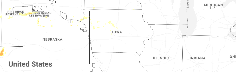
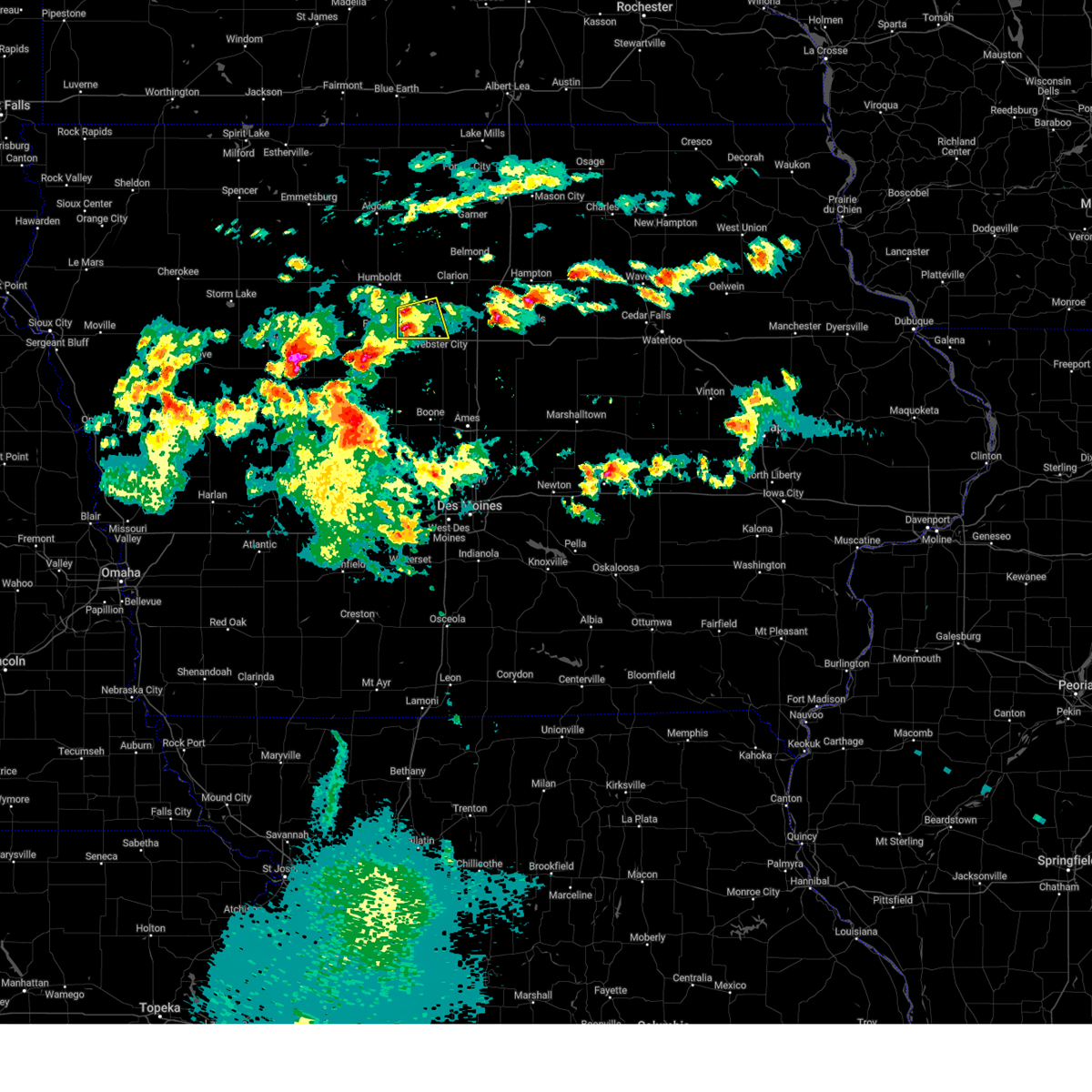
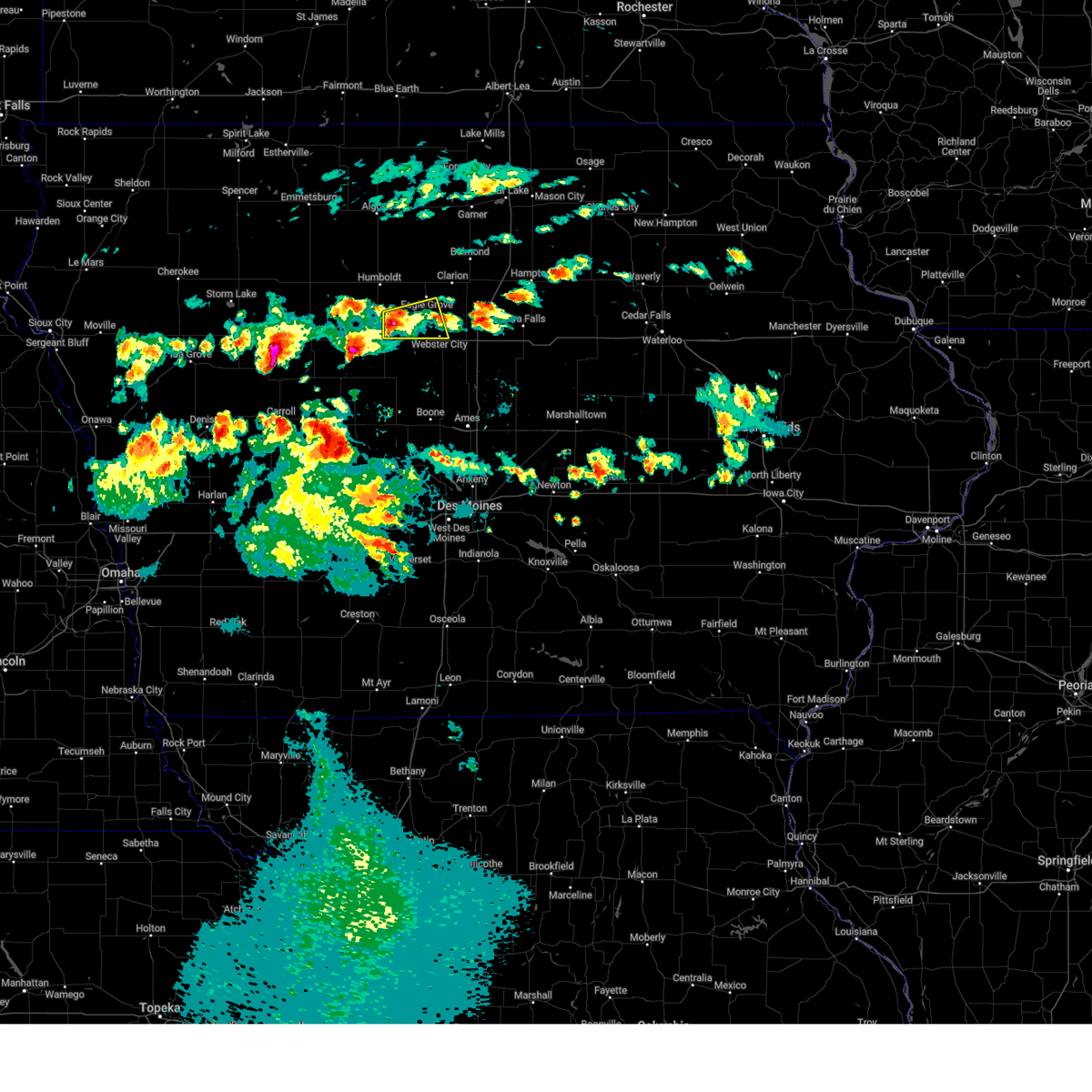
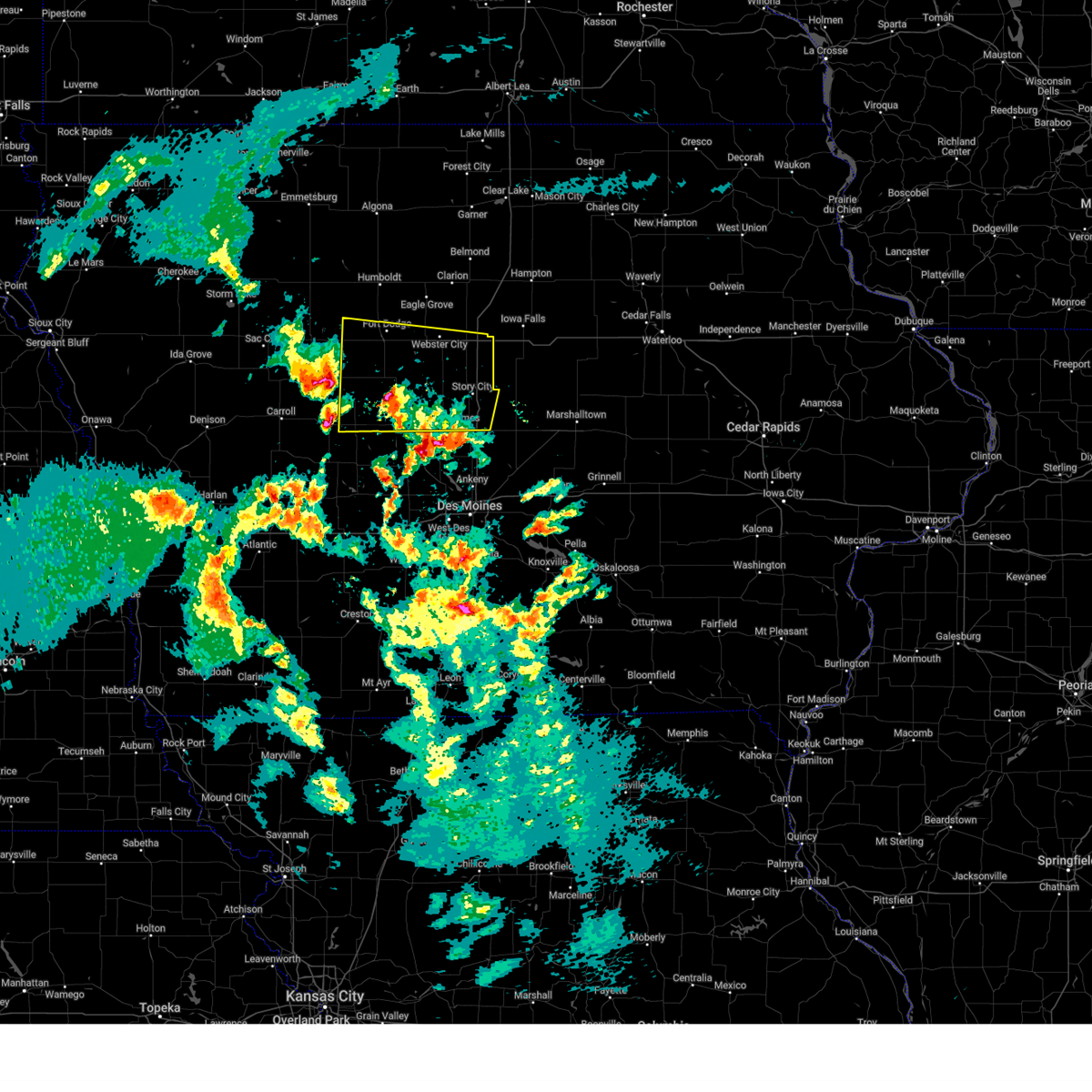
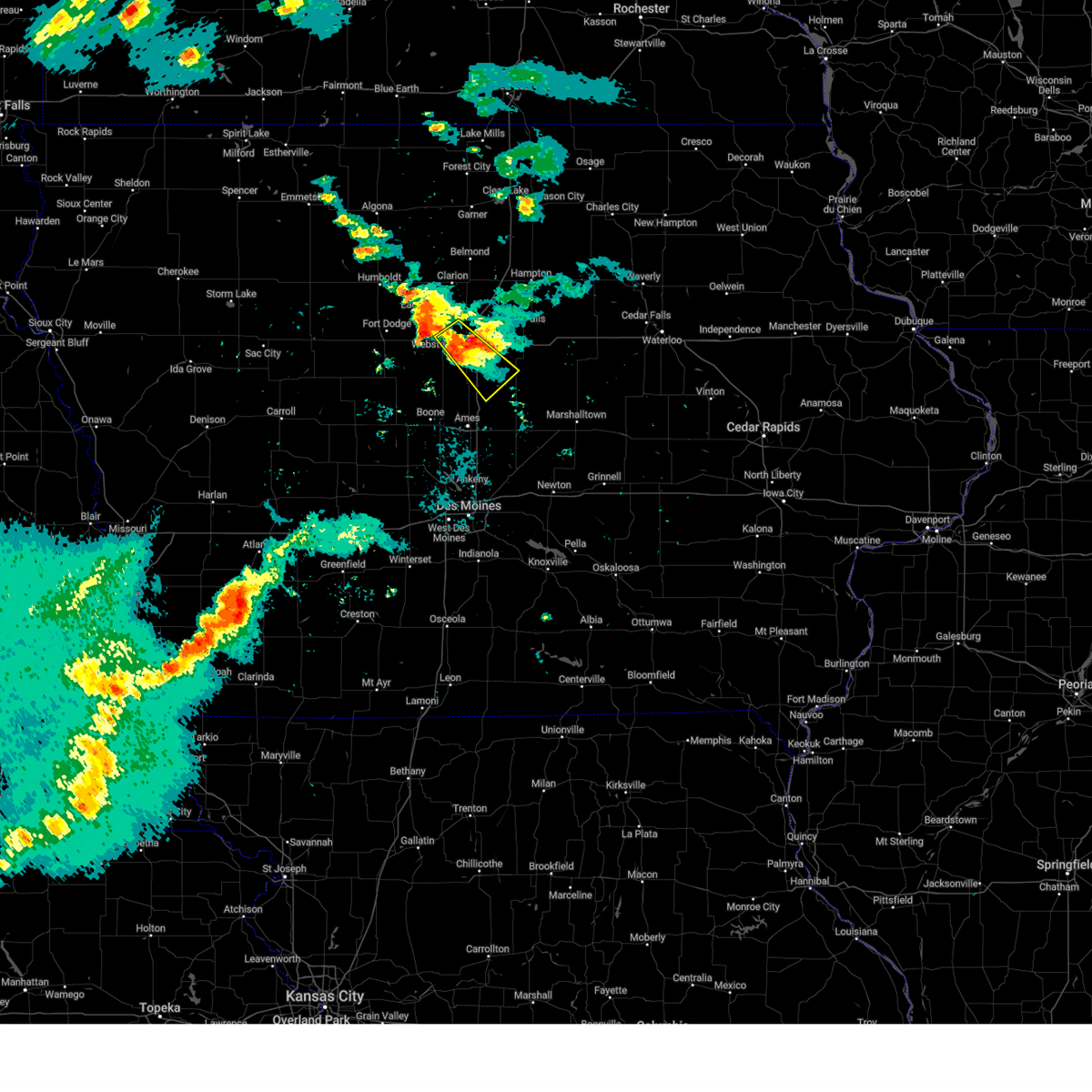
Hail Map for Webster City, IA
The Webster City, IA area has had 9 reports of on-the-ground hail by trained spotters, and has been under severe weather warnings 21 times during the past 12 months. Doppler radar has detected hail at or near Webster City, IA on 61 occasions, including 6 occasions during the past year.
| Name: | Webster City, IA |
| Where Located: | 56.5 miles SSW of Mason City, IA |
| Map: | Google Map for Webster City, IA |
| Population: | 8070 |
| Housing Units: | 3800 |
| More Info: | Search Google for Webster City, IA |
2
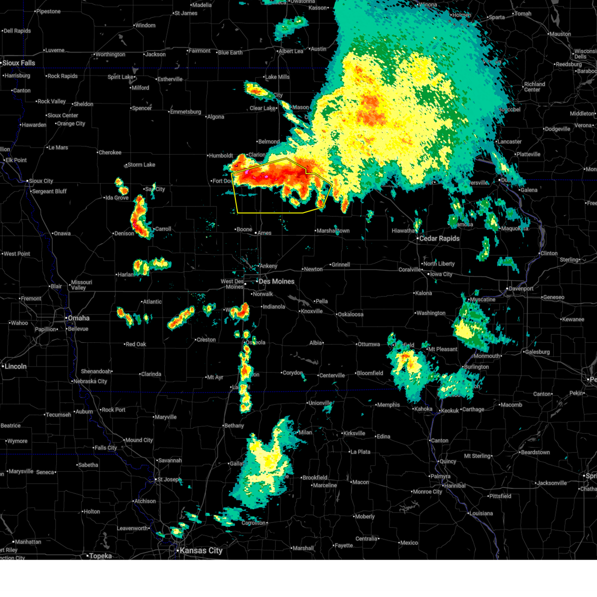
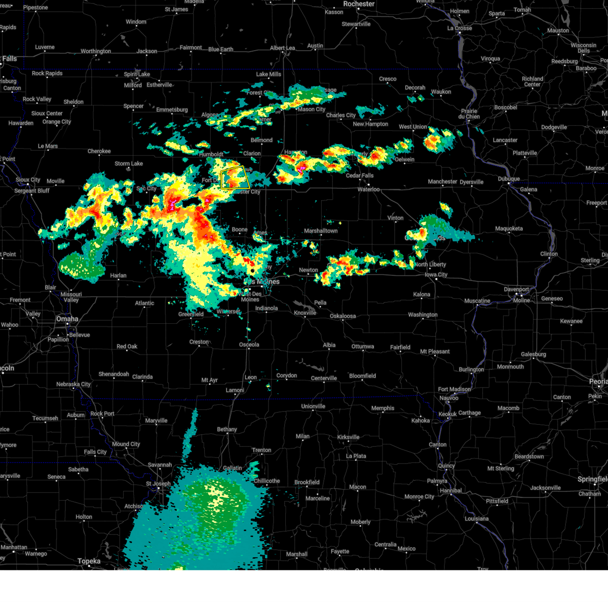
The Top Recent Hail Date for Webster City, IA is Saturday, June 14, 2025 (6th out of 61)
Hail and Wind Damage Spotted near Webster City, IA
| Date / Time | Report Details |
|---|---|
| 6/20/2025 5:02 AM CDT |
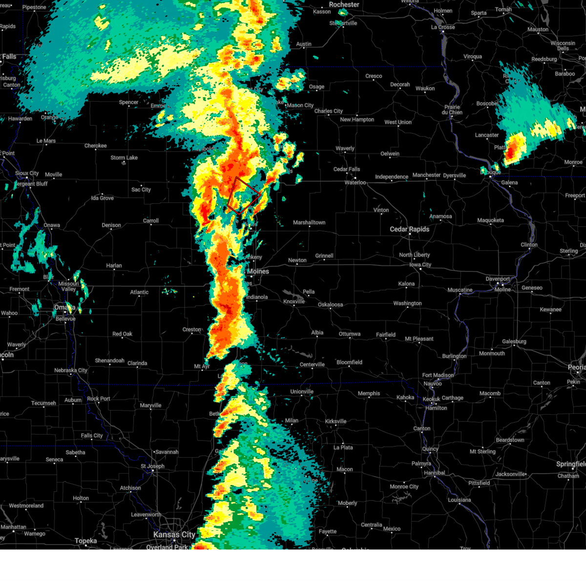
 At 502 am cdt, severe thunderstorms were located along a line extending from near ackley municipal airport to near steamboat rock to buckeye to 4 miles east of kamrar, moving southeast at 50 mph (radar indicated). Hazards include 60 mph wind gusts and penny size hail. Expect damage to roofs, siding, and trees. locations impacted include, webster city, iowa falls, eldora, grundy center, ackley, jewell junction, big wall lake, hubbard, alden, wellsburg, radcliffe, ellsworth, stanhope, union, williams, steamboat rock, holland, new providence, blairsburg, and kamrar. This includes interstate 35 between mile markers 127 and 158. At 502 am cdt, severe thunderstorms were located along a line extending from near ackley municipal airport to near steamboat rock to buckeye to 4 miles east of kamrar, moving southeast at 50 mph (radar indicated). Hazards include 60 mph wind gusts and penny size hail. Expect damage to roofs, siding, and trees. locations impacted include, webster city, iowa falls, eldora, grundy center, ackley, jewell junction, big wall lake, hubbard, alden, wellsburg, radcliffe, ellsworth, stanhope, union, williams, steamboat rock, holland, new providence, blairsburg, and kamrar. This includes interstate 35 between mile markers 127 and 158.
|
| 6/20/2025 5:02 AM CDT |
 the severe thunderstorm warning has been cancelled and is no longer in effect the severe thunderstorm warning has been cancelled and is no longer in effect
|
| 6/20/2025 4:29 AM CDT |
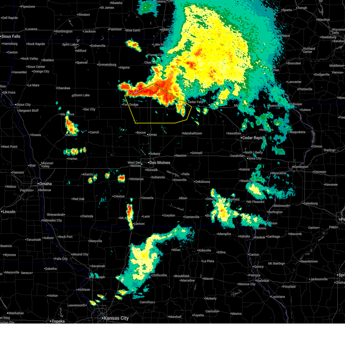 Svrdmx the national weather service in des moines has issued a * severe thunderstorm warning for, hardin county in central iowa, northeastern webster county in central iowa, southern wright county in north central iowa, southern franklin county in north central iowa, western grundy county in central iowa, hamilton county in central iowa, * until 530 am cdt. * at 428 am cdt, severe thunderstorms were located along a line extending from coulter to near dows to near big wall lake to vincent, moving southeast at 45 mph (radar indicated). Hazards include 60 mph wind gusts and penny size hail. expect damage to roofs, siding, and trees Svrdmx the national weather service in des moines has issued a * severe thunderstorm warning for, hardin county in central iowa, northeastern webster county in central iowa, southern wright county in north central iowa, southern franklin county in north central iowa, western grundy county in central iowa, hamilton county in central iowa, * until 530 am cdt. * at 428 am cdt, severe thunderstorms were located along a line extending from coulter to near dows to near big wall lake to vincent, moving southeast at 45 mph (radar indicated). Hazards include 60 mph wind gusts and penny size hail. expect damage to roofs, siding, and trees
|
| 4/23/2025 8:26 PM CDT |
 The storm which prompted the warning has weakened below severe limits, and is not expected to pose an immediate threat to life or property. therefore, the warning will be allowed to expire. however small hail and gusty winds are still likely with this thunderstorm. The storm which prompted the warning has weakened below severe limits, and is not expected to pose an immediate threat to life or property. therefore, the warning will be allowed to expire. however small hail and gusty winds are still likely with this thunderstorm.
|
| 4/23/2025 8:12 PM CDT |
 At 812 pm cdt, a severe thunderstorm was located near duncombe, or 9 miles west of webster city, moving east at 15 mph (trained weather spotters). Hazards include 60 mph wind gusts and half dollar size hail. Hail damage to vehicles is expected. expect wind damage to roofs, siding, and trees. Locations impacted include, woolstock, webster city, duncombe and sportsman park. At 812 pm cdt, a severe thunderstorm was located near duncombe, or 9 miles west of webster city, moving east at 15 mph (trained weather spotters). Hazards include 60 mph wind gusts and half dollar size hail. Hail damage to vehicles is expected. expect wind damage to roofs, siding, and trees. Locations impacted include, woolstock, webster city, duncombe and sportsman park.
|
| 4/23/2025 7:52 PM CDT |
 Svrdmx the national weather service in des moines has issued a * severe thunderstorm warning for, northeastern webster county in central iowa, southwestern wright county in north central iowa, northwestern hamilton county in central iowa, * until 830 pm cdt. * at 751 pm cdt, a severe thunderstorm was located near vincent, or 5 miles northeast of fort dodge, moving east at 15 mph (trained weather spotters). Hazards include 60 mph wind gusts and half dollar size hail. Hail damage to vehicles is expected. expect wind damage to roofs, siding, and trees. this severe thunderstorm will be near, vincent and duncombe around 755 pm cdt. Sportsman park around 800 pm cdt. Svrdmx the national weather service in des moines has issued a * severe thunderstorm warning for, northeastern webster county in central iowa, southwestern wright county in north central iowa, northwestern hamilton county in central iowa, * until 830 pm cdt. * at 751 pm cdt, a severe thunderstorm was located near vincent, or 5 miles northeast of fort dodge, moving east at 15 mph (trained weather spotters). Hazards include 60 mph wind gusts and half dollar size hail. Hail damage to vehicles is expected. expect wind damage to roofs, siding, and trees. this severe thunderstorm will be near, vincent and duncombe around 755 pm cdt. Sportsman park around 800 pm cdt.
|
| 3/14/2025 6:12 PM CDT | Storm damage reported in hamilton county IA, 3.5 miles ENE of Webster City, IA |
| 3/14/2025 6:03 PM CDT |
 At 603 pm cdt, severe thunderstorms were located along a line extending from 6 miles northeast of varina to pioneer to near fort dodge regional airport to 6 miles north of ellsworth, moving north at 55 mph (radar indicated). Hazards include 60 mph wind gusts and quarter size hail. Hail damage to vehicles is expected. expect wind damage to roofs, siding, and trees. locations impacted include, ayrshire, curlew, corwith, whittemore, pomeroy, rinard, bradgate, brushy creek st recreation area, belmond, rolfe, havelock, galt, goodell, rutland, frank a gotch state park, eagle grove municipal airport, varina, coalville, laurens, and emmetsburg. This includes interstate 35 between mile markers 131 and 154. At 603 pm cdt, severe thunderstorms were located along a line extending from 6 miles northeast of varina to pioneer to near fort dodge regional airport to 6 miles north of ellsworth, moving north at 55 mph (radar indicated). Hazards include 60 mph wind gusts and quarter size hail. Hail damage to vehicles is expected. expect wind damage to roofs, siding, and trees. locations impacted include, ayrshire, curlew, corwith, whittemore, pomeroy, rinard, bradgate, brushy creek st recreation area, belmond, rolfe, havelock, galt, goodell, rutland, frank a gotch state park, eagle grove municipal airport, varina, coalville, laurens, and emmetsburg. This includes interstate 35 between mile markers 131 and 154.
|
| 3/14/2025 5:49 PM CDT |
 Svrdmx the national weather service in des moines has issued a * severe thunderstorm warning for, webster county in central iowa, pocahontas county in northwestern iowa, wright county in north central iowa, southern kossuth county in north central iowa, calhoun county in west central iowa, humboldt county in north central iowa, southern hancock county in north central iowa, hamilton county in central iowa, palo alto county in northwestern iowa, * until 645 pm cdt. * at 549 pm cdt, severe thunderstorms were located along a line extending from fonda to near knierim to near otho to randall, moving north at 55 mph (radar indicated). Hazards include 60 mph wind gusts and quarter size hail. Hail damage to vehicles is expected. Expect wind damage to roofs, siding, and trees. Svrdmx the national weather service in des moines has issued a * severe thunderstorm warning for, webster county in central iowa, pocahontas county in northwestern iowa, wright county in north central iowa, southern kossuth county in north central iowa, calhoun county in west central iowa, humboldt county in north central iowa, southern hancock county in north central iowa, hamilton county in central iowa, palo alto county in northwestern iowa, * until 645 pm cdt. * at 549 pm cdt, severe thunderstorms were located along a line extending from fonda to near knierim to near otho to randall, moving north at 55 mph (radar indicated). Hazards include 60 mph wind gusts and quarter size hail. Hail damage to vehicles is expected. Expect wind damage to roofs, siding, and trees.
|
| 3/14/2025 5:28 PM CDT |
 Svrdmx the national weather service in des moines has issued a * severe thunderstorm warning for, northwestern story county in central iowa, northeastern greene county in west central iowa, webster county in central iowa, eastern calhoun county in west central iowa, hamilton county in central iowa, northern boone county in central iowa, * until 615 pm cdt. * at 527 pm cdt, severe thunderstorms were located along a line extending from near scranton to grand junction to kelley, moving north at 50 mph (radar indicated). Hazards include 60 mph wind gusts and quarter size hail. Hail damage to vehicles is expected. Expect wind damage to roofs, siding, and trees. Svrdmx the national weather service in des moines has issued a * severe thunderstorm warning for, northwestern story county in central iowa, northeastern greene county in west central iowa, webster county in central iowa, eastern calhoun county in west central iowa, hamilton county in central iowa, northern boone county in central iowa, * until 615 pm cdt. * at 527 pm cdt, severe thunderstorms were located along a line extending from near scranton to grand junction to kelley, moving north at 50 mph (radar indicated). Hazards include 60 mph wind gusts and quarter size hail. Hail damage to vehicles is expected. Expect wind damage to roofs, siding, and trees.
|
| 7/30/2024 1:56 AM CDT | At 156 am cdt, severe thunderstorms were located along a line extending from barnum to near harcourt to beaver to dawson to near panora, moving east at 50 mph (radar indicated). Hazards include 60 mph wind gusts. Expect damage to roofs, siding, and trees. these severe storms will be near, fort dodge, perry, ogden, dayton, redfield, coalville, otho and lehigh around 200 am cdt. Other locations in the path of these severe thunderstorms include boone, dallas center, woodward, minburn, fraser, ledges state park, brushy creek st recreation area, adel, de soto, boone speedway, stratford, duncombe, luther, boone municipal airport, urbandale, clive, waukee, grimes, madrid, granger, van meter, saylorville lake, west des moines, johnston, polk city, big creek lake, stanhope, sheldahl, webster city municipal airport, webster city and jordan creek town center. |
| 7/30/2024 1:43 AM CDT | Svrdmx the national weather service in des moines has issued a * severe thunderstorm warning for, northwestern polk county in central iowa, greene county in west central iowa, webster county in central iowa, guthrie county in west central iowa, southeastern pocahontas county in northwestern iowa, northeastern audubon county in west central iowa, calhoun county in west central iowa, southwestern hamilton county in central iowa, eastern carroll county in west central iowa, boone county in central iowa, dallas county in central iowa, * until 230 am cdt. * at 142 am cdt, severe thunderstorms were located along a line extending from near manson to somers to 5 miles west of dana to 4 miles northeast of bagley to near guthrie center, moving east at 50 mph (radar indicated). Hazards include 60 mph wind gusts. Expect damage to roofs, siding, and trees. severe thunderstorms will be near, panora, gowrie, lake panorama, grand junction, callender, harcourt, rippey and yale around 150 am cdt. fort dodge, perry, ogden, dayton, otho, boxholm and berkley around 155 am cdt. fort dodge regional airport, redfield, coalville, lehigh, diamondhead lake, minburn, pilot mound and bouton around 200 am cdt. Other locations in the path of these severe thunderstorms include boone, adel, dallas center, woodward, stratford, ledges state park, brushy creek st recreation area, madrid, de soto, boone speedway, duncombe, luther, boone municipal airport, urbandale, clive, waukee, grimes, granger, van meter, saylorville lake, big creek lake and stanhope. |
| 7/6/2024 8:12 PM CDT |
 Svrdmx the national weather service in des moines has issued a * severe thunderstorm warning for, north central story county in central iowa, southwestern hardin county in central iowa, hamilton county in central iowa, * until 900 pm cdt. * at 812 pm cdt, a severe thunderstorm was located over webster city, moving southeast at 30 mph (radar indicated). Hazards include 60 mph wind gusts and quarter size hail. Hail damage to vehicles is expected. Expect wind damage to roofs, siding, and trees. Svrdmx the national weather service in des moines has issued a * severe thunderstorm warning for, north central story county in central iowa, southwestern hardin county in central iowa, hamilton county in central iowa, * until 900 pm cdt. * at 812 pm cdt, a severe thunderstorm was located over webster city, moving southeast at 30 mph (radar indicated). Hazards include 60 mph wind gusts and quarter size hail. Hail damage to vehicles is expected. Expect wind damage to roofs, siding, and trees.
|
| 7/6/2024 8:05 PM CDT |
 the severe thunderstorm warning has been cancelled and is no longer in effect the severe thunderstorm warning has been cancelled and is no longer in effect
|
| 7/6/2024 8:05 PM CDT |
 At 805 pm cdt, a severe thunderstorm was located over kamrar, or 7 miles southeast of webster city, moving northeast at 20 mph (radar indicated). Hazards include 60 mph wind gusts and quarter size hail. Hail damage to vehicles is expected. expect wind damage to roofs, siding, and trees. locations impacted include, webster city, roland, jewell junction, hubbard, radcliffe, ellsworth, blairsburg, kamrar, randall, garden city, and drake airport. This includes interstate 35 between mile markers 127 and 144. At 805 pm cdt, a severe thunderstorm was located over kamrar, or 7 miles southeast of webster city, moving northeast at 20 mph (radar indicated). Hazards include 60 mph wind gusts and quarter size hail. Hail damage to vehicles is expected. expect wind damage to roofs, siding, and trees. locations impacted include, webster city, roland, jewell junction, hubbard, radcliffe, ellsworth, blairsburg, kamrar, randall, garden city, and drake airport. This includes interstate 35 between mile markers 127 and 144.
|
| 7/6/2024 7:38 PM CDT |
 At 737 pm cdt, a severe thunderstorm was located over blairsburg, or 7 miles east of webster city, moving southeast at 25 mph (radar indicated). Hazards include 60 mph wind gusts and quarter size hail. Hail damage to vehicles is expected. expect wind damage to roofs, siding, and trees. locations impacted include, webster city, roland, jewell junction, hubbard, radcliffe, ellsworth, williams, blairsburg, kamrar, randall, buckeye, garden city, and drake airport. This includes interstate 35 between mile markers 127 and 149. At 737 pm cdt, a severe thunderstorm was located over blairsburg, or 7 miles east of webster city, moving southeast at 25 mph (radar indicated). Hazards include 60 mph wind gusts and quarter size hail. Hail damage to vehicles is expected. expect wind damage to roofs, siding, and trees. locations impacted include, webster city, roland, jewell junction, hubbard, radcliffe, ellsworth, williams, blairsburg, kamrar, randall, buckeye, garden city, and drake airport. This includes interstate 35 between mile markers 127 and 149.
|
| 7/6/2024 7:30 PM CDT |
 The storm which prompted the warning has moved out of the area. therefore, the warning will be allowed to expire. remember, a severe thunderstorm warning still remains in effect for portions of hardin, story, wright, and hamilton counties. The storm which prompted the warning has moved out of the area. therefore, the warning will be allowed to expire. remember, a severe thunderstorm warning still remains in effect for portions of hardin, story, wright, and hamilton counties.
|
| 7/6/2024 7:27 PM CDT |
 Svrdmx the national weather service in des moines has issued a * severe thunderstorm warning for, north central story county in central iowa, southwestern hardin county in central iowa, south central wright county in north central iowa, eastern hamilton county in central iowa, * until 815 pm cdt. * at 727 pm cdt, a severe thunderstorm was located over blairsburg, or 6 miles east of webster city, moving southeast at 30 mph (trained weather spotters reported ping pong ball sized hail in eagle grove). Hazards include golf ball size hail and 60 mph wind gusts. People and animals outdoors will be injured. expect hail damage to roofs, siding, windows, and vehicles. Expect wind damage to roofs, siding, and trees. Svrdmx the national weather service in des moines has issued a * severe thunderstorm warning for, north central story county in central iowa, southwestern hardin county in central iowa, south central wright county in north central iowa, eastern hamilton county in central iowa, * until 815 pm cdt. * at 727 pm cdt, a severe thunderstorm was located over blairsburg, or 6 miles east of webster city, moving southeast at 30 mph (trained weather spotters reported ping pong ball sized hail in eagle grove). Hazards include golf ball size hail and 60 mph wind gusts. People and animals outdoors will be injured. expect hail damage to roofs, siding, windows, and vehicles. Expect wind damage to roofs, siding, and trees.
|
| 7/6/2024 7:11 PM CDT | Half Dollar sized hail reported 6.1 miles S of Webster City, IA |
| 7/6/2024 7:06 PM CDT |
 At 705 pm cdt, a severe thunderstorm was located near woolstock, or 8 miles north of webster city, moving southeast at 30 mph (radar indicated). Hazards include two inch hail and 60 mph wind gusts. People and animals outdoors will be injured. expect hail damage to roofs, siding, windows, and vehicles. expect wind damage to roofs, siding, and trees. locations impacted include, webster city, clarion, big wall lake, dows, blairsburg, kamrar, woolstock, popejoy, galt, and clarion municipal airport. This includes interstate 35 between mile markers 147 and 158. At 705 pm cdt, a severe thunderstorm was located near woolstock, or 8 miles north of webster city, moving southeast at 30 mph (radar indicated). Hazards include two inch hail and 60 mph wind gusts. People and animals outdoors will be injured. expect hail damage to roofs, siding, windows, and vehicles. expect wind damage to roofs, siding, and trees. locations impacted include, webster city, clarion, big wall lake, dows, blairsburg, kamrar, woolstock, popejoy, galt, and clarion municipal airport. This includes interstate 35 between mile markers 147 and 158.
|
| 7/6/2024 7:06 PM CDT |
 the severe thunderstorm warning has been cancelled and is no longer in effect the severe thunderstorm warning has been cancelled and is no longer in effect
|
| 7/6/2024 6:57 PM CDT |
 At 656 pm cdt, a severe thunderstorm was located near woolstock, or 10 miles southwest of clarion, moving southeast at 30 mph (radar indicated). Hazards include golf ball size hail and 60 mph wind gusts. People and animals outdoors will be injured. expect hail damage to roofs, siding, windows, and vehicles. expect wind damage to roofs, siding, and trees. locations impacted include, webster city, clarion, eagle grove, big wall lake, dows, blairsburg, kamrar, vincent, woolstock, popejoy, galt, clarion municipal airport, and sportsman park. This includes interstate 35 between mile markers 147 and 158. At 656 pm cdt, a severe thunderstorm was located near woolstock, or 10 miles southwest of clarion, moving southeast at 30 mph (radar indicated). Hazards include golf ball size hail and 60 mph wind gusts. People and animals outdoors will be injured. expect hail damage to roofs, siding, windows, and vehicles. expect wind damage to roofs, siding, and trees. locations impacted include, webster city, clarion, eagle grove, big wall lake, dows, blairsburg, kamrar, vincent, woolstock, popejoy, galt, clarion municipal airport, and sportsman park. This includes interstate 35 between mile markers 147 and 158.
|
| 7/6/2024 6:46 PM CDT |
 Svrdmx the national weather service in des moines has issued a * severe thunderstorm warning for, northeastern webster county in central iowa, southwestern franklin county in north central iowa, southern wright county in north central iowa, southeastern humboldt county in north central iowa, northern hamilton county in central iowa, * until 730 pm cdt. * at 645 pm cdt, a severe thunderstorm was located over eagle grove municipal airport, or 10 miles west of clarion, moving southeast at 30 mph (radar indicated). Hazards include 60 mph wind gusts and half dollar size hail. Hail damage to vehicles is expected. Expect wind damage to roofs, siding, and trees. Svrdmx the national weather service in des moines has issued a * severe thunderstorm warning for, northeastern webster county in central iowa, southwestern franklin county in north central iowa, southern wright county in north central iowa, southeastern humboldt county in north central iowa, northern hamilton county in central iowa, * until 730 pm cdt. * at 645 pm cdt, a severe thunderstorm was located over eagle grove municipal airport, or 10 miles west of clarion, moving southeast at 30 mph (radar indicated). Hazards include 60 mph wind gusts and half dollar size hail. Hail damage to vehicles is expected. Expect wind damage to roofs, siding, and trees.
|
| 5/24/2024 5:38 AM CDT | Large tree branches down. power outages. semi crashes due to wind along i-3 in hamilton county IA, 0.6 miles ENE of Webster City, IA |
| 5/24/2024 5:18 AM CDT |
 Svrdmx the national weather service in des moines has issued a * severe thunderstorm warning for, northwestern poweshiek county in central iowa, eastern polk county in central iowa, story county in central iowa, marshall county in central iowa, hardin county in central iowa, western tama county in central iowa, wright county in north central iowa, franklin county in north central iowa, grundy county in central iowa, western butler county in north central iowa, northern jasper county in central iowa, hamilton county in central iowa, * until 615 am cdt. * at 517 am cdt, severe thunderstorms were located along a line extending from 4 miles northwest of big wall lake to near mccallsburg to near mingo, moving east at 45 mph (radar indicated). Hazards include 60 mph wind gusts and quarter size hail. Hail damage to vehicles is expected. Expect wind damage to roofs, siding, and trees. Svrdmx the national weather service in des moines has issued a * severe thunderstorm warning for, northwestern poweshiek county in central iowa, eastern polk county in central iowa, story county in central iowa, marshall county in central iowa, hardin county in central iowa, western tama county in central iowa, wright county in north central iowa, franklin county in north central iowa, grundy county in central iowa, western butler county in north central iowa, northern jasper county in central iowa, hamilton county in central iowa, * until 615 am cdt. * at 517 am cdt, severe thunderstorms were located along a line extending from 4 miles northwest of big wall lake to near mccallsburg to near mingo, moving east at 45 mph (radar indicated). Hazards include 60 mph wind gusts and quarter size hail. Hail damage to vehicles is expected. Expect wind damage to roofs, siding, and trees.
|
| 5/24/2024 5:13 AM CDT | Storm damage reported in hamilton county IA, 1.6 miles E of Webster City, IA |
| 5/24/2024 5:06 AM CDT |
 At 506 am cdt, severe thunderstorms were located along a line extending from near woolstock to 4 miles east of gilbert to adventureland amusement park, moving east at 55 mph (trained weather spotters). Hazards include 60 mph wind gusts and penny size hail. Expect damage to roofs, siding, and trees. locations impacted include, des moines, ames, west des moines, ankeny, urbandale, fort dodge, johnston, clive, altoona, waukee, boone, norwalk, pleasant hill, grimes, webster city, nevada, clarion, windsor heights, carlisle, and bondurant. this includes the following highways, interstate 35 between mile markers 66 and 72, and between mile markers 87 and 152. interstate 80 between mile markers 117 and 156. Interstate 235 between mile markers 1 and 14. At 506 am cdt, severe thunderstorms were located along a line extending from near woolstock to 4 miles east of gilbert to adventureland amusement park, moving east at 55 mph (trained weather spotters). Hazards include 60 mph wind gusts and penny size hail. Expect damage to roofs, siding, and trees. locations impacted include, des moines, ames, west des moines, ankeny, urbandale, fort dodge, johnston, clive, altoona, waukee, boone, norwalk, pleasant hill, grimes, webster city, nevada, clarion, windsor heights, carlisle, and bondurant. this includes the following highways, interstate 35 between mile markers 66 and 72, and between mile markers 87 and 152. interstate 80 between mile markers 117 and 156. Interstate 235 between mile markers 1 and 14.
|
| 5/24/2024 5:06 AM CDT |
 the severe thunderstorm warning has been cancelled and is no longer in effect the severe thunderstorm warning has been cancelled and is no longer in effect
|
| 5/24/2024 4:40 AM CDT |
 Svrdmx the national weather service in des moines has issued a * severe thunderstorm warning for, polk county in central iowa, story county in central iowa, northern madison county in south central iowa, webster county in central iowa, southern wright county in north central iowa, western jasper county in central iowa, boone county in central iowa, hamilton county in central iowa, northern warren county in south central iowa, eastern greene county in west central iowa, southwestern hardin county in central iowa, northeastern calhoun county in west central iowa, southeastern humboldt county in north central iowa, dallas county in central iowa, * until 530 am cdt. * at 439 am cdt, severe thunderstorms were located along a line extending from lizard creek state recreation area to near ogden to near waukee, moving east at 55 mph (trained weather spotters). Hazards include 60 mph wind gusts and penny size hail. expect damage to roofs, siding, and trees Svrdmx the national weather service in des moines has issued a * severe thunderstorm warning for, polk county in central iowa, story county in central iowa, northern madison county in south central iowa, webster county in central iowa, southern wright county in north central iowa, western jasper county in central iowa, boone county in central iowa, hamilton county in central iowa, northern warren county in south central iowa, eastern greene county in west central iowa, southwestern hardin county in central iowa, northeastern calhoun county in west central iowa, southeastern humboldt county in north central iowa, dallas county in central iowa, * until 530 am cdt. * at 439 am cdt, severe thunderstorms were located along a line extending from lizard creek state recreation area to near ogden to near waukee, moving east at 55 mph (trained weather spotters). Hazards include 60 mph wind gusts and penny size hail. expect damage to roofs, siding, and trees
|
| 5/21/2024 4:37 PM CDT | Power outage and limbs dow in hamilton county IA, 1.7 miles ESE of Webster City, IA |
| 5/21/2024 4:25 PM CDT |
 Svrdmx the national weather service in des moines has issued a * severe thunderstorm warning for, northern story county in central iowa, northwestern marshall county in central iowa, hardin county in central iowa, southeastern wright county in north central iowa, southern franklin county in north central iowa, southwestern grundy county in central iowa, northeastern boone county in central iowa, hamilton county in central iowa, * until 515 pm cdt. * at 425 pm cdt, a severe thunderstorm was located near big wall lake, or 11 miles southeast of clarion, moving northeast at 60 mph (radar indicated). Hazards include 60 mph wind gusts and quarter size hail. Hail damage to vehicles is expected. Expect wind damage to roofs, siding, and trees. Svrdmx the national weather service in des moines has issued a * severe thunderstorm warning for, northern story county in central iowa, northwestern marshall county in central iowa, hardin county in central iowa, southeastern wright county in north central iowa, southern franklin county in north central iowa, southwestern grundy county in central iowa, northeastern boone county in central iowa, hamilton county in central iowa, * until 515 pm cdt. * at 425 pm cdt, a severe thunderstorm was located near big wall lake, or 11 miles southeast of clarion, moving northeast at 60 mph (radar indicated). Hazards include 60 mph wind gusts and quarter size hail. Hail damage to vehicles is expected. Expect wind damage to roofs, siding, and trees.
|
| 5/21/2024 4:21 PM CDT |
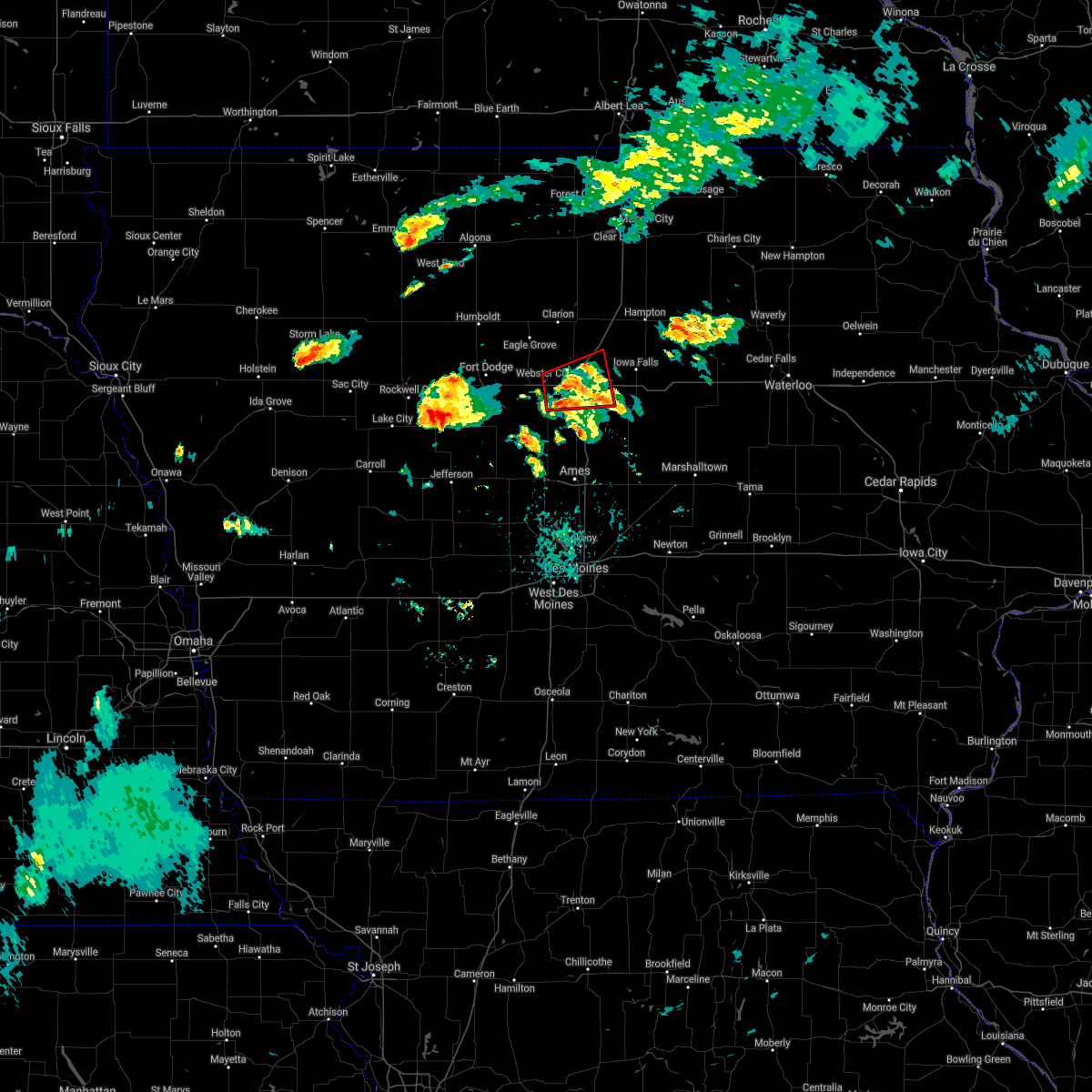
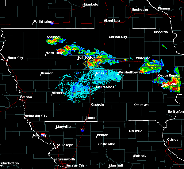
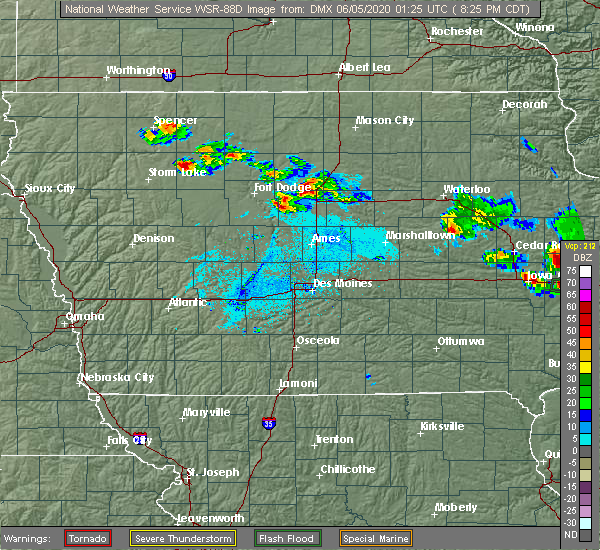
 At 421 pm cdt, a severe thunderstorm capable of producing a tornado was located over stanhope, or 14 miles south of webster city, moving northeast at 35 mph (radar indicated rotation). Hazards include tornado and quarter size hail. Flying debris will be dangerous to those caught without shelter. mobile homes will be damaged or destroyed. damage to roofs, windows, and vehicles will occur. tree damage is likely. this dangerous storm will be near, jewell junction around 425 pm cdt. ellsworth around 430 pm cdt. other locations impacted by this tornadic thunderstorm include ellsworth, kamrar, and stanhope. This includes interstate 35 between mile markers 133 and 137. At 421 pm cdt, a severe thunderstorm capable of producing a tornado was located over stanhope, or 14 miles south of webster city, moving northeast at 35 mph (radar indicated rotation). Hazards include tornado and quarter size hail. Flying debris will be dangerous to those caught without shelter. mobile homes will be damaged or destroyed. damage to roofs, windows, and vehicles will occur. tree damage is likely. this dangerous storm will be near, jewell junction around 425 pm cdt. ellsworth around 430 pm cdt. other locations impacted by this tornadic thunderstorm include ellsworth, kamrar, and stanhope. This includes interstate 35 between mile markers 133 and 137.
|
| 5/21/2024 4:21 PM CDT |
 the tornado warning has been cancelled and is no longer in effect the tornado warning has been cancelled and is no longer in effect
|
| 5/21/2024 4:03 PM CDT |
 Tordmx the national weather service in des moines has issued a * tornado warning for, southeastern webster county in central iowa, northwestern boone county in central iowa, southwestern hamilton county in central iowa, * until 445 pm cdt. * at 403 pm cdt, a severe thunderstorm capable of producing a tornado was located over pilot mound, or 8 miles northwest of boone, moving northeast at 30 mph (radar indicated rotation). Hazards include tornado and quarter size hail. Flying debris will be dangerous to those caught without shelter. mobile homes will be damaged or destroyed. damage to roofs, windows, and vehicles will occur. tree damage is likely. this dangerous storm will be near, stratford around 410 pm cdt. stanhope around 420 pm cdt. kamrar around 435 pm cdt. other locations impacted by this tornadic thunderstorm include ellsworth, stanhope, webster city municipal airport, pilot mound, stratford, kamrar, and fraser. This includes interstate 35 between mile markers 133 and 137. Tordmx the national weather service in des moines has issued a * tornado warning for, southeastern webster county in central iowa, northwestern boone county in central iowa, southwestern hamilton county in central iowa, * until 445 pm cdt. * at 403 pm cdt, a severe thunderstorm capable of producing a tornado was located over pilot mound, or 8 miles northwest of boone, moving northeast at 30 mph (radar indicated rotation). Hazards include tornado and quarter size hail. Flying debris will be dangerous to those caught without shelter. mobile homes will be damaged or destroyed. damage to roofs, windows, and vehicles will occur. tree damage is likely. this dangerous storm will be near, stratford around 410 pm cdt. stanhope around 420 pm cdt. kamrar around 435 pm cdt. other locations impacted by this tornadic thunderstorm include ellsworth, stanhope, webster city municipal airport, pilot mound, stratford, kamrar, and fraser. This includes interstate 35 between mile markers 133 and 137.
|
| 5/21/2024 3:47 PM CDT |
 At 346 pm cdt, a severe thunderstorm was located near dolliver memorial state park, or 10 miles south of fort dodge, moving northeast at 70 mph (trained weather spotters). Hazards include 70 mph wind gusts and quarter size hail. Hail damage to vehicles is expected. expect considerable tree damage. wind damage is also likely to mobile homes, roofs, and outbuildings. locations impacted include, fort dodge, webster city, eagle grove, gowrie, big wall lake, dayton, stratford, coalville, otho, stanhope, lehigh, duncombe, callender, williams, harcourt, paton, blairsburg, kamrar, boxholm, and vincent. This includes interstate 35 between mile markers 139 and 147. At 346 pm cdt, a severe thunderstorm was located near dolliver memorial state park, or 10 miles south of fort dodge, moving northeast at 70 mph (trained weather spotters). Hazards include 70 mph wind gusts and quarter size hail. Hail damage to vehicles is expected. expect considerable tree damage. wind damage is also likely to mobile homes, roofs, and outbuildings. locations impacted include, fort dodge, webster city, eagle grove, gowrie, big wall lake, dayton, stratford, coalville, otho, stanhope, lehigh, duncombe, callender, williams, harcourt, paton, blairsburg, kamrar, boxholm, and vincent. This includes interstate 35 between mile markers 139 and 147.
|
| 5/21/2024 3:31 PM CDT |
 Svrdmx the national weather service in des moines has issued a * severe thunderstorm warning for, northeastern greene county in west central iowa, webster county in central iowa, southwestern wright county in north central iowa, northwestern boone county in central iowa, hamilton county in central iowa, * until 415 pm cdt. * at 330 pm cdt, a severe thunderstorm was located near churdan, or 13 miles north of jefferson, moving northeast at 65 mph. this is a destructive storm! (trained weather spotters). Hazards include 80 mph wind gusts and quarter size hail. Flying debris will be dangerous to those caught without shelter. mobile homes will be heavily damaged. expect considerable damage to roofs, windows, and vehicles. Extensive tree damage and power outages are likely. Svrdmx the national weather service in des moines has issued a * severe thunderstorm warning for, northeastern greene county in west central iowa, webster county in central iowa, southwestern wright county in north central iowa, northwestern boone county in central iowa, hamilton county in central iowa, * until 415 pm cdt. * at 330 pm cdt, a severe thunderstorm was located near churdan, or 13 miles north of jefferson, moving northeast at 65 mph. this is a destructive storm! (trained weather spotters). Hazards include 80 mph wind gusts and quarter size hail. Flying debris will be dangerous to those caught without shelter. mobile homes will be heavily damaged. expect considerable damage to roofs, windows, and vehicles. Extensive tree damage and power outages are likely.
|
| 5/8/2024 7:01 PM CDT |
 The storm which prompted the warning has moved out of the western portion of the warned area. therefore, the warning will be allowed to expire. remember, a severe thunderstorm warning still remains in effect for eastern boone and southern hamilton counties. The storm which prompted the warning has moved out of the western portion of the warned area. therefore, the warning will be allowed to expire. remember, a severe thunderstorm warning still remains in effect for eastern boone and southern hamilton counties.
|
| 5/8/2024 6:50 PM CDT |
 At 649 pm cdt, a severe thunderstorm was located near jewell junction, or 10 miles southeast of webster city, moving northeast at 40 mph (law enforcement). Hazards include 60 mph wind gusts and quarter size hail. Hail damage to vehicles is expected. expect wind damage to roofs, siding, and trees. locations impacted include, webster city, jewell junction, dayton, stratford, ellsworth, stanhope, lehigh, duncombe, kamrar, randall, brushy creek st recreation area, and webster city municipal airport. This includes interstate 35 between mile markers 129 and 134. At 649 pm cdt, a severe thunderstorm was located near jewell junction, or 10 miles southeast of webster city, moving northeast at 40 mph (law enforcement). Hazards include 60 mph wind gusts and quarter size hail. Hail damage to vehicles is expected. expect wind damage to roofs, siding, and trees. locations impacted include, webster city, jewell junction, dayton, stratford, ellsworth, stanhope, lehigh, duncombe, kamrar, randall, brushy creek st recreation area, and webster city municipal airport. This includes interstate 35 between mile markers 129 and 134.
|
| 5/8/2024 6:33 PM CDT |
 At 633 pm cdt, a severe thunderstorm was located 5 miles south of stanhope, or 11 miles north of boone, moving northeast at 40 mph (law enforcement). Hazards include 60 mph wind gusts and quarter size hail. Hail damage to vehicles is expected. expect wind damage to roofs, siding, and trees. locations impacted include, boone, webster city, jewell junction, boone speedway, dayton, stratford, ellsworth, stanhope, lehigh, duncombe, kamrar, boxholm, pilot mound, randall, fraser, boone municipal airport, brushy creek st recreation area, and webster city municipal airport. This includes interstate 35 between mile markers 129 and 134. At 633 pm cdt, a severe thunderstorm was located 5 miles south of stanhope, or 11 miles north of boone, moving northeast at 40 mph (law enforcement). Hazards include 60 mph wind gusts and quarter size hail. Hail damage to vehicles is expected. expect wind damage to roofs, siding, and trees. locations impacted include, boone, webster city, jewell junction, boone speedway, dayton, stratford, ellsworth, stanhope, lehigh, duncombe, kamrar, boxholm, pilot mound, randall, fraser, boone municipal airport, brushy creek st recreation area, and webster city municipal airport. This includes interstate 35 between mile markers 129 and 134.
|
| 5/8/2024 6:33 PM CDT |
 the severe thunderstorm warning has been cancelled and is no longer in effect the severe thunderstorm warning has been cancelled and is no longer in effect
|
| 5/8/2024 6:18 PM CDT |
 At 617 pm cdt, a severe thunderstorm was located over fraser, or 5 miles northwest of boone, moving northeast at 40 mph (law enforcement). Hazards include 60 mph wind gusts and quarter size hail. Hail damage to vehicles is expected. expect wind damage to roofs, siding, and trees. locations impacted include, boone, webster city, ogden, jewell junction, boone speedway, dayton, grand junction, stratford, ellsworth, stanhope, lehigh, duncombe, harcourt, paton, kamrar, boxholm, pilot mound, randall, fraser, and dana. This includes interstate 35 between mile markers 129 and 134. At 617 pm cdt, a severe thunderstorm was located over fraser, or 5 miles northwest of boone, moving northeast at 40 mph (law enforcement). Hazards include 60 mph wind gusts and quarter size hail. Hail damage to vehicles is expected. expect wind damage to roofs, siding, and trees. locations impacted include, boone, webster city, ogden, jewell junction, boone speedway, dayton, grand junction, stratford, ellsworth, stanhope, lehigh, duncombe, harcourt, paton, kamrar, boxholm, pilot mound, randall, fraser, and dana. This includes interstate 35 between mile markers 129 and 134.
|
| 5/8/2024 6:13 PM CDT |
 Svrdmx the national weather service in des moines has issued a * severe thunderstorm warning for, northeastern greene county in west central iowa, southeastern webster county in central iowa, boone county in central iowa, southwestern hamilton county in central iowa, * until 700 pm cdt. * at 612 pm cdt, a severe thunderstorm was located over ogden, or 6 miles west of boone, moving northeast at 40 mph (radar indicated). Hazards include 60 mph wind gusts and penny size hail. expect damage to roofs, siding, and trees Svrdmx the national weather service in des moines has issued a * severe thunderstorm warning for, northeastern greene county in west central iowa, southeastern webster county in central iowa, boone county in central iowa, southwestern hamilton county in central iowa, * until 700 pm cdt. * at 612 pm cdt, a severe thunderstorm was located over ogden, or 6 miles west of boone, moving northeast at 40 mph (radar indicated). Hazards include 60 mph wind gusts and penny size hail. expect damage to roofs, siding, and trees
|
| 4/16/2024 12:19 PM CDT |
 the severe thunderstorm warning has been cancelled and is no longer in effect the severe thunderstorm warning has been cancelled and is no longer in effect
|
| 4/16/2024 12:19 PM CDT |
 At 1218 pm cdt, severe thunderstorms were located along a line extending from 5 miles west of kanawha to 4 miles southeast of big wall lake to near drake airport to near zearing, moving northeast at 50 mph (radar indicated). Hazards include 60 mph wind gusts. Expect damage to roofs, siding, and trees. locations impacted include, ames, webster city, nevada, iowa falls, clarion, eldora, eagle grove, story city, huxley, belmond, roland, jewell junction, gilbert, elm lake, iowa state center, big wall lake, maxwell, colo, hubbard, and cambridge. This includes interstate 35 between mile markers 98 and 171. At 1218 pm cdt, severe thunderstorms were located along a line extending from 5 miles west of kanawha to 4 miles southeast of big wall lake to near drake airport to near zearing, moving northeast at 50 mph (radar indicated). Hazards include 60 mph wind gusts. Expect damage to roofs, siding, and trees. locations impacted include, ames, webster city, nevada, iowa falls, clarion, eldora, eagle grove, story city, huxley, belmond, roland, jewell junction, gilbert, elm lake, iowa state center, big wall lake, maxwell, colo, hubbard, and cambridge. This includes interstate 35 between mile markers 98 and 171.
|
| 4/16/2024 12:04 PM CDT |
 At 1203 pm cdt, severe thunderstorms were located along a line extending from near hardy to near kamrar to near roland to near nevada, moving northeast at 50 mph (radar indicated). Hazards include 60 mph wind gusts. Expect damage to roofs, siding, and trees. locations impacted include, ames, ankeny, fort dodge, johnston, boone, webster city, nevada, iowa falls, clarion, eldora, eagle grove, story city, polk city, huxley, belmond, slater, roland, jewell junction, gilbert, and elm lake. This includes interstate 35 between mile markers 98 and 171. At 1203 pm cdt, severe thunderstorms were located along a line extending from near hardy to near kamrar to near roland to near nevada, moving northeast at 50 mph (radar indicated). Hazards include 60 mph wind gusts. Expect damage to roofs, siding, and trees. locations impacted include, ames, ankeny, fort dodge, johnston, boone, webster city, nevada, iowa falls, clarion, eldora, eagle grove, story city, polk city, huxley, belmond, slater, roland, jewell junction, gilbert, and elm lake. This includes interstate 35 between mile markers 98 and 171.
|
| 4/16/2024 11:41 AM CDT |
 Svrdmx the national weather service in des moines has issued a * severe thunderstorm warning for, northwestern polk county in central iowa, story county in central iowa, northwestern marshall county in central iowa, hardin county in central iowa, eastern webster county in central iowa, wright county in north central iowa, western franklin county in north central iowa, eastern humboldt county in north central iowa, northeastern boone county in central iowa, hamilton county in central iowa, * until 1245 pm cdt. * at 1140 am cdt, severe thunderstorms were located along a line extending from near lehigh to 6 miles northeast of fraser to near kelley to alleman, moving northeast at 50 mph (radar indicated). Hazards include 60 mph wind gusts with brief tornadoes possible. expect damage to roofs, siding, and trees Svrdmx the national weather service in des moines has issued a * severe thunderstorm warning for, northwestern polk county in central iowa, story county in central iowa, northwestern marshall county in central iowa, hardin county in central iowa, eastern webster county in central iowa, wright county in north central iowa, western franklin county in north central iowa, eastern humboldt county in north central iowa, northeastern boone county in central iowa, hamilton county in central iowa, * until 1245 pm cdt. * at 1140 am cdt, severe thunderstorms were located along a line extending from near lehigh to 6 miles northeast of fraser to near kelley to alleman, moving northeast at 50 mph (radar indicated). Hazards include 60 mph wind gusts with brief tornadoes possible. expect damage to roofs, siding, and trees
|
| 9/23/2023 1:43 PM CDT |
 At 142 pm cdt, severe thunderstorms were located along a line extending from near hardy to dolliver memorial state park to 4 miles west of dana, moving northeast at 40 mph (radar indicated). Hazards include 60 mph wind gusts and quarter size hail. Hail damage to vehicles is expected. expect wind damage to roofs, siding, and trees. locations impacted include, fort dodge, webster city, dakota city, humboldt, eagle grove, manson, gowrie, fort dodge regional airport, dayton, stratford, kanawha, goldfield, coalville, badger, otho, gilmore city, lehigh, duncombe, churdan, and livermore. hail threat, radar indicated max hail size, 1. 00 in wind threat, radar indicated max wind gust, 60 mph. At 142 pm cdt, severe thunderstorms were located along a line extending from near hardy to dolliver memorial state park to 4 miles west of dana, moving northeast at 40 mph (radar indicated). Hazards include 60 mph wind gusts and quarter size hail. Hail damage to vehicles is expected. expect wind damage to roofs, siding, and trees. locations impacted include, fort dodge, webster city, dakota city, humboldt, eagle grove, manson, gowrie, fort dodge regional airport, dayton, stratford, kanawha, goldfield, coalville, badger, otho, gilmore city, lehigh, duncombe, churdan, and livermore. hail threat, radar indicated max hail size, 1. 00 in wind threat, radar indicated max wind gust, 60 mph.
|
| 9/23/2023 1:09 PM CDT |
 At 108 pm cdt, severe thunderstorms were located along a line extending from near gilmore city to near farnhamville to 6 miles southwest of ralston, moving northeast at 40 mph (radar indicated). Hazards include 60 mph wind gusts and quarter size hail. Hail damage to vehicles is expected. Expect wind damage to roofs, siding, and trees. At 108 pm cdt, severe thunderstorms were located along a line extending from near gilmore city to near farnhamville to 6 miles southwest of ralston, moving northeast at 40 mph (radar indicated). Hazards include 60 mph wind gusts and quarter size hail. Hail damage to vehicles is expected. Expect wind damage to roofs, siding, and trees.
|
| 6/24/2023 1:39 PM CDT |
 At 139 pm cdt, a severe thunderstorm was located near stanhope, or 11 miles south of webster city, moving northeast at 35 mph (radar indicated). Hazards include 60 mph wind gusts and quarter size hail. Hail damage to vehicles is expected. expect wind damage to roofs, siding, and trees. this severe storm will be near, stanhope around 145 pm cdt. other locations in the path of this severe thunderstorm include kamrar and jewell junction. hail threat, radar indicated max hail size, 1. 00 in wind threat, radar indicated max wind gust, 60 mph. At 139 pm cdt, a severe thunderstorm was located near stanhope, or 11 miles south of webster city, moving northeast at 35 mph (radar indicated). Hazards include 60 mph wind gusts and quarter size hail. Hail damage to vehicles is expected. expect wind damage to roofs, siding, and trees. this severe storm will be near, stanhope around 145 pm cdt. other locations in the path of this severe thunderstorm include kamrar and jewell junction. hail threat, radar indicated max hail size, 1. 00 in wind threat, radar indicated max wind gust, 60 mph.
|
| 6/24/2023 1:25 PM CDT |
 At 124 pm cdt, a severe thunderstorm was located over dayton, or 15 miles northwest of boone, moving northeast at 30 mph (radar indicated). Hazards include 60 mph wind gusts and quarter size hail. Hail damage to vehicles is expected. expect wind damage to roofs, siding, and trees. this severe storm will be near, stratford around 135 pm cdt. other locations in the path of this severe thunderstorm include stanhope, webster city municipal airport, webster city, jewell junction and kamrar. this includes interstate 35 between mile markers 125 and 128. hail threat, radar indicated max hail size, 1. 00 in wind threat, radar indicated max wind gust, 60 mph. At 124 pm cdt, a severe thunderstorm was located over dayton, or 15 miles northwest of boone, moving northeast at 30 mph (radar indicated). Hazards include 60 mph wind gusts and quarter size hail. Hail damage to vehicles is expected. expect wind damage to roofs, siding, and trees. this severe storm will be near, stratford around 135 pm cdt. other locations in the path of this severe thunderstorm include stanhope, webster city municipal airport, webster city, jewell junction and kamrar. this includes interstate 35 between mile markers 125 and 128. hail threat, radar indicated max hail size, 1. 00 in wind threat, radar indicated max wind gust, 60 mph.
|
| 6/24/2023 1:15 PM CDT |
 At 114 pm cdt, a severe thunderstorm was located over boxholm, or 14 miles northwest of boone, moving northeast at 35 mph (radar indicated). Hazards include 60 mph wind gusts and quarter size hail. Hail damage to vehicles is expected. expect wind damage to roofs, siding, and trees. this severe thunderstorm will be near, stratford around 130 pm cdt. other locations in the path of this severe thunderstorm include stanhope, jewell junction, kamrar and randall. this includes interstate 35 between mile markers 125 and 128. hail threat, radar indicated max hail size, 1. 00 in wind threat, radar indicated max wind gust, 60 mph. At 114 pm cdt, a severe thunderstorm was located over boxholm, or 14 miles northwest of boone, moving northeast at 35 mph (radar indicated). Hazards include 60 mph wind gusts and quarter size hail. Hail damage to vehicles is expected. expect wind damage to roofs, siding, and trees. this severe thunderstorm will be near, stratford around 130 pm cdt. other locations in the path of this severe thunderstorm include stanhope, jewell junction, kamrar and randall. this includes interstate 35 between mile markers 125 and 128. hail threat, radar indicated max hail size, 1. 00 in wind threat, radar indicated max wind gust, 60 mph.
|
| 7/5/2022 7:35 PM CDT |
 At 734 pm cdt, severe thunderstorms were located along a line extending from near hampton to iowa falls to near jewell junction to near boone, moving east at 45 mph (radar indicated). Hazards include 60 mph wind gusts. Expect damage to roofs, siding, and trees. locations impacted include, webster city, iowa falls, hampton, clarion, eldora, belmond, ackley, jewell junction, sheffield, rockwell, elm lake, big wall lake, hubbard, alden, stratford, radcliffe, dows, ellsworth, latimer and klemme. hail threat, radar indicated max hail size, <. 75 in wind threat, radar indicated max wind gust, 60 mph. At 734 pm cdt, severe thunderstorms were located along a line extending from near hampton to iowa falls to near jewell junction to near boone, moving east at 45 mph (radar indicated). Hazards include 60 mph wind gusts. Expect damage to roofs, siding, and trees. locations impacted include, webster city, iowa falls, hampton, clarion, eldora, belmond, ackley, jewell junction, sheffield, rockwell, elm lake, big wall lake, hubbard, alden, stratford, radcliffe, dows, ellsworth, latimer and klemme. hail threat, radar indicated max hail size, <. 75 in wind threat, radar indicated max wind gust, 60 mph.
|
| 7/5/2022 6:56 PM CDT |
 At 656 pm cdt, severe thunderstorms were located along a line extending from near belmond to 7 miles west of big wall lake to 11 miles southeast of fort dodge to near gowrie, moving east at 45 mph (radar indicated). Hazards include 60 mph wind gusts. expect damage to roofs, siding, and trees At 656 pm cdt, severe thunderstorms were located along a line extending from near belmond to 7 miles west of big wall lake to 11 miles southeast of fort dodge to near gowrie, moving east at 45 mph (radar indicated). Hazards include 60 mph wind gusts. expect damage to roofs, siding, and trees
|
| 7/5/2022 6:08 PM CDT |
 At 607 pm cdt, severe thunderstorms were located along a line extending from 8 miles west of algona to near pocahontas to 6 miles north of north twin lake to 7 miles east of sac city, moving southeast at 45 mph (radar indicated). Hazards include 60 mph wind gusts. expect damage to roofs, siding, and trees At 607 pm cdt, severe thunderstorms were located along a line extending from 8 miles west of algona to near pocahontas to 6 miles north of north twin lake to 7 miles east of sac city, moving southeast at 45 mph (radar indicated). Hazards include 60 mph wind gusts. expect damage to roofs, siding, and trees
|
| 6/5/2022 3:37 PM CDT |
 The severe thunderstorm warning for northeastern webster, southern wright and northern hamilton counties will expire at 345 pm cdt, the storm which prompted the warning has weakened below severe limits, and no longer poses an immediate threat to life or property. therefore, the warning will be allowed to expire. however gusty winds and heavy rain are still possible with this thunderstorm. to report severe weather, contact your nearest law enforcement agency. they will relay your report to the national weather service des moines. The severe thunderstorm warning for northeastern webster, southern wright and northern hamilton counties will expire at 345 pm cdt, the storm which prompted the warning has weakened below severe limits, and no longer poses an immediate threat to life or property. therefore, the warning will be allowed to expire. however gusty winds and heavy rain are still possible with this thunderstorm. to report severe weather, contact your nearest law enforcement agency. they will relay your report to the national weather service des moines.
|
| 6/5/2022 3:18 PM CDT |
 At 318 pm cdt, a severe thunderstorm was located near eagle grove, or 9 miles north of webster city, moving east at 25 mph (radar indicated). Hazards include 60 mph wind gusts and quarter size hail. Hail damage to vehicles is expected. expect wind damage to roofs, siding, and trees. locations impacted include, big wall lake and galt. hail threat, radar indicated max hail size, 1. 00 in wind threat, radar indicated max wind gust, 60 mph. At 318 pm cdt, a severe thunderstorm was located near eagle grove, or 9 miles north of webster city, moving east at 25 mph (radar indicated). Hazards include 60 mph wind gusts and quarter size hail. Hail damage to vehicles is expected. expect wind damage to roofs, siding, and trees. locations impacted include, big wall lake and galt. hail threat, radar indicated max hail size, 1. 00 in wind threat, radar indicated max wind gust, 60 mph.
|
| 6/5/2022 2:53 PM CDT |
 At 253 pm cdt, a severe thunderstorm was located 8 miles east of fort dodge regional airport, or 8 miles northeast of fort dodge, moving east at 25 mph (radar indicated). Hazards include 60 mph wind gusts and quarter size hail. Hail damage to vehicles is expected. expect wind damage to roofs, siding, and trees. this severe thunderstorm will be near, eagle grove and sportsman park around 310 pm cdt. other locations in the path of this severe thunderstorm include woolstock, big wall lake and galt. this includes interstate 35 between mile markers 146 and 152. hail threat, radar indicated max hail size, 1. 00 in wind threat, radar indicated max wind gust, 60 mph. At 253 pm cdt, a severe thunderstorm was located 8 miles east of fort dodge regional airport, or 8 miles northeast of fort dodge, moving east at 25 mph (radar indicated). Hazards include 60 mph wind gusts and quarter size hail. Hail damage to vehicles is expected. expect wind damage to roofs, siding, and trees. this severe thunderstorm will be near, eagle grove and sportsman park around 310 pm cdt. other locations in the path of this severe thunderstorm include woolstock, big wall lake and galt. this includes interstate 35 between mile markers 146 and 152. hail threat, radar indicated max hail size, 1. 00 in wind threat, radar indicated max wind gust, 60 mph.
|
| 6/5/2022 2:45 PM CDT |
 At 245 pm cdt, a severe thunderstorm was located near fort dodge regional airport, or 8 miles northeast of fort dodge, moving east at 25 mph (radar indicated). Hazards include 60 mph wind gusts and quarter size hail. Hail damage to vehicles is expected. expect wind damage to roofs, siding, and trees. this severe thunderstorm will be near, thor around 250 pm cdt. vincent around 255 pm cdt. sportsman park around 305 pm cdt. other locations in the path of this severe thunderstorm include eagle grove, eagle grove municipal airport, woolstock and clarion. hail threat, radar indicated max hail size, 1. 00 in wind threat, radar indicated max wind gust, 60 mph. At 245 pm cdt, a severe thunderstorm was located near fort dodge regional airport, or 8 miles northeast of fort dodge, moving east at 25 mph (radar indicated). Hazards include 60 mph wind gusts and quarter size hail. Hail damage to vehicles is expected. expect wind damage to roofs, siding, and trees. this severe thunderstorm will be near, thor around 250 pm cdt. vincent around 255 pm cdt. sportsman park around 305 pm cdt. other locations in the path of this severe thunderstorm include eagle grove, eagle grove municipal airport, woolstock and clarion. hail threat, radar indicated max hail size, 1. 00 in wind threat, radar indicated max wind gust, 60 mph.
|
| 4/23/2022 6:30 PM CDT |
 At 630 pm cdt, severe thunderstorms were located along a line extending from 11 miles northwest of elm lake to 6 miles north of ogden, moving northeast at 65 mph (radar indicated). Hazards include 60 mph wind gusts. Expect damage to roofs, siding, and trees. Locations impacted include, boone, webster city, clarion, eagle grove, boone speedway, elm lake, dayton, stratford, goldfield, coalville, stanhope, lehigh, duncombe, harcourt, boxholm, thor, vincent, pilot mound, woolstock and fraser. At 630 pm cdt, severe thunderstorms were located along a line extending from 11 miles northwest of elm lake to 6 miles north of ogden, moving northeast at 65 mph (radar indicated). Hazards include 60 mph wind gusts. Expect damage to roofs, siding, and trees. Locations impacted include, boone, webster city, clarion, eagle grove, boone speedway, elm lake, dayton, stratford, goldfield, coalville, stanhope, lehigh, duncombe, harcourt, boxholm, thor, vincent, pilot mound, woolstock and fraser.
|
| 4/23/2022 5:56 PM CDT |
 At 556 pm cdt, severe thunderstorms were located along a line extending from near dakota city to lake panorama, moving northeast at 35 mph (radar indicated). Hazards include 60 mph wind gusts. expect damage to roofs, siding, and trees At 556 pm cdt, severe thunderstorms were located along a line extending from near dakota city to lake panorama, moving northeast at 35 mph (radar indicated). Hazards include 60 mph wind gusts. expect damage to roofs, siding, and trees
|
| 4/12/2022 10:20 PM CDT | Peak gust reported at webster city municipal airpor in hamilton county IA, 3.5 miles ENE of Webster City, IA |
| 4/12/2022 10:13 PM CDT |
 At 1013 pm cdt, severe thunderstorms were located along a line extending from near garner to near fort dodge, moving east at 50 mph (radar indicated). Hazards include 60 mph wind gusts. Expect damage to roofs, siding, and trees. severe thunderstorms will be near, webster city around 1030 pm cdt. other locations in the path of these severe thunderstorms include big wall lake. this includes interstate 35 between mile markers 149 and 190. hail threat, radar indicated max hail size, <. 75 in wind threat, radar indicated max wind gust, 60 mph. At 1013 pm cdt, severe thunderstorms were located along a line extending from near garner to near fort dodge, moving east at 50 mph (radar indicated). Hazards include 60 mph wind gusts. Expect damage to roofs, siding, and trees. severe thunderstorms will be near, webster city around 1030 pm cdt. other locations in the path of these severe thunderstorms include big wall lake. this includes interstate 35 between mile markers 149 and 190. hail threat, radar indicated max hail size, <. 75 in wind threat, radar indicated max wind gust, 60 mph.
|
| 4/12/2022 9:46 PM CDT |
 At 946 pm cdt, severe thunderstorms were located along a line extending from 9 miles west of gowrie to near coon rapids, moving east at 55 mph (radar indicated). Hazards include 60 mph wind gusts. Expect damage to roofs, siding, and trees. severe thunderstorms will be near, gowrie around 955 pm cdt. other locations in the path of these severe thunderstorms include ogden. hail threat, radar indicated max hail size, <. 75 in wind threat, radar indicated max wind gust, 60 mph. At 946 pm cdt, severe thunderstorms were located along a line extending from 9 miles west of gowrie to near coon rapids, moving east at 55 mph (radar indicated). Hazards include 60 mph wind gusts. Expect damage to roofs, siding, and trees. severe thunderstorms will be near, gowrie around 955 pm cdt. other locations in the path of these severe thunderstorms include ogden. hail threat, radar indicated max hail size, <. 75 in wind threat, radar indicated max wind gust, 60 mph.
|
| 4/12/2022 9:40 PM CDT |
 At 939 pm cdt, severe thunderstorms were located along a line extending from 9 miles northeast of dakota city to 9 miles northwest of gowrie, moving east at 45 mph (radar indicated). Hazards include 60 mph wind gusts. Expect damage to roofs, siding, and trees. severe thunderstorms will be near, fort dodge regional airport around 955 pm cdt. other locations in the path of these severe thunderstorms include fort dodge, webster city and belmond. hail threat, radar indicated max hail size, <. 75 in wind threat, radar indicated max wind gust, 60 mph. At 939 pm cdt, severe thunderstorms were located along a line extending from 9 miles northeast of dakota city to 9 miles northwest of gowrie, moving east at 45 mph (radar indicated). Hazards include 60 mph wind gusts. Expect damage to roofs, siding, and trees. severe thunderstorms will be near, fort dodge regional airport around 955 pm cdt. other locations in the path of these severe thunderstorms include fort dodge, webster city and belmond. hail threat, radar indicated max hail size, <. 75 in wind threat, radar indicated max wind gust, 60 mph.
|
| 12/15/2021 5:52 PM CST |
 At 552 pm cst, severe thunderstorms were located along a line extending from near swan lake to near slater, moving northeast at 85 mph. these are destructive storms for portions of central and northern iowa (radar indicated). Hazards include 80 mph wind gusts. Flying debris will be dangerous to those caught without shelter. mobile homes will be heavily damaged. expect considerable damage to roofs, windows, and vehicles. extensive tree damage and power outages are likely. severe thunderstorms will be near, slater and iowa state center around 555 pm cst. ames, nevada and huxley around 600 pm cst. other locations in the path of these severe thunderstorms include state center. this includes interstate 35 between mile markers 102 and 178. thunderstorm damage threat, destructive hail threat, radar indicated max hail size, <. 75 in wind threat, radar indicated max wind gust, 80 mph. At 552 pm cst, severe thunderstorms were located along a line extending from near swan lake to near slater, moving northeast at 85 mph. these are destructive storms for portions of central and northern iowa (radar indicated). Hazards include 80 mph wind gusts. Flying debris will be dangerous to those caught without shelter. mobile homes will be heavily damaged. expect considerable damage to roofs, windows, and vehicles. extensive tree damage and power outages are likely. severe thunderstorms will be near, slater and iowa state center around 555 pm cst. ames, nevada and huxley around 600 pm cst. other locations in the path of these severe thunderstorms include state center. this includes interstate 35 between mile markers 102 and 178. thunderstorm damage threat, destructive hail threat, radar indicated max hail size, <. 75 in wind threat, radar indicated max wind gust, 80 mph.
|
| 8/20/2021 10:03 PM CDT |
 At 1003 pm cdt, a severe thunderstorm was located near big wall lake, or 9 miles northeast of webster city, moving east at 40 mph (radar indicated). Hazards include 60 mph wind gusts. Expect damage to roofs, siding, and trees. this severe thunderstorm will remain over mainly rural areas of east central webster, southern wright and northern hamilton counties, including the following locations, blairsburg, williams, webster city municipal airport, dows, woolstock, kamrar, duncombe and brushy creek st recreation area. hail threat, radar indicated max hail size, <. 75 in wind threat, radar indicated max wind gust, 60 mph. At 1003 pm cdt, a severe thunderstorm was located near big wall lake, or 9 miles northeast of webster city, moving east at 40 mph (radar indicated). Hazards include 60 mph wind gusts. Expect damage to roofs, siding, and trees. this severe thunderstorm will remain over mainly rural areas of east central webster, southern wright and northern hamilton counties, including the following locations, blairsburg, williams, webster city municipal airport, dows, woolstock, kamrar, duncombe and brushy creek st recreation area. hail threat, radar indicated max hail size, <. 75 in wind threat, radar indicated max wind gust, 60 mph.
|
| 8/20/2021 9:46 PM CDT |
 At 946 pm cdt, a severe thunderstorm was located near webster city, moving east at 35 mph (radar indicated). Hazards include 60 mph wind gusts. Expect damage to roofs, siding, and trees. this severe thunderstorm will be near, webster city around 955 pm cdt. other locations in the path of this severe thunderstorm include big wall lake. this includes interstate 35 between mile markers 140 and 154. hail threat, radar indicated max hail size, <. 75 in wind threat, radar indicated max wind gust, 60 mph. At 946 pm cdt, a severe thunderstorm was located near webster city, moving east at 35 mph (radar indicated). Hazards include 60 mph wind gusts. Expect damage to roofs, siding, and trees. this severe thunderstorm will be near, webster city around 955 pm cdt. other locations in the path of this severe thunderstorm include big wall lake. this includes interstate 35 between mile markers 140 and 154. hail threat, radar indicated max hail size, <. 75 in wind threat, radar indicated max wind gust, 60 mph.
|
| 7/14/2021 4:23 PM CDT |
 At 423 pm cdt, a severe thunderstorm capable of producing a tornado was located near webster city, moving east at 30 mph (radar indicated rotation). Hazards include tornado. Flying debris will be dangerous to those caught without shelter. mobile homes will be damaged or destroyed. damage to roofs, windows, and vehicles will occur. tree damage is likely. this tornadic thunderstorm will remain over mainly rural areas of northwestern hardin, southeastern wright, southwestern franklin and northeastern hamilton counties, including the following locations, kamrar, blairsburg and williams. This includes interstate 35 between mile markers 137 and 153. At 423 pm cdt, a severe thunderstorm capable of producing a tornado was located near webster city, moving east at 30 mph (radar indicated rotation). Hazards include tornado. Flying debris will be dangerous to those caught without shelter. mobile homes will be damaged or destroyed. damage to roofs, windows, and vehicles will occur. tree damage is likely. this tornadic thunderstorm will remain over mainly rural areas of northwestern hardin, southeastern wright, southwestern franklin and northeastern hamilton counties, including the following locations, kamrar, blairsburg and williams. This includes interstate 35 between mile markers 137 and 153.
|
| 5/25/2021 6:46 PM CDT |
 At 646 pm cdt, a severe thunderstorm was located over big wall lake, or 11 miles south of clarion, moving east at 35 mph (radar indicated). Hazards include quarter size hail. Damage to vehicles is expected. this severe thunderstorm will remain over mainly rural areas of northwestern hardin, southeastern wright, western franklin and northeastern hamilton counties, including the following locations, rowan, coulter, blairsburg, alexander, galt, williams, latimer, alden, popejoy and dows. This includes interstate 35 between mile markers 146 and 169. At 646 pm cdt, a severe thunderstorm was located over big wall lake, or 11 miles south of clarion, moving east at 35 mph (radar indicated). Hazards include quarter size hail. Damage to vehicles is expected. this severe thunderstorm will remain over mainly rural areas of northwestern hardin, southeastern wright, western franklin and northeastern hamilton counties, including the following locations, rowan, coulter, blairsburg, alexander, galt, williams, latimer, alden, popejoy and dows. This includes interstate 35 between mile markers 146 and 169.
|
| 8/10/2020 11:10 AM CDT |
 At 1110 am cdt, a severe thunderstorm was located near jewell junction, or 16 miles southeast of webster city, moving east at 55 mph (radar indicated). Hazards include 60 mph wind gusts. expect damage to roofs, siding, and trees At 1110 am cdt, a severe thunderstorm was located near jewell junction, or 16 miles southeast of webster city, moving east at 55 mph (radar indicated). Hazards include 60 mph wind gusts. expect damage to roofs, siding, and trees
|
| 8/10/2020 10:54 AM CDT | Time estimated from rada in hamilton county IA, 3.5 miles ENE of Webster City, IA |
| 8/10/2020 10:54 AM CDT |
 At 1053 am cdt, a severe thunderstorm was located 8 miles west of jewell junction, or 11 miles south of webster city, moving east at 55 mph (radar indicated). Hazards include 60 mph wind gusts and nickel size hail. Expect damage to roofs, siding, and trees. locations impacted include, webster city, jewell junction, gowrie, dayton, stratford, coalville, otho, ellsworth, stanhope, lehigh, duncombe, callender, williams, harcourt, blairsburg, kamrar, randall, moorland, woodman hollow state park and dolliver memorial state park. This includes interstate 35 between mile markers 127 and 150. At 1053 am cdt, a severe thunderstorm was located 8 miles west of jewell junction, or 11 miles south of webster city, moving east at 55 mph (radar indicated). Hazards include 60 mph wind gusts and nickel size hail. Expect damage to roofs, siding, and trees. locations impacted include, webster city, jewell junction, gowrie, dayton, stratford, coalville, otho, ellsworth, stanhope, lehigh, duncombe, callender, williams, harcourt, blairsburg, kamrar, randall, moorland, woodman hollow state park and dolliver memorial state park. This includes interstate 35 between mile markers 127 and 150.
|
| 8/10/2020 10:35 AM CDT |
 At 1034 am cdt, a severe thunderstorm was located near gowrie, or 17 miles south of fort dodge, moving east at 55 mph (radar indicated). Hazards include 60 mph wind gusts and nickel size hail. expect damage to roofs, siding, and trees At 1034 am cdt, a severe thunderstorm was located near gowrie, or 17 miles south of fort dodge, moving east at 55 mph (radar indicated). Hazards include 60 mph wind gusts and nickel size hail. expect damage to roofs, siding, and trees
|
| 6/5/2020 3:28 AM CDT |
 The severe thunderstorm warning for northeastern webster, southwestern wright and northwestern hamilton counties will expire at 330 am cdt, the storm which prompted the warning has weakened below severe limits, and no longer poses an immediate threat to life or property. therefore, the warning will be allowed to expire. a severe thunderstorm watch remains in effect until 700 am cdt for central and north central iowa. The severe thunderstorm warning for northeastern webster, southwestern wright and northwestern hamilton counties will expire at 330 am cdt, the storm which prompted the warning has weakened below severe limits, and no longer poses an immediate threat to life or property. therefore, the warning will be allowed to expire. a severe thunderstorm watch remains in effect until 700 am cdt for central and north central iowa.
|
| 6/5/2020 3:18 AM CDT |
 At 318 am cdt, a severe thunderstorm was located 7 miles east of fort dodge, moving southeast at 25 mph (trained weather spotters). Hazards include ping pong ball size hail and 60 mph wind gusts. People and animals outdoors will be injured. expect hail damage to roofs, siding, windows, and vehicles. expect wind damage to roofs, siding, and trees. Locations impacted include, webster city, badger, duncombe, vincent, brushy creek st recreation area and webster city municipal airport. At 318 am cdt, a severe thunderstorm was located 7 miles east of fort dodge, moving southeast at 25 mph (trained weather spotters). Hazards include ping pong ball size hail and 60 mph wind gusts. People and animals outdoors will be injured. expect hail damage to roofs, siding, windows, and vehicles. expect wind damage to roofs, siding, and trees. Locations impacted include, webster city, badger, duncombe, vincent, brushy creek st recreation area and webster city municipal airport.
|
| 6/5/2020 3:00 AM CDT |
 At 259 am cdt, a severe thunderstorm was located near fort dodge regional airport, or 7 miles northeast of fort dodge, moving southeast at 25 mph (trained weather spotters reported ping pong ball sized hail in humboldt with this storm). Hazards include ping pong ball size hail and 60 mph wind gusts. People and animals outdoors will be injured. expect hail damage to roofs, siding, windows, and vehicles. expect wind damage to roofs, siding, and trees. Locations impacted include, fort dodge, webster city, fort dodge regional airport, coalville, badger, otho, lehigh, duncombe, thor, vincent, woodman hollow state park, dolliver memorial state park, frank a gotch state park, brushy creek st recreation area and webster city municipal airport. At 259 am cdt, a severe thunderstorm was located near fort dodge regional airport, or 7 miles northeast of fort dodge, moving southeast at 25 mph (trained weather spotters reported ping pong ball sized hail in humboldt with this storm). Hazards include ping pong ball size hail and 60 mph wind gusts. People and animals outdoors will be injured. expect hail damage to roofs, siding, windows, and vehicles. expect wind damage to roofs, siding, and trees. Locations impacted include, fort dodge, webster city, fort dodge regional airport, coalville, badger, otho, lehigh, duncombe, thor, vincent, woodman hollow state park, dolliver memorial state park, frank a gotch state park, brushy creek st recreation area and webster city municipal airport.
|
| 6/5/2020 2:42 AM CDT |
 At 242 am cdt, a severe thunderstorm was located over dakota city, moving southeast at 25 mph (radar indicated). Hazards include 60 mph wind gusts and half dollar size hail. Hail damage to vehicles is expected. Expect wind damage to roofs, siding, and trees. At 242 am cdt, a severe thunderstorm was located over dakota city, moving southeast at 25 mph (radar indicated). Hazards include 60 mph wind gusts and half dollar size hail. Hail damage to vehicles is expected. Expect wind damage to roofs, siding, and trees.
|
| 6/4/2020 8:42 PM CDT |
 At 842 pm cdt, a severe thunderstorm was located near webster city, moving east at 20 mph (radar indicated). Hazards include 60 mph wind gusts. Expect damage to roofs, siding, and trees. locations impacted include, webster city, jewell junction, ellsworth, stanhope, kamrar and webster city municipal airport. This includes interstate 35 between mile markers 132 and 135. At 842 pm cdt, a severe thunderstorm was located near webster city, moving east at 20 mph (radar indicated). Hazards include 60 mph wind gusts. Expect damage to roofs, siding, and trees. locations impacted include, webster city, jewell junction, ellsworth, stanhope, kamrar and webster city municipal airport. This includes interstate 35 between mile markers 132 and 135.
|
| 6/4/2020 8:34 PM CDT |
 At 833 pm cdt, a severe thunderstorm was located near webster city, moving southeast at 25 mph (radar indicated). Hazards include 60 mph wind gusts and penny size hail. expect damage to roofs, siding, and trees At 833 pm cdt, a severe thunderstorm was located near webster city, moving southeast at 25 mph (radar indicated). Hazards include 60 mph wind gusts and penny size hail. expect damage to roofs, siding, and trees
|
| 6/4/2020 8:25 PM CDT |
 At 824 pm cdt, a severe thunderstorm was located near big wall lake, or 9 miles northeast of webster city, moving southeast at 25 mph (radar indicated). Hazards include 60 mph wind gusts and quarter size hail. Hail damage to vehicles is expected. Expect wind damage to roofs, siding, and trees. At 824 pm cdt, a severe thunderstorm was located near big wall lake, or 9 miles northeast of webster city, moving southeast at 25 mph (radar indicated). Hazards include 60 mph wind gusts and quarter size hail. Hail damage to vehicles is expected. Expect wind damage to roofs, siding, and trees.
|
| 9/24/2019 9:35 PM CDT |
 The severe thunderstorm warning for southeastern webster, southern wright and hamilton counties will expire at 945 pm cdt, the storm which prompted the warning has weakened below severe limits, and no longer poses an immediate threat to life or property. therefore, the warning will be allowed to expire. however gusty winds to 50 mph are still possible with this thunderstorm. a tornado watch remains in effect until midnight cdt for central and north central iowa. The severe thunderstorm warning for southeastern webster, southern wright and hamilton counties will expire at 945 pm cdt, the storm which prompted the warning has weakened below severe limits, and no longer poses an immediate threat to life or property. therefore, the warning will be allowed to expire. however gusty winds to 50 mph are still possible with this thunderstorm. a tornado watch remains in effect until midnight cdt for central and north central iowa.
|
| 9/24/2019 9:19 PM CDT |
 At 918 pm cdt, a severe thunderstorm was located near webster city, moving east at 45 mph (radar indicated). Hazards include 60 mph wind gusts and penny size hail. Expect damage to roofs, siding, and trees. locations impacted include, fort dodge, webster city, jewell junction, dayton, stratford, coalville, otho, stanhope, lehigh, duncombe, callender, williams, blairsburg, kamrar, vincent, moorland, woolstock, woodman hollow state park, dolliver memorial state park and brushy creek st recreation area. This includes interstate 35 between mile markers 143 and 154. At 918 pm cdt, a severe thunderstorm was located near webster city, moving east at 45 mph (radar indicated). Hazards include 60 mph wind gusts and penny size hail. Expect damage to roofs, siding, and trees. locations impacted include, fort dodge, webster city, jewell junction, dayton, stratford, coalville, otho, stanhope, lehigh, duncombe, callender, williams, blairsburg, kamrar, vincent, moorland, woolstock, woodman hollow state park, dolliver memorial state park and brushy creek st recreation area. This includes interstate 35 between mile markers 143 and 154.
|
| 9/24/2019 9:01 PM CDT |
 At 901 pm cdt, a severe thunderstorm was located over fort dodge, moving east at 45 mph (radar indicated). Hazards include 60 mph wind gusts and penny size hail. expect damage to roofs, siding, and trees At 901 pm cdt, a severe thunderstorm was located over fort dodge, moving east at 45 mph (radar indicated). Hazards include 60 mph wind gusts and penny size hail. expect damage to roofs, siding, and trees
|
| 9/14/2019 5:00 PM CDT |
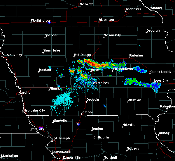 At 500 pm cdt, a severe thunderstorm was located near jewell junction, or 7 miles southeast of webster city, moving east at 35 mph (radar indicated). Hazards include quarter size hail. Damage to vehicles is expected. locations impacted include, webster city, jewell junction, ellsworth, stanhope, williams, blairsburg, kamrar, randall and webster city municipal airport. This includes interstate 35 between mile markers 127 and 145. At 500 pm cdt, a severe thunderstorm was located near jewell junction, or 7 miles southeast of webster city, moving east at 35 mph (radar indicated). Hazards include quarter size hail. Damage to vehicles is expected. locations impacted include, webster city, jewell junction, ellsworth, stanhope, williams, blairsburg, kamrar, randall and webster city municipal airport. This includes interstate 35 between mile markers 127 and 145.
|
| 9/14/2019 4:44 PM CDT |
 The national weather service in des moines has issued a * severe thunderstorm warning for. east central webster county in central iowa. hamilton county in central iowa. until 530 pm cdt. At 443 pm cdt, a severe thunderstorm was located 7 miles southwest. The national weather service in des moines has issued a * severe thunderstorm warning for. east central webster county in central iowa. hamilton county in central iowa. until 530 pm cdt. At 443 pm cdt, a severe thunderstorm was located 7 miles southwest.
|
| 9/14/2019 4:08 PM CDT |
 At 349 pm cdt, a severe thunderstorm was located 8 miles northeast of gowrie, or 10 miles south of fort dodge, moving east at 30 mph (radar indicated). Hazards include quarter size hail. damage to vehicles is expected At 349 pm cdt, a severe thunderstorm was located 8 miles northeast of gowrie, or 10 miles south of fort dodge, moving east at 30 mph (radar indicated). Hazards include quarter size hail. damage to vehicles is expected
|
| 9/14/2019 3:50 PM CDT |
 At 349 pm cdt, a severe thunderstorm was located 8 miles northeast of gowrie, or 10 miles south of fort dodge, moving east at 30 mph (radar indicated). Hazards include quarter size hail. damage to vehicles is expected At 349 pm cdt, a severe thunderstorm was located 8 miles northeast of gowrie, or 10 miles south of fort dodge, moving east at 30 mph (radar indicated). Hazards include quarter size hail. damage to vehicles is expected
|
| 9/14/2019 3:23 PM CDT |
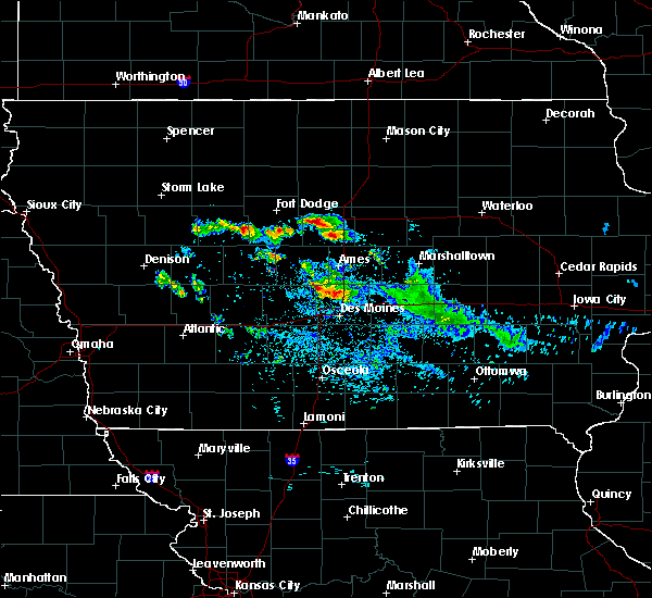 A severe thunderstorm warning remains in effect until 400 pm cdt for central hamilton county. at 323 pm cdt, a severe thunderstorm was located near webster city, moving east at 30 mph. hazard. quarter size hail. source. Radar indicated. A severe thunderstorm warning remains in effect until 400 pm cdt for central hamilton county. at 323 pm cdt, a severe thunderstorm was located near webster city, moving east at 30 mph. hazard. quarter size hail. source. Radar indicated.
|
| 9/14/2019 3:16 PM CDT |
 At 316 pm cdt, a severe thunderstorm was located near webster city, moving east at 30 mph (trained spotter). Hazards include quarter size hail. damage to vehicles is expected At 316 pm cdt, a severe thunderstorm was located near webster city, moving east at 30 mph (trained spotter). Hazards include quarter size hail. damage to vehicles is expected
|
| 8/20/2019 4:49 AM CDT |
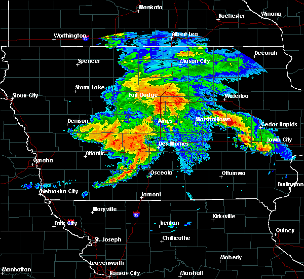 A severe thunderstorm warning remains in effect until 515 am cdt for northwestern hardin. southeastern wright. southwestern franklin and northern hamilton counties. At 449 am cdt, a severe thunderstorm was located 8 miles south of big wall lake, or 11 miles east of webster city, moving northeast at 25 mph. A severe thunderstorm warning remains in effect until 515 am cdt for northwestern hardin. southeastern wright. southwestern franklin and northern hamilton counties. At 449 am cdt, a severe thunderstorm was located 8 miles south of big wall lake, or 11 miles east of webster city, moving northeast at 25 mph.
|
| 8/20/2019 4:33 AM CDT |
 At 433 am cdt, a severe thunderstorm was located near webster city, moving northeast at 25 mph (radar indicated). Hazards include 60 mph wind gusts and penny size hail. expect damage to roofs, siding, and trees At 433 am cdt, a severe thunderstorm was located near webster city, moving northeast at 25 mph (radar indicated). Hazards include 60 mph wind gusts and penny size hail. expect damage to roofs, siding, and trees
|
| 8/5/2019 9:24 PM CDT |
 The severe thunderstorm warning for western hardin and hamilton counties will expire at 930 pm cdt, the storms which prompted the warning have weakened below severe limits, and no longer pose an immediate threat to life or property. therefore, the warning will be allowed to expire. however gusty winds are still possible with these thunderstorms. a severe thunderstorm watch remains in effect until 1100 pm cdt for central and north central iowa. The severe thunderstorm warning for western hardin and hamilton counties will expire at 930 pm cdt, the storms which prompted the warning have weakened below severe limits, and no longer pose an immediate threat to life or property. therefore, the warning will be allowed to expire. however gusty winds are still possible with these thunderstorms. a severe thunderstorm watch remains in effect until 1100 pm cdt for central and north central iowa.
|
| 8/5/2019 9:10 PM CDT |
 At 910 pm cdt, severe thunderstorms were located along a line extending from 8 miles southwest of iowa falls to 7 miles south of webster city, moving south at 45 mph (radar indicated). Hazards include 60 mph wind gusts. Expect damage to roofs, siding, and trees. locations impacted include, webster city, jewell junction, hubbard, alden, stratford, radcliffe, ellsworth, stanhope, williams, blairsburg, kamrar, randall, buckeye, webster city municipal airport and drake airport. This includes interstate 35 between mile markers 129 and 150. At 910 pm cdt, severe thunderstorms were located along a line extending from 8 miles southwest of iowa falls to 7 miles south of webster city, moving south at 45 mph (radar indicated). Hazards include 60 mph wind gusts. Expect damage to roofs, siding, and trees. locations impacted include, webster city, jewell junction, hubbard, alden, stratford, radcliffe, ellsworth, stanhope, williams, blairsburg, kamrar, randall, buckeye, webster city municipal airport and drake airport. This includes interstate 35 between mile markers 129 and 150.
|
| 8/5/2019 8:58 PM CDT |
 At 857 pm cdt, severe thunderstorms were located along a line extending from 9 miles east of big wall lake to near webster city, moving south at 45 mph (trained weather spotters. at 8:55pm, a trained weather spotter 5 miles southwest of woolstock reported a 60 mph wind gust). Hazards include 60 mph wind gusts. expect damage to roofs, siding, and trees At 857 pm cdt, severe thunderstorms were located along a line extending from 9 miles east of big wall lake to near webster city, moving south at 45 mph (trained weather spotters. at 8:55pm, a trained weather spotter 5 miles southwest of woolstock reported a 60 mph wind gust). Hazards include 60 mph wind gusts. expect damage to roofs, siding, and trees
|
| 8/5/2019 8:55 PM CDT | Storm damage reported in hamilton county IA, 6.2 miles ESE of Webster City, IA |
| 7/20/2019 11:35 AM CDT |
 At 1131 am cdt, the leading edge of severe winds associated with northern iowa thunderstorms was along a line extending from sheffield to 10 miles south of webster city, moving east at 60 mph (radar indicated. at 1115am 60 mph winds were reported at the clarion airport). Hazards include 60 mph wind gusts. Expect damage to roofs, siding, and trees. severe thunderstorms will be near, sheffield around 1135 am cdt. jewell junction around 1145 am cdt. greene around 1150 am cdt. clarksville around 1200 pm cdt. eldora around 1210 pm cdt. other locations impacted by these severe thunderstorms include steamboat rock, blairsburg, radcliffe, bradford, iowa falls municipal airport, kamrar, wellsburg, geneva, hansell and union. This includes interstate 35 between mile markers 127 and 150, and between mile markers 155 and 172. At 1131 am cdt, the leading edge of severe winds associated with northern iowa thunderstorms was along a line extending from sheffield to 10 miles south of webster city, moving east at 60 mph (radar indicated. at 1115am 60 mph winds were reported at the clarion airport). Hazards include 60 mph wind gusts. Expect damage to roofs, siding, and trees. severe thunderstorms will be near, sheffield around 1135 am cdt. jewell junction around 1145 am cdt. greene around 1150 am cdt. clarksville around 1200 pm cdt. eldora around 1210 pm cdt. other locations impacted by these severe thunderstorms include steamboat rock, blairsburg, radcliffe, bradford, iowa falls municipal airport, kamrar, wellsburg, geneva, hansell and union. This includes interstate 35 between mile markers 127 and 150, and between mile markers 155 and 172.
|
| 7/17/2019 10:28 AM CDT |
 At 1026 am cdt, severe thunderstorms were located along a line extending from near big wall lake to near webster city to 12 miles north of boone, moving east at 45 mph (radar indicated. recorded gusts to 40 to 45 mph from automated stations). Hazards include 60 mph wind gusts remain possible. Expect damage to roofs, siding, and trees. locations impacted include, webster city, iowa falls, eldora, ackley, jewell junction, big wall lake, hubbard, alden, stratford, radcliffe, dows, ellsworth, stanhope, williams, steamboat rock, new providence, blairsburg, kamrar, randall and woolstock. This includes interstate 35 between mile markers 127 and 158. At 1026 am cdt, severe thunderstorms were located along a line extending from near big wall lake to near webster city to 12 miles north of boone, moving east at 45 mph (radar indicated. recorded gusts to 40 to 45 mph from automated stations). Hazards include 60 mph wind gusts remain possible. Expect damage to roofs, siding, and trees. locations impacted include, webster city, iowa falls, eldora, ackley, jewell junction, big wall lake, hubbard, alden, stratford, radcliffe, dows, ellsworth, stanhope, williams, steamboat rock, new providence, blairsburg, kamrar, randall and woolstock. This includes interstate 35 between mile markers 127 and 158.
|
| 7/17/2019 10:16 AM CDT |
 At 1015 am cdt, severe thunderstorms were located along a line extending from near eagle grove to near webster city to 11 miles east of gowrie, moving east at 45 mph (radar indicated, and automated weather stations). Hazards include 60 mph wind gusts and penny size hail. expect damage to roofs, siding, and trees At 1015 am cdt, severe thunderstorms were located along a line extending from near eagle grove to near webster city to 11 miles east of gowrie, moving east at 45 mph (radar indicated, and automated weather stations). Hazards include 60 mph wind gusts and penny size hail. expect damage to roofs, siding, and trees
|
| 6/15/2019 3:46 PM CDT |
 At 346 pm cdt, a severe thunderstorm was located 9 miles northeast of jewell junction, or 13 miles east of webster city, moving east at 25 mph (radar indicated). Hazards include 60 mph wind gusts and nickel size hail. Expect damage to roofs, siding, and trees. locations impacted include, webster city, jewell junction, big wall lake, alden, ellsworth, stanhope, williams, blairsburg, kamrar, popejoy and webster city municipal airport. This includes interstate 35 between mile markers 136 and 155. At 346 pm cdt, a severe thunderstorm was located 9 miles northeast of jewell junction, or 13 miles east of webster city, moving east at 25 mph (radar indicated). Hazards include 60 mph wind gusts and nickel size hail. Expect damage to roofs, siding, and trees. locations impacted include, webster city, jewell junction, big wall lake, alden, ellsworth, stanhope, williams, blairsburg, kamrar, popejoy and webster city municipal airport. This includes interstate 35 between mile markers 136 and 155.
|
| 6/15/2019 3:19 PM CDT |
 The national weather service in des moines has issued a * severe thunderstorm warning for. northwestern hardin county in central iowa. east central webster county in central iowa. southeastern wright county in north central iowa. Southwestern franklin county in north central iowa. The national weather service in des moines has issued a * severe thunderstorm warning for. northwestern hardin county in central iowa. east central webster county in central iowa. southeastern wright county in north central iowa. Southwestern franklin county in north central iowa.
|
| 9/20/2018 6:41 PM CDT |
 The national weather service in des moines has issued a * severe thunderstorm warning for. central webster county in central iowa. southwestern wright county in north central iowa. southeastern calhoun county in west central iowa. Western hamilton county in central iowa. The national weather service in des moines has issued a * severe thunderstorm warning for. central webster county in central iowa. southwestern wright county in north central iowa. southeastern calhoun county in west central iowa. Western hamilton county in central iowa.
|
| 8/28/2018 1:49 PM CDT |
 At 149 pm cdt, severe thunderstorms were located along a line extending from 6 miles south of big wall lake to 12 miles west of jewell junction, moving northeast at 45 mph (radar indicated). Hazards include 60 mph wind gusts and quarter size hail. Hail damage to vehicles is expected. expect wind damage to roofs, siding, and trees. locations impacted include, webster city, jewell junction, alden, stratford, radcliffe, ellsworth, stanhope, williams, blairsburg, kamrar, randall, buckeye, garden city, popejoy, webster city municipal airport and drake airport. This includes interstate 35 between mile markers 128 and 155. At 149 pm cdt, severe thunderstorms were located along a line extending from 6 miles south of big wall lake to 12 miles west of jewell junction, moving northeast at 45 mph (radar indicated). Hazards include 60 mph wind gusts and quarter size hail. Hail damage to vehicles is expected. expect wind damage to roofs, siding, and trees. locations impacted include, webster city, jewell junction, alden, stratford, radcliffe, ellsworth, stanhope, williams, blairsburg, kamrar, randall, buckeye, garden city, popejoy, webster city municipal airport and drake airport. This includes interstate 35 between mile markers 128 and 155.
|
| 8/28/2018 1:38 PM CDT |
 At 138 pm cdt, severe thunderstorms were located along a line extending from near webster city to 8 miles north of ogden, moving east at 40 mph (radar indicated). Hazards include 60 mph wind gusts and quarter size hail. Hail damage to vehicles is expected. Expect wind damage to roofs, siding, and trees. At 138 pm cdt, severe thunderstorms were located along a line extending from near webster city to 8 miles north of ogden, moving east at 40 mph (radar indicated). Hazards include 60 mph wind gusts and quarter size hail. Hail damage to vehicles is expected. Expect wind damage to roofs, siding, and trees.
|
| 8/26/2018 10:40 PM CDT |
 At 1039 pm cdt, a severe thunderstorm was located over fort dodge, moving east at 40 mph (radar indicated). Hazards include 60 mph wind gusts. expect damage to roofs, siding, and trees At 1039 pm cdt, a severe thunderstorm was located over fort dodge, moving east at 40 mph (radar indicated). Hazards include 60 mph wind gusts. expect damage to roofs, siding, and trees
|
| 8/5/2018 10:24 PM CDT |
 At 1023 pm cdt, a severe thunderstorm was located near webster city, moving east at 45 mph (radar indicated. at 1022 pm, the webster city airport recorded a wind gust of 59 mph). Hazards include 60 mph wind gusts. Expect damage to roofs, siding, and trees. locations impacted include, webster city, big wall lake, lehigh, duncombe, williams, blairsburg, kamrar, vincent, woolstock, brushy creek st recreation area, webster city municipal airport, sportsman park and dolliver memorial state park. This includes interstate 35 between mile markers 136 and 154. At 1023 pm cdt, a severe thunderstorm was located near webster city, moving east at 45 mph (radar indicated. at 1022 pm, the webster city airport recorded a wind gust of 59 mph). Hazards include 60 mph wind gusts. Expect damage to roofs, siding, and trees. locations impacted include, webster city, big wall lake, lehigh, duncombe, williams, blairsburg, kamrar, vincent, woolstock, brushy creek st recreation area, webster city municipal airport, sportsman park and dolliver memorial state park. This includes interstate 35 between mile markers 136 and 154.
|
| 8/5/2018 10:22 PM CDT | Peak wind of 59 mph reported at webster city municipal airpor in hamilton county IA, 3.5 miles ENE of Webster City, IA |
| 8/5/2018 10:08 PM CDT |
 At 1007 pm cdt, a severe thunderstorm was located 8 miles southeast of fort dodge, moving east at 45 mph (radar indicated). Hazards include 60 mph wind gusts. Expect damage to roofs, siding, and trees. locations impacted include, fort dodge, webster city, fort dodge regional airport, big wall lake, coalville, badger, otho, lehigh, duncombe, williams, blairsburg, kamrar, vincent, woolstock, woodman hollow state park, dolliver memorial state park, lizard creek state recreation area, brushy creek st recreation area, webster city municipal airport and sportsman park. This includes interstate 35 between mile markers 136 and 154. At 1007 pm cdt, a severe thunderstorm was located 8 miles southeast of fort dodge, moving east at 45 mph (radar indicated). Hazards include 60 mph wind gusts. Expect damage to roofs, siding, and trees. locations impacted include, fort dodge, webster city, fort dodge regional airport, big wall lake, coalville, badger, otho, lehigh, duncombe, williams, blairsburg, kamrar, vincent, woolstock, woodman hollow state park, dolliver memorial state park, lizard creek state recreation area, brushy creek st recreation area, webster city municipal airport and sportsman park. This includes interstate 35 between mile markers 136 and 154.
|
| 8/5/2018 9:48 PM CDT |
 At 948 pm cdt, a severe thunderstorm was located 7 miles southwest of fort dodge, moving east at 45 mph (radar indicated). Hazards include 60 mph wind gusts. expect damage to roofs, siding, and trees At 948 pm cdt, a severe thunderstorm was located 7 miles southwest of fort dodge, moving east at 45 mph (radar indicated). Hazards include 60 mph wind gusts. expect damage to roofs, siding, and trees
|
| 8/5/2018 9:20 AM CDT | Trees down and power outages. via social media. time estimated by rada in hamilton county IA, 0.6 miles ENE of Webster City, IA |
| 8/5/2018 5:20 AM CDT |
 At 511 am cdt, severe thunderstorms were located along a line extending from 8 miles south of britt to near big wall lake to 14 miles east of gowrie, moving east at 50 mph (radar indicated). Hazards include 60 mph wind gusts. Expect damage to roofs, siding, and trees. locations impacted include, webster city, garner, clarion, eagle grove, belmond, jewell junction, gowrie, big wall lake, elm lake, dayton, stratford, kanawha, goldfield, coalville, otho, dows, ellsworth, klemme, stanhope and lehigh. This includes interstate 35 between mile markers 127 and 154. At 511 am cdt, severe thunderstorms were located along a line extending from 8 miles south of britt to near big wall lake to 14 miles east of gowrie, moving east at 50 mph (radar indicated). Hazards include 60 mph wind gusts. Expect damage to roofs, siding, and trees. locations impacted include, webster city, garner, clarion, eagle grove, belmond, jewell junction, gowrie, big wall lake, elm lake, dayton, stratford, kanawha, goldfield, coalville, otho, dows, ellsworth, klemme, stanhope and lehigh. This includes interstate 35 between mile markers 127 and 154.
|
| 8/5/2018 5:12 AM CDT |
 At 511 am cdt, severe thunderstorms were located along a line extending from 8 miles south of britt to near big wall lake to 14 miles east of gowrie, moving east at 50 mph (radar indicated). Hazards include 60 mph wind gusts. Expect damage to roofs, siding, and trees. locations impacted include, webster city, garner, clarion, eagle grove, belmond, jewell junction, gowrie, big wall lake, elm lake, dayton, stratford, kanawha, goldfield, coalville, otho, dows, ellsworth, klemme, stanhope and lehigh. This includes interstate 35 between mile markers 127 and 154. At 511 am cdt, severe thunderstorms were located along a line extending from 8 miles south of britt to near big wall lake to 14 miles east of gowrie, moving east at 50 mph (radar indicated). Hazards include 60 mph wind gusts. Expect damage to roofs, siding, and trees. locations impacted include, webster city, garner, clarion, eagle grove, belmond, jewell junction, gowrie, big wall lake, elm lake, dayton, stratford, kanawha, goldfield, coalville, otho, dows, ellsworth, klemme, stanhope and lehigh. This includes interstate 35 between mile markers 127 and 154.
|
| 8/5/2018 4:58 AM CDT |
 At 457 am cdt, severe thunderstorms were located along a line extending from 11 miles east of algona to near eagle grove to 9 miles northeast of gowrie, moving east at 60 mph (radar indicated). Hazards include 60 mph wind gusts. Expect damage to roofs, siding, and trees. locations impacted include, fort dodge, webster city, algona, garner, clarion, dakota city, humboldt, eagle grove, belmond, britt, jewell junction, gowrie, elm lake, fort dodge regional airport, big wall lake, eagle lake, dayton, stratford, kanawha and goldfield. This includes interstate 35 between mile markers 127 and 154. At 457 am cdt, severe thunderstorms were located along a line extending from 11 miles east of algona to near eagle grove to 9 miles northeast of gowrie, moving east at 60 mph (radar indicated). Hazards include 60 mph wind gusts. Expect damage to roofs, siding, and trees. locations impacted include, fort dodge, webster city, algona, garner, clarion, dakota city, humboldt, eagle grove, belmond, britt, jewell junction, gowrie, elm lake, fort dodge regional airport, big wall lake, eagle lake, dayton, stratford, kanawha and goldfield. This includes interstate 35 between mile markers 127 and 154.
|
| 8/5/2018 4:41 AM CDT |
 At 441 am cdt, severe thunderstorms were located along a line extending from near algona to near dakota city to 10 miles east of rockwell city, moving east at 60 mph (radar indicated). Hazards include 70 mph wind gusts. Expect considerable tree damage. damage is likely to mobile homes, roofs, and outbuildings. locations impacted include, fort dodge, webster city, algona, garner, clarion, dakota city, humboldt, eagle grove, belmond, britt, jewell junction, gowrie, elm lake, fort dodge regional airport, big wall lake, eagle lake, dayton, west bend, stratford and kanawha. This includes interstate 35 between mile markers 127 and 154. At 441 am cdt, severe thunderstorms were located along a line extending from near algona to near dakota city to 10 miles east of rockwell city, moving east at 60 mph (radar indicated). Hazards include 70 mph wind gusts. Expect considerable tree damage. damage is likely to mobile homes, roofs, and outbuildings. locations impacted include, fort dodge, webster city, algona, garner, clarion, dakota city, humboldt, eagle grove, belmond, britt, jewell junction, gowrie, elm lake, fort dodge regional airport, big wall lake, eagle lake, dayton, west bend, stratford and kanawha. This includes interstate 35 between mile markers 127 and 154.
|
| 8/5/2018 4:24 AM CDT |
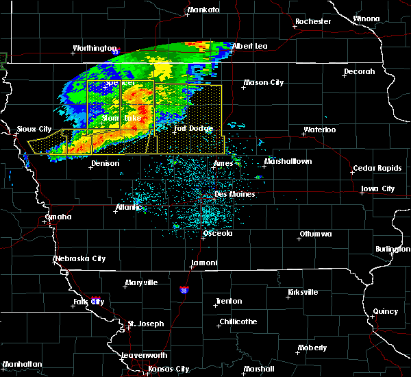 At 423 am cdt, severe thunderstorms were located along a line extending from five island lake to near pocahontas to near north twin lake, moving east at 60 mph. these are very dangerous storms (radar indicated). Hazards include 80 mph wind gusts and nickel size hail. Flying debris will be dangerous to those caught without shelter. mobile homes will be heavily damaged. expect considerable damage to roofs, windows, and vehicles. Extensive tree damage and power outages are likely. At 423 am cdt, severe thunderstorms were located along a line extending from five island lake to near pocahontas to near north twin lake, moving east at 60 mph. these are very dangerous storms (radar indicated). Hazards include 80 mph wind gusts and nickel size hail. Flying debris will be dangerous to those caught without shelter. mobile homes will be heavily damaged. expect considerable damage to roofs, windows, and vehicles. Extensive tree damage and power outages are likely.
|
| 8/1/2018 6:37 PM CDT |
 At 636 pm cdt, a severe thunderstorm was located near webster city, moving east at 25 mph (radar indicated). Hazards include 60 mph wind gusts and quarter size hail. Hail damage to vehicles is expected. expect wind damage to roofs, siding, and trees. Locations impacted include, webster city, stratford, stanhope, lehigh, duncombe, kamrar, brushy creek st recreation area and webster city municipal airport. At 636 pm cdt, a severe thunderstorm was located near webster city, moving east at 25 mph (radar indicated). Hazards include 60 mph wind gusts and quarter size hail. Hail damage to vehicles is expected. expect wind damage to roofs, siding, and trees. Locations impacted include, webster city, stratford, stanhope, lehigh, duncombe, kamrar, brushy creek st recreation area and webster city municipal airport.
|
| 8/1/2018 6:19 PM CDT |
 At 619 pm cdt, a severe thunderstorm was located 10 miles southeast of fort dodge, moving east at 25 mph (radar indicated). Hazards include 60 mph wind gusts and quarter size hail. Hail damage to vehicles is expected. Expect wind damage to roofs, siding, and trees. At 619 pm cdt, a severe thunderstorm was located 10 miles southeast of fort dodge, moving east at 25 mph (radar indicated). Hazards include 60 mph wind gusts and quarter size hail. Hail damage to vehicles is expected. Expect wind damage to roofs, siding, and trees.
|
| 7/25/2018 8:42 PM CDT |
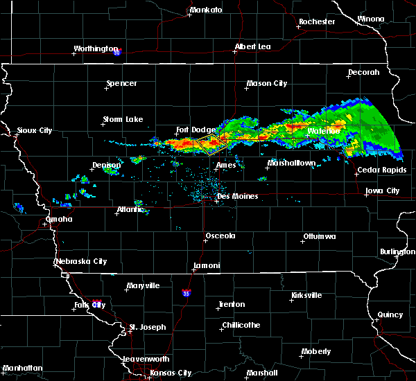 At 842 pm cdt, a severe thunderstorm was located near jewell junction, or 8 miles southeast of webster city, moving southeast at 30 mph (radar indicated). Hazards include 60 mph wind gusts and quarter size hail. Hail damage to vehicles is expected. expect wind damage to roofs, siding, and trees. locations impacted include, webster city, jewell junction, ellsworth, blairsburg, kamrar and webster city municipal airport. This includes interstate 35 between mile markers 132 and 142. At 842 pm cdt, a severe thunderstorm was located near jewell junction, or 8 miles southeast of webster city, moving southeast at 30 mph (radar indicated). Hazards include 60 mph wind gusts and quarter size hail. Hail damage to vehicles is expected. expect wind damage to roofs, siding, and trees. locations impacted include, webster city, jewell junction, ellsworth, blairsburg, kamrar and webster city municipal airport. This includes interstate 35 between mile markers 132 and 142.
|
| 7/25/2018 8:34 PM CDT |
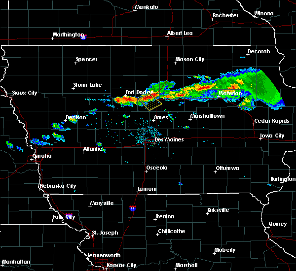 At 833 pm cdt, a severe thunderstorm was located near webster city, moving southeast at 30 mph (radar indicated). Hazards include 60 mph wind gusts and quarter size hail. Hail damage to vehicles is expected. Expect wind damage to roofs, siding, and trees. At 833 pm cdt, a severe thunderstorm was located near webster city, moving southeast at 30 mph (radar indicated). Hazards include 60 mph wind gusts and quarter size hail. Hail damage to vehicles is expected. Expect wind damage to roofs, siding, and trees.
|
| 6/18/2018 4:16 PM CDT |
 At 415 pm cdt, a severe thunderstorm was located 8 miles southeast of big wall lake, or 13 miles east of webster city, moving east at 30 mph (public. at 400pm...trees were reported downed in webster city). Hazards include 60 mph wind gusts and quarter size hail. Hail damage to vehicles is expected. expect wind damage to roofs, siding, and trees. locations impacted include, webster city, big wall lake, alden, williams, blairsburg, buckeye and popejoy. This includes interstate 35 between mile markers 142 and 158. At 415 pm cdt, a severe thunderstorm was located 8 miles southeast of big wall lake, or 13 miles east of webster city, moving east at 30 mph (public. at 400pm...trees were reported downed in webster city). Hazards include 60 mph wind gusts and quarter size hail. Hail damage to vehicles is expected. expect wind damage to roofs, siding, and trees. locations impacted include, webster city, big wall lake, alden, williams, blairsburg, buckeye and popejoy. This includes interstate 35 between mile markers 142 and 158.
|
| 6/18/2018 4:00 PM CDT | Public relayed picture of large tree down in town... via social medi in hamilton county IA, 0.6 miles ENE of Webster City, IA |
| 6/18/2018 3:57 PM CDT |
 At 356 pm cdt, a severe thunderstorm was located near webster city, moving east at 30 mph (radar indicated). Hazards include 60 mph wind gusts and penny size hail. expect damage to roofs, siding, and trees At 356 pm cdt, a severe thunderstorm was located near webster city, moving east at 30 mph (radar indicated). Hazards include 60 mph wind gusts and penny size hail. expect damage to roofs, siding, and trees
|
| 6/6/2018 5:00 PM CDT |
 At 457 pm cdt, a severe thunderstorm was located near jewell junction, or 9 miles southeast of webster city, moving east at 15 mph. this thunderstorm warning replaces the previous warning for much of the same area (radar indicated). Hazards include 60 mph wind gusts and quarter size hail. Hail damage to vehicles is expected. Expect wind damage to roofs, siding, and trees. At 457 pm cdt, a severe thunderstorm was located near jewell junction, or 9 miles southeast of webster city, moving east at 15 mph. this thunderstorm warning replaces the previous warning for much of the same area (radar indicated). Hazards include 60 mph wind gusts and quarter size hail. Hail damage to vehicles is expected. Expect wind damage to roofs, siding, and trees.
|
| 6/6/2018 4:44 PM CDT |
 At 443 pm cdt, a severe thunderstorm was located near roland, or 16 miles north of nevada, moving east at 15 mph (trained weather spotters reported golf ball sized hail at 438 pm 3 miles east of stanhope). Hazards include golf ball size hail and 60 mph wind gusts. People and animals outdoors will be injured. expect hail damage to roofs, siding, windows, and vehicles. expect wind damage to roofs, siding, and trees. locations impacted include, webster city, story city, roland, jewell junction, stratford, ellsworth, stanhope, williams, blairsburg, kamrar, randall and webster city municipal airport. This includes interstate 35 between mile markers 119 and 145. At 443 pm cdt, a severe thunderstorm was located near roland, or 16 miles north of nevada, moving east at 15 mph (trained weather spotters reported golf ball sized hail at 438 pm 3 miles east of stanhope). Hazards include golf ball size hail and 60 mph wind gusts. People and animals outdoors will be injured. expect hail damage to roofs, siding, windows, and vehicles. expect wind damage to roofs, siding, and trees. locations impacted include, webster city, story city, roland, jewell junction, stratford, ellsworth, stanhope, williams, blairsburg, kamrar, randall and webster city municipal airport. This includes interstate 35 between mile markers 119 and 145.
|
| 6/6/2018 4:29 PM CDT |
 At 428 pm cdt, a severe thunderstorm was located near jewell junction, or 16 miles north of ames, moving east at 15 mph (trained weather spotters reported ping-pong sized hail just east of stanhope at 427 pm cdt). Hazards include ping pong ball size hail and 60 mph wind gusts. People and animals outdoors will be injured. expect hail damage to roofs, siding, windows, and vehicles. expect wind damage to roofs, siding, and trees. locations impacted include, webster city, story city, roland, jewell junction, stratford, ellsworth, stanhope, williams, blairsburg, kamrar, randall and webster city municipal airport. This includes interstate 35 between mile markers 119 and 145. At 428 pm cdt, a severe thunderstorm was located near jewell junction, or 16 miles north of ames, moving east at 15 mph (trained weather spotters reported ping-pong sized hail just east of stanhope at 427 pm cdt). Hazards include ping pong ball size hail and 60 mph wind gusts. People and animals outdoors will be injured. expect hail damage to roofs, siding, windows, and vehicles. expect wind damage to roofs, siding, and trees. locations impacted include, webster city, story city, roland, jewell junction, stratford, ellsworth, stanhope, williams, blairsburg, kamrar, randall and webster city municipal airport. This includes interstate 35 between mile markers 119 and 145.
|
| 6/6/2018 4:27 PM CDT |
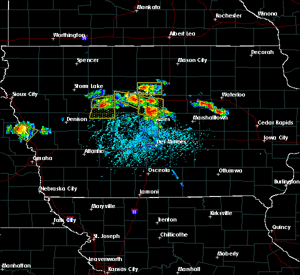 At 427 pm cdt, a severe thunderstorm was located near jewell junction, or 16 miles north of ames, moving east at 15 mph (trained weather spotters reported quarter sized hail in stanhope at 4:35 pm cdt). Hazards include 60 mph wind gusts and half dollar size hail. Hail damage to vehicles is expected. expect wind damage to roofs, siding, and trees. locations impacted include, webster city, story city, roland, jewell junction, stratford, ellsworth, stanhope, williams, blairsburg, kamrar, randall and webster city municipal airport. This includes interstate 35 between mile markers 119 and 145. At 427 pm cdt, a severe thunderstorm was located near jewell junction, or 16 miles north of ames, moving east at 15 mph (trained weather spotters reported quarter sized hail in stanhope at 4:35 pm cdt). Hazards include 60 mph wind gusts and half dollar size hail. Hail damage to vehicles is expected. expect wind damage to roofs, siding, and trees. locations impacted include, webster city, story city, roland, jewell junction, stratford, ellsworth, stanhope, williams, blairsburg, kamrar, randall and webster city municipal airport. This includes interstate 35 between mile markers 119 and 145.
|
| 6/6/2018 4:15 PM CDT |
 At 415 pm cdt, a severe thunderstorm was located over jewell junction, or 16 miles southeast of webster city, moving east at 15 mph (radar indicated). Hazards include 60 mph wind gusts and half dollar size hail. Hail damage to vehicles is expected. Expect wind damage to roofs, siding, and trees. At 415 pm cdt, a severe thunderstorm was located over jewell junction, or 16 miles southeast of webster city, moving east at 15 mph (radar indicated). Hazards include 60 mph wind gusts and half dollar size hail. Hail damage to vehicles is expected. Expect wind damage to roofs, siding, and trees.
|
| 5/28/2018 4:04 PM CDT |
 At 403 pm cdt, a severe thunderstorm was located 8 miles northwest of webster city, moving northwest at 15 mph (radar indicated). Hazards include 60 mph wind gusts and quarter size hail. Hail damage to vehicles is expected. expect wind damage to roofs, siding, and trees. Locations impacted include, webster city, badger, duncombe, kamrar, vincent, webster city municipal airport and brushy creek st recreation area. At 403 pm cdt, a severe thunderstorm was located 8 miles northwest of webster city, moving northwest at 15 mph (radar indicated). Hazards include 60 mph wind gusts and quarter size hail. Hail damage to vehicles is expected. expect wind damage to roofs, siding, and trees. Locations impacted include, webster city, badger, duncombe, kamrar, vincent, webster city municipal airport and brushy creek st recreation area.
|
| 5/28/2018 3:42 PM CDT |
 At 342 pm cdt, a severe thunderstorm was located near webster city, moving northwest at 15 mph (radar indicated). Hazards include 60 mph wind gusts and quarter size hail. Hail damage to vehicles is expected. Expect wind damage to roofs, siding, and trees. At 342 pm cdt, a severe thunderstorm was located near webster city, moving northwest at 15 mph (radar indicated). Hazards include 60 mph wind gusts and quarter size hail. Hail damage to vehicles is expected. Expect wind damage to roofs, siding, and trees.
|
| 5/3/2018 7:12 PM CDT |
 The severe thunderstorm warning for eastern webster. southern wright and northern hamilton counties will expire at 715 pm cdt. the storm which prompted the warning has weakened below severe limits, and no longer poses an immediate threat to life or property. Therefore the warning will be allowed to expire. The severe thunderstorm warning for eastern webster. southern wright and northern hamilton counties will expire at 715 pm cdt. the storm which prompted the warning has weakened below severe limits, and no longer poses an immediate threat to life or property. Therefore the warning will be allowed to expire.
|
| 5/3/2018 6:47 PM CDT |
 At 646 pm cdt, a severe thunderstorm was located 7 miles southeast of eagle grove, or 8 miles north of webster city, moving east at 25 mph (radar indicated). Hazards include 60 mph wind gusts. Expect damage to roofs, siding, and trees. locations impacted include, webster city, eagle grove, big wall lake, dows, williams, blairsburg, woolstock, rowan, galt and sportsman park. This includes interstate 35 between mile markers 144 and 154. At 646 pm cdt, a severe thunderstorm was located 7 miles southeast of eagle grove, or 8 miles north of webster city, moving east at 25 mph (radar indicated). Hazards include 60 mph wind gusts. Expect damage to roofs, siding, and trees. locations impacted include, webster city, eagle grove, big wall lake, dows, williams, blairsburg, woolstock, rowan, galt and sportsman park. This includes interstate 35 between mile markers 144 and 154.
|
| 5/3/2018 6:38 PM CDT |
 At 637 pm cdt, a severe thunderstorm was located near eagle grove, or 7 miles north of webster city, moving east at 25 mph (radar indicated). Hazards include 60 mph wind gusts. law enforcement reported two large trees down in fort dodge as the storms moved through around 6 pm. Expect damage to roofs, siding, and trees. locations impacted include, webster city, eagle grove, big wall lake, dows, duncombe, williams, blairsburg, vincent, woolstock, rowan, galt and sportsman park. This includes interstate 35 between mile markers 144 and 154. At 637 pm cdt, a severe thunderstorm was located near eagle grove, or 7 miles north of webster city, moving east at 25 mph (radar indicated). Hazards include 60 mph wind gusts. law enforcement reported two large trees down in fort dodge as the storms moved through around 6 pm. Expect damage to roofs, siding, and trees. locations impacted include, webster city, eagle grove, big wall lake, dows, duncombe, williams, blairsburg, vincent, woolstock, rowan, galt and sportsman park. This includes interstate 35 between mile markers 144 and 154.
|
| 5/3/2018 6:25 PM CDT |
 At 625 pm cdt, a severe thunderstorm was located 9 miles southwest of eagle grove, or 9 miles northwest of webster city, moving east at 25 mph (radar indicated). Hazards include 60 mph wind gusts. expect damage to roofs, siding, and trees At 625 pm cdt, a severe thunderstorm was located 9 miles southwest of eagle grove, or 9 miles northwest of webster city, moving east at 25 mph (radar indicated). Hazards include 60 mph wind gusts. expect damage to roofs, siding, and trees
|
| 4/13/2018 7:40 PM CDT |
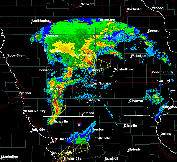 At 740 pm cdt, a severe thunderstorm was located near big wall lake, or 12 miles southeast of clarion, moving northeast at 35 mph (radar indicated). Hazards include 60 mph wind gusts. Expect damage to roofs, siding, and trees. locations impacted include, webster city, jewell junction, big wall lake, ellsworth, stanhope, williams, blairsburg, kamrar and webster city municipal airport. This includes interstate 35 between mile markers 135 and 154. At 740 pm cdt, a severe thunderstorm was located near big wall lake, or 12 miles southeast of clarion, moving northeast at 35 mph (radar indicated). Hazards include 60 mph wind gusts. Expect damage to roofs, siding, and trees. locations impacted include, webster city, jewell junction, big wall lake, ellsworth, stanhope, williams, blairsburg, kamrar and webster city municipal airport. This includes interstate 35 between mile markers 135 and 154.
|
| 4/13/2018 7:29 PM CDT |
 At 728 pm cdt, a severe thunderstorm was located 8 miles east of webster city, moving northeast at 35 mph (radar indicated). Hazards include 60 mph wind gusts. Expect damage to roofs, siding, and trees. locations impacted include, webster city, jewell junction, big wall lake, stratford, ellsworth, stanhope, williams, blairsburg, kamrar, webster city municipal airport and brushy creek st recreation area. This includes interstate 35 between mile markers 134 and 154. At 728 pm cdt, a severe thunderstorm was located 8 miles east of webster city, moving northeast at 35 mph (radar indicated). Hazards include 60 mph wind gusts. Expect damage to roofs, siding, and trees. locations impacted include, webster city, jewell junction, big wall lake, stratford, ellsworth, stanhope, williams, blairsburg, kamrar, webster city municipal airport and brushy creek st recreation area. This includes interstate 35 between mile markers 134 and 154.
|
| 4/13/2018 7:08 PM CDT |
 At 708 pm cdt, a severe thunderstorm was located near eagle grove, or 10 miles northwest of webster city, moving northeast at 45 mph (radar indicated). Hazards include 60 mph wind gusts and penny size hail. Expect damage to roofs, siding, and trees. Locations impacted include, fort dodge, webster city, fort dodge regional airport, coalville, badger, otho, lehigh, duncombe, vincent, woolstock, woodman hollow state park, dolliver memorial state park, brushy creek st recreation area and sportsman park. At 708 pm cdt, a severe thunderstorm was located near eagle grove, or 10 miles northwest of webster city, moving northeast at 45 mph (radar indicated). Hazards include 60 mph wind gusts and penny size hail. Expect damage to roofs, siding, and trees. Locations impacted include, fort dodge, webster city, fort dodge regional airport, coalville, badger, otho, lehigh, duncombe, vincent, woolstock, woodman hollow state park, dolliver memorial state park, brushy creek st recreation area and sportsman park.
|
| 4/13/2018 7:06 PM CDT |
 At 706 pm cdt, a severe thunderstorm was located 7 miles south of webster city, moving northeast at 30 mph (radar indicated). Hazards include 60 mph wind gusts. Expect damage to roofs, siding, and trees. locations impacted include, webster city, jewell junction, big wall lake, stratford, ellsworth, stanhope, williams, blairsburg, kamrar, webster city municipal airport and brushy creek st recreation area. This includes interstate 35 between mile markers 134 and 154. At 706 pm cdt, a severe thunderstorm was located 7 miles south of webster city, moving northeast at 30 mph (radar indicated). Hazards include 60 mph wind gusts. Expect damage to roofs, siding, and trees. locations impacted include, webster city, jewell junction, big wall lake, stratford, ellsworth, stanhope, williams, blairsburg, kamrar, webster city municipal airport and brushy creek st recreation area. This includes interstate 35 between mile markers 134 and 154.
|
| 4/13/2018 6:57 PM CDT |
 At 657 pm cdt, a severe thunderstorm was located 11 miles southwest of webster city, moving northeast at 35 mph (radar indicated. these storms have a history of producing wind gusts in excess of 60 mph). Hazards include 60 mph wind gusts and penny size hail. expect damage to roofs, siding, and trees At 657 pm cdt, a severe thunderstorm was located 11 miles southwest of webster city, moving northeast at 35 mph (radar indicated. these storms have a history of producing wind gusts in excess of 60 mph). Hazards include 60 mph wind gusts and penny size hail. expect damage to roofs, siding, and trees
|
| 4/13/2018 6:53 PM CDT |
 At 653 pm cdt, a severe thunderstorm was located 7 miles southeast of fort dodge, moving northeast at 35 mph (radar indicated). Hazards include 60 mph wind gusts and quarter size hail. Hail damage to vehicles is expected. expect wind damage to roofs, siding, and trees. Locations impacted include, fort dodge, webster city, fort dodge regional airport, coalville, badger, otho, lehigh, duncombe, vincent, moorland, woolstock, woodman hollow state park, dolliver memorial state park, lizard creek state recreation area, brushy creek st recreation area and sportsman park. At 653 pm cdt, a severe thunderstorm was located 7 miles southeast of fort dodge, moving northeast at 35 mph (radar indicated). Hazards include 60 mph wind gusts and quarter size hail. Hail damage to vehicles is expected. expect wind damage to roofs, siding, and trees. Locations impacted include, fort dodge, webster city, fort dodge regional airport, coalville, badger, otho, lehigh, duncombe, vincent, moorland, woolstock, woodman hollow state park, dolliver memorial state park, lizard creek state recreation area, brushy creek st recreation area and sportsman park.
|
| 4/13/2018 6:39 PM CDT |
 At 638 pm cdt, a severe thunderstorm was located 8 miles south of fort dodge, moving northeast at 40 mph (trained weather spotters. at 638 pm...ping pong ball sized hail was reported 3 miles north of jefferson). Hazards include ping pong ball size hail and 60 mph wind gusts. People and animals outdoors will be injured. expect hail damage to roofs, siding, windows, and vehicles. Expect wind damage to roofs, siding, and trees. At 638 pm cdt, a severe thunderstorm was located 8 miles south of fort dodge, moving northeast at 40 mph (trained weather spotters. at 638 pm...ping pong ball sized hail was reported 3 miles north of jefferson). Hazards include ping pong ball size hail and 60 mph wind gusts. People and animals outdoors will be injured. expect hail damage to roofs, siding, windows, and vehicles. Expect wind damage to roofs, siding, and trees.
|
| 6/28/2017 12:27 PM CDT |
 The severe thunderstorm warning for northwestern hardin, northeastern webster, southwestern franklin, southern wright and northern hamilton counties will expire at 530 pm cdt, the storm which prompted the warning has weakened below severe limits, and no longer poses an immediate threat to life or property. therefore the warning will be allowed to expire. a tornado watch remains in effect until 1000 pm cdt for central and north central iowa. The severe thunderstorm warning for northwestern hardin, northeastern webster, southwestern franklin, southern wright and northern hamilton counties will expire at 530 pm cdt, the storm which prompted the warning has weakened below severe limits, and no longer poses an immediate threat to life or property. therefore the warning will be allowed to expire. a tornado watch remains in effect until 1000 pm cdt for central and north central iowa.
|
| 6/28/2017 11:51 AM CDT |
 At 451 pm cdt, a severe thunderstorm was located near webster city, moving east at 30 mph (radar indicated). Hazards include 60 mph wind gusts and quarter size hail. Hail damage to vehicles is expected. Expect wind damage to roofs, siding, and trees. At 451 pm cdt, a severe thunderstorm was located near webster city, moving east at 30 mph (radar indicated). Hazards include 60 mph wind gusts and quarter size hail. Hail damage to vehicles is expected. Expect wind damage to roofs, siding, and trees.
|
| 6/28/2017 11:18 AM CDT |
 At 418 pm cdt, a severe thunderstorm was located 9 miles east of webster city, moving east at 35 mph (radar indicated). Hazards include 60 mph wind gusts and quarter size hail. Hail damage to vehicles is expected. expect wind damage to roofs, siding, and trees. locations impacted include, fort dodge, webster city, fort dodge regional airport, coalville, badger, otho, duncombe, kamrar, vincent, woolstock, woodman hollow state park, brushy creek st recreation area, webster city municipal airport and dolliver memorial state park. A tornado watch remains in effect until 1000 pm cdt for central and north central iowa. At 418 pm cdt, a severe thunderstorm was located 9 miles east of webster city, moving east at 35 mph (radar indicated). Hazards include 60 mph wind gusts and quarter size hail. Hail damage to vehicles is expected. expect wind damage to roofs, siding, and trees. locations impacted include, fort dodge, webster city, fort dodge regional airport, coalville, badger, otho, duncombe, kamrar, vincent, woolstock, woodman hollow state park, brushy creek st recreation area, webster city municipal airport and dolliver memorial state park. A tornado watch remains in effect until 1000 pm cdt for central and north central iowa.
|
| 6/28/2017 10:40 AM CDT |
 At 340 pm cdt, a severe thunderstorm was located 8 miles east of fort dodge, moving east at 60 mph (radar indicated). Hazards include 60 mph wind gusts and half dollar size hail. Hail damage to vehicles is expected. Expect wind damage to roofs, siding, and trees. At 340 pm cdt, a severe thunderstorm was located 8 miles east of fort dodge, moving east at 60 mph (radar indicated). Hazards include 60 mph wind gusts and half dollar size hail. Hail damage to vehicles is expected. Expect wind damage to roofs, siding, and trees.
|
| 5/17/2017 5:28 PM CDT |
 At 527 pm cdt, severe thunderstorms were located along a line extending from 7 miles southeast of big wall lake to 6 miles west of grundy center to near toledo, moving northeast at 60 mph (trained weather spotters. these storms have a history of producing widespread winds of 60 to 70 mph, with trees down). Hazards include 70 mph wind gusts. Expect considerable tree damage. damage is likely to mobile homes, roofs, and outbuildings. locations impacted include, marshalltown, webster city, iowa falls, eldora, grundy center, toledo, tama, traer, reinbeck, ackley, dysart, dike, conrad, meskwaki casino, gladbrook, le grand, hubbard, alden, wellsburg and radcliffe. this includes interstate 35 between mile markers 134 and 150. A tornado watch remains in effect until 700 pm cdt for central, north central and northeastern iowa. At 527 pm cdt, severe thunderstorms were located along a line extending from 7 miles southeast of big wall lake to 6 miles west of grundy center to near toledo, moving northeast at 60 mph (trained weather spotters. these storms have a history of producing widespread winds of 60 to 70 mph, with trees down). Hazards include 70 mph wind gusts. Expect considerable tree damage. damage is likely to mobile homes, roofs, and outbuildings. locations impacted include, marshalltown, webster city, iowa falls, eldora, grundy center, toledo, tama, traer, reinbeck, ackley, dysart, dike, conrad, meskwaki casino, gladbrook, le grand, hubbard, alden, wellsburg and radcliffe. this includes interstate 35 between mile markers 134 and 150. A tornado watch remains in effect until 700 pm cdt for central, north central and northeastern iowa.
|
| 5/17/2017 5:20 PM CDT |
 At 518 pm cdt, severe thunderstorms were located along a line extending from near big wall lake to 6 miles northwest of conrad to near meskwaki casino, moving northeast at 55 mph (trained weather spotters. at 512pm...69 mph winds were reported at the marshalltown airport. numerous trees were also reported down with some structural damage). Hazards include 70 mph wind gusts. Expect considerable tree damage. damage is likely to mobile homes, roofs, and outbuildings. locations impacted include, marshalltown, webster city, iowa falls, eldora, grundy center, toledo, story city, tama, traer, reinbeck, ackley, state center, dysart, roland, jewell junction, dike, conrad, meskwaki casino, gladbrook and le grand. this includes interstate 35 between mile markers 125 and 150. A tornado watch remains in effect until 700 pm cdt for central, north central and northeastern iowa. At 518 pm cdt, severe thunderstorms were located along a line extending from near big wall lake to 6 miles northwest of conrad to near meskwaki casino, moving northeast at 55 mph (trained weather spotters. at 512pm...69 mph winds were reported at the marshalltown airport. numerous trees were also reported down with some structural damage). Hazards include 70 mph wind gusts. Expect considerable tree damage. damage is likely to mobile homes, roofs, and outbuildings. locations impacted include, marshalltown, webster city, iowa falls, eldora, grundy center, toledo, story city, tama, traer, reinbeck, ackley, state center, dysart, roland, jewell junction, dike, conrad, meskwaki casino, gladbrook and le grand. this includes interstate 35 between mile markers 125 and 150. A tornado watch remains in effect until 700 pm cdt for central, north central and northeastern iowa.
|
| 5/17/2017 5:06 PM CDT |
 At 505 pm cdt, severe thunderstorms were located along a line extending from near webster city to 9 miles southwest of eldora to 10 miles northwest of rock creek lake, moving northeast at 60 mph (trained weather spotters. numerous reports of 60 to 70 mph winds have been reported with these storms with trees and powerlines down). Hazards include 70 mph wind gusts. Expect considerable tree damage. damage is likely to mobile homes, roofs, and outbuildings. locations impacted include, marshalltown, newton, webster city, nevada, iowa falls, eldora, grundy center, toledo, story city, tama, traer, reinbeck, ackley, state center, dysart, roland, jewell junction, dike, conrad and baxter. this includes the following highways, interstate 35 between mile markers 118 and 150. interstate 80 between mile markers 164 and 165. A tornado watch remains in effect until 700 pm cdt for central, north central and northeastern iowa. At 505 pm cdt, severe thunderstorms were located along a line extending from near webster city to 9 miles southwest of eldora to 10 miles northwest of rock creek lake, moving northeast at 60 mph (trained weather spotters. numerous reports of 60 to 70 mph winds have been reported with these storms with trees and powerlines down). Hazards include 70 mph wind gusts. Expect considerable tree damage. damage is likely to mobile homes, roofs, and outbuildings. locations impacted include, marshalltown, newton, webster city, nevada, iowa falls, eldora, grundy center, toledo, story city, tama, traer, reinbeck, ackley, state center, dysart, roland, jewell junction, dike, conrad and baxter. this includes the following highways, interstate 35 between mile markers 118 and 150. interstate 80 between mile markers 164 and 165. A tornado watch remains in effect until 700 pm cdt for central, north central and northeastern iowa.
|
| 5/17/2017 4:53 PM CDT |
 At 452 pm cdt, severe thunderstorms were located along a line extending from 15 miles north of boone to 6 miles east of roland to newton, moving northeast at 60 mph (trained weather spotters. numerous reports of 60 to 70 mph winds with trees and powerlines downed). Hazards include 70 mph wind gusts. Expect considerable tree damage. Damage is likely to mobile homes, roofs, and outbuildings. At 452 pm cdt, severe thunderstorms were located along a line extending from 15 miles north of boone to 6 miles east of roland to newton, moving northeast at 60 mph (trained weather spotters. numerous reports of 60 to 70 mph winds with trees and powerlines downed). Hazards include 70 mph wind gusts. Expect considerable tree damage. Damage is likely to mobile homes, roofs, and outbuildings.
|
| 5/16/2017 9:28 PM CDT |
 The severe thunderstorm warning for webster, southwestern wright, humboldt and western hamilton counties will expire at 930 pm cdt, the severe thunderstorm which prompted the warning has moved out of the warned area. therefore, the warning has been cancelled. a severe thunderstorm watch remains in effect until midnight cdt for central and north central iowa. a severe thunderstorm watch also remains in effect until 300 am cdt for central and north central iowa. remember, a severe thunderstorm warning still remains in effect for 1015 pm cdt. The severe thunderstorm warning for webster, southwestern wright, humboldt and western hamilton counties will expire at 930 pm cdt, the severe thunderstorm which prompted the warning has moved out of the warned area. therefore, the warning has been cancelled. a severe thunderstorm watch remains in effect until midnight cdt for central and north central iowa. a severe thunderstorm watch also remains in effect until 300 am cdt for central and north central iowa. remember, a severe thunderstorm warning still remains in effect for 1015 pm cdt.
|
| 5/16/2017 9:13 PM CDT |
 At 911 pm cdt, a severe thunderstorm was located near eagle grove, or 10 miles northwest of webster city, moving northeast at 55 mph (trained weather spotters). Hazards include 70 mph wind gusts and penny size hail. Expect considerable tree damage. damage is likely to mobile homes, roofs, and outbuildings. Locations impacted include, fort dodge, webster city, clarion, dakota city, humboldt, eagle grove, gowrie, fort dodge regional airport, big wall lake, dayton, stratford, goldfield, coalville, badger, otho, lehigh, duncombe, livermore, callender and harcourt. At 911 pm cdt, a severe thunderstorm was located near eagle grove, or 10 miles northwest of webster city, moving northeast at 55 mph (trained weather spotters). Hazards include 70 mph wind gusts and penny size hail. Expect considerable tree damage. damage is likely to mobile homes, roofs, and outbuildings. Locations impacted include, fort dodge, webster city, clarion, dakota city, humboldt, eagle grove, gowrie, fort dodge regional airport, big wall lake, dayton, stratford, goldfield, coalville, badger, otho, lehigh, duncombe, livermore, callender and harcourt.
|
| 5/16/2017 8:48 PM CDT |
 At 847 pm cdt, a severe thunderstorm was located near gowrie, or 11 miles southwest of fort dodge, moving northeast at 55 mph (70 mph wind gusts have been measured at several locations). Hazards include 70 mph wind gusts and quarter size hail. Hail damage to vehicles is expected. expect considerable tree damage. Wind damage is also likely to mobile homes, roofs, and outbuildings. At 847 pm cdt, a severe thunderstorm was located near gowrie, or 11 miles southwest of fort dodge, moving northeast at 55 mph (70 mph wind gusts have been measured at several locations). Hazards include 70 mph wind gusts and quarter size hail. Hail damage to vehicles is expected. expect considerable tree damage. Wind damage is also likely to mobile homes, roofs, and outbuildings.
|
| 5/15/2017 1:25 PM CDT |
 At 124 pm cdt, a severe thunderstorm was located 8 miles west of jewell junction, or 9 miles south of webster city, moving east at 35 mph (radar indicated). Hazards include 60 mph wind gusts and quarter size hail. Hail damage to vehicles is expected. expect wind damage to roofs, siding, and trees. Locations impacted include, webster city, stratford, stanhope, kamrar, woolstock and webster city municipal airport. At 124 pm cdt, a severe thunderstorm was located 8 miles west of jewell junction, or 9 miles south of webster city, moving east at 35 mph (radar indicated). Hazards include 60 mph wind gusts and quarter size hail. Hail damage to vehicles is expected. expect wind damage to roofs, siding, and trees. Locations impacted include, webster city, stratford, stanhope, kamrar, woolstock and webster city municipal airport.
|
| 5/15/2017 1:05 PM CDT |
 At 105 pm cdt, a severe thunderstorm was located 14 miles east of gowrie, or 14 miles southwest of webster city, moving east at 50 mph (radar indicated). Hazards include 60 mph wind gusts and quarter size hail. Hail damage to vehicles is expected. expect wind damage to roofs, siding, and trees. Locations impacted include, webster city, dayton, stratford, stanhope, lehigh, duncombe, harcourt, kamrar, woolstock, webster city municipal airport, brushy creek st recreation area and dolliver memorial state park. At 105 pm cdt, a severe thunderstorm was located 14 miles east of gowrie, or 14 miles southwest of webster city, moving east at 50 mph (radar indicated). Hazards include 60 mph wind gusts and quarter size hail. Hail damage to vehicles is expected. expect wind damage to roofs, siding, and trees. Locations impacted include, webster city, dayton, stratford, stanhope, lehigh, duncombe, harcourt, kamrar, woolstock, webster city municipal airport, brushy creek st recreation area and dolliver memorial state park.
|
| 5/15/2017 12:58 PM CDT |
 At 1257 pm cdt, a severe thunderstorm was located 7 miles east of gowrie, or 14 miles south of fort dodge, moving northeast at 45 mph (radar indicated). Hazards include 60 mph wind gusts and half dollar size hail. Hail damage to vehicles is expected. Expect wind damage to roofs, siding, and trees. At 1257 pm cdt, a severe thunderstorm was located 7 miles east of gowrie, or 14 miles south of fort dodge, moving northeast at 45 mph (radar indicated). Hazards include 60 mph wind gusts and half dollar size hail. Hail damage to vehicles is expected. Expect wind damage to roofs, siding, and trees.
|
| 3/6/2017 6:09 PM CST |
 At 609 pm cst, severe thunderstorms were located along a line extending from near belmond to 7 miles east of big wall lake to 8 miles north of jewell junction, moving northeast at 45 mph (radar indicated). Hazards include 60 mph wind gusts and quarter size hail. Hail damage to vehicles is expected. Expect wind damage to roofs, siding, and trees. At 609 pm cst, severe thunderstorms were located along a line extending from near belmond to 7 miles east of big wall lake to 8 miles north of jewell junction, moving northeast at 45 mph (radar indicated). Hazards include 60 mph wind gusts and quarter size hail. Hail damage to vehicles is expected. Expect wind damage to roofs, siding, and trees.
|
| 3/6/2017 6:00 PM CST | Thunderstorm wind took out power in webster city. report via social medi in hamilton county IA, 0.6 miles ENE of Webster City, IA |
| 3/6/2017 6:00 PM CST |
 At 600 pm cst, severe thunderstorms were located along a line extending from 6 miles north of belmond to near big wall lake to 11 miles southwest of jewell junction, moving northeast at 60 mph (radar indicated). Hazards include 60 mph wind gusts and quarter size hail. Hail damage to vehicles is expected. expect wind damage to roofs, siding, and trees. locations impacted include, webster city, clarion, eagle grove, belmond, jewell junction, gowrie, big wall lake, elm lake, dayton, stratford, goldfield, coalville, otho, dows, ellsworth, stanhope, lehigh, duncombe, williams and harcourt. this includes interstate 35 between mile markers 127 and 163. A tornado watch remains in effect until 1000 pm cst for central and north central iowa. At 600 pm cst, severe thunderstorms were located along a line extending from 6 miles north of belmond to near big wall lake to 11 miles southwest of jewell junction, moving northeast at 60 mph (radar indicated). Hazards include 60 mph wind gusts and quarter size hail. Hail damage to vehicles is expected. expect wind damage to roofs, siding, and trees. locations impacted include, webster city, clarion, eagle grove, belmond, jewell junction, gowrie, big wall lake, elm lake, dayton, stratford, goldfield, coalville, otho, dows, ellsworth, stanhope, lehigh, duncombe, williams and harcourt. this includes interstate 35 between mile markers 127 and 163. A tornado watch remains in effect until 1000 pm cst for central and north central iowa.
|
| 3/6/2017 5:55 PM CST | Semi blown on its side on highway 20 near webster city. time estimated... based on rada in hamilton county IA, 0.8 miles SE of Webster City, IA |
| 3/6/2017 5:55 PM CST |
 The tornado warning for east central webster and northwestern hamilton counties will expire at 600 pm cst, the tornado threat has diminished and the tornado warning has been cancelled. however, large hail and damaging winds remain likely and a severe thunderstorm warning remains in effect for the area. however small hail and gusty winds are still possible with this thunderstorm. a tornado watch remains in effect until 1000 pm cst for central and north central iowa. The tornado warning for east central webster and northwestern hamilton counties will expire at 600 pm cst, the tornado threat has diminished and the tornado warning has been cancelled. however, large hail and damaging winds remain likely and a severe thunderstorm warning remains in effect for the area. however small hail and gusty winds are still possible with this thunderstorm. a tornado watch remains in effect until 1000 pm cst for central and north central iowa.
|
| 3/6/2017 5:50 PM CST | . in hamilton county IA, 0.8 miles SE of Webster City, IA |
| 3/6/2017 5:43 PM CST |
 At 542 pm cst, a severe thunderstorm capable of producing a tornado was located near webster city, moving northeast at 60 mph (radar indicated rotation). Hazards include tornado and quarter size hail. Flying debris will be dangerous to those caught without shelter. mobile homes will be damaged or destroyed. damage to roofs, windows, and vehicles will occur. tree damage is likely. This tornadic thunderstorm will remain over mainly rural areas of east central webster and northwestern hamilton counties, including the following locations: kamrar, webster city municipal airport and brushy creek st recreation area. At 542 pm cst, a severe thunderstorm capable of producing a tornado was located near webster city, moving northeast at 60 mph (radar indicated rotation). Hazards include tornado and quarter size hail. Flying debris will be dangerous to those caught without shelter. mobile homes will be damaged or destroyed. damage to roofs, windows, and vehicles will occur. tree damage is likely. This tornadic thunderstorm will remain over mainly rural areas of east central webster and northwestern hamilton counties, including the following locations: kamrar, webster city municipal airport and brushy creek st recreation area.
|
| 3/6/2017 5:37 PM CST |
 At 537 pm cst, severe thunderstorms were located along a line extending from 14 miles north of eagle grove to 8 miles west of webster city to 9 miles southeast of gowrie, moving east at 45 mph (radar indicated). Hazards include golf ball size hail and 60 mph wind gusts. People and animals outdoors will be injured. expect hail damage to roofs, siding, windows, and vehicles. Expect wind damage to roofs, siding, and trees. At 537 pm cst, severe thunderstorms were located along a line extending from 14 miles north of eagle grove to 8 miles west of webster city to 9 miles southeast of gowrie, moving east at 45 mph (radar indicated). Hazards include golf ball size hail and 60 mph wind gusts. People and animals outdoors will be injured. expect hail damage to roofs, siding, windows, and vehicles. Expect wind damage to roofs, siding, and trees.
|
| 3/6/2017 5:29 PM CST |
 At 529 pm cst, a severe thunderstorm capable of producing a tornado was located 10 miles east of gowrie, or 15 miles south of fort dodge, moving northeast at 65 mph (radar indicated rotation). Hazards include tornado and golf ball size hail. Flying debris will be dangerous to those caught without shelter. mobile homes will be damaged or destroyed. damage to roofs, windows, and vehicles will occur. tree damage is likely. this dangerous storm will be near, webster city around 550 pm cst. Other locations impacted by this tornadic thunderstorm include harcourt, stanhope, webster city municipal airport, brushy creek st recreation area, stratford, dolliver memorial state park, kamrar, lehigh and dayton. At 529 pm cst, a severe thunderstorm capable of producing a tornado was located 10 miles east of gowrie, or 15 miles south of fort dodge, moving northeast at 65 mph (radar indicated rotation). Hazards include tornado and golf ball size hail. Flying debris will be dangerous to those caught without shelter. mobile homes will be damaged or destroyed. damage to roofs, windows, and vehicles will occur. tree damage is likely. this dangerous storm will be near, webster city around 550 pm cst. Other locations impacted by this tornadic thunderstorm include harcourt, stanhope, webster city municipal airport, brushy creek st recreation area, stratford, dolliver memorial state park, kamrar, lehigh and dayton.
|
| 7/17/2016 10:42 AM CDT |
 At 1042 am cdt, a severe thunderstorm was located over eagle grove, or 10 miles west of clarion, moving east at 35 mph (radar indicated). Hazards include 60 mph wind gusts and quarter size hail. Hail damage to vehicles is expected. Expect wind damage to roofs, siding, and trees. At 1042 am cdt, a severe thunderstorm was located over eagle grove, or 10 miles west of clarion, moving east at 35 mph (radar indicated). Hazards include 60 mph wind gusts and quarter size hail. Hail damage to vehicles is expected. Expect wind damage to roofs, siding, and trees.
|
| 7/17/2016 3:39 AM CDT | The severe thunderstorm warning for central webster, southeastern hancock, northwestern hamilton, east central calhoun, southeastern humboldt and wright counties will expire at 345 am cdt, the storms which prompted the warning have moved out of the area. therefore the warning will be allowed to expire. |
| 7/17/2016 3:22 AM CDT |
 At 322 am cdt, severe thunderstorms were located along a line extending from near garner to near big wall lake to 8 miles southeast of fort dodge, moving east at 70 mph (radar indicated). Hazards include 70 mph wind gusts. Expect considerable tree damage. damage is likely to mobile homes, roofs, and outbuildings. Locations impacted include, fort dodge, webster city, clarion, eagle grove, belmond, fort dodge regional airport, elm lake, big wall lake, goldfield, coalville, badger, otho, klemme, lehigh, duncombe, vincent, moorland, woolstock, rowan and goodell. At 322 am cdt, severe thunderstorms were located along a line extending from near garner to near big wall lake to 8 miles southeast of fort dodge, moving east at 70 mph (radar indicated). Hazards include 70 mph wind gusts. Expect considerable tree damage. damage is likely to mobile homes, roofs, and outbuildings. Locations impacted include, fort dodge, webster city, clarion, eagle grove, belmond, fort dodge regional airport, elm lake, big wall lake, goldfield, coalville, badger, otho, klemme, lehigh, duncombe, vincent, moorland, woolstock, rowan and goodell.
|
| 7/17/2016 3:20 AM CDT |
 At 320 am cdt, severe thunderstorms were located along a line extending from 6 miles east of belmond to near big wall lake to 9 miles southwest of gowrie, moving east at 65 mph (radar indicated). Hazards include 60 mph wind gusts. Expect damage to roofs. siding. And trees. At 320 am cdt, severe thunderstorms were located along a line extending from 6 miles east of belmond to near big wall lake to 9 miles southwest of gowrie, moving east at 65 mph (radar indicated). Hazards include 60 mph wind gusts. Expect damage to roofs. siding. And trees.
|
| 7/17/2016 3:09 AM CDT |
 At 308 am cdt, severe thunderstorms were located along a line extending from near britt to eagle grove to 9 miles southwest of fort dodge, moving east at 70 mph (radar indicated). Hazards include 70 mph wind gusts. Expect considerable tree damage. damage is likely to mobile homes, roofs, and outbuildings. Locations impacted include, fort dodge, webster city, garner, clarion, dakota city, humboldt, eagle grove, belmond, britt, fort dodge regional airport, elm lake, big wall lake, kanawha, goldfield, coalville, badger, otho, klemme, lehigh and duncombe. At 308 am cdt, severe thunderstorms were located along a line extending from near britt to eagle grove to 9 miles southwest of fort dodge, moving east at 70 mph (radar indicated). Hazards include 70 mph wind gusts. Expect considerable tree damage. damage is likely to mobile homes, roofs, and outbuildings. Locations impacted include, fort dodge, webster city, garner, clarion, dakota city, humboldt, eagle grove, belmond, britt, fort dodge regional airport, elm lake, big wall lake, kanawha, goldfield, coalville, badger, otho, klemme, lehigh and duncombe.
|
| 7/17/2016 2:55 AM CDT |
 At 255 am cdt, severe thunderstorms were located along a line extending from 10 miles west of britt to near dakota city to north twin lake, moving east at 55 mph (radar indicated). Hazards include 60 mph wind gusts. Expect damage to roofs. siding. and trees. Locations impacted include, fort dodge, webster city, algona, garner, clarion, dakota city, humboldt, eagle grove, belmond, britt, manson, fort dodge regional airport, big wall lake, north twin lake, elm lake, west bend, pomeroy, kanawha, goldfield and fonda. At 255 am cdt, severe thunderstorms were located along a line extending from 10 miles west of britt to near dakota city to north twin lake, moving east at 55 mph (radar indicated). Hazards include 60 mph wind gusts. Expect damage to roofs. siding. and trees. Locations impacted include, fort dodge, webster city, algona, garner, clarion, dakota city, humboldt, eagle grove, belmond, britt, manson, fort dodge regional airport, big wall lake, north twin lake, elm lake, west bend, pomeroy, kanawha, goldfield and fonda.
|
| 7/17/2016 2:43 AM CDT |
 At 242 am cdt, severe thunderstorms were located along a line extending from near algona to 11 miles west of humboldt to 7 miles northwest of north twin lake, moving east at 70 mph (radar indicated). Hazards include 60 mph wind gusts. Expect damage to roofs. siding. And trees. At 242 am cdt, severe thunderstorms were located along a line extending from near algona to 11 miles west of humboldt to 7 miles northwest of north twin lake, moving east at 70 mph (radar indicated). Hazards include 60 mph wind gusts. Expect damage to roofs. siding. And trees.
|
| 7/6/2016 12:31 AM CDT |
 At 1230 am cdt, severe thunderstorms were located along a line extending from webster city to madrid, moving east at 50 mph (radar indicated). Hazards include 60 mph wind gusts. Expect damage to roofs. siding. and trees. Locations impacted include, ames, boone, webster city, perry, nevada, iowa falls, story city, huxley, madrid, slater, roland, jewell junction, gilbert, woodward, iowa state center, boone speedway, maxwell, colo, hubbard and cambridge. At 1230 am cdt, severe thunderstorms were located along a line extending from webster city to madrid, moving east at 50 mph (radar indicated). Hazards include 60 mph wind gusts. Expect damage to roofs. siding. and trees. Locations impacted include, ames, boone, webster city, perry, nevada, iowa falls, story city, huxley, madrid, slater, roland, jewell junction, gilbert, woodward, iowa state center, boone speedway, maxwell, colo, hubbard and cambridge.
|
| 7/6/2016 12:14 AM CDT |
 At 1213 am cdt, severe thunderstorms were located along a line extending from 7 miles southeast of fort dodge to near perry, moving east at 50 mph (radar indicated). Hazards include 70 mph wind gusts and quarter size hail. Hail damage to vehicles is expected. expect considerable tree damage. Wind damage is also likely to mobile homes, roofs, and outbuildings. At 1213 am cdt, severe thunderstorms were located along a line extending from 7 miles southeast of fort dodge to near perry, moving east at 50 mph (radar indicated). Hazards include 70 mph wind gusts and quarter size hail. Hail damage to vehicles is expected. expect considerable tree damage. Wind damage is also likely to mobile homes, roofs, and outbuildings.
|
| 6/22/2016 3:18 AM CDT |
 At 316 am cdt, severe thunderstorms were located along a line extending from clarion to 6 miles southwest of webster city, moving southeast at 60 mph (law enforcement. at 300 am cdt... law enforcement in fort dodge reported a tree branch downed onto a law enforcement vehicle). Hazards include 60 mph wind gusts. Expect damage to roofs. siding. and trees. Locations impacted include, webster city, clarion, eagle grove, jewell junction, elm lake, big wall lake, dows, duncombe, williams, blairsburg, kamrar, woolstock, rowan, popejoy, galt, clarion municipal airport, webster city municipal airport and brushy creek st recreation area. At 316 am cdt, severe thunderstorms were located along a line extending from clarion to 6 miles southwest of webster city, moving southeast at 60 mph (law enforcement. at 300 am cdt... law enforcement in fort dodge reported a tree branch downed onto a law enforcement vehicle). Hazards include 60 mph wind gusts. Expect damage to roofs. siding. and trees. Locations impacted include, webster city, clarion, eagle grove, jewell junction, elm lake, big wall lake, dows, duncombe, williams, blairsburg, kamrar, woolstock, rowan, popejoy, galt, clarion municipal airport, webster city municipal airport and brushy creek st recreation area.
|
| 6/22/2016 2:57 AM CDT |
 At 257 am cdt, severe thunderstorms were located along a line extending from 14 miles northwest of clarion to near fort dodge regional airport, moving southeast at 50 mph (radar indicated). Hazards include 60 mph wind gusts. Expect damage to roofs. siding. And trees. At 257 am cdt, severe thunderstorms were located along a line extending from 14 miles northwest of clarion to near fort dodge regional airport, moving southeast at 50 mph (radar indicated). Hazards include 60 mph wind gusts. Expect damage to roofs. siding. And trees.
|
| 5/26/2016 2:54 AM CDT |
 At 254 am cdt, severe thunderstorms were located along a line extending from 4 miles north of lake city to 7 miles south of panora, moving east at 60 mph (radar indicated). Hazards include 60 mph wind gusts and penny size hail. Expect damage to roofs. siding. And trees. At 254 am cdt, severe thunderstorms were located along a line extending from 4 miles north of lake city to 7 miles south of panora, moving east at 60 mph (radar indicated). Hazards include 60 mph wind gusts and penny size hail. Expect damage to roofs. siding. And trees.
|
| 11/11/2015 4:19 PM CST |
 At 419 pm cst, severe thunderstorms were located along a line extending from 4 miles southwest of big wall lake to 11 miles east of roland to 8 miles south of marshalltown, moving northeast at 45 mph (radar indicated). Hazards include 60 mph wind gusts. Expect damage to roofs. siding and trees. locations impacted include, newton, webster city, iowa falls, state center, roland, jewell junction, baxter, colo, hubbard, melbourne, alden, kellogg, zearing, radcliffe, ellsworth, williams, mccallsburg, rhodes, new providence and blairsburg. this includes the following highways, interstate 35 between mile markers 132 and 150. interstate 80 between mile markers 168 and 174. A tornado watch remains in effect until 600 pm cst for central iowa. At 419 pm cst, severe thunderstorms were located along a line extending from 4 miles southwest of big wall lake to 11 miles east of roland to 8 miles south of marshalltown, moving northeast at 45 mph (radar indicated). Hazards include 60 mph wind gusts. Expect damage to roofs. siding and trees. locations impacted include, newton, webster city, iowa falls, state center, roland, jewell junction, baxter, colo, hubbard, melbourne, alden, kellogg, zearing, radcliffe, ellsworth, williams, mccallsburg, rhodes, new providence and blairsburg. this includes the following highways, interstate 35 between mile markers 132 and 150. interstate 80 between mile markers 168 and 174. A tornado watch remains in effect until 600 pm cst for central iowa.
|
| 11/11/2015 3:52 PM CST |
 At 351 pm cst, severe thunderstorms were located along a line extending from 9 miles south of webster city to 5 miles south of nevada to 5 miles west of newton, moving northeast at 60 mph (radar indicated). Hazards include 60 mph wind gusts. Expect damage to roofs. Siding and trees. At 351 pm cst, severe thunderstorms were located along a line extending from 9 miles south of webster city to 5 miles south of nevada to 5 miles west of newton, moving northeast at 60 mph (radar indicated). Hazards include 60 mph wind gusts. Expect damage to roofs. Siding and trees.
|
| 6/22/2015 7:40 AM CDT |
 At 740 am cdt, severe thunderstorms were located along a line extending from 7 miles west of greene to 3 miles northeast of iowa falls to 7 miles west of jewell junction, moving east at 70 mph (radar indicated). Hazards include 60 mph wind gusts and penny size hail. Expect damage to roofs. siding and trees. locations impacted include, webster city, iowa falls, hampton, clarion, eldora, allison, eagle grove, belmond, parkersburg, ackley, clarksville, jewell junction, sheffield, greene, aplington, elm lake, big wall lake, hubbard, alden and wellsburg. This includes interstate 35 between mile markers 129 and 178. At 740 am cdt, severe thunderstorms were located along a line extending from 7 miles west of greene to 3 miles northeast of iowa falls to 7 miles west of jewell junction, moving east at 70 mph (radar indicated). Hazards include 60 mph wind gusts and penny size hail. Expect damage to roofs. siding and trees. locations impacted include, webster city, iowa falls, hampton, clarion, eldora, allison, eagle grove, belmond, parkersburg, ackley, clarksville, jewell junction, sheffield, greene, aplington, elm lake, big wall lake, hubbard, alden and wellsburg. This includes interstate 35 between mile markers 129 and 178.
|
| 6/22/2015 7:16 AM CDT |
 At 716 am cdt, severe thunderstorms were located along a line extending from 10 miles northeast of belmond to 4 miles west of big wall lake to 7 miles north of gowrie, moving east at 70 mph (radar indicated). Hazards include 60 mph wind gusts and penny size hail. Expect damage to roofs. Siding and trees. At 716 am cdt, severe thunderstorms were located along a line extending from 10 miles northeast of belmond to 4 miles west of big wall lake to 7 miles north of gowrie, moving east at 70 mph (radar indicated). Hazards include 60 mph wind gusts and penny size hail. Expect damage to roofs. Siding and trees.
|
| 5/3/2015 9:53 PM CDT | At 953 pm cdt, a severe thunderstorm was located 8 miles west of webster city, moving east at 25 mph (radar indicated). Hazards include quarter size hail. Damage to vehicles is expected. this severe thunderstorm will be near, webster city around 1015 pm cdt. other locations impacted by this severe thunderstorm include webster city municipal airport. 1. 00in. |
| 5/3/2015 8:48 PM CDT | At 848 pm cdt, a severe thunderstorm was located 8 miles west of webster city, moving southeast at 25 mph (radar indicated). Hazards include 60 mph wind gusts and quarter size hail. Hail damage to vehicles is expected. expect wind damage to roofs, siding and trees. locations impacted include, webster city, coalville, otho, lehigh, duncombe, vincent, dolliver memorial state park, woodman hollow state park, brushy creek st recreation area and webster city municipal airport. 1. 00in. |
| 5/3/2015 8:28 PM CDT | At 828 pm cdt, a severe thunderstorm was located near fort dodge, moving southeast at 25 mph (radar indicated). Hazards include 60 mph wind gusts and quarter size hail. Hail damage to vehicles is expected. Expect wind damage to roofs, siding and trees. |
| 5/3/2015 7:33 PM CDT | At 732 pm cdt, a severe thunderstorm was located 8 miles northwest of eagle grove, or 8 miles east of dakota city, moving southeast at 35 mph (radar indicated). Hazards include 60 mph wind gusts and quarter size hail. Hail damage to vehicles is expected. Expect wind damage to roofs, siding and trees. |
| 6/29/2014 7:31 PM CDT | Half Dollar sized hail reported 3.6 miles N of Webster City, IA, intersection of highway 17 and 265th street. |
| 7/22/2013 6:50 PM CDT | Half Dollar sized hail reported 0.6 miles ENE of Webster City, IA, report via facebook |
| 7/22/2013 6:49 PM CDT | Quarter sized hail reported 0.6 miles ENE of Webster City, IA |
| 7/22/2013 6:49 PM CDT | Quarter sized hail reported 2.5 miles W of Webster City, IA |
| 7/22/2013 6:48 PM CDT | Quarter sized hail reported 0.7 miles SW of Webster City, IA |
| 7/22/2013 6:25 PM CDT | Half Dollar sized hail reported 7 miles SW of Webster City, IA, quarter to half dollar size hail. hail lasted until 635 pm. |
| 8/23/2011 5:57 AM CDT | Quarter sized hail reported 3 miles NW of Webster City, IA |
| 8/23/2011 5:52 AM CDT | Quarter sized hail reported 3.3 miles NNE of Webster City, IA |
| 1/1/0001 12:00 AM | Extensive tree damage throughout the town of webster city. multiple tree limbs down about a foot in diameter. time estimated by rada in hamilton county IA, 0.6 miles ENE of Webster City, IA |
| 1/1/0001 12:00 AM | Spotter returning from work early this morning reported multiple large tree branches still down in town. time approximat in hamilton county IA, 0.6 miles ENE of Webster City, IA |
Hail Maps for Webster City, IA
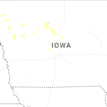
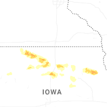


Connect with Interactive Hail Maps