

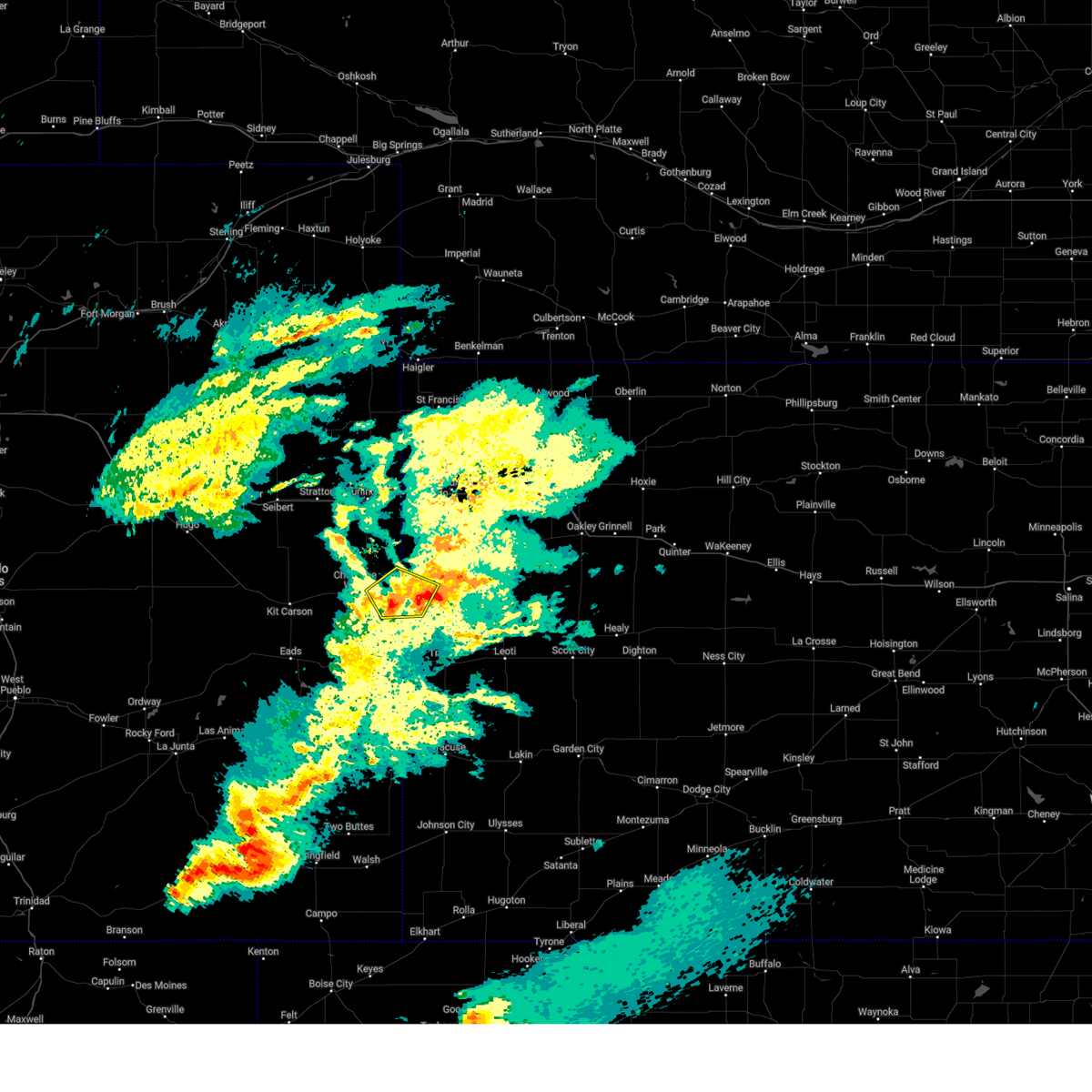
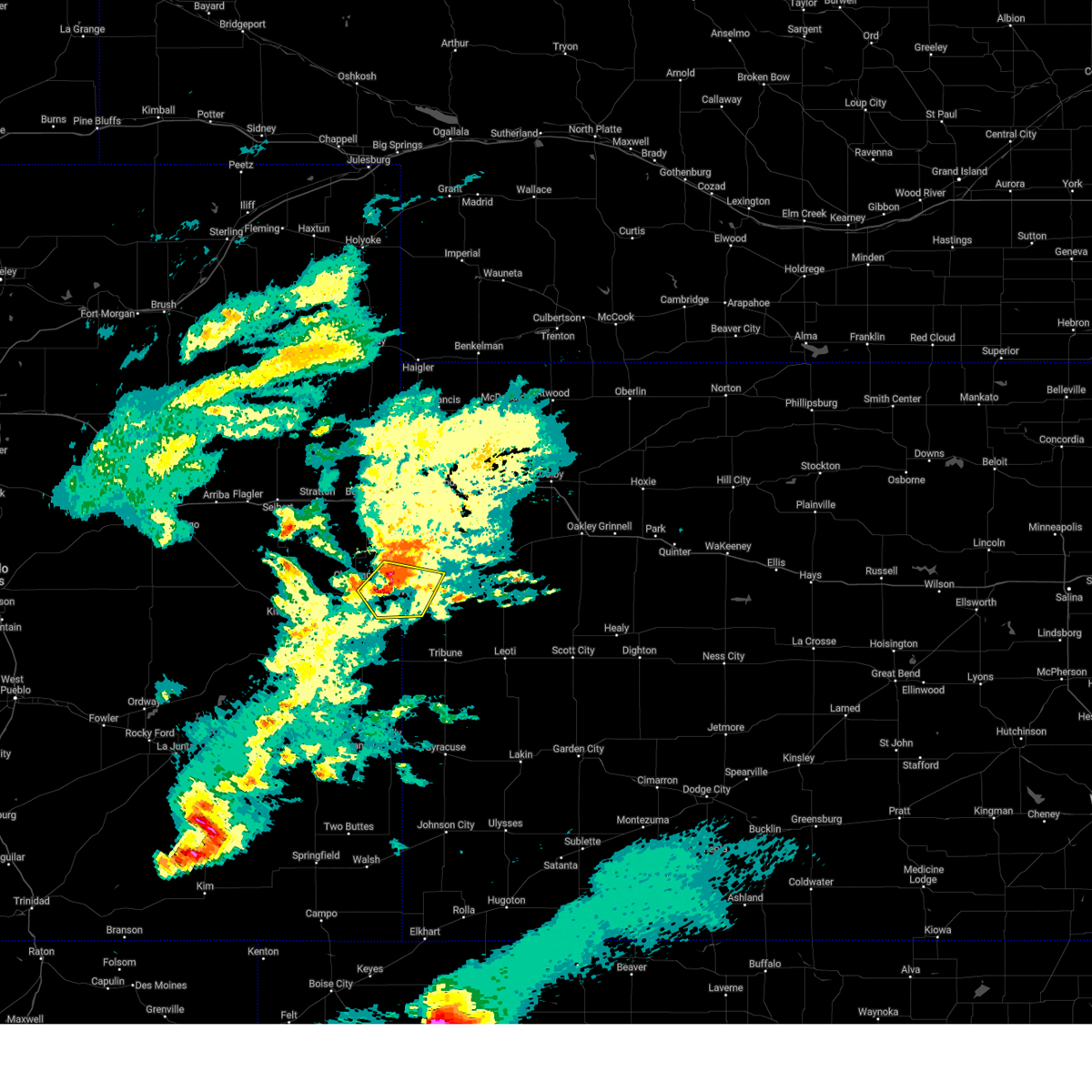
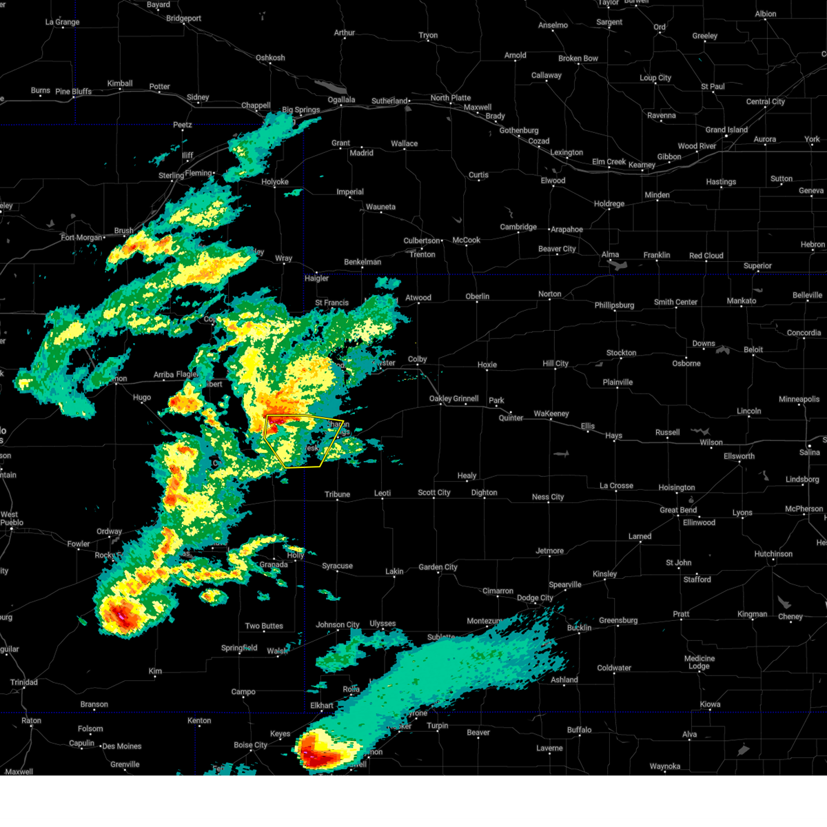
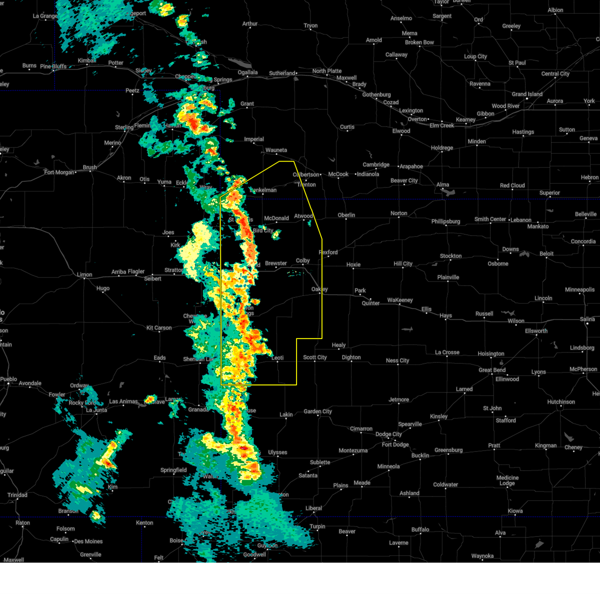
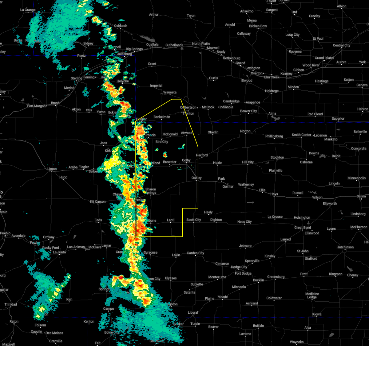
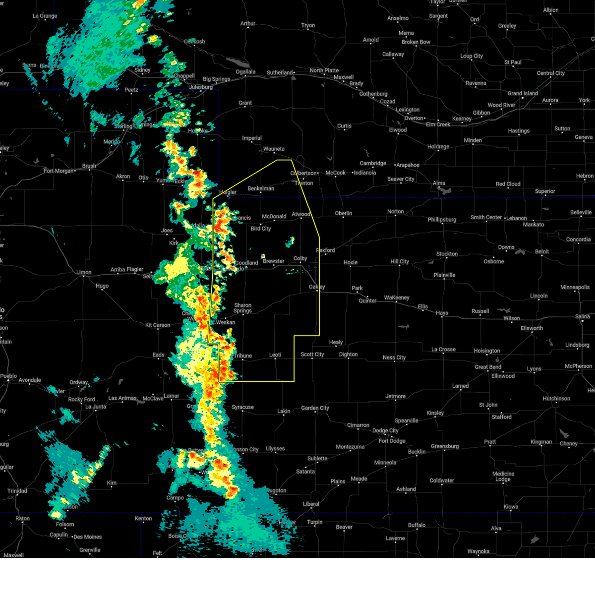
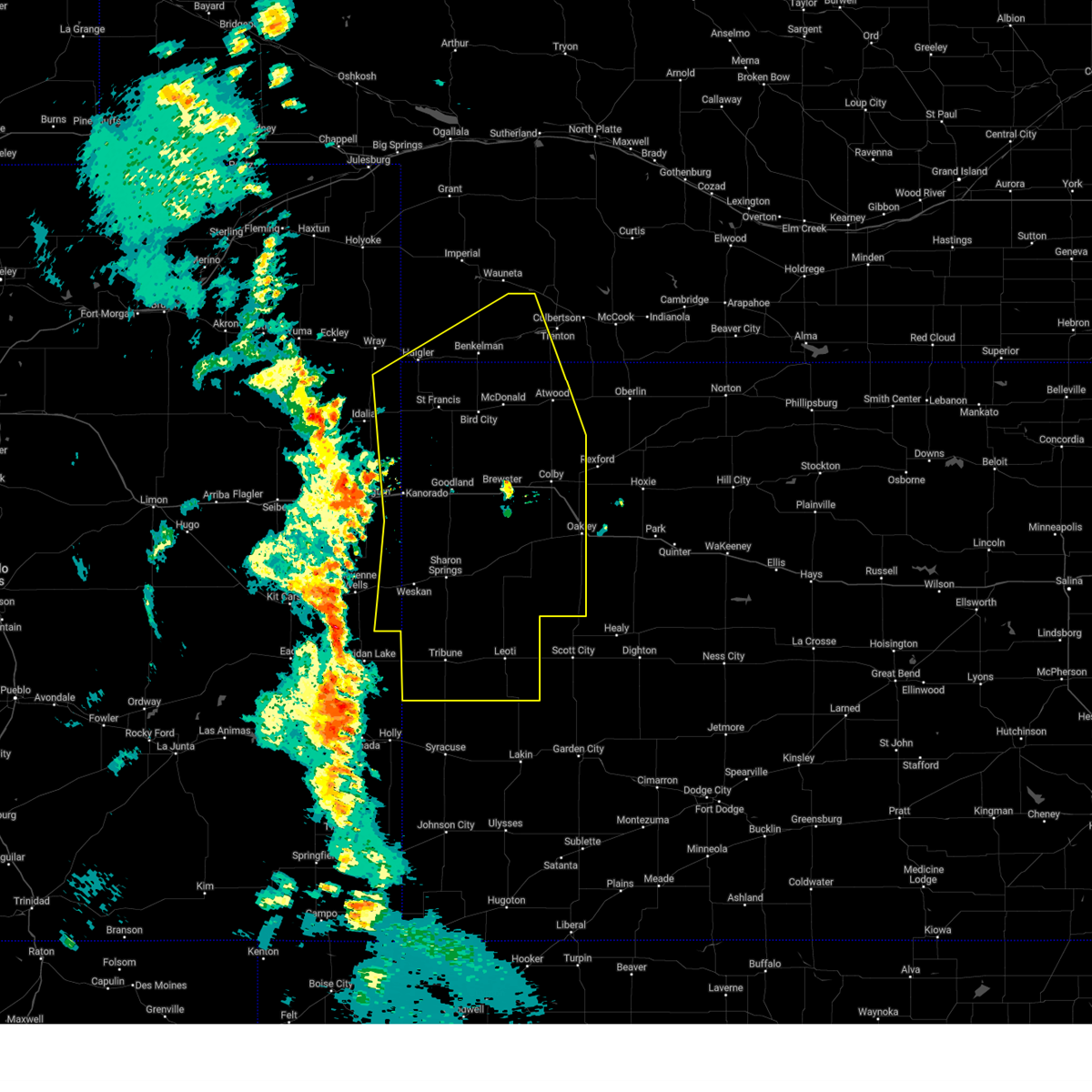
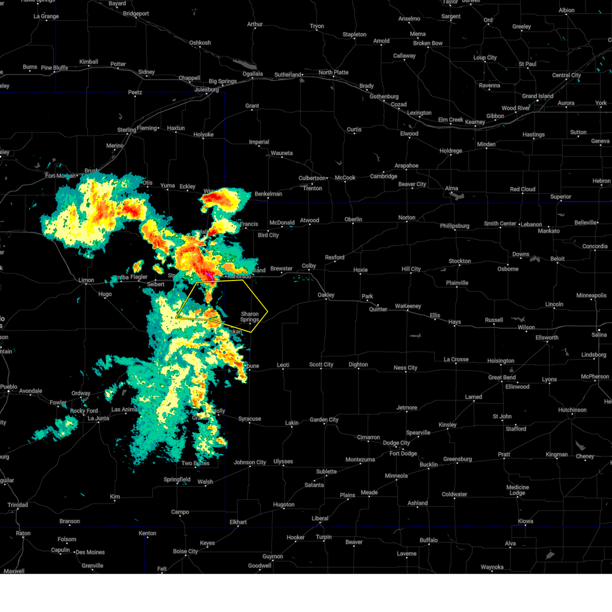
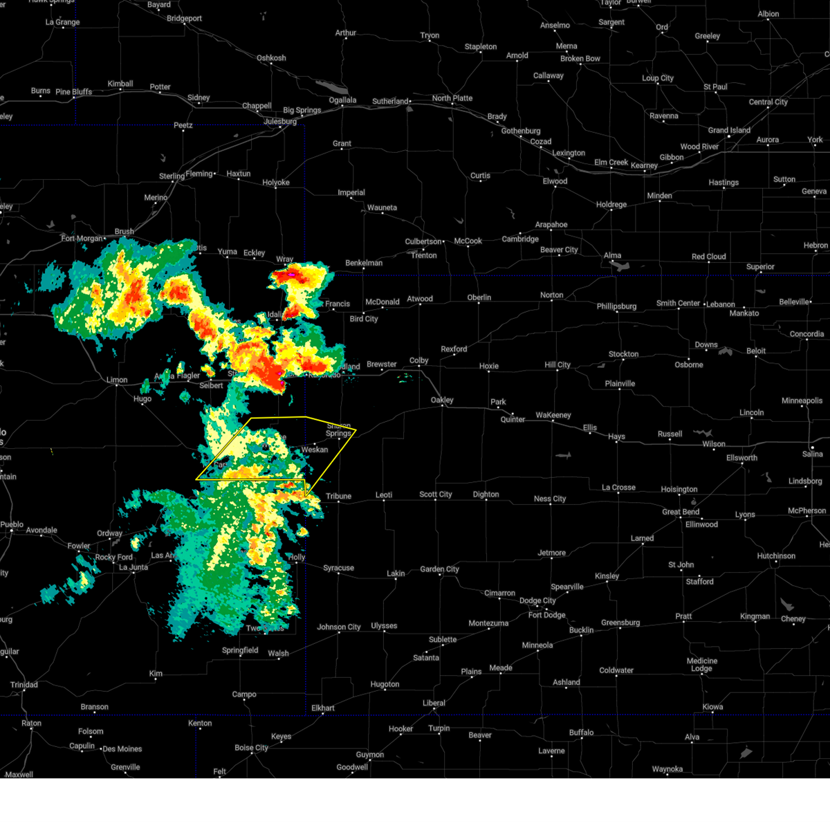
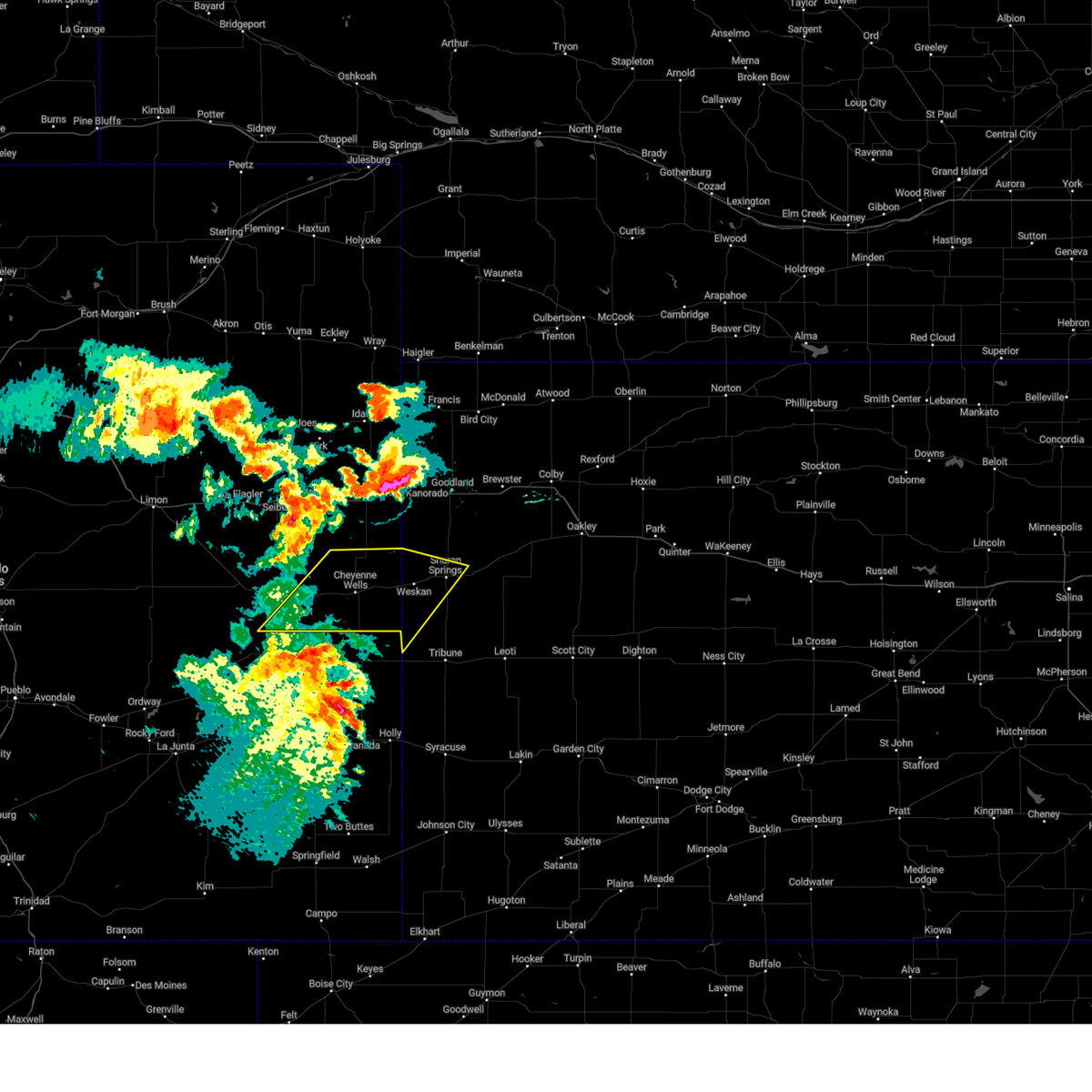
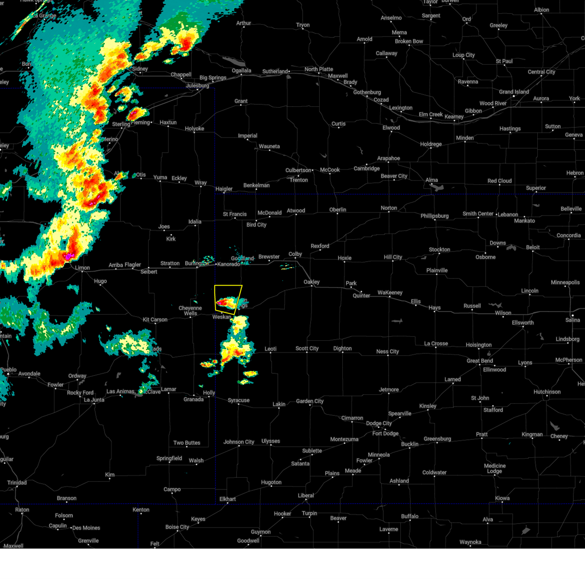
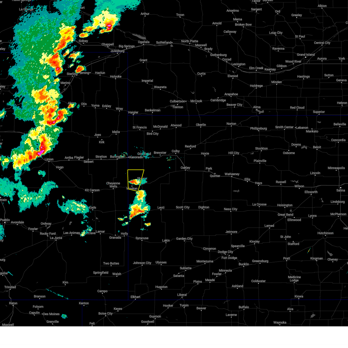
Hail Map for Weskan, KS
The Weskan, KS area has had 23 reports of on-the-ground hail by trained spotters, and has been under severe weather warnings 33 times during the past 12 months. Doppler radar has detected hail at or near Weskan, KS on 105 occasions, including 10 occasions during the past year.
| Name: | Weskan, KS |
| Where Located: | 61.7 miles SW of Colby, KS |
| Map: | Google Map for Weskan, KS |
| Population: | 161 |
| Housing Units: | 69 |
| More Info: | Search Google for Weskan, KS |
3
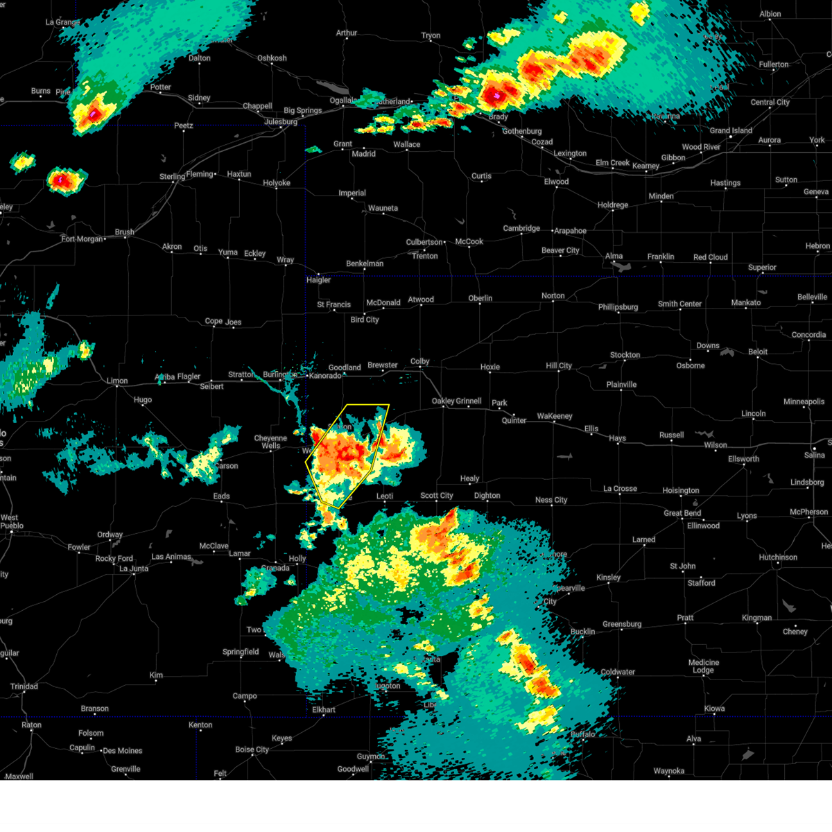
The Top Recent Hail Date for Weskan, KS is Monday, June 2, 2025 (5th out of 105)
Hail and Wind Damage Spotted near Weskan, KS
| Date / Time | Report Details |
|---|---|
| 6/29/2025 9:52 PM MDT | Mesonet station up694 2.2 e arapahoe (upr) gusted to 59 mp in cheyenne county CO, 8.8 miles E of Weskan, KS |
| 6/6/2025 7:23 PM MDT |
 The severe thunderstorm warning that was previously in effect has been reissued for wallace county. please refer to that bulletin for the latest severe weather information. a tornado watch remains in effect until 900 pm mdt for east central colorado. a severe thunderstorm watch remains in effect until 100 am mdt for west central kansas. to report severe weather, contact your nearest law enforcement agency. they will relay your report to the national weather service goodland. remember, a severe thunderstorm warning still remains in effect for wallace county. The severe thunderstorm warning that was previously in effect has been reissued for wallace county. please refer to that bulletin for the latest severe weather information. a tornado watch remains in effect until 900 pm mdt for east central colorado. a severe thunderstorm watch remains in effect until 100 am mdt for west central kansas. to report severe weather, contact your nearest law enforcement agency. they will relay your report to the national weather service goodland. remember, a severe thunderstorm warning still remains in effect for wallace county.
|
| 6/6/2025 7:06 PM MDT | At 706 pm mdt, a severe thunderstorm was located 5 miles southwest of weskan, or 16 miles southwest of sharon springs, moving southeast at 25 mph (radar indicated). Hazards include 60 mph wind gusts and quarter size hail. Hail damage to vehicles is expected. expect wind damage to roofs, siding, and trees. Locations impacted include, weskan and arapahoe. |
| 6/6/2025 7:03 PM MDT | Quarter sized hail reported 3.4 miles E of Weskan, KS, report from mping: quarter (1.00 in.). |
| 6/6/2025 6:50 PM MDT |
 At 650 pm mdt, a severe thunderstorm was located 9 miles west of weskan, or 12 miles east of cheyenne wells, moving southeast at 30 mph (radar indicated). Hazards include 70 mph wind gusts and quarter size hail. Hail damage to vehicles is expected. expect considerable tree damage. wind damage is also likely to mobile homes, roofs, and outbuildings. Locations impacted include, weskan and arapahoe. At 650 pm mdt, a severe thunderstorm was located 9 miles west of weskan, or 12 miles east of cheyenne wells, moving southeast at 30 mph (radar indicated). Hazards include 70 mph wind gusts and quarter size hail. Hail damage to vehicles is expected. expect considerable tree damage. wind damage is also likely to mobile homes, roofs, and outbuildings. Locations impacted include, weskan and arapahoe.
|
| 6/6/2025 6:24 PM MDT |
 Svrgld the national weather service in goodland has issued a * severe thunderstorm warning for, northeastern cheyenne county in east central colorado, southwestern wallace county in west central kansas, * until 730 pm mdt. * at 624 pm mdt, a severe thunderstorm was located 11 miles north of cheyenne wells, moving southeast at 25 mph (radar indicated). Hazards include 60 mph wind gusts and quarter size hail. Hail damage to vehicles is expected. Expect wind damage to roofs, siding, and trees. Svrgld the national weather service in goodland has issued a * severe thunderstorm warning for, northeastern cheyenne county in east central colorado, southwestern wallace county in west central kansas, * until 730 pm mdt. * at 624 pm mdt, a severe thunderstorm was located 11 miles north of cheyenne wells, moving southeast at 25 mph (radar indicated). Hazards include 60 mph wind gusts and quarter size hail. Hail damage to vehicles is expected. Expect wind damage to roofs, siding, and trees.
|
| 6/2/2025 5:53 PM MDT | Awn site section 22 reports 64 mph wind gus in wallace county KS, 3.1 miles N of Weskan, KS |
| 6/2/2025 5:53 PM MDT |
 At 552 pm mdt/652 pm cdt/, severe thunderstorms were located along a line extending from 4 miles north of sharon springs to 3 miles southwest of wallace to 13 miles northeast of tribune, moving northeast at 60 mph. these are destructive storms for sharon springs and wallace (automated weather station south of weskan reported 71 mph winds). Hazards include 80 mph wind gusts and quarter size hail. Flying debris will be dangerous to those caught without shelter. mobile homes will be heavily damaged. expect considerable damage to roofs, windows, and vehicles. extensive tree damage and power outages are likely. These severe storms will be near, wallace around 555 pm mdt. At 552 pm mdt/652 pm cdt/, severe thunderstorms were located along a line extending from 4 miles north of sharon springs to 3 miles southwest of wallace to 13 miles northeast of tribune, moving northeast at 60 mph. these are destructive storms for sharon springs and wallace (automated weather station south of weskan reported 71 mph winds). Hazards include 80 mph wind gusts and quarter size hail. Flying debris will be dangerous to those caught without shelter. mobile homes will be heavily damaged. expect considerable damage to roofs, windows, and vehicles. extensive tree damage and power outages are likely. These severe storms will be near, wallace around 555 pm mdt.
|
| 6/2/2025 5:44 PM MDT | Weather link site farm location reports 59 mph wind gus in wallace county KS, 4.6 miles NE of Weskan, KS |
| 6/2/2025 5:42 PM MDT | Svrgld the national weather service in goodland has issued a * severe thunderstorm warning for, northwestern wichita county in west central kansas, wallace county in west central kansas, western logan county in west central kansas, northern greeley county in west central kansas, * until 615 pm mdt/715 pm cdt/. * at 541 pm mdt/641 pm cdt/, severe thunderstorms were located along a line extending from 5 miles southeast of weskan to 12 miles south of sharon springs to tribune, moving northeast at 55 mph (automated weather station west of tribune reported a 62 mph gust). Hazards include 70 mph wind gusts and quarter size hail. Hail damage to vehicles is expected. expect considerable tree damage. wind damage is also likely to mobile homes, roofs, and outbuildings. severe thunderstorms will be near, sharon springs around 545 pm mdt. Wallace around 555 pm mdt. |
| 6/2/2025 5:36 PM MDT | Weather link site section 32 reports 71 mph wind gus in wallace county KS, 5.5 miles NNE of Weskan, KS |
| 5/14/2025 7:58 PM MDT |
 The storms which prompted the warning have moved out of the area. therefore, the warning will be allowed to expire. strong wind gusts will continue across the area into the evening and a high wind warning is in effect. a severe thunderstorm watch remains in effect until 1000 pm mdt/1100 pm cdt/ for northwestern kansas. The storms which prompted the warning have moved out of the area. therefore, the warning will be allowed to expire. strong wind gusts will continue across the area into the evening and a high wind warning is in effect. a severe thunderstorm watch remains in effect until 1000 pm mdt/1100 pm cdt/ for northwestern kansas.
|
| 5/14/2025 7:37 PM MDT |
 At 735 pm mdt/835 pm cdt/, an outflow boundary was located along a line extending from 7 miles northeast of brewster to 7 miles north of wallace, moving east at 60 mph (a 58 mph wind gust was reported at goodland along with near zero visibility in blowing dust). Hazards include 60 mph wind gusts. Expect damage to roofs, siding, and trees. this outflow will be near, levant around 840 pm cdt. winona around 845 pm cdt. russell springs around 855 pm cdt. This includes interstate 70 in kansas between mile markers 14 and 49. At 735 pm mdt/835 pm cdt/, an outflow boundary was located along a line extending from 7 miles northeast of brewster to 7 miles north of wallace, moving east at 60 mph (a 58 mph wind gust was reported at goodland along with near zero visibility in blowing dust). Hazards include 60 mph wind gusts. Expect damage to roofs, siding, and trees. this outflow will be near, levant around 840 pm cdt. winona around 845 pm cdt. russell springs around 855 pm cdt. This includes interstate 70 in kansas between mile markers 14 and 49.
|
| 5/14/2025 7:08 PM MDT |
 Svrgld the national weather service in goodland has issued a * severe thunderstorm warning for, wallace county in west central kansas, western thomas county in northwestern kansas, northwestern logan county in west central kansas, sherman county in northwestern kansas, * until 800 pm mdt/900 pm cdt/. * at 707 pm mdt/807 pm cdt/, severe thunderstorms were located along a line extending from 14 miles north of goodland to 15 miles south of kanorado, moving east at 60 mph (multiple reports of 60 mph wind gust in burlington, colorado and reports of blowing dust visibility around or below 1/2 a mile). Hazards include 60 mph wind gusts. Expect damage to roofs, siding, and trees. severe thunderstorms will be near, goodland around 710 pm mdt. other locations in the path of these severe thunderstorms include brewster, levant, winona and russell springs. This includes interstate 70 in kansas between mile markers 14 and 49. Svrgld the national weather service in goodland has issued a * severe thunderstorm warning for, wallace county in west central kansas, western thomas county in northwestern kansas, northwestern logan county in west central kansas, sherman county in northwestern kansas, * until 800 pm mdt/900 pm cdt/. * at 707 pm mdt/807 pm cdt/, severe thunderstorms were located along a line extending from 14 miles north of goodland to 15 miles south of kanorado, moving east at 60 mph (multiple reports of 60 mph wind gust in burlington, colorado and reports of blowing dust visibility around or below 1/2 a mile). Hazards include 60 mph wind gusts. Expect damage to roofs, siding, and trees. severe thunderstorms will be near, goodland around 710 pm mdt. other locations in the path of these severe thunderstorms include brewster, levant, winona and russell springs. This includes interstate 70 in kansas between mile markers 14 and 49.
|
| 9/17/2024 7:51 PM CDT |
 At 650 pm mdt/750 pm cdt/, severe thunderstorms were located along a line extending from 3 miles west of benkelman to 10 miles northwest of brewster to 11 miles northeast of tribune, moving east at 45 mph (trained weather spotters. at 0640 pm mdt, estimated 60 to 65 mph wind gusts were reported 13 miles nw of edson). Hazards include 60 mph wind gusts. Expect damage to roofs, siding, and trees. these severe storms will be near, brewster and bird city around 755 pm cdt. benkelman around 655 pm mdt. mcdonald around 800 pm cdt. winona around 805 pm cdt. levant and russell springs around 810 pm cdt. stratton around 815 pm cdt. colby and atwood around 820 pm cdt. monument around 825 pm cdt. gem and ludell around 830 pm cdt. other locations impacted by these severe thunderstorms include blakeman, selkirk, mingo, marienthal, max, halford, and lydia. This includes interstate 70 in kansas between mile markers 1 and 74. At 650 pm mdt/750 pm cdt/, severe thunderstorms were located along a line extending from 3 miles west of benkelman to 10 miles northwest of brewster to 11 miles northeast of tribune, moving east at 45 mph (trained weather spotters. at 0640 pm mdt, estimated 60 to 65 mph wind gusts were reported 13 miles nw of edson). Hazards include 60 mph wind gusts. Expect damage to roofs, siding, and trees. these severe storms will be near, brewster and bird city around 755 pm cdt. benkelman around 655 pm mdt. mcdonald around 800 pm cdt. winona around 805 pm cdt. levant and russell springs around 810 pm cdt. stratton around 815 pm cdt. colby and atwood around 820 pm cdt. monument around 825 pm cdt. gem and ludell around 830 pm cdt. other locations impacted by these severe thunderstorms include blakeman, selkirk, mingo, marienthal, max, halford, and lydia. This includes interstate 70 in kansas between mile markers 1 and 74.
|
| 9/17/2024 7:32 PM CDT |
 the severe thunderstorm warning has been cancelled and is no longer in effect the severe thunderstorm warning has been cancelled and is no longer in effect
|
| 9/17/2024 7:32 PM CDT |
 At 630 pm mdt/730 pm cdt/, severe thunderstorms were located along a line extending from 7 miles east of haigler to 10 miles northeast of goodland to 7 miles south of tribune, moving northeast at 70 mph (trained spotter. at 0625 pm mdt, estimated 60 mph winds were reported 13 miles northwest of saint francis). Hazards include 60 mph wind gusts and nickel size hail. Expect damage to roofs, siding, and trees. these severe storms will be near, brewster and bird city around 735 pm cdt. wallace around 635 pm mdt. mcdonald around 740 pm cdt. benkelman around 640 pm mdt. leoti, levant, and winona around 745 pm cdt. russell springs around 750 pm cdt. colby, atwood, and stratton around 755 pm cdt. monument, gem, and ludell around 800 pm cdt. other locations impacted by these severe thunderstorms include blakeman, selkirk, mingo, marienthal, max, halford, and lydia. This includes interstate 70 in kansas between mile markers 1 and 74. At 630 pm mdt/730 pm cdt/, severe thunderstorms were located along a line extending from 7 miles east of haigler to 10 miles northeast of goodland to 7 miles south of tribune, moving northeast at 70 mph (trained spotter. at 0625 pm mdt, estimated 60 mph winds were reported 13 miles northwest of saint francis). Hazards include 60 mph wind gusts and nickel size hail. Expect damage to roofs, siding, and trees. these severe storms will be near, brewster and bird city around 735 pm cdt. wallace around 635 pm mdt. mcdonald around 740 pm cdt. benkelman around 640 pm mdt. leoti, levant, and winona around 745 pm cdt. russell springs around 750 pm cdt. colby, atwood, and stratton around 755 pm cdt. monument, gem, and ludell around 800 pm cdt. other locations impacted by these severe thunderstorms include blakeman, selkirk, mingo, marienthal, max, halford, and lydia. This includes interstate 70 in kansas between mile markers 1 and 74.
|
| 9/17/2024 6:28 PM MDT | Station up69 in cheyenne county CO, 10.5 miles SE of Weskan, KS |
| 9/17/2024 6:21 PM MDT |
 At 620 pm mdt/720 pm cdt/, severe thunderstorms were located along a line extending from 6 miles southwest of haigler to near goodland to 13 miles southwest of horace, moving east at 35 mph (mesonet. at 0607 pm mdt, a 62 mph wind gust was reported near vernon). Hazards include 60 mph wind gusts and nickel size hail. Expect damage to roofs, siding, and trees. these severe storms will be near, st. francis around 725 pm cdt. goodland, sharon springs, tribune, and horace around 625 pm mdt. wallace around 635 pm mdt. brewster and bird city around 745 pm cdt. leoti, winona, and mcdonald around 800 pm cdt. other locations impacted by these severe thunderstorms include blakeman, selkirk, mingo, marienthal, max, halford, and lydia. this includes the following highways, interstate 70 in kansas between mile markers 0 and 74. Interstate 70 in colorado between mile markers 446 and 450. At 620 pm mdt/720 pm cdt/, severe thunderstorms were located along a line extending from 6 miles southwest of haigler to near goodland to 13 miles southwest of horace, moving east at 35 mph (mesonet. at 0607 pm mdt, a 62 mph wind gust was reported near vernon). Hazards include 60 mph wind gusts and nickel size hail. Expect damage to roofs, siding, and trees. these severe storms will be near, st. francis around 725 pm cdt. goodland, sharon springs, tribune, and horace around 625 pm mdt. wallace around 635 pm mdt. brewster and bird city around 745 pm cdt. leoti, winona, and mcdonald around 800 pm cdt. other locations impacted by these severe thunderstorms include blakeman, selkirk, mingo, marienthal, max, halford, and lydia. this includes the following highways, interstate 70 in kansas between mile markers 0 and 74. Interstate 70 in colorado between mile markers 446 and 450.
|
| 9/17/2024 5:57 PM MDT |
 Svrgld the national weather service in goodland has issued a * severe thunderstorm warning for, eastern cheyenne county in east central colorado, southeastern yuma county in northeastern colorado, eastern kit carson county in east central colorado, wichita county in west central kansas, cheyenne county in northwestern kansas, logan county in west central kansas, rawlins county in northwestern kansas, sherman county in northwestern kansas, wallace county in west central kansas, thomas county in northwestern kansas, greeley county in west central kansas, western hitchcock county in southwestern nebraska, southeastern dundy county in southwestern nebraska, * until 700 pm mdt/800 pm cdt/. * at 556 pm mdt/656 pm cdt/, severe thunderstorms were located along a line extending from 18 miles northwest of bonny reservoir to 9 miles southeast of burlington to 17 miles south of holly, moving east at 70 mph (asos. at 0547 pm mdt, a 66 mph wind gust was reported in burlington, colorado). Hazards include 70 mph wind gusts and nickel size hail. Expect considerable tree damage. damage is likely to mobile homes, roofs, and outbuildings. severe thunderstorms will be near, kanorado and bonny reservoir around 600 pm mdt. ruleton and weskan around 605 pm mdt. goodland, sharon springs, tribune, and horace around 615 pm mdt. st. francis around 720 pm cdt. haigler and wallace around 620 pm mdt. brewster and bird city around 730 pm cdt. leoti around 735 pm cdt. benkelman around 635 pm mdt. levant, winona, and mcdonald around 740 pm cdt. colby and russell springs around 745 pm cdt. other locations impacted by these severe thunderstorms include blakeman, beecher island, marienthal, max, halford, lydia, and edson. this includes the following highways, interstate 70 in kansas between mile markers 0 and 74. Interstate 70 in colorado between mile markers 444 and 450. Svrgld the national weather service in goodland has issued a * severe thunderstorm warning for, eastern cheyenne county in east central colorado, southeastern yuma county in northeastern colorado, eastern kit carson county in east central colorado, wichita county in west central kansas, cheyenne county in northwestern kansas, logan county in west central kansas, rawlins county in northwestern kansas, sherman county in northwestern kansas, wallace county in west central kansas, thomas county in northwestern kansas, greeley county in west central kansas, western hitchcock county in southwestern nebraska, southeastern dundy county in southwestern nebraska, * until 700 pm mdt/800 pm cdt/. * at 556 pm mdt/656 pm cdt/, severe thunderstorms were located along a line extending from 18 miles northwest of bonny reservoir to 9 miles southeast of burlington to 17 miles south of holly, moving east at 70 mph (asos. at 0547 pm mdt, a 66 mph wind gust was reported in burlington, colorado). Hazards include 70 mph wind gusts and nickel size hail. Expect considerable tree damage. damage is likely to mobile homes, roofs, and outbuildings. severe thunderstorms will be near, kanorado and bonny reservoir around 600 pm mdt. ruleton and weskan around 605 pm mdt. goodland, sharon springs, tribune, and horace around 615 pm mdt. st. francis around 720 pm cdt. haigler and wallace around 620 pm mdt. brewster and bird city around 730 pm cdt. leoti around 735 pm cdt. benkelman around 635 pm mdt. levant, winona, and mcdonald around 740 pm cdt. colby and russell springs around 745 pm cdt. other locations impacted by these severe thunderstorms include blakeman, beecher island, marienthal, max, halford, lydia, and edson. this includes the following highways, interstate 70 in kansas between mile markers 0 and 74. Interstate 70 in colorado between mile markers 444 and 450.
|
| 8/22/2024 7:15 PM MDT |
 Svrgld the national weather service in goodland has issued a * severe thunderstorm warning for, northeastern cheyenne county in east central colorado, southeastern kit carson county in east central colorado, northern wallace county in west central kansas, southwestern sherman county in northwestern kansas, * until 745 pm mdt. * at 713 pm mdt, severe thunderstorms were located along a line extending from 15 miles northwest of cheyenne wells to 13 miles northwest of weskan to 12 miles northeast of towner, moving northeast at 50 mph (public. at 7 pm mdt, a 60 mph wind gust was reported in cheyenne wells, co). Hazards include 60 mph wind gusts and quarter size hail. Hail damage to vehicles is expected. expect wind damage to roofs, siding, and trees. severe thunderstorms will be near, sharon springs around 730 pm mdt. this includes the following highways, interstate 70 in colorado between mile markers 435 and 438. Highway 385 between mile markers 159 and 185. Svrgld the national weather service in goodland has issued a * severe thunderstorm warning for, northeastern cheyenne county in east central colorado, southeastern kit carson county in east central colorado, northern wallace county in west central kansas, southwestern sherman county in northwestern kansas, * until 745 pm mdt. * at 713 pm mdt, severe thunderstorms were located along a line extending from 15 miles northwest of cheyenne wells to 13 miles northwest of weskan to 12 miles northeast of towner, moving northeast at 50 mph (public. at 7 pm mdt, a 60 mph wind gust was reported in cheyenne wells, co). Hazards include 60 mph wind gusts and quarter size hail. Hail damage to vehicles is expected. expect wind damage to roofs, siding, and trees. severe thunderstorms will be near, sharon springs around 730 pm mdt. this includes the following highways, interstate 70 in colorado between mile markers 435 and 438. Highway 385 between mile markers 159 and 185.
|
| 8/22/2024 7:03 PM MDT |
 At 702 pm mdt, severe thunderstorms were located along a line extending from 12 miles northeast of kit carson to 6 miles northeast of cheyenne wells to 11 miles north of towner, moving northeast at 50 mph (mesonet. at 7 pm mdt, a 60 mph wind gust was reported in cheyenne wells). Hazards include 60 mph wind gusts and quarter size hail. Hail damage to vehicles is expected. expect wind damage to roofs, siding, and trees. these severe storms will be near, weskan around 715 pm mdt. sharon springs around 730 pm mdt. other locations impacted by these severe thunderstorms include arapahoe and firstview. This includes highway 385 between mile markers 136 and 169. At 702 pm mdt, severe thunderstorms were located along a line extending from 12 miles northeast of kit carson to 6 miles northeast of cheyenne wells to 11 miles north of towner, moving northeast at 50 mph (mesonet. at 7 pm mdt, a 60 mph wind gust was reported in cheyenne wells). Hazards include 60 mph wind gusts and quarter size hail. Hail damage to vehicles is expected. expect wind damage to roofs, siding, and trees. these severe storms will be near, weskan around 715 pm mdt. sharon springs around 730 pm mdt. other locations impacted by these severe thunderstorms include arapahoe and firstview. This includes highway 385 between mile markers 136 and 169.
|
| 8/22/2024 6:39 PM MDT |
 Svrgld the national weather service in goodland has issued a * severe thunderstorm warning for, cheyenne county in east central colorado, southern wallace county in west central kansas, northwestern greeley county in west central kansas, * until 730 pm mdt. * at 639 pm mdt, severe thunderstorms were located along a line extending from 8 miles northwest of eads to 10 miles north of chivington to 11 miles south of brandon, moving northeast at 80 mph (radar indicated). Hazards include 60 mph wind gusts and quarter size hail. Hail damage to vehicles is expected. expect wind damage to roofs, siding, and trees. severe thunderstorms will be near, cheyenne wells and kit carson around 650 pm mdt. weskan around 710 pm mdt. sharon springs around 720 pm mdt. other locations impacted by these severe thunderstorms include arapahoe and firstview. This includes highway 385 between mile markers 136 and 169. Svrgld the national weather service in goodland has issued a * severe thunderstorm warning for, cheyenne county in east central colorado, southern wallace county in west central kansas, northwestern greeley county in west central kansas, * until 730 pm mdt. * at 639 pm mdt, severe thunderstorms were located along a line extending from 8 miles northwest of eads to 10 miles north of chivington to 11 miles south of brandon, moving northeast at 80 mph (radar indicated). Hazards include 60 mph wind gusts and quarter size hail. Hail damage to vehicles is expected. expect wind damage to roofs, siding, and trees. severe thunderstorms will be near, cheyenne wells and kit carson around 650 pm mdt. weskan around 710 pm mdt. sharon springs around 720 pm mdt. other locations impacted by these severe thunderstorms include arapahoe and firstview. This includes highway 385 between mile markers 136 and 169.
|
| 8/13/2024 5:56 PM MDT |
 At 556 pm mdt, a severe thunderstorm was located 8 miles north of weskan, or 12 miles northwest of sharon springs, moving north at 15 mph (radar indicated). Hazards include 70 mph wind gusts and quarter size hail. Hail damage to vehicles is expected. expect considerable tree damage. wind damage is also likely to mobile homes, roofs, and outbuildings. This severe thunderstorm will remain over mainly rural areas of northwestern wallace county. At 556 pm mdt, a severe thunderstorm was located 8 miles north of weskan, or 12 miles northwest of sharon springs, moving north at 15 mph (radar indicated). Hazards include 70 mph wind gusts and quarter size hail. Hail damage to vehicles is expected. expect considerable tree damage. wind damage is also likely to mobile homes, roofs, and outbuildings. This severe thunderstorm will remain over mainly rural areas of northwestern wallace county.
|
| 8/13/2024 5:47 PM MDT |
 Svrgld the national weather service in goodland has issued a * severe thunderstorm warning for, western wallace county in west central kansas, * until 615 pm mdt. * at 546 pm mdt, a severe thunderstorm was located 6 miles north of weskan, or 11 miles west of sharon springs, moving north at 15 mph (radar indicated). Hazards include 60 mph wind gusts and quarter size hail. Hail damage to vehicles is expected. expect wind damage to roofs, siding, and trees. This severe thunderstorm will remain over mainly rural areas of western wallace county. Svrgld the national weather service in goodland has issued a * severe thunderstorm warning for, western wallace county in west central kansas, * until 615 pm mdt. * at 546 pm mdt, a severe thunderstorm was located 6 miles north of weskan, or 11 miles west of sharon springs, moving north at 15 mph (radar indicated). Hazards include 60 mph wind gusts and quarter size hail. Hail damage to vehicles is expected. expect wind damage to roofs, siding, and trees. This severe thunderstorm will remain over mainly rural areas of western wallace county.
|
| 7/19/2024 11:57 PM CDT |
 The storms which prompted the warning have moved out of the warned area. as a result, the warning will be allowed to expire. The storms which prompted the warning have moved out of the warned area. as a result, the warning will be allowed to expire.
|
| 7/19/2024 11:40 PM CDT |
 At 1037 pm mdt/1137 pm cdt/, severe thunderstorms were located along a line extending from 13 miles north of weskan to 7 miles east of russell springs, moving south at 40 mph (radar indicated). Hazards include 70 mph wind gusts. Expect considerable tree damage. damage is likely to mobile homes, roofs, and outbuildings. these severe storms will be near, russell springs around 1140 pm cdt. wallace around 1040 pm mdt. sharon springs around 1045 pm mdt. weskan around 1050 pm mdt. these storms have a history of producing 60 to 70 mph wind gusts, mainly along the leading edge of thunderstorm outflow, in advance of any rain. a 67 mph wind gust was observed at nws goodland at 958 pm mdt. A 69 mph wind gust was measured by a home weather station in mcallaster at 1033 pm mdt. At 1037 pm mdt/1137 pm cdt/, severe thunderstorms were located along a line extending from 13 miles north of weskan to 7 miles east of russell springs, moving south at 40 mph (radar indicated). Hazards include 70 mph wind gusts. Expect considerable tree damage. damage is likely to mobile homes, roofs, and outbuildings. these severe storms will be near, russell springs around 1140 pm cdt. wallace around 1040 pm mdt. sharon springs around 1045 pm mdt. weskan around 1050 pm mdt. these storms have a history of producing 60 to 70 mph wind gusts, mainly along the leading edge of thunderstorm outflow, in advance of any rain. a 67 mph wind gust was observed at nws goodland at 958 pm mdt. A 69 mph wind gust was measured by a home weather station in mcallaster at 1033 pm mdt.
|
| 7/19/2024 11:40 PM CDT |
 the severe thunderstorm warning has been cancelled and is no longer in effect the severe thunderstorm warning has been cancelled and is no longer in effect
|
| 7/19/2024 11:31 PM CDT |
 the severe thunderstorm warning has been cancelled and is no longer in effect the severe thunderstorm warning has been cancelled and is no longer in effect
|
| 7/19/2024 11:31 PM CDT |
 At 1029 pm mdt/1129 pm cdt/, severe thunderstorms were located along a line extending from 6 miles southeast of kanorado to 8 miles east of russell springs, moving south at 25 mph (radar indicated). Hazards include 60 to 70 mph wind gusts. Expect considerable tree damage. damage is likely to mobile homes, roofs, and outbuildings. these severe storms will be near, russell springs around 1135 pm cdt. wallace around 1050 pm mdt. sharon springs around 1100 pm mdt. weskan around 1115 pm mdt. this includes interstate 70 in kansas between mile markers 0 and 12. These storms have a history of producing 60 to 70 mph wind gusts, mainly along the leading edge of thunderstorm outflow, in advance of any rain. At 1029 pm mdt/1129 pm cdt/, severe thunderstorms were located along a line extending from 6 miles southeast of kanorado to 8 miles east of russell springs, moving south at 25 mph (radar indicated). Hazards include 60 to 70 mph wind gusts. Expect considerable tree damage. damage is likely to mobile homes, roofs, and outbuildings. these severe storms will be near, russell springs around 1135 pm cdt. wallace around 1050 pm mdt. sharon springs around 1100 pm mdt. weskan around 1115 pm mdt. this includes interstate 70 in kansas between mile markers 0 and 12. These storms have a history of producing 60 to 70 mph wind gusts, mainly along the leading edge of thunderstorm outflow, in advance of any rain.
|
| 7/19/2024 10:19 PM MDT |
 the severe thunderstorm warning has been cancelled and is no longer in effect the severe thunderstorm warning has been cancelled and is no longer in effect
|
| 7/19/2024 10:19 PM MDT |
 At 1018 pm mdt/1118 pm cdt/, severe thunderstorms were located along a line extending from kanorado to 7 miles east of russell springs, moving southwest at 45 mph (the national weather service in goodland measured wind gusts up to 67 mph at 958 pm mdt). Hazards include 70 mph wind gusts. Expect considerable tree damage. damage is likely to mobile homes, roofs, and outbuildings. these severe storms will be near, russell springs around 1125 pm cdt. wallace around 1030 pm mdt. sharon springs around 1040 pm mdt. weskan around 1050 pm mdt. other locations impacted by these severe thunderstorms include edson. This includes the following highways, interstate 70 in kansas between mile markers 0 and 28. At 1018 pm mdt/1118 pm cdt/, severe thunderstorms were located along a line extending from kanorado to 7 miles east of russell springs, moving southwest at 45 mph (the national weather service in goodland measured wind gusts up to 67 mph at 958 pm mdt). Hazards include 70 mph wind gusts. Expect considerable tree damage. damage is likely to mobile homes, roofs, and outbuildings. these severe storms will be near, russell springs around 1125 pm cdt. wallace around 1030 pm mdt. sharon springs around 1040 pm mdt. weskan around 1050 pm mdt. other locations impacted by these severe thunderstorms include edson. This includes the following highways, interstate 70 in kansas between mile markers 0 and 28.
|
| 7/19/2024 10:01 PM MDT |
 Svrgld the national weather service in goodland has issued a * severe thunderstorm warning for, northeastern cheyenne county in east central colorado, eastern kit carson county in east central colorado, wichita county in west central kansas, wallace county in west central kansas, southwestern thomas county in northwestern kansas, logan county in west central kansas, northern greeley county in west central kansas, sherman county in northwestern kansas, * until 1100 pm mdt/midnight cdt/. * at 1000 pm mdt/1100 pm cdt/, severe thunderstorms were located along a line extending from 13 miles north of ruleton to 3 miles southwest of oakley, moving south at 60 mph (the national weather service in goodland measured a 67 mph wind gust at 958 pm mdt). Hazards include 70 mph wind gusts. Expect considerable tree damage. damage is likely to mobile homes, roofs, and outbuildings. severe thunderstorms will be near, monument around 1105 pm cdt. goodland and ruleton around 1005 pm mdt. winona around 1110 pm cdt. russell springs around 1115 pm cdt. kanorado around 1015 pm mdt. other locations in the path of these severe thunderstorms include wallace, sharon springs, weskan and leoti. this includes the following highways, interstate 70 in kansas between mile markers 0 and 34. interstate 70 in colorado between mile markers 422 and 450. Highway 385 between mile markers 147 and 206, and near mile marker 211. Svrgld the national weather service in goodland has issued a * severe thunderstorm warning for, northeastern cheyenne county in east central colorado, eastern kit carson county in east central colorado, wichita county in west central kansas, wallace county in west central kansas, southwestern thomas county in northwestern kansas, logan county in west central kansas, northern greeley county in west central kansas, sherman county in northwestern kansas, * until 1100 pm mdt/midnight cdt/. * at 1000 pm mdt/1100 pm cdt/, severe thunderstorms were located along a line extending from 13 miles north of ruleton to 3 miles southwest of oakley, moving south at 60 mph (the national weather service in goodland measured a 67 mph wind gust at 958 pm mdt). Hazards include 70 mph wind gusts. Expect considerable tree damage. damage is likely to mobile homes, roofs, and outbuildings. severe thunderstorms will be near, monument around 1105 pm cdt. goodland and ruleton around 1005 pm mdt. winona around 1110 pm cdt. russell springs around 1115 pm cdt. kanorado around 1015 pm mdt. other locations in the path of these severe thunderstorms include wallace, sharon springs, weskan and leoti. this includes the following highways, interstate 70 in kansas between mile markers 0 and 34. interstate 70 in colorado between mile markers 422 and 450. Highway 385 between mile markers 147 and 206, and near mile marker 211.
|
| 7/14/2024 9:11 PM MDT |
 The storms which prompted the warning have dissipated and strong winds associated with lingering outflow have weakened. as a result, the warning will be allowed to expire at 915 pm mdt. The storms which prompted the warning have dissipated and strong winds associated with lingering outflow have weakened. as a result, the warning will be allowed to expire at 915 pm mdt.
|
| 7/14/2024 8:59 PM MDT |
 At 857 pm mdt, thunderstorm outflow was located along a line extending from 3 miles northwest of brewster to 12 miles southeast of goodland to 12 miles north of wallace to 3 miles north of sharon springs to 3 miles southeast of weskan to 12 miles east of cheyenne wells, moving southeast at 15 mph (radar indicated). Hazards include 60 mph wind gusts. Expect damage to roofs, siding, and trees. locations impacted include, edson and arapahoe. This includes interstate 70 in kansas between mile markers 15 and 31. At 857 pm mdt, thunderstorm outflow was located along a line extending from 3 miles northwest of brewster to 12 miles southeast of goodland to 12 miles north of wallace to 3 miles north of sharon springs to 3 miles southeast of weskan to 12 miles east of cheyenne wells, moving southeast at 15 mph (radar indicated). Hazards include 60 mph wind gusts. Expect damage to roofs, siding, and trees. locations impacted include, edson and arapahoe. This includes interstate 70 in kansas between mile markers 15 and 31.
|
| 7/14/2024 8:59 PM MDT |
 the severe thunderstorm warning has been cancelled and is no longer in effect the severe thunderstorm warning has been cancelled and is no longer in effect
|
| 7/14/2024 8:40 PM MDT |
 At 838 pm mdt, severe thunderstorms were located along a line extending from 6 miles northwest of brewster to 8 miles southeast of goodland to 15 miles north of wallace to 6 miles northwest of sharon springs to weskan to 9 miles east of cheyenne wells, moving southeast at 35 mph (the automated surface observation site in burlington, colorado measured sustained winds at 48 mph and gusts to 64 mph at 800 pm mdt in association with outflow in advance of approaching thunderstorms. the national weather service in goodland measured a wind gust of 53 mph at 828 pm mdt). Hazards include 60 to 70 mph wind gusts and localized reductions in visibility associated with blowing dust. Expect considerable tree damage. damage is likely to mobile homes, roofs, and outbuildings. these severe thunderstorms will remain over mainly rural areas of northeastern cheyenne and southeastern kit carson counties in east central colorado, western wallace county in west central kansas and sherman counties in northwestern kansas, including the following locations, edson and arapahoe. this includes the following highways, interstate 70 in kansas between mile markers 1 and 31. Highway 385 between mile markers 145 and 176. At 838 pm mdt, severe thunderstorms were located along a line extending from 6 miles northwest of brewster to 8 miles southeast of goodland to 15 miles north of wallace to 6 miles northwest of sharon springs to weskan to 9 miles east of cheyenne wells, moving southeast at 35 mph (the automated surface observation site in burlington, colorado measured sustained winds at 48 mph and gusts to 64 mph at 800 pm mdt in association with outflow in advance of approaching thunderstorms. the national weather service in goodland measured a wind gust of 53 mph at 828 pm mdt). Hazards include 60 to 70 mph wind gusts and localized reductions in visibility associated with blowing dust. Expect considerable tree damage. damage is likely to mobile homes, roofs, and outbuildings. these severe thunderstorms will remain over mainly rural areas of northeastern cheyenne and southeastern kit carson counties in east central colorado, western wallace county in west central kansas and sherman counties in northwestern kansas, including the following locations, edson and arapahoe. this includes the following highways, interstate 70 in kansas between mile markers 1 and 31. Highway 385 between mile markers 145 and 176.
|
| 7/14/2024 8:18 PM MDT |
 At 813 pm mdt, severe thunderstorms were located along a line extending from 15 miles southwest of bird city to 5 miles northwest of goodland to 4 miles south of ruleton to 15 miles south of kanorado to 14 miles northwest of weskan to 7 miles north of cheyenne wells, moving southeast at 15 mph (the automated surface observation site in burlington, colorado measured sustained winds at 48 mph and gusts to 64 mph at 8 pm mdt in association with outflow in advance of approaching thunderstorms). Hazards include 60 to 70 mph wind gusts and localized reductions in visibility associated with blowing dust. Expect considerable tree damage. damage is likely to mobile homes, roofs, and outbuildings. these severe storms will be near, goodland around 820 pm mdt. cheyenne wells around 830 pm mdt. other locations impacted by these severe thunderstorms include edson and arapahoe. this includes the following highways, interstate 70 in kansas between mile markers 1 and 31. Highway 385 between mile markers 145 and 176. At 813 pm mdt, severe thunderstorms were located along a line extending from 15 miles southwest of bird city to 5 miles northwest of goodland to 4 miles south of ruleton to 15 miles south of kanorado to 14 miles northwest of weskan to 7 miles north of cheyenne wells, moving southeast at 15 mph (the automated surface observation site in burlington, colorado measured sustained winds at 48 mph and gusts to 64 mph at 8 pm mdt in association with outflow in advance of approaching thunderstorms). Hazards include 60 to 70 mph wind gusts and localized reductions in visibility associated with blowing dust. Expect considerable tree damage. damage is likely to mobile homes, roofs, and outbuildings. these severe storms will be near, goodland around 820 pm mdt. cheyenne wells around 830 pm mdt. other locations impacted by these severe thunderstorms include edson and arapahoe. this includes the following highways, interstate 70 in kansas between mile markers 1 and 31. Highway 385 between mile markers 145 and 176.
|
| 7/14/2024 8:10 PM MDT |
 Svrgld the national weather service in goodland has issued a * severe thunderstorm warning for, northeastern cheyenne county in east central colorado, southeastern kit carson county in east central colorado, western wallace county in west central kansas, sherman county in northwestern kansas, * until 915 pm mdt. * at 809 pm mdt, severe thunderstorms were located along a line extending from 16 miles south of st. francis to 5 miles northwest of goodland to 5 miles south of ruleton to 14 miles south of kanorado to 15 miles northwest of weskan to 8 miles north of cheyenne wells, moving southeast at 15 mph (radar indicated). Hazards include 70 mph wind gusts. the automated surface observation site in burlington, colorado measured sustained winds at 46 mph and gusts to 64 mph at 8 pm mdt. Expect considerable tree damage. damage is likely to mobile homes, roofs, and outbuildings. severe thunderstorms will be near, goodland around 815 pm mdt. other locations in the path of these severe thunderstorms include cheyenne wells. this includes the following highways, interstate 70 in kansas between mile markers 1 and 31. Highway 385 between mile markers 145 and 176. Svrgld the national weather service in goodland has issued a * severe thunderstorm warning for, northeastern cheyenne county in east central colorado, southeastern kit carson county in east central colorado, western wallace county in west central kansas, sherman county in northwestern kansas, * until 915 pm mdt. * at 809 pm mdt, severe thunderstorms were located along a line extending from 16 miles south of st. francis to 5 miles northwest of goodland to 5 miles south of ruleton to 14 miles south of kanorado to 15 miles northwest of weskan to 8 miles north of cheyenne wells, moving southeast at 15 mph (radar indicated). Hazards include 70 mph wind gusts. the automated surface observation site in burlington, colorado measured sustained winds at 46 mph and gusts to 64 mph at 8 pm mdt. Expect considerable tree damage. damage is likely to mobile homes, roofs, and outbuildings. severe thunderstorms will be near, goodland around 815 pm mdt. other locations in the path of these severe thunderstorms include cheyenne wells. this includes the following highways, interstate 70 in kansas between mile markers 1 and 31. Highway 385 between mile markers 145 and 176.
|
| 6/14/2024 6:03 PM MDT |
 Svrgld the national weather service in goodland has issued a * severe thunderstorm warning for, wallace county in west central kansas, sherman county in northwestern kansas, * until 645 pm mdt. * at 603 pm mdt, severe thunderstorms were located along a line extending from near kanorado to 15 miles south of ruleton to 6 miles northeast of sharon springs, moving northeast at 60 mph (radar indicated). Hazards include 60 mph wind gusts. Expect damage to roofs, siding, and trees. severe thunderstorms will be near, goodland and ruleton around 610 pm mdt. This includes interstate 70 in kansas between mile markers 1 and 35. Svrgld the national weather service in goodland has issued a * severe thunderstorm warning for, wallace county in west central kansas, sherman county in northwestern kansas, * until 645 pm mdt. * at 603 pm mdt, severe thunderstorms were located along a line extending from near kanorado to 15 miles south of ruleton to 6 miles northeast of sharon springs, moving northeast at 60 mph (radar indicated). Hazards include 60 mph wind gusts. Expect damage to roofs, siding, and trees. severe thunderstorms will be near, goodland and ruleton around 610 pm mdt. This includes interstate 70 in kansas between mile markers 1 and 35.
|
| 6/14/2024 5:47 PM MDT |
 The storms which prompted the warning have weakened below severe limits, and no longer pose an immediate threat to life or property. therefore, the warning has been allowed to expire. however, gusty winds are still possible with these thunderstorms. a severe thunderstorm watch remains in effect until 900 pm mdt for east central colorado, and west central kansas. a severe thunderstorm watch also remains in effect until 100 am mdt for west central kansas. to report severe weather, contact your nearest law enforcement agency. they will relay your report to the national weather service goodland. The storms which prompted the warning have weakened below severe limits, and no longer pose an immediate threat to life or property. therefore, the warning has been allowed to expire. however, gusty winds are still possible with these thunderstorms. a severe thunderstorm watch remains in effect until 900 pm mdt for east central colorado, and west central kansas. a severe thunderstorm watch also remains in effect until 100 am mdt for west central kansas. to report severe weather, contact your nearest law enforcement agency. they will relay your report to the national weather service goodland.
|
| 6/14/2024 5:29 PM MDT |
 At 528 pm mdt, severe thunderstorms were located along a line extending from 12 miles southeast of cheyenne wells to 8 miles south of horace to 3 miles northwest of syracuse, moving east at 55 mph (radar indicated. storms do have a history of producing 60 to 70 mph winds near lamar, colorado). Hazards include 60 mph wind gusts and areas of blowing dust,. Expect damage to roofs, siding, and trees. poor visibility and possible brownout conditions due to blowing dust. locations impacted include, cheyenne wells, sharon springs, tribune, weskan, horace, wallace, and arapahoe. This includes highway 385 between mile markers 136 and 159, and between mile markers 165 and 169. At 528 pm mdt, severe thunderstorms were located along a line extending from 12 miles southeast of cheyenne wells to 8 miles south of horace to 3 miles northwest of syracuse, moving east at 55 mph (radar indicated. storms do have a history of producing 60 to 70 mph winds near lamar, colorado). Hazards include 60 mph wind gusts and areas of blowing dust,. Expect damage to roofs, siding, and trees. poor visibility and possible brownout conditions due to blowing dust. locations impacted include, cheyenne wells, sharon springs, tribune, weskan, horace, wallace, and arapahoe. This includes highway 385 between mile markers 136 and 159, and between mile markers 165 and 169.
|
| 6/14/2024 5:18 PM MDT |
 At 516 pm mdt, severe thunderstorms were located along a line extending from 9 miles southeast of cheyenne wells to 12 miles southeast of towner to 7 miles southeast of coolidge, moving east at 60 mph (radar indicated). Hazards include 60 mph wind gusts and areas of blowing dust. Expect damage to roofs, siding, and trees. poor visibility due to blowing dust. locations impacted include, cheyenne wells, sharon springs, tribune, weskan, horace, wallace, and arapahoe. This includes highway 385 between mile markers 136 and 159, and between mile markers 165 and 169. At 516 pm mdt, severe thunderstorms were located along a line extending from 9 miles southeast of cheyenne wells to 12 miles southeast of towner to 7 miles southeast of coolidge, moving east at 60 mph (radar indicated). Hazards include 60 mph wind gusts and areas of blowing dust. Expect damage to roofs, siding, and trees. poor visibility due to blowing dust. locations impacted include, cheyenne wells, sharon springs, tribune, weskan, horace, wallace, and arapahoe. This includes highway 385 between mile markers 136 and 159, and between mile markers 165 and 169.
|
| 6/14/2024 5:03 PM MDT |
 Svrgld the national weather service in goodland has issued a * severe thunderstorm warning for, eastern cheyenne county in east central colorado, wallace county in west central kansas, greeley county in west central kansas, * until 545 pm mdt. * at 502 pm mdt, severe thunderstorms were located along a line extending from 13 miles southwest of cheyenne wells to 10 miles north of hartman to 9 miles south of holly, moving east at 60 mph (radar indicated). Hazards include 60 mph wind gusts and penny size hail. expect damage to roofs, siding, and trees Svrgld the national weather service in goodland has issued a * severe thunderstorm warning for, eastern cheyenne county in east central colorado, wallace county in west central kansas, greeley county in west central kansas, * until 545 pm mdt. * at 502 pm mdt, severe thunderstorms were located along a line extending from 13 miles southwest of cheyenne wells to 10 miles north of hartman to 9 miles south of holly, moving east at 60 mph (radar indicated). Hazards include 60 mph wind gusts and penny size hail. expect damage to roofs, siding, and trees
|
| 6/13/2024 3:57 PM MDT |
 At 357 pm mdt/457 pm cdt/, a severe thunderstorm was located 4 miles southeast of sharon springs, moving southeast at 15 mph (mesonet 9 south-southeast of sharon springs). Hazards include 60 mph wind gusts. Expect damage to roofs, siding, and trees. Locations impacted include, sharon springs, weskan, and wallace. At 357 pm mdt/457 pm cdt/, a severe thunderstorm was located 4 miles southeast of sharon springs, moving southeast at 15 mph (mesonet 9 south-southeast of sharon springs). Hazards include 60 mph wind gusts. Expect damage to roofs, siding, and trees. Locations impacted include, sharon springs, weskan, and wallace.
|
| 6/13/2024 3:46 PM MDT |
 At 345 pm mdt/445 pm cdt/, a severe thunderstorm was located near sharon springs, moving southeast at 15 mph (law enforcement in sharon springs). Hazards include 60 mph wind gusts and quarter size hail. Hail damage to vehicles is expected. expect wind damage to roofs, siding, and trees. Locations impacted include, sharon springs, weskan, and wallace. At 345 pm mdt/445 pm cdt/, a severe thunderstorm was located near sharon springs, moving southeast at 15 mph (law enforcement in sharon springs). Hazards include 60 mph wind gusts and quarter size hail. Hail damage to vehicles is expected. expect wind damage to roofs, siding, and trees. Locations impacted include, sharon springs, weskan, and wallace.
|
| 6/13/2024 3:38 PM MDT |
 Svrgld the national weather service in goodland has issued a * severe thunderstorm warning for, northern wichita county in west central kansas, southern wallace county in west central kansas, southwestern logan county in west central kansas, northern greeley county in west central kansas, * until 445 pm mdt/545 pm cdt/. * at 338 pm mdt/438 pm cdt/, a severe thunderstorm was located over sharon springs, moving southeast at 15 mph (law enforcement). Hazards include 60 mph wind gusts and quarter size hail. Hail damage to vehicles is expected. expect wind damage to roofs, siding, and trees. This severe thunderstorm will remain over mainly rural areas of northern wichita, southern wallace, southwestern logan and northern greeley counties. Svrgld the national weather service in goodland has issued a * severe thunderstorm warning for, northern wichita county in west central kansas, southern wallace county in west central kansas, southwestern logan county in west central kansas, northern greeley county in west central kansas, * until 445 pm mdt/545 pm cdt/. * at 338 pm mdt/438 pm cdt/, a severe thunderstorm was located over sharon springs, moving southeast at 15 mph (law enforcement). Hazards include 60 mph wind gusts and quarter size hail. Hail damage to vehicles is expected. expect wind damage to roofs, siding, and trees. This severe thunderstorm will remain over mainly rural areas of northern wichita, southern wallace, southwestern logan and northern greeley counties.
|
| 6/13/2024 3:24 PM MDT |
 At 323 pm mdt, severe thunderstorms were located along a line extending from 4 miles southwest of sharon springs to 10 miles northeast of towner, moving southeast at 35 mph (mesonet site near arapahoe). Hazards include 60 mph wind gusts. Expect damage to roofs, siding, and trees. These severe thunderstorms will remain over mainly rural areas of eastern cheyenne county in east central colorado, southwestern wallace and northern greeley counties in west central kansas, including the following locations, arapahoe. At 323 pm mdt, severe thunderstorms were located along a line extending from 4 miles southwest of sharon springs to 10 miles northeast of towner, moving southeast at 35 mph (mesonet site near arapahoe). Hazards include 60 mph wind gusts. Expect damage to roofs, siding, and trees. These severe thunderstorms will remain over mainly rural areas of eastern cheyenne county in east central colorado, southwestern wallace and northern greeley counties in west central kansas, including the following locations, arapahoe.
|
| 6/13/2024 3:02 PM MDT | Up694 reported a 58 mph gus in cheyenne county CO, 8.8 miles E of Weskan, KS |
| 6/13/2024 3:02 PM MDT |
 Svrgld the national weather service in goodland has issued a * severe thunderstorm warning for, eastern cheyenne county in east central colorado, southwestern wallace county in west central kansas, northern greeley county in west central kansas, * until 345 pm mdt. * at 301 pm mdt, severe thunderstorms were located along a line extending from 8 miles north of weskan to 14 miles southeast of cheyenne wells, moving southeast at 35 mph (radar indicated). Hazards include 70 mph wind gusts. Expect considerable tree damage. damage is likely to mobile homes, roofs, and outbuildings. severe thunderstorms will be near, weskan around 305 pm mdt. This includes highway 385 between mile markers 166 and 169. Svrgld the national weather service in goodland has issued a * severe thunderstorm warning for, eastern cheyenne county in east central colorado, southwestern wallace county in west central kansas, northern greeley county in west central kansas, * until 345 pm mdt. * at 301 pm mdt, severe thunderstorms were located along a line extending from 8 miles north of weskan to 14 miles southeast of cheyenne wells, moving southeast at 35 mph (radar indicated). Hazards include 70 mph wind gusts. Expect considerable tree damage. damage is likely to mobile homes, roofs, and outbuildings. severe thunderstorms will be near, weskan around 305 pm mdt. This includes highway 385 between mile markers 166 and 169.
|
| 6/8/2024 8:03 PM MDT |
 At 802 pm mdt/902 pm cdt/, a severe thunderstorm was located near wallace, or 12 miles east of sharon springs, moving southeast at 45 mph. this is a destructive storm for wallace, western logan, northern greeley, and northern wichita counties (law enforcement. at 758 pm mdt, a estimated 65 mph wind gust was reported in sharon springs). Hazards include 80 mph wind gusts and penny size hail. Flying debris will be dangerous to those caught without shelter. mobile homes will be heavily damaged. expect considerable damage to roofs, windows, and vehicles. extensive tree damage and power outages are likely. This severe thunderstorm will remain over mainly rural areas of northwestern wichita, wallace, western logan and northern greeley counties. At 802 pm mdt/902 pm cdt/, a severe thunderstorm was located near wallace, or 12 miles east of sharon springs, moving southeast at 45 mph. this is a destructive storm for wallace, western logan, northern greeley, and northern wichita counties (law enforcement. at 758 pm mdt, a estimated 65 mph wind gust was reported in sharon springs). Hazards include 80 mph wind gusts and penny size hail. Flying debris will be dangerous to those caught without shelter. mobile homes will be heavily damaged. expect considerable damage to roofs, windows, and vehicles. extensive tree damage and power outages are likely. This severe thunderstorm will remain over mainly rural areas of northwestern wichita, wallace, western logan and northern greeley counties.
|
| 6/8/2024 8:03 PM MDT |
 the severe thunderstorm warning has been cancelled and is no longer in effect the severe thunderstorm warning has been cancelled and is no longer in effect
|
| 6/8/2024 7:45 PM MDT |
 Svrgld the national weather service in goodland has issued a * severe thunderstorm warning for, northeastern cheyenne county in east central colorado, northwestern wichita county in west central kansas, wallace county in west central kansas, southwestern thomas county in northwestern kansas, western logan county in west central kansas, northern greeley county in west central kansas, southern sherman county in northwestern kansas, * until 845 pm mdt/945 pm cdt/. * at 744 pm mdt/844 pm cdt/, a severe thunderstorm was located 9 miles north of sharon springs, moving southeast at 35 mph. this is a destructive storm for northeast cheyenne county, southwestern sherman county, and northwest wallace (radar indicated). Hazards include 90 mph wind gusts and penny size hail. You are in a life-threatening situation. flying debris may be deadly to those caught without shelter. mobile homes will be heavily damaged or destroyed. homes and businesses will have substantial roof and window damage. expect extensive tree damage and power outages. This severe thunderstorm will be near, wallace around 800 pm mdt. Svrgld the national weather service in goodland has issued a * severe thunderstorm warning for, northeastern cheyenne county in east central colorado, northwestern wichita county in west central kansas, wallace county in west central kansas, southwestern thomas county in northwestern kansas, western logan county in west central kansas, northern greeley county in west central kansas, southern sherman county in northwestern kansas, * until 845 pm mdt/945 pm cdt/. * at 744 pm mdt/844 pm cdt/, a severe thunderstorm was located 9 miles north of sharon springs, moving southeast at 35 mph. this is a destructive storm for northeast cheyenne county, southwestern sherman county, and northwest wallace (radar indicated). Hazards include 90 mph wind gusts and penny size hail. You are in a life-threatening situation. flying debris may be deadly to those caught without shelter. mobile homes will be heavily damaged or destroyed. homes and businesses will have substantial roof and window damage. expect extensive tree damage and power outages. This severe thunderstorm will be near, wallace around 800 pm mdt.
|
| 6/8/2024 7:35 PM MDT |
 At 734 pm mdt, a severe thunderstorm was located 12 miles northwest of sharon springs, moving southeast at 35 mph. this is a destructive storm for southeastern kit carson county, northeast cheyenne county, southwestern sherman county, and northwest wallace (trained weather spotters. at 721 pm mdt, estimated 100 mph wind gust was reported 12 miles south of peconic). Hazards include 100 mph wind gusts and penny size hail. You are in a life-threatening situation. flying debris may be deadly to those caught without shelter. mobile homes will be destroyed. expect considerable damage to homes and businesses. expect extensive tree damage and power outages. this severe thunderstorm will remain over mainly rural areas of northeastern cheyenne and southeastern kit carson counties in east central colorado, northwestern wallace county in west central kansas and southwestern sherman counties in northwestern kansas. This includes highway 385 between mile markers 167 and 181. At 734 pm mdt, a severe thunderstorm was located 12 miles northwest of sharon springs, moving southeast at 35 mph. this is a destructive storm for southeastern kit carson county, northeast cheyenne county, southwestern sherman county, and northwest wallace (trained weather spotters. at 721 pm mdt, estimated 100 mph wind gust was reported 12 miles south of peconic). Hazards include 100 mph wind gusts and penny size hail. You are in a life-threatening situation. flying debris may be deadly to those caught without shelter. mobile homes will be destroyed. expect considerable damage to homes and businesses. expect extensive tree damage and power outages. this severe thunderstorm will remain over mainly rural areas of northeastern cheyenne and southeastern kit carson counties in east central colorado, northwestern wallace county in west central kansas and southwestern sherman counties in northwestern kansas. This includes highway 385 between mile markers 167 and 181.
|
| 6/8/2024 7:32 PM MDT |
 Svrgld the national weather service in goodland has issued a * severe thunderstorm warning for, east central cheyenne county in east central colorado, southwestern wallace county in west central kansas, * until 745 pm mdt. * at 732 pm mdt, a severe thunderstorm was located near weskan, or 10 miles west of sharon springs, moving southeast at 40 mph (public. at 714 pm mdt, a 58 mph was reported 5 miles nnw of arapahoe). Hazards include 60 mph wind gusts and penny size hail. Expect damage to roofs, siding, and trees. this severe thunderstorm will be near, weskan around 735 pm mdt. Other locations impacted by this severe thunderstorm include arapahoe. Svrgld the national weather service in goodland has issued a * severe thunderstorm warning for, east central cheyenne county in east central colorado, southwestern wallace county in west central kansas, * until 745 pm mdt. * at 732 pm mdt, a severe thunderstorm was located near weskan, or 10 miles west of sharon springs, moving southeast at 40 mph (public. at 714 pm mdt, a 58 mph was reported 5 miles nnw of arapahoe). Hazards include 60 mph wind gusts and penny size hail. Expect damage to roofs, siding, and trees. this severe thunderstorm will be near, weskan around 735 pm mdt. Other locations impacted by this severe thunderstorm include arapahoe.
|
| 6/8/2024 7:22 PM MDT |
 At 721 pm mdt, a severe thunderstorm was located 15 miles south of kanorado, moving southeast at 35 mph. this is a destructive storm for eastern kit carson county, northeast cheyenne county, western sherman county, and northwest wallace county (trained weather spotters. at 721 pm mdt, estimated 100 mph wind gust was reported 12 miles south of peconic). Hazards include 100 mph wind gusts and penny size hail. You are in a life-threatening situation. flying debris may be deadly to those caught without shelter. mobile homes will be destroyed. expect considerable damage to homes and businesses. expect extensive tree damage and power outages. this severe thunderstorm will remain over mainly rural areas of northeastern cheyenne and southeastern kit carson counties in east central colorado, northwestern wallace county in west central kansas and southwestern sherman counties in northwestern kansas. this includes the following highways, interstate 70 in kansas between mile markers 0 and 11. interstate 70 in colorado between mile markers 435 and 450. Highway 385 between mile markers 167 and 192. At 721 pm mdt, a severe thunderstorm was located 15 miles south of kanorado, moving southeast at 35 mph. this is a destructive storm for eastern kit carson county, northeast cheyenne county, western sherman county, and northwest wallace county (trained weather spotters. at 721 pm mdt, estimated 100 mph wind gust was reported 12 miles south of peconic). Hazards include 100 mph wind gusts and penny size hail. You are in a life-threatening situation. flying debris may be deadly to those caught without shelter. mobile homes will be destroyed. expect considerable damage to homes and businesses. expect extensive tree damage and power outages. this severe thunderstorm will remain over mainly rural areas of northeastern cheyenne and southeastern kit carson counties in east central colorado, northwestern wallace county in west central kansas and southwestern sherman counties in northwestern kansas. this includes the following highways, interstate 70 in kansas between mile markers 0 and 11. interstate 70 in colorado between mile markers 435 and 450. Highway 385 between mile markers 167 and 192.
|
| 6/8/2024 7:11 PM MDT |
 At 710 pm mdt, a severe thunderstorm was located 11 miles south of kanorado, moving southeast at 45 mph. this is a destructive storm for eastern kit carson county, northeast cheyenne county, western sherman county, and northwest wallace county (asos. at 653 pm mdt, a 95 mph wind gust was reported 5 miles south of burlington). Hazards include 100 mph wind gusts and quarter size hail. You are in a life-threatening situation. flying debris may be deadly to those caught without shelter. mobile homes will be destroyed. expect considerable damage to homes and businesses. expect extensive tree damage and power outages. this severe thunderstorm will remain over mainly rural areas of northeastern cheyenne and southeastern kit carson counties in east central colorado, northwestern wallace county in west central kansas and southwestern sherman counties in northwestern kansas. this includes the following highways, interstate 70 in kansas between mile markers 0 and 11. interstate 70 in colorado between mile markers 435 and 450. Highway 385 between mile markers 167 and 192. At 710 pm mdt, a severe thunderstorm was located 11 miles south of kanorado, moving southeast at 45 mph. this is a destructive storm for eastern kit carson county, northeast cheyenne county, western sherman county, and northwest wallace county (asos. at 653 pm mdt, a 95 mph wind gust was reported 5 miles south of burlington). Hazards include 100 mph wind gusts and quarter size hail. You are in a life-threatening situation. flying debris may be deadly to those caught without shelter. mobile homes will be destroyed. expect considerable damage to homes and businesses. expect extensive tree damage and power outages. this severe thunderstorm will remain over mainly rural areas of northeastern cheyenne and southeastern kit carson counties in east central colorado, northwestern wallace county in west central kansas and southwestern sherman counties in northwestern kansas. this includes the following highways, interstate 70 in kansas between mile markers 0 and 11. interstate 70 in colorado between mile markers 435 and 450. Highway 385 between mile markers 167 and 192.
|
| 6/8/2024 7:10 PM MDT | Public report of 70 mph estimated winds and pea sized hai in wallace county KS, 17.1 miles S of Weskan, KS |
| 6/8/2024 6:54 PM MDT |
 At 653 pm mdt, report from asos located 5 miles south of burlington, moving southeast at 35 mph. this is a destructive storm for eastern kit carson county, western sherman county, and northwest wallace county (asos. at 653 pm mdt, a 95 mph wind gust was reported 5 miles south of burlington). Hazards include 100 mph wind gusts and quarter size hail. You are in a life-threatening situation. flying debris may be deadly to those caught without shelter. mobile homes will be destroyed. expect considerable damage to homes and businesses. expect extensive tree damage and power outages. this severe storm will be near, sharon springs around 745 pm mdt. this includes the following highways, interstate 70 in kansas between mile markers 0 and 14. interstate 70 in colorado between mile markers 428 and 450. Highway 385 between mile markers 167 and 199. At 653 pm mdt, report from asos located 5 miles south of burlington, moving southeast at 35 mph. this is a destructive storm for eastern kit carson county, western sherman county, and northwest wallace county (asos. at 653 pm mdt, a 95 mph wind gust was reported 5 miles south of burlington). Hazards include 100 mph wind gusts and quarter size hail. You are in a life-threatening situation. flying debris may be deadly to those caught without shelter. mobile homes will be destroyed. expect considerable damage to homes and businesses. expect extensive tree damage and power outages. this severe storm will be near, sharon springs around 745 pm mdt. this includes the following highways, interstate 70 in kansas between mile markers 0 and 14. interstate 70 in colorado between mile markers 428 and 450. Highway 385 between mile markers 167 and 199.
|
| 6/8/2024 6:51 PM MDT |
 At 650 pm mdt, a severe thunderstorm was located 4 miles south of burlington, moving southeast at 35 mph (asos. at 643 pm mdt, a 60 mph wind gust was reported 5 miles south of burlington). Hazards include 70 mph wind gusts and quarter size hail. Hail damage to vehicles is expected. expect considerable tree damage. wind damage is also likely to mobile homes, roofs, and outbuildings. this severe thunderstorm will remain over mainly rural areas of northeastern cheyenne and eastern kit carson counties in east central colorado, northwestern wallace county in west central kansas and southwestern sherman counties in northwestern kansas. this includes the following highways, interstate 70 in kansas between mile markers 0 and 14. interstate 70 in colorado between mile markers 428 and 450. Highway 385 between mile markers 167 and 199. At 650 pm mdt, a severe thunderstorm was located 4 miles south of burlington, moving southeast at 35 mph (asos. at 643 pm mdt, a 60 mph wind gust was reported 5 miles south of burlington). Hazards include 70 mph wind gusts and quarter size hail. Hail damage to vehicles is expected. expect considerable tree damage. wind damage is also likely to mobile homes, roofs, and outbuildings. this severe thunderstorm will remain over mainly rural areas of northeastern cheyenne and eastern kit carson counties in east central colorado, northwestern wallace county in west central kansas and southwestern sherman counties in northwestern kansas. this includes the following highways, interstate 70 in kansas between mile markers 0 and 14. interstate 70 in colorado between mile markers 428 and 450. Highway 385 between mile markers 167 and 199.
|
| 6/8/2024 6:41 PM MDT |
 Svrgld the national weather service in goodland has issued a * severe thunderstorm warning for, northeastern cheyenne county in east central colorado, eastern kit carson county in east central colorado, northwestern wallace county in west central kansas, southwestern sherman county in northwestern kansas, * until 745 pm mdt. * at 641 pm mdt, a severe thunderstorm was located near bethune, or 5 miles west of burlington, moving southeast at 35 mph (mesonet. at 635 pm mdt, a 62 mph gust was reported 3 miles wsw of bethune). Hazards include 70 mph wind gusts and quarter size hail. Hail damage to vehicles is expected. expect considerable tree damage. wind damage is also likely to mobile homes, roofs, and outbuildings. this severe thunderstorm will remain over mainly rural areas of northeastern cheyenne and eastern kit carson counties in east central colorado, northwestern wallace county in west central kansas and southwestern sherman counties in northwestern kansas. this includes the following highways, interstate 70 in kansas between mile markers 0 and 14. interstate 70 in colorado between mile markers 428 and 450. Highway 385 between mile markers 167 and 199. Svrgld the national weather service in goodland has issued a * severe thunderstorm warning for, northeastern cheyenne county in east central colorado, eastern kit carson county in east central colorado, northwestern wallace county in west central kansas, southwestern sherman county in northwestern kansas, * until 745 pm mdt. * at 641 pm mdt, a severe thunderstorm was located near bethune, or 5 miles west of burlington, moving southeast at 35 mph (mesonet. at 635 pm mdt, a 62 mph gust was reported 3 miles wsw of bethune). Hazards include 70 mph wind gusts and quarter size hail. Hail damage to vehicles is expected. expect considerable tree damage. wind damage is also likely to mobile homes, roofs, and outbuildings. this severe thunderstorm will remain over mainly rural areas of northeastern cheyenne and eastern kit carson counties in east central colorado, northwestern wallace county in west central kansas and southwestern sherman counties in northwestern kansas. this includes the following highways, interstate 70 in kansas between mile markers 0 and 14. interstate 70 in colorado between mile markers 428 and 450. Highway 385 between mile markers 167 and 199.
|
| 6/7/2024 6:05 PM MDT |
 At 604 pm mdt/704 pm cdt/, severe thunderstorms were located along a line extending from 14 miles north of bethune to near ruleton to 6 miles northwest of weskan, moving east at 25 mph (off duty nws employee in kanorado reported wind driven hail up to an inch at 6 pm mdt). Hazards include 70 mph wind gusts and quarter size hail. Hail damage to vehicles is expected. expect considerable tree damage. wind damage is also likely to mobile homes, roofs, and outbuildings. these severe storms will be near, ruleton around 610 pm mdt. goodland around 615 pm mdt. sharon springs around 635 pm mdt. other locations impacted by these severe thunderstorms include hale, edson, kirk, and idalia. this includes the following highways, interstate 70 in kansas between mile markers 0 and 30. interstate 70 in colorado between mile markers 438 and 450. Highway 385 between mile markers 187 and 218. At 604 pm mdt/704 pm cdt/, severe thunderstorms were located along a line extending from 14 miles north of bethune to near ruleton to 6 miles northwest of weskan, moving east at 25 mph (off duty nws employee in kanorado reported wind driven hail up to an inch at 6 pm mdt). Hazards include 70 mph wind gusts and quarter size hail. Hail damage to vehicles is expected. expect considerable tree damage. wind damage is also likely to mobile homes, roofs, and outbuildings. these severe storms will be near, ruleton around 610 pm mdt. goodland around 615 pm mdt. sharon springs around 635 pm mdt. other locations impacted by these severe thunderstorms include hale, edson, kirk, and idalia. this includes the following highways, interstate 70 in kansas between mile markers 0 and 30. interstate 70 in colorado between mile markers 438 and 450. Highway 385 between mile markers 187 and 218.
|
| 6/7/2024 5:46 PM MDT |
 Svrgld the national weather service in goodland has issued a * severe thunderstorm warning for, northeastern cheyenne county in east central colorado, southern yuma county in northeastern colorado, eastern kit carson county in east central colorado, wallace county in west central kansas, southwestern cheyenne county in northwestern kansas, sherman county in northwestern kansas, * until 645 pm mdt/745 pm cdt/. * at 546 pm mdt/646 pm cdt/, severe thunderstorms were located along a line extending from 14 miles north of stratton to 3 miles southeast of kanorado to 11 miles northwest of weskan, moving east at 25 mph (automated weather stations have reported winds up to 66 mph and trained spotter has reported inch sized hail). Hazards include 70 mph wind gusts and quarter size hail. Hail damage to vehicles is expected. expect considerable tree damage. wind damage is also likely to mobile homes, roofs, and outbuildings. severe thunderstorms will be near, kanorado around 550 pm mdt. ruleton around 555 pm mdt. other locations in the path of these severe thunderstorms include goodland. this includes the following highways, interstate 70 in kansas between mile markers 0 and 30. interstate 70 in colorado between mile markers 438 and 450. Highway 385 between mile markers 187 and 218. Svrgld the national weather service in goodland has issued a * severe thunderstorm warning for, northeastern cheyenne county in east central colorado, southern yuma county in northeastern colorado, eastern kit carson county in east central colorado, wallace county in west central kansas, southwestern cheyenne county in northwestern kansas, sherman county in northwestern kansas, * until 645 pm mdt/745 pm cdt/. * at 546 pm mdt/646 pm cdt/, severe thunderstorms were located along a line extending from 14 miles north of stratton to 3 miles southeast of kanorado to 11 miles northwest of weskan, moving east at 25 mph (automated weather stations have reported winds up to 66 mph and trained spotter has reported inch sized hail). Hazards include 70 mph wind gusts and quarter size hail. Hail damage to vehicles is expected. expect considerable tree damage. wind damage is also likely to mobile homes, roofs, and outbuildings. severe thunderstorms will be near, kanorado around 550 pm mdt. ruleton around 555 pm mdt. other locations in the path of these severe thunderstorms include goodland. this includes the following highways, interstate 70 in kansas between mile markers 0 and 30. interstate 70 in colorado between mile markers 438 and 450. Highway 385 between mile markers 187 and 218.
|
| 5/3/2024 9:41 PM CDT |
 The storms which prompted the warning have weakened below severe limits, and have exited the warned area. therefore, the warning will be allowed to expire. however, gusty winds are still possible with these thunderstorms. a severe thunderstorm watch remains in effect until 1000 pm mdt/1100 pm cdt/ for east central colorado, and west central kansas. a severe thunderstorm watch also remains in effect until 1100 pm mdt/midnight cdt/ for northwestern kansas. The storms which prompted the warning have weakened below severe limits, and have exited the warned area. therefore, the warning will be allowed to expire. however, gusty winds are still possible with these thunderstorms. a severe thunderstorm watch remains in effect until 1000 pm mdt/1100 pm cdt/ for east central colorado, and west central kansas. a severe thunderstorm watch also remains in effect until 1100 pm mdt/midnight cdt/ for northwestern kansas.
|
| 5/3/2024 9:27 PM CDT |
 the severe thunderstorm warning has been cancelled and is no longer in effect the severe thunderstorm warning has been cancelled and is no longer in effect
|
| 5/3/2024 9:27 PM CDT |
 At 826 pm mdt/926 pm cdt/, severe thunderstorms were located along a line extending from 4 miles north of grinnell to 9 miles south of russell springs to 6 miles west of horace, moving east at 35 mph (radar indicated). Hazards include 60 mph wind gusts. Expect damage to roofs, siding, and trees. these severe storms will be near, grinnell around 930 pm cdt. tribune and horace around 830 pm mdt. grainfield around 940 pm cdt. park around 950 pm cdt. other locations impacted by these severe thunderstorms include angelus, seguin, and selkirk. This includes interstate 70 in kansas between mile markers 65 and 99. At 826 pm mdt/926 pm cdt/, severe thunderstorms were located along a line extending from 4 miles north of grinnell to 9 miles south of russell springs to 6 miles west of horace, moving east at 35 mph (radar indicated). Hazards include 60 mph wind gusts. Expect damage to roofs, siding, and trees. these severe storms will be near, grinnell around 930 pm cdt. tribune and horace around 830 pm mdt. grainfield around 940 pm cdt. park around 950 pm cdt. other locations impacted by these severe thunderstorms include angelus, seguin, and selkirk. This includes interstate 70 in kansas between mile markers 65 and 99.
|
| 5/3/2024 9:15 PM CDT |
 At 814 pm mdt/914 pm cdt/, severe thunderstorms producing gusty winds were located along a line extending from 6 miles southeast of menlo to 5 miles southwest of russell springs to 9 miles northeast of towner, moving east at 35 mph (radar indicated). Hazards include 60 mph wind gusts. Expect damage to roofs, siding, and trees. these severe storms will be near, oakley and russell springs around 920 pm cdt. grinnell around 925 pm cdt. grainfield around 945 pm cdt. park around 955 pm cdt. other locations impacted by these severe thunderstorms include angelus, selkirk, mingo, halford, and seguin. This includes interstate 70 in kansas between mile markers 58 and 99. At 814 pm mdt/914 pm cdt/, severe thunderstorms producing gusty winds were located along a line extending from 6 miles southeast of menlo to 5 miles southwest of russell springs to 9 miles northeast of towner, moving east at 35 mph (radar indicated). Hazards include 60 mph wind gusts. Expect damage to roofs, siding, and trees. these severe storms will be near, oakley and russell springs around 920 pm cdt. grinnell around 925 pm cdt. grainfield around 945 pm cdt. park around 955 pm cdt. other locations impacted by these severe thunderstorms include angelus, selkirk, mingo, halford, and seguin. This includes interstate 70 in kansas between mile markers 58 and 99.
|
| 5/3/2024 8:48 PM CDT |
 Svrgld the national weather service in goodland has issued a * severe thunderstorm warning for, northern wichita county in west central kansas, wallace county in west central kansas, thomas county in northwestern kansas, logan county in west central kansas, southwestern sheridan county in northwestern kansas, greeley county in west central kansas, southern sherman county in northwestern kansas, northwestern gove county in west central kansas, * until 845 pm mdt/945 pm cdt/. * at 747 pm mdt/847 pm cdt/, severe thunderstorms were located along a line extending from rexford to 5 miles west of winona to 8 miles southwest of weskan, moving south at 35 mph. at 835 cdt, a 60 mph wind gust was reported in colby (automated weather station). Hazards include 60 mph wind gusts. Expect damage to roofs, siding, and trees. severe thunderstorms will be near, winona and menlo around 855 pm cdt. monument around 900 pm cdt. oakley and russell springs around 905 pm cdt. other locations in the path of these severe thunderstorms include grinnell, tribune and horace. This includes interstate 70 in kansas between mile markers 26 and 99. Svrgld the national weather service in goodland has issued a * severe thunderstorm warning for, northern wichita county in west central kansas, wallace county in west central kansas, thomas county in northwestern kansas, logan county in west central kansas, southwestern sheridan county in northwestern kansas, greeley county in west central kansas, southern sherman county in northwestern kansas, northwestern gove county in west central kansas, * until 845 pm mdt/945 pm cdt/. * at 747 pm mdt/847 pm cdt/, severe thunderstorms were located along a line extending from rexford to 5 miles west of winona to 8 miles southwest of weskan, moving south at 35 mph. at 835 cdt, a 60 mph wind gust was reported in colby (automated weather station). Hazards include 60 mph wind gusts. Expect damage to roofs, siding, and trees. severe thunderstorms will be near, winona and menlo around 855 pm cdt. monument around 900 pm cdt. oakley and russell springs around 905 pm cdt. other locations in the path of these severe thunderstorms include grinnell, tribune and horace. This includes interstate 70 in kansas between mile markers 26 and 99.
|
| 5/3/2024 7:42 PM MDT |
 The storms which prompted the warning have weakened below severe limits, and have exited the warned area. therefore, the warning will be allowed to expire. however, gusty winds are still possible with these thunderstorms. a severe thunderstorm watch remains in effect until 1000 pm mdt/1100 pm cdt/ for east central colorado, and west central kansas. a severe thunderstorm watch also remains in effect until 1100 pm mdt/midnight cdt/ for east central colorado, and northwestern kansas. The storms which prompted the warning have weakened below severe limits, and have exited the warned area. therefore, the warning will be allowed to expire. however, gusty winds are still possible with these thunderstorms. a severe thunderstorm watch remains in effect until 1000 pm mdt/1100 pm cdt/ for east central colorado, and west central kansas. a severe thunderstorm watch also remains in effect until 1100 pm mdt/midnight cdt/ for east central colorado, and northwestern kansas.
|
| 5/3/2024 7:12 PM MDT |
 At 712 pm mdt/812 pm cdt/, severe thunderstorms were located along a line extending from near brewster to 13 miles south of goodland to 8 miles north of cheyenne wells to 6 miles west of kit carson, moving east at 40 mph (radar indicated). Hazards include 60 mph wind gusts and quarter size hail. Hail damage to vehicles is expected. expect wind damage to roofs, siding, and trees. these severe storms will be near, brewster around 815 pm cdt. kit carson around 715 pm mdt. levant around 820 pm cdt. cheyenne wells around 725 pm mdt. colby around 830 pm cdt. gem around 845 pm cdt. other locations impacted by these severe thunderstorms include edson, firstview, wild horse, arapahoe, halford, and aroya. this includes the following highways, interstate 70 in kansas between mile markers 0 and 61. interstate 70 in colorado between mile markers 391 and 450. Highway 385 between mile markers 144 and 198. At 712 pm mdt/812 pm cdt/, severe thunderstorms were located along a line extending from near brewster to 13 miles south of goodland to 8 miles north of cheyenne wells to 6 miles west of kit carson, moving east at 40 mph (radar indicated). Hazards include 60 mph wind gusts and quarter size hail. Hail damage to vehicles is expected. expect wind damage to roofs, siding, and trees. these severe storms will be near, brewster around 815 pm cdt. kit carson around 715 pm mdt. levant around 820 pm cdt. cheyenne wells around 725 pm mdt. colby around 830 pm cdt. gem around 845 pm cdt. other locations impacted by these severe thunderstorms include edson, firstview, wild horse, arapahoe, halford, and aroya. this includes the following highways, interstate 70 in kansas between mile markers 0 and 61. interstate 70 in colorado between mile markers 391 and 450. Highway 385 between mile markers 144 and 198.
|
| 5/3/2024 6:57 PM MDT |
 At 656 pm mdt/756 pm cdt/, severe thunderstorms were located along a line extending from 11 miles north of brewster to 4 miles south of goodland to 15 miles south of burlington to 11 miles northwest of kit carson, moving east at 40 mph (radar indicated). Hazards include 70 mph wind gusts and quarter size hail. Hail damage to vehicles is expected. expect considerable tree damage. wind damage is also likely to mobile homes, roofs, and outbuildings. these severe storms will be near, brewster around 800 pm cdt. levant around 815 pm cdt. colby around 825 pm cdt. gem around 835 pm cdt. rexford around 840 pm cdt. other locations impacted by these severe thunderstorms include edson, firstview, wild horse, arapahoe, halford, and aroya. this includes the following highways, interstate 70 in kansas between mile markers 0 and 61. interstate 70 in colorado between mile markers 391 and 450. Highway 385 between mile markers 144 and 198. At 656 pm mdt/756 pm cdt/, severe thunderstorms were located along a line extending from 11 miles north of brewster to 4 miles south of goodland to 15 miles south of burlington to 11 miles northwest of kit carson, moving east at 40 mph (radar indicated). Hazards include 70 mph wind gusts and quarter size hail. Hail damage to vehicles is expected. expect considerable tree damage. wind damage is also likely to mobile homes, roofs, and outbuildings. these severe storms will be near, brewster around 800 pm cdt. levant around 815 pm cdt. colby around 825 pm cdt. gem around 835 pm cdt. rexford around 840 pm cdt. other locations impacted by these severe thunderstorms include edson, firstview, wild horse, arapahoe, halford, and aroya. this includes the following highways, interstate 70 in kansas between mile markers 0 and 61. interstate 70 in colorado between mile markers 391 and 450. Highway 385 between mile markers 144 and 198.
|
| 5/3/2024 6:38 PM MDT |
 Svrgld the national weather service in goodland has issued a * severe thunderstorm warning for, cheyenne county in east central colorado, kit carson county in east central colorado, northern wallace county in west central kansas, thomas county in northwestern kansas, sherman county in northwestern kansas, * until 745 pm mdt/845 pm cdt/. * at 638 pm mdt/738 pm cdt/, severe thunderstorms were located along a line extending from 8 miles southeast of mcdonald to 7 miles north of goodland to 4 miles south of burlington to 15 miles south of seibert, moving south at 40 mph (radar indicated). Hazards include 70 mph wind gusts and nickel size hail. Expect considerable tree damage. damage is likely to mobile homes, roofs, and outbuildings. severe thunderstorms will be near, goodland and ruleton around 645 pm mdt. other locations in the path of these severe thunderstorms include brewster, kit carson and cheyenne wells. this includes the following highways, interstate 70 in kansas between mile markers 0 and 61. interstate 70 in colorado between mile markers 391 and 450. Highway 385 between mile markers 144 and 198. Svrgld the national weather service in goodland has issued a * severe thunderstorm warning for, cheyenne county in east central colorado, kit carson county in east central colorado, northern wallace county in west central kansas, thomas county in northwestern kansas, sherman county in northwestern kansas, * until 745 pm mdt/845 pm cdt/. * at 638 pm mdt/738 pm cdt/, severe thunderstorms were located along a line extending from 8 miles southeast of mcdonald to 7 miles north of goodland to 4 miles south of burlington to 15 miles south of seibert, moving south at 40 mph (radar indicated). Hazards include 70 mph wind gusts and nickel size hail. Expect considerable tree damage. damage is likely to mobile homes, roofs, and outbuildings. severe thunderstorms will be near, goodland and ruleton around 645 pm mdt. other locations in the path of these severe thunderstorms include brewster, kit carson and cheyenne wells. this includes the following highways, interstate 70 in kansas between mile markers 0 and 61. interstate 70 in colorado between mile markers 391 and 450. Highway 385 between mile markers 144 and 198.
|
| 4/25/2024 5:27 PM MDT |
 At 527 pm mdt/627 pm cdt/, a severe thunderstorm was located near wallace, or 5 miles east of sharon springs, moving north at 40 mph (radar indicated). Hazards include ping pong ball size hail and 60 mph wind gusts. People and animals outdoors will be injured. expect hail damage to roofs, siding, windows, and vehicles. expect wind damage to roofs, siding, and trees. This severe storm will be near, wallace around 530 pm mdt. At 527 pm mdt/627 pm cdt/, a severe thunderstorm was located near wallace, or 5 miles east of sharon springs, moving north at 40 mph (radar indicated). Hazards include ping pong ball size hail and 60 mph wind gusts. People and animals outdoors will be injured. expect hail damage to roofs, siding, windows, and vehicles. expect wind damage to roofs, siding, and trees. This severe storm will be near, wallace around 530 pm mdt.
|
| 4/25/2024 5:27 PM MDT |
 the severe thunderstorm warning has been cancelled and is no longer in effect the severe thunderstorm warning has been cancelled and is no longer in effect
|
| 4/25/2024 5:16 PM MDT |
 At 515 pm mdt/615 pm cdt/, a severe thunderstorm was located 12 miles south of wallace, or 12 miles southeast of sharon springs, moving north at 60 mph (radar indicated). Hazards include ping pong ball size hail and 60 mph wind gusts. People and animals outdoors will be injured. expect hail damage to roofs, siding, windows, and vehicles. expect wind damage to roofs, siding, and trees. this severe storm will be near, wallace around 525 pm mdt. Other locations impacted by this severe thunderstorm include selkirk. At 515 pm mdt/615 pm cdt/, a severe thunderstorm was located 12 miles south of wallace, or 12 miles southeast of sharon springs, moving north at 60 mph (radar indicated). Hazards include ping pong ball size hail and 60 mph wind gusts. People and animals outdoors will be injured. expect hail damage to roofs, siding, windows, and vehicles. expect wind damage to roofs, siding, and trees. this severe storm will be near, wallace around 525 pm mdt. Other locations impacted by this severe thunderstorm include selkirk.
|
| 4/25/2024 5:02 PM MDT |
 At 458 pm mdt/558 pm cdt/, a severe thunderstorm was located 4 miles northeast of tribune, moving north at 60 mph. spotters reported half dollar sized hail (trained weather spotters). Hazards include ping pong ball size hail and 60 mph wind gusts. People and animals outdoors will be injured. expect hail damage to roofs, siding, windows, and vehicles. expect wind damage to roofs, siding, and trees. this severe storm will be near, wallace around 525 pm mdt. Other locations impacted by this severe thunderstorm include selkirk. At 458 pm mdt/558 pm cdt/, a severe thunderstorm was located 4 miles northeast of tribune, moving north at 60 mph. spotters reported half dollar sized hail (trained weather spotters). Hazards include ping pong ball size hail and 60 mph wind gusts. People and animals outdoors will be injured. expect hail damage to roofs, siding, windows, and vehicles. expect wind damage to roofs, siding, and trees. this severe storm will be near, wallace around 525 pm mdt. Other locations impacted by this severe thunderstorm include selkirk.
|
| 4/25/2024 4:49 PM MDT |
 Svrgld the national weather service in goodland has issued a * severe thunderstorm warning for, northwestern wichita county in west central kansas, wallace county in west central kansas, western logan county in west central kansas, greeley county in west central kansas, * until 545 pm mdt/645 pm cdt/. * at 448 pm mdt/548 pm cdt/, a severe thunderstorm was located 11 miles south of tribune, moving north at 60 mph (radar indicated). Hazards include 60 mph wind gusts and half dollar size hail. Hail damage to vehicles is expected. expect wind damage to roofs, siding, and trees. this severe thunderstorm will be near, tribune and horace around 455 pm mdt. Other locations in the path of this severe thunderstorm include wallace. Svrgld the national weather service in goodland has issued a * severe thunderstorm warning for, northwestern wichita county in west central kansas, wallace county in west central kansas, western logan county in west central kansas, greeley county in west central kansas, * until 545 pm mdt/645 pm cdt/. * at 448 pm mdt/548 pm cdt/, a severe thunderstorm was located 11 miles south of tribune, moving north at 60 mph (radar indicated). Hazards include 60 mph wind gusts and half dollar size hail. Hail damage to vehicles is expected. expect wind damage to roofs, siding, and trees. this severe thunderstorm will be near, tribune and horace around 455 pm mdt. Other locations in the path of this severe thunderstorm include wallace.
|
| 8/7/2023 7:36 PM MDT |
 At 735 pm mdt/835 pm cdt/, a severe thunderstorm was located 16 miles southwest of russell springs, or 16 miles north of leoti, moving southeast at 35 mph (public reported golf ball size hail in wallace). Hazards include tennis ball size hail and 60 mph wind gusts. People and animals outdoors will be injured. expect hail damage to roofs, siding, windows, and vehicles. expect wind damage to roofs, siding, and trees. Locations impacted include, sharon springs, weskan and wallace. At 735 pm mdt/835 pm cdt/, a severe thunderstorm was located 16 miles southwest of russell springs, or 16 miles north of leoti, moving southeast at 35 mph (public reported golf ball size hail in wallace). Hazards include tennis ball size hail and 60 mph wind gusts. People and animals outdoors will be injured. expect hail damage to roofs, siding, windows, and vehicles. expect wind damage to roofs, siding, and trees. Locations impacted include, sharon springs, weskan and wallace.
|
| 8/7/2023 7:17 PM MDT |
 At 716 pm mdt/816 pm cdt/, a severe thunderstorm was located 7 miles southeast of wallace, or 14 miles east of sharon springs, moving southeast at 35 mph (public reported golf ball size hail in wallace at 7:00pm mt). Hazards include tennis ball size hail and 60 mph wind gusts. People and animals outdoors will be injured. expect hail damage to roofs, siding, windows, and vehicles. expect wind damage to roofs, siding, and trees. Locations impacted include, sharon springs, weskan and wallace. At 716 pm mdt/816 pm cdt/, a severe thunderstorm was located 7 miles southeast of wallace, or 14 miles east of sharon springs, moving southeast at 35 mph (public reported golf ball size hail in wallace at 7:00pm mt). Hazards include tennis ball size hail and 60 mph wind gusts. People and animals outdoors will be injured. expect hail damage to roofs, siding, windows, and vehicles. expect wind damage to roofs, siding, and trees. Locations impacted include, sharon springs, weskan and wallace.
|
| 8/7/2023 7:15 PM MDT | Golf Ball sized hail reported 4.5 miles S of Weskan, KS, social media report of golf ball sized hail 5 north of weskan. time estimated by radar. |
| 8/7/2023 7:08 PM MDT |
 At 708 pm mdt/808 pm cdt/, a severe thunderstorm was located near wallace, or 11 miles east of sharon springs, moving southeast at 30 mph (radar indicated). Hazards include tennis ball size hail and 60 mph wind gusts. People and animals outdoors will be injured. expect hail damage to roofs, siding, windows, and vehicles. expect wind damage to roofs, siding, and trees. Locations impacted include, sharon springs, weskan and wallace. At 708 pm mdt/808 pm cdt/, a severe thunderstorm was located near wallace, or 11 miles east of sharon springs, moving southeast at 30 mph (radar indicated). Hazards include tennis ball size hail and 60 mph wind gusts. People and animals outdoors will be injured. expect hail damage to roofs, siding, windows, and vehicles. expect wind damage to roofs, siding, and trees. Locations impacted include, sharon springs, weskan and wallace.
|
| 8/7/2023 7:02 PM MDT |
 At 701 pm mdt/801 pm cdt/, a severe thunderstorm was located over wallace, or 8 miles east of sharon springs, moving southeast at 35 mph (trained weather spotters reported 60 mph winds in sharon springs at 6:58pm mt). Hazards include 70 mph wind gusts and ping pong ball size hail. People and animals outdoors will be injured. expect hail damage to roofs, siding, windows, and vehicles. expect considerable tree damage. wind damage is also likely to mobile homes, roofs, and outbuildings. Locations impacted include, sharon springs, weskan and wallace. At 701 pm mdt/801 pm cdt/, a severe thunderstorm was located over wallace, or 8 miles east of sharon springs, moving southeast at 35 mph (trained weather spotters reported 60 mph winds in sharon springs at 6:58pm mt). Hazards include 70 mph wind gusts and ping pong ball size hail. People and animals outdoors will be injured. expect hail damage to roofs, siding, windows, and vehicles. expect considerable tree damage. wind damage is also likely to mobile homes, roofs, and outbuildings. Locations impacted include, sharon springs, weskan and wallace.
|
| 8/7/2023 6:36 PM MDT |
 At 635 pm mdt/735 pm cdt/, a severe thunderstorm was located 11 miles north of sharon springs, moving southeast at 35 mph (mesonet. an automated wind sensor in southern sherman county reported a 66 mph wind gust). Hazards include golf ball size hail and 70 mph wind gusts. People and animals outdoors will be injured. expect hail damage to roofs, siding, windows, and vehicles. expect considerable tree damage. wind damage is also likely to mobile homes, roofs, and outbuildings. Locations impacted include, sharon springs, weskan and wallace. At 635 pm mdt/735 pm cdt/, a severe thunderstorm was located 11 miles north of sharon springs, moving southeast at 35 mph (mesonet. an automated wind sensor in southern sherman county reported a 66 mph wind gust). Hazards include golf ball size hail and 70 mph wind gusts. People and animals outdoors will be injured. expect hail damage to roofs, siding, windows, and vehicles. expect considerable tree damage. wind damage is also likely to mobile homes, roofs, and outbuildings. Locations impacted include, sharon springs, weskan and wallace.
|
| 8/7/2023 6:26 PM MDT |
 At 626 pm mdt/726 pm cdt/, a severe thunderstorm was located 15 miles north of sharon springs, moving southeast at 35 mph (radar indicated). Hazards include golf ball size hail and 70 mph wind gusts. People and animals outdoors will be injured. expect hail damage to roofs, siding, windows, and vehicles. expect considerable tree damage. Wind damage is also likely to mobile homes, roofs, and outbuildings. At 626 pm mdt/726 pm cdt/, a severe thunderstorm was located 15 miles north of sharon springs, moving southeast at 35 mph (radar indicated). Hazards include golf ball size hail and 70 mph wind gusts. People and animals outdoors will be injured. expect hail damage to roofs, siding, windows, and vehicles. expect considerable tree damage. Wind damage is also likely to mobile homes, roofs, and outbuildings.
|
| 7/22/2023 4:22 PM MDT |
 At 422 pm mdt, a severe thunderstorm was located 6 miles south of weskan, or 14 miles southwest of sharon springs, moving south at 15 mph (radar indicated). Hazards include 60 mph wind gusts and quarter size hail. Hail damage to vehicles is expected. expect wind damage to roofs, siding, and trees. locations impacted include, weskan. hail threat, radar indicated max hail size, 1. 00 in wind threat, radar indicated max wind gust, 60 mph. At 422 pm mdt, a severe thunderstorm was located 6 miles south of weskan, or 14 miles southwest of sharon springs, moving south at 15 mph (radar indicated). Hazards include 60 mph wind gusts and quarter size hail. Hail damage to vehicles is expected. expect wind damage to roofs, siding, and trees. locations impacted include, weskan. hail threat, radar indicated max hail size, 1. 00 in wind threat, radar indicated max wind gust, 60 mph.
|
| 7/22/2023 4:15 PM MDT |
 At 414 pm mdt, a severe thunderstorm was located 4 miles south of weskan, or 12 miles southwest of sharon springs, moving south at 25 mph (radar indicated). Hazards include 60 mph wind gusts and quarter size hail. Hail damage to vehicles is expected. expect wind damage to roofs, siding, and trees. locations impacted include, weskan. hail threat, radar indicated max hail size, 1. 00 in wind threat, radar indicated max wind gust, 60 mph. At 414 pm mdt, a severe thunderstorm was located 4 miles south of weskan, or 12 miles southwest of sharon springs, moving south at 25 mph (radar indicated). Hazards include 60 mph wind gusts and quarter size hail. Hail damage to vehicles is expected. expect wind damage to roofs, siding, and trees. locations impacted include, weskan. hail threat, radar indicated max hail size, 1. 00 in wind threat, radar indicated max wind gust, 60 mph.
|
| 7/22/2023 4:15 PM MDT |
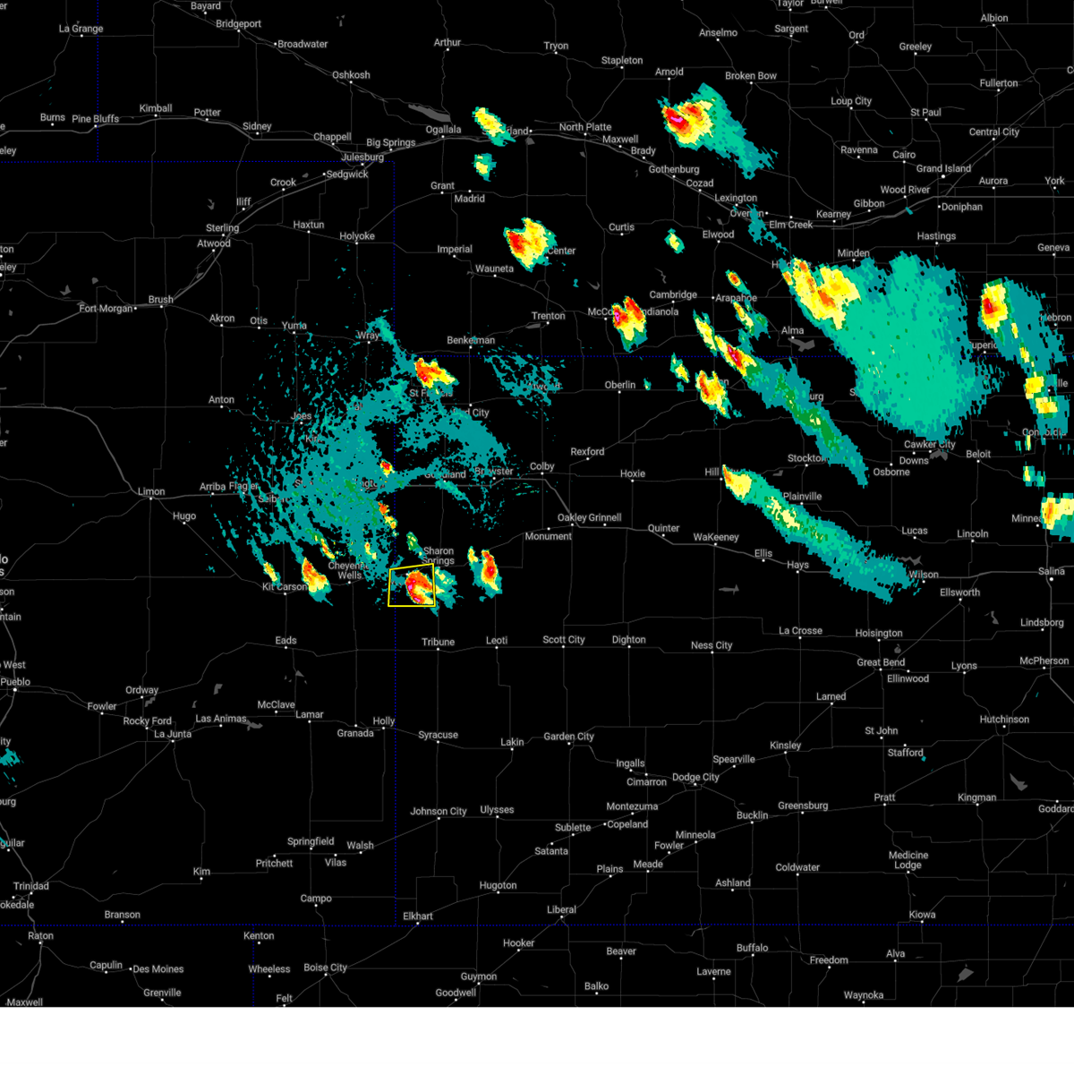 At 414 pm mdt, a severe thunderstorm was located 4 miles south of weskan, or 12 miles southwest of sharon springs, moving south at 25 mph (radar indicated). Hazards include 60 mph wind gusts and quarter size hail. Hail damage to vehicles is expected. expect wind damage to roofs, siding, and trees. locations impacted include, weskan. hail threat, radar indicated max hail size, 1. 00 in wind threat, radar indicated max wind gust, 60 mph. At 414 pm mdt, a severe thunderstorm was located 4 miles south of weskan, or 12 miles southwest of sharon springs, moving south at 25 mph (radar indicated). Hazards include 60 mph wind gusts and quarter size hail. Hail damage to vehicles is expected. expect wind damage to roofs, siding, and trees. locations impacted include, weskan. hail threat, radar indicated max hail size, 1. 00 in wind threat, radar indicated max wind gust, 60 mph.
|
| 7/22/2023 3:59 PM MDT | Quarter sized hail reported 0.5 miles SW of Weskan, KS, report from social media. |
| 7/22/2023 3:43 PM MDT |
 At 343 pm mdt, a severe thunderstorm was located 9 miles north of weskan, or 12 miles northwest of sharon springs, moving south at 10 mph (radar indicated). Hazards include 60 mph wind gusts and quarter size hail. Hail damage to vehicles is expected. Expect wind damage to roofs, siding, and trees. At 343 pm mdt, a severe thunderstorm was located 9 miles north of weskan, or 12 miles northwest of sharon springs, moving south at 10 mph (radar indicated). Hazards include 60 mph wind gusts and quarter size hail. Hail damage to vehicles is expected. Expect wind damage to roofs, siding, and trees.
|
| 7/22/2023 3:43 PM MDT |
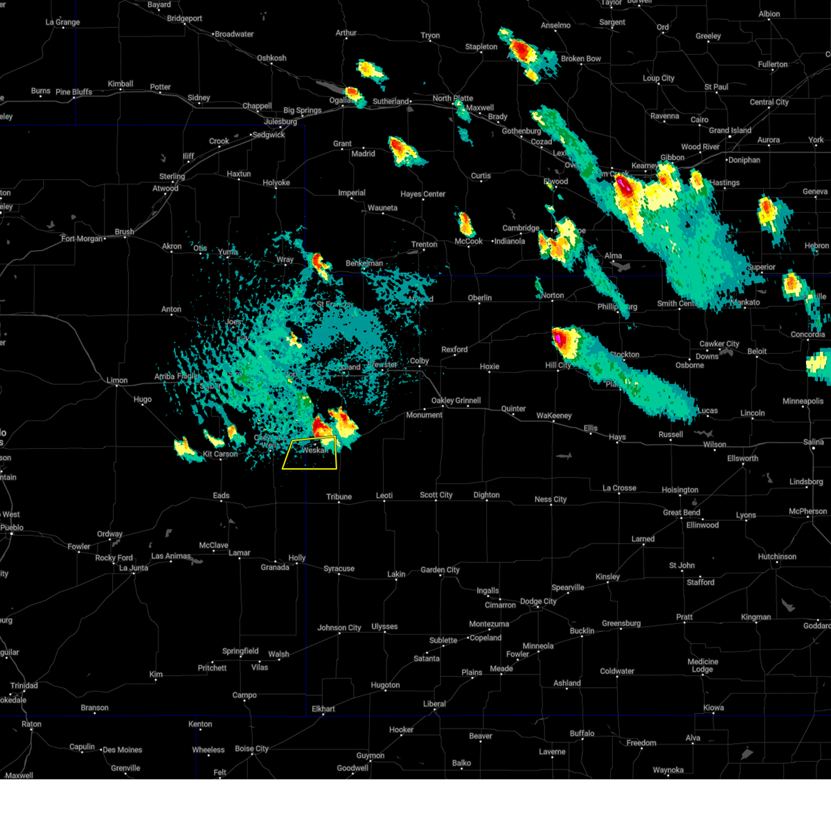 At 343 pm mdt, a severe thunderstorm was located 9 miles north of weskan, or 12 miles northwest of sharon springs, moving south at 10 mph (radar indicated). Hazards include 60 mph wind gusts and quarter size hail. Hail damage to vehicles is expected. Expect wind damage to roofs, siding, and trees. At 343 pm mdt, a severe thunderstorm was located 9 miles north of weskan, or 12 miles northwest of sharon springs, moving south at 10 mph (radar indicated). Hazards include 60 mph wind gusts and quarter size hail. Hail damage to vehicles is expected. Expect wind damage to roofs, siding, and trees.
|
| 7/10/2023 5:12 PM MDT |
 At 512 pm mdt, a severe thunderstorm was located 5 miles southeast of weskan, or 7 miles southwest of sharon springs, moving east at 15 mph (radar indicated). Hazards include 60 mph wind gusts and quarter size hail. Hail damage to vehicles is expected. Expect wind damage to roofs, siding, and trees. At 512 pm mdt, a severe thunderstorm was located 5 miles southeast of weskan, or 7 miles southwest of sharon springs, moving east at 15 mph (radar indicated). Hazards include 60 mph wind gusts and quarter size hail. Hail damage to vehicles is expected. Expect wind damage to roofs, siding, and trees.
|
| 6/16/2023 8:39 PM MDT |
 At 839 pm mdt, a severe thunderstorm was located 6 miles north of sharon springs, moving northeast at 15 mph (radar indicated). Hazards include two inch hail. People and animals outdoors will be injured. expect damage to roofs, siding, windows, and vehicles. locations impacted include, wallace. thunderstorm damage threat, considerable hail threat, radar indicated max hail size, 2. 00 in wind threat, radar indicated max wind gust, <50 mph. At 839 pm mdt, a severe thunderstorm was located 6 miles north of sharon springs, moving northeast at 15 mph (radar indicated). Hazards include two inch hail. People and animals outdoors will be injured. expect damage to roofs, siding, windows, and vehicles. locations impacted include, wallace. thunderstorm damage threat, considerable hail threat, radar indicated max hail size, 2. 00 in wind threat, radar indicated max wind gust, <50 mph.
|
| 6/16/2023 8:18 PM MDT |
 At 815 pm mdt, a severe thunderstorm was located 6 miles northwest of sharon springs, moving northeast at 20 mph (trained weather spotters reported tennis ball sized hail 4 miles east of weskan at around 8 pm mdt). Hazards include tennis ball size hail. People and animals outdoors will be injured. expect damage to roofs, siding, windows, and vehicles. this severe storm will be near, sharon springs around 820 pm mdt. thunderstorm damage threat, considerable hail threat, observed max hail size, 2. 50 in wind threat, radar indicated max wind gust, <50 mph. At 815 pm mdt, a severe thunderstorm was located 6 miles northwest of sharon springs, moving northeast at 20 mph (trained weather spotters reported tennis ball sized hail 4 miles east of weskan at around 8 pm mdt). Hazards include tennis ball size hail. People and animals outdoors will be injured. expect damage to roofs, siding, windows, and vehicles. this severe storm will be near, sharon springs around 820 pm mdt. thunderstorm damage threat, considerable hail threat, observed max hail size, 2. 50 in wind threat, radar indicated max wind gust, <50 mph.
|
| 6/16/2023 8:10 PM MDT |
 At 810 pm mdt, a severe thunderstorm was located 6 miles northwest of sharon springs, moving northeast at 20 mph (radar indicated). Hazards include half dollar size hail. Damage to vehicles is expected. this severe thunderstorm will be near, sharon springs around 820 pm mdt. hail threat, radar indicated max hail size, 1. 25 in wind threat, radar indicated max wind gust, <50 mph. At 810 pm mdt, a severe thunderstorm was located 6 miles northwest of sharon springs, moving northeast at 20 mph (radar indicated). Hazards include half dollar size hail. Damage to vehicles is expected. this severe thunderstorm will be near, sharon springs around 820 pm mdt. hail threat, radar indicated max hail size, 1. 25 in wind threat, radar indicated max wind gust, <50 mph.
|
| 6/16/2023 7:57 PM MDT | Hen Egg sized hail reported 3.8 miles WSW of Weskan, KS, storm chaser report and photo via social media of 2.25 inch hail. |
| 6/16/2023 7:15 PM MDT |
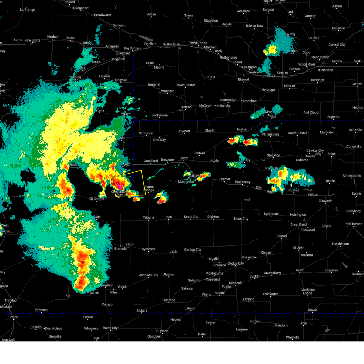 At 714 pm mdt, a severe thunderstorm was located 12 miles north of cheyenne wells, moving east at 15 mph (radar indicated). Hazards include half dollar size hail. Damage to vehicles is expected. this severe thunderstorm will remain over mainly rural areas of northeastern cheyenne and southeastern kit carson counties in east central colorado, northwestern wallace county in west central kansas and southwestern sherman counties in northwestern kansas, including the following locations, arapahoe. this includes highway 385 between mile markers 153 and 178. hail threat, radar indicated max hail size, 1. 25 in wind threat, radar indicated max wind gust, <50 mph. At 714 pm mdt, a severe thunderstorm was located 12 miles north of cheyenne wells, moving east at 15 mph (radar indicated). Hazards include half dollar size hail. Damage to vehicles is expected. this severe thunderstorm will remain over mainly rural areas of northeastern cheyenne and southeastern kit carson counties in east central colorado, northwestern wallace county in west central kansas and southwestern sherman counties in northwestern kansas, including the following locations, arapahoe. this includes highway 385 between mile markers 153 and 178. hail threat, radar indicated max hail size, 1. 25 in wind threat, radar indicated max wind gust, <50 mph.
|
| 6/16/2023 7:15 PM MDT |
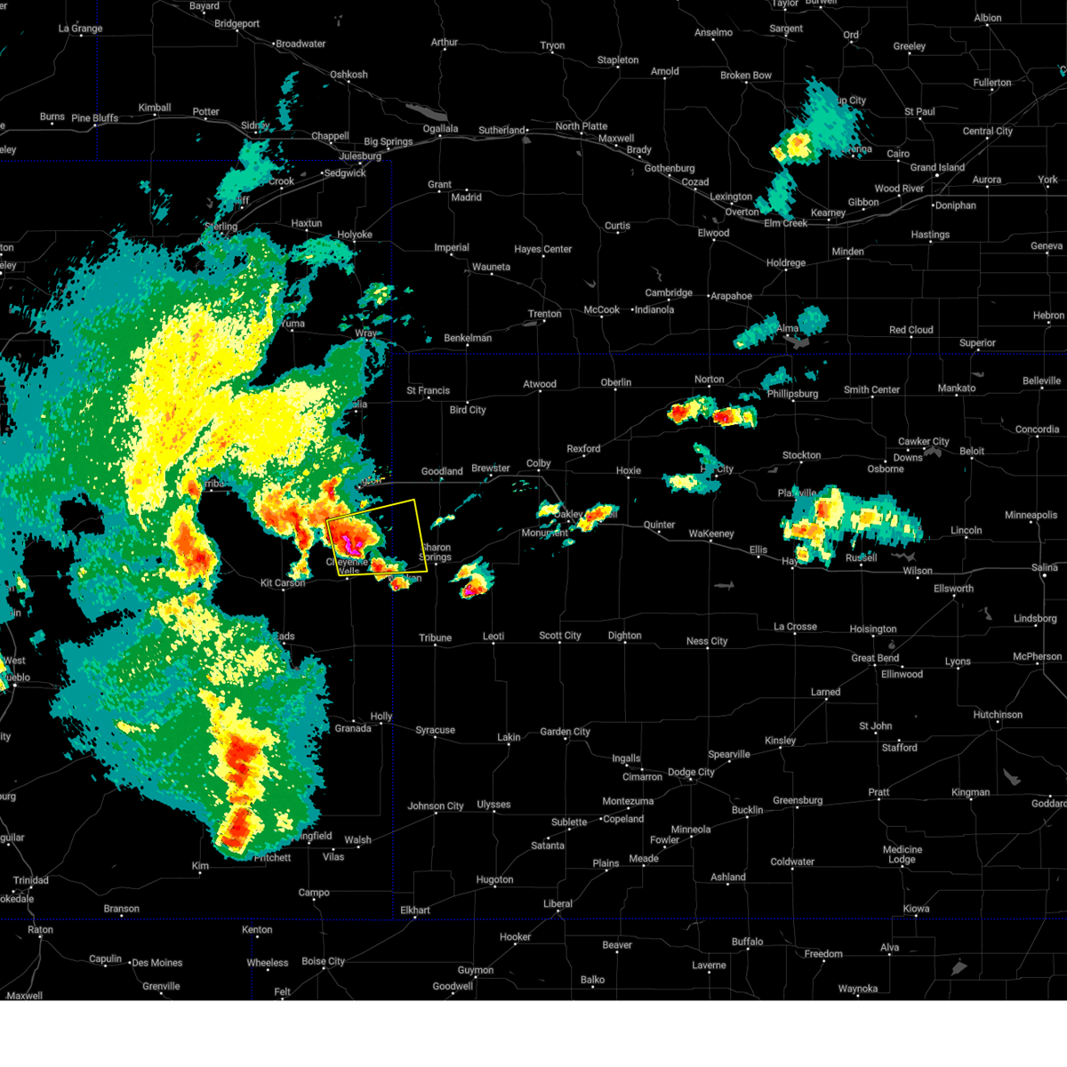 At 714 pm mdt, a severe thunderstorm was located 12 miles north of cheyenne wells, moving east at 15 mph (radar indicated). Hazards include half dollar size hail. Damage to vehicles is expected. this severe thunderstorm will remain over mainly rural areas of northeastern cheyenne and southeastern kit carson counties in east central colorado, northwestern wallace county in west central kansas and southwestern sherman counties in northwestern kansas, including the following locations, arapahoe. this includes highway 385 between mile markers 153 and 178. hail threat, radar indicated max hail size, 1. 25 in wind threat, radar indicated max wind gust, <50 mph. At 714 pm mdt, a severe thunderstorm was located 12 miles north of cheyenne wells, moving east at 15 mph (radar indicated). Hazards include half dollar size hail. Damage to vehicles is expected. this severe thunderstorm will remain over mainly rural areas of northeastern cheyenne and southeastern kit carson counties in east central colorado, northwestern wallace county in west central kansas and southwestern sherman counties in northwestern kansas, including the following locations, arapahoe. this includes highway 385 between mile markers 153 and 178. hail threat, radar indicated max hail size, 1. 25 in wind threat, radar indicated max wind gust, <50 mph.
|
| 5/11/2023 4:42 PM MDT |
 At 442 pm mdt, a confirmed tornado was located over weskan, or 12 miles west of sharon springs, moving northwest at 20 mph (weather spotters confirmed tornado one mile west of weskan). Hazards include damaging tornado. Flying debris will be dangerous to those caught without shelter. mobile homes will be damaged or destroyed. damage to roofs, windows, and vehicles will occur. tree damage is likely. Locations impacted include, weskan. At 442 pm mdt, a confirmed tornado was located over weskan, or 12 miles west of sharon springs, moving northwest at 20 mph (weather spotters confirmed tornado one mile west of weskan). Hazards include damaging tornado. Flying debris will be dangerous to those caught without shelter. mobile homes will be damaged or destroyed. damage to roofs, windows, and vehicles will occur. tree damage is likely. Locations impacted include, weskan.
|
| 5/11/2023 4:41 PM MDT |
 At 441 pm mdt, severe thunderstorms capable of producing both tornadoes and extensive straight line wind damage were located over weskan, or 12 miles west of sharon springs, moving northwest at 20 mph (radar indicated rotation). Hazards include tornado. Flying debris will be dangerous to those caught without shelter. mobile homes will be damaged or destroyed. damage to roofs, windows, and vehicles will occur. tree damage is likely. This tornadic thunderstorm will remain over mainly rural areas of east central cheyenne county in east central colorado and southwestern wallace counties in west central kansas. At 441 pm mdt, severe thunderstorms capable of producing both tornadoes and extensive straight line wind damage were located over weskan, or 12 miles west of sharon springs, moving northwest at 20 mph (radar indicated rotation). Hazards include tornado. Flying debris will be dangerous to those caught without shelter. mobile homes will be damaged or destroyed. damage to roofs, windows, and vehicles will occur. tree damage is likely. This tornadic thunderstorm will remain over mainly rural areas of east central cheyenne county in east central colorado and southwestern wallace counties in west central kansas.
|
| 5/11/2023 4:41 PM MDT |
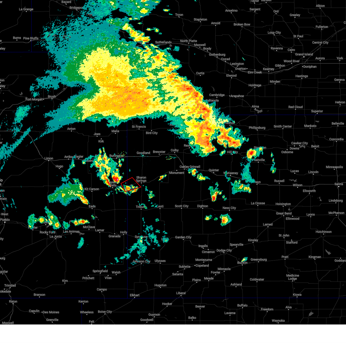 At 441 pm mdt, severe thunderstorms capable of producing both tornadoes and extensive straight line wind damage were located over weskan, or 12 miles west of sharon springs, moving northwest at 20 mph (radar indicated rotation). Hazards include tornado. Flying debris will be dangerous to those caught without shelter. mobile homes will be damaged or destroyed. damage to roofs, windows, and vehicles will occur. tree damage is likely. This tornadic thunderstorm will remain over mainly rural areas of east central cheyenne county in east central colorado and southwestern wallace counties in west central kansas. At 441 pm mdt, severe thunderstorms capable of producing both tornadoes and extensive straight line wind damage were located over weskan, or 12 miles west of sharon springs, moving northwest at 20 mph (radar indicated rotation). Hazards include tornado. Flying debris will be dangerous to those caught without shelter. mobile homes will be damaged or destroyed. damage to roofs, windows, and vehicles will occur. tree damage is likely. This tornadic thunderstorm will remain over mainly rural areas of east central cheyenne county in east central colorado and southwestern wallace counties in west central kansas.
|
| 4/27/2023 6:41 PM MDT |
 The severe thunderstorm warning for northern wallace, western thomas, northwestern logan and sherman counties will expire at 645 pm mdt/745 pm cdt/, the storms which prompted the warning have moved out of the area. therefore, the warning will be allowed to expire. however gusty winds are still possible with these thunderstorms. to report severe weather, contact your nearest law enforcement agency. they will relay your report to the national weather service goodland. remember, a severe thunderstorm warning still remains in effect for portions of thomas, wallace and logan counties. The severe thunderstorm warning for northern wallace, western thomas, northwestern logan and sherman counties will expire at 645 pm mdt/745 pm cdt/, the storms which prompted the warning have moved out of the area. therefore, the warning will be allowed to expire. however gusty winds are still possible with these thunderstorms. to report severe weather, contact your nearest law enforcement agency. they will relay your report to the national weather service goodland. remember, a severe thunderstorm warning still remains in effect for portions of thomas, wallace and logan counties.
|
| 4/27/2023 6:13 PM MDT |
 At 613 pm mdt/713 pm cdt/, severe thunderstorms were located along a line extending from 14 miles southeast of bird city to 10 miles southwest of brewster to 14 miles south of ruleton, moving southeast at 20 mph (trained weather spotters). Hazards include 60 mph wind gusts. Expect damage to roofs, siding, and trees. locations impacted include, colby, goodland, sharon springs, brewster, kanorado, ruleton and levant. this includes interstate 70 in kansas between mile markers 1 and 52. hail threat, radar indicated max hail size, <. 75 in wind threat, observed max wind gust, 60 mph. At 613 pm mdt/713 pm cdt/, severe thunderstorms were located along a line extending from 14 miles southeast of bird city to 10 miles southwest of brewster to 14 miles south of ruleton, moving southeast at 20 mph (trained weather spotters). Hazards include 60 mph wind gusts. Expect damage to roofs, siding, and trees. locations impacted include, colby, goodland, sharon springs, brewster, kanorado, ruleton and levant. this includes interstate 70 in kansas between mile markers 1 and 52. hail threat, radar indicated max hail size, <. 75 in wind threat, observed max wind gust, 60 mph.
|
| 4/27/2023 7:07 PM CDT |
 At 606 pm mdt/706 pm cdt/, severe thunderstorms were located along a line extending from 6 miles southwest of levant to 10 miles west of winona to 3 miles southwest of weskan, moving south at 45 mph (trained weather spotters). Hazards include 60 mph wind gusts. Expect damage to roofs, siding, and trees. severe thunderstorms will be near, winona around 725 pm cdt. other locations in the path of these severe thunderstorms include monument, russell springs, horace and tribune. this includes interstate 70 in kansas between mile markers 48 and 72. hail threat, radar indicated max hail size, <. 75 in wind threat, radar indicated max wind gust, 60 mph. At 606 pm mdt/706 pm cdt/, severe thunderstorms were located along a line extending from 6 miles southwest of levant to 10 miles west of winona to 3 miles southwest of weskan, moving south at 45 mph (trained weather spotters). Hazards include 60 mph wind gusts. Expect damage to roofs, siding, and trees. severe thunderstorms will be near, winona around 725 pm cdt. other locations in the path of these severe thunderstorms include monument, russell springs, horace and tribune. this includes interstate 70 in kansas between mile markers 48 and 72. hail threat, radar indicated max hail size, <. 75 in wind threat, radar indicated max wind gust, 60 mph.
|
| 4/27/2023 5:59 PM MDT |
 At 557 pm mdt/657 pm cdt/, severe thunderstorms were located along a line extending from 9 miles south of bird city to 6 miles southeast of goodland to 12 miles south of kanorado, moving southeast at 20 mph (radar indicated). Hazards include 60 mph wind gusts. wind gusts to 60 mph are being measured well behind the initial outflow boundary at the goodland airport. Expect damage to roofs, siding, and trees. these severe thunderstorms will remain over mainly rural areas of northern wallace county in west central kansas, southeastern cheyenne and western thomas counties in northwestern kansas, northwestern logan county in west central kansas, southwestern rawlins and sherman counties in northwestern kansas, including the following locations, edson. this includes interstate 70 in kansas between mile markers 1 and 52. hail threat, radar indicated max hail size, <. 75 in wind threat, observed max wind gust, 60 mph. At 557 pm mdt/657 pm cdt/, severe thunderstorms were located along a line extending from 9 miles south of bird city to 6 miles southeast of goodland to 12 miles south of kanorado, moving southeast at 20 mph (radar indicated). Hazards include 60 mph wind gusts. wind gusts to 60 mph are being measured well behind the initial outflow boundary at the goodland airport. Expect damage to roofs, siding, and trees. these severe thunderstorms will remain over mainly rural areas of northern wallace county in west central kansas, southeastern cheyenne and western thomas counties in northwestern kansas, northwestern logan county in west central kansas, southwestern rawlins and sherman counties in northwestern kansas, including the following locations, edson. this includes interstate 70 in kansas between mile markers 1 and 52. hail threat, radar indicated max hail size, <. 75 in wind threat, observed max wind gust, 60 mph.
|
| 4/27/2023 5:43 PM MDT |
 At 542 pm mdt/642 pm cdt/, severe thunderstorms were located along a line extending from 6 miles south of bird city to goodland to 10 miles south of burlington, moving southeast at 20 mph (trained weather spotters). Hazards include 60 mph wind gusts. Expect damage to roofs, siding, and trees. severe thunderstorms will be near, goodland around 550 pm mdt. other locations in the path of these severe thunderstorms include levant, winona and weskan. this includes the following highways, interstate 70 in kansas between mile markers 0 and 52. interstate 70 in colorado between mile markers 437 and 450. highway 385 between mile markers 174 and 186. hail threat, radar indicated max hail size, <. 75 in wind threat, radar indicated max wind gust, 60 mph. At 542 pm mdt/642 pm cdt/, severe thunderstorms were located along a line extending from 6 miles south of bird city to goodland to 10 miles south of burlington, moving southeast at 20 mph (trained weather spotters). Hazards include 60 mph wind gusts. Expect damage to roofs, siding, and trees. severe thunderstorms will be near, goodland around 550 pm mdt. other locations in the path of these severe thunderstorms include levant, winona and weskan. this includes the following highways, interstate 70 in kansas between mile markers 0 and 52. interstate 70 in colorado between mile markers 437 and 450. highway 385 between mile markers 174 and 186. hail threat, radar indicated max hail size, <. 75 in wind threat, radar indicated max wind gust, 60 mph.
|
| 6/7/2022 6:48 PM MDT |
 At 646 pm mdt, a severe thunderstorm was located 13 miles north of weskan, or 13 miles northwest of sharon springs, moving southeast at 35 mph. this is a destructive storm for northwest wallace county (trained weather spotters. at 625 pm mdt...golf ball size hail was reported south of kanarado. between 604 pm mdt and 620 pm mdt, several reports of winds ranging from 70 to 85 mph were received south of burlington). Hazards include 80 mph wind gusts and two inch hail. Flying debris will be dangerous to those caught without shelter. mobile homes will be heavily damaged. expect considerable damage to roofs, windows, and vehicles. extensive tree damage and power outages are likely. locations impacted include, sharon springs and weskan. thunderstorm damage threat, destructive hail threat, observed max hail size, 2. 00 in wind threat, observed max wind gust, 80 mph. At 646 pm mdt, a severe thunderstorm was located 13 miles north of weskan, or 13 miles northwest of sharon springs, moving southeast at 35 mph. this is a destructive storm for northwest wallace county (trained weather spotters. at 625 pm mdt...golf ball size hail was reported south of kanarado. between 604 pm mdt and 620 pm mdt, several reports of winds ranging from 70 to 85 mph were received south of burlington). Hazards include 80 mph wind gusts and two inch hail. Flying debris will be dangerous to those caught without shelter. mobile homes will be heavily damaged. expect considerable damage to roofs, windows, and vehicles. extensive tree damage and power outages are likely. locations impacted include, sharon springs and weskan. thunderstorm damage threat, destructive hail threat, observed max hail size, 2. 00 in wind threat, observed max wind gust, 80 mph.
|
| 6/7/2022 6:29 PM MDT |
 At 628 pm mdt, a severe thunderstorm was located 12 miles south of kanorado, moving southeast at 35 mph. this is a destructive storm for eastern kit carson county, southwestern sherman county, and northwestern wallace county (trained weather spotters. between 604 pm mdt and 620 pm mdt, several reports of winds ranging from 70 to 85 mph were received south of burlington). Hazards include 80 mph wind gusts and baseball size hail. Flying debris will be dangerous to those caught without shelter. mobile homes will be heavily damaged. expect considerable damage to roofs, windows, and vehicles. extensive tree damage and power outages are likely. locations impacted include, sharon springs, kanorado and weskan. this includes the following highways, interstate 70 in kansas between mile markers 0 and 1. interstate 70 in colorado between mile markers 447 and 450. thunderstorm damage threat, destructive hail threat, observed max hail size, 2. 75 in wind threat, observed max wind gust, 80 mph. At 628 pm mdt, a severe thunderstorm was located 12 miles south of kanorado, moving southeast at 35 mph. this is a destructive storm for eastern kit carson county, southwestern sherman county, and northwestern wallace county (trained weather spotters. between 604 pm mdt and 620 pm mdt, several reports of winds ranging from 70 to 85 mph were received south of burlington). Hazards include 80 mph wind gusts and baseball size hail. Flying debris will be dangerous to those caught without shelter. mobile homes will be heavily damaged. expect considerable damage to roofs, windows, and vehicles. extensive tree damage and power outages are likely. locations impacted include, sharon springs, kanorado and weskan. this includes the following highways, interstate 70 in kansas between mile markers 0 and 1. interstate 70 in colorado between mile markers 447 and 450. thunderstorm damage threat, destructive hail threat, observed max hail size, 2. 75 in wind threat, observed max wind gust, 80 mph.
|
| 6/7/2022 6:25 PM MDT | Golf Ball sized hail reported 17.8 miles S of Weskan, KS, caller reported pea to golf ball sized hail that lasted 13 minutes. |
| 6/7/2022 6:09 PM MDT |
 At 608 pm mdt, a severe thunderstorm was located near burlington, moving southeast at 35 mph. this is a destructive storm for burlington and eastern kit carson county (trained weather spotters. at 604 pm mdt...85 mph wind gusts were reported at the burlington airport. two inch hail was reported earlier in bethune). Hazards include 90 mph wind gusts and baseball size hail. You are in a life-threatening situation. flying debris may be deadly to those caught without shelter. mobile homes will be heavily damaged or destroyed. homes and businesses will have substantial roof and window damage. expect extensive tree damage and power outages. locations impacted include, burlington, sharon springs, kanorado, weskan and arapahoe. this includes the following highways, interstate 70 in kansas between mile markers 0 and 1. interstate 70 in colorado between mile markers 429 and 450. highway 385 between mile markers 163 and 193. thunderstorm damage threat, destructive hail threat, observed max hail size, 2. 75 in wind threat, observed max wind gust, 90 mph. At 608 pm mdt, a severe thunderstorm was located near burlington, moving southeast at 35 mph. this is a destructive storm for burlington and eastern kit carson county (trained weather spotters. at 604 pm mdt...85 mph wind gusts were reported at the burlington airport. two inch hail was reported earlier in bethune). Hazards include 90 mph wind gusts and baseball size hail. You are in a life-threatening situation. flying debris may be deadly to those caught without shelter. mobile homes will be heavily damaged or destroyed. homes and businesses will have substantial roof and window damage. expect extensive tree damage and power outages. locations impacted include, burlington, sharon springs, kanorado, weskan and arapahoe. this includes the following highways, interstate 70 in kansas between mile markers 0 and 1. interstate 70 in colorado between mile markers 429 and 450. highway 385 between mile markers 163 and 193. thunderstorm damage threat, destructive hail threat, observed max hail size, 2. 75 in wind threat, observed max wind gust, 90 mph.
|
| 6/7/2022 5:55 PM MDT |
 At 555 pm mdt, a severe thunderstorm was located 4 miles southeast of bethune, or 5 miles southwest of burlington, moving southeast at 45 mph. this is a destructive storm for bethune and eastern kit carson county (radar indicated). Hazards include baseball size hail and 70 mph wind gusts. People and animals outdoors will be severely injured. Expect shattered windows, extensive damage to roofs, siding, and vehicles. At 555 pm mdt, a severe thunderstorm was located 4 miles southeast of bethune, or 5 miles southwest of burlington, moving southeast at 45 mph. this is a destructive storm for bethune and eastern kit carson county (radar indicated). Hazards include baseball size hail and 70 mph wind gusts. People and animals outdoors will be severely injured. Expect shattered windows, extensive damage to roofs, siding, and vehicles.
|
| 6/3/2022 6:30 PM MDT |
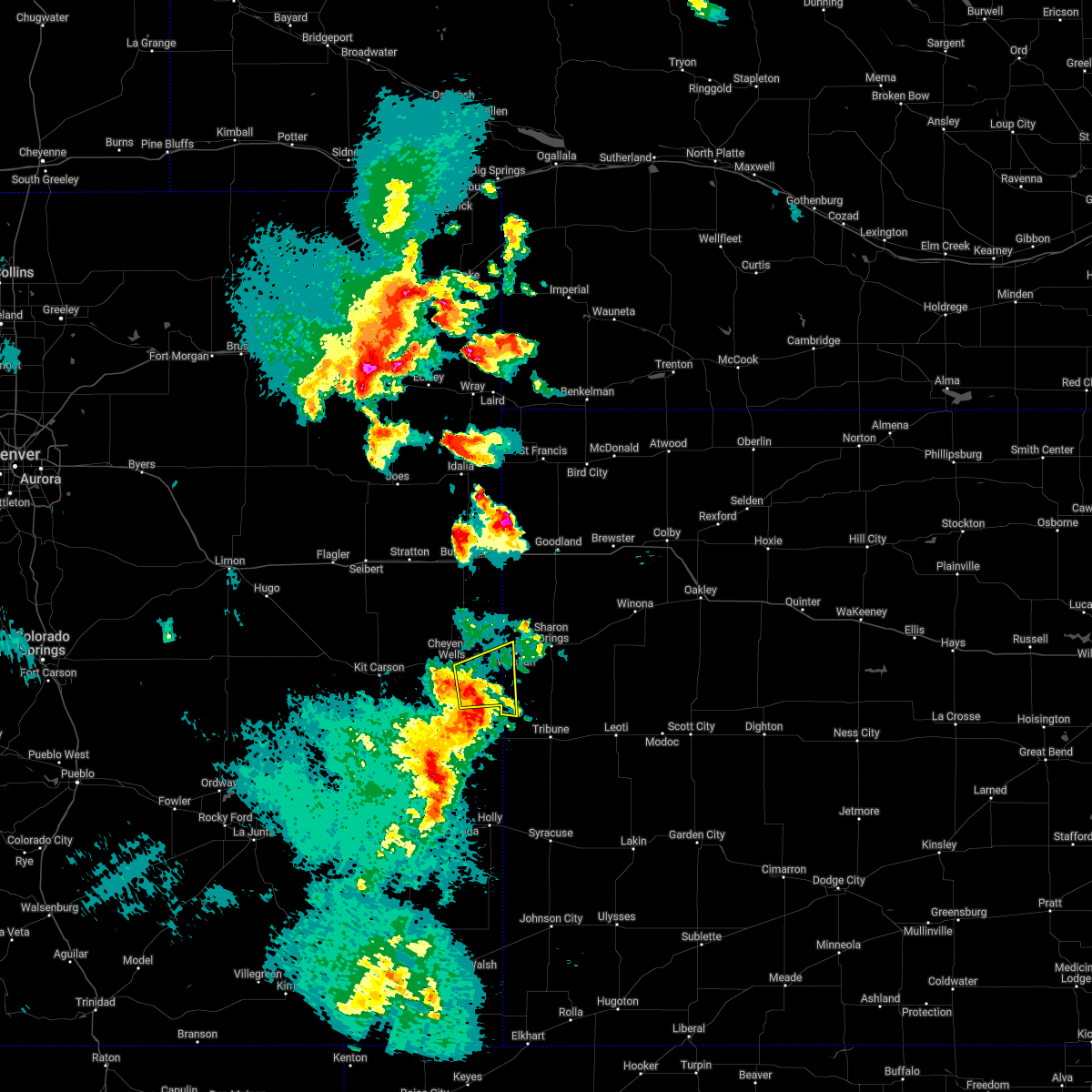 At 630 pm mdt, a severe thunderstorm was located 10 miles southeast of cheyenne wells, moving east at 30 mph (radar indicated). Hazards include 60 mph wind gusts and quarter size hail. Hail damage to vehicles is expected. expect wind damage to roofs, siding, and trees. this severe thunderstorm will remain over mainly rural areas of southeastern cheyenne county in east central colorado, southwestern wallace and northwestern greeley counties in west central kansas, including the following locations, arapahoe. This includes highway 385 between mile markers 146 and 148. At 630 pm mdt, a severe thunderstorm was located 10 miles southeast of cheyenne wells, moving east at 30 mph (radar indicated). Hazards include 60 mph wind gusts and quarter size hail. Hail damage to vehicles is expected. expect wind damage to roofs, siding, and trees. this severe thunderstorm will remain over mainly rural areas of southeastern cheyenne county in east central colorado, southwestern wallace and northwestern greeley counties in west central kansas, including the following locations, arapahoe. This includes highway 385 between mile markers 146 and 148.
|
| 4/22/2022 10:46 PM MDT |
 At 1044 pm mdt/1144 pm cdt/, severe thunderstorms were located along a line extending from 4 miles northeast of goodland to 14 miles northeast of tribune, moving east at 45 mph (law enforcement). Hazards include golf ball size hail and 70 mph wind gusts. People and animals outdoors will be injured. expect hail damage to roofs, siding, windows, and vehicles. expect considerable tree damage. wind damage is also likely to mobile homes, roofs, and outbuildings. locations impacted include, goodland, sharon springs, brewster, kanorado, ruleton, weskan and wallace. this includes interstate 70 in kansas between mile markers 0 and 41. thunderstorm damage threat, considerable hail threat, observed max hail size, 1. 75 in wind threat, radar indicated max wind gust, 70 mph. At 1044 pm mdt/1144 pm cdt/, severe thunderstorms were located along a line extending from 4 miles northeast of goodland to 14 miles northeast of tribune, moving east at 45 mph (law enforcement). Hazards include golf ball size hail and 70 mph wind gusts. People and animals outdoors will be injured. expect hail damage to roofs, siding, windows, and vehicles. expect considerable tree damage. wind damage is also likely to mobile homes, roofs, and outbuildings. locations impacted include, goodland, sharon springs, brewster, kanorado, ruleton, weskan and wallace. this includes interstate 70 in kansas between mile markers 0 and 41. thunderstorm damage threat, considerable hail threat, observed max hail size, 1. 75 in wind threat, radar indicated max wind gust, 70 mph.
|
| 4/22/2022 10:33 PM MDT |
 At 1031 pm mdt/1131 pm cdt/, severe thunderstorms were located along a line extending from 5 miles northeast of ruleton to 10 miles north of horace, moving east at 45 mph (radar indicated. at 1030 pm mdt quarter sized hail was reported in weskan). Hazards include 70 mph wind gusts and quarter size hail. Hail damage to vehicles is expected. expect considerable tree damage. wind damage is also likely to mobile homes, roofs, and outbuildings. locations impacted include, goodland, sharon springs, brewster, kanorado, ruleton, weskan and wallace. this includes the following highways, interstate 70 in kansas between mile markers 0 and 41. interstate 70 in colorado between mile markers 441 and 450. thunderstorm damage threat, considerable hail threat, observed max hail size, 1. 00 in wind threat, radar indicated max wind gust, 70 mph. At 1031 pm mdt/1131 pm cdt/, severe thunderstorms were located along a line extending from 5 miles northeast of ruleton to 10 miles north of horace, moving east at 45 mph (radar indicated. at 1030 pm mdt quarter sized hail was reported in weskan). Hazards include 70 mph wind gusts and quarter size hail. Hail damage to vehicles is expected. expect considerable tree damage. wind damage is also likely to mobile homes, roofs, and outbuildings. locations impacted include, goodland, sharon springs, brewster, kanorado, ruleton, weskan and wallace. this includes the following highways, interstate 70 in kansas between mile markers 0 and 41. interstate 70 in colorado between mile markers 441 and 450. thunderstorm damage threat, considerable hail threat, observed max hail size, 1. 00 in wind threat, radar indicated max wind gust, 70 mph.
|
| 4/22/2022 10:30 PM MDT | Golf Ball sized hail reported 2.2 miles SW of Weskan, KS, facebook report of golf ball size hail. |
| 4/22/2022 10:22 PM MDT | Quarter sized hail reported 0.3 miles SSE of Weskan, KS, report from mping: quarter (1.00 in.). |
| 4/22/2022 10:21 PM MDT |
 At 1021 pm mdt/1121 pm cdt/, severe thunderstorms were located along a line extending from 3 miles northwest of ruleton to 12 miles northwest of horace, moving east at 45 mph (radar indicated). Hazards include 60 mph wind gusts and nickel size hail. Expect damage to roofs, siding, and trees. locations impacted include, goodland and brewster. this includes the following highways, interstate 70 in kansas between mile markers 0 and 41. interstate 70 in colorado between mile markers 436 and 450. highway 385 between mile markers 167 and 198. hail threat, radar indicated max hail size, 0. 88 in wind threat, radar indicated max wind gust, 60 mph. At 1021 pm mdt/1121 pm cdt/, severe thunderstorms were located along a line extending from 3 miles northwest of ruleton to 12 miles northwest of horace, moving east at 45 mph (radar indicated). Hazards include 60 mph wind gusts and nickel size hail. Expect damage to roofs, siding, and trees. locations impacted include, goodland and brewster. this includes the following highways, interstate 70 in kansas between mile markers 0 and 41. interstate 70 in colorado between mile markers 436 and 450. highway 385 between mile markers 167 and 198. hail threat, radar indicated max hail size, 0. 88 in wind threat, radar indicated max wind gust, 60 mph.
|
| 4/22/2022 9:56 PM MDT |
 At 956 pm mdt/1056 pm cdt/, severe thunderstorms were located along a line extending from 4 miles northeast of burlington to 11 miles northeast of sheridan lake, moving east at 45 mph (radar indicated). Hazards include 60 mph wind gusts and nickel size hail. Expect damage to roofs, siding, and trees. severe thunderstorms will be near, kanorado around 1010 pm mdt. other locations in the path of these severe thunderstorms include ruleton, goodland and brewster. this includes the following highways, interstate 70 in kansas between mile markers 0 and 41. interstate 70 in colorado between mile markers 430 and 450. highway 385 between mile markers 136 and 198. hail threat, radar indicated max hail size, 0. 88 in wind threat, radar indicated max wind gust, 60 mph. At 956 pm mdt/1056 pm cdt/, severe thunderstorms were located along a line extending from 4 miles northeast of burlington to 11 miles northeast of sheridan lake, moving east at 45 mph (radar indicated). Hazards include 60 mph wind gusts and nickel size hail. Expect damage to roofs, siding, and trees. severe thunderstorms will be near, kanorado around 1010 pm mdt. other locations in the path of these severe thunderstorms include ruleton, goodland and brewster. this includes the following highways, interstate 70 in kansas between mile markers 0 and 41. interstate 70 in colorado between mile markers 430 and 450. highway 385 between mile markers 136 and 198. hail threat, radar indicated max hail size, 0. 88 in wind threat, radar indicated max wind gust, 60 mph.
|
| 10/12/2021 6:00 PM MDT | Quarter sized hail reported 0.6 miles NW of Weskan, KS, report of quarters from dispatch time estimated from radar. |
| 9/12/2021 7:33 PM MDT |
 At 733 pm mdt, a severe thunderstorm was located 4 miles south of sharon springs, moving southeast at 25 mph (radar indicated). Hazards include 60 mph wind gusts and quarter size hail. Hail damage to vehicles is expected. expect wind damage to roofs, siding, and trees. this severe thunderstorm will remain over mainly rural areas of southern wallace county. hail threat, radar indicated max hail size, 1. 00 in wind threat, radar indicated max wind gust, 60 mph. At 733 pm mdt, a severe thunderstorm was located 4 miles south of sharon springs, moving southeast at 25 mph (radar indicated). Hazards include 60 mph wind gusts and quarter size hail. Hail damage to vehicles is expected. expect wind damage to roofs, siding, and trees. this severe thunderstorm will remain over mainly rural areas of southern wallace county. hail threat, radar indicated max hail size, 1. 00 in wind threat, radar indicated max wind gust, 60 mph.
|
| 9/12/2021 7:01 PM MDT |
 The national weather service in goodland has issued a * severe thunderstorm warning for. southern wallace county in west central kansas. until 745 pm mdt. At 700 pm mdt, a severe thunderstorm was located 5 miles north of weskan, or 13 miles west of sharon springs, moving southeast at 25. The national weather service in goodland has issued a * severe thunderstorm warning for. southern wallace county in west central kansas. until 745 pm mdt. At 700 pm mdt, a severe thunderstorm was located 5 miles north of weskan, or 13 miles west of sharon springs, moving southeast at 25.
|
| 8/7/2021 3:43 PM MDT |
 At 342 pm mdt, a severe thunderstorm was located 8 miles southeast of sharon springs, moving northeast at 15 mph (radar indicated). Hazards include 60 mph wind gusts and quarter size hail. Hail damage to vehicles is expected. expect wind damage to roofs, siding, and trees. locations impacted include, sharon springs, weskan and wallace. hail threat, radar indicated max hail size, 1. 00 in wind threat, radar indicated max wind gust, 60 mph. At 342 pm mdt, a severe thunderstorm was located 8 miles southeast of sharon springs, moving northeast at 15 mph (radar indicated). Hazards include 60 mph wind gusts and quarter size hail. Hail damage to vehicles is expected. expect wind damage to roofs, siding, and trees. locations impacted include, sharon springs, weskan and wallace. hail threat, radar indicated max hail size, 1. 00 in wind threat, radar indicated max wind gust, 60 mph.
|
| 8/7/2021 3:35 PM MDT |
 At 334 pm mdt, a severe thunderstorm was located 8 miles southeast of sharon springs, moving northeast at 20 mph (radar indicated). Hazards include 60 mph wind gusts and half dollar size hail. Hail damage to vehicles is expected. expect wind damage to roofs, siding, and trees. locations impacted include, sharon springs, weskan and wallace. hail threat, radar indicated max hail size, 1. 25 in wind threat, radar indicated max wind gust, 60 mph. At 334 pm mdt, a severe thunderstorm was located 8 miles southeast of sharon springs, moving northeast at 20 mph (radar indicated). Hazards include 60 mph wind gusts and half dollar size hail. Hail damage to vehicles is expected. expect wind damage to roofs, siding, and trees. locations impacted include, sharon springs, weskan and wallace. hail threat, radar indicated max hail size, 1. 25 in wind threat, radar indicated max wind gust, 60 mph.
|
| 8/7/2021 3:21 PM MDT |
 At 321 pm mdt, a severe thunderstorm was located 11 miles south of sharon springs, moving northeast at 20 mph (radar indicated). Hazards include 60 mph wind gusts and half dollar size hail. Hail damage to vehicles is expected. expect wind damage to roofs, siding, and trees. locations impacted include, sharon springs, weskan and wallace. hail threat, radar indicated max hail size, 1. 25 in wind threat, radar indicated max wind gust, 60 mph. At 321 pm mdt, a severe thunderstorm was located 11 miles south of sharon springs, moving northeast at 20 mph (radar indicated). Hazards include 60 mph wind gusts and half dollar size hail. Hail damage to vehicles is expected. expect wind damage to roofs, siding, and trees. locations impacted include, sharon springs, weskan and wallace. hail threat, radar indicated max hail size, 1. 25 in wind threat, radar indicated max wind gust, 60 mph.
|
| 8/7/2021 3:12 PM MDT |
 At 312 pm mdt, a severe thunderstorm was located 11 miles south of sharon springs, moving northeast at 25 mph (radar indicated). Hazards include golf ball size hail and 60 mph wind gusts. People and animals outdoors will be injured. expect hail damage to roofs, siding, windows, and vehicles. Expect wind damage to roofs, siding, and trees. At 312 pm mdt, a severe thunderstorm was located 11 miles south of sharon springs, moving northeast at 25 mph (radar indicated). Hazards include golf ball size hail and 60 mph wind gusts. People and animals outdoors will be injured. expect hail damage to roofs, siding, windows, and vehicles. Expect wind damage to roofs, siding, and trees.
|
| 6/24/2021 8:28 PM MDT |
 At 826 pm mdt/926 pm cdt/, a severe thunderstorm was located 9 miles south of sharon springs, moving east at 30 mph. this is a very dangerous storm (radar indicated. at 813 pm mdt, a wind gust of 65 mph was reported 2 miles west-northwest of sharon springs, ks). Hazards include 80 mph wind gusts and quarter size hail. Flying debris will be dangerous to those caught without shelter. mobile homes will be heavily damaged. expect considerable damage to roofs, windows, and vehicles. extensive tree damage and power outages are likely. Locations impacted include, sharon springs and weskan. At 826 pm mdt/926 pm cdt/, a severe thunderstorm was located 9 miles south of sharon springs, moving east at 30 mph. this is a very dangerous storm (radar indicated. at 813 pm mdt, a wind gust of 65 mph was reported 2 miles west-northwest of sharon springs, ks). Hazards include 80 mph wind gusts and quarter size hail. Flying debris will be dangerous to those caught without shelter. mobile homes will be heavily damaged. expect considerable damage to roofs, windows, and vehicles. extensive tree damage and power outages are likely. Locations impacted include, sharon springs and weskan.
|
| 6/24/2021 8:01 PM MDT |
 At 801 pm mdt/901 pm cdt/, a severe thunderstorm was located 5 miles south of weskan, or 13 miles southwest of sharon springs, moving east at 30 mph. this is a very dangerous storm (radar indicated). Hazards include 80 mph wind gusts and quarter size hail. Flying debris will be dangerous to those caught without shelter. mobile homes will be heavily damaged. expect considerable damage to roofs, windows, and vehicles. extensive tree damage and power outages are likely. This severe thunderstorm will remain over mainly rural areas of northwestern wichita, southern wallace, southwestern logan and northern greeley counties. At 801 pm mdt/901 pm cdt/, a severe thunderstorm was located 5 miles south of weskan, or 13 miles southwest of sharon springs, moving east at 30 mph. this is a very dangerous storm (radar indicated). Hazards include 80 mph wind gusts and quarter size hail. Flying debris will be dangerous to those caught without shelter. mobile homes will be heavily damaged. expect considerable damage to roofs, windows, and vehicles. extensive tree damage and power outages are likely. This severe thunderstorm will remain over mainly rural areas of northwestern wichita, southern wallace, southwestern logan and northern greeley counties.
|
| 6/24/2021 7:59 PM MDT | Storm damage reported in wallace county KS, 3.7 miles NNW of Weskan, KS |
| 6/24/2021 7:33 PM MDT | Quarter sized hail reported 16.4 miles S of Weskan, KS, caller reported nickel to quarter sized hail. |
| 6/19/2021 6:43 PM MDT |
 At 643 pm mdt, severe thunderstorms were located along a line extending from 15 miles south of bird city to 11 miles southeast of goodland to 4 miles west of sharon springs, moving east at 55 mph (radar indicated). Hazards include 70 mph wind gusts. Expect considerable tree damage. damage is likely to mobile homes, roofs, and outbuildings. these severe thunderstorms will remain over mainly rural areas of wallace and sherman counties, including the following locations, edson. This includes interstate 70 in kansas between mile markers 0 and 35. At 643 pm mdt, severe thunderstorms were located along a line extending from 15 miles south of bird city to 11 miles southeast of goodland to 4 miles west of sharon springs, moving east at 55 mph (radar indicated). Hazards include 70 mph wind gusts. Expect considerable tree damage. damage is likely to mobile homes, roofs, and outbuildings. these severe thunderstorms will remain over mainly rural areas of wallace and sherman counties, including the following locations, edson. This includes interstate 70 in kansas between mile markers 0 and 35.
|
| 6/19/2021 6:00 PM MDT |
 At 600 pm mdt, severe thunderstorms were located along a line extending from 17 miles east of cope to 3 miles west of bethune to 14 miles north of kit carson, moving east at 40 mph (radar indicated). Hazards include 60 mph wind gusts. Expect damage to roofs, siding, and trees. severe thunderstorms will be near, burlington around 620 pm mdt. other locations in the path of these severe thunderstorms include kanorado, ruleton and weskan. people attending parmer park should seek safe shelter immediately! this includes the following highways, interstate 70 in kansas between mile markers 0 and 35. interstate 70 in colorado between mile markers 432 and 450. Highway 385 between mile markers 141 and 206, and near mile marker 211. At 600 pm mdt, severe thunderstorms were located along a line extending from 17 miles east of cope to 3 miles west of bethune to 14 miles north of kit carson, moving east at 40 mph (radar indicated). Hazards include 60 mph wind gusts. Expect damage to roofs, siding, and trees. severe thunderstorms will be near, burlington around 620 pm mdt. other locations in the path of these severe thunderstorms include kanorado, ruleton and weskan. people attending parmer park should seek safe shelter immediately! this includes the following highways, interstate 70 in kansas between mile markers 0 and 35. interstate 70 in colorado between mile markers 432 and 450. Highway 385 between mile markers 141 and 206, and near mile marker 211.
|
| 5/23/2021 7:50 PM MDT |
 At 750 pm mdt/850 pm cdt/, severe thunderstorms were located along a line extending from 9 miles east of bonny reservoir to 13 miles southwest of cheyenne wells, moving northeast at 55 mph (radar indicated). Hazards include 60 mph wind gusts and quarter size hail. Hail damage to vehicles is expected. Expect wind damage to roofs, siding, and trees. At 750 pm mdt/850 pm cdt/, severe thunderstorms were located along a line extending from 9 miles east of bonny reservoir to 13 miles southwest of cheyenne wells, moving northeast at 55 mph (radar indicated). Hazards include 60 mph wind gusts and quarter size hail. Hail damage to vehicles is expected. Expect wind damage to roofs, siding, and trees.
|
| 8/16/2020 7:37 PM CDT |
 At 636 pm mdt/736 pm cdt/, severe thunderstorms were located along a line extending from 10 miles north of ruleton to 5 miles south of brewster to near grinnell, moving south at 30 mph (these storms have a history of producing wind gusts up to 70 mph. an automated weather observation site in st. francis reported a 67 mph wind gust at 535 pm mdt. the national weather service in goodland measured a 62 mph wind gust at 620 pm mdt). Hazards include 70 mph wind gusts and penny size hail. Expect considerable tree damage. damage is likely to mobile homes, roofs, and outbuildings. locations impacted include, oakley, quinter, sharon springs, grainfield, grinnell, gove and weskan. This includes interstate 70 in kansas between mile markers 76 and 112. At 636 pm mdt/736 pm cdt/, severe thunderstorms were located along a line extending from 10 miles north of ruleton to 5 miles south of brewster to near grinnell, moving south at 30 mph (these storms have a history of producing wind gusts up to 70 mph. an automated weather observation site in st. francis reported a 67 mph wind gust at 535 pm mdt. the national weather service in goodland measured a 62 mph wind gust at 620 pm mdt). Hazards include 70 mph wind gusts and penny size hail. Expect considerable tree damage. damage is likely to mobile homes, roofs, and outbuildings. locations impacted include, oakley, quinter, sharon springs, grainfield, grinnell, gove and weskan. This includes interstate 70 in kansas between mile markers 76 and 112.
|
| 8/16/2020 7:06 PM CDT |
 At 605 pm mdt/705 pm cdt/, severe thunderstorms were located along a line extending from 7 miles north of ruleton to 10 miles northwest of winona to near oakley, moving south at 20 mph (radar indicated). Hazards include 70 mph wind gusts and quarter size hail. Hail damage to vehicles is expected. expect considerable tree damage. Wind damage is also likely to mobile homes, roofs, and outbuildings. At 605 pm mdt/705 pm cdt/, severe thunderstorms were located along a line extending from 7 miles north of ruleton to 10 miles northwest of winona to near oakley, moving south at 20 mph (radar indicated). Hazards include 70 mph wind gusts and quarter size hail. Hail damage to vehicles is expected. expect considerable tree damage. Wind damage is also likely to mobile homes, roofs, and outbuildings.
|
| 8/11/2020 7:29 PM CDT |
 At 629 pm mdt/729 pm cdt/, a severe thunderstorm was located 8 miles southwest of brewster, moving east at 30 mph (radar indicated). Hazards include 60 mph wind gusts and quarter size hail. Hail damage to vehicles is expected. expect wind damage to roofs, siding, and trees. locations impacted include, colby, goodland, oakley, sharon springs, brewster, ruleton and levant. This includes interstate 70 in kansas between mile markers 5 and 75. At 629 pm mdt/729 pm cdt/, a severe thunderstorm was located 8 miles southwest of brewster, moving east at 30 mph (radar indicated). Hazards include 60 mph wind gusts and quarter size hail. Hail damage to vehicles is expected. expect wind damage to roofs, siding, and trees. locations impacted include, colby, goodland, oakley, sharon springs, brewster, ruleton and levant. This includes interstate 70 in kansas between mile markers 5 and 75.
|
| 8/11/2020 7:24 PM CDT |
 At 623 pm mdt/723 pm cdt/, a severe thunderstorm was located 11 miles southeast of goodland, moving east at 30 mph (this storm has a history of producing quarter size hail in kit carson county, colorado). Hazards include 70 mph wind gusts and quarter size hail. Hail damage to vehicles is expected. expect considerable tree damage. wind damage is also likely to mobile homes, roofs, and outbuildings. locations impacted include, colby, goodland, oakley, sharon springs, brewster, kanorado and ruleton. This includes interstate 70 in kansas between mile markers 0 and 75. At 623 pm mdt/723 pm cdt/, a severe thunderstorm was located 11 miles southeast of goodland, moving east at 30 mph (this storm has a history of producing quarter size hail in kit carson county, colorado). Hazards include 70 mph wind gusts and quarter size hail. Hail damage to vehicles is expected. expect considerable tree damage. wind damage is also likely to mobile homes, roofs, and outbuildings. locations impacted include, colby, goodland, oakley, sharon springs, brewster, kanorado and ruleton. This includes interstate 70 in kansas between mile markers 0 and 75.
|
| 8/11/2020 6:58 PM CDT |
 At 558 pm mdt/658 pm cdt/, a severe thunderstorm was located 8 miles south of goodland, moving east at 35 mph (radar indicated). Hazards include 70 mph wind gusts and quarter size hail. Hail damage to vehicles is expected. expect considerable tree damage. Wind damage is also likely to mobile homes, roofs, and outbuildings. At 558 pm mdt/658 pm cdt/, a severe thunderstorm was located 8 miles south of goodland, moving east at 35 mph (radar indicated). Hazards include 70 mph wind gusts and quarter size hail. Hail damage to vehicles is expected. expect considerable tree damage. Wind damage is also likely to mobile homes, roofs, and outbuildings.
|
| 8/9/2020 6:45 PM CDT |
 At 543 pm mdt/643 pm cdt/, a severe thunderstorm was located 8 miles northwest of winona, or 17 miles south of brewster, moving east at 20 mph (radar indicated). Hazards include 70 mph wind gusts and quarter size hail. Hail damage to vehicles is expected. expect considerable tree damage. wind damage is also likely to mobile homes, roofs, and outbuildings. wind gusts up to 70 mph are possible in association with any thunderstorms developing along and south of interstate 70 in sherman, wallace, thomas, and logan counties. the automated surface observation in burlington, colorado reported a wind gust of 68 mph in association with a nearby thunderstorm at 335 pm mdt. locations impacted include, colby, oakley, sharon springs, brewster, levant, winona and monument. This includes interstate 70 in kansas between mile markers 21 and 74. At 543 pm mdt/643 pm cdt/, a severe thunderstorm was located 8 miles northwest of winona, or 17 miles south of brewster, moving east at 20 mph (radar indicated). Hazards include 70 mph wind gusts and quarter size hail. Hail damage to vehicles is expected. expect considerable tree damage. wind damage is also likely to mobile homes, roofs, and outbuildings. wind gusts up to 70 mph are possible in association with any thunderstorms developing along and south of interstate 70 in sherman, wallace, thomas, and logan counties. the automated surface observation in burlington, colorado reported a wind gust of 68 mph in association with a nearby thunderstorm at 335 pm mdt. locations impacted include, colby, oakley, sharon springs, brewster, levant, winona and monument. This includes interstate 70 in kansas between mile markers 21 and 74.
|
| 8/9/2020 6:15 PM CDT |
 At 513 pm mdt/613 pm cdt/, a severe thunderstorm was located 12 miles north of wallace, or 14 miles northeast of sharon springs, and is nearly stationary (radar indicated). Hazards include 70 mph wind gusts and quarter size hail. Hail damage to vehicles is expected. expect considerable tree damage. wind damage is also likely to mobile homes, roofs, and outbuildings. wind gusts up to 70 mph are possible in association with any thunderstorms developing along and south of interstate 70 in sherman, wallace, thomas, and logan counties. the automated surface observation in burlington, colorado reported a wind gust of 68 mph in association with a nearby thunderstorm at 335 pm mdt. locations impacted include, colby, goodland, oakley, sharon springs, brewster, kanorado and ruleton. This includes interstate 70 in kansas between mile markers 0 and 74. At 513 pm mdt/613 pm cdt/, a severe thunderstorm was located 12 miles north of wallace, or 14 miles northeast of sharon springs, and is nearly stationary (radar indicated). Hazards include 70 mph wind gusts and quarter size hail. Hail damage to vehicles is expected. expect considerable tree damage. wind damage is also likely to mobile homes, roofs, and outbuildings. wind gusts up to 70 mph are possible in association with any thunderstorms developing along and south of interstate 70 in sherman, wallace, thomas, and logan counties. the automated surface observation in burlington, colorado reported a wind gust of 68 mph in association with a nearby thunderstorm at 335 pm mdt. locations impacted include, colby, goodland, oakley, sharon springs, brewster, kanorado and ruleton. This includes interstate 70 in kansas between mile markers 0 and 74.
|
| 8/9/2020 5:55 PM CDT |
 At 453 pm mdt/553 pm cdt/, a severe thunderstorm was located 13 miles north of wallace, or 15 miles north of sharon springs, and is nearly stationary (radar indicated). Hazards include 70 mph wind gusts and quarter size hail. Hail damage to vehicles is expected. expect considerable tree damage. wind damage is also likely to mobile homes, roofs, and outbuildings. wind gusts up to 70 mph are possible in association with any thunderstorms developing along and south of interstate 70 in sherman, wallace, thomas, and logan counties. The automated surface observation in burlington, colorado reported a wind gust of 68 mph in association with a nearby thunderstorm at 335 pm mdt. At 453 pm mdt/553 pm cdt/, a severe thunderstorm was located 13 miles north of wallace, or 15 miles north of sharon springs, and is nearly stationary (radar indicated). Hazards include 70 mph wind gusts and quarter size hail. Hail damage to vehicles is expected. expect considerable tree damage. wind damage is also likely to mobile homes, roofs, and outbuildings. wind gusts up to 70 mph are possible in association with any thunderstorms developing along and south of interstate 70 in sherman, wallace, thomas, and logan counties. The automated surface observation in burlington, colorado reported a wind gust of 68 mph in association with a nearby thunderstorm at 335 pm mdt.
|
| 8/8/2020 5:30 PM MDT |
 At 528 pm mdt/628 pm cdt/, a severe thunderstorm was located 10 miles south of goodland, moving east at 10 mph. additional severe thunderstorms may quickly develop within the warned area (radar indicated). Hazards include 70 mph wind gusts and quarter size hail. Hail damage to vehicles is expected. expect considerable tree damage. Wind damage is also likely to mobile homes, roofs, and outbuildings. At 528 pm mdt/628 pm cdt/, a severe thunderstorm was located 10 miles south of goodland, moving east at 10 mph. additional severe thunderstorms may quickly develop within the warned area (radar indicated). Hazards include 70 mph wind gusts and quarter size hail. Hail damage to vehicles is expected. expect considerable tree damage. Wind damage is also likely to mobile homes, roofs, and outbuildings.
|
| 8/8/2020 5:10 PM MDT |
 At 509 pm mdt, a severe thunderstorm was located 7 miles south of ruleton, moving north at 10 mph. additional thunderstorms were developing across portions of wallace and sherman counties (radar indicated). Hazards include 70 mph wind gusts and penny size hail. Expect considerable tree damage. damage is likely to mobile homes, roofs, and outbuildings. locations impacted include, goodland, sharon springs, kanorado, ruleton, weskan and edson. people attending sherman county fairgrounds should seek safe shelter immediately! this includes the following highways, interstate 70 in kansas between mile markers 0 and 30. Interstate 70 in colorado between mile markers 449 and 450. At 509 pm mdt, a severe thunderstorm was located 7 miles south of ruleton, moving north at 10 mph. additional thunderstorms were developing across portions of wallace and sherman counties (radar indicated). Hazards include 70 mph wind gusts and penny size hail. Expect considerable tree damage. damage is likely to mobile homes, roofs, and outbuildings. locations impacted include, goodland, sharon springs, kanorado, ruleton, weskan and edson. people attending sherman county fairgrounds should seek safe shelter immediately! this includes the following highways, interstate 70 in kansas between mile markers 0 and 30. Interstate 70 in colorado between mile markers 449 and 450.
|
| 8/8/2020 5:10 PM MDT |
 At 443 pm mdt, a severe thunderstorm was located 4 miles southwest of goodland, moving northeast at 5 mph (this storm produced golf ball size hail just south of interstate 70 at 440 pm mdt). Hazards include golf ball size hail and 70 mph wind gusts. People and animals outdoors will be injured. expect hail damage to roofs, siding, windows, and vehicles. expect considerable tree damage. wind damage is also likely to mobile homes, roofs, and outbuildings. locations impacted include, goodland, sharon springs, kanorado, ruleton, weskan, edson and arapahoe. people attending sherman county fairgrounds should seek safe shelter immediately! this includes the following highways, interstate 70 in kansas between mile markers 0 and 30. interstate 70 in colorado between mile markers 446 and 450. Highway 385 between mile markers 141 and 142. At 443 pm mdt, a severe thunderstorm was located 4 miles southwest of goodland, moving northeast at 5 mph (this storm produced golf ball size hail just south of interstate 70 at 440 pm mdt). Hazards include golf ball size hail and 70 mph wind gusts. People and animals outdoors will be injured. expect hail damage to roofs, siding, windows, and vehicles. expect considerable tree damage. wind damage is also likely to mobile homes, roofs, and outbuildings. locations impacted include, goodland, sharon springs, kanorado, ruleton, weskan, edson and arapahoe. people attending sherman county fairgrounds should seek safe shelter immediately! this includes the following highways, interstate 70 in kansas between mile markers 0 and 30. interstate 70 in colorado between mile markers 446 and 450. Highway 385 between mile markers 141 and 142.
|
| 8/8/2020 4:45 PM MDT |
 At 443 pm mdt, a severe thunderstorm was located 4 miles southwest of goodland, moving northeast at 5 mph (this storm produced golf ball size hail just south of interstate 70 at 440 pm mdt). Hazards include golf ball size hail and 70 mph wind gusts. People and animals outdoors will be injured. expect hail damage to roofs, siding, windows, and vehicles. expect considerable tree damage. wind damage is also likely to mobile homes, roofs, and outbuildings. locations impacted include, goodland, sharon springs, kanorado, ruleton, weskan, edson and arapahoe. people attending sherman county fairgrounds should seek safe shelter immediately! this includes the following highways, interstate 70 in kansas between mile markers 0 and 30. interstate 70 in colorado between mile markers 446 and 450. Highway 385 between mile markers 141 and 142. At 443 pm mdt, a severe thunderstorm was located 4 miles southwest of goodland, moving northeast at 5 mph (this storm produced golf ball size hail just south of interstate 70 at 440 pm mdt). Hazards include golf ball size hail and 70 mph wind gusts. People and animals outdoors will be injured. expect hail damage to roofs, siding, windows, and vehicles. expect considerable tree damage. wind damage is also likely to mobile homes, roofs, and outbuildings. locations impacted include, goodland, sharon springs, kanorado, ruleton, weskan, edson and arapahoe. people attending sherman county fairgrounds should seek safe shelter immediately! this includes the following highways, interstate 70 in kansas between mile markers 0 and 30. interstate 70 in colorado between mile markers 446 and 450. Highway 385 between mile markers 141 and 142.
|
| 8/8/2020 4:36 PM MDT |
 At 432 pm mdt, a nearly stationary severe thunderstorm was located 5 miles south of ruleton, or 7 miles southwest of goodland. a separate severe thunderstorm was located just north of highway 40 near the cheyenne and wallace county border. this storm was also nearly stationary (radar indicated). Hazards include 70 mph wind gusts and quarter size hail. Hail damage to vehicles is expected. expect considerable tree damage. wind damage is also likely to mobile homes, roofs, and outbuildings. locations impacted include, goodland, sharon springs, kanorado, ruleton, weskan, edson and arapahoe. people attending sherman county fairgrounds should seek safe shelter immediately! this includes the following highways, interstate 70 in kansas between mile markers 0 and 30. interstate 70 in colorado between mile markers 446 and 450. Highway 385 between mile markers 141 and 142. At 432 pm mdt, a nearly stationary severe thunderstorm was located 5 miles south of ruleton, or 7 miles southwest of goodland. a separate severe thunderstorm was located just north of highway 40 near the cheyenne and wallace county border. this storm was also nearly stationary (radar indicated). Hazards include 70 mph wind gusts and quarter size hail. Hail damage to vehicles is expected. expect considerable tree damage. wind damage is also likely to mobile homes, roofs, and outbuildings. locations impacted include, goodland, sharon springs, kanorado, ruleton, weskan, edson and arapahoe. people attending sherman county fairgrounds should seek safe shelter immediately! this includes the following highways, interstate 70 in kansas between mile markers 0 and 30. interstate 70 in colorado between mile markers 446 and 450. Highway 385 between mile markers 141 and 142.
|
| 8/8/2020 4:19 PM MDT |
 At 417 pm mdt, a severe thunderstorm was located 10 miles north of weskan, or 13 miles northwest of sharon springs, and is nearly stationary. additional severe thunderstorms were developing in eastern cheyenne county, colorado and southern sherman county, kansas (radar indicated). Hazards include 70 mph wind gusts and penny size hail. Expect considerable tree damage. Damage is likely to mobile homes, roofs, and outbuildings. At 417 pm mdt, a severe thunderstorm was located 10 miles north of weskan, or 13 miles northwest of sharon springs, and is nearly stationary. additional severe thunderstorms were developing in eastern cheyenne county, colorado and southern sherman county, kansas (radar indicated). Hazards include 70 mph wind gusts and penny size hail. Expect considerable tree damage. Damage is likely to mobile homes, roofs, and outbuildings.
|
| 7/31/2020 4:26 PM MDT |
 At 426 pm mdt, a severe thunderstorm was located 10 miles north of weskan, or 11 miles northwest of sharon springs, moving south at 35 mph (radar indicated). Hazards include 60 mph wind gusts and quarter size hail. Hail damage to vehicles is expected. Expect wind damage to roofs, siding, and trees. At 426 pm mdt, a severe thunderstorm was located 10 miles north of weskan, or 11 miles northwest of sharon springs, moving south at 35 mph (radar indicated). Hazards include 60 mph wind gusts and quarter size hail. Hail damage to vehicles is expected. Expect wind damage to roofs, siding, and trees.
|
| 7/26/2020 5:54 PM MDT |
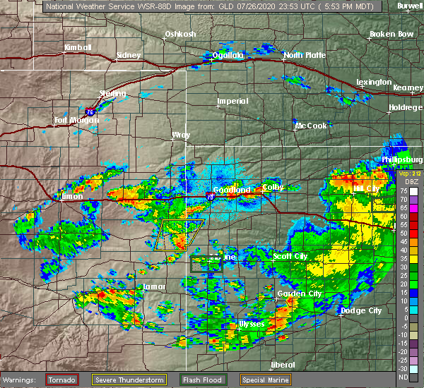 The severe thunderstorm warning for eastern cheyenne county in east central colorado and southwestern wallace counties in west central kansas will expire at 600 pm mdt, the storms which prompted the warning have weakened below severe limits, and no longer pose an immediate threat to life or property. therefore, the warning will be allowed to expire. however gusty winds and heavy rain are still possible with these thunderstorms. The severe thunderstorm warning for eastern cheyenne county in east central colorado and southwestern wallace counties in west central kansas will expire at 600 pm mdt, the storms which prompted the warning have weakened below severe limits, and no longer pose an immediate threat to life or property. therefore, the warning will be allowed to expire. however gusty winds and heavy rain are still possible with these thunderstorms.
|
| 7/26/2020 5:28 PM MDT |
 At 528 pm mdt, severe thunderstorms were located along a line extending from 6 miles northwest of weskan to 11 miles southeast of cheyenne wells, moving southeast at 35 mph (radar indicated). Hazards include 60 mph wind gusts and quarter size hail. Hail damage to vehicles is expected. expect wind damage to roofs, siding, and trees. locations impacted include, cheyenne wells, weskan and arapahoe. This includes highway 385 between mile markers 137 and 168. At 528 pm mdt, severe thunderstorms were located along a line extending from 6 miles northwest of weskan to 11 miles southeast of cheyenne wells, moving southeast at 35 mph (radar indicated). Hazards include 60 mph wind gusts and quarter size hail. Hail damage to vehicles is expected. expect wind damage to roofs, siding, and trees. locations impacted include, cheyenne wells, weskan and arapahoe. This includes highway 385 between mile markers 137 and 168.
|
| 7/26/2020 5:28 PM MDT |
 A severe thunderstorm warning remains in effect until 600 pm mdt for eastern cheyenne county in east central colorado and southwestern wallace counties in west central kansas. At 528 pm mdt, severe thunderstorms were located along a line extending from 6 miles northwest of weskan to 11 miles southeast of cheyenne wells, moving southeast at 35 mph. A severe thunderstorm warning remains in effect until 600 pm mdt for eastern cheyenne county in east central colorado and southwestern wallace counties in west central kansas. At 528 pm mdt, severe thunderstorms were located along a line extending from 6 miles northwest of weskan to 11 miles southeast of cheyenne wells, moving southeast at 35 mph.
|
| 7/26/2020 5:02 PM MDT |
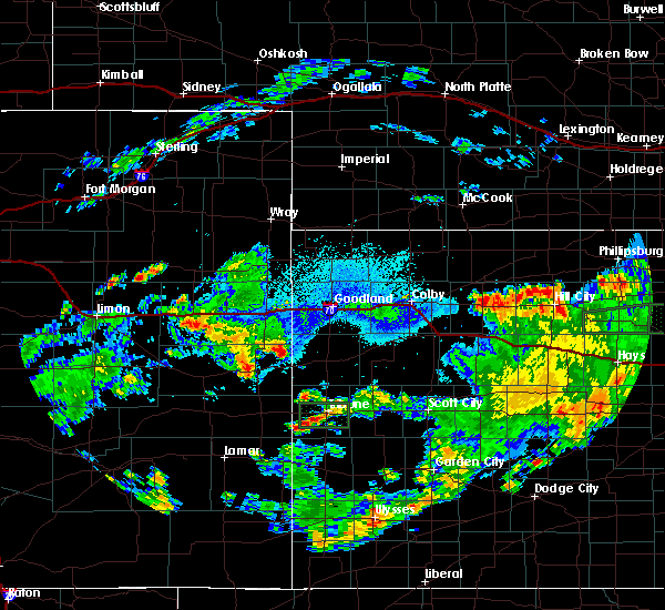 At 502 pm mdt, a severe thunderstorm was located 9 miles northwest of weskan, or 15 miles northeast of cheyenne wells, moving southeast at 40 mph. another severe thunderstorm was located near cheyenne wells (radar indicated). Hazards include 60 mph wind gusts and half dollar size hail. Hail damage to vehicles is expected. Expect wind damage to roofs, siding, and trees. At 502 pm mdt, a severe thunderstorm was located 9 miles northwest of weskan, or 15 miles northeast of cheyenne wells, moving southeast at 40 mph. another severe thunderstorm was located near cheyenne wells (radar indicated). Hazards include 60 mph wind gusts and half dollar size hail. Hail damage to vehicles is expected. Expect wind damage to roofs, siding, and trees.
|
| 7/20/2020 10:21 PM MDT |
 At 1021 pm mdt/1121 pm cdt/, severe thunderstorms were located along a line extending from 5 miles north of russell springs to near sharon springs, moving south at 25 mph (these storms have a history of producing quarter size hail and damaging winds). Hazards include 60 mph wind gusts and quarter size hail. Hail damage to vehicles is expected. expect wind damage to roofs, siding, and trees. Locations impacted include, sharon springs, winona, monument, wallace and russell springs. At 1021 pm mdt/1121 pm cdt/, severe thunderstorms were located along a line extending from 5 miles north of russell springs to near sharon springs, moving south at 25 mph (these storms have a history of producing quarter size hail and damaging winds). Hazards include 60 mph wind gusts and quarter size hail. Hail damage to vehicles is expected. expect wind damage to roofs, siding, and trees. Locations impacted include, sharon springs, winona, monument, wallace and russell springs.
|
| 7/20/2020 10:13 PM MDT |
 At 1011 pm mdt/1111 pm cdt/, severe thunderstorms were located along a line extending from 5 miles east of winona to 10 miles northwest of sharon springs, moving south at 25 mph (these storms have a history of producing quarter size hail and damaging winds). Hazards include 60 mph wind gusts and quarter size hail. Hail damage to vehicles is expected. expect wind damage to roofs, siding, and trees. locations impacted include, colby, goodland, sharon springs, brewster, weskan, winona and monument. This includes interstate 70 in kansas between mile markers 12 and 59. At 1011 pm mdt/1111 pm cdt/, severe thunderstorms were located along a line extending from 5 miles east of winona to 10 miles northwest of sharon springs, moving south at 25 mph (these storms have a history of producing quarter size hail and damaging winds). Hazards include 60 mph wind gusts and quarter size hail. Hail damage to vehicles is expected. expect wind damage to roofs, siding, and trees. locations impacted include, colby, goodland, sharon springs, brewster, weskan, winona and monument. This includes interstate 70 in kansas between mile markers 12 and 59.
|
| 7/20/2020 10:05 PM MDT |
 At 1004 pm mdt/1104 pm cdt/, severe thunderstorms were located along a line extending from 4 miles northeast of winona to 15 miles northwest of sharon springs, moving south at 20 mph (these storms have a history of producing quarter size hail and damaging winds). Hazards include 60 mph wind gusts and quarter size hail. Hail damage to vehicles is expected. expect wind damage to roofs, siding, and trees. locations impacted include, colby, goodland, sharon springs, brewster, kanorado, ruleton and weskan. This includes interstate 70 in kansas between mile markers 0 and 59. At 1004 pm mdt/1104 pm cdt/, severe thunderstorms were located along a line extending from 4 miles northeast of winona to 15 miles northwest of sharon springs, moving south at 20 mph (these storms have a history of producing quarter size hail and damaging winds). Hazards include 60 mph wind gusts and quarter size hail. Hail damage to vehicles is expected. expect wind damage to roofs, siding, and trees. locations impacted include, colby, goodland, sharon springs, brewster, kanorado, ruleton and weskan. This includes interstate 70 in kansas between mile markers 0 and 59.
|
| 7/20/2020 9:41 PM MDT |
 At 940 pm mdt/1040 pm cdt/, severe thunderstorms were located along a line extending from 9 miles south of brewster to 8 miles south of kanorado, moving south at 35 mph (these storms have a history of producing quarter size hail and damaging winds). Hazards include 60 mph wind gusts and quarter size hail. Hail damage to vehicles is expected. Expect wind damage to roofs, siding, and trees. At 940 pm mdt/1040 pm cdt/, severe thunderstorms were located along a line extending from 9 miles south of brewster to 8 miles south of kanorado, moving south at 35 mph (these storms have a history of producing quarter size hail and damaging winds). Hazards include 60 mph wind gusts and quarter size hail. Hail damage to vehicles is expected. Expect wind damage to roofs, siding, and trees.
|
| 7/13/2020 9:00 PM MDT |
 At 849 pm mdt/949 pm cdt/, severe thunderstorms were located along a line extending from 9 miles west of winona to 4 miles south of weskan, moving east at 30 mph (radar indicated). Hazards include 70 mph wind gusts and half dollar size hail. Hail damage to vehicles is expected. expect considerable tree damage. wind damage is also likely to mobile homes, roofs, and outbuildings. Locations impacted include, oakley, sharon springs, weskan, winona, monument, wallace and russell springs. At 849 pm mdt/949 pm cdt/, severe thunderstorms were located along a line extending from 9 miles west of winona to 4 miles south of weskan, moving east at 30 mph (radar indicated). Hazards include 70 mph wind gusts and half dollar size hail. Hail damage to vehicles is expected. expect considerable tree damage. wind damage is also likely to mobile homes, roofs, and outbuildings. Locations impacted include, oakley, sharon springs, weskan, winona, monument, wallace and russell springs.
|
| 7/13/2020 8:50 PM MDT |
 At 849 pm mdt/949 pm cdt/, severe thunderstorms were located along a line extending from 9 miles west of winona to 4 miles south of weskan, moving east at 30 mph (radar indicated). Hazards include 70 mph wind gusts and half dollar size hail. Hail damage to vehicles is expected. expect considerable tree damage. wind damage is also likely to mobile homes, roofs, and outbuildings. Locations impacted include, oakley, sharon springs, weskan, winona, monument, wallace and russell springs. At 849 pm mdt/949 pm cdt/, severe thunderstorms were located along a line extending from 9 miles west of winona to 4 miles south of weskan, moving east at 30 mph (radar indicated). Hazards include 70 mph wind gusts and half dollar size hail. Hail damage to vehicles is expected. expect considerable tree damage. wind damage is also likely to mobile homes, roofs, and outbuildings. Locations impacted include, oakley, sharon springs, weskan, winona, monument, wallace and russell springs.
|
| 7/13/2020 8:33 PM MDT |
 At 833 pm mdt/933 pm cdt/, severe thunderstorms were located along a line extending from 10 miles north of wallace to 9 miles southwest of weskan, moving east at 30 mph (radar indicated). Hazards include 70 mph wind gusts and half dollar size hail. Hail damage to vehicles is expected. expect considerable tree damage. Wind damage is also likely to mobile homes, roofs, and outbuildings. At 833 pm mdt/933 pm cdt/, severe thunderstorms were located along a line extending from 10 miles north of wallace to 9 miles southwest of weskan, moving east at 30 mph (radar indicated). Hazards include 70 mph wind gusts and half dollar size hail. Hail damage to vehicles is expected. expect considerable tree damage. Wind damage is also likely to mobile homes, roofs, and outbuildings.
|
| 7/13/2020 7:27 PM MDT |
 At 727 pm mdt, a severe thunderstorm was located 7 miles north of sharon springs, moving southeast at 30 mph (radar indicated). Hazards include golf ball size hail and 70 mph wind gusts. People and animals outdoors will be injured. expect hail damage to roofs, siding, windows, and vehicles. expect considerable tree damage. wind damage is also likely to mobile homes, roofs, and outbuildings. Locations impacted include, sharon springs and weskan. At 727 pm mdt, a severe thunderstorm was located 7 miles north of sharon springs, moving southeast at 30 mph (radar indicated). Hazards include golf ball size hail and 70 mph wind gusts. People and animals outdoors will be injured. expect hail damage to roofs, siding, windows, and vehicles. expect considerable tree damage. wind damage is also likely to mobile homes, roofs, and outbuildings. Locations impacted include, sharon springs and weskan.
|
| 7/13/2020 7:15 PM MDT |
 At 715 pm mdt, a severe thunderstorm was located 11 miles northwest of sharon springs, moving southeast at 30 mph (radar indicated). Hazards include golf ball size hail and 70 mph wind gusts. People and animals outdoors will be injured. expect hail damage to roofs, siding, windows, and vehicles. expect considerable tree damage. wind damage is also likely to mobile homes, roofs, and outbuildings. Locations impacted include, sharon springs and weskan. At 715 pm mdt, a severe thunderstorm was located 11 miles northwest of sharon springs, moving southeast at 30 mph (radar indicated). Hazards include golf ball size hail and 70 mph wind gusts. People and animals outdoors will be injured. expect hail damage to roofs, siding, windows, and vehicles. expect considerable tree damage. wind damage is also likely to mobile homes, roofs, and outbuildings. Locations impacted include, sharon springs and weskan.
|
| 7/13/2020 7:01 PM MDT |
 At 701 pm mdt, a severe thunderstorm was located 15 miles north of weskan, or 17 miles south of kanorado, moving southeast at 30 mph (radar indicated). Hazards include golf ball size hail and 70 mph wind gusts. People and animals outdoors will be injured. expect hail damage to roofs, siding, windows, and vehicles. expect considerable tree damage. wind damage is also likely to mobile homes, roofs, and outbuildings. locations impacted include, sharon springs and weskan. This includes highway 385 between mile markers 170 and 173. At 701 pm mdt, a severe thunderstorm was located 15 miles north of weskan, or 17 miles south of kanorado, moving southeast at 30 mph (radar indicated). Hazards include golf ball size hail and 70 mph wind gusts. People and animals outdoors will be injured. expect hail damage to roofs, siding, windows, and vehicles. expect considerable tree damage. wind damage is also likely to mobile homes, roofs, and outbuildings. locations impacted include, sharon springs and weskan. This includes highway 385 between mile markers 170 and 173.
|
| 7/13/2020 6:50 PM MDT |
 At 650 pm mdt, a severe thunderstorm was located 14 miles south of kanorado, moving southeast at 30 mph (radar indicated). Hazards include golf ball size hail and 70 mph wind gusts. People and animals outdoors will be injured. expect hail damage to roofs, siding, windows, and vehicles. expect considerable tree damage. wind damage is also likely to mobile homes, roofs, and outbuildings. locations impacted include, sharon springs and weskan. this includes the following highways, interstate 70 in colorado between mile markers 439 and 446. Highway 385 between mile markers 166 and 183. At 650 pm mdt, a severe thunderstorm was located 14 miles south of kanorado, moving southeast at 30 mph (radar indicated). Hazards include golf ball size hail and 70 mph wind gusts. People and animals outdoors will be injured. expect hail damage to roofs, siding, windows, and vehicles. expect considerable tree damage. wind damage is also likely to mobile homes, roofs, and outbuildings. locations impacted include, sharon springs and weskan. this includes the following highways, interstate 70 in colorado between mile markers 439 and 446. Highway 385 between mile markers 166 and 183.
|
| 7/13/2020 6:37 PM MDT |
 At 637 pm mdt, a severe thunderstorm was located 9 miles southeast of burlington, moving southeast at 30 mph (radar indicated). Hazards include golf ball size hail and 70 mph wind gusts. People and animals outdoors will be injured. expect hail damage to roofs, siding, windows, and vehicles. expect considerable tree damage. Wind damage is also likely to mobile homes, roofs, and outbuildings. At 637 pm mdt, a severe thunderstorm was located 9 miles southeast of burlington, moving southeast at 30 mph (radar indicated). Hazards include golf ball size hail and 70 mph wind gusts. People and animals outdoors will be injured. expect hail damage to roofs, siding, windows, and vehicles. expect considerable tree damage. Wind damage is also likely to mobile homes, roofs, and outbuildings.
|
| 7/12/2020 7:22 PM MDT |
 At 721 pm mdt/821 pm cdt/, a severe thunderstorm was located 8 miles north of sharon springs, moving east at 30 mph (radar indicated). Hazards include 60 mph wind gusts and penny size hail. Expect damage to roofs, siding, and trees. Locations impacted include, sharon springs, weskan and wallace. At 721 pm mdt/821 pm cdt/, a severe thunderstorm was located 8 miles north of sharon springs, moving east at 30 mph (radar indicated). Hazards include 60 mph wind gusts and penny size hail. Expect damage to roofs, siding, and trees. Locations impacted include, sharon springs, weskan and wallace.
|
| 7/12/2020 7:15 PM MDT |
 At 715 pm mdt/815 pm cdt/, a severe thunderstorm was located 10 miles northwest of sharon springs, moving southeast at 50 mph (radar indicated). Hazards include 60 mph wind gusts and quarter size hail. Hail damage to vehicles is expected. expect wind damage to roofs, siding, and trees. Locations impacted include, sharon springs, weskan and wallace. At 715 pm mdt/815 pm cdt/, a severe thunderstorm was located 10 miles northwest of sharon springs, moving southeast at 50 mph (radar indicated). Hazards include 60 mph wind gusts and quarter size hail. Hail damage to vehicles is expected. expect wind damage to roofs, siding, and trees. Locations impacted include, sharon springs, weskan and wallace.
|
| 7/12/2020 6:54 PM MDT |
 The national weather service in goodland has issued a * severe thunderstorm warning for. wallace county in west central kansas. western logan county in west central kansas. until 800 pm mdt/900 pm cdt/. At 654 pm mdt/754 pm cdt/, a severe thunderstorm was located 9. The national weather service in goodland has issued a * severe thunderstorm warning for. wallace county in west central kansas. western logan county in west central kansas. until 800 pm mdt/900 pm cdt/. At 654 pm mdt/754 pm cdt/, a severe thunderstorm was located 9.
|
| 7/2/2020 5:38 PM MDT |
 The severe thunderstorm warning for wallace county will expire at 545 pm mdt, the storm which prompted the warning has weakened below severe limits, and no longer poses an immediate threat to life or property. therefore, the warning will be allowed to expire. however gusty winds are still possible with this thunderstorm. a severe thunderstorm watch remains in effect until 900 pm mdt for west central kansas. The severe thunderstorm warning for wallace county will expire at 545 pm mdt, the storm which prompted the warning has weakened below severe limits, and no longer poses an immediate threat to life or property. therefore, the warning will be allowed to expire. however gusty winds are still possible with this thunderstorm. a severe thunderstorm watch remains in effect until 900 pm mdt for west central kansas.
|
| 7/2/2020 5:23 PM MDT |
 At 523 pm mdt, a severe thunderstorm was located 10 miles southwest of brewster, moving northeast at 40 mph (radar indicated). Hazards include 60 mph wind gusts. Expect damage to roofs, siding, and trees. Locations impacted include, sharon springs, weskan and wallace. At 523 pm mdt, a severe thunderstorm was located 10 miles southwest of brewster, moving northeast at 40 mph (radar indicated). Hazards include 60 mph wind gusts. Expect damage to roofs, siding, and trees. Locations impacted include, sharon springs, weskan and wallace.
|
| 7/2/2020 4:39 PM MDT |
 At 439 pm mdt, a severe thunderstorm was located near sharon springs, moving northeast at 40 mph (radar indicated). Hazards include 70 mph wind gusts and penny size hail. Expect considerable tree damage. Damage is likely to mobile homes, roofs, and outbuildings. At 439 pm mdt, a severe thunderstorm was located near sharon springs, moving northeast at 40 mph (radar indicated). Hazards include 70 mph wind gusts and penny size hail. Expect considerable tree damage. Damage is likely to mobile homes, roofs, and outbuildings.
|
| 7/2/2020 3:14 PM MDT |
 At 314 pm mdt, a severe thunderstorm was located 11 miles north of sheridan lake, or 15 miles southeast of cheyenne wells, moving north at 10 mph (radar indicated). Hazards include 70 mph wind gusts and ping pong ball size hail. People and animals outdoors will be injured. expect hail damage to roofs, siding, windows, and vehicles. expect considerable tree damage. wind damage is also likely to mobile homes, roofs, and outbuildings. locations impacted include, weskan and arapahoe. This includes highway 385 near mile marker 136. At 314 pm mdt, a severe thunderstorm was located 11 miles north of sheridan lake, or 15 miles southeast of cheyenne wells, moving north at 10 mph (radar indicated). Hazards include 70 mph wind gusts and ping pong ball size hail. People and animals outdoors will be injured. expect hail damage to roofs, siding, windows, and vehicles. expect considerable tree damage. wind damage is also likely to mobile homes, roofs, and outbuildings. locations impacted include, weskan and arapahoe. This includes highway 385 near mile marker 136.
|
| 7/2/2020 3:14 PM MDT |
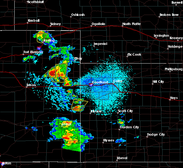 At 314 pm mdt, a severe thunderstorm was located 11 miles north of sheridan lake, or 15 miles southeast of cheyenne wells, moving north at 10 mph (radar indicated). Hazards include 70 mph wind gusts and ping pong ball size hail. People and animals outdoors will be injured. expect hail damage to roofs, siding, windows, and vehicles. expect considerable tree damage. wind damage is also likely to mobile homes, roofs, and outbuildings. locations impacted include, weskan and arapahoe. This includes highway 385 near mile marker 136. At 314 pm mdt, a severe thunderstorm was located 11 miles north of sheridan lake, or 15 miles southeast of cheyenne wells, moving north at 10 mph (radar indicated). Hazards include 70 mph wind gusts and ping pong ball size hail. People and animals outdoors will be injured. expect hail damage to roofs, siding, windows, and vehicles. expect considerable tree damage. wind damage is also likely to mobile homes, roofs, and outbuildings. locations impacted include, weskan and arapahoe. This includes highway 385 near mile marker 136.
|
| 7/2/2020 3:01 PM MDT |
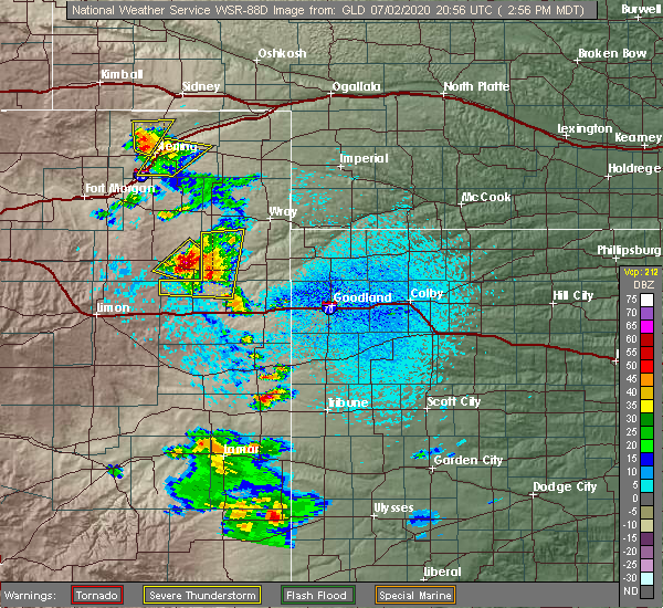 At 300 pm mdt, a severe thunderstorm was located 8 miles northeast of sheridan lake, or 17 miles southeast of cheyenne wells, moving north at 10 mph (radar indicated). Hazards include ping pong ball size hail and 60 mph wind gusts. People and animals outdoors will be injured. expect hail damage to roofs, siding, windows, and vehicles. Expect wind damage to roofs, siding, and trees. At 300 pm mdt, a severe thunderstorm was located 8 miles northeast of sheridan lake, or 17 miles southeast of cheyenne wells, moving north at 10 mph (radar indicated). Hazards include ping pong ball size hail and 60 mph wind gusts. People and animals outdoors will be injured. expect hail damage to roofs, siding, windows, and vehicles. Expect wind damage to roofs, siding, and trees.
|
| 6/27/2020 7:40 PM MDT | Mesonet station up694 2.2 e arapahoe (upr in cheyenne county CO, 8.8 miles E of Weskan, KS |
| 6/26/2020 11:08 PM CDT |
 At 1008 pm mdt/1108 pm cdt/, severe thunderstorms were located along a line extending from 7 miles northwest of colby to 8 miles northwest of monument to 16 miles north of leoti, moving east at 35 mph (radar indicated). Hazards include 60 mph wind gusts. Expect damage to roofs, siding, and trees. locations impacted include, colby, oakley, sharon springs, brewster, levant, weskan and rexford. This includes interstate 70 in kansas between mile markers 25 and 75. At 1008 pm mdt/1108 pm cdt/, severe thunderstorms were located along a line extending from 7 miles northwest of colby to 8 miles northwest of monument to 16 miles north of leoti, moving east at 35 mph (radar indicated). Hazards include 60 mph wind gusts. Expect damage to roofs, siding, and trees. locations impacted include, colby, oakley, sharon springs, brewster, levant, weskan and rexford. This includes interstate 70 in kansas between mile markers 25 and 75.
|
| 6/26/2020 10:41 PM CDT |
 At 941 pm mdt/1041 pm cdt/, severe thunderstorms were located along a line extending from 11 miles northwest of levant to 4 miles southeast of brewster to 5 miles southwest of sharon springs, moving east at 30 mph (radar indicated). Hazards include 60 mph wind gusts. Expect damage to roofs, siding, and trees. locations impacted include, colby, oakley, sharon springs, brewster, levant, weskan and rexford. This includes interstate 70 in kansas between mile markers 25 and 75. At 941 pm mdt/1041 pm cdt/, severe thunderstorms were located along a line extending from 11 miles northwest of levant to 4 miles southeast of brewster to 5 miles southwest of sharon springs, moving east at 30 mph (radar indicated). Hazards include 60 mph wind gusts. Expect damage to roofs, siding, and trees. locations impacted include, colby, oakley, sharon springs, brewster, levant, weskan and rexford. This includes interstate 70 in kansas between mile markers 25 and 75.
|
| 6/26/2020 10:17 PM CDT |
 At 916 pm mdt/1016 pm cdt/, severe thunderstorms were located along a line extending from 14 miles south of bird city to 5 miles west of brewster to 3 miles north of weskan, moving east at 35 mph (radar indicated). Hazards include 60 mph wind gusts. expect damage to roofs, siding, and trees At 916 pm mdt/1016 pm cdt/, severe thunderstorms were located along a line extending from 14 miles south of bird city to 5 miles west of brewster to 3 miles north of weskan, moving east at 35 mph (radar indicated). Hazards include 60 mph wind gusts. expect damage to roofs, siding, and trees
|
| 6/14/2020 6:26 PM MDT |
 At 626 pm mdt, a severe thunderstorm was located 10 miles northwest of sharon springs, moving northeast at 50 mph (radar indicated). Hazards include 70 mph wind gusts. Expect considerable tree damage. damage is likely to mobile homes, roofs, and outbuildings. Locations impacted include, sharon springs and weskan. At 626 pm mdt, a severe thunderstorm was located 10 miles northwest of sharon springs, moving northeast at 50 mph (radar indicated). Hazards include 70 mph wind gusts. Expect considerable tree damage. damage is likely to mobile homes, roofs, and outbuildings. Locations impacted include, sharon springs and weskan.
|
| 6/14/2020 6:17 PM MDT |
 At 616 pm mdt, a severe thunderstorm was located near weskan, or 11 miles west of sharon springs, moving northeast at 50 mph (radar indicated). Hazards include 70 mph wind gusts and penny size hail. Expect considerable tree damage. Damage is likely to mobile homes, roofs, and outbuildings. At 616 pm mdt, a severe thunderstorm was located near weskan, or 11 miles west of sharon springs, moving northeast at 50 mph (radar indicated). Hazards include 70 mph wind gusts and penny size hail. Expect considerable tree damage. Damage is likely to mobile homes, roofs, and outbuildings.
|
| 6/4/2020 5:09 PM MDT |
 The severe thunderstorm warning for southeastern cheyenne county in east central colorado, southern wallace and greeley counties in west central kansas will expire at 515 pm mdt, the storm which prompted the warning has weakened below severe limits, and no longer poses an immediate threat to life or property. therefore, the warning will be allowed to expire. however gusty winds are still possible with this thunderstorm. The severe thunderstorm warning for southeastern cheyenne county in east central colorado, southern wallace and greeley counties in west central kansas will expire at 515 pm mdt, the storm which prompted the warning has weakened below severe limits, and no longer poses an immediate threat to life or property. therefore, the warning will be allowed to expire. however gusty winds are still possible with this thunderstorm.
|
| 6/4/2020 4:33 PM MDT |
 At 432 pm mdt, a severe thunderstorm was located 8 miles south of weskan, or 14 miles southwest of sharon springs, moving east at 25 mph (radar indicated). Hazards include 60 mph wind gusts. Expect damage to roofs, siding, and trees. locations impacted include, tribune, weskan, horace and arapahoe. This includes highway 385 between mile markers 136 and 147. At 432 pm mdt, a severe thunderstorm was located 8 miles south of weskan, or 14 miles southwest of sharon springs, moving east at 25 mph (radar indicated). Hazards include 60 mph wind gusts. Expect damage to roofs, siding, and trees. locations impacted include, tribune, weskan, horace and arapahoe. This includes highway 385 between mile markers 136 and 147.
|
| 6/4/2020 4:08 PM MDT |
 At 407 pm mdt, a severe thunderstorm was located 11 miles east of cheyenne wells, moving east at 25 mph (radar indicated). Hazards include 60 mph wind gusts. expect damage to roofs, siding, and trees At 407 pm mdt, a severe thunderstorm was located 11 miles east of cheyenne wells, moving east at 25 mph (radar indicated). Hazards include 60 mph wind gusts. expect damage to roofs, siding, and trees
|
| 5/24/2020 8:22 PM MDT |
 At 821 pm mdt/921 pm cdt/, severe thunderstorms were located along a line extending from 8 miles southwest of kanorado to 10 miles north of sharon springs to 11 miles southeast of weskan, moving east at 40 mph (radar indicated). Hazards include 60 mph wind gusts and pea size hail. expect damage to roofs, siding, and trees At 821 pm mdt/921 pm cdt/, severe thunderstorms were located along a line extending from 8 miles southwest of kanorado to 10 miles north of sharon springs to 11 miles southeast of weskan, moving east at 40 mph (radar indicated). Hazards include 60 mph wind gusts and pea size hail. expect damage to roofs, siding, and trees
|
| 5/24/2020 8:06 PM MDT |
 At 806 pm mdt, severe thunderstorms were located along a line extending from 13 miles south of burlington to 17 miles west of sharon springs to 6 miles south of weskan, moving east at 40 mph (radar indicated). Hazards include 60 mph wind gusts and pea size hail. Expect damage to roofs, siding, and trees. locations impacted include, sharon springs, weskan and arapahoe. This includes highway 385 between mile markers 163 and 178. At 806 pm mdt, severe thunderstorms were located along a line extending from 13 miles south of burlington to 17 miles west of sharon springs to 6 miles south of weskan, moving east at 40 mph (radar indicated). Hazards include 60 mph wind gusts and pea size hail. Expect damage to roofs, siding, and trees. locations impacted include, sharon springs, weskan and arapahoe. This includes highway 385 between mile markers 163 and 178.
|
| 5/24/2020 7:42 PM MDT |
 At 741 pm mdt, severe thunderstorms were located along a line extending from 16 miles south of stratton to 21 miles west of weskan to 8 miles southeast of cheyenne wells, moving east at 40 mph (radar indicated). Hazards include 60 mph wind gusts and pea size hail. expect damage to roofs, siding, and trees At 741 pm mdt, severe thunderstorms were located along a line extending from 16 miles south of stratton to 21 miles west of weskan to 8 miles southeast of cheyenne wells, moving east at 40 mph (radar indicated). Hazards include 60 mph wind gusts and pea size hail. expect damage to roofs, siding, and trees
|
| 9/11/2019 4:45 PM MDT |
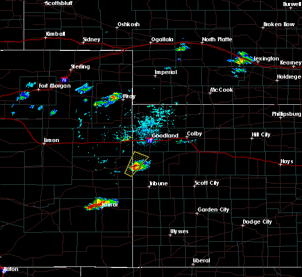 At 445 pm mdt, a severe thunderstorm was located 4 miles east of weskan, or 7 miles west of sharon springs, moving northeast at 25 mph (radar indicated). Hazards include ping pong ball size hail and 60 mph wind gusts. People and animals outdoors will be injured. expect hail damage to roofs, siding, windows, and vehicles. expect wind damage to roofs, siding, and trees. Locations impacted include, weskan. At 445 pm mdt, a severe thunderstorm was located 4 miles east of weskan, or 7 miles west of sharon springs, moving northeast at 25 mph (radar indicated). Hazards include ping pong ball size hail and 60 mph wind gusts. People and animals outdoors will be injured. expect hail damage to roofs, siding, windows, and vehicles. expect wind damage to roofs, siding, and trees. Locations impacted include, weskan.
|
| 9/11/2019 4:37 PM MDT |
 At 426 pm mdt, a severe thunderstorm was located 4 miles southwest of weskan, or 15 miles west of sharon springs, moving northeast at 35 mph (radar indicated). Hazards include ping pong ball size hail and 60 mph wind gusts. People and animals outdoors will be injured. expect hail damage to roofs, siding, windows, and vehicles. expect wind damage to roofs, siding, and trees. Locations impacted include, weskan. At 426 pm mdt, a severe thunderstorm was located 4 miles southwest of weskan, or 15 miles west of sharon springs, moving northeast at 35 mph (radar indicated). Hazards include ping pong ball size hail and 60 mph wind gusts. People and animals outdoors will be injured. expect hail damage to roofs, siding, windows, and vehicles. expect wind damage to roofs, siding, and trees. Locations impacted include, weskan.
|
| 9/11/2019 4:27 PM MDT |
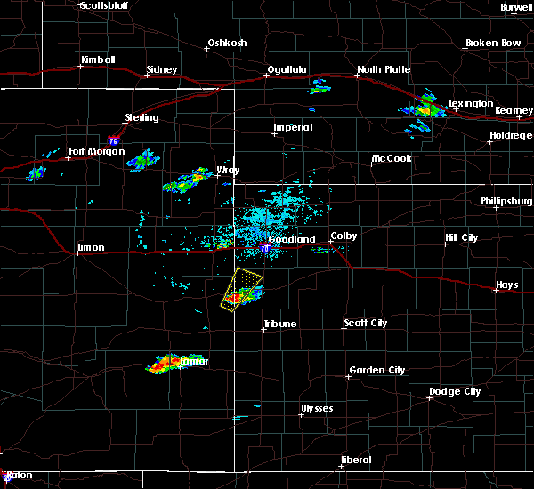 At 426 pm mdt, a severe thunderstorm was located 4 miles southwest of weskan, or 15 miles west of sharon springs, moving northeast at 35 mph (radar indicated). Hazards include ping pong ball size hail and 60 mph wind gusts. People and animals outdoors will be injured. expect hail damage to roofs, siding, windows, and vehicles. expect wind damage to roofs, siding, and trees. Locations impacted include, weskan. At 426 pm mdt, a severe thunderstorm was located 4 miles southwest of weskan, or 15 miles west of sharon springs, moving northeast at 35 mph (radar indicated). Hazards include ping pong ball size hail and 60 mph wind gusts. People and animals outdoors will be injured. expect hail damage to roofs, siding, windows, and vehicles. expect wind damage to roofs, siding, and trees. Locations impacted include, weskan.
|
| 9/11/2019 4:25 PM MDT | Ping Pong Ball sized hail reported 6.4 miles ENE of Weskan, KS, delayed report. time estimated based on radar. |
| 9/11/2019 4:15 PM MDT |
 At 415 pm mdt, a severe thunderstorm was located 11 miles southwest of weskan, or 14 miles east of cheyenne wells, moving northeast at 30 mph (radar indicated). Hazards include golf ball size hail and 60 mph wind gusts. People and animals outdoors will be injured. expect hail damage to roofs, siding, windows, and vehicles. Expect wind damage to roofs, siding, and trees. At 415 pm mdt, a severe thunderstorm was located 11 miles southwest of weskan, or 14 miles east of cheyenne wells, moving northeast at 30 mph (radar indicated). Hazards include golf ball size hail and 60 mph wind gusts. People and animals outdoors will be injured. expect hail damage to roofs, siding, windows, and vehicles. Expect wind damage to roofs, siding, and trees.
|
| 8/17/2019 5:16 PM MDT |
 At 514 pm mdt/614 pm cdt/, severe thunderstorms were located along a line extending from 7 miles southeast of brewster to 5 miles northwest of sharon springs, moving southeast at 30 mph (radar indicated). Hazards include 60 mph wind gusts and quarter size hail. Hail damage to vehicles is expected. expect wind damage to roofs, siding, and trees. locations impacted include, sharon springs, brewster, levant, weskan, winona, wallace and mingo. this includes interstate 70 in kansas between mile markers 21 and 52, and between mile markers 58 and 65. These storms produced sustained winds of 40 mph and wind gusts up to 59 mph at the national weather service in goodland at 451 pm mdt. At 514 pm mdt/614 pm cdt/, severe thunderstorms were located along a line extending from 7 miles southeast of brewster to 5 miles northwest of sharon springs, moving southeast at 30 mph (radar indicated). Hazards include 60 mph wind gusts and quarter size hail. Hail damage to vehicles is expected. expect wind damage to roofs, siding, and trees. locations impacted include, sharon springs, brewster, levant, weskan, winona, wallace and mingo. this includes interstate 70 in kansas between mile markers 21 and 52, and between mile markers 58 and 65. These storms produced sustained winds of 40 mph and wind gusts up to 59 mph at the national weather service in goodland at 451 pm mdt.
|
| 8/17/2019 5:03 PM MDT |
 At 501 pm mdt/601 pm cdt/, severe thunderstorms were located along a line extending from near brewster to 11 miles north of weskan, moving southeast at 30 mph (radar indicated). Hazards include 70 mph wind gusts and quarter size hail. Hail damage to vehicles is expected. expect considerable tree damage. wind damage is also likely to mobile homes, roofs, and outbuildings. locations impacted include, goodland, sharon springs, brewster, ruleton, levant, weskan and winona. this includes interstate 70 in kansas between mile markers 8 and 52, and between mile markers 58 and 65. These storms produced sustained winds of 40 mph and wind gusts up to 59 mph at the national weather service in goodland at 451 pm mdt. At 501 pm mdt/601 pm cdt/, severe thunderstorms were located along a line extending from near brewster to 11 miles north of weskan, moving southeast at 30 mph (radar indicated). Hazards include 70 mph wind gusts and quarter size hail. Hail damage to vehicles is expected. expect considerable tree damage. wind damage is also likely to mobile homes, roofs, and outbuildings. locations impacted include, goodland, sharon springs, brewster, ruleton, levant, weskan and winona. this includes interstate 70 in kansas between mile markers 8 and 52, and between mile markers 58 and 65. These storms produced sustained winds of 40 mph and wind gusts up to 59 mph at the national weather service in goodland at 451 pm mdt.
|
| 8/17/2019 4:55 PM MDT |
 At 453 pm mdt/553 pm cdt/, severe thunderstorms were located along a line extending from 4 miles west of brewster to 13 miles north of weskan, moving east at 30 mph (radar indicated). Hazards include 70 mph wind gusts and quarter size hail. Hail damage to vehicles is expected. expect considerable tree damage. wind damage is also likely to mobile homes, roofs, and outbuildings. locations impacted include, goodland, sharon springs, brewster, ruleton, levant, weskan and winona. this includes the following highways, interstate 70 in kansas between mile markers 8 and 52, and between mile markers 58 and 65. highway 385 between mile markers 167 and 172. These storms produced sustained winds of 40 mph and wind gusts up to 59 mph at the national weather service in goodland at 451 pm mdt. At 453 pm mdt/553 pm cdt/, severe thunderstorms were located along a line extending from 4 miles west of brewster to 13 miles north of weskan, moving east at 30 mph (radar indicated). Hazards include 70 mph wind gusts and quarter size hail. Hail damage to vehicles is expected. expect considerable tree damage. wind damage is also likely to mobile homes, roofs, and outbuildings. locations impacted include, goodland, sharon springs, brewster, ruleton, levant, weskan and winona. this includes the following highways, interstate 70 in kansas between mile markers 8 and 52, and between mile markers 58 and 65. highway 385 between mile markers 167 and 172. These storms produced sustained winds of 40 mph and wind gusts up to 59 mph at the national weather service in goodland at 451 pm mdt.
|
| 8/17/2019 4:55 PM MDT |
 At 431 pm mdt/531 pm cdt/, severe thunderstorms were located along a line extending from 6 miles northeast of goodland to 16 miles south of burlington, moving southeast at 30 mph (radar indicated). Hazards include 70 mph wind gusts and quarter size hail. Hail damage to vehicles is expected. expect considerable tree damage. Wind damage is also likely to mobile homes, roofs, and outbuildings. At 431 pm mdt/531 pm cdt/, severe thunderstorms were located along a line extending from 6 miles northeast of goodland to 16 miles south of burlington, moving southeast at 30 mph (radar indicated). Hazards include 70 mph wind gusts and quarter size hail. Hail damage to vehicles is expected. expect considerable tree damage. Wind damage is also likely to mobile homes, roofs, and outbuildings.
|
| 8/17/2019 4:31 PM MDT |
 At 431 pm mdt/531 pm cdt/, severe thunderstorms were located along a line extending from 6 miles northeast of goodland to 16 miles south of burlington, moving southeast at 30 mph (radar indicated). Hazards include 70 mph wind gusts and quarter size hail. Hail damage to vehicles is expected. expect considerable tree damage. Wind damage is also likely to mobile homes, roofs, and outbuildings. At 431 pm mdt/531 pm cdt/, severe thunderstorms were located along a line extending from 6 miles northeast of goodland to 16 miles south of burlington, moving southeast at 30 mph (radar indicated). Hazards include 70 mph wind gusts and quarter size hail. Hail damage to vehicles is expected. expect considerable tree damage. Wind damage is also likely to mobile homes, roofs, and outbuildings.
|
| 8/13/2019 5:27 PM MDT |
 The severe thunderstorm warning for wallace and western logan counties will expire at 530 pm mdt/630 pm cdt/, the storms which prompted the warning have moved out of the area. therefore, the warning will be allowed to expire. however gusty winds are still possible with these thunderstorms. a tornado watch remains in effect until 700 pm mdt/800 pm cdt/ for northwestern and west central kansas. The severe thunderstorm warning for wallace and western logan counties will expire at 530 pm mdt/630 pm cdt/, the storms which prompted the warning have moved out of the area. therefore, the warning will be allowed to expire. however gusty winds are still possible with these thunderstorms. a tornado watch remains in effect until 700 pm mdt/800 pm cdt/ for northwestern and west central kansas.
|
| 8/13/2019 5:15 PM MDT |
 At 515 pm mdt/615 pm cdt/, severe thunderstorms were located along a line extending from near wallace to 10 miles south of weskan, moving south at 35 mph (radar indicated). Hazards include 70 mph wind gusts and half dollar size hail. Hail damage to vehicles is expected. expect considerable tree damage. wind damage is also likely to mobile homes, roofs, and outbuildings. locations impacted include, sharon springs, weskan and wallace. A tornado watch remains in effect until 700 pm mdt/800 pm cdt/ for northwestern and west central kansas. At 515 pm mdt/615 pm cdt/, severe thunderstorms were located along a line extending from near wallace to 10 miles south of weskan, moving south at 35 mph (radar indicated). Hazards include 70 mph wind gusts and half dollar size hail. Hail damage to vehicles is expected. expect considerable tree damage. wind damage is also likely to mobile homes, roofs, and outbuildings. locations impacted include, sharon springs, weskan and wallace. A tornado watch remains in effect until 700 pm mdt/800 pm cdt/ for northwestern and west central kansas.
|
| 8/13/2019 5:00 PM MDT | Estimated 60 mph wind gusts and pea sized hai in wallace county KS, 0.5 miles SW of Weskan, KS |
| 8/13/2019 4:45 PM MDT | Storm damage reported in wallace county KS, 3.7 miles NNW of Weskan, KS |
| 8/13/2019 4:38 PM MDT |
 At 438 pm mdt/538 pm cdt/, a severe thunderstorm was located 14 miles northwest of sharon springs, moving southeast at 20 mph (radar indicated). Hazards include 70 mph wind gusts and half dollar size hail. Hail damage to vehicles is expected. expect considerable tree damage. Wind damage is also likely to mobile homes, roofs, and outbuildings. At 438 pm mdt/538 pm cdt/, a severe thunderstorm was located 14 miles northwest of sharon springs, moving southeast at 20 mph (radar indicated). Hazards include 70 mph wind gusts and half dollar size hail. Hail damage to vehicles is expected. expect considerable tree damage. Wind damage is also likely to mobile homes, roofs, and outbuildings.
|
| 8/13/2019 4:23 PM MDT |
 At 423 pm mdt, a severe thunderstorm capable of producing a tornado was located 12 miles north of weskan, or 15 miles northwest of sharon springs, moving southeast at 15 mph (radar indicated rotation). Hazards include tornado and hail up to two inches in diameter. Flying debris will be dangerous to those caught without shelter. mobile homes will be damaged or destroyed. damage to roofs, windows, and vehicles will occur. Tree damage is likely. At 423 pm mdt, a severe thunderstorm capable of producing a tornado was located 12 miles north of weskan, or 15 miles northwest of sharon springs, moving southeast at 15 mph (radar indicated rotation). Hazards include tornado and hail up to two inches in diameter. Flying debris will be dangerous to those caught without shelter. mobile homes will be damaged or destroyed. damage to roofs, windows, and vehicles will occur. Tree damage is likely.
|
| 8/11/2019 9:53 PM CDT |
 At 852 pm mdt/952 pm cdt/, severe thunderstorms were located along a line extending from 3 miles east of selden to 11 miles west of scott state lake, moving east at 55 mph. these are very dangerous storms (radar indicated). Hazards include 80 mph wind gusts and quarter size hail. Flying debris will be dangerous to those caught without shelter. mobile homes will be heavily damaged. expect considerable damage to roofs, windows, and vehicles. extensive tree damage and power outages are likely. locations impacted include, colby, goodland, oakley, hoxie, sharon springs, brewster and grainfield. this includes interstate 70 in kansas between mile markers 1 and 99. A tornado watch remains in effect until 1000 pm mdt/1100 pm cdt/ for east central colorado, and northwestern and west central kansas. At 852 pm mdt/952 pm cdt/, severe thunderstorms were located along a line extending from 3 miles east of selden to 11 miles west of scott state lake, moving east at 55 mph. these are very dangerous storms (radar indicated). Hazards include 80 mph wind gusts and quarter size hail. Flying debris will be dangerous to those caught without shelter. mobile homes will be heavily damaged. expect considerable damage to roofs, windows, and vehicles. extensive tree damage and power outages are likely. locations impacted include, colby, goodland, oakley, hoxie, sharon springs, brewster and grainfield. this includes interstate 70 in kansas between mile markers 1 and 99. A tornado watch remains in effect until 1000 pm mdt/1100 pm cdt/ for east central colorado, and northwestern and west central kansas.
|
| 8/11/2019 9:24 PM CDT |
 At 823 pm mdt/923 pm cdt/, severe thunderstorms were located along a line extending from 10 miles northwest of gem to 12 miles south of wallace, moving east at 50 mph. at 806 pm mdt, the automated observing station at the goodland airport reported a gust to 64 mph (radar indicated). Hazards include 70 mph wind gusts and quarter size hail. Hail damage to vehicles is expected. expect considerable tree damage. wind damage is also likely to mobile homes, roofs, and outbuildings. locations impacted include, colby, goodland, oakley, hoxie, sharon springs, brewster and grainfield. this includes interstate 70 in kansas between mile markers 1 and 99. A tornado watch remains in effect until 1000 pm mdt/1100 pm cdt/ for east central colorado, and northwestern and west central kansas. At 823 pm mdt/923 pm cdt/, severe thunderstorms were located along a line extending from 10 miles northwest of gem to 12 miles south of wallace, moving east at 50 mph. at 806 pm mdt, the automated observing station at the goodland airport reported a gust to 64 mph (radar indicated). Hazards include 70 mph wind gusts and quarter size hail. Hail damage to vehicles is expected. expect considerable tree damage. wind damage is also likely to mobile homes, roofs, and outbuildings. locations impacted include, colby, goodland, oakley, hoxie, sharon springs, brewster and grainfield. this includes interstate 70 in kansas between mile markers 1 and 99. A tornado watch remains in effect until 1000 pm mdt/1100 pm cdt/ for east central colorado, and northwestern and west central kansas.
|
| 8/11/2019 9:15 PM CDT |
 At 815 pm mdt/915 pm cdt/, severe thunderstorms were located along a line extending from 11 miles north of colby to 12 miles south of sharon springs, moving east at 55 mph (radar indicated). Hazards include 70 mph wind gusts and quarter size hail. Hail damage to vehicles is expected. expect considerable tree damage. Wind damage is also likely to mobile homes, roofs, and outbuildings. At 815 pm mdt/915 pm cdt/, severe thunderstorms were located along a line extending from 11 miles north of colby to 12 miles south of sharon springs, moving east at 55 mph (radar indicated). Hazards include 70 mph wind gusts and quarter size hail. Hail damage to vehicles is expected. expect considerable tree damage. Wind damage is also likely to mobile homes, roofs, and outbuildings.
|
| 8/11/2019 8:03 PM MDT |
 At 802 pm mdt/902 pm cdt/, severe thunderstorms were located along a line extending from 12 miles north of levant to 10 miles southeast of weskan, moving east at 50 mph (radar indicated). Hazards include 70 mph wind gusts and quarter size hail. Hail damage to vehicles is expected. expect considerable tree damage. wind damage is also likely to mobile homes, roofs, and outbuildings. locations impacted include, colby, goodland, sharon springs, brewster, kanorado, ruleton and levant. this includes interstate 70 in kansas between mile markers 1 and 56. A tornado watch remains in effect until 1000 pm mdt/1100 pm cdt/ for east central colorado, and northwestern and west central kansas. At 802 pm mdt/902 pm cdt/, severe thunderstorms were located along a line extending from 12 miles north of levant to 10 miles southeast of weskan, moving east at 50 mph (radar indicated). Hazards include 70 mph wind gusts and quarter size hail. Hail damage to vehicles is expected. expect considerable tree damage. wind damage is also likely to mobile homes, roofs, and outbuildings. locations impacted include, colby, goodland, sharon springs, brewster, kanorado, ruleton and levant. this includes interstate 70 in kansas between mile markers 1 and 56. A tornado watch remains in effect until 1000 pm mdt/1100 pm cdt/ for east central colorado, and northwestern and west central kansas.
|
| 8/11/2019 7:32 PM MDT |
 At 732 pm mdt/832 pm cdt/, severe thunderstorms were located along a line extending from 13 miles north of goodland to 12 miles north of towner, moving east at 70 mph. these are very dangerous storms (radar indicated). Hazards include 80 mph wind gusts and quarter size hail. Flying debris will be dangerous to those caught without shelter. mobile homes will be heavily damaged. expect considerable damage to roofs, windows, and vehicles. Extensive tree damage and power outages are likely. At 732 pm mdt/832 pm cdt/, severe thunderstorms were located along a line extending from 13 miles north of goodland to 12 miles north of towner, moving east at 70 mph. these are very dangerous storms (radar indicated). Hazards include 80 mph wind gusts and quarter size hail. Flying debris will be dangerous to those caught without shelter. mobile homes will be heavily damaged. expect considerable damage to roofs, windows, and vehicles. Extensive tree damage and power outages are likely.
|
| 7/1/2019 4:04 PM MDT |
 At 404 pm mdt, a severe thunderstorm was located 7 miles southwest of weskan, or 14 miles east of cheyenne wells, moving southeast at 5 mph (radar indicated). Hazards include 60 mph wind gusts and half dollar size hail. Hail damage to vehicles is expected. expect wind damage to roofs, siding, and trees. Locations impacted include, weskan and arapahoe. At 404 pm mdt, a severe thunderstorm was located 7 miles southwest of weskan, or 14 miles east of cheyenne wells, moving southeast at 5 mph (radar indicated). Hazards include 60 mph wind gusts and half dollar size hail. Hail damage to vehicles is expected. expect wind damage to roofs, siding, and trees. Locations impacted include, weskan and arapahoe.
|
| 7/1/2019 3:49 PM MDT |
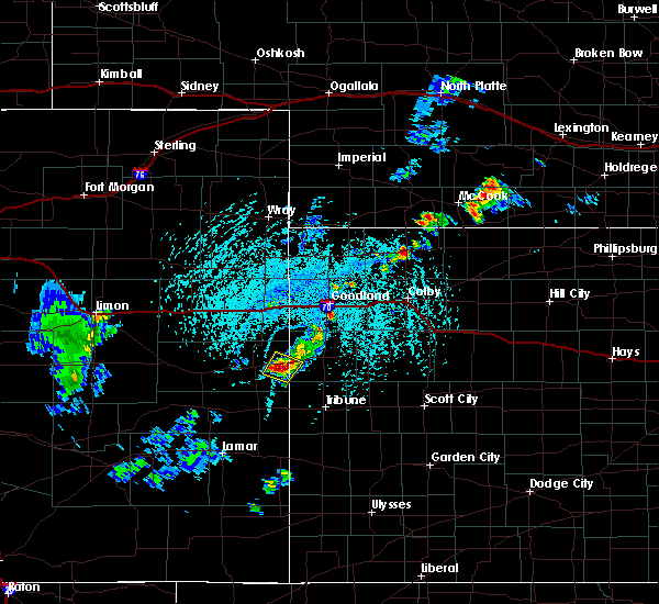 At 349 pm mdt, a severe thunderstorm was located 9 miles west of weskan, or 11 miles east of cheyenne wells, moving north at 5 mph (radar indicated). Hazards include ping pong ball size hail and 60 mph wind gusts. People and animals outdoors will be injured. expect hail damage to roofs, siding, windows, and vehicles. expect wind damage to roofs, siding, and trees. Locations impacted include, weskan and arapahoe. At 349 pm mdt, a severe thunderstorm was located 9 miles west of weskan, or 11 miles east of cheyenne wells, moving north at 5 mph (radar indicated). Hazards include ping pong ball size hail and 60 mph wind gusts. People and animals outdoors will be injured. expect hail damage to roofs, siding, windows, and vehicles. expect wind damage to roofs, siding, and trees. Locations impacted include, weskan and arapahoe.
|
| 7/1/2019 3:39 PM MDT |
 At 339 pm mdt, a severe thunderstorm was located 9 miles west of weskan, or 11 miles east of cheyenne wells, moving north at 10 mph (radar indicated). Hazards include 60 mph wind gusts and half dollar size hail. Hail damage to vehicles is expected. expect wind damage to roofs, siding, and trees. Locations impacted include, weskan and arapahoe. At 339 pm mdt, a severe thunderstorm was located 9 miles west of weskan, or 11 miles east of cheyenne wells, moving north at 10 mph (radar indicated). Hazards include 60 mph wind gusts and half dollar size hail. Hail damage to vehicles is expected. expect wind damage to roofs, siding, and trees. Locations impacted include, weskan and arapahoe.
|
| 7/1/2019 3:29 PM MDT |
 At 328 pm mdt, a severe thunderstorm was located 9 miles southwest of weskan, or 12 miles east of cheyenne wells, moving northeast at 10 mph (radar indicated). Hazards include 60 mph wind gusts and quarter size hail. Hail damage to vehicles is expected. Expect wind damage to roofs, siding, and trees. At 328 pm mdt, a severe thunderstorm was located 9 miles southwest of weskan, or 12 miles east of cheyenne wells, moving northeast at 10 mph (radar indicated). Hazards include 60 mph wind gusts and quarter size hail. Hail damage to vehicles is expected. Expect wind damage to roofs, siding, and trees.
|
| 7/1/2019 3:29 PM MDT |
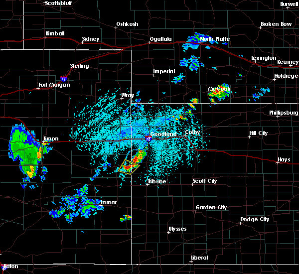 At 328 pm mdt, a severe thunderstorm was located 9 miles southwest of weskan, or 12 miles east of cheyenne wells, moving northeast at 10 mph (radar indicated). Hazards include 60 mph wind gusts and quarter size hail. Hail damage to vehicles is expected. Expect wind damage to roofs, siding, and trees. At 328 pm mdt, a severe thunderstorm was located 9 miles southwest of weskan, or 12 miles east of cheyenne wells, moving northeast at 10 mph (radar indicated). Hazards include 60 mph wind gusts and quarter size hail. Hail damage to vehicles is expected. Expect wind damage to roofs, siding, and trees.
|
| 6/21/2019 8:38 PM MDT | Report of wind damage in the town of weskan... ks. large branches broken and one large tree uproote in wallace county KS, 0.3 miles SSE of Weskan, KS |
| 6/21/2019 8:34 PM MDT |
 At 833 pm mdt, severe thunderstorms were located along a line extending from 17 miles northwest of sharon springs to 3 miles southeast of weskan, moving northeast at 40 mph. these are very dangerous storms (radar indicated). Hazards include 90 mph wind gusts and ping pong ball size hail. You are in a life-threatening situation. flying debris may be deadly to those caught without shelter. mobile homes will be heavily damaged or destroyed. homes and businesses will have substantial roof and window damage. expect extensive tree damage and power outages. Locations impacted include, sharon springs, weskan and wallace. At 833 pm mdt, severe thunderstorms were located along a line extending from 17 miles northwest of sharon springs to 3 miles southeast of weskan, moving northeast at 40 mph. these are very dangerous storms (radar indicated). Hazards include 90 mph wind gusts and ping pong ball size hail. You are in a life-threatening situation. flying debris may be deadly to those caught without shelter. mobile homes will be heavily damaged or destroyed. homes and businesses will have substantial roof and window damage. expect extensive tree damage and power outages. Locations impacted include, sharon springs, weskan and wallace.
|
| 6/21/2019 8:24 PM MDT |
 At 824 pm mdt, severe thunderstorms were located along a line extending from 17 miles northeast of cheyenne wells to near weskan to 13 miles southwest of sharon springs, moving northeast at 40 mph. these are very dangerous storms (radar indicated). Hazards include 90 mph wind gusts and ping pong ball size hail. You are in a life-threatening situation. flying debris may be deadly to those caught without shelter. mobile homes will be heavily damaged or destroyed. homes and businesses will have substantial roof and window damage. expect extensive tree damage and power outages. Locations impacted include, sharon springs, weskan and wallace. At 824 pm mdt, severe thunderstorms were located along a line extending from 17 miles northeast of cheyenne wells to near weskan to 13 miles southwest of sharon springs, moving northeast at 40 mph. these are very dangerous storms (radar indicated). Hazards include 90 mph wind gusts and ping pong ball size hail. You are in a life-threatening situation. flying debris may be deadly to those caught without shelter. mobile homes will be heavily damaged or destroyed. homes and businesses will have substantial roof and window damage. expect extensive tree damage and power outages. Locations impacted include, sharon springs, weskan and wallace.
|
| 6/21/2019 8:16 PM MDT |
 At 815 pm mdt, severe thunderstorms were located along a line extending from 14 miles northeast of cheyenne wells to 4 miles west of weskan, moving northeast at 40 mph. these are very dangerous storms (radar indicated). Hazards include 80 mph wind gusts and ping pong ball size hail. Flying debris will be dangerous to those caught without shelter. mobile homes will be heavily damaged. expect considerable damage to roofs, windows, and vehicles. extensive tree damage and power outages are likely. Locations impacted include, sharon springs, weskan, wallace and arapahoe. At 815 pm mdt, severe thunderstorms were located along a line extending from 14 miles northeast of cheyenne wells to 4 miles west of weskan, moving northeast at 40 mph. these are very dangerous storms (radar indicated). Hazards include 80 mph wind gusts and ping pong ball size hail. Flying debris will be dangerous to those caught without shelter. mobile homes will be heavily damaged. expect considerable damage to roofs, windows, and vehicles. extensive tree damage and power outages are likely. Locations impacted include, sharon springs, weskan, wallace and arapahoe.
|
| 6/21/2019 8:00 PM MDT |
 At 800 pm mdt, severe thunderstorms were located along a line extending from 7 miles north of cheyenne wells to 12 miles west of weskan to 19 miles north of sheridan lake, moving northeast at 40 mph. these are very dangerous storms (radar indicated). Hazards include 80 mph wind gusts and quarter size hail. Flying debris will be dangerous to those caught without shelter. mobile homes will be heavily damaged. expect considerable damage to roofs, windows, and vehicles. Extensive tree damage and power outages are likely. At 800 pm mdt, severe thunderstorms were located along a line extending from 7 miles north of cheyenne wells to 12 miles west of weskan to 19 miles north of sheridan lake, moving northeast at 40 mph. these are very dangerous storms (radar indicated). Hazards include 80 mph wind gusts and quarter size hail. Flying debris will be dangerous to those caught without shelter. mobile homes will be heavily damaged. expect considerable damage to roofs, windows, and vehicles. Extensive tree damage and power outages are likely.
|
| 6/14/2019 5:34 PM MDT |
 At 534 pm mdt/634 pm cdt/, severe thunderstorms were located along a line extending from 14 miles south of st. francis to 7 miles southeast of goodland to 13 miles southeast of wallace to 9 miles east of tribune, moving east at 45 mph (radar indicated). Hazards include 70 mph wind gusts and quarter size hail. Hail damage to vehicles is expected. expect considerable tree damage. wind damage is also likely to mobile homes, roofs, and outbuildings. locations impacted include, goodland, leoti, sharon springs, tribune, brewster, ruleton and weskan. This includes interstate 70 in kansas between mile markers 2 and 39. At 534 pm mdt/634 pm cdt/, severe thunderstorms were located along a line extending from 14 miles south of st. francis to 7 miles southeast of goodland to 13 miles southeast of wallace to 9 miles east of tribune, moving east at 45 mph (radar indicated). Hazards include 70 mph wind gusts and quarter size hail. Hail damage to vehicles is expected. expect considerable tree damage. wind damage is also likely to mobile homes, roofs, and outbuildings. locations impacted include, goodland, leoti, sharon springs, tribune, brewster, ruleton and weskan. This includes interstate 70 in kansas between mile markers 2 and 39.
|
| 6/14/2019 5:18 PM MDT |
 At 517 pm mdt/617 pm cdt/, severe thunderstorms were located along a line extending from 7 miles east of bonny reservoir to 5 miles southeast of ruleton to 6 miles southwest of wallace to 5 miles north of horace, moving east at 45 mph (radar indicated). Hazards include 70 mph wind gusts and quarter size hail. Hail damage to vehicles is expected. expect considerable tree damage. wind damage is also likely to mobile homes, roofs, and outbuildings. locations impacted include, goodland, leoti, sharon springs, tribune, brewster, kanorado and ruleton. this includes the following highways, interstate 70 in kansas between mile markers 0 and 39. interstate 70 in colorado between mile markers 445 and 450. Highway 385 between mile markers 200 and 206, and near mile marker 211. At 517 pm mdt/617 pm cdt/, severe thunderstorms were located along a line extending from 7 miles east of bonny reservoir to 5 miles southeast of ruleton to 6 miles southwest of wallace to 5 miles north of horace, moving east at 45 mph (radar indicated). Hazards include 70 mph wind gusts and quarter size hail. Hail damage to vehicles is expected. expect considerable tree damage. wind damage is also likely to mobile homes, roofs, and outbuildings. locations impacted include, goodland, leoti, sharon springs, tribune, brewster, kanorado and ruleton. this includes the following highways, interstate 70 in kansas between mile markers 0 and 39. interstate 70 in colorado between mile markers 445 and 450. Highway 385 between mile markers 200 and 206, and near mile marker 211.
|
| 6/14/2019 5:17 PM MDT | Storm damage reported in wallace county KS, 3.7 miles NNW of Weskan, KS |
| 6/14/2019 5:11 PM MDT |
 At 510 pm mdt/610 pm cdt/, severe thunderstorms were located along a line extending from near bonny reservoir to 3 miles southwest of ruleton to 4 miles south of sharon springs to 8 miles northwest of horace, moving east at 45 mph (radar indicated). Hazards include 60 mph wind gusts and quarter size hail. Hail damage to vehicles is expected. expect wind damage to roofs, siding, and trees. locations impacted include, goodland, leoti, sharon springs, tribune, brewster, kanorado and ruleton. this includes the following highways, interstate 70 in kansas between mile markers 0 and 39. interstate 70 in colorado between mile markers 445 and 450. Highway 385 between mile markers 200 and 206, and near mile marker 211. At 510 pm mdt/610 pm cdt/, severe thunderstorms were located along a line extending from near bonny reservoir to 3 miles southwest of ruleton to 4 miles south of sharon springs to 8 miles northwest of horace, moving east at 45 mph (radar indicated). Hazards include 60 mph wind gusts and quarter size hail. Hail damage to vehicles is expected. expect wind damage to roofs, siding, and trees. locations impacted include, goodland, leoti, sharon springs, tribune, brewster, kanorado and ruleton. this includes the following highways, interstate 70 in kansas between mile markers 0 and 39. interstate 70 in colorado between mile markers 445 and 450. Highway 385 between mile markers 200 and 206, and near mile marker 211.
|
| 6/14/2019 4:55 PM MDT |
 At 454 pm mdt/554 pm cdt/, severe thunderstorms were located along a line extending from 8 miles west of bonny reservoir to 3 miles southwest of kanorado to near weskan to 12 miles north of towner, moving east at 40 mph (radar indicated). Hazards include 60 mph wind gusts and quarter size hail. Hail damage to vehicles is expected. Expect wind damage to roofs, siding, and trees. At 454 pm mdt/554 pm cdt/, severe thunderstorms were located along a line extending from 8 miles west of bonny reservoir to 3 miles southwest of kanorado to near weskan to 12 miles north of towner, moving east at 40 mph (radar indicated). Hazards include 60 mph wind gusts and quarter size hail. Hail damage to vehicles is expected. Expect wind damage to roofs, siding, and trees.
|
| 6/3/2019 7:45 PM MDT | Storm damage reported in wallace county KS, 3.7 miles NNW of Weskan, KS |
| 5/28/2019 4:14 PM MDT |
 At 414 pm mdt, a severe thunderstorm was located 9 miles southeast of weskan, or 12 miles southwest of sharon springs, moving east at 35 mph (radar indicated). Hazards include 60 mph wind gusts and quarter size hail. Hail damage to vehicles is expected. Expect wind damage to roofs, siding, and trees. At 414 pm mdt, a severe thunderstorm was located 9 miles southeast of weskan, or 12 miles southwest of sharon springs, moving east at 35 mph (radar indicated). Hazards include 60 mph wind gusts and quarter size hail. Hail damage to vehicles is expected. Expect wind damage to roofs, siding, and trees.
|
| 5/28/2019 4:12 PM MDT | Quarter sized hail reported 8.3 miles NNE of Weskan, KS, hail ranged from penny to quarter-sized. |
| 5/28/2019 4:10 PM MDT | Storm damage reported in wallace county KS, 8.3 miles NNE of Weskan, KS |
| 5/26/2019 4:27 PM MDT |
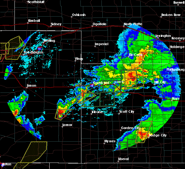 At 426 pm mdt, a severe thunderstorm was located 12 miles north of weskan, or 15 miles northwest of sharon springs, moving northeast at 50 mph (radar indicated). Hazards include 60 mph wind gusts and half dollar size hail. Hail damage to vehicles is expected. expect wind damage to roofs, siding, and trees. locations impacted include, weskan. A tornado watch remains in effect until 900 pm mdt for east central colorado, and northwestern and west central kansas. At 426 pm mdt, a severe thunderstorm was located 12 miles north of weskan, or 15 miles northwest of sharon springs, moving northeast at 50 mph (radar indicated). Hazards include 60 mph wind gusts and half dollar size hail. Hail damage to vehicles is expected. expect wind damage to roofs, siding, and trees. locations impacted include, weskan. A tornado watch remains in effect until 900 pm mdt for east central colorado, and northwestern and west central kansas.
|
| 5/26/2019 4:17 PM MDT |
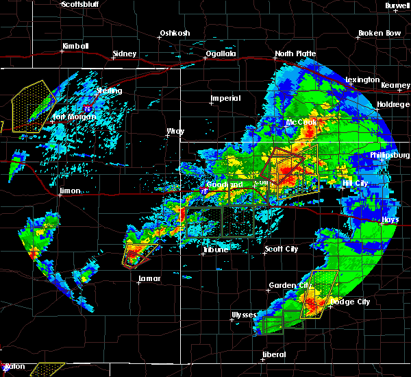 At 417 pm mdt, a severe thunderstorm was located 6 miles northwest of weskan, or 16 miles east of cheyenne wells, moving northeast at 20 mph (radar indicated). Hazards include 60 mph wind gusts and half dollar size hail. Hail damage to vehicles is expected. Expect wind damage to roofs, siding, and trees. At 417 pm mdt, a severe thunderstorm was located 6 miles northwest of weskan, or 16 miles east of cheyenne wells, moving northeast at 20 mph (radar indicated). Hazards include 60 mph wind gusts and half dollar size hail. Hail damage to vehicles is expected. Expect wind damage to roofs, siding, and trees.
|
| 5/26/2019 2:07 PM MDT |
 At 207 pm mdt, a severe thunderstorm was located 7 miles southeast of towner, or 12 miles west of tribune, moving northeast at 55 mph (radar indicated). Hazards include 60 mph wind gusts and half dollar size hail. Hail damage to vehicles is expected. Expect wind damage to roofs, siding, and trees. At 207 pm mdt, a severe thunderstorm was located 7 miles southeast of towner, or 12 miles west of tribune, moving northeast at 55 mph (radar indicated). Hazards include 60 mph wind gusts and half dollar size hail. Hail damage to vehicles is expected. Expect wind damage to roofs, siding, and trees.
|
| 5/26/2019 1:57 PM MDT |
 At 156 pm mdt, a severe thunderstorm was located over sharon springs, moving northeast at 35 mph (radar indicated). Hazards include 60 mph wind gusts and quarter size hail. Hail damage to vehicles is expected. expect wind damage to roofs, siding, and trees. locations impacted include, sharon springs and wallace. A tornado watch remains in effect until 900 pm mdt for northwestern and west central kansas. At 156 pm mdt, a severe thunderstorm was located over sharon springs, moving northeast at 35 mph (radar indicated). Hazards include 60 mph wind gusts and quarter size hail. Hail damage to vehicles is expected. expect wind damage to roofs, siding, and trees. locations impacted include, sharon springs and wallace. A tornado watch remains in effect until 900 pm mdt for northwestern and west central kansas.
|
| 5/26/2019 1:39 PM MDT |
 The national weather service in goodland has issued a * severe thunderstorm warning for. wallace county in west central kansas. southwestern logan county in west central kansas. until 230 pm mdt/330 pm cdt/. At 138 pm mdt/238 pm cdt/, a severe thunderstorm was located 8. The national weather service in goodland has issued a * severe thunderstorm warning for. wallace county in west central kansas. southwestern logan county in west central kansas. until 230 pm mdt/330 pm cdt/. At 138 pm mdt/238 pm cdt/, a severe thunderstorm was located 8.
|
| 4/28/2019 7:02 PM CDT |
 At 601 pm mdt/701 pm cdt/, severe thunderstorms were located along a line extending from near winona to 14 miles south of sharon springs, moving east at 35 mph (radar indicated). Hazards include 70 mph wind gusts and ping pong ball size hail. blowing dust. People and animals outdoors will be injured. expect hail damage to roofs, siding, windows, and vehicles. expect considerable tree damage. Wind damage is also likely to mobile homes, roofs, and outbuildings. At 601 pm mdt/701 pm cdt/, severe thunderstorms were located along a line extending from near winona to 14 miles south of sharon springs, moving east at 35 mph (radar indicated). Hazards include 70 mph wind gusts and ping pong ball size hail. blowing dust. People and animals outdoors will be injured. expect hail damage to roofs, siding, windows, and vehicles. expect considerable tree damage. Wind damage is also likely to mobile homes, roofs, and outbuildings.
|
| 4/28/2019 5:32 PM MDT |
 At 532 pm mdt/632 pm cdt/, severe thunderstorms were located along a line extending from 7 miles northwest of sharon springs to 12 miles north of horace, moving northeast at 15 mph (radar indicated). Hazards include 70 mph wind gusts and ping pong ball size hail. People and animals outdoors will be injured. expect hail damage to roofs, siding, windows, and vehicles. expect considerable tree damage. Wind damage is also likely to mobile homes, roofs, and outbuildings. At 532 pm mdt/632 pm cdt/, severe thunderstorms were located along a line extending from 7 miles northwest of sharon springs to 12 miles north of horace, moving northeast at 15 mph (radar indicated). Hazards include 70 mph wind gusts and ping pong ball size hail. People and animals outdoors will be injured. expect hail damage to roofs, siding, windows, and vehicles. expect considerable tree damage. Wind damage is also likely to mobile homes, roofs, and outbuildings.
|
| 8/18/2018 4:27 PM MDT |
 The severe thunderstorm warning for southern wallace county will expire at 430 pm mdt, the storm which prompted the warning has weakened below severe limits, and no longer poses an immediate threat to life or property. therefore, the warning will be allowed to expire. however gusty winds and heavy rain are still possible with this thunderstorm. The severe thunderstorm warning for southern wallace county will expire at 430 pm mdt, the storm which prompted the warning has weakened below severe limits, and no longer poses an immediate threat to life or property. therefore, the warning will be allowed to expire. however gusty winds and heavy rain are still possible with this thunderstorm.
|
| 8/18/2018 3:44 PM MDT |
 At 344 pm mdt, a severe thunderstorm was located 7 miles southwest of sharon springs, moving south at 10 mph (radar indicated). Hazards include 60 mph wind gusts and half dollar size hail. Hail damage to vehicles is expected. Expect wind damage to roofs, siding, and trees. At 344 pm mdt, a severe thunderstorm was located 7 miles southwest of sharon springs, moving south at 10 mph (radar indicated). Hazards include 60 mph wind gusts and half dollar size hail. Hail damage to vehicles is expected. Expect wind damage to roofs, siding, and trees.
|
| 8/18/2018 3:35 PM MDT |
 At 335 pm mdt, a severe thunderstorm was located 4 miles east of weskan, or 7 miles southwest of sharon springs, moving south at 10 mph (radar indicated). Hazards include 60 mph wind gusts and half dollar size hail. Hail damage to vehicles is expected. expect wind damage to roofs, siding, and trees. Locations impacted include, sharon springs and weskan. At 335 pm mdt, a severe thunderstorm was located 4 miles east of weskan, or 7 miles southwest of sharon springs, moving south at 10 mph (radar indicated). Hazards include 60 mph wind gusts and half dollar size hail. Hail damage to vehicles is expected. expect wind damage to roofs, siding, and trees. Locations impacted include, sharon springs and weskan.
|
| 8/18/2018 3:26 PM MDT |
 At 326 pm mdt, a severe thunderstorm was located 4 miles east of weskan, or 7 miles west of sharon springs, moving southwest at 10 mph (radar indicated). Hazards include 60 mph wind gusts and half dollar size hail. Hail damage to vehicles is expected. expect wind damage to roofs, siding, and trees. Locations impacted include, sharon springs and weskan. At 326 pm mdt, a severe thunderstorm was located 4 miles east of weskan, or 7 miles west of sharon springs, moving southwest at 10 mph (radar indicated). Hazards include 60 mph wind gusts and half dollar size hail. Hail damage to vehicles is expected. expect wind damage to roofs, siding, and trees. Locations impacted include, sharon springs and weskan.
|
| 8/18/2018 3:14 PM MDT |
 At 314 pm mdt, a severe thunderstorm was located 4 miles east of weskan, or 6 miles west of sharon springs, moving south at 10 mph (radar indicated). Hazards include 60 mph wind gusts and half dollar size hail. Hail damage to vehicles is expected. expect wind damage to roofs, siding, and trees. Locations impacted include, sharon springs and weskan. At 314 pm mdt, a severe thunderstorm was located 4 miles east of weskan, or 6 miles west of sharon springs, moving south at 10 mph (radar indicated). Hazards include 60 mph wind gusts and half dollar size hail. Hail damage to vehicles is expected. expect wind damage to roofs, siding, and trees. Locations impacted include, sharon springs and weskan.
|
| 8/18/2018 3:04 PM MDT |
 At 304 pm mdt, a severe thunderstorm was located 5 miles east of weskan, or 6 miles west of sharon springs, moving south at 15 mph (radar indicated). Hazards include ping pong ball size hail and 60 mph wind gusts. People and animals outdoors will be injured. expect hail damage to roofs, siding, windows, and vehicles. Expect wind damage to roofs, siding, and trees. At 304 pm mdt, a severe thunderstorm was located 5 miles east of weskan, or 6 miles west of sharon springs, moving south at 15 mph (radar indicated). Hazards include ping pong ball size hail and 60 mph wind gusts. People and animals outdoors will be injured. expect hail damage to roofs, siding, windows, and vehicles. Expect wind damage to roofs, siding, and trees.
|
| 7/26/2018 7:00 PM MDT |
 At 700 pm mdt, a severe thunderstorm was located 6 miles west of weskan, or 14 miles east of cheyenne wells, moving south at 30 mph (radar indicated). Hazards include 70 mph wind gusts and ping pong ball size hail. People and animals outdoors will be injured. expect hail damage to roofs, siding, windows, and vehicles. expect considerable tree damage. Wind damage is also likely to mobile homes, roofs, and outbuildings. At 700 pm mdt, a severe thunderstorm was located 6 miles west of weskan, or 14 miles east of cheyenne wells, moving south at 30 mph (radar indicated). Hazards include 70 mph wind gusts and ping pong ball size hail. People and animals outdoors will be injured. expect hail damage to roofs, siding, windows, and vehicles. expect considerable tree damage. Wind damage is also likely to mobile homes, roofs, and outbuildings.
|
| 7/4/2018 6:24 PM MDT |
 At 623 pm mdt, a severe thunderstorm was located 8 miles northwest of sharon springs, moving north at 15 mph (radar indicated). Hazards include 60 mph wind gusts and quarter size hail. Hail damage to vehicles is expected. expect wind damage to roofs, siding, and trees. Locations impacted include, sharon springs and weskan. At 623 pm mdt, a severe thunderstorm was located 8 miles northwest of sharon springs, moving north at 15 mph (radar indicated). Hazards include 60 mph wind gusts and quarter size hail. Hail damage to vehicles is expected. expect wind damage to roofs, siding, and trees. Locations impacted include, sharon springs and weskan.
|
| 7/4/2018 5:56 PM MDT |
 At 556 pm mdt, a severe thunderstorm was located 5 miles northeast of weskan, or 6 miles west of sharon springs, moving north at 15 mph (radar indicated). Hazards include 70 mph wind gusts and half dollar size hail. Hail damage to vehicles is expected. expect considerable tree damage. Wind damage is also likely to mobile homes, roofs, and outbuildings. At 556 pm mdt, a severe thunderstorm was located 5 miles northeast of weskan, or 6 miles west of sharon springs, moving north at 15 mph (radar indicated). Hazards include 70 mph wind gusts and half dollar size hail. Hail damage to vehicles is expected. expect considerable tree damage. Wind damage is also likely to mobile homes, roofs, and outbuildings.
|
| 7/4/2018 5:52 PM MDT |
 At 551 pm mdt, a severe thunderstorm was located 5 miles west of weskan, or 16 miles east of cheyenne wells, moving north at 5 mph (radar indicated). Hazards include 70 mph wind gusts and quarter size hail. Hail damage to vehicles is expected. expect considerable tree damage. wind damage is also likely to mobile homes, roofs, and outbuildings. Locations impacted include, weskan. At 551 pm mdt, a severe thunderstorm was located 5 miles west of weskan, or 16 miles east of cheyenne wells, moving north at 5 mph (radar indicated). Hazards include 70 mph wind gusts and quarter size hail. Hail damage to vehicles is expected. expect considerable tree damage. wind damage is also likely to mobile homes, roofs, and outbuildings. Locations impacted include, weskan.
|
| 7/4/2018 5:31 PM MDT |
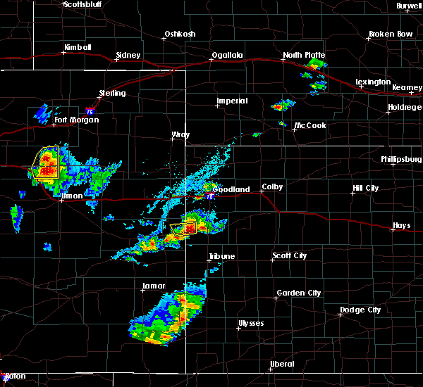 At 531 pm mdt, a severe thunderstorm was located 4 miles west of weskan, or 16 miles west of sharon springs, moving north at 5 mph (radar indicated). Hazards include 70 mph wind gusts and quarter size hail. Hail damage to vehicles is expected. expect considerable tree damage. wind damage is also likely to mobile homes, roofs, and outbuildings. Locations impacted include, weskan and arapahoe. At 531 pm mdt, a severe thunderstorm was located 4 miles west of weskan, or 16 miles west of sharon springs, moving north at 5 mph (radar indicated). Hazards include 70 mph wind gusts and quarter size hail. Hail damage to vehicles is expected. expect considerable tree damage. wind damage is also likely to mobile homes, roofs, and outbuildings. Locations impacted include, weskan and arapahoe.
|
| 7/4/2018 5:25 PM MDT | Storm damage reported in wallace county KS, 3.2 miles NW of Weskan, KS |
| 7/4/2018 5:11 PM MDT |
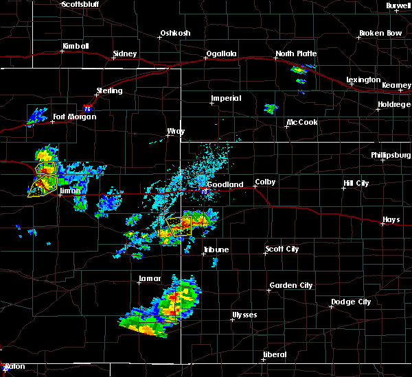 At 511 pm mdt, a severe thunderstorm was located 5 miles southwest of weskan, or 16 miles west of sharon springs, moving north at 5 mph. this is a very dangerous storm (radar indicated). Hazards include 80 mph wind gusts and quarter size hail. Flying debris will be dangerous to those caught without shelter. mobile homes will be heavily damaged. expect considerable damage to roofs, windows, and vehicles. Extensive tree damage and power outages are likely. At 511 pm mdt, a severe thunderstorm was located 5 miles southwest of weskan, or 16 miles west of sharon springs, moving north at 5 mph. this is a very dangerous storm (radar indicated). Hazards include 80 mph wind gusts and quarter size hail. Flying debris will be dangerous to those caught without shelter. mobile homes will be heavily damaged. expect considerable damage to roofs, windows, and vehicles. Extensive tree damage and power outages are likely.
|
| 6/24/2018 5:05 PM MDT | Weather link network station sloa in wallace county KS, 3.2 miles NW of Weskan, KS |
| 6/24/2018 1:08 AM MDT | Quarter sized hail reported 16.5 miles SSE of Weskan, KS, pea to quarter size hail. |
| 6/23/2018 11:59 PM MDT |
 At 1159 pm mdt/1259 am cdt/, a severe thunderstorm was located over weskan, or 10 miles west of sharon springs, moving east at 25 mph (radar indicated). Hazards include 70 mph wind gusts and quarter size hail. Hail damage to vehicles is expected. expect considerable tree damage. Wind damage is also likely to mobile homes, roofs, and outbuildings. At 1159 pm mdt/1259 am cdt/, a severe thunderstorm was located over weskan, or 10 miles west of sharon springs, moving east at 25 mph (radar indicated). Hazards include 70 mph wind gusts and quarter size hail. Hail damage to vehicles is expected. expect considerable tree damage. Wind damage is also likely to mobile homes, roofs, and outbuildings.
|
| 6/23/2018 11:50 PM MDT | Golf Ball sized hail reported 0.3 miles SSE of Weskan, KS, quarter to golf ball size hail. the duration of the hail event was 20 minutes. |
| 6/23/2018 5:28 PM MDT |
 At 528 pm mdt, a severe thunderstorm was located 7 miles northeast of cheyenne wells, moving east at 40 mph (radar indicated). Hazards include ping pong ball size hail and 60 mph wind gusts. People and animals outdoors will be injured. expect hail damage to roofs, siding, windows, and vehicles. expect wind damage to roofs, siding, and trees. locations impacted include, cheyenne wells, sharon springs, weskan and arapahoe. This includes highway 385 between mile markers 149 and 175. At 528 pm mdt, a severe thunderstorm was located 7 miles northeast of cheyenne wells, moving east at 40 mph (radar indicated). Hazards include ping pong ball size hail and 60 mph wind gusts. People and animals outdoors will be injured. expect hail damage to roofs, siding, windows, and vehicles. expect wind damage to roofs, siding, and trees. locations impacted include, cheyenne wells, sharon springs, weskan and arapahoe. This includes highway 385 between mile markers 149 and 175.
|
| 6/23/2018 5:20 PM MDT |
 At 520 pm mdt, a severe thunderstorm was located 10 miles northwest of weskan, or 17 miles west of sharon springs, moving east at 35 mph (radar indicated). Hazards include 60 mph wind gusts and quarter size hail. Hail damage to vehicles is expected. expect wind damage to roofs, siding, and trees. locations impacted include, cheyenne wells, sharon springs, weskan and arapahoe. This includes highway 385 between mile markers 149 and 175. At 520 pm mdt, a severe thunderstorm was located 10 miles northwest of weskan, or 17 miles west of sharon springs, moving east at 35 mph (radar indicated). Hazards include 60 mph wind gusts and quarter size hail. Hail damage to vehicles is expected. expect wind damage to roofs, siding, and trees. locations impacted include, cheyenne wells, sharon springs, weskan and arapahoe. This includes highway 385 between mile markers 149 and 175.
|
| 6/23/2018 5:08 PM MDT |
 At 508 pm mdt, a severe thunderstorm was located 16 miles northeast of cheyenne wells, moving east at 35 mph (radar indicated). Hazards include 60 mph wind gusts and half dollar size hail. Hail damage to vehicles is expected. Expect wind damage to roofs, siding, and trees. At 508 pm mdt, a severe thunderstorm was located 16 miles northeast of cheyenne wells, moving east at 35 mph (radar indicated). Hazards include 60 mph wind gusts and half dollar size hail. Hail damage to vehicles is expected. Expect wind damage to roofs, siding, and trees.
|
| 6/22/2018 3:44 PM MDT |
 At 343 pm mdt, severe thunderstorms were located along a line extending from 16 miles northwest of sharon springs to 3 miles north of weskan, moving east at 45 mph (trained weather spotters. at 325 pm mdt...60 to 70 mph wind gusts were reported in arapahoe). Hazards include 70 mph wind gusts and quarter size hail. Hail damage to vehicles is expected. expect considerable tree damage. wind damage is also likely to mobile homes, roofs, and outbuildings. Locations impacted include, sharon springs, weskan and wallace. At 343 pm mdt, severe thunderstorms were located along a line extending from 16 miles northwest of sharon springs to 3 miles north of weskan, moving east at 45 mph (trained weather spotters. at 325 pm mdt...60 to 70 mph wind gusts were reported in arapahoe). Hazards include 70 mph wind gusts and quarter size hail. Hail damage to vehicles is expected. expect considerable tree damage. wind damage is also likely to mobile homes, roofs, and outbuildings. Locations impacted include, sharon springs, weskan and wallace.
|
| 6/22/2018 3:32 PM MDT |
 At 332 pm mdt, severe thunderstorms were located along a line extending from 13 miles northeast of cheyenne wells to 7 miles west of weskan, moving east at 45 mph (trained weather spotters. at 310 pm mdt...a 60 mph wind gust was reported in cheyenne wells). Hazards include 60 mph wind gusts and quarter size hail. Hail damage to vehicles is expected. Expect wind damage to roofs, siding, and trees. At 332 pm mdt, severe thunderstorms were located along a line extending from 13 miles northeast of cheyenne wells to 7 miles west of weskan, moving east at 45 mph (trained weather spotters. at 310 pm mdt...a 60 mph wind gust was reported in cheyenne wells). Hazards include 60 mph wind gusts and quarter size hail. Hail damage to vehicles is expected. Expect wind damage to roofs, siding, and trees.
|
| 6/19/2018 7:12 PM MDT |
 At 711 pm mdt/811 pm cdt/, severe thunderstorms were located along a line extending from 9 miles southwest of winona to 14 miles north of horace to 5 miles northeast of sheridan lake, moving southeast at 30 mph. this line of storms has produced numerous measured wind gusts between 60 and 65 mph (radar indicated). Hazards include 60 mph wind gusts and nickel size hail. Expect damage to roofs, siding, and trees. locations impacted include, leoti, cheyenne wells, sharon springs, tribune, weskan, horace and wallace. This includes highway 385 between mile markers 136 and 157. At 711 pm mdt/811 pm cdt/, severe thunderstorms were located along a line extending from 9 miles southwest of winona to 14 miles north of horace to 5 miles northeast of sheridan lake, moving southeast at 30 mph. this line of storms has produced numerous measured wind gusts between 60 and 65 mph (radar indicated). Hazards include 60 mph wind gusts and nickel size hail. Expect damage to roofs, siding, and trees. locations impacted include, leoti, cheyenne wells, sharon springs, tribune, weskan, horace and wallace. This includes highway 385 between mile markers 136 and 157.
|
| 6/19/2018 6:56 PM MDT |
 At 655 pm mdt/755 pm cdt/, severe thunderstorms were located along a line extending from 7 miles northeast of wallace to 13 miles southeast of weskan to near sheridan lake, moving south at 75 mph (radar indicated). Hazards include 60 mph wind gusts and nickel size hail. expect damage to roofs, siding, and trees At 655 pm mdt/755 pm cdt/, severe thunderstorms were located along a line extending from 7 miles northeast of wallace to 13 miles southeast of weskan to near sheridan lake, moving south at 75 mph (radar indicated). Hazards include 60 mph wind gusts and nickel size hail. expect damage to roofs, siding, and trees
|
| 6/19/2018 6:51 PM MDT | Mesonet sit in wallace county KS, 3.2 miles NW of Weskan, KS |
| 6/19/2018 6:43 PM MDT |
 At 620 pm mdt, severe thunderstorms were located along a line extending from 7 miles north of goodland to 12 miles south of kanorado, moving southeast at 70 mph (radar indicated). Hazards include 70 mph wind gusts and nickel size hail. Expect considerable tree damage. Damage is likely to mobile homes, roofs, and outbuildings. At 620 pm mdt, severe thunderstorms were located along a line extending from 7 miles north of goodland to 12 miles south of kanorado, moving southeast at 70 mph (radar indicated). Hazards include 70 mph wind gusts and nickel size hail. Expect considerable tree damage. Damage is likely to mobile homes, roofs, and outbuildings.
|
| 6/19/2018 6:43 PM MDT |
 At 643 pm mdt, severe thunderstorms were located along a line extending from 14 miles southeast of goodland to 7 miles northwest of sharon springs to 3 miles southeast of cheyenne wells, moving south at 75 mph (radar indicated). Hazards include 60 mph wind gusts and nickel size hail. Expect damage to roofs, siding, and trees. locations impacted include, goodland, burlington, cheyenne wells, sharon springs, kanorado, ruleton and weskan. this includes the following highways, interstate 70 in kansas between mile markers 0 and 29. interstate 70 in colorado between mile markers 437 and 450. highway 385 between mile markers 139 and 156, and between mile markers 164 and 200. A tornado watch remains in effect until 700 pm mdt for east central colorado. At 643 pm mdt, severe thunderstorms were located along a line extending from 14 miles southeast of goodland to 7 miles northwest of sharon springs to 3 miles southeast of cheyenne wells, moving south at 75 mph (radar indicated). Hazards include 60 mph wind gusts and nickel size hail. Expect damage to roofs, siding, and trees. locations impacted include, goodland, burlington, cheyenne wells, sharon springs, kanorado, ruleton and weskan. this includes the following highways, interstate 70 in kansas between mile markers 0 and 29. interstate 70 in colorado between mile markers 437 and 450. highway 385 between mile markers 139 and 156, and between mile markers 164 and 200. A tornado watch remains in effect until 700 pm mdt for east central colorado.
|
| 6/19/2018 6:20 PM MDT |
 At 620 pm mdt, severe thunderstorms were located along a line extending from 7 miles north of goodland to 12 miles south of kanorado, moving southeast at 70 mph (radar indicated). Hazards include 70 mph wind gusts and nickel size hail. Expect considerable tree damage. Damage is likely to mobile homes, roofs, and outbuildings. At 620 pm mdt, severe thunderstorms were located along a line extending from 7 miles north of goodland to 12 miles south of kanorado, moving southeast at 70 mph (radar indicated). Hazards include 70 mph wind gusts and nickel size hail. Expect considerable tree damage. Damage is likely to mobile homes, roofs, and outbuildings.
|
| 6/8/2018 8:08 PM MDT |
 At 808 pm mdt, a severe thunderstorm was located 11 miles south of ruleton, moving east at 20 mph (radar indicated). Hazards include 70 mph wind gusts and quarter size hail. Hail damage to vehicles is expected. expect considerable tree damage. Wind damage is also likely to mobile homes, roofs, and outbuildings. At 808 pm mdt, a severe thunderstorm was located 11 miles south of ruleton, moving east at 20 mph (radar indicated). Hazards include 70 mph wind gusts and quarter size hail. Hail damage to vehicles is expected. expect considerable tree damage. Wind damage is also likely to mobile homes, roofs, and outbuildings.
|
| 5/29/2018 2:51 AM MDT |
 At 251 am mdt, severe thunderstorms were located along a line extending from 10 miles south of goodland to 7 miles southeast of sharon springs, moving east at 20 mph (radar indicated). Hazards include 60 mph wind gusts. Expect damage to roofs, siding, and trees. Locations impacted include, sharon springs, weskan and wallace. At 251 am mdt, severe thunderstorms were located along a line extending from 10 miles south of goodland to 7 miles southeast of sharon springs, moving east at 20 mph (radar indicated). Hazards include 60 mph wind gusts. Expect damage to roofs, siding, and trees. Locations impacted include, sharon springs, weskan and wallace.
|
| 5/29/2018 2:39 AM MDT |
 At 238 am mdt, severe thunderstorms were located along a line extending from 8 miles south of goodland to 5 miles south of sharon springs, moving east at 25 mph (radar indicated). Hazards include 70 mph wind gusts. Expect considerable tree damage. damage is likely to mobile homes, roofs, and outbuildings. Locations impacted include, sharon springs, weskan and wallace. At 238 am mdt, severe thunderstorms were located along a line extending from 8 miles south of goodland to 5 miles south of sharon springs, moving east at 25 mph (radar indicated). Hazards include 70 mph wind gusts. Expect considerable tree damage. damage is likely to mobile homes, roofs, and outbuildings. Locations impacted include, sharon springs, weskan and wallace.
|
| 5/29/2018 2:27 AM MDT |
 At 226 am mdt, severe thunderstorms were located along a line extending from 5 miles south of ruleton to 5 miles southeast of weskan, moving east at 50 mph (radar indicated). Hazards include 70 mph wind gusts and penny size hail. Expect considerable tree damage. Damage is likely to mobile homes, roofs, and outbuildings. At 226 am mdt, severe thunderstorms were located along a line extending from 5 miles south of ruleton to 5 miles southeast of weskan, moving east at 50 mph (radar indicated). Hazards include 70 mph wind gusts and penny size hail. Expect considerable tree damage. Damage is likely to mobile homes, roofs, and outbuildings.
|
| 5/24/2018 5:16 PM MDT |
 At 516 pm mdt, a severe thunderstorm was located 6 miles west of weskan, or 16 miles east of cheyenne wells, moving east at 20 mph (radar indicated). Hazards include 60 mph wind gusts and quarter size hail. Hail damage to vehicles is expected. expect wind damage to roofs, siding, and trees. Locations impacted include, sharon springs, weskan and arapahoe. At 516 pm mdt, a severe thunderstorm was located 6 miles west of weskan, or 16 miles east of cheyenne wells, moving east at 20 mph (radar indicated). Hazards include 60 mph wind gusts and quarter size hail. Hail damage to vehicles is expected. expect wind damage to roofs, siding, and trees. Locations impacted include, sharon springs, weskan and arapahoe.
|
| 5/24/2018 5:15 PM MDT | Storm chaser is also a spotter. he reported near zero visibility in blowing dust as the gust front went through weska in wallace county KS, 0.6 miles NW of Weskan, KS |
| 5/24/2018 4:57 PM MDT |
 The national weather service in goodland has issued a * severe thunderstorm warning for. northeastern cheyenne county in east central colorado. western wallace county in west central kansas. Until 545 pm mdt * at 457 pm mdt, a severe thunderstorm was located 9 miles east of. The national weather service in goodland has issued a * severe thunderstorm warning for. northeastern cheyenne county in east central colorado. western wallace county in west central kansas. Until 545 pm mdt * at 457 pm mdt, a severe thunderstorm was located 9 miles east of.
|
| 5/18/2018 7:56 PM MDT |
 At 755 pm mdt, severe thunderstorms were located along a line extending from 5 miles northeast of cheyenne wells to 9 miles southeast of weskan to 11 miles south of horace, moving northeast at 40 mph. these are very dangerous storms (radar indicated). Hazards include 80 mph wind gusts and quarter size hail. Flying debris will be dangerous to those caught without shelter. mobile homes will be heavily damaged. expect considerable damage to roofs, windows, and vehicles. extensive tree damage and power outages are likely. locations impacted include, cheyenne wells, sharon springs, tribune, weskan, horace and arapahoe. This includes highway 385 between mile markers 137 and 153, and near mile marker 167. At 755 pm mdt, severe thunderstorms were located along a line extending from 5 miles northeast of cheyenne wells to 9 miles southeast of weskan to 11 miles south of horace, moving northeast at 40 mph. these are very dangerous storms (radar indicated). Hazards include 80 mph wind gusts and quarter size hail. Flying debris will be dangerous to those caught without shelter. mobile homes will be heavily damaged. expect considerable damage to roofs, windows, and vehicles. extensive tree damage and power outages are likely. locations impacted include, cheyenne wells, sharon springs, tribune, weskan, horace and arapahoe. This includes highway 385 between mile markers 137 and 153, and near mile marker 167.
|
| 5/18/2018 7:47 PM MDT |
 At 747 pm mdt, severe thunderstorms were located along a line extending from near cheyenne wells to 11 miles south of weskan to 15 miles south of horace, moving northeast at 40 mph. these are very dangerous storms (radar indicated). Hazards include 80 mph wind gusts and quarter size hail. Flying debris will be dangerous to those caught without shelter. mobile homes will be heavily damaged. expect considerable damage to roofs, windows, and vehicles. extensive tree damage and power outages are likely. locations impacted include, cheyenne wells, sharon springs, tribune, weskan, horace and arapahoe. This includes highway 385 between mile markers 136 and 160, and between mile markers 166 and 167. At 747 pm mdt, severe thunderstorms were located along a line extending from near cheyenne wells to 11 miles south of weskan to 15 miles south of horace, moving northeast at 40 mph. these are very dangerous storms (radar indicated). Hazards include 80 mph wind gusts and quarter size hail. Flying debris will be dangerous to those caught without shelter. mobile homes will be heavily damaged. expect considerable damage to roofs, windows, and vehicles. extensive tree damage and power outages are likely. locations impacted include, cheyenne wells, sharon springs, tribune, weskan, horace and arapahoe. This includes highway 385 between mile markers 136 and 160, and between mile markers 166 and 167.
|
| 5/18/2018 7:29 PM MDT |
 At 717 pm mdt, severe thunderstorms were located along a line extending from 10 miles northeast of eads to near sheridan lake to 4 miles southwest of holly, moving northeast at 40 mph (radar indicated). Hazards include 70 mph wind gusts and quarter size hail. Hail damage to vehicles is expected. expect considerable tree damage. Wind damage is also likely to mobile homes, roofs, and outbuildings. At 717 pm mdt, severe thunderstorms were located along a line extending from 10 miles northeast of eads to near sheridan lake to 4 miles southwest of holly, moving northeast at 40 mph (radar indicated). Hazards include 70 mph wind gusts and quarter size hail. Hail damage to vehicles is expected. expect considerable tree damage. Wind damage is also likely to mobile homes, roofs, and outbuildings.
|
| 5/18/2018 7:17 PM MDT |
 At 717 pm mdt, severe thunderstorms were located along a line extending from 10 miles northeast of eads to near sheridan lake to 4 miles southwest of holly, moving northeast at 40 mph (radar indicated). Hazards include 70 mph wind gusts and quarter size hail. Hail damage to vehicles is expected. expect considerable tree damage. Wind damage is also likely to mobile homes, roofs, and outbuildings. At 717 pm mdt, severe thunderstorms were located along a line extending from 10 miles northeast of eads to near sheridan lake to 4 miles southwest of holly, moving northeast at 40 mph (radar indicated). Hazards include 70 mph wind gusts and quarter size hail. Hail damage to vehicles is expected. expect considerable tree damage. Wind damage is also likely to mobile homes, roofs, and outbuildings.
|
| 5/14/2018 6:05 PM MDT | Tea Cup sized hail reported 0.6 miles NW of Weskan, KS |
| 5/14/2018 6:04 PM MDT |
 At 603 pm mdt, a severe thunderstorm was located near weskan, or 9 miles west of sharon springs, moving southeast at 35 mph. this is a very dangerous storm (radar indicated). Hazards include baseball size hail and 70 mph wind gusts. People and animals outdoors will be severely injured. expect shattered windows, extensive damage to roofs, siding, and vehicles. Locations impacted include, sharon springs and weskan. At 603 pm mdt, a severe thunderstorm was located near weskan, or 9 miles west of sharon springs, moving southeast at 35 mph. this is a very dangerous storm (radar indicated). Hazards include baseball size hail and 70 mph wind gusts. People and animals outdoors will be severely injured. expect shattered windows, extensive damage to roofs, siding, and vehicles. Locations impacted include, sharon springs and weskan.
|
| 5/14/2018 6:04 PM MDT |
 At 551 pm mdt, a severe thunderstorm was located 5 miles northwest of weskan, or 14 miles west of sharon springs, moving east at 45 mph (radar indicated). Hazards include tennis ball size hail and 70 mph wind gusts. this storm has a history of producing tennis ball to baseball size hail and wind gusts to 75 mph. People and animals outdoors will be injured. expect hail damage to roofs, siding, windows, and vehicles. expect considerable tree damage. Wind damage is also likely to mobile homes, roofs, and outbuildings. At 551 pm mdt, a severe thunderstorm was located 5 miles northwest of weskan, or 14 miles west of sharon springs, moving east at 45 mph (radar indicated). Hazards include tennis ball size hail and 70 mph wind gusts. this storm has a history of producing tennis ball to baseball size hail and wind gusts to 75 mph. People and animals outdoors will be injured. expect hail damage to roofs, siding, windows, and vehicles. expect considerable tree damage. Wind damage is also likely to mobile homes, roofs, and outbuildings.
|
| 5/14/2018 5:52 PM MDT |
 At 551 pm mdt, a severe thunderstorm was located 5 miles northwest of weskan, or 14 miles west of sharon springs, moving east at 45 mph (radar indicated). Hazards include tennis ball size hail and 70 mph wind gusts. this storm has a history of producing tennis ball to baseball size hail and wind gusts to 75 mph. People and animals outdoors will be injured. expect hail damage to roofs, siding, windows, and vehicles. expect considerable tree damage. Wind damage is also likely to mobile homes, roofs, and outbuildings. At 551 pm mdt, a severe thunderstorm was located 5 miles northwest of weskan, or 14 miles west of sharon springs, moving east at 45 mph (radar indicated). Hazards include tennis ball size hail and 70 mph wind gusts. this storm has a history of producing tennis ball to baseball size hail and wind gusts to 75 mph. People and animals outdoors will be injured. expect hail damage to roofs, siding, windows, and vehicles. expect considerable tree damage. Wind damage is also likely to mobile homes, roofs, and outbuildings.
|
| 10/6/2017 3:48 PM MDT |
 At 347 pm mdt, a severe thunderstorm was located near weskan, or 12 miles west of sharon springs, moving east at 50 mph (trained weather spotters. at 346 pm mdt quarter size hail was reported in arapahoe). Hazards include 60 mph wind gusts and half dollar size hail. Hail damage to vehicles is expected. expect wind damage to roofs, siding, and trees. Locations impacted include, sharon springs, weskan and wallace. At 347 pm mdt, a severe thunderstorm was located near weskan, or 12 miles west of sharon springs, moving east at 50 mph (trained weather spotters. at 346 pm mdt quarter size hail was reported in arapahoe). Hazards include 60 mph wind gusts and half dollar size hail. Hail damage to vehicles is expected. expect wind damage to roofs, siding, and trees. Locations impacted include, sharon springs, weskan and wallace.
|
| 10/6/2017 3:36 PM MDT |
 At 336 pm mdt, a severe thunderstorm was located 11 miles west of weskan, or 11 miles northeast of cheyenne wells, moving east at 50 mph (radar indicated). Hazards include ping pong ball size hail and 60 mph wind gusts. People and animals outdoors will be injured. expect hail damage to roofs, siding, windows, and vehicles. Expect wind damage to roofs, siding, and trees. At 336 pm mdt, a severe thunderstorm was located 11 miles west of weskan, or 11 miles northeast of cheyenne wells, moving east at 50 mph (radar indicated). Hazards include ping pong ball size hail and 60 mph wind gusts. People and animals outdoors will be injured. expect hail damage to roofs, siding, windows, and vehicles. Expect wind damage to roofs, siding, and trees.
|
| 8/17/2017 7:04 PM MDT |
 At 704 pm mdt, a severe thunderstorm was located 9 miles southeast of weskan, or 10 miles southwest of sharon springs, moving east at 25 mph (radar indicated). Hazards include 60 mph wind gusts and half dollar size hail. Hail damage to vehicles is expected. expect wind damage to roofs, siding, and trees. This severe thunderstorm will remain over mainly rural areas of southern wallace county. At 704 pm mdt, a severe thunderstorm was located 9 miles southeast of weskan, or 10 miles southwest of sharon springs, moving east at 25 mph (radar indicated). Hazards include 60 mph wind gusts and half dollar size hail. Hail damage to vehicles is expected. expect wind damage to roofs, siding, and trees. This severe thunderstorm will remain over mainly rural areas of southern wallace county.
|
| 8/13/2017 8:09 PM MDT |
 The severe thunderstorm warning for eastern cheyenne and eastern kit carson counties in east central colorado, wallace county in west central kansas and western sherman counties in northwestern kansas will expire at 815 pm mdt, the storm which prompted the warning has weakened below severe limits, and no longer poses an immediate threat to life or property. therefore the warning will be allowed to expire. however gusty winds and heavy rain are still possible with this thunderstorm. a severe thunderstorm watch remains in effect until 1100 pm mdt for east central colorado, and northwestern and west central kansas. The severe thunderstorm warning for eastern cheyenne and eastern kit carson counties in east central colorado, wallace county in west central kansas and western sherman counties in northwestern kansas will expire at 815 pm mdt, the storm which prompted the warning has weakened below severe limits, and no longer poses an immediate threat to life or property. therefore the warning will be allowed to expire. however gusty winds and heavy rain are still possible with this thunderstorm. a severe thunderstorm watch remains in effect until 1100 pm mdt for east central colorado, and northwestern and west central kansas.
|
| 8/13/2017 8:00 PM MDT |
 At 800 pm mdt, a severe thunderstorm was located near ruleton, moving southeast at 30 mph (radar indicated). Hazards include 70 mph wind gusts and ping pong ball size hail. People and animals outdoors will be injured. expect hail damage to roofs, siding, windows, and vehicles. expect considerable tree damage. wind damage is also likely to mobile homes, roofs, and outbuildings. locations impacted include, burlington, cheyenne wells, sharon springs, kanorado, ruleton, weskan and bethune. this includes the following highways, interstate 70 in kansas between mile markers 0 and 16. interstate 70 in colorado between mile markers 423 and 450. Highway 385 between mile markers 148 and 150, and between mile markers 152 and 201. At 800 pm mdt, a severe thunderstorm was located near ruleton, moving southeast at 30 mph (radar indicated). Hazards include 70 mph wind gusts and ping pong ball size hail. People and animals outdoors will be injured. expect hail damage to roofs, siding, windows, and vehicles. expect considerable tree damage. wind damage is also likely to mobile homes, roofs, and outbuildings. locations impacted include, burlington, cheyenne wells, sharon springs, kanorado, ruleton, weskan and bethune. this includes the following highways, interstate 70 in kansas between mile markers 0 and 16. interstate 70 in colorado between mile markers 423 and 450. Highway 385 between mile markers 148 and 150, and between mile markers 152 and 201.
|
| 8/13/2017 7:48 PM MDT |
 At 748 pm mdt, a severe thunderstorm was located 7 miles north of kanorado, moving southeast at 10 mph. this is a very dangerous storm (radar indicated). Hazards include baseball size hail and 70 mph wind gusts. People and animals outdoors will be severely injured. expect shattered windows, extensive damage to roofs, siding, and vehicles. locations impacted include, burlington, cheyenne wells, sharon springs, kanorado, ruleton, weskan and bethune. this includes the following highways, interstate 70 in kansas between mile markers 0 and 16. interstate 70 in colorado between mile markers 423 and 450. Highway 385 between mile markers 148 and 150, and between mile markers 152 and 201. At 748 pm mdt, a severe thunderstorm was located 7 miles north of kanorado, moving southeast at 10 mph. this is a very dangerous storm (radar indicated). Hazards include baseball size hail and 70 mph wind gusts. People and animals outdoors will be severely injured. expect shattered windows, extensive damage to roofs, siding, and vehicles. locations impacted include, burlington, cheyenne wells, sharon springs, kanorado, ruleton, weskan and bethune. this includes the following highways, interstate 70 in kansas between mile markers 0 and 16. interstate 70 in colorado between mile markers 423 and 450. Highway 385 between mile markers 148 and 150, and between mile markers 152 and 201.
|
| 8/13/2017 7:35 PM MDT |
 At 734 pm mdt, a severe thunderstorm was located 4 miles south of burlington, moving southeast at 45 mph. this is a very dangerous storm (radar indicated). Hazards include baseball size hail and 70 mph wind gusts. People and animals outdoors will be severely injured. expect shattered windows, extensive damage to roofs, siding, and vehicles. locations impacted include, burlington, cheyenne wells, sharon springs, kanorado, ruleton, weskan and bethune. this includes the following highways, interstate 70 in kansas between mile markers 0 and 16. interstate 70 in colorado between mile markers 423 and 450. Highway 385 between mile markers 148 and 150, and between mile markers 152 and 201. At 734 pm mdt, a severe thunderstorm was located 4 miles south of burlington, moving southeast at 45 mph. this is a very dangerous storm (radar indicated). Hazards include baseball size hail and 70 mph wind gusts. People and animals outdoors will be severely injured. expect shattered windows, extensive damage to roofs, siding, and vehicles. locations impacted include, burlington, cheyenne wells, sharon springs, kanorado, ruleton, weskan and bethune. this includes the following highways, interstate 70 in kansas between mile markers 0 and 16. interstate 70 in colorado between mile markers 423 and 450. Highway 385 between mile markers 148 and 150, and between mile markers 152 and 201.
|
| 8/13/2017 7:28 PM MDT |
 At 728 pm mdt, a severe thunderstorm was located near burlington, moving southeast at 45 mph (radar indicated). Hazards include two inch hail and 60 mph wind gusts. People and animals outdoors will be injured. expect hail damage to roofs, siding, windows, and vehicles. Expect wind damage to roofs, siding, and trees. At 728 pm mdt, a severe thunderstorm was located near burlington, moving southeast at 45 mph (radar indicated). Hazards include two inch hail and 60 mph wind gusts. People and animals outdoors will be injured. expect hail damage to roofs, siding, windows, and vehicles. Expect wind damage to roofs, siding, and trees.
|
| 7/7/2017 8:51 PM MDT |
 At 851 pm mdt, severe thunderstorms were located along a line extending from weskan to 16 miles northeast of towner, moving southeast at 25 mph (radar indicated). Hazards include 60 mph wind gusts and half dollar size hail. Hail damage to vehicles is expected. Expect wind damage to roofs, siding, and trees. At 851 pm mdt, severe thunderstorms were located along a line extending from weskan to 16 miles northeast of towner, moving southeast at 25 mph (radar indicated). Hazards include 60 mph wind gusts and half dollar size hail. Hail damage to vehicles is expected. Expect wind damage to roofs, siding, and trees.
|
| 6/27/2017 12:19 PM MDT |
 At 618 pm mdt, a severe thunderstorm was located near sharon springs, moving northeast at 20 mph (radar indicated). Hazards include 70 mph wind gusts and half dollar size hail. Hail damage to vehicles is expected. expect considerable tree damage. wind damage is also likely to mobile homes, roofs, and outbuildings. Locations impacted include, sharon springs and wallace. At 618 pm mdt, a severe thunderstorm was located near sharon springs, moving northeast at 20 mph (radar indicated). Hazards include 70 mph wind gusts and half dollar size hail. Hail damage to vehicles is expected. expect considerable tree damage. wind damage is also likely to mobile homes, roofs, and outbuildings. Locations impacted include, sharon springs and wallace.
|
| 6/27/2017 11:51 AM MDT |
 At 551 pm mdt, a severe thunderstorm was located 4 miles south of weskan, or 12 miles southwest of sharon springs, moving northeast at 20 mph (radar indicated). Hazards include 70 mph wind gusts and half dollar size hail. Hail damage to vehicles is expected. expect considerable tree damage. Wind damage is also likely to mobile homes, roofs, and outbuildings. At 551 pm mdt, a severe thunderstorm was located 4 miles south of weskan, or 12 miles southwest of sharon springs, moving northeast at 20 mph (radar indicated). Hazards include 70 mph wind gusts and half dollar size hail. Hail damage to vehicles is expected. expect considerable tree damage. Wind damage is also likely to mobile homes, roofs, and outbuildings.
|
| 5/9/2017 7:33 PM MDT |
 At 733 pm mdt, a severe thunderstorm was located near weskan, or 12 miles west of sharon springs, moving northeast at 40 mph (radar indicated). Hazards include 60 mph wind gusts and quarter size hail. Hail damage to vehicles is expected. expect wind damage to roofs, siding, and trees. Locations impacted include, weskan. At 733 pm mdt, a severe thunderstorm was located near weskan, or 12 miles west of sharon springs, moving northeast at 40 mph (radar indicated). Hazards include 60 mph wind gusts and quarter size hail. Hail damage to vehicles is expected. expect wind damage to roofs, siding, and trees. Locations impacted include, weskan.
|
| 5/9/2017 7:21 PM MDT |
 At 720 pm mdt, a severe thunderstorm was located 8 miles southwest of weskan, or 15 miles east of cheyenne wells, moving northeast at 25 mph (radar indicated). Hazards include 60 mph wind gusts and quarter size hail. Hail damage to vehicles is expected. expect wind damage to roofs, siding, and trees. Locations impacted include, weskan. At 720 pm mdt, a severe thunderstorm was located 8 miles southwest of weskan, or 15 miles east of cheyenne wells, moving northeast at 25 mph (radar indicated). Hazards include 60 mph wind gusts and quarter size hail. Hail damage to vehicles is expected. expect wind damage to roofs, siding, and trees. Locations impacted include, weskan.
|
| 5/9/2017 7:21 PM MDT |
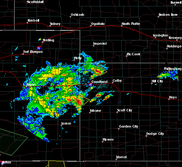 At 720 pm mdt, a severe thunderstorm was located 8 miles southwest of weskan, or 15 miles east of cheyenne wells, moving northeast at 25 mph (radar indicated). Hazards include 60 mph wind gusts and quarter size hail. Hail damage to vehicles is expected. expect wind damage to roofs, siding, and trees. Locations impacted include, weskan. At 720 pm mdt, a severe thunderstorm was located 8 miles southwest of weskan, or 15 miles east of cheyenne wells, moving northeast at 25 mph (radar indicated). Hazards include 60 mph wind gusts and quarter size hail. Hail damage to vehicles is expected. expect wind damage to roofs, siding, and trees. Locations impacted include, weskan.
|
| 5/9/2017 6:58 PM MDT |
 At 658 pm mdt, a severe thunderstorm was located 13 miles north of towner, or 15 miles southeast of cheyenne wells, moving northeast at 25 mph (radar indicated). Hazards include 60 mph wind gusts and half dollar size hail. Hail damage to vehicles is expected. Expect wind damage to roofs, siding, and trees. At 658 pm mdt, a severe thunderstorm was located 13 miles north of towner, or 15 miles southeast of cheyenne wells, moving northeast at 25 mph (radar indicated). Hazards include 60 mph wind gusts and half dollar size hail. Hail damage to vehicles is expected. Expect wind damage to roofs, siding, and trees.
|
| 5/9/2017 6:58 PM MDT |
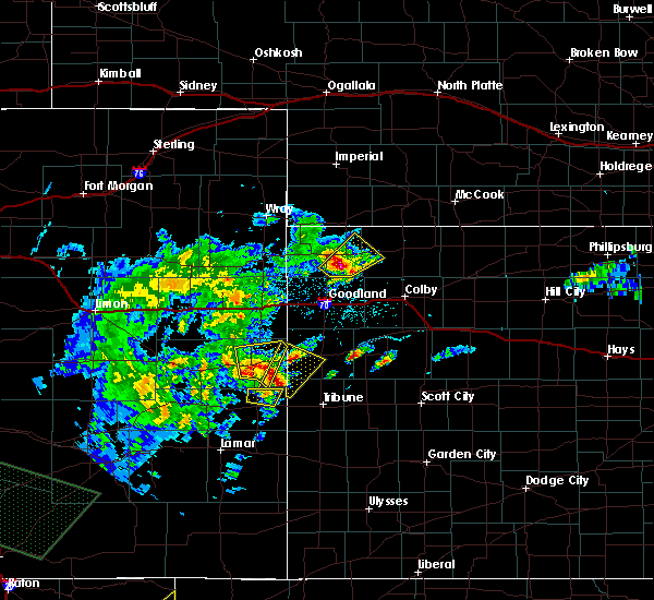 At 658 pm mdt, a severe thunderstorm was located 13 miles north of towner, or 15 miles southeast of cheyenne wells, moving northeast at 25 mph (radar indicated). Hazards include 60 mph wind gusts and half dollar size hail. Hail damage to vehicles is expected. Expect wind damage to roofs, siding, and trees. At 658 pm mdt, a severe thunderstorm was located 13 miles north of towner, or 15 miles southeast of cheyenne wells, moving northeast at 25 mph (radar indicated). Hazards include 60 mph wind gusts and half dollar size hail. Hail damage to vehicles is expected. Expect wind damage to roofs, siding, and trees.
|
| 4/27/2017 6:05 PM MDT |
 At 605 pm mdt/705 pm cdt/, severe thunderstorms were located along a line extending from 9 miles south of haigler to 6 miles south of st. francis to 6 miles north of goodland to 11 miles southeast of ruleton to 6 miles northeast of weskan, moving northeast at 40 mph (radar indicated). Hazards include 60 mph wind gusts and quarter size hail. Hail damage to vehicles is expected. expect wind damage to roofs, siding, and trees. locations impacted include, goodland, st. francis, sharon springs, ruleton, bird city, weskan and wallace. This includes interstate 70 in kansas between mile markers 9 and 33. At 605 pm mdt/705 pm cdt/, severe thunderstorms were located along a line extending from 9 miles south of haigler to 6 miles south of st. francis to 6 miles north of goodland to 11 miles southeast of ruleton to 6 miles northeast of weskan, moving northeast at 40 mph (radar indicated). Hazards include 60 mph wind gusts and quarter size hail. Hail damage to vehicles is expected. expect wind damage to roofs, siding, and trees. locations impacted include, goodland, st. francis, sharon springs, ruleton, bird city, weskan and wallace. This includes interstate 70 in kansas between mile markers 9 and 33.
|
| 4/27/2017 5:51 PM MDT |
 The severe thunderstorm warning for northeastern cheyenne county in east central colorado, southeastern yuma county in northeastern colorado, eastern kit carson county in east central colorado, northwestern wallace county in west central kansas, western cheyenne and sherman counties in northwestern kansas will expire at 600 pm mdt/700 pm cdt/, the storms which prompted the warning have moved out of the area. therefore the warning will be allowed to expire. The severe thunderstorm warning for northeastern cheyenne county in east central colorado, southeastern yuma county in northeastern colorado, eastern kit carson county in east central colorado, northwestern wallace county in west central kansas, western cheyenne and sherman counties in northwestern kansas will expire at 600 pm mdt/700 pm cdt/, the storms which prompted the warning have moved out of the area. therefore the warning will be allowed to expire.
|
| 4/27/2017 5:50 PM MDT |
 At 550 pm mdt/650 pm cdt/, severe thunderstorms were located along a line extending from 13 miles north of bonny reservoir to 13 miles southwest of st. francis to near ruleton to 13 miles southwest of goodland to 4 miles west of weskan, moving northeast at 40 mph (radar indicated). Hazards include 70 mph wind gusts and quarter size hail. Hail damage to vehicles is expected. expect considerable tree damage. Wind damage is also likely to mobile homes, roofs, and outbuildings. At 550 pm mdt/650 pm cdt/, severe thunderstorms were located along a line extending from 13 miles north of bonny reservoir to 13 miles southwest of st. francis to near ruleton to 13 miles southwest of goodland to 4 miles west of weskan, moving northeast at 40 mph (radar indicated). Hazards include 70 mph wind gusts and quarter size hail. Hail damage to vehicles is expected. expect considerable tree damage. Wind damage is also likely to mobile homes, roofs, and outbuildings.
|
| 4/27/2017 5:46 PM MDT |
 At 546 pm mdt/646 pm cdt/, severe thunderstorms were located along a line extending from 13 miles north of bonny reservoir to 13 miles southwest of st. francis to near ruleton to 13 miles southwest of goodland to 4 miles west of weskan, moving northeast at 40 mph (radar indicated). Hazards include 70 mph wind gusts and quarter size hail. Hail damage to vehicles is expected. expect considerable tree damage. wind damage is also likely to mobile homes, roofs, and outbuildings. locations impacted include, goodland, st. francis, kanorado, ruleton, bonny reservoir, weskan and hale. this includes the following highways, interstate 70 in kansas between mile markers 0 and 28. interstate 70 in colorado between mile markers 448 and 450. Highway 385 between mile markers 209 and 210, and between mile markers 212 and 234. At 546 pm mdt/646 pm cdt/, severe thunderstorms were located along a line extending from 13 miles north of bonny reservoir to 13 miles southwest of st. francis to near ruleton to 13 miles southwest of goodland to 4 miles west of weskan, moving northeast at 40 mph (radar indicated). Hazards include 70 mph wind gusts and quarter size hail. Hail damage to vehicles is expected. expect considerable tree damage. wind damage is also likely to mobile homes, roofs, and outbuildings. locations impacted include, goodland, st. francis, kanorado, ruleton, bonny reservoir, weskan and hale. this includes the following highways, interstate 70 in kansas between mile markers 0 and 28. interstate 70 in colorado between mile markers 448 and 450. Highway 385 between mile markers 209 and 210, and between mile markers 212 and 234.
|
| 4/27/2017 5:26 PM MDT |
 At 526 pm mdt/626 pm cdt/, severe thunderstorms were located along a line extending from 24 miles south of wray to 7 miles southeast of bonny reservoir to 3 miles south of kanorado to 17 miles north of weskan to 8 miles east of cheyenne wells, moving northeast at 40 mph (radar indicated). Hazards include 70 mph wind gusts and quarter size hail. Hail damage to vehicles is expected. expect considerable tree damage. Wind damage is also likely to mobile homes, roofs, and outbuildings. At 526 pm mdt/626 pm cdt/, severe thunderstorms were located along a line extending from 24 miles south of wray to 7 miles southeast of bonny reservoir to 3 miles south of kanorado to 17 miles north of weskan to 8 miles east of cheyenne wells, moving northeast at 40 mph (radar indicated). Hazards include 70 mph wind gusts and quarter size hail. Hail damage to vehicles is expected. expect considerable tree damage. Wind damage is also likely to mobile homes, roofs, and outbuildings.
|
| 9/17/2016 4:35 PM MDT |
 At 434 pm mdt, severe thunderstorms capable of producing tornadoes were located along a line extending from 5 miles northwest of wallace to 5 miles south of weskan, moving east at 20 mph (radar indicated rotation). Hazards include tornado. Expect damage to mobile homes. roofs. and vehicles. Locations impacted include, sharon springs and wallace. At 434 pm mdt, severe thunderstorms capable of producing tornadoes were located along a line extending from 5 miles northwest of wallace to 5 miles south of weskan, moving east at 20 mph (radar indicated rotation). Hazards include tornado. Expect damage to mobile homes. roofs. and vehicles. Locations impacted include, sharon springs and wallace.
|
| 9/17/2016 4:25 PM MDT |
 At 425 pm mdt, severe thunderstorms capable of producing tornadoes were located along a line extending from 5 miles north of sharon springs to 8 miles southwest of weskan, moving east at 20 mph (radar indicated rotation). Hazards include tornado. Expect damage to mobile homes. roofs. and vehicles. Locations impacted include, sharon springs, weskan and wallace. At 425 pm mdt, severe thunderstorms capable of producing tornadoes were located along a line extending from 5 miles north of sharon springs to 8 miles southwest of weskan, moving east at 20 mph (radar indicated rotation). Hazards include tornado. Expect damage to mobile homes. roofs. and vehicles. Locations impacted include, sharon springs, weskan and wallace.
|
| 9/17/2016 4:09 PM MDT |
 At 409 pm mdt, severe thunderstorms capable of producing a tornado were located along a line extending from 14 miles north of sharon springs to 10 miles east of cheyenne wells, moving east at 20 mph (radar indicated rotation). Hazards include tornado. Expect damage to mobile homes. roofs. And vehicles. At 409 pm mdt, severe thunderstorms capable of producing a tornado were located along a line extending from 14 miles north of sharon springs to 10 miles east of cheyenne wells, moving east at 20 mph (radar indicated rotation). Hazards include tornado. Expect damage to mobile homes. roofs. And vehicles.
|
| 8/27/2016 6:16 PM MDT | Quarter sized hail reported 4.6 miles NNW of Weskan, KS, hail covering ground. hail ending at time of event. |
| 8/27/2016 6:00 PM MDT |
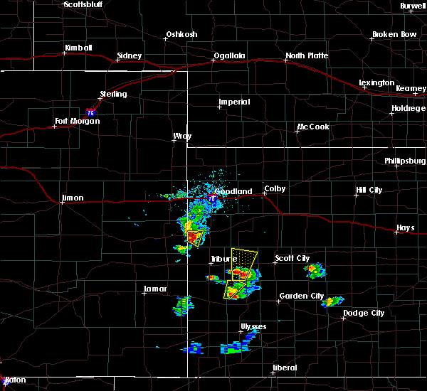 At 600 pm mdt, a severe thunderstorm was located 5 miles southeast of weskan, or 10 miles southwest of sharon springs, moving east at 15 mph (radar indicated). Hazards include ping pong ball size hail and 60 mph wind gusts. People and animals outdoors will be injured. expect hail damage to roofs, siding, windows, and vehicles. expect wind damage to roofs, siding, and trees. Locations impacted include, weskan. At 600 pm mdt, a severe thunderstorm was located 5 miles southeast of weskan, or 10 miles southwest of sharon springs, moving east at 15 mph (radar indicated). Hazards include ping pong ball size hail and 60 mph wind gusts. People and animals outdoors will be injured. expect hail damage to roofs, siding, windows, and vehicles. expect wind damage to roofs, siding, and trees. Locations impacted include, weskan.
|
| 8/27/2016 5:49 PM MDT |
 At 548 pm mdt, a severe thunderstorm was located near weskan, or 12 miles southwest of sharon springs, moving southeast at 20 mph (radar indicated). Hazards include 60 mph wind gusts and half dollar size hail. Hail damage to vehicles is expected. expect wind damage to roofs, siding, and trees. Locations impacted include, weskan. At 548 pm mdt, a severe thunderstorm was located near weskan, or 12 miles southwest of sharon springs, moving southeast at 20 mph (radar indicated). Hazards include 60 mph wind gusts and half dollar size hail. Hail damage to vehicles is expected. expect wind damage to roofs, siding, and trees. Locations impacted include, weskan.
|
| 8/27/2016 5:32 PM MDT |
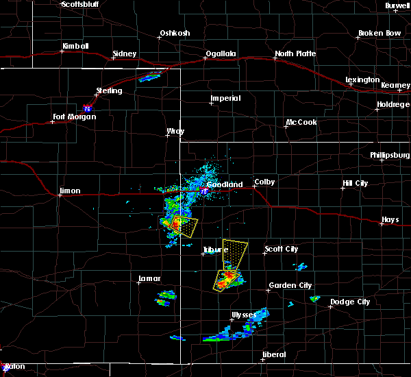 At 532 pm mdt, a severe thunderstorm was located 5 miles west of weskan, or 15 miles east of cheyenne wells, moving east at 15 mph (radar indicated). Hazards include 60 mph wind gusts and quarter size hail. Hail damage to vehicles is expected. Expect wind damage to roofs, siding, and trees. At 532 pm mdt, a severe thunderstorm was located 5 miles west of weskan, or 15 miles east of cheyenne wells, moving east at 15 mph (radar indicated). Hazards include 60 mph wind gusts and quarter size hail. Hail damage to vehicles is expected. Expect wind damage to roofs, siding, and trees.
|
| 8/27/2016 5:27 PM MDT |
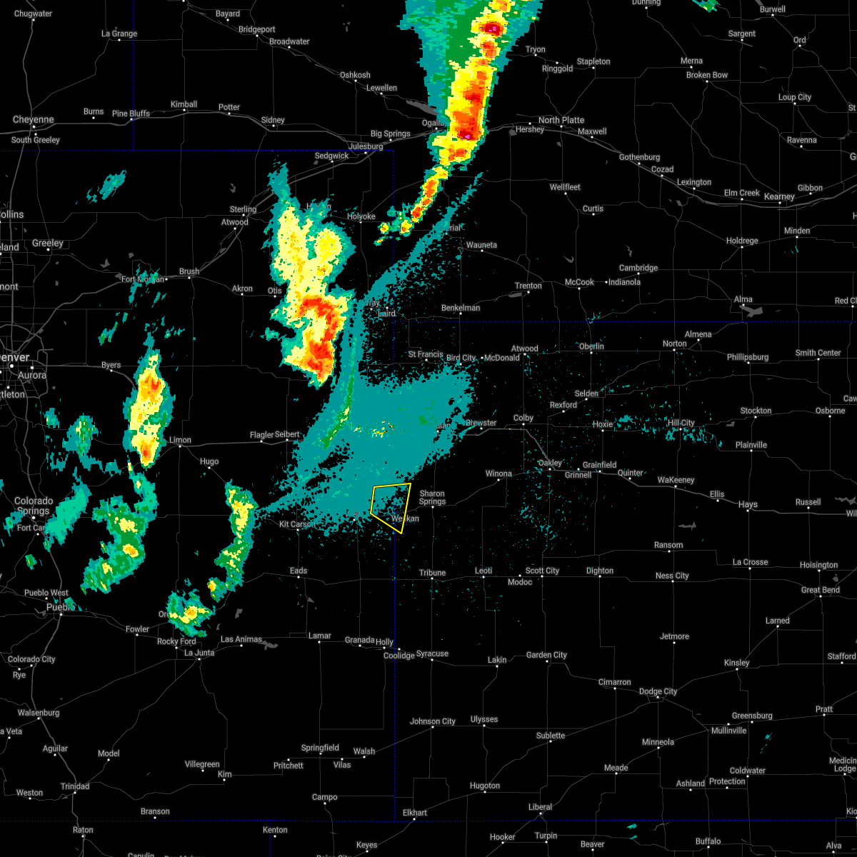 The severe thunderstorm warning for northeastern cheyenne county in east central colorado and west central wallace counties in west central kansas will expire at 530 pm mdt, the storm which prompted the warning has weakened below severe limits, and no longer pose an immediate threat to life or property. therefore the warning will be allowed to expire. however small hail and gusty winds are still possible with this thunderstorm. The severe thunderstorm warning for northeastern cheyenne county in east central colorado and west central wallace counties in west central kansas will expire at 530 pm mdt, the storm which prompted the warning has weakened below severe limits, and no longer pose an immediate threat to life or property. therefore the warning will be allowed to expire. however small hail and gusty winds are still possible with this thunderstorm.
|
| 8/27/2016 5:19 PM MDT |
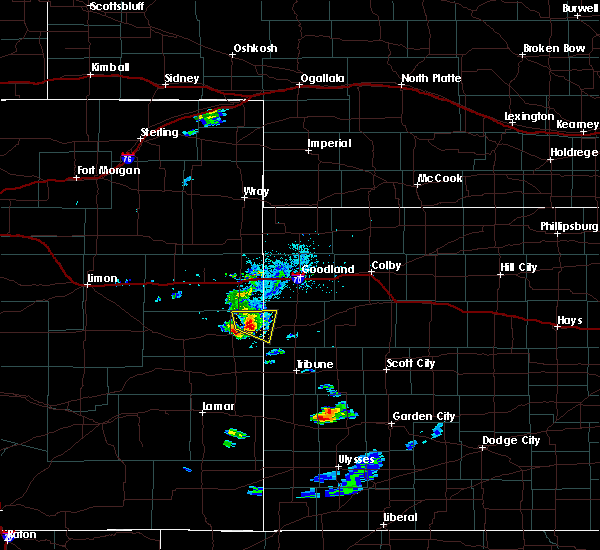 At 518 pm mdt, a severe thunderstorm was located 9 miles west of weskan, or 12 miles east of cheyenne wells, moving east at 15 mph (radar indicated). Hazards include 60 mph wind gusts and quarter size hail. Hail damage to vehicles is expected. expect wind damage to roofs, siding, and trees. Locations impacted include, arapahoe. At 518 pm mdt, a severe thunderstorm was located 9 miles west of weskan, or 12 miles east of cheyenne wells, moving east at 15 mph (radar indicated). Hazards include 60 mph wind gusts and quarter size hail. Hail damage to vehicles is expected. expect wind damage to roofs, siding, and trees. Locations impacted include, arapahoe.
|
| 8/27/2016 5:06 PM MDT |
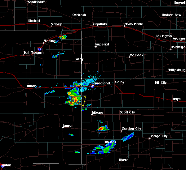 At 505 pm mdt, a severe thunderstorm was located 10 miles northeast of cheyenne wells, moving east southeast at 15 mph (radar indicated). Hazards include 60 mph wind gusts and quarter size hail. Hail damage to vehicles is expected. expect wind damage to roofs, siding, and trees. locations impacted include, arapahoe. This includes highway 385 between mile markers 165 and 168. At 505 pm mdt, a severe thunderstorm was located 10 miles northeast of cheyenne wells, moving east southeast at 15 mph (radar indicated). Hazards include 60 mph wind gusts and quarter size hail. Hail damage to vehicles is expected. expect wind damage to roofs, siding, and trees. locations impacted include, arapahoe. This includes highway 385 between mile markers 165 and 168.
|
| 8/27/2016 4:45 PM MDT |
 At 445 pm mdt, a severe thunderstorm was located 8 miles northeast of cheyenne wells, moving east at 15 mph (radar indicated). Hazards include 60 mph wind gusts and half dollar size hail. Hail damage to vehicles is expected. Expect wind damage to roofs, siding, and trees. At 445 pm mdt, a severe thunderstorm was located 8 miles northeast of cheyenne wells, moving east at 15 mph (radar indicated). Hazards include 60 mph wind gusts and half dollar size hail. Hail damage to vehicles is expected. Expect wind damage to roofs, siding, and trees.
|
| 8/26/2016 5:55 PM MDT |
 At 554 pm mdt, a severe thunderstorm was located 4 miles northeast of weskan, or 8 miles west of sharon springs, moving east at 20 mph (radar indicated). Hazards include 60 mph wind gusts and quarter size hail. Hail damage to vehicles is expected. expect wind damage to roofs, siding, and trees. Locations impacted include, sharon springs and weskan. At 554 pm mdt, a severe thunderstorm was located 4 miles northeast of weskan, or 8 miles west of sharon springs, moving east at 20 mph (radar indicated). Hazards include 60 mph wind gusts and quarter size hail. Hail damage to vehicles is expected. expect wind damage to roofs, siding, and trees. Locations impacted include, sharon springs and weskan.
|
| 8/26/2016 5:37 PM MDT |
 At 537 pm mdt, a severe thunderstorm was located 8 miles northwest of weskan, or 16 miles west of sharon springs, moving east at 20 mph (radar indicated). Hazards include 60 mph wind gusts and quarter size hail. Hail damage to vehicles is expected. Expect wind damage to roofs, siding, and trees. At 537 pm mdt, a severe thunderstorm was located 8 miles northwest of weskan, or 16 miles west of sharon springs, moving east at 20 mph (radar indicated). Hazards include 60 mph wind gusts and quarter size hail. Hail damage to vehicles is expected. Expect wind damage to roofs, siding, and trees.
|
| 7/27/2016 11:28 PM MDT |
 At 1128 pm mdt, a severe thunderstorm was located 6 miles south of sharon springs, moving south at 35 mph (radar indicated). Hazards include two inch hail and 70 mph wind gusts. People and animals outdoors will be injured. expect hail damage to roofs, siding, windows, and vehicles. expect considerable tree damage. Wind damage is also likely to mobile homes, roofs, and outbuildings. At 1128 pm mdt, a severe thunderstorm was located 6 miles south of sharon springs, moving south at 35 mph (radar indicated). Hazards include two inch hail and 70 mph wind gusts. People and animals outdoors will be injured. expect hail damage to roofs, siding, windows, and vehicles. expect considerable tree damage. Wind damage is also likely to mobile homes, roofs, and outbuildings.
|
| 7/15/2016 2:14 PM MDT |
 At 213 pm mdt, a severe thunderstorm was located 9 miles southwest of weskan, or 16 miles east of cheyenne wells, moving south at 20 mph. this is a very dangerous storm (radar indicated). Hazards include three inch hail and 70 mph wind gusts. People and animals outdoors will be severely injured. Expect shattered windows, extensive damage to roofs, siding, and vehicles. At 213 pm mdt, a severe thunderstorm was located 9 miles southwest of weskan, or 16 miles east of cheyenne wells, moving south at 20 mph. this is a very dangerous storm (radar indicated). Hazards include three inch hail and 70 mph wind gusts. People and animals outdoors will be severely injured. Expect shattered windows, extensive damage to roofs, siding, and vehicles.
|
| 7/15/2016 2:14 PM MDT |
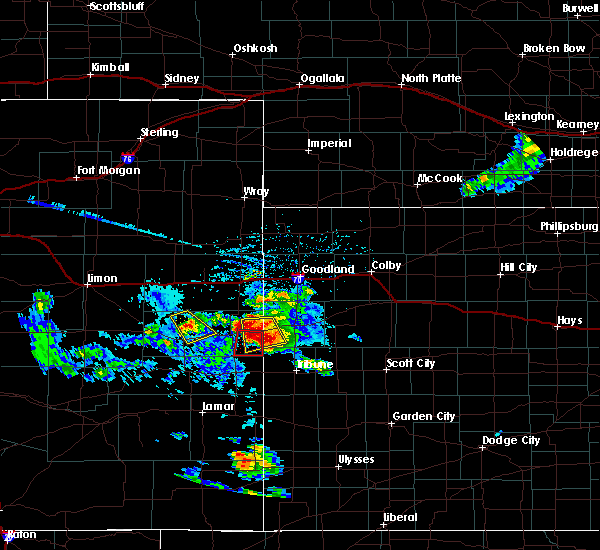 At 213 pm mdt, a severe thunderstorm was located 9 miles southwest of weskan, or 16 miles east of cheyenne wells, moving south at 20 mph. this is a very dangerous storm (radar indicated). Hazards include three inch hail and 70 mph wind gusts. People and animals outdoors will be severely injured. Expect shattered windows, extensive damage to roofs, siding, and vehicles. At 213 pm mdt, a severe thunderstorm was located 9 miles southwest of weskan, or 16 miles east of cheyenne wells, moving south at 20 mph. this is a very dangerous storm (radar indicated). Hazards include three inch hail and 70 mph wind gusts. People and animals outdoors will be severely injured. Expect shattered windows, extensive damage to roofs, siding, and vehicles.
|
| 7/15/2016 1:50 PM MDT |
 At 149 pm mdt, a severe thunderstorm was located 10 miles northwest of weskan, or 16 miles northeast of cheyenne wells, moving southeast at 25 mph. this is a very dangerous storm (radar indicated). Hazards include baseball size hail and 70 mph wind gusts. People and animals outdoors will be severely injured. expect shattered windows, extensive damage to roofs, siding, and vehicles. this severe thunderstorm will remain over mainly rural areas of northeastern cheyenne county in east central colorado and west central wallace counties in west central kansas. This includes highway 385 between mile markers 168 and 169. At 149 pm mdt, a severe thunderstorm was located 10 miles northwest of weskan, or 16 miles northeast of cheyenne wells, moving southeast at 25 mph. this is a very dangerous storm (radar indicated). Hazards include baseball size hail and 70 mph wind gusts. People and animals outdoors will be severely injured. expect shattered windows, extensive damage to roofs, siding, and vehicles. this severe thunderstorm will remain over mainly rural areas of northeastern cheyenne county in east central colorado and west central wallace counties in west central kansas. This includes highway 385 between mile markers 168 and 169.
|
| 7/15/2016 1:50 PM MDT |
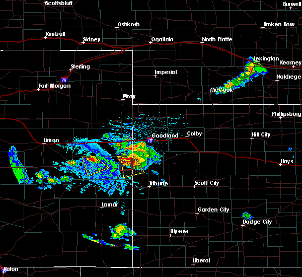 At 149 pm mdt, a severe thunderstorm was located 10 miles northwest of weskan, or 16 miles northeast of cheyenne wells, moving southeast at 25 mph. this is a very dangerous storm (radar indicated). Hazards include baseball size hail and 70 mph wind gusts. People and animals outdoors will be severely injured. expect shattered windows, extensive damage to roofs, siding, and vehicles. this severe thunderstorm will remain over mainly rural areas of northeastern cheyenne county in east central colorado and west central wallace counties in west central kansas. This includes highway 385 between mile markers 168 and 169. At 149 pm mdt, a severe thunderstorm was located 10 miles northwest of weskan, or 16 miles northeast of cheyenne wells, moving southeast at 25 mph. this is a very dangerous storm (radar indicated). Hazards include baseball size hail and 70 mph wind gusts. People and animals outdoors will be severely injured. expect shattered windows, extensive damage to roofs, siding, and vehicles. this severe thunderstorm will remain over mainly rural areas of northeastern cheyenne county in east central colorado and west central wallace counties in west central kansas. This includes highway 385 between mile markers 168 and 169.
|
| 7/15/2016 1:38 PM MDT |
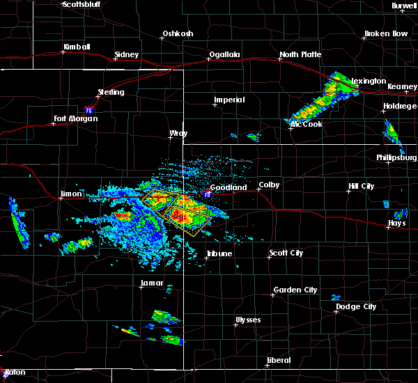 At 138 pm mdt, a severe thunderstorm was located 8 miles northwest of weskan, or 16 miles northeast of cheyenne wells, moving south at 25 mph. this is a very dangerous storm (radar indicated). Hazards include three inch hail and 70 mph wind gusts. People and animals outdoors will be severely injured. Expect shattered windows, extensive damage to roofs, siding, and vehicles. At 138 pm mdt, a severe thunderstorm was located 8 miles northwest of weskan, or 16 miles northeast of cheyenne wells, moving south at 25 mph. this is a very dangerous storm (radar indicated). Hazards include three inch hail and 70 mph wind gusts. People and animals outdoors will be severely injured. Expect shattered windows, extensive damage to roofs, siding, and vehicles.
|
| 7/15/2016 1:33 PM MDT |
 At 133 pm mdt, a severe thunderstorm was located 13 miles northwest of weskan, or 19 miles northeast of cheyenne wells, moving southeast at 15 mph. this is a very dangerous storm (radar indicated). Hazards include three inch hail and 70 mph wind gusts. People and animals outdoors will be severely injured. expect shattered windows, extensive damage to roofs, siding, and vehicles. locations impacted include, weskan. This includes highway 385 between mile markers 168 and 172. At 133 pm mdt, a severe thunderstorm was located 13 miles northwest of weskan, or 19 miles northeast of cheyenne wells, moving southeast at 15 mph. this is a very dangerous storm (radar indicated). Hazards include three inch hail and 70 mph wind gusts. People and animals outdoors will be severely injured. expect shattered windows, extensive damage to roofs, siding, and vehicles. locations impacted include, weskan. This includes highway 385 between mile markers 168 and 172.
|
| 7/15/2016 1:27 PM MDT |
 At 127 pm mdt, a severe thunderstorm was located 14 miles northwest of weskan, or 19 miles northeast of cheyenne wells, moving southeast at 35 mph. this is a very dangerous storm (radar indicated). Hazards include three inch hail and 70 mph wind gusts. People and animals outdoors will be severely injured. expect shattered windows, extensive damage to roofs, siding, and vehicles. locations impacted include, weskan. This includes highway 385 between mile markers 164 and 173. At 127 pm mdt, a severe thunderstorm was located 14 miles northwest of weskan, or 19 miles northeast of cheyenne wells, moving southeast at 35 mph. this is a very dangerous storm (radar indicated). Hazards include three inch hail and 70 mph wind gusts. People and animals outdoors will be severely injured. expect shattered windows, extensive damage to roofs, siding, and vehicles. locations impacted include, weskan. This includes highway 385 between mile markers 164 and 173.
|
| 7/15/2016 1:27 PM MDT |
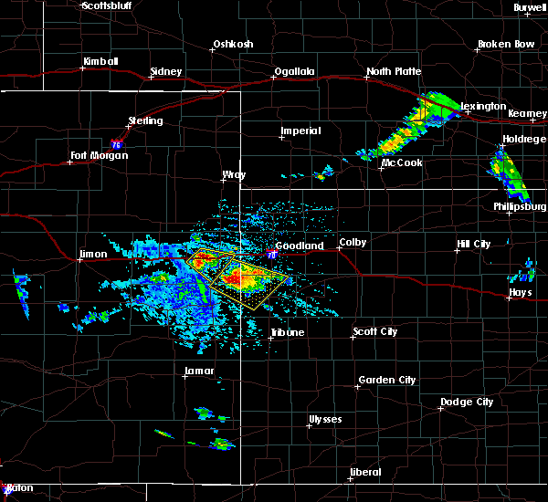 At 127 pm mdt, a severe thunderstorm was located 14 miles northwest of weskan, or 19 miles northeast of cheyenne wells, moving southeast at 35 mph. this is a very dangerous storm (radar indicated). Hazards include three inch hail and 70 mph wind gusts. People and animals outdoors will be severely injured. expect shattered windows, extensive damage to roofs, siding, and vehicles. locations impacted include, weskan. This includes highway 385 between mile markers 164 and 173. At 127 pm mdt, a severe thunderstorm was located 14 miles northwest of weskan, or 19 miles northeast of cheyenne wells, moving southeast at 35 mph. this is a very dangerous storm (radar indicated). Hazards include three inch hail and 70 mph wind gusts. People and animals outdoors will be severely injured. expect shattered windows, extensive damage to roofs, siding, and vehicles. locations impacted include, weskan. This includes highway 385 between mile markers 164 and 173.
|
| 7/15/2016 1:18 PM MDT |
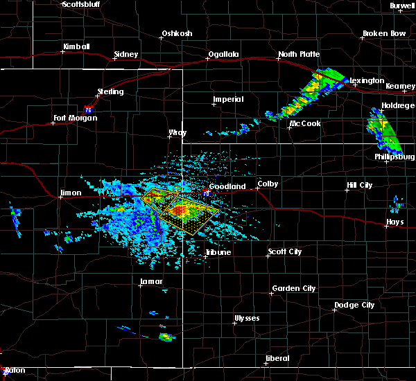 At 118 pm mdt, a severe thunderstorm was located 14 miles northwest of weskan, or 19 miles south of kanorado, moving southeast at 30 mph (radar indicated). Hazards include tennis ball size hail and 70 mph wind gusts. People and animals outdoors will be injured. expect hail damage to roofs, siding, windows, and vehicles. expect considerable tree damage. wind damage is also likely to mobile homes, roofs, and outbuildings. locations impacted include, weskan. This includes highway 385 between mile markers 164 and 173. At 118 pm mdt, a severe thunderstorm was located 14 miles northwest of weskan, or 19 miles south of kanorado, moving southeast at 30 mph (radar indicated). Hazards include tennis ball size hail and 70 mph wind gusts. People and animals outdoors will be injured. expect hail damage to roofs, siding, windows, and vehicles. expect considerable tree damage. wind damage is also likely to mobile homes, roofs, and outbuildings. locations impacted include, weskan. This includes highway 385 between mile markers 164 and 173.
|
| 7/15/2016 1:10 PM MDT |
 At 110 pm mdt, a severe thunderstorm was located 17 miles northwest of weskan, or 17 miles southeast of burlington, moving southeast at 30 mph (radar indicated). Hazards include 60 mph wind gusts and half dollar size hail. Hail damage to vehicles is expected. Expect wind damage to roofs, siding, and trees. At 110 pm mdt, a severe thunderstorm was located 17 miles northwest of weskan, or 17 miles southeast of burlington, moving southeast at 30 mph (radar indicated). Hazards include 60 mph wind gusts and half dollar size hail. Hail damage to vehicles is expected. Expect wind damage to roofs, siding, and trees.
|
| 7/15/2016 1:10 PM MDT |
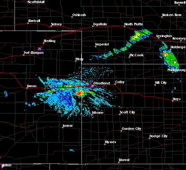 At 110 pm mdt, a severe thunderstorm was located 17 miles northwest of weskan, or 17 miles southeast of burlington, moving southeast at 30 mph (radar indicated). Hazards include 60 mph wind gusts and half dollar size hail. Hail damage to vehicles is expected. Expect wind damage to roofs, siding, and trees. At 110 pm mdt, a severe thunderstorm was located 17 miles northwest of weskan, or 17 miles southeast of burlington, moving southeast at 30 mph (radar indicated). Hazards include 60 mph wind gusts and half dollar size hail. Hail damage to vehicles is expected. Expect wind damage to roofs, siding, and trees.
|
| 6/29/2016 12:27 AM CDT |
 At 1127 pm mdt/1227 am cdt/, severe thunderstorms were located along a line extending from 7 miles southwest of russell springs to 7 miles south of sharon springs, moving south at 35 mph. these are very dangerous storms (radar indicated). Hazards include 80 mph wind gusts and penny size hail. Flying debris will be dangerous to those caught without shelter. mobile homes will be heavily damaged. expect considerable damage to roofs, windows, and vehicles. extensive tree damage and power outages are likely. Locations impacted include, leoti, tribune, weskan, horace, selkirk and marienthal. At 1127 pm mdt/1227 am cdt/, severe thunderstorms were located along a line extending from 7 miles southwest of russell springs to 7 miles south of sharon springs, moving south at 35 mph. these are very dangerous storms (radar indicated). Hazards include 80 mph wind gusts and penny size hail. Flying debris will be dangerous to those caught without shelter. mobile homes will be heavily damaged. expect considerable damage to roofs, windows, and vehicles. extensive tree damage and power outages are likely. Locations impacted include, leoti, tribune, weskan, horace, selkirk and marienthal.
|
| 6/29/2016 12:15 AM CDT |
 At 1115 pm mdt/1215 am cdt/, severe thunderstorms were located along a line extending from 5 miles northeast of russell springs to 7 miles north of weskan, moving south at 40 mph. these are very dangerous storms (radar indicated). Hazards include 80 mph wind gusts. Flying debris will be dangerous to those caught without shelter. mobile homes will be heavily damaged. expect considerable damage to roofs, windows, and vehicles. extensive tree damage and power outages are likely. Locations impacted include, leoti, tribune, weskan, horace, selkirk and marienthal. At 1115 pm mdt/1215 am cdt/, severe thunderstorms were located along a line extending from 5 miles northeast of russell springs to 7 miles north of weskan, moving south at 40 mph. these are very dangerous storms (radar indicated). Hazards include 80 mph wind gusts. Flying debris will be dangerous to those caught without shelter. mobile homes will be heavily damaged. expect considerable damage to roofs, windows, and vehicles. extensive tree damage and power outages are likely. Locations impacted include, leoti, tribune, weskan, horace, selkirk and marienthal.
|
| 6/28/2016 11:12 PM MDT |
 At 1112 pm mdt/1212 am cdt/, severe thunderstorms were located along a line extending from 5 miles southeast of winona to 8 miles north of weskan, moving south at 35 mph (radar indicated). Hazards include 70 mph wind gusts. Expect considerable tree damage. damage is likely to mobile homes, roofs, and outbuildings. Locations impacted include, sharon springs, weskan, winona, wallace and russell springs. At 1112 pm mdt/1212 am cdt/, severe thunderstorms were located along a line extending from 5 miles southeast of winona to 8 miles north of weskan, moving south at 35 mph (radar indicated). Hazards include 70 mph wind gusts. Expect considerable tree damage. damage is likely to mobile homes, roofs, and outbuildings. Locations impacted include, sharon springs, weskan, winona, wallace and russell springs.
|
| 6/29/2016 12:06 AM CDT |
 At 1105 pm mdt/1205 am cdt/, severe thunderstorms were located along a line extending from 4 miles east of winona to 13 miles north of weskan, moving south at 45 mph. these are very dangerous storms (radar indicated). Hazards include 80 mph wind gusts and penny size hail. Flying debris will be dangerous to those caught without shelter. mobile homes will be heavily damaged. expect considerable damage to roofs, windows, and vehicles. Extensive tree damage and power outages are likely. At 1105 pm mdt/1205 am cdt/, severe thunderstorms were located along a line extending from 4 miles east of winona to 13 miles north of weskan, moving south at 45 mph. these are very dangerous storms (radar indicated). Hazards include 80 mph wind gusts and penny size hail. Flying debris will be dangerous to those caught without shelter. mobile homes will be heavily damaged. expect considerable damage to roofs, windows, and vehicles. Extensive tree damage and power outages are likely.
|
| 6/28/2016 10:51 PM MDT |
 At 1050 pm mdt/1150 pm cdt/, severe thunderstorms were located along a line extending from 10 miles north of winona to 12 miles south of kanorado, moving south at 40 mph. these are very dangerous storms (radar indicated). Hazards include 80 mph wind gusts. Flying debris will be dangerous to those caught without shelter. mobile homes will be heavily damaged. expect considerable damage to roofs, windows, and vehicles. extensive tree damage and power outages are likely. Locations impacted include, sharon springs, weskan, winona, wallace and russell springs. At 1050 pm mdt/1150 pm cdt/, severe thunderstorms were located along a line extending from 10 miles north of winona to 12 miles south of kanorado, moving south at 40 mph. these are very dangerous storms (radar indicated). Hazards include 80 mph wind gusts. Flying debris will be dangerous to those caught without shelter. mobile homes will be heavily damaged. expect considerable damage to roofs, windows, and vehicles. extensive tree damage and power outages are likely. Locations impacted include, sharon springs, weskan, winona, wallace and russell springs.
|
| 6/28/2016 10:40 PM MDT |
 At 1040 pm mdt/1140 pm cdt/, severe thunderstorms were located along a line extending from 3 miles southwest of levant to 5 miles southeast of kanorado, moving south at 20 mph (radar indicated). Hazards include 60 mph wind gusts. Expect damage to roofs. siding. And trees. At 1040 pm mdt/1140 pm cdt/, severe thunderstorms were located along a line extending from 3 miles southwest of levant to 5 miles southeast of kanorado, moving south at 20 mph (radar indicated). Hazards include 60 mph wind gusts. Expect damage to roofs. siding. And trees.
|
| 6/27/2016 3:06 PM MDT |
 At 305 pm mdt, a severe thunderstorm was located 4 miles northwest of sharon springs, moving southeast at 30 mph (radar indicated). Hazards include ping pong ball size hail and 60 mph wind gusts. People and animals outdoors will be injured. expect hail damage to roofs, siding, windows, and vehicles. expect wind damage to roofs, siding, and trees. Locations impacted include, sharon springs and weskan. At 305 pm mdt, a severe thunderstorm was located 4 miles northwest of sharon springs, moving southeast at 30 mph (radar indicated). Hazards include ping pong ball size hail and 60 mph wind gusts. People and animals outdoors will be injured. expect hail damage to roofs, siding, windows, and vehicles. expect wind damage to roofs, siding, and trees. Locations impacted include, sharon springs and weskan.
|
| 6/27/2016 2:47 PM MDT |
 At 246 pm mdt, a severe thunderstorm was located 12 miles north of weskan, or 15 miles northwest of sharon springs, moving southeast at 20 mph (radar indicated). Hazards include 60 mph wind gusts and half dollar size hail. Hail damage to vehicles is expected. Expect wind damage to roofs, siding, and trees. At 246 pm mdt, a severe thunderstorm was located 12 miles north of weskan, or 15 miles northwest of sharon springs, moving southeast at 20 mph (radar indicated). Hazards include 60 mph wind gusts and half dollar size hail. Hail damage to vehicles is expected. Expect wind damage to roofs, siding, and trees.
|
| 5/26/2016 6:31 PM MDT |
 At 631 pm mdt, severe thunderstorms were located along a line extending from 14 miles north of weskan to 10 miles southeast of towner, moving east at 35 mph (radar indicated). Hazards include 70 mph wind gusts. Expect considerable tree damage. Damage is likely to mobile homes, roofs, and outbuildings. At 631 pm mdt, severe thunderstorms were located along a line extending from 14 miles north of weskan to 10 miles southeast of towner, moving east at 35 mph (radar indicated). Hazards include 70 mph wind gusts. Expect considerable tree damage. Damage is likely to mobile homes, roofs, and outbuildings.
|
| 4/23/2016 9:54 PM MDT |
 At 954 pm mdt/1054 pm cdt/, severe thunderstorms were located along a line extending from 6 miles northwest of brewster to 9 miles southeast of weskan, moving northeast at 80 mph (radar indicated). Hazards include 60 mph wind gusts. Expect damage to roofs. siding. And trees. At 954 pm mdt/1054 pm cdt/, severe thunderstorms were located along a line extending from 6 miles northwest of brewster to 9 miles southeast of weskan, moving northeast at 80 mph (radar indicated). Hazards include 60 mph wind gusts. Expect damage to roofs. siding. And trees.
|
| 11/16/2015 3:18 PM MST |
 At 318 pm mst, a severe thunderstorm was located 7 miles southeast of weskan, or 7 miles southwest of sharon springs, moving north at 65 mph (radar indicated). Hazards include 60 mph wind gusts and quarter size hail. Hail damage to vehicles is expected. expect wind damage to roofs, siding and trees. locations impacted include, sharon springs and weskan. A tornado watch remains in effect until 900 pm mst for west central kansas. At 318 pm mst, a severe thunderstorm was located 7 miles southeast of weskan, or 7 miles southwest of sharon springs, moving north at 65 mph (radar indicated). Hazards include 60 mph wind gusts and quarter size hail. Hail damage to vehicles is expected. expect wind damage to roofs, siding and trees. locations impacted include, sharon springs and weskan. A tornado watch remains in effect until 900 pm mst for west central kansas.
|
| 11/16/2015 3:03 PM MST |
 At 302 pm mst, a severe thunderstorm was located 10 miles northwest of horace, or 11 miles northwest of tribune, moving north at 65 mph (radar indicated). Hazards include 60 mph wind gusts and half dollar size hail. Hail damage to vehicles is expected. Expect wind damage to roofs, siding and trees. At 302 pm mst, a severe thunderstorm was located 10 miles northwest of horace, or 11 miles northwest of tribune, moving north at 65 mph (radar indicated). Hazards include 60 mph wind gusts and half dollar size hail. Hail damage to vehicles is expected. Expect wind damage to roofs, siding and trees.
|
| 11/4/2015 6:42 PM MST |
 At 641 pm mst, severe thunderstorms were located along a line extending from 3 miles northeast of sharon springs to 11 miles northeast of tribune, moving northeast at 55 mph (radar indicated). Hazards include 60 mph wind gusts and penny size hail. Expect damage to roofs. siding and trees. Locations impacted include, sharon springs, tribune, weskan, horace and wallace. At 641 pm mst, severe thunderstorms were located along a line extending from 3 miles northeast of sharon springs to 11 miles northeast of tribune, moving northeast at 55 mph (radar indicated). Hazards include 60 mph wind gusts and penny size hail. Expect damage to roofs. siding and trees. Locations impacted include, sharon springs, tribune, weskan, horace and wallace.
|
| 11/4/2015 6:22 PM MST |
 At 622 pm mst, severe thunderstorms were located along a line extending from 5 miles south of weskan to 4 miles west of horace, moving northeast at 55 mph (radar indicated). Hazards include 60 mph wind gusts and penny size hail. Expect damage to roofs. Siding and trees. At 622 pm mst, severe thunderstorms were located along a line extending from 5 miles south of weskan to 4 miles west of horace, moving northeast at 55 mph (radar indicated). Hazards include 60 mph wind gusts and penny size hail. Expect damage to roofs. Siding and trees.
|
| 8/21/2015 5:18 PM MDT |
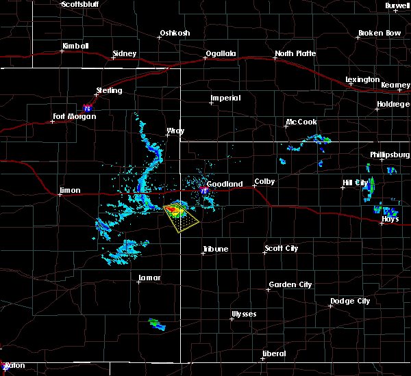 At 517 pm mdt, a severe thunderstorm was located 16 miles south of burlington, moving southeast at 5 mph (radar indicated). Hazards include ping pong ball size hail and 60 mph wind gusts. People and animals outdoors will be injured. expect hail damage to roofs, siding, windows and vehicles. expect wind damage to roofs, siding and trees. Locations impacted include, weskan. At 517 pm mdt, a severe thunderstorm was located 16 miles south of burlington, moving southeast at 5 mph (radar indicated). Hazards include ping pong ball size hail and 60 mph wind gusts. People and animals outdoors will be injured. expect hail damage to roofs, siding, windows and vehicles. expect wind damage to roofs, siding and trees. Locations impacted include, weskan.
|
| 8/21/2015 5:01 PM MDT |
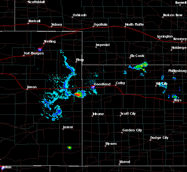 At 501 pm mdt, a severe thunderstorm was located 16 miles northwest of weskan, or 18 miles southeast of burlington, moving southeast at 15 mph (radar indicated). Hazards include ping pong ball size hail. People and animals outdoors will be injured. Expect damage to roofs, siding, windows and vehicles. At 501 pm mdt, a severe thunderstorm was located 16 miles northwest of weskan, or 18 miles southeast of burlington, moving southeast at 15 mph (radar indicated). Hazards include ping pong ball size hail. People and animals outdoors will be injured. Expect damage to roofs, siding, windows and vehicles.
|
| 7/19/2015 6:22 PM MDT |
 At 622 pm mdt, severe thunderstorms were located along a line extending from 5 miles east of weskan to 11 miles north of horace to 6 miles east of towner, moving east at 25 mph (radar indicated). Hazards include two inch hail and 70 mph wind gusts. People and animals outdoors will be injured. expect hail damage to roofs, siding, windows and vehicles. expect considerable tree damage. wind damage is also likely to mobile homes, roofs and outbuildings. Locations impacted include, sharon springs, tribune, weskan, horace and wallace. At 622 pm mdt, severe thunderstorms were located along a line extending from 5 miles east of weskan to 11 miles north of horace to 6 miles east of towner, moving east at 25 mph (radar indicated). Hazards include two inch hail and 70 mph wind gusts. People and animals outdoors will be injured. expect hail damage to roofs, siding, windows and vehicles. expect considerable tree damage. wind damage is also likely to mobile homes, roofs and outbuildings. Locations impacted include, sharon springs, tribune, weskan, horace and wallace.
|
| 7/19/2015 6:04 PM MDT |
 At 604 pm mdt, severe thunderstorms were located along a line extending from near weskan to 13 miles northwest of horace to near towner, moving east at 30 mph. these are very dangerous storms (radar indicated). Hazards include baseball size hail and 70 mph wind gusts. People and animals outdoors will be severely injured. expect shattered windows, extensive damage to roofs, siding and vehicles. Locations impacted include, sharon springs, tribune, weskan, horace and wallace. At 604 pm mdt, severe thunderstorms were located along a line extending from near weskan to 13 miles northwest of horace to near towner, moving east at 30 mph. these are very dangerous storms (radar indicated). Hazards include baseball size hail and 70 mph wind gusts. People and animals outdoors will be severely injured. expect shattered windows, extensive damage to roofs, siding and vehicles. Locations impacted include, sharon springs, tribune, weskan, horace and wallace.
|
| 7/19/2015 5:45 PM MDT |
 At 545 pm mdt, severe thunderstorms were located along a line extending from 11 miles northeast of cheyenne wells to 6 miles northeast of sheridan lake, moving east at 25 mph. these are very dangerous storms (radar indicated). Hazards include 80 mph wind gusts and golf ball size hail. Flying debris will be dangerous to those caught without shelter. mobile homes will be heavily damaged. expect considerable damage to roofs, windows and vehicles. Extensive tree damage and power outages are likely. At 545 pm mdt, severe thunderstorms were located along a line extending from 11 miles northeast of cheyenne wells to 6 miles northeast of sheridan lake, moving east at 25 mph. these are very dangerous storms (radar indicated). Hazards include 80 mph wind gusts and golf ball size hail. Flying debris will be dangerous to those caught without shelter. mobile homes will be heavily damaged. expect considerable damage to roofs, windows and vehicles. Extensive tree damage and power outages are likely.
|
| 7/18/2015 10:08 PM MDT |
 At 1008 pm mdt /1108 pm cdt/, a severe thunderstorm was located 5 miles west of sharon springs, moving east at 40 mph (radar indicated). Hazards include 60 mph wind gusts and quarter size hail. Hail damage to vehicles is expected. Expect wind damage to roofs, siding and trees. At 1008 pm mdt /1108 pm cdt/, a severe thunderstorm was located 5 miles west of sharon springs, moving east at 40 mph (radar indicated). Hazards include 60 mph wind gusts and quarter size hail. Hail damage to vehicles is expected. Expect wind damage to roofs, siding and trees.
|
| 7/14/2015 8:11 PM MDT |
 At 811 pm mdt /911 pm cdt/, severe thunderstorms were located along a line extending from 18 miles south of wray to 16 miles southwest of st. francis to 10 miles south of ruleton to near weskan, moving northeast at 40 mph (radar indicated). Hazards include 60 mph wind gusts and penny size hail. Expect damage to roofs. Siding and trees. At 811 pm mdt /911 pm cdt/, severe thunderstorms were located along a line extending from 18 miles south of wray to 16 miles southwest of st. francis to 10 miles south of ruleton to near weskan, moving northeast at 40 mph (radar indicated). Hazards include 60 mph wind gusts and penny size hail. Expect damage to roofs. Siding and trees.
|
| 7/14/2015 8:03 PM MDT |
 At 802 pm mdt, severe thunderstorms were located along a line extending from 26 miles north of burlington to 16 miles northwest of ruleton to 6 miles southeast of kanorado to 10 miles north of weskan, moving northeast at 35 mph (radar indicated). Hazards include 60 mph wind gusts. Expect damage to roofs. siding and trees. locations impacted include, kanorado, ruleton, weskan, bonny reservoir, arapahoe, hale and idalia. this includes the following highways, interstate 70 in kansas between mile markers 0 and 11. interstate 70 in colorado between mile markers 440 and 450. Highway 385 between mile markers 192 and 222. At 802 pm mdt, severe thunderstorms were located along a line extending from 26 miles north of burlington to 16 miles northwest of ruleton to 6 miles southeast of kanorado to 10 miles north of weskan, moving northeast at 35 mph (radar indicated). Hazards include 60 mph wind gusts. Expect damage to roofs. siding and trees. locations impacted include, kanorado, ruleton, weskan, bonny reservoir, arapahoe, hale and idalia. this includes the following highways, interstate 70 in kansas between mile markers 0 and 11. interstate 70 in colorado between mile markers 440 and 450. Highway 385 between mile markers 192 and 222.
|
| 7/14/2015 7:52 PM MDT |
 At 751 pm mdt, severe thunderstorms were located along a line extending from 21 miles east of cope to 14 miles northeast of bethune to 10 miles southeast of burlington to 11 miles northwest of weskan, moving northeast at 30 mph (trained weather spotters). Hazards include 50-60 mph wind gusts reported in burlington colorado. Expect damage to roofs. siding and trees. locations impacted include, burlington, cheyenne wells, kanorado, ruleton, weskan, bethune, bonny reservoir, kirk, arapahoe and hale. this includes the following highways, interstate 70 in kansas between mile markers 0 and 11. interstate 70 in colorado between mile markers 427 and 450. Highway 385 between mile markers 147 and 223. At 751 pm mdt, severe thunderstorms were located along a line extending from 21 miles east of cope to 14 miles northeast of bethune to 10 miles southeast of burlington to 11 miles northwest of weskan, moving northeast at 30 mph (trained weather spotters). Hazards include 50-60 mph wind gusts reported in burlington colorado. Expect damage to roofs. siding and trees. locations impacted include, burlington, cheyenne wells, kanorado, ruleton, weskan, bethune, bonny reservoir, kirk, arapahoe and hale. this includes the following highways, interstate 70 in kansas between mile markers 0 and 11. interstate 70 in colorado between mile markers 427 and 450. Highway 385 between mile markers 147 and 223.
|
| 7/14/2015 7:27 PM MDT |
 At 727 pm mdt, severe thunderstorms were located along a line extending from 13 miles southeast of cope to 5 miles north of bethune to 12 miles south of burlington to 4 miles northeast of cheyenne wells, moving northeast at 40 mph (radar indicated). Hazards include 60 mph wind gusts and quarter size hail. Hail damage to vehicles is expected. Expect wind damage to roofs, siding and trees. At 727 pm mdt, severe thunderstorms were located along a line extending from 13 miles southeast of cope to 5 miles north of bethune to 12 miles south of burlington to 4 miles northeast of cheyenne wells, moving northeast at 40 mph (radar indicated). Hazards include 60 mph wind gusts and quarter size hail. Hail damage to vehicles is expected. Expect wind damage to roofs, siding and trees.
|
| 6/6/2015 7:28 PM MDT | At 727 pm mdt, severe thunderstorms were located along a line extending from 6 miles south of burlington to 11 miles southeast of cheyenne wells, moving northeast at 45 mph (radar indicated). Hazards include 60 mph wind gusts and nickel size hail. Expect damage to roofs. Siding and trees. |
| 6/4/2015 11:39 PM MDT | The severe thunderstorm warning for southern wallace county will expire at 1145 pm mdt, the storm which prompted the warning has weakened below severe limits, and no longer pose an immediate threat to life or property. therefore the warning will be allowed to expire. however small hail and heavy rain are still possible with this thunderstorm. to report severe weather, contact your nearest law enforcement agency. they will relay your report to the national weather service goodland. |
| 6/4/2015 11:16 PM MDT | At 1116 pm mdt, a severe thunderstorm was located 5 miles east of weskan, or 5 miles west of sharon springs, moving north at 10 mph (radar indicated). Hazards include 60 mph wind gusts and half dollar size hail. Hail damage to vehicles is expected. expect wind damage to roofs, siding and trees. Locations impacted include, sharon springs and wallace. |
| 6/4/2015 10:56 PM MDT | At 1054 pm mdt, a severe thunderstorm was located 8 miles south of sharon springs, moving north at 10 mph (radar indicated. at 1046 pm mdt nickel sized hail was reported by a trained weather spotter 10 miles south of sharon springs). Hazards include 60 mph wind gusts and quarter size hail. Hail damage to vehicles is expected. expect wind damage to roofs, siding and trees. Locations impacted include, sharon springs and wallace. |
| 6/4/2015 10:39 PM MDT | At 1038 pm mdt, a severe thunderstorm was located 12 miles south of sharon springs, moving north at 10 mph (radar indicated). Hazards include 70 mph wind gusts and half dollar size hail. Hail damage to vehicles is expected. expect considerable tree damage. Wind damage is also likely to mobile homes, roofs and outbuildings. |
| 6/4/2015 10:39 PM MDT | At 1038 pm mdt, a severe thunderstorm was located 12 miles south of sharon springs, moving north at 10 mph (radar indicated). Hazards include 70 mph wind gusts and half dollar size hail. Hail damage to vehicles is expected. expect considerable tree damage. Wind damage is also likely to mobile homes, roofs and outbuildings. |
| 5/31/2015 7:21 PM MDT | At 721 pm mdt, a severe thunderstorm was located near weskan, or 9 miles west of sharon springs, moving east at 25 mph (radar indicated). Hazards include quarter size hail. Damage to vehicles is expected. Locations impacted include, sharon springs and weskan. |
| 5/31/2015 6:43 PM MDT | At 642 pm mdt, a severe thunderstorm was located 12 miles south of kanorado, moving south at 15 mph (radar indicated). Hazards include half dollar size hail. damage to vehicles is expected |
| 5/28/2015 3:35 PM MDT | The severe thunderstorm warning for east central cheyenne and southwestern wallace counties will expire at 345 pm mdt, the storm which prompted the warning has weakened below severe limits, and no longer pose an immediate threat to life or property. therefore the warning will be allowed to expire. a severe thunderstorm watch remains in effect until 800 pm mdt for east central colorado and west central kansas. |
| 5/28/2015 3:35 PM MDT | The severe thunderstorm warning for east central cheyenne and southwestern wallace counties will expire at 345 pm mdt, the storm which prompted the warning has weakened below severe limits, and no longer pose an immediate threat to life or property. therefore the warning will be allowed to expire. a severe thunderstorm watch remains in effect until 800 pm mdt for east central colorado and west central kansas. |
| 5/28/2015 3:21 PM MDT | Quarter sized hail reported 11.9 miles NE of Weskan, KS |
| 5/28/2015 3:18 PM MDT | At 317 pm mdt, a severe thunderstorm was located 4 miles west of weskan, or 15 miles west of sharon springs, moving north at 20 mph (law enforcement). Hazards include 60 mph wind gusts and quarter size hail. Hail damage to vehicles is expected. expect wind damage to roofs, siding and trees. This severe thunderstorm will remain over mainly rural areas of east central cheyenne and southwestern wallace counties. |
| 5/28/2015 3:18 PM MDT | At 317 pm mdt, a severe thunderstorm was located 4 miles west of weskan, or 15 miles west of sharon springs, moving north at 20 mph (law enforcement). Hazards include 60 mph wind gusts and quarter size hail. Hail damage to vehicles is expected. expect wind damage to roofs, siding and trees. This severe thunderstorm will remain over mainly rural areas of east central cheyenne and southwestern wallace counties. |
| 5/28/2015 3:17 PM MDT | Quarter sized hail reported 5.4 miles NE of Weskan, KS, quarter and dime size hail... on hwy 40... mile marker 486 |
| 5/28/2015 2:57 PM MDT | At 257 pm mdt, a severe thunderstorm was located 10 miles southwest of weskan, or 13 miles east of cheyenne wells, moving north at 20 mph (radar indicated). Hazards include 60 mph wind gusts and quarter size hail. Hail damage to vehicles is expected. Expect wind damage to roofs, siding and trees. |
| 5/28/2015 2:57 PM MDT | At 257 pm mdt, a severe thunderstorm was located 10 miles southwest of weskan, or 13 miles east of cheyenne wells, moving north at 20 mph (radar indicated). Hazards include 60 mph wind gusts and quarter size hail. Hail damage to vehicles is expected. Expect wind damage to roofs, siding and trees. |
| 5/24/2015 12:11 AM MDT | At 1211 am mdt, a severe thunderstorm was located 11 miles northeast of cheyenne wells, moving northeast at 25 mph (radar indicated). Hazards include 60 mph wind gusts and quarter size hail. Hail damage to vehicles is expected. expect wind damage to roofs, siding and trees. locations impacted include, cheyenne wells, weskan and arapahoe. This includes highway 385 between mile markers 148 and 183. |
| 5/24/2015 12:11 AM MDT | At 1211 am mdt, a severe thunderstorm was located 11 miles northeast of cheyenne wells, moving northeast at 25 mph (radar indicated). Hazards include 60 mph wind gusts and quarter size hail. Hail damage to vehicles is expected. expect wind damage to roofs, siding and trees. locations impacted include, cheyenne wells, weskan and arapahoe. This includes highway 385 between mile markers 148 and 183. |
| 5/23/2015 11:55 PM MDT | At 1155 pm mdt, a severe thunderstorm was located 5 miles north of cheyenne wells, moving northeast at 25 mph (radar indicated). Hazards include 60 mph wind gusts and quarter size hail. Hail damage to vehicles is expected. Expect wind damage to roofs, siding and trees. |
| 5/23/2015 11:55 PM MDT | At 1155 pm mdt, a severe thunderstorm was located 5 miles north of cheyenne wells, moving northeast at 25 mph (radar indicated). Hazards include 60 mph wind gusts and quarter size hail. Hail damage to vehicles is expected. Expect wind damage to roofs, siding and trees. |
| 4/24/2015 4:03 PM MDT | At 402 pm mdt, a severe thunderstorm was located near sharon springs, moving southeast at 15 mph (radar indicated). Hazards include 60 mph wind gusts and half dollar size hail. Hail damage to vehicles is expected. expect wind damage to roofs, siding and trees. locations impacted include, weskan. a tornado watch remains in effect until 1000 pm mdt for west central kansas. 1. 25in. |
| 4/24/2015 3:52 PM MDT | At 352 pm mdt, a severe thunderstorm was located 5 miles northwest of sharon springs, moving southeast at 15 mph (radar indicated). Hazards include 60 mph wind gusts and half dollar size hail. Hail damage to vehicles is expected. expect wind damage to roofs, siding and trees. locations impacted include, weskan. a tornado watch remains in effect until 1000 pm mdt for west central kansas. 1. 25in. |
| 4/24/2015 3:43 PM MDT | At 343 pm mdt, a severe thunderstorm was located 8 miles northwest of sharon springs, moving southeast at 15 mph (radar indicated). Hazards include ping pong ball size hail and 60 mph wind gusts. People and animals outdoors will be injured. expect hail damage to roofs, siding, windows and vehicles. expect wind damage to roofs, siding and trees. locations impacted include, weskan. a tornado watch remains in effect until 1000 pm mdt for west central kansas. 1. 50in. |
| 4/24/2015 3:28 PM MDT | At 327 pm mdt, a severe thunderstorm was located 9 miles north of weskan, or 11 miles northwest of sharon springs, moving southeast at 10 mph (radar indicated). Hazards include ping pong ball size hail and 60 mph wind gusts. People and animals outdoors will be injured. expect hail damage to roofs, siding, windows and vehicles. Expect wind damage to roofs, siding and trees. |
| 4/24/2015 3:21 PM MDT | At 320 pm mdt, a severe thunderstorm was located 10 miles north of weskan, or 12 miles northwest of sharon springs, moving southeast at 15 mph (radar indicated). Hazards include 60 mph wind gusts and half dollar size hail. Hail damage to vehicles is expected. expect wind damage to roofs, siding and trees. this severe thunderstorm will remain over mainly rural areas of northwestern wallace county. a tornado watch remains in effect until 1000 pm mdt for west central kansas. 1. 25in. |
| 4/24/2015 3:10 PM MDT | At 310 pm mdt, a severe thunderstorm was located 12 miles north of weskan, or 14 miles northwest of sharon springs, moving southeast at 10 mph (radar indicated). Hazards include golf ball size hail and 60 mph wind gusts. People and animals outdoors will be injured. expect hail damage to roofs, siding, windows and vehicles. expect wind damage to roofs, siding and trees. this severe thunderstorm will remain over mainly rural areas of northwestern wallace county. a tornado watch remains in effect until 1000 pm mdt for west central kansas. 1. 75in. |
| 4/24/2015 3:01 PM MDT | At 301 pm mdt, a severe thunderstorm was located 12 miles north of weskan, or 15 miles northwest of sharon springs, moving southeast at 15 mph (radar indicated). Hazards include golf ball size hail and 60 mph wind gusts. People and animals outdoors will be injured. expect hail damage to roofs, siding, windows and vehicles. expect wind damage to roofs, siding and trees. this severe thunderstorm will remain over mainly rural areas of northwestern wallace county. a tornado watch remains in effect until 1000 pm mdt for west central kansas. 1. 75in. |
| 4/24/2015 2:51 PM MDT | At 250 pm mdt, a severe thunderstorm was located 14 miles north of weskan, or 16 miles northwest of sharon springs, moving southeast at 15 mph (radar indicated). Hazards include ping pong ball size hail and 60 mph wind gusts. People and animals outdoors will be injured. expect hail damage to roofs, siding, windows and vehicles. expect wind damage to roofs, siding and trees. this severe thunderstorm will remain over mainly rural areas of northwestern wallace county. a tornado watch remains in effect until 1000 pm mdt for west central kansas. 1. 50in. |
| 4/2/2015 7:20 PM MDT | A tornado warning remains in effect until 800 pm mdt for southern wallace county. at 719 pm mdt. a severe thunderstorm capable of producing a tornado was located 7 miles southeast of weskan. or 8 miles southwest of sharon springs. moving east at 40 mph. hazard. tornado and quarter size hail. Blowing dust producing near. |
| 4/2/2015 7:07 PM MDT | A tornado warning remains in effect until 800 pm mdt for east central cheyenne and southern wallace counties. at 707 pm mdt. a confirmed tornado was located 7 miles southwest of weskan. or 15 miles east of cheyenne wells. moving east at 30 mph. hazard. damaging tornado and quarter size hail. Blowing dust with visibility near zero. |
| 4/2/2015 7:07 PM MDT | A tornado warning remains in effect until 800 pm mdt for east central cheyenne and southern wallace counties. at 707 pm mdt. a confirmed tornado was located 7 miles southwest of weskan. or 15 miles east of cheyenne wells. moving east at 30 mph. hazard. damaging tornado and quarter size hail. Blowing dust with visibility near zero. |
| 4/2/2015 7:03 PM MDT | The national weather service in goodland has issued a * tornado warning for. east central cheyenne county in east central colorado. southern wallace county in west central kansas. until 800 pm mdt * at 703 pm mdt. A confirmed tornado was located 7 miles southwest. |
| 4/2/2015 7:03 PM MDT | The national weather service in goodland has issued a * tornado warning for. east central cheyenne county in east central colorado. southern wallace county in west central kansas. until 800 pm mdt * at 703 pm mdt. A confirmed tornado was located 7 miles southwest. |
| 4/2/2015 6:42 PM MDT | The tornado warning for southeastern cheyenne. northwestern greeley and southwestern wallace counties will expire at 645 pm mdt. the storm which prompted the warning has weakened below severe limits. and no longer appears capable of producing a tornado. therefore the warning will be allowed to expire. However gusty winds. |
| 4/2/2015 6:42 PM MDT | The tornado warning for southeastern cheyenne. northwestern greeley and southwestern wallace counties will expire at 645 pm mdt. the storm which prompted the warning has weakened below severe limits. and no longer appears capable of producing a tornado. therefore the warning will be allowed to expire. However gusty winds. |
| 4/2/2015 6:37 PM MDT | A tornado warning remains in effect until 645 pm mdt for southeastern cheyenne. northwestern greeley and southwestern wallace counties. at 636 pm mdt. a severe thunderstorm capable of producing a tornado was located near cheyenne wells. moving east at 35 mph. hazard. Tornado and quarter size hail. |
| 4/2/2015 6:37 PM MDT | A tornado warning remains in effect until 645 pm mdt for southeastern cheyenne. northwestern greeley and southwestern wallace counties. at 636 pm mdt. a severe thunderstorm capable of producing a tornado was located near cheyenne wells. moving east at 35 mph. hazard. Tornado and quarter size hail. |
| 4/2/2015 6:24 PM MDT | A tornado warning remains in effect until 645 pm mdt for southeastern cheyenne. northwestern greeley and southwestern wallace counties. at 624 pm mdt. a severe thunderstorm capable of producing a tornado was located over cheyenne wells. moving east at 40 mph. hazard. Tornado and quarter size hail. |
| 4/2/2015 6:24 PM MDT | A tornado warning remains in effect until 645 pm mdt for southeastern cheyenne. northwestern greeley and southwestern wallace counties. at 624 pm mdt. a severe thunderstorm capable of producing a tornado was located over cheyenne wells. moving east at 40 mph. hazard. Tornado and quarter size hail. |
| 4/2/2015 6:16 PM MDT | The national weather service in goodland has issued a * tornado warning for. southeastern cheyenne county in east central colorado. northwestern greeley county in west central kansas. southwestern wallace county in west central kansas. Until 645 pm mdt. |
| 4/2/2015 6:16 PM MDT | The national weather service in goodland has issued a * tornado warning for. southeastern cheyenne county in east central colorado. northwestern greeley county in west central kansas. southwestern wallace county in west central kansas. Until 645 pm mdt. |
| 8/25/2014 8:00 PM MDT | Hen Egg sized hail reported 0.5 miles SW of Weskan, KS, golf ball to hen egg size hail in weskan. |
| 8/25/2014 7:59 PM MDT | Quarter sized hail reported 7.3 miles NNW of Weskan, KS |
| 8/9/2014 3:50 PM MDT | Storm damage reported in wallace county KS, 4.5 miles S of Weskan, KS |
| 6/27/2014 4:00 PM MDT | Quarter sized hail reported 0.6 miles NW of Weskan, KS, a few nickel to quarter size stones. strong winds after. only trace of rain. time estimated from radar. |
| 10/10/2013 6:10 PM MDT | Sustained 60-65 mph for 2 min. report via spotternetwor in wallace county KS, 0.5 miles SW of Weskan, KS |
| 9/14/2013 5:15 PM MDT | Quarter sized hail reported 17 miles S of Weskan, KS, measured 0.51 inches of rainfall as well |
| 5/24/2013 5:49 PM MDT | Half Dollar sized hail reported 18.7 miles SSE of Weskan, KS |
| 5/24/2013 4:41 PM MDT | Ping Pong Ball sized hail reported 9.9 miles E of Weskan, KS |
| 5/26/2012 8:45 PM MDT | Storm damage reported in wallace county KS, 7.6 miles WNW of Weskan, KS |
Hail Maps for Weskan, KS
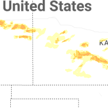
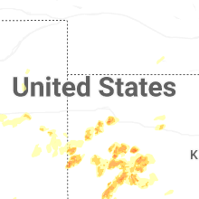


Connect with Interactive Hail Maps