

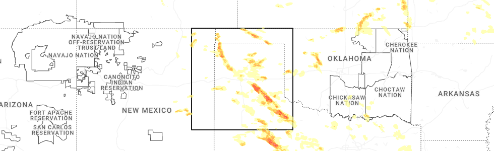
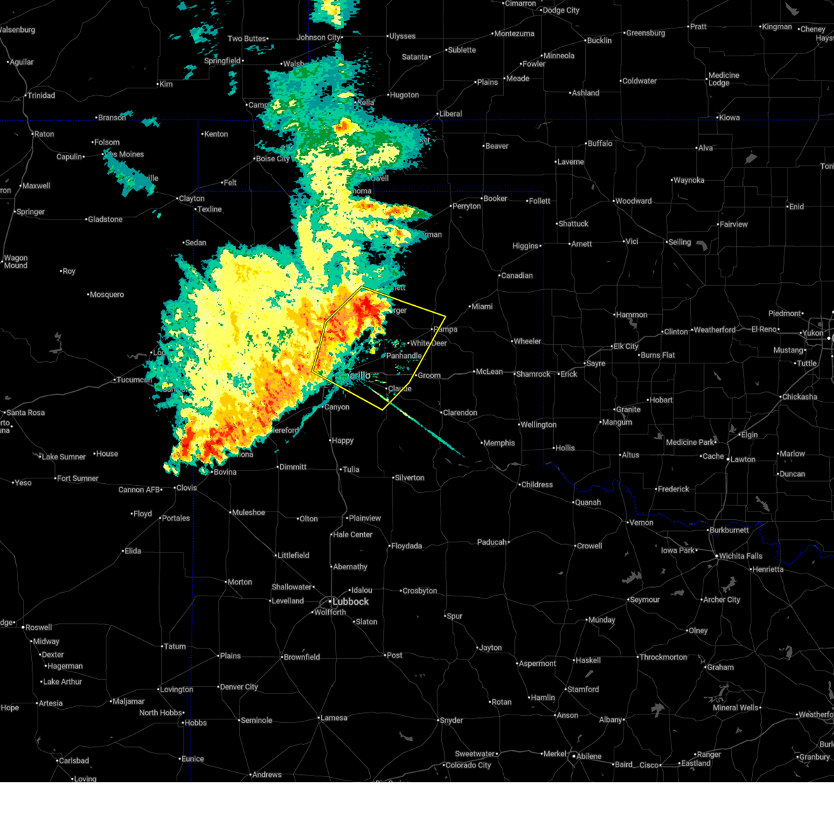
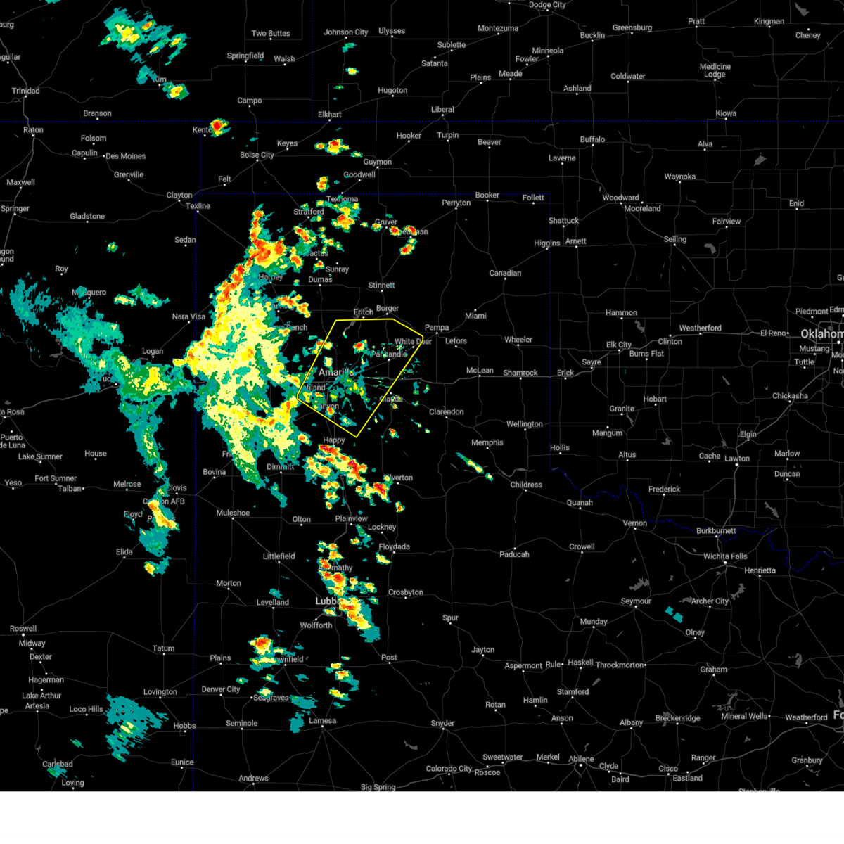
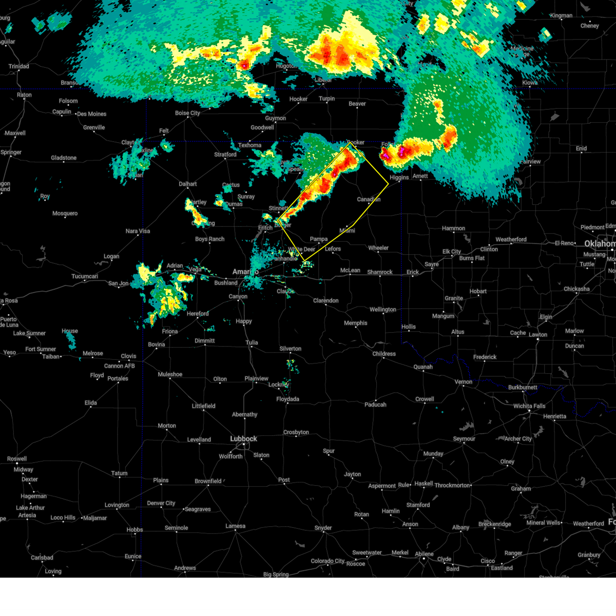
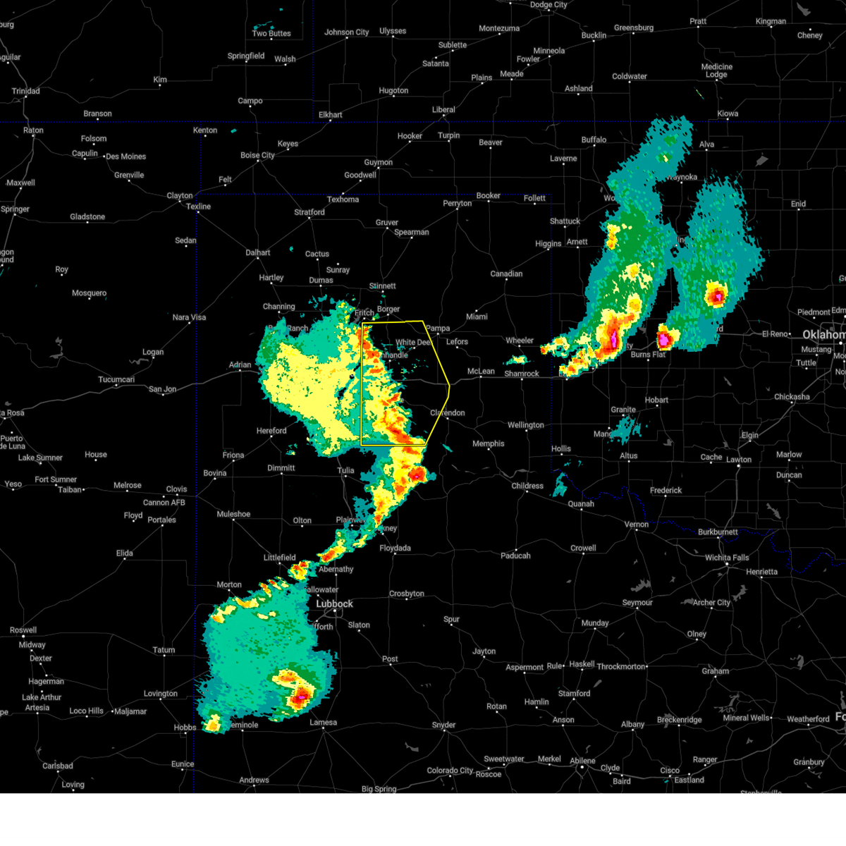
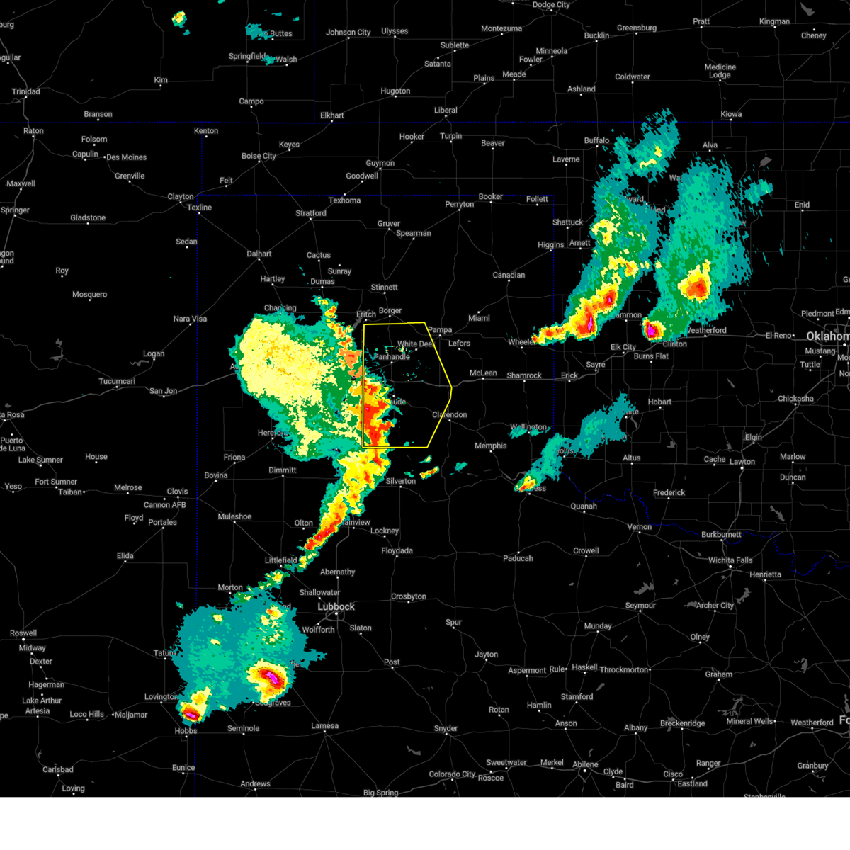
Hail Map for White Deer, TX
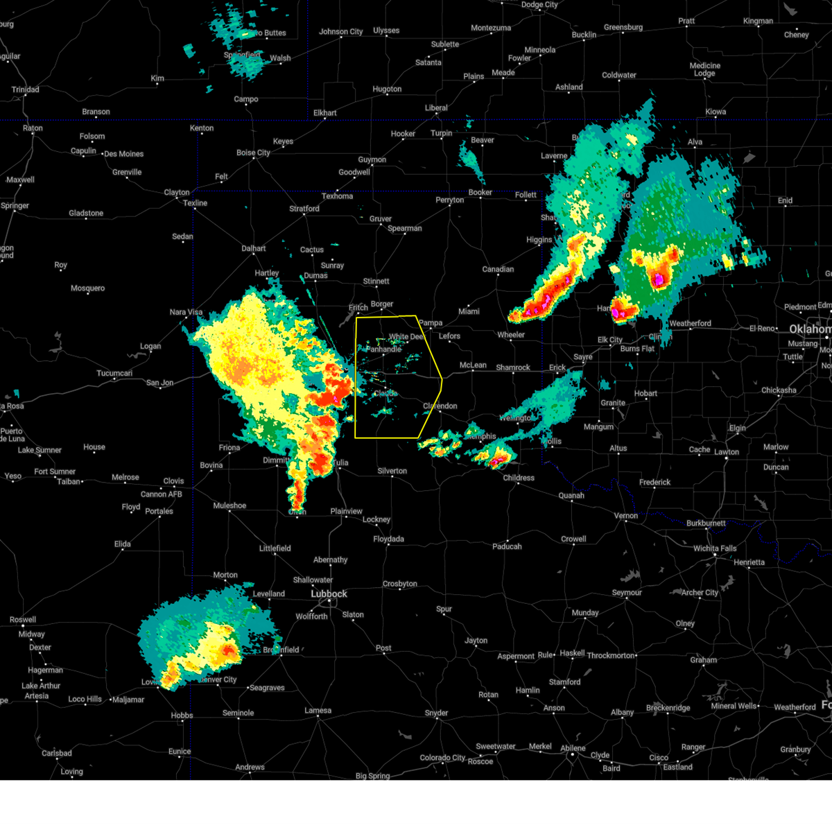
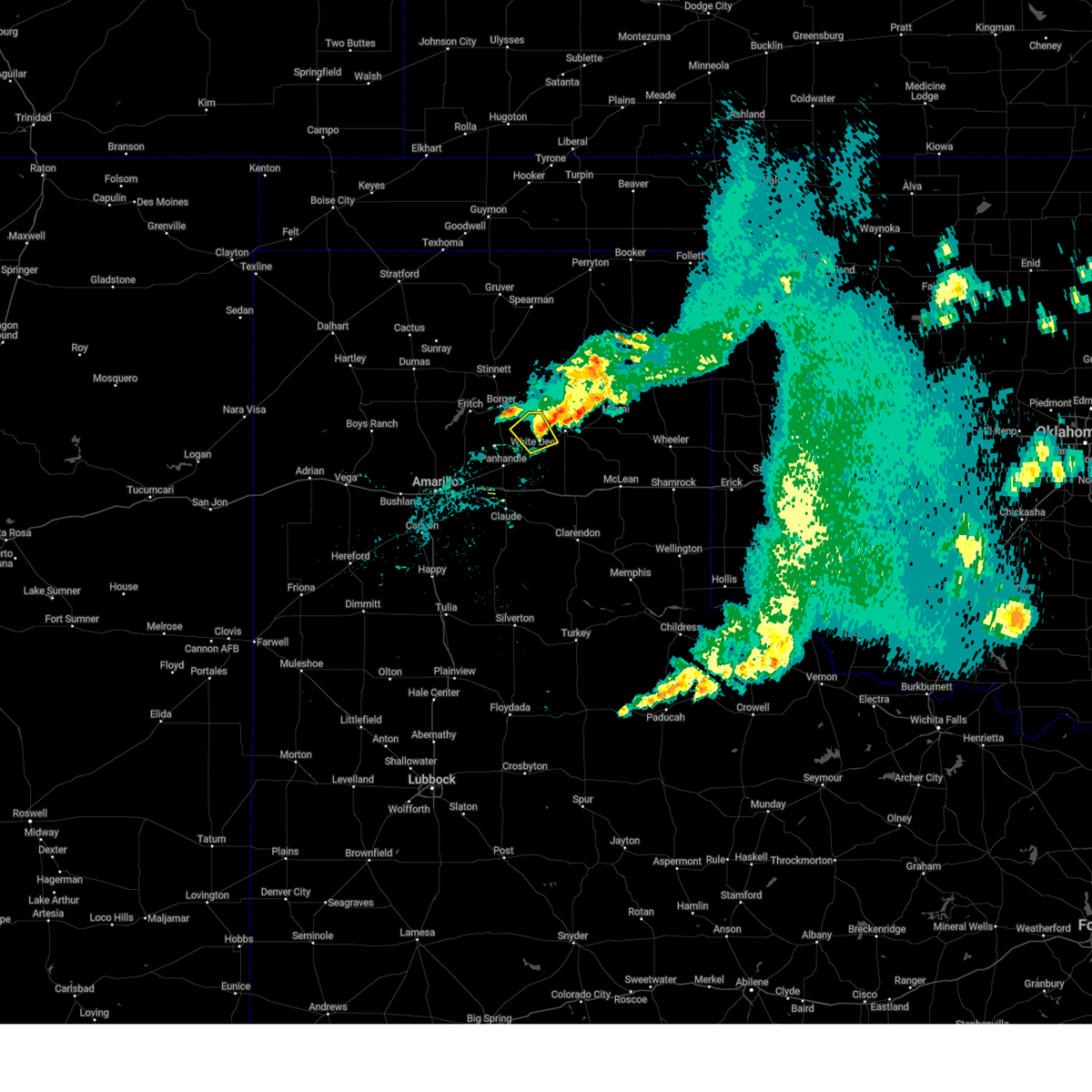
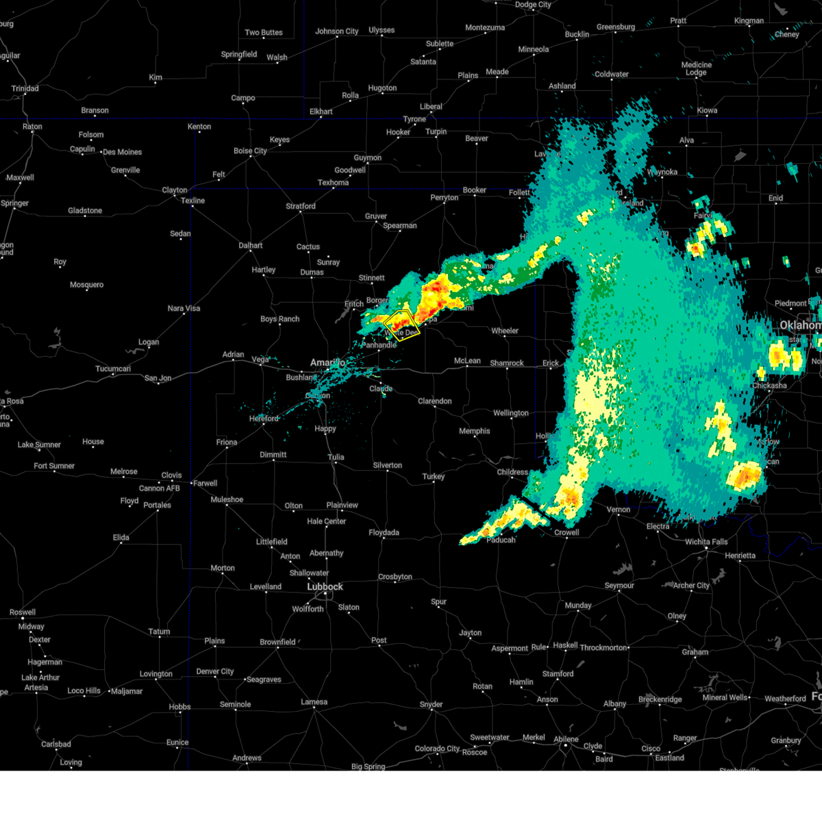
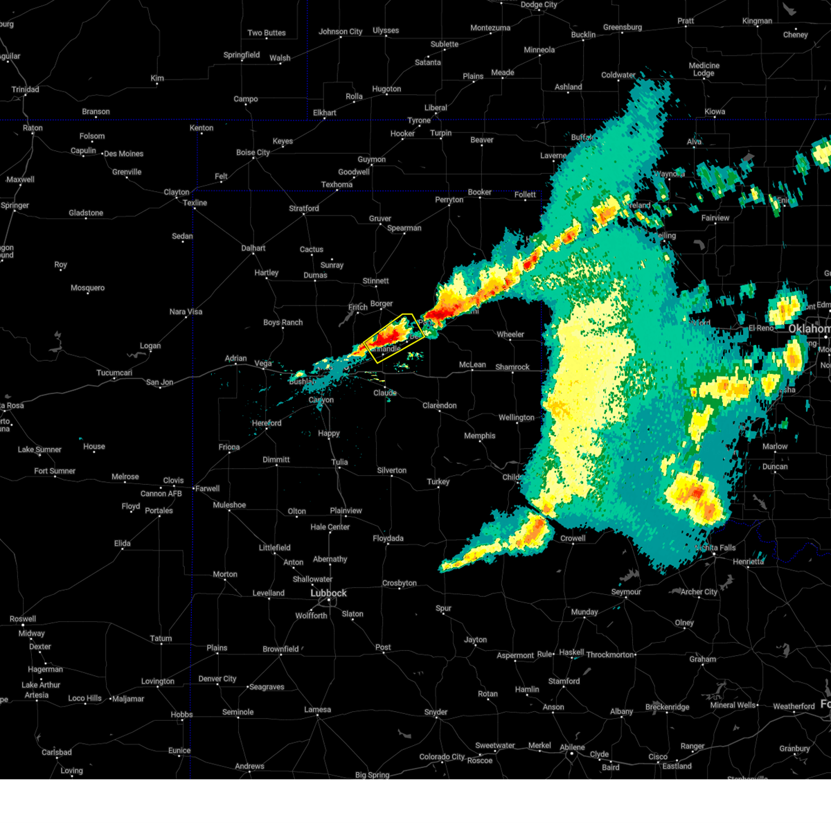
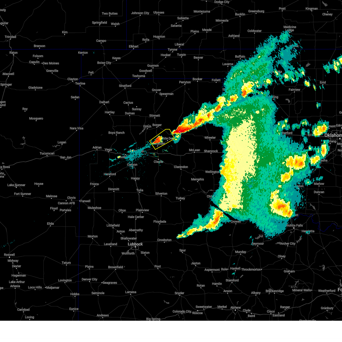
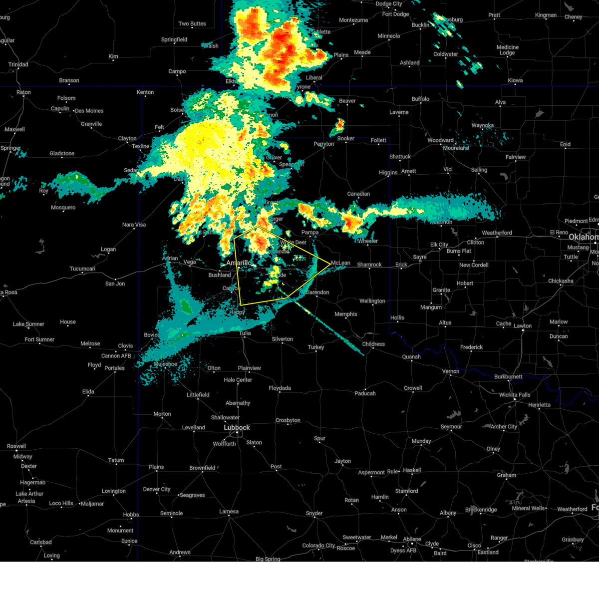
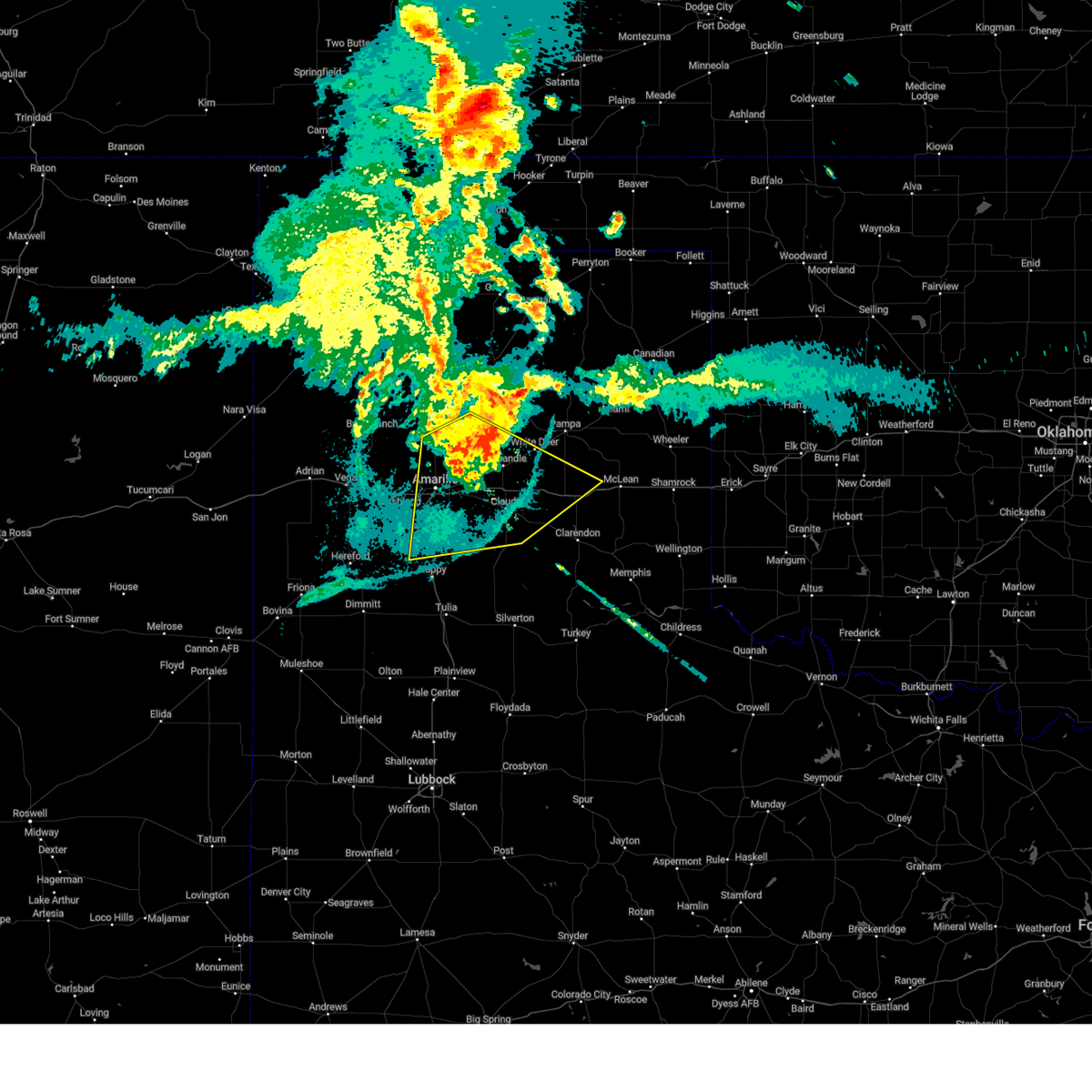
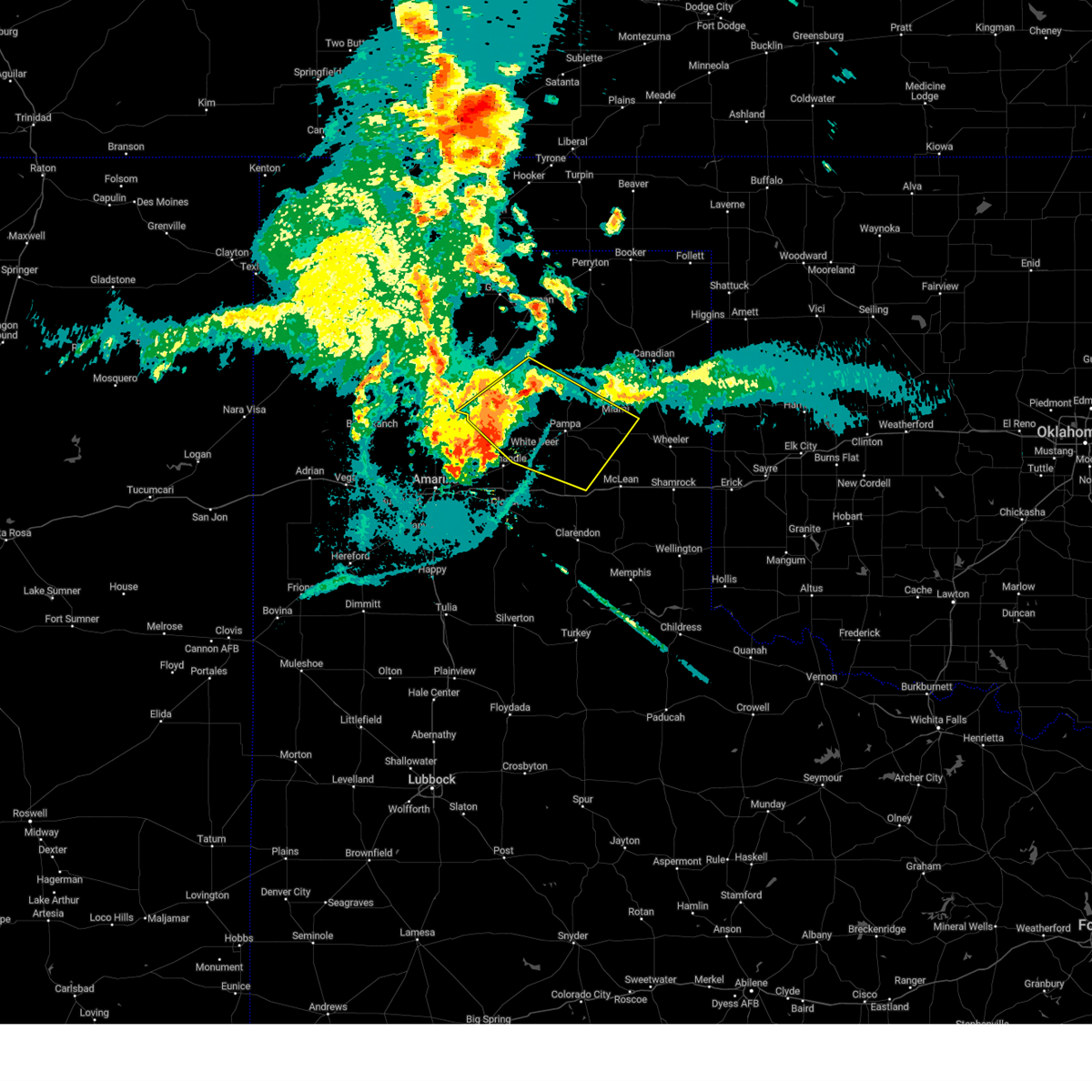
The White Deer, TX area has had 12 reports of on-the-ground hail by trained spotters, and has been under severe weather warnings 37 times during the past 12 months. Doppler radar has detected hail at or near White Deer, TX on 111 occasions, including 4 occasions during the past year.
| Name: | White Deer, TX |
| Where Located: | 40.4 miles ENE of Amarillo, TX |
| Map: | Google Map for White Deer, TX |
| Population: | 1000 |
| Housing Units: | 459 |
| More Info: | Search Google for White Deer, TX |
1
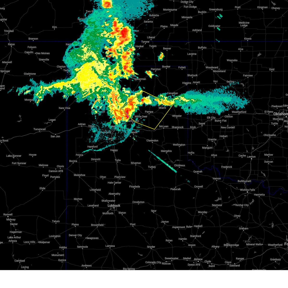
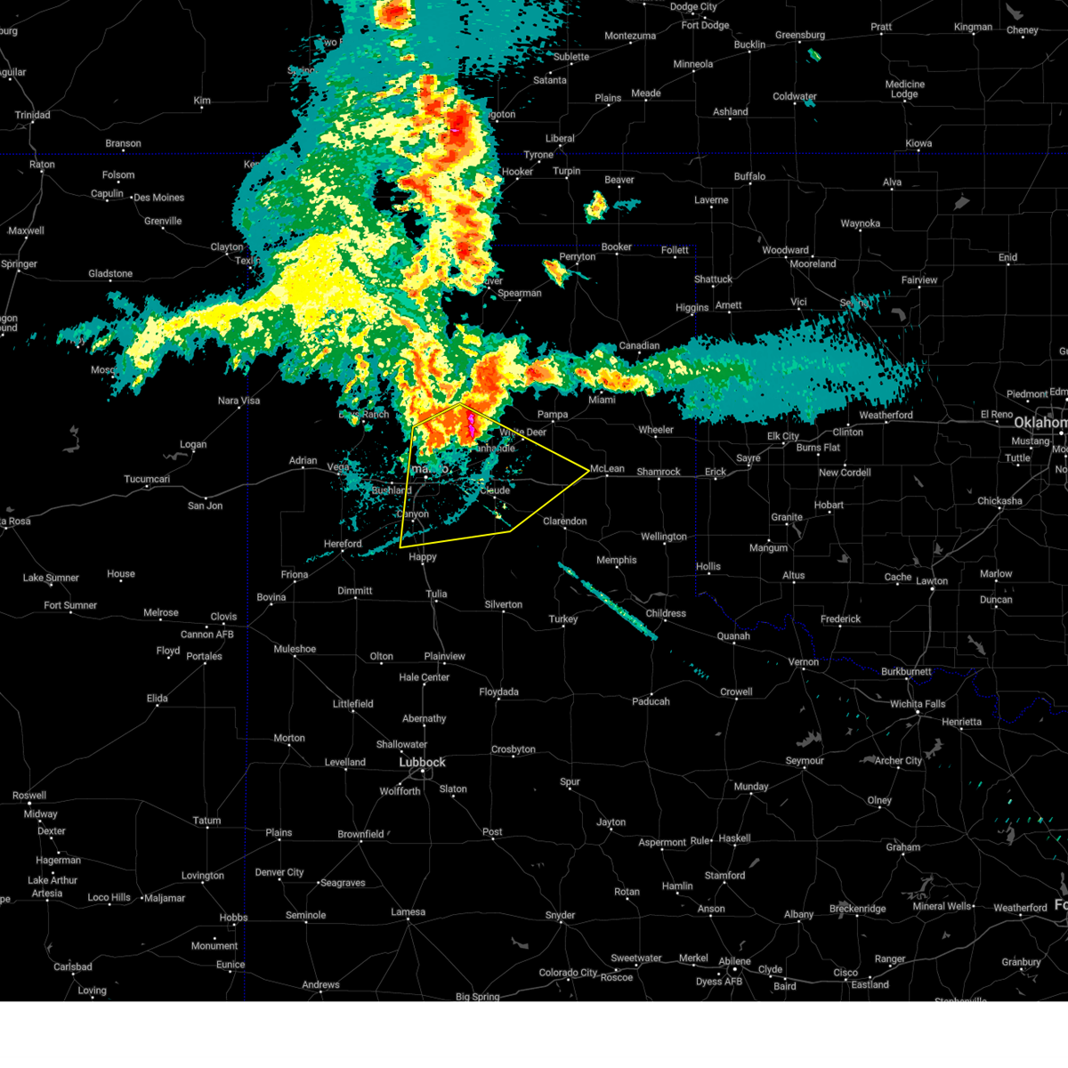
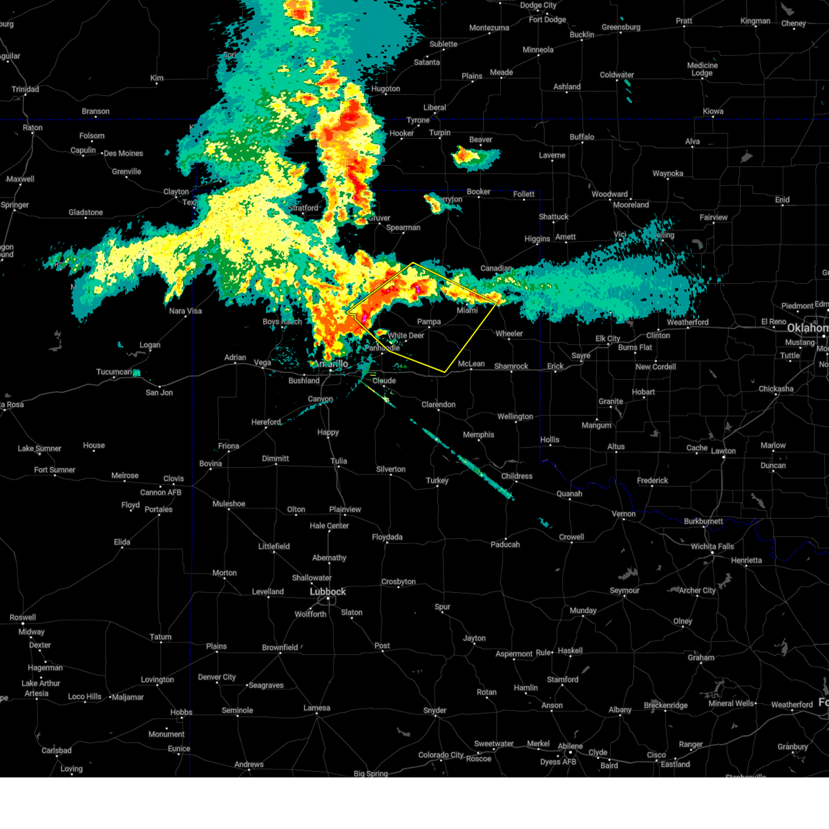
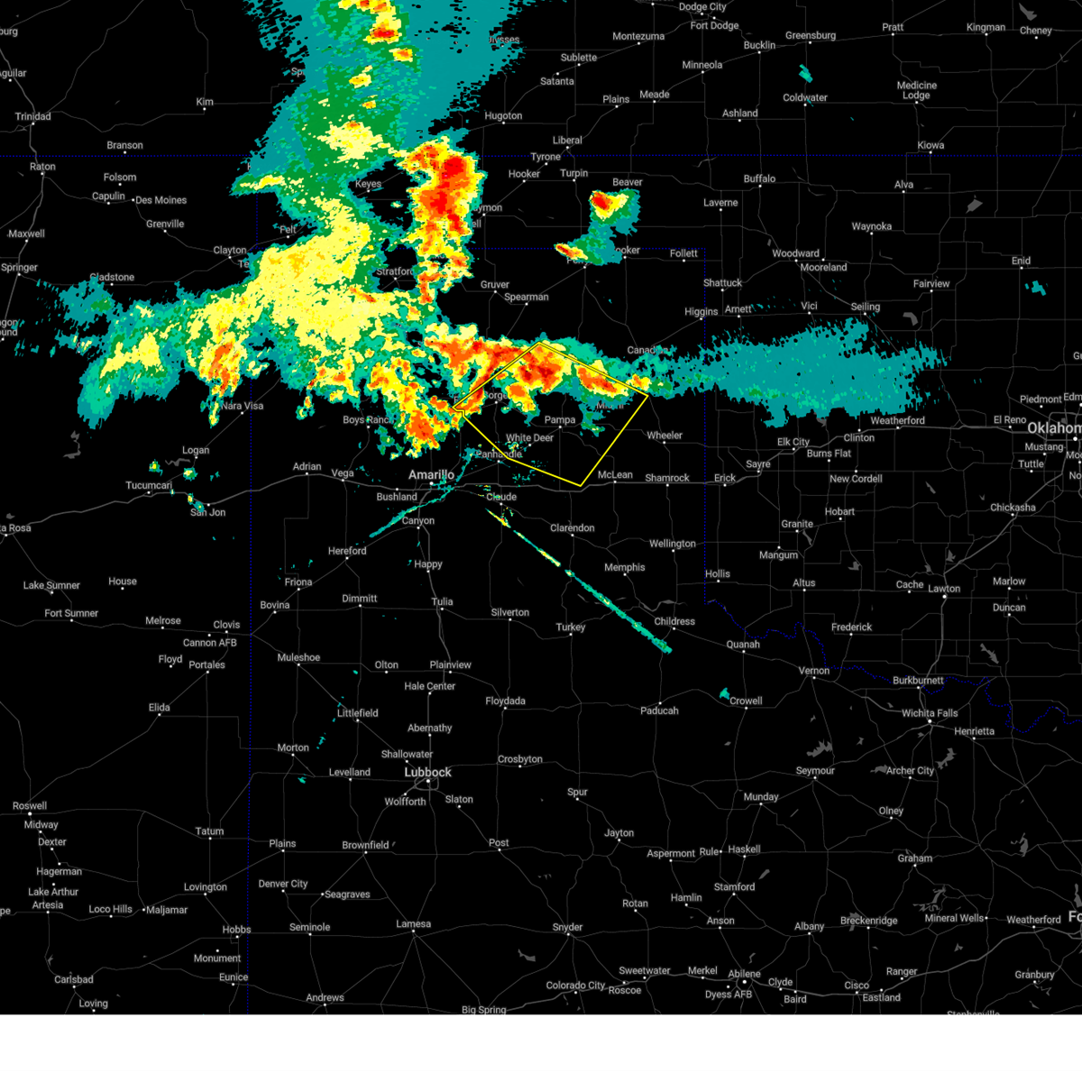
The Top Recent Hail Date for White Deer, TX is Sunday, June 8, 2025 (28th out of 111)
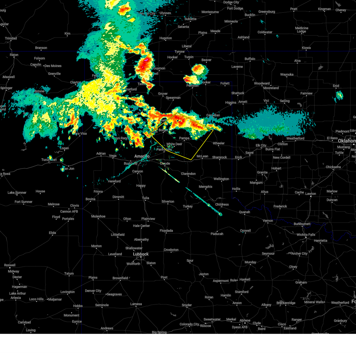
Hail and Wind Damage Spotted near White Deer, TX
| Date / Time | Report Details |
|---|---|
| 7/12/2025 12:53 AM CDT |
 Svrama the national weather service in amarillo has issued a * severe thunderstorm warning for, armstrong county in the panhandle of texas, eastern randall county in the panhandle of texas, carson county in the panhandle of texas, southwestern gray county in the panhandle of texas, southeastern potter county in the panhandle of texas, western donley county in the panhandle of texas, * until 200 am cdt. * at 1253 am cdt, a severe thunderstorm was located 5 miles southwest of washburn, or 12 miles southeast of amarillo, moving south at 30 mph (radar indicated). Hazards include 70 mph wind gusts. Expect some tree damage. Damage is likely to mobile homes, roofs, and outbuildings. Svrama the national weather service in amarillo has issued a * severe thunderstorm warning for, armstrong county in the panhandle of texas, eastern randall county in the panhandle of texas, carson county in the panhandle of texas, southwestern gray county in the panhandle of texas, southeastern potter county in the panhandle of texas, western donley county in the panhandle of texas, * until 200 am cdt. * at 1253 am cdt, a severe thunderstorm was located 5 miles southwest of washburn, or 12 miles southeast of amarillo, moving south at 30 mph (radar indicated). Hazards include 70 mph wind gusts. Expect some tree damage. Damage is likely to mobile homes, roofs, and outbuildings.
|
| 7/12/2025 12:36 AM CDT |
 At 1235 am cdt, automated weather equipment reported severe thunderstorms were located along a line extending from 4 miles north of white deer to 7 miles south of panhandle to 8 miles south of washburn, moving southeast at 40 mph (automated weather equipment at pantex). Hazards include 70 mph wind gusts. Expect some tree damage. damage is likely to mobile homes, roofs, and outbuildings. Locations impacted include, amarillo, pampa, borger, panhandle, claude, white deer, skellytown, kingsmill, washburn, and pantex. At 1235 am cdt, automated weather equipment reported severe thunderstorms were located along a line extending from 4 miles north of white deer to 7 miles south of panhandle to 8 miles south of washburn, moving southeast at 40 mph (automated weather equipment at pantex). Hazards include 70 mph wind gusts. Expect some tree damage. damage is likely to mobile homes, roofs, and outbuildings. Locations impacted include, amarillo, pampa, borger, panhandle, claude, white deer, skellytown, kingsmill, washburn, and pantex.
|
| 7/12/2025 12:36 AM CDT |
 the severe thunderstorm warning has been cancelled and is no longer in effect the severe thunderstorm warning has been cancelled and is no longer in effect
|
| 7/12/2025 12:30 AM CDT |
 At 1228 am cdt, automated weather equipment reported severe thunderstorms were located along a line extending from 6 miles west of skellytown to 7 miles southwest of panhandle to 5 miles southwest of washburn, moving southeast at 35 mph (automated weather equipment in amarillo and pantex). Hazards include 60 mph wind gusts. Minor damage to roofs, siding, and trees is possible. Locations impacted include, amarillo, pampa, borger, panhandle, claude, fritch, white deer, skellytown, sanford, washburn, kingsmill, lake meredith, and pantex. At 1228 am cdt, automated weather equipment reported severe thunderstorms were located along a line extending from 6 miles west of skellytown to 7 miles southwest of panhandle to 5 miles southwest of washburn, moving southeast at 35 mph (automated weather equipment in amarillo and pantex). Hazards include 60 mph wind gusts. Minor damage to roofs, siding, and trees is possible. Locations impacted include, amarillo, pampa, borger, panhandle, claude, fritch, white deer, skellytown, sanford, washburn, kingsmill, lake meredith, and pantex.
|
| 7/12/2025 12:08 AM CDT |
 Svrama the national weather service in amarillo has issued a * severe thunderstorm warning for, northwestern armstrong county in the panhandle of texas, northeastern randall county in the panhandle of texas, carson county in the panhandle of texas, southern hutchinson county in the panhandle of texas, northwestern gray county in the panhandle of texas, eastern potter county in the panhandle of texas, southwestern roberts county in the panhandle of texas, southeastern moore county in the panhandle of texas, * until 100 am cdt. * at 1208 am cdt, severe thunderstorms were located along a line extending from 7 miles southeast of fritch to 12 miles north of washburn to 4 miles northeast of amarillo, moving southeast at 35 mph (radar indicated). Hazards include 60 mph wind gusts. minor damage to roofs, siding, and trees is possible Svrama the national weather service in amarillo has issued a * severe thunderstorm warning for, northwestern armstrong county in the panhandle of texas, northeastern randall county in the panhandle of texas, carson county in the panhandle of texas, southern hutchinson county in the panhandle of texas, northwestern gray county in the panhandle of texas, eastern potter county in the panhandle of texas, southwestern roberts county in the panhandle of texas, southeastern moore county in the panhandle of texas, * until 100 am cdt. * at 1208 am cdt, severe thunderstorms were located along a line extending from 7 miles southeast of fritch to 12 miles north of washburn to 4 miles northeast of amarillo, moving southeast at 35 mph (radar indicated). Hazards include 60 mph wind gusts. minor damage to roofs, siding, and trees is possible
|
| 7/9/2025 12:56 AM CDT |
 At 1256 am cdt, a severe thunderstorm was located 6 miles south of panhandle, moving southwest at 15 mph (radar indicated). Hazards include 70 mph wind gusts and nickel size hail. Expect some tree damage. damage is likely to mobile homes, roofs, and outbuildings. Locations impacted include, panhandle, claude, washburn, goodnight, and pantex. At 1256 am cdt, a severe thunderstorm was located 6 miles south of panhandle, moving southwest at 15 mph (radar indicated). Hazards include 70 mph wind gusts and nickel size hail. Expect some tree damage. damage is likely to mobile homes, roofs, and outbuildings. Locations impacted include, panhandle, claude, washburn, goodnight, and pantex.
|
| 7/9/2025 12:38 AM CDT |
 Svrama the national weather service in amarillo has issued a * severe thunderstorm warning for, northern armstrong county in the panhandle of texas, northeastern randall county in the panhandle of texas, carson county in the panhandle of texas, * until 130 am cdt. * at 1237 am cdt, a severe thunderstorm was located 5 miles southeast of panhandle, moving southwest at 35 mph (radar indicated). Hazards include 60 mph wind gusts and half dollar size hail. Minor damage to roofs, siding, and trees is possible. Hail damage to vehicles is expected. Svrama the national weather service in amarillo has issued a * severe thunderstorm warning for, northern armstrong county in the panhandle of texas, northeastern randall county in the panhandle of texas, carson county in the panhandle of texas, * until 130 am cdt. * at 1237 am cdt, a severe thunderstorm was located 5 miles southeast of panhandle, moving southwest at 35 mph (radar indicated). Hazards include 60 mph wind gusts and half dollar size hail. Minor damage to roofs, siding, and trees is possible. Hail damage to vehicles is expected.
|
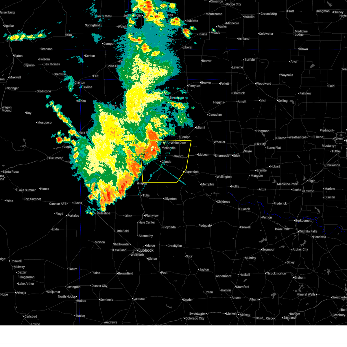
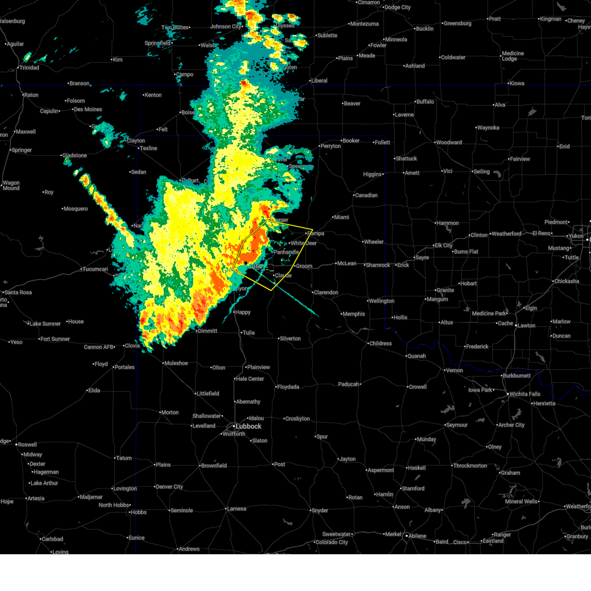
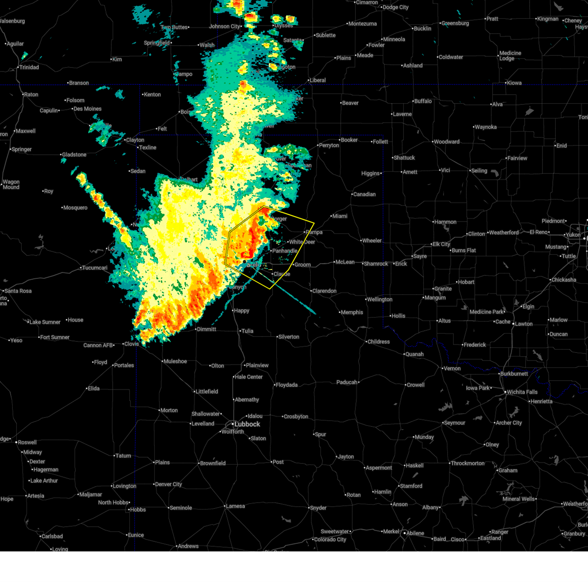
| 6/8/2025 5:23 PM CDT |
 Svrama the national weather service in amarillo has issued a * severe thunderstorm warning for, carson county in the panhandle of texas, western gray county in the panhandle of texas, * until 630 pm cdt. * at 523 pm cdt, a severe thunderstorm was located 6 miles northwest of white deer, or 11 miles northeast of panhandle, moving east at 30 mph (radar indicated). Hazards include ping pong ball size hail and 60 mph wind gusts. Minor damage to roofs, siding, and trees is possible. people and animals outdoors will be injured. Expect hail damage to roofs, siding, windows, and vehicles. Svrama the national weather service in amarillo has issued a * severe thunderstorm warning for, carson county in the panhandle of texas, western gray county in the panhandle of texas, * until 630 pm cdt. * at 523 pm cdt, a severe thunderstorm was located 6 miles northwest of white deer, or 11 miles northeast of panhandle, moving east at 30 mph (radar indicated). Hazards include ping pong ball size hail and 60 mph wind gusts. Minor damage to roofs, siding, and trees is possible. people and animals outdoors will be injured. Expect hail damage to roofs, siding, windows, and vehicles.
|
| 6/8/2025 4:27 PM CDT | At 426 pm cdt, a severe thunderstorm was located 4 miles northeast of skellytown, or 11 miles northwest of pampa, moving northeast at 30 mph (radar indicated). Hazards include ping pong ball size hail and 60 mph wind gusts. Minor damage to roofs, siding, and trees is possible. people and animals outdoors will be injured. expect hail damage to roofs, siding, windows, and vehicles. Locations impacted include, skellytown, sanford, white deer, pampa, kingsmill, codman, and borger. |
| 6/8/2025 3:57 PM CDT |
 Svrama the national weather service in amarillo has issued a * severe thunderstorm warning for, carson county in the panhandle of texas, southern hutchinson county in the panhandle of texas, northwestern gray county in the panhandle of texas, southern roberts county in the panhandle of texas, * until 500 pm cdt. * at 357 pm cdt, a severe thunderstorm was located 9 miles west of white deer, or 9 miles north of panhandle, moving northeast at 30 mph (radar indicated). Hazards include golf ball size hail and 60 mph wind gusts. Minor damage to roofs, siding, and trees is possible. people and animals outdoors will be injured. Expect hail damage to roofs, siding, windows, and vehicles. Svrama the national weather service in amarillo has issued a * severe thunderstorm warning for, carson county in the panhandle of texas, southern hutchinson county in the panhandle of texas, northwestern gray county in the panhandle of texas, southern roberts county in the panhandle of texas, * until 500 pm cdt. * at 357 pm cdt, a severe thunderstorm was located 9 miles west of white deer, or 9 miles north of panhandle, moving northeast at 30 mph (radar indicated). Hazards include golf ball size hail and 60 mph wind gusts. Minor damage to roofs, siding, and trees is possible. people and animals outdoors will be injured. Expect hail damage to roofs, siding, windows, and vehicles.
|
| 6/2/2025 5:09 PM CDT |
 At 509 pm cdt, severe thunderstorms were located along a line extending from 13 miles southeast of waka to 6 miles east of pampa to 9 miles northeast of hedley, moving east at 45 mph (radar indicated). Hazards include 60 mph wind gusts and quarter size hail. Minor damage to roofs, siding, and trees is possible. hail damage to vehicles is expected. Locations impacted include, howardwick, wolf creek park, lelia lake, lake mcclellan, white deer, lefors, quail, kellerville, miami, clarendon, goodnight, skellytown, lora, mclean, pampa, kingsmill, alanreed, groom, codman, and borger. At 509 pm cdt, severe thunderstorms were located along a line extending from 13 miles southeast of waka to 6 miles east of pampa to 9 miles northeast of hedley, moving east at 45 mph (radar indicated). Hazards include 60 mph wind gusts and quarter size hail. Minor damage to roofs, siding, and trees is possible. hail damage to vehicles is expected. Locations impacted include, howardwick, wolf creek park, lelia lake, lake mcclellan, white deer, lefors, quail, kellerville, miami, clarendon, goodnight, skellytown, lora, mclean, pampa, kingsmill, alanreed, groom, codman, and borger.
|
| 6/2/2025 4:50 PM CDT | the severe thunderstorm warning has been cancelled and is no longer in effect |
| 6/2/2025 4:50 PM CDT | At 450 pm cdt, severe thunderstorms were located along a line extending from 4 miles northwest of claude to 6 miles southeast of goodnight, moving northeast at 40 mph (radar indicated). Hazards include 60 mph wind gusts and quarter size hail. Minor damage to roofs, siding, and trees is possible. hail damage to vehicles is expected. Locations impacted include, howardwick, panhandle, lake mcclellan, white deer, claude, groom, clarendon, greenbelt lake, and goodnight. |
| 6/2/2025 4:40 PM CDT | Svrama the national weather service in amarillo has issued a * severe thunderstorm warning for, northeastern armstrong county in the panhandle of texas, western wheeler county in the panhandle of texas, carson county in the panhandle of texas, hutchinson county in the panhandle of texas, gray county in the panhandle of texas, southeastern hansford county in the panhandle of texas, northwestern collingsworth county in the panhandle of texas, roberts county in the panhandle of texas, southern ochiltree county in the panhandle of texas, donley county in the panhandle of texas, * until 545 pm cdt. * at 439 pm cdt, severe thunderstorms were located along a line extending from 10 miles south of spearman to 3 miles west of kingsmill to 3 miles west of lelia lake, moving east at 45 mph (radar indicated). Hazards include 60 mph wind gusts and quarter size hail. Minor damage to roofs, siding, and trees is possible. Hail damage to vehicles is expected. |
| 6/2/2025 4:07 PM CDT |
 At 407 pm cdt, severe thunderstorms were located along a line extending from 4 miles northwest of wayside to 13 miles east of vigo park, moving northeast at 40 mph (radar indicated). Hazards include 70 mph wind gusts and quarter size hail. Expect some tree damage. damage is likely to mobile homes, roofs, and outbuildings. hail damage to vehicles is expected. Locations impacted include, howardwick, panhandle, lake mcclellan, wayside, white deer, claude, groom, clarendon, greenbelt lake, goodnight, and palo duro canyon. At 407 pm cdt, severe thunderstorms were located along a line extending from 4 miles northwest of wayside to 13 miles east of vigo park, moving northeast at 40 mph (radar indicated). Hazards include 70 mph wind gusts and quarter size hail. Expect some tree damage. damage is likely to mobile homes, roofs, and outbuildings. hail damage to vehicles is expected. Locations impacted include, howardwick, panhandle, lake mcclellan, wayside, white deer, claude, groom, clarendon, greenbelt lake, goodnight, and palo duro canyon.
|
| 6/2/2025 4:06 PM CDT |
 At 406 pm cdt, severe thunderstorms were located along a line extending from 10 miles southwest of lake meredith to near panhandle, moving northeast at 55 mph (radar indicated). Hazards include 70 mph wind gusts. Expect some tree damage. damage is likely to mobile homes, roofs, and outbuildings. Locations impacted include, panhandle, pantex, lake tanglewood, timbercreek canyon, white deer, washburn, palo duro canyon, amarillo, fritch, and borger. At 406 pm cdt, severe thunderstorms were located along a line extending from 10 miles southwest of lake meredith to near panhandle, moving northeast at 55 mph (radar indicated). Hazards include 70 mph wind gusts. Expect some tree damage. damage is likely to mobile homes, roofs, and outbuildings. Locations impacted include, panhandle, pantex, lake tanglewood, timbercreek canyon, white deer, washburn, palo duro canyon, amarillo, fritch, and borger.
|
| 6/2/2025 4:03 PM CDT |
 Svrama the national weather service in amarillo has issued a * severe thunderstorm warning for, armstrong county in the panhandle of texas, southeastern randall county in the panhandle of texas, eastern carson county in the panhandle of texas, southwestern gray county in the panhandle of texas, western donley county in the panhandle of texas, * until 500 pm cdt. * at 403 pm cdt, severe thunderstorms were located along a line extending from 6 miles north of wayside to 14 miles east of vigo park, moving northeast at 40 mph (radar indicated). Hazards include 60 mph wind gusts and quarter size hail. Minor damage to roofs, siding, and trees is possible. Hail damage to vehicles is expected. Svrama the national weather service in amarillo has issued a * severe thunderstorm warning for, armstrong county in the panhandle of texas, southeastern randall county in the panhandle of texas, eastern carson county in the panhandle of texas, southwestern gray county in the panhandle of texas, western donley county in the panhandle of texas, * until 500 pm cdt. * at 403 pm cdt, severe thunderstorms were located along a line extending from 6 miles north of wayside to 14 miles east of vigo park, moving northeast at 40 mph (radar indicated). Hazards include 60 mph wind gusts and quarter size hail. Minor damage to roofs, siding, and trees is possible. Hail damage to vehicles is expected.
|
| 6/2/2025 3:36 PM CDT |
 Svrama the national weather service in amarillo has issued a * severe thunderstorm warning for, northwestern armstrong county in the panhandle of texas, northeastern randall county in the panhandle of texas, carson county in the panhandle of texas, potter county in the panhandle of texas, * until 415 pm cdt. * at 336 pm cdt, severe thunderstorms were located along a line extending from 7 miles northeast of bushland to 8 miles south of washburn, moving northeast at 55 mph (automated weather equipment). Hazards include 60 mph wind gusts. minor damage to roofs, siding, and trees is possible Svrama the national weather service in amarillo has issued a * severe thunderstorm warning for, northwestern armstrong county in the panhandle of texas, northeastern randall county in the panhandle of texas, carson county in the panhandle of texas, potter county in the panhandle of texas, * until 415 pm cdt. * at 336 pm cdt, severe thunderstorms were located along a line extending from 7 miles northeast of bushland to 8 miles south of washburn, moving northeast at 55 mph (automated weather equipment). Hazards include 60 mph wind gusts. minor damage to roofs, siding, and trees is possible
|
| 5/28/2025 8:53 PM CDT |
 Svrama the national weather service in amarillo has issued a * severe thunderstorm warning for, southwestern lipscomb county in the panhandle of texas, northeastern carson county in the panhandle of texas, eastern hutchinson county in the panhandle of texas, northwestern gray county in the panhandle of texas, roberts county in the panhandle of texas, northwestern hemphill county in the panhandle of texas, southeastern ochiltree county in the panhandle of texas, * until 1015 pm cdt. * at 853 pm cdt, severe thunderstorms were located along a line extending from 6 miles west of booker to 3 miles southeast of stinnett, moving southeast at 20 mph (radar indicated). Hazards include ping pong ball size hail and 60 mph wind gusts. Minor damage to roofs, siding, and trees is possible. people and animals outdoors will be injured. Expect hail damage to roofs, siding, windows, and vehicles. Svrama the national weather service in amarillo has issued a * severe thunderstorm warning for, southwestern lipscomb county in the panhandle of texas, northeastern carson county in the panhandle of texas, eastern hutchinson county in the panhandle of texas, northwestern gray county in the panhandle of texas, roberts county in the panhandle of texas, northwestern hemphill county in the panhandle of texas, southeastern ochiltree county in the panhandle of texas, * until 1015 pm cdt. * at 853 pm cdt, severe thunderstorms were located along a line extending from 6 miles west of booker to 3 miles southeast of stinnett, moving southeast at 20 mph (radar indicated). Hazards include ping pong ball size hail and 60 mph wind gusts. Minor damage to roofs, siding, and trees is possible. people and animals outdoors will be injured. Expect hail damage to roofs, siding, windows, and vehicles.
|
| 5/26/2025 10:38 PM CDT |
 The storms which prompted the warning have weakened below severe limits, and no longer pose an immediate threat to life or property. therefore, the warning will be allowed to expire. a severe thunderstorm watch remains in effect until midnight cdt for the panhandle of texas. The storms which prompted the warning have weakened below severe limits, and no longer pose an immediate threat to life or property. therefore, the warning will be allowed to expire. a severe thunderstorm watch remains in effect until midnight cdt for the panhandle of texas.
|
| 5/26/2025 10:11 PM CDT |
 At 1011 pm cdt, severe thunderstorms were located along a line extending from 12 miles southeast of fritch to 4 miles south of panhandle to 7 miles northeast of claude to 5 miles northwest of goodnight to 9 miles northeast of wayside to near vigo park, moving east at 40 mph (radar indicated). Hazards include 60 mph wind gusts and penny size hail. Minor damage to roofs, siding, and trees is possible. Locations impacted include, panhandle, skellytown, pantex, wayside, white deer, kingsmill, washburn, claude, groom, and goodnight. At 1011 pm cdt, severe thunderstorms were located along a line extending from 12 miles southeast of fritch to 4 miles south of panhandle to 7 miles northeast of claude to 5 miles northwest of goodnight to 9 miles northeast of wayside to near vigo park, moving east at 40 mph (radar indicated). Hazards include 60 mph wind gusts and penny size hail. Minor damage to roofs, siding, and trees is possible. Locations impacted include, panhandle, skellytown, pantex, wayside, white deer, kingsmill, washburn, claude, groom, and goodnight.
|
| 5/26/2025 9:39 PM CDT |
 Svrama the national weather service in amarillo has issued a * severe thunderstorm warning for, armstrong county in the panhandle of texas, carson county in the panhandle of texas, southwestern gray county in the panhandle of texas, western donley county in the panhandle of texas, * until 1045 pm cdt. * at 938 pm cdt, severe thunderstorms were located along a line extending from 14 miles southeast of masterson to 10 miles northeast of amarillo to near washburn to 11 miles east of lake tanglewood to 8 miles south of palo duro canyon to 5 miles south of happy, moving east at 40 mph (radar indicated). Hazards include 70 mph wind gusts and penny size hail. Expect some tree damage. Damage is likely to mobile homes, roofs, and outbuildings. Svrama the national weather service in amarillo has issued a * severe thunderstorm warning for, armstrong county in the panhandle of texas, carson county in the panhandle of texas, southwestern gray county in the panhandle of texas, western donley county in the panhandle of texas, * until 1045 pm cdt. * at 938 pm cdt, severe thunderstorms were located along a line extending from 14 miles southeast of masterson to 10 miles northeast of amarillo to near washburn to 11 miles east of lake tanglewood to 8 miles south of palo duro canyon to 5 miles south of happy, moving east at 40 mph (radar indicated). Hazards include 70 mph wind gusts and penny size hail. Expect some tree damage. Damage is likely to mobile homes, roofs, and outbuildings.
|
| 4/29/2025 5:21 AM CDT |
 The storm which prompted the warning has weakened below severe limits, and no longer poses an immediate threat to life or property. therefore, the warning will be allowed to expire. however, heavy rain is still possible with this thunderstorm. The storm which prompted the warning has weakened below severe limits, and no longer poses an immediate threat to life or property. therefore, the warning will be allowed to expire. however, heavy rain is still possible with this thunderstorm.
|
| 4/29/2025 5:12 AM CDT |
 At 512 am cdt, a severe thunderstorm was located near skellytown, or 12 miles west of pampa, moving northeast at 20 mph (radar indicated). Hazards include 60 mph wind gusts and quarter size hail. Minor damage to roofs, siding, and trees is possible. hail damage to vehicles is expected. Locations impacted include, white deer, kingsmill, and skellytown. At 512 am cdt, a severe thunderstorm was located near skellytown, or 12 miles west of pampa, moving northeast at 20 mph (radar indicated). Hazards include 60 mph wind gusts and quarter size hail. Minor damage to roofs, siding, and trees is possible. hail damage to vehicles is expected. Locations impacted include, white deer, kingsmill, and skellytown.
|
| 4/29/2025 4:42 AM CDT |
 At 442 am cdt, a severe thunderstorm was located 7 miles north of panhandle, moving northeast at 20 mph (radar indicated). Hazards include golf ball size hail and 60 mph wind gusts. Minor damage to roofs, siding, and trees is possible. people and animals outdoors will be injured. expect hail damage to roofs, siding, windows, and vehicles. Locations impacted include, white deer, kingsmill, panhandle, and skellytown. At 442 am cdt, a severe thunderstorm was located 7 miles north of panhandle, moving northeast at 20 mph (radar indicated). Hazards include golf ball size hail and 60 mph wind gusts. Minor damage to roofs, siding, and trees is possible. people and animals outdoors will be injured. expect hail damage to roofs, siding, windows, and vehicles. Locations impacted include, white deer, kingsmill, panhandle, and skellytown.
|
| 4/29/2025 4:32 AM CDT |
 Svrama the national weather service in amarillo has issued a * severe thunderstorm warning for, central carson county in the panhandle of texas, west central gray county in the panhandle of texas, * until 530 am cdt. * at 432 am cdt, a severe thunderstorm was located 5 miles north of panhandle, moving northeast at 20 mph (radar indicated). Hazards include ping pong ball size hail and 60 mph wind gusts. Minor damage to roofs, siding, and trees is possible. people and animals outdoors will be injured. Expect hail damage to roofs, siding, windows, and vehicles. Svrama the national weather service in amarillo has issued a * severe thunderstorm warning for, central carson county in the panhandle of texas, west central gray county in the panhandle of texas, * until 530 am cdt. * at 432 am cdt, a severe thunderstorm was located 5 miles north of panhandle, moving northeast at 20 mph (radar indicated). Hazards include ping pong ball size hail and 60 mph wind gusts. Minor damage to roofs, siding, and trees is possible. people and animals outdoors will be injured. Expect hail damage to roofs, siding, windows, and vehicles.
|
| 8/1/2024 10:16 PM CDT |
 the severe thunderstorm warning has been cancelled and is no longer in effect the severe thunderstorm warning has been cancelled and is no longer in effect
|
| 8/1/2024 9:57 PM CDT |
 At 956 pm cdt, a severe thunderstorm was located 7 miles south of panhandle, moving southeast at 15 mph (radar indicated). Hazards include 60 mph wind gusts. Minor damage to roofs, siding, and trees is possible. Locations impacted include, amarillo, panhandle, claude, fritch, white deer, lake tanglewood, groom, lake mcclellan, washburn, palo duro canyon, goodnight, timbercreek canyon, and pantex. At 956 pm cdt, a severe thunderstorm was located 7 miles south of panhandle, moving southeast at 15 mph (radar indicated). Hazards include 60 mph wind gusts. Minor damage to roofs, siding, and trees is possible. Locations impacted include, amarillo, panhandle, claude, fritch, white deer, lake tanglewood, groom, lake mcclellan, washburn, palo duro canyon, goodnight, timbercreek canyon, and pantex.
|
| 8/1/2024 9:52 PM CDT |
 The storm which prompted the warning has weakened below severe limits, and no longer poses an immediate threat to life or property. therefore, the warning will be allowed to expire. however, gusty winds are still possible with this thunderstorm. The storm which prompted the warning has weakened below severe limits, and no longer poses an immediate threat to life or property. therefore, the warning will be allowed to expire. however, gusty winds are still possible with this thunderstorm.
|
| 8/1/2024 9:43 PM CDT |
 At 942 pm cdt, a severe thunderstorm was located 6 miles southwest of panhandle, moving southeast at 20 mph (radar indicated). Hazards include 60 mph wind gusts. Minor damage to roofs, siding, and trees is possible. Locations impacted include, amarillo, canyon, panhandle, claude, fritch, white deer, lake tanglewood, groom, lake mcclellan, washburn, palo duro canyon, goodnight, mescalero park, timbercreek canyon, and pantex. At 942 pm cdt, a severe thunderstorm was located 6 miles southwest of panhandle, moving southeast at 20 mph (radar indicated). Hazards include 60 mph wind gusts. Minor damage to roofs, siding, and trees is possible. Locations impacted include, amarillo, canyon, panhandle, claude, fritch, white deer, lake tanglewood, groom, lake mcclellan, washburn, palo duro canyon, goodnight, mescalero park, timbercreek canyon, and pantex.
|
| 8/1/2024 9:38 PM CDT |
 the severe thunderstorm warning has been cancelled and is no longer in effect the severe thunderstorm warning has been cancelled and is no longer in effect
|
| 8/1/2024 9:38 PM CDT |
 At 937 pm cdt, a severe thunderstorm was located 6 miles south of borger, moving south at 20 mph (radar indicated). Hazards include 60 mph wind gusts. Minor damage to roofs, siding, and trees is possible. Locations impacted include, pampa, borger, fritch, white deer, lefors, skellytown, sanford, kingsmill, codman, and lake meredith. At 937 pm cdt, a severe thunderstorm was located 6 miles south of borger, moving south at 20 mph (radar indicated). Hazards include 60 mph wind gusts. Minor damage to roofs, siding, and trees is possible. Locations impacted include, pampa, borger, fritch, white deer, lefors, skellytown, sanford, kingsmill, codman, and lake meredith.
|
| 8/1/2024 9:20 PM CDT |
 At 920 pm cdt, a severe thunderstorm was located 6 miles southwest of skellytown, or 11 miles southeast of borger, moving southeast at 25 mph (radar indicated). Hazards include 60 mph wind gusts. Minor damage to roofs, siding, and trees is possible. Locations impacted include, pampa, borger, miami, fritch, white deer, lefors, skellytown, sanford, lora, kingsmill, codman, and lake meredith. At 920 pm cdt, a severe thunderstorm was located 6 miles southwest of skellytown, or 11 miles southeast of borger, moving southeast at 25 mph (radar indicated). Hazards include 60 mph wind gusts. Minor damage to roofs, siding, and trees is possible. Locations impacted include, pampa, borger, miami, fritch, white deer, lefors, skellytown, sanford, lora, kingsmill, codman, and lake meredith.
|
| 8/1/2024 9:15 PM CDT |
 Svrama the national weather service in amarillo has issued a * severe thunderstorm warning for, northern armstrong county in the panhandle of texas, eastern randall county in the panhandle of texas, carson county in the panhandle of texas, southwestern gray county in the panhandle of texas, eastern potter county in the panhandle of texas, northwestern donley county in the panhandle of texas, * until 1045 pm cdt. * at 915 pm cdt, a severe thunderstorm was located 10 miles northwest of panhandle, moving south at 20 mph (radar indicated). Hazards include 70 mph wind gusts. Expect some tree damage. Damage is likely to mobile homes, roofs, and outbuildings. Svrama the national weather service in amarillo has issued a * severe thunderstorm warning for, northern armstrong county in the panhandle of texas, eastern randall county in the panhandle of texas, carson county in the panhandle of texas, southwestern gray county in the panhandle of texas, eastern potter county in the panhandle of texas, northwestern donley county in the panhandle of texas, * until 1045 pm cdt. * at 915 pm cdt, a severe thunderstorm was located 10 miles northwest of panhandle, moving south at 20 mph (radar indicated). Hazards include 70 mph wind gusts. Expect some tree damage. Damage is likely to mobile homes, roofs, and outbuildings.
|
| 8/1/2024 9:04 PM CDT |
 At 903 pm cdt, a severe thunderstorm was located near white deer, or 12 miles west of pampa, moving south at 25 mph (radar indicated). Hazards include 70 mph wind gusts. Expect some tree damage. damage is likely to mobile homes, roofs, and outbuildings. Locations impacted include, pampa, borger, miami, fritch, white deer, lefors, skellytown, sanford, lora, kingsmill, codman, and lake meredith. At 903 pm cdt, a severe thunderstorm was located near white deer, or 12 miles west of pampa, moving south at 25 mph (radar indicated). Hazards include 70 mph wind gusts. Expect some tree damage. damage is likely to mobile homes, roofs, and outbuildings. Locations impacted include, pampa, borger, miami, fritch, white deer, lefors, skellytown, sanford, lora, kingsmill, codman, and lake meredith.
|
| 8/1/2024 8:48 PM CDT |
 At 847 pm cdt, a severe thunderstorm was located over skellytown, or 11 miles west of pampa, moving southeast at 20 mph (radar indicated). Hazards include 70 mph wind gusts. Expect some tree damage. damage is likely to mobile homes, roofs, and outbuildings. Locations impacted include, pampa, borger, miami, fritch, white deer, lefors, skellytown, sanford, lora, kingsmill, codman, and lake meredith. At 847 pm cdt, a severe thunderstorm was located over skellytown, or 11 miles west of pampa, moving southeast at 20 mph (radar indicated). Hazards include 70 mph wind gusts. Expect some tree damage. damage is likely to mobile homes, roofs, and outbuildings. Locations impacted include, pampa, borger, miami, fritch, white deer, lefors, skellytown, sanford, lora, kingsmill, codman, and lake meredith.
|
| 8/1/2024 8:31 PM CDT |
 Svrama the national weather service in amarillo has issued a * severe thunderstorm warning for, northwestern wheeler county in the panhandle of texas, northern carson county in the panhandle of texas, southern hutchinson county in the panhandle of texas, gray county in the panhandle of texas, southern roberts county in the panhandle of texas, southwestern hemphill county in the panhandle of texas, southeastern moore county in the panhandle of texas, * until 1000 pm cdt. * at 830 pm cdt, a severe thunderstorm was located 12 miles north of skellytown, or 15 miles northwest of pampa, moving southeast at 15 mph (radar indicated). Hazards include 70 mph wind gusts. Expect some tree damage. Damage is likely to mobile homes, roofs, and outbuildings. Svrama the national weather service in amarillo has issued a * severe thunderstorm warning for, northwestern wheeler county in the panhandle of texas, northern carson county in the panhandle of texas, southern hutchinson county in the panhandle of texas, gray county in the panhandle of texas, southern roberts county in the panhandle of texas, southwestern hemphill county in the panhandle of texas, southeastern moore county in the panhandle of texas, * until 1000 pm cdt. * at 830 pm cdt, a severe thunderstorm was located 12 miles north of skellytown, or 15 miles northwest of pampa, moving southeast at 15 mph (radar indicated). Hazards include 70 mph wind gusts. Expect some tree damage. Damage is likely to mobile homes, roofs, and outbuildings.
|
| 6/8/2024 3:41 PM CDT |
 Svrama the national weather service in amarillo has issued a * severe thunderstorm warning for, east central carson county in the panhandle of texas, northwestern gray county in the panhandle of texas, * until 415 pm cdt. * at 340 pm cdt, a severe thunderstorm was located over kingsmill, or 8 miles southwest of pampa, moving northeast at 15 mph (radar indicated). Hazards include 60 mph wind gusts and penny size hail. minor damage to roofs, siding, and trees is possible Svrama the national weather service in amarillo has issued a * severe thunderstorm warning for, east central carson county in the panhandle of texas, northwestern gray county in the panhandle of texas, * until 415 pm cdt. * at 340 pm cdt, a severe thunderstorm was located over kingsmill, or 8 miles southwest of pampa, moving northeast at 15 mph (radar indicated). Hazards include 60 mph wind gusts and penny size hail. minor damage to roofs, siding, and trees is possible
|
| 6/6/2024 4:27 PM CDT |
 At 427 pm cdt, a severe thunderstorm was located 6 miles north of groom, or 17 miles east of panhandle, moving southeast at 15 mph (radar indicated). Hazards include 70 mph wind gusts and quarter size hail. Expect some tree damage. damage is likely to mobile homes, roofs, and outbuildings. hail damage to vehicles is expected. Locations impacted include, white deer, mclean, groom, howardwick, lake mcclellan, kingsmill, and alanreed. At 427 pm cdt, a severe thunderstorm was located 6 miles north of groom, or 17 miles east of panhandle, moving southeast at 15 mph (radar indicated). Hazards include 70 mph wind gusts and quarter size hail. Expect some tree damage. damage is likely to mobile homes, roofs, and outbuildings. hail damage to vehicles is expected. Locations impacted include, white deer, mclean, groom, howardwick, lake mcclellan, kingsmill, and alanreed.
|
| 6/6/2024 4:10 PM CDT |
 At 410 pm cdt, a severe thunderstorm was located 7 miles southeast of white deer, or 14 miles southwest of pampa, moving southeast at 15 mph (radar indicated). Hazards include 70 mph wind gusts and half dollar size hail. Expect some tree damage. damage is likely to mobile homes, roofs, and outbuildings. hail damage to vehicles is expected. Locations impacted include, white deer, mclean, groom, howardwick, lake mcclellan, kingsmill, and alanreed. At 410 pm cdt, a severe thunderstorm was located 7 miles southeast of white deer, or 14 miles southwest of pampa, moving southeast at 15 mph (radar indicated). Hazards include 70 mph wind gusts and half dollar size hail. Expect some tree damage. damage is likely to mobile homes, roofs, and outbuildings. hail damage to vehicles is expected. Locations impacted include, white deer, mclean, groom, howardwick, lake mcclellan, kingsmill, and alanreed.
|
| 6/6/2024 3:54 PM CDT |
 At 354 pm cdt, a severe thunderstorm was located 4 miles southeast of white deer, or 14 miles east of panhandle, moving southeast at 20 mph (radar indicated). Hazards include golf ball size hail and 70 mph wind gusts. Expect some tree damage. damage is likely to mobile homes, roofs, and outbuildings. people and animals outdoors will be injured. expect hail damage to roofs, siding, windows, and vehicles. Locations impacted include, white deer, mclean, groom, howardwick, lake mcclellan, kingsmill, and alanreed. At 354 pm cdt, a severe thunderstorm was located 4 miles southeast of white deer, or 14 miles east of panhandle, moving southeast at 20 mph (radar indicated). Hazards include golf ball size hail and 70 mph wind gusts. Expect some tree damage. damage is likely to mobile homes, roofs, and outbuildings. people and animals outdoors will be injured. expect hail damage to roofs, siding, windows, and vehicles. Locations impacted include, white deer, mclean, groom, howardwick, lake mcclellan, kingsmill, and alanreed.
|
| 6/6/2024 3:40 PM CDT |
 Svrama the national weather service in amarillo has issued a * severe thunderstorm warning for, northeastern armstrong county in the panhandle of texas, southwestern wheeler county in the panhandle of texas, southeastern carson county in the panhandle of texas, southern gray county in the panhandle of texas, northern donley county in the panhandle of texas, * until 515 pm cdt. * at 340 pm cdt, a severe thunderstorm was located 6 miles south of kingsmill, or 10 miles south of pampa, moving southeast at 25 mph (radar indicated). Hazards include golf ball size hail and 70 mph wind gusts. Expect some tree damage. damage is likely to mobile homes, roofs, and outbuildings. people and animals outdoors will be injured. Expect hail damage to roofs, siding, windows, and vehicles. Svrama the national weather service in amarillo has issued a * severe thunderstorm warning for, northeastern armstrong county in the panhandle of texas, southwestern wheeler county in the panhandle of texas, southeastern carson county in the panhandle of texas, southern gray county in the panhandle of texas, northern donley county in the panhandle of texas, * until 515 pm cdt. * at 340 pm cdt, a severe thunderstorm was located 6 miles south of kingsmill, or 10 miles south of pampa, moving southeast at 25 mph (radar indicated). Hazards include golf ball size hail and 70 mph wind gusts. Expect some tree damage. damage is likely to mobile homes, roofs, and outbuildings. people and animals outdoors will be injured. Expect hail damage to roofs, siding, windows, and vehicles.
|
| 6/4/2024 6:04 PM CDT |
 At 603 pm cdt, a severe thunderstorm was located 7 miles northeast of skellytown, or 10 miles northwest of pampa, moving south at 20 mph (radar indicated). Hazards include 60 mph wind gusts and penny size hail. Minor damage to roofs, siding, and trees is possible. Locations impacted include, pampa, white deer, lefors, skellytown, and kingsmill. At 603 pm cdt, a severe thunderstorm was located 7 miles northeast of skellytown, or 10 miles northwest of pampa, moving south at 20 mph (radar indicated). Hazards include 60 mph wind gusts and penny size hail. Minor damage to roofs, siding, and trees is possible. Locations impacted include, pampa, white deer, lefors, skellytown, and kingsmill.
|
| 6/4/2024 5:46 PM CDT |
 At 545 pm cdt, a severe thunderstorm was located 10 miles northeast of skellytown, or 12 miles northwest of pampa, moving southeast at 20 mph (radar indicated). Hazards include 60 mph wind gusts and quarter size hail. Minor damage to roofs, siding, and trees is possible. hail damage to vehicles is expected. Locations impacted include, pampa, white deer, lefors, skellytown, and kingsmill. At 545 pm cdt, a severe thunderstorm was located 10 miles northeast of skellytown, or 12 miles northwest of pampa, moving southeast at 20 mph (radar indicated). Hazards include 60 mph wind gusts and quarter size hail. Minor damage to roofs, siding, and trees is possible. hail damage to vehicles is expected. Locations impacted include, pampa, white deer, lefors, skellytown, and kingsmill.
|
| 6/4/2024 5:31 PM CDT |
 Svrama the national weather service in amarillo has issued a * severe thunderstorm warning for, northeastern carson county in the panhandle of texas, southeastern hutchinson county in the panhandle of texas, northern gray county in the panhandle of texas, southwestern roberts county in the panhandle of texas, * until 630 pm cdt. * at 530 pm cdt, a severe thunderstorm was located 11 miles north of skellytown, or 15 miles east of borger, moving southeast at 25 mph (radar indicated). Hazards include 70 mph wind gusts and quarter size hail. Expect some tree damage. damage is likely to mobile homes, roofs, and outbuildings. Hail damage to vehicles is expected. Svrama the national weather service in amarillo has issued a * severe thunderstorm warning for, northeastern carson county in the panhandle of texas, southeastern hutchinson county in the panhandle of texas, northern gray county in the panhandle of texas, southwestern roberts county in the panhandle of texas, * until 630 pm cdt. * at 530 pm cdt, a severe thunderstorm was located 11 miles north of skellytown, or 15 miles east of borger, moving southeast at 25 mph (radar indicated). Hazards include 70 mph wind gusts and quarter size hail. Expect some tree damage. damage is likely to mobile homes, roofs, and outbuildings. Hail damage to vehicles is expected.
|
| 6/2/2024 6:24 PM CDT |
 Svrama the national weather service in amarillo has issued a * severe thunderstorm warning for, northwestern armstrong county in the panhandle of texas, northeastern randall county in the panhandle of texas, southeastern carson county in the panhandle of texas, west central gray county in the panhandle of texas, southeastern potter county in the panhandle of texas, * until 730 pm cdt. * at 624 pm cdt, a severe thunderstorm was located 6 miles southwest of washburn, or 10 miles southeast of amarillo, moving northeast at 35 mph (radar indicated). Hazards include 60 mph wind gusts and half dollar size hail. Minor damage to roofs, siding, and trees is possible. Hail damage to vehicles is expected. Svrama the national weather service in amarillo has issued a * severe thunderstorm warning for, northwestern armstrong county in the panhandle of texas, northeastern randall county in the panhandle of texas, southeastern carson county in the panhandle of texas, west central gray county in the panhandle of texas, southeastern potter county in the panhandle of texas, * until 730 pm cdt. * at 624 pm cdt, a severe thunderstorm was located 6 miles southwest of washburn, or 10 miles southeast of amarillo, moving northeast at 35 mph (radar indicated). Hazards include 60 mph wind gusts and half dollar size hail. Minor damage to roofs, siding, and trees is possible. Hail damage to vehicles is expected.
|
| 5/30/2024 7:06 PM CDT |
 At 706 pm cdt, severe thunderstorms were located along a line extending from 18 miles southwest of wolf creek park to 6 miles southwest of codman to 7 miles south of white deer to 4 miles southwest of washburn, moving east at 40 mph (radar indicated). Hazards include 70 mph wind gusts and nickel size hail. Expect some tree damage. damage is likely to mobile homes, roofs, and outbuildings. Locations impacted include, amarillo, pampa, canyon, canadian, panhandle, clarendon, claude, miami, briscoe, white deer, lake tanglewood, mclean, groom, lefors, skellytown, howardwick, bushland, lake mcclellan, wayside, and goodnight. At 706 pm cdt, severe thunderstorms were located along a line extending from 18 miles southwest of wolf creek park to 6 miles southwest of codman to 7 miles south of white deer to 4 miles southwest of washburn, moving east at 40 mph (radar indicated). Hazards include 70 mph wind gusts and nickel size hail. Expect some tree damage. damage is likely to mobile homes, roofs, and outbuildings. Locations impacted include, amarillo, pampa, canyon, canadian, panhandle, clarendon, claude, miami, briscoe, white deer, lake tanglewood, mclean, groom, lefors, skellytown, howardwick, bushland, lake mcclellan, wayside, and goodnight.
|
| 5/30/2024 6:44 PM CDT |
 Svrama the national weather service in amarillo has issued a * severe thunderstorm warning for, armstrong county in the panhandle of texas, randall county in the panhandle of texas, western wheeler county in the panhandle of texas, carson county in the panhandle of texas, eastern hutchinson county in the panhandle of texas, gray county in the panhandle of texas, southern potter county in the panhandle of texas, roberts county in the panhandle of texas, western hemphill county in the panhandle of texas, northwestern donley county in the panhandle of texas, * until 800 pm cdt. * at 643 pm cdt, severe thunderstorms were located along a line extending from 14 miles southeast of spearman to 6 miles northeast of skellytown to near panhandle to 4 miles north of amarillo, moving east at 40 mph (radar indicated). Hazards include 70 mph wind gusts and penny size hail. Expect some tree damage. Damage is likely to mobile homes, roofs, and outbuildings. Svrama the national weather service in amarillo has issued a * severe thunderstorm warning for, armstrong county in the panhandle of texas, randall county in the panhandle of texas, western wheeler county in the panhandle of texas, carson county in the panhandle of texas, eastern hutchinson county in the panhandle of texas, gray county in the panhandle of texas, southern potter county in the panhandle of texas, roberts county in the panhandle of texas, western hemphill county in the panhandle of texas, northwestern donley county in the panhandle of texas, * until 800 pm cdt. * at 643 pm cdt, severe thunderstorms were located along a line extending from 14 miles southeast of spearman to 6 miles northeast of skellytown to near panhandle to 4 miles north of amarillo, moving east at 40 mph (radar indicated). Hazards include 70 mph wind gusts and penny size hail. Expect some tree damage. Damage is likely to mobile homes, roofs, and outbuildings.
|
| 5/30/2024 5:49 PM CDT |
 Svrama the national weather service in amarillo has issued a * severe thunderstorm warning for, northern armstrong county in the panhandle of texas, northern randall county in the panhandle of texas, southeastern oldham county in the panhandle of texas, carson county in the panhandle of texas, hutchinson county in the panhandle of texas, western gray county in the panhandle of texas, potter county in the panhandle of texas, roberts county in the panhandle of texas, southeastern moore county in the panhandle of texas, * until 645 pm cdt. * at 546 pm cdt, severe thunderstorms were located along a line extending from 9 miles east of morse to near sanford to 9 miles southwest of lake meredith to 4 miles east of valley de oro to 7 miles southwest of boys ranch, moving southeast at 40 mph (automated weather equipment). Hazards include 70 mph wind gusts. Expect some tree damage. Damage is likely to mobile homes, roofs, and outbuildings. Svrama the national weather service in amarillo has issued a * severe thunderstorm warning for, northern armstrong county in the panhandle of texas, northern randall county in the panhandle of texas, southeastern oldham county in the panhandle of texas, carson county in the panhandle of texas, hutchinson county in the panhandle of texas, western gray county in the panhandle of texas, potter county in the panhandle of texas, roberts county in the panhandle of texas, southeastern moore county in the panhandle of texas, * until 645 pm cdt. * at 546 pm cdt, severe thunderstorms were located along a line extending from 9 miles east of morse to near sanford to 9 miles southwest of lake meredith to 4 miles east of valley de oro to 7 miles southwest of boys ranch, moving southeast at 40 mph (automated weather equipment). Hazards include 70 mph wind gusts. Expect some tree damage. Damage is likely to mobile homes, roofs, and outbuildings.
|
| 5/15/2024 6:43 PM CDT |
 Svrama the national weather service in amarillo has issued a * severe thunderstorm warning for, northwestern wheeler county in the panhandle of texas, northeastern carson county in the panhandle of texas, southeastern hutchinson county in the panhandle of texas, northern gray county in the panhandle of texas, roberts county in the panhandle of texas, western hemphill county in the panhandle of texas, * until 730 pm cdt. * at 642 pm cdt, severe thunderstorms were located along a line extending from 8 miles southwest of skellytown to 3 miles east of lora, nearly stationary (radar indicated). Hazards include 60 mph wind gusts and quarter size hail. Minor damage to roofs, siding, and trees is possible. Hail damage to vehicles is expected. Svrama the national weather service in amarillo has issued a * severe thunderstorm warning for, northwestern wheeler county in the panhandle of texas, northeastern carson county in the panhandle of texas, southeastern hutchinson county in the panhandle of texas, northern gray county in the panhandle of texas, roberts county in the panhandle of texas, western hemphill county in the panhandle of texas, * until 730 pm cdt. * at 642 pm cdt, severe thunderstorms were located along a line extending from 8 miles southwest of skellytown to 3 miles east of lora, nearly stationary (radar indicated). Hazards include 60 mph wind gusts and quarter size hail. Minor damage to roofs, siding, and trees is possible. Hail damage to vehicles is expected.
|
| 9/30/2023 5:56 PM CDT |
 The severe thunderstorm warning for eastern carson county will expire at 600 pm cdt, the storm which prompted the warning has weakened below severe limits, and no longer poses an immediate threat to life or property. therefore, the warning will be allowed to expire. however gusty winds are still possible with this thunderstorm. The severe thunderstorm warning for eastern carson county will expire at 600 pm cdt, the storm which prompted the warning has weakened below severe limits, and no longer poses an immediate threat to life or property. therefore, the warning will be allowed to expire. however gusty winds are still possible with this thunderstorm.
|
| 9/30/2023 5:44 PM CDT |
 At 543 pm cdt, a severe thunderstorm was located over white deer, or 10 miles northeast of panhandle, moving north at 25 mph (radar indicated). Hazards include 60 mph wind gusts and penny size hail. Minor damage to roofs, siding, and trees is possible. locations impacted include, white deer. hail threat, radar indicated max hail size, 0. 75in wind threat, radar indicated max wind gust, 60 mph. At 543 pm cdt, a severe thunderstorm was located over white deer, or 10 miles northeast of panhandle, moving north at 25 mph (radar indicated). Hazards include 60 mph wind gusts and penny size hail. Minor damage to roofs, siding, and trees is possible. locations impacted include, white deer. hail threat, radar indicated max hail size, 0. 75in wind threat, radar indicated max wind gust, 60 mph.
|
| 9/30/2023 5:07 PM CDT |
 At 506 pm cdt, a severe thunderstorm was located 8 miles northeast of claude, moving north at 20 mph (radar indicated). Hazards include 60 mph wind gusts and quarter size hail. Minor damage to roofs, siding, and trees is possible. Hail damage to vehicles is expected. At 506 pm cdt, a severe thunderstorm was located 8 miles northeast of claude, moving north at 20 mph (radar indicated). Hazards include 60 mph wind gusts and quarter size hail. Minor damage to roofs, siding, and trees is possible. Hail damage to vehicles is expected.
|
| 9/21/2023 8:30 PM CDT |
 At 830 pm cdt, severe thunderstorms were located along a line extending from 8 miles east of borger to 9 miles north of washburn, moving east at 25 mph (radar indicated). Hazards include 60 mph wind gusts. Minor damage to roofs, siding, and trees is possible. locations impacted include, borger, panhandle, stinnett, white deer, skellytown, and pantex. hail threat, radar indicated max hail size, <. 75 in wind threat, radar indicated max wind gust, 60 mph. At 830 pm cdt, severe thunderstorms were located along a line extending from 8 miles east of borger to 9 miles north of washburn, moving east at 25 mph (radar indicated). Hazards include 60 mph wind gusts. Minor damage to roofs, siding, and trees is possible. locations impacted include, borger, panhandle, stinnett, white deer, skellytown, and pantex. hail threat, radar indicated max hail size, <. 75 in wind threat, radar indicated max wind gust, 60 mph.
|
| 9/21/2023 8:24 PM CDT |
 At 824 pm cdt, severe thunderstorms were located along a line extending from 8 miles northeast of borger to 9 miles north of washburn, moving east at 25 mph (radar indicated). Hazards include 70 mph wind gusts and penny size hail. Expect some tree damage. damage is likely to mobile homes, roofs, and outbuildings. locations impacted include, borger, panhandle, stinnett, white deer, skellytown, and pantex. thunderstorm damage threat, considerable hail threat, radar indicated max hail size, 0. 75in wind threat, radar indicated max wind gust, 70 mph. At 824 pm cdt, severe thunderstorms were located along a line extending from 8 miles northeast of borger to 9 miles north of washburn, moving east at 25 mph (radar indicated). Hazards include 70 mph wind gusts and penny size hail. Expect some tree damage. damage is likely to mobile homes, roofs, and outbuildings. locations impacted include, borger, panhandle, stinnett, white deer, skellytown, and pantex. thunderstorm damage threat, considerable hail threat, radar indicated max hail size, 0. 75in wind threat, radar indicated max wind gust, 70 mph.
|
| 9/21/2023 8:06 PM CDT |
 At 805 pm cdt, severe thunderstorms were located along a line extending from 5 miles southeast of stinnett to 13 miles northeast of amarillo, moving southeast at 25 mph. these are destructive storms for borger (automated weather equipment. at 757 pm cdt, an 87 mph wind gust was reported in fritch). Hazards include 90 mph wind gusts and penny size hail. You are in a life-threatening situation. flying debris may be deadly to those caught without shelter. mobile homes will be heavily damaged or destroyed. homes and businesses will have substantial roof and window damage. Expect extensive tree damage and power outages. At 805 pm cdt, severe thunderstorms were located along a line extending from 5 miles southeast of stinnett to 13 miles northeast of amarillo, moving southeast at 25 mph. these are destructive storms for borger (automated weather equipment. at 757 pm cdt, an 87 mph wind gust was reported in fritch). Hazards include 90 mph wind gusts and penny size hail. You are in a life-threatening situation. flying debris may be deadly to those caught without shelter. mobile homes will be heavily damaged or destroyed. homes and businesses will have substantial roof and window damage. Expect extensive tree damage and power outages.
|
| 9/10/2023 11:35 PM CDT |
 At 1135 pm cdt, severe thunderstorms were located along a line extending from 6 miles southeast of codman to 4 miles east of kingsmill to 3 miles northeast of groom, moving east at 35 mph (radar indicated). Hazards include 60 mph wind gusts and quarter size hail. Minor damage to roofs, siding, and trees is possible. hail damage to vehicles is expected. locations impacted include, pampa, white deer, mclean, groom, lefors, skellytown, lake mcclellan, kingsmill, and alanreed. hail threat, radar indicated max hail size, 1. 00in wind threat, radar indicated max wind gust, 60 mph. At 1135 pm cdt, severe thunderstorms were located along a line extending from 6 miles southeast of codman to 4 miles east of kingsmill to 3 miles northeast of groom, moving east at 35 mph (radar indicated). Hazards include 60 mph wind gusts and quarter size hail. Minor damage to roofs, siding, and trees is possible. hail damage to vehicles is expected. locations impacted include, pampa, white deer, mclean, groom, lefors, skellytown, lake mcclellan, kingsmill, and alanreed. hail threat, radar indicated max hail size, 1. 00in wind threat, radar indicated max wind gust, 60 mph.
|
| 9/10/2023 10:55 PM CDT |
 At 1054 pm cdt, severe thunderstorms were located along a line extending from 10 miles east of pringle to 6 miles south of panhandle, moving east at 30 mph (automated weather equipment. at 1043 pm cdt, automated weather equipment recorded a 59 mph wind gust 4 miles west northwest of pantex). Hazards include 60 mph wind gusts and quarter size hail. Minor damage to roofs, siding, and trees is possible. Hail damage to vehicles is expected. At 1054 pm cdt, severe thunderstorms were located along a line extending from 10 miles east of pringle to 6 miles south of panhandle, moving east at 30 mph (automated weather equipment. at 1043 pm cdt, automated weather equipment recorded a 59 mph wind gust 4 miles west northwest of pantex). Hazards include 60 mph wind gusts and quarter size hail. Minor damage to roofs, siding, and trees is possible. Hail damage to vehicles is expected.
|
| 7/7/2023 6:59 PM CDT |
 At 658 pm cdt, automated weather equipment reported severe thunderstorms were located along a line extending from skellytown to 5 miles northwest of groom to 5 miles east of claude, moving east at 55 mph (automated weather equipment reported 65 mph wind gusts in pantex). Hazards include 70 mph wind gusts and penny size hail. Expect some tree damage. damage is likely to mobile homes, roofs, and outbuildings. Locations impacted include, pampa, panhandle, white deer, groom and kingsmill. At 658 pm cdt, automated weather equipment reported severe thunderstorms were located along a line extending from skellytown to 5 miles northwest of groom to 5 miles east of claude, moving east at 55 mph (automated weather equipment reported 65 mph wind gusts in pantex). Hazards include 70 mph wind gusts and penny size hail. Expect some tree damage. damage is likely to mobile homes, roofs, and outbuildings. Locations impacted include, pampa, panhandle, white deer, groom and kingsmill.
|
| 7/7/2023 6:45 PM CDT |
 At 644 pm cdt, automated weather equipment reported severe thunderstorms were located along a line extending from 6 miles south of borger to 4 miles southeast of panhandle to 5 miles east of washburn, moving east at 55 mph. these are destructive storms! (automated weather equipment reported 82 mph wind gust on the east side of pantex). Hazards include 80 mph wind gusts and half dollar size hail. Flying debris will be dangerous to those caught without shelter. mobile homes will be heavily damaged. expect considerable damage to roofs, windows, and vehicles. tree damage and power outages are likely. hail damage to vehicles is expected. Locations impacted include, pampa, panhandle, white deer, groom and kingsmill. At 644 pm cdt, automated weather equipment reported severe thunderstorms were located along a line extending from 6 miles south of borger to 4 miles southeast of panhandle to 5 miles east of washburn, moving east at 55 mph. these are destructive storms! (automated weather equipment reported 82 mph wind gust on the east side of pantex). Hazards include 80 mph wind gusts and half dollar size hail. Flying debris will be dangerous to those caught without shelter. mobile homes will be heavily damaged. expect considerable damage to roofs, windows, and vehicles. tree damage and power outages are likely. hail damage to vehicles is expected. Locations impacted include, pampa, panhandle, white deer, groom and kingsmill.
|
| 7/7/2023 6:19 PM CDT |
 At 618 pm cdt, severe thunderstorms were located along a line extending from 7 miles west of lake meredith to 14 miles northwest of washburn to amarillo, moving east at 55 mph. these are destructive storms! (radar indicated). Hazards include 80 mph wind gusts and half dollar size hail. Flying debris will be dangerous to those caught without shelter. mobile homes will be heavily damaged. expect considerable damage to roofs, windows, and vehicles. tree damage and power outages are likely. Hail damage to vehicles is expected. At 618 pm cdt, severe thunderstorms were located along a line extending from 7 miles west of lake meredith to 14 miles northwest of washburn to amarillo, moving east at 55 mph. these are destructive storms! (radar indicated). Hazards include 80 mph wind gusts and half dollar size hail. Flying debris will be dangerous to those caught without shelter. mobile homes will be heavily damaged. expect considerable damage to roofs, windows, and vehicles. tree damage and power outages are likely. Hail damage to vehicles is expected.
|
| 7/6/2023 1:02 AM CDT |
 At 101 am cdt, automated weather equipment reported a severe thunderstorm was located 8 miles east of amarillo, moving south at 15 mph (automated weather equipment. at 101 am cdt, a 59 mph wind gust was recorded at the amarillo airport). Hazards include 60 mph wind gusts. Minor damage to roofs, siding, and trees is possible. locations impacted include, amarillo, canyon, panhandle, claude, lake tanglewood, mescalero park, washburn, palo duro canyon, goodnight, timbercreek canyon and pantex. hail threat, radar indicated max hail size, <. 75 in wind threat, radar indicated max wind gust, 60 mph. At 101 am cdt, automated weather equipment reported a severe thunderstorm was located 8 miles east of amarillo, moving south at 15 mph (automated weather equipment. at 101 am cdt, a 59 mph wind gust was recorded at the amarillo airport). Hazards include 60 mph wind gusts. Minor damage to roofs, siding, and trees is possible. locations impacted include, amarillo, canyon, panhandle, claude, lake tanglewood, mescalero park, washburn, palo duro canyon, goodnight, timbercreek canyon and pantex. hail threat, radar indicated max hail size, <. 75 in wind threat, radar indicated max wind gust, 60 mph.
|
| 7/6/2023 12:46 AM CDT |
 At 1245 am cdt, severe thunderstorms were located along a line extending from 4 miles northwest of panhandle to 7 miles north of amarillo, moving south at 15 mph (automated weather equipment. at 1239 am cdt, a 61 mph gust was recorded 1 mile east southeast of pantex). Hazards include 60 mph wind gusts. minor damage to roofs, siding, and trees is possible At 1245 am cdt, severe thunderstorms were located along a line extending from 4 miles northwest of panhandle to 7 miles north of amarillo, moving south at 15 mph (automated weather equipment. at 1239 am cdt, a 61 mph gust was recorded 1 mile east southeast of pantex). Hazards include 60 mph wind gusts. minor damage to roofs, siding, and trees is possible
|
| 7/2/2023 8:47 PM CDT |
 At 847 pm cdt, severe thunderstorms were located along a line extending from kingsmill to 5 miles north of goodnight to 10 miles northeast of wayside, moving east at 35 mph (radar indicated). Hazards include 60 mph wind gusts. Minor damage to roofs, siding, and trees is possible. locations impacted include, pampa, clarendon, groom, lefors, howardwick, lake mcclellan, kingsmill, alanreed, greenbelt lake and goodnight. hail threat, radar indicated max hail size, <. 75 in wind threat, radar indicated max wind gust, 60 mph. At 847 pm cdt, severe thunderstorms were located along a line extending from kingsmill to 5 miles north of goodnight to 10 miles northeast of wayside, moving east at 35 mph (radar indicated). Hazards include 60 mph wind gusts. Minor damage to roofs, siding, and trees is possible. locations impacted include, pampa, clarendon, groom, lefors, howardwick, lake mcclellan, kingsmill, alanreed, greenbelt lake and goodnight. hail threat, radar indicated max hail size, <. 75 in wind threat, radar indicated max wind gust, 60 mph.
|
| 7/2/2023 8:27 PM CDT |
 At 827 pm cdt, severe thunderstorms were located along a line extending from 6 miles northwest of white deer to near claude to 3 miles northwest of palo duro canyon, moving east at 25 mph (radar indicated). Hazards include 60 mph wind gusts. Minor damage to roofs, siding, and trees is possible. locations impacted include, pampa, panhandle, clarendon, claude, white deer, groom, lefors, skellytown, howardwick, lake mcclellan, goodnight, kingsmill, alanreed and greenbelt lake. hail threat, radar indicated max hail size, <. 75 in wind threat, radar indicated max wind gust, 60 mph. At 827 pm cdt, severe thunderstorms were located along a line extending from 6 miles northwest of white deer to near claude to 3 miles northwest of palo duro canyon, moving east at 25 mph (radar indicated). Hazards include 60 mph wind gusts. Minor damage to roofs, siding, and trees is possible. locations impacted include, pampa, panhandle, clarendon, claude, white deer, groom, lefors, skellytown, howardwick, lake mcclellan, goodnight, kingsmill, alanreed and greenbelt lake. hail threat, radar indicated max hail size, <. 75 in wind threat, radar indicated max wind gust, 60 mph.
|
| 7/2/2023 7:53 PM CDT |
 At 752 pm cdt, severe thunderstorms were located along a line extending from 9 miles southeast of fritch to near washburn to near mescalero park, moving east at 25 mph (radar indicated). Hazards include 60 mph wind gusts. minor damage to roofs, siding, and trees is possible At 752 pm cdt, severe thunderstorms were located along a line extending from 9 miles southeast of fritch to near washburn to near mescalero park, moving east at 25 mph (radar indicated). Hazards include 60 mph wind gusts. minor damage to roofs, siding, and trees is possible
|
| 7/2/2023 7:41 PM CDT |
 At 740 pm cdt, severe thunderstorms were located along a line extending from 10 miles southeast of fritch to 6 miles northwest of washburn to mescalero park to 6 miles north of dawn, moving east at 35 mph (radar indicated). Hazards include 60 mph wind gusts. Minor damage to roofs, siding, and trees is possible. locations impacted include, amarillo, canyon, panhandle, fritch, white deer, lake tanglewood, buffalo lake, bushland, washburn, umbarger, palo duro canyon, mescalero park, timbercreek canyon and pantex. hail threat, radar indicated max hail size, <. 75 in wind threat, radar indicated max wind gust, 60 mph. At 740 pm cdt, severe thunderstorms were located along a line extending from 10 miles southeast of fritch to 6 miles northwest of washburn to mescalero park to 6 miles north of dawn, moving east at 35 mph (radar indicated). Hazards include 60 mph wind gusts. Minor damage to roofs, siding, and trees is possible. locations impacted include, amarillo, canyon, panhandle, fritch, white deer, lake tanglewood, buffalo lake, bushland, washburn, umbarger, palo duro canyon, mescalero park, timbercreek canyon and pantex. hail threat, radar indicated max hail size, <. 75 in wind threat, radar indicated max wind gust, 60 mph.
|
| 7/2/2023 7:04 PM CDT |
 At 704 pm cdt, severe thunderstorms were located along a line extending from 4 miles northwest of lake meredith to 12 miles east of valley de oro to 6 miles northwest of bushland to 4 miles southwest of vega, moving southeast at 35 mph (radar indicated). Hazards include 70 mph wind gusts and nickel size hail. Expect some tree damage. damage is likely to mobile homes, roofs, and outbuildings. locations impacted include, amarillo, canyon, panhandle, vega, fritch, white deer, lake tanglewood, buffalo lake, bushland, washburn, umbarger, wildorado, palo duro canyon, mescalero park, dawn, lake meredith, timbercreek canyon and pantex. thunderstorm damage threat, considerable hail threat, radar indicated max hail size, 0. 88in wind threat, radar indicated max wind gust, 70 mph. At 704 pm cdt, severe thunderstorms were located along a line extending from 4 miles northwest of lake meredith to 12 miles east of valley de oro to 6 miles northwest of bushland to 4 miles southwest of vega, moving southeast at 35 mph (radar indicated). Hazards include 70 mph wind gusts and nickel size hail. Expect some tree damage. damage is likely to mobile homes, roofs, and outbuildings. locations impacted include, amarillo, canyon, panhandle, vega, fritch, white deer, lake tanglewood, buffalo lake, bushland, washburn, umbarger, wildorado, palo duro canyon, mescalero park, dawn, lake meredith, timbercreek canyon and pantex. thunderstorm damage threat, considerable hail threat, radar indicated max hail size, 0. 88in wind threat, radar indicated max wind gust, 70 mph.
|
| 7/2/2023 6:59 PM CDT |
 At 658 pm cdt, severe thunderstorms were located along a line extending from 6 miles northwest of lake meredith to 11 miles east of valley de oro to 6 miles northeast of wildorado to 4 miles southwest of vega, moving southeast at 35 mph (radar indicated). Hazards include 60 mph wind gusts and nickel size hail. minor damage to roofs, siding, and trees is possible At 658 pm cdt, severe thunderstorms were located along a line extending from 6 miles northwest of lake meredith to 11 miles east of valley de oro to 6 miles northeast of wildorado to 4 miles southwest of vega, moving southeast at 35 mph (radar indicated). Hazards include 60 mph wind gusts and nickel size hail. minor damage to roofs, siding, and trees is possible
|
| 7/1/2023 2:35 AM CDT |
 At 234 am cdt, a severe thunderstorm was located over panhandle, moving east at 35 mph (radar indicated). Hazards include 60 mph wind gusts. Minor damage to roofs, siding, and trees is possible. locations impacted include, panhandle, white deer, groom and pantex. hail threat, radar indicated max hail size, <. 75 in wind threat, radar indicated max wind gust, 60 mph. At 234 am cdt, a severe thunderstorm was located over panhandle, moving east at 35 mph (radar indicated). Hazards include 60 mph wind gusts. Minor damage to roofs, siding, and trees is possible. locations impacted include, panhandle, white deer, groom and pantex. hail threat, radar indicated max hail size, <. 75 in wind threat, radar indicated max wind gust, 60 mph.
|
| 7/1/2023 2:08 AM CDT |
 At 208 am cdt, a severe thunderstorm was located 12 miles northwest of washburn, or 13 miles northeast of amarillo, moving east at 30 mph (radar indicated). Hazards include 60 mph wind gusts. minor damage to roofs, siding, and trees is possible At 208 am cdt, a severe thunderstorm was located 12 miles northwest of washburn, or 13 miles northeast of amarillo, moving east at 30 mph (radar indicated). Hazards include 60 mph wind gusts. minor damage to roofs, siding, and trees is possible
|
| 6/30/2023 3:54 PM CDT |
 The severe thunderstorm warning for northeastern carson, southeastern hutchinson, northwestern gray and southwestern roberts counties will expire at 400 pm cdt, the storm which prompted the warning has weakened below severe limits, and no longer poses an immediate threat to life or property. therefore, the warning will be allowed to expire. however small hail, gusty winds and heavy rain are still possible with this thunderstorm. The severe thunderstorm warning for northeastern carson, southeastern hutchinson, northwestern gray and southwestern roberts counties will expire at 400 pm cdt, the storm which prompted the warning has weakened below severe limits, and no longer poses an immediate threat to life or property. therefore, the warning will be allowed to expire. however small hail, gusty winds and heavy rain are still possible with this thunderstorm.
|
| 6/30/2023 3:44 PM CDT |
 At 344 pm cdt, a severe thunderstorm was located over kingsmill, or 8 miles southwest of pampa, moving northeast at 35 mph (radar indicated). Hazards include 60 mph wind gusts and quarter size hail. Minor damage to roofs, siding, and trees is possible. hail damage to vehicles is expected. locations impacted include, skellytown and kingsmill. hail threat, radar indicated max hail size, 1. 00in wind threat, radar indicated max wind gust, 60 mph. At 344 pm cdt, a severe thunderstorm was located over kingsmill, or 8 miles southwest of pampa, moving northeast at 35 mph (radar indicated). Hazards include 60 mph wind gusts and quarter size hail. Minor damage to roofs, siding, and trees is possible. hail damage to vehicles is expected. locations impacted include, skellytown and kingsmill. hail threat, radar indicated max hail size, 1. 00in wind threat, radar indicated max wind gust, 60 mph.
|
| 6/30/2023 3:23 PM CDT |
 At 323 pm cdt, a severe thunderstorm was located near skellytown, or 12 miles southeast of borger, moving northeast at 20 mph (radar indicated). Hazards include 60 mph wind gusts and quarter size hail. Minor damage to roofs, siding, and trees is possible. hail damage to vehicles is expected. locations impacted include, borger, skellytown and kingsmill. hail threat, radar indicated max hail size, 1. 00in wind threat, radar indicated max wind gust, 60 mph. At 323 pm cdt, a severe thunderstorm was located near skellytown, or 12 miles southeast of borger, moving northeast at 20 mph (radar indicated). Hazards include 60 mph wind gusts and quarter size hail. Minor damage to roofs, siding, and trees is possible. hail damage to vehicles is expected. locations impacted include, borger, skellytown and kingsmill. hail threat, radar indicated max hail size, 1. 00in wind threat, radar indicated max wind gust, 60 mph.
|
| 6/30/2023 3:09 PM CDT |
 At 309 pm cdt, a severe thunderstorm was located 8 miles southwest of skellytown, or 11 miles southeast of borger, moving northeast at 25 mph (radar indicated). Hazards include ping pong ball size hail and 60 mph wind gusts. Minor damage to roofs, siding, and trees is possible. people and animals outdoors will be injured. Expect hail damage to roofs, siding, windows, and vehicles. At 309 pm cdt, a severe thunderstorm was located 8 miles southwest of skellytown, or 11 miles southeast of borger, moving northeast at 25 mph (radar indicated). Hazards include ping pong ball size hail and 60 mph wind gusts. Minor damage to roofs, siding, and trees is possible. people and animals outdoors will be injured. Expect hail damage to roofs, siding, windows, and vehicles.
|
| 6/23/2023 7:02 PM CDT |
 At 701 pm cdt, a severe thunderstorm was located over white deer, or 11 miles southwest of pampa, moving northeast at 45 mph (radar indicated). Hazards include quarter size hail. Damage to vehicles is expected. locations impacted include, white deer, skellytown and kingsmill. hail threat, observed max hail size, 1. 00in wind threat, radar indicated max wind gust, <50 mph. At 701 pm cdt, a severe thunderstorm was located over white deer, or 11 miles southwest of pampa, moving northeast at 45 mph (radar indicated). Hazards include quarter size hail. Damage to vehicles is expected. locations impacted include, white deer, skellytown and kingsmill. hail threat, observed max hail size, 1. 00in wind threat, radar indicated max wind gust, <50 mph.
|
| 6/23/2023 6:55 PM CDT |
 At 655 pm cdt, a severe thunderstorm was located over white deer, or 10 miles northeast of panhandle, moving northeast at 45 mph (public). Hazards include quarter size hail. Damage to vehicles is expected. locations impacted include, white deer, skellytown and kingsmill. hail threat, observed max hail size, 1. 00in wind threat, radar indicated max wind gust, <50 mph. At 655 pm cdt, a severe thunderstorm was located over white deer, or 10 miles northeast of panhandle, moving northeast at 45 mph (public). Hazards include quarter size hail. Damage to vehicles is expected. locations impacted include, white deer, skellytown and kingsmill. hail threat, observed max hail size, 1. 00in wind threat, radar indicated max wind gust, <50 mph.
|
| 6/23/2023 6:45 PM CDT |
 At 645 pm cdt, a severe thunderstorm was located over panhandle, moving northeast at 45 mph (radar indicated). Hazards include 60 mph wind gusts and quarter size hail. Minor damage to roofs, siding, and trees is possible. Hail damage to vehicles is expected. At 645 pm cdt, a severe thunderstorm was located over panhandle, moving northeast at 45 mph (radar indicated). Hazards include 60 mph wind gusts and quarter size hail. Minor damage to roofs, siding, and trees is possible. Hail damage to vehicles is expected.
|
| 6/23/2023 8:42 AM CDT |
 At 842 am cdt, a severe thunderstorm was located near pampa, moving east at 40 mph (radar indicated). Hazards include 60 mph wind gusts and quarter size hail. Minor damage to roofs, siding, and trees is possible. hail damage to vehicles is expected. hail may accumulate on roadways causing hazardous travel. locations impacted include, pampa, miami, white deer, lefors, skellytown, kingsmill and codman. hail threat, radar indicated max hail size, 1. 00in wind threat, radar indicated max wind gust, 60 mph. At 842 am cdt, a severe thunderstorm was located near pampa, moving east at 40 mph (radar indicated). Hazards include 60 mph wind gusts and quarter size hail. Minor damage to roofs, siding, and trees is possible. hail damage to vehicles is expected. hail may accumulate on roadways causing hazardous travel. locations impacted include, pampa, miami, white deer, lefors, skellytown, kingsmill and codman. hail threat, radar indicated max hail size, 1. 00in wind threat, radar indicated max wind gust, 60 mph.
|
| 6/23/2023 8:22 AM CDT |
 At 821 am cdt, a severe thunderstorm was located near skellytown, or 12 miles northwest of pampa, moving east at 40 mph (radar indicated). Hazards include 60 mph wind gusts and quarter size hail. Minor damage to roofs, siding, and trees is possible. hail damage to vehicles is expected. Hail may accumulate on roadways causing hazardous travel. At 821 am cdt, a severe thunderstorm was located near skellytown, or 12 miles northwest of pampa, moving east at 40 mph (radar indicated). Hazards include 60 mph wind gusts and quarter size hail. Minor damage to roofs, siding, and trees is possible. hail damage to vehicles is expected. Hail may accumulate on roadways causing hazardous travel.
|
| 6/21/2023 8:13 PM CDT |
 The severe thunderstorm warning for northern carson county will expire at 815 pm cdt, the storm which prompted the warning has weakened below severe limits, and no longer poses an immediate threat to life or property. therefore, the warning will be allowed to expire. a tornado watch remains in effect until 1000 pm cdt for the panhandle of texas. The severe thunderstorm warning for northern carson county will expire at 815 pm cdt, the storm which prompted the warning has weakened below severe limits, and no longer poses an immediate threat to life or property. therefore, the warning will be allowed to expire. a tornado watch remains in effect until 1000 pm cdt for the panhandle of texas.
|
| 6/21/2023 7:58 PM CDT |
 At 757 pm cdt, a severe thunderstorm was located 7 miles south of borger, moving south at 15 mph (radar indicated). Hazards include 60 mph wind gusts and quarter size hail. Minor damage to roofs, siding, and trees is possible. hail damage to vehicles is expected. locations impacted include, skellytown. hail threat, radar indicated max hail size, 1. 00in wind threat, radar indicated max wind gust, 60 mph. At 757 pm cdt, a severe thunderstorm was located 7 miles south of borger, moving south at 15 mph (radar indicated). Hazards include 60 mph wind gusts and quarter size hail. Minor damage to roofs, siding, and trees is possible. hail damage to vehicles is expected. locations impacted include, skellytown. hail threat, radar indicated max hail size, 1. 00in wind threat, radar indicated max wind gust, 60 mph.
|
| 6/21/2023 7:47 PM CDT |
 At 746 pm cdt, a severe thunderstorm was located 4 miles southwest of borger, moving south at 15 mph (broadcast media. at 745 pm cdt, broadcast media reported that ping pong ball size hail fell in borger a few minutes ago). Hazards include ping pong ball size hail and 60 mph wind gusts. Minor damage to roofs, siding, and trees is possible. people and animals outdoors will be injured. expect hail damage to roofs, siding, windows, and vehicles. locations impacted include, borger and skellytown. hail threat, observed max hail size, 1. 50 in wind threat, radar indicated max wind gust, 60 mph. At 746 pm cdt, a severe thunderstorm was located 4 miles southwest of borger, moving south at 15 mph (broadcast media. at 745 pm cdt, broadcast media reported that ping pong ball size hail fell in borger a few minutes ago). Hazards include ping pong ball size hail and 60 mph wind gusts. Minor damage to roofs, siding, and trees is possible. people and animals outdoors will be injured. expect hail damage to roofs, siding, windows, and vehicles. locations impacted include, borger and skellytown. hail threat, observed max hail size, 1. 50 in wind threat, radar indicated max wind gust, 60 mph.
|
| 6/21/2023 7:46 PM CDT |
 At 746 pm cdt, a severe thunderstorm was located 4 miles southwest of borger, moving south at 15 mph (broadcast media). Hazards include ping pong ball size hail and 60 mph wind gusts. Minor damage to roofs, siding, and trees is possible. people and animals outdoors will be injured. expect hail damage to roofs, siding, windows, and vehicles. locations impacted include, borger and skellytown. hail threat, observed max hail size, 1. 50 in wind threat, radar indicated max wind gust, 60 mph. At 746 pm cdt, a severe thunderstorm was located 4 miles southwest of borger, moving south at 15 mph (broadcast media). Hazards include ping pong ball size hail and 60 mph wind gusts. Minor damage to roofs, siding, and trees is possible. people and animals outdoors will be injured. expect hail damage to roofs, siding, windows, and vehicles. locations impacted include, borger and skellytown. hail threat, observed max hail size, 1. 50 in wind threat, radar indicated max wind gust, 60 mph.
|
| 6/21/2023 7:42 PM CDT |
 At 741 pm cdt, a severe thunderstorm was located near borger, moving south at 15 mph (public. at 738 pm cdt, quarter size hail was reported on the southwest side of borger). Hazards include ping pong ball size hail and 60 mph wind gusts. Minor damage to roofs, siding, and trees is possible. people and animals outdoors will be injured. expect hail damage to roofs, siding, windows, and vehicles. locations impacted include, borger and skellytown. hail threat, observed max hail size, 1. 50 in wind threat, radar indicated max wind gust, 60 mph. At 741 pm cdt, a severe thunderstorm was located near borger, moving south at 15 mph (public. at 738 pm cdt, quarter size hail was reported on the southwest side of borger). Hazards include ping pong ball size hail and 60 mph wind gusts. Minor damage to roofs, siding, and trees is possible. people and animals outdoors will be injured. expect hail damage to roofs, siding, windows, and vehicles. locations impacted include, borger and skellytown. hail threat, observed max hail size, 1. 50 in wind threat, radar indicated max wind gust, 60 mph.
|
| 6/21/2023 7:14 PM CDT |
 At 714 pm cdt, a severe thunderstorm was located 4 miles northwest of borger, moving south at 15 mph (radar indicated). Hazards include two inch hail and 60 mph wind gusts. Minor damage to roofs, siding, and trees is possible. people and animals outdoors will be injured. Expect hail damage to roofs, siding, windows, and vehicles. At 714 pm cdt, a severe thunderstorm was located 4 miles northwest of borger, moving south at 15 mph (radar indicated). Hazards include two inch hail and 60 mph wind gusts. Minor damage to roofs, siding, and trees is possible. people and animals outdoors will be injured. Expect hail damage to roofs, siding, windows, and vehicles.
|
| 6/21/2023 5:23 PM CDT |
 At 523 pm cdt, severe thunderstorms were located along a line extending from 6 miles southwest of skellytown to 5 miles south of panhandle, moving north at 5 mph (radar indicated). Hazards include 60 mph wind gusts and half dollar size hail. Minor damage to roofs, siding, and trees is possible. Hail damage to vehicles is expected. At 523 pm cdt, severe thunderstorms were located along a line extending from 6 miles southwest of skellytown to 5 miles south of panhandle, moving north at 5 mph (radar indicated). Hazards include 60 mph wind gusts and half dollar size hail. Minor damage to roofs, siding, and trees is possible. Hail damage to vehicles is expected.
|
| 6/17/2023 8:56 PM CDT |
 At 856 pm cdt, severe thunderstorms were located along a line extending from 4 miles southwest of lipscomb to 4 miles northwest of kingsmill, moving east at 45 mph (radar indicated). Hazards include 60 mph wind gusts and quarter size hail. Minor damage to roofs, siding, and trees is possible. hail damage to vehicles is expected. locations impacted include, pampa, lipscomb, canadian, shamrock, miami, briscoe, wheeler, white deer, mclean, groom, lefors, skellytown, higgins, wolf creek park, lake mcclellan, twitty, lake marvin, kingsmill, alanreed and codman. hail threat, radar indicated max hail size, 1. 00in wind threat, radar indicated max wind gust, 60 mph. At 856 pm cdt, severe thunderstorms were located along a line extending from 4 miles southwest of lipscomb to 4 miles northwest of kingsmill, moving east at 45 mph (radar indicated). Hazards include 60 mph wind gusts and quarter size hail. Minor damage to roofs, siding, and trees is possible. hail damage to vehicles is expected. locations impacted include, pampa, lipscomb, canadian, shamrock, miami, briscoe, wheeler, white deer, mclean, groom, lefors, skellytown, higgins, wolf creek park, lake mcclellan, twitty, lake marvin, kingsmill, alanreed and codman. hail threat, radar indicated max hail size, 1. 00in wind threat, radar indicated max wind gust, 60 mph.
|
| 6/17/2023 8:40 PM CDT |
 At 840 pm cdt, severe thunderstorms were located along a line extending from 6 miles east of wolf creek park to 7 miles west of skellytown, moving east at 50 mph (radar indicated). Hazards include 70 mph wind gusts and quarter size hail. Expect some tree damage. damage is likely to mobile homes, roofs, and outbuildings. Hail damage to vehicles is expected. At 840 pm cdt, severe thunderstorms were located along a line extending from 6 miles east of wolf creek park to 7 miles west of skellytown, moving east at 50 mph (radar indicated). Hazards include 70 mph wind gusts and quarter size hail. Expect some tree damage. damage is likely to mobile homes, roofs, and outbuildings. Hail damage to vehicles is expected.
|
| 6/13/2023 7:53 PM CDT |
 The severe thunderstorm warning for northeastern carson, southeastern hutchinson, northwestern gray and southwestern roberts counties will expire at 800 pm cdt, the storms which prompted the warning have moved out of the area. therefore, the warning will be allowed to expire. a severe thunderstorm watch remains in effect until 900 pm cdt for the panhandle of texas. The severe thunderstorm warning for northeastern carson, southeastern hutchinson, northwestern gray and southwestern roberts counties will expire at 800 pm cdt, the storms which prompted the warning have moved out of the area. therefore, the warning will be allowed to expire. a severe thunderstorm watch remains in effect until 900 pm cdt for the panhandle of texas.
|
| 6/13/2023 7:39 PM CDT |
 At 739 pm cdt, severe thunderstorms were located along a line extending from 6 miles south of codman to 5 miles southeast of kingsmill to near white deer, moving southeast at 35 mph (radar indicated). Hazards include two inch hail and 70 mph wind gusts. Expect some tree damage. damage is likely to mobile homes, roofs, and outbuildings. people and animals outdoors will be injured. expect hail damage to roofs, siding, windows, and vehicles. locations impacted include, pampa, white deer, skellytown, kingsmill and codman. thunderstorm damage threat, considerable hail threat, radar indicated max hail size, 2. 00 in wind threat, radar indicated max wind gust, 70 mph. At 739 pm cdt, severe thunderstorms were located along a line extending from 6 miles south of codman to 5 miles southeast of kingsmill to near white deer, moving southeast at 35 mph (radar indicated). Hazards include two inch hail and 70 mph wind gusts. Expect some tree damage. damage is likely to mobile homes, roofs, and outbuildings. people and animals outdoors will be injured. expect hail damage to roofs, siding, windows, and vehicles. locations impacted include, pampa, white deer, skellytown, kingsmill and codman. thunderstorm damage threat, considerable hail threat, radar indicated max hail size, 2. 00 in wind threat, radar indicated max wind gust, 70 mph.
|
| 6/13/2023 7:29 PM CDT |
 At 728 pm cdt, severe thunderstorms were located along a line extending from 10 miles north of pampa to near kingsmill to 7 miles southwest of skellytown, moving southeast at 35 mph (radar indicated). Hazards include 70 mph wind gusts and ping pong ball size hail. Expect some tree damage. damage is likely to mobile homes, roofs, and outbuildings. people and animals outdoors will be injured. expect hail damage to roofs, siding, windows, and vehicles. locations impacted include, pampa, white deer, skellytown, kingsmill and codman. thunderstorm damage threat, considerable hail threat, radar indicated max hail size, 1. 50 in wind threat, radar indicated max wind gust, 70 mph. At 728 pm cdt, severe thunderstorms were located along a line extending from 10 miles north of pampa to near kingsmill to 7 miles southwest of skellytown, moving southeast at 35 mph (radar indicated). Hazards include 70 mph wind gusts and ping pong ball size hail. Expect some tree damage. damage is likely to mobile homes, roofs, and outbuildings. people and animals outdoors will be injured. expect hail damage to roofs, siding, windows, and vehicles. locations impacted include, pampa, white deer, skellytown, kingsmill and codman. thunderstorm damage threat, considerable hail threat, radar indicated max hail size, 1. 50 in wind threat, radar indicated max wind gust, 70 mph.
|
| 6/13/2023 7:08 PM CDT |
 At 706 pm cdt, severe thunderstorms were located along a line extending from 16 miles east of stinnett to near borger, moving southeast at 35 mph (radar indicated). Hazards include tennis ball size hail and 70 mph wind gusts. largest hail should stay just north and east of borger, but hail up to 2 inches in borger will be possible. Expect some tree damage. damage is likely to mobile homes, roofs, and outbuildings. people and animals outdoors will be injured. Expect hail damage to roofs, siding, windows, and vehicles. At 706 pm cdt, severe thunderstorms were located along a line extending from 16 miles east of stinnett to near borger, moving southeast at 35 mph (radar indicated). Hazards include tennis ball size hail and 70 mph wind gusts. largest hail should stay just north and east of borger, but hail up to 2 inches in borger will be possible. Expect some tree damage. damage is likely to mobile homes, roofs, and outbuildings. people and animals outdoors will be injured. Expect hail damage to roofs, siding, windows, and vehicles.
|
| 6/12/2023 5:54 AM CDT |
 At 554 am cdt, severe thunderstorms were located along a line extending from 5 miles southeast of pampa to 6 miles south of white deer, moving east at 40 mph (broadcast media. at 540 am cdt, golf ball hail was reported in panhandle). Hazards include two inch hail and 60 mph wind gusts. Minor damage to roofs, siding, and trees is possible. people and animals outdoors will be injured. Expect hail damage to roofs, siding, windows, and vehicles. At 554 am cdt, severe thunderstorms were located along a line extending from 5 miles southeast of pampa to 6 miles south of white deer, moving east at 40 mph (broadcast media. at 540 am cdt, golf ball hail was reported in panhandle). Hazards include two inch hail and 60 mph wind gusts. Minor damage to roofs, siding, and trees is possible. people and animals outdoors will be injured. Expect hail damage to roofs, siding, windows, and vehicles.
|
| 6/12/2023 5:40 AM CDT |
 At 540 am cdt, severe thunderstorms were located along a line extending from 17 miles northeast of skellytown to kingsmill to near panhandle, moving east at 25 mph (broadcast media. at 540 am cdt, golf ball hail was reported in panhandle). Hazards include two inch hail and 60 mph wind gusts. Minor damage to roofs, siding, and trees is possible. people and animals outdoors will be injured. expect hail damage to roofs, siding, windows, and vehicles. locations impacted include, pampa, panhandle, white deer, skellytown and kingsmill. thunderstorm damage threat, considerable hail threat, observed max hail size, 2. 00 in wind threat, radar indicated max wind gust, 60 mph. At 540 am cdt, severe thunderstorms were located along a line extending from 17 miles northeast of skellytown to kingsmill to near panhandle, moving east at 25 mph (broadcast media. at 540 am cdt, golf ball hail was reported in panhandle). Hazards include two inch hail and 60 mph wind gusts. Minor damage to roofs, siding, and trees is possible. people and animals outdoors will be injured. expect hail damage to roofs, siding, windows, and vehicles. locations impacted include, pampa, panhandle, white deer, skellytown and kingsmill. thunderstorm damage threat, considerable hail threat, observed max hail size, 2. 00 in wind threat, radar indicated max wind gust, 60 mph.
|
| 6/12/2023 5:28 AM CDT |
 At 527 am cdt, severe thunderstorms were located along a line extending from 17 miles north of skellytown to 4 miles northeast of white deer to 5 miles northwest of panhandle, moving east at 30 mph (radar indicated). Hazards include two inch hail and 60 mph wind gusts. Minor damage to roofs, siding, and trees is possible. people and animals outdoors will be injured. expect hail damage to roofs, siding, windows, and vehicles. locations impacted include, pampa, panhandle, white deer, skellytown and kingsmill. thunderstorm damage threat, considerable hail threat, radar indicated max hail size, 2. 00 in wind threat, radar indicated max wind gust, 60 mph. At 527 am cdt, severe thunderstorms were located along a line extending from 17 miles north of skellytown to 4 miles northeast of white deer to 5 miles northwest of panhandle, moving east at 30 mph (radar indicated). Hazards include two inch hail and 60 mph wind gusts. Minor damage to roofs, siding, and trees is possible. people and animals outdoors will be injured. expect hail damage to roofs, siding, windows, and vehicles. locations impacted include, pampa, panhandle, white deer, skellytown and kingsmill. thunderstorm damage threat, considerable hail threat, radar indicated max hail size, 2. 00 in wind threat, radar indicated max wind gust, 60 mph.
|
| 6/12/2023 5:00 AM CDT |
 At 500 am cdt, severe thunderstorms were located along a line extending from 3 miles south of borger to 10 miles southwest of lake meredith, moving east at 25 mph (trained weather spotters. at 459 am cdt, trained spotters reported tennis ball size hail 4 miles west southwest of borger). Hazards include tennis ball size hail and 60 mph wind gusts. Minor damage to roofs, siding, and trees is possible. people and animals outdoors will be injured. expect hail damage to roofs, siding, windows, and vehicles. locations impacted include, pampa, borger, panhandle, fritch, stinnett, white deer, skellytown, sanford and kingsmill. thunderstorm damage threat, considerable hail threat, observed max hail size, 2. 50 in wind threat, radar indicated max wind gust, 60 mph. At 500 am cdt, severe thunderstorms were located along a line extending from 3 miles south of borger to 10 miles southwest of lake meredith, moving east at 25 mph (trained weather spotters. at 459 am cdt, trained spotters reported tennis ball size hail 4 miles west southwest of borger). Hazards include tennis ball size hail and 60 mph wind gusts. Minor damage to roofs, siding, and trees is possible. people and animals outdoors will be injured. expect hail damage to roofs, siding, windows, and vehicles. locations impacted include, pampa, borger, panhandle, fritch, stinnett, white deer, skellytown, sanford and kingsmill. thunderstorm damage threat, considerable hail threat, observed max hail size, 2. 50 in wind threat, radar indicated max wind gust, 60 mph.
|
| 6/12/2023 4:56 AM CDT |
 At 455 am cdt, severe thunderstorms were located along a line extending from near borger to 10 miles southwest of lake meredith, moving east at 25 mph (trained spotters. at 445 am cdt, trained spotters reported ping pong ball size hail between fritch and borger). Hazards include two inch hail and 60 mph wind gusts. Minor damage to roofs, siding, and trees is possible. people and animals outdoors will be injured. expect hail damage to roofs, siding, windows, and vehicles. locations impacted include, pampa, borger, panhandle, fritch, stinnett, white deer, skellytown, sanford and kingsmill. thunderstorm damage threat, considerable hail threat, observed max hail size, 2. 00 in wind threat, radar indicated max wind gust, 60 mph. At 455 am cdt, severe thunderstorms were located along a line extending from near borger to 10 miles southwest of lake meredith, moving east at 25 mph (trained spotters. at 445 am cdt, trained spotters reported ping pong ball size hail between fritch and borger). Hazards include two inch hail and 60 mph wind gusts. Minor damage to roofs, siding, and trees is possible. people and animals outdoors will be injured. expect hail damage to roofs, siding, windows, and vehicles. locations impacted include, pampa, borger, panhandle, fritch, stinnett, white deer, skellytown, sanford and kingsmill. thunderstorm damage threat, considerable hail threat, observed max hail size, 2. 00 in wind threat, radar indicated max wind gust, 60 mph.
|
| 6/12/2023 4:51 AM CDT |
 At 451 am cdt, severe thunderstorms were located along a line extending from near borger to 10 miles southeast of masterson, moving east at 25 mph (radar indicated). Hazards include two inch hail and 60 mph wind gusts. Minor damage to roofs, siding, and trees is possible. people and animals outdoors will be injured. Expect hail damage to roofs, siding, windows, and vehicles. At 451 am cdt, severe thunderstorms were located along a line extending from near borger to 10 miles southeast of masterson, moving east at 25 mph (radar indicated). Hazards include two inch hail and 60 mph wind gusts. Minor damage to roofs, siding, and trees is possible. people and animals outdoors will be injured. Expect hail damage to roofs, siding, windows, and vehicles.
|
| 6/4/2023 2:41 PM CDT |
 The severe thunderstorm warning for northwestern armstrong, carson and eastern potter counties will expire at 245 pm cdt, the storm which prompted the warning has weakened below severe limits, and no longer poses an immediate threat to life or property. therefore, the warning will be allowed to expire. however gusty winds and heavy rain are still possible with this thunderstorm. The severe thunderstorm warning for northwestern armstrong, carson and eastern potter counties will expire at 245 pm cdt, the storm which prompted the warning has weakened below severe limits, and no longer poses an immediate threat to life or property. therefore, the warning will be allowed to expire. however gusty winds and heavy rain are still possible with this thunderstorm.
|
| 6/4/2023 2:11 PM CDT |
 At 211 pm cdt, a severe thunderstorm was located 8 miles west of panhandle, moving west at 10 mph (radar indicated). Hazards include 60 mph wind gusts and quarter size hail. Minor damage to roofs, siding, and trees is possible. hail damage to vehicles is expected. locations impacted include, amarillo, panhandle, washburn and pantex. hail threat, radar indicated max hail size, 1. 00in wind threat, radar indicated max wind gust, 60 mph. At 211 pm cdt, a severe thunderstorm was located 8 miles west of panhandle, moving west at 10 mph (radar indicated). Hazards include 60 mph wind gusts and quarter size hail. Minor damage to roofs, siding, and trees is possible. hail damage to vehicles is expected. locations impacted include, amarillo, panhandle, washburn and pantex. hail threat, radar indicated max hail size, 1. 00in wind threat, radar indicated max wind gust, 60 mph.
|
| 6/4/2023 2:00 PM CDT |
 At 159 pm cdt, a severe thunderstorm was located 8 miles west of panhandle, moving west at 20 mph (radar indicated). Hazards include 60 mph wind gusts and quarter size hail. Minor damage to roofs, siding, and trees is possible. hail damage to vehicles is expected. locations impacted include, amarillo, panhandle, washburn and pantex. hail threat, radar indicated max hail size, 1. 00in wind threat, radar indicated max wind gust, 60 mph. At 159 pm cdt, a severe thunderstorm was located 8 miles west of panhandle, moving west at 20 mph (radar indicated). Hazards include 60 mph wind gusts and quarter size hail. Minor damage to roofs, siding, and trees is possible. hail damage to vehicles is expected. locations impacted include, amarillo, panhandle, washburn and pantex. hail threat, radar indicated max hail size, 1. 00in wind threat, radar indicated max wind gust, 60 mph.
|
| 6/4/2023 1:44 PM CDT |
 At 144 pm cdt, a severe thunderstorm was located near panhandle, moving west at 20 mph (radar indicated). Hazards include 60 mph wind gusts and quarter size hail. Minor damage to roofs, siding, and trees is possible. Hail damage to vehicles is expected. At 144 pm cdt, a severe thunderstorm was located near panhandle, moving west at 20 mph (radar indicated). Hazards include 60 mph wind gusts and quarter size hail. Minor damage to roofs, siding, and trees is possible. Hail damage to vehicles is expected.
|
| 6/3/2023 9:15 PM CDT |
 At 914 pm cdt, severe thunderstorms were located along a line extending from 7 miles southwest of lefors to 6 miles northeast of palo duro canyon, moving east at 15 mph (radar indicated). Hazards include 60 mph wind gusts and half dollar size hail. Minor damage to roofs, siding, and trees is possible. hail damage to vehicles is expected. locations impacted include, amarillo, pampa, panhandle, clarendon, claude, white deer, groom, howardwick, hedley, lelia lake, lake mcclellan, washburn, goodnight, kingsmill, alanreed, greenbelt lake and pantex. hail threat, radar indicated max hail size, 1. 25 in wind threat, radar indicated max wind gust, 60 mph. At 914 pm cdt, severe thunderstorms were located along a line extending from 7 miles southwest of lefors to 6 miles northeast of palo duro canyon, moving east at 15 mph (radar indicated). Hazards include 60 mph wind gusts and half dollar size hail. Minor damage to roofs, siding, and trees is possible. hail damage to vehicles is expected. locations impacted include, amarillo, pampa, panhandle, clarendon, claude, white deer, groom, howardwick, hedley, lelia lake, lake mcclellan, washburn, goodnight, kingsmill, alanreed, greenbelt lake and pantex. hail threat, radar indicated max hail size, 1. 25 in wind threat, radar indicated max wind gust, 60 mph.
|
| 6/3/2023 8:53 PM CDT |
 At 853 pm cdt, severe thunderstorms were located along a line extending from 9 miles southeast of kingsmill to 5 miles east of lake tanglewood, moving south at 10 mph (radar indicated). Hazards include 60 mph wind gusts and half dollar size hail. Minor damage to roofs, siding, and trees is possible. hail damage to vehicles is expected. locations impacted include, amarillo, pampa, panhandle, clarendon, claude, white deer, groom, howardwick, hedley, lelia lake, lake mcclellan, washburn, quail, goodnight, kingsmill, alanreed, greenbelt lake and pantex. hail threat, radar indicated max hail size, 1. 25 in wind threat, radar indicated max wind gust, 60 mph. At 853 pm cdt, severe thunderstorms were located along a line extending from 9 miles southeast of kingsmill to 5 miles east of lake tanglewood, moving south at 10 mph (radar indicated). Hazards include 60 mph wind gusts and half dollar size hail. Minor damage to roofs, siding, and trees is possible. hail damage to vehicles is expected. locations impacted include, amarillo, pampa, panhandle, clarendon, claude, white deer, groom, howardwick, hedley, lelia lake, lake mcclellan, washburn, quail, goodnight, kingsmill, alanreed, greenbelt lake and pantex. hail threat, radar indicated max hail size, 1. 25 in wind threat, radar indicated max wind gust, 60 mph.
|
| 6/3/2023 8:38 PM CDT |
 At 838 pm cdt, severe thunderstorms were located along a line extending from 3 miles south of pampa to amarillo, moving east at 15 mph (radar indicated). Hazards include 60 mph wind gusts and half dollar size hail. Minor damage to roofs, siding, and trees is possible. Hail damage to vehicles is expected. At 838 pm cdt, severe thunderstorms were located along a line extending from 3 miles south of pampa to amarillo, moving east at 15 mph (radar indicated). Hazards include 60 mph wind gusts and half dollar size hail. Minor damage to roofs, siding, and trees is possible. Hail damage to vehicles is expected.
|
| 6/3/2023 8:29 PM CDT |
 At 829 pm cdt, a severe thunderstorm was located 6 miles west of panhandle, moving south at 20 mph (radar indicated). Hazards include ping pong ball size hail and 60 mph wind gusts. Minor damage to roofs, siding, and trees is possible. people and animals outdoors will be injured. expect hail damage to roofs, siding, windows, and vehicles. locations impacted include, amarillo, canyon, panhandle, claude, white deer, lake tanglewood, groom, skellytown, wayside, washburn, palo duro canyon, goodnight, mescalero park, timbercreek canyon and pantex. hail threat, radar indicated max hail size, 1. 50 in wind threat, radar indicated max wind gust, 60 mph. At 829 pm cdt, a severe thunderstorm was located 6 miles west of panhandle, moving south at 20 mph (radar indicated). Hazards include ping pong ball size hail and 60 mph wind gusts. Minor damage to roofs, siding, and trees is possible. people and animals outdoors will be injured. expect hail damage to roofs, siding, windows, and vehicles. locations impacted include, amarillo, canyon, panhandle, claude, white deer, lake tanglewood, groom, skellytown, wayside, washburn, palo duro canyon, goodnight, mescalero park, timbercreek canyon and pantex. hail threat, radar indicated max hail size, 1. 50 in wind threat, radar indicated max wind gust, 60 mph.
|
| 6/3/2023 8:00 PM CDT |
 At 800 pm cdt, a severe thunderstorm was located 7 miles south of panhandle, moving south at 5 mph (radar indicated). Hazards include 60 mph wind gusts and half dollar size hail. Minor damage to roofs, siding, and trees is possible. hail damage to vehicles is expected. locations impacted include, amarillo, canyon, panhandle, claude, white deer, lake tanglewood, groom, skellytown, wayside, washburn, palo duro canyon, goodnight, mescalero park, timbercreek canyon and pantex. hail threat, radar indicated max hail size, 1. 25 in wind threat, radar indicated max wind gust, 60 mph. At 800 pm cdt, a severe thunderstorm was located 7 miles south of panhandle, moving south at 5 mph (radar indicated). Hazards include 60 mph wind gusts and half dollar size hail. Minor damage to roofs, siding, and trees is possible. hail damage to vehicles is expected. locations impacted include, amarillo, canyon, panhandle, claude, white deer, lake tanglewood, groom, skellytown, wayside, washburn, palo duro canyon, goodnight, mescalero park, timbercreek canyon and pantex. hail threat, radar indicated max hail size, 1. 25 in wind threat, radar indicated max wind gust, 60 mph.
|
| 6/3/2023 7:39 PM CDT |
 At 738 pm cdt, a severe thunderstorm was located 5 miles southwest of panhandle, moving south at 5 mph (radar indicated). Hazards include 60 mph wind gusts and half dollar size hail. Minor damage to roofs, siding, and trees is possible. hail damage to vehicles is expected. locations impacted include, amarillo, canyon, panhandle, claude, white deer, lake tanglewood, groom, skellytown, wayside, washburn, palo duro canyon, goodnight, mescalero park, timbercreek canyon and pantex. hail threat, radar indicated max hail size, 1. 25 in wind threat, radar indicated max wind gust, 60 mph. At 738 pm cdt, a severe thunderstorm was located 5 miles southwest of panhandle, moving south at 5 mph (radar indicated). Hazards include 60 mph wind gusts and half dollar size hail. Minor damage to roofs, siding, and trees is possible. hail damage to vehicles is expected. locations impacted include, amarillo, canyon, panhandle, claude, white deer, lake tanglewood, groom, skellytown, wayside, washburn, palo duro canyon, goodnight, mescalero park, timbercreek canyon and pantex. hail threat, radar indicated max hail size, 1. 25 in wind threat, radar indicated max wind gust, 60 mph.
|
| 6/3/2023 7:33 PM CDT |
 At 732 pm cdt, a severe thunderstorm was located 4 miles south of panhandle, moving southeast at 5 mph (radar indicated). Hazards include 60 mph wind gusts and half dollar size hail. Minor damage to roofs, siding, and trees is possible. hail damage to vehicles is expected. locations impacted include, amarillo, canyon, panhandle, claude, white deer, lake tanglewood, groom, skellytown, wayside, washburn, palo duro canyon, goodnight, mescalero park, timbercreek canyon and pantex. hail threat, radar indicated max hail size, 1. 25 in wind threat, radar indicated max wind gust, 60 mph. At 732 pm cdt, a severe thunderstorm was located 4 miles south of panhandle, moving southeast at 5 mph (radar indicated). Hazards include 60 mph wind gusts and half dollar size hail. Minor damage to roofs, siding, and trees is possible. hail damage to vehicles is expected. locations impacted include, amarillo, canyon, panhandle, claude, white deer, lake tanglewood, groom, skellytown, wayside, washburn, palo duro canyon, goodnight, mescalero park, timbercreek canyon and pantex. hail threat, radar indicated max hail size, 1. 25 in wind threat, radar indicated max wind gust, 60 mph.
|
| 6/3/2023 7:21 PM CDT |
 At 721 pm cdt, a severe thunderstorm was located 7 miles west of panhandle, moving south at 10 mph (radar indicated). Hazards include 60 mph wind gusts and half dollar size hail. Minor damage to roofs, siding, and trees is possible. Hail damage to vehicles is expected. At 721 pm cdt, a severe thunderstorm was located 7 miles west of panhandle, moving south at 10 mph (radar indicated). Hazards include 60 mph wind gusts and half dollar size hail. Minor damage to roofs, siding, and trees is possible. Hail damage to vehicles is expected.
|
| 6/2/2023 4:25 PM CDT |
 The severe thunderstorm warning for northeastern armstrong, eastern carson, gray, southeastern roberts and donley counties will expire at 430 pm cdt, the storm which prompted the warning has moved out of the area. therefore, the warning will be allowed to expire. however gusty winds are still possible with this thunderstorm. a tornado watch remains in effect until 800 pm cdt for the panhandle of texas. remember, a severe thunderstorm warning still remains in effect for gray and donley counties until 530 pm. The severe thunderstorm warning for northeastern armstrong, eastern carson, gray, southeastern roberts and donley counties will expire at 430 pm cdt, the storm which prompted the warning has moved out of the area. therefore, the warning will be allowed to expire. however gusty winds are still possible with this thunderstorm. a tornado watch remains in effect until 800 pm cdt for the panhandle of texas. remember, a severe thunderstorm warning still remains in effect for gray and donley counties until 530 pm.
|
| 6/2/2023 4:08 PM CDT |
 At 407 pm cdt, a severe thunderstorm was located 7 miles northeast of groom, or 18 miles south of pampa, moving east at 25 mph (radar indicated). Hazards include 60 mph wind gusts. Minor damage to roofs, siding, and trees is possible. locations impacted include, pampa, clarendon, white deer, mclean, groom, lefors, skellytown, howardwick, hedley, lelia lake, lake mcclellan, goodnight, kingsmill, alanreed and greenbelt lake. hail threat, radar indicated max hail size, <. 75 in wind threat, radar indicated max wind gust, 60 mph. At 407 pm cdt, a severe thunderstorm was located 7 miles northeast of groom, or 18 miles south of pampa, moving east at 25 mph (radar indicated). Hazards include 60 mph wind gusts. Minor damage to roofs, siding, and trees is possible. locations impacted include, pampa, clarendon, white deer, mclean, groom, lefors, skellytown, howardwick, hedley, lelia lake, lake mcclellan, goodnight, kingsmill, alanreed and greenbelt lake. hail threat, radar indicated max hail size, <. 75 in wind threat, radar indicated max wind gust, 60 mph.
|
| 6/2/2023 3:54 PM CDT |
 At 353 pm cdt, a severe thunderstorm was located 5 miles northeast of groom, or 18 miles east of panhandle, moving east at 30 mph (radar indicated). Hazards include 60 mph wind gusts. Minor damage to roofs, siding, and trees is possible. locations impacted include, pampa, panhandle, clarendon, claude, white deer, mclean, groom, lefors, skellytown, howardwick, hedley, lelia lake, lake mcclellan, goodnight, kingsmill, alanreed and greenbelt lake. hail threat, radar indicated max hail size, <. 75 in wind threat, radar indicated max wind gust, 60 mph. At 353 pm cdt, a severe thunderstorm was located 5 miles northeast of groom, or 18 miles east of panhandle, moving east at 30 mph (radar indicated). Hazards include 60 mph wind gusts. Minor damage to roofs, siding, and trees is possible. locations impacted include, pampa, panhandle, clarendon, claude, white deer, mclean, groom, lefors, skellytown, howardwick, hedley, lelia lake, lake mcclellan, goodnight, kingsmill, alanreed and greenbelt lake. hail threat, radar indicated max hail size, <. 75 in wind threat, radar indicated max wind gust, 60 mph.
|
| 6/2/2023 3:37 PM CDT |
 At 337 pm cdt, a severe thunderstorm was located 6 miles northwest of groom, or 11 miles southeast of panhandle, moving east at 30 mph (radar indicated). Hazards include 60 mph wind gusts. Minor damage to roofs, siding, and trees is possible. locations impacted include, pampa, panhandle, clarendon, claude, white deer, mclean, groom, lefors, skellytown, howardwick, hedley, lelia lake, lake mcclellan, goodnight, kingsmill, alanreed and greenbelt lake. hail threat, radar indicated max hail size, <. 75 in wind threat, radar indicated max wind gust, 60 mph. At 337 pm cdt, a severe thunderstorm was located 6 miles northwest of groom, or 11 miles southeast of panhandle, moving east at 30 mph (radar indicated). Hazards include 60 mph wind gusts. Minor damage to roofs, siding, and trees is possible. locations impacted include, pampa, panhandle, clarendon, claude, white deer, mclean, groom, lefors, skellytown, howardwick, hedley, lelia lake, lake mcclellan, goodnight, kingsmill, alanreed and greenbelt lake. hail threat, radar indicated max hail size, <. 75 in wind threat, radar indicated max wind gust, 60 mph.
|
| 6/2/2023 3:29 PM CDT |
 At 329 pm cdt, a severe thunderstorm was located 8 miles southeast of panhandle, moving east at 30 mph (radar indicated). Hazards include 60 mph wind gusts. Minor damage to roofs, siding, and trees is possible. locations impacted include, pampa, panhandle, clarendon, claude, white deer, mclean, groom, lefors, skellytown, howardwick, hedley, lelia lake, lake mcclellan, washburn, goodnight, kingsmill, alanreed, greenbelt lake and pantex. hail threat, radar indicated max hail size, <. 75 in wind threat, radar indicated max wind gust, 60 mph. At 329 pm cdt, a severe thunderstorm was located 8 miles southeast of panhandle, moving east at 30 mph (radar indicated). Hazards include 60 mph wind gusts. Minor damage to roofs, siding, and trees is possible. locations impacted include, pampa, panhandle, clarendon, claude, white deer, mclean, groom, lefors, skellytown, howardwick, hedley, lelia lake, lake mcclellan, washburn, goodnight, kingsmill, alanreed, greenbelt lake and pantex. hail threat, radar indicated max hail size, <. 75 in wind threat, radar indicated max wind gust, 60 mph.
|
| 6/2/2023 3:04 PM CDT |
 At 304 pm cdt, a severe thunderstorm was located 5 miles northeast of washburn, or 10 miles southwest of panhandle, moving east at 30 mph (radar indicated). Hazards include 60 mph wind gusts. minor damage to roofs, siding, and trees is possible At 304 pm cdt, a severe thunderstorm was located 5 miles northeast of washburn, or 10 miles southwest of panhandle, moving east at 30 mph (radar indicated). Hazards include 60 mph wind gusts. minor damage to roofs, siding, and trees is possible
|
| 5/22/2023 4:09 PM CDT |
 At 409 pm cdt, a severe thunderstorm was located 8 miles southwest of lefors, or 15 miles south of pampa, moving east at 10 mph (radar indicated). Hazards include two inch hail and 60 mph wind gusts. Minor damage to roofs, siding, and trees is possible. people and animals outdoors will be injured. Expect hail damage to roofs, siding, windows, and vehicles. At 409 pm cdt, a severe thunderstorm was located 8 miles southwest of lefors, or 15 miles south of pampa, moving east at 10 mph (radar indicated). Hazards include two inch hail and 60 mph wind gusts. Minor damage to roofs, siding, and trees is possible. people and animals outdoors will be injured. Expect hail damage to roofs, siding, windows, and vehicles.
|
| 5/18/2023 11:00 PM CDT | Storm chaser measured with anemomete in carson county TX, 4.4 miles ENE of White Deer, TX |
| 5/18/2023 10:57 PM CDT |
 At 1057 pm cdt, severe thunderstorms were located along a line extending from near kingsmill to 9 miles east of white deer to 7 miles west of lake mcclellan to 7 miles east of goodnight to 7 miles east of wayside, moving east at 25 mph (radar indicated). Hazards include 70 mph wind gusts. Expect some tree damage. damage is likely to mobile homes, roofs, and outbuildings. Locations impacted include, pampa, panhandle, clarendon, claude, white deer, mclean, groom, lefors, howardwick, hedley, lelia lake, lake mcclellan, wayside, goodnight, kingsmill, alanreed and greenbelt lake. At 1057 pm cdt, severe thunderstorms were located along a line extending from near kingsmill to 9 miles east of white deer to 7 miles west of lake mcclellan to 7 miles east of goodnight to 7 miles east of wayside, moving east at 25 mph (radar indicated). Hazards include 70 mph wind gusts. Expect some tree damage. damage is likely to mobile homes, roofs, and outbuildings. Locations impacted include, pampa, panhandle, clarendon, claude, white deer, mclean, groom, lefors, howardwick, hedley, lelia lake, lake mcclellan, wayside, goodnight, kingsmill, alanreed and greenbelt lake.
|
| 5/18/2023 10:45 PM CDT | Corrects previous tstm wnd gst report from 4 wsw white deer. storm chaser measured with anemomete in carson county TX, 4.4 miles ENE of White Deer, TX |
| 5/18/2023 10:28 PM CDT |
 At 1028 pm cdt, severe thunderstorms were located along a line extending from 4 miles north of panhandle to 9 miles southwest of white deer to 8 miles west of groom to 6 miles south of claude to 7 miles west of wayside, moving east at 30 mph (automated weather equipment. at 1017 pm cdt, automated weather equipment recorded a 59 mph wind gust 1 mile east of happy). Hazards include 60 mph wind gusts. minor damage to roofs, siding, and trees is possible At 1028 pm cdt, severe thunderstorms were located along a line extending from 4 miles north of panhandle to 9 miles southwest of white deer to 8 miles west of groom to 6 miles south of claude to 7 miles west of wayside, moving east at 30 mph (automated weather equipment. at 1017 pm cdt, automated weather equipment recorded a 59 mph wind gust 1 mile east of happy). Hazards include 60 mph wind gusts. minor damage to roofs, siding, and trees is possible
|
| 5/18/2023 10:27 PM CDT |
 At 1027 pm cdt, severe thunderstorms were located along a line extending from 5 miles northeast of panhandle to 8 miles southwest of white deer to 6 miles west of groom to 6 miles west of goodnight to 6 miles west of wayside, moving east at 30 mph (automated weather equipment. at 1017 pm cdt, automated weather equipment recorded a 59 mph wind gust 1 mile east of happy). Hazards include 60 mph wind gusts. minor damage to roofs, siding, and trees is possible At 1027 pm cdt, severe thunderstorms were located along a line extending from 5 miles northeast of panhandle to 8 miles southwest of white deer to 6 miles west of groom to 6 miles west of goodnight to 6 miles west of wayside, moving east at 30 mph (automated weather equipment. at 1017 pm cdt, automated weather equipment recorded a 59 mph wind gust 1 mile east of happy). Hazards include 60 mph wind gusts. minor damage to roofs, siding, and trees is possible
|
| 5/18/2023 10:13 PM CDT |
 At 1012 pm cdt, severe thunderstorms were located along a line extending from near stinnett to 7 miles south of borger, moving northeast at 25 mph (radar indicated). Hazards include 60 mph wind gusts and quarter size hail. Minor damage to roofs, siding, and trees is possible. hail damage to vehicles is expected. locations impacted include, borger, fritch, stinnett, skellytown and sanford. hail threat, radar indicated max hail size, 1. 00in wind threat, radar indicated max wind gust, 60 mph. At 1012 pm cdt, severe thunderstorms were located along a line extending from near stinnett to 7 miles south of borger, moving northeast at 25 mph (radar indicated). Hazards include 60 mph wind gusts and quarter size hail. Minor damage to roofs, siding, and trees is possible. hail damage to vehicles is expected. locations impacted include, borger, fritch, stinnett, skellytown and sanford. hail threat, radar indicated max hail size, 1. 00in wind threat, radar indicated max wind gust, 60 mph.
|
| 5/18/2023 9:26 PM CDT |
 At 926 pm cdt, a severe thunderstorm capable of producing a tornado was located near panhandle, moving northeast at 15 mph (radar indicated rotation). Hazards include tornado and golf ball size hail. Flying debris will be dangerous to those caught without shelter. mobile homes will be damaged or destroyed. damage to roofs, windows, and vehicles will occur. Tree damage is likely. At 926 pm cdt, a severe thunderstorm capable of producing a tornado was located near panhandle, moving northeast at 15 mph (radar indicated rotation). Hazards include tornado and golf ball size hail. Flying debris will be dangerous to those caught without shelter. mobile homes will be damaged or destroyed. damage to roofs, windows, and vehicles will occur. Tree damage is likely.
|
| 5/18/2023 9:20 PM CDT |
 At 919 pm cdt, a severe thunderstorm was located 4 miles northwest of panhandle, moving east at 20 mph (trained weather spotters. at 914 pm cdt, trained spotters reported two inch diameter hail 4 miles north northwest of panhandle). Hazards include two inch hail and 60 mph wind gusts. Minor damage to roofs, siding, and trees is possible. people and animals outdoors will be injured. Expect hail damage to roofs, siding, windows, and vehicles. At 919 pm cdt, a severe thunderstorm was located 4 miles northwest of panhandle, moving east at 20 mph (trained weather spotters. at 914 pm cdt, trained spotters reported two inch diameter hail 4 miles north northwest of panhandle). Hazards include two inch hail and 60 mph wind gusts. Minor damage to roofs, siding, and trees is possible. people and animals outdoors will be injured. Expect hail damage to roofs, siding, windows, and vehicles.
|
| 5/18/2023 9:05 PM CDT |
 At 905 pm cdt, a severe thunderstorm was located 7 miles southwest of lake meredith, or 20 miles southwest of borger, moving east at 25 mph (radar indicated). Hazards include golf ball size hail and 60 mph wind gusts. Minor damage to roofs, siding, and trees is possible. people and animals outdoors will be injured. Expect hail damage to roofs, siding, windows, and vehicles. At 905 pm cdt, a severe thunderstorm was located 7 miles southwest of lake meredith, or 20 miles southwest of borger, moving east at 25 mph (radar indicated). Hazards include golf ball size hail and 60 mph wind gusts. Minor damage to roofs, siding, and trees is possible. people and animals outdoors will be injured. Expect hail damage to roofs, siding, windows, and vehicles.
|
| 5/18/2023 8:44 PM CDT |
 At 844 pm cdt, a severe thunderstorm was located 8 miles west of panhandle, moving east at 20 mph (trained weather spotters. at 842 pm cdt, trained spotters reported two inch diameter hail 2 miles west southwest of pantex). Hazards include two inch hail and 60 mph wind gusts. Minor damage to roofs, siding, and trees is possible. people and animals outdoors will be injured. expect hail damage to roofs, siding, windows, and vehicles. Locations impacted include, panhandle, white deer, groom and pantex. At 844 pm cdt, a severe thunderstorm was located 8 miles west of panhandle, moving east at 20 mph (trained weather spotters. at 842 pm cdt, trained spotters reported two inch diameter hail 2 miles west southwest of pantex). Hazards include two inch hail and 60 mph wind gusts. Minor damage to roofs, siding, and trees is possible. people and animals outdoors will be injured. expect hail damage to roofs, siding, windows, and vehicles. Locations impacted include, panhandle, white deer, groom and pantex.
|
| 5/18/2023 8:28 PM CDT |
 At 826 pm cdt, a severe thunderstorm was located 8 miles west of panhandle, moving east at 25 mph (trained weather spotters. at 759 pm cdt, trained spotters reported golf ball size hail 7 miles north northwest of pantex. additionally, at 810 pm cdt, trained spotters reported quarter size hail 4 miles west northwest of pantex). Hazards include golf ball size hail and 60 mph wind gusts. Minor damage to roofs, siding, and trees is possible. people and animals outdoors will be injured. expect hail damage to roofs, siding, windows, and vehicles. Locations impacted include, panhandle, white deer, groom and pantex. At 826 pm cdt, a severe thunderstorm was located 8 miles west of panhandle, moving east at 25 mph (trained weather spotters. at 759 pm cdt, trained spotters reported golf ball size hail 7 miles north northwest of pantex. additionally, at 810 pm cdt, trained spotters reported quarter size hail 4 miles west northwest of pantex). Hazards include golf ball size hail and 60 mph wind gusts. Minor damage to roofs, siding, and trees is possible. people and animals outdoors will be injured. expect hail damage to roofs, siding, windows, and vehicles. Locations impacted include, panhandle, white deer, groom and pantex.
|
| 5/18/2023 8:15 PM CDT |
 At 814 pm cdt, a severe thunderstorm was located 13 miles west of panhandle, moving east at 20 mph (trained weather spotters. at 759 pm cdt, trained spotters reported golf ball size hail 7 miles north northwest of pantex. additionally, at 810 pm cdt, trained spotters reported quarter size hail 4 miles west northwest of pantex). Hazards include golf ball size hail and 60 mph wind gusts. Minor damage to roofs, siding, and trees is possible. people and animals outdoors will be injured. expect hail damage to roofs, siding, windows, and vehicles. Locations impacted include, panhandle, white deer, groom and pantex. At 814 pm cdt, a severe thunderstorm was located 13 miles west of panhandle, moving east at 20 mph (trained weather spotters. at 759 pm cdt, trained spotters reported golf ball size hail 7 miles north northwest of pantex. additionally, at 810 pm cdt, trained spotters reported quarter size hail 4 miles west northwest of pantex). Hazards include golf ball size hail and 60 mph wind gusts. Minor damage to roofs, siding, and trees is possible. people and animals outdoors will be injured. expect hail damage to roofs, siding, windows, and vehicles. Locations impacted include, panhandle, white deer, groom and pantex.
|
| 5/18/2023 7:55 PM CDT |
 At 754 pm cdt, two severe thunderstorms, the first 16 miles south of fritch and the second 10 miles northeast of amarillo, were moving east at 20 mph (radar indicated). Hazards include 60 mph wind gusts and half dollar size hail. Minor damage to roofs, siding, and trees is possible. Hail damage to vehicles is expected. At 754 pm cdt, two severe thunderstorms, the first 16 miles south of fritch and the second 10 miles northeast of amarillo, were moving east at 20 mph (radar indicated). Hazards include 60 mph wind gusts and half dollar size hail. Minor damage to roofs, siding, and trees is possible. Hail damage to vehicles is expected.
|
| 2/26/2023 5:55 PM CST |
 At 554 pm cst, severe thunderstorms were located along a line extending from 4 miles north of skellytown to 5 miles south of white deer to 15 miles northeast of vigo park, moving east at 60 mph (radar indicated). Hazards include 70 mph wind gusts and penny size hail. Expect some tree damage. Damage is likely to mobile homes, roofs, and outbuildings. At 554 pm cst, severe thunderstorms were located along a line extending from 4 miles north of skellytown to 5 miles south of white deer to 15 miles northeast of vigo park, moving east at 60 mph (radar indicated). Hazards include 70 mph wind gusts and penny size hail. Expect some tree damage. Damage is likely to mobile homes, roofs, and outbuildings.
|
| 2/26/2023 5:24 PM CST |
 At 524 pm cst, severe thunderstorms were located along a line extending from 3 miles west of skellytown to 11 miles northeast of wayside, moving northeast at 70 mph (radar indicated). Hazards include 70 mph wind gusts and quarter size hail. Expect some tree damage. damage is likely to mobile homes, roofs, and outbuildings. hail damage to vehicles is expected. locations impacted include, pampa, panhandle, claude, miami, briscoe, wheeler, white deer, mclean, groom, lefors, skellytown, howardwick, new mobeetie, lake mcclellan, twitty, kellerville, goodnight, kingsmill, alanreed and codman. thunderstorm damage threat, considerable hail threat, radar indicated max hail size, 1. 00in wind threat, radar indicated max wind gust, 70 mph. At 524 pm cst, severe thunderstorms were located along a line extending from 3 miles west of skellytown to 11 miles northeast of wayside, moving northeast at 70 mph (radar indicated). Hazards include 70 mph wind gusts and quarter size hail. Expect some tree damage. damage is likely to mobile homes, roofs, and outbuildings. hail damage to vehicles is expected. locations impacted include, pampa, panhandle, claude, miami, briscoe, wheeler, white deer, mclean, groom, lefors, skellytown, howardwick, new mobeetie, lake mcclellan, twitty, kellerville, goodnight, kingsmill, alanreed and codman. thunderstorm damage threat, considerable hail threat, radar indicated max hail size, 1. 00in wind threat, radar indicated max wind gust, 70 mph.
|
| 2/26/2023 4:57 PM CST |
 At 457 pm cst, severe thunderstorms were located along a line extending from 5 miles north of waka to 16 miles east of pringle to near white deer, moving northeast at 60 mph (radar indicated). Hazards include two inch hail and 70 mph wind gusts. Expect some tree damage. damage is likely to mobile homes, roofs, and outbuildings. people and animals outdoors will be injured. expect hail damage to roofs, siding, windows, and vehicles. locations impacted include, pampa, borger, perryton, spearman, lipscomb, canadian, panhandle, miami, booker, white deer, skellytown, darrouzett, wolf creek park, farnsworth, waka, glazier, lora, kingsmill and codman. thunderstorm damage threat, considerable hail threat, radar indicated max hail size, 2. 00 in wind threat, radar indicated max wind gust, 70 mph. At 457 pm cst, severe thunderstorms were located along a line extending from 5 miles north of waka to 16 miles east of pringle to near white deer, moving northeast at 60 mph (radar indicated). Hazards include two inch hail and 70 mph wind gusts. Expect some tree damage. damage is likely to mobile homes, roofs, and outbuildings. people and animals outdoors will be injured. expect hail damage to roofs, siding, windows, and vehicles. locations impacted include, pampa, borger, perryton, spearman, lipscomb, canadian, panhandle, miami, booker, white deer, skellytown, darrouzett, wolf creek park, farnsworth, waka, glazier, lora, kingsmill and codman. thunderstorm damage threat, considerable hail threat, radar indicated max hail size, 2. 00 in wind threat, radar indicated max wind gust, 70 mph.
|
| 2/26/2023 4:55 PM CST |
 At 455 pm cst, severe thunderstorms were located along a line extending from 9 miles northwest of panhandle to claude to 10 miles northeast of wayside, moving northeast at 75 mph (radar indicated). Hazards include 70 mph wind gusts and quarter size hail. Expect some tree damage. damage is likely to mobile homes, roofs, and outbuildings. Hail damage to vehicles is expected. At 455 pm cst, severe thunderstorms were located along a line extending from 9 miles northwest of panhandle to claude to 10 miles northeast of wayside, moving northeast at 75 mph (radar indicated). Hazards include 70 mph wind gusts and quarter size hail. Expect some tree damage. damage is likely to mobile homes, roofs, and outbuildings. Hail damage to vehicles is expected.
|
| 2/26/2023 4:50 PM CST |
 At 450 pm cst, severe thunderstorms were located along a line extending from 4 miles northwest of waka to 12 miles northeast of skellytown to white deer, moving northeast at 55 mph (radar indicated). Hazards include 70 mph wind gusts and quarter size hail. Expect some tree damage. damage is likely to mobile homes, roofs, and outbuildings. Hail damage to vehicles is expected. At 450 pm cst, severe thunderstorms were located along a line extending from 4 miles northwest of waka to 12 miles northeast of skellytown to white deer, moving northeast at 55 mph (radar indicated). Hazards include 70 mph wind gusts and quarter size hail. Expect some tree damage. damage is likely to mobile homes, roofs, and outbuildings. Hail damage to vehicles is expected.
|
| 12/12/2022 9:50 PM CST |
 At 949 pm cst, a severe thunderstorm was located 6 miles west of groom, or 9 miles northeast of claude, moving northeast at 55 mph (radar indicated). Hazards include 60 mph wind gusts and quarter size hail. Minor damage to roofs, siding, and trees is possible. Hail damage to vehicles is expected. At 949 pm cst, a severe thunderstorm was located 6 miles west of groom, or 9 miles northeast of claude, moving northeast at 55 mph (radar indicated). Hazards include 60 mph wind gusts and quarter size hail. Minor damage to roofs, siding, and trees is possible. Hail damage to vehicles is expected.
|
| 8/4/2022 6:32 PM CDT |
 At 632 pm cdt, severe thunderstorms were located along a line extending from 17 miles north of skellytown to 5 miles southeast of pampa to clarendon, moving east at 10 mph (radar indicated). Hazards include 60 mph wind gusts. Minor damage to roofs, siding, and trees is possible. locations impacted include, pampa, clarendon, miami, white deer, mclean, groom, lefors, skellytown, howardwick, hedley, lelia lake, lake mcclellan, goodnight, lora, kingsmill, alanreed, codman and greenbelt lake. hail threat, radar indicated max hail size, <. 75 in wind threat, radar indicated max wind gust, 60 mph. At 632 pm cdt, severe thunderstorms were located along a line extending from 17 miles north of skellytown to 5 miles southeast of pampa to clarendon, moving east at 10 mph (radar indicated). Hazards include 60 mph wind gusts. Minor damage to roofs, siding, and trees is possible. locations impacted include, pampa, clarendon, miami, white deer, mclean, groom, lefors, skellytown, howardwick, hedley, lelia lake, lake mcclellan, goodnight, lora, kingsmill, alanreed, codman and greenbelt lake. hail threat, radar indicated max hail size, <. 75 in wind threat, radar indicated max wind gust, 60 mph.
|
| 8/4/2022 5:57 PM CDT |
 At 557 pm cdt, severe thunderstorms were located along a line extending from 10 miles north of pampa to 4 miles south of kingsmill to 11 miles south of goodnight, moving east at 40 mph (radar indicated). Hazards include 70 mph wind gusts and penny size hail. Expect some tree damage. Damage is likely to mobile homes, roofs, and outbuildings. At 557 pm cdt, severe thunderstorms were located along a line extending from 10 miles north of pampa to 4 miles south of kingsmill to 11 miles south of goodnight, moving east at 40 mph (radar indicated). Hazards include 70 mph wind gusts and penny size hail. Expect some tree damage. Damage is likely to mobile homes, roofs, and outbuildings.
|
| 8/4/2022 4:19 PM CDT |
 At 418 pm cdt, a severe thunderstorm was located 7 miles northwest of panhandle, moving east at 10 mph (radar indicated). Hazards include 60 mph wind gusts and penny size hail. Minor damage to roofs, siding, and trees is possible. locations impacted include, amarillo, panhandle, claude, white deer, washburn and pantex. hail threat, radar indicated max hail size, 0. 75in wind threat, radar indicated max wind gust, 60 mph. At 418 pm cdt, a severe thunderstorm was located 7 miles northwest of panhandle, moving east at 10 mph (radar indicated). Hazards include 60 mph wind gusts and penny size hail. Minor damage to roofs, siding, and trees is possible. locations impacted include, amarillo, panhandle, claude, white deer, washburn and pantex. hail threat, radar indicated max hail size, 0. 75in wind threat, radar indicated max wind gust, 60 mph.
|
| 8/4/2022 4:09 PM CDT |
 At 409 pm cdt, a severe thunderstorm was located 9 miles northwest of panhandle, and is nearly stationary (radar indicated). Hazards include 60 mph wind gusts and half dollar size hail. Minor damage to roofs, siding, and trees is possible. hail damage to vehicles is expected. locations impacted include, amarillo, panhandle, claude, white deer, washburn and pantex. hail threat, radar indicated max hail size, 1. 25 in wind threat, radar indicated max wind gust, 60 mph. At 409 pm cdt, a severe thunderstorm was located 9 miles northwest of panhandle, and is nearly stationary (radar indicated). Hazards include 60 mph wind gusts and half dollar size hail. Minor damage to roofs, siding, and trees is possible. hail damage to vehicles is expected. locations impacted include, amarillo, panhandle, claude, white deer, washburn and pantex. hail threat, radar indicated max hail size, 1. 25 in wind threat, radar indicated max wind gust, 60 mph.
|
| 8/4/2022 3:56 PM CDT |
 At 355 pm cdt, a severe thunderstorm was located 9 miles west of panhandle, moving east at 15 mph (radar indicated). Hazards include 60 mph wind gusts and half dollar size hail. Minor damage to roofs, siding, and trees is possible. Hail damage to vehicles is expected. At 355 pm cdt, a severe thunderstorm was located 9 miles west of panhandle, moving east at 15 mph (radar indicated). Hazards include 60 mph wind gusts and half dollar size hail. Minor damage to roofs, siding, and trees is possible. Hail damage to vehicles is expected.
|
| 6/9/2022 9:43 PM CDT |
 At 942 pm cdt, severe thunderstorms were located along a line extending from 7 miles east of lefors to 7 miles northeast of groom to 5 miles northwest of goodnight, moving southeast at 30 mph (radar indicated). Hazards include 70 mph wind gusts and quarter size hail. Expect some tree damage. damage is likely to mobile homes, roofs, and outbuildings. Hail damage to vehicles is expected. At 942 pm cdt, severe thunderstorms were located along a line extending from 7 miles east of lefors to 7 miles northeast of groom to 5 miles northwest of goodnight, moving southeast at 30 mph (radar indicated). Hazards include 70 mph wind gusts and quarter size hail. Expect some tree damage. damage is likely to mobile homes, roofs, and outbuildings. Hail damage to vehicles is expected.
|
| 6/9/2022 9:26 PM CDT |
 At 925 pm cdt, automated weather equipment reported a 77 mph wind gust 2 miles east of pampa. severe thunderstorms were located along a line extending from 5 miles north of lefors to 10 miles south of kingsmill to 5 miles west of groom, moving southeast at 35 mph (automated weather equipment). Hazards include 70 mph wind gusts and quarter size hail. Expect some tree damage. damage is likely to mobile homes, roofs, and outbuildings. hail damage to vehicles is expected. locations impacted include, pampa, panhandle, white deer, groom, lefors, skellytown, lake mcclellan and kingsmill. thunderstorm damage threat, considerable hail threat, radar indicated max hail size, 1. 00in wind threat, observed max wind gust, 70 mph. At 925 pm cdt, automated weather equipment reported a 77 mph wind gust 2 miles east of pampa. severe thunderstorms were located along a line extending from 5 miles north of lefors to 10 miles south of kingsmill to 5 miles west of groom, moving southeast at 35 mph (automated weather equipment). Hazards include 70 mph wind gusts and quarter size hail. Expect some tree damage. damage is likely to mobile homes, roofs, and outbuildings. hail damage to vehicles is expected. locations impacted include, pampa, panhandle, white deer, groom, lefors, skellytown, lake mcclellan and kingsmill. thunderstorm damage threat, considerable hail threat, radar indicated max hail size, 1. 00in wind threat, observed max wind gust, 70 mph.
|
| 6/9/2022 9:20 PM CDT |
 At 919 pm cdt, severe thunderstorms were located along a line extending from 4 miles east of pampa to 5 miles east of white deer to 8 miles northwest of groom, moving east at 35 mph (radar indicated). Hazards include 60 mph wind gusts and quarter size hail. Minor damage to roofs, siding, and trees is possible. hail damage to vehicles is expected. locations impacted include, pampa, panhandle, white deer, groom, lefors, skellytown, lake mcclellan and kingsmill. hail threat, radar indicated max hail size, 1. 00in wind threat, radar indicated max wind gust, 60 mph. At 919 pm cdt, severe thunderstorms were located along a line extending from 4 miles east of pampa to 5 miles east of white deer to 8 miles northwest of groom, moving east at 35 mph (radar indicated). Hazards include 60 mph wind gusts and quarter size hail. Minor damage to roofs, siding, and trees is possible. hail damage to vehicles is expected. locations impacted include, pampa, panhandle, white deer, groom, lefors, skellytown, lake mcclellan and kingsmill. hail threat, radar indicated max hail size, 1. 00in wind threat, radar indicated max wind gust, 60 mph.
|
| 6/9/2022 9:03 PM CDT |
 At 903 pm cdt, severe thunderstorms were located along a line extending from 5 miles north of pampa to 4 miles south of skellytown to 5 miles east of panhandle, moving southeast at 30 mph (radar indicated). Hazards include 60 mph wind gusts and quarter size hail. Minor damage to roofs, siding, and trees is possible. hail damage to vehicles is expected. locations impacted include, pampa, borger, panhandle, white deer, groom, lefors, skellytown, lake mcclellan and kingsmill. hail threat, radar indicated max hail size, 1. 00in wind threat, radar indicated max wind gust, 60 mph. At 903 pm cdt, severe thunderstorms were located along a line extending from 5 miles north of pampa to 4 miles south of skellytown to 5 miles east of panhandle, moving southeast at 30 mph (radar indicated). Hazards include 60 mph wind gusts and quarter size hail. Minor damage to roofs, siding, and trees is possible. hail damage to vehicles is expected. locations impacted include, pampa, borger, panhandle, white deer, groom, lefors, skellytown, lake mcclellan and kingsmill. hail threat, radar indicated max hail size, 1. 00in wind threat, radar indicated max wind gust, 60 mph.
|
| 6/9/2022 8:41 PM CDT |
 At 840 pm cdt, severe thunderstorms were located along a line extending from 12 miles northeast of skellytown to 4 miles east of borger to 7 miles north of panhandle, moving southeast at 35 mph (radar indicated). Hazards include 60 mph wind gusts and half dollar size hail. Minor damage to roofs, siding, and trees is possible. Hail damage to vehicles is expected. At 840 pm cdt, severe thunderstorms were located along a line extending from 12 miles northeast of skellytown to 4 miles east of borger to 7 miles north of panhandle, moving southeast at 35 mph (radar indicated). Hazards include 60 mph wind gusts and half dollar size hail. Minor damage to roofs, siding, and trees is possible. Hail damage to vehicles is expected.
|
| 6/8/2022 6:36 AM CDT |
 At 636 am cdt, severe thunderstorms were located along a line extending from 7 miles north of sweetwater to 5 miles north of lefors to 7 miles west of panhandle to 8 miles northeast of bushland, moving southeast at 55 mph (radar indicated). Hazards include 70 mph wind gusts and quarter size hail. Expect some tree damage. damage is likely to mobile homes, roofs, and outbuildings. Hail damage to vehicles is expected. At 636 am cdt, severe thunderstorms were located along a line extending from 7 miles north of sweetwater to 5 miles north of lefors to 7 miles west of panhandle to 8 miles northeast of bushland, moving southeast at 55 mph (radar indicated). Hazards include 70 mph wind gusts and quarter size hail. Expect some tree damage. damage is likely to mobile homes, roofs, and outbuildings. Hail damage to vehicles is expected.
|
| 6/8/2022 6:02 AM CDT |
 At 602 am cdt, severe thunderstorms were located along a line extending from near lake marvin to 11 miles northeast of borger to 6 miles west of four way, moving south at 30 mph (radar indicated). Hazards include 70 mph wind gusts and half dollar size hail. Expect some tree damage. damage is likely to mobile homes, roofs, and outbuildings. Hail damage to vehicles is expected. At 602 am cdt, severe thunderstorms were located along a line extending from near lake marvin to 11 miles northeast of borger to 6 miles west of four way, moving south at 30 mph (radar indicated). Hazards include 70 mph wind gusts and half dollar size hail. Expect some tree damage. damage is likely to mobile homes, roofs, and outbuildings. Hail damage to vehicles is expected.
|
| 6/1/2022 7:11 AM CDT |
 At 711 am cdt, severe thunderstorms were located along a line extending from 4 miles northwest of pampa to 3 miles southeast of kingsmill to 8 miles southeast of white deer, moving east at 30 mph (radar indicated). Hazards include ping pong ball size hail. People and animals outdoors will be injured. expect damage to roofs, siding, windows, and vehicles. locations impacted include, pampa, white deer, mclean, lefors, lake mcclellan, kingsmill, alanreed and codman. hail threat, radar indicated max hail size, 1. 50 in wind threat, radar indicated max wind gust, <50 mph. At 711 am cdt, severe thunderstorms were located along a line extending from 4 miles northwest of pampa to 3 miles southeast of kingsmill to 8 miles southeast of white deer, moving east at 30 mph (radar indicated). Hazards include ping pong ball size hail. People and animals outdoors will be injured. expect damage to roofs, siding, windows, and vehicles. locations impacted include, pampa, white deer, mclean, lefors, lake mcclellan, kingsmill, alanreed and codman. hail threat, radar indicated max hail size, 1. 50 in wind threat, radar indicated max wind gust, <50 mph.
|
| 6/1/2022 6:51 AM CDT |
 At 651 am cdt, severe thunderstorms were located along a line extending from 3 miles east of skellytown to near kingsmill to 4 miles southeast of white deer, moving east at 30 mph (radar indicated). Hazards include quarter size hail. damage to vehicles is expected At 651 am cdt, severe thunderstorms were located along a line extending from 3 miles east of skellytown to near kingsmill to 4 miles southeast of white deer, moving east at 30 mph (radar indicated). Hazards include quarter size hail. damage to vehicles is expected
|
| 5/16/2022 11:26 PM CDT |
 At 1126 pm cdt, severe thunderstorms were located along a line extending from 13 miles northwest of pampa to near skellytown to near white deer, moving east at 40 mph (radar indicated). Hazards include 60 mph wind gusts. Minor damage to roofs, siding, and trees is possible. locations impacted include, pampa, borger, white deer, skellytown and kingsmill. hail threat, radar indicated max hail size, <. 75 in wind threat, radar indicated max wind gust, 60 mph. At 1126 pm cdt, severe thunderstorms were located along a line extending from 13 miles northwest of pampa to near skellytown to near white deer, moving east at 40 mph (radar indicated). Hazards include 60 mph wind gusts. Minor damage to roofs, siding, and trees is possible. locations impacted include, pampa, borger, white deer, skellytown and kingsmill. hail threat, radar indicated max hail size, <. 75 in wind threat, radar indicated max wind gust, 60 mph.
|
| 5/16/2022 11:10 PM CDT |
 At 1109 pm cdt, severe thunderstorms were located along a line extending from 12 miles east of borger to 7 miles southwest of skellytown to near panhandle, moving east at 40 mph (radar indicated). Hazards include 60 mph wind gusts. Minor damage to roofs, siding, and trees is possible. locations impacted include, pampa, borger, panhandle, fritch, white deer, skellytown, sanford and kingsmill. hail threat, radar indicated max hail size, <. 75 in wind threat, radar indicated max wind gust, 60 mph. At 1109 pm cdt, severe thunderstorms were located along a line extending from 12 miles east of borger to 7 miles southwest of skellytown to near panhandle, moving east at 40 mph (radar indicated). Hazards include 60 mph wind gusts. Minor damage to roofs, siding, and trees is possible. locations impacted include, pampa, borger, panhandle, fritch, white deer, skellytown, sanford and kingsmill. hail threat, radar indicated max hail size, <. 75 in wind threat, radar indicated max wind gust, 60 mph.
|
| 5/16/2022 10:45 PM CDT |
 At 1044 pm cdt, severe thunderstorms were located along a line extending from 3 miles southwest of borger to 11 miles south of fritch to 9 miles north of washburn, moving east at 35 mph (radar indicated). Hazards include 60 mph wind gusts. minor damage to roofs, siding, and trees is possible At 1044 pm cdt, severe thunderstorms were located along a line extending from 3 miles southwest of borger to 11 miles south of fritch to 9 miles north of washburn, moving east at 35 mph (radar indicated). Hazards include 60 mph wind gusts. minor damage to roofs, siding, and trees is possible
|
| 5/10/2022 7:40 PM CDT |
 At 740 pm cdt, severe thunderstorms were located along a line extending from near pringle to 7 miles east of borger to 3 miles southeast of white deer to 7 miles east of goodnight, moving northeast at 55 mph (radar indicated). Hazards include 70 mph wind gusts and quarter size hail. Expect some tree damage. damage is likely to mobile homes, roofs, and outbuildings. Hail damage to vehicles is expected. At 740 pm cdt, severe thunderstorms were located along a line extending from near pringle to 7 miles east of borger to 3 miles southeast of white deer to 7 miles east of goodnight, moving northeast at 55 mph (radar indicated). Hazards include 70 mph wind gusts and quarter size hail. Expect some tree damage. damage is likely to mobile homes, roofs, and outbuildings. Hail damage to vehicles is expected.
|
| 5/10/2022 6:55 PM CDT |
 At 655 pm cdt, a severe thunderstorm was located 6 miles north of goodnight, or 9 miles east of claude, moving north at 35 mph (radar indicated). Hazards include golf ball size hail and 60 mph wind gusts. Minor damage to roofs, siding, and trees is possible. people and animals outdoors will be injured. Expect hail damage to roofs, siding, windows, and vehicles. At 655 pm cdt, a severe thunderstorm was located 6 miles north of goodnight, or 9 miles east of claude, moving north at 35 mph (radar indicated). Hazards include golf ball size hail and 60 mph wind gusts. Minor damage to roofs, siding, and trees is possible. people and animals outdoors will be injured. Expect hail damage to roofs, siding, windows, and vehicles.
|
| 5/10/2022 5:28 PM CDT |
 At 527 pm cdt, severe thunderstorms were located along a line extending from 4 miles north of white deer to 6 miles south of lefors, moving north at 35 mph (radar indicated). Hazards include 60 mph wind gusts and quarter size hail. Minor damage to roofs, siding, and trees is possible. Hail damage to vehicles is expected. At 527 pm cdt, severe thunderstorms were located along a line extending from 4 miles north of white deer to 6 miles south of lefors, moving north at 35 mph (radar indicated). Hazards include 60 mph wind gusts and quarter size hail. Minor damage to roofs, siding, and trees is possible. Hail damage to vehicles is expected.
|
| 5/10/2022 5:04 PM CDT |
 At 503 pm cdt, a severe thunderstorm was located 4 miles south of kingsmill, or 9 miles southwest of pampa, moving north at 30 mph (trained weather spotters reported quarter size hail 8 miles north of groom). Hazards include 60 mph wind gusts and quarter size hail. Minor damage to roofs, siding, and trees is possible. hail damage to vehicles is expected. locations impacted include, pampa, white deer, groom, lefors, skellytown, lake mcclellan and kingsmill. hail threat, radar indicated max hail size, 1. 00in wind threat, radar indicated max wind gust, 60 mph. At 503 pm cdt, a severe thunderstorm was located 4 miles south of kingsmill, or 9 miles southwest of pampa, moving north at 30 mph (trained weather spotters reported quarter size hail 8 miles north of groom). Hazards include 60 mph wind gusts and quarter size hail. Minor damage to roofs, siding, and trees is possible. hail damage to vehicles is expected. locations impacted include, pampa, white deer, groom, lefors, skellytown, lake mcclellan and kingsmill. hail threat, radar indicated max hail size, 1. 00in wind threat, radar indicated max wind gust, 60 mph.
|
| 5/10/2022 4:57 PM CDT |
 At 456 pm cdt, a severe thunderstorm was located 6 miles southeast of white deer, or 14 miles southwest of pampa, moving north at 35 mph (public reported one inch halstones in groom). Hazards include 60 mph wind gusts and quarter size hail. Minor damage to roofs, siding, and trees is possible. hail damage to vehicles is expected. locations impacted include, pampa, white deer, groom, lefors, skellytown, lake mcclellan and kingsmill. hail threat, radar indicated max hail size, 1. 00in wind threat, radar indicated max wind gust, 60 mph. At 456 pm cdt, a severe thunderstorm was located 6 miles southeast of white deer, or 14 miles southwest of pampa, moving north at 35 mph (public reported one inch halstones in groom). Hazards include 60 mph wind gusts and quarter size hail. Minor damage to roofs, siding, and trees is possible. hail damage to vehicles is expected. locations impacted include, pampa, white deer, groom, lefors, skellytown, lake mcclellan and kingsmill. hail threat, radar indicated max hail size, 1. 00in wind threat, radar indicated max wind gust, 60 mph.
|
| 5/10/2022 4:38 PM CDT |
 At 438 pm cdt, a severe thunderstorm was located over groom, or 16 miles east of claude, moving north at 30 mph (radar indicated). Hazards include 60 mph wind gusts and half dollar size hail. Minor damage to roofs, siding, and trees is possible. hail damage to vehicles is expected. locations impacted include, pampa, white deer, groom, lefors, skellytown, howardwick, lake mcclellan, kingsmill, greenbelt lake and goodnight. hail threat, radar indicated max hail size, 1. 25 in wind threat, radar indicated max wind gust, 60 mph. At 438 pm cdt, a severe thunderstorm was located over groom, or 16 miles east of claude, moving north at 30 mph (radar indicated). Hazards include 60 mph wind gusts and half dollar size hail. Minor damage to roofs, siding, and trees is possible. hail damage to vehicles is expected. locations impacted include, pampa, white deer, groom, lefors, skellytown, howardwick, lake mcclellan, kingsmill, greenbelt lake and goodnight. hail threat, radar indicated max hail size, 1. 25 in wind threat, radar indicated max wind gust, 60 mph.
|
| 5/10/2022 4:30 PM CDT |
 At 430 pm cdt, a severe thunderstorm was located near groom, or 15 miles east of claude, moving north at 30 mph (radar indicated). Hazards include 60 mph wind gusts and quarter size hail. Minor damage to roofs, siding, and trees is possible. Hail damage to vehicles is expected. At 430 pm cdt, a severe thunderstorm was located near groom, or 15 miles east of claude, moving north at 30 mph (radar indicated). Hazards include 60 mph wind gusts and quarter size hail. Minor damage to roofs, siding, and trees is possible. Hail damage to vehicles is expected.
|
| 5/4/2022 4:10 PM CDT |
 At 409 pm cdt, a severe thunderstorm was located over panhandle, moving northeast at 45 mph (radar indicated). Hazards include 60 mph wind gusts and quarter size hail. Minor damage to roofs, siding, and trees is possible. hail damage to vehicles is expected. locations impacted include, panhandle, white deer and skellytown. hail threat, radar indicated max hail size, 1. 00in wind threat, radar indicated max wind gust, 60 mph. At 409 pm cdt, a severe thunderstorm was located over panhandle, moving northeast at 45 mph (radar indicated). Hazards include 60 mph wind gusts and quarter size hail. Minor damage to roofs, siding, and trees is possible. hail damage to vehicles is expected. locations impacted include, panhandle, white deer and skellytown. hail threat, radar indicated max hail size, 1. 00in wind threat, radar indicated max wind gust, 60 mph.
|
| 5/4/2022 4:00 PM CDT |
 At 400 pm cdt, a severe thunderstorm was located 7 miles southwest of panhandle, moving northeast at 35 mph (trained weather spotters. at 356 pm cdt, quarter size hail was reported at pantex, southwest of panhandle). Hazards include 60 mph wind gusts and half dollar size hail. Minor damage to roofs, siding, and trees is possible. hail damage to vehicles is expected. locations impacted include, panhandle, white deer, groom and skellytown. hail threat, observed max hail size, 1. 25 in wind threat, radar indicated max wind gust, 60 mph. At 400 pm cdt, a severe thunderstorm was located 7 miles southwest of panhandle, moving northeast at 35 mph (trained weather spotters. at 356 pm cdt, quarter size hail was reported at pantex, southwest of panhandle). Hazards include 60 mph wind gusts and half dollar size hail. Minor damage to roofs, siding, and trees is possible. hail damage to vehicles is expected. locations impacted include, panhandle, white deer, groom and skellytown. hail threat, observed max hail size, 1. 25 in wind threat, radar indicated max wind gust, 60 mph.
|
| 5/4/2022 3:52 PM CDT |
 At 352 pm cdt, a severe thunderstorm was located 4 miles north of washburn, or 11 miles southwest of panhandle, moving northeast at 35 mph (radar indicated). Hazards include two inch hail and 60 mph wind gusts. Minor damage to roofs, siding, and trees is possible. people and animals outdoors will be injured. expect hail damage to roofs, siding, windows, and vehicles. locations impacted include, panhandle, white deer, groom, skellytown and washburn. thunderstorm damage threat, considerable hail threat, radar indicated max hail size, 2. 00 in wind threat, radar indicated max wind gust, 60 mph. At 352 pm cdt, a severe thunderstorm was located 4 miles north of washburn, or 11 miles southwest of panhandle, moving northeast at 35 mph (radar indicated). Hazards include two inch hail and 60 mph wind gusts. Minor damage to roofs, siding, and trees is possible. people and animals outdoors will be injured. expect hail damage to roofs, siding, windows, and vehicles. locations impacted include, panhandle, white deer, groom, skellytown and washburn. thunderstorm damage threat, considerable hail threat, radar indicated max hail size, 2. 00 in wind threat, radar indicated max wind gust, 60 mph.
|
| 5/4/2022 3:44 PM CDT |
 At 344 pm cdt, a severe thunderstorm was located over washburn, or 13 miles east of amarillo, moving northeast at 35 mph (radar indicated). Hazards include 60 mph wind gusts and half dollar size hail. Minor damage to roofs, siding, and trees is possible. Hail damage to vehicles is expected. At 344 pm cdt, a severe thunderstorm was located over washburn, or 13 miles east of amarillo, moving northeast at 35 mph (radar indicated). Hazards include 60 mph wind gusts and half dollar size hail. Minor damage to roofs, siding, and trees is possible. Hail damage to vehicles is expected.
|
| 5/4/2022 3:07 PM CDT |
 At 306 pm cdt, a severe thunderstorm was located 4 miles south of panhandle, moving east at 30 mph (radar indicated). Hazards include 60 mph wind gusts and half dollar size hail. Minor damage to roofs, siding, and trees is possible. hail damage to vehicles is expected. locations impacted include, panhandle and white deer. hail threat, radar indicated max hail size, 1. 25 in wind threat, radar indicated max wind gust, 60 mph. At 306 pm cdt, a severe thunderstorm was located 4 miles south of panhandle, moving east at 30 mph (radar indicated). Hazards include 60 mph wind gusts and half dollar size hail. Minor damage to roofs, siding, and trees is possible. hail damage to vehicles is expected. locations impacted include, panhandle and white deer. hail threat, radar indicated max hail size, 1. 25 in wind threat, radar indicated max wind gust, 60 mph.
|
| 5/4/2022 2:51 PM CDT |
 At 250 pm cdt, a severe thunderstorm was located 4 miles northeast of washburn, or 11 miles southwest of panhandle, moving northeast at 30 mph (trained weather spotters. at 243 pm cdt, trained spotters reported ping pong ball size hail near washburn). Hazards include ping pong ball size hail and 60 mph wind gusts. Minor damage to roofs, siding, and trees is possible. people and animals outdoors will be injured. expect hail damage to roofs, siding, windows, and vehicles. locations impacted include, panhandle, white deer, groom and washburn. hail threat, observed max hail size, 1. 50 in wind threat, radar indicated max wind gust, 60 mph. At 250 pm cdt, a severe thunderstorm was located 4 miles northeast of washburn, or 11 miles southwest of panhandle, moving northeast at 30 mph (trained weather spotters. at 243 pm cdt, trained spotters reported ping pong ball size hail near washburn). Hazards include ping pong ball size hail and 60 mph wind gusts. Minor damage to roofs, siding, and trees is possible. people and animals outdoors will be injured. expect hail damage to roofs, siding, windows, and vehicles. locations impacted include, panhandle, white deer, groom and washburn. hail threat, observed max hail size, 1. 50 in wind threat, radar indicated max wind gust, 60 mph.
|
| 5/4/2022 2:33 PM CDT |
 At 232 pm cdt, a severe thunderstorm was located 5 miles west of washburn, or 10 miles east of amarillo, moving east at 30 mph (trained weather spotters. at 225 pm cdt, trained spotters reported half dollar to ping pong ball size hail southeast of amarillo). Hazards include ping pong ball size hail and 60 mph wind gusts. Minor damage to roofs, siding, and trees is possible. people and animals outdoors will be injured. expect hail damage to roofs, siding, windows, and vehicles. locations impacted include, amarillo, panhandle, white deer, groom and washburn. hail threat, observed max hail size, 1. 50 in wind threat, radar indicated max wind gust, 60 mph. At 232 pm cdt, a severe thunderstorm was located 5 miles west of washburn, or 10 miles east of amarillo, moving east at 30 mph (trained weather spotters. at 225 pm cdt, trained spotters reported half dollar to ping pong ball size hail southeast of amarillo). Hazards include ping pong ball size hail and 60 mph wind gusts. Minor damage to roofs, siding, and trees is possible. people and animals outdoors will be injured. expect hail damage to roofs, siding, windows, and vehicles. locations impacted include, amarillo, panhandle, white deer, groom and washburn. hail threat, observed max hail size, 1. 50 in wind threat, radar indicated max wind gust, 60 mph.
|
| 5/4/2022 2:31 PM CDT |
 At 231 pm cdt, a severe thunderstorm was located 6 miles west of washburn, or 9 miles east of amarillo, moving east at 30 mph (radar indicated). Hazards include 60 mph wind gusts and half dollar size hail. Minor damage to roofs, siding, and trees is possible. Hail damage to vehicles is expected. At 231 pm cdt, a severe thunderstorm was located 6 miles west of washburn, or 9 miles east of amarillo, moving east at 30 mph (radar indicated). Hazards include 60 mph wind gusts and half dollar size hail. Minor damage to roofs, siding, and trees is possible. Hail damage to vehicles is expected.
|
| 5/1/2022 11:47 PM CDT |
 At 1147 pm cdt, a severe thunderstorm was located 10 miles southwest of lefors, or 12 miles south of pampa, moving east at 35 mph (radar indicated). Hazards include 60 mph wind gusts and quarter size hail. Minor damage to roofs, siding, and trees is possible. hail damage to vehicles is expected. locations impacted include, white deer, lefors, kingsmill and lake mcclellan. hail threat, radar indicated max hail size, 1. 00in wind threat, radar indicated max wind gust, 60 mph. At 1147 pm cdt, a severe thunderstorm was located 10 miles southwest of lefors, or 12 miles south of pampa, moving east at 35 mph (radar indicated). Hazards include 60 mph wind gusts and quarter size hail. Minor damage to roofs, siding, and trees is possible. hail damage to vehicles is expected. locations impacted include, white deer, lefors, kingsmill and lake mcclellan. hail threat, radar indicated max hail size, 1. 00in wind threat, radar indicated max wind gust, 60 mph.
|
| 5/1/2022 11:15 PM CDT |
 At 1115 pm cdt, a severe thunderstorm was located 8 miles southeast of panhandle, moving east at 35 mph (radar indicated). Hazards include 60 mph wind gusts and quarter size hail. Minor damage to roofs, siding, and trees is possible. Hail damage to vehicles is expected. At 1115 pm cdt, a severe thunderstorm was located 8 miles southeast of panhandle, moving east at 35 mph (radar indicated). Hazards include 60 mph wind gusts and quarter size hail. Minor damage to roofs, siding, and trees is possible. Hail damage to vehicles is expected.
|
| 5/1/2022 8:46 PM CDT |
 At 846 pm cdt, a severe thunderstorm was located 16 miles east of stinnett, or 19 miles northeast of borger, moving east at 20 mph (radar indicated). Hazards include 70 mph wind gusts and quarter size hail. Expect some tree damage. damage is likely to mobile homes, roofs, and outbuildings. hail damage to vehicles is expected. locations impacted include, pampa, borger, stinnett, white deer, skellytown and kingsmill. thunderstorm damage threat, considerable hail threat, radar indicated max hail size, 1. 00in wind threat, radar indicated max wind gust, 70 mph. At 846 pm cdt, a severe thunderstorm was located 16 miles east of stinnett, or 19 miles northeast of borger, moving east at 20 mph (radar indicated). Hazards include 70 mph wind gusts and quarter size hail. Expect some tree damage. damage is likely to mobile homes, roofs, and outbuildings. hail damage to vehicles is expected. locations impacted include, pampa, borger, stinnett, white deer, skellytown and kingsmill. thunderstorm damage threat, considerable hail threat, radar indicated max hail size, 1. 00in wind threat, radar indicated max wind gust, 70 mph.
|
| 5/1/2022 8:33 PM CDT |
 At 833 pm cdt, a severe thunderstorm was located 12 miles east of stinnett, or 12 miles northeast of borger, moving east at 25 mph. this is a destructive storm (radar indicated). Hazards include 80 mph wind gusts and ping pong ball size hail. Flying debris will be dangerous to those caught without shelter. mobile homes will be heavily damaged. expect considerable damage to roofs, windows, and vehicles. tree damage and power outages are likely. people and animals outdoors will be injured. expect hail damage to roofs, siding, windows, and vehicles. locations impacted include, pampa, borger, stinnett, white deer, skellytown, sanford, kingsmill and pringle. thunderstorm damage threat, destructive hail threat, radar indicated max hail size, 1. 50 in wind threat, radar indicated max wind gust, 80 mph. At 833 pm cdt, a severe thunderstorm was located 12 miles east of stinnett, or 12 miles northeast of borger, moving east at 25 mph. this is a destructive storm (radar indicated). Hazards include 80 mph wind gusts and ping pong ball size hail. Flying debris will be dangerous to those caught without shelter. mobile homes will be heavily damaged. expect considerable damage to roofs, windows, and vehicles. tree damage and power outages are likely. people and animals outdoors will be injured. expect hail damage to roofs, siding, windows, and vehicles. locations impacted include, pampa, borger, stinnett, white deer, skellytown, sanford, kingsmill and pringle. thunderstorm damage threat, destructive hail threat, radar indicated max hail size, 1. 50 in wind threat, radar indicated max wind gust, 80 mph.
|
| 5/1/2022 8:14 PM CDT |
 At 813 pm cdt, a severe thunderstorm was located 6 miles southeast of stinnett, or 8 miles north of borger, moving east at 30 mph. another storm was moving northeast at 50 mph and was merging with the first storm near stinnett. this is a destructive storm (radar indicated). Hazards include 80 mph wind gusts and two inch hail. Flying debris will be dangerous to those caught without shelter. mobile homes will be heavily damaged. expect considerable damage to roofs, windows, and vehicles. tree damage and power outages are likely. people and animals outdoors will be injured. expect hail damage to roofs, siding, windows, and vehicles. locations impacted include, pampa, borger, stinnett, white deer, skellytown, sanford, kingsmill and pringle. thunderstorm damage threat, destructive hail threat, radar indicated max hail size, 2. 00 in wind threat, radar indicated max wind gust, 80 mph. At 813 pm cdt, a severe thunderstorm was located 6 miles southeast of stinnett, or 8 miles north of borger, moving east at 30 mph. another storm was moving northeast at 50 mph and was merging with the first storm near stinnett. this is a destructive storm (radar indicated). Hazards include 80 mph wind gusts and two inch hail. Flying debris will be dangerous to those caught without shelter. mobile homes will be heavily damaged. expect considerable damage to roofs, windows, and vehicles. tree damage and power outages are likely. people and animals outdoors will be injured. expect hail damage to roofs, siding, windows, and vehicles. locations impacted include, pampa, borger, stinnett, white deer, skellytown, sanford, kingsmill and pringle. thunderstorm damage threat, destructive hail threat, radar indicated max hail size, 2. 00 in wind threat, radar indicated max wind gust, 80 mph.
|
| 5/1/2022 8:11 PM CDT |
 At 809 pm cdt, a severe thunderstorm was located 4 miles southeast of stinnett, or 7 miles north of borger, moving east at 35 mph. a second storm was moving northeast near borger (radar indicated and storm has history of producing very large hail and damaging winds). Hazards include golf ball size hail and 70 mph wind gusts. Expect some tree damage. damage is likely to mobile homes, roofs, and outbuildings. people and animals outdoors will be injured. Expect hail damage to roofs, siding, windows, and vehicles. At 809 pm cdt, a severe thunderstorm was located 4 miles southeast of stinnett, or 7 miles north of borger, moving east at 35 mph. a second storm was moving northeast near borger (radar indicated and storm has history of producing very large hail and damaging winds). Hazards include golf ball size hail and 70 mph wind gusts. Expect some tree damage. damage is likely to mobile homes, roofs, and outbuildings. people and animals outdoors will be injured. Expect hail damage to roofs, siding, windows, and vehicles.
|
| 4/22/2022 9:14 PM CDT |
 At 913 pm cdt, a severe thunderstorm capable of producing a tornado was located near groom, or 15 miles southeast of panhandle, moving northeast at 30 mph (weather spotters reported funnel cloud). Hazards include tornado and golf ball size hail. Flying debris will be dangerous to those caught without shelter. mobile homes will be damaged or destroyed. damage to roofs, windows, and vehicles will occur. Tree damage is likely. At 913 pm cdt, a severe thunderstorm capable of producing a tornado was located near groom, or 15 miles southeast of panhandle, moving northeast at 30 mph (weather spotters reported funnel cloud). Hazards include tornado and golf ball size hail. Flying debris will be dangerous to those caught without shelter. mobile homes will be damaged or destroyed. damage to roofs, windows, and vehicles will occur. Tree damage is likely.
|
| 4/22/2022 8:37 PM CDT |
 The severe thunderstorm warning for northeastern carson, southeastern hutchinson, northwestern gray and southern roberts counties will expire at 845 pm cdt, the storm which prompted the warning has weakened below severe limits, and no longer poses an immediate threat to life or property. therefore, the warning will be allowed to expire. however small hail is still possible with this thunderstorm. a severe thunderstorm watch remains in effect until 1000 pm cdt for the panhandle of texas. The severe thunderstorm warning for northeastern carson, southeastern hutchinson, northwestern gray and southern roberts counties will expire at 845 pm cdt, the storm which prompted the warning has weakened below severe limits, and no longer poses an immediate threat to life or property. therefore, the warning will be allowed to expire. however small hail is still possible with this thunderstorm. a severe thunderstorm watch remains in effect until 1000 pm cdt for the panhandle of texas.
|
| 4/22/2022 8:31 PM CDT |
 At 831 pm cdt, a severe thunderstorm was located 10 miles northeast of skellytown, or 10 miles northwest of pampa, moving northeast at 75 mph (trained weather spotters). Hazards include 60 mph wind gusts and quarter size hail. Minor damage to roofs, siding, and trees is possible. hail damage to vehicles is expected. locations impacted include, pampa, white deer, skellytown and kingsmill. hail threat, radar indicated max hail size, 1. 00in wind threat, radar indicated max wind gust, 60 mph. At 831 pm cdt, a severe thunderstorm was located 10 miles northeast of skellytown, or 10 miles northwest of pampa, moving northeast at 75 mph (trained weather spotters). Hazards include 60 mph wind gusts and quarter size hail. Minor damage to roofs, siding, and trees is possible. hail damage to vehicles is expected. locations impacted include, pampa, white deer, skellytown and kingsmill. hail threat, radar indicated max hail size, 1. 00in wind threat, radar indicated max wind gust, 60 mph.
|
| 4/22/2022 8:13 PM CDT |
 At 813 pm cdt, a severe thunderstorm was located 9 miles north of panhandle, moving northeast at 75 mph (radar indicated). Hazards include 60 mph wind gusts and quarter size hail. Minor damage to roofs, siding, and trees is possible. hail damage to vehicles is expected. locations impacted include, pampa, borger, stinnett, white deer, skellytown, sanford, kingsmill and pringle. hail threat, radar indicated max hail size, 1. 00in wind threat, radar indicated max wind gust, 60 mph. At 813 pm cdt, a severe thunderstorm was located 9 miles north of panhandle, moving northeast at 75 mph (radar indicated). Hazards include 60 mph wind gusts and quarter size hail. Minor damage to roofs, siding, and trees is possible. hail damage to vehicles is expected. locations impacted include, pampa, borger, stinnett, white deer, skellytown, sanford, kingsmill and pringle. hail threat, radar indicated max hail size, 1. 00in wind threat, radar indicated max wind gust, 60 mph.
|
| 4/22/2022 8:02 PM CDT |
 At 802 pm cdt, a severe thunderstorm was located 5 miles southwest of panhandle, moving northeast at 75 mph (radar indicated). Hazards include 60 mph wind gusts and quarter size hail. Minor damage to roofs, siding, and trees is possible. Hail damage to vehicles is expected. At 802 pm cdt, a severe thunderstorm was located 5 miles southwest of panhandle, moving northeast at 75 mph (radar indicated). Hazards include 60 mph wind gusts and quarter size hail. Minor damage to roofs, siding, and trees is possible. Hail damage to vehicles is expected.
|
| 8/16/2021 3:14 PM CDT |
 At 314 pm cdt, a severe thunderstorm was located 6 miles northeast of groom, or 18 miles south of pampa, moving south at 15 mph (radar indicated). Hazards include 70 mph wind gusts and quarter size hail. Expect some tree damage. damage is likely to mobile homes, roofs, and outbuildings. hail damage to vehicles is expected. locations impacted include, groom and lake mcclellan. thunderstorm damage threat, considerable hail threat, radar indicated max hail size, 1. 00in wind threat, radar indicated max wind gust, 70 mph. At 314 pm cdt, a severe thunderstorm was located 6 miles northeast of groom, or 18 miles south of pampa, moving south at 15 mph (radar indicated). Hazards include 70 mph wind gusts and quarter size hail. Expect some tree damage. damage is likely to mobile homes, roofs, and outbuildings. hail damage to vehicles is expected. locations impacted include, groom and lake mcclellan. thunderstorm damage threat, considerable hail threat, radar indicated max hail size, 1. 00in wind threat, radar indicated max wind gust, 70 mph.
|
| 8/16/2021 2:54 PM CDT |
 At 253 pm cdt, a severe thunderstorm was located 8 miles southeast of white deer, or 14 miles south of pampa, moving south at 15 mph (radar indicated). Hazards include 70 mph wind gusts and ping pong ball size hail. Expect some tree damage. damage is likely to mobile homes, roofs, and outbuildings. people and animals outdoors will be injured. Expect hail damage to roofs, siding, windows, and vehicles. At 253 pm cdt, a severe thunderstorm was located 8 miles southeast of white deer, or 14 miles south of pampa, moving south at 15 mph (radar indicated). Hazards include 70 mph wind gusts and ping pong ball size hail. Expect some tree damage. damage is likely to mobile homes, roofs, and outbuildings. people and animals outdoors will be injured. Expect hail damage to roofs, siding, windows, and vehicles.
|
| 8/16/2021 2:49 PM CDT |
 At 247 pm cdt, a severe thunderstorm was located 6 miles southeast of white deer, or 12 miles southwest of pampa, moving south at 15 mph (radar indicated. at 237 pm cdt quarter size hail was reported 5 miles southwest of pampa). Hazards include 70 mph wind gusts and ping pong ball size hail. Expect some tree damage. damage is likely to mobile homes, roofs, and outbuildings. people and animals outdoors will be injured. expect hail damage to roofs, siding, windows, and vehicles. locations impacted include, pampa, panhandle, white deer and kingsmill. thunderstorm damage threat, considerable hail threat, radar indicated max hail size, 1. 50 in wind threat, radar indicated max wind gust, 70 mph. At 247 pm cdt, a severe thunderstorm was located 6 miles southeast of white deer, or 12 miles southwest of pampa, moving south at 15 mph (radar indicated. at 237 pm cdt quarter size hail was reported 5 miles southwest of pampa). Hazards include 70 mph wind gusts and ping pong ball size hail. Expect some tree damage. damage is likely to mobile homes, roofs, and outbuildings. people and animals outdoors will be injured. expect hail damage to roofs, siding, windows, and vehicles. locations impacted include, pampa, panhandle, white deer and kingsmill. thunderstorm damage threat, considerable hail threat, radar indicated max hail size, 1. 50 in wind threat, radar indicated max wind gust, 70 mph.
|
| 8/16/2021 2:33 PM CDT |
 At 232 pm cdt, a severe thunderstorm was located over kingsmill, or 9 miles southwest of pampa, moving south at 15 mph (radar indicated). Hazards include 70 mph wind gusts and ping pong ball size hail. Expect some tree damage. damage is likely to mobile homes, roofs, and outbuildings. people and animals outdoors will be injured. expect hail damage to roofs, siding, windows, and vehicles. locations impacted include, pampa, panhandle, white deer, skellytown and kingsmill. thunderstorm damage threat, considerable hail threat, radar indicated max hail size, 1. 50 in wind threat, radar indicated max wind gust, 70 mph. At 232 pm cdt, a severe thunderstorm was located over kingsmill, or 9 miles southwest of pampa, moving south at 15 mph (radar indicated). Hazards include 70 mph wind gusts and ping pong ball size hail. Expect some tree damage. damage is likely to mobile homes, roofs, and outbuildings. people and animals outdoors will be injured. expect hail damage to roofs, siding, windows, and vehicles. locations impacted include, pampa, panhandle, white deer, skellytown and kingsmill. thunderstorm damage threat, considerable hail threat, radar indicated max hail size, 1. 50 in wind threat, radar indicated max wind gust, 70 mph.
|
| 8/16/2021 2:09 PM CDT |
 At 209 pm cdt, a severe thunderstorm was located 4 miles west of pampa, moving southwest at 15 mph (radar indicated). Hazards include 60 mph wind gusts and quarter size hail. Minor damage to roofs, siding, and trees is possible. Hail damage to vehicles is expected. At 209 pm cdt, a severe thunderstorm was located 4 miles west of pampa, moving southwest at 15 mph (radar indicated). Hazards include 60 mph wind gusts and quarter size hail. Minor damage to roofs, siding, and trees is possible. Hail damage to vehicles is expected.
|
| 8/7/2021 7:31 PM CDT |
 At 730 pm cdt, a severe thunderstorm was located 6 miles northwest of washburn, or 11 miles east of amarillo, moving east at 20 mph (automated weather equipment). Hazards include 60 mph wind gusts. minor damage to roofs, siding, and trees is possible At 730 pm cdt, a severe thunderstorm was located 6 miles northwest of washburn, or 11 miles east of amarillo, moving east at 20 mph (automated weather equipment). Hazards include 60 mph wind gusts. minor damage to roofs, siding, and trees is possible
|
| 7/31/2021 11:06 PM CDT |
 The severe thunderstorm warning for southeastern carson and central gray counties will expire at 1115 pm cdt, the storm which prompted the warning has weakened below severe limits, and has exited the warned area. therefore, the warning will be allowed to expire. however gusty winds are still possible with this thunderstorm. The severe thunderstorm warning for southeastern carson and central gray counties will expire at 1115 pm cdt, the storm which prompted the warning has weakened below severe limits, and has exited the warned area. therefore, the warning will be allowed to expire. however gusty winds are still possible with this thunderstorm.
|
| 7/31/2021 10:51 PM CDT |
 At 1050 pm cdt, a severe thunderstorm was located 8 miles north of lake mcclellan, or 15 miles south of pampa, moving south at 15 mph (radar indicated). Hazards include 60 mph wind gusts. Minor damage to roofs, siding, and trees is possible. Locations impacted include, pampa, white deer, lefors and kingsmill. At 1050 pm cdt, a severe thunderstorm was located 8 miles north of lake mcclellan, or 15 miles south of pampa, moving south at 15 mph (radar indicated). Hazards include 60 mph wind gusts. Minor damage to roofs, siding, and trees is possible. Locations impacted include, pampa, white deer, lefors and kingsmill.
|
| 7/31/2021 10:12 PM CDT |
 At 1012 pm cdt, a severe thunderstorm was located 5 miles southeast of pampa, moving south at 15 mph (radar indicated). Hazards include 70 mph wind gusts. Expect some tree damage. Damage is likely to mobile homes, roofs, and outbuildings. At 1012 pm cdt, a severe thunderstorm was located 5 miles southeast of pampa, moving south at 15 mph (radar indicated). Hazards include 70 mph wind gusts. Expect some tree damage. Damage is likely to mobile homes, roofs, and outbuildings.
|
| 7/5/2021 12:27 AM CDT |
 At 1227 am cdt, a severe thunderstorm was located near groom, or 14 miles northeast of claude, moving southwest at 20 mph (radar indicated). Hazards include 60 mph wind gusts and quarter size hail. Minor damage to roofs, siding, and trees is possible. hail damage to vehicles is expected. Locations impacted include, pampa, groom and kingsmill. At 1227 am cdt, a severe thunderstorm was located near groom, or 14 miles northeast of claude, moving southwest at 20 mph (radar indicated). Hazards include 60 mph wind gusts and quarter size hail. Minor damage to roofs, siding, and trees is possible. hail damage to vehicles is expected. Locations impacted include, pampa, groom and kingsmill.
|
| 7/5/2021 12:12 AM CDT |
 At 1211 am cdt, a severe thunderstorm was located 5 miles north of groom, or 16 miles east of panhandle, moving southwest at 20 mph (radar indicated). Hazards include ping pong ball size hail and 60 mph wind gusts. Minor damage to roofs, siding, and trees is possible. people and animals outdoors will be injured. expect hail damage to roofs, siding, windows, and vehicles. Locations impacted include, pampa, groom, lefors and kingsmill. At 1211 am cdt, a severe thunderstorm was located 5 miles north of groom, or 16 miles east of panhandle, moving southwest at 20 mph (radar indicated). Hazards include ping pong ball size hail and 60 mph wind gusts. Minor damage to roofs, siding, and trees is possible. people and animals outdoors will be injured. expect hail damage to roofs, siding, windows, and vehicles. Locations impacted include, pampa, groom, lefors and kingsmill.
|
| 7/5/2021 12:01 AM CDT |
 At 1201 am cdt, a severe thunderstorm was located 8 miles north of groom, or 16 miles south of pampa, moving southwest at 20 mph (radar indicated). Hazards include 60 mph wind gusts and half dollar size hail. Minor damage to roofs, siding, and trees is possible. Hail damage to vehicles is expected. At 1201 am cdt, a severe thunderstorm was located 8 miles north of groom, or 16 miles south of pampa, moving southwest at 20 mph (radar indicated). Hazards include 60 mph wind gusts and half dollar size hail. Minor damage to roofs, siding, and trees is possible. Hail damage to vehicles is expected.
|
| 6/25/2021 6:09 PM CDT |
 At 609 pm cdt, severe thunderstorms were located along a line extending from 22 miles northwest of codman to 3 miles northwest of pampa to 6 miles west of groom, moving east at 40 mph (radar indicated). Hazards include 60 mph wind gusts and quarter size hail. Minor damage to roofs, siding, and trees is possible. hail damage to vehicles is expected. Locations impacted include, pampa, panhandle, miami, white deer, groom, lefors, skellytown, lake mcclellan, kingsmill and codman. At 609 pm cdt, severe thunderstorms were located along a line extending from 22 miles northwest of codman to 3 miles northwest of pampa to 6 miles west of groom, moving east at 40 mph (radar indicated). Hazards include 60 mph wind gusts and quarter size hail. Minor damage to roofs, siding, and trees is possible. hail damage to vehicles is expected. Locations impacted include, pampa, panhandle, miami, white deer, groom, lefors, skellytown, lake mcclellan, kingsmill and codman.
|
| 6/25/2021 5:50 PM CDT |
 At 550 pm cdt, severe thunderstorms were located along a line extending from 8 miles east of stinnett to 8 miles northeast of skellytown to 3 miles south of panhandle, moving east at 25 mph (radar indicated). Hazards include two inch hail and 70 mph wind gusts. Expect some tree damage. damage is likely to mobile homes, roofs, and outbuildings. people and animals outdoors will be injured. expect hail damage to roofs, siding, windows, and vehicles. Locations impacted include, pampa, panhandle, miami, white deer, groom, lefors, skellytown, lake mcclellan, kingsmill and codman. At 550 pm cdt, severe thunderstorms were located along a line extending from 8 miles east of stinnett to 8 miles northeast of skellytown to 3 miles south of panhandle, moving east at 25 mph (radar indicated). Hazards include two inch hail and 70 mph wind gusts. Expect some tree damage. damage is likely to mobile homes, roofs, and outbuildings. people and animals outdoors will be injured. expect hail damage to roofs, siding, windows, and vehicles. Locations impacted include, pampa, panhandle, miami, white deer, groom, lefors, skellytown, lake mcclellan, kingsmill and codman.
|
| 6/25/2021 5:33 PM CDT |
 At 533 pm cdt, severe thunderstorms were located along a line extending from stinnett to 7 miles north of skellytown to 7 miles southwest of panhandle, moving east at 30 mph (automated weather equipment. at 525 pm cdt, automated weather equipment recorded a 69 mph gust at the borger airport). Hazards include 70 mph wind gusts and quarter size hail. Expect some tree damage. damage is likely to mobile homes, roofs, and outbuildings. Hail damage to vehicles is expected. At 533 pm cdt, severe thunderstorms were located along a line extending from stinnett to 7 miles north of skellytown to 7 miles southwest of panhandle, moving east at 30 mph (automated weather equipment. at 525 pm cdt, automated weather equipment recorded a 69 mph gust at the borger airport). Hazards include 70 mph wind gusts and quarter size hail. Expect some tree damage. damage is likely to mobile homes, roofs, and outbuildings. Hail damage to vehicles is expected.
|
| 6/24/2021 4:58 PM CDT |
 At 458 pm cdt, a severe thunderstorm was located 4 miles southwest of skellytown, or 12 miles southeast of borger, moving northeast at 15 mph (radar indicated). Hazards include 60 mph wind gusts and penny size hail. Minor damage to roofs, siding, and trees is possible. Locations impacted include, white deer, skellytown and kingsmill. At 458 pm cdt, a severe thunderstorm was located 4 miles southwest of skellytown, or 12 miles southeast of borger, moving northeast at 15 mph (radar indicated). Hazards include 60 mph wind gusts and penny size hail. Minor damage to roofs, siding, and trees is possible. Locations impacted include, white deer, skellytown and kingsmill.
|
| 6/24/2021 4:47 PM CDT |
 At 447 pm cdt, a severe thunderstorm was located 6 miles southwest of skellytown, or 12 miles northeast of panhandle, moving northeast at 15 mph (radar indicated). Hazards include 60 mph wind gusts and quarter size hail. Minor damage to roofs, siding, and trees is possible. Hail damage to vehicles is expected. At 447 pm cdt, a severe thunderstorm was located 6 miles southwest of skellytown, or 12 miles northeast of panhandle, moving northeast at 15 mph (radar indicated). Hazards include 60 mph wind gusts and quarter size hail. Minor damage to roofs, siding, and trees is possible. Hail damage to vehicles is expected.
|
| 6/13/2021 2:54 AM CDT |
 The severe thunderstorm warning for northwestern wheeler, northeastern armstrong, southeastern carson, gray, southern roberts, southwestern hemphill and donley counties will expire at 300 am cdt, the storms which prompted the warning have weakened below severe limits, and no longer pose an immediate threat to life or property. therefore, the warning will be allowed to expire. a severe thunderstorm watch remains in effect until 400 am cdt for the panhandle of texas. The severe thunderstorm warning for northwestern wheeler, northeastern armstrong, southeastern carson, gray, southern roberts, southwestern hemphill and donley counties will expire at 300 am cdt, the storms which prompted the warning have weakened below severe limits, and no longer pose an immediate threat to life or property. therefore, the warning will be allowed to expire. a severe thunderstorm watch remains in effect until 400 am cdt for the panhandle of texas.
|
| 6/13/2021 2:26 AM CDT |
 At 226 am cdt, severe thunderstorms were located along a line extending from 5 miles southeast of codman to goodnight, moving east at 35 mph (radar indicated). Hazards include 60 mph wind gusts and quarter size hail. Minor damage to roofs, siding, and trees is possible. hail damage to vehicles is expected. Locations impacted include, pampa, clarendon, claude, miami, white deer, mclean, groom, lefors, howardwick, new mobeetie, lake mcclellan, kellerville, goodnight, kingsmill, alanreed, codman, greenbelt lake and mobeetie. At 226 am cdt, severe thunderstorms were located along a line extending from 5 miles southeast of codman to goodnight, moving east at 35 mph (radar indicated). Hazards include 60 mph wind gusts and quarter size hail. Minor damage to roofs, siding, and trees is possible. hail damage to vehicles is expected. Locations impacted include, pampa, clarendon, claude, miami, white deer, mclean, groom, lefors, howardwick, new mobeetie, lake mcclellan, kellerville, goodnight, kingsmill, alanreed, codman, greenbelt lake and mobeetie.
|
| 6/13/2021 1:56 AM CDT |
 At 155 am cdt, severe thunderstorms were located along a line extending from 5 miles northwest of pampa to 5 miles west of claude, moving east at 40 mph (radar indicated). Hazards include 60 mph wind gusts and quarter size hail. Minor damage to roofs, siding, and trees is possible. Hail damage to vehicles is expected. At 155 am cdt, severe thunderstorms were located along a line extending from 5 miles northwest of pampa to 5 miles west of claude, moving east at 40 mph (radar indicated). Hazards include 60 mph wind gusts and quarter size hail. Minor damage to roofs, siding, and trees is possible. Hail damage to vehicles is expected.
|
| 6/13/2021 1:48 AM CDT |
 At 148 am cdt, automated weather equipment reported a severe thunderstorm was located 6 miles south of washburn, or 9 miles west of claude, moving east at 15 mph (automated weather equipment). Hazards include ping pong ball size hail and 60 mph wind gusts. Minor damage to roofs, siding, and trees is possible. people and animals outdoors will be injured. expect hail damage to roofs, siding, windows, and vehicles. Locations impacted include, amarillo, pampa, borger, panhandle, claude, fritch, white deer, groom, lefors, skellytown, washburn, palo duro canyon, kingsmill, codman and pantex. At 148 am cdt, automated weather equipment reported a severe thunderstorm was located 6 miles south of washburn, or 9 miles west of claude, moving east at 15 mph (automated weather equipment). Hazards include ping pong ball size hail and 60 mph wind gusts. Minor damage to roofs, siding, and trees is possible. people and animals outdoors will be injured. expect hail damage to roofs, siding, windows, and vehicles. Locations impacted include, amarillo, pampa, borger, panhandle, claude, fritch, white deer, groom, lefors, skellytown, washburn, palo duro canyon, kingsmill, codman and pantex.
|
| 6/13/2021 1:17 AM CDT |
 At 116 am cdt, a severe thunderstorm was located 7 miles north of panhandle, moving southeast at 50 mph (automated weather equipment measured a 67 mile per hour wind gust at the borger airport). Hazards include 70 mph wind gusts and nickel size hail. Expect some tree damage. damage is likely to mobile homes, roofs, and outbuildings. Locations impacted include, amarillo, pampa, borger, panhandle, claude, fritch, white deer, groom, lefors, skellytown, washburn, palo duro canyon, kingsmill, codman and pantex. At 116 am cdt, a severe thunderstorm was located 7 miles north of panhandle, moving southeast at 50 mph (automated weather equipment measured a 67 mile per hour wind gust at the borger airport). Hazards include 70 mph wind gusts and nickel size hail. Expect some tree damage. damage is likely to mobile homes, roofs, and outbuildings. Locations impacted include, amarillo, pampa, borger, panhandle, claude, fritch, white deer, groom, lefors, skellytown, washburn, palo duro canyon, kingsmill, codman and pantex.
|
| 6/13/2021 1:15 AM CDT |
 At 115 am cdt, a severe thunderstorm was located 8 miles north of panhandle, moving southeast at 50 mph (radar indicated). Hazards include 60 mph wind gusts and nickel size hail. minor damage to roofs, siding, and trees is possible At 115 am cdt, a severe thunderstorm was located 8 miles north of panhandle, moving southeast at 50 mph (radar indicated). Hazards include 60 mph wind gusts and nickel size hail. minor damage to roofs, siding, and trees is possible
|
| 5/26/2021 8:25 PM CDT |
 At 824 pm cdt, a severe thunderstorm was located over kingsmill, or 7 miles west of pampa, moving northeast at 30 mph (radar indicated). Hazards include ping pong ball size hail and 60 mph wind gusts. Minor damage to roofs, siding, and trees is possible. people and animals outdoors will be injured. Expect hail damage to roofs, siding, windows, and vehicles. At 824 pm cdt, a severe thunderstorm was located over kingsmill, or 7 miles west of pampa, moving northeast at 30 mph (radar indicated). Hazards include ping pong ball size hail and 60 mph wind gusts. Minor damage to roofs, siding, and trees is possible. people and animals outdoors will be injured. Expect hail damage to roofs, siding, windows, and vehicles.
|
| 5/26/2021 8:13 PM CDT |
 At 813 pm cdt, a severe thunderstorm capable of producing a tornado was located over white deer, or 12 miles southwest of pampa, moving east at 20 mph (radar indicated rotation). Hazards include tornado and baseball size hail. Flying debris will be dangerous to those caught without shelter. mobile homes will be damaged or destroyed. damage to roofs, windows, and vehicles will occur. tree damage is likely. Locations impacted include, white deer, skellytown and kingsmill. At 813 pm cdt, a severe thunderstorm capable of producing a tornado was located over white deer, or 12 miles southwest of pampa, moving east at 20 mph (radar indicated rotation). Hazards include tornado and baseball size hail. Flying debris will be dangerous to those caught without shelter. mobile homes will be damaged or destroyed. damage to roofs, windows, and vehicles will occur. tree damage is likely. Locations impacted include, white deer, skellytown and kingsmill.
|
| 5/26/2021 8:11 PM CDT | Quarter sized hail reported 3.5 miles WSW of White Deer, TX |
| 5/26/2021 8:00 PM CDT |
 At 800 pm cdt, a severe thunderstorm capable of producing a tornado was located over white deer, or 11 miles northeast of panhandle, moving northeast at 25 mph (radar indicated rotation). Hazards include tornado and baseball size hail. Flying debris will be dangerous to those caught without shelter. mobile homes will be damaged or destroyed. damage to roofs, windows, and vehicles will occur. tree damage is likely. Locations impacted include, white deer, skellytown and kingsmill. At 800 pm cdt, a severe thunderstorm capable of producing a tornado was located over white deer, or 11 miles northeast of panhandle, moving northeast at 25 mph (radar indicated rotation). Hazards include tornado and baseball size hail. Flying debris will be dangerous to those caught without shelter. mobile homes will be damaged or destroyed. damage to roofs, windows, and vehicles will occur. tree damage is likely. Locations impacted include, white deer, skellytown and kingsmill.
|
| 5/26/2021 7:47 PM CDT |
 At 747 pm cdt, a severe thunderstorm capable of producing a tornado was located 6 miles northeast of panhandle, moving northeast at 20 mph (weather spotters reported a funnel cloud). Hazards include tornado and baseball size hail. Flying debris will be dangerous to those caught without shelter. mobile homes will be damaged or destroyed. damage to roofs, windows, and vehicles will occur. tree damage is likely. Locations impacted include, white deer, skellytown and kingsmill. At 747 pm cdt, a severe thunderstorm capable of producing a tornado was located 6 miles northeast of panhandle, moving northeast at 20 mph (weather spotters reported a funnel cloud). Hazards include tornado and baseball size hail. Flying debris will be dangerous to those caught without shelter. mobile homes will be damaged or destroyed. damage to roofs, windows, and vehicles will occur. tree damage is likely. Locations impacted include, white deer, skellytown and kingsmill.
|
| 5/26/2021 7:40 PM CDT |
 At 740 pm cdt, a severe thunderstorm capable of producing a tornado was located 7 miles northeast of panhandle, moving northeast at 25 mph (radar indicated rotation). Hazards include tornado and baseball size hail. Flying debris will be dangerous to those caught without shelter. mobile homes will be damaged or destroyed. damage to roofs, windows, and vehicles will occur. Tree damage is likely. At 740 pm cdt, a severe thunderstorm capable of producing a tornado was located 7 miles northeast of panhandle, moving northeast at 25 mph (radar indicated rotation). Hazards include tornado and baseball size hail. Flying debris will be dangerous to those caught without shelter. mobile homes will be damaged or destroyed. damage to roofs, windows, and vehicles will occur. Tree damage is likely.
|
| 5/26/2021 7:27 PM CDT |
 At 727 pm cdt, a severe thunderstorm capable of producing a tornado was located 7 miles west of white deer, or 7 miles northeast of panhandle, moving northeast at 25 mph (weather spotters reported a funnel cloud). Hazards include tornado and baseball size hail. Flying debris will be dangerous to those caught without shelter. mobile homes will be damaged or destroyed. damage to roofs, windows, and vehicles will occur. tree damage is likely. Locations impacted include, white deer and skellytown. At 727 pm cdt, a severe thunderstorm capable of producing a tornado was located 7 miles west of white deer, or 7 miles northeast of panhandle, moving northeast at 25 mph (weather spotters reported a funnel cloud). Hazards include tornado and baseball size hail. Flying debris will be dangerous to those caught without shelter. mobile homes will be damaged or destroyed. damage to roofs, windows, and vehicles will occur. tree damage is likely. Locations impacted include, white deer and skellytown.
|
| 5/26/2021 7:09 PM CDT |
 At 708 pm cdt, two severe thunderstorms, the first 10 miles northwest of panhandle and the second 7 miles west of white deer, were moving northeast at 20 mph. these are very dangerous storms (radar indicated). Hazards include baseball size hail and 60 mph wind gusts. People and animals outdoors will be severely injured. expect shattered windows, extensive damage to roofs, siding, and vehicles. locations impacted include, pampa, borger, panhandle, white deer, skellytown, kingsmill and pantex. A tornado watch remains in effect until midnight cdt for the panhandle of texas. At 708 pm cdt, two severe thunderstorms, the first 10 miles northwest of panhandle and the second 7 miles west of white deer, were moving northeast at 20 mph. these are very dangerous storms (radar indicated). Hazards include baseball size hail and 60 mph wind gusts. People and animals outdoors will be severely injured. expect shattered windows, extensive damage to roofs, siding, and vehicles. locations impacted include, pampa, borger, panhandle, white deer, skellytown, kingsmill and pantex. A tornado watch remains in effect until midnight cdt for the panhandle of texas.
|
| 5/26/2021 7:01 PM CDT |
 At 701 pm cdt, a severe thunderstorm capable of producing a tornado was located over panhandle, moving north at 15 mph (radar indicated rotation). Hazards include tornado and baseball size hail. Flying debris will be dangerous to those caught without shelter. mobile homes will be damaged or destroyed. damage to roofs, windows, and vehicles will occur. Tree damage is likely. At 701 pm cdt, a severe thunderstorm capable of producing a tornado was located over panhandle, moving north at 15 mph (radar indicated rotation). Hazards include tornado and baseball size hail. Flying debris will be dangerous to those caught without shelter. mobile homes will be damaged or destroyed. damage to roofs, windows, and vehicles will occur. Tree damage is likely.
|
| 5/26/2021 6:50 PM CDT |
 At 649 pm cdt, severe thunderstorms were located along a line extending from 12 miles north of washburn to panhandle, moving northeast at 25 mph (public. at 640 pm cdt, two inch diameter hail was reported on the north side of panhandle). Hazards include two inch hail and 60 mph wind gusts. Minor damage to roofs, siding, and trees is possible. people and animals outdoors will be injured. expect hail damage to roofs, siding, windows, and vehicles. locations impacted include, pampa, borger, panhandle, white deer, skellytown, kingsmill and pantex. A tornado watch remains in effect until midnight cdt for the panhandle of texas. At 649 pm cdt, severe thunderstorms were located along a line extending from 12 miles north of washburn to panhandle, moving northeast at 25 mph (public. at 640 pm cdt, two inch diameter hail was reported on the north side of panhandle). Hazards include two inch hail and 60 mph wind gusts. Minor damage to roofs, siding, and trees is possible. people and animals outdoors will be injured. expect hail damage to roofs, siding, windows, and vehicles. locations impacted include, pampa, borger, panhandle, white deer, skellytown, kingsmill and pantex. A tornado watch remains in effect until midnight cdt for the panhandle of texas.
|
| 5/26/2021 6:43 PM CDT |
 At 642 pm cdt, two severe thunderstorms, the first 12 miles north of washburn and the second 3 miles northeast of panhandle, were moving northeast at 20 mph (radar indicated). Hazards include ping pong ball size hail and 60 mph wind gusts. Minor damage to roofs, siding, and trees is possible. people and animals outdoors will be injured. Expect hail damage to roofs, siding, windows, and vehicles. At 642 pm cdt, two severe thunderstorms, the first 12 miles north of washburn and the second 3 miles northeast of panhandle, were moving northeast at 20 mph (radar indicated). Hazards include ping pong ball size hail and 60 mph wind gusts. Minor damage to roofs, siding, and trees is possible. people and animals outdoors will be injured. Expect hail damage to roofs, siding, windows, and vehicles.
|
| 5/17/2021 8:59 PM CDT |
 A severe thunderstorm warning remains in effect until 915 pm cdt for eastern armstrong. carson. southwestern hutchinson and eastern moore counties. At 858 pm cdt, severe thunderstorms were located along a line extending from near sunray to 6 miles west of skellytown to 7 miles south of goodnight, moving northeast at 40 mph. A severe thunderstorm warning remains in effect until 915 pm cdt for eastern armstrong. carson. southwestern hutchinson and eastern moore counties. At 858 pm cdt, severe thunderstorms were located along a line extending from near sunray to 6 miles west of skellytown to 7 miles south of goodnight, moving northeast at 40 mph.
|
| 5/17/2021 8:43 PM CDT |
 At 842 pm cdt, severe thunderstorms were located along a line extending from 4 miles east of cactus to 10 miles south of borger to 9 miles southwest of goodnight, moving northeast at 20 mph (radar indicated). Hazards include 60 mph wind gusts and quarter size hail. Minor damage to roofs, siding, and trees is possible. hail damage to vehicles is expected. locations impacted include, dumas, borger, panhandle, claude, cactus, fritch, sunray, stinnett, white deer, groom, skellytown, sanford, wayside, washburn, goodnight, pringle, four way, masterson, lake meredith and pantex. A tornado watch remains in effect until 1100 pm cdt for the panhandle of texas. At 842 pm cdt, severe thunderstorms were located along a line extending from 4 miles east of cactus to 10 miles south of borger to 9 miles southwest of goodnight, moving northeast at 20 mph (radar indicated). Hazards include 60 mph wind gusts and quarter size hail. Minor damage to roofs, siding, and trees is possible. hail damage to vehicles is expected. locations impacted include, dumas, borger, panhandle, claude, cactus, fritch, sunray, stinnett, white deer, groom, skellytown, sanford, wayside, washburn, goodnight, pringle, four way, masterson, lake meredith and pantex. A tornado watch remains in effect until 1100 pm cdt for the panhandle of texas.
|
| 5/17/2021 7:59 PM CDT |
 The national weather service in amarillo has issued a * severe thunderstorm warning for. armstrong county in the panhandle of texas. randall county in the panhandle of texas. carson county in the panhandle of texas. Southwestern hutchinson county in the panhandle of texas. The national weather service in amarillo has issued a * severe thunderstorm warning for. armstrong county in the panhandle of texas. randall county in the panhandle of texas. carson county in the panhandle of texas. Southwestern hutchinson county in the panhandle of texas.
|
| 5/14/2021 8:41 PM CDT |
 The severe thunderstorm warning for northeastern carson, hutchinson, northwestern gray and western roberts counties will expire at 845 pm cdt, the storm which prompted the warning has weakened below severe limits, and no longer poses an immediate threat to life or property. therefore, the warning will be allowed to expire. however gusty winds are still possible with this thunderstorm. a severe thunderstorm watch remains in effect until 1100 pm cdt for the panhandle of texas. The severe thunderstorm warning for northeastern carson, hutchinson, northwestern gray and western roberts counties will expire at 845 pm cdt, the storm which prompted the warning has weakened below severe limits, and no longer poses an immediate threat to life or property. therefore, the warning will be allowed to expire. however gusty winds are still possible with this thunderstorm. a severe thunderstorm watch remains in effect until 1100 pm cdt for the panhandle of texas.
|
| 5/14/2021 8:18 PM CDT |
 At 816 pm cdt, thunderstorms located 7 miles northwest of pampa, moving east at 15 mph (radar indicated). Hazards include 60 mph wind gusts. Minor damage to roofs, siding, and trees is possible. Locations impacted include, pampa, borger, stinnett, white deer, skellytown and kingsmill. At 816 pm cdt, thunderstorms located 7 miles northwest of pampa, moving east at 15 mph (radar indicated). Hazards include 60 mph wind gusts. Minor damage to roofs, siding, and trees is possible. Locations impacted include, pampa, borger, stinnett, white deer, skellytown and kingsmill.
|
| 5/14/2021 8:14 PM CDT |
 At 814 pm cdt, a severe thunderstorm was located near panhandle, moving northeast at 30 mph (radar indicated). Hazards include 60 mph wind gusts. Minor damage to roofs, siding, and trees is possible. Locations impacted include, panhandle, claude, white deer, groom and goodnight. At 814 pm cdt, a severe thunderstorm was located near panhandle, moving northeast at 30 mph (radar indicated). Hazards include 60 mph wind gusts. Minor damage to roofs, siding, and trees is possible. Locations impacted include, panhandle, claude, white deer, groom and goodnight.
|
| 5/14/2021 7:55 PM CDT |
 The national weather service in amarillo has issued a * severe thunderstorm warning for. northern armstrong county in the panhandle of texas. northeastern randall county in the panhandle of texas. southern carson county in the panhandle of texas. Southeastern potter county in the panhandle of texas. The national weather service in amarillo has issued a * severe thunderstorm warning for. northern armstrong county in the panhandle of texas. northeastern randall county in the panhandle of texas. southern carson county in the panhandle of texas. Southeastern potter county in the panhandle of texas.
|
| 5/14/2021 7:10 PM CDT |
 At 709 pm cdt, an outflow boundary preceding a severe thunderstorm is producing severe wind gusts (an automated sensor 7 miles east of borger produced 62 mph wind gusts at 701 pm cdt). Hazards include 70 mph wind gusts. Blowing dust and reduced visibilities are likely. expect some tree damage. Damage is likely to mobile homes, roofs, and outbuildings. At 709 pm cdt, an outflow boundary preceding a severe thunderstorm is producing severe wind gusts (an automated sensor 7 miles east of borger produced 62 mph wind gusts at 701 pm cdt). Hazards include 70 mph wind gusts. Blowing dust and reduced visibilities are likely. expect some tree damage. Damage is likely to mobile homes, roofs, and outbuildings.
|
| 5/7/2021 6:50 PM CDT |
 At 649 pm cdt, severe thunderstorms were located along a line extending from 10 miles south of kingsmill to 5 miles east of claude to 7 miles east of palo duro canyon, moving east at 35 mph (radar indicated). Hazards include 60 mph wind gusts and quarter size hail. Minor damage to roofs, siding, and trees is possible. Hail damage to vehicles is expected. At 649 pm cdt, severe thunderstorms were located along a line extending from 10 miles south of kingsmill to 5 miles east of claude to 7 miles east of palo duro canyon, moving east at 35 mph (radar indicated). Hazards include 60 mph wind gusts and quarter size hail. Minor damage to roofs, siding, and trees is possible. Hail damage to vehicles is expected.
|
| 5/7/2021 6:27 PM CDT |
 At 627 pm cdt, severe thunderstorms were located along a line extending from 3 miles north of spearman to 13 miles east of stinnett to 5 miles southeast of borger, moving east at 50 mph (radar indicated). Hazards include 70 mph wind gusts and quarter size hail. Expect some tree damage. damage is likely to mobile homes, roofs, and outbuildings. Hail damage to vehicles is expected. At 627 pm cdt, severe thunderstorms were located along a line extending from 3 miles north of spearman to 13 miles east of stinnett to 5 miles southeast of borger, moving east at 50 mph (radar indicated). Hazards include 70 mph wind gusts and quarter size hail. Expect some tree damage. damage is likely to mobile homes, roofs, and outbuildings. Hail damage to vehicles is expected.
|
| 4/23/2021 6:06 PM CDT |
 At 606 pm cdt, a severe thunderstorm was located near kingsmill, or 7 miles south of pampa, moving northeast at 20 mph (radar indicated). Hazards include 60 mph wind gusts and quarter size hail. Minor damage to roofs, siding, and trees is possible. hail damage to vehicles is expected. Locations impacted include, pampa, white deer and kingsmill. At 606 pm cdt, a severe thunderstorm was located near kingsmill, or 7 miles south of pampa, moving northeast at 20 mph (radar indicated). Hazards include 60 mph wind gusts and quarter size hail. Minor damage to roofs, siding, and trees is possible. hail damage to vehicles is expected. Locations impacted include, pampa, white deer and kingsmill.
|
| 4/23/2021 5:53 PM CDT |
 At 553 pm cdt, a severe thunderstorm was located 4 miles south of kingsmill, or 10 miles southwest of pampa, moving northeast at 20 mph (radar indicated). Hazards include 60 mph wind gusts and quarter size hail. Minor damage to roofs, siding, and trees is possible. hail damage to vehicles is expected. Locations impacted include, pampa, white deer and kingsmill. At 553 pm cdt, a severe thunderstorm was located 4 miles south of kingsmill, or 10 miles southwest of pampa, moving northeast at 20 mph (radar indicated). Hazards include 60 mph wind gusts and quarter size hail. Minor damage to roofs, siding, and trees is possible. hail damage to vehicles is expected. Locations impacted include, pampa, white deer and kingsmill.
|
| 4/23/2021 5:28 PM CDT |
 At 528 pm cdt, a severe thunderstorm was located 4 miles southwest of white deer, or 9 miles east of panhandle, moving northeast at 20 mph (radar indicated). Hazards include 60 mph wind gusts and quarter size hail. Minor damage to roofs, siding, and trees is possible. Hail damage to vehicles is expected. At 528 pm cdt, a severe thunderstorm was located 4 miles southwest of white deer, or 9 miles east of panhandle, moving northeast at 20 mph (radar indicated). Hazards include 60 mph wind gusts and quarter size hail. Minor damage to roofs, siding, and trees is possible. Hail damage to vehicles is expected.
|
| 3/13/2021 8:23 PM CDT |
 At 723 pm cst, severe thunderstorms were located along a line extending from 3 miles north of kingsmill to 10 miles northwest of lake mcclellan to 14 miles south of goodnight, moving east at 30 mph. these are very dangerous storms (radar indicated). Hazards include 80 mph wind gusts and ping pong ball size hail. Flying debris will be dangerous to those caught without shelter. mobile homes will be heavily damaged. expect considerable damage to roofs, windows, and vehicles. tree damage and power outages are likely. people and animals outdoors will be injured. expect hail damage to roofs, siding, windows, and vehicles. locations impacted include, pampa, clarendon, miami, white deer, groom, lefors, skellytown, howardwick, lelia lake, lake mcclellan, goodnight, lora, kingsmill, alanreed, codman and greenbelt lake. A tornado watch remains in effect until 900 pm cst for the panhandle of texas. At 723 pm cst, severe thunderstorms were located along a line extending from 3 miles north of kingsmill to 10 miles northwest of lake mcclellan to 14 miles south of goodnight, moving east at 30 mph. these are very dangerous storms (radar indicated). Hazards include 80 mph wind gusts and ping pong ball size hail. Flying debris will be dangerous to those caught without shelter. mobile homes will be heavily damaged. expect considerable damage to roofs, windows, and vehicles. tree damage and power outages are likely. people and animals outdoors will be injured. expect hail damage to roofs, siding, windows, and vehicles. locations impacted include, pampa, clarendon, miami, white deer, groom, lefors, skellytown, howardwick, lelia lake, lake mcclellan, goodnight, lora, kingsmill, alanreed, codman and greenbelt lake. A tornado watch remains in effect until 900 pm cst for the panhandle of texas.
|
| 3/13/2021 8:17 PM CDT |
 At 717 pm cst, severe thunderstorms were located along a line extending from 3 miles north of kingsmill to 10 miles northeast of groom to 15 miles east of wayside, moving northeast at 35 mph (radar indicated). Hazards include 70 mph wind gusts and ping pong ball size hail. Expect some tree damage. damage is likely to mobile homes, roofs, and outbuildings. people and animals outdoors will be injured. expect hail damage to roofs, siding, windows, and vehicles. locations impacted include, pampa, clarendon, miami, white deer, groom, lefors, skellytown, howardwick, lelia lake, lake mcclellan, goodnight, lora, kingsmill, alanreed, codman and greenbelt lake. A tornado watch remains in effect until 900 pm cst for the panhandle of texas. At 717 pm cst, severe thunderstorms were located along a line extending from 3 miles north of kingsmill to 10 miles northeast of groom to 15 miles east of wayside, moving northeast at 35 mph (radar indicated). Hazards include 70 mph wind gusts and ping pong ball size hail. Expect some tree damage. damage is likely to mobile homes, roofs, and outbuildings. people and animals outdoors will be injured. expect hail damage to roofs, siding, windows, and vehicles. locations impacted include, pampa, clarendon, miami, white deer, groom, lefors, skellytown, howardwick, lelia lake, lake mcclellan, goodnight, lora, kingsmill, alanreed, codman and greenbelt lake. A tornado watch remains in effect until 900 pm cst for the panhandle of texas.
|
| 3/13/2021 8:03 PM CDT |
 At 703 pm cst, severe thunderstorms were located along a line extending from 4 miles north of white deer to 5 miles northwest of groom to 8 miles east of wayside, moving east at 30 mph (radar indicated). Hazards include 70 mph wind gusts and ping pong ball size hail. Expect some tree damage. damage is likely to mobile homes, roofs, and outbuildings. people and animals outdoors will be injured. Expect hail damage to roofs, siding, windows, and vehicles. At 703 pm cst, severe thunderstorms were located along a line extending from 4 miles north of white deer to 5 miles northwest of groom to 8 miles east of wayside, moving east at 30 mph (radar indicated). Hazards include 70 mph wind gusts and ping pong ball size hail. Expect some tree damage. damage is likely to mobile homes, roofs, and outbuildings. people and animals outdoors will be injured. Expect hail damage to roofs, siding, windows, and vehicles.
|
| 3/13/2021 5:05 PM CST |
 At 505 pm cst, a severe thunderstorm capable of producing a tornado was located 4 miles southeast of panhandle, moving northeast at 20 mph (radar indicated rotation). Hazards include tornado and baseball size hail. Flying debris will be dangerous to those caught without shelter. mobile homes will be damaged or destroyed. damage to roofs, windows, and vehicles will occur. tree damage is likely. Locations impacted include, panhandle, white deer, skellytown and kingsmill. At 505 pm cst, a severe thunderstorm capable of producing a tornado was located 4 miles southeast of panhandle, moving northeast at 20 mph (radar indicated rotation). Hazards include tornado and baseball size hail. Flying debris will be dangerous to those caught without shelter. mobile homes will be damaged or destroyed. damage to roofs, windows, and vehicles will occur. tree damage is likely. Locations impacted include, panhandle, white deer, skellytown and kingsmill.
|
| 3/13/2021 5:04 PM CST |
 At 504 pm cst, a severe thunderstorm capable of producing a tornado was located 7 miles southwest of groom, or 8 miles east of claude, moving northeast at 40 mph (radar indicated rotation). Hazards include tornado and baseball size hail. Flying debris will be dangerous to those caught without shelter. mobile homes will be damaged or destroyed. damage to roofs, windows, and vehicles will occur. tree damage is likely. Locations impacted include, claude, groom and goodnight. At 504 pm cst, a severe thunderstorm capable of producing a tornado was located 7 miles southwest of groom, or 8 miles east of claude, moving northeast at 40 mph (radar indicated rotation). Hazards include tornado and baseball size hail. Flying debris will be dangerous to those caught without shelter. mobile homes will be damaged or destroyed. damage to roofs, windows, and vehicles will occur. tree damage is likely. Locations impacted include, claude, groom and goodnight.
|
| 3/13/2021 4:52 PM CST |
 At 452 pm cst, a severe thunderstorm capable of producing a tornado was located near panhandle, moving northeast at 35 mph (radar indicated rotation). Hazards include tornado and quarter size hail. Flying debris will be dangerous to those caught without shelter. mobile homes will be damaged or destroyed. damage to roofs, windows, and vehicles will occur. Tree damage is likely. At 452 pm cst, a severe thunderstorm capable of producing a tornado was located near panhandle, moving northeast at 35 mph (radar indicated rotation). Hazards include tornado and quarter size hail. Flying debris will be dangerous to those caught without shelter. mobile homes will be damaged or destroyed. damage to roofs, windows, and vehicles will occur. Tree damage is likely.
|
| 3/13/2021 4:42 PM CST |
 At 442 pm cst, a confirmed tornado was located 5 miles southwest of claude, moving northeast at 50 mph (weather spotters confirmed tornado). Hazards include damaging tornado and baseball size hail. Flying debris will be dangerous to those caught without shelter. mobile homes will be damaged or destroyed. damage to roofs, windows, and vehicles will occur. Tree damage is likely. At 442 pm cst, a confirmed tornado was located 5 miles southwest of claude, moving northeast at 50 mph (weather spotters confirmed tornado). Hazards include damaging tornado and baseball size hail. Flying debris will be dangerous to those caught without shelter. mobile homes will be damaged or destroyed. damage to roofs, windows, and vehicles will occur. Tree damage is likely.
|
| 3/12/2021 10:24 PM CST |
 The severe thunderstorm warning for northeastern carson, northwestern gray and southwestern roberts counties will expire at 1030 pm cst, the storm which prompted the warning has moved out of the area. therefore, the warning will be allowed to expire. a severe thunderstorm watch remains in effect until 200 am cst for the panhandle of texas. The severe thunderstorm warning for northeastern carson, northwestern gray and southwestern roberts counties will expire at 1030 pm cst, the storm which prompted the warning has moved out of the area. therefore, the warning will be allowed to expire. a severe thunderstorm watch remains in effect until 200 am cst for the panhandle of texas.
|
| 3/12/2021 9:48 PM CST |
 At 948 pm cst, a severe thunderstorm was located near skellytown, or 11 miles west of pampa, moving east at 45 mph (radar indicated). Hazards include 60 mph wind gusts and half dollar size hail. Minor damage to roofs, siding, and trees is possible. hail damage to vehicles is expected. Locations impacted include, pampa, white deer, skellytown and kingsmill. At 948 pm cst, a severe thunderstorm was located near skellytown, or 11 miles west of pampa, moving east at 45 mph (radar indicated). Hazards include 60 mph wind gusts and half dollar size hail. Minor damage to roofs, siding, and trees is possible. hail damage to vehicles is expected. Locations impacted include, pampa, white deer, skellytown and kingsmill.
|
| 3/12/2021 9:37 PM CST |
 At 937 pm cst, a severe thunderstorm was located 9 miles northwest of white deer, or 11 miles north of panhandle, moving east at 45 mph (radar indicated). Hazards include 60 mph wind gusts and half dollar size hail. Minor damage to roofs, siding, and trees is possible. hail damage to vehicles is expected. Locations impacted include, pampa, white deer, skellytown and kingsmill. At 937 pm cst, a severe thunderstorm was located 9 miles northwest of white deer, or 11 miles north of panhandle, moving east at 45 mph (radar indicated). Hazards include 60 mph wind gusts and half dollar size hail. Minor damage to roofs, siding, and trees is possible. hail damage to vehicles is expected. Locations impacted include, pampa, white deer, skellytown and kingsmill.
|
| 3/12/2021 9:27 PM CST |
 At 927 pm cst, a severe thunderstorm was located 9 miles north of panhandle, moving east at 45 mph (radar indicated). Hazards include 60 mph wind gusts and quarter size hail. Minor damage to roofs, siding, and trees is possible. hail damage to vehicles is expected. Locations impacted include, pampa, borger, panhandle, white deer, skellytown, kingsmill and pantex. At 927 pm cst, a severe thunderstorm was located 9 miles north of panhandle, moving east at 45 mph (radar indicated). Hazards include 60 mph wind gusts and quarter size hail. Minor damage to roofs, siding, and trees is possible. hail damage to vehicles is expected. Locations impacted include, pampa, borger, panhandle, white deer, skellytown, kingsmill and pantex.
|
| 3/12/2021 9:11 PM CST |
 At 910 pm cst, a severe thunderstorm was located 14 miles south of fritch, or 17 miles west of panhandle, moving east at 45 mph (radar indicated). Hazards include 60 mph wind gusts and quarter size hail. Minor damage to roofs, siding, and trees is possible. Hail damage to vehicles is expected. At 910 pm cst, a severe thunderstorm was located 14 miles south of fritch, or 17 miles west of panhandle, moving east at 45 mph (radar indicated). Hazards include 60 mph wind gusts and quarter size hail. Minor damage to roofs, siding, and trees is possible. Hail damage to vehicles is expected.
|
| 11/24/2020 3:38 PM CST |
 The severe thunderstorm warning for northern carson and southern hutchinson counties will expire at 345 pm cst, the storm which prompted the warning has weakened below severe limits, and no longer poses an immediate threat to life or property. therefore, the warning will be allowed to expire. however small hail is still possible with this thunderstorm. The severe thunderstorm warning for northern carson and southern hutchinson counties will expire at 345 pm cst, the storm which prompted the warning has weakened below severe limits, and no longer poses an immediate threat to life or property. therefore, the warning will be allowed to expire. however small hail is still possible with this thunderstorm.
|
| 11/24/2020 3:16 PM CST |
 At 315 pm cst, a severe thunderstorm was located 6 miles southeast of fritch, or 8 miles southwest of borger, moving east at 30 mph (trained weather spotters). Hazards include half dollar size hail. Damage to vehicles is expected. hail may accumulate on roadways causing hazardous travel. Locations impacted include, borger, fritch and skellytown. At 315 pm cst, a severe thunderstorm was located 6 miles southeast of fritch, or 8 miles southwest of borger, moving east at 30 mph (trained weather spotters). Hazards include half dollar size hail. Damage to vehicles is expected. hail may accumulate on roadways causing hazardous travel. Locations impacted include, borger, fritch and skellytown.
|
| 11/24/2020 3:03 PM CST |
 At 303 pm cst, a severe thunderstorm was located near fritch, or 11 miles southwest of borger, moving east at 50 mph (radar indicated). Hazards include quarter size hail. Damage to vehicles is expected. Hail may accumulate on roadways causing hazardous travel. At 303 pm cst, a severe thunderstorm was located near fritch, or 11 miles southwest of borger, moving east at 50 mph (radar indicated). Hazards include quarter size hail. Damage to vehicles is expected. Hail may accumulate on roadways causing hazardous travel.
|
| 9/1/2020 8:04 PM CDT |
 At 803 pm cdt, automated weather equipment reported severe thunderstorms were located along a line extending from 17 miles east of stinnett to 3 miles northwest of pampa to 5 miles north of groom, moving east at 30 mph (automated weather equipment. at 758 pm cdt, automated weather equipment measured a 59 mph wind gust at the pampa airport). Hazards include 60 mph wind gusts and penny size hail. Minor damage to roofs, siding, and trees is possible. Locations impacted include, pampa, miami, white deer, mclean, lefors, skellytown, lora, kingsmill, alanreed, codman and lake mcclellan. At 803 pm cdt, automated weather equipment reported severe thunderstorms were located along a line extending from 17 miles east of stinnett to 3 miles northwest of pampa to 5 miles north of groom, moving east at 30 mph (automated weather equipment. at 758 pm cdt, automated weather equipment measured a 59 mph wind gust at the pampa airport). Hazards include 60 mph wind gusts and penny size hail. Minor damage to roofs, siding, and trees is possible. Locations impacted include, pampa, miami, white deer, mclean, lefors, skellytown, lora, kingsmill, alanreed, codman and lake mcclellan.
|
| 9/1/2020 7:53 PM CDT |
 At 753 pm cdt, severe thunderstorms were located along a line extending from 20 miles north of pampa to 4 miles east of skellytown to 4 miles south of white deer, moving east at 25 mph (automated weather equipment. at 738 pm cdt, automated weather equipment measured a 65 mph wind gust 7 miles east of borger). Hazards include 60 mph wind gusts and nickel size hail. minor damage to roofs, siding, and trees is possible At 753 pm cdt, severe thunderstorms were located along a line extending from 20 miles north of pampa to 4 miles east of skellytown to 4 miles south of white deer, moving east at 25 mph (automated weather equipment. at 738 pm cdt, automated weather equipment measured a 65 mph wind gust 7 miles east of borger). Hazards include 60 mph wind gusts and nickel size hail. minor damage to roofs, siding, and trees is possible
|
| 8/29/2020 9:10 PM CDT |
 At 909 pm cdt, a severe thunderstorm was located 4 miles northwest of groom, or 13 miles northeast of claude, moving east at 40 mph (radar indicated). Hazards include 70 mph wind gusts and quarter size hail. Expect some tree damage. damage is likely to mobile homes, roofs, and outbuildings. Hail damage to vehicles is expected. At 909 pm cdt, a severe thunderstorm was located 4 miles northwest of groom, or 13 miles northeast of claude, moving east at 40 mph (radar indicated). Hazards include 70 mph wind gusts and quarter size hail. Expect some tree damage. damage is likely to mobile homes, roofs, and outbuildings. Hail damage to vehicles is expected.
|
| 8/29/2020 8:49 PM CDT | Wind farm with 10 meter wind sensor reported 61 mph wind gus in carson county TX, 3.8 miles ESE of White Deer, TX |
| 8/29/2020 8:37 PM CDT |
 At 836 pm cdt, automated weather equipment reported a severe thunderstorm was located over washburn, or 12 miles east of amarillo, moving east at 35 mph (automated weather equipment. at 822 pm cdt, automated weather equipment recorded a 68 mph wind gust at amarillo rick husband international airport). Hazards include 70 mph wind gusts and quarter size hail. accumulating hail is also possible with this storm. Expect some tree damage. damage is likely to mobile homes, roofs, and outbuildings. hail damage to vehicles is expected. hail may accumulate on roadways causing hazardous travel. Locations impacted include, amarillo, panhandle, claude, groom, washburn, goodnight and pantex. At 836 pm cdt, automated weather equipment reported a severe thunderstorm was located over washburn, or 12 miles east of amarillo, moving east at 35 mph (automated weather equipment. at 822 pm cdt, automated weather equipment recorded a 68 mph wind gust at amarillo rick husband international airport). Hazards include 70 mph wind gusts and quarter size hail. accumulating hail is also possible with this storm. Expect some tree damage. damage is likely to mobile homes, roofs, and outbuildings. hail damage to vehicles is expected. hail may accumulate on roadways causing hazardous travel. Locations impacted include, amarillo, panhandle, claude, groom, washburn, goodnight and pantex.
|
| 8/29/2020 8:18 PM CDT |
 At 818 pm cdt, a severe thunderstorm was located 4 miles northeast of amarillo, moving east at 35 mph (trained weather spotters). Hazards include two inch hail and 70 mph wind gusts. Expect some tree damage. damage is likely to mobile homes, roofs, and outbuildings. people and animals outdoors will be injured. expect hail damage to roofs, siding, windows, and vehicles. Hail may accumulate on roadways causing hazardous travel. At 818 pm cdt, a severe thunderstorm was located 4 miles northeast of amarillo, moving east at 35 mph (trained weather spotters). Hazards include two inch hail and 70 mph wind gusts. Expect some tree damage. damage is likely to mobile homes, roofs, and outbuildings. people and animals outdoors will be injured. expect hail damage to roofs, siding, windows, and vehicles. Hail may accumulate on roadways causing hazardous travel.
|
| 8/15/2020 4:56 PM CDT |
 At 455 pm cdt, two severe thunderstorms, the first located near white deer and the second located 7 miles south of panhandle, are nearly stationary (radar indicated). Hazards include 60 mph wind gusts and quarter size hail. Minor damage to roofs, siding, and trees is possible. hail damage to vehicles is expected. Locations impacted include, panhandle and white deer. At 455 pm cdt, two severe thunderstorms, the first located near white deer and the second located 7 miles south of panhandle, are nearly stationary (radar indicated). Hazards include 60 mph wind gusts and quarter size hail. Minor damage to roofs, siding, and trees is possible. hail damage to vehicles is expected. Locations impacted include, panhandle and white deer.
|
| 8/15/2020 4:33 PM CDT |
 At 432 pm cdt, two severe thunderstorms, the first located 10 miles south of borger and the second 3 miles east of panhandle, are nearly stationary (radar indicated). Hazards include golf ball size hail and 60 mph wind gusts. Minor damage to roofs, siding, and trees is possible. people and animals outdoors will be injured. expect hail damage to roofs, siding, windows, and vehicles. Locations impacted include, panhandle and white deer. At 432 pm cdt, two severe thunderstorms, the first located 10 miles south of borger and the second 3 miles east of panhandle, are nearly stationary (radar indicated). Hazards include golf ball size hail and 60 mph wind gusts. Minor damage to roofs, siding, and trees is possible. people and animals outdoors will be injured. expect hail damage to roofs, siding, windows, and vehicles. Locations impacted include, panhandle and white deer.
|
| 8/15/2020 4:28 PM CDT |
 At 427 pm cdt, two severe thunderstorms, the first 11 miles south of borger and the second 6 miles east of panhandle, are nearly stationary (radar indicated). Hazards include 60 mph wind gusts and half dollar size hail. Minor damage to roofs, siding, and trees is possible. Hail damage to vehicles is expected. At 427 pm cdt, two severe thunderstorms, the first 11 miles south of borger and the second 6 miles east of panhandle, are nearly stationary (radar indicated). Hazards include 60 mph wind gusts and half dollar size hail. Minor damage to roofs, siding, and trees is possible. Hail damage to vehicles is expected.
|
| 8/14/2020 5:54 PM CDT | Quarter sized hail reported 7.3 miles S of White Deer, TX, a lot of nickel sized hail... but a few quarter sized hailstones noted... just south of skellytown on fm 294. |
| 8/10/2020 8:05 PM CDT |
 At 805 pm cdt, severe thunderstorms were located along a line extending from near codman to near kingsmill to 8 miles north of panhandle, moving southeast at 30 mph (radar indicated). Hazards include 70 mph wind gusts and nickel size hail. Expect some tree damage. damage is likely to mobile homes, roofs, and outbuildings. Locations impacted include, pampa, panhandle, miami, white deer, groom, lefors, skellytown, new mobeetie, kingsmill, codman and mobeetie. At 805 pm cdt, severe thunderstorms were located along a line extending from near codman to near kingsmill to 8 miles north of panhandle, moving southeast at 30 mph (radar indicated). Hazards include 70 mph wind gusts and nickel size hail. Expect some tree damage. damage is likely to mobile homes, roofs, and outbuildings. Locations impacted include, pampa, panhandle, miami, white deer, groom, lefors, skellytown, new mobeetie, kingsmill, codman and mobeetie.
|
| 8/10/2020 7:45 PM CDT |
 At 744 pm cdt, severe thunderstorms were located along a line extending from 10 miles northwest of codman to near skellytown to 7 miles southwest of fritch, moving southeast at 25 mph (radar indicated). Hazards include 70 mph wind gusts and nickel size hail. Expect some tree damage. Damage is likely to mobile homes, roofs, and outbuildings. At 744 pm cdt, severe thunderstorms were located along a line extending from 10 miles northwest of codman to near skellytown to 7 miles southwest of fritch, moving southeast at 25 mph (radar indicated). Hazards include 70 mph wind gusts and nickel size hail. Expect some tree damage. Damage is likely to mobile homes, roofs, and outbuildings.
|
| 7/4/2020 3:40 PM CDT |
 At 339 pm cdt, a severe thunderstorm was located over pampa, moving northeast at 10 mph (radar indicated). Hazards include 60 mph wind gusts and half dollar size hail. Minor damage to roofs, siding, and trees is possible. hail damage to vehicles is expected. hail may accumulate on roadways causing hazardous travel. Locations impacted include, pampa, white deer and kingsmill. At 339 pm cdt, a severe thunderstorm was located over pampa, moving northeast at 10 mph (radar indicated). Hazards include 60 mph wind gusts and half dollar size hail. Minor damage to roofs, siding, and trees is possible. hail damage to vehicles is expected. hail may accumulate on roadways causing hazardous travel. Locations impacted include, pampa, white deer and kingsmill.
|
| 7/4/2020 3:37 PM CDT |
 At 336 pm cdt, a severe thunderstorm was located over pampa, moving northeast at 10 mph (radar indicated). Hazards include 60 mph wind gusts and quarter size hail. Minor damage to roofs, siding, and trees is possible. hail damage to vehicles is expected. hail may accumulate on roadways causing hazardous travel. Locations impacted include, pampa, white deer and kingsmill. At 336 pm cdt, a severe thunderstorm was located over pampa, moving northeast at 10 mph (radar indicated). Hazards include 60 mph wind gusts and quarter size hail. Minor damage to roofs, siding, and trees is possible. hail damage to vehicles is expected. hail may accumulate on roadways causing hazardous travel. Locations impacted include, pampa, white deer and kingsmill.
|
| 7/4/2020 3:16 PM CDT |
 At 315 pm cdt, a severe thunderstorm was located near kingsmill, or 6 miles southwest of pampa, moving northeast at 10 mph (radar indicated). Hazards include 60 mph wind gusts and half dollar size hail. Minor damage to roofs, siding, and trees is possible. Hail damage to vehicles is expected. At 315 pm cdt, a severe thunderstorm was located near kingsmill, or 6 miles southwest of pampa, moving northeast at 10 mph (radar indicated). Hazards include 60 mph wind gusts and half dollar size hail. Minor damage to roofs, siding, and trees is possible. Hail damage to vehicles is expected.
|
| 6/22/2020 9:27 PM CDT |
 The severe thunderstorm warning for northern carson and hutchinson counties will expire at 930 pm cdt, the storms which prompted the warning have moved out of the area. therefore, the warning will be allowed to expire. a severe thunderstorm watch remains in effect until 1100 pm cdt for the panhandle of texas. The severe thunderstorm warning for northern carson and hutchinson counties will expire at 930 pm cdt, the storms which prompted the warning have moved out of the area. therefore, the warning will be allowed to expire. a severe thunderstorm watch remains in effect until 1100 pm cdt for the panhandle of texas.
|
| 6/22/2020 8:35 PM CDT |
 At 835 pm cdt, severe thunderstorms were located along a line extending from near sanford to 10 miles west of panhandle, moving southeast at 40 mph (radar indicated). Hazards include ping pong ball size hail and 60 mph wind gusts. Minor damage to roofs, siding, and trees is possible. People and animals outdoors will be injured. At 835 pm cdt, severe thunderstorms were located along a line extending from near sanford to 10 miles west of panhandle, moving southeast at 40 mph (radar indicated). Hazards include ping pong ball size hail and 60 mph wind gusts. Minor damage to roofs, siding, and trees is possible. People and animals outdoors will be injured.
|
| 6/19/2020 6:27 PM CDT |
 At 627 pm cdt, severe thunderstorms were located along a line extending from 3 miles southeast of lefors to 9 miles west of brice, moving east at 25 mph (radar indicated). Hazards include ping pong ball size hail and 60 mph wind gusts. Minor damage to roofs, siding, and trees is possible. people and animals outdoors will be injured. Expect hail damage to roofs, siding, windows, and vehicles. At 627 pm cdt, severe thunderstorms were located along a line extending from 3 miles southeast of lefors to 9 miles west of brice, moving east at 25 mph (radar indicated). Hazards include ping pong ball size hail and 60 mph wind gusts. Minor damage to roofs, siding, and trees is possible. people and animals outdoors will be injured. Expect hail damage to roofs, siding, windows, and vehicles.
|
| 6/19/2020 5:25 PM CDT |
 At 524 pm cdt, a severe thunderstorm was located over borger, moving northeast at 25 mph (emergency management). Hazards include 60 mph wind gusts and quarter size hail. Minor damage to roofs, siding, and trees is possible. hail damage to vehicles is expected. Locations impacted include, borger, panhandle, white deer and skellytown. At 524 pm cdt, a severe thunderstorm was located over borger, moving northeast at 25 mph (emergency management). Hazards include 60 mph wind gusts and quarter size hail. Minor damage to roofs, siding, and trees is possible. hail damage to vehicles is expected. Locations impacted include, borger, panhandle, white deer and skellytown.
|
| 6/19/2020 5:12 PM CDT |
 At 512 pm cdt, a severe thunderstorm was located 4 miles southwest of borger, moving northeast at 25 mph (radar indicated). Hazards include 60 mph wind gusts and quarter size hail. Minor damage to roofs, siding, and trees is possible. Hail damage to vehicles is expected. At 512 pm cdt, a severe thunderstorm was located 4 miles southwest of borger, moving northeast at 25 mph (radar indicated). Hazards include 60 mph wind gusts and quarter size hail. Minor damage to roofs, siding, and trees is possible. Hail damage to vehicles is expected.
|
| 6/4/2020 4:09 PM CDT |
 At 409 pm cdt, a severe thunderstorm was located 5 miles northwest of claude, moving east at 20 mph (radar indicated). Hazards include 60 mph wind gusts and quarter size hail. Minor damage to roofs, siding, and trees is possible. hail damage to vehicles is expected. Locations impacted include, panhandle, groom and washburn. At 409 pm cdt, a severe thunderstorm was located 5 miles northwest of claude, moving east at 20 mph (radar indicated). Hazards include 60 mph wind gusts and quarter size hail. Minor damage to roofs, siding, and trees is possible. hail damage to vehicles is expected. Locations impacted include, panhandle, groom and washburn.
|
| 6/4/2020 3:51 PM CDT |
 At 351 pm cdt, a severe thunderstorm was located 5 miles east of washburn, or 7 miles northwest of claude, moving southeast at 25 mph (radar indicated). Hazards include 60 mph wind gusts and quarter size hail. Minor damage to roofs, siding, and trees is possible. hail damage to vehicles is expected. hail may accumulate on roadways causing hazardous travel. Locations impacted include, pampa, panhandle, white deer, groom, kingsmill and washburn. At 351 pm cdt, a severe thunderstorm was located 5 miles east of washburn, or 7 miles northwest of claude, moving southeast at 25 mph (radar indicated). Hazards include 60 mph wind gusts and quarter size hail. Minor damage to roofs, siding, and trees is possible. hail damage to vehicles is expected. hail may accumulate on roadways causing hazardous travel. Locations impacted include, pampa, panhandle, white deer, groom, kingsmill and washburn.
|
| 6/4/2020 3:38 PM CDT |
 At 337 pm cdt, a severe thunderstorm was located over washburn, or 13 miles northwest of claude, moving east at 10 mph (radar indicated). Hazards include 60 mph wind gusts and quarter size hail. Minor damage to roofs, siding, and trees is possible. hail damage to vehicles is expected. hail may accumulate on roadways causing hazardous travel. Locations impacted include, pampa, panhandle, white deer, groom, kingsmill, washburn and pantex. At 337 pm cdt, a severe thunderstorm was located over washburn, or 13 miles northwest of claude, moving east at 10 mph (radar indicated). Hazards include 60 mph wind gusts and quarter size hail. Minor damage to roofs, siding, and trees is possible. hail damage to vehicles is expected. hail may accumulate on roadways causing hazardous travel. Locations impacted include, pampa, panhandle, white deer, groom, kingsmill, washburn and pantex.
|
| 6/4/2020 3:27 PM CDT |
 At 327 pm cdt, a severe thunderstorm was located over washburn, or 13 miles east of amarillo, moving east at 10 mph (radar indicated). Hazards include 60 mph wind gusts and quarter size hail. Minor damage to roofs, siding, and trees is possible. hail damage to vehicles is expected. Locations impacted include, pampa, panhandle, white deer, groom, kingsmill, washburn and pantex. At 327 pm cdt, a severe thunderstorm was located over washburn, or 13 miles east of amarillo, moving east at 10 mph (radar indicated). Hazards include 60 mph wind gusts and quarter size hail. Minor damage to roofs, siding, and trees is possible. hail damage to vehicles is expected. Locations impacted include, pampa, panhandle, white deer, groom, kingsmill, washburn and pantex.
|
| 6/4/2020 3:18 PM CDT |
 At 318 pm cdt, a severe thunderstorm was located 6 miles west of panhandle, moving east at 20 mph (radar indicated). Hazards include 60 mph wind gusts and quarter size hail. Minor damage to roofs, siding, and trees is possible. Hail damage to vehicles is expected. At 318 pm cdt, a severe thunderstorm was located 6 miles west of panhandle, moving east at 20 mph (radar indicated). Hazards include 60 mph wind gusts and quarter size hail. Minor damage to roofs, siding, and trees is possible. Hail damage to vehicles is expected.
|
| 5/23/2020 5:22 PM CDT |
 The severe thunderstorm warning for southeastern carson and west central gray counties will expire at 530 pm cdt, the storm which prompted the warning has moved out of the area. therefore, the warning will be allowed to expire. however small hail is still possible with this thunderstorm. a severe thunderstorm watch remains in effect until 1000 pm cdt for the panhandle of texas. The severe thunderstorm warning for southeastern carson and west central gray counties will expire at 530 pm cdt, the storm which prompted the warning has moved out of the area. therefore, the warning will be allowed to expire. however small hail is still possible with this thunderstorm. a severe thunderstorm watch remains in effect until 1000 pm cdt for the panhandle of texas.
|
| 5/23/2020 4:46 PM CDT |
 At 446 pm cdt, a severe thunderstorm was located 7 miles northwest of groom, or 11 miles east of panhandle, moving northeast at 40 mph (radar indicated). Hazards include ping pong ball size hail and 60 mph wind gusts. Minor damage to roofs, siding, and trees is possible. people and animals outdoors will be injured. Expect hail damage to roofs, siding, windows, and vehicles. At 446 pm cdt, a severe thunderstorm was located 7 miles northwest of groom, or 11 miles east of panhandle, moving northeast at 40 mph (radar indicated). Hazards include ping pong ball size hail and 60 mph wind gusts. Minor damage to roofs, siding, and trees is possible. people and animals outdoors will be injured. Expect hail damage to roofs, siding, windows, and vehicles.
|
| 3/30/2020 5:51 PM CDT |
 At 550 pm cdt, a severe thunderstorm was located 7 miles north of panhandle, moving east at 15 mph (radar indicated). Hazards include 60 mph wind gusts and quarter size hail. Minor damage to roofs, siding, and trees is possible. hail damage to vehicles is expected. Locations impacted include, skellytown. At 550 pm cdt, a severe thunderstorm was located 7 miles north of panhandle, moving east at 15 mph (radar indicated). Hazards include 60 mph wind gusts and quarter size hail. Minor damage to roofs, siding, and trees is possible. hail damage to vehicles is expected. Locations impacted include, skellytown.
|
| 3/30/2020 5:36 PM CDT |
 At 536 pm cdt, a severe thunderstorm was located 6 miles west of skellytown, or 9 miles southeast of borger, moving east at 25 mph (radar indicated). Hazards include 60 mph wind gusts and quarter size hail. Minor damage to roofs, siding, and trees is possible. hail damage to vehicles is expected. Locations impacted include, borger and skellytown. At 536 pm cdt, a severe thunderstorm was located 6 miles west of skellytown, or 9 miles southeast of borger, moving east at 25 mph (radar indicated). Hazards include 60 mph wind gusts and quarter size hail. Minor damage to roofs, siding, and trees is possible. hail damage to vehicles is expected. Locations impacted include, borger and skellytown.
|
| 3/30/2020 5:20 PM CDT |
 At 520 pm cdt, a severe thunderstorm was located 8 miles south of borger, moving east at 25 mph (radar indicated). Hazards include 60 mph wind gusts and quarter size hail. Minor damage to roofs, siding, and trees is possible. hail damage to vehicles is expected. Locations impacted include, borger and skellytown. At 520 pm cdt, a severe thunderstorm was located 8 miles south of borger, moving east at 25 mph (radar indicated). Hazards include 60 mph wind gusts and quarter size hail. Minor damage to roofs, siding, and trees is possible. hail damage to vehicles is expected. Locations impacted include, borger and skellytown.
|
| 3/30/2020 5:00 PM CDT |
 At 500 pm cdt, a severe thunderstorm was located 8 miles south of fritch, or 13 miles southwest of borger, moving east at 25 mph (radar indicated). Hazards include 60 mph wind gusts and half dollar size hail. Minor damage to roofs, siding, and trees is possible. Hail damage to vehicles is expected. At 500 pm cdt, a severe thunderstorm was located 8 miles south of fritch, or 13 miles southwest of borger, moving east at 25 mph (radar indicated). Hazards include 60 mph wind gusts and half dollar size hail. Minor damage to roofs, siding, and trees is possible. Hail damage to vehicles is expected.
|
| 9/19/2019 5:50 PM CDT |
 At 549 pm cdt, severe thunderstorms were located along a line extending from 10 miles south of lake meredith to 10 miles southwest of skellytown, moving north at 15 mph (radar indicated). Hazards include 60 mph wind gusts and quarter size hail. Minor damage to roofs, siding, and trees is possible. Hail damage to vehicles is expected. At 549 pm cdt, severe thunderstorms were located along a line extending from 10 miles south of lake meredith to 10 miles southwest of skellytown, moving north at 15 mph (radar indicated). Hazards include 60 mph wind gusts and quarter size hail. Minor damage to roofs, siding, and trees is possible. Hail damage to vehicles is expected.
|
| 9/1/2019 1:24 AM CDT |
 At 124 am cdt, a severe thunderstorm was located 8 miles southeast of white deer, or 15 miles east of panhandle, moving southeast at 10 mph (radar indicated). Hazards include 60 mph wind gusts and quarter size hail. Minor damage to roofs, siding, and trees is possible. hail damage to vehicles is expected. Locations impacted include, groom. At 124 am cdt, a severe thunderstorm was located 8 miles southeast of white deer, or 15 miles east of panhandle, moving southeast at 10 mph (radar indicated). Hazards include 60 mph wind gusts and quarter size hail. Minor damage to roofs, siding, and trees is possible. hail damage to vehicles is expected. Locations impacted include, groom.
|
| 9/1/2019 1:17 AM CDT |
 At 116 am cdt, a severe thunderstorm was located 6 miles southeast of white deer, or 14 miles east of panhandle, moving southeast at 10 mph (radar indicated). Hazards include 60 mph wind gusts and quarter size hail. Minor damage to roofs, siding, and trees is possible. hail damage to vehicles is expected. Locations impacted include, groom. At 116 am cdt, a severe thunderstorm was located 6 miles southeast of white deer, or 14 miles east of panhandle, moving southeast at 10 mph (radar indicated). Hazards include 60 mph wind gusts and quarter size hail. Minor damage to roofs, siding, and trees is possible. hail damage to vehicles is expected. Locations impacted include, groom.
|
| 9/1/2019 1:08 AM CDT |
 At 108 am cdt, a severe thunderstorm was located 5 miles south of white deer, or 13 miles east of panhandle, moving southeast at 10 mph (radar indicated). Hazards include 60 mph wind gusts and half dollar size hail. Minor damage to roofs, siding, and trees is possible. hail damage to vehicles is expected. Locations impacted include, white deer and groom. At 108 am cdt, a severe thunderstorm was located 5 miles south of white deer, or 13 miles east of panhandle, moving southeast at 10 mph (radar indicated). Hazards include 60 mph wind gusts and half dollar size hail. Minor damage to roofs, siding, and trees is possible. hail damage to vehicles is expected. Locations impacted include, white deer and groom.
|
| 9/1/2019 12:55 AM CDT |
 At 1255 am cdt, a severe thunderstorm was located 4 miles south of white deer, or 11 miles east of panhandle, moving southeast at 10 mph (radar indicated). Hazards include ping pong ball size hail and 60 mph wind gusts. Minor damage to roofs, siding, and trees is possible. people and animals outdoors will be injured. expect hail damage to roofs, siding, windows, and vehicles. Locations impacted include, white deer and groom. At 1255 am cdt, a severe thunderstorm was located 4 miles south of white deer, or 11 miles east of panhandle, moving southeast at 10 mph (radar indicated). Hazards include ping pong ball size hail and 60 mph wind gusts. Minor damage to roofs, siding, and trees is possible. people and animals outdoors will be injured. expect hail damage to roofs, siding, windows, and vehicles. Locations impacted include, white deer and groom.
|
| 9/1/2019 12:47 AM CDT |
 At 1246 am cdt, a severe thunderstorm was located near white deer, or 10 miles east of panhandle, moving southeast at 10 mph (radar indicated). Hazards include ping pong ball size hail and 60 mph wind gusts. Minor damage to roofs, siding, and trees is possible. people and animals outdoors will be injured. expect hail damage to roofs, siding, windows, and vehicles. Locations impacted include, white deer and groom. At 1246 am cdt, a severe thunderstorm was located near white deer, or 10 miles east of panhandle, moving southeast at 10 mph (radar indicated). Hazards include ping pong ball size hail and 60 mph wind gusts. Minor damage to roofs, siding, and trees is possible. people and animals outdoors will be injured. expect hail damage to roofs, siding, windows, and vehicles. Locations impacted include, white deer and groom.
|
| 9/1/2019 12:36 AM CDT |
 At 1236 am cdt, a severe thunderstorm was located 4 miles southwest of white deer, or 9 miles east of panhandle, moving southeast at 10 mph (radar indicated). Hazards include 60 mph wind gusts and half dollar size hail. Minor damage to roofs, siding, and trees is possible. Hail damage to vehicles is expected. At 1236 am cdt, a severe thunderstorm was located 4 miles southwest of white deer, or 9 miles east of panhandle, moving southeast at 10 mph (radar indicated). Hazards include 60 mph wind gusts and half dollar size hail. Minor damage to roofs, siding, and trees is possible. Hail damage to vehicles is expected.
|
| 7/10/2019 9:00 PM CDT |
 At 828 pm cdt, a severe thunderstorm was located 8 miles northwest of codman, or 10 miles north of pampa, moving west at 20 mph (radar indicated). Hazards include ping pong ball size hail and 60 mph wind gusts. Minor damage to roofs, siding, and trees is possible. people and animals outdoors will be injured. Expect hail damage to roofs, siding, windows, and vehicles. At 828 pm cdt, a severe thunderstorm was located 8 miles northwest of codman, or 10 miles north of pampa, moving west at 20 mph (radar indicated). Hazards include ping pong ball size hail and 60 mph wind gusts. Minor damage to roofs, siding, and trees is possible. people and animals outdoors will be injured. Expect hail damage to roofs, siding, windows, and vehicles.
|
| 7/10/2019 8:29 PM CDT |
 The national weather service in amarillo has issued a * severe thunderstorm warning for. northeastern carson county in the panhandle of texas. southeastern hutchinson county in the panhandle of texas. northwestern gray county in the panhandle of texas. Southwestern roberts county in the panhandle of texas. The national weather service in amarillo has issued a * severe thunderstorm warning for. northeastern carson county in the panhandle of texas. southeastern hutchinson county in the panhandle of texas. northwestern gray county in the panhandle of texas. Southwestern roberts county in the panhandle of texas.
|
| 6/25/2019 4:41 PM CDT |
 At 416 pm cdt, a severe thunderstorm was located near panhandle, moving east at 15 mph (trained weather spotters reported hail up to the size of quarters around 415 pm in panhandle). Hazards include 60 mph wind gusts and quarter size hail. Minor damage to roofs, siding, and trees is possible. hail damage to vehicles is expected. Locations impacted include, panhandle, white deer, groom and kingsmill. At 416 pm cdt, a severe thunderstorm was located near panhandle, moving east at 15 mph (trained weather spotters reported hail up to the size of quarters around 415 pm in panhandle). Hazards include 60 mph wind gusts and quarter size hail. Minor damage to roofs, siding, and trees is possible. hail damage to vehicles is expected. Locations impacted include, panhandle, white deer, groom and kingsmill.
|
| 6/25/2019 4:18 PM CDT |
 At 416 pm cdt, a severe thunderstorm was located near panhandle, moving east at 15 mph (trained weather spotters reported hail up to the size of quarters around 415 pm in panhandle). Hazards include 60 mph wind gusts and quarter size hail. Minor damage to roofs, siding, and trees is possible. hail damage to vehicles is expected. Locations impacted include, panhandle, white deer, groom and kingsmill. At 416 pm cdt, a severe thunderstorm was located near panhandle, moving east at 15 mph (trained weather spotters reported hail up to the size of quarters around 415 pm in panhandle). Hazards include 60 mph wind gusts and quarter size hail. Minor damage to roofs, siding, and trees is possible. hail damage to vehicles is expected. Locations impacted include, panhandle, white deer, groom and kingsmill.
|
| 6/25/2019 4:05 PM CDT |
 At 405 pm cdt, a severe thunderstorm was located over panhandle, moving east at 15 mph (trained weather spotters. at 400 pm cdt, trained spotters reported quarter size hail 2 miles southwest of panhandle). Hazards include ping pong ball size hail and 60 mph wind gusts. Minor damage to roofs, siding, and trees is possible. people and animals outdoors will be injured. expect hail damage to roofs, siding, windows, and vehicles. Locations impacted include, panhandle, white deer, groom and kingsmill. At 405 pm cdt, a severe thunderstorm was located over panhandle, moving east at 15 mph (trained weather spotters. at 400 pm cdt, trained spotters reported quarter size hail 2 miles southwest of panhandle). Hazards include ping pong ball size hail and 60 mph wind gusts. Minor damage to roofs, siding, and trees is possible. people and animals outdoors will be injured. expect hail damage to roofs, siding, windows, and vehicles. Locations impacted include, panhandle, white deer, groom and kingsmill.
|
| 6/25/2019 4:02 PM CDT |
 At 401 pm cdt, a severe thunderstorm was located over panhandle, moving east at 5 mph (trained weather spotters. at 400 pm, trained spotters reported quarter size hail 2 miles southwest of panhandle). Hazards include 60 mph wind gusts and quarter size hail. Minor damage to roofs, siding, and trees is possible. hail damage to vehicles is expected. Locations impacted include, panhandle, white deer, groom and kingsmill. At 401 pm cdt, a severe thunderstorm was located over panhandle, moving east at 5 mph (trained weather spotters. at 400 pm, trained spotters reported quarter size hail 2 miles southwest of panhandle). Hazards include 60 mph wind gusts and quarter size hail. Minor damage to roofs, siding, and trees is possible. hail damage to vehicles is expected. Locations impacted include, panhandle, white deer, groom and kingsmill.
|
| 6/25/2019 3:57 PM CDT |
 At 357 pm cdt, a severe thunderstorm was located 5 miles southeast of panhandle, moving east at 10 mph (radar indicated). Hazards include 60 mph wind gusts and quarter size hail. Minor damage to roofs, siding, and trees is possible. Hail damage to vehicles is expected. At 357 pm cdt, a severe thunderstorm was located 5 miles southeast of panhandle, moving east at 10 mph (radar indicated). Hazards include 60 mph wind gusts and quarter size hail. Minor damage to roofs, siding, and trees is possible. Hail damage to vehicles is expected.
|
| 6/22/2019 10:09 PM CDT |
 At 1009 pm cdt, a severe thunderstorm was located 5 miles southeast of groom, or 16 miles northwest of clarendon, moving north at 40 mph (radar indicated). Hazards include 60 mph wind gusts and quarter size hail. Minor damage to roofs, siding, and trees is possible. hail damage to vehicles is expected. Locations impacted include, pampa, white deer, groom, lefors, skellytown, lake mcclellan and kingsmill. At 1009 pm cdt, a severe thunderstorm was located 5 miles southeast of groom, or 16 miles northwest of clarendon, moving north at 40 mph (radar indicated). Hazards include 60 mph wind gusts and quarter size hail. Minor damage to roofs, siding, and trees is possible. hail damage to vehicles is expected. Locations impacted include, pampa, white deer, groom, lefors, skellytown, lake mcclellan and kingsmill.
|
| 6/22/2019 9:45 PM CDT |
 At 944 pm cdt, a severe thunderstorm was located near groom, or 17 miles east of claude, moving north at 35 mph (radar indicated). Hazards include 60 mph wind gusts and quarter size hail. Minor damage to roofs, siding, and trees is possible. hail damage to vehicles is expected. Locations impacted include, pampa, white deer, groom, lefors, skellytown, lake mcclellan and kingsmill. At 944 pm cdt, a severe thunderstorm was located near groom, or 17 miles east of claude, moving north at 35 mph (radar indicated). Hazards include 60 mph wind gusts and quarter size hail. Minor damage to roofs, siding, and trees is possible. hail damage to vehicles is expected. Locations impacted include, pampa, white deer, groom, lefors, skellytown, lake mcclellan and kingsmill.
|
| 6/22/2019 9:36 PM CDT |
 At 936 pm cdt, a severe thunderstorm was located 6 miles south of groom, or 15 miles northwest of clarendon, moving northeast at 35 mph (radar indicated). Hazards include ping pong ball size hail and 60 mph wind gusts. Minor damage to roofs, siding, and trees is possible. people and animals outdoors will be injured. Expect hail damage to roofs, siding, windows, and vehicles. At 936 pm cdt, a severe thunderstorm was located 6 miles south of groom, or 15 miles northwest of clarendon, moving northeast at 35 mph (radar indicated). Hazards include ping pong ball size hail and 60 mph wind gusts. Minor damage to roofs, siding, and trees is possible. people and animals outdoors will be injured. Expect hail damage to roofs, siding, windows, and vehicles.
|
| 6/18/2019 9:23 PM CDT |
 The severe thunderstorm warning for eastern carson and northwestern gray counties will expire at 930 pm cdt, the storm which prompted the warning has moved out of the area. therefore, the warning will be allowed to expire. a severe thunderstorm watch remains in effect until 1100 pm cdt for the panhandle of texas. a severe thunderstorm watch also remains in effect until 100 am cdt for the panhandle of texas. remember, a severe thunderstorm warning still remains in effect for the remainder of gray county until 945 pm cdt. The severe thunderstorm warning for eastern carson and northwestern gray counties will expire at 930 pm cdt, the storm which prompted the warning has moved out of the area. therefore, the warning will be allowed to expire. a severe thunderstorm watch remains in effect until 1100 pm cdt for the panhandle of texas. a severe thunderstorm watch also remains in effect until 100 am cdt for the panhandle of texas. remember, a severe thunderstorm warning still remains in effect for the remainder of gray county until 945 pm cdt.
|
| 6/18/2019 9:13 PM CDT |
 At 913 pm cdt, a severe thunderstorm was located over kingsmill, or 7 miles southwest of pampa, moving southeast at 35 mph. this is a very dangerous storm (radar indicated). Hazards include baseball size hail and 70 mph wind gusts. People and animals outdoors will be severely injured. expect shattered windows, extensive damage to roofs, siding, and vehicles. Locations impacted include, pampa, borger, panhandle, white deer, skellytown and kingsmill. At 913 pm cdt, a severe thunderstorm was located over kingsmill, or 7 miles southwest of pampa, moving southeast at 35 mph. this is a very dangerous storm (radar indicated). Hazards include baseball size hail and 70 mph wind gusts. People and animals outdoors will be severely injured. expect shattered windows, extensive damage to roofs, siding, and vehicles. Locations impacted include, pampa, borger, panhandle, white deer, skellytown and kingsmill.
|
| 6/18/2019 8:42 PM CDT |
 At 842 pm cdt, a severe thunderstorm was located 4 miles southeast of borger, moving southeast at 30 mph. this is a very dangerous storm (emergency management. at 837 pm cdt, emergency management reported an 86 mph gust on the southeast side of borger). Hazards include 80 mph wind gusts and baseball size hail. People and animals outdoors will be severely injured. Expect shattered windows, extensive damage to roofs, siding, and vehicles. At 842 pm cdt, a severe thunderstorm was located 4 miles southeast of borger, moving southeast at 30 mph. this is a very dangerous storm (emergency management. at 837 pm cdt, emergency management reported an 86 mph gust on the southeast side of borger). Hazards include 80 mph wind gusts and baseball size hail. People and animals outdoors will be severely injured. Expect shattered windows, extensive damage to roofs, siding, and vehicles.
|
| 6/15/2019 10:20 PM CDT |
 At 1020 pm cdt, severe thunderstorms were located along a line extending from waka to 4 miles east of skellytown, moving east at 55 mph (radar indicated). Hazards include 60 mph wind gusts and nickel size hail. minor damage to roofs, siding, and trees is possible At 1020 pm cdt, severe thunderstorms were located along a line extending from waka to 4 miles east of skellytown, moving east at 55 mph (radar indicated). Hazards include 60 mph wind gusts and nickel size hail. minor damage to roofs, siding, and trees is possible
|
| 6/15/2019 8:34 PM CDT |
 At 834 pm cdt, a severe thunderstorm was located 7 miles northwest of pampa, moving northeast at 20 mph (radar indicated). Hazards include 60 mph wind gusts and quarter size hail. Minor damage to roofs, siding, and trees is possible. hail damage to vehicles is expected. Locations impacted include, pampa, miami, skellytown, kingsmill and codman. At 834 pm cdt, a severe thunderstorm was located 7 miles northwest of pampa, moving northeast at 20 mph (radar indicated). Hazards include 60 mph wind gusts and quarter size hail. Minor damage to roofs, siding, and trees is possible. hail damage to vehicles is expected. Locations impacted include, pampa, miami, skellytown, kingsmill and codman.
|
| 6/15/2019 8:15 PM CDT |
 At 815 pm cdt, a severe thunderstorm was located over skellytown, or 10 miles west of pampa, moving northeast at 20 mph (radar indicated). Hazards include 60 mph wind gusts and quarter size hail. Minor damage to roofs, siding, and trees is possible. Hail damage to vehicles is expected. At 815 pm cdt, a severe thunderstorm was located over skellytown, or 10 miles west of pampa, moving northeast at 20 mph (radar indicated). Hazards include 60 mph wind gusts and quarter size hail. Minor damage to roofs, siding, and trees is possible. Hail damage to vehicles is expected.
|
| 6/15/2019 8:01 PM CDT |
 At 801 pm cdt, severe thunderstorms were located along a line extending from 12 miles south of fritch to skellytown, moving north at 40 mph (radar indicated). Hazards include 60 mph wind gusts and quarter size hail. Minor damage to roofs, siding, and trees is possible. hail damage to vehicles is expected. Locations impacted include, borger, fritch, stinnett, skellytown and sanford. At 801 pm cdt, severe thunderstorms were located along a line extending from 12 miles south of fritch to skellytown, moving north at 40 mph (radar indicated). Hazards include 60 mph wind gusts and quarter size hail. Minor damage to roofs, siding, and trees is possible. hail damage to vehicles is expected. Locations impacted include, borger, fritch, stinnett, skellytown and sanford.
|
| 6/15/2019 7:38 PM CDT |
 At 737 pm cdt, severe thunderstorms were located along a line extending from 3 miles northeast of kingsmill to 5 miles southeast of lefors to 4 miles southwest of mclean, moving northeast at 45 mph (radar indicated). Hazards include 60 mph wind gusts and quarter size hail. Minor damage to roofs, siding, and trees is possible. hail damage to vehicles is expected. Locations impacted include, pampa, panhandle, white deer, mclean, groom, lefors, howardwick, new mobeetie, lake mcclellan, lela, kellerville, kingsmill, alanreed, greenbelt lake and mobeetie. At 737 pm cdt, severe thunderstorms were located along a line extending from 3 miles northeast of kingsmill to 5 miles southeast of lefors to 4 miles southwest of mclean, moving northeast at 45 mph (radar indicated). Hazards include 60 mph wind gusts and quarter size hail. Minor damage to roofs, siding, and trees is possible. hail damage to vehicles is expected. Locations impacted include, pampa, panhandle, white deer, mclean, groom, lefors, howardwick, new mobeetie, lake mcclellan, lela, kellerville, kingsmill, alanreed, greenbelt lake and mobeetie.
|
| 6/15/2019 7:25 PM CDT |
 At 725 pm cdt, a severe thunderstorm was located 7 miles northwest of panhandle, moving north at 30 mph (radar indicated). Hazards include ping pong ball size hail and 60 mph wind gusts. Minor damage to roofs, siding, and trees is possible. people and animals outdoors will be injured. Expect hail damage to roofs, siding, windows, and vehicles. At 725 pm cdt, a severe thunderstorm was located 7 miles northwest of panhandle, moving north at 30 mph (radar indicated). Hazards include ping pong ball size hail and 60 mph wind gusts. Minor damage to roofs, siding, and trees is possible. people and animals outdoors will be injured. Expect hail damage to roofs, siding, windows, and vehicles.
|
| 6/15/2019 7:04 PM CDT |
 The national weather service in amarillo has issued a * severe thunderstorm warning for. western wheeler county in the panhandle of texas. northeastern armstrong county in the panhandle of texas. southeastern carson county in the panhandle of texas. Gray county in the panhandle of texas. The national weather service in amarillo has issued a * severe thunderstorm warning for. western wheeler county in the panhandle of texas. northeastern armstrong county in the panhandle of texas. southeastern carson county in the panhandle of texas. Gray county in the panhandle of texas.
|
| 6/15/2019 6:50 PM CDT |
 At 650 pm cdt, severe thunderstorms were located along a line extending from washburn to 10 miles southwest of claude, moving northeast at 20 mph (radar indicated). Hazards include 60 mph wind gusts and quarter size hail. Minor damage to roofs, siding, and trees is possible. hail damage to vehicles is expected. Locations impacted include, panhandle, claude, white deer, groom, wayside, washburn and goodnight. At 650 pm cdt, severe thunderstorms were located along a line extending from washburn to 10 miles southwest of claude, moving northeast at 20 mph (radar indicated). Hazards include 60 mph wind gusts and quarter size hail. Minor damage to roofs, siding, and trees is possible. hail damage to vehicles is expected. Locations impacted include, panhandle, claude, white deer, groom, wayside, washburn and goodnight.
|
| 6/15/2019 6:23 PM CDT |
 The national weather service in amarillo has issued a * severe thunderstorm warning for. eastern randall county in the panhandle of texas. armstrong county in the panhandle of texas. southern carson county in the panhandle of texas. Southwestern gray county in the panhandle of texas. The national weather service in amarillo has issued a * severe thunderstorm warning for. eastern randall county in the panhandle of texas. armstrong county in the panhandle of texas. southern carson county in the panhandle of texas. Southwestern gray county in the panhandle of texas.
|
| 6/1/2019 7:16 PM CDT |
 At 715 pm cdt, a severe thunderstorm was located 4 miles south of panhandle, moving east at 10 mph (radar indicated). Hazards include two inch hail and 60 mph wind gusts. one inch hail was reported 3 miles west of panhandle around 7:10 pm cdt. Minor damage to roofs, siding, and trees is possible. people and animals outdoors will be injured. expect hail damage to roofs, siding, windows, and vehicles. Locations impacted include, panhandle, white deer and groom. At 715 pm cdt, a severe thunderstorm was located 4 miles south of panhandle, moving east at 10 mph (radar indicated). Hazards include two inch hail and 60 mph wind gusts. one inch hail was reported 3 miles west of panhandle around 7:10 pm cdt. Minor damage to roofs, siding, and trees is possible. people and animals outdoors will be injured. expect hail damage to roofs, siding, windows, and vehicles. Locations impacted include, panhandle, white deer and groom.
|
| 6/1/2019 6:57 PM CDT |
 At 657 pm cdt, a severe thunderstorm was located 5 miles southwest of panhandle, moving east at 10 mph (radar indicated). Hazards include golf ball size hail. People and animals outdoors will be injured. Expect damage to roofs, siding, windows, and vehicles. At 657 pm cdt, a severe thunderstorm was located 5 miles southwest of panhandle, moving east at 10 mph (radar indicated). Hazards include golf ball size hail. People and animals outdoors will be injured. Expect damage to roofs, siding, windows, and vehicles.
|
| 6/1/2019 6:30 PM CDT |
 At 630 pm cdt, a severe thunderstorm was located 11 miles northwest of panhandle, moving southeast at 15 mph (radar indicated). Hazards include golf ball size hail. People and animals outdoors will be injured. Expect damage to roofs, siding, windows, and vehicles. At 630 pm cdt, a severe thunderstorm was located 11 miles northwest of panhandle, moving southeast at 15 mph (radar indicated). Hazards include golf ball size hail. People and animals outdoors will be injured. Expect damage to roofs, siding, windows, and vehicles.
|
| 5/27/2019 1:32 AM CDT |
 At 132 am cdt, severe thunderstorms were located along a line extending from 3 miles southwest of pringle to 3 miles southeast of fritch, moving east at 45 mph (radar indicated). Hazards include 70 mph wind gusts and quarter size hail. Expect some tree damage. damage is likely to mobile homes, roofs, and outbuildings. Hail damage to vehicles is expected. At 132 am cdt, severe thunderstorms were located along a line extending from 3 miles southwest of pringle to 3 miles southeast of fritch, moving east at 45 mph (radar indicated). Hazards include 70 mph wind gusts and quarter size hail. Expect some tree damage. damage is likely to mobile homes, roofs, and outbuildings. Hail damage to vehicles is expected.
|
| 5/26/2019 10:32 PM CDT |
 At 1031 pm cdt, a severe thunderstorm was located over panhandle, moving east at 40 mph (radar indicated). Hazards include 60 mph wind gusts and quarter size hail. Minor damage to roofs, siding, and trees is possible. hail damage to vehicles is expected. locations impacted include, panhandle, claude, white deer, skellytown and goodnight. A tornado watch remains in effect until 200 am cdt for the panhandle of texas. At 1031 pm cdt, a severe thunderstorm was located over panhandle, moving east at 40 mph (radar indicated). Hazards include 60 mph wind gusts and quarter size hail. Minor damage to roofs, siding, and trees is possible. hail damage to vehicles is expected. locations impacted include, panhandle, claude, white deer, skellytown and goodnight. A tornado watch remains in effect until 200 am cdt for the panhandle of texas.
|
| 5/26/2019 10:10 PM CDT |
 At 1010 pm cdt, severe thunderstorms were located along a line extending from 10 miles north of panhandle to 4 miles west of washburn, moving northeast at 55 mph (radar indicated). Hazards include 60 mph wind gusts and quarter size hail. Minor damage to roofs, siding, and trees is possible. hail damage to vehicles is expected. locations impacted include, far eastern amarillo, panhandle, claude, white deer, skellytown, washburn, goodnight and pantex. A tornado watch remains in effect until 200 am cdt for the panhandle of texas. At 1010 pm cdt, severe thunderstorms were located along a line extending from 10 miles north of panhandle to 4 miles west of washburn, moving northeast at 55 mph (radar indicated). Hazards include 60 mph wind gusts and quarter size hail. Minor damage to roofs, siding, and trees is possible. hail damage to vehicles is expected. locations impacted include, far eastern amarillo, panhandle, claude, white deer, skellytown, washburn, goodnight and pantex. A tornado watch remains in effect until 200 am cdt for the panhandle of texas.
|
| 5/26/2019 9:42 PM CDT |
 At 941 pm cdt, severe thunderstorms were located along a line extending from 7 miles northeast of amarillo to 4 miles southeast of mescalero park, moving northeast at 45 mph (emergency management. at 934 pm cdt, quarter size hail was reported in amarillo). Hazards include 60 mph wind gusts and quarter size hail. Minor damage to roofs, siding, and trees is possible. Hail damage to vehicles is expected. At 941 pm cdt, severe thunderstorms were located along a line extending from 7 miles northeast of amarillo to 4 miles southeast of mescalero park, moving northeast at 45 mph (emergency management. at 934 pm cdt, quarter size hail was reported in amarillo). Hazards include 60 mph wind gusts and quarter size hail. Minor damage to roofs, siding, and trees is possible. Hail damage to vehicles is expected.
|
| 5/23/2019 11:01 PM CDT | Storm damage reported in carson county TX, 1.9 miles NNE of White Deer, TX |
| 5/23/2019 10:50 PM CDT |
 At 1050 pm cdt, automated weather equipment reported a severe thunderstorm was located 6 miles east of washburn, or 6 miles northwest of claude, moving northeast at 45 mph (automated weather equipment). Hazards include 70 mph wind gusts. Expect some tree damage. damage is likely to mobile homes, roofs, and outbuildings. Locations impacted include, panhandle, claude, white deer, groom, skellytown, kingsmill and washburn. At 1050 pm cdt, automated weather equipment reported a severe thunderstorm was located 6 miles east of washburn, or 6 miles northwest of claude, moving northeast at 45 mph (automated weather equipment). Hazards include 70 mph wind gusts. Expect some tree damage. damage is likely to mobile homes, roofs, and outbuildings. Locations impacted include, panhandle, claude, white deer, groom, skellytown, kingsmill and washburn.
|
| 5/23/2019 10:37 PM CDT | Storm damage reported in carson county TX, 4.6 miles WSW of White Deer, TX |
| 5/23/2019 10:36 PM CDT |
 At 1036 pm cdt, a severe thunderstorm was located 7 miles northeast of palo duro canyon, or 13 miles west of claude, moving northeast at 45 mph (automated weather equipment). Hazards include 70 mph wind gusts. Expect some tree damage. Damage is likely to mobile homes, roofs, and outbuildings. At 1036 pm cdt, a severe thunderstorm was located 7 miles northeast of palo duro canyon, or 13 miles west of claude, moving northeast at 45 mph (automated weather equipment). Hazards include 70 mph wind gusts. Expect some tree damage. Damage is likely to mobile homes, roofs, and outbuildings.
|
| 5/23/2019 6:23 PM CDT |
 At 622 pm cdt, a severe thunderstorm was located 6 miles southwest of skellytown, or 11 miles southeast of borger, moving northeast at 45 mph (radar indicated). Hazards include golf ball size hail and 60 mph wind gusts. Minor damage to roofs, siding, and trees is possible. people and animals outdoors will be injured. expect hail damage to roofs, siding, windows, and vehicles. locations impacted include, pampa, borger, white deer, skellytown, kingsmill and codman. A tornado watch remains in effect until 1000 pm cdt for the panhandle of texas. At 622 pm cdt, a severe thunderstorm was located 6 miles southwest of skellytown, or 11 miles southeast of borger, moving northeast at 45 mph (radar indicated). Hazards include golf ball size hail and 60 mph wind gusts. Minor damage to roofs, siding, and trees is possible. people and animals outdoors will be injured. expect hail damage to roofs, siding, windows, and vehicles. locations impacted include, pampa, borger, white deer, skellytown, kingsmill and codman. A tornado watch remains in effect until 1000 pm cdt for the panhandle of texas.
|
| 5/23/2019 6:08 PM CDT |
 At 608 pm cdt, a severe thunderstorm was located 6 miles north of panhandle, moving northeast at 45 mph (radar indicated). Hazards include golf ball size hail and 60 mph wind gusts. Minor damage to roofs, siding, and trees is possible. people and animals outdoors will be injured. Expect hail damage to roofs, siding, windows, and vehicles. At 608 pm cdt, a severe thunderstorm was located 6 miles north of panhandle, moving northeast at 45 mph (radar indicated). Hazards include golf ball size hail and 60 mph wind gusts. Minor damage to roofs, siding, and trees is possible. people and animals outdoors will be injured. Expect hail damage to roofs, siding, windows, and vehicles.
|
| 5/2/2019 12:47 AM CDT |
 A severe thunderstorm warning remains in effect until 100 am cdt for northeastern carson and northwestern gray counties. at 1247 am cdt, a severe thunderstorm was located over white deer, or 12 miles southwest of pampa, moving east at 20 mph. hazard. ping pong ball size hail and 60 mph wind gusts. source. Radar indicated. A severe thunderstorm warning remains in effect until 100 am cdt for northeastern carson and northwestern gray counties. at 1247 am cdt, a severe thunderstorm was located over white deer, or 12 miles southwest of pampa, moving east at 20 mph. hazard. ping pong ball size hail and 60 mph wind gusts. source. Radar indicated.
|
| 5/2/2019 12:27 AM CDT |
 At 1227 am cdt, a severe thunderstorm was located 5 miles northwest of white deer, or 12 miles northeast of panhandle, moving east at 20 mph (radar indicated). Hazards include 60 mph wind gusts and half dollar size hail. Minor damage to roofs, siding, and trees is possible. Hail damage to vehicles is expected. At 1227 am cdt, a severe thunderstorm was located 5 miles northwest of white deer, or 12 miles northeast of panhandle, moving east at 20 mph (radar indicated). Hazards include 60 mph wind gusts and half dollar size hail. Minor damage to roofs, siding, and trees is possible. Hail damage to vehicles is expected.
|
| 3/22/2019 9:05 PM CDT |
 At 903 pm cdt, a severe thunderstorm was located 4 miles southeast of washburn, or 8 miles west of claude, moving east at 30 mph. other less intense storms were located near palo duro canyon and panhandle (radar indicated). Hazards include ping pong ball size hail. People and animals outdoors will be injured. expect damage to roofs, siding, windows, and vehicles. Locations impacted include, panhandle, claude, white deer, skellytown and wayside. At 903 pm cdt, a severe thunderstorm was located 4 miles southeast of washburn, or 8 miles west of claude, moving east at 30 mph. other less intense storms were located near palo duro canyon and panhandle (radar indicated). Hazards include ping pong ball size hail. People and animals outdoors will be injured. expect damage to roofs, siding, windows, and vehicles. Locations impacted include, panhandle, claude, white deer, skellytown and wayside.
|
| 3/22/2019 8:36 PM CDT |
 At 833 pm cdt, a severe thunderstorm was located 4 miles northeast of lake tanglewood, or 9 miles southeast of amarillo, moving east at 30 mph (radar indicated. trained weather spotters reported half dollar size hail in lake tanglewood at 8:29 pm cdt). Hazards include golf ball size hail. People and animals outdoors will be injured. expect damage to roofs, siding, windows, and vehicles. Locations impacted include, amarillo, canyon, panhandle, claude, white deer, lake tanglewood, skellytown, wayside, washburn, palo duro canyon, mescalero park, timbercreek canyon and pantex. At 833 pm cdt, a severe thunderstorm was located 4 miles northeast of lake tanglewood, or 9 miles southeast of amarillo, moving east at 30 mph (radar indicated. trained weather spotters reported half dollar size hail in lake tanglewood at 8:29 pm cdt). Hazards include golf ball size hail. People and animals outdoors will be injured. expect damage to roofs, siding, windows, and vehicles. Locations impacted include, amarillo, canyon, panhandle, claude, white deer, lake tanglewood, skellytown, wayside, washburn, palo duro canyon, mescalero park, timbercreek canyon and pantex.
|
| 3/22/2019 8:10 PM CDT |
 At 807 pm cdt, a severe thunderstorm was located over canyon, moving east at 40 mph. other less intense storms were located from near amarillo to north of panhandle (trained weather spotters reported tennis ball size hail 4 miles west of canyon at 8:05 pm cdt). Hazards include tennis ball size hail and 60 mph wind gusts. Minor damage to roofs, siding, and trees is possible. people and animals outdoors will be injured. expect hail damage to roofs, siding, windows, and vehicles. Locations impacted include, amarillo, canyon, panhandle, claude, white deer, lake tanglewood, skellytown, buffalo lake, wayside, washburn, umbarger, palo duro canyon, mescalero park, dawn, timbercreek canyon and pantex. At 807 pm cdt, a severe thunderstorm was located over canyon, moving east at 40 mph. other less intense storms were located from near amarillo to north of panhandle (trained weather spotters reported tennis ball size hail 4 miles west of canyon at 8:05 pm cdt). Hazards include tennis ball size hail and 60 mph wind gusts. Minor damage to roofs, siding, and trees is possible. people and animals outdoors will be injured. expect hail damage to roofs, siding, windows, and vehicles. Locations impacted include, amarillo, canyon, panhandle, claude, white deer, lake tanglewood, skellytown, buffalo lake, wayside, washburn, umbarger, palo duro canyon, mescalero park, dawn, timbercreek canyon and pantex.
|
| 3/22/2019 8:01 PM CDT |
 At 800 pm cdt, severe thunderstorms were located along a line extending from 6 miles north of panhandle to 4 miles east of buffalo lake, moving northeast at 40 mph (radar indicated). Hazards include 60 mph wind gusts and quarter size hail. Minor damage to roofs, siding, and trees is possible. Hail damage to vehicles is expected. At 800 pm cdt, severe thunderstorms were located along a line extending from 6 miles north of panhandle to 4 miles east of buffalo lake, moving northeast at 40 mph (radar indicated). Hazards include 60 mph wind gusts and quarter size hail. Minor damage to roofs, siding, and trees is possible. Hail damage to vehicles is expected.
|
| 8/28/2018 7:51 PM CDT |
 The severe thunderstorm warning for northeastern carson, southeastern hutchinson and northwestern gray counties will expire at 800 pm cdt, the storm which prompted the warning has weakened below severe limits, and no longer poses an immediate threat to life or property. therefore, the warning will be allowed to expire. The severe thunderstorm warning for northeastern carson, southeastern hutchinson and northwestern gray counties will expire at 800 pm cdt, the storm which prompted the warning has weakened below severe limits, and no longer poses an immediate threat to life or property. therefore, the warning will be allowed to expire.
|
| 8/28/2018 7:39 PM CDT |
 At 739 pm cdt, a severe thunderstorm was located 6 miles northwest of white deer, or 10 miles northeast of panhandle, moving northeast at 10 mph (radar indicated). Hazards include 60 mph wind gusts and quarter size hail. Minor damage to roofs, siding, and trees is possible. hail damage to vehicles is expected. Locations impacted include, pampa and skellytown. At 739 pm cdt, a severe thunderstorm was located 6 miles northwest of white deer, or 10 miles northeast of panhandle, moving northeast at 10 mph (radar indicated). Hazards include 60 mph wind gusts and quarter size hail. Minor damage to roofs, siding, and trees is possible. hail damage to vehicles is expected. Locations impacted include, pampa and skellytown.
|
| 8/28/2018 7:26 PM CDT |
 At 725 pm cdt, a severe thunderstorm was located 6 miles southwest of skellytown, or 12 miles southeast of borger, moving northeast at 20 mph (radar indicated). Hazards include 60 mph wind gusts and quarter size hail. Minor damage to roofs, siding, and trees is possible. hail damage to vehicles is expected. Locations impacted include, pampa, white deer and skellytown. At 725 pm cdt, a severe thunderstorm was located 6 miles southwest of skellytown, or 12 miles southeast of borger, moving northeast at 20 mph (radar indicated). Hazards include 60 mph wind gusts and quarter size hail. Minor damage to roofs, siding, and trees is possible. hail damage to vehicles is expected. Locations impacted include, pampa, white deer and skellytown.
|
| 8/28/2018 7:06 PM CDT |
 At 705 pm cdt, a severe thunderstorm was located 6 miles north of panhandle, moving northeast at 20 mph (radar indicated). Hazards include 60 mph wind gusts and quarter size hail. Minor damage to roofs, siding, and trees is possible. Hail damage to vehicles is expected. At 705 pm cdt, a severe thunderstorm was located 6 miles north of panhandle, moving northeast at 20 mph (radar indicated). Hazards include 60 mph wind gusts and quarter size hail. Minor damage to roofs, siding, and trees is possible. Hail damage to vehicles is expected.
|
| 8/14/2018 6:51 PM CDT |
 At 650 pm cdt, a severe thunderstorm was located 5 miles northwest of howardwick, or 11 miles north of clarendon, moving southeast at 10 mph (radar indicated). Hazards include 60 mph wind gusts and quarter size hail. Minor damage to roofs, siding, and trees is possible. hail damage to vehicles is expected. Locations impacted include, panhandle, claude, white deer, groom, howardwick, lake mcclellan, alanreed, greenbelt lake and goodnight. At 650 pm cdt, a severe thunderstorm was located 5 miles northwest of howardwick, or 11 miles north of clarendon, moving southeast at 10 mph (radar indicated). Hazards include 60 mph wind gusts and quarter size hail. Minor damage to roofs, siding, and trees is possible. hail damage to vehicles is expected. Locations impacted include, panhandle, claude, white deer, groom, howardwick, lake mcclellan, alanreed, greenbelt lake and goodnight.
|
| 8/14/2018 6:42 PM CDT |
 At 642 pm cdt, a severe thunderstorm was located 7 miles northwest of howardwick, or 13 miles northwest of clarendon, moving southeast at 10 mph (radar indicated). Hazards include 60 mph wind gusts and quarter size hail. Minor damage to roofs, siding, and trees is possible. hail damage to vehicles is expected. Locations impacted include, panhandle, claude, white deer, groom, howardwick, lake mcclellan, alanreed, greenbelt lake and goodnight. At 642 pm cdt, a severe thunderstorm was located 7 miles northwest of howardwick, or 13 miles northwest of clarendon, moving southeast at 10 mph (radar indicated). Hazards include 60 mph wind gusts and quarter size hail. Minor damage to roofs, siding, and trees is possible. hail damage to vehicles is expected. Locations impacted include, panhandle, claude, white deer, groom, howardwick, lake mcclellan, alanreed, greenbelt lake and goodnight.
|
| 8/14/2018 6:34 PM CDT |
 At 634 pm cdt, a severe thunderstorm was located 7 miles southeast of groom, or 15 miles northwest of clarendon, moving southeast at 20 mph (radar indicated). Hazards include 60 mph wind gusts and quarter size hail. Minor damage to roofs, siding, and trees is possible. hail damage to vehicles is expected. Locations impacted include, panhandle, claude, white deer, mclean, groom, howardwick, lake mcclellan, kingsmill, alanreed, greenbelt lake and goodnight. At 634 pm cdt, a severe thunderstorm was located 7 miles southeast of groom, or 15 miles northwest of clarendon, moving southeast at 20 mph (radar indicated). Hazards include 60 mph wind gusts and quarter size hail. Minor damage to roofs, siding, and trees is possible. hail damage to vehicles is expected. Locations impacted include, panhandle, claude, white deer, mclean, groom, howardwick, lake mcclellan, kingsmill, alanreed, greenbelt lake and goodnight.
|
| 8/14/2018 6:25 PM CDT |
 At 625 pm cdt, a severe thunderstorm was located 5 miles southeast of groom, or 16 miles northwest of clarendon, moving southeast at 20 mph (radar indicated). Hazards include 70 mph wind gusts and ping pong ball size hail. Expect some tree damage. damage is likely to mobile homes, roofs, and outbuildings. people and animals outdoors will be injured. expect hail damage to roofs, siding, windows, and vehicles. Locations impacted include, panhandle, claude, white deer, mclean, groom, howardwick, lake mcclellan, kingsmill, alanreed, greenbelt lake and goodnight. At 625 pm cdt, a severe thunderstorm was located 5 miles southeast of groom, or 16 miles northwest of clarendon, moving southeast at 20 mph (radar indicated). Hazards include 70 mph wind gusts and ping pong ball size hail. Expect some tree damage. damage is likely to mobile homes, roofs, and outbuildings. people and animals outdoors will be injured. expect hail damage to roofs, siding, windows, and vehicles. Locations impacted include, panhandle, claude, white deer, mclean, groom, howardwick, lake mcclellan, kingsmill, alanreed, greenbelt lake and goodnight.
|
| 8/14/2018 6:11 PM CDT |
 At 611 pm cdt, a severe thunderstorm was located over groom, or 17 miles northeast of claude, moving southeast at 15 mph (radar indicated). Hazards include tennis ball size hail and 70 mph wind gusts. Expect some tree damage. damage is likely to mobile homes, roofs, and outbuildings. people and animals outdoors will be injured. expect hail damage to roofs, siding, windows, and vehicles. Locations impacted include, panhandle, claude, white deer, mclean, groom, howardwick, lake mcclellan, kingsmill, alanreed, greenbelt lake and goodnight. At 611 pm cdt, a severe thunderstorm was located over groom, or 17 miles northeast of claude, moving southeast at 15 mph (radar indicated). Hazards include tennis ball size hail and 70 mph wind gusts. Expect some tree damage. damage is likely to mobile homes, roofs, and outbuildings. people and animals outdoors will be injured. expect hail damage to roofs, siding, windows, and vehicles. Locations impacted include, panhandle, claude, white deer, mclean, groom, howardwick, lake mcclellan, kingsmill, alanreed, greenbelt lake and goodnight.
|
| 8/14/2018 6:08 PM CDT |
 At 608 pm cdt, a severe thunderstorm was located over groom, or 17 miles northeast of claude, moving southeast at 15 mph (radar indicated). Hazards include golf ball size hail and 70 mph wind gusts. Expect some tree damage. damage is likely to mobile homes, roofs, and outbuildings. people and animals outdoors will be injured. expect hail damage to roofs, siding, windows, and vehicles. Locations impacted include, panhandle, claude, white deer, mclean, groom, howardwick, lake mcclellan, kingsmill, alanreed, greenbelt lake and goodnight. At 608 pm cdt, a severe thunderstorm was located over groom, or 17 miles northeast of claude, moving southeast at 15 mph (radar indicated). Hazards include golf ball size hail and 70 mph wind gusts. Expect some tree damage. damage is likely to mobile homes, roofs, and outbuildings. people and animals outdoors will be injured. expect hail damage to roofs, siding, windows, and vehicles. Locations impacted include, panhandle, claude, white deer, mclean, groom, howardwick, lake mcclellan, kingsmill, alanreed, greenbelt lake and goodnight.
|
| 8/14/2018 6:01 PM CDT |
 At 601 pm cdt, a severe thunderstorm was located 7 miles south of white deer, or 13 miles east of panhandle, moving southeast at 25 mph (radar indicated). Hazards include golf ball size hail and 70 mph wind gusts. Expect some tree damage. damage is likely to mobile homes, roofs, and outbuildings. people and animals outdoors will be injured. expect hail damage to roofs, siding, windows, and vehicles. Locations impacted include, panhandle, claude, white deer, mclean, groom, howardwick, lake mcclellan, kingsmill, alanreed, greenbelt lake and goodnight. At 601 pm cdt, a severe thunderstorm was located 7 miles south of white deer, or 13 miles east of panhandle, moving southeast at 25 mph (radar indicated). Hazards include golf ball size hail and 70 mph wind gusts. Expect some tree damage. damage is likely to mobile homes, roofs, and outbuildings. people and animals outdoors will be injured. expect hail damage to roofs, siding, windows, and vehicles. Locations impacted include, panhandle, claude, white deer, mclean, groom, howardwick, lake mcclellan, kingsmill, alanreed, greenbelt lake and goodnight.
|
| 8/14/2018 5:53 PM CDT |
 At 552 pm cdt, a severe thunderstorm was located 7 miles south of white deer, or 13 miles east of panhandle, moving southeast at 15 mph (radar indicated). Hazards include 70 mph wind gusts and ping pong ball size hail. Expect some tree damage. damage is likely to mobile homes, roofs, and outbuildings. people and animals outdoors will be injured. expect hail damage to roofs, siding, windows, and vehicles. Locations impacted include, panhandle, claude, white deer, mclean, groom, howardwick, lake mcclellan, kingsmill, alanreed, greenbelt lake and goodnight. At 552 pm cdt, a severe thunderstorm was located 7 miles south of white deer, or 13 miles east of panhandle, moving southeast at 15 mph (radar indicated). Hazards include 70 mph wind gusts and ping pong ball size hail. Expect some tree damage. damage is likely to mobile homes, roofs, and outbuildings. people and animals outdoors will be injured. expect hail damage to roofs, siding, windows, and vehicles. Locations impacted include, panhandle, claude, white deer, mclean, groom, howardwick, lake mcclellan, kingsmill, alanreed, greenbelt lake and goodnight.
|
| 8/14/2018 5:37 PM CDT |
 At 536 pm cdt, a severe thunderstorm was located 5 miles west of white deer, or 9 miles northeast of panhandle, moving southeast at 10 mph (radar indicated). Hazards include 60 mph wind gusts and half dollar size hail. Minor damage to roofs, siding, and trees is possible. Hail damage to vehicles is expected. At 536 pm cdt, a severe thunderstorm was located 5 miles west of white deer, or 9 miles northeast of panhandle, moving southeast at 10 mph (radar indicated). Hazards include 60 mph wind gusts and half dollar size hail. Minor damage to roofs, siding, and trees is possible. Hail damage to vehicles is expected.
|
| 6/22/2018 9:11 PM CDT |
 At 909 pm cdt, severe thunderstorms were located along a line extending from 16 miles north of skellytown to 3 miles east of borger, moving southeast at 25 mph (public reported a rotating wall cloud northwest of pampa and northeast of skellytown). Hazards include 70 mph wind gusts and half dollar size hail. Expect some tree damage. damage is likely to mobile homes, roofs, and outbuildings. hail damage to vehicles is expected. Locations impacted include, pampa, borger, fritch, white deer, skellytown and kingsmill. At 909 pm cdt, severe thunderstorms were located along a line extending from 16 miles north of skellytown to 3 miles east of borger, moving southeast at 25 mph (public reported a rotating wall cloud northwest of pampa and northeast of skellytown). Hazards include 70 mph wind gusts and half dollar size hail. Expect some tree damage. damage is likely to mobile homes, roofs, and outbuildings. hail damage to vehicles is expected. Locations impacted include, pampa, borger, fritch, white deer, skellytown and kingsmill.
|
| 6/22/2018 8:54 PM CDT |
 At 854 pm cdt, severe thunderstorms were located along a line extending from 15 miles east of stinnett to 3 miles northwest of borger, moving southeast at 25 mph (radar indicated). Hazards include 70 mph wind gusts and half dollar size hail. Expect some tree damage. damage is likely to mobile homes, roofs, and outbuildings. Hail damage to vehicles is expected. At 854 pm cdt, severe thunderstorms were located along a line extending from 15 miles east of stinnett to 3 miles northwest of borger, moving southeast at 25 mph (radar indicated). Hazards include 70 mph wind gusts and half dollar size hail. Expect some tree damage. damage is likely to mobile homes, roofs, and outbuildings. Hail damage to vehicles is expected.
|
| 6/22/2018 8:27 PM CDT | Powerlines are down with the 60 mph wind in carson county TX, 0.5 miles NE of White Deer, TX |
| 6/22/2018 8:19 PM CDT |
 At 819 pm cdt, a severe thunderstorm was located 8 miles south of kingsmill, or 12 miles south of pampa, moving east at 35 mph (radar indicated). Hazards include golf ball size hail and 60 mph wind gusts. Minor damage to roofs, siding, and trees is possible. people and animals outdoors will be injured. expect hail damage to roofs, siding, windows, and vehicles. Locations impacted include, pampa, white deer, groom, lefors, kingsmill and lake mcclellan. At 819 pm cdt, a severe thunderstorm was located 8 miles south of kingsmill, or 12 miles south of pampa, moving east at 35 mph (radar indicated). Hazards include golf ball size hail and 60 mph wind gusts. Minor damage to roofs, siding, and trees is possible. people and animals outdoors will be injured. expect hail damage to roofs, siding, windows, and vehicles. Locations impacted include, pampa, white deer, groom, lefors, kingsmill and lake mcclellan.
|
| 6/22/2018 7:48 PM CDT |
 At 747 pm cdt, a severe thunderstorm was located over panhandle, moving east at 35 mph (radar indicated). Hazards include golf ball size hail and 60 mph wind gusts. Minor damage to roofs, siding, and trees is possible. people and animals outdoors will be injured. Expect hail damage to roofs, siding, windows, and vehicles. At 747 pm cdt, a severe thunderstorm was located over panhandle, moving east at 35 mph (radar indicated). Hazards include golf ball size hail and 60 mph wind gusts. Minor damage to roofs, siding, and trees is possible. people and animals outdoors will be injured. Expect hail damage to roofs, siding, windows, and vehicles.
|
| 6/12/2018 7:03 PM CDT |
 At 703 pm cdt, a severe thunderstorm was located over panhandle, moving southwest at 5 mph (radar indicated). Hazards include two inch hail and 60 mph wind gusts. Minor damage to roofs, siding, and trees is possible. people and animals outdoors will be injured. expect hail damage to roofs, siding, windows, and vehicles. Locations impacted include, panhandle, white deer and washburn. At 703 pm cdt, a severe thunderstorm was located over panhandle, moving southwest at 5 mph (radar indicated). Hazards include two inch hail and 60 mph wind gusts. Minor damage to roofs, siding, and trees is possible. people and animals outdoors will be injured. expect hail damage to roofs, siding, windows, and vehicles. Locations impacted include, panhandle, white deer and washburn.
|
| 6/12/2018 6:59 PM CDT |
 The national weather service in amarillo has issued a * severe thunderstorm warning for. northwestern armstrong county in the panhandle of texas. southern carson county in the panhandle of texas. Until 815 pm cdt * at 659 pm cdt, a severe thunderstorm was located over panhandle,. The national weather service in amarillo has issued a * severe thunderstorm warning for. northwestern armstrong county in the panhandle of texas. southern carson county in the panhandle of texas. Until 815 pm cdt * at 659 pm cdt, a severe thunderstorm was located over panhandle,.
|
| 6/12/2018 6:02 PM CDT |
 At 559 pm cdt, a severe thunderstorm was located near panhandle, moving east at 5 mph (radar indicated). Hazards include 60 mph wind gusts and half dollar size hail. Minor damage to roofs, siding, and trees is possible. Hail damage to vehicles is expected. At 559 pm cdt, a severe thunderstorm was located near panhandle, moving east at 5 mph (radar indicated). Hazards include 60 mph wind gusts and half dollar size hail. Minor damage to roofs, siding, and trees is possible. Hail damage to vehicles is expected.
|
| 6/12/2018 5:59 PM CDT |
 The national weather service in amarillo has issued a * severe thunderstorm warning for. central carson county in the panhandle of texas. southwestern gray county in the panhandle of texas. Until 700 pm cdt * at 559 pm cdt, a severe thunderstorm was located near panhandle,. The national weather service in amarillo has issued a * severe thunderstorm warning for. central carson county in the panhandle of texas. southwestern gray county in the panhandle of texas. Until 700 pm cdt * at 559 pm cdt, a severe thunderstorm was located near panhandle,.
|
| 6/12/2018 5:34 PM CDT |
 At 533 pm cdt, severe thunderstorms were located along a line extending from 3 miles southwest of white deer to 3 miles northwest of groom, moving northeast at 15 mph (radar indicated). Hazards include golf ball size hail and 60 mph wind gusts. Minor damage to roofs, siding, and trees is possible. people and animals outdoors will be injured. expect hail damage to roofs, siding, windows, and vehicles. Locations impacted include, panhandle, white deer, groom and kingsmill. At 533 pm cdt, severe thunderstorms were located along a line extending from 3 miles southwest of white deer to 3 miles northwest of groom, moving northeast at 15 mph (radar indicated). Hazards include golf ball size hail and 60 mph wind gusts. Minor damage to roofs, siding, and trees is possible. people and animals outdoors will be injured. expect hail damage to roofs, siding, windows, and vehicles. Locations impacted include, panhandle, white deer, groom and kingsmill.
|
| 6/12/2018 5:06 PM CDT |
 At 505 pm cdt, severe thunderstorms were located along a line extending from 3 miles east of panhandle to 7 miles west of groom, moving northeast at 15 mph (radar indicated). Hazards include 60 mph wind gusts and quarter size hail. Minor damage to roofs, siding, and trees is possible. Hail damage to vehicles is expected. At 505 pm cdt, severe thunderstorms were located along a line extending from 3 miles east of panhandle to 7 miles west of groom, moving northeast at 15 mph (radar indicated). Hazards include 60 mph wind gusts and quarter size hail. Minor damage to roofs, siding, and trees is possible. Hail damage to vehicles is expected.
|
| 5/27/2018 8:59 PM CDT |
 At 858 pm cdt, a severe thunderstorm was located over pampa, moving east at 20 mph. this is a very dangerous storm (local abc news affiliate web cam showing lowering wall cloud, with doppler radar indicated hail and winds). Hazards include three inch hail and 60 mph wind gusts. People and animals outdoors will be severely injured. expect shattered windows, extensive damage to roofs, siding, and vehicles. hail may accumulate on roadways causing hazardous travel. Locations impacted include, pampa, white deer, lefors, skellytown and kingsmill. At 858 pm cdt, a severe thunderstorm was located over pampa, moving east at 20 mph. this is a very dangerous storm (local abc news affiliate web cam showing lowering wall cloud, with doppler radar indicated hail and winds). Hazards include three inch hail and 60 mph wind gusts. People and animals outdoors will be severely injured. expect shattered windows, extensive damage to roofs, siding, and vehicles. hail may accumulate on roadways causing hazardous travel. Locations impacted include, pampa, white deer, lefors, skellytown and kingsmill.
|
| 5/27/2018 8:44 PM CDT |
 At 843 pm cdt, a severe thunderstorm was located near kingsmill, or 7 miles west of pampa, moving east at 20 mph (the public and officials in skellytown reported hail up to golf ball size with 60 mph winds). Hazards include golf ball size hail and 60 mph wind gusts. Minor damage to roofs, siding, and trees is possible. people and animals outdoors will be injured. expect hail damage to roofs, siding, windows, and vehicles. Hail may accumulate on roadways causing hazardous travel. At 843 pm cdt, a severe thunderstorm was located near kingsmill, or 7 miles west of pampa, moving east at 20 mph (the public and officials in skellytown reported hail up to golf ball size with 60 mph winds). Hazards include golf ball size hail and 60 mph wind gusts. Minor damage to roofs, siding, and trees is possible. people and animals outdoors will be injured. expect hail damage to roofs, siding, windows, and vehicles. Hail may accumulate on roadways causing hazardous travel.
|
| 10/6/2017 10:00 PM CDT | Power lines blown down in white deer. power out. time is estimate in carson county TX, 0.4 miles NW of White Deer, TX |
| 10/6/2017 9:44 PM CDT |
 At 943 pm cdt, a severe thunderstorm was located 6 miles west of panhandle, moving east at 40 mph (radar indicated). Hazards include 70 mph wind gusts and quarter size hail. Expect some tree damage. damage is likely to mobile homes, roofs, and outbuildings. hail damage to vehicles is expected. Locations impacted include, panhandle, white deer, groom and pantex. At 943 pm cdt, a severe thunderstorm was located 6 miles west of panhandle, moving east at 40 mph (radar indicated). Hazards include 70 mph wind gusts and quarter size hail. Expect some tree damage. damage is likely to mobile homes, roofs, and outbuildings. hail damage to vehicles is expected. Locations impacted include, panhandle, white deer, groom and pantex.
|
| 10/6/2017 9:38 PM CDT |
 At 937 pm cdt, a severe thunderstorm was located 8 miles north of washburn, or 11 miles west of panhandle, moving east at 40 mph (radar indicated). Hazards include 60 mph wind gusts and quarter size hail. Minor damage to roofs, siding, and trees is possible. hail damage to vehicles is expected. Locations impacted include, panhandle, claude, white deer, groom, washburn and pantex. At 937 pm cdt, a severe thunderstorm was located 8 miles north of washburn, or 11 miles west of panhandle, moving east at 40 mph (radar indicated). Hazards include 60 mph wind gusts and quarter size hail. Minor damage to roofs, siding, and trees is possible. hail damage to vehicles is expected. Locations impacted include, panhandle, claude, white deer, groom, washburn and pantex.
|
| 10/6/2017 9:13 PM CDT |
 At 912 pm cdt, a severe thunderstorm was located 4 miles northwest of amarillo, moving east at 40 mph (radar indicated). Hazards include 60 mph wind gusts and quarter size hail. Minor damage to roofs, siding, and trees is possible. Hail damage to vehicles is expected. At 912 pm cdt, a severe thunderstorm was located 4 miles northwest of amarillo, moving east at 40 mph (radar indicated). Hazards include 60 mph wind gusts and quarter size hail. Minor damage to roofs, siding, and trees is possible. Hail damage to vehicles is expected.
|
| 9/15/2017 9:47 PM CDT |
 At 946 pm cdt, a severe thunderstorm was located 6 miles southeast of white deer, or 15 miles east of panhandle, moving northeast at 25 mph (radar indicated). Hazards include 60 mph wind gusts and quarter size hail. Minor damage to roofs, siding, and trees is possible. hail damage to vehicles is expected. Locations impacted include, white deer. At 946 pm cdt, a severe thunderstorm was located 6 miles southeast of white deer, or 15 miles east of panhandle, moving northeast at 25 mph (radar indicated). Hazards include 60 mph wind gusts and quarter size hail. Minor damage to roofs, siding, and trees is possible. hail damage to vehicles is expected. Locations impacted include, white deer.
|
| 9/15/2017 9:34 PM CDT |
 At 934 pm cdt, a severe thunderstorm was located 8 miles south of white deer, or 10 miles east of panhandle, moving northeast at 25 mph (radar indicated). Hazards include 60 mph wind gusts and penny size hail. Minor damage to roofs, siding, and trees is possible. Locations impacted include, claude, white deer, groom and goodnight. At 934 pm cdt, a severe thunderstorm was located 8 miles south of white deer, or 10 miles east of panhandle, moving northeast at 25 mph (radar indicated). Hazards include 60 mph wind gusts and penny size hail. Minor damage to roofs, siding, and trees is possible. Locations impacted include, claude, white deer, groom and goodnight.
|
| 9/15/2017 9:14 PM CDT |
 At 914 pm cdt, a severe thunderstorm was located 7 miles south of panhandle, moving northeast at 25 mph (radar indicated). Hazards include 60 mph wind gusts and penny size hail. minor damage to roofs, siding, and trees is possible At 914 pm cdt, a severe thunderstorm was located 7 miles south of panhandle, moving northeast at 25 mph (radar indicated). Hazards include 60 mph wind gusts and penny size hail. minor damage to roofs, siding, and trees is possible
|
| 8/14/2017 10:40 PM CDT |
 At 1038 pm cdt, severe thunderstorms were located along a line extending from 15 miles north of amarillo to 6 miles north of hereford, moving southeast at 40 mph (radar indicated). Hazards include 60 mph wind gusts. minor damage to roofs, siding, and trees is possible At 1038 pm cdt, severe thunderstorms were located along a line extending from 15 miles north of amarillo to 6 miles north of hereford, moving southeast at 40 mph (radar indicated). Hazards include 60 mph wind gusts. minor damage to roofs, siding, and trees is possible
|
| 8/13/2017 7:00 PM CDT |
 At 700 pm cdt, a severe thunderstorm was located 9 miles southwest of lake meredith, or 22 miles west of borger, moving east at 10 mph (radar indicated). Hazards include 60 mph wind gusts and penny size hail. minor damage to roofs, siding, and trees is possible At 700 pm cdt, a severe thunderstorm was located 9 miles southwest of lake meredith, or 22 miles west of borger, moving east at 10 mph (radar indicated). Hazards include 60 mph wind gusts and penny size hail. minor damage to roofs, siding, and trees is possible
|
| 6/13/2017 4:13 PM CDT |
 At 412 pm cdt, a severe thunderstorm was located over white deer, or 11 miles northeast of panhandle, moving north at 35 mph (radar indicated). Hazards include ping pong ball size hail and 60 mph wind gusts. Minor damage to roofs, siding, and trees is possible. people and animals outdoors will be injured. Expect hail damage to roofs, siding, windows, and vehicles. At 412 pm cdt, a severe thunderstorm was located over white deer, or 11 miles northeast of panhandle, moving north at 35 mph (radar indicated). Hazards include ping pong ball size hail and 60 mph wind gusts. Minor damage to roofs, siding, and trees is possible. people and animals outdoors will be injured. Expect hail damage to roofs, siding, windows, and vehicles.
|
| 5/16/2017 2:55 PM CDT | Quarter sized hail reported 0.4 miles NW of White Deer, TX, in whitedeer |
| 5/15/2017 7:13 PM CDT |
 At 712 pm cdt, a severe thunderstorm was located 8 miles northeast of stinnett, or 16 miles north of borger, moving north at 60 mph (radar indicated). Hazards include 60 mph wind gusts and quarter size hail. Minor damage to roofs, siding, and trees is possible. hail damage to vehicles is expected. Locations impacted include, borger, white deer, skellytown and kingsmill. At 712 pm cdt, a severe thunderstorm was located 8 miles northeast of stinnett, or 16 miles north of borger, moving north at 60 mph (radar indicated). Hazards include 60 mph wind gusts and quarter size hail. Minor damage to roofs, siding, and trees is possible. hail damage to vehicles is expected. Locations impacted include, borger, white deer, skellytown and kingsmill.
|
| 5/15/2017 6:51 PM CDT |
 At 651 pm cdt, a severe thunderstorm was located 5 miles south of borger, moving north at 60 mph (radar indicated). Hazards include 60 mph wind gusts and quarter size hail. Minor damage to roofs, siding, and trees is possible. Hail damage to vehicles is expected. At 651 pm cdt, a severe thunderstorm was located 5 miles south of borger, moving north at 60 mph (radar indicated). Hazards include 60 mph wind gusts and quarter size hail. Minor damage to roofs, siding, and trees is possible. Hail damage to vehicles is expected.
|
| 5/14/2017 7:04 PM CDT |
 At 703 pm cdt, severe thunderstorms were located along a line extending from 7 miles northwest of groom to 15 miles east of wayside, moving northeast at 25 mph (radar indicated). Hazards include 60 mph wind gusts and quarter size hail. Minor damage to roofs, siding, and trees is possible. hail damage to vehicles is expected. Locations impacted include, pampa, clarendon, white deer, groom, lefors, howardwick, lake mcclellan, kingsmill, greenbelt lake and goodnight. At 703 pm cdt, severe thunderstorms were located along a line extending from 7 miles northwest of groom to 15 miles east of wayside, moving northeast at 25 mph (radar indicated). Hazards include 60 mph wind gusts and quarter size hail. Minor damage to roofs, siding, and trees is possible. hail damage to vehicles is expected. Locations impacted include, pampa, clarendon, white deer, groom, lefors, howardwick, lake mcclellan, kingsmill, greenbelt lake and goodnight.
|
| 5/14/2017 6:50 PM CDT |
 At 650 pm cdt, severe thunderstorms were located along a line extending from 8 miles west of groom to 12 miles east of wayside, moving northeast at 30 mph (radar indicated). Hazards include 60 mph wind gusts and quarter size hail. Minor damage to roofs, siding, and trees is possible. Hail damage to vehicles is expected. At 650 pm cdt, severe thunderstorms were located along a line extending from 8 miles west of groom to 12 miles east of wayside, moving northeast at 30 mph (radar indicated). Hazards include 60 mph wind gusts and quarter size hail. Minor damage to roofs, siding, and trees is possible. Hail damage to vehicles is expected.
|
| 5/10/2017 4:32 AM CDT |
 At 431 am cdt, a severe thunderstorm was located 7 miles southwest of panhandle, moving northeast at 40 mph (radar indicated). Hazards include quarter size hail. Damage to vehicles is expected. Locations impacted include, panhandle and white deer. At 431 am cdt, a severe thunderstorm was located 7 miles southwest of panhandle, moving northeast at 40 mph (radar indicated). Hazards include quarter size hail. Damage to vehicles is expected. Locations impacted include, panhandle and white deer.
|
| 5/10/2017 4:04 AM CDT |
 At 403 am cdt, a severe thunderstorm was located 5 miles west of washburn, or 8 miles east of amarillo, moving northeast at 40 mph (radar indicated). Hazards include golf ball size hail. People and animals outdoors will be injured. Expect damage to roofs, siding, windows, and vehicles. At 403 am cdt, a severe thunderstorm was located 5 miles west of washburn, or 8 miles east of amarillo, moving northeast at 40 mph (radar indicated). Hazards include golf ball size hail. People and animals outdoors will be injured. Expect damage to roofs, siding, windows, and vehicles.
|
| 4/21/2017 6:22 AM CDT |
 At 621 am cdt, severe thunderstorms were located along a line extending from 22 miles northwest of codman to 7 miles northwest of pampa to 4 miles west of white deer, moving east at 35 mph (radar indicated). Hazards include quarter size hail. Damage to vehicles is expected. Locations impacted include, pampa, miami, white deer, lefors, skellytown, lora, kingsmill and codman. At 621 am cdt, severe thunderstorms were located along a line extending from 22 miles northwest of codman to 7 miles northwest of pampa to 4 miles west of white deer, moving east at 35 mph (radar indicated). Hazards include quarter size hail. Damage to vehicles is expected. Locations impacted include, pampa, miami, white deer, lefors, skellytown, lora, kingsmill and codman.
|
| 4/21/2017 6:09 AM CDT |
 At 609 am cdt, severe thunderstorms were located along a line extending from 20 miles south of spearman to 4 miles north of skellytown to 5 miles north of panhandle, moving east at 35 mph (radar indicated). Hazards include quarter size hail. Damage to vehicles is expected. Locations impacted include, pampa, panhandle, miami, white deer, groom, lefors, skellytown, lora, kingsmill and codman. At 609 am cdt, severe thunderstorms were located along a line extending from 20 miles south of spearman to 4 miles north of skellytown to 5 miles north of panhandle, moving east at 35 mph (radar indicated). Hazards include quarter size hail. Damage to vehicles is expected. Locations impacted include, pampa, panhandle, miami, white deer, groom, lefors, skellytown, lora, kingsmill and codman.
|
| 4/21/2017 5:53 AM CDT |
 At 553 am cdt, severe thunderstorms were located along a line extending from 13 miles east of pringle to 6 miles east of borger to 8 miles northwest of panhandle, moving east at 35 mph (radar indicated). Hazards include half dollar size hail. damage to vehicles is expected At 553 am cdt, severe thunderstorms were located along a line extending from 13 miles east of pringle to 6 miles east of borger to 8 miles northwest of panhandle, moving east at 35 mph (radar indicated). Hazards include half dollar size hail. damage to vehicles is expected
|
| 9/17/2016 11:43 PM CDT |
 At 1142 pm cdt, severe thunderstorms were located along a line extending from 7 miles north of pampa to 7 miles southeast of panhandle, moving southeast at 30 mph (radar indicated). Hazards include 70 mph wind gusts and quarter size hail. Expect some tree damage. damage is likely to mobile homes, roofs, and outbuildings. Hail damage to vehicles is expected. At 1142 pm cdt, severe thunderstorms were located along a line extending from 7 miles north of pampa to 7 miles southeast of panhandle, moving southeast at 30 mph (radar indicated). Hazards include 70 mph wind gusts and quarter size hail. Expect some tree damage. damage is likely to mobile homes, roofs, and outbuildings. Hail damage to vehicles is expected.
|
| 9/17/2016 11:31 PM CDT |
 At 1130 pm cdt, a severe thunderstorm was located 7 miles east of panhandle, moving southeast at 30 mph (radar indicated). Hazards include 60 mph wind gusts and penny size hail. Minor damage to roofs. siding. and trees is possible. Locations impacted include, panhandle, white deer and skellytown. At 1130 pm cdt, a severe thunderstorm was located 7 miles east of panhandle, moving southeast at 30 mph (radar indicated). Hazards include 60 mph wind gusts and penny size hail. Minor damage to roofs. siding. and trees is possible. Locations impacted include, panhandle, white deer and skellytown.
|
| 9/17/2016 11:03 PM CDT |
 At 1103 pm cdt, a severe thunderstorm was located 5 miles northwest of panhandle, moving southeast at 30 mph (radar indicated). Hazards include 60 mph wind gusts and penny size hail. Minor damage to roofs. siding. and trees is possible. locations impacted include, borger, panhandle, stinnett, white deer, skellytown and pantex. This includes interstate 40 near mile marker 85. At 1103 pm cdt, a severe thunderstorm was located 5 miles northwest of panhandle, moving southeast at 30 mph (radar indicated). Hazards include 60 mph wind gusts and penny size hail. Minor damage to roofs. siding. and trees is possible. locations impacted include, borger, panhandle, stinnett, white deer, skellytown and pantex. This includes interstate 40 near mile marker 85.
|
| 9/17/2016 10:54 PM CDT |
 At 1053 pm cdt, a severe thunderstorm was located 10 miles northwest of panhandle, moving southeast at 30 mph (radar indicated). Hazards include 60 mph wind gusts and penny size hail. Minor damage to roofs. siding. and trees is possible. locations impacted include, borger, panhandle, fritch, stinnett, white deer, skellytown, sanford and pantex. This includes interstate 40 near mile marker 85. At 1053 pm cdt, a severe thunderstorm was located 10 miles northwest of panhandle, moving southeast at 30 mph (radar indicated). Hazards include 60 mph wind gusts and penny size hail. Minor damage to roofs. siding. and trees is possible. locations impacted include, borger, panhandle, fritch, stinnett, white deer, skellytown, sanford and pantex. This includes interstate 40 near mile marker 85.
|
| 9/17/2016 10:39 PM CDT |
 At 1039 pm cdt, a severe thunderstorm was located 8 miles south of fritch, or 14 miles southwest of borger, moving southeast at 30 mph (radar indicated). Hazards include 60 mph wind gusts and half dollar size hail. Minor damage to roofs. siding. and trees is possible. hail damage to vehicles is expected. locations impacted include, borger, panhandle, fritch, stinnett, white deer, skellytown, sanford, lake meredith and pantex. This includes interstate 40 near mile marker 85. At 1039 pm cdt, a severe thunderstorm was located 8 miles south of fritch, or 14 miles southwest of borger, moving southeast at 30 mph (radar indicated). Hazards include 60 mph wind gusts and half dollar size hail. Minor damage to roofs. siding. and trees is possible. hail damage to vehicles is expected. locations impacted include, borger, panhandle, fritch, stinnett, white deer, skellytown, sanford, lake meredith and pantex. This includes interstate 40 near mile marker 85.
|
| 9/17/2016 10:27 PM CDT |
 At 1027 pm cdt, a severe thunderstorm was located 6 miles south of lake meredith, or 16 miles southwest of borger, moving southeast at 35 mph (radar indicated). Hazards include 60 mph wind gusts and quarter size hail. Minor damage to roofs. siding. and trees is possible. hail damage to vehicles is expected. locations impacted include, borger, panhandle, fritch, stinnett, white deer, skellytown, sanford, lake meredith and pantex. This includes interstate 40 near mile marker 85. At 1027 pm cdt, a severe thunderstorm was located 6 miles south of lake meredith, or 16 miles southwest of borger, moving southeast at 35 mph (radar indicated). Hazards include 60 mph wind gusts and quarter size hail. Minor damage to roofs. siding. and trees is possible. hail damage to vehicles is expected. locations impacted include, borger, panhandle, fritch, stinnett, white deer, skellytown, sanford, lake meredith and pantex. This includes interstate 40 near mile marker 85.
|
| 9/17/2016 10:11 PM CDT |
 At 1011 pm cdt, a severe thunderstorm was located 8 miles east of masterson, or 17 miles southeast of dumas, moving southeast at 30 mph (radar indicated). Hazards include 60 mph wind gusts and quarter size hail. Minor damage to roofs. siding. and trees is possible. Hail damage to vehicles is expected. At 1011 pm cdt, a severe thunderstorm was located 8 miles east of masterson, or 17 miles southeast of dumas, moving southeast at 30 mph (radar indicated). Hazards include 60 mph wind gusts and quarter size hail. Minor damage to roofs. siding. and trees is possible. Hail damage to vehicles is expected.
|
| 9/17/2016 12:57 PM CDT |
 At 1257 pm cdt, a severe thunderstorm was located near groom, or 16 miles east of panhandle, moving east at 45 mph (radar indicated). Hazards include 60 mph wind gusts and quarter size hail. Minor damage to roofs. siding. and trees is possible. hail damage to vehicles is expected. locations impacted include, pampa, white deer, mclean, groom, lefors, howardwick, lake mcclellan, kingsmill and alanreed. This includes interstate 40 between mile markers 101 and 146. At 1257 pm cdt, a severe thunderstorm was located near groom, or 16 miles east of panhandle, moving east at 45 mph (radar indicated). Hazards include 60 mph wind gusts and quarter size hail. Minor damage to roofs. siding. and trees is possible. hail damage to vehicles is expected. locations impacted include, pampa, white deer, mclean, groom, lefors, howardwick, lake mcclellan, kingsmill and alanreed. This includes interstate 40 between mile markers 101 and 146.
|
| 9/17/2016 12:38 PM CDT |
 At 1238 pm cdt, a severe thunderstorm was located over panhandle, moving east at 35 mph (radar indicated). Hazards include 60 mph wind gusts and quarter size hail. Minor damage to roofs. siding. and trees is possible. Hail damage to vehicles is expected. At 1238 pm cdt, a severe thunderstorm was located over panhandle, moving east at 35 mph (radar indicated). Hazards include 60 mph wind gusts and quarter size hail. Minor damage to roofs. siding. and trees is possible. Hail damage to vehicles is expected.
|
| 7/15/2016 8:55 PM CDT |
 At 854 pm cdt, severe thunderstorms were located along a line extending from 4 miles northwest of pampa to 6 miles northeast of claude, moving east at 35 mph (radar indicated). Hazards include 60 mph wind gusts. Minor damage to roofs. siding. and trees is possible. Locations impacted include, panhandle, white deer and groom. At 854 pm cdt, severe thunderstorms were located along a line extending from 4 miles northwest of pampa to 6 miles northeast of claude, moving east at 35 mph (radar indicated). Hazards include 60 mph wind gusts. Minor damage to roofs. siding. and trees is possible. Locations impacted include, panhandle, white deer and groom.
|
| 7/15/2016 8:45 PM CDT | 4 inch diameter tree limb was downe in carson county TX, 0.4 miles NW of White Deer, TX |
| 7/15/2016 8:34 PM CDT |
 At 833 pm cdt, severe thunderstorms were located along a line extending from 4 miles northwest of skellytown to 5 miles east of washburn, moving east at 30 mph (radar indicated). Hazards include 60 mph wind gusts. Minor damage to roofs. siding. and trees is possible. locations impacted include, panhandle, white deer, groom, skellytown and pantex. This includes interstate 40 between mile markers 84 and 113. At 833 pm cdt, severe thunderstorms were located along a line extending from 4 miles northwest of skellytown to 5 miles east of washburn, moving east at 30 mph (radar indicated). Hazards include 60 mph wind gusts. Minor damage to roofs. siding. and trees is possible. locations impacted include, panhandle, white deer, groom, skellytown and pantex. This includes interstate 40 between mile markers 84 and 113.
|
| 7/15/2016 7:56 PM CDT |
 At 756 pm cdt, severe thunderstorms were located along a line extending from fritch to near amarillo, moving east at 35 mph (radar indicated). Hazards include 60 mph wind gusts and quarter size hail. Minor damage to roofs. siding. and trees is possible. Hail damage to vehicles is expected. At 756 pm cdt, severe thunderstorms were located along a line extending from fritch to near amarillo, moving east at 35 mph (radar indicated). Hazards include 60 mph wind gusts and quarter size hail. Minor damage to roofs. siding. and trees is possible. Hail damage to vehicles is expected.
|
| 7/4/2016 7:22 PM CDT |
 At 722 pm cdt, a severe thunderstorm was located 4 miles south of skellytown, or 13 miles west of pampa, and is nearly stationary (radar indicated). Hazards include 60 mph wind gusts and quarter size hail. Minor damage to roofs. siding. and trees is possible. hail damage to vehicles is expected. Locations impacted include, pampa, borger, white deer, skellytown and kingsmill. At 722 pm cdt, a severe thunderstorm was located 4 miles south of skellytown, or 13 miles west of pampa, and is nearly stationary (radar indicated). Hazards include 60 mph wind gusts and quarter size hail. Minor damage to roofs. siding. and trees is possible. hail damage to vehicles is expected. Locations impacted include, pampa, borger, white deer, skellytown and kingsmill.
|
| 7/4/2016 7:11 PM CDT |
 At 710 pm cdt, a severe thunderstorm was located near skellytown, or 12 miles west of pampa, and is nearly stationary (radar indicated). Hazards include 60 mph wind gusts and quarter size hail. Minor damage to roofs. siding. and trees is possible. hail damage to vehicles is expected. Locations impacted include, pampa, borger, panhandle, miami, white deer, lefors, skellytown, codman and kingsmill. At 710 pm cdt, a severe thunderstorm was located near skellytown, or 12 miles west of pampa, and is nearly stationary (radar indicated). Hazards include 60 mph wind gusts and quarter size hail. Minor damage to roofs. siding. and trees is possible. hail damage to vehicles is expected. Locations impacted include, pampa, borger, panhandle, miami, white deer, lefors, skellytown, codman and kingsmill.
|
| 7/4/2016 6:43 PM CDT |
 At 643 pm cdt, a severe thunderstorm was located 4 miles south of skellytown, or 11 miles west of pampa, and is nearly stationary (radar indicated). Hazards include 60 mph wind gusts and half dollar size hail. Minor damage to roofs. siding. and trees is possible. Hail damage to vehicles is expected. At 643 pm cdt, a severe thunderstorm was located 4 miles south of skellytown, or 11 miles west of pampa, and is nearly stationary (radar indicated). Hazards include 60 mph wind gusts and half dollar size hail. Minor damage to roofs. siding. and trees is possible. Hail damage to vehicles is expected.
|
| 6/13/2016 10:03 PM CDT |
 At 1003 pm cdt, severe thunderstorms were located along a line extending from pampa to 5 miles north of claude, moving east at 15 mph (radar indicated). Hazards include 60 mph wind gusts and nickel size hail. Minor damage to roofs. siding. and trees is possible. locations impacted include, white deer and groom. A tornado watch remains in effect until 200 am cdt for the panhandle of texas. At 1003 pm cdt, severe thunderstorms were located along a line extending from pampa to 5 miles north of claude, moving east at 15 mph (radar indicated). Hazards include 60 mph wind gusts and nickel size hail. Minor damage to roofs. siding. and trees is possible. locations impacted include, white deer and groom. A tornado watch remains in effect until 200 am cdt for the panhandle of texas.
|
| 6/13/2016 9:53 PM CDT |
 At 952 pm cdt, severe thunderstorms were located along a line extending from 4 miles northwest of pampa to 5 miles west of groom, moving east at 40 mph (radar indicated). Hazards include 60 mph wind gusts and nickel size hail. Minor damage to roofs. siding. and trees is possible. locations impacted include, panhandle, white deer, groom and skellytown. A tornado watch remains in effect until 200 am cdt for the panhandle of texas. At 952 pm cdt, severe thunderstorms were located along a line extending from 4 miles northwest of pampa to 5 miles west of groom, moving east at 40 mph (radar indicated). Hazards include 60 mph wind gusts and nickel size hail. Minor damage to roofs. siding. and trees is possible. locations impacted include, panhandle, white deer, groom and skellytown. A tornado watch remains in effect until 200 am cdt for the panhandle of texas.
|
| 6/13/2016 9:24 PM CDT |
 At 922 pm cdt, severe thunderstorms were located along a line extending from near skellytown to 4 miles east of panhandle to 4 miles east of washburn, moving east at 25 mph (radar indicated). Hazards include 60 mph wind gusts and nickel size hail. Minor damage to roofs. siding. and trees is possible. locations impacted include, panhandle, white deer, groom and skellytown. A tornado watch remains in effect until 200 am cdt for the panhandle of texas. At 922 pm cdt, severe thunderstorms were located along a line extending from near skellytown to 4 miles east of panhandle to 4 miles east of washburn, moving east at 25 mph (radar indicated). Hazards include 60 mph wind gusts and nickel size hail. Minor damage to roofs. siding. and trees is possible. locations impacted include, panhandle, white deer, groom and skellytown. A tornado watch remains in effect until 200 am cdt for the panhandle of texas.
|
| 6/13/2016 9:12 PM CDT |
 At 912 pm cdt, severe thunderstorms were located along a line extending from 5 miles west of skellytown to panhandle to washburn, moving east at 20 mph (radar indicated). Hazards include 60 mph wind gusts and half dollar size hail. Minor damage to roofs. siding. and trees is possible. hail damage to vehicles is expected. locations impacted include, panhandle, white deer, groom, skellytown and pantex. A tornado watch remains in effect until 200 am cdt for the panhandle of texas. At 912 pm cdt, severe thunderstorms were located along a line extending from 5 miles west of skellytown to panhandle to washburn, moving east at 20 mph (radar indicated). Hazards include 60 mph wind gusts and half dollar size hail. Minor damage to roofs. siding. and trees is possible. hail damage to vehicles is expected. locations impacted include, panhandle, white deer, groom, skellytown and pantex. A tornado watch remains in effect until 200 am cdt for the panhandle of texas.
|
| 6/13/2016 9:00 PM CDT |
 At 900 pm cdt, a severe thunderstorm was located 4 miles north of panhandle, moving east at 25 mph (radar indicated). Hazards include ping pong ball size hail and 60 mph wind gusts. Minor damage to roofs. siding. and trees is possible. people and animals outdoors will be injured. expect hail damage to roofs, siding, windows, and vehicles. locations impacted include, panhandle, white deer, groom, skellytown and pantex. A tornado watch remains in effect until 200 am cdt for the panhandle of texas. At 900 pm cdt, a severe thunderstorm was located 4 miles north of panhandle, moving east at 25 mph (radar indicated). Hazards include ping pong ball size hail and 60 mph wind gusts. Minor damage to roofs. siding. and trees is possible. people and animals outdoors will be injured. expect hail damage to roofs, siding, windows, and vehicles. locations impacted include, panhandle, white deer, groom, skellytown and pantex. A tornado watch remains in effect until 200 am cdt for the panhandle of texas.
|
| 6/13/2016 8:53 PM CDT |
 At 853 pm cdt, a severe thunderstorm was located 7 miles northwest of panhandle, moving east at 25 mph (radar indicated). Hazards include ping pong ball size hail and 60 mph wind gusts. Minor damage to roofs. siding. and trees is possible. people and animals outdoors will be injured. Expect hail damage to roofs, siding, windows, and vehicles. At 853 pm cdt, a severe thunderstorm was located 7 miles northwest of panhandle, moving east at 25 mph (radar indicated). Hazards include ping pong ball size hail and 60 mph wind gusts. Minor damage to roofs. siding. and trees is possible. people and animals outdoors will be injured. Expect hail damage to roofs, siding, windows, and vehicles.
|
| 5/31/2016 1:34 AM CDT |
 At 133 am cdt, a severe thunderstorm was located 5 miles southeast of fritch, or 10 miles southwest of borger, moving east at 5 mph (trained weather spotters). Hazards include half dollar size hail. Damage to vehicles is expected. Locations impacted include, pampa, borger, panhandle, fritch, white deer, skellytown and kingsmill. At 133 am cdt, a severe thunderstorm was located 5 miles southeast of fritch, or 10 miles southwest of borger, moving east at 5 mph (trained weather spotters). Hazards include half dollar size hail. Damage to vehicles is expected. Locations impacted include, pampa, borger, panhandle, fritch, white deer, skellytown and kingsmill.
|
| 5/31/2016 1:28 AM CDT |
 At 128 am cdt, severe thunderstorms were located along a line extending from 3 miles east of borger to 9 miles north of amarillo, moving east at 15 mph (trained weather spotters). Hazards include half dollar size hail. Damage to vehicles is expected. locations impacted include, amarillo, pampa, borger, panhandle, fritch, white deer, skellytown, washburn, kingsmill and pantex. this includes the following highways, interstate 27 between mile markers 120 and 123. Interstate 40 between mile markers 64 and 97. At 128 am cdt, severe thunderstorms were located along a line extending from 3 miles east of borger to 9 miles north of amarillo, moving east at 15 mph (trained weather spotters). Hazards include half dollar size hail. Damage to vehicles is expected. locations impacted include, amarillo, pampa, borger, panhandle, fritch, white deer, skellytown, washburn, kingsmill and pantex. this includes the following highways, interstate 27 between mile markers 120 and 123. Interstate 40 between mile markers 64 and 97.
|
| 5/31/2016 12:56 AM CDT |
 At 1256 am cdt, severe thunderstorms were located along a line extending from 4 miles southwest of borger to 9 miles north of bushland, moving east at 20 mph (radar indicated). Hazards include 60 mph wind gusts and half dollar size hail. Minor damage to roofs. siding. and trees is possible. Hail damage to vehicles is expected. At 1256 am cdt, severe thunderstorms were located along a line extending from 4 miles southwest of borger to 9 miles north of bushland, moving east at 20 mph (radar indicated). Hazards include 60 mph wind gusts and half dollar size hail. Minor damage to roofs. siding. and trees is possible. Hail damage to vehicles is expected.
|
| 5/29/2016 4:55 PM CDT | The severe thunderstorm warning for collingsworth, armstrong, carson, southern wheeler, southern gray and donley counties will expire at 500 pm cdt, the storms which prompted the warning have weakened below severe limits, and no longer pose an immediate threat to life or property. therefore the warning will be allowed to expire. however heavy rain is still possible with these thunderstorms. a severe thunderstorm watch remains in effect until 1000 pm cdt for central texas. remember, a severe thunderstorm warning still remains in effect for the texas panhandle until 10 pm. |
| 5/29/2016 4:42 PM CDT |
 At 442 pm cdt, severe thunderstorms were located along a line extending from 6 miles northeast of twitty to 6 miles north of wayside, moving east at 15 mph (radar indicated). Hazards include golf ball size hail and 60 mph wind gusts. Minor damage to roofs. siding. and trees is possible. people and animals outdoors will be injured. expect hail damage to roofs, siding, windows, and vehicles. locations impacted include, panhandle, wellington, clarendon, shamrock, claude, white deer, mclean, groom, howardwick, hedley, dodson, lutie, lake mcclellan, lela, lelia lake, twitty, goodnight, samnorwood, quail and wayside. This includes interstate 40 between mile markers 84 and 176. At 442 pm cdt, severe thunderstorms were located along a line extending from 6 miles northeast of twitty to 6 miles north of wayside, moving east at 15 mph (radar indicated). Hazards include golf ball size hail and 60 mph wind gusts. Minor damage to roofs. siding. and trees is possible. people and animals outdoors will be injured. expect hail damage to roofs, siding, windows, and vehicles. locations impacted include, panhandle, wellington, clarendon, shamrock, claude, white deer, mclean, groom, howardwick, hedley, dodson, lutie, lake mcclellan, lela, lelia lake, twitty, goodnight, samnorwood, quail and wayside. This includes interstate 40 between mile markers 84 and 176.
|
| 5/29/2016 3:56 PM CDT |
 At 356 pm cdt, severe thunderstorms were located along a line extending from 8 miles southeast of allison to 4 miles southwest of groom, moving east at 20 mph (radar indicated). Hazards include golf ball size hail and 60 mph wind gusts. Minor damage to roofs. siding. and trees is possible. people and animals outdoors will be injured. Expect hail damage to roofs, siding, windows, and vehicles. At 356 pm cdt, severe thunderstorms were located along a line extending from 8 miles southeast of allison to 4 miles southwest of groom, moving east at 20 mph (radar indicated). Hazards include golf ball size hail and 60 mph wind gusts. Minor damage to roofs. siding. and trees is possible. people and animals outdoors will be injured. Expect hail damage to roofs, siding, windows, and vehicles.
|
| 5/29/2016 3:30 PM CDT | Lazy h farms school net site in carson county TX, 6 miles NNW of White Deer, TX |
| 5/29/2016 3:04 PM CDT |
 At 304 pm cdt, severe thunderstorms were located along a line extending from 5 miles northeast of pringle to 4 miles south of panhandle, moving east at 15 mph (radar indicated). Hazards include golf ball size hail and 60 mph wind gusts. Minor damage to roofs. siding. and trees is possible. people and animals outdoors will be injured. Expect hail damage to roofs, siding, windows, and vehicles. At 304 pm cdt, severe thunderstorms were located along a line extending from 5 miles northeast of pringle to 4 miles south of panhandle, moving east at 15 mph (radar indicated). Hazards include golf ball size hail and 60 mph wind gusts. Minor damage to roofs. siding. and trees is possible. people and animals outdoors will be injured. Expect hail damage to roofs, siding, windows, and vehicles.
|
| 5/29/2016 2:10 PM CDT |
 At 209 pm cdt, a severe thunderstorm was located 8 miles south of borger, moving northeast at 10 mph (radar indicated). Hazards include 60 mph wind gusts and half dollar size hail. Minor damage to roofs. siding. and trees is possible. Hail damage to vehicles is expected. At 209 pm cdt, a severe thunderstorm was located 8 miles south of borger, moving northeast at 10 mph (radar indicated). Hazards include 60 mph wind gusts and half dollar size hail. Minor damage to roofs. siding. and trees is possible. Hail damage to vehicles is expected.
|
| 5/22/2016 4:06 PM CDT |
 At 424 pm cdt, a severe thunderstorm was located 6 miles southeast of white deer, or 13 miles southwest of pampa, moving north at 30 mph (radar indicated). Hazards include golf ball size hail. People and animals outdoors will be injured. expect damage to roofs, siding, windows, and vehicles. this storm has a history of producing hail up to golf ball size near groom. locations impacted include, pampa, white deer, lefors and kingsmill. A tornado watch remains in effect until 1000 pm cdt. At 424 pm cdt, a severe thunderstorm was located 6 miles southeast of white deer, or 13 miles southwest of pampa, moving north at 30 mph (radar indicated). Hazards include golf ball size hail. People and animals outdoors will be injured. expect damage to roofs, siding, windows, and vehicles. this storm has a history of producing hail up to golf ball size near groom. locations impacted include, pampa, white deer, lefors and kingsmill. A tornado watch remains in effect until 1000 pm cdt.
|
| 5/16/2016 10:22 PM CDT |
 At 1020 pm cdt, severe thunderstorms were located along a line extending from 5 miles northeast of claude to 6 miles southeast of white deer, moving east at 30 mph (trained weather spotters). Hazards include golf ball size hail. People and animals outdoors will be injured. expect damage to roofs, siding, windows, and vehicles. hail may accumulate on roadways causing hazardous travel. trained weather spotters reported accumulation of hail on interstate 40 impacting travel just east of conway. Locations impacted include, clarendon, claude, white deer, groom, howardwick, lake mcclellan, greenbelt lake, goodnight, alanreed and kingsmill. At 1020 pm cdt, severe thunderstorms were located along a line extending from 5 miles northeast of claude to 6 miles southeast of white deer, moving east at 30 mph (trained weather spotters). Hazards include golf ball size hail. People and animals outdoors will be injured. expect damage to roofs, siding, windows, and vehicles. hail may accumulate on roadways causing hazardous travel. trained weather spotters reported accumulation of hail on interstate 40 impacting travel just east of conway. Locations impacted include, clarendon, claude, white deer, groom, howardwick, lake mcclellan, greenbelt lake, goodnight, alanreed and kingsmill.
|
| 5/16/2016 10:15 PM CDT |
 At 1015 pm cdt, severe thunderstorms were located along a line extending from 5 miles north of claude to 4 miles south of white deer, moving east at 30 mph (radar indicated). Hazards include two inch hail and 60 mph wind gusts. Minor damage to roofs. siding. and trees is possible. people and animals outdoors will be injured. expect hail damage to roofs, siding, windows, and vehicles. Locations impacted include, clarendon, claude, white deer, groom, howardwick, lake mcclellan, greenbelt lake, goodnight, alanreed and kingsmill. At 1015 pm cdt, severe thunderstorms were located along a line extending from 5 miles north of claude to 4 miles south of white deer, moving east at 30 mph (radar indicated). Hazards include two inch hail and 60 mph wind gusts. Minor damage to roofs. siding. and trees is possible. people and animals outdoors will be injured. expect hail damage to roofs, siding, windows, and vehicles. Locations impacted include, clarendon, claude, white deer, groom, howardwick, lake mcclellan, greenbelt lake, goodnight, alanreed and kingsmill.
|
| 5/16/2016 10:04 PM CDT |
 At 1003 pm cdt, severe thunderstorms were located along a line extending from 5 miles east of washburn to near white deer, moving southeast at 25 mph (radar indicated). Hazards include two inch hail and 60 mph wind gusts. Minor damage to roofs. siding. and trees is possible. people and animals outdoors will be injured. expect hail damage to roofs, siding, windows, and vehicles. this storm produced golf ball size hail as it passed over pantex and tennis ball size hail just east of panhandle. Locations impacted include, panhandle, clarendon, claude, white deer, groom, howardwick, lake mcclellan, greenbelt lake, goodnight, alanreed and kingsmill. At 1003 pm cdt, severe thunderstorms were located along a line extending from 5 miles east of washburn to near white deer, moving southeast at 25 mph (radar indicated). Hazards include two inch hail and 60 mph wind gusts. Minor damage to roofs. siding. and trees is possible. people and animals outdoors will be injured. expect hail damage to roofs, siding, windows, and vehicles. this storm produced golf ball size hail as it passed over pantex and tennis ball size hail just east of panhandle. Locations impacted include, panhandle, clarendon, claude, white deer, groom, howardwick, lake mcclellan, greenbelt lake, goodnight, alanreed and kingsmill.
|
| 5/16/2016 9:53 PM CDT |
 At 951 pm cdt, a severe thunderstorm was located near panhandle, moving east at 30 mph (trained weather spotters reported tennis ball size hail one mile east of panhandle. golf ball size hail fell at pantex). Hazards include tennis ball size hail and 60 mph wind gusts. Minor damage to roofs. siding. and trees is possible. people and animals outdoors will be injured. expect hail damage to roofs, siding, windows, and vehicles. Locations impacted include, panhandle, clarendon, claude, white deer, groom, howardwick, washburn, lake mcclellan, greenbelt lake, goodnight, alanreed, kingsmill and pantex. At 951 pm cdt, a severe thunderstorm was located near panhandle, moving east at 30 mph (trained weather spotters reported tennis ball size hail one mile east of panhandle. golf ball size hail fell at pantex). Hazards include tennis ball size hail and 60 mph wind gusts. Minor damage to roofs. siding. and trees is possible. people and animals outdoors will be injured. expect hail damage to roofs, siding, windows, and vehicles. Locations impacted include, panhandle, clarendon, claude, white deer, groom, howardwick, washburn, lake mcclellan, greenbelt lake, goodnight, alanreed, kingsmill and pantex.
|
| 5/16/2016 9:44 PM CDT |
 At 944 pm cdt, severe thunderstorms were located along a line extending from near panhandle to 7 miles north of washburn, moving east at 35 mph (trained weather spotters). Hazards include 60 mph wind gusts and quarter size hail. Minor damage to roofs. siding. and trees is possible. Hail damage to vehicles is expected. At 944 pm cdt, severe thunderstorms were located along a line extending from near panhandle to 7 miles north of washburn, moving east at 35 mph (trained weather spotters). Hazards include 60 mph wind gusts and quarter size hail. Minor damage to roofs. siding. and trees is possible. Hail damage to vehicles is expected.
|
| 5/16/2016 9:32 PM CDT |
 At 932 pm cdt, a severe thunderstorm was located 5 miles northwest of panhandle, moving southeast at 30 mph (radar indicated). Hazards include ping pong ball size hail and 60 mph wind gusts. Minor damage to roofs. siding. and trees is possible. people and animals outdoors will be injured. expect hail damage to roofs, siding, windows, and vehicles. Locations impacted include, panhandle and white deer. At 932 pm cdt, a severe thunderstorm was located 5 miles northwest of panhandle, moving southeast at 30 mph (radar indicated). Hazards include ping pong ball size hail and 60 mph wind gusts. Minor damage to roofs. siding. and trees is possible. people and animals outdoors will be injured. expect hail damage to roofs, siding, windows, and vehicles. Locations impacted include, panhandle and white deer.
|
| 5/16/2016 9:16 PM CDT |
 At 916 pm cdt, a severe thunderstorm was located 11 miles south of fritch, or 15 miles northwest of panhandle, moving east at 30 mph (radar indicated). Hazards include golf ball size hail. People and animals outdoors will be injured. expect damage to roofs, siding, windows, and vehicles. Locations impacted include, panhandle and white deer. At 916 pm cdt, a severe thunderstorm was located 11 miles south of fritch, or 15 miles northwest of panhandle, moving east at 30 mph (radar indicated). Hazards include golf ball size hail. People and animals outdoors will be injured. expect damage to roofs, siding, windows, and vehicles. Locations impacted include, panhandle and white deer.
|
| 5/16/2016 9:09 PM CDT |
 At 909 pm cdt, a severe thunderstorm was located 11 miles south of fritch, or 16 miles northwest of panhandle, moving east at 30 mph (radar indicated). Hazards include two inch hail. People and animals outdoors will be injured. expect damage to roofs, siding, windows, and vehicles. Locations impacted include, panhandle and white deer. At 909 pm cdt, a severe thunderstorm was located 11 miles south of fritch, or 16 miles northwest of panhandle, moving east at 30 mph (radar indicated). Hazards include two inch hail. People and animals outdoors will be injured. expect damage to roofs, siding, windows, and vehicles. Locations impacted include, panhandle and white deer.
|
| 5/16/2016 9:02 PM CDT |
 At 902 pm cdt, a severe thunderstorm was located 10 miles south of fritch, or 18 miles southwest of borger, moving east at 35 mph (radar indicated). Hazards include tennis ball size hail and 60 mph wind gusts. Minor damage to roofs. siding. and trees is possible. people and animals outdoors will be injured. expect hail damage to roofs, siding, windows, and vehicles. Locations impacted include, panhandle, white deer and pantex. At 902 pm cdt, a severe thunderstorm was located 10 miles south of fritch, or 18 miles southwest of borger, moving east at 35 mph (radar indicated). Hazards include tennis ball size hail and 60 mph wind gusts. Minor damage to roofs. siding. and trees is possible. people and animals outdoors will be injured. expect hail damage to roofs, siding, windows, and vehicles. Locations impacted include, panhandle, white deer and pantex.
|
| 5/16/2016 8:45 PM CDT |
 At 845 pm cdt, a severe thunderstorm was located 11 miles southeast of masterson, or 22 miles north of amarillo, moving southeast at 35 mph. this is a very dangerous storm (trained weather spotters). Hazards include three inch hail and 60 mph wind gusts. People and animals outdoors will be severely injured. expect shattered windows, extensive damage to roofs, siding, and vehicles. locations impacted include, panhandle, fritch, white deer, skellytown and pantex. A tornado watch remains in effect until 1000 pm cdt. At 845 pm cdt, a severe thunderstorm was located 11 miles southeast of masterson, or 22 miles north of amarillo, moving southeast at 35 mph. this is a very dangerous storm (trained weather spotters). Hazards include three inch hail and 60 mph wind gusts. People and animals outdoors will be severely injured. expect shattered windows, extensive damage to roofs, siding, and vehicles. locations impacted include, panhandle, fritch, white deer, skellytown and pantex. A tornado watch remains in effect until 1000 pm cdt.
|
| 5/16/2016 8:41 PM CDT |
 At 841 pm cdt, a severe thunderstorm was located 8 miles southeast of masterson, or 22 miles south of dumas, moving southeast at 35 mph. this is a very dangerous storm (trained weather spotters). Hazards include baseball size hail and 60 mph wind gusts. People and animals outdoors will be severely injured. Expect shattered windows, extensive damage to roofs, siding, and vehicles. At 841 pm cdt, a severe thunderstorm was located 8 miles southeast of masterson, or 22 miles south of dumas, moving southeast at 35 mph. this is a very dangerous storm (trained weather spotters). Hazards include baseball size hail and 60 mph wind gusts. People and animals outdoors will be severely injured. Expect shattered windows, extensive damage to roofs, siding, and vehicles.
|
| 5/11/2016 10:35 PM CDT |
 At 1035 pm cdt, severe thunderstorms were located along a line extending from 15 miles northeast of amarillo to near washburn, moving east at 40 mph (radar indicated). Hazards include 60 mph wind gusts and quarter size hail. Minor damage to roofs. siding. and trees is possible. Hail damage to vehicles is expected. At 1035 pm cdt, severe thunderstorms were located along a line extending from 15 miles northeast of amarillo to near washburn, moving east at 40 mph (radar indicated). Hazards include 60 mph wind gusts and quarter size hail. Minor damage to roofs. siding. and trees is possible. Hail damage to vehicles is expected.
|
| 5/11/2016 10:08 PM CDT |
 At 1008 pm cdt, severe thunderstorms were located along a line extending from near skellytown to 5 miles southeast of white deer, moving east at 30 mph (radar indicated). Hazards include 60 mph wind gusts and quarter size hail. Minor damage to roofs. siding. and trees is possible. Hail damage to vehicles is expected. At 1008 pm cdt, severe thunderstorms were located along a line extending from near skellytown to 5 miles southeast of white deer, moving east at 30 mph (radar indicated). Hazards include 60 mph wind gusts and quarter size hail. Minor damage to roofs. siding. and trees is possible. Hail damage to vehicles is expected.
|
| 5/11/2016 10:05 PM CDT | Quarter sized hail reported 0.4 miles NW of White Deer, TX |
| 5/11/2016 9:54 PM CDT |
 At 954 pm cdt, a severe thunderstorm was located over white deer, or 12 miles northeast of panhandle, moving southeast at 40 mph (radar indicated). Hazards include 60 mph wind gusts and quarter size hail. Minor damage to roofs. siding. and trees is possible. hail damage to vehicles is expected. Locations impacted include, white deer and lake mcclellan. At 954 pm cdt, a severe thunderstorm was located over white deer, or 12 miles northeast of panhandle, moving southeast at 40 mph (radar indicated). Hazards include 60 mph wind gusts and quarter size hail. Minor damage to roofs. siding. and trees is possible. hail damage to vehicles is expected. Locations impacted include, white deer and lake mcclellan.
|
| 5/11/2016 9:40 PM CDT |
 At 940 pm cdt, a severe thunderstorm was located 6 miles north of panhandle, moving southeast at 35 mph (radar indicated). Hazards include 60 mph wind gusts and quarter size hail. Minor damage to roofs. siding. and trees is possible. Hail damage to vehicles is expected. At 940 pm cdt, a severe thunderstorm was located 6 miles north of panhandle, moving southeast at 35 mph (radar indicated). Hazards include 60 mph wind gusts and quarter size hail. Minor damage to roofs. siding. and trees is possible. Hail damage to vehicles is expected.
|
| 4/16/2016 2:39 PM CDT |
 At 237 pm cdt, one severe thunderstorm was located 10 miles southwest of panhandle and another severe thunderstorm was located 4 miles southwest of washburn. both were moving northeast at 25 mph (radar indicated). Hazards include half dollar size hail. Damage to vehicles is expected. locations impacted include, panhandle, white deer, washburn and pantex. A tornado watch remains in effect until 900 pm cdt. At 237 pm cdt, one severe thunderstorm was located 10 miles southwest of panhandle and another severe thunderstorm was located 4 miles southwest of washburn. both were moving northeast at 25 mph (radar indicated). Hazards include half dollar size hail. Damage to vehicles is expected. locations impacted include, panhandle, white deer, washburn and pantex. A tornado watch remains in effect until 900 pm cdt.
|
| 4/16/2016 2:31 PM CDT |
 At 231 pm cdt, a severe thunderstorm was located over washburn, or 11 miles northwest of claude, moving northeast at 30 mph (radar indicated). Hazards include half dollar size hail. damage to vehicles is expected At 231 pm cdt, a severe thunderstorm was located over washburn, or 11 miles northwest of claude, moving northeast at 30 mph (radar indicated). Hazards include half dollar size hail. damage to vehicles is expected
|
| 11/16/2015 8:55 PM CST |
 At 854 pm cst, severe thunderstorms were located extending from 17 miles southeast of waka to near white deer, moving east at 35 mph (radar indicated). Hazards include 60 mph wind gusts and quarter size hail. Hail damage to vehicles is expected. minor wind damage to roofs, siding and trees is possible. locations impacted include, pampa, white deer, skellytown and kingsmill. A tornado watch remains in effect until 300 am cst. At 854 pm cst, severe thunderstorms were located extending from 17 miles southeast of waka to near white deer, moving east at 35 mph (radar indicated). Hazards include 60 mph wind gusts and quarter size hail. Hail damage to vehicles is expected. minor wind damage to roofs, siding and trees is possible. locations impacted include, pampa, white deer, skellytown and kingsmill. A tornado watch remains in effect until 300 am cst.
|
| 11/16/2015 8:28 PM CST |
 At 828 pm cst, severe thunderstorms were located extending from 15 miles south of spearman to 9 miles north of panhandle, moving northeast at 60 mph (radar indicated). Hazards include 60 mph wind gusts and quarter size hail. Hail damage to vehicles is expected. Minor wind damage to roofs, siding and trees is possible. At 828 pm cst, severe thunderstorms were located extending from 15 miles south of spearman to 9 miles north of panhandle, moving northeast at 60 mph (radar indicated). Hazards include 60 mph wind gusts and quarter size hail. Hail damage to vehicles is expected. Minor wind damage to roofs, siding and trees is possible.
|
| 11/16/2015 6:48 PM CST |
 At 648 pm cst, a confirmed large and extremely dangerous tornado was located 7 miles north of groom, or 14 miles east of panhandle, moving northeast at 40 mph. this is a particularly dangerous situation (weather spotters confirmed tornado). Hazards include damaging tornado. You are in a life threatening situation. flying debris may be deadly to those caught without shelter. mobile homes will be destroyed. considerable damage to homes, businesses and vehicles is likely and complete destruction is possible. Locations impacted include, kingsmill. At 648 pm cst, a confirmed large and extremely dangerous tornado was located 7 miles north of groom, or 14 miles east of panhandle, moving northeast at 40 mph. this is a particularly dangerous situation (weather spotters confirmed tornado). Hazards include damaging tornado. You are in a life threatening situation. flying debris may be deadly to those caught without shelter. mobile homes will be destroyed. considerable damage to homes, businesses and vehicles is likely and complete destruction is possible. Locations impacted include, kingsmill.
|
| 11/16/2015 6:46 PM CST |
 At 646 pm cst, a severe thunderstorm capable of producing a tornado was located near groom, or 15 miles east of panhandle, moving northeast at 40 mph (radar indicated rotation). Hazards include tornado and golf ball size hail. Flying debris will be dangerous to those caught without shelter. mobile homes will be damaged or destroyed. damage to roofs, windows and vehicles will occur. Tree damage is likely. At 646 pm cst, a severe thunderstorm capable of producing a tornado was located near groom, or 15 miles east of panhandle, moving northeast at 40 mph (radar indicated rotation). Hazards include tornado and golf ball size hail. Flying debris will be dangerous to those caught without shelter. mobile homes will be damaged or destroyed. damage to roofs, windows and vehicles will occur. Tree damage is likely.
|
| 11/16/2015 5:58 PM CST |
 At 558 pm cst, a severe thunderstorm was located near groom, or 9 miles east of claude, moving northeast at 35 mph (radar indicated). Hazards include ping pong ball size hail and 60 mph wind gusts. People and animals outdoors will be injured. expect hail damage to roofs, siding, windows and vehicles. Minor wind damage to roofs, siding and trees is possible. At 558 pm cst, a severe thunderstorm was located near groom, or 9 miles east of claude, moving northeast at 35 mph (radar indicated). Hazards include ping pong ball size hail and 60 mph wind gusts. People and animals outdoors will be injured. expect hail damage to roofs, siding, windows and vehicles. Minor wind damage to roofs, siding and trees is possible.
|
| 11/16/2015 5:02 PM CST |
 At 501 pm cst, a severe thunderstorm was located near white deer, or 9 miles east of panhandle, moving northeast at 55 mph (radar indicated). Hazards include 60 mph wind gusts and quarter size hail. Hail damage to vehicles is expected. Minor wind damage to roofs, siding and trees is possible. At 501 pm cst, a severe thunderstorm was located near white deer, or 9 miles east of panhandle, moving northeast at 55 mph (radar indicated). Hazards include 60 mph wind gusts and quarter size hail. Hail damage to vehicles is expected. Minor wind damage to roofs, siding and trees is possible.
|
| 8/3/2015 10:17 PM CDT |
 At 1012 pm cdt, severe thunderstorms were located along a line extending from 16 miles south of spearman to skellytown to 9 miles north of panhandle to 12 miles southwest of lake meredith, and moving southeast at 45 mph. a 51 mph gust was reported at stinnett at 1002 pm (radar indicated). Hazards include 60 mph wind gusts and quarter size hail. Hail damage to vehicles is expected. Minor wind damage to roofs, siding and trees is possible. At 1012 pm cdt, severe thunderstorms were located along a line extending from 16 miles south of spearman to skellytown to 9 miles north of panhandle to 12 miles southwest of lake meredith, and moving southeast at 45 mph. a 51 mph gust was reported at stinnett at 1002 pm (radar indicated). Hazards include 60 mph wind gusts and quarter size hail. Hail damage to vehicles is expected. Minor wind damage to roofs, siding and trees is possible.
|
| 8/3/2015 10:03 PM CDT |
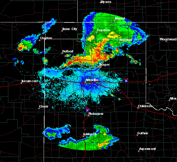 The national weather service in amarillo has issued a * severe thunderstorm warning for. northern carson county in the panhandle of texas. northwestern gray county in the panhandle of texas. southern hansford county in the panhandle of texas. Southeastern hartley county in the panhandle of texas. The national weather service in amarillo has issued a * severe thunderstorm warning for. northern carson county in the panhandle of texas. northwestern gray county in the panhandle of texas. southern hansford county in the panhandle of texas. Southeastern hartley county in the panhandle of texas.
|
| 7/3/2015 8:05 PM CDT |
 At 801 pm cdt, a severe thunderstorm was located near borger, and moving south at 30 mph (radar indicated). Hazards include 70 mph wind gusts and quarter size hail. Hail damage to vehicles is expected. expect some tree damage. Wind damage is also likely to mobile homes, roofs and outbuildings. At 801 pm cdt, a severe thunderstorm was located near borger, and moving south at 30 mph (radar indicated). Hazards include 70 mph wind gusts and quarter size hail. Hail damage to vehicles is expected. expect some tree damage. Wind damage is also likely to mobile homes, roofs and outbuildings.
|
| 7/3/2015 7:54 PM CDT |
 At 754 pm cdt, a severe thunderstorm was located near borger, and moving south at 30 mph (radar indicated). Hazards include 70 mph wind gusts and quarter size hail. Hail damage to vehicles is expected. expect some tree damage. Wind damage is also likely to mobile homes, roofs and outbuildings. At 754 pm cdt, a severe thunderstorm was located near borger, and moving south at 30 mph (radar indicated). Hazards include 70 mph wind gusts and quarter size hail. Hail damage to vehicles is expected. expect some tree damage. Wind damage is also likely to mobile homes, roofs and outbuildings.
|
| 7/3/2015 7:26 PM CDT |
 At 722 pm cdt, a severe thunderstorm was located 7 miles east of stinnett, and moving south at 45 mph (radar indicated). Hazards include 70 mph wind gusts and quarter size hail. Hail damage to vehicles is expected. expect some tree damage. Wind damage is also likely to mobile homes, roofs and outbuildings. At 722 pm cdt, a severe thunderstorm was located 7 miles east of stinnett, and moving south at 45 mph (radar indicated). Hazards include 70 mph wind gusts and quarter size hail. Hail damage to vehicles is expected. expect some tree damage. Wind damage is also likely to mobile homes, roofs and outbuildings.
|
| 7/2/2015 9:58 PM CDT |
 At 955 pm cdt, a severe thunderstorm was located 6 miles northeast of panhandle, and moving south at 20 mph (radar indicated). Hazards include 60 mph wind gusts and penny size hail. Minor damage to roofs. Siding and trees is possible. At 955 pm cdt, a severe thunderstorm was located 6 miles northeast of panhandle, and moving south at 20 mph (radar indicated). Hazards include 60 mph wind gusts and penny size hail. Minor damage to roofs. Siding and trees is possible.
|
| 6/12/2015 1:40 AM CDT |
 At 137 am cdt, severe thunderstorms were located along a line extending from glazier to miami to 10 miles north of panhandle, and moving east at 25 mph (radar indicated). Hazards include 60 mph wind gusts and quarter size hail. Hail damage to vehicles is expected. Minor wind damage to roofs, siding and trees is possible. At 137 am cdt, severe thunderstorms were located along a line extending from glazier to miami to 10 miles north of panhandle, and moving east at 25 mph (radar indicated). Hazards include 60 mph wind gusts and quarter size hail. Hail damage to vehicles is expected. Minor wind damage to roofs, siding and trees is possible.
|
| 6/12/2015 1:20 AM CDT |
 At 118 am cdt, severe thunderstorms were located along a line extending from 11 miles northwest of canadian to codman to 7 miles west of skellytown, and moving east at 25 mph. quarter size hail was reported in skellytown (radar indicated). Hazards include 60 mph wind gusts and quarter size hail. Hail damage to vehicles is expected. Minor wind damage to roofs, siding and trees is possible. At 118 am cdt, severe thunderstorms were located along a line extending from 11 miles northwest of canadian to codman to 7 miles west of skellytown, and moving east at 25 mph. quarter size hail was reported in skellytown (radar indicated). Hazards include 60 mph wind gusts and quarter size hail. Hail damage to vehicles is expected. Minor wind damage to roofs, siding and trees is possible.
|
| 6/12/2015 1:10 AM CDT |
 At 107 am cdt, severe thunderstorms were located along a line extending from 13 miles south of wolf creek park to 9 miles northwest of codman to 10 miles north of panhandle, and moving east at 20 mph (radar indicated). Hazards include 60 mph wind gusts and quarter size hail. Hail damage to vehicles is expected. Minor wind damage to roofs, siding and trees is possible. At 107 am cdt, severe thunderstorms were located along a line extending from 13 miles south of wolf creek park to 9 miles northwest of codman to 10 miles north of panhandle, and moving east at 20 mph (radar indicated). Hazards include 60 mph wind gusts and quarter size hail. Hail damage to vehicles is expected. Minor wind damage to roofs, siding and trees is possible.
|
| 5/27/2015 5:29 PM CDT | At 527 pm cdt, a severe thunderstorm was located near kingsmill, and moving northeast at 30 mph (radar indicated). Hazards include 60 mph wind gusts and half dollar size hail. Hail damage to vehicles is expected. Minor wind damage to roofs, siding and trees is possible. |
| 5/27/2015 5:11 PM CDT | At 508 pm cdt, a severe thunderstorm was located 6 miles south of white deer, and moving northeast at 30 mph (radar indicated). Hazards include quarter size hail. damage to vehicles is expected |
| 5/27/2015 4:47 PM CDT | At 443 pm cdt, a severe thunderstorm was located 6 miles northeast of claude, and moving northeast at 35 mph (radar indicated). Hazards include up to tennis ball size hail and 60 mph wind gusts. People and animals outdoors will be injured. expect hail damage to roofs, siding, windows and vehicles. Minor wind damage to roofs, siding and trees is possible. |
| 5/23/2015 6:15 AM CDT | At 615 am cdt, severe thunderstorms were located along a line extending from 18 miles north of pampa to 7 miles north of pampa to 6 miles southeast of white deer, and moving east at 50 mph (radar indicated). Hazards include 60 mph wind gusts and quarter size hail. Hail damage to vehicles is expected. Minor wind damage to roofs, siding and trees is possible. |
| 5/23/2015 5:53 AM CDT | At 554 am cdt, severe thunderstorms were located along a line extending from 8 miles southeast of stinnett to skellytown to panhandle, and moving east at 50 mph (radar indicated). Hazards include 60 mph wind gusts and quarter size hail. Hail damage to vehicles is expected. Minor wind damage to roofs, siding and trees is possible. |
| 5/23/2015 5:43 AM CDT | At 543 am cdt, severe thunderstorms were located along a line extending from 5 miles south of stinnett to 5 miles south of borger to 7 miles west of panhandle, and moving east at 50 mph (radar indicated). Hazards include 60 mph wind gusts and quarter size hail. Hail damage to vehicles is expected. Minor wind damage to roofs, siding and trees is possible. |
| 5/16/2015 3:23 PM CDT | At 316 pm cdt, a severe thunderstorm was located 7 miles north of claude, and moving northeast at 45 mph (radar indicated). Hazards include golf ball size hail and 60 mph wind gusts. People and animals outdoors will be injured. expect hail damage to roofs, siding, windows and vehicles. minor wind damage to roofs, siding and trees is possible. the severe thunderstorm will be near, white deer around 340 pm cdt. kingsmill around 350 pm cdt. skellytown around 355 pm cdt. pampa around 400 pm cdt. 1. 75in. |
| 5/9/2015 7:25 AM CDT | The severe thunderstorm warning for north central armstrong, eastern carson and west central gray counties will expire at 730 am cdt, the storm which prompted the warning has weakened below severe limits, and no longer poses an immediate threat to life or property. however, hail up to nickel size, gusty winds to 50 mph and heavy rain are still possible with this thunderstorm. |
| 5/9/2015 7:17 AM CDT | At 713 am cdt, a severe thunderstorm was located 8 miles northwest of groom, and moving north at 35 mph (radar indicated). Hazards include 60 mph wind gusts and up to quarter size hail. Hail damage to vehicles is expected. Minor wind damage to roofs, siding and trees is possible. |
| 5/9/2015 6:50 AM CDT | At 649 am cdt, a severe thunderstorm was located near claude, and moving north at 35 mph (radar indicated). Hazards include 60 mph wind gusts and quarter size hail. Hail damage to vehicles is expected. Minor wind damage to roofs, siding and trees is possible. |
| 5/9/2015 6:28 AM CDT | At 627 am cdt, a severe thunderstorm was located 12 miles northeast of wayside, and moving north at 35 mph (radar indicated). Hazards include 60 mph wind gusts and half dollar size hail. Hail damage to vehicles is expected. Minor wind damage to roofs, siding and trees is possible. |
| 5/3/2015 7:49 PM CDT | At 746 pm cdt, severe thunderstorms were located along a line extending from 7 miles southeast of borger to 10 miles north of claude, and moving northeast at 20 mph (radar indicated). Hazards include 60 mph wind gusts and quarter size hail. Hail damage to vehicles is expected. Minor wind damage to roofs, siding and trees is possible. |
| 5/3/2015 7:31 PM CDT | At 730 pm cdt, severe thunderstorms were located along a line extending from 8 miles south of borger to claude, and moving northeast at 25 mph (radar indicated). Hazards include 60 mph wind gusts and quarter size hail. Hail damage to vehicles is expected. Minor wind damage to roofs, siding and trees is possible. |
| 4/16/2015 4:53 PM CDT | At 451 pm cdt, severe thunderstorms were located along a line extending from 18 miles northwest of codman to groom, and moving east at 30 mph (radar indicated). Hazards include 60 mph wind gusts and half dollar size hail. Hail damage to vehicles is expected. Minor wind damage to roofs, siding and trees is possible. |
| 4/16/2015 4:33 PM CDT | At 429 pm cdt, severe thunderstorms were located along a line extending from 16 miles northeast of skellytown to 9 miles northeast of claude, and moving northeast at 30 mph (radar indicated). Hazards include hail up to tennis ball size and 60 mph wind gusts. People and animals outdoors will be injured. expect hail damage to roofs, siding, windows and vehicles. Minor wind damage to roofs, siding and trees is possible. |
| 4/16/2015 4:12 PM CDT | At 411 pm cdt, severe thunderstorms were located along a line extending from 10 miles north of skellytown to panhandle, and moving northeast at 30 mph (radar indicated). Hazards include ping pong ball size hail and 60 mph wind gusts. People and animals outdoors will be injured. expect hail damage to roofs, siding, windows and vehicles. Minor wind damage to roofs, siding and trees is possible. |
| 4/16/2015 4:02 PM CDT | At 400 pm cdt, a severe thunderstorm was located near panhandle, and moving northeast at 25 mph (radar indicated). Hazards include 60 mph wind gusts and quarter size hail. Hail damage to vehicles is expected. Minor wind damage to roofs, siding and trees is possible. |
| 4/16/2015 3:47 PM CDT | At 344 pm cdt, a severe thunderstorm was located 8 miles southwest of panhandle, and moving northeast at 30 mph (radar indicated). Hazards include 60 mph wind gusts and quarter size hail. Hail damage to vehicles is expected. Minor wind damage to roofs, siding and trees is possible. |
| 4/11/2015 8:02 PM CDT | Hen Egg sized hail reported 6.6 miles W of White Deer, TX, measured 1.92 inches |
| 4/11/2015 7:51 PM CDT | Tennis Ball sized hail reported 0.4 miles NW of White Deer, TX, report of golf ball to tennis ball size hail |
| 4/11/2015 7:45 PM CDT | Golf Ball sized hail reported 0.4 miles NW of White Deer, TX |
| 4/11/2015 7:42 PM CDT | Golf Ball sized hail reported 0.4 miles NW of White Deer, TX |
| 4/11/2015 7:40 PM CDT | A tornado warning remains in effect for eastern carson and southwestern gray counties until 800 pm cdt. at 739 pm cdt. a severe thunderstorm capable of producing a tornado was located near white deer. and moving southeast at 30 mph. hazard. tornado and golf ball size hail. source. Radar indicated rotation. |
| 4/11/2015 7:29 PM CDT | A tornado warning remains in effect for carson and southwestern gray counties until 800 pm cdt. at 729 pm cdt. a severe thunderstorm capable of producing a tornado was located 8 miles north of panhandle. and moving southeast at 30 mph. hazard. Tornado and golf ball size hail. |
| 4/11/2015 7:22 PM CDT | Golf Ball sized hail reported 4.8 miles SE of White Deer, TX |
| 4/11/2015 7:17 PM CDT | The national weather service in amarillo has issued a * tornado warning for. carson county in the panhandle of texas. southwestern gray county in the panhandle of texas. until 800 pm cdt * at 716 pm cdt. A severe thunderstorm capable of producing a. |
| 4/11/2015 7:04 PM CDT | A tornado warning remains in effect for northern carson county until 715 pm cdt. at 701 pm cdt. a severe thunderstorm capable of producing a tornado was located 9 miles southeast of fritch. and moving east at 35 mph. hazard. tornado and golf ball size hail. source. Weather spotters reported funnel cloud and rapid storm. |
| 4/11/2015 6:45 PM CDT | A tornado warning remains in effect for northern carson and northeastern potter counties until 715 pm cdt. at 644 pm cdt. a severe thunderstorm capable of producing a tornado was located 10 miles south of fritch. and moving southeast at 40 mph. hazard. Tornado. |
| 4/11/2015 6:31 PM CDT | The national weather service in amarillo has issued a * tornado warning for. northern carson county in the panhandle of texas. northeastern potter county in the panhandle of texas. until 715 pm cdt * at 630 pm cdt. A severe thunderstorm capable of producing a. |
| 10/12/2014 6:40 PM CDT | Storm damage reported in carson county TX, 6.9 miles NNW of White Deer, TX |
| 10/9/2014 8:36 PM CDT | Baseball sized hail reported 0.4 miles NW of White Deer, TX |
| 6/19/2013 6:13 AM CDT | Golf Ball sized hail reported 5.9 miles S of White Deer, TX |
| 4/6/2012 8:31 PM CDT | Quarter sized hail reported 1.7 miles S of White Deer, TX, quarter size hail and 60 mph winds reported north of white deer |
| 4/6/2012 8:31 PM CDT | Quarter size hail and 60 mph winds reported north of white deer in carson county TX, 1.7 miles S of White Deer, TX |
| 1/1/0001 12:00 AM | White deer fd reported approximately 60 mph winds and pea size hail on co rd 15 and fm 294 in carson county TX, 0.4 miles NW of White Deer, TX |
Hail Maps for White Deer, TX

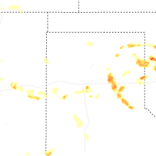


Connect with Interactive Hail Maps