

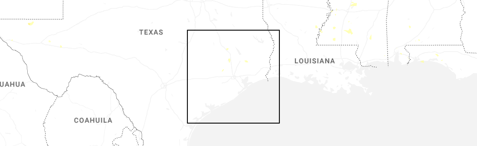
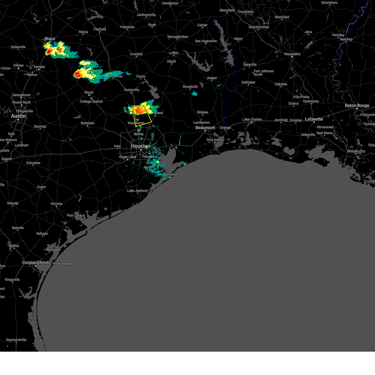
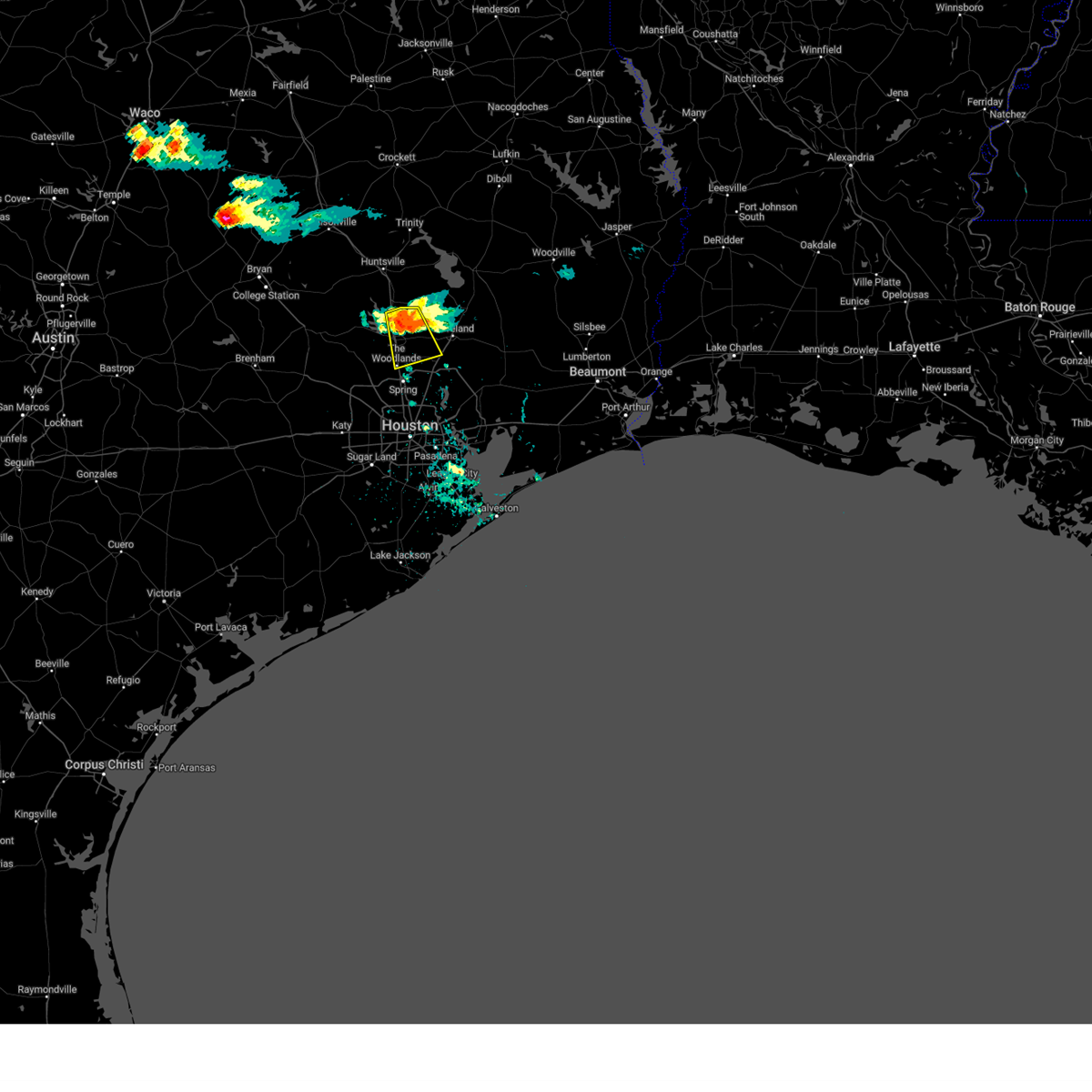
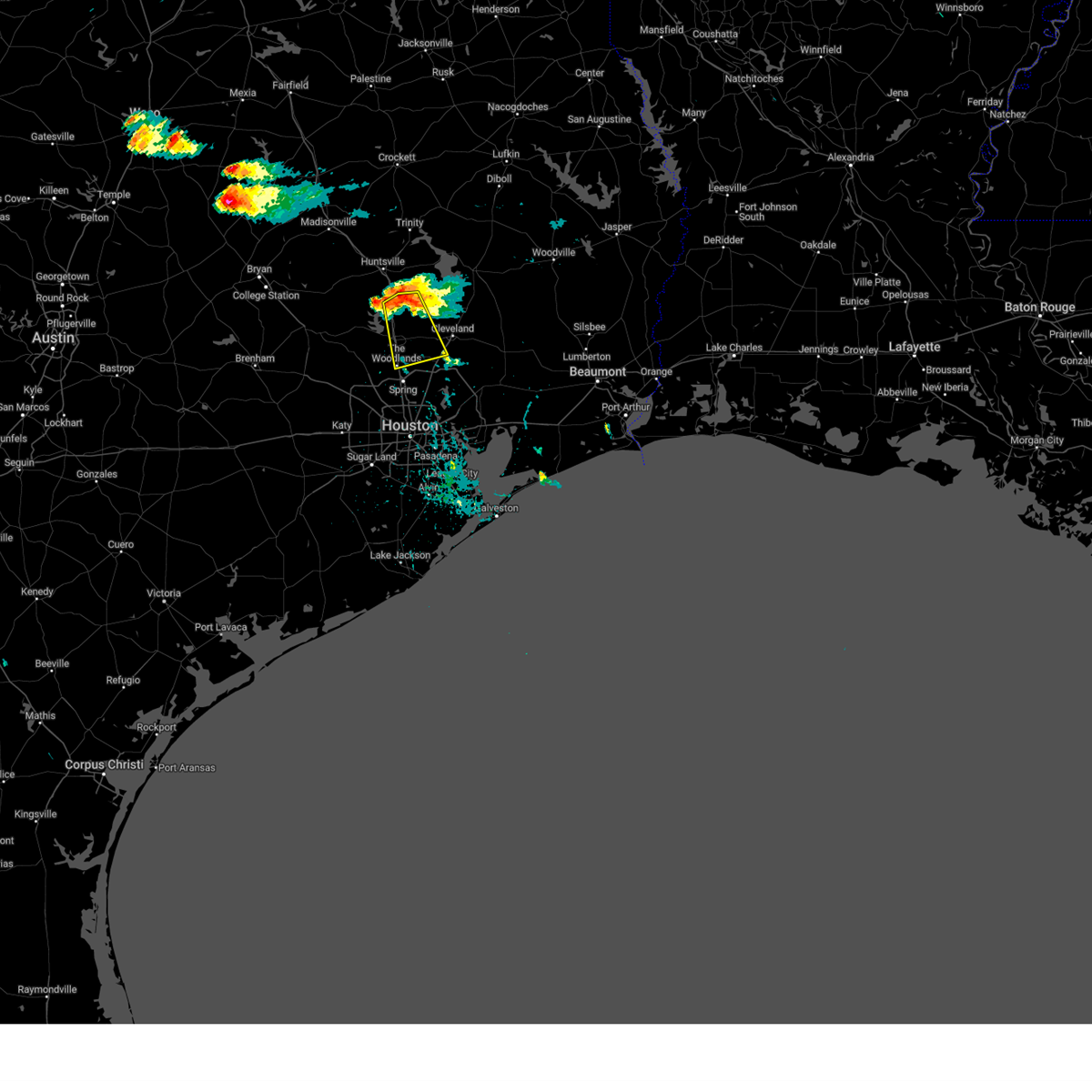
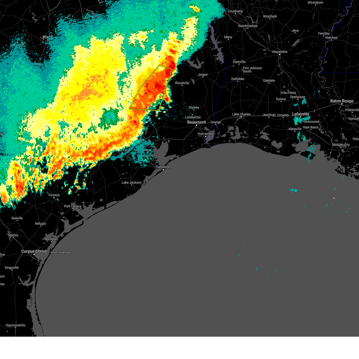
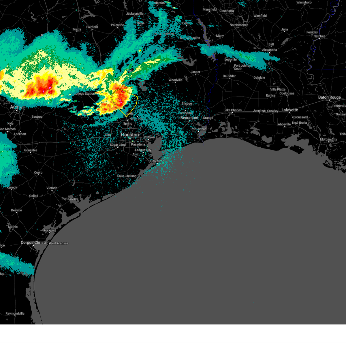
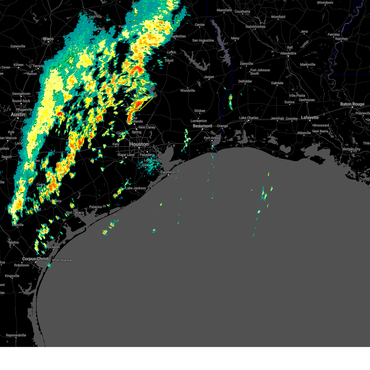
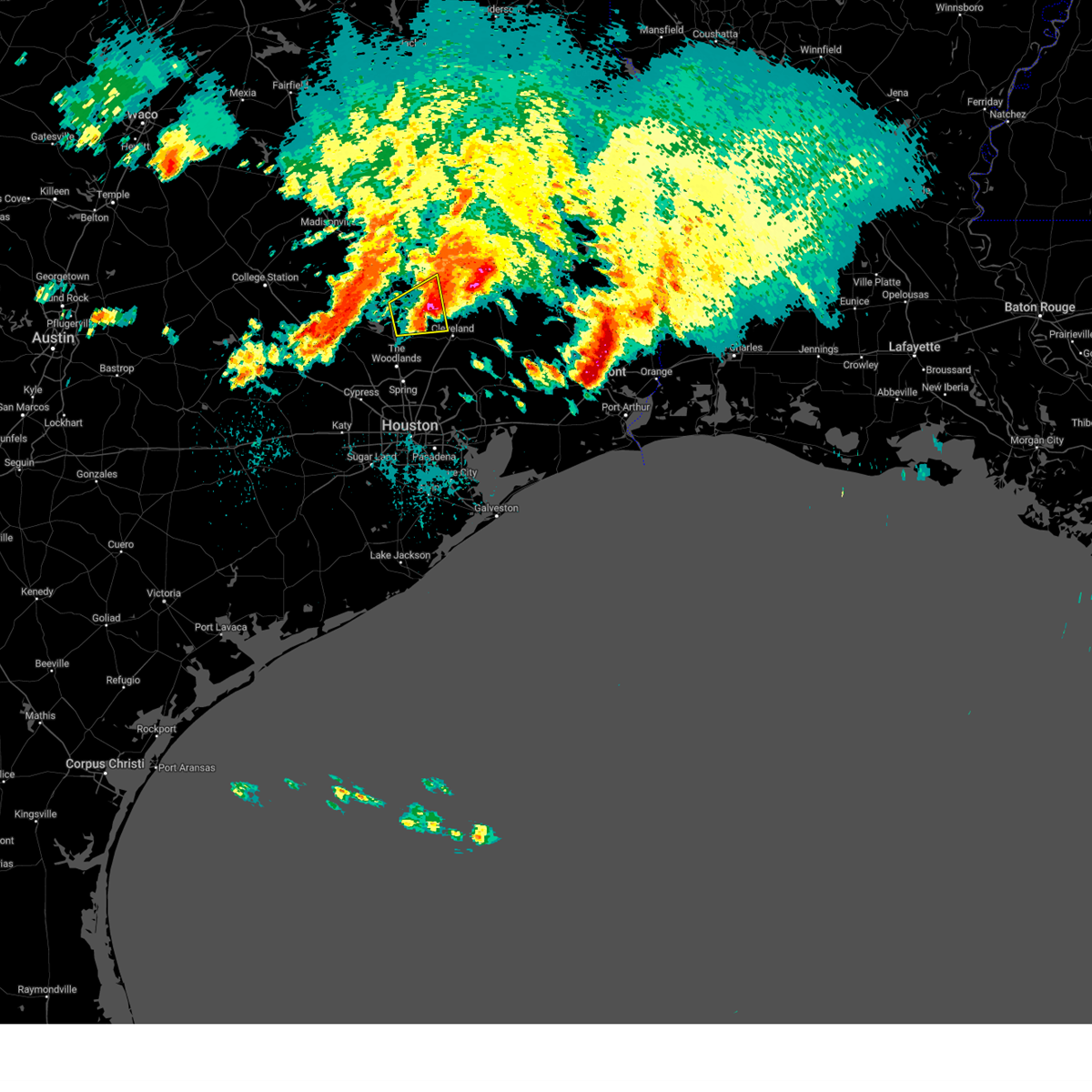
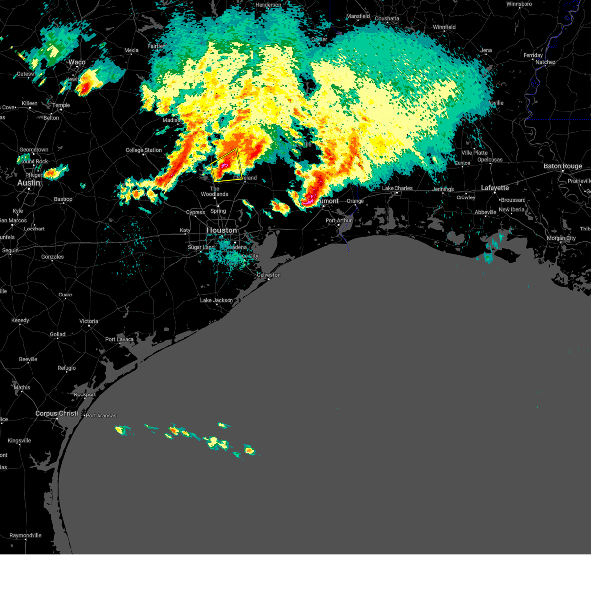
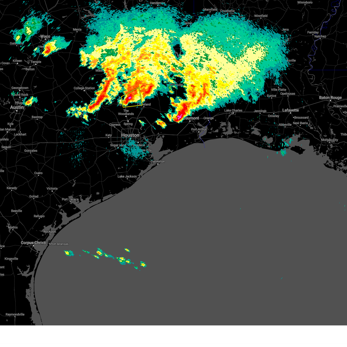
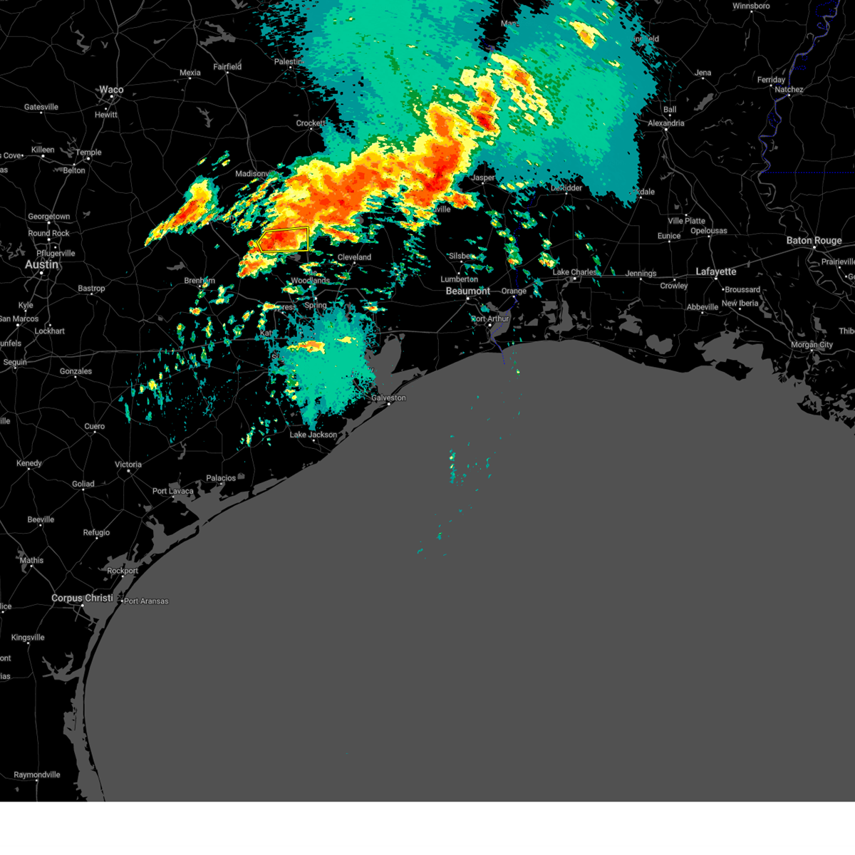
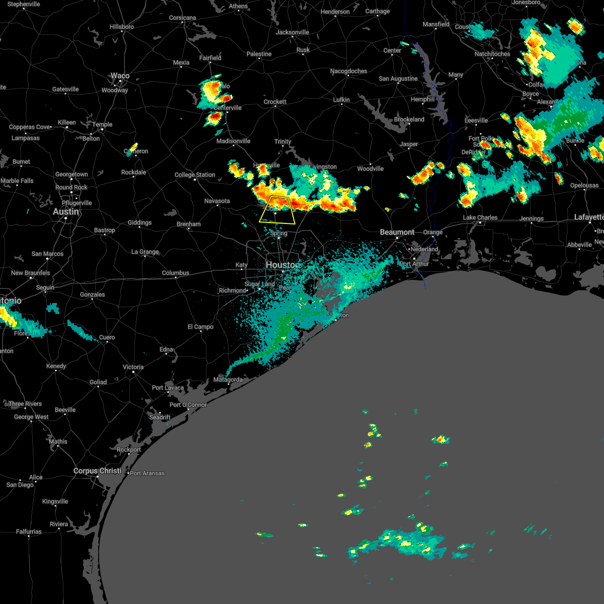
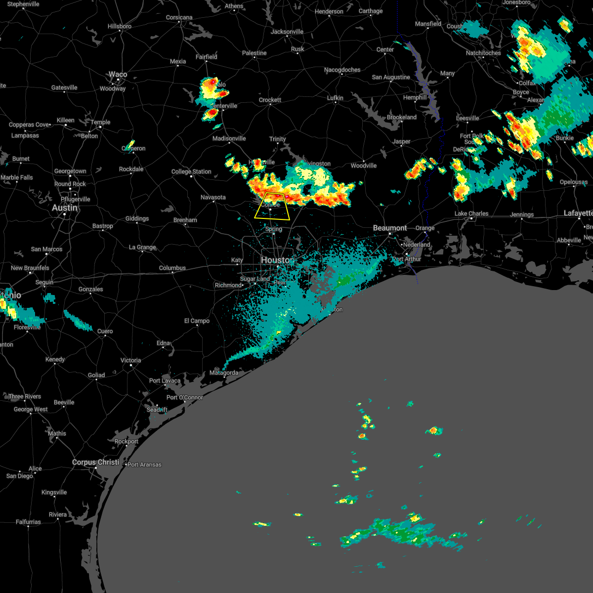
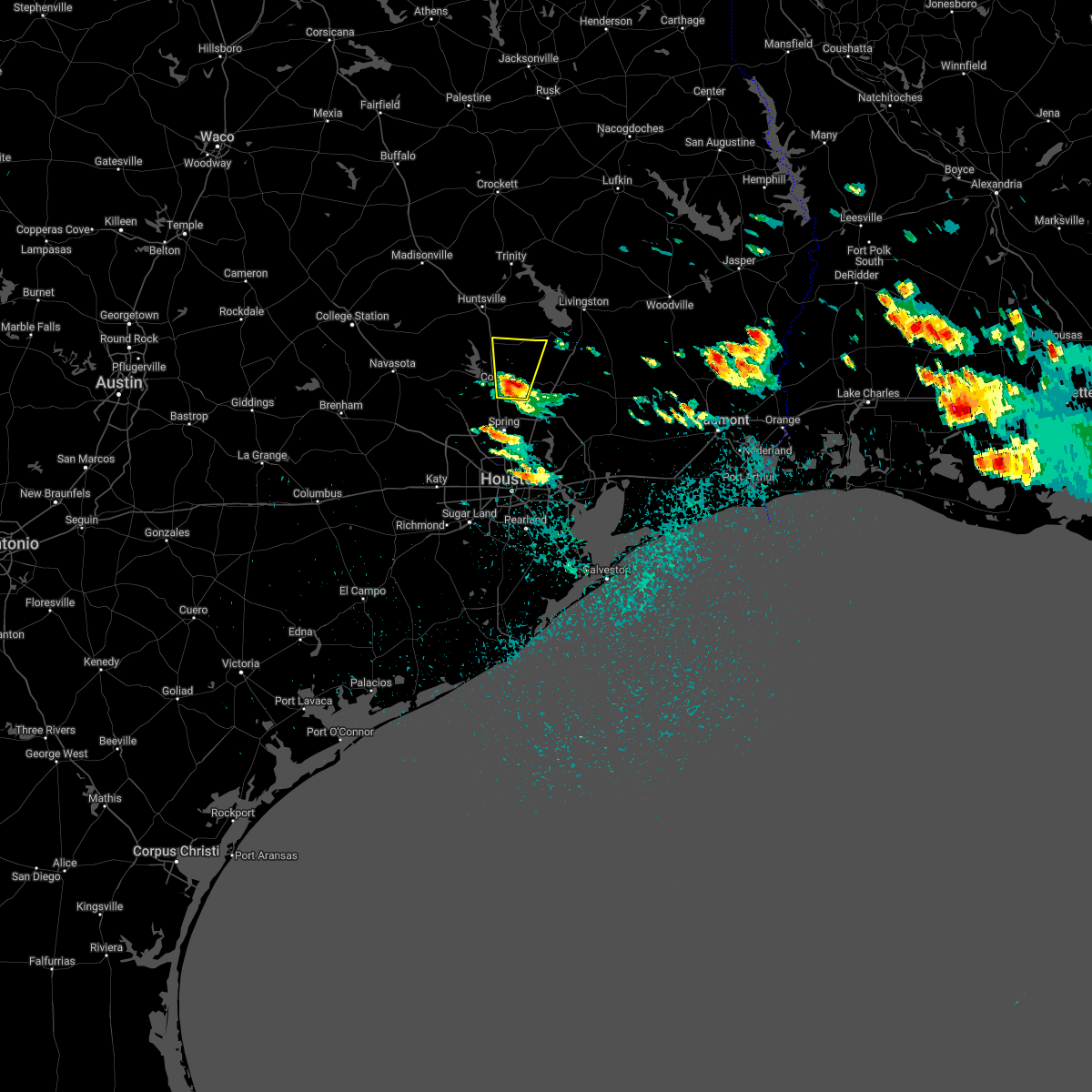
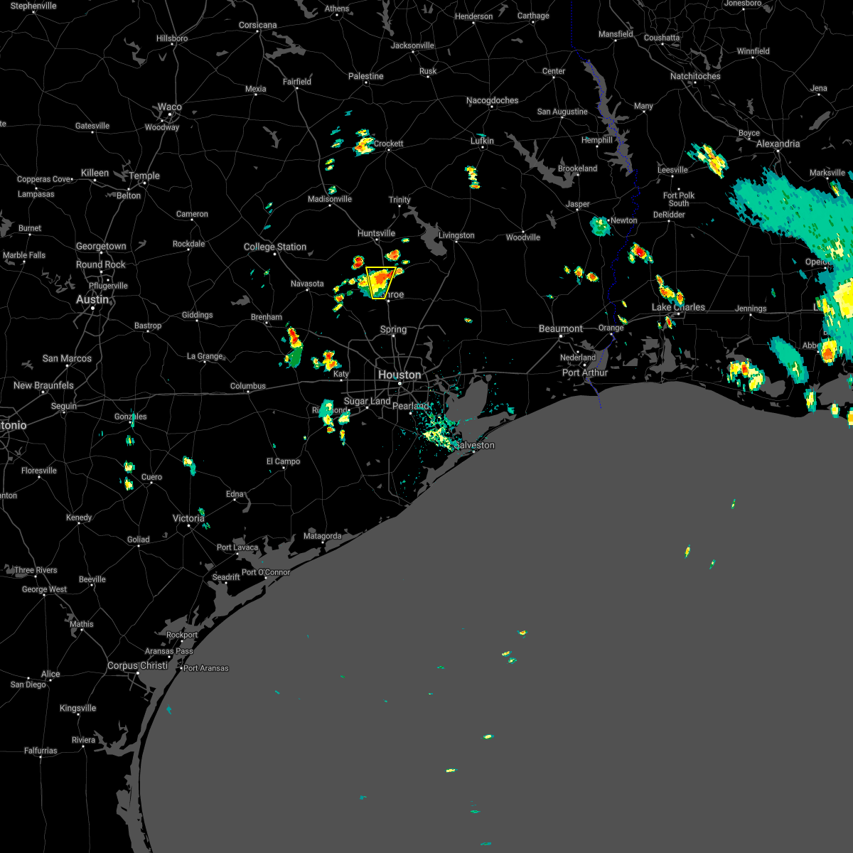
Hail Map for Willis, TX
The Willis, TX area has had 4 reports of on-the-ground hail by trained spotters, and has been under severe weather warnings 17 times during the past 12 months. Doppler radar has detected hail at or near Willis, TX on 52 occasions, including 8 occasions during the past year.
| Name: | Willis, TX |
| Where Located: | 46 miles N of Houston, TX |
| Map: | Google Map for Willis, TX |
| Population: | 5662 |
| Housing Units: | 2006 |
| More Info: | Search Google for Willis, TX |
0
The Top Recent Hail Date for Willis, TX is Monday, June 23, 2025 (23rd out of 52)
Hail and Wind Damage Spotted near Willis, TX
| Date / Time | Report Details |
|---|---|
| 6/1/2025 4:20 PM CDT |
 the severe thunderstorm warning has been cancelled and is no longer in effect the severe thunderstorm warning has been cancelled and is no longer in effect
|
| 6/1/2025 4:20 PM CDT |
 At 419 pm cdt, a severe thunderstorm was located near cut and shoot, or near willis, moving south at 25 mph (radar indicated). Hazards include 60 mph wind gusts. Expect damage to roofs, siding, and trees. Locations impacted include, conroe, willis, the woodlands, oak ridge north, panorama village, shenandoah, splendora, cut and shoot, woodloch, the woodlands pavillion, and chateau woods. At 419 pm cdt, a severe thunderstorm was located near cut and shoot, or near willis, moving south at 25 mph (radar indicated). Hazards include 60 mph wind gusts. Expect damage to roofs, siding, and trees. Locations impacted include, conroe, willis, the woodlands, oak ridge north, panorama village, shenandoah, splendora, cut and shoot, woodloch, the woodlands pavillion, and chateau woods.
|
| 6/1/2025 4:07 PM CDT |
 Svrhgx the national weather service in league city has issued a * severe thunderstorm warning for, central montgomery county in southeastern texas, southwestern san jacinto county in southeastern texas, southeastern walker county in southeastern texas, * until 430 pm cdt. * at 406 pm cdt, a severe thunderstorm was located near willis, moving south at 25 mph (radar indicated). Hazards include 60 mph wind gusts and penny size hail. expect damage to roofs, siding, and trees Svrhgx the national weather service in league city has issued a * severe thunderstorm warning for, central montgomery county in southeastern texas, southwestern san jacinto county in southeastern texas, southeastern walker county in southeastern texas, * until 430 pm cdt. * at 406 pm cdt, a severe thunderstorm was located near willis, moving south at 25 mph (radar indicated). Hazards include 60 mph wind gusts and penny size hail. expect damage to roofs, siding, and trees
|
| 5/27/2025 12:30 AM CDT |
 At 1230 am cdt, severe thunderstorms were located along a line extending from near chester to west livingston to near cut and shoot, moving east at 60 mph (radar indicated). Hazards include 60 mph wind gusts and penny size hail. Expect damage to roofs, siding, and trees. Locations impacted include, cleveland, willis, livingston, shepherd, onalaska, corrigan, cut and shoot, coldspring, point blank, goodrich, north cleveland, seven oaks, lake livingston state park, west livingston, leggett, moscow, and evergreen. At 1230 am cdt, severe thunderstorms were located along a line extending from near chester to west livingston to near cut and shoot, moving east at 60 mph (radar indicated). Hazards include 60 mph wind gusts and penny size hail. Expect damage to roofs, siding, and trees. Locations impacted include, cleveland, willis, livingston, shepherd, onalaska, corrigan, cut and shoot, coldspring, point blank, goodrich, north cleveland, seven oaks, lake livingston state park, west livingston, leggett, moscow, and evergreen.
|
| 5/26/2025 11:57 PM CDT |
 Svrhgx the national weather service in league city has issued a * severe thunderstorm warning for, southern trinity county in southeastern texas, northern montgomery county in southeastern texas, san jacinto county in southeastern texas, northwestern liberty county in southeastern texas, polk county in southeastern texas, walker county in southeastern texas, * until 1245 am cdt. * at 1157 pm cdt, severe thunderstorms were located along a line extending from huntsville to montgomery, moving east at 40 mph (radar indicated). Hazards include 60 mph wind gusts and penny size hail. expect damage to roofs, siding, and trees Svrhgx the national weather service in league city has issued a * severe thunderstorm warning for, southern trinity county in southeastern texas, northern montgomery county in southeastern texas, san jacinto county in southeastern texas, northwestern liberty county in southeastern texas, polk county in southeastern texas, walker county in southeastern texas, * until 1245 am cdt. * at 1157 pm cdt, severe thunderstorms were located along a line extending from huntsville to montgomery, moving east at 40 mph (radar indicated). Hazards include 60 mph wind gusts and penny size hail. expect damage to roofs, siding, and trees
|
| 5/26/2025 11:39 PM CDT |
 At 1139 pm cdt, severe thunderstorms were located along a line extending from 9 miles southwest of austonio to near addicks park ten, moving east at 40 mph (radar indicated). Hazards include 60 mph wind gusts. Expect damage to roofs, siding, and trees. Locations impacted include, northern conroe, willis, panorama village, cut and shoot, new waverly, montgomery, lake conroe dam, and dacus. At 1139 pm cdt, severe thunderstorms were located along a line extending from 9 miles southwest of austonio to near addicks park ten, moving east at 40 mph (radar indicated). Hazards include 60 mph wind gusts. Expect damage to roofs, siding, and trees. Locations impacted include, northern conroe, willis, panorama village, cut and shoot, new waverly, montgomery, lake conroe dam, and dacus.
|
| 5/26/2025 11:16 PM CDT |
 Svrhgx the national weather service in league city has issued a * severe thunderstorm warning for, southeastern grimes county in southeastern texas, northwestern montgomery county in southeastern texas, west central san jacinto county in southeastern texas, southeastern walker county in southeastern texas, * until midnight cdt. * at 1115 pm cdt, a severe thunderstorm was located near anderson, or 9 miles northeast of navasota, moving east at 40 mph (radar indicated). Hazards include 60 mph wind gusts. expect damage to roofs, siding, and trees Svrhgx the national weather service in league city has issued a * severe thunderstorm warning for, southeastern grimes county in southeastern texas, northwestern montgomery county in southeastern texas, west central san jacinto county in southeastern texas, southeastern walker county in southeastern texas, * until midnight cdt. * at 1115 pm cdt, a severe thunderstorm was located near anderson, or 9 miles northeast of navasota, moving east at 40 mph (radar indicated). Hazards include 60 mph wind gusts. expect damage to roofs, siding, and trees
|
| 5/1/2025 8:18 PM CDT |
 At 818 pm cdt, severe thunderstorms were located along a line extending from 8 miles southwest of point blank to 8 miles east of willis to near conroe, moving east at 35 mph (radar indicated). Hazards include 60 mph wind gusts. Expect damage to roofs, siding, and trees. Locations impacted include, conroe, willis, the woodlands, oak ridge north, panorama village, shenandoah, cut and shoot, new waverly, montgomery, woodloch, chateau woods, huntsville state park, and lake conroe dam. At 818 pm cdt, severe thunderstorms were located along a line extending from 8 miles southwest of point blank to 8 miles east of willis to near conroe, moving east at 35 mph (radar indicated). Hazards include 60 mph wind gusts. Expect damage to roofs, siding, and trees. Locations impacted include, conroe, willis, the woodlands, oak ridge north, panorama village, shenandoah, cut and shoot, new waverly, montgomery, woodloch, chateau woods, huntsville state park, and lake conroe dam.
|
| 5/1/2025 7:57 PM CDT |
 Svrhgx the national weather service in league city has issued a * severe thunderstorm warning for, central montgomery county in southeastern texas, southwestern san jacinto county in southeastern texas, southern walker county in southeastern texas, * until 830 pm cdt. * at 756 pm cdt, severe thunderstorms were located along a line extending from near huntsville state park to near new waverly to near lake conroe dam, moving southeast at 35 mph (radar indicated). Hazards include 60 mph wind gusts and penny size hail. expect damage to roofs, siding, and trees Svrhgx the national weather service in league city has issued a * severe thunderstorm warning for, central montgomery county in southeastern texas, southwestern san jacinto county in southeastern texas, southern walker county in southeastern texas, * until 830 pm cdt. * at 756 pm cdt, severe thunderstorms were located along a line extending from near huntsville state park to near new waverly to near lake conroe dam, moving southeast at 35 mph (radar indicated). Hazards include 60 mph wind gusts and penny size hail. expect damage to roofs, siding, and trees
|
| 5/1/2025 7:41 PM CDT | At 741 pm cdt, severe thunderstorms were located along a line extending from huntsville to 8 miles north of montgomery to 9 miles southeast of anderson, moving southeast at 35 mph (radar indicated). Hazards include 60 mph wind gusts and penny size hail. Expect damage to roofs, siding, and trees. Locations impacted include, huntsville, willis, new waverly, montgomery, huntsville state park, lake conroe dam, crabbs prairie, dobbin, richards, and dacus. |
| 5/1/2025 7:41 PM CDT | the severe thunderstorm warning has been cancelled and is no longer in effect |
| 5/1/2025 7:30 PM CDT |
 Svrhgx the national weather service in league city has issued a * severe thunderstorm warning for, northeastern grimes county in southeastern texas, northwestern montgomery county in southeastern texas, south central madison county in southeastern texas, southern walker county in southeastern texas, * until 800 pm cdt. * at 730 pm cdt, severe thunderstorms were located along a line extending from near huntsville to 12 miles west of huntsville state park to near anderson, moving southeast at 35 mph (radar indicated). Hazards include 60 mph wind gusts and penny size hail. expect damage to roofs, siding, and trees Svrhgx the national weather service in league city has issued a * severe thunderstorm warning for, northeastern grimes county in southeastern texas, northwestern montgomery county in southeastern texas, south central madison county in southeastern texas, southern walker county in southeastern texas, * until 800 pm cdt. * at 730 pm cdt, severe thunderstorms were located along a line extending from near huntsville to 12 miles west of huntsville state park to near anderson, moving southeast at 35 mph (radar indicated). Hazards include 60 mph wind gusts and penny size hail. expect damage to roofs, siding, and trees
|
| 12/28/2024 11:44 AM CST |
 Svrhgx the national weather service in league city has issued a * severe thunderstorm warning for, north central montgomery county in southeastern texas, northwestern san jacinto county in southeastern texas, southeastern walker county in southeastern texas, * until 1230 pm cst. * at 1144 am cst, a severe thunderstorm was located near willis, moving northeast at 35 mph (radar indicated). Hazards include 60 mph wind gusts and penny size hail. expect damage to roofs, siding, and trees Svrhgx the national weather service in league city has issued a * severe thunderstorm warning for, north central montgomery county in southeastern texas, northwestern san jacinto county in southeastern texas, southeastern walker county in southeastern texas, * until 1230 pm cst. * at 1144 am cst, a severe thunderstorm was located near willis, moving northeast at 35 mph (radar indicated). Hazards include 60 mph wind gusts and penny size hail. expect damage to roofs, siding, and trees
|
| 11/5/2024 3:24 AM CST |
 Svrhgx the national weather service in league city has issued a * severe thunderstorm warning for, north central montgomery county in southeastern texas, west central san jacinto county in southeastern texas, southeastern walker county in southeastern texas, * until 400 am cst. * at 324 am cst, a severe thunderstorm was located near willis, moving northeast at 35 mph (radar indicated). Hazards include 60 mph wind gusts and penny size hail. expect damage to roofs, siding, and trees Svrhgx the national weather service in league city has issued a * severe thunderstorm warning for, north central montgomery county in southeastern texas, west central san jacinto county in southeastern texas, southeastern walker county in southeastern texas, * until 400 am cst. * at 324 am cst, a severe thunderstorm was located near willis, moving northeast at 35 mph (radar indicated). Hazards include 60 mph wind gusts and penny size hail. expect damage to roofs, siding, and trees
|
| 11/5/2024 3:16 AM CST |
 At 316 am cst, a severe thunderstorm was located over willis, moving northeast at 35 mph (radar indicated). Hazards include 60 mph wind gusts. Expect damage to roofs, siding, and trees. Locations impacted include, northeastern conroe, willis, panorama village, and new waverly. At 316 am cst, a severe thunderstorm was located over willis, moving northeast at 35 mph (radar indicated). Hazards include 60 mph wind gusts. Expect damage to roofs, siding, and trees. Locations impacted include, northeastern conroe, willis, panorama village, and new waverly.
|
| 11/5/2024 3:06 AM CST |
 At 306 am cst, a severe thunderstorm was located over northwestern conroe, moving northeast at 35 mph (radar indicated). Hazards include 60 mph wind gusts. Expect damage to roofs, siding, and trees. Locations impacted include, conroe, willis, panorama village, cut and shoot, and new waverly. At 306 am cst, a severe thunderstorm was located over northwestern conroe, moving northeast at 35 mph (radar indicated). Hazards include 60 mph wind gusts. Expect damage to roofs, siding, and trees. Locations impacted include, conroe, willis, panorama village, cut and shoot, and new waverly.
|
| 11/5/2024 2:56 AM CST |
 Svrhgx the national weather service in league city has issued a * severe thunderstorm warning for, central montgomery county in southeastern texas, western san jacinto county in southeastern texas, southeastern walker county in southeastern texas, * until 330 am cst. * at 255 am cst, a severe thunderstorm was located near conroe, moving northeast at 35 mph (radar indicated). Hazards include 60 mph wind gusts. expect damage to roofs, siding, and trees Svrhgx the national weather service in league city has issued a * severe thunderstorm warning for, central montgomery county in southeastern texas, western san jacinto county in southeastern texas, southeastern walker county in southeastern texas, * until 330 am cst. * at 255 am cst, a severe thunderstorm was located near conroe, moving northeast at 35 mph (radar indicated). Hazards include 60 mph wind gusts. expect damage to roofs, siding, and trees
|
| 5/31/2024 6:22 AM CDT |
 Svrhgx the national weather service in league city has issued a * severe thunderstorm warning for, central trinity county in southeastern texas, east central colorado county in southeastern texas, northeastern wharton county in southeastern texas, southeastern austin county in southeastern texas, northwestern fort bend county in southeastern texas, central montgomery county in southeastern texas, western san jacinto county in southeastern texas, east central houston county in southeastern texas, southeastern waller county in southeastern texas, west central polk county in southeastern texas, southeastern walker county in southeastern texas, central harris county in southeastern texas, * until 645 am cdt. * at 621 am cdt, severe thunderstorms were located along a line extending from near point blank to near eagle lake, moving southeast at around 50 mph (radar indicated). Hazards include 60 mph wind gusts and penny size hail. expect damage to roofs, siding, and trees Svrhgx the national weather service in league city has issued a * severe thunderstorm warning for, central trinity county in southeastern texas, east central colorado county in southeastern texas, northeastern wharton county in southeastern texas, southeastern austin county in southeastern texas, northwestern fort bend county in southeastern texas, central montgomery county in southeastern texas, western san jacinto county in southeastern texas, east central houston county in southeastern texas, southeastern waller county in southeastern texas, west central polk county in southeastern texas, southeastern walker county in southeastern texas, central harris county in southeastern texas, * until 645 am cdt. * at 621 am cdt, severe thunderstorms were located along a line extending from near point blank to near eagle lake, moving southeast at around 50 mph (radar indicated). Hazards include 60 mph wind gusts and penny size hail. expect damage to roofs, siding, and trees
|
| 5/30/2024 7:12 PM CDT |
 Svrhgx the national weather service in league city has issued a * severe thunderstorm warning for, southern trinity county in southeastern texas, southeastern grimes county in southeastern texas, northwestern montgomery county in southeastern texas, northwestern san jacinto county in southeastern texas, polk county in southeastern texas, southeastern walker county in southeastern texas, * until 745 pm cdt. * at 711 pm cdt, severe thunderstorms were located along a line extending from 6 miles west of chester to 8 miles southwest of point blank to near navasota, moving southeast at 30 mph (radar indicated). Hazards include 60 mph wind gusts and quarter size hail. Hail damage to vehicles is expected. Expect wind damage to roofs, siding, and trees. Svrhgx the national weather service in league city has issued a * severe thunderstorm warning for, southern trinity county in southeastern texas, southeastern grimes county in southeastern texas, northwestern montgomery county in southeastern texas, northwestern san jacinto county in southeastern texas, polk county in southeastern texas, southeastern walker county in southeastern texas, * until 745 pm cdt. * at 711 pm cdt, severe thunderstorms were located along a line extending from 6 miles west of chester to 8 miles southwest of point blank to near navasota, moving southeast at 30 mph (radar indicated). Hazards include 60 mph wind gusts and quarter size hail. Hail damage to vehicles is expected. Expect wind damage to roofs, siding, and trees.
|
| 5/28/2024 12:26 PM CDT |
 Svrhgx the national weather service in league city has issued a * severe thunderstorm warning for, northwestern montgomery county in southeastern texas, south central walker county in southeastern texas, * until 100 pm cdt. * at 1225 pm cdt, a severe thunderstorm was located near montgomery, or 13 miles west of willis, moving southeast at 25 mph (radar indicated). Hazards include golf ball size hail and 70 mph wind gusts. People and animals outdoors will be injured. expect hail damage to roofs, siding, windows, and vehicles. expect considerable tree damage. Wind damage is also likely to mobile homes, roofs, and outbuildings. Svrhgx the national weather service in league city has issued a * severe thunderstorm warning for, northwestern montgomery county in southeastern texas, south central walker county in southeastern texas, * until 100 pm cdt. * at 1225 pm cdt, a severe thunderstorm was located near montgomery, or 13 miles west of willis, moving southeast at 25 mph (radar indicated). Hazards include golf ball size hail and 70 mph wind gusts. People and animals outdoors will be injured. expect hail damage to roofs, siding, windows, and vehicles. expect considerable tree damage. Wind damage is also likely to mobile homes, roofs, and outbuildings.
|
| 5/28/2024 12:12 PM CDT |
 Svrhgx the national weather service in league city has issued a * severe thunderstorm warning for, southwestern trinity county in southeastern texas, northwestern montgomery county in southeastern texas, san jacinto county in southeastern texas, southwestern polk county in southeastern texas, walker county in southeastern texas, * until 1245 pm cdt. * at 1209 pm cdt, severe thunderstorms were located along a line extending from sebastopol to near huntsville state park to 11 miles west of new waverly, moving southeast at 40 mph (radar indicated). Hazards include 70 mph wind gusts and quarter size hail. Hail damage to vehicles is expected. expect considerable tree damage. Wind damage is also likely to mobile homes, roofs, and outbuildings. Svrhgx the national weather service in league city has issued a * severe thunderstorm warning for, southwestern trinity county in southeastern texas, northwestern montgomery county in southeastern texas, san jacinto county in southeastern texas, southwestern polk county in southeastern texas, walker county in southeastern texas, * until 1245 pm cdt. * at 1209 pm cdt, severe thunderstorms were located along a line extending from sebastopol to near huntsville state park to 11 miles west of new waverly, moving southeast at 40 mph (radar indicated). Hazards include 70 mph wind gusts and quarter size hail. Hail damage to vehicles is expected. expect considerable tree damage. Wind damage is also likely to mobile homes, roofs, and outbuildings.
|
| 5/5/2024 6:25 AM CDT |
 The storms which prompted the warning have weakened below severe limits, and no longer pose an immediate threat to life or property. therefore, the warning will be allowed to expire. however, gusty winds are still possible with these thunderstorms. to report severe weather, contact your nearest law enforcement agency. they will relay your report to the national weather service league city. The storms which prompted the warning have weakened below severe limits, and no longer pose an immediate threat to life or property. therefore, the warning will be allowed to expire. however, gusty winds are still possible with these thunderstorms. to report severe weather, contact your nearest law enforcement agency. they will relay your report to the national weather service league city.
|
| 5/5/2024 5:44 AM CDT |
 Svrhgx the national weather service in league city has issued a * severe thunderstorm warning for, southwestern trinity county in southeastern texas, southeastern grimes county in southeastern texas, montgomery county in southeastern texas, san jacinto county in southeastern texas, southern houston county in southeastern texas, eastern madison county in southeastern texas, west central liberty county in southeastern texas, northeastern waller county in southeastern texas, west central polk county in southeastern texas, walker county in southeastern texas, northwestern harris county in southeastern texas, * until 630 am cdt. * at 543 am cdt, severe thunderstorms were located along a line extending from 14 miles east of madisonville to near hockley, moving east at 35 mph (radar indicated). Hazards include 60 mph wind gusts. expect damage to roofs, siding, and trees Svrhgx the national weather service in league city has issued a * severe thunderstorm warning for, southwestern trinity county in southeastern texas, southeastern grimes county in southeastern texas, montgomery county in southeastern texas, san jacinto county in southeastern texas, southern houston county in southeastern texas, eastern madison county in southeastern texas, west central liberty county in southeastern texas, northeastern waller county in southeastern texas, west central polk county in southeastern texas, walker county in southeastern texas, northwestern harris county in southeastern texas, * until 630 am cdt. * at 543 am cdt, severe thunderstorms were located along a line extending from 14 miles east of madisonville to near hockley, moving east at 35 mph (radar indicated). Hazards include 60 mph wind gusts. expect damage to roofs, siding, and trees
|
| 5/2/2024 6:06 AM CDT |
 The storm which prompted the warning has moved out of the area. therefore, the warning will be allowed to expire. The storm which prompted the warning has moved out of the area. therefore, the warning will be allowed to expire.
|
| 5/2/2024 5:46 AM CDT |
 At 546 am cdt, a severe thunderstorm was located 7 miles north of cut and shoot, or 8 miles east of willis, moving east at 35 mph (radar indicated). Hazards include 60 mph wind gusts and quarter size hail. Hail damage to vehicles is expected. expect wind damage to roofs, siding, and trees. Locations impacted include, northeastern conroe, willis, cut and shoot, new waverly, and evergreen. At 546 am cdt, a severe thunderstorm was located 7 miles north of cut and shoot, or 8 miles east of willis, moving east at 35 mph (radar indicated). Hazards include 60 mph wind gusts and quarter size hail. Hail damage to vehicles is expected. expect wind damage to roofs, siding, and trees. Locations impacted include, northeastern conroe, willis, cut and shoot, new waverly, and evergreen.
|
| 5/2/2024 5:41 AM CDT |
 Svrhgx the national weather service in league city has issued a * severe thunderstorm warning for, central montgomery county in southeastern texas, southwestern san jacinto county in southeastern texas, southeastern walker county in southeastern texas, * until 615 am cdt. * at 540 am cdt, a severe thunderstorm was located near willis, moving east at 35 mph (radar indicated). Hazards include quarter size hail. damage to vehicles is expected Svrhgx the national weather service in league city has issued a * severe thunderstorm warning for, central montgomery county in southeastern texas, southwestern san jacinto county in southeastern texas, southeastern walker county in southeastern texas, * until 615 am cdt. * at 540 am cdt, a severe thunderstorm was located near willis, moving east at 35 mph (radar indicated). Hazards include quarter size hail. damage to vehicles is expected
|
| 4/28/2024 11:16 PM CDT |
 At 1114 pm cdt, a severe thunderstorm was located 7 miles southwest of new waverly, or 8 miles northwest of willis, moving east at 40 mph (radar indicated). Hazards include 60 mph wind gusts and quarter size hail. Hail damage to vehicles is expected. expect wind damage to roofs, siding, and trees. Locations impacted include, willis, new waverly, richards, and dacus. At 1114 pm cdt, a severe thunderstorm was located 7 miles southwest of new waverly, or 8 miles northwest of willis, moving east at 40 mph (radar indicated). Hazards include 60 mph wind gusts and quarter size hail. Hail damage to vehicles is expected. expect wind damage to roofs, siding, and trees. Locations impacted include, willis, new waverly, richards, and dacus.
|
| 4/28/2024 11:02 PM CDT |
 Svrhgx the national weather service in league city has issued a * severe thunderstorm warning for, southeastern grimes county in southeastern texas, northwestern montgomery county in southeastern texas, south central walker county in southeastern texas, * until 1130 pm cdt. * at 1102 pm cdt, a severe thunderstorm was located near montgomery, or 15 miles west of willis, moving east at 35 mph (radar indicated). Hazards include 60 mph wind gusts and quarter size hail. Hail damage to vehicles is expected. Expect wind damage to roofs, siding, and trees. Svrhgx the national weather service in league city has issued a * severe thunderstorm warning for, southeastern grimes county in southeastern texas, northwestern montgomery county in southeastern texas, south central walker county in southeastern texas, * until 1130 pm cdt. * at 1102 pm cdt, a severe thunderstorm was located near montgomery, or 15 miles west of willis, moving east at 35 mph (radar indicated). Hazards include 60 mph wind gusts and quarter size hail. Hail damage to vehicles is expected. Expect wind damage to roofs, siding, and trees.
|
| 4/10/2024 4:02 AM CDT |
 the severe thunderstorm warning has been cancelled and is no longer in effect the severe thunderstorm warning has been cancelled and is no longer in effect
|
| 4/10/2024 3:41 AM CDT |
 Svrhgx the national weather service in league city has issued a * severe thunderstorm warning for, northeastern fort bend county in southeastern texas, montgomery county in southeastern texas, southern san jacinto county in southeastern texas, northwestern chambers county in southeastern texas, western liberty county in southeastern texas, south central polk county in southeastern texas, harris county in southeastern texas, * until 430 am cdt. * at 341 am cdt, severe thunderstorms were located along a line extending from near cut and shoot to humble to central southwest, moving northeast at 35 mph (radar indicated). Hazards include 60 mph wind gusts. expect damage to roofs, siding, and trees Svrhgx the national weather service in league city has issued a * severe thunderstorm warning for, northeastern fort bend county in southeastern texas, montgomery county in southeastern texas, southern san jacinto county in southeastern texas, northwestern chambers county in southeastern texas, western liberty county in southeastern texas, south central polk county in southeastern texas, harris county in southeastern texas, * until 430 am cdt. * at 341 am cdt, severe thunderstorms were located along a line extending from near cut and shoot to humble to central southwest, moving northeast at 35 mph (radar indicated). Hazards include 60 mph wind gusts. expect damage to roofs, siding, and trees
|
| 2/11/2024 10:13 AM CST |
 The tornado warning for east central grimes, northwestern montgomery and south central walker counties will expire at 1015 am cst, the storm which prompted the warning has moved out of the area. therefore, the warning will be allowed to expire. a tornado watch remains in effect until 300 pm cst for southeastern texas. The tornado warning for east central grimes, northwestern montgomery and south central walker counties will expire at 1015 am cst, the storm which prompted the warning has moved out of the area. therefore, the warning will be allowed to expire. a tornado watch remains in effect until 300 pm cst for southeastern texas.
|
| 2/11/2024 9:50 AM CST |
 At 950 am cst, a tornado producing storm was located near montgomery, or 17 miles west of willis, moving east at 40 mph (radar confirmed tornado). Hazards include damaging tornado and quarter size hail. Flying debris will be dangerous to those caught without shelter. mobile homes will be damaged or destroyed. damage to roofs, windows, and vehicles will occur. tree damage is likely. this tornadic storm will be near, montgomery around 955 am cst. willis around 1005 am cst. Other locations impacted by this tornadic thunderstorm include dacus. At 950 am cst, a tornado producing storm was located near montgomery, or 17 miles west of willis, moving east at 40 mph (radar confirmed tornado). Hazards include damaging tornado and quarter size hail. Flying debris will be dangerous to those caught without shelter. mobile homes will be damaged or destroyed. damage to roofs, windows, and vehicles will occur. tree damage is likely. this tornadic storm will be near, montgomery around 955 am cst. willis around 1005 am cst. Other locations impacted by this tornadic thunderstorm include dacus.
|
| 2/11/2024 9:41 AM CST |
 At 941 am cst, a severe thunderstorm capable of producing a tornado was located 8 miles southeast of anderson, or 13 miles east of navasota, moving east at 40 mph (radar indicated rotation). Hazards include tornado. Flying debris will be dangerous to those caught without shelter. mobile homes will be damaged or destroyed. damage to roofs, windows, and vehicles will occur. tree damage is likely. this dangerous storm will be near, montgomery around 945 am cst. willis around 1005 am cst. Other locations impacted by this tornadic thunderstorm include dacus. At 941 am cst, a severe thunderstorm capable of producing a tornado was located 8 miles southeast of anderson, or 13 miles east of navasota, moving east at 40 mph (radar indicated rotation). Hazards include tornado. Flying debris will be dangerous to those caught without shelter. mobile homes will be damaged or destroyed. damage to roofs, windows, and vehicles will occur. tree damage is likely. this dangerous storm will be near, montgomery around 945 am cst. willis around 1005 am cst. Other locations impacted by this tornadic thunderstorm include dacus.
|
| 10/26/2023 6:56 PM CDT |
 The tornado warning for central montgomery county will expire at 700 pm cdt, the storm which prompted the warning has weakened below severe limits, and has exited the warned area. therefore, the warning will be allowed to expire. The tornado warning for central montgomery county will expire at 700 pm cdt, the storm which prompted the warning has weakened below severe limits, and has exited the warned area. therefore, the warning will be allowed to expire.
|
| 10/26/2023 6:54 PM CDT |
 At 653 pm cdt, a severe thunderstorm capable of producing a tornado was located over northwestern conroe, moving east at 20 mph (radar indicated rotation). Hazards include tornado. Flying debris will be dangerous to those caught without shelter. mobile homes will be damaged or destroyed. damage to roofs, windows, and vehicles will occur. tree damage is likely. This dangerous storm will be near, eastern conroe and willis around 700 pm cdt. At 653 pm cdt, a severe thunderstorm capable of producing a tornado was located over northwestern conroe, moving east at 20 mph (radar indicated rotation). Hazards include tornado. Flying debris will be dangerous to those caught without shelter. mobile homes will be damaged or destroyed. damage to roofs, windows, and vehicles will occur. tree damage is likely. This dangerous storm will be near, eastern conroe and willis around 700 pm cdt.
|
| 10/26/2023 6:40 PM CDT |
 At 640 pm cdt, a severe thunderstorm capable of producing a tornado was located over lake conroe dam, or near conroe, moving east at 25 mph (radar indicated rotation). Hazards include tornado. Flying debris will be dangerous to those caught without shelter. mobile homes will be damaged or destroyed. damage to roofs, windows, and vehicles will occur. tree damage is likely. This dangerous storm will be near, conroe, willis, and panorama village around 645 pm cdt. At 640 pm cdt, a severe thunderstorm capable of producing a tornado was located over lake conroe dam, or near conroe, moving east at 25 mph (radar indicated rotation). Hazards include tornado. Flying debris will be dangerous to those caught without shelter. mobile homes will be damaged or destroyed. damage to roofs, windows, and vehicles will occur. tree damage is likely. This dangerous storm will be near, conroe, willis, and panorama village around 645 pm cdt.
|
| 6/21/2023 8:21 PM CDT |
 At 819 pm cdt, a severe thunderstorm was located over western conroe, moving southeast at 55 mph. there have been no reports of strong damaging winds yet with this warning, but wind gusts to 60 mph are still possible (radar indicated). Hazards include 60 mph wind gusts and nickel size hail. Expect damage to roofs, siding, and trees. locations impacted include, conroe, western huntsville, willis, pinehurst, the woodlands, panorama village, shenandoah, magnolia, cut and shoot, new waverly, montgomery, anderson, woodloch, todd mission, huntsville state park, lake conroe dam, crabbs prairie, dobbin, dacus and plantersville. hail threat, radar indicated max hail size, 0. 88 in wind threat, radar indicated max wind gust, 60 mph. At 819 pm cdt, a severe thunderstorm was located over western conroe, moving southeast at 55 mph. there have been no reports of strong damaging winds yet with this warning, but wind gusts to 60 mph are still possible (radar indicated). Hazards include 60 mph wind gusts and nickel size hail. Expect damage to roofs, siding, and trees. locations impacted include, conroe, western huntsville, willis, pinehurst, the woodlands, panorama village, shenandoah, magnolia, cut and shoot, new waverly, montgomery, anderson, woodloch, todd mission, huntsville state park, lake conroe dam, crabbs prairie, dobbin, dacus and plantersville. hail threat, radar indicated max hail size, 0. 88 in wind threat, radar indicated max wind gust, 60 mph.
|
| 6/21/2023 7:55 PM CDT |
 At 754 pm cdt, a severe thunderstorm was located 11 miles north of montgomery, or 16 miles southwest of huntsville, moving southeast at 55 mph (radar indicated). Hazards include 60 mph wind gusts and nickel size hail. expect damage to roofs, siding, and trees At 754 pm cdt, a severe thunderstorm was located 11 miles north of montgomery, or 16 miles southwest of huntsville, moving southeast at 55 mph (radar indicated). Hazards include 60 mph wind gusts and nickel size hail. expect damage to roofs, siding, and trees
|
| 6/10/2023 8:20 PM CDT |
 At 819 pm cdt, severe thunderstorms were located along a line extending from near chester to near coldspring to 7 miles north of montgomery, moving southeast at 30 mph. this line of storms has a history of producing strong damaging winds in the huntsville area (radar indicated). Hazards include 60 mph wind gusts and nickel size hail. expect damage to roofs, siding, and trees At 819 pm cdt, severe thunderstorms were located along a line extending from near chester to near coldspring to 7 miles north of montgomery, moving southeast at 30 mph. this line of storms has a history of producing strong damaging winds in the huntsville area (radar indicated). Hazards include 60 mph wind gusts and nickel size hail. expect damage to roofs, siding, and trees
|
| 6/4/2023 1:04 AM CDT |
 At 104 am cdt, severe thunderstorms were located along a line extending from 11 miles east of anderson to near montgomery to near pinehurst to hockley, moving southeast at 30 mph (radar indicated). Hazards include 60 mph wind gusts. Expect damage to roofs, siding, and trees. locations impacted include, conroe, tomball, willis, pinehurst, the woodlands, spring, oak ridge north, panorama village, shenandoah, magnolia, cut and shoot, new waverly, montgomery, stagecoach, woodloch, the woodlands pavillion, hooks airport, chateau woods, splashtown and lake conroe dam. hail threat, radar indicated max hail size, <. 75 in wind threat, radar indicated max wind gust, 60 mph. At 104 am cdt, severe thunderstorms were located along a line extending from 11 miles east of anderson to near montgomery to near pinehurst to hockley, moving southeast at 30 mph (radar indicated). Hazards include 60 mph wind gusts. Expect damage to roofs, siding, and trees. locations impacted include, conroe, tomball, willis, pinehurst, the woodlands, spring, oak ridge north, panorama village, shenandoah, magnolia, cut and shoot, new waverly, montgomery, stagecoach, woodloch, the woodlands pavillion, hooks airport, chateau woods, splashtown and lake conroe dam. hail threat, radar indicated max hail size, <. 75 in wind threat, radar indicated max wind gust, 60 mph.
|
| 6/4/2023 12:43 AM CDT |
 At 1243 am cdt, severe thunderstorms were located along a line extending from 12 miles northeast of anderson to 6 miles west of montgomery to near todd mission to hockley, moving east at 15 mph (radar indicated). Hazards include 60 mph wind gusts and penny size hail. expect damage to roofs, siding, and trees At 1243 am cdt, severe thunderstorms were located along a line extending from 12 miles northeast of anderson to 6 miles west of montgomery to near todd mission to hockley, moving east at 15 mph (radar indicated). Hazards include 60 mph wind gusts and penny size hail. expect damage to roofs, siding, and trees
|
| 5/23/2023 3:29 PM CDT |
 At 328 pm cdt, a severe thunderstorm was located over panorama village, or near willis, moving southeast at 25 mph (radar indicated). Hazards include 70 mph wind gusts and penny size hail. Expect considerable tree damage. damage is likely to mobile homes, roofs, and outbuildings. locations impacted include, northern conroe, willis, panorama village, new waverly and lake conroe dam. thunderstorm damage threat, considerable hail threat, radar indicated max hail size, 0. 75 in wind threat, radar indicated max wind gust, 70 mph. At 328 pm cdt, a severe thunderstorm was located over panorama village, or near willis, moving southeast at 25 mph (radar indicated). Hazards include 70 mph wind gusts and penny size hail. Expect considerable tree damage. damage is likely to mobile homes, roofs, and outbuildings. locations impacted include, northern conroe, willis, panorama village, new waverly and lake conroe dam. thunderstorm damage threat, considerable hail threat, radar indicated max hail size, 0. 75 in wind threat, radar indicated max wind gust, 70 mph.
|
| 5/23/2023 3:22 PM CDT |
 At 322 pm cdt, a severe thunderstorm capable of producing a tornado was located over panorama village, or over willis, moving southeast at 40 mph (radar indicated rotation). Hazards include tornado. Flying debris will be dangerous to those caught without shelter. mobile homes will be damaged or destroyed. damage to roofs, windows, and vehicles will occur. tree damage is likely. this dangerous storm will be near, cut and shoot around 335 pm cdt. Woodloch around 340 pm cdt. At 322 pm cdt, a severe thunderstorm capable of producing a tornado was located over panorama village, or over willis, moving southeast at 40 mph (radar indicated rotation). Hazards include tornado. Flying debris will be dangerous to those caught without shelter. mobile homes will be damaged or destroyed. damage to roofs, windows, and vehicles will occur. tree damage is likely. this dangerous storm will be near, cut and shoot around 335 pm cdt. Woodloch around 340 pm cdt.
|
| 5/23/2023 3:13 PM CDT | Power lines down over roadway near the corinthian point yacht club. time estimated by rada in montgomery county TX, 6.3 miles ESE of Willis, TX |
| 5/23/2023 3:13 PM CDT | Power lines down over roadway near the corinthian point yacht club. time estimated by rada in montgomery county TX, 6.3 miles ESE of Willis, TX |
| 5/23/2023 3:05 PM CDT |
 At 305 pm cdt, a severe thunderstorm was located over huntsville state park, or 8 miles south of huntsville, moving southeast at 25 mph (radar indicated). Hazards include 60 mph wind gusts and penny size hail. expect damage to roofs, siding, and trees At 305 pm cdt, a severe thunderstorm was located over huntsville state park, or 8 miles south of huntsville, moving southeast at 25 mph (radar indicated). Hazards include 60 mph wind gusts and penny size hail. expect damage to roofs, siding, and trees
|
| 4/28/2023 6:49 PM CDT |
 At 648 pm cdt, severe thunderstorms were located along a line extending from 9 miles east of madisonville to near huntsville to 7 miles southwest of huntsville state park, moving east at 40 mph (radar indicated). Hazards include 60 mph wind gusts and nickel size hail. expect damage to roofs, siding, and trees At 648 pm cdt, severe thunderstorms were located along a line extending from 9 miles east of madisonville to near huntsville to 7 miles southwest of huntsville state park, moving east at 40 mph (radar indicated). Hazards include 60 mph wind gusts and nickel size hail. expect damage to roofs, siding, and trees
|
| 4/5/2023 7:28 PM CDT | Quarter sized hail reported 5.2 miles SSE of Willis, TX, quarter sized hail between new waverly and willis. |
| 4/5/2023 7:27 PM CDT |
 At 727 pm cdt, a severe thunderstorm was located over new waverly, or near willis, moving northeast at 40 mph (radar indicated). Hazards include quarter size hail. damage to vehicles is expected At 727 pm cdt, a severe thunderstorm was located over new waverly, or near willis, moving northeast at 40 mph (radar indicated). Hazards include quarter size hail. damage to vehicles is expected
|
| 10/24/2022 11:55 PM CDT |
 The severe thunderstorm warning for southeastern grimes, northwestern montgomery and southern walker counties will expire at midnight cdt, the storm which prompted the warning has weakened below severe limits, and no longer poses an immediate threat to life or property. therefore, the warning will be allowed to expire. however gusty winds are still expected with this thunderstorm. a tornado watch remains in effect until midnight cdt for southeastern texas. a severe thunderstorm watch remains in effect until 300 am cdt for southeastern texas. The severe thunderstorm warning for southeastern grimes, northwestern montgomery and southern walker counties will expire at midnight cdt, the storm which prompted the warning has weakened below severe limits, and no longer poses an immediate threat to life or property. therefore, the warning will be allowed to expire. however gusty winds are still expected with this thunderstorm. a tornado watch remains in effect until midnight cdt for southeastern texas. a severe thunderstorm watch remains in effect until 300 am cdt for southeastern texas.
|
| 10/24/2022 11:48 PM CDT |
 At 1148 pm cdt, a severe thunderstorm was located near huntsville state park, or near huntsville, moving east at 40 mph (radar indicated). Hazards include 60 mph wind gusts and penny size hail. Expect damage to roofs, siding, and trees. Locations impacted include, huntsville, willis, new waverly, huntsville state park and crabbs prairie. At 1148 pm cdt, a severe thunderstorm was located near huntsville state park, or near huntsville, moving east at 40 mph (radar indicated). Hazards include 60 mph wind gusts and penny size hail. Expect damage to roofs, siding, and trees. Locations impacted include, huntsville, willis, new waverly, huntsville state park and crabbs prairie.
|
| 10/24/2022 11:24 PM CDT |
 At 1123 pm cdt, a severe thunderstorm was located 12 miles west of huntsville, moving east at 40 mph (radar indicated). Hazards include 60 mph wind gusts and penny size hail. expect damage to roofs, siding, and trees At 1123 pm cdt, a severe thunderstorm was located 12 miles west of huntsville, moving east at 40 mph (radar indicated). Hazards include 60 mph wind gusts and penny size hail. expect damage to roofs, siding, and trees
|
| 9/7/2022 3:23 PM CDT |
 The severe thunderstorm warning for central montgomery and western san jacinto counties will expire at 330 pm cdt, the storm which prompted the warning has weakened below severe limits, and no longer poses an immediate threat to life or property. therefore, the warning will be allowed to expire. however gusty winds are still possible with this thunderstorm. The severe thunderstorm warning for central montgomery and western san jacinto counties will expire at 330 pm cdt, the storm which prompted the warning has weakened below severe limits, and no longer poses an immediate threat to life or property. therefore, the warning will be allowed to expire. however gusty winds are still possible with this thunderstorm.
|
| 9/7/2022 3:16 PM CDT |
 At 314 pm cdt, a severe thunderstorm was located near willis, moving south at 15 mph (radar indicated. around 3 pm cdt, the public reported estimated 60 mph wind gusts and large tree limbs down in willis). Hazards include 60 mph wind gusts and penny size hail. Expect damage to roofs, siding, and trees. locations impacted include, conroe, willis, panorama village, cut and shoot, woodloch and lake conroe dam. hail threat, radar indicated max hail size, 0. 75 in wind threat, radar indicated max wind gust, 60 mph. At 314 pm cdt, a severe thunderstorm was located near willis, moving south at 15 mph (radar indicated. around 3 pm cdt, the public reported estimated 60 mph wind gusts and large tree limbs down in willis). Hazards include 60 mph wind gusts and penny size hail. Expect damage to roofs, siding, and trees. locations impacted include, conroe, willis, panorama village, cut and shoot, woodloch and lake conroe dam. hail threat, radar indicated max hail size, 0. 75 in wind threat, radar indicated max wind gust, 60 mph.
|
| 9/7/2022 3:00 PM CDT |
 At 259 pm cdt, a severe thunderstorm was located near willis, moving south at 15 mph (radar indicated). Hazards include 60 mph wind gusts and penny size hail. expect damage to roofs, siding, and trees At 259 pm cdt, a severe thunderstorm was located near willis, moving south at 15 mph (radar indicated). Hazards include 60 mph wind gusts and penny size hail. expect damage to roofs, siding, and trees
|
| 5/25/2022 1:29 AM CDT |
 At 127 am cdt, severe thunderstorms were located along a line extending from 10 miles southwest of centerville to near bedias to near navasota to 9 miles north of bellville to sublime, moving southeast at 50 mph (radar indicated). Hazards include 60 mph wind gusts. expect damage to roofs, siding, and trees At 127 am cdt, severe thunderstorms were located along a line extending from 10 miles southwest of centerville to near bedias to near navasota to 9 miles north of bellville to sublime, moving southeast at 50 mph (radar indicated). Hazards include 60 mph wind gusts. expect damage to roofs, siding, and trees
|
| 5/5/2022 4:41 PM CDT |
 At 440 pm cdt, severe thunderstorms were located along a line extending from 6 miles northeast of groveton to 7 miles southwest of point blank to new waverly to 6 miles north of montgomery, moving east at 40 mph (radar indicated). Hazards include 60 mph wind gusts. Expect damage to roofs, siding, and trees. locations impacted include, conroe, huntsville, willis, livingston, trinity, shepherd, panorama village, onalaska, cut and shoot, groveton, new waverly, coldspring, point blank, montgomery, riverside, sebastopol, lake livingston state park, west livingston, huntsville state park and lake conroe dam. hail threat, radar indicated max hail size, <. 75 in wind threat, radar indicated max wind gust, 60 mph. At 440 pm cdt, severe thunderstorms were located along a line extending from 6 miles northeast of groveton to 7 miles southwest of point blank to new waverly to 6 miles north of montgomery, moving east at 40 mph (radar indicated). Hazards include 60 mph wind gusts. Expect damage to roofs, siding, and trees. locations impacted include, conroe, huntsville, willis, livingston, trinity, shepherd, panorama village, onalaska, cut and shoot, groveton, new waverly, coldspring, point blank, montgomery, riverside, sebastopol, lake livingston state park, west livingston, huntsville state park and lake conroe dam. hail threat, radar indicated max hail size, <. 75 in wind threat, radar indicated max wind gust, 60 mph.
|
| 5/5/2022 4:23 PM CDT |
 At 423 pm cdt, severe thunderstorms were located along a line extending from near lovelady to 9 miles east of huntsville to panorama village, moving east at 45 mph (radar indicated). Hazards include 60 mph wind gusts. expect damage to roofs, siding, and trees At 423 pm cdt, severe thunderstorms were located along a line extending from near lovelady to 9 miles east of huntsville to panorama village, moving east at 45 mph (radar indicated). Hazards include 60 mph wind gusts. expect damage to roofs, siding, and trees
|
| 5/1/2022 3:48 PM CDT |
 At 347 pm cdt, a severe thunderstorm was located over cut and shoot, or near conroe, moving north at 25 mph (radar indicated). Hazards include 60 mph wind gusts and quarter size hail. Hail damage to vehicles is expected. expect wind damage to roofs, siding, and trees. locations impacted include, conroe, willis, cut and shoot and new waverly. hail threat, radar indicated max hail size, 1. 00 in wind threat, radar indicated max wind gust, 60 mph. At 347 pm cdt, a severe thunderstorm was located over cut and shoot, or near conroe, moving north at 25 mph (radar indicated). Hazards include 60 mph wind gusts and quarter size hail. Hail damage to vehicles is expected. expect wind damage to roofs, siding, and trees. locations impacted include, conroe, willis, cut and shoot and new waverly. hail threat, radar indicated max hail size, 1. 00 in wind threat, radar indicated max wind gust, 60 mph.
|
| 5/1/2022 3:33 PM CDT |
 At 332 pm cdt, a severe thunderstorm was located near woodloch, or near conroe, moving north at 25 mph (radar indicated). Hazards include 60 mph wind gusts and quarter size hail. Hail damage to vehicles is expected. Expect wind damage to roofs, siding, and trees. At 332 pm cdt, a severe thunderstorm was located near woodloch, or near conroe, moving north at 25 mph (radar indicated). Hazards include 60 mph wind gusts and quarter size hail. Hail damage to vehicles is expected. Expect wind damage to roofs, siding, and trees.
|
| 4/30/2022 10:20 PM CDT |
 At 1020 pm cdt, a severe thunderstorm was located 10 miles north of montgomery, or 13 miles southwest of huntsville, moving south at 20 mph (radar indicated). Hazards include 60 mph wind gusts and quarter size hail. Hail damage to vehicles is expected. Expect wind damage to roofs, siding, and trees. At 1020 pm cdt, a severe thunderstorm was located 10 miles north of montgomery, or 13 miles southwest of huntsville, moving south at 20 mph (radar indicated). Hazards include 60 mph wind gusts and quarter size hail. Hail damage to vehicles is expected. Expect wind damage to roofs, siding, and trees.
|
| 3/14/2022 10:47 PM CDT |
 At 1047 pm cdt, a severe thunderstorm was located near montgomery, or 9 miles west of willis, moving east at 45 mph (radar indicated). Hazards include 60 mph wind gusts and penny size hail. Expect damage to roofs, siding, and trees. locations impacted include, conroe, willis, the woodlands, panorama village, shenandoah, new waverly, montgomery, lake conroe dam, dobbin and dacus. hail threat, radar indicated max hail size, 0. 75 in wind threat, radar indicated max wind gust, 60 mph. At 1047 pm cdt, a severe thunderstorm was located near montgomery, or 9 miles west of willis, moving east at 45 mph (radar indicated). Hazards include 60 mph wind gusts and penny size hail. Expect damage to roofs, siding, and trees. locations impacted include, conroe, willis, the woodlands, panorama village, shenandoah, new waverly, montgomery, lake conroe dam, dobbin and dacus. hail threat, radar indicated max hail size, 0. 75 in wind threat, radar indicated max wind gust, 60 mph.
|
| 3/14/2022 10:26 PM CDT |
 At 1026 pm cdt, a severe thunderstorm was located near anderson, or 13 miles northeast of navasota, moving east at 45 mph (radar indicated). Hazards include 60 mph wind gusts and quarter size hail. Hail damage to vehicles is expected. Expect wind damage to roofs, siding, and trees. At 1026 pm cdt, a severe thunderstorm was located near anderson, or 13 miles northeast of navasota, moving east at 45 mph (radar indicated). Hazards include 60 mph wind gusts and quarter size hail. Hail damage to vehicles is expected. Expect wind damage to roofs, siding, and trees.
|
| 8/11/2021 4:54 PM CDT |
 The severe thunderstorm warning for north central montgomery and south central walker counties will expire at 500 pm cdt, the storm which prompted the warning has weakened below severe limits, and no longer poses an immediate threat to life or property. therefore, the warning will be allowed to expire. The severe thunderstorm warning for north central montgomery and south central walker counties will expire at 500 pm cdt, the storm which prompted the warning has weakened below severe limits, and no longer poses an immediate threat to life or property. therefore, the warning will be allowed to expire.
|
| 8/11/2021 4:28 PM CDT |
 At 428 pm cdt, a severe thunderstorm was located over panorama village, or near willis, moving north at 20 mph (radar indicated). Hazards include quarter size hail. damage to vehicles is expected At 428 pm cdt, a severe thunderstorm was located over panorama village, or near willis, moving north at 20 mph (radar indicated). Hazards include quarter size hail. damage to vehicles is expected
|
| 5/18/2021 10:09 PM CDT |
 The severe thunderstorm warning for montgomery and north central harris counties will expire at 1015 pm cdt, the storms which prompted the warning have weakened below severe limits, and no longer pose an immediate threat to life or property. therefore, the warning will be allowed to expire. however gusty winds are still possible with these thunderstorms. a tornado watch remains in effect until 200 am cdt for southeastern texas. The severe thunderstorm warning for montgomery and north central harris counties will expire at 1015 pm cdt, the storms which prompted the warning have weakened below severe limits, and no longer pose an immediate threat to life or property. therefore, the warning will be allowed to expire. however gusty winds are still possible with these thunderstorms. a tornado watch remains in effect until 200 am cdt for southeastern texas.
|
| 5/18/2021 9:44 PM CDT |
 At 944 pm cdt, severe thunderstorms were located along a line extending from near montgomery to near the woodlands to near hooks airport, moving east at 30 mph (radar indicated). Hazards include 60 mph wind gusts. expect damage to roofs, siding, and trees At 944 pm cdt, severe thunderstorms were located along a line extending from near montgomery to near the woodlands to near hooks airport, moving east at 30 mph (radar indicated). Hazards include 60 mph wind gusts. expect damage to roofs, siding, and trees
|
| 4/23/2021 6:12 PM CDT |
 The tornado warning for east central montgomery, southwestern san jacinto and northwestern liberty counties will expire at 615 pm cdt, the storm which prompted the warning has moved out of the area. therefore, the warning will be allowed to expire. a tornado watch remains in effect until 900 pm cdt for southeastern texas. The tornado warning for east central montgomery, southwestern san jacinto and northwestern liberty counties will expire at 615 pm cdt, the storm which prompted the warning has moved out of the area. therefore, the warning will be allowed to expire. a tornado watch remains in effect until 900 pm cdt for southeastern texas.
|
| 4/23/2021 5:45 PM CDT |
 At 545 pm cdt, a severe thunderstorm capable of producing a tornado was located near cut and shoot, or near conroe, moving east at 35 mph (radar indicated rotation). Hazards include tornado and quarter size hail. Flying debris will be dangerous to those caught without shelter. mobile homes will be damaged or destroyed. damage to roofs, windows, and vehicles will occur. tree damage is likely. This tornadic thunderstorm will remain over mainly rural areas of east central montgomery, southwestern san jacinto and northwestern liberty counties. At 545 pm cdt, a severe thunderstorm capable of producing a tornado was located near cut and shoot, or near conroe, moving east at 35 mph (radar indicated rotation). Hazards include tornado and quarter size hail. Flying debris will be dangerous to those caught without shelter. mobile homes will be damaged or destroyed. damage to roofs, windows, and vehicles will occur. tree damage is likely. This tornadic thunderstorm will remain over mainly rural areas of east central montgomery, southwestern san jacinto and northwestern liberty counties.
|
| 4/23/2021 5:19 PM CDT |
 At 518 pm cdt, a severe thunderstorm was located near montgomery, or 10 miles west of willis, moving east at 35 mph (radar indicated). Hazards include 60 mph wind gusts and quarter size hail. Hail damage to vehicles is expected. Expect wind damage to roofs, siding, and trees. At 518 pm cdt, a severe thunderstorm was located near montgomery, or 10 miles west of willis, moving east at 35 mph (radar indicated). Hazards include 60 mph wind gusts and quarter size hail. Hail damage to vehicles is expected. Expect wind damage to roofs, siding, and trees.
|
| 1/6/2021 3:58 PM CST |
 At 358 pm cst, severe thunderstorms were located along a line extending from near point blank to conroe, moving east at 30 mph (radar indicated). Hazards include 60 mph wind gusts. expect damage to roofs, siding, and trees At 358 pm cst, severe thunderstorms were located along a line extending from near point blank to conroe, moving east at 30 mph (radar indicated). Hazards include 60 mph wind gusts. expect damage to roofs, siding, and trees
|
| 1/6/2021 3:18 PM CST |
 At 317 pm cst, severe thunderstorms were located along a line extending from near huntsville state park to near hempstead, moving east at 40 mph (radar indicated). Hazards include 60 mph wind gusts. expect damage to roofs, siding, and trees At 317 pm cst, severe thunderstorms were located along a line extending from near huntsville state park to near hempstead, moving east at 40 mph (radar indicated). Hazards include 60 mph wind gusts. expect damage to roofs, siding, and trees
|
| 4/29/2020 4:11 AM CDT |
 At 410 am cdt, severe thunderstorms were located along a line extending from near honey island to near splendora to near woodloch to near navasota to 9 miles north of caldwell, moving south at 40 mph (radar indicated). Hazards include 60 mph wind gusts and quarter size hail. Hail damage to vehicles is expected. Expect wind damage to roofs, siding, and trees. At 410 am cdt, severe thunderstorms were located along a line extending from near honey island to near splendora to near woodloch to near navasota to 9 miles north of caldwell, moving south at 40 mph (radar indicated). Hazards include 60 mph wind gusts and quarter size hail. Hail damage to vehicles is expected. Expect wind damage to roofs, siding, and trees.
|
| 4/29/2020 3:35 AM CDT |
 At 335 am cdt, severe thunderstorms were located along a line extending from near livingston to 9 miles east of new waverly to 9 miles north of anderson to 9 miles northwest of bryan to 7 miles south of calvert, moving south at 35 mph (radar indicated). Hazards include 60 mph wind gusts and quarter size hail. Hail damage to vehicles is expected. Expect wind damage to roofs, siding, and trees. At 335 am cdt, severe thunderstorms were located along a line extending from near livingston to 9 miles east of new waverly to 9 miles north of anderson to 9 miles northwest of bryan to 7 miles south of calvert, moving south at 35 mph (radar indicated). Hazards include 60 mph wind gusts and quarter size hail. Hail damage to vehicles is expected. Expect wind damage to roofs, siding, and trees.
|
| 4/18/2020 4:17 PM CDT |
 At 416 pm cdt, a severe thunderstorm was located near new waverly, or 8 miles northwest of willis, moving northeast at 40 mph (radar indicated). Hazards include ping pong ball size hail and 60 mph wind gusts. People and animals outdoors will be injured. expect hail damage to roofs, siding, windows, and vehicles. expect wind damage to roofs, siding, and trees. Locations impacted include, huntsville, willis, new waverly and huntsville state park. At 416 pm cdt, a severe thunderstorm was located near new waverly, or 8 miles northwest of willis, moving northeast at 40 mph (radar indicated). Hazards include ping pong ball size hail and 60 mph wind gusts. People and animals outdoors will be injured. expect hail damage to roofs, siding, windows, and vehicles. expect wind damage to roofs, siding, and trees. Locations impacted include, huntsville, willis, new waverly and huntsville state park.
|
| 4/18/2020 4:06 PM CDT |
 At 405 pm cdt, a severe thunderstorm was located near montgomery, or 11 miles west of willis, moving northeast at 40 mph (radar indicated). Hazards include 60 mph wind gusts and quarter size hail. Hail damage to vehicles is expected. Expect wind damage to roofs, siding, and trees. At 405 pm cdt, a severe thunderstorm was located near montgomery, or 11 miles west of willis, moving northeast at 40 mph (radar indicated). Hazards include 60 mph wind gusts and quarter size hail. Hail damage to vehicles is expected. Expect wind damage to roofs, siding, and trees.
|
| 4/9/2020 5:47 PM CDT |
 At 546 pm cdt, severe thunderstorms were located along a line extending from near trinity to 8 miles east of new waverly to near tomball, moving east at 45 mph (radar indicated). Hazards include 60 mph wind gusts and quarter size hail. Hail damage to vehicles is expected. Expect wind damage to roofs, siding, and trees. At 546 pm cdt, severe thunderstorms were located along a line extending from near trinity to 8 miles east of new waverly to near tomball, moving east at 45 mph (radar indicated). Hazards include 60 mph wind gusts and quarter size hail. Hail damage to vehicles is expected. Expect wind damage to roofs, siding, and trees.
|
| 4/9/2020 5:37 PM CDT |
 At 536 pm cdt, severe thunderstorms were located along a line extending from near hearne to near snook to near giddings, moving east at 45 mph. these storms have had a history of producing quarter sized hail (radar indicated). Hazards include 70 mph wind gusts and quarter size hail. Hail damage to vehicles is expected. expect considerable tree damage. wind damage is also likely to mobile homes, roofs, and outbuildings. Locations impacted include, conroe, huntsville, willis, pinehurst, the woodlands, panorama village, magnolia, cut and shoot, new waverly, coldspring, point blank, montgomery, stagecoach, riverside, huntsville state park, lake conroe dam, crabbs prairie, oakhurst and evergreen. At 536 pm cdt, severe thunderstorms were located along a line extending from near hearne to near snook to near giddings, moving east at 45 mph. these storms have had a history of producing quarter sized hail (radar indicated). Hazards include 70 mph wind gusts and quarter size hail. Hail damage to vehicles is expected. expect considerable tree damage. wind damage is also likely to mobile homes, roofs, and outbuildings. Locations impacted include, conroe, huntsville, willis, pinehurst, the woodlands, panorama village, magnolia, cut and shoot, new waverly, coldspring, point blank, montgomery, stagecoach, riverside, huntsville state park, lake conroe dam, crabbs prairie, oakhurst and evergreen.
|
| 4/9/2020 5:19 PM CDT |
 At 517 pm cdt, a cluster of severe thunderstorms were located along a line extending from 13 miles northwest of huntsville to 6 miles southwest of new waverly to near prairie view, moving east at 45 mph. this storm has had a history of producing quarter sized hail (radar indicated). Hazards include 70 mph wind gusts and quarter size hail. Hail damage to vehicles is expected. expect considerable tree damage. wind damage is also likely to mobile homes, roofs, and outbuildings. Locations impacted include, conroe, huntsville, hempstead, willis, prairie view, pinehurst, the woodlands, waller, panorama village, magnolia, cut and shoot, new waverly, pine island, coldspring, point blank, montgomery, stagecoach, riverside, todd mission and huntsville state park. At 517 pm cdt, a cluster of severe thunderstorms were located along a line extending from 13 miles northwest of huntsville to 6 miles southwest of new waverly to near prairie view, moving east at 45 mph. this storm has had a history of producing quarter sized hail (radar indicated). Hazards include 70 mph wind gusts and quarter size hail. Hail damage to vehicles is expected. expect considerable tree damage. wind damage is also likely to mobile homes, roofs, and outbuildings. Locations impacted include, conroe, huntsville, hempstead, willis, prairie view, pinehurst, the woodlands, waller, panorama village, magnolia, cut and shoot, new waverly, pine island, coldspring, point blank, montgomery, stagecoach, riverside, todd mission and huntsville state park.
|
| 4/9/2020 5:00 PM CDT |
 At 458 pm cdt, a cluster of severe thunderstorms were located along a line extending from near bedias to near montgomery to 6 miles southwest of brenham, moving east at 45 mph. these storms have had a history of producing quarter sized hail (radar indicated). Hazards include 70 mph wind gusts and quarter size hail. Hail damage to vehicles is expected. expect considerable tree damage. Wind damage is also likely to mobile homes, roofs, and outbuildings. At 458 pm cdt, a cluster of severe thunderstorms were located along a line extending from near bedias to near montgomery to 6 miles southwest of brenham, moving east at 45 mph. these storms have had a history of producing quarter sized hail (radar indicated). Hazards include 70 mph wind gusts and quarter size hail. Hail damage to vehicles is expected. expect considerable tree damage. Wind damage is also likely to mobile homes, roofs, and outbuildings.
|
| 3/4/2020 12:01 PM CST |
 At 1201 pm cst, a severe thunderstorm was located over willis, moving northeast at 45 mph (radar indicated). Hazards include 60 mph wind gusts and quarter size hail. Hail damage to vehicles is expected. Expect wind damage to roofs, siding, and trees. At 1201 pm cst, a severe thunderstorm was located over willis, moving northeast at 45 mph (radar indicated). Hazards include 60 mph wind gusts and quarter size hail. Hail damage to vehicles is expected. Expect wind damage to roofs, siding, and trees.
|
| 1/10/2020 11:38 PM CST |
 At 1138 pm cst, severe thunderstorms were located along a line extending from near point blank to 9 miles east of new waverly to near woodloch to near hooks airport to near jersey village, moving northeast at 40 mph (radar indicated). Hazards include 60 mph wind gusts. Expect damage to roofs, siding, and trees. Locations impacted include, conroe, southeastern huntsville, katy, tomball, jersey village, willis, pinehurst, the woodlands, greater greenspoint, spring, northern addicks park ten, oak ridge north, panorama village, shenandoah, cut and shoot, new waverly, coldspring, point blank, stagecoach and woodloch. At 1138 pm cst, severe thunderstorms were located along a line extending from near point blank to 9 miles east of new waverly to near woodloch to near hooks airport to near jersey village, moving northeast at 40 mph (radar indicated). Hazards include 60 mph wind gusts. Expect damage to roofs, siding, and trees. Locations impacted include, conroe, southeastern huntsville, katy, tomball, jersey village, willis, pinehurst, the woodlands, greater greenspoint, spring, northern addicks park ten, oak ridge north, panorama village, shenandoah, cut and shoot, new waverly, coldspring, point blank, stagecoach and woodloch.
|
| 1/10/2020 11:22 PM CST |
 At 1121 pm cst, severe thunderstorms were located along a line extending from 8 miles south of riverside to near new waverly to 6 miles east of pinehurst to near cypress to near katy, moving northeast at 35 mph (radar indicated). Hazards include 60 mph wind gusts. expect damage to roofs, siding, and trees At 1121 pm cst, severe thunderstorms were located along a line extending from 8 miles south of riverside to near new waverly to 6 miles east of pinehurst to near cypress to near katy, moving northeast at 35 mph (radar indicated). Hazards include 60 mph wind gusts. expect damage to roofs, siding, and trees
|
| 1/10/2020 11:10 PM CST | Structure damage to barn on maggie l in montgomery county TX, 4.5 miles E of Willis, TX |
| 12/16/2019 8:45 AM CST | Tops of trees broken off... trees across road at fm 1725 and dabney bottom r in san jacinto county TX, 12.8 miles WSW of Willis, TX |
| 6/29/2019 4:57 PM CDT |
 At 456 pm cdt, severe thunderstorms were located along a line extending from 10 miles southwest of huntsville to near huntsville state park, moving south at 25 mph (radar indicated). Hazards include 60 mph wind gusts. expect damage to roofs, siding, and trees At 456 pm cdt, severe thunderstorms were located along a line extending from 10 miles southwest of huntsville to near huntsville state park, moving south at 25 mph (radar indicated). Hazards include 60 mph wind gusts. expect damage to roofs, siding, and trees
|
| 6/16/2019 10:31 PM CDT |
 The national weather service in league city has issued a * severe thunderstorm warning for. southwestern san jacinto county in southeastern texas. montgomery county in southeastern texas. northeastern waller county in southeastern texas. North central harris county in southeastern texas. The national weather service in league city has issued a * severe thunderstorm warning for. southwestern san jacinto county in southeastern texas. montgomery county in southeastern texas. northeastern waller county in southeastern texas. North central harris county in southeastern texas.
|
| 6/16/2019 10:19 PM CDT |
 At 1018 pm cdt, severe thunderstorms were located along a line extending from near huntsville to 6 miles southwest of huntsville state park to montgomery, moving east at 55 mph (law enforcement in grimes and brazos counties have reported numerous trees and power lines down). Hazards include 60 mph wind gusts. Expect damage to roofs, siding, and trees. Locations impacted include, conroe, huntsville, willis, panorama village, new waverly, montgomery, riverside, bedias, anderson, huntsville state park, lake conroe dam, crabbs prairie, dobbin, dacus, roans prairie and richards. At 1018 pm cdt, severe thunderstorms were located along a line extending from near huntsville to 6 miles southwest of huntsville state park to montgomery, moving east at 55 mph (law enforcement in grimes and brazos counties have reported numerous trees and power lines down). Hazards include 60 mph wind gusts. Expect damage to roofs, siding, and trees. Locations impacted include, conroe, huntsville, willis, panorama village, new waverly, montgomery, riverside, bedias, anderson, huntsville state park, lake conroe dam, crabbs prairie, dobbin, dacus, roans prairie and richards.
|
| 6/16/2019 10:00 PM CDT |
 At 1000 pm cdt, severe thunderstorms were located along a line extending from near bedias to near anderson, moving east at 55 mph (law enforcement). Hazards include 60 mph wind gusts and penny size hail. expect damage to roofs, siding, and trees At 1000 pm cdt, severe thunderstorms were located along a line extending from near bedias to near anderson, moving east at 55 mph (law enforcement). Hazards include 60 mph wind gusts and penny size hail. expect damage to roofs, siding, and trees
|
| 4/13/2019 2:14 PM CDT |
 At 213 pm cdt, a severe thunderstorm was located over todd mission, or 7 miles northwest of pinehurst, moving northeast at 35 mph (radar indicated). Hazards include 60 mph wind gusts and nickel size hail. expect damage to roofs, siding, and trees At 213 pm cdt, a severe thunderstorm was located over todd mission, or 7 miles northwest of pinehurst, moving northeast at 35 mph (radar indicated). Hazards include 60 mph wind gusts and nickel size hail. expect damage to roofs, siding, and trees
|
| 4/13/2019 2:06 PM CDT |
 The severe thunderstorm warning for west central san jacinto, north central montgomery and southeastern walker counties will expire at 215 pm cdt, one storm which prompted the warning has weakened below severe limits, and the other storm has exited the warned area, and is now covered by severe thunderstorm warning 45. therefore, this warning will be allowed to expire. however heavy rain is still possible. a tornado watch remains in effect until 700 pm cdt for southeastern texas. to report severe weather, contact your nearest law enforcement agency. they will relay your report to the national weather service league city. The severe thunderstorm warning for west central san jacinto, north central montgomery and southeastern walker counties will expire at 215 pm cdt, one storm which prompted the warning has weakened below severe limits, and the other storm has exited the warned area, and is now covered by severe thunderstorm warning 45. therefore, this warning will be allowed to expire. however heavy rain is still possible. a tornado watch remains in effect until 700 pm cdt for southeastern texas. to report severe weather, contact your nearest law enforcement agency. they will relay your report to the national weather service league city.
|
| 4/13/2019 1:54 PM CDT |
 At 153 pm cdt, a severe thunderstorm was located north of lake conroe dam. a new storm, 8 miles east of new waverly, or 11 miles northeast of willis, has also developed, moving northeast at 40 mph (radar indicated). Hazards include 60 mph wind gusts and penny size hail. Expect damage to roofs, siding, and trees. Locations impacted include, northwestern conroe, willis, panorama village, new waverly and lake conroe dam. At 153 pm cdt, a severe thunderstorm was located north of lake conroe dam. a new storm, 8 miles east of new waverly, or 11 miles northeast of willis, has also developed, moving northeast at 40 mph (radar indicated). Hazards include 60 mph wind gusts and penny size hail. Expect damage to roofs, siding, and trees. Locations impacted include, northwestern conroe, willis, panorama village, new waverly and lake conroe dam.
|
| 4/13/2019 1:44 PM CDT |
 At 144 pm cdt, a severe thunderstorm was located over lake conroe dam, or 7 miles southwest of willis, moving northeast at 35 mph (radar indicated). Hazards include 60 mph wind gusts and penny size hail. expect damage to roofs, siding, and trees At 144 pm cdt, a severe thunderstorm was located over lake conroe dam, or 7 miles southwest of willis, moving northeast at 35 mph (radar indicated). Hazards include 60 mph wind gusts and penny size hail. expect damage to roofs, siding, and trees
|
| 4/7/2019 1:35 PM CDT |
 At 134 pm cdt, severe thunderstorms were located along a line extending from near coldspring to near stowell, moving northeast at 45 mph. some of the storms show weak rotation and funnel clouds could be possible. weak tornadoes could form with little to no warning (radar indicated). Hazards include 60 mph wind gusts and pea size hail. expect damage to roofs, siding, and trees At 134 pm cdt, severe thunderstorms were located along a line extending from near coldspring to near stowell, moving northeast at 45 mph. some of the storms show weak rotation and funnel clouds could be possible. weak tornadoes could form with little to no warning (radar indicated). Hazards include 60 mph wind gusts and pea size hail. expect damage to roofs, siding, and trees
|
| 4/7/2019 1:27 PM CDT |
 At 126 pm cdt, severe thunderstorms were located along a line extending from near huntsville to anahuac, moving northeast at 55 mph. some of the storms show weak rotation and funnel clouds could be possible. weak tornadoes could form with little to no warning (radar indicated). Hazards include 60 mph wind gusts and pea size hail. Expect damage to roofs, siding, and trees. Locations impacted include, pasadena, northeastern league city, baytown, conroe, galveston causeway, galveston island west end, texas city, huntsville, la porte, deer park, dickinson, humble, la marque, seabrook, galena park, jacinto city, webster, liberty, cleveland and dayton. At 126 pm cdt, severe thunderstorms were located along a line extending from near huntsville to anahuac, moving northeast at 55 mph. some of the storms show weak rotation and funnel clouds could be possible. weak tornadoes could form with little to no warning (radar indicated). Hazards include 60 mph wind gusts and pea size hail. Expect damage to roofs, siding, and trees. Locations impacted include, pasadena, northeastern league city, baytown, conroe, galveston causeway, galveston island west end, texas city, huntsville, la porte, deer park, dickinson, humble, la marque, seabrook, galena park, jacinto city, webster, liberty, cleveland and dayton.
|
| 4/7/2019 12:58 PM CDT |
 At 1258 pm cdt, severe thunderstorms were located along a line extending from 6 miles northwest of montgomery to 6 miles east of texas city, moving north at 45 mph. pea size hail has been reported with these storms. some of the storms show weak rotation and funnel clouds could be possible. weak tornadoes could form with little to no warning (radar indicated). Hazards include 60 mph wind gusts and penny size hail. expect damage to roofs, siding, and trees At 1258 pm cdt, severe thunderstorms were located along a line extending from 6 miles northwest of montgomery to 6 miles east of texas city, moving north at 45 mph. pea size hail has been reported with these storms. some of the storms show weak rotation and funnel clouds could be possible. weak tornadoes could form with little to no warning (radar indicated). Hazards include 60 mph wind gusts and penny size hail. expect damage to roofs, siding, and trees
|
| 4/7/2019 12:54 PM CDT |
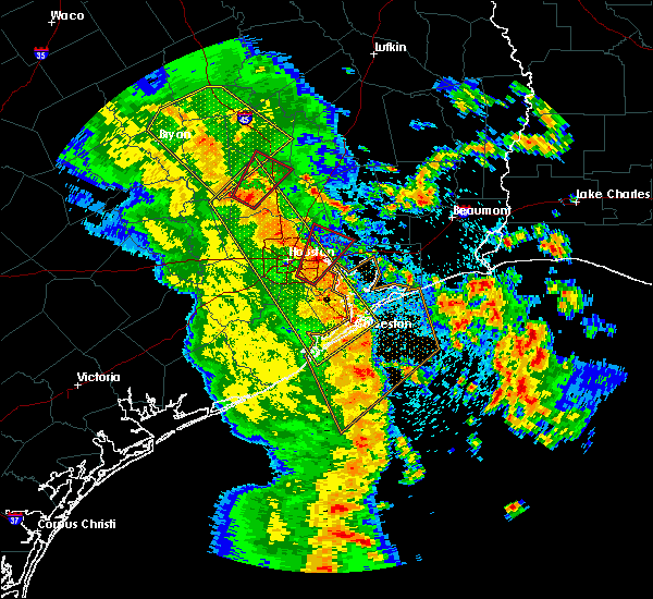 At 1254 pm cdt, a severe thunderstorm capable of producing a tornado was located near pinehurst, moving northeast at 30 mph (radar indicated rotation). Hazards include tornado. Flying debris will be dangerous to those caught without shelter. mobile homes will be damaged or destroyed. damage to roofs, windows, and vehicles will occur. tree damage is likely. this dangerous storm will be near, montgomery and lake conroe dam around 110 pm cdt. Northwestern conroe, willis and panorama village around 115 pm cdt. At 1254 pm cdt, a severe thunderstorm capable of producing a tornado was located near pinehurst, moving northeast at 30 mph (radar indicated rotation). Hazards include tornado. Flying debris will be dangerous to those caught without shelter. mobile homes will be damaged or destroyed. damage to roofs, windows, and vehicles will occur. tree damage is likely. this dangerous storm will be near, montgomery and lake conroe dam around 110 pm cdt. Northwestern conroe, willis and panorama village around 115 pm cdt.
|
| 7/5/2018 8:21 PM CDT |
 The severe thunderstorm warning for central montgomery and southwestern san jacinto counties will expire at 830 pm cdt, the storms which prompted the warning have weakened below severe limits, and no longer pose an immediate threat to life or property. therefore, the warning will be allowed to expire. however gusty winds are still possible with these thunderstorms. The severe thunderstorm warning for central montgomery and southwestern san jacinto counties will expire at 830 pm cdt, the storms which prompted the warning have weakened below severe limits, and no longer pose an immediate threat to life or property. therefore, the warning will be allowed to expire. however gusty winds are still possible with these thunderstorms.
|
| 7/5/2018 8:06 PM CDT |
 At 806 pm cdt, severe thunderstorms were located along a line extending from conroe to near cut and shoot, moving south at 20 mph (radar indicated). Hazards include 60 mph wind gusts. Expect damage to roofs, siding, and trees. Locations impacted include, conroe, willis, panorama village, cut and shoot, woodloch and porter heights. At 806 pm cdt, severe thunderstorms were located along a line extending from conroe to near cut and shoot, moving south at 20 mph (radar indicated). Hazards include 60 mph wind gusts. Expect damage to roofs, siding, and trees. Locations impacted include, conroe, willis, panorama village, cut and shoot, woodloch and porter heights.
|
| 7/5/2018 8:00 PM CDT |
 At 759 pm cdt, severe thunderstorms were located along a line extending from near montgomery to near cut and shoot, moving south at 15 mph (radar indicated). Hazards include 60 mph wind gusts. Expect damage to roofs, siding, and trees. Locations impacted include, conroe, willis, panorama village, cut and shoot, montgomery, woodloch, lake conroe dam and porter heights. At 759 pm cdt, severe thunderstorms were located along a line extending from near montgomery to near cut and shoot, moving south at 15 mph (radar indicated). Hazards include 60 mph wind gusts. Expect damage to roofs, siding, and trees. Locations impacted include, conroe, willis, panorama village, cut and shoot, montgomery, woodloch, lake conroe dam and porter heights.
|
| 7/5/2018 7:49 PM CDT |
 At 749 pm cdt, severe thunderstorms were located along a line extending from near montgomery to near cut and shoot, moving southwest at 15 mph (radar indicated). Hazards include 60 mph wind gusts. expect damage to roofs, siding, and trees At 749 pm cdt, severe thunderstorms were located along a line extending from near montgomery to near cut and shoot, moving southwest at 15 mph (radar indicated). Hazards include 60 mph wind gusts. expect damage to roofs, siding, and trees
|
| 6/3/2018 9:00 PM CDT |
 The national weather service in league city has issued a * severe thunderstorm warning for. northern grimes county in southeastern texas. northwestern montgomery county in southeastern texas. northwestern san jacinto county in southeastern texas. Walker county in southeastern texas. The national weather service in league city has issued a * severe thunderstorm warning for. northern grimes county in southeastern texas. northwestern montgomery county in southeastern texas. northwestern san jacinto county in southeastern texas. Walker county in southeastern texas.
|
| 6/3/2018 8:15 PM CDT |
 At 815 pm cdt, severe thunderstorms were located along a line extending from 7 miles south of riverside to near shepherd, moving southwest at 20 mph (radar indicated). Hazards include 60 mph wind gusts and penny size hail. expect damage to roofs, siding, and trees At 815 pm cdt, severe thunderstorms were located along a line extending from 7 miles south of riverside to near shepherd, moving southwest at 20 mph (radar indicated). Hazards include 60 mph wind gusts and penny size hail. expect damage to roofs, siding, and trees
|
| 4/7/2018 1:06 AM CDT |
 At 105 am cdt, severe thunderstorms were located along a line extending from 6 miles west of huntsville state park to navasota, moving southeast at 35 mph (radar indicated). Hazards include 60 mph wind gusts and quarter size hail. Hail damage to vehicles is expected. expect wind damage to roofs, siding, and trees. Locations impacted include, northwestern conroe, southeastern huntsville, navasota, willis, prairie view, pinehurst, washington, panorama village, magnolia, new waverly, montgomery, anderson, todd mission, huntsville state park, lake conroe dam, dobbin, dacus, plantersville and richards. At 105 am cdt, severe thunderstorms were located along a line extending from 6 miles west of huntsville state park to navasota, moving southeast at 35 mph (radar indicated). Hazards include 60 mph wind gusts and quarter size hail. Hail damage to vehicles is expected. expect wind damage to roofs, siding, and trees. Locations impacted include, northwestern conroe, southeastern huntsville, navasota, willis, prairie view, pinehurst, washington, panorama village, magnolia, new waverly, montgomery, anderson, todd mission, huntsville state park, lake conroe dam, dobbin, dacus, plantersville and richards.
|
| 4/7/2018 12:39 AM CDT |
 At 1239 am cdt, severe thunderstorms were located along a line extending from 8 miles southeast of bedias to near millican, moving southeast at 35 mph (radar indicated). Hazards include 60 mph wind gusts and quarter size hail. Hail damage to vehicles is expected. Expect wind damage to roofs, siding, and trees. At 1239 am cdt, severe thunderstorms were located along a line extending from 8 miles southeast of bedias to near millican, moving southeast at 35 mph (radar indicated). Hazards include 60 mph wind gusts and quarter size hail. Hail damage to vehicles is expected. Expect wind damage to roofs, siding, and trees.
|
| 3/18/2018 8:08 PM CDT |
 At 808 pm cdt, a severe thunderstorm was located over lake conroe dam, or 7 miles west of conroe, moving southeast at 45 mph (radar indicated). Hazards include tennis ball size hail and 60 mph wind gusts. People and animals outdoors will be injured. expect hail damage to roofs, siding, windows, and vehicles. Expect wind damage to roofs, siding, and trees. At 808 pm cdt, a severe thunderstorm was located over lake conroe dam, or 7 miles west of conroe, moving southeast at 45 mph (radar indicated). Hazards include tennis ball size hail and 60 mph wind gusts. People and animals outdoors will be injured. expect hail damage to roofs, siding, windows, and vehicles. Expect wind damage to roofs, siding, and trees.
|
| 8/26/2017 8:54 AM CDT |
 At 854 am cdt, a severe thunderstorm capable of producing a tornado was located near willis, moving northwest at 30 mph (radar indicated rotation). Hazards include tornado. Flying debris will be dangerous to those caught without shelter. mobile homes will be damaged or destroyed. damage to roofs, windows, and vehicles will occur. Tree damage is likely. At 854 am cdt, a severe thunderstorm capable of producing a tornado was located near willis, moving northwest at 30 mph (radar indicated rotation). Hazards include tornado. Flying debris will be dangerous to those caught without shelter. mobile homes will be damaged or destroyed. damage to roofs, windows, and vehicles will occur. Tree damage is likely.
|
| 5/28/2017 9:58 PM CDT |
 The severe thunderstorm warning for southwestern trinity, eastern grimes, northwestern montgomery, southwestern houston, eastern madison and walker counties will expire at 1000 pm cdt, the storms which prompted the warning have weakened below severe limits, and no longer pose an immediate threat to life or property. therefore the warning will be allowed to expire. however strong winds mph or greater are still possible with these thunderstorms. a severe thunderstorm watch remains in effect until 1100 pm cdt for southeastern texas. The severe thunderstorm warning for southwestern trinity, eastern grimes, northwestern montgomery, southwestern houston, eastern madison and walker counties will expire at 1000 pm cdt, the storms which prompted the warning have weakened below severe limits, and no longer pose an immediate threat to life or property. therefore the warning will be allowed to expire. however strong winds mph or greater are still possible with these thunderstorms. a severe thunderstorm watch remains in effect until 1100 pm cdt for southeastern texas.
|
| 5/28/2017 9:09 PM CDT |
 At 908 pm cdt, severe thunderstorms were located along a line extending from 9 miles southwest of austonio to near navasota, moving east at 30 mph (radar indicated). Hazards include 60 mph wind gusts and penny size hail. expect damage to roofs, siding, and trees At 908 pm cdt, severe thunderstorms were located along a line extending from 9 miles southwest of austonio to near navasota, moving east at 30 mph (radar indicated). Hazards include 60 mph wind gusts and penny size hail. expect damage to roofs, siding, and trees
|
| 5/21/2017 3:27 AM CDT |
 The severe thunderstorm warning for northwestern montgomery and southeastern walker counties will expire at 330 am cdt, the storm which prompted the warning has weakened below severe limits, and no longer poses an immediate threat to life or property. therefore the warning will be allowed to expire. The severe thunderstorm warning for northwestern montgomery and southeastern walker counties will expire at 330 am cdt, the storm which prompted the warning has weakened below severe limits, and no longer poses an immediate threat to life or property. therefore the warning will be allowed to expire.
|
| 5/21/2017 3:03 AM CDT |
 At 241 am cdt, a severe thunderstorm was located over montgomery, or 10 miles west of willis, moving east at 15 mph (radar indicated). Hazards include 60 mph wind gusts and quarter size hail. Hail damage to vehicles is expected. Expect wind damage to roofs, siding, and trees. At 241 am cdt, a severe thunderstorm was located over montgomery, or 10 miles west of willis, moving east at 15 mph (radar indicated). Hazards include 60 mph wind gusts and quarter size hail. Hail damage to vehicles is expected. Expect wind damage to roofs, siding, and trees.
|
| 5/21/2017 2:43 AM CDT |
 At 241 am cdt, a severe thunderstorm was located over montgomery, or 10 miles west of willis, moving east at 15 mph (radar indicated). Hazards include 60 mph wind gusts and quarter size hail. Hail damage to vehicles is expected. Expect wind damage to roofs, siding, and trees. At 241 am cdt, a severe thunderstorm was located over montgomery, or 10 miles west of willis, moving east at 15 mph (radar indicated). Hazards include 60 mph wind gusts and quarter size hail. Hail damage to vehicles is expected. Expect wind damage to roofs, siding, and trees.
|
| 5/20/2017 6:42 PM CDT |
 At 641 pm cdt, a severe thunderstorm was located near cut and shoot, or near willis, moving southeast at 20 mph (radar indicated). Hazards include golf ball size hail and 60 mph wind gusts. People and animals outdoors will be injured. expect hail damage to roofs, siding, windows, and vehicles. Expect wind damage to roofs, siding, and trees. At 641 pm cdt, a severe thunderstorm was located near cut and shoot, or near willis, moving southeast at 20 mph (radar indicated). Hazards include golf ball size hail and 60 mph wind gusts. People and animals outdoors will be injured. expect hail damage to roofs, siding, windows, and vehicles. Expect wind damage to roofs, siding, and trees.
|
| 5/20/2017 6:30 PM CDT | Golf Ball sized hail reported 3.3 miles W of Willis, TX, golf ball size hail reported near willis by law enforcement. |
| 5/20/2017 6:27 PM CDT |
 At 626 pm cdt, a severe thunderstorm was located 7 miles east of willis, moving east at 20 mph (radar indicated). Hazards include golf ball size hail and 60 mph wind gusts. People and animals outdoors will be injured. expect hail damage to roofs, siding, windows, and vehicles. expect wind damage to roofs, siding, and trees. Locations impacted include, willis and cut and shoot. At 626 pm cdt, a severe thunderstorm was located 7 miles east of willis, moving east at 20 mph (radar indicated). Hazards include golf ball size hail and 60 mph wind gusts. People and animals outdoors will be injured. expect hail damage to roofs, siding, windows, and vehicles. expect wind damage to roofs, siding, and trees. Locations impacted include, willis and cut and shoot.
|
| 5/20/2017 6:21 PM CDT |
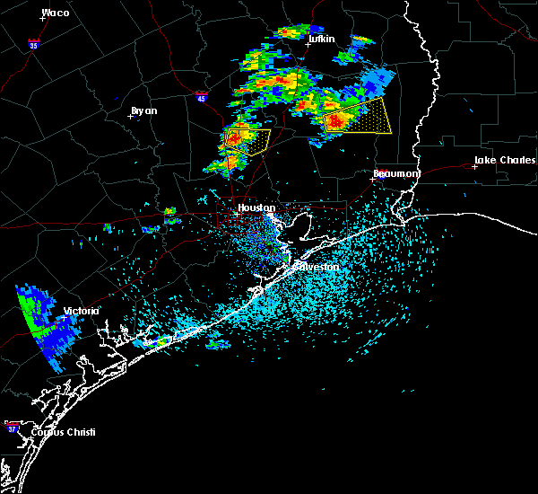 At 621 pm cdt, a severe thunderstorm was located near willis, moving east at 20 mph (radar indicated). Hazards include 60 mph wind gusts and quarter size hail. Hail damage to vehicles is expected. Expect wind damage to roofs, siding, and trees. At 621 pm cdt, a severe thunderstorm was located near willis, moving east at 20 mph (radar indicated). Hazards include 60 mph wind gusts and quarter size hail. Hail damage to vehicles is expected. Expect wind damage to roofs, siding, and trees.
|
| 4/2/2017 12:54 PM CDT |
 At 1254 pm cdt, a severe thunderstorm was located over lake conroe dam, or 8 miles west of conroe, moving northeast at 30 mph (radar indicated). Hazards include 60 mph wind gusts and quarter size hail. Hail damage to vehicles is expected. Expect wind damage to roofs, siding, and trees. At 1254 pm cdt, a severe thunderstorm was located over lake conroe dam, or 8 miles west of conroe, moving northeast at 30 mph (radar indicated). Hazards include 60 mph wind gusts and quarter size hail. Hail damage to vehicles is expected. Expect wind damage to roofs, siding, and trees.
|
| 4/2/2017 8:11 AM CDT |
 At 810 am cdt, a severe thunderstorm capable of producing a tornado was located over new waverly, or near willis, moving northeast at 25 mph (radar indicated rotation). Hazards include tornado and quarter size hail. Flying debris will be dangerous to those caught without shelter. mobile homes will be damaged or destroyed. damage to roofs, windows, and vehicles will occur. tree damage is likely. Locations impacted include, southeastern huntsville, new waverly and huntsville state park. At 810 am cdt, a severe thunderstorm capable of producing a tornado was located over new waverly, or near willis, moving northeast at 25 mph (radar indicated rotation). Hazards include tornado and quarter size hail. Flying debris will be dangerous to those caught without shelter. mobile homes will be damaged or destroyed. damage to roofs, windows, and vehicles will occur. tree damage is likely. Locations impacted include, southeastern huntsville, new waverly and huntsville state park.
|
| 4/2/2017 7:55 AM CDT |
 At 755 am cdt, a severe thunderstorm capable of producing a tornado was located near lake conroe dam, or near willis, moving northeast at 25 mph (radar indicated rotation). Hazards include tornado and quarter size hail. Flying debris will be dangerous to those caught without shelter. mobile homes will be damaged or destroyed. damage to roofs, windows, and vehicles will occur. Tree damage is likely. At 755 am cdt, a severe thunderstorm capable of producing a tornado was located near lake conroe dam, or near willis, moving northeast at 25 mph (radar indicated rotation). Hazards include tornado and quarter size hail. Flying debris will be dangerous to those caught without shelter. mobile homes will be damaged or destroyed. damage to roofs, windows, and vehicles will occur. Tree damage is likely.
|
| 4/2/2017 7:49 AM CDT |
 At 748 am cdt, a severe thunderstorm capable of producing a tornado was located near lake conroe dam, or 7 miles west of willis, moving northeast at 25 mph (radar indicated rotation). Hazards include tornado and quarter size hail. Flying debris will be dangerous to those caught without shelter. mobile homes will be damaged or destroyed. damage to roofs, windows, and vehicles will occur. tree damage is likely. Locations impacted include, willis, panorama village, new waverly and lake conroe dam. At 748 am cdt, a severe thunderstorm capable of producing a tornado was located near lake conroe dam, or 7 miles west of willis, moving northeast at 25 mph (radar indicated rotation). Hazards include tornado and quarter size hail. Flying debris will be dangerous to those caught without shelter. mobile homes will be damaged or destroyed. damage to roofs, windows, and vehicles will occur. tree damage is likely. Locations impacted include, willis, panorama village, new waverly and lake conroe dam.
|
| 4/2/2017 7:34 AM CDT |
 At 734 am cdt, a severe thunderstorm capable of producing a tornado was located near montgomery, or 10 miles north of pinehurst, moving northeast at 25 mph (radar indicated rotation). Hazards include tornado and quarter size hail. Flying debris will be dangerous to those caught without shelter. mobile homes will be damaged or destroyed. damage to roofs, windows, and vehicles will occur. Tree damage is likely. At 734 am cdt, a severe thunderstorm capable of producing a tornado was located near montgomery, or 10 miles north of pinehurst, moving northeast at 25 mph (radar indicated rotation). Hazards include tornado and quarter size hail. Flying debris will be dangerous to those caught without shelter. mobile homes will be damaged or destroyed. damage to roofs, windows, and vehicles will occur. Tree damage is likely.
|
| 4/2/2017 7:30 AM CDT |
 At 730 am cdt, a severe thunderstorm was located over montgomery, or 12 miles north of pinehurst, moving northeast at 25 mph (radar indicated). Hazards include 60 mph wind gusts and quarter size hail. Hail damage to vehicles is expected. Expect wind damage to roofs, siding, and trees. At 730 am cdt, a severe thunderstorm was located over montgomery, or 12 miles north of pinehurst, moving northeast at 25 mph (radar indicated). Hazards include 60 mph wind gusts and quarter size hail. Hail damage to vehicles is expected. Expect wind damage to roofs, siding, and trees.
|
| 3/24/2017 9:56 PM CDT |
 The severe thunderstorm warning for central montgomery and southwestern san jacinto counties will expire at 1000 pm cdt, the storm which prompted the warning has weakened below severe limits, and has exited the warned area. therefore, the warning will be allowed to expire. a tornado watch remains in effect until midnight cdt for southeastern texas. remember, a tornado warning still remains in effect through midnight. The severe thunderstorm warning for central montgomery and southwestern san jacinto counties will expire at 1000 pm cdt, the storm which prompted the warning has weakened below severe limits, and has exited the warned area. therefore, the warning will be allowed to expire. a tornado watch remains in effect until midnight cdt for southeastern texas. remember, a tornado warning still remains in effect through midnight.
|
| 3/24/2017 9:31 PM CDT |
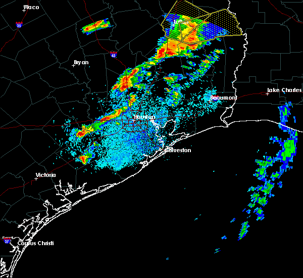 At 931 pm cdt, a severe thunderstorm was located over northwestern conroe, moving northeast at 45 mph (radar indicated). Hazards include quarter size hail. damage to vehicles is expected At 931 pm cdt, a severe thunderstorm was located over northwestern conroe, moving northeast at 45 mph (radar indicated). Hazards include quarter size hail. damage to vehicles is expected
|
| 2/20/2017 6:20 AM CST |
 At 619 am cst, severe thunderstorms were located along a line extending from conroe to aldine, moving northeast at 55 mph (radar indicated). Hazards include 60 mph wind gusts. Expect damage to roofs, siding, and trees. Locations impacted include, conroe, humble, tomball, jersey village, willis, hunters creek village, bunker hill village, piney point village, pinehurst, kingwood, spring branch north, the woodlands, greater greenspoint, spring, aldine, spring branch west, eastern addicks park ten, spring valley, northern northside / northline and oak ridge north. At 619 am cst, severe thunderstorms were located along a line extending from conroe to aldine, moving northeast at 55 mph (radar indicated). Hazards include 60 mph wind gusts. Expect damage to roofs, siding, and trees. Locations impacted include, conroe, humble, tomball, jersey village, willis, hunters creek village, bunker hill village, piney point village, pinehurst, kingwood, spring branch north, the woodlands, greater greenspoint, spring, aldine, spring branch west, eastern addicks park ten, spring valley, northern northside / northline and oak ridge north.
|
| 2/20/2017 5:48 AM CST |
 At 547 am cst, severe thunderstorms were located along a line extending from waller to pecan grove, moving northeast at 50 mph (radar indicated). Hazards include 60 mph wind gusts. expect damage to roofs, siding, and trees At 547 am cst, severe thunderstorms were located along a line extending from waller to pecan grove, moving northeast at 50 mph (radar indicated). Hazards include 60 mph wind gusts. expect damage to roofs, siding, and trees
|
| 2/14/2017 8:16 AM CST |
 At 816 am cst, severe thunderstorms were located along a line extending from 8 miles southwest of huntsville state park to 7 miles southwest of lake conroe dam to 6 miles southwest of cypress to near cumings, moving east at 25 mph (radar indicated). Hazards include 60 mph wind gusts. expect damage to roofs, siding, and trees At 816 am cst, severe thunderstorms were located along a line extending from 8 miles southwest of huntsville state park to 7 miles southwest of lake conroe dam to 6 miles southwest of cypress to near cumings, moving east at 25 mph (radar indicated). Hazards include 60 mph wind gusts. expect damage to roofs, siding, and trees
|
| 1/16/2017 9:22 AM CST |
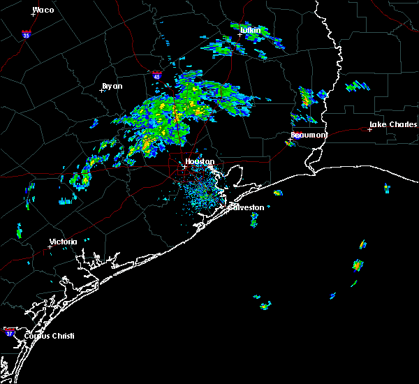 At 921 am cst, a severe thunderstorm capable of producing a tornado was located near cut and shoot, or near conroe, moving northeast at 25 mph (radar indicated rotation). Hazards include tornado. Expect damage to mobile homes, roofs, and vehicles. Locations impacted include, conroe, willis, panorama village and cut and shoot. At 921 am cst, a severe thunderstorm capable of producing a tornado was located near cut and shoot, or near conroe, moving northeast at 25 mph (radar indicated rotation). Hazards include tornado. Expect damage to mobile homes, roofs, and vehicles. Locations impacted include, conroe, willis, panorama village and cut and shoot.
|
| 1/16/2017 9:02 AM CST |
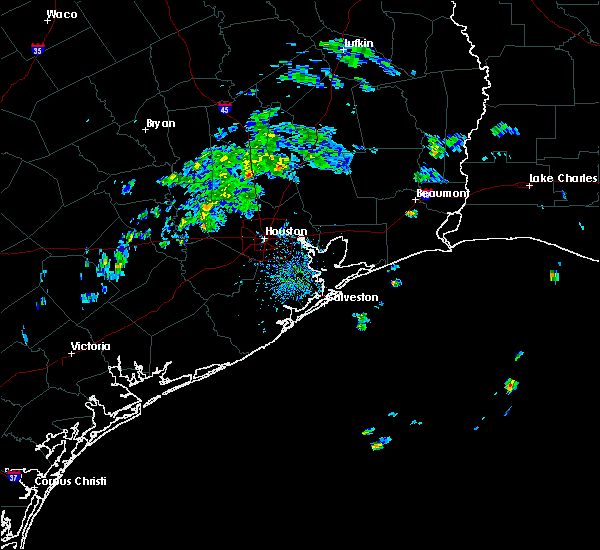 At 901 am cst, a severe thunderstorm capable of producing a tornado was located over southwestern conroe, moving northeast at 25 mph (radar indicated rotation). Hazards include tornado. expect damage to mobile homes, roofs, and vehicles At 901 am cst, a severe thunderstorm capable of producing a tornado was located over southwestern conroe, moving northeast at 25 mph (radar indicated rotation). Hazards include tornado. expect damage to mobile homes, roofs, and vehicles
|
| 1/2/2017 7:45 AM CST |
 At 745 am cst, severe thunderstorms were located along a line extending from near apple springs to 6 miles north of hockley to weston lakes, moving east at 35 mph (radar indicated). Hazards include 60 mph wind gusts and penny size hail. expect damage to roofs, siding, and trees At 745 am cst, severe thunderstorms were located along a line extending from near apple springs to 6 miles north of hockley to weston lakes, moving east at 35 mph (radar indicated). Hazards include 60 mph wind gusts and penny size hail. expect damage to roofs, siding, and trees
|
| 1/2/2017 7:34 AM CST |
 At 732 am cst, severe thunderstorms were located along a line extending from huntsville to lake conroe dam to hempstead, moving east at 45 mph (radar indicated). Hazards include 60 mph wind gusts. Expect damage to roofs, siding, and trees. Locations impacted include, conroe, huntsville, tomball, navasota, hempstead, willis, prairie view, pinehurst, spring, the woodlands, hockley, oak ridge north, waller, panorama village, shenandoah, magnolia, new waverly, pine island, montgomery and stagecoach. At 732 am cst, severe thunderstorms were located along a line extending from huntsville to lake conroe dam to hempstead, moving east at 45 mph (radar indicated). Hazards include 60 mph wind gusts. Expect damage to roofs, siding, and trees. Locations impacted include, conroe, huntsville, tomball, navasota, hempstead, willis, prairie view, pinehurst, spring, the woodlands, hockley, oak ridge north, waller, panorama village, shenandoah, magnolia, new waverly, pine island, montgomery and stagecoach.
|
| 1/2/2017 6:50 AM CST |
 At 646 am cst, severe thunderstorms were located along a line extending from 9 miles east of kyle field to near college station to 6 miles southeast of snook to 10 miles east of somerville to near brenham to 9 miles northeast of industry, moving east at 35 mph (radar indicated). Hazards include 60 mph wind gusts. expect damage to roofs, siding, and trees At 646 am cst, severe thunderstorms were located along a line extending from 9 miles east of kyle field to near college station to 6 miles southeast of snook to 10 miles east of somerville to near brenham to 9 miles northeast of industry, moving east at 35 mph (radar indicated). Hazards include 60 mph wind gusts. expect damage to roofs, siding, and trees
|
| 5/27/2016 4:42 AM CDT |
 At 441 am cdt, severe thunderstorms were located along a line extending from willis to near chateau woods to near katy, moving east at 50 mph (radar indicated). Hazards include 60 mph wind gusts. Expect damage to roofs. siding. and trees. Locations impacted include, conroe, humble, katy, tomball, cleveland, jersey village, willis, pinehurst, greater greenspoint, spring, kingwood, northside / northline, the woodlands, aldine, northern addicks park ten, hockley, oak ridge north, panorama village, shenandoah and splendora. At 441 am cdt, severe thunderstorms were located along a line extending from willis to near chateau woods to near katy, moving east at 50 mph (radar indicated). Hazards include 60 mph wind gusts. Expect damage to roofs. siding. and trees. Locations impacted include, conroe, humble, katy, tomball, cleveland, jersey village, willis, pinehurst, greater greenspoint, spring, kingwood, northside / northline, the woodlands, aldine, northern addicks park ten, hockley, oak ridge north, panorama village, shenandoah and splendora.
|
| 5/27/2016 4:24 AM CDT |
 At 423 am cdt, severe thunderstorms were located along a line extending from near montgomery to near tomball to near brookshire, moving east at 40 mph (radar indicated). Hazards include 60 mph wind gusts. Expect damage to roofs. siding. and trees. Locations impacted include, conroe, humble, katy, tomball, cleveland, jersey village, willis, prairie view, pinehurst, greater greenspoint, addicks park ten, spring, kingwood, northside / northline, the woodlands, aldine, spring branch north, spring branch west, northern greater heights and near northside houston. At 423 am cdt, severe thunderstorms were located along a line extending from near montgomery to near tomball to near brookshire, moving east at 40 mph (radar indicated). Hazards include 60 mph wind gusts. Expect damage to roofs. siding. and trees. Locations impacted include, conroe, humble, katy, tomball, cleveland, jersey village, willis, prairie view, pinehurst, greater greenspoint, addicks park ten, spring, kingwood, northside / northline, the woodlands, aldine, spring branch north, spring branch west, northern greater heights and near northside houston.
|
| 5/27/2016 4:08 AM CDT |
 At 408 am cdt, severe thunderstorms were located along a line extending from 8 miles north of todd mission to 6 miles west of stagecoach to pattison, moving east at 40 mph (radar indicated). Hazards include 60 mph wind gusts and penny size hail. Expect damage to roofs. siding. And trees. At 408 am cdt, severe thunderstorms were located along a line extending from 8 miles north of todd mission to 6 miles west of stagecoach to pattison, moving east at 40 mph (radar indicated). Hazards include 60 mph wind gusts and penny size hail. Expect damage to roofs. siding. And trees.
|
| 5/26/2016 6:08 PM CDT |
 At 607 pm cdt, severe thunderstorms were located along a line extending from cut and shoot to 6 miles east of woodloch to near porter heights, moving east at 25 mph (radar indicated). Hazards include 60 mph wind gusts and nickel size hail. Expect damage to roofs. siding. And trees. At 607 pm cdt, severe thunderstorms were located along a line extending from cut and shoot to 6 miles east of woodloch to near porter heights, moving east at 25 mph (radar indicated). Hazards include 60 mph wind gusts and nickel size hail. Expect damage to roofs. siding. And trees.
|
| 5/26/2016 5:48 PM CDT |
 At 547 pm cdt, severe thunderstorms were located along a line extending from near cut and shoot to near the woodlands to near stagecoach, moving east at 20 mph (radar indicated). Hazards include 60 mph wind gusts and nickel size hail. Expect damage to roofs. siding. And trees. At 547 pm cdt, severe thunderstorms were located along a line extending from near cut and shoot to near the woodlands to near stagecoach, moving east at 20 mph (radar indicated). Hazards include 60 mph wind gusts and nickel size hail. Expect damage to roofs. siding. And trees.
|
| 5/26/2016 5:06 PM CDT |
 At 504 pm cdt, severe thunderstorms were located along a line extending from near willis to near conroe to near tomball, moving east at 25 mph. reports of 3 inch per hour rainfall was accompanying this storm (radar indicated). Hazards include 60 mph wind gusts and quarter size hail. Hail damage to vehicles is expected. expect wind damage to roofs, siding, and trees. Locations impacted include, conroe, willis, pinehurst, the woodlands, oak ridge north, panorama village, shenandoah, cut and shoot, montgomery, woodloch, lake conroe dam, the woodlands pavillion and chateau woods. At 504 pm cdt, severe thunderstorms were located along a line extending from near willis to near conroe to near tomball, moving east at 25 mph. reports of 3 inch per hour rainfall was accompanying this storm (radar indicated). Hazards include 60 mph wind gusts and quarter size hail. Hail damage to vehicles is expected. expect wind damage to roofs, siding, and trees. Locations impacted include, conroe, willis, pinehurst, the woodlands, oak ridge north, panorama village, shenandoah, cut and shoot, montgomery, woodloch, lake conroe dam, the woodlands pavillion and chateau woods.
|
| 5/26/2016 4:50 PM CDT |
 At 449 pm cdt, severe thunderstorms were located along a line extending from willis to 6 miles southwest of conroe to near stagecoach, moving east at 25 mph (radar indicated). Hazards include ping pong ball size hail and 60 mph wind gusts. People and animals outdoors will be injured. expect hail damage to roofs, siding, windows, and vehicles. expect wind damage to roofs, siding, and trees. Locations impacted include, conroe, willis, pinehurst, the woodlands, oak ridge north, panorama village, shenandoah, magnolia, cut and shoot, montgomery, stagecoach, woodloch, lake conroe dam, the woodlands pavillion, chateau woods and dobbin. At 449 pm cdt, severe thunderstorms were located along a line extending from willis to 6 miles southwest of conroe to near stagecoach, moving east at 25 mph (radar indicated). Hazards include ping pong ball size hail and 60 mph wind gusts. People and animals outdoors will be injured. expect hail damage to roofs, siding, windows, and vehicles. expect wind damage to roofs, siding, and trees. Locations impacted include, conroe, willis, pinehurst, the woodlands, oak ridge north, panorama village, shenandoah, magnolia, cut and shoot, montgomery, stagecoach, woodloch, lake conroe dam, the woodlands pavillion, chateau woods and dobbin.
|
| 5/26/2016 4:38 PM CDT |
 At 436 pm cdt, severe thunderstorms were located along a line extending from near lake conroe dam to 6 miles northeast of pinehurst to near stagecoach, moving east at 25 mph. one strong core of the storm likely producing large hail is 4 to 8 miles northeast of pinehurst (radar indicated). Hazards include ping pong ball size hail and 60 mph wind gusts. People and animals outdoors will be injured. expect hail damage to roofs, siding, windows, and vehicles. expect wind damage to roofs, siding, and trees. Locations impacted include, conroe, tomball, willis, pinehurst, the woodlands, spring, oak ridge north, panorama village, shenandoah, magnolia, cut and shoot, new waverly, montgomery, stagecoach, woodloch, todd mission, lake conroe dam, porter heights, splashtown and hooks airport. At 436 pm cdt, severe thunderstorms were located along a line extending from near lake conroe dam to 6 miles northeast of pinehurst to near stagecoach, moving east at 25 mph. one strong core of the storm likely producing large hail is 4 to 8 miles northeast of pinehurst (radar indicated). Hazards include ping pong ball size hail and 60 mph wind gusts. People and animals outdoors will be injured. expect hail damage to roofs, siding, windows, and vehicles. expect wind damage to roofs, siding, and trees. Locations impacted include, conroe, tomball, willis, pinehurst, the woodlands, spring, oak ridge north, panorama village, shenandoah, magnolia, cut and shoot, new waverly, montgomery, stagecoach, woodloch, todd mission, lake conroe dam, porter heights, splashtown and hooks airport.
|
| 5/26/2016 4:29 PM CDT |
 At 428 pm cdt, severe thunderstorms were located along a line extending from near montgomery to near pinehurst to near stagecoach, moving east at 25 mph (radar indicated). Hazards include 60 mph wind gusts and penny size hail. Expect damage to roofs. siding. And trees. At 428 pm cdt, severe thunderstorms were located along a line extending from near montgomery to near pinehurst to near stagecoach, moving east at 25 mph (radar indicated). Hazards include 60 mph wind gusts and penny size hail. Expect damage to roofs. siding. And trees.
|
| 5/2/2016 2:48 AM CDT |
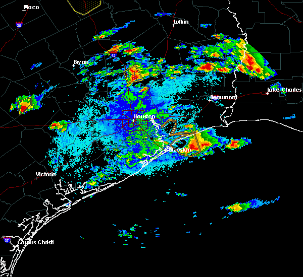 At 246 am cdt, a severe thunderstorm was located about 3 miles east northeast of willis, moving northeast at 15 mph (radar indicated). Hazards include two inch hail. People and animals outdoors will be injured. expect damage to roofs, siding, windows, and vehicles. Locations impacted include, willis and new waverly. At 246 am cdt, a severe thunderstorm was located about 3 miles east northeast of willis, moving northeast at 15 mph (radar indicated). Hazards include two inch hail. People and animals outdoors will be injured. expect damage to roofs, siding, windows, and vehicles. Locations impacted include, willis and new waverly.
|
| 5/2/2016 2:30 AM CDT | Golf Ball sized hail reported 0.3 miles ENE of Willis, TX |
| 5/2/2016 2:23 AM CDT |
 At 223 am cdt, a severe thunderstorm was located near willis, moving northeast at 15 mph (radar indicated). Hazards include quarter size hail. damage to vehicles is expected At 223 am cdt, a severe thunderstorm was located near willis, moving northeast at 15 mph (radar indicated). Hazards include quarter size hail. damage to vehicles is expected
|
| 5/2/2016 2:15 AM CDT |
 At 214 am cdt, a severe thunderstorm was located near willis, moving northeast at 15 mph (radar indicated). Hazards include quarter size hail. Damage to vehicles is expected. Locations impacted include, willis, panorama village, new waverly, montgomery and huntsville state park. At 214 am cdt, a severe thunderstorm was located near willis, moving northeast at 15 mph (radar indicated). Hazards include quarter size hail. Damage to vehicles is expected. Locations impacted include, willis, panorama village, new waverly, montgomery and huntsville state park.
|
| 5/2/2016 1:57 AM CDT |
 At 156 am cdt, a severe thunderstorm was located 7 miles northeast of montgomery, or 8 miles west of willis, moving northeast at 15 mph (radar indicated). Hazards include quarter size hail. Damage to vehicles is expected. Locations impacted include, willis, panorama village, new waverly, montgomery and huntsville state park. At 156 am cdt, a severe thunderstorm was located 7 miles northeast of montgomery, or 8 miles west of willis, moving northeast at 15 mph (radar indicated). Hazards include quarter size hail. Damage to vehicles is expected. Locations impacted include, willis, panorama village, new waverly, montgomery and huntsville state park.
|
| 5/2/2016 1:39 AM CDT |
 At 138 am cdt, a severe thunderstorm was located near montgomery, or 9 miles west of willis, moving northeast at 20 mph (radar indicated). Hazards include quarter size hail. damage to vehicles is expected At 138 am cdt, a severe thunderstorm was located near montgomery, or 9 miles west of willis, moving northeast at 20 mph (radar indicated). Hazards include quarter size hail. damage to vehicles is expected
|
| 4/30/2016 7:44 AM CDT |
 At 742 am cdt, severe thunderstorms were located along a line extending from 12 miles west of trinity to near new waverly to lake conroe dam, moving northeast at 40 mph (radar indicated). Hazards include 60 mph wind gusts and penny size hail. Expect damage to roofs. siding. and trees. trees will topple under lower wind speeds due to the recently saturated grounds. Locations impacted include, conroe, huntsville, humble, tomball, jersey village, willis, pinehurst, greater greenspoint, spring, kingwood, the woodlands, aldine, northwestern northside / northline, oak ridge north, panorama village, shenandoah, splendora, patton village, roman forest and magnolia. At 742 am cdt, severe thunderstorms were located along a line extending from 12 miles west of trinity to near new waverly to lake conroe dam, moving northeast at 40 mph (radar indicated). Hazards include 60 mph wind gusts and penny size hail. Expect damage to roofs. siding. and trees. trees will topple under lower wind speeds due to the recently saturated grounds. Locations impacted include, conroe, huntsville, humble, tomball, jersey village, willis, pinehurst, greater greenspoint, spring, kingwood, the woodlands, aldine, northwestern northside / northline, oak ridge north, panorama village, shenandoah, splendora, patton village, roman forest and magnolia.
|
| 4/30/2016 7:37 AM CDT | Tree down on rose roa in montgomery county TX, 2.1 miles W of Willis, TX |
| 4/30/2016 7:13 AM CDT |
 At 711 am cdt, severe thunderstorms were located along a line extending from 6 miles south of bedias to 7 miles west of todd mission to waller, moving northeast at 40 mph (radar indicated winds in excess of 55 knots just off the surface with these storms). Hazards include 60 mph wind gusts and penny size hail. Expect damage to roofs. siding. and trees. Toppled trees. At 711 am cdt, severe thunderstorms were located along a line extending from 6 miles south of bedias to 7 miles west of todd mission to waller, moving northeast at 40 mph (radar indicated winds in excess of 55 knots just off the surface with these storms). Hazards include 60 mph wind gusts and penny size hail. Expect damage to roofs. siding. and trees. Toppled trees.
|
| 4/27/2016 4:50 AM CDT |
 At 450 am cdt, a severe thunderstorm capable of producing a tornado was located near cut and shoot, or 8 miles east of willis, moving east at 50 mph (radar indicated rotation). Hazards include tornado. Flying debris will be dangerous to those caught without shelter. mobile homes will be damaged or destroyed. damage to roofs, windows, and vehicles will occur. Tree damage is likely. At 450 am cdt, a severe thunderstorm capable of producing a tornado was located near cut and shoot, or 8 miles east of willis, moving east at 50 mph (radar indicated rotation). Hazards include tornado. Flying debris will be dangerous to those caught without shelter. mobile homes will be damaged or destroyed. damage to roofs, windows, and vehicles will occur. Tree damage is likely.
|
| 4/27/2016 4:45 AM CDT | Reports of numerous trees downed...residential damage...power outtages from a magnolia to montgomery to willis lin in montgomery county TX, 0.3 miles ENE of Willis, TX |
| 4/27/2016 4:25 AM CDT |
 At 425 am cdt, severe thunderstorms were located along a line extending from near huntsville state park to near todd mission to 8 miles east of columbus, moving northeast at 145 mph (radar indicated). Hazards include 60 mph wind gusts and nickel size hail. Expect damage to roofs. siding. And trees. At 425 am cdt, severe thunderstorms were located along a line extending from near huntsville state park to near todd mission to 8 miles east of columbus, moving northeast at 145 mph (radar indicated). Hazards include 60 mph wind gusts and nickel size hail. Expect damage to roofs. siding. And trees.
|
| 12/27/2015 2:41 PM CST |
 The national weather service in league city has issued a * severe thunderstorm warning for. central walker county in southeastern texas. northwestern montgomery county in southeastern texas. southwestern trinity county in southeastern texas. Southern houston county in southeastern texas. The national weather service in league city has issued a * severe thunderstorm warning for. central walker county in southeastern texas. northwestern montgomery county in southeastern texas. southwestern trinity county in southeastern texas. Southern houston county in southeastern texas.
|
| 12/12/2015 3:53 PM CST | Uprooted trees and damage to one business reported at interstate 45 and shepherd hill road. possible tornad in montgomery county TX, 4.3 miles SSE of Willis, TX |
| 8/25/2015 12:11 PM CDT |
 At 1210 pm cdt, doppler radar indicated a severe thunderstorm capable of producing quarter size hail and damaging winds in excess of 60 mph. this storm was located over lake conroe dam, or near conroe, and moving south at around 20 mph. At 1210 pm cdt, doppler radar indicated a severe thunderstorm capable of producing quarter size hail and damaging winds in excess of 60 mph. this storm was located over lake conroe dam, or near conroe, and moving south at around 20 mph.
|
| 5/25/2015 8:01 PM CDT | At 801 pm cdt, doppler radar indicated a severe thunderstorm capable of producing a tornado. this dangerous storm was located near lake conroe dam, or 9 miles west of conroe, moving northeast at 50 mph. locations impacted include, northern conroe, willis, pinehurst, panorama village, magnolia, montgomery, lake conroe dam and dobbin. |
| 5/25/2015 7:50 PM CDT | At 749 pm cdt, doppler radar indicated a severe thunderstorm capable of producing a tornado. this dangerous storm was located over magnolia, or near pinehurst, and moving northeast at 50 mph. |
| 5/25/2015 7:43 PM CDT | At 742 pm cdt, doppler radar indicated a severe thunderstorm capable of producing quarter size hail and damaging winds in excess of 60 mph. this storm was located near todd mission, or 11 miles northeast of prairie view, and moving east at 40 mph. |
| 5/25/2015 7:08 PM CDT | At 707 pm cdt, doppler radar indicated a severe thunderstorm capable of producing quarter size hail and damaging winds in excess of 60 mph. this storm was located near huntsville state park, or 7 miles southwest of huntsville, moving east at 60 mph. locations impacted include, conroe, huntsville, navasota, willis, washington, panorama village, new waverly, montgomery, bedias, millican, anderson, lake conroe dam, huntsville state park, iola, dobbin, richards, dacus, plantersville, crabbs prairie and carlos. a tornado watch remains in effect until 1000 pm cdt for southeastern texas. |
| 5/25/2015 6:42 PM CDT | At 642 pm cdt, doppler radar indicated a severe thunderstorm capable of producing damaging winds in excess of 60 mph. this storm was located near anderson, or 7 miles north of navasota, and moving east at 60 mph. |
| 5/14/2015 4:12 PM CDT | The severe thunderstorm warning for south central walker and northwestern montgomery counties will expire at 415 pm cdt, the storm which prompted the warning has weakened below severe limits, and no longer poses an immediate threat to life or property. therefore the warning will be allowed to expire. however gusty winds and heavy rain are still occurring with this thunderstorm. |
| 5/14/2015 3:50 PM CDT | Two porches torn off and a metal building destroyed in high winds. shingles also blown off a house. near blueberry hill rd and fm 1097. winds were estimated between 60- in montgomery county TX, 6.3 miles ESE of Willis, TX |
| 5/14/2015 3:40 PM CDT | At 340 pm cdt, doppler radar indicated a severe thunderstorm capable of producing damaging winds in excess of 60 mph. this storm was located over lake conroe dam, or near conroe, and moving north at 20 mph. penny size hail may also accompany the damaging winds. |
| 5/12/2015 5:01 PM CDT | At 500 pm cdt, doppler radar indicated a severe thunderstorm capable of producing quarter size hail and damaging winds in excess of 60 mph. this storm was located near cut and shoot, or near conroe, and moving east at 10 mph. |
| 5/11/2015 7:41 AM CDT | At 741 am cdt, doppler radar indicated a severe thunderstorm capable of producing a tornado. this dangerous storm was located over willis, and moving east at 25 mph. |
| 4/27/2015 5:03 AM CDT | At 501 am cdt, doppler radar indicated a line of severe thunderstorms capable of producing destructive winds in excess of 80 mph. these storms were located along a line extending from near onalaska to west livingston to near shepherd to near plum grove, moving east at 65 mph. locations impacted include, conroe, huntsville, humble, tomball, liberty, cleveland, dayton, willis, livingston, spring, kingwood, the woodlands, oak ridge north, shepherd, panorama village, shenandoah, onalaska, splendora, patton village and roman forest. a tornado watch remains in effect until 900 am cdt for southeastern texas. |
| 4/27/2015 4:27 AM CDT | At 426 am cdt, doppler radar indicated a line of severe thunderstorms capable of producing destructive winds in excess of 80 mph. these storms were located along a line extending from 12 miles southeast of bedias to 7 miles southwest of huntsville state park to lake conroe dam to near cypress, and moving east at 65 mph. |
| 4/27/2015 4:16 AM CDT | At 415 am cdt, doppler radar indicated a line of severe thunderstorms capable of producing damaging winds in excess of 60 mph. these storms were located along a line extending from 9 miles northeast of anderson to near magnolia to near pattison, moving east at 50 mph. locations impacted include, conroe, katy, tomball, jersey village, navasota, sealy, hempstead, willis, prairie view, brookshire, hunters creek village, bunker hill village, piney point village, pinehurst, spring valley, spring branch west, greater greenspoint, addicks park ten, spring and the woodlands. a tornado watch remains in effect until 900 am cdt for southeastern texas. |
| 4/27/2015 3:52 AM CDT | At 352 am cdt, doppler radar indicated a line of severe thunderstorms capable of producing damaging winds in excess of 60 mph. these storms were located along a line extending from near snook to 9 miles east of brenham to 7 miles east of columbus, and moving east at 55 mph. they have a history of producing wind damage. |
| 11/26/2012 9:47 PM CST | Quarter sized hail reported 2 miles SW of Willis, TX, nickel to quarter sized hail reported in willis |
| 1/1/0001 12:00 AM | Trees down on the roa in montgomery county TX, 0.3 miles ENE of Willis, TX |
Hail Maps for Willis, TX
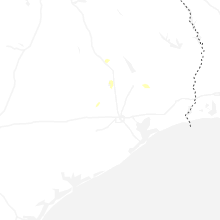
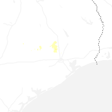


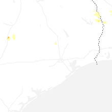


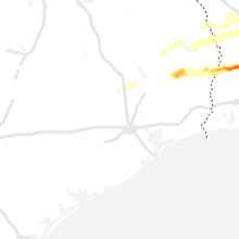


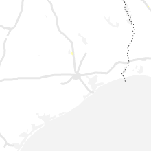


Connect with Interactive Hail Maps