

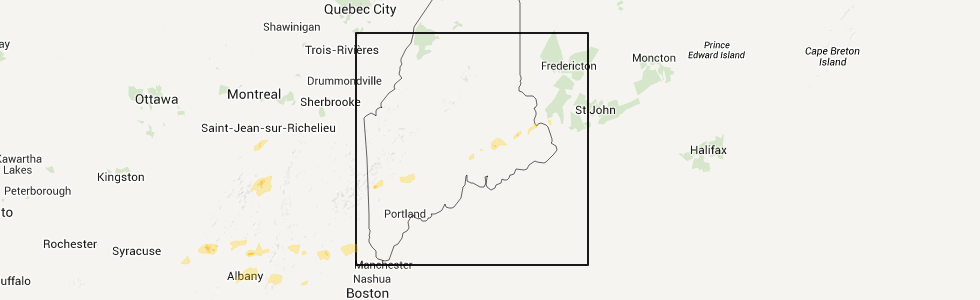
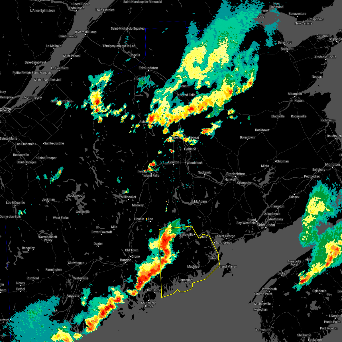
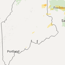
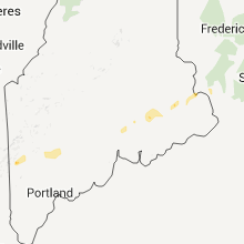
Hail Map for Woodland, ME
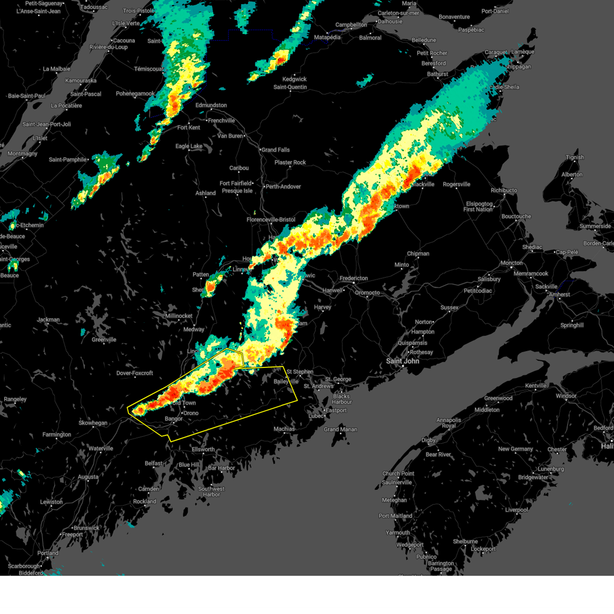
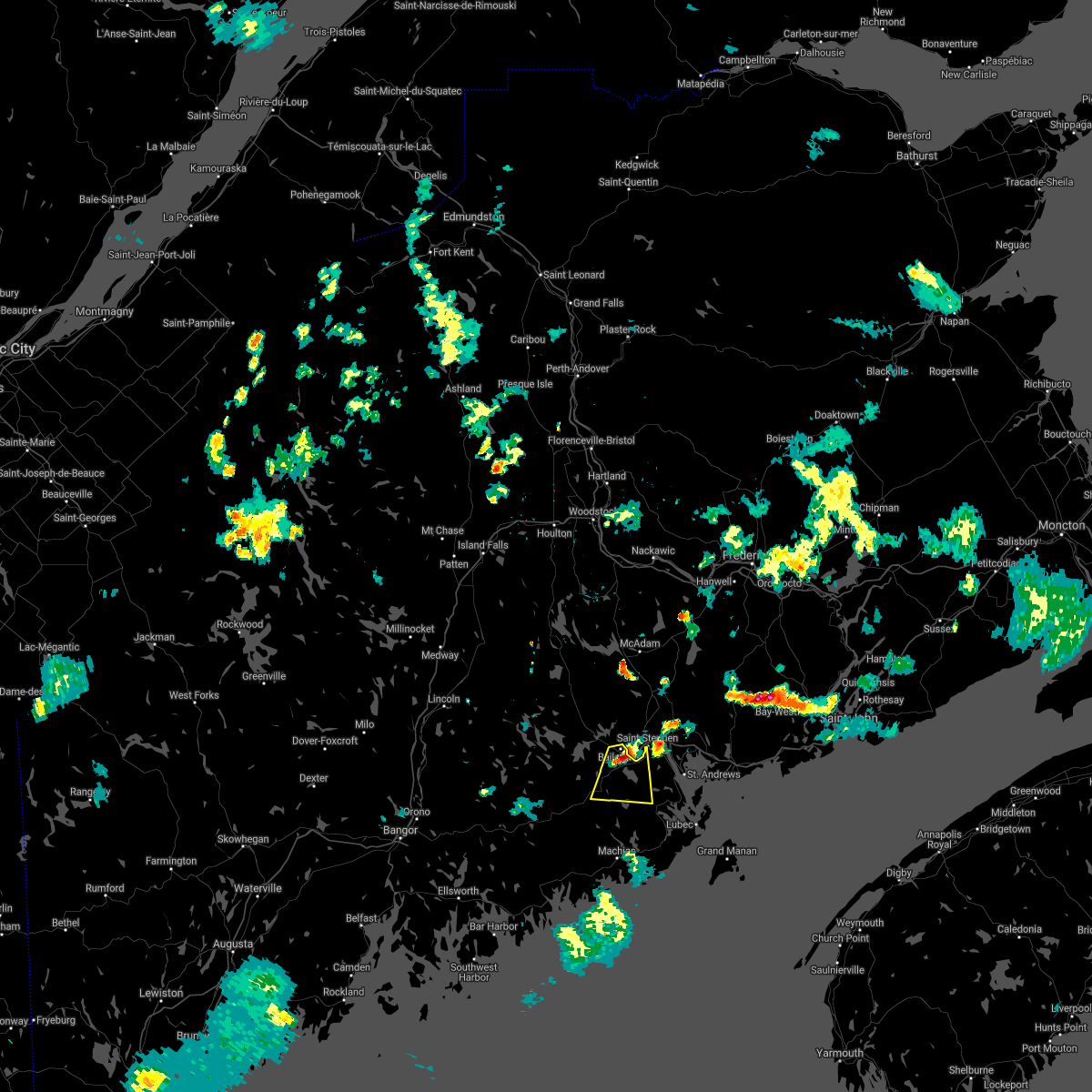
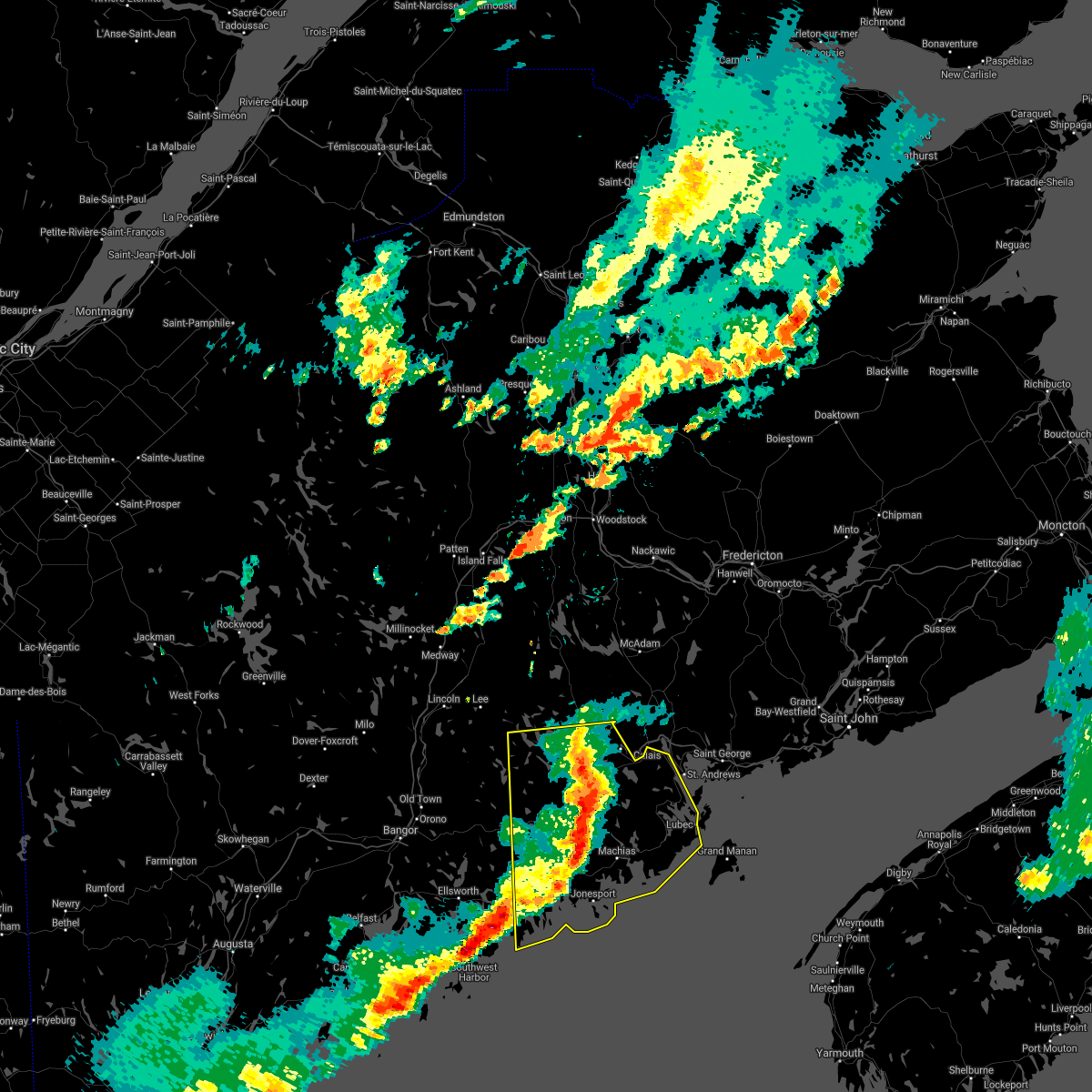
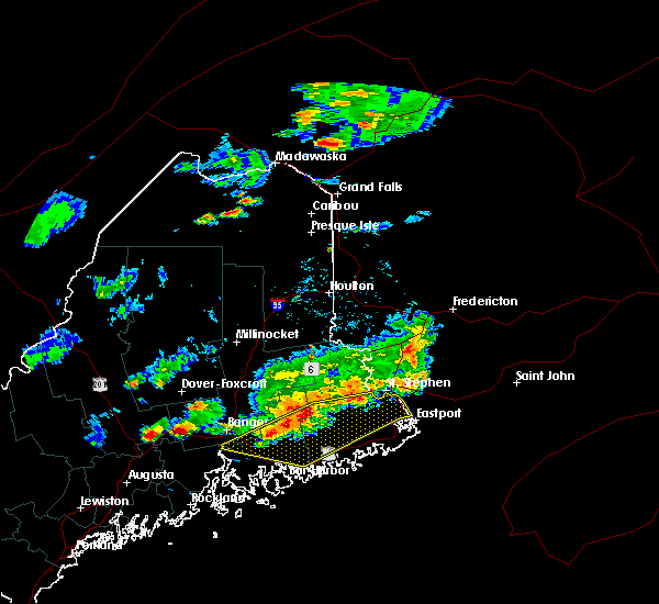
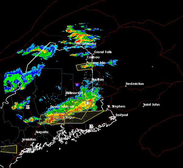
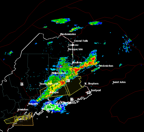
The Woodland, ME area has had 2 reports of on-the-ground hail by trained spotters, and has been under severe weather warnings 0 times during the past 12 months. Doppler radar has detected hail at or near Woodland, ME on 7 occasions.
| Name: | Woodland, ME |
| Where Located: | 71 miles ENE of Bangor, ME |
| Map: | Google Map for Woodland, ME |
| Population: | 952 |
| Housing Units: | 514 |
| More Info: | Search Google for Woodland, ME |
5
The Top Recent Hail Date for Woodland, ME is Wednesday, May 16, 2012 (1st out of 7)
Hail and Wind Damage Spotted near Woodland, ME
| Date / Time | Report Details |
|---|---|
| 7/3/2025 3:48 PM EDT | Tree down on powerlines on water st. time estimated by rada in washington county ME, 17.6 miles E of Woodland, ME |
| 6/30/2024 3:29 PM EDT |
 Svrcar the national weather service in caribou maine has issued a * severe thunderstorm warning for, west central washington county in southeastern maine, northern hancock county in southeastern maine, southern penobscot county in east central maine, * until 400 pm edt. * at 329 pm edt, severe thunderstorms were located along a line extending from near lakeville to near grand falls to near corinth, moving east at 85 mph (radar indicated). Hazards include 70 mph wind gusts and quarter size hail. Minor hail damage to vehicles is possible. expect considerable tree damage. Wind damage is also likely to mobile homes, roofs, and outbuildings. Svrcar the national weather service in caribou maine has issued a * severe thunderstorm warning for, west central washington county in southeastern maine, northern hancock county in southeastern maine, southern penobscot county in east central maine, * until 400 pm edt. * at 329 pm edt, severe thunderstorms were located along a line extending from near lakeville to near grand falls to near corinth, moving east at 85 mph (radar indicated). Hazards include 70 mph wind gusts and quarter size hail. Minor hail damage to vehicles is possible. expect considerable tree damage. Wind damage is also likely to mobile homes, roofs, and outbuildings.
|
| 7/5/2023 5:21 PM EDT | Large tree down on wires blocking the cooper roa in washington county ME, 7.5 miles NNE of Woodland, ME |
| 7/5/2023 5:21 PM EDT | Corrects previous tstm wnd dmg report from 2 s alexander. large tree down on wires blocking the cooper road (n. union road) approx 1mi north of route 191. photo via soc in washington county ME, 10.4 miles N of Woodland, ME |
| 7/23/2021 6:12 PM EDT | Quarter sized hail reported 0.4 miles E of Woodland, ME, photo taken 2 hours after storm of dime to penny size hail. source estimated quarter size hail during the storm. |
| 7/23/2021 6:11 PM EDT |
 At 610 pm edt, a severe thunderstorm was located 7 miles southwest of calais, moving south at 10 mph (radar indicated). Hazards include 60 mph wind gusts and quarter size hail. Minor hail damage to vehicles is possible. Expect wind damage to trees and power lines. At 610 pm edt, a severe thunderstorm was located 7 miles southwest of calais, moving south at 10 mph (radar indicated). Hazards include 60 mph wind gusts and quarter size hail. Minor hail damage to vehicles is possible. Expect wind damage to trees and power lines.
|
| 8/25/2020 4:47 PM EDT |
 At 444 pm edt, a severe thunderstorm was located near meddybemps, or 15 miles south of calais, moving east at 50 mph (radar indicated). Hazards include 70 mph wind gusts and quarter size hail. Minor hail damage to vehicles is possible. expect considerable tree damage. wind damage is also likely to mobile homes, roofs, and outbuildings. Locations impacted include, calais, machias, lubec, eastport, cherryfield, jonesport, steuben, harrington, perry, pembroke, princeton, jonesboro, columbia falls, cutler, columbia, meddybemps, grand lake stream, deblois, centerville and millbridge. At 444 pm edt, a severe thunderstorm was located near meddybemps, or 15 miles south of calais, moving east at 50 mph (radar indicated). Hazards include 70 mph wind gusts and quarter size hail. Minor hail damage to vehicles is possible. expect considerable tree damage. wind damage is also likely to mobile homes, roofs, and outbuildings. Locations impacted include, calais, machias, lubec, eastport, cherryfield, jonesport, steuben, harrington, perry, pembroke, princeton, jonesboro, columbia falls, cutler, columbia, meddybemps, grand lake stream, deblois, centerville and millbridge.
|
| 8/25/2020 4:14 PM EDT |
 At 412 pm edt, a severe thunderstorm was located 15 miles north of deblois, or 24 miles north of cherryfield, moving east at 50 mph (radar indicated). Hazards include 70 mph wind gusts and quarter size hail. Minor hail damage to vehicles is possible. expect considerable tree damage. Wind damage is also likely to mobile homes, roofs, and outbuildings. At 412 pm edt, a severe thunderstorm was located 15 miles north of deblois, or 24 miles north of cherryfield, moving east at 50 mph (radar indicated). Hazards include 70 mph wind gusts and quarter size hail. Minor hail damage to vehicles is possible. expect considerable tree damage. Wind damage is also likely to mobile homes, roofs, and outbuildings.
|
| 8/12/2020 3:36 PM EDT |
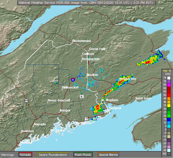 At 336 pm edt, severe thunderstorms were located along a line extending from near calais to 7 miles south of meddybemps, moving east at 30 mph (radar indicated). Hazards include 60 mph wind gusts. expect damage to trees and power lines At 336 pm edt, severe thunderstorms were located along a line extending from near calais to 7 miles south of meddybemps, moving east at 30 mph (radar indicated). Hazards include 60 mph wind gusts. expect damage to trees and power lines
|
| 6/26/2020 2:10 PM EDT |
 The severe thunderstorm warning for central washington county will expire at 215 pm edt, the storm which prompted the warning has moved out of the area. therefore, the warning will be allowed to expire. however heavy rain is still possible with this thunderstorm. The severe thunderstorm warning for central washington county will expire at 215 pm edt, the storm which prompted the warning has moved out of the area. therefore, the warning will be allowed to expire. however heavy rain is still possible with this thunderstorm.
|
| 6/26/2020 1:54 PM EDT |
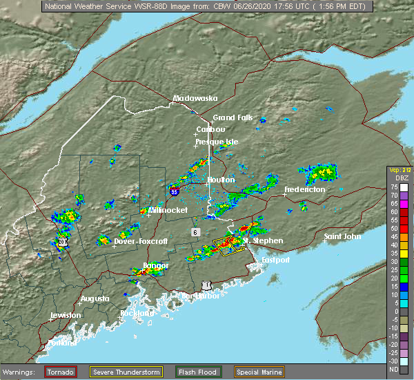 At 138 pm edt, a severe thunderstorm was located over princeton, or 12 miles west of calais, moving northeast at 50 mph (radar indicated). Hazards include 60 mph wind gusts and quarter size hail. Minor hail damage to vehicles is possible. Expect wind damage to trees and power lines. At 138 pm edt, a severe thunderstorm was located over princeton, or 12 miles west of calais, moving northeast at 50 mph (radar indicated). Hazards include 60 mph wind gusts and quarter size hail. Minor hail damage to vehicles is possible. Expect wind damage to trees and power lines.
|
| 6/26/2020 1:38 PM EDT |
 At 138 pm edt, a severe thunderstorm was located over princeton, or 12 miles west of calais, moving northeast at 50 mph (radar indicated). Hazards include 60 mph wind gusts and quarter size hail. Minor hail damage to vehicles is possible. Expect wind damage to trees and power lines. At 138 pm edt, a severe thunderstorm was located over princeton, or 12 miles west of calais, moving northeast at 50 mph (radar indicated). Hazards include 60 mph wind gusts and quarter size hail. Minor hail damage to vehicles is possible. Expect wind damage to trees and power lines.
|
| 8/12/2019 6:08 PM EDT |
 At 607 pm edt, a severe thunderstorm was located near topsfield, or 17 miles southwest of vanceboro, moving east at 30 mph (radar indicated). Hazards include 60 mph wind gusts and nickel size hail. Expect damage to trees and power lines. Locations impacted include, princeton, topsfield, dyer township, fowler township, codyville plantation, baileyville, waite, dyer, fowler and lambert lake. At 607 pm edt, a severe thunderstorm was located near topsfield, or 17 miles southwest of vanceboro, moving east at 30 mph (radar indicated). Hazards include 60 mph wind gusts and nickel size hail. Expect damage to trees and power lines. Locations impacted include, princeton, topsfield, dyer township, fowler township, codyville plantation, baileyville, waite, dyer, fowler and lambert lake.
|
| 8/12/2019 5:45 PM EDT |
 At 544 pm edt, a severe thunderstorm was located 7 miles west of topsfield, or 15 miles south of danforth, moving east at 30 mph (radar indicated). Hazards include 60 mph wind gusts and nickel size hail. expect damage to trees and power lines At 544 pm edt, a severe thunderstorm was located 7 miles west of topsfield, or 15 miles south of danforth, moving east at 30 mph (radar indicated). Hazards include 60 mph wind gusts and nickel size hail. expect damage to trees and power lines
|
| 7/21/2019 11:21 AM EDT | Trees down on power line... time estimate via radar in washington county ME, 4.2 miles N of Woodland, ME |
| 7/21/2019 11:19 AM EDT | Trees down and power outage in washington county ME, 17.6 miles E of Woodland, ME |
| 7/21/2019 11:12 AM EDT |
 At 1111 am edt, severe thunderstorms were located along a line extending from 9 miles east of fowler township to 9 miles south of princeton, moving east at 55 mph (radar indicated). Hazards include 60 mph wind gusts. Expect damage to trees and power lines. Locations impacted include, calais, princeton, meddybemps, fowler township, dyer township, baileyville, robbinston, alexander, charlotte, baring, cooper, crawford, big lake and fowler. At 1111 am edt, severe thunderstorms were located along a line extending from 9 miles east of fowler township to 9 miles south of princeton, moving east at 55 mph (radar indicated). Hazards include 60 mph wind gusts. Expect damage to trees and power lines. Locations impacted include, calais, princeton, meddybemps, fowler township, dyer township, baileyville, robbinston, alexander, charlotte, baring, cooper, crawford, big lake and fowler.
|
| 7/21/2019 10:44 AM EDT |
 At 1044 am edt, severe thunderstorms were located along a line extending from topsfield to 9 miles east of grand falls, moving east at 30 mph (radar indicated). Hazards include 60 mph wind gusts. expect damage to trees and power lines At 1044 am edt, severe thunderstorms were located along a line extending from topsfield to 9 miles east of grand falls, moving east at 30 mph (radar indicated). Hazards include 60 mph wind gusts. expect damage to trees and power lines
|
| 7/6/2019 4:13 PM EDT |
 The severe thunderstorm warning for east central washington county will expire at 415 pm edt, the storm which prompted the warning has weakened below severe limits, and has exited the warned area. therefore, the warning will be allowed to expire. however gusty winds are still possible with this thunderstorm. a severe thunderstorm watch remains in effect until 800 pm edt for southeastern maine. remember, a severe thunderstorm warning still remains in effect for central and western washington county. The severe thunderstorm warning for east central washington county will expire at 415 pm edt, the storm which prompted the warning has weakened below severe limits, and has exited the warned area. therefore, the warning will be allowed to expire. however gusty winds are still possible with this thunderstorm. a severe thunderstorm watch remains in effect until 800 pm edt for southeastern maine. remember, a severe thunderstorm warning still remains in effect for central and western washington county.
|
| 7/6/2019 3:45 PM EDT |
 At 345 pm edt, a severe thunderstorm was located near meddybemps, or near calais, moving east at 25 mph (radar indicated). Hazards include 60 mph wind gusts. expect damage to trees and power lines At 345 pm edt, a severe thunderstorm was located near meddybemps, or near calais, moving east at 25 mph (radar indicated). Hazards include 60 mph wind gusts. expect damage to trees and power lines
|
| 8/4/2018 1:47 PM EDT |
 At 146 pm edt, a severe thunderstorm was located over fowler township, or 15 miles northwest of calais, moving northeast at 20 mph (radar indicated possible rotation with this storm). Hazards include 60 mph wind gusts. expect damage to trees and power lines At 146 pm edt, a severe thunderstorm was located over fowler township, or 15 miles northwest of calais, moving northeast at 20 mph (radar indicated possible rotation with this storm). Hazards include 60 mph wind gusts. expect damage to trees and power lines
|
| 7/10/2018 5:00 PM EDT |
 At 459 pm edt, severe thunderstorms were located along a line extending from near meddybemps to 11 miles north of machias, moving east at 45 mph (radar indicated). Hazards include 70 mph wind gusts and half dollar size hail. Minor hail damage to vehicles is possible. expect considerable tree damage. Wind damage is also likely to mobile homes, roofs, and outbuildings. At 459 pm edt, severe thunderstorms were located along a line extending from near meddybemps to 11 miles north of machias, moving east at 45 mph (radar indicated). Hazards include 70 mph wind gusts and half dollar size hail. Minor hail damage to vehicles is possible. expect considerable tree damage. Wind damage is also likely to mobile homes, roofs, and outbuildings.
|
| 6/12/2017 7:41 PM EDT |
 The severe thunderstorm warning for washington, northeastern hancock and southeastern penobscot counties will expire at 745 pm edt, the severe thunderstorm which prompted the warning has weakened. therefore, the warning will be allowed to expire. The severe thunderstorm warning for washington, northeastern hancock and southeastern penobscot counties will expire at 745 pm edt, the severe thunderstorm which prompted the warning has weakened. therefore, the warning will be allowed to expire.
|
| 6/12/2017 7:15 PM EDT |
 At 714 pm edt, a severe thunderstorm was located near calais, moving east at 50 mph (radar indicated). Hazards include 60 mph wind gusts and quarter size hail. Minor hail damage to vehicles is possible. expect wind damage to trees and power lines. locations impacted include, calais, machias, lubec, eastport, danforth, vanceboro, perry, pembroke, princeton, jonesboro, columbia falls, cutler, columbia, springfield, topsfield, meddybemps, grand lake stream, lakeville, centerville and fowler township. this includes the following highways, us highway 1 between jonesboro and eaton. State highway 9 between wesley and calais. At 714 pm edt, a severe thunderstorm was located near calais, moving east at 50 mph (radar indicated). Hazards include 60 mph wind gusts and quarter size hail. Minor hail damage to vehicles is possible. expect wind damage to trees and power lines. locations impacted include, calais, machias, lubec, eastport, danforth, vanceboro, perry, pembroke, princeton, jonesboro, columbia falls, cutler, columbia, springfield, topsfield, meddybemps, grand lake stream, lakeville, centerville and fowler township. this includes the following highways, us highway 1 between jonesboro and eaton. State highway 9 between wesley and calais.
|
| 6/12/2017 6:38 PM EDT |
 At 638 pm edt, a severe thunderstorm was located 7 miles north of grand lake stream, or 25 miles west of calais, moving east at 50 mph (radar indicated). Hazards include 60 mph wind gusts and quarter size hail. Minor hail damage to vehicles is possible. Expect wind damage to trees and power lines. At 638 pm edt, a severe thunderstorm was located 7 miles north of grand lake stream, or 25 miles west of calais, moving east at 50 mph (radar indicated). Hazards include 60 mph wind gusts and quarter size hail. Minor hail damage to vehicles is possible. Expect wind damage to trees and power lines.
|
| 6/12/2017 5:25 PM EDT |
 At 524 pm edt, a severe thunderstorm was located near grand lake stream, or 27 miles west of calais, moving east at 25 mph (radar indicated). Hazards include 60 mph wind gusts and quarter size hail. Minor hail damage to vehicles is possible. Expect wind damage to trees and power lines. At 524 pm edt, a severe thunderstorm was located near grand lake stream, or 27 miles west of calais, moving east at 25 mph (radar indicated). Hazards include 60 mph wind gusts and quarter size hail. Minor hail damage to vehicles is possible. Expect wind damage to trees and power lines.
|
| 8/6/2016 3:53 PM EDT |
 At 350 pm edt, a severe thunderstorm was located near calais, moving east at 45 mph (radar indicated). Hazards include 60 mph wind gusts and quarter size hail. Hail damage to vehicles is expected. expect wind damage to roofs, siding, and trees. Locations impacted include, calais, perry, pembroke, princeton, meddybemps, grand lake stream, fowler township, baileyville, robbinston, alexander, charlotte, baring, cooper, crawford, wesley and big lake. At 350 pm edt, a severe thunderstorm was located near calais, moving east at 45 mph (radar indicated). Hazards include 60 mph wind gusts and quarter size hail. Hail damage to vehicles is expected. expect wind damage to roofs, siding, and trees. Locations impacted include, calais, perry, pembroke, princeton, meddybemps, grand lake stream, fowler township, baileyville, robbinston, alexander, charlotte, baring, cooper, crawford, wesley and big lake.
|
| 8/6/2016 3:35 PM EDT |
 At 333 pm edt, a severe thunderstorm was located near calais, moving east at 50 mph (radar indicated). Hazards include 60 mph wind gusts and quarter size hail. Hail damage to vehicles is expected. Expect wind damage to roofs, siding, and trees. At 333 pm edt, a severe thunderstorm was located near calais, moving east at 50 mph (radar indicated). Hazards include 60 mph wind gusts and quarter size hail. Hail damage to vehicles is expected. Expect wind damage to roofs, siding, and trees.
|
| 7/28/2016 5:34 PM EDT |
 At 534 pm edt, a severe thunderstorm was located 13 miles northeast of deblois, or 20 miles north of cherryfield, moving east at 30 mph (radar indicated). Hazards include 60 mph wind gusts. Expect damage to roofs. siding. and trees. Locations impacted include, machias, dedham, princeton, jonesboro, columbia falls, columbia, deblois, centerville, milford, baileyville, bradley, east machias, machiasport, clifton, otis, marshfield, mariaville, alexander, eastbrook and waltham. At 534 pm edt, a severe thunderstorm was located 13 miles northeast of deblois, or 20 miles north of cherryfield, moving east at 30 mph (radar indicated). Hazards include 60 mph wind gusts. Expect damage to roofs. siding. and trees. Locations impacted include, machias, dedham, princeton, jonesboro, columbia falls, columbia, deblois, centerville, milford, baileyville, bradley, east machias, machiasport, clifton, otis, marshfield, mariaville, alexander, eastbrook and waltham.
|
| 7/28/2016 5:12 PM EDT |
 At 511 pm edt, a severe thunderstorm was located 13 miles northwest of deblois, or 20 miles east of old town, moving east at 35 mph (radar indicated). Hazards include 60 mph wind gusts. Expect damage to roofs. siding. And trees. At 511 pm edt, a severe thunderstorm was located 13 miles northwest of deblois, or 20 miles east of old town, moving east at 35 mph (radar indicated). Hazards include 60 mph wind gusts. Expect damage to roofs. siding. And trees.
|
| 7/18/2016 5:06 PM EDT |
 At 506 pm edt, severe thunderstorms were located along a line extending from 6 miles south of calais to near centerville, moving east at 40 mph (radar indicated). Hazards include 60 mph wind gusts. Expect damage to roofs. siding. and trees. Locations impacted include, calais, perry, pembroke, meddybemps, centerville, baileyville, east machias, robbinston, marshfield, alexander, dennysville, charlotte, baring, whitneyville, cooper, northfield, crawford, wesley, marion and edmunds. At 506 pm edt, severe thunderstorms were located along a line extending from 6 miles south of calais to near centerville, moving east at 40 mph (radar indicated). Hazards include 60 mph wind gusts. Expect damage to roofs. siding. and trees. Locations impacted include, calais, perry, pembroke, meddybemps, centerville, baileyville, east machias, robbinston, marshfield, alexander, dennysville, charlotte, baring, whitneyville, cooper, northfield, crawford, wesley, marion and edmunds.
|
| 7/18/2016 4:27 PM EDT |
 At 427 pm edt, severe thunderstorms were located along a line extending from calais to 8 miles southwest of grand lake stream to near dedham, moving east at 30 mph (radar indicated). Hazards include 60 mph wind gusts and quarter size hail. Hail damage to vehicles is expected. Expect wind damage to roofs, siding, and trees. At 427 pm edt, severe thunderstorms were located along a line extending from calais to 8 miles southwest of grand lake stream to near dedham, moving east at 30 mph (radar indicated). Hazards include 60 mph wind gusts and quarter size hail. Hail damage to vehicles is expected. Expect wind damage to roofs, siding, and trees.
|
| 7/18/2016 4:21 PM EDT |
 The severe thunderstorm warning for northwestern washington, southeastern aroostook and eastern penobscot counties will expire at 430 pm edt, the storm which prompted the warning has weakened below severe limits, and has exited the warned area. therefore, the warning will be allowed to expire. a severe thunderstorm watch remains in effect until 800 pm edt for northern, southeastern and east central maine. The severe thunderstorm warning for northwestern washington, southeastern aroostook and eastern penobscot counties will expire at 430 pm edt, the storm which prompted the warning has weakened below severe limits, and has exited the warned area. therefore, the warning will be allowed to expire. a severe thunderstorm watch remains in effect until 800 pm edt for northern, southeastern and east central maine.
|
| 7/18/2016 3:43 PM EDT |
 At 342 pm edt, a severe thunderstorm was located 7 miles southwest of topsfield, or 21 miles south of danforth, moving southeast at 50 mph (radar indicated). Hazards include 60 mph wind gusts. Expect damage to roofs. siding. And trees. At 342 pm edt, a severe thunderstorm was located 7 miles southwest of topsfield, or 21 miles south of danforth, moving southeast at 50 mph (radar indicated). Hazards include 60 mph wind gusts. Expect damage to roofs. siding. And trees.
|
| 8/4/2015 5:43 PM EDT |
 At 540 pm edt, a severe thunderstorm was located near springfield, moving east at 45 mph (radar indicated). Hazards include 60 mph wind gusts and quarter size hail. Hail damage to vehicles is expected. expect wind damage to roofs, siding and trees. Locations impacted include, danforth, vanceboro, hodgdon, sherman, island falls, princeton, springfield, amity, topsfield, haynesville, grand lake stream, lakeville, deblois, sherman station, dyer township, reed plantation, wytopitlock, fowler township, codyville plantation and cary plantation. At 540 pm edt, a severe thunderstorm was located near springfield, moving east at 45 mph (radar indicated). Hazards include 60 mph wind gusts and quarter size hail. Hail damage to vehicles is expected. expect wind damage to roofs, siding and trees. Locations impacted include, danforth, vanceboro, hodgdon, sherman, island falls, princeton, springfield, amity, topsfield, haynesville, grand lake stream, lakeville, deblois, sherman station, dyer township, reed plantation, wytopitlock, fowler township, codyville plantation and cary plantation.
|
| 8/4/2015 5:14 PM EDT |
 At 512 pm edt, a severe thunderstorm was located near danforth, moving east at 50 mph (radar indicated). Hazards include 60 mph wind gusts and quarter size hail. Hail damage to vehicles is expected. Expect wind damage to roofs, siding and trees. At 512 pm edt, a severe thunderstorm was located near danforth, moving east at 50 mph (radar indicated). Hazards include 60 mph wind gusts and quarter size hail. Hail damage to vehicles is expected. Expect wind damage to roofs, siding and trees.
|
| 8/1/2015 4:05 PM EDT | Tree down knocking power out to east side of tow in washington county ME, 18 miles E of Woodland, ME |
| 5/26/2014 3:15 PM EDT | Quarter sized hail reported 8.8 miles ESE of Woodland, ME, pea to quarter size hail reported. |
| 6/25/2013 4:54 PM EDT | Tree down on powerlin in washington county ME, 5.6 miles NNE of Woodland, ME |
Hail Maps for Woodland, ME


Connect with Interactive Hail Maps