

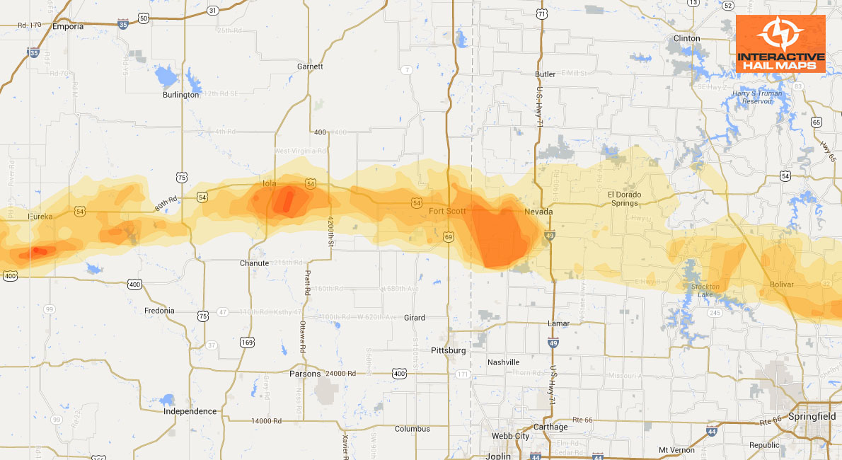
Hail Storm Map For Columbia, Missouri, September 7, 2012
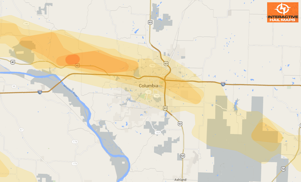
Here is the hail map for the hail storm that hit Columbia, Missouri on September 7, 2012. The largest and most intense hail hit just to the west of the city. Use Interactive Hail Maps to pinpoint hail damage. Zero in to see the neighborhoods hit.
Cities Most Affected by Hail Storms of 9/7/2012
| Hail Size | Demographics of Zip Codes Affected | ||||||
|---|---|---|---|---|---|---|---|
| City | Count | Average | Largest | Pop Density | House Value | Income | Age |
| Columbia, MO | 9 | 2.00 | 2.75 | 469 | $107k | $30.5k | 25.1 |
| Dover, AR | 3 | 2.08 | 2.75 | 28 | $65k | $31.9k | 41.0 |
| Wichita, KS | 2 | 2.13 | 2.50 | 2804 | $96k | $43.3k | 31.1 |
| Jefferson City, MO | 2 | 1.75 | 1.75 | 475 | $99k | $45.0k | 38.2 |
| Warrenton, MO | 1 | 2.50 | 2.50 | 99 | $104k | $37.1k | 39.0 |
| Caney, KS | 1 | 2.00 | 2.00 | 57 | $45k | $33.1k | 39.6 |
| Troy, MO | 1 | 1.75 | 1.75 | 181 | $111k | $44.2k | 34.3 |
| Elizabethtown, IL | 1 | 1.75 | 1.75 | 13 | $55k | $24.8k | 47.1 |
Connect with Interactive Hail Maps