

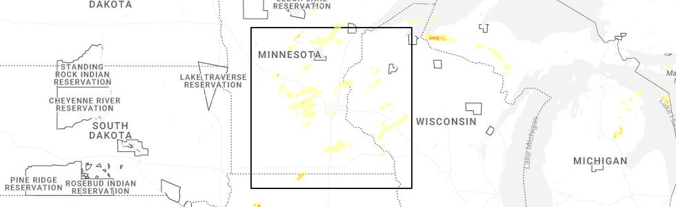
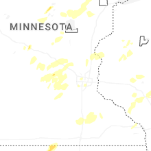
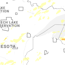
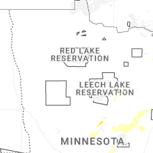
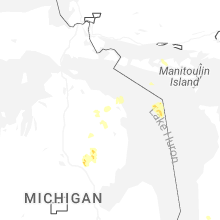
Hail Map for Friday, August 8, 2025
Number of Impacted Households on 8/8/2025
0
Impacted by 1" or Larger Hail
0
Impacted by 1.75" or Larger Hail
0
Impacted by 2.5" or Larger Hail
Square Miles of Populated Area Impacted on 8/8/2025
0
Impacted by 1" or Larger Hail
0
Impacted by 1.75" or Larger Hail
0
Impacted by 2.5" or Larger Hail
Cities Most Affected by Hail Storms of 8/8/2025
| Hail Size | Demographics of Zip Codes Affected | ||||||
|---|---|---|---|---|---|---|---|
| City | Count | Average | Largest | Pop Density | House Value | Income | Age |
Hail and Wind Damage Spotted on 8/8/2025
Filter by Report Type:Hail ReportsWind Reports
States Impacted
MinnesotaMinnesota
| Local Time | Report Details |
|---|---|
| 9:00 AM CDT | Numerous trees down in the vicinity of mn 65 and 450th st. north of mcgregor. time estimated by rada in aitkin county MN, 58.5 miles W of Duluth, MN |
| 9:10 AM CDT | Several trees on powerlines and several trees across cr6 near round lak in aitkin county MN, 52 miles W of Duluth, MN |
| 9:23 AM CDT | 18 inch diameter spruce tree blown down. moen rd. tree top on road. time estimated by rada in st. louis county MN, 39.9 miles W of Duluth, MN |
| 9:35 AM CDT | Tree branches down and tree downed powerline on near by residents dec in st. louis county MN, 39.5 miles WNW of Duluth, MN |
| 9:35 AM CDT | A few trees down on parking lot. poplar tree tops snappe in st. louis county MN, 40.1 miles WNW of Duluth, MN |
| 9:40 AM CDT | Tree on powerline both are down and across hwy in st. louis county MN, 38.1 miles WNW of Duluth, MN |
| 9:40 AM CDT | Tree down on hwy 73 near mile marker 4 in st. louis county MN, 39.7 miles WNW of Duluth, MN |
Connect with Interactive Hail Maps