

Hail Map for Monday, June 15, 2015

Number of Impacted Households on 6/15/2015
0
Impacted by 1" or Larger Hail
0
Impacted by 1.75" or Larger Hail
0
Impacted by 2.5" or Larger Hail
Square Miles of Populated Area Impacted on 6/15/2015
0
Impacted by 1" or Larger Hail
0
Impacted by 1.75" or Larger Hail
0
Impacted by 2.5" or Larger Hail


Cities Most Affected by Hail Storms of 6/15/2015
| Hail Size | Demographics of Zip Codes Affected | ||||||
|---|---|---|---|---|---|---|---|
| City | Count | Average | Largest | Pop Density | House Value | Income | Age |
| Vinton, OH | 2 | 1.75 | 1.75 | 36 | $61k | $28.1k | 40.2 |
| Wayan, ID | 1 | 1.75 | 1.75 | 0 | $98k | $23.3k | 43.5 |
| Thayne, WY | 1 | 1.75 | 1.75 | 17 | $152k | $44.5k | 41.1 |
Hail and Wind Damage Spotted on 6/15/2015
Filter by Report Type:Hail ReportsWind Reports
Ohio
| Local Time | Report Details |
|---|---|
| 2:38 PM EDT | Golf Ball sized hail reported near Vinton, OH, 55.9 miles NW of Charleston, WV, golf ball sized hail and vehicle damage reported in morgan township. |
| 3:04 PM EDT | Golf Ball sized hail reported near Vinton, OH, 55.9 miles NW of Charleston, WV, golf ball sized hail and vehicle damage reported in morgan township. |
| 4:03 PM EDT | Several limbs about 1 ft in diameter along with 4-6" branches downed. branches look partially rotte in defiance county OH, 21.8 miles NE of Fort Wayne, IN |
| 4:20 PM EDT | 8-10" limbs down. no information on health of limbs. heavy rain also observe in paulding county OH, 37.6 miles E of Fort Wayne, IN |
Florida
| Local Time | Report Details |
|---|---|
| 4:05 PM EDT | Trained spotter reported her inground aluminum flag pole snapped in half and wind anemometer blew awa in sarasota county FL, 31.3 miles SSE of Bradenton, FL |
| 4:05 PM EDT | Large sign for a car repair business blown down at 1050 us hwy 41 bypass in venice. time estimated by rada in sarasota county FL, 29.2 miles SSE of Bradenton, FL |
| 5:54 PM EDT | Davis island yacht club report several dry docked boats were blown ove in hillsborough county FL, 30.3 miles NNE of Bradenton, FL |
Wyoming
| Local Time | Report Details |
|---|---|
| 3:15 PM MDT | Golf Ball sized hail reported near Thayne, WY, 65.5 miles ESE of Idaho Falls, ID, a trained spotter reported golf ball size hail |
| 5:04 PM MDT | Quarter sized hail reported near Freedom, WY, 61.3 miles SE of Idaho Falls, ID, picture of a few stones around 1 inch. most were smaller. |
| 8:14 PM MDT | Quarter sized hail reported near Afton, WY, 77 miles SE of Idaho Falls, ID, law enforcement reported quarter size hail covering the road in afton. |
Idaho
| Local Time | Report Details |
|---|---|
| 4:01 PM MDT | Quarter sized hail reported near Idaho Falls, ID, 14.1 miles ENE of Idaho Falls, ID, report via facebook. time estimated from radar. |
| 4:36 PM MDT | Golf Ball sized hail reported near Wayan, ID, 46.1 miles SE of Idaho Falls, ID, measured at time of event. raining heavily at time of report. |
| 5:30 PM MDT | Quarter sized hail reported near Malta, ID, 58.9 miles ESE of Twin Falls, ID, pea to 1 inch and falling heavily during phone call. |
| 5:39 PM MDT | Quarter sized hail reported near Aberdeen, ID, 55.5 miles SW of Idaho Falls, ID, marble to quarter-size hail... covering ground... and falling at time of report along with heavy rain. |
| 6:25 PM MDT | Quarter sized hail reported near Blackfoot, ID, 27.8 miles SW of Idaho Falls, ID, measured at time of event. |
| 6:30 PM MDT | Quarter sized hail reported near Blackfoot, ID, 26 miles SW of Idaho Falls, ID, size estimated from video submitted to kifi tv facebook page. time estimated by radar. |
| 6:50 PM MDT | Quarter sized hail reported near Pocatello, ID, 51.1 miles SW of Idaho Falls, ID, at the weather forecast office...pocatello regional airport. |
| 7:18 PM MDT | Quarter sized hail reported near Downey, ID, 72.8 miles S of Idaho Falls, ID, hail began as dime-size. rain and hail mix so heavy... visibility is less than 15 feet. with easing of rain... estimate three inches of standing water lies between house |
Illinois
| Local Time | Report Details |
|---|---|
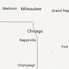
| 5:20 PM CDT | At least two large trees downed and numerous tree branches of 2 to 8 inches diameter downed. in southern part of town. power/phone poles down along il251. delayed repor in la salle county IL, 64 miles NNE of Peoria, IL |
| 6:17 PM CDT | Multiple 2-3 inch diameter tree limbs dow in montgomery county IL, 58.3 miles WSW of Mattoon, IL |
| 7:35 PM CDT | Tree blown over on she in peoria county IL, 3.5 miles NNW of Peoria, IL |
Utah
| Local Time | Report Details |
|---|---|
| 4:30 PM MDT | Quarter sized hail reported near Whiterocks, UT, 77.7 miles SSW of Rock Springs, WY, quarter sized hail reported on top of whiterocks mountain. hail accumulated to 3 inches deep in some areas. |
| 7:00 PM MDT | Center trailings sensor kcc13 in salt lake county UT, 12.7 miles W of Salt Lake City, UT |
| 7:45 PM MDT | West salt flats sensor dpg26 in tooele county UT, 95.5 miles NE of Ely, NV |
Virginia
| Local Time | Report Details |
|---|---|
| 6:39 PM EDT | Trees down on white hall road and lambs creek road in king george county VA, 58.8 miles NNE of Richmond, VA |
| 6:39 PM EDT | Trees down on white hall road and lambs creek road in king george county VA, 57.5 miles NNE of Richmond, VA |
Maryland
| Local Time | Report Details |
|---|---|
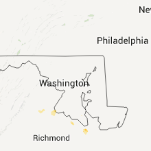
| 6:43 PM EDT | Multiple trees down near maryland point road and riverside road in charles county MD, 55.9 miles SSW of Baltimore, MD |
| 6:43 PM EDT | Multiple trees down near maryland point road and riverside road in charles county MD, 65.1 miles NNE of Richmond, VA |
Connect with Interactive Hail Maps