

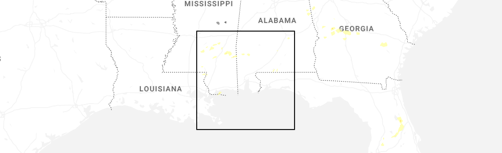
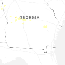
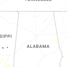
Hail Map for Tuesday, May 27, 2025
Number of Impacted Households on 5/27/2025
0
Impacted by 1" or Larger Hail
0
Impacted by 1.75" or Larger Hail
0
Impacted by 2.5" or Larger Hail
Square Miles of Populated Area Impacted on 5/27/2025
0
Impacted by 1" or Larger Hail
0
Impacted by 1.75" or Larger Hail
0
Impacted by 2.5" or Larger Hail
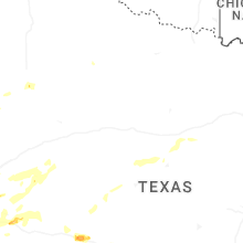
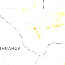
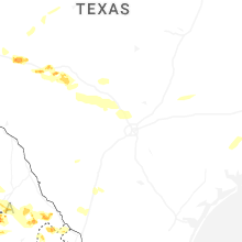

Cities Most Affected by Hail Storms of 5/27/2025
| Hail Size | Demographics of Zip Codes Affected | ||||||
|---|---|---|---|---|---|---|---|
| City | Count | Average | Largest | Pop Density | House Value | Income | Age |
| Big Bend National Park, TX | 1 | 1.75 | 1.75 | 0 | $0k | $48.8k | 41.8 |
Hail and Wind Damage Spotted on 5/27/2025
Filter by Report Type:Hail ReportsWind Reports
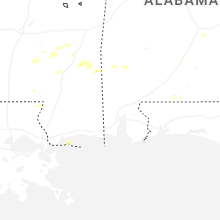
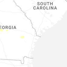
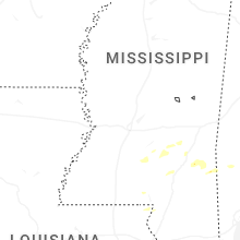
Mississippi
| Local Time | Report Details |
|---|---|
| 7:05 AM CDT | Tree down on old mill r in claiborne county MS, 52.6 miles WSW of Jackson, MS |
| 7:12 AM CDT | Trees down and across roads in the ne part of the count in jefferson county MS, 53.3 miles SW of Jackson, MS |
| 7:40 AM CDT | Tree blocking broadwater r in hinds county MS, 23.4 miles WSW of Jackson, MS |
| 7:45 AM CDT | Tree down blocking road... oakley-palestine r in hinds county MS, 16.4 miles WSW of Jackson, MS |
| 7:50 AM CDT | Tree down along hwy 2 in copiah county MS, 22.2 miles SSW of Jackson, MS |
| 8:00 AM CDT | A few trees down on power lines along trace r in lawrence county MS, 53 miles S of Jackson, MS |
| 8:20 AM CDT | Tree down on prosperity plac in rankin county MS, 11.7 miles E of Jackson, MS |
| 8:24 AM CDT | Tree down across will stutley d in rankin county MS, 14.5 miles ESE of Jackson, MS |
| 8:33 AM CDT | Large pine tree half way down... leaning across hwy 540... had to be cut off the roa in smith county MS, 42.4 miles ESE of Jackson, MS |
| 6:20 PM CDT | Quarter sized hail reported near Buckatunna, MS, 65.2 miles NNW of Mobile, AL |
Alabama
| Local Time | Report Details |
|---|---|
| 12:08 PM CDT | Several trees were downed across talladega county... including around talladega and sylacaug in talladega county AL, 41.5 miles E of Birmingham, AL |
| 1:00 PM CDT | Several trees down across northern randolph county... including cr 19... cr 15... highway 431... and cr 51 at cr 9 in randolph county AL, 56.7 miles N of Auburn, AL |
| 2:12 PM CDT | A couple trees were downed along butter and egg rd and along highway 2 in pike county AL, 58.8 miles SSW of Auburn, AL |
| 2:17 PM CDT | 911 dispatch reported tree down at intersection of hwy 161 and cr 20 in coffee county AL, 75.1 miles SSW of Auburn, AL |
| 2:20 PM CDT | 911 dispatch reported tree down at intersection of cr 290 and 20 in coffee county AL, 75.1 miles SSW of Auburn, AL |
| 2:21 PM CDT | Trees down on mill creek... grider mock... and salem church roads. some of the trees fell on power line in covington county AL, 63 miles NNW of Miramar Beach, FL |
| 2:30 PM CDT | 911 dispatch reported tree down at intersection of cr 248 near pea river bridg in coffee county AL, 76.3 miles NNE of Miramar Beach, FL |
| 2:45 PM CDT | Trees and powerlines were downed around clayton... including highway 51... poorhouse rd... and county shop r in barbour county AL, 50.2 miles S of Auburn, AL |
| 2:47 PM CDT | 911 dispatch reported tree down at intersection of cr 151 and 14 in coffee county AL, 80.8 miles SSW of Auburn, AL |
| 3:06 PM CDT | Trees and powerlines were downed in eufaula... including barbour ln... south randolph ave... and west broad at doren d in barbour county AL, 54 miles SSE of Auburn, AL |
| 3:20 PM CDT | Tree down near county road 212 and highway 43 in henry county AL, 70.5 miles S of Auburn, AL |
| 6:56 PM CDT | Marshall space flight center. unoccupied warehouse had damage to roof and side. possible tornad in madison county AL, 58.3 miles E of Florence, AL |
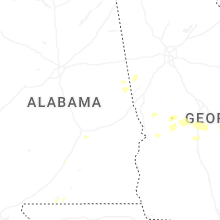
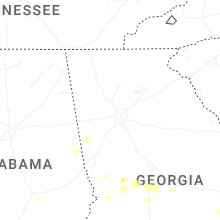
Georgia
| Local Time | Report Details |
|---|---|
| 3:10 PM EDT | Trees down at the intersection of dart rd and herring road. possible brief tornadic spin u in coweta county GA, 31.2 miles SW of Atlanta, GA |
| 7:08 PM EDT | Emergency management reports numerous trees down along hwy 5 in toombs county GA, 51.7 miles NE of Douglas, GA |
| 7:10 PM EDT | Emergency manager reports tree damage along hwy 14 in toombs county GA, 45.5 miles NE of Douglas, GA |
| 7:23 PM EDT | Tree down at the intersection of highway 178 and cecil tootle road. time estimated by rada in tattnall county GA, 52.1 miles NE of Douglas, GA |
| 8:02 PM EDT | Tree down at the intersection of loves chapel road and martin j durrence road. a few other trees were also reported down in the same general area. time estimated by rad in tattnall county GA, 51.9 miles W of Savannah, GA |
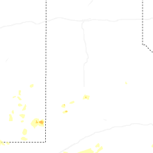
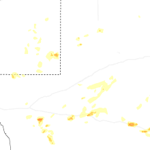
Texas
| Local Time | Report Details |
|---|---|
| 4:45 PM CDT | Golf Ball sized hail reported near Big Bend National Park, TX, 78.1 miles SSE of Alpine, TX |
| 6:38 PM CDT | Half Dollar sized hail reported near Marathon, TX, 24.6 miles ESE of Alpine, TX, storm chaser reported half dollar size hail on us 90 west of marathon. time was estimated by radar. |
| 9:32 PM CDT | Mesonet station 55 5sw st. lawrence... t in glasscock county TX, 47.5 miles ESE of Odessa, TX |
| 11:18 PM CDT | Corrected time on previous tstm wnd gst report from 2 w christova in tom green county TX, 98.4 miles SSW of Abilene, TX |
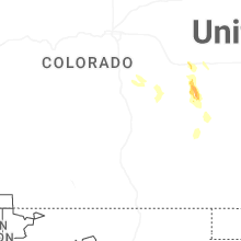
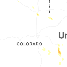
Colorado
| Local Time | Report Details |
|---|---|
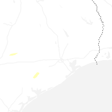
| 5:10 PM MDT | Quarter sized hail reported near New Raymer, CO, 68 miles WNW of Yuma, CO |
New Mexico
| Local Time | Report Details |
|---|---|
| 8:20 PM MDT | Asos station kcnm carlsba in eddy county NM, 75.1 miles SSE of Roswell, NM |
Connect with Interactive Hail Maps