

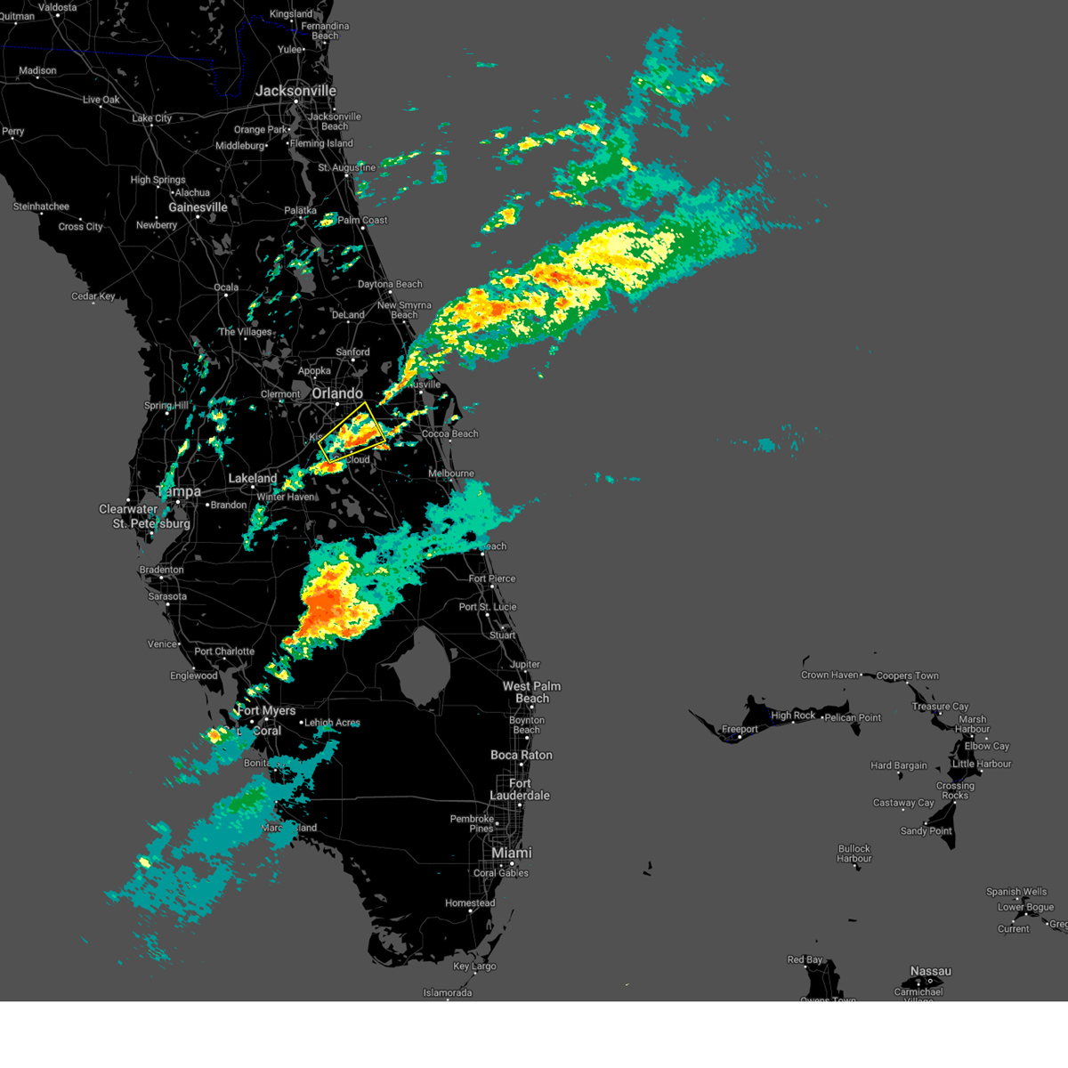
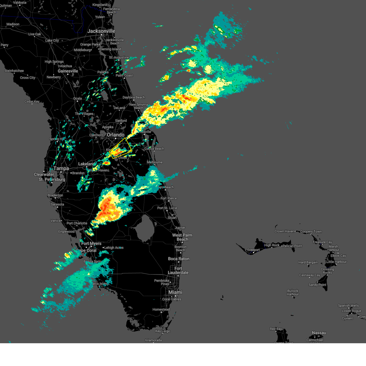
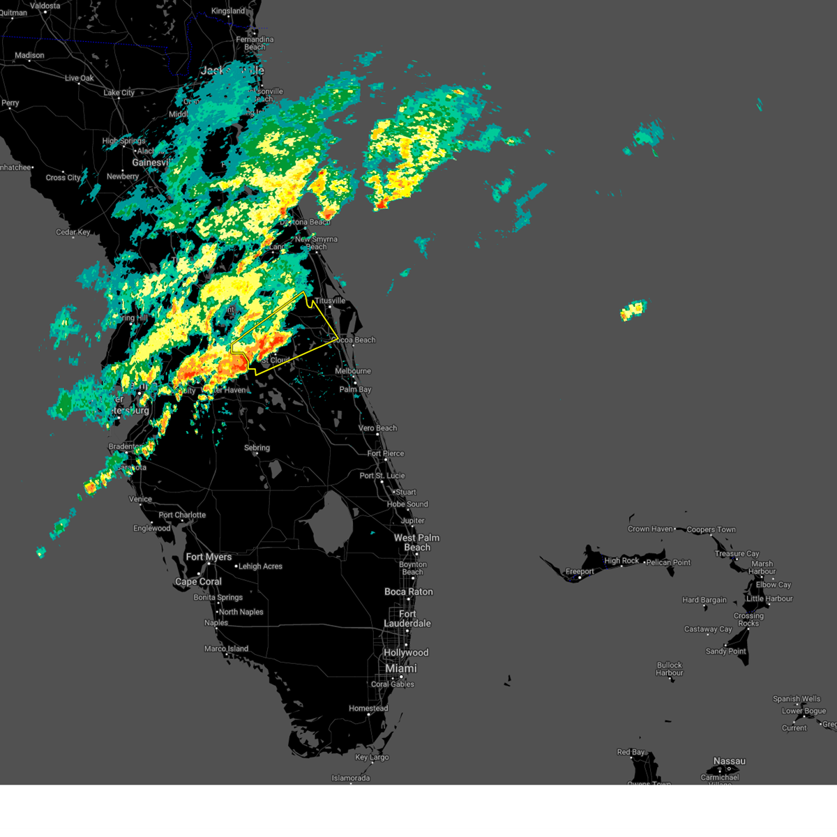
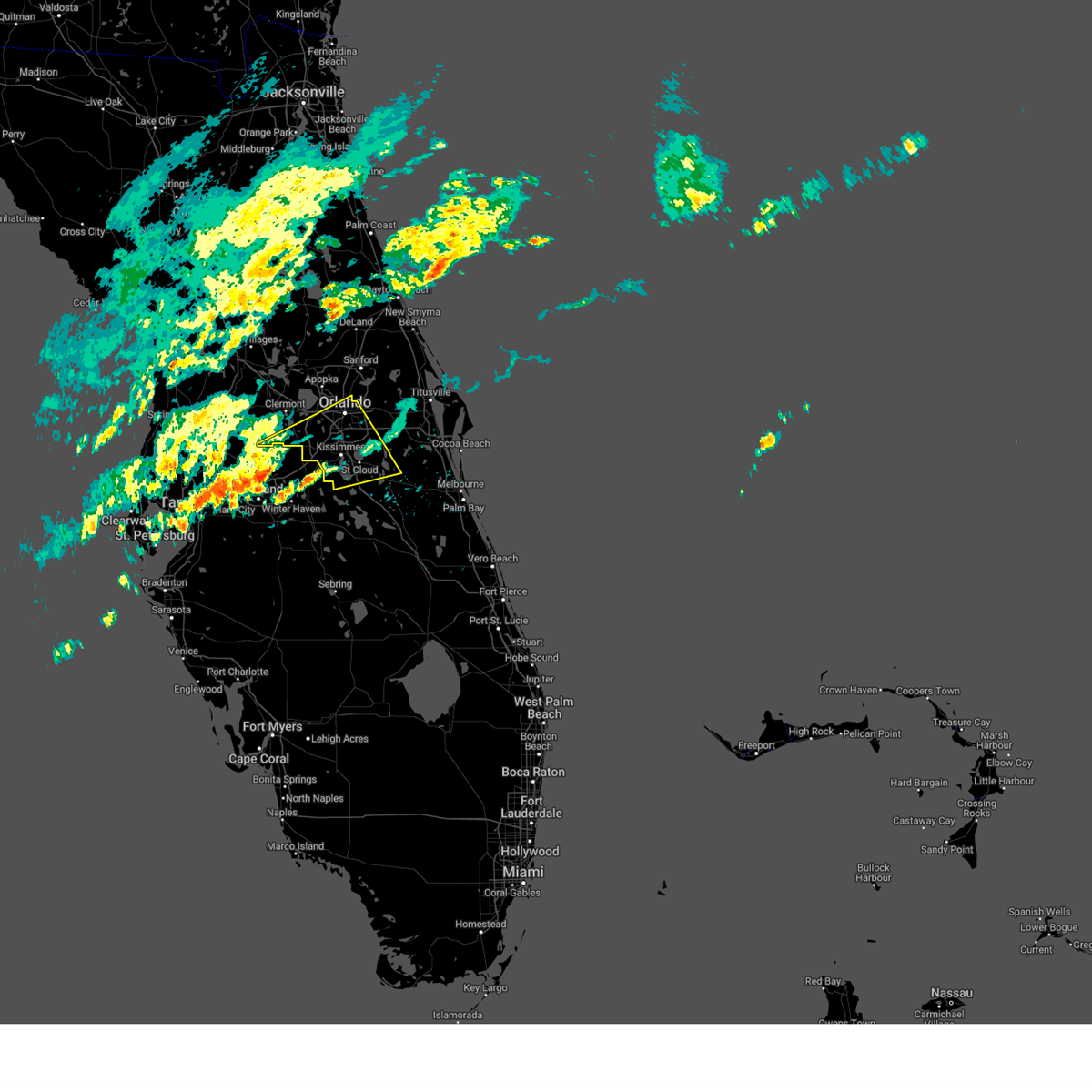
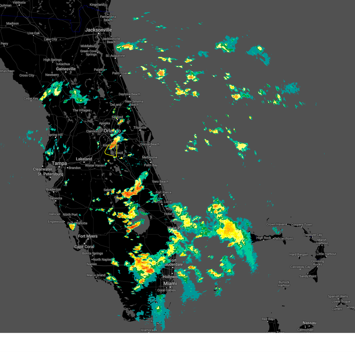
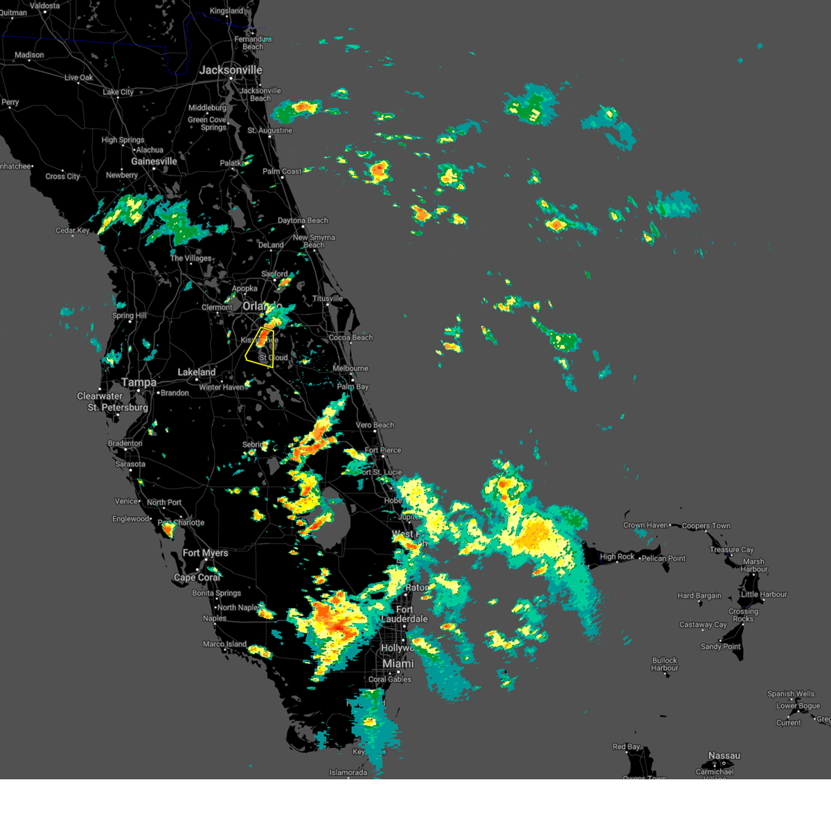
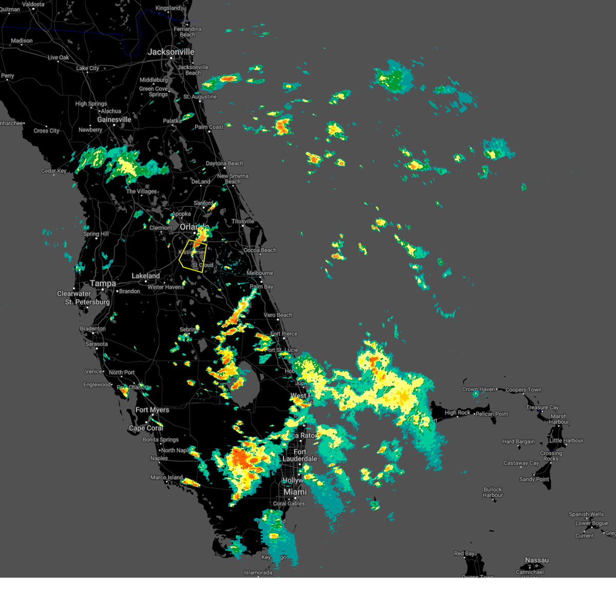
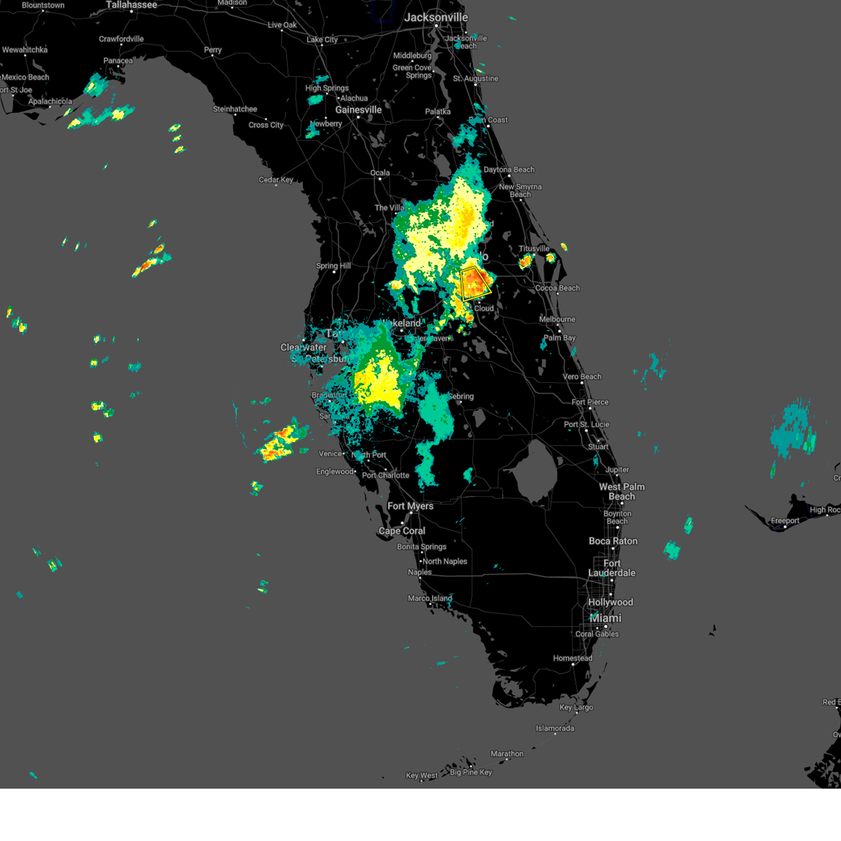
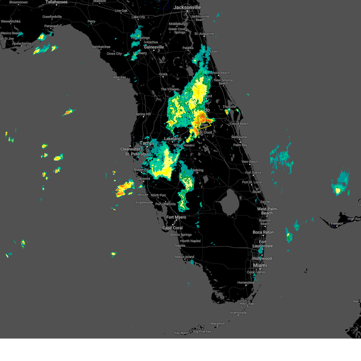
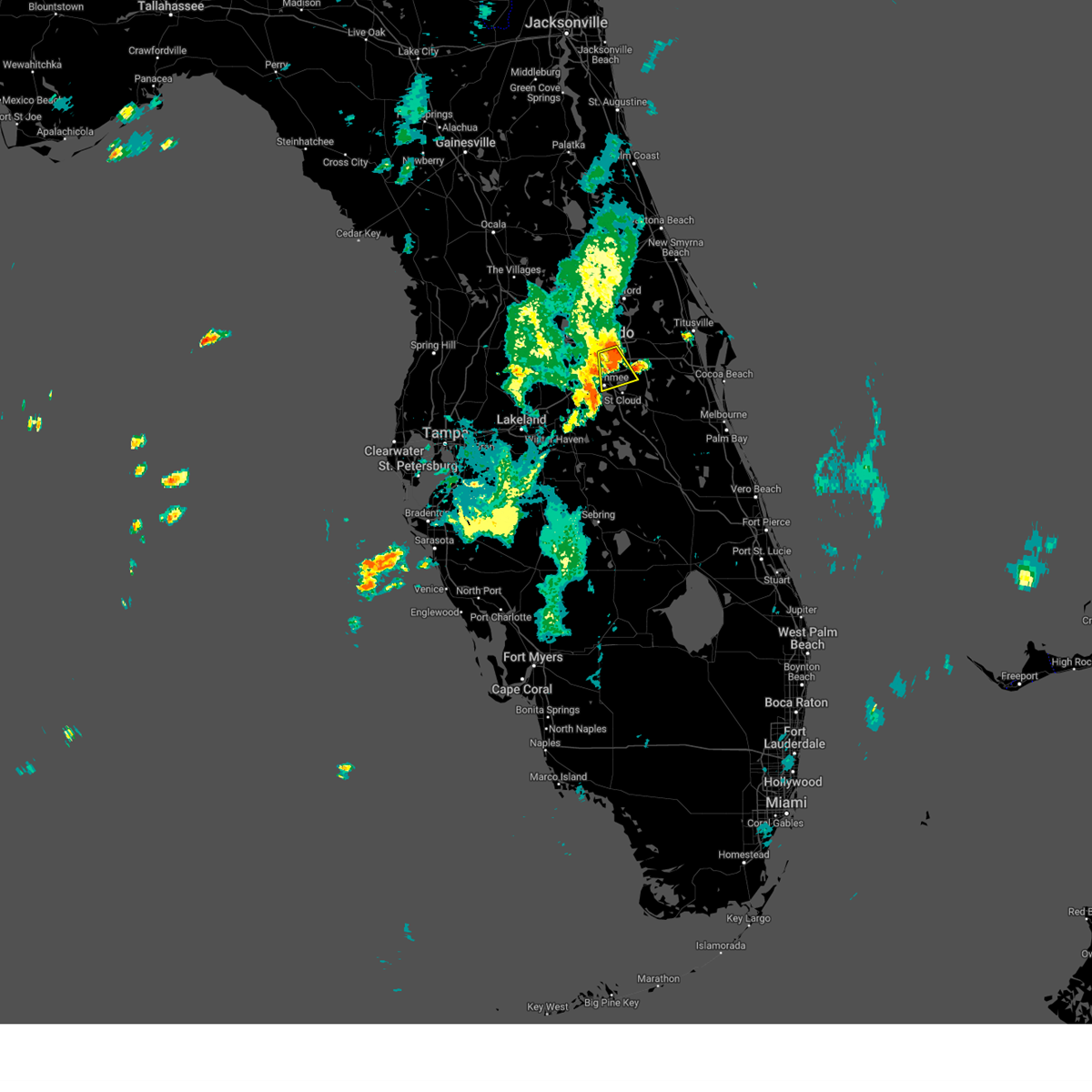
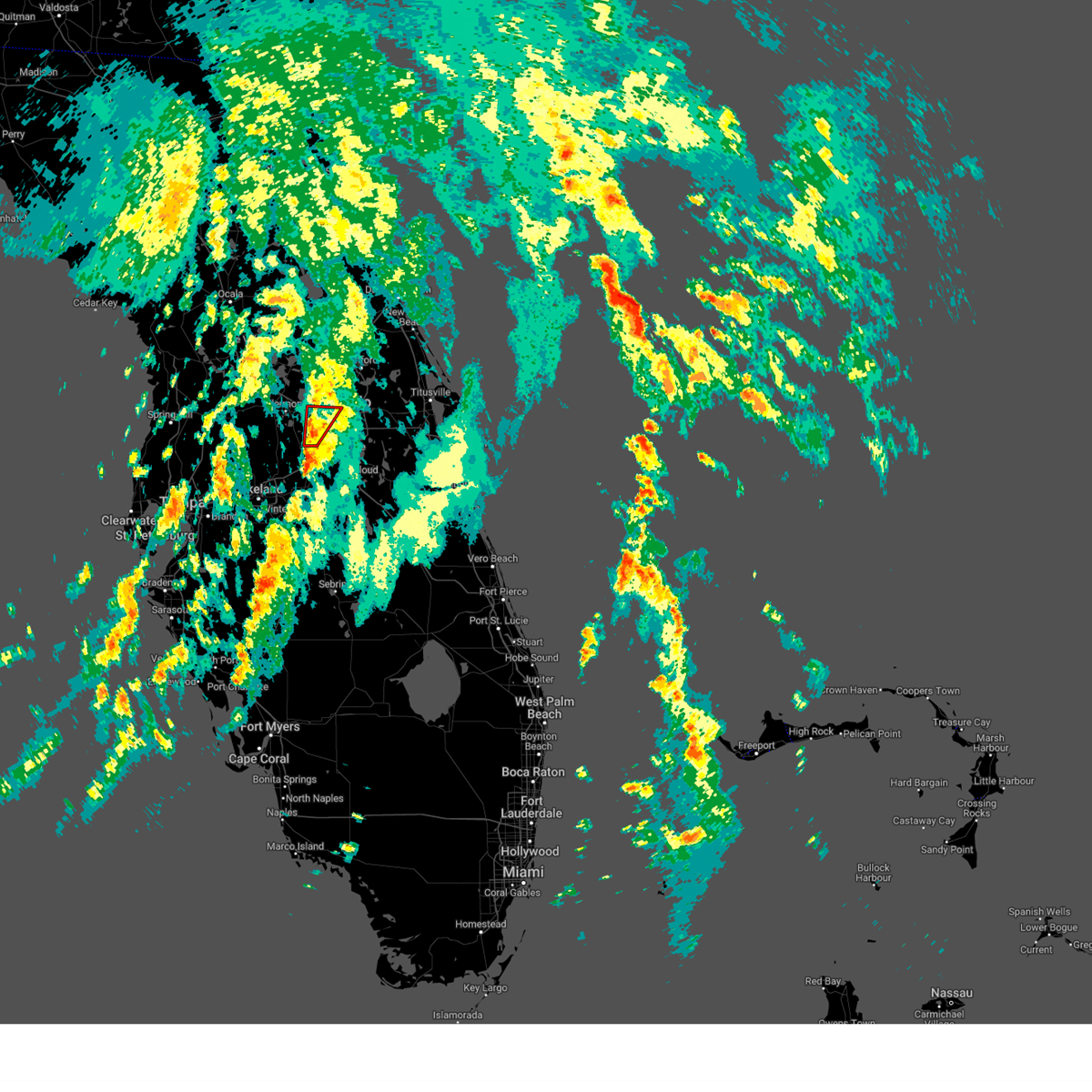
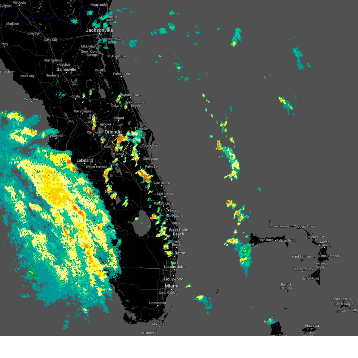
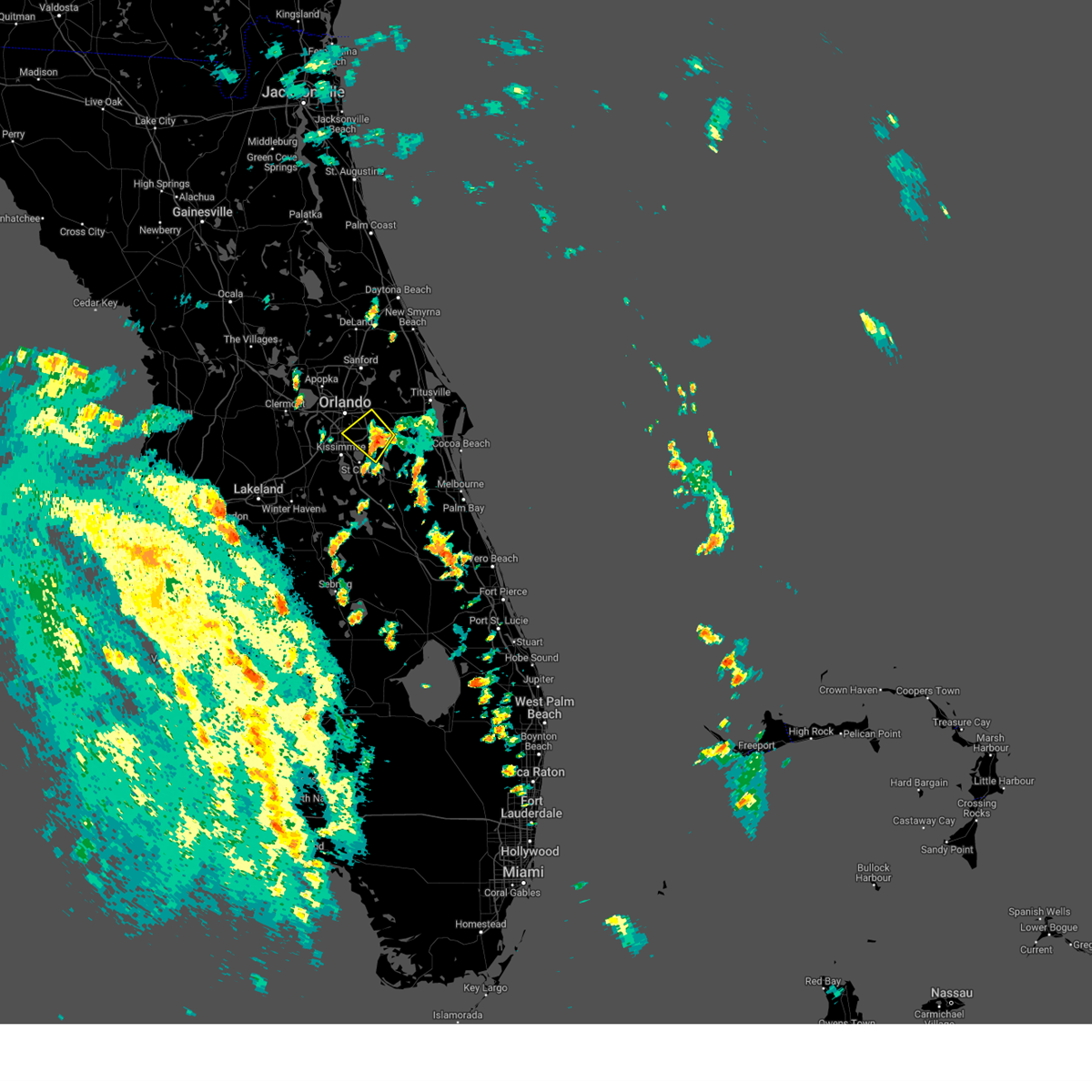
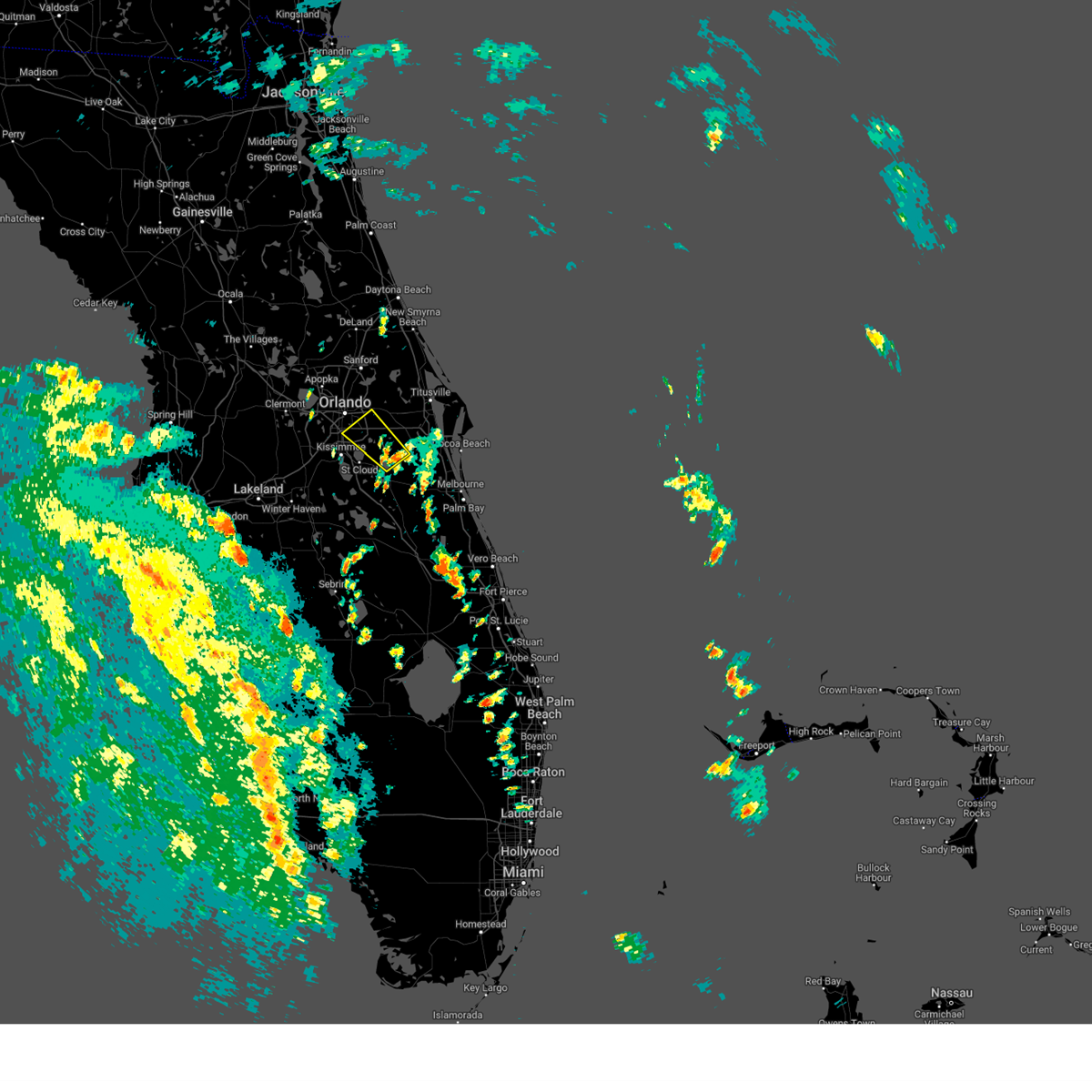
Hail Map for Orlando, FL
The Orlando, FL area has had 47 reports of on-the-ground hail by trained spotters, and has been under severe weather warnings 51 times during the past 12 months. Doppler radar has detected hail at or near Orlando, FL on 195 occasions, including 6 occasions during the past year.
| Name: | Orlando, FL |
| Where Located: | 1.3 miles S of Orlando, FL |
| Map: | Google Map for Orlando, FL |
| Population: | 238300 |
| Housing Units: | 121254 |
| More Info: | Search Google for Orlando, FL |
2
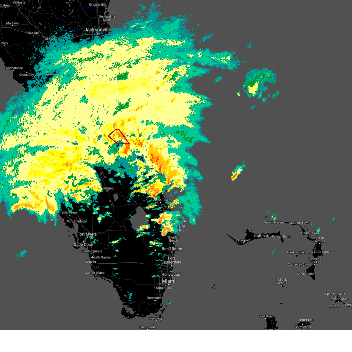
The Top Recent Hail Date for Orlando, FL is Thursday, June 6, 2024 (14th out of 195)

Hail and Wind Damage Spotted near Orlando, FL
| Date / Time | Report Details |
|---|---|
| 5/8/2025 5:24 PM EDT | At 524 pm edt, a severe thunderstorm was located over forest city, or over lockhart, moving east at 10 mph (radar indicated). Hazards include 60 mph wind gusts and quarter size hail. Hail damage to vehicles is expected. expect wind damage to roofs, siding, and trees. Locations impacted include, orlando, apopka, altamonte springs, ocoee, and lockhart. |
| 5/8/2025 5:07 PM EDT | Svrmlb the national weather service in melbourne has issued a * severe thunderstorm warning for, west central seminole county in east central florida, northwestern orange county in east central florida, * until 530 pm edt. * at 506 pm edt, a severe thunderstorm was located near apopka, moving east at 10 mph (radar indicated). Hazards include 60 mph wind gusts and quarter size hail. Hail damage to vehicles is expected. Expect wind damage to roofs, siding, and trees. |
| 3/30/2025 6:12 PM EDT | the severe thunderstorm warning has been cancelled and is no longer in effect |
| 3/30/2025 5:49 PM EDT | Svrmlb the national weather service in melbourne has issued a * severe thunderstorm warning for, south central orange county in east central florida, north central osceola county in east central florida, * until 630 pm edt. * at 549 pm edt, a severe thunderstorm was located over hunters creek, or over kissimmee, moving east at 15 mph (radar indicated). Hazards include 60 mph wind gusts and quarter size hail. Hail damage to vehicles is expected. Expect wind damage to roofs, siding, and trees. |
| 3/10/2025 11:34 AM EDT |
 the severe thunderstorm warning has been cancelled and is no longer in effect the severe thunderstorm warning has been cancelled and is no longer in effect
|
| 3/10/2025 11:22 AM EDT |
 Svrmlb the national weather service in melbourne has issued a * severe thunderstorm warning for, south central orange county in east central florida, north central osceola county in east central florida, * until 1145 am edt. * at 1122 am edt, a severe thunderstorm was located over yeehaw junction, or over buena ventura lakes, moving northeast at 35 mph (radar indicated). Hazards include 60 mph wind gusts. expect damage to roofs, siding, and trees Svrmlb the national weather service in melbourne has issued a * severe thunderstorm warning for, south central orange county in east central florida, north central osceola county in east central florida, * until 1145 am edt. * at 1122 am edt, a severe thunderstorm was located over yeehaw junction, or over buena ventura lakes, moving northeast at 35 mph (radar indicated). Hazards include 60 mph wind gusts. expect damage to roofs, siding, and trees
|
| 1/19/2025 12:42 PM EST |
 Svrmlb the national weather service in melbourne has issued a * severe thunderstorm warning for, southeastern seminole county in east central florida, west central brevard county in east central florida, southern orange county in east central florida, northern osceola county in east central florida, * until 130 pm est. * at 1242 pm est, a severe thunderstorm was located over campbell, or near west lake toho, moving northeast at 55 mph (radar indicated). Hazards include 60 mph wind gusts. expect damage to roofs, siding, and trees Svrmlb the national weather service in melbourne has issued a * severe thunderstorm warning for, southeastern seminole county in east central florida, west central brevard county in east central florida, southern orange county in east central florida, northern osceola county in east central florida, * until 130 pm est. * at 1242 pm est, a severe thunderstorm was located over campbell, or near west lake toho, moving northeast at 55 mph (radar indicated). Hazards include 60 mph wind gusts. expect damage to roofs, siding, and trees
|
| 1/19/2025 12:01 PM EST |
 Svrmlb the national weather service in melbourne has issued a * severe thunderstorm warning for, southwestern lake county in east central florida, southwestern orange county in east central florida, northern osceola county in east central florida, * until 1245 pm est. * at 1201 pm est, a severe thunderstorm was located 7 miles north of auburndale, moving northeast at 45 mph (radar indicated). Hazards include 60 mph wind gusts and penny size hail. expect damage to roofs, siding, and trees Svrmlb the national weather service in melbourne has issued a * severe thunderstorm warning for, southwestern lake county in east central florida, southwestern orange county in east central florida, northern osceola county in east central florida, * until 1245 pm est. * at 1201 pm est, a severe thunderstorm was located 7 miles north of auburndale, moving northeast at 45 mph (radar indicated). Hazards include 60 mph wind gusts and penny size hail. expect damage to roofs, siding, and trees
|
| 10/10/2024 12:11 AM EDT | The asos at the orlando international airport measured a wind gust of 86mph/75kts from the east-northeas in orange county FL, 7.4 miles NNW of Orlando, FL |
| 10/9/2024 11:17 PM EDT | The asos at the orlando executive airport measured a wind gust of 74mph/64kts from the east-northeas in orange county FL, 3.5 miles SW of Orlando, FL |
| 10/9/2024 10:53 PM EDT | The asos at the orlando executive airport measured a wind gust of 60mph/52kts from the east-northeas in orange county FL, 3.5 miles SW of Orlando, FL |
| 10/9/2024 5:04 PM EDT |
 the tornado warning has been cancelled and is no longer in effect the tornado warning has been cancelled and is no longer in effect
|
| 10/9/2024 4:28 PM EDT |
 Tormlb the national weather service in melbourne has issued a * tornado warning for, south central orange county in east central florida, * until 515 pm edt. * at 428 pm edt, a severe thunderstorm capable of producing a tornado was located 7 miles east of lake hart, or 8 miles south of wedgefield, moving northwest at 30 mph (radar indicated rotation). Hazards include tornado. Flying debris will be dangerous to those caught without shelter. mobile homes will be damaged or destroyed. damage to roofs, windows, and vehicles will occur. tree damage is likely. this dangerous storm will be near, wedgefield and lake hart around 430 pm edt. orlando, avalon park, and lake nona around 440 pm edt. conway, azalea park, and union park around 450 pm edt. winter park, goldenrod, and orlando executive airport around 500 pm edt. Other locations impacted by this tornadic thunderstorm include edgewood. Tormlb the national weather service in melbourne has issued a * tornado warning for, south central orange county in east central florida, * until 515 pm edt. * at 428 pm edt, a severe thunderstorm capable of producing a tornado was located 7 miles east of lake hart, or 8 miles south of wedgefield, moving northwest at 30 mph (radar indicated rotation). Hazards include tornado. Flying debris will be dangerous to those caught without shelter. mobile homes will be damaged or destroyed. damage to roofs, windows, and vehicles will occur. tree damage is likely. this dangerous storm will be near, wedgefield and lake hart around 430 pm edt. orlando, avalon park, and lake nona around 440 pm edt. conway, azalea park, and union park around 450 pm edt. winter park, goldenrod, and orlando executive airport around 500 pm edt. Other locations impacted by this tornadic thunderstorm include edgewood.
|
| 10/9/2024 4:08 PM EDT |
 Tormlb the national weather service in melbourne has issued a * tornado warning for, southeastern orange county in east central florida, * until 445 pm edt. * at 408 pm edt, a severe thunderstorm capable of producing a tornado was located 7 miles east of lake hart, or 8 miles northeast of narcoossee, moving north at 25 mph (radar indicated rotation). Hazards include tornado. Flying debris will be dangerous to those caught without shelter. mobile homes will be damaged or destroyed. damage to roofs, windows, and vehicles will occur. tree damage is likely. this dangerous storm will be near, wedgefield around 410 pm edt. avalon park around 420 pm edt. Bithlo and union park around 430 pm edt. Tormlb the national weather service in melbourne has issued a * tornado warning for, southeastern orange county in east central florida, * until 445 pm edt. * at 408 pm edt, a severe thunderstorm capable of producing a tornado was located 7 miles east of lake hart, or 8 miles northeast of narcoossee, moving north at 25 mph (radar indicated rotation). Hazards include tornado. Flying debris will be dangerous to those caught without shelter. mobile homes will be damaged or destroyed. damage to roofs, windows, and vehicles will occur. tree damage is likely. this dangerous storm will be near, wedgefield around 410 pm edt. avalon park around 420 pm edt. Bithlo and union park around 430 pm edt.
|
| 9/10/2024 5:13 PM EDT |
 The storm which prompted the warning has weakened below severe limits, and no longer poses an immediate threat to life or property. therefore, the warning will be allowed to expire. however gusty winds and heavy rain are still possible with this thunderstorm. to report severe weather, contact your nearest law enforcement agency. they will relay your report to the national weather service melbourne. The storm which prompted the warning has weakened below severe limits, and no longer poses an immediate threat to life or property. therefore, the warning will be allowed to expire. however gusty winds and heavy rain are still possible with this thunderstorm. to report severe weather, contact your nearest law enforcement agency. they will relay your report to the national weather service melbourne.
|
| 9/10/2024 5:08 PM EDT |
 the severe thunderstorm warning has been cancelled and is no longer in effect the severe thunderstorm warning has been cancelled and is no longer in effect
|
| 9/10/2024 5:08 PM EDT |
 At 508 pm edt, a severe thunderstorm was located over kissimmee, moving south at 15 mph (radar indicated). Hazards include 60 mph wind gusts. Expect damage to roofs, siding, and trees. Locations impacted include, kissimmee, saint cloud, buena ventura lakes, east lake toho, and west lake toho. At 508 pm edt, a severe thunderstorm was located over kissimmee, moving south at 15 mph (radar indicated). Hazards include 60 mph wind gusts. Expect damage to roofs, siding, and trees. Locations impacted include, kissimmee, saint cloud, buena ventura lakes, east lake toho, and west lake toho.
|
| 9/10/2024 4:58 PM EDT |
 At 457 pm edt, a severe thunderstorm was located over yeehaw junction, or over buena ventura lakes, moving south at 20 mph (radar indicated). Hazards include 60 mph wind gusts. Expect damage to roofs, siding, and trees. Locations impacted include, orlando, kissimmee, saint cloud, west lake toho, and buena ventura lakes. At 457 pm edt, a severe thunderstorm was located over yeehaw junction, or over buena ventura lakes, moving south at 20 mph (radar indicated). Hazards include 60 mph wind gusts. Expect damage to roofs, siding, and trees. Locations impacted include, orlando, kissimmee, saint cloud, west lake toho, and buena ventura lakes.
|
| 9/10/2024 4:48 PM EDT |
 Svrmlb the national weather service in melbourne has issued a * severe thunderstorm warning for, south central orange county in east central florida, northwestern osceola county in east central florida, * until 515 pm edt. * at 447 pm edt, a severe thunderstorm was located near buena ventura lakes, moving south at 15 mph (radar indicated). Hazards include 60 mph wind gusts. expect damage to roofs, siding, and trees Svrmlb the national weather service in melbourne has issued a * severe thunderstorm warning for, south central orange county in east central florida, northwestern osceola county in east central florida, * until 515 pm edt. * at 447 pm edt, a severe thunderstorm was located near buena ventura lakes, moving south at 15 mph (radar indicated). Hazards include 60 mph wind gusts. expect damage to roofs, siding, and trees
|
| 8/23/2024 8:44 PM EDT |
 The storm which prompted the warning has weakened below severe limits, and no longer poses an immediate threat to life or property. therefore, the warning will be allowed to expire. however gusty winds are still possible with this thunderstorm. to report severe weather, contact your nearest law enforcement agency. they will relay your report to the national weather service melbourne. The storm which prompted the warning has weakened below severe limits, and no longer poses an immediate threat to life or property. therefore, the warning will be allowed to expire. however gusty winds are still possible with this thunderstorm. to report severe weather, contact your nearest law enforcement agency. they will relay your report to the national weather service melbourne.
|
| 8/23/2024 8:32 PM EDT |
 At 831 pm edt, a severe thunderstorm was located near orlando international airport, moving south at 20 mph (radar indicated. orlando international airport recently gusted to 56 mph). Hazards include 60 mph wind gusts. Expect damage to roofs, siding, and trees. Locations impacted include, orlando, kissimmee, orlando international airport, conway, and buena ventura lakes. At 831 pm edt, a severe thunderstorm was located near orlando international airport, moving south at 20 mph (radar indicated. orlando international airport recently gusted to 56 mph). Hazards include 60 mph wind gusts. Expect damage to roofs, siding, and trees. Locations impacted include, orlando, kissimmee, orlando international airport, conway, and buena ventura lakes.
|
| 8/23/2024 8:25 PM EDT |
 Svrmlb the national weather service in melbourne has issued a * severe thunderstorm warning for, south central orange county in east central florida, north central osceola county in east central florida, * until 845 pm edt. * at 825 pm edt, a severe thunderstorm was located over orlando international airport, moving south at 20 mph (radar indicated). Hazards include 60 mph wind gusts. expect damage to roofs, siding, and trees Svrmlb the national weather service in melbourne has issued a * severe thunderstorm warning for, south central orange county in east central florida, north central osceola county in east central florida, * until 845 pm edt. * at 825 pm edt, a severe thunderstorm was located over orlando international airport, moving south at 20 mph (radar indicated). Hazards include 60 mph wind gusts. expect damage to roofs, siding, and trees
|
| 8/5/2024 9:08 AM EDT |
 The storm which prompted the warning has weakened below severe limits, and no longer appears capable of producing a tornado. therefore, the warning will be allowed to expire. a tornado watch remains in effect until 400 pm edt for east central florida. The storm which prompted the warning has weakened below severe limits, and no longer appears capable of producing a tornado. therefore, the warning will be allowed to expire. a tornado watch remains in effect until 400 pm edt for east central florida.
|
| 8/5/2024 8:55 AM EDT |
 Tormlb the national weather service in melbourne has issued a * tornado warning for, southwestern orange county in east central florida, * until 915 am edt. * at 855 am edt, a severe thunderstorm capable of producing a tornado was located over bay lake, moving north at 35 mph (radar indicated rotation). Hazards include tornado. Flying debris will be dangerous to those caught without shelter. mobile homes will be damaged or destroyed. damage to roofs, windows, and vehicles will occur. tree damage is likely. this dangerous storm will be near, orlando, ocoee, and winter garden around 900 am edt. pine hills and orlovista around 910 am edt. Other locations impacted by this tornadic thunderstorm include lake butler. Tormlb the national weather service in melbourne has issued a * tornado warning for, southwestern orange county in east central florida, * until 915 am edt. * at 855 am edt, a severe thunderstorm capable of producing a tornado was located over bay lake, moving north at 35 mph (radar indicated rotation). Hazards include tornado. Flying debris will be dangerous to those caught without shelter. mobile homes will be damaged or destroyed. damage to roofs, windows, and vehicles will occur. tree damage is likely. this dangerous storm will be near, orlando, ocoee, and winter garden around 900 am edt. pine hills and orlovista around 910 am edt. Other locations impacted by this tornadic thunderstorm include lake butler.
|
| 8/4/2024 12:14 PM EDT |
 The storm which prompted the warning has weakened below severe limits, and no longer poses an immediate threat to life or property. therefore, the warning will be allowed to expire. however gusty winds are still occurring with this thunderstorm. a tornado watch remains in effect until 800 pm edt for east central florida. The storm which prompted the warning has weakened below severe limits, and no longer poses an immediate threat to life or property. therefore, the warning will be allowed to expire. however gusty winds are still occurring with this thunderstorm. a tornado watch remains in effect until 800 pm edt for east central florida.
|
| 8/4/2024 12:02 PM EDT |
 At 1201 pm edt, a severe thunderstorm was located over lake nona, or near orlando international airport, moving northwest at 40 mph (radar indicated). Hazards include 60 mph wind gusts. Expect damage to roofs, siding, and trees. Locations impacted include, orlando, wedgefield, avalon park, orlando international airport, and belle isle. At 1201 pm edt, a severe thunderstorm was located over lake nona, or near orlando international airport, moving northwest at 40 mph (radar indicated). Hazards include 60 mph wind gusts. Expect damage to roofs, siding, and trees. Locations impacted include, orlando, wedgefield, avalon park, orlando international airport, and belle isle.
|
| 8/4/2024 11:47 AM EDT |
 Svrmlb the national weather service in melbourne has issued a * severe thunderstorm warning for, south central orange county in east central florida, north central osceola county in east central florida, * until 1215 pm edt. * at 1147 am edt, a severe thunderstorm was located 8 miles northeast of harmony, or 9 miles east of narcoossee, moving northwest at 40 mph (radar indicated). Hazards include 60 mph wind gusts. expect damage to roofs, siding, and trees Svrmlb the national weather service in melbourne has issued a * severe thunderstorm warning for, south central orange county in east central florida, north central osceola county in east central florida, * until 1215 pm edt. * at 1147 am edt, a severe thunderstorm was located 8 miles northeast of harmony, or 9 miles east of narcoossee, moving northwest at 40 mph (radar indicated). Hazards include 60 mph wind gusts. expect damage to roofs, siding, and trees
|
| 7/16/2024 4:27 PM EDT |
 Svrmlb the national weather service in melbourne has issued a * severe thunderstorm warning for, southeastern seminole county in east central florida, southeastern orange county in east central florida, * until 500 pm edt. * at 427 pm edt, a severe thunderstorm was located over avalon park, moving southeast at 5 mph (radar indicated). Hazards include 60 mph wind gusts and quarter size hail. Hail damage to vehicles is expected. Expect wind damage to roofs, siding, and trees. Svrmlb the national weather service in melbourne has issued a * severe thunderstorm warning for, southeastern seminole county in east central florida, southeastern orange county in east central florida, * until 500 pm edt. * at 427 pm edt, a severe thunderstorm was located over avalon park, moving southeast at 5 mph (radar indicated). Hazards include 60 mph wind gusts and quarter size hail. Hail damage to vehicles is expected. Expect wind damage to roofs, siding, and trees.
|
| 7/14/2024 5:54 PM EDT |
 The storm which prompted the warning has weakened below severe limits, and no longer poses an immediate threat to life or property. therefore, the warning will be allowed to expire. however gusty winds are still possible with this thunderstorm. The storm which prompted the warning has weakened below severe limits, and no longer poses an immediate threat to life or property. therefore, the warning will be allowed to expire. however gusty winds are still possible with this thunderstorm.
|
| 7/14/2024 5:47 PM EDT |
 At 547 pm edt, a severe thunderstorm was located over universal studios, or near windermere, moving northwest at 10 mph (radar indicated). Hazards include 60 mph wind gusts and penny size hail. Expect damage to roofs, siding, and trees. Locations impacted include, orlando, windermere, bay lake, and bay hill. At 547 pm edt, a severe thunderstorm was located over universal studios, or near windermere, moving northwest at 10 mph (radar indicated). Hazards include 60 mph wind gusts and penny size hail. Expect damage to roofs, siding, and trees. Locations impacted include, orlando, windermere, bay lake, and bay hill.
|
| 7/14/2024 5:34 PM EDT |
 At 534 pm edt, a severe thunderstorm was located over wet n wild water park, or over oak ridge, moving west at 10 mph (radar indicated). Hazards include 60 mph wind gusts and penny size hail. Expect damage to roofs, siding, and trees. Locations impacted include, orlando, conway, oak ridge, belle isle, and wet n wild water park. At 534 pm edt, a severe thunderstorm was located over wet n wild water park, or over oak ridge, moving west at 10 mph (radar indicated). Hazards include 60 mph wind gusts and penny size hail. Expect damage to roofs, siding, and trees. Locations impacted include, orlando, conway, oak ridge, belle isle, and wet n wild water park.
|
| 7/14/2024 5:27 PM EDT |
 Svrmlb the national weather service in melbourne has issued a * severe thunderstorm warning for, southwestern orange county in east central florida, * until 600 pm edt. * at 527 pm edt, a severe thunderstorm was located over wet n wild water park, or over oak ridge, moving northwest at 10 mph (radar indicated). Hazards include 60 mph wind gusts and penny size hail. expect damage to roofs, siding, and trees Svrmlb the national weather service in melbourne has issued a * severe thunderstorm warning for, southwestern orange county in east central florida, * until 600 pm edt. * at 527 pm edt, a severe thunderstorm was located over wet n wild water park, or over oak ridge, moving northwest at 10 mph (radar indicated). Hazards include 60 mph wind gusts and penny size hail. expect damage to roofs, siding, and trees
|
| 7/14/2024 5:13 PM EDT |
 Svrmlb the national weather service in melbourne has issued a * severe thunderstorm warning for, southwestern orange county in east central florida, * until 545 pm edt. * at 513 pm edt, a severe thunderstorm was located over conway, moving south at 15 mph (radar indicated). Hazards include 60 mph wind gusts and penny size hail. expect damage to roofs, siding, and trees Svrmlb the national weather service in melbourne has issued a * severe thunderstorm warning for, southwestern orange county in east central florida, * until 545 pm edt. * at 513 pm edt, a severe thunderstorm was located over conway, moving south at 15 mph (radar indicated). Hazards include 60 mph wind gusts and penny size hail. expect damage to roofs, siding, and trees
|
| 7/14/2024 5:09 PM EDT | The asos at the orlando executive airport measured a wind gust of 61mph/53kts from the north-northeas in orange county FL, 3.5 miles SW of Orlando, FL |
| 6/6/2024 7:31 PM EDT |
 At 730 pm edt, severe thunderstorms were located along a line extending from wekiva springs to near lake jessup to near christmas, moving northeast at 25 mph (radar indicated). Hazards include 60 mph wind gusts and quarter size hail. Hail damage to vehicles is expected. expect wind damage to roofs, siding, and trees. Locations impacted include, orlando, deltona, sanford, apopka, and altamonte springs. At 730 pm edt, severe thunderstorms were located along a line extending from wekiva springs to near lake jessup to near christmas, moving northeast at 25 mph (radar indicated). Hazards include 60 mph wind gusts and quarter size hail. Hail damage to vehicles is expected. expect wind damage to roofs, siding, and trees. Locations impacted include, orlando, deltona, sanford, apopka, and altamonte springs.
|
| 6/6/2024 7:30 PM EDT |
 the tornado warning has been cancelled and is no longer in effect the tornado warning has been cancelled and is no longer in effect
|
| 6/6/2024 7:26 PM EDT |
 Svrmlb the national weather service in melbourne has issued a * severe thunderstorm warning for, seminole county in east central florida, east central lake county in east central florida, central orange county in east central florida, south central volusia county in east central florida, * until 800 pm edt. * at 725 pm edt, severe thunderstorms were located along a line extending from wekiva springs to near oviedo to near christmas, moving northeast at 25 mph (radar indicated). Hazards include 60 mph wind gusts and quarter size hail. Hail damage to vehicles is expected. Expect wind damage to roofs, siding, and trees. Svrmlb the national weather service in melbourne has issued a * severe thunderstorm warning for, seminole county in east central florida, east central lake county in east central florida, central orange county in east central florida, south central volusia county in east central florida, * until 800 pm edt. * at 725 pm edt, severe thunderstorms were located along a line extending from wekiva springs to near oviedo to near christmas, moving northeast at 25 mph (radar indicated). Hazards include 60 mph wind gusts and quarter size hail. Hail damage to vehicles is expected. Expect wind damage to roofs, siding, and trees.
|
| 6/6/2024 7:21 PM EDT |
 At 721 pm edt, a severe thunderstorm capable of producing a tornado was located over azalea park, moving northeast at 20 mph (radar indicated rotation). Hazards include tornado and quarter size hail. Flying debris will be dangerous to those caught without shelter. mobile homes will be damaged or destroyed. damage to roofs, windows, and vehicles will occur. tree damage is likely. this dangerous storm will be near, oviedo, winter springs, and winter park around 730 pm edt. chuluota around 750 pm edt. Other locations impacted by this tornadic thunderstorm include aloma. At 721 pm edt, a severe thunderstorm capable of producing a tornado was located over azalea park, moving northeast at 20 mph (radar indicated rotation). Hazards include tornado and quarter size hail. Flying debris will be dangerous to those caught without shelter. mobile homes will be damaged or destroyed. damage to roofs, windows, and vehicles will occur. tree damage is likely. this dangerous storm will be near, oviedo, winter springs, and winter park around 730 pm edt. chuluota around 750 pm edt. Other locations impacted by this tornadic thunderstorm include aloma.
|
| 6/6/2024 7:13 PM EDT |
 Tormlb the national weather service in melbourne has issued a * tornado warning for, south central seminole county in east central florida, central orange county in east central florida, * until 745 pm edt. * at 712 pm edt, a severe thunderstorm capable of producing a tornado was located over azalea park, moving northeast at 20 mph (radar indicated rotation). Hazards include tornado and quarter size hail. Flying debris will be dangerous to those caught without shelter. mobile homes will be damaged or destroyed. damage to roofs, windows, and vehicles will occur. tree damage is likely. this dangerous storm will be near, oviedo, winter springs, and winter park around 720 pm edt. Other locations impacted by this tornadic thunderstorm include aloma. Tormlb the national weather service in melbourne has issued a * tornado warning for, south central seminole county in east central florida, central orange county in east central florida, * until 745 pm edt. * at 712 pm edt, a severe thunderstorm capable of producing a tornado was located over azalea park, moving northeast at 20 mph (radar indicated rotation). Hazards include tornado and quarter size hail. Flying debris will be dangerous to those caught without shelter. mobile homes will be damaged or destroyed. damage to roofs, windows, and vehicles will occur. tree damage is likely. this dangerous storm will be near, oviedo, winter springs, and winter park around 720 pm edt. Other locations impacted by this tornadic thunderstorm include aloma.
|
| 6/6/2024 7:04 PM EDT |
 At 704 pm edt, severe thunderstorms were located along a line extending from pine hills to union park to near wedgefield, moving north at 35 mph (radar indicated). Hazards include 60 mph wind gusts and half dollar size hail. Hail damage to vehicles is expected. expect wind damage to roofs, siding, and trees. Locations impacted include, orlando, sanford, apopka, altamonte springs, and oviedo. At 704 pm edt, severe thunderstorms were located along a line extending from pine hills to union park to near wedgefield, moving north at 35 mph (radar indicated). Hazards include 60 mph wind gusts and half dollar size hail. Hail damage to vehicles is expected. expect wind damage to roofs, siding, and trees. Locations impacted include, orlando, sanford, apopka, altamonte springs, and oviedo.
|
| 6/6/2024 7:04 PM EDT |
 the severe thunderstorm warning has been cancelled and is no longer in effect the severe thunderstorm warning has been cancelled and is no longer in effect
|
| 6/6/2024 7:02 PM EDT |
 the severe thunderstorm warning has been cancelled and is no longer in effect the severe thunderstorm warning has been cancelled and is no longer in effect
|
| 6/6/2024 7:02 PM EDT |
 At 701 pm edt, severe thunderstorms were located along a line extending from near conway to near lake hart to 6 miles north of holopaw, moving north at 40 mph (radar indicated). Hazards include 60 mph wind gusts and quarter size hail. Hail damage to vehicles is expected. expect wind damage to roofs, siding, and trees. Locations impacted include, orlando, kissimmee, saint cloud, wedgefield, and buena ventura lakes. At 701 pm edt, severe thunderstorms were located along a line extending from near conway to near lake hart to 6 miles north of holopaw, moving north at 40 mph (radar indicated). Hazards include 60 mph wind gusts and quarter size hail. Hail damage to vehicles is expected. expect wind damage to roofs, siding, and trees. Locations impacted include, orlando, kissimmee, saint cloud, wedgefield, and buena ventura lakes.
|
| 6/6/2024 6:59 PM EDT |
 Svrmlb the national weather service in melbourne has issued a * severe thunderstorm warning for, seminole county in east central florida, northwestern brevard county in east central florida, orange county in east central florida, north central osceola county in east central florida, * until 730 pm edt. * at 658 pm edt, severe thunderstorms were located along a line extending from oak ridge to near lake nona to 7 miles west of lone cabbage fish camp, moving north at 35 mph (radar indicated. a wind gust to 58 mph recently occurred at orlando international airport with this storm!). Hazards include 60 mph wind gusts and half dollar size hail. Hail damage to vehicles is expected. Expect wind damage to roofs, siding, and trees. Svrmlb the national weather service in melbourne has issued a * severe thunderstorm warning for, seminole county in east central florida, northwestern brevard county in east central florida, orange county in east central florida, north central osceola county in east central florida, * until 730 pm edt. * at 658 pm edt, severe thunderstorms were located along a line extending from oak ridge to near lake nona to 7 miles west of lone cabbage fish camp, moving north at 35 mph (radar indicated. a wind gust to 58 mph recently occurred at orlando international airport with this storm!). Hazards include 60 mph wind gusts and half dollar size hail. Hail damage to vehicles is expected. Expect wind damage to roofs, siding, and trees.
|
| 6/6/2024 6:56 PM EDT | The asos at the orlando international airport measured a wind gust of 58mph/50kts from the south-southeast. corrected event typ in orange county FL, 7.4 miles NNW of Orlando, FL |
| 6/6/2024 6:48 PM EDT |
 At 648 pm edt, severe thunderstorms were located along a line extending from near orlando international airport to near lake hart to 10 miles northeast of kenansville, moving north at 30 mph (radar indicated). Hazards include 60 mph wind gusts and quarter size hail. Hail damage to vehicles is expected. expect wind damage to roofs, siding, and trees. Locations impacted include, orlando, palm bay, kissimmee, saint cloud, and wedgefield. At 648 pm edt, severe thunderstorms were located along a line extending from near orlando international airport to near lake hart to 10 miles northeast of kenansville, moving north at 30 mph (radar indicated). Hazards include 60 mph wind gusts and quarter size hail. Hail damage to vehicles is expected. expect wind damage to roofs, siding, and trees. Locations impacted include, orlando, palm bay, kissimmee, saint cloud, and wedgefield.
|
| 6/6/2024 6:38 PM EDT |
 Svrmlb the national weather service in melbourne has issued a * severe thunderstorm warning for, southwestern brevard county in east central florida, southeastern orange county in east central florida, osceola county in east central florida, * until 715 pm edt. * at 638 pm edt, severe thunderstorms were located along a line extending from osceola heritage park to near narcoossee to 6 miles northeast of kenansville, moving north at 30 mph (radar indicated). Hazards include 60 mph wind gusts and nickel size hail. expect damage to roofs, siding, and trees Svrmlb the national weather service in melbourne has issued a * severe thunderstorm warning for, southwestern brevard county in east central florida, southeastern orange county in east central florida, osceola county in east central florida, * until 715 pm edt. * at 638 pm edt, severe thunderstorms were located along a line extending from osceola heritage park to near narcoossee to 6 miles northeast of kenansville, moving north at 30 mph (radar indicated). Hazards include 60 mph wind gusts and nickel size hail. expect damage to roofs, siding, and trees
|
| 5/14/2024 12:36 PM EDT |
 At 1236 pm edt, severe thunderstorms were located along a line extending from lake mary to windermere to near bay lake to 6 miles north of auburndale, moving east at 35 mph (radar indicated). Hazards include 60 mph wind gusts and penny size hail. Expect damage to roofs, siding, and trees. Locations impacted include, orlando, sanford, apopka, altamonte springs, and ocoee. At 1236 pm edt, severe thunderstorms were located along a line extending from lake mary to windermere to near bay lake to 6 miles north of auburndale, moving east at 35 mph (radar indicated). Hazards include 60 mph wind gusts and penny size hail. Expect damage to roofs, siding, and trees. Locations impacted include, orlando, sanford, apopka, altamonte springs, and ocoee.
|
| 5/14/2024 12:12 PM EDT |
 Svrmlb the national weather service in melbourne has issued a * severe thunderstorm warning for, southwestern seminole county in east central florida, southwestern lake county in east central florida, western orange county in east central florida, northwestern osceola county in east central florida, * until 1245 pm edt. * at 1211 pm edt, severe thunderstorms were located along a line extending from near zellwood to near groveland to 12 miles southwest of lake louisa to 8 miles southeast of zephyrhills south, moving east at 35 mph (radar indicated). Hazards include 60 mph wind gusts and penny size hail. expect damage to roofs, siding, and trees Svrmlb the national weather service in melbourne has issued a * severe thunderstorm warning for, southwestern seminole county in east central florida, southwestern lake county in east central florida, western orange county in east central florida, northwestern osceola county in east central florida, * until 1245 pm edt. * at 1211 pm edt, severe thunderstorms were located along a line extending from near zellwood to near groveland to 12 miles southwest of lake louisa to 8 miles southeast of zephyrhills south, moving east at 35 mph (radar indicated). Hazards include 60 mph wind gusts and penny size hail. expect damage to roofs, siding, and trees
|
| 5/11/2024 3:27 AM EDT |
 The storm which prompted the warning has weakened below severe limits, and no longer poses an immediate threat to life or property. therefore, the warning will be allowed to expire. however gusty winds are still possible with this thunderstorm. to report severe weather, contact your nearest law enforcement agency. they will relay your report to the national weather service melbourne. The storm which prompted the warning has weakened below severe limits, and no longer poses an immediate threat to life or property. therefore, the warning will be allowed to expire. however gusty winds are still possible with this thunderstorm. to report severe weather, contact your nearest law enforcement agency. they will relay your report to the national weather service melbourne.
|
| 5/11/2024 3:15 AM EDT |
 At 314 am edt, a severe thunderstorm was located near narcoossee, moving southeast at 25 mph (radar indicated). Hazards include 60 mph wind gusts. Expect damage to roofs, siding, and trees. Locations impacted include, kissimmee, saint cloud, east lake toho, holopaw, and narcoossee. At 314 am edt, a severe thunderstorm was located near narcoossee, moving southeast at 25 mph (radar indicated). Hazards include 60 mph wind gusts. Expect damage to roofs, siding, and trees. Locations impacted include, kissimmee, saint cloud, east lake toho, holopaw, and narcoossee.
|
| 5/11/2024 3:15 AM EDT |
 the severe thunderstorm warning has been cancelled and is no longer in effect the severe thunderstorm warning has been cancelled and is no longer in effect
|
| 5/11/2024 2:59 AM EDT |
 Svrmlb the national weather service in melbourne has issued a * severe thunderstorm warning for, south central orange county in east central florida, northeastern osceola county in east central florida, * until 330 am edt. * at 258 am edt, a severe thunderstorm was located over austin tindall park, or near narcoossee, moving southeast at 25 mph (radar indicated). Hazards include 60 mph wind gusts. expect damage to roofs, siding, and trees Svrmlb the national weather service in melbourne has issued a * severe thunderstorm warning for, south central orange county in east central florida, northeastern osceola county in east central florida, * until 330 am edt. * at 258 am edt, a severe thunderstorm was located over austin tindall park, or near narcoossee, moving southeast at 25 mph (radar indicated). Hazards include 60 mph wind gusts. expect damage to roofs, siding, and trees
|
| 5/11/2024 2:32 AM EDT |
 At 231 am edt, a severe thunderstorm was located over orlando international airport, moving southeast at 40 mph (radar indicated). Hazards include 60 mph wind gusts. Expect damage to roofs, siding, and trees. Locations impacted include, orlando, kissimmee, saint cloud, winter park, and casselberry. At 231 am edt, a severe thunderstorm was located over orlando international airport, moving southeast at 40 mph (radar indicated). Hazards include 60 mph wind gusts. Expect damage to roofs, siding, and trees. Locations impacted include, orlando, kissimmee, saint cloud, winter park, and casselberry.
|
| 5/11/2024 2:20 AM EDT |
 At 219 am edt, a severe thunderstorm was located near oak ridge, moving southeast at 35 mph (radar indicated. orlando executive airport reported a wind gust to 56 mph). Hazards include 60 mph wind gusts. Expect damage to roofs, siding, and trees. Locations impacted include, orlando, kissimmee, altamonte springs, ocoee, and winter garden. At 219 am edt, a severe thunderstorm was located near oak ridge, moving southeast at 35 mph (radar indicated. orlando executive airport reported a wind gust to 56 mph). Hazards include 60 mph wind gusts. Expect damage to roofs, siding, and trees. Locations impacted include, orlando, kissimmee, altamonte springs, ocoee, and winter garden.
|
| 5/11/2024 2:17 AM EDT | The asos at the orlando executive airport measured a wind gust of 56mph/49kts from the west-northwes in orange county FL, 3.5 miles SW of Orlando, FL |
| 5/11/2024 2:08 AM EDT |
 Svrmlb the national weather service in melbourne has issued a * severe thunderstorm warning for, southwestern seminole county in east central florida, orange county in east central florida, north central osceola county in east central florida, * until 245 am edt. * at 207 am edt, a severe thunderstorm was located over orlovista, or over pine hills, moving southeast at 40 mph (radar indicated). Hazards include 60 mph wind gusts. expect damage to roofs, siding, and trees Svrmlb the national weather service in melbourne has issued a * severe thunderstorm warning for, southwestern seminole county in east central florida, orange county in east central florida, north central osceola county in east central florida, * until 245 am edt. * at 207 am edt, a severe thunderstorm was located over orlovista, or over pine hills, moving southeast at 40 mph (radar indicated). Hazards include 60 mph wind gusts. expect damage to roofs, siding, and trees
|
| 2/4/2024 8:10 PM EST | Quarter sized hail reported 13.7 miles WSW of Orlando, FL, public reports quarter size hail near east lake elementary school... northeast of ucf. |
| 2/4/2024 8:04 PM EST |
 At 803 pm est, a severe thunderstorm was located over university of central florida, moving northeast at 35 mph (radar indicated). Hazards include 60 mph wind gusts and quarter size hail. Hail damage to vehicles is expected. Expect wind damage to roofs, siding, and trees. At 803 pm est, a severe thunderstorm was located over university of central florida, moving northeast at 35 mph (radar indicated). Hazards include 60 mph wind gusts and quarter size hail. Hail damage to vehicles is expected. Expect wind damage to roofs, siding, and trees.
|
| 2/4/2024 7:24 PM EST | Quarter sized hail reported 7.8 miles ESE of Orlando, FL, quarter sized... 1 inch diameter... hail reported in ocoee near the intersection of good homes rd. and sr-50. |
| 2/4/2024 7:24 PM EST |
 At 723 pm est, a severe thunderstorm was located over ocoee, moving northeast at 30 mph (radar indicated). Hazards include 60 mph wind gusts and quarter size hail. Hail damage to vehicles is expected. Expect wind damage to roofs, siding, and trees. At 723 pm est, a severe thunderstorm was located over ocoee, moving northeast at 30 mph (radar indicated). Hazards include 60 mph wind gusts and quarter size hail. Hail damage to vehicles is expected. Expect wind damage to roofs, siding, and trees.
|
| 1/9/2024 6:24 PM EST |
 The national weather service in melbourne has issued a * severe thunderstorm warning for. southeastern seminole county in east central florida. northwestern brevard county in east central florida. southeastern orange county in east central florida. Southeastern volusia county in east central florida. The national weather service in melbourne has issued a * severe thunderstorm warning for. southeastern seminole county in east central florida. northwestern brevard county in east central florida. southeastern orange county in east central florida. Southeastern volusia county in east central florida.
|
| 1/9/2024 6:18 PM EST |
 At 617 pm est, severe thunderstorms capable of producing tornadoes were located along a line extending from near osteen to bithlo to lake hart, moving northeast at 70 mph (radar indicated rotation). Hazards include tornado. Flying debris will be dangerous to those caught without shelter. mobile homes will be damaged or destroyed. damage to roofs, windows, and vehicles will occur. tree damage is likely. these dangerous storms will be near, orlando, oviedo, and new smyrna beach around 620 pm est. titusville, oak hill, and scottsmoor around 630 pm est. merritt island wildlife refuge and klondike beach around 640 pm est. playalinda beach around 650 pm est. Other locations impacted by these tornadic storms include turnbull. At 617 pm est, severe thunderstorms capable of producing tornadoes were located along a line extending from near osteen to bithlo to lake hart, moving northeast at 70 mph (radar indicated rotation). Hazards include tornado. Flying debris will be dangerous to those caught without shelter. mobile homes will be damaged or destroyed. damage to roofs, windows, and vehicles will occur. tree damage is likely. these dangerous storms will be near, orlando, oviedo, and new smyrna beach around 620 pm est. titusville, oak hill, and scottsmoor around 630 pm est. merritt island wildlife refuge and klondike beach around 640 pm est. playalinda beach around 650 pm est. Other locations impacted by these tornadic storms include turnbull.
|
| 1/9/2024 6:08 PM EST |
 At 607 pm est, a severe thunderstorm capable of producing a tornado was located over oviedo, moving northeast at 75 mph (radar indicated rotation). Hazards include tornado. Flying debris will be dangerous to those caught without shelter. mobile homes will be damaged or destroyed. damage to roofs, windows, and vehicles will occur. tree damage is likely. this dangerous storm will be near, oviedo, winter springs, and bithlo around 610 pm est. scottsmoor and mims around 620 pm est. haulover canal around 630 pm est. Other locations impacted by this tornadic thunderstorm include turnbull. At 607 pm est, a severe thunderstorm capable of producing a tornado was located over oviedo, moving northeast at 75 mph (radar indicated rotation). Hazards include tornado. Flying debris will be dangerous to those caught without shelter. mobile homes will be damaged or destroyed. damage to roofs, windows, and vehicles will occur. tree damage is likely. this dangerous storm will be near, oviedo, winter springs, and bithlo around 610 pm est. scottsmoor and mims around 620 pm est. haulover canal around 630 pm est. Other locations impacted by this tornadic thunderstorm include turnbull.
|
| 1/9/2024 6:08 PM EST |
 At 607 pm est, severe thunderstorms were located along a line extending from near daytona beach shores to near geneva to near orlando international airport, moving northeast at 65 mph (radar indicated). Hazards include 60 mph wind gusts and nickel size hail. Expect damage to roofs, siding, and trees. Locations impacted include, orlando, deltona, kissimmee, port orange, and sanford. At 607 pm est, severe thunderstorms were located along a line extending from near daytona beach shores to near geneva to near orlando international airport, moving northeast at 65 mph (radar indicated). Hazards include 60 mph wind gusts and nickel size hail. Expect damage to roofs, siding, and trees. Locations impacted include, orlando, deltona, kissimmee, port orange, and sanford.
|
| 1/9/2024 6:04 PM EST |
 A tornado warning remains in effect until 615 pm est for south central orange county. at 604 pm est, a severe thunderstorm capable of producing a tornado was located over orlando international airport, moving northeast at 55 mph. hazard. Tornado. A tornado warning remains in effect until 615 pm est for south central orange county. at 604 pm est, a severe thunderstorm capable of producing a tornado was located over orlando international airport, moving northeast at 55 mph. hazard. Tornado.
|
| 1/9/2024 6:02 PM EST | Mco reported a thunderstorm wind gust of 51kt/59mph from the in orange county FL, 7.7 miles NNW of Orlando, FL |
| 1/9/2024 5:55 PM EST |
 The national weather service in melbourne has issued a * severe thunderstorm warning for. seminole county in east central florida. orange county in east central florida. central volusia county in east central florida. northwestern osceola county in east central florida. Until 645 pm est. The national weather service in melbourne has issued a * severe thunderstorm warning for. seminole county in east central florida. orange county in east central florida. central volusia county in east central florida. northwestern osceola county in east central florida. Until 645 pm est.
|
| 1/9/2024 5:53 PM EST |
 A tornado warning remains in effect until 615 pm est for south central orange county. at 552 pm est, a severe thunderstorm capable of producing a tornado was located near oak ridge, moving east at 40 mph. hazard. tornado. source. Radar indicated rotation. A tornado warning remains in effect until 615 pm est for south central orange county. at 552 pm est, a severe thunderstorm capable of producing a tornado was located near oak ridge, moving east at 40 mph. hazard. tornado. source. Radar indicated rotation.
|
| 1/9/2024 5:48 PM EST |
 At 547 pm est, a severe thunderstorm capable of producing a tornado was located over sea world, or near oak ridge, moving east at 40 mph (radar indicated rotation). Hazards include tornado. Flying debris will be dangerous to those caught without shelter. mobile homes will be damaged or destroyed. damage to roofs, windows, and vehicles will occur. tree damage is likely. this dangerous storm will be near, orlando, orlando international airport, and conway around 550 pm est. azalea park, lake hart, and lake nona around 600 pm est. Other locations impacted by this tornadic thunderstorm include meadow woods. At 547 pm est, a severe thunderstorm capable of producing a tornado was located over sea world, or near oak ridge, moving east at 40 mph (radar indicated rotation). Hazards include tornado. Flying debris will be dangerous to those caught without shelter. mobile homes will be damaged or destroyed. damage to roofs, windows, and vehicles will occur. tree damage is likely. this dangerous storm will be near, orlando, orlando international airport, and conway around 550 pm est. azalea park, lake hart, and lake nona around 600 pm est. Other locations impacted by this tornadic thunderstorm include meadow woods.
|
| 1/9/2024 5:44 PM EST |
 At 543 pm est, severe thunderstorms were located along a line extending from near flagler beach to orange city to ocoee, moving northeast at 70 mph (radar indicated). Hazards include 60 mph wind gusts. Expect damage to roofs, siding, and trees. Locations impacted include, orlando, deltona, daytona beach, kissimmee, and port orange. At 543 pm est, severe thunderstorms were located along a line extending from near flagler beach to orange city to ocoee, moving northeast at 70 mph (radar indicated). Hazards include 60 mph wind gusts. Expect damage to roofs, siding, and trees. Locations impacted include, orlando, deltona, daytona beach, kissimmee, and port orange.
|
| 1/9/2024 5:21 PM EST |
 The national weather service in melbourne has issued a * severe thunderstorm warning for. seminole county in east central florida. central lake county in east central florida. orange county in east central florida. Volusia county in east central florida. The national weather service in melbourne has issued a * severe thunderstorm warning for. seminole county in east central florida. central lake county in east central florida. orange county in east central florida. Volusia county in east central florida.
|
| 1/9/2024 5:07 PM EST |
 At 506 pm est, severe thunderstorms were located along a line extending from near pierson to mid florida lakes to 12 miles southwest of lake louisa, moving northeast at 70 mph (radar indicated). Hazards include 60 mph wind gusts. Expect damage to roofs, siding, and trees. Locations impacted include, apopka, ocoee, winter garden, leesburg, and eustis. At 506 pm est, severe thunderstorms were located along a line extending from near pierson to mid florida lakes to 12 miles southwest of lake louisa, moving northeast at 70 mph (radar indicated). Hazards include 60 mph wind gusts. Expect damage to roofs, siding, and trees. Locations impacted include, apopka, ocoee, winter garden, leesburg, and eustis.
|
| 1/9/2024 4:46 PM EST |
 At 446 pm est, severe thunderstorms were located along a line extending from lake george to near leesburg to 6 miles east of dade city, moving northeast at 65 mph (radar indicated). Hazards include 60 mph wind gusts. expect damage to roofs, siding, and trees At 446 pm est, severe thunderstorms were located along a line extending from lake george to near leesburg to 6 miles east of dade city, moving northeast at 65 mph (radar indicated). Hazards include 60 mph wind gusts. expect damage to roofs, siding, and trees
|
| 9/21/2023 4:26 PM EDT |
 The severe thunderstorm warning for southwestern orange county will expire at 430 pm edt, the storm which prompted the warning has weakened below severe limits, and has exited the warned area. therefore, the warning will be allowed to expire. The severe thunderstorm warning for southwestern orange county will expire at 430 pm edt, the storm which prompted the warning has weakened below severe limits, and has exited the warned area. therefore, the warning will be allowed to expire.
|
| 9/21/2023 3:54 PM EDT |
 At 354 pm edt, a severe thunderstorm was located over pine castle, or over orlando, moving south at 30 mph (radar indicated). Hazards include 60 mph wind gusts and penny size hail. expect damage to roofs, siding, and trees At 354 pm edt, a severe thunderstorm was located over pine castle, or over orlando, moving south at 30 mph (radar indicated). Hazards include 60 mph wind gusts and penny size hail. expect damage to roofs, siding, and trees
|
| 9/21/2023 3:40 PM EDT |
 At 339 pm edt, a severe thunderstorm was located over college park, moving south at 20 mph (radar indicated). Hazards include 60 mph wind gusts and nickel size hail. Expect damage to roofs, siding, and trees. locations impacted include, orlando, apopka, altamonte springs, winter springs, and winter park. hail threat, radar indicated max hail size, 0. 88 in wind threat, radar indicated max wind gust, 60 mph. At 339 pm edt, a severe thunderstorm was located over college park, moving south at 20 mph (radar indicated). Hazards include 60 mph wind gusts and nickel size hail. Expect damage to roofs, siding, and trees. locations impacted include, orlando, apopka, altamonte springs, winter springs, and winter park. hail threat, radar indicated max hail size, 0. 88 in wind threat, radar indicated max wind gust, 60 mph.
|
| 9/21/2023 3:35 PM EDT | Tree branches down at corner of lee rd and edgewater dr. power is out in the are in orange county FL, 5.7 miles SSE of Orlando, FL |
| 9/21/2023 3:33 PM EDT |
 At 333 pm edt, a severe thunderstorm was located over fairview shores, or over maitland, moving south at 25 mph (radar indicated). Hazards include 60 mph wind gusts. expect damage to roofs, siding, and trees At 333 pm edt, a severe thunderstorm was located over fairview shores, or over maitland, moving south at 25 mph (radar indicated). Hazards include 60 mph wind gusts. expect damage to roofs, siding, and trees
|
| 9/20/2023 5:43 PM EDT |
 The severe thunderstorm warning for south central orange and north central osceola counties will expire at 545 pm edt, the severe thunderstorm which prompted the warning has weakened. moved out of the warned area. therefore, the warning will be allowed to expire. The severe thunderstorm warning for south central orange and north central osceola counties will expire at 545 pm edt, the severe thunderstorm which prompted the warning has weakened. moved out of the warned area. therefore, the warning will be allowed to expire.
|
| 9/20/2023 5:18 PM EDT |
 At 517 pm edt, a severe thunderstorm was located over east lake toho, and is nearly stationary (radar indicated). Hazards include 60 mph wind gusts and penny size hail. expect damage to roofs, siding, and trees At 517 pm edt, a severe thunderstorm was located over east lake toho, and is nearly stationary (radar indicated). Hazards include 60 mph wind gusts and penny size hail. expect damage to roofs, siding, and trees
|
| 9/11/2023 9:44 PM EDT |
 At 943 pm edt, a severe thunderstorm was located near orlando international airport, moving southeast at 5 mph (radar indicated). Hazards include 60 mph wind gusts and quarter size hail. Hail damage to vehicles is expected. Expect wind damage to roofs, siding, and trees. At 943 pm edt, a severe thunderstorm was located near orlando international airport, moving southeast at 5 mph (radar indicated). Hazards include 60 mph wind gusts and quarter size hail. Hail damage to vehicles is expected. Expect wind damage to roofs, siding, and trees.
|
| 9/11/2023 9:27 PM EDT | Orange county fire rescue reported damage to several mobile homes along jean drive in the gulfstream harbor mobile home park. time estimated based on rada in orange county FL, 6.4 miles WNW of Orlando, FL |
| 9/11/2023 9:22 PM EDT | Orange county fire/rescue reported wires down at 4556 landing drive in orange county FL, 4 miles WNW of Orlando, FL |
| 9/11/2023 9:20 PM EDT | Orange county fire rescue reported a tree down at 1719 hoffner ave. in orange county FL, 2.9 miles NNW of Orlando, FL |
| 9/11/2023 9:20 PM EDT | Quarter sized hail reported 3.1 miles WSW of Orlando, FL, emergency manager estimates quarter size hail near the orlando executive airport. |
| 9/11/2023 9:17 PM EDT | Orange county fire/rescue reported a tree down at south conway rd. and stonewall d in orange county FL, 3.5 miles NW of Orlando, FL |
| 9/11/2023 9:15 PM EDT | Orange county fire rescue reported a tree down on east crystal lake ave. at counway gardens r in orange county FL, 2.2 miles W of Orlando, FL |
| 9/11/2023 9:15 PM EDT | Orange county fire rescue reported wires down at 2703 page. av in orange county FL, 1.6 miles W of Orlando, FL |
| 9/11/2023 9:15 PM EDT |
 At 914 pm edt, a severe thunderstorm was located over conway, moving southeast at 10 mph (radar indicated). Hazards include 60 mph wind gusts and half dollar size hail. Hail damage to vehicles is expected. expect wind damage to roofs, siding, and trees. Locations impacted include, orlando, winter park, orlando international airport, azalea park, and conway. At 914 pm edt, a severe thunderstorm was located over conway, moving southeast at 10 mph (radar indicated). Hazards include 60 mph wind gusts and half dollar size hail. Hail damage to vehicles is expected. expect wind damage to roofs, siding, and trees. Locations impacted include, orlando, winter park, orlando international airport, azalea park, and conway.
|
| 9/11/2023 8:59 PM EDT |
 At 858 pm edt, a severe thunderstorm was located over orlando executive airport, or over college park, moving southeast at 10 mph (radar indicated). Hazards include 60 mph wind gusts and nickel size hail. expect damage to roofs, siding, and trees At 858 pm edt, a severe thunderstorm was located over orlando executive airport, or over college park, moving southeast at 10 mph (radar indicated). Hazards include 60 mph wind gusts and nickel size hail. expect damage to roofs, siding, and trees
|
| 9/11/2023 8:58 PM EDT | Quarter sized hail reported 1.4 miles SSW of Orlando, FL, broadcast media estimates quarter size hail in downtown orlando. |
| 9/11/2023 8:47 PM EDT |
 At 847 pm edt, a severe thunderstorm was located over college park, moving southeast at 10 mph (radar indicated). Hazards include 60 mph wind gusts and nickel size hail. Expect damage to roofs, siding, and trees. Locations impacted include, orlando, winter park, maitland, conway, and college park. At 847 pm edt, a severe thunderstorm was located over college park, moving southeast at 10 mph (radar indicated). Hazards include 60 mph wind gusts and nickel size hail. Expect damage to roofs, siding, and trees. Locations impacted include, orlando, winter park, maitland, conway, and college park.
|
| 9/11/2023 8:45 PM EDT | Orange county fire/rescue reported wires down on north kirkman rd. and west central blv in orange county FL, 5.3 miles ESE of Orlando, FL |
| 9/11/2023 8:22 PM EDT |
 At 822 pm edt, a severe thunderstorm was located over pine hills, moving south at 10 mph (radar indicated). Hazards include 60 mph wind gusts and nickel size hail. expect damage to roofs, siding, and trees At 822 pm edt, a severe thunderstorm was located over pine hills, moving south at 10 mph (radar indicated). Hazards include 60 mph wind gusts and nickel size hail. expect damage to roofs, siding, and trees
|
| 8/30/2023 4:20 AM EDT |
 At 419 am edt, a severe thunderstorm capable of producing a tornado was located near lake hart, or 8 miles southwest of wedgefield, moving north at 35 mph (radar indicated rotation). Hazards include tornado. Flying debris will be dangerous to those caught without shelter. mobile homes will be damaged or destroyed. damage to roofs, windows, and vehicles will occur. tree damage is likely. this dangerous storm will be near, wedgefield and lake hart around 420 am edt. bithlo and avalon park around 430 am edt. Christmas around 440 am edt. At 419 am edt, a severe thunderstorm capable of producing a tornado was located near lake hart, or 8 miles southwest of wedgefield, moving north at 35 mph (radar indicated rotation). Hazards include tornado. Flying debris will be dangerous to those caught without shelter. mobile homes will be damaged or destroyed. damage to roofs, windows, and vehicles will occur. tree damage is likely. this dangerous storm will be near, wedgefield and lake hart around 420 am edt. bithlo and avalon park around 430 am edt. Christmas around 440 am edt.
|
| 8/30/2023 4:06 AM EDT |
 At 405 am edt, a severe thunderstorm capable of producing a tornado was located near narcoossee, moving north at 35 mph (radar indicated rotation). Hazards include tornado. Flying debris will be dangerous to those caught without shelter. mobile homes will be damaged or destroyed. damage to roofs, windows, and vehicles will occur. tree damage is likely. this dangerous storm will be near, narcoossee and lake hart around 410 am edt. wedgefield around 420 am edt. avalon park around 430 am edt. Other locations impacted by this tornadic thunderstorm include alligator lake. At 405 am edt, a severe thunderstorm capable of producing a tornado was located near narcoossee, moving north at 35 mph (radar indicated rotation). Hazards include tornado. Flying debris will be dangerous to those caught without shelter. mobile homes will be damaged or destroyed. damage to roofs, windows, and vehicles will occur. tree damage is likely. this dangerous storm will be near, narcoossee and lake hart around 410 am edt. wedgefield around 420 am edt. avalon park around 430 am edt. Other locations impacted by this tornadic thunderstorm include alligator lake.
|
| 7/5/2023 4:06 PM EDT |
 At 404 pm edt, strong to severe thunderstorms were located along a line extending from near titusville to near harmony, moving southeast at 10 mph. the strongest cells are over eastern orange county (radar indicated). Hazards include 60 mph wind gusts and penny size hail. Expect damage to roofs, siding, and trees. locations impacted include, orlando, titusville, oviedo, wedgefield and avalon park. hail threat, radar indicated max hail size, 0. 75 in wind threat, radar indicated max wind gust, 60 mph. At 404 pm edt, strong to severe thunderstorms were located along a line extending from near titusville to near harmony, moving southeast at 10 mph. the strongest cells are over eastern orange county (radar indicated). Hazards include 60 mph wind gusts and penny size hail. Expect damage to roofs, siding, and trees. locations impacted include, orlando, titusville, oviedo, wedgefield and avalon park. hail threat, radar indicated max hail size, 0. 75 in wind threat, radar indicated max wind gust, 60 mph.
|
| 7/5/2023 3:56 PM EDT |
 At 355 pm edt, severe thunderstorms were located along a line extending from 7 miles west of mims to near lake hart, moving southeast at 25 mph (radar indicated). Hazards include 60 mph wind gusts. expect damage to roofs, siding, and trees At 355 pm edt, severe thunderstorms were located along a line extending from 7 miles west of mims to near lake hart, moving southeast at 25 mph (radar indicated). Hazards include 60 mph wind gusts. expect damage to roofs, siding, and trees
|
| 7/5/2023 3:11 PM EDT |
 At 310 pm edt, a severe thunderstorm was located over hunters creek, or near kissimmee, moving north at 5 mph (radar indicated). Hazards include 60 mph wind gusts and penny size hail. Expect damage to roofs, siding, and trees. locations impacted include, orlando, kissimmee, winter park, windermere and bay lake. hail threat, radar indicated max hail size, 0. 75 in wind threat, radar indicated max wind gust, 60 mph. At 310 pm edt, a severe thunderstorm was located over hunters creek, or near kissimmee, moving north at 5 mph (radar indicated). Hazards include 60 mph wind gusts and penny size hail. Expect damage to roofs, siding, and trees. locations impacted include, orlando, kissimmee, winter park, windermere and bay lake. hail threat, radar indicated max hail size, 0. 75 in wind threat, radar indicated max wind gust, 60 mph.
|
| 7/5/2023 3:01 PM EDT |
 At 301 pm edt, a severe thunderstorm was located over sea world, or near oak ridge, moving north at 15 mph (radar indicated). Hazards include 60 mph wind gusts and penny size hail. expect damage to roofs, siding, and trees At 301 pm edt, a severe thunderstorm was located over sea world, or near oak ridge, moving north at 15 mph (radar indicated). Hazards include 60 mph wind gusts and penny size hail. expect damage to roofs, siding, and trees
|
| 6/24/2023 2:53 PM EDT |
 At 252 pm edt, a severe thunderstorm was located over austin tindall park, or near east lake toho, moving east at 25 mph (radar indicated). Hazards include 60 mph wind gusts. Expect damage to roofs, siding, and trees. locations impacted include, orlando, east lake toho, narcoossee, lake hart and austin tindall park. hail threat, radar indicated max hail size, <. 75 in wind threat, radar indicated max wind gust, 60 mph. At 252 pm edt, a severe thunderstorm was located over austin tindall park, or near east lake toho, moving east at 25 mph (radar indicated). Hazards include 60 mph wind gusts. Expect damage to roofs, siding, and trees. locations impacted include, orlando, east lake toho, narcoossee, lake hart and austin tindall park. hail threat, radar indicated max hail size, <. 75 in wind threat, radar indicated max wind gust, 60 mph.
|
| 6/24/2023 2:39 PM EDT |
 At 239 pm edt, a severe thunderstorm was located over yeehaw junction, or over buena ventura lakes, moving east at 25 mph (radar indicated). Hazards include 60 mph wind gusts. expect damage to roofs, siding, and trees At 239 pm edt, a severe thunderstorm was located over yeehaw junction, or over buena ventura lakes, moving east at 25 mph (radar indicated). Hazards include 60 mph wind gusts. expect damage to roofs, siding, and trees
|
| 6/23/2023 7:22 PM EDT |
 At 722 pm edt, a severe thunderstorm was located over west lake toho, moving east at 25 mph (radar indicated). Hazards include 60 mph wind gusts and penny size hail. expect damage to roofs, siding, and trees At 722 pm edt, a severe thunderstorm was located over west lake toho, moving east at 25 mph (radar indicated). Hazards include 60 mph wind gusts and penny size hail. expect damage to roofs, siding, and trees
|
| 6/22/2023 3:52 PM EDT |
 The severe thunderstorm warning for seminole, northwestern brevard, southeastern orange and south central volusia counties will expire at 400 pm edt, the storm which prompted the warning has moved out of the area. therefore, the warning will be allowed to expire. however heavy rain is still possible with this thunderstorm. remember, a severe thunderstorm warning still remains in effect for extreme northern brevard and southern volusia counties until 415 pm. The severe thunderstorm warning for seminole, northwestern brevard, southeastern orange and south central volusia counties will expire at 400 pm edt, the storm which prompted the warning has moved out of the area. therefore, the warning will be allowed to expire. however heavy rain is still possible with this thunderstorm. remember, a severe thunderstorm warning still remains in effect for extreme northern brevard and southern volusia counties until 415 pm.
|
| 6/22/2023 3:19 PM EDT |
 At 319 pm edt, a severe thunderstorm was located over chuluota, moving northeast at 35 mph. the storm earlier produced a gust of 58 mph at orlando executive airport (radar indicated). Hazards include 60 mph wind gusts. Expect damage to roofs, siding, and trees. locations impacted include, deltona, sanford, altamonte springs, oviedo and winter springs. hail threat, radar indicated max hail size, <. 75 in wind threat, observed max wind gust, 60 mph. At 319 pm edt, a severe thunderstorm was located over chuluota, moving northeast at 35 mph. the storm earlier produced a gust of 58 mph at orlando executive airport (radar indicated). Hazards include 60 mph wind gusts. Expect damage to roofs, siding, and trees. locations impacted include, deltona, sanford, altamonte springs, oviedo and winter springs. hail threat, radar indicated max hail size, <. 75 in wind threat, observed max wind gust, 60 mph.
|
| 6/22/2023 3:09 PM EDT |
 At 309 pm edt, a severe thunderstorm was located over union park, or over university of central florida, moving northeast at 35 mph (radar indicated). Hazards include 60 mph wind gusts. expect damage to roofs, siding, and trees At 309 pm edt, a severe thunderstorm was located over union park, or over university of central florida, moving northeast at 35 mph (radar indicated). Hazards include 60 mph wind gusts. expect damage to roofs, siding, and trees
|
| 6/22/2023 3:06 PM EDT | The asos at orlando executive airport (korl) measured a 58 mph/50 kt wind gust from out of the sout in orange county FL, 3 miles SW of Orlando, FL |
| 6/20/2023 2:52 PM EDT |
 At 251 pm edt, a severe thunderstorm was located over sea world, or over oak ridge, moving east at 35 mph (radar indicated). Hazards include 60 mph wind gusts. expect damage to roofs, siding, and trees At 251 pm edt, a severe thunderstorm was located over sea world, or over oak ridge, moving east at 35 mph (radar indicated). Hazards include 60 mph wind gusts. expect damage to roofs, siding, and trees
|
| 6/20/2023 1:05 PM EDT |
 The severe thunderstorm warning for southeastern orange and northern osceola counties will expire at 115 pm edt, the storm which prompted the warning has weakened below severe limits, and has exited the warned area. therefore, the warning will be allowed to expire. The severe thunderstorm warning for southeastern orange and northern osceola counties will expire at 115 pm edt, the storm which prompted the warning has weakened below severe limits, and has exited the warned area. therefore, the warning will be allowed to expire.
|
| 6/20/2023 12:58 PM EDT |
 At 1257 pm edt, a severe thunderstorm was located near narcoossee, moving east at 25 mph (radar indicated). Hazards include 60 mph wind gusts. Expect damage to roofs, siding, and trees. locations impacted include, orlando, narcoossee, lake hart and lake nona. hail threat, radar indicated max hail size, <. 75 in wind threat, radar indicated max wind gust, 60 mph. At 1257 pm edt, a severe thunderstorm was located near narcoossee, moving east at 25 mph (radar indicated). Hazards include 60 mph wind gusts. Expect damage to roofs, siding, and trees. locations impacted include, orlando, narcoossee, lake hart and lake nona. hail threat, radar indicated max hail size, <. 75 in wind threat, radar indicated max wind gust, 60 mph.
|
| 6/20/2023 12:44 PM EDT |
 At 1244 pm edt, a severe thunderstorm was located over east lake toho, moving east at 25 mph (radar indicated). Hazards include 60 mph wind gusts. expect damage to roofs, siding, and trees At 1244 pm edt, a severe thunderstorm was located over east lake toho, moving east at 25 mph (radar indicated). Hazards include 60 mph wind gusts. expect damage to roofs, siding, and trees
|
| 6/19/2023 9:11 PM EDT |
 At 911 pm edt, severe thunderstorms were located along a line extending from near wedgefield to near lake hart to harmony to 9 miles southwest of holopaw, moving east at 35 mph (radar indicated). Hazards include 70 mph wind gusts and quarter size hail. Hail damage to vehicles is expected. expect considerable tree damage. Wind damage is also likely to mobile homes, roofs, and outbuildings. At 911 pm edt, severe thunderstorms were located along a line extending from near wedgefield to near lake hart to harmony to 9 miles southwest of holopaw, moving east at 35 mph (radar indicated). Hazards include 70 mph wind gusts and quarter size hail. Hail damage to vehicles is expected. expect considerable tree damage. Wind damage is also likely to mobile homes, roofs, and outbuildings.
|
| 6/19/2023 8:58 PM EDT |
 At 857 pm edt, severe thunderstorms were located along a line extending from avalon park to near christmas to 8 miles southeast of geneva, moving east at 20 mph (radar indicated). Hazards include 60 mph wind gusts and quarter size hail. Hail damage to vehicles is expected. expect wind damage to roofs, siding, and trees. Locations impacted include, orlando, titusville, oviedo, wedgefield and avalon park. At 857 pm edt, severe thunderstorms were located along a line extending from avalon park to near christmas to 8 miles southeast of geneva, moving east at 20 mph (radar indicated). Hazards include 60 mph wind gusts and quarter size hail. Hail damage to vehicles is expected. expect wind damage to roofs, siding, and trees. Locations impacted include, orlando, titusville, oviedo, wedgefield and avalon park.
|
| 6/19/2023 8:44 PM EDT |
 At 844 pm edt, severe thunderstorms were located along a line extending from near avalon park to bithlo to near geneva, moving east at 20 mph (radar indicated). Hazards include 60 mph wind gusts and penny size hail. expect damage to roofs, siding, and trees At 844 pm edt, severe thunderstorms were located along a line extending from near avalon park to bithlo to near geneva, moving east at 20 mph (radar indicated). Hazards include 60 mph wind gusts and penny size hail. expect damage to roofs, siding, and trees
|
| 6/17/2023 11:11 AM EDT |
 At 1110 am edt, a severe thunderstorm was south of wedgefield, along the beachline expressway moving east at 30 mph (radar indicated). Hazards include 60 mph wind gusts. Expect damage to roofs, siding, and trees. locations impacted include, wedgefield, lone cabbage fish camp, holopaw, lake hart and harmony. hail threat, radar indicated max hail size, <. 75 in wind threat, radar indicated max wind gust, 60 mph. At 1110 am edt, a severe thunderstorm was south of wedgefield, along the beachline expressway moving east at 30 mph (radar indicated). Hazards include 60 mph wind gusts. Expect damage to roofs, siding, and trees. locations impacted include, wedgefield, lone cabbage fish camp, holopaw, lake hart and harmony. hail threat, radar indicated max hail size, <. 75 in wind threat, radar indicated max wind gust, 60 mph.
|
| 6/17/2023 10:55 AM EDT |
 At 1054 am edt, a severe thunderstorm was located near harmony, or near narcoossee, moving east at 40 mph (radar indicated). Hazards include 60 mph wind gusts. expect damage to roofs, siding, and trees At 1054 am edt, a severe thunderstorm was located near harmony, or near narcoossee, moving east at 40 mph (radar indicated). Hazards include 60 mph wind gusts. expect damage to roofs, siding, and trees
|
| 6/17/2023 10:49 AM EDT | Asos at orlando international airport measured a wind gust of 57kt/66mp in orange county FL, 7.7 miles NNW of Orlando, FL |
| 6/16/2023 3:15 PM EDT |
 At 313 pm edt, a severe thunderstorm was located over east lake toho, moving east at 40 mph (radar indicated). Hazards include 60 mph wind gusts. expect damage to roofs, siding, and trees At 313 pm edt, a severe thunderstorm was located over east lake toho, moving east at 40 mph (radar indicated). Hazards include 60 mph wind gusts. expect damage to roofs, siding, and trees
|
| 6/16/2023 3:11 PM EDT |
 At 311 pm edt, a severe thunderstorm was located near saint cloud, moving east at 40 mph (radar indicated). Hazards include 60 mph wind gusts. Expect damage to roofs, siding, and trees. locations impacted include, kissimmee, saint cloud, bay lake, celebration and west lake toho. hail threat, radar indicated max hail size, <. 75 in wind threat, radar indicated max wind gust, 60 mph. At 311 pm edt, a severe thunderstorm was located near saint cloud, moving east at 40 mph (radar indicated). Hazards include 60 mph wind gusts. Expect damage to roofs, siding, and trees. locations impacted include, kissimmee, saint cloud, bay lake, celebration and west lake toho. hail threat, radar indicated max hail size, <. 75 in wind threat, radar indicated max wind gust, 60 mph.
|
| 6/16/2023 2:56 PM EDT |
 At 256 pm edt, a severe thunderstorm was located over intercession city, moving east at 40 mph (radar indicated). Hazards include 60 mph wind gusts. expect damage to roofs, siding, and trees At 256 pm edt, a severe thunderstorm was located over intercession city, moving east at 40 mph (radar indicated). Hazards include 60 mph wind gusts. expect damage to roofs, siding, and trees
|
| 6/10/2023 7:28 PM EDT |
 The severe thunderstorm warning for south central orange and north central osceola counties will expire at 730 pm edt, the storm which prompted the warning has weakened below severe limits, and no longer poses an immediate threat to life or property. therefore, the warning will be allowed to expire. however gusty winds and heavy rain are still possible with this thunderstorm. The severe thunderstorm warning for south central orange and north central osceola counties will expire at 730 pm edt, the storm which prompted the warning has weakened below severe limits, and no longer poses an immediate threat to life or property. therefore, the warning will be allowed to expire. however gusty winds and heavy rain are still possible with this thunderstorm.
|
| 6/10/2023 7:01 PM EDT |
 At 700 pm edt, a severe thunderstorm was located over orlando international airport, moving east at 10 mph (radar indicated). Hazards include 70 mph wind gusts and quarter size hail. Hail damage to vehicles is expected. expect considerable tree damage. Wind damage is also likely to mobile homes, roofs, and outbuildings. At 700 pm edt, a severe thunderstorm was located over orlando international airport, moving east at 10 mph (radar indicated). Hazards include 70 mph wind gusts and quarter size hail. Hail damage to vehicles is expected. expect considerable tree damage. Wind damage is also likely to mobile homes, roofs, and outbuildings.
|
| 5/22/2023 4:01 PM EDT |
 At 400 pm edt, a severe thunderstorm was located over saint cloud, moving southeast at 15 mph (radar indicated). Hazards include 60 mph wind gusts and quarter size hail. Hail damage to vehicles is expected. expect wind damage to roofs, siding, and trees. locations impacted include, kissimmee, saint cloud, east lake toho, west lake toho and narcoossee. hail threat, radar indicated max hail size, 1. 00 in wind threat, radar indicated max wind gust, 60 mph. At 400 pm edt, a severe thunderstorm was located over saint cloud, moving southeast at 15 mph (radar indicated). Hazards include 60 mph wind gusts and quarter size hail. Hail damage to vehicles is expected. expect wind damage to roofs, siding, and trees. locations impacted include, kissimmee, saint cloud, east lake toho, west lake toho and narcoossee. hail threat, radar indicated max hail size, 1. 00 in wind threat, radar indicated max wind gust, 60 mph.
|
| 5/22/2023 3:51 PM EDT |
 At 351 pm edt, a severe thunderstorm was located over osceola heritage park, or over buena ventura lakes, moving east at 15 mph (radar indicated). Hazards include 60 mph wind gusts and quarter size hail. Hail damage to vehicles is expected. Expect wind damage to roofs, siding, and trees. At 351 pm edt, a severe thunderstorm was located over osceola heritage park, or over buena ventura lakes, moving east at 15 mph (radar indicated). Hazards include 60 mph wind gusts and quarter size hail. Hail damage to vehicles is expected. Expect wind damage to roofs, siding, and trees.
|
| 5/21/2023 6:31 PM EDT |
 At 631 pm edt, a severe thunderstorm was located over orlando international airport, moving south at 5 mph (radar indicated). Hazards include 60 mph wind gusts and penny size hail. Expect damage to roofs, siding, and trees. locations impacted include, orlando, orlando international airport, oak ridge, belle isle and hunters creek. hail threat, radar indicated max hail size, 0. 75 in wind threat, radar indicated max wind gust, 60 mph. At 631 pm edt, a severe thunderstorm was located over orlando international airport, moving south at 5 mph (radar indicated). Hazards include 60 mph wind gusts and penny size hail. Expect damage to roofs, siding, and trees. locations impacted include, orlando, orlando international airport, oak ridge, belle isle and hunters creek. hail threat, radar indicated max hail size, 0. 75 in wind threat, radar indicated max wind gust, 60 mph.
|
| 5/21/2023 6:18 PM EDT |
 At 618 pm edt, a severe thunderstorm was located over pine castle, or over orlando, moving south at 5 mph (radar indicated). Hazards include 60 mph wind gusts and quarter size hail. Hail damage to vehicles is expected. Expect wind damage to roofs, siding, and trees. At 618 pm edt, a severe thunderstorm was located over pine castle, or over orlando, moving south at 5 mph (radar indicated). Hazards include 60 mph wind gusts and quarter size hail. Hail damage to vehicles is expected. Expect wind damage to roofs, siding, and trees.
|
| 5/18/2023 7:26 PM EDT |
 At 725 pm edt, a severe thunderstorm was located over orlando international airport, moving east at 10 mph (radar indicated). Hazards include 60 mph wind gusts and quarter size hail. Hail damage to vehicles is expected. expect wind damage to roofs, siding, and trees. locations impacted include, orlando, orlando international airport, conway, belle isle and lake hart. hail threat, radar indicated max hail size, 1. 00 in wind threat, radar indicated max wind gust, 60 mph. At 725 pm edt, a severe thunderstorm was located over orlando international airport, moving east at 10 mph (radar indicated). Hazards include 60 mph wind gusts and quarter size hail. Hail damage to vehicles is expected. expect wind damage to roofs, siding, and trees. locations impacted include, orlando, orlando international airport, conway, belle isle and lake hart. hail threat, radar indicated max hail size, 1. 00 in wind threat, radar indicated max wind gust, 60 mph.
|
| 5/18/2023 7:07 PM EDT |
 At 707 pm edt, a severe thunderstorm was located over conway, moving east at 10 mph (radar indicated). Hazards include 60 mph wind gusts and quarter size hail. Hail damage to vehicles is expected. Expect wind damage to roofs, siding, and trees. At 707 pm edt, a severe thunderstorm was located over conway, moving east at 10 mph (radar indicated). Hazards include 60 mph wind gusts and quarter size hail. Hail damage to vehicles is expected. Expect wind damage to roofs, siding, and trees.
|
| 5/18/2023 6:45 PM EDT | Quarter sized hail reported 2.8 miles W of Orlando, FL, quarter sized hail reported at 4775 curry ford road. |
| 5/11/2023 5:53 PM EDT |
 The severe thunderstorm warning for southwestern orange county will expire at 600 pm edt, the storm which prompted the warning has weakened below severe limits, and no longer poses an immediate threat to life or property. therefore, the warning will be allowed to expire. however small hail is still possible with this thunderstorm. remember, a severe thunderstorm warning still remains in effect for southwestern orange county until 6 pm. The severe thunderstorm warning for southwestern orange county will expire at 600 pm edt, the storm which prompted the warning has weakened below severe limits, and no longer poses an immediate threat to life or property. therefore, the warning will be allowed to expire. however small hail is still possible with this thunderstorm. remember, a severe thunderstorm warning still remains in effect for southwestern orange county until 6 pm.
|
| 5/11/2023 5:38 PM EDT |
 At 536 pm edt, a severe thunderstorm was located over winter garden nearly stationary (trained weather spotters). Hazards include quarter size hail. Damage to vehicles is expected. locations impacted include, ocoee, winter garden, windermere and bay lake. hail threat, observed max hail size, 1. 00 in wind threat, radar indicated max wind gust, <50 mph. At 536 pm edt, a severe thunderstorm was located over winter garden nearly stationary (trained weather spotters). Hazards include quarter size hail. Damage to vehicles is expected. locations impacted include, ocoee, winter garden, windermere and bay lake. hail threat, observed max hail size, 1. 00 in wind threat, radar indicated max wind gust, <50 mph.
|
| 5/11/2023 5:17 PM EDT |
 At 517 pm edt, a severe thunderstorm was located over horizon west, or near winter garden, moving south at 10 mph (radar indicated). Hazards include quarter size hail. damage to vehicles is expected At 517 pm edt, a severe thunderstorm was located over horizon west, or near winter garden, moving south at 10 mph (radar indicated). Hazards include quarter size hail. damage to vehicles is expected
|
| 4/30/2023 6:41 AM EDT |
 At 641 am edt, a severe thunderstorm was located near harmony, or near narcoossee, moving northeast at 60 mph (radar indicated). Hazards include 60 mph wind gusts and penny size hail. Expect damage to roofs, siding, and trees. Locations impacted include, orlando, kissimmee, saint cloud, wedgefield and avalon park. At 641 am edt, a severe thunderstorm was located near harmony, or near narcoossee, moving northeast at 60 mph (radar indicated). Hazards include 60 mph wind gusts and penny size hail. Expect damage to roofs, siding, and trees. Locations impacted include, orlando, kissimmee, saint cloud, wedgefield and avalon park.
|
| 4/30/2023 6:21 AM EDT |
 The national weather service in melbourne has issued a * severe thunderstorm warning for. southeastern orange county in east central florida. northern osceola county in east central florida. until 700 am edt. At 621 am edt, a severe thunderstorm was located near poinciana, or. The national weather service in melbourne has issued a * severe thunderstorm warning for. southeastern orange county in east central florida. northern osceola county in east central florida. until 700 am edt. At 621 am edt, a severe thunderstorm was located near poinciana, or.
|
| 4/29/2023 5:54 PM EDT |
 At 554 pm edt, a severe thunderstorm was located over avalon park, moving northeast at 30 mph (radar indicated). Hazards include 60 mph wind gusts and penny size hail. expect damage to roofs, siding, and trees At 554 pm edt, a severe thunderstorm was located over avalon park, moving northeast at 30 mph (radar indicated). Hazards include 60 mph wind gusts and penny size hail. expect damage to roofs, siding, and trees
|
| 4/29/2023 5:15 PM EDT |
 At 515 pm edt, a severe thunderstorm was located over avalon park, moving northeast at 25 mph (radar indicated). Hazards include 60 mph wind gusts and quarter size hail. Hail damage to vehicles is expected. expect wind damage to roofs, siding, and trees. locations impacted include, orlando, kissimmee, winter park, maitland and wedgefield. hail threat, radar indicated max hail size, 1. 00 in wind threat, radar indicated max wind gust, 60 mph. At 515 pm edt, a severe thunderstorm was located over avalon park, moving northeast at 25 mph (radar indicated). Hazards include 60 mph wind gusts and quarter size hail. Hail damage to vehicles is expected. expect wind damage to roofs, siding, and trees. locations impacted include, orlando, kissimmee, winter park, maitland and wedgefield. hail threat, radar indicated max hail size, 1. 00 in wind threat, radar indicated max wind gust, 60 mph.
|
| 4/29/2023 4:54 PM EDT |
 At 454 pm edt, a severe thunderstorm was located over lake nona, or near orlando international airport, moving northeast at 25 mph (radar indicated). Hazards include 60 mph wind gusts and quarter size hail. Hail damage to vehicles is expected. Expect wind damage to roofs, siding, and trees. At 454 pm edt, a severe thunderstorm was located over lake nona, or near orlando international airport, moving northeast at 25 mph (radar indicated). Hazards include 60 mph wind gusts and quarter size hail. Hail damage to vehicles is expected. Expect wind damage to roofs, siding, and trees.
|
| 9/9/2022 3:50 PM EDT |
 At 350 pm edt, a severe thunderstorm was located near bithlo, moving northeast at 20 mph (radar indicated). Hazards include 60 mph wind gusts. Expect damage to roofs, siding, and trees. locations impacted include, wedgefield, avalon park, bithlo, christmas and chuluota. hail threat, radar indicated max hail size, <. 75 in wind threat, radar indicated max wind gust, 60 mph. At 350 pm edt, a severe thunderstorm was located near bithlo, moving northeast at 20 mph (radar indicated). Hazards include 60 mph wind gusts. Expect damage to roofs, siding, and trees. locations impacted include, wedgefield, avalon park, bithlo, christmas and chuluota. hail threat, radar indicated max hail size, <. 75 in wind threat, radar indicated max wind gust, 60 mph.
|
| 9/9/2022 3:31 PM EDT |
 At 330 pm edt, a severe thunderstorm was located near avalon park, moving northeast at 20 mph (radar indicated). Hazards include 60 mph wind gusts. expect damage to roofs, siding, and trees At 330 pm edt, a severe thunderstorm was located near avalon park, moving northeast at 20 mph (radar indicated). Hazards include 60 mph wind gusts. expect damage to roofs, siding, and trees
|
| 9/1/2022 5:05 PM EDT |
 At 504 pm edt, a severe thunderstorm was located over winter park, moving northwest at 25 mph (radar indicated). Hazards include 60 mph wind gusts. Expect damage to roofs, siding, and trees. locations impacted include, orlando, altamonte springs, winter springs, winter park and casselberry. hail threat, radar indicated max hail size, <. 75 in wind threat, radar indicated max wind gust, 60 mph. At 504 pm edt, a severe thunderstorm was located over winter park, moving northwest at 25 mph (radar indicated). Hazards include 60 mph wind gusts. Expect damage to roofs, siding, and trees. locations impacted include, orlando, altamonte springs, winter springs, winter park and casselberry. hail threat, radar indicated max hail size, <. 75 in wind threat, radar indicated max wind gust, 60 mph.
|
| 9/1/2022 4:55 PM EDT | Orlando executive airport measured a wind gust from the southeast at 54kt/62mp in orange county FL, 3 miles SW of Orlando, FL |
| 9/1/2022 4:46 PM EDT |
 At 446 pm edt, a severe thunderstorm was located over azalea park, moving northwest at 15 mph (radar indicated). Hazards include 60 mph wind gusts. expect damage to roofs, siding, and trees At 446 pm edt, a severe thunderstorm was located over azalea park, moving northwest at 15 mph (radar indicated). Hazards include 60 mph wind gusts. expect damage to roofs, siding, and trees
|
| 8/20/2022 6:18 PM EDT |
 At 618 pm edt, a severe thunderstorm was located over windermere, moving southwest at 10 mph (radar indicated). Hazards include 60 mph wind gusts and penny size hail. expect damage to roofs, siding, and trees At 618 pm edt, a severe thunderstorm was located over windermere, moving southwest at 10 mph (radar indicated). Hazards include 60 mph wind gusts and penny size hail. expect damage to roofs, siding, and trees
|
| 8/19/2022 7:10 PM EDT |
 The severe thunderstorm warning for central seminole and central orange counties will expire at 715 pm edt, the band of storms which prompted the warning has weakened below severe limits, and is starting to exit the warned area. therefore, the warning will be allowed to expire. however heavy rain is still occurring with these thunderstorms. to report severe weather you may have experienced from these storms, please contact your nearest law enforcement agency. they will relay your report to the national weather service melbourne. The severe thunderstorm warning for central seminole and central orange counties will expire at 715 pm edt, the band of storms which prompted the warning has weakened below severe limits, and is starting to exit the warned area. therefore, the warning will be allowed to expire. however heavy rain is still occurring with these thunderstorms. to report severe weather you may have experienced from these storms, please contact your nearest law enforcement agency. they will relay your report to the national weather service melbourne.
|
| 8/19/2022 6:53 PM EDT |
 At 651 pm edt, a band of strong to severe thunderstorms extended from near sanford to orlando, moving slowly northeast at 10 mph. a wind gust to 55 mph was reported at the orlando international airport and a gust to 45 mph occurred at the orlando executive airport (radar indicated). Hazards include 60 mph wind gusts. Expect damage to roofs, siding, and trees. locations impacted include, orlando, sanford, altamonte springs and oviedo. hail threat, radar indicated max hail size, <. 75 in wind threat, observed max wind gust, 60 mph. At 651 pm edt, a band of strong to severe thunderstorms extended from near sanford to orlando, moving slowly northeast at 10 mph. a wind gust to 55 mph was reported at the orlando international airport and a gust to 45 mph occurred at the orlando executive airport (radar indicated). Hazards include 60 mph wind gusts. Expect damage to roofs, siding, and trees. locations impacted include, orlando, sanford, altamonte springs and oviedo. hail threat, radar indicated max hail size, <. 75 in wind threat, observed max wind gust, 60 mph.
|
| 8/19/2022 6:47 PM EDT |
 At 646 pm edt, a severe thunderstorm was located over casselberry, and is nearly stationary (radar indicated). Hazards include 60 mph wind gusts. expect damage to roofs, siding, and trees At 646 pm edt, a severe thunderstorm was located over casselberry, and is nearly stationary (radar indicated). Hazards include 60 mph wind gusts. expect damage to roofs, siding, and trees
|
| 7/14/2022 6:34 PM EDT |
 At 634 pm edt, a severe thunderstorm was located over horizon west, or near bay lake, moving northwest at 15 mph (radar indicated). Hazards include 60 mph wind gusts and penny size hail. Expect damage to roofs, siding, and trees. locations impacted include, orlando, apopka, ocoee, winter garden and windermere. hail threat, radar indicated max hail size, 0. 75 in wind threat, radar indicated max wind gust, 60 mph. At 634 pm edt, a severe thunderstorm was located over horizon west, or near bay lake, moving northwest at 15 mph (radar indicated). Hazards include 60 mph wind gusts and penny size hail. Expect damage to roofs, siding, and trees. locations impacted include, orlando, apopka, ocoee, winter garden and windermere. hail threat, radar indicated max hail size, 0. 75 in wind threat, radar indicated max wind gust, 60 mph.
|
| 7/14/2022 6:24 PM EDT | Quarter sized hail reported 14.2 miles ENE of Orlando, FL, video recieved via twitter of estimated quarter size hail near bay lake time esimated via radar |
| 7/14/2022 6:20 PM EDT |
 At 620 pm edt, a severe thunderstorm was located over bay lake, moving northwest at 10 mph (radar indicated). Hazards include 60 mph wind gusts and quarter size hail. Hail damage to vehicles is expected. Expect wind damage to roofs, siding, and trees. At 620 pm edt, a severe thunderstorm was located over bay lake, moving northwest at 10 mph (radar indicated). Hazards include 60 mph wind gusts and quarter size hail. Hail damage to vehicles is expected. Expect wind damage to roofs, siding, and trees.
|
| 6/24/2022 4:10 PM EDT |
 At 410 pm edt, a severe thunderstorm was located near pine castle, or near orlando international airport, and is nearly stationary (radar indicated). Hazards include 60 mph wind gusts. Expect damage to roofs, siding, and trees. locations impacted include, orlando, orlando international airport, conway, oak ridge and belle isle. hail threat, radar indicated max hail size, <. 75 in wind threat, radar indicated max wind gust, 60 mph. At 410 pm edt, a severe thunderstorm was located near pine castle, or near orlando international airport, and is nearly stationary (radar indicated). Hazards include 60 mph wind gusts. Expect damage to roofs, siding, and trees. locations impacted include, orlando, orlando international airport, conway, oak ridge and belle isle. hail threat, radar indicated max hail size, <. 75 in wind threat, radar indicated max wind gust, 60 mph.
|
| 6/24/2022 3:54 PM EDT |
 At 353 pm edt, a severe thunderstorm was located west of orlando international airport, and is nearly stationary (radar indicated). Hazards include 60 mph wind gusts. expect damage to roofs, siding, and trees At 353 pm edt, a severe thunderstorm was located west of orlando international airport, and is nearly stationary (radar indicated). Hazards include 60 mph wind gusts. expect damage to roofs, siding, and trees
|
| 6/18/2022 2:42 PM EDT | Picture of fallen large tree branch near the intersection of cypress springs pkwy and curry ford rd received via social medi in orange county FL, 10.1 miles W of Orlando, FL |
| 5/29/2022 7:04 PM EDT |
 At 704 pm edt, a severe thunderstorm was located over celebration, moving southwest at 15 mph (radar indicated). Hazards include 60 mph wind gusts and quarter size hail. Hail damage to vehicles is expected. expect wind damage to roofs, siding, and trees. locations impacted include, kissimmee, bay lake, celebration, intercession city and four corners. hail threat, radar indicated max hail size, 1. 00 in wind threat, radar indicated max wind gust, 60 mph. At 704 pm edt, a severe thunderstorm was located over celebration, moving southwest at 15 mph (radar indicated). Hazards include 60 mph wind gusts and quarter size hail. Hail damage to vehicles is expected. expect wind damage to roofs, siding, and trees. locations impacted include, kissimmee, bay lake, celebration, intercession city and four corners. hail threat, radar indicated max hail size, 1. 00 in wind threat, radar indicated max wind gust, 60 mph.
|
| 5/29/2022 6:55 PM EDT | Quarter sized hail reported 11.2 miles NE of Orlando, FL, trained spotter report up to quarter size hail on palm parkway. hail of various sizes lasted 10 min. |
| 5/29/2022 6:55 PM EDT | Quarter sized hail reported 11.9 miles NE of Orlando, FL, viewer submission to spectrum news 13 of quarter size hail near the outlet mall at vineland ave. and interstate four. |
| 5/29/2022 6:40 PM EDT |
 At 639 pm edt, a severe thunderstorm was located over sea world, or near oak ridge, moving southwest at 15 mph (radar indicated). Hazards include 60 mph wind gusts and quarter size hail. Hail damage to vehicles is expected. Expect wind damage to roofs, siding, and trees. At 639 pm edt, a severe thunderstorm was located over sea world, or near oak ridge, moving southwest at 15 mph (radar indicated). Hazards include 60 mph wind gusts and quarter size hail. Hail damage to vehicles is expected. Expect wind damage to roofs, siding, and trees.
|
| 5/21/2022 9:26 PM EDT |
 The tornado warning for southwestern seminole and northwestern orange counties will expire at 930 pm edt, the storm which prompted the warning has weakened below severe limits, and has exited the warned area. therefore, the warning will be allowed to expire. however gusty winds and heavy rain are still possible with this thunderstorm. to report severe weather, contact your nearest law enforcement agency. they will relay your report to the national weather service melbourne. The tornado warning for southwestern seminole and northwestern orange counties will expire at 930 pm edt, the storm which prompted the warning has weakened below severe limits, and has exited the warned area. therefore, the warning will be allowed to expire. however gusty winds and heavy rain are still possible with this thunderstorm. to report severe weather, contact your nearest law enforcement agency. they will relay your report to the national weather service melbourne.
|
| 5/21/2022 9:20 PM EDT |
 At 919 pm edt, a severe thunderstorm capable of producing a tornado was located over lockhart, moving north at 25 mph (radar indicated rotation). Hazards include tornado. Flying debris will be dangerous to those caught without shelter. mobile homes will be damaged or destroyed. damage to roofs, windows, and vehicles will occur. tree damage is likely. this dangerous storm will be near, maitland and forest city around 920 pm edt. altamonte springs and fern park around 930 pm edt. Other locations impacted by this tornadic thunderstorm include eatonville. At 919 pm edt, a severe thunderstorm capable of producing a tornado was located over lockhart, moving north at 25 mph (radar indicated rotation). Hazards include tornado. Flying debris will be dangerous to those caught without shelter. mobile homes will be damaged or destroyed. damage to roofs, windows, and vehicles will occur. tree damage is likely. this dangerous storm will be near, maitland and forest city around 920 pm edt. altamonte springs and fern park around 930 pm edt. Other locations impacted by this tornadic thunderstorm include eatonville.
|
| 5/21/2022 9:09 PM EDT |
 At 909 pm edt, a severe thunderstorm capable of producing a tornado was located over pine hills, moving north at 25 mph (radar indicated rotation). Hazards include tornado. Flying debris will be dangerous to those caught without shelter. mobile homes will be damaged or destroyed. damage to roofs, windows, and vehicles will occur. tree damage is likely. this dangerous storm will be near, fairview shores around 910 pm edt. maitland, lockhart and forest city around 920 pm edt. altamonte springs and fern park around 930 pm edt. Other locations impacted by this tornadic thunderstorm include eatonville. At 909 pm edt, a severe thunderstorm capable of producing a tornado was located over pine hills, moving north at 25 mph (radar indicated rotation). Hazards include tornado. Flying debris will be dangerous to those caught without shelter. mobile homes will be damaged or destroyed. damage to roofs, windows, and vehicles will occur. tree damage is likely. this dangerous storm will be near, fairview shores around 910 pm edt. maitland, lockhart and forest city around 920 pm edt. altamonte springs and fern park around 930 pm edt. Other locations impacted by this tornadic thunderstorm include eatonville.
|
| 5/21/2022 5:53 PM EDT |
 At 553 pm edt, a severe thunderstorm was located over union park, or over university of central florida, moving north at 30 mph (radar indicated). Hazards include 60 mph wind gusts and quarter size hail. Hail damage to vehicles is expected. Expect wind damage to roofs, siding, and trees. At 553 pm edt, a severe thunderstorm was located over union park, or over university of central florida, moving north at 30 mph (radar indicated). Hazards include 60 mph wind gusts and quarter size hail. Hail damage to vehicles is expected. Expect wind damage to roofs, siding, and trees.
|
| 5/20/2022 8:52 AM EDT |
 At 851 am edt, a severe thunderstorm was located near osceola heritage park, or near saint cloud, moving north at 30 mph (radar indicated). Hazards include 60 mph wind gusts. Expect damage to roofs, siding, and trees. locations impacted include, orlando, kissimmee, ocoee, saint cloud and wedgefield. hail threat, radar indicated max hail size, <. 75 in wind threat, radar indicated max wind gust, 60 mph. At 851 am edt, a severe thunderstorm was located near osceola heritage park, or near saint cloud, moving north at 30 mph (radar indicated). Hazards include 60 mph wind gusts. Expect damage to roofs, siding, and trees. locations impacted include, orlando, kissimmee, ocoee, saint cloud and wedgefield. hail threat, radar indicated max hail size, <. 75 in wind threat, radar indicated max wind gust, 60 mph.
|
| 5/20/2022 8:29 AM EDT |
 At 828 am edt, a severe thunderstorm was located 7 miles southeast of west lake toho, moving north at 30 mph (radar indicated). Hazards include 60 mph wind gusts. expect damage to roofs, siding, and trees At 828 am edt, a severe thunderstorm was located 7 miles southeast of west lake toho, moving north at 30 mph (radar indicated). Hazards include 60 mph wind gusts. expect damage to roofs, siding, and trees
|
| 5/7/2022 4:33 AM EDT |
 At 433 am edt, a severe thunderstorm capable of producing a tornado was located near avalon park, moving east at 25 mph (radar indicated rotation). Hazards include tornado. Flying debris will be dangerous to those caught without shelter. mobile homes will be damaged or destroyed. damage to roofs, windows, and vehicles will occur. tree damage is likely. This dangerous storm will be near, wedgefield around 440 am edt. At 433 am edt, a severe thunderstorm capable of producing a tornado was located near avalon park, moving east at 25 mph (radar indicated rotation). Hazards include tornado. Flying debris will be dangerous to those caught without shelter. mobile homes will be damaged or destroyed. damage to roofs, windows, and vehicles will occur. tree damage is likely. This dangerous storm will be near, wedgefield around 440 am edt.
|
| 5/7/2022 4:22 AM EDT |
 At 422 am edt, a severe thunderstorm capable of producing a tornado was located near orlando international airport, moving east at 30 mph (radar indicated rotation). Hazards include tornado. Flying debris will be dangerous to those caught without shelter. mobile homes will be damaged or destroyed. damage to roofs, windows, and vehicles will occur. tree damage is likely. this dangerous storm will be near, avalon park around 430 am edt. wedgefield around 440 am edt. Other locations impacted by this tornadic thunderstorm include meadow woods. At 422 am edt, a severe thunderstorm capable of producing a tornado was located near orlando international airport, moving east at 30 mph (radar indicated rotation). Hazards include tornado. Flying debris will be dangerous to those caught without shelter. mobile homes will be damaged or destroyed. damage to roofs, windows, and vehicles will occur. tree damage is likely. this dangerous storm will be near, avalon park around 430 am edt. wedgefield around 440 am edt. Other locations impacted by this tornadic thunderstorm include meadow woods.
|
| 4/15/2022 1:40 PM EDT |
 At 140 pm edt, a severe thunderstorm was located over avalon park, moving south at 15 mph (radar indicated). Hazards include 60 mph wind gusts and quarter size hail. Hail damage to vehicles is expected. expect wind damage to roofs, siding, and trees. locations impacted include, orlando, wedgefield, orlando international airport, avalon park and bithlo. hail threat, radar indicated max hail size, 1. 00 in wind threat, radar indicated max wind gust, 60 mph. At 140 pm edt, a severe thunderstorm was located over avalon park, moving south at 15 mph (radar indicated). Hazards include 60 mph wind gusts and quarter size hail. Hail damage to vehicles is expected. expect wind damage to roofs, siding, and trees. locations impacted include, orlando, wedgefield, orlando international airport, avalon park and bithlo. hail threat, radar indicated max hail size, 1. 00 in wind threat, radar indicated max wind gust, 60 mph.
|
| 4/15/2022 1:35 PM EDT | Quarter sized hail reported 13.2 miles W of Orlando, FL, pictures and report of quarter sized hail near the intersection of alafaya trail and innovation way received via social media. |
| 4/15/2022 1:28 PM EDT |
 At 127 pm edt, a severe thunderstorm was located over avalon park, moving south at 15 mph (radar indicated). Hazards include 60 mph wind gusts and quarter size hail. Hail damage to vehicles is expected. Expect wind damage to roofs, siding, and trees. At 127 pm edt, a severe thunderstorm was located over avalon park, moving south at 15 mph (radar indicated). Hazards include 60 mph wind gusts and quarter size hail. Hail damage to vehicles is expected. Expect wind damage to roofs, siding, and trees.
|
| 4/15/2022 1:24 PM EDT | Trained spotter reports tree knocked over... asphalt shingles blown off roof... and fence blown down... near the intersection of bellerive ln and crooked stick ct near in orange county FL, 11.3 miles W of Orlando, FL |
| 4/7/2022 12:42 PM EDT |
 The severe thunderstorm warning for seminole, western orange and northwestern osceola counties will expire at 1245 pm edt, the storms which prompted the warning have weakened below severe limits, and no longer pose an immediate threat to life or property. therefore, the warning will be allowed to expire. however gusty winds are still possible with these thunderstorms. The severe thunderstorm warning for seminole, western orange and northwestern osceola counties will expire at 1245 pm edt, the storms which prompted the warning have weakened below severe limits, and no longer pose an immediate threat to life or property. therefore, the warning will be allowed to expire. however gusty winds are still possible with these thunderstorms.
|
| 4/7/2022 12:35 PM EDT | Pictures shared via social media of large trees and limbs down near gatlin and orange ave. time estimated from rada in orange county FL, 2.1 miles N of Orlando, FL |
| 4/7/2022 12:30 PM EDT |
 At 1230 pm edt, severe thunderstorms were located along a line extending from apopka to lockhart to orlovista to near bay lake to 9 miles north of auburndale, moving east at 45 mph (radar indicated). Hazards include 60 mph wind gusts and penny size hail. Expect damage to roofs, siding, and trees. locations impacted include, orlando, kissimmee, sanford, apopka and altamonte springs. hail threat, radar indicated max hail size, 0. 75 in wind threat, radar indicated max wind gust, 60 mph. At 1230 pm edt, severe thunderstorms were located along a line extending from apopka to lockhart to orlovista to near bay lake to 9 miles north of auburndale, moving east at 45 mph (radar indicated). Hazards include 60 mph wind gusts and penny size hail. Expect damage to roofs, siding, and trees. locations impacted include, orlando, kissimmee, sanford, apopka and altamonte springs. hail threat, radar indicated max hail size, 0. 75 in wind threat, radar indicated max wind gust, 60 mph.
|
| 4/7/2022 12:22 PM EDT |
 At 1222 pm edt, severe thunderstorms were located along a line extending from near zellwood to near winter garden to ocoee to near bay lake to 9 miles north of combee settlement, moving east at 45 mph (radar indicated). Hazards include 60 mph wind gusts and penny size hail. Expect damage to roofs, siding, and trees. locations impacted include, orlando, kissimmee, sanford, apopka and altamonte springs. hail threat, radar indicated max hail size, 0. 75 in wind threat, radar indicated max wind gust, 60 mph. At 1222 pm edt, severe thunderstorms were located along a line extending from near zellwood to near winter garden to ocoee to near bay lake to 9 miles north of combee settlement, moving east at 45 mph (radar indicated). Hazards include 60 mph wind gusts and penny size hail. Expect damage to roofs, siding, and trees. locations impacted include, orlando, kissimmee, sanford, apopka and altamonte springs. hail threat, radar indicated max hail size, 0. 75 in wind threat, radar indicated max wind gust, 60 mph.
|
| 4/7/2022 12:13 PM EDT |
 At 1212 pm edt, severe thunderstorms were located along a line extending from near ferndale to near lake apopka to near oakland to near four corners to 9 miles northwest of combee settlement, moving east at 45 mph (radar indicated). Hazards include 60 mph wind gusts and penny size hail. expect damage to roofs, siding, and trees At 1212 pm edt, severe thunderstorms were located along a line extending from near ferndale to near lake apopka to near oakland to near four corners to 9 miles northwest of combee settlement, moving east at 45 mph (radar indicated). Hazards include 60 mph wind gusts and penny size hail. expect damage to roofs, siding, and trees
|
| 4/7/2022 12:08 PM EDT |
 At 1208 pm edt, severe thunderstorms were located along a line extending from near ferndale to near lake apopka to near oakland to 9 miles northwest of lakeland, moving east at 45 mph (radar indicated). Hazards include 60 mph wind gusts and penny size hail. Expect damage to roofs, siding, and trees. locations impacted include, apopka, ocoee, winter garden, groveland and mascotte. hail threat, radar indicated max hail size, 0. 75 in wind threat, radar indicated max wind gust, 60 mph. At 1208 pm edt, severe thunderstorms were located along a line extending from near ferndale to near lake apopka to near oakland to 9 miles northwest of lakeland, moving east at 45 mph (radar indicated). Hazards include 60 mph wind gusts and penny size hail. Expect damage to roofs, siding, and trees. locations impacted include, apopka, ocoee, winter garden, groveland and mascotte. hail threat, radar indicated max hail size, 0. 75 in wind threat, radar indicated max wind gust, 60 mph.
|
| 4/7/2022 11:57 AM EDT |
 At 1152 am edt, severe thunderstorms were located along a line extending from near mascotte to groveland to hillsborough river state park, moving east at 45 mph (radar indicated). Hazards include 60 mph wind gusts and penny size hail. expect damage to roofs, siding, and trees At 1152 am edt, severe thunderstorms were located along a line extending from near mascotte to groveland to hillsborough river state park, moving east at 45 mph (radar indicated). Hazards include 60 mph wind gusts and penny size hail. expect damage to roofs, siding, and trees
|
| 4/2/2022 3:51 PM EDT |
 At 350 pm edt, severe thunderstorms were located along a line extending from near wedgefield to 6 miles east of narcoossee to 6 miles southwest of harmony, moving east at 30 mph. the storm just south of saint cloud could produce hail up to golf ball size or larger, take cover in saint cloud (radar indicated). Hazards include golf ball size hail and 60 mph wind gusts. People and animals outdoors will be injured. expect hail damage to roofs, siding, windows, and vehicles. expect wind damage to roofs, siding, and trees. locations impacted include, orlando, saint cloud, east lake toho, holopaw and narcoossee. thunderstorm damage threat, considerable hail threat, radar indicated max hail size, 1. 75 in wind threat, radar indicated max wind gust, 60 mph. At 350 pm edt, severe thunderstorms were located along a line extending from near wedgefield to 6 miles east of narcoossee to 6 miles southwest of harmony, moving east at 30 mph. the storm just south of saint cloud could produce hail up to golf ball size or larger, take cover in saint cloud (radar indicated). Hazards include golf ball size hail and 60 mph wind gusts. People and animals outdoors will be injured. expect hail damage to roofs, siding, windows, and vehicles. expect wind damage to roofs, siding, and trees. locations impacted include, orlando, saint cloud, east lake toho, holopaw and narcoossee. thunderstorm damage threat, considerable hail threat, radar indicated max hail size, 1. 75 in wind threat, radar indicated max wind gust, 60 mph.
|
| 4/2/2022 3:40 PM EDT |
 At 340 pm edt, severe thunderstorms were located along a line extending from near lake nona to narcoossee to 8 miles southeast of west lake toho, moving east at 30 mph. the strongest storm is near west lake toho and saint cloud (radar indicated). Hazards include 60 mph wind gusts and quarter size hail. Hail damage to vehicles is expected. Expect wind damage to roofs, siding, and trees. At 340 pm edt, severe thunderstorms were located along a line extending from near lake nona to narcoossee to 8 miles southeast of west lake toho, moving east at 30 mph. the strongest storm is near west lake toho and saint cloud (radar indicated). Hazards include 60 mph wind gusts and quarter size hail. Hail damage to vehicles is expected. Expect wind damage to roofs, siding, and trees.
|
| 4/2/2022 3:30 PM EDT | Quarter sized hail reported 9.1 miles WSW of Orlando, FL, public reports quarter sized hail near union park. |
| 4/2/2022 3:18 PM EDT |
 At 317 pm edt, a severe thunderstorm was located over casselberry, moving east at 30 mph (radar indicated). Hazards include ping pong ball size hail and 60 mph wind gusts. People and animals outdoors will be injured. expect hail damage to roofs, siding, windows, and vehicles. expect wind damage to roofs, siding, and trees. locations impacted include, orlando, apopka, altamonte springs, ocoee and winter springs. hail threat, radar indicated max hail size, 1. 50 in wind threat, radar indicated max wind gust, 60 mph. At 317 pm edt, a severe thunderstorm was located over casselberry, moving east at 30 mph (radar indicated). Hazards include ping pong ball size hail and 60 mph wind gusts. People and animals outdoors will be injured. expect hail damage to roofs, siding, windows, and vehicles. expect wind damage to roofs, siding, and trees. locations impacted include, orlando, apopka, altamonte springs, ocoee and winter springs. hail threat, radar indicated max hail size, 1. 50 in wind threat, radar indicated max wind gust, 60 mph.
|
| 4/2/2022 2:51 PM EDT |
 At 251 pm edt, a severe thunderstorm was located near lockhart, moving east at 30 mph (radar indicated). Hazards include ping pong ball size hail and 60 mph wind gusts. People and animals outdoors will be injured. expect hail damage to roofs, siding, windows, and vehicles. Expect wind damage to roofs, siding, and trees. At 251 pm edt, a severe thunderstorm was located near lockhart, moving east at 30 mph (radar indicated). Hazards include ping pong ball size hail and 60 mph wind gusts. People and animals outdoors will be injured. expect hail damage to roofs, siding, windows, and vehicles. Expect wind damage to roofs, siding, and trees.
|
| 3/16/2022 6:08 PM EDT |
 At 607 pm edt, a severe thunderstorm was located over wekiwa springs state park, or over apopka, moving northeast at 35 mph (radar indicated). Hazards include golf ball size hail and 60 mph wind gusts. People and animals outdoors may be injured. expect hail damage to roofs, siding, windows, and vehicles. expect wind damage to roofs, siding, and trees. locations impacted include, orlando, deltona, sanford, apopka and altamonte springs. thunderstorm damage threat, considerable hail threat, radar indicated max hail size, 1. 75 in wind threat, radar indicated max wind gust, 60 mph. At 607 pm edt, a severe thunderstorm was located over wekiwa springs state park, or over apopka, moving northeast at 35 mph (radar indicated). Hazards include golf ball size hail and 60 mph wind gusts. People and animals outdoors may be injured. expect hail damage to roofs, siding, windows, and vehicles. expect wind damage to roofs, siding, and trees. locations impacted include, orlando, deltona, sanford, apopka and altamonte springs. thunderstorm damage threat, considerable hail threat, radar indicated max hail size, 1. 75 in wind threat, radar indicated max wind gust, 60 mph.
|
| 3/16/2022 6:00 PM EDT |
 At 559 pm edt, a severe thunderstorm was located over apopka, moving northeast at 40 mph (radar indicated). Hazards include 60 mph wind gusts and quarter size hail. Hail damage to vehicles is expected. Expect wind damage to roofs, siding, and trees. At 559 pm edt, a severe thunderstorm was located over apopka, moving northeast at 40 mph (radar indicated). Hazards include 60 mph wind gusts and quarter size hail. Hail damage to vehicles is expected. Expect wind damage to roofs, siding, and trees.
|
| 3/15/2022 11:21 PM EDT |
 At 1121 pm edt, a severe thunderstorm capable of producing a tornado was located near lake hart, or 7 miles southwest of wedgefield, moving east at 15 mph (radar indicated rotation). Hazards include tornado and quarter size hail. Flying debris will be dangerous to those caught without shelter. mobile homes will be damaged or destroyed. damage to roofs, windows, and vehicles will occur. tree damage is likely. Locations impacted include, wedgefield, avalon park and bithlo. At 1121 pm edt, a severe thunderstorm capable of producing a tornado was located near lake hart, or 7 miles southwest of wedgefield, moving east at 15 mph (radar indicated rotation). Hazards include tornado and quarter size hail. Flying debris will be dangerous to those caught without shelter. mobile homes will be damaged or destroyed. damage to roofs, windows, and vehicles will occur. tree damage is likely. Locations impacted include, wedgefield, avalon park and bithlo.
|
| 3/15/2022 11:11 PM EDT |
 At 1111 pm edt, a severe thunderstorm capable of producing a tornado was located over lake hart, or near narcoossee, moving northeast at 15 mph (radar indicated rotation). Hazards include tornado and quarter size hail. Flying debris will be dangerous to those caught without shelter. mobile homes will be damaged or destroyed. damage to roofs, windows, and vehicles will occur. tree damage is likely. This tornadic thunderstorm will remain over mainly rural areas of southeastern orange county. At 1111 pm edt, a severe thunderstorm capable of producing a tornado was located over lake hart, or near narcoossee, moving northeast at 15 mph (radar indicated rotation). Hazards include tornado and quarter size hail. Flying debris will be dangerous to those caught without shelter. mobile homes will be damaged or destroyed. damage to roofs, windows, and vehicles will occur. tree damage is likely. This tornadic thunderstorm will remain over mainly rural areas of southeastern orange county.
|
| 3/15/2022 11:04 PM EDT |
 At 1103 pm edt, a severe thunderstorm capable of producing a tornado was located over lake hart, or near narcoossee, moving northeast at 15 mph (radar indicated rotation). Hazards include tornado and quarter size hail. Flying debris will be dangerous to those caught without shelter. mobile homes will be damaged or destroyed. damage to roofs, windows, and vehicles will occur. tree damage is likely. This tornadic thunderstorm will remain over mainly rural areas of south central orange county. At 1103 pm edt, a severe thunderstorm capable of producing a tornado was located over lake hart, or near narcoossee, moving northeast at 15 mph (radar indicated rotation). Hazards include tornado and quarter size hail. Flying debris will be dangerous to those caught without shelter. mobile homes will be damaged or destroyed. damage to roofs, windows, and vehicles will occur. tree damage is likely. This tornadic thunderstorm will remain over mainly rural areas of south central orange county.
|
| 3/15/2022 10:42 PM EDT |
 At 1042 pm edt, a severe thunderstorm capable of producing a tornado was located over east lake toho, moving northeast at 15 mph (radar indicated rotation). Hazards include tornado and quarter size hail. Flying debris will be dangerous to those caught without shelter. mobile homes will be damaged or destroyed. damage to roofs, windows, and vehicles will occur. tree damage is likely. this dangerous storm will be near, narcoossee around 1050 pm edt. lake hart and lake nona around 1110 pm edt. Other locations impacted by this tornadic thunderstorm include meadow woods. At 1042 pm edt, a severe thunderstorm capable of producing a tornado was located over east lake toho, moving northeast at 15 mph (radar indicated rotation). Hazards include tornado and quarter size hail. Flying debris will be dangerous to those caught without shelter. mobile homes will be damaged or destroyed. damage to roofs, windows, and vehicles will occur. tree damage is likely. this dangerous storm will be near, narcoossee around 1050 pm edt. lake hart and lake nona around 1110 pm edt. Other locations impacted by this tornadic thunderstorm include meadow woods.
|
| 3/15/2022 10:36 PM EDT |
 At 1036 pm edt, a severe thunderstorm capable of producing a tornado was located over east lake toho, moving northeast at 20 mph (radar indicated rotation). Hazards include tornado and quarter size hail. Flying debris will be dangerous to those caught without shelter. mobile homes will be damaged or destroyed. damage to roofs, windows, and vehicles will occur. tree damage is likely. this dangerous storm will be near, orlando, narcoossee and austin tindall park around 1040 pm edt. lake hart and lake nona around 1100 pm edt. Other locations impacted by this tornadic thunderstorm include meadow woods. At 1036 pm edt, a severe thunderstorm capable of producing a tornado was located over east lake toho, moving northeast at 20 mph (radar indicated rotation). Hazards include tornado and quarter size hail. Flying debris will be dangerous to those caught without shelter. mobile homes will be damaged or destroyed. damage to roofs, windows, and vehicles will occur. tree damage is likely. this dangerous storm will be near, orlando, narcoossee and austin tindall park around 1040 pm edt. lake hart and lake nona around 1100 pm edt. Other locations impacted by this tornadic thunderstorm include meadow woods.
|
| 3/15/2022 10:21 PM EDT |
 At 1021 pm edt, a severe thunderstorm capable of producing a tornado was located over osceola heritage park, or over kissimmee, moving northeast at 20 mph (radar indicated rotation). Hazards include tornado and quarter size hail. Flying debris will be dangerous to those caught without shelter. mobile homes will be damaged or destroyed. damage to roofs, windows, and vehicles will occur. tree damage is likely. this dangerous storm will be near, east lake toho and yeehaw junction around 1030 pm edt. orlando, narcoossee and austin tindall park around 1040 pm edt. Other locations impacted by this tornadic thunderstorm include meadow woods. At 1021 pm edt, a severe thunderstorm capable of producing a tornado was located over osceola heritage park, or over kissimmee, moving northeast at 20 mph (radar indicated rotation). Hazards include tornado and quarter size hail. Flying debris will be dangerous to those caught without shelter. mobile homes will be damaged or destroyed. damage to roofs, windows, and vehicles will occur. tree damage is likely. this dangerous storm will be near, east lake toho and yeehaw junction around 1030 pm edt. orlando, narcoossee and austin tindall park around 1040 pm edt. Other locations impacted by this tornadic thunderstorm include meadow woods.
|
| 3/15/2022 10:19 PM EDT |
 At 1018 pm edt, a severe thunderstorm was located over osceola heritage park, or over buena ventura lakes, moving northeast at 15 mph (radar indicated). Hazards include 60 mph wind gusts and quarter size hail. Hail damage to vehicles is expected. Expect wind damage to roofs, siding, and trees. At 1018 pm edt, a severe thunderstorm was located over osceola heritage park, or over buena ventura lakes, moving northeast at 15 mph (radar indicated). Hazards include 60 mph wind gusts and quarter size hail. Hail damage to vehicles is expected. Expect wind damage to roofs, siding, and trees.
|
| 3/12/2022 10:58 AM EST |
 The severe thunderstorm warning for southeastern seminole, northwestern brevard, southeastern orange and southeastern volusia counties will expire at 1100 am est, the storms which prompted the warning have weakened below severe limits, and no longer pose an immediate threat to life or property. therefore, the warning will be allowed to expire. however small hail, gusty winds and heavy rain are still possible with these thunderstorms. a tornado watch remains in effect until 1100 am est for east central florida. The severe thunderstorm warning for southeastern seminole, northwestern brevard, southeastern orange and southeastern volusia counties will expire at 1100 am est, the storms which prompted the warning have weakened below severe limits, and no longer pose an immediate threat to life or property. therefore, the warning will be allowed to expire. however small hail, gusty winds and heavy rain are still possible with these thunderstorms. a tornado watch remains in effect until 1100 am est for east central florida.
|
| 3/12/2022 10:43 AM EST |
 At 1043 am est, severe thunderstorms were located along a line extending from 15 miles east of apollo beach to near lake nona, moving northeast at 95 mph (radar indicated). Hazards include 60 mph wind gusts and penny size hail. Expect damage to roofs, siding, and trees. Locations impacted include, orlando, titusville, oviedo, wedgefield and oak hill. At 1043 am est, severe thunderstorms were located along a line extending from 15 miles east of apollo beach to near lake nona, moving northeast at 95 mph (radar indicated). Hazards include 60 mph wind gusts and penny size hail. Expect damage to roofs, siding, and trees. Locations impacted include, orlando, titusville, oviedo, wedgefield and oak hill.
|
| 3/12/2022 10:15 AM EST |
 At 1015 am est, severe thunderstorms were located along a line extending from near bethune beach to maytown to near champions gate, moving east at 60 mph (radar indicated). Hazards include 60 mph wind gusts and penny size hail. expect damage to roofs, siding, and trees At 1015 am est, severe thunderstorms were located along a line extending from near bethune beach to maytown to near champions gate, moving east at 60 mph (radar indicated). Hazards include 60 mph wind gusts and penny size hail. expect damage to roofs, siding, and trees
|
| 3/12/2022 10:02 AM EST |
 At 1002 am est, a severe thunderstorm was located near four corners, or 9 miles southwest of bay lake, moving east at 70 mph (radar indicated). Hazards include 60 mph wind gusts and penny size hail. expect damage to roofs, siding, and trees At 1002 am est, a severe thunderstorm was located near four corners, or 9 miles southwest of bay lake, moving east at 70 mph (radar indicated). Hazards include 60 mph wind gusts and penny size hail. expect damage to roofs, siding, and trees
|
| 3/12/2022 9:49 AM EST |
 At 948 am est, severe thunderstorms were located along a line extending from near ormond beach to altamonte springs to near lake louisa, moving east at 35 mph (radar indicated). Hazards include 60 mph wind gusts and penny size hail. Expect damage to roofs, siding, and trees. Locations impacted include, orlando, deltona, daytona beach, port orange and sanford. At 948 am est, severe thunderstorms were located along a line extending from near ormond beach to altamonte springs to near lake louisa, moving east at 35 mph (radar indicated). Hazards include 60 mph wind gusts and penny size hail. Expect damage to roofs, siding, and trees. Locations impacted include, orlando, deltona, daytona beach, port orange and sanford.
|
| 3/12/2022 9:30 AM EST |
 At 930 am est, severe thunderstorms were located along a line extending from 6 miles northeast of ormond-by-the-sea to near ocoee to 9 miles southwest of lake louisa, moving east at 60 mph (radar indicated). Hazards include 60 mph wind gusts and penny size hail. expect damage to roofs, siding, and trees At 930 am est, severe thunderstorms were located along a line extending from 6 miles northeast of ormond-by-the-sea to near ocoee to 9 miles southwest of lake louisa, moving east at 60 mph (radar indicated). Hazards include 60 mph wind gusts and penny size hail. expect damage to roofs, siding, and trees
|
| 3/12/2022 8:43 AM EST |
 At 842 am est, severe thunderstorms were located along a line extending from near lake george to near lady lake and into sumter county, moving east at 55 mph (radar indicated). Hazards include 60 mph wind gusts and penny size hail. expect damage to roofs, siding, and trees At 842 am est, severe thunderstorms were located along a line extending from near lake george to near lady lake and into sumter county, moving east at 55 mph (radar indicated). Hazards include 60 mph wind gusts and penny size hail. expect damage to roofs, siding, and trees
|
| 3/9/2022 1:06 PM EST | Local broadcast media relayed report of an old... large tree that was knocked down onto a roadway in dr. phillip in orange county FL, 8.4 miles NE of Orlando, FL |
| 1/16/2022 8:22 AM EST |
 The tornado warning for west central orange county will expire at 830 am est, the storm which prompted the warning has weakened below severe limits, and no longer appears capable of producing a tornado. therefore, the warning will be allowed to expire. however gusty winds and heavy rain are still possible with this thunderstorm. to report severe weather, contact your nearest law enforcement agency. they will relay your report to the national weather service melbourne. The tornado warning for west central orange county will expire at 830 am est, the storm which prompted the warning has weakened below severe limits, and no longer appears capable of producing a tornado. therefore, the warning will be allowed to expire. however gusty winds and heavy rain are still possible with this thunderstorm. to report severe weather, contact your nearest law enforcement agency. they will relay your report to the national weather service melbourne.
|
| 1/16/2022 8:14 AM EST |
 At 814 am est, a severe thunderstorm capable of producing a tornado was located over winter garden, moving northeast at 45 mph (radar indicated rotation). Hazards include tornado. Flying debris will be dangerous to those caught without shelter. mobile homes will be damaged or destroyed. damage to roofs, windows, and vehicles will occur. tree damage is likely. this dangerous storm will be near, apopka and orlovista around 820 am est. lockhart and pine hills around 830 am est. Other locations impacted by this tornadic thunderstorm include lake butler. At 814 am est, a severe thunderstorm capable of producing a tornado was located over winter garden, moving northeast at 45 mph (radar indicated rotation). Hazards include tornado. Flying debris will be dangerous to those caught without shelter. mobile homes will be damaged or destroyed. damage to roofs, windows, and vehicles will occur. tree damage is likely. this dangerous storm will be near, apopka and orlovista around 820 am est. lockhart and pine hills around 830 am est. Other locations impacted by this tornadic thunderstorm include lake butler.
|
| 1/16/2022 8:01 AM EST |
 At 801 am est, a severe thunderstorm capable of producing a tornado was located over lake louisa, or 8 miles southwest of winter garden, moving northeast at 40 mph (radar indicated rotation). Hazards include tornado. Flying debris will be dangerous to those caught without shelter. mobile homes will be damaged or destroyed. damage to roofs, windows, and vehicles will occur. tree damage is likely. this dangerous storm will be near, winter garden and windermere around 810 am est. apopka, ocoee and orlovista around 820 am est. lockhart and pine hills around 830 am est. Other locations impacted by this tornadic thunderstorm include lake butler. At 801 am est, a severe thunderstorm capable of producing a tornado was located over lake louisa, or 8 miles southwest of winter garden, moving northeast at 40 mph (radar indicated rotation). Hazards include tornado. Flying debris will be dangerous to those caught without shelter. mobile homes will be damaged or destroyed. damage to roofs, windows, and vehicles will occur. tree damage is likely. this dangerous storm will be near, winter garden and windermere around 810 am est. apopka, ocoee and orlovista around 820 am est. lockhart and pine hills around 830 am est. Other locations impacted by this tornadic thunderstorm include lake butler.
|
| 10/28/2021 2:52 PM EDT |
 At 252 pm edt, a severe thunderstorm was located over oakland, or over winter garden, moving northeast at 35 mph (radar indicated). Hazards include 60 mph wind gusts. Expect damage to roofs, siding, and trees. Locations impacted include, orlando, sanford, apopka, altamonte springs and ocoee. At 252 pm edt, a severe thunderstorm was located over oakland, or over winter garden, moving northeast at 35 mph (radar indicated). Hazards include 60 mph wind gusts. Expect damage to roofs, siding, and trees. Locations impacted include, orlando, sanford, apopka, altamonte springs and ocoee.
|
| 10/28/2021 2:40 PM EDT |
 At 239 pm edt, a severe thunderstorm was located over clermont, or near ferndale, moving northeast at 40 mph (radar indicated). Hazards include 60 mph wind gusts. Expect damage to roofs, siding, and trees. Locations impacted include, orlando, sanford, apopka, altamonte springs and ocoee. At 239 pm edt, a severe thunderstorm was located over clermont, or near ferndale, moving northeast at 40 mph (radar indicated). Hazards include 60 mph wind gusts. Expect damage to roofs, siding, and trees. Locations impacted include, orlando, sanford, apopka, altamonte springs and ocoee.
|
| 10/28/2021 2:19 PM EDT |
 At 218 pm edt, a severe thunderstorm was located 9 miles south of groveland, moving northeast at 40 mph (radar indicated). Hazards include 60 mph wind gusts. expect damage to roofs, siding, and trees At 218 pm edt, a severe thunderstorm was located 9 miles south of groveland, moving northeast at 40 mph (radar indicated). Hazards include 60 mph wind gusts. expect damage to roofs, siding, and trees
|
| 10/28/2021 1:38 PM EDT |
 At 137 pm edt, a severe thunderstorm was located 7 miles southeast of bushnell, moving northeast at 60 mph (radar indicated). Hazards include 60 mph wind gusts. expect damage to roofs, siding, and trees At 137 pm edt, a severe thunderstorm was located 7 miles southeast of bushnell, moving northeast at 60 mph (radar indicated). Hazards include 60 mph wind gusts. expect damage to roofs, siding, and trees
|
| 8/2/2021 2:30 PM EDT |
 At 229 pm edt, a severe thunderstorm was located near avalon park, moving east at 15 mph (radar indicated). Hazards include 60 mph wind gusts and penny size hail. expect damage to roofs, siding, and trees At 229 pm edt, a severe thunderstorm was located near avalon park, moving east at 15 mph (radar indicated). Hazards include 60 mph wind gusts and penny size hail. expect damage to roofs, siding, and trees
|
| 7/12/2021 4:38 PM EDT |
 At 438 pm edt, a severe thunderstorm was located near narcoossee, moving northwest at 15 mph (radar indicated). Hazards include 60 mph wind gusts and penny size hail. expect damage to roofs, siding, and trees At 438 pm edt, a severe thunderstorm was located near narcoossee, moving northwest at 15 mph (radar indicated). Hazards include 60 mph wind gusts and penny size hail. expect damage to roofs, siding, and trees
|
| 7/12/2021 2:52 PM EDT |
 At 250 pm edt, a severe thunderstorm was located over saint cloud, moving north at 35 mph (radar indicated. at 247 pm, nickel size hail was reported in saint cloud). Hazards include 60 mph wind gusts and nickel size hail. Expect damage to roofs, siding, and trees. Locations impacted include, kissimmee, saint cloud, buena ventura lakes, east lake toho and narcoossee. At 250 pm edt, a severe thunderstorm was located over saint cloud, moving north at 35 mph (radar indicated. at 247 pm, nickel size hail was reported in saint cloud). Hazards include 60 mph wind gusts and nickel size hail. Expect damage to roofs, siding, and trees. Locations impacted include, kissimmee, saint cloud, buena ventura lakes, east lake toho and narcoossee.
|
| 7/12/2021 2:41 PM EDT |
 At 241 pm edt, a severe thunderstorm was located near west lake toho, moving north at 35 mph (radar indicated). Hazards include 60 mph wind gusts and penny size hail. expect damage to roofs, siding, and trees At 241 pm edt, a severe thunderstorm was located near west lake toho, moving north at 35 mph (radar indicated). Hazards include 60 mph wind gusts and penny size hail. expect damage to roofs, siding, and trees
|
| 7/9/2021 7:09 PM EDT |
 The tornado warning for southeastern orange county will expire at 715 pm edt, the storm which prompted the warning has weakened below severe limits, and no longer appears capable of producing a tornado. therefore, the warning will be allowed to expire. The tornado warning for southeastern orange county will expire at 715 pm edt, the storm which prompted the warning has weakened below severe limits, and no longer appears capable of producing a tornado. therefore, the warning will be allowed to expire.
|
| 7/9/2021 7:02 PM EDT |
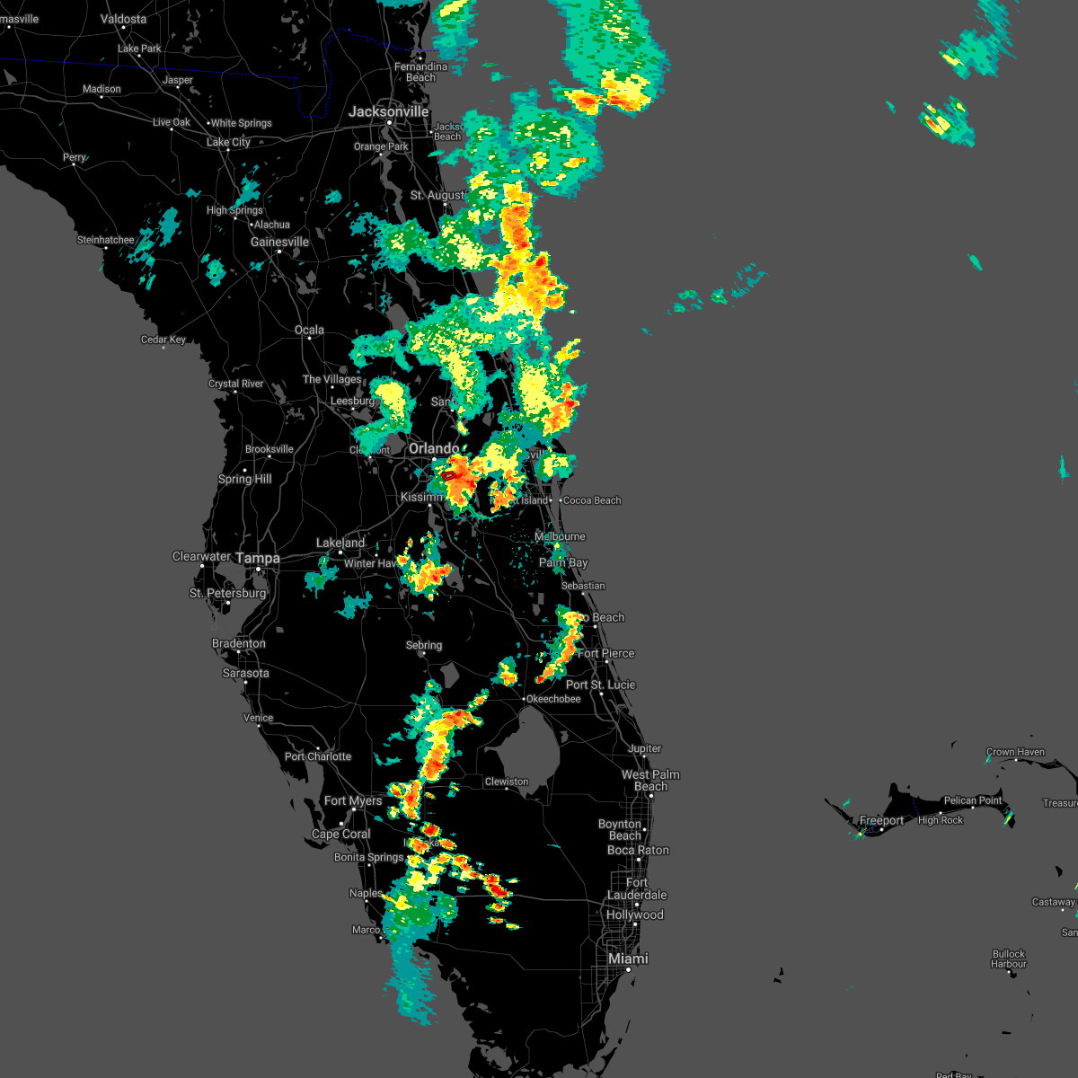 At 701 pm edt, a severe thunderstorm capable of producing a tornado was located over orlando international airport, moving west at 15 mph (radar indicated rotation). Hazards include tornado. Expect damage to mobile homes, roofs, and vehicles. This tornadic thunderstorm will remain over mainly rural areas of southeastern orange county. At 701 pm edt, a severe thunderstorm capable of producing a tornado was located over orlando international airport, moving west at 15 mph (radar indicated rotation). Hazards include tornado. Expect damage to mobile homes, roofs, and vehicles. This tornadic thunderstorm will remain over mainly rural areas of southeastern orange county.
|
| 7/9/2021 6:54 PM EDT |
 At 654 pm edt, a severe thunderstorm was located over lake hart, or near orlando international airport, moving east at 5 mph (radar indicated). Hazards include 60 mph wind gusts and penny size hail. expect damage to roofs, siding, and trees At 654 pm edt, a severe thunderstorm was located over lake hart, or near orlando international airport, moving east at 5 mph (radar indicated). Hazards include 60 mph wind gusts and penny size hail. expect damage to roofs, siding, and trees
|
| 7/8/2021 1:26 PM EDT |
 The severe thunderstorm warning for southwestern orange county will expire at 130 pm edt, the storm which prompted the warning has weakened below severe limits, and no longer poses an immediate threat to life or property. therefore, the warning will be allowed to expire. however gusty winds, cloud to ground lightning and heavy rain are still possible with this thunderstorm. The severe thunderstorm warning for southwestern orange county will expire at 130 pm edt, the storm which prompted the warning has weakened below severe limits, and no longer poses an immediate threat to life or property. therefore, the warning will be allowed to expire. however gusty winds, cloud to ground lightning and heavy rain are still possible with this thunderstorm.
|
| 7/8/2021 1:22 PM EDT |
 At 120 pm edt, a severe thunderstorm was located over bay lake, moving east at 25 mph (radar indicated). Hazards include 60 mph wind gusts. Expect damage to roofs, siding, and trees. Locations impacted include, bay lake, lake buena vista, orlando, and windermere. At 120 pm edt, a severe thunderstorm was located over bay lake, moving east at 25 mph (radar indicated). Hazards include 60 mph wind gusts. Expect damage to roofs, siding, and trees. Locations impacted include, bay lake, lake buena vista, orlando, and windermere.
|
| 7/8/2021 1:04 PM EDT |
 At 102 pm edt, a severe thunderstorm was located near lake louisa, or 7 miles west of bay lake, moving east at 25 mph (radar indicated). Hazards include 60 mph wind gusts. expect damage to roofs, siding, and trees At 102 pm edt, a severe thunderstorm was located near lake louisa, or 7 miles west of bay lake, moving east at 25 mph (radar indicated). Hazards include 60 mph wind gusts. expect damage to roofs, siding, and trees
|
| 6/16/2021 2:20 PM EDT | Trained spotter reported a large tree down near conway rd and michigan ave. time estimated by rada in orange county FL, 2.9 miles WNW of Orlando, FL |
| 6/13/2021 1:41 PM EDT |
 At 141 pm edt, a severe thunderstorm was located over lake nona, or near orlando international airport, moving east at 20 mph (radar indicated). Hazards include 60 mph wind gusts. expect damage to roofs, siding, and trees At 141 pm edt, a severe thunderstorm was located over lake nona, or near orlando international airport, moving east at 20 mph (radar indicated). Hazards include 60 mph wind gusts. expect damage to roofs, siding, and trees
|
| 6/13/2021 1:21 PM EDT |
 At 119 pm edt, a severe thunderstorm was located over buena ventura lakes, moving east at 20 mph (radar indicated). Hazards include 60 mph wind gusts. expect damage to roofs, siding, and trees At 119 pm edt, a severe thunderstorm was located over buena ventura lakes, moving east at 20 mph (radar indicated). Hazards include 60 mph wind gusts. expect damage to roofs, siding, and trees
|
| 4/20/2021 7:54 AM EDT |
 At 754 am edt, a severe thunderstorm was located over union park, or near university of central florida, moving northeast at 35 mph (radar indicated). Hazards include 60 mph wind gusts and quarter size hail. Hail damage to vehicles is expected. expect wind damage to roofs, siding, and trees. Locations impacted include, orlando, oviedo, winter springs, winter park and casselberry. At 754 am edt, a severe thunderstorm was located over union park, or near university of central florida, moving northeast at 35 mph (radar indicated). Hazards include 60 mph wind gusts and quarter size hail. Hail damage to vehicles is expected. expect wind damage to roofs, siding, and trees. Locations impacted include, orlando, oviedo, winter springs, winter park and casselberry.
|
| 4/20/2021 7:46 AM EDT |
 At 746 am edt, a severe thunderstorm was located over orlando executive airport, or over azalea park, moving northeast at 30 mph (radar indicated). Hazards include 60 mph wind gusts and quarter size hail. Hail damage to vehicles is expected. Expect wind damage to roofs, siding, and trees. At 746 am edt, a severe thunderstorm was located over orlando executive airport, or over azalea park, moving northeast at 30 mph (radar indicated). Hazards include 60 mph wind gusts and quarter size hail. Hail damage to vehicles is expected. Expect wind damage to roofs, siding, and trees.
|
| 4/11/2021 1:05 PM EDT |
 The severe thunderstorm warning for southwestern orange and northwestern osceola counties will expire at 115 pm edt, the storm which prompted the warning has weakened below severe limits, and has exited the warned area. therefore, the warning will be allowed to expire. a severe thunderstorm watch remains in effect until 400 pm edt for east central florida. to report severe weather, contact your nearest law enforcement agency. they will relay your report to the national weather service melbourne. The severe thunderstorm warning for southwestern orange and northwestern osceola counties will expire at 115 pm edt, the storm which prompted the warning has weakened below severe limits, and has exited the warned area. therefore, the warning will be allowed to expire. a severe thunderstorm watch remains in effect until 400 pm edt for east central florida. to report severe weather, contact your nearest law enforcement agency. they will relay your report to the national weather service melbourne.
|
| 4/11/2021 12:45 PM EDT |
 At 1244 pm edt, a severe thunderstorm was located near orlando international airport, moving east at 60 mph (radar indicated). Hazards include 70 mph wind gusts and penny size hail. Expect considerable tree damage. damage is likely to mobile homes, roofs, and outbuildings. Locations impacted include, orlando, kissimmee, ocoee, winter garden and saint cloud. At 1244 pm edt, a severe thunderstorm was located near orlando international airport, moving east at 60 mph (radar indicated). Hazards include 70 mph wind gusts and penny size hail. Expect considerable tree damage. damage is likely to mobile homes, roofs, and outbuildings. Locations impacted include, orlando, kissimmee, ocoee, winter garden and saint cloud.
|
| 4/11/2021 12:23 PM EDT |
 At 1223 pm edt, a severe thunderstorm was located over four corners, or near celebration, moving east at 60 mph (radar indicated). Hazards include 70 mph wind gusts and penny size hail. Expect considerable tree damage. Damage is likely to mobile homes, roofs, and outbuildings. At 1223 pm edt, a severe thunderstorm was located over four corners, or near celebration, moving east at 60 mph (radar indicated). Hazards include 70 mph wind gusts and penny size hail. Expect considerable tree damage. Damage is likely to mobile homes, roofs, and outbuildings.
|
| 4/11/2021 10:51 AM EDT | Quarter sized hail reported 11.3 miles WSW of Orlando, FL, public reports at least quarter sized hail near ucf. |
| 4/11/2021 10:46 AM EDT |
 At 1046 am edt, a severe thunderstorm was located over fern park, or over casselberry, moving northeast at 35 mph (public). Hazards include golf ball size hail and 60 mph wind gusts. People and animals outdoors will be injured. expect hail damage to roofs, siding, windows, and vehicles. expect wind damage to roofs, siding, and trees. Locations impacted include, orlando, altamonte springs, oviedo, winter springs and winter park. At 1046 am edt, a severe thunderstorm was located over fern park, or over casselberry, moving northeast at 35 mph (public). Hazards include golf ball size hail and 60 mph wind gusts. People and animals outdoors will be injured. expect hail damage to roofs, siding, windows, and vehicles. expect wind damage to roofs, siding, and trees. Locations impacted include, orlando, altamonte springs, oviedo, winter springs and winter park.
|
| 4/11/2021 10:42 AM EDT | Quarter sized hail reported 6.3 miles S of Orlando, FL, local broadcast media reports quarter size hail in altamonte. |
| 4/11/2021 10:40 AM EDT | Quarter sized hail reported 4.2 miles SSE of Orlando, FL, local broadcast media reports hail up to quarter size near the dubsdread golf course near college park. |
| 4/11/2021 10:35 AM EDT |
 At 1035 am edt, a severe thunderstorm was located over fairview shores, or over college park, moving northeast at 35 mph (radar indicated). Hazards include 60 mph wind gusts and quarter size hail. Hail damage to vehicles is expected. Expect wind damage to roofs, siding, and trees. At 1035 am edt, a severe thunderstorm was located over fairview shores, or over college park, moving northeast at 35 mph (radar indicated). Hazards include 60 mph wind gusts and quarter size hail. Hail damage to vehicles is expected. Expect wind damage to roofs, siding, and trees.
|
| 2/15/2021 6:31 PM EST |
 At 630 pm est, a severe thunderstorm was located over avalon park, moving northeast at 40 mph (radar indicated). Hazards include 60 mph wind gusts. expect damage to roofs, siding, and trees At 630 pm est, a severe thunderstorm was located over avalon park, moving northeast at 40 mph (radar indicated). Hazards include 60 mph wind gusts. expect damage to roofs, siding, and trees
|
| 2/15/2021 6:17 PM EST |
 At 617 pm est, a severe thunderstorm was located over lake nona, or near orlando international airport, moving northeast at 40 mph (radar indicated). Hazards include 60 mph wind gusts. Expect damage to roofs, siding, and trees. Locations impacted include, orlando, wedgefield, orlando international airport, avalon park and bithlo. At 617 pm est, a severe thunderstorm was located over lake nona, or near orlando international airport, moving northeast at 40 mph (radar indicated). Hazards include 60 mph wind gusts. Expect damage to roofs, siding, and trees. Locations impacted include, orlando, wedgefield, orlando international airport, avalon park and bithlo.
|
| 2/15/2021 5:59 PM EST |
 The national weather service in melbourne has issued a * severe thunderstorm warning for. southeastern orange county in east central florida. north central osceola county in east central florida. until 645 pm est. At 558 pm est, a severe thunderstorm was located over saint cloud,. The national weather service in melbourne has issued a * severe thunderstorm warning for. southeastern orange county in east central florida. north central osceola county in east central florida. until 645 pm est. At 558 pm est, a severe thunderstorm was located over saint cloud,.
|
| 8/21/2020 4:09 PM EDT |
 At 408 pm edt, a severe thunderstorm was located over lake mary, moving northeast at 25 mph. at 408 pm a wind gust of 56 mph was measured at the sanford airport (radar indicated). Hazards include 60 mph wind gusts and nickel size hail. Expect damage to roofs, siding, and trees. Locations impacted include, deltona, sanford, apopka, altamonte springs and oviedo. At 408 pm edt, a severe thunderstorm was located over lake mary, moving northeast at 25 mph. at 408 pm a wind gust of 56 mph was measured at the sanford airport (radar indicated). Hazards include 60 mph wind gusts and nickel size hail. Expect damage to roofs, siding, and trees. Locations impacted include, deltona, sanford, apopka, altamonte springs and oviedo.
|
| 8/21/2020 3:57 PM EDT |
 At 357 pm edt, a severe thunderstorm was located near lake mary, moving northeast at 20 mph (radar indicated). Hazards include 60 mph wind gusts and nickel size hail. expect damage to roofs, siding, and trees At 357 pm edt, a severe thunderstorm was located near lake mary, moving northeast at 20 mph (radar indicated). Hazards include 60 mph wind gusts and nickel size hail. expect damage to roofs, siding, and trees
|
| 8/18/2020 2:40 PM EDT |
 The national weather service in melbourne has issued a * severe thunderstorm warning for. north central osceola county in east central florida. until 315 pm edt. At 240 pm edt, a severe thunderstorm was located near west lake toho, moving north at 15 mph. The national weather service in melbourne has issued a * severe thunderstorm warning for. north central osceola county in east central florida. until 315 pm edt. At 240 pm edt, a severe thunderstorm was located near west lake toho, moving north at 15 mph.
|
| 8/17/2020 2:42 PM EDT |
 The severe thunderstorm warning for western orange county will expire at 245 pm edt, the storm which prompted the warning has weakened below severe limits, and no longer poses an immediate threat to life or property. therefore, the warning will be allowed to expire. however gusty winds and heavy rain are still possible with this thunderstorm. The severe thunderstorm warning for western orange county will expire at 245 pm edt, the storm which prompted the warning has weakened below severe limits, and no longer poses an immediate threat to life or property. therefore, the warning will be allowed to expire. however gusty winds and heavy rain are still possible with this thunderstorm.
|
| 8/17/2020 2:30 PM EDT | Large tree blown down into 3 vehicles at albert park near the intersection of edgewater drive and vassar street. report from wkmg-t in orange county FL, 3.6 miles SSE of Orlando, FL |
| 8/17/2020 2:23 PM EDT |
 At 222 pm edt, a severe thunderstorm was located over orlovista, or near orlando, moving east at 20 mph (radar indicated). Hazards include 60 mph wind gusts and penny size hail. Expect damage to roofs, siding, and trees. Locations impacted include, orlando, ocoee, winter park, maitland and windermere. At 222 pm edt, a severe thunderstorm was located over orlovista, or near orlando, moving east at 20 mph (radar indicated). Hazards include 60 mph wind gusts and penny size hail. Expect damage to roofs, siding, and trees. Locations impacted include, orlando, ocoee, winter park, maitland and windermere.
|
| 8/17/2020 2:06 PM EDT |
 At 206 pm edt, a severe thunderstorm was located over ocoee, moving east at 20 mph (radar indicated). Hazards include 60 mph wind gusts and penny size hail. expect damage to roofs, siding, and trees At 206 pm edt, a severe thunderstorm was located over ocoee, moving east at 20 mph (radar indicated). Hazards include 60 mph wind gusts and penny size hail. expect damage to roofs, siding, and trees
|
| 8/9/2020 6:56 PM EDT |
 The severe thunderstorm warning for south central orange county will expire at 700 pm edt, the storm which prompted the warning has weakened below severe limits, and no longer poses an immediate threat to life or property. therefore, the warning will be allowed to expire. to report severe weather, contact your nearest law enforcement agency. they will relay your report to the national weather service melbourne. The severe thunderstorm warning for south central orange county will expire at 700 pm edt, the storm which prompted the warning has weakened below severe limits, and no longer poses an immediate threat to life or property. therefore, the warning will be allowed to expire. to report severe weather, contact your nearest law enforcement agency. they will relay your report to the national weather service melbourne.
|
| 8/9/2020 6:43 PM EDT |
 At 643 pm edt, a severe thunderstorm was located over orlando international airport, moving south at 10 mph (radar indicated). Hazards include 60 mph wind gusts and penny size hail. Expect damage to roofs, siding, and trees. Locations impacted include, orlando, orlando international airport, conway, oak ridge and azalea park. At 643 pm edt, a severe thunderstorm was located over orlando international airport, moving south at 10 mph (radar indicated). Hazards include 60 mph wind gusts and penny size hail. Expect damage to roofs, siding, and trees. Locations impacted include, orlando, orlando international airport, conway, oak ridge and azalea park.
|
| 8/9/2020 6:23 PM EDT | Mco itws measured a 62 mph/54 kt gust from the n in orange county FL, 7.4 miles NNW of Orlando, FL |
| 8/9/2020 6:03 PM EDT |
 At 603 pm edt, a severe thunderstorm was located over college park, moving south at 10 mph (radar indicated). Hazards include 60 mph wind gusts and penny size hail. expect damage to roofs, siding, and trees At 603 pm edt, a severe thunderstorm was located over college park, moving south at 10 mph (radar indicated). Hazards include 60 mph wind gusts and penny size hail. expect damage to roofs, siding, and trees
|
| 8/9/2020 5:57 PM EDT | Relayed report of a large oak tree branch down in audubon park at the corner of pelican lane and osprey ave. time estimated from rada in orange county FL, 3.5 miles SW of Orlando, FL |
| 8/9/2020 5:30 PM EDT | Quarter sized hail reported 9.8 miles SE of Orlando, FL, hail to the size of quarters reported at a gas station at the intersection of clarcona ocoee rd and n. apopka vineland rd. time estimated from radar. |
| 8/9/2020 5:29 PM EDT |
 At 528 pm edt, a severe thunderstorm was located over forest city, or over lockhart, moving south at 5 mph (radar indicated). Hazards include 60 mph wind gusts and quarter size hail. Hail damage to vehicles is expected. expect wind damage to roofs, siding, and trees. Locations impacted include, orlando, apopka, altamonte springs, ocoee and winter garden. At 528 pm edt, a severe thunderstorm was located over forest city, or over lockhart, moving south at 5 mph (radar indicated). Hazards include 60 mph wind gusts and quarter size hail. Hail damage to vehicles is expected. expect wind damage to roofs, siding, and trees. Locations impacted include, orlando, apopka, altamonte springs, ocoee and winter garden.
|
| 8/9/2020 4:57 PM EDT |
 At 457 pm edt, a severe thunderstorm was located over wekiva springs, or near altamonte springs, moving south at 5 mph (radar indicated). Hazards include 60 mph wind gusts and quarter size hail. Hail damage to vehicles is expected. Expect wind damage to roofs, siding, and trees. At 457 pm edt, a severe thunderstorm was located over wekiva springs, or near altamonte springs, moving south at 5 mph (radar indicated). Hazards include 60 mph wind gusts and quarter size hail. Hail damage to vehicles is expected. Expect wind damage to roofs, siding, and trees.
|
| 8/6/2020 7:12 PM EDT | Orlando international airport kmco asos reported a 63mph/55kt wind gust from the sw in orange county FL, 7.7 miles NNW of Orlando, FL |
| 8/5/2020 2:40 PM EDT | News 13 in orlando relayed a report of a tree that fell on a car in south orlando between orange blossom trail and s john young parkway. pictures provided. time estimat in orange county FL, 9.3 miles NNE of Orlando, FL |
| 6/24/2020 9:41 PM EDT |
 At 934 pm edt, a severe thunderstorm was located over winter springs, moving northeast at 15 mph (radar indicated). Hazards include 60 mph wind gusts and quarter size hail. Hail damage to vehicles is expected. expect wind damage to roofs, siding, and trees. Locations impacted include, winter park, casselberry, maitland, goldenrod and fern park. At 934 pm edt, a severe thunderstorm was located over winter springs, moving northeast at 15 mph (radar indicated). Hazards include 60 mph wind gusts and quarter size hail. Hail damage to vehicles is expected. expect wind damage to roofs, siding, and trees. Locations impacted include, winter park, casselberry, maitland, goldenrod and fern park.
|
| 6/24/2020 9:34 PM EDT |
 At 934 pm edt, a severe thunderstorm was located over winter springs, moving northeast at 15 mph (radar indicated). Hazards include 60 mph wind gusts and quarter size hail. Hail damage to vehicles is expected. expect wind damage to roofs, siding, and trees. Locations impacted include, winter park, casselberry, maitland, goldenrod and fern park. At 934 pm edt, a severe thunderstorm was located over winter springs, moving northeast at 15 mph (radar indicated). Hazards include 60 mph wind gusts and quarter size hail. Hail damage to vehicles is expected. expect wind damage to roofs, siding, and trees. Locations impacted include, winter park, casselberry, maitland, goldenrod and fern park.
|
| 6/24/2020 9:15 PM EDT |
 At 915 pm edt, a severe thunderstorm was located over goldenrod, moving northeast at 15 mph (radar indicated). Hazards include 60 mph wind gusts and quarter size hail. Hail damage to vehicles is expected. Expect wind damage to roofs, siding, and trees. At 915 pm edt, a severe thunderstorm was located over goldenrod, moving northeast at 15 mph (radar indicated). Hazards include 60 mph wind gusts and quarter size hail. Hail damage to vehicles is expected. Expect wind damage to roofs, siding, and trees.
|
| 6/24/2020 9:00 PM EDT |
 At 900 pm edt, a severe thunderstorm was located over fern park, or over casselberry, moving northeast at 10 mph (public). Hazards include 60 mph wind gusts and quarter size hail. Hail damage to vehicles is expected. expect wind damage to roofs, siding, and trees. Locations impacted include, orlando, altamonte springs, winter springs, winter park and casselberry. At 900 pm edt, a severe thunderstorm was located over fern park, or over casselberry, moving northeast at 10 mph (public). Hazards include 60 mph wind gusts and quarter size hail. Hail damage to vehicles is expected. expect wind damage to roofs, siding, and trees. Locations impacted include, orlando, altamonte springs, winter springs, winter park and casselberry.
|
| 6/24/2020 8:39 PM EDT | Quarter sized hail reported 8.9 miles SSE of Orlando, FL, quarter sized hail near maitland blvd and magnolia homes road... altamonte springs |
| 6/24/2020 8:34 PM EDT | Golf Ball sized hail reported 8.7 miles SSE of Orlando, FL, report of golf ball sized hail near state road 434 and maitland blvd from spectrum news 13. |
| 6/24/2020 8:24 PM EDT |
 At 823 pm edt, a severe thunderstorm was located over lockhart, moving northeast at 10 mph (radar indicated). Hazards include 60 mph wind gusts and quarter size hail. Hail damage to vehicles is expected. Expect wind damage to roofs, siding, and trees. At 823 pm edt, a severe thunderstorm was located over lockhart, moving northeast at 10 mph (radar indicated). Hazards include 60 mph wind gusts and quarter size hail. Hail damage to vehicles is expected. Expect wind damage to roofs, siding, and trees.
|
| 6/24/2020 7:54 PM EDT |
 At 753 pm edt, a severe thunderstorm was located over four corners, moving northeast at 15 mph (radar indicated). Hazards include 60 mph wind gusts and quarter size hail. Hail damage to vehicles is expected. Expect wind damage to roofs, siding, and trees. At 753 pm edt, a severe thunderstorm was located over four corners, moving northeast at 15 mph (radar indicated). Hazards include 60 mph wind gusts and quarter size hail. Hail damage to vehicles is expected. Expect wind damage to roofs, siding, and trees.
|
| 6/22/2020 9:40 PM EDT |
 The severe thunderstorm warning for south central orange county will expire at 945 pm edt, the storm which prompted the warning has weakened below severe limits, and no longer poses an immediate threat to life or property. therefore, the warning will be allowed to expire. The severe thunderstorm warning for south central orange county will expire at 945 pm edt, the storm which prompted the warning has weakened below severe limits, and no longer poses an immediate threat to life or property. therefore, the warning will be allowed to expire.
|
| 6/22/2020 9:21 PM EDT |
 At 921 pm edt, a severe thunderstorm was located near wedgefield, moving east at 20 mph (radar indicated). Hazards include 60 mph wind gusts. Expect damage to roofs, siding, and trees. Locations impacted include, orlando, wedgefield, orlando international airport, avalon park and conway. At 921 pm edt, a severe thunderstorm was located near wedgefield, moving east at 20 mph (radar indicated). Hazards include 60 mph wind gusts. Expect damage to roofs, siding, and trees. Locations impacted include, orlando, wedgefield, orlando international airport, avalon park and conway.
|
| 6/22/2020 9:06 PM EDT |
 At 905 pm edt, a severe thunderstorm capable of producing a tornado was located over lake hart, or near narcoossee, and slowly moving northeast (radar indicated rotation). Hazards include tornado. Flying debris will be dangerous to those caught without shelter. mobile homes will be damaged or destroyed. damage to roofs, windows, and vehicles will occur. tree damage is likely. This dangerous storm will be near, lake hart and lake nona around 920 pm edt. At 905 pm edt, a severe thunderstorm capable of producing a tornado was located over lake hart, or near narcoossee, and slowly moving northeast (radar indicated rotation). Hazards include tornado. Flying debris will be dangerous to those caught without shelter. mobile homes will be damaged or destroyed. damage to roofs, windows, and vehicles will occur. tree damage is likely. This dangerous storm will be near, lake hart and lake nona around 920 pm edt.
|
| 6/22/2020 8:56 PM EDT |
 At 856 pm edt, a severe thunderstorm was located over lake nona, or near orlando international airport, moving east at 20 mph (radar indicated). Hazards include 60 mph wind gusts and penny size hail. expect damage to roofs, siding, and trees At 856 pm edt, a severe thunderstorm was located over lake nona, or near orlando international airport, moving east at 20 mph (radar indicated). Hazards include 60 mph wind gusts and penny size hail. expect damage to roofs, siding, and trees
|
| 6/22/2020 8:21 PM EDT | Relayed from orange county fr of tree down near green meadow lan in orange county FL, 6.4 miles W of Orlando, FL |
| 6/22/2020 8:17 PM EDT | Relayed report from orange county fr reports tree down near curry ford road and chickasaw trai in orange county FL, 6.5 miles W of Orlando, FL |
| 6/22/2020 8:07 PM EDT | Orange county fire rescue reports tree down near the intersection of lake margaret and conway roa in orange county FL, 2.9 miles WNW of Orlando, FL |
| 6/22/2020 8:07 PM EDT |
 The national weather service in melbourne has issued a * severe thunderstorm warning for. south central seminole county in east central florida. central orange county in east central florida. until 830 pm edt. At 807 pm edt, a severe thunderstorm was located over union park,. The national weather service in melbourne has issued a * severe thunderstorm warning for. south central seminole county in east central florida. central orange county in east central florida. until 830 pm edt. At 807 pm edt, a severe thunderstorm was located over union park,.
|
| 6/20/2020 8:09 PM EDT |
 At 809 pm edt, a severe thunderstorm was located over orlando international airport, moving north at 5 mph (radar indicated). Hazards include 60 mph wind gusts and penny size hail. expect damage to roofs, siding, and trees At 809 pm edt, a severe thunderstorm was located over orlando international airport, moving north at 5 mph (radar indicated). Hazards include 60 mph wind gusts and penny size hail. expect damage to roofs, siding, and trees
|
| 6/20/2020 7:53 PM EDT |
 The severe thunderstorm warning for north central osceola county will expire at 800 pm edt, the storm which prompted the warning has weakened below severe limits, and no longer poses an immediate threat to life or property. therefore, the warning will be allowed to expire. however heavy rain is still possible with this thunderstorm. The severe thunderstorm warning for north central osceola county will expire at 800 pm edt, the storm which prompted the warning has weakened below severe limits, and no longer poses an immediate threat to life or property. therefore, the warning will be allowed to expire. however heavy rain is still possible with this thunderstorm.
|
| 6/20/2020 7:45 PM EDT |
 At 745 pm edt, a severe thunderstorm was located over narcoossee, moving east at 20 mph (radar indicated). Hazards include 60 mph wind gusts. Expect damage to roofs, siding, and trees. Locations impacted include, kissimmee, saint cloud, buena ventura lakes, east lake toho and narcoossee. At 745 pm edt, a severe thunderstorm was located over narcoossee, moving east at 20 mph (radar indicated). Hazards include 60 mph wind gusts. Expect damage to roofs, siding, and trees. Locations impacted include, kissimmee, saint cloud, buena ventura lakes, east lake toho and narcoossee.
|
| 6/20/2020 7:28 PM EDT |
 At 728 pm edt, a severe thunderstorm was located over osceola heritage park, or near east lake toho, moving east at 20 mph (radar indicated). Hazards include 60 mph wind gusts. expect damage to roofs, siding, and trees At 728 pm edt, a severe thunderstorm was located over osceola heritage park, or near east lake toho, moving east at 20 mph (radar indicated). Hazards include 60 mph wind gusts. expect damage to roofs, siding, and trees
|
| 6/6/2020 9:16 PM EDT |
 At 916 pm edt, a severe thunderstorm capable of producing a tornado was located over casselberry, moving northeast at 40 mph (radar indicated rotation). Hazards include tornado. Flying debris will be dangerous to those caught without shelter. mobile homes will be damaged or destroyed. damage to roofs, windows, and vehicles will occur. tree damage is likely. Locations impacted include, orlando, sanford, altamonte springs, oviedo and winter springs. At 916 pm edt, a severe thunderstorm capable of producing a tornado was located over casselberry, moving northeast at 40 mph (radar indicated rotation). Hazards include tornado. Flying debris will be dangerous to those caught without shelter. mobile homes will be damaged or destroyed. damage to roofs, windows, and vehicles will occur. tree damage is likely. Locations impacted include, orlando, sanford, altamonte springs, oviedo and winter springs.
|
| 6/6/2020 9:04 PM EDT |
 At 902 pm edt, a confirmed tornado was located near orlovista, moving northeast at 40 mph. a tornado was reported near conroy road and millenia. additional circulations are evident in the severe line of storms approaching lockhart and pine hills (weather spotters confirmed tornado). Hazards include damaging tornado. Flying debris will be dangerous to those caught without shelter. mobile homes will be damaged or destroyed. damage to roofs, windows, and vehicles will occur. tree damage is likely. Locations impacted include, orlando, sanford, apopka, altamonte springs and ocoee. At 902 pm edt, a confirmed tornado was located near orlovista, moving northeast at 40 mph. a tornado was reported near conroy road and millenia. additional circulations are evident in the severe line of storms approaching lockhart and pine hills (weather spotters confirmed tornado). Hazards include damaging tornado. Flying debris will be dangerous to those caught without shelter. mobile homes will be damaged or destroyed. damage to roofs, windows, and vehicles will occur. tree damage is likely. Locations impacted include, orlando, sanford, apopka, altamonte springs and ocoee.
|
| 6/6/2020 8:59 PM EDT |
 At 858 pm edt, a confirmed tornado was located over orlovista, or near pine hills, moving northeast at 40 mph. a tornado was reported near universal studios (weather spotters confirmed tornado). Hazards include damaging tornado. Flying debris will be dangerous to those caught without shelter. mobile homes will be damaged or destroyed. damage to roofs, windows, and vehicles will occur. tree damage is likely. the tornado will be near, winter park, maitland and lockhart around 910 pm edt. Altamonte springs, casselberry and longwood around 920 pm edt. At 858 pm edt, a confirmed tornado was located over orlovista, or near pine hills, moving northeast at 40 mph. a tornado was reported near universal studios (weather spotters confirmed tornado). Hazards include damaging tornado. Flying debris will be dangerous to those caught without shelter. mobile homes will be damaged or destroyed. damage to roofs, windows, and vehicles will occur. tree damage is likely. the tornado will be near, winter park, maitland and lockhart around 910 pm edt. Altamonte springs, casselberry and longwood around 920 pm edt.
|
| 6/6/2020 8:50 PM EDT |
 At 850 pm edt, a severe squall line capable of producing both tornadoes and extensive straight line wind damage was located over windermere, moving northeast at 45 mph (radar indicated rotation). Hazards include tornado. Flying debris will be dangerous to those caught without shelter. mobile homes will be damaged or destroyed. damage to roofs, windows, and vehicles will occur. tree damage is likely. Locations impacted include, orlando, ocoee, winter garden, windermere and bay lake. At 850 pm edt, a severe squall line capable of producing both tornadoes and extensive straight line wind damage was located over windermere, moving northeast at 45 mph (radar indicated rotation). Hazards include tornado. Flying debris will be dangerous to those caught without shelter. mobile homes will be damaged or destroyed. damage to roofs, windows, and vehicles will occur. tree damage is likely. Locations impacted include, orlando, ocoee, winter garden, windermere and bay lake.
|
| 6/6/2020 8:43 PM EDT |
 At 842 pm edt, severe thunderstorms capable of producing both tornadoes and extensive straight line wind damage were located over horizon west, or over bay lake, moving northeast at 40 mph (radar indicated rotation). Hazards include tornado. Flying debris will be dangerous to those caught without shelter. mobile homes will be damaged or destroyed. damage to roofs, windows, and vehicles will occur. Tree damage is likely. At 842 pm edt, severe thunderstorms capable of producing both tornadoes and extensive straight line wind damage were located over horizon west, or over bay lake, moving northeast at 40 mph (radar indicated rotation). Hazards include tornado. Flying debris will be dangerous to those caught without shelter. mobile homes will be damaged or destroyed. damage to roofs, windows, and vehicles will occur. Tree damage is likely.
|
| 6/6/2020 7:39 PM EDT |
 At 738 pm edt, a severe thunderstorm capable of producing a tornado was located over winter park, moving north at 20 mph. this storm has a history of producing a tornado, and while the tornado has dissipated it could quickly redevelop (radar indicated rotation). Hazards include tornado. Flying debris will be dangerous to those caught without shelter. mobile homes will be damaged or destroyed. damage to roofs, windows, and vehicles will occur. tree damage is likely. Locations impacted include, orlando, altamonte springs, winter springs, winter park and casselberry. At 738 pm edt, a severe thunderstorm capable of producing a tornado was located over winter park, moving north at 20 mph. this storm has a history of producing a tornado, and while the tornado has dissipated it could quickly redevelop (radar indicated rotation). Hazards include tornado. Flying debris will be dangerous to those caught without shelter. mobile homes will be damaged or destroyed. damage to roofs, windows, and vehicles will occur. tree damage is likely. Locations impacted include, orlando, altamonte springs, winter springs, winter park and casselberry.
|
| 6/6/2020 7:33 PM EDT |
 At 733 pm edt, a confirmed tornado was located over college park, moving north at 20 mph. this tornado just crossed over state road 408 and is heading north (weather spotters confirmed tornado). Hazards include damaging tornado. Flying debris will be dangerous to those caught without shelter. mobile homes will be damaged or destroyed. damage to roofs, windows, and vehicles will occur. tree damage is likely. Locations impacted include, orlando, altamonte springs, winter springs, winter park and casselberry. At 733 pm edt, a confirmed tornado was located over college park, moving north at 20 mph. this tornado just crossed over state road 408 and is heading north (weather spotters confirmed tornado). Hazards include damaging tornado. Flying debris will be dangerous to those caught without shelter. mobile homes will be damaged or destroyed. damage to roofs, windows, and vehicles will occur. tree damage is likely. Locations impacted include, orlando, altamonte springs, winter springs, winter park and casselberry.
|
| 6/6/2020 7:32 PM EDT | Orlando fire rescue on scene reported multiple trees and power lines down stretching from lake margaret dr to fern creek ave. possible tornad in orange county FL, 1.7 miles SW of Orlando, FL |
| 6/6/2020 7:32 PM EDT | Reports of tree damage in thornton park. possible tornado. time estimated from rada in orange county FL, 2.3 miles SSW of Orlando, FL |
| 6/6/2020 7:30 PM EDT |
 At 730 pm edt, a confirmed tornado was located over orlando executive airport, or over orlando, moving north at 20 mph (weather spotters confirmed tornado). Hazards include damaging tornado. Flying debris will be dangerous to those caught without shelter. mobile homes will be damaged or destroyed. damage to roofs, windows, and vehicles will occur. tree damage is likely. Locations impacted include, orlando, altamonte springs, winter springs, winter park and casselberry. At 730 pm edt, a confirmed tornado was located over orlando executive airport, or over orlando, moving north at 20 mph (weather spotters confirmed tornado). Hazards include damaging tornado. Flying debris will be dangerous to those caught without shelter. mobile homes will be damaged or destroyed. damage to roofs, windows, and vehicles will occur. tree damage is likely. Locations impacted include, orlando, altamonte springs, winter springs, winter park and casselberry.
|
| 6/6/2020 7:26 PM EDT |
 At 726 pm edt, a confirmed tornado was located over orlando, moving north at 20 mph (radar confirmed tornado). Hazards include damaging tornado. Flying debris will be dangerous to those caught without shelter. mobile homes will be damaged or destroyed. damage to roofs, windows, and vehicles will occur. tree damage is likely. Locations impacted include, orlando, altamonte springs, winter springs, winter park and casselberry. At 726 pm edt, a confirmed tornado was located over orlando, moving north at 20 mph (radar confirmed tornado). Hazards include damaging tornado. Flying debris will be dangerous to those caught without shelter. mobile homes will be damaged or destroyed. damage to roofs, windows, and vehicles will occur. tree damage is likely. Locations impacted include, orlando, altamonte springs, winter springs, winter park and casselberry.
|
| 6/6/2020 7:22 PM EDT |
 At 722 pm edt, a severe thunderstorm capable of producing a tornado was located over orlando, moving north at 20 mph (radar indicated rotation). Hazards include tornado. Flying debris will be dangerous to those caught without shelter. mobile homes will be damaged or destroyed. damage to roofs, windows, and vehicles will occur. Tree damage is likely. At 722 pm edt, a severe thunderstorm capable of producing a tornado was located over orlando, moving north at 20 mph (radar indicated rotation). Hazards include tornado. Flying debris will be dangerous to those caught without shelter. mobile homes will be damaged or destroyed. damage to roofs, windows, and vehicles will occur. Tree damage is likely.
|
| 6/6/2020 6:26 PM EDT |
 The tornado warning for west central orange county will expire at 630 pm edt, the storm which prompted the warning has weakened below severe limits, and no longer appears capable of producing a tornado. therefore, the warning will be allowed to expire. however gusty winds and heavy rain are still possible with this thunderstorm. this storm could restrengthen and another warning might need to be issued. to report severe weather, contact your nearest law enforcement agency. they will relay your report to the national weather service melbourne. The tornado warning for west central orange county will expire at 630 pm edt, the storm which prompted the warning has weakened below severe limits, and no longer appears capable of producing a tornado. therefore, the warning will be allowed to expire. however gusty winds and heavy rain are still possible with this thunderstorm. this storm could restrengthen and another warning might need to be issued. to report severe weather, contact your nearest law enforcement agency. they will relay your report to the national weather service melbourne.
|
| 6/6/2020 6:19 PM EDT |
 At 611 pm edt, a severe thunderstorm capable of producing a tornado was located over orlovista, or near pine hills, moving north at 20 mph. a trained spotter reported visible rotation with this storm (radar indicated rotation). Hazards include tornado. Flying debris will be dangerous to those caught without shelter. mobile homes will be damaged or destroyed. damage to roofs, windows, and vehicles will occur. tree damage is likely. Locations impacted include, orlando, ocoee, winter park, maitland and lockhart. At 611 pm edt, a severe thunderstorm capable of producing a tornado was located over orlovista, or near pine hills, moving north at 20 mph. a trained spotter reported visible rotation with this storm (radar indicated rotation). Hazards include tornado. Flying debris will be dangerous to those caught without shelter. mobile homes will be damaged or destroyed. damage to roofs, windows, and vehicles will occur. tree damage is likely. Locations impacted include, orlando, ocoee, winter park, maitland and lockhart.
|
| 6/6/2020 6:12 PM EDT |
 At 611 pm edt, a severe thunderstorm capable of producing a tornado was located over orlovista, or near pine hills, moving north at 20 mph. a trained spotter reported visible rotation with this storm (radar indicated rotation). Hazards include tornado. Flying debris will be dangerous to those caught without shelter. mobile homes will be damaged or destroyed. damage to roofs, windows, and vehicles will occur. tree damage is likely. Locations impacted include, orlando, ocoee, winter park, maitland and lockhart. At 611 pm edt, a severe thunderstorm capable of producing a tornado was located over orlovista, or near pine hills, moving north at 20 mph. a trained spotter reported visible rotation with this storm (radar indicated rotation). Hazards include tornado. Flying debris will be dangerous to those caught without shelter. mobile homes will be damaged or destroyed. damage to roofs, windows, and vehicles will occur. tree damage is likely. Locations impacted include, orlando, ocoee, winter park, maitland and lockhart.
|
| 6/6/2020 6:05 PM EDT |
 At 604 pm edt, a severe thunderstorm capable of producing a tornado was located over universal studios, or over oak ridge, moving north at 20 mph (radar indicated rotation). Hazards include tornado. Flying debris will be dangerous to those caught without shelter. mobile homes will be damaged or destroyed. damage to roofs, windows, and vehicles will occur. tree damage is likely. this dangerous storm will be near, orlovista and fairview shores around 620 pm edt. maitland, lockhart and pine hills around 630 pm edt. Other locations impacted by this tornadic thunderstorm include eatonville. At 604 pm edt, a severe thunderstorm capable of producing a tornado was located over universal studios, or over oak ridge, moving north at 20 mph (radar indicated rotation). Hazards include tornado. Flying debris will be dangerous to those caught without shelter. mobile homes will be damaged or destroyed. damage to roofs, windows, and vehicles will occur. tree damage is likely. this dangerous storm will be near, orlovista and fairview shores around 620 pm edt. maitland, lockhart and pine hills around 630 pm edt. Other locations impacted by this tornadic thunderstorm include eatonville.
|
| 6/6/2020 5:58 PM EDT |
 At 557 pm edt, a severe thunderstorm capable of producing a tornado was located over oak ridge, moving north at 20 mph (the public reported a funnel cloud earlier near celebration). Hazards include tornado. Flying debris will be dangerous to those caught without shelter. mobile homes will be damaged or destroyed. damage to roofs, windows, and vehicles will occur. tree damage is likely. Locations impacted include, orlando, windermere, oak ridge, doctor phillips and sea world. At 557 pm edt, a severe thunderstorm capable of producing a tornado was located over oak ridge, moving north at 20 mph (the public reported a funnel cloud earlier near celebration). Hazards include tornado. Flying debris will be dangerous to those caught without shelter. mobile homes will be damaged or destroyed. damage to roofs, windows, and vehicles will occur. tree damage is likely. Locations impacted include, orlando, windermere, oak ridge, doctor phillips and sea world.
|
| 6/6/2020 5:48 PM EDT |
 At 548 pm edt, a severe thunderstorm capable of producing a tornado was located over sea world, or near oak ridge, moving north at 20 mph (radar indicated rotation). Hazards include tornado. Flying debris will be dangerous to those caught without shelter. mobile homes will be damaged or destroyed. damage to roofs, windows, and vehicles will occur. tree damage is likely. Locations impacted include, orlando, windermere, oak ridge, bay hill and universal studios. At 548 pm edt, a severe thunderstorm capable of producing a tornado was located over sea world, or near oak ridge, moving north at 20 mph (radar indicated rotation). Hazards include tornado. Flying debris will be dangerous to those caught without shelter. mobile homes will be damaged or destroyed. damage to roofs, windows, and vehicles will occur. tree damage is likely. Locations impacted include, orlando, windermere, oak ridge, bay hill and universal studios.
|
| 6/6/2020 5:39 PM EDT |
 At 539 pm edt, a severe thunderstorm capable of producing a tornado was located over sea world, or near celebration, moving north at 20 mph (radar indicated rotation). Hazards include tornado. Flying debris will be dangerous to those caught without shelter. mobile homes will be damaged or destroyed. damage to roofs, windows, and vehicles will occur. tree damage is likely. this dangerous storm will be near, sea world around 550 pm edt. doctor phillips, universal studios and bay hill around 600 pm edt. windermere around 610 pm edt. Other locations impacted by this tornadic thunderstorm include lake butler. At 539 pm edt, a severe thunderstorm capable of producing a tornado was located over sea world, or near celebration, moving north at 20 mph (radar indicated rotation). Hazards include tornado. Flying debris will be dangerous to those caught without shelter. mobile homes will be damaged or destroyed. damage to roofs, windows, and vehicles will occur. tree damage is likely. this dangerous storm will be near, sea world around 550 pm edt. doctor phillips, universal studios and bay hill around 600 pm edt. windermere around 610 pm edt. Other locations impacted by this tornadic thunderstorm include lake butler.
|
| 5/30/2020 9:25 PM EDT |
 The severe thunderstorm warning for northern osceola county will expire at 930 pm edt, the storm which prompted the warning has weakened. therefore, the warning will be allowed to expire. however gusty winds and heavy rain are still possible with this thunderstorm. The severe thunderstorm warning for northern osceola county will expire at 930 pm edt, the storm which prompted the warning has weakened. therefore, the warning will be allowed to expire. however gusty winds and heavy rain are still possible with this thunderstorm.
|
| 5/30/2020 8:56 PM EDT |
 At 855 pm edt, a severe thunderstorm was located near saint cloud, moving southeast at 15 mph (radar indicated). Hazards include 60 mph wind gusts. Expect damage to roofs, siding, and trees. Locations impacted include, kissimmee, saint cloud, holopaw, west lake toho and east lake toho. At 855 pm edt, a severe thunderstorm was located near saint cloud, moving southeast at 15 mph (radar indicated). Hazards include 60 mph wind gusts. Expect damage to roofs, siding, and trees. Locations impacted include, kissimmee, saint cloud, holopaw, west lake toho and east lake toho.
|
| 5/30/2020 8:44 PM EDT |
 At 844 pm edt, a severe thunderstorm was located near saint cloud, moving southeast at 15 mph (radar indicated). Hazards include 60 mph wind gusts. expect damage to roofs, siding, and trees At 844 pm edt, a severe thunderstorm was located near saint cloud, moving southeast at 15 mph (radar indicated). Hazards include 60 mph wind gusts. expect damage to roofs, siding, and trees
|
| 5/30/2020 8:32 PM EDT |
 At 831 pm edt, a severe thunderstorm was located over buena ventura lakes, moving south at 5 mph (radar indicated). Hazards include 60 mph wind gusts. Expect damage to roofs, siding, and trees. Locations impacted include, orlando, kissimmee, buena ventura lakes, east lake toho and austin tindall park. At 831 pm edt, a severe thunderstorm was located over buena ventura lakes, moving south at 5 mph (radar indicated). Hazards include 60 mph wind gusts. Expect damage to roofs, siding, and trees. Locations impacted include, orlando, kissimmee, buena ventura lakes, east lake toho and austin tindall park.
|
| 5/30/2020 8:17 PM EDT |
 At 816 pm edt, a severe thunderstorm was located over austin tindall park, or near buena ventura lakes, moving south at 5 mph (radar indicated). Hazards include 60 mph wind gusts. expect damage to roofs, siding, and trees At 816 pm edt, a severe thunderstorm was located over austin tindall park, or near buena ventura lakes, moving south at 5 mph (radar indicated). Hazards include 60 mph wind gusts. expect damage to roofs, siding, and trees
|
| 5/22/2020 5:50 PM EDT | Quarter sized hail reported 10.2 miles SE of Orlando, FL, hail up to quarter size near the intersection of mccormick road and apopka-vineland road. from video posted to social media. |
| 5/22/2020 5:38 PM EDT |
 At 537 pm edt, severe thunderstorms were located along a line extending from near sorrento to bay hill, moving northwest at less than 10 mph (radar indicated). Hazards include 60 mph wind gusts and quarter size hail. Hail damage to vehicles is expected. Expect wind damage to roofs, siding, and trees. At 537 pm edt, severe thunderstorms were located along a line extending from near sorrento to bay hill, moving northwest at less than 10 mph (radar indicated). Hazards include 60 mph wind gusts and quarter size hail. Hail damage to vehicles is expected. Expect wind damage to roofs, siding, and trees.
|
| 5/21/2020 7:20 PM EDT | Quarter sized hail reported 9 miles W of Orlando, FL, emergency manager reported 1 inch hail with picture. |
| 5/21/2020 7:18 PM EDT | Half Dollar sized hail reported 8.3 miles W of Orlando, FL, reporter shared a picture of hail slightly larger than a quarter. time estimated from radar. |
| 5/21/2020 7:14 PM EDT |
 At 713 pm edt, a severe thunderstorm was located near orlando international airport, and is nearly stationary (radar indicated). Hazards include 60 mph wind gusts and half dollar size hail. Hail damage to vehicles is expected. Expect wind damage to roofs, siding, and trees. At 713 pm edt, a severe thunderstorm was located near orlando international airport, and is nearly stationary (radar indicated). Hazards include 60 mph wind gusts and half dollar size hail. Hail damage to vehicles is expected. Expect wind damage to roofs, siding, and trees.
|
| 5/21/2020 6:44 PM EDT |
 At 643 pm edt, a severe thunderstorm was located over narcoossee, moving southeast at 10 mph (trained weather spotters). Hazards include 60 mph wind gusts and quarter size hail. Hail damage to vehicles is expected. expect wind damage to roofs, siding, and trees. Locations impacted include, kissimmee, buena ventura lakes, east lake toho, narcoossee and austin tindall park. At 643 pm edt, a severe thunderstorm was located over narcoossee, moving southeast at 10 mph (trained weather spotters). Hazards include 60 mph wind gusts and quarter size hail. Hail damage to vehicles is expected. expect wind damage to roofs, siding, and trees. Locations impacted include, kissimmee, buena ventura lakes, east lake toho, narcoossee and austin tindall park.
|
| 5/21/2020 6:30 PM EDT |
 At 628 pm edt, a severe thunderstorm was located over buena ventura lakes, and is nearly stationary. hail to the size of half dollars has been reported with this storm (trained weather spotters). Hazards include 60 mph wind gusts and half dollar size hail. Hail damage to vehicles is expected. expect wind damage to roofs, siding, and trees. Locations impacted include, orlando, kissimmee, orlando international airport, buena ventura lakes and east lake toho. At 628 pm edt, a severe thunderstorm was located over buena ventura lakes, and is nearly stationary. hail to the size of half dollars has been reported with this storm (trained weather spotters). Hazards include 60 mph wind gusts and half dollar size hail. Hail damage to vehicles is expected. expect wind damage to roofs, siding, and trees. Locations impacted include, orlando, kissimmee, orlando international airport, buena ventura lakes and east lake toho.
|
| 5/21/2020 6:22 PM EDT | Half Dollar sized hail reported 2.9 miles NNE of Orlando, FL, trained spotter reported 1 and 1/4 inch hail. |
| 5/21/2020 6:22 PM EDT | Golf Ball sized hail reported 2.9 miles NNE of Orlando, FL, trained spotter reported 1 and 1/4 inch hail at 622pm. spotter then called back at 642pm and reported finding 1 and 3/4 inch hail stones and that his vinyl fence had bl |
| 5/21/2020 6:15 PM EDT | Half Dollar sized hail reported 11.5 miles NNW of Orlando, FL, public reported half dollar size hail via twitter. time estimated from radar |
| 5/21/2020 6:15 PM EDT | Golf Ball sized hail reported 10.7 miles NNW of Orlando, FL, trained spotter reported golf ball size hail. |
| 5/21/2020 6:15 PM EDT |
 At 615 pm edt, a severe thunderstorm was located over buena ventura lakes, and is nearly stationary (radar indicated). Hazards include 60 mph wind gusts and half dollar size hail. Hail damage to vehicles is expected. Expect wind damage to roofs, siding, and trees. At 615 pm edt, a severe thunderstorm was located over buena ventura lakes, and is nearly stationary (radar indicated). Hazards include 60 mph wind gusts and half dollar size hail. Hail damage to vehicles is expected. Expect wind damage to roofs, siding, and trees.
|
| 4/20/2020 10:42 AM EDT |
 At 1041 am edt, a severe thunderstorm was located 8 miles northeast of bushnell, moving east at 45 to 50 mph (radar indicated). Hazards include 60 mph wind gusts and quarter size hail. Hail damage to vehicles is expected. Expect wind damage to roofs, siding, and trees. At 1041 am edt, a severe thunderstorm was located 8 miles northeast of bushnell, moving east at 45 to 50 mph (radar indicated). Hazards include 60 mph wind gusts and quarter size hail. Hail damage to vehicles is expected. Expect wind damage to roofs, siding, and trees.
|
| 2/7/2020 12:07 AM EST |
 At 1206 am est, severe thunderstorms were located along a line extending from 10 miles east of daytona beach shores to near lone cabbage fish camp, moving east at 50 mph (radar indicated). Hazards include 60 mph wind gusts. expect damage to roofs, siding, and trees At 1206 am est, severe thunderstorms were located along a line extending from 10 miles east of daytona beach shores to near lone cabbage fish camp, moving east at 50 mph (radar indicated). Hazards include 60 mph wind gusts. expect damage to roofs, siding, and trees
|
| 2/7/2020 12:00 AM EST |
 At 1157 pm est, severe thunderstorms were located along a line extending from 9 miles northeast of deleon springs to near debary to near lake apopka to near four corners, moving east at 55 mph. severe storms will cross the attractions area shortly, and are expected to produce damaging wind gusts!! take shelter in a sturdy building now!! (radar indicated). Hazards include 70 mph wind gusts. Expect considerable tree damage. damage is likely to mobile homes, roofs, and outbuildings. Locations impacted include, orlando, deltona, daytona beach, sanford and apopka. At 1157 pm est, severe thunderstorms were located along a line extending from 9 miles northeast of deleon springs to near debary to near lake apopka to near four corners, moving east at 55 mph. severe storms will cross the attractions area shortly, and are expected to produce damaging wind gusts!! take shelter in a sturdy building now!! (radar indicated). Hazards include 70 mph wind gusts. Expect considerable tree damage. damage is likely to mobile homes, roofs, and outbuildings. Locations impacted include, orlando, deltona, daytona beach, sanford and apopka.
|
| 2/6/2020 11:50 PM EST |
 At 1149 pm est, a severe thunderstorm was located near four corners, or 12 miles west of celebration, moving east at 40 to 50 mph (radar indicated). Hazards include 70 mph wind gusts. Expect considerable tree damage. Damage is likely to mobile homes, roofs, and outbuildings. At 1149 pm est, a severe thunderstorm was located near four corners, or 12 miles west of celebration, moving east at 40 to 50 mph (radar indicated). Hazards include 70 mph wind gusts. Expect considerable tree damage. Damage is likely to mobile homes, roofs, and outbuildings.
|
| 2/6/2020 11:46 PM EST |
 At 1146 pm est, severe thunderstorms were located along a line extending from 6 miles northeast of barberville to 10 miles southwest of lake louisa, moving east at 50 mph (radar indicated). Hazards include 70 mph wind gusts. Expect considerable tree damage. damage is likely to mobile homes, roofs, and outbuildings. Locations impacted include, orlando, deltona, daytona beach, sanford and apopka. At 1146 pm est, severe thunderstorms were located along a line extending from 6 miles northeast of barberville to 10 miles southwest of lake louisa, moving east at 50 mph (radar indicated). Hazards include 70 mph wind gusts. Expect considerable tree damage. damage is likely to mobile homes, roofs, and outbuildings. Locations impacted include, orlando, deltona, daytona beach, sanford and apopka.
|
| 2/6/2020 11:18 PM EST |
 At 1117 pm est, severe thunderstorms were located along a line extending from near pierson to 9 miles west of four corners, moving east at 50 mph (radar indicated). Hazards include 70 mph wind gusts. Expect considerable tree damage. Damage is likely to mobile homes, roofs, and outbuildings. At 1117 pm est, severe thunderstorms were located along a line extending from near pierson to 9 miles west of four corners, moving east at 50 mph (radar indicated). Hazards include 70 mph wind gusts. Expect considerable tree damage. Damage is likely to mobile homes, roofs, and outbuildings.
|
| 12/17/2019 3:47 PM EST |
 At 347 pm est, a severe thunderstorm was located over altamonte springs, moving northeast at 25 mph (radar indicated). Hazards include 60 mph wind gusts and penny size hail. expect damage to roofs, siding, and trees At 347 pm est, a severe thunderstorm was located over altamonte springs, moving northeast at 25 mph (radar indicated). Hazards include 60 mph wind gusts and penny size hail. expect damage to roofs, siding, and trees
|
| 7/28/2019 8:45 PM EDT |
 At 844 pm edt, a severe thunderstorm was located over kissimmee, moving southeast at 15 mph. a wind gust of 58 mph was recorded at 831 pm at the kissimmee airport (radar indicated). Hazards include 60 mph wind gusts and quarter size hail. Hail damage to vehicles is expected. expect wind damage to roofs, siding, and trees. Locations impacted include, orlando, kissimmee, bay lake, celebration and west lake toho. At 844 pm edt, a severe thunderstorm was located over kissimmee, moving southeast at 15 mph. a wind gust of 58 mph was recorded at 831 pm at the kissimmee airport (radar indicated). Hazards include 60 mph wind gusts and quarter size hail. Hail damage to vehicles is expected. expect wind damage to roofs, siding, and trees. Locations impacted include, orlando, kissimmee, bay lake, celebration and west lake toho.
|
| 7/28/2019 8:24 PM EDT |
 At 824 pm edt, a severe thunderstorm was located over hunters creek, or near celebration, moving southeast at 15 mph (radar indicated). Hazards include 60 mph wind gusts and quarter size hail. Hail damage to vehicles is expected. Expect wind damage to roofs, siding, and trees. At 824 pm edt, a severe thunderstorm was located over hunters creek, or near celebration, moving southeast at 15 mph (radar indicated). Hazards include 60 mph wind gusts and quarter size hail. Hail damage to vehicles is expected. Expect wind damage to roofs, siding, and trees.
|
| 7/21/2019 3:32 PM EDT |
 At 331 pm edt, a severe thunderstorm was located near pine hills, moving northwest at 15 mph (radar indicated). Hazards include 60 mph wind gusts. Expect damage to roofs, siding, and trees. Locations impacted include, apopka, altamonte springs, lockhart, pine hills and forest city. At 331 pm edt, a severe thunderstorm was located near pine hills, moving northwest at 15 mph (radar indicated). Hazards include 60 mph wind gusts. Expect damage to roofs, siding, and trees. Locations impacted include, apopka, altamonte springs, lockhart, pine hills and forest city.
|
| 7/21/2019 3:21 PM EDT |
 At 321 pm edt, a severe thunderstorm was located over college park, moving northwest at 10 mph (radar indicated). Hazards include 60 mph wind gusts. Expect damage to roofs, siding, and trees. Locations impacted include, orlando, apopka, altamonte springs, winter park and casselberry. At 321 pm edt, a severe thunderstorm was located over college park, moving northwest at 10 mph (radar indicated). Hazards include 60 mph wind gusts. Expect damage to roofs, siding, and trees. Locations impacted include, orlando, apopka, altamonte springs, winter park and casselberry.
|
| 7/21/2019 3:15 PM EDT |
 At 315 pm edt, a severe thunderstorm was located over college park, moving northwest at 10 mph (radar indicated). Hazards include 60 mph wind gusts. expect damage to roofs, siding, and trees At 315 pm edt, a severe thunderstorm was located over college park, moving northwest at 10 mph (radar indicated). Hazards include 60 mph wind gusts. expect damage to roofs, siding, and trees
|
| 7/18/2019 5:10 PM EDT |
 The severe thunderstorm warning for west central seminole and northwestern orange counties will expire at 515 pm edt, the storm which prompted the warning has weakened below severe limits, and no longer poses an immediate threat to life or property. therefore, the warning will be allowed to expire. The severe thunderstorm warning for west central seminole and northwestern orange counties will expire at 515 pm edt, the storm which prompted the warning has weakened below severe limits, and no longer poses an immediate threat to life or property. therefore, the warning will be allowed to expire.
|
| 7/18/2019 4:52 PM EDT |
 At 451 pm edt, a severe thunderstorm was located over wekiwa springs state park, or near apopka, moving northwest at 10 mph. pea sized hail has been reported with this storms on hunt club blvd in wekiva (radar indicated). Hazards include 60 mph wind gusts and penny size hail. Expect damage to roofs, siding, and trees. Locations impacted include, apopka, altamonte springs, longwood, lockhart and zellwood. At 451 pm edt, a severe thunderstorm was located over wekiwa springs state park, or near apopka, moving northwest at 10 mph. pea sized hail has been reported with this storms on hunt club blvd in wekiva (radar indicated). Hazards include 60 mph wind gusts and penny size hail. Expect damage to roofs, siding, and trees. Locations impacted include, apopka, altamonte springs, longwood, lockhart and zellwood.
|
| 7/18/2019 4:27 PM EDT |
 The severe thunderstorm warning for south central lake and southwestern orange counties will expire at 430 pm edt, the storm which prompted the warning has weakened below severe limits, and no longer poses an immediate threat to life or property. therefore, the warning will be allowed to expire. however gusty winds, lightning, and heavy rain are still possible with this thunderstorm. The severe thunderstorm warning for south central lake and southwestern orange counties will expire at 430 pm edt, the storm which prompted the warning has weakened below severe limits, and no longer poses an immediate threat to life or property. therefore, the warning will be allowed to expire. however gusty winds, lightning, and heavy rain are still possible with this thunderstorm.
|
| 7/18/2019 4:27 PM EDT |
 At 427 pm edt, a severe thunderstorm was located over wekiwa springs state park, or over apopka, moving northwest at 10 mph (radar indicated). Hazards include 60 mph wind gusts and penny size hail. expect damage to roofs, siding, and trees At 427 pm edt, a severe thunderstorm was located over wekiwa springs state park, or over apopka, moving northwest at 10 mph (radar indicated). Hazards include 60 mph wind gusts and penny size hail. expect damage to roofs, siding, and trees
|
| 7/18/2019 4:01 PM EDT |
 The national weather service in melbourne has issued a * severe thunderstorm warning for. south central lake county in east central florida. southwestern orange county in east central florida. until 430 pm edt. At 400 pm edt, a severe thunderstorm was located over horizon west,. The national weather service in melbourne has issued a * severe thunderstorm warning for. south central lake county in east central florida. southwestern orange county in east central florida. until 430 pm edt. At 400 pm edt, a severe thunderstorm was located over horizon west,.
|
| 6/25/2019 7:42 PM EDT |
 The severe thunderstorm warning for south central orange county will expire at 745 pm edt, the storm which prompted the warning has weakened below severe limits, and no longer poses an immediate threat to life or property. therefore, the warning will be allowed to expire. however heavy rain and frequent lightning are still possible with this thunderstorm. The severe thunderstorm warning for south central orange county will expire at 745 pm edt, the storm which prompted the warning has weakened below severe limits, and no longer poses an immediate threat to life or property. therefore, the warning will be allowed to expire. however heavy rain and frequent lightning are still possible with this thunderstorm.
|
| 6/25/2019 7:26 PM EDT |
 At 723 pm edt, severe thunderstorms were located from near union park to the orlando international airport, moving south at 20 mph (radar indicated). Hazards include 60 mph wind gusts. Expect damage to roofs, siding, and trees. Locations impacted include, orlando, winter park, wedgefield, orlando international airport and avalon park. At 723 pm edt, severe thunderstorms were located from near union park to the orlando international airport, moving south at 20 mph (radar indicated). Hazards include 60 mph wind gusts. Expect damage to roofs, siding, and trees. Locations impacted include, orlando, winter park, wedgefield, orlando international airport and avalon park.
|
| 6/25/2019 7:08 PM EDT |
 At 707 pm edt, a severe thunderstorm was located over union park, or over university of central florida, moving south at 20 mph (radar indicated). Hazards include 60 mph wind gusts. expect damage to roofs, siding, and trees At 707 pm edt, a severe thunderstorm was located over union park, or over university of central florida, moving south at 20 mph (radar indicated). Hazards include 60 mph wind gusts. expect damage to roofs, siding, and trees
|
| 6/25/2019 7:06 PM EDT |
 At 706 pm edt, a severe thunderstorm was located over bay lake, moving southeast at 25 mph (radar indicated). Hazards include 60 mph wind gusts. expect damage to roofs, siding, and trees At 706 pm edt, a severe thunderstorm was located over bay lake, moving southeast at 25 mph (radar indicated). Hazards include 60 mph wind gusts. expect damage to roofs, siding, and trees
|
| 6/25/2019 6:56 PM EDT |
 At 655 pm edt, a severe thunderstorm was located over lake jessup, moving southeast at 10 mph. storm activity was diminishing over the sanford area, but was building south toward goldenrod and the university of central florida (radar indicated). Hazards include 60 mph wind gusts. Expect damage to roofs, siding, and trees. Locations impacted include, orlando, sanford, altamonte springs, oviedo and winter springs. At 655 pm edt, a severe thunderstorm was located over lake jessup, moving southeast at 10 mph. storm activity was diminishing over the sanford area, but was building south toward goldenrod and the university of central florida (radar indicated). Hazards include 60 mph wind gusts. Expect damage to roofs, siding, and trees. Locations impacted include, orlando, sanford, altamonte springs, oviedo and winter springs.
|
| 6/25/2019 6:34 PM EDT |
 At 633 pm edt, a severe thunderstorm was located over sanford, moving southeast at 15 mph. a wind gust to 59 mph was recorded at the sanford airport at 631 pm (radar indicated). Hazards include 60 mph wind gusts. expect damage to roofs, siding, and trees At 633 pm edt, a severe thunderstorm was located over sanford, moving southeast at 15 mph. a wind gust to 59 mph was recorded at the sanford airport at 631 pm (radar indicated). Hazards include 60 mph wind gusts. expect damage to roofs, siding, and trees
|
| 6/19/2019 5:55 PM EDT |
 The severe thunderstorm warning for southwestern orange and northwestern osceola counties will expire at 600 pm edt, the storm which prompted the warning has weakened below severe limits, and is exiting the warned area. therefore, the warning will be allowed to expire. however strong gusty winds and heavy rain are still possible with this thunderstorm. The severe thunderstorm warning for southwestern orange and northwestern osceola counties will expire at 600 pm edt, the storm which prompted the warning has weakened below severe limits, and is exiting the warned area. therefore, the warning will be allowed to expire. however strong gusty winds and heavy rain are still possible with this thunderstorm.
|
| 6/19/2019 5:37 PM EDT |
 The tornado warning for southwestern orange county will expire at 545 pm edt, the tornado threat has diminished and the tornado warning has been cancelled. however, large hail and damaging winds remain likely and a severe thunderstorm warning remains in effect for the area. The tornado warning for southwestern orange county will expire at 545 pm edt, the tornado threat has diminished and the tornado warning has been cancelled. however, large hail and damaging winds remain likely and a severe thunderstorm warning remains in effect for the area.
|
| 6/19/2019 5:29 PM EDT |
 A tornado warning remains in effect until 545 pm edt for southwestern orange county. at 529 pm edt, a severe thunderstorm capable of producing a tornado was located over sea world, or near oak ridge, moving east at 35 mph. hazard. tornado. source. Radar indicated rotation. A tornado warning remains in effect until 545 pm edt for southwestern orange county. at 529 pm edt, a severe thunderstorm capable of producing a tornado was located over sea world, or near oak ridge, moving east at 35 mph. hazard. tornado. source. Radar indicated rotation.
|
| 6/19/2019 5:18 PM EDT |
 At 518 pm edt, a severe thunderstorm capable of producing a tornado was located over bay lake, moving east at 40 mph (radar indicated rotation). Hazards include tornado. Flying debris will be dangerous to those caught without shelter. mobile homes will be damaged or destroyed. damage to roofs, windows, and vehicles will occur. tree damage is likely. this dangerous storm will be near, sea world, hunters creek and wet n wild water park around 530 pm edt. orlando around 540 pm edt. Other locations impacted by this tornadic thunderstorm include magic kingdom. At 518 pm edt, a severe thunderstorm capable of producing a tornado was located over bay lake, moving east at 40 mph (radar indicated rotation). Hazards include tornado. Flying debris will be dangerous to those caught without shelter. mobile homes will be damaged or destroyed. damage to roofs, windows, and vehicles will occur. tree damage is likely. this dangerous storm will be near, sea world, hunters creek and wet n wild water park around 530 pm edt. orlando around 540 pm edt. Other locations impacted by this tornadic thunderstorm include magic kingdom.
|
| 6/19/2019 5:13 PM EDT |
 At 513 pm edt, a severe thunderstorm was located over four corners, or near bay lake, moving east at 40 mph (radar indicated). Hazards include 60 mph wind gusts. expect damage to roofs, siding, and trees At 513 pm edt, a severe thunderstorm was located over four corners, or near bay lake, moving east at 40 mph (radar indicated). Hazards include 60 mph wind gusts. expect damage to roofs, siding, and trees
|
| 6/19/2019 4:07 PM EDT |
 At 407 pm edt, a severe thunderstorm was located 7 miles west of lone cabbage fish camp, moving east at 35 mph (radar indicated). Hazards include 60 mph wind gusts. Expect damage to roofs, siding, and trees. Locations impacted include, orlando, titusville, rockledge, cocoa and cocoa beach. At 407 pm edt, a severe thunderstorm was located 7 miles west of lone cabbage fish camp, moving east at 35 mph (radar indicated). Hazards include 60 mph wind gusts. Expect damage to roofs, siding, and trees. Locations impacted include, orlando, titusville, rockledge, cocoa and cocoa beach.
|
| 6/19/2019 3:53 PM EDT |
 At 353 pm edt, a severe thunderstorm was located near narcoossee, moving east at 30 mph (radar indicated). Hazards include 60 mph wind gusts. expect damage to roofs, siding, and trees At 353 pm edt, a severe thunderstorm was located near narcoossee, moving east at 30 mph (radar indicated). Hazards include 60 mph wind gusts. expect damage to roofs, siding, and trees
|
| 6/19/2019 3:13 PM EDT |
 At 313 pm edt, a severe thunderstorm was located over celebration, moving northeast at 15 mph (radar indicated). Hazards include 60 mph wind gusts. expect damage to roofs, siding, and trees At 313 pm edt, a severe thunderstorm was located over celebration, moving northeast at 15 mph (radar indicated). Hazards include 60 mph wind gusts. expect damage to roofs, siding, and trees
|
| 6/12/2019 1:51 PM EDT |
 The severe thunderstorm warning for southwestern orange and north central osceola counties will expire at 200 pm edt, the storm which prompted the warning has weakened below severe limits, and has exited the warned area. therefore, the warning will be allowed to expire. however gusty winds are still possible with this thunderstorm. The severe thunderstorm warning for southwestern orange and north central osceola counties will expire at 200 pm edt, the storm which prompted the warning has weakened below severe limits, and has exited the warned area. therefore, the warning will be allowed to expire. however gusty winds are still possible with this thunderstorm.
|
| 6/12/2019 1:42 PM EDT |
 At 139 pm edt, a severe thunderstorm was located near the orlando international airport, moving northeast at 30 mph (radar indicated. the orlando international airport reported a wind gust to 67 mph as the storm passed). Hazards include 70 mph wind gusts. Expect considerable tree damage. damage is likely to mobile homes, roofs, and outbuildings. Locations impacted include, orlando, kissimmee, winter park, maitland and bay lake. At 139 pm edt, a severe thunderstorm was located near the orlando international airport, moving northeast at 30 mph (radar indicated. the orlando international airport reported a wind gust to 67 mph as the storm passed). Hazards include 70 mph wind gusts. Expect considerable tree damage. damage is likely to mobile homes, roofs, and outbuildings. Locations impacted include, orlando, kissimmee, winter park, maitland and bay lake.
|
| 6/12/2019 1:37 PM EDT | Kmco asos gusted to 67 mph/58 kt from the southwes in orange county FL, 7.4 miles NNW of Orlando, FL |
| 6/12/2019 1:27 PM EDT |
 At 127 pm edt, severe thunderstorms were located over vineland and over kissimme, moving northeast at 25 mph (radar indicated). Hazards include 60 mph wind gusts. Expect damage to roofs, siding, and trees. Locations impacted include, orlando, dr phillips, kissimmee, buena ventura lakes and bay hill. At 127 pm edt, severe thunderstorms were located over vineland and over kissimme, moving northeast at 25 mph (radar indicated). Hazards include 60 mph wind gusts. Expect damage to roofs, siding, and trees. Locations impacted include, orlando, dr phillips, kissimmee, buena ventura lakes and bay hill.
|
| 6/12/2019 1:06 PM EDT |
 At 105 pm edt, a severe thunderstorm was located over intercession city, moving northeast at 30 mph (radar indicated). Hazards include 60 mph wind gusts. expect damage to roofs, siding, and trees At 105 pm edt, a severe thunderstorm was located over intercession city, moving northeast at 30 mph (radar indicated). Hazards include 60 mph wind gusts. expect damage to roofs, siding, and trees
|
| 6/9/2019 3:51 PM EDT |
 At 337 pm edt, a severe thunderstorm was located over winter springs, moving north at 30 mph (radar indicated). Hazards include 60 mph wind gusts. Expect damage to roofs, siding, and trees. Locations impacted include, orlando, altamonte springs, oviedo, winter springs and winter park. At 337 pm edt, a severe thunderstorm was located over winter springs, moving north at 30 mph (radar indicated). Hazards include 60 mph wind gusts. Expect damage to roofs, siding, and trees. Locations impacted include, orlando, altamonte springs, oviedo, winter springs and winter park.
|
| 6/9/2019 3:37 PM EDT |
 At 337 pm edt, a severe thunderstorm was located over winter springs, moving north at 30 mph (radar indicated). Hazards include 60 mph wind gusts. Expect damage to roofs, siding, and trees. Locations impacted include, orlando, altamonte springs, oviedo, winter springs and winter park. At 337 pm edt, a severe thunderstorm was located over winter springs, moving north at 30 mph (radar indicated). Hazards include 60 mph wind gusts. Expect damage to roofs, siding, and trees. Locations impacted include, orlando, altamonte springs, oviedo, winter springs and winter park.
|
| 6/9/2019 3:18 PM EDT |
 The national weather service in melbourne has issued a * severe thunderstorm warning for. southern seminole county in east central florida. central orange county in east central florida. until 400 pm edt. At 318 pm edt, a severe thunderstorm was located over azalea park,. The national weather service in melbourne has issued a * severe thunderstorm warning for. southern seminole county in east central florida. central orange county in east central florida. until 400 pm edt. At 318 pm edt, a severe thunderstorm was located over azalea park,.
|
| 5/14/2019 12:56 PM EDT |
 At 1255 pm edt, a severe thunderstorm was located over doctor phillips, or near bay lake, moving northeast at 35 mph (radar indicated). Hazards include 60 mph wind gusts and penny size hail. Expect damage to roofs, siding, and trees. Locations impacted include, orlando, windermere, bay lake, oak ridge and belle isle. At 1255 pm edt, a severe thunderstorm was located over doctor phillips, or near bay lake, moving northeast at 35 mph (radar indicated). Hazards include 60 mph wind gusts and penny size hail. Expect damage to roofs, siding, and trees. Locations impacted include, orlando, windermere, bay lake, oak ridge and belle isle.
|
| 5/14/2019 12:52 PM EDT | Corrected...social media user reported several large trees down in the grand cypress golf club. time estimated from rada in orange county FL, 12.5 miles NE of Orlando, FL |
| 5/14/2019 12:39 PM EDT |
 At 1238 pm edt, a severe thunderstorm was located over four corners, or near bay lake, moving east at 25 mph (radar indicated). Hazards include 60 mph wind gusts and penny size hail. expect damage to roofs, siding, and trees At 1238 pm edt, a severe thunderstorm was located over four corners, or near bay lake, moving east at 25 mph (radar indicated). Hazards include 60 mph wind gusts and penny size hail. expect damage to roofs, siding, and trees
|
| 5/5/2019 2:24 PM EDT |
 At 224 pm edt, a severe thunderstorm was located over oviedo, moving northeast at 40 mph (radar indicated). Hazards include 70 mph wind gusts and nickel size hail. Expect considerable tree damage. damage is likely to mobile homes, roofs, and outbuildings. Locations impacted include, sanford, altamonte springs, oviedo, winter springs and winter park. At 224 pm edt, a severe thunderstorm was located over oviedo, moving northeast at 40 mph (radar indicated). Hazards include 70 mph wind gusts and nickel size hail. Expect considerable tree damage. damage is likely to mobile homes, roofs, and outbuildings. Locations impacted include, sanford, altamonte springs, oviedo, winter springs and winter park.
|
| 5/5/2019 2:20 PM EDT | Quarter sized hail reported 6.3 miles WSW of Orlando, FL, ham radio operator reports quarter-sized hail near state road 50 and n. goldenrod rd. time of report approximate. |
| 5/5/2019 2:17 PM EDT | Wftv posted a picture on twitter of trees down in front of a house in arbor ridge between econ and dead rd. time approximated from radar dat in orange county FL, 9.6 miles WSW of Orlando, FL |
| 5/5/2019 2:17 PM EDT |
 At 217 pm edt, a severe thunderstorm was located over azalea park, moving northeast at 30 mph (radar indicated). Hazards include 70 mph wind gusts and nickel size hail. Expect considerable tree damage. damage is likely to mobile homes, roofs, and outbuildings. Locations impacted include, orlando, sanford, apopka, altamonte springs and oviedo. At 217 pm edt, a severe thunderstorm was located over azalea park, moving northeast at 30 mph (radar indicated). Hazards include 70 mph wind gusts and nickel size hail. Expect considerable tree damage. damage is likely to mobile homes, roofs, and outbuildings. Locations impacted include, orlando, sanford, apopka, altamonte springs and oviedo.
|
| 5/5/2019 2:16 PM EDT | Twitter photo via news 13 of tree down into an apartment balcony in maitland. time estimated from rada in orange county FL, 8.5 miles SSE of Orlando, FL |
| 5/5/2019 2:15 PM EDT | Quarter sized hail reported 6.5 miles WSW of Orlando, FL, news 13 reports quarter-sized hail in union park near the intersection of antibes ct and chickasaw trail. time estimated from radar. |
| 5/5/2019 2:14 PM EDT |
 At 213 pm edt, severe thunderstorms were located along a line extending from near zellwood to near winter haven, moving east at 50 mph (radar indicated). Hazards include 60 mph wind gusts and nickel size hail. expect damage to roofs, siding, and trees At 213 pm edt, severe thunderstorms were located along a line extending from near zellwood to near winter haven, moving east at 50 mph (radar indicated). Hazards include 60 mph wind gusts and nickel size hail. expect damage to roofs, siding, and trees
|
| 5/5/2019 2:08 PM EDT | Wftv relayed photo of trees down at lake underhill park. time estimated from rada in orange county FL, 3.1 miles WSW of Orlando, FL |
| 5/5/2019 2:07 PM EDT | Broadcast media reports of a large tree down on primrose drive east of orlando executiv in orange county FL, 2.1 miles SW of Orlando, FL |
| 5/5/2019 2:05 PM EDT | Numerous reports of trees and powerlines down across metro orlando - via news 13. time estimated from rada in orange county FL, 1.4 miles NNW of Orlando, FL |
| 5/5/2019 2:05 PM EDT |
 At 205 pm edt, a severe thunderstorm was located over college park, moving northeast at 30 mph (radar indicated). Hazards include 60 mph wind gusts and nickel size hail. Expect damage to roofs, siding, and trees. Locations impacted include, orlando, sanford, apopka, altamonte springs and ocoee. At 205 pm edt, a severe thunderstorm was located over college park, moving northeast at 30 mph (radar indicated). Hazards include 60 mph wind gusts and nickel size hail. Expect damage to roofs, siding, and trees. Locations impacted include, orlando, sanford, apopka, altamonte springs and ocoee.
|
| 5/5/2019 2:00 PM EDT |
 At 200 pm edt, a severe thunderstorm was located over orlovista, or near orlando, moving northeast at 30 mph (radar indicated). Hazards include 60 mph wind gusts and nickel size hail. expect damage to roofs, siding, and trees At 200 pm edt, a severe thunderstorm was located over orlovista, or near orlando, moving northeast at 30 mph (radar indicated). Hazards include 60 mph wind gusts and nickel size hail. expect damage to roofs, siding, and trees
|
| 1/24/2019 5:34 AM EST |
 At 533 am est, severe thunderstorms were located along a line extending from near altoona to fruitland park to near mascotte to 9 miles east of dade city, moving east-northeast at 55 mph (radar indicated). Hazards include 60 mph wind gusts. expect damage to roofs, siding, and trees At 533 am est, severe thunderstorms were located along a line extending from near altoona to fruitland park to near mascotte to 9 miles east of dade city, moving east-northeast at 55 mph (radar indicated). Hazards include 60 mph wind gusts. expect damage to roofs, siding, and trees
|
| 12/20/2018 12:57 PM EST |
 At 1256 pm est, severe thunderstorms were located along a line extending from sea world to near lake wales, moving northeast at 50 mph (radar indicated). Hazards include 70 mph wind gusts. Expect considerable tree damage. Damage is likely to mobile homes, roofs, and outbuildings. At 1256 pm est, severe thunderstorms were located along a line extending from sea world to near lake wales, moving northeast at 50 mph (radar indicated). Hazards include 70 mph wind gusts. Expect considerable tree damage. Damage is likely to mobile homes, roofs, and outbuildings.
|
| 12/20/2018 12:24 PM EST |
 The severe thunderstorm warning for southeastern seminole, northern brevard, southeastern orange, southeastern volusia and northern osceola counties will expire at 1230 pm est, the storms which prompted the warning will be moving offshore, and will no longer pose an immediate threat to life or property. therefore, the warning will be allowed to expireas scheduled for now. a tornado watch remains in effect until 400 pm est for east central florida. The severe thunderstorm warning for southeastern seminole, northern brevard, southeastern orange, southeastern volusia and northern osceola counties will expire at 1230 pm est, the storms which prompted the warning will be moving offshore, and will no longer pose an immediate threat to life or property. therefore, the warning will be allowed to expireas scheduled for now. a tornado watch remains in effect until 400 pm est for east central florida.
|
| 12/20/2018 11:35 AM EST |
 At 1133 am est, severe thunderstorms were located along a line extending from near geneva to 7 miles southeast of poinciana, moving northeast at 40 mph (radar indicated). Hazards include 70 mph wind gusts. Expect considerable tree damage. Damage is likely to mobile homes, roofs, and outbuildings. At 1133 am est, severe thunderstorms were located along a line extending from near geneva to 7 miles southeast of poinciana, moving northeast at 40 mph (radar indicated). Hazards include 70 mph wind gusts. Expect considerable tree damage. Damage is likely to mobile homes, roofs, and outbuildings.
|
| 12/20/2018 9:36 AM EST |
 A tornado warning remains in effect until 1000 am est for southwestern orange county. at 935 am est, a severe squall line capable of producing both tornadoes and straight line wind damage was located over doctor phillips, or near windermere, moving northeast at 45 to 50 mph. hazard. Tornado. A tornado warning remains in effect until 1000 am est for southwestern orange county. at 935 am est, a severe squall line capable of producing both tornadoes and straight line wind damage was located over doctor phillips, or near windermere, moving northeast at 45 to 50 mph. hazard. Tornado.
|
| 12/20/2018 9:25 AM EST |
 At 924 am est, severe thunderstorms capable of producing both tornadoes and straight line wind damage were located over celebration, moving northeast at 50 mph (radar indicated rotation). Hazards include tornado. Flying debris will be dangerous to those caught without shelter. mobile homes will be damaged or destroyed. damage to roofs, windows, and vehicles will occur. tree damage is likely. these dangerous storms will be near, sea world around 930 am est. oak ridge, universal studios and wet n wild water park around 940 am est. college park, conway and belle isle around 950 am est. winter park around 1000 am est. Other locations impacted by this tornadic thunderstorm include edgewood. At 924 am est, severe thunderstorms capable of producing both tornadoes and straight line wind damage were located over celebration, moving northeast at 50 mph (radar indicated rotation). Hazards include tornado. Flying debris will be dangerous to those caught without shelter. mobile homes will be damaged or destroyed. damage to roofs, windows, and vehicles will occur. tree damage is likely. these dangerous storms will be near, sea world around 930 am est. oak ridge, universal studios and wet n wild water park around 940 am est. college park, conway and belle isle around 950 am est. winter park around 1000 am est. Other locations impacted by this tornadic thunderstorm include edgewood.
|
| 11/2/2018 4:50 PM EDT |
 At 449 pm edt, a severe thunderstorm capable of producing a tornado was located 4 miles west of windermere, moving east at 45 mph (radar indicated rotation). Hazards include tornado. Flying debris will be dangerous to those caught without shelter. mobile homes will be damaged or destroyed. damage to roofs, windows, and vehicles will occur. tree damage is likely. this dangerous storm will be near, ocoee, winter garden and windermere around 455 pm edt. oak ridge, orlovista and universal studios around 500 pm edt. Other locations impacted by this tornadic thunderstorm include minneola. At 449 pm edt, a severe thunderstorm capable of producing a tornado was located 4 miles west of windermere, moving east at 45 mph (radar indicated rotation). Hazards include tornado. Flying debris will be dangerous to those caught without shelter. mobile homes will be damaged or destroyed. damage to roofs, windows, and vehicles will occur. tree damage is likely. this dangerous storm will be near, ocoee, winter garden and windermere around 455 pm edt. oak ridge, orlovista and universal studios around 500 pm edt. Other locations impacted by this tornadic thunderstorm include minneola.
|
| 11/2/2018 4:45 PM EDT |
 At 443 pm edt, severe thunderstorms capable of producing both tornadoes and extensive straight line wind damage were located near 8 miles west of horizon west moving east at 45 mph. an additional tornado was developing near little lake harris (radar indicated rotation). Hazards include tornado. Flying debris will be dangerous to those caught without shelter. mobile homes will be damaged or destroyed. damage to roofs, windows, and vehicles will occur. tree damage is likely. these dangerous storms will be near, ocoee, winter garden and windermere around 450 pm edt. oak ridge, orlovista and universal studios around 500 pm edt. Other locations impacted by this tornadic thunderstorm include minneola. At 443 pm edt, severe thunderstorms capable of producing both tornadoes and extensive straight line wind damage were located near 8 miles west of horizon west moving east at 45 mph. an additional tornado was developing near little lake harris (radar indicated rotation). Hazards include tornado. Flying debris will be dangerous to those caught without shelter. mobile homes will be damaged or destroyed. damage to roofs, windows, and vehicles will occur. tree damage is likely. these dangerous storms will be near, ocoee, winter garden and windermere around 450 pm edt. oak ridge, orlovista and universal studios around 500 pm edt. Other locations impacted by this tornadic thunderstorm include minneola.
|
| 8/28/2018 3:20 PM EDT | Dispatch reports small tree uprooted along bonnet creek rd. time estimated from rada in orange county FL, 12.9 miles NE of Orlando, FL |
| 8/28/2018 3:18 PM EDT |
 At 316 pm edt, a severe thunderstorm was located over hunters creek, or near kissimmee, moving west at 15 mph (radar indicated). Hazards include 60 mph wind gusts. Expect damage to roofs, siding, and trees. Locations impacted include, orlando, kissimmee, saint cloud, bay lake and celebration. At 316 pm edt, a severe thunderstorm was located over hunters creek, or near kissimmee, moving west at 15 mph (radar indicated). Hazards include 60 mph wind gusts. Expect damage to roofs, siding, and trees. Locations impacted include, orlando, kissimmee, saint cloud, bay lake and celebration.
|
| 8/28/2018 3:12 PM EDT | Trained spotter reports a downed 25 to 30 foot palm tree near the intersection of hollywood way and universal blvd. time estimated from rada in orange county FL, 6.2 miles NE of Orlando, FL |
| 8/28/2018 3:04 PM EDT |
 At 304 pm edt, a severe thunderstorm was located over hunters creek, or near buena ventura lakes, moving west at 15 mph (radar indicated). Hazards include 60 mph wind gusts. expect damage to roofs, siding, and trees At 304 pm edt, a severe thunderstorm was located over hunters creek, or near buena ventura lakes, moving west at 15 mph (radar indicated). Hazards include 60 mph wind gusts. expect damage to roofs, siding, and trees
|
| 8/9/2018 5:12 PM EDT |
 The severe thunderstorm warning for south central orange and north central osceola counties will expire at 515 pm edt, the storm which prompted the warning has moved out of the area. therefore, the warning will be allowed to expire. however gusty winds, frequent lightning, and heavy rain are still possible with this thunderstorm. The severe thunderstorm warning for south central orange and north central osceola counties will expire at 515 pm edt, the storm which prompted the warning has moved out of the area. therefore, the warning will be allowed to expire. however gusty winds, frequent lightning, and heavy rain are still possible with this thunderstorm.
|
| 8/9/2018 4:55 PM EDT |
 At 454 pm edt, a severe thunderstorm was located over orlando international airport, moving east at 15 mph. a wind gust of 69 mph was recorded at orlando international airport at 454 pm (radar indicated). Hazards include 70 mph wind gusts. Expect considerable tree damage. damage is likely to mobile homes, roofs, and outbuildings. Locations impacted include, orlando, kissimmee, orlando international airport, buena ventura lakes and east lake toho. At 454 pm edt, a severe thunderstorm was located over orlando international airport, moving east at 15 mph. a wind gust of 69 mph was recorded at orlando international airport at 454 pm (radar indicated). Hazards include 70 mph wind gusts. Expect considerable tree damage. damage is likely to mobile homes, roofs, and outbuildings. Locations impacted include, orlando, kissimmee, orlando international airport, buena ventura lakes and east lake toho.
|
| 8/9/2018 4:54 PM EDT | Kmco asos update wind gust to 60 knots or 69mp in orange county FL, 7.4 miles NNW of Orlando, FL |
| 8/9/2018 4:51 PM EDT | Report relayed via trained spotter reports downed powerlines at the intersection of west taft vineland road and sidney hayes road. this is approximately 3 miles west of in orange county FL, 6.9 miles N of Orlando, FL |
| 8/9/2018 4:51 PM EDT | Asos at orlando international measured peak gust of 60mph or 52 knots from the west-southwes in orange county FL, 7.4 miles NNW of Orlando, FL |
| 8/9/2018 4:44 PM EDT |
 At 444 pm edt, a severe thunderstorm was located near orlando international airport, moving east at 15 mph (radar indicated). Hazards include 60 mph wind gusts. expect damage to roofs, siding, and trees At 444 pm edt, a severe thunderstorm was located near orlando international airport, moving east at 15 mph (radar indicated). Hazards include 60 mph wind gusts. expect damage to roofs, siding, and trees
|
| 8/8/2018 7:49 PM EDT |
 At 749 pm edt, a severe thunderstorm was located over orlando, and is nearly stationary (radar indicated). Hazards include 60 mph wind gusts and nickel size hail. expect damage to roofs, siding, and trees At 749 pm edt, a severe thunderstorm was located over orlando, and is nearly stationary (radar indicated). Hazards include 60 mph wind gusts and nickel size hail. expect damage to roofs, siding, and trees
|
| 8/1/2018 6:12 PM EDT | Report via orange county fire rescue of downed trees at - the 3400 block of south hiawassee road... and another near the intersection of north pine hills road and north in orange county FL, 6.5 miles ENE of Orlando, FL |
| 7/6/2018 4:07 PM EDT |
 At 406 pm edt, a severe thunderstorm was located over orlando international airport, moving south at 10 mph (radar indicated). Hazards include 60 mph wind gusts. Expect damage to roofs, siding, and trees. Locations impacted include, orlando, orlando international airport, conway, oak ridge and belle isle. At 406 pm edt, a severe thunderstorm was located over orlando international airport, moving south at 10 mph (radar indicated). Hazards include 60 mph wind gusts. Expect damage to roofs, siding, and trees. Locations impacted include, orlando, orlando international airport, conway, oak ridge and belle isle.
|
| 7/6/2018 3:48 PM EDT |
 At 348 pm edt, a severe thunderstorm was located over conway, and is nearly stationary (radar indicated). Hazards include 60 mph wind gusts and quarter size hail. Hail damage to vehicles is expected. Expect wind damage to roofs, siding, and trees. At 348 pm edt, a severe thunderstorm was located over conway, and is nearly stationary (radar indicated). Hazards include 60 mph wind gusts and quarter size hail. Hail damage to vehicles is expected. Expect wind damage to roofs, siding, and trees.
|
| 6/17/2018 5:29 PM EDT |
 At 527 pm edt, a severe thunderstorm was located over windermere and lake butler, moving south at 10 to 15 mph (radar indicated). Hazards include 60 mph wind gusts and quarter size hail. Hail damage to vehicles is expected. expect wind damage to roofs, siding, and trees. Locations impacted include, bay hill, bay lake, and magic kingdom. At 527 pm edt, a severe thunderstorm was located over windermere and lake butler, moving south at 10 to 15 mph (radar indicated). Hazards include 60 mph wind gusts and quarter size hail. Hail damage to vehicles is expected. expect wind damage to roofs, siding, and trees. Locations impacted include, bay hill, bay lake, and magic kingdom.
|
| 6/17/2018 5:15 PM EDT | Large sycamore tree down near the west oaks mall in orange county FL, 7.8 miles ESE of Orlando, FL |
| 6/17/2018 5:12 PM EDT |
 At 511 pm edt, a severe thunderstorm was located over ocoee, moving south at 10 mph (radar indicated). Hazards include 60 mph wind gusts and quarter size hail. Hail damage to vehicles is expected. Expect wind damage to roofs, siding, and trees. At 511 pm edt, a severe thunderstorm was located over ocoee, moving south at 10 mph (radar indicated). Hazards include 60 mph wind gusts and quarter size hail. Hail damage to vehicles is expected. Expect wind damage to roofs, siding, and trees.
|
| 6/12/2018 5:38 PM EDT |
 At 514 pm edt, a severe thunderstorm was located over union park, or near university of central florida. this storm is nearly stationary (radar indicated). Hazards include 60 mph wind gusts and quarter size hail. Hail damage to vehicles is expected. Expect wind damage to roofs, siding, and trees. At 514 pm edt, a severe thunderstorm was located over union park, or near university of central florida. this storm is nearly stationary (radar indicated). Hazards include 60 mph wind gusts and quarter size hail. Hail damage to vehicles is expected. Expect wind damage to roofs, siding, and trees.
|
| 6/12/2018 5:15 PM EDT |
 At 514 pm edt, a severe thunderstorm was located over union park, or near university of central florida. this storm is nearly stationary (radar indicated). Hazards include 60 mph wind gusts and quarter size hail. Hail damage to vehicles is expected. Expect wind damage to roofs, siding, and trees. At 514 pm edt, a severe thunderstorm was located over union park, or near university of central florida. this storm is nearly stationary (radar indicated). Hazards include 60 mph wind gusts and quarter size hail. Hail damage to vehicles is expected. Expect wind damage to roofs, siding, and trees.
|
| 6/9/2018 2:38 PM EDT |
 The severe thunderstorm warning for southwestern seminole and northwestern orange counties will expire at 245 pm edt, the storm which prompted the warning has weakened below severe limits, and no longer poses an immediate threat to life or property. therefore, the warning will be allowed to expire. however gusty winds are still possible with this thunderstorm. The severe thunderstorm warning for southwestern seminole and northwestern orange counties will expire at 245 pm edt, the storm which prompted the warning has weakened below severe limits, and no longer poses an immediate threat to life or property. therefore, the warning will be allowed to expire. however gusty winds are still possible with this thunderstorm.
|
| 6/9/2018 2:19 PM EDT |
 At 219 pm edt, a severe thunderstorm was located over apopka, moving east at 20 mph (radar indicated). Hazards include 60 mph wind gusts. Expect damage to roofs, siding, and trees. Locations impacted include, orlando, lake mary, apopka, altamonte springs and ocoee. At 219 pm edt, a severe thunderstorm was located over apopka, moving east at 20 mph (radar indicated). Hazards include 60 mph wind gusts. Expect damage to roofs, siding, and trees. Locations impacted include, orlando, lake mary, apopka, altamonte springs and ocoee.
|
| 6/9/2018 2:04 PM EDT |
 At 203 pm edt, a severe thunderstorm was located over zellwood, moving east at 20 mph (radar indicated). Hazards include 60 mph wind gusts. expect damage to roofs, siding, and trees At 203 pm edt, a severe thunderstorm was located over zellwood, moving east at 20 mph (radar indicated). Hazards include 60 mph wind gusts. expect damage to roofs, siding, and trees
|
| 6/8/2018 4:24 PM EDT |
 The severe thunderstorm warning for south central lake and southwestern orange counties will expire at 430 pm edt, the storm which prompted the warning has weakened below severe limits, and no longer poses an immediate threat to life or property. therefore, the warning will be allowed to expire. however gusty winds and heavy rain are still possible with this thunderstorm. The severe thunderstorm warning for south central lake and southwestern orange counties will expire at 430 pm edt, the storm which prompted the warning has weakened below severe limits, and no longer poses an immediate threat to life or property. therefore, the warning will be allowed to expire. however gusty winds and heavy rain are still possible with this thunderstorm.
|
| 6/8/2018 4:07 PM EDT |
 At 407 pm edt, a severe thunderstorm was located over lake louisa, or 9 miles northwest of bay lake, moving east at 25 mph (radar indicated). Hazards include 60 mph wind gusts and penny size hail. Expect damage to roofs, siding, and trees. Locations impacted include, ocoee, winter garden, windermere, bay lake and clermont. At 407 pm edt, a severe thunderstorm was located over lake louisa, or 9 miles northwest of bay lake, moving east at 25 mph (radar indicated). Hazards include 60 mph wind gusts and penny size hail. Expect damage to roofs, siding, and trees. Locations impacted include, ocoee, winter garden, windermere, bay lake and clermont.
|
| 6/8/2018 3:56 PM EDT |
 At 356 pm edt, a severe thunderstorm was located near lake louisa, or 8 miles southeast of groveland, moving east at 25 mph (radar indicated). Hazards include 60 mph wind gusts and quarter size hail. Hail damage to vehicles is expected. Expect wind damage to roofs, siding, and trees. At 356 pm edt, a severe thunderstorm was located near lake louisa, or 8 miles southeast of groveland, moving east at 25 mph (radar indicated). Hazards include 60 mph wind gusts and quarter size hail. Hail damage to vehicles is expected. Expect wind damage to roofs, siding, and trees.
|
| 4/15/2018 3:38 PM EDT |
 At 337 pm edt, severe thunderstorms were located along a line extending from winter springs to near oviedo, moving north-northeast 45 mph (radar indicated). Hazards include 70 mph wind gusts. Expect considerable tree damage. damage is likely to mobile homes, roofs, and outbuildings. Locations impacted include, orlando, sanford, altamonte springs, oviedo and winter springs. At 337 pm edt, severe thunderstorms were located along a line extending from winter springs to near oviedo, moving north-northeast 45 mph (radar indicated). Hazards include 70 mph wind gusts. Expect considerable tree damage. damage is likely to mobile homes, roofs, and outbuildings. Locations impacted include, orlando, sanford, altamonte springs, oviedo and winter springs.
|
| 4/15/2018 3:18 PM EDT |
 At 317 pm edt, a couple of severe thunderstorms were located near lockhart and the orlando international airport, moving north- northeast at 5 mph (radar indicated). Hazards include 60 mph wind gusts. expect damage to roofs, siding, and trees At 317 pm edt, a couple of severe thunderstorms were located near lockhart and the orlando international airport, moving north- northeast at 5 mph (radar indicated). Hazards include 60 mph wind gusts. expect damage to roofs, siding, and trees
|
| 4/15/2018 3:14 PM EDT | Pictures relayed via social media show large tree on top of a parked car... causing numerous power outages nearby. time estimated by rada in orange county FL, 2.7 miles E of Orlando, FL |
| 4/10/2018 12:11 PM EDT |
 The severe thunderstorm warning for southeastern orange and northeastern osceola counties will expire at 1215 pm edt, the storm which prompted the warning is weakening and moving out of the warning area; however, the storm is still strong and capable of producing wind gusts between 40 to 50 mph and small hail up the size of pennys. The severe thunderstorm warning for southeastern orange and northeastern osceola counties will expire at 1215 pm edt, the storm which prompted the warning is weakening and moving out of the warning area; however, the storm is still strong and capable of producing wind gusts between 40 to 50 mph and small hail up the size of pennys.
|
| 4/10/2018 11:59 AM EDT |
 At 1159 am edt, a severe thunderstorm was located near wedgefield and narcoossee, moving east at 20 mph (radar indicated). Hazards include 60 mph wind gusts and quarter size hail. Hail damage to vehicles is expected. expect wind damage to roofs, siding, and trees. Locations impacted include, orlando, wedgefield, avalon park, christmas and narcoossee. At 1159 am edt, a severe thunderstorm was located near wedgefield and narcoossee, moving east at 20 mph (radar indicated). Hazards include 60 mph wind gusts and quarter size hail. Hail damage to vehicles is expected. expect wind damage to roofs, siding, and trees. Locations impacted include, orlando, wedgefield, avalon park, christmas and narcoossee.
|
| 4/10/2018 11:46 AM EDT |
 At 1145 am edt, a severe thunderstorm was located near lake nona, or just south of avalon park, moving east at 20 mph. another severe thunderstorm was located near buena ventura lakes moving east at 20 mph. storm spotters near lake nona recently reported hail up to the size of nickels (radar indicated). Hazards include 60 mph wind gusts and quarter size hail. Hail damage to vehicles is expected. expect wind damage to roofs, siding, and trees. Locations impacted include, orlando, kissimmee, wedgefield, avalon park and orlando international airport. At 1145 am edt, a severe thunderstorm was located near lake nona, or just south of avalon park, moving east at 20 mph. another severe thunderstorm was located near buena ventura lakes moving east at 20 mph. storm spotters near lake nona recently reported hail up to the size of nickels (radar indicated). Hazards include 60 mph wind gusts and quarter size hail. Hail damage to vehicles is expected. expect wind damage to roofs, siding, and trees. Locations impacted include, orlando, kissimmee, wedgefield, avalon park and orlando international airport.
|
| 4/10/2018 11:35 AM EDT |
 At 1134 am edt, a severe thunderstorm was located over lake nona, or near orlando international airport, moving east at 20 mph. there was another potentially severe thunderstorm near kissimmee and doctor phillips (radar indicated). Hazards include 60 mph wind gusts and quarter size hail. Hail damage to vehicles is expected. Expect wind damage to roofs, siding, and trees. At 1134 am edt, a severe thunderstorm was located over lake nona, or near orlando international airport, moving east at 20 mph. there was another potentially severe thunderstorm near kissimmee and doctor phillips (radar indicated). Hazards include 60 mph wind gusts and quarter size hail. Hail damage to vehicles is expected. Expect wind damage to roofs, siding, and trees.
|
| 4/10/2018 11:31 AM EDT |
 At 1130 am edt, a severe thunderstorm was located near sea world, or near bay lake, moving east at 20 mph (radar indicated). Hazards include 60 mph wind gusts and quarter size hail. Hail damage to vehicles is expected. expect wind damage to roofs, siding, and trees. Locations impacted include, orlando, kissimmee, bay lake, celebration and intercession city. At 1130 am edt, a severe thunderstorm was located near sea world, or near bay lake, moving east at 20 mph (radar indicated). Hazards include 60 mph wind gusts and quarter size hail. Hail damage to vehicles is expected. expect wind damage to roofs, siding, and trees. Locations impacted include, orlando, kissimmee, bay lake, celebration and intercession city.
|
| 4/10/2018 11:16 AM EDT |
 At 1115 am edt, a severe thunderstorm was located over bay lake, moving east at 20 mph (radar indicated). Hazards include 60 mph wind gusts and quarter size hail. Hail damage to vehicles is expected. Expect wind damage to roofs, siding, and trees. At 1115 am edt, a severe thunderstorm was located over bay lake, moving east at 20 mph (radar indicated). Hazards include 60 mph wind gusts and quarter size hail. Hail damage to vehicles is expected. Expect wind damage to roofs, siding, and trees.
|
| 3/20/2018 3:38 PM EDT |
 The severe thunderstorm warning for south central orange county will expire at 345 pm edt, the storm which prompted the warning has weakened below severe limits, and no longer poses an immediate threat to life or property. therefore the warning will be allowed to expire. however gusty winds and heavy rain are still possible with this thunderstorm. a tornado watch remains in effect until 700 pm edt for east central florida. The severe thunderstorm warning for south central orange county will expire at 345 pm edt, the storm which prompted the warning has weakened below severe limits, and no longer poses an immediate threat to life or property. therefore the warning will be allowed to expire. however gusty winds and heavy rain are still possible with this thunderstorm. a tornado watch remains in effect until 700 pm edt for east central florida.
|
| 3/20/2018 3:30 PM EDT | Quarter sized hail reported 11.3 miles W of Orlando, FL, quarter size hail near alafaya trail and stoney brook east. |
| 3/20/2018 3:22 PM EDT | Quarter sized hail reported 4.9 miles NW of Orlando, FL, quarter size hail near intersection of hoffner/semoran just north of oia. |
| 3/20/2018 3:18 PM EDT |
 At 317 pm edt, a severe thunderstorm was located over azalea park, moving northeast at 50 mph. quarter sized hail has already been reported with this storm (radar indicated). Hazards include ping pong ball size hail and 60 mph wind gusts. People and animals outdoors will be injured. expect hail damage to roofs, siding, windows, and vehicles. Expect wind damage to roofs, siding, and trees. At 317 pm edt, a severe thunderstorm was located over azalea park, moving northeast at 50 mph. quarter sized hail has already been reported with this storm (radar indicated). Hazards include ping pong ball size hail and 60 mph wind gusts. People and animals outdoors will be injured. expect hail damage to roofs, siding, windows, and vehicles. Expect wind damage to roofs, siding, and trees.
|
| 3/20/2018 3:17 PM EDT | Quarter sized hail reported 3.4 miles N of Orlando, FL, hail reported as quarter size or larger near intersection of gatlin and conway. |
| 3/20/2018 3:15 PM EDT | Half Dollar sized hail reported 4.5 miles WNW of Orlando, FL, a trained spotter reported 1.25 inch or half dollar sized hail 3 miles north of orlando international airport. |
| 3/20/2018 3:14 PM EDT | Quarter sized hail reported 3.8 miles NE of Orlando, FL, trained spotter reported quarter sized hail at the 4300 block of john young parkway. |
| 3/20/2018 3:13 PM EDT |
 At 313 pm edt, a severe thunderstorm was located over orlando, moving northeast at 50 mph (radar indicated). Hazards include ping pong ball size hail and 60 mph wind gusts. People and animals outdoors will be injured. expect hail damage to roofs, siding, windows, and vehicles. expect wind damage to roofs, siding, and trees. locations impacted include, orlando, conway, oak ridge, belle isle and wet n wild water park. A tornado watch remains in effect until 700 pm edt for east central florida. At 313 pm edt, a severe thunderstorm was located over orlando, moving northeast at 50 mph (radar indicated). Hazards include ping pong ball size hail and 60 mph wind gusts. People and animals outdoors will be injured. expect hail damage to roofs, siding, windows, and vehicles. expect wind damage to roofs, siding, and trees. locations impacted include, orlando, conway, oak ridge, belle isle and wet n wild water park. A tornado watch remains in effect until 700 pm edt for east central florida.
|
| 3/20/2018 3:03 PM EDT |
 At 302 pm edt, a severe thunderstorm was located over bay hill, or near windermere, moving northeast at 50 mph (radar indicated). Hazards include 60 mph wind gusts and half dollar size hail. Hail damage to vehicles is expected. Expect wind damage to roofs, siding, and trees. At 302 pm edt, a severe thunderstorm was located over bay hill, or near windermere, moving northeast at 50 mph (radar indicated). Hazards include 60 mph wind gusts and half dollar size hail. Hail damage to vehicles is expected. Expect wind damage to roofs, siding, and trees.
|
| 3/20/2018 2:59 PM EDT | Quarter sized hail reported 12 miles WSW of Orlando, FL, trained spotter reported quarter sized hail near ucf. |
| 3/20/2018 2:48 PM EDT |
 At 248 pm edt, a severe thunderstorm was located over goldenrod, moving east at 40 mph (radar indicated). Hazards include 70 mph wind gusts and half dollar size hail. Hail damage to vehicles is expected. expect considerable tree damage. Wind damage is also likely to mobile homes, roofs, and outbuildings. At 248 pm edt, a severe thunderstorm was located over goldenrod, moving east at 40 mph (radar indicated). Hazards include 70 mph wind gusts and half dollar size hail. Hail damage to vehicles is expected. expect considerable tree damage. Wind damage is also likely to mobile homes, roofs, and outbuildings.
|
| 3/20/2018 2:40 PM EDT | Quarter sized hail reported 6.3 miles S of Orlando, FL |
| 3/20/2018 2:39 PM EDT |
 At 238 pm edt, a severe thunderstorm capable of producing a tornado was located over orlovista, or near college park, moving east at 40 mph (radar indicated rotation). Hazards include tornado and large hail. quarter sized hail was recently reported by a storm spotter in the pine hills area of orlando. Flying debris will be dangerous to those caught without shelter. mobile homes will be damaged or destroyed. damage to roofs, windows, and vehicles will occur. tree damage is likely. Locations impacted include, orlando, altamonte springs, winter springs, winter park and casselberry. At 238 pm edt, a severe thunderstorm capable of producing a tornado was located over orlovista, or near college park, moving east at 40 mph (radar indicated rotation). Hazards include tornado and large hail. quarter sized hail was recently reported by a storm spotter in the pine hills area of orlando. Flying debris will be dangerous to those caught without shelter. mobile homes will be damaged or destroyed. damage to roofs, windows, and vehicles will occur. tree damage is likely. Locations impacted include, orlando, altamonte springs, winter springs, winter park and casselberry.
|
| 3/20/2018 2:33 PM EDT | Golf Ball sized hail reported 6.6 miles SE of Orlando, FL, golf ball size hail in pine hills. time estimated from radar. |
| 3/20/2018 2:32 PM EDT | Quarter sized hail reported 7.6 miles ESE of Orlando, FL, hail up to quarter size in pine hills area. |
| 3/20/2018 2:26 PM EDT |
 At 224 pm edt, a severe thunderstorm capable of producing a tornado was located over windermere, moving east northeast at 40 mph (radar indicated rotation). Hazards include tornado and ping pong ball size hail. Flying debris will be dangerous to those caught without shelter. mobile homes will be damaged or destroyed. damage to roofs, windows, and vehicles will occur. Tree damage is likely. At 224 pm edt, a severe thunderstorm capable of producing a tornado was located over windermere, moving east northeast at 40 mph (radar indicated rotation). Hazards include tornado and ping pong ball size hail. Flying debris will be dangerous to those caught without shelter. mobile homes will be damaged or destroyed. damage to roofs, windows, and vehicles will occur. Tree damage is likely.
|
| 3/20/2018 2:09 PM EDT |
 At 208 pm edt, a severe thunderstorm capable of producing a tornado was located over lake louisa state park, or 7 miles southeast of groveland, moving east at 40 mph (radar indicated rotation). Hazards include tornado and quarter size hail. Flying debris will be dangerous to those caught without shelter. mobile homes will be damaged or destroyed. damage to roofs, windows, and vehicles will occur. tree damage is likely. Locations impacted include, apopka, ocoee, winter garden, windermere and clermont. At 208 pm edt, a severe thunderstorm capable of producing a tornado was located over lake louisa state park, or 7 miles southeast of groveland, moving east at 40 mph (radar indicated rotation). Hazards include tornado and quarter size hail. Flying debris will be dangerous to those caught without shelter. mobile homes will be damaged or destroyed. damage to roofs, windows, and vehicles will occur. tree damage is likely. Locations impacted include, apopka, ocoee, winter garden, windermere and clermont.
|
| 3/20/2018 1:57 PM EDT |
 The national weather service in melbourne has issued a * tornado warning for. southwestern lake county in east central florida. southwestern orange county in east central florida. Until 230 pm edt * at 156 pm edt, a severe thunderstorm capable of producing a tornado. The national weather service in melbourne has issued a * tornado warning for. southwestern lake county in east central florida. southwestern orange county in east central florida. Until 230 pm edt * at 156 pm edt, a severe thunderstorm capable of producing a tornado.
|
| 9/10/2017 6:39 PM EDT |
 At 638 pm edt, a severe thunderstorm capable of producing a tornado was located over lake nona, or near orlando international airport, moving west at 55 mph (radar indicated rotation). Hazards include tornado. Flying debris will be dangerous to those caught without shelter. mobile homes will be damaged or destroyed. damage to roofs, windows, and vehicles will occur. Tree damage is likely. At 638 pm edt, a severe thunderstorm capable of producing a tornado was located over lake nona, or near orlando international airport, moving west at 55 mph (radar indicated rotation). Hazards include tornado. Flying debris will be dangerous to those caught without shelter. mobile homes will be damaged or destroyed. damage to roofs, windows, and vehicles will occur. Tree damage is likely.
|
| 9/10/2017 6:34 PM EDT |
 At 634 pm edt, a severe thunderstorm capable of producing a tornado was located over university of central florida, moving west at 55 mph (radar indicated rotation). Hazards include tornado. Flying debris will be dangerous to those caught without shelter. mobile homes will be damaged or destroyed. damage to roofs, windows, and vehicles will occur. tree damage is likely. this dangerous storm will be near, winter park, casselberry and maitland around 640 pm edt. apopka, altamonte springs and lockhart around 650 pm edt. zellwood and lake apopka around 700 pm edt. Other locations impacted by this tornadic thunderstorm include eatonville. At 634 pm edt, a severe thunderstorm capable of producing a tornado was located over university of central florida, moving west at 55 mph (radar indicated rotation). Hazards include tornado. Flying debris will be dangerous to those caught without shelter. mobile homes will be damaged or destroyed. damage to roofs, windows, and vehicles will occur. tree damage is likely. this dangerous storm will be near, winter park, casselberry and maitland around 640 pm edt. apopka, altamonte springs and lockhart around 650 pm edt. zellwood and lake apopka around 700 pm edt. Other locations impacted by this tornadic thunderstorm include eatonville.
|
| 8/17/2017 5:40 PM EDT |
 The severe thunderstorm warning for south central orange and north central osceola counties will expire at 545 pm edt. the storms which prompted the warning have weakened below severe limits, and no longer pose an immediate threat to life or property. therefore the warning will be allowed to expire. However gusty winds, heavy rain, and frequent lighting are still possible with. The severe thunderstorm warning for south central orange and north central osceola counties will expire at 545 pm edt. the storms which prompted the warning have weakened below severe limits, and no longer pose an immediate threat to life or property. therefore the warning will be allowed to expire. However gusty winds, heavy rain, and frequent lighting are still possible with.
|
| 8/17/2017 5:22 PM EDT |
 At 520 pm edt, severe thunderstorms were developing along a line between the university of central florida and west lake toho. individual storm motion was nearly southwest at 5 to 10 mph (radar indicated). Hazards include 60 mph wind gusts. expect damage to roofs, siding, and trees At 520 pm edt, severe thunderstorms were developing along a line between the university of central florida and west lake toho. individual storm motion was nearly southwest at 5 to 10 mph (radar indicated). Hazards include 60 mph wind gusts. expect damage to roofs, siding, and trees
|
| 7/27/2017 6:21 PM EDT |
 The severe thunderstorm warning for southeastern orange county will expire at 630 pm edt, the storm which prompted the warning has weakened below severe limits, and no longer poses an immediate threat to life or property. therefore the warning will be allowed to expire. however gusty winds and frequent lightning are still possible with this thunderstorm. The severe thunderstorm warning for southeastern orange county will expire at 630 pm edt, the storm which prompted the warning has weakened below severe limits, and no longer poses an immediate threat to life or property. therefore the warning will be allowed to expire. however gusty winds and frequent lightning are still possible with this thunderstorm.
|
| 7/27/2017 5:48 PM EDT |
 At 547 pm edt, a severe thunderstorm was located over orlando international airport, moving northeast at 10 mph (radar indicated). Hazards include 60 mph wind gusts and nickel size hail. expect damage to roofs, siding, and trees At 547 pm edt, a severe thunderstorm was located over orlando international airport, moving northeast at 10 mph (radar indicated). Hazards include 60 mph wind gusts and nickel size hail. expect damage to roofs, siding, and trees
|
| 7/21/2017 2:25 PM EDT |
 At 225 pm edt, a severe thunderstorm was located over intercession city, moving northeast at 10 mph (radar indicated). Hazards include 60 mph wind gusts and quarter size hail. Hail damage to vehicles is expected. expect wind damage to roofs, siding, and trees. Locations impacted include, kissimmee, bay lake, celebration, intercession city and buena ventura lakes. At 225 pm edt, a severe thunderstorm was located over intercession city, moving northeast at 10 mph (radar indicated). Hazards include 60 mph wind gusts and quarter size hail. Hail damage to vehicles is expected. expect wind damage to roofs, siding, and trees. Locations impacted include, kissimmee, bay lake, celebration, intercession city and buena ventura lakes.
|
| 7/21/2017 2:12 PM EDT |
 At 212 pm edt, a severe thunderstorm was located near champions gate, or near intercession city, moving northeast at 15 mph (radar indicated). Hazards include 60 mph wind gusts and quarter size hail. Hail damage to vehicles is expected. Expect wind damage to roofs, siding, and trees. At 212 pm edt, a severe thunderstorm was located near champions gate, or near intercession city, moving northeast at 15 mph (radar indicated). Hazards include 60 mph wind gusts and quarter size hail. Hail damage to vehicles is expected. Expect wind damage to roofs, siding, and trees.
|
| 7/20/2017 5:19 PM EDT | Quarter sized hail reported 5.2 miles NNE of Orlando, FL, broadcast media relayed a report of a viewer-submitted photo of quarter-sized hail near the sand lake road area. location approximate. |
| 7/20/2017 5:05 PM EDT |
 At 505 pm edt, a severe thunderstorm was located over orlando international airport, moving northeast at 10 mph (radar indicated). Hazards include 60 mph wind gusts and quarter size hail. Hail damage to vehicles is expected. Expect wind damage to roofs, siding, and trees. At 505 pm edt, a severe thunderstorm was located over orlando international airport, moving northeast at 10 mph (radar indicated). Hazards include 60 mph wind gusts and quarter size hail. Hail damage to vehicles is expected. Expect wind damage to roofs, siding, and trees.
|
| 7/18/2017 6:28 PM EDT |
 At 626 pm edt, severe thunderstorms were located over union park, azaela park, aloma and near the university of central florida. movement was chaotic. strong winds from this cluster of storms was occurring into southern seminole county (radar indicated). Hazards include 60 mph wind gusts and quarter size hail. Hail damage to vehicles is expected. expect wind damage to roofs, siding, and trees. Locations impacted include, portions of orlando, apopka, altamonte springs, oviedo and winter springs. At 626 pm edt, severe thunderstorms were located over union park, azaela park, aloma and near the university of central florida. movement was chaotic. strong winds from this cluster of storms was occurring into southern seminole county (radar indicated). Hazards include 60 mph wind gusts and quarter size hail. Hail damage to vehicles is expected. expect wind damage to roofs, siding, and trees. Locations impacted include, portions of orlando, apopka, altamonte springs, oviedo and winter springs.
|
| 7/18/2017 6:10 PM EDT |
 At 609 pm edt, a severe thunderstorms were located over winter park and near the university of central florida, moving northeast at 15 mph (radar indicated). Hazards include 60 mph wind gusts and quarter size hail. Hail damage to vehicles is expected. Expect wind damage to roofs, siding, and trees. At 609 pm edt, a severe thunderstorms were located over winter park and near the university of central florida, moving northeast at 15 mph (radar indicated). Hazards include 60 mph wind gusts and quarter size hail. Hail damage to vehicles is expected. Expect wind damage to roofs, siding, and trees.
|
| 7/18/2017 5:54 PM EDT |
 At 553 pm edt, a severe thunderstorm was located over oak ridge and universal studios , moving north at 10 to 15 mph (radar indicated). Hazards include 60 mph wind gusts and quarter size hail. Hail damage to vehicles is expected. expect wind damage to roofs, siding, and trees. Locations impacted include, orlando, conway, oak ridge, belle isle and wet n wild water park. At 553 pm edt, a severe thunderstorm was located over oak ridge and universal studios , moving north at 10 to 15 mph (radar indicated). Hazards include 60 mph wind gusts and quarter size hail. Hail damage to vehicles is expected. expect wind damage to roofs, siding, and trees. Locations impacted include, orlando, conway, oak ridge, belle isle and wet n wild water park.
|
| 7/18/2017 5:41 PM EDT |
 At 541 pm edt, a severe thunderstorm was located near sea world, or near oak ridge, moving northeast at 5 to 10 mph (radar indicated). Hazards include 60 mph wind gusts and quarter size hail. Hail damage to vehicles is expected. Expect wind damage to roofs, siding, and trees. At 541 pm edt, a severe thunderstorm was located near sea world, or near oak ridge, moving northeast at 5 to 10 mph (radar indicated). Hazards include 60 mph wind gusts and quarter size hail. Hail damage to vehicles is expected. Expect wind damage to roofs, siding, and trees.
|
| 7/17/2017 6:17 PM EDT |
 At 616 pm edt, a severe thunderstorm cluster was located over north central osceola county, moving north at 10 to 15 mph (radar indicated). Hazards include 60 mph wind gusts and quarter size hail. Hail damage to vehicles is expected. expect wind damage to roofs, siding, and trees. Locations impacted include, kissimmee, saint cloud, west lake toho, buena ventura lakes and east lake toho. At 616 pm edt, a severe thunderstorm cluster was located over north central osceola county, moving north at 10 to 15 mph (radar indicated). Hazards include 60 mph wind gusts and quarter size hail. Hail damage to vehicles is expected. expect wind damage to roofs, siding, and trees. Locations impacted include, kissimmee, saint cloud, west lake toho, buena ventura lakes and east lake toho.
|
| 7/17/2017 5:53 PM EDT |
 At 552 pm edt, a severe thunderstorm was located near saint cloud, with little or no movement (radar indicated). Hazards include 60 mph wind gusts and quarter size hail. Hail damage to vehicles is expected. Expect wind damage to roofs, siding, and trees. At 552 pm edt, a severe thunderstorm was located near saint cloud, with little or no movement (radar indicated). Hazards include 60 mph wind gusts and quarter size hail. Hail damage to vehicles is expected. Expect wind damage to roofs, siding, and trees.
|
| 7/7/2017 8:24 PM EDT |
 At 824 pm edt, a severe thunderstorm capable of producing a tornado was located over buena ventura lakes, moving northeast at 15 mph (radar indicated rotation). Hazards include tornado. Flying debris will be dangerous to those caught without shelter. mobile homes will be damaged or destroyed. damage to roofs, windows, and vehicles will occur. tree damage is likely. This tornadic thunderstorm will remain over mainly rural areas of south central orange county, including the following locations: meadow woods. At 824 pm edt, a severe thunderstorm capable of producing a tornado was located over buena ventura lakes, moving northeast at 15 mph (radar indicated rotation). Hazards include tornado. Flying debris will be dangerous to those caught without shelter. mobile homes will be damaged or destroyed. damage to roofs, windows, and vehicles will occur. tree damage is likely. This tornadic thunderstorm will remain over mainly rural areas of south central orange county, including the following locations: meadow woods.
|
| 7/4/2017 6:25 PM EDT |
 The severe thunderstorm warning for south central orange and north central osceola counties will expire at 630 pm edt, the storm which prompted the warning has weakened below severe limits. therefore the warning will be allowed to expire. however gusty winds, heavy rain and cloud to ground lightning strikes are still possible with this thunderstorm. The severe thunderstorm warning for south central orange and north central osceola counties will expire at 630 pm edt, the storm which prompted the warning has weakened below severe limits. therefore the warning will be allowed to expire. however gusty winds, heavy rain and cloud to ground lightning strikes are still possible with this thunderstorm.
|
| 7/4/2017 5:58 PM EDT |
 At 558 pm edt, a severe thunderstorm was located over austin tindall park, or near buena ventura lakes, moving south at 5 mph (radar indicated). Hazards include 60 mph wind gusts. expect damage to roofs, siding, and trees At 558 pm edt, a severe thunderstorm was located over austin tindall park, or near buena ventura lakes, moving south at 5 mph (radar indicated). Hazards include 60 mph wind gusts. expect damage to roofs, siding, and trees
|
| 7/4/2017 5:57 PM EDT |
 The severe thunderstorm warning for southwestern seminole and central orange counties will expire at 600 pm edt, the storm which prompted the warning has weakened below severe limits, and has exited the warned area. therefore, the warning will be allowed to expire. strong wind gusts, frequent lightning, and torrential rain are still expected through 630 pm. additional warnings will be possible in lake and osceola counties. The severe thunderstorm warning for southwestern seminole and central orange counties will expire at 600 pm edt, the storm which prompted the warning has weakened below severe limits, and has exited the warned area. therefore, the warning will be allowed to expire. strong wind gusts, frequent lightning, and torrential rain are still expected through 630 pm. additional warnings will be possible in lake and osceola counties.
|
| 7/4/2017 5:46 PM EDT |
 At 545 pm edt, severe thunderstorms were located east of lake apopka and near orlando international airport, movement was nearly stationary (radar indicated). Hazards include 60 mph wind gusts and penny size hail. Expect damage to roofs, siding, and trees. Locations impacted include, orlando, apopka, altamonte springs, winter park and casselberry. At 545 pm edt, severe thunderstorms were located east of lake apopka and near orlando international airport, movement was nearly stationary (radar indicated). Hazards include 60 mph wind gusts and penny size hail. Expect damage to roofs, siding, and trees. Locations impacted include, orlando, apopka, altamonte springs, winter park and casselberry.
|
| 7/4/2017 5:28 PM EDT |
 At 526 pm edt, a line of severe thunderstorms was located from near orlando international airport to near maitland, moving west at 5 to 10 mph (radar indicated). Hazards include 60 mph wind gusts and penny size hail. expect damage to roofs, siding, and trees At 526 pm edt, a line of severe thunderstorms was located from near orlando international airport to near maitland, moving west at 5 to 10 mph (radar indicated). Hazards include 60 mph wind gusts and penny size hail. expect damage to roofs, siding, and trees
|
| 7/4/2017 5:11 PM EDT |
 At 511 pm edt, a severe thunderstorm was located over winter park, moving northwest at 5 mph (radar indicated). Hazards include 60 mph wind gusts and penny size hail. expect damage to roofs, siding, and trees At 511 pm edt, a severe thunderstorm was located over winter park, moving northwest at 5 mph (radar indicated). Hazards include 60 mph wind gusts and penny size hail. expect damage to roofs, siding, and trees
|
| 6/30/2017 5:43 PM EDT |
 At 542 pm edt, a severe thunderstorm was located over bay lake, moving northwest at 5 mph (radar indicated). Hazards include 60 mph wind gusts and quarter size hail. Hail damage to vehicles is expected. expect wind damage to roofs, siding, and trees. Locations impacted include, winter garden, windermere, bay lake, oakland and bay hill. At 542 pm edt, a severe thunderstorm was located over bay lake, moving northwest at 5 mph (radar indicated). Hazards include 60 mph wind gusts and quarter size hail. Hail damage to vehicles is expected. expect wind damage to roofs, siding, and trees. Locations impacted include, winter garden, windermere, bay lake, oakland and bay hill.
|
| 6/30/2017 5:21 PM EDT |
 At 521 pm edt, a severe thunderstorm was located over celebration, moving northwest at 5 mph (radar indicated). Hazards include 60 mph wind gusts and quarter size hail. Hail damage to vehicles is expected. Expect wind damage to roofs, siding, and trees. At 521 pm edt, a severe thunderstorm was located over celebration, moving northwest at 5 mph (radar indicated). Hazards include 60 mph wind gusts and quarter size hail. Hail damage to vehicles is expected. Expect wind damage to roofs, siding, and trees.
|
| 5/24/2017 4:12 PM EDT |
 At 410 pm edt, severe thunderstorms were located along a line extending from near cassia to oviedo to near lake hart, moving northeast at 45 mph. other strong to severe storms were moving into saint cloud and southern orange county near orlando international airport (radar indicated). Hazards include 60 mph wind gusts. Expect damage to roofs, siding, and trees. Locations impacted include, orlando, deltona, saint cloud and sanford. At 410 pm edt, severe thunderstorms were located along a line extending from near cassia to oviedo to near lake hart, moving northeast at 45 mph. other strong to severe storms were moving into saint cloud and southern orange county near orlando international airport (radar indicated). Hazards include 60 mph wind gusts. Expect damage to roofs, siding, and trees. Locations impacted include, orlando, deltona, saint cloud and sanford.
|
| 5/24/2017 3:48 PM EDT |
 At 347 pm edt, severe thunderstorms were located along a line extending from near lake apopka to near oak ridge to near west lake toho, moving northeast at 45 mph (radar indicated). Hazards include 60 mph wind gusts. expect damage to roofs, siding, and trees At 347 pm edt, severe thunderstorms were located along a line extending from near lake apopka to near oak ridge to near west lake toho, moving northeast at 45 mph (radar indicated). Hazards include 60 mph wind gusts. expect damage to roofs, siding, and trees
|
| 5/24/2017 3:47 PM EDT | An intense thunderstorm moved northeast along i-4 in central orange county and produced several reports of minor wind damage in and around the city of orlando. a gas st in orange county FL, 2.8 miles ENE of Orlando, FL |
| 5/24/2017 3:28 PM EDT |
 At 328 pm edt, a severe thunderstorm was located over four corners, or near celebration, moving northeast at 55 mph (radar indicated). Hazards include 60 mph wind gusts. expect damage to roofs, siding, and trees At 328 pm edt, a severe thunderstorm was located over four corners, or near celebration, moving northeast at 55 mph (radar indicated). Hazards include 60 mph wind gusts. expect damage to roofs, siding, and trees
|
| 4/4/2017 2:34 PM EDT |
 At 232 pm edt, a severe thunderstorm was located over longwood and lake mary, moving east at 15 mph. other cities receiving heavy storm activity include altamonte springs, forest city, fern park, and casselberry (radar indicated). Hazards include 60 mph wind gusts and quarter size hail. Hail damage to vehicles is expected. expect wind damage to roofs, siding, and trees. Locations impacted include, orlando, sanford, apopka, altamonte springs, winter springs, and ocoee. At 232 pm edt, a severe thunderstorm was located over longwood and lake mary, moving east at 15 mph. other cities receiving heavy storm activity include altamonte springs, forest city, fern park, and casselberry (radar indicated). Hazards include 60 mph wind gusts and quarter size hail. Hail damage to vehicles is expected. expect wind damage to roofs, siding, and trees. Locations impacted include, orlando, sanford, apopka, altamonte springs, winter springs, and ocoee.
|
| 4/4/2017 2:11 PM EDT |
 At 210 pm edt, a severe thunderstorm was located over wekiwa springs state park, or near apopka, moving east at 15 mph (radar indicated). Hazards include 60 mph wind gusts and quarter size hail. Hail damage to vehicles is expected. Expect wind damage to roofs, siding, and trees. At 210 pm edt, a severe thunderstorm was located over wekiwa springs state park, or near apopka, moving east at 15 mph (radar indicated). Hazards include 60 mph wind gusts and quarter size hail. Hail damage to vehicles is expected. Expect wind damage to roofs, siding, and trees.
|
| 2/15/2017 5:19 PM EST |
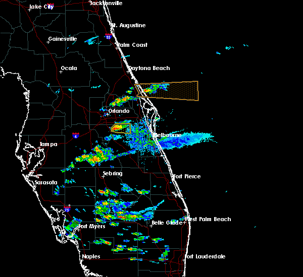 At 518 pm est, severe thunderstorms were located near narcoossee, moving east at 50 mph (radar indicated). Hazards include 60 mph wind gusts and nickel size hail. Expect damage to roofs, siding, and trees. locations impacted include, saint cloud, east lake toho, narcoossee, alligator lake and pine grove. A 57 mph wind gust occurred with this cluster of storms at the kissimmee airport. At 518 pm est, severe thunderstorms were located near narcoossee, moving east at 50 mph (radar indicated). Hazards include 60 mph wind gusts and nickel size hail. Expect damage to roofs, siding, and trees. locations impacted include, saint cloud, east lake toho, narcoossee, alligator lake and pine grove. A 57 mph wind gust occurred with this cluster of storms at the kissimmee airport.
|
| 2/15/2017 5:04 PM EST |
 At 504 pm est, a severe thunderstorm was located over osceola heritage park, or over kissimmee, moving east at 50 mph (radar indicated). Hazards include 60 mph wind gusts and quarter size hail. Hail damage to vehicles is expected. Expect wind damage to roofs, siding, and trees. At 504 pm est, a severe thunderstorm was located over osceola heritage park, or over kissimmee, moving east at 50 mph (radar indicated). Hazards include 60 mph wind gusts and quarter size hail. Hail damage to vehicles is expected. Expect wind damage to roofs, siding, and trees.
|
| 1/22/2017 8:10 PM EST |
 At 807 pm est, severe thunderstorms still capable of producing a tornado were located over bithlo and just north of the orlando international airport, moving northeast at 55 mph (radar indicated rotation). Hazards include tornado and quarter size hail. Flying debris will be dangerous to those caught without shelter. mobile homes will be damaged or destroyed. damage to roofs, windows, and vehicles will occur. tree damage is likely. these dangerous storms will be near, scottsmoor around 820 pm est, then haulover canal and mims around 830 pm est. Other locations impacted by these tornadic thunderstorms include edgewood. At 807 pm est, severe thunderstorms still capable of producing a tornado were located over bithlo and just north of the orlando international airport, moving northeast at 55 mph (radar indicated rotation). Hazards include tornado and quarter size hail. Flying debris will be dangerous to those caught without shelter. mobile homes will be damaged or destroyed. damage to roofs, windows, and vehicles will occur. tree damage is likely. these dangerous storms will be near, scottsmoor around 820 pm est, then haulover canal and mims around 830 pm est. Other locations impacted by these tornadic thunderstorms include edgewood.
|
| 1/22/2017 7:53 PM EST |
 At 752 pm est, a line of severe thunderstorms was located from pierson to eustis, moving northeast at 65 mph (radar indicated). Hazards include 60 mph wind gusts and quarter size hail. Hail damage to vehicles is expected. Expect wind damage to roofs, siding, and trees. At 752 pm est, a line of severe thunderstorms was located from pierson to eustis, moving northeast at 65 mph (radar indicated). Hazards include 60 mph wind gusts and quarter size hail. Hail damage to vehicles is expected. Expect wind damage to roofs, siding, and trees.
|
| 1/22/2017 7:51 PM EST |
 At 750 pm est, a severe thunderstorm capable of producing a tornado was located over conway, moving northeast at 55 mph (radar indicated rotation). Hazards include tornado and quarter size hail. Flying debris will be dangerous to those caught without shelter. mobile homes will be damaged or destroyed. damage to roofs, windows, and vehicles will occur. tree damage is likely. this dangerous storm will be near, wedgefield around 800 pm est. bithlo and chuluota around 810 pm est. haulover canal and mims around 830 pm est. Other locations impacted by this tornadic thunderstorm include edgewood. At 750 pm est, a severe thunderstorm capable of producing a tornado was located over conway, moving northeast at 55 mph (radar indicated rotation). Hazards include tornado and quarter size hail. Flying debris will be dangerous to those caught without shelter. mobile homes will be damaged or destroyed. damage to roofs, windows, and vehicles will occur. tree damage is likely. this dangerous storm will be near, wedgefield around 800 pm est. bithlo and chuluota around 810 pm est. haulover canal and mims around 830 pm est. Other locations impacted by this tornadic thunderstorm include edgewood.
|
| 1/22/2017 7:19 PM EST |
 At 718 pm est, severe thunderstorms capable of producing a tornado was located over winter park and near sanford, moving northeast at 55 mph (radar indicated rotation). Hazards include tornado and quarter size hail. Flying debris will be dangerous to those caught without shelter. mobile homes will be damaged or destroyed. damage to roofs, windows, and vehicles will occur. tree damage is likely. these dangerous storms will be near, goldenrod, azalea park and fern park around 720 pm est. oviedo, winter springs and lake jessup around 730 pm est. maytown around 750 pm est. oak hill and apollo beach around 800 pm est. Other locations impacted by this tornadic thunderstorm include spruce creek. At 718 pm est, severe thunderstorms capable of producing a tornado was located over winter park and near sanford, moving northeast at 55 mph (radar indicated rotation). Hazards include tornado and quarter size hail. Flying debris will be dangerous to those caught without shelter. mobile homes will be damaged or destroyed. damage to roofs, windows, and vehicles will occur. tree damage is likely. these dangerous storms will be near, goldenrod, azalea park and fern park around 720 pm est. oviedo, winter springs and lake jessup around 730 pm est. maytown around 750 pm est. oak hill and apollo beach around 800 pm est. Other locations impacted by this tornadic thunderstorm include spruce creek.
|
| 1/22/2017 7:00 PM EST |
 At 658 pm est, severe thunderstorms were located over bay hill, near bay lake, and near maitland, moving east at 55 mph (radar indicated). Hazards include 70 mph wind gusts and quarter size hail. Hail damage to vehicles is expected. expect considerable tree damage. Wind damage is also likely to mobile homes, roofs, and outbuildings. At 658 pm est, severe thunderstorms were located over bay hill, near bay lake, and near maitland, moving east at 55 mph (radar indicated). Hazards include 70 mph wind gusts and quarter size hail. Hail damage to vehicles is expected. expect considerable tree damage. Wind damage is also likely to mobile homes, roofs, and outbuildings.
|
| 9/2/2016 5:36 AM EDT |
 At 535 am edt, a severe thunderstorm was located over four corners, moving east at 55 mph (radar indicated). Hazards include 60 mph wind gusts. Expect damage to roofs. siding. And trees. At 535 am edt, a severe thunderstorm was located over four corners, moving east at 55 mph (radar indicated). Hazards include 60 mph wind gusts. Expect damage to roofs. siding. And trees.
|
| 9/1/2016 9:25 PM EDT |
 At 922 pm edt, a severe thunderstorm capable of producing a tornado was located over wekiwa springs state park, or over apopka, moving north at 45 to 50 mph (radar indicated rotation). Hazards include tornado. Flying debris will be dangerous to those caught without shelter. mobile homes will be damaged or destroyed. damage to roofs, windows, and vehicles will occur. tree damage is likely. this tornadic thunderstorm will remain over areas of western orange and southwestern seminole counties, including the following locations: eatonville. another circulation was forming near doctor phillips and was moving north. A new warning may be needed. At 922 pm edt, a severe thunderstorm capable of producing a tornado was located over wekiwa springs state park, or over apopka, moving north at 45 to 50 mph (radar indicated rotation). Hazards include tornado. Flying debris will be dangerous to those caught without shelter. mobile homes will be damaged or destroyed. damage to roofs, windows, and vehicles will occur. tree damage is likely. this tornadic thunderstorm will remain over areas of western orange and southwestern seminole counties, including the following locations: eatonville. another circulation was forming near doctor phillips and was moving north. A new warning may be needed.
|
| 9/1/2016 9:02 PM EDT |
 At 902 pm edt, a severe thunderstorm capable of producing a tornado was located over windermere, moving north at 35 mph (radar indicated rotation). Hazards include tornado. Flying debris will be dangerous to those caught without shelter. mobile homes will be damaged or destroyed. damage to roofs, windows, and vehicles will occur. tree damage is likely. this dangerous storm will be near, ocoee and winter garden around 910 pm edt. apopka, zellwood and wekiwa springs state park around 930 pm edt. Other locations impacted by this tornadic thunderstorm include eatonville. At 902 pm edt, a severe thunderstorm capable of producing a tornado was located over windermere, moving north at 35 mph (radar indicated rotation). Hazards include tornado. Flying debris will be dangerous to those caught without shelter. mobile homes will be damaged or destroyed. damage to roofs, windows, and vehicles will occur. tree damage is likely. this dangerous storm will be near, ocoee and winter garden around 910 pm edt. apopka, zellwood and wekiwa springs state park around 930 pm edt. Other locations impacted by this tornadic thunderstorm include eatonville.
|
| 9/1/2016 3:25 PM EDT |
 The severe thunderstorm warning for southwestern orange and south central lake counties will expire at 330 pm edt, the storm which prompted the warning has weakened below severe limits, and no longer pose an immediate threat to life or property. therefore, the warning will be allowed to expire. a tornado watch remains in effect until 1100 pm edt for east central florida. The severe thunderstorm warning for southwestern orange and south central lake counties will expire at 330 pm edt, the storm which prompted the warning has weakened below severe limits, and no longer pose an immediate threat to life or property. therefore, the warning will be allowed to expire. a tornado watch remains in effect until 1100 pm edt for east central florida.
|
| 9/1/2016 3:05 PM EDT |
 At 305 pm edt, a severe thunderstorm was located over bay lake, moving north at 45 mph (radar indicated). Hazards include 60 mph wind gusts. Expect damage to roofs. siding. And trees. At 305 pm edt, a severe thunderstorm was located over bay lake, moving north at 45 mph (radar indicated). Hazards include 60 mph wind gusts. Expect damage to roofs. siding. And trees.
|
| 8/13/2016 6:09 PM EDT |
 The severe thunderstorm warning for northwest orange county will expire at 615 pm edt, the severe thunderstorm which prompted the warning has moved north out of the warned area. therefore, the warning will be allowed to expire. however, doppler radar indicates strong winds up to 55 mph are occurring in western seminole county in altamonte springs and longwood where a significant weather advisory is in effect. The severe thunderstorm warning for northwest orange county will expire at 615 pm edt, the severe thunderstorm which prompted the warning has moved north out of the warned area. therefore, the warning will be allowed to expire. however, doppler radar indicates strong winds up to 55 mph are occurring in western seminole county in altamonte springs and longwood where a significant weather advisory is in effect.
|
| 8/13/2016 5:55 PM EDT | Large tree down with damage to a house and car on lincoln blvd in eatonville. time estimated from radar. report from wes in orange county FL, 7 miles S of Orlando, FL |
| 8/13/2016 5:52 PM EDT |
 At 550 pm edt, a severe thunderstorm was located over college park, moving northwest at 15 mph (radar indicated). Hazards include 60 mph wind gusts. Expect damage to roofs. siding. and trees. Locations impacted include, ocoee, winter park, maitland and pine hills. At 550 pm edt, a severe thunderstorm was located over college park, moving northwest at 15 mph (radar indicated). Hazards include 60 mph wind gusts. Expect damage to roofs. siding. and trees. Locations impacted include, ocoee, winter park, maitland and pine hills.
|
| 8/13/2016 5:43 PM EDT | Broadcast media reports that a viewer had a tree fall on her house. time estimated by rada in orange county FL, 2.7 miles N of Orlando, FL |
| 8/13/2016 5:33 PM EDT |
 At 532 pm edt, a severe thunderstorm was located over belle isle, or over conway, moving northwest at 15 mph toward downtown orlando (radar indicated). Hazards include 60 mph wind gusts. Expect damage to roofs. siding. And trees. At 532 pm edt, a severe thunderstorm was located over belle isle, or over conway, moving northwest at 15 mph toward downtown orlando (radar indicated). Hazards include 60 mph wind gusts. Expect damage to roofs. siding. And trees.
|
| 8/13/2016 5:29 PM EDT |
 At 529 pm edt, a severe thunderstorm was located over orlando international airport, moving northwest at 15 mph (radar indicated). Hazards include 60 mph wind gusts. Expect damage to roofs. siding. and trees. Locations impacted include, orlando, conway, orlando international airport, oak ridge and belle isle. At 529 pm edt, a severe thunderstorm was located over orlando international airport, moving northwest at 15 mph (radar indicated). Hazards include 60 mph wind gusts. Expect damage to roofs. siding. and trees. Locations impacted include, orlando, conway, orlando international airport, oak ridge and belle isle.
|
| 8/13/2016 5:24 PM EDT | Asos at orlando international measured a wind gust of 51kt/59mph from the sse in orange county FL, 7.7 miles NNW of Orlando, FL |
| 8/13/2016 5:15 PM EDT |
 At 515 pm edt, a severe thunderstorm was located over orlando international airport, moving northwest at 15 mph (radar indicated). Hazards include 60 mph wind gusts. Expect damage to roofs. siding. And trees. At 515 pm edt, a severe thunderstorm was located over orlando international airport, moving northwest at 15 mph (radar indicated). Hazards include 60 mph wind gusts. Expect damage to roofs. siding. And trees.
|
| 7/18/2016 4:33 PM EDT |
 At 433 pm edt, a severe thunderstorm was located near orlando international airport, moving west at 20 mph (trained weather spotters). Hazards include 60 mph wind gusts. Expect damage to roofs. siding. And trees. At 433 pm edt, a severe thunderstorm was located near orlando international airport, moving west at 20 mph (trained weather spotters). Hazards include 60 mph wind gusts. Expect damage to roofs. siding. And trees.
|
| 7/18/2016 4:25 PM EDT | Asos measured 55 kts from ese in orange county FL, 7.7 miles NNW of Orlando, FL |
| 7/14/2016 5:46 PM EDT |
 At 545 pm edt, a severe thunderstorm was located over osceola heritage park, or over kissimmee, moving northwest at 10 mph (radar indicated). Hazards include 60 mph wind gusts and penny size hail. Expect damage to roofs. siding. and trees. Locations impacted include, orlando, kissimmee, saint cloud, buena ventura lakes and narcoossee. At 545 pm edt, a severe thunderstorm was located over osceola heritage park, or over kissimmee, moving northwest at 10 mph (radar indicated). Hazards include 60 mph wind gusts and penny size hail. Expect damage to roofs. siding. and trees. Locations impacted include, orlando, kissimmee, saint cloud, buena ventura lakes and narcoossee.
|
| 7/14/2016 5:32 PM EDT |
 At 532 pm edt, a severe thunderstorm was located near saint cloud, moving northwest at 10 mph (radar indicated). Hazards include 60 mph wind gusts and quarter size hail. Hail damage to vehicles is expected. Expect wind damage to roofs, siding, and trees. At 532 pm edt, a severe thunderstorm was located near saint cloud, moving northwest at 10 mph (radar indicated). Hazards include 60 mph wind gusts and quarter size hail. Hail damage to vehicles is expected. Expect wind damage to roofs, siding, and trees.
|
| 6/1/2016 8:21 PM EDT |
 The severe thunderstorm warning for southwestern orange and northwestern osceola counties will expire at 830 pm edt, the storm which prompted the warning has weakened below severe limits, and no longer pose an immediate threat to life or property. therefore the warning will be allowed to expire. The severe thunderstorm warning for southwestern orange and northwestern osceola counties will expire at 830 pm edt, the storm which prompted the warning has weakened below severe limits, and no longer pose an immediate threat to life or property. therefore the warning will be allowed to expire.
|
| 6/1/2016 8:12 PM EDT |
 At 810 pm edt, a severe thunderstorm was located over intercession city, moving southwest at 10 mph (public reported wind damage at 5820 irlo bronson memorial highway in celebration). Hazards include 60 mph wind gusts and quarter size hail. Hail damage to vehicles is expected. expect wind damage to roofs, siding, and trees. Locations impacted include, orlando, kissimmee, bay lake, buena ventura lakes and intercession city. At 810 pm edt, a severe thunderstorm was located over intercession city, moving southwest at 10 mph (public reported wind damage at 5820 irlo bronson memorial highway in celebration). Hazards include 60 mph wind gusts and quarter size hail. Hail damage to vehicles is expected. expect wind damage to roofs, siding, and trees. Locations impacted include, orlando, kissimmee, bay lake, buena ventura lakes and intercession city.
|
| 6/1/2016 7:52 PM EDT |
 At 750 pm edt, a severe thunderstorm was located over hunters creek, or near kissimmee, moving southwest at 10 mph (public reported nickle size hail in the vicinity of sea world). Hazards include 60 mph wind gusts and quarter size hail. Hail damage to vehicles is expected. expect wind damage to roofs, siding, and trees. Locations impacted include, orlando, kissimmee, bay lake, buena ventura lakes and intercession city. At 750 pm edt, a severe thunderstorm was located over hunters creek, or near kissimmee, moving southwest at 10 mph (public reported nickle size hail in the vicinity of sea world). Hazards include 60 mph wind gusts and quarter size hail. Hail damage to vehicles is expected. expect wind damage to roofs, siding, and trees. Locations impacted include, orlando, kissimmee, bay lake, buena ventura lakes and intercession city.
|
| 6/1/2016 7:27 PM EDT |
 At 727 pm edt, a severe thunderstorm was located over hunters creek, or near oak ridge, moving southwest at 10 mph (radar indicated). Hazards include 60 mph wind gusts and quarter size hail. Hail damage to vehicles is expected. Expect wind damage to roofs, siding, and trees. At 727 pm edt, a severe thunderstorm was located over hunters creek, or near oak ridge, moving southwest at 10 mph (radar indicated). Hazards include 60 mph wind gusts and quarter size hail. Hail damage to vehicles is expected. Expect wind damage to roofs, siding, and trees.
|
| 5/29/2016 6:50 PM EDT | Thunderstorm wind gusts blew a large tree onto a house at 4137 westgate road. part of the tree came through the roof with large branch penetrating the interior. time es in orange county FL, 6.6 miles SE of Orlando, FL |
| 5/29/2016 6:31 PM EDT |
 At 630 pm edt, a severe thunderstorm was located over wekiva springs, or near altamonte springs, and is nearly stationary (radar indicated). Hazards include 60 mph wind gusts and quarter size hail. Hail damage to vehicles is expected. expect wind damage to roofs, siding, and trees. Locations impacted include, altamonte springs, lockhart and wekiva springs. At 630 pm edt, a severe thunderstorm was located over wekiva springs, or near altamonte springs, and is nearly stationary (radar indicated). Hazards include 60 mph wind gusts and quarter size hail. Hail damage to vehicles is expected. expect wind damage to roofs, siding, and trees. Locations impacted include, altamonte springs, lockhart and wekiva springs.
|
| 5/29/2016 6:16 PM EDT |
 At 616 pm edt, a severe thunderstorm was located over wekiva springs, or near altamonte springs, and is nearly stationary (radar indicated). Hazards include 60 mph wind gusts and quarter size hail. Hail damage to vehicles is expected. Expect wind damage to roofs, siding, and trees. At 616 pm edt, a severe thunderstorm was located over wekiva springs, or near altamonte springs, and is nearly stationary (radar indicated). Hazards include 60 mph wind gusts and quarter size hail. Hail damage to vehicles is expected. Expect wind damage to roofs, siding, and trees.
|
| 5/4/2016 6:22 AM EDT |
 At 622 am edt, a severe thunderstorm was located over universal studios, or near windermere, moving east at 30 mph (radar indicated). Hazards include 60 mph wind gusts and quarter size hail. Hail damage to vehicles is expected. expect wind damage to roofs, siding, and trees. Locations impacted include, orlando, ocoee, winter park, windermere and orlando international airport. At 622 am edt, a severe thunderstorm was located over universal studios, or near windermere, moving east at 30 mph (radar indicated). Hazards include 60 mph wind gusts and quarter size hail. Hail damage to vehicles is expected. expect wind damage to roofs, siding, and trees. Locations impacted include, orlando, ocoee, winter park, windermere and orlando international airport.
|
| 5/4/2016 6:11 AM EDT |
 At 610 am edt, a severe thunderstorm was located over horizon west, or near windermere, moving east at 25 mph (radar indicated). Hazards include 60 mph wind gusts and quarter size hail. Hail damage to vehicles is expected. expect wind damage to roofs, siding, and trees. Locations impacted include, orlando, ocoee, winter garden, winter park and windermere. At 610 am edt, a severe thunderstorm was located over horizon west, or near windermere, moving east at 25 mph (radar indicated). Hazards include 60 mph wind gusts and quarter size hail. Hail damage to vehicles is expected. expect wind damage to roofs, siding, and trees. Locations impacted include, orlando, ocoee, winter garden, winter park and windermere.
|
| 5/4/2016 5:52 AM EDT |
 At 552 am edt, a severe thunderstorm was located near lake louisa, or 7 miles southwest of winter garden, moving east at 30 mph (radar indicated). Hazards include 60 mph wind gusts and quarter size hail. Hail damage to vehicles is expected. Expect wind damage to roofs, siding, and trees. At 552 am edt, a severe thunderstorm was located near lake louisa, or 7 miles southwest of winter garden, moving east at 30 mph (radar indicated). Hazards include 60 mph wind gusts and quarter size hail. Hail damage to vehicles is expected. Expect wind damage to roofs, siding, and trees.
|
| 4/14/2016 6:05 PM EDT |
 At 605 pm edt, a severe thunderstorm was located near four corners, or 9 miles west of celebration, moving east at 25 to 30 mph (radar indicated). Hazards include 60 mph wind gusts and quarter size hail. Hail damage to vehicles is expected. Expect wind damage to roofs, siding, and trees. At 605 pm edt, a severe thunderstorm was located near four corners, or 9 miles west of celebration, moving east at 25 to 30 mph (radar indicated). Hazards include 60 mph wind gusts and quarter size hail. Hail damage to vehicles is expected. Expect wind damage to roofs, siding, and trees.
|
| 3/25/2016 3:53 PM EDT |
 The severe thunderstorm warning for southeastern orange, northeastern osceola and northern brevard counties will expire at 400 pm edt, the storms which prompted the warning have weakened below severe limits, and no longer pose an immediate threat to life or property. therefore the warning will be allowed to expire. however gusty winds are still possible with these thunderstorms. The severe thunderstorm warning for southeastern orange, northeastern osceola and northern brevard counties will expire at 400 pm edt, the storms which prompted the warning have weakened below severe limits, and no longer pose an immediate threat to life or property. therefore the warning will be allowed to expire. however gusty winds are still possible with these thunderstorms.
|
| 3/25/2016 3:29 PM EDT |
 At 329 pm edt, severe thunderstorms were located along a line extending from 6 miles south of maytown to 6 miles west of titusville to near christmas, moving northeast at 60 mph (radar indicated). Hazards include 60 mph wind gusts and penny size hail. Expect damage to roofs. siding. and trees. Locations impacted include, titusville, cocoa, wedgefield, playalinda beach and christmas. At 329 pm edt, severe thunderstorms were located along a line extending from 6 miles south of maytown to 6 miles west of titusville to near christmas, moving northeast at 60 mph (radar indicated). Hazards include 60 mph wind gusts and penny size hail. Expect damage to roofs. siding. and trees. Locations impacted include, titusville, cocoa, wedgefield, playalinda beach and christmas.
|
| 3/25/2016 3:12 PM EDT | Wesh-2 broadcast footage of a large fallen evergreen tree lying over moss park road. time of event estimated using rada in orange county FL, 12.6 miles NW of Orlando, FL |
| 3/25/2016 2:57 PM EDT |
 At 256 pm edt, severe thunderstorms were located along a line extending from doctor phillips to near kissimmee to near campbell, moving northeast at 60 mph (radar indicated). Hazards include 60 mph wind gusts and penny size hail. Expect damage to roofs. siding. And trees. At 256 pm edt, severe thunderstorms were located along a line extending from doctor phillips to near kissimmee to near campbell, moving northeast at 60 mph (radar indicated). Hazards include 60 mph wind gusts and penny size hail. Expect damage to roofs. siding. And trees.
|
| 1/15/2016 11:52 AM EST |
 The severe thunderstorm warning for orange, seminole and northwestern osceola counties will expire at 1200 pm est, the storm which prompted the warning has moved out of the area. therefore the warning will be allowed to expire. however gusty winds are still possible this afternoon. to report severe weather, contact your nearest law enforcement agency. they will relay your report to the national weather service melbourne. The severe thunderstorm warning for orange, seminole and northwestern osceola counties will expire at 1200 pm est, the storm which prompted the warning has moved out of the area. therefore the warning will be allowed to expire. however gusty winds are still possible this afternoon. to report severe weather, contact your nearest law enforcement agency. they will relay your report to the national weather service melbourne.
|
| 1/15/2016 10:54 AM EST |
 At 1053 am est, a severe thunderstorm was located near horizon west, moving east at 30 mph (radar indicated). Hazards include 60 mph wind gusts. Expect damage to roofs. Siding and trees. At 1053 am est, a severe thunderstorm was located near horizon west, moving east at 30 mph (radar indicated). Hazards include 60 mph wind gusts. Expect damage to roofs. Siding and trees.
|
| 9/5/2015 2:50 PM EDT |
 At 249 pm edt, doppler radar indicated a severe thunderstorm capable of producing damaging winds in excess of 60 mph. this storm was located over orlando international airport, and moving southwest at 15 mph. penny size hail may also accompany the damaging winds. At 249 pm edt, doppler radar indicated a severe thunderstorm capable of producing damaging winds in excess of 60 mph. this storm was located over orlando international airport, and moving southwest at 15 mph. penny size hail may also accompany the damaging winds.
|
| 8/26/2015 4:37 PM EDT |
 At 436 pm edt, doppler radar indicated a severe thunderstorm capable of producing quarter size hail and damaging winds in excess of 60 mph. this storm was located over campbell, or near kissimmee, moving north at 15 mph. locations impacted include, kissimmee, buena ventura lakes, east lake toho, west lake toho and intercession city. At 436 pm edt, doppler radar indicated a severe thunderstorm capable of producing quarter size hail and damaging winds in excess of 60 mph. this storm was located over campbell, or near kissimmee, moving north at 15 mph. locations impacted include, kissimmee, buena ventura lakes, east lake toho, west lake toho and intercession city.
|
| 8/26/2015 4:13 PM EDT |
 At 412 pm edt, doppler radar indicated a severe thunderstorm capable of producing quarter size hail and damaging winds in excess of 60 mph. this storm was located over poinciana, or near west lake toho, and moving north at 15 mph. At 412 pm edt, doppler radar indicated a severe thunderstorm capable of producing quarter size hail and damaging winds in excess of 60 mph. this storm was located over poinciana, or near west lake toho, and moving north at 15 mph.
|
| 8/20/2015 7:15 PM EDT |
 At 712 pm edt, doppler radar indicated a line of thunderstorms had developed along a sea breeze boundary merger between east lake toho and lake apopka. severe thunderstorm capable of producing quarter size hail and damaging winds in excess of 60 mph are are expected over central orange county through 800 pm. storm motion was northwest at 5 mph. locations impacted include, orlando, ocoee, winter park, maitland and lockhart. At 712 pm edt, doppler radar indicated a line of thunderstorms had developed along a sea breeze boundary merger between east lake toho and lake apopka. severe thunderstorm capable of producing quarter size hail and damaging winds in excess of 60 mph are are expected over central orange county through 800 pm. storm motion was northwest at 5 mph. locations impacted include, orlando, ocoee, winter park, maitland and lockhart.
|
| 8/20/2015 6:59 PM EDT |
 At 658 pm edt, doppler radar indicated a severe thunderstorm capable of producing quarter size hail and damaging winds in excess of 60 mph. this storm was located over orlando, and moving northwest at 5 mph. At 658 pm edt, doppler radar indicated a severe thunderstorm capable of producing quarter size hail and damaging winds in excess of 60 mph. this storm was located over orlando, and moving northwest at 5 mph.
|
| 8/20/2015 6:49 PM EDT |
 At 648 pm edt, the public reported quarter sized hail from a severe thunderstorm between east and west lake toho. doppler radar also was measuring winds around 60 mph with this storm coming off of east lake toho. storm motion was northwest at 15 mph. locations impacted include, kissimmee, saint cloud, buena ventura lakes, east lake toho and narcoossee. At 648 pm edt, the public reported quarter sized hail from a severe thunderstorm between east and west lake toho. doppler radar also was measuring winds around 60 mph with this storm coming off of east lake toho. storm motion was northwest at 15 mph. locations impacted include, kissimmee, saint cloud, buena ventura lakes, east lake toho and narcoossee.
|
| 8/20/2015 6:34 PM EDT |
 At 633 pm edt, doppler radar indicated a severe thunderstorm capable of producing damaging winds in excess of 60 mph. this storm was located over saint cloud, and moving northwest at 15 mph. At 633 pm edt, doppler radar indicated a severe thunderstorm capable of producing damaging winds in excess of 60 mph. this storm was located over saint cloud, and moving northwest at 15 mph.
|
| 8/13/2015 1:44 PM EDT |
 At 144 pm edt, doppler radar indicated a severe thunderstorm capable of producing damaging winds in excess of 60 mph. this storm was located over austin tindall park, or near east lake toho, and moving east at 15 mph. penny size hail may also accompany the damaging winds. At 144 pm edt, doppler radar indicated a severe thunderstorm capable of producing damaging winds in excess of 60 mph. this storm was located over austin tindall park, or near east lake toho, and moving east at 15 mph. penny size hail may also accompany the damaging winds.
|
| 7/11/2015 6:11 PM EDT |
 At 610 pm edt, doppler radar indicated a severe thunderstorm capable of producing damaging winds in excess of 60 mph. this storm was located over fern park, or over altamonte springs, and moving south at 10 mph. penny size hail may also accompany the damaging winds. At 610 pm edt, doppler radar indicated a severe thunderstorm capable of producing damaging winds in excess of 60 mph. this storm was located over fern park, or over altamonte springs, and moving south at 10 mph. penny size hail may also accompany the damaging winds.
|
| 7/5/2015 5:47 PM EDT |
 At 543 pm edt, doppler radar continued to indicate strong to severe thunderstorms capable of producing quarter size hail and damaging winds in excess of 60 mph. these storms were located near ocoee and windermere, moving east at 10 mph. penny-sized hail was reported by the public around 535 pm edt in vicinity of ocoee. other locations impacted include, apopka, winter garden, bay lake, and places near the attractions area. At 543 pm edt, doppler radar continued to indicate strong to severe thunderstorms capable of producing quarter size hail and damaging winds in excess of 60 mph. these storms were located near ocoee and windermere, moving east at 10 mph. penny-sized hail was reported by the public around 535 pm edt in vicinity of ocoee. other locations impacted include, apopka, winter garden, bay lake, and places near the attractions area.
|
| 7/5/2015 5:36 PM EDT |
 At 531 pm edt, doppler radar indicated that the severe storm that was dropping down out of seminole county had weakened, but it could still re-intensify and produce quarter size hail and damaging winds in excess of 60 mph. the storm complex was was located over winter springs and drifting south, while other strong to severe storms were over western orange county and could build into the metro orlando area. locations impacted include, orlando, altamonte springs and winter springs. At 531 pm edt, doppler radar indicated that the severe storm that was dropping down out of seminole county had weakened, but it could still re-intensify and produce quarter size hail and damaging winds in excess of 60 mph. the storm complex was was located over winter springs and drifting south, while other strong to severe storms were over western orange county and could build into the metro orlando area. locations impacted include, orlando, altamonte springs and winter springs.
|
| 7/5/2015 5:24 PM EDT |
 At 522 pm edt, doppler radar indicated severe thunderstorms capable of producing quarter size hail and damaging winds in excess of 60 mph. these storms were located near apopka and zellwood, and moving east at 10 mph. * other locations impacted include, ocoee, winter garden, windermere, bay lake, .and places near the attractions area. At 522 pm edt, doppler radar indicated severe thunderstorms capable of producing quarter size hail and damaging winds in excess of 60 mph. these storms were located near apopka and zellwood, and moving east at 10 mph. * other locations impacted include, ocoee, winter garden, windermere, bay lake, .and places near the attractions area.
|
| 7/5/2015 4:57 PM EDT |
 At 456 pm edt, doppler radar indicated a severe thunderstorm capable of producing quarter size hail and damaging winds in excess of 60 mph. this storm was located over lake jessup, and moving south at 10 to 15 mph. At 456 pm edt, doppler radar indicated a severe thunderstorm capable of producing quarter size hail and damaging winds in excess of 60 mph. this storm was located over lake jessup, and moving south at 10 to 15 mph.
|
| 7/3/2015 7:34 PM EDT |
 At 732 pm edt, doppler radar indicated a severe thunderstorm capable of producing quarter size hail and damaging winds in excess of 60 mph. this cluster of storms was located near lake louisa, clermont and minneola. storm movement is erratic due to merge of various cells. there does appear to be growth of this activity from near clermont northward. locations impacted include, winter garden, windermere, bay lake, clermont and oakland. At 732 pm edt, doppler radar indicated a severe thunderstorm capable of producing quarter size hail and damaging winds in excess of 60 mph. this cluster of storms was located near lake louisa, clermont and minneola. storm movement is erratic due to merge of various cells. there does appear to be growth of this activity from near clermont northward. locations impacted include, winter garden, windermere, bay lake, clermont and oakland.
|
| 7/3/2015 7:10 PM EDT |
 At 710 pm edt, doppler radar indicated a severe thunderstorm capable of producing damaging winds in excess of 60 mph. this storm was located near horizon west, or near winter garden, and moving west at 5 mph. nickel size hail may also accompany the damaging winds. At 710 pm edt, doppler radar indicated a severe thunderstorm capable of producing damaging winds in excess of 60 mph. this storm was located near horizon west, or near winter garden, and moving west at 5 mph. nickel size hail may also accompany the damaging winds.
|
| 7/2/2015 3:54 PM EDT | Storm damage reported in orange county FL, 7.7 miles NNW of Orlando, FL |
| 6/19/2015 6:40 PM EDT |
 The severe thunderstorm warning for southwestern orange county will expire at 645 pm edt, the storm which prompted the warning has weakened below severe limits. therefore the warning will be allowed to expire. however gusty winds, heavy rain, and frequent lightning will continue through 715 pm with this thunderstorm. The severe thunderstorm warning for southwestern orange county will expire at 645 pm edt, the storm which prompted the warning has weakened below severe limits. therefore the warning will be allowed to expire. however gusty winds, heavy rain, and frequent lightning will continue through 715 pm with this thunderstorm.
|
| 6/19/2015 6:39 PM EDT |
 The severe thunderstorm warning for northwestern orange and southwestern seminole counties will expire at 645 pm edt, the storm which prompted the warning has weakened below severe limits. therefore the warning will be allowed to expire. however gusty winds, heavy rain, and frequent lightning will continue through 715 pm with this thunderstorm. The severe thunderstorm warning for northwestern orange and southwestern seminole counties will expire at 645 pm edt, the storm which prompted the warning has weakened below severe limits. therefore the warning will be allowed to expire. however gusty winds, heavy rain, and frequent lightning will continue through 715 pm with this thunderstorm.
|
| 6/19/2015 6:09 PM EDT |
 At 608 pm edt, doppler radar indicated a severe thunderstorm capable of producing damaging winds in excess of 60 mph. this storm was located over midway, or near sanford. this storm was nearly stationary. the orlando executive airport recorded a 51 mph wind gust with this storm at 600 pm edt. locations impacted include, orlando, sanford, apopka, altamonte springs and ocoee. At 608 pm edt, doppler radar indicated a severe thunderstorm capable of producing damaging winds in excess of 60 mph. this storm was located over midway, or near sanford. this storm was nearly stationary. the orlando executive airport recorded a 51 mph wind gust with this storm at 600 pm edt. locations impacted include, orlando, sanford, apopka, altamonte springs and ocoee.
|
| 6/19/2015 5:57 PM EDT |
 At 556 pm edt, doppler radar indicated a severe thunderstorm capable of producing damaging winds in excess of 60 mph. this storm was located over conway, and moving south at 10 mph. nickel size hail may also accompany the damaging winds. At 556 pm edt, doppler radar indicated a severe thunderstorm capable of producing damaging winds in excess of 60 mph. this storm was located over conway, and moving south at 10 mph. nickel size hail may also accompany the damaging winds.
|
| 6/19/2015 5:46 PM EDT |
 At 545 pm edt, doppler radar indicated a severe thunderstorm capable of producing damaging winds in excess of 60 mph. this storm was located over altamonte springs, and moving south at 10 mph. nickel size hail may also accompany the damaging winds. pea sized hail has been reported with this storm near the intersection of 436 and 17-92. At 545 pm edt, doppler radar indicated a severe thunderstorm capable of producing damaging winds in excess of 60 mph. this storm was located over altamonte springs, and moving south at 10 mph. nickel size hail may also accompany the damaging winds. pea sized hail has been reported with this storm near the intersection of 436 and 17-92.
|
| 6/19/2015 5:44 PM EDT |
 At 543 pm edt, doppler radar indicated a severe thunderstorm capable of producing damaging winds in excess of 60 mph. this storm was located over narcoossee, and moving northwest at 5 mph. nickel size hail may also accompany the damaging winds. At 543 pm edt, doppler radar indicated a severe thunderstorm capable of producing damaging winds in excess of 60 mph. this storm was located over narcoossee, and moving northwest at 5 mph. nickel size hail may also accompany the damaging winds.
|
| 6/19/2015 5:32 PM EDT |
 At 532 pm edt, doppler radar indicated a severe thunderstorm capable of producing damaging winds in excess of 60 mph. this storm was located over longwood, and moving south at 10 mph. nickel size hail may also accompany the damaging winds. At 532 pm edt, doppler radar indicated a severe thunderstorm capable of producing damaging winds in excess of 60 mph. this storm was located over longwood, and moving south at 10 mph. nickel size hail may also accompany the damaging winds.
|
| 6/12/2015 4:09 PM EDT |
 At 409 pm edt, doppler radar indicated a severe thunderstorm capable of producing damaging winds in excess of 58 mph. this storm was located 4 miles south of saint cloud, and moving north at 15 mph. At 409 pm edt, doppler radar indicated a severe thunderstorm capable of producing damaging winds in excess of 58 mph. this storm was located 4 miles south of saint cloud, and moving north at 15 mph.
|
| 6/12/2015 3:02 PM EDT |
 At 302 pm edt, doppler radar indicated a severe thunderstorm capable of producing damaging winds in excess of 60 mph. this storm was located near sea world, or near oak ridge, and moving northwest at 15 mph. At 302 pm edt, doppler radar indicated a severe thunderstorm capable of producing damaging winds in excess of 60 mph. this storm was located near sea world, or near oak ridge, and moving northwest at 15 mph.
|
| 6/5/2015 6:22 PM EDT | The severe thunderstorm warning for northwestern osceola county will expire at 630 pm edt, the storms which prompted the warning have weakened below severe limits, and no longer poses an immediate threat to life or property. therefore the warning will be allowed to expire. however gusty winds and heavy rain are still possible with these thunderstorms. |
| 6/5/2015 5:58 PM EDT | At 557 pm edt, doppler radar indicated a cluster of severe thunderstorms capable of producing quarter size hail and damaging winds in excess of 60 mph. these storms were located over osceola heritage park, or near east lake toho, moving east at 15 mph. locations impacted include, kissimmee, saint cloud, buena ventura lakes, narcoossee and east lake toho. |
| 6/5/2015 5:29 PM EDT | At 529 pm edt, doppler radar indicated a severe thunderstorm capable of producing quarter size hail and damaging winds in excess of 60 mph. this storm was located over campbell, or over intercession city, and moving east at 15 mph. |
| 6/1/2015 6:38 PM EDT | The severe thunderstorm warning for southern lake, southwestern orange and northwestern osceola counties will expire at 645 pm edt, the storm which prompted the warning has weakened below severe limits, and no longer poses an immediate threat to life or property. therefore the warning will be allowed to expire. however gusty winds and heavy rain are still possible with this thunderstorm. |
| 6/1/2015 6:08 PM EDT | At 607 pm edt, doppler radar indicated a severe thunderstorm capable of producing quarter size hail and damaging winds in excess of 60 mph. this storm was located over horizon west, or near windermere, and moving southeast at 20 mph. |
| 6/1/2015 5:49 PM EDT | At 548 pm edt, doppler radar indicated a severe thunderstorm capable of producing large hail up to ping pong ball size and damaging winds in excess of 60 mph. this storm was located over oakland, or near winter garden, moving south at 10 mph. quarter sized hail was reported with this storm in oakland around 540 pm. locations impacted include, oakland, clermont, winter garden, windermere and bay lake. |
| 6/1/2015 5:32 PM EDT | At 531 pm edt, doppler radar indicated a severe thunderstorm capable of producing quarter size hail and damaging winds in excess of 60 mph. this storm was located over oakland, or near winter garden, and moving southeast at 10 mph. |
| 6/1/2015 4:42 PM EDT | At 441 pm edt, doppler radar indicated a severe thunderstorm capable of producing quarter size hail and damaging winds in excess of 60 mph. this storm was located over lockhart, moving southwest at 15 mph. quarter sized was reported with this storm in wekiva springs at 420 pm. locations impacted include, orlando, apopka, clarcona, altamonte springs, plymouth, ocoee and winter garden. |
| 6/1/2015 4:16 PM EDT | At 415 pm edt, doppler radar indicated a severe thunderstorm capable of producing quarter size hail and damaging winds in excess of 60 mph. this storm was located near longwood. this storm was drifting southwest. |
| 5/20/2015 6:21 PM EDT | At 619 pm edt, doppler radar indicated a severe thunderstorm capable of producing quarter size hail and damaging winds in excess of 60 mph. this storm was located over chuluota, moving east to southeast at 15 mph. locations impacted include, oviedo, chuluota, bithlo and christmas. |
| 5/20/2015 6:07 PM EDT | At 605 pm edt, doppler radar indicated a severe thunderstorm capable of producing quarter size hail and damaging winds in excess of 60 mph. this storm was located over chuluota, and moving east at 10 mph. |
| 4/20/2015 3:30 PM EDT | At 309 pm edt, doppler radar indicated a severe thunderstorm capable of producing quarter size hail and damaging winds in excess of 60 mph. this storm was located over clermont, or near groveland, and moving northeast at 45 mph. |
| 4/20/2015 3:10 PM EDT | At 309 pm edt, doppler radar indicated a severe thunderstorm capable of producing quarter size hail and damaging winds in excess of 60 mph. this storm was located over clermont, or near groveland, and moving northeast at 45 mph. |
| 4/19/2015 5:36 PM EDT | At 535 pm edt, doppler radar continue to indicate a severe thunderstorm capable of producing quarter size hail and damaging winds in excess of 60 mph. this storm was located over avalon park, moving northeast at 30 mph. locations impacted include, wedgefield, christmas, avalon park and bithlo. |
| 4/19/2015 5:26 PM EDT | At 525 pm edt, doppler radar indicated a severe thunderstorm capable of producing quarter size hail and damaging winds in excess of 60 mph. this storm was located just northeast of lake nona, or just southwest of avalon park, moving northeast at 25 mph. locations impacted include, state road 528, wedgefield, christmas, avalon park and bithlo. |
| 4/19/2015 5:12 PM EDT | At 512 pm edt, doppler radar indicated a severe thunderstorm capable of producing quarter size hail and damaging winds in excess of 60 mph. this storm was located over lake nona, or near orlando international airport, and moving east at 25 mph. |
| 8/6/2014 7:21 PM EDT | Quarter sized hail reported 11.3 miles NW of Orlando, FL, wesh ch2 relayed report from viewer of 1/2 to 1 inch hail in the lake nona area. time estimated from radar. |
| 6/27/2014 5:26 PM EDT | Quarter sized hail reported 8.3 miles N of Orlando, FL, hail to the size of quarters. reported from spotter on the fl turnpike between sr 528 and osceola pkwy. |
| 6/27/2014 5:05 PM EDT | Tree down on powerline at e livingston st and primrose drive. time estimated from rada in orange county FL, 2.6 miles SW of Orlando, FL |
| 6/27/2014 4:45 PM EDT | Several trees/large tree limbs down near metrowest golf course and s hiawassee road. time estimated from rada in orange county FL, 6.3 miles E of Orlando, FL |
| 6/10/2014 4:40 PM EDT | Wkmg channel 6 reported a large oak tree completely uprooted. time estimated from rada in orange county FL, 2.9 miles SSE of Orlando, FL |
| 5/26/2014 3:00 PM EDT | Quarter sized hail reported 9.2 miles NNE of Orlando, FL, peppermill area of southwest orlando |
| 4/15/2014 2:30 PM EDT | Tree 2-3 ft in diameter fell on power lines in 200 block of ridgewood in orlando. relayed via law enforcement and local 6. time estimated from rada in orange county FL, 1.4 miles SSW of Orlando, FL |
| 3/29/2014 2:20 PM EDT | Orange county emergency management reports possible tornado damage in the isle of pines subdivision near lake mary jane. multiple trees were downed... some on homes and in orange county FL, 16.2 miles NW of Orlando, FL |
| 6/30/2013 1:06 PM EDT | Orlando executive airport asos korl measured a wind gust of 57 kt/ 66 mph from 230 degree in orange county FL, 3 miles SW of Orlando, FL |
| 3/24/2013 2:55 PM EDT | Lawn furniture from multiple homes tossed about. pea size in orange county FL, 12.5 miles W of Orlando, FL |
| 3/24/2013 2:41 PM EDT | Korl asos measured a wind gust of 54kt/62 mph from 290 degree in orange county FL, 3 miles SW of Orlando, FL |
| 3/24/2013 2:40 PM EDT | Kmco asos measured a wind gust of 75 kt/86 mph from 300 drgree in orange county FL, 7.7 miles NNW of Orlando, FL |
| 3/24/2013 2:32 PM EDT | Estimated wind gust 50 to 60 mph reported by skywarn spotte in orange county FL, 6.1 miles SSE of Orlando, FL |
| 3/24/2013 2:29 PM EDT | Measured wind gust of 86 mph from the west northwest in the doctor phillips are in orange county FL, 8.8 miles NE of Orlando, FL |
| 7/8/2012 5:50 PM EDT | Quarter sized hail reported 7.6 miles E of Orlando, FL, quarter sized hail observed in courtleigh park in dr. phillips. damage to residential pool screen from hail. |
| 7/8/2012 5:45 PM EDT | Quarter sized hail reported 6.3 miles E of Orlando, FL, quarter sized hail reported at the metrowest golf club on hiawassee road in orlando. |
| 7/3/2012 8:48 PM EDT | Trees down on schank court in orange county FL, 3.4 miles ENE of Orlando, FL |
| 6/14/2012 3:10 PM EDT | 2 trees were reported down on a house and car on east washington street in orlando. time estimated from rada in orange county FL, 1.7 miles SW of Orlando, FL |
| 4/20/2012 4:10 PM EDT | Quarter sized hail reported 9.1 miles N of Orlando, FL, ham radio operator reported pea to quarter size hail near intersection of south orange blossom trail and wetherbee rd. |
| 1/1/0001 12:00 AM | Power lines down on plato ave. near orange blossom trail and i- in orange county FL, 0.9 miles E of Orlando, FL |
| 1/1/0001 12:00 AM | 10 inch diameter tree limbs down near conway rd. and underhill r in orange county FL, 3.1 miles WSW of Orlando, FL |
| 1/1/0001 12:00 AM | Quarter sized hail reported 4.2 miles WSW of Orlando, FL, quarter sized hail reported by orlando media near the intersection of highways 408 and 436. |
| 6/18/2011 7:20 PM EDT | Quarter sized hail reported 5.9 miles WNW of Orlando, FL, quarter size hail along with estimated 60 mph wind gust and minor street flooding near intersection of hoffner ave. and goldenrod rd. in orlando. |
| 5/27/2011 8:50 PM EDT | Quarter sized hail reported 5 miles NNE of Orlando, FL |
| 1/1/0001 12:00 AM | 6 inch dia in orange county FL, 4.1 miles W of Orlando, FL |
| 5/13/2011 7:08 PM EDT | Quarter sized hail reported 3.4 miles N of Orlando, FL, central florida news 13 reporting quarter size hail in pine castle and oak ridge. |
| 1/1/0001 12:00 AM | Large 10 to 14 inch diameter tree branches down and penny size hail near intersection of kelmscott place and rockbourne cour in orange county FL, 3.5 miles W of Orlando, FL |
| 1/1/0001 12:00 AM | Quarter sized hail reported 9.9 miles SW of Orlando, FL, quater size hail dean road and north university |
| 1/1/0001 12:00 AM | Tree on home on marina d in osceola county FL, 15.5 miles NNW of Orlando, FL |
| 1/1/0001 12:00 AM | Car port collapsed and roof damage on kingfish st. time estimated by rada in orange county FL, 5.9 miles NW of Orlando, FL |
| 1/1/0001 12:00 AM | Kmco at orlando international airport measured 53 kt/60 mph wind gus in orange county FL, 7.1 miles NNW of Orlando, FL |
| 3/30/2011 4:45 PM EDT | Quarter sized hail reported 8.7 miles WSW of Orlando, FL, nickel size hail with quarter size mixed in at waterford lakes shopping center. |
| 1/1/0001 12:00 AM | Korl at orlando executive airport measured 65 kt/74 mph wind gus in orange county FL, 3.5 miles SW of Orlando, FL |
| 1/1/0001 12:00 AM | Korl at orlando executive airport measured 65 kt/74 mph wind gust. wind overturned multiple small aircraf in orange county FL, 3.5 miles SW of Orlando, FL |
| 1/1/0001 12:00 AM | Tree on home on marina d in osceola county FL, 15.5 miles NNW of Orlando, FL |
Hail Maps for Orlando, FL
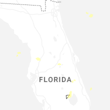
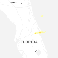


Connect with Interactive Hail Maps