

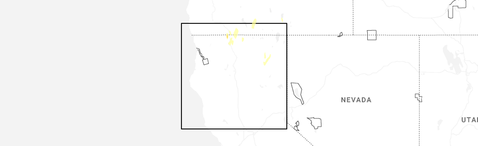
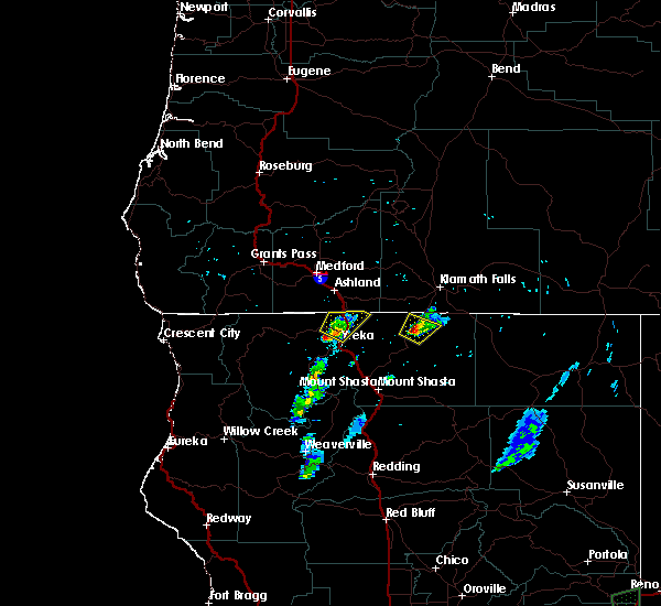
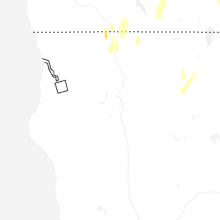
Hail Map for Hornbrook, CA
The Hornbrook, CA area has had 0 reports of on-the-ground hail by trained spotters, and has been under severe weather warnings 12 times during the past 12 months. Doppler radar has detected hail at or near Hornbrook, CA on 5 occasions, including 1 occasion during the past year.
| Name: | Hornbrook, CA |
| Where Located: | 32.9 miles SSE of Medford, OR |
| Map: | Google Map for Hornbrook, CA |
| Population: | 248 |
| Housing Units: | 156 |
| More Info: | Search Google for Hornbrook, CA |
0
The Top Recent Hail Date for Hornbrook, CA is Thursday, July 3, 2025 (4th out of 5)
Hail and Wind Damage Spotted near Hornbrook, CA
| Date / Time | Report Details |
|---|---|
| 7/3/2025 9:09 PM PDT |
 The severe thunderstorm which prompted the warning has weakened and moved out of the warned area. therefore, the warning will be allowed to expire. The severe thunderstorm which prompted the warning has weakened and moved out of the warned area. therefore, the warning will be allowed to expire.
|
| 7/3/2025 8:40 PM PDT |
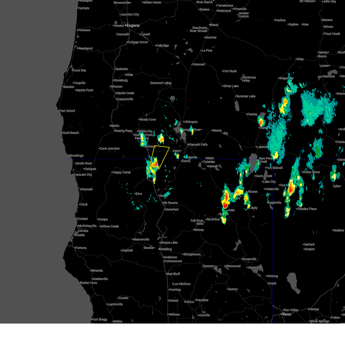
 Svrmfr the national weather service in medford has issued a * severe thunderstorm warning for, north central siskiyou county in northern california, * until 915 pm pdt. * at 840 pm pdt, a severe thunderstorm was located near grenada, or 11 miles east of yreka, moving north at 20 mph (radar indicated). Hazards include 60 mph wind gusts and quarter size hail. Hail damage to vehicles is expected. Expect wind damage to roofs, siding, and trees. Svrmfr the national weather service in medford has issued a * severe thunderstorm warning for, north central siskiyou county in northern california, * until 915 pm pdt. * at 840 pm pdt, a severe thunderstorm was located near grenada, or 11 miles east of yreka, moving north at 20 mph (radar indicated). Hazards include 60 mph wind gusts and quarter size hail. Hail damage to vehicles is expected. Expect wind damage to roofs, siding, and trees.
|
| 7/3/2025 7:36 PM PDT |
 The storm which prompted the warning has weakened below severe limits, and has exited the warned area. therefore, the warning will be allowed to expire. The storm which prompted the warning has weakened below severe limits, and has exited the warned area. therefore, the warning will be allowed to expire.
|
| 7/3/2025 7:17 PM PDT |
 Svrmfr the national weather service in medford has issued a * severe thunderstorm warning for, north central siskiyou county in northern california, * until 745 pm pdt. * at 717 pm pdt, a severe thunderstorm was located over montague, or near yreka, moving north at 25 mph (radar indicated). Hazards include 60 mph wind gusts and quarter size hail. Hail damage to vehicles is expected. Expect wind damage to roofs, siding, and trees. Svrmfr the national weather service in medford has issued a * severe thunderstorm warning for, north central siskiyou county in northern california, * until 745 pm pdt. * at 717 pm pdt, a severe thunderstorm was located over montague, or near yreka, moving north at 25 mph (radar indicated). Hazards include 60 mph wind gusts and quarter size hail. Hail damage to vehicles is expected. Expect wind damage to roofs, siding, and trees.
|
| 7/3/2025 6:08 PM PDT |
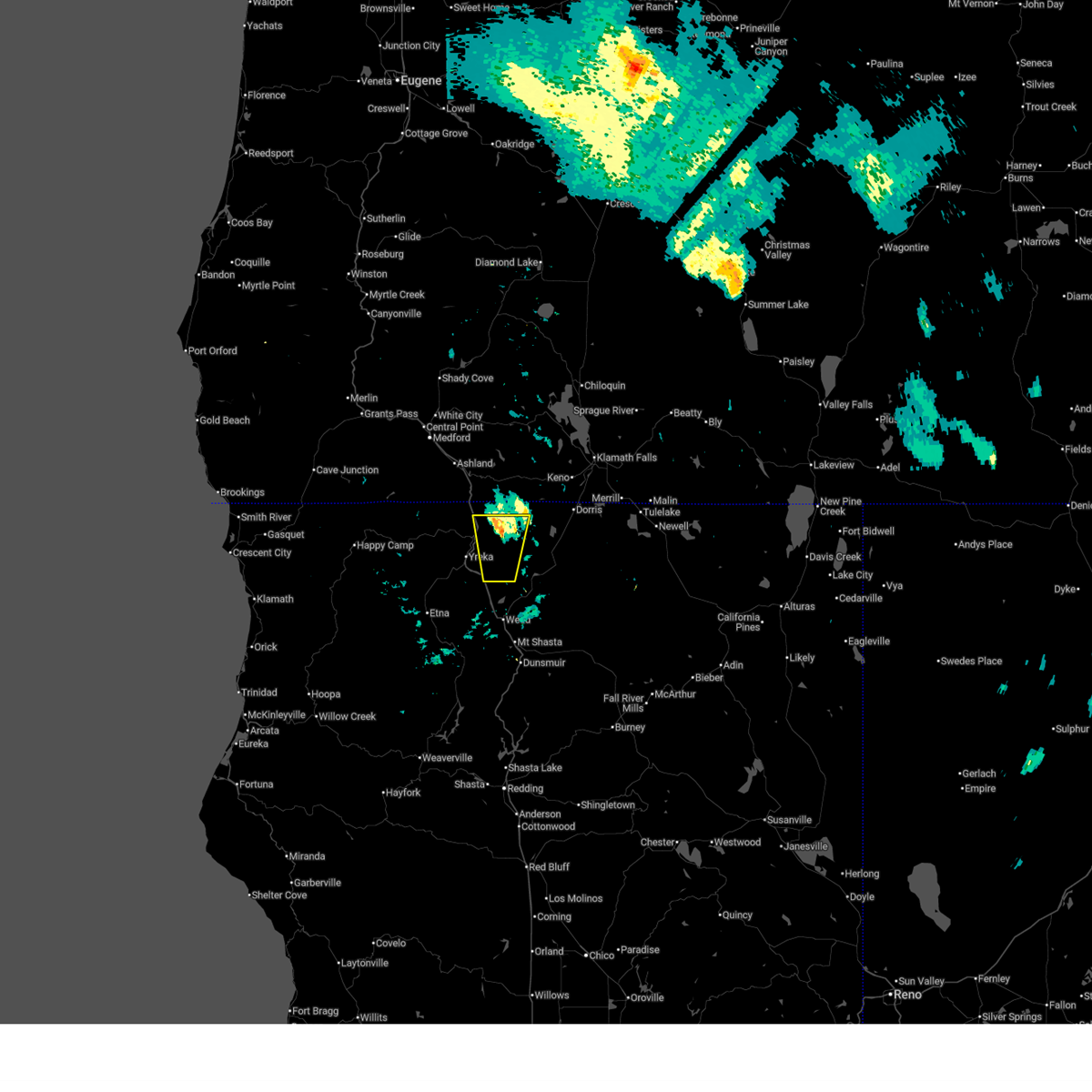
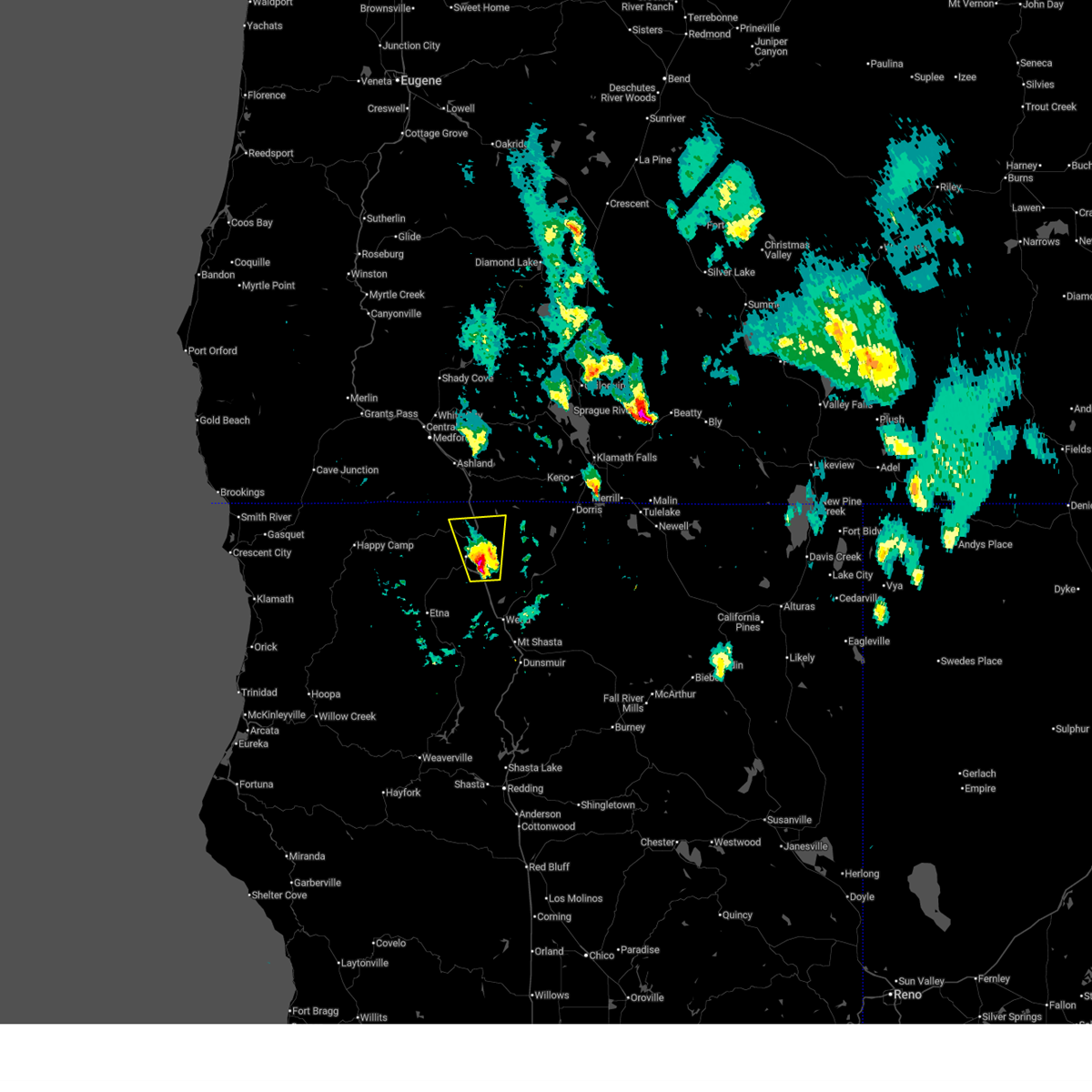
 Svrmfr the national weather service in medford has issued a * severe thunderstorm warning for, north central siskiyou county in northern california, southeastern jackson county in southwestern oregon, * until 645 pm pdt. * at 608 pm pdt, a severe thunderstorm was located near hornbrook, or 11 miles northeast of yreka, moving north at 30 mph (radar indicated). Hazards include 60 mph wind gusts and quarter size hail. Hail damage to vehicles is expected. Expect wind damage to roofs, siding, and trees. Svrmfr the national weather service in medford has issued a * severe thunderstorm warning for, north central siskiyou county in northern california, southeastern jackson county in southwestern oregon, * until 645 pm pdt. * at 608 pm pdt, a severe thunderstorm was located near hornbrook, or 11 miles northeast of yreka, moving north at 30 mph (radar indicated). Hazards include 60 mph wind gusts and quarter size hail. Hail damage to vehicles is expected. Expect wind damage to roofs, siding, and trees.
|
| 7/3/2025 5:15 PM PDT |
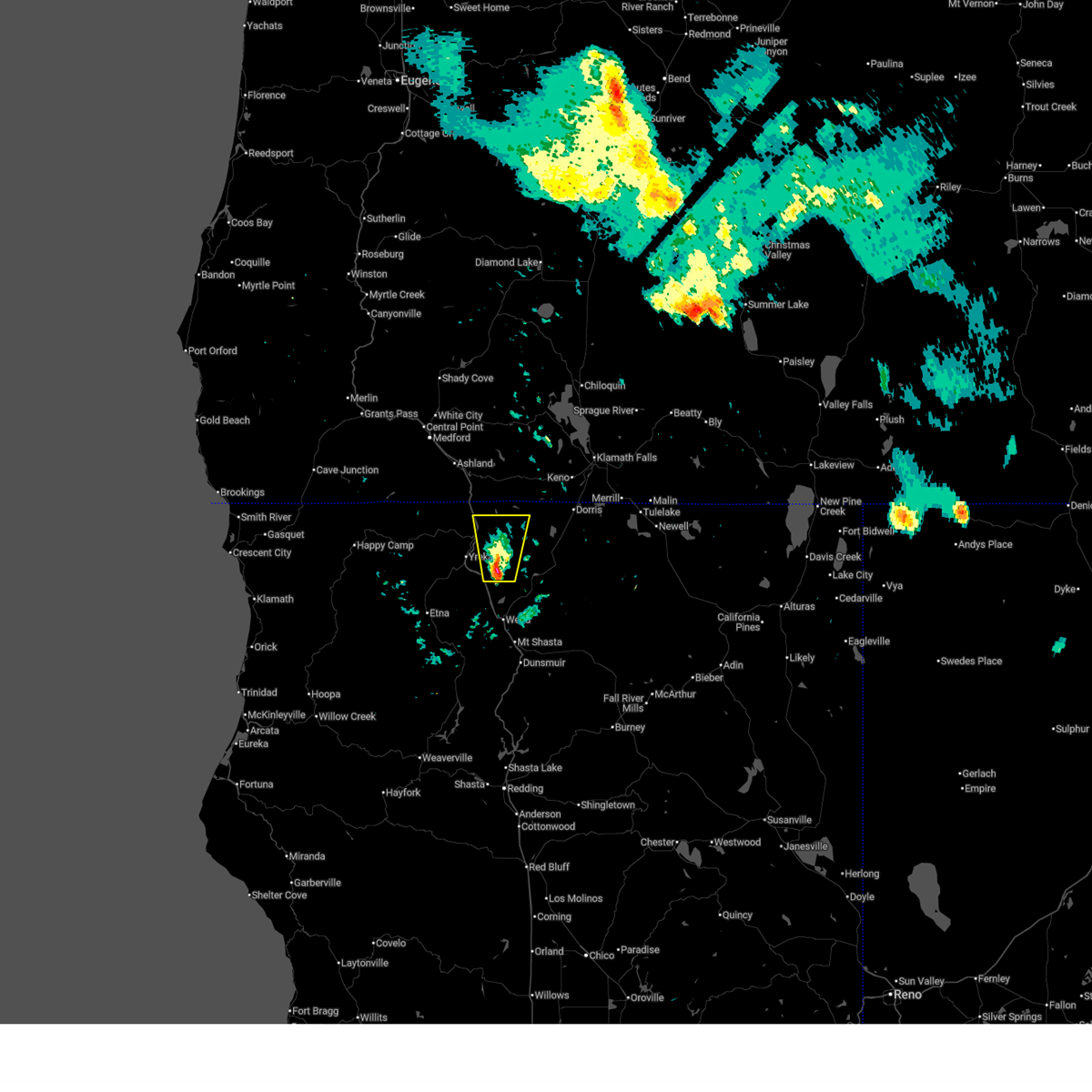
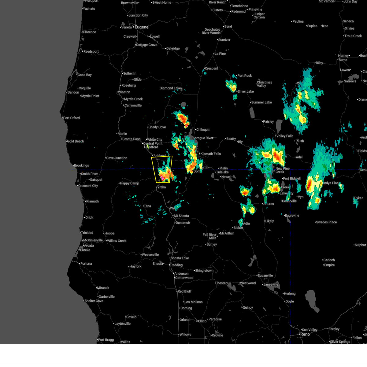
 Svrmfr the national weather service in medford has issued a * severe thunderstorm warning for, northern siskiyou county in northern california, southeastern jackson county in southwestern oregon, southwestern klamath county in south central oregon, * until 545 pm pdt. * at 514 pm pdt, a severe thunderstorm was located over camp creek at iron gate lake, or 17 miles northeast of yreka, moving north at 35 mph (radar indicated). Hazards include 60 mph wind gusts and quarter size hail. Hail damage to vehicles is expected. Expect wind damage to roofs, siding, and trees. Svrmfr the national weather service in medford has issued a * severe thunderstorm warning for, northern siskiyou county in northern california, southeastern jackson county in southwestern oregon, southwestern klamath county in south central oregon, * until 545 pm pdt. * at 514 pm pdt, a severe thunderstorm was located over camp creek at iron gate lake, or 17 miles northeast of yreka, moving north at 35 mph (radar indicated). Hazards include 60 mph wind gusts and quarter size hail. Hail damage to vehicles is expected. Expect wind damage to roofs, siding, and trees.
|
| 7/3/2025 4:48 PM PDT | Svrmfr the national weather service in medford has issued a * severe thunderstorm warning for, north central siskiyou county in northern california, southeastern jackson county in southwestern oregon, * until 515 pm pdt. * at 448 pm pdt, a severe thunderstorm was located over montague, or near yreka, moving north at 25 mph (radar indicated). Hazards include 60 mph wind gusts and quarter size hail. Hail damage to vehicles is expected. Expect wind damage to roofs, siding, and trees. |
| 7/3/2025 4:46 PM PDT | the severe thunderstorm warning has been cancelled and is no longer in effect |
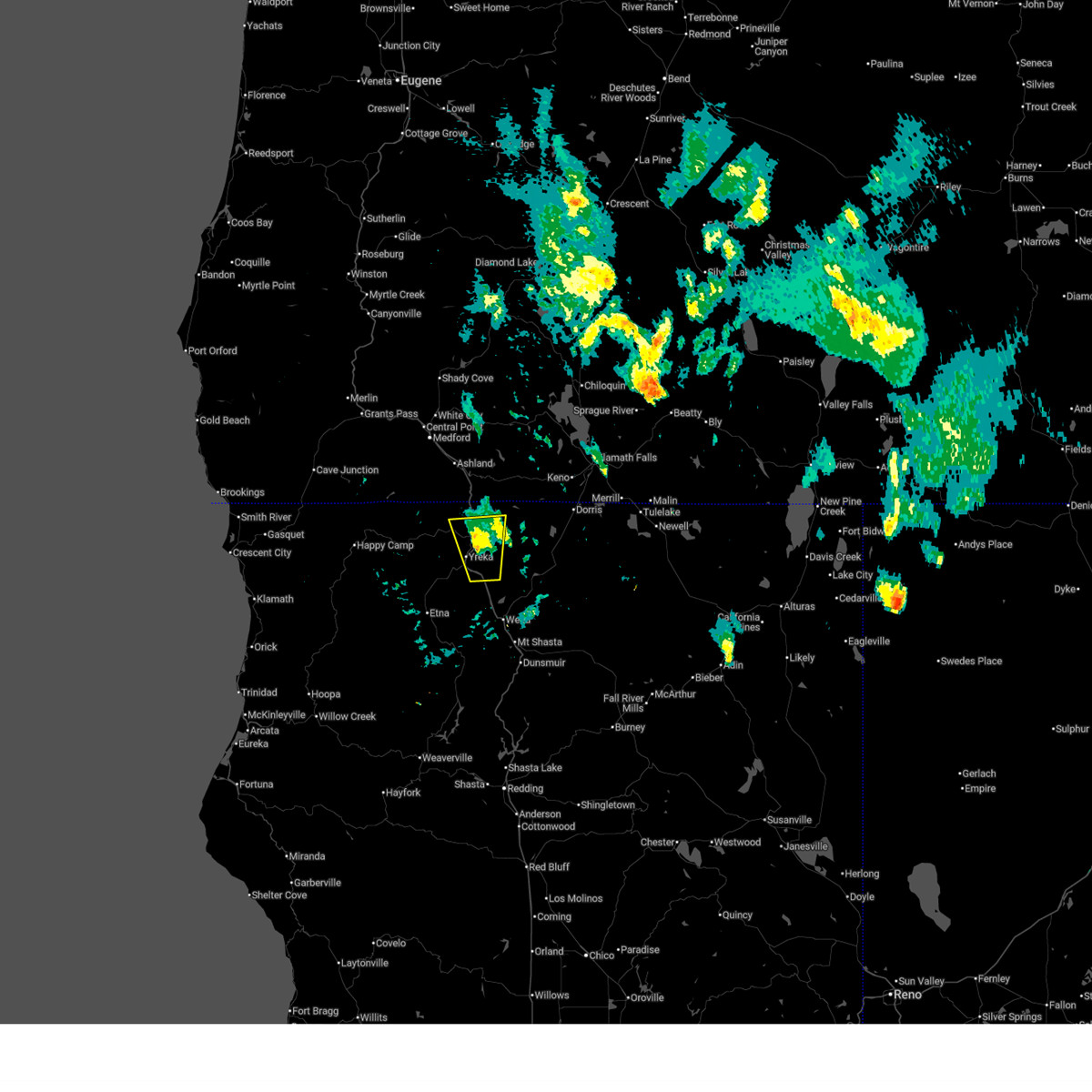
| 7/3/2025 4:35 PM PDT | At 435 pm pdt, a severe thunderstorm was located near pilot rock, or 15 miles southeast of ashland, moving north at 35 mph (radar indicated). Hazards include 60 mph wind gusts and quarter size hail. Hail damage to vehicles is expected. expect wind damage to roofs, siding, and trees. Locations impacted include, pilot rock, i 5 siskiyou summit, camp creek at iron gate lake, hornbrook, and siskiyou summit. |
| 7/3/2025 4:26 PM PDT | Svrmfr the national weather service in medford has issued a * severe thunderstorm warning for, northern siskiyou county in northern california, southeastern jackson county in southwestern oregon, * until 500 pm pdt. * at 426 pm pdt, a severe thunderstorm was located near camp creek at iron gate lake, or 17 miles north of yreka, moving north at 35 mph (radar indicated). Hazards include 60 mph wind gusts and quarter size hail. Hail damage to vehicles is expected. Expect wind damage to roofs, siding, and trees. |
| 7/3/2025 4:13 PM PDT | At 413 pm pdt, a severe thunderstorm was located near hornbrook, or 9 miles northeast of yreka, moving north at 35 mph (radar indicated). Hazards include 60 mph wind gusts and quarter size hail. Hail damage to vehicles is expected. expect wind damage to roofs, siding, and trees. Locations impacted include, yreka, montague, tree of heaven campground, and hornbrook. |
| 7/3/2025 4:03 PM PDT | Svrmfr the national weather service in medford has issued a * severe thunderstorm warning for, north central siskiyou county in northern california, * until 430 pm pdt. * at 403 pm pdt, a severe thunderstorm was located near montague, or near yreka, moving north at 35 mph (radar indicated). Hazards include 60 mph wind gusts and quarter size hail. Hail damage to vehicles is expected. Expect wind damage to roofs, siding, and trees. |
| 7/23/2018 6:55 PM PDT |
 At 654 pm pdt, a severe thunderstorm was located over tree of heaven campground, or 8 miles north of yreka, moving northeast at 15 mph (radar indicated). Hazards include 60 mph wind gusts and quarter size hail. Hail damage to vehicles is expected. Expect wind damage to roofs, siding, and trees. At 654 pm pdt, a severe thunderstorm was located over tree of heaven campground, or 8 miles north of yreka, moving northeast at 15 mph (radar indicated). Hazards include 60 mph wind gusts and quarter size hail. Hail damage to vehicles is expected. Expect wind damage to roofs, siding, and trees.
|
Hail Maps for Hornbrook, CA


Connect with Interactive Hail Maps