

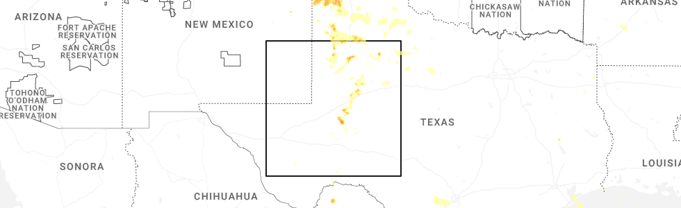
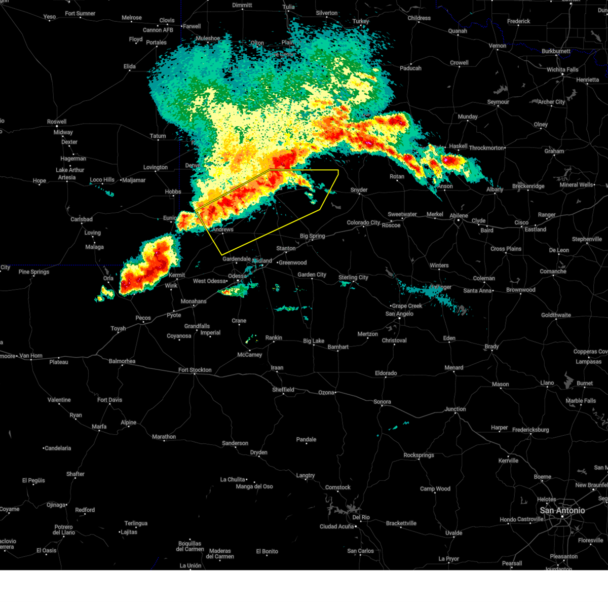
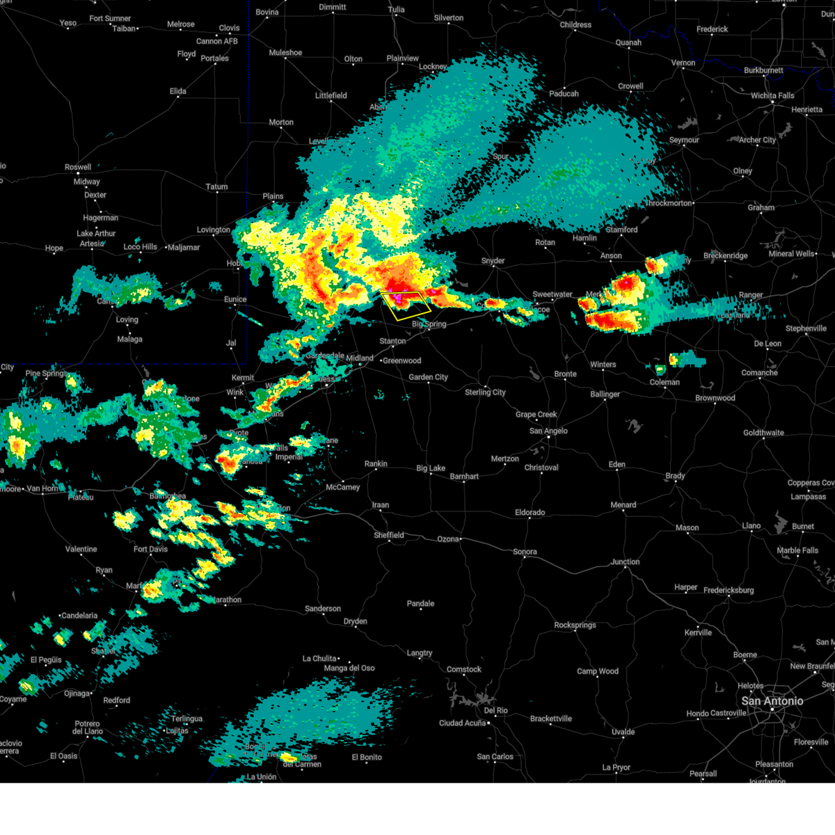
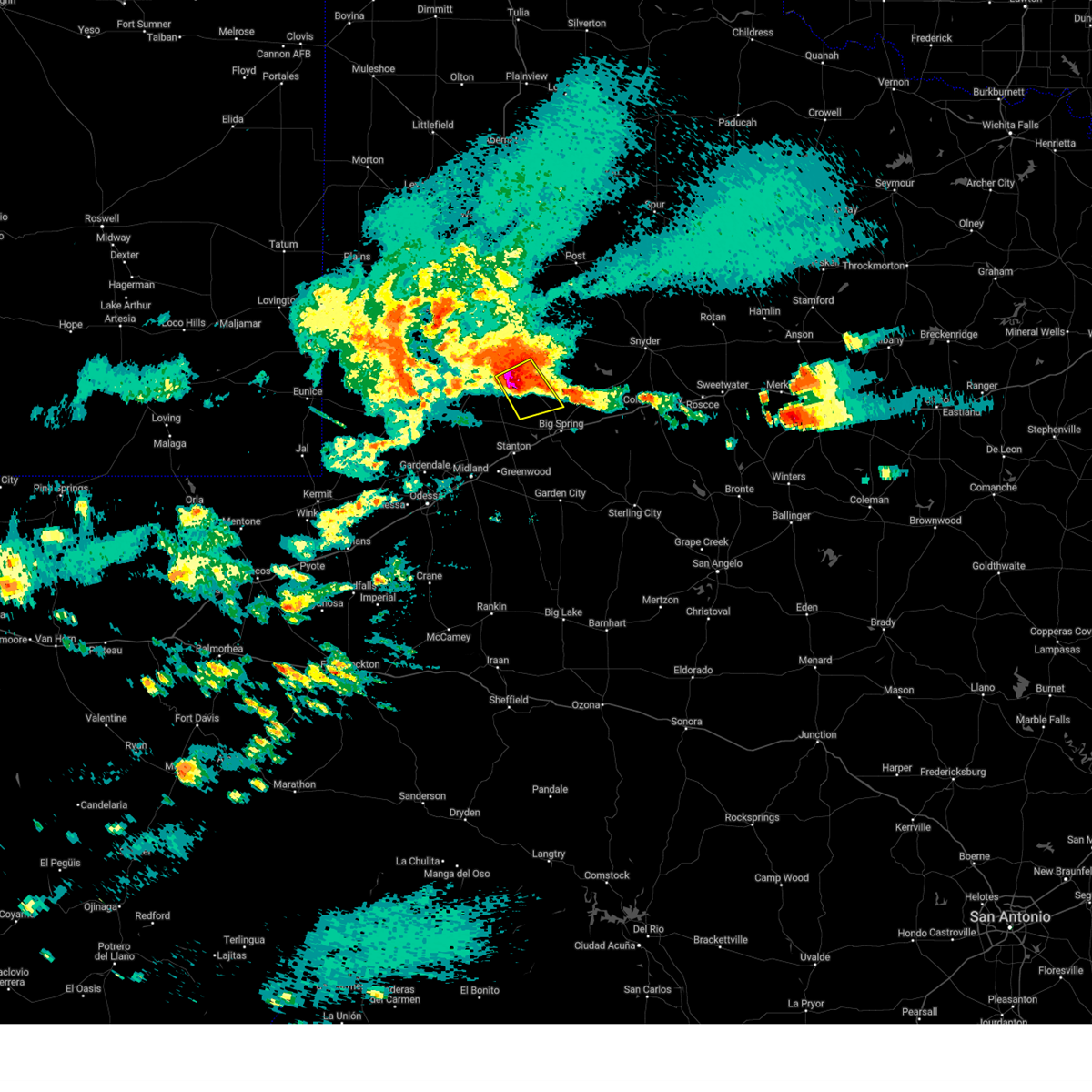
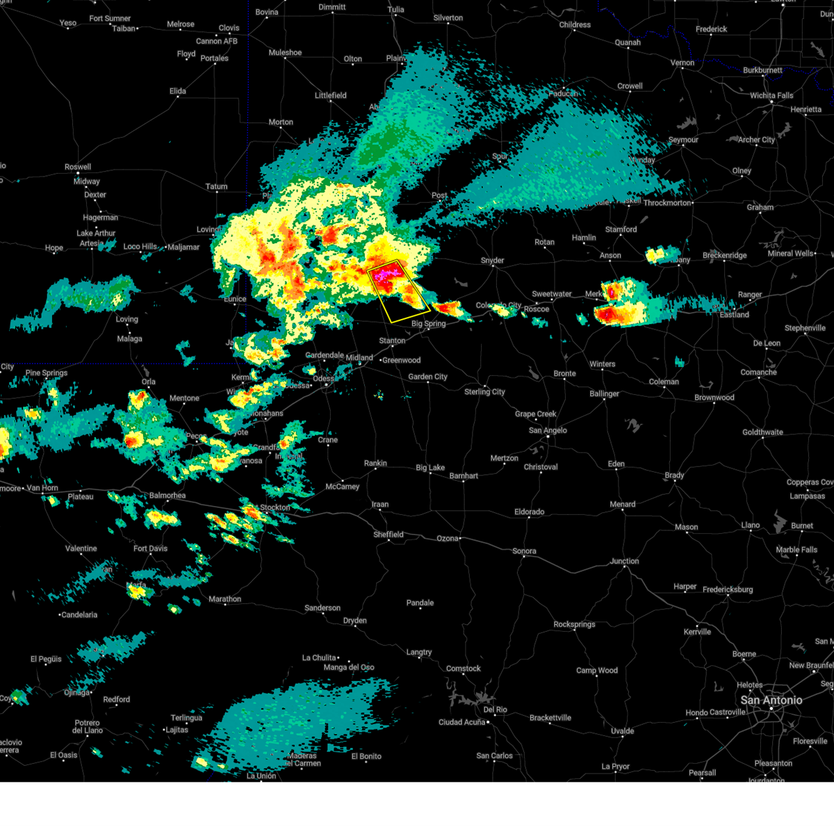
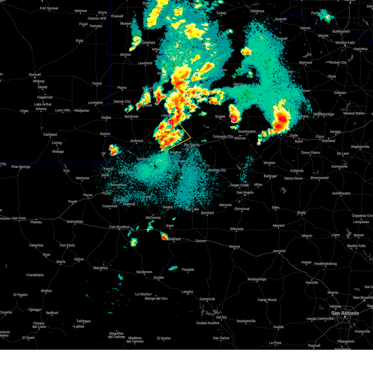
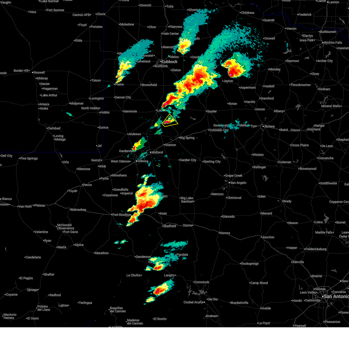
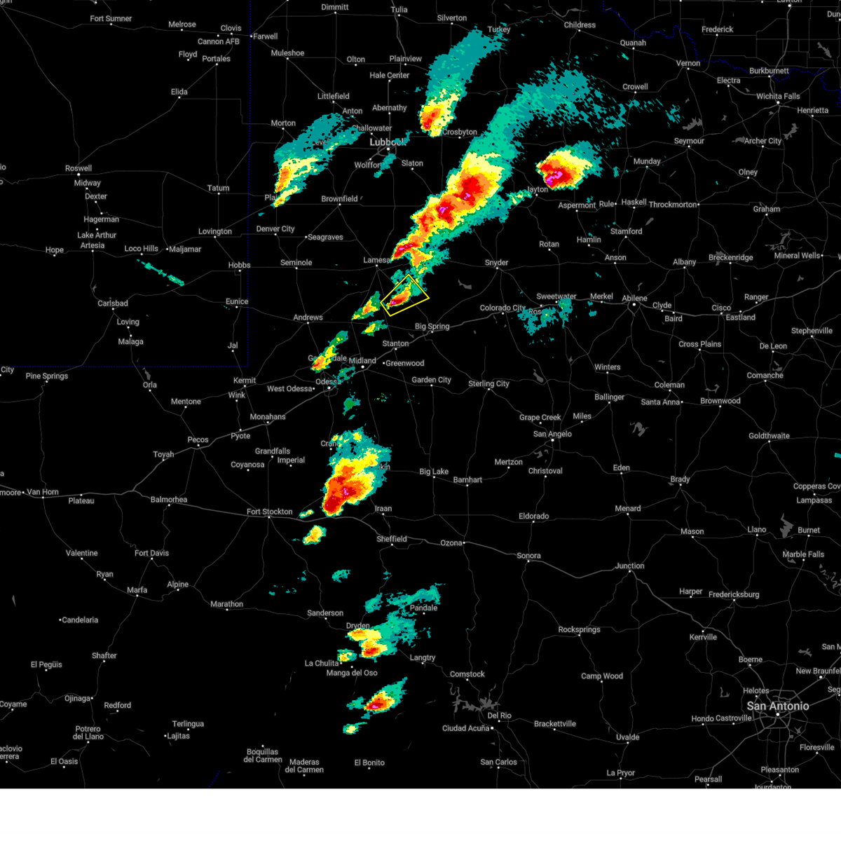
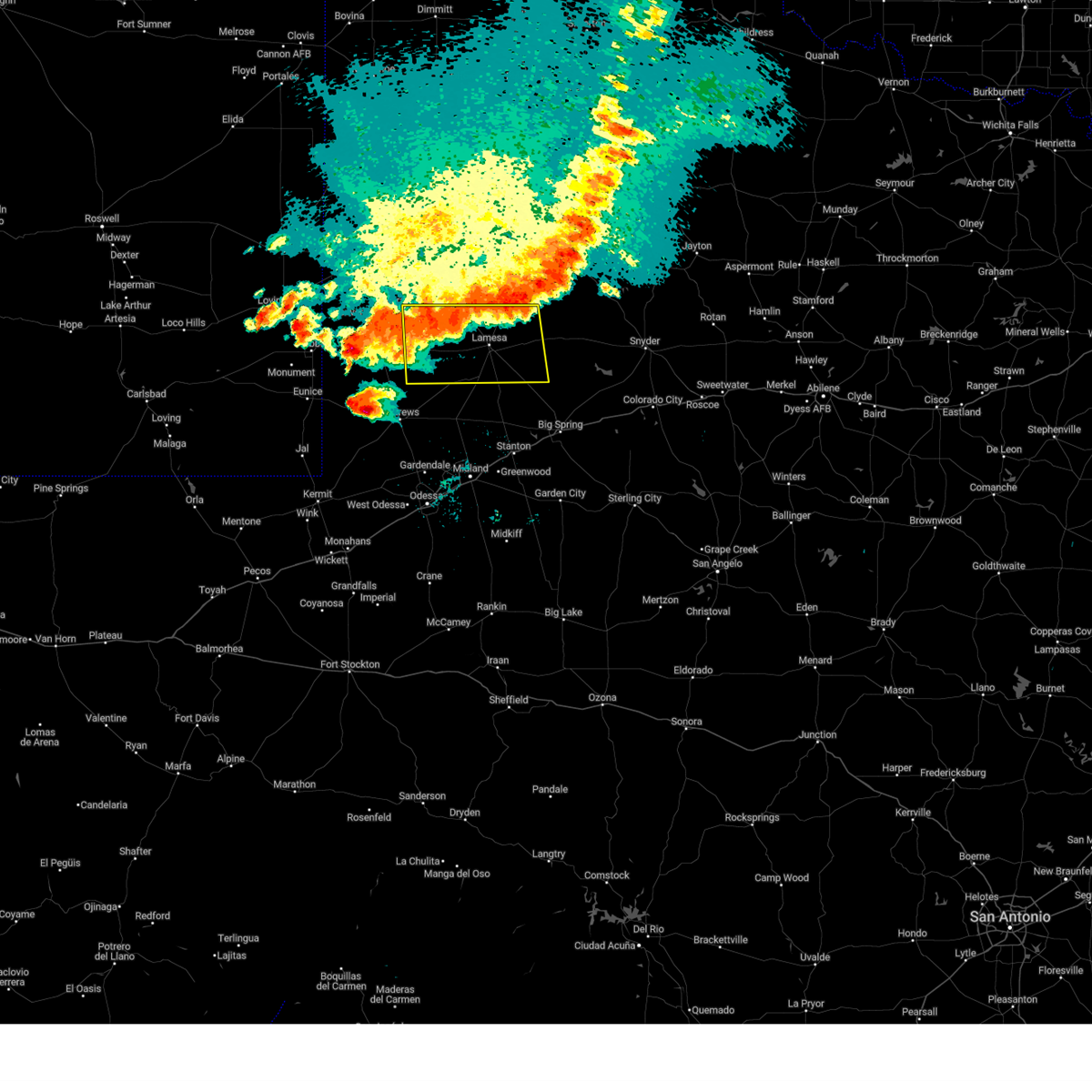
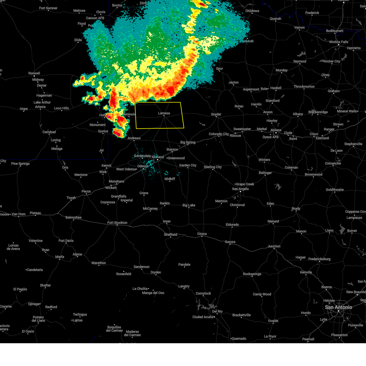
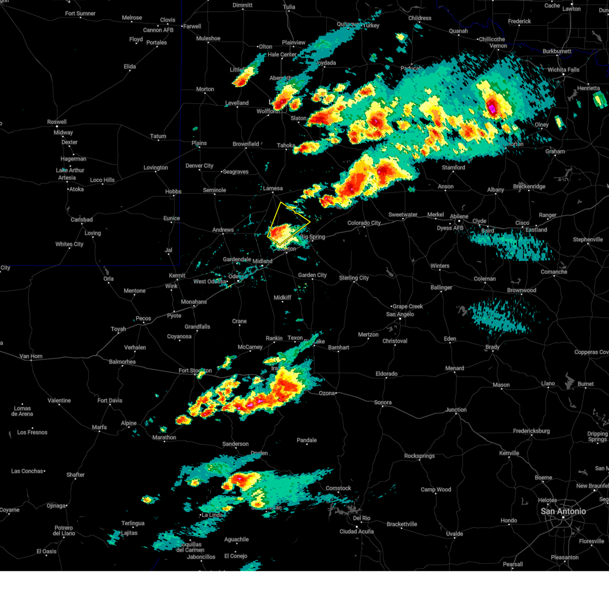
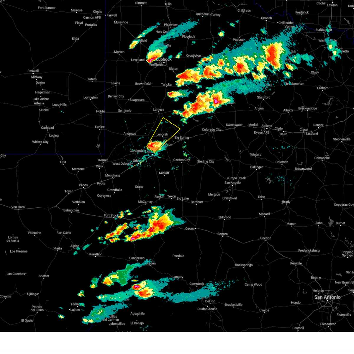
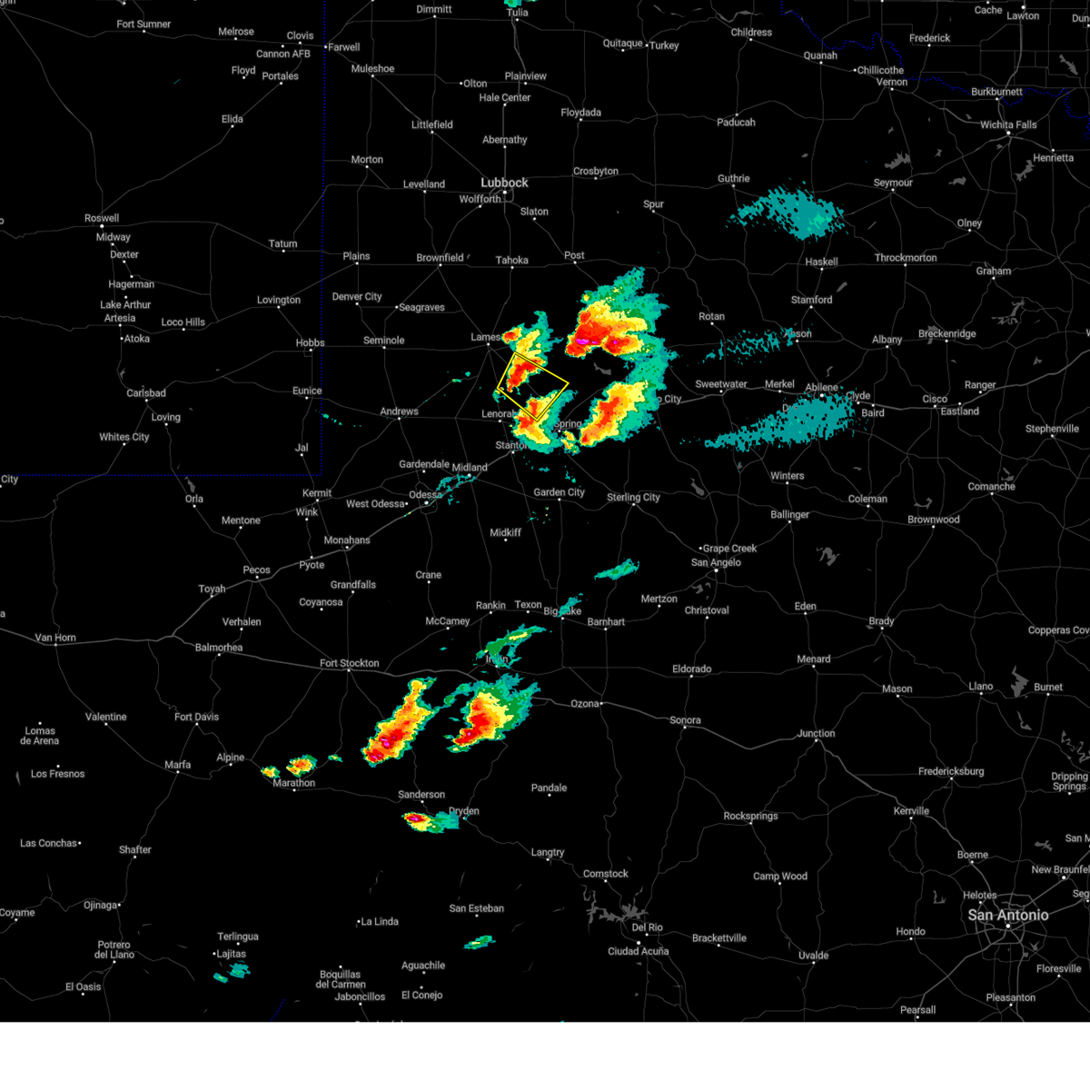
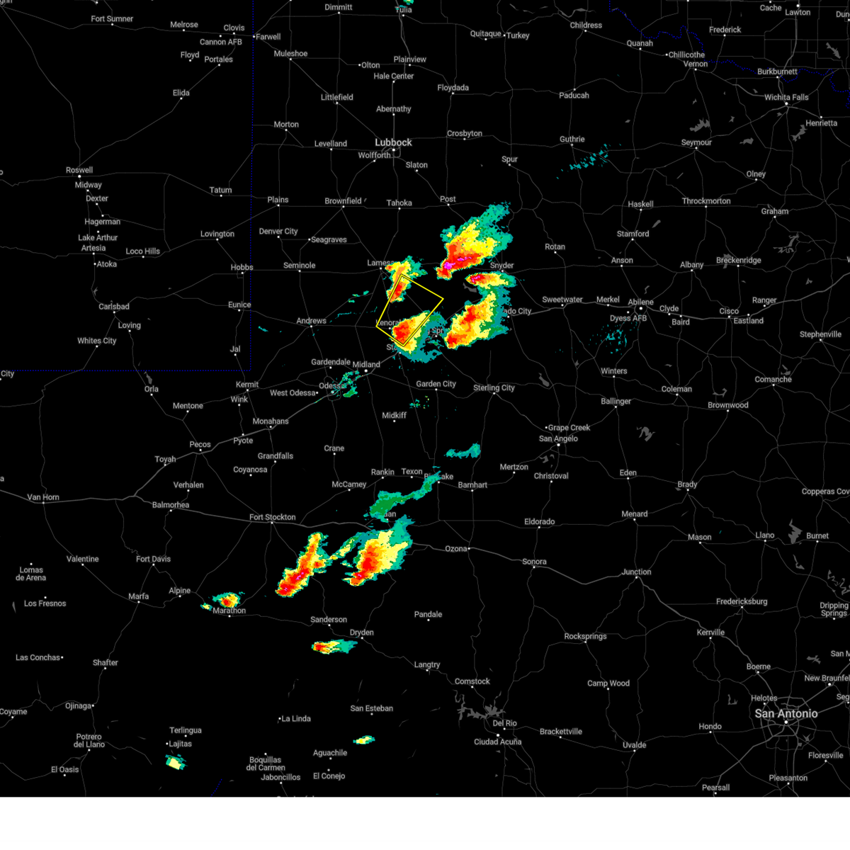
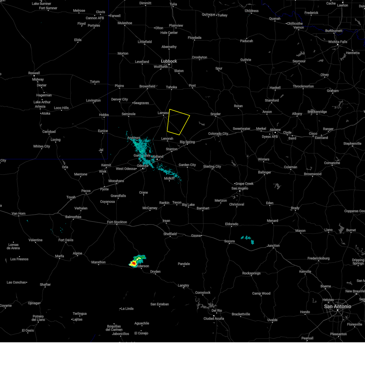
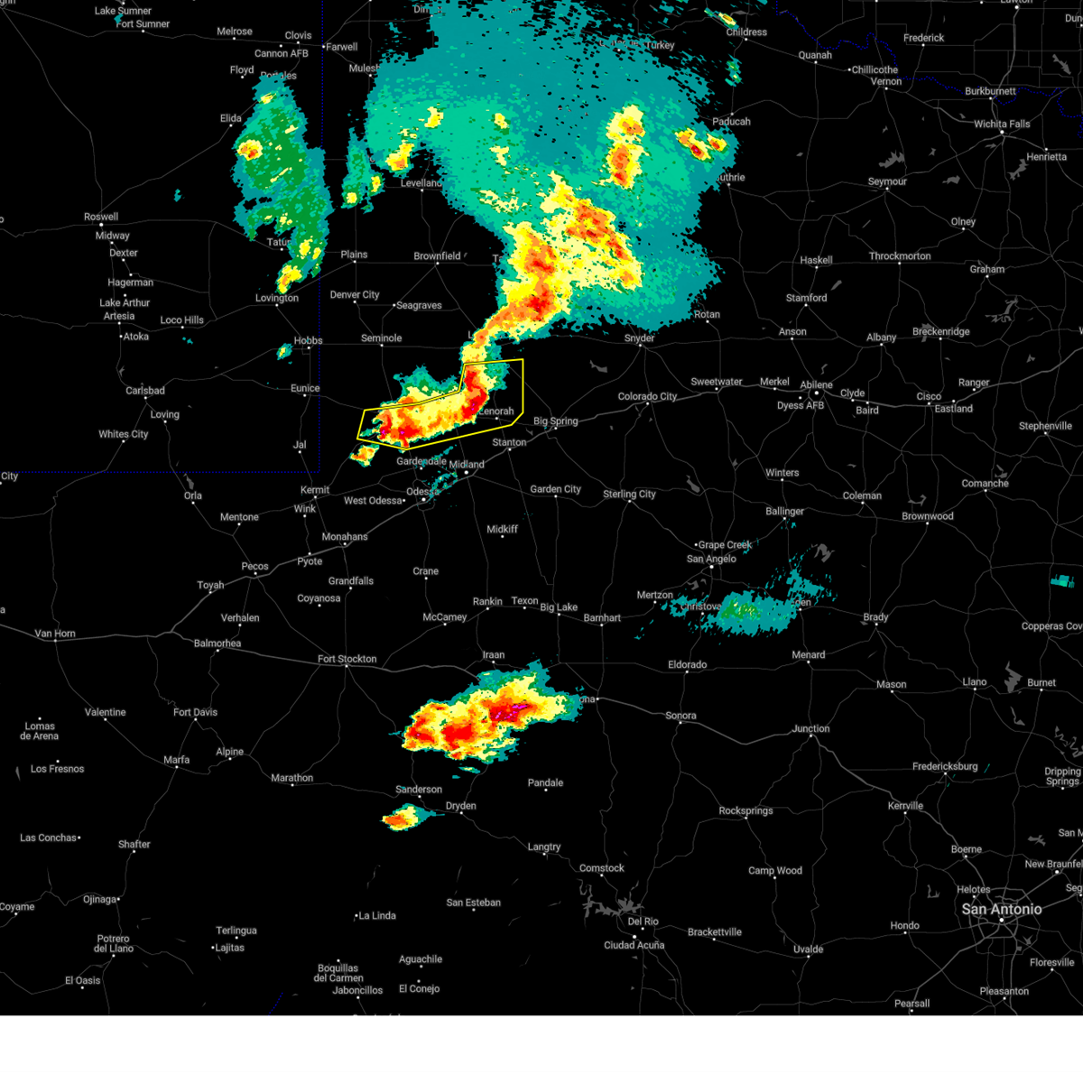
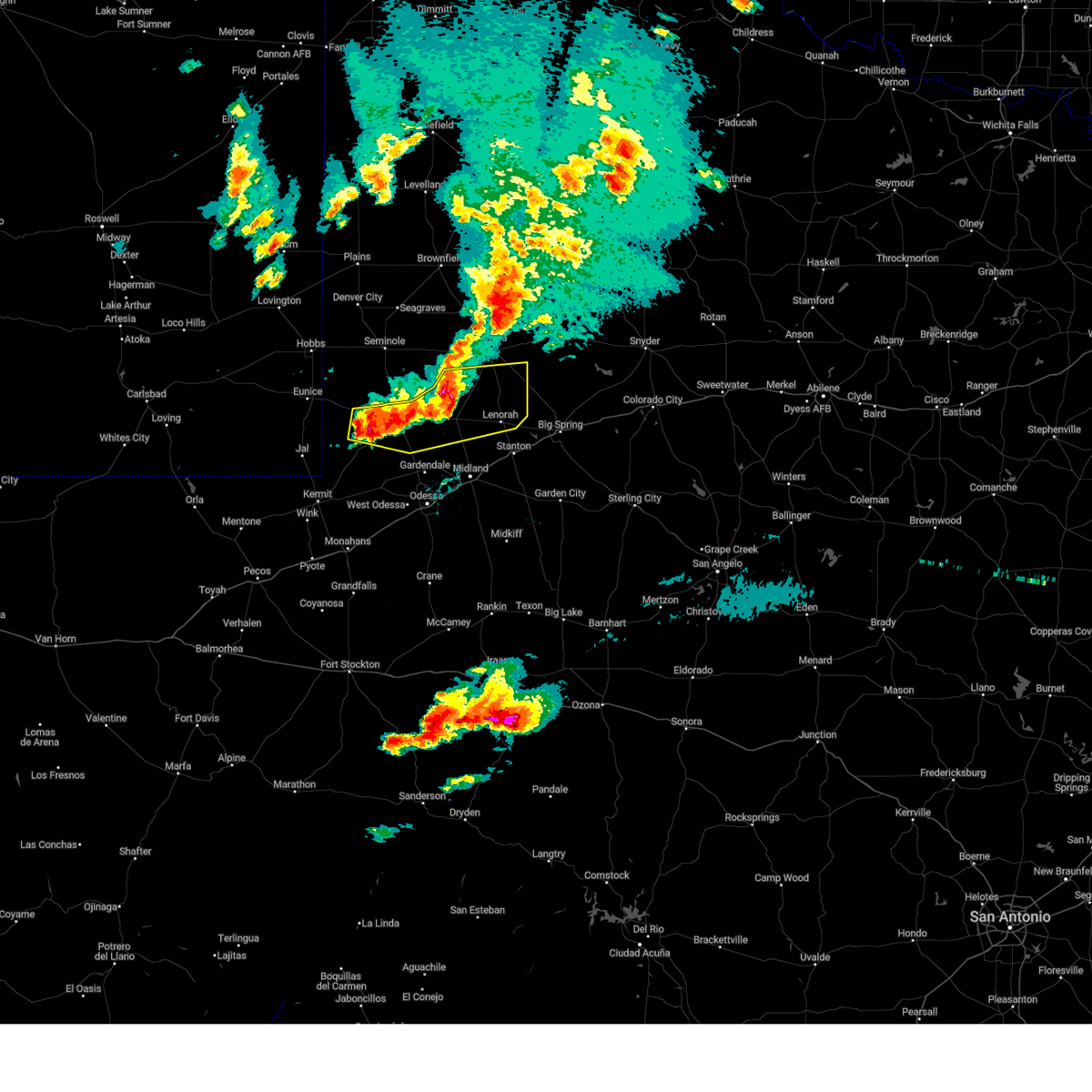
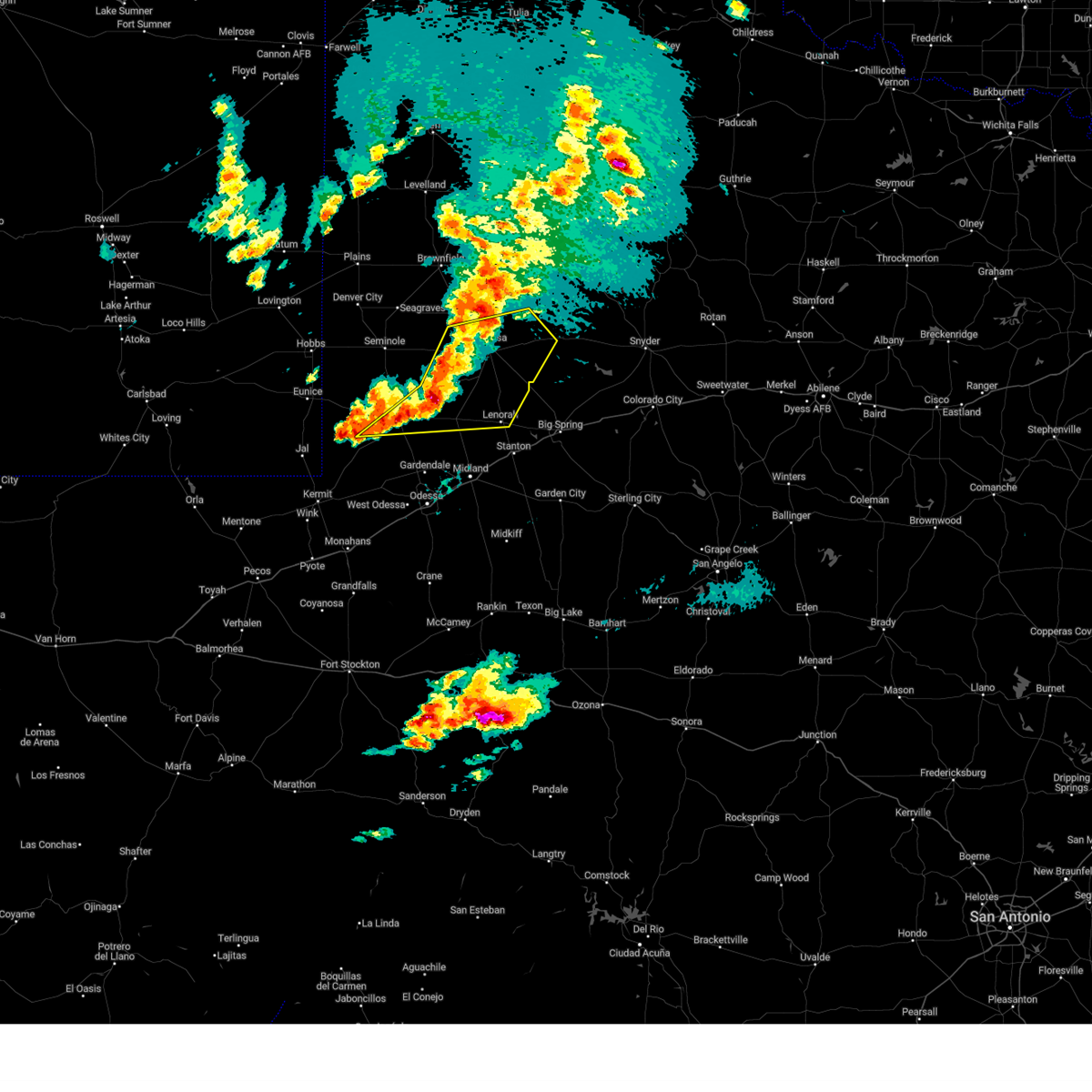
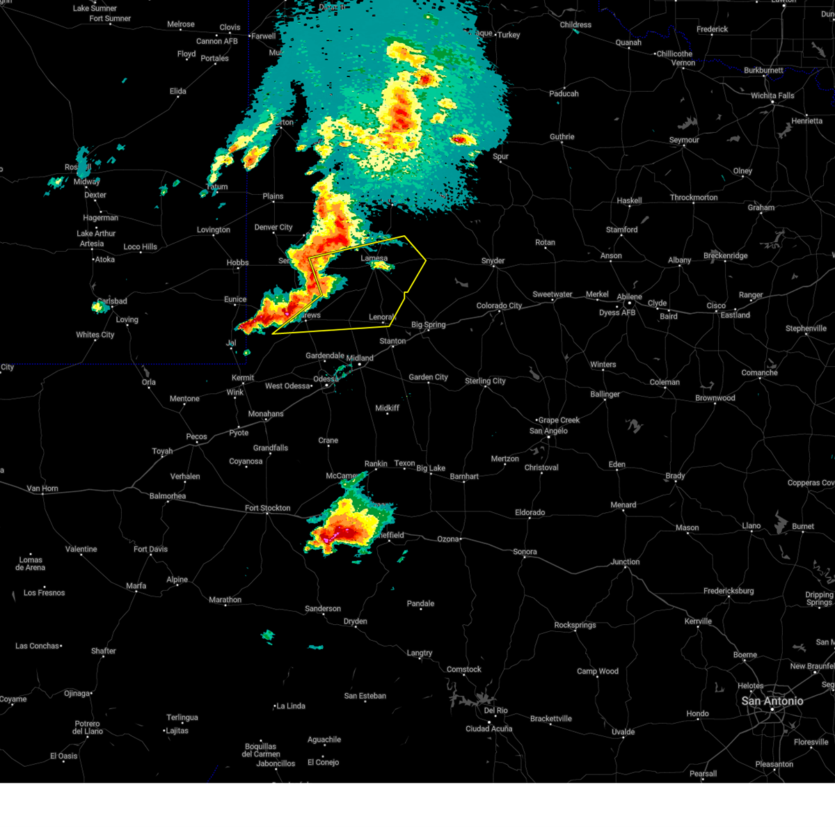
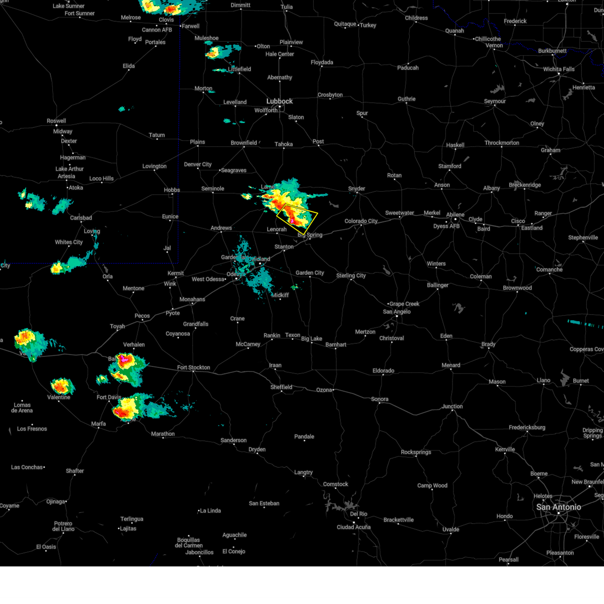
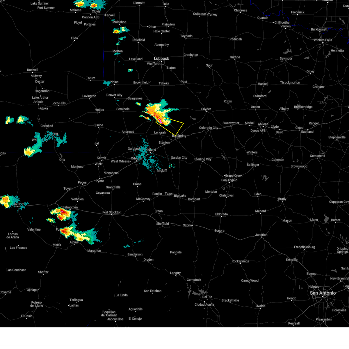
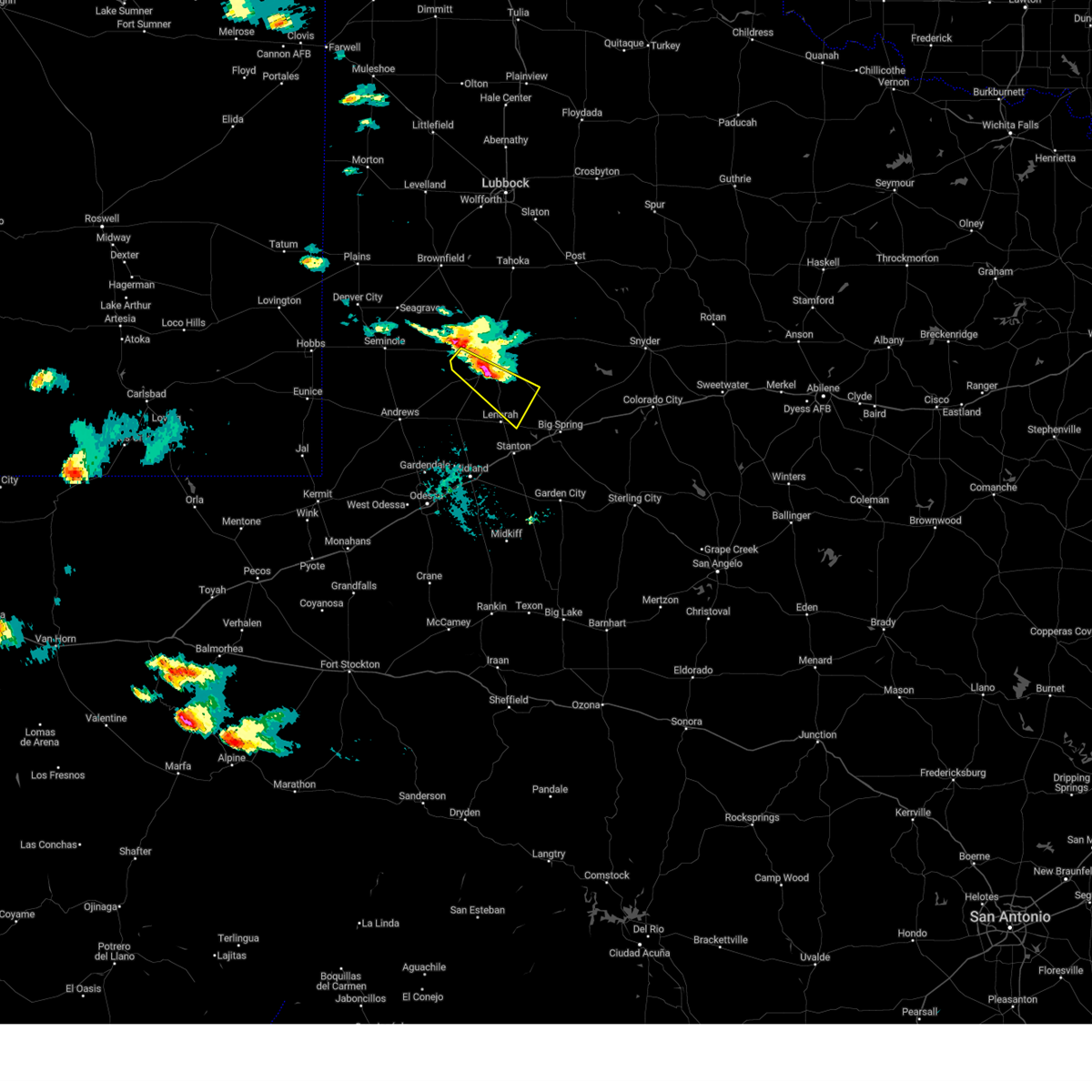
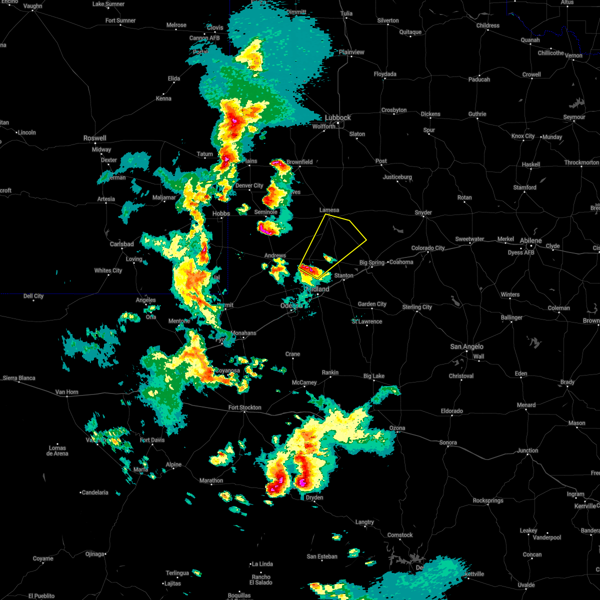
Hail Map for Ackerly, TX
The Ackerly, TX area has had 8 reports of on-the-ground hail by trained spotters, and has been under severe weather warnings 4 times during the past 12 months. Doppler radar has detected hail at or near Ackerly, TX on 82 occasions, including 2 occasions during the past year.
| Name: | Ackerly, TX |
| Where Located: | 60.5 miles NE of Odessa, TX |
| Map: | Google Map for Ackerly, TX |
| Population: | 220 |
| Housing Units: | 83 |
| More Info: | Search Google for Ackerly, TX |
1
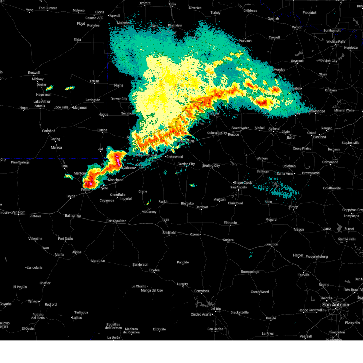
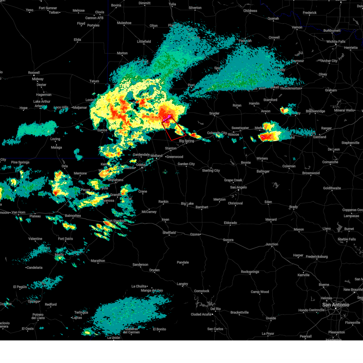
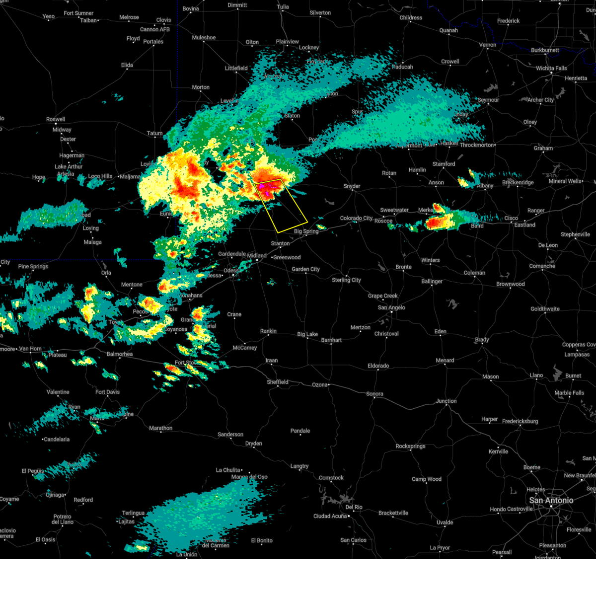
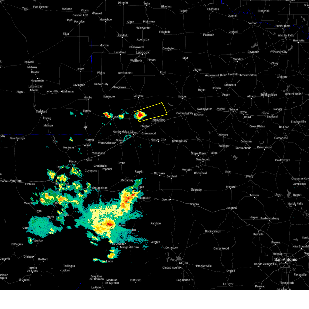
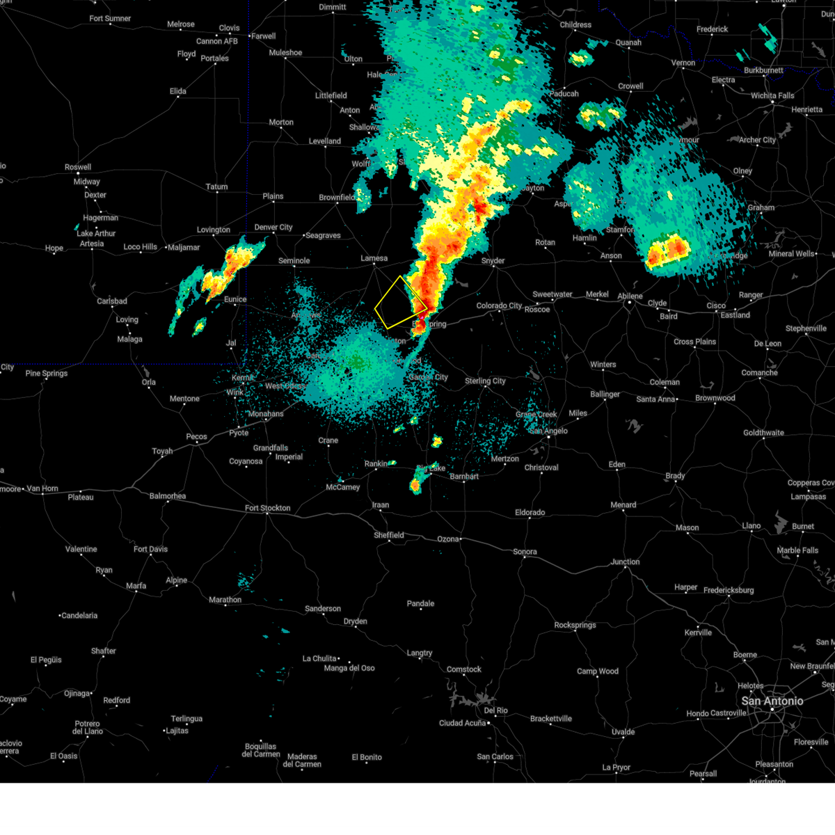
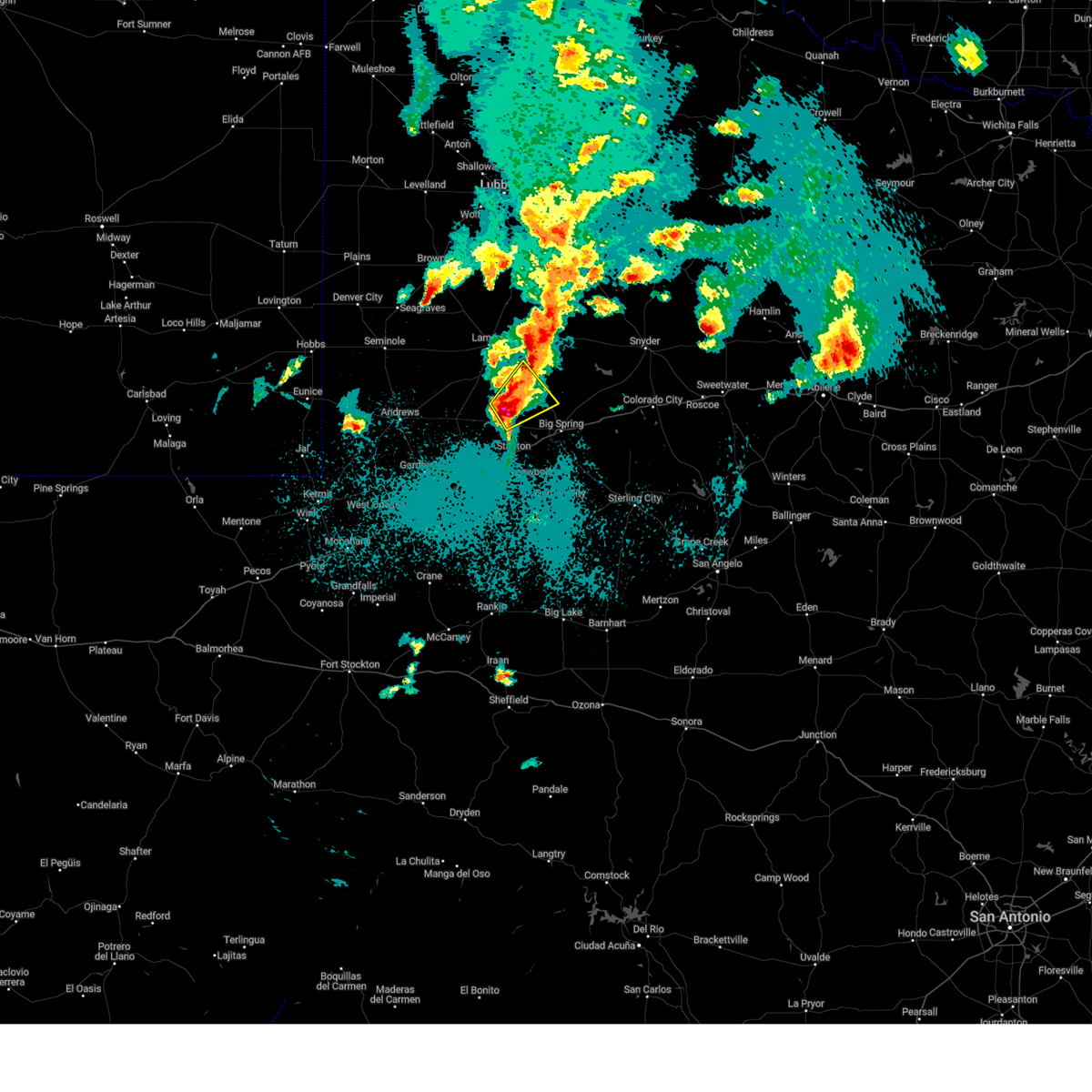
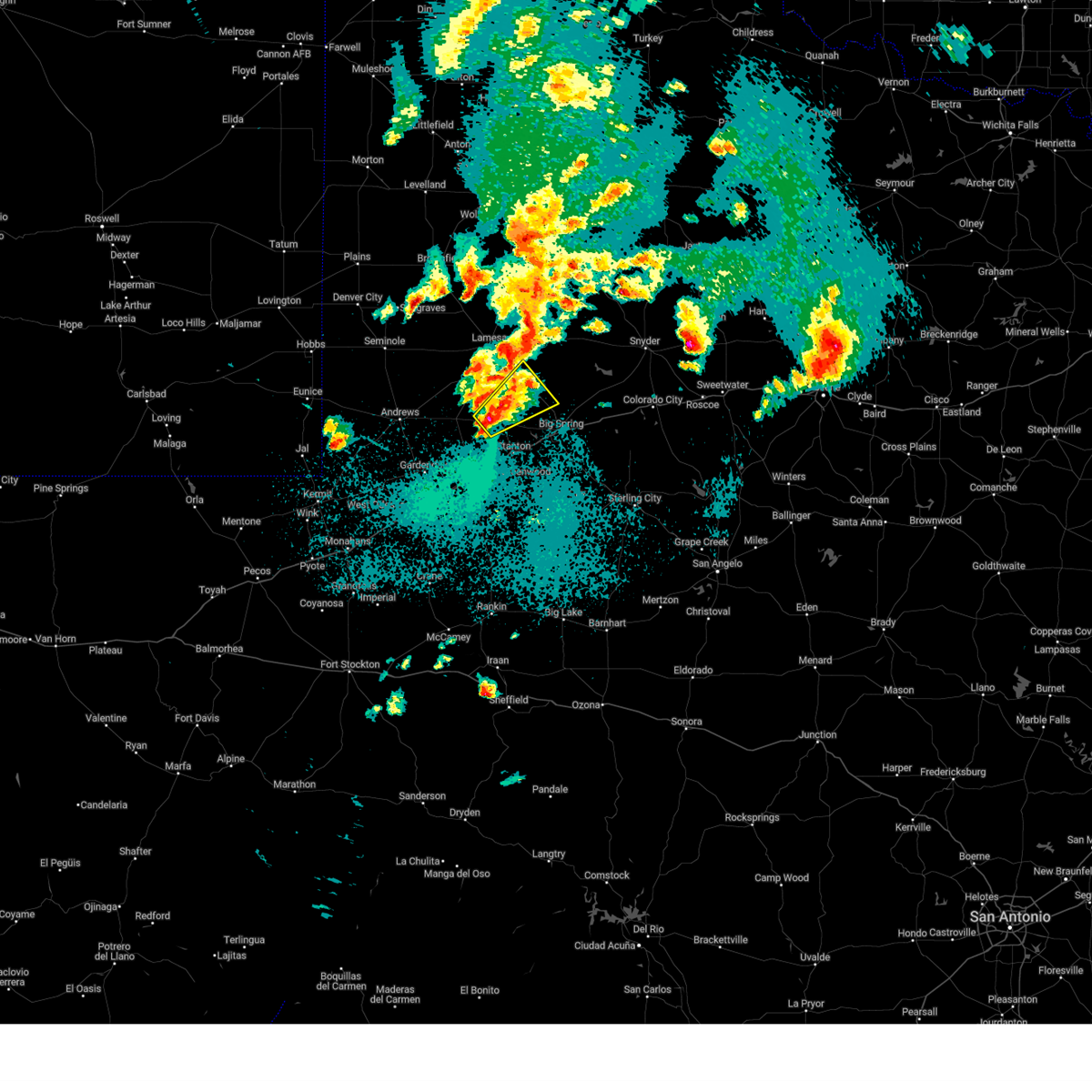
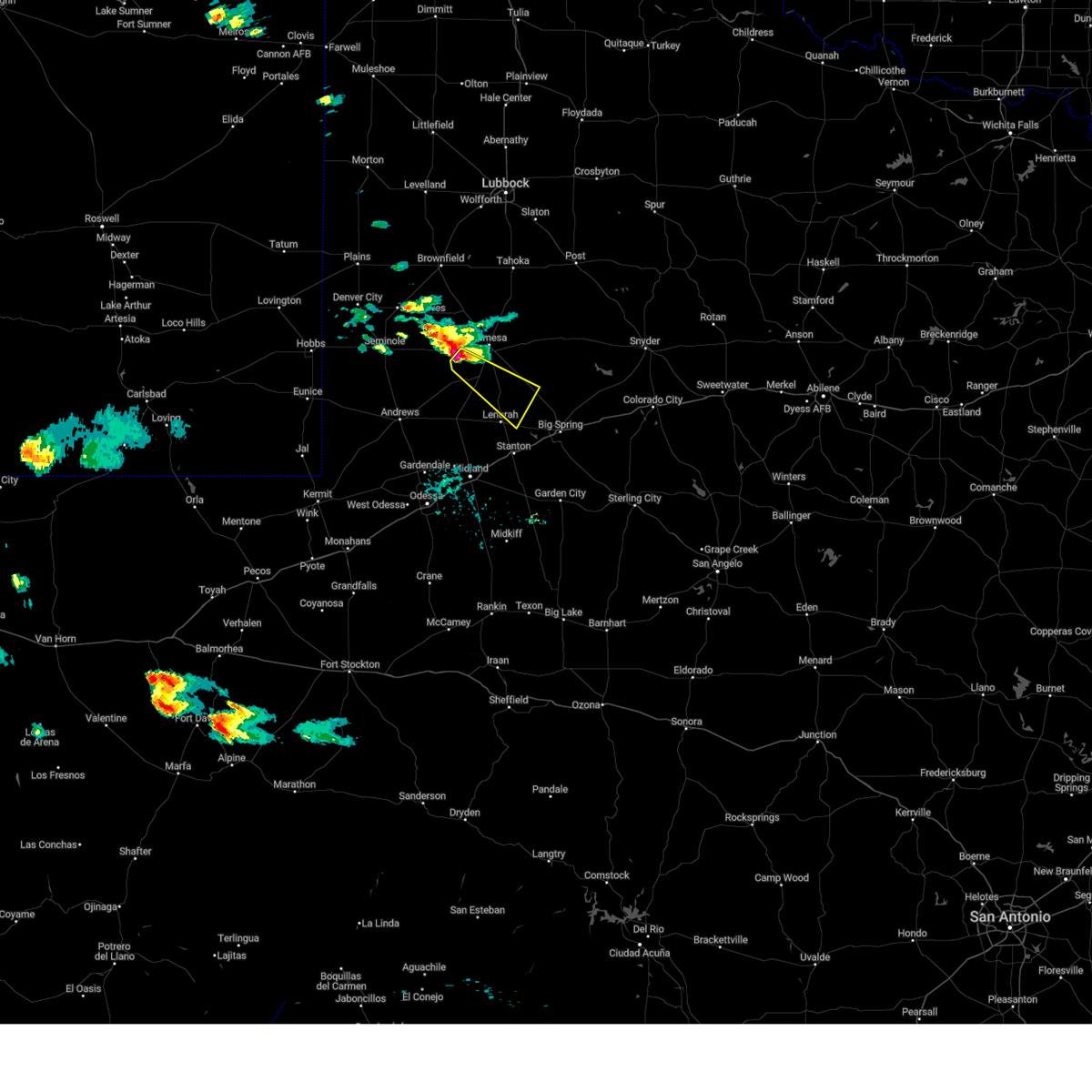
The Top Recent Hail Date for Ackerly, TX is Saturday, May 23, 2026 (33rd out of 82)
Hail and Wind Damage Spotted near Ackerly, TX
| Date / Time | Report Details |
|---|---|
| 5/10/2026 2:35 PM CDT |
 Svrmaf the national weather service in midland has issued a * severe thunderstorm warning for, west central scurry county in western texas, borden county in western texas, northeastern martin county in western texas, northern howard county in western texas, southeastern dawson county in western texas, * until 315 pm cdt. * at 235 pm cdt, a severe thunderstorm was located near ackerly, moving southeast at 20 mph (radar indicated). Hazards include 60 mph wind gusts and quarter size hail. Hail damage to vehicles is expected. Expect wind damage to roofs, siding, and trees. Svrmaf the national weather service in midland has issued a * severe thunderstorm warning for, west central scurry county in western texas, borden county in western texas, northeastern martin county in western texas, northern howard county in western texas, southeastern dawson county in western texas, * until 315 pm cdt. * at 235 pm cdt, a severe thunderstorm was located near ackerly, moving southeast at 20 mph (radar indicated). Hazards include 60 mph wind gusts and quarter size hail. Hail damage to vehicles is expected. Expect wind damage to roofs, siding, and trees.
|
| 9/24/2025 2:02 AM CDT | At 201 am cdt, severe thunderstorms were located along a line extending from 11 miles southwest of gail to 10 miles east of lenorah, moving east at 40 mph (radar indicated). Hazards include 60 mph wind gusts and penny size hail. Expect damage to roofs, siding, and trees. locations impacted include, big spring, ackerly, luther, knott, vealmoor, and big spring mcmahon-wrinkle airpark. This includes interstate 20 between mile markers 175 and 179. |
| 9/24/2025 2:02 AM CDT | the severe thunderstorm warning has been cancelled and is no longer in effect |
| 9/24/2025 1:45 AM CDT | Svrmaf the national weather service in midland has issued a * severe thunderstorm warning for, southern borden county in western texas, northeastern martin county in western texas, northwestern howard county in western texas, southeastern dawson county in western texas, * until 215 am cdt. * at 145 am cdt, severe thunderstorms were located along a line extending from 7 miles north of ackerly to near lenorah, moving east at 40 mph (radar indicated). Hazards include 60 mph wind gusts and penny size hail. expect damage to roofs, siding, and trees |
| 6/13/2025 11:13 PM CDT |
 At 1113 pm cdt, severe thunderstorms were located along a line extending from 10 miles northwest of gail to 7 miles northeast of ackerly to 20 miles west of luther to near lenorah to 15 miles north of midland, moving southeast at 40 mph (radar indicated). Hazards include 70 mph wind gusts and penny size hail. Expect considerable tree damage. damage is likely to mobile homes, roofs, and outbuildings. Locations impacted include, ackerly, gail, lenorah, sparenberg, tarzan, tenmile, knott, vealmoor, hancock, key, and klondike. At 1113 pm cdt, severe thunderstorms were located along a line extending from 10 miles northwest of gail to 7 miles northeast of ackerly to 20 miles west of luther to near lenorah to 15 miles north of midland, moving southeast at 40 mph (radar indicated). Hazards include 70 mph wind gusts and penny size hail. Expect considerable tree damage. damage is likely to mobile homes, roofs, and outbuildings. Locations impacted include, ackerly, gail, lenorah, sparenberg, tarzan, tenmile, knott, vealmoor, hancock, key, and klondike.
|
| 6/13/2025 10:45 PM CDT |
 Svrmaf the national weather service in midland has issued a * severe thunderstorm warning for, borden county in western texas, martin county in western texas, northwestern howard county in western texas, dawson county in western texas, * until 1130 pm cdt. * at 1044 pm cdt, severe thunderstorms were located along a line extending from near o'donnell to near lamesa municipal airport to 10 miles southwest of lamesa to 20 miles northwest of lenorah to 13 miles northeast of andrews, moving southeast at 40 mph (radar indicated). Hazards include 70 mph wind gusts and nickel size hail. Expect considerable tree damage. Damage is likely to mobile homes, roofs, and outbuildings. Svrmaf the national weather service in midland has issued a * severe thunderstorm warning for, borden county in western texas, martin county in western texas, northwestern howard county in western texas, dawson county in western texas, * until 1130 pm cdt. * at 1044 pm cdt, severe thunderstorms were located along a line extending from near o'donnell to near lamesa municipal airport to 10 miles southwest of lamesa to 20 miles northwest of lenorah to 13 miles northeast of andrews, moving southeast at 40 mph (radar indicated). Hazards include 70 mph wind gusts and nickel size hail. Expect considerable tree damage. Damage is likely to mobile homes, roofs, and outbuildings.
|
| 6/10/2025 2:35 AM CDT |
 The storms which prompted the warning have weakened below severe limits, and have exited the warned area. therefore, the warning will be allowed to expire. The storms which prompted the warning have weakened below severe limits, and have exited the warned area. therefore, the warning will be allowed to expire.
|
| 6/10/2025 2:27 AM CDT |
 At 227 am cdt, severe thunderstorms were located along a line extending from 8 miles southwest of fluvanna to near ackerly to 11 miles southeast of andrews, moving east at 30 mph (radar indicated). Hazards include 60 mph wind gusts and penny size hail. Expect damage to roofs, siding, and trees. Locations impacted include, ackerly, gail, and vealmoor. At 227 am cdt, severe thunderstorms were located along a line extending from 8 miles southwest of fluvanna to near ackerly to 11 miles southeast of andrews, moving east at 30 mph (radar indicated). Hazards include 60 mph wind gusts and penny size hail. Expect damage to roofs, siding, and trees. Locations impacted include, ackerly, gail, and vealmoor.
|
| 6/10/2025 2:27 AM CDT |
 the severe thunderstorm warning has been cancelled and is no longer in effect the severe thunderstorm warning has been cancelled and is no longer in effect
|
| 6/10/2025 2:13 AM CDT |
 At 212 am cdt, severe thunderstorms were located along a line extending from near gail to ackerly to 6 miles south of andrews, moving east at 40 mph (radar indicated). Hazards include 60 mph wind gusts and penny size hail. Expect damage to roofs, siding, and trees. Locations impacted include, andrews, ackerly, gail, sparenberg, tenmile, patricia, vealmoor, klondike, and andrews county airport. At 212 am cdt, severe thunderstorms were located along a line extending from near gail to ackerly to 6 miles south of andrews, moving east at 40 mph (radar indicated). Hazards include 60 mph wind gusts and penny size hail. Expect damage to roofs, siding, and trees. Locations impacted include, andrews, ackerly, gail, sparenberg, tenmile, patricia, vealmoor, klondike, and andrews county airport.
|
| 6/10/2025 2:13 AM CDT |
 the severe thunderstorm warning has been cancelled and is no longer in effect the severe thunderstorm warning has been cancelled and is no longer in effect
|
| 6/10/2025 2:03 AM CDT |
 At 203 am cdt, severe thunderstorms were located along a line extending from 10 miles northwest of gail to 8 miles northwest of ackerly to near andrews, moving southeast at 30 mph (radar indicated). Hazards include 60 mph wind gusts and penny size hail. Expect damage to roofs, siding, and trees. Locations impacted include, andrews, lamesa, ackerly, gail, lamesa municipal airport, los ybanez, sparenberg, florey, patricia, arvana, hancock, tenmile, vealmoor, key, klondike, and andrews county airport. At 203 am cdt, severe thunderstorms were located along a line extending from 10 miles northwest of gail to 8 miles northwest of ackerly to near andrews, moving southeast at 30 mph (radar indicated). Hazards include 60 mph wind gusts and penny size hail. Expect damage to roofs, siding, and trees. Locations impacted include, andrews, lamesa, ackerly, gail, lamesa municipal airport, los ybanez, sparenberg, florey, patricia, arvana, hancock, tenmile, vealmoor, key, klondike, and andrews county airport.
|
| 6/10/2025 1:43 AM CDT |
 Svrmaf the national weather service in midland has issued a * severe thunderstorm warning for, eastern andrews county in western texas, southeastern gaines county in western texas, borden county in western texas, northern martin county in western texas, northwestern howard county in western texas, dawson county in western texas, * until 245 am cdt. * at 143 am cdt, severe thunderstorms were located along a line extending from 7 miles southwest of grassland to near lamesa municipal airport to 12 miles northwest of andrews, moving east at 30 mph (radar indicated). Hazards include 60 mph wind gusts and penny size hail. expect damage to roofs, siding, and trees Svrmaf the national weather service in midland has issued a * severe thunderstorm warning for, eastern andrews county in western texas, southeastern gaines county in western texas, borden county in western texas, northern martin county in western texas, northwestern howard county in western texas, dawson county in western texas, * until 245 am cdt. * at 143 am cdt, severe thunderstorms were located along a line extending from 7 miles southwest of grassland to near lamesa municipal airport to 12 miles northwest of andrews, moving east at 30 mph (radar indicated). Hazards include 60 mph wind gusts and penny size hail. expect damage to roofs, siding, and trees
|
| 5/29/2025 7:18 PM CDT |
 At 718 pm cdt, a severe thunderstorm was located 10 miles south of ackerly, moving southeast at 45 mph (radar indicated). Hazards include two inch hail and 70 mph wind gusts. People and animals outdoors will be injured. expect hail damage to roofs, siding, windows, and vehicles. expect considerable tree damage. wind damage is also likely to mobile homes, roofs, and outbuildings. Locations impacted include, ackerly, knott, and vealmoor. At 718 pm cdt, a severe thunderstorm was located 10 miles south of ackerly, moving southeast at 45 mph (radar indicated). Hazards include two inch hail and 70 mph wind gusts. People and animals outdoors will be injured. expect hail damage to roofs, siding, windows, and vehicles. expect considerable tree damage. wind damage is also likely to mobile homes, roofs, and outbuildings. Locations impacted include, ackerly, knott, and vealmoor.
|
| 5/29/2025 7:18 PM CDT |
 the severe thunderstorm warning has been cancelled and is no longer in effect the severe thunderstorm warning has been cancelled and is no longer in effect
|
| 5/29/2025 7:06 PM CDT |
 At 706 pm cdt, a severe thunderstorm was located near ackerly, moving southeast at 25 mph (radar indicated). Hazards include 80 mph wind gusts and baseball size hail. Flying debris will be dangerous to those caught without shelter. mobile homes will be heavily damaged. expect considerable damage to roofs, windows, and vehicles. extensive tree damage and power outages are likely. Locations impacted include, ackerly, knott, sparenberg, and vealmoor. At 706 pm cdt, a severe thunderstorm was located near ackerly, moving southeast at 25 mph (radar indicated). Hazards include 80 mph wind gusts and baseball size hail. Flying debris will be dangerous to those caught without shelter. mobile homes will be heavily damaged. expect considerable damage to roofs, windows, and vehicles. extensive tree damage and power outages are likely. Locations impacted include, ackerly, knott, sparenberg, and vealmoor.
|
| 5/29/2025 6:57 PM CDT |
 At 656 pm cdt, a severe thunderstorm was located near ackerly, moving southeast at 45 mph. this is a destructive storm for ackerly (law enforcement reported widespread wind damge in lamesa). Hazards include 80 mph wind gusts and two inch hail. Flying debris will be dangerous to those caught without shelter. mobile homes will be heavily damaged. expect considerable damage to roofs, windows, and vehicles. extensive tree damage and power outages are likely. Locations impacted include, ackerly, knott, sparenberg, vealmoor, tenmile, and key. At 656 pm cdt, a severe thunderstorm was located near ackerly, moving southeast at 45 mph. this is a destructive storm for ackerly (law enforcement reported widespread wind damge in lamesa). Hazards include 80 mph wind gusts and two inch hail. Flying debris will be dangerous to those caught without shelter. mobile homes will be heavily damaged. expect considerable damage to roofs, windows, and vehicles. extensive tree damage and power outages are likely. Locations impacted include, ackerly, knott, sparenberg, vealmoor, tenmile, and key.
|
| 5/29/2025 6:51 PM CDT |
 Tormaf the national weather service in midland has issued a * tornado warning for, southwestern borden county in western texas, northeastern martin county in western texas, northwestern howard county in western texas, southeastern dawson county in western texas, * until 715 pm cdt. * at 651 pm cdt, a severe thunderstorm capable of producing a tornado was located 8 miles northwest of ackerly, moving southeast at 35 mph (radar indicated rotation). Hazards include tornado and hail up to two inches in diameter. Flying debris will be dangerous to those caught without shelter. mobile homes will be damaged or destroyed. damage to roofs, windows, and vehicles will occur. tree damage is likely. this dangerous storm will be near, ackerly around 655 pm cdt. Other locations impacted by this tornadic thunderstorm include tenmile, knott, and sparenberg. Tormaf the national weather service in midland has issued a * tornado warning for, southwestern borden county in western texas, northeastern martin county in western texas, northwestern howard county in western texas, southeastern dawson county in western texas, * until 715 pm cdt. * at 651 pm cdt, a severe thunderstorm capable of producing a tornado was located 8 miles northwest of ackerly, moving southeast at 35 mph (radar indicated rotation). Hazards include tornado and hail up to two inches in diameter. Flying debris will be dangerous to those caught without shelter. mobile homes will be damaged or destroyed. damage to roofs, windows, and vehicles will occur. tree damage is likely. this dangerous storm will be near, ackerly around 655 pm cdt. Other locations impacted by this tornadic thunderstorm include tenmile, knott, and sparenberg.
|
| 5/29/2025 6:43 PM CDT |
 Svrmaf the national weather service in midland has issued a * severe thunderstorm warning for, southwestern borden county in western texas, northeastern martin county in western texas, northwestern howard county in western texas, southern dawson county in western texas, * until 730 pm cdt. * at 641 pm cdt, a severe thunderstorm was located 8 miles southeast of lamesa, moving southeast at 45 mph. this is a destructive storm for lamesa (damage reported near lamesa and a 77 mph wind gust at the lamesa mesonet). Hazards include 80 mph wind gusts and baseball size hail. Flying debris will be dangerous to those caught without shelter. mobile homes will be heavily damaged. expect considerable damage to roofs, windows, and vehicles. Extensive tree damage and power outages are likely. Svrmaf the national weather service in midland has issued a * severe thunderstorm warning for, southwestern borden county in western texas, northeastern martin county in western texas, northwestern howard county in western texas, southern dawson county in western texas, * until 730 pm cdt. * at 641 pm cdt, a severe thunderstorm was located 8 miles southeast of lamesa, moving southeast at 45 mph. this is a destructive storm for lamesa (damage reported near lamesa and a 77 mph wind gust at the lamesa mesonet). Hazards include 80 mph wind gusts and baseball size hail. Flying debris will be dangerous to those caught without shelter. mobile homes will be heavily damaged. expect considerable damage to roofs, windows, and vehicles. Extensive tree damage and power outages are likely.
|
| 5/23/2025 8:18 PM CDT |
 the severe thunderstorm warning has been cancelled and is no longer in effect the severe thunderstorm warning has been cancelled and is no longer in effect
|
| 5/23/2025 8:05 PM CDT |
 At 805 pm cdt, a severe thunderstorm was located near ackerly, moving northeast at 25 mph (radar indicated). Hazards include 60 mph wind gusts and nickel size hail. Expect damage to roofs, siding, and trees. Locations impacted include, ackerly, luther, knott, and vealmoor. At 805 pm cdt, a severe thunderstorm was located near ackerly, moving northeast at 25 mph (radar indicated). Hazards include 60 mph wind gusts and nickel size hail. Expect damage to roofs, siding, and trees. Locations impacted include, ackerly, luther, knott, and vealmoor.
|
| 5/23/2025 7:50 PM CDT |
 Svrmaf the national weather service in midland has issued a * severe thunderstorm warning for, southwestern borden county in western texas, northeastern martin county in western texas, northern howard county in western texas, southeastern dawson county in western texas, * until 830 pm cdt. * at 750 pm cdt, a severe thunderstorm was located 7 miles north of lenorah, or 11 miles southwest of ackerly, moving east at 30 mph (radar indicated). Hazards include 60 mph wind gusts and quarter size hail. Hail damage to vehicles is expected. Expect wind damage to roofs, siding, and trees. Svrmaf the national weather service in midland has issued a * severe thunderstorm warning for, southwestern borden county in western texas, northeastern martin county in western texas, northern howard county in western texas, southeastern dawson county in western texas, * until 830 pm cdt. * at 750 pm cdt, a severe thunderstorm was located 7 miles north of lenorah, or 11 miles southwest of ackerly, moving east at 30 mph (radar indicated). Hazards include 60 mph wind gusts and quarter size hail. Hail damage to vehicles is expected. Expect wind damage to roofs, siding, and trees.
|
| 4/30/2025 2:26 AM CDT |
 the severe thunderstorm warning has been cancelled and is no longer in effect the severe thunderstorm warning has been cancelled and is no longer in effect
|
| 4/30/2025 1:54 AM CDT |
 At 152 am cdt, a severe thunderstorm was located near lenorah, or 12 miles southwest of ackerly, moving northeast at 25 mph (radar indicated). Hazards include ping pong ball size hail and 60 mph wind gusts. People and animals outdoors will be injured. expect hail damage to roofs, siding, windows, and vehicles. expect wind damage to roofs, siding, and trees. Locations impacted include, ackerly and knott. At 152 am cdt, a severe thunderstorm was located near lenorah, or 12 miles southwest of ackerly, moving northeast at 25 mph (radar indicated). Hazards include ping pong ball size hail and 60 mph wind gusts. People and animals outdoors will be injured. expect hail damage to roofs, siding, windows, and vehicles. expect wind damage to roofs, siding, and trees. Locations impacted include, ackerly and knott.
|
| 4/30/2025 1:39 AM CDT |
 At 139 am cdt, a severe thunderstorm was located near lenorah, or 17 miles southwest of ackerly, moving northeast at 25 mph (radar indicated). Hazards include golf ball size hail and 60 mph wind gusts. People and animals outdoors will be injured. expect hail damage to roofs, siding, windows, and vehicles. expect wind damage to roofs, siding, and trees. Locations impacted include, ackerly, lenorah, knott, and tarzan. At 139 am cdt, a severe thunderstorm was located near lenorah, or 17 miles southwest of ackerly, moving northeast at 25 mph (radar indicated). Hazards include golf ball size hail and 60 mph wind gusts. People and animals outdoors will be injured. expect hail damage to roofs, siding, windows, and vehicles. expect wind damage to roofs, siding, and trees. Locations impacted include, ackerly, lenorah, knott, and tarzan.
|
| 4/30/2025 1:33 AM CDT |
 Svrmaf the national weather service in midland has issued a * severe thunderstorm warning for, southwestern borden county in western texas, northern martin county in western texas, northwestern howard county in western texas, southeastern dawson county in western texas, * until 300 am cdt. * at 133 am cdt, a severe thunderstorm was located near lenorah, or 20 miles north of greenwood, moving northeast at 30 mph (radar indicated). Hazards include 60 mph wind gusts and quarter size hail. Hail damage to vehicles is expected. Expect wind damage to roofs, siding, and trees. Svrmaf the national weather service in midland has issued a * severe thunderstorm warning for, southwestern borden county in western texas, northern martin county in western texas, northwestern howard county in western texas, southeastern dawson county in western texas, * until 300 am cdt. * at 133 am cdt, a severe thunderstorm was located near lenorah, or 20 miles north of greenwood, moving northeast at 30 mph (radar indicated). Hazards include 60 mph wind gusts and quarter size hail. Hail damage to vehicles is expected. Expect wind damage to roofs, siding, and trees.
|
| 4/29/2025 4:07 PM CDT |
 At 406 pm cdt, a severe thunderstorm was located over ackerly, moving northeast at 25 mph (radar indicated). Hazards include 60 mph wind gusts and quarter size hail. Hail damage to vehicles is expected. expect wind damage to roofs, siding, and trees. Locations impacted include, ackerly and vealmoor. At 406 pm cdt, a severe thunderstorm was located over ackerly, moving northeast at 25 mph (radar indicated). Hazards include 60 mph wind gusts and quarter size hail. Hail damage to vehicles is expected. expect wind damage to roofs, siding, and trees. Locations impacted include, ackerly and vealmoor.
|
| 4/29/2025 3:57 PM CDT |
 Svrmaf the national weather service in midland has issued a * severe thunderstorm warning for, southwestern borden county in western texas, northeastern martin county in western texas, northwestern howard county in western texas, southeastern dawson county in western texas, * until 445 pm cdt. * at 356 pm cdt, a severe thunderstorm was located 7 miles southwest of ackerly, moving northeast at 15 mph (radar indicated). Hazards include 60 mph wind gusts and quarter size hail. Hail damage to vehicles is expected. Expect wind damage to roofs, siding, and trees. Svrmaf the national weather service in midland has issued a * severe thunderstorm warning for, southwestern borden county in western texas, northeastern martin county in western texas, northwestern howard county in western texas, southeastern dawson county in western texas, * until 445 pm cdt. * at 356 pm cdt, a severe thunderstorm was located 7 miles southwest of ackerly, moving northeast at 15 mph (radar indicated). Hazards include 60 mph wind gusts and quarter size hail. Hail damage to vehicles is expected. Expect wind damage to roofs, siding, and trees.
|
| 6/1/2024 12:59 AM CDT |
 the severe thunderstorm warning has been cancelled and is no longer in effect the severe thunderstorm warning has been cancelled and is no longer in effect
|
| 6/1/2024 12:59 AM CDT |
 At 1258 am cdt, severe thunderstorms were located along a line extending from near luther to 8 miles east of andrews, moving east at 30 mph (tarzan mesonet reported a 61 mph wind gust at 1245 am cdt). Hazards include 60 mph wind gusts and penny size hail. Expect damage to roofs, siding, and trees. locations impacted include, big spring, ackerly, stanton, lomax, lenorah, tarzan, sparenberg, patricia, courtney, tenmile, big spring mcmahon-wrinkle airpark, knott, vealmoor, elbow, stanton municipal aiport, and klondike. This includes interstate 20 between mile markers 151 and 177. At 1258 am cdt, severe thunderstorms were located along a line extending from near luther to 8 miles east of andrews, moving east at 30 mph (tarzan mesonet reported a 61 mph wind gust at 1245 am cdt). Hazards include 60 mph wind gusts and penny size hail. Expect damage to roofs, siding, and trees. locations impacted include, big spring, ackerly, stanton, lomax, lenorah, tarzan, sparenberg, patricia, courtney, tenmile, big spring mcmahon-wrinkle airpark, knott, vealmoor, elbow, stanton municipal aiport, and klondike. This includes interstate 20 between mile markers 151 and 177.
|
| 6/1/2024 12:23 AM CDT |
 Svrmaf the national weather service in midland has issued a * severe thunderstorm warning for, eastern andrews county in western texas, southeastern gaines county in western texas, southwestern borden county in western texas, martin county in western texas, western howard county in western texas, southern dawson county in western texas, * until 130 am cdt. * at 1223 am cdt, severe thunderstorms were located along a line extending from 10 miles southwest of gail to 13 miles north of andrews, moving south at 30 mph (radar indicated). Hazards include 60 mph wind gusts and penny size hail. expect damage to roofs, siding, and trees Svrmaf the national weather service in midland has issued a * severe thunderstorm warning for, eastern andrews county in western texas, southeastern gaines county in western texas, southwestern borden county in western texas, martin county in western texas, western howard county in western texas, southern dawson county in western texas, * until 130 am cdt. * at 1223 am cdt, severe thunderstorms were located along a line extending from 10 miles southwest of gail to 13 miles north of andrews, moving south at 30 mph (radar indicated). Hazards include 60 mph wind gusts and penny size hail. expect damage to roofs, siding, and trees
|
| 5/31/2024 11:51 PM CDT |
 At 1150 pm cdt, severe thunderstorms were located along a line extending from near o'donnell to 8 miles northeast of seminole, moving south at 25 mph (welch mesonet reported a 61 mph wind gust at 1145 pm cdt). Hazards include 60 mph wind gusts and quarter size hail. Hail damage to vehicles is expected. expect wind damage to roofs, siding, and trees. Locations impacted include, lamesa, ackerly, lamesa municipal airport, welch, los ybanez, loop, sparenberg, punkin center, patricia, arvana, hancock, mckenzie lake, tenmile, key, and klondike. At 1150 pm cdt, severe thunderstorms were located along a line extending from near o'donnell to 8 miles northeast of seminole, moving south at 25 mph (welch mesonet reported a 61 mph wind gust at 1145 pm cdt). Hazards include 60 mph wind gusts and quarter size hail. Hail damage to vehicles is expected. expect wind damage to roofs, siding, and trees. Locations impacted include, lamesa, ackerly, lamesa municipal airport, welch, los ybanez, loop, sparenberg, punkin center, patricia, arvana, hancock, mckenzie lake, tenmile, key, and klondike.
|
| 5/31/2024 11:24 PM CDT |
 Svrmaf the national weather service in midland has issued a * severe thunderstorm warning for, eastern gaines county in western texas, western borden county in western texas, dawson county in western texas, * until 1230 am cdt. * at 1124 pm cdt, severe thunderstorms were located along a line extending from 6 miles south of tahoka to seagraves airport, moving south at 25 mph (radar indicated). Hazards include 60 mph wind gusts and quarter size hail. Hail damage to vehicles is expected. Expect wind damage to roofs, siding, and trees. Svrmaf the national weather service in midland has issued a * severe thunderstorm warning for, eastern gaines county in western texas, western borden county in western texas, dawson county in western texas, * until 1230 am cdt. * at 1124 pm cdt, severe thunderstorms were located along a line extending from 6 miles south of tahoka to seagraves airport, moving south at 25 mph (radar indicated). Hazards include 60 mph wind gusts and quarter size hail. Hail damage to vehicles is expected. Expect wind damage to roofs, siding, and trees.
|
| 5/30/2024 9:30 PM CDT |
 the severe thunderstorm warning has been cancelled and is no longer in effect the severe thunderstorm warning has been cancelled and is no longer in effect
|
| 5/30/2024 9:04 PM CDT |
 At 904 pm cdt, a severe thunderstorm was located 9 miles south of lamesa, moving east at 25 mph (radar indicated). Hazards include ping pong ball size hail and 60 mph wind gusts. People and animals outdoors will be injured. expect hail damage to roofs, siding, windows, and vehicles. expect wind damage to roofs, siding, and trees. Locations impacted include, ackerly, sparenberg, tenmile, patricia, knott, vealmoor, and klondike. At 904 pm cdt, a severe thunderstorm was located 9 miles south of lamesa, moving east at 25 mph (radar indicated). Hazards include ping pong ball size hail and 60 mph wind gusts. People and animals outdoors will be injured. expect hail damage to roofs, siding, windows, and vehicles. expect wind damage to roofs, siding, and trees. Locations impacted include, ackerly, sparenberg, tenmile, patricia, knott, vealmoor, and klondike.
|
| 5/30/2024 8:46 PM CDT |
 Svrmaf the national weather service in midland has issued a * severe thunderstorm warning for, southwestern borden county in western texas, northeastern martin county in western texas, northwestern howard county in western texas, southern dawson county in western texas, * until 945 pm cdt. * at 846 pm cdt, a severe thunderstorm was located 9 miles southwest of lamesa, moving east at 25 mph (radar indicated). Hazards include golf ball size hail and 60 mph wind gusts. People and animals outdoors will be injured. expect hail damage to roofs, siding, windows, and vehicles. Expect wind damage to roofs, siding, and trees. Svrmaf the national weather service in midland has issued a * severe thunderstorm warning for, southwestern borden county in western texas, northeastern martin county in western texas, northwestern howard county in western texas, southern dawson county in western texas, * until 945 pm cdt. * at 846 pm cdt, a severe thunderstorm was located 9 miles southwest of lamesa, moving east at 25 mph (radar indicated). Hazards include golf ball size hail and 60 mph wind gusts. People and animals outdoors will be injured. expect hail damage to roofs, siding, windows, and vehicles. Expect wind damage to roofs, siding, and trees.
|
| 10/4/2023 6:27 PM CDT |
 At 627 pm cdt, a severe thunderstorm was located near ackerly, moving northeast at 30 mph (radar indicated). Hazards include golf ball size hail and 60 mph wind gusts. People and animals outdoors will be injured. expect hail damage to roofs, siding, windows, and vehicles. expect wind damage to roofs, siding, and trees. locations impacted include, ackerly, gail, and vealmoor. thunderstorm damage threat, considerable hail threat, radar indicated max hail size, 1. 75 in wind threat, radar indicated max wind gust, 60 mph. At 627 pm cdt, a severe thunderstorm was located near ackerly, moving northeast at 30 mph (radar indicated). Hazards include golf ball size hail and 60 mph wind gusts. People and animals outdoors will be injured. expect hail damage to roofs, siding, windows, and vehicles. expect wind damage to roofs, siding, and trees. locations impacted include, ackerly, gail, and vealmoor. thunderstorm damage threat, considerable hail threat, radar indicated max hail size, 1. 75 in wind threat, radar indicated max wind gust, 60 mph.
|
| 10/4/2023 6:10 PM CDT |
 At 610 pm cdt, a severe thunderstorm was located near ackerly, moving northeast at 25 mph (radar indicated). Hazards include golf ball size hail and 60 mph wind gusts. People and animals outdoors will be injured. expect hail damage to roofs, siding, windows, and vehicles. Expect wind damage to roofs, siding, and trees. At 610 pm cdt, a severe thunderstorm was located near ackerly, moving northeast at 25 mph (radar indicated). Hazards include golf ball size hail and 60 mph wind gusts. People and animals outdoors will be injured. expect hail damage to roofs, siding, windows, and vehicles. Expect wind damage to roofs, siding, and trees.
|
| 10/4/2023 5:49 PM CDT |
 At 549 pm cdt, a severe thunderstorm was located near lenorah, or 18 miles north of greenwood, moving northeast at 35 mph (radar indicated). Hazards include 60 mph wind gusts and quarter size hail. Hail damage to vehicles is expected. expect wind damage to roofs, siding, and trees. locations impacted include, ackerly, lenorah, knott, tarzan, and sparenberg. hail threat, radar indicated max hail size, 1. 00 in wind threat, radar indicated max wind gust, 60 mph. At 549 pm cdt, a severe thunderstorm was located near lenorah, or 18 miles north of greenwood, moving northeast at 35 mph (radar indicated). Hazards include 60 mph wind gusts and quarter size hail. Hail damage to vehicles is expected. expect wind damage to roofs, siding, and trees. locations impacted include, ackerly, lenorah, knott, tarzan, and sparenberg. hail threat, radar indicated max hail size, 1. 00 in wind threat, radar indicated max wind gust, 60 mph.
|
| 10/4/2023 5:30 PM CDT |
 At 530 pm cdt, a severe thunderstorm was located 9 miles north of midland, moving northeast at 35 mph (radar indicated). Hazards include 60 mph wind gusts and quarter size hail. Hail damage to vehicles is expected. Expect wind damage to roofs, siding, and trees. At 530 pm cdt, a severe thunderstorm was located 9 miles north of midland, moving northeast at 35 mph (radar indicated). Hazards include 60 mph wind gusts and quarter size hail. Hail damage to vehicles is expected. Expect wind damage to roofs, siding, and trees.
|
| 10/3/2023 6:19 PM CDT |
 At 619 pm cdt, a severe thunderstorm was located near ackerly, moving east at 30 mph (radar indicated). Hazards include 70 mph wind gusts and ping pong ball size hail. People and animals outdoors will be injured. expect hail damage to roofs, siding, windows, and vehicles. expect considerable tree damage. wind damage is also likely to mobile homes, roofs, and outbuildings. locations impacted include, ackerly, knott, and vealmoor. thunderstorm damage threat, considerable hail threat, observed max hail size, 1. 50 in wind threat, radar indicated max wind gust, 70 mph. At 619 pm cdt, a severe thunderstorm was located near ackerly, moving east at 30 mph (radar indicated). Hazards include 70 mph wind gusts and ping pong ball size hail. People and animals outdoors will be injured. expect hail damage to roofs, siding, windows, and vehicles. expect considerable tree damage. wind damage is also likely to mobile homes, roofs, and outbuildings. locations impacted include, ackerly, knott, and vealmoor. thunderstorm damage threat, considerable hail threat, observed max hail size, 1. 50 in wind threat, radar indicated max wind gust, 70 mph.
|
| 10/3/2023 6:09 PM CDT |
 At 609 pm cdt, a severe thunderstorm was located 7 miles east of lenorah, or 16 miles west of big spring, moving northeast at 35 mph (radar indicated). Hazards include 70 mph wind gusts and quarter size hail. Hail damage to vehicles is expected. expect considerable tree damage. wind damage is also likely to mobile homes, roofs, and outbuildings. locations impacted include, ackerly, lenorah, knott, sparenberg, and vealmoor. thunderstorm damage threat, considerable hail threat, observed max hail size, 1. 00 in wind threat, radar indicated max wind gust, 70 mph. At 609 pm cdt, a severe thunderstorm was located 7 miles east of lenorah, or 16 miles west of big spring, moving northeast at 35 mph (radar indicated). Hazards include 70 mph wind gusts and quarter size hail. Hail damage to vehicles is expected. expect considerable tree damage. wind damage is also likely to mobile homes, roofs, and outbuildings. locations impacted include, ackerly, lenorah, knott, sparenberg, and vealmoor. thunderstorm damage threat, considerable hail threat, observed max hail size, 1. 00 in wind threat, radar indicated max wind gust, 70 mph.
|
| 10/3/2023 5:54 PM CDT |
 At 553 pm cdt, a severe thunderstorm was located near lenorah, or 14 miles north of greenwood, moving northeast at 40 mph (trained weather spotters). Hazards include two inch hail and 70 mph wind gusts. People and animals outdoors will be injured. expect hail damage to roofs, siding, windows, and vehicles. expect considerable tree damage. Wind damage is also likely to mobile homes, roofs, and outbuildings. At 553 pm cdt, a severe thunderstorm was located near lenorah, or 14 miles north of greenwood, moving northeast at 40 mph (trained weather spotters). Hazards include two inch hail and 70 mph wind gusts. People and animals outdoors will be injured. expect hail damage to roofs, siding, windows, and vehicles. expect considerable tree damage. Wind damage is also likely to mobile homes, roofs, and outbuildings.
|
| 6/26/2023 7:35 PM CDT |
 At 735 pm cdt, a severe thunderstorm was located near ackerly, moving north at 10 mph (radar indicated). Hazards include 60 mph wind gusts and quarter size hail. Hail damage to vehicles is expected. expect wind damage to roofs, siding, and trees. locations impacted include, ackerly, sparenberg, vealmoor and key. hail threat, radar indicated max hail size, 1. 00 in wind threat, radar indicated max wind gust, 60 mph. At 735 pm cdt, a severe thunderstorm was located near ackerly, moving north at 10 mph (radar indicated). Hazards include 60 mph wind gusts and quarter size hail. Hail damage to vehicles is expected. expect wind damage to roofs, siding, and trees. locations impacted include, ackerly, sparenberg, vealmoor and key. hail threat, radar indicated max hail size, 1. 00 in wind threat, radar indicated max wind gust, 60 mph.
|
| 6/26/2023 7:14 PM CDT |
 At 714 pm cdt, a severe thunderstorm was located near ackerly, moving north at 15 mph (radar indicated). Hazards include 60 mph wind gusts and half dollar size hail. Hail damage to vehicles is expected. Expect wind damage to roofs, siding, and trees. At 714 pm cdt, a severe thunderstorm was located near ackerly, moving north at 15 mph (radar indicated). Hazards include 60 mph wind gusts and half dollar size hail. Hail damage to vehicles is expected. Expect wind damage to roofs, siding, and trees.
|
| 6/7/2023 10:16 PM CDT |
 At 1015 pm cdt, a severe thunderstorm was located near lamesa municipal airport, or near lamesa, moving east at 40 mph (lamesa mesonet reported a wind gust of 64 mph). Hazards include 70 mph wind gusts and quarter size hail. Hail damage to vehicles is expected. expect considerable tree damage. wind damage is also likely to mobile homes, roofs, and outbuildings. locations impacted include, lamesa, ackerly, gail, lamesa municipal airport, luther, los ybanez, sparenberg, punkin center, patricia, arvana, hancock, tenmile, knott, vealmoor, key and klondike. thunderstorm damage threat, considerable hail threat, radar indicated max hail size, 1. 00 in wind threat, observed max wind gust, 70 mph. At 1015 pm cdt, a severe thunderstorm was located near lamesa municipal airport, or near lamesa, moving east at 40 mph (lamesa mesonet reported a wind gust of 64 mph). Hazards include 70 mph wind gusts and quarter size hail. Hail damage to vehicles is expected. expect considerable tree damage. wind damage is also likely to mobile homes, roofs, and outbuildings. locations impacted include, lamesa, ackerly, gail, lamesa municipal airport, luther, los ybanez, sparenberg, punkin center, patricia, arvana, hancock, tenmile, knott, vealmoor, key and klondike. thunderstorm damage threat, considerable hail threat, radar indicated max hail size, 1. 00 in wind threat, observed max wind gust, 70 mph.
|
| 6/7/2023 10:03 PM CDT |
 At 1003 pm cdt, a severe thunderstorm was located near lamesa, moving east at 40 mph (radar indicated). Hazards include 70 mph wind gusts and quarter size hail. Hail damage to vehicles is expected. expect considerable tree damage. wind damage is also likely to mobile homes, roofs, and outbuildings. locations impacted include, lamesa, ackerly, gail, lamesa municipal airport, luther, los ybanez, sparenberg, punkin center, patricia, arvana, hancock, mckenzie lake, tenmile, knott, vealmoor, key and klondike. thunderstorm damage threat, considerable hail threat, radar indicated max hail size, 1. 00 in wind threat, radar indicated max wind gust, 70 mph. At 1003 pm cdt, a severe thunderstorm was located near lamesa, moving east at 40 mph (radar indicated). Hazards include 70 mph wind gusts and quarter size hail. Hail damage to vehicles is expected. expect considerable tree damage. wind damage is also likely to mobile homes, roofs, and outbuildings. locations impacted include, lamesa, ackerly, gail, lamesa municipal airport, luther, los ybanez, sparenberg, punkin center, patricia, arvana, hancock, mckenzie lake, tenmile, knott, vealmoor, key and klondike. thunderstorm damage threat, considerable hail threat, radar indicated max hail size, 1. 00 in wind threat, radar indicated max wind gust, 70 mph.
|
| 6/7/2023 9:45 PM CDT |
 At 944 pm cdt, a severe thunderstorm was located 18 miles west of lamesa, moving east at 40 mph (radar indicated). Hazards include 60 mph wind gusts and quarter size hail. Hail damage to vehicles is expected. Expect wind damage to roofs, siding, and trees. At 944 pm cdt, a severe thunderstorm was located 18 miles west of lamesa, moving east at 40 mph (radar indicated). Hazards include 60 mph wind gusts and quarter size hail. Hail damage to vehicles is expected. Expect wind damage to roofs, siding, and trees.
|
| 6/2/2023 5:42 PM CDT |
 At 542 pm cdt, severe thunderstorms were located along a line extending from 12 miles southeast of lamesa municipal airport to near ackerly to 6 miles east of lenorah to 12 miles northwest of stanton, moving east at 30 mph (radar indicated). Hazards include 60 mph wind gusts and quarter size hail. Hail damage to vehicles is expected. Expect wind damage to roofs, siding, and trees. At 542 pm cdt, severe thunderstorms were located along a line extending from 12 miles southeast of lamesa municipal airport to near ackerly to 6 miles east of lenorah to 12 miles northwest of stanton, moving east at 30 mph (radar indicated). Hazards include 60 mph wind gusts and quarter size hail. Hail damage to vehicles is expected. Expect wind damage to roofs, siding, and trees.
|
| 6/2/2023 5:18 PM CDT |
 At 518 pm cdt, severe thunderstorms were located along a line extending from 14 miles south of lamesa to 7 miles northwest of lenorah to 19 miles north of midland to 11 miles southwest of andrews, moving east at 20 mph (storm chaser reports ping-pong ball sized hail 15 miles south-southeast of andrews along hwy 385 at 5:13 pm cdt). Hazards include ping pong ball size hail and 60 mph wind gusts. People and animals outdoors will be injured. expect hail damage to roofs, siding, windows, and vehicles. expect wind damage to roofs, siding, and trees. Locations impacted include, andrews, ackerly, lenorah, tarzan, sparenberg, tenmile, patricia, klondike and andrews county airport. At 518 pm cdt, severe thunderstorms were located along a line extending from 14 miles south of lamesa to 7 miles northwest of lenorah to 19 miles north of midland to 11 miles southwest of andrews, moving east at 20 mph (storm chaser reports ping-pong ball sized hail 15 miles south-southeast of andrews along hwy 385 at 5:13 pm cdt). Hazards include ping pong ball size hail and 60 mph wind gusts. People and animals outdoors will be injured. expect hail damage to roofs, siding, windows, and vehicles. expect wind damage to roofs, siding, and trees. Locations impacted include, andrews, ackerly, lenorah, tarzan, sparenberg, tenmile, patricia, klondike and andrews county airport.
|
| 6/2/2023 4:46 PM CDT |
 At 445 pm cdt, severe thunderstorms were located along a line extending from 18 miles southwest of lamesa to 17 miles west of lenorah to 14 miles east of andrews to 18 miles east of jal airport, moving east at 20 mph (storm chaser reports 2 inch hail 8 miles south of frankel city ). Hazards include ping pong ball size hail and 60 mph wind gusts. People and animals outdoors will be injured. expect hail damage to roofs, siding, windows, and vehicles. Expect wind damage to roofs, siding, and trees. At 445 pm cdt, severe thunderstorms were located along a line extending from 18 miles southwest of lamesa to 17 miles west of lenorah to 14 miles east of andrews to 18 miles east of jal airport, moving east at 20 mph (storm chaser reports 2 inch hail 8 miles south of frankel city ). Hazards include ping pong ball size hail and 60 mph wind gusts. People and animals outdoors will be injured. expect hail damage to roofs, siding, windows, and vehicles. Expect wind damage to roofs, siding, and trees.
|
| 6/2/2023 4:30 PM CDT |
 At 430 pm cdt, severe thunderstorms were located along a line extending from 6 miles southwest of o`donnell to 8 miles southeast of lamesa municipal airport to 15 miles northwest of lenorah, moving east at 40 mph (radar indicated). Hazards include 70 mph wind gusts and quarter size hail. Hail damage to vehicles is expected. expect considerable tree damage. wind damage is also likely to mobile homes, roofs, and outbuildings. Locations impacted include, andrews, lamesa, ackerly, lenorah, lamesa municipal airport, los ybanez, tarzan, sparenberg, punkin center, patricia, arvana, hancock, tenmile, key, klondike and andrews county airport. At 430 pm cdt, severe thunderstorms were located along a line extending from 6 miles southwest of o`donnell to 8 miles southeast of lamesa municipal airport to 15 miles northwest of lenorah, moving east at 40 mph (radar indicated). Hazards include 70 mph wind gusts and quarter size hail. Hail damage to vehicles is expected. expect considerable tree damage. wind damage is also likely to mobile homes, roofs, and outbuildings. Locations impacted include, andrews, lamesa, ackerly, lenorah, lamesa municipal airport, los ybanez, tarzan, sparenberg, punkin center, patricia, arvana, hancock, tenmile, key, klondike and andrews county airport.
|
| 6/2/2023 3:40 PM CDT |
 At 339 pm cdt, severe thunderstorms were located along a line extending from 10 miles east of seminole to 20 miles southeast of gaines county airport to near andrews, moving east at 40 mph (radar indicated). Hazards include 70 mph wind gusts and quarter size hail. Hail damage to vehicles is expected. expect considerable tree damage. Wind damage is also likely to mobile homes, roofs, and outbuildings. At 339 pm cdt, severe thunderstorms were located along a line extending from 10 miles east of seminole to 20 miles southeast of gaines county airport to near andrews, moving east at 40 mph (radar indicated). Hazards include 70 mph wind gusts and quarter size hail. Hail damage to vehicles is expected. expect considerable tree damage. Wind damage is also likely to mobile homes, roofs, and outbuildings.
|
| 5/26/2023 7:02 PM CDT |
 At 702 pm cdt, a severe thunderstorm was located near ackerly, moving east at 25 mph (trained weather spotters). Hazards include 60 mph wind gusts and quarter size hail. Hail damage to vehicles is expected. expect wind damage to roofs, siding, and trees. locations impacted include, ackerly, luther, knott and vealmoor. hail threat, radar indicated max hail size, 1. 00 in wind threat, radar indicated max wind gust, 60 mph. At 702 pm cdt, a severe thunderstorm was located near ackerly, moving east at 25 mph (trained weather spotters). Hazards include 60 mph wind gusts and quarter size hail. Hail damage to vehicles is expected. expect wind damage to roofs, siding, and trees. locations impacted include, ackerly, luther, knott and vealmoor. hail threat, radar indicated max hail size, 1. 00 in wind threat, radar indicated max wind gust, 60 mph.
|
| 5/26/2023 6:41 PM CDT |
 At 641 pm cdt, a severe thunderstorm was located near ackerly, moving east at 25 mph (trained weather spotters). Hazards include 60 mph wind gusts and half dollar size hail. Hail damage to vehicles is expected. Expect wind damage to roofs, siding, and trees. At 641 pm cdt, a severe thunderstorm was located near ackerly, moving east at 25 mph (trained weather spotters). Hazards include 60 mph wind gusts and half dollar size hail. Hail damage to vehicles is expected. Expect wind damage to roofs, siding, and trees.
|
| 5/26/2023 6:24 PM CDT |
 At 623 pm cdt, a severe thunderstorm was located 12 miles south of lamesa, moving southeast at 30 mph (radar indicated). Hazards include 60 mph wind gusts and quarter size hail. Hail damage to vehicles is expected. expect wind damage to roofs, siding, and trees. locations impacted include, ackerly, sparenberg, tenmile, patricia and klondike. hail threat, radar indicated max hail size, 1. 00 in wind threat, radar indicated max wind gust, 60 mph. At 623 pm cdt, a severe thunderstorm was located 12 miles south of lamesa, moving southeast at 30 mph (radar indicated). Hazards include 60 mph wind gusts and quarter size hail. Hail damage to vehicles is expected. expect wind damage to roofs, siding, and trees. locations impacted include, ackerly, sparenberg, tenmile, patricia and klondike. hail threat, radar indicated max hail size, 1. 00 in wind threat, radar indicated max wind gust, 60 mph.
|
| 5/26/2023 6:00 PM CDT |
 At 600 pm cdt, a severe thunderstorm was located 10 miles southwest of lamesa, moving southeast at 30 mph (radar indicated). Hazards include 60 mph wind gusts and quarter size hail. Hail damage to vehicles is expected. Expect wind damage to roofs, siding, and trees. At 600 pm cdt, a severe thunderstorm was located 10 miles southwest of lamesa, moving southeast at 30 mph (radar indicated). Hazards include 60 mph wind gusts and quarter size hail. Hail damage to vehicles is expected. Expect wind damage to roofs, siding, and trees.
|
| 5/11/2023 4:44 AM CDT |
 At 444 am cdt, severe thunderstorms were located along a line extending from 12 miles southeast of grassland to 9 miles northwest of lenorah, moving east at 35 mph (radar indicated). Hazards include 60 mph wind gusts and nickel size hail. Expect damage to roofs, siding, and trees. locations impacted include, ackerly and sparenberg. hail threat, radar indicated max hail size, 0. 88 in wind threat, radar indicated max wind gust, 60 mph. At 444 am cdt, severe thunderstorms were located along a line extending from 12 miles southeast of grassland to 9 miles northwest of lenorah, moving east at 35 mph (radar indicated). Hazards include 60 mph wind gusts and nickel size hail. Expect damage to roofs, siding, and trees. locations impacted include, ackerly and sparenberg. hail threat, radar indicated max hail size, 0. 88 in wind threat, radar indicated max wind gust, 60 mph.
|
| 5/11/2023 4:18 AM CDT |
 At 418 am cdt, severe thunderstorms were located along a line extending from 9 miles east of o`donnell to 16 miles northwest of lenorah, moving east at 25 mph (radar indicated). Hazards include 60 mph wind gusts and nickel size hail. expect damage to roofs, siding, and trees At 418 am cdt, severe thunderstorms were located along a line extending from 9 miles east of o`donnell to 16 miles northwest of lenorah, moving east at 25 mph (radar indicated). Hazards include 60 mph wind gusts and nickel size hail. expect damage to roofs, siding, and trees
|
| 4/9/2023 10:15 PM CDT |
 At 1015 pm cdt, a severe thunderstorm was located near ackerly, moving south at 25 mph (radar indicated). Hazards include 60 mph wind gusts and quarter size hail. Hail damage to vehicles is expected. expect wind damage to roofs, siding, and trees. locations impacted include, big spring, ackerly, coahoma, luther, knott and vealmoor. this includes interstate 20 between mile markers 175 and 180. hail threat, radar indicated max hail size, 1. 00 in wind threat, radar indicated max wind gust, 60 mph. At 1015 pm cdt, a severe thunderstorm was located near ackerly, moving south at 25 mph (radar indicated). Hazards include 60 mph wind gusts and quarter size hail. Hail damage to vehicles is expected. expect wind damage to roofs, siding, and trees. locations impacted include, big spring, ackerly, coahoma, luther, knott and vealmoor. this includes interstate 20 between mile markers 175 and 180. hail threat, radar indicated max hail size, 1. 00 in wind threat, radar indicated max wind gust, 60 mph.
|
| 4/9/2023 9:44 PM CDT |
 At 944 pm cdt, a severe thunderstorm was located 10 miles north of ackerly, moving south at 30 mph (radar indicated). Hazards include 60 mph wind gusts and quarter size hail. Hail damage to vehicles is expected. Expect wind damage to roofs, siding, and trees. At 944 pm cdt, a severe thunderstorm was located 10 miles north of ackerly, moving south at 30 mph (radar indicated). Hazards include 60 mph wind gusts and quarter size hail. Hail damage to vehicles is expected. Expect wind damage to roofs, siding, and trees.
|
| 8/29/2022 8:24 PM CDT |
 At 824 pm cdt, severe thunderstorms were located along a line extending from 7 miles east of snyder to near ackerly, moving southeast at 45 mph (radar indicated). Hazards include 60 mph wind gusts and penny size hail. Expect damage to roofs, siding, and trees. locations impacted include, snyder, lamesa, ackerly, gail, fluvanna, lamesa municipal airport, j b thomas reservoir, los ybanez, sparenberg, randalls corner, arvana, winston field, knapp, hancock, tenmile, vealmoor and key. hail threat, radar indicated max hail size, 0. 75 in wind threat, radar indicated max wind gust, 60 mph. At 824 pm cdt, severe thunderstorms were located along a line extending from 7 miles east of snyder to near ackerly, moving southeast at 45 mph (radar indicated). Hazards include 60 mph wind gusts and penny size hail. Expect damage to roofs, siding, and trees. locations impacted include, snyder, lamesa, ackerly, gail, fluvanna, lamesa municipal airport, j b thomas reservoir, los ybanez, sparenberg, randalls corner, arvana, winston field, knapp, hancock, tenmile, vealmoor and key. hail threat, radar indicated max hail size, 0. 75 in wind threat, radar indicated max wind gust, 60 mph.
|
| 8/29/2022 7:47 PM CDT |
 At 744 pm cdt, severe thunderstorms were located along a line extending from near lake alan henry to 8 miles north of lamesa municipal airport, moving southeast at 35 mph (grasslands in garza county measured a wind gust of 64 mph at 740 pm cdt). Hazards include 60 mph wind gusts and penny size hail. expect damage to roofs, siding, and trees At 744 pm cdt, severe thunderstorms were located along a line extending from near lake alan henry to 8 miles north of lamesa municipal airport, moving southeast at 35 mph (grasslands in garza county measured a wind gust of 64 mph at 740 pm cdt). Hazards include 60 mph wind gusts and penny size hail. expect damage to roofs, siding, and trees
|
| 5/23/2022 6:54 PM CDT |
 At 653 pm cdt, a severe thunderstorm was located 9 miles northeast of ackerly, moving northwest at 20 mph (radar indicated). Hazards include 60 mph wind gusts and quarter size hail. Hail damage to vehicles is expected. expect wind damage to roofs, siding, and trees. locations impacted include, ackerly and vealmoor. hail threat, radar indicated max hail size, 1. 00 in wind threat, radar indicated max wind gust, 60 mph. At 653 pm cdt, a severe thunderstorm was located 9 miles northeast of ackerly, moving northwest at 20 mph (radar indicated). Hazards include 60 mph wind gusts and quarter size hail. Hail damage to vehicles is expected. expect wind damage to roofs, siding, and trees. locations impacted include, ackerly and vealmoor. hail threat, radar indicated max hail size, 1. 00 in wind threat, radar indicated max wind gust, 60 mph.
|
| 5/23/2022 6:33 PM CDT |
 At 633 pm cdt, a severe thunderstorm was located near luther, or 14 miles east of ackerly, moving northwest at 15 mph (radar indicated). Hazards include 60 mph wind gusts and half dollar size hail. Hail damage to vehicles is expected. Expect wind damage to roofs, siding, and trees. At 633 pm cdt, a severe thunderstorm was located near luther, or 14 miles east of ackerly, moving northwest at 15 mph (radar indicated). Hazards include 60 mph wind gusts and half dollar size hail. Hail damage to vehicles is expected. Expect wind damage to roofs, siding, and trees.
|
| 5/10/2022 8:37 PM CDT |
 At 836 pm cdt, a strong outflow boundary was located along a line extending from 9 miles east of lamesa municipal airport to 7 miles northwest of j b thomas reservoir to near colorado city airport, moving northeast at 60 mph (a 61 mph wind gust was reported in big spring). Hazards include 60 mph wind gusts. Expect damage to roofs, siding, and trees. locations impacted include, snyder, lamesa, colorado city, ackerly, gail, loraine, lake colorado city, lake colorado city state park, inadale, luther, fluvanna, colorado city airport, j b thomas reservoir, lamesa municipal airport, champion creek reservoir, westbrook, los ybanez, patricia, arvana and hancock. this includes interstate 20 between mile markers 190 and 228. hail threat, radar indicated max hail size, <. 75 in wind threat, observed max wind gust, 60 mph. At 836 pm cdt, a strong outflow boundary was located along a line extending from 9 miles east of lamesa municipal airport to 7 miles northwest of j b thomas reservoir to near colorado city airport, moving northeast at 60 mph (a 61 mph wind gust was reported in big spring). Hazards include 60 mph wind gusts. Expect damage to roofs, siding, and trees. locations impacted include, snyder, lamesa, colorado city, ackerly, gail, loraine, lake colorado city, lake colorado city state park, inadale, luther, fluvanna, colorado city airport, j b thomas reservoir, lamesa municipal airport, champion creek reservoir, westbrook, los ybanez, patricia, arvana and hancock. this includes interstate 20 between mile markers 190 and 228. hail threat, radar indicated max hail size, <. 75 in wind threat, observed max wind gust, 60 mph.
|
| 5/10/2022 8:07 PM CDT |
 At 806 pm cdt, an outflow boundary associated with thunderstorms was located along a line extending from 9 miles northwest of lenorah to near big spring to 11 miles east of forsan, moving northeast at 65 mph (a 61 mph wind gust was reported in big spring). Hazards include 60 mph wind gusts. expect damage to roofs, siding, and trees At 806 pm cdt, an outflow boundary associated with thunderstorms was located along a line extending from 9 miles northwest of lenorah to near big spring to 11 miles east of forsan, moving northeast at 65 mph (a 61 mph wind gust was reported in big spring). Hazards include 60 mph wind gusts. expect damage to roofs, siding, and trees
|
| 5/1/2022 7:54 PM CDT |
 At 754 pm cdt, a severe thunderstorm was located near ackerly, moving northeast at 30 mph (radar indicated). Hazards include 60 mph wind gusts and quarter size hail. Hail damage to vehicles is expected. expect wind damage to roofs, siding, and trees. locations impacted include, ackerly, gail, luther, j b thomas reservoir, sparenberg, vincent, vealmoor and key. hail threat, radar indicated max hail size, 1. 00 in wind threat, radar indicated max wind gust, 60 mph. At 754 pm cdt, a severe thunderstorm was located near ackerly, moving northeast at 30 mph (radar indicated). Hazards include 60 mph wind gusts and quarter size hail. Hail damage to vehicles is expected. expect wind damage to roofs, siding, and trees. locations impacted include, ackerly, gail, luther, j b thomas reservoir, sparenberg, vincent, vealmoor and key. hail threat, radar indicated max hail size, 1. 00 in wind threat, radar indicated max wind gust, 60 mph.
|
| 5/1/2022 7:42 PM CDT |
 At 742 pm cdt, a severe thunderstorm was located over ackerly, moving east at 30 mph (radar indicated). Hazards include two inch hail and 70 mph wind gusts. People and animals outdoors will be injured. expect hail damage to roofs, siding, windows, and vehicles. expect considerable tree damage. Wind damage is also likely to mobile homes, roofs, and outbuildings. At 742 pm cdt, a severe thunderstorm was located over ackerly, moving east at 30 mph (radar indicated). Hazards include two inch hail and 70 mph wind gusts. People and animals outdoors will be injured. expect hail damage to roofs, siding, windows, and vehicles. expect considerable tree damage. Wind damage is also likely to mobile homes, roofs, and outbuildings.
|
| 5/1/2022 7:26 PM CDT | Ping Pong Ball sized hail reported 10.4 miles E of Ackerly, TX, report from mping: ping pong ball (1.50 in.). |
| 5/1/2022 7:12 PM CDT | Golf Ball sized hail reported 10.3 miles E of Ackerly, TX |
| 2/16/2022 10:07 PM CST |
 At 1007 pm cst, severe thunderstorms were located along a line extending from near fluvanna to 10 miles southwest of j b thomas reservoir to 6 miles northeast of lomax, moving east at 50 mph (trained weather spotters). Hazards include 60 mph wind gusts and nickel size hail. Expect damage to roofs, siding, and trees. locations impacted include, big spring, ackerly, gail, stanton, coahoma, forsan, sand springs, fluvanna, lomax, j b thomas reservoir, luther, vincent, knapp, big spring country club, big spring mcmahon-wrinkle airpark, knott, vealmoor and elbow. this includes interstate 20 between mile markers 158 and 195. hail threat, radar indicated max hail size, 0. 88 in wind threat, radar indicated max wind gust, 60 mph. At 1007 pm cst, severe thunderstorms were located along a line extending from near fluvanna to 10 miles southwest of j b thomas reservoir to 6 miles northeast of lomax, moving east at 50 mph (trained weather spotters). Hazards include 60 mph wind gusts and nickel size hail. Expect damage to roofs, siding, and trees. locations impacted include, big spring, ackerly, gail, stanton, coahoma, forsan, sand springs, fluvanna, lomax, j b thomas reservoir, luther, vincent, knapp, big spring country club, big spring mcmahon-wrinkle airpark, knott, vealmoor and elbow. this includes interstate 20 between mile markers 158 and 195. hail threat, radar indicated max hail size, 0. 88 in wind threat, radar indicated max wind gust, 60 mph.
|
| 2/16/2022 9:49 PM CST |
 At 949 pm cst, severe thunderstorms were located along a line extending from near o`donnell to 8 miles northeast of lenorah to near midland, moving east at 40 mph (trained weather spotters). Hazards include 70 mph wind gusts and nickel size hail. Expect considerable tree damage. damage is likely to mobile homes, roofs, and outbuildings. locations impacted include, lamesa, ackerly, stanton, lenorah, lamesa municipal airport, welch, los ybanez, tarzan, sparenberg, punkin center, patricia, arvana, hancock, courtney, tenmile, stanton municipal aiport, key and klondike. this includes interstate 20 between mile markers 151 and 162. thunderstorm damage threat, considerable hail threat, radar indicated max hail size, 0. 88 in wind threat, radar indicated max wind gust, 70 mph. At 949 pm cst, severe thunderstorms were located along a line extending from near o`donnell to 8 miles northeast of lenorah to near midland, moving east at 40 mph (trained weather spotters). Hazards include 70 mph wind gusts and nickel size hail. Expect considerable tree damage. damage is likely to mobile homes, roofs, and outbuildings. locations impacted include, lamesa, ackerly, stanton, lenorah, lamesa municipal airport, welch, los ybanez, tarzan, sparenberg, punkin center, patricia, arvana, hancock, courtney, tenmile, stanton municipal aiport, key and klondike. this includes interstate 20 between mile markers 151 and 162. thunderstorm damage threat, considerable hail threat, radar indicated max hail size, 0. 88 in wind threat, radar indicated max wind gust, 70 mph.
|
| 2/16/2022 9:48 PM CST |
 At 947 pm cst, severe thunderstorms were located along a line extending from 10 miles north of gail to near luther to near stanton, moving east at 45 mph (trained weather spotters). Hazards include 70 mph wind gusts and nickel size hail. Expect considerable tree damage. Damage is likely to mobile homes, roofs, and outbuildings. At 947 pm cst, severe thunderstorms were located along a line extending from 10 miles north of gail to near luther to near stanton, moving east at 45 mph (trained weather spotters). Hazards include 70 mph wind gusts and nickel size hail. Expect considerable tree damage. Damage is likely to mobile homes, roofs, and outbuildings.
|
| 2/16/2022 9:28 PM CST |
 At 928 pm cst, a severe thunderstorm was located 16 miles north of midland, moving east at 40 mph (radar indicated). Hazards include 60 mph wind gusts and penny size hail. expect damage to roofs, siding, and trees At 928 pm cst, a severe thunderstorm was located 16 miles north of midland, moving east at 40 mph (radar indicated). Hazards include 60 mph wind gusts and penny size hail. expect damage to roofs, siding, and trees
|
| 5/28/2021 11:17 PM CDT |
 At 1116 pm cdt, a severe thunderstorm was located 10 miles southwest of lenorah, or 11 miles northwest of greenwood, moving southeast at 40 mph (radar indicated). Hazards include 60 mph wind gusts and quarter size hail. Hail damage to vehicles is expected. expect wind damage to roofs, siding, and trees. locations impacted include, midland, odessa, andrews, lamesa, ackerly, greenwood, gail, stanton, goldsmith, lenorah, midland international air and space port, west odessa, lamesa municipal airport, los ybanez, cotton flat, patricia, arvana, hancock, midland airpark and penwell. This includes interstate 20 between mile markers 99 and 163. At 1116 pm cdt, a severe thunderstorm was located 10 miles southwest of lenorah, or 11 miles northwest of greenwood, moving southeast at 40 mph (radar indicated). Hazards include 60 mph wind gusts and quarter size hail. Hail damage to vehicles is expected. expect wind damage to roofs, siding, and trees. locations impacted include, midland, odessa, andrews, lamesa, ackerly, greenwood, gail, stanton, goldsmith, lenorah, midland international air and space port, west odessa, lamesa municipal airport, los ybanez, cotton flat, patricia, arvana, hancock, midland airpark and penwell. This includes interstate 20 between mile markers 99 and 163.
|
| 5/28/2021 10:45 PM CDT |
 At 1043 pm cdt, a group of severe thunderstorms were located 11 miles south of andrews, to sand, to welch moving south at 45 mph (radar indicated). Hazards include 60 mph wind gusts and quarter size hail. Hail damage to vehicles is expected. Expect wind damage to roofs, siding, and trees. At 1043 pm cdt, a group of severe thunderstorms were located 11 miles south of andrews, to sand, to welch moving south at 45 mph (radar indicated). Hazards include 60 mph wind gusts and quarter size hail. Hail damage to vehicles is expected. Expect wind damage to roofs, siding, and trees.
|
| 5/17/2021 6:14 PM CDT |
 At 614 pm cdt, a severe thunderstorm was located 8 miles west of gail, moving north at 35 mph (radar indicated). Hazards include two inch hail and 60 mph wind gusts. People and animals outdoors will be injured. expect hail damage to roofs, siding, windows, and vehicles. expect wind damage to roofs, siding, and trees. Locations impacted include, ackerly, gail, sparenberg, key and vealmoor. At 614 pm cdt, a severe thunderstorm was located 8 miles west of gail, moving north at 35 mph (radar indicated). Hazards include two inch hail and 60 mph wind gusts. People and animals outdoors will be injured. expect hail damage to roofs, siding, windows, and vehicles. expect wind damage to roofs, siding, and trees. Locations impacted include, ackerly, gail, sparenberg, key and vealmoor.
|
| 5/17/2021 6:00 PM CDT | At 600 pm cdt, a severe thunderstorm was located near ackerly, moving north at 30 mph (radar indicated). Hazards include golf ball size hail and 60 mph wind gusts. People and animals outdoors will be injured. expect hail damage to roofs, siding, windows, and vehicles. expect wind damage to roofs, siding, and trees. Locations impacted include, ackerly, gail, sparenberg, vealmoor and key. |
| 5/17/2021 5:44 PM CDT | At 543 pm cdt, a severe thunderstorm was located near ackerly, moving north at 35 mph (radar indicated). Hazards include 60 mph wind gusts and half dollar size hail. Hail damage to vehicles is expected. Expect wind damage to roofs, siding, and trees. |
| 5/17/2021 5:18 PM CDT | At 517 pm cdt, a severe thunderstorm was located 9 miles west of big spring, moving northeast at 40 mph. trained spotters reported tennis ball sized hail 8 miles west of lenorah (trained weather spotters). Hazards include tennis ball size hail and 60 mph wind gusts. People and animals outdoors will be injured. expect hail damage to roofs, siding, windows, and vehicles. expect wind damage to roofs, siding, and trees. locations impacted include, big spring, ackerly, stanton, lenorah, luther, tarzan, courtney, big spring mcmahon-wrinkle airpark, knott, vealmoor and stanton municipal aiport. This includes interstate 20 between mile markers 151 and 182. |
| 5/17/2021 4:59 PM CDT | At 459 pm cdt, a severe thunderstorm was located near stanton, or 12 miles northeast of greenwood, moving northeast at 35 mph (radar indicated). Hazards include two inch hail and 60 mph wind gusts. People and animals outdoors will be injured. expect hail damage to roofs, siding, windows, and vehicles. expect wind damage to roofs, siding, and trees. locations impacted include, big spring, ackerly, greenwood, stanton, lenorah, luther, tarzan, courtney, big spring mcmahon-wrinkle airpark, knott, vealmoor and stanton municipal aiport. This includes interstate 20 between mile markers 147 and 182. |
| 5/17/2021 4:43 PM CDT | At 442 pm cdt, a severe thunderstorm was located near greenwood, moving northeast at 40 mph (radar indicated). Hazards include two inch hail and 60 mph wind gusts. People and animals outdoors will be injured. expect hail damage to roofs, siding, windows, and vehicles. Expect wind damage to roofs, siding, and trees. |
| 5/15/2021 8:16 PM CDT |
 At 815 pm cdt, a severe thunderstorm was located 7 miles west of ackerly, moving northeast at 25 mph (public). Hazards include ping pong ball size hail and 60 mph wind gusts. People and animals outdoors will be injured. expect hail damage to roofs, siding, windows, and vehicles. expect wind damage to roofs, siding, and trees. Locations impacted include, lamesa, ackerly, los ybanez, sparenberg, tenmile, patricia, vealmoor and klondike. At 815 pm cdt, a severe thunderstorm was located 7 miles west of ackerly, moving northeast at 25 mph (public). Hazards include ping pong ball size hail and 60 mph wind gusts. People and animals outdoors will be injured. expect hail damage to roofs, siding, windows, and vehicles. expect wind damage to roofs, siding, and trees. Locations impacted include, lamesa, ackerly, los ybanez, sparenberg, tenmile, patricia, vealmoor and klondike.
|
| 5/15/2021 7:56 PM CDT |
 At 754 pm cdt, a severe thunderstorm was located 10 miles northwest of lenorah, or 15 miles southwest of ackerly, moving northeast at 30 mph (public reported half dollar size hail west of tarzan). Hazards include 60 mph wind gusts and half dollar size hail. Hail damage to vehicles is expected. expect wind damage to roofs, siding, and trees. Locations impacted include, lamesa, ackerly, los ybanez, tarzan, sparenberg, tenmile, patricia, vealmoor and klondike. At 754 pm cdt, a severe thunderstorm was located 10 miles northwest of lenorah, or 15 miles southwest of ackerly, moving northeast at 30 mph (public reported half dollar size hail west of tarzan). Hazards include 60 mph wind gusts and half dollar size hail. Hail damage to vehicles is expected. expect wind damage to roofs, siding, and trees. Locations impacted include, lamesa, ackerly, los ybanez, tarzan, sparenberg, tenmile, patricia, vealmoor and klondike.
|
| 5/15/2021 7:43 PM CDT |
 At 743 pm cdt, a severe thunderstorm was located 9 miles northwest of lenorah, or 21 miles southwest of ackerly, moving northeast at 30 mph (radar indicated). Hazards include 60 mph wind gusts and half dollar size hail. Hail damage to vehicles is expected. expect wind damage to roofs, siding, and trees. Locations impacted include, lamesa, ackerly, lenorah, los ybanez, tarzan, sparenberg, tenmile, patricia, vealmoor and klondike. At 743 pm cdt, a severe thunderstorm was located 9 miles northwest of lenorah, or 21 miles southwest of ackerly, moving northeast at 30 mph (radar indicated). Hazards include 60 mph wind gusts and half dollar size hail. Hail damage to vehicles is expected. expect wind damage to roofs, siding, and trees. Locations impacted include, lamesa, ackerly, lenorah, los ybanez, tarzan, sparenberg, tenmile, patricia, vealmoor and klondike.
|
| 5/15/2021 7:24 PM CDT |
 At 723 pm cdt, a severe thunderstorm was located 15 miles west of lenorah, or 16 miles north of midland, moving northeast at 35 mph (radar indicated). Hazards include two inch hail and 60 mph wind gusts. People and animals outdoors will be injured. expect hail damage to roofs, siding, windows, and vehicles. Expect wind damage to roofs, siding, and trees. At 723 pm cdt, a severe thunderstorm was located 15 miles west of lenorah, or 16 miles north of midland, moving northeast at 35 mph (radar indicated). Hazards include two inch hail and 60 mph wind gusts. People and animals outdoors will be injured. expect hail damage to roofs, siding, windows, and vehicles. Expect wind damage to roofs, siding, and trees.
|
| 6/23/2020 12:57 AM CDT |
 At 1256 am cdt, a severe thunderstorm was located near ackerly, moving southeast at 50 mph. this is a very dangerous storm (radar indicated). Hazards include 80 mph wind gusts and penny size hail. Flying debris will be dangerous to those caught without shelter. mobile homes will be heavily damaged. expect considerable damage to roofs, windows, and vehicles. Extensive tree damage and power outages are likely. At 1256 am cdt, a severe thunderstorm was located near ackerly, moving southeast at 50 mph. this is a very dangerous storm (radar indicated). Hazards include 80 mph wind gusts and penny size hail. Flying debris will be dangerous to those caught without shelter. mobile homes will be heavily damaged. expect considerable damage to roofs, windows, and vehicles. Extensive tree damage and power outages are likely.
|
| 6/23/2020 12:30 AM CDT |
 At 1228 am cdt, severe thunderstorms were located along a line extending from near spur to 11 miles west of welch, moving southeast at 50 mph. these are very dangerous storms (a 62 mph wind gust was reported at the welch mesonet with the outflow boundary. stronger winds are also being reported to the north with sustained over 40 mph). Hazards include 80 mph wind gusts and quarter size hail. Flying debris will be dangerous to those caught without shelter. mobile homes will be heavily damaged. expect considerable damage to roofs, windows, and vehicles. extensive tree damage and power outages are likely. Locations impacted include, snyder, lamesa, seminole, seagraves, ackerly, gail, seagraves airport, gaines county airport, welch, fluvanna, j b thomas reservoir, lamesa municipal airport, los ybanez, patricia, arvana, hancock, mckenzie lake, dunn, gaines county park and loop. At 1228 am cdt, severe thunderstorms were located along a line extending from near spur to 11 miles west of welch, moving southeast at 50 mph. these are very dangerous storms (a 62 mph wind gust was reported at the welch mesonet with the outflow boundary. stronger winds are also being reported to the north with sustained over 40 mph). Hazards include 80 mph wind gusts and quarter size hail. Flying debris will be dangerous to those caught without shelter. mobile homes will be heavily damaged. expect considerable damage to roofs, windows, and vehicles. extensive tree damage and power outages are likely. Locations impacted include, snyder, lamesa, seminole, seagraves, ackerly, gail, seagraves airport, gaines county airport, welch, fluvanna, j b thomas reservoir, lamesa municipal airport, los ybanez, patricia, arvana, hancock, mckenzie lake, dunn, gaines county park and loop.
|
| 6/22/2020 11:58 PM CDT |
 At 1155 pm cdt, severe thunderstorms were located along a line extending from near crosbyton to near plains, moving southeast at 50 mph. this storm has a history of wind damage across areas to the northwest. these are very dangerous storms (radar indicated). Hazards include 80 mph wind gusts and quarter size hail. Flying debris will be dangerous to those caught without shelter. mobile homes will be heavily damaged. expect considerable damage to roofs, windows, and vehicles. Extensive tree damage and power outages are likely. At 1155 pm cdt, severe thunderstorms were located along a line extending from near crosbyton to near plains, moving southeast at 50 mph. this storm has a history of wind damage across areas to the northwest. these are very dangerous storms (radar indicated). Hazards include 80 mph wind gusts and quarter size hail. Flying debris will be dangerous to those caught without shelter. mobile homes will be heavily damaged. expect considerable damage to roofs, windows, and vehicles. Extensive tree damage and power outages are likely.
|
| 6/19/2020 6:45 PM CDT |
 At 644 pm cdt, severe thunderstorms were located along a line extending from near ackerly to lenorah, moving southeast at 15 mph (radar indicated). Hazards include 60 mph wind gusts and quarter size hail. Hail damage to vehicles is expected. expect wind damage to roofs, siding, and trees. Locations impacted include, ackerly, lenorah, knott, sparenberg and tarzan. At 644 pm cdt, severe thunderstorms were located along a line extending from near ackerly to lenorah, moving southeast at 15 mph (radar indicated). Hazards include 60 mph wind gusts and quarter size hail. Hail damage to vehicles is expected. expect wind damage to roofs, siding, and trees. Locations impacted include, ackerly, lenorah, knott, sparenberg and tarzan.
|
| 6/19/2020 6:33 PM CDT |
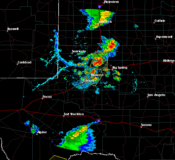 At 632 pm cdt, severe thunderstorms were located along a line extending from 10 miles southeast of lamesa municipal airport to 6 miles southwest of ackerly to near lenorah, moving east at 15 mph (radar indicated). Hazards include 60 mph wind gusts and quarter size hail. Hail damage to vehicles is expected. expect wind damage to roofs, siding, and trees. Locations impacted include, ackerly, lenorah, knott, sparenberg, tarzan and tenmile. At 632 pm cdt, severe thunderstorms were located along a line extending from 10 miles southeast of lamesa municipal airport to 6 miles southwest of ackerly to near lenorah, moving east at 15 mph (radar indicated). Hazards include 60 mph wind gusts and quarter size hail. Hail damage to vehicles is expected. expect wind damage to roofs, siding, and trees. Locations impacted include, ackerly, lenorah, knott, sparenberg, tarzan and tenmile.
|
| 6/19/2020 6:27 PM CDT | Quarter sized hail reported 10.4 miles ENE of Ackerly, TX |
| 6/19/2020 6:19 PM CDT |
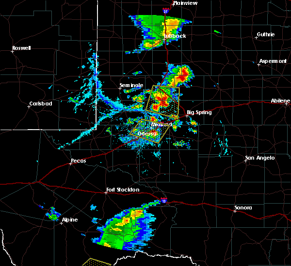 At 618 pm cdt, severe thunderstorms were located along a line extending from 7 miles southeast of lamesa municipal airport to 9 miles west of ackerly to 7 miles northwest of lenorah, moving east at 15 mph (radar indicated). Hazards include 70 mph wind gusts and quarter size hail. Hail damage to vehicles is expected. expect considerable tree damage. wind damage is also likely to mobile homes, roofs, and outbuildings. Locations impacted include, lamesa, ackerly, lenorah, lamesa municipal airport, los ybanez, sparenberg, tarzan, tenmile, patricia, knott, key and klondike. At 618 pm cdt, severe thunderstorms were located along a line extending from 7 miles southeast of lamesa municipal airport to 9 miles west of ackerly to 7 miles northwest of lenorah, moving east at 15 mph (radar indicated). Hazards include 70 mph wind gusts and quarter size hail. Hail damage to vehicles is expected. expect considerable tree damage. wind damage is also likely to mobile homes, roofs, and outbuildings. Locations impacted include, lamesa, ackerly, lenorah, lamesa municipal airport, los ybanez, sparenberg, tarzan, tenmile, patricia, knott, key and klondike.
|
| 6/4/2020 11:47 PM CDT |
 At 1146 pm cdt, a severe thunderstorm was located 8 miles east of luther, or 17 miles northeast of big spring, moving southeast at 35 mph (radar indicated). Hazards include 70 mph wind gusts and quarter size hail. Hail damage to vehicles is expected. expect considerable tree damage. wind damage is also likely to mobile homes, roofs, and outbuildings. locations impacted include, snyder, lamesa, colorado city, ackerly, loraine, colorado city airport, j b thomas reservoir, inadale, luther, los ybanez, sparenberg, vincent, hermleigh, randalls corner, winston field, knapp, cuthbert, buford, dunn and tenmile. This includes interstate 20 between mile markers 216 and 217, and between mile markers 224 and 226. At 1146 pm cdt, a severe thunderstorm was located 8 miles east of luther, or 17 miles northeast of big spring, moving southeast at 35 mph (radar indicated). Hazards include 70 mph wind gusts and quarter size hail. Hail damage to vehicles is expected. expect considerable tree damage. wind damage is also likely to mobile homes, roofs, and outbuildings. locations impacted include, snyder, lamesa, colorado city, ackerly, loraine, colorado city airport, j b thomas reservoir, inadale, luther, los ybanez, sparenberg, vincent, hermleigh, randalls corner, winston field, knapp, cuthbert, buford, dunn and tenmile. This includes interstate 20 between mile markers 216 and 217, and between mile markers 224 and 226.
|
| 6/4/2020 11:20 PM CDT |
 At 1119 pm cdt, a severe thunderstorm was located near gail, moving south at 25 mph. this is a very dangerous storm (radar indicated). Hazards include 85 mph wind gusts and half dollar size hail. Flying debris will be dangerous to those caught without shelter. mobile homes will be heavily damaged. expect considerable damage to roofs, windows, and vehicles. Extensive tree damage and power outages are likely. At 1119 pm cdt, a severe thunderstorm was located near gail, moving south at 25 mph. this is a very dangerous storm (radar indicated). Hazards include 85 mph wind gusts and half dollar size hail. Flying debris will be dangerous to those caught without shelter. mobile homes will be heavily damaged. expect considerable damage to roofs, windows, and vehicles. Extensive tree damage and power outages are likely.
|
| 5/24/2020 6:27 PM CDT |
 At 627 pm cdt, a severe thunderstorm was located 10 miles southwest of lamesa, moving northeast at 30 mph (radar indicated). Hazards include 60 mph wind gusts and quarter size hail. Hail damage to vehicles is expected. Expect wind damage to roofs, siding, and trees. At 627 pm cdt, a severe thunderstorm was located 10 miles southwest of lamesa, moving northeast at 30 mph (radar indicated). Hazards include 60 mph wind gusts and quarter size hail. Hail damage to vehicles is expected. Expect wind damage to roofs, siding, and trees.
|
| 5/15/2020 5:16 PM CDT |
 At 516 pm cdt, a severe thunderstorm was located near stanton, or 15 miles northeast of greenwood, moving north at 20 mph (radar indicated). Hazards include golf ball size hail and 70 mph wind gusts. People and animals outdoors will be injured. expect hail damage to roofs, siding, windows, and vehicles. expect considerable tree damage. wind damage is also likely to mobile homes, roofs, and outbuildings. locations impacted include, midland, ackerly, greenwood, stanton, lomax, lenorah, courtney, knott, vealmoor, stanton municipal aiport and big spring mcmahon-wrinkle airpark. This includes interstate 20 between mile markers 142 and 174. At 516 pm cdt, a severe thunderstorm was located near stanton, or 15 miles northeast of greenwood, moving north at 20 mph (radar indicated). Hazards include golf ball size hail and 70 mph wind gusts. People and animals outdoors will be injured. expect hail damage to roofs, siding, windows, and vehicles. expect considerable tree damage. wind damage is also likely to mobile homes, roofs, and outbuildings. locations impacted include, midland, ackerly, greenwood, stanton, lomax, lenorah, courtney, knott, vealmoor, stanton municipal aiport and big spring mcmahon-wrinkle airpark. This includes interstate 20 between mile markers 142 and 174.
|
| 5/15/2020 4:59 PM CDT |
 A severe thunderstorm warning remains in effect until 530 pm cdt for northwestern glasscock. northeastern midland. western howard and martin counties. at 459 pm cdt, a severe thunderstorm was located over stanton, or 10 miles northeast of greenwood, moving north at 15 mph. hazard. Two inch hail and 60 mph wind gusts. A severe thunderstorm warning remains in effect until 530 pm cdt for northwestern glasscock. northeastern midland. western howard and martin counties. at 459 pm cdt, a severe thunderstorm was located over stanton, or 10 miles northeast of greenwood, moving north at 15 mph. hazard. Two inch hail and 60 mph wind gusts.
|
| 5/15/2020 4:39 PM CDT |
 At 439 pm cdt, a severe thunderstorm was located over stanton, or 11 miles northeast of greenwood, moving north at 10 mph (public). Hazards include two inch hail and 60 mph wind gusts. People and animals outdoors will be injured. expect hail damage to roofs, siding, windows, and vehicles. expect wind damage to roofs, siding, and trees. locations impacted include, midland, lamesa, ackerly, greenwood, stanton, lomax, lenorah, lamesa municipal airport, los ybanez, sparenberg, tarzan, patricia, punkin center, arvana, hancock, courtney, tenmile, knott, vealmoor and stanton municipal aiport. This includes interstate 20 between mile markers 142 and 174. At 439 pm cdt, a severe thunderstorm was located over stanton, or 11 miles northeast of greenwood, moving north at 10 mph (public). Hazards include two inch hail and 60 mph wind gusts. People and animals outdoors will be injured. expect hail damage to roofs, siding, windows, and vehicles. expect wind damage to roofs, siding, and trees. locations impacted include, midland, lamesa, ackerly, greenwood, stanton, lomax, lenorah, lamesa municipal airport, los ybanez, sparenberg, tarzan, patricia, punkin center, arvana, hancock, courtney, tenmile, knott, vealmoor and stanton municipal aiport. This includes interstate 20 between mile markers 142 and 174.
|
| 5/15/2020 4:31 PM CDT |
 At 431 pm cdt, a severe thunderstorm was located over stanton, or 10 miles northeast of greenwood, moving north at 20 mph (radar indicated). Hazards include ping pong ball size hail and 60 mph wind gusts. People and animals outdoors will be injured. expect hail damage to roofs, siding, windows, and vehicles. Expect wind damage to roofs, siding, and trees. At 431 pm cdt, a severe thunderstorm was located over stanton, or 10 miles northeast of greenwood, moving north at 20 mph (radar indicated). Hazards include ping pong ball size hail and 60 mph wind gusts. People and animals outdoors will be injured. expect hail damage to roofs, siding, windows, and vehicles. Expect wind damage to roofs, siding, and trees.
|
| 5/15/2020 3:42 PM CDT |
 At 342 pm cdt, severe thunderstorms were located along a line extending from 8 miles southwest of lamesa to 6 miles east of o`donnell, moving north at 20 mph (public). Hazards include ping pong ball size hail and 60 mph wind gusts. People and animals outdoors will be injured. expect hail damage to roofs, siding, windows, and vehicles. expect wind damage to roofs, siding, and trees. Locations impacted include, lamesa, lamesa municipal airport, los ybanez, sparenberg, tenmile, patricia, punkin center, arvana, hancock, key and klondike. At 342 pm cdt, severe thunderstorms were located along a line extending from 8 miles southwest of lamesa to 6 miles east of o`donnell, moving north at 20 mph (public). Hazards include ping pong ball size hail and 60 mph wind gusts. People and animals outdoors will be injured. expect hail damage to roofs, siding, windows, and vehicles. expect wind damage to roofs, siding, and trees. Locations impacted include, lamesa, lamesa municipal airport, los ybanez, sparenberg, tenmile, patricia, punkin center, arvana, hancock, key and klondike.
|
| 5/15/2020 3:23 PM CDT |
 At 322 pm cdt, a severe thunderstorm was located near lamesa, moving north at 20 mph (public reported). Hazards include ping pong ball size hail and 60 mph wind gusts. People and animals outdoors will be injured. expect hail damage to roofs, siding, windows, and vehicles. Expect wind damage to roofs, siding, and trees. At 322 pm cdt, a severe thunderstorm was located near lamesa, moving north at 20 mph (public reported). Hazards include ping pong ball size hail and 60 mph wind gusts. People and animals outdoors will be injured. expect hail damage to roofs, siding, windows, and vehicles. Expect wind damage to roofs, siding, and trees.
|
| 5/15/2020 3:07 PM CDT |
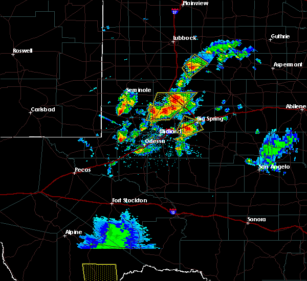 At 307 pm cdt, a severe thunderstorm was located 7 miles west of ackerly, moving northeast at 15 mph (radar indicated). Hazards include ping pong ball size hail and 60 mph wind gusts. People and animals outdoors will be injured. expect hail damage to roofs, siding, windows, and vehicles. expect wind damage to roofs, siding, and trees. Locations impacted include, lamesa, ackerly, los ybanez, sparenberg, tarzan, tenmile, patricia, key and klondike. At 307 pm cdt, a severe thunderstorm was located 7 miles west of ackerly, moving northeast at 15 mph (radar indicated). Hazards include ping pong ball size hail and 60 mph wind gusts. People and animals outdoors will be injured. expect hail damage to roofs, siding, windows, and vehicles. expect wind damage to roofs, siding, and trees. Locations impacted include, lamesa, ackerly, los ybanez, sparenberg, tarzan, tenmile, patricia, key and klondike.
|
| 5/15/2020 2:50 PM CDT |
 At 250 pm cdt, a severe thunderstorm was located 10 miles southwest of ackerly, moving northeast at 15 mph (radar indicated). Hazards include ping pong ball size hail and 60 mph wind gusts. People and animals outdoors will be injured. expect hail damage to roofs, siding, windows, and vehicles. Expect wind damage to roofs, siding, and trees. At 250 pm cdt, a severe thunderstorm was located 10 miles southwest of ackerly, moving northeast at 15 mph (radar indicated). Hazards include ping pong ball size hail and 60 mph wind gusts. People and animals outdoors will be injured. expect hail damage to roofs, siding, windows, and vehicles. Expect wind damage to roofs, siding, and trees.
|
| 6/5/2019 8:15 PM CDT |
 At 814 pm cdt, severe thunderstorms were located along a line extending from near fluvanna to 8 miles northwest of garden city, moving southeast at 70 mph (radar indicated). Hazards include 70 mph wind gusts and quarter size hail. Hail damage to vehicles is expected. expect considerable tree damage. wind damage is also likely to mobile homes, roofs, and outbuildings. locations impacted include, big spring, snyder, colorado city, ackerly, greenwood, garden city, gail, stanton, coahoma, loraine, forsan, sand springs, lomax, lake colorado city, lake colorado city state park, inadale, luther, fluvanna, colorado city airport and j b thomas reservoir. This includes interstate 20 between mile markers 146 and 228. At 814 pm cdt, severe thunderstorms were located along a line extending from near fluvanna to 8 miles northwest of garden city, moving southeast at 70 mph (radar indicated). Hazards include 70 mph wind gusts and quarter size hail. Hail damage to vehicles is expected. expect considerable tree damage. wind damage is also likely to mobile homes, roofs, and outbuildings. locations impacted include, big spring, snyder, colorado city, ackerly, greenwood, garden city, gail, stanton, coahoma, loraine, forsan, sand springs, lomax, lake colorado city, lake colorado city state park, inadale, luther, fluvanna, colorado city airport and j b thomas reservoir. This includes interstate 20 between mile markers 146 and 228.
|
| 6/5/2019 7:47 PM CDT |
 At 747 pm cdt, severe thunderstorms were located along a line extending from 10 miles southeast of grassland to 8 miles west of stanton, moving southeast at 70 mph (radar indicated). Hazards include 60 mph wind gusts and quarter size hail. Hail damage to vehicles is expected. Expect wind damage to roofs, siding, and trees. At 747 pm cdt, severe thunderstorms were located along a line extending from 10 miles southeast of grassland to 8 miles west of stanton, moving southeast at 70 mph (radar indicated). Hazards include 60 mph wind gusts and quarter size hail. Hail damage to vehicles is expected. Expect wind damage to roofs, siding, and trees.
|
| 5/20/2019 10:32 PM CDT |
 At 1032 pm cdt, severe thunderstorms were located along a line extending from near ackerly to 7 miles west of stanton to near midland international air and space port, moving east at 40 mph (trained weather spotters. at 1025 pm cdt, golf ball size hail was reported at grande stadium in midland). Hazards include golf ball size hail and 70 mph wind gusts. People and animals outdoors will be injured. expect hail damage to roofs, siding, windows, and vehicles. expect considerable tree damage. wind damage is also likely to mobile homes, roofs, and outbuildings. locations impacted include, midland, odessa, big spring, ackerly, greenwood, garden city, gail, stanton, sand springs, lomax, lenorah, midland international air and space port, luther, cotton flat, midland airpark, big spring mcmahon-wrinkle airpark, knott, vealmoor, stanton municipal aiport and elbow. This includes interstate 20 between mile markers 114 and 186. At 1032 pm cdt, severe thunderstorms were located along a line extending from near ackerly to 7 miles west of stanton to near midland international air and space port, moving east at 40 mph (trained weather spotters. at 1025 pm cdt, golf ball size hail was reported at grande stadium in midland). Hazards include golf ball size hail and 70 mph wind gusts. People and animals outdoors will be injured. expect hail damage to roofs, siding, windows, and vehicles. expect considerable tree damage. wind damage is also likely to mobile homes, roofs, and outbuildings. locations impacted include, midland, odessa, big spring, ackerly, greenwood, garden city, gail, stanton, sand springs, lomax, lenorah, midland international air and space port, luther, cotton flat, midland airpark, big spring mcmahon-wrinkle airpark, knott, vealmoor, stanton municipal aiport and elbow. This includes interstate 20 between mile markers 114 and 186.
|
| 5/20/2019 10:24 PM CDT |
 At 1023 pm cdt, severe thunderstorms were located along a line extending from near ackerly to 8 miles northeast of midland to 6 miles south of midland international air and space port, moving northeast at 40 mph (trained weather spotters. at 1023 pm cdt, ping pong ball size hail was observed at the national weather service office in midland). Hazards include 70 mph wind gusts and ping pong ball size hail. People and animals outdoors will be injured. expect hail damage to roofs, siding, windows, and vehicles. expect considerable tree damage. wind damage is also likely to mobile homes, roofs, and outbuildings. locations impacted include, midland, odessa, big spring, ackerly, greenwood, garden city, gail, stanton, sand springs, lomax, lenorah, midland international air and space port, luther, cotton flat, midland airpark, big spring mcmahon-wrinkle airpark, knott, vealmoor, stanton municipal aiport and elbow. This includes interstate 20 between mile markers 114 and 186. At 1023 pm cdt, severe thunderstorms were located along a line extending from near ackerly to 8 miles northeast of midland to 6 miles south of midland international air and space port, moving northeast at 40 mph (trained weather spotters. at 1023 pm cdt, ping pong ball size hail was observed at the national weather service office in midland). Hazards include 70 mph wind gusts and ping pong ball size hail. People and animals outdoors will be injured. expect hail damage to roofs, siding, windows, and vehicles. expect considerable tree damage. wind damage is also likely to mobile homes, roofs, and outbuildings. locations impacted include, midland, odessa, big spring, ackerly, greenwood, garden city, gail, stanton, sand springs, lomax, lenorah, midland international air and space port, luther, cotton flat, midland airpark, big spring mcmahon-wrinkle airpark, knott, vealmoor, stanton municipal aiport and elbow. This includes interstate 20 between mile markers 114 and 186.
|
| 5/20/2019 10:13 PM CDT |
 At 1012 pm cdt, severe thunderstorms were located along a line extending from 8 miles west of ackerly to near midland to near odessa, moving northeast at 45 mph (radar indicated). Hazards include 70 mph wind gusts and quarter size hail. Hail damage to vehicles is expected. expect considerable tree damage. Wind damage is also likely to mobile homes, roofs, and outbuildings. At 1012 pm cdt, severe thunderstorms were located along a line extending from 8 miles west of ackerly to near midland to near odessa, moving northeast at 45 mph (radar indicated). Hazards include 70 mph wind gusts and quarter size hail. Hail damage to vehicles is expected. expect considerable tree damage. Wind damage is also likely to mobile homes, roofs, and outbuildings.
|
| 5/20/2019 9:43 PM CDT |
 At 942 pm cdt, severe thunderstorms were located along a line extending from 19 miles west of lenorah to 8 miles northwest of midland international air and space port to 7 miles south of west odessa, moving northeast at 55 mph (radar indicated). Hazards include 70 mph wind gusts and ping pong ball size hail. People and animals outdoors will be injured. expect hail damage to roofs, siding, windows, and vehicles. expect considerable tree damage. wind damage is also likely to mobile homes, roofs, and outbuildings. locations impacted include, midland, odessa, ackerly, greenwood, stanton, lenorah, midland international air and space port, west odessa, tarzan, sparenberg, cotton flat, patricia, warfield, midland airpark, skywest airport, courtney, odessa schlemeyer field, tenmile, penwell and stanton municipal aiport. This includes interstate 20 between mile markers 95 and 162. At 942 pm cdt, severe thunderstorms were located along a line extending from 19 miles west of lenorah to 8 miles northwest of midland international air and space port to 7 miles south of west odessa, moving northeast at 55 mph (radar indicated). Hazards include 70 mph wind gusts and ping pong ball size hail. People and animals outdoors will be injured. expect hail damage to roofs, siding, windows, and vehicles. expect considerable tree damage. wind damage is also likely to mobile homes, roofs, and outbuildings. locations impacted include, midland, odessa, ackerly, greenwood, stanton, lenorah, midland international air and space port, west odessa, tarzan, sparenberg, cotton flat, patricia, warfield, midland airpark, skywest airport, courtney, odessa schlemeyer field, tenmile, penwell and stanton municipal aiport. This includes interstate 20 between mile markers 95 and 162.
|
| 5/20/2019 9:29 PM CDT |
 At 929 pm cdt, severe thunderstorms were located along a line extending from 10 miles east of andrews to 8 miles east of goldsmith to 12 miles east of monahans, moving northeast at 55 mph (radar indicated). Hazards include two inch hail and 70 mph wind gusts. People and animals outdoors will be injured. expect hail damage to roofs, siding, windows, and vehicles. expect considerable tree damage. wind damage is also likely to mobile homes, roofs, and outbuildings. locations impacted include, midland, odessa, andrews, ackerly, greenwood, stanton, goldsmith, lenorah, midland international air and space port, west odessa, cotton flat, patricia, midland airpark, penwell, stanton municipal aiport, tarzan, sparenberg, warfield, skywest airport and courtney. This includes interstate 20 between mile markers 90 and 162. At 929 pm cdt, severe thunderstorms were located along a line extending from 10 miles east of andrews to 8 miles east of goldsmith to 12 miles east of monahans, moving northeast at 55 mph (radar indicated). Hazards include two inch hail and 70 mph wind gusts. People and animals outdoors will be injured. expect hail damage to roofs, siding, windows, and vehicles. expect considerable tree damage. wind damage is also likely to mobile homes, roofs, and outbuildings. locations impacted include, midland, odessa, andrews, ackerly, greenwood, stanton, goldsmith, lenorah, midland international air and space port, west odessa, cotton flat, patricia, midland airpark, penwell, stanton municipal aiport, tarzan, sparenberg, warfield, skywest airport and courtney. This includes interstate 20 between mile markers 90 and 162.
|
| 5/20/2019 9:21 PM CDT |
 At 921 pm cdt, severe thunderstorms were located along a line extending from near andrews to near goldsmith to 7 miles east of monahans, moving northeast at 55 mph (radar indicated). Hazards include 70 mph wind gusts and half dollar size hail. Hail damage to vehicles is expected. expect considerable tree damage. Wind damage is also likely to mobile homes, roofs, and outbuildings. At 921 pm cdt, severe thunderstorms were located along a line extending from near andrews to near goldsmith to 7 miles east of monahans, moving northeast at 55 mph (radar indicated). Hazards include 70 mph wind gusts and half dollar size hail. Hail damage to vehicles is expected. expect considerable tree damage. Wind damage is also likely to mobile homes, roofs, and outbuildings.
|
| 5/20/2019 5:40 PM CDT |
 At 540 pm cdt, a severe thunderstorm was located 12 miles west of ackerly, moving northeast at 40 mph (radar indicated). Hazards include 60 mph wind gusts and quarter size hail. Hail damage to vehicles is expected. expect wind damage to roofs, siding, and trees. Locations impacted include, ackerly, lenorah, knott and tarzan. At 540 pm cdt, a severe thunderstorm was located 12 miles west of ackerly, moving northeast at 40 mph (radar indicated). Hazards include 60 mph wind gusts and quarter size hail. Hail damage to vehicles is expected. expect wind damage to roofs, siding, and trees. Locations impacted include, ackerly, lenorah, knott and tarzan.
|
| 5/20/2019 5:08 PM CDT |
 At 508 pm cdt, a severe thunderstorm was located 12 miles west of lenorah, or 21 miles north of midland, moving northeast at 25 mph (radar indicated). Hazards include 60 mph wind gusts and quarter size hail. Hail damage to vehicles is expected. Expect wind damage to roofs, siding, and trees. At 508 pm cdt, a severe thunderstorm was located 12 miles west of lenorah, or 21 miles north of midland, moving northeast at 25 mph (radar indicated). Hazards include 60 mph wind gusts and quarter size hail. Hail damage to vehicles is expected. Expect wind damage to roofs, siding, and trees.
|
| 5/18/2019 4:17 AM CDT |
 At 416 am cdt, a severe thunderstorm was located over ackerly, moving northeast at 30 mph (radar indicated). Hazards include 70 mph wind gusts and half dollar size hail. Hail damage to vehicles is expected. expect considerable tree damage. wind damage is also likely to mobile homes, roofs, and outbuildings. locations impacted include, big spring, ackerly, gail, coahoma, j b thomas reservoir, lenorah, luther, sparenberg, vincent, cuthbert, knott, vealmoor, stanton municipal aiport and big spring mcmahon-wrinkle airpark. This includes interstate 20 between mile markers 170 and 182. At 416 am cdt, a severe thunderstorm was located over ackerly, moving northeast at 30 mph (radar indicated). Hazards include 70 mph wind gusts and half dollar size hail. Hail damage to vehicles is expected. expect considerable tree damage. wind damage is also likely to mobile homes, roofs, and outbuildings. locations impacted include, big spring, ackerly, gail, coahoma, j b thomas reservoir, lenorah, luther, sparenberg, vincent, cuthbert, knott, vealmoor, stanton municipal aiport and big spring mcmahon-wrinkle airpark. This includes interstate 20 between mile markers 170 and 182.
|
| 5/18/2019 3:59 AM CDT |
 At 358 am cdt, a severe thunderstorm was located 7 miles north of lenorah, or 12 miles southwest of ackerly, moving northeast at 25 mph (radar indicated). Hazards include 60 mph wind gusts and half dollar size hail. Hail damage to vehicles is expected. Expect wind damage to roofs, siding, and trees. At 358 am cdt, a severe thunderstorm was located 7 miles north of lenorah, or 12 miles southwest of ackerly, moving northeast at 25 mph (radar indicated). Hazards include 60 mph wind gusts and half dollar size hail. Hail damage to vehicles is expected. Expect wind damage to roofs, siding, and trees.
|
| 4/23/2019 5:57 PM CDT |
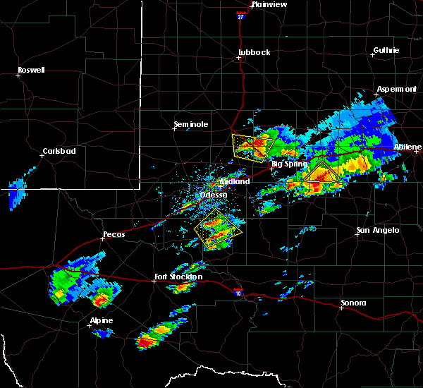 At 556 pm cdt, a severe thunderstorm was located over ackerly, moving north at 30 mph (radar indicated). Hazards include ping pong ball size hail and 60 mph wind gusts. People and animals outdoors will be injured. expect hail damage to roofs, siding, windows, and vehicles. expect wind damage to roofs, siding, and trees. Locations impacted include, ackerly, knott, sparenberg, vealmoor and tenmile. At 556 pm cdt, a severe thunderstorm was located over ackerly, moving north at 30 mph (radar indicated). Hazards include ping pong ball size hail and 60 mph wind gusts. People and animals outdoors will be injured. expect hail damage to roofs, siding, windows, and vehicles. expect wind damage to roofs, siding, and trees. Locations impacted include, ackerly, knott, sparenberg, vealmoor and tenmile.
|
| 4/23/2019 5:29 PM CDT |
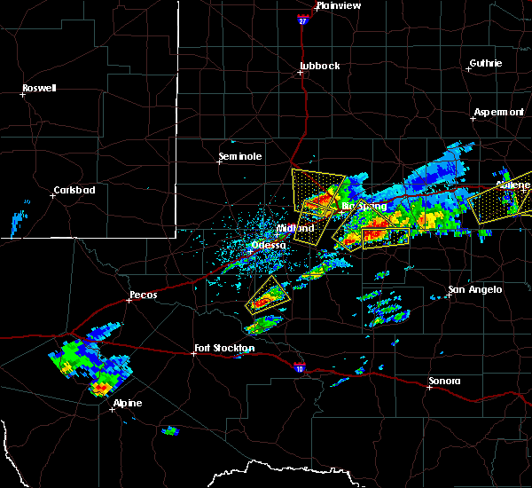 At 529 pm cdt, a severe thunderstorm was located 7 miles east of lenorah, or 13 miles south of ackerly, moving north at 35 mph (radar indicated). Hazards include ping pong ball size hail and 60 mph wind gusts. People and animals outdoors will be injured. expect hail damage to roofs, siding, windows, and vehicles. Expect wind damage to roofs, siding, and trees. At 529 pm cdt, a severe thunderstorm was located 7 miles east of lenorah, or 13 miles south of ackerly, moving north at 35 mph (radar indicated). Hazards include ping pong ball size hail and 60 mph wind gusts. People and animals outdoors will be injured. expect hail damage to roofs, siding, windows, and vehicles. Expect wind damage to roofs, siding, and trees.
|
| 6/4/2018 12:10 AM CDT |
 At 1210 am cdt, severe thunderstorms were located along a line extending from near o`donnell to 9 miles southeast of lamesa municipal airport to 11 miles northwest of lenorah, moving east at 25 mph (radar indicated). Hazards include 60 mph wind gusts and nickel size hail. Expect damage to roofs, siding, and trees. Locations impacted include, lamesa, ackerly, gail, lamesa municipal airport, welch, los ybanez, sparenberg, patricia, punkin center, arvana, hancock, tenmile, key and klondike. At 1210 am cdt, severe thunderstorms were located along a line extending from near o`donnell to 9 miles southeast of lamesa municipal airport to 11 miles northwest of lenorah, moving east at 25 mph (radar indicated). Hazards include 60 mph wind gusts and nickel size hail. Expect damage to roofs, siding, and trees. Locations impacted include, lamesa, ackerly, gail, lamesa municipal airport, welch, los ybanez, sparenberg, patricia, punkin center, arvana, hancock, tenmile, key and klondike.
|
| 6/3/2018 11:57 PM CDT |
 At 1157 pm cdt, severe thunderstorms were located along a line extending from near o`donnell to 8 miles southeast of lamesa municipal airport to 14 miles west of lenorah, moving northeast at 25 mph (radar indicated). Hazards include 70 mph wind gusts and nickel size hail. Expect considerable tree damage. Damage is likely to mobile homes, roofs, and outbuildings. At 1157 pm cdt, severe thunderstorms were located along a line extending from near o`donnell to 8 miles southeast of lamesa municipal airport to 14 miles west of lenorah, moving northeast at 25 mph (radar indicated). Hazards include 70 mph wind gusts and nickel size hail. Expect considerable tree damage. Damage is likely to mobile homes, roofs, and outbuildings.
|
| 6/3/2018 11:36 PM CDT |
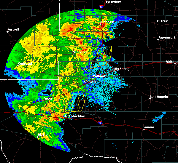 At 1136 pm cdt, severe thunderstorms were located along a line extending from 8 miles southwest of brownfield to near welch to 9 miles southwest of lamesa to 16 miles west of lenorah to 7 miles southeast of andrews, moving northeast at 50 mph (trained weather spotters). Hazards include 70 mph wind gusts and quarter size hail. Hail damage to vehicles is expected. expect considerable tree damage. wind damage is also likely to mobile homes, roofs, and outbuildings. Locations impacted include, andrews, lamesa, seagraves, ackerly, seagraves airport, lamesa municipal airport, welch, los ybanez, loop, sparenberg, patricia, punkin center, arvana, hancock, mckenzie lake, tenmile, gaines county park, key, klondike and andrews county airport. At 1136 pm cdt, severe thunderstorms were located along a line extending from 8 miles southwest of brownfield to near welch to 9 miles southwest of lamesa to 16 miles west of lenorah to 7 miles southeast of andrews, moving northeast at 50 mph (trained weather spotters). Hazards include 70 mph wind gusts and quarter size hail. Hail damage to vehicles is expected. expect considerable tree damage. wind damage is also likely to mobile homes, roofs, and outbuildings. Locations impacted include, andrews, lamesa, seagraves, ackerly, seagraves airport, lamesa municipal airport, welch, los ybanez, loop, sparenberg, patricia, punkin center, arvana, hancock, mckenzie lake, tenmile, gaines county park, key, klondike and andrews county airport.
|
| 6/3/2018 11:21 PM CDT |
 At 1121 pm cdt, severe thunderstorms were located along a line extending from near seagraves airport to 14 miles southwest of welch to 20 miles southwest of lamesa to 13 miles east of andrews to 11 miles north of goldsmith, moving northeast at 45 mph (radar indicated). Hazards include 60 mph wind gusts and quarter size hail. Hail damage to vehicles is expected. Expect wind damage to roofs, siding, and trees. At 1121 pm cdt, severe thunderstorms were located along a line extending from near seagraves airport to 14 miles southwest of welch to 20 miles southwest of lamesa to 13 miles east of andrews to 11 miles north of goldsmith, moving northeast at 45 mph (radar indicated). Hazards include 60 mph wind gusts and quarter size hail. Hail damage to vehicles is expected. Expect wind damage to roofs, siding, and trees.
|
| 6/3/2018 11:17 PM CDT |
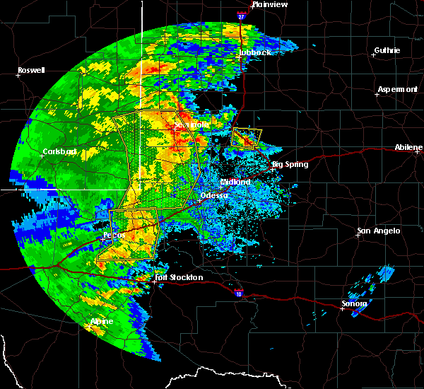 At 1116 pm cdt, a severe thunderstorm was located near ackerly, moving north at 20 mph (radar indicated). Hazards include 60 mph wind gusts and quarter size hail. Hail damage to vehicles is expected. expect wind damage to roofs, siding, and trees. Locations impacted include, ackerly, los ybanez, sparenberg, tenmile and key. At 1116 pm cdt, a severe thunderstorm was located near ackerly, moving north at 20 mph (radar indicated). Hazards include 60 mph wind gusts and quarter size hail. Hail damage to vehicles is expected. expect wind damage to roofs, siding, and trees. Locations impacted include, ackerly, los ybanez, sparenberg, tenmile and key.
|
| 6/3/2018 10:46 PM CDT |
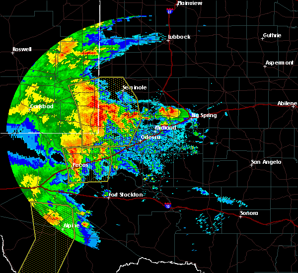 At 1046 pm cdt, a severe thunderstorm was located 8 miles southwest of ackerly, moving north at 30 mph (radar indicated). Hazards include 60 mph wind gusts and quarter size hail. Hail damage to vehicles is expected. Expect wind damage to roofs, siding, and trees. At 1046 pm cdt, a severe thunderstorm was located 8 miles southwest of ackerly, moving north at 30 mph (radar indicated). Hazards include 60 mph wind gusts and quarter size hail. Hail damage to vehicles is expected. Expect wind damage to roofs, siding, and trees.
|
| 5/2/2018 10:35 PM CDT |
 At 1035 pm cdt, a severe thunderstorm was located near ackerly, moving northeast at 50 mph (radar indicated). Hazards include 60 mph wind gusts and quarter size hail. Hail damage to vehicles is expected. Expect wind damage to roofs, siding, and trees. At 1035 pm cdt, a severe thunderstorm was located near ackerly, moving northeast at 50 mph (radar indicated). Hazards include 60 mph wind gusts and quarter size hail. Hail damage to vehicles is expected. Expect wind damage to roofs, siding, and trees.
|
| 7/4/2017 10:38 PM CDT |
 At 1035 pm cdt/935 pm mdt/, doppler radar was tracking a large gust front from near mesquite, patricia, andrews west to eunice. the gust front was moving to the south at 60 mph (radar indicated). Hazards include 60 mph wind gusts. Expect damage to roofs, siding, and trees. locations impacted include, big spring, andrews, lamesa, eunice, stanton, jal, ackerly, gail, los ybanez, flower grove, patricia, hancock, lenorah, eunice airport, jal airport, vealmoor, luther, sparenberg, lamesa municipal airport and frankel city. This includes interstate 20 between mile markers 156 and 158, and between mile markers 160 and 182. At 1035 pm cdt/935 pm mdt/, doppler radar was tracking a large gust front from near mesquite, patricia, andrews west to eunice. the gust front was moving to the south at 60 mph (radar indicated). Hazards include 60 mph wind gusts. Expect damage to roofs, siding, and trees. locations impacted include, big spring, andrews, lamesa, eunice, stanton, jal, ackerly, gail, los ybanez, flower grove, patricia, hancock, lenorah, eunice airport, jal airport, vealmoor, luther, sparenberg, lamesa municipal airport and frankel city. This includes interstate 20 between mile markers 156 and 158, and between mile markers 160 and 182.
|
| 7/4/2017 10:20 PM CDT |
 At 1017 pm cdt/917 pm mdt/, at 1005 pm cdt/905 pm mdt/, doppler radar was tracking a large gust front ahead of a line of strong thunderstorms from near welch to seagraves to denver city. the gust front was moving to the south at 60 mph (radar indicated). Hazards include 60 mph wind gusts. expect damage to roofs, siding, and trees At 1017 pm cdt/917 pm mdt/, at 1005 pm cdt/905 pm mdt/, doppler radar was tracking a large gust front ahead of a line of strong thunderstorms from near welch to seagraves to denver city. the gust front was moving to the south at 60 mph (radar indicated). Hazards include 60 mph wind gusts. expect damage to roofs, siding, and trees
|
| 6/23/2017 7:26 PM CDT |
 At 726 pm cdt, a severe thunderstorm was located 9 miles west of big spring, moving east at 15 mph (radar indicated). Hazards include 60 mph wind gusts and quarter size hail. Hail damage to vehicles is expected. expect wind damage to roofs, siding, and trees. locations impacted include, big spring, stanton, ackerly, coahoma, sand springs, flower grove, lomax, lees, south haven, lenorah, elbow, brown, tarzan, fairview, big spring country club, courtney, grady, big spring mcmahon-wrinkle airpark, knott and midway. This includes interstate 20 between mile markers 154 and 192. At 726 pm cdt, a severe thunderstorm was located 9 miles west of big spring, moving east at 15 mph (radar indicated). Hazards include 60 mph wind gusts and quarter size hail. Hail damage to vehicles is expected. expect wind damage to roofs, siding, and trees. locations impacted include, big spring, stanton, ackerly, coahoma, sand springs, flower grove, lomax, lees, south haven, lenorah, elbow, brown, tarzan, fairview, big spring country club, courtney, grady, big spring mcmahon-wrinkle airpark, knott and midway. This includes interstate 20 between mile markers 154 and 192.
|
| 6/23/2017 6:49 PM CDT |
 At 649 pm cdt, a severe thunderstorm was located over lenorah, or 12 miles northwest of stanton, moving southeast at 10 mph (radar indicated). Hazards include 60 mph wind gusts and quarter size hail. Hail damage to vehicles is expected. Expect wind damage to roofs, siding, and trees. At 649 pm cdt, a severe thunderstorm was located over lenorah, or 12 miles northwest of stanton, moving southeast at 10 mph (radar indicated). Hazards include 60 mph wind gusts and quarter size hail. Hail damage to vehicles is expected. Expect wind damage to roofs, siding, and trees.
|
| 6/15/2017 7:07 PM CDT |
 At 707 pm cdt, a severe thunderstorm was located 7 miles northeast of vealmoor, or 11 miles south of gail, moving southeast at 35 mph. this is a very dangerous storm (radar indicated). Hazards include 80 mph wind gusts and tennis ball size hail. Flying debris will be dangerous to those caught without shelter. mobile homes will be heavily damaged. expect considerable damage to roofs, windows, and vehicles. extensive tree damage and power outages are likely. Locations impacted include, ackerly, gail, vealmoor, hancock, j b thomas reservoir, mesquite, midway and key. At 707 pm cdt, a severe thunderstorm was located 7 miles northeast of vealmoor, or 11 miles south of gail, moving southeast at 35 mph. this is a very dangerous storm (radar indicated). Hazards include 80 mph wind gusts and tennis ball size hail. Flying debris will be dangerous to those caught without shelter. mobile homes will be heavily damaged. expect considerable damage to roofs, windows, and vehicles. extensive tree damage and power outages are likely. Locations impacted include, ackerly, gail, vealmoor, hancock, j b thomas reservoir, mesquite, midway and key.
|
| 6/15/2017 6:30 PM CDT |
 At 630 pm cdt, a severe thunderstorm was located 8 miles east of hancock, or 15 miles northeast of lamesa, moving southeast at 35 mph. this is a very dangerous storm (radar indicated). Hazards include 80 mph wind gusts and tennis ball size hail. Flying debris will be dangerous to those caught without shelter. mobile homes will be heavily damaged. expect considerable damage to roofs, windows, and vehicles. Extensive tree damage and power outages are likely. At 630 pm cdt, a severe thunderstorm was located 8 miles east of hancock, or 15 miles northeast of lamesa, moving southeast at 35 mph. this is a very dangerous storm (radar indicated). Hazards include 80 mph wind gusts and tennis ball size hail. Flying debris will be dangerous to those caught without shelter. mobile homes will be heavily damaged. expect considerable damage to roofs, windows, and vehicles. Extensive tree damage and power outages are likely.
|
| 6/14/2017 8:21 PM CDT |
 At 820 pm cdt, a severe thunderstorm was located over luther, or 15 miles north of big spring, moving northeast at 25 mph (radar indicated). Hazards include 70 mph wind gusts and ping pong ball size hail. People and animals outdoors will be injured. expect hail damage to roofs, siding, windows, and vehicles. expect considerable tree damage. wind damage is also likely to mobile homes, roofs, and outbuildings. Locations impacted include, ackerly, sparenberg, flower grove, vealmoor, luther, brown, fairview, tenmile, knott, three leagues, midway, key and klondike. At 820 pm cdt, a severe thunderstorm was located over luther, or 15 miles north of big spring, moving northeast at 25 mph (radar indicated). Hazards include 70 mph wind gusts and ping pong ball size hail. People and animals outdoors will be injured. expect hail damage to roofs, siding, windows, and vehicles. expect considerable tree damage. wind damage is also likely to mobile homes, roofs, and outbuildings. Locations impacted include, ackerly, sparenberg, flower grove, vealmoor, luther, brown, fairview, tenmile, knott, three leagues, midway, key and klondike.
|
| 6/14/2017 8:04 PM CDT | Golf Ball sized hail reported 9.6 miles NNW of Ackerly, TX |
| 6/14/2017 8:03 PM CDT |
 At 801 pm cdt, severe thunderstorms were located near buford and brown. the storms were moving to the northeast at 25 mph (radar indicated). Hazards include golf ball size hail and 70 mph wind gusts. People and animals outdoors will be injured. expect hail damage to roofs, siding, windows, and vehicles. expect considerable tree damage. Wind damage is also likely to mobile homes, roofs, and outbuildings. At 801 pm cdt, severe thunderstorms were located near buford and brown. the storms were moving to the northeast at 25 mph (radar indicated). Hazards include golf ball size hail and 70 mph wind gusts. People and animals outdoors will be injured. expect hail damage to roofs, siding, windows, and vehicles. expect considerable tree damage. Wind damage is also likely to mobile homes, roofs, and outbuildings.
|
| 5/16/2017 9:39 PM CDT |
 At 937 pm cdt, severe thunderstorms were located along a line extending from near ackerly to 7 miles northwest of girvin, moving east at 50 mph (trained weather spotters and nws employees). Hazards include golf ball size hail. People and animals outdoors will be injured. Expect damage to roofs, siding, windows, and vehicles. At 937 pm cdt, severe thunderstorms were located along a line extending from near ackerly to 7 miles northwest of girvin, moving east at 50 mph (trained weather spotters and nws employees). Hazards include golf ball size hail. People and animals outdoors will be injured. Expect damage to roofs, siding, windows, and vehicles.
|
| 5/16/2017 9:31 PM CDT | Quarter sized hail reported 0.4 miles NE of Ackerly, TX, hail ranged from dime to quarter size |
| 3/28/2017 7:19 PM CDT |
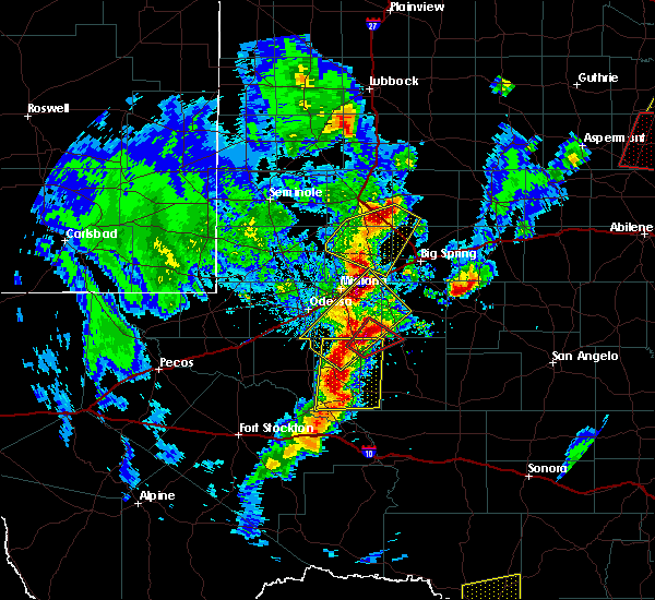 At 719 pm cdt, a severe thunderstorm was located 9 miles north of ackerly, moving northeast at 45 mph (radar indicated). Hazards include 70 mph wind gusts and half dollar size hail. Hail damage to vehicles is expected. expect considerable tree damage. wind damage is also likely to mobile homes, roofs, and outbuildings. Locations impacted include, ackerly, sparenberg, flower grove, vealmoor, brown, tenmile and knott. At 719 pm cdt, a severe thunderstorm was located 9 miles north of ackerly, moving northeast at 45 mph (radar indicated). Hazards include 70 mph wind gusts and half dollar size hail. Hail damage to vehicles is expected. expect considerable tree damage. wind damage is also likely to mobile homes, roofs, and outbuildings. Locations impacted include, ackerly, sparenberg, flower grove, vealmoor, brown, tenmile and knott.
|
| 3/28/2017 6:52 PM CDT |
 At 652 pm cdt, a severe thunderstorm was located near lenorah, or 12 miles southwest of ackerly, moving northeast at 45 mph (radar indicated). Hazards include 70 mph wind gusts and half dollar size hail. Hail damage to vehicles is expected. expect considerable tree damage. Wind damage is also likely to mobile homes, roofs, and outbuildings. At 652 pm cdt, a severe thunderstorm was located near lenorah, or 12 miles southwest of ackerly, moving northeast at 45 mph (radar indicated). Hazards include 70 mph wind gusts and half dollar size hail. Hail damage to vehicles is expected. expect considerable tree damage. Wind damage is also likely to mobile homes, roofs, and outbuildings.
|
| 1/1/2017 9:24 PM CST |
 At 923 pm cst, severe thunderstorms were located along a line extending from near o`donnell to ackerly to stanton, moving east at 50 mph (radar indicated). Hazards include 60 mph wind gusts and penny size hail. expect damage to roofs, siding, and trees At 923 pm cst, severe thunderstorms were located along a line extending from near o`donnell to ackerly to stanton, moving east at 50 mph (radar indicated). Hazards include 60 mph wind gusts and penny size hail. expect damage to roofs, siding, and trees
|
| 1/1/2017 8:54 PM CST |
 At 854 pm cst, severe thunderstorms were located along a line extending from near welch to near patricia to 15 miles northwest of midland, moving east at 55 mph (radar indicated). Hazards include 60 mph wind gusts and penny size hail. Expect damage to roofs, siding, and trees. locations impacted include, midland, lamesa, stanton, ackerly, los ybanez, flower grove, patricia, lenorah, hancock, welch, sparenberg, lamesa municipal airport, brown, sand, arvana, union, friendship, pride, grady and midway. This includes interstate 20 between mile markers 151 and 162. At 854 pm cst, severe thunderstorms were located along a line extending from near welch to near patricia to 15 miles northwest of midland, moving east at 55 mph (radar indicated). Hazards include 60 mph wind gusts and penny size hail. Expect damage to roofs, siding, and trees. locations impacted include, midland, lamesa, stanton, ackerly, los ybanez, flower grove, patricia, lenorah, hancock, welch, sparenberg, lamesa municipal airport, brown, sand, arvana, union, friendship, pride, grady and midway. This includes interstate 20 between mile markers 151 and 162.
|
| 1/1/2017 8:24 PM CST |
 At 823 pm cst, severe thunderstorms were located along a line extending from seagraves airport to 10 miles north of andrews to 9 miles northwest of goldsmith, moving east at 55 mph (radar indicated). Hazards include 60 mph wind gusts and penny size hail. expect damage to roofs, siding, and trees At 823 pm cst, severe thunderstorms were located along a line extending from seagraves airport to 10 miles north of andrews to 9 miles northwest of goldsmith, moving east at 55 mph (radar indicated). Hazards include 60 mph wind gusts and penny size hail. expect damage to roofs, siding, and trees
|
| 9/17/2016 8:13 PM CDT |
 At 813 pm cdt, a severe thunderstorm was located over sparenberg, or near ackerly, moving northeast at 35 mph (radar indicated). Hazards include 60 mph wind gusts and half dollar size hail. Hail damage to vehicles is expected. expect wind damage to roofs, siding, and trees. Locations impacted include, lamesa, ackerly, gail, los ybanez, hancock, patricia, sparenberg, flower grove, lamesa municipal airport, brown, key, three leagues, tenmile, friendship, arvana, midway and klondike. At 813 pm cdt, a severe thunderstorm was located over sparenberg, or near ackerly, moving northeast at 35 mph (radar indicated). Hazards include 60 mph wind gusts and half dollar size hail. Hail damage to vehicles is expected. expect wind damage to roofs, siding, and trees. Locations impacted include, lamesa, ackerly, gail, los ybanez, hancock, patricia, sparenberg, flower grove, lamesa municipal airport, brown, key, three leagues, tenmile, friendship, arvana, midway and klondike.
|
| 9/17/2016 7:51 PM CDT |
 At 751 pm cdt, a severe thunderstorm was located 8 miles south of patricia, or 16 miles west of ackerly, moving northeast at 35 mph (radar indicated). Hazards include 60 mph wind gusts and half dollar size hail. Hail damage to vehicles is expected. Expect wind damage to roofs, siding, and trees. At 751 pm cdt, a severe thunderstorm was located 8 miles south of patricia, or 16 miles west of ackerly, moving northeast at 35 mph (radar indicated). Hazards include 60 mph wind gusts and half dollar size hail. Hail damage to vehicles is expected. Expect wind damage to roofs, siding, and trees.
|
| 7/8/2016 8:54 PM CDT |
 At 854 pm cdt, a severe thunderstorm was located near flower grove, or 9 miles southwest of ackerly, moving west at 20 mph (radar indicated). Hazards include 60 mph wind gusts and quarter size hail. Hail damage to vehicles is expected. expect wind damage to roofs, siding, and trees. Locations impacted include, ackerly, vealmoor, sparenberg, flower grove, brown, knott and fairview. At 854 pm cdt, a severe thunderstorm was located near flower grove, or 9 miles southwest of ackerly, moving west at 20 mph (radar indicated). Hazards include 60 mph wind gusts and quarter size hail. Hail damage to vehicles is expected. expect wind damage to roofs, siding, and trees. Locations impacted include, ackerly, vealmoor, sparenberg, flower grove, brown, knott and fairview.
|
| 7/8/2016 8:33 PM CDT |
 At 833 pm cdt, a severe thunderstorm was located over flower grove, or near ackerly, moving east at 15 mph (radar indicated). Hazards include 60 mph wind gusts and quarter size hail. Hail damage to vehicles is expected. Expect wind damage to roofs, siding, and trees. At 833 pm cdt, a severe thunderstorm was located over flower grove, or near ackerly, moving east at 15 mph (radar indicated). Hazards include 60 mph wind gusts and quarter size hail. Hail damage to vehicles is expected. Expect wind damage to roofs, siding, and trees.
|
| 5/30/2016 10:27 PM CDT |
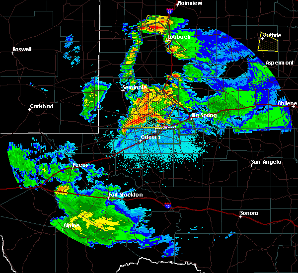 At 1027 pm cdt, severe thunderstorms were located along a line extending from near sand to 8 miles north of north cowden, moving east at 25 mph (radar indicated). Hazards include 60 mph wind gusts and quarter size hail. Hail damage to vehicles is expected. Expect wind damage to roofs, siding, and trees. At 1027 pm cdt, severe thunderstorms were located along a line extending from near sand to 8 miles north of north cowden, moving east at 25 mph (radar indicated). Hazards include 60 mph wind gusts and quarter size hail. Hail damage to vehicles is expected. Expect wind damage to roofs, siding, and trees.
|
| 5/22/2016 5:55 PM CDT | Golf Ball sized hail reported 6.7 miles NNE of Ackerly, TX, half inch to golf ball size hail. |
| 4/19/2016 8:30 PM CDT | Quarter sized hail reported 1.7 miles N of Ackerly, TX |
| 5/29/2015 11:58 PM CDT | At 1153 pm cdt, severe thunderstorms were located along a line extending from winston field to lenorah to 12 miles east of andrews county airport to 9 miles northwest of frankel city, and moving south at 50 mph (radar indicated). Hazards include 70 mph wind gusts and quarter size hail. Hail damage to vehicles is expected. expect considerable tree damage. Wind damage is also likely to mobile homes, roofs and outbuildings. |
| 5/25/2015 7:34 AM CDT | At 733 am cdt, severe thunderstorms were located along a line extending from 13 miles south of sand to 7 miles northeast of hancock to 10 miles northeast of vealmoor, and moving northeast at 25 mph (radar indicated). Hazards include 60 mph wind gusts and half dollar size hail. Hail damage to vehicles is expected. expect wind damage to roofs, siding and trees. Locations impacted include, gail, hancock, union, union in dawson county, arvana, mesquite, sand, punkin center, grandview, pride and welch. |
| 5/25/2015 7:03 AM CDT | At 700 am cdt, severe thunderstorms were located along a line extending from 10 miles east of andrews county airport to midway in dawson county to fairview, and moving northeast at 25 mph (radar indicated). Hazards include 60 mph wind gusts and quarter to golf ball size hail. Hail damage to vehicles is expected. Expect wind damage to roofs, siding and trees. |
| 5/25/2015 7:03 AM CDT | At 700 am cdt, severe thunderstorms were located along a line extending from 10 miles east of andrews county airport to midway in dawson county to fairview, and moving northeast at 25 mph (radar indicated). Hazards include 60 mph wind gusts and quarter to golf ball size hail. Hail damage to vehicles is expected. Expect wind damage to roofs, siding and trees. |
| 5/25/2015 6:22 AM CDT | At 618 am cdt, a severe thunderstorm was located 10 miles west of courtney, and moving northeast at 35 mph (radar indicated). Hazards include 60 mph wind gusts and quarter size hail. Hail damage to vehicles is expected. Expect wind damage to roofs, siding and trees. |
| 4/8/2015 7:30 PM CDT | The national weather service in midland has issued a * severe thunderstorm warning for. southern borden county in west texas. southern dawson county in west texas. northern howard county in west texas. Martin county in west texas. |
| 6/25/2013 9:00 PM CDT | 2 old wooden barns dest in martin county TX, 11.6 miles NE of Ackerly, TX |
| 3/19/2012 2:45 AM CDT | Quarter sized hail reported 0.4 miles NE of Ackerly, TX, pea to quarter sized hail. |
Hail Maps for Ackerly, TX
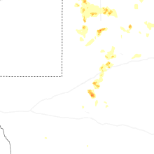
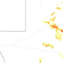
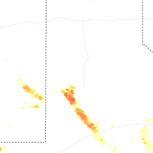

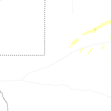
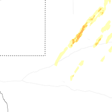
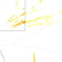


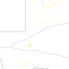


Connect with Interactive Hail Maps