

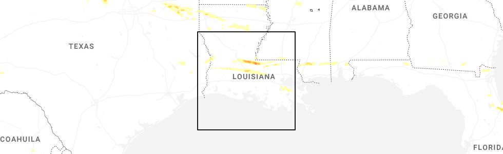
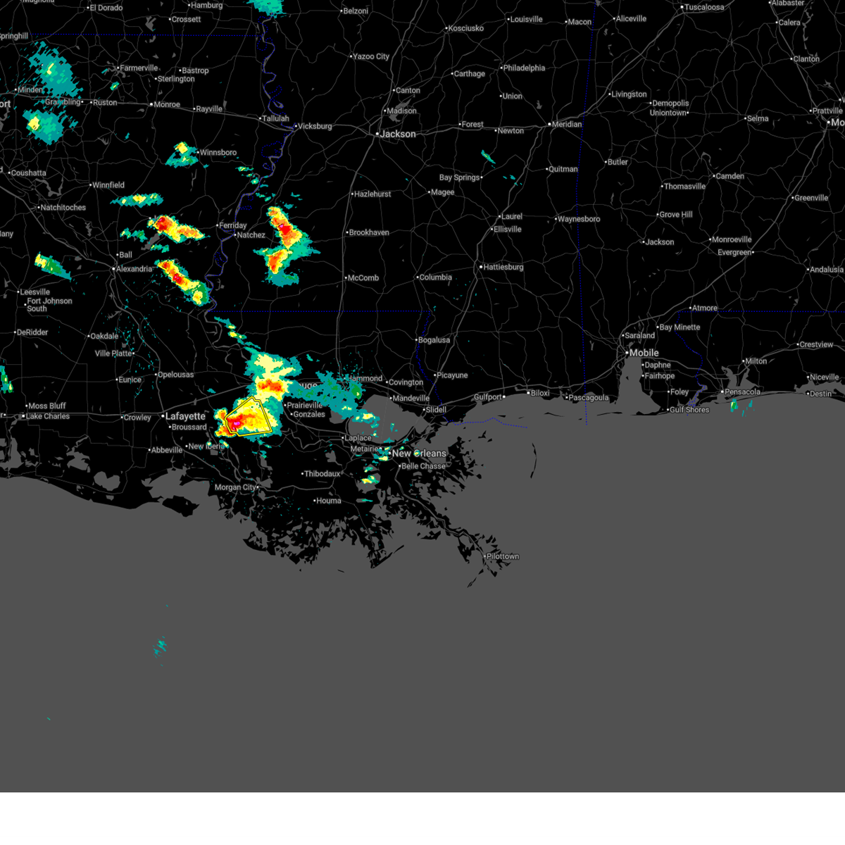
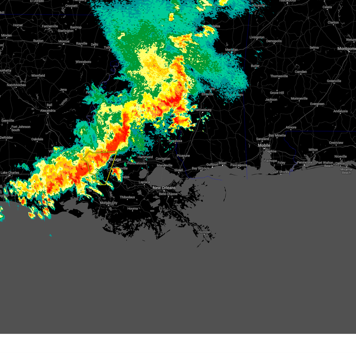
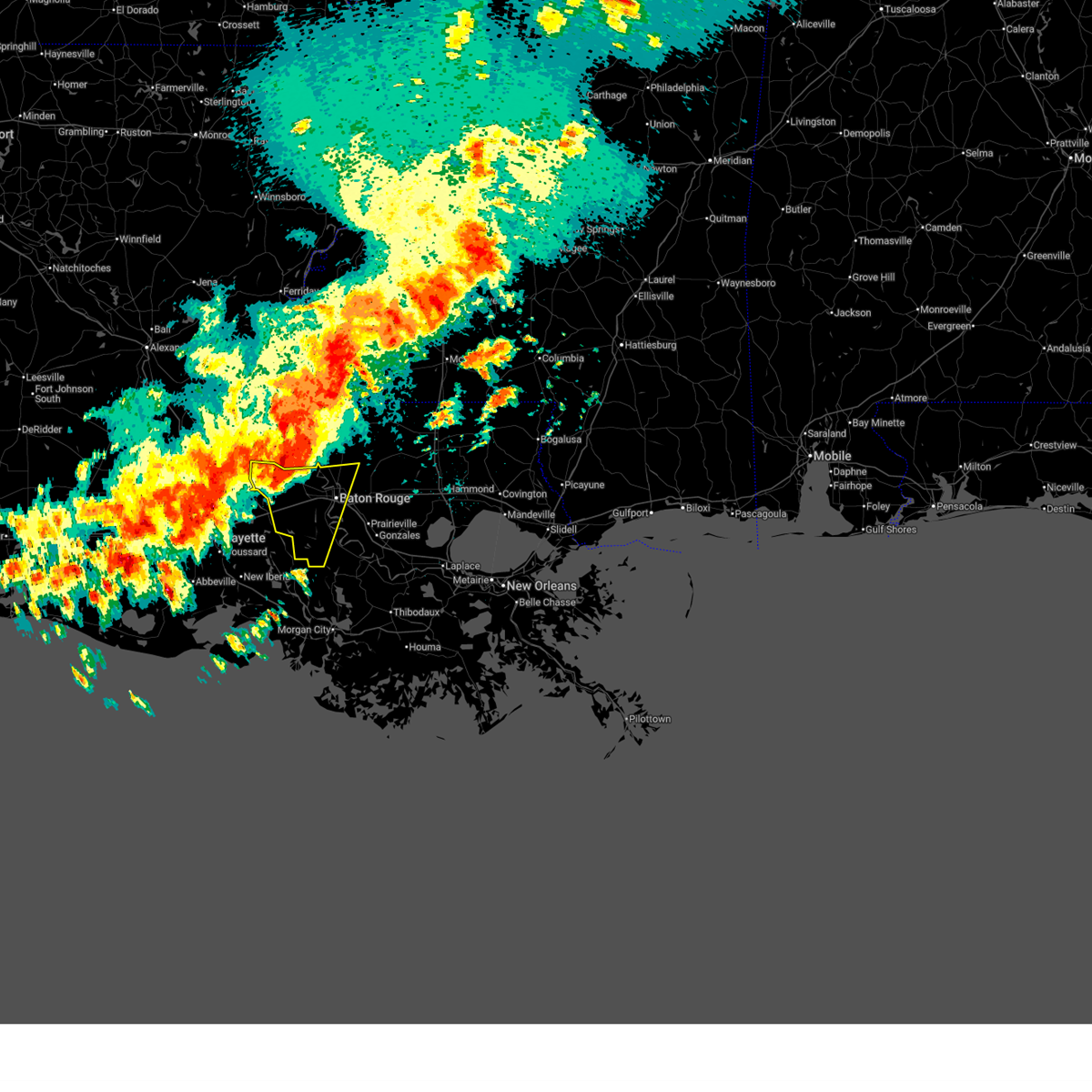
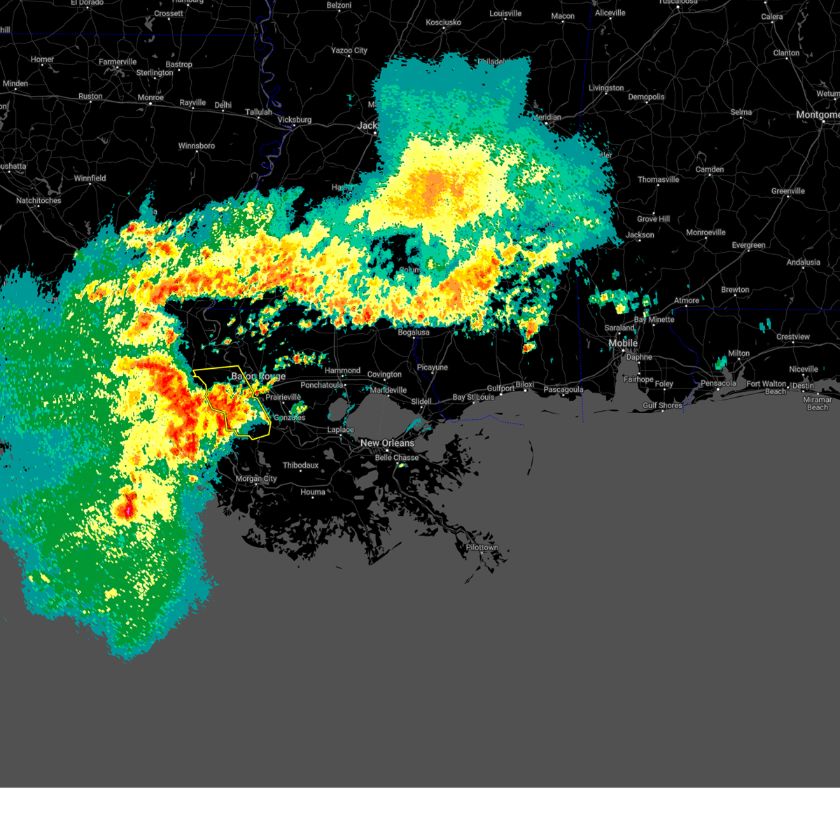
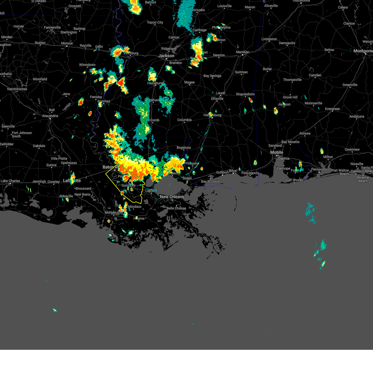
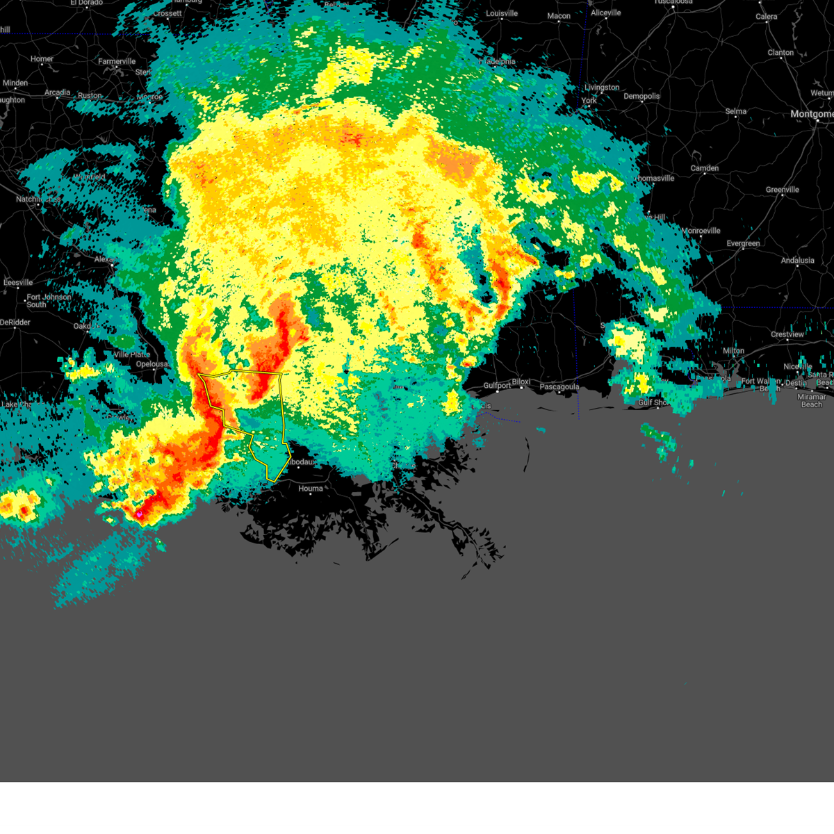
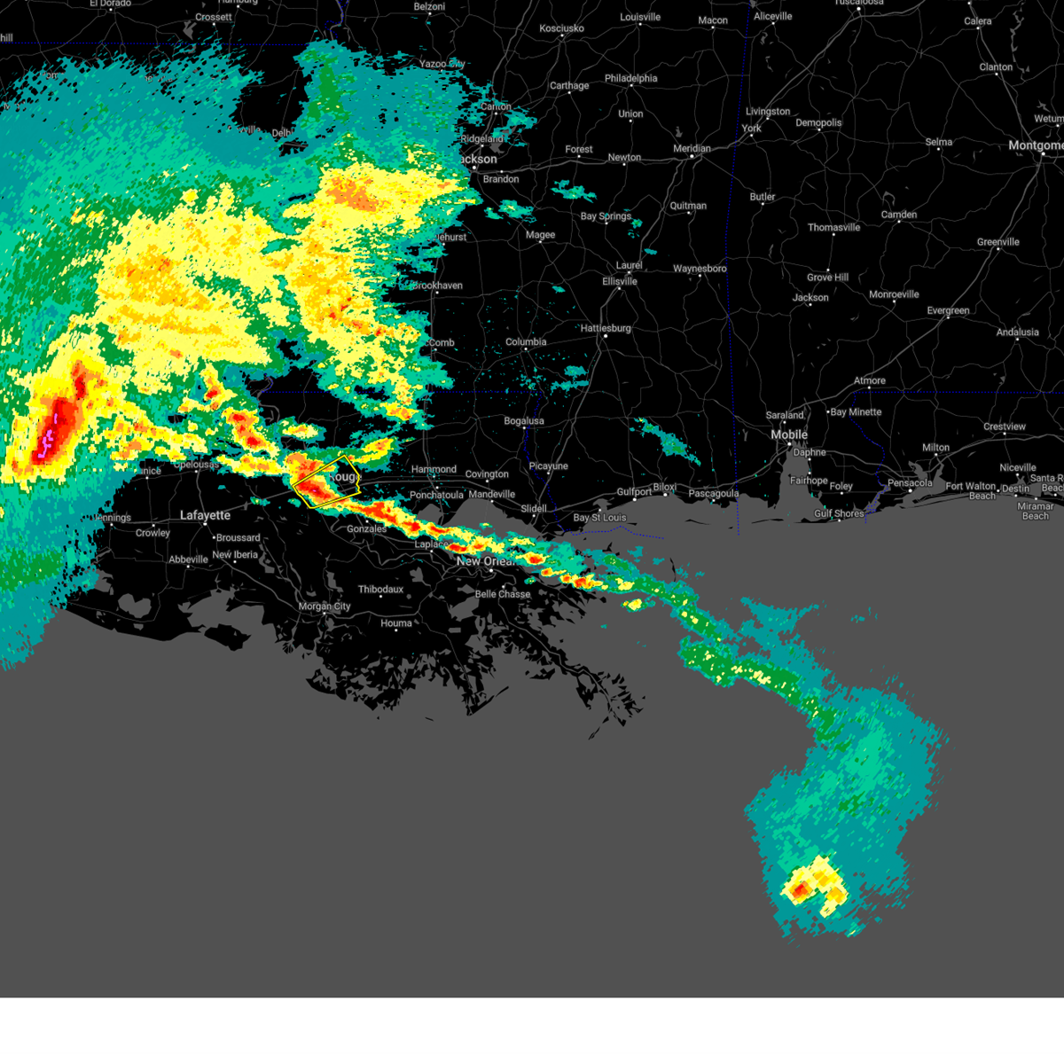
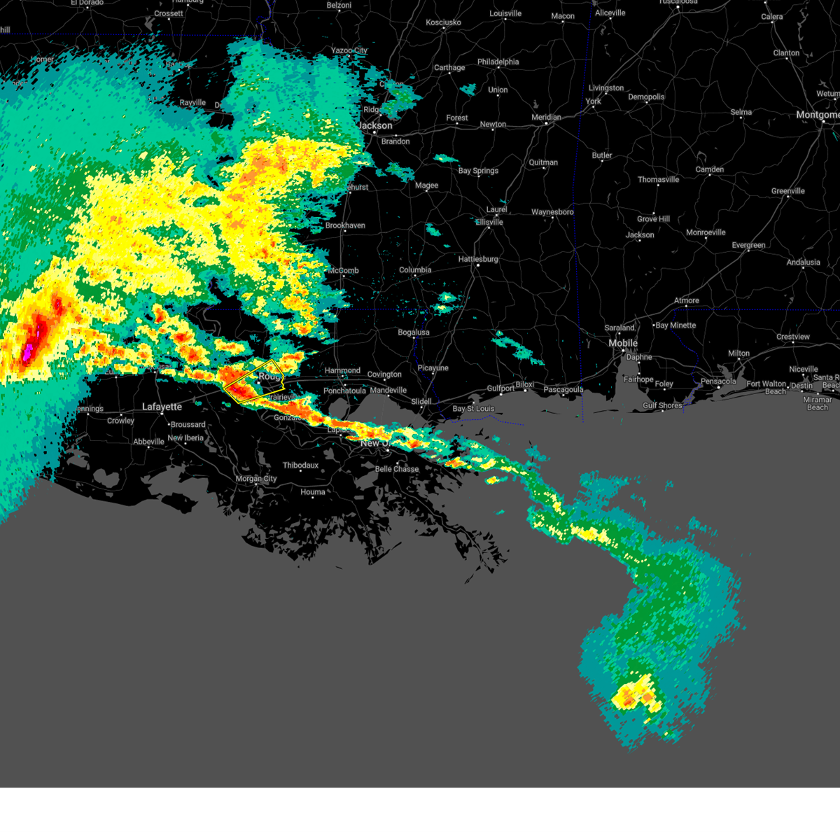
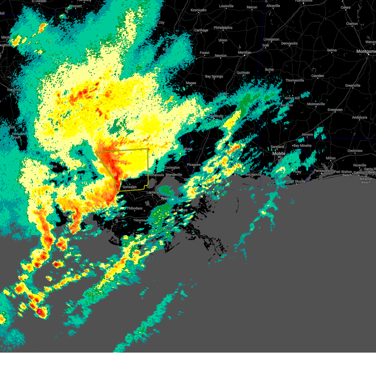
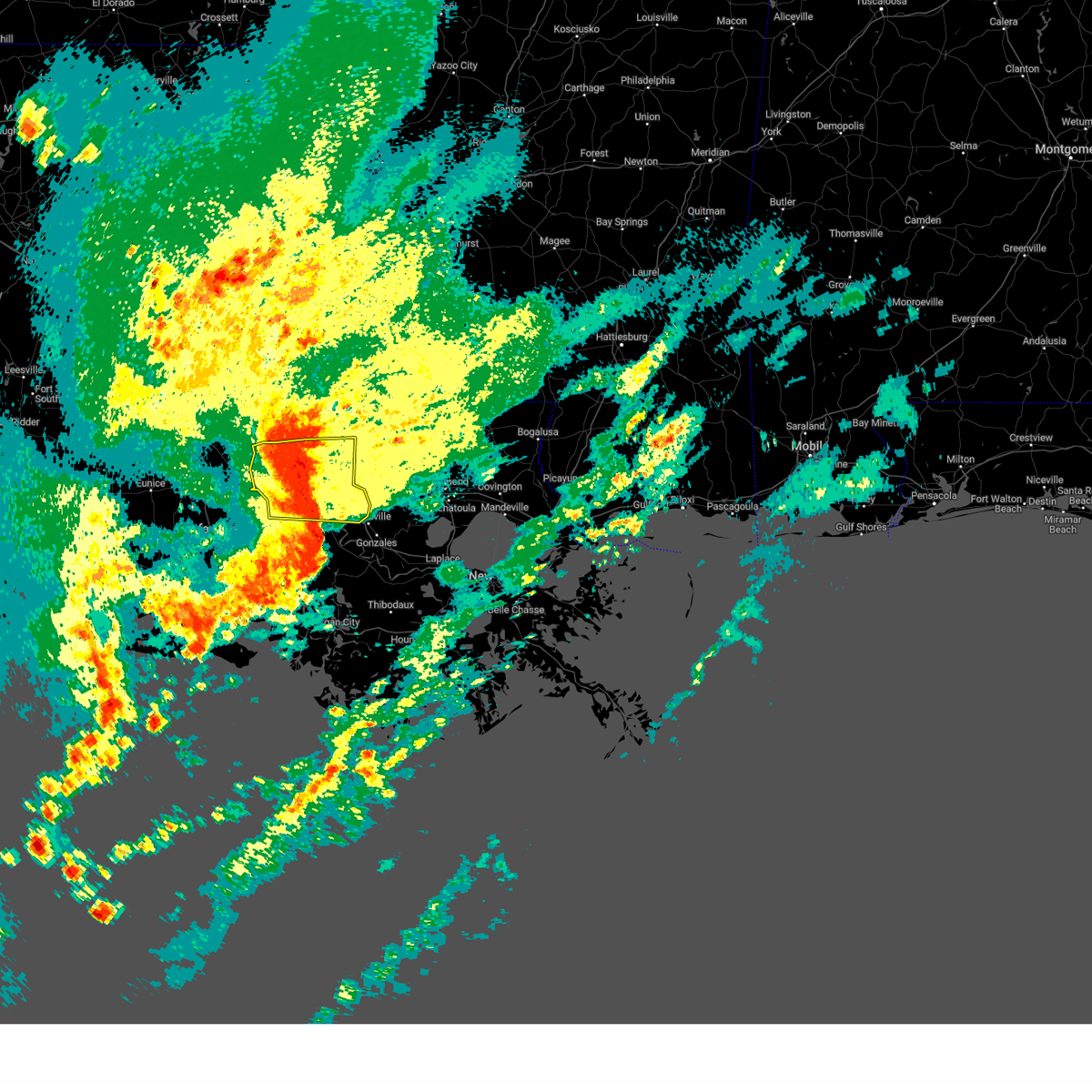
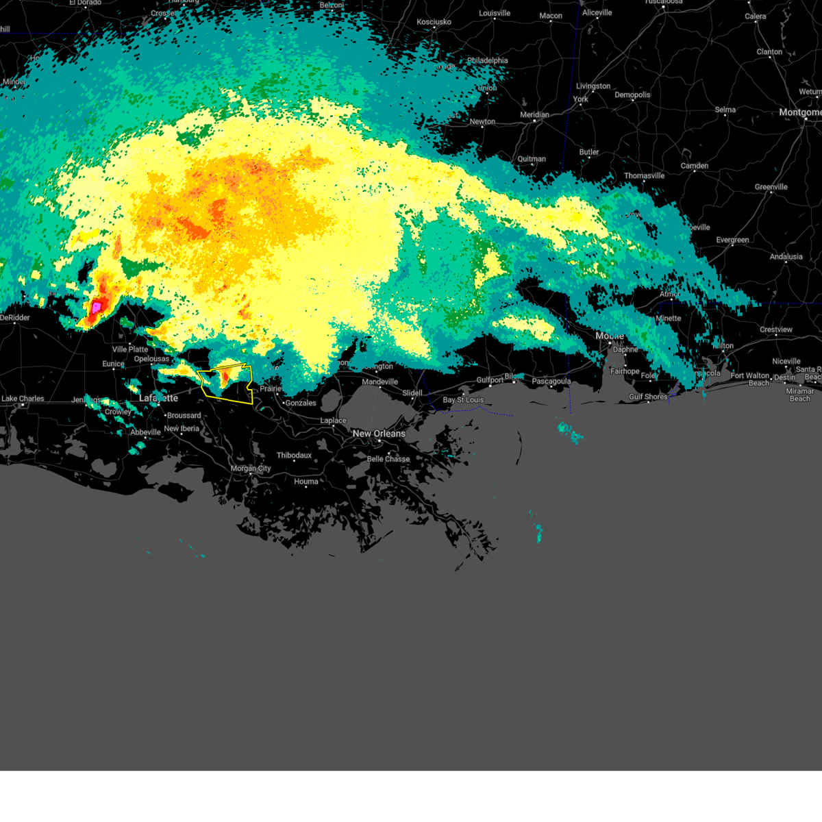
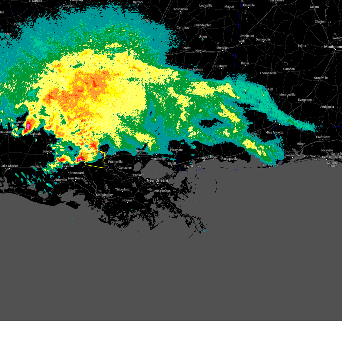
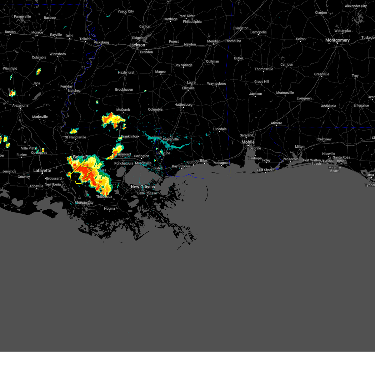
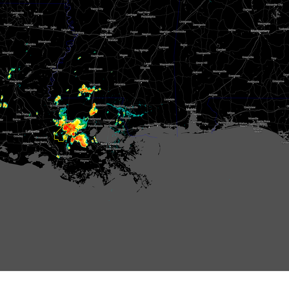
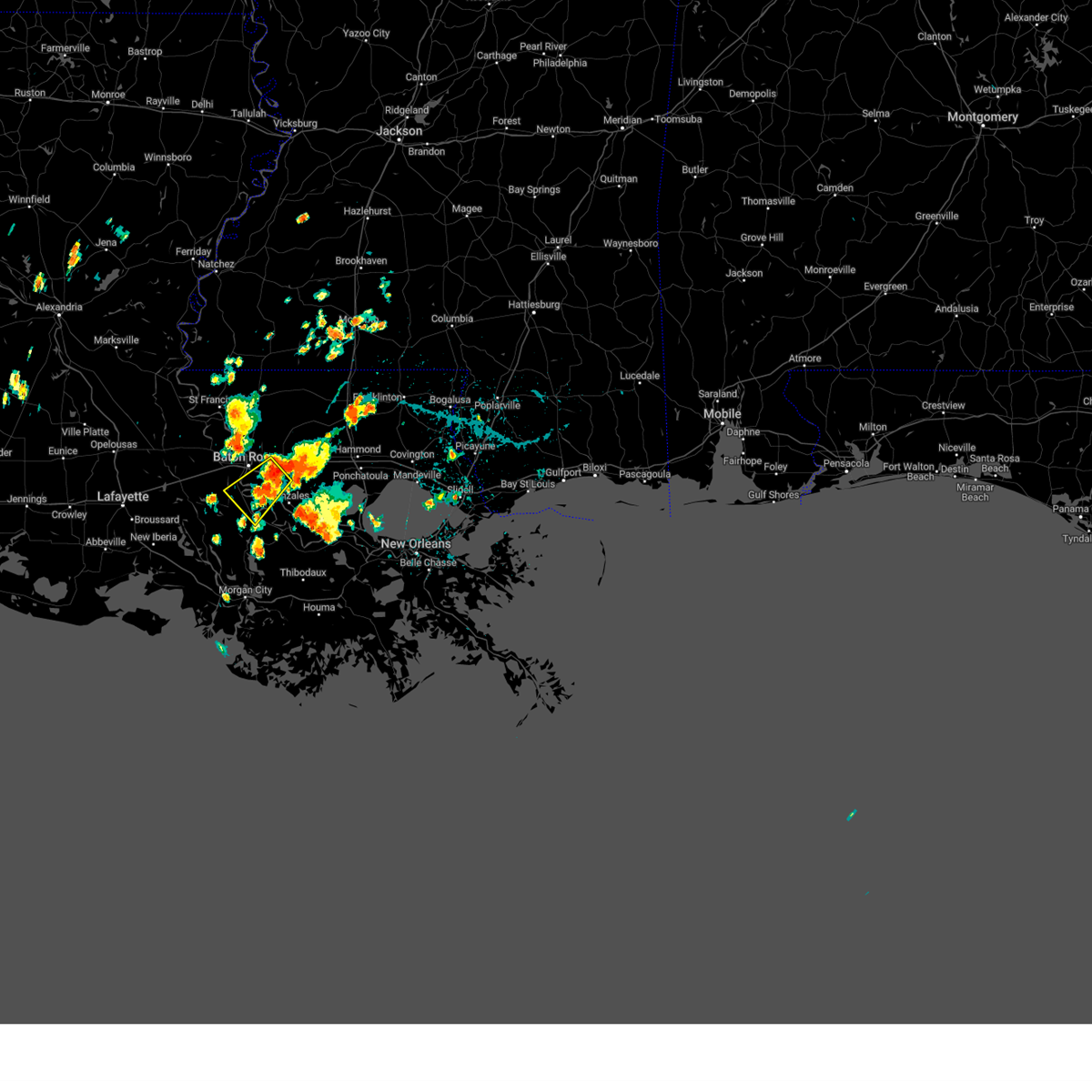
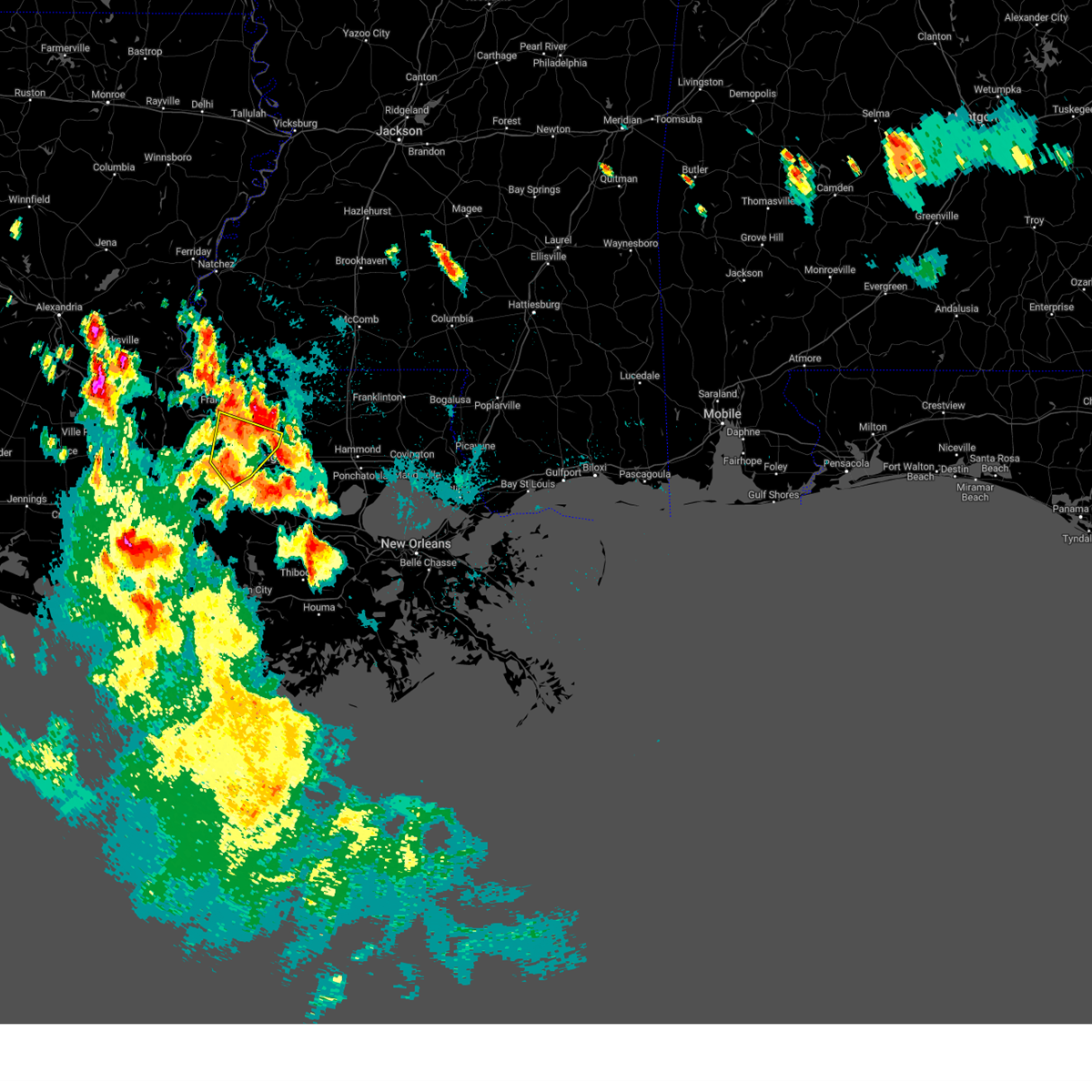
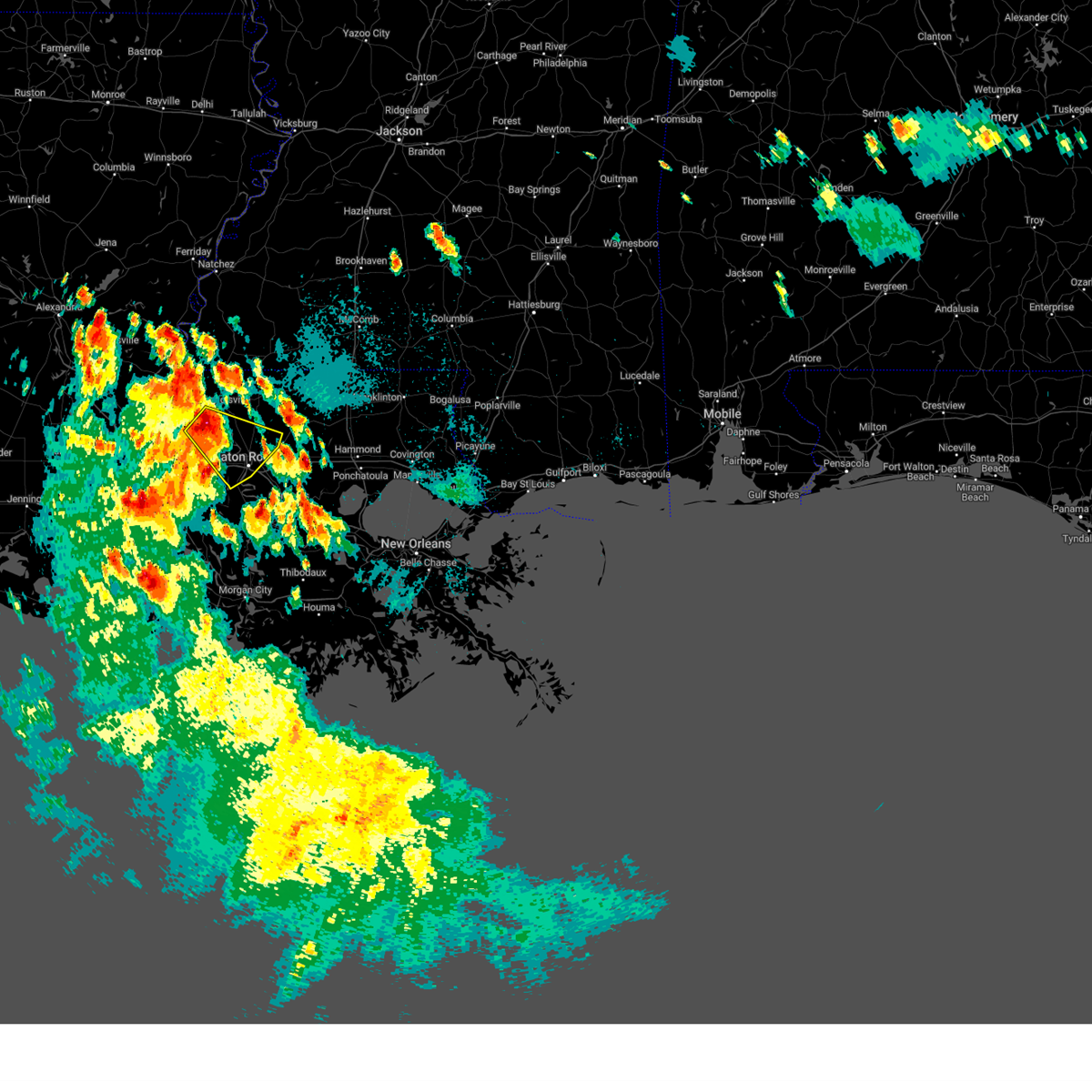
Hail Map for Addis, LA
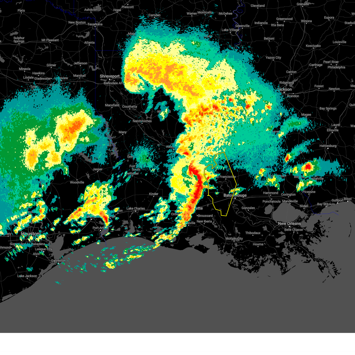
The Addis, LA area has had 5 reports of on-the-ground hail by trained spotters, and has been under severe weather warnings 3 times during the past 12 months. Doppler radar has detected hail at or near Addis, LA on 55 occasions, including 3 occasions during the past year.
| Name: | Addis, LA |
| Where Located: | 46.1 miles ENE of Lafayette, LA |
| Map: | Google Map for Addis, LA |
| Population: | 3593 |
| Housing Units: | 1441 |
| More Info: | Search Google for Addis, LA |
0
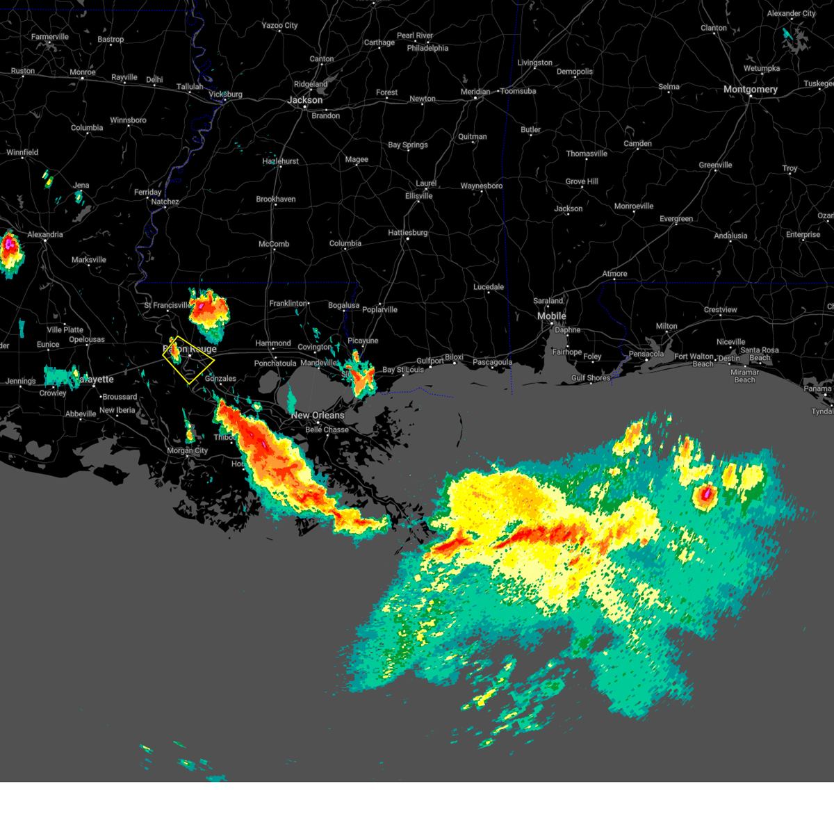
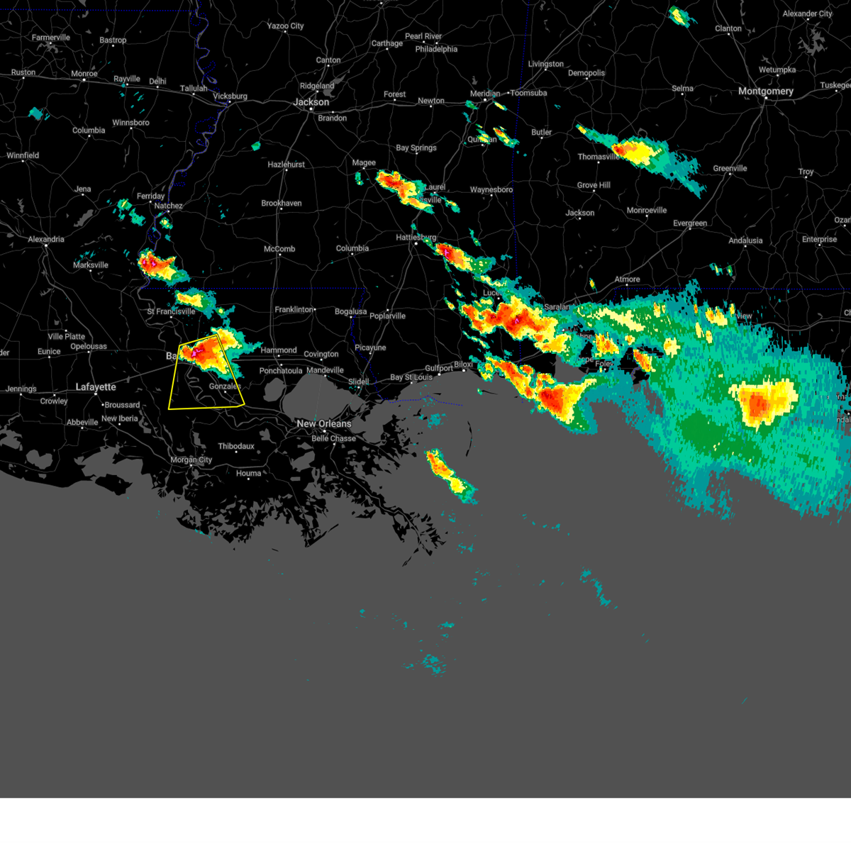
The Top Recent Hail Date for Addis, LA is Friday, May 8, 2026 (33rd out of 55)
Hail and Wind Damage Spotted near Addis, LA
| Date / Time | Report Details |
|---|---|
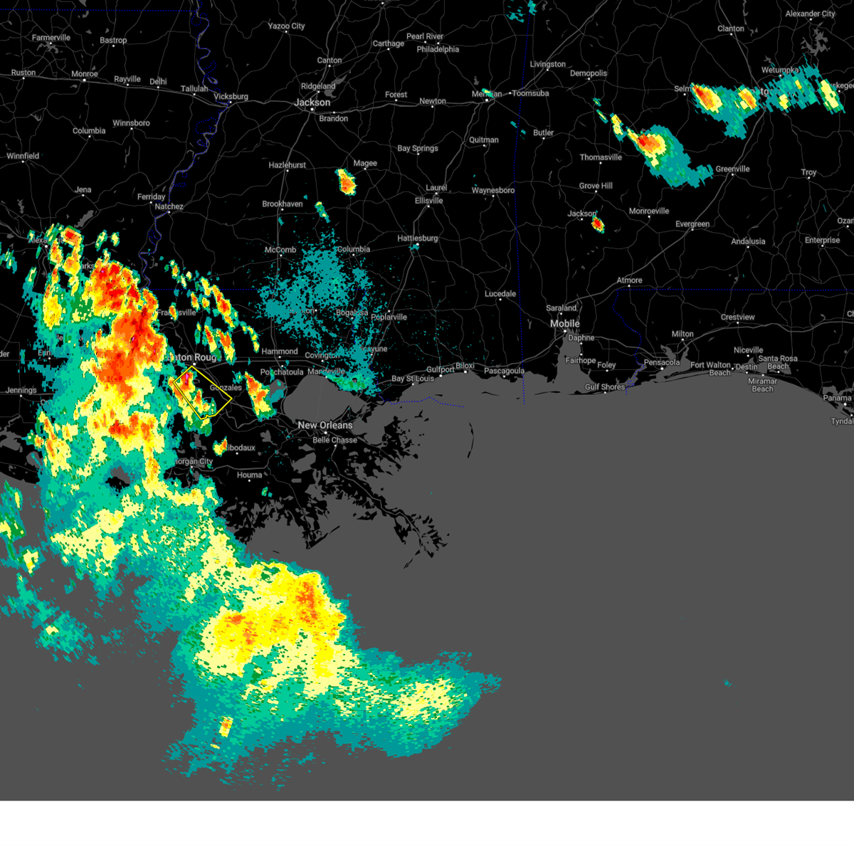
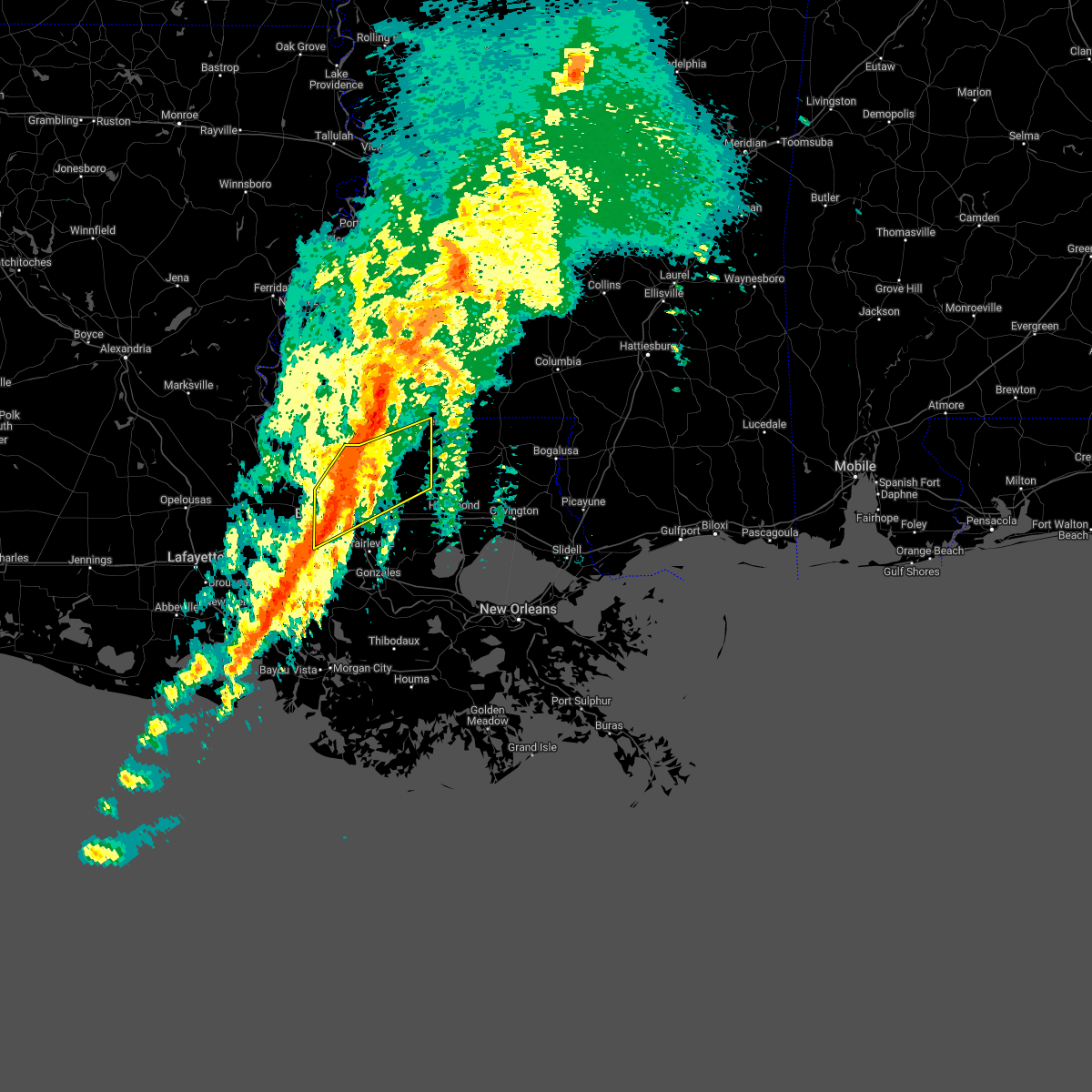
| 5/9/2026 1:39 AM CDT |
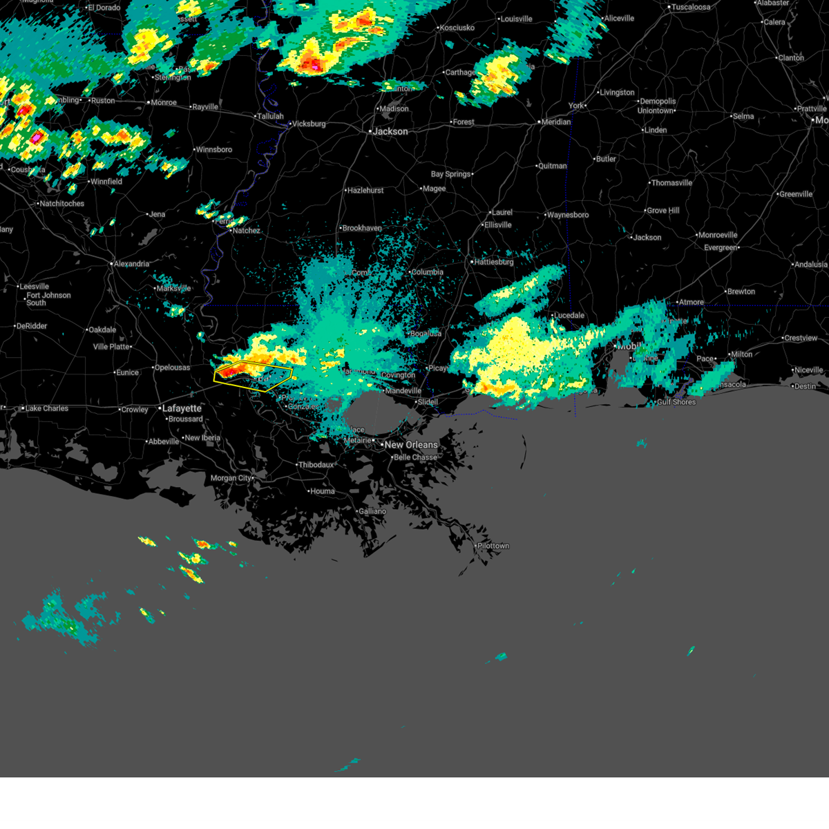 Svrlix the national weather service in new orleans has issued a * severe thunderstorm warning for, west baton rouge parish in southeastern louisiana, south central pointe coupee parish in southeastern louisiana, west central livingston parish in southeastern louisiana, north central iberville parish in southeastern louisiana, southwestern east baton rouge parish in southeastern louisiana, * until 245 am cdt. * at 139 am cdt, severe thunderstorms were located along a line extending from near erwinville to rosedale, moving east at 30 mph (radar indicated). Hazards include quarter size hail. damage to vehicles is expected Svrlix the national weather service in new orleans has issued a * severe thunderstorm warning for, west baton rouge parish in southeastern louisiana, south central pointe coupee parish in southeastern louisiana, west central livingston parish in southeastern louisiana, north central iberville parish in southeastern louisiana, southwestern east baton rouge parish in southeastern louisiana, * until 245 am cdt. * at 139 am cdt, severe thunderstorms were located along a line extending from near erwinville to rosedale, moving east at 30 mph (radar indicated). Hazards include quarter size hail. damage to vehicles is expected
|
| 3/11/2026 8:18 PM CDT | Broadcast media reported downed trees via social media post in addis. time estimated by rada in west baton rouge county LA, 0.8 miles NNE of Addis, LA |
| 2/14/2026 11:12 PM CST |
 Svrlix the national weather service in new orleans has issued a * severe thunderstorm warning for, ascension parish in southeastern louisiana, west baton rouge parish in southeastern louisiana, southwestern livingston parish in southeastern louisiana, iberville parish in southeastern louisiana, southwestern east baton rouge parish in southeastern louisiana, northwestern assumption parish in southeastern louisiana, * until midnight cst. * at 1111 pm cst, severe thunderstorms were located along a line extending from 6 miles west of baker to near ramah to near lydia, moving east at 40 mph (radar indicated). Hazards include 60 mph wind gusts and penny size hail. expect damage to roofs, siding, and trees Svrlix the national weather service in new orleans has issued a * severe thunderstorm warning for, ascension parish in southeastern louisiana, west baton rouge parish in southeastern louisiana, southwestern livingston parish in southeastern louisiana, iberville parish in southeastern louisiana, southwestern east baton rouge parish in southeastern louisiana, northwestern assumption parish in southeastern louisiana, * until midnight cst. * at 1111 pm cst, severe thunderstorms were located along a line extending from 6 miles west of baker to near ramah to near lydia, moving east at 40 mph (radar indicated). Hazards include 60 mph wind gusts and penny size hail. expect damage to roofs, siding, and trees
|
| 2/14/2026 10:30 PM CST |
 Svrlix the national weather service in new orleans has issued a * severe thunderstorm warning for, southwestern west baton rouge parish in southeastern louisiana, south central pointe coupee parish in southeastern louisiana, western iberville parish in southeastern louisiana, * until 1115 pm cst. * at 1029 pm cst, severe thunderstorms were located along a line extending from krotz springs to near lafayette to near indian bayou, moving east at 45 mph (radar indicated). Hazards include 60 mph wind gusts and penny size hail. expect damage to roofs, siding, and trees Svrlix the national weather service in new orleans has issued a * severe thunderstorm warning for, southwestern west baton rouge parish in southeastern louisiana, south central pointe coupee parish in southeastern louisiana, western iberville parish in southeastern louisiana, * until 1115 pm cst. * at 1029 pm cst, severe thunderstorms were located along a line extending from krotz springs to near lafayette to near indian bayou, moving east at 45 mph (radar indicated). Hazards include 60 mph wind gusts and penny size hail. expect damage to roofs, siding, and trees
|
| 5/6/2025 1:41 PM CDT |
 Svrlix the national weather service in new orleans has issued a * severe thunderstorm warning for, south central west baton rouge parish in southeastern louisiana, southeastern iberville parish in southeastern louisiana, * until 230 pm cdt. * at 140 pm cdt, a severe thunderstorm was located over bayou sorrel, or 10 miles southwest of plaquemine, moving northeast at 15 mph (radar indicated). Hazards include ping pong ball size hail and 60 mph wind gusts. People and animals outdoors will be injured. expect hail damage to roofs, siding, windows, and vehicles. Expect wind damage to roofs, siding, and trees. Svrlix the national weather service in new orleans has issued a * severe thunderstorm warning for, south central west baton rouge parish in southeastern louisiana, southeastern iberville parish in southeastern louisiana, * until 230 pm cdt. * at 140 pm cdt, a severe thunderstorm was located over bayou sorrel, or 10 miles southwest of plaquemine, moving northeast at 15 mph (radar indicated). Hazards include ping pong ball size hail and 60 mph wind gusts. People and animals outdoors will be injured. expect hail damage to roofs, siding, windows, and vehicles. Expect wind damage to roofs, siding, and trees.
|
| 3/31/2025 6:11 AM CDT |
 At 611 am cdt, severe thunderstorms were located along a line extending from near baker to near grosse tete to catahoula, moving east at 50 mph (radar indicated). Hazards include 60 mph wind gusts and quarter size hail. Hail damage to vehicles is expected. expect wind damage to roofs, siding, and trees. locations impacted include, maringouin, plaquemine, grosse tete, baton rouge, merrydale, brusly, erwinville, livonia, addis, rosedale, baton rouge airport, fordoche, port allen, ramah, baker, bayou sorrel, brownfields, lottie, gardere, and zachary. this includes the following interstates, interstate 10 in louisiana between mile markers 129 and 159. Interstate 110 in louisiana between mile markers 1 and 8. At 611 am cdt, severe thunderstorms were located along a line extending from near baker to near grosse tete to catahoula, moving east at 50 mph (radar indicated). Hazards include 60 mph wind gusts and quarter size hail. Hail damage to vehicles is expected. expect wind damage to roofs, siding, and trees. locations impacted include, maringouin, plaquemine, grosse tete, baton rouge, merrydale, brusly, erwinville, livonia, addis, rosedale, baton rouge airport, fordoche, port allen, ramah, baker, bayou sorrel, brownfields, lottie, gardere, and zachary. this includes the following interstates, interstate 10 in louisiana between mile markers 129 and 159. Interstate 110 in louisiana between mile markers 1 and 8.
|
| 3/31/2025 5:35 AM CDT |
 Svrlix the national weather service in new orleans has issued a * severe thunderstorm warning for, west baton rouge parish in southeastern louisiana, southern pointe coupee parish in southeastern louisiana, iberville parish in southeastern louisiana, western east baton rouge parish in southeastern louisiana, * until 630 am cdt. * at 535 am cdt, severe thunderstorms were located along a line extending from near melville to near mire, moving east at 55 mph (radar indicated). Hazards include 60 mph wind gusts and quarter size hail. Hail damage to vehicles is expected. Expect wind damage to roofs, siding, and trees. Svrlix the national weather service in new orleans has issued a * severe thunderstorm warning for, west baton rouge parish in southeastern louisiana, southern pointe coupee parish in southeastern louisiana, iberville parish in southeastern louisiana, western east baton rouge parish in southeastern louisiana, * until 630 am cdt. * at 535 am cdt, severe thunderstorms were located along a line extending from near melville to near mire, moving east at 55 mph (radar indicated). Hazards include 60 mph wind gusts and quarter size hail. Hail damage to vehicles is expected. Expect wind damage to roofs, siding, and trees.
|
| 3/24/2025 6:47 AM CDT |
 Svrlix the national weather service in new orleans has issued a * severe thunderstorm warning for, west baton rouge parish in southeastern louisiana, southeastern pointe coupee parish in southeastern louisiana, iberville parish in southeastern louisiana, * until 730 am cdt. * at 647 am cdt, severe thunderstorms were located along a line extending from near ramah to 9 miles southwest of bayou sorrel, moving northeast at 50 mph (radar indicated). Hazards include 60 mph wind gusts and quarter size hail. Hail damage to vehicles is expected. Expect wind damage to roofs, siding, and trees. Svrlix the national weather service in new orleans has issued a * severe thunderstorm warning for, west baton rouge parish in southeastern louisiana, southeastern pointe coupee parish in southeastern louisiana, iberville parish in southeastern louisiana, * until 730 am cdt. * at 647 am cdt, severe thunderstorms were located along a line extending from near ramah to 9 miles southwest of bayou sorrel, moving northeast at 50 mph (radar indicated). Hazards include 60 mph wind gusts and quarter size hail. Hail damage to vehicles is expected. Expect wind damage to roofs, siding, and trees.
|
| 8/15/2024 5:22 PM CDT |
 Svrlix the national weather service in new orleans has issued a * severe thunderstorm warning for, ascension parish in southeastern louisiana, st. james parish in southeastern louisiana, southeastern west baton rouge parish in southeastern louisiana, southwestern livingston parish in southeastern louisiana, east central iberville parish in southeastern louisiana, south central east baton rouge parish in southeastern louisiana, northeastern assumption parish in southeastern louisiana, * until 600 pm cdt. * at 522 pm cdt, severe thunderstorms were located along a line extending from near baton rouge to 6 miles south of whitehall, moving southwest at 15 mph (radar indicated). Hazards include 60 mph wind gusts and penny size hail. expect damage to roofs, siding, and trees Svrlix the national weather service in new orleans has issued a * severe thunderstorm warning for, ascension parish in southeastern louisiana, st. james parish in southeastern louisiana, southeastern west baton rouge parish in southeastern louisiana, southwestern livingston parish in southeastern louisiana, east central iberville parish in southeastern louisiana, south central east baton rouge parish in southeastern louisiana, northeastern assumption parish in southeastern louisiana, * until 600 pm cdt. * at 522 pm cdt, severe thunderstorms were located along a line extending from near baton rouge to 6 miles south of whitehall, moving southwest at 15 mph (radar indicated). Hazards include 60 mph wind gusts and penny size hail. expect damage to roofs, siding, and trees
|
| 7/18/2024 1:17 PM CDT |
 the severe thunderstorm warning has been cancelled and is no longer in effect the severe thunderstorm warning has been cancelled and is no longer in effect
|
| 7/18/2024 12:46 PM CDT |
 Svrlix the national weather service in new orleans has issued a * severe thunderstorm warning for, southeastern west baton rouge parish in southeastern louisiana, southwestern east baton rouge parish in southeastern louisiana, * until 130 pm cdt. * at 1246 pm cdt, a severe thunderstorm was located over port allen, moving east at 25 mph (radar indicated). Hazards include 60 mph wind gusts. expect damage to roofs, siding, and trees Svrlix the national weather service in new orleans has issued a * severe thunderstorm warning for, southeastern west baton rouge parish in southeastern louisiana, southwestern east baton rouge parish in southeastern louisiana, * until 130 pm cdt. * at 1246 pm cdt, a severe thunderstorm was located over port allen, moving east at 25 mph (radar indicated). Hazards include 60 mph wind gusts. expect damage to roofs, siding, and trees
|
| 5/16/2024 10:26 PM CDT |
 At 1025 pm cdt, severe thunderstorms were located along a line extending from near grosse tete to near white castle to pierre part to near belle river, moving east at 65 mph (radar indicated). Hazards include 70 mph wind gusts and penny size hail. Expect considerable tree damage. damage is likely to mobile homes, roofs, and outbuildings. locations impacted include, baton rouge, donaldsonville, plaquemine, port allen, napoleonville, oak hills place, st. gabriel, addis, brusly, white castle, rosedale, grosse tete, westminster, geismar, supreme, bayou sorrel, shenandoah, old jefferson, merrydale, and paincourtville. this includes the following interstates, interstate 10 in louisiana between mile markers 138 and 176. interstate 12 between mile markers 1 and 8. Interstate 110 in louisiana between mile markers 1 and 6. At 1025 pm cdt, severe thunderstorms were located along a line extending from near grosse tete to near white castle to pierre part to near belle river, moving east at 65 mph (radar indicated). Hazards include 70 mph wind gusts and penny size hail. Expect considerable tree damage. damage is likely to mobile homes, roofs, and outbuildings. locations impacted include, baton rouge, donaldsonville, plaquemine, port allen, napoleonville, oak hills place, st. gabriel, addis, brusly, white castle, rosedale, grosse tete, westminster, geismar, supreme, bayou sorrel, shenandoah, old jefferson, merrydale, and paincourtville. this includes the following interstates, interstate 10 in louisiana between mile markers 138 and 176. interstate 12 between mile markers 1 and 8. Interstate 110 in louisiana between mile markers 1 and 6.
|
| 5/16/2024 10:05 PM CDT |
 Svrlix the national weather service in new orleans has issued a * severe thunderstorm warning for, western ascension parish in southeastern louisiana, west baton rouge parish in southeastern louisiana, iberville parish in southeastern louisiana, southwestern east baton rouge parish in southeastern louisiana, assumption parish in southeastern louisiana, * until 1045 pm cdt. * at 1004 pm cdt, severe thunderstorms were located along a line extending from near atchafalaya national wildlife refuge to 9 miles northeast of lake fausse pointe to sorrel, moving east at 60 mph. these are destructive storms for the baton rouge metro (radar indicated). Hazards include 80 mph wind gusts and penny size hail. Flying debris will be dangerous to those caught without shelter. mobile homes will be heavily damaged. expect considerable damage to roofs, windows, and vehicles. Extensive tree damage and power outages are likely. Svrlix the national weather service in new orleans has issued a * severe thunderstorm warning for, western ascension parish in southeastern louisiana, west baton rouge parish in southeastern louisiana, iberville parish in southeastern louisiana, southwestern east baton rouge parish in southeastern louisiana, assumption parish in southeastern louisiana, * until 1045 pm cdt. * at 1004 pm cdt, severe thunderstorms were located along a line extending from near atchafalaya national wildlife refuge to 9 miles northeast of lake fausse pointe to sorrel, moving east at 60 mph. these are destructive storms for the baton rouge metro (radar indicated). Hazards include 80 mph wind gusts and penny size hail. Flying debris will be dangerous to those caught without shelter. mobile homes will be heavily damaged. expect considerable damage to roofs, windows, and vehicles. Extensive tree damage and power outages are likely.
|
| 5/16/2024 10:03 PM CDT |
 At 1002 pm cdt, severe thunderstorms were located along a line extending from near clinton to near greenwell spring to near brownfields to merrydale to near addis to 8 miles south of grosse tete, moving east at 35 mph (radar indicated). Hazards include 60 mph wind gusts and penny size hail. Expect damage to roofs, siding, and trees. locations impacted include, baton rouge, zachary, baker, denham springs, port allen, clinton, oak hills place, addis, brusly, slaughter, westminster, merrydale, inniswold, pride, shenandoah, gardere, brownfields, greenwell spring, village st. george, and old jefferson. this includes the following interstates, interstate 10 in louisiana between mile markers 149 and 164. interstate 12 between mile markers 1 and 9. Interstate 110 in louisiana between mile markers 1 and 8. At 1002 pm cdt, severe thunderstorms were located along a line extending from near clinton to near greenwell spring to near brownfields to merrydale to near addis to 8 miles south of grosse tete, moving east at 35 mph (radar indicated). Hazards include 60 mph wind gusts and penny size hail. Expect damage to roofs, siding, and trees. locations impacted include, baton rouge, zachary, baker, denham springs, port allen, clinton, oak hills place, addis, brusly, slaughter, westminster, merrydale, inniswold, pride, shenandoah, gardere, brownfields, greenwell spring, village st. george, and old jefferson. this includes the following interstates, interstate 10 in louisiana between mile markers 149 and 164. interstate 12 between mile markers 1 and 9. Interstate 110 in louisiana between mile markers 1 and 8.
|
| 5/16/2024 10:03 PM CDT |
 the severe thunderstorm warning has been cancelled and is no longer in effect the severe thunderstorm warning has been cancelled and is no longer in effect
|
| 5/16/2024 9:42 PM CDT |
 the severe thunderstorm warning has been cancelled and is no longer in effect the severe thunderstorm warning has been cancelled and is no longer in effect
|
| 5/16/2024 9:42 PM CDT |
 At 942 pm cdt, severe thunderstorms were located along a line extending from near jackson to near zachary to near baker to 6 miles northwest of port allen to near grosse tete to 7 miles east of butte la rose, moving east at 35 mph (radar indicated). Hazards include 60 mph wind gusts and penny size hail. Expect damage to roofs, siding, and trees. locations impacted include, baton rouge, zachary, baker, denham springs, port allen, jackson, clinton, oak hills place, addis, brusly, slaughter, rosedale, grosse tete, westminster, erwinville, ramah, pride, shenandoah, greenwell spring, and merrydale. this includes the following interstates, interstate 10 in louisiana between mile markers 134 and 164. interstate 12 between mile markers 1 and 9. Interstate 110 in louisiana between mile markers 1 and 8. At 942 pm cdt, severe thunderstorms were located along a line extending from near jackson to near zachary to near baker to 6 miles northwest of port allen to near grosse tete to 7 miles east of butte la rose, moving east at 35 mph (radar indicated). Hazards include 60 mph wind gusts and penny size hail. Expect damage to roofs, siding, and trees. locations impacted include, baton rouge, zachary, baker, denham springs, port allen, jackson, clinton, oak hills place, addis, brusly, slaughter, rosedale, grosse tete, westminster, erwinville, ramah, pride, shenandoah, greenwell spring, and merrydale. this includes the following interstates, interstate 10 in louisiana between mile markers 134 and 164. interstate 12 between mile markers 1 and 9. Interstate 110 in louisiana between mile markers 1 and 8.
|
| 5/16/2024 9:23 PM CDT |
 Svrlix the national weather service in new orleans has issued a * severe thunderstorm warning for, southeastern west feliciana parish in southeastern louisiana, west baton rouge parish in southeastern louisiana, southeastern pointe coupee parish in southeastern louisiana, central east feliciana parish in southeastern louisiana, northern iberville parish in southeastern louisiana, east baton rouge parish in southeastern louisiana, * until 1015 pm cdt. * at 923 pm cdt, severe thunderstorms were located along a line extending from near wakefield to 9 miles southeast of new roads to erwinville to near maringouin to near ramah to near atchafalaya welcome center, moving east at 35 mph (radar indicated). Hazards include 60 mph wind gusts and penny size hail. expect damage to roofs, siding, and trees Svrlix the national weather service in new orleans has issued a * severe thunderstorm warning for, southeastern west feliciana parish in southeastern louisiana, west baton rouge parish in southeastern louisiana, southeastern pointe coupee parish in southeastern louisiana, central east feliciana parish in southeastern louisiana, northern iberville parish in southeastern louisiana, east baton rouge parish in southeastern louisiana, * until 1015 pm cdt. * at 923 pm cdt, severe thunderstorms were located along a line extending from near wakefield to 9 miles southeast of new roads to erwinville to near maringouin to near ramah to near atchafalaya welcome center, moving east at 35 mph (radar indicated). Hazards include 60 mph wind gusts and penny size hail. expect damage to roofs, siding, and trees
|
| 5/16/2024 6:20 PM CDT |
 At 619 pm cdt, a severe thunderstorm was located near brusly, or near port allen, moving northeast at 40 mph (radar indicated). Hazards include quarter size hail. Damage to vehicles is expected. locations impacted include, baton rouge, baker, denham springs, port allen, oak hills place, addis, brusly, westminster, merrydale, inniswold, shenandoah, brownfields, gardere, old jefferson, and baton rouge airport. this includes the following interstates, interstate 10 in louisiana between mile markers 142 and 163. interstate 12 between mile markers 1 and 9. Interstate 110 in louisiana between mile markers 1 and 8. At 619 pm cdt, a severe thunderstorm was located near brusly, or near port allen, moving northeast at 40 mph (radar indicated). Hazards include quarter size hail. Damage to vehicles is expected. locations impacted include, baton rouge, baker, denham springs, port allen, oak hills place, addis, brusly, westminster, merrydale, inniswold, shenandoah, brownfields, gardere, old jefferson, and baton rouge airport. this includes the following interstates, interstate 10 in louisiana between mile markers 142 and 163. interstate 12 between mile markers 1 and 9. Interstate 110 in louisiana between mile markers 1 and 8.
|
| 5/16/2024 6:20 PM CDT |
 the severe thunderstorm warning has been cancelled and is no longer in effect the severe thunderstorm warning has been cancelled and is no longer in effect
|
| 5/16/2024 6:15 PM CDT |
 Svrlix the national weather service in new orleans has issued a * severe thunderstorm warning for, southern west baton rouge parish in southeastern louisiana, north central iberville parish in southeastern louisiana, central east baton rouge parish in southeastern louisiana, * until 700 pm cdt. * at 615 pm cdt, a severe thunderstorm was located near addis, or 9 miles northwest of plaquemine, moving northeast at 40 mph (radar indicated). Hazards include quarter size hail. damage to vehicles is expected Svrlix the national weather service in new orleans has issued a * severe thunderstorm warning for, southern west baton rouge parish in southeastern louisiana, north central iberville parish in southeastern louisiana, central east baton rouge parish in southeastern louisiana, * until 700 pm cdt. * at 615 pm cdt, a severe thunderstorm was located near addis, or 9 miles northwest of plaquemine, moving northeast at 40 mph (radar indicated). Hazards include quarter size hail. damage to vehicles is expected
|
| 5/13/2024 7:13 PM CDT |
 Svrlix the national weather service in new orleans has issued a * severe thunderstorm warning for, ascension parish in southeastern louisiana, southeastern west feliciana parish in southeastern louisiana, central west baton rouge parish in southeastern louisiana, southern st. helena parish in southeastern louisiana, southeastern pointe coupee parish in southeastern louisiana, livingston parish in southeastern louisiana, southern east feliciana parish in southeastern louisiana, southeastern iberville parish in southeastern louisiana, east baton rouge parish in southeastern louisiana, * until 800 pm cdt. * at 712 pm cdt, severe thunderstorms were located along a line extending from near pride to near pierre part, moving east at 55 mph. these are destructive storms for hurricane force winds (radar indicated). Hazards include 80 mph wind gusts and ping pong ball size hail. Flying debris will be dangerous to those caught without shelter. mobile homes will be heavily damaged. expect considerable damage to roofs, windows, and vehicles. Extensive tree damage and power outages are likely. Svrlix the national weather service in new orleans has issued a * severe thunderstorm warning for, ascension parish in southeastern louisiana, southeastern west feliciana parish in southeastern louisiana, central west baton rouge parish in southeastern louisiana, southern st. helena parish in southeastern louisiana, southeastern pointe coupee parish in southeastern louisiana, livingston parish in southeastern louisiana, southern east feliciana parish in southeastern louisiana, southeastern iberville parish in southeastern louisiana, east baton rouge parish in southeastern louisiana, * until 800 pm cdt. * at 712 pm cdt, severe thunderstorms were located along a line extending from near pride to near pierre part, moving east at 55 mph. these are destructive storms for hurricane force winds (radar indicated). Hazards include 80 mph wind gusts and ping pong ball size hail. Flying debris will be dangerous to those caught without shelter. mobile homes will be heavily damaged. expect considerable damage to roofs, windows, and vehicles. Extensive tree damage and power outages are likely.
|
| 5/13/2024 6:57 PM CDT |
 At 656 pm cdt, severe thunderstorms were located along a line extending from near woodville to near port allen, moving east at 45 mph. these are destructive storms for the baton rouge metro area (radar indicated). Hazards include 80 mph wind gusts and quarter size hail. Flying debris will be dangerous to those caught without shelter. mobile homes will be heavily damaged. expect considerable damage to roofs, windows, and vehicles. extensive tree damage and power outages are likely. locations impacted include, baton rouge, zachary, baker, denham springs, port allen, new roads, st. francisville, oak hills place, addis, brusly, livonia, maringouin, slaughter, fordoche, rosedale, grosse tete, morganza, westminster, erwinville, and ramah. this includes the following interstates, interstate 10 in louisiana between mile markers 128 and 168. interstate 12 between mile markers 1 and 9. Interstate 110 in louisiana between mile markers 1 and 8. At 656 pm cdt, severe thunderstorms were located along a line extending from near woodville to near port allen, moving east at 45 mph. these are destructive storms for the baton rouge metro area (radar indicated). Hazards include 80 mph wind gusts and quarter size hail. Flying debris will be dangerous to those caught without shelter. mobile homes will be heavily damaged. expect considerable damage to roofs, windows, and vehicles. extensive tree damage and power outages are likely. locations impacted include, baton rouge, zachary, baker, denham springs, port allen, new roads, st. francisville, oak hills place, addis, brusly, livonia, maringouin, slaughter, fordoche, rosedale, grosse tete, morganza, westminster, erwinville, and ramah. this includes the following interstates, interstate 10 in louisiana between mile markers 128 and 168. interstate 12 between mile markers 1 and 9. Interstate 110 in louisiana between mile markers 1 and 8.
|
| 5/13/2024 6:25 PM CDT |
 Svrlix the national weather service in new orleans has issued a * severe thunderstorm warning for, west feliciana parish in southeastern louisiana, west baton rouge parish in southeastern louisiana, pointe coupee parish in southeastern louisiana, western east feliciana parish in southeastern louisiana, northern iberville parish in southeastern louisiana, east baton rouge parish in southeastern louisiana, * until 715 pm cdt. * at 624 pm cdt, severe thunderstorms were located along a line extending from near fort adams to near atchafalaya national wildlife refuge, moving east at 45 mph (radar indicated). Hazards include 60 mph wind gusts and penny size hail. expect damage to roofs, siding, and trees Svrlix the national weather service in new orleans has issued a * severe thunderstorm warning for, west feliciana parish in southeastern louisiana, west baton rouge parish in southeastern louisiana, pointe coupee parish in southeastern louisiana, western east feliciana parish in southeastern louisiana, northern iberville parish in southeastern louisiana, east baton rouge parish in southeastern louisiana, * until 715 pm cdt. * at 624 pm cdt, severe thunderstorms were located along a line extending from near fort adams to near atchafalaya national wildlife refuge, moving east at 45 mph (radar indicated). Hazards include 60 mph wind gusts and penny size hail. expect damage to roofs, siding, and trees
|
| 5/12/2024 5:31 PM CDT |
 the severe thunderstorm warning has been cancelled and is no longer in effect the severe thunderstorm warning has been cancelled and is no longer in effect
|
| 5/12/2024 5:05 PM CDT |
 Svrlix the national weather service in new orleans has issued a * severe thunderstorm warning for, west baton rouge parish in southeastern louisiana, northwestern iberville parish in southeastern louisiana, * until 545 pm cdt. * at 504 pm cdt, a severe thunderstorm was located near atchafalaya national wildlife refuge, or 11 miles north of catahoula, moving east at 40 mph (radar indicated). Hazards include 60 mph wind gusts and quarter size hail. Hail damage to vehicles is expected. Expect wind damage to roofs, siding, and trees. Svrlix the national weather service in new orleans has issued a * severe thunderstorm warning for, west baton rouge parish in southeastern louisiana, northwestern iberville parish in southeastern louisiana, * until 545 pm cdt. * at 504 pm cdt, a severe thunderstorm was located near atchafalaya national wildlife refuge, or 11 miles north of catahoula, moving east at 40 mph (radar indicated). Hazards include 60 mph wind gusts and quarter size hail. Hail damage to vehicles is expected. Expect wind damage to roofs, siding, and trees.
|
| 4/10/2024 8:38 AM CDT |
 the severe thunderstorm warning has been cancelled and is no longer in effect the severe thunderstorm warning has been cancelled and is no longer in effect
|
| 4/10/2024 8:38 AM CDT |
 At 838 am cdt, severe thunderstorms were located along a line extending from felps to near darlington to 10 miles southeast of clinton to 6 miles east of pride to watson, moving east at 75 mph. these are destructive storms for hurricane force winds! (radar indicated). Hazards include 80 mph wind gusts. Flying debris will be dangerous to those caught without shelter. mobile homes will be heavily damaged. expect considerable damage to roofs, windows, and vehicles. extensive tree damage and power outages are likely. locations impacted include, baton rouge, zachary, baker, denham springs, port allen, jackson, clinton, oak hills place, st. gabriel, addis, brusly, slaughter, rosedale, wilson, norwood, westminster, erwinville, pride, shenandoah, and greenwell spring. this includes the following interstates, interstate 10 in louisiana between mile markers 141 and 168. interstate 12 between mile markers 1 and 9. Interstate 110 in louisiana between mile markers 1 and 8. At 838 am cdt, severe thunderstorms were located along a line extending from felps to near darlington to 10 miles southeast of clinton to 6 miles east of pride to watson, moving east at 75 mph. these are destructive storms for hurricane force winds! (radar indicated). Hazards include 80 mph wind gusts. Flying debris will be dangerous to those caught without shelter. mobile homes will be heavily damaged. expect considerable damage to roofs, windows, and vehicles. extensive tree damage and power outages are likely. locations impacted include, baton rouge, zachary, baker, denham springs, port allen, jackson, clinton, oak hills place, st. gabriel, addis, brusly, slaughter, rosedale, wilson, norwood, westminster, erwinville, pride, shenandoah, and greenwell spring. this includes the following interstates, interstate 10 in louisiana between mile markers 141 and 168. interstate 12 between mile markers 1 and 9. Interstate 110 in louisiana between mile markers 1 and 8.
|
| 4/10/2024 8:09 AM CDT |
 At 809 am cdt, severe thunderstorms were located along a line extending from 8 miles west of wakefield to near st. francisville to near new roads to near erwinville to maringouin, moving east at 70 mph. these are destructive storms for hurricane force winds! (radar indicated). Hazards include 80 mph wind gusts. Flying debris will be dangerous to those caught without shelter. mobile homes will be heavily damaged. expect considerable damage to roofs, windows, and vehicles. extensive tree damage and power outages are likely. locations impacted include, baton rouge, zachary, baker, denham springs, port allen, new roads, jackson, st. francisville, clinton, oak hills place, st. gabriel, addis, brusly, livonia, maringouin, slaughter, fordoche, rosedale, grosse tete, and morganza. this includes the following interstates, interstate 10 in louisiana between mile markers 128 and 168. interstate 12 between mile markers 1 and 9. Interstate 110 in louisiana between mile markers 1 and 8. At 809 am cdt, severe thunderstorms were located along a line extending from 8 miles west of wakefield to near st. francisville to near new roads to near erwinville to maringouin, moving east at 70 mph. these are destructive storms for hurricane force winds! (radar indicated). Hazards include 80 mph wind gusts. Flying debris will be dangerous to those caught without shelter. mobile homes will be heavily damaged. expect considerable damage to roofs, windows, and vehicles. extensive tree damage and power outages are likely. locations impacted include, baton rouge, zachary, baker, denham springs, port allen, new roads, jackson, st. francisville, clinton, oak hills place, st. gabriel, addis, brusly, livonia, maringouin, slaughter, fordoche, rosedale, grosse tete, and morganza. this includes the following interstates, interstate 10 in louisiana between mile markers 128 and 168. interstate 12 between mile markers 1 and 9. Interstate 110 in louisiana between mile markers 1 and 8.
|
| 4/10/2024 7:55 AM CDT |
 At 753 am cdt, severe thunderstorms were located along a line extending from near bayou current to near melville to near lottie to near krotz springs to near atchafalaya welcome center, moving east at 75 mph. these are destructive storms for hurricane force winds (radar indicated). Hazards include 80 mph wind gusts. Flying debris will be dangerous to those caught without shelter. mobile homes will be heavily damaged. expect considerable damage to roofs, windows, and vehicles. extensive tree damage and power outages are likely. locations impacted include, baton rouge, zachary, baker, denham springs, port allen, new roads, jackson, st. francisville, clinton, oak hills place, st. gabriel, addis, brusly, livonia, maringouin, slaughter, fordoche, rosedale, grosse tete, and morganza. this includes the following interstates, interstate 10 in louisiana between mile markers 128 and 168. interstate 12 between mile markers 1 and 9. Interstate 110 in louisiana between mile markers 1 and 8. At 753 am cdt, severe thunderstorms were located along a line extending from near bayou current to near melville to near lottie to near krotz springs to near atchafalaya welcome center, moving east at 75 mph. these are destructive storms for hurricane force winds (radar indicated). Hazards include 80 mph wind gusts. Flying debris will be dangerous to those caught without shelter. mobile homes will be heavily damaged. expect considerable damage to roofs, windows, and vehicles. extensive tree damage and power outages are likely. locations impacted include, baton rouge, zachary, baker, denham springs, port allen, new roads, jackson, st. francisville, clinton, oak hills place, st. gabriel, addis, brusly, livonia, maringouin, slaughter, fordoche, rosedale, grosse tete, and morganza. this includes the following interstates, interstate 10 in louisiana between mile markers 128 and 168. interstate 12 between mile markers 1 and 9. Interstate 110 in louisiana between mile markers 1 and 8.
|
| 4/10/2024 7:45 AM CDT |
 Svrlix the national weather service in new orleans has issued a * severe thunderstorm warning for, west feliciana parish in southeastern louisiana, west baton rouge parish in southeastern louisiana, pointe coupee parish in southeastern louisiana, east feliciana parish in southeastern louisiana, northern iberville parish in southeastern louisiana, east baton rouge parish in southeastern louisiana, * until 845 am cdt. * at 745 am cdt, severe thunderstorms were located along a line extending from palmetto to 6 miles southwest of melville to near krotz springs to 7 miles west of atchafalaya national wildlife refuge to near cecilia, moving east at 75 mph (radar indicated). Hazards include 70 mph wind gusts. Expect considerable tree damage. Damage is likely to mobile homes, roofs, and outbuildings. Svrlix the national weather service in new orleans has issued a * severe thunderstorm warning for, west feliciana parish in southeastern louisiana, west baton rouge parish in southeastern louisiana, pointe coupee parish in southeastern louisiana, east feliciana parish in southeastern louisiana, northern iberville parish in southeastern louisiana, east baton rouge parish in southeastern louisiana, * until 845 am cdt. * at 745 am cdt, severe thunderstorms were located along a line extending from palmetto to 6 miles southwest of melville to near krotz springs to 7 miles west of atchafalaya national wildlife refuge to near cecilia, moving east at 75 mph (radar indicated). Hazards include 70 mph wind gusts. Expect considerable tree damage. Damage is likely to mobile homes, roofs, and outbuildings.
|
| 2/11/2024 11:07 PM CST |
 At 1107 pm cst, a severe thunderstorm was located over port allen, moving northeast at 50 mph (radar indicated). Hazards include 60 mph wind gusts and quarter size hail. Hail damage to vehicles is expected. Expect wind damage to roofs, siding, and trees. At 1107 pm cst, a severe thunderstorm was located over port allen, moving northeast at 50 mph (radar indicated). Hazards include 60 mph wind gusts and quarter size hail. Hail damage to vehicles is expected. Expect wind damage to roofs, siding, and trees.
|
| 12/1/2023 1:17 AM CST |
 At 116 am cst, severe thunderstorms were located along a line extending from atchafalaya national wildlife refuge to near butte la rose to st. martinville, moving east at 35 mph (radar indicated). Hazards include 60 mph wind gusts. expect damage to roofs, siding, and trees At 116 am cst, severe thunderstorms were located along a line extending from atchafalaya national wildlife refuge to near butte la rose to st. martinville, moving east at 35 mph (radar indicated). Hazards include 60 mph wind gusts. expect damage to roofs, siding, and trees
|
| 9/8/2023 1:53 PM CDT |
 At 153 pm cdt, a severe thunderstorm was located near watson, or 10 miles northeast of denham springs, moving south at 25 mph (radar indicated). Hazards include 60 mph wind gusts and quarter size hail. Hail damage to vehicles is expected. Expect wind damage to roofs, siding, and trees. At 153 pm cdt, a severe thunderstorm was located near watson, or 10 miles northeast of denham springs, moving south at 25 mph (radar indicated). Hazards include 60 mph wind gusts and quarter size hail. Hail damage to vehicles is expected. Expect wind damage to roofs, siding, and trees.
|
| 9/8/2023 1:50 PM CDT |
 At 150 pm cdt, a severe thunderstorm was located near ramah, or 11 miles northeast of catahoula, moving south at 30 mph (radar indicated). Hazards include 60 mph wind gusts and quarter size hail. Hail damage to vehicles is expected. expect wind damage to roofs, siding, and trees. locations impacted include, plaquemine, addis, brusly, maringouin, rosedale, grosse tete, ramah, and bayou sorrel. this includes interstate 10 in louisiana between mile markers 128 and 149. hail threat, radar indicated max hail size, 1. 00 in wind threat, radar indicated max wind gust, 60 mph. At 150 pm cdt, a severe thunderstorm was located near ramah, or 11 miles northeast of catahoula, moving south at 30 mph (radar indicated). Hazards include 60 mph wind gusts and quarter size hail. Hail damage to vehicles is expected. expect wind damage to roofs, siding, and trees. locations impacted include, plaquemine, addis, brusly, maringouin, rosedale, grosse tete, ramah, and bayou sorrel. this includes interstate 10 in louisiana between mile markers 128 and 149. hail threat, radar indicated max hail size, 1. 00 in wind threat, radar indicated max wind gust, 60 mph.
|
| 9/8/2023 1:25 PM CDT | At 125 pm cdt, a severe thunderstorm was located near lottie, or 8 miles east of krotz springs, moving south at 30 mph (radar indicated). Hazards include 60 mph wind gusts and quarter size hail. Hail damage to vehicles is expected. Expect wind damage to roofs, siding, and trees. |
| 8/2/2023 4:58 PM CDT |
 At 457 pm cdt, a severe thunderstorm was located over plaquemine, moving southwest at 25 mph (radar indicated). Hazards include 60 mph wind gusts. Expect damage to roofs, siding, and trees. locations impacted include, plaquemine, port allen, st. gabriel, addis, brusly and bayou sorrel. this includes interstate 10 in louisiana near mile marker 154. hail threat, radar indicated max hail size, <. 75 in wind threat, radar indicated max wind gust, 60 mph. At 457 pm cdt, a severe thunderstorm was located over plaquemine, moving southwest at 25 mph (radar indicated). Hazards include 60 mph wind gusts. Expect damage to roofs, siding, and trees. locations impacted include, plaquemine, port allen, st. gabriel, addis, brusly and bayou sorrel. this includes interstate 10 in louisiana near mile marker 154. hail threat, radar indicated max hail size, <. 75 in wind threat, radar indicated max wind gust, 60 mph.
|
| 8/2/2023 4:43 PM CDT |
 At 443 pm cdt, a severe thunderstorm was located near gardere, or near plaquemine, moving southwest at 25 mph (radar indicated). Hazards include 60 mph wind gusts. expect damage to roofs, siding, and trees At 443 pm cdt, a severe thunderstorm was located near gardere, or near plaquemine, moving southwest at 25 mph (radar indicated). Hazards include 60 mph wind gusts. expect damage to roofs, siding, and trees
|
| 8/2/2023 4:29 PM CDT |
 At 428 pm cdt, a severe thunderstorm was located over gardere, or over oak hills place, moving southwest at 20 mph (radar indicated). Hazards include 60 mph wind gusts. Expect damage to roofs, siding, and trees. locations impacted include, baton rouge, plaquemine, oak hills place, st. gabriel, addis, white castle, westminster, old jefferson, inniswold, prairieville, village st. george, shenandoah, gardere and carville. this includes the following interstates, interstate 10 in louisiana between mile markers 158 and 172. interstate 12 between mile markers 1 and 9. hail threat, radar indicated max hail size, <. 75 in wind threat, radar indicated max wind gust, 60 mph. At 428 pm cdt, a severe thunderstorm was located over gardere, or over oak hills place, moving southwest at 20 mph (radar indicated). Hazards include 60 mph wind gusts. Expect damage to roofs, siding, and trees. locations impacted include, baton rouge, plaquemine, oak hills place, st. gabriel, addis, white castle, westminster, old jefferson, inniswold, prairieville, village st. george, shenandoah, gardere and carville. this includes the following interstates, interstate 10 in louisiana between mile markers 158 and 172. interstate 12 between mile markers 1 and 9. hail threat, radar indicated max hail size, <. 75 in wind threat, radar indicated max wind gust, 60 mph.
|
| 8/2/2023 4:13 PM CDT |
 At 412 pm cdt, a severe thunderstorm was located over old jefferson, or near oak hills place, moving southwest at 20 mph (radar indicated). Hazards include 60 mph wind gusts. expect damage to roofs, siding, and trees At 412 pm cdt, a severe thunderstorm was located over old jefferson, or near oak hills place, moving southwest at 20 mph (radar indicated). Hazards include 60 mph wind gusts. expect damage to roofs, siding, and trees
|
| 6/20/2023 9:47 PM CDT |
 At 947 pm cdt, a severe thunderstorm was located near baker, moving southeast at 30 mph (radar indicated). Hazards include 60 mph wind gusts and penny size hail. Expect damage to roofs, siding, and trees. locations impacted include, baton rouge, zachary, baker, port allen, addis, brusly, merrydale, erwinville, brownfields, greenwell spring and baton rouge airport. this includes the following interstates, interstate 10 in louisiana between mile markers 143 and 158. interstate 110 in louisiana between mile markers 1 and 8. hail threat, radar indicated max hail size, 0. 75 in wind threat, radar indicated max wind gust, 60 mph. At 947 pm cdt, a severe thunderstorm was located near baker, moving southeast at 30 mph (radar indicated). Hazards include 60 mph wind gusts and penny size hail. Expect damage to roofs, siding, and trees. locations impacted include, baton rouge, zachary, baker, port allen, addis, brusly, merrydale, erwinville, brownfields, greenwell spring and baton rouge airport. this includes the following interstates, interstate 10 in louisiana between mile markers 143 and 158. interstate 110 in louisiana between mile markers 1 and 8. hail threat, radar indicated max hail size, 0. 75 in wind threat, radar indicated max wind gust, 60 mph.
|
| 6/20/2023 9:16 PM CDT |
 At 916 pm cdt, a severe thunderstorm was located over new roads, moving southeast at 30 mph (radar indicated). Hazards include 60 mph wind gusts and quarter size hail. Hail damage to vehicles is expected. Expect wind damage to roofs, siding, and trees. At 916 pm cdt, a severe thunderstorm was located over new roads, moving southeast at 30 mph (radar indicated). Hazards include 60 mph wind gusts and quarter size hail. Hail damage to vehicles is expected. Expect wind damage to roofs, siding, and trees.
|
| 6/20/2023 8:51 PM CDT |
 At 851 pm cdt, a severe thunderstorm was located over addis, or near plaquemine, moving southeast at 20 mph (radar indicated). Hazards include ping pong ball size hail and 60 mph wind gusts. People and animals outdoors will be injured. expect hail damage to roofs, siding, windows, and vehicles. Expect wind damage to roofs, siding, and trees. At 851 pm cdt, a severe thunderstorm was located over addis, or near plaquemine, moving southeast at 20 mph (radar indicated). Hazards include ping pong ball size hail and 60 mph wind gusts. People and animals outdoors will be injured. expect hail damage to roofs, siding, windows, and vehicles. Expect wind damage to roofs, siding, and trees.
|
| 6/20/2023 5:30 PM CDT | Hen Egg sized hail reported 0.7 miles NNW of Addis, LA, corrects previous hail report from addis. hail 2 to 2.25 in the town of addis. relayed via social media. |
| 6/20/2023 5:30 PM CDT |
 At 530 pm cdt, a severe thunderstorm was located over addis, or near plaquemine, moving southeast at 20 mph. this is a destructive storm for brusly (radar indicated). Hazards include baseball size hail and 60 mph wind gusts. People and animals outdoors will be severely injured. expect shattered windows, extensive damage to roofs, siding, and vehicles. locations impacted include, baton rouge, plaquemine, port allen, oak hills place, st. gabriel, addis, brusly and gardere. this includes the following interstates, interstate 10 in louisiana between mile markers 154 and 158. interstate 110 in louisiana between mile markers 1 and 2. thunderstorm damage threat, destructive hail threat, radar indicated max hail size, 2. 75 in wind threat, radar indicated max wind gust, 60 mph. At 530 pm cdt, a severe thunderstorm was located over addis, or near plaquemine, moving southeast at 20 mph. this is a destructive storm for brusly (radar indicated). Hazards include baseball size hail and 60 mph wind gusts. People and animals outdoors will be severely injured. expect shattered windows, extensive damage to roofs, siding, and vehicles. locations impacted include, baton rouge, plaquemine, port allen, oak hills place, st. gabriel, addis, brusly and gardere. this includes the following interstates, interstate 10 in louisiana between mile markers 154 and 158. interstate 110 in louisiana between mile markers 1 and 2. thunderstorm damage threat, destructive hail threat, radar indicated max hail size, 2. 75 in wind threat, radar indicated max wind gust, 60 mph.
|
| 6/20/2023 5:23 PM CDT |
 At 523 pm cdt, a severe thunderstorm was located over port allen, moving southeast at 15 mph (radar indicated). Hazards include tennis ball size hail and 60 mph wind gusts. People and animals outdoors will be injured. expect hail damage to roofs, siding, windows, and vehicles. expect wind damage to roofs, siding, and trees. locations impacted include, baton rouge, plaquemine, port allen, oak hills place, st. gabriel, addis, brusly, westminster, inniswold, village st. george, shenandoah, gardere, merrydale and old jefferson. this includes the following interstates, interstate 10 in louisiana between mile markers 149 and 165. interstate 12 between mile markers 1 and 7. interstate 110 in louisiana between mile markers 1 and 6. thunderstorm damage threat, considerable hail threat, radar indicated max hail size, 2. 50 in wind threat, radar indicated max wind gust, 60 mph. At 523 pm cdt, a severe thunderstorm was located over port allen, moving southeast at 15 mph (radar indicated). Hazards include tennis ball size hail and 60 mph wind gusts. People and animals outdoors will be injured. expect hail damage to roofs, siding, windows, and vehicles. expect wind damage to roofs, siding, and trees. locations impacted include, baton rouge, plaquemine, port allen, oak hills place, st. gabriel, addis, brusly, westminster, inniswold, village st. george, shenandoah, gardere, merrydale and old jefferson. this includes the following interstates, interstate 10 in louisiana between mile markers 149 and 165. interstate 12 between mile markers 1 and 7. interstate 110 in louisiana between mile markers 1 and 6. thunderstorm damage threat, considerable hail threat, radar indicated max hail size, 2. 50 in wind threat, radar indicated max wind gust, 60 mph.
|
| 6/20/2023 5:04 PM CDT |
 At 503 pm cdt, a severe thunderstorm was located near port allen, moving southeast at 20 mph (radar indicated). Hazards include 60 mph wind gusts and quarter size hail. Hail damage to vehicles is expected. Expect wind damage to roofs, siding, and trees. At 503 pm cdt, a severe thunderstorm was located near port allen, moving southeast at 20 mph (radar indicated). Hazards include 60 mph wind gusts and quarter size hail. Hail damage to vehicles is expected. Expect wind damage to roofs, siding, and trees.
|
| 6/20/2023 4:30 PM CDT | Hen Egg sized hail reported 0.7 miles NNW of Addis, LA, hail 2 to 2.25 in the town of addis. relayed via social media. |
| 6/17/2023 5:11 PM CDT |
 At 509 pm cdt, a severe thunderstorm was located over brownfields, or near baker, moving southeast at 35 mph (public and automated weather station. at 449 pm cdt, the baton rouge airport automated weather station reported a wind gust to 67 mph. wind damage was reported in baker. large hail up to quarter size has been reported with this storm as well). Hazards include 70 mph wind gusts and half dollar size hail. Hail damage to vehicles is expected. expect considerable tree damage. Wind damage is also likely to mobile homes, roofs, and outbuildings. At 509 pm cdt, a severe thunderstorm was located over brownfields, or near baker, moving southeast at 35 mph (public and automated weather station. at 449 pm cdt, the baton rouge airport automated weather station reported a wind gust to 67 mph. wind damage was reported in baker. large hail up to quarter size has been reported with this storm as well). Hazards include 70 mph wind gusts and half dollar size hail. Hail damage to vehicles is expected. expect considerable tree damage. Wind damage is also likely to mobile homes, roofs, and outbuildings.
|
| 4/27/2023 4:38 AM CDT |
 The severe thunderstorm warning for west feliciana, west baton rouge, eastern pointe coupee, southwestern east feliciana, northwestern iberville, northwestern east baton rouge parishes in southeastern louisiana and southwestern wilkinson counties will expire at 445 am cdt, the storms which prompted the warning have weakened below severe limits, and no longer pose an immediate threat to life or property. therefore, the warning will be allowed to expire. however small hail and gusty winds are still possible with these thunderstorms. The severe thunderstorm warning for west feliciana, west baton rouge, eastern pointe coupee, southwestern east feliciana, northwestern iberville, northwestern east baton rouge parishes in southeastern louisiana and southwestern wilkinson counties will expire at 445 am cdt, the storms which prompted the warning have weakened below severe limits, and no longer pose an immediate threat to life or property. therefore, the warning will be allowed to expire. however small hail and gusty winds are still possible with these thunderstorms.
|
| 4/27/2023 4:29 AM CDT |
 At 428 am cdt, severe thunderstorms were located along a line extending from 7 miles south of fort adams to 8 miles east of new roads to 7 miles south of ramah, moving east at 40 mph (radar indicated). Hazards include 60 mph wind gusts and quarter size hail. Hail damage to vehicles is expected. expect wind damage to roofs, siding, and trees. locations impacted include, zachary, new roads, jackson, st. francisville, brusly, maringouin, slaughter, rosedale, grosse tete, wakefield, spillman, erwinville, ramah and fort adams. This includes interstate 10 in louisiana between mile markers 130 and 151. At 428 am cdt, severe thunderstorms were located along a line extending from 7 miles south of fort adams to 8 miles east of new roads to 7 miles south of ramah, moving east at 40 mph (radar indicated). Hazards include 60 mph wind gusts and quarter size hail. Hail damage to vehicles is expected. expect wind damage to roofs, siding, and trees. locations impacted include, zachary, new roads, jackson, st. francisville, brusly, maringouin, slaughter, rosedale, grosse tete, wakefield, spillman, erwinville, ramah and fort adams. This includes interstate 10 in louisiana between mile markers 130 and 151.
|
| 4/27/2023 3:39 AM CDT |
 At 339 am cdt, severe thunderstorms were located along a line extending from cottonport to near palmetto to near carencro, moving east at 35 mph (radar indicated). Hazards include 60 mph wind gusts and quarter size hail. Hail damage to vehicles is expected. Expect wind damage to roofs, siding, and trees. At 339 am cdt, severe thunderstorms were located along a line extending from cottonport to near palmetto to near carencro, moving east at 35 mph (radar indicated). Hazards include 60 mph wind gusts and quarter size hail. Hail damage to vehicles is expected. Expect wind damage to roofs, siding, and trees.
|
| 4/15/2023 11:28 AM CDT |
 At 1127 am cdt, a severe thunderstorm was located over addis, or near plaquemine, moving east at 25 mph (radar indicated). Hazards include 60 mph wind gusts and quarter size hail. Hail damage to vehicles is expected. expect wind damage to roofs, siding, and trees. locations impacted include, baton rouge, baker, denham springs, port allen, oak hills place, addis, brusly, westminster, old jefferson, merrydale, inniswold, village st. george, shenandoah, gardere, brownfields, greenwell spring and baton rouge airport. this includes the following interstates, interstate 10 in louisiana between mile markers 147 and 168. interstate 12 between mile markers 1 and 9. interstate 110 in louisiana between mile markers 1 and 8. hail threat, radar indicated max hail size, 1. 00 in wind threat, radar indicated max wind gust, 60 mph. At 1127 am cdt, a severe thunderstorm was located over addis, or near plaquemine, moving east at 25 mph (radar indicated). Hazards include 60 mph wind gusts and quarter size hail. Hail damage to vehicles is expected. expect wind damage to roofs, siding, and trees. locations impacted include, baton rouge, baker, denham springs, port allen, oak hills place, addis, brusly, westminster, old jefferson, merrydale, inniswold, village st. george, shenandoah, gardere, brownfields, greenwell spring and baton rouge airport. this includes the following interstates, interstate 10 in louisiana between mile markers 147 and 168. interstate 12 between mile markers 1 and 9. interstate 110 in louisiana between mile markers 1 and 8. hail threat, radar indicated max hail size, 1. 00 in wind threat, radar indicated max wind gust, 60 mph.
|
| 4/15/2023 11:06 AM CDT |
 At 1106 am cdt, severe thunderstorms were located along a line extending from near clinton to near addis, moving east at 40 mph (radar indicated). Hazards include 60 mph wind gusts and quarter size hail. Hail damage to vehicles is expected. expect wind damage to roofs, siding, and trees. locations impacted include, baton rouge, zachary, baker, denham springs, plaquemine, port allen, jackson, clinton, oak hills place, st. gabriel, addis, brusly, slaughter, rosedale, grosse tete, wilson, norwood, westminster, ramah and pride. this includes the following interstates, interstate 10 in louisiana between mile markers 135 and 168. interstate 12 between mile markers 1 and 9. interstate 110 in louisiana between mile markers 1 and 8. hail threat, radar indicated max hail size, 1. 00 in wind threat, radar indicated max wind gust, 60 mph. At 1106 am cdt, severe thunderstorms were located along a line extending from near clinton to near addis, moving east at 40 mph (radar indicated). Hazards include 60 mph wind gusts and quarter size hail. Hail damage to vehicles is expected. expect wind damage to roofs, siding, and trees. locations impacted include, baton rouge, zachary, baker, denham springs, plaquemine, port allen, jackson, clinton, oak hills place, st. gabriel, addis, brusly, slaughter, rosedale, grosse tete, wilson, norwood, westminster, ramah and pride. this includes the following interstates, interstate 10 in louisiana between mile markers 135 and 168. interstate 12 between mile markers 1 and 9. interstate 110 in louisiana between mile markers 1 and 8. hail threat, radar indicated max hail size, 1. 00 in wind threat, radar indicated max wind gust, 60 mph.
|
| 4/15/2023 10:41 AM CDT |
 At 1040 am cdt, severe thunderstorms were located along a line extending from near morganza to near butte la rose, moving east at 40 mph (radar indicated). Hazards include 60 mph wind gusts and quarter size hail. Hail damage to vehicles is expected. Expect wind damage to roofs, siding, and trees. At 1040 am cdt, severe thunderstorms were located along a line extending from near morganza to near butte la rose, moving east at 40 mph (radar indicated). Hazards include 60 mph wind gusts and quarter size hail. Hail damage to vehicles is expected. Expect wind damage to roofs, siding, and trees.
|
| 1/24/2023 8:20 PM CST |
 At 819 pm cst, severe thunderstorms were located along a line extending from near port allen to 10 miles west of pierre part, moving northeast at 50 mph (radar indicated). Hazards include 60 mph wind gusts. expect damage to roofs, siding, and trees At 819 pm cst, severe thunderstorms were located along a line extending from near port allen to 10 miles west of pierre part, moving northeast at 50 mph (radar indicated). Hazards include 60 mph wind gusts. expect damage to roofs, siding, and trees
|
| 7/22/2022 6:11 AM CDT |
 At 611 am cdt, a severe thunderstorm was located over carville, or near plaquemine, moving west at 30 mph (radar indicated). Hazards include 60 mph wind gusts. expect damage to roofs, siding, and trees At 611 am cdt, a severe thunderstorm was located over carville, or near plaquemine, moving west at 30 mph (radar indicated). Hazards include 60 mph wind gusts. expect damage to roofs, siding, and trees
|
| 5/13/2022 4:10 PM CDT |
 At 409 pm cdt, severe thunderstorms were located along a line extending from near whitehall to near st. gabriel to near grosse tete, moving south at 15 mph (broadcast media). Hazards include 60 mph wind gusts and quarter size hail. Hail damage to vehicles is expected. expect wind damage to roofs, siding, and trees. locations impacted include, gonzales, donaldsonville, plaquemine, reserve, st. gabriel, gramercy, addis, lutcher, white castle, sorrento, french settlement, rosedale, grosse tete, geismar, garyville, carville, whitehall, wallace, edgard and killian. this includes interstate 10 in louisiana between mile markers 137 and 144, and between mile markers 171 and 200. hail threat, observed max hail size, 1. 00 in wind threat, radar indicated max wind gust, 60 mph. At 409 pm cdt, severe thunderstorms were located along a line extending from near whitehall to near st. gabriel to near grosse tete, moving south at 15 mph (broadcast media). Hazards include 60 mph wind gusts and quarter size hail. Hail damage to vehicles is expected. expect wind damage to roofs, siding, and trees. locations impacted include, gonzales, donaldsonville, plaquemine, reserve, st. gabriel, gramercy, addis, lutcher, white castle, sorrento, french settlement, rosedale, grosse tete, geismar, garyville, carville, whitehall, wallace, edgard and killian. this includes interstate 10 in louisiana between mile markers 137 and 144, and between mile markers 171 and 200. hail threat, observed max hail size, 1. 00 in wind threat, radar indicated max wind gust, 60 mph.
|
| 5/13/2022 3:49 PM CDT |
 At 348 pm cdt, severe thunderstorms were located along a line extending from near whitehall to gardere to 6 miles east of grosse tete, moving south at 15 mph (broadcast media. at 345 pm, quarter-sized hail was reported in east baton rouge). Hazards include 60 mph wind gusts and quarter size hail. Hail damage to vehicles is expected. Expect wind damage to roofs, siding, and trees. At 348 pm cdt, severe thunderstorms were located along a line extending from near whitehall to gardere to 6 miles east of grosse tete, moving south at 15 mph (broadcast media. at 345 pm, quarter-sized hail was reported in east baton rouge). Hazards include 60 mph wind gusts and quarter size hail. Hail damage to vehicles is expected. Expect wind damage to roofs, siding, and trees.
|
| 3/30/2022 5:18 PM CDT |
 At 518 pm cdt, a severe thunderstorm was located near baker, moving northeast at 60 mph (radar indicated). Hazards include 60 mph wind gusts. expect damage to roofs, siding, and trees At 518 pm cdt, a severe thunderstorm was located near baker, moving northeast at 60 mph (radar indicated). Hazards include 60 mph wind gusts. expect damage to roofs, siding, and trees
|
| 10/27/2021 4:23 PM CDT |
 At 422 pm cdt, severe thunderstorms were located along a line extending from little springs to near smithdale to near darlington to near watson, moving east at 40 mph (radar indicated). Hazards include 60 mph wind gusts. Expect damage to roofs, siding, and trees. locations impacted include, baton rouge, mccomb, denham springs, port allen, liberty, greensburg, oak hills place, addis, brusly, summit, smithdale, westminster, merrydale, inniswold, watson, darlington, gillsberg, pride, gardere and brownfields. this includes the following interstates, interstate 10 in louisiana between mile markers 153 and 163. interstate 12 between mile markers 1 and 7. interstate 55 in mississippi between mile markers 14 and 24. interstate 110 in louisiana between mile markers 1 and 6. hail threat, radar indicated max hail size, <. 75 in wind threat, radar indicated max wind gust, 60 mph. At 422 pm cdt, severe thunderstorms were located along a line extending from little springs to near smithdale to near darlington to near watson, moving east at 40 mph (radar indicated). Hazards include 60 mph wind gusts. Expect damage to roofs, siding, and trees. locations impacted include, baton rouge, mccomb, denham springs, port allen, liberty, greensburg, oak hills place, addis, brusly, summit, smithdale, westminster, merrydale, inniswold, watson, darlington, gillsberg, pride, gardere and brownfields. this includes the following interstates, interstate 10 in louisiana between mile markers 153 and 163. interstate 12 between mile markers 1 and 7. interstate 55 in mississippi between mile markers 14 and 24. interstate 110 in louisiana between mile markers 1 and 6. hail threat, radar indicated max hail size, <. 75 in wind threat, radar indicated max wind gust, 60 mph.
|
| 10/27/2021 4:06 PM CDT |
 At 405 pm cdt, severe thunderstorms were located along a line extending from 9 miles west of bayou sorrel to near white castle to 7 miles southwest of patterson, moving northeast at 50 mph (radar indicated). Hazards include 60 mph wind gusts. expect damage to roofs, siding, and trees At 405 pm cdt, severe thunderstorms were located along a line extending from 9 miles west of bayou sorrel to near white castle to 7 miles southwest of patterson, moving northeast at 50 mph (radar indicated). Hazards include 60 mph wind gusts. expect damage to roofs, siding, and trees
|
| 10/27/2021 3:56 PM CDT |
 At 355 pm cdt, severe thunderstorms were located along a line extending from 7 miles southeast of garden city to near gloster to near jackson to near port allen, moving northeast at 40 mph (radar indicated). Hazards include 60 mph wind gusts. expect damage to roofs, siding, and trees At 355 pm cdt, severe thunderstorms were located along a line extending from 7 miles southeast of garden city to near gloster to near jackson to near port allen, moving northeast at 40 mph (radar indicated). Hazards include 60 mph wind gusts. expect damage to roofs, siding, and trees
|
| 5/10/2021 9:22 AM CDT |
 The severe thunderstorm warning for western ascension, west baton rouge, west central livingston, iberville and southwestern east baton rouge parishes will expire at 930 am cdt, the storm which prompted the warning has moved out of the area. therefore, the warning will be allowed to expire. The severe thunderstorm warning for western ascension, west baton rouge, west central livingston, iberville and southwestern east baton rouge parishes will expire at 930 am cdt, the storm which prompted the warning has moved out of the area. therefore, the warning will be allowed to expire.
|
| 5/10/2021 8:48 AM CDT |
 At 848 am cdt, a severe thunderstorm was located near st. gabriel, or near plaquemine, moving east at 45 mph (radar indicated). Hazards include 60 mph wind gusts and penny size hail. Expect damage to roofs, siding, and trees. locations impacted include, baton rouge, baker, denham springs, gonzales, donaldsonville, plaquemine, port allen, oak hills place, st. gabriel, walker, addis, brusly, white castle, rosedale, grosse tete, westminster, geismar, ramah, bayou sorrel and shenandoah. this includes the following interstates, interstate 10 in louisiana between mile markers 135 and 180. interstate 12 between mile markers 1 and 16. Interstate 110 in louisiana between mile markers 1 and 8. At 848 am cdt, a severe thunderstorm was located near st. gabriel, or near plaquemine, moving east at 45 mph (radar indicated). Hazards include 60 mph wind gusts and penny size hail. Expect damage to roofs, siding, and trees. locations impacted include, baton rouge, baker, denham springs, gonzales, donaldsonville, plaquemine, port allen, oak hills place, st. gabriel, walker, addis, brusly, white castle, rosedale, grosse tete, westminster, geismar, ramah, bayou sorrel and shenandoah. this includes the following interstates, interstate 10 in louisiana between mile markers 135 and 180. interstate 12 between mile markers 1 and 16. Interstate 110 in louisiana between mile markers 1 and 8.
|
| 5/10/2021 8:28 AM CDT |
 At 827 am cdt, a severe thunderstorm was located near grosse tete, or 10 miles west of plaquemine, moving east at 35 mph (radar indicated). Hazards include 60 mph wind gusts and penny size hail. expect damage to roofs, siding, and trees At 827 am cdt, a severe thunderstorm was located near grosse tete, or 10 miles west of plaquemine, moving east at 35 mph (radar indicated). Hazards include 60 mph wind gusts and penny size hail. expect damage to roofs, siding, and trees
|
| 4/23/2021 10:34 PM CDT |
 At 1034 pm cdt, a severe thunderstorm was located over merrydale, or near baton rouge, moving east at 45 mph (radar indicated). Hazards include 60 mph wind gusts and nickel size hail. expect damage to roofs, siding, and trees At 1034 pm cdt, a severe thunderstorm was located over merrydale, or near baton rouge, moving east at 45 mph (radar indicated). Hazards include 60 mph wind gusts and nickel size hail. expect damage to roofs, siding, and trees
|
| 4/14/2021 9:42 AM CDT |
 The severe thunderstorm warning for southeastern west baton rouge, northwestern livingston, east central iberville and east baton rouge parishes will expire at 945 am cdt, the storm which prompted the warning has weakened below severe limits, and has exited the warned area. therefore, the warning will be allowed to expire. to report severe weather, contact your nearest law enforcement agency. they will relay your report to the national weather service new orleans. The severe thunderstorm warning for southeastern west baton rouge, northwestern livingston, east central iberville and east baton rouge parishes will expire at 945 am cdt, the storm which prompted the warning has weakened below severe limits, and has exited the warned area. therefore, the warning will be allowed to expire. to report severe weather, contact your nearest law enforcement agency. they will relay your report to the national weather service new orleans.
|
| 4/14/2021 9:09 AM CDT |
 At 909 am cdt, a severe thunderstorm was located near addis, or near plaquemine, moving northeast at 50 mph (radar indicated). Hazards include 60 mph wind gusts and quarter size hail. Hail damage to vehicles is expected. Expect wind damage to roofs, siding, and trees. At 909 am cdt, a severe thunderstorm was located near addis, or near plaquemine, moving northeast at 50 mph (radar indicated). Hazards include 60 mph wind gusts and quarter size hail. Hail damage to vehicles is expected. Expect wind damage to roofs, siding, and trees.
|
| 3/17/2021 4:29 PM CDT |
 At 429 pm cdt, severe thunderstorms were located along a line extending from baton rouge to 8 miles northwest of pierre part, moving northeast at 75 mph (radar indicated). Hazards include 70 mph wind gusts and penny size hail. Expect considerable tree damage. damage is likely to mobile homes, roofs, and outbuildings. locations impacted include, baton rouge, denham springs, gonzales, donaldsonville, plaquemine, port allen, oak hills place, st. Gabriel, walker, addis, brusly, white castle, westminster, geismar, watson, bayou sorrel, shenandoah, greenwell spring, old jefferson and merrydale. At 429 pm cdt, severe thunderstorms were located along a line extending from baton rouge to 8 miles northwest of pierre part, moving northeast at 75 mph (radar indicated). Hazards include 70 mph wind gusts and penny size hail. Expect considerable tree damage. damage is likely to mobile homes, roofs, and outbuildings. locations impacted include, baton rouge, denham springs, gonzales, donaldsonville, plaquemine, port allen, oak hills place, st. Gabriel, walker, addis, brusly, white castle, westminster, geismar, watson, bayou sorrel, shenandoah, greenwell spring, old jefferson and merrydale.
|
| 3/17/2021 4:05 PM CDT |
 At 405 pm cdt, severe thunderstorms were located along a line extending from near butte la rose to near glencoe, moving northeast at 70 mph (radar indicated). Hazards include 70 mph wind gusts. Expect considerable tree damage. Damage is likely to mobile homes, roofs, and outbuildings. At 405 pm cdt, severe thunderstorms were located along a line extending from near butte la rose to near glencoe, moving northeast at 70 mph (radar indicated). Hazards include 70 mph wind gusts. Expect considerable tree damage. Damage is likely to mobile homes, roofs, and outbuildings.
|
| 8/26/2020 2:40 PM CDT |
 At 239 pm cdt, a severe thunderstorm capable of producing a tornado was located over st. gabriel, or 8 miles west of gonzales, moving northwest at 40 mph (radar indicated rotation). Hazards include tornado. Flying debris will be dangerous to those caught without shelter. mobile homes will be damaged or destroyed. damage to roofs, windows, and vehicles will occur. tree damage is likely. this dangerous storm will be near, plaquemine and gardere around 255 pm cdt. addis around 300 pm cdt. Baton rouge around 315 pm cdt. At 239 pm cdt, a severe thunderstorm capable of producing a tornado was located over st. gabriel, or 8 miles west of gonzales, moving northwest at 40 mph (radar indicated rotation). Hazards include tornado. Flying debris will be dangerous to those caught without shelter. mobile homes will be damaged or destroyed. damage to roofs, windows, and vehicles will occur. tree damage is likely. this dangerous storm will be near, plaquemine and gardere around 255 pm cdt. addis around 300 pm cdt. Baton rouge around 315 pm cdt.
|
| 8/26/2020 2:32 PM CDT |
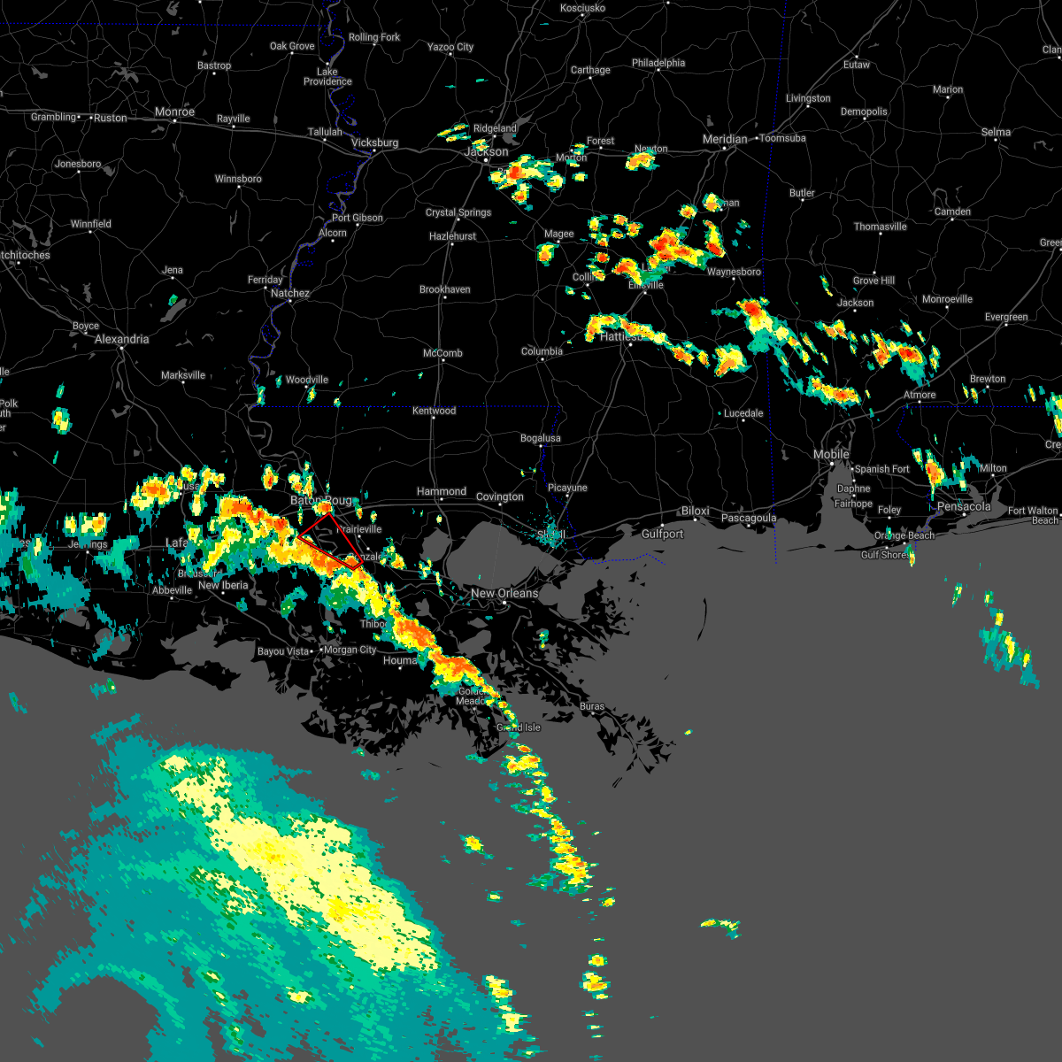 At 232 pm cdt, a severe thunderstorm capable of producing a tornado was located over geismar, or near donaldsonville, moving northwest at 50 mph (radar indicated rotation). Hazards include tornado. Flying debris will be dangerous to those caught without shelter. mobile homes will be damaged or destroyed. damage to roofs, windows, and vehicles will occur. tree damage is likely. this dangerous storm will be near, st. gabriel around 245 pm cdt. plaquemine and gardere around 250 pm cdt. Addis around 255 pm cdt. At 232 pm cdt, a severe thunderstorm capable of producing a tornado was located over geismar, or near donaldsonville, moving northwest at 50 mph (radar indicated rotation). Hazards include tornado. Flying debris will be dangerous to those caught without shelter. mobile homes will be damaged or destroyed. damage to roofs, windows, and vehicles will occur. tree damage is likely. this dangerous storm will be near, st. gabriel around 245 pm cdt. plaquemine and gardere around 250 pm cdt. Addis around 255 pm cdt.
|
| 6/24/2020 3:00 PM CDT |
 At 259 pm cdt, a severe thunderstorm capable of producing a tornado was located over gardere, or near plaquemine, moving east at 25 mph (radar indicated rotation). Hazards include tornado. Flying debris will be dangerous to those caught without shelter. mobile homes will be damaged or destroyed. damage to roofs, windows, and vehicles will occur. tree damage is likely. this dangerous storm will be near, st. gabriel around 305 pm cdt. oak hills place and westminster around 310 pm cdt. village st. george and inniswold around 315 pm cdt. old jefferson around 320 pm cdt. Shenandoah and prairieville around 325 pm cdt. At 259 pm cdt, a severe thunderstorm capable of producing a tornado was located over gardere, or near plaquemine, moving east at 25 mph (radar indicated rotation). Hazards include tornado. Flying debris will be dangerous to those caught without shelter. mobile homes will be damaged or destroyed. damage to roofs, windows, and vehicles will occur. tree damage is likely. this dangerous storm will be near, st. gabriel around 305 pm cdt. oak hills place and westminster around 310 pm cdt. village st. george and inniswold around 315 pm cdt. old jefferson around 320 pm cdt. Shenandoah and prairieville around 325 pm cdt.
|
| 4/23/2020 3:35 AM CDT |
 The severe thunderstorm warning for west baton rouge and north central iberville parishes will expire at 345 am cdt, the storm which prompted the warning has moved out of the area. therefore, the warning will be allowed to expire. a tornado watch remains in effect until 700 am cdt for southeastern louisiana. The severe thunderstorm warning for west baton rouge and north central iberville parishes will expire at 345 am cdt, the storm which prompted the warning has moved out of the area. therefore, the warning will be allowed to expire. a tornado watch remains in effect until 700 am cdt for southeastern louisiana.
|
| 4/23/2020 3:18 AM CDT |
 At 318 am cdt, a severe thunderstorm was located over port allen, moving east at 50 mph (radar indicated). Hazards include golf ball size hail and 60 mph wind gusts. People and animals outdoors will be injured. expect hail damage to roofs, siding, windows, and vehicles. expect wind damage to roofs, siding, and trees. Locations impacted include, port allen, addis, brusly and grosse tete. At 318 am cdt, a severe thunderstorm was located over port allen, moving east at 50 mph (radar indicated). Hazards include golf ball size hail and 60 mph wind gusts. People and animals outdoors will be injured. expect hail damage to roofs, siding, windows, and vehicles. expect wind damage to roofs, siding, and trees. Locations impacted include, port allen, addis, brusly and grosse tete.
|
| 4/23/2020 2:40 AM CDT |
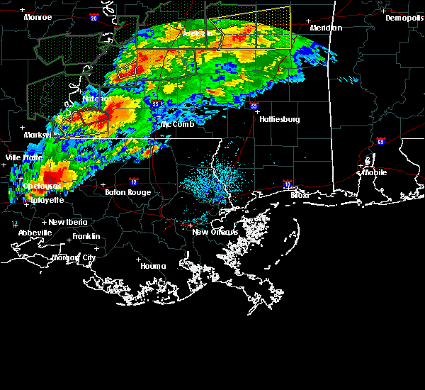 At 240 am cdt, a severe thunderstorm was located over krotz springs, moving east at 55 mph (radar indicated). Hazards include ping pong ball size hail and 60 mph wind gusts. People and animals outdoors will be injured. expect hail damage to roofs, siding, windows, and vehicles. Expect wind damage to roofs, siding, and trees. At 240 am cdt, a severe thunderstorm was located over krotz springs, moving east at 55 mph (radar indicated). Hazards include ping pong ball size hail and 60 mph wind gusts. People and animals outdoors will be injured. expect hail damage to roofs, siding, windows, and vehicles. Expect wind damage to roofs, siding, and trees.
|
| 4/9/2020 9:43 PM CDT |
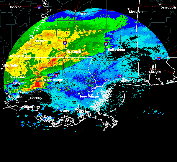 At 943 pm cdt, severe thunderstorms were located along a line extending from near plaquemine to near bayou sorrel, moving east at 35 mph (radar indicated). Hazards include 60 mph wind gusts and quarter size hail. Hail damage to vehicles is expected. Expect wind damage to roofs, siding, and trees. At 943 pm cdt, severe thunderstorms were located along a line extending from near plaquemine to near bayou sorrel, moving east at 35 mph (radar indicated). Hazards include 60 mph wind gusts and quarter size hail. Hail damage to vehicles is expected. Expect wind damage to roofs, siding, and trees.
|
| 4/9/2020 9:35 PM CDT |
 At 935 pm cdt, severe thunderstorms were located along a line extending from near brusly to bayou sorrel, moving east at 40 mph (radar indicated). Hazards include 60 mph wind gusts and quarter size hail. Hail damage to vehicles is expected. expect wind damage to roofs, siding, and trees. locations impacted include, baton rouge, denham springs, plaquemine, port allen, oak hills place, st. gabriel, addis, brusly, white castle, westminster, inniswold, village st. George, bayou sorrel, shenandoah, gardere, carville and old jefferson. At 935 pm cdt, severe thunderstorms were located along a line extending from near brusly to bayou sorrel, moving east at 40 mph (radar indicated). Hazards include 60 mph wind gusts and quarter size hail. Hail damage to vehicles is expected. expect wind damage to roofs, siding, and trees. locations impacted include, baton rouge, denham springs, plaquemine, port allen, oak hills place, st. gabriel, addis, brusly, white castle, westminster, inniswold, village st. George, bayou sorrel, shenandoah, gardere, carville and old jefferson.
|
| 4/9/2020 9:08 PM CDT |
 At 906 pm cdt, severe thunderstorms were located along a line extending from ramah to near catahoula, moving east at 40 mph (radar indicated). Hazards include 60 mph wind gusts and quarter size hail. Hail damage to vehicles is expected. Expect wind damage to roofs, siding, and trees. At 906 pm cdt, severe thunderstorms were located along a line extending from ramah to near catahoula, moving east at 40 mph (radar indicated). Hazards include 60 mph wind gusts and quarter size hail. Hail damage to vehicles is expected. Expect wind damage to roofs, siding, and trees.
|
| 2/5/2020 2:27 PM CST |
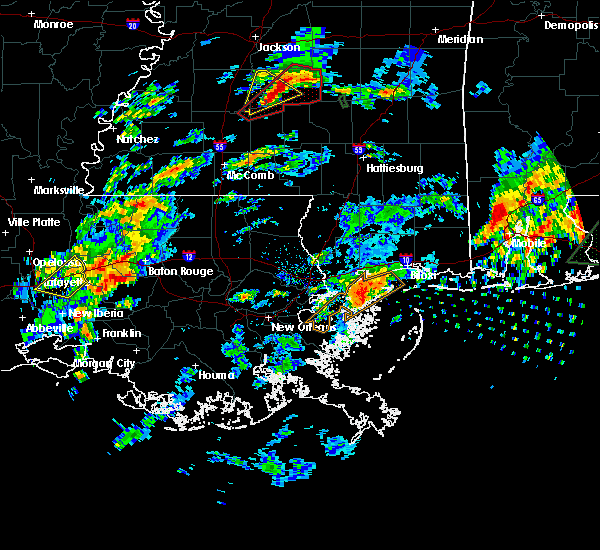 At 227 pm cst, a severe thunderstorm was located near addis, or near plaquemine, moving northeast at 55 mph (radar indicated). Hazards include 60 mph wind gusts and quarter size hail. Hail damage to vehicles is expected. Expect wind damage to roofs, siding, and trees. At 227 pm cst, a severe thunderstorm was located near addis, or near plaquemine, moving northeast at 55 mph (radar indicated). Hazards include 60 mph wind gusts and quarter size hail. Hail damage to vehicles is expected. Expect wind damage to roofs, siding, and trees.
|
| 2/5/2020 1:45 PM CST |
 At 144 pm cst, a severe thunderstorm was located over grosse tete, or 11 miles west of port allen, moving northeast at 60 mph (radar indicated). Hazards include 60 mph wind gusts and quarter size hail. Hail damage to vehicles is expected. expect wind damage to roofs, siding, and trees. Locations impacted include, baton rouge, baker, port allen, brusly, maringouin, rosedale, grosse tete, ramah, erwinville, brownfields and baton rouge airport. At 144 pm cst, a severe thunderstorm was located over grosse tete, or 11 miles west of port allen, moving northeast at 60 mph (radar indicated). Hazards include 60 mph wind gusts and quarter size hail. Hail damage to vehicles is expected. expect wind damage to roofs, siding, and trees. Locations impacted include, baton rouge, baker, port allen, brusly, maringouin, rosedale, grosse tete, ramah, erwinville, brownfields and baton rouge airport.
|
| 2/5/2020 1:28 PM CST |
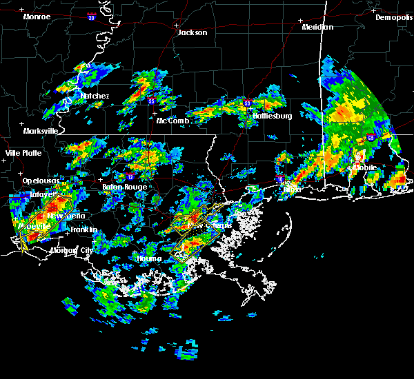 At 127 pm cst, a severe thunderstorm was located 7 miles southeast of butte la rose, or 8 miles east of catahoula, moving northeast at 55 mph (radar indicated). Hazards include 60 mph wind gusts and quarter size hail. Hail damage to vehicles is expected. Expect wind damage to roofs, siding, and trees. At 127 pm cst, a severe thunderstorm was located 7 miles southeast of butte la rose, or 8 miles east of catahoula, moving northeast at 55 mph (radar indicated). Hazards include 60 mph wind gusts and quarter size hail. Hail damage to vehicles is expected. Expect wind damage to roofs, siding, and trees.
|
| 7/14/2019 10:12 AM CDT |
 At 1011 am cdt, severe thunderstorms were located along a line extending from near jackson to port allen, moving northeast at 15 mph (radar indicated). Hazards include 60 mph wind gusts. expect damage to roofs, siding, and trees At 1011 am cdt, severe thunderstorms were located along a line extending from near jackson to port allen, moving northeast at 15 mph (radar indicated). Hazards include 60 mph wind gusts. expect damage to roofs, siding, and trees
|
| 6/28/2019 4:04 PM CDT |
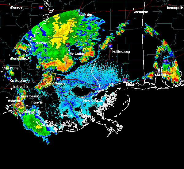 At 404 pm cdt, severe thunderstorms were located along a line extending from watson to near shenandoah to gardere, moving east at 10 mph (radar indicated). Hazards include 60 mph wind gusts and quarter size hail. Hail damage to vehicles is expected. expect wind damage to roofs, siding, and trees. locations impacted include, baton rouge, denham springs, oak hills place, st. gabriel, walker, addis, westminster, old jefferson, inniswold, watson, village st. George, shenandoah, gardere and greenwell spring. At 404 pm cdt, severe thunderstorms were located along a line extending from watson to near shenandoah to gardere, moving east at 10 mph (radar indicated). Hazards include 60 mph wind gusts and quarter size hail. Hail damage to vehicles is expected. expect wind damage to roofs, siding, and trees. locations impacted include, baton rouge, denham springs, oak hills place, st. gabriel, walker, addis, westminster, old jefferson, inniswold, watson, village st. George, shenandoah, gardere and greenwell spring.
|
| 6/28/2019 3:52 PM CDT |
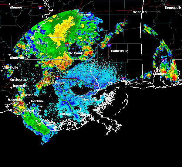 The national weather service in new orleans has issued a * severe thunderstorm warning for. northwestern ascension parish in southeastern louisiana. southeastern west baton rouge parish in southeastern louisiana. northwestern livingston parish in southeastern louisiana. East central iberville parish in southeastern louisiana. The national weather service in new orleans has issued a * severe thunderstorm warning for. northwestern ascension parish in southeastern louisiana. southeastern west baton rouge parish in southeastern louisiana. northwestern livingston parish in southeastern louisiana. East central iberville parish in southeastern louisiana.
|
| 6/24/2019 5:09 AM CDT |
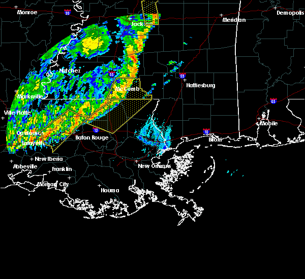 At 509 am cdt, severe thunderstorms were located along a line extending from near watson to 7 miles east of butte la rose, moving south at 40 mph (radar indicated). Hazards include 60 mph wind gusts. expect damage to roofs, siding, and trees At 509 am cdt, severe thunderstorms were located along a line extending from near watson to 7 miles east of butte la rose, moving south at 40 mph (radar indicated). Hazards include 60 mph wind gusts. expect damage to roofs, siding, and trees
|
| 6/24/2019 4:32 AM CDT |
 At 432 am cdt, severe thunderstorms were located along a line extending from near slaughter to near atchafalaya national wildlife refuge, moving southeast at 15 mph (radar indicated). Hazards include 60 mph wind gusts. expect damage to roofs, siding, and trees At 432 am cdt, severe thunderstorms were located along a line extending from near slaughter to near atchafalaya national wildlife refuge, moving southeast at 15 mph (radar indicated). Hazards include 60 mph wind gusts. expect damage to roofs, siding, and trees
|
| 5/19/2019 7:11 AM CDT |
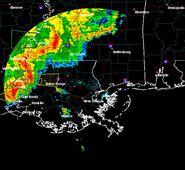 At 711 am cdt, a severe thunderstorm was located over erwinville, or 12 miles south of new roads, moving east at 35 mph (radar indicated). Hazards include 60 mph wind gusts. Expect damage to roofs, siding, and trees. this severe thunderstorm will be near, brusly around 730 am cdt. baton rouge and port allen around 735 am cdt. merrydale and brownfields around 740 am cdt. westminster and gardere around 745 am cdt. oak hills place, inniswold and village st. george around 750 am cdt. shenandoah and old jefferson around 755 am cdt. denham springs around 800 am cdt. walker around 810 am cdt. Other locations impacted by this severe thunderstorm include baton rouge airport. At 711 am cdt, a severe thunderstorm was located over erwinville, or 12 miles south of new roads, moving east at 35 mph (radar indicated). Hazards include 60 mph wind gusts. Expect damage to roofs, siding, and trees. this severe thunderstorm will be near, brusly around 730 am cdt. baton rouge and port allen around 735 am cdt. merrydale and brownfields around 740 am cdt. westminster and gardere around 745 am cdt. oak hills place, inniswold and village st. george around 750 am cdt. shenandoah and old jefferson around 755 am cdt. denham springs around 800 am cdt. walker around 810 am cdt. Other locations impacted by this severe thunderstorm include baton rouge airport.
|
| 5/19/2019 7:01 AM CDT |
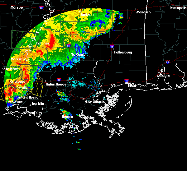 At 701 am cdt, severe thunderstorms were located along a line extending from near morganza to maringouin to near atchafalaya national wildlife refuge, moving east at 35 mph (radar indicated). Hazards include 60 mph wind gusts. Expect damage to roofs, siding, and trees. these severe storms will be near, maringouin around 705 am cdt. livonia, rosedale, grosse tete, ramah and erwinville around 715 am cdt. new roads around 725 am cdt. Port allen, addis and brusly around 730 am cdt. At 701 am cdt, severe thunderstorms were located along a line extending from near morganza to maringouin to near atchafalaya national wildlife refuge, moving east at 35 mph (radar indicated). Hazards include 60 mph wind gusts. Expect damage to roofs, siding, and trees. these severe storms will be near, maringouin around 705 am cdt. livonia, rosedale, grosse tete, ramah and erwinville around 715 am cdt. new roads around 725 am cdt. Port allen, addis and brusly around 730 am cdt.
|
| 5/19/2019 6:45 AM CDT |
 At 645 am cdt, severe thunderstorms were located along a line extending from near bayou current to near lottie to near breaux bridge, moving east at 40 mph (radar indicated). Hazards include 60 mph wind gusts. Expect damage to roofs, siding, and trees. these severe storms will be near, fordoche and lottie around 650 am cdt. livonia around 655 am cdt. maringouin, morganza and ramah around 700 am cdt. rosedale and grosse tete around 705 am cdt. erwinville around 710 am cdt. new roads and st. francisville around 715 am cdt. addis and brusly around 725 am cdt. Port allen and bayou sorrel around 730 am cdt. At 645 am cdt, severe thunderstorms were located along a line extending from near bayou current to near lottie to near breaux bridge, moving east at 40 mph (radar indicated). Hazards include 60 mph wind gusts. Expect damage to roofs, siding, and trees. these severe storms will be near, fordoche and lottie around 650 am cdt. livonia around 655 am cdt. maringouin, morganza and ramah around 700 am cdt. rosedale and grosse tete around 705 am cdt. erwinville around 710 am cdt. new roads and st. francisville around 715 am cdt. addis and brusly around 725 am cdt. Port allen and bayou sorrel around 730 am cdt.
|
| 5/19/2019 6:28 AM CDT |
 At 627 am cdt, severe thunderstorms were located along a line extending from near big cane to near port barre to near carencro, moving east at 40 mph (radar indicated). Hazards include 60 mph wind gusts. expect damage to roofs, siding, and trees At 627 am cdt, severe thunderstorms were located along a line extending from near big cane to near port barre to near carencro, moving east at 40 mph (radar indicated). Hazards include 60 mph wind gusts. expect damage to roofs, siding, and trees
|
| 5/9/2019 10:24 PM CDT |
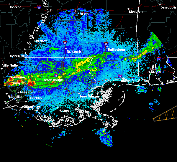 The national weather service in new orleans has issued a * severe thunderstorm warning for. southeastern west baton rouge parish in southeastern louisiana. central iberville parish in southeastern louisiana. south central east baton rouge parish in southeastern louisiana. Until 1115 pm cdt. The national weather service in new orleans has issued a * severe thunderstorm warning for. southeastern west baton rouge parish in southeastern louisiana. central iberville parish in southeastern louisiana. south central east baton rouge parish in southeastern louisiana. Until 1115 pm cdt.
|
| 4/18/2019 12:32 PM CDT |
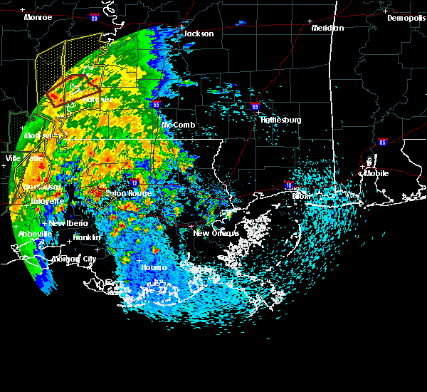 At 1231 pm cdt, a severe thunderstorm was located over gardere, or near oak hills place, moving northeast at 60 mph (radar indicated. marble sized hail was reported in plaquemine). Hazards include 60 mph wind gusts and quarter size hail. Hail damage to vehicles is expected. expect wind damage to roofs, siding, and trees. locations impacted include, baton rouge, plaquemine, oak hills place, st. gabriel, addis, brusly, village st. George, gardere and carville. At 1231 pm cdt, a severe thunderstorm was located over gardere, or near oak hills place, moving northeast at 60 mph (radar indicated. marble sized hail was reported in plaquemine). Hazards include 60 mph wind gusts and quarter size hail. Hail damage to vehicles is expected. expect wind damage to roofs, siding, and trees. locations impacted include, baton rouge, plaquemine, oak hills place, st. gabriel, addis, brusly, village st. George, gardere and carville.
|
| 4/18/2019 12:22 PM CDT |
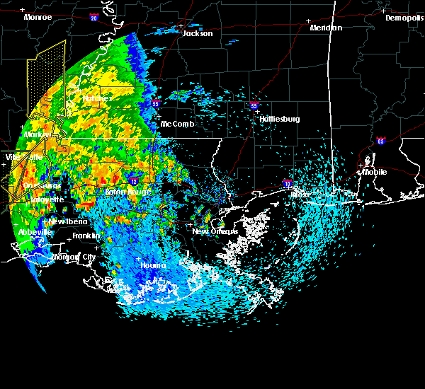 At 1222 pm cdt, a severe thunderstorm was located over plaquemine, moving northeast at 60 mph (radar indicated). Hazards include 60 mph wind gusts and quarter size hail. Hail damage to vehicles is expected. Expect wind damage to roofs, siding, and trees. At 1222 pm cdt, a severe thunderstorm was located over plaquemine, moving northeast at 60 mph (radar indicated). Hazards include 60 mph wind gusts and quarter size hail. Hail damage to vehicles is expected. Expect wind damage to roofs, siding, and trees.
|
| 3/3/2019 12:08 PM CST |
 At 1208 pm cst, a severe thunderstorm was located 7 miles south of grosse tete, or 9 miles west of plaquemine, moving east at 50 mph (radar indicated). Hazards include 60 mph wind gusts and half dollar size hail. Hail damage to vehicles is expected. expect wind damage to roofs, siding, and trees. locations impacted include, baton rouge, plaquemine, port allen, st. Gabriel, addis, brusly, grosse tete and gardere. At 1208 pm cst, a severe thunderstorm was located 7 miles south of grosse tete, or 9 miles west of plaquemine, moving east at 50 mph (radar indicated). Hazards include 60 mph wind gusts and half dollar size hail. Hail damage to vehicles is expected. expect wind damage to roofs, siding, and trees. locations impacted include, baton rouge, plaquemine, port allen, st. Gabriel, addis, brusly, grosse tete and gardere.
|
| 3/3/2019 11:57 AM CST |
 At 1156 am cst, a severe thunderstorm was located near ramah, or 13 miles northeast of catahoula, moving east at 45 mph (radar indicated). Hazards include 60 mph wind gusts and quarter size hail. Hail damage to vehicles is expected. Expect wind damage to roofs, siding, and trees. At 1156 am cst, a severe thunderstorm was located near ramah, or 13 miles northeast of catahoula, moving east at 45 mph (radar indicated). Hazards include 60 mph wind gusts and quarter size hail. Hail damage to vehicles is expected. Expect wind damage to roofs, siding, and trees.
|
| 2/5/2019 12:38 PM CST |
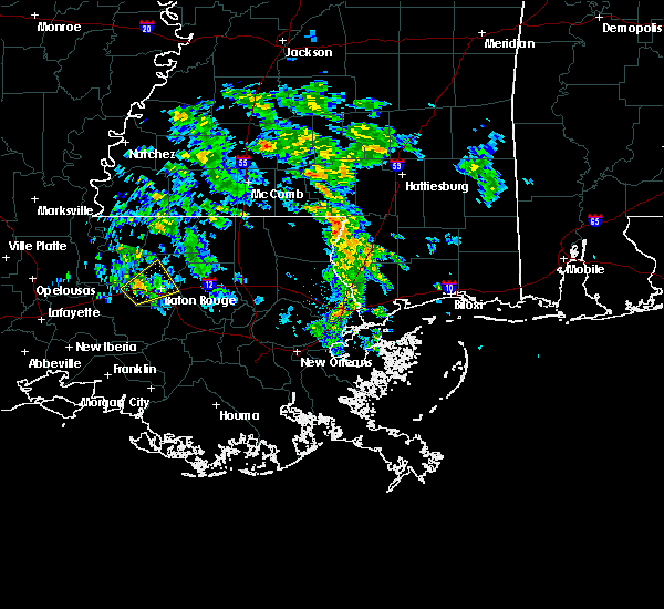 The severe thunderstorm warning for west baton rouge and central east baton rouge parishes will expire at 1245 pm cst, the storm which prompted the warning has weakened below severe limits, and no longer poses an immediate threat to life or property. therefore, the warning will be allowed to expire. to report severe weather, contact your nearest law enforcement agency. they will relay your report to the national weather service new orleans. The severe thunderstorm warning for west baton rouge and central east baton rouge parishes will expire at 1245 pm cst, the storm which prompted the warning has weakened below severe limits, and no longer poses an immediate threat to life or property. therefore, the warning will be allowed to expire. to report severe weather, contact your nearest law enforcement agency. they will relay your report to the national weather service new orleans.
|
| 2/5/2019 12:19 PM CST |
 At 1219 pm cst, a severe thunderstorm was located near grosse tete, or 9 miles west of port allen, moving northeast at 25 mph (radar indicated). Hazards include quarter size hail. damage to vehicles is expected At 1219 pm cst, a severe thunderstorm was located near grosse tete, or 9 miles west of port allen, moving northeast at 25 mph (radar indicated). Hazards include quarter size hail. damage to vehicles is expected
|
| 4/14/2018 8:01 AM CDT |
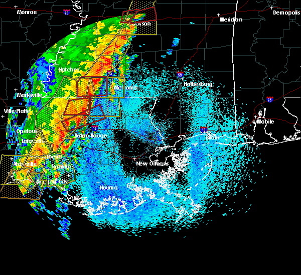 At 800 am cdt, severe thunderstorms were located along a line extending from port allen to 7 miles west of belle river, moving east at 25 mph (radar indicated). Hazards include 60 mph wind gusts. expect damage to roofs, siding, and trees At 800 am cdt, severe thunderstorms were located along a line extending from port allen to 7 miles west of belle river, moving east at 25 mph (radar indicated). Hazards include 60 mph wind gusts. expect damage to roofs, siding, and trees
|
| 4/14/2018 7:18 AM CDT |
 At 718 am cdt, severe thunderstorms were located along a line extending from 6 miles north of gloster to near jackson to near livonia to catahoula, moving east at 30 mph (radar indicated). Hazards include 60 mph wind gusts. Expect damage to roofs, siding, and trees. locations impacted include, baton rouge, zachary, baker, port allen, new roads, jackson, st. francisville, clinton, liberty, addis, brusly, centreville, livonia, maringouin, woodville, slaughter, gloster, fordoche, rosedale and grosse tete. A tornado watch remains in effect until 200 pm cdt for southeastern louisiana, and southern mississippi. At 718 am cdt, severe thunderstorms were located along a line extending from 6 miles north of gloster to near jackson to near livonia to catahoula, moving east at 30 mph (radar indicated). Hazards include 60 mph wind gusts. Expect damage to roofs, siding, and trees. locations impacted include, baton rouge, zachary, baker, port allen, new roads, jackson, st. francisville, clinton, liberty, addis, brusly, centreville, livonia, maringouin, woodville, slaughter, gloster, fordoche, rosedale and grosse tete. A tornado watch remains in effect until 200 pm cdt for southeastern louisiana, and southern mississippi.
|
| 4/4/2018 1:12 AM CDT |
 The severe thunderstorm warning for north central ascension, southeastern west baton rouge, st. helena, livingston, east feliciana, northwestern tangipahoa and east baton rouge parishes, southwestern pike, southeastern wilkinson and southern amite counties will expire at 115 am cdt, the storms which prompted the warning have weakened below severe limits, and no longer pose an immediate threat to life or property. therefore the warning will be allowed to expire. however small hail and gusty winds are still possible with these thunderstorms. The severe thunderstorm warning for north central ascension, southeastern west baton rouge, st. helena, livingston, east feliciana, northwestern tangipahoa and east baton rouge parishes, southwestern pike, southeastern wilkinson and southern amite counties will expire at 115 am cdt, the storms which prompted the warning have weakened below severe limits, and no longer pose an immediate threat to life or property. therefore the warning will be allowed to expire. however small hail and gusty winds are still possible with these thunderstorms.
|
| 4/4/2018 12:41 AM CDT |
 At 1240 am cdt, severe thunderstorms were located along a line extending from centreville to near pride to slaughter to near port allen, moving east at 45 mph (radar indicated). Hazards include 60 mph wind gusts and quarter size hail. Hail damage to vehicles is expected. expect wind damage to roofs, siding, and trees. severe thunderstorms will be near, felps and brownfields around 1250 am cdt. oak hills place, pride, westminster, inniswold, village st. george and greenwell spring around 1255 am cdt. shenandoah, old jefferson and watson around 100 am cdt. denham springs around 105 am cdt. walker, montpelier, gillsberg and easleyville around 110 am cdt. amite, amite city, kentwood, livingston, roseland, french settlement and port vincent around 115 am cdt. Other locations impacted by these severe thunderstorms include tangipahoa and baton rouge airport. At 1240 am cdt, severe thunderstorms were located along a line extending from centreville to near pride to slaughter to near port allen, moving east at 45 mph (radar indicated). Hazards include 60 mph wind gusts and quarter size hail. Hail damage to vehicles is expected. expect wind damage to roofs, siding, and trees. severe thunderstorms will be near, felps and brownfields around 1250 am cdt. oak hills place, pride, westminster, inniswold, village st. george and greenwell spring around 1255 am cdt. shenandoah, old jefferson and watson around 100 am cdt. denham springs around 105 am cdt. walker, montpelier, gillsberg and easleyville around 110 am cdt. amite, amite city, kentwood, livingston, roseland, french settlement and port vincent around 115 am cdt. Other locations impacted by these severe thunderstorms include tangipahoa and baton rouge airport.
|
| 4/2/2017 8:12 PM CDT |
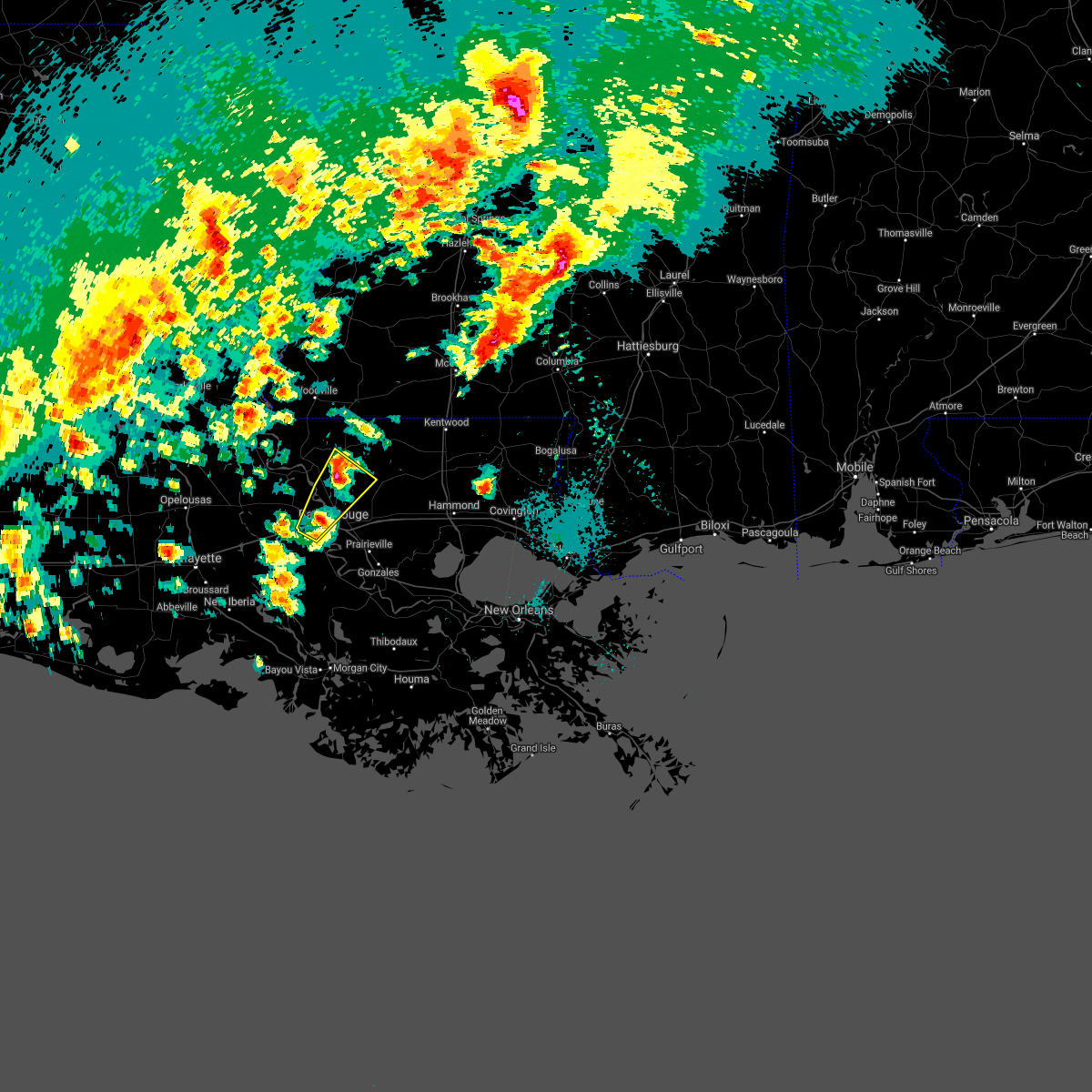 At 811 pm cdt, a severe thunderstorm was located near zachary, moving northeast at 60 mph (radar indicated). Hazards include 60 mph wind gusts and quarter size hail. Hail damage to vehicles is expected. expect wind damage to roofs, siding, and trees. locations impacted include, baton rouge, zachary, baker, port allen, brusly, slaughter, pride, brownfields, merrydale and baton rouge airport. A tornado watch remains in effect until 200 am cdt for southeastern louisiana. At 811 pm cdt, a severe thunderstorm was located near zachary, moving northeast at 60 mph (radar indicated). Hazards include 60 mph wind gusts and quarter size hail. Hail damage to vehicles is expected. expect wind damage to roofs, siding, and trees. locations impacted include, baton rouge, zachary, baker, port allen, brusly, slaughter, pride, brownfields, merrydale and baton rouge airport. A tornado watch remains in effect until 200 am cdt for southeastern louisiana.
|
| 4/2/2017 7:53 PM CDT |
 At 753 pm cdt, a severe thunderstorm was located near rosedale, or 12 miles west of port allen, moving northeast at 50 mph (radar indicated). Hazards include 60 mph wind gusts and quarter size hail. Hail damage to vehicles is expected. Expect wind damage to roofs, siding, and trees. At 753 pm cdt, a severe thunderstorm was located near rosedale, or 12 miles west of port allen, moving northeast at 50 mph (radar indicated). Hazards include 60 mph wind gusts and quarter size hail. Hail damage to vehicles is expected. Expect wind damage to roofs, siding, and trees.
|
| 3/25/2017 11:14 AM CDT |
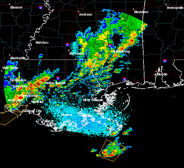 At 1114 am cdt, a severe thunderstorm was located over addis, or near plaquemine, moving northeast at 25 mph (radar indicated). Hazards include quarter size hail. damage to vehicles is expected At 1114 am cdt, a severe thunderstorm was located over addis, or near plaquemine, moving northeast at 25 mph (radar indicated). Hazards include quarter size hail. damage to vehicles is expected
|
| 3/1/2017 5:41 PM CST |
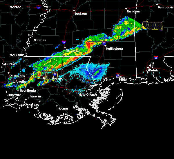 At 541 pm cst, a severe thunderstorm was located over port allen, moving east at 45 mph (radar indicated). Hazards include 60 mph wind gusts and nickel size hail. expect damage to roofs, siding, and trees At 541 pm cst, a severe thunderstorm was located over port allen, moving east at 45 mph (radar indicated). Hazards include 60 mph wind gusts and nickel size hail. expect damage to roofs, siding, and trees
|
| 3/1/2017 5:16 PM CST |
 At 515 pm cst, a severe thunderstorm was located near rosedale, or 13 miles south of new roads, moving east at 45 mph (radar indicated). Hazards include 60 mph wind gusts and nickel size hail. expect damage to roofs, siding, and trees At 515 pm cst, a severe thunderstorm was located near rosedale, or 13 miles south of new roads, moving east at 45 mph (radar indicated). Hazards include 60 mph wind gusts and nickel size hail. expect damage to roofs, siding, and trees
|
| 1/2/2017 2:03 PM CST |
 At 203 pm cst, severe thunderstorms were located along a line extending from near ruth to near greensburg to near plaquemine, moving east at 20 mph (radar indicated). Hazards include 60 mph wind gusts. Expect damage to roofs, siding, and trees. locations impacted include, baton rouge, mccomb, denham springs, plaquemine, port allen, greensburg, amite, oak hills place, st. gabriel, walker, amite city, addis, brusly, magnolia, kentwood, white castle, livingston, summit, independence and roseland. A tornado watch remains in effect until 800 pm cst for southeastern louisiana, and southern mississippi. At 203 pm cst, severe thunderstorms were located along a line extending from near ruth to near greensburg to near plaquemine, moving east at 20 mph (radar indicated). Hazards include 60 mph wind gusts. Expect damage to roofs, siding, and trees. locations impacted include, baton rouge, mccomb, denham springs, plaquemine, port allen, greensburg, amite, oak hills place, st. gabriel, walker, amite city, addis, brusly, magnolia, kentwood, white castle, livingston, summit, independence and roseland. A tornado watch remains in effect until 800 pm cst for southeastern louisiana, and southern mississippi.
|
| 1/2/2017 2:03 PM CST |
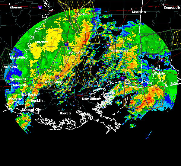 At 203 pm cst, severe thunderstorms were located along a line extending from near ruth to near greensburg to near plaquemine, moving east at 20 mph (radar indicated). Hazards include 60 mph wind gusts. Expect damage to roofs, siding, and trees. locations impacted include, baton rouge, mccomb, denham springs, plaquemine, port allen, greensburg, amite, oak hills place, st. gabriel, walker, amite city, addis, brusly, magnolia, kentwood, white castle, livingston, summit, independence and roseland. A tornado watch remains in effect until 800 pm cst for southeastern louisiana, and southern mississippi. At 203 pm cst, severe thunderstorms were located along a line extending from near ruth to near greensburg to near plaquemine, moving east at 20 mph (radar indicated). Hazards include 60 mph wind gusts. Expect damage to roofs, siding, and trees. locations impacted include, baton rouge, mccomb, denham springs, plaquemine, port allen, greensburg, amite, oak hills place, st. gabriel, walker, amite city, addis, brusly, magnolia, kentwood, white castle, livingston, summit, independence and roseland. A tornado watch remains in effect until 800 pm cst for southeastern louisiana, and southern mississippi.
|
| 1/2/2017 1:20 PM CST |
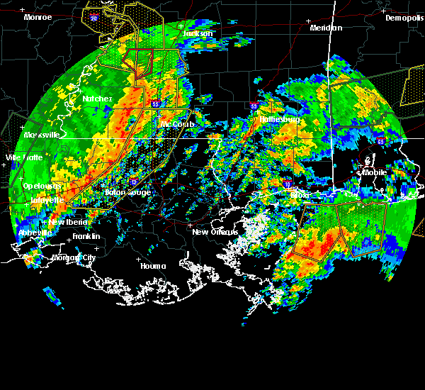 At 120 pm cst, severe thunderstorms were located along a line extending from near smithdale to 7 miles northeast of pride to 9 miles northwest of bayou sorrel, moving east at 20 mph (radar indicated). Hazards include 60 mph wind gusts. expect damage to roofs, siding, and trees At 120 pm cst, severe thunderstorms were located along a line extending from near smithdale to 7 miles northeast of pride to 9 miles northwest of bayou sorrel, moving east at 20 mph (radar indicated). Hazards include 60 mph wind gusts. expect damage to roofs, siding, and trees
|
| 1/2/2017 1:20 PM CST |
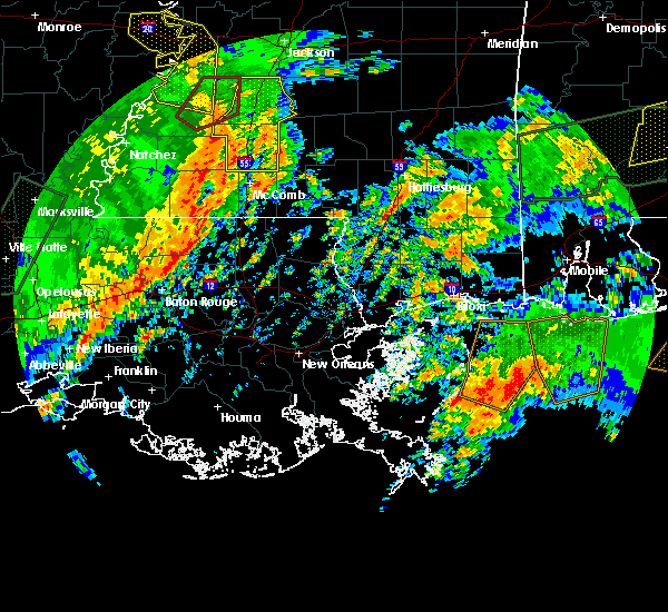 At 120 pm cst, severe thunderstorms were located along a line extending from near smithdale to 7 miles northeast of pride to 9 miles northwest of bayou sorrel, moving east at 20 mph (radar indicated). Hazards include 60 mph wind gusts. expect damage to roofs, siding, and trees At 120 pm cst, severe thunderstorms were located along a line extending from near smithdale to 7 miles northeast of pride to 9 miles northwest of bayou sorrel, moving east at 20 mph (radar indicated). Hazards include 60 mph wind gusts. expect damage to roofs, siding, and trees
|
| 5/19/2016 9:50 PM CDT |
 At 949 pm cdt, severe thunderstorms were located along a line extending from rosedale to 7 miles north of pierre part, moving northeast at 35 mph (radar indicated). Hazards include 70 mph wind gusts and penny size hail. Expect considerable tree damage. Damage is likely to mobile homes, roofs, and outbuildings. At 949 pm cdt, severe thunderstorms were located along a line extending from rosedale to 7 miles north of pierre part, moving northeast at 35 mph (radar indicated). Hazards include 70 mph wind gusts and penny size hail. Expect considerable tree damage. Damage is likely to mobile homes, roofs, and outbuildings.
|
| 5/19/2016 8:37 PM CDT |
 At 836 pm cdt, a severe thunderstorm was located 8 miles south of ramah, or 12 miles east of catahoula, moving northeast at 25 mph (radar indicated). Hazards include 60 mph wind gusts and quarter size hail. Hail damage to vehicles is expected. Expect wind damage to roofs, siding, and trees. At 836 pm cdt, a severe thunderstorm was located 8 miles south of ramah, or 12 miles east of catahoula, moving northeast at 25 mph (radar indicated). Hazards include 60 mph wind gusts and quarter size hail. Hail damage to vehicles is expected. Expect wind damage to roofs, siding, and trees.
|
| 5/1/2016 8:47 AM CDT |
 At 847 am cdt, a severe thunderstorm was located near white castle, or near donaldsonville, moving east at 30 mph (radar indicated). Hazards include quarter size hail. Damage to vehicles is expected. locations impacted include, baton rouge, denham springs, gonzales, donaldsonville, plaquemine, oak hills place, st. gabriel, walker, addis, brusly, white castle, sorrento, shenandoah, inniswold, geismer, old jefferson, prairieville, carville, gardere and village st. George. At 847 am cdt, a severe thunderstorm was located near white castle, or near donaldsonville, moving east at 30 mph (radar indicated). Hazards include quarter size hail. Damage to vehicles is expected. locations impacted include, baton rouge, denham springs, gonzales, donaldsonville, plaquemine, oak hills place, st. gabriel, walker, addis, brusly, white castle, sorrento, shenandoah, inniswold, geismer, old jefferson, prairieville, carville, gardere and village st. George.
|
| 5/1/2016 8:23 AM CDT |
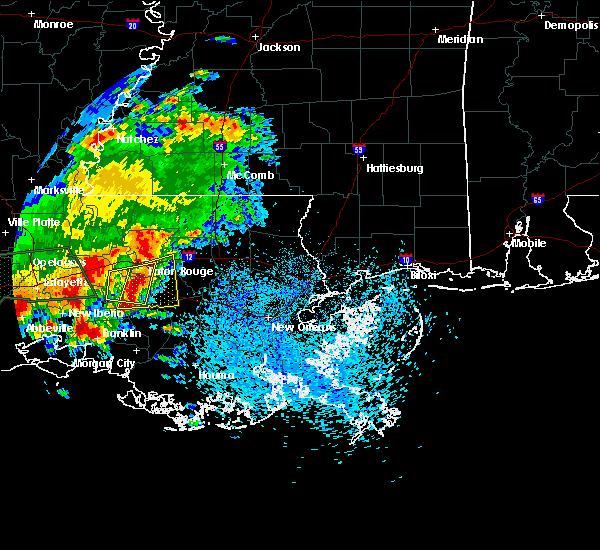 At 823 am cdt, a severe thunderstorm was located near gardere, or near plaquemine, moving east at 20 mph (radar indicated). Hazards include quarter size hail. damage to vehicles is expected At 823 am cdt, a severe thunderstorm was located near gardere, or near plaquemine, moving east at 20 mph (radar indicated). Hazards include quarter size hail. damage to vehicles is expected
|
| 5/1/2016 8:11 AM CDT |
 At 810 am cdt, a severe thunderstorm was located just west of plaquemine, moving east at 20 mph (radar indicated). Hazards include quarter size hail. Damage to vehicles is expected. locations impacted include, baton rouge, plaquemine, oak hills place, st. gabriel, addis, brusly, white castle, bayou sorrel, carville, inniswold, gardere, westminster and village st. George. At 810 am cdt, a severe thunderstorm was located just west of plaquemine, moving east at 20 mph (radar indicated). Hazards include quarter size hail. Damage to vehicles is expected. locations impacted include, baton rouge, plaquemine, oak hills place, st. gabriel, addis, brusly, white castle, bayou sorrel, carville, inniswold, gardere, westminster and village st. George.
|
| 5/1/2016 7:51 AM CDT |
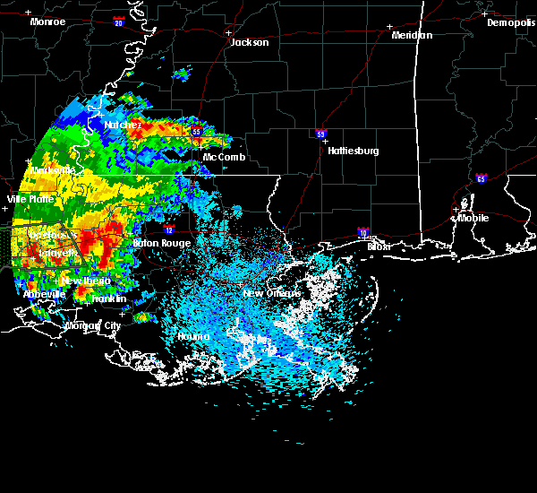 At 751 am cdt, a severe thunderstorm was located over plaquemine, moving east at 20 mph (radar indicated). Hazards include quarter size hail. damage to vehicles is expected At 751 am cdt, a severe thunderstorm was located over plaquemine, moving east at 20 mph (radar indicated). Hazards include quarter size hail. damage to vehicles is expected
|
| 3/17/2016 6:20 PM CDT |
 At 619 pm cdt, severe thunderstorms were located along a line extending from near kentwood to lake pelba, moving southeast at 25 mph (radar indicated). Hazards include 60 mph wind gusts. Expect damage to roofs. Siding and trees. At 619 pm cdt, severe thunderstorms were located along a line extending from near kentwood to lake pelba, moving southeast at 25 mph (radar indicated). Hazards include 60 mph wind gusts. Expect damage to roofs. Siding and trees.
|
| 2/15/2016 2:44 PM CST |
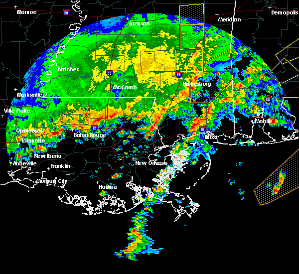 At 244 pm cst, a severe thunderstorm was located near grosse tete, or 9 miles west of port allen, moving east at 45 mph (radar indicated). Hazards include quarter size hail. damage to vehicles is expected At 244 pm cst, a severe thunderstorm was located near grosse tete, or 9 miles west of port allen, moving east at 45 mph (radar indicated). Hazards include quarter size hail. damage to vehicles is expected
|
| 1/21/2016 5:17 PM CST | At 517 pm cst, a severe thunderstorm was located over grosse tete, or 15 miles west of port allen, moving east at 70 mph (radar indicated). Hazards include 60 mph wind gusts and quarter size hail. Hail damage to vehicles is expected. Expect wind damage to roofs, siding and trees. |
| 1/9/2016 1:55 AM CST |
 The severe thunderstorm warning for west baton rouge and central iberville parishes will expire at 200 am cst, the storm which prompted the warning has weakened below severe limits, and no longer pose an immediate threat to life or property. therefore the warning will be allowed to expire. a severe thunderstorm watch remains in effect until 600 am cst for southeastern louisiana. The severe thunderstorm warning for west baton rouge and central iberville parishes will expire at 200 am cst, the storm which prompted the warning has weakened below severe limits, and no longer pose an immediate threat to life or property. therefore the warning will be allowed to expire. a severe thunderstorm watch remains in effect until 600 am cst for southeastern louisiana.
|
| 1/9/2016 1:29 AM CST |
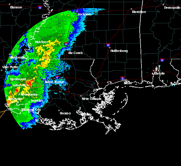 At 128 am cst, a severe thunderstorm was located near ramah, or 15 miles northeast of catahoula, moving northeast at 25 mph (radar indicated). Hazards include quarter size hail. damage to vehicles is expected At 128 am cst, a severe thunderstorm was located near ramah, or 15 miles northeast of catahoula, moving northeast at 25 mph (radar indicated). Hazards include quarter size hail. damage to vehicles is expected
|
| 9/6/2015 7:59 PM CDT | Quarter sized hail reported 0.8 miles NNE of Addis, LA, quarter size hail reported in addis. |
| 9/6/2015 7:57 PM CDT |
 At 757 pm cdt, doppler radar indicated a severe thunderstorm capable of producing quarter size hail and damaging winds in excess of 60 mph. this storm was located over addis, or near plaquemine, and moving southwest at 30 mph. At 757 pm cdt, doppler radar indicated a severe thunderstorm capable of producing quarter size hail and damaging winds in excess of 60 mph. this storm was located over addis, or near plaquemine, and moving southwest at 30 mph.
|
| 9/6/2015 7:34 PM CDT |
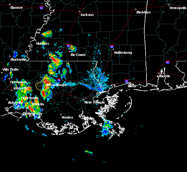 At 734 pm cdt, doppler radar indicated a severe thunderstorm capable of producing damaging winds in excess of 60 mph. this storm was located over westminster, or near oak hills place, and moving southwest at 20 mph. penny size hail may also accompany the damaging winds. At 734 pm cdt, doppler radar indicated a severe thunderstorm capable of producing damaging winds in excess of 60 mph. this storm was located over westminster, or near oak hills place, and moving southwest at 20 mph. penny size hail may also accompany the damaging winds.
|
| 7/30/2015 3:57 PM CDT |
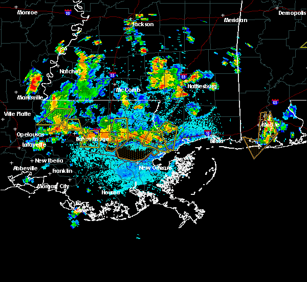 At 357 pm cdt, doppler radar indicated a severe thunderstorm capable of producing damaging winds in excess of 60 mph. this storm was located over erwinville, or 11 miles northwest of port allen, and moving south at 20 mph. penny size hail may also accompany the damaging winds. * this severe thunderstorm will be near, maringouin around 405 pm cdt. rosedale and grosse tete around 420 pm cdt. ramah around 425 pm cdt. At 357 pm cdt, doppler radar indicated a severe thunderstorm capable of producing damaging winds in excess of 60 mph. this storm was located over erwinville, or 11 miles northwest of port allen, and moving south at 20 mph. penny size hail may also accompany the damaging winds. * this severe thunderstorm will be near, maringouin around 405 pm cdt. rosedale and grosse tete around 420 pm cdt. ramah around 425 pm cdt.
|
| 7/5/2015 4:01 PM CDT |
 At 401 pm cdt, doppler radar indicated a severe thunderstorm capable of producing quarter size hail and damaging winds in excess of 60 mph. this storm was located near gardere, or near baton rouge, and moving east at 30 mph. At 401 pm cdt, doppler radar indicated a severe thunderstorm capable of producing quarter size hail and damaging winds in excess of 60 mph. this storm was located near gardere, or near baton rouge, and moving east at 30 mph.
|
| 7/5/2015 3:12 PM CDT |
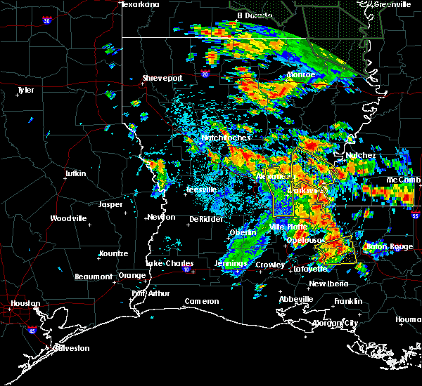 At 312 pm cdt, doppler radar indicated a severe thunderstorm capable of producing large damaging hail up to golf ball size and damaging winds in excess of 60 mph. this storm was located over erwinville, or 13 miles south of new roads, moving east at 25 mph. locations impacted include, addis, brusly, livonia, maringouin, rosedale, grosse tete, lottie, ramah and erwinville. At 312 pm cdt, doppler radar indicated a severe thunderstorm capable of producing large damaging hail up to golf ball size and damaging winds in excess of 60 mph. this storm was located over erwinville, or 13 miles south of new roads, moving east at 25 mph. locations impacted include, addis, brusly, livonia, maringouin, rosedale, grosse tete, lottie, ramah and erwinville.
|
| 7/5/2015 2:55 PM CDT |
 At 255 pm cdt, doppler radar indicated a severe thunderstorm capable of producing quarter size hail and damaging winds in excess of 60 mph. this storm was located near ramah, or 11 miles southeast of krotz springs, and moving east at 20 mph. At 255 pm cdt, doppler radar indicated a severe thunderstorm capable of producing quarter size hail and damaging winds in excess of 60 mph. this storm was located near ramah, or 11 miles southeast of krotz springs, and moving east at 20 mph.
|
| 6/24/2015 6:43 PM CDT |
 At 642 pm cdt, doppler radar indicated a severe thunderstorm capable of producing damaging winds in excess of 60 mph. this storm was located over brusly, or near port allen, and moving southwest at 10 mph. penny size hail may also accompany the damaging winds. At 642 pm cdt, doppler radar indicated a severe thunderstorm capable of producing damaging winds in excess of 60 mph. this storm was located over brusly, or near port allen, and moving southwest at 10 mph. penny size hail may also accompany the damaging winds.
|
| 5/31/2015 2:42 PM CDT | At 242 pm cdt, doppler radar indicated a line of severe thunderstorms capable of producing damaging winds in excess of 60 mph. these storms were located along a line extending from near pride to port allen, and moving east at 15 mph. |
| 5/24/2015 7:11 PM CDT | The severe thunderstorm warning for southwestern west baton rouge and western iberville parishes will expire at 715 pm cdt. the storm which prompted the warning has weakened below severe limits. and no longer poses an immediate threat to life or property. Therefore the warning will be allowed to expire. |
| 5/24/2015 6:47 PM CDT | At 646 pm cdt, doppler radar indicated a severe thunderstorm capable of producing damaging winds in excess of 60 mph. this storm was located 10 miles west of bayou sorrel, or 14 miles southeast of catahoula, and moving north at 45 mph. |
| 4/27/2015 5:52 PM CDT | At 551 pm cdt, doppler radar indicated a severe thunderstorm capable of producing quarter size hail and damaging winds in excess of 60 mph. this storm was located near port allen, moving east at 45 mph. locations impacted include, baton rouge, baker, denham springs, port allen, oak hills place, addis, brusly, maringouin, rosedale, grosse tete, brownfields, inniswold, merrydale, monticello, shenandoah, greenwell spring, ramah, westminster, erwinville and gardere. |
| 4/27/2015 5:27 PM CDT | At 527 pm cdt, doppler radar indicated a severe thunderstorm capable of producing quarter size hail and damaging winds in excess of 60 mph. this storm was located near ramah, or 14 miles northeast of catahoula, and moving east at 45 mph. |
| 4/27/2015 9:40 AM CDT | At 939 am cdt, doppler radar indicated a line of severe thunderstorms capable of producing quarter size hail and destructive winds in excess of 70 mph. these storms were located along a line extending from near felps to north vacherie. these storms were nearly stationary. locations impacted include, baton rouge, hammond, zachary, baker, denham springs, gonzales, plaquemine, port allen, jackson, clinton, greensburg, oak hills place, amite, st. gabriel, ponchatoula, walker, amite city, addis, brusly and kentwood. a tornado watch remains in effect until 100 pm cdt for southeastern louisiana. |
| 4/27/2015 9:17 AM CDT | At 917 am cdt, doppler radar indicated a line of severe thunderstorms capable of producing quarter size hail and destructive winds in excess of 70 mph. these storms were located along a line extending from near felps to north vacherie, and moving east at 60 mph. |
| 4/27/2015 9:17 AM CDT | The national weather service in new orleans has issued a * severe thunderstorm warning for. east central iberville parish in southeastern louisiana. northwestern washington parish in southeastern louisiana. tangipahoa parish in southeastern louisiana. East baton rouge parish in southeastern louisiana. |
| 4/27/2015 9:17 AM CDT | The national weather service in new orleans has issued a * severe thunderstorm warning for. east central iberville parish in southeastern louisiana. northwestern washington parish in southeastern louisiana. tangipahoa parish in southeastern louisiana. East baton rouge parish in southeastern louisiana. |
| 4/27/2015 9:17 AM CDT | At 917 am cdt, doppler radar indicated a line of severe thunderstorms capable of producing quarter size hail and destructive winds in excess of 70 mph. these storms were located along a line extending from near felps to north vacherie, and moving east at 60 mph. |
| 4/27/2015 8:51 AM CDT | At 849 am cdt, doppler radar indicated a line of severe thunderstorms capable of producing destructive winds in excess of 70 mph. these storms were located along a line extending from woodville to near ramah, and moving east at 55 mph. nickel size hail may also accompany the damaging winds. |
| 4/27/2015 8:51 AM CDT | At 849 am cdt, doppler radar indicated a line of severe thunderstorms capable of producing destructive winds in excess of 70 mph. these storms were located along a line extending from woodville to near ramah, and moving east at 55 mph. nickel size hail may also accompany the damaging winds. |
| 4/27/2015 8:28 AM CDT | At 824 am cdt, doppler radar indicated a line of severe thunderstorms capable of producing quarter size hail and damaging winds in excess of 60 mph. these storms were located along a line extending from near simmesport to near port barre to near maurice, moving east at 60 mph. the strongest winds will be approaching pointe coupee parish. winds could be in excess of 70 mph. there is a tornado watch in effect and this area has showed signs of rotation. a tornado warning may be needed for pointe coupee parish if this rotation persists. locations impacted include, baton rouge, zachary, plaquemine, port allen, new roads, jackson, st. francisville, addis, brusly, livonia, maringouin, woodville, fordoche, rosedale, grosse tete, morganza, wakefield, ramah, lettsworth and erwinville. a tornado watch remains in effect until 100 pm cdt for southeastern louisiana and southern mississippi. |
| 4/27/2015 8:28 AM CDT | At 824 am cdt, doppler radar indicated a line of severe thunderstorms capable of producing quarter size hail and damaging winds in excess of 60 mph. these storms were located along a line extending from near simmesport to near port barre to near maurice, moving east at 60 mph. the strongest winds will be approaching pointe coupee parish. winds could be in excess of 70 mph. there is a tornado watch in effect and this area has showed signs of rotation. a tornado warning may be needed for pointe coupee parish if this rotation persists. locations impacted include, baton rouge, zachary, plaquemine, port allen, new roads, jackson, st. francisville, addis, brusly, livonia, maringouin, woodville, fordoche, rosedale, grosse tete, morganza, wakefield, ramah, lettsworth and erwinville. a tornado watch remains in effect until 100 pm cdt for southeastern louisiana and southern mississippi. |
| 4/27/2015 8:13 AM CDT | At 812 am cdt, doppler radar indicated a line of severe thunderstorms capable of producing quarter size hail and damaging winds in excess of 60 mph. these storms were located along a line extending from mansura to washington to near lyons point, and moving east at 60 mph. |
| 4/27/2015 8:13 AM CDT | At 812 am cdt, doppler radar indicated a line of severe thunderstorms capable of producing quarter size hail and damaging winds in excess of 60 mph. these storms were located along a line extending from mansura to washington to near lyons point, and moving east at 60 mph. |
| 5/10/2013 4:50 AM CDT | Quarter sized hail reported 0.8 miles NNE of Addis, LA, quarter size hail in town of addis. |
| 12/10/2012 7:24 AM CST | Trees down along cell lane and state highway in west baton rouge county LA, 1.6 miles SSW of Addis, LA |
| 1/1/0001 12:00 AM | Trees down on a few homes in addis. also one house fire due to lightning strike. time estimated based on rada in west baton rouge county LA, 0.8 miles NNE of Addis, LA |
| 1/1/0001 12:00 AM | Quarter sized hail reported 0.8 miles NNE of Addis, LA |
Hail Maps for Addis, LA

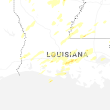


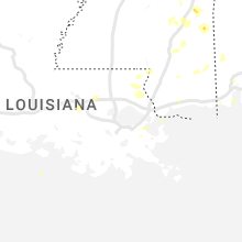


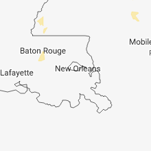


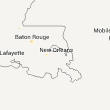


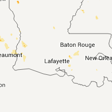


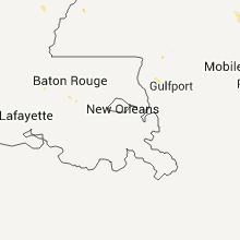


Connect with Interactive Hail Maps