

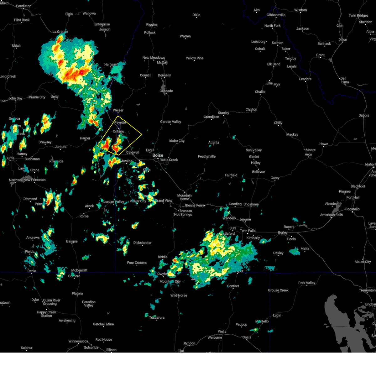
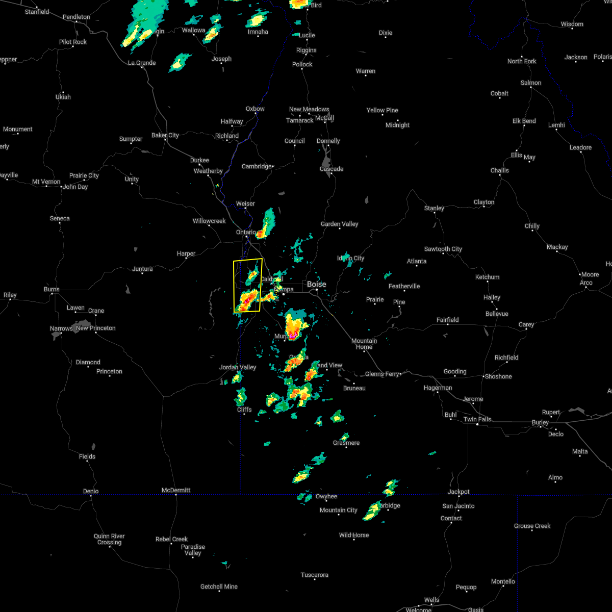
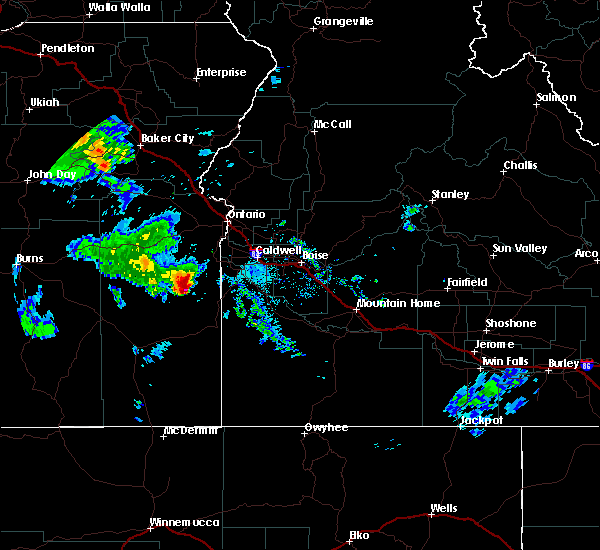
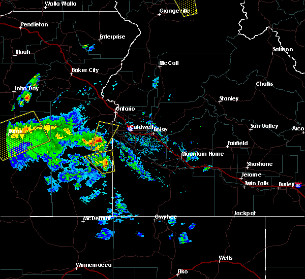
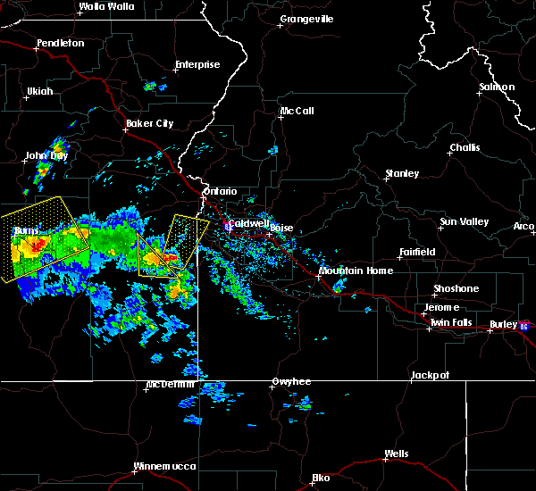
Hail Map for Adrian, OR
The Adrian, OR area has had 0 reports of on-the-ground hail by trained spotters, and has been under severe weather warnings 0 times during the past 12 months. Doppler radar has detected hail at or near Adrian, OR on 4 occasions.
| Name: | Adrian, OR |
| Where Located: | 44.8 miles WNW of Boise, ID |
| Map: | Google Map for Adrian, OR |
| Population: | 177 |
| Housing Units: | 78 |
| More Info: | Search Google for Adrian, OR |
0
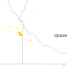
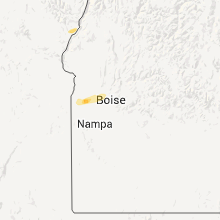
The Top Recent Hail Date for Adrian, OR is Wednesday, June 26, 2024 (3rd out of 4)

Hail and Wind Damage Spotted near Adrian, OR
| Date / Time | Report Details |
|---|---|
| 7/24/2024 4:56 PM MDT |
 At 455 pm mdt, a cluster of severe thunderstorm from near nyssa to adrian, was moving northeast at 25 mph (radar indicated). Hazards include 70 mph wind gusts and half dollar size hail. Hail damage to vehicles is expected. expect considerable tree damage. wind damage is also likely to mobile homes, roofs, and outbuildings. This severe storm will be near, new plymouth around 500 pm mdt. At 455 pm mdt, a cluster of severe thunderstorm from near nyssa to adrian, was moving northeast at 25 mph (radar indicated). Hazards include 70 mph wind gusts and half dollar size hail. Hail damage to vehicles is expected. expect considerable tree damage. wind damage is also likely to mobile homes, roofs, and outbuildings. This severe storm will be near, new plymouth around 500 pm mdt.
|
| 7/24/2024 4:32 PM MDT |
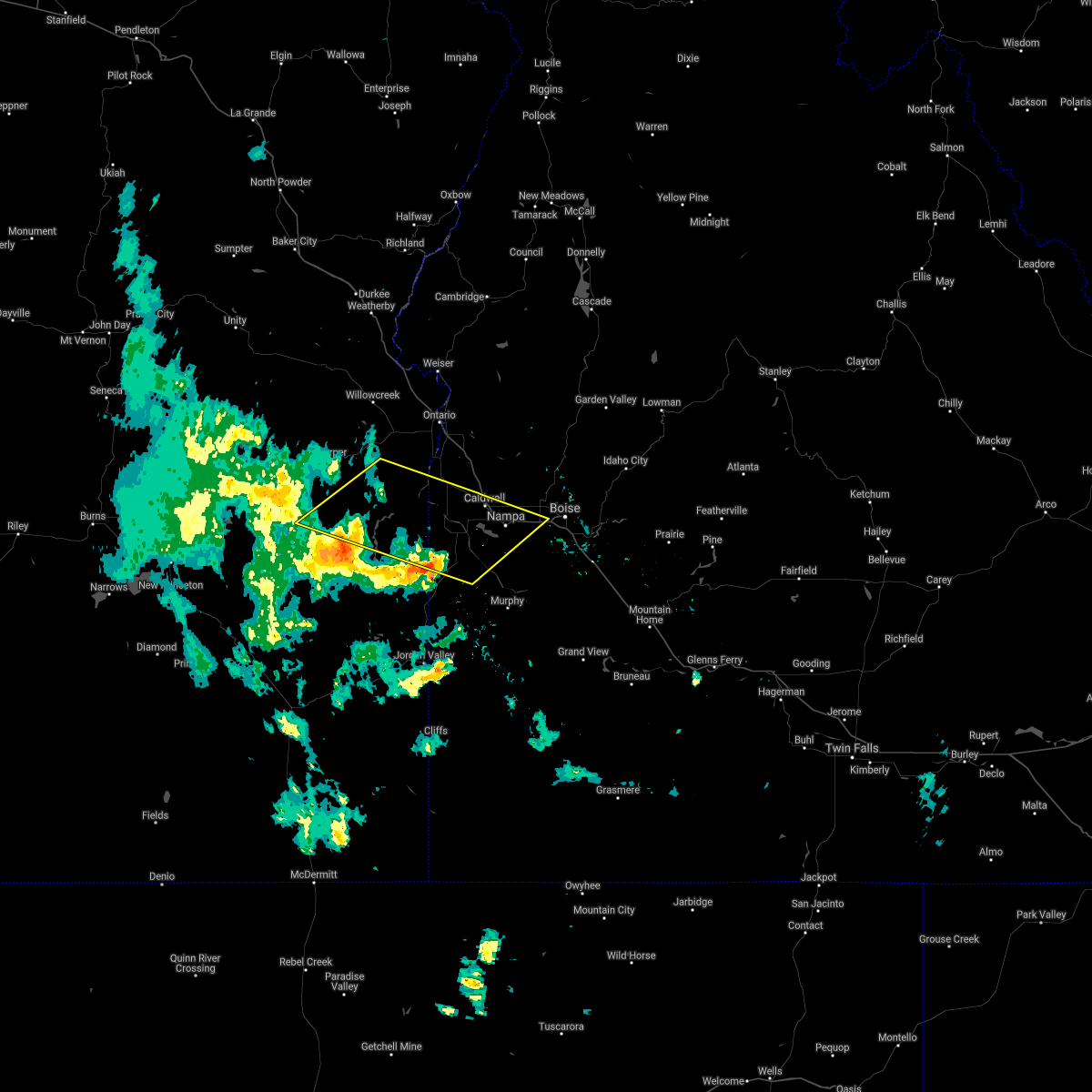
 Svrboi the national weather service in boise has issued a * severe thunderstorm warning for, payette county in southwestern idaho, northwestern canyon county in southwestern idaho, southwestern gem county in southwestern idaho, northeastern malheur county in southeastern oregon, * until 515 pm mdt.. * at 432 pm mdt, a severe thunderstorm was located over owyhee, or near parma, moving northeast at 25 mph (radar indicated). Hazards include 70 mph wind gusts and half dollar size hail. Hail damage to vehicles is expected. expect considerable tree damage. wind damage is also likely to mobile homes, roofs, and outbuildings. this severe thunderstorm will be near, parma and nyssa around 440 pm mdt. New plymouth around 500 pm mdt. Svrboi the national weather service in boise has issued a * severe thunderstorm warning for, payette county in southwestern idaho, northwestern canyon county in southwestern idaho, southwestern gem county in southwestern idaho, northeastern malheur county in southeastern oregon, * until 515 pm mdt.. * at 432 pm mdt, a severe thunderstorm was located over owyhee, or near parma, moving northeast at 25 mph (radar indicated). Hazards include 70 mph wind gusts and half dollar size hail. Hail damage to vehicles is expected. expect considerable tree damage. wind damage is also likely to mobile homes, roofs, and outbuildings. this severe thunderstorm will be near, parma and nyssa around 440 pm mdt. New plymouth around 500 pm mdt.
|
| 6/26/2024 1:32 PM MDT |
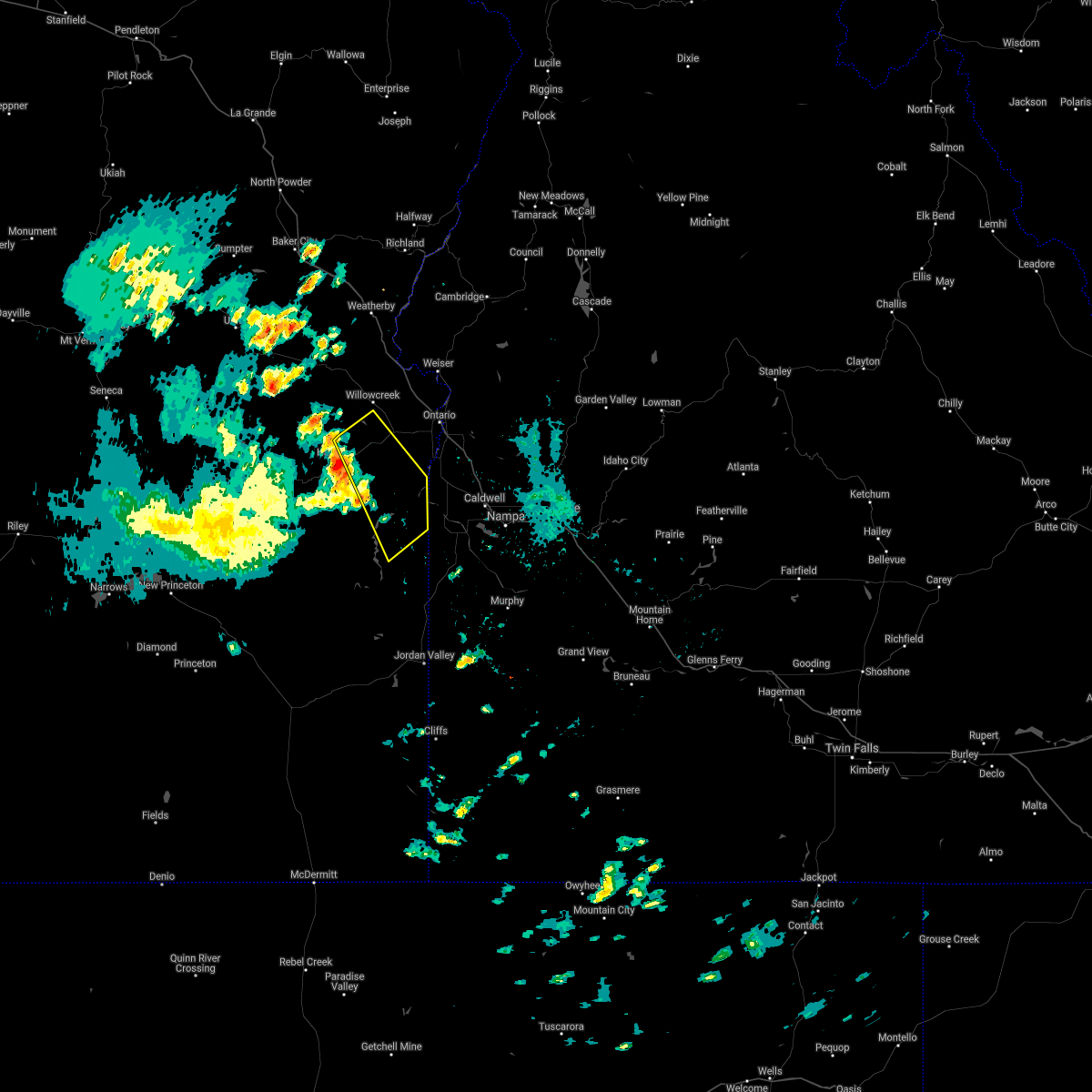
 Svrboi the national weather service in boise has issued a * severe thunderstorm warning for, southwestern payette county in southwestern idaho, northwestern canyon county in southwestern idaho, east central malheur county in southeastern oregon, * until 215 pm mdt.. * at 131 pm mdt, a severe thunderstorm was located near shell rock butte, or 13 miles west of parma, moving northeast at 20 mph (radar indicated). Hazards include 60 mph wind gusts and quarter size hail. Hail damage to vehicles is expected. expect wind damage to roofs, siding, and trees. this severe thunderstorm will be near, adrian and owyhee around 140 pm mdt. Parma and nyssa around 200 pm mdt. Svrboi the national weather service in boise has issued a * severe thunderstorm warning for, southwestern payette county in southwestern idaho, northwestern canyon county in southwestern idaho, east central malheur county in southeastern oregon, * until 215 pm mdt.. * at 131 pm mdt, a severe thunderstorm was located near shell rock butte, or 13 miles west of parma, moving northeast at 20 mph (radar indicated). Hazards include 60 mph wind gusts and quarter size hail. Hail damage to vehicles is expected. expect wind damage to roofs, siding, and trees. this severe thunderstorm will be near, adrian and owyhee around 140 pm mdt. Parma and nyssa around 200 pm mdt.
|
| 5/28/2024 7:16 PM MDT |
 At 715 pm mdt, a severe thunderstorm was located over owyhee, or near parma, moving northeast at 30 mph (radar indicated). Hazards include 60 mph wind gusts and nickel size hail. Expect damage to roofs, siding, and trees. This severe storm will be near, nyssa around 720 pm mdt. At 715 pm mdt, a severe thunderstorm was located over owyhee, or near parma, moving northeast at 30 mph (radar indicated). Hazards include 60 mph wind gusts and nickel size hail. Expect damage to roofs, siding, and trees. This severe storm will be near, nyssa around 720 pm mdt.
|
| 5/28/2024 6:52 PM MDT |
 Svrboi the national weather service in boise has issued a * severe thunderstorm warning for, southwestern payette county in southwestern idaho, northwestern canyon county in southwestern idaho, northwestern owyhee county in southwestern idaho, northeastern malheur county in southeastern oregon, * until 730 pm mdt.. * at 650 pm mdt, a severe thunderstorm was located near owyhee dam, or 14 miles southwest of parma, moving northeast at 30 mph (radar indicated). Hazards include 60 mph wind gusts and nickel size hail. Expect damage to roofs, siding, and trees. this severe thunderstorm will be near, adrian around 700 pm mdt. owyhee around 710 pm mdt. Nyssa around 720 pm mdt. Svrboi the national weather service in boise has issued a * severe thunderstorm warning for, southwestern payette county in southwestern idaho, northwestern canyon county in southwestern idaho, northwestern owyhee county in southwestern idaho, northeastern malheur county in southeastern oregon, * until 730 pm mdt.. * at 650 pm mdt, a severe thunderstorm was located near owyhee dam, or 14 miles southwest of parma, moving northeast at 30 mph (radar indicated). Hazards include 60 mph wind gusts and nickel size hail. Expect damage to roofs, siding, and trees. this severe thunderstorm will be near, adrian around 700 pm mdt. owyhee around 710 pm mdt. Nyssa around 720 pm mdt.
|
| 5/28/2024 6:16 PM MDT |
 At 616 pm mdt, a severe thunderstorm was located near owyhee dam, or 13 miles southwest of parma, moving north at 35 mph (radar indicated). Hazards include 60 mph wind gusts and quarter size hail. Hail damage to vehicles is expected. expect wind damage to roofs, siding, and trees. this severe storm will be near, adrian around 620 pm mdt. Owyhee around 630 pm mdt. At 616 pm mdt, a severe thunderstorm was located near owyhee dam, or 13 miles southwest of parma, moving north at 35 mph (radar indicated). Hazards include 60 mph wind gusts and quarter size hail. Hail damage to vehicles is expected. expect wind damage to roofs, siding, and trees. this severe storm will be near, adrian around 620 pm mdt. Owyhee around 630 pm mdt.
|
| 5/28/2024 6:01 PM MDT |
 Svrboi the national weather service in boise has issued a * severe thunderstorm warning for, northwestern canyon county in southwestern idaho, northwestern owyhee county in southwestern idaho, east central malheur county in southeastern oregon, * until 630 pm mdt.. * at 601 pm mdt, a severe thunderstorm was located over board corral mountain, or 20 miles southwest of parma, moving north at 35 mph (radar indicated). Hazards include 60 mph wind gusts and quarter size hail. Hail damage to vehicles is expected. expect wind damage to roofs, siding, and trees. this severe thunderstorm will be near, owyhee dam and northern owyhee reservoir around 610 pm mdt. Adrian around 620 pm mdt. Svrboi the national weather service in boise has issued a * severe thunderstorm warning for, northwestern canyon county in southwestern idaho, northwestern owyhee county in southwestern idaho, east central malheur county in southeastern oregon, * until 630 pm mdt.. * at 601 pm mdt, a severe thunderstorm was located over board corral mountain, or 20 miles southwest of parma, moving north at 35 mph (radar indicated). Hazards include 60 mph wind gusts and quarter size hail. Hail damage to vehicles is expected. expect wind damage to roofs, siding, and trees. this severe thunderstorm will be near, owyhee dam and northern owyhee reservoir around 610 pm mdt. Adrian around 620 pm mdt.
|
| 9/7/2022 6:08 PM MDT |
 At 606 pm mdt/506 pm pdt/, severe thunderstorms were located along a line extending from near brogan to castro ridge, moving east at 60 mph (radar indicated). Hazards include 70 mph wind gusts. Expect considerable tree damage. damage is likely to mobile homes, roofs, and outbuildings. severe thunderstorms will be near, castro ridge, parsnip peak, little grassy reservoir and antelope reservoir around 610 pm mdt. reynolds, south mountain, henley basin and black warrior mountain around 620 pm mdt. weiser, silver city, murphy and melba around 630 pm mdt. payette, ontario, parma and emmett around 640 pm mdt. thunderstorm damage threat, considerable hail threat, radar indicated max hail size, <. 75 in wind threat, radar indicated max wind gust, 70 mph. At 606 pm mdt/506 pm pdt/, severe thunderstorms were located along a line extending from near brogan to castro ridge, moving east at 60 mph (radar indicated). Hazards include 70 mph wind gusts. Expect considerable tree damage. damage is likely to mobile homes, roofs, and outbuildings. severe thunderstorms will be near, castro ridge, parsnip peak, little grassy reservoir and antelope reservoir around 610 pm mdt. reynolds, south mountain, henley basin and black warrior mountain around 620 pm mdt. weiser, silver city, murphy and melba around 630 pm mdt. payette, ontario, parma and emmett around 640 pm mdt. thunderstorm damage threat, considerable hail threat, radar indicated max hail size, <. 75 in wind threat, radar indicated max wind gust, 70 mph.
|
| 8/11/2022 5:36 PM MDT |
 At 535 pm mdt, a severe thunderstorm was located near homedale, or 17 miles southwest of caldwell, moving north at 20 mph (radar indicated). Hazards include 60 mph wind gusts and quarter size hail. Hail damage to vehicles is expected. expect wind damage to roofs, siding, and trees. this severe thunderstorm will be near, homedale around 550 pm mdt. parma, wilder, greenleaf and notus around 610 pm mdt. hail threat, radar indicated max hail size, 1. 00 in wind threat, radar indicated max wind gust, 60 mph. At 535 pm mdt, a severe thunderstorm was located near homedale, or 17 miles southwest of caldwell, moving north at 20 mph (radar indicated). Hazards include 60 mph wind gusts and quarter size hail. Hail damage to vehicles is expected. expect wind damage to roofs, siding, and trees. this severe thunderstorm will be near, homedale around 550 pm mdt. parma, wilder, greenleaf and notus around 610 pm mdt. hail threat, radar indicated max hail size, 1. 00 in wind threat, radar indicated max wind gust, 60 mph.
|
| 9/10/2021 6:39 PM MDT |
 At 639 pm mdt, severe thunderstorms were located along a line extending from near westfall to near twin springs campground to near knottingham butte, moving northeast at 40 mph (radar indicated). Hazards include 60 mph wind gusts and quarter size hail. Hail damage to vehicles is expected. expect wind damage to roofs, siding, and trees. severe thunderstorms will be near, harper and twin springs campground around 640 pm mdt. sugarloaf butte, little valley and vines hill around 650 pm mdt. bully creek reservoir, pelican point, shell rock butte and slocum creek campground around 700 pm mdt. vale, adrian, board corral mountain and keeney pass around 710 pm mdt. wilder, succor creek campground and owyhee around 720 pm mdt. hail threat, radar indicated max hail size, 1. 00 in wind threat, radar indicated max wind gust, 60 mph. At 639 pm mdt, severe thunderstorms were located along a line extending from near westfall to near twin springs campground to near knottingham butte, moving northeast at 40 mph (radar indicated). Hazards include 60 mph wind gusts and quarter size hail. Hail damage to vehicles is expected. expect wind damage to roofs, siding, and trees. severe thunderstorms will be near, harper and twin springs campground around 640 pm mdt. sugarloaf butte, little valley and vines hill around 650 pm mdt. bully creek reservoir, pelican point, shell rock butte and slocum creek campground around 700 pm mdt. vale, adrian, board corral mountain and keeney pass around 710 pm mdt. wilder, succor creek campground and owyhee around 720 pm mdt. hail threat, radar indicated max hail size, 1. 00 in wind threat, radar indicated max wind gust, 60 mph.
|
| 6/22/2021 6:40 PM MDT |
 At 639 pm mdt, severe thunderstorms were located along a line extending from near freezeout mountain to near elephant butte, moving northeast at 30 mph (radar indicated). Hazards include 60 mph wind gusts and penny size hail. Expect damage to roofs, siding, and trees. severe thunderstorms will be near, homedale, elephant butte and succor creek campground around 640 pm mdt. marsing, wilder and givens hot springs around 650 pm mdt. greenleaf, notus, lake lowell and huston around 700 pm mdt. caldwell, sand hollow and board corral mountain around 710 pm mdt. Nampa, kuna, double mountain and owyhee dam around 720 pm mdt. At 639 pm mdt, severe thunderstorms were located along a line extending from near freezeout mountain to near elephant butte, moving northeast at 30 mph (radar indicated). Hazards include 60 mph wind gusts and penny size hail. Expect damage to roofs, siding, and trees. severe thunderstorms will be near, homedale, elephant butte and succor creek campground around 640 pm mdt. marsing, wilder and givens hot springs around 650 pm mdt. greenleaf, notus, lake lowell and huston around 700 pm mdt. caldwell, sand hollow and board corral mountain around 710 pm mdt. Nampa, kuna, double mountain and owyhee dam around 720 pm mdt.
|
| 8/17/2020 4:42 PM MDT |
 At 442 pm mdt, severe thunderstorms were located along a line extending from little valley to owyhee reservoir, moving northeast at 40 mph (radar indicated). Hazards include 60 mph wind gusts. Expect damage to roofs, siding, and trees. these severe storms will be near, adrian, bully creek reservoir and keeney pass around 500 pm mdt. Vale and owyhee around 510 pm mdt. At 442 pm mdt, severe thunderstorms were located along a line extending from little valley to owyhee reservoir, moving northeast at 40 mph (radar indicated). Hazards include 60 mph wind gusts. Expect damage to roofs, siding, and trees. these severe storms will be near, adrian, bully creek reservoir and keeney pass around 500 pm mdt. Vale and owyhee around 510 pm mdt.
|
| 8/17/2020 4:13 PM MDT |
 At 412 pm mdt, severe thunderstorms were located along a line extending from 7 miles northeast of monument peak to 7 miles northeast of knottingham butte, moving northeast at 40 mph (radar indicated). Hazards include 70 mph wind gusts. Expect considerable tree damage. damage is likely to mobile homes, roofs, and outbuildings. severe thunderstorms will be near, pelican point around 420 pm mdt. twin springs campground around 430 pm mdt. owyhee reservoir and little valley around 440 pm mdt. Vale, adrian around 500 pm mdt. At 412 pm mdt, severe thunderstorms were located along a line extending from 7 miles northeast of monument peak to 7 miles northeast of knottingham butte, moving northeast at 40 mph (radar indicated). Hazards include 70 mph wind gusts. Expect considerable tree damage. damage is likely to mobile homes, roofs, and outbuildings. severe thunderstorms will be near, pelican point around 420 pm mdt. twin springs campground around 430 pm mdt. owyhee reservoir and little valley around 440 pm mdt. Vale, adrian around 500 pm mdt.
|
| 8/10/2019 6:58 PM MDT |
 At 657 pm mdt, a severe thunderstorm was located over owyhee reservoir, or 28 miles southwest of parma, moving northeast at 30 mph (radar indicated). Hazards include 70 mph wind gusts and ping pong ball size hail. People and animals outdoors will be injured. expect hail damage to roofs, siding, windows, and vehicles. expect considerable tree damage. wind damage is also likely to mobile homes, roofs, and outbuildings. this severe storm will be near, rockville school around 700 pm mdt. board corral mountain, succor creek campground and owyhee dam around 710 pm mdt. Adrian and owyhee around 730 pm mdt. At 657 pm mdt, a severe thunderstorm was located over owyhee reservoir, or 28 miles southwest of parma, moving northeast at 30 mph (radar indicated). Hazards include 70 mph wind gusts and ping pong ball size hail. People and animals outdoors will be injured. expect hail damage to roofs, siding, windows, and vehicles. expect considerable tree damage. wind damage is also likely to mobile homes, roofs, and outbuildings. this severe storm will be near, rockville school around 700 pm mdt. board corral mountain, succor creek campground and owyhee dam around 710 pm mdt. Adrian and owyhee around 730 pm mdt.
|
| 8/10/2019 6:29 PM MDT |
 At 628 pm mdt, a severe thunderstorm was located near knottingham butte, or 38 miles north of rome, moving northeast at 30 mph (radar indicated). Hazards include 70 mph wind gusts and ping pong ball size hail. People and animals outdoors will be injured. expect hail damage to roofs, siding, windows, and vehicles. expect considerable tree damage. wind damage is also likely to mobile homes, roofs, and outbuildings. this severe thunderstorm will be near, slocum creek campground and leslie gulch around 640 pm mdt. pelican point and rockville school around 650 pm mdt. board corral mountain and twin springs campground around 700 pm mdt. owyhee reservoir, owyhee dam and succor creek campground around 710 pm mdt. Adrian and owyhee around 730 pm mdt. At 628 pm mdt, a severe thunderstorm was located near knottingham butte, or 38 miles north of rome, moving northeast at 30 mph (radar indicated). Hazards include 70 mph wind gusts and ping pong ball size hail. People and animals outdoors will be injured. expect hail damage to roofs, siding, windows, and vehicles. expect considerable tree damage. wind damage is also likely to mobile homes, roofs, and outbuildings. this severe thunderstorm will be near, slocum creek campground and leslie gulch around 640 pm mdt. pelican point and rockville school around 650 pm mdt. board corral mountain and twin springs campground around 700 pm mdt. owyhee reservoir, owyhee dam and succor creek campground around 710 pm mdt. Adrian and owyhee around 730 pm mdt.
|
| 5/25/2018 7:31 PM MDT |
 At 731 pm mdt, severe thunderstorms were located along a line extending from near owyhee dam to near huston, moving north at 25 mph (radar indicated). Hazards include 70 mph wind gusts and quarter size hail. Hail damage to vehicles is expected. expect considerable tree damage. wind damage is also likely to mobile homes, roofs, and outbuildings. these severe storms will be near, greenleaf and adrian around 740 pm mdt. notus and sand hollow around 750 pm mdt. Parma and middleton around 800 pm mdt. At 731 pm mdt, severe thunderstorms were located along a line extending from near owyhee dam to near huston, moving north at 25 mph (radar indicated). Hazards include 70 mph wind gusts and quarter size hail. Hail damage to vehicles is expected. expect considerable tree damage. wind damage is also likely to mobile homes, roofs, and outbuildings. these severe storms will be near, greenleaf and adrian around 740 pm mdt. notus and sand hollow around 750 pm mdt. Parma and middleton around 800 pm mdt.
|
| 5/25/2018 7:00 PM MDT |
 At 700 pm mdt, a severe thunderstorm was located near elephant butte, or 16 miles southwest of caldwell, moving north at 20 mph (radar indicated). Hazards include 70 mph wind gusts and quarter size hail. Hail damage to vehicles is expected. expect considerable tree damage. wind damage is also likely to mobile homes, roofs, and outbuildings. this severe thunderstorm will be near, marsing around 710 pm mdt. homedale and lake lowell around 720 pm mdt. huston around 730 pm mdt. greenleaf and wilder around 740 pm mdt. Caldwell, notus, sand hollow and adrian around 750 pm mdt. At 700 pm mdt, a severe thunderstorm was located near elephant butte, or 16 miles southwest of caldwell, moving north at 20 mph (radar indicated). Hazards include 70 mph wind gusts and quarter size hail. Hail damage to vehicles is expected. expect considerable tree damage. wind damage is also likely to mobile homes, roofs, and outbuildings. this severe thunderstorm will be near, marsing around 710 pm mdt. homedale and lake lowell around 720 pm mdt. huston around 730 pm mdt. greenleaf and wilder around 740 pm mdt. Caldwell, notus, sand hollow and adrian around 750 pm mdt.
|
| 5/25/2018 5:33 PM MDT |
 At 533 pm mdt, a severe thunderstorm was located over board corral mountain, or 24 miles southwest of parma, moving north at 25 mph (radar indicated). Hazards include 60 mph wind gusts and quarter size hail. Hail damage to vehicles is expected. expect wind damage to roofs, siding, and trees. this severe storm will be near, owyhee dam around 600 pm mdt. Shell rock butte and adrian around 610 pm mdt. At 533 pm mdt, a severe thunderstorm was located over board corral mountain, or 24 miles southwest of parma, moving north at 25 mph (radar indicated). Hazards include 60 mph wind gusts and quarter size hail. Hail damage to vehicles is expected. expect wind damage to roofs, siding, and trees. this severe storm will be near, owyhee dam around 600 pm mdt. Shell rock butte and adrian around 610 pm mdt.
|
| 5/25/2018 5:08 PM MDT |
 At 508 pm mdt, a severe thunderstorm was located near slocum creek campground, or 34 miles southwest of parma, moving north at 30 mph (radar indicated). Hazards include 60 mph wind gusts and quarter size hail. Hail damage to vehicles is expected. expect wind damage to roofs, siding, and trees. this severe thunderstorm will be near, pelican point and succor creek campground around 520 pm mdt. board corral mountain around 530 pm mdt. owyhee reservoir and owyhee dam around 550 pm mdt. shell rock butte around 600 pm mdt. Adrian around 610 pm mdt. At 508 pm mdt, a severe thunderstorm was located near slocum creek campground, or 34 miles southwest of parma, moving north at 30 mph (radar indicated). Hazards include 60 mph wind gusts and quarter size hail. Hail damage to vehicles is expected. expect wind damage to roofs, siding, and trees. this severe thunderstorm will be near, pelican point and succor creek campground around 520 pm mdt. board corral mountain around 530 pm mdt. owyhee reservoir and owyhee dam around 550 pm mdt. shell rock butte around 600 pm mdt. Adrian around 610 pm mdt.
|
| 7/9/2017 12:01 PM MDT | Report from facebook about an russian olive tree that was downed by outflow winds from thunderstorms to the southwest. the tree had a 2 part trunk... with the larger on in malheur county OR, 0.1 miles NE of Adrian, OR |
| 5/5/2017 6:06 PM MDT |
 At 605 pm mdt, a severe thunderstorm was located over owyhee, or near parma, moving northeast at 35 mph (radar indicated). Hazards include half dollar size hail and gusty winds. Damage to vehicles is expected. this severe thunderstorm will be near, parma around 610 pm mdt. nyssa around 620 pm mdt. ontario and fruitland around 630 pm mdt. New plymouth and french corner around 640 pm mdt. At 605 pm mdt, a severe thunderstorm was located over owyhee, or near parma, moving northeast at 35 mph (radar indicated). Hazards include half dollar size hail and gusty winds. Damage to vehicles is expected. this severe thunderstorm will be near, parma around 610 pm mdt. nyssa around 620 pm mdt. ontario and fruitland around 630 pm mdt. New plymouth and french corner around 640 pm mdt.
|
| 5/5/2017 5:48 PM MDT |
 At 548 pm mdt, a severe thunderstorm was located near owyhee, or 8 miles west of parma, moving northeast at 40 mph (radar indicated). Hazards include quarter size hail and gusty winds. Damage to vehicles is expected. this severe storm will be near, parma and keeney pass around 550 pm mdt. Ontario and nyssa around 600 pm mdt. At 548 pm mdt, a severe thunderstorm was located near owyhee, or 8 miles west of parma, moving northeast at 40 mph (radar indicated). Hazards include quarter size hail and gusty winds. Damage to vehicles is expected. this severe storm will be near, parma and keeney pass around 550 pm mdt. Ontario and nyssa around 600 pm mdt.
|
| 5/5/2017 5:16 PM MDT |
 At 516 pm mdt, a severe thunderstorm was located over twin springs campground, or 25 miles southwest of parma, moving northeast at 40 mph (radar indicated). Hazards include quarter size hail and gusty winds. Damage to vehicles is expected. this severe thunderstorm will be near, owyhee dam and shell rock butte around 530 pm mdt. adrian around 540 pm mdt. parma, owyhee and keeney pass around 550 pm mdt. Ontario and nyssa around 600 pm mdt. At 516 pm mdt, a severe thunderstorm was located over twin springs campground, or 25 miles southwest of parma, moving northeast at 40 mph (radar indicated). Hazards include quarter size hail and gusty winds. Damage to vehicles is expected. this severe thunderstorm will be near, owyhee dam and shell rock butte around 530 pm mdt. adrian around 540 pm mdt. parma, owyhee and keeney pass around 550 pm mdt. Ontario and nyssa around 600 pm mdt.
|
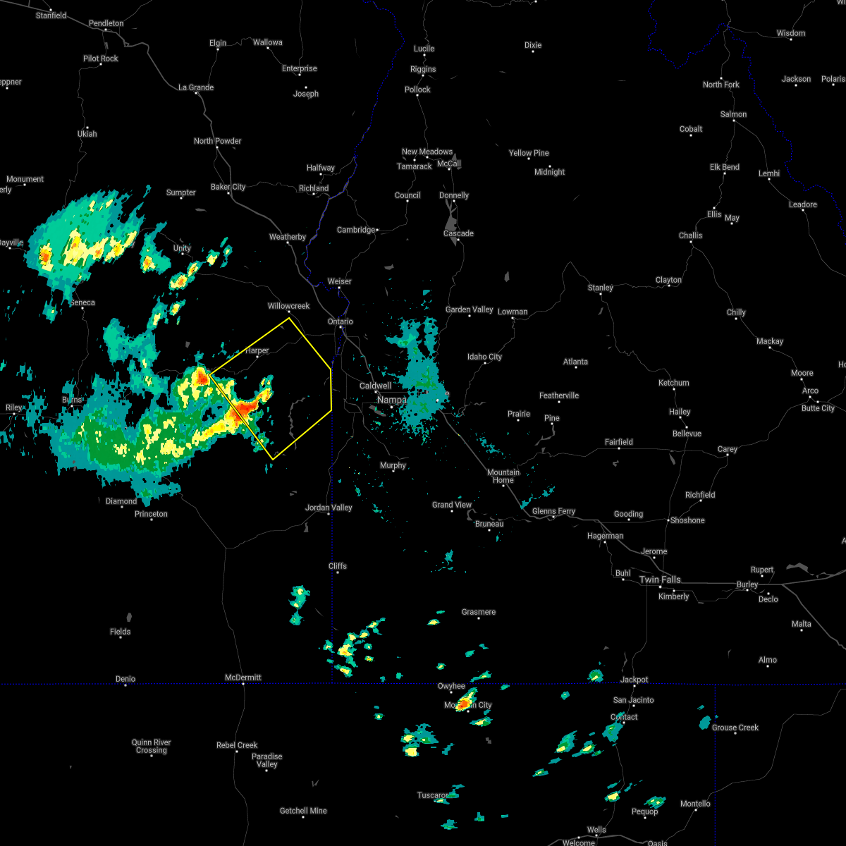
Hail Maps for Adrian, OR


Connect with Interactive Hail Maps