

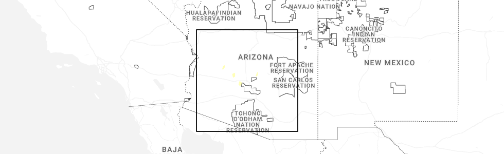
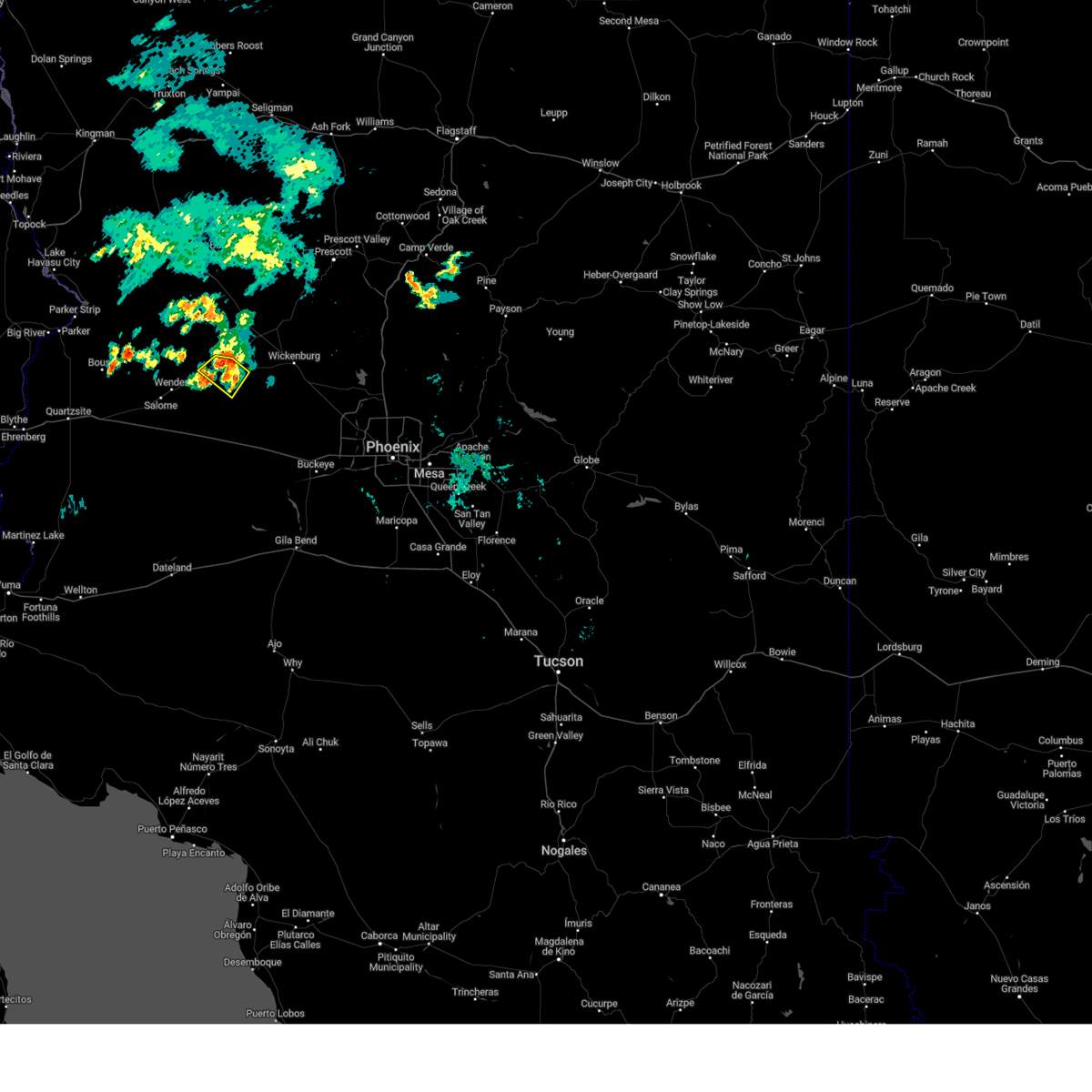
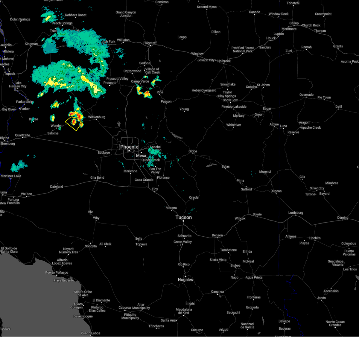
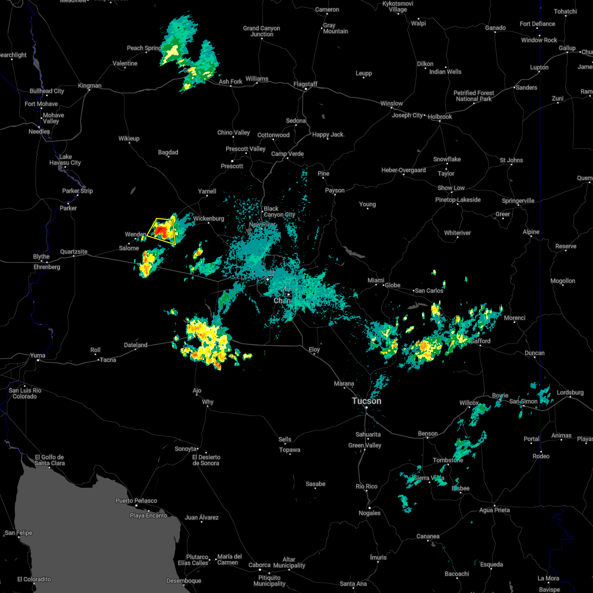
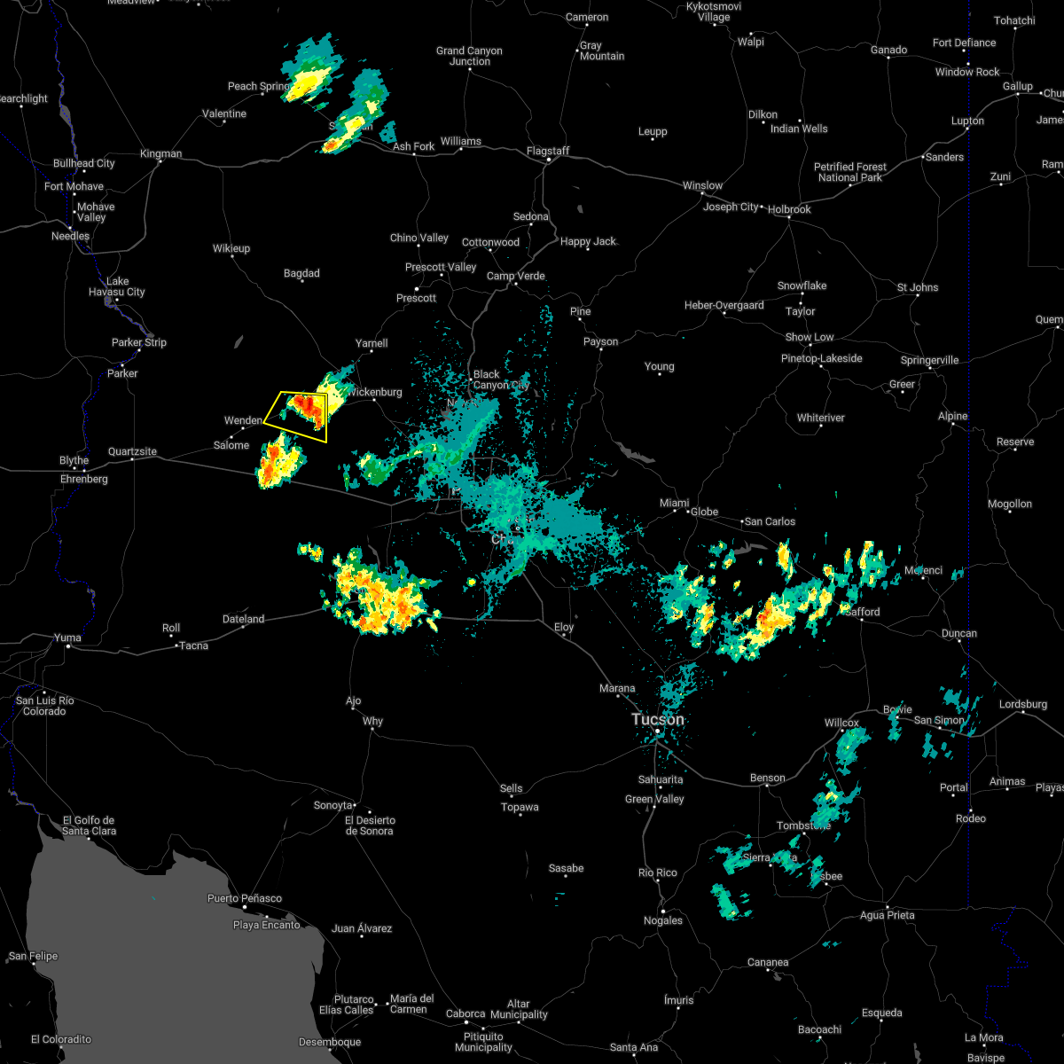
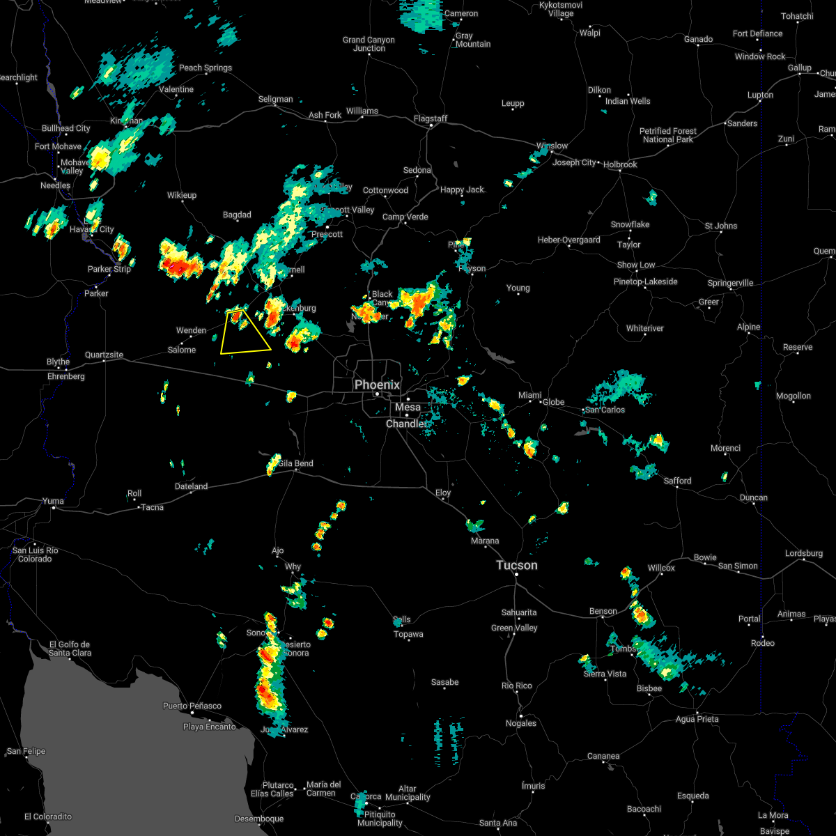
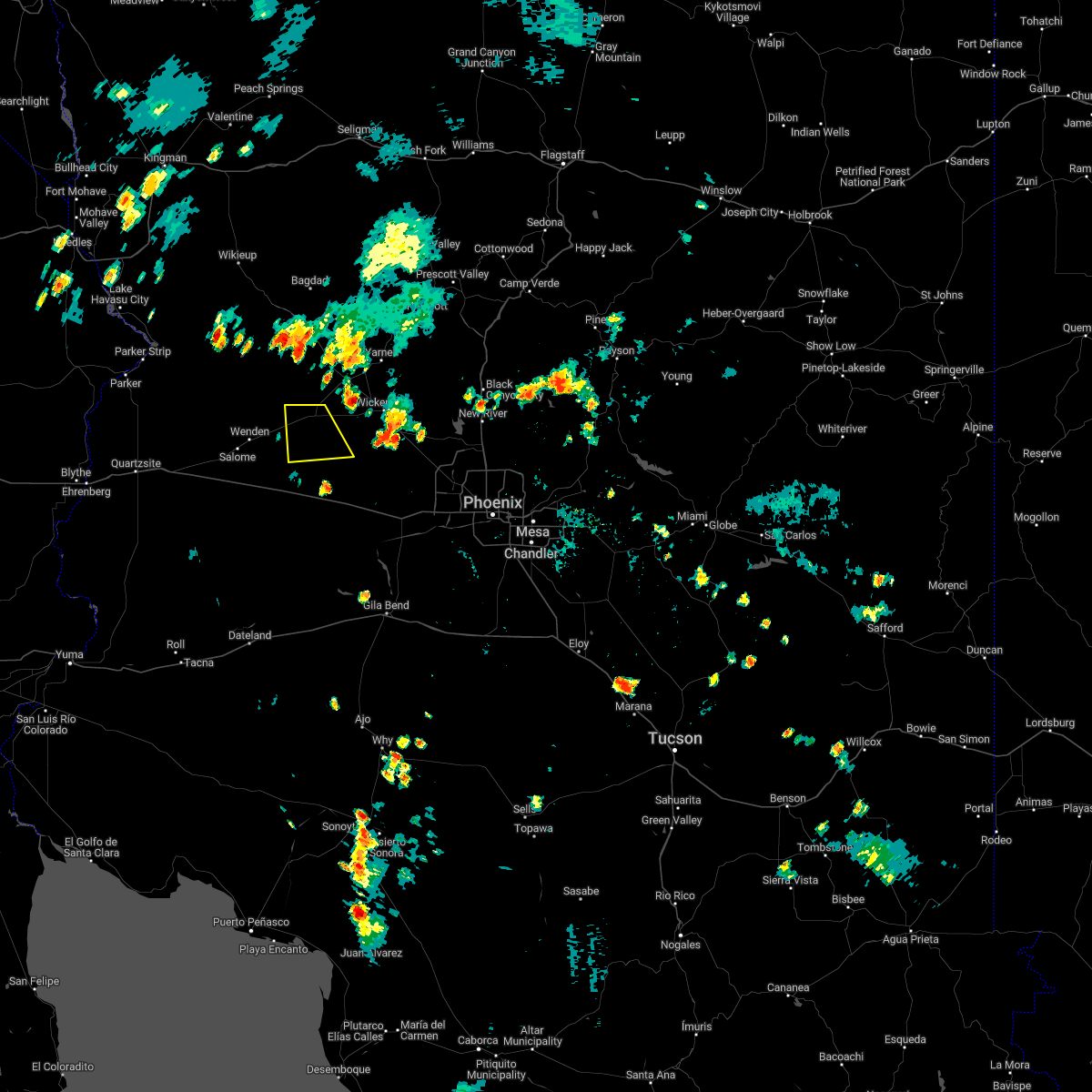
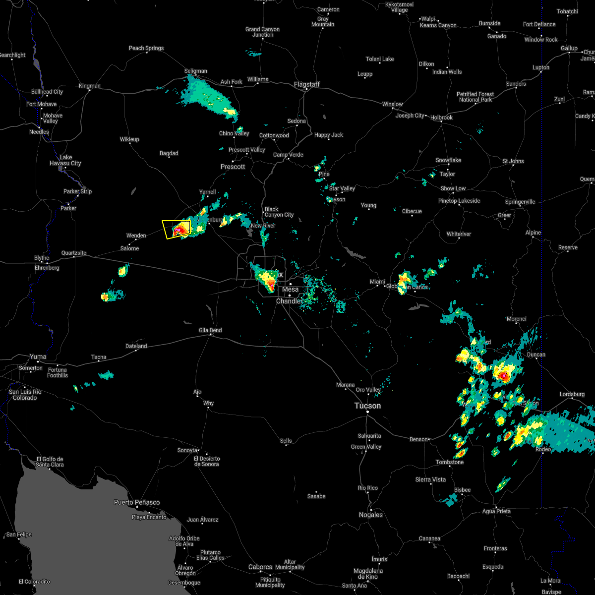
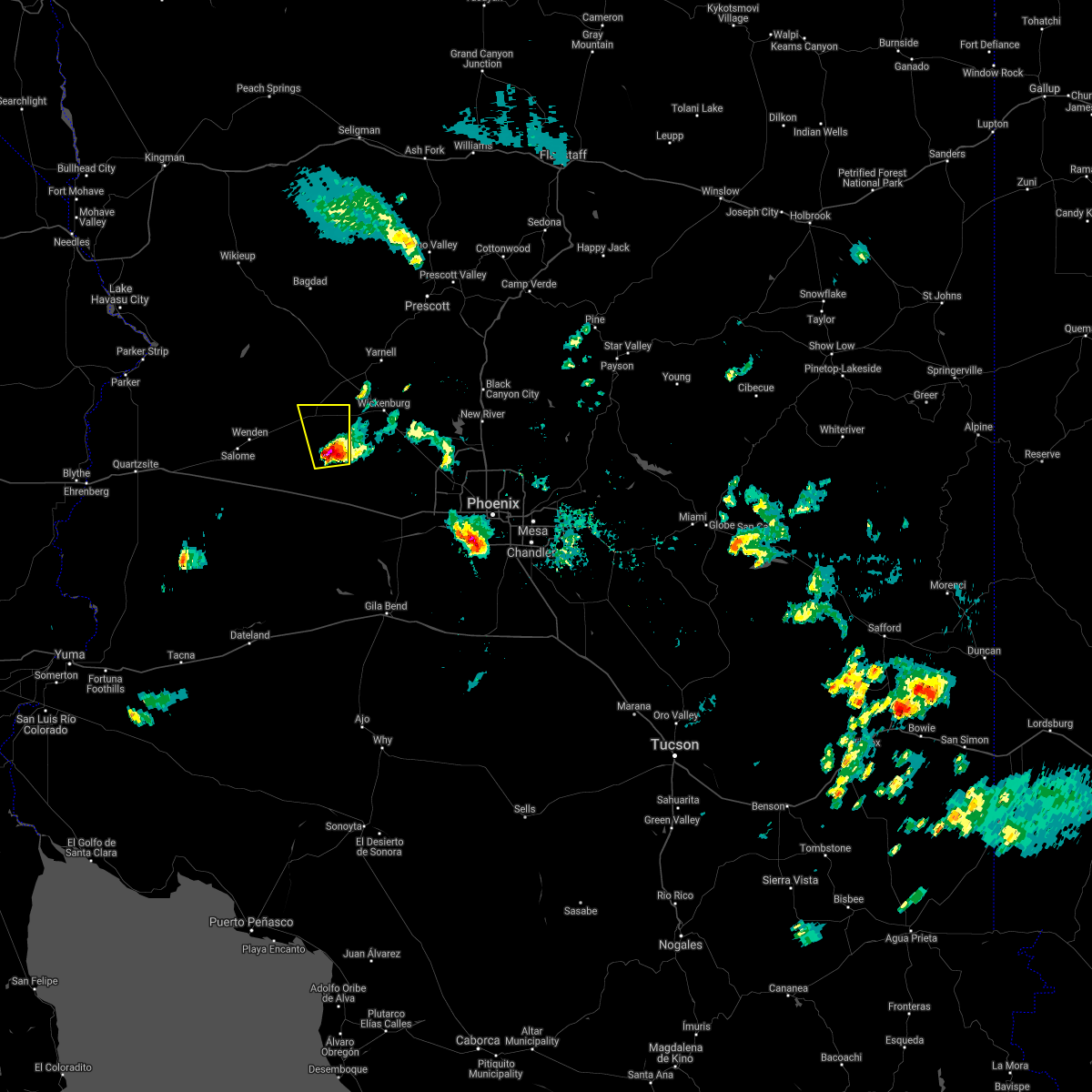
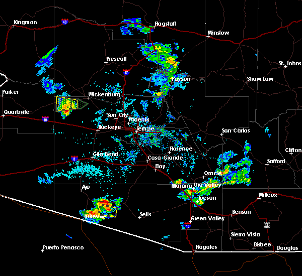
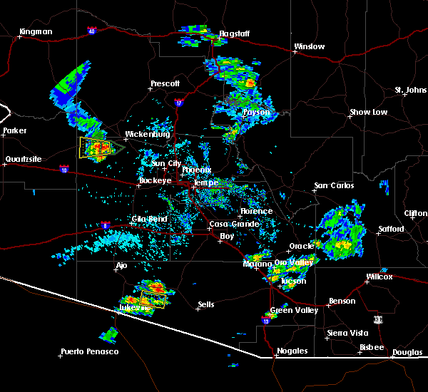
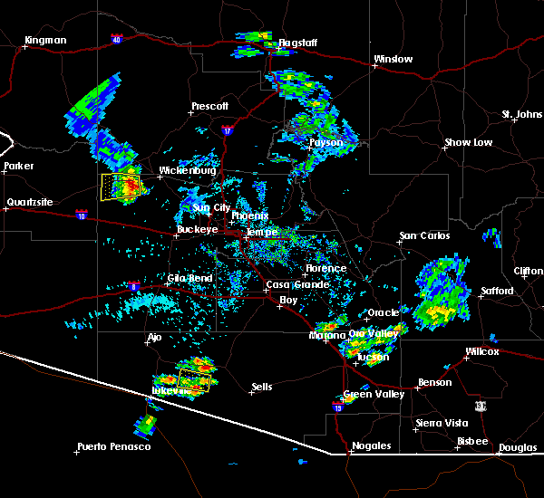
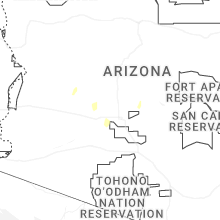
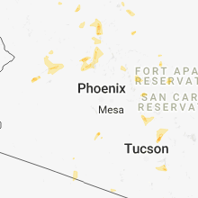
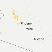
Hail Map for Aguila, AZ
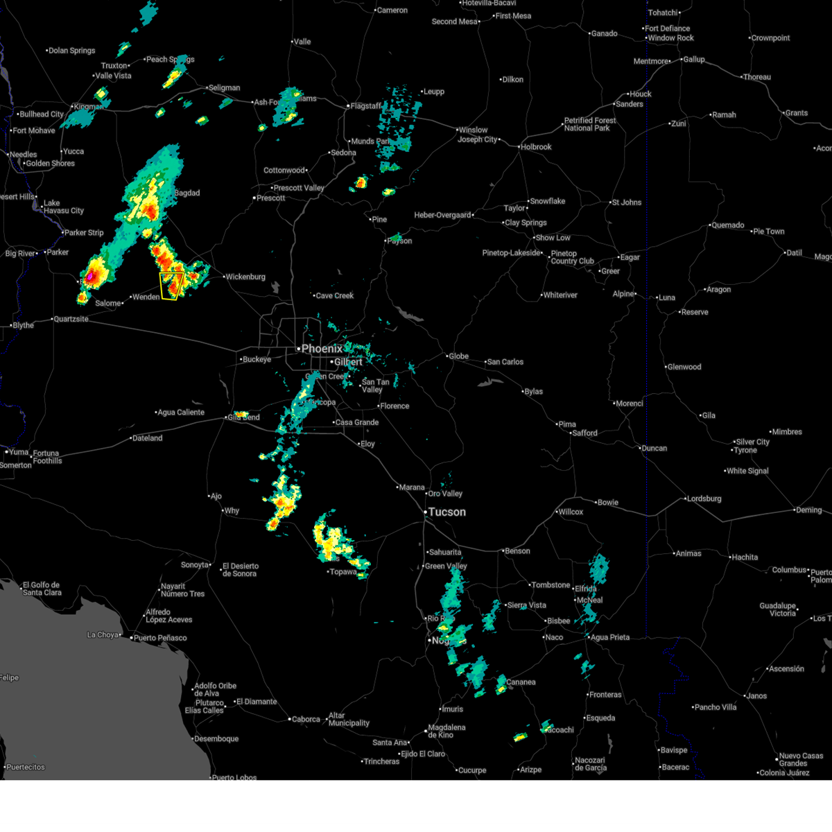
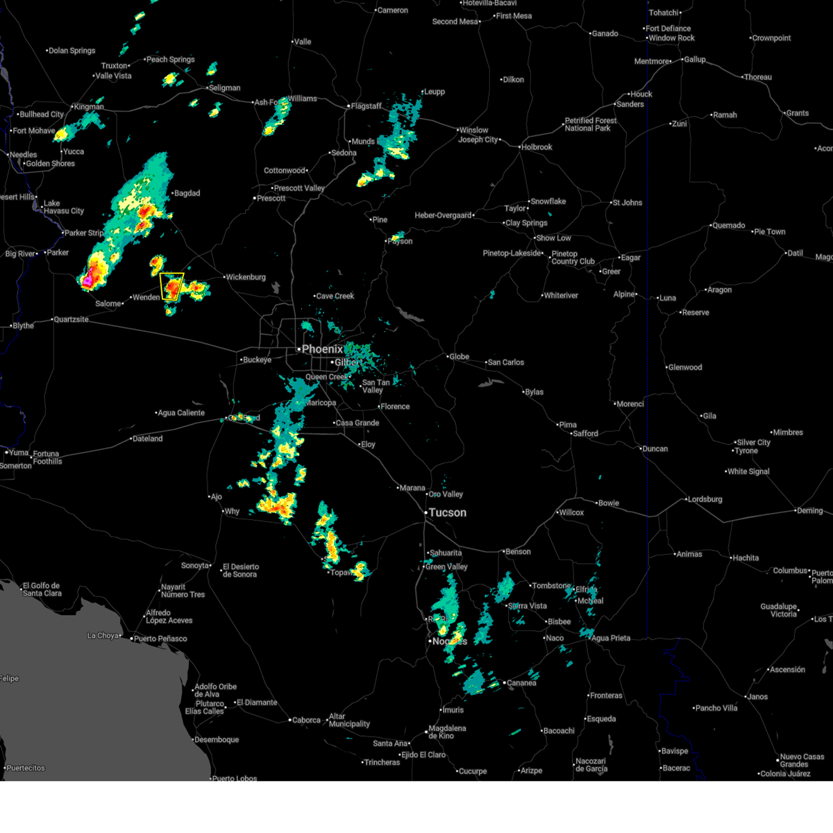
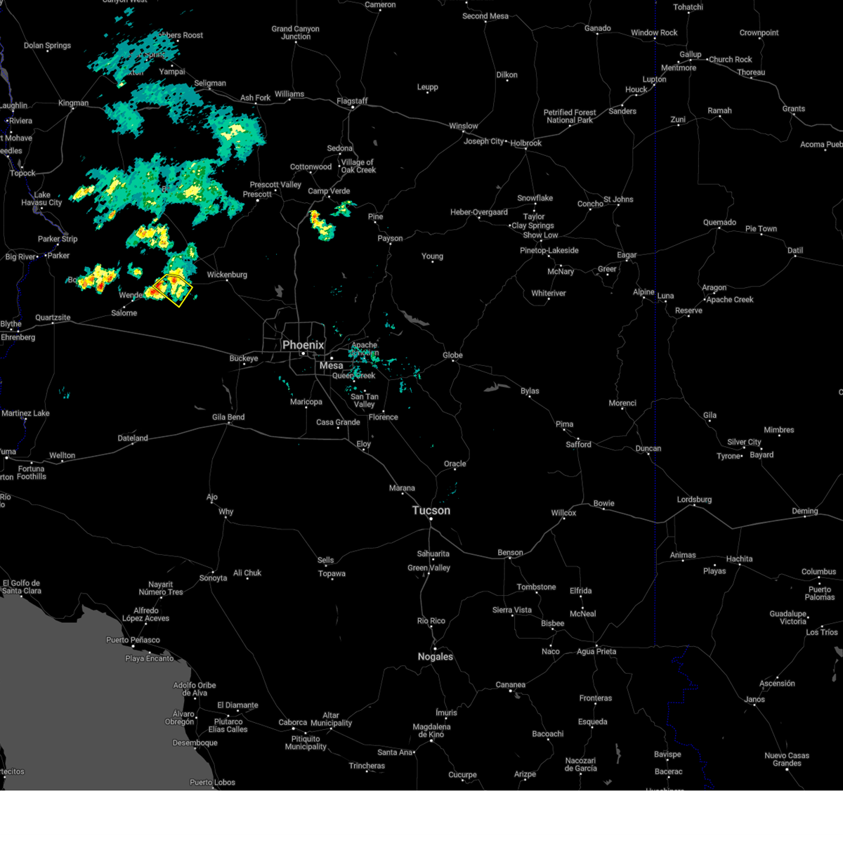
The Aguila, AZ area has had 0 reports of on-the-ground hail by trained spotters, and has been under severe weather warnings 4 times during the past 12 months. Doppler radar has detected hail at or near Aguila, AZ on 17 occasions, including 1 occasion during the past year.
| Name: | Aguila, AZ |
| Where Located: | 71.4 miles WNW of Phoenix, AZ |
| Map: | Google Map for Aguila, AZ |
| Population: | 798 |
| Housing Units: | 304 |
| More Info: | Search Google for Aguila, AZ |
0
The Top Recent Hail Date for Aguila, AZ is Tuesday, November 18, 2025 (15th out of 17)
Hail and Wind Damage Spotted near Aguila, AZ
| Date / Time | Report Details |
|---|---|
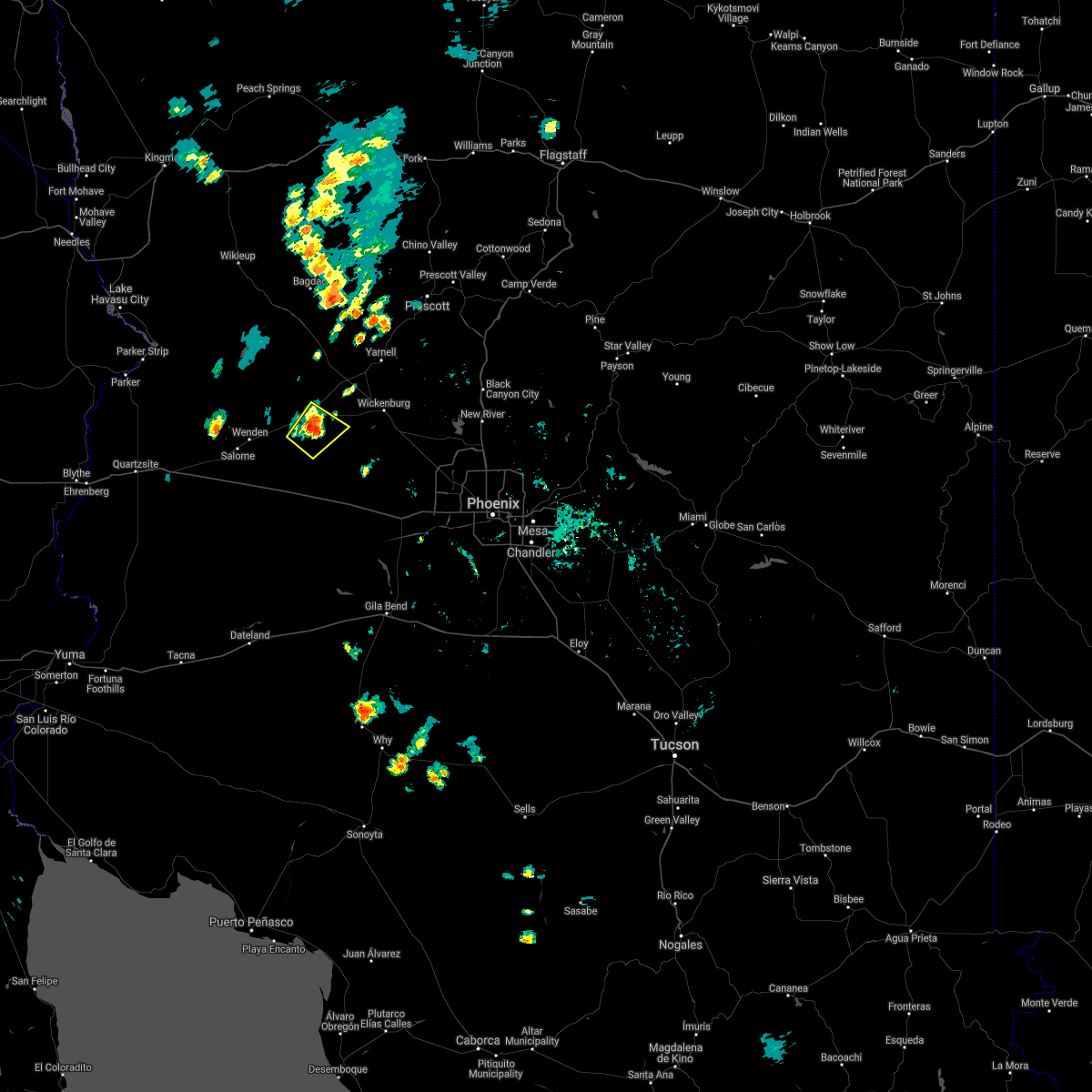
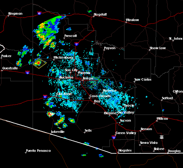
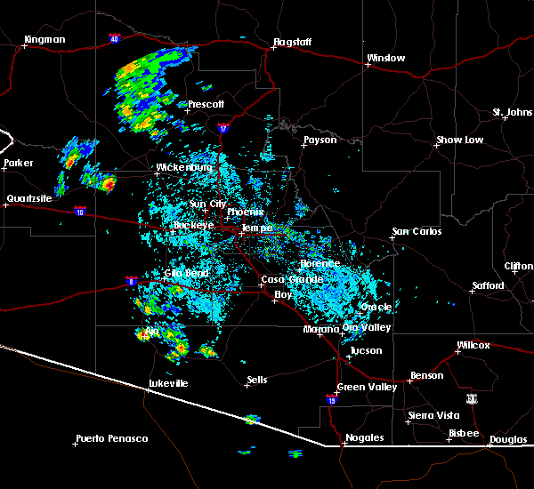
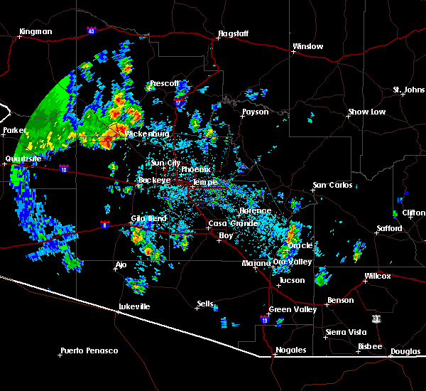
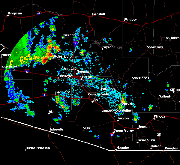
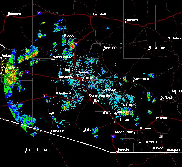
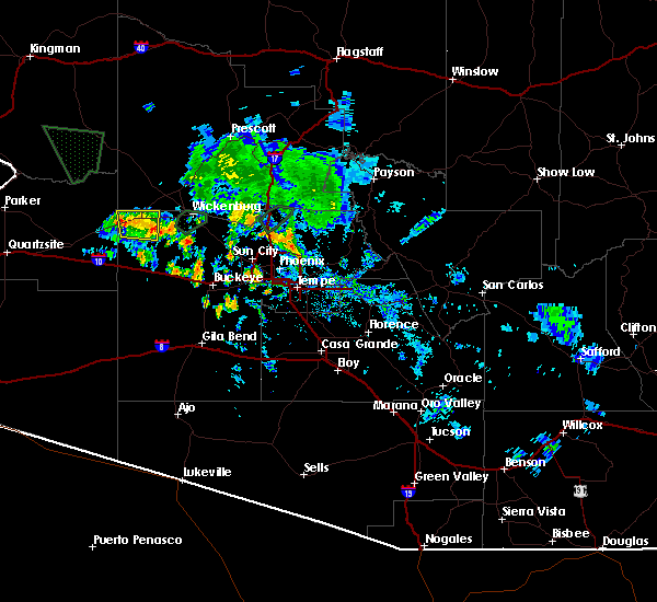
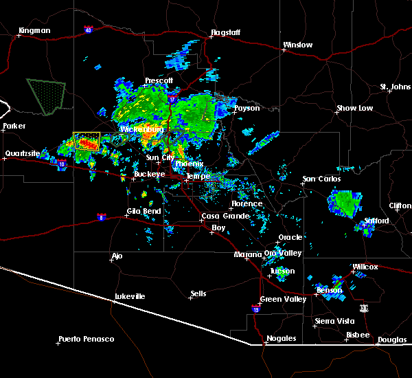
| 11/18/2025 4:18 PM MST | Svrpsr the national weather service in phoenix has issued a * severe thunderstorm warning for, maricopa county in south central arizona, * until 445 pm mst. * at 418 pm mst, a severe thunderstorm was located near aguila, or 17 miles west of wickenburg, moving northeast at 30 mph (radar indicated). Hazards include quarter size hail. Damage to vehicles is expected. this severe thunderstorm will remain over mainly rural areas of maricopa county. This includes us highway 60 between mile markers 86 and 96. |
| 8/15/2025 7:14 PM MST |
 The storm which prompted the warning has weakened below severe limits, and no longer poses an immediate threat to life or property. therefore, the warning will be allowed to expire. however, gusty winds and heavy rain are still possible with this thunderstorm. The storm which prompted the warning has weakened below severe limits, and no longer poses an immediate threat to life or property. therefore, the warning will be allowed to expire. however, gusty winds and heavy rain are still possible with this thunderstorm.
|
| 8/15/2025 7:02 PM MST |
 At 701 pm mst, a severe thunderstorm was located near gladden, or 27 miles west of wickenburg, moving north at 15 mph (radar indicated). Hazards include 60 mph wind gusts. Expect damage to roofs, siding, and trees. locations impacted include, aguila. This includes us highway 60 between mile markers 78 and 88. At 701 pm mst, a severe thunderstorm was located near gladden, or 27 miles west of wickenburg, moving north at 15 mph (radar indicated). Hazards include 60 mph wind gusts. Expect damage to roofs, siding, and trees. locations impacted include, aguila. This includes us highway 60 between mile markers 78 and 88.
|
| 8/15/2025 6:45 PM MST |
 Svrpsr the national weather service in phoenix has issued a * severe thunderstorm warning for, maricopa county in south central arizona, * until 715 pm mst. * at 645 pm mst, a severe thunderstorm was located near gladden, or 28 miles west of wickenburg, moving north at 15 mph (radar indicated). Hazards include 60 mph wind gusts. expect damage to roofs, siding, and trees Svrpsr the national weather service in phoenix has issued a * severe thunderstorm warning for, maricopa county in south central arizona, * until 715 pm mst. * at 645 pm mst, a severe thunderstorm was located near gladden, or 28 miles west of wickenburg, moving north at 15 mph (radar indicated). Hazards include 60 mph wind gusts. expect damage to roofs, siding, and trees
|
| 7/23/2024 7:41 PM MST |
 The storm which prompted the warning has weakened below severe limits, and no longer poses an immediate threat to life or property. therefore, the warning will be allowed to expire. however, gusty winds are still possible with this thunderstorm. The storm which prompted the warning has weakened below severe limits, and no longer poses an immediate threat to life or property. therefore, the warning will be allowed to expire. however, gusty winds are still possible with this thunderstorm.
|
| 7/23/2024 7:30 PM MST |
 At 730 pm mst, a severe thunderstorm was located over aguila, or 24 miles west of wickenburg, and is nearly stationary (radar indicated). Hazards include 60 mph wind gusts. Expect damage to roofs, siding, and trees. locations impacted include, gladden and aguila. This includes us highway 60 between mile markers 76 and 90. At 730 pm mst, a severe thunderstorm was located over aguila, or 24 miles west of wickenburg, and is nearly stationary (radar indicated). Hazards include 60 mph wind gusts. Expect damage to roofs, siding, and trees. locations impacted include, gladden and aguila. This includes us highway 60 between mile markers 76 and 90.
|
| 7/23/2024 7:14 PM MST | Mesonet station azm07 0.9 nw aguila (azmet in maricopa county AZ, 1.5 miles ESE of Aguila, AZ |
| 7/23/2024 7:00 PM MST |
 Svrpsr the national weather service in phoenix has issued a * severe thunderstorm warning for, northeastern la paz county in west central arizona, maricopa county in south central arizona, * until 745 pm mst. * at 700 pm mst, a severe thunderstorm was located over aguila, or 24 miles west of wickenburg, and is nearly stationary (radar indicated). Hazards include 60 mph wind gusts and penny size hail. expect damage to roofs, siding, and trees Svrpsr the national weather service in phoenix has issued a * severe thunderstorm warning for, northeastern la paz county in west central arizona, maricopa county in south central arizona, * until 745 pm mst. * at 700 pm mst, a severe thunderstorm was located over aguila, or 24 miles west of wickenburg, and is nearly stationary (radar indicated). Hazards include 60 mph wind gusts and penny size hail. expect damage to roofs, siding, and trees
|
| 8/23/2022 6:36 PM MST | At 635 pm mst, severe thunderstorms were located along a line extending from 8 miles southeast of aguila to 15 miles southwest of morristown to 7 miles northeast of wintersburg, moving southwest at 10 mph (radar indicated). Hazards include 60 mph wind gusts and quarter size hail. Hail damage to vehicles is expected. expect wind damage to roofs, siding, and trees. locations impacted include, surprise, buckeye, wittmann, circle city and morristown. this includes the following highways, az interstate 10 between mile markers 96 and 109. us highway 60 between mile markers 85 and 103, and between mile markers 117 and 132. az route 74 between mile markers 1 and 9. hail threat, radar indicated max hail size, 1. 00 in wind threat, radar indicated max wind gust, 60 mph. |
| 8/23/2022 5:58 PM MST | At 558 pm mst, severe thunderstorms were located along a line extending from 9 miles east of aguila to 10 miles southwest of morristown to 10 miles west of white tank mountain park, moving southwest at 10 mph (radar indicated). Hazards include 60 mph wind gusts and quarter size hail. Hail damage to vehicles is expected. Expect wind damage to roofs, siding, and trees. |
| 8/23/2022 5:16 PM MST | At 516 pm mst, severe thunderstorms were located along a line extending from 8 miles northwest of congress to 7 miles south of yarnell to 8 miles west of castle hot springs, moving southwest at 25 mph (radar indicated). Hazards include 60 mph wind gusts. expect damage to roofs, siding, and trees |
| 8/20/2022 11:14 PM MST |
 At 1114 pm mst, a severe thunderstorm was located over gladden, or 30 miles southeast of alamo lake, moving southwest at 15 mph (radar indicated). Hazards include 60 mph wind gusts and penny size hail. Expect damage to roofs, siding, and trees. locations impacted include, gladden and aguila. this includes us highway 60 between mile markers 70 and 87. hail threat, radar indicated max hail size, 0. 75 in wind threat, radar indicated max wind gust, 60 mph. At 1114 pm mst, a severe thunderstorm was located over gladden, or 30 miles southeast of alamo lake, moving southwest at 15 mph (radar indicated). Hazards include 60 mph wind gusts and penny size hail. Expect damage to roofs, siding, and trees. locations impacted include, gladden and aguila. this includes us highway 60 between mile markers 70 and 87. hail threat, radar indicated max hail size, 0. 75 in wind threat, radar indicated max wind gust, 60 mph.
|
| 8/20/2022 10:58 PM MST |
 At 1058 pm mst, a severe thunderstorm was located over aguila, or 24 miles west of wickenburg, moving southwest at 10 mph (radar indicated). Hazards include 60 mph wind gusts. expect damage to roofs, siding, and trees At 1058 pm mst, a severe thunderstorm was located over aguila, or 24 miles west of wickenburg, moving southwest at 10 mph (radar indicated). Hazards include 60 mph wind gusts. expect damage to roofs, siding, and trees
|
| 8/18/2022 5:31 PM MST |
 At 530 pm mst, a severe thunderstorm was located near aguila, or 24 miles west of wickenburg, moving south at 15 mph (radar indicated). Hazards include 60 mph wind gusts. Expect damage to roofs, siding, and trees. locations impacted include, aguila. this includes us highway 60 between mile markers 79 and 89. hail threat, radar indicated max hail size, <. 75 in wind threat, radar indicated max wind gust, 60 mph. At 530 pm mst, a severe thunderstorm was located near aguila, or 24 miles west of wickenburg, moving south at 15 mph (radar indicated). Hazards include 60 mph wind gusts. Expect damage to roofs, siding, and trees. locations impacted include, aguila. this includes us highway 60 between mile markers 79 and 89. hail threat, radar indicated max hail size, <. 75 in wind threat, radar indicated max wind gust, 60 mph.
|
| 8/18/2022 5:18 PM MST |
 At 518 pm mst, a severe thunderstorm was located over aguila, or 25 miles west of wickenburg, moving south at 15 mph (radar indicated). Hazards include 60 mph wind gusts. expect damage to roofs, siding, and trees At 518 pm mst, a severe thunderstorm was located over aguila, or 25 miles west of wickenburg, moving south at 15 mph (radar indicated). Hazards include 60 mph wind gusts. expect damage to roofs, siding, and trees
|
| 10/5/2021 6:03 PM MST |
 At 602 pm mst, a severe thunderstorm was located near aguila, or 18 miles west of wickenburg, moving north at 30 mph (radar indicated). Hazards include 60 mph wind gusts and quarter size hail. Hail damage to vehicles is expected. expect wind damage to roofs, siding, and trees. locations impacted include, aguila. this includes us highway 60 between mile markers 81 and 97. hail threat, radar indicated max hail size, 1. 00 in wind threat, radar indicated max wind gust, 60 mph. At 602 pm mst, a severe thunderstorm was located near aguila, or 18 miles west of wickenburg, moving north at 30 mph (radar indicated). Hazards include 60 mph wind gusts and quarter size hail. Hail damage to vehicles is expected. expect wind damage to roofs, siding, and trees. locations impacted include, aguila. this includes us highway 60 between mile markers 81 and 97. hail threat, radar indicated max hail size, 1. 00 in wind threat, radar indicated max wind gust, 60 mph.
|
| 10/5/2021 5:41 PM MST |
 At 541 pm mst, a severe thunderstorm was located 14 miles southeast of aguila, or 19 miles northwest of tonopah, moving north at 30 mph (radar indicated). Hazards include 60 mph wind gusts and quarter size hail. Hail damage to vehicles is expected. Expect wind damage to roofs, siding, and trees. At 541 pm mst, a severe thunderstorm was located 14 miles southeast of aguila, or 19 miles northwest of tonopah, moving north at 30 mph (radar indicated). Hazards include 60 mph wind gusts and quarter size hail. Hail damage to vehicles is expected. Expect wind damage to roofs, siding, and trees.
|
| 8/16/2021 12:49 AM MST |
 At 1248 am mst, a severe thunderstorm was located near aguila, or 19 miles west of wickenburg, moving southwest at 40 mph (radar indicated). Hazards include 60 mph wind gusts and penny size hail. expect damage to roofs, siding, and trees At 1248 am mst, a severe thunderstorm was located near aguila, or 19 miles west of wickenburg, moving southwest at 40 mph (radar indicated). Hazards include 60 mph wind gusts and penny size hail. expect damage to roofs, siding, and trees
|
| 8/13/2021 11:34 PM MST |
 At 1133 pm mst, severe thunderstorms were located along a line extending from 6 miles east of bouse to near vicksburg junction to 13 miles south of vicksburg to 18 miles northwest of sundad, moving southwest at 50 mph (radar indicated). Hazards include 60 mph wind gusts. Expect damage to roofs, siding, and trees. locations impacted include, quartzsite, salome, aguila, brenda, vicksburg junction, wenden, kofa wildlife refuge, vicksburg, bouse, gladden, harcuvar and palm canyon. this includes the following highways, az interstate 10 between mile markers 6 and 88. us highway 60 between mile markers 31 and 85. az route 72 between mile markers 25 and 49. hail threat, radar indicated max hail size, <. 75 in wind threat, radar indicated max wind gust, 60 mph. At 1133 pm mst, severe thunderstorms were located along a line extending from 6 miles east of bouse to near vicksburg junction to 13 miles south of vicksburg to 18 miles northwest of sundad, moving southwest at 50 mph (radar indicated). Hazards include 60 mph wind gusts. Expect damage to roofs, siding, and trees. locations impacted include, quartzsite, salome, aguila, brenda, vicksburg junction, wenden, kofa wildlife refuge, vicksburg, bouse, gladden, harcuvar and palm canyon. this includes the following highways, az interstate 10 between mile markers 6 and 88. us highway 60 between mile markers 31 and 85. az route 72 between mile markers 25 and 49. hail threat, radar indicated max hail size, <. 75 in wind threat, radar indicated max wind gust, 60 mph.
|
| 8/13/2021 11:01 PM MST |
 At 1100 pm mst, severe thunderstorms were located along a line extending from 14 miles south of alamo lake state park to near wenden to 13 miles south of gladden to 11 miles northwest of tonopah, moving southwest at 60 mph (radar indicated). Hazards include 70 mph wind gusts and penny size hail. Expect considerable tree damage. Damage is likely to mobile homes, roofs, and outbuildings. At 1100 pm mst, severe thunderstorms were located along a line extending from 14 miles south of alamo lake state park to near wenden to 13 miles south of gladden to 11 miles northwest of tonopah, moving southwest at 60 mph (radar indicated). Hazards include 70 mph wind gusts and penny size hail. Expect considerable tree damage. Damage is likely to mobile homes, roofs, and outbuildings.
|
| 8/13/2021 10:24 PM MST |
 At 1023 pm mst, severe thunderstorms were located along a line extending from 18 miles east of alamo lake state park to near aguila to 9 miles east of gladden to 18 miles north of tonopah, moving southwest at 45 mph (radar indicated). Hazards include 60 mph wind gusts and penny size hail. expect damage to roofs, siding, and trees At 1023 pm mst, severe thunderstorms were located along a line extending from 18 miles east of alamo lake state park to near aguila to 9 miles east of gladden to 18 miles north of tonopah, moving southwest at 45 mph (radar indicated). Hazards include 60 mph wind gusts and penny size hail. expect damage to roofs, siding, and trees
|
| 8/13/2021 10:08 PM MST |
 At 1007 pm mst, severe thunderstorms were located along a line extending from near congress to near wickenburg to near morristown, moving east at 35 mph (radar indicated). Hazards include 60 mph wind gusts and nickel size hail. Expect damage to roofs, siding, and trees. locations impacted include, wickenburg, wittmann, circle city, morristown and aguila. this includes the following highways, us highway 60 between mile markers 83 and 131. az route 74 between mile markers 1 and 10. hail threat, radar indicated max hail size, 0. 88 in wind threat, radar indicated max wind gust, 60 mph. At 1007 pm mst, severe thunderstorms were located along a line extending from near congress to near wickenburg to near morristown, moving east at 35 mph (radar indicated). Hazards include 60 mph wind gusts and nickel size hail. Expect damage to roofs, siding, and trees. locations impacted include, wickenburg, wittmann, circle city, morristown and aguila. this includes the following highways, us highway 60 between mile markers 83 and 131. az route 74 between mile markers 1 and 10. hail threat, radar indicated max hail size, 0. 88 in wind threat, radar indicated max wind gust, 60 mph.
|
| 8/13/2021 9:38 PM MST |
 At 938 pm mst, severe thunderstorms were located along a line extending from near walnut grove to 11 miles west of castle hot springs to 6 miles west of lake pleasant, moving west at 35 mph (radar indicated). Hazards include 60 mph wind gusts and nickel size hail. expect damage to roofs, siding, and trees At 938 pm mst, severe thunderstorms were located along a line extending from near walnut grove to 11 miles west of castle hot springs to 6 miles west of lake pleasant, moving west at 35 mph (radar indicated). Hazards include 60 mph wind gusts and nickel size hail. expect damage to roofs, siding, and trees
|
| 9/5/2019 3:13 PM MST |
 The severe thunderstorm warning for maricopa county will expire at 315 pm mst, the storm which prompted the warning has weakened below severe limits, and no longer poses an immediate threat to life or property. therefore, the warning will be allowed to expire. however gusty winds and heavy rain are still possible with this thunderstorm. The severe thunderstorm warning for maricopa county will expire at 315 pm mst, the storm which prompted the warning has weakened below severe limits, and no longer poses an immediate threat to life or property. therefore, the warning will be allowed to expire. however gusty winds and heavy rain are still possible with this thunderstorm.
|
| 9/5/2019 2:58 PM MST |
 At 258 pm mst, a severe thunderstorm was located near aguila, or 22 miles west of wickenburg, moving northeast at 10 mph (radar indicated). Hazards include 60 mph wind gusts and nickel size hail. Expect damage to roofs, siding, and trees. locations impacted include, aguila. This includes us highway 60 between mile markers 80 and 91. At 258 pm mst, a severe thunderstorm was located near aguila, or 22 miles west of wickenburg, moving northeast at 10 mph (radar indicated). Hazards include 60 mph wind gusts and nickel size hail. Expect damage to roofs, siding, and trees. locations impacted include, aguila. This includes us highway 60 between mile markers 80 and 91.
|
| 9/5/2019 2:42 PM MST |
 At 242 pm mst, a severe thunderstorm was located near aguila, or 24 miles west of wickenburg, moving northeast at 10 mph (radar indicated). Hazards include 60 mph wind gusts and quarter size hail. Hail damage to vehicles is expected. Expect wind damage to roofs, siding, and trees. At 242 pm mst, a severe thunderstorm was located near aguila, or 24 miles west of wickenburg, moving northeast at 10 mph (radar indicated). Hazards include 60 mph wind gusts and quarter size hail. Hail damage to vehicles is expected. Expect wind damage to roofs, siding, and trees.
|
| 8/7/2019 3:28 PM MST |
 At 327 pm mst, a strong to severe thunderstorm was located 8 miles west of wickenburg, and is nearly stationary. this storm has been weakening, but strong wind gusts are still possible (radar indicated). Hazards include 60 mph wind gusts. Expect damage to roofs, siding, and trees. locations impacted include, wickenburg and aguila. This includes us highway 60 between mile markers 85 and 112. At 327 pm mst, a strong to severe thunderstorm was located 8 miles west of wickenburg, and is nearly stationary. this storm has been weakening, but strong wind gusts are still possible (radar indicated). Hazards include 60 mph wind gusts. Expect damage to roofs, siding, and trees. locations impacted include, wickenburg and aguila. This includes us highway 60 between mile markers 85 and 112.
|
| 8/7/2019 3:13 PM MST |
 At 313 pm mst, a severe thunderstorm was located 10 miles west of wickenburg, moving northeast at 15 mph (radar indicated). Hazards include 60 mph wind gusts. expect damage to roofs, siding, and trees At 313 pm mst, a severe thunderstorm was located 10 miles west of wickenburg, moving northeast at 15 mph (radar indicated). Hazards include 60 mph wind gusts. expect damage to roofs, siding, and trees
|
| 8/7/2019 1:54 PM MST |
 At 154 pm mst, a severe thunderstorm was located over aguila, or 24 miles west of wickenburg, moving north at 15 mph (radar indicated). Hazards include 60 mph wind gusts and nickel size hail. expect damage to roofs, siding, and trees At 154 pm mst, a severe thunderstorm was located over aguila, or 24 miles west of wickenburg, moving north at 15 mph (radar indicated). Hazards include 60 mph wind gusts and nickel size hail. expect damage to roofs, siding, and trees
|
| 7/11/2018 8:10 PM MST |
 The severe thunderstorm warning for maricopa county will expire at 815 pm mst, the storm which prompted the warning has weakened below severe limits, and no longer poses an immediate threat to life or property. therefore, the warning will be allowed to expire. however gusty winds and heavy rain are still possible with this thunderstorm. The severe thunderstorm warning for maricopa county will expire at 815 pm mst, the storm which prompted the warning has weakened below severe limits, and no longer poses an immediate threat to life or property. therefore, the warning will be allowed to expire. however gusty winds and heavy rain are still possible with this thunderstorm.
|
| 7/11/2018 7:58 PM MST |
 At 758 pm mst, a severe thunderstorm was located near aguila, or 26 miles west of wickenburg, moving north at 20 mph (radar indicated). Hazards include 60 mph wind gusts. Expect damage to roofs, siding, and trees. locations impacted include, gladden and aguila. This includes us highway 60 between mile markers 76 and 94. At 758 pm mst, a severe thunderstorm was located near aguila, or 26 miles west of wickenburg, moving north at 20 mph (radar indicated). Hazards include 60 mph wind gusts. Expect damage to roofs, siding, and trees. locations impacted include, gladden and aguila. This includes us highway 60 between mile markers 76 and 94.
|
| 7/11/2018 7:49 PM MST |
 At 749 pm mst, a severe thunderstorm was located near aguila, or 27 miles west of wickenburg, moving north at 25 mph (radar indicated). Hazards include 60 mph wind gusts and penny size hail. expect damage to roofs, siding, and trees At 749 pm mst, a severe thunderstorm was located near aguila, or 27 miles west of wickenburg, moving north at 25 mph (radar indicated). Hazards include 60 mph wind gusts and penny size hail. expect damage to roofs, siding, and trees
|
| 7/8/2018 6:10 PM MST |
 The severe thunderstorm warning for maricopa county will expire at 615 pm mst, the storm which prompted the warning has weakened below severe limits, and no longer poses an immediate threat to life or property. therefore, the warning will be allowed to expire. however gusty winds and blowing dust are still possible with this thunderstorm. The severe thunderstorm warning for maricopa county will expire at 615 pm mst, the storm which prompted the warning has weakened below severe limits, and no longer poses an immediate threat to life or property. therefore, the warning will be allowed to expire. however gusty winds and blowing dust are still possible with this thunderstorm.
|
| 7/8/2018 5:57 PM MST |
 At 556 pm mst, a severe thunderstorm was located near aguila, or 19 miles west of wickenburg, moving west at 15 mph (radar indicated). Hazards include 60 mph wind gusts and quarter size hail. Hail damage to vehicles is expected. expect wind damage to roofs, siding, and trees. locations impacted include, aguila. This includes az route 60 between mile markers 78 and 97. At 556 pm mst, a severe thunderstorm was located near aguila, or 19 miles west of wickenburg, moving west at 15 mph (radar indicated). Hazards include 60 mph wind gusts and quarter size hail. Hail damage to vehicles is expected. expect wind damage to roofs, siding, and trees. locations impacted include, aguila. This includes az route 60 between mile markers 78 and 97.
|
| 7/8/2018 5:48 PM MST |
 At 547 pm mst, a severe thunderstorm was located 8 miles southeast of aguila, or 17 miles west of wickenburg, moving west at 15 mph (radar indicated). Hazards include 60 mph wind gusts and quarter size hail. Hail damage to vehicles is expected. Expect wind damage to roofs, siding, and trees. At 547 pm mst, a severe thunderstorm was located 8 miles southeast of aguila, or 17 miles west of wickenburg, moving west at 15 mph (radar indicated). Hazards include 60 mph wind gusts and quarter size hail. Hail damage to vehicles is expected. Expect wind damage to roofs, siding, and trees.
|
| 6/29/2015 7:58 PM MST |
 At 756 pm mst, trained weather spotters reported severe thunderstorms producing damaging winds in excess of 60 mph. these storms were centered over wickenburg, and moving west at 10 mph. penny size hail may also accompany the damaging winds. At 756 pm mst, trained weather spotters reported severe thunderstorms producing damaging winds in excess of 60 mph. these storms were centered over wickenburg, and moving west at 10 mph. penny size hail may also accompany the damaging winds.
|
Hail Maps for Aguila, AZ


Connect with Interactive Hail Maps