

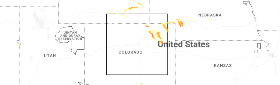
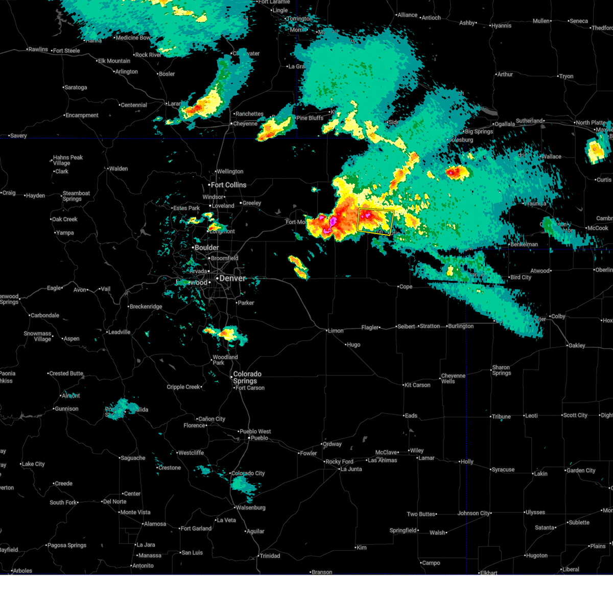
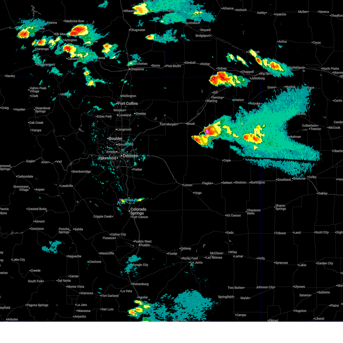
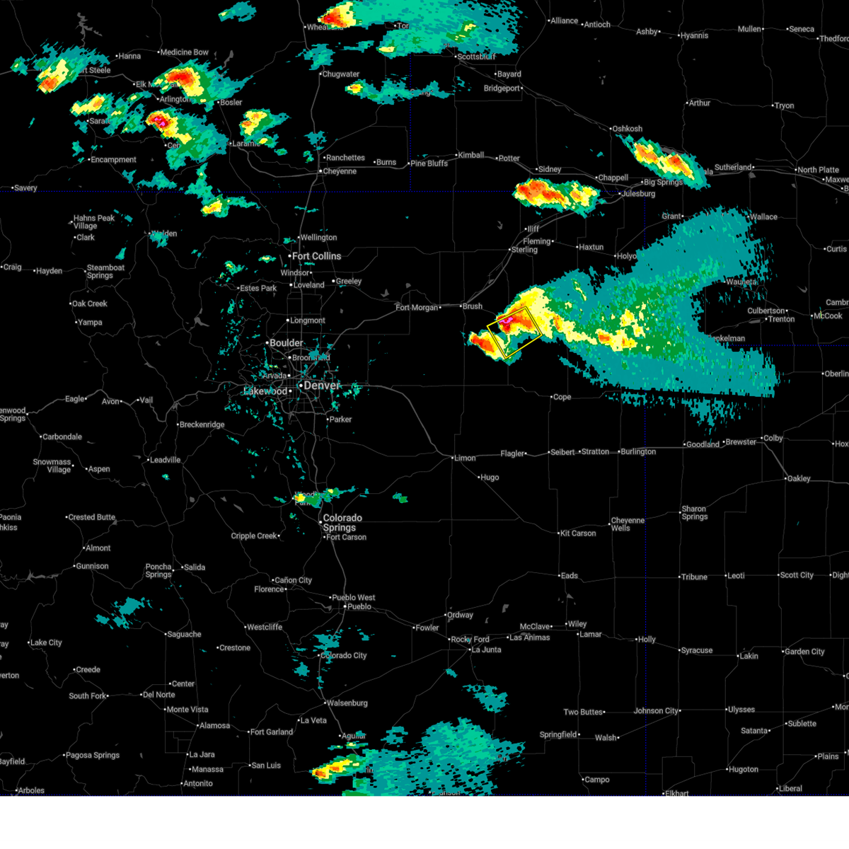
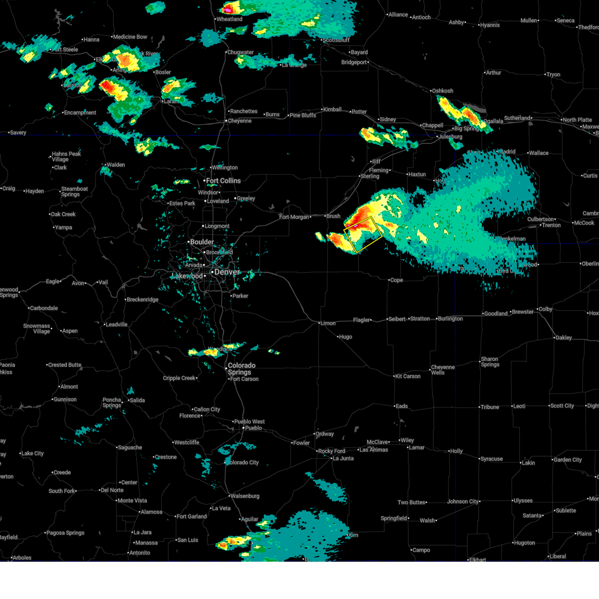
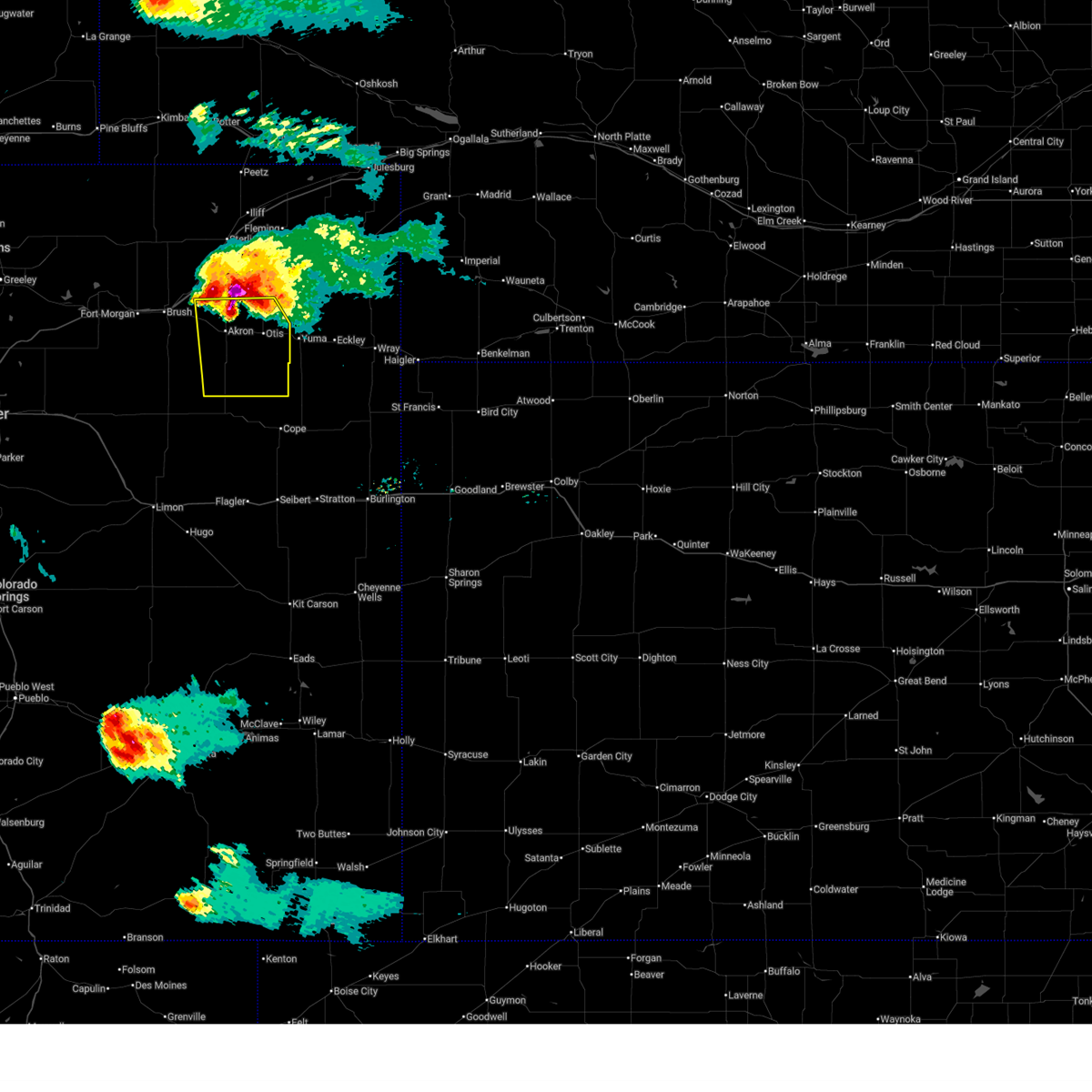
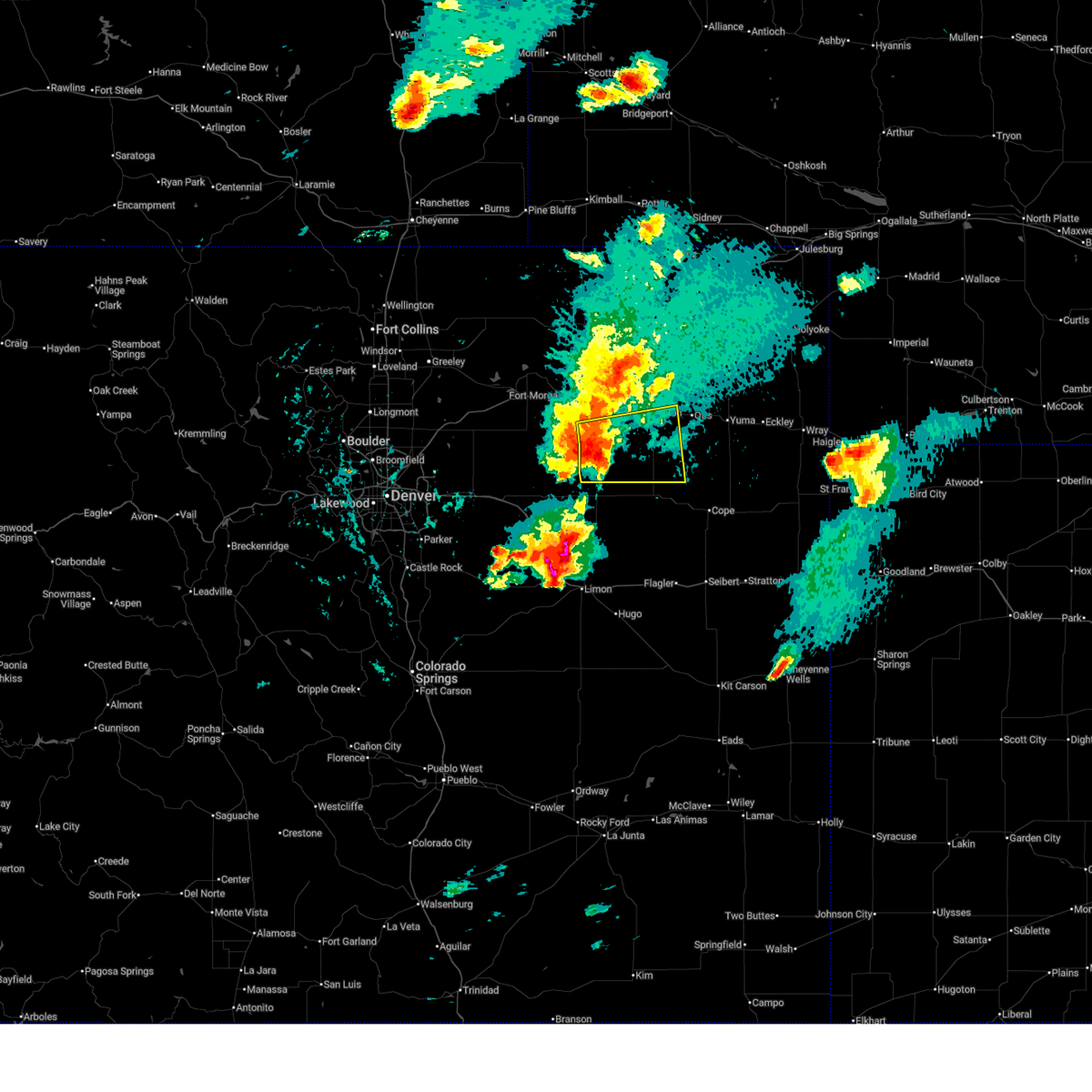
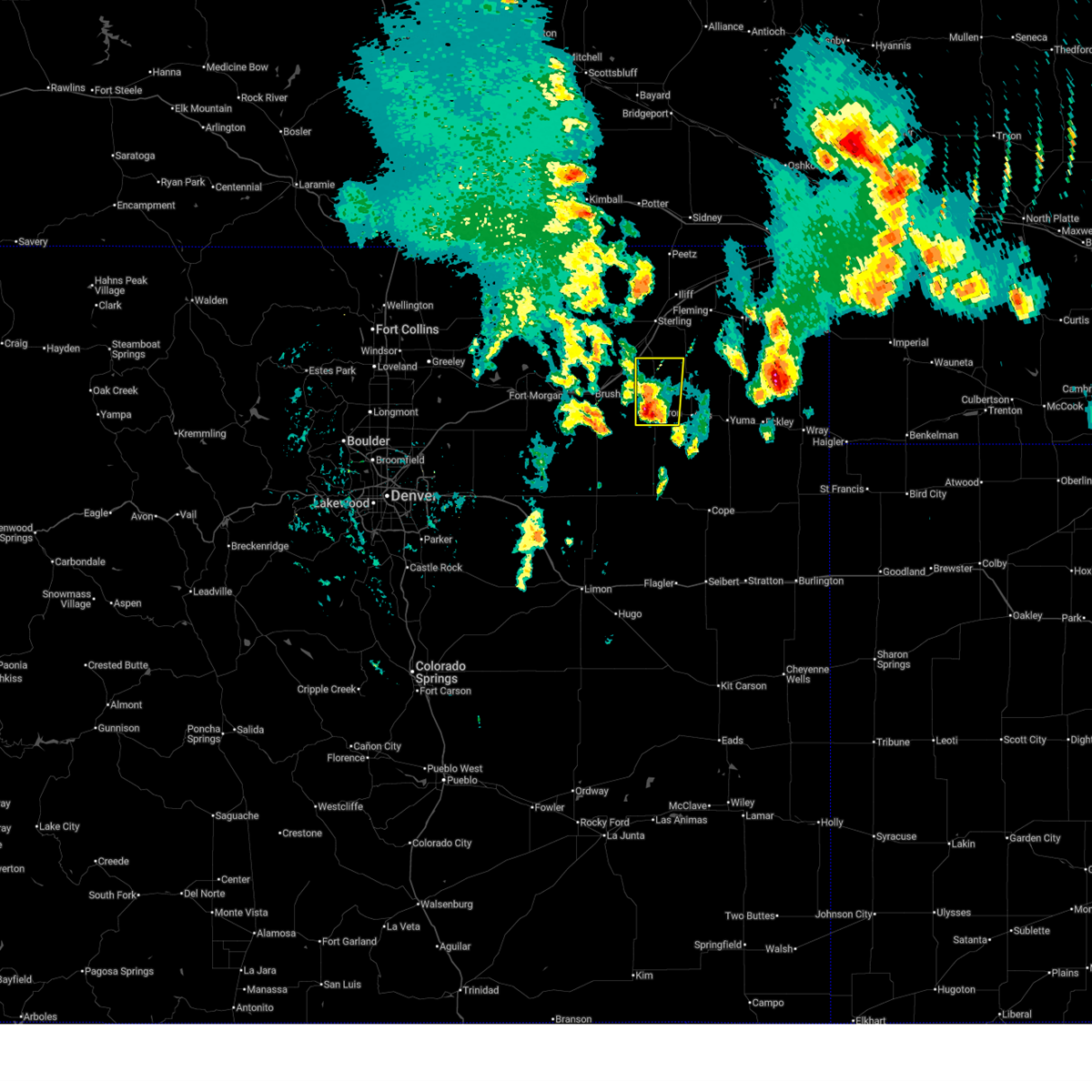
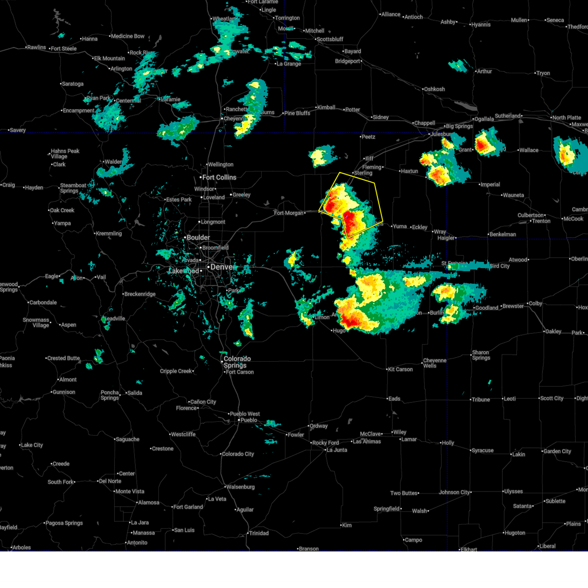
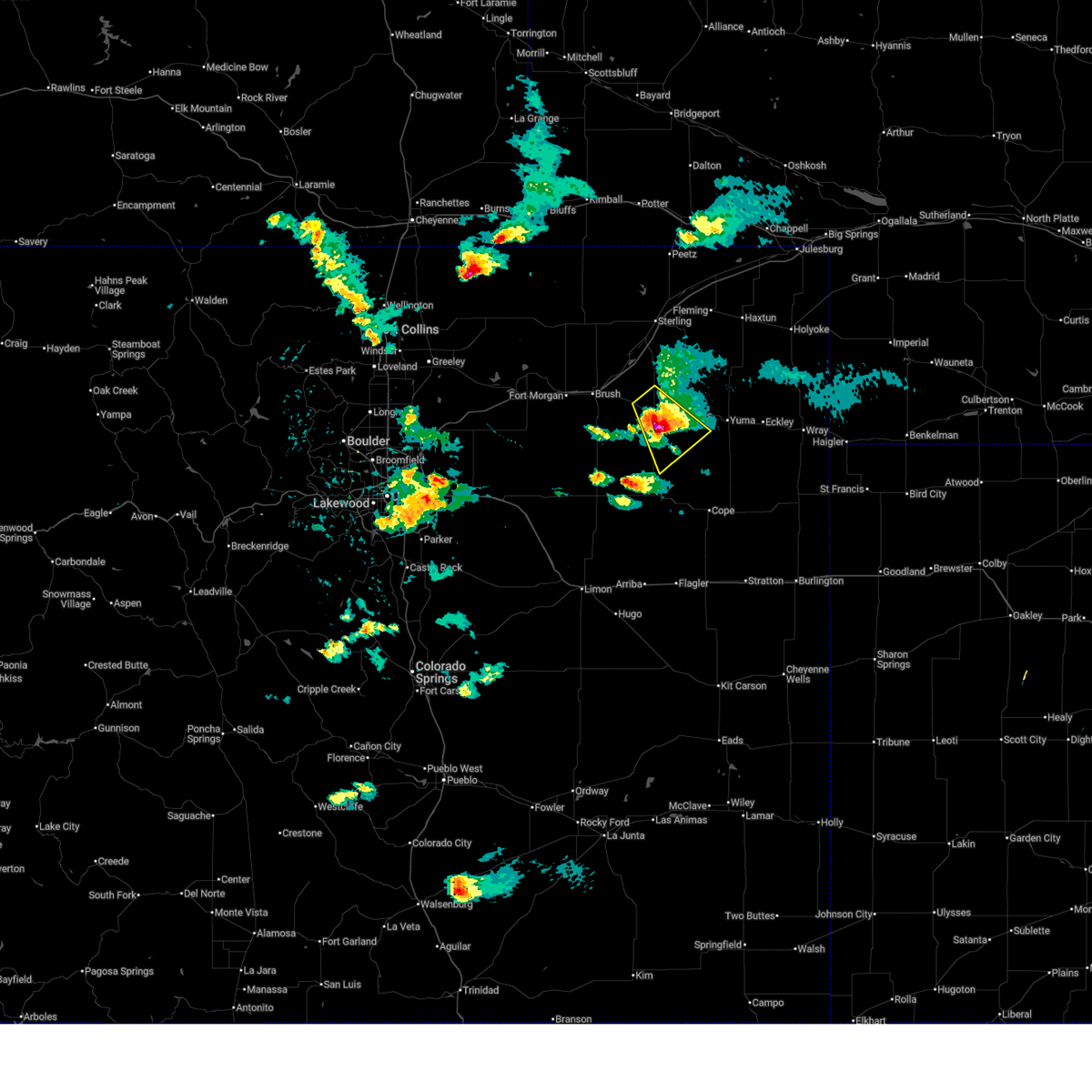
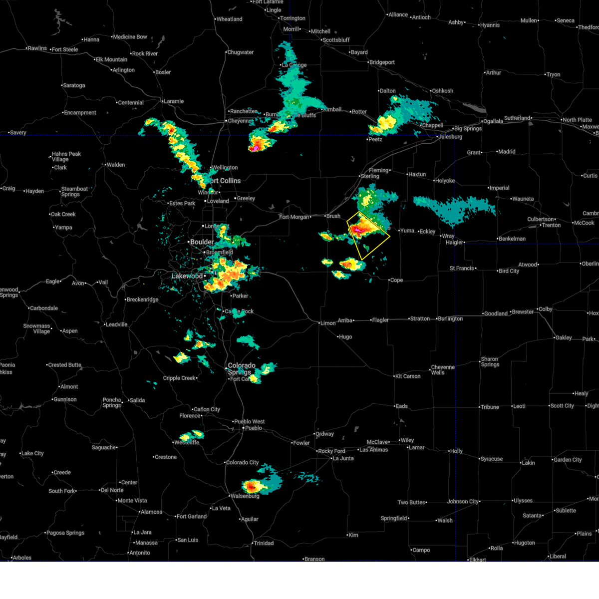
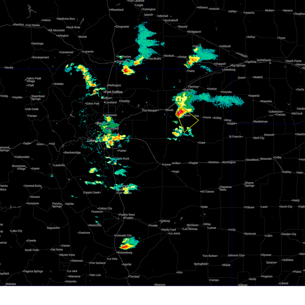
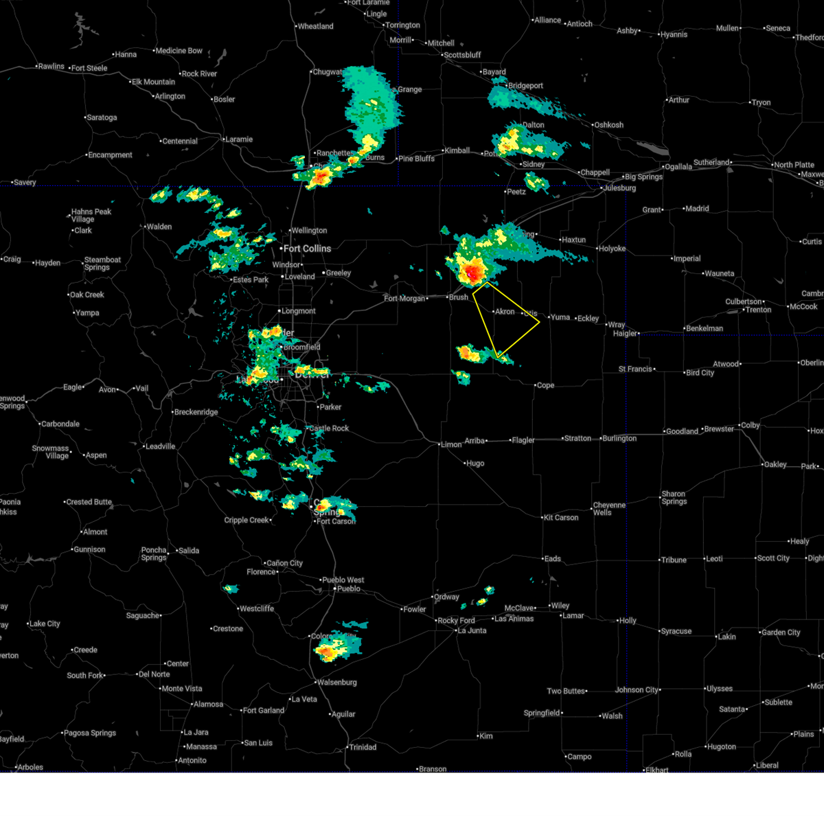
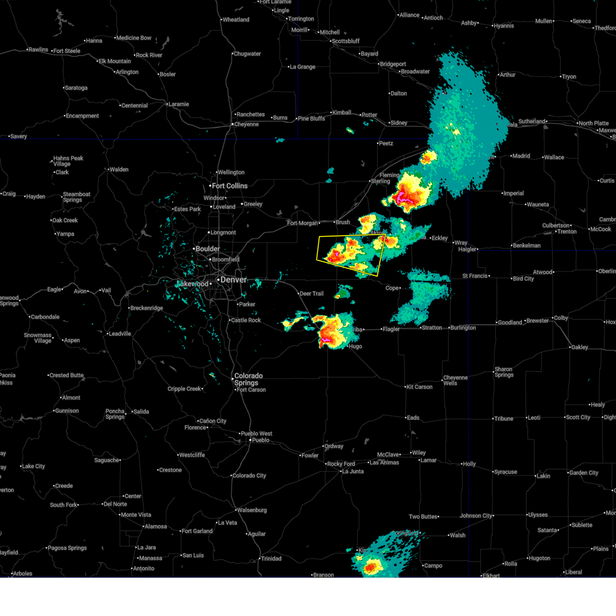
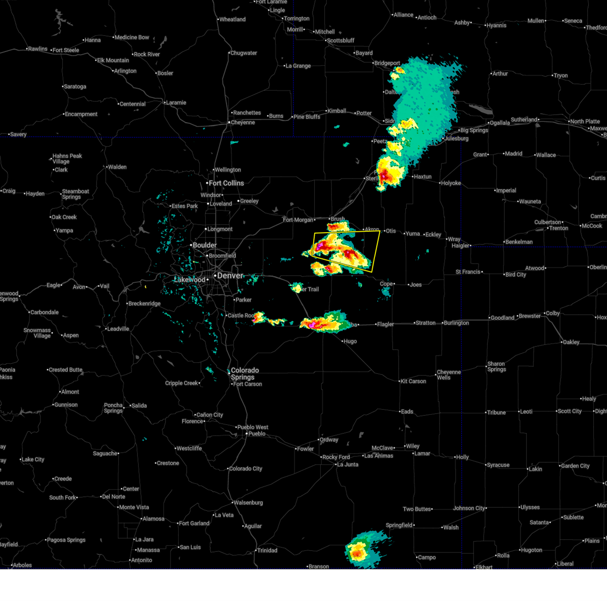
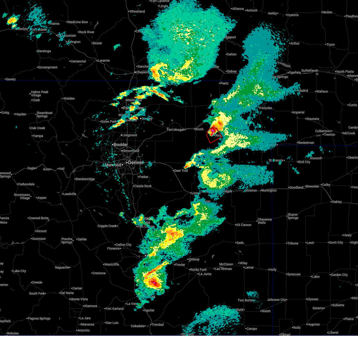
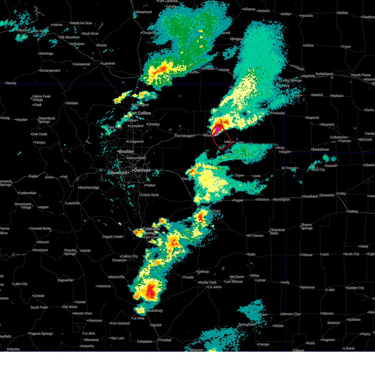
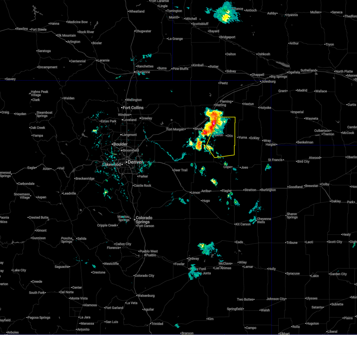
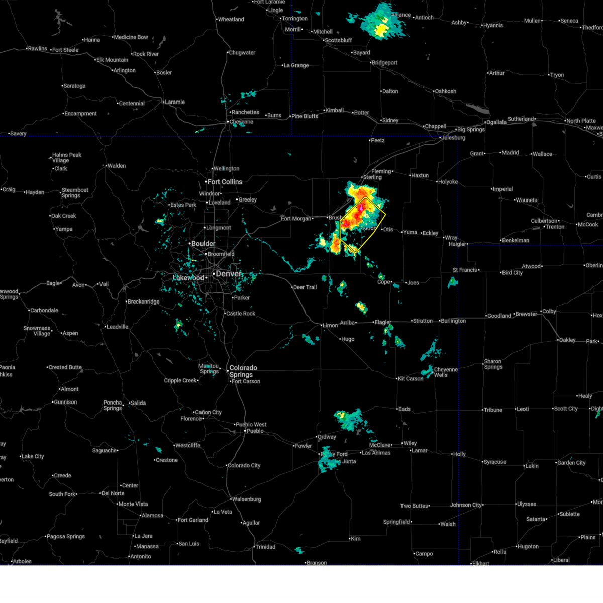
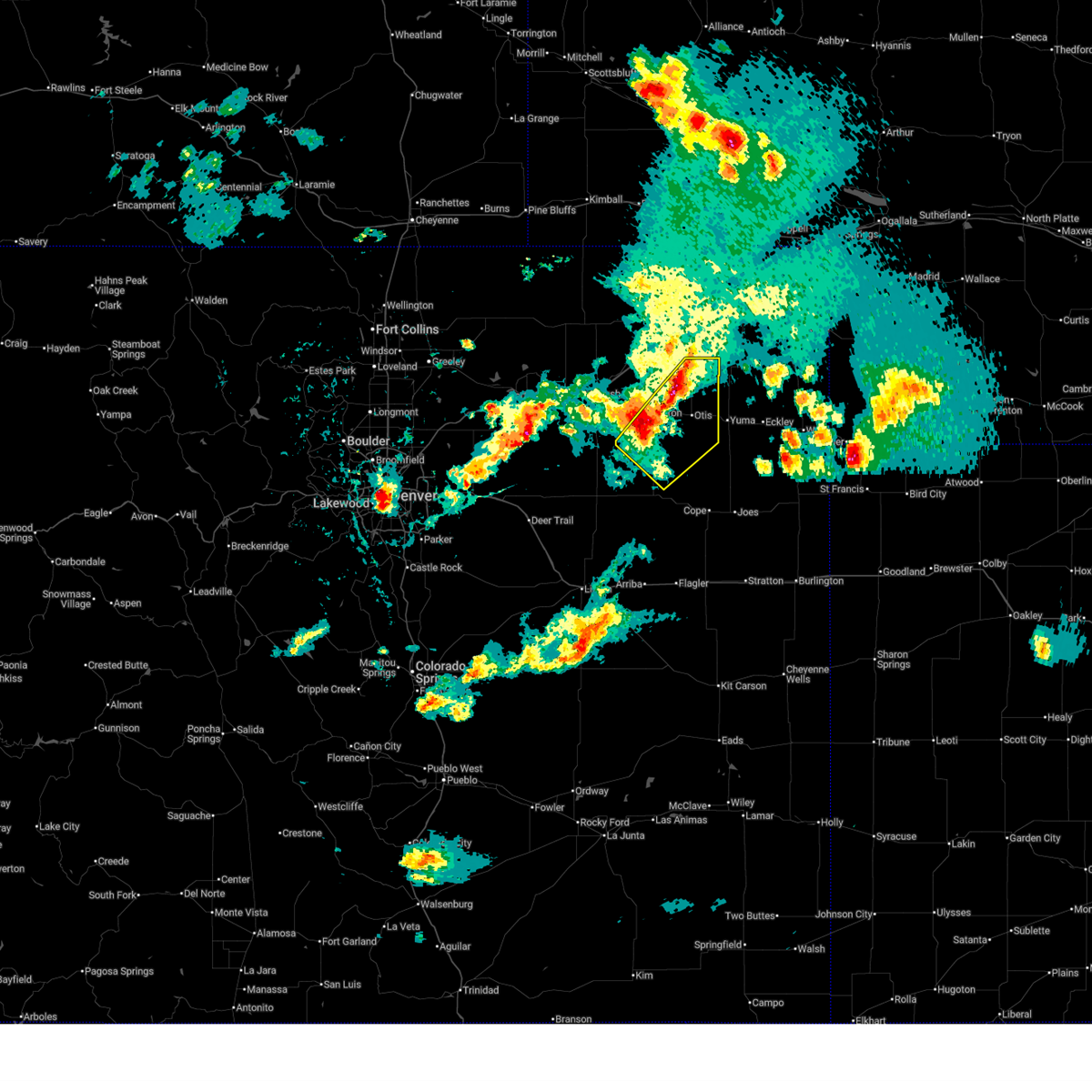
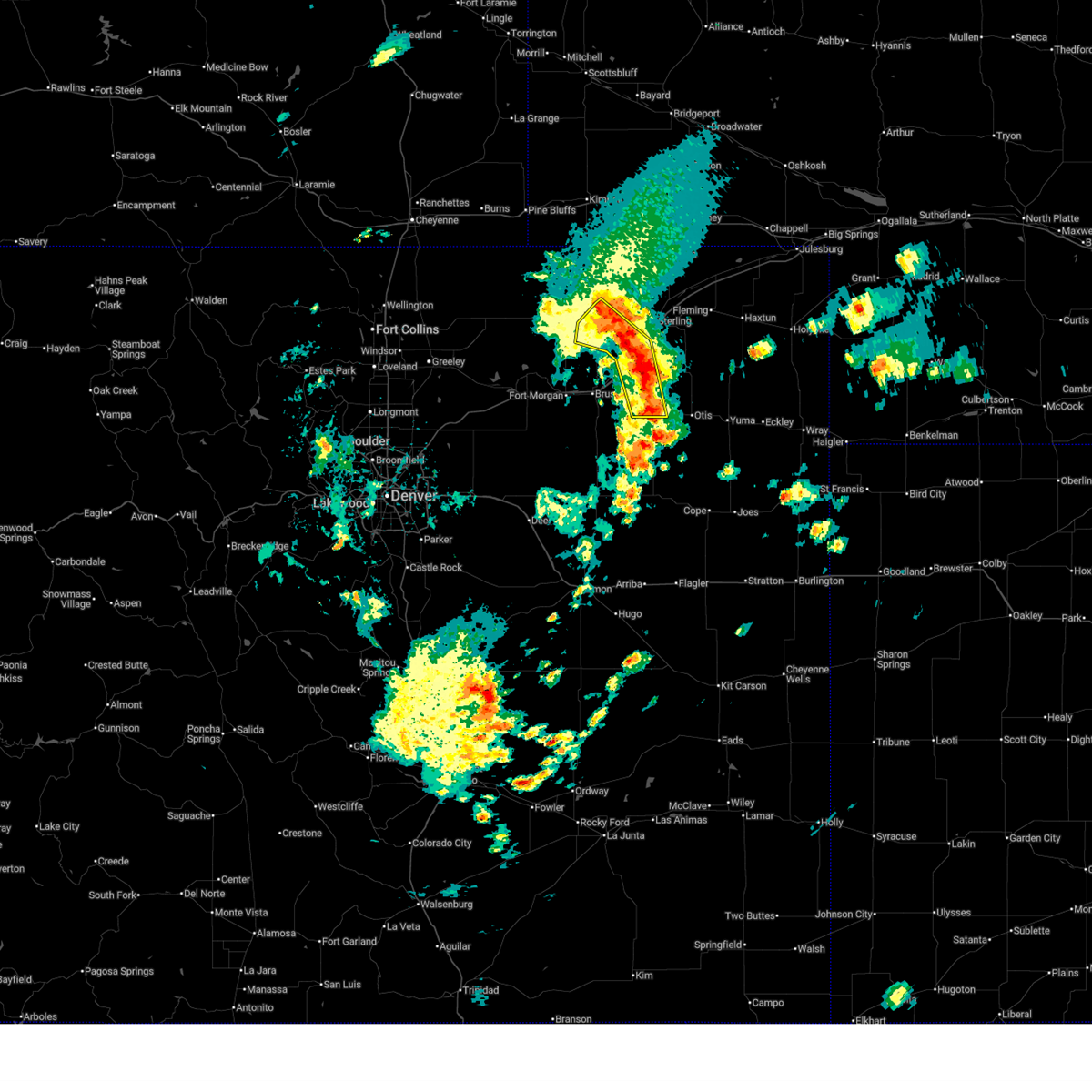
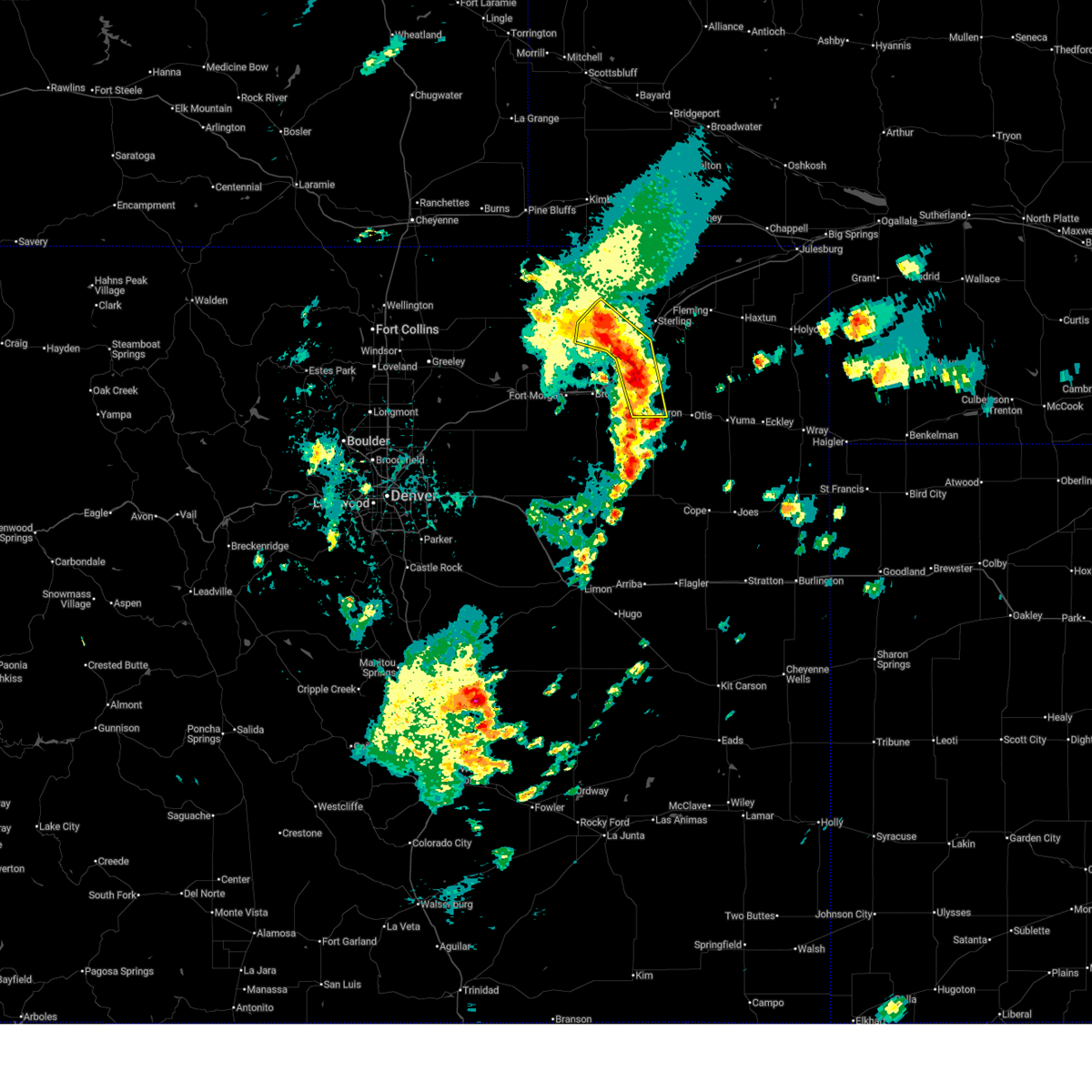
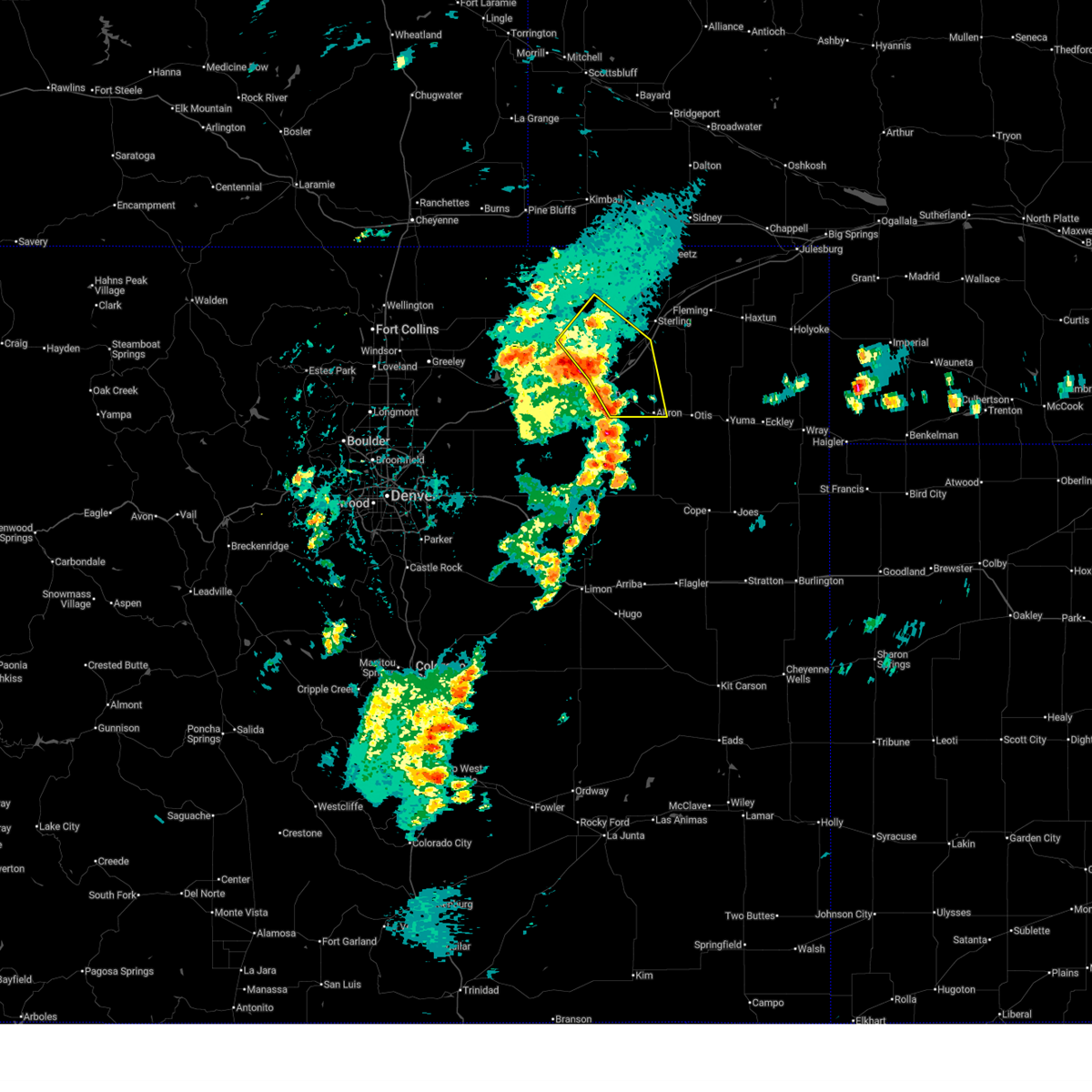
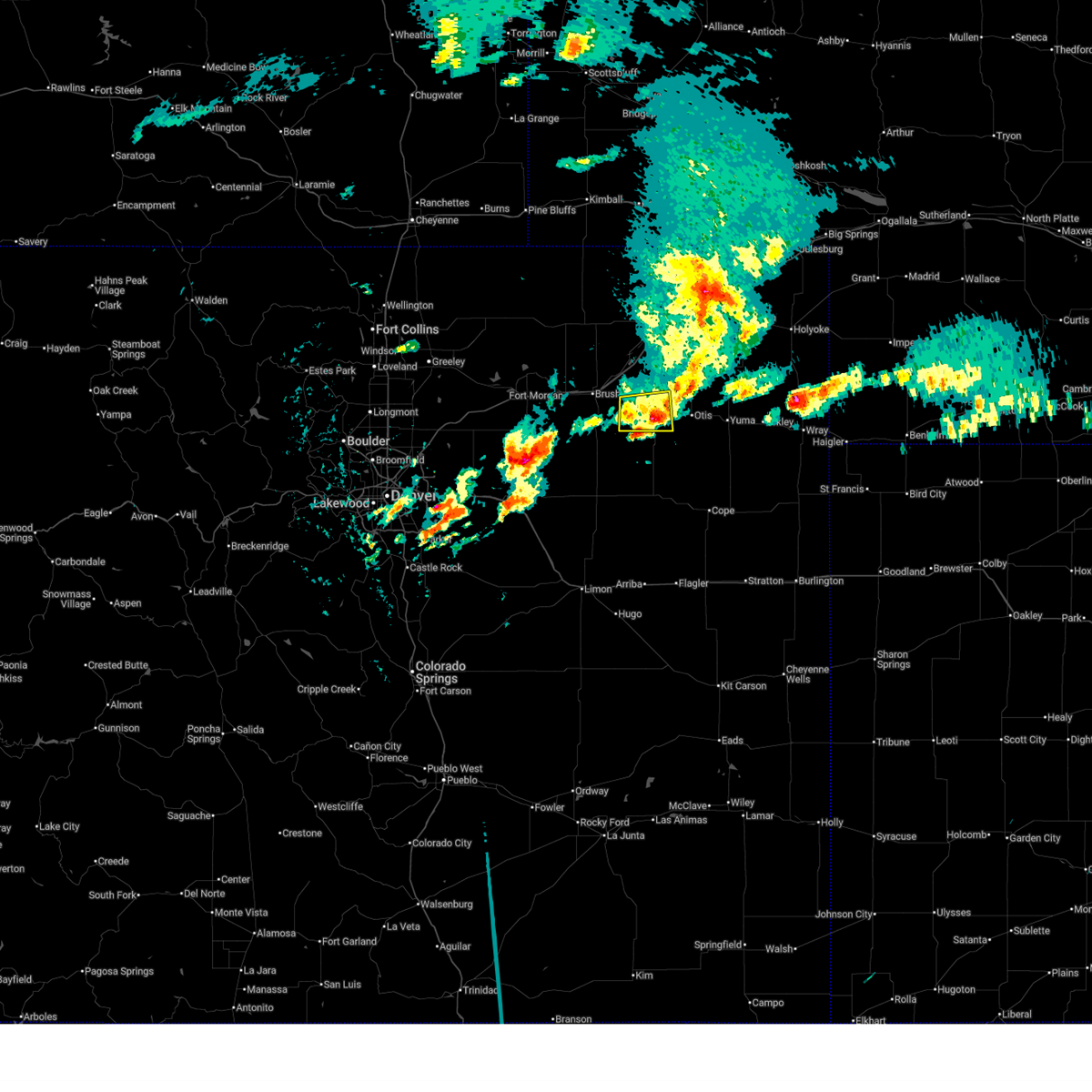
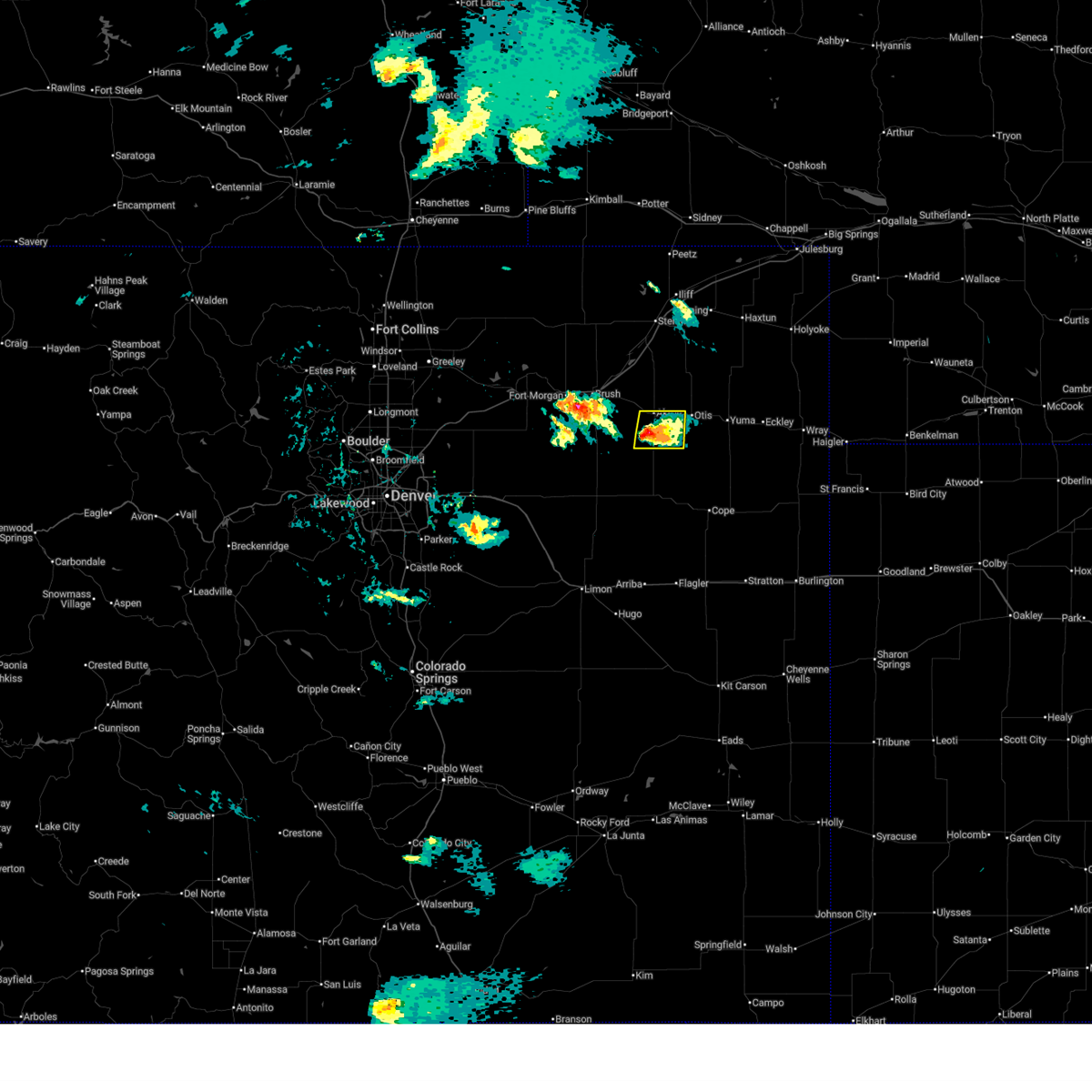
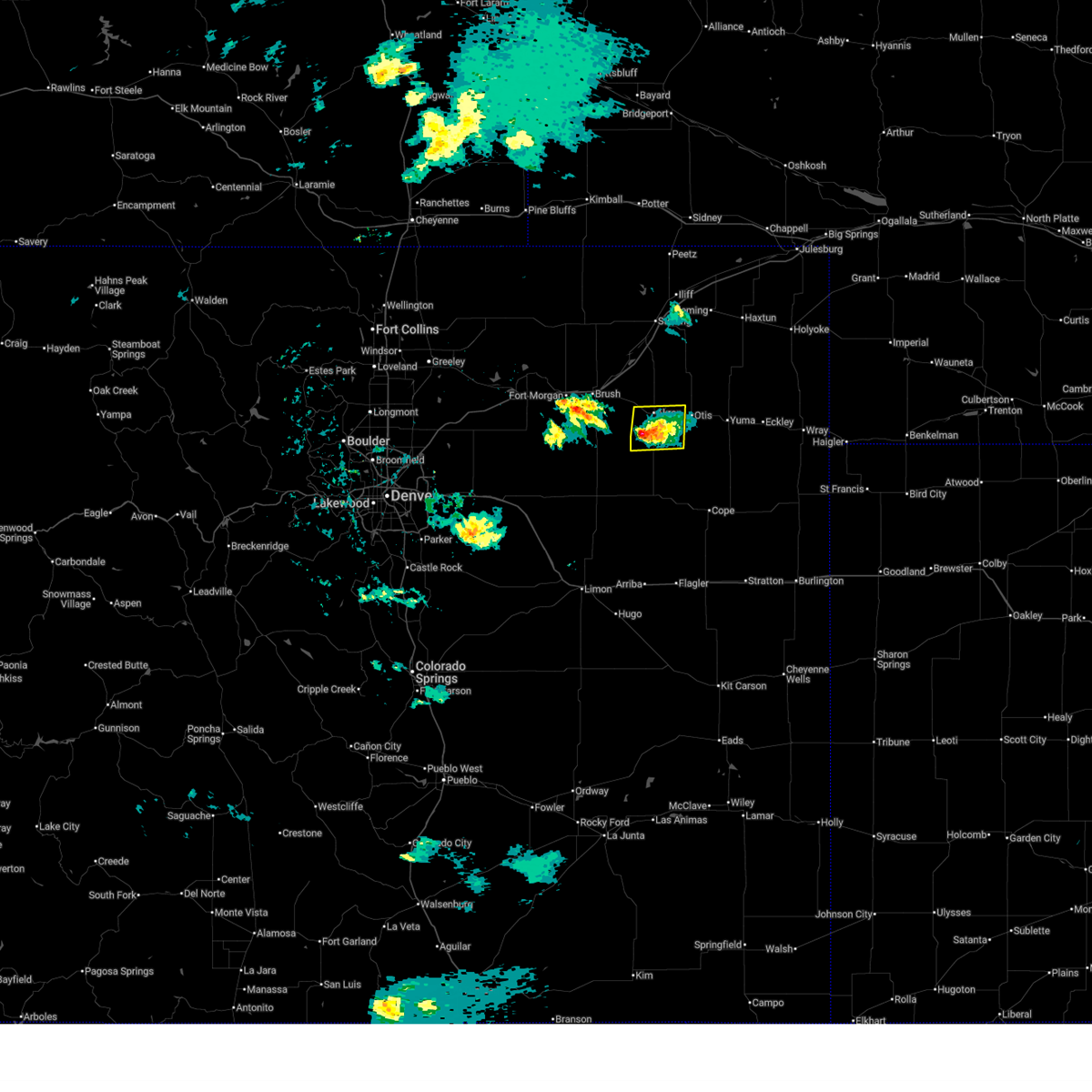
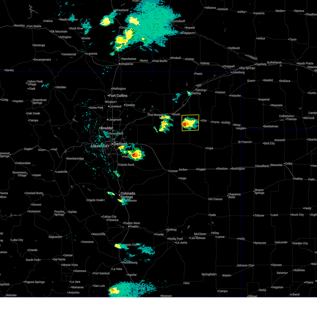
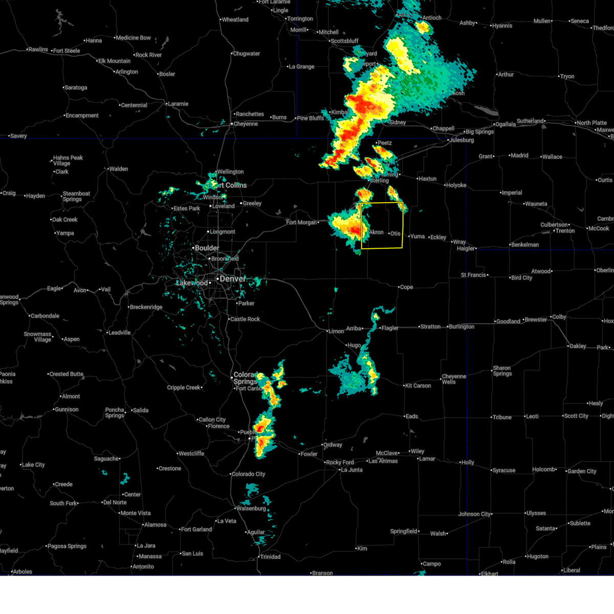
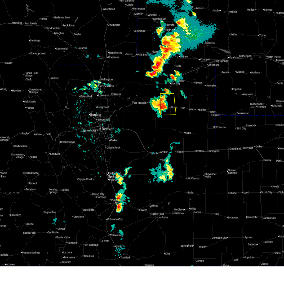
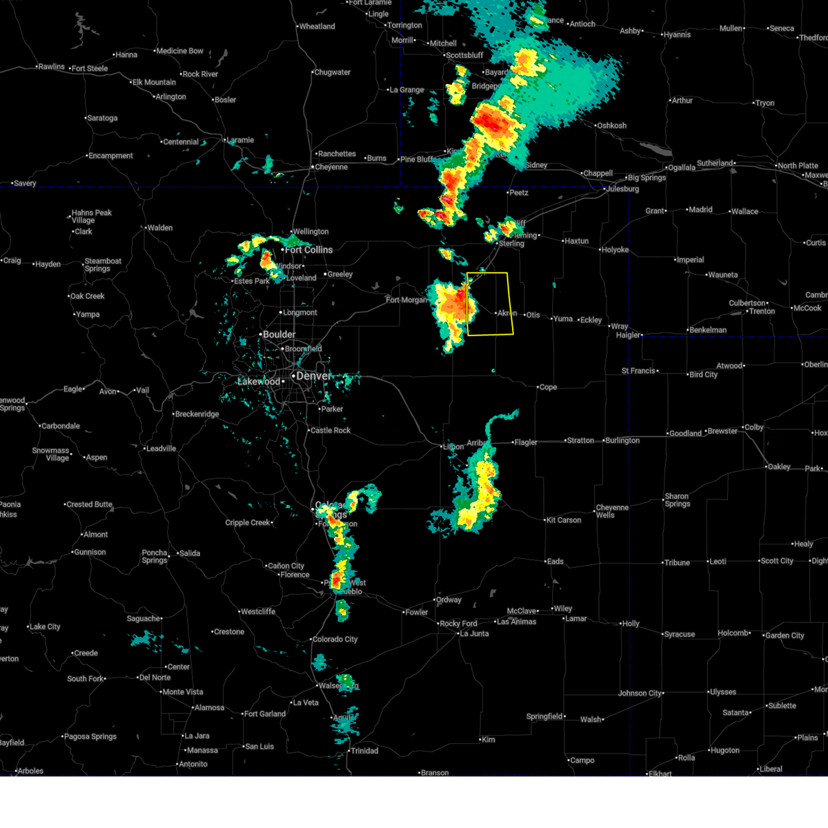
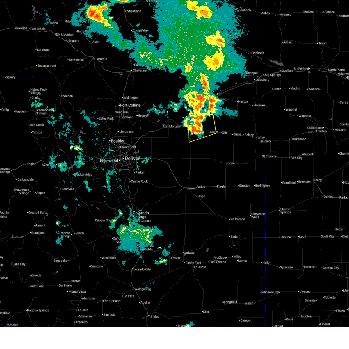
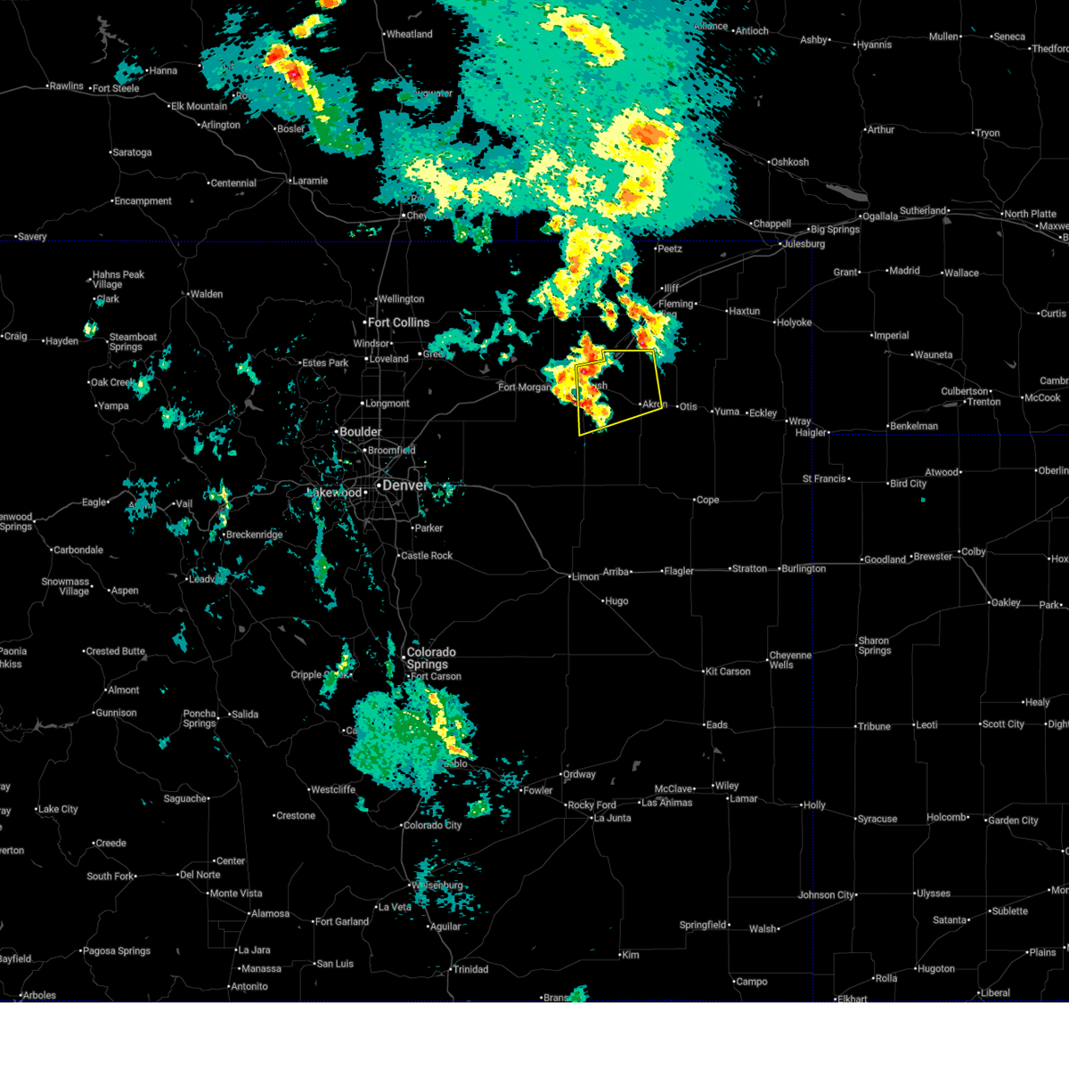
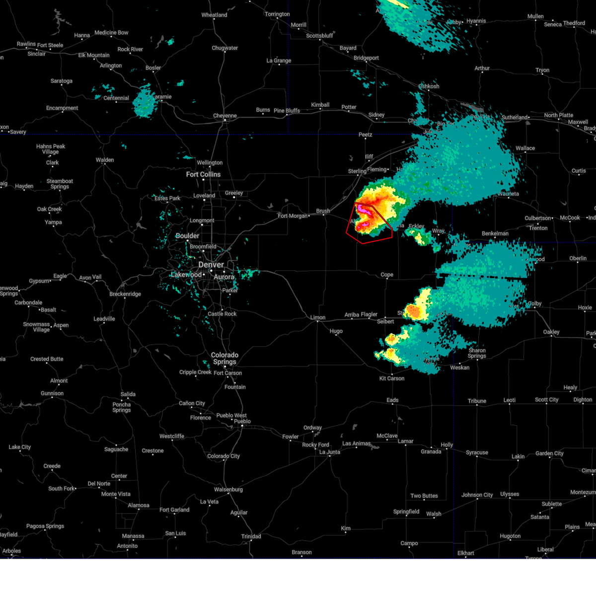
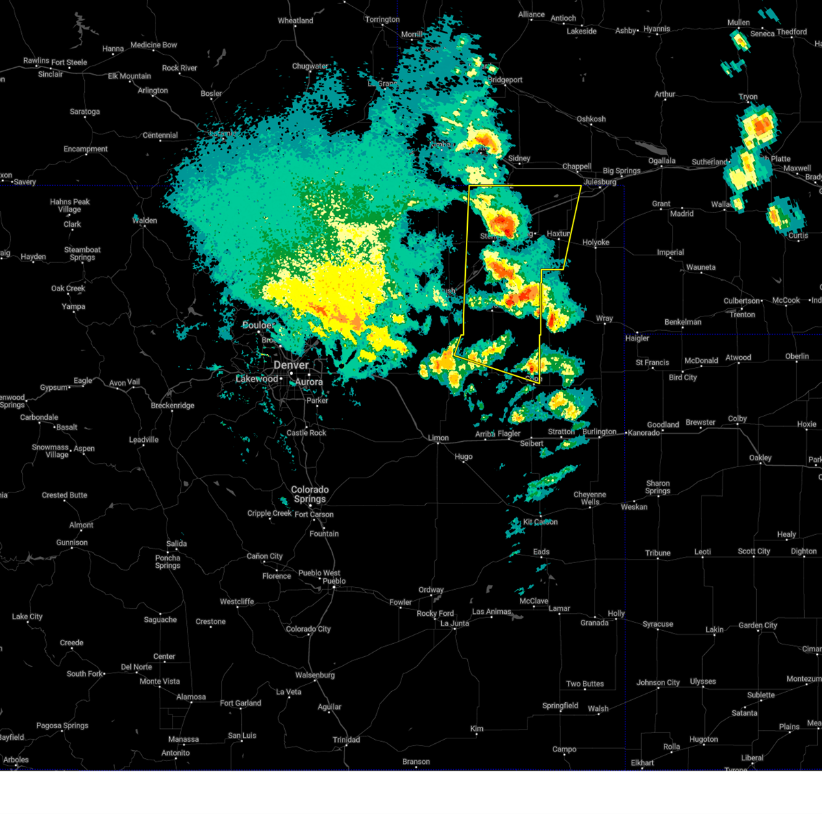
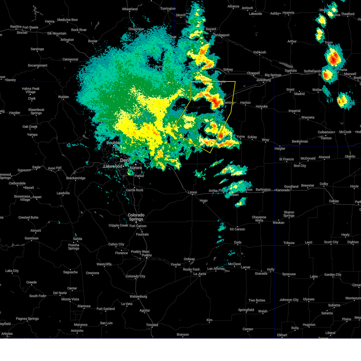
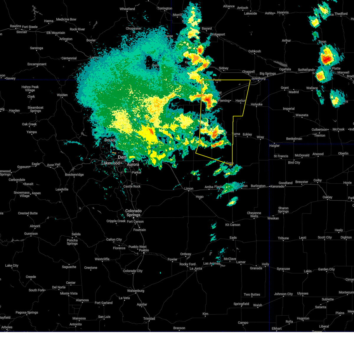
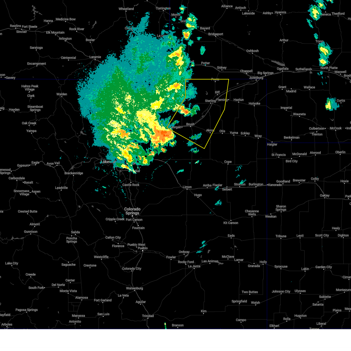
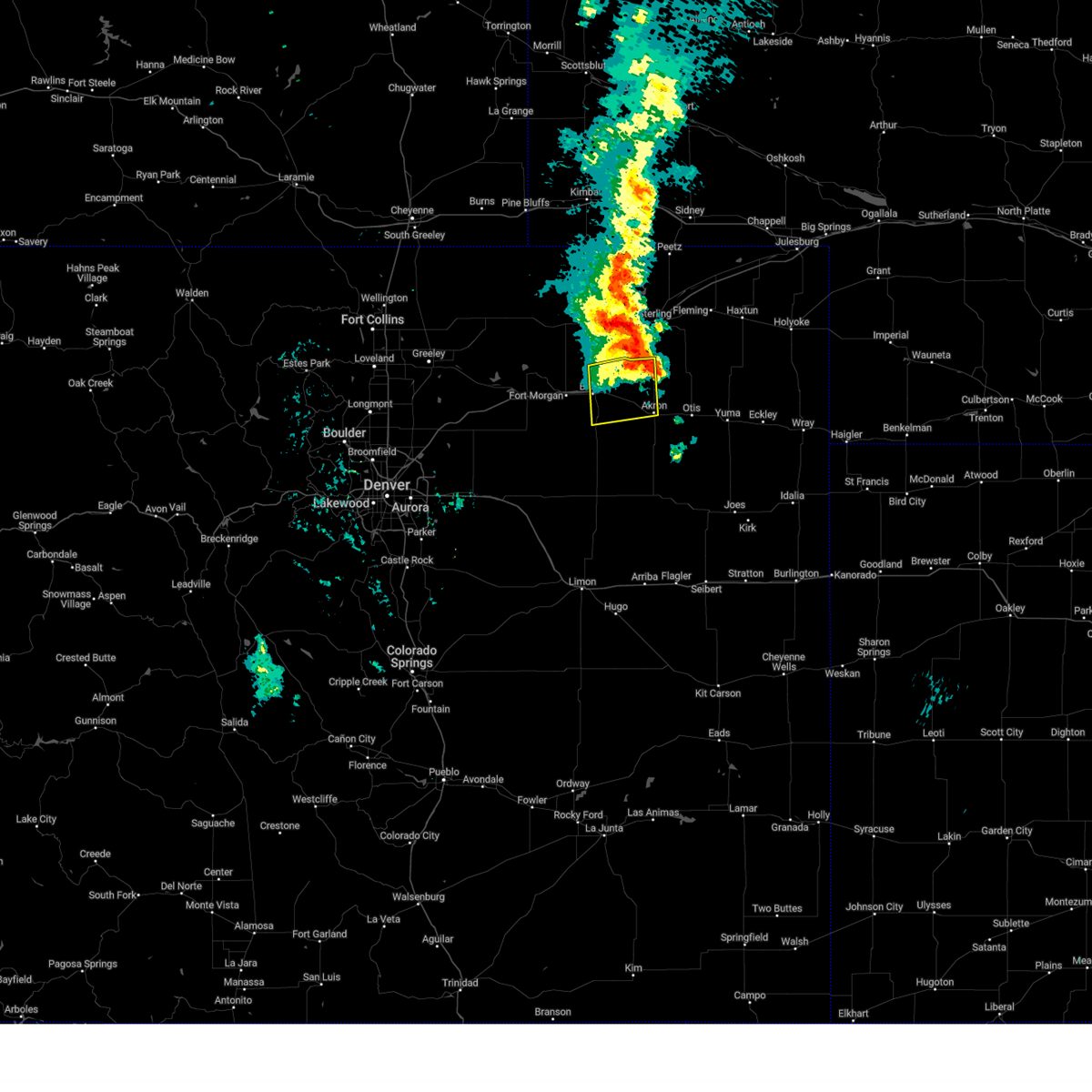
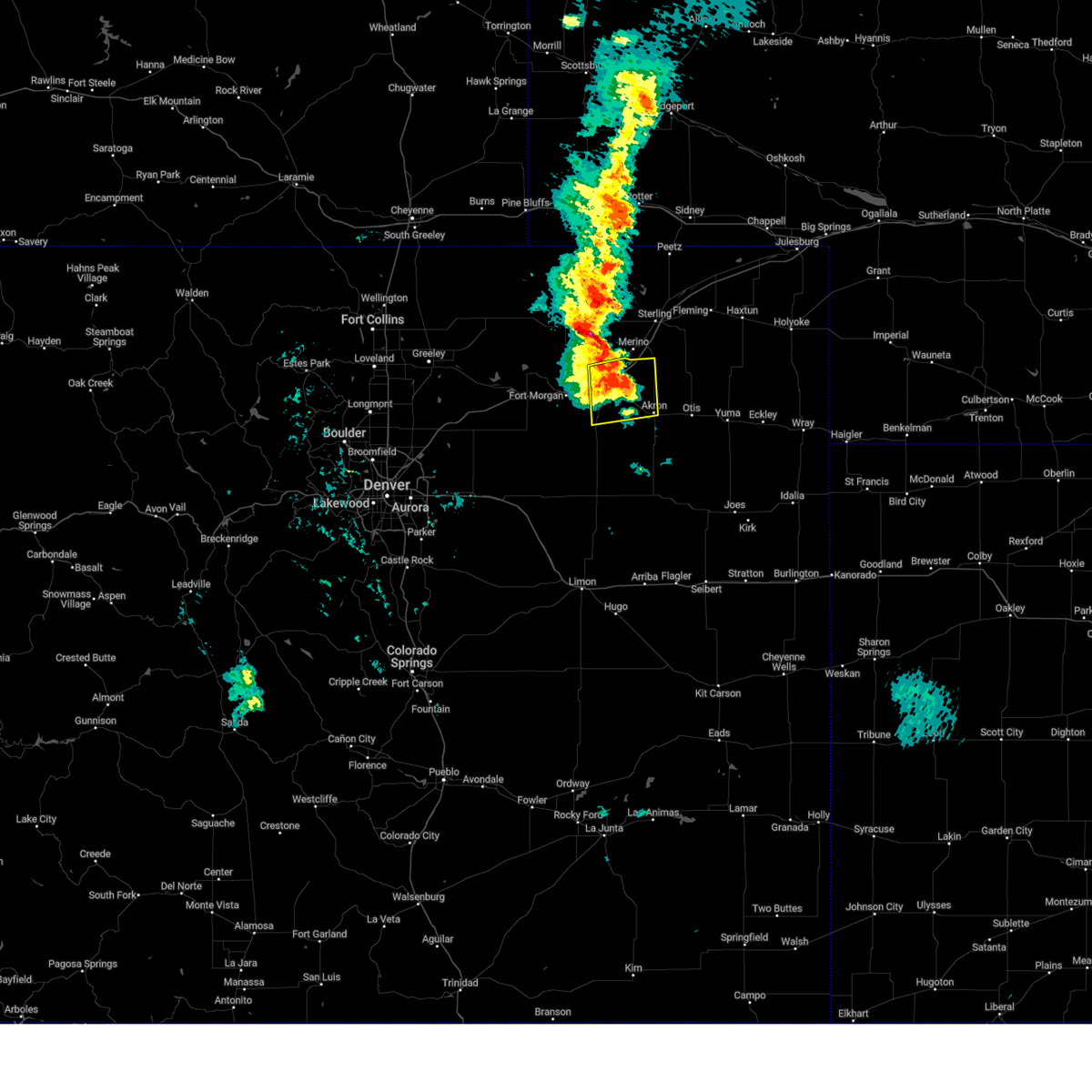
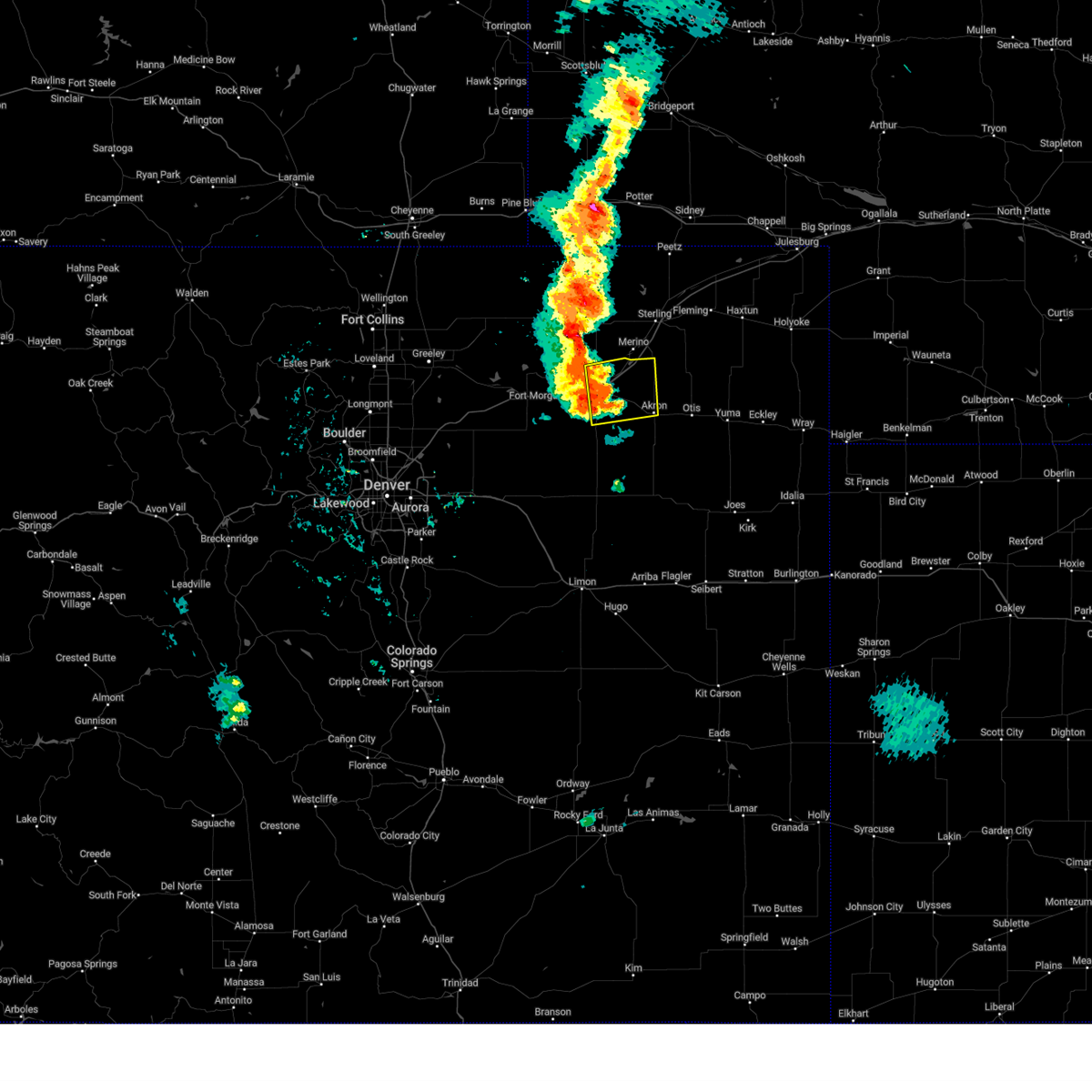
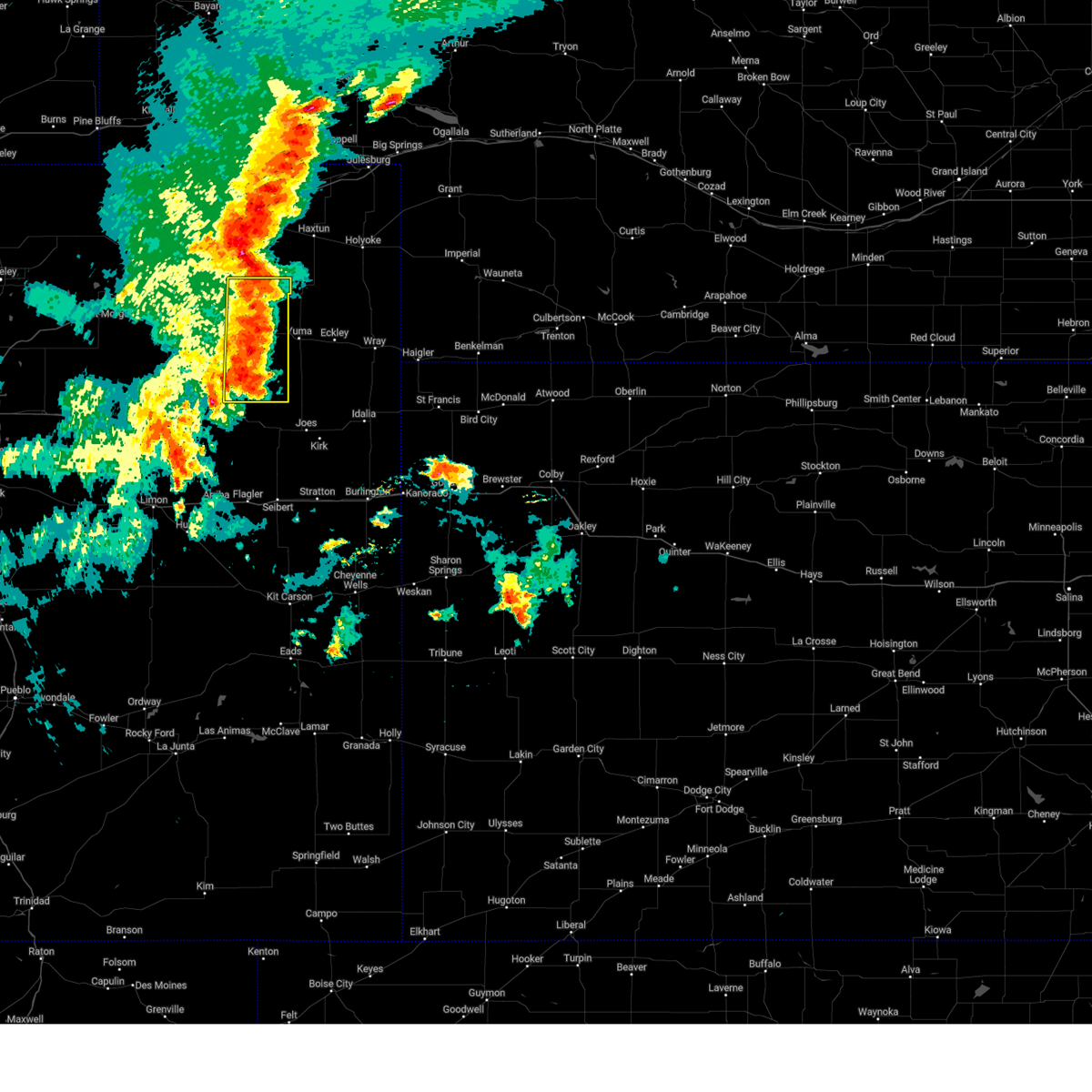
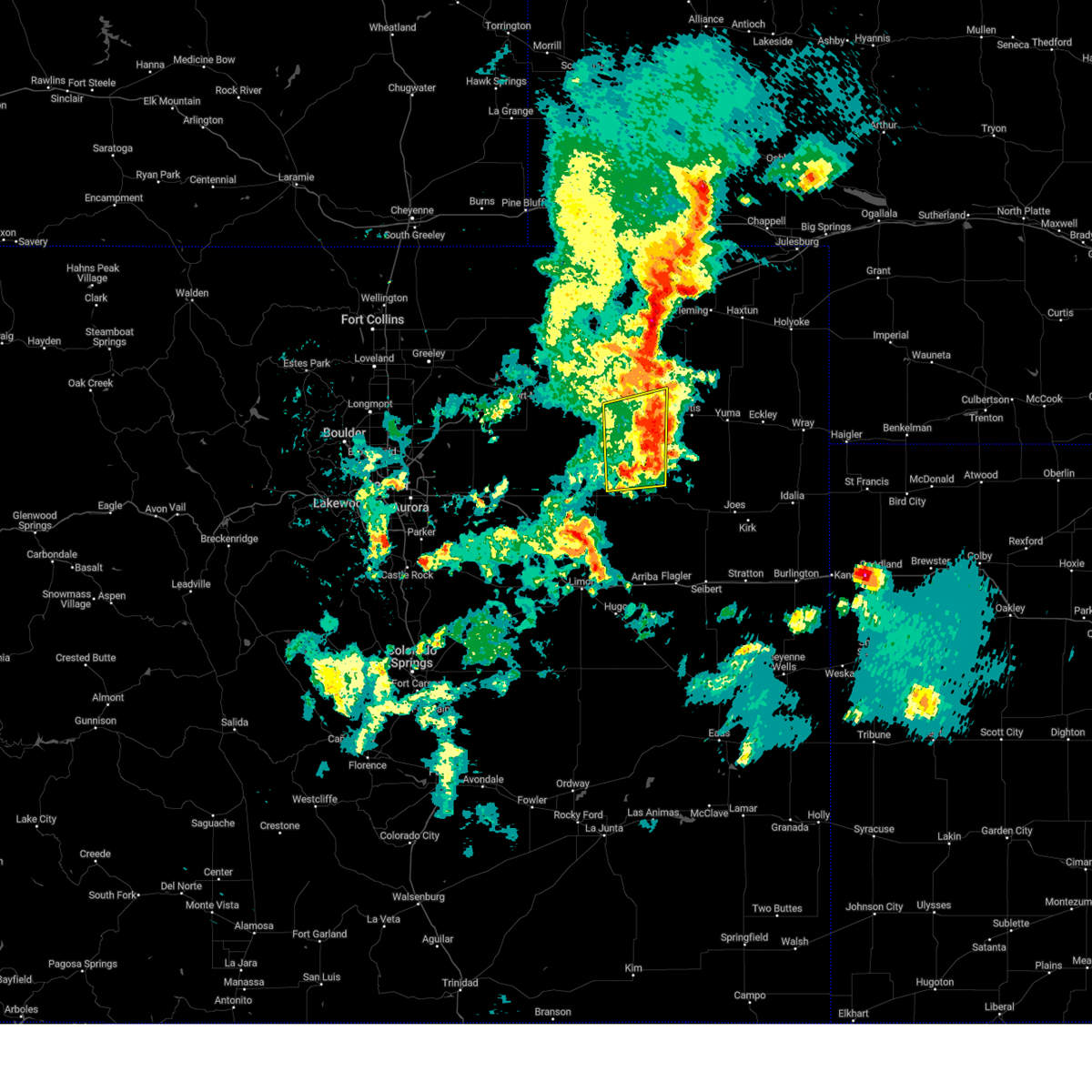
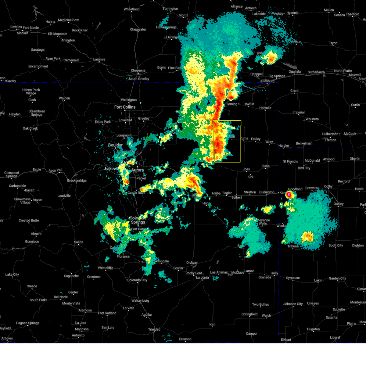
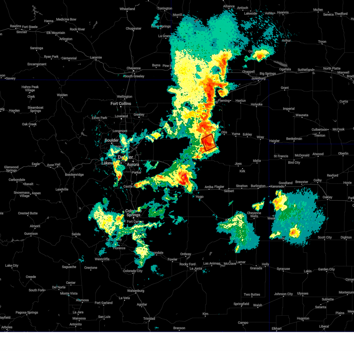
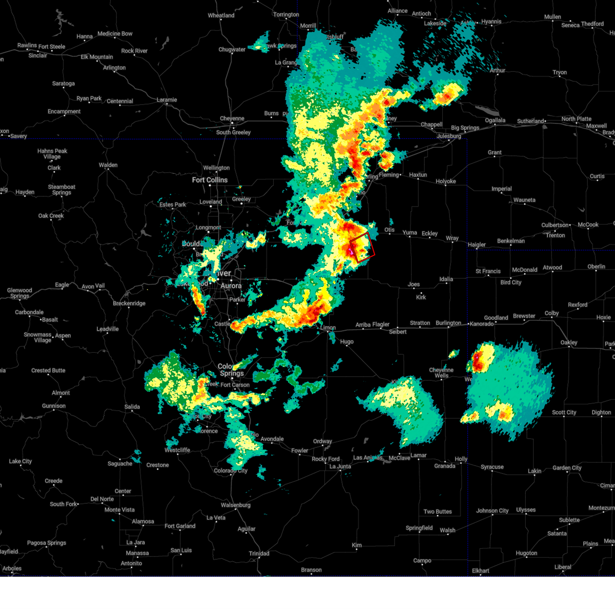
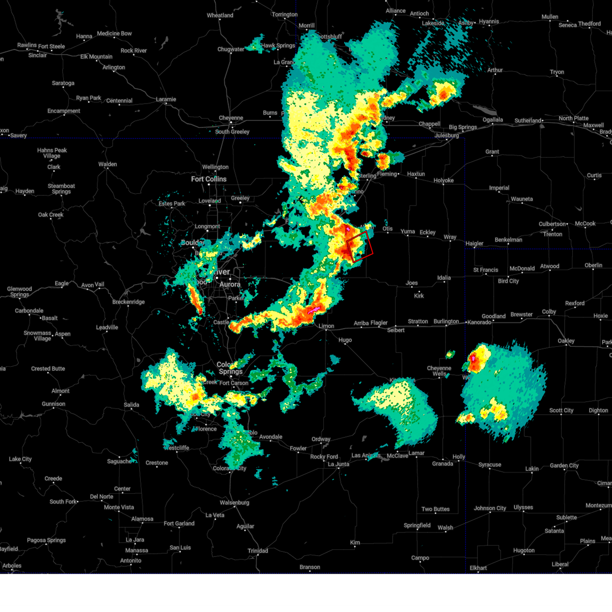
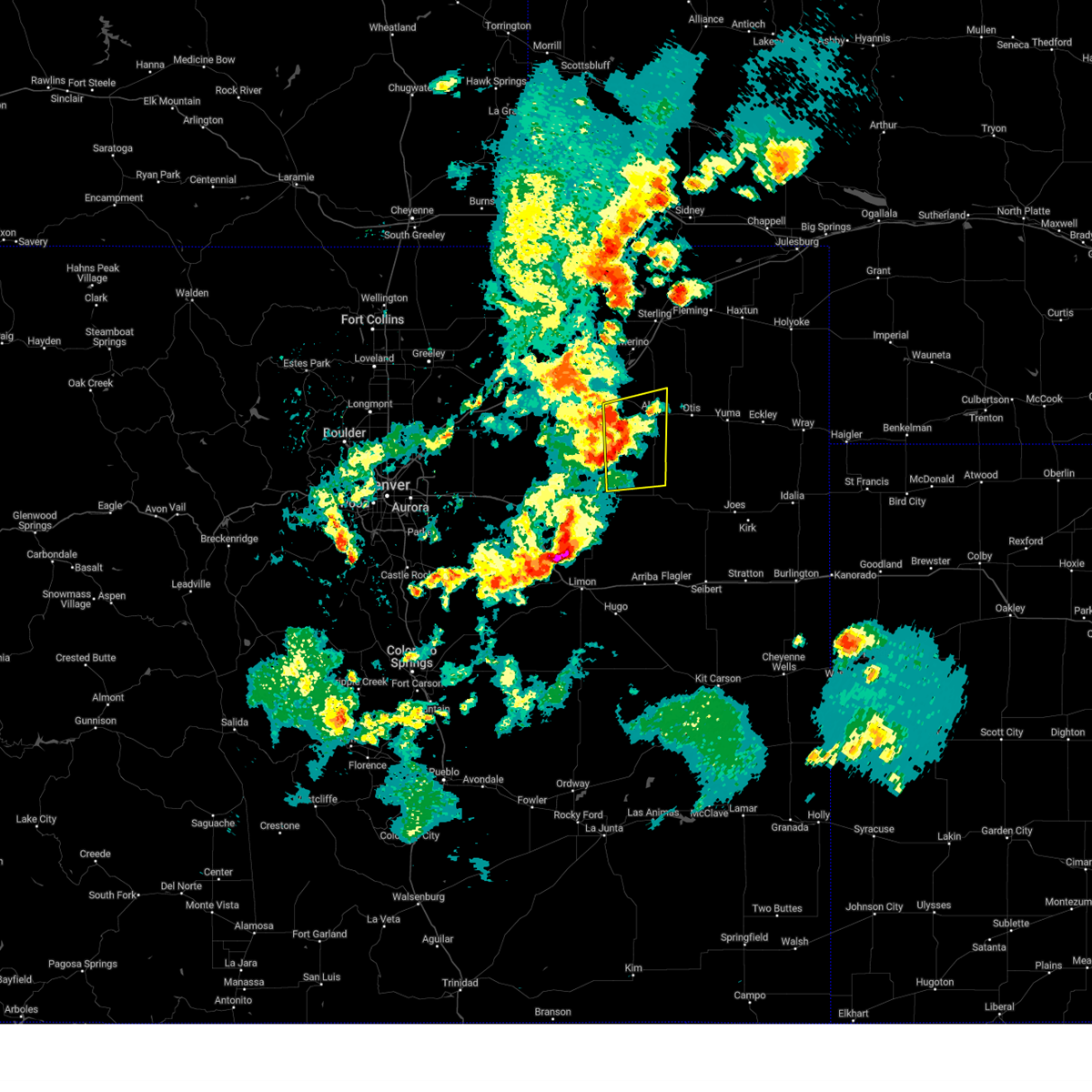
Hail Map for Akron, CO
The Akron, CO area has had 75 reports of on-the-ground hail by trained spotters, and has been under severe weather warnings 38 times during the past 12 months. Doppler radar has detected hail at or near Akron, CO on 121 occasions, including 14 occasions during the past year.
| Name: | Akron, CO |
| Where Located: | 26.1 miles W of Yuma, CO |
| Map: | Google Map for Akron, CO |
| Population: | 1702 |
| Housing Units: | 842 |
| More Info: | Search Google for Akron, CO |
3
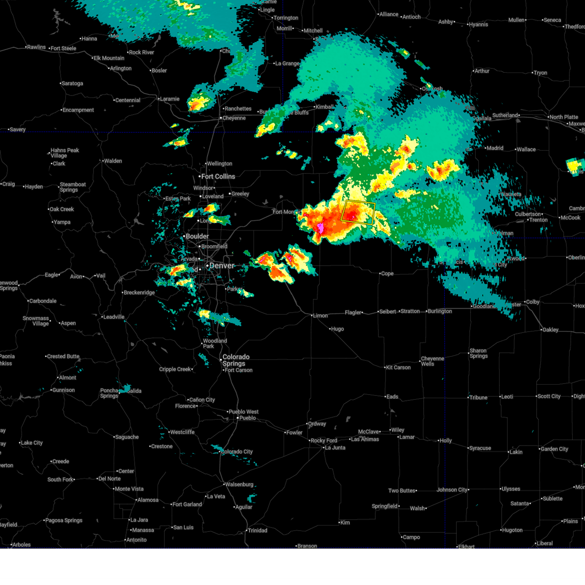
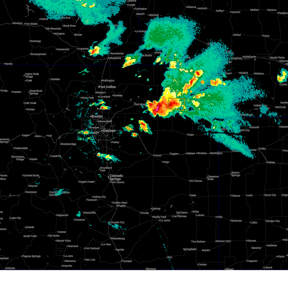
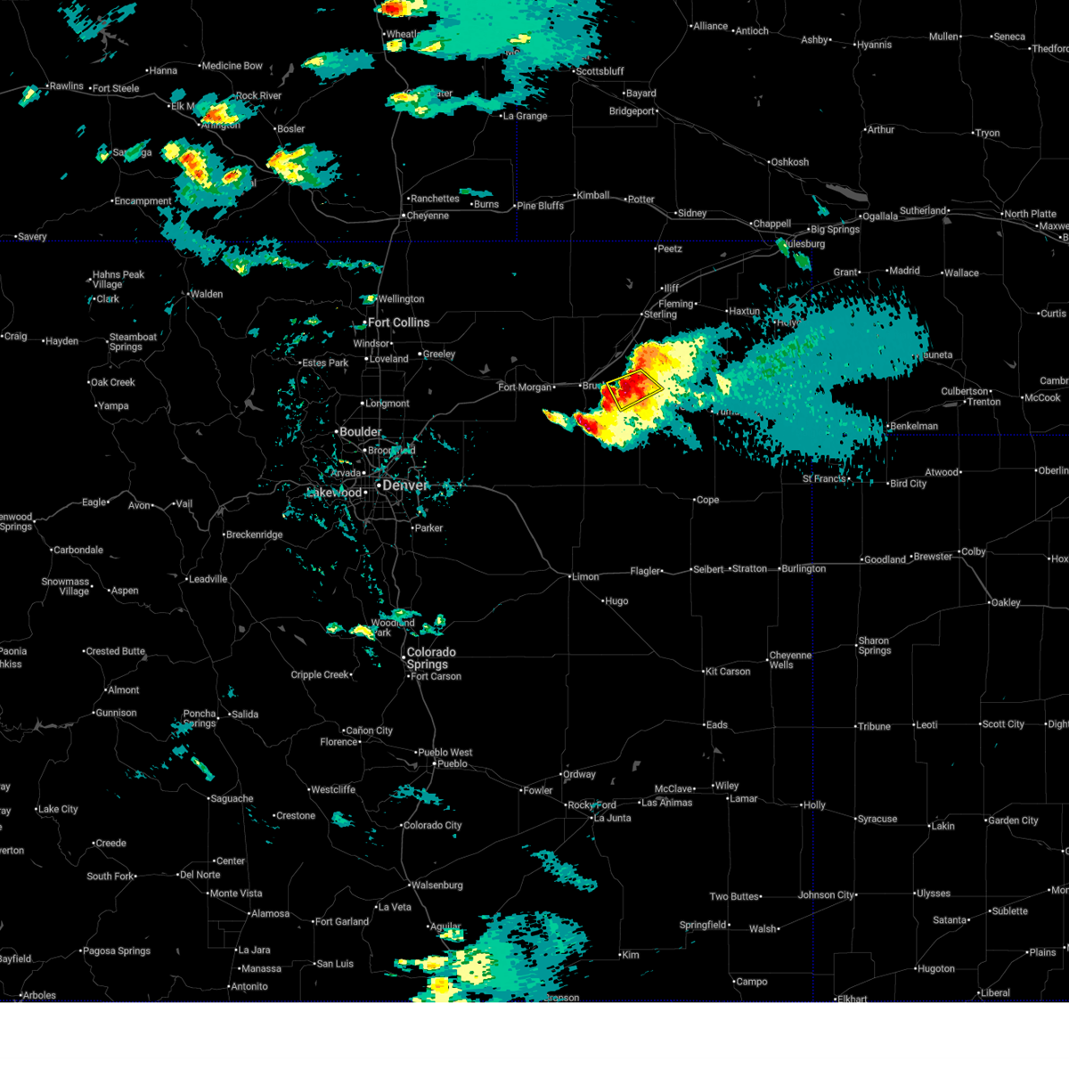
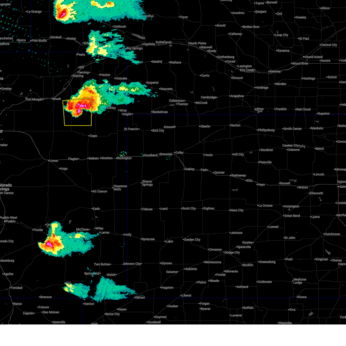
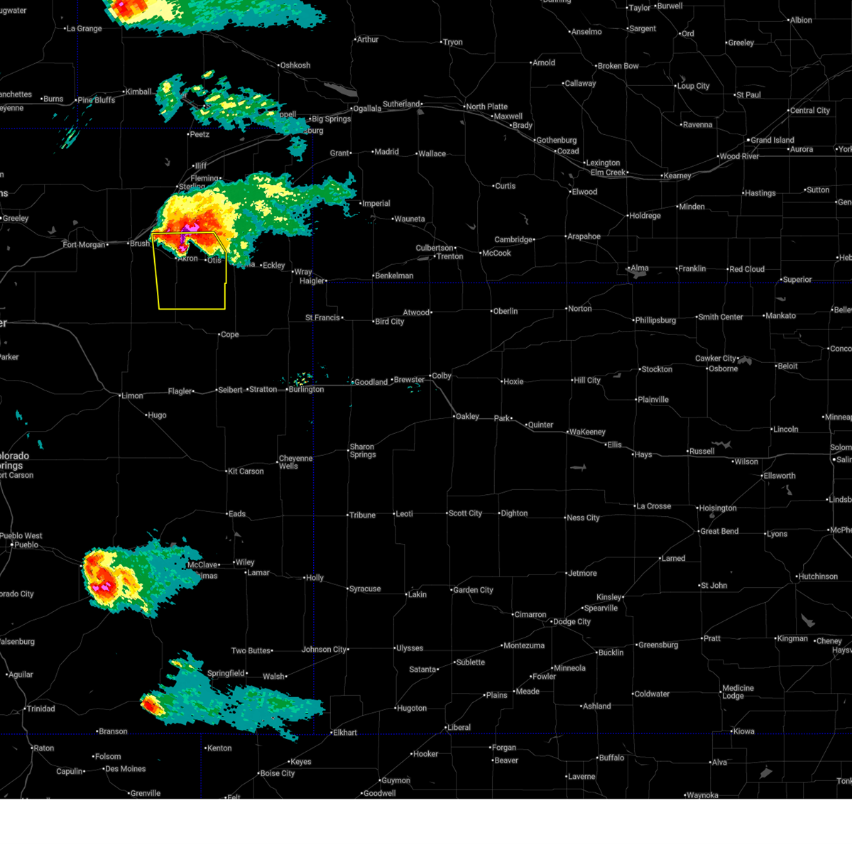
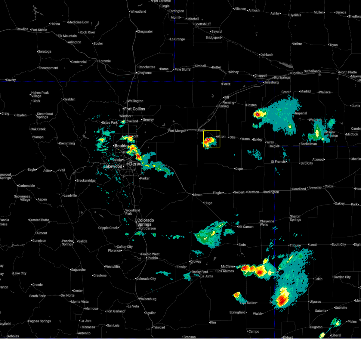
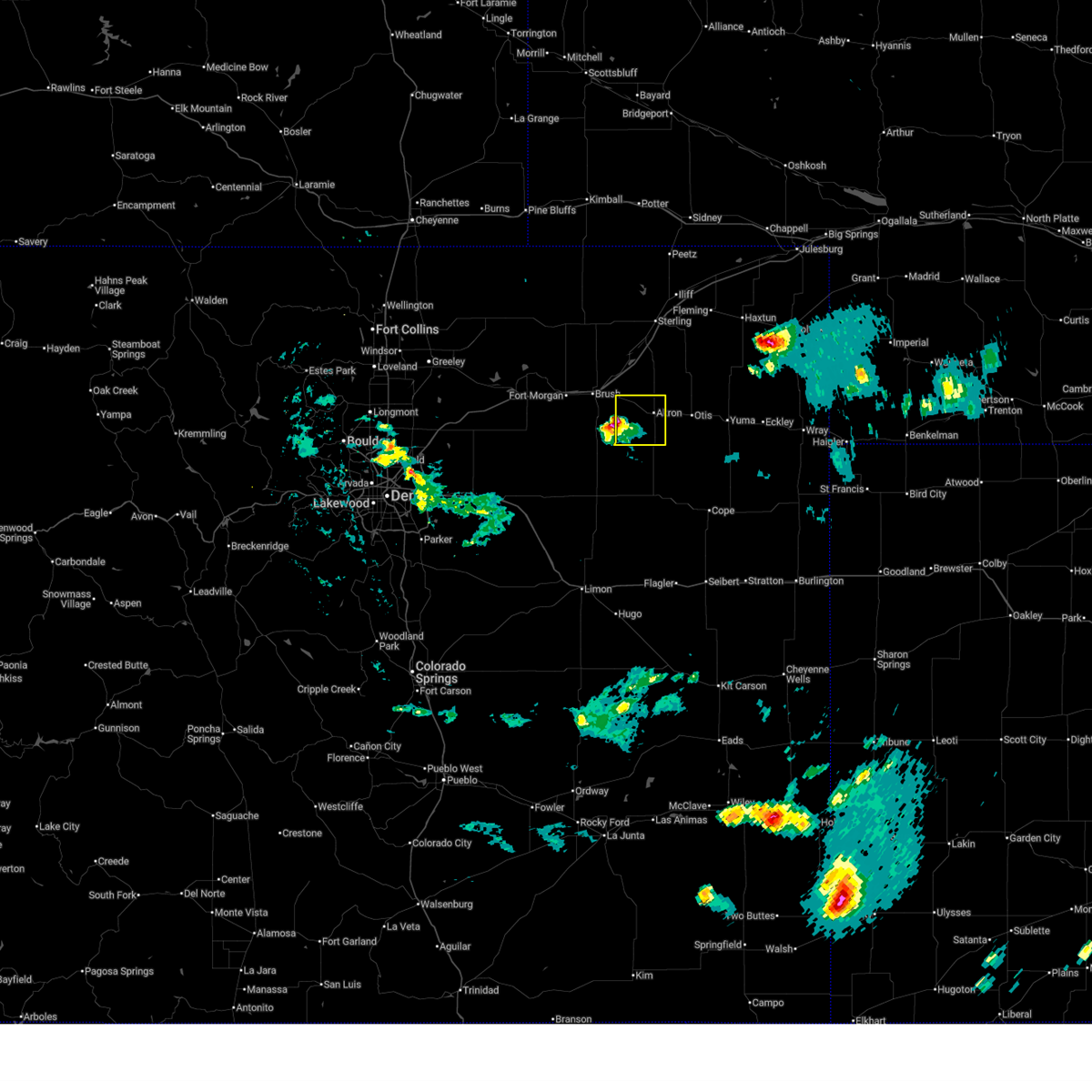
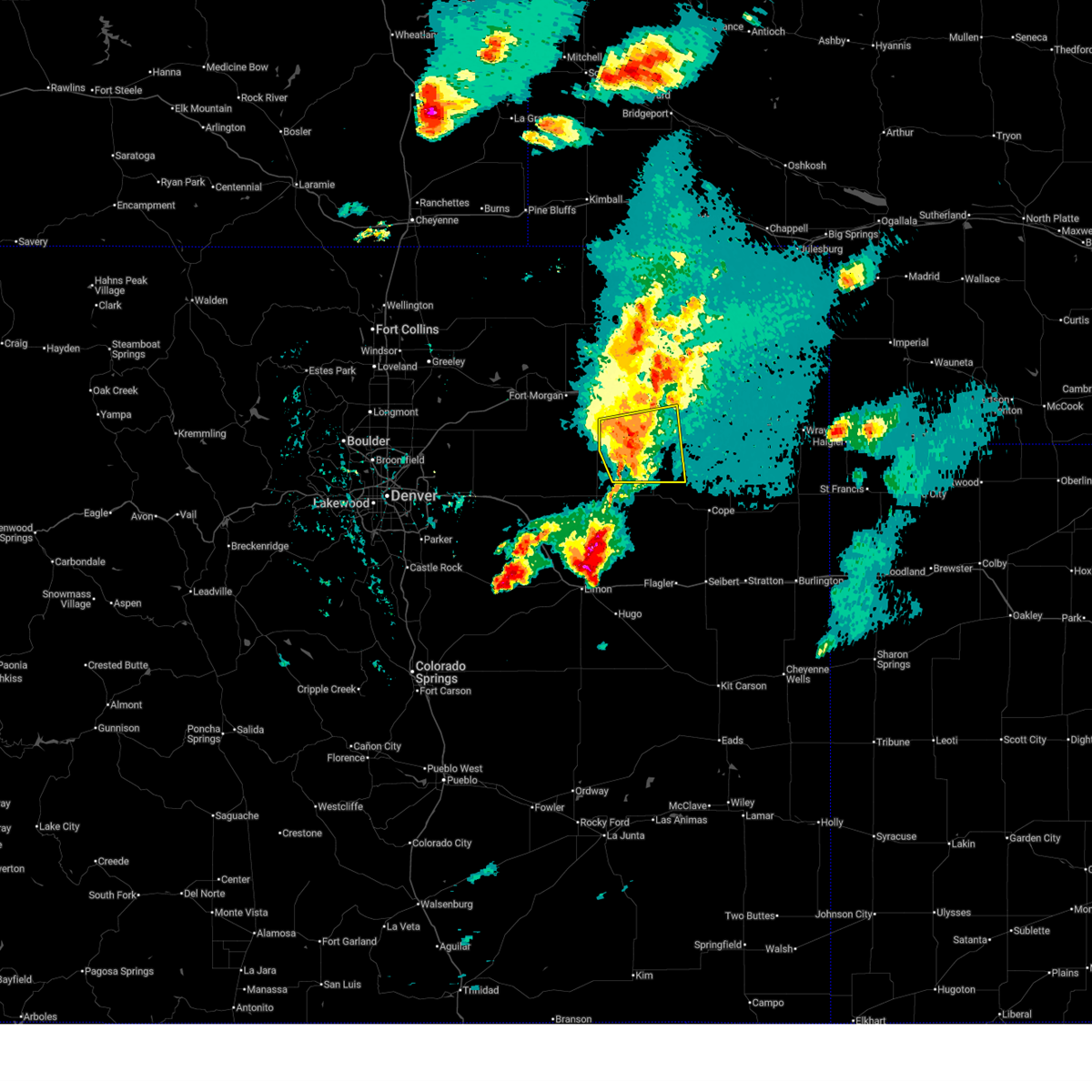
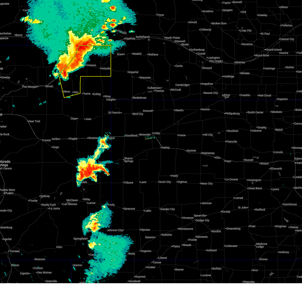
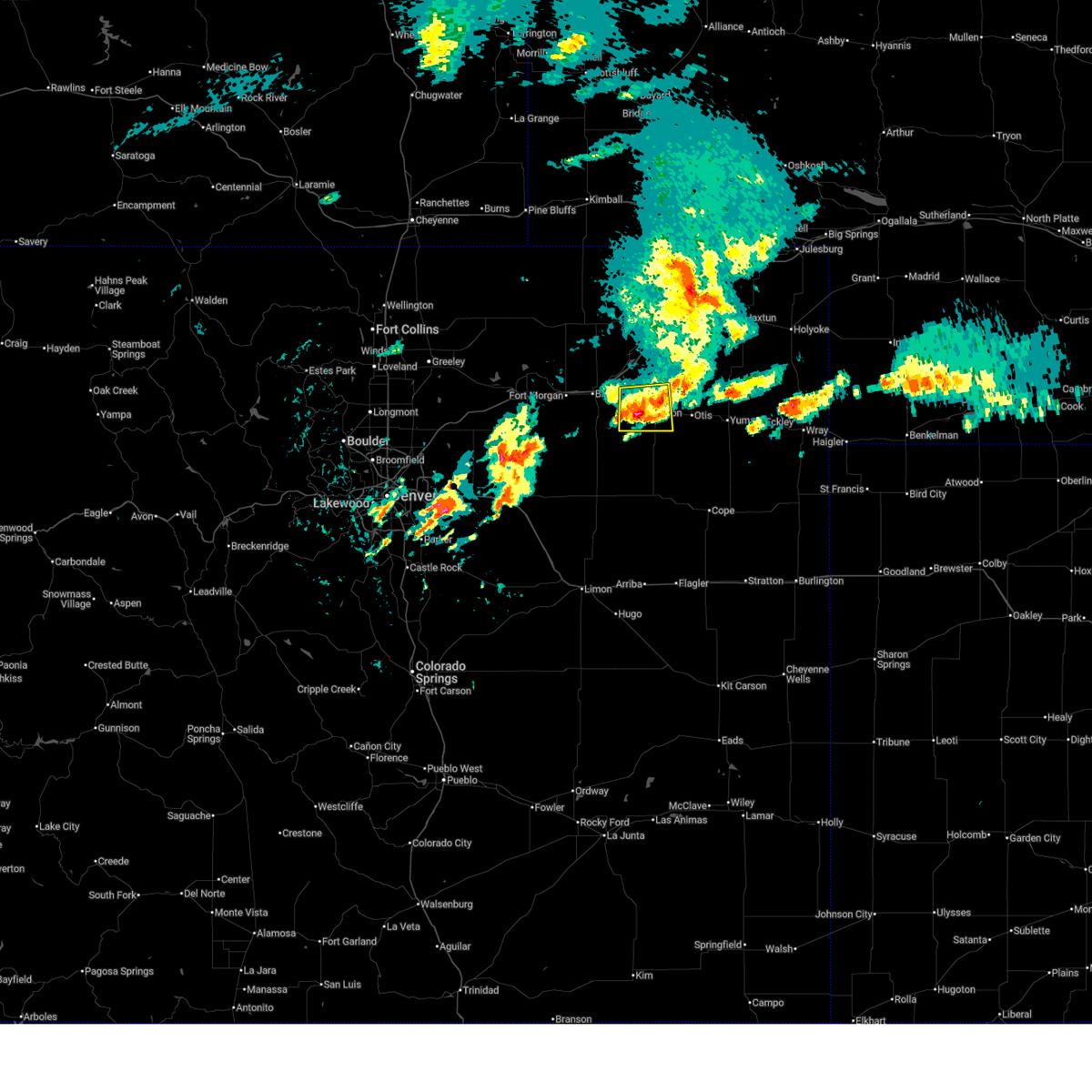
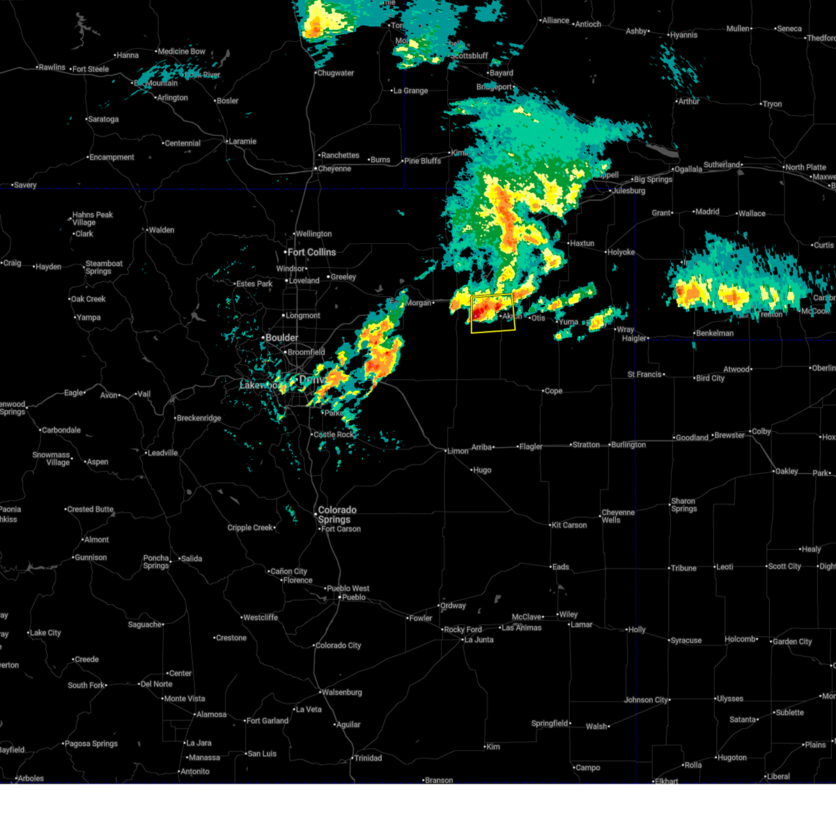
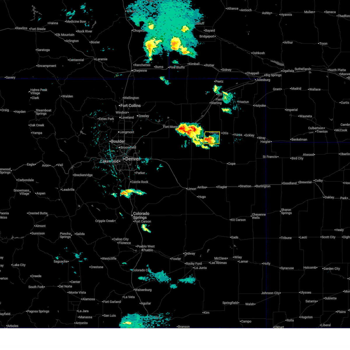
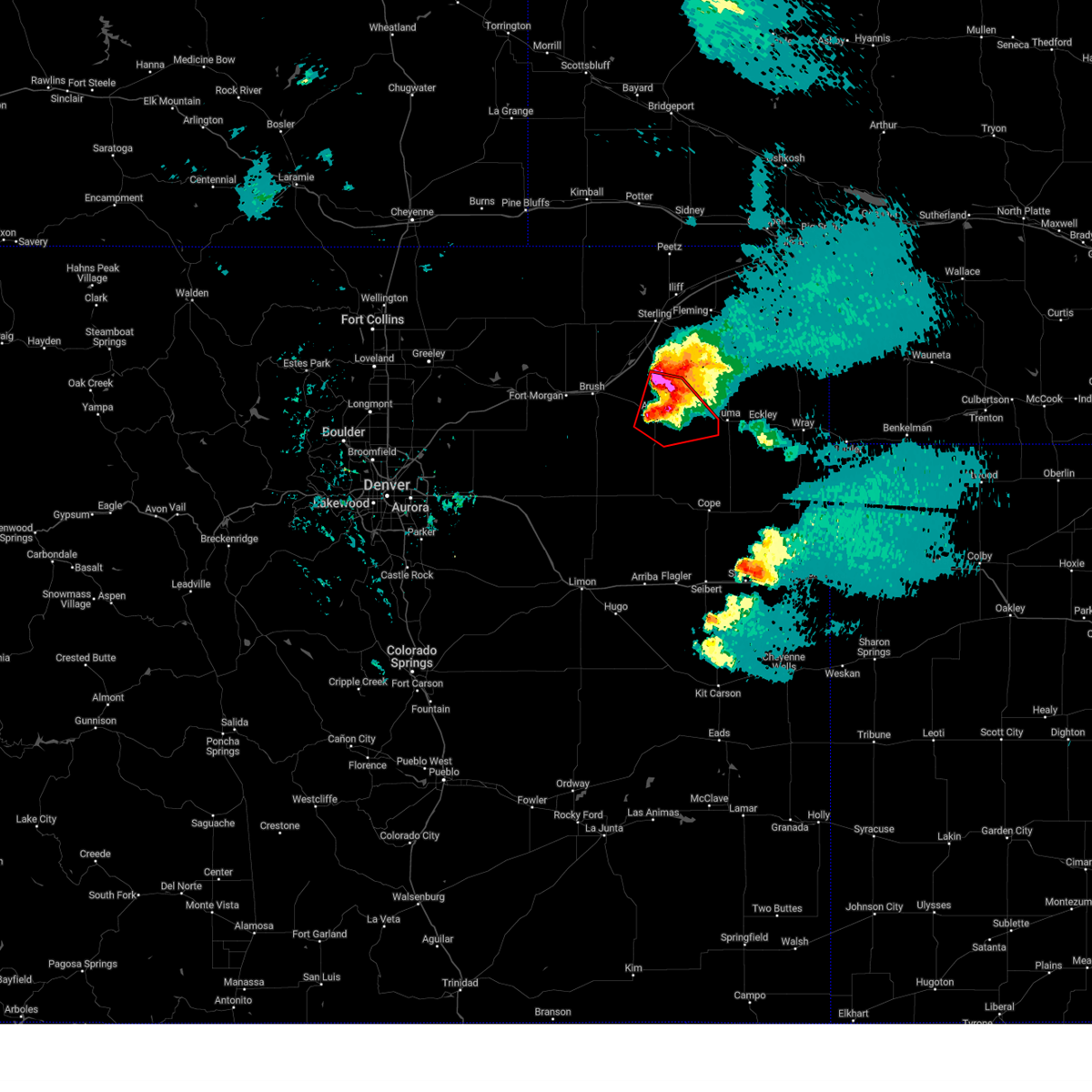
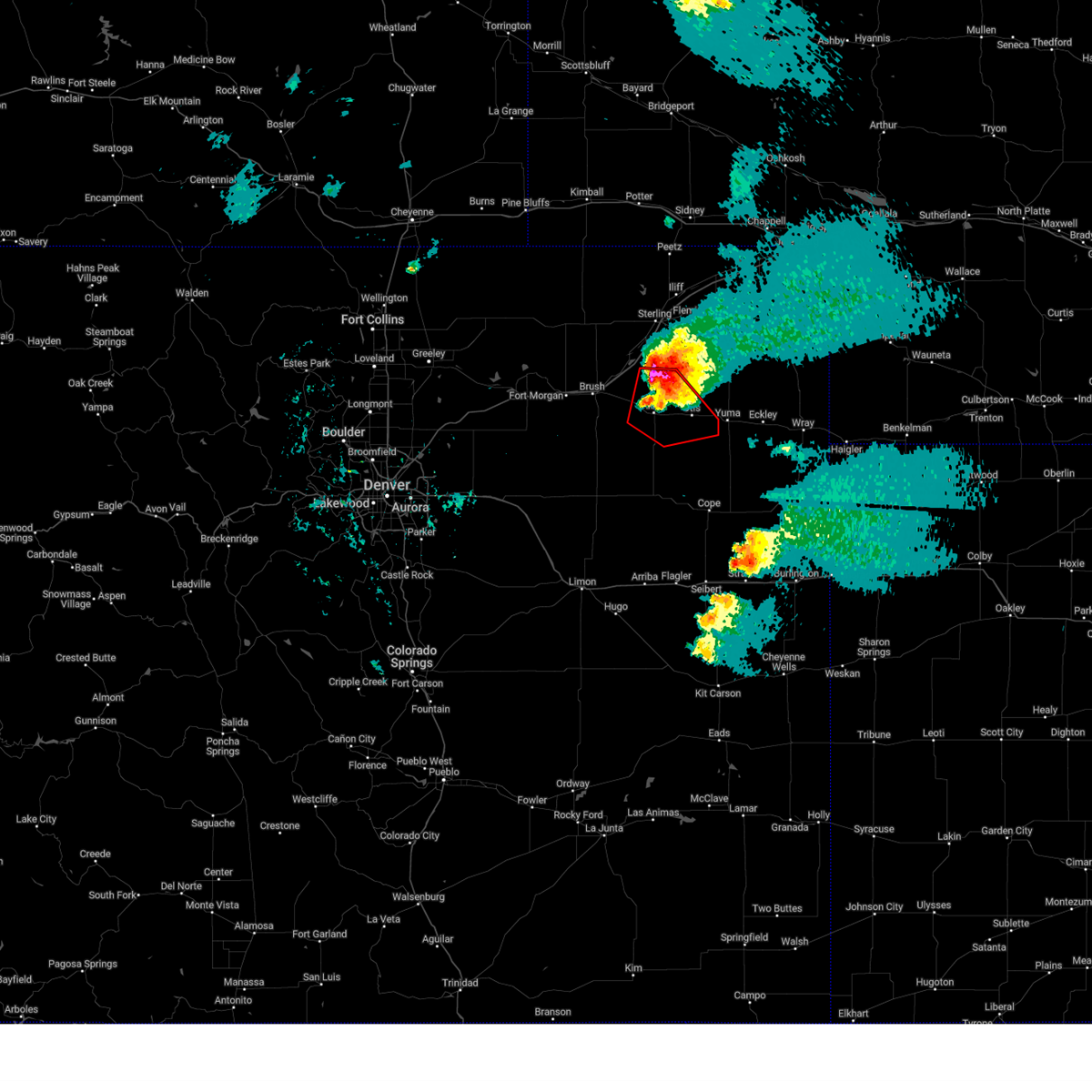
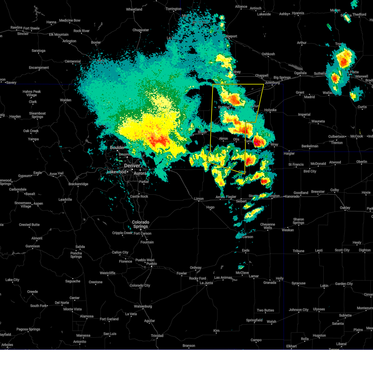
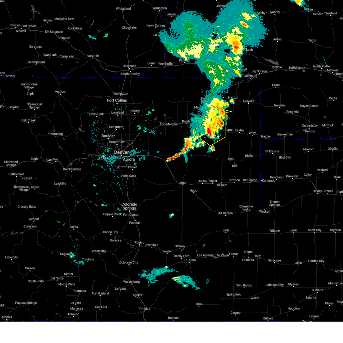
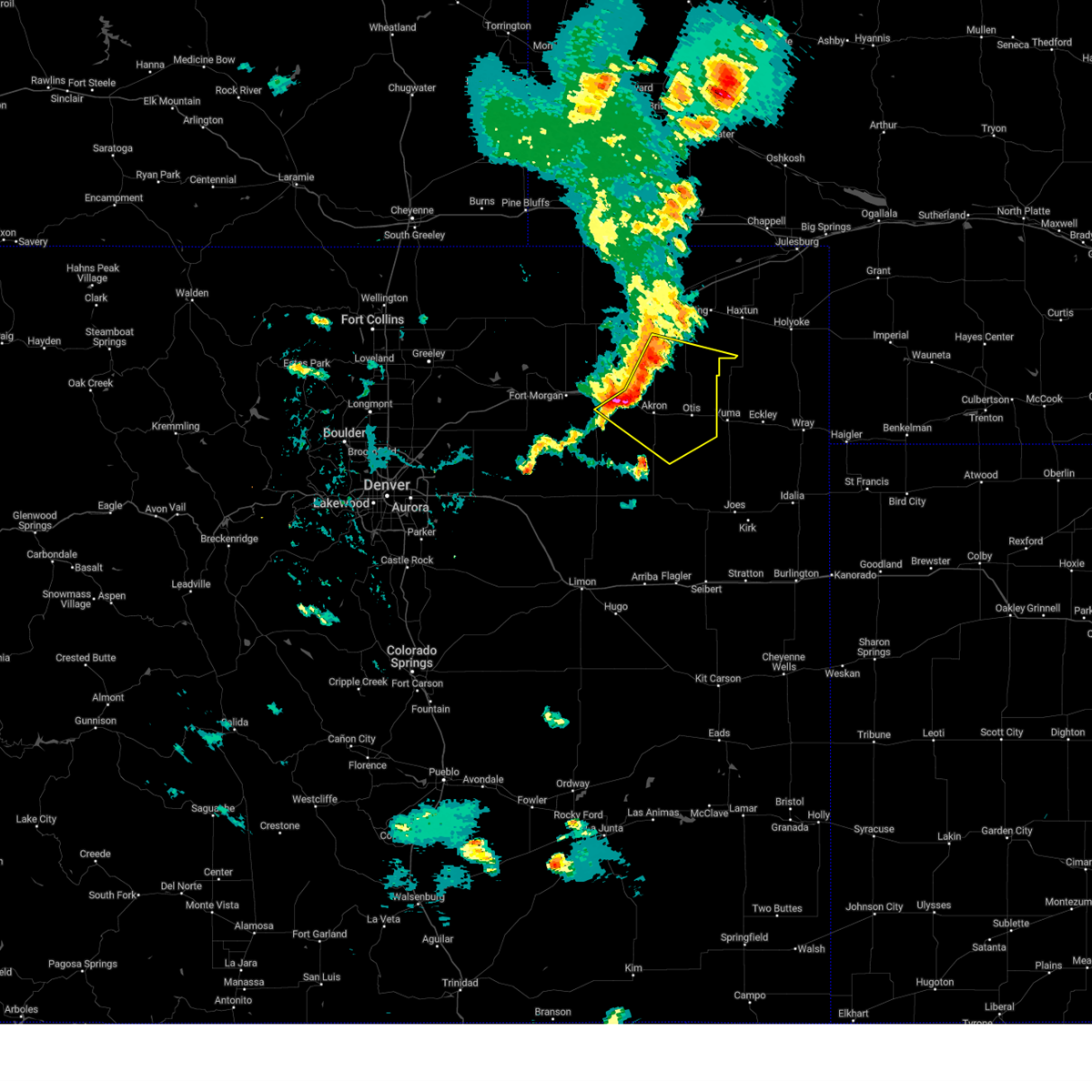
The Top Recent Hail Date for Akron, CO is Wednesday, June 24, 2026 (5th out of 121)
Hail and Wind Damage Spotted near Akron, CO
| Date / Time | Report Details |
|---|---|
| 6/24/2026 9:36 PM MDT |
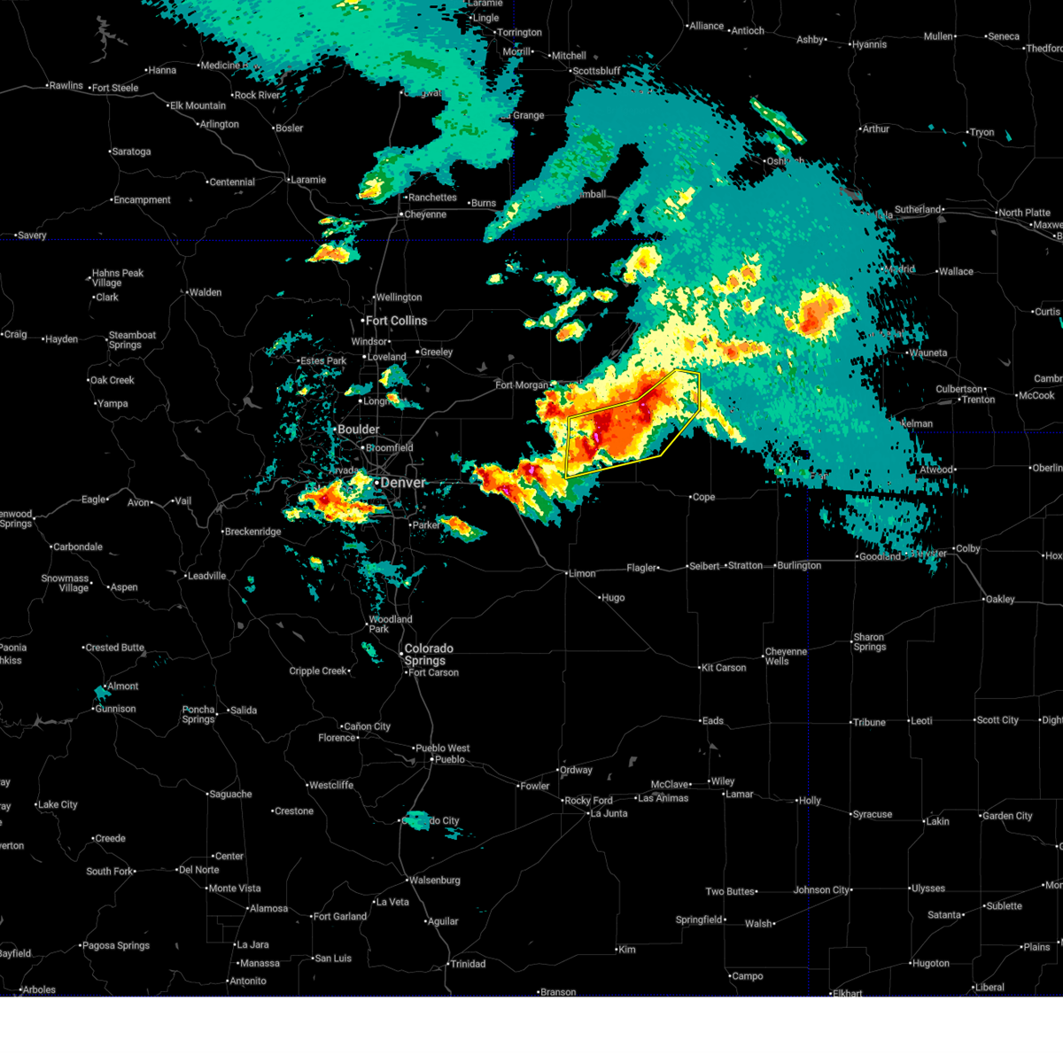 Svrbou the national weather service in denver has issued a * severe thunderstorm warning for, southeastern morgan county in northeastern colorado, central washington county in northeastern colorado, * until 1015 pm mdt. * at 936 pm mdt, severe thunderstorms were located along a line from 4 miles southeast of burdett to 6 miles north of last chance, or along a line from 18 miles northeast of akron to 31 miles southwest of akron, moving southeast at 15 mph (radar indicated). Hazards include golf ball size hail and 70 mph wind gusts. People and animals outdoors will be injured. expect hail damage to roofs, siding, windows, and vehicles. expect considerable tree damage. Wind damage is also likely to mobile homes, roofs, and outbuildings. Svrbou the national weather service in denver has issued a * severe thunderstorm warning for, southeastern morgan county in northeastern colorado, central washington county in northeastern colorado, * until 1015 pm mdt. * at 936 pm mdt, severe thunderstorms were located along a line from 4 miles southeast of burdett to 6 miles north of last chance, or along a line from 18 miles northeast of akron to 31 miles southwest of akron, moving southeast at 15 mph (radar indicated). Hazards include golf ball size hail and 70 mph wind gusts. People and animals outdoors will be injured. expect hail damage to roofs, siding, windows, and vehicles. expect considerable tree damage. Wind damage is also likely to mobile homes, roofs, and outbuildings.
|
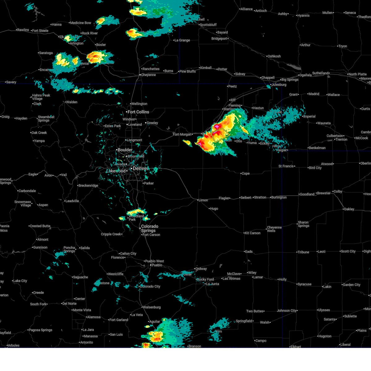
| 6/24/2026 9:23 PM MDT |
 At 923 pm mdt, a severe thunderstorm was located 6 miles northwest of platner, or 8 miles northeast of akron, moving southeast at 15 mph (radar indicated). Hazards include 70 mph wind gusts and ping pong ball size hail. People and animals outdoors will be injured. expect hail damage to roofs, siding, windows, and vehicles. expect considerable tree damage. wind damage is also likely to mobile homes, roofs, and outbuildings. Locations impacted include, akron, otis and platner. At 923 pm mdt, a severe thunderstorm was located 6 miles northwest of platner, or 8 miles northeast of akron, moving southeast at 15 mph (radar indicated). Hazards include 70 mph wind gusts and ping pong ball size hail. People and animals outdoors will be injured. expect hail damage to roofs, siding, windows, and vehicles. expect considerable tree damage. wind damage is also likely to mobile homes, roofs, and outbuildings. Locations impacted include, akron, otis and platner.
|
| 6/24/2026 9:11 PM MDT |
 At 911 pm mdt, a severe thunderstorm was located 8 miles north of akron, moving east at 15 mph (radar indicated). Hazards include 70 mph wind gusts and quarter size hail. Hail damage to vehicles is expected. expect considerable tree damage. wind damage is also likely to mobile homes, roofs, and outbuildings. Locations impacted include, akron, otis, platner and fremont butte. At 911 pm mdt, a severe thunderstorm was located 8 miles north of akron, moving east at 15 mph (radar indicated). Hazards include 70 mph wind gusts and quarter size hail. Hail damage to vehicles is expected. expect considerable tree damage. wind damage is also likely to mobile homes, roofs, and outbuildings. Locations impacted include, akron, otis, platner and fremont butte.
|
| 6/24/2026 9:06 PM MDT |
 Svrbou the national weather service in denver has issued a * severe thunderstorm warning for, northeastern washington county in northeastern colorado, * until 945 pm mdt. * at 906 pm mdt, a severe thunderstorm was located 8 miles north of akron, moving east at 15 mph (radar indicated). Hazards include 60 mph wind gusts and quarter size hail. Hail damage to vehicles is expected. Expect wind damage to roofs, siding, and trees. Svrbou the national weather service in denver has issued a * severe thunderstorm warning for, northeastern washington county in northeastern colorado, * until 945 pm mdt. * at 906 pm mdt, a severe thunderstorm was located 8 miles north of akron, moving east at 15 mph (radar indicated). Hazards include 60 mph wind gusts and quarter size hail. Hail damage to vehicles is expected. Expect wind damage to roofs, siding, and trees.
|
| 6/24/2026 6:16 PM MDT | Ping Pong Ball sized hail reported 18 miles N of Akron, CO |
| 6/24/2026 6:12 PM MDT | Quarter sized hail reported 15.7 miles NNE of Akron, CO, report from mping: quarter (1.00 in.) time estimated from radar. |
| 6/24/2026 5:38 PM MDT | Storm damage reported in washington county CO, 0.9 miles E of Akron, CO |
| 6/24/2026 5:36 PM MDT |
 At 536 pm mdt, a severe thunderstorm was located 5 miles south of akron, moving southeast at 15 mph (radar indicated). Hazards include golf ball size hail and 60 mph wind gusts. People and animals outdoors will be injured. expect hail damage to roofs, siding, windows, and vehicles. expect wind damage to roofs, siding, and trees. Locations impacted include, akron and platner. At 536 pm mdt, a severe thunderstorm was located 5 miles south of akron, moving southeast at 15 mph (radar indicated). Hazards include golf ball size hail and 60 mph wind gusts. People and animals outdoors will be injured. expect hail damage to roofs, siding, windows, and vehicles. expect wind damage to roofs, siding, and trees. Locations impacted include, akron and platner.
|
| 6/24/2026 5:35 PM MDT | Golf Ball sized hail reported 16.4 miles NE of Akron, CO, time estimated from radar. |
| 6/24/2026 5:30 PM MDT | Ping Pong Ball sized hail reported 17.2 miles NE of Akron, CO, time estimated from radar. |
| 6/24/2026 5:29 PM MDT | Awos station kako akro in washington county CO, 0.7 miles SSE of Akron, CO |
| 6/24/2026 5:26 PM MDT |
 At 526 pm mdt, a severe thunderstorm was located near akron, moving southeast at 15 mph (radar indicated). Hazards include golf ball size hail and 60 mph wind gusts. People and animals outdoors will be injured. expect hail damage to roofs, siding, windows, and vehicles. expect wind damage to roofs, siding, and trees. Locations impacted include, akron and platner. At 526 pm mdt, a severe thunderstorm was located near akron, moving southeast at 15 mph (radar indicated). Hazards include golf ball size hail and 60 mph wind gusts. People and animals outdoors will be injured. expect hail damage to roofs, siding, windows, and vehicles. expect wind damage to roofs, siding, and trees. Locations impacted include, akron and platner.
|
| 6/24/2026 5:15 PM MDT |
 Svrbou the national weather service in denver has issued a * severe thunderstorm warning for, central washington county in northeastern colorado, * until 600 pm mdt. * at 515 pm mdt, a severe thunderstorm was located over akron, moving southeast at 15 mph (radar indicated). Hazards include 60 mph wind gusts and half dollar size hail. Hail damage to vehicles is expected. Expect wind damage to roofs, siding, and trees. Svrbou the national weather service in denver has issued a * severe thunderstorm warning for, central washington county in northeastern colorado, * until 600 pm mdt. * at 515 pm mdt, a severe thunderstorm was located over akron, moving southeast at 15 mph (radar indicated). Hazards include 60 mph wind gusts and half dollar size hail. Hail damage to vehicles is expected. Expect wind damage to roofs, siding, and trees.
|
| 6/24/2026 5:06 PM MDT |
 At 506 pm mdt, a severe thunderstorm was located 7 miles east of midway, or 8 miles northwest of akron, moving southeast at 15 mph (radar indicated). Hazards include two inch hail and 60 mph wind gusts. People and animals outdoors will be injured. expect hail damage to roofs, siding, windows, and vehicles. expect wind damage to roofs, siding, and trees. Locations impacted include, midway and fremont butte. At 506 pm mdt, a severe thunderstorm was located 7 miles east of midway, or 8 miles northwest of akron, moving southeast at 15 mph (radar indicated). Hazards include two inch hail and 60 mph wind gusts. People and animals outdoors will be injured. expect hail damage to roofs, siding, windows, and vehicles. expect wind damage to roofs, siding, and trees. Locations impacted include, midway and fremont butte.
|
| 6/24/2026 4:55 PM MDT |
 Svrbou the national weather service in denver has issued a * severe thunderstorm warning for, north central washington county in northeastern colorado, * until 530 pm mdt. * at 455 pm mdt, a severe thunderstorm was located 7 miles northeast of midway, or 10 miles northwest of akron, moving southeast at 15 mph (radar indicated). Hazards include tennis ball size hail and 60 mph wind gusts. People and animals outdoors will be injured. expect hail damage to roofs, siding, windows, and vehicles. Expect wind damage to roofs, siding, and trees. Svrbou the national weather service in denver has issued a * severe thunderstorm warning for, north central washington county in northeastern colorado, * until 530 pm mdt. * at 455 pm mdt, a severe thunderstorm was located 7 miles northeast of midway, or 10 miles northwest of akron, moving southeast at 15 mph (radar indicated). Hazards include tennis ball size hail and 60 mph wind gusts. People and animals outdoors will be injured. expect hail damage to roofs, siding, windows, and vehicles. Expect wind damage to roofs, siding, and trees.
|
| 6/22/2026 6:56 PM MDT | Large tree snapped and multiple limbs dow in washington county CO, 0.2 miles WNW of Akron, CO |
| 6/22/2026 6:30 PM MDT | Power lines down along us34 from akron to oti in washington county CO, 0.3 miles ENE of Akron, CO |
| 6/22/2026 6:30 PM MDT | Tree limbs down and street floodin in washington county CO, 0.2 miles WNW of Akron, CO |
| 6/22/2026 6:19 PM MDT |
 At 619 pm mdt, a severe thunderstorm was located 7 miles northeast of elba, or 10 miles southeast of akron, moving south at 35 mph. this is a destructive storm for central washington county (radar indicated). Hazards include 80 mph wind gusts and two inch hail. Flying debris will be dangerous to those caught without shelter. mobile homes will be heavily damaged. expect considerable damage to roofs, windows, and vehicles. extensive tree damage and power outages are likely. Locations impacted include, akron, otis, platner, elba, midway and hyde. At 619 pm mdt, a severe thunderstorm was located 7 miles northeast of elba, or 10 miles southeast of akron, moving south at 35 mph. this is a destructive storm for central washington county (radar indicated). Hazards include 80 mph wind gusts and two inch hail. Flying debris will be dangerous to those caught without shelter. mobile homes will be heavily damaged. expect considerable damage to roofs, windows, and vehicles. extensive tree damage and power outages are likely. Locations impacted include, akron, otis, platner, elba, midway and hyde.
|
| 6/22/2026 6:18 PM MDT | Storm damage reported in washington county CO, 4 miles WNW of Akron, CO |
| 6/22/2026 6:12 PM MDT | Storm damage reported in washington county CO, 1.3 miles SSE of Akron, CO |
| 6/22/2026 6:10 PM MDT | Storm damage reported in washington county CO, 0.7 miles W of Akron, CO |
| 6/22/2026 6:10 PM MDT | Storm damage reported in washington county CO, 1.1 miles SE of Akron, CO |
| 6/22/2026 6:06 PM MDT |
 At 606 pm mdt, a severe thunderstorm was located near akron, moving south at 35 mph (weather station reported a 75 mph gust just east of akron). Hazards include two inch hail and 70 mph wind gusts. People and animals outdoors will be injured. expect hail damage to roofs, siding, windows, and vehicles. expect considerable tree damage. wind damage is also likely to mobile homes, roofs, and outbuildings. Locations impacted include, akron, otis, platner, elba, midway, hyde and fremont butte. At 606 pm mdt, a severe thunderstorm was located near akron, moving south at 35 mph (weather station reported a 75 mph gust just east of akron). Hazards include two inch hail and 70 mph wind gusts. People and animals outdoors will be injured. expect hail damage to roofs, siding, windows, and vehicles. expect considerable tree damage. wind damage is also likely to mobile homes, roofs, and outbuildings. Locations impacted include, akron, otis, platner, elba, midway, hyde and fremont butte.
|
| 6/22/2026 6:04 PM MDT | Storm damage reported in washington county CO, 0.9 miles E of Akron, CO |
| 6/22/2026 6:03 PM MDT | Storm damage reported in washington county CO, 4 miles WNW of Akron, CO |
| 6/22/2026 6:02 PM MDT | 4 inch tree limbs snappe in washington county CO, 0.2 miles WNW of Akron, CO |
| 6/22/2026 6:01 PM MDT | Storm damage reported in washington county CO, 17.7 miles SE of Akron, CO |
| 6/22/2026 6:01 PM MDT | Storm damage reported in washington county CO, 17.3 miles SE of Akron, CO |
| 6/22/2026 6:00 PM MDT | Storm damage reported in washington county CO, 4 miles WNW of Akron, CO |
| 6/22/2026 5:54 PM MDT |
 Svrbou the national weather service in denver has issued a * severe thunderstorm warning for, northeastern washington county in northeastern colorado, * until 645 pm mdt. * at 554 pm mdt, a severe thunderstorm was located 6 miles northeast of akron, moving south at 35 mph (radar indicated). Hazards include two inch hail and 70 mph wind gusts. People and animals outdoors will be injured. expect hail damage to roofs, siding, windows, and vehicles. expect considerable tree damage. Wind damage is also likely to mobile homes, roofs, and outbuildings. Svrbou the national weather service in denver has issued a * severe thunderstorm warning for, northeastern washington county in northeastern colorado, * until 645 pm mdt. * at 554 pm mdt, a severe thunderstorm was located 6 miles northeast of akron, moving south at 35 mph (radar indicated). Hazards include two inch hail and 70 mph wind gusts. People and animals outdoors will be injured. expect hail damage to roofs, siding, windows, and vehicles. expect considerable tree damage. Wind damage is also likely to mobile homes, roofs, and outbuildings.
|
| 6/22/2026 5:51 PM MDT | Storm damage reported in washington county CO, 17.7 miles SE of Akron, CO |
| 6/21/2026 8:54 PM MDT |
 At 854 pm mdt, a severe thunderstorm was located 8 miles south of midway, or 8 miles west of akron, moving east at 20 mph (radar indicated). Hazards include 60 mph wind gusts and quarter size hail. Hail damage to vehicles is expected. expect wind damage to roofs, siding, and trees. Locations impacted include, akron, midway and fremont butte. At 854 pm mdt, a severe thunderstorm was located 8 miles south of midway, or 8 miles west of akron, moving east at 20 mph (radar indicated). Hazards include 60 mph wind gusts and quarter size hail. Hail damage to vehicles is expected. expect wind damage to roofs, siding, and trees. Locations impacted include, akron, midway and fremont butte.
|
| 6/21/2026 8:43 PM MDT |
 Svrbou the national weather service in denver has issued a * severe thunderstorm warning for, central washington county in northeastern colorado, * until 915 pm mdt. * at 843 pm mdt, a severe thunderstorm was located 8 miles south of midway, or 12 miles west of akron, moving east at 20 mph (radar indicated). Hazards include ping pong ball size hail and 60 mph wind gusts. People and animals outdoors will be injured. expect hail damage to roofs, siding, windows, and vehicles. Expect wind damage to roofs, siding, and trees. Svrbou the national weather service in denver has issued a * severe thunderstorm warning for, central washington county in northeastern colorado, * until 915 pm mdt. * at 843 pm mdt, a severe thunderstorm was located 8 miles south of midway, or 12 miles west of akron, moving east at 20 mph (radar indicated). Hazards include ping pong ball size hail and 60 mph wind gusts. People and animals outdoors will be injured. expect hail damage to roofs, siding, windows, and vehicles. Expect wind damage to roofs, siding, and trees.
|
| 6/8/2026 6:22 PM MDT |
 At 622 pm mdt, a severe thunderstorm was located 7 miles northwest of elba, or 12 miles southwest of akron, moving east at 30 mph (radar indicated). Hazards include 60 mph wind gusts and small hail. Expect damage to roofs, siding, and trees. Locations impacted include, akron, elba and platner. At 622 pm mdt, a severe thunderstorm was located 7 miles northwest of elba, or 12 miles southwest of akron, moving east at 30 mph (radar indicated). Hazards include 60 mph wind gusts and small hail. Expect damage to roofs, siding, and trees. Locations impacted include, akron, elba and platner.
|
| 6/8/2026 5:57 PM MDT |
 Svrbou the national weather service in denver has issued a * severe thunderstorm warning for, southeastern morgan county in northeastern colorado, central washington county in northeastern colorado, * until 645 pm mdt. * at 557 pm mdt, a severe thunderstorm was located near woodrow, or 23 miles southwest of akron, moving east at 35 mph (radar indicated). Hazards include 60 mph wind gusts and quarter size hail. Hail damage to vehicles is expected. Expect wind damage to roofs, siding, and trees. Svrbou the national weather service in denver has issued a * severe thunderstorm warning for, southeastern morgan county in northeastern colorado, central washington county in northeastern colorado, * until 645 pm mdt. * at 557 pm mdt, a severe thunderstorm was located near woodrow, or 23 miles southwest of akron, moving east at 35 mph (radar indicated). Hazards include 60 mph wind gusts and quarter size hail. Hail damage to vehicles is expected. Expect wind damage to roofs, siding, and trees.
|
| 6/1/2026 5:04 PM MDT |
 Svrbou the national weather service in denver has issued a * severe thunderstorm warning for, south central logan county in northeastern colorado, northeastern washington county in northeastern colorado, * until 545 pm mdt. * at 504 pm mdt, a severe thunderstorm was located near akron, moving northeast at 20 mph (radar indicated). Hazards include half dollar size hail. damage to vehicles is expected Svrbou the national weather service in denver has issued a * severe thunderstorm warning for, south central logan county in northeastern colorado, northeastern washington county in northeastern colorado, * until 545 pm mdt. * at 504 pm mdt, a severe thunderstorm was located near akron, moving northeast at 20 mph (radar indicated). Hazards include half dollar size hail. damage to vehicles is expected
|
| 6/1/2026 4:38 PM MDT |
 At 438 pm mdt, a severe thunderstorm was located 8 miles east of woodrow, or 16 miles southwest of akron, moving northeast at 15 mph (radar indicated). Hazards include golf ball size hail. People and animals outdoors will be injured. expect damage to roofs, siding, windows, and vehicles. hail may accumulate on roadways causing hazardous travel. Locations impacted include, midway. At 438 pm mdt, a severe thunderstorm was located 8 miles east of woodrow, or 16 miles southwest of akron, moving northeast at 15 mph (radar indicated). Hazards include golf ball size hail. People and animals outdoors will be injured. expect damage to roofs, siding, windows, and vehicles. hail may accumulate on roadways causing hazardous travel. Locations impacted include, midway.
|
| 6/1/2026 4:24 PM MDT |
 Svrbou the national weather service in denver has issued a * severe thunderstorm warning for, southeastern morgan county in northeastern colorado, central washington county in northeastern colorado, * until 515 pm mdt. * at 424 pm mdt, a severe thunderstorm was located 6 miles east of woodrow, or 19 miles southwest of akron, moving northeast at 15 mph (radar indicated). Hazards include golf ball size hail. People and animals outdoors will be injured. expect damage to roofs, siding, windows, and vehicles. Hail may accumulate on roadways causing hazardous travel. Svrbou the national weather service in denver has issued a * severe thunderstorm warning for, southeastern morgan county in northeastern colorado, central washington county in northeastern colorado, * until 515 pm mdt. * at 424 pm mdt, a severe thunderstorm was located 6 miles east of woodrow, or 19 miles southwest of akron, moving northeast at 15 mph (radar indicated). Hazards include golf ball size hail. People and animals outdoors will be injured. expect damage to roofs, siding, windows, and vehicles. Hail may accumulate on roadways causing hazardous travel.
|
| 6/1/2026 4:21 PM MDT | Hen Egg sized hail reported 18.1 miles NE of Akron, CO, report from mping: hen egg (2.00 in.). |
| 5/30/2026 5:40 PM MDT | Quarter sized hail reported 2.5 miles E of Akron, CO |
| 5/30/2026 5:33 PM MDT |
 Svrbou the national weather service in denver has issued a * severe thunderstorm warning for, north central washington county in northeastern colorado, * until 600 pm mdt. * at 533 pm mdt, a severe thunderstorm was located over akron, moving north at 15 mph (radar indicated). Hazards include 60 mph wind gusts and quarter size hail. Hail damage to vehicles is expected. Expect wind damage to roofs, siding, and trees. Svrbou the national weather service in denver has issued a * severe thunderstorm warning for, north central washington county in northeastern colorado, * until 600 pm mdt. * at 533 pm mdt, a severe thunderstorm was located over akron, moving north at 15 mph (radar indicated). Hazards include 60 mph wind gusts and quarter size hail. Hail damage to vehicles is expected. Expect wind damage to roofs, siding, and trees.
|
| 5/30/2026 4:15 PM MDT | Ping Pong Ball sized hail reported 0.6 miles SSW of Akron, CO |
| 5/16/2026 4:00 PM MDT | Quarter sized hail reported 4.5 miles SSE of Akron, CO |
| 5/16/2026 3:58 PM MDT |
 Svrbou the national weather service in denver has issued a * severe thunderstorm warning for, southwestern logan county in northeastern colorado, east central morgan county in northeastern colorado, northeastern washington county in northeastern colorado, * until 445 pm mdt. * at 358 pm mdt, severe thunderstorms were located along a line from near hillrose to near akron, or along a line from 18 miles northwest of akron to near akron, moving northeast at 30 mph (radar indicated). Hazards include 60 mph wind gusts and quarter size hail. Hail damage to vehicles is expected. Expect wind damage to roofs, siding, and trees. Svrbou the national weather service in denver has issued a * severe thunderstorm warning for, southwestern logan county in northeastern colorado, east central morgan county in northeastern colorado, northeastern washington county in northeastern colorado, * until 445 pm mdt. * at 358 pm mdt, severe thunderstorms were located along a line from near hillrose to near akron, or along a line from 18 miles northwest of akron to near akron, moving northeast at 30 mph (radar indicated). Hazards include 60 mph wind gusts and quarter size hail. Hail damage to vehicles is expected. Expect wind damage to roofs, siding, and trees.
|
| 5/9/2026 7:07 PM MDT | Awos station kako akro in washington county CO, 0.7 miles SSE of Akron, CO |
| 8/28/2025 6:58 PM MDT |
 The storm which prompted the warning has moved out of the area. therefore, the warning will be allowed to expire. however, gusty winds and heavy rain are still possible with this thunderstorm. The storm which prompted the warning has moved out of the area. therefore, the warning will be allowed to expire. however, gusty winds and heavy rain are still possible with this thunderstorm.
|
| 8/28/2025 6:43 PM MDT |
 At 643 pm mdt, a severe thunderstorm was located 6 miles south of platner, or 8 miles southeast of akron, moving southeast at 30 mph (weather station reported wind gust up to 87 mph in akron). Hazards include two inch hail and 70 mph wind gusts. People and animals outdoors will be injured. expect hail damage to roofs, siding, windows, and vehicles. expect considerable tree damage. wind damage is also likely to mobile homes, roofs, and outbuildings. Locations impacted include, akron, otis, platner and elba. At 643 pm mdt, a severe thunderstorm was located 6 miles south of platner, or 8 miles southeast of akron, moving southeast at 30 mph (weather station reported wind gust up to 87 mph in akron). Hazards include two inch hail and 70 mph wind gusts. People and animals outdoors will be injured. expect hail damage to roofs, siding, windows, and vehicles. expect considerable tree damage. wind damage is also likely to mobile homes, roofs, and outbuildings. Locations impacted include, akron, otis, platner and elba.
|
| 8/28/2025 6:31 PM MDT | Storm damage reported in washington county CO, 0.9 miles E of Akron, CO |
| 8/28/2025 6:31 PM MDT | Storm damage reported in washington county CO, 1.3 miles SSE of Akron, CO |
| 8/28/2025 6:27 PM MDT | Storm damage reported in washington county CO, 1.1 miles SE of Akron, CO |
| 8/28/2025 6:22 PM MDT |
 At 622 pm mdt, a severe thunderstorm was located near akron, moving southeast at 30 mph (radar indicated). Hazards include two inch hail and 60 mph wind gusts. People and animals outdoors will be injured. expect hail damage to roofs, siding, windows, and vehicles. expect wind damage to roofs, siding, and trees. Locations impacted include, akron, otis, platner and elba. At 622 pm mdt, a severe thunderstorm was located near akron, moving southeast at 30 mph (radar indicated). Hazards include two inch hail and 60 mph wind gusts. People and animals outdoors will be injured. expect hail damage to roofs, siding, windows, and vehicles. expect wind damage to roofs, siding, and trees. Locations impacted include, akron, otis, platner and elba.
|
| 8/28/2025 6:10 PM MDT |
 Svrbou the national weather service in denver has issued a * severe thunderstorm warning for, central washington county in northeastern colorado, * until 700 pm mdt. * at 610 pm mdt, a severe thunderstorm was located 6 miles northeast of midway, or 9 miles northwest of akron, moving southeast at 30 mph (radar indicated). Hazards include 60 mph wind gusts and quarter size hail. Hail damage to vehicles is expected. Expect wind damage to roofs, siding, and trees. Svrbou the national weather service in denver has issued a * severe thunderstorm warning for, central washington county in northeastern colorado, * until 700 pm mdt. * at 610 pm mdt, a severe thunderstorm was located 6 miles northeast of midway, or 9 miles northwest of akron, moving southeast at 30 mph (radar indicated). Hazards include 60 mph wind gusts and quarter size hail. Hail damage to vehicles is expected. Expect wind damage to roofs, siding, and trees.
|
| 8/18/2025 5:05 PM MDT |
 Svrbou the national weather service in denver has issued a * severe thunderstorm warning for, southwestern logan county in northeastern colorado, northeastern washington county in northeastern colorado, * until 545 pm mdt. * at 505 pm mdt, severe thunderstorms were located along a line from near prewitt reservoir to 5 miles southwest of platner, or along a line from 17 miles southwest of sterling to 8 miles southeast of akron, moving northeast at 20 mph (weather station reported). Hazards include 60 mph wind gusts and small hail. expect damage to roofs, siding, and trees Svrbou the national weather service in denver has issued a * severe thunderstorm warning for, southwestern logan county in northeastern colorado, northeastern washington county in northeastern colorado, * until 545 pm mdt. * at 505 pm mdt, severe thunderstorms were located along a line from near prewitt reservoir to 5 miles southwest of platner, or along a line from 17 miles southwest of sterling to 8 miles southeast of akron, moving northeast at 20 mph (weather station reported). Hazards include 60 mph wind gusts and small hail. expect damage to roofs, siding, and trees
|
| 8/18/2025 5:01 PM MDT | Awos station kako akro in washington county CO, 0.7 miles SSE of Akron, CO |
| 8/9/2025 4:25 PM MDT |
 The storm which prompted the warning has weakened below severe limits, and no longer poses an immediate threat to life or property. therefore, the warning will be allowed to expire. however, small hail and gusty winds are still possible with this thunderstorm. a severe thunderstorm watch remains in effect until 900 pm mdt saturday for a portion of northeast colorado. The storm which prompted the warning has weakened below severe limits, and no longer poses an immediate threat to life or property. therefore, the warning will be allowed to expire. however, small hail and gusty winds are still possible with this thunderstorm. a severe thunderstorm watch remains in effect until 900 pm mdt saturday for a portion of northeast colorado.
|
| 8/9/2025 3:42 PM MDT |
 Svrbou the national weather service in denver has issued a * severe thunderstorm warning for, northeastern adams county in northeastern colorado, southeastern morgan county in northeastern colorado, central washington county in northeastern colorado, * until 430 pm mdt. * at 342 pm mdt, a severe thunderstorm was located near woodrow, or 19 miles southeast of fort morgan, moving east at 35 mph (radar indicated). Hazards include two inch hail and 60 mph wind gusts. People and animals outdoors will be injured. expect hail damage to roofs, siding, windows, and vehicles. Expect wind damage to roofs, siding, and trees. Svrbou the national weather service in denver has issued a * severe thunderstorm warning for, northeastern adams county in northeastern colorado, southeastern morgan county in northeastern colorado, central washington county in northeastern colorado, * until 430 pm mdt. * at 342 pm mdt, a severe thunderstorm was located near woodrow, or 19 miles southeast of fort morgan, moving east at 35 mph (radar indicated). Hazards include two inch hail and 60 mph wind gusts. People and animals outdoors will be injured. expect hail damage to roofs, siding, windows, and vehicles. Expect wind damage to roofs, siding, and trees.
|
| 8/2/2025 5:46 PM MDT | Awos station kako akro in washington county CO, 0.7 miles SSE of Akron, CO |
| 8/1/2025 8:24 PM MDT |
 Svrbou the national weather service in denver has issued a * severe thunderstorm warning for, eastern logan county in northeastern colorado, phillips county in northeastern colorado, sedgwick county in northeastern colorado, northeastern washington county in northeastern colorado, * until 930 pm mdt. * at 824 pm mdt, severe thunderstorms were located along a line from near sedgwick to 8 miles southeast of atwood, or along a line from 13 miles west of julesburg to 11 miles south of sterling, moving southeast at 30 mph (radar indicated). Hazards include 70 mph wind gusts and small hail. Expect considerable tree damage. Damage is likely to mobile homes, roofs, and outbuildings. Svrbou the national weather service in denver has issued a * severe thunderstorm warning for, eastern logan county in northeastern colorado, phillips county in northeastern colorado, sedgwick county in northeastern colorado, northeastern washington county in northeastern colorado, * until 930 pm mdt. * at 824 pm mdt, severe thunderstorms were located along a line from near sedgwick to 8 miles southeast of atwood, or along a line from 13 miles west of julesburg to 11 miles south of sterling, moving southeast at 30 mph (radar indicated). Hazards include 70 mph wind gusts and small hail. Expect considerable tree damage. Damage is likely to mobile homes, roofs, and outbuildings.
|
| 7/16/2025 6:42 PM MDT |
 The storm which prompted the warning has weakened below severe limits, and no longer appears capable of producing a tornado. therefore, the warning will be allowed to expire. a severe thunderstorm watch remains in effect until 1000 pm mdt wednesday for a portion of northeast colorado. The storm which prompted the warning has weakened below severe limits, and no longer appears capable of producing a tornado. therefore, the warning will be allowed to expire. a severe thunderstorm watch remains in effect until 1000 pm mdt wednesday for a portion of northeast colorado.
|
| 7/16/2025 6:28 PM MDT |
 The tornado warning that was previously in effect has been reissued for washington county and is in effect until 645 pm mdt. please refer to that bulletin for the latest severe weather information. a severe thunderstorm watch remains in effect until 1000 pm mdt wednesday for a portion of northeast colorado. The tornado warning that was previously in effect has been reissued for washington county and is in effect until 645 pm mdt. please refer to that bulletin for the latest severe weather information. a severe thunderstorm watch remains in effect until 1000 pm mdt wednesday for a portion of northeast colorado.
|
| 7/16/2025 6:28 PM MDT |
 Torbou the national weather service in denver has issued a * tornado warning for, northeastern washington county in northeastern colorado, * until 645 pm mdt. * at 628 pm mdt, a severe thunderstorm capable of producing a tornado was located over akron, moving southeast at 25 mph (radar indicated rotation). Hazards include tornado and quarter size hail. Flying debris will be dangerous to those caught without shelter. mobile homes will be damaged or destroyed. damage to roofs, windows and vehicles will occur. Tree damage is likely. Torbou the national weather service in denver has issued a * tornado warning for, northeastern washington county in northeastern colorado, * until 645 pm mdt. * at 628 pm mdt, a severe thunderstorm capable of producing a tornado was located over akron, moving southeast at 25 mph (radar indicated rotation). Hazards include tornado and quarter size hail. Flying debris will be dangerous to those caught without shelter. mobile homes will be damaged or destroyed. damage to roofs, windows and vehicles will occur. Tree damage is likely.
|
| 7/16/2025 6:20 PM MDT |
 At 620 pm mdt, a severe thunderstorm capable of producing a tornado was located over akron, moving southeast at 25 mph (radar indicated rotation). Hazards include tornado and ping pong ball size hail. Flying debris will be dangerous to those caught without shelter. mobile homes will be damaged or destroyed. damage to roofs, windows and vehicles will occur. tree damage is likely. Locations impacted include, akron and fremont butte. At 620 pm mdt, a severe thunderstorm capable of producing a tornado was located over akron, moving southeast at 25 mph (radar indicated rotation). Hazards include tornado and ping pong ball size hail. Flying debris will be dangerous to those caught without shelter. mobile homes will be damaged or destroyed. damage to roofs, windows and vehicles will occur. tree damage is likely. Locations impacted include, akron and fremont butte.
|
| 7/16/2025 5:55 PM MDT |
 Torbou the national weather service in denver has issued a * tornado warning for, north central washington county in northeastern colorado, * until 630 pm mdt. * at 555 pm mdt, a severe thunderstorm capable of producing a tornado was located near midway, or 13 miles northwest of akron, moving southeast at 25 mph (radar indicated rotation). Hazards include tornado and tennis ball size hail. Flying debris will be dangerous to those caught without shelter. mobile homes will be damaged or destroyed. damage to roofs, windows and vehicles will occur. Tree damage is likely. Torbou the national weather service in denver has issued a * tornado warning for, north central washington county in northeastern colorado, * until 630 pm mdt. * at 555 pm mdt, a severe thunderstorm capable of producing a tornado was located near midway, or 13 miles northwest of akron, moving southeast at 25 mph (radar indicated rotation). Hazards include tornado and tennis ball size hail. Flying debris will be dangerous to those caught without shelter. mobile homes will be damaged or destroyed. damage to roofs, windows and vehicles will occur. Tree damage is likely.
|
| 7/16/2025 5:50 PM MDT | Mesonet station co183 i-76 merino exi in washington county CO, 17.7 miles SE of Akron, CO |
| 7/8/2025 6:12 PM MDT |
 Svrbou the national weather service in denver has issued a * severe thunderstorm warning for, northeastern washington county in northeastern colorado, * until 700 pm mdt. * at 612 pm mdt, a severe thunderstorm was located near platner, or 7 miles east of akron, moving southeast at 30 mph (radar indicated). Hazards include 60 mph wind gusts and quarter size hail. Hail damage to vehicles is expected. Expect wind damage to roofs, siding, and trees. Svrbou the national weather service in denver has issued a * severe thunderstorm warning for, northeastern washington county in northeastern colorado, * until 700 pm mdt. * at 612 pm mdt, a severe thunderstorm was located near platner, or 7 miles east of akron, moving southeast at 30 mph (radar indicated). Hazards include 60 mph wind gusts and quarter size hail. Hail damage to vehicles is expected. Expect wind damage to roofs, siding, and trees.
|
| 7/8/2025 6:12 PM MDT |
 The severe thunderstorm warning that was previously in effect has been reissued for washington county and is in effect until 700 pm mdt. please refer to that bulletin for the latest severe weather information. The severe thunderstorm warning that was previously in effect has been reissued for washington county and is in effect until 700 pm mdt. please refer to that bulletin for the latest severe weather information.
|
| 7/8/2025 6:10 PM MDT | Awos station kako akro in washington county CO, 0.7 miles SSE of Akron, CO |
| 7/8/2025 6:07 PM MDT | Mesonet station ew7755 akro in washington county CO, 0.7 miles W of Akron, CO |
| 7/8/2025 5:51 PM MDT |
 Svrbou the national weather service in denver has issued a * severe thunderstorm warning for, northeastern washington county in northeastern colorado, * until 615 pm mdt. * at 551 pm mdt, a severe thunderstorm was located 7 miles northwest of akron, moving southeast at 15 mph (radar indicated). Hazards include 60 mph wind gusts and quarter size hail. Hail damage to vehicles is expected. Expect wind damage to roofs, siding, and trees. Svrbou the national weather service in denver has issued a * severe thunderstorm warning for, northeastern washington county in northeastern colorado, * until 615 pm mdt. * at 551 pm mdt, a severe thunderstorm was located 7 miles northwest of akron, moving southeast at 15 mph (radar indicated). Hazards include 60 mph wind gusts and quarter size hail. Hail damage to vehicles is expected. Expect wind damage to roofs, siding, and trees.
|
| 7/7/2025 4:09 PM MDT | Storm damage reported in washington county CO, 0.7 miles W of Akron, CO |
| 7/6/2025 6:51 PM MDT |
 Svrbou the national weather service in denver has issued a * severe thunderstorm warning for, northeastern washington county in northeastern colorado, * until 745 pm mdt. * at 651 pm mdt, severe thunderstorms were located along a line from near burdett to 8 miles northwest of elba, or along a line from 19 miles southeast of sterling to 13 miles southwest of akron, moving southeast at 15 mph (weather station reported). Hazards include 60 mph wind gusts and quarter size hail. Hail damage to vehicles is expected. Expect wind damage to roofs, siding, and trees. Svrbou the national weather service in denver has issued a * severe thunderstorm warning for, northeastern washington county in northeastern colorado, * until 745 pm mdt. * at 651 pm mdt, severe thunderstorms were located along a line from near burdett to 8 miles northwest of elba, or along a line from 19 miles southeast of sterling to 13 miles southwest of akron, moving southeast at 15 mph (weather station reported). Hazards include 60 mph wind gusts and quarter size hail. Hail damage to vehicles is expected. Expect wind damage to roofs, siding, and trees.
|
| 7/6/2025 6:39 PM MDT | Awos station kako akro in washington county CO, 0.7 miles SSE of Akron, CO |
| 7/5/2025 5:58 PM MDT | Awos station kako akro in washington county CO, 0.7 miles SSE of Akron, CO |
| 7/1/2025 7:11 PM MDT | Storm damage reported in washington county CO, 1.3 miles SSE of Akron, CO |
| 6/27/2025 3:57 PM MDT | Microburst at coagmet station. time of gust estimated due to gust observations only reported at top of hou in washington county CO, 4 miles WNW of Akron, CO |
| 6/24/2025 5:01 PM MDT |
 The storms which prompted the warning have weakened below severe limits, and no longer pose an immediate threat to life or property. therefore, the warning has been allowed to expire. however, strong, gusty winds to 50 mph are still possible with these thunderstorms. a severe thunderstorm watch remains in effect until 800 pm mdt for a portion of northeast colorado. The storms which prompted the warning have weakened below severe limits, and no longer pose an immediate threat to life or property. therefore, the warning has been allowed to expire. however, strong, gusty winds to 50 mph are still possible with these thunderstorms. a severe thunderstorm watch remains in effect until 800 pm mdt for a portion of northeast colorado.
|
| 6/24/2025 4:47 PM MDT |
 At 447 pm mdt, severe thunderstorms were located along a line from 6 miles northeast of stoneham to 9 miles north of akron, or along a line from 22 miles west of sterling to 9 miles north of akron, moving northeast at 25 mph (radar indicated). Hazards include 60 mph wind gusts and small hail. Expect damage to roofs, siding, and trees. Locations impacted include, akron, merino, prewitt reservoir, willard, atwood, pawnee pass, stoneham, messex and fremont butte. At 447 pm mdt, severe thunderstorms were located along a line from 6 miles northeast of stoneham to 9 miles north of akron, or along a line from 22 miles west of sterling to 9 miles north of akron, moving northeast at 25 mph (radar indicated). Hazards include 60 mph wind gusts and small hail. Expect damage to roofs, siding, and trees. Locations impacted include, akron, merino, prewitt reservoir, willard, atwood, pawnee pass, stoneham, messex and fremont butte.
|
| 6/24/2025 4:14 PM MDT |
 Svrbou the national weather service in denver has issued a * severe thunderstorm warning for, southwestern logan county in northeastern colorado, northeastern morgan county in northeastern colorado, north central washington county in northeastern colorado, eastern weld county in northeastern colorado, * until 500 pm mdt. * at 414 pm mdt, severe thunderstorms were located along a line from near new raymer to near midway, or along a line from 21 miles north of fort morgan to 12 miles west of akron, moving northeast at 25 mph (radar indicated). Hazards include 60 mph wind gusts and small hail. expect damage to roofs, siding, and trees Svrbou the national weather service in denver has issued a * severe thunderstorm warning for, southwestern logan county in northeastern colorado, northeastern morgan county in northeastern colorado, north central washington county in northeastern colorado, eastern weld county in northeastern colorado, * until 500 pm mdt. * at 414 pm mdt, severe thunderstorms were located along a line from near new raymer to near midway, or along a line from 21 miles north of fort morgan to 12 miles west of akron, moving northeast at 25 mph (radar indicated). Hazards include 60 mph wind gusts and small hail. expect damage to roofs, siding, and trees
|
| 6/17/2025 5:44 AM MDT |
 At 544 am mdt, a severe thunderstorm was located over akron, moving east at 25 mph (radar indicated). Hazards include ping pong ball size hail. People and animals outdoors will be injured. expect damage to roofs, siding, windows, and vehicles. Locations impacted include, akron, midway and fremont butte. At 544 am mdt, a severe thunderstorm was located over akron, moving east at 25 mph (radar indicated). Hazards include ping pong ball size hail. People and animals outdoors will be injured. expect damage to roofs, siding, windows, and vehicles. Locations impacted include, akron, midway and fremont butte.
|
| 6/17/2025 5:32 AM MDT |
 At 532 am mdt, a severe thunderstorm was located 5 miles southeast of midway, or 6 miles west of akron, moving east at 15 mph (radar indicated). Hazards include ping pong ball size hail. People and animals outdoors will be injured. expect damage to roofs, siding, windows, and vehicles. Locations impacted include, akron, midway and fremont butte. At 532 am mdt, a severe thunderstorm was located 5 miles southeast of midway, or 6 miles west of akron, moving east at 15 mph (radar indicated). Hazards include ping pong ball size hail. People and animals outdoors will be injured. expect damage to roofs, siding, windows, and vehicles. Locations impacted include, akron, midway and fremont butte.
|
| 6/17/2025 5:19 AM MDT |
 Svrbou the national weather service in denver has issued a * severe thunderstorm warning for, north central washington county in northeastern colorado, * until 600 am mdt. * at 519 am mdt, a severe thunderstorm was located near midway, or 9 miles west of akron, moving east at 15 mph (radar indicated). Hazards include ping pong ball size hail. People and animals outdoors will be injured. Expect damage to roofs, siding, windows, and vehicles. Svrbou the national weather service in denver has issued a * severe thunderstorm warning for, north central washington county in northeastern colorado, * until 600 am mdt. * at 519 am mdt, a severe thunderstorm was located near midway, or 9 miles west of akron, moving east at 15 mph (radar indicated). Hazards include ping pong ball size hail. People and animals outdoors will be injured. Expect damage to roofs, siding, windows, and vehicles.
|
| 6/15/2025 4:58 PM MDT |
 The storm which prompted the warning has weakened below severe limits, and no longer poses an immediate threat to life or property. therefore, the warning will be allowed to expire. however, small hail, gusty winds, and heavy rain are still possible with this thunderstorm. The storm which prompted the warning has weakened below severe limits, and no longer poses an immediate threat to life or property. therefore, the warning will be allowed to expire. however, small hail, gusty winds, and heavy rain are still possible with this thunderstorm.
|
| 6/15/2025 4:32 PM MDT |
 At 432 pm mdt, a severe thunderstorm was located 7 miles south of akron, moving east at 20 mph (radar indicated). Hazards include 60 mph wind gusts and quarter size hail. Hail damage to vehicles is expected. expect wind damage to roofs, siding, and trees. Locations impacted include, akron and platner. At 432 pm mdt, a severe thunderstorm was located 7 miles south of akron, moving east at 20 mph (radar indicated). Hazards include 60 mph wind gusts and quarter size hail. Hail damage to vehicles is expected. expect wind damage to roofs, siding, and trees. Locations impacted include, akron and platner.
|
| 6/15/2025 4:23 PM MDT |
 At 423 pm mdt, a severe thunderstorm was located 5 miles south of akron, moving east at 20 mph (radar indicated). Hazards include 60 mph wind gusts and quarter size hail. Hail damage to vehicles is expected. expect wind damage to roofs, siding, and trees. Locations impacted include, akron and platner. At 423 pm mdt, a severe thunderstorm was located 5 miles south of akron, moving east at 20 mph (radar indicated). Hazards include 60 mph wind gusts and quarter size hail. Hail damage to vehicles is expected. expect wind damage to roofs, siding, and trees. Locations impacted include, akron and platner.
|
| 6/15/2025 4:10 PM MDT |
 Svrbou the national weather service in denver has issued a * severe thunderstorm warning for, central washington county in northeastern colorado, * until 500 pm mdt. * at 410 pm mdt, a severe thunderstorm was located near akron, moving east at 15 mph (radar indicated). Hazards include 60 mph wind gusts and quarter size hail. Hail damage to vehicles is expected. Expect wind damage to roofs, siding, and trees. Svrbou the national weather service in denver has issued a * severe thunderstorm warning for, central washington county in northeastern colorado, * until 500 pm mdt. * at 410 pm mdt, a severe thunderstorm was located near akron, moving east at 15 mph (radar indicated). Hazards include 60 mph wind gusts and quarter size hail. Hail damage to vehicles is expected. Expect wind damage to roofs, siding, and trees.
|
| 6/13/2025 7:25 PM MDT | Storm damage reported in washington county CO, 1.3 miles SSE of Akron, CO |
| 6/13/2025 7:15 PM MDT |
 Svrbou the national weather service in denver has issued a * severe thunderstorm warning for, northeastern washington county in northeastern colorado, * until 800 pm mdt. * at 715 pm mdt, severe thunderstorms were located along a line from 10 miles southeast of atwood to near elba, or along a line from 14 miles south of sterling to 10 miles south of akron, moving east at 20 mph (radar indicated). Hazards include 60 mph wind gusts and small hail. expect damage to roofs, siding, and trees Svrbou the national weather service in denver has issued a * severe thunderstorm warning for, northeastern washington county in northeastern colorado, * until 800 pm mdt. * at 715 pm mdt, severe thunderstorms were located along a line from 10 miles southeast of atwood to near elba, or along a line from 14 miles south of sterling to 10 miles south of akron, moving east at 20 mph (radar indicated). Hazards include 60 mph wind gusts and small hail. expect damage to roofs, siding, and trees
|
| 6/13/2025 7:05 PM MDT | Storm damage reported in washington county CO, 1.3 miles SSE of Akron, CO |
| 6/13/2025 6:58 PM MDT |
 At 658 pm mdt, severe thunderstorms were located along a line from over prewitt reservoir to 6 miles northwest of elba, or along a line from 15 miles southwest of sterling to 11 miles southwest of akron, moving east at 20 mph (radar indicated). Hazards include 60 mph wind gusts and small hail. Expect damage to roofs, siding, and trees. Locations impacted include, akron, midway, prewitt reservoir, fremont butte and messex. At 658 pm mdt, severe thunderstorms were located along a line from over prewitt reservoir to 6 miles northwest of elba, or along a line from 15 miles southwest of sterling to 11 miles southwest of akron, moving east at 20 mph (radar indicated). Hazards include 60 mph wind gusts and small hail. Expect damage to roofs, siding, and trees. Locations impacted include, akron, midway, prewitt reservoir, fremont butte and messex.
|
| 6/13/2025 6:43 PM MDT |
 Svrbou the national weather service in denver has issued a * severe thunderstorm warning for, north central washington county in northeastern colorado, * until 715 pm mdt. * at 643 pm mdt, severe thunderstorms were located along a line from over prewitt reservoir to 11 miles east of woodrow, or along a line from 18 miles southwest of sterling to 14 miles southwest of akron, moving east at 20 mph (radar indicated). Hazards include 60 mph wind gusts and small hail. expect damage to roofs, siding, and trees Svrbou the national weather service in denver has issued a * severe thunderstorm warning for, north central washington county in northeastern colorado, * until 715 pm mdt. * at 643 pm mdt, severe thunderstorms were located along a line from over prewitt reservoir to 11 miles east of woodrow, or along a line from 18 miles southwest of sterling to 14 miles southwest of akron, moving east at 20 mph (radar indicated). Hazards include 60 mph wind gusts and small hail. expect damage to roofs, siding, and trees
|
| 6/12/2025 6:14 PM MDT |
 the severe thunderstorm warning has been cancelled and is no longer in effect the severe thunderstorm warning has been cancelled and is no longer in effect
|
| 6/12/2025 5:51 PM MDT |
 Svrbou the national weather service in denver has issued a * severe thunderstorm warning for, southeastern morgan county in northeastern colorado, north central washington county in northeastern colorado, * until 630 pm mdt. * at 551 pm mdt, severe thunderstorms were located across eastern morgan county, moving east at 25 mph (radar indicated). Hazards include 60 mph wind gusts and quarter size hail. Hail damage to vehicles is expected. Expect wind damage to roofs, siding, and trees. Svrbou the national weather service in denver has issued a * severe thunderstorm warning for, southeastern morgan county in northeastern colorado, north central washington county in northeastern colorado, * until 630 pm mdt. * at 551 pm mdt, severe thunderstorms were located across eastern morgan county, moving east at 25 mph (radar indicated). Hazards include 60 mph wind gusts and quarter size hail. Hail damage to vehicles is expected. Expect wind damage to roofs, siding, and trees.
|
| 6/5/2025 3:39 PM MDT | Golf Ball sized hail reported 15.9 miles NNE of Akron, CO |
| 5/23/2025 6:14 PM MDT |
 At 614 pm mdt, a confirmed tornado was located about 3 miles south of akron, moving southeast at 20 mph (weather spotters confirmed tornado). Hazards include damaging tornado and baseball size hail. Flying debris will be dangerous to those caught without shelter. mobile homes will be damaged or destroyed. damage to roofs, windows and vehicles will occur. tree damage is likely. Locations impacted include, akron, otis, platner and hyde. At 614 pm mdt, a confirmed tornado was located about 3 miles south of akron, moving southeast at 20 mph (weather spotters confirmed tornado). Hazards include damaging tornado and baseball size hail. Flying debris will be dangerous to those caught without shelter. mobile homes will be damaged or destroyed. damage to roofs, windows and vehicles will occur. tree damage is likely. Locations impacted include, akron, otis, platner and hyde.
|
| 5/23/2025 6:08 PM MDT | Hen Egg sized hail reported 0.6 miles SSW of Akron, CO, report from mping: hen egg+ (2.25 in.). |
| 5/23/2025 6:08 PM MDT |
 At 608 pm mdt, a severe thunderstorm capable of producing a tornado was located near akron, moving southeast at 20 mph (radar indicated rotation. this storm has a history of producing tornadoes and tennis ball to baseball sized hail). Hazards include tornado and baseball size hail. Flying debris will be dangerous to those caught without shelter. mobile homes will be damaged or destroyed. damage to roofs, windows and vehicles will occur. tree damage is likely. Locations impacted include, akron, otis, platner and hyde. At 608 pm mdt, a severe thunderstorm capable of producing a tornado was located near akron, moving southeast at 20 mph (radar indicated rotation. this storm has a history of producing tornadoes and tennis ball to baseball sized hail). Hazards include tornado and baseball size hail. Flying debris will be dangerous to those caught without shelter. mobile homes will be damaged or destroyed. damage to roofs, windows and vehicles will occur. tree damage is likely. Locations impacted include, akron, otis, platner and hyde.
|
| 5/23/2025 6:05 PM MDT | Ping Pong Ball sized hail reported 0.6 miles SSW of Akron, CO, report from mping: ping pong ball (1.50 in.). |
| 5/23/2025 6:04 PM MDT | Quarter sized hail reported 1.3 miles S of Akron, CO, report from mping: quarter (1.00 in.). |
| 5/23/2025 6:03 PM MDT | Golf Ball sized hail reported 0.2 miles WNW of Akron, CO, report from mping: golf ball (1.75 in.). |
| 5/23/2025 5:55 PM MDT | Tennis Ball sized hail reported 10.9 miles S of Akron, CO, icechip report. time estimated. |
| 5/23/2025 5:54 PM MDT |
 Torbou the national weather service in denver has issued a * tornado warning for, northeastern washington county in northeastern colorado, * until 630 pm mdt. * at 554 pm mdt, a confirmed tornado was located 8 miles north of akron, moving southeast at 20 mph (weather spotters confirmed tornado 8 miles north of akron). Hazards include damaging tornado and tennis ball size hail. Flying debris will be dangerous to those caught without shelter. mobile homes will be damaged or destroyed. damage to roofs, windows and vehicles will occur. Tree damage is likely. Torbou the national weather service in denver has issued a * tornado warning for, northeastern washington county in northeastern colorado, * until 630 pm mdt. * at 554 pm mdt, a confirmed tornado was located 8 miles north of akron, moving southeast at 20 mph (weather spotters confirmed tornado 8 miles north of akron). Hazards include damaging tornado and tennis ball size hail. Flying debris will be dangerous to those caught without shelter. mobile homes will be damaged or destroyed. damage to roofs, windows and vehicles will occur. Tree damage is likely.
|
| 5/23/2025 5:50 PM MDT | Tea Cup sized hail reported 13.7 miles S of Akron, CO, icechip report. time estimated. |
| 5/14/2025 6:02 PM MDT |
 The severe thunderstorm warning that was previously in effect has been reissued for eastern washington, eastern logan, sedgwick, and phillips counties and is in effect until 645 pm mdt. please refer to that bulletin for the latest severe weather information. a severe thunderstorm watch remains in effect until 1000 pm mdt for a portion of northeast colorado. The severe thunderstorm warning that was previously in effect has been reissued for eastern washington, eastern logan, sedgwick, and phillips counties and is in effect until 645 pm mdt. please refer to that bulletin for the latest severe weather information. a severe thunderstorm watch remains in effect until 1000 pm mdt for a portion of northeast colorado.
|
| 5/14/2025 5:45 PM MDT |
 At 545 pm mdt, severe thunderstorms were located along a line from 7 miles southeast of sidney municipal airport to 10 miles southeast of elba, or along a line from 8 miles southeast of sidney to 24 miles south of akron, moving east at 40 mph (trained spotters and weather stations reported. at 533 pm, the akron, colorado airport recorded a wind gust to 63 mph. at 515 pm, the sterling, colorado airport reported a wind gusts to 60 mph. reports of high wind damage have been received from around brush, where tree damage occurred). Hazards include 70 mph wind gusts and quarter size hail. Hail damage to vehicles is expected. expect considerable tree damage. wind damage is also likely to mobile homes, roofs, and outbuildings. Locations impacted include, sterling, akron, haxtun, otis, fleming, merino, iliff, peetz, sedgwick, crook, burdett, lone star, st petersburg, atwood, platner, prewitt reservoir, logan corners, padroni, proctor and midway. At 545 pm mdt, severe thunderstorms were located along a line from 7 miles southeast of sidney municipal airport to 10 miles southeast of elba, or along a line from 8 miles southeast of sidney to 24 miles south of akron, moving east at 40 mph (trained spotters and weather stations reported. at 533 pm, the akron, colorado airport recorded a wind gust to 63 mph. at 515 pm, the sterling, colorado airport reported a wind gusts to 60 mph. reports of high wind damage have been received from around brush, where tree damage occurred). Hazards include 70 mph wind gusts and quarter size hail. Hail damage to vehicles is expected. expect considerable tree damage. wind damage is also likely to mobile homes, roofs, and outbuildings. Locations impacted include, sterling, akron, haxtun, otis, fleming, merino, iliff, peetz, sedgwick, crook, burdett, lone star, st petersburg, atwood, platner, prewitt reservoir, logan corners, padroni, proctor and midway.
|
| 5/14/2025 5:33 PM MDT | Awos station kako akro in washington county CO, 0.7 miles SSE of Akron, CO |
| 5/14/2025 5:28 PM MDT |
 The severe thunderstorm warning that was previously in effect has been reissued for logan and washington counties and is in effect until 600 pm mdt. please refer to that bulletin for the latest severe weather information. a severe thunderstorm watch remains in effect until 1000 pm mdt for a portion of northeast colorado. The severe thunderstorm warning that was previously in effect has been reissued for logan and washington counties and is in effect until 600 pm mdt. please refer to that bulletin for the latest severe weather information. a severe thunderstorm watch remains in effect until 1000 pm mdt for a portion of northeast colorado.
|
| 5/14/2025 5:23 PM MDT | Awos station kako akro in washington county CO, 0.7 miles SSE of Akron, CO |
| 5/14/2025 5:22 PM MDT |
 Svrbou the national weather service in denver has issued a * severe thunderstorm warning for, logan county in northeastern colorado, western phillips county in northeastern colorado, western sedgwick county in northeastern colorado, washington county in northeastern colorado, * until 600 pm mdt. * at 522 pm mdt, severe thunderstorms were located along a line from 8 miles east of peetz to near elba, or along a line from 27 miles northeast of sterling to 19 miles south of akron, moving east at 60 mph (trained spotters reported at 510 pm, powerlines were reported down about 4 miles west of brush. tree damage was reported in brush with 3-4 inch diameter limbs broken. several weather stations reported gusts between 60 and 70 mph). Hazards include 70 mph wind gusts and small hail. Expect considerable tree damage. Damage is likely to mobile homes, roofs, and outbuildings. Svrbou the national weather service in denver has issued a * severe thunderstorm warning for, logan county in northeastern colorado, western phillips county in northeastern colorado, western sedgwick county in northeastern colorado, washington county in northeastern colorado, * until 600 pm mdt. * at 522 pm mdt, severe thunderstorms were located along a line from 8 miles east of peetz to near elba, or along a line from 27 miles northeast of sterling to 19 miles south of akron, moving east at 60 mph (trained spotters reported at 510 pm, powerlines were reported down about 4 miles west of brush. tree damage was reported in brush with 3-4 inch diameter limbs broken. several weather stations reported gusts between 60 and 70 mph). Hazards include 70 mph wind gusts and small hail. Expect considerable tree damage. Damage is likely to mobile homes, roofs, and outbuildings.
|
| 5/14/2025 5:15 PM MDT | Mesonet station bru01 brus in washington county CO, 10.4 miles SE of Akron, CO |
| 5/14/2025 5:07 PM MDT |
 At 507 pm mdt, severe thunderstorms were located along a line from near padroni to over gary, or along a line from 14 miles north of sterling to 18 miles southeast of fort morgan, moving southeast at 60 mph (weather station reported. at 455 pm, a 64 mph wind gust was recorded at the fort morgan airport). Hazards include 65 mph wind gusts and small hail. Expect damage to roofs, siding, and trees. Locations impacted include, sterling, fort morgan, akron, brush, wiggins, log lane village, merino, iliff, hillrose, peetz, willard, prewitt reservoir, pawnee pass, logan corners, atwood, snyder, stoneham, midway, north sterling reservoir and antelope springs. At 507 pm mdt, severe thunderstorms were located along a line from near padroni to over gary, or along a line from 14 miles north of sterling to 18 miles southeast of fort morgan, moving southeast at 60 mph (weather station reported. at 455 pm, a 64 mph wind gust was recorded at the fort morgan airport). Hazards include 65 mph wind gusts and small hail. Expect damage to roofs, siding, and trees. Locations impacted include, sterling, fort morgan, akron, brush, wiggins, log lane village, merino, iliff, hillrose, peetz, willard, prewitt reservoir, pawnee pass, logan corners, atwood, snyder, stoneham, midway, north sterling reservoir and antelope springs.
|
| 5/14/2025 4:45 PM MDT |
 Svrbou the national weather service in denver has issued a * severe thunderstorm warning for, logan county in northeastern colorado, morgan county in northeastern colorado, northwestern washington county in northeastern colorado, northeastern weld county in northeastern colorado, * until 530 pm mdt. * at 445 pm mdt, severe thunderstorms were located along a line from 6 miles east of westplains to near adena school, or along a line from 21 miles northwest of sterling to 9 miles south of fort morgan, moving southeast at 60 mph (public reported at 425 pm, a 58 mph wind gust was recorded on highway 34 west of wiggins. fort morgan airport recently reported a gust to 57 mph). Hazards include 60 mph wind gusts and small hail. expect damage to roofs, siding, and trees Svrbou the national weather service in denver has issued a * severe thunderstorm warning for, logan county in northeastern colorado, morgan county in northeastern colorado, northwestern washington county in northeastern colorado, northeastern weld county in northeastern colorado, * until 530 pm mdt. * at 445 pm mdt, severe thunderstorms were located along a line from 6 miles east of westplains to near adena school, or along a line from 21 miles northwest of sterling to 9 miles south of fort morgan, moving southeast at 60 mph (public reported at 425 pm, a 58 mph wind gust was recorded on highway 34 west of wiggins. fort morgan airport recently reported a gust to 57 mph). Hazards include 60 mph wind gusts and small hail. expect damage to roofs, siding, and trees
|
| 8/23/2024 5:55 PM MDT |
 The storm which prompted the warning has moved out of the area. therefore, the warning will be allowed to expire. The storm which prompted the warning has moved out of the area. therefore, the warning will be allowed to expire.
|
| 8/23/2024 5:34 PM MDT |
 At 534 pm mdt, a severe thunderstorm was located 4 miles north of midway, or 13 miles northwest of akron, moving east at 30 mph (radar indicated). Hazards include 60 mph wind gusts and penny size hail. Expect damage to roofs, siding, and trees. Locations impacted include, akron, brush, hillrose, prewitt reservoir, snyder, and midway. At 534 pm mdt, a severe thunderstorm was located 4 miles north of midway, or 13 miles northwest of akron, moving east at 30 mph (radar indicated). Hazards include 60 mph wind gusts and penny size hail. Expect damage to roofs, siding, and trees. Locations impacted include, akron, brush, hillrose, prewitt reservoir, snyder, and midway.
|
| 8/23/2024 5:21 PM MDT |
 Svrbou the national weather service in denver colorado has issued a * severe thunderstorm warning for, southeastern morgan county in northeastern colorado, north central washington county in northeastern colorado, * until 600 pm mdt. * at 520 pm mdt, a severe thunderstorm was located 4 miles south of hillrose, or 13 miles east of fort morgan, moving east at 30 mph (radar indicated). Hazards include 60 mph wind gusts and penny size hail. expect damage to roofs, siding, and trees Svrbou the national weather service in denver colorado has issued a * severe thunderstorm warning for, southeastern morgan county in northeastern colorado, north central washington county in northeastern colorado, * until 600 pm mdt. * at 520 pm mdt, a severe thunderstorm was located 4 miles south of hillrose, or 13 miles east of fort morgan, moving east at 30 mph (radar indicated). Hazards include 60 mph wind gusts and penny size hail. expect damage to roofs, siding, and trees
|
| 8/13/2024 6:55 PM MDT |
 At 655 pm mdt, severe thunderstorms were located along a line extending from 6 miles southeast of atwood to 7 miles east of elba, or along a line extending from 9 miles south of sterling to 18 miles southeast of akron, moving east at 25 mph (radar indicated). Hazards include 60 mph wind gusts and nickel size hail. Expect damage to roofs, siding, and trees. Locations impacted include, akron, otis, lone star, elba, platner, and burdett. At 655 pm mdt, severe thunderstorms were located along a line extending from 6 miles southeast of atwood to 7 miles east of elba, or along a line extending from 9 miles south of sterling to 18 miles southeast of akron, moving east at 25 mph (radar indicated). Hazards include 60 mph wind gusts and nickel size hail. Expect damage to roofs, siding, and trees. Locations impacted include, akron, otis, lone star, elba, platner, and burdett.
|
| 8/13/2024 6:40 PM MDT |
 The storms which prompted the warning have moved out of the area. therefore, the warning will be allowed to expire. a severe thunderstorm watch remains in effect until 100 am mdt for northeastern colorado. The storms which prompted the warning have moved out of the area. therefore, the warning will be allowed to expire. a severe thunderstorm watch remains in effect until 100 am mdt for northeastern colorado.
|
| 8/13/2024 6:35 PM MDT |
 Svrbou the national weather service in denver colorado has issued a * severe thunderstorm warning for, northeastern washington county in northeastern colorado, * until 715 pm mdt. * at 635 pm mdt, severe thunderstorms were located along a line extending from near prewitt reservoir to 5 miles south of elba, or along a line extending from 14 miles southwest of sterling to 20 miles south of akron, moving east at 25 mph (radar indicated). Hazards include 60 mph wind gusts and nickel size hail. expect damage to roofs, siding, and trees Svrbou the national weather service in denver colorado has issued a * severe thunderstorm warning for, northeastern washington county in northeastern colorado, * until 715 pm mdt. * at 635 pm mdt, severe thunderstorms were located along a line extending from near prewitt reservoir to 5 miles south of elba, or along a line extending from 14 miles southwest of sterling to 20 miles south of akron, moving east at 25 mph (radar indicated). Hazards include 60 mph wind gusts and nickel size hail. expect damage to roofs, siding, and trees
|
| 8/13/2024 6:27 PM MDT |
 The tornado threat has diminished and the tornado warning has been cancelled. however, large hail and damaging winds remain likely and a severe thunderstorm warning remains in effect for the area. a severe thunderstorm watch remains in effect until 100 am mdt for northeastern colorado. The tornado threat has diminished and the tornado warning has been cancelled. however, large hail and damaging winds remain likely and a severe thunderstorm warning remains in effect for the area. a severe thunderstorm watch remains in effect until 100 am mdt for northeastern colorado.
|
| 8/13/2024 6:24 PM MDT | Awos station kako akro in washington county CO, 0.7 miles SSE of Akron, CO |
| 8/13/2024 6:14 PM MDT |
 At 614 pm mdt, a severe thunderstorm capable of producing a tornado was located 6 miles northwest of elba, or 11 miles southwest of akron, moving northeast at 20 mph (radar indicated rotation). Hazards include tornado and half dollar size hail. Flying debris will be dangerous to those caught without shelter. mobile homes will be damaged or destroyed. damage to roofs, windows, and vehicles will occur. tree damage is likely. Locations impacted include, akron. At 614 pm mdt, a severe thunderstorm capable of producing a tornado was located 6 miles northwest of elba, or 11 miles southwest of akron, moving northeast at 20 mph (radar indicated rotation). Hazards include tornado and half dollar size hail. Flying debris will be dangerous to those caught without shelter. mobile homes will be damaged or destroyed. damage to roofs, windows, and vehicles will occur. tree damage is likely. Locations impacted include, akron.
|
| 8/13/2024 6:06 PM MDT |
 Torbou the national weather service in denver colorado has issued a * tornado warning for, central washington county in northeastern colorado, * until 630 pm mdt. * at 606 pm mdt, a severe thunderstorm capable of producing a tornado was located 7 miles northwest of elba, or 13 miles southwest of akron, moving northeast at 20 mph (radar indicated rotation). Hazards include tornado and golf ball size hail. Flying debris will be dangerous to those caught without shelter. mobile homes will be damaged or destroyed. damage to roofs, windows, and vehicles will occur. Tree damage is likely. Torbou the national weather service in denver colorado has issued a * tornado warning for, central washington county in northeastern colorado, * until 630 pm mdt. * at 606 pm mdt, a severe thunderstorm capable of producing a tornado was located 7 miles northwest of elba, or 13 miles southwest of akron, moving northeast at 20 mph (radar indicated rotation). Hazards include tornado and golf ball size hail. Flying debris will be dangerous to those caught without shelter. mobile homes will be damaged or destroyed. damage to roofs, windows, and vehicles will occur. Tree damage is likely.
|
| 8/13/2024 5:57 PM MDT |
 Svrbou the national weather service in denver colorado has issued a * severe thunderstorm warning for, southeastern morgan county in northeastern colorado, central washington county in northeastern colorado, * until 645 pm mdt. * at 557 pm mdt, severe thunderstorms were located along a line extending from 3 miles southwest of midway to 4 miles northeast of woodlin school, or along a line extending from 13 miles west of akron to 40 miles north of limon, moving northeast at 20 mph (radar indicated). Hazards include 60 mph wind gusts and quarter size hail. Expect damage to roofs, siding, and trees. Hail damage to vehicles is expected. Svrbou the national weather service in denver colorado has issued a * severe thunderstorm warning for, southeastern morgan county in northeastern colorado, central washington county in northeastern colorado, * until 645 pm mdt. * at 557 pm mdt, severe thunderstorms were located along a line extending from 3 miles southwest of midway to 4 miles northeast of woodlin school, or along a line extending from 13 miles west of akron to 40 miles north of limon, moving northeast at 20 mph (radar indicated). Hazards include 60 mph wind gusts and quarter size hail. Expect damage to roofs, siding, and trees. Hail damage to vehicles is expected.
|
| 8/2/2024 7:16 PM MDT |
 The storms which prompted the warning have moved out of the area. therefore, the warning has been allowed to expire. however, gusty winds are still possible with these thunderstorms. to report severe weather, contact your nearest law enforcement agency. they will relay your report to the national weather service denver colorado. remember, a severe thunderstorm warning still remains in effect for eastern washington county until 745 pm. The storms which prompted the warning have moved out of the area. therefore, the warning has been allowed to expire. however, gusty winds are still possible with these thunderstorms. to report severe weather, contact your nearest law enforcement agency. they will relay your report to the national weather service denver colorado. remember, a severe thunderstorm warning still remains in effect for eastern washington county until 745 pm.
|
| 8/2/2024 6:51 PM MDT | Awos station kako akro in washington county CO, 0.7 miles SSE of Akron, CO |
| 8/2/2024 6:47 PM MDT |
 the severe thunderstorm warning has been cancelled and is no longer in effect the severe thunderstorm warning has been cancelled and is no longer in effect
|
| 8/2/2024 6:47 PM MDT |
 At 646 pm mdt, severe thunderstorms were located along a line extending from 5 miles north of burdett to 3 miles northeast of akron to 8 miles south of midway, or along a line extending from 17 miles southeast of sterling to 23 miles west of yuma to 25 miles east of fort morgan, moving east at 25 mph (radar indicated. at 645 pm, a 64 mph gust was recorded at the akron airport). Hazards include 60 mph wind gusts and penny size hail. Expect damage to roofs, siding, and trees. Locations impacted include, akron, otis, lone star, platner, and burdett. At 646 pm mdt, severe thunderstorms were located along a line extending from 5 miles north of burdett to 3 miles northeast of akron to 8 miles south of midway, or along a line extending from 17 miles southeast of sterling to 23 miles west of yuma to 25 miles east of fort morgan, moving east at 25 mph (radar indicated. at 645 pm, a 64 mph gust was recorded at the akron airport). Hazards include 60 mph wind gusts and penny size hail. Expect damage to roofs, siding, and trees. Locations impacted include, akron, otis, lone star, platner, and burdett.
|
| 8/2/2024 6:27 PM MDT |
 Svrbou the national weather service in denver colorado has issued a * severe thunderstorm warning for, east central morgan county in northeastern colorado, northeastern washington county in northeastern colorado, southeastern logan county in northeastern colorado, * until 715 pm mdt. * at 627 pm mdt, severe thunderstorms were located along a line extending from 9 miles northwest of burdett to 4 miles northwest of akron to 6 miles southwest of midway, or along a line extending from 12 miles southeast of sterling to 29 miles west of yuma to 19 miles southeast of fort morgan, moving east at 30 mph (radar indicated). Hazards include 60 mph wind gusts and penny size hail. expect damage to roofs, siding, and trees Svrbou the national weather service in denver colorado has issued a * severe thunderstorm warning for, east central morgan county in northeastern colorado, northeastern washington county in northeastern colorado, southeastern logan county in northeastern colorado, * until 715 pm mdt. * at 627 pm mdt, severe thunderstorms were located along a line extending from 9 miles northwest of burdett to 4 miles northwest of akron to 6 miles southwest of midway, or along a line extending from 12 miles southeast of sterling to 29 miles west of yuma to 19 miles southeast of fort morgan, moving east at 30 mph (radar indicated). Hazards include 60 mph wind gusts and penny size hail. expect damage to roofs, siding, and trees
|
| 7/17/2024 5:24 PM MDT |
 The storms which prompted the warning have weakened below severe limits, and no longer pose an immediate threat to life or property. therefore, the warning will be allowed to expire. however, gusty winds are still possible with these thunderstorms. The storms which prompted the warning have weakened below severe limits, and no longer pose an immediate threat to life or property. therefore, the warning will be allowed to expire. however, gusty winds are still possible with these thunderstorms.
|
| 7/17/2024 4:49 PM MDT |
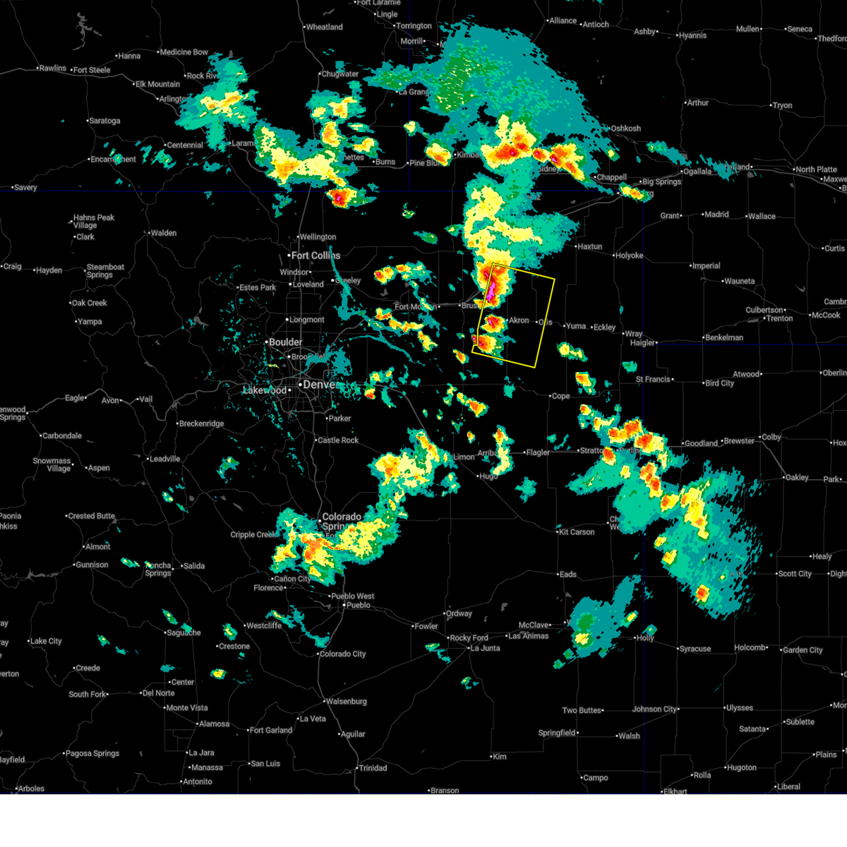 Svrbou the national weather service in denver colorado has issued a * severe thunderstorm warning for, northern washington county in northeastern colorado, south central logan county in northeastern colorado, * until 530 pm mdt. * at 448 pm mdt, severe thunderstorms were located along a line extending from 3 miles south of atwood to 8 miles southeast of woodrow, or along a line extending from 9 miles south of sterling to 19 miles southwest of akron, moving southeast at 20 mph (radar indicated). Hazards include 60 mph wind gusts and quarter size hail. Expect damage to roofs, siding, and trees. Hail damage to vehicles is expected. Svrbou the national weather service in denver colorado has issued a * severe thunderstorm warning for, northern washington county in northeastern colorado, south central logan county in northeastern colorado, * until 530 pm mdt. * at 448 pm mdt, severe thunderstorms were located along a line extending from 3 miles south of atwood to 8 miles southeast of woodrow, or along a line extending from 9 miles south of sterling to 19 miles southwest of akron, moving southeast at 20 mph (radar indicated). Hazards include 60 mph wind gusts and quarter size hail. Expect damage to roofs, siding, and trees. Hail damage to vehicles is expected.
|
| 6/15/2024 8:03 PM MDT | Storm damage reported in washington county CO, 21.6 miles NW of Akron, CO |
| 6/15/2024 7:56 PM MDT | Mesonet station ew7755 akro in washington county CO, 0.7 miles W of Akron, CO |
| 6/15/2024 7:54 PM MDT |
 Svrbou the national weather service in denver colorado has issued a * severe thunderstorm warning for, east central washington county in northeastern colorado, * until 830 pm mdt. * at 753 pm mdt, a severe thunderstorm was located near akron, moving east at 40 mph (radar indicated). Hazards include 60 mph wind gusts. expect damage to roofs, siding, and trees Svrbou the national weather service in denver colorado has issued a * severe thunderstorm warning for, east central washington county in northeastern colorado, * until 830 pm mdt. * at 753 pm mdt, a severe thunderstorm was located near akron, moving east at 40 mph (radar indicated). Hazards include 60 mph wind gusts. expect damage to roofs, siding, and trees
|
| 6/15/2024 7:53 PM MDT | Awos station kako akro in washington county CO, 0.7 miles SSE of Akron, CO |
| 6/8/2024 4:59 PM MDT | Storm damage reported in washington county CO, 21.3 miles NNE of Akron, CO |
| 6/8/2024 4:49 PM MDT |
 At 449 pm mdt, severe thunderstorms were located along a line extending from near otis to 3 miles east of woodlin school, or along a line extending from 11 miles east of akron to 36 miles southeast of fort morgan, moving east at 55 mph (radar indicated). Hazards include 70 mph wind gusts and quarter size hail. Expect considerable tree damage. damage is likely to mobile homes, roofs, and outbuildings. hail damage to vehicles is expected. Locations impacted include, akron, otis, anton, elba, platner, woodlin school, agate, lindon, last chance, and cottonwood valley. At 449 pm mdt, severe thunderstorms were located along a line extending from near otis to 3 miles east of woodlin school, or along a line extending from 11 miles east of akron to 36 miles southeast of fort morgan, moving east at 55 mph (radar indicated). Hazards include 70 mph wind gusts and quarter size hail. Expect considerable tree damage. damage is likely to mobile homes, roofs, and outbuildings. hail damage to vehicles is expected. Locations impacted include, akron, otis, anton, elba, platner, woodlin school, agate, lindon, last chance, and cottonwood valley.
|
| 6/8/2024 4:26 PM MDT |
 Svrbou the national weather service in denver colorado has issued a * severe thunderstorm warning for, northeastern elbert county in east central colorado, eastern arapahoe county in northeastern colorado, central washington county in northeastern colorado, north central lincoln county in east central colorado, * until 515 pm mdt. * at 426 pm mdt, severe thunderstorms were located along a line extending from 7 miles north of akron to near deer trail, or along a line extending from 24 miles south of sterling to 30 miles northwest of limon, moving south at 35 mph (radar indicated). Hazards include 60 mph wind gusts and penny size hail. Expect damage to roofs, siding, and trees. severe thunderstorms will be near, akron around 430 pm mdt. platner and cottonwood valley around 435 pm mdt. woodlin school, agate, and last chance around 440 pm mdt. Other locations in the path of these severe thunderstorms include elba, lindon and anton. Svrbou the national weather service in denver colorado has issued a * severe thunderstorm warning for, northeastern elbert county in east central colorado, eastern arapahoe county in northeastern colorado, central washington county in northeastern colorado, north central lincoln county in east central colorado, * until 515 pm mdt. * at 426 pm mdt, severe thunderstorms were located along a line extending from 7 miles north of akron to near deer trail, or along a line extending from 24 miles south of sterling to 30 miles northwest of limon, moving south at 35 mph (radar indicated). Hazards include 60 mph wind gusts and penny size hail. Expect damage to roofs, siding, and trees. severe thunderstorms will be near, akron around 430 pm mdt. platner and cottonwood valley around 435 pm mdt. woodlin school, agate, and last chance around 440 pm mdt. Other locations in the path of these severe thunderstorms include elba, lindon and anton.
|
| 5/29/2024 5:47 PM MDT |
 The storm which prompted the warning has moved out of the area. therefore, the warning has been allowed to expire. however, gusty winds are still possible with this thunderstorm. a severe thunderstorm watch remains in effect until 900 pm mdt for northeastern colorado. remember, a severe thunderstorm warning still remains in effect for southeastern lincoln county until 630 pm mdt. The storm which prompted the warning has moved out of the area. therefore, the warning has been allowed to expire. however, gusty winds are still possible with this thunderstorm. a severe thunderstorm watch remains in effect until 900 pm mdt for northeastern colorado. remember, a severe thunderstorm warning still remains in effect for southeastern lincoln county until 630 pm mdt.
|
| 5/29/2024 5:20 PM MDT |
 At 519 pm mdt, a severe thunderstorm was located 8 miles south of otis, or 14 miles southeast of akron, moving east at 35 mph. this storm has been producing funnel clouds and nickle sized hail (trained weather spotters). Hazards include 60 mph wind gusts and quarter size hail. Expect damage to roofs, siding, and trees. hail damage to vehicles is expected. Locations impacted include, akron, otis, elba, and platner. At 519 pm mdt, a severe thunderstorm was located 8 miles south of otis, or 14 miles southeast of akron, moving east at 35 mph. this storm has been producing funnel clouds and nickle sized hail (trained weather spotters). Hazards include 60 mph wind gusts and quarter size hail. Expect damage to roofs, siding, and trees. hail damage to vehicles is expected. Locations impacted include, akron, otis, elba, and platner.
|
| 5/29/2024 5:01 PM MDT |
 Svrbou the national weather service in denver colorado has issued a * severe thunderstorm warning for, east central washington county in northeastern colorado, * until 545 pm mdt. * at 501 pm mdt, a severe thunderstorm was located 4 miles northeast of elba, or 11 miles south of akron, moving east at 40 mph (radar indicated). Hazards include 60 mph wind gusts and quarter size hail. Expect damage to roofs, siding, and trees. hail damage to vehicles is expected. This severe thunderstorm will remain over mainly rural areas of east central washington county, including the following locations, hyde. Svrbou the national weather service in denver colorado has issued a * severe thunderstorm warning for, east central washington county in northeastern colorado, * until 545 pm mdt. * at 501 pm mdt, a severe thunderstorm was located 4 miles northeast of elba, or 11 miles south of akron, moving east at 40 mph (radar indicated). Hazards include 60 mph wind gusts and quarter size hail. Expect damage to roofs, siding, and trees. hail damage to vehicles is expected. This severe thunderstorm will remain over mainly rural areas of east central washington county, including the following locations, hyde.
|
| 5/20/2024 9:33 PM MDT | Hen Egg sized hail reported 25.7 miles NNE of Akron, CO |
| 5/20/2024 8:21 PM MDT |
 At 821 pm mdt, a severe thunderstorm was located 10 miles northwest of elba, or 10 miles southwest of akron, moving east at 20 mph (radar indicated). Hazards include tennis ball size hail and 70 mph wind gusts. Expect considerable tree damage. damage is likely to mobile homes, roofs, and outbuildings. people and animals outdoors will be injured. expect hail damage to roofs, siding, windows, and vehicles. Locations impacted include, akron. At 821 pm mdt, a severe thunderstorm was located 10 miles northwest of elba, or 10 miles southwest of akron, moving east at 20 mph (radar indicated). Hazards include tennis ball size hail and 70 mph wind gusts. Expect considerable tree damage. damage is likely to mobile homes, roofs, and outbuildings. people and animals outdoors will be injured. expect hail damage to roofs, siding, windows, and vehicles. Locations impacted include, akron.
|
| 5/20/2024 8:21 PM MDT |
 the severe thunderstorm warning has been cancelled and is no longer in effect the severe thunderstorm warning has been cancelled and is no longer in effect
|
| 5/20/2024 8:02 PM MDT |
 Svrbou the national weather service in denver colorado has issued a * severe thunderstorm warning for, southeastern morgan county in northeastern colorado, central washington county in northeastern colorado, * until 845 pm mdt. * at 802 pm mdt, a severe thunderstorm was located 6 miles southeast of gary, or 16 miles southwest of akron, moving east at 20 mph (radar indicated). Hazards include tennis ball size hail and 70 mph wind gusts. Expect considerable tree damage. damage is likely to mobile homes, roofs, and outbuildings. people and animals outdoors will be injured. expect hail damage to roofs, siding, windows, and vehicles. This severe thunderstorm will remain over mainly rural areas of southeastern morgan and central washington counties. Svrbou the national weather service in denver colorado has issued a * severe thunderstorm warning for, southeastern morgan county in northeastern colorado, central washington county in northeastern colorado, * until 845 pm mdt. * at 802 pm mdt, a severe thunderstorm was located 6 miles southeast of gary, or 16 miles southwest of akron, moving east at 20 mph (radar indicated). Hazards include tennis ball size hail and 70 mph wind gusts. Expect considerable tree damage. damage is likely to mobile homes, roofs, and outbuildings. people and animals outdoors will be injured. expect hail damage to roofs, siding, windows, and vehicles. This severe thunderstorm will remain over mainly rural areas of southeastern morgan and central washington counties.
|
| 5/20/2024 7:44 PM MDT |
 The storm which prompted the warning has moved out of the area. therefore, the warning will be allowed to expire. however, heavy rain and hail are still possible with this thunderstorm. a tornado watch remains in effect until 1100 pm mdt for northeastern colorado. remember, a tornado warning still remains in effect for east central washington county. The storm which prompted the warning has moved out of the area. therefore, the warning will be allowed to expire. however, heavy rain and hail are still possible with this thunderstorm. a tornado watch remains in effect until 1100 pm mdt for northeastern colorado. remember, a tornado warning still remains in effect for east central washington county.
|
| 5/20/2024 7:38 PM MDT | Quarter sized hail reported 1.4 miles E of Akron, CO, report from mping: quarter (1.00 in.). |
| 5/20/2024 7:28 PM MDT | Quarter sized hail reported 3.5 miles E of Akron, CO, report from mping: quarter (1.00 in.). |
| 5/20/2024 7:25 PM MDT | Tea Cup sized hail reported 8.5 miles NNE of Akron, CO, photo with a caliper measurement of a large hailstone measured approximately 30 minutes after hail fell. time and location estimated. |
| 5/20/2024 7:22 PM MDT | Hen Egg sized hail reported 5.6 miles N of Akron, CO, 2.1 inch diameter hail measured by digital caliper. time estimated. |
| 5/20/2024 7:17 PM MDT |
 the severe thunderstorm warning has been cancelled and is no longer in effect the severe thunderstorm warning has been cancelled and is no longer in effect
|
| 5/20/2024 7:17 PM MDT |
 At 717 pm mdt, a severe thunderstorm was located 7 miles southwest of akron, moving east at 25 mph (public). Hazards include golf ball size hail. People and animals outdoors will be injured. expect damage to roofs, siding, windows, and vehicles. Locations impacted include, akron and midway. At 717 pm mdt, a severe thunderstorm was located 7 miles southwest of akron, moving east at 25 mph (public). Hazards include golf ball size hail. People and animals outdoors will be injured. expect damage to roofs, siding, windows, and vehicles. Locations impacted include, akron and midway.
|
| 5/20/2024 7:15 PM MDT |
 At 714 pm mdt, a severe thunderstorm capable of producing a tornado was located 8 miles southwest of akron, moving east at 25 mph (radar indicated rotation). Hazards include tornado. Flying debris will be dangerous to those caught without shelter. mobile homes will be damaged or destroyed. damage to roofs, windows, and vehicles will occur. tree damage is likely. Locations impacted include, akron. At 714 pm mdt, a severe thunderstorm capable of producing a tornado was located 8 miles southwest of akron, moving east at 25 mph (radar indicated rotation). Hazards include tornado. Flying debris will be dangerous to those caught without shelter. mobile homes will be damaged or destroyed. damage to roofs, windows, and vehicles will occur. tree damage is likely. Locations impacted include, akron.
|
| 5/20/2024 7:15 PM MDT |
 the tornado warning has been cancelled and is no longer in effect the tornado warning has been cancelled and is no longer in effect
|
| 5/20/2024 6:56 PM MDT |
 Torbou the national weather service in denver colorado has issued a * tornado warning for, southeastern morgan county in northeastern colorado, central washington county in northeastern colorado, * until 730 pm mdt. * at 656 pm mdt, a severe thunderstorm capable of producing a tornado was located 5 miles east of gary, or 15 miles west of akron, moving east at 25 mph (radar indicated rotation). Hazards include tornado. Flying debris will be dangerous to those caught without shelter. mobile homes will be damaged or destroyed. damage to roofs, windows, and vehicles will occur. tree damage is likely. This tornadic thunderstorm will remain over mainly rural areas of southeastern morgan and central washington counties. Torbou the national weather service in denver colorado has issued a * tornado warning for, southeastern morgan county in northeastern colorado, central washington county in northeastern colorado, * until 730 pm mdt. * at 656 pm mdt, a severe thunderstorm capable of producing a tornado was located 5 miles east of gary, or 15 miles west of akron, moving east at 25 mph (radar indicated rotation). Hazards include tornado. Flying debris will be dangerous to those caught without shelter. mobile homes will be damaged or destroyed. damage to roofs, windows, and vehicles will occur. tree damage is likely. This tornadic thunderstorm will remain over mainly rural areas of southeastern morgan and central washington counties.
|
| 5/20/2024 6:53 PM MDT |
 Svrbou the national weather service in denver colorado has issued a * severe thunderstorm warning for, southeastern morgan county in northeastern colorado, north central washington county in northeastern colorado, * until 745 pm mdt. * at 653 pm mdt, a severe thunderstorm was located near gary, or 16 miles west of akron, moving east at 25 mph (radar indicated). Hazards include two inch hail and 70 mph wind gusts. Expect considerable tree damage. damage is likely to mobile homes, roofs, and outbuildings. people and animals outdoors will be injured. Expect hail damage to roofs, siding, windows, and vehicles. Svrbou the national weather service in denver colorado has issued a * severe thunderstorm warning for, southeastern morgan county in northeastern colorado, north central washington county in northeastern colorado, * until 745 pm mdt. * at 653 pm mdt, a severe thunderstorm was located near gary, or 16 miles west of akron, moving east at 25 mph (radar indicated). Hazards include two inch hail and 70 mph wind gusts. Expect considerable tree damage. damage is likely to mobile homes, roofs, and outbuildings. people and animals outdoors will be injured. Expect hail damage to roofs, siding, windows, and vehicles.
|
| 4/25/2024 3:56 PM MDT |
 Svrbou the national weather service in denver colorado has issued a * severe thunderstorm warning for, northeastern washington county in northeastern colorado, * until 445 pm mdt. * at 355 pm mdt, a severe thunderstorm was located 5 miles southwest of akron, moving northeast at 20 mph (radar indicated). Hazards include quarter size hail. Damage to vehicles is expected. This severe thunderstorm will be near, akron around 400 pm mdt. Svrbou the national weather service in denver colorado has issued a * severe thunderstorm warning for, northeastern washington county in northeastern colorado, * until 445 pm mdt. * at 355 pm mdt, a severe thunderstorm was located 5 miles southwest of akron, moving northeast at 20 mph (radar indicated). Hazards include quarter size hail. Damage to vehicles is expected. This severe thunderstorm will be near, akron around 400 pm mdt.
|
| 8/7/2023 3:35 PM MDT |
 At 335 pm mdt, a severe thunderstorm was located 5 miles northeast of midway, or 11 miles northwest of akron, moving east at 35 mph (radar indicated). Hazards include half dollar size hail. damage to vehicles is expected At 335 pm mdt, a severe thunderstorm was located 5 miles northeast of midway, or 11 miles northwest of akron, moving east at 35 mph (radar indicated). Hazards include half dollar size hail. damage to vehicles is expected
|
| 8/5/2023 5:30 PM MDT |
 At 530 pm mdt, a severe thunderstorm was located 5 miles northwest of akron, moving southeast at 25 mph (radar indicated). Hazards include half dollar size hail. damage to vehicles is expected At 530 pm mdt, a severe thunderstorm was located 5 miles northwest of akron, moving southeast at 25 mph (radar indicated). Hazards include half dollar size hail. damage to vehicles is expected
|
| 7/20/2023 8:09 AM MDT |
 At 809 am mdt, a severe thunderstorm was located near akron, moving northeast at 30 mph (radar indicated). Hazards include 70 mph wind gusts and penny size hail. Expect considerable tree damage. damage is likely to mobile homes, roofs, and outbuildings. this severe thunderstorm will be near, platner around 815 am mdt. other locations in the path of this severe thunderstorm include burdett and lone star. thunderstorm damage threat, considerable hail threat, radar indicated max hail size, 0. 75 in wind threat, radar indicated max wind gust, 70 mph. At 809 am mdt, a severe thunderstorm was located near akron, moving northeast at 30 mph (radar indicated). Hazards include 70 mph wind gusts and penny size hail. Expect considerable tree damage. damage is likely to mobile homes, roofs, and outbuildings. this severe thunderstorm will be near, platner around 815 am mdt. other locations in the path of this severe thunderstorm include burdett and lone star. thunderstorm damage threat, considerable hail threat, radar indicated max hail size, 0. 75 in wind threat, radar indicated max wind gust, 70 mph.
|
| 6/29/2023 1:00 AM MDT |
 At 100 am mdt, a severe thunderstorm was located 7 miles southwest of akron, moving east at 30 mph (radar indicated). Hazards include two inch hail and 60 mph wind gusts. Expect damage to roofs, siding, and trees. people and animals outdoors will be injured. expect hail damage to roofs, siding, windows, and vehicles. this severe thunderstorm will be near, akron around 105 am mdt. platner around 120 am mdt. Other locations in the path of this severe thunderstorm include otis. At 100 am mdt, a severe thunderstorm was located 7 miles southwest of akron, moving east at 30 mph (radar indicated). Hazards include two inch hail and 60 mph wind gusts. Expect damage to roofs, siding, and trees. people and animals outdoors will be injured. expect hail damage to roofs, siding, windows, and vehicles. this severe thunderstorm will be near, akron around 105 am mdt. platner around 120 am mdt. Other locations in the path of this severe thunderstorm include otis.
|
| 6/29/2023 12:09 AM MDT |
 The tornado warning for north central washington county will expire at 1215 am mdt, the storm which prompted the warning has moved out of the area. therefore, the warning will be allowed to expire. a severe thunderstorm watch remains in effect until 300 am mdt for northeastern colorado. The tornado warning for north central washington county will expire at 1215 am mdt, the storm which prompted the warning has moved out of the area. therefore, the warning will be allowed to expire. a severe thunderstorm watch remains in effect until 300 am mdt for northeastern colorado.
|
| 6/29/2023 12:01 AM MDT | Tennis Ball sized hail reported 2.3 miles NW of Akron, CO |
| 6/29/2023 12:00 AM MDT | Tea Cup sized hail reported 0.2 miles WNW of Akron, CO |
| 6/28/2023 11:58 PM MDT | Tea Cup sized hail reported 1.1 miles SE of Akron, CO |
| 6/28/2023 11:54 PM MDT | Tea Cup sized hail reported 1.1 miles SE of Akron, CO |
| 6/28/2023 11:54 PM MDT | Tennis Ball sized hail reported 5.1 miles E of Akron, CO |
| 6/28/2023 11:50 PM MDT |
 At 1150 pm mdt, a severe thunderstorm capable of producing a tornado was located over akron, moving east at 20 mph (radar indicated rotation). Hazards include tornado and tennis ball size hail. Flying debris will be dangerous to those caught without shelter. mobile homes will be damaged or destroyed. damage to roofs, windows, and vehicles will occur. tree damage is likely. Locations impacted include, platner. At 1150 pm mdt, a severe thunderstorm capable of producing a tornado was located over akron, moving east at 20 mph (radar indicated rotation). Hazards include tornado and tennis ball size hail. Flying debris will be dangerous to those caught without shelter. mobile homes will be damaged or destroyed. damage to roofs, windows, and vehicles will occur. tree damage is likely. Locations impacted include, platner.
|
| 6/28/2023 11:42 PM MDT |
 At 1142 pm mdt, a severe thunderstorm capable of producing a tornado was located near akron, moving east at 20 mph (radar indicated rotation). Hazards include tornado and tennis ball size hail. Flying debris will be dangerous to those caught without shelter. mobile homes will be damaged or destroyed. damage to roofs, windows, and vehicles will occur. tree damage is likely. this dangerous storm will be near, akron around 1150 pm mdt. Other locations in the path of this tornadic thunderstorm include platner. At 1142 pm mdt, a severe thunderstorm capable of producing a tornado was located near akron, moving east at 20 mph (radar indicated rotation). Hazards include tornado and tennis ball size hail. Flying debris will be dangerous to those caught without shelter. mobile homes will be damaged or destroyed. damage to roofs, windows, and vehicles will occur. tree damage is likely. this dangerous storm will be near, akron around 1150 pm mdt. Other locations in the path of this tornadic thunderstorm include platner.
|
| 6/28/2023 11:29 PM MDT |
 At 1129 pm mdt, a severe thunderstorm capable of producing a tornado was located 4 miles southeast of midway, or 6 miles west of akron, moving east at 20 mph (radar indicated rotation). Hazards include tornado and tennis ball size hail. Flying debris will be dangerous to those caught without shelter. mobile homes will be damaged or destroyed. damage to roofs, windows, and vehicles will occur. tree damage is likely. Locations impacted include, akron and midway. At 1129 pm mdt, a severe thunderstorm capable of producing a tornado was located 4 miles southeast of midway, or 6 miles west of akron, moving east at 20 mph (radar indicated rotation). Hazards include tornado and tennis ball size hail. Flying debris will be dangerous to those caught without shelter. mobile homes will be damaged or destroyed. damage to roofs, windows, and vehicles will occur. tree damage is likely. Locations impacted include, akron and midway.
|
| 6/28/2023 11:20 PM MDT |
 At 1119 pm mdt, a severe thunderstorm capable of producing a tornado was located near midway, or 9 miles west of akron, moving east at 15 mph (radar indicated rotation). Hazards include tornado and tennis ball size hail. Flying debris will be dangerous to those caught without shelter. mobile homes will be damaged or destroyed. damage to roofs, windows, and vehicles will occur. tree damage is likely. Locations impacted include, akron and midway. At 1119 pm mdt, a severe thunderstorm capable of producing a tornado was located near midway, or 9 miles west of akron, moving east at 15 mph (radar indicated rotation). Hazards include tornado and tennis ball size hail. Flying debris will be dangerous to those caught without shelter. mobile homes will be damaged or destroyed. damage to roofs, windows, and vehicles will occur. tree damage is likely. Locations impacted include, akron and midway.
|
| 6/28/2023 11:08 PM MDT |
 At 1108 pm mdt, a severe thunderstorm capable of producing a tornado was located near midway, or 11 miles west of akron, moving east at 20 mph (radar indicated rotation). Hazards include tornado and tennis ball size hail. Flying debris will be dangerous to those caught without shelter. mobile homes will be damaged or destroyed. damage to roofs, windows, and vehicles will occur. Tree damage is likely. At 1108 pm mdt, a severe thunderstorm capable of producing a tornado was located near midway, or 11 miles west of akron, moving east at 20 mph (radar indicated rotation). Hazards include tornado and tennis ball size hail. Flying debris will be dangerous to those caught without shelter. mobile homes will be damaged or destroyed. damage to roofs, windows, and vehicles will occur. Tree damage is likely.
|
| 6/21/2023 8:12 PM MDT | Asos station kako akron. outflow winds from thunderstorms east of akro in washington county CO, 0.7 miles SSE of Akron, CO |
| 6/21/2023 6:40 PM MDT | Golf Ball sized hail reported 14.6 miles N of Akron, CO, estimated golf ball sized hail for approximately 30 minutes between 6:30 and 7:00 pm. |
| 6/21/2023 6:03 PM MDT |
 At 602 pm mdt, a severe thunderstorm capable of producing a tornado was located 6 miles northwest of elba, or 12 miles southwest of akron, moving east at 10 mph (radar indicated rotation). Hazards include tornado and ping pong ball size hail. Flying debris will be dangerous to those caught without shelter. mobile homes will be damaged or destroyed. damage to roofs, windows, and vehicles will occur. tree damage is likely. Locations impacted include, akron. At 602 pm mdt, a severe thunderstorm capable of producing a tornado was located 6 miles northwest of elba, or 12 miles southwest of akron, moving east at 10 mph (radar indicated rotation). Hazards include tornado and ping pong ball size hail. Flying debris will be dangerous to those caught without shelter. mobile homes will be damaged or destroyed. damage to roofs, windows, and vehicles will occur. tree damage is likely. Locations impacted include, akron.
|
| 6/21/2023 5:52 PM MDT |
 At 551 pm mdt, a confirmed large and extremely dangerous tornado was located 8 miles northwest of elba, or 14 miles southwest of akron, moving east at 10 mph. this is a particularly dangerous situation. take cover now! (law enforcement confirmed tornado). Hazards include damaging tornado. You are in a life-threatening situation. flying debris may be deadly to those caught without shelter. mobile homes will be destroyed. considerable damage to homes, businesses, and vehicles is likely and complete destruction is possible. This tornadic thunderstorm will remain over mainly rural areas of central washington county. At 551 pm mdt, a confirmed large and extremely dangerous tornado was located 8 miles northwest of elba, or 14 miles southwest of akron, moving east at 10 mph. this is a particularly dangerous situation. take cover now! (law enforcement confirmed tornado). Hazards include damaging tornado. You are in a life-threatening situation. flying debris may be deadly to those caught without shelter. mobile homes will be destroyed. considerable damage to homes, businesses, and vehicles is likely and complete destruction is possible. This tornadic thunderstorm will remain over mainly rural areas of central washington county.
|
| 6/21/2023 5:45 PM MDT |
 At 545 pm mdt, a severe thunderstorm was located 6 miles southwest of akron, moving north at 5 mph (radar indicated). Hazards include ping pong ball size hail and 60 mph wind gusts. Expect damage to roofs, siding, and trees. people and animals outdoors will be injured. Expect hail damage to roofs, siding, windows, and vehicles. At 545 pm mdt, a severe thunderstorm was located 6 miles southwest of akron, moving north at 5 mph (radar indicated). Hazards include ping pong ball size hail and 60 mph wind gusts. Expect damage to roofs, siding, and trees. people and animals outdoors will be injured. Expect hail damage to roofs, siding, windows, and vehicles.
|
| 6/21/2023 5:10 PM MDT |
 At 510 pm mdt, a confirmed large and extremely dangerous tornado was located 6 miles southwest of akron, moving northwest at 20 mph. this is a particularly dangerous situation. take cover now! (weather spotters confirmed tornado). Hazards include damaging tornado. You are in a life-threatening situation. flying debris may be deadly to those caught without shelter. mobile homes will be destroyed. Considerable damage to homes, businesses, and vehicles is likely and complete destruction is possible. At 510 pm mdt, a confirmed large and extremely dangerous tornado was located 6 miles southwest of akron, moving northwest at 20 mph. this is a particularly dangerous situation. take cover now! (weather spotters confirmed tornado). Hazards include damaging tornado. You are in a life-threatening situation. flying debris may be deadly to those caught without shelter. mobile homes will be destroyed. Considerable damage to homes, businesses, and vehicles is likely and complete destruction is possible.
|
| 6/21/2023 4:54 PM MDT |
 At 452 pm mdt, a confirmed large and extremely dangerous tornado was located 6 miles south of akron, moving north at 10 mph. this is a particularly dangerous situation. take cover now! (weather spotters confirmed a tornado 6 miles north of elba. there have been moments where two tornadoes have occurred at the same time). Hazards include damaging tornado. You are in a life-threatening situation. flying debris may be deadly to those caught without shelter. mobile homes will be destroyed. Considerable damage to homes, businesses, and vehicles is likely and complete destruction is possible. At 452 pm mdt, a confirmed large and extremely dangerous tornado was located 6 miles south of akron, moving north at 10 mph. this is a particularly dangerous situation. take cover now! (weather spotters confirmed a tornado 6 miles north of elba. there have been moments where two tornadoes have occurred at the same time). Hazards include damaging tornado. You are in a life-threatening situation. flying debris may be deadly to those caught without shelter. mobile homes will be destroyed. Considerable damage to homes, businesses, and vehicles is likely and complete destruction is possible.
|
| 6/21/2023 4:05 PM MDT |
 At 405 pm mdt, a severe thunderstorm capable of producing a tornado was located near akron, moving north at 5 mph (radar indicated rotation). Hazards include tornado. Flying debris will be dangerous to those caught without shelter. mobile homes will be damaged or destroyed. damage to roofs, windows, and vehicles will occur. Tree damage is likely. At 405 pm mdt, a severe thunderstorm capable of producing a tornado was located near akron, moving north at 5 mph (radar indicated rotation). Hazards include tornado. Flying debris will be dangerous to those caught without shelter. mobile homes will be damaged or destroyed. damage to roofs, windows, and vehicles will occur. Tree damage is likely.
|
| 6/21/2023 3:42 PM MDT | Baseball sized hail reported 8.9 miles NNW of Akron, CO |
| 6/21/2023 3:42 PM MDT |
 At 341 pm mdt, a severe thunderstorm was located 6 miles southwest of platner, or 8 miles southeast of akron, moving north at 5 mph (trained weather spotters reported baseball size hail south of platner). Hazards include tennis ball size hail and 60 mph wind gusts. Expect damage to roofs, siding, and trees. people and animals outdoors will be injured. Expect hail damage to roofs, siding, windows, and vehicles. At 341 pm mdt, a severe thunderstorm was located 6 miles southwest of platner, or 8 miles southeast of akron, moving north at 5 mph (trained weather spotters reported baseball size hail south of platner). Hazards include tennis ball size hail and 60 mph wind gusts. Expect damage to roofs, siding, and trees. people and animals outdoors will be injured. Expect hail damage to roofs, siding, windows, and vehicles.
|
| 6/21/2023 3:11 PM MDT |
 At 311 pm mdt, a severe thunderstorm was located 7 miles south of platner, or 11 miles southeast of akron, moving north at 5 mph (radar indicated). Hazards include 60 mph wind gusts and quarter size hail. Expect damage to roofs, siding, and trees. hail damage to vehicles is expected. This severe thunderstorm will remain over mainly rural areas of east central washington county. At 311 pm mdt, a severe thunderstorm was located 7 miles south of platner, or 11 miles southeast of akron, moving north at 5 mph (radar indicated). Hazards include 60 mph wind gusts and quarter size hail. Expect damage to roofs, siding, and trees. hail damage to vehicles is expected. This severe thunderstorm will remain over mainly rural areas of east central washington county.
|
| 5/26/2023 6:21 PM MDT |
 The severe thunderstorm warning for southeastern morgan and north central washington counties will expire at 630 pm mdt, the storms which prompted the warning have weakened below severe limits, and no longer pose an immediate threat to life or property. therefore, the warning will be allowed to expire. a severe thunderstorm watch remains in effect until 900 pm mdt for northeastern colorado. The severe thunderstorm warning for southeastern morgan and north central washington counties will expire at 630 pm mdt, the storms which prompted the warning have weakened below severe limits, and no longer pose an immediate threat to life or property. therefore, the warning will be allowed to expire. a severe thunderstorm watch remains in effect until 900 pm mdt for northeastern colorado.
|
| 5/26/2023 6:12 PM MDT |
 At 611 pm mdt, severe thunderstorms were located along a line extending from 7 miles southeast of sterling to 7 miles northeast of woodlin school, or along a line extending from 35 miles northwest of yuma to 23 miles southwest of akron, moving east at 25 mph (radar indicated). Hazards include 60 mph wind gusts and nickel size hail. Expect damage to roofs, siding, and trees. these severe thunderstorms will remain over mainly rural areas of southeastern morgan and north central washington counties, including the following locations, fremont butte. hail threat, radar indicated max hail size, 0. 88 in wind threat, radar indicated max wind gust, 60 mph. At 611 pm mdt, severe thunderstorms were located along a line extending from 7 miles southeast of sterling to 7 miles northeast of woodlin school, or along a line extending from 35 miles northwest of yuma to 23 miles southwest of akron, moving east at 25 mph (radar indicated). Hazards include 60 mph wind gusts and nickel size hail. Expect damage to roofs, siding, and trees. these severe thunderstorms will remain over mainly rural areas of southeastern morgan and north central washington counties, including the following locations, fremont butte. hail threat, radar indicated max hail size, 0. 88 in wind threat, radar indicated max wind gust, 60 mph.
|
| 5/26/2023 5:43 PM MDT |
 At 543 pm mdt, severe thunderstorms were located along a line extending from atwood to 7 miles south of woodrow, or along a line extending from 6 miles southwest of sterling to 26 miles south of fort morgan, moving east at 25 mph (radar indicated). Hazards include 60 mph wind gusts and nickel size hail. Expect damage to roofs, siding, and trees. severe thunderstorms will be near, merino and atwood around 550 pm mdt. southern sterling around 555 pm mdt. hail threat, radar indicated max hail size, 0. 88 in wind threat, radar indicated max wind gust, 60 mph. At 543 pm mdt, severe thunderstorms were located along a line extending from atwood to 7 miles south of woodrow, or along a line extending from 6 miles southwest of sterling to 26 miles south of fort morgan, moving east at 25 mph (radar indicated). Hazards include 60 mph wind gusts and nickel size hail. Expect damage to roofs, siding, and trees. severe thunderstorms will be near, merino and atwood around 550 pm mdt. southern sterling around 555 pm mdt. hail threat, radar indicated max hail size, 0. 88 in wind threat, radar indicated max wind gust, 60 mph.
|
| 5/10/2023 7:08 PM MDT |
 The tornado warning for north central washington county will expire at 715 pm mdt, the storm which prompted the warning has weakened below severe limits, and no longer appears capable of producing a tornado. therefore, the warning will be allowed to expire. however small hail, gusty winds and heavy rain are still possible with this thunderstorm. a tornado watch remains in effect until 900 pm mdt for northeastern colorado. The tornado warning for north central washington county will expire at 715 pm mdt, the storm which prompted the warning has weakened below severe limits, and no longer appears capable of producing a tornado. therefore, the warning will be allowed to expire. however small hail, gusty winds and heavy rain are still possible with this thunderstorm. a tornado watch remains in effect until 900 pm mdt for northeastern colorado.
|
| 5/10/2023 6:57 PM MDT |
 At 657 pm mdt, a severe thunderstorm capable of producing a tornado was located near akron, moving northeast at 25 mph (radar indicated rotation). Hazards include tornado and quarter size hail. Flying debris will be dangerous to those caught without shelter. mobile homes will be damaged or destroyed. damage to roofs, windows, and vehicles will occur. tree damage is likely. This tornadic thunderstorm will remain over mainly rural areas of north central washington county, including the following locations, fremont butte. At 657 pm mdt, a severe thunderstorm capable of producing a tornado was located near akron, moving northeast at 25 mph (radar indicated rotation). Hazards include tornado and quarter size hail. Flying debris will be dangerous to those caught without shelter. mobile homes will be damaged or destroyed. damage to roofs, windows, and vehicles will occur. tree damage is likely. This tornadic thunderstorm will remain over mainly rural areas of north central washington county, including the following locations, fremont butte.
|
| 5/10/2023 6:39 PM MDT |
 At 639 pm mdt, a severe thunderstorm capable of producing a tornado was located 6 miles southwest of akron, moving northeast at 35 mph (radar indicated rotation). Hazards include tornado and quarter size hail. Flying debris will be dangerous to those caught without shelter. mobile homes will be damaged or destroyed. damage to roofs, windows, and vehicles will occur. tree damage is likely. This dangerous storm will be near, akron around 650 pm mdt. At 639 pm mdt, a severe thunderstorm capable of producing a tornado was located 6 miles southwest of akron, moving northeast at 35 mph (radar indicated rotation). Hazards include tornado and quarter size hail. Flying debris will be dangerous to those caught without shelter. mobile homes will be damaged or destroyed. damage to roofs, windows, and vehicles will occur. tree damage is likely. This dangerous storm will be near, akron around 650 pm mdt.
|
| 5/10/2023 6:25 PM MDT | Baseball sized hail reported 11.5 miles E of Akron, CO |
| 5/10/2023 6:25 PM MDT | Baseball sized hail reported 11.5 miles E of Akron, CO, corrects previous hail report from 6 ssw midway. |
| 5/10/2023 6:25 PM MDT |
 At 624 pm mdt, a severe thunderstorm capable of producing a tornado was located near midway, or 13 miles northwest of akron, moving north at 35 mph (radar indicated rotation). Hazards include tornado and two inch hail. Flying debris will be dangerous to those caught without shelter. mobile homes will be damaged or destroyed. damage to roofs, windows, and vehicles will occur. tree damage is likely. Locations impacted include, prewitt reservoir. At 624 pm mdt, a severe thunderstorm capable of producing a tornado was located near midway, or 13 miles northwest of akron, moving north at 35 mph (radar indicated rotation). Hazards include tornado and two inch hail. Flying debris will be dangerous to those caught without shelter. mobile homes will be damaged or destroyed. damage to roofs, windows, and vehicles will occur. tree damage is likely. Locations impacted include, prewitt reservoir.
|
| 5/10/2023 6:19 PM MDT | Asos station kako akro in washington county CO, 0.7 miles SSE of Akron, CO |
| 5/10/2023 6:11 PM MDT |
 At 611 pm mdt, a severe thunderstorm capable of producing a tornado was located 5 miles south of midway, or 11 miles west of akron, moving north at 35 mph (radar indicated rotation). Hazards include tornado and tennis ball size hail. Flying debris will be dangerous to those caught without shelter. mobile homes will be damaged or destroyed. damage to roofs, windows, and vehicles will occur. tree damage is likely. this dangerous storm will be near, midway around 620 pm mdt. Other locations in the path of this tornadic thunderstorm include prewitt reservoir. At 611 pm mdt, a severe thunderstorm capable of producing a tornado was located 5 miles south of midway, or 11 miles west of akron, moving north at 35 mph (radar indicated rotation). Hazards include tornado and tennis ball size hail. Flying debris will be dangerous to those caught without shelter. mobile homes will be damaged or destroyed. damage to roofs, windows, and vehicles will occur. tree damage is likely. this dangerous storm will be near, midway around 620 pm mdt. Other locations in the path of this tornadic thunderstorm include prewitt reservoir.
|
| 5/10/2023 6:10 PM MDT | Tea Cup sized hail reported 7 miles ENE of Akron, CO |
| 5/10/2023 6:05 PM MDT |
 At 604 pm mdt, a severe thunderstorm was located 4 miles southeast of elba, or 17 miles south of akron, moving north at 30 mph (radar indicated). Hazards include 60 mph wind gusts and half dollar size hail. Expect damage to roofs, siding, and trees. hail damage to vehicles is expected. this severe thunderstorm will be near, elba around 610 pm mdt. Other locations in the path of this severe thunderstorm include platner and akron. At 604 pm mdt, a severe thunderstorm was located 4 miles southeast of elba, or 17 miles south of akron, moving north at 30 mph (radar indicated). Hazards include 60 mph wind gusts and half dollar size hail. Expect damage to roofs, siding, and trees. hail damage to vehicles is expected. this severe thunderstorm will be near, elba around 610 pm mdt. Other locations in the path of this severe thunderstorm include platner and akron.
|
| 10/1/2022 6:42 PM MDT | Storm damage reported in washington county CO, 0.6 miles SSW of Akron, CO |
| 7/28/2022 12:29 AM MDT |
 At 1229 am mdt, a severe thunderstorm was located 4 miles south of akron, moving southeast at 15 mph (radar indicated). Hazards include 60 mph wind gusts and quarter size hail. Expect damage to roofs, siding, and trees. hail damage to vehicles is expected. locations impacted include, platner. hail threat, radar indicated max hail size, 1. 00 in wind threat, radar indicated max wind gust, 60 mph. At 1229 am mdt, a severe thunderstorm was located 4 miles south of akron, moving southeast at 15 mph (radar indicated). Hazards include 60 mph wind gusts and quarter size hail. Expect damage to roofs, siding, and trees. hail damage to vehicles is expected. locations impacted include, platner. hail threat, radar indicated max hail size, 1. 00 in wind threat, radar indicated max wind gust, 60 mph.
|
| 7/28/2022 12:15 AM MDT | Quarter sized hail reported 2.2 miles N of Akron, CO |
| 7/28/2022 12:10 AM MDT |
 At 1210 am mdt, a severe thunderstorm was located near akron, moving southeast at 15 mph (radar indicated). Hazards include 60 mph wind gusts and half dollar size hail. Expect damage to roofs, siding, and trees. hail damage to vehicles is expected. this severe thunderstorm will be near, akron around 1215 am mdt. other locations in the path of this severe thunderstorm include platner. hail threat, radar indicated max hail size, 1. 25 in wind threat, radar indicated max wind gust, 60 mph. At 1210 am mdt, a severe thunderstorm was located near akron, moving southeast at 15 mph (radar indicated). Hazards include 60 mph wind gusts and half dollar size hail. Expect damage to roofs, siding, and trees. hail damage to vehicles is expected. this severe thunderstorm will be near, akron around 1215 am mdt. other locations in the path of this severe thunderstorm include platner. hail threat, radar indicated max hail size, 1. 25 in wind threat, radar indicated max wind gust, 60 mph.
|
| 7/27/2022 11:43 PM MDT |
 At 1143 pm mdt, a severe thunderstorm was located 4 miles north of akron, moving east at 15 mph (radar indicated). Hazards include 60 mph wind gusts and half dollar size hail. Expect damage to roofs, siding, and trees. hail damage to vehicles is expected. This severe thunderstorm will be near, akron around 1155 pm mdt. At 1143 pm mdt, a severe thunderstorm was located 4 miles north of akron, moving east at 15 mph (radar indicated). Hazards include 60 mph wind gusts and half dollar size hail. Expect damage to roofs, siding, and trees. hail damage to vehicles is expected. This severe thunderstorm will be near, akron around 1155 pm mdt.
|
| 7/24/2022 5:53 PM MDT |
 At 552 pm mdt, severe thunderstorms were located along a line extending from near platner to 7 miles southwest of otis to 6 miles northwest of arickaree school, or along a line extending from 5 miles east of akron to 16 miles west of yuma to 34 miles north of flagler, moving northeast at 20 mph (radar indicated). Hazards include 60 mph wind gusts and penny size hail. Expect damage to roofs, siding, and trees. Locations impacted include, platner and otis. At 552 pm mdt, severe thunderstorms were located along a line extending from near platner to 7 miles southwest of otis to 6 miles northwest of arickaree school, or along a line extending from 5 miles east of akron to 16 miles west of yuma to 34 miles north of flagler, moving northeast at 20 mph (radar indicated). Hazards include 60 mph wind gusts and penny size hail. Expect damage to roofs, siding, and trees. Locations impacted include, platner and otis.
|
| 7/24/2022 5:36 PM MDT |
 At 536 pm mdt, severe thunderstorms were located along a line extending from akron to 7 miles southwest of platner to 3 miles north of anton, or along a line extending from 30 miles east of fort morgan to 22 miles west of yuma to 35 miles north of flagler, moving east at 40 mph (radar indicated). Hazards include 60 mph wind gusts and penny size hail. Expect damage to roofs, siding, and trees. severe thunderstorms will be near, platner and arickaree school around 550 pm mdt. other locations in the path of these severe thunderstorms include otis. hail threat, radar indicated max hail size, 0. 75 in wind threat, radar indicated max wind gust, 60 mph. At 536 pm mdt, severe thunderstorms were located along a line extending from akron to 7 miles southwest of platner to 3 miles north of anton, or along a line extending from 30 miles east of fort morgan to 22 miles west of yuma to 35 miles north of flagler, moving east at 40 mph (radar indicated). Hazards include 60 mph wind gusts and penny size hail. Expect damage to roofs, siding, and trees. severe thunderstorms will be near, platner and arickaree school around 550 pm mdt. other locations in the path of these severe thunderstorms include otis. hail threat, radar indicated max hail size, 0. 75 in wind threat, radar indicated max wind gust, 60 mph.
|
| 6/12/2022 7:45 PM MDT |
 At 745 pm mdt, a severe thunderstorm was located 4 miles east of midway, or 6 miles northwest of akron, moving northeast at 15 mph (radar indicated). Hazards include 60 mph wind gusts and penny size hail. Expect damage to roofs, siding, and trees. this severe thunderstorm will remain over mainly rural areas of north central washington county, including the following locations, fremont butte. hail threat, radar indicated max hail size, 0. 75 in wind threat, radar indicated max wind gust, 60 mph. At 745 pm mdt, a severe thunderstorm was located 4 miles east of midway, or 6 miles northwest of akron, moving northeast at 15 mph (radar indicated). Hazards include 60 mph wind gusts and penny size hail. Expect damage to roofs, siding, and trees. this severe thunderstorm will remain over mainly rural areas of north central washington county, including the following locations, fremont butte. hail threat, radar indicated max hail size, 0. 75 in wind threat, radar indicated max wind gust, 60 mph.
|
| 6/12/2022 7:19 PM MDT |
 At 719 pm mdt, a severe thunderstorm was located 4 miles south of midway, or 8 miles west of akron, moving northeast at 10 mph (radar indicated). Hazards include 60 mph wind gusts and quarter size hail. Expect damage to roofs, siding, and trees. hail damage to vehicles is expected. this severe thunderstorm will be near, midway around 730 pm mdt. hail threat, radar indicated max hail size, 1. 00 in wind threat, radar indicated max wind gust, 60 mph. At 719 pm mdt, a severe thunderstorm was located 4 miles south of midway, or 8 miles west of akron, moving northeast at 10 mph (radar indicated). Hazards include 60 mph wind gusts and quarter size hail. Expect damage to roofs, siding, and trees. hail damage to vehicles is expected. this severe thunderstorm will be near, midway around 730 pm mdt. hail threat, radar indicated max hail size, 1. 00 in wind threat, radar indicated max wind gust, 60 mph.
|
| 6/7/2022 8:10 PM MDT | Hen Egg sized hail reported 2.3 miles W of Akron, CO, location estimated. source: social media photo. |
| 6/7/2022 8:09 PM MDT |
 At 809 pm mdt, a severe thunderstorm was located near akron, moving southeast at 45 mph (trained weather spotters). Hazards include 60 mph wind gusts and quarter size hail. Expect damage to roofs, siding, and trees. hail damage to vehicles is expected. this severe thunderstorm will remain over mainly rural areas of eastern washington county. hail threat, observed max hail size, 1. 00 in wind threat, radar indicated max wind gust, 60 mph. At 809 pm mdt, a severe thunderstorm was located near akron, moving southeast at 45 mph (trained weather spotters). Hazards include 60 mph wind gusts and quarter size hail. Expect damage to roofs, siding, and trees. hail damage to vehicles is expected. this severe thunderstorm will remain over mainly rural areas of eastern washington county. hail threat, observed max hail size, 1. 00 in wind threat, radar indicated max wind gust, 60 mph.
|
| 6/7/2022 8:05 PM MDT | Half Dollar sized hail reported 0.3 miles ENE of Akron, CO |
| 6/7/2022 8:05 PM MDT | Ping Pong Ball sized hail reported 2.3 miles NW of Akron, CO, report via facebook. |
| 6/7/2022 4:19 PM MDT | Quarter sized hail reported 12 miles N of Akron, CO |
| 6/7/2022 3:50 PM MDT |
 At 350 pm mdt, a severe thunderstorm was located 4 miles west of elba, or 14 miles south of akron, moving northeast at 45 mph (radar indicated). Hazards include 60 mph wind gusts and half dollar size hail. Expect damage to roofs, siding, and trees. hail damage to vehicles is expected. this severe thunderstorm will be near, elba around 355 pm mdt. other locations in the path of this severe thunderstorm include platner and otis. hail threat, radar indicated max hail size, 1. 25 in wind threat, radar indicated max wind gust, 60 mph. At 350 pm mdt, a severe thunderstorm was located 4 miles west of elba, or 14 miles south of akron, moving northeast at 45 mph (radar indicated). Hazards include 60 mph wind gusts and half dollar size hail. Expect damage to roofs, siding, and trees. hail damage to vehicles is expected. this severe thunderstorm will be near, elba around 355 pm mdt. other locations in the path of this severe thunderstorm include platner and otis. hail threat, radar indicated max hail size, 1. 25 in wind threat, radar indicated max wind gust, 60 mph.
|
| 6/3/2022 6:10 PM MDT |
 At 610 pm mdt, severe thunderstorms were located along a line extending from near lone star to 9 miles northwest of elba, or along a line extending from 19 miles north of yuma to 9 miles southwest of akron, moving east at 30 mph (radar indicated). Hazards include 60 mph wind gusts and quarter size hail. Expect damage to roofs, siding, and trees. hail damage to vehicles is expected. severe thunderstorms will be near, lone star around 615 pm mdt. hail threat, radar indicated max hail size, 1. 00 in wind threat, radar indicated max wind gust, 60 mph. At 610 pm mdt, severe thunderstorms were located along a line extending from near lone star to 9 miles northwest of elba, or along a line extending from 19 miles north of yuma to 9 miles southwest of akron, moving east at 30 mph (radar indicated). Hazards include 60 mph wind gusts and quarter size hail. Expect damage to roofs, siding, and trees. hail damage to vehicles is expected. severe thunderstorms will be near, lone star around 615 pm mdt. hail threat, radar indicated max hail size, 1. 00 in wind threat, radar indicated max wind gust, 60 mph.
|
| 6/3/2022 6:03 PM MDT | Mesonet station ew7755 akro in washington county CO, 0.7 miles W of Akron, CO |
| 7/17/2021 8:50 PM MDT |
 The severe thunderstorm warning for eastern morgan, north central washington and southwestern logan counties will expire at 900 pm mdt, the storms which prompted the warning have weakened below severe limits, and no longer pose an immediate threat to life or property. therefore, the warning will be allowed to expire. The severe thunderstorm warning for eastern morgan, north central washington and southwestern logan counties will expire at 900 pm mdt, the storms which prompted the warning have weakened below severe limits, and no longer pose an immediate threat to life or property. therefore, the warning will be allowed to expire.
|
| 7/17/2021 8:38 PM MDT |
 At 836 pm mdt, severe thunderstorms were located along a line extending from near merino to 7 miles southeast of brush, or along a line extending from 14 miles southwest of sterling to 14 miles east of fort morgan, moving east at 15 mph (radar indicated). Hazards include 60 mph wind gusts and quarter size hail. Expect damage to roofs, siding, and trees. hail damage to vehicles is expected. Locations impacted include, brush, merino, hillrose, prewitt reservoir, atwood, snyder, midway and willard. At 836 pm mdt, severe thunderstorms were located along a line extending from near merino to 7 miles southeast of brush, or along a line extending from 14 miles southwest of sterling to 14 miles east of fort morgan, moving east at 15 mph (radar indicated). Hazards include 60 mph wind gusts and quarter size hail. Expect damage to roofs, siding, and trees. hail damage to vehicles is expected. Locations impacted include, brush, merino, hillrose, prewitt reservoir, atwood, snyder, midway and willard.
|
| 7/17/2021 8:10 PM MDT |
 At 810 pm mdt, severe thunderstorms were located along a line extending from 4 miles southwest of willard to 4 miles south of brush, or along a line extending from 19 miles southwest of sterling to 8 miles southeast of fort morgan, moving east at 20 mph (radar indicated). Hazards include 60 mph wind gusts and quarter size hail. Expect damage to roofs, siding, and trees. Hail damage to vehicles is expected. At 810 pm mdt, severe thunderstorms were located along a line extending from 4 miles southwest of willard to 4 miles south of brush, or along a line extending from 19 miles southwest of sterling to 8 miles southeast of fort morgan, moving east at 20 mph (radar indicated). Hazards include 60 mph wind gusts and quarter size hail. Expect damage to roofs, siding, and trees. Hail damage to vehicles is expected.
|
| 7/8/2021 5:52 PM MDT | Kako aso in washington county CO, 0.6 miles SSW of Akron, CO |
| 7/3/2021 6:01 PM MDT | Wa159... branches breakin in washington county CO, 16.7 miles NNW of Akron, CO |
| 7/3/2021 5:39 PM MDT | Wa15 in washington county CO, 17.5 miles NNW of Akron, CO |
| 6/19/2021 3:55 PM MDT |
 At 354 pm mdt, severe thunderstorms were located along a line extending from 6 miles southeast of prewitt reservoir to 12 miles south of lindon, or along a line extending from 16 miles north of akron to 24 miles northeast of limon, moving east at 30 mph (radar indicated). Hazards include 60 mph wind gusts and half dollar size hail. Expect damage to roofs, siding, and trees. Hail damage to vehicles is expected. At 354 pm mdt, severe thunderstorms were located along a line extending from 6 miles southeast of prewitt reservoir to 12 miles south of lindon, or along a line extending from 16 miles north of akron to 24 miles northeast of limon, moving east at 30 mph (radar indicated). Hazards include 60 mph wind gusts and half dollar size hail. Expect damage to roofs, siding, and trees. Hail damage to vehicles is expected.
|
| 6/19/2021 3:33 PM MDT |
 At 332 pm mdt, a severe thunderstorm was located near midway, or 8 miles west of akron, moving east at 20 mph (radar indicated). Hazards include 60 mph wind gusts and quarter size hail. Expect damage to roofs, siding, and trees. Hail damage to vehicles is expected. At 332 pm mdt, a severe thunderstorm was located near midway, or 8 miles west of akron, moving east at 20 mph (radar indicated). Hazards include 60 mph wind gusts and quarter size hail. Expect damage to roofs, siding, and trees. Hail damage to vehicles is expected.
|
| 5/23/2021 5:21 PM MDT | Csu01 coagmet statio in washington county CO, 4 miles WNW of Akron, CO |
| 5/23/2021 3:11 PM MDT |
 The national weather service in denver colorado has issued a * tornado warning for. north central washington county in northeastern colorado. south central logan county in northeastern colorado. until 345 pm mdt. At 311 pm mdt, a severe thunderstorm capable of producing a tornado. The national weather service in denver colorado has issued a * tornado warning for. north central washington county in northeastern colorado. south central logan county in northeastern colorado. until 345 pm mdt. At 311 pm mdt, a severe thunderstorm capable of producing a tornado.
|
| 5/23/2021 3:00 PM MDT |
 At 300 pm mdt, a confirmed tornado was located 10 miles southwest of akron, moving northeast at 40 mph (weather spotters confirmed tornado). Hazards include damaging tornado and quarter size hail. Flying debris will be dangerous to those caught without shelter. mobile homes will be damaged or destroyed. damage to roofs, windows, and vehicles will occur. tree damage is likely. Locations impacted include, akron. At 300 pm mdt, a confirmed tornado was located 10 miles southwest of akron, moving northeast at 40 mph (weather spotters confirmed tornado). Hazards include damaging tornado and quarter size hail. Flying debris will be dangerous to those caught without shelter. mobile homes will be damaged or destroyed. damage to roofs, windows, and vehicles will occur. tree damage is likely. Locations impacted include, akron.
|
| 5/23/2021 2:55 PM MDT |
 At 255 pm mdt, a severe thunderstorm capable of producing a tornado was located 10 miles northwest of elba, or 14 miles southwest of akron, moving northeast at 40 mph (radar indicated rotation). Hazards include tornado and quarter size hail. Flying debris will be dangerous to those caught without shelter. mobile homes will be damaged or destroyed. damage to roofs, windows, and vehicles will occur. Tree damage is likely. At 255 pm mdt, a severe thunderstorm capable of producing a tornado was located 10 miles northwest of elba, or 14 miles southwest of akron, moving northeast at 40 mph (radar indicated rotation). Hazards include tornado and quarter size hail. Flying debris will be dangerous to those caught without shelter. mobile homes will be damaged or destroyed. damage to roofs, windows, and vehicles will occur. Tree damage is likely.
|
| 5/23/2021 2:44 PM MDT |
 At 244 pm mdt, a severe thunderstorm was located 8 miles southeast of woodrow, or 21 miles southwest of akron, moving northeast at 40 mph (radar indicated). Hazards include 60 mph wind gusts and quarter size hail. Expect damage to roofs, siding, and trees. Hail damage to vehicles is expected. At 244 pm mdt, a severe thunderstorm was located 8 miles southeast of woodrow, or 21 miles southwest of akron, moving northeast at 40 mph (radar indicated). Hazards include 60 mph wind gusts and quarter size hail. Expect damage to roofs, siding, and trees. Hail damage to vehicles is expected.
|
| 5/22/2021 2:12 PM MDT | Quarter sized hail reported 4 miles ESE of Akron, CO |
| 5/22/2021 1:58 PM MDT |
 At 158 pm mdt, a severe thunderstorm was located near midway, or 14 miles northwest of akron, moving northeast at 40 mph (radar indicated). Hazards include 60 mph wind gusts and quarter size hail. Expect damage to roofs, siding, and trees. Hail damage to vehicles is expected. At 158 pm mdt, a severe thunderstorm was located near midway, or 14 miles northwest of akron, moving northeast at 40 mph (radar indicated). Hazards include 60 mph wind gusts and quarter size hail. Expect damage to roofs, siding, and trees. Hail damage to vehicles is expected.
|
| 5/21/2021 3:51 PM MDT |
 At 350 pm mdt, a severe thunderstorm was located 7 miles east of gary, or 14 miles southwest of akron, moving north at 50 mph (radar indicated). Hazards include 60 mph wind gusts and quarter size hail. Expect damage to roofs, siding, and trees. Hail damage to vehicles is expected. At 350 pm mdt, a severe thunderstorm was located 7 miles east of gary, or 14 miles southwest of akron, moving north at 50 mph (radar indicated). Hazards include 60 mph wind gusts and quarter size hail. Expect damage to roofs, siding, and trees. Hail damage to vehicles is expected.
|
| 5/14/2021 8:23 PM MDT |
 The severe thunderstorm warning for southeastern morgan and central washington counties will expire at 830 pm mdt, the storm which prompted the warning has weakened below severe limits, and no longer poses an immediate threat to life or property. therefore, the warning will be allowed to expire. a severe thunderstorm watch remains in effect until 1000 pm mdt for northeastern colorado. The severe thunderstorm warning for southeastern morgan and central washington counties will expire at 830 pm mdt, the storm which prompted the warning has weakened below severe limits, and no longer poses an immediate threat to life or property. therefore, the warning will be allowed to expire. a severe thunderstorm watch remains in effect until 1000 pm mdt for northeastern colorado.
|
| 5/14/2021 8:06 PM MDT |
 At 805 pm mdt, a severe thunderstorm was located 5 miles south of midway, or 11 miles west of akron, moving southeast at 25 mph (trained weather spotters). Hazards include golf ball size hail and 60 mph wind gusts. Expect damage to roofs, siding, and trees. people and animals outdoors will be injured. expect hail damage to roofs, siding, windows, and vehicles. Locations impacted include, akron and midway. At 805 pm mdt, a severe thunderstorm was located 5 miles south of midway, or 11 miles west of akron, moving southeast at 25 mph (trained weather spotters). Hazards include golf ball size hail and 60 mph wind gusts. Expect damage to roofs, siding, and trees. people and animals outdoors will be injured. expect hail damage to roofs, siding, windows, and vehicles. Locations impacted include, akron and midway.
|
| 5/14/2021 7:40 PM MDT |
 At 739 pm mdt, a severe thunderstorm was located 4 miles southeast of snyder, or 13 miles east of fort morgan, moving southeast at 25 mph (radar indicated). Hazards include golf ball size hail and 60 mph wind gusts. Expect damage to roofs, siding, and trees. people and animals outdoors will be injured. Expect hail damage to roofs, siding, windows, and vehicles. At 739 pm mdt, a severe thunderstorm was located 4 miles southeast of snyder, or 13 miles east of fort morgan, moving southeast at 25 mph (radar indicated). Hazards include golf ball size hail and 60 mph wind gusts. Expect damage to roofs, siding, and trees. people and animals outdoors will be injured. Expect hail damage to roofs, siding, windows, and vehicles.
|
| 5/2/2021 1:39 PM MDT |
 The severe thunderstorm warning for eastern morgan, western washington, southwestern logan and eastern adams counties will expire at 145 pm mdt, the storms which prompted the warning have weakened below severe limits, and no longer pose an immediate threat to life or property. therefore, the warning will be allowed to expire. however gusty winds are still possible with these thunderstorms. a severe thunderstorm watch remains in effect until 700 pm mdt for northeastern colorado. The severe thunderstorm warning for eastern morgan, western washington, southwestern logan and eastern adams counties will expire at 145 pm mdt, the storms which prompted the warning have weakened below severe limits, and no longer pose an immediate threat to life or property. therefore, the warning will be allowed to expire. however gusty winds are still possible with these thunderstorms. a severe thunderstorm watch remains in effect until 700 pm mdt for northeastern colorado.
|
| 5/2/2021 1:17 PM MDT |
 At 116 pm mdt, severe thunderstorms were located along a line extending from 5 miles north of antelope springs to 7 miles north of cottonwood valley, or along a line extending from 18 miles north of fort morgan to 33 miles north of limon, moving east at 25 mph (radar indicated). Hazards include 60 mph wind gusts and quarter size hail. Expect damage to roofs, siding, and trees. Hail damage to vehicles is expected. At 116 pm mdt, severe thunderstorms were located along a line extending from 5 miles north of antelope springs to 7 miles north of cottonwood valley, or along a line extending from 18 miles north of fort morgan to 33 miles north of limon, moving east at 25 mph (radar indicated). Hazards include 60 mph wind gusts and quarter size hail. Expect damage to roofs, siding, and trees. Hail damage to vehicles is expected.
|
| 8/19/2020 7:33 PM MDT |
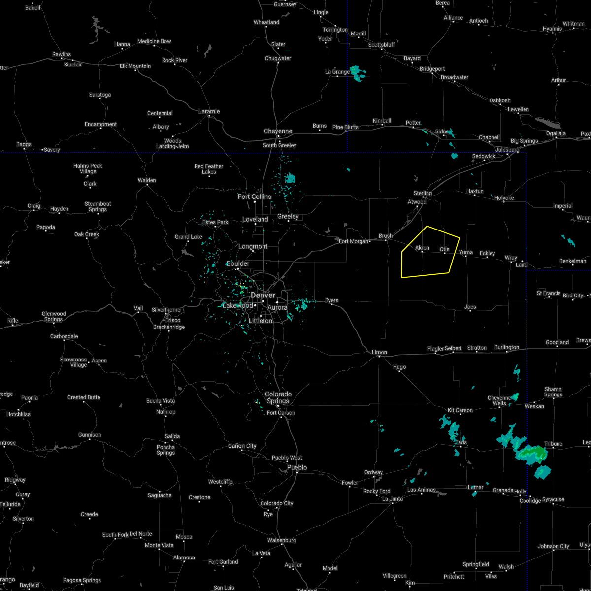 At 733 pm mdt, a severe thunderstorm was located 6 miles southeast of akron, moving southeast at 30 mph (radar indicated). Hazards include 60 mph wind gusts. Expect damage to roofs, siding, and trees. Locations impacted include, akron, otis and platner. At 733 pm mdt, a severe thunderstorm was located 6 miles southeast of akron, moving southeast at 30 mph (radar indicated). Hazards include 60 mph wind gusts. Expect damage to roofs, siding, and trees. Locations impacted include, akron, otis and platner.
|
| 8/19/2020 7:14 PM MDT | Asos station kako akro in washington county CO, 0.7 miles SSE of Akron, CO |
| 8/19/2020 6:59 PM MDT |
 At 658 pm mdt, a severe thunderstorm was located 7 miles south of prewitt reservoir, or 12 miles northwest of akron, moving southeast at 30 mph (radar indicated). Hazards include 60 mph wind gusts. expect damage to roofs, siding, and trees At 658 pm mdt, a severe thunderstorm was located 7 miles south of prewitt reservoir, or 12 miles northwest of akron, moving southeast at 30 mph (radar indicated). Hazards include 60 mph wind gusts. expect damage to roofs, siding, and trees
|
| 8/19/2020 6:52 PM MDT | Mesonet station co183 0.75 mi w of co- in washington county CO, 17.7 miles SE of Akron, CO |
| 8/15/2020 5:47 PM MDT | Hen Egg sized hail reported 6.3 miles ESE of Akron, CO |
| 8/15/2020 5:40 PM MDT | Tennis Ball sized hail reported 8.3 miles NE of Akron, CO |
| 8/15/2020 5:39 PM MDT |
 At 539 pm mdt, a severe thunderstorm was located 7 miles southwest of akron, moving south at 30 mph (radar indicated). Hazards include 60 mph wind gusts and half dollar size hail. Expect damage to roofs, siding, and trees. Hail damage to vehicles is expected. At 539 pm mdt, a severe thunderstorm was located 7 miles southwest of akron, moving south at 30 mph (radar indicated). Hazards include 60 mph wind gusts and half dollar size hail. Expect damage to roofs, siding, and trees. Hail damage to vehicles is expected.
|
| 8/15/2020 5:36 PM MDT | Hen Egg sized hail reported 4.5 miles NE of Akron, CO |
| 8/15/2020 5:26 PM MDT |
 At 526 pm mdt, a severe thunderstorm was located near midway, or 8 miles west of akron, moving west at 10 mph (trained weather spotters). Hazards include 60 mph wind gusts and half dollar size hail. Expect damage to roofs, siding, and trees. hail damage to vehicles is expected. Locations impacted include, akron and midway. At 526 pm mdt, a severe thunderstorm was located near midway, or 8 miles west of akron, moving west at 10 mph (trained weather spotters). Hazards include 60 mph wind gusts and half dollar size hail. Expect damage to roofs, siding, and trees. hail damage to vehicles is expected. Locations impacted include, akron and midway.
|
| 8/15/2020 5:15 PM MDT | Half Dollar sized hail reported 3.7 miles ESE of Akron, CO |
| 8/15/2020 5:15 PM MDT |
 At 515 pm mdt, a severe thunderstorm was located near midway, or 7 miles northwest of akron, moving west at 10 mph (radar indicated). Hazards include 60 mph wind gusts and quarter size hail. Expect damage to roofs, siding, and trees. Hail damage to vehicles is expected. At 515 pm mdt, a severe thunderstorm was located near midway, or 7 miles northwest of akron, moving west at 10 mph (radar indicated). Hazards include 60 mph wind gusts and quarter size hail. Expect damage to roofs, siding, and trees. Hail damage to vehicles is expected.
|
| 8/5/2020 5:58 PM MDT |
 At 557 pm mdt, a severe thunderstorm was located 4 miles southwest of platner, or 6 miles southeast of akron, moving east at 25 mph (radar indicated). Hazards include 60 mph wind gusts and quarter size hail. Expect damage to roofs, siding, and trees. Hail damage to vehicles is expected. At 557 pm mdt, a severe thunderstorm was located 4 miles southwest of platner, or 6 miles southeast of akron, moving east at 25 mph (radar indicated). Hazards include 60 mph wind gusts and quarter size hail. Expect damage to roofs, siding, and trees. Hail damage to vehicles is expected.
|
| 8/5/2020 5:48 PM MDT | Kako gust to 55k in washington county CO, 0.6 miles SSW of Akron, CO |
| 8/5/2020 5:30 PM MDT |
 At 529 pm mdt, a severe thunderstorm was located 4 miles east of brush, or 12 miles east of fort morgan, moving northeast at 30 mph (radar indicated). Hazards include 60 mph wind gusts and quarter size hail. Expect damage to roofs, siding, and trees. Hail damage to vehicles is expected. At 529 pm mdt, a severe thunderstorm was located 4 miles east of brush, or 12 miles east of fort morgan, moving northeast at 30 mph (radar indicated). Hazards include 60 mph wind gusts and quarter size hail. Expect damage to roofs, siding, and trees. Hail damage to vehicles is expected.
|
| 7/29/2020 6:42 PM MDT | Storm damage reported in washington county CO, 1.3 miles SSE of Akron, CO |
| 7/29/2020 6:36 PM MDT | Corrects previous tstm wnd gst report from 1 nnw akro in washington county CO, 1.3 miles SSE of Akron, CO |
| 7/24/2020 3:51 PM MDT |
 At 351 pm mdt, a severe thunderstorm was located 5 miles north of akron, moving north at 15 mph (radar indicated). Hazards include 60 mph wind gusts and quarter size hail. Expect damage to roofs, siding, and trees. hail damage to vehicles is expected. This severe thunderstorm will remain over mainly rural areas of north central washington county, which includes fremont butte. At 351 pm mdt, a severe thunderstorm was located 5 miles north of akron, moving north at 15 mph (radar indicated). Hazards include 60 mph wind gusts and quarter size hail. Expect damage to roofs, siding, and trees. hail damage to vehicles is expected. This severe thunderstorm will remain over mainly rural areas of north central washington county, which includes fremont butte.
|
| 7/19/2020 6:02 PM MDT |
 At 601 pm mdt, a severe thunderstorm was located near fleming, or 21 miles east of sterling, moving east at 45 mph (radar indicated). Hazards include two inch hail and 70 mph wind gusts. Expect considerable tree damage. damage is likely to mobile homes, roofs, and outbuildings. people and animals outdoors will be injured. expect hail damage to roofs, siding, windows, and vehicles. Locations impacted include, akron, haxtun, fleming, sedgwick, crook, st petersburg, proctor, platner, marks butte, highland center, twin buttes, burdett, midway and fairfield. At 601 pm mdt, a severe thunderstorm was located near fleming, or 21 miles east of sterling, moving east at 45 mph (radar indicated). Hazards include two inch hail and 70 mph wind gusts. Expect considerable tree damage. damage is likely to mobile homes, roofs, and outbuildings. people and animals outdoors will be injured. expect hail damage to roofs, siding, windows, and vehicles. Locations impacted include, akron, haxtun, fleming, sedgwick, crook, st petersburg, proctor, platner, marks butte, highland center, twin buttes, burdett, midway and fairfield.
|
| 7/19/2020 5:47 PM MDT |
 At 547 pm mdt, a severe thunderstorm was located 4 miles southeast of iliff, or 10 miles northeast of sterling, moving east at 55 mph (radar indicated). Hazards include two inch hail and 60 mph wind gusts. Expect damage to roofs, siding, and trees. people and animals outdoors will be injured. Expect hail damage to roofs, siding, windows, and vehicles. At 547 pm mdt, a severe thunderstorm was located 4 miles southeast of iliff, or 10 miles northeast of sterling, moving east at 55 mph (radar indicated). Hazards include two inch hail and 60 mph wind gusts. Expect damage to roofs, siding, and trees. people and animals outdoors will be injured. Expect hail damage to roofs, siding, windows, and vehicles.
|
| 7/13/2020 6:53 PM MDT |
 The severe thunderstorm warning for northern washington and logan counties will expire at 700 pm mdt, the storms which prompted the warning have weakened below severe limits, and no longer pose an immediate threat to life or property. therefore, the warning will be allowed to expire. a severe thunderstorm watch remains in effect until 1100 pm mdt for northeastern colorado. The severe thunderstorm warning for northern washington and logan counties will expire at 700 pm mdt, the storms which prompted the warning have weakened below severe limits, and no longer pose an immediate threat to life or property. therefore, the warning will be allowed to expire. a severe thunderstorm watch remains in effect until 1100 pm mdt for northeastern colorado.
|
| 7/13/2020 6:33 PM MDT | Asos station kako akro in washington county CO, 0.7 miles SSE of Akron, CO |
| 7/13/2020 6:29 PM MDT |
 At 628 pm mdt, severe thunderstorms were located along a line extending from 5 miles southeast of lorenzo to 7 miles west of burdett to 8 miles east of woodrow, or along a line extending from 10 miles south of sidney to 15 miles north of akron to 27 miles southeast of fort morgan, moving east at 60 mph (radar indicated). Hazards include 60 mph wind gusts. Expect damage to roofs, siding, and trees. Locations impacted include, sterling, akron, fleming, merino, iliff, peetz, crook, prewitt reservoir, proctor, padroni, atwood, elba, platner, north sterling reservoir, twin buttes, burdett, logan corners and midway. At 628 pm mdt, severe thunderstorms were located along a line extending from 5 miles southeast of lorenzo to 7 miles west of burdett to 8 miles east of woodrow, or along a line extending from 10 miles south of sidney to 15 miles north of akron to 27 miles southeast of fort morgan, moving east at 60 mph (radar indicated). Hazards include 60 mph wind gusts. Expect damage to roofs, siding, and trees. Locations impacted include, sterling, akron, fleming, merino, iliff, peetz, crook, prewitt reservoir, proctor, padroni, atwood, elba, platner, north sterling reservoir, twin buttes, burdett, logan corners and midway.
|
| 7/13/2020 5:59 PM MDT |
 The national weather service in denver colorado has issued a * severe thunderstorm warning for. eastern morgan county in northeastern colorado. northern washington county in northeastern colorado. logan county in northeastern colorado. Until 700 pm mdt. The national weather service in denver colorado has issued a * severe thunderstorm warning for. eastern morgan county in northeastern colorado. northern washington county in northeastern colorado. logan county in northeastern colorado. Until 700 pm mdt.
|
| 7/2/2020 1:42 PM MDT |
 At 142 pm mdt, a severe thunderstorm was located 10 miles southeast of prewitt reservoir, or 10 miles north of akron, moving north at 30 mph (radar indicated). Hazards include ping pong ball size hail and 60 mph wind gusts. weak landspout tornadoes are also possible with this storm. Expect damage to roofs, siding, and trees. people and animals outdoors will be injured. Expect hail damage to roofs, siding, windows, and vehicles. At 142 pm mdt, a severe thunderstorm was located 10 miles southeast of prewitt reservoir, or 10 miles north of akron, moving north at 30 mph (radar indicated). Hazards include ping pong ball size hail and 60 mph wind gusts. weak landspout tornadoes are also possible with this storm. Expect damage to roofs, siding, and trees. people and animals outdoors will be injured. Expect hail damage to roofs, siding, windows, and vehicles.
|
| 6/9/2020 12:15 AM MDT | Carport attached to the house was removed. also had accumulating sub-severe hai in washington county CO, 0.2 miles WNW of Akron, CO |
| 6/9/2020 12:14 AM MDT | Numerous reports of significant damage in akron east to otis due to a micro/macroburst. 40-50 power poles down (fell to the northeast)... carports removed from houses in washington county CO, 2.3 miles NNE of Akron, CO |
| 6/9/2020 12:10 AM MDT | Mesonet station ew7755 akro in washington county CO, 0.7 miles W of Akron, CO |
| 6/9/2020 12:10 AM MDT | Kako peak gust 83 mp in washington county CO, 0.6 miles SSW of Akron, CO |
| 6/6/2020 5:58 PM MDT |
 At 554 pm mdt, severe thunderstorms were located along a line extending from 5 miles southwest of peetz to 10 miles south of lindon, or along a line extending from 19 miles north of sterling to 26 miles northeast of limon, moving northeast at 55 mph (radar indicated). Hazards include 70 mph wind gusts. Expect considerable tree damage. Damage is likely to mobile homes, roofs, and outbuildings. At 554 pm mdt, severe thunderstorms were located along a line extending from 5 miles southwest of peetz to 10 miles south of lindon, or along a line extending from 19 miles north of sterling to 26 miles northeast of limon, moving northeast at 55 mph (radar indicated). Hazards include 70 mph wind gusts. Expect considerable tree damage. Damage is likely to mobile homes, roofs, and outbuildings.
|
| 6/6/2020 5:58 PM MDT |
 At 557 pm mdt, severe thunderstorms were located along a line extending from 3 miles south of peetz to 8 miles south of lindon, or along a line extending from 17 miles southwest of sidney to 28 miles northeast of limon, moving northeast at 55 mph (radar indicated). Hazards include 70 mph wind gusts. Expect considerable tree damage. Damage is likely to mobile homes, roofs, and outbuildings. At 557 pm mdt, severe thunderstorms were located along a line extending from 3 miles south of peetz to 8 miles south of lindon, or along a line extending from 17 miles southwest of sidney to 28 miles northeast of limon, moving northeast at 55 mph (radar indicated). Hazards include 70 mph wind gusts. Expect considerable tree damage. Damage is likely to mobile homes, roofs, and outbuildings.
|
| 6/6/2020 5:55 PM MDT | Asos station kako akro in washington county CO, 0.7 miles SSE of Akron, CO |
| 6/6/2020 5:48 PM MDT |
 At 547 pm mdt, severe thunderstorms were located along a line extending from 4 miles southwest of north sterling reservoir to 6 miles southeast of cottonwood valley, or along a line extending from 9 miles northwest of sterling to 22 miles north of limon, moving northeast at 60 mph (radar indicated). Hazards include 70 mph wind gusts. Expect considerable tree damage. damage is likely to mobile homes, roofs, and outbuildings. Locations impacted include, sterling, fort morgan, akron, brush, log lane village, merino, iliff, hillrose, peetz, prewitt reservoir, shamrock, padroni, atwood, twelve-mile corner, stoneham, westplains, cottonwood valley, lindon, snyder and midway. At 547 pm mdt, severe thunderstorms were located along a line extending from 4 miles southwest of north sterling reservoir to 6 miles southeast of cottonwood valley, or along a line extending from 9 miles northwest of sterling to 22 miles north of limon, moving northeast at 60 mph (radar indicated). Hazards include 70 mph wind gusts. Expect considerable tree damage. damage is likely to mobile homes, roofs, and outbuildings. Locations impacted include, sterling, fort morgan, akron, brush, log lane village, merino, iliff, hillrose, peetz, prewitt reservoir, shamrock, padroni, atwood, twelve-mile corner, stoneham, westplains, cottonwood valley, lindon, snyder and midway.
|
| 6/6/2020 5:44 PM MDT |
 At 543 pm mdt, severe thunderstorms were located along a line extending from 4 miles southwest of north sterling reservoir to 4 miles southeast of cottonwood valley, or along a line extending from 10 miles northwest of sterling to 23 miles north of limon, moving southeast at 60 mph (radar indicated). Hazards include 70 mph wind gusts. Expect considerable tree damage. damage is likely to mobile homes, roofs, and outbuildings. Locations impacted include, sterling, fort morgan, akron, brush, log lane village, merino, iliff, hillrose, peetz, prewitt reservoir, shamrock, padroni, atwood, twelve-mile corner, stoneham, westplains, cottonwood valley, lindon, snyder and midway. At 543 pm mdt, severe thunderstorms were located along a line extending from 4 miles southwest of north sterling reservoir to 4 miles southeast of cottonwood valley, or along a line extending from 10 miles northwest of sterling to 23 miles north of limon, moving southeast at 60 mph (radar indicated). Hazards include 70 mph wind gusts. Expect considerable tree damage. damage is likely to mobile homes, roofs, and outbuildings. Locations impacted include, sterling, fort morgan, akron, brush, log lane village, merino, iliff, hillrose, peetz, prewitt reservoir, shamrock, padroni, atwood, twelve-mile corner, stoneham, westplains, cottonwood valley, lindon, snyder and midway.
|
| 6/6/2020 5:18 PM MDT |
 At 517 pm mdt, severe thunderstorms were located along a line extending from 9 miles south of kimball airport to 5 miles northeast of antelope springs to near leader, or along a line extending from 12 miles south of kimball to 18 miles northeast of fort morgan to 48 miles north of limon, moving northeast at 60 mph (radar indicated). Hazards include 70 mph wind gusts. Expect considerable tree damage. Damage is likely to mobile homes, roofs, and outbuildings. At 517 pm mdt, severe thunderstorms were located along a line extending from 9 miles south of kimball airport to 5 miles northeast of antelope springs to near leader, or along a line extending from 12 miles south of kimball to 18 miles northeast of fort morgan to 48 miles north of limon, moving northeast at 60 mph (radar indicated). Hazards include 70 mph wind gusts. Expect considerable tree damage. Damage is likely to mobile homes, roofs, and outbuildings.
|
| 6/6/2020 3:26 PM MDT | Asos station kako akro in washington county CO, 0.7 miles SSE of Akron, CO |
| 6/4/2020 4:07 PM MDT |
 At 405 pm mdt, strong winds from severe thunderstorms were located along a line extending from 6 miles north of lone star to 3 miles north of arickaree school, or along a line extending from 21 miles southeast of sterling to 34 miles north of flagler, moving east at 25 mph (radar indicated. a gust to 70 mph was reported in akron as these storms passed). Hazards include 60 mph wind gusts. Expect damage to roofs, siding, and trees. Locations impacted include, akron, otis, arickaree school, cope, anton, elba, platner, burdett and lone star. At 405 pm mdt, strong winds from severe thunderstorms were located along a line extending from 6 miles north of lone star to 3 miles north of arickaree school, or along a line extending from 21 miles southeast of sterling to 34 miles north of flagler, moving east at 25 mph (radar indicated. a gust to 70 mph was reported in akron as these storms passed). Hazards include 60 mph wind gusts. Expect damage to roofs, siding, and trees. Locations impacted include, akron, otis, arickaree school, cope, anton, elba, platner, burdett and lone star.
|
| 6/4/2020 3:29 PM MDT |
 At 328 pm mdt, strong winds ahead of severe thunderstorms were located along a line extending from 10 miles southeast of atwood to 4 miles northwest of anton, or along a line extending from 12 miles south of sterling to 36 miles north of flagler, moving east at 25 mph (radar indicated. winds gusted to 58 mph in akron with these storms). Hazards include 60 mph wind gusts. expect damage to roofs, siding, and trees At 328 pm mdt, strong winds ahead of severe thunderstorms were located along a line extending from 10 miles southeast of atwood to 4 miles northwest of anton, or along a line extending from 12 miles south of sterling to 36 miles north of flagler, moving east at 25 mph (radar indicated. winds gusted to 58 mph in akron with these storms). Hazards include 60 mph wind gusts. expect damage to roofs, siding, and trees
|
| 6/4/2020 3:20 PM MDT | Asos station kako akro in washington county CO, 0.7 miles SSE of Akron, CO |
| 6/4/2020 3:14 PM MDT |
 At 313 pm mdt, strong winds from severe thunderstorms were located along a line extending from 3 miles southwest of merino to 7 miles east of gary, or along a line extending from 15 miles southwest of sterling to 15 miles southwest of akron, moving east at 35 mph (radar indicated. winds gusted to 56 mph at the fort morgan airport as these storms passed). Hazards include 70 mph wind gusts. Expect considerable tree damage. damage is likely to mobile homes, roofs, and outbuildings. Locations impacted include, akron, brush, hillrose, gary, prewitt reservoir, snyder, midway and woodrow. At 313 pm mdt, strong winds from severe thunderstorms were located along a line extending from 3 miles southwest of merino to 7 miles east of gary, or along a line extending from 15 miles southwest of sterling to 15 miles southwest of akron, moving east at 35 mph (radar indicated. winds gusted to 56 mph at the fort morgan airport as these storms passed). Hazards include 70 mph wind gusts. Expect considerable tree damage. damage is likely to mobile homes, roofs, and outbuildings. Locations impacted include, akron, brush, hillrose, gary, prewitt reservoir, snyder, midway and woodrow.
|
| 6/4/2020 2:39 PM MDT |
 At 238 pm mdt, the leading edge of strong winds from a severe thunderstorm were located along a line extending from near antelope springs to 4 miles east of adena, or along a line extending from 11 miles north of fort morgan to 33 miles west of akron, moving east at 35 mph (radar indicated). Hazards include 70 mph wind gusts. a gust to 64 mph was reported in wiggins. Expect considerable tree damage. Damage is likely to mobile homes, roofs, and outbuildings. At 238 pm mdt, the leading edge of strong winds from a severe thunderstorm were located along a line extending from near antelope springs to 4 miles east of adena, or along a line extending from 11 miles north of fort morgan to 33 miles west of akron, moving east at 35 mph (radar indicated). Hazards include 70 mph wind gusts. a gust to 64 mph was reported in wiggins. Expect considerable tree damage. Damage is likely to mobile homes, roofs, and outbuildings.
|
| 5/3/2020 8:30 PM MDT |
 At 830 pm mdt, severe thunderstorms were located along a line extending from 7 miles west of burdett to 7 miles east of gary, or along a line extending from 16 miles south of sterling to 13 miles southwest of akron, moving east at 40 mph (radar indicated). Hazards include 60 mph wind gusts and quarter size hail. Expect damage to roofs, siding, and trees. Hail damage to vehicles is expected. At 830 pm mdt, severe thunderstorms were located along a line extending from 7 miles west of burdett to 7 miles east of gary, or along a line extending from 16 miles south of sterling to 13 miles southwest of akron, moving east at 40 mph (radar indicated). Hazards include 60 mph wind gusts and quarter size hail. Expect damage to roofs, siding, and trees. Hail damage to vehicles is expected.
|
| 8/11/2019 3:43 PM MDT |
 The tornado warning for northeastern washington county will expire at 345 pm mdt, the storm which prompted the warning has moved out of the area. therefore, the warning will be allowed to expire. a severe thunderstorm watch remains in effect until 800 pm mdt for northeastern colorado. The tornado warning for northeastern washington county will expire at 345 pm mdt, the storm which prompted the warning has moved out of the area. therefore, the warning will be allowed to expire. a severe thunderstorm watch remains in effect until 800 pm mdt for northeastern colorado.
|
| 8/11/2019 3:18 PM MDT |
 At 317 pm mdt, a severe thunderstorm capable of producing a tornado was located 6 miles north of platner, or 9 miles northeast of akron, moving northeast at 10 mph (radar indicated rotation). Hazards include tornado and golf ball size hail. Flying debris will be dangerous to those caught without shelter. mobile homes will be damaged or destroyed. damage to roofs, windows, and vehicles will occur. tree damage is likely. Locations impacted include, akron and platner. At 317 pm mdt, a severe thunderstorm capable of producing a tornado was located 6 miles north of platner, or 9 miles northeast of akron, moving northeast at 10 mph (radar indicated rotation). Hazards include tornado and golf ball size hail. Flying debris will be dangerous to those caught without shelter. mobile homes will be damaged or destroyed. damage to roofs, windows, and vehicles will occur. tree damage is likely. Locations impacted include, akron and platner.
|
| 8/11/2019 3:17 PM MDT | Ping Pong Ball sized hail reported 1.3 miles S of Akron, CO, at the akron airport |
| 8/11/2019 3:07 PM MDT |
 At 307 pm mdt, a severe thunderstorm capable of producing a tornado was located 5 miles northwest of platner, or 6 miles northeast of akron, moving northeast at 10 mph (radar indicated rotation). Hazards include tornado and ping pong ball size hail. Flying debris will be dangerous to those caught without shelter. mobile homes will be damaged or destroyed. damage to roofs, windows, and vehicles will occur. Tree damage is likely. At 307 pm mdt, a severe thunderstorm capable of producing a tornado was located 5 miles northwest of platner, or 6 miles northeast of akron, moving northeast at 10 mph (radar indicated rotation). Hazards include tornado and ping pong ball size hail. Flying debris will be dangerous to those caught without shelter. mobile homes will be damaged or destroyed. damage to roofs, windows, and vehicles will occur. Tree damage is likely.
|
| 8/11/2019 3:03 PM MDT |
 At 303 pm mdt, a severe thunderstorm was located near akron, moving northeast at 15 mph (radar indicated). Hazards include 60 mph wind gusts and half dollar size hail. Expect damage to roofs, siding, and trees. hail damage to vehicles is expected. Locations impacted include, akron and platner. At 303 pm mdt, a severe thunderstorm was located near akron, moving northeast at 15 mph (radar indicated). Hazards include 60 mph wind gusts and half dollar size hail. Expect damage to roofs, siding, and trees. hail damage to vehicles is expected. Locations impacted include, akron and platner.
|
| 8/11/2019 3:00 PM MDT | Half Dollar sized hail reported 1.1 miles SE of Akron, CO |
| 8/11/2019 2:55 PM MDT | Quarter sized hail reported 5.7 miles SE of Akron, CO |
| 8/11/2019 2:45 PM MDT |
 At 245 pm mdt, a severe thunderstorm was located over akron, moving northeast at 15 mph (radar indicated). Hazards include 60 mph wind gusts and half dollar size hail. Expect damage to roofs, siding, and trees. Hail damage to vehicles is expected. At 245 pm mdt, a severe thunderstorm was located over akron, moving northeast at 15 mph (radar indicated). Hazards include 60 mph wind gusts and half dollar size hail. Expect damage to roofs, siding, and trees. Hail damage to vehicles is expected.
|
| 8/1/2019 6:32 PM MDT | Up to 4 inch diameter branches were being ripped off trees. 0.8 inches of rain were measured in 40 min in washington county CO, 8 miles SSW of Akron, CO |
| 8/1/2019 6:30 PM MDT | Snapped branches 3 inches and larger... knocked down and possibly broke crop in washington county CO, 7.3 miles WSW of Akron, CO |
| 7/15/2019 7:55 PM MDT | Quarter sized hail reported 4.9 miles SSW of Akron, CO |
| 7/15/2019 7:55 PM MDT | Damage to a patio roof and flagpol in washington county CO, 4.9 miles SSW of Akron, CO |
| 7/15/2019 7:49 PM MDT |
 At 748 pm mdt, a severe thunderstorm was located near akron, moving northeast at 50 mph (radar indicated). Hazards include ping pong ball size hail and 60 mph wind gusts. Expect damage to roofs, siding, and trees. people and animals outdoors will be injured. Expect hail damage to roofs, siding, windows, and vehicles. At 748 pm mdt, a severe thunderstorm was located near akron, moving northeast at 50 mph (radar indicated). Hazards include ping pong ball size hail and 60 mph wind gusts. Expect damage to roofs, siding, and trees. people and animals outdoors will be injured. Expect hail damage to roofs, siding, windows, and vehicles.
|
| 7/15/2019 7:47 PM MDT | Storm damage reported in washington county CO, 0.2 miles WNW of Akron, CO |
| 7/4/2019 9:26 PM MDT |
 The severe thunderstorm warning for central washington county will expire at 930 pm mdt, the storm which prompted the warning has weakened below severe limits, and no longer poses an immediate threat to life or property. therefore, the warning will be allowed to expire. however small hail, gusty winds and heavy rain are still possible with this thunderstorm. a severe thunderstorm watch remains in effect until 400 am mdt for northeastern colorado. The severe thunderstorm warning for central washington county will expire at 930 pm mdt, the storm which prompted the warning has weakened below severe limits, and no longer poses an immediate threat to life or property. therefore, the warning will be allowed to expire. however small hail, gusty winds and heavy rain are still possible with this thunderstorm. a severe thunderstorm watch remains in effect until 400 am mdt for northeastern colorado.
|
| 7/4/2019 9:15 PM MDT |
 At 914 pm mdt, a severe thunderstorm was located near akron, moving east at 15 mph (radar indicated). Hazards include 60 mph wind gusts and quarter size hail. Expect damage to roofs, siding, and trees. hail damage to vehicles is expected. Locations impacted include, akron and midway. At 914 pm mdt, a severe thunderstorm was located near akron, moving east at 15 mph (radar indicated). Hazards include 60 mph wind gusts and quarter size hail. Expect damage to roofs, siding, and trees. hail damage to vehicles is expected. Locations impacted include, akron and midway.
|
| 7/4/2019 8:53 PM MDT |
 The national weather service in denver colorado has issued a * severe thunderstorm warning for. central washington county in northeastern colorado. until 930 pm mdt. At 853 pm mdt, a severe thunderstorm was located 7 miles southwest of akron, moving northeast at 25 mph. The national weather service in denver colorado has issued a * severe thunderstorm warning for. central washington county in northeastern colorado. until 930 pm mdt. At 853 pm mdt, a severe thunderstorm was located 7 miles southwest of akron, moving northeast at 25 mph.
|
| 6/7/2019 7:47 PM MDT |
 At 747 pm mdt, a severe thunderstorm was located 4 miles south of akron, moving northeast at 30 mph (radar indicated). Hazards include 60 mph wind gusts and quarter size hail. Expect damage to roofs, siding, and trees. Hail damage to vehicles is expected. At 747 pm mdt, a severe thunderstorm was located 4 miles south of akron, moving northeast at 30 mph (radar indicated). Hazards include 60 mph wind gusts and quarter size hail. Expect damage to roofs, siding, and trees. Hail damage to vehicles is expected.
|
| 6/7/2019 7:38 PM MDT | Asos station kako akro in washington county CO, 0.7 miles SSE of Akron, CO |
| 6/7/2019 7:03 PM MDT |
 At 702 pm mdt, a severe thunderstorm was located 4 miles west of woodrow, or 19 miles south of fort morgan, moving northeast at 30 mph (radar indicated). Hazards include 60 mph wind gusts and quarter size hail. Expect damage to roofs, siding, and trees. Hail damage to vehicles is expected. At 702 pm mdt, a severe thunderstorm was located 4 miles west of woodrow, or 19 miles south of fort morgan, moving northeast at 30 mph (radar indicated). Hazards include 60 mph wind gusts and quarter size hail. Expect damage to roofs, siding, and trees. Hail damage to vehicles is expected.
|
| 7/29/2018 5:40 PM MDT | Golf Ball sized hail reported 14.6 miles N of Akron, CO, reported minor flooding with 4 inches of standing water in her yard. |
| 7/29/2018 5:37 PM MDT |
 The tornado warning for central washington county will expire at 545 pm mdt, the storm which prompted the warning has moved out of the area. therefore, the warning will be allowed to expire. a tornado watch remains in effect until 900 pm mdt for northeastern colorado. The tornado warning for central washington county will expire at 545 pm mdt, the storm which prompted the warning has moved out of the area. therefore, the warning will be allowed to expire. a tornado watch remains in effect until 900 pm mdt for northeastern colorado.
|
| 7/29/2018 5:24 PM MDT | Corrects previous tstm wnd gst report from 7 e akron. semi's blown over east of akron along highway 3 in washington county CO, 7.1 miles W of Akron, CO |
| 7/29/2018 5:19 PM MDT |
 At 518 pm mdt, a severe thunderstorm capable of producing a tornado was located 5 miles northwest of elba, or 12 miles south of akron, moving southeast at 45 mph (radar indicated rotation). Hazards include tornado and two inch hail. Flying debris will be dangerous to those caught without shelter. mobile homes will be damaged or destroyed. damage to roofs, windows, and vehicles will occur. tree damage is likely. Locations impacted include, akron, elba and platner. At 518 pm mdt, a severe thunderstorm capable of producing a tornado was located 5 miles northwest of elba, or 12 miles south of akron, moving southeast at 45 mph (radar indicated rotation). Hazards include tornado and two inch hail. Flying debris will be dangerous to those caught without shelter. mobile homes will be damaged or destroyed. damage to roofs, windows, and vehicles will occur. tree damage is likely. Locations impacted include, akron, elba and platner.
|
| 7/29/2018 5:07 PM MDT | Storm damage reported in washington county CO, 0.2 miles WNW of Akron, CO |
| 7/29/2018 5:01 PM MDT |
 At 501 pm mdt, a severe thunderstorm capable of producing a tornado was located 5 miles south of midway, or 8 miles west of akron, moving southeast at 65 mph (radar indicated rotation). Hazards include tornado and hail up to two inches in diameter. Flying debris will be dangerous to those caught without shelter. mobile homes will be damaged or destroyed. damage to roofs, windows, and vehicles will occur. Tree damage is likely. At 501 pm mdt, a severe thunderstorm capable of producing a tornado was located 5 miles south of midway, or 8 miles west of akron, moving southeast at 65 mph (radar indicated rotation). Hazards include tornado and hail up to two inches in diameter. Flying debris will be dangerous to those caught without shelter. mobile homes will be damaged or destroyed. damage to roofs, windows, and vehicles will occur. Tree damage is likely.
|
| 7/29/2018 4:51 PM MDT |
 At 451 pm mdt, a severe thunderstorm capable of producing a tornado was located near midway, or 11 miles west of akron, moving southeast at 50 mph (radar indicated rotation). Hazards include tornado and two inch hail. Flying debris will be dangerous to those caught without shelter. mobile homes will be damaged or destroyed. damage to roofs, windows, and vehicles will occur. tree damage is likely. Locations impacted include, akron, brush, hillrose, snyder and midway. At 451 pm mdt, a severe thunderstorm capable of producing a tornado was located near midway, or 11 miles west of akron, moving southeast at 50 mph (radar indicated rotation). Hazards include tornado and two inch hail. Flying debris will be dangerous to those caught without shelter. mobile homes will be damaged or destroyed. damage to roofs, windows, and vehicles will occur. tree damage is likely. Locations impacted include, akron, brush, hillrose, snyder and midway.
|
| 7/29/2018 4:37 PM MDT |
 At 437 pm mdt, a severe thunderstorm capable of producing a tornado was located near hillrose, or 14 miles northeast of fort morgan, moving southeast at 50 mph (radar indicated rotation). Hazards include tornado and hail up to two inches in diameter. Flying debris will be dangerous to those caught without shelter. mobile homes will be damaged or destroyed. damage to roofs, windows, and vehicles will occur. Tree damage is likely. At 437 pm mdt, a severe thunderstorm capable of producing a tornado was located near hillrose, or 14 miles northeast of fort morgan, moving southeast at 50 mph (radar indicated rotation). Hazards include tornado and hail up to two inches in diameter. Flying debris will be dangerous to those caught without shelter. mobile homes will be damaged or destroyed. damage to roofs, windows, and vehicles will occur. Tree damage is likely.
|
| 7/4/2018 10:53 PM MDT |
 At 1053 pm mdt, a severe thunderstorm was located 10 miles northwest of elba, or 13 miles southwest of akron, moving east at 15 mph (radar indicated). Hazards include 60 mph wind gusts and quarter size hail. Expect damage to roofs, siding, and trees. hail damage to vehicles is expected. Locations impacted include, akron, platner and elba. At 1053 pm mdt, a severe thunderstorm was located 10 miles northwest of elba, or 13 miles southwest of akron, moving east at 15 mph (radar indicated). Hazards include 60 mph wind gusts and quarter size hail. Expect damage to roofs, siding, and trees. hail damage to vehicles is expected. Locations impacted include, akron, platner and elba.
|
| 7/4/2018 10:34 PM MDT |
 At 1034 pm mdt, a severe thunderstorm was located near akron, moving east at 15 mph (radar indicated). Hazards include 60 mph wind gusts and quarter size hail. Expect damage to roofs, siding, and trees. Hail damage to vehicles is expected. At 1034 pm mdt, a severe thunderstorm was located near akron, moving east at 15 mph (radar indicated). Hazards include 60 mph wind gusts and quarter size hail. Expect damage to roofs, siding, and trees. Hail damage to vehicles is expected.
|
| 6/19/2018 4:40 PM MDT | Quarter sized hail reported 20.4 miles NW of Akron, CO |
| 6/18/2018 10:33 PM MDT | Golf Ball sized hail reported 15.4 miles S of Akron, CO, hail depth of 2 inches on the highway. |
| 6/18/2018 10:33 PM MDT | Storm damage reported in washington county CO, 15.4 miles S of Akron, CO |
| 6/17/2018 5:13 PM MDT | Quarter sized hail reported 18.5 miles NNW of Akron, CO |
| 6/17/2018 5:03 PM MDT | Half Dollar sized hail reported 17.4 miles N of Akron, CO, numerous shattered windows and damage to the house siding. tree stripped of leaves and crops knocked over flat. winds estimated at 50 to 60 mph with the hail. |
| 5/28/2018 5:52 PM MDT |
 At 551 pm mdt, severe thunderstorms capable of producing a tornado were located over cope north through central and eastern washington county. these storms are moving northeast at 15 mph. short lived tornadoes have been reported with these storms (radar indicated rotation). Hazards include tornado and quarter size hail. Expect damage to mobile homes, roofs, and vehicles. Locations impacted include, akron, otis, cope, platner and burdett. At 551 pm mdt, severe thunderstorms capable of producing a tornado were located over cope north through central and eastern washington county. these storms are moving northeast at 15 mph. short lived tornadoes have been reported with these storms (radar indicated rotation). Hazards include tornado and quarter size hail. Expect damage to mobile homes, roofs, and vehicles. Locations impacted include, akron, otis, cope, platner and burdett.
|
| 5/28/2018 5:44 PM MDT |
 At 541 pm mdt, severe thunderstorms capable of producing a tornado were located near cope and north into southern logan county. these storms moving northeast at 15 mph. short lived tornadoes have been reported with these storms (radar indicated rotation). Hazards include tornado and quarter size hail. Expect damage to mobile homes, roofs, and vehicles. Locations impacted include, akron, otis, merino, thurman, arickaree school, cope, anton, prewitt reservoir, atwood, elba, platner and burdett. At 541 pm mdt, severe thunderstorms capable of producing a tornado were located near cope and north into southern logan county. these storms moving northeast at 15 mph. short lived tornadoes have been reported with these storms (radar indicated rotation). Hazards include tornado and quarter size hail. Expect damage to mobile homes, roofs, and vehicles. Locations impacted include, akron, otis, merino, thurman, arickaree school, cope, anton, prewitt reservoir, atwood, elba, platner and burdett.
|
| 5/28/2018 5:27 PM MDT |
 At 523 pm mdt, severe thunderstorms capable of producing tornadoes were located 6 miles southwest of cope north into southern logan county. these storms are generally moving east to northeast at 10 mph. short lived tornadoes have been reported with these storms (radar indicated rotation). Hazards include tornado and ping pong ball size hail. expect damage to mobile homes, roofs, and vehicles At 523 pm mdt, severe thunderstorms capable of producing tornadoes were located 6 miles southwest of cope north into southern logan county. these storms are generally moving east to northeast at 10 mph. short lived tornadoes have been reported with these storms (radar indicated rotation). Hazards include tornado and ping pong ball size hail. expect damage to mobile homes, roofs, and vehicles
|
| 5/27/2018 4:50 PM MDT | Mesonet station e7755... akro in washington county CO, 0.7 miles W of Akron, CO |
| 5/1/2018 5:01 PM MDT |
 At 459 pm mdt, a severe thunderstorm was located near akron, moving east at 35 mph (radar indicated and observed. at 457 pm mdt, one inch diameter hail was reported in akron). Hazards include 60 mph wind gusts and quarter size hail. Hail damage to vehicles is expected. expect wind damage to roofs, siding, and trees. Locations impacted include, akron, otis and platner. At 459 pm mdt, a severe thunderstorm was located near akron, moving east at 35 mph (radar indicated and observed. at 457 pm mdt, one inch diameter hail was reported in akron). Hazards include 60 mph wind gusts and quarter size hail. Hail damage to vehicles is expected. expect wind damage to roofs, siding, and trees. Locations impacted include, akron, otis and platner.
|
| 5/1/2018 4:57 PM MDT | Quarter sized hail reported 0.3 miles ENE of Akron, CO |
| 5/1/2018 4:51 PM MDT |
 At 451 pm mdt, a severe thunderstorm was located near akron, moving east at 35 mph (radar indicated). Hazards include 60 mph wind gusts and quarter size hail. Hail damage to vehicles is expected. Expect wind damage to roofs, siding, and trees. At 451 pm mdt, a severe thunderstorm was located near akron, moving east at 35 mph (radar indicated). Hazards include 60 mph wind gusts and quarter size hail. Hail damage to vehicles is expected. Expect wind damage to roofs, siding, and trees.
|
| 8/24/2017 5:20 PM MDT | Quarter sized hail reported 18.4 miles NNE of Akron, CO, hail covering ground. |
| 8/13/2017 5:14 PM MDT | Golf Ball sized hail reported 19.2 miles NNW of Akron, CO |
| 8/2/2017 4:15 PM MDT | Half Dollar sized hail reported 20.4 miles NW of Akron, CO |
| 6/7/2017 6:07 PM MDT |
 At 607 pm mdt, a severe thunderstorm was located 4 miles southwest of akron, moving south at 15 mph (radar indicated). Hazards include two inch hail and 60 mph wind gusts. People and animals outdoors will be injured. expect hail damage to roofs, siding, windows, and vehicles. expect wind damage to roofs, siding, and trees. Locations impacted include, akron and elba. At 607 pm mdt, a severe thunderstorm was located 4 miles southwest of akron, moving south at 15 mph (radar indicated). Hazards include two inch hail and 60 mph wind gusts. People and animals outdoors will be injured. expect hail damage to roofs, siding, windows, and vehicles. expect wind damage to roofs, siding, and trees. Locations impacted include, akron and elba.
|
| 6/7/2017 5:43 PM MDT |
 At 542 pm mdt, a severe thunderstorm was located 4 miles northwest of akron, moving south at 15 mph (radar indicated). Hazards include ping pong ball size hail and 60 mph wind gusts. People and animals outdoors will be injured. expect hail damage to roofs, siding, windows, and vehicles. Expect wind damage to roofs, siding, and trees. At 542 pm mdt, a severe thunderstorm was located 4 miles northwest of akron, moving south at 15 mph (radar indicated). Hazards include ping pong ball size hail and 60 mph wind gusts. People and animals outdoors will be injured. expect hail damage to roofs, siding, windows, and vehicles. Expect wind damage to roofs, siding, and trees.
|
| 6/7/2017 4:57 PM MDT |
 At 456 pm mdt, a severe thunderstorm was located 8 miles southeast of prewitt reservoir, or 14 miles north of akron, moving south at 20 mph (radar indicated). Hazards include ping pong ball size hail and 60 mph wind gusts. People and animals outdoors will be injured. expect hail damage to roofs, siding, windows, and vehicles. Expect wind damage to roofs, siding, and trees. At 456 pm mdt, a severe thunderstorm was located 8 miles southeast of prewitt reservoir, or 14 miles north of akron, moving south at 20 mph (radar indicated). Hazards include ping pong ball size hail and 60 mph wind gusts. People and animals outdoors will be injured. expect hail damage to roofs, siding, windows, and vehicles. Expect wind damage to roofs, siding, and trees.
|
| 5/26/2017 5:20 PM MDT | Quarter sized hail reported 20.9 miles NW of Akron, CO |
| 5/26/2017 4:50 PM MDT | Half Dollar sized hail reported 14.6 miles N of Akron, CO |
| 5/25/2017 1:58 PM MDT |
 At 157 pm mdt, a severe thunderstorm was located 8 miles southwest of platner, or 8 miles southeast of akron, moving east at 10 mph (radar indicated). Hazards include ping pong ball size hail and 60 mph wind gusts. People and animals outdoors will be injured. expect hail damage to roofs, siding, windows, and vehicles. expect wind damage to roofs, siding, and trees. Locations impacted include, akron, otis and platner. At 157 pm mdt, a severe thunderstorm was located 8 miles southwest of platner, or 8 miles southeast of akron, moving east at 10 mph (radar indicated). Hazards include ping pong ball size hail and 60 mph wind gusts. People and animals outdoors will be injured. expect hail damage to roofs, siding, windows, and vehicles. expect wind damage to roofs, siding, and trees. Locations impacted include, akron, otis and platner.
|
| 5/25/2017 1:43 PM MDT |
 At 143 pm mdt, a severe thunderstorm was located 6 miles south of akron, moving east at 10 mph (radar indicated). Hazards include quarter size hail. damage to vehicles is expected At 143 pm mdt, a severe thunderstorm was located 6 miles south of akron, moving east at 10 mph (radar indicated). Hazards include quarter size hail. damage to vehicles is expected
|
| 9/3/2016 9:25 PM MDT | Tea Cup sized hail reported 7 miles NW of Akron, CO, roof and vehicle damage w/ 1.25 inches of rainfall. |
| 9/3/2016 6:43 PM MDT |
 At 642 pm mdt, a severe thunderstorm capable of producing a tornado was located near akron, moving east at 10 mph (weather spotters reported a funnel cloud). Hazards include tornado. Flying debris will be dangerous to those caught without shelter. mobile homes will be damaged or destroyed. damage to roofs, windows, and vehicles will occur. tree damage is likely. Locations impacted include, akron. At 642 pm mdt, a severe thunderstorm capable of producing a tornado was located near akron, moving east at 10 mph (weather spotters reported a funnel cloud). Hazards include tornado. Flying debris will be dangerous to those caught without shelter. mobile homes will be damaged or destroyed. damage to roofs, windows, and vehicles will occur. tree damage is likely. Locations impacted include, akron.
|
| 9/3/2016 6:40 PM MDT | Hen Egg sized hail reported 2.3 miles NNE of Akron, CO, strong winds also reported along with two brief funnel clouds. |
| 9/3/2016 6:30 PM MDT | Tennis Ball sized hail reported 7 miles NW of Akron, CO, strong wind and heavy rain also observed. |
| 9/3/2016 6:27 PM MDT |
 At 626 pm mdt, a severe thunderstorm capable of producing a tornado was located 5 miles southwest of akron, moving east at 10 mph (radar indicated rotation). Hazards include tornado. Flying debris will be dangerous to those caught without shelter. mobile homes will be damaged or destroyed. damage to roofs, windows, and vehicles will occur. Tree damage is likely. At 626 pm mdt, a severe thunderstorm capable of producing a tornado was located 5 miles southwest of akron, moving east at 10 mph (radar indicated rotation). Hazards include tornado. Flying debris will be dangerous to those caught without shelter. mobile homes will be damaged or destroyed. damage to roofs, windows, and vehicles will occur. Tree damage is likely.
|
| 9/3/2016 6:26 PM MDT |
 At 625 pm mdt, a severe thunderstorm capable of producing a tornado was located 5 miles southwest of akron, moving east at 10 mph (radar indicated rotation). Hazards include tornado. Flying debris will be dangerous to those caught without shelter. mobile homes will be damaged or destroyed. damage to roofs, windows, and vehicles will occur. Tree damage is likely. At 625 pm mdt, a severe thunderstorm capable of producing a tornado was located 5 miles southwest of akron, moving east at 10 mph (radar indicated rotation). Hazards include tornado. Flying debris will be dangerous to those caught without shelter. mobile homes will be damaged or destroyed. damage to roofs, windows, and vehicles will occur. Tree damage is likely.
|
| 9/3/2016 6:23 PM MDT |
 At 622 pm mdt, a severe thunderstorm was located 4 miles northwest of akron, moving east at 10 mph. this storm continues to show signs of strengthening (radar indicated). Hazards include golf ball size hail and 60 mph wind gusts. People and animals outdoors will be injured. expect hail damage to roofs, siding, windows, and vehicles. expect wind damage to roofs, siding, and trees. Locations impacted include, akron and midway. At 622 pm mdt, a severe thunderstorm was located 4 miles northwest of akron, moving east at 10 mph. this storm continues to show signs of strengthening (radar indicated). Hazards include golf ball size hail and 60 mph wind gusts. People and animals outdoors will be injured. expect hail damage to roofs, siding, windows, and vehicles. expect wind damage to roofs, siding, and trees. Locations impacted include, akron and midway.
|
| 9/3/2016 6:18 PM MDT |
 At 616 pm mdt, a severe thunderstorm was located 4 miles southeast of midway, or 5 miles west of akron, moving east at 10 mph (radar indicated). Hazards include quarter size hail. damage to vehicles is expected At 616 pm mdt, a severe thunderstorm was located 4 miles southeast of midway, or 5 miles west of akron, moving east at 10 mph (radar indicated). Hazards include quarter size hail. damage to vehicles is expected
|
| 7/27/2016 7:27 PM MDT |
 At 727 pm mdt, a severe thunderstorm was located near brush, or 11 miles east of fort morgan, moving east at 20 mph (radar indicated). Hazards include 60 mph wind gusts and quarter size hail. Hail damage to vehicles is expected. Expect wind damage to roofs, siding, and trees. At 727 pm mdt, a severe thunderstorm was located near brush, or 11 miles east of fort morgan, moving east at 20 mph (radar indicated). Hazards include 60 mph wind gusts and quarter size hail. Hail damage to vehicles is expected. Expect wind damage to roofs, siding, and trees.
|
| 7/24/2016 6:34 PM MDT |
 At 634 pm mdt, severe thunderstorms were located along a line extending from 5 miles north of lone star to 3 miles north of midway, or along a line extending from 21 miles north of yuma to 12 miles northwest of akron, moving south at 25 mph (radar indicated). Hazards include 60 mph wind gusts. Expect damage to roofs. siding. and trees. Locations impacted include, akron, lone star, burdett, prewitt reservoir, platner and midway. At 634 pm mdt, severe thunderstorms were located along a line extending from 5 miles north of lone star to 3 miles north of midway, or along a line extending from 21 miles north of yuma to 12 miles northwest of akron, moving south at 25 mph (radar indicated). Hazards include 60 mph wind gusts. Expect damage to roofs. siding. and trees. Locations impacted include, akron, lone star, burdett, prewitt reservoir, platner and midway.
|
| 7/24/2016 6:06 PM MDT |
 At 605 pm mdt, severe thunderstorms were located along a line extending from 5 miles west of fleming to 4 miles west of prewitt reservoir, or along a line extending from 14 miles east of sterling to 21 miles northwest of akron, moving southeast at 25 mph (radar indicated). Hazards include 60 mph wind gusts. Expect damage to roofs. siding. And trees. At 605 pm mdt, severe thunderstorms were located along a line extending from 5 miles west of fleming to 4 miles west of prewitt reservoir, or along a line extending from 14 miles east of sterling to 21 miles northwest of akron, moving southeast at 25 mph (radar indicated). Hazards include 60 mph wind gusts. Expect damage to roofs. siding. And trees.
|
| 7/18/2016 8:24 PM MDT |
 At 823 pm mdt, severe thunderstorms were located along a line extending from 5 miles north of midway to 9 miles south of yuma, or along a line extending from 14 miles northwest of akron to 30 miles west of wray, moving northeast at 20 mph (radar indicated). Hazards include 60 mph wind gusts and quarter size hail. Hail damage to vehicles is expected. Expect wind damage to roofs, siding, and trees. At 823 pm mdt, severe thunderstorms were located along a line extending from 5 miles north of midway to 9 miles south of yuma, or along a line extending from 14 miles northwest of akron to 30 miles west of wray, moving northeast at 20 mph (radar indicated). Hazards include 60 mph wind gusts and quarter size hail. Hail damage to vehicles is expected. Expect wind damage to roofs, siding, and trees.
|
| 7/18/2016 8:10 PM MDT | Storm damage reported in washington county CO, 0.2 miles WNW of Akron, CO |
| 7/17/2016 7:56 PM MDT |
 The severe thunderstorm warning for north central washington county will expire at 800 pm mdt, the storm which prompted the warning has weakened below severe limits, and no longer poses an immediate threat to life or property. therefore the warning will be allowed to expire. however small. The severe thunderstorm warning for north central washington county will expire at 800 pm mdt, the storm which prompted the warning has weakened below severe limits, and no longer poses an immediate threat to life or property. therefore the warning will be allowed to expire. however small.
|
| 7/17/2016 7:20 PM MDT |
 At 720 pm mdt, a severe thunderstorm was located over prewitt reservoir, or 17 miles southwest of sterling, moving southeast at 25 mph (radar indicated). Hazards include ping pong ball size hail and 60 mph wind gusts. People and animals outdoors will be injured. expect hail damage to roofs, siding, windows, and vehicles. Expect wind damage to roofs, siding, and trees. At 720 pm mdt, a severe thunderstorm was located over prewitt reservoir, or 17 miles southwest of sterling, moving southeast at 25 mph (radar indicated). Hazards include ping pong ball size hail and 60 mph wind gusts. People and animals outdoors will be injured. expect hail damage to roofs, siding, windows, and vehicles. Expect wind damage to roofs, siding, and trees.
|
| 6/27/2016 5:03 PM MDT |
 At 502 pm mdt, a severe thunderstorm was located near midway, or 8 miles west of akron, moving southeast at 20 mph (radar indicated). Hazards include 60 mph wind gusts and quarter size hail. Hail damage to vehicles is expected. expect wind damage to roofs, siding, and trees. locations impacted include, akron and midway. A tornado watch remains in effect until 800 pm mdt for northeastern colorado. At 502 pm mdt, a severe thunderstorm was located near midway, or 8 miles west of akron, moving southeast at 20 mph (radar indicated). Hazards include 60 mph wind gusts and quarter size hail. Hail damage to vehicles is expected. expect wind damage to roofs, siding, and trees. locations impacted include, akron and midway. A tornado watch remains in effect until 800 pm mdt for northeastern colorado.
|
| 6/27/2016 4:41 PM MDT |
 At 441 pm mdt, a severe thunderstorm was located 4 miles northwest of midway, or 14 miles northwest of akron, moving south at 20 mph (radar indicated). Hazards include golf ball size hail and 60 mph wind gusts. People and animals outdoors will be injured. expect hail damage to roofs, siding, windows, and vehicles. Expect wind damage to roofs, siding, and trees. At 441 pm mdt, a severe thunderstorm was located 4 miles northwest of midway, or 14 miles northwest of akron, moving south at 20 mph (radar indicated). Hazards include golf ball size hail and 60 mph wind gusts. People and animals outdoors will be injured. expect hail damage to roofs, siding, windows, and vehicles. Expect wind damage to roofs, siding, and trees.
|
| 6/26/2016 11:13 PM MDT |
 At 1113 pm mdt, a severe thunderstorm was located over hillrose, or 14 miles east of fort morgan, moving southeast at 20 mph (radar indicated). Hazards include 60 mph wind gusts and quarter size hail. Hail damage to vehicles is expected. Expect wind damage to roofs, siding, and trees. At 1113 pm mdt, a severe thunderstorm was located over hillrose, or 14 miles east of fort morgan, moving southeast at 20 mph (radar indicated). Hazards include 60 mph wind gusts and quarter size hail. Hail damage to vehicles is expected. Expect wind damage to roofs, siding, and trees.
|
| 6/26/2016 10:57 PM MDT |
 At 1057 pm mdt, a severe thunderstorm was located over snyder, or 12 miles east of fort morgan, moving east at 25 mph (radar indicated). Hazards include 60 mph wind gusts and quarter size hail. Hail damage to vehicles is expected. expect wind damage to roofs, siding, and trees. Locations impacted include, brush, hillrose, snyder and midway. At 1057 pm mdt, a severe thunderstorm was located over snyder, or 12 miles east of fort morgan, moving east at 25 mph (radar indicated). Hazards include 60 mph wind gusts and quarter size hail. Hail damage to vehicles is expected. expect wind damage to roofs, siding, and trees. Locations impacted include, brush, hillrose, snyder and midway.
|
| 6/26/2016 10:40 PM MDT |
 At 1040 pm mdt, a severe thunderstorm was located near snyder, or 9 miles northeast of fort morgan, moving east at 35 mph (radar indicated). Hazards include 60 mph wind gusts and quarter size hail. Hail damage to vehicles is expected. Expect wind damage to roofs, siding, and trees. At 1040 pm mdt, a severe thunderstorm was located near snyder, or 9 miles northeast of fort morgan, moving east at 35 mph (radar indicated). Hazards include 60 mph wind gusts and quarter size hail. Hail damage to vehicles is expected. Expect wind damage to roofs, siding, and trees.
|
| 6/13/2016 7:07 PM MDT |
 At 706 pm mdt, a severe thunderstorm was located 5 miles northeast of midway, or 8 miles northwest of akron, moving northeast at 30 mph (radar indicated). Hazards include quarter size hail. damage to vehicles is expected At 706 pm mdt, a severe thunderstorm was located 5 miles northeast of midway, or 8 miles northwest of akron, moving northeast at 30 mph (radar indicated). Hazards include quarter size hail. damage to vehicles is expected
|
| 5/24/2016 7:18 PM MDT | Ping Pong Ball sized hail reported 6.5 miles W of Akron, CO |
| 5/24/2016 6:52 PM MDT | Storm damage reported in washington county CO, 0.2 miles WNW of Akron, CO |
| 5/24/2016 6:45 PM MDT | Ping Pong Ball sized hail reported 0.2 miles WNW of Akron, CO, hail damaged shingles and dented vehicles. |
| 5/24/2016 6:45 PM MDT | Golf Ball sized hail reported 0.2 miles WNW of Akron, CO |
| 5/24/2016 6:26 PM MDT | The national weather service in denver has issued a * tornado warning for. north central washington county in northeastern colorado. until 700 pm mdt * at 624 pm mdt. a severe thunderstorm capable of producing a tornado was located 4 miles south of midway. Or 10 miles west of. |
| 5/24/2016 6:23 PM MDT | A tornado warning remains in effect until 630 pm mdt for northwestern washington and southeastern morgan counties. at 622 pm mdt. a severe thunderstorm capable of producing a tornado was located 6 miles southwest of midway. or 12 miles west of akron. moving east at 20 mph. hazard. Tornado and ping pong ball size hail. |
| 5/7/2016 5:17 PM MDT |
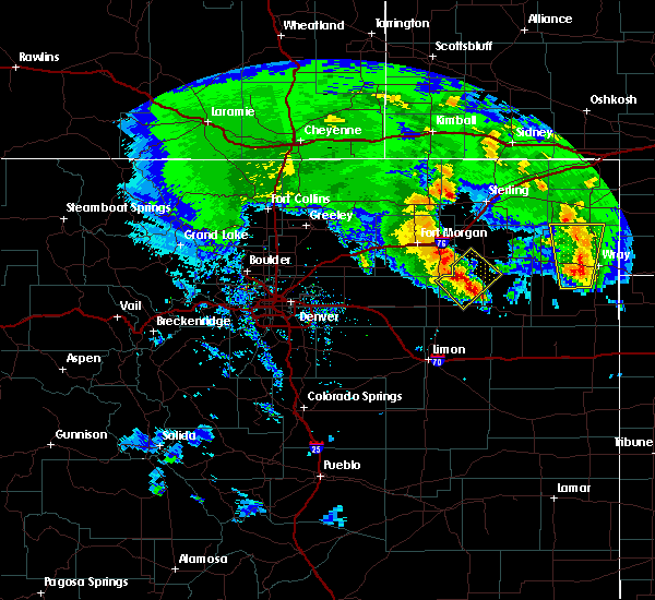 At 517 pm mdt, a severe thunderstorm was located 9 miles northeast of woodlin school, or 21 miles southwest of akron, moving northeast at 30 mph (radar indicated). Hazards include 60 mph wind gusts and half dollar size hail. Hail damage to vehicles is expected. Expect wind damage to roofs, siding and trees. At 517 pm mdt, a severe thunderstorm was located 9 miles northeast of woodlin school, or 21 miles southwest of akron, moving northeast at 30 mph (radar indicated). Hazards include 60 mph wind gusts and half dollar size hail. Hail damage to vehicles is expected. Expect wind damage to roofs, siding and trees.
|
| 8/17/2015 4:28 PM MDT |
 At 427 pm mdt, severe thunderstorms were located along a line extending from near antelope springs to near simla, or along a line extending from 13 miles north of fort morgan to 22 miles southwest of limon, moving east at 65 mph (radar indicated). Hazards include 60 mph wind gusts and half dollar size hail. Hail damage to vehicles is expected. Expect wind damage to roofs, siding and trees. At 427 pm mdt, severe thunderstorms were located along a line extending from near antelope springs to near simla, or along a line extending from 13 miles north of fort morgan to 22 miles southwest of limon, moving east at 65 mph (radar indicated). Hazards include 60 mph wind gusts and half dollar size hail. Hail damage to vehicles is expected. Expect wind damage to roofs, siding and trees.
|
| 8/1/2015 7:42 PM MDT |
 At 741 pm mdt, a severe thunderstorm was located 4 miles south of platner, or 7 miles southeast of akron, moving south at 20 mph (radar indicated). Hazards include 60 mph wind gusts and half dollar size hail. Hail damage to vehicles is expected. Expect wind damage to roofs, siding and trees. At 741 pm mdt, a severe thunderstorm was located 4 miles south of platner, or 7 miles southeast of akron, moving south at 20 mph (radar indicated). Hazards include 60 mph wind gusts and half dollar size hail. Hail damage to vehicles is expected. Expect wind damage to roofs, siding and trees.
|
| 8/1/2015 7:40 PM MDT |
 At 739 pm mdt, a severe thunderstorm was located 7 miles south of platner, or 9 miles southeast of akron, moving south at 25 mph (radar indicated). Hazards include half dollar size hail and 60 mph wind gusts. Hail damage to vehicles is expected. expect wind damage to roofs, siding and trees. Locations impacted include, akron, otis and platner. At 739 pm mdt, a severe thunderstorm was located 7 miles south of platner, or 9 miles southeast of akron, moving south at 25 mph (radar indicated). Hazards include half dollar size hail and 60 mph wind gusts. Hail damage to vehicles is expected. expect wind damage to roofs, siding and trees. Locations impacted include, akron, otis and platner.
|
| 8/1/2015 7:28 PM MDT | Storm damage reported in washington county CO, 0.2 miles WNW of Akron, CO |
| 8/1/2015 7:23 PM MDT |
 At 722 pm mdt, a severe thunderstorm was located over platner, or 5 miles east of akron, moving south at 25 mph (radar indicated). Hazards include 60 mph wind gusts and half dollar size hail. Hail damage to vehicles is expected. Expect wind damage to roofs, siding and trees. At 722 pm mdt, a severe thunderstorm was located over platner, or 5 miles east of akron, moving south at 25 mph (radar indicated). Hazards include 60 mph wind gusts and half dollar size hail. Hail damage to vehicles is expected. Expect wind damage to roofs, siding and trees.
|
| 8/1/2015 6:46 PM MDT |
 At 646 pm mdt, a severe thunderstorm was located 8 miles west of burdett, or 12 miles northeast of akron, moving south at 10 mph (radar indicated). Hazards include 60 mph wind gusts and half dollar size hail. Hail damage to vehicles is expected. Expect wind damage to roofs, siding and trees. At 646 pm mdt, a severe thunderstorm was located 8 miles west of burdett, or 12 miles northeast of akron, moving south at 10 mph (radar indicated). Hazards include 60 mph wind gusts and half dollar size hail. Hail damage to vehicles is expected. Expect wind damage to roofs, siding and trees.
|
| 8/1/2015 6:40 PM MDT | Quarter sized hail reported 11.2 miles SSW of Akron, CO |
| 6/5/2015 5:50 PM MDT | At 548 pm mdt, a severe thunderstorm was located 6 miles northeast of midway, or 11 miles northwest of akron, moving north at 35 mph (radar indicated). Hazards include golf ball size hail and 60 mph wind gusts. People and animals outdoors could be injured. expect hail damage to roofs, siding, windows and vehicles. expect wind damage to roofs, siding and trees. locations impacted include, akron, brush, merino, hillrose, atwood, midway, gary, snyder and prewitt reservoir. A tornado watch remains in effect until 700 pm mdt for northeastern colorado. |
| 6/5/2015 5:24 PM MDT | At 523 pm mdt, a severe thunderstorm was located 5 miles southeast of midway, or 7 miles west of akron, moving north at 40 mph (radar indicated). Hazards include golf ball size hail and 60 mph wind gusts. People and animals outdoors could be injured. expect hail damage to roofs, siding, windows and vehicles. Expect wind damage to roofs, siding and trees. |
| 5/28/2015 3:40 PM MDT | At 340 pm mdt, a severe thunderstorm was located 9 miles north of akron, moving southeast at 15 mph (radar indicated). Hazards include golf ball size hail and 60 mph wind gusts. People and animals outdoors will be injured. expect hail damage to roofs, siding, windows and vehicles. expect wind damage to roofs, siding and trees. Locations impacted include, akron, otis, burdett and platner. |
| 5/28/2015 3:15 PM MDT | At 315 pm mdt, a severe thunderstorm was located 10 miles southeast of prewitt reservoir, or 12 miles north of akron, moving southeast at 25 mph (radar indicated). Hazards include golf ball size hail and 60 mph wind gusts. People and animals outdoors will be injured. expect hail damage to roofs, siding, windows and vehicles. Expect wind damage to roofs, siding and trees. |
| 8/27/2014 7:35 PM MDT | Hen Egg sized hail reported 0.2 miles WNW of Akron, CO, estimated 50 mph winds associated with rain and hail. |
| 6/26/2014 7:20 PM MDT | Storm damage reported in washington county CO, 0.2 miles WNW of Akron, CO |
| 6/23/2014 6:35 PM MDT | Quarter sized hail reported 8 miles NE of Akron, CO |
| 6/18/2014 8:30 PM MDT | Large barn significantly damaged. side of barn and aluminum roof remove in washington county CO, 5.1 miles SW of Akron, CO |
| 6/18/2014 8:17 PM MDT | Storm damage reported in washington county CO, 0.2 miles WNW of Akron, CO |
| 6/6/2014 4:15 PM MDT | Half Dollar sized hail reported 3.7 miles ESE of Akron, CO |
| 9/22/2013 7:53 PM MDT | Measured at the akron airport asos in washington county CO, 0.2 miles WNW of Akron, CO |
| 8/18/2013 6:11 PM MDT | Storm damage reported in washington county CO, 0.2 miles WNW of Akron, CO |
| 8/12/2013 5:23 PM MDT | Golf Ball sized hail reported 17.5 miles NNW of Akron, CO |
| 8/1/2013 6:17 PM MDT | Storm damage reported in washington county CO, 0.2 miles WNW of Akron, CO |
| 7/31/2013 10:14 PM MDT | Half Dollar sized hail reported 11.2 miles SSW of Akron, CO |
| 7/13/2013 7:24 PM MDT | Storm damage reported in washington county CO, 1.3 miles S of Akron, CO |
| 6/22/2013 6:43 PM MDT | Storm damage reported in washington county CO, 0.2 miles WNW of Akron, CO |
| 6/17/2013 6:28 PM MDT | Quarter sized hail reported 8.9 miles ESE of Akron, CO |
| 6/15/2013 6:39 PM MDT | Quarter sized hail reported 5.4 miles S of Akron, CO |
| 6/15/2013 5:52 PM MDT | Hen Egg sized hail reported 5.1 miles E of Akron, CO |
| 6/13/2013 6:17 PM MDT | Storm damage reported in washington county CO, 0.2 miles WNW of Akron, CO |
| 4/12/2013 2:14 PM MDT | Storm damage reported in washington county CO, 0.2 miles WNW of Akron, CO |
| 4/8/2013 8:00 PM MDT | Trailer home blown over and destroyed in washington county CO, 0.8 miles NNW of Akron, CO |
| 4/8/2013 7:54 PM MDT | Storm damage reported in washington county CO, 0.2 miles WNW of Akron, CO |
| 7/30/2012 6:00 PM MDT | Storm damage reported in washington county CO, 0.2 miles WNW of Akron, CO |
| 6/27/2012 4:37 PM MDT | Quarter sized hail reported 18.4 miles NNE of Akron, CO |
| 1/1/0001 12:00 AM | Quarter sized hail reported 0.2 miles WNW of Akron, CO |
| 1/1/0001 12:00 AM | Storm damage reported in washington county CO, 0.2 miles WNW of Akron, CO |
| 1/1/0001 12:00 AM | Quarter sized hail reported 7.9 miles NW of Akron, CO, also heavy rain. estimated 1 inch in 30 minutes. |
| 1/1/0001 12:00 AM | Quarter sized hail reported 0.2 miles WNW of Akron, CO, also heavy rain along with pea to marble size hail. |
| 1/1/0001 12:00 AM | Also reported nickle size hail in washington county CO, 4 miles NW of Akron, CO |
| 1/1/0001 12:00 AM | Akron asos reported peak gust of 67 mp in washington county CO, 0.2 miles WNW of Akron, CO |
| 1/1/0001 12:00 AM | Storm damage reported in washington county CO, 11.2 miles SSW of Akron, CO |
| 1/1/0001 12:00 AM | Lost cattle building and several tree tops in washington county CO, 11.2 miles SSW of Akron, CO |
| 1/1/0001 12:00 AM | Quarter sized hail reported 30 miles N of Akron, CO |
Hail Maps for Akron, CO
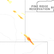
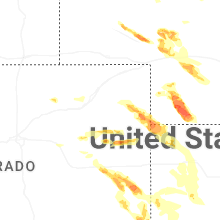
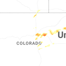
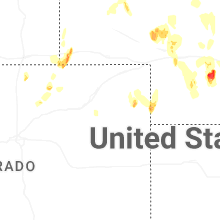

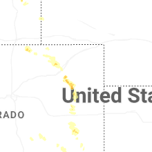
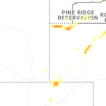
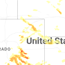
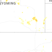
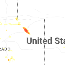
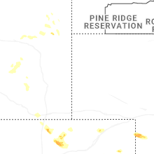
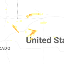

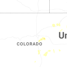

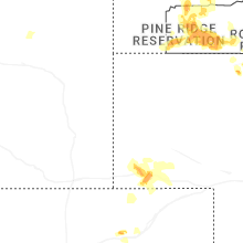
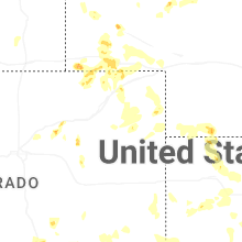
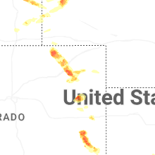


Connect with Interactive Hail Maps