

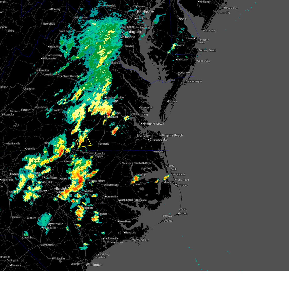
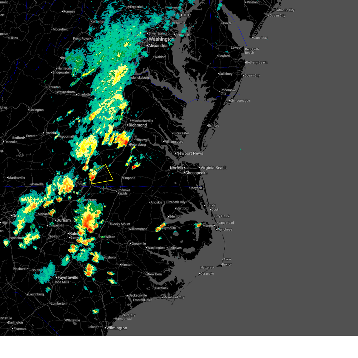
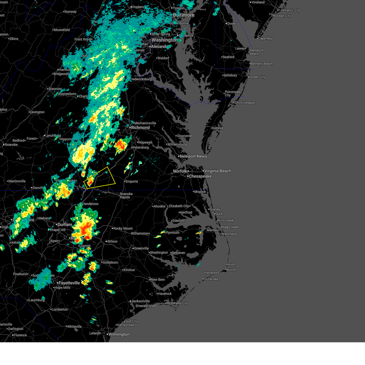
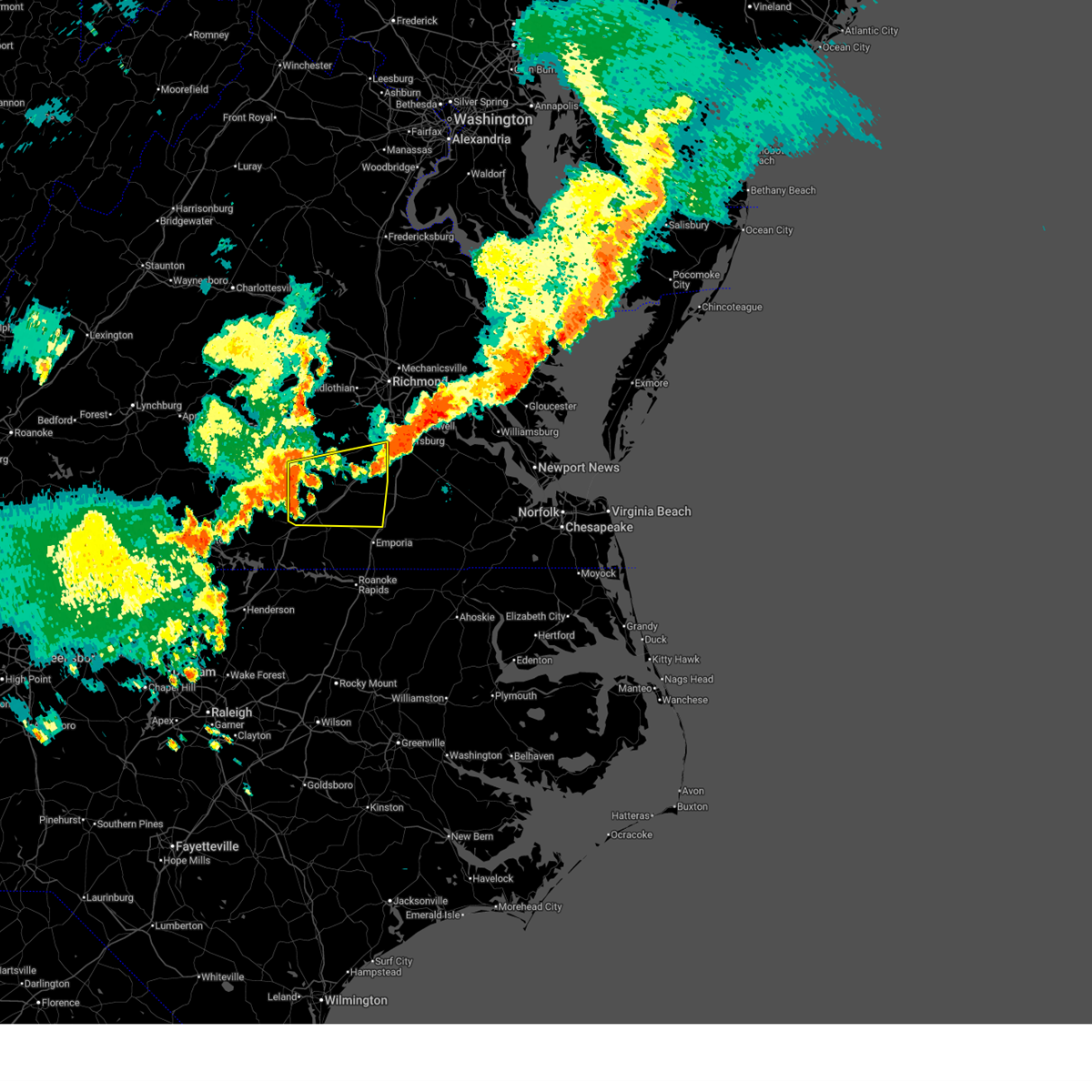
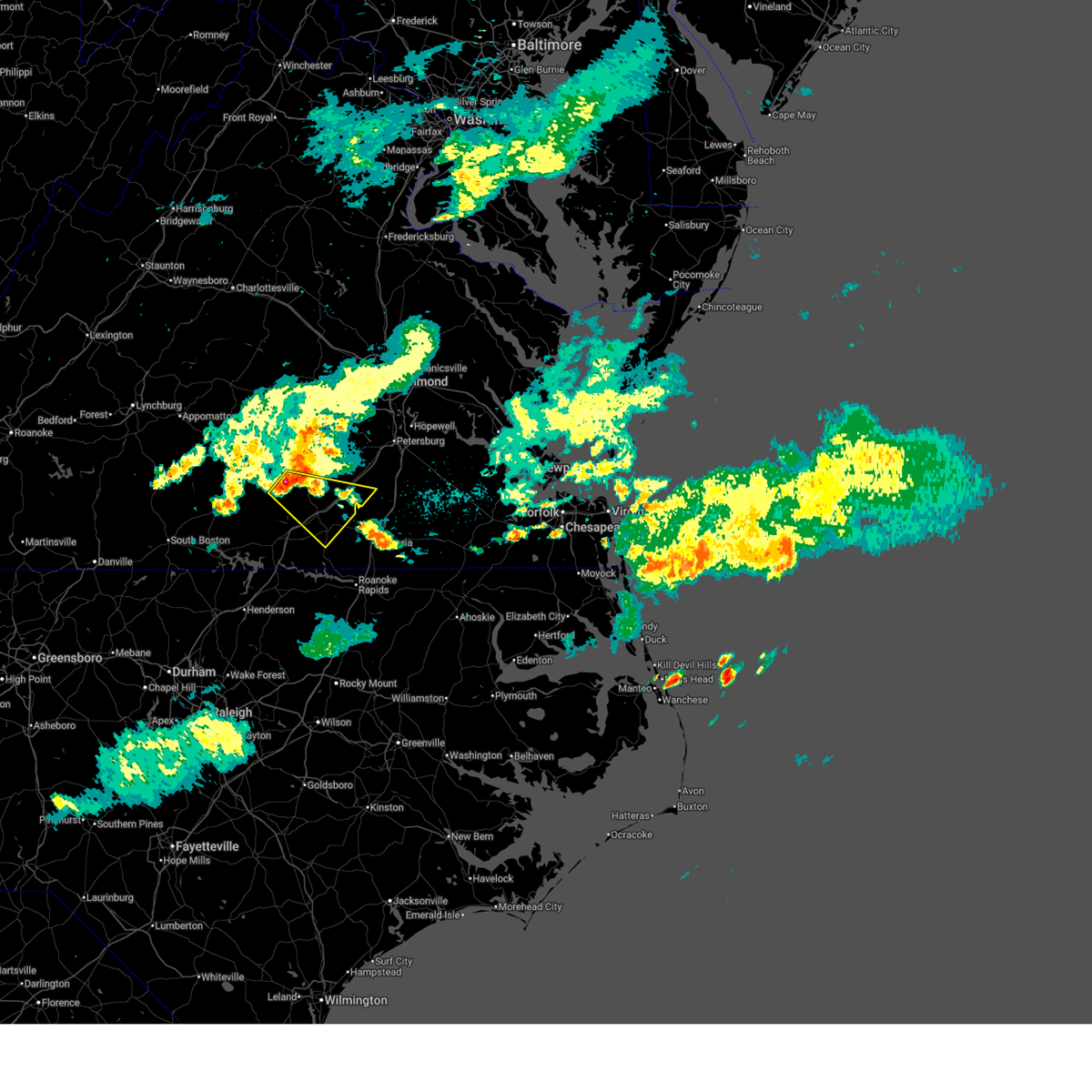
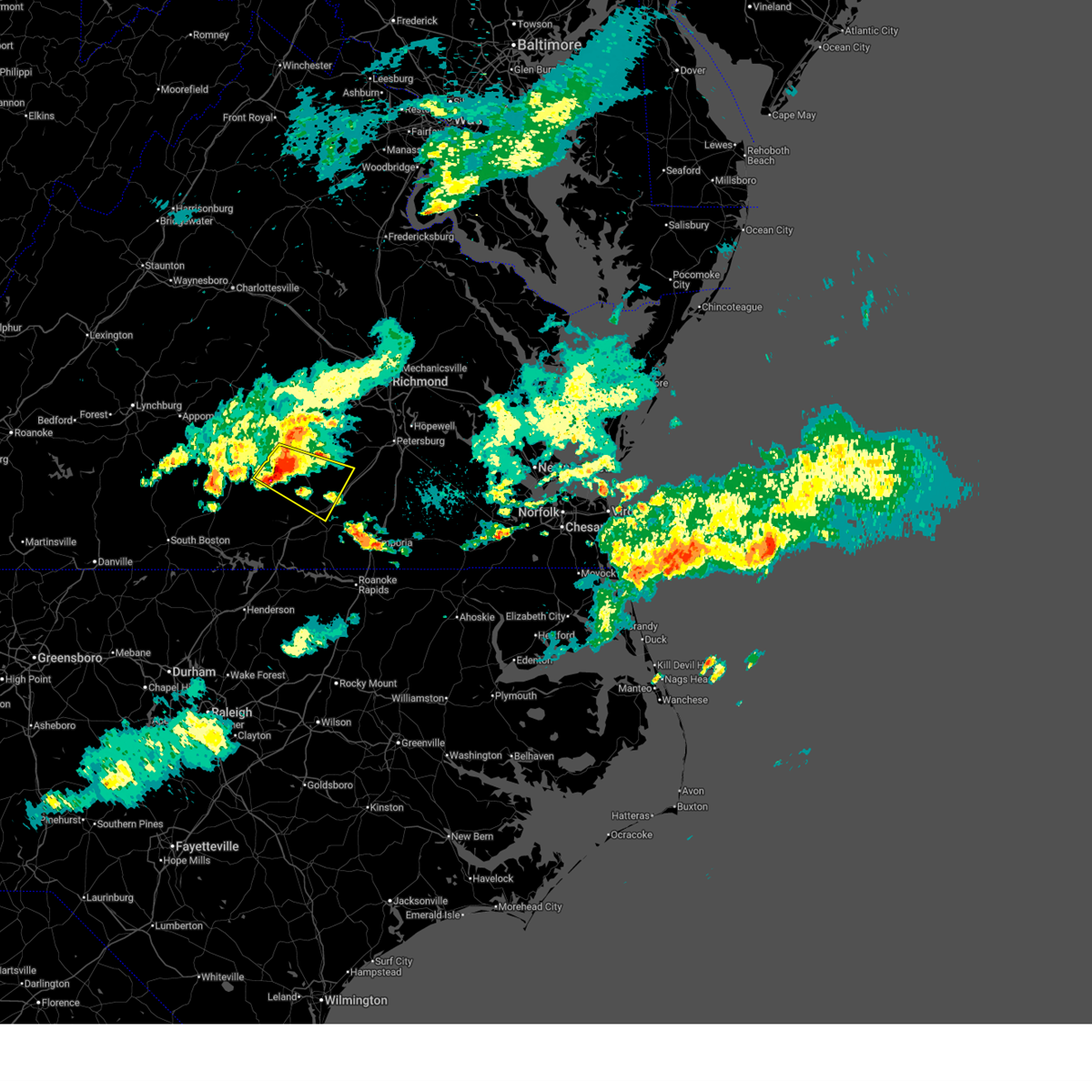
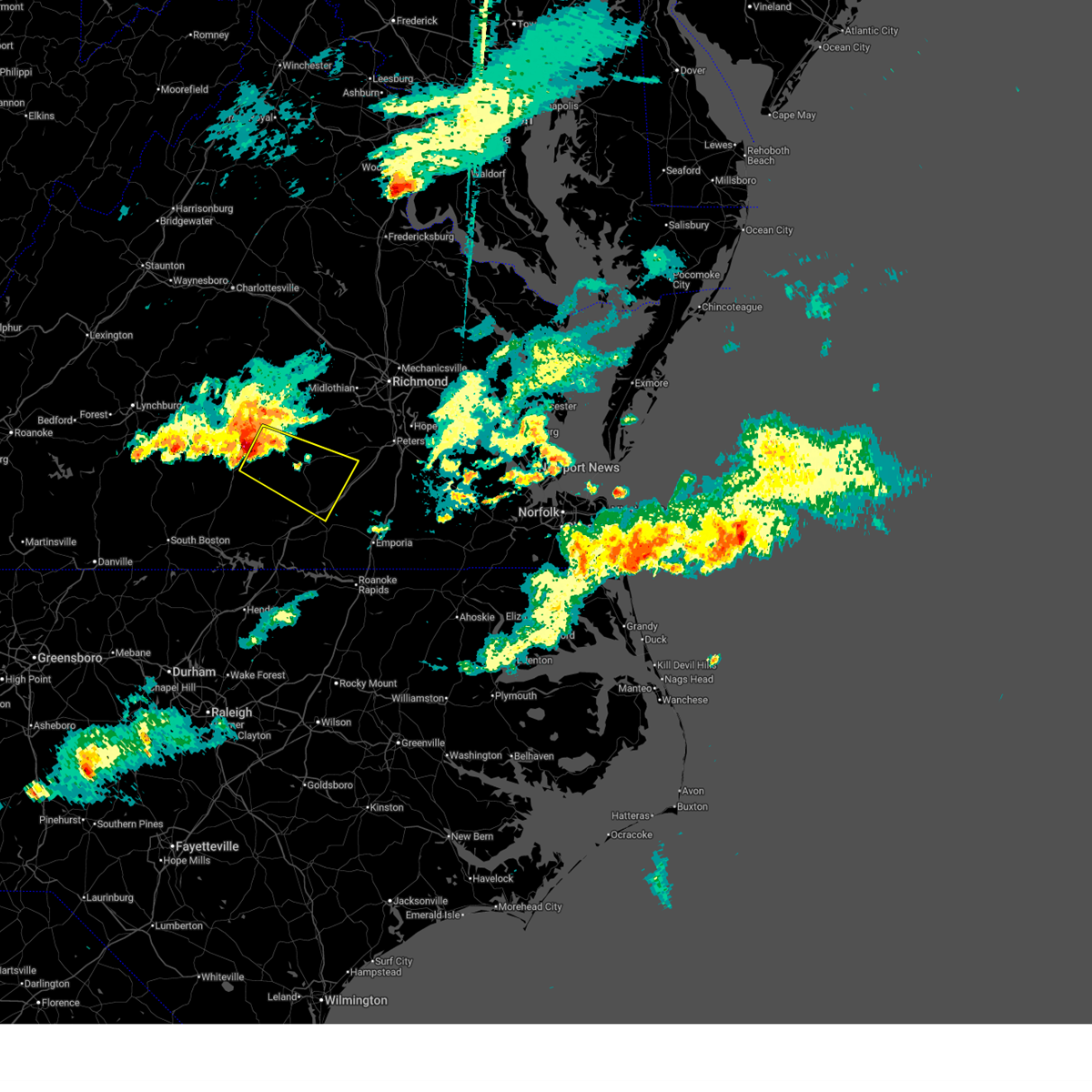
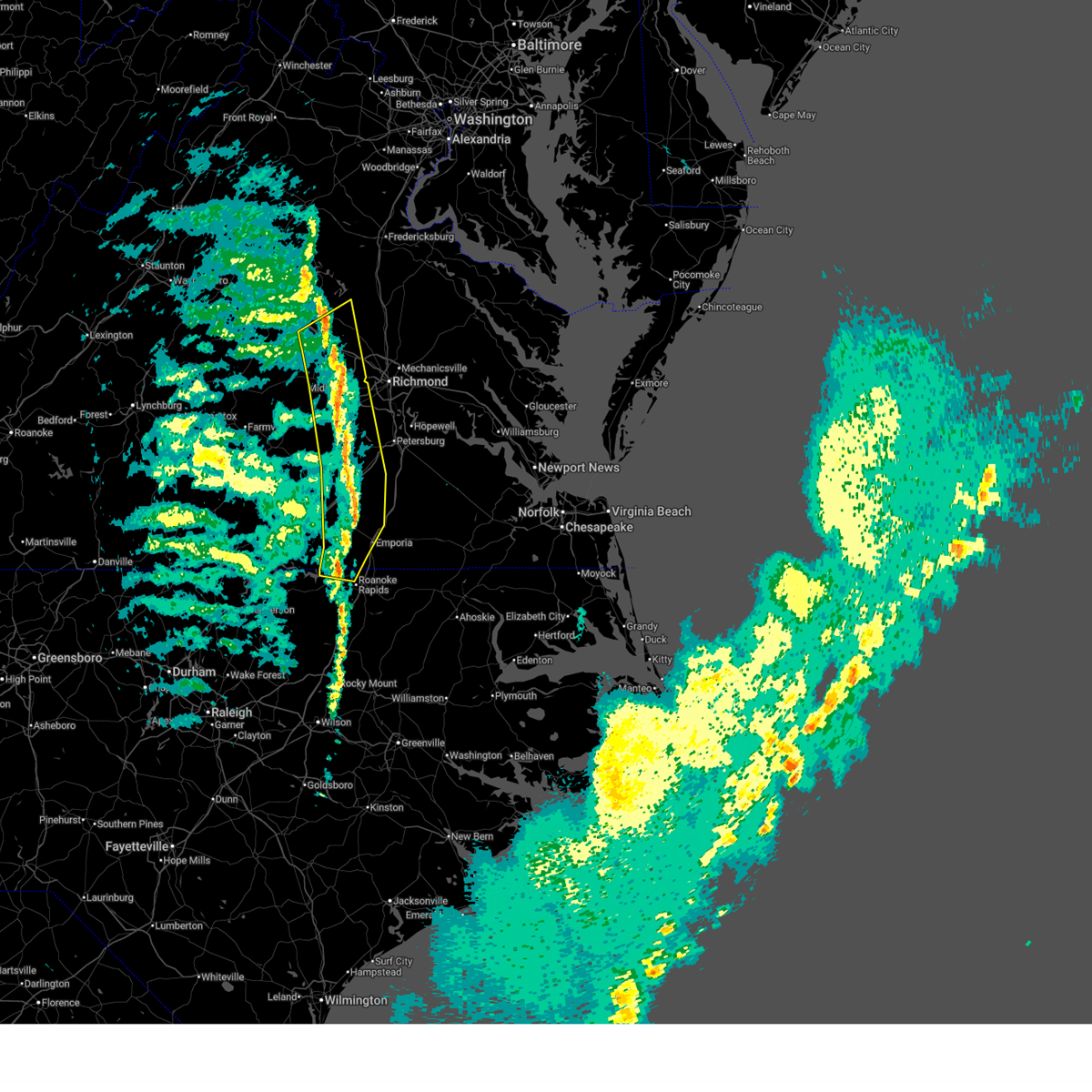
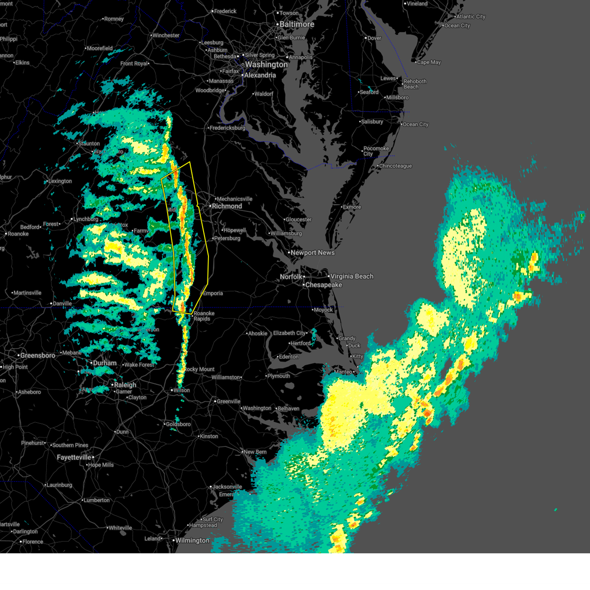
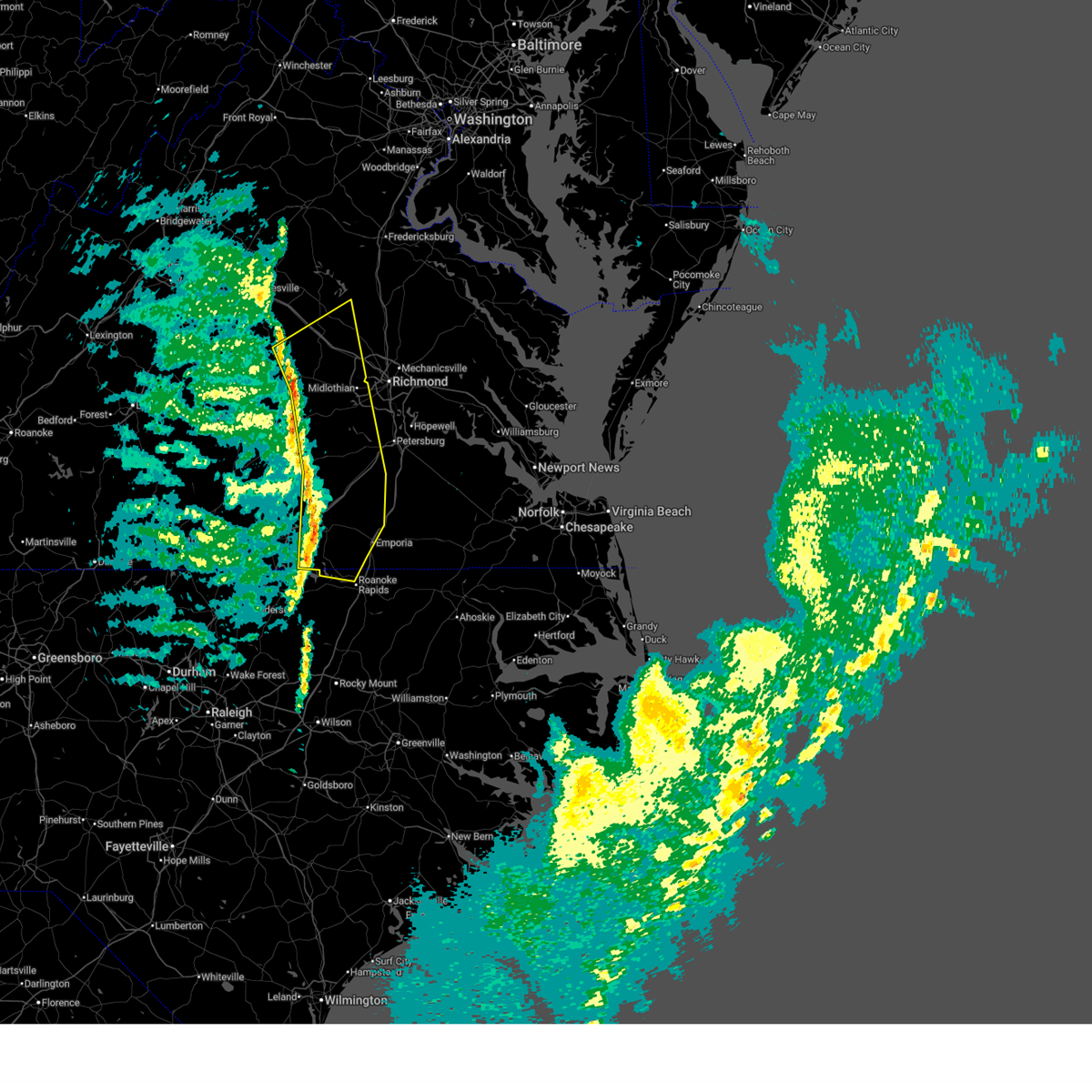
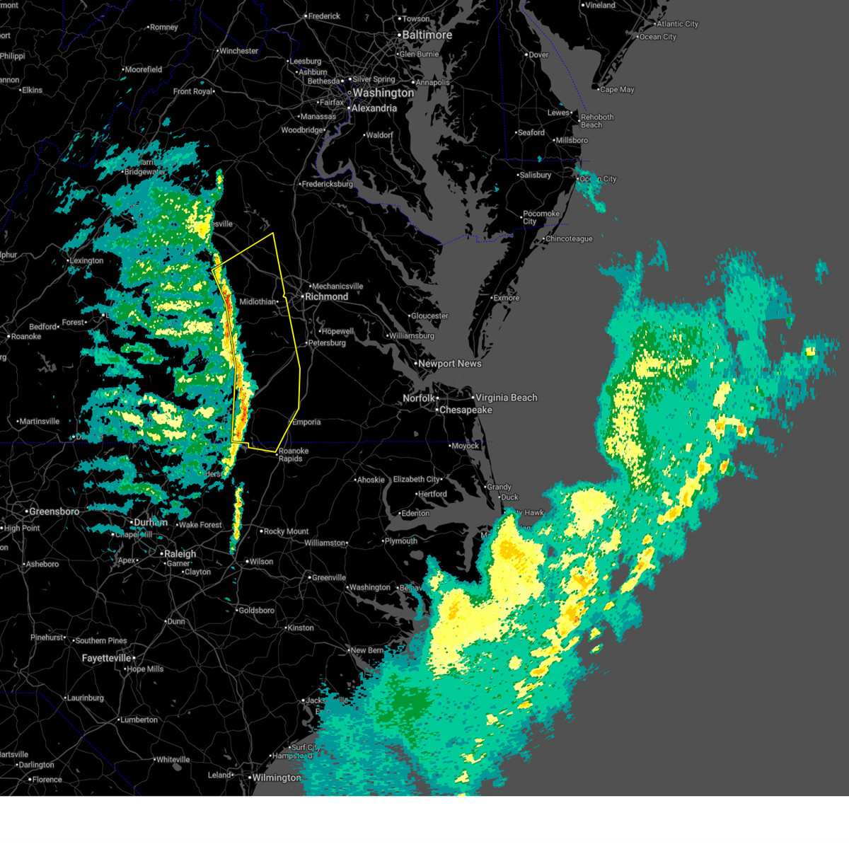
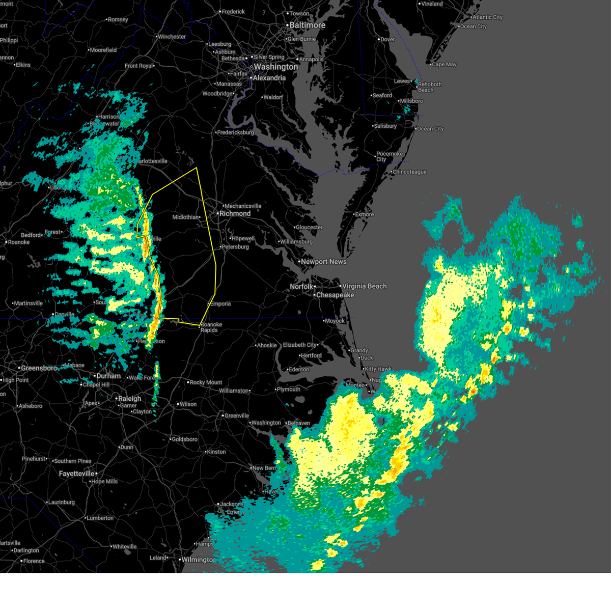
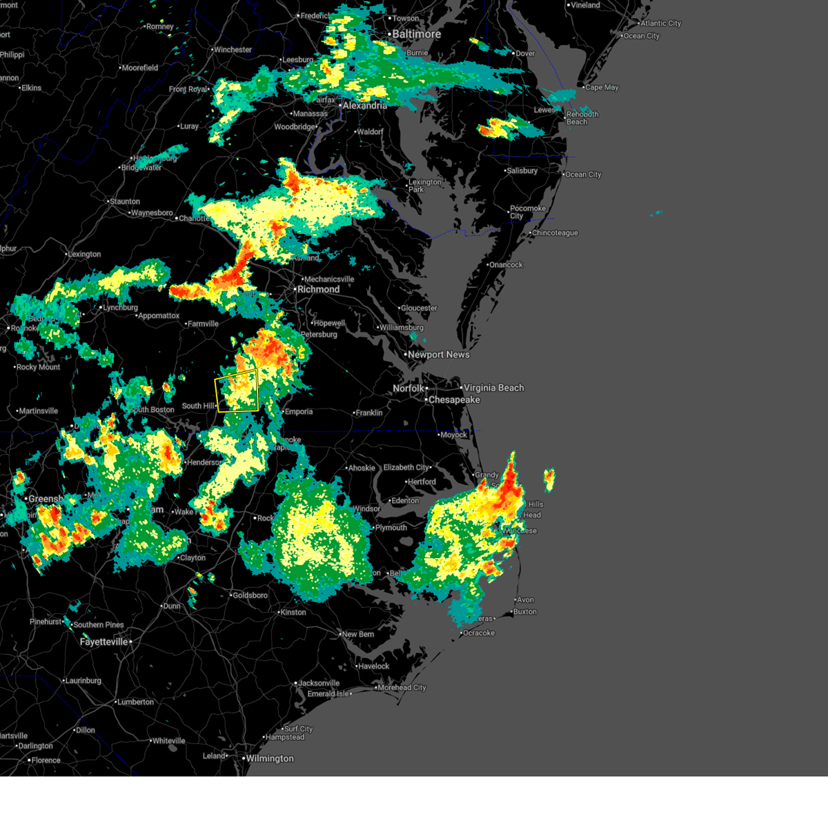
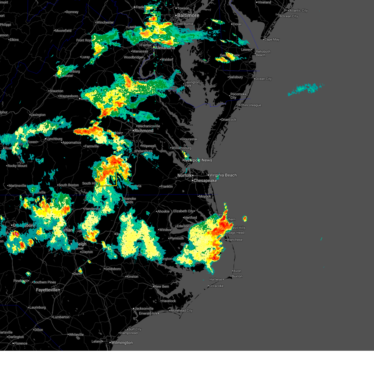
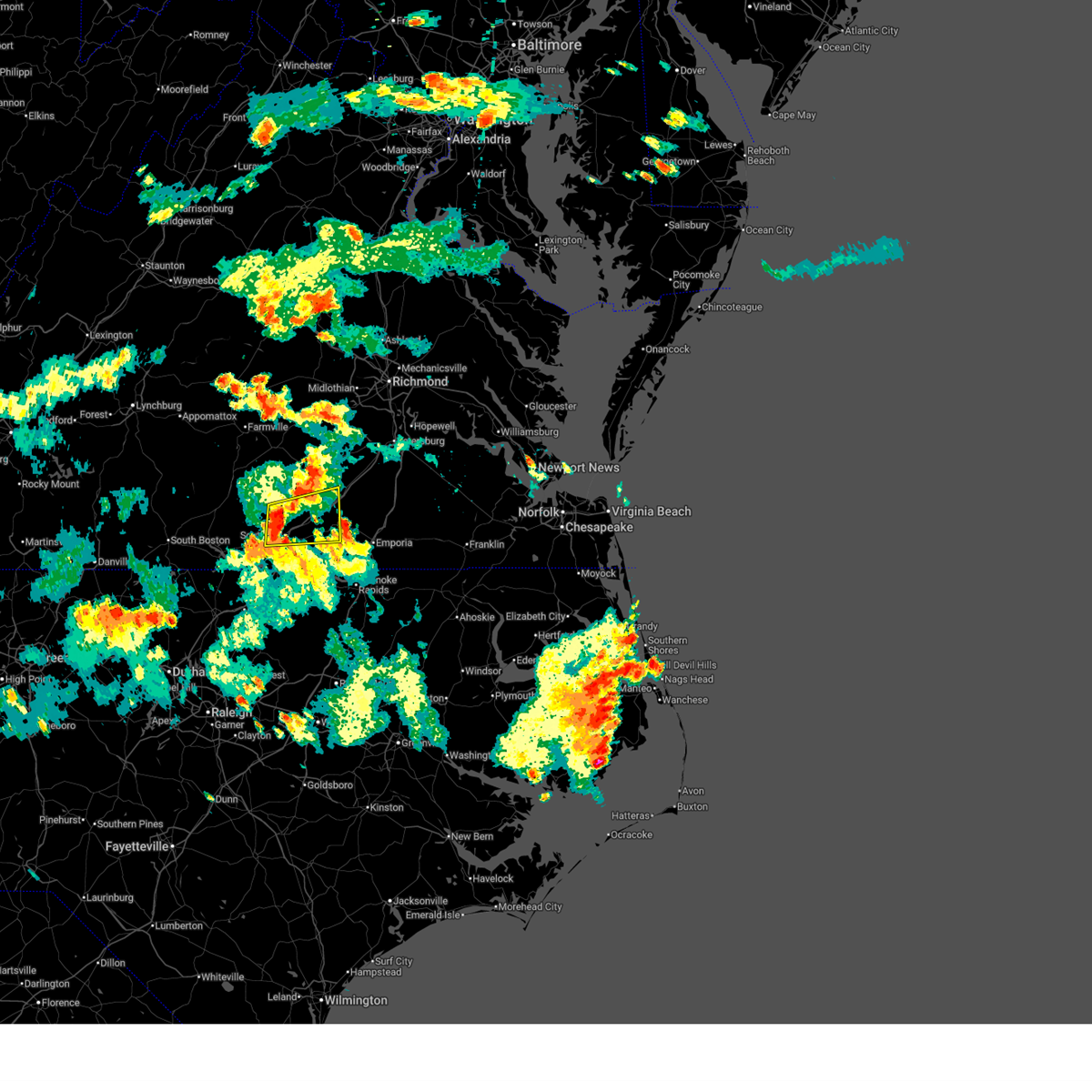
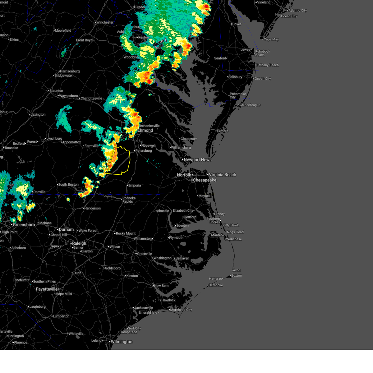
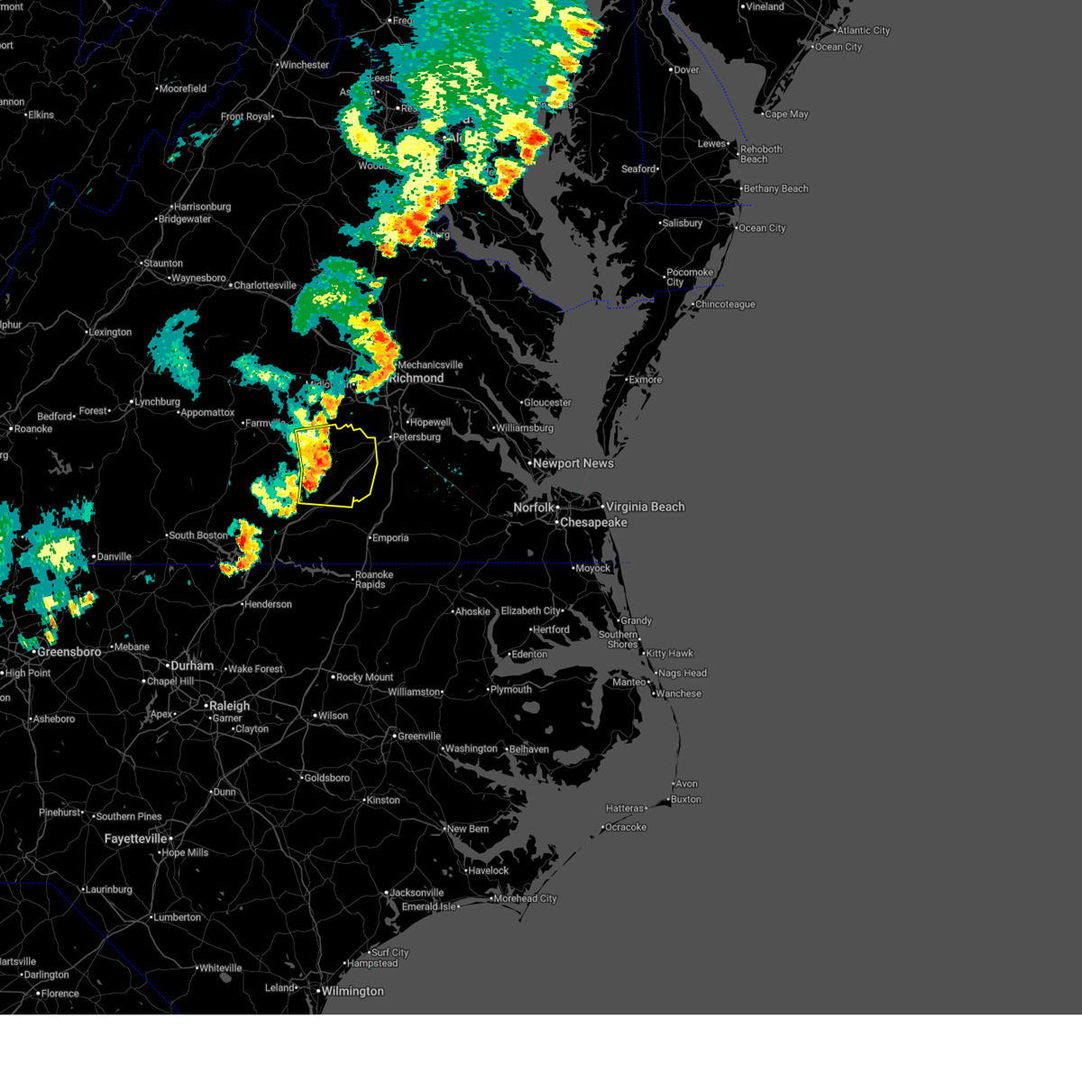
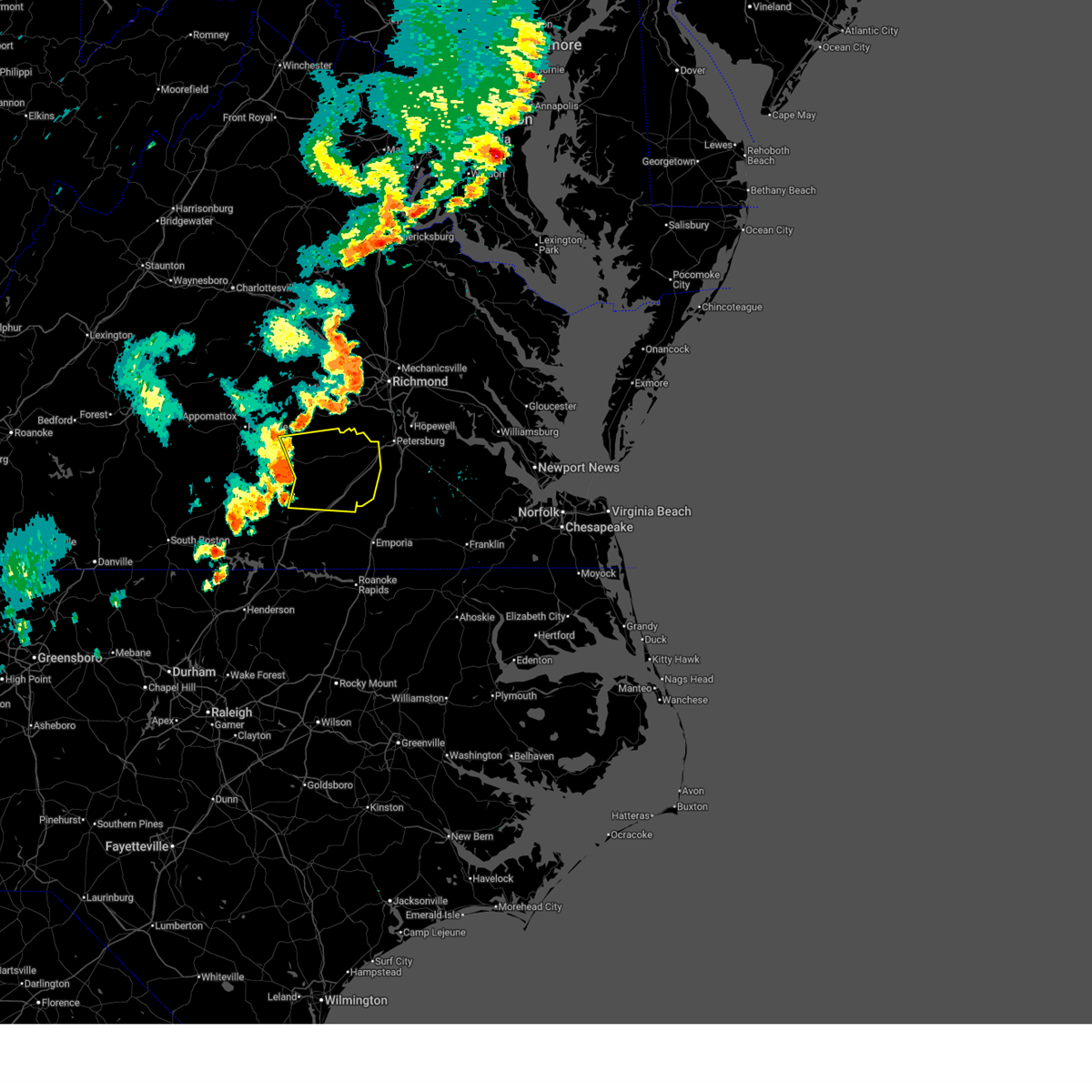
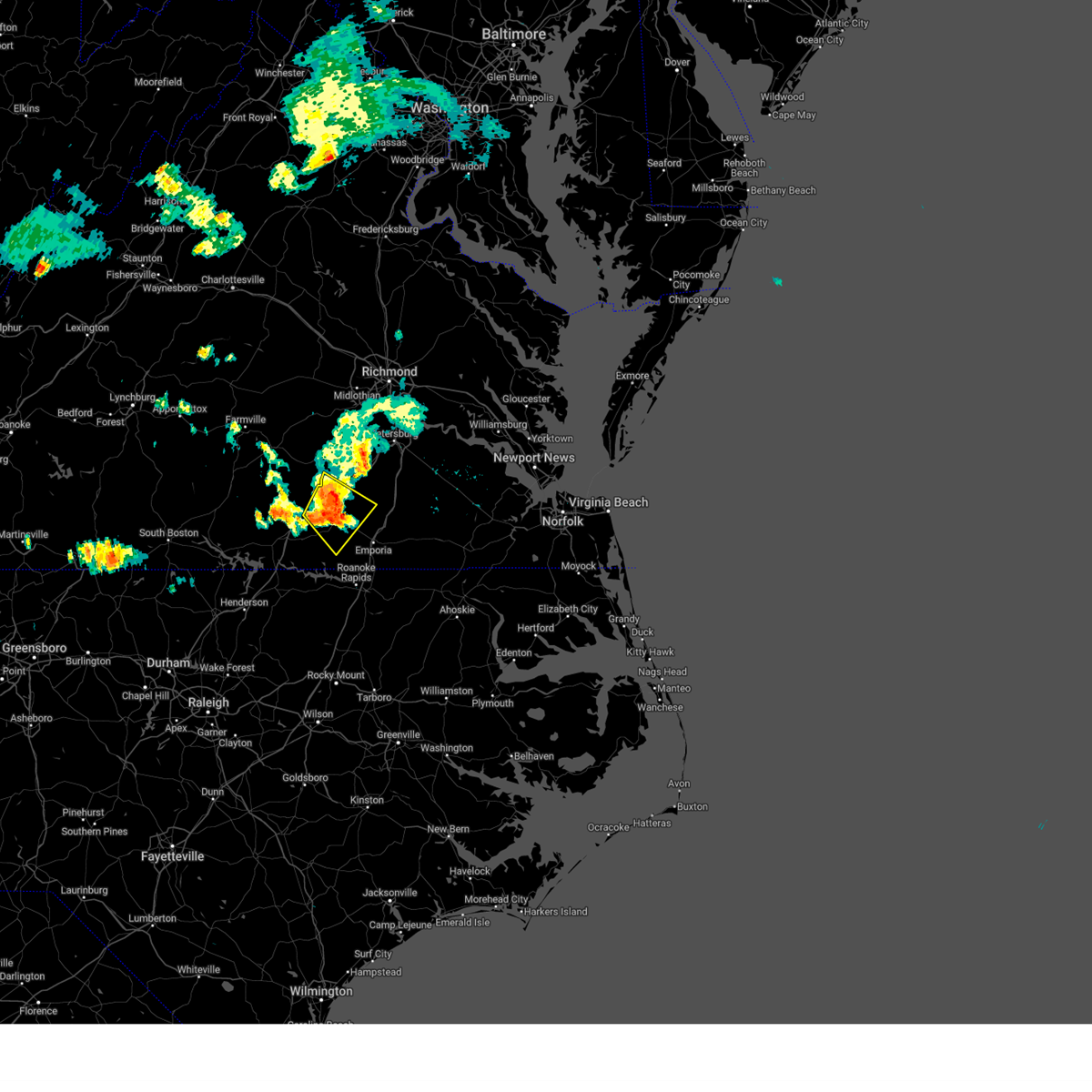
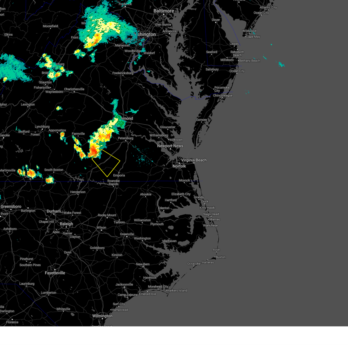
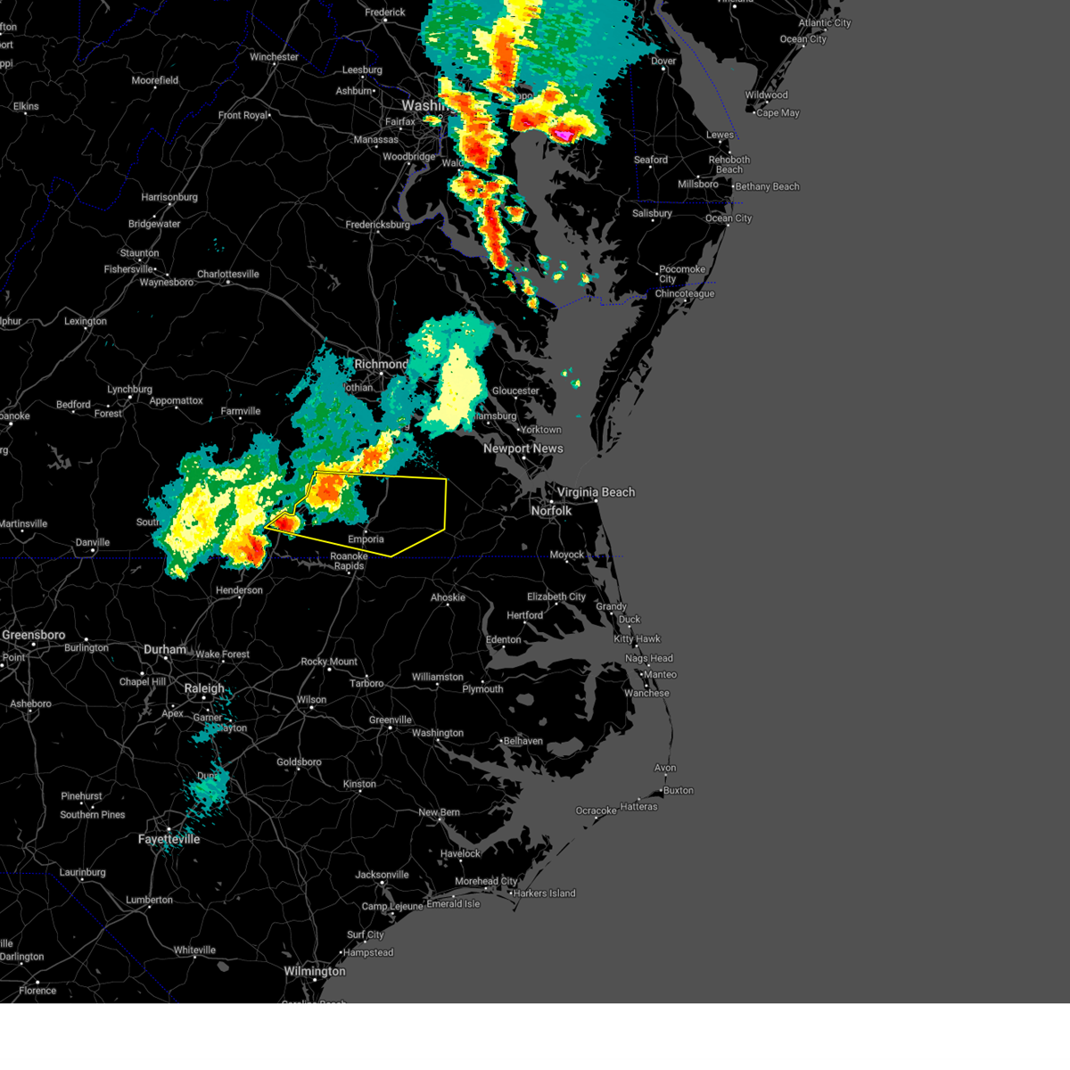
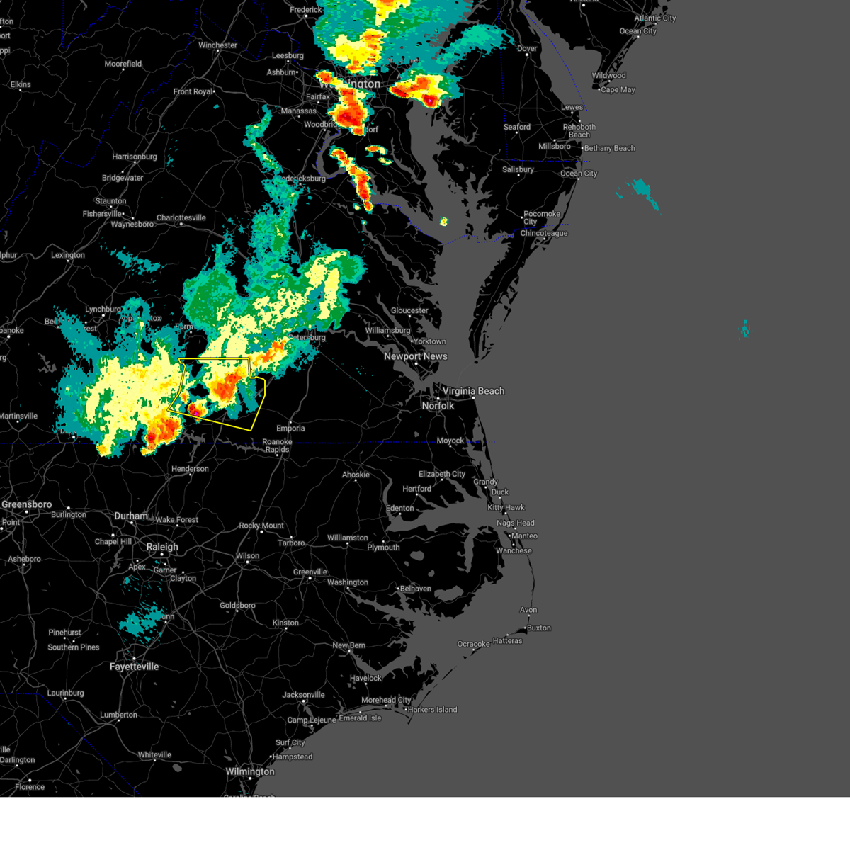
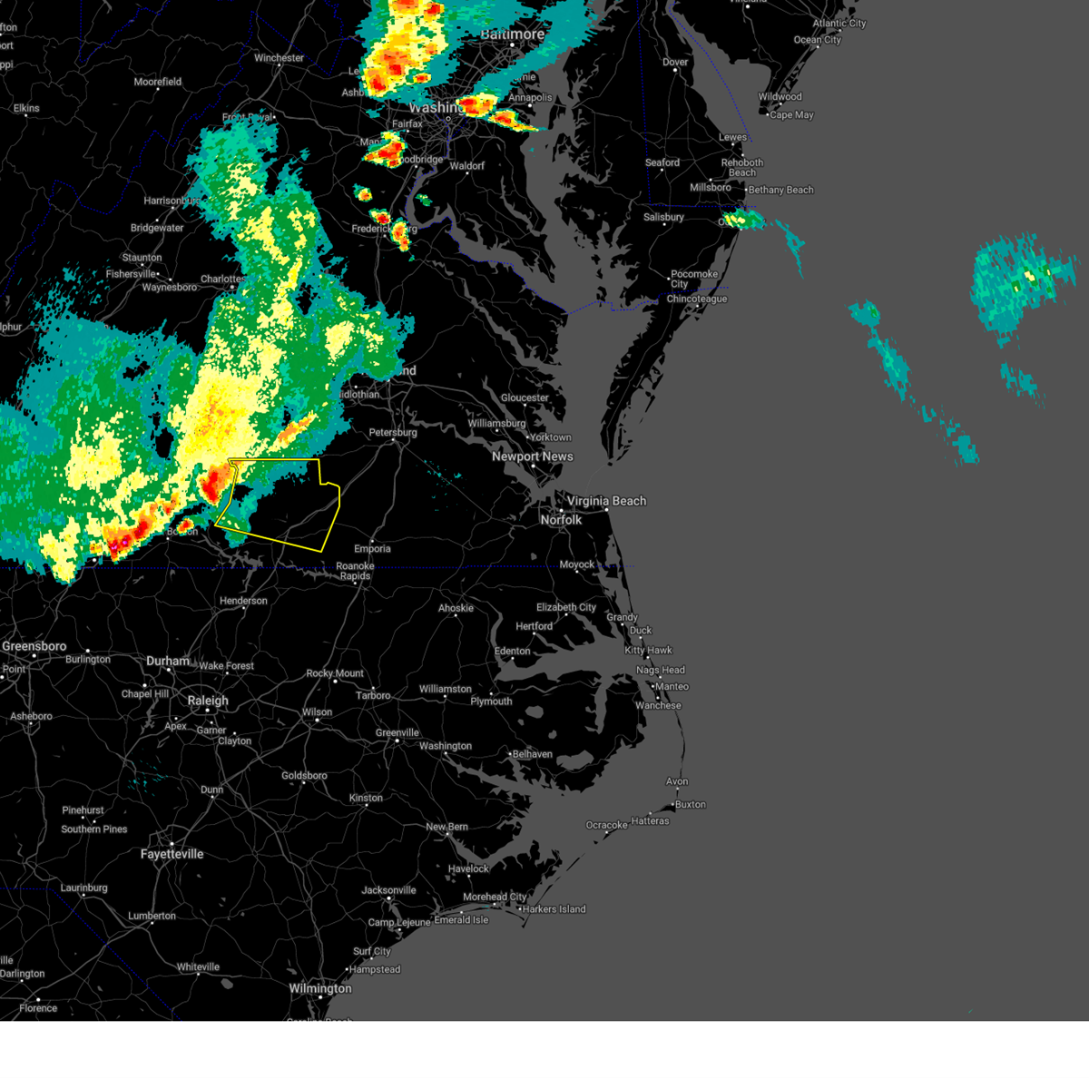
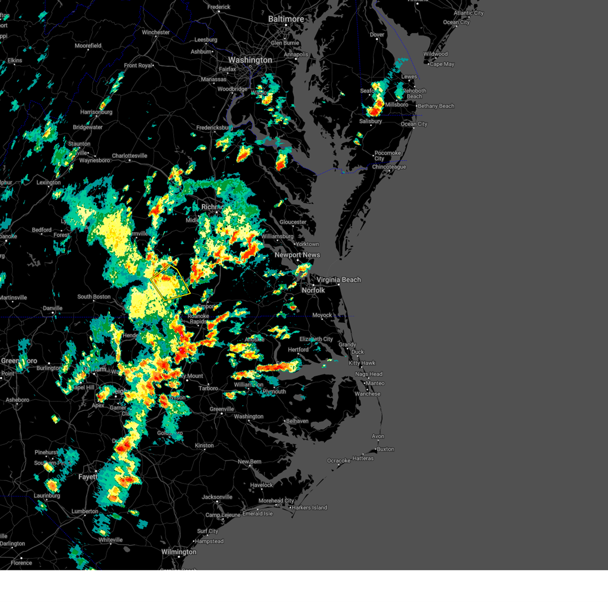
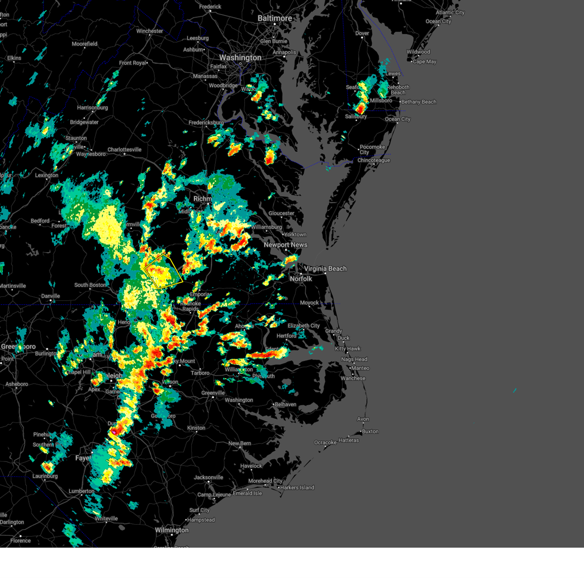
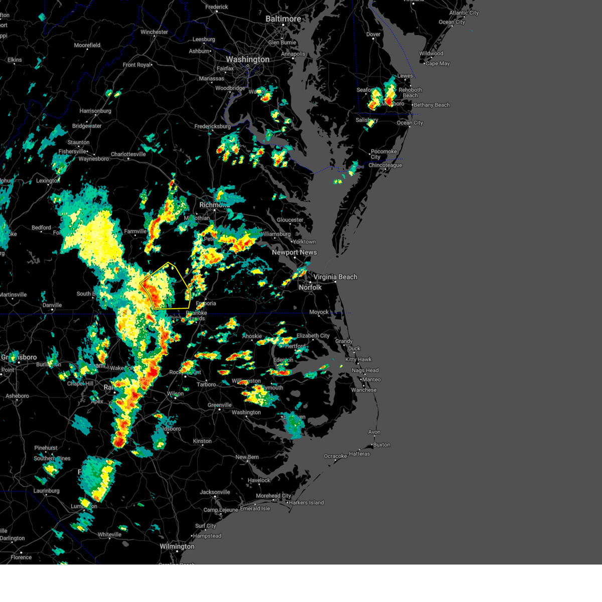
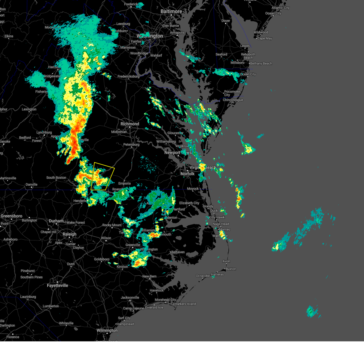
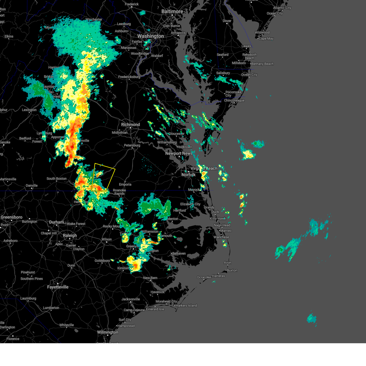
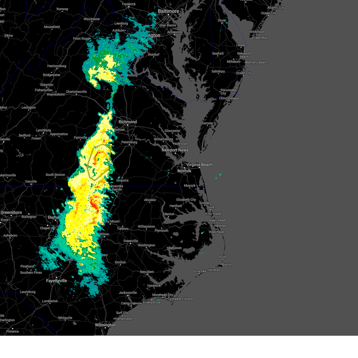
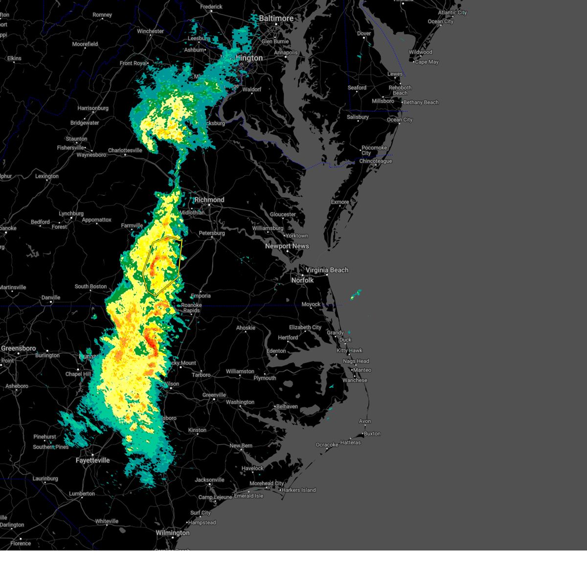
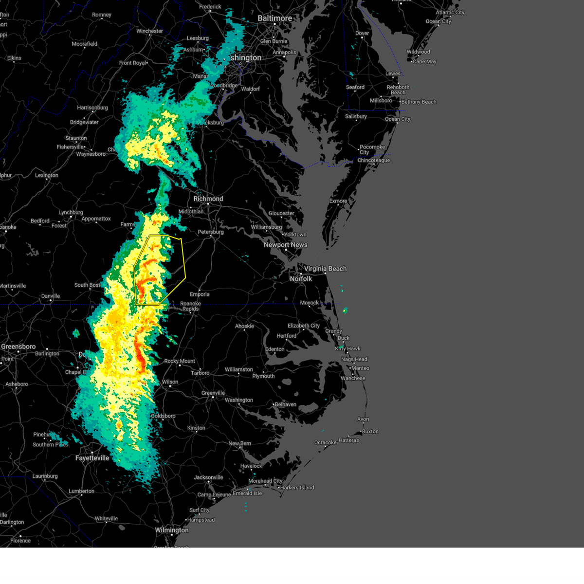
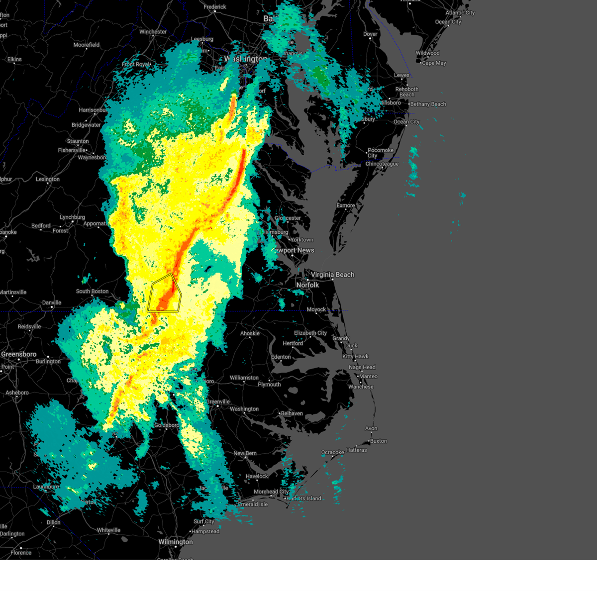
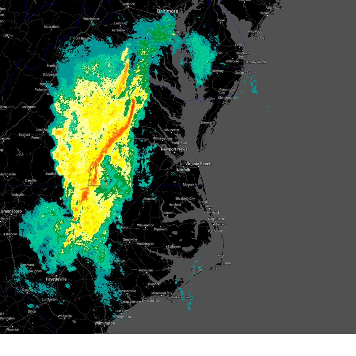
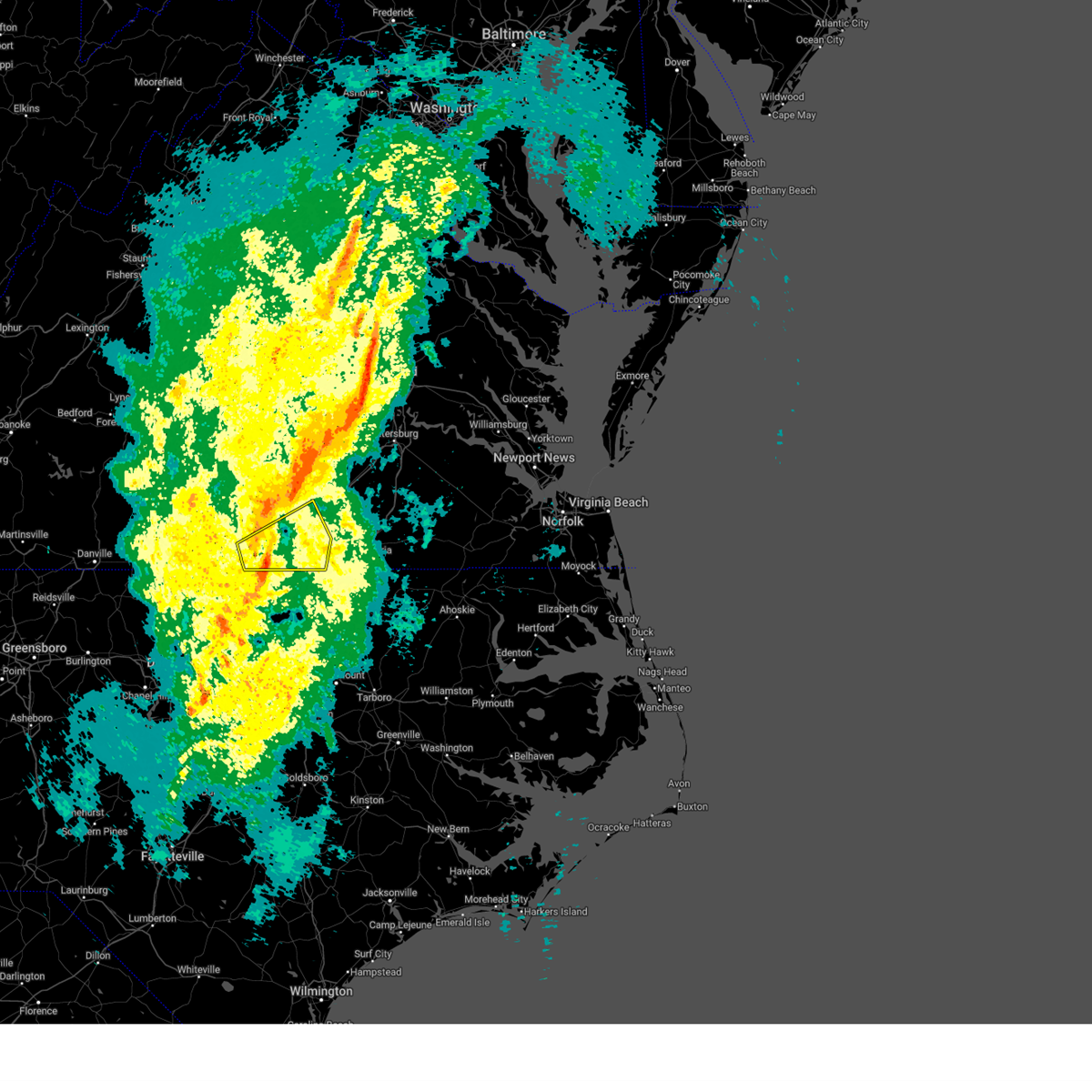
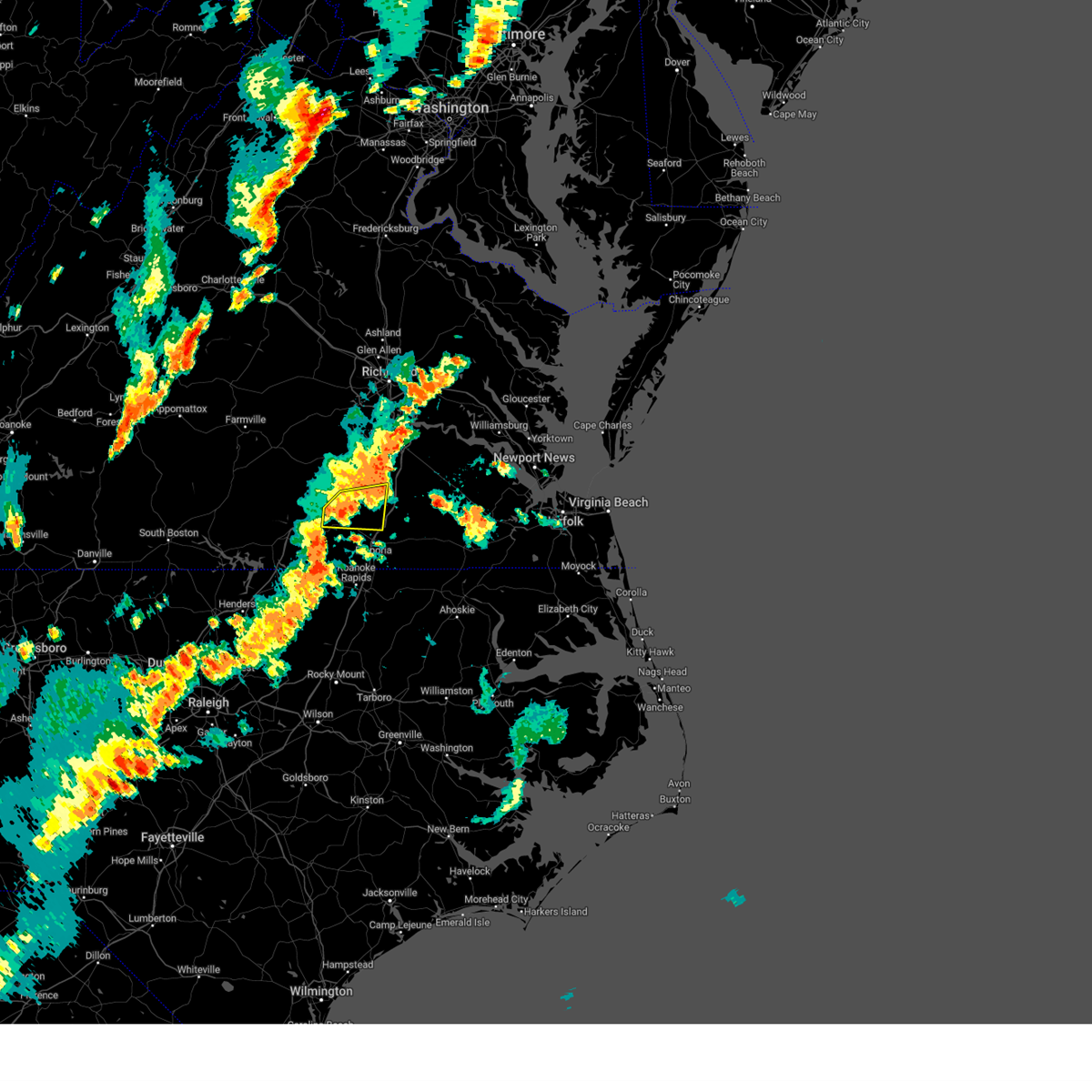
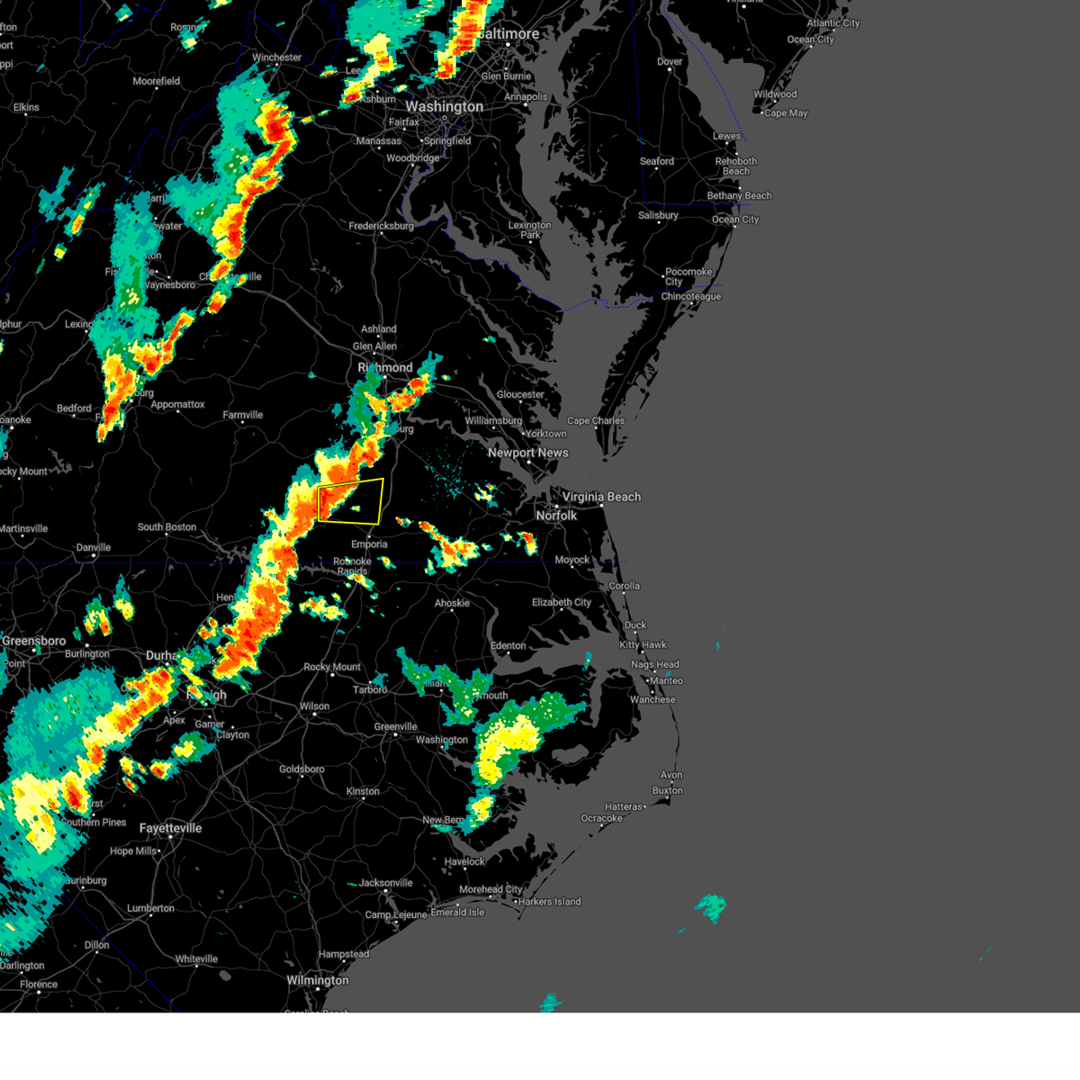
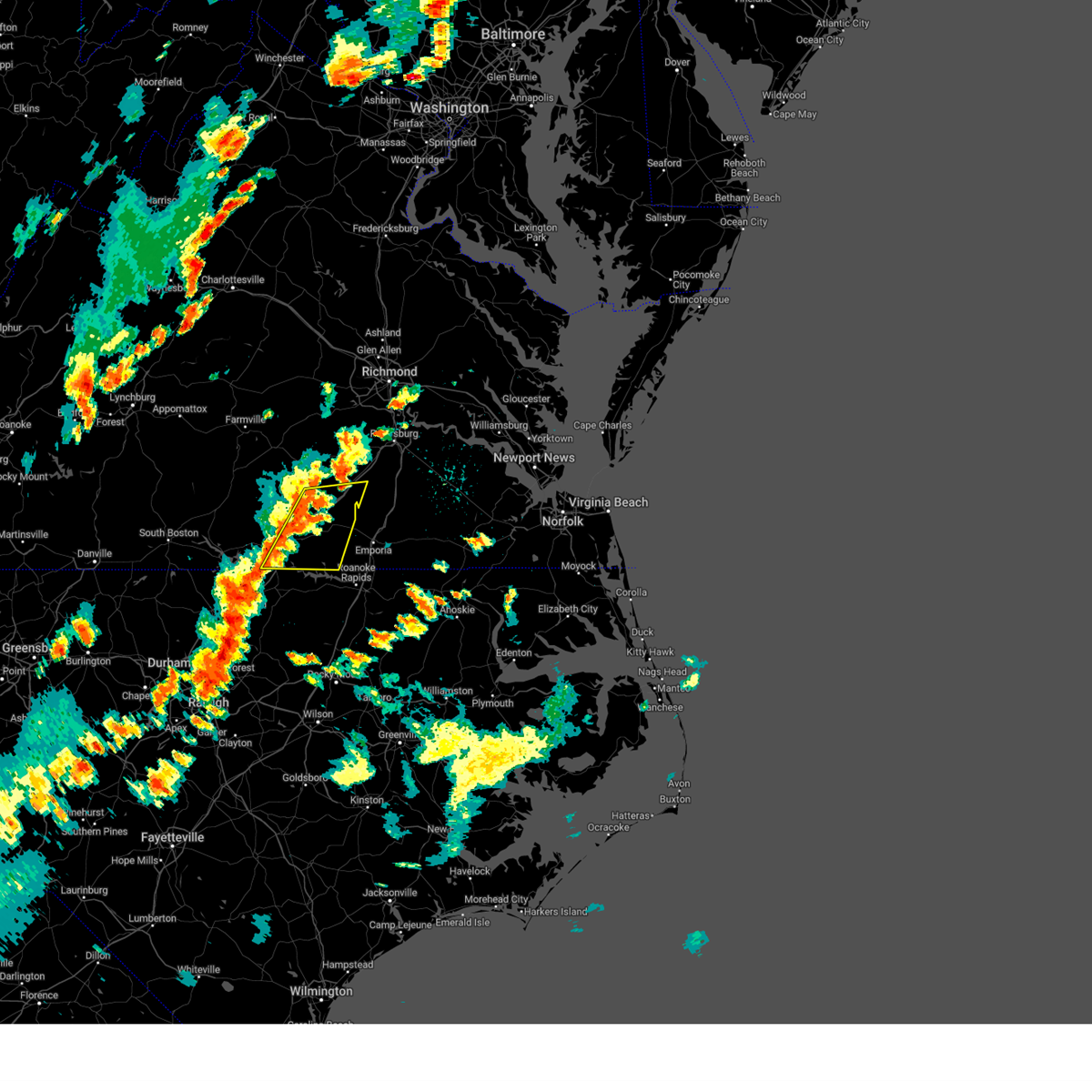
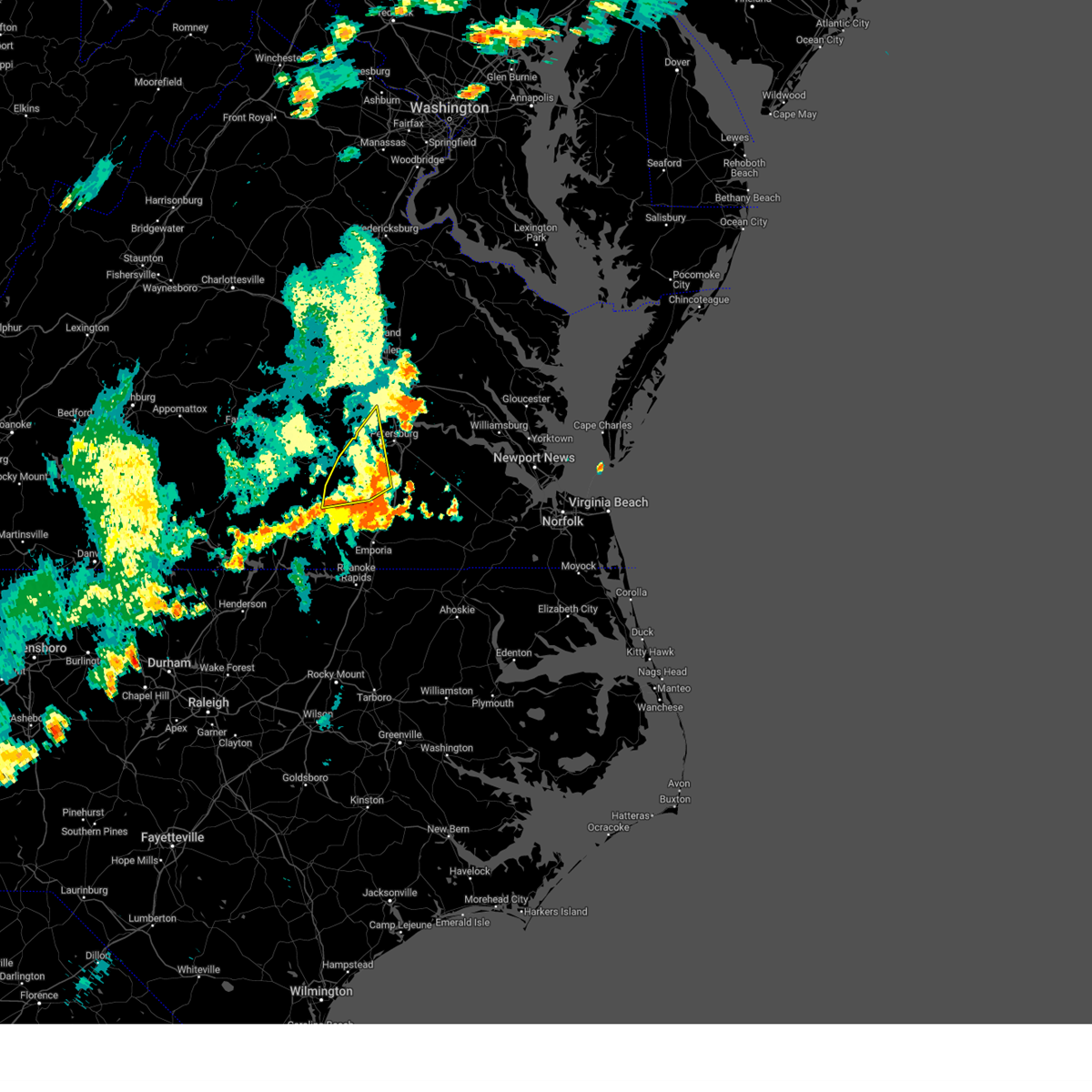
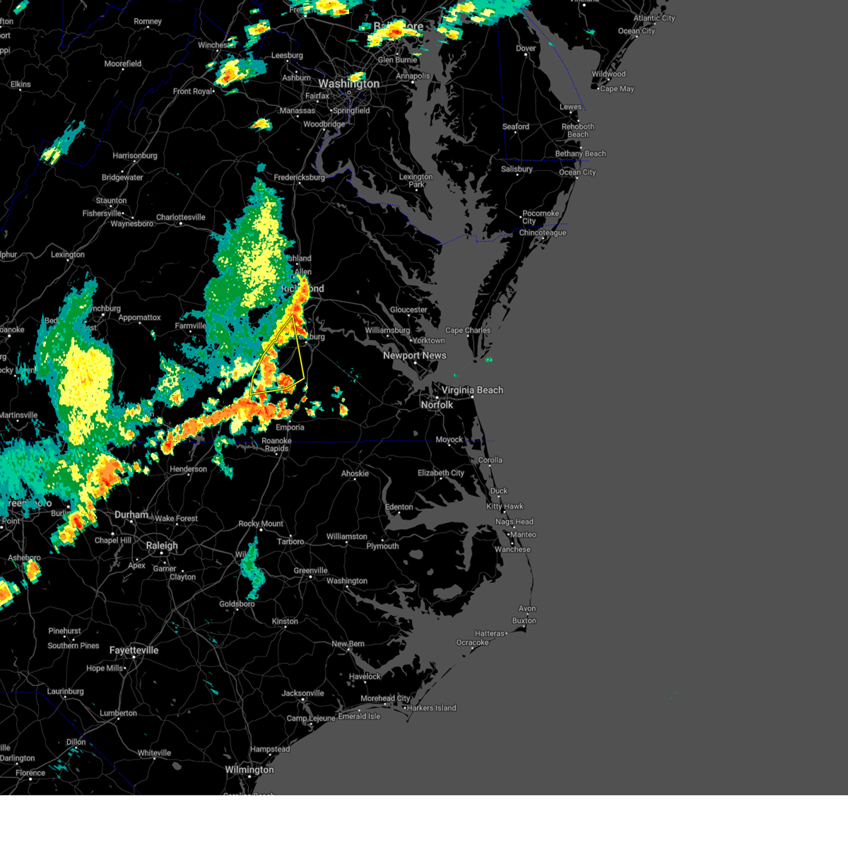
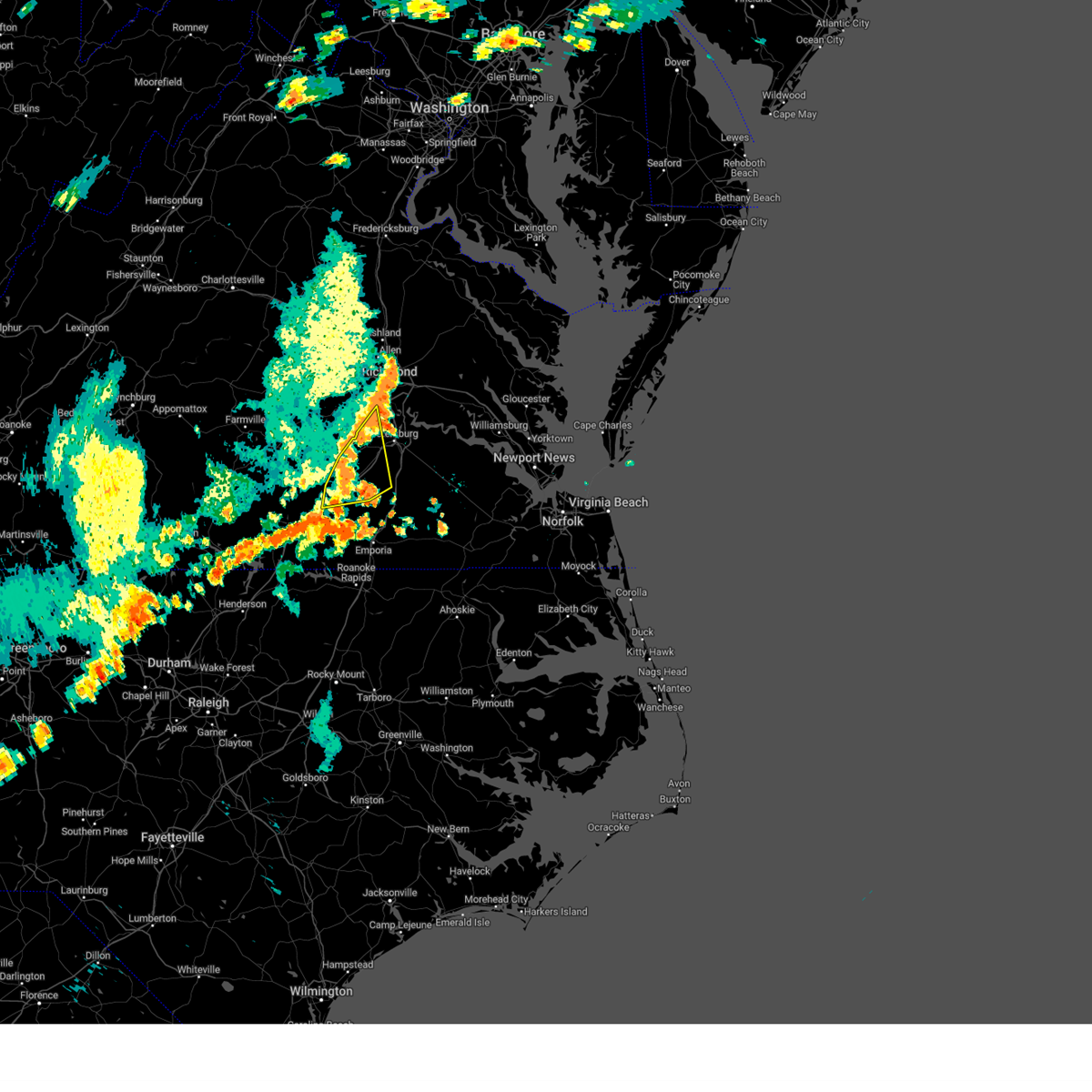
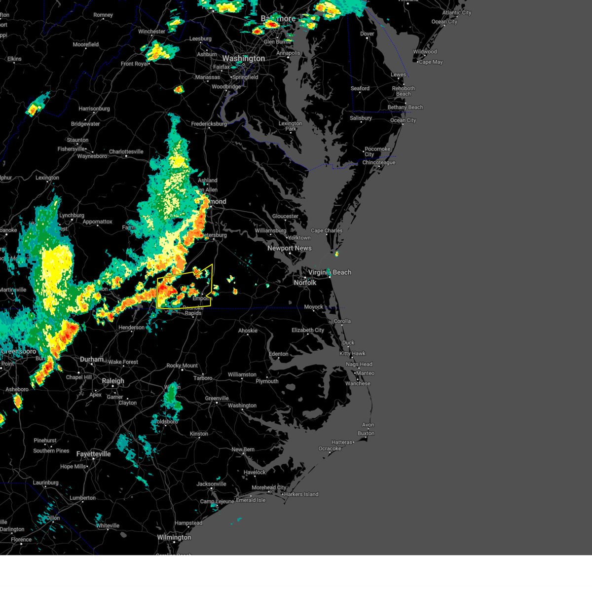
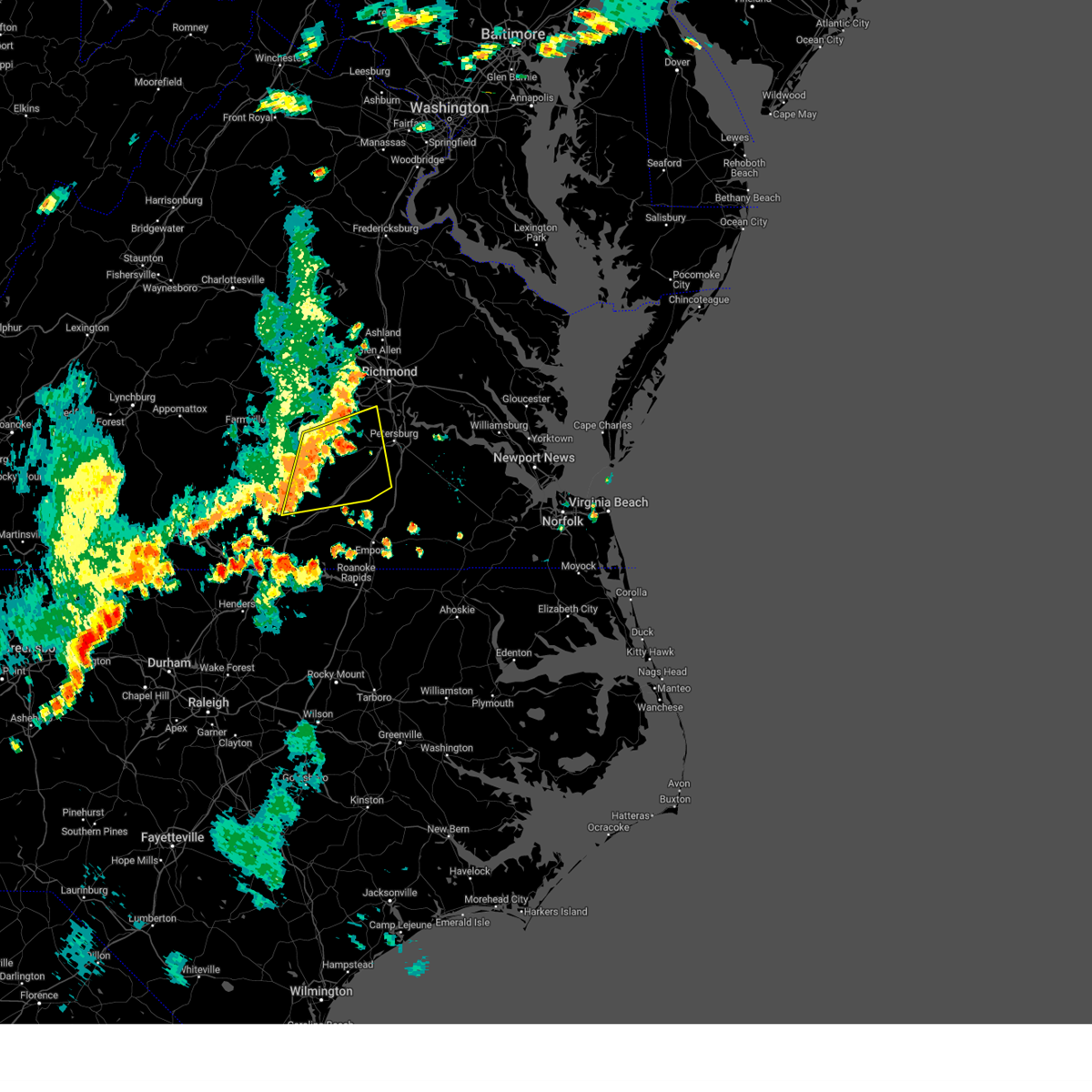
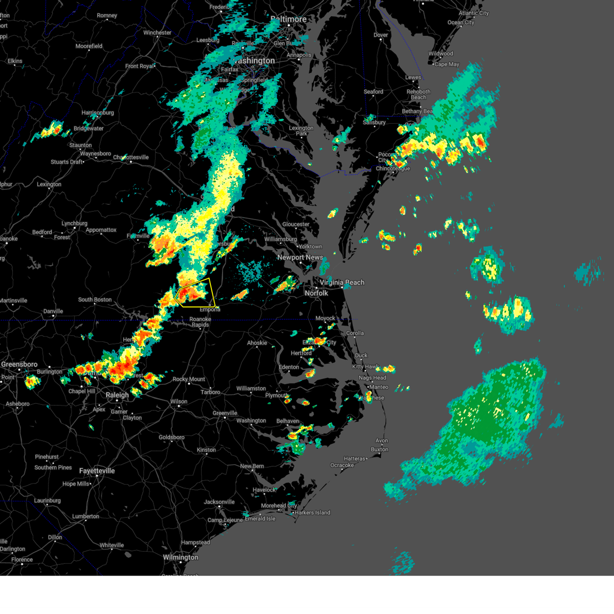
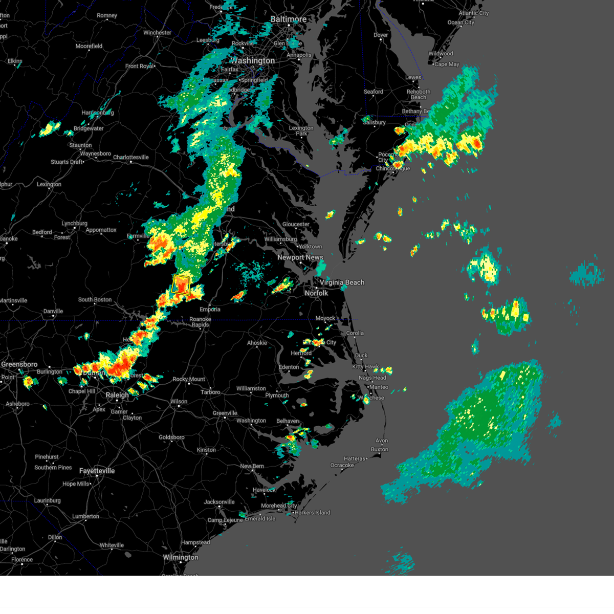
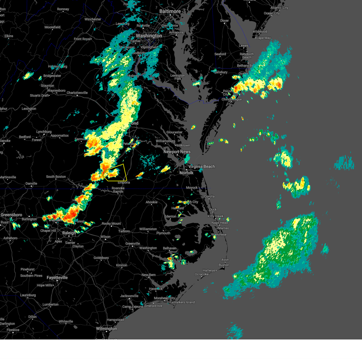
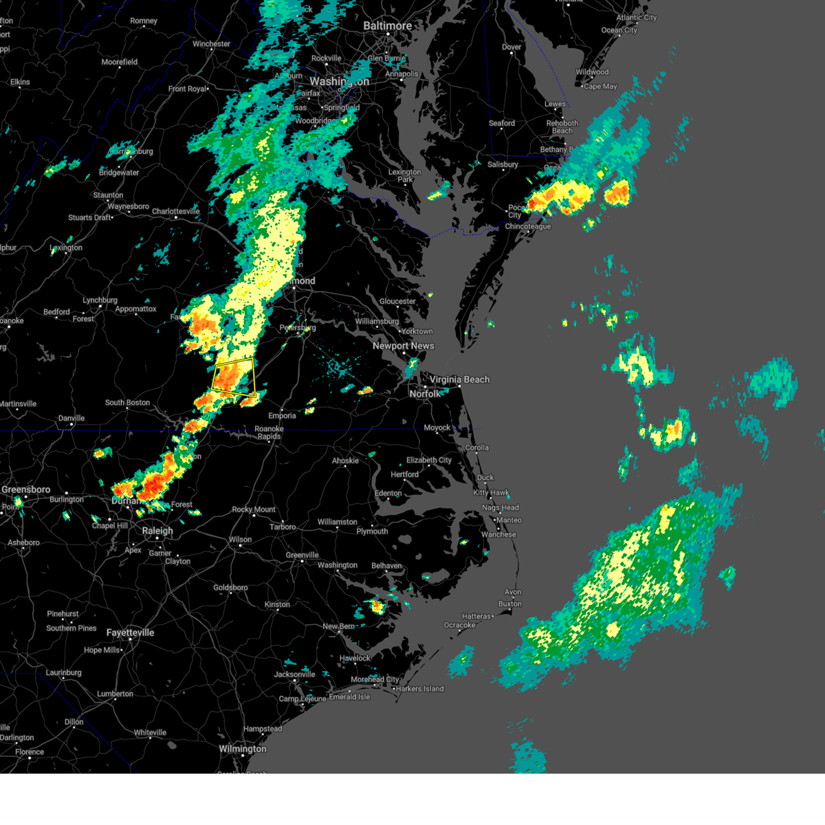
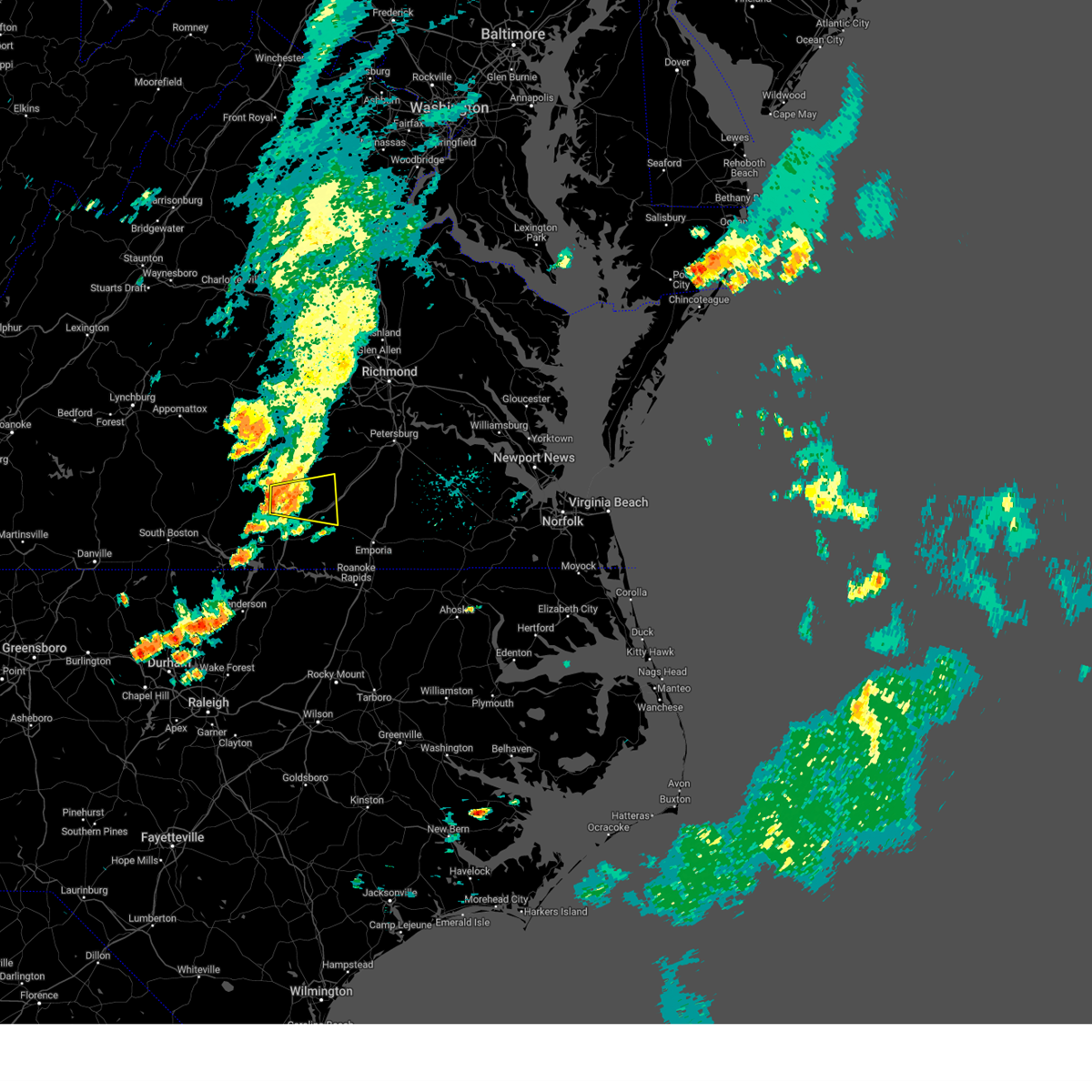
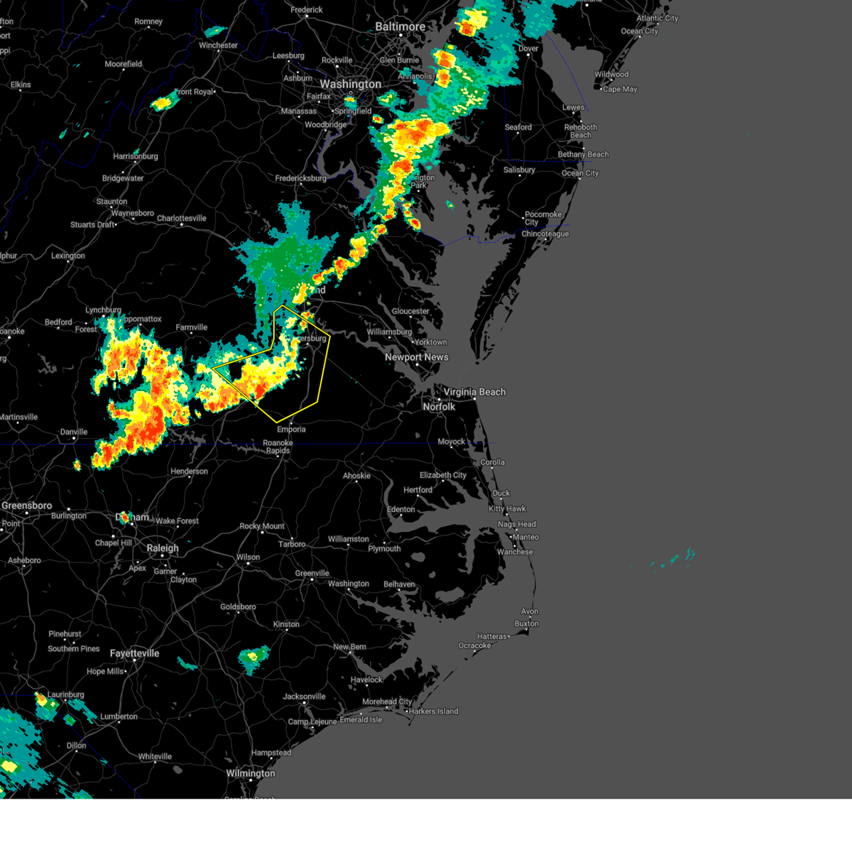
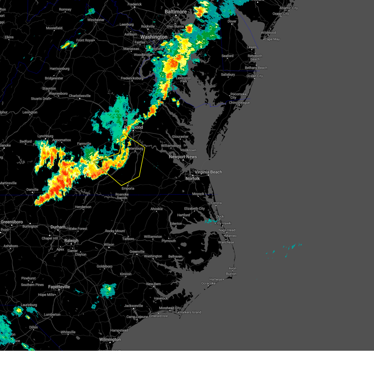
Hail Map for Alberta, VA
The Alberta, VA area has had 0 reports of on-the-ground hail by trained spotters, and has been under severe weather warnings 18 times during the past 12 months. Doppler radar has detected hail at or near Alberta, VA on 31 occasions.
| Name: | Alberta, VA |
| Where Located: | 47 miles SSW of Richmond, VA |
| Map: | Google Map for Alberta, VA |
| Population: | 298 |
| Housing Units: | 163 |
| More Info: | Search Google for Alberta, VA |
3
The Top Recent Hail Date for Alberta, VA is Saturday, August 3, 2024 (3rd out of 31)

Hail and Wind Damage Spotted near Alberta, VA
| Date / Time | Report Details |
|---|---|
| 6/23/2026 12:50 PM EDT |
 At 1249 pm edt, a severe thunderstorm was located near brodnax, moving northeast at 30 mph (radar indicated). Hazards include 60 mph wind gusts and penny size hail. Expect damage to trees and powerlines. this severe storm will be near, lawrenceville around 1255 pm edt. Other locations impacted by this severe thunderstorm include cochran, white plains, meredithville, forksville, prices mill, and bowens corner. At 1249 pm edt, a severe thunderstorm was located near brodnax, moving northeast at 30 mph (radar indicated). Hazards include 60 mph wind gusts and penny size hail. Expect damage to trees and powerlines. this severe storm will be near, lawrenceville around 1255 pm edt. Other locations impacted by this severe thunderstorm include cochran, white plains, meredithville, forksville, prices mill, and bowens corner.
|
| 6/23/2026 12:33 PM EDT |
 At 1233 pm edt, a severe thunderstorm was located over la crosse, or near south hill, moving east at 30 mph (radar indicated). Hazards include 60 mph wind gusts and penny size hail. Expect damage to trees and powerlines. this severe storm will be near, brodnax around 1240 pm edt. lawrenceville around 1255 pm edt. Other locations impacted by this severe thunderstorm include cochran, bracey, bowens corner, white plains, meredithville, forksville, and prices mill. At 1233 pm edt, a severe thunderstorm was located over la crosse, or near south hill, moving east at 30 mph (radar indicated). Hazards include 60 mph wind gusts and penny size hail. Expect damage to trees and powerlines. this severe storm will be near, brodnax around 1240 pm edt. lawrenceville around 1255 pm edt. Other locations impacted by this severe thunderstorm include cochran, bracey, bowens corner, white plains, meredithville, forksville, and prices mill.
|
| 6/23/2026 12:14 PM EDT |
 Svrakq the national weather service in wakefield has issued a * severe thunderstorm warning for, southeastern mecklenburg county in south central virginia, southeastern lunenburg county in south central virginia, southwestern brunswick county in south central virginia, * until 100 pm edt. * at 1214 pm edt, a severe thunderstorm was located 7 miles southwest of south hill, moving northeast at 30 mph (radar indicated). Hazards include 60 mph wind gusts and penny size hail. Expect damage to trees and powerlines. this severe thunderstorm will be near, south hill around 1220 pm edt. la crosse around 1225 pm edt. brodnax around 1230 pm edt. lawrenceville around 1250 pm edt. Other locations impacted by this severe thunderstorm include cochran, beechwood, bracey, bowens corner, john h kerr dam, white plains, meredithville, baskerville, forksville, and prices mill. Svrakq the national weather service in wakefield has issued a * severe thunderstorm warning for, southeastern mecklenburg county in south central virginia, southeastern lunenburg county in south central virginia, southwestern brunswick county in south central virginia, * until 100 pm edt. * at 1214 pm edt, a severe thunderstorm was located 7 miles southwest of south hill, moving northeast at 30 mph (radar indicated). Hazards include 60 mph wind gusts and penny size hail. Expect damage to trees and powerlines. this severe thunderstorm will be near, south hill around 1220 pm edt. la crosse around 1225 pm edt. brodnax around 1230 pm edt. lawrenceville around 1250 pm edt. Other locations impacted by this severe thunderstorm include cochran, beechwood, bracey, bowens corner, john h kerr dam, white plains, meredithville, baskerville, forksville, and prices mill.
|
| 6/22/2026 8:42 PM EDT | Numerous trees down across the alberta area. time estimated by rada in brunswick county VA, 1.4 miles SSW of Alberta, VA |
| 6/22/2026 8:29 PM EDT |
 Svrakq the national weather service in wakefield has issued a * severe thunderstorm warning for, north central greensville county in southeastern virginia, southeastern lunenburg county in south central virginia, southeastern nottoway county in south central virginia, west central sussex county in southeastern virginia, dinwiddie county in south central virginia, northern brunswick county in south central virginia, * until 915 pm edt. * at 829 pm edt, severe thunderstorms were located along a line extending from blackstone to near kenbridge to near dundas, moving east at 45 mph (radar indicated). Hazards include 60 mph wind gusts. Expect damage to trees and powerlines. severe thunderstorms will be near, blackstone, alberta, and fort barfoot around 835 pm edt. wilsons around 840 pm edt. mckenney around 845 pm edt. dinwiddie and dewitt around 855 pm edt. purdy around 900 pm edt. Other locations impacted by these severe thunderstorms include bacons fork, cochran, irby, gills corner, dolphin, addison, murdocks, forkland, meredithville, and wharfs store. Svrakq the national weather service in wakefield has issued a * severe thunderstorm warning for, north central greensville county in southeastern virginia, southeastern lunenburg county in south central virginia, southeastern nottoway county in south central virginia, west central sussex county in southeastern virginia, dinwiddie county in south central virginia, northern brunswick county in south central virginia, * until 915 pm edt. * at 829 pm edt, severe thunderstorms were located along a line extending from blackstone to near kenbridge to near dundas, moving east at 45 mph (radar indicated). Hazards include 60 mph wind gusts. Expect damage to trees and powerlines. severe thunderstorms will be near, blackstone, alberta, and fort barfoot around 835 pm edt. wilsons around 840 pm edt. mckenney around 845 pm edt. dinwiddie and dewitt around 855 pm edt. purdy around 900 pm edt. Other locations impacted by these severe thunderstorms include bacons fork, cochran, irby, gills corner, dolphin, addison, murdocks, forkland, meredithville, and wharfs store.
|
| 5/27/2026 9:26 PM EDT |
 Svrakq the national weather service in wakefield has issued a * severe thunderstorm warning for, eastern lunenburg county in south central virginia, south central nottoway county in south central virginia, southwestern dinwiddie county in south central virginia, central brunswick county in south central virginia, * until 1015 pm edt. * at 926 pm edt, a severe thunderstorm was located near kenbridge, moving east at 40 mph (radar indicated). Hazards include 60 mph wind gusts and quarter size hail. Minor damage to vehicles is possible. expect wind damage to trees and powerlines. this severe thunderstorm will be near, dundas around 930 pm edt. alberta around 940 pm edt. Other locations impacted by this severe thunderstorm include bacons fork, cochran, irby, gills corner, rawlings, dolphin, barrows store, murdocks, forkland, and warfield. Svrakq the national weather service in wakefield has issued a * severe thunderstorm warning for, eastern lunenburg county in south central virginia, south central nottoway county in south central virginia, southwestern dinwiddie county in south central virginia, central brunswick county in south central virginia, * until 1015 pm edt. * at 926 pm edt, a severe thunderstorm was located near kenbridge, moving east at 40 mph (radar indicated). Hazards include 60 mph wind gusts and quarter size hail. Minor damage to vehicles is possible. expect wind damage to trees and powerlines. this severe thunderstorm will be near, dundas around 930 pm edt. alberta around 940 pm edt. Other locations impacted by this severe thunderstorm include bacons fork, cochran, irby, gills corner, rawlings, dolphin, barrows store, murdocks, forkland, and warfield.
|
| 5/27/2026 9:16 PM EDT |
 At 915 pm edt, a severe thunderstorm was located near blackstone, moving east at 40 mph (radar indicated). Hazards include 60 mph wind gusts and quarter size hail. Minor damage to vehicles is possible. expect wind damage to trees and powerlines. this severe storm will be near, blackstone around 920 pm edt. fort barfoot around 925 pm edt. Other locations impacted by this severe thunderstorm include cochran, irby, rawlings, barrows store, murdocks, forkland, nutbush, darvills, the falls, and lafoon corner. At 915 pm edt, a severe thunderstorm was located near blackstone, moving east at 40 mph (radar indicated). Hazards include 60 mph wind gusts and quarter size hail. Minor damage to vehicles is possible. expect wind damage to trees and powerlines. this severe storm will be near, blackstone around 920 pm edt. fort barfoot around 925 pm edt. Other locations impacted by this severe thunderstorm include cochran, irby, rawlings, barrows store, murdocks, forkland, nutbush, darvills, the falls, and lafoon corner.
|
| 5/27/2026 9:16 PM EDT |
 the severe thunderstorm warning has been cancelled and is no longer in effect the severe thunderstorm warning has been cancelled and is no longer in effect
|
| 5/27/2026 8:50 PM EDT |
 Svrakq the national weather service in wakefield has issued a * severe thunderstorm warning for, southeastern prince edward county in central virginia, northern lunenburg county in south central virginia, nottoway county in south central virginia, southwestern dinwiddie county in south central virginia, northwestern brunswick county in south central virginia, * until 930 pm edt. * at 850 pm edt, a severe thunderstorm was located over green bay, or 7 miles west of crewe, moving east at 45 mph (radar indicated). Hazards include 60 mph wind gusts and quarter size hail. Minor damage to vehicles is possible. expect wind damage to trees and powerlines. this severe thunderstorm will be near, burkeville around 855 pm edt. nottoway around 900 pm edt. blackstone around 905 pm edt. fort barfoot around 910 pm edt. Other locations impacted by this severe thunderstorm include cochran, north wellville, irby, prince edward station, murdocks, twin lakes state park, forkland, nutbush, darvills, and the falls. Svrakq the national weather service in wakefield has issued a * severe thunderstorm warning for, southeastern prince edward county in central virginia, northern lunenburg county in south central virginia, nottoway county in south central virginia, southwestern dinwiddie county in south central virginia, northwestern brunswick county in south central virginia, * until 930 pm edt. * at 850 pm edt, a severe thunderstorm was located over green bay, or 7 miles west of crewe, moving east at 45 mph (radar indicated). Hazards include 60 mph wind gusts and quarter size hail. Minor damage to vehicles is possible. expect wind damage to trees and powerlines. this severe thunderstorm will be near, burkeville around 855 pm edt. nottoway around 900 pm edt. blackstone around 905 pm edt. fort barfoot around 910 pm edt. Other locations impacted by this severe thunderstorm include cochran, north wellville, irby, prince edward station, murdocks, twin lakes state park, forkland, nutbush, darvills, and the falls.
|
| 3/16/2026 8:11 PM EDT |
 At 810 pm edt, severe thunderstorms were located along a line extending from near hadensville to near wilsons to 7 miles northeast of lawrenceville to near brunswick, moving northeast at 50 mph (radar indicated). Hazards include 60 mph wind gusts. Expect damage to trees and powerlines. these severe storms will be near, goochland, mckenney, moseley, oilville, radium, dewitt, sabot, and gum spring around 815 pm edt. dinwiddie, purdy, tuckahoe, manakin, and sutherland around 820 pm edt. bon air, jarratt, montpelier, and wyndham around 825 pm edt. Other locations impacted by these severe thunderstorms include orchid, gum forks, dolphin, ammon, maidens, pleasant shade, henrico, three square, wharfs store, and pocahontas state park. At 810 pm edt, severe thunderstorms were located along a line extending from near hadensville to near wilsons to 7 miles northeast of lawrenceville to near brunswick, moving northeast at 50 mph (radar indicated). Hazards include 60 mph wind gusts. Expect damage to trees and powerlines. these severe storms will be near, goochland, mckenney, moseley, oilville, radium, dewitt, sabot, and gum spring around 815 pm edt. dinwiddie, purdy, tuckahoe, manakin, and sutherland around 820 pm edt. bon air, jarratt, montpelier, and wyndham around 825 pm edt. Other locations impacted by these severe thunderstorms include orchid, gum forks, dolphin, ammon, maidens, pleasant shade, henrico, three square, wharfs store, and pocahontas state park.
|
| 3/16/2026 8:11 PM EDT |
 the severe thunderstorm warning has been cancelled and is no longer in effect the severe thunderstorm warning has been cancelled and is no longer in effect
|
| 3/16/2026 7:59 PM EDT |
 At 758 pm edt, severe thunderstorms were located along a line extending from near fife to fort barfoot to near lawrenceville to near gasburg, moving northeast at 50 mph (radar indicated). Hazards include 60 mph wind gusts. Expect damage to trees and powerlines. these severe storms will be near, powhatan, goochland, lawrenceville, mckenney, mannboro, brunswick, scotts fork, wilsons, macon, and chula around 805 pm edt. moseley and oilville around 810 pm edt. dinwiddie, purdy, radium, dewitt, manakin, and sabot around 815 pm edt. tuckahoe, bon air, montpelier, and sutherland around 820 pm edt. jarratt and wyndham around 825 pm edt. Other locations impacted by these severe thunderstorms include gum forks, dolphin, maidens, henrico, pocahontas state park, skinquarter, wellville, michaux, west view, and blackstone airport. At 758 pm edt, severe thunderstorms were located along a line extending from near fife to fort barfoot to near lawrenceville to near gasburg, moving northeast at 50 mph (radar indicated). Hazards include 60 mph wind gusts. Expect damage to trees and powerlines. these severe storms will be near, powhatan, goochland, lawrenceville, mckenney, mannboro, brunswick, scotts fork, wilsons, macon, and chula around 805 pm edt. moseley and oilville around 810 pm edt. dinwiddie, purdy, radium, dewitt, manakin, and sabot around 815 pm edt. tuckahoe, bon air, montpelier, and sutherland around 820 pm edt. jarratt and wyndham around 825 pm edt. Other locations impacted by these severe thunderstorms include gum forks, dolphin, maidens, henrico, pocahontas state park, skinquarter, wellville, michaux, west view, and blackstone airport.
|
| 3/16/2026 7:59 PM EDT |
 the severe thunderstorm warning has been cancelled and is no longer in effect the severe thunderstorm warning has been cancelled and is no longer in effect
|
| 3/16/2026 7:40 PM EDT |
 Svrakq the national weather service in wakefield has issued a * severe thunderstorm warning for, northwestern northampton county in northeastern north carolina, southeastern louisa county in central virginia, greensville county in southeastern virginia, cumberland county in central virginia, nottoway county in south central virginia, goochland county in central virginia, northwestern hanover county in central virginia, southwestern sussex county in southeastern virginia, dinwiddie county in south central virginia, powhatan county in central virginia, chesterfield county in central virginia, southeastern mecklenburg county in south central virginia, east central prince edward county in central virginia, eastern lunenburg county in south central virginia, the city of emporia in southeastern virginia, northwestern henrico county in central virginia, amelia county in central virginia, brunswick county in south central virginia, * until 830 pm edt. * at 739 pm edt, severe thunderstorms were located along a line extending from near gold hill to near kenbridge to near la crosse to near norlina, moving northeast at 50 mph (radar indicated). Hazards include 60 mph wind gusts. Expect damage to trees and powerlines. severe thunderstorms will be near, cumberland, south hill, blackstone, crewe, kenbridge, brodnax, nottoway, la crosse, dundas, and sunnyside around 745 pm edt. cartersville, morven, duncan, ballsville, fort barfoot, tobaccoville, and trenholm around 750 pm edt. lawrenceville, amelia courthouse, brunswick, alberta, spainville, gasburg, macon, and fife around 755 pm edt. powhatan, mannboro, scotts fork, wilsons, and chula around 800 pm edt. goochland, mckenney, and gum spring around 805 pm edt. moseley, oilville, and dewitt around 810 pm edt. dinwiddie, purdy, radium, manakin, and sabot around 815 pm edt. tuckahoe, bon air, montpelier, wyndham, and sutherland around 820 pm edt. Other locations impacted by these severe thunderstorms include bacons fork, angola, gum forks, dolphin, murdocks, maidens, henrico, forksville, pocahontas state park, and skinquarter. Svrakq the national weather service in wakefield has issued a * severe thunderstorm warning for, northwestern northampton county in northeastern north carolina, southeastern louisa county in central virginia, greensville county in southeastern virginia, cumberland county in central virginia, nottoway county in south central virginia, goochland county in central virginia, northwestern hanover county in central virginia, southwestern sussex county in southeastern virginia, dinwiddie county in south central virginia, powhatan county in central virginia, chesterfield county in central virginia, southeastern mecklenburg county in south central virginia, east central prince edward county in central virginia, eastern lunenburg county in south central virginia, the city of emporia in southeastern virginia, northwestern henrico county in central virginia, amelia county in central virginia, brunswick county in south central virginia, * until 830 pm edt. * at 739 pm edt, severe thunderstorms were located along a line extending from near gold hill to near kenbridge to near la crosse to near norlina, moving northeast at 50 mph (radar indicated). Hazards include 60 mph wind gusts. Expect damage to trees and powerlines. severe thunderstorms will be near, cumberland, south hill, blackstone, crewe, kenbridge, brodnax, nottoway, la crosse, dundas, and sunnyside around 745 pm edt. cartersville, morven, duncan, ballsville, fort barfoot, tobaccoville, and trenholm around 750 pm edt. lawrenceville, amelia courthouse, brunswick, alberta, spainville, gasburg, macon, and fife around 755 pm edt. powhatan, mannboro, scotts fork, wilsons, and chula around 800 pm edt. goochland, mckenney, and gum spring around 805 pm edt. moseley, oilville, and dewitt around 810 pm edt. dinwiddie, purdy, radium, manakin, and sabot around 815 pm edt. tuckahoe, bon air, montpelier, wyndham, and sutherland around 820 pm edt. Other locations impacted by these severe thunderstorms include bacons fork, angola, gum forks, dolphin, murdocks, maidens, henrico, forksville, pocahontas state park, and skinquarter.
|
| 9/24/2025 6:32 PM EDT | the severe thunderstorm warning has been cancelled and is no longer in effect |
| 9/24/2025 6:13 PM EDT | Svrakq the national weather service in wakefield has issued a * severe thunderstorm warning for, southeastern lunenburg county in south central virginia, south central nottoway county in south central virginia, southwestern dinwiddie county in south central virginia, northwestern brunswick county in south central virginia, * until 700 pm edt. * at 611 pm edt, a severe thunderstorm was located over kenbridge, moving east at 25 mph (radar indicated. downed trees have been reported across portions of central lunenburg county). Hazards include 60 mph wind gusts. Expect damage to trees and powerlines. this severe thunderstorm will be near, kenbridge and dundas around 615 pm edt. alberta around 645 pm edt. Other locations impacted by this severe thunderstorm include lafoon corner, bacons fork, ordsburg, danieltown, cochran, gills corner, rawlings, dolphin, barrows store, and forkland. |
| 7/19/2025 6:38 PM EDT |
 The storm which prompted the warning has weakened below severe limits, and no longer poses an immediate threat to life or property. therefore, the warning will be allowed to expire. a severe thunderstorm watch remains in effect until 1000 pm edt for south central virginia. The storm which prompted the warning has weakened below severe limits, and no longer poses an immediate threat to life or property. therefore, the warning will be allowed to expire. a severe thunderstorm watch remains in effect until 1000 pm edt for south central virginia.
|
| 7/19/2025 6:24 PM EDT |
 At 624 pm edt, a severe thunderstorm was located near brodnax, moving east at 20 mph (radar indicated). Hazards include 60 mph wind gusts. Expect damage to trees and powerlines. this severe storm will be near, lawrenceville around 635 pm edt. Other locations impacted by this severe thunderstorm include bacons fork, ordsburg, danieltown, cochran, gills corner, rawlings, edgerton, dolphin, barrows store, and meredithville. At 624 pm edt, a severe thunderstorm was located near brodnax, moving east at 20 mph (radar indicated). Hazards include 60 mph wind gusts. Expect damage to trees and powerlines. this severe storm will be near, lawrenceville around 635 pm edt. Other locations impacted by this severe thunderstorm include bacons fork, ordsburg, danieltown, cochran, gills corner, rawlings, edgerton, dolphin, barrows store, and meredithville.
|
| 7/19/2025 6:21 PM EDT | Corrects previous tstm wnd dmg report from 2 nw meredithville. tree reported down across shining creek rd. time estimated by rada in brunswick county VA, 5.5 miles ENE of Alberta, VA |
| 7/19/2025 5:57 PM EDT |
 Svrakq the national weather service in wakefield has issued a * severe thunderstorm warning for, northeastern mecklenburg county in south central virginia, southeastern lunenburg county in south central virginia, central brunswick county in south central virginia, * until 645 pm edt. * at 557 pm edt, a severe thunderstorm was located near south hill, moving east at 20 mph (radar indicated). Hazards include 60 mph wind gusts. Expect damage to trees and powerlines. this severe thunderstorm will be near, south hill and la crosse around 605 pm edt. Other locations impacted by this severe thunderstorm include bacons fork, gary, cochran, gills corner, rawlings, dolphin, barrows store, north view, meredithville, and forksville. Svrakq the national weather service in wakefield has issued a * severe thunderstorm warning for, northeastern mecklenburg county in south central virginia, southeastern lunenburg county in south central virginia, central brunswick county in south central virginia, * until 645 pm edt. * at 557 pm edt, a severe thunderstorm was located near south hill, moving east at 20 mph (radar indicated). Hazards include 60 mph wind gusts. Expect damage to trees and powerlines. this severe thunderstorm will be near, south hill and la crosse around 605 pm edt. Other locations impacted by this severe thunderstorm include bacons fork, gary, cochran, gills corner, rawlings, dolphin, barrows store, north view, meredithville, and forksville.
|
| 7/19/2025 5:31 PM EDT | Tree reported down across shining creek rd. time estimated by rada in brunswick county VA, 5.5 miles ENE of Alberta, VA |
| 6/19/2025 5:29 PM EDT |
 At 529 pm edt, severe thunderstorms were located along a line extending from 9 miles northwest of sutherland to near dinwiddie to near mckenney, moving east at 40 mph (radar indicated). Hazards include 60 mph wind gusts and penny size hail. Expect damage to trees and powerlines. these severe storms will be near, dinwiddie, mckenney, dewitt, and sutherland around 535 pm edt. Other locations impacted by these severe thunderstorms include burgess, rawlings, ammon, warfield, wharfs store, darvills, ordsburg, center star, petersburg airport, and church road. At 529 pm edt, severe thunderstorms were located along a line extending from 9 miles northwest of sutherland to near dinwiddie to near mckenney, moving east at 40 mph (radar indicated). Hazards include 60 mph wind gusts and penny size hail. Expect damage to trees and powerlines. these severe storms will be near, dinwiddie, mckenney, dewitt, and sutherland around 535 pm edt. Other locations impacted by these severe thunderstorms include burgess, rawlings, ammon, warfield, wharfs store, darvills, ordsburg, center star, petersburg airport, and church road.
|
| 6/19/2025 5:29 PM EDT |
 the severe thunderstorm warning has been cancelled and is no longer in effect the severe thunderstorm warning has been cancelled and is no longer in effect
|
| 6/19/2025 5:18 PM EDT |
 At 517 pm edt, severe thunderstorms were located along a line extending from mannboro to 6 miles northwest of mckenney to near alberta, moving east at 50 mph (radar indicated). Hazards include 60 mph wind gusts and penny size hail. Expect damage to trees and powerlines. these severe storms will be near, dinwiddie, mckenney, dewitt, and sutherland around 525 pm edt. Other locations impacted by these severe thunderstorms include north wellville, earls, ammon, forkland, wharfs store, darvills, church road, wellville, dominy corner, and hebron. At 517 pm edt, severe thunderstorms were located along a line extending from mannboro to 6 miles northwest of mckenney to near alberta, moving east at 50 mph (radar indicated). Hazards include 60 mph wind gusts and penny size hail. Expect damage to trees and powerlines. these severe storms will be near, dinwiddie, mckenney, dewitt, and sutherland around 525 pm edt. Other locations impacted by these severe thunderstorms include north wellville, earls, ammon, forkland, wharfs store, darvills, church road, wellville, dominy corner, and hebron.
|
| 6/19/2025 5:18 PM EDT |
 the severe thunderstorm warning has been cancelled and is no longer in effect the severe thunderstorm warning has been cancelled and is no longer in effect
|
| 6/19/2025 4:58 PM EDT |
 Svrakq the national weather service in wakefield has issued a * severe thunderstorm warning for, east central lunenburg county in south central virginia, nottoway county in south central virginia, dinwiddie county in south central virginia, southeastern amelia county in central virginia, northern brunswick county in south central virginia, * until 545 pm edt. * at 458 pm edt, severe thunderstorms were located along a line extending from near crewe to near blackstone to near kenbridge, moving east at 45 mph (radar indicated). Hazards include 60 mph wind gusts and penny size hail. Expect damage to trees and powerlines. severe thunderstorms will be near, blackstone, dundas, fort barfoot, and spainville around 505 pm edt. wilsons around 510 pm edt. mannboro and alberta around 515 pm edt. mckenney around 520 pm edt. dewitt around 525 pm edt. dinwiddie around 530 pm edt. sutherland around 535 pm edt. Other locations impacted by these severe thunderstorms include north wellville, irby, earls, ammon, murdocks, forkland, wharfs store, darvills, church road, and wellville. Svrakq the national weather service in wakefield has issued a * severe thunderstorm warning for, east central lunenburg county in south central virginia, nottoway county in south central virginia, dinwiddie county in south central virginia, southeastern amelia county in central virginia, northern brunswick county in south central virginia, * until 545 pm edt. * at 458 pm edt, severe thunderstorms were located along a line extending from near crewe to near blackstone to near kenbridge, moving east at 45 mph (radar indicated). Hazards include 60 mph wind gusts and penny size hail. Expect damage to trees and powerlines. severe thunderstorms will be near, blackstone, dundas, fort barfoot, and spainville around 505 pm edt. wilsons around 510 pm edt. mannboro and alberta around 515 pm edt. mckenney around 520 pm edt. dewitt around 525 pm edt. dinwiddie around 530 pm edt. sutherland around 535 pm edt. Other locations impacted by these severe thunderstorms include north wellville, irby, earls, ammon, murdocks, forkland, wharfs store, darvills, church road, and wellville.
|
| 6/6/2025 7:10 PM EDT |
 the severe thunderstorm warning has been cancelled and is no longer in effect the severe thunderstorm warning has been cancelled and is no longer in effect
|
| 6/6/2025 7:10 PM EDT |
 At 710 pm edt, a severe thunderstorm was located near alberta, or 8 miles northeast of lawrenceville, moving southeast at 35 mph (radar indicated). Hazards include 60 mph wind gusts and nickel size hail. Expect damage to trees and powerlines. This severe thunderstorm will remain over mainly rural areas of north central greensville, western sussex, southwestern dinwiddie and central brunswick counties, including the following locations, ordsburg, danieltown, cochran, callaville, cherry hill, rawlings, edgerton, dolphin, warfield, and meredithville. At 710 pm edt, a severe thunderstorm was located near alberta, or 8 miles northeast of lawrenceville, moving southeast at 35 mph (radar indicated). Hazards include 60 mph wind gusts and nickel size hail. Expect damage to trees and powerlines. This severe thunderstorm will remain over mainly rural areas of north central greensville, western sussex, southwestern dinwiddie and central brunswick counties, including the following locations, ordsburg, danieltown, cochran, callaville, cherry hill, rawlings, edgerton, dolphin, warfield, and meredithville.
|
| 6/6/2025 6:39 PM EDT |
 Svrakq the national weather service in wakefield has issued a * severe thunderstorm warning for, north central greensville county in southeastern virginia, east central lunenburg county in south central virginia, southeastern nottoway county in south central virginia, western sussex county in southeastern virginia, southwestern dinwiddie county in south central virginia, brunswick county in south central virginia, * until 730 pm edt. * at 639 pm edt, a severe thunderstorm was located near fort barfoot, or near blackstone, moving southeast at 35 mph (radar indicated). Hazards include 60 mph wind gusts and nickel size hail. Expect damage to trees and powerlines. this severe thunderstorm will be near, alberta around 655 pm edt. Other locations impacted by this severe thunderstorm include cochran, gills corner, rawlings, dolphin, barrows store, forkland, warfield, meredithville, lafoon corner, and ordsburg. Svrakq the national weather service in wakefield has issued a * severe thunderstorm warning for, north central greensville county in southeastern virginia, east central lunenburg county in south central virginia, southeastern nottoway county in south central virginia, western sussex county in southeastern virginia, southwestern dinwiddie county in south central virginia, brunswick county in south central virginia, * until 730 pm edt. * at 639 pm edt, a severe thunderstorm was located near fort barfoot, or near blackstone, moving southeast at 35 mph (radar indicated). Hazards include 60 mph wind gusts and nickel size hail. Expect damage to trees and powerlines. this severe thunderstorm will be near, alberta around 655 pm edt. Other locations impacted by this severe thunderstorm include cochran, gills corner, rawlings, dolphin, barrows store, forkland, warfield, meredithville, lafoon corner, and ordsburg.
|
| 5/16/2025 5:55 PM EDT |
 Svrakq the national weather service in wakefield has issued a * severe thunderstorm warning for, greensville county in southeastern virginia, east central mecklenburg county in south central virginia, the city of emporia in southeastern virginia, central southampton county in southeastern virginia, sussex county in southeastern virginia, southern dinwiddie county in south central virginia, brunswick county in south central virginia, * until 645 pm edt. * at 554 pm edt, severe thunderstorms were located along a line extending from mckenney to near lawrenceville to la crosse, moving east at 60 mph (radar indicated). Hazards include 70 mph wind gusts and ping pong ball size hail. People and animals outdoors will be injured. expect hail damage to roofs, siding, windows, and vehicles. expect considerable tree damage. wind damage is also likely to mobile homes, roofs, and outbuildings. severe thunderstorms will be near, lawrenceville, brodnax, and purdy around 600 pm edt. brunswick, stony creek, and radium around 605 pm edt. emporia and jarratt around 610 pm edt. sussex and green plain around 615 pm edt. homeville around 620 pm edt. claresville around 625 pm edt. courtland around 635 pm edt. Other locations impacted by these severe thunderstorms include vicksville, cochran, adams grove, grizzard, bufford crossroads, lanes corner, booker, dolphin, yale, and pleasant shade. Svrakq the national weather service in wakefield has issued a * severe thunderstorm warning for, greensville county in southeastern virginia, east central mecklenburg county in south central virginia, the city of emporia in southeastern virginia, central southampton county in southeastern virginia, sussex county in southeastern virginia, southern dinwiddie county in south central virginia, brunswick county in south central virginia, * until 645 pm edt. * at 554 pm edt, severe thunderstorms were located along a line extending from mckenney to near lawrenceville to la crosse, moving east at 60 mph (radar indicated). Hazards include 70 mph wind gusts and ping pong ball size hail. People and animals outdoors will be injured. expect hail damage to roofs, siding, windows, and vehicles. expect considerable tree damage. wind damage is also likely to mobile homes, roofs, and outbuildings. severe thunderstorms will be near, lawrenceville, brodnax, and purdy around 600 pm edt. brunswick, stony creek, and radium around 605 pm edt. emporia and jarratt around 610 pm edt. sussex and green plain around 615 pm edt. homeville around 620 pm edt. claresville around 625 pm edt. courtland around 635 pm edt. Other locations impacted by these severe thunderstorms include vicksville, cochran, adams grove, grizzard, bufford crossroads, lanes corner, booker, dolphin, yale, and pleasant shade.
|
| 5/16/2025 5:50 PM EDT | Multiple trees down blocking the south bound lanes on i-85. time estimate in brunswick county VA, 2.8 miles WSW of Alberta, VA |
| 5/16/2025 5:44 PM EDT |
 At 544 pm edt, severe thunderstorms were located along a line extending from near fort barfoot to near dundas to 6 miles northeast of boydton, moving east at 50 mph (radar indicated). Hazards include two inch hail and 70 mph wind gusts. People and animals outdoors will be injured. expect hail damage to roofs, siding, windows, and vehicles. expect considerable tree damage. wind damage is also likely to mobile homes, roofs, and outbuildings. these severe storms will be near, south hill and dundas around 550 pm edt. la crosse and alberta around 555 pm edt. brodnax around 600 pm edt. lawrenceville around 605 pm edt. Other locations impacted by these severe thunderstorms include bacons fork, cochran, irby, wilburn, spanish grove, briery, gills corner, arvins store, dolphin, and murdocks. At 544 pm edt, severe thunderstorms were located along a line extending from near fort barfoot to near dundas to 6 miles northeast of boydton, moving east at 50 mph (radar indicated). Hazards include two inch hail and 70 mph wind gusts. People and animals outdoors will be injured. expect hail damage to roofs, siding, windows, and vehicles. expect considerable tree damage. wind damage is also likely to mobile homes, roofs, and outbuildings. these severe storms will be near, south hill and dundas around 550 pm edt. la crosse and alberta around 555 pm edt. brodnax around 600 pm edt. lawrenceville around 605 pm edt. Other locations impacted by these severe thunderstorms include bacons fork, cochran, irby, wilburn, spanish grove, briery, gills corner, arvins store, dolphin, and murdocks.
|
| 5/16/2025 5:10 PM EDT |
 Svrakq the national weather service in wakefield has issued a * severe thunderstorm warning for, northern mecklenburg county in south central virginia, southeastern prince edward county in central virginia, lunenburg county in south central virginia, southern nottoway county in south central virginia, western brunswick county in south central virginia, * until 600 pm edt. * at 510 pm edt, severe thunderstorms were located along a line extending from near charlotte court house to near drakes branch to wylliesburg, moving east at 45 mph (radar indicated). Hazards include 60 mph wind gusts and penny size hail. Expect damage to trees and powerlines. severe thunderstorms will be near, chase city and kells corner around 515 pm edt. rehoboth around 520 pm edt. victoria and lunenburg around 525 pm edt. kenbridge around 535 pm edt. south hill and dundas around 540 pm edt. alberta and fort barfoot around 550 pm edt. Other locations impacted by these severe thunderstorms include bacons fork, cochran, irby, wilburn, spanish grove, briery, gills corner, arvins store, dolphin, and murdocks. Svrakq the national weather service in wakefield has issued a * severe thunderstorm warning for, northern mecklenburg county in south central virginia, southeastern prince edward county in central virginia, lunenburg county in south central virginia, southern nottoway county in south central virginia, western brunswick county in south central virginia, * until 600 pm edt. * at 510 pm edt, severe thunderstorms were located along a line extending from near charlotte court house to near drakes branch to wylliesburg, moving east at 45 mph (radar indicated). Hazards include 60 mph wind gusts and penny size hail. Expect damage to trees and powerlines. severe thunderstorms will be near, chase city and kells corner around 515 pm edt. rehoboth around 520 pm edt. victoria and lunenburg around 525 pm edt. kenbridge around 535 pm edt. south hill and dundas around 540 pm edt. alberta and fort barfoot around 550 pm edt. Other locations impacted by these severe thunderstorms include bacons fork, cochran, irby, wilburn, spanish grove, briery, gills corner, arvins store, dolphin, and murdocks.
|
| 5/14/2025 3:58 PM EDT |
 the severe thunderstorm warning has been cancelled and is no longer in effect the severe thunderstorm warning has been cancelled and is no longer in effect
|
| 5/14/2025 3:52 PM EDT |
 At 352 pm edt, a severe thunderstorm was located over alberta, or 7 miles north of lawrenceville, moving northeast at 35 mph (radar indicated). Hazards include 60 mph wind gusts. Expect damage to trees and powerlines. this severe storm will be near, alberta around 355 pm edt. Other locations impacted by this severe thunderstorm include bacons fork, cochran, gills corner, barrows store, forkland, meredithville, forksville, lafoon corner, danieltown, and edgerton. At 352 pm edt, a severe thunderstorm was located over alberta, or 7 miles north of lawrenceville, moving northeast at 35 mph (radar indicated). Hazards include 60 mph wind gusts. Expect damage to trees and powerlines. this severe storm will be near, alberta around 355 pm edt. Other locations impacted by this severe thunderstorm include bacons fork, cochran, gills corner, barrows store, forkland, meredithville, forksville, lafoon corner, danieltown, and edgerton.
|
| 5/14/2025 3:29 PM EDT |
 Svrakq the national weather service in wakefield has issued a * severe thunderstorm warning for, eastern mecklenburg county in south central virginia, southeastern lunenburg county in south central virginia, south central nottoway county in south central virginia, brunswick county in south central virginia, * until 415 pm edt. * at 329 pm edt, a severe thunderstorm was located over la crosse, or over south hill, moving northeast at 25 mph (radar indicated). Hazards include 60 mph wind gusts. Expect damage to trees and powerlines. this severe thunderstorm will be near, brodnax around 335 pm edt. lawrenceville around 355 pm edt. alberta around 400 pm edt. Other locations impacted by this severe thunderstorm include gary, bacons fork, cochran, wilburn, gills corner, triplet, dolphin, barrows store, bowens corner, and forkland. Svrakq the national weather service in wakefield has issued a * severe thunderstorm warning for, eastern mecklenburg county in south central virginia, southeastern lunenburg county in south central virginia, south central nottoway county in south central virginia, brunswick county in south central virginia, * until 415 pm edt. * at 329 pm edt, a severe thunderstorm was located over la crosse, or over south hill, moving northeast at 25 mph (radar indicated). Hazards include 60 mph wind gusts. Expect damage to trees and powerlines. this severe thunderstorm will be near, brodnax around 335 pm edt. lawrenceville around 355 pm edt. alberta around 400 pm edt. Other locations impacted by this severe thunderstorm include gary, bacons fork, cochran, wilburn, gills corner, triplet, dolphin, barrows store, bowens corner, and forkland.
|
| 5/13/2025 9:10 PM EDT |
 the severe thunderstorm warning has been cancelled and is no longer in effect the severe thunderstorm warning has been cancelled and is no longer in effect
|
| 5/13/2025 8:54 PM EDT |
 Svrakq the national weather service in wakefield has issued a * severe thunderstorm warning for, southeastern mecklenburg county in south central virginia, southeastern lunenburg county in south central virginia, northwestern brunswick county in south central virginia, * until 945 pm edt. * at 853 pm edt, a severe thunderstorm was located near ebony, or near brodnax, moving north at 30 mph (radar indicated). Hazards include 60 mph wind gusts. Expect damage to trees and powerlines. this severe thunderstorm will be near, brodnax and la crosse around 900 pm edt. alberta around 925 pm edt. Other locations impacted by this severe thunderstorm include bacons fork, cochran, gills corner, dolphin, barrows store, bowens corner, white plains, meredithville, forksville, and lafoon corner. Svrakq the national weather service in wakefield has issued a * severe thunderstorm warning for, southeastern mecklenburg county in south central virginia, southeastern lunenburg county in south central virginia, northwestern brunswick county in south central virginia, * until 945 pm edt. * at 853 pm edt, a severe thunderstorm was located near ebony, or near brodnax, moving north at 30 mph (radar indicated). Hazards include 60 mph wind gusts. Expect damage to trees and powerlines. this severe thunderstorm will be near, brodnax and la crosse around 900 pm edt. alberta around 925 pm edt. Other locations impacted by this severe thunderstorm include bacons fork, cochran, gills corner, dolphin, barrows store, bowens corner, white plains, meredithville, forksville, and lafoon corner.
|
| 3/16/2025 12:52 PM EDT |
 the severe thunderstorm warning has been cancelled and is no longer in effect the severe thunderstorm warning has been cancelled and is no longer in effect
|
| 3/16/2025 12:41 PM EDT |
 At 1240 pm edt, severe thunderstorms were located along a line extending from nottoway to near kenbridge to south hill, moving northeast at 50 mph (radar indicated). Hazards include 60 mph wind gusts. Expect damage to trees and powerlines. Locations impacted include, bacons fork, north wellville, cochran, irby, alberta, gills corner, murdocks, wilsons, forkland, la crosse, meredithville, darvills, the falls, forksville, wellville, dominy corner, hebron, oral oaks, fort barfoot, and blackstone airport. At 1240 pm edt, severe thunderstorms were located along a line extending from nottoway to near kenbridge to south hill, moving northeast at 50 mph (radar indicated). Hazards include 60 mph wind gusts. Expect damage to trees and powerlines. Locations impacted include, bacons fork, north wellville, cochran, irby, alberta, gills corner, murdocks, wilsons, forkland, la crosse, meredithville, darvills, the falls, forksville, wellville, dominy corner, hebron, oral oaks, fort barfoot, and blackstone airport.
|
| 3/16/2025 12:32 PM EDT |
 Svrakq the national weather service in wakefield has issued a * severe thunderstorm warning for, eastern mecklenburg county in south central virginia, lunenburg county in south central virginia, nottoway county in south central virginia, western dinwiddie county in south central virginia, brunswick county in south central virginia, * until 115 pm edt. * at 1231 pm edt, severe thunderstorms were located along a line extending from lunenburg to 6 miles northwest of south hill to 7 miles east of boydton, moving north northeast at 50 mph (radar indicated). Hazards include 60 mph wind gusts. expect damage to trees and powerlines Svrakq the national weather service in wakefield has issued a * severe thunderstorm warning for, eastern mecklenburg county in south central virginia, lunenburg county in south central virginia, nottoway county in south central virginia, western dinwiddie county in south central virginia, brunswick county in south central virginia, * until 115 pm edt. * at 1231 pm edt, severe thunderstorms were located along a line extending from lunenburg to 6 miles northwest of south hill to 7 miles east of boydton, moving north northeast at 50 mph (radar indicated). Hazards include 60 mph wind gusts. expect damage to trees and powerlines
|
| 3/5/2025 1:07 PM EST |
 Svrakq the national weather service in wakefield has issued a * severe thunderstorm warning for, northwestern greensville county in southeastern virginia, west central sussex county in southeastern virginia, southern dinwiddie county in south central virginia, central brunswick county in south central virginia, * until 145 pm est. * at 106 pm est, severe thunderstorms were located along a line extending from near alberta to near lawrenceville to near brunswick, moving northeast at 30 mph (radar indicated). Hazards include 60 mph wind gusts. Expect damage to trees and powerlines. severe thunderstorms will be near, lawrenceville around 110 pm est. mckenney around 115 pm est. dewitt around 125 pm est. purdy and radium around 130 pm est. dinwiddie around 135 pm est. Other locations impacted by these severe thunderstorms include cochran, rawlings, bufford crossroads, dolphin, bowens corner, pleasant shade, fields crossroads, warfield, wharfs store, and cowie corner. Svrakq the national weather service in wakefield has issued a * severe thunderstorm warning for, northwestern greensville county in southeastern virginia, west central sussex county in southeastern virginia, southern dinwiddie county in south central virginia, central brunswick county in south central virginia, * until 145 pm est. * at 106 pm est, severe thunderstorms were located along a line extending from near alberta to near lawrenceville to near brunswick, moving northeast at 30 mph (radar indicated). Hazards include 60 mph wind gusts. Expect damage to trees and powerlines. severe thunderstorms will be near, lawrenceville around 110 pm est. mckenney around 115 pm est. dewitt around 125 pm est. purdy and radium around 130 pm est. dinwiddie around 135 pm est. Other locations impacted by these severe thunderstorms include cochran, rawlings, bufford crossroads, dolphin, bowens corner, pleasant shade, fields crossroads, warfield, wharfs store, and cowie corner.
|
| 3/5/2025 12:57 PM EST |
 The storms which prompted the warning have weakened below severe limits, and no longer pose an immediate threat to life or property. therefore, the warning will be allowed to expire. however, gusty winds are still possible with these thunderstorms. a tornado watch remains in effect until 800 pm est for northeastern north carolina. a severe thunderstorm watch remains in effect until 600 pm est for south central virginia. The storms which prompted the warning have weakened below severe limits, and no longer pose an immediate threat to life or property. therefore, the warning will be allowed to expire. however, gusty winds are still possible with these thunderstorms. a tornado watch remains in effect until 800 pm est for northeastern north carolina. a severe thunderstorm watch remains in effect until 600 pm est for south central virginia.
|
| 3/5/2025 12:41 PM EST |
 At 1241 pm est, severe thunderstorms were located along a line extending from near brodnax to near ebony to norlina, moving east at 30 mph (radar indicated). Hazards include 60 mph wind gusts. Expect damage to trees and powerlines. these severe storms will be near, brodnax and ebony around 1245 pm est. brunswick, gasburg, and lawrenceville around 1255 pm est. Other locations impacted by these severe thunderstorms include bacons fork, cochran, gills corner, bracey, bowens corner, white plains, meredithville, forksville, prices mill, and beechwood. At 1241 pm est, severe thunderstorms were located along a line extending from near brodnax to near ebony to norlina, moving east at 30 mph (radar indicated). Hazards include 60 mph wind gusts. Expect damage to trees and powerlines. these severe storms will be near, brodnax and ebony around 1245 pm est. brunswick, gasburg, and lawrenceville around 1255 pm est. Other locations impacted by these severe thunderstorms include bacons fork, cochran, gills corner, bracey, bowens corner, white plains, meredithville, forksville, prices mill, and beechwood.
|
| 3/5/2025 12:17 PM EST |
 Svrakq the national weather service in wakefield has issued a * severe thunderstorm warning for, southeastern mecklenburg county in south central virginia, southeastern lunenburg county in south central virginia, southwestern brunswick county in south central virginia, * until 100 pm est. * at 1217 pm est, severe thunderstorms were located along a line extending from near boydton to 6 miles northwest of norlina to near henderson, moving northeast at 35 mph (radar indicated). Hazards include 60 mph wind gusts. Expect damage to trees and powerlines. severe thunderstorms will be near, south hill around 1225 pm est. la crosse around 1230 pm est. brodnax around 1235 pm est. ebony around 1240 pm est. brunswick and gasburg around 1250 pm est. Other locations impacted by these severe thunderstorms include bacons fork, cochran, gills corner, beechwood, bowens corner, john h kerr dam, white plains, meredithville, forksville, and bracey. Svrakq the national weather service in wakefield has issued a * severe thunderstorm warning for, southeastern mecklenburg county in south central virginia, southeastern lunenburg county in south central virginia, southwestern brunswick county in south central virginia, * until 100 pm est. * at 1217 pm est, severe thunderstorms were located along a line extending from near boydton to 6 miles northwest of norlina to near henderson, moving northeast at 35 mph (radar indicated). Hazards include 60 mph wind gusts. Expect damage to trees and powerlines. severe thunderstorms will be near, south hill around 1225 pm est. la crosse around 1230 pm est. brodnax around 1235 pm est. ebony around 1240 pm est. brunswick and gasburg around 1250 pm est. Other locations impacted by these severe thunderstorms include bacons fork, cochran, gills corner, beechwood, bowens corner, john h kerr dam, white plains, meredithville, forksville, and bracey.
|
| 8/3/2024 4:57 PM EDT |
 At 457 pm edt, a severe thunderstorm was located 7 miles west of purdy, moving east at 15 mph (radar indicated). Hazards include 60 mph wind gusts and penny size hail. Expect damage to trees and powerlines. this severe storm will be near, purdy around 510 pm edt. Other locations impacted by this severe thunderstorm include callaville, cherry hill, edgerton, dolphin, fields crossroads, warfield, wharfs store, slagles lake, and cowie corner. At 457 pm edt, a severe thunderstorm was located 7 miles west of purdy, moving east at 15 mph (radar indicated). Hazards include 60 mph wind gusts and penny size hail. Expect damage to trees and powerlines. this severe storm will be near, purdy around 510 pm edt. Other locations impacted by this severe thunderstorm include callaville, cherry hill, edgerton, dolphin, fields crossroads, warfield, wharfs store, slagles lake, and cowie corner.
|
| 8/3/2024 4:41 PM EDT |
 Svrakq the national weather service in wakefield has issued a * severe thunderstorm warning for, north central greensville county in southeastern virginia, southwestern sussex county in southeastern virginia, southeastern dinwiddie county in south central virginia, northeastern brunswick county in south central virginia, * until 530 pm edt. * at 440 pm edt, a severe thunderstorm was located near alberta, or 8 miles northeast of lawrenceville, moving east at 15 mph (radar indicated). Hazards include 60 mph wind gusts and penny size hail. Expect damage to trees and powerlines. this severe thunderstorm will be near, purdy around 515 pm edt. Other locations impacted by this severe thunderstorm include callaville, cherry hill, rawlings, edgerton, dolphin, fields crossroads, warfield, wharfs store, slagles lake, and cowie corner. Svrakq the national weather service in wakefield has issued a * severe thunderstorm warning for, north central greensville county in southeastern virginia, southwestern sussex county in southeastern virginia, southeastern dinwiddie county in south central virginia, northeastern brunswick county in south central virginia, * until 530 pm edt. * at 440 pm edt, a severe thunderstorm was located near alberta, or 8 miles northeast of lawrenceville, moving east at 15 mph (radar indicated). Hazards include 60 mph wind gusts and penny size hail. Expect damage to trees and powerlines. this severe thunderstorm will be near, purdy around 515 pm edt. Other locations impacted by this severe thunderstorm include callaville, cherry hill, rawlings, edgerton, dolphin, fields crossroads, warfield, wharfs store, slagles lake, and cowie corner.
|
| 8/3/2024 4:36 PM EDT | Trees down near mile marker 20 on i-8 in brunswick county VA, 6.1 miles NE of Alberta, VA |
| 8/3/2024 4:09 PM EDT |
 Svrakq the national weather service in wakefield has issued a * severe thunderstorm warning for, southeastern mecklenburg county in south central virginia, southeastern lunenburg county in south central virginia, southwestern dinwiddie county in south central virginia, brunswick county in south central virginia, * until 445 pm edt. * at 408 pm edt, severe thunderstorms were located along a line extending from near dundas to 7 miles north of norlina, moving east at 35 mph (radar indicated). Hazards include 60 mph wind gusts and nickel size hail. Expect damage to trees and powerlines. severe thunderstorms will be near, brodnax, la crosse, and alberta around 415 pm edt. lawrenceville and ebony around 420 pm edt. mckenney, brunswick, and gasburg around 430 pm edt. Other locations impacted by these severe thunderstorms include bacons fork, cochran, beechwood, gills corner, rawlings, triplet, dolphin, barrows store, bowens corner, and white plains. Svrakq the national weather service in wakefield has issued a * severe thunderstorm warning for, southeastern mecklenburg county in south central virginia, southeastern lunenburg county in south central virginia, southwestern dinwiddie county in south central virginia, brunswick county in south central virginia, * until 445 pm edt. * at 408 pm edt, severe thunderstorms were located along a line extending from near dundas to 7 miles north of norlina, moving east at 35 mph (radar indicated). Hazards include 60 mph wind gusts and nickel size hail. Expect damage to trees and powerlines. severe thunderstorms will be near, brodnax, la crosse, and alberta around 415 pm edt. lawrenceville and ebony around 420 pm edt. mckenney, brunswick, and gasburg around 430 pm edt. Other locations impacted by these severe thunderstorms include bacons fork, cochran, beechwood, gills corner, rawlings, triplet, dolphin, barrows store, bowens corner, and white plains.
|
| 8/2/2024 7:14 PM EDT |
 The storm which prompted the warning has moved out of the area. therefore, the warning will be allowed to expire. The storm which prompted the warning has moved out of the area. therefore, the warning will be allowed to expire.
|
| 8/2/2024 7:04 PM EDT |
 At 704 pm edt, a severe thunderstorm was located near lawrenceville, moving east at 35 mph (radar indicated). Hazards include 60 mph wind gusts and penny size hail. Expect damage to trees and powerlines. this severe storm will be near, purdy around 720 pm edt. Other locations impacted by this severe thunderstorm include ante, cochran, grizzard, bufford crossroads, dolphin, bowens corner, pleasant shade, fields crossroads, white plains, and emporia reservoir. At 704 pm edt, a severe thunderstorm was located near lawrenceville, moving east at 35 mph (radar indicated). Hazards include 60 mph wind gusts and penny size hail. Expect damage to trees and powerlines. this severe storm will be near, purdy around 720 pm edt. Other locations impacted by this severe thunderstorm include ante, cochran, grizzard, bufford crossroads, dolphin, bowens corner, pleasant shade, fields crossroads, white plains, and emporia reservoir.
|
| 8/2/2024 6:57 PM EDT |
 the severe thunderstorm warning has been cancelled and is no longer in effect the severe thunderstorm warning has been cancelled and is no longer in effect
|
| 8/2/2024 6:57 PM EDT |
 At 656 pm edt, a severe thunderstorm was located over dewitt, or near dinwiddie, moving east at 35 mph (radar indicated). Hazards include 60 mph wind gusts. Expect damage to trees and powerlines. this severe storm will be near, dinwiddie around 700 pm edt. Other locations impacted by this severe thunderstorm include burgess, rawlings, addison, warfield, wharfs store, ordsburg, center star, petersburg airport, church road, and five forks. At 656 pm edt, a severe thunderstorm was located over dewitt, or near dinwiddie, moving east at 35 mph (radar indicated). Hazards include 60 mph wind gusts. Expect damage to trees and powerlines. this severe storm will be near, dinwiddie around 700 pm edt. Other locations impacted by this severe thunderstorm include burgess, rawlings, addison, warfield, wharfs store, ordsburg, center star, petersburg airport, church road, and five forks.
|
| 8/2/2024 6:51 PM EDT |
 Svrakq the national weather service in wakefield has issued a * severe thunderstorm warning for, greensville county in southeastern virginia, southeastern mecklenburg county in south central virginia, southeastern lunenburg county in south central virginia, the city of emporia in southeastern virginia, southwestern sussex county in southeastern virginia, brunswick county in south central virginia, * until 730 pm edt. * at 651 pm edt, a severe thunderstorm was located near brodnax, moving east at 35 mph (radar indicated). Hazards include 60 mph wind gusts and penny size hail. Expect damage to trees and powerlines. this severe thunderstorm will be near, lawrenceville around 655 pm edt. purdy around 720 pm edt. Other locations impacted by this severe thunderstorm include cochran, grizzard, bufford crossroads, lanes corner, dolphin, bowens corner, pleasant shade, slates corner, emporia reservoir, and meredithville. Svrakq the national weather service in wakefield has issued a * severe thunderstorm warning for, greensville county in southeastern virginia, southeastern mecklenburg county in south central virginia, southeastern lunenburg county in south central virginia, the city of emporia in southeastern virginia, southwestern sussex county in southeastern virginia, brunswick county in south central virginia, * until 730 pm edt. * at 651 pm edt, a severe thunderstorm was located near brodnax, moving east at 35 mph (radar indicated). Hazards include 60 mph wind gusts and penny size hail. Expect damage to trees and powerlines. this severe thunderstorm will be near, lawrenceville around 655 pm edt. purdy around 720 pm edt. Other locations impacted by this severe thunderstorm include cochran, grizzard, bufford crossroads, lanes corner, dolphin, bowens corner, pleasant shade, slates corner, emporia reservoir, and meredithville.
|
| 8/2/2024 6:30 PM EDT |
 Svrakq the national weather service in wakefield has issued a * severe thunderstorm warning for, southwestern chesterfield county in central virginia, southeastern lunenburg county in south central virginia, central nottoway county in south central virginia, dinwiddie county in south central virginia, southeastern amelia county in central virginia, northern brunswick county in south central virginia, * until 715 pm edt. * at 630 pm edt, a severe thunderstorm was located over fort barfoot, or near blackstone, moving east at 25 mph (radar indicated). Hazards include 60 mph wind gusts. Expect damage to trees and powerlines. this severe thunderstorm will be near, dinwiddie around 705 pm edt. Other locations impacted by this severe thunderstorm include bacons fork, north wellville, irby, gills corner, addison, earls, ammon, murdocks, forkland, and wharfs store. Svrakq the national weather service in wakefield has issued a * severe thunderstorm warning for, southwestern chesterfield county in central virginia, southeastern lunenburg county in south central virginia, central nottoway county in south central virginia, dinwiddie county in south central virginia, southeastern amelia county in central virginia, northern brunswick county in south central virginia, * until 715 pm edt. * at 630 pm edt, a severe thunderstorm was located over fort barfoot, or near blackstone, moving east at 25 mph (radar indicated). Hazards include 60 mph wind gusts. Expect damage to trees and powerlines. this severe thunderstorm will be near, dinwiddie around 705 pm edt. Other locations impacted by this severe thunderstorm include bacons fork, north wellville, irby, gills corner, addison, earls, ammon, murdocks, forkland, and wharfs store.
|
| 7/24/2024 8:43 PM EDT |
 The storm which prompted the warning has weakened below severe limits, and no longer poses an immediate threat to life or property. therefore, the warning will be allowed to expire. The storm which prompted the warning has weakened below severe limits, and no longer poses an immediate threat to life or property. therefore, the warning will be allowed to expire.
|
| 7/24/2024 8:28 PM EDT |
 the severe thunderstorm warning has been cancelled and is no longer in effect the severe thunderstorm warning has been cancelled and is no longer in effect
|
| 7/24/2024 8:28 PM EDT |
 At 828 pm edt, a severe thunderstorm was located near lawrenceville, moving east at 25 mph (radar indicated). Hazards include 60 mph wind gusts. Expect damage to trees and powerlines. this severe storm will be near, lawrenceville around 835 pm edt. Other locations impacted by this severe thunderstorm include cochran, beechwood, rawlings, dolphin, bowens corner, henrico, white plains, valentines, warfield, and meredithville. At 828 pm edt, a severe thunderstorm was located near lawrenceville, moving east at 25 mph (radar indicated). Hazards include 60 mph wind gusts. Expect damage to trees and powerlines. this severe storm will be near, lawrenceville around 835 pm edt. Other locations impacted by this severe thunderstorm include cochran, beechwood, rawlings, dolphin, bowens corner, henrico, white plains, valentines, warfield, and meredithville.
|
| 7/24/2024 8:11 PM EDT |
 At 810 pm edt, a severe thunderstorm was located near brodnax, moving east at 25 mph (radar indicated). Hazards include 60 mph wind gusts. Expect damage to trees and powerlines. this severe storm will be near, brodnax around 815 pm edt. lawrenceville around 830 pm edt. Other locations impacted by this severe thunderstorm include bacons fork, cochran, beechwood, gills corner, rawlings, dolphin, barrows store, bowens corner, henrico, and white plains. At 810 pm edt, a severe thunderstorm was located near brodnax, moving east at 25 mph (radar indicated). Hazards include 60 mph wind gusts. Expect damage to trees and powerlines. this severe storm will be near, brodnax around 815 pm edt. lawrenceville around 830 pm edt. Other locations impacted by this severe thunderstorm include bacons fork, cochran, beechwood, gills corner, rawlings, dolphin, barrows store, bowens corner, henrico, and white plains.
|
| 7/24/2024 7:44 PM EDT |
 Svrakq the national weather service in wakefield has issued a * severe thunderstorm warning for, northwestern northampton county in northeastern north carolina, eastern mecklenburg county in south central virginia, southeastern lunenburg county in south central virginia, brunswick county in south central virginia, * until 845 pm edt. * at 744 pm edt, a severe thunderstorm was located near south hill, moving east at 25 mph (radar indicated). Hazards include 60 mph wind gusts. Expect damage to trees and powerlines. this severe thunderstorm will be near, south hill around 750 pm edt. la crosse around 800 pm edt. brodnax around 805 pm edt. lawrenceville around 830 pm edt. Other locations impacted by this severe thunderstorm include bacons fork, cochran, wilburn, beechwood, gills corner, dolphin, bowens corner, henrico, meredithville, and forksville. Svrakq the national weather service in wakefield has issued a * severe thunderstorm warning for, northwestern northampton county in northeastern north carolina, eastern mecklenburg county in south central virginia, southeastern lunenburg county in south central virginia, brunswick county in south central virginia, * until 845 pm edt. * at 744 pm edt, a severe thunderstorm was located near south hill, moving east at 25 mph (radar indicated). Hazards include 60 mph wind gusts. Expect damage to trees and powerlines. this severe thunderstorm will be near, south hill around 750 pm edt. la crosse around 800 pm edt. brodnax around 805 pm edt. lawrenceville around 830 pm edt. Other locations impacted by this severe thunderstorm include bacons fork, cochran, wilburn, beechwood, gills corner, dolphin, bowens corner, henrico, meredithville, and forksville.
|
| 7/18/2024 2:40 PM EDT |
 At 240 pm edt, a severe thunderstorm was located near radium, or near lawrenceville, moving east at 20 mph (radar indicated). Hazards include 60 mph wind gusts and half dollar size hail. Minor damage to vehicles is possible. expect wind damage to trees and powerlines. this severe storm will be near, purdy around 255 pm edt. Other locations impacted by this severe thunderstorm include callaville, bufford crossroads, edgerton, dolphin, pleasant shade, fields crossroads, durand, emporia reservoir, slagles lake, and emporia airport. At 240 pm edt, a severe thunderstorm was located near radium, or near lawrenceville, moving east at 20 mph (radar indicated). Hazards include 60 mph wind gusts and half dollar size hail. Minor damage to vehicles is possible. expect wind damage to trees and powerlines. this severe storm will be near, purdy around 255 pm edt. Other locations impacted by this severe thunderstorm include callaville, bufford crossroads, edgerton, dolphin, pleasant shade, fields crossroads, durand, emporia reservoir, slagles lake, and emporia airport.
|
| 7/18/2024 2:36 PM EDT |
 the severe thunderstorm warning has been cancelled and is no longer in effect the severe thunderstorm warning has been cancelled and is no longer in effect
|
| 7/18/2024 2:36 PM EDT |
 At 235 pm edt, a severe thunderstorm was located near alberta, or 8 miles southwest of mckenney, moving east at 30 mph (radar indicated). Hazards include 60 mph wind gusts. Expect damage to trees and powerlines. This severe thunderstorm will remain over mainly rural areas of northwestern brunswick county, including the following locations, danieltown, cochran, dolphin, and prices mill. At 235 pm edt, a severe thunderstorm was located near alberta, or 8 miles southwest of mckenney, moving east at 30 mph (radar indicated). Hazards include 60 mph wind gusts. Expect damage to trees and powerlines. This severe thunderstorm will remain over mainly rural areas of northwestern brunswick county, including the following locations, danieltown, cochran, dolphin, and prices mill.
|
| 7/18/2024 2:33 PM EDT |
 Svrakq the national weather service in wakefield has issued a * severe thunderstorm warning for, central greensville county in southeastern virginia, the city of emporia in southeastern virginia, western sussex county in southeastern virginia, south central dinwiddie county in south central virginia, central brunswick county in south central virginia, * until 315 pm edt. * at 233 pm edt, a severe thunderstorm was located near lawrenceville, moving east at 20 mph. an additional severe storm was located just south of alberta, moving east at 25 mph (radar indicated). Hazards include 60 mph wind gusts. Expect damage to trees and powerlines. this severe thunderstorm will be near, purdy around 255 pm edt. Other locations impacted by this severe thunderstorm include callaville, bufford crossroads, edgerton, dolphin, pleasant shade, fields crossroads, durand, emporia reservoir, slagles lake, and emporia airport. Svrakq the national weather service in wakefield has issued a * severe thunderstorm warning for, central greensville county in southeastern virginia, the city of emporia in southeastern virginia, western sussex county in southeastern virginia, south central dinwiddie county in south central virginia, central brunswick county in south central virginia, * until 315 pm edt. * at 233 pm edt, a severe thunderstorm was located near lawrenceville, moving east at 20 mph. an additional severe storm was located just south of alberta, moving east at 25 mph (radar indicated). Hazards include 60 mph wind gusts. Expect damage to trees and powerlines. this severe thunderstorm will be near, purdy around 255 pm edt. Other locations impacted by this severe thunderstorm include callaville, bufford crossroads, edgerton, dolphin, pleasant shade, fields crossroads, durand, emporia reservoir, slagles lake, and emporia airport.
|
| 7/18/2024 2:16 PM EDT |
 At 216 pm edt, a severe thunderstorm was located over dundas, or 7 miles southeast of kenbridge, moving east at 30 mph (radar indicated). Hazards include 60 mph wind gusts. Expect damage to trees and powerlines. this severe storm will be near, alberta around 225 pm edt. Other locations impacted by this severe thunderstorm include lafoon corner, bacons fork, ordsburg, danieltown, cochran, gills corner, dolphin, barrows store, forkland, and prices mill. At 216 pm edt, a severe thunderstorm was located over dundas, or 7 miles southeast of kenbridge, moving east at 30 mph (radar indicated). Hazards include 60 mph wind gusts. Expect damage to trees and powerlines. this severe storm will be near, alberta around 225 pm edt. Other locations impacted by this severe thunderstorm include lafoon corner, bacons fork, ordsburg, danieltown, cochran, gills corner, dolphin, barrows store, forkland, and prices mill.
|
| 7/18/2024 2:03 PM EDT |
 Svrakq the national weather service in wakefield has issued a * severe thunderstorm warning for, southeastern lunenburg county in south central virginia, south central nottoway county in south central virginia, west central dinwiddie county in south central virginia, northwestern brunswick county in south central virginia, * until 245 pm edt. * at 202 pm edt, a severe thunderstorm was located near kenbridge, moving east at 30 mph (radar indicated). Hazards include 60 mph wind gusts. Expect damage to trees and powerlines. this severe thunderstorm will be near, kenbridge and dundas around 210 pm edt. alberta around 225 pm edt. Other locations impacted by this severe thunderstorm include lafoon corner, gary, bacons fork, ordsburg, danieltown, cochran, gills corner, dolphin, barrows store, and oral oaks. Svrakq the national weather service in wakefield has issued a * severe thunderstorm warning for, southeastern lunenburg county in south central virginia, south central nottoway county in south central virginia, west central dinwiddie county in south central virginia, northwestern brunswick county in south central virginia, * until 245 pm edt. * at 202 pm edt, a severe thunderstorm was located near kenbridge, moving east at 30 mph (radar indicated). Hazards include 60 mph wind gusts. Expect damage to trees and powerlines. this severe thunderstorm will be near, kenbridge and dundas around 210 pm edt. alberta around 225 pm edt. Other locations impacted by this severe thunderstorm include lafoon corner, gary, bacons fork, ordsburg, danieltown, cochran, gills corner, dolphin, barrows store, and oral oaks.
|
| 7/17/2024 7:55 PM EDT |
 The storms which prompted the warning have weakened below severe limits, and no longer pose an immediate threat to life or property. therefore, the warning will be allowed to expire. however, gusty winds are still possible with these thunderstorms. a severe thunderstorm watch remains in effect until 1000 pm edt for central and south central virginia. The storms which prompted the warning have weakened below severe limits, and no longer pose an immediate threat to life or property. therefore, the warning will be allowed to expire. however, gusty winds are still possible with these thunderstorms. a severe thunderstorm watch remains in effect until 1000 pm edt for central and south central virginia.
|
| 7/17/2024 7:43 PM EDT |
 At 743 pm edt, severe thunderstorms were located along a line extending from near colonial heights to 7 miles west of stony creek to 6 miles east of alberta, moving east at 45 mph (radar indicated). Hazards include 60 mph wind gusts. Expect damage to trees and powerlines. these severe storms will be near, petersburg, hopewell, colonial heights, purdy, fort gregg-adams, prince george, stony creek, and carson around 750 pm edt. jarratt around 800 pm edt. Other locations impacted by these severe thunderstorms include irby, birchett estate, bufford crossroads, addison, dolphin, murdocks, pleasant shade, forkland, jordan point country club, and wharfs store. At 743 pm edt, severe thunderstorms were located along a line extending from near colonial heights to 7 miles west of stony creek to 6 miles east of alberta, moving east at 45 mph (radar indicated). Hazards include 60 mph wind gusts. Expect damage to trees and powerlines. these severe storms will be near, petersburg, hopewell, colonial heights, purdy, fort gregg-adams, prince george, stony creek, and carson around 750 pm edt. jarratt around 800 pm edt. Other locations impacted by these severe thunderstorms include irby, birchett estate, bufford crossroads, addison, dolphin, murdocks, pleasant shade, forkland, jordan point country club, and wharfs store.
|
| 7/17/2024 7:28 PM EDT |
 Svrakq the national weather service in wakefield has issued a * severe thunderstorm warning for, northeastern mecklenburg county in south central virginia, lunenburg county in south central virginia, west central brunswick county in south central virginia, * until 800 pm edt. * at 728 pm edt, a severe thunderstorm was located near lunenburg, or near victoria, moving southeast at 30 mph (radar indicated). Hazards include 60 mph wind gusts. Expect damage to trees and powerlines. This severe thunderstorm will remain over mainly rural areas of northeastern mecklenburg, lunenburg and west central brunswick counties, including the following locations, gary, bacons fork, cochran, wilburn, gills corner, loves mill, north view, meredithville, forksville, and lafoon corner. Svrakq the national weather service in wakefield has issued a * severe thunderstorm warning for, northeastern mecklenburg county in south central virginia, lunenburg county in south central virginia, west central brunswick county in south central virginia, * until 800 pm edt. * at 728 pm edt, a severe thunderstorm was located near lunenburg, or near victoria, moving southeast at 30 mph (radar indicated). Hazards include 60 mph wind gusts. Expect damage to trees and powerlines. This severe thunderstorm will remain over mainly rural areas of northeastern mecklenburg, lunenburg and west central brunswick counties, including the following locations, gary, bacons fork, cochran, wilburn, gills corner, loves mill, north view, meredithville, forksville, and lafoon corner.
|
| 7/17/2024 7:15 PM EDT |
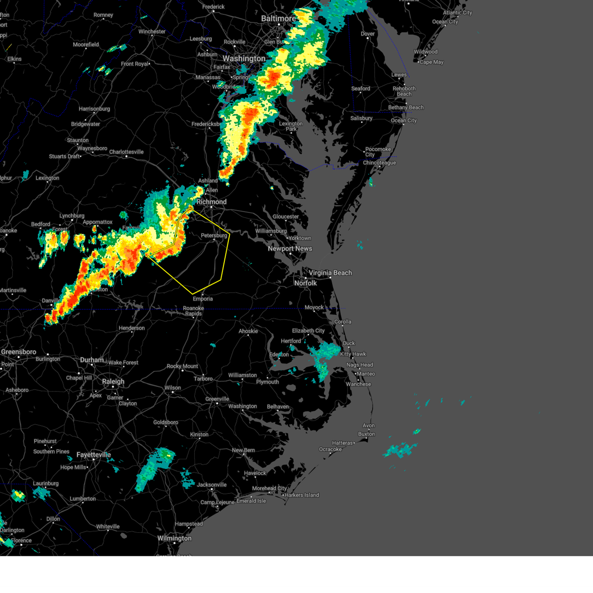 Svrakq the national weather service in wakefield has issued a * severe thunderstorm warning for, chesterfield county in central virginia, northwestern greensville county in southeastern virginia, the city of colonial heights in central virginia, the city of hopewell in south central virginia, northeastern lunenburg county in south central virginia, southern nottoway county in south central virginia, the city of petersburg in south central virginia, western prince george county in south central virginia, western sussex county in southeastern virginia, dinwiddie county in south central virginia, southeastern amelia county in central virginia, northern brunswick county in south central virginia, * until 800 pm edt. * at 715 pm edt, severe thunderstorms were located along a line extending from near moseley to near wilsons to near blackstone, moving southeast at 45 mph (radar indicated). Hazards include 60 mph wind gusts. Expect damage to trees and powerlines. severe thunderstorms will be near, dewitt around 720 pm edt. dinwiddie, mckenney, sutherland, and chesterfield court house around 725 pm edt. chester, alberta, and matoaca around 730 pm edt. petersburg, colonial heights, virginia state university, and ettrick around 735 pm edt. fort gregg-adams and carson around 740 pm edt. hopewell, purdy, and stony creek around 745 pm edt. prince george and jarratt around 750 pm edt. Other locations impacted by these severe thunderstorms include north wellville, dolphin, ammon, murdocks, pleasant shade, wharfs store, pocahontas state park, skinquarter, wellville, and beach. Svrakq the national weather service in wakefield has issued a * severe thunderstorm warning for, chesterfield county in central virginia, northwestern greensville county in southeastern virginia, the city of colonial heights in central virginia, the city of hopewell in south central virginia, northeastern lunenburg county in south central virginia, southern nottoway county in south central virginia, the city of petersburg in south central virginia, western prince george county in south central virginia, western sussex county in southeastern virginia, dinwiddie county in south central virginia, southeastern amelia county in central virginia, northern brunswick county in south central virginia, * until 800 pm edt. * at 715 pm edt, severe thunderstorms were located along a line extending from near moseley to near wilsons to near blackstone, moving southeast at 45 mph (radar indicated). Hazards include 60 mph wind gusts. Expect damage to trees and powerlines. severe thunderstorms will be near, dewitt around 720 pm edt. dinwiddie, mckenney, sutherland, and chesterfield court house around 725 pm edt. chester, alberta, and matoaca around 730 pm edt. petersburg, colonial heights, virginia state university, and ettrick around 735 pm edt. fort gregg-adams and carson around 740 pm edt. hopewell, purdy, and stony creek around 745 pm edt. prince george and jarratt around 750 pm edt. Other locations impacted by these severe thunderstorms include north wellville, dolphin, ammon, murdocks, pleasant shade, wharfs store, pocahontas state park, skinquarter, wellville, and beach.
|
| 6/30/2024 3:27 PM EDT |
 The storm which prompted the warning has weakened below severe limits, and no longer poses an immediate threat to life or property. therefore, the warning will be allowed to expire. however, small hail and gusty winds are still possible with this thunderstorm. a severe thunderstorm watch remains in effect until 1100 pm edt for south central virginia. The storm which prompted the warning has weakened below severe limits, and no longer poses an immediate threat to life or property. therefore, the warning will be allowed to expire. however, small hail and gusty winds are still possible with this thunderstorm. a severe thunderstorm watch remains in effect until 1100 pm edt for south central virginia.
|
| 6/30/2024 3:21 PM EDT |
 At 321 pm edt, a severe thunderstorm was located near south hill, moving east at 10 mph (radar indicated). Hazards include 60 mph wind gusts. Expect damage to trees and powerlines. this severe storm will be near, south hill around 330 pm edt. Other locations impacted by this severe thunderstorm include bacons fork, cochran, gills corner, north view, meredithville, forksville, and prices mill. At 321 pm edt, a severe thunderstorm was located near south hill, moving east at 10 mph (radar indicated). Hazards include 60 mph wind gusts. Expect damage to trees and powerlines. this severe storm will be near, south hill around 330 pm edt. Other locations impacted by this severe thunderstorm include bacons fork, cochran, gills corner, north view, meredithville, forksville, and prices mill.
|
| 6/30/2024 2:51 PM EDT |
 Svrakq the national weather service in wakefield has issued a * severe thunderstorm warning for, northeastern mecklenburg county in south central virginia, southern lunenburg county in south central virginia, west central brunswick county in south central virginia, * until 330 pm edt. * at 250 pm edt, a severe thunderstorm was located 8 miles northwest of south hill, moving east at 15 mph (radar indicated). Hazards include 60 mph wind gusts and penny size hail. Expect damage to trees and powerlines. this severe thunderstorm will be near, south hill around 310 pm edt. Other locations impacted by this severe thunderstorm include gary, bacons fork, cochran, wilburn, gills corner, north view, meredithville, baskerville, forksville, and wightman. Svrakq the national weather service in wakefield has issued a * severe thunderstorm warning for, northeastern mecklenburg county in south central virginia, southern lunenburg county in south central virginia, west central brunswick county in south central virginia, * until 330 pm edt. * at 250 pm edt, a severe thunderstorm was located 8 miles northwest of south hill, moving east at 15 mph (radar indicated). Hazards include 60 mph wind gusts and penny size hail. Expect damage to trees and powerlines. this severe thunderstorm will be near, south hill around 310 pm edt. Other locations impacted by this severe thunderstorm include gary, bacons fork, cochran, wilburn, gills corner, north view, meredithville, baskerville, forksville, and wightman.
|
| 6/6/2024 6:29 PM EDT |
 The storms which prompted the warning have weakened below severe limits, and no longer pose an immediate threat to life or property. therefore, the warning will be allowed to expire. however, gusty winds are still possible with these thunderstorms. a severe thunderstorm watch remains in effect until 900 pm edt for south central and southeastern virginia. The storms which prompted the warning have weakened below severe limits, and no longer pose an immediate threat to life or property. therefore, the warning will be allowed to expire. however, gusty winds are still possible with these thunderstorms. a severe thunderstorm watch remains in effect until 900 pm edt for south central and southeastern virginia.
|
| 6/6/2024 6:05 PM EDT |
 At 605 pm edt, severe thunderstorms were located along a line extending from near lawrenceville to near brunswick to near ebony, moving east at 40 mph (radar indicated). Hazards include 60 mph wind gusts. Expect damage to trees and powerlines. these severe storms will be near, gasburg around 610 pm edt. purdy, barley, and radium around 615 pm edt. emporia around 620 pm edt. jarratt around 625 pm edt. dahlia, gaston, green plain, and claresville around 630 pm edt. Other locations impacted by these severe thunderstorms include cochran, adams grove, grizzard, gum forks, bufford crossroads, lanes corner, dolphin, bowens corner, yale, and pleasant shade. At 605 pm edt, severe thunderstorms were located along a line extending from near lawrenceville to near brunswick to near ebony, moving east at 40 mph (radar indicated). Hazards include 60 mph wind gusts. Expect damage to trees and powerlines. these severe storms will be near, gasburg around 610 pm edt. purdy, barley, and radium around 615 pm edt. emporia around 620 pm edt. jarratt around 625 pm edt. dahlia, gaston, green plain, and claresville around 630 pm edt. Other locations impacted by these severe thunderstorms include cochran, adams grove, grizzard, gum forks, bufford crossroads, lanes corner, dolphin, bowens corner, yale, and pleasant shade.
|
| 6/6/2024 6:05 PM EDT |
 the severe thunderstorm warning has been cancelled and is no longer in effect the severe thunderstorm warning has been cancelled and is no longer in effect
|
| 6/6/2024 5:42 PM EDT |
 Svrakq the national weather service in wakefield has issued a * severe thunderstorm warning for, northwestern northampton county in northeastern north carolina, greensville county in southeastern virginia, southeastern mecklenburg county in south central virginia, southeastern lunenburg county in south central virginia, the city of emporia in southeastern virginia, west central southampton county in southeastern virginia, southwestern sussex county in southeastern virginia, brunswick county in south central virginia, * until 630 pm edt. * at 542 pm edt, severe thunderstorms were located along a line extending from 7 miles northeast of south hill to brodnax to 6 miles north of norlina, moving east at 40 mph (radar indicated). Hazards include 60 mph wind gusts. Expect damage to trees and powerlines. severe thunderstorms will be near, brodnax and ebony around 545 pm edt. lawrenceville and brunswick around 550 pm edt. gasburg around 555 pm edt. barley and radium around 610 pm edt. emporia and purdy around 615 pm edt. roanoke rapids, dahlia, gaston, jarratt, and green plain around 620 pm edt. claresville around 625 pm edt. Other locations impacted by these severe thunderstorms include cochran, adams grove, grizzard, gum forks, beechwood, bufford crossroads, lanes corner, dolphin, bowens corner, and yale. Svrakq the national weather service in wakefield has issued a * severe thunderstorm warning for, northwestern northampton county in northeastern north carolina, greensville county in southeastern virginia, southeastern mecklenburg county in south central virginia, southeastern lunenburg county in south central virginia, the city of emporia in southeastern virginia, west central southampton county in southeastern virginia, southwestern sussex county in southeastern virginia, brunswick county in south central virginia, * until 630 pm edt. * at 542 pm edt, severe thunderstorms were located along a line extending from 7 miles northeast of south hill to brodnax to 6 miles north of norlina, moving east at 40 mph (radar indicated). Hazards include 60 mph wind gusts. Expect damage to trees and powerlines. severe thunderstorms will be near, brodnax and ebony around 545 pm edt. lawrenceville and brunswick around 550 pm edt. gasburg around 555 pm edt. barley and radium around 610 pm edt. emporia and purdy around 615 pm edt. roanoke rapids, dahlia, gaston, jarratt, and green plain around 620 pm edt. claresville around 625 pm edt. Other locations impacted by these severe thunderstorms include cochran, adams grove, grizzard, gum forks, beechwood, bufford crossroads, lanes corner, dolphin, bowens corner, and yale.
|
| 5/8/2024 5:36 PM EDT |
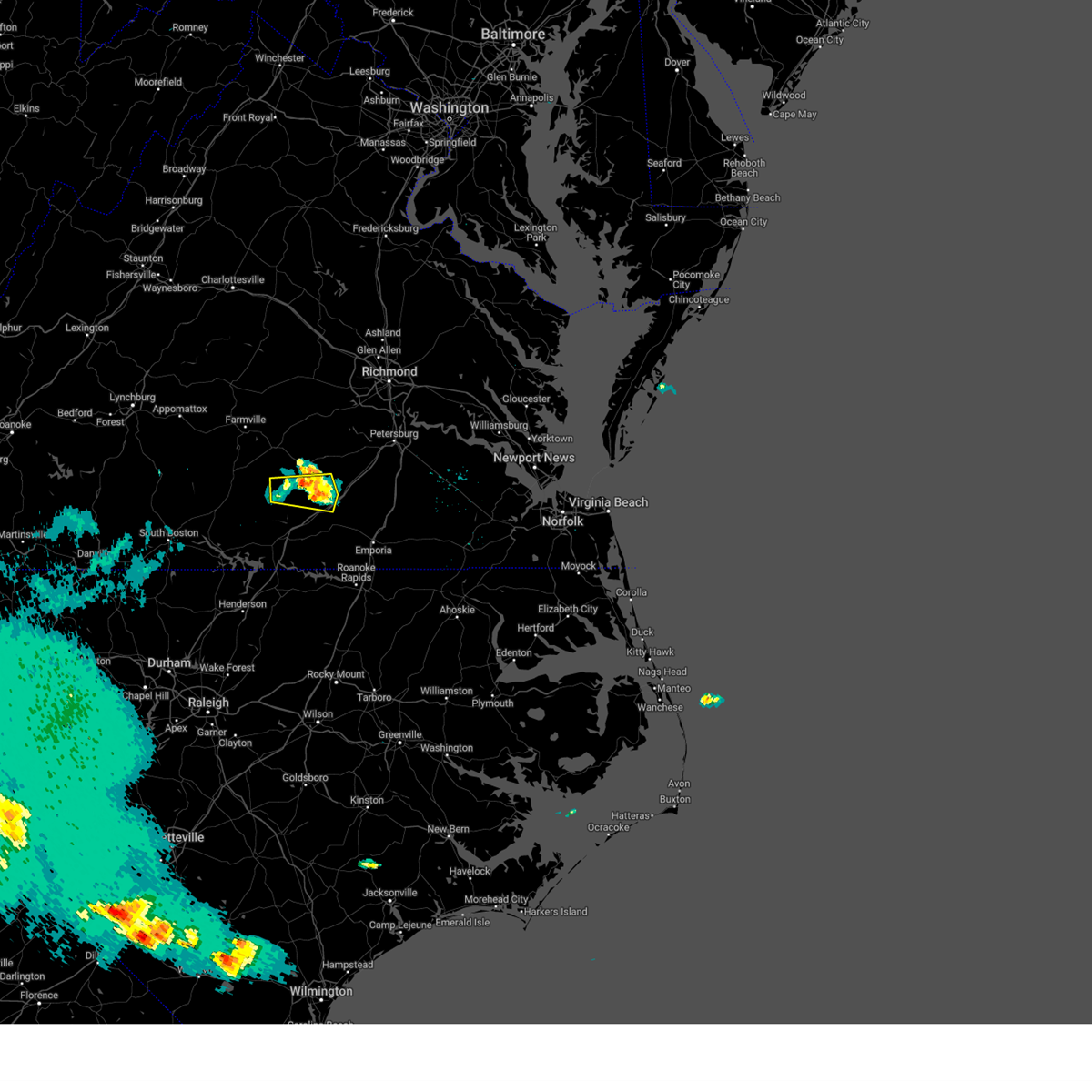 The storm which prompted the warning has weakened below severe limits, and no longer poses an immediate threat to life or property. therefore, the warning will be allowed to expire. The storm which prompted the warning has weakened below severe limits, and no longer poses an immediate threat to life or property. therefore, the warning will be allowed to expire.
|
| 5/8/2024 5:19 PM EDT |
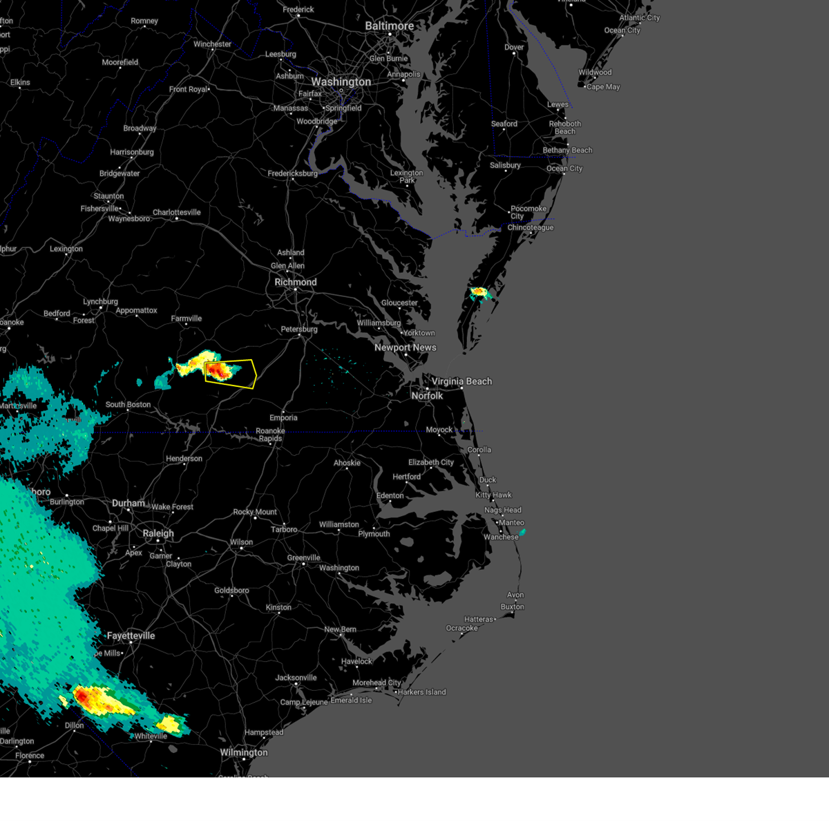 At 519 pm edt, a severe thunderstorm was located near kenbridge, moving east at 30 mph (radar indicated). Hazards include 60 mph wind gusts and quarter size hail. Minor damage to vehicles is possible. expect wind damage to trees and powerlines. Locations impacted include, victoria, kenbridge, alberta, dundas, lafoon corner, ordsburg, danieltown, irby, barrows store, murdocks, oral oaks, and forkland. At 519 pm edt, a severe thunderstorm was located near kenbridge, moving east at 30 mph (radar indicated). Hazards include 60 mph wind gusts and quarter size hail. Minor damage to vehicles is possible. expect wind damage to trees and powerlines. Locations impacted include, victoria, kenbridge, alberta, dundas, lafoon corner, ordsburg, danieltown, irby, barrows store, murdocks, oral oaks, and forkland.
|
| 5/8/2024 5:05 PM EDT |
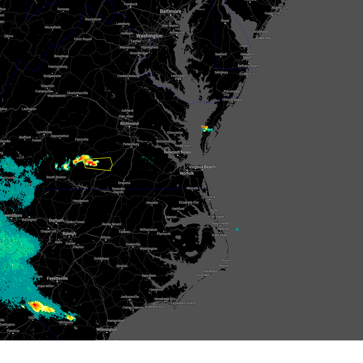 Svrakq the national weather service in wakefield has issued a * severe thunderstorm warning for, east central lunenburg county in south central virginia, south central nottoway county in south central virginia, west central dinwiddie county in south central virginia, northwestern brunswick county in south central virginia, * until 545 pm edt. * at 502 pm edt, a severe thunderstorm was located over lunenburg, or over victoria, moving east at 30 mph (radar indicated). Hazards include 60 mph wind gusts and quarter size hail. Minor damage to vehicles is possible. expect wind damage to trees and powerlines. this severe thunderstorm will be near, victoria and kenbridge around 505 pm edt. dundas around 520 pm edt. Other locations impacted by this severe thunderstorm include lafoon corner, ordsburg, danieltown, irby, loves mill, barrows store, murdocks, oral oaks, forkland, and gills corner. Svrakq the national weather service in wakefield has issued a * severe thunderstorm warning for, east central lunenburg county in south central virginia, south central nottoway county in south central virginia, west central dinwiddie county in south central virginia, northwestern brunswick county in south central virginia, * until 545 pm edt. * at 502 pm edt, a severe thunderstorm was located over lunenburg, or over victoria, moving east at 30 mph (radar indicated). Hazards include 60 mph wind gusts and quarter size hail. Minor damage to vehicles is possible. expect wind damage to trees and powerlines. this severe thunderstorm will be near, victoria and kenbridge around 505 pm edt. dundas around 520 pm edt. Other locations impacted by this severe thunderstorm include lafoon corner, ordsburg, danieltown, irby, loves mill, barrows store, murdocks, oral oaks, forkland, and gills corner.
|
| 4/11/2024 11:52 PM EDT | Tree down on boydton plank road. time estimated from radar dat in brunswick county VA, 0.8 miles SW of Alberta, VA |
| 4/11/2024 11:45 PM EDT |
 Svrakq the national weather service in wakefield has issued a * severe thunderstorm warning for, the western city of richmond in central virginia, chesterfield county in central virginia, eastern cumberland county in central virginia, eastern lunenburg county in south central virginia, nottoway county in south central virginia, northwestern henrico county in central virginia, dinwiddie county in south central virginia, amelia county in central virginia, powhatan county in central virginia, northern brunswick county in south central virginia, * until 1245 am edt. * at 1145 pm edt, severe thunderstorms were located along a line extending from near hadensville to near goochland to near spainville to near alberta, moving northeast at 45 mph (radar indicated). Hazards include 60 mph wind gusts. expect damage to roofs, siding, and trees Svrakq the national weather service in wakefield has issued a * severe thunderstorm warning for, the western city of richmond in central virginia, chesterfield county in central virginia, eastern cumberland county in central virginia, eastern lunenburg county in south central virginia, nottoway county in south central virginia, northwestern henrico county in central virginia, dinwiddie county in south central virginia, amelia county in central virginia, powhatan county in central virginia, northern brunswick county in south central virginia, * until 1245 am edt. * at 1145 pm edt, severe thunderstorms were located along a line extending from near hadensville to near goochland to near spainville to near alberta, moving northeast at 45 mph (radar indicated). Hazards include 60 mph wind gusts. expect damage to roofs, siding, and trees
|
| 1/9/2024 6:00 PM EST |
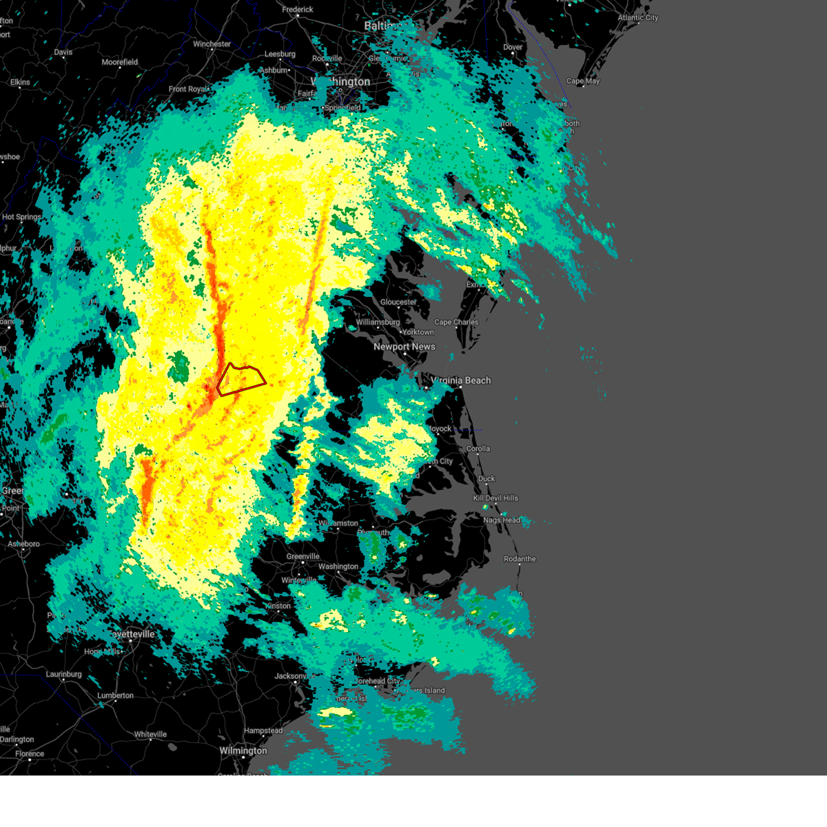 At 559 pm est, a severe thunderstorm capable of producing a tornado was located over dundas, or 8 miles southeast of kenbridge, moving northeast at 55 mph (radar indicated rotation). Hazards include tornado. Flying debris will be dangerous to those caught without shelter. mobile homes will be damaged or destroyed. damage to roofs, windows, and vehicles will occur. tree damage is likely. This tornadic thunderstorm will remain over mainly rural areas of southeastern lunenburg and northern brunswick counties, including the following locations, bacons fork, ordsburg, danieltown, cochran, gills corner, rawlings, barrows store, and warfield. At 559 pm est, a severe thunderstorm capable of producing a tornado was located over dundas, or 8 miles southeast of kenbridge, moving northeast at 55 mph (radar indicated rotation). Hazards include tornado. Flying debris will be dangerous to those caught without shelter. mobile homes will be damaged or destroyed. damage to roofs, windows, and vehicles will occur. tree damage is likely. This tornadic thunderstorm will remain over mainly rural areas of southeastern lunenburg and northern brunswick counties, including the following locations, bacons fork, ordsburg, danieltown, cochran, gills corner, rawlings, barrows store, and warfield.
|
| 1/9/2024 5:52 PM EST |
 At 552 pm est, a severe thunderstorm capable of producing a tornado was located near south hill, moving northeast at 55 mph (radar indicated rotation). Hazards include tornado. Flying debris will be dangerous to those caught without shelter. mobile homes will be damaged or destroyed. damage to roofs, windows, and vehicles will occur. tree damage is likely. this dangerous storm will be near, dundas around 600 pm est. Other locations impacted by this tornadic thunderstorm include gary, bacons fork, cochran, gills corner, rawlings, dolphin, barrows store, north view, warfield, and meredithville. At 552 pm est, a severe thunderstorm capable of producing a tornado was located near south hill, moving northeast at 55 mph (radar indicated rotation). Hazards include tornado. Flying debris will be dangerous to those caught without shelter. mobile homes will be damaged or destroyed. damage to roofs, windows, and vehicles will occur. tree damage is likely. this dangerous storm will be near, dundas around 600 pm est. Other locations impacted by this tornadic thunderstorm include gary, bacons fork, cochran, gills corner, rawlings, dolphin, barrows store, north view, warfield, and meredithville.
|
| 1/9/2024 5:40 PM EST |
 At 540 pm est, a severe thunderstorm capable of producing a tornado was located near boydton, or 9 miles west of south hill, moving northeast at 55 mph (radar indicated rotation). Hazards include tornado. Flying debris will be dangerous to those caught without shelter. mobile homes will be damaged or destroyed. damage to roofs, windows, and vehicles will occur. tree damage is likely. this dangerous storm will be near, south hill around 550 pm est. dundas around 600 pm est. Other locations impacted by this tornadic thunderstorm include gary, bacons fork, cochran, wilburn, gills corner, rawlings, dolphin, barrows store, north view, and warfield. At 540 pm est, a severe thunderstorm capable of producing a tornado was located near boydton, or 9 miles west of south hill, moving northeast at 55 mph (radar indicated rotation). Hazards include tornado. Flying debris will be dangerous to those caught without shelter. mobile homes will be damaged or destroyed. damage to roofs, windows, and vehicles will occur. tree damage is likely. this dangerous storm will be near, south hill around 550 pm est. dundas around 600 pm est. Other locations impacted by this tornadic thunderstorm include gary, bacons fork, cochran, wilburn, gills corner, rawlings, dolphin, barrows store, north view, and warfield.
|
| 7/1/2023 7:29 PM EDT |
 At 729 pm edt, a severe thunderstorm was located near dundas, or 9 miles northeast of south hill, moving southeast at 25 mph (radar indicated). Hazards include 60 mph wind gusts and quarter size hail. Minor damage to vehicles is possible. expect wind damage to trees and powerlines. this severe thunderstorm will be near, alberta around 740 pm edt. brodnax around 745 pm edt. lawrenceville around 755 pm edt. other locations impacted by this severe thunderstorm include bacons fork, danieltown, cochran, gills corner, edgerton, bowens corner, meredithville, forksville and prices mill. hail threat, radar indicated max hail size, 1. 00 in wind threat, radar indicated max wind gust, 60 mph. At 729 pm edt, a severe thunderstorm was located near dundas, or 9 miles northeast of south hill, moving southeast at 25 mph (radar indicated). Hazards include 60 mph wind gusts and quarter size hail. Minor damage to vehicles is possible. expect wind damage to trees and powerlines. this severe thunderstorm will be near, alberta around 740 pm edt. brodnax around 745 pm edt. lawrenceville around 755 pm edt. other locations impacted by this severe thunderstorm include bacons fork, danieltown, cochran, gills corner, edgerton, bowens corner, meredithville, forksville and prices mill. hail threat, radar indicated max hail size, 1. 00 in wind threat, radar indicated max wind gust, 60 mph.
|
| 7/1/2023 6:55 PM EDT |
 At 655 pm edt, a severe thunderstorm was located over victoria, moving southeast at 40 mph (radar indicated). Hazards include 60 mph wind gusts and quarter size hail. Minor damage to vehicles is possible. expect wind damage to trees and powerlines. this severe thunderstorm will be near, kenbridge around 700 pm edt. dundas around 710 pm edt. alberta around 720 pm edt. other locations impacted by this severe thunderstorm include gary, bacons fork, cochran, irby, gills corner, loves mill, rawlings, barrows store, murdocks and forkland. hail threat, radar indicated max hail size, 1. 00 in wind threat, radar indicated max wind gust, 60 mph. At 655 pm edt, a severe thunderstorm was located over victoria, moving southeast at 40 mph (radar indicated). Hazards include 60 mph wind gusts and quarter size hail. Minor damage to vehicles is possible. expect wind damage to trees and powerlines. this severe thunderstorm will be near, kenbridge around 700 pm edt. dundas around 710 pm edt. alberta around 720 pm edt. other locations impacted by this severe thunderstorm include gary, bacons fork, cochran, irby, gills corner, loves mill, rawlings, barrows store, murdocks and forkland. hail threat, radar indicated max hail size, 1. 00 in wind threat, radar indicated max wind gust, 60 mph.
|
| 6/26/2023 11:54 PM EDT |
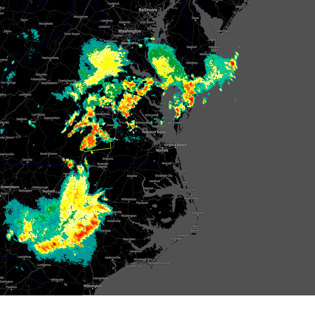 At 1154 pm edt, a severe thunderstorm was located near mckenney, moving east at 35 mph (radar indicated). Hazards include 60 mph wind gusts and penny size hail. Expect damage to trees and powerlines. this severe storm will be near, mckenney around 1205 am edt. dewitt around 1210 am edt. dinwiddie around 1220 am edt. other locations impacted by this severe thunderstorm include bacons fork, cochran, irby, gills corner, rawlings, dolphin, barrows store, murdocks, forkland and warfield. hail threat, radar indicated max hail size, 0. 75 in wind threat, radar indicated max wind gust, 60 mph. At 1154 pm edt, a severe thunderstorm was located near mckenney, moving east at 35 mph (radar indicated). Hazards include 60 mph wind gusts and penny size hail. Expect damage to trees and powerlines. this severe storm will be near, mckenney around 1205 am edt. dewitt around 1210 am edt. dinwiddie around 1220 am edt. other locations impacted by this severe thunderstorm include bacons fork, cochran, irby, gills corner, rawlings, dolphin, barrows store, murdocks, forkland and warfield. hail threat, radar indicated max hail size, 0. 75 in wind threat, radar indicated max wind gust, 60 mph.
|
| 6/26/2023 11:37 PM EDT |
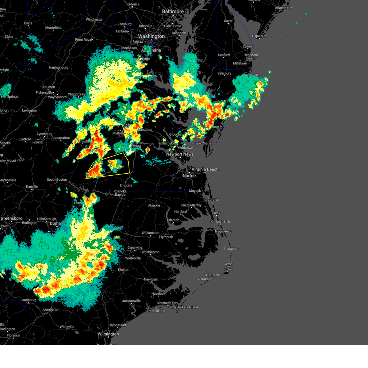 At 1137 pm edt, a severe thunderstorm was located over dundas, or near kenbridge, moving east at 35 mph (radar indicated). Hazards include 60 mph wind gusts and penny size hail. Expect damage to trees and powerlines. this severe thunderstorm will be near, alberta and fort barfoot around 1145 pm edt. mckenney around 1205 am edt. dewitt around 1210 am edt. dinwiddie around 1215 am edt. other locations impacted by this severe thunderstorm include bacons fork, cochran, irby, wilburn, gills corner, dolphin, murdocks, forkland, wharfs store and meredithville. hail threat, radar indicated max hail size, 0. 75 in wind threat, radar indicated max wind gust, 60 mph. At 1137 pm edt, a severe thunderstorm was located over dundas, or near kenbridge, moving east at 35 mph (radar indicated). Hazards include 60 mph wind gusts and penny size hail. Expect damage to trees and powerlines. this severe thunderstorm will be near, alberta and fort barfoot around 1145 pm edt. mckenney around 1205 am edt. dewitt around 1210 am edt. dinwiddie around 1215 am edt. other locations impacted by this severe thunderstorm include bacons fork, cochran, irby, wilburn, gills corner, dolphin, murdocks, forkland, wharfs store and meredithville. hail threat, radar indicated max hail size, 0. 75 in wind threat, radar indicated max wind gust, 60 mph.
|
| 5/16/2023 5:40 PM EDT |
 At 539 pm edt, a severe thunderstorm was located near chase city, moving east at 35 mph (radar indicated). Hazards include 60 mph wind gusts and quarter size hail. Minor damage to vehicles is possible. expect wind damage to trees and powerlines. this severe thunderstorm will be near, south hill and la crosse around 610 pm edt. brodnax around 615 pm edt. other locations impacted by this severe thunderstorm include bacons fork, cochran, spanish grove, beechwood, bowens corner, north view, finchley, meredithville, skipwith and forksville. hail threat, radar indicated max hail size, 1. 00 in wind threat, radar indicated max wind gust, 60 mph. At 539 pm edt, a severe thunderstorm was located near chase city, moving east at 35 mph (radar indicated). Hazards include 60 mph wind gusts and quarter size hail. Minor damage to vehicles is possible. expect wind damage to trees and powerlines. this severe thunderstorm will be near, south hill and la crosse around 610 pm edt. brodnax around 615 pm edt. other locations impacted by this severe thunderstorm include bacons fork, cochran, spanish grove, beechwood, bowens corner, north view, finchley, meredithville, skipwith and forksville. hail threat, radar indicated max hail size, 1. 00 in wind threat, radar indicated max wind gust, 60 mph.
|
| 11/11/2022 12:40 PM EST |
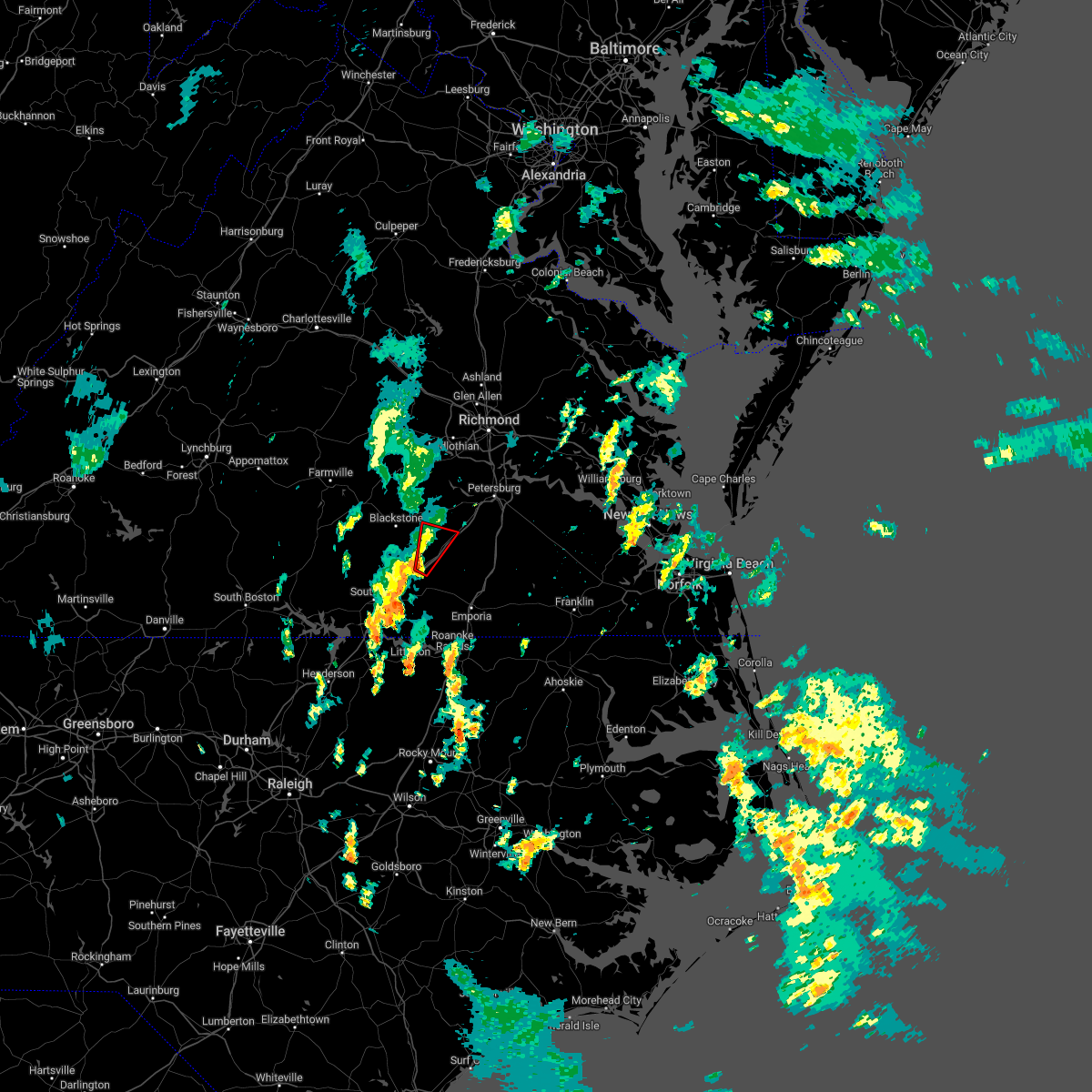 At 1239 pm est, a severe thunderstorm capable of producing a tornado was located over alberta, or 7 miles north of lawrenceville, moving north at 30 mph (radar indicated rotation). Hazards include tornado. Flying debris will be dangerous to those caught without shelter. mobile homes will be damaged or destroyed. damage to roofs, windows, and vehicles will occur. tree damage is likely. this dangerous storm will be near, mckenney around 100 pm est. dewitt around 110 pm est. Other locations impacted by this tornadic thunderstorm include ordsburg, rawlings, darvills and butterworth. At 1239 pm est, a severe thunderstorm capable of producing a tornado was located over alberta, or 7 miles north of lawrenceville, moving north at 30 mph (radar indicated rotation). Hazards include tornado. Flying debris will be dangerous to those caught without shelter. mobile homes will be damaged or destroyed. damage to roofs, windows, and vehicles will occur. tree damage is likely. this dangerous storm will be near, mckenney around 100 pm est. dewitt around 110 pm est. Other locations impacted by this tornadic thunderstorm include ordsburg, rawlings, darvills and butterworth.
|
| 11/11/2022 12:37 PM EST |
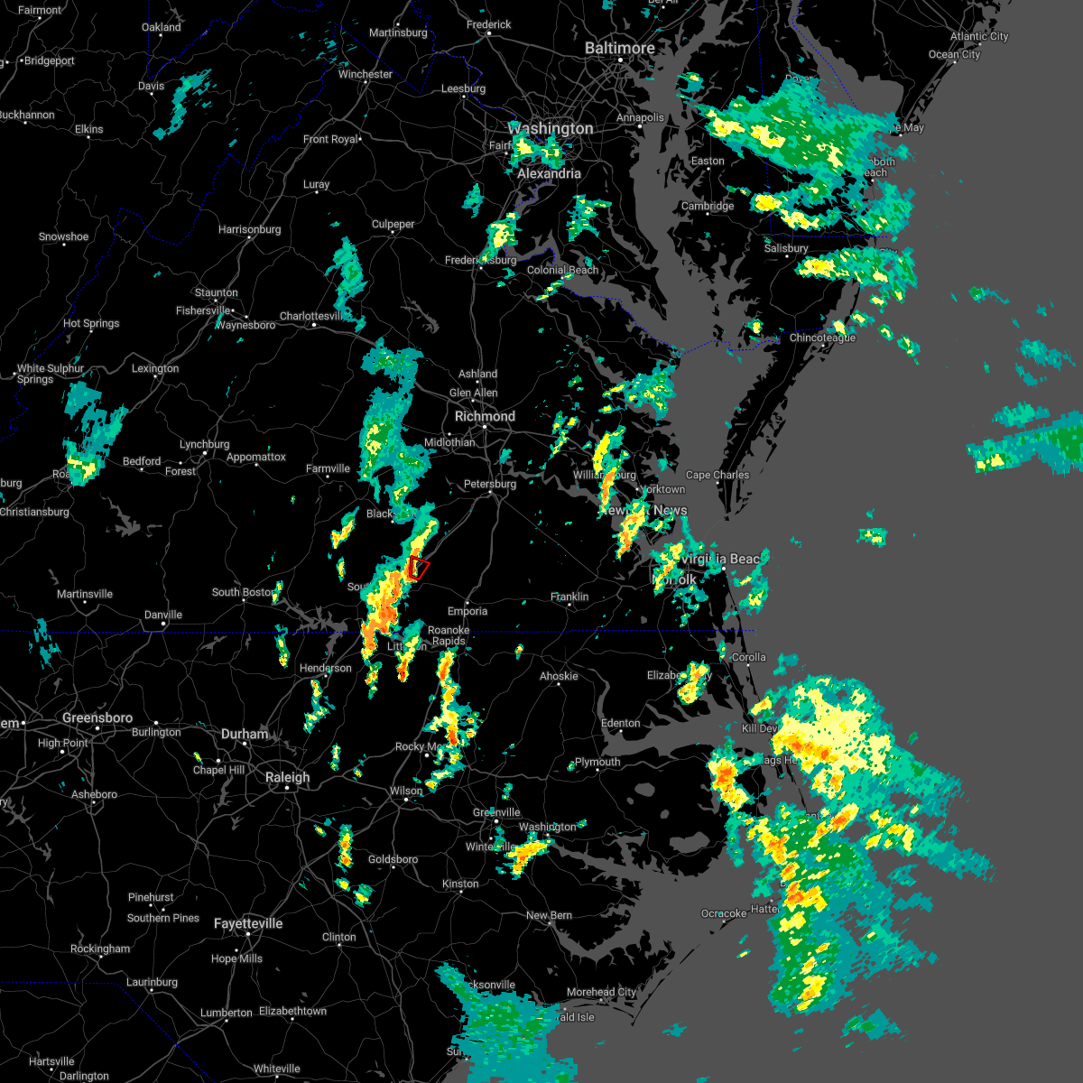 At 1237 pm est, a severe thunderstorm capable of producing a tornado was located over alberta, or near lawrenceville, moving north at 30 mph (radar indicated rotation). Hazards include tornado. Flying debris will be dangerous to those caught without shelter. mobile homes will be damaged or destroyed. damage to roofs, windows, and vehicles will occur. tree damage is likely. This tornadic thunderstorm will remain over mainly rural areas of central brunswick county. At 1237 pm est, a severe thunderstorm capable of producing a tornado was located over alberta, or near lawrenceville, moving north at 30 mph (radar indicated rotation). Hazards include tornado. Flying debris will be dangerous to those caught without shelter. mobile homes will be damaged or destroyed. damage to roofs, windows, and vehicles will occur. tree damage is likely. This tornadic thunderstorm will remain over mainly rural areas of central brunswick county.
|
| 11/11/2022 12:32 PM EST |
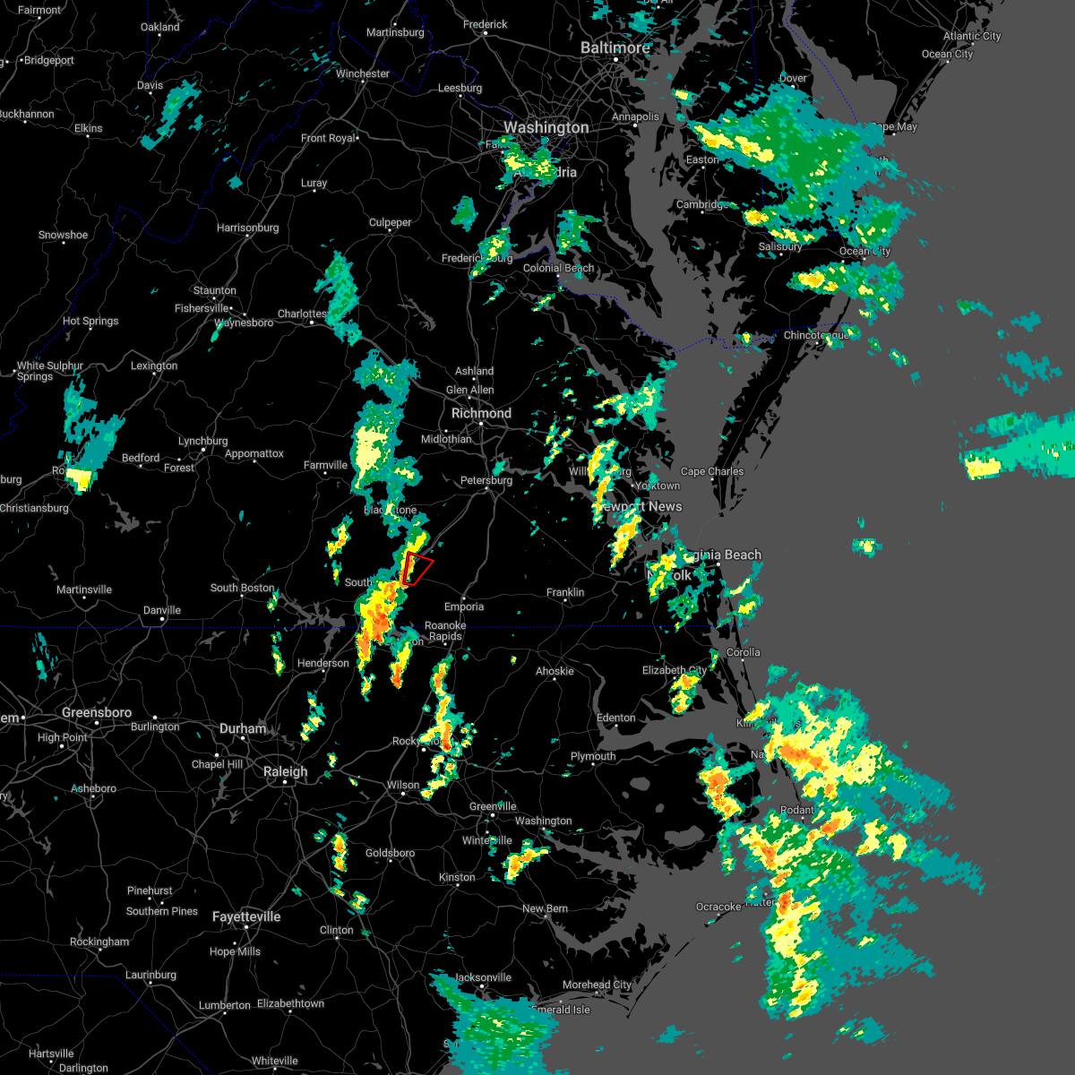 At 1232 pm est, a severe thunderstorm capable of producing a tornado was located near lawrenceville, moving northeast at 30 mph (radar indicated rotation). Hazards include tornado. Flying debris will be dangerous to those caught without shelter. mobile homes will be damaged or destroyed. damage to roofs, windows, and vehicles will occur. tree damage is likely. this dangerous storm will be near, alberta around 1240 pm est. Other locations impacted by this tornadic thunderstorm include dolphin. At 1232 pm est, a severe thunderstorm capable of producing a tornado was located near lawrenceville, moving northeast at 30 mph (radar indicated rotation). Hazards include tornado. Flying debris will be dangerous to those caught without shelter. mobile homes will be damaged or destroyed. damage to roofs, windows, and vehicles will occur. tree damage is likely. this dangerous storm will be near, alberta around 1240 pm est. Other locations impacted by this tornadic thunderstorm include dolphin.
|
| 11/11/2022 12:24 PM EST |
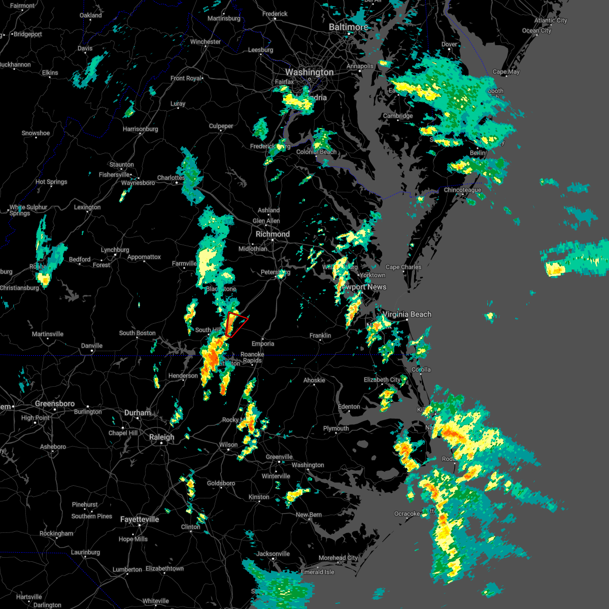 At 1224 pm est, a severe thunderstorm capable of producing a tornado was located over lawrenceville, moving north at 30 mph (radar indicated rotation). Hazards include tornado. Flying debris will be dangerous to those caught without shelter. mobile homes will be damaged or destroyed. damage to roofs, windows, and vehicles will occur. tree damage is likely. this dangerous storm will be near, alberta around 1240 pm est. Other locations impacted by this tornadic thunderstorm include cochran, dolphin and prices mill. At 1224 pm est, a severe thunderstorm capable of producing a tornado was located over lawrenceville, moving north at 30 mph (radar indicated rotation). Hazards include tornado. Flying debris will be dangerous to those caught without shelter. mobile homes will be damaged or destroyed. damage to roofs, windows, and vehicles will occur. tree damage is likely. this dangerous storm will be near, alberta around 1240 pm est. Other locations impacted by this tornadic thunderstorm include cochran, dolphin and prices mill.
|
| 11/11/2022 12:13 PM EST |
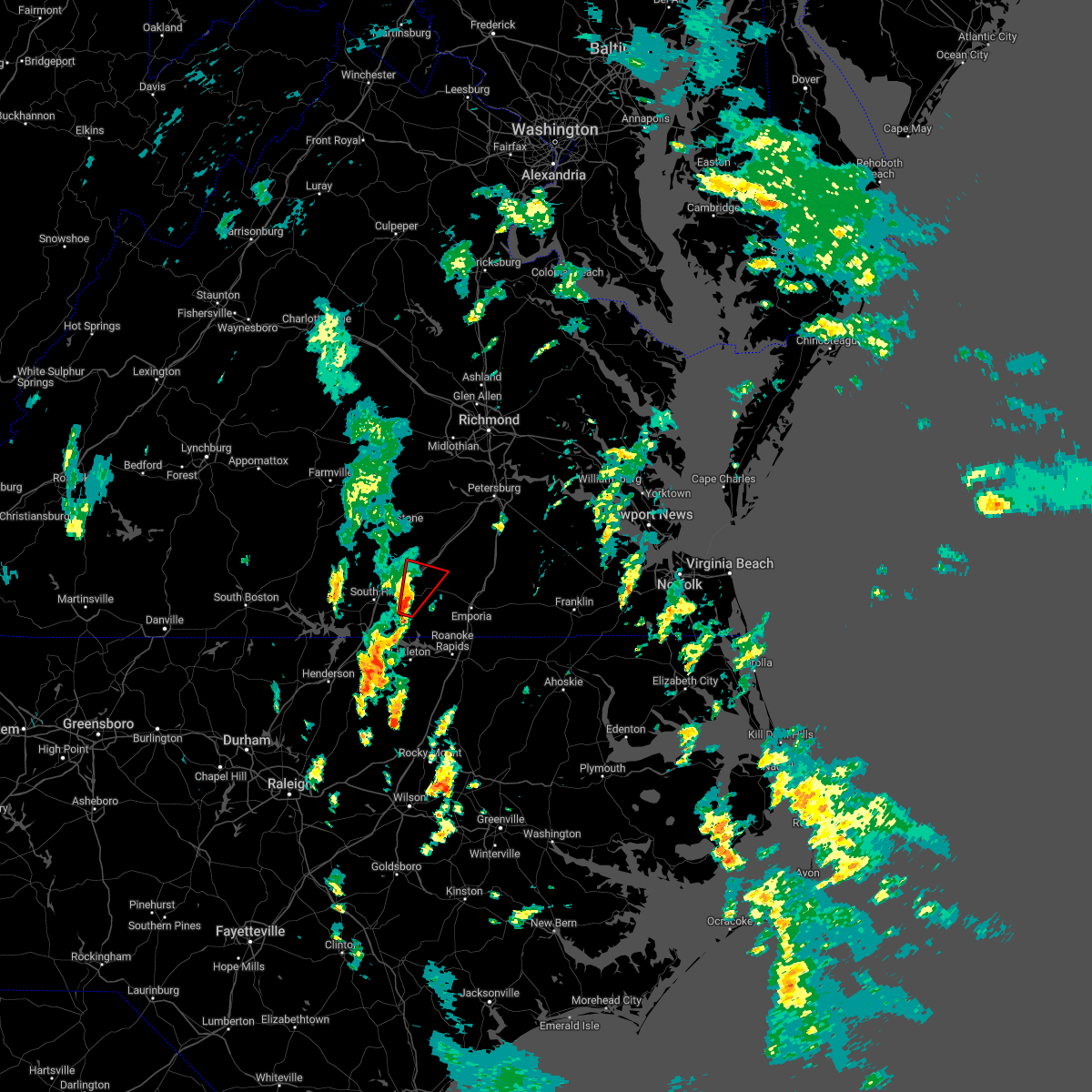 At 1212 pm est, a severe thunderstorm capable of producing a tornado was located near brunswick, or near brodnax, moving northeast at 35 mph (radar indicated rotation). Hazards include tornado. Flying debris will be dangerous to those caught without shelter. mobile homes will be damaged or destroyed. damage to roofs, windows, and vehicles will occur. tree damage is likely. this dangerous storm will be near, lawrenceville around 1225 pm est. alberta around 1235 pm est. Other locations impacted by this tornadic thunderstorm include cochran, edgerton, dolphin and prices mill. At 1212 pm est, a severe thunderstorm capable of producing a tornado was located near brunswick, or near brodnax, moving northeast at 35 mph (radar indicated rotation). Hazards include tornado. Flying debris will be dangerous to those caught without shelter. mobile homes will be damaged or destroyed. damage to roofs, windows, and vehicles will occur. tree damage is likely. this dangerous storm will be near, lawrenceville around 1225 pm est. alberta around 1235 pm est. Other locations impacted by this tornadic thunderstorm include cochran, edgerton, dolphin and prices mill.
|
| 8/10/2022 6:05 PM EDT | Around 500 power outages just northeast of alberta. time estimate in brunswick county VA, 3.9 miles WSW of Alberta, VA |
| 7/16/2022 4:58 PM EDT |
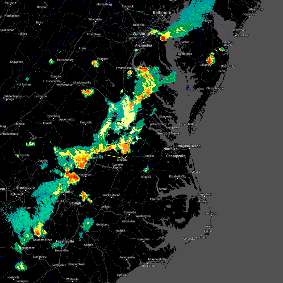 The severe thunderstorm warning for northwestern greensville, southwestern sussex, southeastern dinwiddie and northeastern brunswick counties and the city of emporia will expire at 500 pm edt, the storm which prompted the warning has weakened below severe limits, and no longer poses an immediate threat to life or property. therefore, the warning will be allowed to expire. however heavy rain is still possible with this thunderstorm. The severe thunderstorm warning for northwestern greensville, southwestern sussex, southeastern dinwiddie and northeastern brunswick counties and the city of emporia will expire at 500 pm edt, the storm which prompted the warning has weakened below severe limits, and no longer poses an immediate threat to life or property. therefore, the warning will be allowed to expire. however heavy rain is still possible with this thunderstorm.
|
| 7/16/2022 4:24 PM EDT | Tree down on i-85 at mm25... which is just southeast of alberta. time estimate in brunswick county VA, 2.2 miles W of Alberta, VA |
| 7/16/2022 4:16 PM EDT |
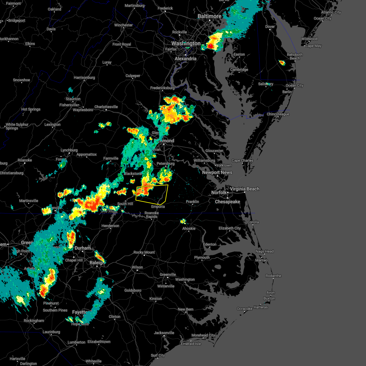 At 416 pm edt, a severe thunderstorm was located near alberta, or near lawrenceville, moving east at 20 mph (radar indicated). Hazards include 60 mph wind gusts and penny size hail. Expect damage to trees and powerlines. this severe thunderstorm will be near, radium around 455 pm edt. purdy and jarratt around 500 pm edt. other locations impacted by this severe thunderstorm include cochran, grizzard, bufford crossroads, dolphin, pleasant shade, fields crossroads, warfield, emporia reservoir, huske and cowie corner. hail threat, radar indicated max hail size, 0. 75 in wind threat, radar indicated max wind gust, 60 mph. At 416 pm edt, a severe thunderstorm was located near alberta, or near lawrenceville, moving east at 20 mph (radar indicated). Hazards include 60 mph wind gusts and penny size hail. Expect damage to trees and powerlines. this severe thunderstorm will be near, radium around 455 pm edt. purdy and jarratt around 500 pm edt. other locations impacted by this severe thunderstorm include cochran, grizzard, bufford crossroads, dolphin, pleasant shade, fields crossroads, warfield, emporia reservoir, huske and cowie corner. hail threat, radar indicated max hail size, 0. 75 in wind threat, radar indicated max wind gust, 60 mph.
|
| 7/16/2022 2:47 PM EDT |
 At 247 pm edt, a severe thunderstorm was located near dundas, or near kenbridge, moving east at 10 mph (radar indicated). Hazards include 60 mph wind gusts. Expect damage to trees and powerlines. this severe storm will be near, fort pickett around 310 pm edt. other locations impacted by this severe thunderstorm include lafoon corner, danieltown, irby, barrows store, murdocks, forkland, blackstone airport and dominy corner. hail threat, radar indicated max hail size, <. 75 in wind threat, radar indicated max wind gust, 60 mph. At 247 pm edt, a severe thunderstorm was located near dundas, or near kenbridge, moving east at 10 mph (radar indicated). Hazards include 60 mph wind gusts. Expect damage to trees and powerlines. this severe storm will be near, fort pickett around 310 pm edt. other locations impacted by this severe thunderstorm include lafoon corner, danieltown, irby, barrows store, murdocks, forkland, blackstone airport and dominy corner. hail threat, radar indicated max hail size, <. 75 in wind threat, radar indicated max wind gust, 60 mph.
|
| 7/16/2022 2:28 PM EDT |
 At 228 pm edt, a severe thunderstorm was located near kenbridge, moving east at 5 mph (radar indicated). Hazards include 60 mph wind gusts and penny size hail. Expect damage to trees and powerlines. this severe thunderstorm will be near, dundas around 240 pm edt. blackstone and fort pickett around 315 pm edt. other locations impacted by this severe thunderstorm include lafoon corner, danieltown, irby, barrows store, murdocks, forkland, blackstone airport and dominy corner. hail threat, radar indicated max hail size, 0. 75 in wind threat, radar indicated max wind gust, 60 mph. At 228 pm edt, a severe thunderstorm was located near kenbridge, moving east at 5 mph (radar indicated). Hazards include 60 mph wind gusts and penny size hail. Expect damage to trees and powerlines. this severe thunderstorm will be near, dundas around 240 pm edt. blackstone and fort pickett around 315 pm edt. other locations impacted by this severe thunderstorm include lafoon corner, danieltown, irby, barrows store, murdocks, forkland, blackstone airport and dominy corner. hail threat, radar indicated max hail size, 0. 75 in wind threat, radar indicated max wind gust, 60 mph.
|
| 7/13/2022 4:17 PM EDT |
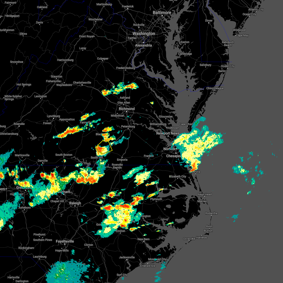 At 417 pm edt, a severe thunderstorm was located near dundas, or 8 miles southeast of kenbridge, moving northeast at 20 mph (radar indicated). Hazards include 60 mph wind gusts and quarter size hail. Minor damage to vehicles is possible. expect wind damage to trees and powerlines. this severe storm will be near, dundas around 425 pm edt. alberta around 440 pm edt. other locations impacted by this severe thunderstorm include lafoon corner, bacons fork, ordsburg, danieltown, cochran, gills corner, dolphin, barrows store, meredithville and prices mill. hail threat, radar indicated max hail size, 1. 00 in wind threat, radar indicated max wind gust, 60 mph. At 417 pm edt, a severe thunderstorm was located near dundas, or 8 miles southeast of kenbridge, moving northeast at 20 mph (radar indicated). Hazards include 60 mph wind gusts and quarter size hail. Minor damage to vehicles is possible. expect wind damage to trees and powerlines. this severe storm will be near, dundas around 425 pm edt. alberta around 440 pm edt. other locations impacted by this severe thunderstorm include lafoon corner, bacons fork, ordsburg, danieltown, cochran, gills corner, dolphin, barrows store, meredithville and prices mill. hail threat, radar indicated max hail size, 1. 00 in wind threat, radar indicated max wind gust, 60 mph.
|
| 7/13/2022 4:03 PM EDT |
 At 403 pm edt, a severe thunderstorm was located near south hill, moving east at 25 mph (radar indicated). Hazards include 60 mph wind gusts and quarter size hail. Minor damage to vehicles is possible. expect wind damage to trees and powerlines. this severe thunderstorm will be near, dundas around 420 pm edt. alberta around 430 pm edt. other locations impacted by this severe thunderstorm include gary, bacons fork, cochran, gills corner, dolphin, barrows store, meredithville, forksville, lafoon corner and ordsburg. hail threat, radar indicated max hail size, 1. 00 in wind threat, radar indicated max wind gust, 60 mph. At 403 pm edt, a severe thunderstorm was located near south hill, moving east at 25 mph (radar indicated). Hazards include 60 mph wind gusts and quarter size hail. Minor damage to vehicles is possible. expect wind damage to trees and powerlines. this severe thunderstorm will be near, dundas around 420 pm edt. alberta around 430 pm edt. other locations impacted by this severe thunderstorm include gary, bacons fork, cochran, gills corner, dolphin, barrows store, meredithville, forksville, lafoon corner and ordsburg. hail threat, radar indicated max hail size, 1. 00 in wind threat, radar indicated max wind gust, 60 mph.
|
| 7/6/2022 7:27 PM EDT |
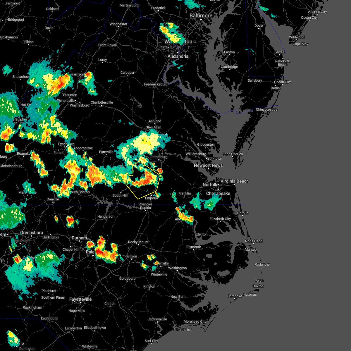 The severe thunderstorm warning for northwestern greensville, southwestern sussex, dinwiddie and brunswick counties will expire at 730 pm edt, the storms which prompted the warning have weakened below severe limits, and no longer pose an immediate threat to life or property. therefore, the warning will be allowed to expire. however gusty winds to 50 mph and heavy rain are still possible with these thunderstorms. a severe thunderstorm watch remains in effect until 1100 pm edt for central, south central and southeastern virginia. The severe thunderstorm warning for northwestern greensville, southwestern sussex, dinwiddie and brunswick counties will expire at 730 pm edt, the storms which prompted the warning have weakened below severe limits, and no longer pose an immediate threat to life or property. therefore, the warning will be allowed to expire. however gusty winds to 50 mph and heavy rain are still possible with these thunderstorms. a severe thunderstorm watch remains in effect until 1100 pm edt for central, south central and southeastern virginia.
|
| 7/6/2022 7:02 PM EDT |
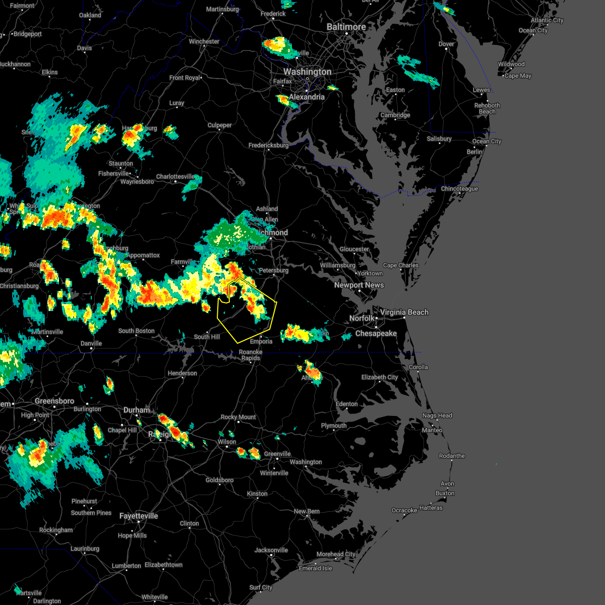 At 701 pm edt, severe thunderstorms were located along a line extending from near dewitt to near mckenney to near alberta, moving southeast at 50 mph (radar indicated). Hazards include 60 mph wind gusts. Expect damage to trees and powerlines. these severe storms will be near, mckenney around 705 pm edt. dinwiddie and dewitt around 710 pm edt. lawrenceville around 715 pm edt. purdy and radium around 720 pm edt. jarratt and stony creek around 725 pm edt. other locations impacted by these severe thunderstorms include cochran, bufford crossroads, dolphin, pleasant shade, wharfs store, meredithville, darvills, cowie corner, hebron and edgerton. hail threat, radar indicated max hail size, <. 75 in wind threat, radar indicated max wind gust, 60 mph. At 701 pm edt, severe thunderstorms were located along a line extending from near dewitt to near mckenney to near alberta, moving southeast at 50 mph (radar indicated). Hazards include 60 mph wind gusts. Expect damage to trees and powerlines. these severe storms will be near, mckenney around 705 pm edt. dinwiddie and dewitt around 710 pm edt. lawrenceville around 715 pm edt. purdy and radium around 720 pm edt. jarratt and stony creek around 725 pm edt. other locations impacted by these severe thunderstorms include cochran, bufford crossroads, dolphin, pleasant shade, wharfs store, meredithville, darvills, cowie corner, hebron and edgerton. hail threat, radar indicated max hail size, <. 75 in wind threat, radar indicated max wind gust, 60 mph.
|
| 7/6/2022 6:44 PM EDT |
 At 644 pm edt, severe thunderstorms were located along a line extending from near spainville to near blackstone to near kenbridge, moving southeast at 45 mph (radar indicated). Hazards include 60 mph wind gusts. Expect damage to trees and powerlines. severe thunderstorms will be near, fort pickett around 650 pm edt. wilsons around 655 pm edt. dundas around 700 pm edt. mckenney around 705 pm edt. alberta around 710 pm edt. dinwiddie, lawrenceville and dewitt around 715 pm edt. purdy around 725 pm edt. jarratt, stony creek and radium around 730 pm edt. other locations impacted by these severe thunderstorms include north wellville, cochran, irby, gills corner, bufford crossroads, dolphin, earls, murdocks, pleasant shade and forkland. hail threat, radar indicated max hail size, <. 75 in wind threat, radar indicated max wind gust, 60 mph. At 644 pm edt, severe thunderstorms were located along a line extending from near spainville to near blackstone to near kenbridge, moving southeast at 45 mph (radar indicated). Hazards include 60 mph wind gusts. Expect damage to trees and powerlines. severe thunderstorms will be near, fort pickett around 650 pm edt. wilsons around 655 pm edt. dundas around 700 pm edt. mckenney around 705 pm edt. alberta around 710 pm edt. dinwiddie, lawrenceville and dewitt around 715 pm edt. purdy around 725 pm edt. jarratt, stony creek and radium around 730 pm edt. other locations impacted by these severe thunderstorms include north wellville, cochran, irby, gills corner, bufford crossroads, dolphin, earls, murdocks, pleasant shade and forkland. hail threat, radar indicated max hail size, <. 75 in wind threat, radar indicated max wind gust, 60 mph.
|
| 6/17/2022 6:55 PM EDT |
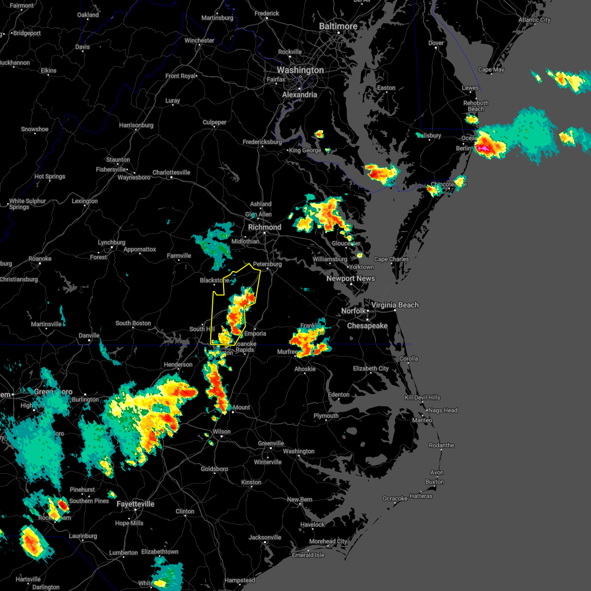 The severe thunderstorm warning for dinwiddie and brunswick counties will expire at 700 pm edt, the storms which prompted the warning have moved out of the area. therefore, the warning will be allowed to expire. however heavy rain is still possible with these thunderstorms. a severe thunderstorm watch remains in effect until 800 pm edt for northeastern north carolina, and south central, central and southeastern virginia. to report severe weather, contact your nearest law enforcement agency. they will relay your report to the national weather service wakefield. The severe thunderstorm warning for dinwiddie and brunswick counties will expire at 700 pm edt, the storms which prompted the warning have moved out of the area. therefore, the warning will be allowed to expire. however heavy rain is still possible with these thunderstorms. a severe thunderstorm watch remains in effect until 800 pm edt for northeastern north carolina, and south central, central and southeastern virginia. to report severe weather, contact your nearest law enforcement agency. they will relay your report to the national weather service wakefield.
|
| 6/17/2022 6:19 PM EDT |
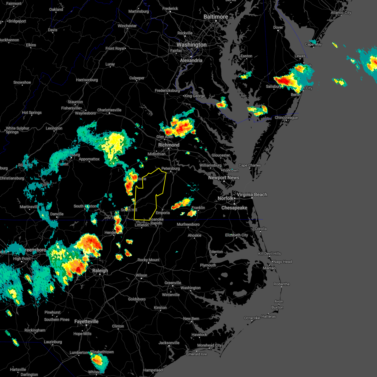 At 619 pm edt, severe thunderstorms were located along a line extending from spainville to near dundas to near norlina, moving east at 50 mph (radar indicated). Hazards include 60 mph wind gusts. Expect damage to trees and powerlines. severe thunderstorms will be near, wilsons around 625 pm edt. alberta around 630 pm edt. mckenney around 635 pm edt. sutherland and dewitt around 640 pm edt. dinwiddie around 645 pm edt. other locations impacted by these severe thunderstorms include cochran, addison, dolphin, bowens corner, wharfs store, meredithville, darvills, church road, hebron and edgerton. hail threat, radar indicated max hail size, <. 75 in wind threat, radar indicated max wind gust, 60 mph. At 619 pm edt, severe thunderstorms were located along a line extending from spainville to near dundas to near norlina, moving east at 50 mph (radar indicated). Hazards include 60 mph wind gusts. Expect damage to trees and powerlines. severe thunderstorms will be near, wilsons around 625 pm edt. alberta around 630 pm edt. mckenney around 635 pm edt. sutherland and dewitt around 640 pm edt. dinwiddie around 645 pm edt. other locations impacted by these severe thunderstorms include cochran, addison, dolphin, bowens corner, wharfs store, meredithville, darvills, church road, hebron and edgerton. hail threat, radar indicated max hail size, <. 75 in wind threat, radar indicated max wind gust, 60 mph.
|
| 5/21/2022 6:41 PM EDT |
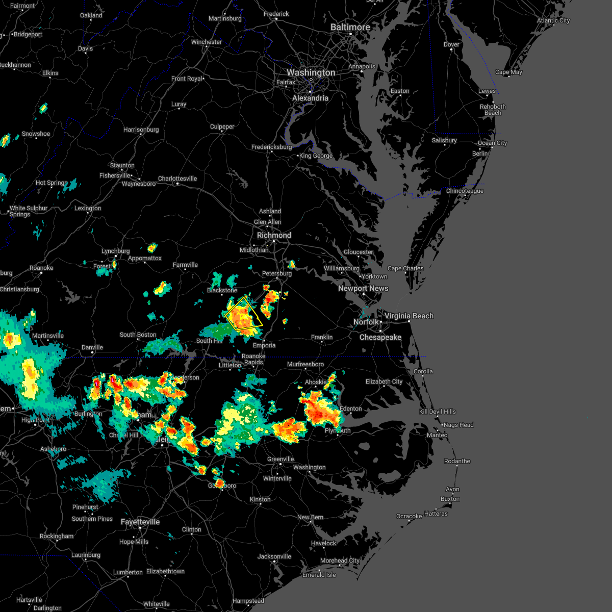 At 639 pm edt, a severe thunderstorm was located near mckenney, moving northeast at 20 mph (law enforcement reported. at 620 pm, the 911 call center in bunswick county reported trees down along i-85 near mile marker 34). Hazards include 60 mph wind gusts and quarter size hail. Minor damage to vehicles is possible. expect wind damage to trees and powerlines. this severe storm will be near, mckenney around 650 pm edt. other locations impacted by this severe thunderstorm include ordsburg, cochran, callaville, warfield, rawlings and dolphin. hail threat, radar indicated max hail size, 1. 00 in wind threat, radar indicated max wind gust, 60 mph. At 639 pm edt, a severe thunderstorm was located near mckenney, moving northeast at 20 mph (law enforcement reported. at 620 pm, the 911 call center in bunswick county reported trees down along i-85 near mile marker 34). Hazards include 60 mph wind gusts and quarter size hail. Minor damage to vehicles is possible. expect wind damage to trees and powerlines. this severe storm will be near, mckenney around 650 pm edt. other locations impacted by this severe thunderstorm include ordsburg, cochran, callaville, warfield, rawlings and dolphin. hail threat, radar indicated max hail size, 1. 00 in wind threat, radar indicated max wind gust, 60 mph.
|
| 5/21/2022 6:09 PM EDT |
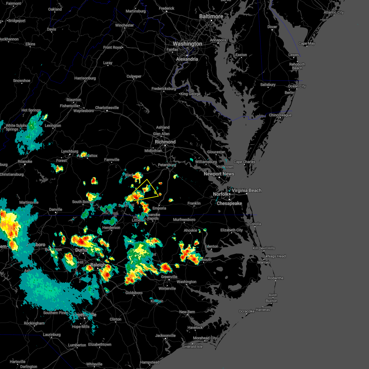 At 608 pm edt, a severe thunderstorm was located near alberta, or near lawrenceville, moving northeast at 20 mph (radar indicated). Hazards include 60 mph wind gusts and quarter size hail. Minor damage to vehicles is possible. expect wind damage to trees and powerlines. this severe thunderstorm will be near, alberta around 620 pm edt. mckenney around 655 pm edt. other locations impacted by this severe thunderstorm include ordsburg, danieltown, cochran, callaville, rawlings, dolphin, warfield, meredithville and prices mill. hail threat, radar indicated max hail size, 1. 00 in wind threat, radar indicated max wind gust, 60 mph. At 608 pm edt, a severe thunderstorm was located near alberta, or near lawrenceville, moving northeast at 20 mph (radar indicated). Hazards include 60 mph wind gusts and quarter size hail. Minor damage to vehicles is possible. expect wind damage to trees and powerlines. this severe thunderstorm will be near, alberta around 620 pm edt. mckenney around 655 pm edt. other locations impacted by this severe thunderstorm include ordsburg, danieltown, cochran, callaville, rawlings, dolphin, warfield, meredithville and prices mill. hail threat, radar indicated max hail size, 1. 00 in wind threat, radar indicated max wind gust, 60 mph.
|
| 5/6/2022 10:24 PM EDT |
 At 1024 pm edt, a severe thunderstorm was located near kenbridge, moving northeast at 55 mph (radar indicated). Hazards include 60 mph wind gusts. Expect damage to trees and powerlines. this severe storm will be near, dundas around 1030 pm edt. fort pickett around 1040 pm edt. mckenney and wilsons around 1050 pm edt. Other locations impacted by this severe thunderstorm include bacons fork, north wellville, cochran, irby, wilburn, prince edward station, gills corner, dolphin, earls and ammon. At 1024 pm edt, a severe thunderstorm was located near kenbridge, moving northeast at 55 mph (radar indicated). Hazards include 60 mph wind gusts. Expect damage to trees and powerlines. this severe storm will be near, dundas around 1030 pm edt. fort pickett around 1040 pm edt. mckenney and wilsons around 1050 pm edt. Other locations impacted by this severe thunderstorm include bacons fork, north wellville, cochran, irby, wilburn, prince edward station, gills corner, dolphin, earls and ammon.
|
| 5/6/2022 10:11 PM EDT |
 At 1011 pm edt, a severe thunderstorm was located near kells corner, or 8 miles east of chase city, moving northeast at 50 mph (radar indicated). Hazards include 60 mph wind gusts and quarter size hail. Minor damage to vehicles is possible. expect wind damage to trees and powerlines. this severe thunderstorm will be near, lunenburg around 1020 pm edt. victoria and kenbridge around 1025 pm edt. dundas around 1030 pm edt. fort pickett around 1040 pm edt. mckenney and wilsons around 1050 pm edt. Other locations impacted by this severe thunderstorm include bacons fork, north wellville, wilburn, arvins store, dolphin, ammon, murdocks, nutbush, plantersville and wellville. At 1011 pm edt, a severe thunderstorm was located near kells corner, or 8 miles east of chase city, moving northeast at 50 mph (radar indicated). Hazards include 60 mph wind gusts and quarter size hail. Minor damage to vehicles is possible. expect wind damage to trees and powerlines. this severe thunderstorm will be near, lunenburg around 1020 pm edt. victoria and kenbridge around 1025 pm edt. dundas around 1030 pm edt. fort pickett around 1040 pm edt. mckenney and wilsons around 1050 pm edt. Other locations impacted by this severe thunderstorm include bacons fork, north wellville, wilburn, arvins store, dolphin, ammon, murdocks, nutbush, plantersville and wellville.
|
| 7/17/2021 7:56 PM EDT |
 At 732 pm edt, a severe thunderstorm was located 7 miles southeast of fort pickett, or 7 miles west of mckenney, moving northeast at 35 mph (radar indicated). Hazards include 60 mph wind gusts and penny size hail. Expect damage to trees and powerlines. this severe storm will be near, mckenney around 745 pm edt. dewitt around 755 pm edt. dinwiddie around 800 pm edt. Other locations impacted by this severe thunderstorm include bacons fork, cochran, gills corner, rawlings, barrows store, forkland, wharfs store, darvills, lafoon corner and ordsburg. At 732 pm edt, a severe thunderstorm was located 7 miles southeast of fort pickett, or 7 miles west of mckenney, moving northeast at 35 mph (radar indicated). Hazards include 60 mph wind gusts and penny size hail. Expect damage to trees and powerlines. this severe storm will be near, mckenney around 745 pm edt. dewitt around 755 pm edt. dinwiddie around 800 pm edt. Other locations impacted by this severe thunderstorm include bacons fork, cochran, gills corner, rawlings, barrows store, forkland, wharfs store, darvills, lafoon corner and ordsburg.
|
| 7/17/2021 7:32 PM EDT |
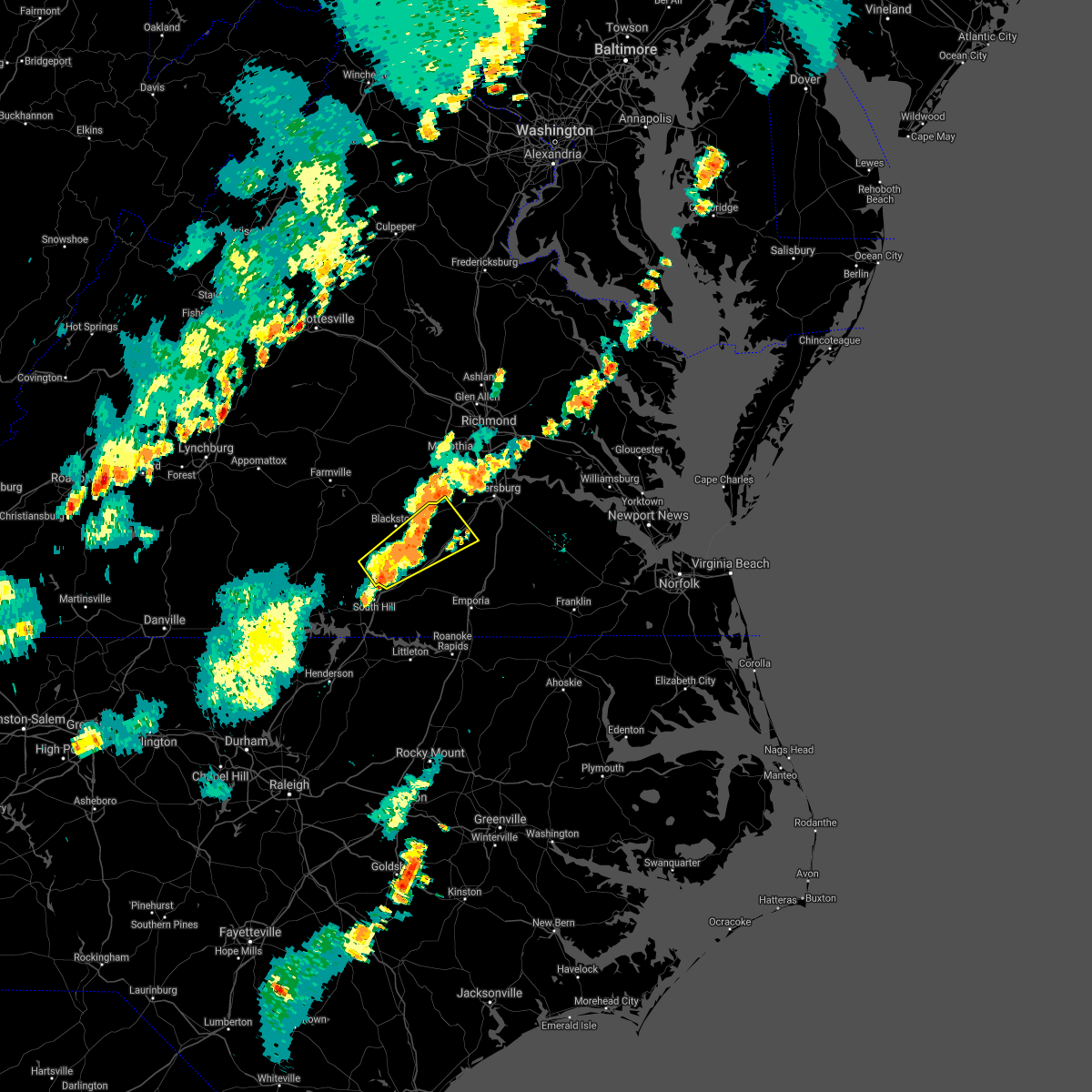 At 732 pm edt, a severe thunderstorm was located 7 miles southeast of fort pickett, or 7 miles west of mckenney, moving northeast at 35 mph (radar indicated). Hazards include 60 mph wind gusts and penny size hail. Expect damage to trees and powerlines. this severe storm will be near, mckenney around 745 pm edt. dewitt around 755 pm edt. dinwiddie around 800 pm edt. Other locations impacted by this severe thunderstorm include bacons fork, cochran, gills corner, rawlings, barrows store, forkland, wharfs store, darvills, lafoon corner and ordsburg. At 732 pm edt, a severe thunderstorm was located 7 miles southeast of fort pickett, or 7 miles west of mckenney, moving northeast at 35 mph (radar indicated). Hazards include 60 mph wind gusts and penny size hail. Expect damage to trees and powerlines. this severe storm will be near, mckenney around 745 pm edt. dewitt around 755 pm edt. dinwiddie around 800 pm edt. Other locations impacted by this severe thunderstorm include bacons fork, cochran, gills corner, rawlings, barrows store, forkland, wharfs store, darvills, lafoon corner and ordsburg.
|
| 7/17/2021 7:13 PM EDT |
 At 712 pm edt, a severe thunderstorm was located near dundas, or near kenbridge, moving northeast at 35 mph (radar indicated). Hazards include 60 mph wind gusts and penny size hail. Expect damage to trees and powerlines. this severe thunderstorm will be near, dundas around 720 pm edt. alberta around 730 pm edt. fort pickett around 735 pm edt. mckenney around 750 pm edt. dinwiddie and dewitt around 800 pm edt. Other locations impacted by this severe thunderstorm include bacons fork, cochran, gills corner, rawlings, barrows store, forkland, wharfs store, darvills, lafoon corner and ordsburg. At 712 pm edt, a severe thunderstorm was located near dundas, or near kenbridge, moving northeast at 35 mph (radar indicated). Hazards include 60 mph wind gusts and penny size hail. Expect damage to trees and powerlines. this severe thunderstorm will be near, dundas around 720 pm edt. alberta around 730 pm edt. fort pickett around 735 pm edt. mckenney around 750 pm edt. dinwiddie and dewitt around 800 pm edt. Other locations impacted by this severe thunderstorm include bacons fork, cochran, gills corner, rawlings, barrows store, forkland, wharfs store, darvills, lafoon corner and ordsburg.
|
| 4/14/2021 6:32 PM EDT |
 At 632 pm edt, a severe thunderstorm was located near south hill, moving east at 40 mph (radar indicated). Hazards include 60 mph wind gusts and quarter size hail. Minor damage to vehicles is possible. expect wind damage to trees and powerlines. this severe storm will be near, south hill and la crosse around 645 pm edt. brodnax around 650 pm edt. Other locations impacted by this severe thunderstorm include bacons fork, cochran, gills corner, bowens corner, north view, white plains, meredithville, baskerville, forksville and wightman. At 632 pm edt, a severe thunderstorm was located near south hill, moving east at 40 mph (radar indicated). Hazards include 60 mph wind gusts and quarter size hail. Minor damage to vehicles is possible. expect wind damage to trees and powerlines. this severe storm will be near, south hill and la crosse around 645 pm edt. brodnax around 650 pm edt. Other locations impacted by this severe thunderstorm include bacons fork, cochran, gills corner, bowens corner, north view, white plains, meredithville, baskerville, forksville and wightman.
|
| 4/14/2021 6:25 PM EDT |
 At 624 pm edt, a severe thunderstorm was located near boydton, or 8 miles southeast of chase city, moving east at 40 mph (radar indicated). Hazards include 60 mph wind gusts and quarter size hail. Minor damage to vehicles is possible. expect wind damage to trees and powerlines. this severe thunderstorm will be near, south hill and la crosse around 645 pm edt. brodnax around 650 pm edt. Other locations impacted by this severe thunderstorm include bacons fork, cochran, gills corner, bowens corner, north view, white plains, meredithville, baskerville, forksville and wightman. At 624 pm edt, a severe thunderstorm was located near boydton, or 8 miles southeast of chase city, moving east at 40 mph (radar indicated). Hazards include 60 mph wind gusts and quarter size hail. Minor damage to vehicles is possible. expect wind damage to trees and powerlines. this severe thunderstorm will be near, south hill and la crosse around 645 pm edt. brodnax around 650 pm edt. Other locations impacted by this severe thunderstorm include bacons fork, cochran, gills corner, bowens corner, north view, white plains, meredithville, baskerville, forksville and wightman.
|
| 3/18/2021 7:55 PM EDT |
 At 754 pm edt, severe thunderstorms were located along a line extending from near dundas to near brodnax to near ebony, moving east at 50 mph (radar indicated). Hazards include 60 mph wind gusts and quarter size hail. Minor damage to vehicles is possible. expect wind damage to trees and powerlines. these severe storms will be near, lawrenceville and brunswick around 800 pm edt. alberta around 805 pm edt. barley and radium around 815 pm edt. mckenney and purdy around 820 pm edt. emporia and dahlia around 825 pm edt. Other locations impacted by these severe thunderstorms include bacons fork, cochran, beechwood, gills corner, bufford crossroads, lanes corner, dolphin, bowens corner, pleasant shade and slates corner. At 754 pm edt, severe thunderstorms were located along a line extending from near dundas to near brodnax to near ebony, moving east at 50 mph (radar indicated). Hazards include 60 mph wind gusts and quarter size hail. Minor damage to vehicles is possible. expect wind damage to trees and powerlines. these severe storms will be near, lawrenceville and brunswick around 800 pm edt. alberta around 805 pm edt. barley and radium around 815 pm edt. mckenney and purdy around 820 pm edt. emporia and dahlia around 825 pm edt. Other locations impacted by these severe thunderstorms include bacons fork, cochran, beechwood, gills corner, bufford crossroads, lanes corner, dolphin, bowens corner, pleasant shade and slates corner.
|
| 3/18/2021 7:45 PM EDT |
 At 745 pm edt, severe thunderstorms were located along a line extending from 7 miles south of kenbridge to near la crosse to 6 miles west of ebony, moving northeast at 55 mph (radar indicated). Hazards include 60 mph wind gusts and quarter size hail. Minor damage to vehicles is possible. expect wind damage to trees and powerlines. severe thunderstorms will be near, lawrenceville, dundas and gasburg around 755 pm edt. brunswick and alberta around 800 pm edt. mckenney around 810 pm edt. emporia, purdy, radium and dewitt around 815 pm edt. other locations impacted by these severe thunderstorms include bacons fork, cochran, beechwood, gills corner, bufford crossroads, lanes corner, dolphin, bowens corner, pleasant shade and slates corner. A tornado watch remains in effect until 900 pm edt for northeastern north carolina, and south central and southeastern virginia. At 745 pm edt, severe thunderstorms were located along a line extending from 7 miles south of kenbridge to near la crosse to 6 miles west of ebony, moving northeast at 55 mph (radar indicated). Hazards include 60 mph wind gusts and quarter size hail. Minor damage to vehicles is possible. expect wind damage to trees and powerlines. severe thunderstorms will be near, lawrenceville, dundas and gasburg around 755 pm edt. brunswick and alberta around 800 pm edt. mckenney around 810 pm edt. emporia, purdy, radium and dewitt around 815 pm edt. other locations impacted by these severe thunderstorms include bacons fork, cochran, beechwood, gills corner, bufford crossroads, lanes corner, dolphin, bowens corner, pleasant shade and slates corner. A tornado watch remains in effect until 900 pm edt for northeastern north carolina, and south central and southeastern virginia.
|
| 8/31/2020 5:56 PM EDT |
 At 555 pm edt, a severe thunderstorm was located near south hill, moving east at 15 mph (radar indicated). Hazards include 60 mph wind gusts and penny size hail. Expect damage to trees and powerlines. this severe thunderstorm will be near, south hill and la crosse around 605 pm edt. brodnax around 620 pm edt. lawrenceville around 645 pm edt. Other locations impacted by this severe thunderstorm include bacons fork, cochran, dolphin, bowens corner, white plains, meredithville, forksville, prices mill and gills corner. At 555 pm edt, a severe thunderstorm was located near south hill, moving east at 15 mph (radar indicated). Hazards include 60 mph wind gusts and penny size hail. Expect damage to trees and powerlines. this severe thunderstorm will be near, south hill and la crosse around 605 pm edt. brodnax around 620 pm edt. lawrenceville around 645 pm edt. Other locations impacted by this severe thunderstorm include bacons fork, cochran, dolphin, bowens corner, white plains, meredithville, forksville, prices mill and gills corner.
|
| 7/28/2020 5:06 PM EDT |
 The severe thunderstorm warning for eastern mecklenburg, southeastern lunenburg and northwestern brunswick counties will expire at 515 pm edt, the storms which prompted the warning have weakened below severe limits. therefore, the warning will be allowed to expire. The severe thunderstorm warning for eastern mecklenburg, southeastern lunenburg and northwestern brunswick counties will expire at 515 pm edt, the storms which prompted the warning have weakened below severe limits. therefore, the warning will be allowed to expire.
|
| 7/28/2020 4:41 PM EDT |
 At 424 pm edt, severe thunderstorms were located along a line extending from near kells corner to near boydton to 7 miles east of clarksville, moving northeast at 35 mph (radar indicated). Hazards include 60 mph wind gusts. Expect damage to trees and powerlines. severe thunderstorms will be near, kells corner around 430 pm edt. kenbridge around 455 pm edt. south hill and la crosse around 500 pm edt. brodnax and dundas around 505 pm edt. Other locations impacted by these severe thunderstorms include bacons fork, gary, wilburn, beechwood, gills corner, loves mill, barrows store, john h kerr dam, north view and finchley. At 424 pm edt, severe thunderstorms were located along a line extending from near kells corner to near boydton to 7 miles east of clarksville, moving northeast at 35 mph (radar indicated). Hazards include 60 mph wind gusts. Expect damage to trees and powerlines. severe thunderstorms will be near, kells corner around 430 pm edt. kenbridge around 455 pm edt. south hill and la crosse around 500 pm edt. brodnax and dundas around 505 pm edt. Other locations impacted by these severe thunderstorms include bacons fork, gary, wilburn, beechwood, gills corner, loves mill, barrows store, john h kerr dam, north view and finchley.
|
| 7/28/2020 4:24 PM EDT |
 At 424 pm edt, severe thunderstorms were located along a line extending from near kells corner to near boydton to 7 miles east of clarksville, moving northeast at 35 mph (radar indicated). Hazards include 60 mph wind gusts. Expect damage to trees and powerlines. severe thunderstorms will be near, kells corner around 430 pm edt. kenbridge around 455 pm edt. south hill and la crosse around 500 pm edt. brodnax and dundas around 505 pm edt. Other locations impacted by these severe thunderstorms include bacons fork, gary, wilburn, beechwood, gills corner, loves mill, barrows store, john h kerr dam, north view and finchley. At 424 pm edt, severe thunderstorms were located along a line extending from near kells corner to near boydton to 7 miles east of clarksville, moving northeast at 35 mph (radar indicated). Hazards include 60 mph wind gusts. Expect damage to trees and powerlines. severe thunderstorms will be near, kells corner around 430 pm edt. kenbridge around 455 pm edt. south hill and la crosse around 500 pm edt. brodnax and dundas around 505 pm edt. Other locations impacted by these severe thunderstorms include bacons fork, gary, wilburn, beechwood, gills corner, loves mill, barrows store, john h kerr dam, north view and finchley.
|
| 4/13/2020 8:41 AM EDT |
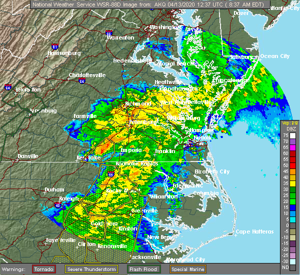 At 841 am edt, a severe thunderstorm was located near lawrenceville, moving northeast at 50 mph (radar indicated). Hazards include 60 mph wind gusts. Expect damage to trees and powerlines. Locations impacted include, lawrenceville, brunswick, alberta, ante, cochran, callaville, rawlings, edgerton, dolphin, warfield, meredithville and prices mill. At 841 am edt, a severe thunderstorm was located near lawrenceville, moving northeast at 50 mph (radar indicated). Hazards include 60 mph wind gusts. Expect damage to trees and powerlines. Locations impacted include, lawrenceville, brunswick, alberta, ante, cochran, callaville, rawlings, edgerton, dolphin, warfield, meredithville and prices mill.
|
| 4/13/2020 8:33 AM EDT |
 At 833 am edt, a severe thunderstorm was located over lawrenceville, moving northeast at 55 mph (radar indicated). Hazards include 60 mph wind gusts. Expect damage to trees and powerlines. This severe thunderstorm will remain over mainly rural areas of southeastern mecklenburg and brunswick counties, including the following locations, ante, cochran, rawlings, triplet, dolphin, bowens corner, white plains, valentines, warfield and meredithville. At 833 am edt, a severe thunderstorm was located over lawrenceville, moving northeast at 55 mph (radar indicated). Hazards include 60 mph wind gusts. Expect damage to trees and powerlines. This severe thunderstorm will remain over mainly rural areas of southeastern mecklenburg and brunswick counties, including the following locations, ante, cochran, rawlings, triplet, dolphin, bowens corner, white plains, valentines, warfield and meredithville.
|
| 4/13/2020 8:09 AM EDT |
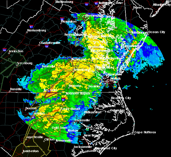 At 808 am edt, a severe thunderstorm was located near norlina, or 7 miles north of warrenton, moving northeast at 60 mph (radar indicated). Hazards include 60 mph wind gusts and penny size hail. Expect damage to trees and powerlines. this severe thunderstorm will be near, brodnax, ebony and gasburg around 820 am edt. brunswick around 825 am edt. lawrenceville around 835 am edt. other locations impacted by this severe thunderstorm include ante, cochran, rawlings, triplet, dolphin, bowens corner, white plains, valentines, warfield and meredithville. A tornado watch remains in effect until noon edt for northeastern north carolina, and south central and southeastern virginia. At 808 am edt, a severe thunderstorm was located near norlina, or 7 miles north of warrenton, moving northeast at 60 mph (radar indicated). Hazards include 60 mph wind gusts and penny size hail. Expect damage to trees and powerlines. this severe thunderstorm will be near, brodnax, ebony and gasburg around 820 am edt. brunswick around 825 am edt. lawrenceville around 835 am edt. other locations impacted by this severe thunderstorm include ante, cochran, rawlings, triplet, dolphin, bowens corner, white plains, valentines, warfield and meredithville. A tornado watch remains in effect until noon edt for northeastern north carolina, and south central and southeastern virginia.
|
| 4/7/2020 2:40 PM EDT |
 At 240 pm edt, a severe thunderstorm was located over lawrenceville, moving southeast at 25 mph (radar indicated). Hazards include 60 mph wind gusts and quarter size hail. Minor damage to vehicles is possible. expect wind damage to trees and powerlines. this severe storm will be near, lawrenceville around 245 pm edt. brunswick around 255 pm edt. Other locations impacted by this severe thunderstorm include ante, cochran, valentines, triplet, edgerton and prices mill. At 240 pm edt, a severe thunderstorm was located over lawrenceville, moving southeast at 25 mph (radar indicated). Hazards include 60 mph wind gusts and quarter size hail. Minor damage to vehicles is possible. expect wind damage to trees and powerlines. this severe storm will be near, lawrenceville around 245 pm edt. brunswick around 255 pm edt. Other locations impacted by this severe thunderstorm include ante, cochran, valentines, triplet, edgerton and prices mill.
|
| 4/7/2020 2:27 PM EDT |
 At 226 pm edt, a severe thunderstorm was located near alberta, or 7 miles northwest of lawrenceville, moving southeast at 25 mph (radar indicated). Hazards include 60 mph wind gusts and quarter size hail. Minor damage to vehicles is possible. expect wind damage to trees and powerlines. this severe thunderstorm will be near, alberta around 230 pm edt. lawrenceville around 245 pm edt. brunswick around 255 pm edt. Other locations impacted by this severe thunderstorm include danieltown, ante, cochran, triplet, edgerton, dolphin, white plains, valentines, meredithville and prices mill. At 226 pm edt, a severe thunderstorm was located near alberta, or 7 miles northwest of lawrenceville, moving southeast at 25 mph (radar indicated). Hazards include 60 mph wind gusts and quarter size hail. Minor damage to vehicles is possible. expect wind damage to trees and powerlines. this severe thunderstorm will be near, alberta around 230 pm edt. lawrenceville around 245 pm edt. brunswick around 255 pm edt. Other locations impacted by this severe thunderstorm include danieltown, ante, cochran, triplet, edgerton, dolphin, white plains, valentines, meredithville and prices mill.
|
| 4/7/2020 2:19 PM EDT |
 At 219 pm edt, a severe thunderstorm was located near dundas, or 8 miles southeast of kenbridge, moving southeast at 25 mph (radar indicated). Hazards include 60 mph wind gusts and quarter size hail. Minor damage to vehicles is possible. expect wind damage to trees and powerlines. this severe storm will be near, alberta around 235 pm edt. brodnax around 240 pm edt. Other locations impacted by this severe thunderstorm include bacons fork, cochran, meredithville, gills corner, forksville and prices mill. At 219 pm edt, a severe thunderstorm was located near dundas, or 8 miles southeast of kenbridge, moving southeast at 25 mph (radar indicated). Hazards include 60 mph wind gusts and quarter size hail. Minor damage to vehicles is possible. expect wind damage to trees and powerlines. this severe storm will be near, alberta around 235 pm edt. brodnax around 240 pm edt. Other locations impacted by this severe thunderstorm include bacons fork, cochran, meredithville, gills corner, forksville and prices mill.
|
| 4/7/2020 2:00 PM EDT |
 At 200 pm edt, a severe thunderstorm was located near kenbridge, moving southeast at 20 mph (radar indicated). Hazards include 60 mph wind gusts and quarter size hail. Minor damage to vehicles is possible. expect wind damage to trees and powerlines. this severe storm will be near, dundas around 220 pm edt. alberta around 230 pm edt. Other locations impacted by this severe thunderstorm include lafoon corner, bacons fork, danieltown, cochran, gills corner, oral oaks, meredithville, forksville and prices mill. At 200 pm edt, a severe thunderstorm was located near kenbridge, moving southeast at 20 mph (radar indicated). Hazards include 60 mph wind gusts and quarter size hail. Minor damage to vehicles is possible. expect wind damage to trees and powerlines. this severe storm will be near, dundas around 220 pm edt. alberta around 230 pm edt. Other locations impacted by this severe thunderstorm include lafoon corner, bacons fork, danieltown, cochran, gills corner, oral oaks, meredithville, forksville and prices mill.
|
| 4/7/2020 1:43 PM EDT |
 At 142 pm edt, a severe thunderstorm was located over lunenburg, or over victoria, moving southeast at 25 mph (radar indicated). Hazards include 60 mph wind gusts and quarter size hail. Minor damage to vehicles is possible. expect wind damage to trees and powerlines. this severe thunderstorm will be near, kenbridge around 155 pm edt. dundas around 215 pm edt. south hill around 225 pm edt. brodnax and la crosse around 230 pm edt. other locations impacted by this severe thunderstorm include gary, bacons fork, cochran, wilburn, gills corner, loves mill, meredithville, forksville, lafoon corner and danieltown. People at south hill family medicine should seek safe shelter immediately!. At 142 pm edt, a severe thunderstorm was located over lunenburg, or over victoria, moving southeast at 25 mph (radar indicated). Hazards include 60 mph wind gusts and quarter size hail. Minor damage to vehicles is possible. expect wind damage to trees and powerlines. this severe thunderstorm will be near, kenbridge around 155 pm edt. dundas around 215 pm edt. south hill around 225 pm edt. brodnax and la crosse around 230 pm edt. other locations impacted by this severe thunderstorm include gary, bacons fork, cochran, wilburn, gills corner, loves mill, meredithville, forksville, lafoon corner and danieltown. People at south hill family medicine should seek safe shelter immediately!.
|
| 1/12/2020 12:43 AM EST |
 At 1243 am est, a severe thunderstorm was located near rehoboth, or 7 miles west of victoria, moving northeast at 65 mph (radar indicated). Hazards include 60 mph wind gusts. expect damage to trees and powerlines At 1243 am est, a severe thunderstorm was located near rehoboth, or 7 miles west of victoria, moving northeast at 65 mph (radar indicated). Hazards include 60 mph wind gusts. expect damage to trees and powerlines
|
| 10/31/2019 9:18 PM EDT |
 At 918 pm edt, a severe thunderstorm was located over alberta, or 7 miles north of lawrenceville, moving northeast at 60 mph (radar indicated). Hazards include 60 mph wind gusts. Expect damage to trees and powerlines. this severe thunderstorm will be near, mckenney around 930 pm edt. dinwiddie and dewitt around 935 pm edt. carson and sutherland around 940 pm edt. petersburg around 950 pm edt. other locations impacted by this severe thunderstorm include cochran, addison, booker, dolphin, lumberton, wharfs store, darvills, church road, templeton and edgerton. A tornado watch remains in effect until 1100 pm edt for south central, central and southeastern virginia. At 918 pm edt, a severe thunderstorm was located over alberta, or 7 miles north of lawrenceville, moving northeast at 60 mph (radar indicated). Hazards include 60 mph wind gusts. Expect damage to trees and powerlines. this severe thunderstorm will be near, mckenney around 930 pm edt. dinwiddie and dewitt around 935 pm edt. carson and sutherland around 940 pm edt. petersburg around 950 pm edt. other locations impacted by this severe thunderstorm include cochran, addison, booker, dolphin, lumberton, wharfs store, darvills, church road, templeton and edgerton. A tornado watch remains in effect until 1100 pm edt for south central, central and southeastern virginia.
|
| 10/31/2019 9:06 PM EDT |
 At 906 pm edt, severe thunderstorms were located along a line extending from 8 miles northwest of sutherland to 7 miles northwest of dewitt to near la crosse, moving northeast at 55 mph (radar indicated). Hazards include 60 mph wind gusts. Expect damage to trees and powerlines. Locations impacted include, south hill, lawrenceville, mckenney, brodnax, mannboro, brunswick, la crosse, alberta, dewitt, dundas, wilsons, fort pickett, gasburg, ebony, bacons fork, north wellville, dolphin, bowens corner, ammon and forksville. At 906 pm edt, severe thunderstorms were located along a line extending from 8 miles northwest of sutherland to 7 miles northwest of dewitt to near la crosse, moving northeast at 55 mph (radar indicated). Hazards include 60 mph wind gusts. Expect damage to trees and powerlines. Locations impacted include, south hill, lawrenceville, mckenney, brodnax, mannboro, brunswick, la crosse, alberta, dewitt, dundas, wilsons, fort pickett, gasburg, ebony, bacons fork, north wellville, dolphin, bowens corner, ammon and forksville.
|
| 10/31/2019 8:53 PM EDT |
 At 853 pm edt, a severe thunderstorm capable of producing a tornado was located 8 miles southwest of la crosse, or 9 miles southwest of south hill, moving northeast at 45 mph (radar indicated rotation). Hazards include tornado. Flying debris will be dangerous to those caught without shelter. mobile homes will be damaged or destroyed. damage to roofs, windows, and vehicles will occur. tree damage is likely. this dangerous storm will be near, south hill, la crosse and ebony around 905 pm edt. brodnax around 910 pm edt. brunswick around 915 pm edt. lawrenceville around 920 pm edt. alberta around 925 pm edt. Other locations impacted by this tornadic thunderstorm include ante, cochran, beechwood, dolphin, bowens corner, white plains, warfield, meredithville, forksville and bracey. At 853 pm edt, a severe thunderstorm capable of producing a tornado was located 8 miles southwest of la crosse, or 9 miles southwest of south hill, moving northeast at 45 mph (radar indicated rotation). Hazards include tornado. Flying debris will be dangerous to those caught without shelter. mobile homes will be damaged or destroyed. damage to roofs, windows, and vehicles will occur. tree damage is likely. this dangerous storm will be near, south hill, la crosse and ebony around 905 pm edt. brodnax around 910 pm edt. brunswick around 915 pm edt. lawrenceville around 920 pm edt. alberta around 925 pm edt. Other locations impacted by this tornadic thunderstorm include ante, cochran, beechwood, dolphin, bowens corner, white plains, warfield, meredithville, forksville and bracey.
|
| 10/31/2019 8:47 PM EDT |
 At 844 pm edt, a severe thunderstorm capable of producing a tornado was located just to the northeast of south hill, moving east to northeast at 45 mph (radar indicated rotation). Hazards include tornado. Flying debris will be dangerous to those caught without shelter. mobile homes will be damaged or destroyed. damage to roofs, windows, and vehicles will occur. tree damage is likely. this dangerous storm will be near, dundas around 900 pm edt. alberta around 910 pm edt. Other locations impacted by this tornadic thunderstorm include lafoon corner, bacons fork, ordsburg, danieltown, cochran, gills corner, barrows store, forkland, warfield and blackstone airport. At 844 pm edt, a severe thunderstorm capable of producing a tornado was located just to the northeast of south hill, moving east to northeast at 45 mph (radar indicated rotation). Hazards include tornado. Flying debris will be dangerous to those caught without shelter. mobile homes will be damaged or destroyed. damage to roofs, windows, and vehicles will occur. tree damage is likely. this dangerous storm will be near, dundas around 900 pm edt. alberta around 910 pm edt. Other locations impacted by this tornadic thunderstorm include lafoon corner, bacons fork, ordsburg, danieltown, cochran, gills corner, barrows store, forkland, warfield and blackstone airport.
|
| 10/31/2019 8:43 PM EDT |
 At 842 pm edt, severe thunderstorms were located along a line extending from near chula to near dundas to 7 miles southeast of boydton, moving east at 50 mph (radar indicated). Hazards include 60 mph wind gusts. Expect damage to trees and powerlines. these severe storms will be near, chula, fort pickett and scotts fork around 850 pm edt. moseley around 855 pm edt. mckenney and la crosse around 900 pm edt. brodnax, dewitt and ebony around 905 pm edt. gasburg around 910 pm edt. lawrenceville and brunswick around 915 pm edt. Other locations impacted by these severe thunderstorms include bacons fork, north wellville, wilburn, dolphin, bowens corner, ammon, murdocks, forksville, skinquarter and wellville. At 842 pm edt, severe thunderstorms were located along a line extending from near chula to near dundas to 7 miles southeast of boydton, moving east at 50 mph (radar indicated). Hazards include 60 mph wind gusts. Expect damage to trees and powerlines. these severe storms will be near, chula, fort pickett and scotts fork around 850 pm edt. moseley around 855 pm edt. mckenney and la crosse around 900 pm edt. brodnax, dewitt and ebony around 905 pm edt. gasburg around 910 pm edt. lawrenceville and brunswick around 915 pm edt. Other locations impacted by these severe thunderstorms include bacons fork, north wellville, wilburn, dolphin, bowens corner, ammon, murdocks, forksville, skinquarter and wellville.
|
| 10/31/2019 8:14 PM EDT |
 At 813 pm edt, a severe thunderstorm capable of producing a tornado was located near chase city, moving northeast at 50 mph (radar indicated rotation). Hazards include tornado. Flying debris will be dangerous to those caught without shelter. mobile homes will be damaged or destroyed. damage to roofs, windows, and vehicles will occur. tree damage is likely. this dangerous storm will be near, kenbridge around 835 pm edt. dundas around 840 pm edt. fort pickett around 850 pm edt. Other locations impacted by this tornadic thunderstorm include gary, bacons fork, cochran, irby, wilburn, gills corner, loves mill, barrows store, murdocks and forkland. At 813 pm edt, a severe thunderstorm capable of producing a tornado was located near chase city, moving northeast at 50 mph (radar indicated rotation). Hazards include tornado. Flying debris will be dangerous to those caught without shelter. mobile homes will be damaged or destroyed. damage to roofs, windows, and vehicles will occur. tree damage is likely. this dangerous storm will be near, kenbridge around 835 pm edt. dundas around 840 pm edt. fort pickett around 850 pm edt. Other locations impacted by this tornadic thunderstorm include gary, bacons fork, cochran, irby, wilburn, gills corner, loves mill, barrows store, murdocks and forkland.
|
| 10/31/2019 8:13 PM EDT |
 At 812 pm edt, severe thunderstorms were located along a line extending from near rice to near kells corner to near clarksville, moving east at 55 mph (radar indicated). Hazards include 60 mph wind gusts. Expect damage to trees and powerlines. severe thunderstorms will be near, rice around 820 pm edt. lunenburg and jetersville around 825 pm edt. kenbridge around 830 pm edt. amelia courthouse and dundas around 835 pm edt. alberta and chula around 840 pm edt. south hill, moseley, la crosse and fort pickett around 845 pm edt. brodnax around 850 pm edt. mckenney around 855 pm edt. other locations impacted by these severe thunderstorms include bacons fork, north wellville, wilburn, arvins store, dolphin, bowens corner, ammon, murdocks, nutbush and finneywood. A tornado watch remains in effect until 1100 pm edt for northeastern north carolina, and central and south central virginia. At 812 pm edt, severe thunderstorms were located along a line extending from near rice to near kells corner to near clarksville, moving east at 55 mph (radar indicated). Hazards include 60 mph wind gusts. Expect damage to trees and powerlines. severe thunderstorms will be near, rice around 820 pm edt. lunenburg and jetersville around 825 pm edt. kenbridge around 830 pm edt. amelia courthouse and dundas around 835 pm edt. alberta and chula around 840 pm edt. south hill, moseley, la crosse and fort pickett around 845 pm edt. brodnax around 850 pm edt. mckenney around 855 pm edt. other locations impacted by these severe thunderstorms include bacons fork, north wellville, wilburn, arvins store, dolphin, bowens corner, ammon, murdocks, nutbush and finneywood. A tornado watch remains in effect until 1100 pm edt for northeastern north carolina, and central and south central virginia.
|
| 8/23/2019 6:08 PM EDT |
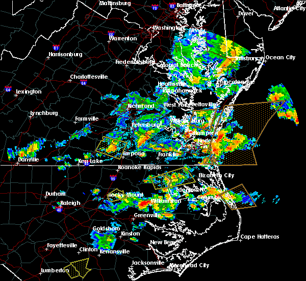 The severe thunderstorm warning for northwestern greensville, west central sussex, southern dinwiddie and northeastern brunswick counties will expire at 615 pm edt, the storm which prompted the warning has weakened below severe limits, and no longer poses an immediate threat to life or property. therefore, the warning will be allowed to expire. however gusty winds and heavy rain are still possible with this thunderstorm. a severe thunderstorm watch remains in effect until 1000 pm edt for south central and southeastern virginia. to report severe weather, contact your nearest law enforcement agency. they will relay your report to the national weather service wakefield. The severe thunderstorm warning for northwestern greensville, west central sussex, southern dinwiddie and northeastern brunswick counties will expire at 615 pm edt, the storm which prompted the warning has weakened below severe limits, and no longer poses an immediate threat to life or property. therefore, the warning will be allowed to expire. however gusty winds and heavy rain are still possible with this thunderstorm. a severe thunderstorm watch remains in effect until 1000 pm edt for south central and southeastern virginia. to report severe weather, contact your nearest law enforcement agency. they will relay your report to the national weather service wakefield.
|
| 8/23/2019 6:00 PM EDT |
 At 600 pm edt, a severe thunderstorm was located 7 miles northwest of purdy, moving southeast at 30 mph (radar indicated). Hazards include 60 mph wind gusts and quarter size hail. Minor damage to vehicles is possible. expect wind damage to trees and powerlines. this severe storm will be near, purdy and radium around 615 pm edt. Other locations impacted by this severe thunderstorm include callaville, cherry hill, rawlings, bufford crossroads, edgerton, dolphin, pleasant shade, fields crossroads, durand and warfield. At 600 pm edt, a severe thunderstorm was located 7 miles northwest of purdy, moving southeast at 30 mph (radar indicated). Hazards include 60 mph wind gusts and quarter size hail. Minor damage to vehicles is possible. expect wind damage to trees and powerlines. this severe storm will be near, purdy and radium around 615 pm edt. Other locations impacted by this severe thunderstorm include callaville, cherry hill, rawlings, bufford crossroads, edgerton, dolphin, pleasant shade, fields crossroads, durand and warfield.
|
| 8/23/2019 5:45 PM EDT |
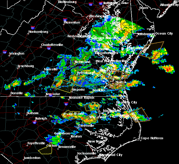 At 544 pm edt, a severe thunderstorm was located near alberta, or near mckenney, moving east at 30 mph (radar indicated). Hazards include 60 mph wind gusts and quarter size hail. Minor damage to vehicles is possible. expect wind damage to trees and powerlines. this severe storm will be near, mckenney around 550 pm edt. purdy around 615 pm edt. Other locations impacted by this severe thunderstorm include cochran, rawlings, bufford crossroads, dolphin, pleasant shade, fields crossroads, warfield, meredithville, cowie corner and ordsburg. At 544 pm edt, a severe thunderstorm was located near alberta, or near mckenney, moving east at 30 mph (radar indicated). Hazards include 60 mph wind gusts and quarter size hail. Minor damage to vehicles is possible. expect wind damage to trees and powerlines. this severe storm will be near, mckenney around 550 pm edt. purdy around 615 pm edt. Other locations impacted by this severe thunderstorm include cochran, rawlings, bufford crossroads, dolphin, pleasant shade, fields crossroads, warfield, meredithville, cowie corner and ordsburg.
|
| 8/23/2019 5:31 PM EDT |
 At 531 pm edt, a severe thunderstorm was located near fort pickett, or 8 miles south of blackstone, moving east at 30 mph (radar indicated). Hazards include 60 mph wind gusts and quarter size hail. Minor damage to vehicles is possible. expect wind damage to trees and powerlines. this severe thunderstorm will be near, alberta around 540 pm edt. mckenney around 550 pm edt. purdy around 615 pm edt. Other locations impacted by this severe thunderstorm include bacons fork, cochran, irby, gills corner, bufford crossroads, dolphin, murdocks, pleasant shade, forkland and meredithville. At 531 pm edt, a severe thunderstorm was located near fort pickett, or 8 miles south of blackstone, moving east at 30 mph (radar indicated). Hazards include 60 mph wind gusts and quarter size hail. Minor damage to vehicles is possible. expect wind damage to trees and powerlines. this severe thunderstorm will be near, alberta around 540 pm edt. mckenney around 550 pm edt. purdy around 615 pm edt. Other locations impacted by this severe thunderstorm include bacons fork, cochran, irby, gills corner, bufford crossroads, dolphin, murdocks, pleasant shade, forkland and meredithville.
|
| 8/22/2019 6:25 PM EDT |
 At 542 pm edt, a severe thunderstorm was located 7 miles southeast of rehoboth, or 10 miles northwest of south hill, moving east at 25 mph (radar indicated). Hazards include 60 mph wind gusts and quarter size hail. Minor damage to vehicles is possible. expect wind damage to trees and powerlines. this severe thunderstorm will be near, south hill around 600 pm edt. dundas around 610 pm edt. lawrenceville and alberta around 630 pm edt. Other locations impacted by this severe thunderstorm include gary, bacons fork, cochran, wilburn, gills corner, loves mill, barrows store, north view, meredithville and forksville. At 542 pm edt, a severe thunderstorm was located 7 miles southeast of rehoboth, or 10 miles northwest of south hill, moving east at 25 mph (radar indicated). Hazards include 60 mph wind gusts and quarter size hail. Minor damage to vehicles is possible. expect wind damage to trees and powerlines. this severe thunderstorm will be near, south hill around 600 pm edt. dundas around 610 pm edt. lawrenceville and alberta around 630 pm edt. Other locations impacted by this severe thunderstorm include gary, bacons fork, cochran, wilburn, gills corner, loves mill, barrows store, north view, meredithville and forksville.
|
| 8/22/2019 5:42 PM EDT |
 At 542 pm edt, a severe thunderstorm was located 7 miles southeast of rehoboth, or 10 miles northwest of south hill, moving east at 25 mph (radar indicated). Hazards include 60 mph wind gusts and quarter size hail. Minor damage to vehicles is possible. expect wind damage to trees and powerlines. this severe thunderstorm will be near, south hill around 600 pm edt. dundas around 610 pm edt. lawrenceville and alberta around 630 pm edt. Other locations impacted by this severe thunderstorm include gary, bacons fork, cochran, wilburn, gills corner, loves mill, barrows store, north view, meredithville and forksville. At 542 pm edt, a severe thunderstorm was located 7 miles southeast of rehoboth, or 10 miles northwest of south hill, moving east at 25 mph (radar indicated). Hazards include 60 mph wind gusts and quarter size hail. Minor damage to vehicles is possible. expect wind damage to trees and powerlines. this severe thunderstorm will be near, south hill around 600 pm edt. dundas around 610 pm edt. lawrenceville and alberta around 630 pm edt. Other locations impacted by this severe thunderstorm include gary, bacons fork, cochran, wilburn, gills corner, loves mill, barrows store, north view, meredithville and forksville.
|
| 8/19/2019 6:27 PM EDT |
 At 627 pm edt, a severe thunderstorm was located near fort pickett, or near blackstone, moving west at 5 mph (radar indicated). Hazards include 60 mph wind gusts and quarter size hail. Minor damage to vehicles is possible. expect wind damage to trees and powerlines. this severe thunderstorm will be near, dundas around 650 pm edt. blackstone around 705 pm edt. kenbridge around 715 pm edt. Other locations impacted by this severe thunderstorm include lafoon corner, ordsburg, danieltown, irby, barrows store, murdocks and forkland. At 627 pm edt, a severe thunderstorm was located near fort pickett, or near blackstone, moving west at 5 mph (radar indicated). Hazards include 60 mph wind gusts and quarter size hail. Minor damage to vehicles is possible. expect wind damage to trees and powerlines. this severe thunderstorm will be near, dundas around 650 pm edt. blackstone around 705 pm edt. kenbridge around 715 pm edt. Other locations impacted by this severe thunderstorm include lafoon corner, ordsburg, danieltown, irby, barrows store, murdocks and forkland.
|
| 7/22/2019 8:53 PM EDT |
 The severe thunderstorm warning for eastern lunenburg, southern nottoway and northwestern brunswick counties will expire at 900 pm edt, the storms which prompted the warning have moved out of the area. therefore, the warning will be allowed to expire. to report severe weather, contact your nearest law enforcement agency. they will relay your report to the national weather service wakefield. The severe thunderstorm warning for eastern lunenburg, southern nottoway and northwestern brunswick counties will expire at 900 pm edt, the storms which prompted the warning have moved out of the area. therefore, the warning will be allowed to expire. to report severe weather, contact your nearest law enforcement agency. they will relay your report to the national weather service wakefield.
|
| 7/22/2019 8:38 PM EDT |
 At 837 pm edt, severe thunderstorms were located along a line extending from near lunenburg to near kenbridge to near brodnax, moving northeast at 25 mph (radar indicated). Hazards include 60 mph wind gusts. Expect damage to trees and powerlines. these severe storms will be near, kenbridge and dundas around 845 pm edt. blackstone, nottoway, alberta and fort pickett around 900 pm edt. Other locations impacted by these severe thunderstorms include gary, bacons fork, cochran, irby, wilburn, gills corner, loves mill, barrows store, murdocks and forkland. At 837 pm edt, severe thunderstorms were located along a line extending from near lunenburg to near kenbridge to near brodnax, moving northeast at 25 mph (radar indicated). Hazards include 60 mph wind gusts. Expect damage to trees and powerlines. these severe storms will be near, kenbridge and dundas around 845 pm edt. blackstone, nottoway, alberta and fort pickett around 900 pm edt. Other locations impacted by these severe thunderstorms include gary, bacons fork, cochran, irby, wilburn, gills corner, loves mill, barrows store, murdocks and forkland.
|
| 7/22/2019 8:35 PM EDT | Tree knocked down across christanna hwy. time estimated from rada in brunswick county VA, 1 miles NE of Alberta, VA |
| 7/22/2019 8:28 PM EDT |
 At 827 pm edt, severe thunderstorms were located along a line extending from rehoboth to near kenbridge to south hill, moving northeast at 25 mph (radar indicated). Hazards include 60 mph wind gusts. Expect damage to trees and powerlines. these severe storms will be near, kenbridge around 840 pm edt. dundas around 845 pm edt. victoria around 850 pm edt. blackstone, nottoway, alberta and fort pickett around 900 pm edt. Other locations impacted by these severe thunderstorms include bacons fork, cochran, irby, wilburn, gills corner, dolphin, murdocks, forkland, nutbush and meredithville. At 827 pm edt, severe thunderstorms were located along a line extending from rehoboth to near kenbridge to south hill, moving northeast at 25 mph (radar indicated). Hazards include 60 mph wind gusts. Expect damage to trees and powerlines. these severe storms will be near, kenbridge around 840 pm edt. dundas around 845 pm edt. victoria around 850 pm edt. blackstone, nottoway, alberta and fort pickett around 900 pm edt. Other locations impacted by these severe thunderstorms include bacons fork, cochran, irby, wilburn, gills corner, dolphin, murdocks, forkland, nutbush and meredithville.
|
| 7/22/2019 8:15 PM EDT |
 At 815 pm edt, severe thunderstorms were located along a line extending from near kells corner to 8 miles southeast of rehoboth to 6 miles southwest of south hill, moving northeast at 40 mph (radar indicated). Hazards include 60 mph wind gusts and penny size hail. Expect damage to trees and powerlines. severe thunderstorms will be near, la crosse around 825 pm edt. south hill and kenbridge around 830 pm edt. lunenburg and dundas around 835 pm edt. victoria around 840 pm edt. alberta and fort pickett around 850 pm edt. nottoway around 855 pm edt. blackstone around 900 pm edt. Other locations impacted by these severe thunderstorms include bacons fork, cochran, irby, wilburn, spanish grove, gills corner, arvins store, dolphin, murdocks and forkland. At 815 pm edt, severe thunderstorms were located along a line extending from near kells corner to 8 miles southeast of rehoboth to 6 miles southwest of south hill, moving northeast at 40 mph (radar indicated). Hazards include 60 mph wind gusts and penny size hail. Expect damage to trees and powerlines. severe thunderstorms will be near, la crosse around 825 pm edt. south hill and kenbridge around 830 pm edt. lunenburg and dundas around 835 pm edt. victoria around 840 pm edt. alberta and fort pickett around 850 pm edt. nottoway around 855 pm edt. blackstone around 900 pm edt. Other locations impacted by these severe thunderstorms include bacons fork, cochran, irby, wilburn, spanish grove, gills corner, arvins store, dolphin, murdocks and forkland.
|
| 6/20/2019 4:04 PM EDT |
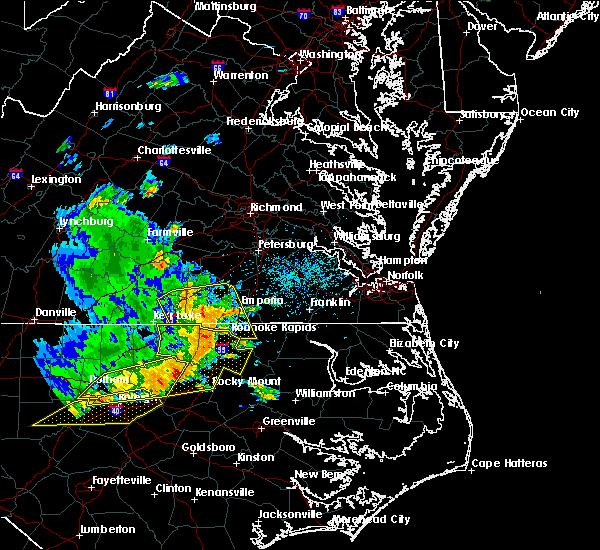 At 403 pm edt, severe thunderstorms were located along a line extending from near lawrenceville to near barley, moving east at 45 mph (radar indicated). Hazards include 70 mph wind gusts. Expect considerable tree damage. damage is likely to mobile homes, roofs, and outbuildings. these severe storms will be near, roanoke rapids and gaston around 410 pm edt. garysburg around 415 pm edt. dahlia and radium around 420 pm edt. purdy and seaboard around 425 pm edt. Other locations impacted by these severe thunderstorms include cochran, gum forks, bufford crossroads, lanes corner, dolphin, bowens corner, pleasant shade, henrico, slates corner and emporia reservoir. At 403 pm edt, severe thunderstorms were located along a line extending from near lawrenceville to near barley, moving east at 45 mph (radar indicated). Hazards include 70 mph wind gusts. Expect considerable tree damage. damage is likely to mobile homes, roofs, and outbuildings. these severe storms will be near, roanoke rapids and gaston around 410 pm edt. garysburg around 415 pm edt. dahlia and radium around 420 pm edt. purdy and seaboard around 425 pm edt. Other locations impacted by these severe thunderstorms include cochran, gum forks, bufford crossroads, lanes corner, dolphin, bowens corner, pleasant shade, henrico, slates corner and emporia reservoir.
|
| 6/20/2019 3:40 PM EDT |
 At 339 pm edt, severe thunderstorms were located along a line extending from near south hill to 7 miles northeast of warrenton, moving east at 45 mph (radar indicated). Hazards include 70 mph wind gusts. Expect considerable tree damage. damage is likely to mobile homes, roofs, and outbuildings. severe thunderstorms will be near, ebony around 345 pm edt. brodnax around 350 pm edt. gasburg around 355 pm edt. lawrenceville, alberta and barley around 405 pm edt. roanoke rapids and gaston around 410 pm edt. garysburg around 415 pm edt. dahlia and radium around 420 pm edt. purdy and seaboard around 425 pm edt. Other locations impacted by these severe thunderstorms include bacons fork, cochran, gum forks, bufford crossroads, lanes corner, dolphin, bowens corner, pleasant shade, henrico and slates corner. At 339 pm edt, severe thunderstorms were located along a line extending from near south hill to 7 miles northeast of warrenton, moving east at 45 mph (radar indicated). Hazards include 70 mph wind gusts. Expect considerable tree damage. damage is likely to mobile homes, roofs, and outbuildings. severe thunderstorms will be near, ebony around 345 pm edt. brodnax around 350 pm edt. gasburg around 355 pm edt. lawrenceville, alberta and barley around 405 pm edt. roanoke rapids and gaston around 410 pm edt. garysburg around 415 pm edt. dahlia and radium around 420 pm edt. purdy and seaboard around 425 pm edt. Other locations impacted by these severe thunderstorms include bacons fork, cochran, gum forks, bufford crossroads, lanes corner, dolphin, bowens corner, pleasant shade, henrico and slates corner.
|
| 6/10/2019 9:56 PM EDT |
 At 955 pm edt, severe thunderstorms were located along a line extending from near burkeville to near nottoway to near lunenburg, moving east at 25 mph (radar indicated). Hazards include 60 mph wind gusts. expect damage to trees and powerlines At 955 pm edt, severe thunderstorms were located along a line extending from near burkeville to near nottoway to near lunenburg, moving east at 25 mph (radar indicated). Hazards include 60 mph wind gusts. expect damage to trees and powerlines
|
| 5/26/2019 1:28 AM EDT |
 The severe thunderstorm warning for northeastern mecklenburg, southeastern lunenburg and northwestern brunswick counties will expire at 130 am edt, the storms which prompted the warning have weakened below severe limits, and no longer pose an immediate threat to life or property. therefore, the warning will be allowed to expire. however heavy rain is still possible with these thunderstorms. The severe thunderstorm warning for northeastern mecklenburg, southeastern lunenburg and northwestern brunswick counties will expire at 130 am edt, the storms which prompted the warning have weakened below severe limits, and no longer pose an immediate threat to life or property. therefore, the warning will be allowed to expire. however heavy rain is still possible with these thunderstorms.
|
| 5/26/2019 1:12 AM EDT |
 At 112 am edt, severe thunderstorms were located along a line extending from kenbridge to 7 miles southwest of dundas to 7 miles west of south hill, moving southeast at 25 mph (radar indicated). Hazards include 60 mph wind gusts and quarter size hail. Minor damage to vehicles is possible. expect wind damage to trees and powerlines. these severe storms will be near, south hill, brodnax, la crosse, alberta and dundas around 130 am edt. Other locations impacted by these severe thunderstorms include gary, bacons fork, cochran, gills corner, dolphin, barrows store, north view, meredithville, forksville and lafoon corner. At 112 am edt, severe thunderstorms were located along a line extending from kenbridge to 7 miles southwest of dundas to 7 miles west of south hill, moving southeast at 25 mph (radar indicated). Hazards include 60 mph wind gusts and quarter size hail. Minor damage to vehicles is possible. expect wind damage to trees and powerlines. these severe storms will be near, south hill, brodnax, la crosse, alberta and dundas around 130 am edt. Other locations impacted by these severe thunderstorms include gary, bacons fork, cochran, gills corner, dolphin, barrows store, north view, meredithville, forksville and lafoon corner.
|
| 5/26/2019 12:46 AM EDT |
 At 1246 am edt, severe thunderstorms were located along a line extending from near lunenburg to rehoboth to chase city, moving east at 35 mph (radar indicated). Hazards include 60 mph wind gusts and quarter size hail. Minor damage to vehicles is possible. expect wind damage to trees and powerlines. severe thunderstorms will be near, victoria and lunenburg around 1255 am edt. kenbridge around 100 am edt. dundas around 115 am edt. south hill and la crosse around 120 am edt. brodnax and alberta around 125 am edt. Other locations impacted by these severe thunderstorms include bacons fork, cochran, wilburn, spanish grove, gills corner, arvins store, dolphin, nutbush, finneywood and meredithville. At 1246 am edt, severe thunderstorms were located along a line extending from near lunenburg to rehoboth to chase city, moving east at 35 mph (radar indicated). Hazards include 60 mph wind gusts and quarter size hail. Minor damage to vehicles is possible. expect wind damage to trees and powerlines. severe thunderstorms will be near, victoria and lunenburg around 1255 am edt. kenbridge around 100 am edt. dundas around 115 am edt. south hill and la crosse around 120 am edt. brodnax and alberta around 125 am edt. Other locations impacted by these severe thunderstorms include bacons fork, cochran, wilburn, spanish grove, gills corner, arvins store, dolphin, nutbush, finneywood and meredithville.
|
| 5/12/2019 9:08 PM EDT |
 At 907 pm edt, a severe thunderstorm was located near kenbridge, moving east at 25 mph (radar indicated). Hazards include 60 mph wind gusts and quarter size hail. Minor damage to vehicles is possible. expect wind damage to trees and powerlines. this severe thunderstorm will be near, kenbridge around 915 pm edt. dundas around 930 pm edt. alberta around 950 pm edt. Other locations impacted by this severe thunderstorm include lafoon corner, gary, bacons fork, ordsburg, danieltown, cochran, gills corner, barrows store, oral oaks and meredithville. At 907 pm edt, a severe thunderstorm was located near kenbridge, moving east at 25 mph (radar indicated). Hazards include 60 mph wind gusts and quarter size hail. Minor damage to vehicles is possible. expect wind damage to trees and powerlines. this severe thunderstorm will be near, kenbridge around 915 pm edt. dundas around 930 pm edt. alberta around 950 pm edt. Other locations impacted by this severe thunderstorm include lafoon corner, gary, bacons fork, ordsburg, danieltown, cochran, gills corner, barrows store, oral oaks and meredithville.
|
| 4/19/2019 6:55 PM EDT |
 At 655 pm edt, a confirmed tornado was located near alberta, or 7 miles northwest of lawrenceville, moving northeast at 40 mph (radar confirmed tornado). Hazards include damaging tornado. Flying debris will be dangerous to those caught without shelter. mobile homes will be damaged or destroyed. damage to roofs, windows, and vehicles will occur. tree damage is likely. this tornado will be near, alberta around 705 pm edt. mckenney and fort pickett around 715 pm edt. Other locations impacted by this tornadic thunderstorm include ordsburg, danieltown, cochran, rawlings and prices mill. At 655 pm edt, a confirmed tornado was located near alberta, or 7 miles northwest of lawrenceville, moving northeast at 40 mph (radar confirmed tornado). Hazards include damaging tornado. Flying debris will be dangerous to those caught without shelter. mobile homes will be damaged or destroyed. damage to roofs, windows, and vehicles will occur. tree damage is likely. this tornado will be near, alberta around 705 pm edt. mckenney and fort pickett around 715 pm edt. Other locations impacted by this tornadic thunderstorm include ordsburg, danieltown, cochran, rawlings and prices mill.
|
| 4/19/2019 6:50 PM EDT |
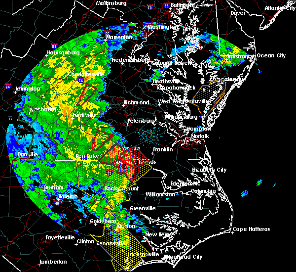 At 650 pm edt, a severe thunderstorm capable of producing a tornado was located near brodnax, moving northeast at 40 mph (radar indicated rotation). Hazards include tornado. Flying debris will be dangerous to those caught without shelter. mobile homes will be damaged or destroyed. damage to roofs, windows, and vehicles will occur. tree damage is likely. this dangerous storm will be near, alberta around 700 pm edt. mckenney and fort pickett around 715 pm edt. Other locations impacted by this tornadic thunderstorm include ordsburg, danieltown, cochran, rawlings, barrows store, meredithville and prices mill. At 650 pm edt, a severe thunderstorm capable of producing a tornado was located near brodnax, moving northeast at 40 mph (radar indicated rotation). Hazards include tornado. Flying debris will be dangerous to those caught without shelter. mobile homes will be damaged or destroyed. damage to roofs, windows, and vehicles will occur. tree damage is likely. this dangerous storm will be near, alberta around 700 pm edt. mckenney and fort pickett around 715 pm edt. Other locations impacted by this tornadic thunderstorm include ordsburg, danieltown, cochran, rawlings, barrows store, meredithville and prices mill.
|
| 4/15/2019 1:32 AM EDT |
 At 132 am edt, a severe thunderstorm was located near alberta, or 10 miles southeast of blackstone, moving northeast at 50 mph (radar indicated). Hazards include 60 mph wind gusts. Expect damage to trees and powerlines. this severe storm will be near, mckenney around 145 am edt. other locations impacted by this severe thunderstorm include ordsburg, danieltown, cochran, rawlings, barrows store, forkland, warfield, meredithville, darvills and prices mill. A tornado watch remains in effect until 700 am edt for south central and southeastern virginia. At 132 am edt, a severe thunderstorm was located near alberta, or 10 miles southeast of blackstone, moving northeast at 50 mph (radar indicated). Hazards include 60 mph wind gusts. Expect damage to trees and powerlines. this severe storm will be near, mckenney around 145 am edt. other locations impacted by this severe thunderstorm include ordsburg, danieltown, cochran, rawlings, barrows store, forkland, warfield, meredithville, darvills and prices mill. A tornado watch remains in effect until 700 am edt for south central and southeastern virginia.
|
| 4/15/2019 1:22 AM EDT |
 At 122 am edt, a severe thunderstorm was located near dundas, or 9 miles southeast of kenbridge, moving northeast at 50 mph (radar indicated). Hazards include 60 mph wind gusts. Expect damage to trees and powerlines. this severe storm will be near, alberta around 130 am edt. mckenney around 145 am edt. other locations impacted by this severe thunderstorm include bacons fork, cochran, gills corner, rawlings, dolphin, barrows store, forkland, warfield, meredithville and darvills. A tornado watch remains in effect until 700 am edt for south central and southeastern virginia. At 122 am edt, a severe thunderstorm was located near dundas, or 9 miles southeast of kenbridge, moving northeast at 50 mph (radar indicated). Hazards include 60 mph wind gusts. Expect damage to trees and powerlines. this severe storm will be near, alberta around 130 am edt. mckenney around 145 am edt. other locations impacted by this severe thunderstorm include bacons fork, cochran, gills corner, rawlings, dolphin, barrows store, forkland, warfield, meredithville and darvills. A tornado watch remains in effect until 700 am edt for south central and southeastern virginia.
|
| 4/15/2019 1:03 AM EDT |
 At 102 am edt, a severe thunderstorm was located near south hill, moving northeast at 50 mph (radar indicated). Hazards include 60 mph wind gusts. Expect damage to trees and powerlines. this severe thunderstorm will be near, la crosse around 110 am edt. south hill and brodnax around 115 am edt. dundas around 125 am edt. alberta around 130 am edt. mckenney around 145 am edt. other locations impacted by this severe thunderstorm include bacons fork, gary, cochran, beechwood, gills corner, rawlings, dolphin, barrows store, john h kerr dam and forkland. A tornado watch remains in effect until 700 am edt for south central and southeastern virginia. At 102 am edt, a severe thunderstorm was located near south hill, moving northeast at 50 mph (radar indicated). Hazards include 60 mph wind gusts. Expect damage to trees and powerlines. this severe thunderstorm will be near, la crosse around 110 am edt. south hill and brodnax around 115 am edt. dundas around 125 am edt. alberta around 130 am edt. mckenney around 145 am edt. other locations impacted by this severe thunderstorm include bacons fork, gary, cochran, beechwood, gills corner, rawlings, dolphin, barrows store, john h kerr dam and forkland. A tornado watch remains in effect until 700 am edt for south central and southeastern virginia.
|
| 9/14/2018 6:14 PM EDT |
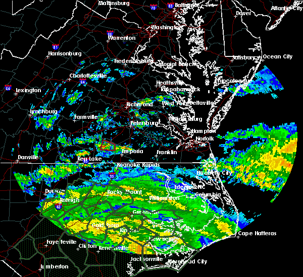 At 613 pm edt, a severe thunderstorm capable of producing a tornado was located over alberta, or near lawrenceville, moving west at 30 mph (radar indicated rotation). Hazards include tornado. Flying debris will be dangerous to those caught without shelter. mobile homes will be damaged or destroyed. damage to roofs, windows, and vehicles will occur. tree damage is likely. This tornadic thunderstorm will remain over mainly rural areas of southeastern lunenburg and west central brunswick counties, including the following locations, bacons fork, cochran, meredithville, gills corner and prices mill. At 613 pm edt, a severe thunderstorm capable of producing a tornado was located over alberta, or near lawrenceville, moving west at 30 mph (radar indicated rotation). Hazards include tornado. Flying debris will be dangerous to those caught without shelter. mobile homes will be damaged or destroyed. damage to roofs, windows, and vehicles will occur. tree damage is likely. This tornadic thunderstorm will remain over mainly rural areas of southeastern lunenburg and west central brunswick counties, including the following locations, bacons fork, cochran, meredithville, gills corner and prices mill.
|
| 9/14/2018 6:00 PM EDT |
 At 600 pm edt, a severe thunderstorm capable of producing a tornado was located 7 miles east of alberta, or 8 miles northeast of lawrenceville, moving west at 30 mph (radar indicated rotation). Hazards include tornado. Flying debris will be dangerous to those caught without shelter. mobile homes will be damaged or destroyed. damage to roofs, windows, and vehicles will occur. tree damage is likely. this dangerous storm will be near, alberta around 615 pm edt. Other locations impacted by this tornadic thunderstorm include callaville, warfield, edgerton and dolphin. At 600 pm edt, a severe thunderstorm capable of producing a tornado was located 7 miles east of alberta, or 8 miles northeast of lawrenceville, moving west at 30 mph (radar indicated rotation). Hazards include tornado. Flying debris will be dangerous to those caught without shelter. mobile homes will be damaged or destroyed. damage to roofs, windows, and vehicles will occur. tree damage is likely. this dangerous storm will be near, alberta around 615 pm edt. Other locations impacted by this tornadic thunderstorm include callaville, warfield, edgerton and dolphin.
|
| 9/14/2018 5:48 PM EDT |
 At 548 pm edt, a severe thunderstorm capable of producing a tornado was located over purdy, moving west at 30 mph (radar indicated rotation). Hazards include tornado. Flying debris will be dangerous to those caught without shelter. mobile homes will be damaged or destroyed. damage to roofs, windows, and vehicles will occur. tree damage is likely. this dangerous storm will be near, alberta around 615 pm edt. Other locations impacted by this tornadic thunderstorm include callaville, warfield, edgerton and dolphin. At 548 pm edt, a severe thunderstorm capable of producing a tornado was located over purdy, moving west at 30 mph (radar indicated rotation). Hazards include tornado. Flying debris will be dangerous to those caught without shelter. mobile homes will be damaged or destroyed. damage to roofs, windows, and vehicles will occur. tree damage is likely. this dangerous storm will be near, alberta around 615 pm edt. Other locations impacted by this tornadic thunderstorm include callaville, warfield, edgerton and dolphin.
|
| 8/2/2018 5:29 PM EDT |
 At 528 pm edt, severe thunderstorms were located along a line extending from near fort pickett to near mckenney to near jarratt, moving northeast at 40 mph (radar indicated). Hazards include 60 mph wind gusts. Expect damage to trees and powerlines. Locations impacted include, dinwiddie, emporia, blackstone, lawrenceville, mckenney, purdy, jarratt, alberta, stony creek, dewitt, spainville, carson, wilsons, fort pickett, radium, sutherland, north wellville, dolphin, pleasant shade and wharfs store. At 528 pm edt, severe thunderstorms were located along a line extending from near fort pickett to near mckenney to near jarratt, moving northeast at 40 mph (radar indicated). Hazards include 60 mph wind gusts. Expect damage to trees and powerlines. Locations impacted include, dinwiddie, emporia, blackstone, lawrenceville, mckenney, purdy, jarratt, alberta, stony creek, dewitt, spainville, carson, wilsons, fort pickett, radium, sutherland, north wellville, dolphin, pleasant shade and wharfs store.
|
| 8/2/2018 5:15 PM EDT |
 At 514 pm edt, severe thunderstorms were located along a line extending from near dundas to 7 miles south of mckenney to near emporia, moving northeast at 40 mph (radar indicated). Hazards include 60 mph wind gusts. Expect damage to trees and powerlines. severe thunderstorms will be near, mckenney around 525 pm edt. jarratt, dewitt and fort pickett around 530 pm edt. dinwiddie around 540 pm edt. stony creek and wilsons around 545 pm edt. sutherland around 550 pm edt. Other locations impacted by these severe thunderstorms include bacons fork, north wellville, dolphin, bowens corner, pleasant shade, wharfs store, forksville, wellville, blackstone airport and brink. At 514 pm edt, severe thunderstorms were located along a line extending from near dundas to 7 miles south of mckenney to near emporia, moving northeast at 40 mph (radar indicated). Hazards include 60 mph wind gusts. Expect damage to trees and powerlines. severe thunderstorms will be near, mckenney around 525 pm edt. jarratt, dewitt and fort pickett around 530 pm edt. dinwiddie around 540 pm edt. stony creek and wilsons around 545 pm edt. sutherland around 550 pm edt. Other locations impacted by these severe thunderstorms include bacons fork, north wellville, dolphin, bowens corner, pleasant shade, wharfs store, forksville, wellville, blackstone airport and brink.
|
| 6/22/2018 5:39 PM EDT |
 At 537 pm edt, a severe thunderstorm was located near ebony, or 8 miles southwest of brodnax, moving northeast at 30 mph (radar indicated). Hazards include 60 mph wind gusts and quarter size hail. Minor damage to vehicles is possible. expect wind damage to trees and powerlines. this severe thunderstorm will be near, brodnax and ebony around 550 pm edt. gasburg around 600 pm edt. brunswick around 605 pm edt. lawrenceville around 615 pm edt. Other locations impacted by this severe thunderstorm include ante, cochran, triplet, dolphin, bowens corner, white plains, valentines, warfield, meredithville and callaville. At 537 pm edt, a severe thunderstorm was located near ebony, or 8 miles southwest of brodnax, moving northeast at 30 mph (radar indicated). Hazards include 60 mph wind gusts and quarter size hail. Minor damage to vehicles is possible. expect wind damage to trees and powerlines. this severe thunderstorm will be near, brodnax and ebony around 550 pm edt. gasburg around 600 pm edt. brunswick around 605 pm edt. lawrenceville around 615 pm edt. Other locations impacted by this severe thunderstorm include ante, cochran, triplet, dolphin, bowens corner, white plains, valentines, warfield, meredithville and callaville.
|
| 6/10/2018 10:17 PM EDT |
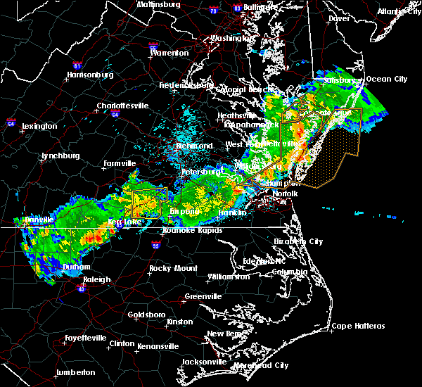 At 1017 pm edt, a severe thunderstorm was located over alberta, or 8 miles north of lawrenceville, moving east at 30 mph (radar indicated). Hazards include 60 mph wind gusts. Expect damage to trees and powerlines. Locations impacted include, lawrenceville, mckenney, alberta, dewitt, ante, cochran, rawlings, dolphin, barrows store, forkland, warfield, wharfs store, meredithville, ordsburg, danieltown, callaville, cherry hill, edgerton, butterworth and prices mill. At 1017 pm edt, a severe thunderstorm was located over alberta, or 8 miles north of lawrenceville, moving east at 30 mph (radar indicated). Hazards include 60 mph wind gusts. Expect damage to trees and powerlines. Locations impacted include, lawrenceville, mckenney, alberta, dewitt, ante, cochran, rawlings, dolphin, barrows store, forkland, warfield, wharfs store, meredithville, ordsburg, danieltown, callaville, cherry hill, edgerton, butterworth and prices mill.
|
| 6/10/2018 10:08 PM EDT |
 At 1008 pm edt, a severe thunderstorm was located near alberta, or 9 miles northwest of lawrenceville, moving east at 30 mph (radar indicated). Hazards include 60 mph wind gusts. Expect damage to trees and powerlines. Locations impacted include, south hill, lawrenceville, kenbridge, mckenney, brodnax, la crosse, alberta, dewitt, dundas, bacons fork, cochran, gills corner, dolphin, forkland, wharfs store, meredithville, forksville, edgerton, butterworth and ante. At 1008 pm edt, a severe thunderstorm was located near alberta, or 9 miles northwest of lawrenceville, moving east at 30 mph (radar indicated). Hazards include 60 mph wind gusts. Expect damage to trees and powerlines. Locations impacted include, south hill, lawrenceville, kenbridge, mckenney, brodnax, la crosse, alberta, dewitt, dundas, bacons fork, cochran, gills corner, dolphin, forkland, wharfs store, meredithville, forksville, edgerton, butterworth and ante.
|
| 5/6/2018 8:31 PM EDT |
 At 831 pm edt, severe thunderstorms were located along a line extending from near dundas to 7 miles southeast of boydton, moving east at 25 mph (radar indicated). Hazards include 60 mph wind gusts and quarter size hail. Minor damage to vehicles is possible. expect wind damage to trees and powerlines. Locations impacted include, south hill, lawrenceville, brodnax, la crosse, alberta, gasburg, ebony, bacons fork, cochran, beechwood, gills corner, bowens corner, john h kerr dam, white plains, meredithville, forksville, bracey, keats, eppes fork and baskerville. At 831 pm edt, severe thunderstorms were located along a line extending from near dundas to 7 miles southeast of boydton, moving east at 25 mph (radar indicated). Hazards include 60 mph wind gusts and quarter size hail. Minor damage to vehicles is possible. expect wind damage to trees and powerlines. Locations impacted include, south hill, lawrenceville, brodnax, la crosse, alberta, gasburg, ebony, bacons fork, cochran, beechwood, gills corner, bowens corner, john h kerr dam, white plains, meredithville, forksville, bracey, keats, eppes fork and baskerville.
|
| 5/6/2018 8:18 PM EDT |
 At 817 pm edt, severe thunderstorms were located along a line extending from 6 miles south of kenbridge to near boydton, moving east at 25 mph (radar indicated). Hazards include 60 mph wind gusts and quarter size hail. Minor damage to vehicles is possible. expect wind damage to trees and powerlines. Locations impacted include, south hill, lawrenceville, brodnax, la crosse, boydton, alberta, gasburg, ebony, bacons fork, cochran, beechwood, gills corner, bowens corner, finchley, meredithville, forksville, rogers corner, bracey, eppes fork and baskerville. At 817 pm edt, severe thunderstorms were located along a line extending from 6 miles south of kenbridge to near boydton, moving east at 25 mph (radar indicated). Hazards include 60 mph wind gusts and quarter size hail. Minor damage to vehicles is possible. expect wind damage to trees and powerlines. Locations impacted include, south hill, lawrenceville, brodnax, la crosse, boydton, alberta, gasburg, ebony, bacons fork, cochran, beechwood, gills corner, bowens corner, finchley, meredithville, forksville, rogers corner, bracey, eppes fork and baskerville.
|
| 5/6/2018 8:05 PM EDT |
 The national weather service in wakefield has issued a * severe thunderstorm warning for. mecklenburg county in south central virginia. southeastern lunenburg county in south central virginia. southwestern brunswick county in south central virginia. Until 845 pm edt. The national weather service in wakefield has issued a * severe thunderstorm warning for. mecklenburg county in south central virginia. southeastern lunenburg county in south central virginia. southwestern brunswick county in south central virginia. Until 845 pm edt.
|
| 1/12/2018 9:49 PM EST |
 At 949 pm est, severe thunderstorms were located along a line extending from near spainville to near alberta to brunswick, moving northeast at 45 mph (radar indicated). Hazards include 60 mph wind gusts. Expect damage to trees and powerlines. these severe storms will be near, spainville and wilsons around 955 pm est. scotts fork around 1000 pm est. mckenney, mannboro and radium around 1005 pm est. dewitt around 1010 pm est. dinwiddie, emporia, purdy, jarratt and green plain around 1015 pm est. Other locations impacted by these severe thunderstorms include north wellville, grizzard, dolphin, bowens corner, ammon, murdocks, pleasant shade, wharfs store, wellville and blackstone airport. At 949 pm est, severe thunderstorms were located along a line extending from near spainville to near alberta to brunswick, moving northeast at 45 mph (radar indicated). Hazards include 60 mph wind gusts. Expect damage to trees and powerlines. these severe storms will be near, spainville and wilsons around 955 pm est. scotts fork around 1000 pm est. mckenney, mannboro and radium around 1005 pm est. dewitt around 1010 pm est. dinwiddie, emporia, purdy, jarratt and green plain around 1015 pm est. Other locations impacted by these severe thunderstorms include north wellville, grizzard, dolphin, bowens corner, ammon, murdocks, pleasant shade, wharfs store, wellville and blackstone airport.
|
| 1/12/2018 9:35 PM EST |
 At 933 pm est, severe thunderstorms were located along a line extending from near nottoway to alberta to near ebony, moving northeast at 55 mph (radar indicated). Hazards include 60 mph wind gusts. Expect damage to trees and powerlines. severe thunderstorms will be near, nottoway around 940 pm est. blackstone, brunswick and alberta around 945 pm est. lawrenceville and spainville around 950 pm est. mckenney, wilsons and scotts fork around 955 pm est. mannboro and radium around 1000 pm est. emporia, purdy and dewitt around 1005 pm est. dinwiddie, green plain and sutherland around 1010 pm est. jarratt and stony creek around 1015 pm est. Other locations impacted by these severe thunderstorms include bacons fork, north wellville, grizzard, dolphin, bowens corner, ammon, murdocks, pleasant shade, wharfs store and forksville. At 933 pm est, severe thunderstorms were located along a line extending from near nottoway to alberta to near ebony, moving northeast at 55 mph (radar indicated). Hazards include 60 mph wind gusts. Expect damage to trees and powerlines. severe thunderstorms will be near, nottoway around 940 pm est. blackstone, brunswick and alberta around 945 pm est. lawrenceville and spainville around 950 pm est. mckenney, wilsons and scotts fork around 955 pm est. mannboro and radium around 1000 pm est. emporia, purdy and dewitt around 1005 pm est. dinwiddie, green plain and sutherland around 1010 pm est. jarratt and stony creek around 1015 pm est. Other locations impacted by these severe thunderstorms include bacons fork, north wellville, grizzard, dolphin, bowens corner, ammon, murdocks, pleasant shade, wharfs store and forksville.
|
| 6/19/2017 8:07 PM EDT |
 The severe thunderstorm warning for north central mecklenburg, lunenburg, southwestern nottoway and northwestern brunswick counties will expire at 815 pm edt, the storm which prompted the warning has moved out of the area. therefore the warning will be allowed to expire. a severe thunderstorm watch remains in effect until 1000 pm edt for south central virginia. The severe thunderstorm warning for north central mecklenburg, lunenburg, southwestern nottoway and northwestern brunswick counties will expire at 815 pm edt, the storm which prompted the warning has moved out of the area. therefore the warning will be allowed to expire. a severe thunderstorm watch remains in effect until 1000 pm edt for south central virginia.
|
| 6/19/2017 7:29 PM EDT |
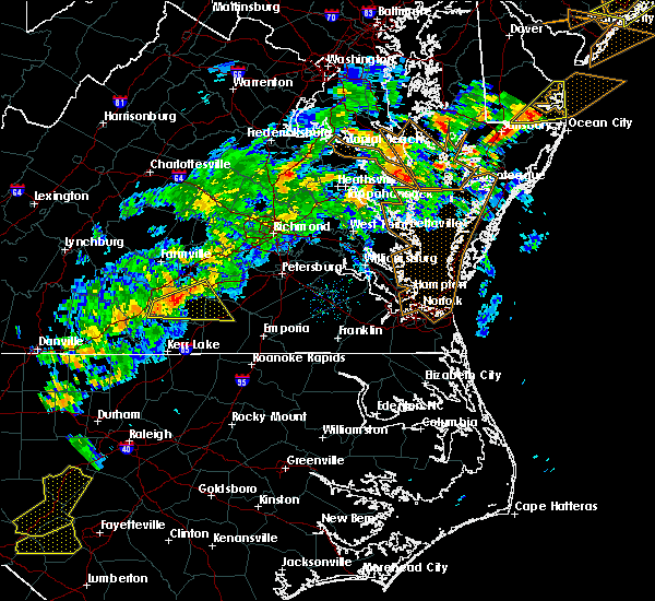 At 728 pm edt, a severe thunderstorm was located over rehoboth, or 7 miles southwest of victoria, moving east at 40 mph (radar indicated). Hazards include 60 mph wind gusts and quarter size hail. Minor damage to vehicles is possible. expect wind damage to trees and powerlines. this severe thunderstorm will be near, victoria around 740 pm edt. kenbridge around 745 pm edt. dundas around 755 pm edt. fort pickett around 805 pm edt. Other locations impacted by this severe thunderstorm include bacons fork, gary, cochran, irby, wilburn, gills corner, loves mill, dolphin, barrows store and murdocks. At 728 pm edt, a severe thunderstorm was located over rehoboth, or 7 miles southwest of victoria, moving east at 40 mph (radar indicated). Hazards include 60 mph wind gusts and quarter size hail. Minor damage to vehicles is possible. expect wind damage to trees and powerlines. this severe thunderstorm will be near, victoria around 740 pm edt. kenbridge around 745 pm edt. dundas around 755 pm edt. fort pickett around 805 pm edt. Other locations impacted by this severe thunderstorm include bacons fork, gary, cochran, irby, wilburn, gills corner, loves mill, dolphin, barrows store and murdocks.
|
| 5/5/2017 6:38 AM EDT |
 At 638 am edt, severe thunderstorms were located along a line extending from 6 miles northeast of dundas to alberta to near lawrenceville to near gasburg, moving northeast at 40 mph (radar indicated). Hazards include 60 mph wind gusts. Expect damage to roofs, siding, and trees. severe thunderstorms will be near, alberta around 645 am edt. mckenney and barley around 700 am edt. dewitt around 710 am edt. dinwiddie and radium around 720 am edt. emporia, purdy, jarratt and stony creek around 730 am edt. other locations impacted by these severe thunderstorms include cochran, gum forks, bufford crossroads, lanes corner, addison, dolphin, bowens corner, pleasant shade, henrico and slates corner. A tornado watch remains in effect until 100 pm edt for northeastern north carolina, and southeastern virginia. At 638 am edt, severe thunderstorms were located along a line extending from 6 miles northeast of dundas to alberta to near lawrenceville to near gasburg, moving northeast at 40 mph (radar indicated). Hazards include 60 mph wind gusts. Expect damage to roofs, siding, and trees. severe thunderstorms will be near, alberta around 645 am edt. mckenney and barley around 700 am edt. dewitt around 710 am edt. dinwiddie and radium around 720 am edt. emporia, purdy, jarratt and stony creek around 730 am edt. other locations impacted by these severe thunderstorms include cochran, gum forks, bufford crossroads, lanes corner, addison, dolphin, bowens corner, pleasant shade, henrico and slates corner. A tornado watch remains in effect until 100 pm edt for northeastern north carolina, and southeastern virginia.
|
| 5/5/2017 6:31 AM EDT |
 At 631 am edt, a severe thunderstorm was located over alberta, or 9 miles north of lawrenceville, moving northeast at 45 mph (radar indicated). Hazards include 60 mph wind gusts. Expect damage to roofs, siding, and trees. this severe storm will be near, mckenney around 645 am edt. other locations impacted by this severe thunderstorm include bacons fork, ordsburg, danieltown, cochran, gills corner, rawlings, dolphin, warfield, meredithville and forksville. A tornado watch remains in effect until 100 pm edt for southeastern virginia. At 631 am edt, a severe thunderstorm was located over alberta, or 9 miles north of lawrenceville, moving northeast at 45 mph (radar indicated). Hazards include 60 mph wind gusts. Expect damage to roofs, siding, and trees. this severe storm will be near, mckenney around 645 am edt. other locations impacted by this severe thunderstorm include bacons fork, ordsburg, danieltown, cochran, gills corner, rawlings, dolphin, warfield, meredithville and forksville. A tornado watch remains in effect until 100 pm edt for southeastern virginia.
|
| 5/5/2017 6:15 AM EDT |
 At 614 am edt, a severe thunderstorm was located over brodnax, moving northeast at 45 mph (radar indicated). Hazards include 60 mph wind gusts. Expect damage to roofs, siding, and trees. this severe thunderstorm will be near, lawrenceville around 625 am edt. alberta around 630 am edt. mckenney around 645 am edt. Other locations impacted by this severe thunderstorm include bacons fork, ordsburg, danieltown, cochran, gills corner, rawlings, dolphin, warfield, meredithville and forksville. At 614 am edt, a severe thunderstorm was located over brodnax, moving northeast at 45 mph (radar indicated). Hazards include 60 mph wind gusts. Expect damage to roofs, siding, and trees. this severe thunderstorm will be near, lawrenceville around 625 am edt. alberta around 630 am edt. mckenney around 645 am edt. Other locations impacted by this severe thunderstorm include bacons fork, ordsburg, danieltown, cochran, gills corner, rawlings, dolphin, warfield, meredithville and forksville.
|
| 4/22/2017 4:17 PM EDT |
 At 417 pm edt, a severe thunderstorm capable of producing a tornado was located over brodnax, moving east at 30 mph (radar indicated rotation). Hazards include tornado and quarter size hail. Flying debris will be dangerous to those caught without shelter. mobile homes will be damaged or destroyed. damage to roofs, windows, and vehicles will occur. tree damage is likely. this dangerous storm will be near, lawrenceville and brunswick around 430 pm edt. other locations impacted by this tornadic thunderstorm include cochran, white plains, meredithville, forksville, prices mill and bowens corner. precautionary/preparedness actions, take cover now! move to a basement or an interior room on the lowest floor of a sturdy building. avoid windows. if you are outdoors, in a mobile home, or in a vehicle, move to the closest substantial shelter and protect yourself from flying debris. please send your reports of hail and or wind damage, including trees or large limbs downed, by calling noaa`s national weather service in wakefield at , 7 5 7, 8 9 9, 2 4 1 5. At 417 pm edt, a severe thunderstorm capable of producing a tornado was located over brodnax, moving east at 30 mph (radar indicated rotation). Hazards include tornado and quarter size hail. Flying debris will be dangerous to those caught without shelter. mobile homes will be damaged or destroyed. damage to roofs, windows, and vehicles will occur. tree damage is likely. this dangerous storm will be near, lawrenceville and brunswick around 430 pm edt. other locations impacted by this tornadic thunderstorm include cochran, white plains, meredithville, forksville, prices mill and bowens corner. precautionary/preparedness actions, take cover now! move to a basement or an interior room on the lowest floor of a sturdy building. avoid windows. if you are outdoors, in a mobile home, or in a vehicle, move to the closest substantial shelter and protect yourself from flying debris. please send your reports of hail and or wind damage, including trees or large limbs downed, by calling noaa`s national weather service in wakefield at , 7 5 7, 8 9 9, 2 4 1 5.
|
| 4/22/2017 4:05 PM EDT |
 At 404 pm edt, a severe thunderstorm capable of producing a tornado was located over south hill, moving east at 30 mph (radar indicated rotation). Hazards include tornado and quarter size hail. Flying debris will be dangerous to those caught without shelter. mobile homes will be damaged or destroyed. damage to roofs, windows, and vehicles will occur. tree damage is likely. this dangerous storm will be near, la crosse around 410 pm edt. brodnax around 420 pm edt. lawrenceville and brunswick around 430 pm edt. Other locations impacted by this tornadic thunderstorm include cochran, white plains, meredithville, forksville, prices mill and bowens corner. At 404 pm edt, a severe thunderstorm capable of producing a tornado was located over south hill, moving east at 30 mph (radar indicated rotation). Hazards include tornado and quarter size hail. Flying debris will be dangerous to those caught without shelter. mobile homes will be damaged or destroyed. damage to roofs, windows, and vehicles will occur. tree damage is likely. this dangerous storm will be near, la crosse around 410 pm edt. brodnax around 420 pm edt. lawrenceville and brunswick around 430 pm edt. Other locations impacted by this tornadic thunderstorm include cochran, white plains, meredithville, forksville, prices mill and bowens corner.
|
| 3/31/2017 5:48 PM EDT |
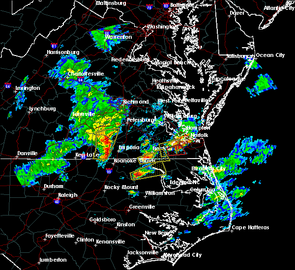 At 547 pm edt, severe thunderstorms were located along a line extending from near dinwiddie to near purdy to near gasburg, moving east at 40 mph (radar indicated). Hazards include 60 mph wind gusts and quarter size hail. Hail damage to vehicles is expected. expect wind damage to roofs, siding, and trees. locations impacted include, lawrenceville, mckenney, brunswick, alberta, gasburg, dewitt, ante, rawlings, triplet, dolphin, valentines, warfield, wharfs store, ordsburg, callaville, cherry hill, edgerton, butterworth and lake gaston. precautionary/preparedness actions, a tornado watch remains in effect for the warned area. tornadoes can develop quickly from severe thunderstorms. although a tornado is not immediately likely, if one is spotted act quickly and move to a place of safety inside a sturdy structure, such as a basement or small interior room. for your protection move to an interior room on the lowest floor of a building. please send your reports of hail and or wind damage, including trees or large limbs downed, by calling noaa`s national weather service in wakefield at , 7 5 7, 8 9 9, 2 4 1 5. A tornado watch remains in effect until 1000 pm edt for northeastern north carolina, and south central and southeastern virginia. At 547 pm edt, severe thunderstorms were located along a line extending from near dinwiddie to near purdy to near gasburg, moving east at 40 mph (radar indicated). Hazards include 60 mph wind gusts and quarter size hail. Hail damage to vehicles is expected. expect wind damage to roofs, siding, and trees. locations impacted include, lawrenceville, mckenney, brunswick, alberta, gasburg, dewitt, ante, rawlings, triplet, dolphin, valentines, warfield, wharfs store, ordsburg, callaville, cherry hill, edgerton, butterworth and lake gaston. precautionary/preparedness actions, a tornado watch remains in effect for the warned area. tornadoes can develop quickly from severe thunderstorms. although a tornado is not immediately likely, if one is spotted act quickly and move to a place of safety inside a sturdy structure, such as a basement or small interior room. for your protection move to an interior room on the lowest floor of a building. please send your reports of hail and or wind damage, including trees or large limbs downed, by calling noaa`s national weather service in wakefield at , 7 5 7, 8 9 9, 2 4 1 5. A tornado watch remains in effect until 1000 pm edt for northeastern north carolina, and south central and southeastern virginia.
|
| 3/31/2017 5:39 PM EDT |
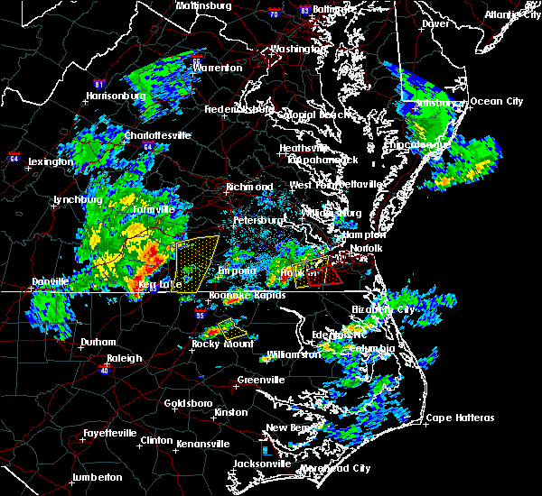 At 539 pm edt, severe thunderstorms were located along a line extending from near dinwiddie to 7 miles northeast of lawrenceville to near ebony, moving east at 40 mph (radar indicated). Hazards include 60 mph wind gusts and quarter size hail. Hail damage to vehicles is expected. expect wind damage to roofs, siding, and trees. locations impacted include, dinwiddie, lawrenceville, mckenney, brunswick, alberta, gasburg, dewitt, ebony, cochran, dolphin, bowens corner, wharfs store, darvills, edgerton, butterworth, ante, rawlings, triplet, white plains and valentines. precautionary/preparedness actions, remain alert for a possible tornado! tornadoes can develop quickly from severe thunderstorms. if you spot a tornado go at once into the basement or small central room in a sturdy structure. for your protection move to an interior room on the lowest floor of a building. please send your reports of hail and or wind damage, including trees or large limbs downed, by calling noaa`s national weather service in wakefield at , 7 5 7, 8 9 9, 2 4 1 5. A tornado watch remains in effect until 1000 pm edt for northeastern north carolina, and south central and southeastern virginia. At 539 pm edt, severe thunderstorms were located along a line extending from near dinwiddie to 7 miles northeast of lawrenceville to near ebony, moving east at 40 mph (radar indicated). Hazards include 60 mph wind gusts and quarter size hail. Hail damage to vehicles is expected. expect wind damage to roofs, siding, and trees. locations impacted include, dinwiddie, lawrenceville, mckenney, brunswick, alberta, gasburg, dewitt, ebony, cochran, dolphin, bowens corner, wharfs store, darvills, edgerton, butterworth, ante, rawlings, triplet, white plains and valentines. precautionary/preparedness actions, remain alert for a possible tornado! tornadoes can develop quickly from severe thunderstorms. if you spot a tornado go at once into the basement or small central room in a sturdy structure. for your protection move to an interior room on the lowest floor of a building. please send your reports of hail and or wind damage, including trees or large limbs downed, by calling noaa`s national weather service in wakefield at , 7 5 7, 8 9 9, 2 4 1 5. A tornado watch remains in effect until 1000 pm edt for northeastern north carolina, and south central and southeastern virginia.
|
| 3/31/2017 5:33 PM EDT |
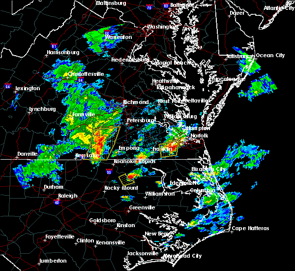 At 532 pm edt, severe thunderstorms were located along a line extending from near dewitt to near lawrenceville to near ebony, moving east at 40 mph (radar indicated). Hazards include 60 mph wind gusts and quarter size hail. Hail damage to vehicles is expected. expect wind damage to roofs, siding, and trees. locations impacted include, dinwiddie, blackstone, lawrenceville, mckenney, brodnax, brunswick, la crosse, alberta, fort pickett, gasburg, dewitt, ebony, dundas, cochran, gills corner, dolphin, bowens corner, forkland, wharfs store and meredithville. precautionary/preparedness actions, remain alert for a possible tornado! tornadoes can develop quickly from severe thunderstorms. if you spot a tornado go at once into the basement or small central room in a sturdy structure. for your protection move to an interior room on the lowest floor of a building. please send your reports of hail and or wind damage, including trees or large limbs downed, by calling noaa`s national weather service in wakefield at , 7 5 7, 8 9 9, 2 4 1 5. A tornado watch remains in effect until 1000 pm edt for northeastern north carolina, and south central and southeastern virginia. At 532 pm edt, severe thunderstorms were located along a line extending from near dewitt to near lawrenceville to near ebony, moving east at 40 mph (radar indicated). Hazards include 60 mph wind gusts and quarter size hail. Hail damage to vehicles is expected. expect wind damage to roofs, siding, and trees. locations impacted include, dinwiddie, blackstone, lawrenceville, mckenney, brodnax, brunswick, la crosse, alberta, fort pickett, gasburg, dewitt, ebony, dundas, cochran, gills corner, dolphin, bowens corner, forkland, wharfs store and meredithville. precautionary/preparedness actions, remain alert for a possible tornado! tornadoes can develop quickly from severe thunderstorms. if you spot a tornado go at once into the basement or small central room in a sturdy structure. for your protection move to an interior room on the lowest floor of a building. please send your reports of hail and or wind damage, including trees or large limbs downed, by calling noaa`s national weather service in wakefield at , 7 5 7, 8 9 9, 2 4 1 5. A tornado watch remains in effect until 1000 pm edt for northeastern north carolina, and south central and southeastern virginia.
|
| 3/31/2017 5:09 PM EDT |
 At 508 pm edt, severe thunderstorms were located along a line extending from blackstone to near south hill to 7 miles west of norlina, moving east at 40 mph (radar indicated). Hazards include 60 mph wind gusts and quarter size hail. Hail damage to vehicles is expected. Expect wind damage to roofs, siding, and trees. At 508 pm edt, severe thunderstorms were located along a line extending from blackstone to near south hill to 7 miles west of norlina, moving east at 40 mph (radar indicated). Hazards include 60 mph wind gusts and quarter size hail. Hail damage to vehicles is expected. Expect wind damage to roofs, siding, and trees.
|
| 2/25/2017 3:43 PM EST |
 At 342 pm est, a severe thunderstorm was located near boydton, or 14 miles southeast of chase city, moving east at 50 mph (radar indicated). Hazards include 60 mph wind gusts and half dollar size hail. Hail damage to vehicles is expected. expect wind damage to roofs, siding, and trees. this severe thunderstorm will be near, south hill, brodnax, la crosse and ebony around 400 pm est. brunswick around 410 pm est. lawrenceville around 415 pm est. Other locations impacted by this severe thunderstorm include cochran, beechwood, bowens corner, john h kerr dam, white plains, meredithville, forksville, bracey, keats and eppes fork. At 342 pm est, a severe thunderstorm was located near boydton, or 14 miles southeast of chase city, moving east at 50 mph (radar indicated). Hazards include 60 mph wind gusts and half dollar size hail. Hail damage to vehicles is expected. expect wind damage to roofs, siding, and trees. this severe thunderstorm will be near, south hill, brodnax, la crosse and ebony around 400 pm est. brunswick around 410 pm est. lawrenceville around 415 pm est. Other locations impacted by this severe thunderstorm include cochran, beechwood, bowens corner, john h kerr dam, white plains, meredithville, forksville, bracey, keats and eppes fork.
|
| 2/24/2016 6:51 PM EST |
 At 651 pm est, doppler radar indicated a line of severe thunderstorms capable of producing damaging winds in excess of 60 mph. these storms were located along a line extending from near brunswick to near warrenton, and moving northeast at 85 mph. * severe thunderstorms will be near, purdy around 700 pm est. ebony and gasburg around 705 pm est. brunswick around 710 pm est. lawrenceville around 715 pm est. other locations impacted by these severe thunderstorms include valentines, edgerton, warfield, fields crossroads, dolphin, ante, bowens corner, triplet, callaville and cowie corner. a tornado watch remains in effect until 900 pm est for northeastern north carolina, and southeastern virginia. a tornado watch also remains in effect until 1100 pm est for northeastern north carolina. At 651 pm est, doppler radar indicated a line of severe thunderstorms capable of producing damaging winds in excess of 60 mph. these storms were located along a line extending from near brunswick to near warrenton, and moving northeast at 85 mph. * severe thunderstorms will be near, purdy around 700 pm est. ebony and gasburg around 705 pm est. brunswick around 710 pm est. lawrenceville around 715 pm est. other locations impacted by these severe thunderstorms include valentines, edgerton, warfield, fields crossroads, dolphin, ante, bowens corner, triplet, callaville and cowie corner. a tornado watch remains in effect until 900 pm est for northeastern north carolina, and southeastern virginia. a tornado watch also remains in effect until 1100 pm est for northeastern north carolina.
|
| 2/24/2016 6:51 PM EST |
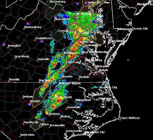 At 651 pm est, doppler radar indicated a line of severe thunderstorms capable of producing damaging winds in excess of 60 mph. these storms were located along a line extending from near brunswick to near warrenton, and moving northeast at 85 mph. * severe thunderstorms will be near, purdy around 700 pm est. ebony and gasburg around 705 pm est. brunswick around 710 pm est. lawrenceville around 715 pm est. other locations impacted by these severe thunderstorms include valentines, edgerton, warfield, fields crossroads, dolphin, ante, bowens corner, triplet, callaville and cowie corner. a tornado watch remains in effect until 900 pm est for northeastern north carolina, and southeastern virginia. a tornado watch also remains in effect until 1100 pm est for northeastern north carolina. At 651 pm est, doppler radar indicated a line of severe thunderstorms capable of producing damaging winds in excess of 60 mph. these storms were located along a line extending from near brunswick to near warrenton, and moving northeast at 85 mph. * severe thunderstorms will be near, purdy around 700 pm est. ebony and gasburg around 705 pm est. brunswick around 710 pm est. lawrenceville around 715 pm est. other locations impacted by these severe thunderstorms include valentines, edgerton, warfield, fields crossroads, dolphin, ante, bowens corner, triplet, callaville and cowie corner. a tornado watch remains in effect until 900 pm est for northeastern north carolina, and southeastern virginia. a tornado watch also remains in effect until 1100 pm est for northeastern north carolina.
|
| 2/24/2016 5:32 PM EST |
 At 531 pm est, doppler radar indicated a possible tornado. this dangerous storm was located near norlina, or 7 miles north of warrenton, and moving northeast at 60 mph. * this dangerous storm will be near, ebony around 540 pm est. brodnax and gasburg around 545 pm est. brunswick around 550 pm est. lawrenceville around 555 pm est. alberta around 600 pm est. other locations impacted by this tornadic thunderstorm include edgerton, warfield, prices mill, fields crossroads, durand, dolphin, ante, bowens corner, cochran and callaville. At 531 pm est, doppler radar indicated a possible tornado. this dangerous storm was located near norlina, or 7 miles north of warrenton, and moving northeast at 60 mph. * this dangerous storm will be near, ebony around 540 pm est. brodnax and gasburg around 545 pm est. brunswick around 550 pm est. lawrenceville around 555 pm est. alberta around 600 pm est. other locations impacted by this tornadic thunderstorm include edgerton, warfield, prices mill, fields crossroads, durand, dolphin, ante, bowens corner, cochran and callaville.
|
| 2/24/2016 5:11 PM EST |
 At 507 pm est, the tornado is located near south hill. doppler radar showed this tornado moving northeast at 60 mph. this storm has had a history of producing a tornado on the ground across portions of mecklenburg county. * the tornado will be near, alberta and dundas around 520 pm est. fort pickett around 525 pm est. mckenney around 530 pm est. dewitt around 535 pm est. dinwiddie around 540 pm est. other locations impacted by this tornadic thunderstorm include wellville, butterworth, warfield, hebron, bacons fork, dominy corner, forksville, irby, meredithville and five forks. At 507 pm est, the tornado is located near south hill. doppler radar showed this tornado moving northeast at 60 mph. this storm has had a history of producing a tornado on the ground across portions of mecklenburg county. * the tornado will be near, alberta and dundas around 520 pm est. fort pickett around 525 pm est. mckenney around 530 pm est. dewitt around 535 pm est. dinwiddie around 540 pm est. other locations impacted by this tornadic thunderstorm include wellville, butterworth, warfield, hebron, bacons fork, dominy corner, forksville, irby, meredithville and five forks.
|
| 9/4/2015 4:52 PM EDT |
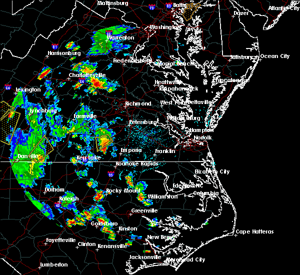 The severe thunderstorm warning for southwestern dinwiddie and northern brunswick counties will expire at 500 pm edt, the storm which prompted the warning has weakened below severe limits, and no longer poses an immediate threat to life or property. therefore the warning will be allowed to expire. however locally heavy rain is still possible with this thunderstorm. The severe thunderstorm warning for southwestern dinwiddie and northern brunswick counties will expire at 500 pm edt, the storm which prompted the warning has weakened below severe limits, and no longer poses an immediate threat to life or property. therefore the warning will be allowed to expire. however locally heavy rain is still possible with this thunderstorm.
|
| 9/4/2015 4:42 PM EDT | Trees down along interstate 85 southbound in brunswick county VA, 1.9 miles ENE of Alberta, VA |
| 9/4/2015 4:40 PM EDT | Trees down along christanna highway in brunswick county VA, 2.4 miles NNW of Alberta, VA |
| 9/4/2015 4:23 PM EDT |
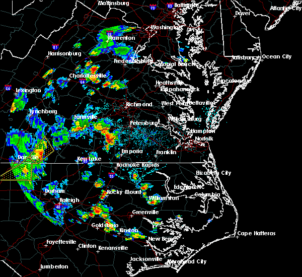 At 423 pm edt, doppler radar indicated a severe thunderstorm capable of producing quarter size hail and damaging winds in excess of 60 mph. this storm was located near mckenney, and moving southwest at 20 mph. * this severe thunderstorm will be near, alberta around 445 pm edt. other locations impacted by this severe thunderstorm include barrows store, warfield, prices mill, meredithville, ordsburg, cochran, rawlings and danieltown. At 423 pm edt, doppler radar indicated a severe thunderstorm capable of producing quarter size hail and damaging winds in excess of 60 mph. this storm was located near mckenney, and moving southwest at 20 mph. * this severe thunderstorm will be near, alberta around 445 pm edt. other locations impacted by this severe thunderstorm include barrows store, warfield, prices mill, meredithville, ordsburg, cochran, rawlings and danieltown.
|
| 6/20/2015 8:50 PM EDT |
 At 848 pm edt, doppler radar indicated a line of severe thunderstorms capable of producing quarter size hail and damaging winds in excess of 60 mph. these storms were located along a line extending from near rice to near blackstone to near alberta, moving northeast at 45 mph. these severe storms will be near, fort pickett around 855 pm edt. spainville and wilsons around 905 pm edt. other locations impacted by these severe thunderstorms include wellville, burkes tavern, edgerton, oliveville, bacons fork, dominy corner, murdocks, irby, meredithville and rawlings. At 848 pm edt, doppler radar indicated a line of severe thunderstorms capable of producing quarter size hail and damaging winds in excess of 60 mph. these storms were located along a line extending from near rice to near blackstone to near alberta, moving northeast at 45 mph. these severe storms will be near, fort pickett around 855 pm edt. spainville and wilsons around 905 pm edt. other locations impacted by these severe thunderstorms include wellville, burkes tavern, edgerton, oliveville, bacons fork, dominy corner, murdocks, irby, meredithville and rawlings.
|
| 6/20/2015 8:25 PM EDT |
 At 824 pm edt, doppler radar indicated a line of severe thunderstorms capable of producing quarter size hail and damaging winds in excess of 60 mph. these storms were located along a line extending from keysville to near lunenburg to 6 miles southwest of la crosse, and moving northeast at 45 mph. * severe thunderstorms will be near, lunenburg around 830 pm edt. victoria and kenbridge around 835 pm edt. green bay around 840 pm edt. crewe, lawrenceville, nottoway, burkeville, fort pickett and dundas around 850 pm edt. blackstone and alberta around 855 pm edt. spainville, wilsons and jetersville around 900 pm edt. other locations impacted by these severe thunderstorms include wellville, burkes tavern, edgerton, bacons fork, dominy corner, arvins store, loves mill, meredithville, scholfield and earls. At 824 pm edt, doppler radar indicated a line of severe thunderstorms capable of producing quarter size hail and damaging winds in excess of 60 mph. these storms were located along a line extending from keysville to near lunenburg to 6 miles southwest of la crosse, and moving northeast at 45 mph. * severe thunderstorms will be near, lunenburg around 830 pm edt. victoria and kenbridge around 835 pm edt. green bay around 840 pm edt. crewe, lawrenceville, nottoway, burkeville, fort pickett and dundas around 850 pm edt. blackstone and alberta around 855 pm edt. spainville, wilsons and jetersville around 900 pm edt. other locations impacted by these severe thunderstorms include wellville, burkes tavern, edgerton, bacons fork, dominy corner, arvins store, loves mill, meredithville, scholfield and earls.
|
| 6/18/2015 6:32 PM EDT | At 631 pm edt, doppler radar indicated a severe thunderstorm capable of producing damaging winds in excess of 60 mph. this storm was located near mckenney, moving southeast at 30 mph. penny size hail may also accompany the damaging winds. locations impacted include, lawrenceville, mckenney, alberta, dewitt, barrows store, edgerton, warfield, prices mill, ordsburg, dolphin, cochran, darvills, cherry hill, wharfs store, rawlings and danieltown. |
| 6/18/2015 6:09 PM EDT | At 608 pm edt, doppler radar indicated a severe thunderstorm capable of producing damaging winds in excess of 60 mph. this storm was located over blackstone, and moving southeast at 30 mph. penny size hail may also accompany the damaging winds. |
| 6/28/2013 5:02 PM EDT | Tree down boydton plank road in brunswick county VA, 0.1 miles NNE of Alberta, VA |
| 6/28/2013 5:00 PM EDT | Tree down interstate 85 at exit 27 in brunswick county VA, 1.4 miles NE of Alberta, VA |
| 6/13/2013 4:38 PM EDT | Trees down and blocking i-85 south at mile marker 26 in brunswick county VA, 1.9 miles ENE of Alberta, VA |
| 9/18/2012 3:26 PM EDT | Trees down at intersection of flat rock rd and little mont rd in brunswick county VA, 1.2 miles WSW of Alberta, VA |
| 6/1/2012 6:10 PM EDT | Tree down on masons mill r in brunswick county VA, 1.2 miles WSW of Alberta, VA |
| 1/1/0001 12:00 AM | Numerous trees and power poles down just south of alberta near interstate 85 and highway in brunswick county VA, 0.5 miles W of Alberta, VA |
| 1/1/0001 12:00 AM | Numerous trees and powerlines down in the town of alberta and also along interstate 85 at mile marker 3 in brunswick county VA, 1.2 miles WSW of Alberta, VA |
| 1/1/0001 12:00 AM | Tree down on south bound lane of interstate 85 in brunswick county VA, 6.6 miles ENE of Alberta, VA |
Hail Maps for Alberta, VA


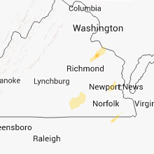


Connect with Interactive Hail Maps