

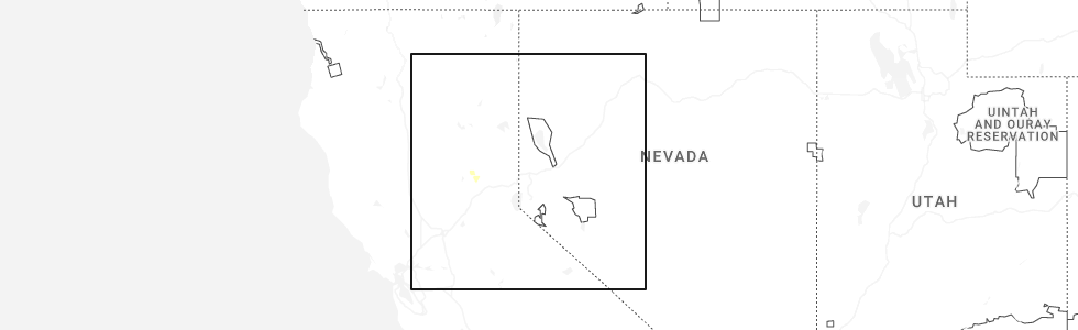
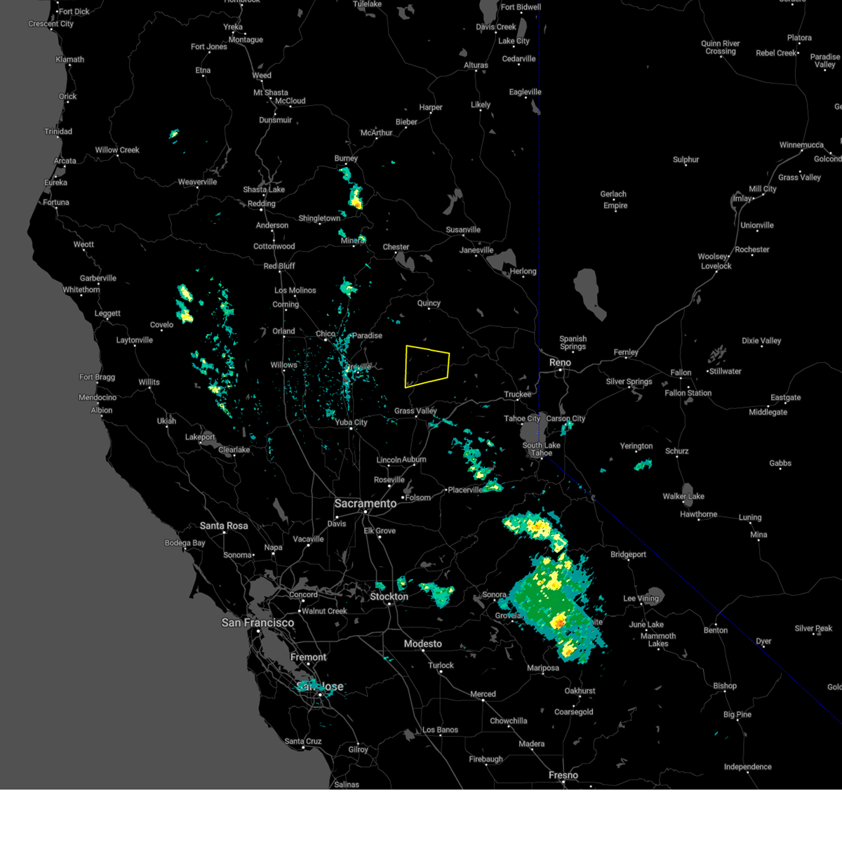
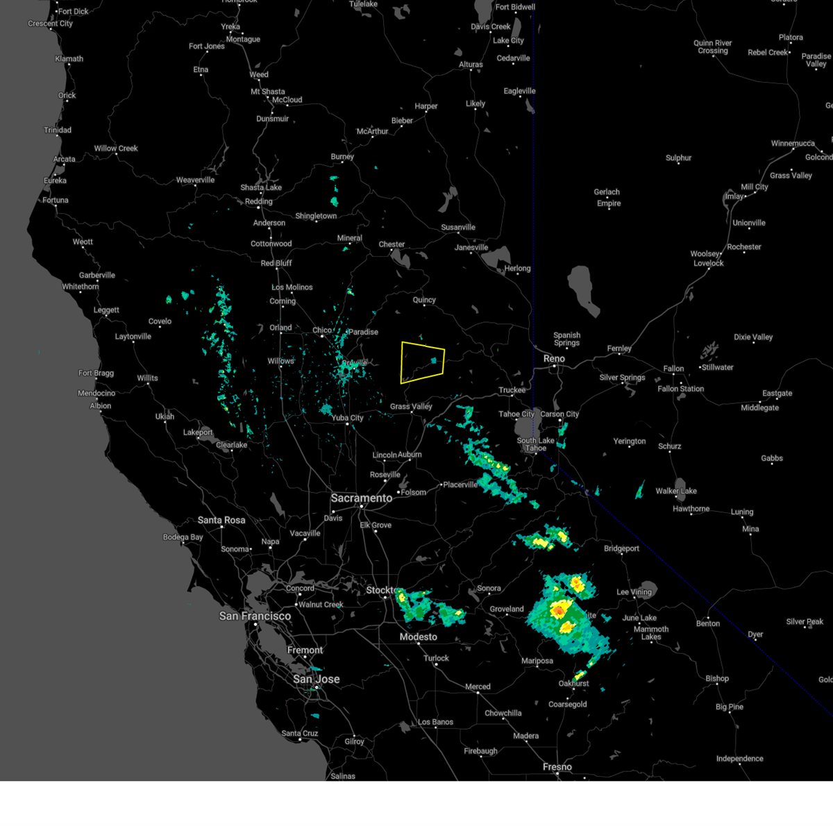
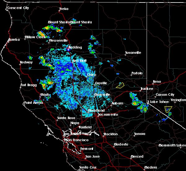
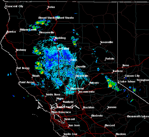
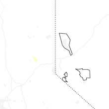
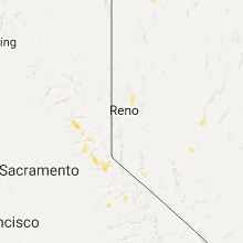
Hail Map for Alleghany, CA
The Alleghany, CA area has had 0 reports of on-the-ground hail by trained spotters, and has been under severe weather warnings 5 times during the past 12 months. Doppler radar has detected hail at or near Alleghany, CA on 3 occasions, including 1 occasion during the past year.
| Name: | Alleghany, CA |
| Where Located: | 55.1 miles W of Reno, NV |
| Map: | Google Map for Alleghany, CA |
| Population: | 58 |
| Housing Units: | 40 |
| More Info: | Search Google for Alleghany, CA |
5
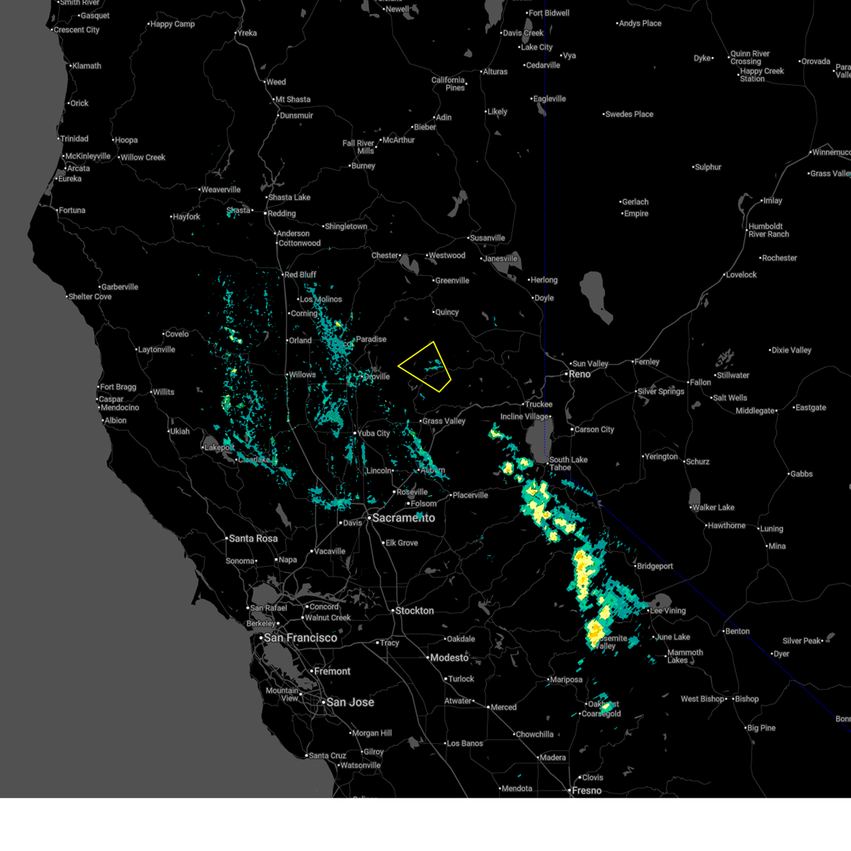
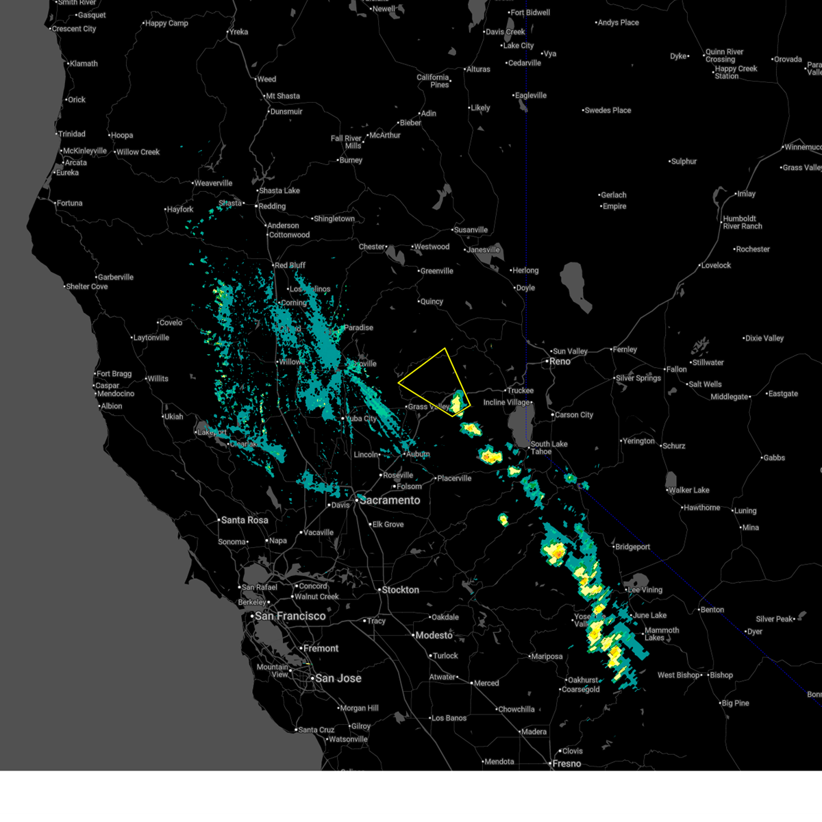
The Top Recent Hail Date for Alleghany, CA is Tuesday, September 2, 2025 (1st out of 3)
Hail and Wind Damage Spotted near Alleghany, CA
| Date / Time | Report Details |
|---|---|
| 9/2/2025 4:39 PM PDT |
 The storm which prompted the warning has weakened below severe limits, and no longer poses an immediate threat to life or property. therefore, the warning will be allowed to expire. however small hail and gusty winds are still possible with this thunderstorm. The storm which prompted the warning has weakened below severe limits, and no longer poses an immediate threat to life or property. therefore, the warning will be allowed to expire. however small hail and gusty winds are still possible with this thunderstorm.
|
| 9/2/2025 4:22 PM PDT |
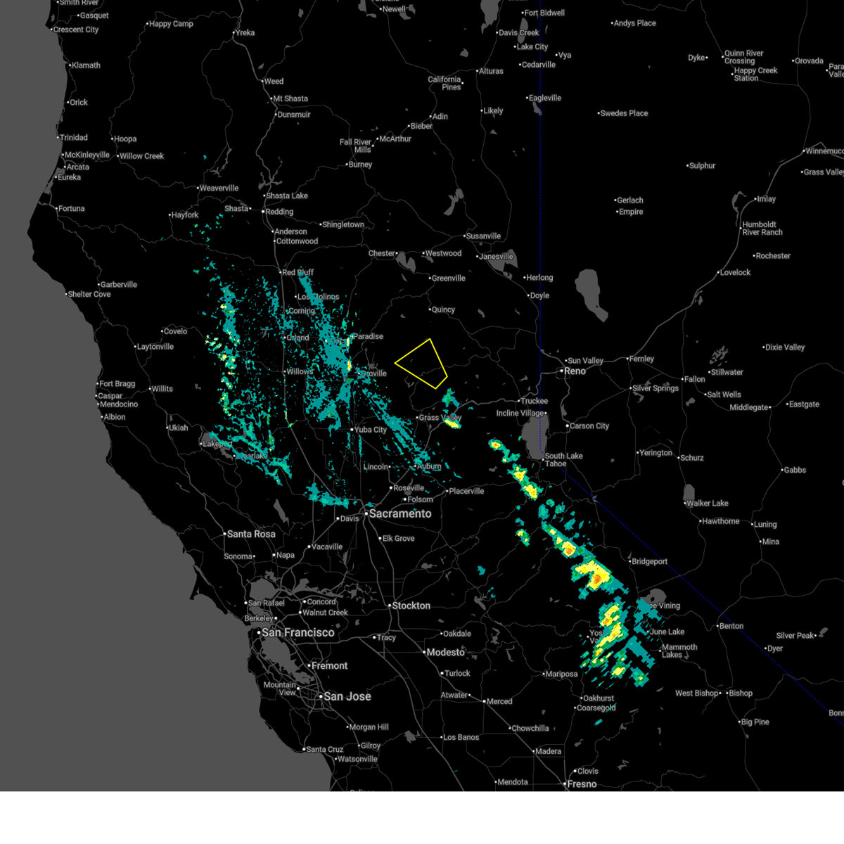 Svrsto the national weather service in sacramento has issued a * severe thunderstorm warning for, south central plumas county in northern california, east central butte county in northern california, northeastern yuba county in central california, western sierra county in northern california, northwestern nevada county in northern california, * until 445 pm pdt. * at 421 pm pdt, a severe thunderstorm was located near alleghany, or near downieville, moving northwest at 30 mph (radar indicated). Hazards include quarter size hail. damage to vehicles is expected Svrsto the national weather service in sacramento has issued a * severe thunderstorm warning for, south central plumas county in northern california, east central butte county in northern california, northeastern yuba county in central california, western sierra county in northern california, northwestern nevada county in northern california, * until 445 pm pdt. * at 421 pm pdt, a severe thunderstorm was located near alleghany, or near downieville, moving northwest at 30 mph (radar indicated). Hazards include quarter size hail. damage to vehicles is expected
|
| 9/2/2025 3:57 PM PDT |
 The storm which prompted the warning has moved out of the area. therefore, the warning will be allowed to expire. The storm which prompted the warning has moved out of the area. therefore, the warning will be allowed to expire.
|
| 9/2/2025 3:45 PM PDT |
 At 344 pm pdt, a severe thunderstorm was located over blue canyon, moving northwest at 30 mph (radar indicated). Hazards include 60 mph wind gusts and half dollar size hail. Hail damage to vehicles is expected. expect wind damage to roofs, siding, and trees. Locations impacted include, baxter, blue canyon, cisco, emigrant gap, cherokee, bald mountain summit, bowman lake, scotts flat, alleghany, white cloud campground, lake spaulding, pike, skillman campground, and graniteville. At 344 pm pdt, a severe thunderstorm was located over blue canyon, moving northwest at 30 mph (radar indicated). Hazards include 60 mph wind gusts and half dollar size hail. Hail damage to vehicles is expected. expect wind damage to roofs, siding, and trees. Locations impacted include, baxter, blue canyon, cisco, emigrant gap, cherokee, bald mountain summit, bowman lake, scotts flat, alleghany, white cloud campground, lake spaulding, pike, skillman campground, and graniteville.
|
| 9/2/2025 3:33 PM PDT |
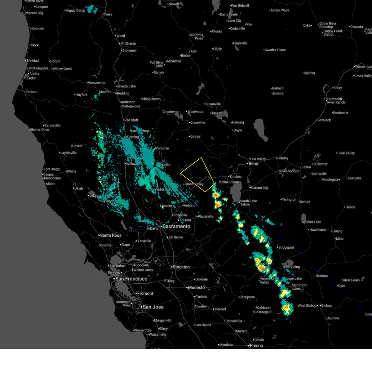 Svrsto the national weather service in sacramento has issued a * severe thunderstorm warning for, north central placer county in central california, east central yuba county in central california, southwestern sierra county in northern california, northern nevada county in northern california, * until 400 pm pdt. * at 332 pm pdt, a severe thunderstorm was located near emigrant gap, or near blue canyon, moving northwest at 30 mph (radar indicated). Hazards include 60 mph wind gusts and half dollar size hail. Hail damage to vehicles is expected. Expect wind damage to roofs, siding, and trees. Svrsto the national weather service in sacramento has issued a * severe thunderstorm warning for, north central placer county in central california, east central yuba county in central california, southwestern sierra county in northern california, northern nevada county in northern california, * until 400 pm pdt. * at 332 pm pdt, a severe thunderstorm was located near emigrant gap, or near blue canyon, moving northwest at 30 mph (radar indicated). Hazards include 60 mph wind gusts and half dollar size hail. Hail damage to vehicles is expected. Expect wind damage to roofs, siding, and trees.
|
| 6/10/2023 2:23 PM PDT |
 The severe thunderstorm warning for south central plumas, east central butte, southwestern sierra and northeastern yuba counties will expire at 230 pm pdt, the storm which prompted the warning has weakened below severe limits, and no longer poses an immediate threat to life or property. therefore, the warning will be allowed to expire. however half-inch hail and heavy rain are still occurring with this thunderstorm. The severe thunderstorm warning for south central plumas, east central butte, southwestern sierra and northeastern yuba counties will expire at 230 pm pdt, the storm which prompted the warning has weakened below severe limits, and no longer poses an immediate threat to life or property. therefore, the warning will be allowed to expire. however half-inch hail and heavy rain are still occurring with this thunderstorm.
|
| 6/10/2023 1:44 PM PDT |
 At 143 pm pdt, a severe thunderstorm was located over downieville, moving west at 10 mph (radar indicated). Hazards include quarter size hail. damage to vehicles is expected At 143 pm pdt, a severe thunderstorm was located over downieville, moving west at 10 mph (radar indicated). Hazards include quarter size hail. damage to vehicles is expected
|
| 9/12/2017 3:39 PM PDT |
 The severe thunderstorm warning for south central sierra and north central nevada counties will expire at 345 pm pdt, the storm which prompted the warning has weakened below severe limits, and has exited the warned area. therefore, the warning will be allowed to expire. however small hail is still possible with this thunderstorm. The severe thunderstorm warning for south central sierra and north central nevada counties will expire at 345 pm pdt, the storm which prompted the warning has weakened below severe limits, and has exited the warned area. therefore, the warning will be allowed to expire. however small hail is still possible with this thunderstorm.
|
| 9/12/2017 3:28 PM PDT |
 At 328 pm pdt, a severe thunderstorm was near downieville, moving northwest at 15 mph (radar indicated). Hazards include 60 mph wind gusts and quarter size hail. Hail damage to vehicles is expected. expect wind damage to roofs, siding, and trees. Locations impacted include, alleghany. At 328 pm pdt, a severe thunderstorm was near downieville, moving northwest at 15 mph (radar indicated). Hazards include 60 mph wind gusts and quarter size hail. Hail damage to vehicles is expected. expect wind damage to roofs, siding, and trees. Locations impacted include, alleghany.
|
| 9/12/2017 2:57 PM PDT |
 At 256 pm pdt, a severe thunderstorm was located near alleghany and graniteville, or 7 miles southeast of downieville, moving northwest at 15 mph (radar indicated). Hazards include 60 mph wind gusts and quarter size hail. Hail damage to vehicles is expected. Expect wind damage to roofs, siding, and trees. At 256 pm pdt, a severe thunderstorm was located near alleghany and graniteville, or 7 miles southeast of downieville, moving northwest at 15 mph (radar indicated). Hazards include 60 mph wind gusts and quarter size hail. Hail damage to vehicles is expected. Expect wind damage to roofs, siding, and trees.
|
Hail Maps for Alleghany, CA

Connect with Interactive Hail Maps