

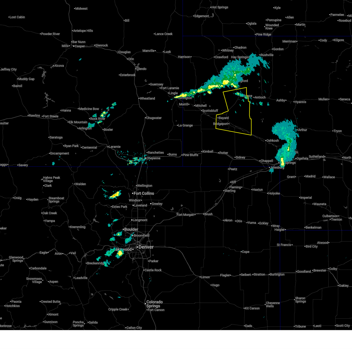
Hail Map for Alliance, NE
The Alliance, NE area has had 90 reports of on-the-ground hail by trained spotters, and has been under severe weather warnings 19 times during the past 12 months. Doppler radar has detected hail at or near Alliance, NE on 96 occasions, including 10 occasions during the past year.
| Name: | Alliance, NE |
| Where Located: | 44.1 miles ENE of Scottsbluff, NE |
| Map: | Google Map for Alliance, NE |
| Population: | 8491 |
| Housing Units: | 4075 |
| More Info: | Search Google for Alliance, NE |
1
The Top Recent Hail Date for Alliance, NE is Monday, August 18, 2025 (15th out of 96)
Hail and Wind Damage Spotted near Alliance, NE
| Date / Time | Report Details |
|---|---|
| 6/26/2026 7:00 PM MDT | Corrects previous tstm wnd gst report from 3 ssw alliance. nebraska mesonet site gusted to 60 mp in box butte county NE, 2.9 miles NNE of Alliance, NE |
| 6/26/2026 6:00 PM MDT | Nebraska mesonet site gusted to 60 mp in box butte county NE, 2.9 miles NNE of Alliance, NE |
| 6/8/2026 9:24 PM MDT |
 The storm which prompted the warning has weakened below severe limits, and has exited the warned area. therefore, the warning will be allowed to expire. a severe thunderstorm watch remains in effect until 1100 pm mdt for the panhandle of nebraska. The storm which prompted the warning has weakened below severe limits, and has exited the warned area. therefore, the warning will be allowed to expire. a severe thunderstorm watch remains in effect until 1100 pm mdt for the panhandle of nebraska.
|
| 6/8/2026 8:52 PM MDT |
 At 852 pm mdt, a severe thunderstorm was located 7 miles northeast of angora, or 14 miles southwest of alliance, moving east at 35 mph (radar indicated). Hazards include 60 mph wind gusts and quarter size hail. Hail damage to vehicles is expected. expect wind damage to roofs, siding, and trees. Locations impacted include, alliance, alliance municipal airport, and wild horse butte. At 852 pm mdt, a severe thunderstorm was located 7 miles northeast of angora, or 14 miles southwest of alliance, moving east at 35 mph (radar indicated). Hazards include 60 mph wind gusts and quarter size hail. Hail damage to vehicles is expected. expect wind damage to roofs, siding, and trees. Locations impacted include, alliance, alliance municipal airport, and wild horse butte.
|
| 6/8/2026 8:27 PM MDT |
 Svrcys the national weather service in cheyenne has issued a * severe thunderstorm warning for, southeastern box butte county in the panhandle of nebraska, east central scotts bluff county in the panhandle of nebraska, northern morrill county in the panhandle of nebraska, * until 930 pm mdt. * at 826 pm mdt, a severe thunderstorm was located near angora, or 21 miles east of scottsbluff, moving northeast at 15 mph (radar indicated). Hazards include 60 mph wind gusts and quarter size hail. Hail damage to vehicles is expected. Expect wind damage to roofs, siding, and trees. Svrcys the national weather service in cheyenne has issued a * severe thunderstorm warning for, southeastern box butte county in the panhandle of nebraska, east central scotts bluff county in the panhandle of nebraska, northern morrill county in the panhandle of nebraska, * until 930 pm mdt. * at 826 pm mdt, a severe thunderstorm was located near angora, or 21 miles east of scottsbluff, moving northeast at 15 mph (radar indicated). Hazards include 60 mph wind gusts and quarter size hail. Hail damage to vehicles is expected. Expect wind damage to roofs, siding, and trees.
|
| 6/8/2026 8:16 PM MDT |
 At 816 pm mdt, a severe thunderstorm was located near angora, or 19 miles southwest of alliance, moving northeast at 25 mph (radar indicated). Hazards include ping pong ball size hail and 60 mph wind gusts. People and animals outdoors will be injured. expect hail damage to roofs, siding, windows, and vehicles. expect wind damage to roofs, siding, and trees. Locations impacted include, alliance, bayard, angora, alliance municipal airport, wild horse butte, moomaw corner, south bayard junction, and the intersection of highway 385 and l62. At 816 pm mdt, a severe thunderstorm was located near angora, or 19 miles southwest of alliance, moving northeast at 25 mph (radar indicated). Hazards include ping pong ball size hail and 60 mph wind gusts. People and animals outdoors will be injured. expect hail damage to roofs, siding, windows, and vehicles. expect wind damage to roofs, siding, and trees. Locations impacted include, alliance, bayard, angora, alliance municipal airport, wild horse butte, moomaw corner, south bayard junction, and the intersection of highway 385 and l62.
|
| 6/8/2026 7:29 PM MDT |
 Svrcys the national weather service in cheyenne has issued a * severe thunderstorm warning for, southeastern box butte county in the panhandle of nebraska, northern morrill county in the panhandle of nebraska, * until 830 pm mdt. * at 728 pm mdt, a severe thunderstorm was located near angora, or 21 miles southwest of alliance, moving northeast at 25 mph (radar indicated). Hazards include ping pong ball size hail and 60 mph wind gusts. People and animals outdoors will be injured. expect hail damage to roofs, siding, windows, and vehicles. Expect wind damage to roofs, siding, and trees. Svrcys the national weather service in cheyenne has issued a * severe thunderstorm warning for, southeastern box butte county in the panhandle of nebraska, northern morrill county in the panhandle of nebraska, * until 830 pm mdt. * at 728 pm mdt, a severe thunderstorm was located near angora, or 21 miles southwest of alliance, moving northeast at 25 mph (radar indicated). Hazards include ping pong ball size hail and 60 mph wind gusts. People and animals outdoors will be injured. expect hail damage to roofs, siding, windows, and vehicles. Expect wind damage to roofs, siding, and trees.
|
| 6/7/2026 6:30 PM MDT | Personal weather statio in sheridan county NE, 8.4 miles WSW of Alliance, NE |
| 6/7/2026 6:27 PM MDT |
 Svrcys the national weather service in cheyenne has issued a * severe thunderstorm warning for, southeastern box butte county in the panhandle of nebraska, northeastern morrill county in the panhandle of nebraska, * until 715 pm mdt. * at 627 pm mdt, a severe thunderstorm was located near alliance municipal airport, or 9 miles southeast of alliance, moving northeast at 20 mph (radar indicated). Hazards include 60 mph wind gusts and penny size hail. expect damage to roofs, siding, and trees Svrcys the national weather service in cheyenne has issued a * severe thunderstorm warning for, southeastern box butte county in the panhandle of nebraska, northeastern morrill county in the panhandle of nebraska, * until 715 pm mdt. * at 627 pm mdt, a severe thunderstorm was located near alliance municipal airport, or 9 miles southeast of alliance, moving northeast at 20 mph (radar indicated). Hazards include 60 mph wind gusts and penny size hail. expect damage to roofs, siding, and trees
|
| 6/7/2026 6:21 PM MDT | 62 mph gust recorded at kaia awo in box butte county NE, 3.7 miles WNW of Alliance, NE |
| 6/1/2026 6:09 PM MDT |
 At 609 pm mdt, severe thunderstorms were located along a line extending from alliance to 12 miles south of alliance municipal airport to 7 miles east of northport, moving east at 30 mph (radar indicated). Hazards include 60 mph wind gusts and half dollar size hail. Hail damage to vehicles is expected. expect wind damage to roofs, siding, and trees. Locations impacted include, alliance, broadwater, and alliance municipal airport. At 609 pm mdt, severe thunderstorms were located along a line extending from alliance to 12 miles south of alliance municipal airport to 7 miles east of northport, moving east at 30 mph (radar indicated). Hazards include 60 mph wind gusts and half dollar size hail. Hail damage to vehicles is expected. expect wind damage to roofs, siding, and trees. Locations impacted include, alliance, broadwater, and alliance municipal airport.
|
| 6/1/2026 5:44 PM MDT |
 At 543 pm mdt, severe thunderstorms were located along a line extending from 9 miles southwest of berea to 11 miles east of angora to northport, moving east at 50 mph (public). Hazards include 60 mph wind gusts and quarter size hail. Hail damage to vehicles is expected. expect wind damage to roofs, siding, and trees. Locations impacted include, alliance, bridgeport, bayard, broadwater, northport, bridgeport state recreation area, angora, morrill county fairgrounds, chimney rock national historic site, courthouse and jail rock, redington, alliance municipal airport, the intersection of highway 385 and 92, the intersection of highway 385 and l62, and south bayard junction. At 543 pm mdt, severe thunderstorms were located along a line extending from 9 miles southwest of berea to 11 miles east of angora to northport, moving east at 50 mph (public). Hazards include 60 mph wind gusts and quarter size hail. Hail damage to vehicles is expected. expect wind damage to roofs, siding, and trees. Locations impacted include, alliance, bridgeport, bayard, broadwater, northport, bridgeport state recreation area, angora, morrill county fairgrounds, chimney rock national historic site, courthouse and jail rock, redington, alliance municipal airport, the intersection of highway 385 and 92, the intersection of highway 385 and l62, and south bayard junction.
|
| 6/1/2026 5:38 PM MDT | Quarter sized hail reported 12.6 miles NE of Alliance, NE, report from mping: quarter (1.00 in.). |
| 6/1/2026 5:34 PM MDT |
 Svrcys the national weather service in cheyenne has issued a * severe thunderstorm warning for, box butte county in the panhandle of nebraska, morrill county in the panhandle of nebraska, * until 645 pm mdt. * at 534 pm mdt, severe thunderstorms were located along a line extending from 7 miles north of kilpatrick lake to 12 miles southwest of alliance to near angora to near chimney rock national historic site, moving east at 40 mph (radar indicated). Hazards include 60 mph wind gusts and quarter size hail. Hail damage to vehicles is expected. Expect wind damage to roofs, siding, and trees. Svrcys the national weather service in cheyenne has issued a * severe thunderstorm warning for, box butte county in the panhandle of nebraska, morrill county in the panhandle of nebraska, * until 645 pm mdt. * at 534 pm mdt, severe thunderstorms were located along a line extending from 7 miles north of kilpatrick lake to 12 miles southwest of alliance to near angora to near chimney rock national historic site, moving east at 40 mph (radar indicated). Hazards include 60 mph wind gusts and quarter size hail. Hail damage to vehicles is expected. Expect wind damage to roofs, siding, and trees.
|
| 8/18/2025 5:34 PM MDT | Storm damage reported in box butte county NE, 4.8 miles NW of Alliance, NE |
| 7/6/2025 8:01 PM MDT | Ping Pong Ball sized hail reported 5 miles W of Alliance, NE, report from mping: ping pong ball (1.50 in.). |
| 7/6/2025 7:55 PM MDT | Half Dollar sized hail reported 5 miles W of Alliance, NE, report from mping: half dollar (1.25 in.). |
| 7/6/2025 7:43 PM MDT |
 At 743 pm mdt, a severe thunderstorm was located over alliance municipal airport, or over alliance, moving northeast at 45 mph (radar indicated). Hazards include 60 mph wind gusts and quarter size hail. Hail damage to vehicles is expected. expect wind damage to roofs, siding, and trees. Locations impacted include, alliance and alliance municipal airport. At 743 pm mdt, a severe thunderstorm was located over alliance municipal airport, or over alliance, moving northeast at 45 mph (radar indicated). Hazards include 60 mph wind gusts and quarter size hail. Hail damage to vehicles is expected. expect wind damage to roofs, siding, and trees. Locations impacted include, alliance and alliance municipal airport.
|
| 7/6/2025 7:38 PM MDT | Quarter sized hail reported 10 miles ENE of Alliance, NE, report from mping: quarter (1.00 in.). |
| 7/6/2025 7:24 PM MDT |
 Svrcys the national weather service in cheyenne has issued a * severe thunderstorm warning for, southeastern box butte county in the panhandle of nebraska, north central morrill county in the panhandle of nebraska, * until 815 pm mdt. * at 724 pm mdt, a severe thunderstorm was located 9 miles northeast of angora, or 11 miles southwest of alliance, moving northeast at 35 mph (radar indicated. this storm has a history of producing half dollar size hail). Hazards include golf ball size hail and 60 mph wind gusts. People and animals outdoors will be injured. expect hail damage to roofs, siding, windows, and vehicles. Expect wind damage to roofs, siding, and trees. Svrcys the national weather service in cheyenne has issued a * severe thunderstorm warning for, southeastern box butte county in the panhandle of nebraska, north central morrill county in the panhandle of nebraska, * until 815 pm mdt. * at 724 pm mdt, a severe thunderstorm was located 9 miles northeast of angora, or 11 miles southwest of alliance, moving northeast at 35 mph (radar indicated. this storm has a history of producing half dollar size hail). Hazards include golf ball size hail and 60 mph wind gusts. People and animals outdoors will be injured. expect hail damage to roofs, siding, windows, and vehicles. Expect wind damage to roofs, siding, and trees.
|
| 7/1/2025 7:29 PM MDT | Hen Egg sized hail reported 12.3 miles W of Alliance, NE, report via social media. |
| 6/29/2025 7:25 PM MDT |
 The storm which prompted the warning has moved out of the area. therefore, the warning will be allowed to expire. a severe thunderstorm watch remains in effect until 900 pm mdt for the panhandle of nebraska. remember, a severe thunderstorm warning still remains in effect for northern morrill county and most of box butte county until 830 pm. The storm which prompted the warning has moved out of the area. therefore, the warning will be allowed to expire. a severe thunderstorm watch remains in effect until 900 pm mdt for the panhandle of nebraska. remember, a severe thunderstorm warning still remains in effect for northern morrill county and most of box butte county until 830 pm.
|
| 6/29/2025 7:24 PM MDT |
 Svrcys the national weather service in cheyenne has issued a * severe thunderstorm warning for, box butte county in the panhandle of nebraska, north central morrill county in the panhandle of nebraska, southeastern dawes county in the panhandle of nebraska, * until 830 pm mdt. * at 724 pm mdt, severe thunderstorms were located along a line extending from 9 miles south of hay springs to 14 miles northeast of berea to near kilpatrick lake to 9 miles north of lake alice, moving east at 30 mph (radar indicated). Hazards include 60 mph wind gusts and quarter size hail. Hail damage to vehicles is expected. Expect wind damage to roofs, siding, and trees. Svrcys the national weather service in cheyenne has issued a * severe thunderstorm warning for, box butte county in the panhandle of nebraska, north central morrill county in the panhandle of nebraska, southeastern dawes county in the panhandle of nebraska, * until 830 pm mdt. * at 724 pm mdt, severe thunderstorms were located along a line extending from 9 miles south of hay springs to 14 miles northeast of berea to near kilpatrick lake to 9 miles north of lake alice, moving east at 30 mph (radar indicated). Hazards include 60 mph wind gusts and quarter size hail. Hail damage to vehicles is expected. Expect wind damage to roofs, siding, and trees.
|
| 6/29/2025 7:07 PM MDT |
 the severe thunderstorm warning has been cancelled and is no longer in effect the severe thunderstorm warning has been cancelled and is no longer in effect
|
| 6/29/2025 7:07 PM MDT |
 At 706 pm mdt, a severe thunderstorm was located near angora, or 19 miles southwest of alliance, moving east at 40 mph (radar indicated). Hazards include 60 mph wind gusts and quarter size hail. Hail damage to vehicles is expected. expect wind damage to roofs, siding, and trees. Locations impacted include, alliance and angora. At 706 pm mdt, a severe thunderstorm was located near angora, or 19 miles southwest of alliance, moving east at 40 mph (radar indicated). Hazards include 60 mph wind gusts and quarter size hail. Hail damage to vehicles is expected. expect wind damage to roofs, siding, and trees. Locations impacted include, alliance and angora.
|
| 6/29/2025 6:51 PM MDT |
 Svrcys the national weather service in cheyenne has issued a * severe thunderstorm warning for, south central box butte county in the panhandle of nebraska, northeastern scotts bluff county in the panhandle of nebraska, northwestern morrill county in the panhandle of nebraska, southeastern sioux county in the panhandle of nebraska, * until 730 pm mdt. * at 651 pm mdt, a severe thunderstorm was located near lake minatare state recreation area, or 14 miles east of scottsbluff, moving east at 35 mph (radar indicated). Hazards include 60 mph wind gusts and quarter size hail. Hail damage to vehicles is expected. Expect wind damage to roofs, siding, and trees. Svrcys the national weather service in cheyenne has issued a * severe thunderstorm warning for, south central box butte county in the panhandle of nebraska, northeastern scotts bluff county in the panhandle of nebraska, northwestern morrill county in the panhandle of nebraska, southeastern sioux county in the panhandle of nebraska, * until 730 pm mdt. * at 651 pm mdt, a severe thunderstorm was located near lake minatare state recreation area, or 14 miles east of scottsbluff, moving east at 35 mph (radar indicated). Hazards include 60 mph wind gusts and quarter size hail. Hail damage to vehicles is expected. Expect wind damage to roofs, siding, and trees.
|
| 6/28/2025 6:50 PM MDT |
 The storm which prompted the warning has moved out of the area. therefore, the warning will be allowed to expire. however, gusty winds are still possible with this thunderstorm. The storm which prompted the warning has moved out of the area. therefore, the warning will be allowed to expire. however, gusty winds are still possible with this thunderstorm.
|
| 6/28/2025 6:28 PM MDT |
 At 628 pm mdt, a severe thunderstorm was located near alliance, moving southeast at 20 mph (radar indicated). Hazards include 60 mph wind gusts and quarter size hail. Hail damage to vehicles is expected. expect wind damage to roofs, siding, and trees. Locations impacted include, alliance and alliance municipal airport. At 628 pm mdt, a severe thunderstorm was located near alliance, moving southeast at 20 mph (radar indicated). Hazards include 60 mph wind gusts and quarter size hail. Hail damage to vehicles is expected. expect wind damage to roofs, siding, and trees. Locations impacted include, alliance and alliance municipal airport.
|
| 6/28/2025 6:24 PM MDT | Quarter sized hail reported 5.8 miles SW of Alliance, NE, mainly dime to nickel size hail with a few quarters. |
| 6/28/2025 6:11 PM MDT |
 Svrcys the national weather service in cheyenne has issued a * severe thunderstorm warning for, southeastern box butte county in the panhandle of nebraska, * until 700 pm mdt. * at 611 pm mdt, a severe thunderstorm was located near berea, or 7 miles north of alliance, moving southeast at 20 mph (radar indicated). Hazards include 60 mph wind gusts and quarter size hail. Hail damage to vehicles is expected. Expect wind damage to roofs, siding, and trees. Svrcys the national weather service in cheyenne has issued a * severe thunderstorm warning for, southeastern box butte county in the panhandle of nebraska, * until 700 pm mdt. * at 611 pm mdt, a severe thunderstorm was located near berea, or 7 miles north of alliance, moving southeast at 20 mph (radar indicated). Hazards include 60 mph wind gusts and quarter size hail. Hail damage to vehicles is expected. Expect wind damage to roofs, siding, and trees.
|
| 6/15/2025 7:30 PM MDT |
 The storms which prompted the warning have moved out of the area. therefore, the warning will be allowed to expire. northern cheyenne county is still under a severe storm warning. a severe thunderstorm watch remains in effect until 1100 pm mdt for the panhandle of nebraska. The storms which prompted the warning have moved out of the area. therefore, the warning will be allowed to expire. northern cheyenne county is still under a severe storm warning. a severe thunderstorm watch remains in effect until 1100 pm mdt for the panhandle of nebraska.
|
| 6/15/2025 6:56 PM MDT |
 At 654 pm mdt, severe thunderstorms were located along a line extending from near alliance municipal airport to near dalton, moving east at 30 mph (radar indicated). Hazards include 60 mph wind gusts and quarter size hail. Hail damage to vehicles is expected. expect wind damage to roofs, siding, and trees. Locations impacted include, alliance, bridgeport, bayard, dalton, broadwater, northport, bridgeport state recreation area, angora, morrill county fairgrounds, courthouse and jail rock, redington, alliance municipal airport, the intersection of highway 385 and 92, moomaw corner, the intersection of highway 385 and l62, and south bayard junction. At 654 pm mdt, severe thunderstorms were located along a line extending from near alliance municipal airport to near dalton, moving east at 30 mph (radar indicated). Hazards include 60 mph wind gusts and quarter size hail. Hail damage to vehicles is expected. expect wind damage to roofs, siding, and trees. Locations impacted include, alliance, bridgeport, bayard, dalton, broadwater, northport, bridgeport state recreation area, angora, morrill county fairgrounds, courthouse and jail rock, redington, alliance municipal airport, the intersection of highway 385 and 92, moomaw corner, the intersection of highway 385 and l62, and south bayard junction.
|
| 6/15/2025 6:56 PM MDT |
 the severe thunderstorm warning has been cancelled and is no longer in effect the severe thunderstorm warning has been cancelled and is no longer in effect
|
| 6/15/2025 6:24 PM MDT |
 Svrcys the national weather service in cheyenne has issued a * severe thunderstorm warning for, southeastern box butte county in the panhandle of nebraska, northern cheyenne county in the panhandle of nebraska, northeastern kimball county in the panhandle of nebraska, morrill county in the panhandle of nebraska, eastern banner county in the panhandle of nebraska, * until 730 pm mdt. * at 624 pm mdt, severe thunderstorms were located along a line extending from 7 miles southeast of kilpatrick lake to 11 miles south of courthouse and jail rock, moving east at 30 mph (radar indicated). Hazards include 60 mph wind gusts and quarter size hail. Hail damage to vehicles is expected. Expect wind damage to roofs, siding, and trees. Svrcys the national weather service in cheyenne has issued a * severe thunderstorm warning for, southeastern box butte county in the panhandle of nebraska, northern cheyenne county in the panhandle of nebraska, northeastern kimball county in the panhandle of nebraska, morrill county in the panhandle of nebraska, eastern banner county in the panhandle of nebraska, * until 730 pm mdt. * at 624 pm mdt, severe thunderstorms were located along a line extending from 7 miles southeast of kilpatrick lake to 11 miles south of courthouse and jail rock, moving east at 30 mph (radar indicated). Hazards include 60 mph wind gusts and quarter size hail. Hail damage to vehicles is expected. Expect wind damage to roofs, siding, and trees.
|
| 6/13/2025 6:44 PM MDT |
 A new severe thunderstorm warning has been issued for southeastern morrill county until 745 pm. a severe thunderstorm watch remains in effect until 1000 pm mdt for the panhandle of nebraska. A new severe thunderstorm warning has been issued for southeastern morrill county until 745 pm. a severe thunderstorm watch remains in effect until 1000 pm mdt for the panhandle of nebraska.
|
| 6/13/2025 6:34 PM MDT |
 At 634 pm mdt, severe thunderstorms were located along a line extending from near alliance to 12 miles east of angora to near broadwater, moving east at 20 mph (radar indicated). Hazards include 60 mph wind gusts and quarter size hail. Hail damage to vehicles is expected. expect wind damage to roofs, siding, and trees. Locations impacted include, alliance, bridgeport, broadwater, northport, courthouse and jail rock, bridgeport state recreation area, morrill county fairgrounds, alliance municipal airport, and the intersection of highway 385 and 92. At 634 pm mdt, severe thunderstorms were located along a line extending from near alliance to 12 miles east of angora to near broadwater, moving east at 20 mph (radar indicated). Hazards include 60 mph wind gusts and quarter size hail. Hail damage to vehicles is expected. expect wind damage to roofs, siding, and trees. Locations impacted include, alliance, bridgeport, broadwater, northport, courthouse and jail rock, bridgeport state recreation area, morrill county fairgrounds, alliance municipal airport, and the intersection of highway 385 and 92.
|
| 6/13/2025 5:44 PM MDT |
 Svrcys the national weather service in cheyenne has issued a * severe thunderstorm warning for, southeastern box butte county in the panhandle of nebraska, morrill county in the panhandle of nebraska, * until 645 pm mdt. * at 544 pm mdt, severe thunderstorms were located along a line extending from near kilpatrick lake to near bayard to 7 miles southeast of redington, moving east at 20 mph (radar indicated). Hazards include 60 mph wind gusts and quarter size hail. Hail damage to vehicles is expected. Expect wind damage to roofs, siding, and trees. Svrcys the national weather service in cheyenne has issued a * severe thunderstorm warning for, southeastern box butte county in the panhandle of nebraska, morrill county in the panhandle of nebraska, * until 645 pm mdt. * at 544 pm mdt, severe thunderstorms were located along a line extending from near kilpatrick lake to near bayard to 7 miles southeast of redington, moving east at 20 mph (radar indicated). Hazards include 60 mph wind gusts and quarter size hail. Hail damage to vehicles is expected. Expect wind damage to roofs, siding, and trees.
|
| 8/11/2024 4:23 PM MDT |
 the severe thunderstorm warning has been cancelled and is no longer in effect the severe thunderstorm warning has been cancelled and is no longer in effect
|
| 8/11/2024 4:12 PM MDT |
 At 412 pm mdt, a severe thunderstorm was located near alliance, moving southeast at 35 mph (radar indicated). Hazards include 60 mph wind gusts and quarter size hail. Hail damage to vehicles is expected. expect wind damage to roofs, siding, and trees. Locations impacted include, alliance, alliance municipal airport, and wild horse butte. At 412 pm mdt, a severe thunderstorm was located near alliance, moving southeast at 35 mph (radar indicated). Hazards include 60 mph wind gusts and quarter size hail. Hail damage to vehicles is expected. expect wind damage to roofs, siding, and trees. Locations impacted include, alliance, alliance municipal airport, and wild horse butte.
|
| 8/11/2024 4:01 PM MDT |
 Svrcys the national weather service in cheyenne has issued a * severe thunderstorm warning for, southeastern box butte county in the panhandle of nebraska, * until 445 pm mdt. * at 400 pm mdt, a severe thunderstorm was located over berea, or 7 miles northwest of alliance, moving southeast at 35 mph (radar indicated). Hazards include 60 mph wind gusts and quarter size hail. Hail damage to vehicles is expected. Expect wind damage to roofs, siding, and trees. Svrcys the national weather service in cheyenne has issued a * severe thunderstorm warning for, southeastern box butte county in the panhandle of nebraska, * until 445 pm mdt. * at 400 pm mdt, a severe thunderstorm was located over berea, or 7 miles northwest of alliance, moving southeast at 35 mph (radar indicated). Hazards include 60 mph wind gusts and quarter size hail. Hail damage to vehicles is expected. Expect wind damage to roofs, siding, and trees.
|
| 8/7/2024 7:11 PM MDT |
 The storm which prompted the warning has moved out of the area. therefore, the warning will be allowed to expire. The storm which prompted the warning has moved out of the area. therefore, the warning will be allowed to expire.
|
| 8/7/2024 6:29 PM MDT |
 Svrcys the national weather service in cheyenne has issued a * severe thunderstorm warning for, southeastern box butte county in the panhandle of nebraska, * until 715 pm mdt. * at 627 pm mdt, a severe thunderstorm was located near berea, or 10 miles west of alliance, moving east at 25 mph. this thunderstorm has a history of producing large hail (radar indicated). Hazards include ping pong ball size hail and 60 mph wind gusts. People and animals outdoors will be injured. expect hail damage to roofs, siding, windows, and vehicles. Expect wind damage to roofs, siding, and trees. Svrcys the national weather service in cheyenne has issued a * severe thunderstorm warning for, southeastern box butte county in the panhandle of nebraska, * until 715 pm mdt. * at 627 pm mdt, a severe thunderstorm was located near berea, or 10 miles west of alliance, moving east at 25 mph. this thunderstorm has a history of producing large hail (radar indicated). Hazards include ping pong ball size hail and 60 mph wind gusts. People and animals outdoors will be injured. expect hail damage to roofs, siding, windows, and vehicles. Expect wind damage to roofs, siding, and trees.
|
| 8/7/2024 6:05 PM MDT | Ping Pong Ball sized hail reported 21.7 miles E of Alliance, NE, social media post measuring ping pong ball size hailstone. |
| 7/27/2024 8:11 PM MDT |
 The storms which prompted the warning have weakened below severe limits, and have exited the warned area. therefore, the warning will be allowed to expire. however, gusty winds and heavy rain are still possible with these thunderstorms. The storms which prompted the warning have weakened below severe limits, and have exited the warned area. therefore, the warning will be allowed to expire. however, gusty winds and heavy rain are still possible with these thunderstorms.
|
| 7/27/2024 7:30 PM MDT |
 Svrcys the national weather service in cheyenne has issued a * severe thunderstorm warning for, central box butte county in the panhandle of nebraska, dawes county in the panhandle of nebraska, * until 815 pm mdt. * at 729 pm mdt, severe thunderstorms were located along a line extending from 13 miles south of oelrichs to 12 miles northeast of berea, moving east at 45 mph (radar indicated). Hazards include 70 mph wind gusts. Expect considerable tree damage. Damage is likely to mobile homes, roofs, and outbuildings. Svrcys the national weather service in cheyenne has issued a * severe thunderstorm warning for, central box butte county in the panhandle of nebraska, dawes county in the panhandle of nebraska, * until 815 pm mdt. * at 729 pm mdt, severe thunderstorms were located along a line extending from 13 miles south of oelrichs to 12 miles northeast of berea, moving east at 45 mph (radar indicated). Hazards include 70 mph wind gusts. Expect considerable tree damage. Damage is likely to mobile homes, roofs, and outbuildings.
|
| 7/19/2024 5:49 PM MDT |
 the severe thunderstorm warning has been cancelled and is no longer in effect the severe thunderstorm warning has been cancelled and is no longer in effect
|
| 7/19/2024 5:43 PM MDT |
 At 542 pm mdt, a severe thunderstorm was located near berea, or near alliance, moving south at 30 mph (radar indicated). Hazards include 60 mph wind gusts and penny size hail. Expect damage to roofs, siding, and trees. Locations impacted include, alliance and berea. At 542 pm mdt, a severe thunderstorm was located near berea, or near alliance, moving south at 30 mph (radar indicated). Hazards include 60 mph wind gusts and penny size hail. Expect damage to roofs, siding, and trees. Locations impacted include, alliance and berea.
|
| 7/19/2024 5:31 PM MDT |
 At 531 pm mdt, a severe thunderstorm was located over berea, or 11 miles northwest of alliance, moving southeast at 35 mph (radar indicated). Hazards include 60 mph wind gusts and penny size hail. Expect damage to roofs, siding, and trees. Locations impacted include, alliance, hemingford, box butte county fairgrounds, and berea. At 531 pm mdt, a severe thunderstorm was located over berea, or 11 miles northwest of alliance, moving southeast at 35 mph (radar indicated). Hazards include 60 mph wind gusts and penny size hail. Expect damage to roofs, siding, and trees. Locations impacted include, alliance, hemingford, box butte county fairgrounds, and berea.
|
| 7/19/2024 5:15 PM MDT |
 Svrcys the national weather service in cheyenne has issued a * severe thunderstorm warning for, central box butte county in the panhandle of nebraska, * until 600 pm mdt. * at 515 pm mdt, a severe thunderstorm was located over box butte county fairgrounds, or 19 miles northwest of alliance, moving south at 30 mph (radar indicated). Hazards include 60 mph wind gusts and quarter size hail. Hail damage to vehicles is expected. Expect wind damage to roofs, siding, and trees. Svrcys the national weather service in cheyenne has issued a * severe thunderstorm warning for, central box butte county in the panhandle of nebraska, * until 600 pm mdt. * at 515 pm mdt, a severe thunderstorm was located over box butte county fairgrounds, or 19 miles northwest of alliance, moving south at 30 mph (radar indicated). Hazards include 60 mph wind gusts and quarter size hail. Hail damage to vehicles is expected. Expect wind damage to roofs, siding, and trees.
|
| 7/15/2024 9:26 PM MDT | Awos station kaia 4 ese allianc in box butte county NE, 4.4 miles NW of Alliance, NE |
| 7/3/2024 12:35 PM MDT | Quarter sized hail reported 14 miles NNW of Alliance, NE |
| 6/20/2024 5:29 PM MDT |
 The storms which prompted the warning have weakened below severe limits, and no longer pose an immediate threat to life or property. therefore, the warning will be allowed to expire. however, small hail, gusty winds and heavy rain are still possible with these thunderstorms. a severe thunderstorm watch remains in effect until 700 pm mdt for the panhandle of nebraska. to report severe weather, contact your nearest law enforcement agency. they will relay your report to the national weather service cheyenne. The storms which prompted the warning have weakened below severe limits, and no longer pose an immediate threat to life or property. therefore, the warning will be allowed to expire. however, small hail, gusty winds and heavy rain are still possible with these thunderstorms. a severe thunderstorm watch remains in effect until 700 pm mdt for the panhandle of nebraska. to report severe weather, contact your nearest law enforcement agency. they will relay your report to the national weather service cheyenne.
|
| 6/20/2024 5:14 PM MDT | Awos station kaia 4 ese allianc in box butte county NE, 4.4 miles NW of Alliance, NE |
| 6/20/2024 5:14 PM MDT | Awos station kaia 4 ese allianc in box butte county NE, 4.4 miles NW of Alliance, NE |
| 6/20/2024 5:02 PM MDT |
 At 501 pm mdt, severe thunderstorms were located along a line extending from 20 miles northeast of berea to near antioch to 11 miles south of alliance municipal airport to near courthouse and jail rock, moving east at 25 mph (radar indicated. a wind gust to 80 mph was recorded at the alliance airport at 452 pm mdt). Hazards include 70 mph wind gusts and quarter size hail. Hail damage to vehicles is expected. expect considerable tree damage. wind damage is also likely to mobile homes, roofs, and outbuildings. Locations impacted include, alliance, bridgeport, broadwater, northport, bridgeport state recreation area, angora, morrill county fairgrounds, courthouse and jail rock, redington, alliance municipal airport, wild horse butte, the intersection of highway 385 and 92, and the intersection of highway 385 and l62. At 501 pm mdt, severe thunderstorms were located along a line extending from 20 miles northeast of berea to near antioch to 11 miles south of alliance municipal airport to near courthouse and jail rock, moving east at 25 mph (radar indicated. a wind gust to 80 mph was recorded at the alliance airport at 452 pm mdt). Hazards include 70 mph wind gusts and quarter size hail. Hail damage to vehicles is expected. expect considerable tree damage. wind damage is also likely to mobile homes, roofs, and outbuildings. Locations impacted include, alliance, bridgeport, broadwater, northport, bridgeport state recreation area, angora, morrill county fairgrounds, courthouse and jail rock, redington, alliance municipal airport, wild horse butte, the intersection of highway 385 and 92, and the intersection of highway 385 and l62.
|
| 6/20/2024 4:52 PM MDT | Alliance asos measured a 70kt gus in box butte county NE, 0.2 miles ESE of Alliance, NE |
| 6/20/2024 4:40 PM MDT |
 Svrcys the national weather service in cheyenne has issued a * severe thunderstorm warning for, eastern box butte county in the panhandle of nebraska, morrill county in the panhandle of nebraska, * until 530 pm mdt. * at 439 pm mdt, severe thunderstorms were located along a line extending from 11 miles northeast of berea to 6 miles southwest of alliance to near angora to near redington, moving northeast at 40 mph (radar indicated. these storms have a history of producing widespread wind damage). Hazards include 70 mph wind gusts and quarter size hail. Hail damage to vehicles is expected. expect considerable tree damage. Wind damage is also likely to mobile homes, roofs, and outbuildings. Svrcys the national weather service in cheyenne has issued a * severe thunderstorm warning for, eastern box butte county in the panhandle of nebraska, morrill county in the panhandle of nebraska, * until 530 pm mdt. * at 439 pm mdt, severe thunderstorms were located along a line extending from 11 miles northeast of berea to 6 miles southwest of alliance to near angora to near redington, moving northeast at 40 mph (radar indicated. these storms have a history of producing widespread wind damage). Hazards include 70 mph wind gusts and quarter size hail. Hail damage to vehicles is expected. expect considerable tree damage. Wind damage is also likely to mobile homes, roofs, and outbuildings.
|
| 6/16/2024 9:38 PM MDT | Quarter sized hail reported 16.9 miles SSW of Alliance, NE, raining hard now with lots of lightning. |
| 6/16/2024 9:02 PM MDT |
 Svrcys the national weather service in cheyenne has issued a * severe thunderstorm warning for, box butte county in the panhandle of nebraska, southern dawes county in the panhandle of nebraska, * until 1000 pm mdt. * at 901 pm mdt, severe thunderstorms were located along a line extending from 19 miles northeast of antioch to kilpatrick lake, moving northeast at 35 mph (radar indicated). Hazards include 60 mph wind gusts and quarter size hail. Hail damage to vehicles is expected. expect wind damage to roofs, siding, and trees. severe thunderstorms will be near, kilpatrick lake and berea around 905 pm mdt. hemingford and box butte county fairgrounds around 920 pm mdt. box butte reservoir around 940 pm mdt. box butte campground around 945 pm mdt. Other locations impacted by these severe thunderstorms include wild horse butte, belmont, marsland, and box butte dam. Svrcys the national weather service in cheyenne has issued a * severe thunderstorm warning for, box butte county in the panhandle of nebraska, southern dawes county in the panhandle of nebraska, * until 1000 pm mdt. * at 901 pm mdt, severe thunderstorms were located along a line extending from 19 miles northeast of antioch to kilpatrick lake, moving northeast at 35 mph (radar indicated). Hazards include 60 mph wind gusts and quarter size hail. Hail damage to vehicles is expected. expect wind damage to roofs, siding, and trees. severe thunderstorms will be near, kilpatrick lake and berea around 905 pm mdt. hemingford and box butte county fairgrounds around 920 pm mdt. box butte reservoir around 940 pm mdt. box butte campground around 945 pm mdt. Other locations impacted by these severe thunderstorms include wild horse butte, belmont, marsland, and box butte dam.
|
| 6/1/2024 2:36 AM MDT |
 The storm which prompted the warning has moved out of the area. therefore, the warning will be allowed to expire. The storm which prompted the warning has moved out of the area. therefore, the warning will be allowed to expire.
|
| 6/1/2024 2:23 AM MDT |
 The storm which prompted the warning has moved out of the area. therefore, the warning will be allowed to expire. The storm which prompted the warning has moved out of the area. therefore, the warning will be allowed to expire.
|
| 6/1/2024 2:22 AM MDT |
 Svrcys the national weather service in cheyenne has issued a * severe thunderstorm warning for, southeastern box butte county in the panhandle of nebraska, northern morrill county in the panhandle of nebraska, * until 245 am mdt. * at 222 am mdt, a severe thunderstorm was located over alliance, moving southeast at 40 mph (radar indicated). Hazards include ping pong ball size hail and 60 mph wind gusts. People and animals outdoors will be injured. expect hail damage to roofs, siding, windows, and vehicles. Expect wind damage to roofs, siding, and trees. Svrcys the national weather service in cheyenne has issued a * severe thunderstorm warning for, southeastern box butte county in the panhandle of nebraska, northern morrill county in the panhandle of nebraska, * until 245 am mdt. * at 222 am mdt, a severe thunderstorm was located over alliance, moving southeast at 40 mph (radar indicated). Hazards include ping pong ball size hail and 60 mph wind gusts. People and animals outdoors will be injured. expect hail damage to roofs, siding, windows, and vehicles. Expect wind damage to roofs, siding, and trees.
|
| 6/1/2024 1:59 AM MDT |
 At 158 am mdt, a severe thunderstorm was located over berea, or near alliance, moving southeast at 30 mph (radar indicated). Hazards include tennis ball size hail and 60 mph wind gusts. People and animals outdoors will be injured. expect hail damage to roofs, siding, windows, and vehicles. expect wind damage to roofs, siding, and trees. Locations impacted include, alliance, berea, and alliance municipal airport. At 158 am mdt, a severe thunderstorm was located over berea, or near alliance, moving southeast at 30 mph (radar indicated). Hazards include tennis ball size hail and 60 mph wind gusts. People and animals outdoors will be injured. expect hail damage to roofs, siding, windows, and vehicles. expect wind damage to roofs, siding, and trees. Locations impacted include, alliance, berea, and alliance municipal airport.
|
| 6/1/2024 1:44 AM MDT |
 Svrcys the national weather service in cheyenne has issued a * severe thunderstorm warning for, eastern box butte county in the panhandle of nebraska, * until 230 am mdt. * at 143 am mdt, a severe thunderstorm was located over berea, or 10 miles northwest of alliance, moving southeast at 30 mph (radar indicated). Hazards include 60 mph wind gusts and quarter size hail. Hail damage to vehicles is expected. Expect wind damage to roofs, siding, and trees. Svrcys the national weather service in cheyenne has issued a * severe thunderstorm warning for, eastern box butte county in the panhandle of nebraska, * until 230 am mdt. * at 143 am mdt, a severe thunderstorm was located over berea, or 10 miles northwest of alliance, moving southeast at 30 mph (radar indicated). Hazards include 60 mph wind gusts and quarter size hail. Hail damage to vehicles is expected. Expect wind damage to roofs, siding, and trees.
|
| 5/29/2024 5:12 PM MDT |
 The storm which prompted the warning has weakened below severe limits, and has exited the warned area. therefore, the warning will be allowed to expire. a severe thunderstorm watch remains in effect until 900 pm mdt for the panhandle of nebraska. to report severe weather, contact your nearest law enforcement agency. they will relay your report to the national weather service cheyenne. The storm which prompted the warning has weakened below severe limits, and has exited the warned area. therefore, the warning will be allowed to expire. a severe thunderstorm watch remains in effect until 900 pm mdt for the panhandle of nebraska. to report severe weather, contact your nearest law enforcement agency. they will relay your report to the national weather service cheyenne.
|
| 5/29/2024 5:05 PM MDT |
 the severe thunderstorm warning has been cancelled and is no longer in effect the severe thunderstorm warning has been cancelled and is no longer in effect
|
| 5/29/2024 5:05 PM MDT |
 At 505 pm mdt, a severe thunderstorm was located near alliance, moving northeast at 20 mph (radar indicated). Hazards include 60 mph wind gusts and quarter size hail. Hail damage to vehicles is expected. expect wind damage to roofs, siding, and trees. Locations impacted include, alliance, alliance municipal airport, and wild horse butte. At 505 pm mdt, a severe thunderstorm was located near alliance, moving northeast at 20 mph (radar indicated). Hazards include 60 mph wind gusts and quarter size hail. Hail damage to vehicles is expected. expect wind damage to roofs, siding, and trees. Locations impacted include, alliance, alliance municipal airport, and wild horse butte.
|
| 5/29/2024 4:51 PM MDT |
 the severe thunderstorm warning has been cancelled and is no longer in effect the severe thunderstorm warning has been cancelled and is no longer in effect
|
| 5/29/2024 4:51 PM MDT |
 At 451 pm mdt, severe thunderstorms were located along a line extending from 11 miles northeast of berea to near morrill county fairgrounds to 10 miles north of kimball, moving east at 25 mph (radar indicated). Hazards include 60 mph wind gusts and quarter size hail. Hail damage to vehicles is expected. expect wind damage to roofs, siding, and trees. Locations impacted include, alliance, bridgeport, dalton, gurley, broadwater, northport, bridgeport state recreation area, angora, morrill county fairgrounds, courthouse and jail rock, redington, alliance municipal airport, wild horse butte, the intersection of highway 385 and 92, and the intersection of highway 385 and l62. At 451 pm mdt, severe thunderstorms were located along a line extending from 11 miles northeast of berea to near morrill county fairgrounds to 10 miles north of kimball, moving east at 25 mph (radar indicated). Hazards include 60 mph wind gusts and quarter size hail. Hail damage to vehicles is expected. expect wind damage to roofs, siding, and trees. Locations impacted include, alliance, bridgeport, dalton, gurley, broadwater, northport, bridgeport state recreation area, angora, morrill county fairgrounds, courthouse and jail rock, redington, alliance municipal airport, wild horse butte, the intersection of highway 385 and 92, and the intersection of highway 385 and l62.
|
| 5/29/2024 4:29 PM MDT |
 Svrcys the national weather service in cheyenne has issued a * severe thunderstorm warning for, southeastern box butte county in the panhandle of nebraska, southeastern scotts bluff county in the panhandle of nebraska, northwestern cheyenne county in the panhandle of nebraska, northeastern kimball county in the panhandle of nebraska, morrill county in the panhandle of nebraska, eastern banner county in the panhandle of nebraska, * until 515 pm mdt. * at 428 pm mdt, severe thunderstorms were located along a line extending from near alliance to 8 miles northeast of dix, moving east at 30 mph (radar indicated). Hazards include 60 mph wind gusts and quarter size hail. Hail damage to vehicles is expected. Expect wind damage to roofs, siding, and trees. Svrcys the national weather service in cheyenne has issued a * severe thunderstorm warning for, southeastern box butte county in the panhandle of nebraska, southeastern scotts bluff county in the panhandle of nebraska, northwestern cheyenne county in the panhandle of nebraska, northeastern kimball county in the panhandle of nebraska, morrill county in the panhandle of nebraska, eastern banner county in the panhandle of nebraska, * until 515 pm mdt. * at 428 pm mdt, severe thunderstorms were located along a line extending from near alliance to 8 miles northeast of dix, moving east at 30 mph (radar indicated). Hazards include 60 mph wind gusts and quarter size hail. Hail damage to vehicles is expected. Expect wind damage to roofs, siding, and trees.
|
| 10/2/2023 5:58 PM MDT |
 The severe thunderstorm warning for eastern box butte and northern morrill counties will expire at 600 pm mdt. the storms which prompted the warning have weakened below severe limits, and no longer pose an immediate threat to life or property. therefore, the warning will be allowed to expire. However, small hail and gusty winds are still possible with these thunderstorms. The severe thunderstorm warning for eastern box butte and northern morrill counties will expire at 600 pm mdt. the storms which prompted the warning have weakened below severe limits, and no longer pose an immediate threat to life or property. therefore, the warning will be allowed to expire. However, small hail and gusty winds are still possible with these thunderstorms.
|
| 10/2/2023 5:51 PM MDT |
 At 551 pm mdt, severe thunderstorms were located along a line extending from 12 miles east of hemingford to 6 miles east of wild horse butte to near alliance airport to 12 miles east of angora, moving north at 55 mph (trained weather spotters). Hazards include 60 mph wind gusts and quarter size hail. Hail damage to vehicles is expected. expect wind damage to roofs, siding, and trees. locations impacted include, alliance, hemingford, wild horse butte, alliance airport, berea, angora and the intersection of highway 385 and l62. hail threat, radar indicated max hail size, 1. 00 in wind threat, radar indicated max wind gust, 60 mph. At 551 pm mdt, severe thunderstorms were located along a line extending from 12 miles east of hemingford to 6 miles east of wild horse butte to near alliance airport to 12 miles east of angora, moving north at 55 mph (trained weather spotters). Hazards include 60 mph wind gusts and quarter size hail. Hail damage to vehicles is expected. expect wind damage to roofs, siding, and trees. locations impacted include, alliance, hemingford, wild horse butte, alliance airport, berea, angora and the intersection of highway 385 and l62. hail threat, radar indicated max hail size, 1. 00 in wind threat, radar indicated max wind gust, 60 mph.
|
| 10/2/2023 5:39 PM MDT |
 At 538 pm mdt, severe thunderstorms were located along a line extending from near wild horse butte to near alliance airport to 13 miles southwest of antioch to 9 miles northeast of the intersection of highway 385 and 92, moving north at 50 mph (trained weather spotters. wind gusts in excess of 60 mph have been confirmed with these storms). Hazards include 60 mph wind gusts and quarter size hail. Hail damage to vehicles is expected. expect wind damage to roofs, siding, and trees. locations impacted include, alliance, bridgeport, hemingford, wild horse butte, alliance airport, northport, bridgeport state recreation area, angora, the intersection of highway 385 and 92, court house and jail rocks, berea, the intersection of highway 385 and l62 and broadwater. hail threat, radar indicated max hail size, 1. 00 in wind threat, radar indicated max wind gust, 60 mph. At 538 pm mdt, severe thunderstorms were located along a line extending from near wild horse butte to near alliance airport to 13 miles southwest of antioch to 9 miles northeast of the intersection of highway 385 and 92, moving north at 50 mph (trained weather spotters. wind gusts in excess of 60 mph have been confirmed with these storms). Hazards include 60 mph wind gusts and quarter size hail. Hail damage to vehicles is expected. expect wind damage to roofs, siding, and trees. locations impacted include, alliance, bridgeport, hemingford, wild horse butte, alliance airport, northport, bridgeport state recreation area, angora, the intersection of highway 385 and 92, court house and jail rocks, berea, the intersection of highway 385 and l62 and broadwater. hail threat, radar indicated max hail size, 1. 00 in wind threat, radar indicated max wind gust, 60 mph.
|
| 10/2/2023 5:18 PM MDT |
 At 518 pm mdt, severe thunderstorms were located along a line extending from 6 miles southwest of alliance to 9 miles south of alliance airport to 11 miles east of northport to near the intersection of highway 385 and 92, moving north at 55 mph (radar indicated). Hazards include 60 mph wind gusts and quarter size hail. Hail damage to vehicles is expected. Expect wind damage to roofs, siding, and trees. At 518 pm mdt, severe thunderstorms were located along a line extending from 6 miles southwest of alliance to 9 miles south of alliance airport to 11 miles east of northport to near the intersection of highway 385 and 92, moving north at 55 mph (radar indicated). Hazards include 60 mph wind gusts and quarter size hail. Hail damage to vehicles is expected. Expect wind damage to roofs, siding, and trees.
|
| 8/8/2023 3:59 PM MDT | Quarter sized hail reported 9.5 miles NW of Alliance, NE |
| 8/8/2023 3:38 PM MDT |
 At 338 pm mdt, a severe thunderstorm was located near alliance, moving northeast at 10 mph (radar indicated). Hazards include half dollar size hail. Damage to vehicles is expected. locations impacted include, alliance and alliance airport. hail threat, radar indicated max hail size, 1. 25 in wind threat, radar indicated max wind gust, <50 mph. At 338 pm mdt, a severe thunderstorm was located near alliance, moving northeast at 10 mph (radar indicated). Hazards include half dollar size hail. Damage to vehicles is expected. locations impacted include, alliance and alliance airport. hail threat, radar indicated max hail size, 1. 25 in wind threat, radar indicated max wind gust, <50 mph.
|
| 8/8/2023 3:20 PM MDT |
 At 320 pm mdt, a severe thunderstorm was located 7 miles southwest of alliance, moving northeast at 10 mph (radar indicated). Hazards include half dollar size hail. damage to vehicles is expected At 320 pm mdt, a severe thunderstorm was located 7 miles southwest of alliance, moving northeast at 10 mph (radar indicated). Hazards include half dollar size hail. damage to vehicles is expected
|
| 8/7/2023 5:10 PM MDT |
 At 509 pm mdt, a severe thunderstorm was located near alliance airport, or near alliance, moving east at 30 mph (radar indicated). Hazards include 60 mph wind gusts and quarter size hail. Hail damage to vehicles is expected. Expect wind damage to roofs, siding, and trees. At 509 pm mdt, a severe thunderstorm was located near alliance airport, or near alliance, moving east at 30 mph (radar indicated). Hazards include 60 mph wind gusts and quarter size hail. Hail damage to vehicles is expected. Expect wind damage to roofs, siding, and trees.
|
| 8/7/2023 4:30 PM MDT | Golf Ball sized hail reported 20.1 miles W of Alliance, NE, public estimates golf ball sized hail nearly the entire ground being covered. |
| 8/7/2023 4:29 PM MDT | Ping Pong Ball sized hail reported 19.5 miles W of Alliance, NE, public reports ping pong sized hail with hail covering the ground. |
| 7/30/2023 8:03 PM MDT |
 At 803 pm mdt, severe thunderstorms were located along a line extending from 9 miles east of box butte dam to near wild horse butte to near alliance airport, moving east at 35 mph (radar indicated). Hazards include 60 mph wind gusts and nickel size hail. Expect damage to roofs, siding, and trees. locations impacted include, alliance, wild horse butte, box butte campground, berea, alliance airport and box butte dam. hail threat, radar indicated max hail size, 0. 88 in wind threat, radar indicated max wind gust, 60 mph. At 803 pm mdt, severe thunderstorms were located along a line extending from 9 miles east of box butte dam to near wild horse butte to near alliance airport, moving east at 35 mph (radar indicated). Hazards include 60 mph wind gusts and nickel size hail. Expect damage to roofs, siding, and trees. locations impacted include, alliance, wild horse butte, box butte campground, berea, alliance airport and box butte dam. hail threat, radar indicated max hail size, 0. 88 in wind threat, radar indicated max wind gust, 60 mph.
|
| 7/30/2023 7:52 PM MDT |
 At 752 pm mdt, severe thunderstorms were located along a line extending from near box butte dam to near wild horse butte to 9 miles southwest of alliance airport, moving east at 35 mph (radar indicated). Hazards include 60 mph wind gusts and nickel size hail. expect damage to roofs, siding, and trees At 752 pm mdt, severe thunderstorms were located along a line extending from near box butte dam to near wild horse butte to 9 miles southwest of alliance airport, moving east at 35 mph (radar indicated). Hazards include 60 mph wind gusts and nickel size hail. expect damage to roofs, siding, and trees
|
| 7/30/2023 6:45 PM MDT | Grapefruit sized hail reported 9.7 miles W of Alliance, NE, storm chaser reports 4 inch hail west of antioch on highway 2... time estimated based on radar. |
| 7/30/2023 6:40 PM MDT | Tea Cup sized hail reported 11.8 miles W of Alliance, NE, spotter reports 3 inch hail near antioch via spotternetwork... time estimate based on radar and location given. |
| 7/30/2023 6:35 PM MDT | Half Dollar sized hail reported 13.4 miles WSW of Alliance, NE, public reports 30+ mins of hail... pea to quarter sized with a few stones measured at half dollar sized. |
| 7/19/2023 7:51 PM MDT |
 The severe thunderstorm warning for southeastern box butte and northeastern morrill counties will expire at 800 pm mdt, the storm which prompted the warning has weakened below severe limits, and no longer poses an immediate threat to life or property. therefore, the warning will be allowed to expire. however small hail is still possible with this thunderstorm. The severe thunderstorm warning for southeastern box butte and northeastern morrill counties will expire at 800 pm mdt, the storm which prompted the warning has weakened below severe limits, and no longer poses an immediate threat to life or property. therefore, the warning will be allowed to expire. however small hail is still possible with this thunderstorm.
|
| 7/19/2023 7:43 PM MDT |
 At 743 pm mdt, a severe thunderstorm was located over alliance airport, or near alliance, moving east at 45 mph (radar indicated). Hazards include 60 mph wind gusts and half dollar size hail. Hail damage to vehicles is expected. expect wind damage to roofs, siding, and trees. locations impacted include, alliance, alliance airport and berea. hail threat, radar indicated max hail size, 1. 25 in wind threat, radar indicated max wind gust, 60 mph. At 743 pm mdt, a severe thunderstorm was located over alliance airport, or near alliance, moving east at 45 mph (radar indicated). Hazards include 60 mph wind gusts and half dollar size hail. Hail damage to vehicles is expected. expect wind damage to roofs, siding, and trees. locations impacted include, alliance, alliance airport and berea. hail threat, radar indicated max hail size, 1. 25 in wind threat, radar indicated max wind gust, 60 mph.
|
| 7/19/2023 7:20 PM MDT |
 At 720 pm mdt, a severe thunderstorm was located 8 miles east of kilpatrick lake, or 13 miles west of alliance, moving east at 45 mph (radar indicated). Hazards include 60 mph wind gusts and half dollar size hail. Hail damage to vehicles is expected. Expect wind damage to roofs, siding, and trees. At 720 pm mdt, a severe thunderstorm was located 8 miles east of kilpatrick lake, or 13 miles west of alliance, moving east at 45 mph (radar indicated). Hazards include 60 mph wind gusts and half dollar size hail. Hail damage to vehicles is expected. Expect wind damage to roofs, siding, and trees.
|
| 7/3/2023 10:15 PM MDT |
 At 1015 pm mdt, severe thunderstorms were located along a line extending from near slim butte to 10 miles south of hay springs to near alliance airport, moving northeast at 40 mph (radar indicated). Hazards include 60 mph wind gusts. Expect damage to roofs, siding, and trees. locations impacted include, alliance, chadron, wild horse butte, alliance airport, chadron campground, red cloud campground and chadron st park. hail threat, radar indicated max hail size, <. 75 in wind threat, radar indicated max wind gust, 60 mph. At 1015 pm mdt, severe thunderstorms were located along a line extending from near slim butte to 10 miles south of hay springs to near alliance airport, moving northeast at 40 mph (radar indicated). Hazards include 60 mph wind gusts. Expect damage to roofs, siding, and trees. locations impacted include, alliance, chadron, wild horse butte, alliance airport, chadron campground, red cloud campground and chadron st park. hail threat, radar indicated max hail size, <. 75 in wind threat, radar indicated max wind gust, 60 mph.
|
| 7/3/2023 9:49 PM MDT |
 At 949 pm mdt, severe thunderstorms were located along a line extending from 6 miles west of oelrichs to 7 miles north of chadron airport to 8 miles east of box butte dam to near alliance airport, moving east at 35 mph (radar indicated). Hazards include 70 mph wind gusts. Expect considerable tree damage. Damage is likely to mobile homes, roofs, and outbuildings. At 949 pm mdt, severe thunderstorms were located along a line extending from 6 miles west of oelrichs to 7 miles north of chadron airport to 8 miles east of box butte dam to near alliance airport, moving east at 35 mph (radar indicated). Hazards include 70 mph wind gusts. Expect considerable tree damage. Damage is likely to mobile homes, roofs, and outbuildings.
|
| 6/29/2023 6:30 PM MDT | 62mph gust at alliance asos. pictures of tree limbs 3 to 5 inches in diameter down in marsland... ne northwest of alliance around the same tim in box butte county NE, 0.2 miles ESE of Alliance, NE |
| 6/23/2023 9:58 PM MDT |
 At 958 pm mdt, a severe thunderstorm was located 7 miles northeast of ellsworth, or 36 miles east of alliance, moving east at 35 mph (public). Hazards include two inch hail and 60 mph wind gusts. People and animals outdoors will be injured. expect hail damage to roofs, siding, windows, and vehicles. expect wind damage to roofs, siding, and trees. locations impacted include, alliance and alliance airport. thunderstorm damage threat, considerable hail threat, observed max hail size, 2. 00 in wind threat, radar indicated max wind gust, 60 mph. At 958 pm mdt, a severe thunderstorm was located 7 miles northeast of ellsworth, or 36 miles east of alliance, moving east at 35 mph (public). Hazards include two inch hail and 60 mph wind gusts. People and animals outdoors will be injured. expect hail damage to roofs, siding, windows, and vehicles. expect wind damage to roofs, siding, and trees. locations impacted include, alliance and alliance airport. thunderstorm damage threat, considerable hail threat, observed max hail size, 2. 00 in wind threat, radar indicated max wind gust, 60 mph.
|
| 6/23/2023 9:12 PM MDT |
 At 912 pm mdt, a severe thunderstorm was located 10 miles east of angora, or 12 miles south of alliance, moving northeast at 35 mph (public). Hazards include two inch hail and 60 mph wind gusts. People and animals outdoors will be injured. expect hail damage to roofs, siding, windows, and vehicles. Expect wind damage to roofs, siding, and trees. At 912 pm mdt, a severe thunderstorm was located 10 miles east of angora, or 12 miles south of alliance, moving northeast at 35 mph (public). Hazards include two inch hail and 60 mph wind gusts. People and animals outdoors will be injured. expect hail damage to roofs, siding, windows, and vehicles. Expect wind damage to roofs, siding, and trees.
|
| 5/5/2023 5:59 PM MDT | Storm damage reported in box butte county NE, 2.8 miles NW of Alliance, NE |
| 5/5/2023 5:55 PM MDT |
 At 555 pm mdt, a severe thunderstorm was located 11 miles west of crescent lake national wildlife refuge, or 26 miles southeast of alliance, moving east at 45 mph (radar indicated). Hazards include 60 mph wind gusts and quarter size hail. Hail damage to vehicles is expected. expect wind damage to roofs, siding, and trees. locations impacted include, alliance and alliance airport. hail threat, radar indicated max hail size, 1. 00 in wind threat, radar indicated max wind gust, 60 mph. At 555 pm mdt, a severe thunderstorm was located 11 miles west of crescent lake national wildlife refuge, or 26 miles southeast of alliance, moving east at 45 mph (radar indicated). Hazards include 60 mph wind gusts and quarter size hail. Hail damage to vehicles is expected. expect wind damage to roofs, siding, and trees. locations impacted include, alliance and alliance airport. hail threat, radar indicated max hail size, 1. 00 in wind threat, radar indicated max wind gust, 60 mph.
|
| 5/5/2023 5:42 PM MDT |
 At 542 pm mdt, a severe thunderstorm was located 12 miles northeast of the intersection of highway 385 and 92, or 24 miles south of alliance, moving east at 50 mph (radar indicated). Hazards include 60 mph wind gusts and quarter size hail. Hail damage to vehicles is expected. Expect wind damage to roofs, siding, and trees. At 542 pm mdt, a severe thunderstorm was located 12 miles northeast of the intersection of highway 385 and 92, or 24 miles south of alliance, moving east at 50 mph (radar indicated). Hazards include 60 mph wind gusts and quarter size hail. Hail damage to vehicles is expected. Expect wind damage to roofs, siding, and trees.
|
| 8/14/2022 9:28 PM MDT |
 The severe thunderstorm warning for eastern box butte, northeastern morrill and southeastern dawes counties will expire at 930 pm mdt, the storms which prompted the warning have moved out of the area. therefore, the warning will be allowed to expire. to report severe weather, contact your nearest law enforcement agency. they will relay your report to the national weather service cheyenne. The severe thunderstorm warning for eastern box butte, northeastern morrill and southeastern dawes counties will expire at 930 pm mdt, the storms which prompted the warning have moved out of the area. therefore, the warning will be allowed to expire. to report severe weather, contact your nearest law enforcement agency. they will relay your report to the national weather service cheyenne.
|
| 8/14/2022 8:53 PM MDT | Storm damage reported in box butte county NE, 0.2 miles ESE of Alliance, NE |
| 8/14/2022 8:51 PM MDT |
 At 851 pm mdt, severe thunderstorms were located along a line extending from 7 miles northeast of box butte dam to near wild horse butte to near antioch, moving northeast at 20 mph (radar indicated). Hazards include 60 mph wind gusts. expect damage to roofs, siding, and trees At 851 pm mdt, severe thunderstorms were located along a line extending from 7 miles northeast of box butte dam to near wild horse butte to near antioch, moving northeast at 20 mph (radar indicated). Hazards include 60 mph wind gusts. expect damage to roofs, siding, and trees
|
| 7/27/2022 5:09 PM MDT |
 The severe thunderstorm warning for southeastern box butte and northeastern morrill counties will expire at 515 pm mdt, the storms which prompted the warning have moved out of the area. therefore, the warning will be allowed to expire. however heavy rain is still possible with these thunderstorms. The severe thunderstorm warning for southeastern box butte and northeastern morrill counties will expire at 515 pm mdt, the storms which prompted the warning have moved out of the area. therefore, the warning will be allowed to expire. however heavy rain is still possible with these thunderstorms.
|
| 7/27/2022 4:56 PM MDT |
 At 456 pm mdt, severe thunderstorms were located along a line extending from 7 miles southeast of wild horse butte to near alliance, moving southeast at 30 mph (trained weather spotters). Hazards include 60 mph wind gusts. Expect damage to roofs, siding, and trees. locations impacted include, alliance and alliance airport. hail threat, radar indicated max hail size, <. 75 in wind threat, radar indicated max wind gust, 60 mph. At 456 pm mdt, severe thunderstorms were located along a line extending from 7 miles southeast of wild horse butte to near alliance, moving southeast at 30 mph (trained weather spotters). Hazards include 60 mph wind gusts. Expect damage to roofs, siding, and trees. locations impacted include, alliance and alliance airport. hail threat, radar indicated max hail size, <. 75 in wind threat, radar indicated max wind gust, 60 mph.
|
| 7/27/2022 4:35 PM MDT | Pea sized hail with sustained winds 40 mph with higher gusts to 58 mp in box butte county NE, 13.2 miles S of Alliance, NE |
| 7/27/2022 4:23 PM MDT |
 At 423 pm mdt, severe thunderstorms were located along a line extending from 10 miles northeast of wild horse butte to near hemingford, moving southeast at 30 mph (radar indicated). Hazards include 60 mph wind gusts and quarter size hail. Hail damage to vehicles is expected. Expect wind damage to roofs, siding, and trees. At 423 pm mdt, severe thunderstorms were located along a line extending from 10 miles northeast of wild horse butte to near hemingford, moving southeast at 30 mph (radar indicated). Hazards include 60 mph wind gusts and quarter size hail. Hail damage to vehicles is expected. Expect wind damage to roofs, siding, and trees.
|
| 6/20/2022 4:00 PM MDT | Golf Ball sized hail reported 15.1 miles N of Alliance, NE, quarter and golf ball size hail reported |
| 6/12/2022 6:36 PM MDT | 63 knot gust from the southeas in box butte county NE, 4 miles NW of Alliance, NE |
| 6/7/2022 4:35 PM MDT | Large branches down... estimated 70 mp in sheridan county NE, 15.3 miles WNW of Alliance, NE |
| 6/7/2022 4:26 PM MDT |
 The severe thunderstorm warning for southeastern box butte county will expire at 430 pm mdt, the storm which prompted the warning has moved out of the area. therefore, the warning will be allowed to expire. a severe thunderstorm watch remains in effect until 700 pm mdt for the panhandle of nebraska. The severe thunderstorm warning for southeastern box butte county will expire at 430 pm mdt, the storm which prompted the warning has moved out of the area. therefore, the warning will be allowed to expire. a severe thunderstorm watch remains in effect until 700 pm mdt for the panhandle of nebraska.
|
| 6/7/2022 4:15 PM MDT | Quarter sized hail reported 0.2 miles ESE of Alliance, NE, reported estimated 60 mph winds as well. |
| 6/7/2022 4:12 PM MDT | Storm damage reported in box butte county NE, 4.4 miles NW of Alliance, NE |
| 6/7/2022 3:56 PM MDT |
 At 353 pm mdt, a severe thunderstorm was located near berea, or near alliance, moving southeast at 55 mph. at 342 pm mdt, trained spotters reported wind gusts of 60 mph in hemingford (trained weather spotters). Hazards include 60 mph wind gusts and half dollar size hail. Hail damage to vehicles is expected. expect wind damage to roofs, siding, and trees. additional damage from wind drived hail is possible. locations impacted include, alliance, hemingford, wild horse butte, berea and alliance airport. hail threat, radar indicated max hail size, 1. 25 in wind threat, radar indicated max wind gust, 60 mph. At 353 pm mdt, a severe thunderstorm was located near berea, or near alliance, moving southeast at 55 mph. at 342 pm mdt, trained spotters reported wind gusts of 60 mph in hemingford (trained weather spotters). Hazards include 60 mph wind gusts and half dollar size hail. Hail damage to vehicles is expected. expect wind damage to roofs, siding, and trees. additional damage from wind drived hail is possible. locations impacted include, alliance, hemingford, wild horse butte, berea and alliance airport. hail threat, radar indicated max hail size, 1. 25 in wind threat, radar indicated max wind gust, 60 mph.
|
| 6/7/2022 3:42 PM MDT |
 At 342 pm mdt, a severe thunderstorm was located near hemingford, or 15 miles northwest of alliance, moving southeast at 55 mph (radar indicated). Hazards include 60 mph wind gusts and quarter size hail. Hail damage to vehicles is expected. Expect wind damage to roofs, siding, and trees. At 342 pm mdt, a severe thunderstorm was located near hemingford, or 15 miles northwest of alliance, moving southeast at 55 mph (radar indicated). Hazards include 60 mph wind gusts and quarter size hail. Hail damage to vehicles is expected. Expect wind damage to roofs, siding, and trees.
|
| 6/6/2022 2:00 AM MDT |
 At 159 am mdt, a severe thunderstorm was located near alliance airport, or near alliance, moving southeast at 35 mph (radar indicated). Hazards include 60 mph wind gusts and quarter size hail. Hail damage to vehicles is expected. expect wind damage to roofs, siding, and trees. locations impacted include, alliance and alliance airport. hail threat, radar indicated max hail size, 1. 00 in wind threat, radar indicated max wind gust, 60 mph. At 159 am mdt, a severe thunderstorm was located near alliance airport, or near alliance, moving southeast at 35 mph (radar indicated). Hazards include 60 mph wind gusts and quarter size hail. Hail damage to vehicles is expected. expect wind damage to roofs, siding, and trees. locations impacted include, alliance and alliance airport. hail threat, radar indicated max hail size, 1. 00 in wind threat, radar indicated max wind gust, 60 mph.
|
| 6/6/2022 1:45 AM MDT |
 At 144 am mdt, a severe thunderstorm was located near alliance, moving southeast at 50 mph (radar indicated). Hazards include golf ball size hail and 60 mph wind gusts. People and animals outdoors will be injured. expect hail damage to roofs, siding, windows, and vehicles. Expect wind damage to roofs, siding, and trees. At 144 am mdt, a severe thunderstorm was located near alliance, moving southeast at 50 mph (radar indicated). Hazards include golf ball size hail and 60 mph wind gusts. People and animals outdoors will be injured. expect hail damage to roofs, siding, windows, and vehicles. Expect wind damage to roofs, siding, and trees.
|
| 5/29/2022 5:01 PM MDT | Storm damage reported in sheridan county NE, 13.8 miles WNW of Alliance, NE |
| 5/29/2022 4:59 PM MDT |
 At 459 pm mdt, severe thunderstorms were located along a line extending from near whitney lake to 13 miles south of alliance airport, moving northeast at 55 mph (radar indicated). Hazards include 60 mph wind gusts and penny size hail. blowing dust will reduce visibilities. expect damage to roofs, siding, and trees At 459 pm mdt, severe thunderstorms were located along a line extending from near whitney lake to 13 miles south of alliance airport, moving northeast at 55 mph (radar indicated). Hazards include 60 mph wind gusts and penny size hail. blowing dust will reduce visibilities. expect damage to roofs, siding, and trees
|
| 5/29/2022 4:47 PM MDT |
 At 446 pm mdt, severe thunderstorms were located along a line extending from near chadron airport to near wild horse butte to 8 miles southeast of the intersection of highway 385 and 92, moving east at 45 mph (radar indicated). Hazards include 60 mph wind gusts and penny size hail. blowing dust will reduce visibilities. Expect damage to roofs, siding, and trees. locations impacted include, alliance, chadron, bridgeport, bayard, crawford, hemingford, potter, dalton, gurley, alliance airport, northport, montrose, angora, box butte dam, fort robinson campground, chadron campground, court house and jail rocks, berea, flahertys corner and chadron airport. this includes interstate 80 in nebraska between mile markers 39 and 42. hail threat, radar indicated max hail size, 0. 75 in wind threat, radar indicated max wind gust, 60 mph. At 446 pm mdt, severe thunderstorms were located along a line extending from near chadron airport to near wild horse butte to 8 miles southeast of the intersection of highway 385 and 92, moving east at 45 mph (radar indicated). Hazards include 60 mph wind gusts and penny size hail. blowing dust will reduce visibilities. Expect damage to roofs, siding, and trees. locations impacted include, alliance, chadron, bridgeport, bayard, crawford, hemingford, potter, dalton, gurley, alliance airport, northport, montrose, angora, box butte dam, fort robinson campground, chadron campground, court house and jail rocks, berea, flahertys corner and chadron airport. this includes interstate 80 in nebraska between mile markers 39 and 42. hail threat, radar indicated max hail size, 0. 75 in wind threat, radar indicated max wind gust, 60 mph.
|
| 5/29/2022 4:38 PM MDT |
 At 437 pm mdt, severe thunderstorms were located along a line extending from near whitney lake to near wild horse butte to 6 miles southeast of the intersection of highway 385 and 92, moving northeast at 45 mph (radar indicated). Hazards include 60 mph wind gusts. Expect damage to roofs, siding, and trees. Blowing dust will reduce visibilities. At 437 pm mdt, severe thunderstorms were located along a line extending from near whitney lake to near wild horse butte to 6 miles southeast of the intersection of highway 385 and 92, moving northeast at 45 mph (radar indicated). Hazards include 60 mph wind gusts. Expect damage to roofs, siding, and trees. Blowing dust will reduce visibilities.
|
| 5/29/2022 4:21 PM MDT |
 At 420 pm mdt, severe thunderstorms were located along a line extending from near fort robinson campground to near berea to near dalton, moving east at 45 mph (radar indicated). Hazards include 60 mph wind gusts. Expect damage to roofs, siding, and trees. blowing dust will reduce visibilities. locations impacted include, alliance, chadron, bridgeport, bayard, crawford, hemingford, potter, dalton, harrison, gurley, alliance airport, northport, montrose, angora, box butte dam, fort robinson campground, chadron campground, court house and jail rocks, berea and flahertys corner. this includes interstate 80 in nebraska between mile markers 35 and 42. hail threat, radar indicated max hail size, <. 75 in wind threat, radar indicated max wind gust, 60 mph. At 420 pm mdt, severe thunderstorms were located along a line extending from near fort robinson campground to near berea to near dalton, moving east at 45 mph (radar indicated). Hazards include 60 mph wind gusts. Expect damage to roofs, siding, and trees. blowing dust will reduce visibilities. locations impacted include, alliance, chadron, bridgeport, bayard, crawford, hemingford, potter, dalton, harrison, gurley, alliance airport, northport, montrose, angora, box butte dam, fort robinson campground, chadron campground, court house and jail rocks, berea and flahertys corner. this includes interstate 80 in nebraska between mile markers 35 and 42. hail threat, radar indicated max hail size, <. 75 in wind threat, radar indicated max wind gust, 60 mph.
|
| 5/29/2022 3:56 PM MDT |
 At 354 pm mdt, severe thunderstorms were located along a line extending from 8 miles southeast of harrison to near kilpatrick lake to 6 miles north of potter, moving northeast at 45 mph (radar indicated). Hazards include 60 mph wind gusts. expect damage to roofs, siding, and trees At 354 pm mdt, severe thunderstorms were located along a line extending from 8 miles southeast of harrison to near kilpatrick lake to 6 miles north of potter, moving northeast at 45 mph (radar indicated). Hazards include 60 mph wind gusts. expect damage to roofs, siding, and trees
|
| 5/8/2022 11:01 PM MDT | Asos station kaia alliance airpor in box butte county NE, 4.8 miles NW of Alliance, NE |
| 9/1/2021 6:26 PM MDT |
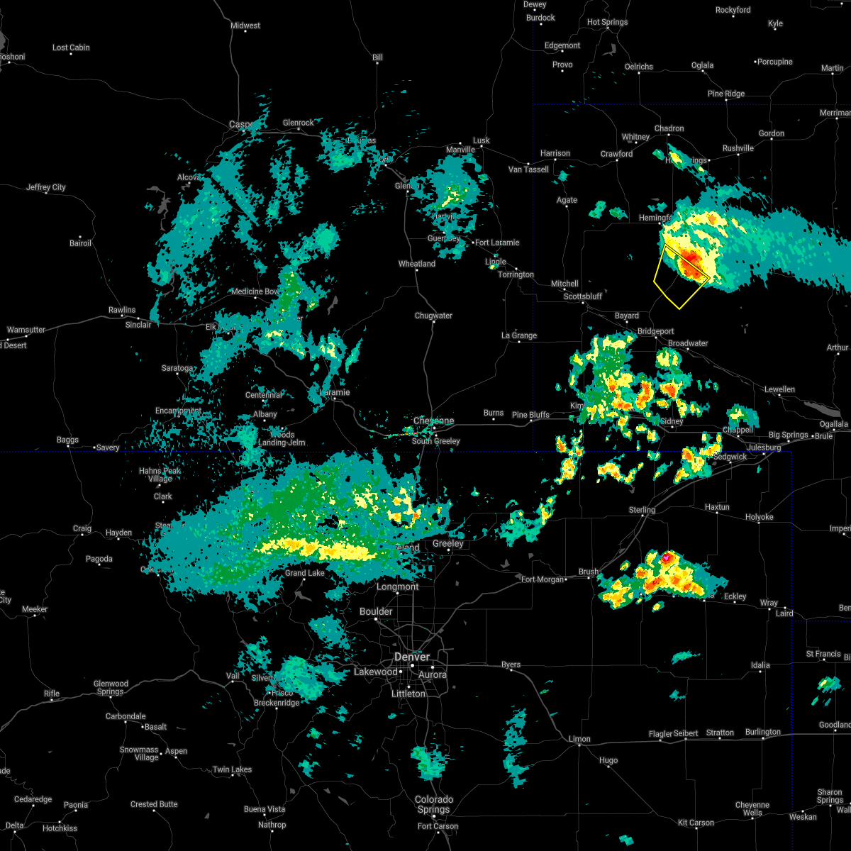 The severe thunderstorm warning for southeastern box butte and north central morrill counties will expire at 630 pm mdt, the storm which prompted the warning has weakened below severe limits, and no longer poses an immediate threat to life or property. therefore, the warning will be allowed to expire. a severe thunderstorm watch remains in effect until midnight mdt for the panhandle of nebraska. The severe thunderstorm warning for southeastern box butte and north central morrill counties will expire at 630 pm mdt, the storm which prompted the warning has weakened below severe limits, and no longer poses an immediate threat to life or property. therefore, the warning will be allowed to expire. a severe thunderstorm watch remains in effect until midnight mdt for the panhandle of nebraska.
|
| 9/1/2021 6:25 PM MDT | Asos station kaia alliance airpor in box butte county NE, 4.8 miles NW of Alliance, NE |
| 9/1/2021 6:18 PM MDT | Corrects previous tstm wnd gst report from 5 se alliance. asos station kaia alliance airpor in box butte county NE, 4.8 miles NW of Alliance, NE |
| 9/1/2021 6:05 PM MDT |
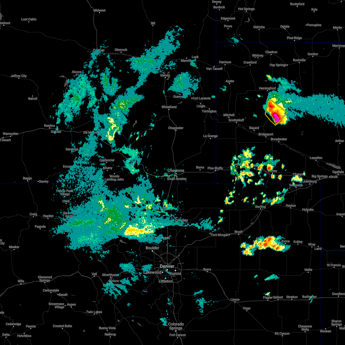 At 605 pm mdt, a severe thunderstorm was located 8 miles southwest of alliance airport, or 10 miles south of alliance, moving northeast at 20 mph (radar indicated). Hazards include golf ball size hail and 60 mph wind gusts. People and animals outdoors will be injured. expect hail damage to roofs, siding, windows, and vehicles. expect wind damage to roofs, siding, and trees. Locations impacted include, alliance and alliance airport. At 605 pm mdt, a severe thunderstorm was located 8 miles southwest of alliance airport, or 10 miles south of alliance, moving northeast at 20 mph (radar indicated). Hazards include golf ball size hail and 60 mph wind gusts. People and animals outdoors will be injured. expect hail damage to roofs, siding, windows, and vehicles. expect wind damage to roofs, siding, and trees. Locations impacted include, alliance and alliance airport.
|
| 9/1/2021 6:01 PM MDT |
 At 601 pm mdt, a severe thunderstorm was located 9 miles southwest of alliance airport, or 10 miles southwest of alliance, moving northeast at 20 mph (radar indicated). Hazards include 60 mph wind gusts and quarter size hail. Hail damage to vehicles is expected. expect wind damage to roofs, siding, and trees. locations impacted include, alliance and alliance airport. hail threat, radar indicated max hail size, 1. 00 in wind threat, radar indicated max wind gust, 60 mph. At 601 pm mdt, a severe thunderstorm was located 9 miles southwest of alliance airport, or 10 miles southwest of alliance, moving northeast at 20 mph (radar indicated). Hazards include 60 mph wind gusts and quarter size hail. Hail damage to vehicles is expected. expect wind damage to roofs, siding, and trees. locations impacted include, alliance and alliance airport. hail threat, radar indicated max hail size, 1. 00 in wind threat, radar indicated max wind gust, 60 mph.
|
| 9/1/2021 5:49 PM MDT |
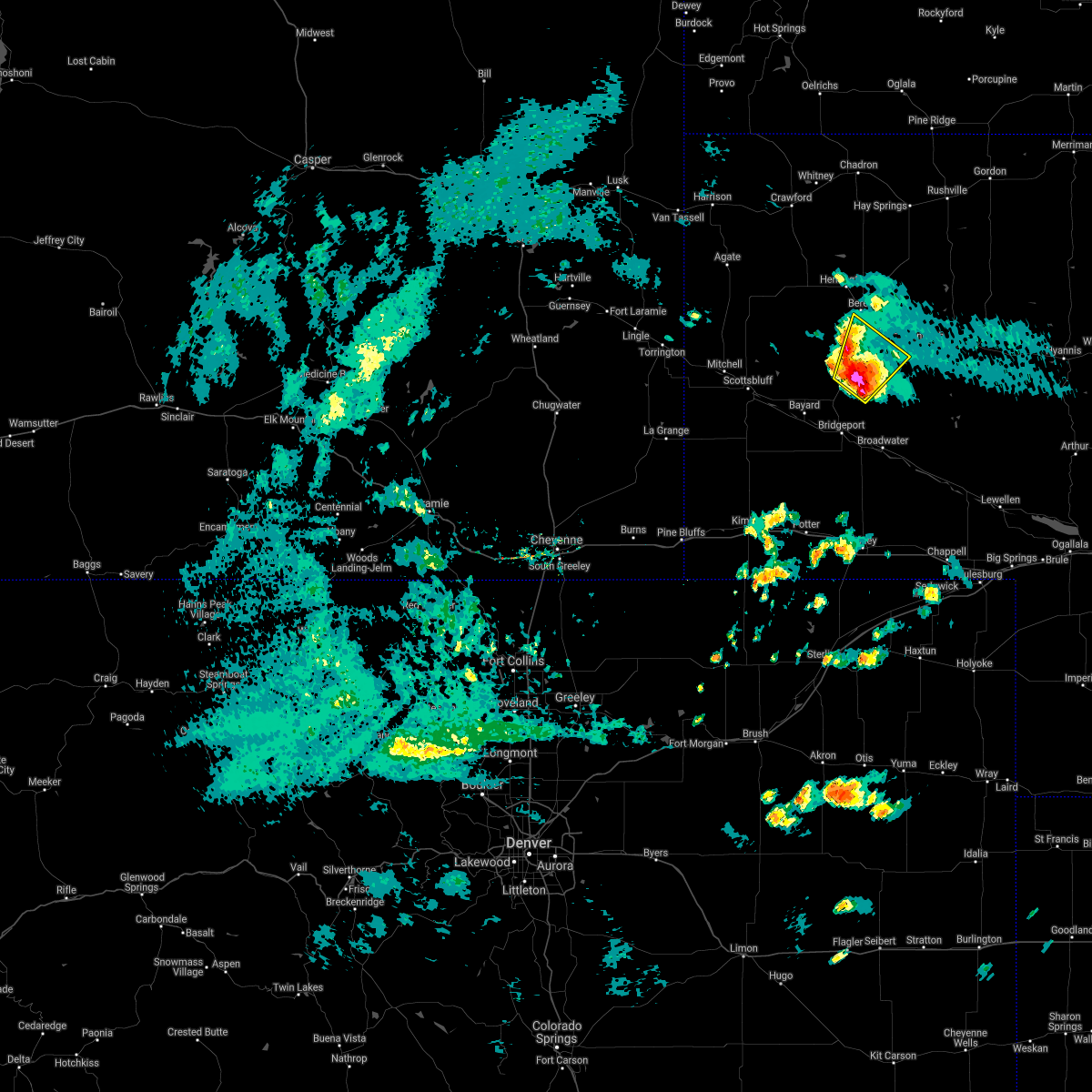 At 549 pm mdt, a severe thunderstorm was located near angora, or 14 miles southwest of alliance, moving northeast at 20 mph (radar indicated). Hazards include 60 mph wind gusts and quarter size hail. Hail damage to vehicles is expected. Expect wind damage to roofs, siding, and trees. At 549 pm mdt, a severe thunderstorm was located near angora, or 14 miles southwest of alliance, moving northeast at 20 mph (radar indicated). Hazards include 60 mph wind gusts and quarter size hail. Hail damage to vehicles is expected. Expect wind damage to roofs, siding, and trees.
|
| 8/14/2021 6:15 PM MDT | Tennis Ball sized hail reported 22.6 miles ENE of Alliance, NE |
| 8/14/2021 6:10 PM MDT | Tennis Ball sized hail reported 24.6 miles ENE of Alliance, NE |
| 8/14/2021 6:06 PM MDT | Golf Ball sized hail reported 23.9 miles E of Alliance, NE |
| 8/14/2021 5:32 PM MDT |
 At 531 pm mdt, a severe thunderstorm was located near kilpatrick lake, or 22 miles west of alliance, moving south at 25 mph (radar indicated). Hazards include golf ball size hail and 60 mph wind gusts. People and animals outdoors will be injured. expect hail damage to roofs, siding, windows, and vehicles. expect wind damage to roofs, siding, and trees. Locations impacted include, alliance and kilpatrick lake. At 531 pm mdt, a severe thunderstorm was located near kilpatrick lake, or 22 miles west of alliance, moving south at 25 mph (radar indicated). Hazards include golf ball size hail and 60 mph wind gusts. People and animals outdoors will be injured. expect hail damage to roofs, siding, windows, and vehicles. expect wind damage to roofs, siding, and trees. Locations impacted include, alliance and kilpatrick lake.
|
| 8/14/2021 5:22 PM MDT |
 At 521 pm mdt, a severe thunderstorm was located 8 miles southeast of flahertys corner, or 24 miles northwest of alliance, moving south at 25 mph (radar indicated). Hazards include golf ball size hail and 60 mph wind gusts. People and animals outdoors will be injured. expect hail damage to roofs, siding, windows, and vehicles. Expect wind damage to roofs, siding, and trees. At 521 pm mdt, a severe thunderstorm was located 8 miles southeast of flahertys corner, or 24 miles northwest of alliance, moving south at 25 mph (radar indicated). Hazards include golf ball size hail and 60 mph wind gusts. People and animals outdoors will be injured. expect hail damage to roofs, siding, windows, and vehicles. Expect wind damage to roofs, siding, and trees.
|
| 8/14/2021 5:08 PM MDT |
 At 507 pm mdt, a severe thunderstorm was located near flahertys corner, or 27 miles northwest of alliance, moving south at 30 mph (radar indicated). Hazards include golf ball size hail and 60 mph wind gusts. People and animals outdoors will be injured. expect hail damage to roofs, siding, windows, and vehicles. expect wind damage to roofs, siding, and trees. locations impacted include, alliance, hemingford, kilpatrick lake, berea, flahertys corner and alliance airport. thunderstorm damage threat, considerable hail threat, radar indicated max hail size, 1. 75 in wind threat, radar indicated max wind gust, 60 mph. At 507 pm mdt, a severe thunderstorm was located near flahertys corner, or 27 miles northwest of alliance, moving south at 30 mph (radar indicated). Hazards include golf ball size hail and 60 mph wind gusts. People and animals outdoors will be injured. expect hail damage to roofs, siding, windows, and vehicles. expect wind damage to roofs, siding, and trees. locations impacted include, alliance, hemingford, kilpatrick lake, berea, flahertys corner and alliance airport. thunderstorm damage threat, considerable hail threat, radar indicated max hail size, 1. 75 in wind threat, radar indicated max wind gust, 60 mph.
|
| 8/14/2021 4:50 PM MDT |
 At 450 pm mdt, a severe thunderstorm was located 8 miles northeast of flahertys corner, or 33 miles southwest of chadron, moving south at 30 mph (radar indicated). Hazards include golf ball size hail and 60 mph wind gusts. People and animals outdoors will be injured. expect hail damage to roofs, siding, windows, and vehicles. Expect wind damage to roofs, siding, and trees. At 450 pm mdt, a severe thunderstorm was located 8 miles northeast of flahertys corner, or 33 miles southwest of chadron, moving south at 30 mph (radar indicated). Hazards include golf ball size hail and 60 mph wind gusts. People and animals outdoors will be injured. expect hail damage to roofs, siding, windows, and vehicles. Expect wind damage to roofs, siding, and trees.
|
| 7/9/2021 10:25 PM MDT |
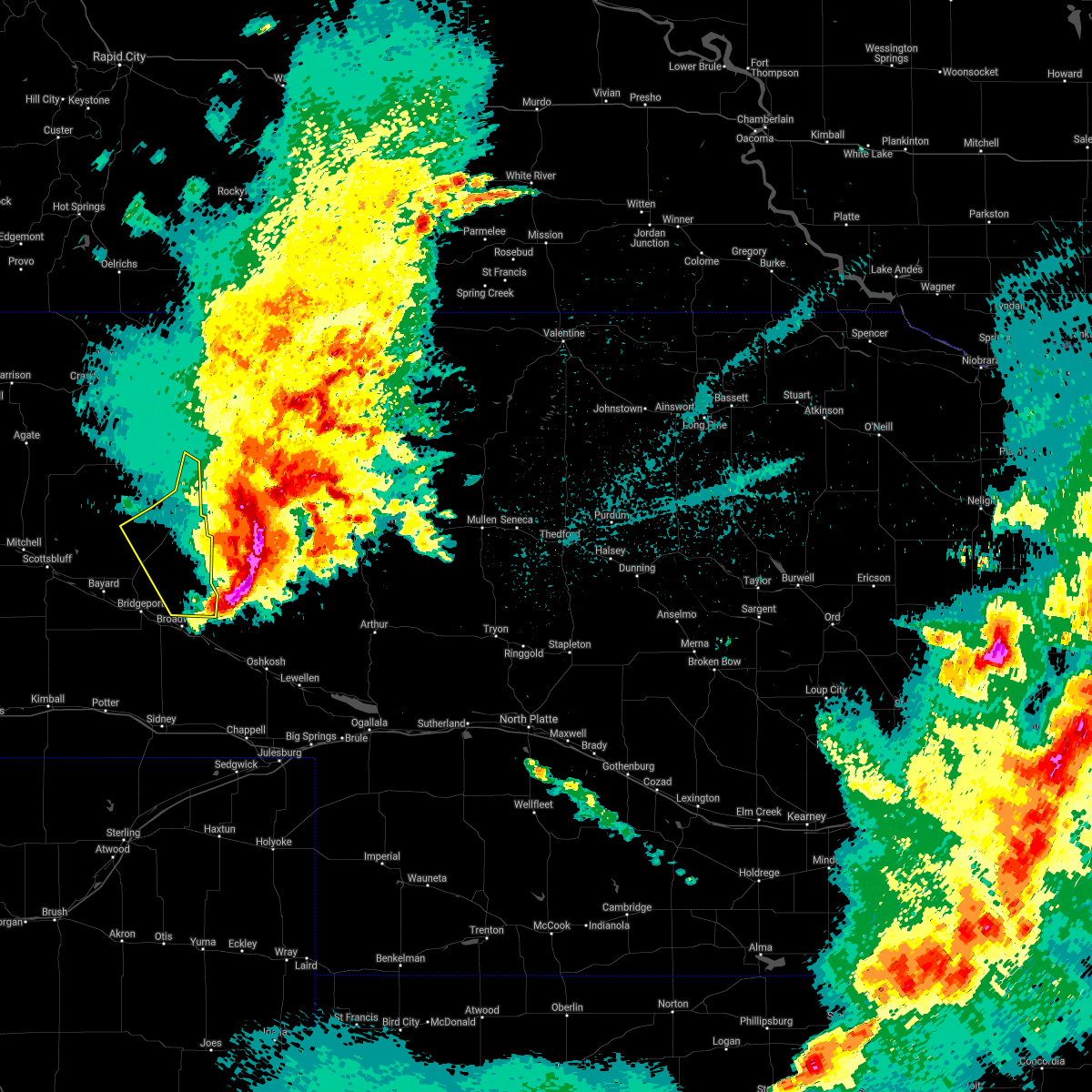 The severe thunderstorm warning for eastern box butte and northeastern morrill counties will expire at 1030 pm mdt, the storm which prompted the warning has moved out of the area. therefore, the warning will be allowed to expire. however gusty winds are still possible with this thunderstorm. a severe thunderstorm watch remains in effect until 1100 pm mdt for the panhandle of nebraska. to report severe weather, contact your nearest law enforcement agency. they will relay your report to the national weather service cheyenne. The severe thunderstorm warning for eastern box butte and northeastern morrill counties will expire at 1030 pm mdt, the storm which prompted the warning has moved out of the area. therefore, the warning will be allowed to expire. however gusty winds are still possible with this thunderstorm. a severe thunderstorm watch remains in effect until 1100 pm mdt for the panhandle of nebraska. to report severe weather, contact your nearest law enforcement agency. they will relay your report to the national weather service cheyenne.
|
| 7/9/2021 10:09 PM MDT |
 At 1008 pm mdt, a severe thunderstorm was located near alliance airport, or 7 miles southeast of alliance, moving southeast at 60 mph. this is an extremely dangerous storm capable of substantial damage! (trained weather spotters and automated sensors confirmed. an 86 mph wind gust was reported in alliance with this storm!). Hazards include 90 mph wind gusts and golf ball size hail. You are in a life-threatening situation. flying debris may be deadly to those caught without shelter. mobile homes will be heavily damaged or destroyed. homes and businesses will have substantial roof and window damage. expect extensive tree damage and power outages. Locations impacted include, alliance, alliance airport and wild horse butte. At 1008 pm mdt, a severe thunderstorm was located near alliance airport, or 7 miles southeast of alliance, moving southeast at 60 mph. this is an extremely dangerous storm capable of substantial damage! (trained weather spotters and automated sensors confirmed. an 86 mph wind gust was reported in alliance with this storm!). Hazards include 90 mph wind gusts and golf ball size hail. You are in a life-threatening situation. flying debris may be deadly to those caught without shelter. mobile homes will be heavily damaged or destroyed. homes and businesses will have substantial roof and window damage. expect extensive tree damage and power outages. Locations impacted include, alliance, alliance airport and wild horse butte.
|
| 7/9/2021 10:07 PM MDT | Storm damage reported in box butte county NE, 0.2 miles ESE of Alliance, NE |
| 7/9/2021 10:07 PM MDT | Storm damage reported in box butte county NE, 4.5 miles NW of Alliance, NE |
| 7/9/2021 10:06 PM MDT | Storm chaser south of alliance on highway 385 reported wind driven golf ball sized hail. damaged vehicles. 2 to 3 inch tree limbs on road. storm chaser also reported co in box butte county NE, 3.8 miles NNE of Alliance, NE |
| 7/9/2021 10:04 PM MDT |
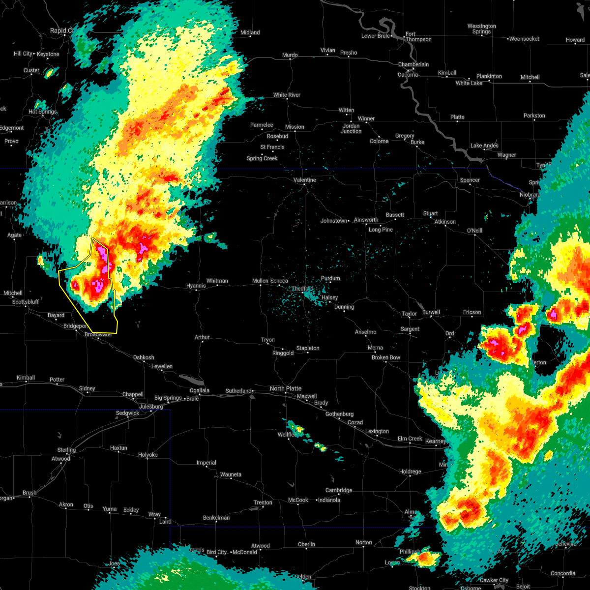 At 1002 pm mdt, a severe thunderstorm was located over alliance airport, or near alliance, moving southeast at 60 mph. this is a very dangerous storm (trained weather spotters. 70 to 80 mph winds have been confirmed in and around alliance with this storm!). Hazards include 80 mph wind gusts and golf ball size hail. Flying debris will be dangerous to those caught without shelter. mobile homes will be heavily damaged. expect considerable damage to roofs, windows, and vehicles. extensive tree damage and power outages are likely. this severe thunderstorm will continue to impact the city of alliance. Other locations impacted include, angora. At 1002 pm mdt, a severe thunderstorm was located over alliance airport, or near alliance, moving southeast at 60 mph. this is a very dangerous storm (trained weather spotters. 70 to 80 mph winds have been confirmed in and around alliance with this storm!). Hazards include 80 mph wind gusts and golf ball size hail. Flying debris will be dangerous to those caught without shelter. mobile homes will be heavily damaged. expect considerable damage to roofs, windows, and vehicles. extensive tree damage and power outages are likely. this severe thunderstorm will continue to impact the city of alliance. Other locations impacted include, angora.
|
| 7/9/2021 10:00 PM MDT | Storm damage reported in box butte county NE, 0.2 miles ESE of Alliance, NE |
| 7/9/2021 9:56 PM MDT | From cwop sensor northwest of alliance in box butte county NE, 1.4 miles ESE of Alliance, NE |
| 7/9/2021 9:47 PM MDT |
 At 945 pm mdt, a severe thunderstorm was located near berea, or 9 miles west of alliance, moving southeast at 65 mph. this includes the city of alliance! clean up may be underway from earlier intense thunderstorms. seek shelter immediately inside a sturdy structure and away from windows! this is a very dangerous storm (radar indicated). Hazards include 80 mph wind gusts and golf ball size hail. Flying debris will be dangerous to those caught without shelter. mobile homes will be heavily damaged. expect considerable damage to roofs, windows, and vehicles. extensive tree damage and power outages are likely. this severe storm will be near, alliance around 955 pm mdt. alliance airport around 1000 pm mdt. Other locations impacted by this severe thunderstorm include marsland. At 945 pm mdt, a severe thunderstorm was located near berea, or 9 miles west of alliance, moving southeast at 65 mph. this includes the city of alliance! clean up may be underway from earlier intense thunderstorms. seek shelter immediately inside a sturdy structure and away from windows! this is a very dangerous storm (radar indicated). Hazards include 80 mph wind gusts and golf ball size hail. Flying debris will be dangerous to those caught without shelter. mobile homes will be heavily damaged. expect considerable damage to roofs, windows, and vehicles. extensive tree damage and power outages are likely. this severe storm will be near, alliance around 955 pm mdt. alliance airport around 1000 pm mdt. Other locations impacted by this severe thunderstorm include marsland.
|
| 7/9/2021 9:33 PM MDT |
 This includes the city of alliance! * at 932 pm mdt, a severe thunderstorm was located 9 miles east of flahertys corner, or 23 miles northwest of alliance, moving southeast at 65 mph. this is a very dangerous storm. seek shelter immediately inside a sturdy structure! (radar indicated). Hazards include 80 mph wind gusts and golf ball size hail. Flying debris will be dangerous to those caught without shelter. mobile homes will be heavily damaged. expect considerable damage to roofs, windows, and vehicles. Extensive tree damage and power outages are likely. This includes the city of alliance! * at 932 pm mdt, a severe thunderstorm was located 9 miles east of flahertys corner, or 23 miles northwest of alliance, moving southeast at 65 mph. this is a very dangerous storm. seek shelter immediately inside a sturdy structure! (radar indicated). Hazards include 80 mph wind gusts and golf ball size hail. Flying debris will be dangerous to those caught without shelter. mobile homes will be heavily damaged. expect considerable damage to roofs, windows, and vehicles. Extensive tree damage and power outages are likely.
|
| 7/9/2021 6:20 PM MDT | Tennis Ball sized hail reported 12 miles NNE of Alliance, NE |
| 7/9/2021 6:19 PM MDT |
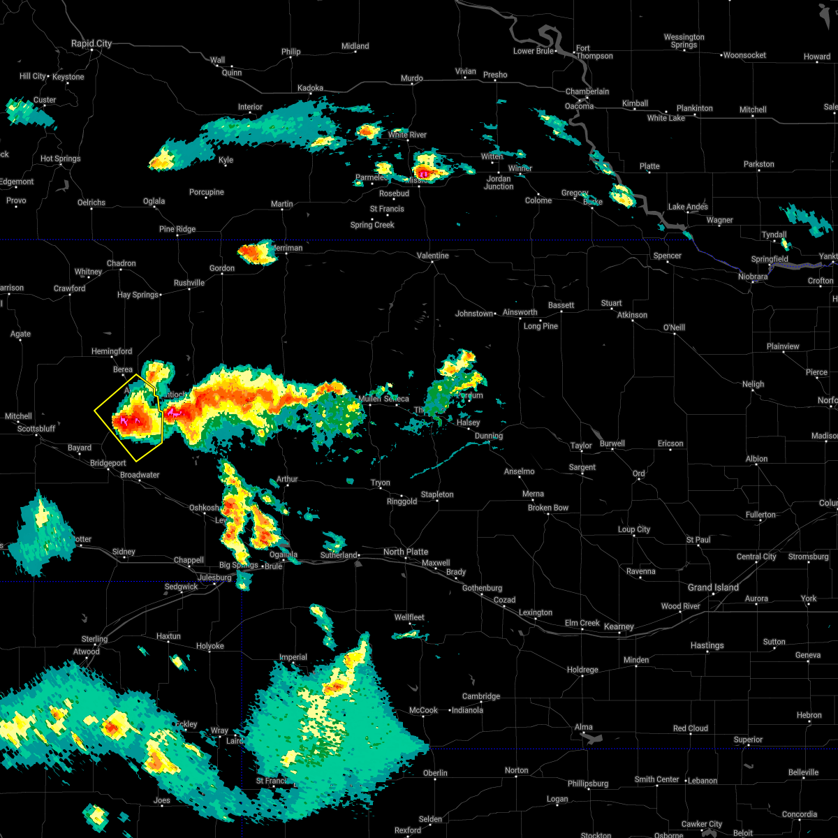 At 617 pm mdt, a severe thunderstorm was located 9 miles southwest of alliance airport, or 9 miles southwest of alliance, moving southeast at 30 mph. this includes the tornado warned storm moving into morrill county. trained spotters have reported hail greater than four inch diameter with these storms. this is a very dangerous storm (trained weather spotters). Hazards include softball size hail and 60 mph wind gusts. People and animals outdoors will be severely injured. expect shattered windows, extensive damage to roofs, siding, and vehicles. Locations impacted include, alliance and alliance airport. At 617 pm mdt, a severe thunderstorm was located 9 miles southwest of alliance airport, or 9 miles southwest of alliance, moving southeast at 30 mph. this includes the tornado warned storm moving into morrill county. trained spotters have reported hail greater than four inch diameter with these storms. this is a very dangerous storm (trained weather spotters). Hazards include softball size hail and 60 mph wind gusts. People and animals outdoors will be severely injured. expect shattered windows, extensive damage to roofs, siding, and vehicles. Locations impacted include, alliance and alliance airport.
|
| 7/9/2021 6:12 PM MDT | Tea Cup sized hail reported 11.2 miles ENE of Alliance, NE, late report. hail diameter of 3.5 inches southwest of alliance. |
| 7/9/2021 5:58 PM MDT |
 At 556 pm mdt, a severe thunderstorm was located over alliance airport, or near alliance, moving southeast at 25 mph. additional storms were located west of alliance moving southeast, including a tornado warned storm until 615 pm mdt. this is a very dangerous storm (trained weather spotters). Hazards include baseball size hail and 60 mph wind gusts. People and animals outdoors will be severely injured. Expect shattered windows, extensive damage to roofs, siding, and vehicles. At 556 pm mdt, a severe thunderstorm was located over alliance airport, or near alliance, moving southeast at 25 mph. additional storms were located west of alliance moving southeast, including a tornado warned storm until 615 pm mdt. this is a very dangerous storm (trained weather spotters). Hazards include baseball size hail and 60 mph wind gusts. People and animals outdoors will be severely injured. Expect shattered windows, extensive damage to roofs, siding, and vehicles.
|
| 7/9/2021 5:50 PM MDT | Tea Cup sized hail reported 0.2 miles ESE of Alliance, NE |
| 7/9/2021 5:45 PM MDT | Baseball sized hail reported 0.2 miles ESE of Alliance, NE |
| 7/9/2021 5:40 PM MDT | Grapefruit sized hail reported 7.3 miles SSE of Alliance, NE, social media report with photo |
| 7/9/2021 5:34 PM MDT | Ping Pong Ball sized hail reported 0.2 miles ESE of Alliance, NE, report of near golf ball sized hail in downtown alliance |
| 7/9/2021 5:27 PM MDT |
 At 525 pm mdt, a severe thunderstorm was located over berea, or 7 miles northwest of alliance, moving southeast at 25 mph. additional storms were located west of hemingford also moving southeast. two inch hail was reported 9 miles south-southwest of marsland at 522 pm mdt. this is a very dangerous storm (trained spotter reported). Hazards include baseball size hail and 60 mph wind gusts. People and animals outdoors will be severely injured. expect shattered windows, extensive damage to roofs, siding, and vehicles. Locations impacted include, alliance, hemingford, wild horse butte, berea and alliance airport. At 525 pm mdt, a severe thunderstorm was located over berea, or 7 miles northwest of alliance, moving southeast at 25 mph. additional storms were located west of hemingford also moving southeast. two inch hail was reported 9 miles south-southwest of marsland at 522 pm mdt. this is a very dangerous storm (trained spotter reported). Hazards include baseball size hail and 60 mph wind gusts. People and animals outdoors will be severely injured. expect shattered windows, extensive damage to roofs, siding, and vehicles. Locations impacted include, alliance, hemingford, wild horse butte, berea and alliance airport.
|
| 7/9/2021 5:08 PM MDT |
 At 508 pm mdt, a severe thunderstorm was located near berea, or 14 miles northwest of alliance, moving southeast at 25 mph. this is a very dangerous storm (radar indicated). Hazards include baseball size hail and 60 mph wind gusts. People and animals outdoors will be severely injured. Expect shattered windows, extensive damage to roofs, siding, and vehicles. At 508 pm mdt, a severe thunderstorm was located near berea, or 14 miles northwest of alliance, moving southeast at 25 mph. this is a very dangerous storm (radar indicated). Hazards include baseball size hail and 60 mph wind gusts. People and animals outdoors will be severely injured. Expect shattered windows, extensive damage to roofs, siding, and vehicles.
|
| 6/19/2021 2:46 PM MDT |
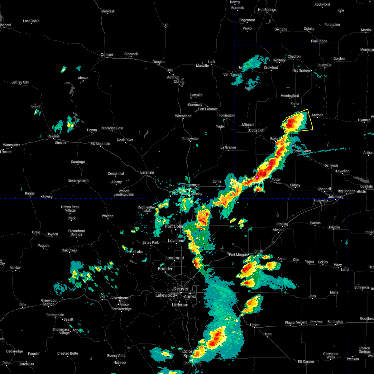 At 245 pm mdt, a severe thunderstorm was located near angora, or 15 miles southwest of alliance, moving east at 20 mph (radar indicated). Hazards include 60 mph wind gusts and half dollar size hail. Hail damage to vehicles is expected. Expect wind damage to roofs, siding, and trees. At 245 pm mdt, a severe thunderstorm was located near angora, or 15 miles southwest of alliance, moving east at 20 mph (radar indicated). Hazards include 60 mph wind gusts and half dollar size hail. Hail damage to vehicles is expected. Expect wind damage to roofs, siding, and trees.
|
| 6/13/2021 7:38 PM MDT |
 At 738 pm mdt, severe thunderstorms were located along a line extending from near alliance to 9 miles east of angora to near court house and jail rocks, moving east at 30 mph (radar indicated). Hazards include 70 mph wind gusts and half dollar size hail. Hail damage to vehicles is expected. expect considerable tree damage. Wind damage is also likely to mobile homes, roofs, and outbuildings. At 738 pm mdt, severe thunderstorms were located along a line extending from near alliance to 9 miles east of angora to near court house and jail rocks, moving east at 30 mph (radar indicated). Hazards include 70 mph wind gusts and half dollar size hail. Hail damage to vehicles is expected. expect considerable tree damage. Wind damage is also likely to mobile homes, roofs, and outbuildings.
|
| 5/26/2021 6:25 PM MDT | Quarter sized hail reported 17 miles SSW of Alliance, NE |
| 5/26/2021 6:12 PM MDT |
 At 612 pm mdt, a severe thunderstorm was located near hemingford, or 16 miles northwest of alliance, moving east at 30 mph (radar indicated). Hazards include ping pong ball size hail and 60 mph wind gusts. People and animals outdoors will be injured. expect hail damage to roofs, siding, windows, and vehicles. Expect wind damage to roofs, siding, and trees. At 612 pm mdt, a severe thunderstorm was located near hemingford, or 16 miles northwest of alliance, moving east at 30 mph (radar indicated). Hazards include ping pong ball size hail and 60 mph wind gusts. People and animals outdoors will be injured. expect hail damage to roofs, siding, windows, and vehicles. Expect wind damage to roofs, siding, and trees.
|
| 7/9/2020 8:36 PM MDT | Hen Egg sized hail reported 0.2 miles ESE of Alliance, NE, via phone. |
| 7/9/2020 8:31 PM MDT |
 At 830 pm mdt, severe thunderstorms were located along a line extending from 8 miles northwest of antioch to alliance airport, moving southeast at 35 mph (trained weather spotters. numerous reports of golf ball sized hail have been received around the city of alliance). Hazards include golf ball size hail and 60 mph wind gusts. People and animals outdoors will be injured. expect hail damage to roofs, siding, windows, and vehicles. expect wind damage to roofs, siding, and trees. Locations impacted include, alliance and alliance airport. At 830 pm mdt, severe thunderstorms were located along a line extending from 8 miles northwest of antioch to alliance airport, moving southeast at 35 mph (trained weather spotters. numerous reports of golf ball sized hail have been received around the city of alliance). Hazards include golf ball size hail and 60 mph wind gusts. People and animals outdoors will be injured. expect hail damage to roofs, siding, windows, and vehicles. expect wind damage to roofs, siding, and trees. Locations impacted include, alliance and alliance airport.
|
| 7/9/2020 8:29 PM MDT | Golf Ball sized hail reported 0.4 miles W of Alliance, NE, reported at 707 flack ave... alliance... ne 69301. |
| 7/9/2020 8:29 PM MDT | Golf Ball sized hail reported 0.2 miles ESE of Alliance, NE, hailing for the past 5 minutes. |
| 7/9/2020 8:28 PM MDT | Quarter sized hail reported 0.2 miles ESE of Alliance, NE |
| 7/9/2020 8:27 PM MDT |
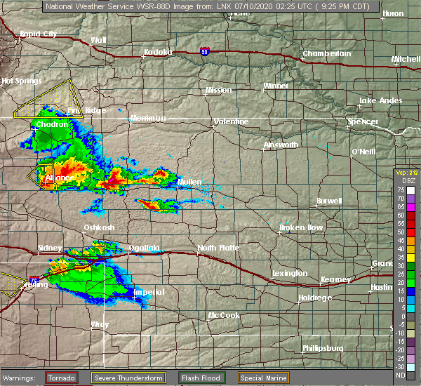 At 826 pm mdt, severe thunderstorms were located along a line extending from 7 miles southeast of wild horse butte to alliance airport, moving southeast at 35 mph (radar indicated). Hazards include 60 mph wind gusts and quarter size hail. Hail damage to vehicles is expected. Expect wind damage to roofs, siding, and trees. At 826 pm mdt, severe thunderstorms were located along a line extending from 7 miles southeast of wild horse butte to alliance airport, moving southeast at 35 mph (radar indicated). Hazards include 60 mph wind gusts and quarter size hail. Hail damage to vehicles is expected. Expect wind damage to roofs, siding, and trees.
|
| 7/9/2020 8:20 PM MDT | Quarter sized hail reported 2.2 miles E of Alliance, NE |
| 7/9/2020 8:16 PM MDT |
 At 816 pm mdt, a severe thunderstorm was located near alliance, moving southeast at 30 mph (radar indicated). Hazards include 60 mph wind gusts and quarter size hail. Hail damage to vehicles is expected. expect wind damage to roofs, siding, and trees. Locations impacted include, alliance, wild horse butte, berea and alliance airport. At 816 pm mdt, a severe thunderstorm was located near alliance, moving southeast at 30 mph (radar indicated). Hazards include 60 mph wind gusts and quarter size hail. Hail damage to vehicles is expected. expect wind damage to roofs, siding, and trees. Locations impacted include, alliance, wild horse butte, berea and alliance airport.
|
| 7/9/2020 8:07 PM MDT |
 At 806 pm mdt, severe thunderstorms were located along a line extending from near wild horse butte to 7 miles west of alliance, moving east at 35 mph (radar indicated). Hazards include golf ball size hail and 60 mph wind gusts. People and animals outdoors will be injured. expect hail damage to roofs, siding, windows, and vehicles. expect wind damage to roofs, siding, and trees. Locations impacted include, alliance, hemingford, wild horse butte, berea and alliance airport. At 806 pm mdt, severe thunderstorms were located along a line extending from near wild horse butte to 7 miles west of alliance, moving east at 35 mph (radar indicated). Hazards include golf ball size hail and 60 mph wind gusts. People and animals outdoors will be injured. expect hail damage to roofs, siding, windows, and vehicles. expect wind damage to roofs, siding, and trees. Locations impacted include, alliance, hemingford, wild horse butte, berea and alliance airport.
|
| 7/9/2020 7:54 PM MDT |
 At 754 pm mdt, severe thunderstorms were located along a line extending from near wild horse butte to 7 miles east of kilpatrick lake, moving southeast at 25 mph (radar indicated). Hazards include golf ball size hail and 60 mph wind gusts. People and animals outdoors will be injured. expect hail damage to roofs, siding, windows, and vehicles. expect wind damage to roofs, siding, and trees. Locations impacted include, alliance, hemingford, wild horse butte, berea and alliance airport. At 754 pm mdt, severe thunderstorms were located along a line extending from near wild horse butte to 7 miles east of kilpatrick lake, moving southeast at 25 mph (radar indicated). Hazards include golf ball size hail and 60 mph wind gusts. People and animals outdoors will be injured. expect hail damage to roofs, siding, windows, and vehicles. expect wind damage to roofs, siding, and trees. Locations impacted include, alliance, hemingford, wild horse butte, berea and alliance airport.
|
| 7/9/2020 7:37 PM MDT |
 At 737 pm mdt, severe thunderstorms were located along a line extending from near wild horse butte to near kilpatrick lake, moving east at 35 mph (radar indicated). Hazards include golf ball size hail and 60 mph wind gusts. People and animals outdoors will be injured. expect hail damage to roofs, siding, windows, and vehicles. Expect wind damage to roofs, siding, and trees. At 737 pm mdt, severe thunderstorms were located along a line extending from near wild horse butte to near kilpatrick lake, moving east at 35 mph (radar indicated). Hazards include golf ball size hail and 60 mph wind gusts. People and animals outdoors will be injured. expect hail damage to roofs, siding, windows, and vehicles. Expect wind damage to roofs, siding, and trees.
|
| 6/6/2020 7:30 PM MDT |
 At 729 pm mdt, severe thunderstorms were located along a line extending from 7 miles north of whitney lake to near sunol, moving east at 50 mph (radar indicated). Hazards include 70 mph wind gusts. Expect considerable tree damage. Damage is likely to mobile homes, roofs, and outbuildings. At 729 pm mdt, severe thunderstorms were located along a line extending from 7 miles north of whitney lake to near sunol, moving east at 50 mph (radar indicated). Hazards include 70 mph wind gusts. Expect considerable tree damage. Damage is likely to mobile homes, roofs, and outbuildings.
|
| 6/6/2020 7:12 PM MDT |
 The severe thunderstorm warning for box butte, dawes and northern sioux counties will expire at 715 pm mdt, the storms which prompted the warning have moved out of the area. therefore, the warning will be allowed to expire. however gusty winds to 45 mph are still possible with these thunderstorms. a severe thunderstorm watch remains in effect until 800 pm mdt for the panhandle of nebraska. The severe thunderstorm warning for box butte, dawes and northern sioux counties will expire at 715 pm mdt, the storms which prompted the warning have moved out of the area. therefore, the warning will be allowed to expire. however gusty winds to 45 mph are still possible with these thunderstorms. a severe thunderstorm watch remains in effect until 800 pm mdt for the panhandle of nebraska.
|
| 6/6/2020 6:55 PM MDT |
 At 653 pm mdt, severe thunderstorms were located along a line extending from 8 miles south of oelrichs to 12 miles south of hay springs, moving north at 55 mph. at 642 pm mdt, chadron municipal airport reported 75 mph wind gust (mesonet station). Hazards include 70 mph wind gusts. Expect considerable tree damage. damage is likely to mobile homes, roofs, and outbuildings. Locations impacted include, alliance, chadron, crawford, hemingford, harrison, wild horse butte, alliance airport, whitney lake, box butte campground, red cloud campground, montrose, box butte dam, kilpatrick lake, fort robinson campground, chadron campground, berea, flahertys corner, chadron airport, whitney and marsland. At 653 pm mdt, severe thunderstorms were located along a line extending from 8 miles south of oelrichs to 12 miles south of hay springs, moving north at 55 mph. at 642 pm mdt, chadron municipal airport reported 75 mph wind gust (mesonet station). Hazards include 70 mph wind gusts. Expect considerable tree damage. damage is likely to mobile homes, roofs, and outbuildings. Locations impacted include, alliance, chadron, crawford, hemingford, harrison, wild horse butte, alliance airport, whitney lake, box butte campground, red cloud campground, montrose, box butte dam, kilpatrick lake, fort robinson campground, chadron campground, berea, flahertys corner, chadron airport, whitney and marsland.
|
| 6/6/2020 6:32 PM MDT |
 At 630 pm mdt, severe thunderstorms were located along a line extending from near montrose to near berea, moving northeast at 65 mph. at 621 pm mdt, alliance municipal airport asos reported 73 mph wind gust (mesonet station). Hazards include 70 mph wind gusts. Expect considerable tree damage. damage is likely to mobile homes, roofs, and outbuildings. Locations impacted include, alliance, chadron, crawford, hemingford, harrison, alliance airport, montrose, angora, box butte dam, fort robinson campground, chadron campground, berea, flahertys corner, chadron airport, wild horse butte, whitney lake, box butte campground, red cloud campground, agate bed national monument and kilpatrick lake. At 630 pm mdt, severe thunderstorms were located along a line extending from near montrose to near berea, moving northeast at 65 mph. at 621 pm mdt, alliance municipal airport asos reported 73 mph wind gust (mesonet station). Hazards include 70 mph wind gusts. Expect considerable tree damage. damage is likely to mobile homes, roofs, and outbuildings. Locations impacted include, alliance, chadron, crawford, hemingford, harrison, alliance airport, montrose, angora, box butte dam, fort robinson campground, chadron campground, berea, flahertys corner, chadron airport, wild horse butte, whitney lake, box butte campground, red cloud campground, agate bed national monument and kilpatrick lake.
|
| 6/6/2020 6:25 PM MDT | Wind gusts of at least 60 mph in sheridan county NE, 11.4 miles WNW of Alliance, NE |
| 6/6/2020 6:21 PM MDT | Asos station kaia alliance airpor in box butte county NE, 4.8 miles NW of Alliance, NE |
| 6/6/2020 6:20 PM MDT | Entire tree (3-4ã¢â€â™ diameter) uprooted in allianc in box butte county NE, 0.2 miles ESE of Alliance, NE |
| 6/6/2020 6:16 PM MDT | Measured on davis statio in box butte county NE, 0.2 miles ESE of Alliance, NE |
| 6/6/2020 5:58 PM MDT |
 At 556 pm mdt, severe thunderstorms were located along a line extending from 9 miles northwest of agate bed national monument to near bayard, moving northeast at 65 mph (radar indicated). Hazards include 70 mph wind gusts. Expect considerable tree damage. Damage is likely to mobile homes, roofs, and outbuildings. At 556 pm mdt, severe thunderstorms were located along a line extending from 9 miles northwest of agate bed national monument to near bayard, moving northeast at 65 mph (radar indicated). Hazards include 70 mph wind gusts. Expect considerable tree damage. Damage is likely to mobile homes, roofs, and outbuildings.
|
| 9/20/2019 7:04 PM MDT | Half Dollar sized hail reported 15.3 miles S of Alliance, NE |
| 9/10/2019 7:19 PM MDT |
 At 718 pm mdt, a severe thunderstorm was located near wild horse butte, or near alliance, moving east at 35 mph (radar indicated). Hazards include two inch hail and 60 mph wind gusts. People and animals outdoors will be injured. expect hail damage to roofs, siding, windows, and vehicles. expect wind damage to roofs, siding, and trees. Locations impacted include, alliance, wild horse butte and berea. At 718 pm mdt, a severe thunderstorm was located near wild horse butte, or near alliance, moving east at 35 mph (radar indicated). Hazards include two inch hail and 60 mph wind gusts. People and animals outdoors will be injured. expect hail damage to roofs, siding, windows, and vehicles. expect wind damage to roofs, siding, and trees. Locations impacted include, alliance, wild horse butte and berea.
|
| 9/10/2019 7:03 PM MDT |
 At 702 pm mdt, a severe thunderstorm was located near berea, or 11 miles northwest of alliance, moving east at 35 mph (radar indicated). Hazards include ping pong ball size hail and 60 mph wind gusts. People and animals outdoors will be injured. expect hail damage to roofs, siding, windows, and vehicles. Expect wind damage to roofs, siding, and trees. At 702 pm mdt, a severe thunderstorm was located near berea, or 11 miles northwest of alliance, moving east at 35 mph (radar indicated). Hazards include ping pong ball size hail and 60 mph wind gusts. People and animals outdoors will be injured. expect hail damage to roofs, siding, windows, and vehicles. Expect wind damage to roofs, siding, and trees.
|
| 8/21/2019 12:51 AM MDT |
 The severe thunderstorm warning for southeastern box butte, eastern cheyenne and eastern morrill counties will expire at 100 am mdt, the storms which prompted the warning have moved out of the area. therefore, the warning will be allowed to expire. however gusty winds are still possible with these thunderstorms. a severe thunderstorm watch remains in effect until 500 am mdt for the panhandle of nebraska. The severe thunderstorm warning for southeastern box butte, eastern cheyenne and eastern morrill counties will expire at 100 am mdt, the storms which prompted the warning have moved out of the area. therefore, the warning will be allowed to expire. however gusty winds are still possible with these thunderstorms. a severe thunderstorm watch remains in effect until 500 am mdt for the panhandle of nebraska.
|
| 8/21/2019 12:32 AM MDT |
 At 1232 am mdt, severe thunderstorms were located along a line extending from 7 miles east of ellsworth to north sterling reservoir, moving east at 35 mph. these are very dangerous storms (radar indicated). Hazards include 80 mph wind gusts and quarter size hail. Flying debris will be dangerous to those caught without shelter. mobile homes will be heavily damaged. expect considerable damage to roofs, windows, and vehicles. Extensive tree damage and power outages are likely. At 1232 am mdt, severe thunderstorms were located along a line extending from 7 miles east of ellsworth to north sterling reservoir, moving east at 35 mph. these are very dangerous storms (radar indicated). Hazards include 80 mph wind gusts and quarter size hail. Flying debris will be dangerous to those caught without shelter. mobile homes will be heavily damaged. expect considerable damage to roofs, windows, and vehicles. Extensive tree damage and power outages are likely.
|
| 8/21/2019 12:23 AM MDT |
 At 1223 am mdt, severe thunderstorms were located along a line extending from near ellsworth to near north sterling reservoir, moving east at 35 mph. these are very dangerous storms (radar indicated). Hazards include 80 mph wind gusts and quarter size hail. Flying debris will be dangerous to those caught without shelter. mobile homes will be heavily damaged. expect considerable damage to roofs, windows, and vehicles. extensive tree damage and power outages are likely. locations impacted include, alliance, sidney, potter, lodgepole, dalton, gurley, sunol, brownson, alliance airport, colton, lorenzo, sidney airport and broadwater. This includes interstate 80 in nebraska between mile markers 37 and 76. At 1223 am mdt, severe thunderstorms were located along a line extending from near ellsworth to near north sterling reservoir, moving east at 35 mph. these are very dangerous storms (radar indicated). Hazards include 80 mph wind gusts and quarter size hail. Flying debris will be dangerous to those caught without shelter. mobile homes will be heavily damaged. expect considerable damage to roofs, windows, and vehicles. extensive tree damage and power outages are likely. locations impacted include, alliance, sidney, potter, lodgepole, dalton, gurley, sunol, brownson, alliance airport, colton, lorenzo, sidney airport and broadwater. This includes interstate 80 in nebraska between mile markers 37 and 76.
|
| 8/21/2019 12:11 AM MDT |
 A severe thunderstorm warning remains in effect until 1245 am mdt for southeastern box butte. cheyenne. eastern kimball. morrill and southeastern banner counties. at 1210 am mdt, severe thunderstorms were located along a line extending from near ellsworth to westplains, moving east at 35 mph. These are very dangerous storms. A severe thunderstorm warning remains in effect until 1245 am mdt for southeastern box butte. cheyenne. eastern kimball. morrill and southeastern banner counties. at 1210 am mdt, severe thunderstorms were located along a line extending from near ellsworth to westplains, moving east at 35 mph. These are very dangerous storms.
|
| 8/20/2019 11:44 PM MDT | Corrects previous tstm wnd gst report from alliance. kneb automated weather statio in box butte county NE, 0.2 miles ESE of Alliance, NE |
| 8/20/2019 11:44 PM MDT | Kneb automated weather statio in box butte county NE, 0.2 miles ESE of Alliance, NE |
| 8/20/2019 11:39 PM MDT |
 At 1138 pm mdt, severe thunderstorms were located along a line extending from 8 miles east of wild horse butte to 12 miles east of panorama point, moving east at 35 mph. these are very dangerous storms (radar indicated). Hazards include 80 mph wind gusts and quarter size hail. Flying debris will be dangerous to those caught without shelter. mobile homes will be heavily damaged. expect considerable damage to roofs, windows, and vehicles. Extensive tree damage and power outages are likely. At 1138 pm mdt, severe thunderstorms were located along a line extending from 8 miles east of wild horse butte to 12 miles east of panorama point, moving east at 35 mph. these are very dangerous storms (radar indicated). Hazards include 80 mph wind gusts and quarter size hail. Flying debris will be dangerous to those caught without shelter. mobile homes will be heavily damaged. expect considerable damage to roofs, windows, and vehicles. Extensive tree damage and power outages are likely.
|
| 8/20/2019 11:22 PM MDT |
 At 1121 pm mdt, severe thunderstorms were located along a line extending from near box butte dam to near hillsdale, moving east at 15 mph. a meteorologist at kneb reports large trees down in scotts bluff county. one tree had a diameter of 3 feet (trained weather spotters). Hazards include 70 mph wind gusts and half dollar size hail. Hail damage to vehicles is expected. expect considerable tree damage. wind damage is also likely to mobile homes, roofs, and outbuildings. locations impacted include, alliance, kimball, bridgeport, bayard, pine bluffs, minatare, hemingford, dix, albin, oliver campground, northport, angora, oliver reservoir, court house and jail rocks, harrisburg, berea, wild horse butte, chimney rock state park, bridgeport state recreation area and kilpatrick lake. this includes the following highways, interstate 80 in wyoming between mile markers 390 and 402. Interstate 80 in nebraska between mile markers 1 and 33. At 1121 pm mdt, severe thunderstorms were located along a line extending from near box butte dam to near hillsdale, moving east at 15 mph. a meteorologist at kneb reports large trees down in scotts bluff county. one tree had a diameter of 3 feet (trained weather spotters). Hazards include 70 mph wind gusts and half dollar size hail. Hail damage to vehicles is expected. expect considerable tree damage. wind damage is also likely to mobile homes, roofs, and outbuildings. locations impacted include, alliance, kimball, bridgeport, bayard, pine bluffs, minatare, hemingford, dix, albin, oliver campground, northport, angora, oliver reservoir, court house and jail rocks, harrisburg, berea, wild horse butte, chimney rock state park, bridgeport state recreation area and kilpatrick lake. this includes the following highways, interstate 80 in wyoming between mile markers 390 and 402. Interstate 80 in nebraska between mile markers 1 and 33.
|
| 8/20/2019 11:09 PM MDT |
 At 1108 pm mdt, severe thunderstorms were located along a line extending from near box butte dam to 6 miles west of hillsdale, moving south at 15 mph. at 11 pm mdt, a trained spotter reported half dollar size hail in albin (trained weather spotters). Hazards include 70 mph wind gusts and half dollar size hail. Hail damage to vehicles is expected. expect considerable tree damage. wind damage is also likely to mobile homes, roofs, and outbuildings. locations impacted include, scottsbluff, alliance, kimball, gering, bridgeport, bayard, terrytown, pine bluffs, minatare, hemingford, burns, dix, albin, oliver campground, wildcat hills state recreation area, northport, angora, wildcat hills campground, box butte dam and oliver reservoir. this includes the following highways, interstate 80 in wyoming between mile markers 388 and 402. Interstate 80 in nebraska between mile markers 1 and 33. At 1108 pm mdt, severe thunderstorms were located along a line extending from near box butte dam to 6 miles west of hillsdale, moving south at 15 mph. at 11 pm mdt, a trained spotter reported half dollar size hail in albin (trained weather spotters). Hazards include 70 mph wind gusts and half dollar size hail. Hail damage to vehicles is expected. expect considerable tree damage. wind damage is also likely to mobile homes, roofs, and outbuildings. locations impacted include, scottsbluff, alliance, kimball, gering, bridgeport, bayard, terrytown, pine bluffs, minatare, hemingford, burns, dix, albin, oliver campground, wildcat hills state recreation area, northport, angora, wildcat hills campground, box butte dam and oliver reservoir. this includes the following highways, interstate 80 in wyoming between mile markers 388 and 402. Interstate 80 in nebraska between mile markers 1 and 33.
|
| 8/20/2019 11:00 PM MDT |
 At 1050 pm mdt, severe thunderstorms were located along a line extending from 7 miles north of box butte campground to 8 miles northwest of hillsdale, moving south at 15 mph (radar indicated). Hazards include 70 mph wind gusts and quarter size hail. Hail damage to vehicles is expected. expect considerable tree damage. Wind damage is also likely to mobile homes, roofs, and outbuildings. At 1050 pm mdt, severe thunderstorms were located along a line extending from 7 miles north of box butte campground to 8 miles northwest of hillsdale, moving south at 15 mph (radar indicated). Hazards include 70 mph wind gusts and quarter size hail. Hail damage to vehicles is expected. expect considerable tree damage. Wind damage is also likely to mobile homes, roofs, and outbuildings.
|
| 8/20/2019 11:00 PM MDT |
 At 1059 pm mdt, severe thunderstorms were located along a line extending from 6 miles north of box butte campground to 7 miles west of hillsdale, moving south at 15 mph. at 1044 pm mdt, the scottsbluff airport asos measured a gust to 73 mph (radar indicated). Hazards include 70 mph wind gusts and quarter size hail. Hail damage to vehicles is expected. expect considerable tree damage. wind damage is also likely to mobile homes, roofs, and outbuildings. locations impacted include, scottsbluff, alliance, kimball, gering, mitchell, bridgeport, bayard, terrytown, pine bluffs, minatare, hemingford, la grange, burns, dix, albin, oliver campground, wildcat hills state recreation area, northport, angora and wildcat hills campground. this includes the following highways, interstate 80 in wyoming between mile markers 387 and 402. Interstate 80 in nebraska between mile markers 1 and 33. At 1059 pm mdt, severe thunderstorms were located along a line extending from 6 miles north of box butte campground to 7 miles west of hillsdale, moving south at 15 mph. at 1044 pm mdt, the scottsbluff airport asos measured a gust to 73 mph (radar indicated). Hazards include 70 mph wind gusts and quarter size hail. Hail damage to vehicles is expected. expect considerable tree damage. wind damage is also likely to mobile homes, roofs, and outbuildings. locations impacted include, scottsbluff, alliance, kimball, gering, mitchell, bridgeport, bayard, terrytown, pine bluffs, minatare, hemingford, la grange, burns, dix, albin, oliver campground, wildcat hills state recreation area, northport, angora and wildcat hills campground. this includes the following highways, interstate 80 in wyoming between mile markers 387 and 402. Interstate 80 in nebraska between mile markers 1 and 33.
|
| 8/20/2019 10:50 PM MDT |
 The national weather service in cheyenne has issued a * severe thunderstorm warning for. box butte county in the panhandle of nebraska. scotts bluff county in the panhandle of nebraska. northwestern cheyenne county in the panhandle of nebraska. Kimball county in the panhandle of nebraska. The national weather service in cheyenne has issued a * severe thunderstorm warning for. box butte county in the panhandle of nebraska. scotts bluff county in the panhandle of nebraska. northwestern cheyenne county in the panhandle of nebraska. Kimball county in the panhandle of nebraska.
|
| 8/16/2019 2:17 AM MDT |
 At 214 am mdt, a severe thunderstorm was located near the intersection of highway 385 and l62, or 26 miles east of scottsbluff, moving east at 45 mph. this storm will continue to follow the highway 26 corridor producing large destructive hail (radar indicated). Hazards include tennis ball size hail and 70 mph wind gusts. People and animals outdoors will be injured. expect hail damage to roofs, siding, windows, and vehicles. expect considerable tree damage. wind damage is also likely to mobile homes, roofs, and outbuildings. Locations impacted include, alliance, bridgeport, alliance airport, northport, the intersection of highway 385 and 92, court house and jail rocks, bridgeport state recreation area, angora, the intersection of highway 385 and l62 and broadwater. At 214 am mdt, a severe thunderstorm was located near the intersection of highway 385 and l62, or 26 miles east of scottsbluff, moving east at 45 mph. this storm will continue to follow the highway 26 corridor producing large destructive hail (radar indicated). Hazards include tennis ball size hail and 70 mph wind gusts. People and animals outdoors will be injured. expect hail damage to roofs, siding, windows, and vehicles. expect considerable tree damage. wind damage is also likely to mobile homes, roofs, and outbuildings. Locations impacted include, alliance, bridgeport, alliance airport, northport, the intersection of highway 385 and 92, court house and jail rocks, bridgeport state recreation area, angora, the intersection of highway 385 and l62 and broadwater.
|
| 8/16/2019 1:48 AM MDT |
 At 147 am mdt, a severe thunderstorm was located over minatare, or 8 miles east of scottsbluff, moving east at 45 mph. , this is a very dangerous storm!, (trained spotters and public). Hazards include two inch hail and 70 mph wind gusts. People and animals outdoors will be injured. expect hail damage to roofs, siding, windows, and vehicles. expect considerable tree damage. Wind damage is also likely to mobile homes, roofs, and outbuildings. At 147 am mdt, a severe thunderstorm was located over minatare, or 8 miles east of scottsbluff, moving east at 45 mph. , this is a very dangerous storm!, (trained spotters and public). Hazards include two inch hail and 70 mph wind gusts. People and animals outdoors will be injured. expect hail damage to roofs, siding, windows, and vehicles. expect considerable tree damage. Wind damage is also likely to mobile homes, roofs, and outbuildings.
|
| 8/16/2019 1:32 AM MDT | Alliance municipal airport asos kai in box butte county NE, 4.8 miles NW of Alliance, NE |
| 8/16/2019 1:24 AM MDT | Quarter sized hail reported 0.2 miles ESE of Alliance, NE, received photo via facebook. ground covered in hail. |
| 8/16/2019 1:18 AM MDT |
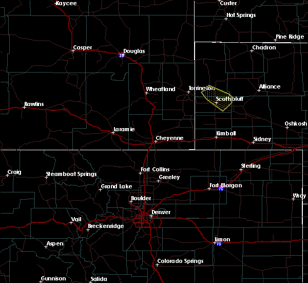 A severe thunderstorm warning remains in effect until 200 am mdt for southern box butte and northern morrill counties. at 116 am mdt, a severe thunderstorm was located 10 miles west of alliance, moving east at 45 mph. prepare now for large destructive hail to tennis ball size! multiple storm spotters have reported large hail with this very dangerous storm. Move to an interior room. A severe thunderstorm warning remains in effect until 200 am mdt for southern box butte and northern morrill counties. at 116 am mdt, a severe thunderstorm was located 10 miles west of alliance, moving east at 45 mph. prepare now for large destructive hail to tennis ball size! multiple storm spotters have reported large hail with this very dangerous storm. Move to an interior room.
|
| 8/16/2019 12:58 AM MDT |
 At 1257 am mdt, a severe thunderstorm was located near kilpatrick lake, or 18 miles west of alliance, moving east at 45 mph. this storm has a history of producing large destructive hail! move to shelter away from windows (radar indicated). Hazards include two inch hail and 60 mph wind gusts. People and animals outdoors will be injured. expect hail damage to roofs, siding, windows, and vehicles. expect wind damage to roofs, siding, and trees. Locations impacted include, alliance, kilpatrick lake, berea, alliance airport and angora. At 1257 am mdt, a severe thunderstorm was located near kilpatrick lake, or 18 miles west of alliance, moving east at 45 mph. this storm has a history of producing large destructive hail! move to shelter away from windows (radar indicated). Hazards include two inch hail and 60 mph wind gusts. People and animals outdoors will be injured. expect hail damage to roofs, siding, windows, and vehicles. expect wind damage to roofs, siding, and trees. Locations impacted include, alliance, kilpatrick lake, berea, alliance airport and angora.
|
| 8/16/2019 12:40 AM MDT |
 At 1238 am mdt, a severe thunderstorm was located 10 miles northeast of lake alice, or 19 miles northeast of scottsbluff, moving east at 45 mph. this storm has a history of producing large destructive hail! move to safety indoors away from windows (radar indicated). Hazards include ping pong ball size hail and 60 mph wind gusts. People and animals outdoors will be injured. expect hail damage to roofs, siding, windows, and vehicles. Expect wind damage to roofs, siding, and trees. At 1238 am mdt, a severe thunderstorm was located 10 miles northeast of lake alice, or 19 miles northeast of scottsbluff, moving east at 45 mph. this storm has a history of producing large destructive hail! move to safety indoors away from windows (radar indicated). Hazards include ping pong ball size hail and 60 mph wind gusts. People and animals outdoors will be injured. expect hail damage to roofs, siding, windows, and vehicles. Expect wind damage to roofs, siding, and trees.
|
| 7/29/2019 7:56 PM MDT | Golf Ball sized hail reported 17.9 miles E of Alliance, NE, golf ball size hail near kilpatrick lake. |
| 7/14/2019 5:25 PM MDT | Golf Ball sized hail reported 11.1 miles WSW of Alliance, NE, estimated time of report. |
| 7/3/2019 6:56 PM MDT |
 The severe thunderstorm warning for southeastern box butte and northeastern morrill counties will expire at 700 pm mdt, the storm which prompted the warning has weakened below severe limits, and has exited the warned area. therefore, the warning will be allowed to expire. however gusty winds are still possible with this thunderstorm. a severe thunderstorm watch remains in effect until 1000 pm mdt for the panhandle of nebraska. The severe thunderstorm warning for southeastern box butte and northeastern morrill counties will expire at 700 pm mdt, the storm which prompted the warning has weakened below severe limits, and has exited the warned area. therefore, the warning will be allowed to expire. however gusty winds are still possible with this thunderstorm. a severe thunderstorm watch remains in effect until 1000 pm mdt for the panhandle of nebraska.
|
| 7/3/2019 6:42 PM MDT |
 At 642 pm mdt, a severe thunderstorm was located near alliance, moving east at 25 mph (radar indicated). Hazards include 60 mph wind gusts and penny size hail. Expect damage to roofs, siding, and trees. Locations impacted include, alliance and alliance airport. At 642 pm mdt, a severe thunderstorm was located near alliance, moving east at 25 mph (radar indicated). Hazards include 60 mph wind gusts and penny size hail. Expect damage to roofs, siding, and trees. Locations impacted include, alliance and alliance airport.
|
| 7/3/2019 6:25 PM MDT |
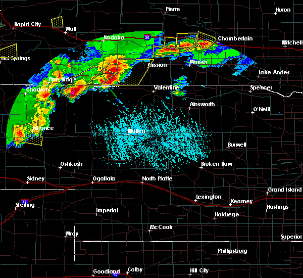 At 625 pm mdt, a severe thunderstorm was located 9 miles west of alliance, moving east at 30 mph (radar indicated). Hazards include 60 mph wind gusts and penny size hail. expect damage to roofs, siding, and trees At 625 pm mdt, a severe thunderstorm was located 9 miles west of alliance, moving east at 30 mph (radar indicated). Hazards include 60 mph wind gusts and penny size hail. expect damage to roofs, siding, and trees
|
| 6/30/2019 10:58 PM MDT |
 The severe thunderstorm warning for southern box butte, eastern scotts bluff, northern morrill and southeastern sioux counties will expire at 1100 pm mdt, the storms which prompted the warning have weakened below severe limits, and no longer pose an immediate threat to life or property. therefore, the warning will be allowed to expire. The severe thunderstorm warning for southern box butte, eastern scotts bluff, northern morrill and southeastern sioux counties will expire at 1100 pm mdt, the storms which prompted the warning have weakened below severe limits, and no longer pose an immediate threat to life or property. therefore, the warning will be allowed to expire.
|
| 6/30/2019 10:46 PM MDT |
 At 1044 pm mdt, severe thunderstorms were located along a line extending from near moomaws corner to 11 miles east of angora to 6 miles south of crescent lake national wildlife refuge, moving northeast at 40 mph. spotters have reported tree damage and strong wind gusts in bridgeport with these storms (radar and trained spotters). Hazards include 70 mph wind gusts. Expect considerable tree damage. damage is likely to mobile homes, roofs, and outbuildings. Locations impacted include, alliance, bayard, minatare, kilpatrick lake, alliance airport, moomaws corner, angora, the intersection of highway 385 and l62, melbeta and mcgrew. At 1044 pm mdt, severe thunderstorms were located along a line extending from near moomaws corner to 11 miles east of angora to 6 miles south of crescent lake national wildlife refuge, moving northeast at 40 mph. spotters have reported tree damage and strong wind gusts in bridgeport with these storms (radar and trained spotters). Hazards include 70 mph wind gusts. Expect considerable tree damage. damage is likely to mobile homes, roofs, and outbuildings. Locations impacted include, alliance, bayard, minatare, kilpatrick lake, alliance airport, moomaws corner, angora, the intersection of highway 385 and l62, melbeta and mcgrew.
|
| 6/30/2019 10:14 PM MDT |
 At 1013 pm mdt, severe thunderstorms were located along a line extending from 8 miles east of harrisburg to court house and jail rocks to 6 miles south of lisco, moving east at 40 mph (at 10:11 pm trained weather spotters reported tree damage and wind gusts of 65 to 70 mph near chimney rock). Hazards include 70 mph wind gusts. Expect considerable tree damage. damage is likely to mobile homes, roofs, and outbuildings. Locations impacted include, alliance, bridgeport, bayard, minatare, lake minatare campground, alliance airport, northport, chimney rock state park, bridgeport state recreation area, angora, kilpatrick lake, the intersection of highway 385 and 92, berea, moomaws corner, lake minatare, south bayard junction, the intersection of highway 385 and l62, broadwater, melbeta and mcgrew. At 1013 pm mdt, severe thunderstorms were located along a line extending from 8 miles east of harrisburg to court house and jail rocks to 6 miles south of lisco, moving east at 40 mph (at 10:11 pm trained weather spotters reported tree damage and wind gusts of 65 to 70 mph near chimney rock). Hazards include 70 mph wind gusts. Expect considerable tree damage. damage is likely to mobile homes, roofs, and outbuildings. Locations impacted include, alliance, bridgeport, bayard, minatare, lake minatare campground, alliance airport, northport, chimney rock state park, bridgeport state recreation area, angora, kilpatrick lake, the intersection of highway 385 and 92, berea, moomaws corner, lake minatare, south bayard junction, the intersection of highway 385 and l62, broadwater, melbeta and mcgrew.
|
| 6/30/2019 10:06 PM MDT |
 At 1006 pm mdt, severe thunderstorms were located along a line extending from 6 miles east of harrisburg to near court house and jail rocks to 9 miles south of lisco, moving northeast at 40 mph (radar indicated). Hazards include 60 mph wind gusts. expect damage to roofs, siding, and trees At 1006 pm mdt, severe thunderstorms were located along a line extending from 6 miles east of harrisburg to near court house and jail rocks to 9 miles south of lisco, moving northeast at 40 mph (radar indicated). Hazards include 60 mph wind gusts. expect damage to roofs, siding, and trees
|
| 6/26/2019 7:49 PM MDT |
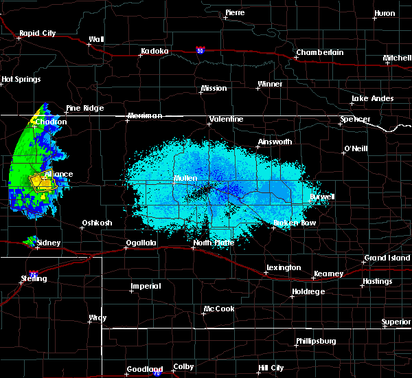 At 749 pm mdt, a severe thunderstorm was located over alliance airport, or near alliance, moving northeast at 40 mph (radar indicated). Hazards include 60 mph wind gusts and penny size hail. Expect damage to roofs, siding, and trees. Locations impacted include, alliance and alliance airport. At 749 pm mdt, a severe thunderstorm was located over alliance airport, or near alliance, moving northeast at 40 mph (radar indicated). Hazards include 60 mph wind gusts and penny size hail. Expect damage to roofs, siding, and trees. Locations impacted include, alliance and alliance airport.
|
| 6/26/2019 7:24 PM MDT |
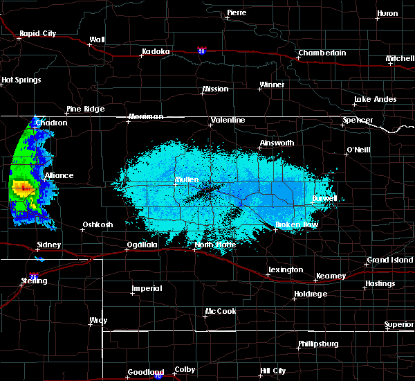 At 724 pm mdt, a severe thunderstorm was located 7 miles north of angora, or 13 miles southwest of alliance, moving northeast at 40 mph. a brief tornado could also be possible with this storm (radar indicated). Hazards include 60 mph wind gusts and penny size hail. expect damage to roofs, siding, and trees At 724 pm mdt, a severe thunderstorm was located 7 miles north of angora, or 13 miles southwest of alliance, moving northeast at 40 mph. a brief tornado could also be possible with this storm (radar indicated). Hazards include 60 mph wind gusts and penny size hail. expect damage to roofs, siding, and trees
|
| 1/1/0001 12:00 AM | Asos station kaia alliance airpor in box butte county NE, 4.8 miles NW of Alliance, NE |
| 6/20/2019 6:23 PM MDT | Quarter sized hail reported 0.4 miles W of Alliance, NE |
| 6/20/2019 6:12 PM MDT |
 The severe thunderstorm warning for eastern box butte county will expire at 615 pm mdt, the storm which prompted the warning has weakened below severe limits, and no longer poses an immediate threat to life or property. therefore, the warning will be allowed to expire. however small hail and gusty winds are still possible with this thunderstorm. a tornado watch remains in effect until 1000 pm mdt for the panhandle of nebraska. to report severe weather, contact your nearest law enforcement agency. they will relay your report to the national weather service cheyenne. The severe thunderstorm warning for eastern box butte county will expire at 615 pm mdt, the storm which prompted the warning has weakened below severe limits, and no longer poses an immediate threat to life or property. therefore, the warning will be allowed to expire. however small hail and gusty winds are still possible with this thunderstorm. a tornado watch remains in effect until 1000 pm mdt for the panhandle of nebraska. to report severe weather, contact your nearest law enforcement agency. they will relay your report to the national weather service cheyenne.
|
| 6/20/2019 5:55 PM MDT |
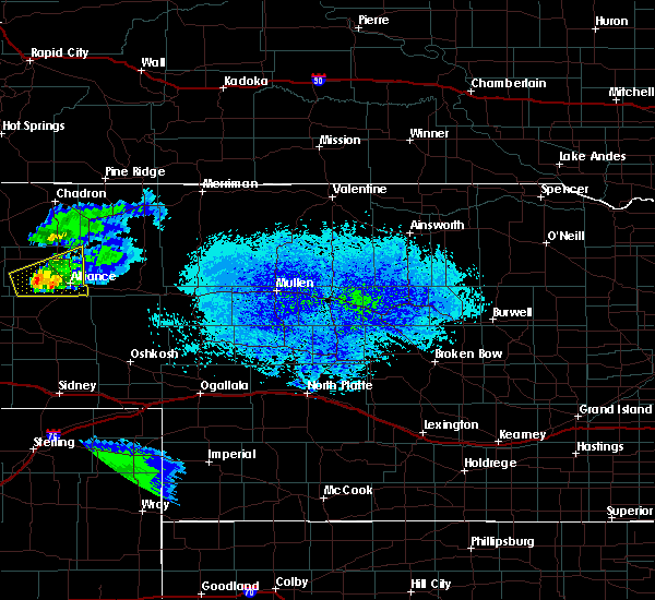 At 534 pm mdt, a severe thunderstorm was located 7 miles east of kilpatrick lake, or 14 miles west of alliance, moving east at 40 mph (radar indicated). Hazards include 60 mph wind gusts and quarter size hail. Hail damage to vehicles is expected. Expect wind damage to roofs, siding, and trees. At 534 pm mdt, a severe thunderstorm was located 7 miles east of kilpatrick lake, or 14 miles west of alliance, moving east at 40 mph (radar indicated). Hazards include 60 mph wind gusts and quarter size hail. Hail damage to vehicles is expected. Expect wind damage to roofs, siding, and trees.
|
| 6/20/2019 5:35 PM MDT |
 At 534 pm mdt, a severe thunderstorm was located 7 miles east of kilpatrick lake, or 14 miles west of alliance, moving east at 40 mph (radar indicated). Hazards include 60 mph wind gusts and quarter size hail. Hail damage to vehicles is expected. Expect wind damage to roofs, siding, and trees. At 534 pm mdt, a severe thunderstorm was located 7 miles east of kilpatrick lake, or 14 miles west of alliance, moving east at 40 mph (radar indicated). Hazards include 60 mph wind gusts and quarter size hail. Hail damage to vehicles is expected. Expect wind damage to roofs, siding, and trees.
|
| 6/20/2019 5:30 PM MDT | Half Dollar sized hail reported 21.7 miles E of Alliance, NE |
| 5/16/2019 5:08 PM MDT |
 At 507 pm mdt, a severe thunderstorm was located near alliance, moving northeast at 10 mph (radar indicated). Hazards include 60 mph wind gusts and quarter size hail. Hail damage to vehicles is expected. expect wind damage to roofs, siding, and trees. Locations impacted include, alliance and berea. At 507 pm mdt, a severe thunderstorm was located near alliance, moving northeast at 10 mph (radar indicated). Hazards include 60 mph wind gusts and quarter size hail. Hail damage to vehicles is expected. expect wind damage to roofs, siding, and trees. Locations impacted include, alliance and berea.
|
| 5/16/2019 4:55 PM MDT |
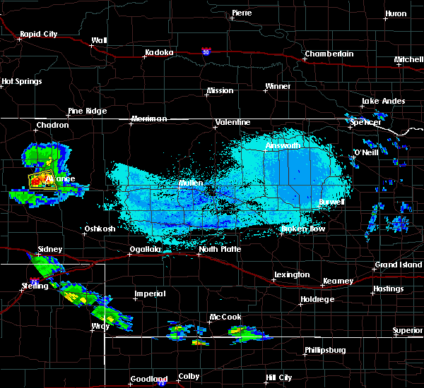 At 454 pm mdt, a severe thunderstorm was located over alliance, moving east at 10 mph (radar indicated). Hazards include 60 mph wind gusts and quarter size hail. Hail damage to vehicles is expected. Expect wind damage to roofs, siding, and trees. At 454 pm mdt, a severe thunderstorm was located over alliance, moving east at 10 mph (radar indicated). Hazards include 60 mph wind gusts and quarter size hail. Hail damage to vehicles is expected. Expect wind damage to roofs, siding, and trees.
|
| 5/16/2019 4:48 PM MDT |
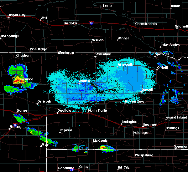 At 447 pm mdt, a severe thunderstorm was located over alliance, moving east at 20 mph (radar indicated). Hazards include 60 mph wind gusts and quarter size hail. Hail damage to vehicles is expected. expect wind damage to roofs, siding, and trees. Locations impacted include, alliance, wild horse butte, berea and alliance airport. At 447 pm mdt, a severe thunderstorm was located over alliance, moving east at 20 mph (radar indicated). Hazards include 60 mph wind gusts and quarter size hail. Hail damage to vehicles is expected. expect wind damage to roofs, siding, and trees. Locations impacted include, alliance, wild horse butte, berea and alliance airport.
|
| 5/16/2019 4:36 PM MDT |
 At 434 pm mdt, a severe thunderstorm was located near alliance, moving east at 20 mph (radar indicated). Hazards include 60 mph wind gusts and quarter size hail. Some hail damage is possible. expect some wind damage to roofs, siding, and trees. Locations impacted include, alliance, wild horse butte, berea and alliance airport. At 434 pm mdt, a severe thunderstorm was located near alliance, moving east at 20 mph (radar indicated). Hazards include 60 mph wind gusts and quarter size hail. Some hail damage is possible. expect some wind damage to roofs, siding, and trees. Locations impacted include, alliance, wild horse butte, berea and alliance airport.
|
| 5/16/2019 4:25 PM MDT |
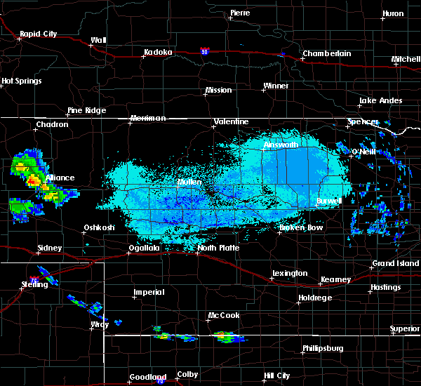 At 424 pm mdt, a severe thunderstorm was located 7 miles south of berea, or 7 miles west of alliance, moving northeast at 15 mph (radar indicated). Hazards include 60 mph wind gusts and quarter size hail. Hail damage to vehicles is expected. expect wind damage to roofs, siding, and trees. Locations impacted include, alliance, wild horse butte, berea and alliance airport. At 424 pm mdt, a severe thunderstorm was located 7 miles south of berea, or 7 miles west of alliance, moving northeast at 15 mph (radar indicated). Hazards include 60 mph wind gusts and quarter size hail. Hail damage to vehicles is expected. expect wind damage to roofs, siding, and trees. Locations impacted include, alliance, wild horse butte, berea and alliance airport.
|
| 5/16/2019 4:15 PM MDT |
 At 414 pm mdt, a severe thunderstorm was located 9 miles southwest of berea, or 9 miles west of alliance, moving northeast at 15 mph (radar indicated). Hazards include 60 mph wind gusts and quarter size hail. Hail damage to vehicles is expected. Expect wind damage to roofs, siding, and trees. At 414 pm mdt, a severe thunderstorm was located 9 miles southwest of berea, or 9 miles west of alliance, moving northeast at 15 mph (radar indicated). Hazards include 60 mph wind gusts and quarter size hail. Hail damage to vehicles is expected. Expect wind damage to roofs, siding, and trees.
|
| 8/6/2018 4:27 PM MDT | Tennis Ball sized hail reported 12.9 miles NE of Alliance, NE, reports of vehicles with smashed windshields. |
| 8/6/2018 4:27 PM MDT | Tea Cup sized hail reported 12.9 miles NE of Alliance, NE, a couple 3+ inch stones on hwy 385 near mile marker 95. |
| 8/6/2018 3:55 PM MDT | Quarter sized hail reported 0.2 miles ESE of Alliance, NE, just a few. |
| 7/28/2018 6:27 PM MDT | Quarter sized hail reported 12.7 miles W of Alliance, NE, mainly dime size with some up to quarter. |
| 7/18/2018 12:30 AM MDT |
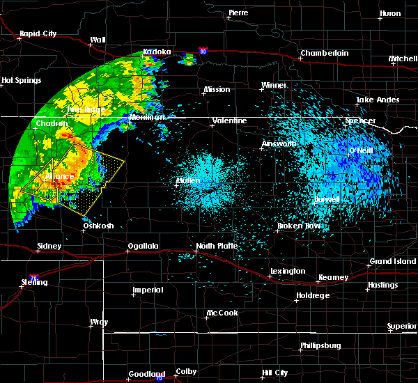 A severe thunderstorm warning remains in effect until 1245 am mdt for southeastern box butte and northeastern morrill counties. at 1228 am mdt, severe thunderstorms were located along a line extending from 13 miles northeast of wild horse butte to near kilpatrick lake, moving southeast at 35 mph. hazard. 70 mph wind gusts and quarter size hail. A severe thunderstorm warning remains in effect until 1245 am mdt for southeastern box butte and northeastern morrill counties. at 1228 am mdt, severe thunderstorms were located along a line extending from 13 miles northeast of wild horse butte to near kilpatrick lake, moving southeast at 35 mph. hazard. 70 mph wind gusts and quarter size hail.
|
| 7/18/2018 12:18 AM MDT | Observation taken at alliance airpor in box butte county NE, 0.2 miles ESE of Alliance, NE |
| 7/18/2018 12:14 AM MDT |
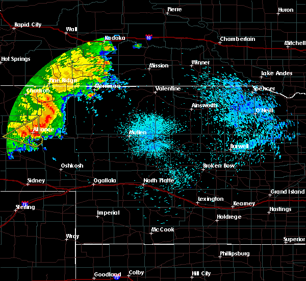 At 1214 am mdt, severe thunderstorms were located along a line extending from 10 miles northeast of wild horse butte to near kilpatrick lake, moving southeast at 35 mph (radar indicated). Hazards include 70 mph wind gusts and quarter size hail. Hail damage to vehicles is expected. expect considerable tree damage. Wind damage is also likely to mobile homes, roofs, and outbuildings. At 1214 am mdt, severe thunderstorms were located along a line extending from 10 miles northeast of wild horse butte to near kilpatrick lake, moving southeast at 35 mph (radar indicated). Hazards include 70 mph wind gusts and quarter size hail. Hail damage to vehicles is expected. expect considerable tree damage. Wind damage is also likely to mobile homes, roofs, and outbuildings.
|
| 7/16/2018 10:22 PM MDT |
 At 1021 pm mdt, severe thunderstorms were located along a line extending from near berea to near angora to near redington, moving east at 55 mph (radar indicated). Hazards include 60 mph wind gusts. Expect damage to roofs, siding, and trees. Locations impacted include, bridgeport, bayard, northport, chimney rock state park, bridgeport state recreation area, angora, the intersection of highway 385 and 92, court house and jail rocks, moomaws corner, redington, south bayard junction, the intersection of highway 385 and l62 and mcgrew. At 1021 pm mdt, severe thunderstorms were located along a line extending from near berea to near angora to near redington, moving east at 55 mph (radar indicated). Hazards include 60 mph wind gusts. Expect damage to roofs, siding, and trees. Locations impacted include, bridgeport, bayard, northport, chimney rock state park, bridgeport state recreation area, angora, the intersection of highway 385 and 92, court house and jail rocks, moomaws corner, redington, south bayard junction, the intersection of highway 385 and l62 and mcgrew.
|
| 7/16/2018 9:53 PM MDT |
 At 952 pm mdt, severe thunderstorms were located along a line extending from 11 miles north of lake alice to minatare to 6 miles southeast of harrisburg, moving east at 55 mph (radar indicated). Hazards include 60 mph wind gusts. expect damage to roofs, siding, and trees At 952 pm mdt, severe thunderstorms were located along a line extending from 11 miles north of lake alice to minatare to 6 miles southeast of harrisburg, moving east at 55 mph (radar indicated). Hazards include 60 mph wind gusts. expect damage to roofs, siding, and trees
|
| 6/29/2018 8:22 PM MDT |
 The severe thunderstorm warning for southeastern box butte and morrill counties will expire at 830 pm mdt, the storms which prompted the warning have weakened below severe limits, and have exited the warned area. therefore, the warning will be allowed to expire. a severe thunderstorm watch remains in effect until 100 am mdt for the panhandle of nebraska. to report severe weather, contact your nearest law enforcement agency. they will relay your report to the national weather service cheyenne. The severe thunderstorm warning for southeastern box butte and morrill counties will expire at 830 pm mdt, the storms which prompted the warning have weakened below severe limits, and have exited the warned area. therefore, the warning will be allowed to expire. a severe thunderstorm watch remains in effect until 100 am mdt for the panhandle of nebraska. to report severe weather, contact your nearest law enforcement agency. they will relay your report to the national weather service cheyenne.
|
| 6/29/2018 7:59 PM MDT |
 At 758 pm mdt, severe thunderstorms were located along a line extending from near alliance to 13 miles south of alliance airport, moving east at 30 mph (radar indicated). Hazards include 60 mph wind gusts and quarter size hail. Hail damage to vehicles is expected. expect wind damage to roofs, siding, and trees. Locations impacted include, alliance, bridgeport, alliance airport, northport, the intersection of highway 385 and 92, court house and jail rocks, bridgeport state recreation area, angora, redington, the intersection of highway 385 and l62, south bayard junction and broadwater. At 758 pm mdt, severe thunderstorms were located along a line extending from near alliance to 13 miles south of alliance airport, moving east at 30 mph (radar indicated). Hazards include 60 mph wind gusts and quarter size hail. Hail damage to vehicles is expected. expect wind damage to roofs, siding, and trees. Locations impacted include, alliance, bridgeport, alliance airport, northport, the intersection of highway 385 and 92, court house and jail rocks, bridgeport state recreation area, angora, redington, the intersection of highway 385 and l62, south bayard junction and broadwater.
|
| 6/29/2018 7:32 PM MDT |
 At 732 pm mdt, severe thunderstorms were located along a line extending from 7 miles west of alliance to near northport, moving east at 30 mph (radar indicated). Hazards include 60 mph wind gusts and quarter size hail. Hail damage to vehicles is expected. Expect wind damage to roofs, siding, and trees. At 732 pm mdt, severe thunderstorms were located along a line extending from 7 miles west of alliance to near northport, moving east at 30 mph (radar indicated). Hazards include 60 mph wind gusts and quarter size hail. Hail damage to vehicles is expected. Expect wind damage to roofs, siding, and trees.
|
| 6/6/2018 8:23 PM MDT |
 The severe thunderstorm warning for southeastern box butte and northeastern morrill counties will expire at 830 pm mdt, the storms which prompted the warning have weakened and moved out of the warned area. therefore, the warning will be allowed to expire. however small hail, gusty winds and heavy rain are still possible with these thunderstorms. a severe thunderstorm watch remains in effect until 100 am mdt for the panhandle of nebraska. The severe thunderstorm warning for southeastern box butte and northeastern morrill counties will expire at 830 pm mdt, the storms which prompted the warning have weakened and moved out of the warned area. therefore, the warning will be allowed to expire. however small hail, gusty winds and heavy rain are still possible with these thunderstorms. a severe thunderstorm watch remains in effect until 100 am mdt for the panhandle of nebraska.
|
| 6/6/2018 8:12 PM MDT |
 At 811 pm mdt, severe thunderstorms were located along a line extending from near wild horse butte to 7 miles southwest of alliance airport, moving east at 10 mph (radar indicated. quarter sized hail was reported in the city of alliance with this storm). Hazards include golf ball size hail and 60 mph wind gusts. People and animals outdoors will be injured. expect hail damage to roofs, siding, windows, and vehicles. expect wind damage to roofs, siding, and trees. Locations impacted include, alliance, alliance airport and wild horse butte. At 811 pm mdt, severe thunderstorms were located along a line extending from near wild horse butte to 7 miles southwest of alliance airport, moving east at 10 mph (radar indicated. quarter sized hail was reported in the city of alliance with this storm). Hazards include golf ball size hail and 60 mph wind gusts. People and animals outdoors will be injured. expect hail damage to roofs, siding, windows, and vehicles. expect wind damage to roofs, siding, and trees. Locations impacted include, alliance, alliance airport and wild horse butte.
|
| 6/6/2018 8:06 PM MDT | Quarter sized hail reported 0.2 miles ESE of Alliance, NE, hail reported near 10th and buffalo. |
| 6/6/2018 7:59 PM MDT |
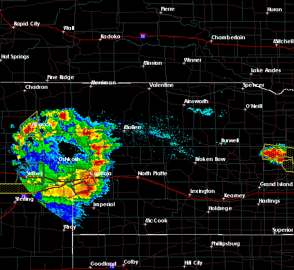 At 759 pm mdt, a severe thunderstorm was located over alliance, moving east at 10 mph (radar indicated). Hazards include golf ball size hail and 60 mph wind gusts. People and animals outdoors will be injured. expect hail damage to roofs, siding, windows, and vehicles. expect wind damage to roofs, siding, and trees. Locations impacted include, alliance, alliance airport and wild horse butte. At 759 pm mdt, a severe thunderstorm was located over alliance, moving east at 10 mph (radar indicated). Hazards include golf ball size hail and 60 mph wind gusts. People and animals outdoors will be injured. expect hail damage to roofs, siding, windows, and vehicles. expect wind damage to roofs, siding, and trees. Locations impacted include, alliance, alliance airport and wild horse butte.
|
| 6/6/2018 7:48 PM MDT |
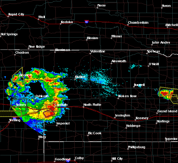 At 748 pm mdt, a severe thunderstorm was located over alliance, moving east at 10 mph (radar indicated). Hazards include 60 mph wind gusts and half dollar size hail. Hail damage to vehicles is expected. Expect wind damage to roofs, siding, and trees. At 748 pm mdt, a severe thunderstorm was located over alliance, moving east at 10 mph (radar indicated). Hazards include 60 mph wind gusts and half dollar size hail. Hail damage to vehicles is expected. Expect wind damage to roofs, siding, and trees.
|
| 5/27/2018 7:06 PM MDT |
 At 705 pm mdt, severe thunderstorms were located along a line extending from near mitchell to near lake minatare campground to south bayard junction, moving north at 35 mph (radar indicated). Hazards include 60 mph wind gusts and quarter size hail. Hail damage to vehicles is expected. expect wind damage to roofs, siding, and trees. Locations impacted include, scottsbluff, alliance, gering, mitchell, bayard, terrytown, minatare, hemingford, wildcat hills state recreation area, alliance airport, angora, wildcat hills campground, hubbard hill, berea, lake minatare, wild horse butte, lake minatare campground, chimney rock state park, scotts bluff national monument and kilpatrick lake. At 705 pm mdt, severe thunderstorms were located along a line extending from near mitchell to near lake minatare campground to south bayard junction, moving north at 35 mph (radar indicated). Hazards include 60 mph wind gusts and quarter size hail. Hail damage to vehicles is expected. expect wind damage to roofs, siding, and trees. Locations impacted include, scottsbluff, alliance, gering, mitchell, bayard, terrytown, minatare, hemingford, wildcat hills state recreation area, alliance airport, angora, wildcat hills campground, hubbard hill, berea, lake minatare, wild horse butte, lake minatare campground, chimney rock state park, scotts bluff national monument and kilpatrick lake.
|
| 5/27/2018 6:48 PM MDT |
 At 648 pm mdt, severe thunderstorms were located along a line extending from 8 miles west of wildcat hills campground to near wildcat hills state recreation area to near redington, moving northeast at 45 mph (radar indicated). Hazards include 60 mph wind gusts and quarter size hail. Hail damage to vehicles is expected. expect wind damage to roofs, siding, and trees. Locations impacted include, scottsbluff, alliance, gering, mitchell, bayard, terrytown, minatare, hemingford, wildcat hills state recreation area, alliance airport, angora, wildcat hills campground, hubbard hill, berea, lake minatare, wild horse butte, lake minatare campground, chimney rock state park, scotts bluff national monument and kilpatrick lake. At 648 pm mdt, severe thunderstorms were located along a line extending from 8 miles west of wildcat hills campground to near wildcat hills state recreation area to near redington, moving northeast at 45 mph (radar indicated). Hazards include 60 mph wind gusts and quarter size hail. Hail damage to vehicles is expected. expect wind damage to roofs, siding, and trees. Locations impacted include, scottsbluff, alliance, gering, mitchell, bayard, terrytown, minatare, hemingford, wildcat hills state recreation area, alliance airport, angora, wildcat hills campground, hubbard hill, berea, lake minatare, wild horse butte, lake minatare campground, chimney rock state park, scotts bluff national monument and kilpatrick lake.
|
| 5/17/2018 7:38 PM MDT | Power outages and uprooted trees reported in alliance. peak gust at alliance airport was 56 mp in box butte county NE, 0.2 miles ESE of Alliance, NE |
| 5/17/2018 7:36 PM MDT | Storm damage reported in sheridan county NE, 18 miles W of Alliance, NE |
| 5/10/2018 4:18 PM MDT |
 At 418 pm mdt, a severe thunderstorm was located 7 miles north of wild horse butte, or 18 miles north of alliance, moving northeast at 25 mph (radar indicated). Hazards include 60 mph wind gusts and quarter size hail. Hail damage to vehicles is expected. Expect wind damage to roofs, siding, and trees. At 418 pm mdt, a severe thunderstorm was located 7 miles north of wild horse butte, or 18 miles north of alliance, moving northeast at 25 mph (radar indicated). Hazards include 60 mph wind gusts and quarter size hail. Hail damage to vehicles is expected. Expect wind damage to roofs, siding, and trees.
|
| 8/26/2017 6:13 PM MDT | Golf Ball sized hail reported 5.8 miles SW of Alliance, NE |
| 8/26/2017 6:11 PM MDT |
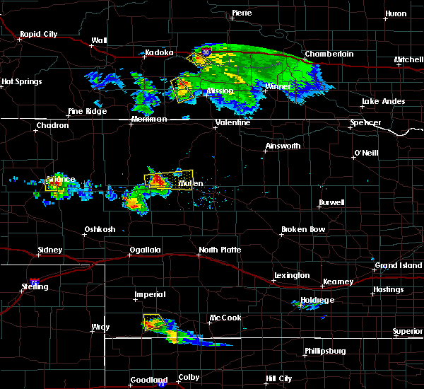 At 611 pm mdt, a severe thunderstorm was located 7 miles southwest of krause lake, or 7 miles northeast of alliance, moving southeast at 25 mph (radar indicated). Hazards include golf ball size hail. People and animals outdoors will be injured. expect damage to roofs, siding, windows, and vehicles. This severe storm will be near, alliance airport around 620 pm mdt. At 611 pm mdt, a severe thunderstorm was located 7 miles southwest of krause lake, or 7 miles northeast of alliance, moving southeast at 25 mph (radar indicated). Hazards include golf ball size hail. People and animals outdoors will be injured. expect damage to roofs, siding, windows, and vehicles. This severe storm will be near, alliance airport around 620 pm mdt.
|
| 8/26/2017 5:59 PM MDT |
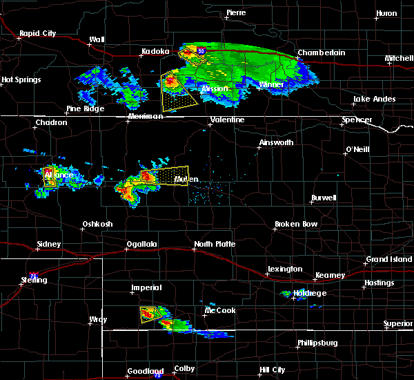 At 558 pm mdt, a severe thunderstorm was located near wild horse butte, or 9 miles northeast of alliance, moving south at 25 mph (radar indicated). Hazards include golf ball size hail. People and animals outdoors will be injured. expect damage to roofs, siding, windows, and vehicles. this severe thunderstorm will be near, alliance around 615 pm mdt. Alliance airport around 625 pm mdt. At 558 pm mdt, a severe thunderstorm was located near wild horse butte, or 9 miles northeast of alliance, moving south at 25 mph (radar indicated). Hazards include golf ball size hail. People and animals outdoors will be injured. expect damage to roofs, siding, windows, and vehicles. this severe thunderstorm will be near, alliance around 615 pm mdt. Alliance airport around 625 pm mdt.
|
| 8/15/2017 6:24 PM MDT |
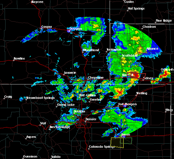 At 624 pm mdt, a severe thunderstorm was located 9 miles east of kilpatrick lake, or 12 miles west of alliance, moving east at 15 mph (radar indicated). Hazards include 60 mph wind gusts and quarter size hail. Hail damage to vehicles is expected. expect wind damage to roofs, siding, and trees. This severe thunderstorm will remain over mainly rural areas of south central box butte county. At 624 pm mdt, a severe thunderstorm was located 9 miles east of kilpatrick lake, or 12 miles west of alliance, moving east at 15 mph (radar indicated). Hazards include 60 mph wind gusts and quarter size hail. Hail damage to vehicles is expected. expect wind damage to roofs, siding, and trees. This severe thunderstorm will remain over mainly rural areas of south central box butte county.
|
| 8/15/2017 5:59 PM MDT |
 At 559 pm mdt, severe thunderstorms were located along a line extending from 6 miles northwest of flahertys corner to near kilpatrick lake, moving northeast at 25 mph (radar indicated). Hazards include 60 mph wind gusts and half dollar size hail. Hail damage to vehicles is expected. expect wind damage to roofs, siding, and trees. these severe storms will be near, alliance and berea around 630 pm mdt. Other locations impacted by these severe thunderstorms include marsland. At 559 pm mdt, severe thunderstorms were located along a line extending from 6 miles northwest of flahertys corner to near kilpatrick lake, moving northeast at 25 mph (radar indicated). Hazards include 60 mph wind gusts and half dollar size hail. Hail damage to vehicles is expected. expect wind damage to roofs, siding, and trees. these severe storms will be near, alliance and berea around 630 pm mdt. Other locations impacted by these severe thunderstorms include marsland.
|
| 8/15/2017 5:40 PM MDT |
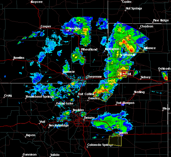 At 540 pm mdt, severe thunderstorms were located along a line extending from 8 miles southeast of agate bed national monument to near kilpatrick lake, moving northeast at 15 mph (radar indicated). Hazards include 60 mph wind gusts and half dollar size hail. Hail damage to vehicles is expected. Expect wind damage to roofs, siding, and trees. At 540 pm mdt, severe thunderstorms were located along a line extending from 8 miles southeast of agate bed national monument to near kilpatrick lake, moving northeast at 15 mph (radar indicated). Hazards include 60 mph wind gusts and half dollar size hail. Hail damage to vehicles is expected. Expect wind damage to roofs, siding, and trees.
|
| 8/12/2017 3:34 PM MDT | Golf Ball sized hail reported 10 miles NE of Alliance, NE, several cars along the side of hwy 385 with broken windshields. |
| 8/12/2017 3:33 PM MDT | Golf Ball sized hail reported 10 miles NE of Alliance, NE, golf ball hail along highway 385. several cars on side of road with broken windows. |
| 8/12/2017 3:30 PM MDT | Half Dollar sized hail reported 4.8 miles N of Alliance, NE, covers hwy 385 south of alliance. |
| 8/12/2017 3:28 PM MDT |
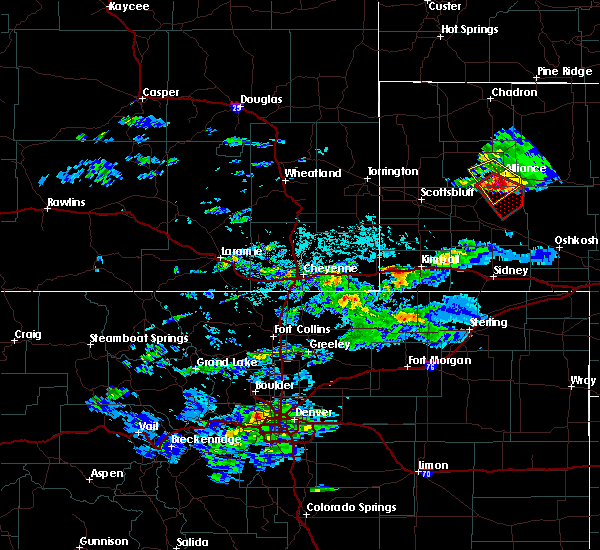 At 326 pm mdt, a severe thunderstorm capable of producing a tornado was located 8 miles southwest of alliance airport, or 9 miles south of alliance, moving southeast at 25 mph (radar indicated rotation). Hazards include tornado and three inch hail. Flying debris will be dangerous to those caught without shelter. mobile homes will be damaged or destroyed. damage to roofs, windows, and vehicles will occur. tree damage is likely. locations impacted include, highway 385 south of alliance near the morrill county line. Otherwise, this storm will remain over mainly rural areas of box butte and morrill counties. At 326 pm mdt, a severe thunderstorm capable of producing a tornado was located 8 miles southwest of alliance airport, or 9 miles south of alliance, moving southeast at 25 mph (radar indicated rotation). Hazards include tornado and three inch hail. Flying debris will be dangerous to those caught without shelter. mobile homes will be damaged or destroyed. damage to roofs, windows, and vehicles will occur. tree damage is likely. locations impacted include, highway 385 south of alliance near the morrill county line. Otherwise, this storm will remain over mainly rural areas of box butte and morrill counties.
|
| 8/12/2017 3:20 PM MDT |
 At 320 pm mdt, a severe thunderstorm capable of producing a tornado was located 5 miles southwest of alliance, moving southeast at 25 mph (radar indicated rotation). Hazards include tornado and tennis ball size hail. Flying debris will be dangerous to those caught without shelter. mobile homes will be damaged or destroyed. damage to roofs, windows, and vehicles will occur. tree damage is likely. This tornadic thunderstorm will remain over mainly rural areas of southeastern box butte and northeastern morrill counties. At 320 pm mdt, a severe thunderstorm capable of producing a tornado was located 5 miles southwest of alliance, moving southeast at 25 mph (radar indicated rotation). Hazards include tornado and tennis ball size hail. Flying debris will be dangerous to those caught without shelter. mobile homes will be damaged or destroyed. damage to roofs, windows, and vehicles will occur. tree damage is likely. This tornadic thunderstorm will remain over mainly rural areas of southeastern box butte and northeastern morrill counties.
|
| 8/12/2017 3:14 PM MDT | Golf Ball sized hail reported 10.1 miles SE of Alliance, NE |
| 8/12/2017 3:08 PM MDT |
 At 308 pm mdt, a severe thunderstorm was located near berea, or near alliance, moving southeast at 25 mph (radar indicated. golf ball sized hail was reported west of berea with this storm). Hazards include tennis ball size hail and 60 mph wind gusts. People and animals outdoors will be injured. expect hail damage to roofs, siding, windows, and vehicles. expect wind damage to roofs, siding, and trees. Locations impacted include, alliance, alliance airport and berea. At 308 pm mdt, a severe thunderstorm was located near berea, or near alliance, moving southeast at 25 mph (radar indicated. golf ball sized hail was reported west of berea with this storm). Hazards include tennis ball size hail and 60 mph wind gusts. People and animals outdoors will be injured. expect hail damage to roofs, siding, windows, and vehicles. expect wind damage to roofs, siding, and trees. Locations impacted include, alliance, alliance airport and berea.
|
| 8/12/2017 2:54 PM MDT |
 At 254 pm mdt, a severe thunderstorm was located near berea, or 12 miles northwest of alliance, moving southeast at 25 mph (radar indicated). Hazards include tennis ball size hail and 60 mph wind gusts. People and animals outdoors will be injured. expect hail damage to roofs, siding, windows, and vehicles. Expect wind damage to roofs, siding, and trees. At 254 pm mdt, a severe thunderstorm was located near berea, or 12 miles northwest of alliance, moving southeast at 25 mph (radar indicated). Hazards include tennis ball size hail and 60 mph wind gusts. People and animals outdoors will be injured. expect hail damage to roofs, siding, windows, and vehicles. Expect wind damage to roofs, siding, and trees.
|
| 7/27/2017 7:42 PM MDT |
 The severe thunderstorm warning for eastern box butte and north central morrill counties will expire at 745 pm mdt, the storm which prompted the warning has weakened below severe limits, and no longer poses an immediate threat to life or property. therefore the warning will be allowed to expire. however small hail, gusty winds and heavy rain are still possible with this thunderstorm. The severe thunderstorm warning for eastern box butte and north central morrill counties will expire at 745 pm mdt, the storm which prompted the warning has weakened below severe limits, and no longer poses an immediate threat to life or property. therefore the warning will be allowed to expire. however small hail, gusty winds and heavy rain are still possible with this thunderstorm.
|
| 7/27/2017 7:12 PM MDT |
 At 712 pm mdt, a severe thunderstorm was located near hemingford, or 15 miles northwest of alliance, moving southeast at 30 mph (radar indicated). Hazards include 70 mph wind gusts and quarter size hail. Hail damage to vehicles is expected. expect considerable tree damage. Wind damage is also likely to mobile homes, roofs, and outbuildings. At 712 pm mdt, a severe thunderstorm was located near hemingford, or 15 miles northwest of alliance, moving southeast at 30 mph (radar indicated). Hazards include 70 mph wind gusts and quarter size hail. Hail damage to vehicles is expected. expect considerable tree damage. Wind damage is also likely to mobile homes, roofs, and outbuildings.
|
| 7/27/2017 6:05 PM MDT |
 At 603 pm mdt, a severe thunderstorm was located near miles lake, or 13 miles southeast of alliance, moving southeast at 25 mph. this is a very dangerous storm (trained weather spotters). Hazards include 90 mph wind gusts and golf ball size hail. You are in a life-threatening situation. flying debris may be deadly to those caught without shelter. mobile homes will be heavily damaged or destroyed. homes and businesses will have substantial roof and window damage. Expect extensive tree damage and power outages. At 603 pm mdt, a severe thunderstorm was located near miles lake, or 13 miles southeast of alliance, moving southeast at 25 mph. this is a very dangerous storm (trained weather spotters). Hazards include 90 mph wind gusts and golf ball size hail. You are in a life-threatening situation. flying debris may be deadly to those caught without shelter. mobile homes will be heavily damaged or destroyed. homes and businesses will have substantial roof and window damage. Expect extensive tree damage and power outages.
|
| 7/27/2017 5:59 PM MDT | Storm damage reported in box butte county NE, 4.5 miles NW of Alliance, NE |
| 7/27/2017 5:49 PM MDT |
 At 548 pm mdt, a severe thunderstorm was located near alliance airport, or 7 miles east of alliance, moving southeast at 25 mph. this is a very dangerous storm (trained weather spotters. at 545 pm, a trained spotter in alliance reported a wind gust to 80 mph along with golf ball size hail). Hazards include 80 mph wind gusts and golf ball size hail. Flying debris will be dangerous to those caught without shelter. mobile homes will be heavily damaged. expect considerable damage to roofs, windows, and vehicles. extensive tree damage and power outages are likely. Locations impacted include, alliance and alliance airport. At 548 pm mdt, a severe thunderstorm was located near alliance airport, or 7 miles east of alliance, moving southeast at 25 mph. this is a very dangerous storm (trained weather spotters. at 545 pm, a trained spotter in alliance reported a wind gust to 80 mph along with golf ball size hail). Hazards include 80 mph wind gusts and golf ball size hail. Flying debris will be dangerous to those caught without shelter. mobile homes will be heavily damaged. expect considerable damage to roofs, windows, and vehicles. extensive tree damage and power outages are likely. Locations impacted include, alliance and alliance airport.
|
| 7/27/2017 5:48 PM MDT | Golf Ball sized hail reported 0.2 miles ESE of Alliance, NE, estimated 80 mph winds with very heavy rain |
| 7/27/2017 5:42 PM MDT |
 At 541 pm mdt, a severe thunderstorm was located near alliance airport, or near alliance, moving southeast at 25 mph. this is a very dangerous storm (radar indicated). Hazards include 80 mph wind gusts and quarter size hail. Flying debris will be dangerous to those caught without shelter. mobile homes will be heavily damaged. expect considerable damage to roofs, windows, and vehicles. Extensive tree damage and power outages are likely. At 541 pm mdt, a severe thunderstorm was located near alliance airport, or near alliance, moving southeast at 25 mph. this is a very dangerous storm (radar indicated). Hazards include 80 mph wind gusts and quarter size hail. Flying debris will be dangerous to those caught without shelter. mobile homes will be heavily damaged. expect considerable damage to roofs, windows, and vehicles. Extensive tree damage and power outages are likely.
|
| 7/27/2017 5:12 PM MDT |
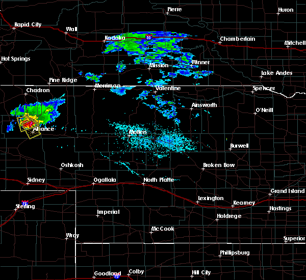 At 512 pm mdt, a severe thunderstorm was located near wild horse butte, or 9 miles north of alliance, moving southeast at 20 mph. this is a very dangerous storm (radar indicated). Hazards include 80 mph wind gusts and half dollar size hail. Flying debris will be dangerous to those caught without shelter. mobile homes will be heavily damaged. expect considerable damage to roofs, windows, and vehicles. Extensive tree damage and power outages are likely. At 512 pm mdt, a severe thunderstorm was located near wild horse butte, or 9 miles north of alliance, moving southeast at 20 mph. this is a very dangerous storm (radar indicated). Hazards include 80 mph wind gusts and half dollar size hail. Flying debris will be dangerous to those caught without shelter. mobile homes will be heavily damaged. expect considerable damage to roofs, windows, and vehicles. Extensive tree damage and power outages are likely.
|
| 7/2/2017 7:46 PM MDT | 53-kt gus in box butte county NE, 4.4 miles NW of Alliance, NE |
| 6/27/2017 8:26 PM MDT | 58-kt gus in box butte county NE, 4.4 miles NW of Alliance, NE |
| 6/12/2017 8:31 PM MDT |
 At 831 pm mdt, a severe thunderstorm was located near alliance airport, or near alliance, moving northeast at 35 mph. this is a very dangerous storm (radar indicated). Hazards include baseball size hail and 70 mph wind gusts. People and animals outdoors will be severely injured. expect shattered windows, extensive damage to roofs, siding, and vehicles. locations impacted include, alliance and alliance airport. A tornado watch remains in effect until 900 pm mdt for the panhandle of nebraska. At 831 pm mdt, a severe thunderstorm was located near alliance airport, or near alliance, moving northeast at 35 mph. this is a very dangerous storm (radar indicated). Hazards include baseball size hail and 70 mph wind gusts. People and animals outdoors will be severely injured. expect shattered windows, extensive damage to roofs, siding, and vehicles. locations impacted include, alliance and alliance airport. A tornado watch remains in effect until 900 pm mdt for the panhandle of nebraska.
|
| 6/12/2017 8:18 PM MDT | Tennis Ball sized hail reported 0.2 miles ESE of Alliance, NE, report received via facebook. |
| 6/12/2017 8:15 PM MDT | Baseball sized hail reported 0.2 miles ESE of Alliance, NE |
| 6/12/2017 8:10 PM MDT | Quarter sized hail reported 0.2 miles ESE of Alliance, NE, kansas st in alliance. |
| 6/12/2017 8:07 PM MDT |
 At 807 pm mdt, a severe thunderstorm capable of producing a tornado was located 7 miles southwest of alliance airport, or 7 miles south of alliance, moving east at 40 mph (radar indicated rotation). Hazards include tornado and softball size hail. Flying debris will be dangerous to those caught without shelter. mobile homes will be damaged or destroyed. damage to roofs, windows, and vehicles will occur. tree damage is likely. This dangerous storm will be near, alliance airport around 815 pm mdt. At 807 pm mdt, a severe thunderstorm capable of producing a tornado was located 7 miles southwest of alliance airport, or 7 miles south of alliance, moving east at 40 mph (radar indicated rotation). Hazards include tornado and softball size hail. Flying debris will be dangerous to those caught without shelter. mobile homes will be damaged or destroyed. damage to roofs, windows, and vehicles will occur. tree damage is likely. This dangerous storm will be near, alliance airport around 815 pm mdt.
|
| 6/12/2017 8:00 PM MDT | Golf Ball sized hail reported 9 miles NE of Alliance, NE, near the morrill-box butte county line. |
| 6/12/2017 7:58 PM MDT |
 At 758 pm mdt, a severe thunderstorm was located 9 miles northeast of angora, or 10 miles southwest of alliance, moving east at 40 mph. this is a very dangerous storm (radar indicated). Hazards include softball size hail and 70 mph wind gusts. People and animals outdoors will be severely injured. Expect shattered windows, extensive damage to roofs, siding, and vehicles. At 758 pm mdt, a severe thunderstorm was located 9 miles northeast of angora, or 10 miles southwest of alliance, moving east at 40 mph. this is a very dangerous storm (radar indicated). Hazards include softball size hail and 70 mph wind gusts. People and animals outdoors will be severely injured. Expect shattered windows, extensive damage to roofs, siding, and vehicles.
|
| 10/3/2016 3:11 PM MDT |
 At 310 pm mdt, severe thunderstorms were located along a line extending from 11 miles north of chadron airport to 8 miles southeast of red cloud campground to near wild horse butte, moving northeast at 35 mph (radar indicated. at 249 pm mdt...a 73 mph wind gust was reported at the chadron airport. at 302 pm mdt, quarter size hail was reported 2 miles north of alliance). Hazards include 60 mph wind gusts and quarter size hail. Hail damage to vehicles is expected. expect wind damage to roofs, siding, and trees. These severe thunderstorms will remain over mainly rural areas of eastern dawes and eastern box butte counties, including the following locations: chadron st park. At 310 pm mdt, severe thunderstorms were located along a line extending from 11 miles north of chadron airport to 8 miles southeast of red cloud campground to near wild horse butte, moving northeast at 35 mph (radar indicated. at 249 pm mdt...a 73 mph wind gust was reported at the chadron airport. at 302 pm mdt, quarter size hail was reported 2 miles north of alliance). Hazards include 60 mph wind gusts and quarter size hail. Hail damage to vehicles is expected. expect wind damage to roofs, siding, and trees. These severe thunderstorms will remain over mainly rural areas of eastern dawes and eastern box butte counties, including the following locations: chadron st park.
|
| 10/3/2016 3:05 PM MDT | Ping Pong Ball sized hail reported 7 miles S of Alliance, NE, along highway 87. |
| 10/3/2016 3:02 PM MDT | Quarter sized hail reported 2.1 miles S of Alliance, NE |
| 10/3/2016 2:58 PM MDT |
 At 258 pm mdt, severe thunderstorms were located along a line extending from 11 miles northwest of chadron airport to 9 miles northeast of box butte dam to near alliance, moving east at 50 mph (radar indicated). Hazards include 60 mph wind gusts and quarter size hail. Hail damage to vehicles is expected. expect wind damage to roofs, siding, and trees. These severe thunderstorms will remain over mainly rural areas of dawes and eastern box butte counties, including the following locations: whitney and chadron st park. At 258 pm mdt, severe thunderstorms were located along a line extending from 11 miles northwest of chadron airport to 9 miles northeast of box butte dam to near alliance, moving east at 50 mph (radar indicated). Hazards include 60 mph wind gusts and quarter size hail. Hail damage to vehicles is expected. expect wind damage to roofs, siding, and trees. These severe thunderstorms will remain over mainly rural areas of dawes and eastern box butte counties, including the following locations: whitney and chadron st park.
|
| 8/15/2016 9:15 PM MDT | Storm damage reported in box butte county NE, 0.2 miles ESE of Alliance, NE |
| 7/26/2016 8:33 PM MDT |
 At 833 pm mdt, severe thunderstorms were located along a line extending from near wild horse butte to 8 miles northeast of kilpatrick lake, moving southeast at 35 mph (radar indicated). Hazards include 60 mph wind gusts. Expect damage to roofs. siding. and trees. Locations impacted include, alliance, hemingford, wild horse butte, berea and alliance airport. At 833 pm mdt, severe thunderstorms were located along a line extending from near wild horse butte to 8 miles northeast of kilpatrick lake, moving southeast at 35 mph (radar indicated). Hazards include 60 mph wind gusts. Expect damage to roofs. siding. and trees. Locations impacted include, alliance, hemingford, wild horse butte, berea and alliance airport.
|
| 7/26/2016 8:15 PM MDT |
 At 814 pm mdt, severe thunderstorms were located along a line extending from 6 miles northeast of wild horse butte to near berea, moving south at 30 mph (radar indicated). Hazards include 60 mph wind gusts and half dollar size hail. Hail damage to vehicles is expected. Expect wind damage to roofs, siding, and trees. At 814 pm mdt, severe thunderstorms were located along a line extending from 6 miles northeast of wild horse butte to near berea, moving south at 30 mph (radar indicated). Hazards include 60 mph wind gusts and half dollar size hail. Hail damage to vehicles is expected. Expect wind damage to roofs, siding, and trees.
|
| 7/22/2016 2:37 PM MDT |
 At 237 pm mdt, a severe thunderstorm was located over berea, or 7 miles northwest of alliance, moving northeast at 15 mph (radar indicated). Hazards include ping pong ball size hail and 60 mph wind gusts. People and animals outdoors will be injured. expect hail damage to roofs, siding, windows, and vehicles. Expect wind damage to roofs, siding, and trees. At 237 pm mdt, a severe thunderstorm was located over berea, or 7 miles northwest of alliance, moving northeast at 15 mph (radar indicated). Hazards include ping pong ball size hail and 60 mph wind gusts. People and animals outdoors will be injured. expect hail damage to roofs, siding, windows, and vehicles. Expect wind damage to roofs, siding, and trees.
|
| 7/5/2016 5:56 PM MDT | The severe thunderstorm warning for southeastern box butte county will expire at 600 pm mdt, the storm which prompted the warning has moved out of the area. therefore the warning will be allowed to expire. |
| 7/5/2016 5:26 PM MDT | Quarter sized hail reported 2.2 miles E of Alliance, NE |
| 7/5/2016 5:26 PM MDT |
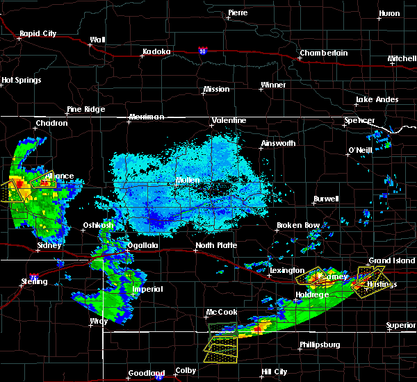 At 526 pm mdt, a severe thunderstorm was located over alliance, moving east at 25 mph (radar indicated). Hazards include 60 mph wind gusts and quarter size hail. Hail damage to vehicles is expected. expect wind damage to roofs, siding, and trees. This severe storm will be near, alliance airport around 530 pm mdt. At 526 pm mdt, a severe thunderstorm was located over alliance, moving east at 25 mph (radar indicated). Hazards include 60 mph wind gusts and quarter size hail. Hail damage to vehicles is expected. expect wind damage to roofs, siding, and trees. This severe storm will be near, alliance airport around 530 pm mdt.
|
| 7/5/2016 5:10 PM MDT |
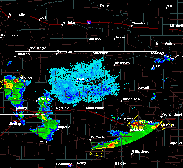 At 510 pm mdt, a severe thunderstorm was located near alliance, moving east at 25 mph (radar indicated). Hazards include 60 mph wind gusts and quarter size hail. Hail damage to vehicles is expected. expect wind damage to roofs, siding, and trees. this severe thunderstorm will be near, alliance around 525 pm mdt. Alliance airport around 530 pm mdt. At 510 pm mdt, a severe thunderstorm was located near alliance, moving east at 25 mph (radar indicated). Hazards include 60 mph wind gusts and quarter size hail. Hail damage to vehicles is expected. expect wind damage to roofs, siding, and trees. this severe thunderstorm will be near, alliance around 525 pm mdt. Alliance airport around 530 pm mdt.
|
| 6/28/2016 6:58 PM MDT | The severe thunderstorm warning for northeastern morrill and southeastern box butte counties will expire at 700 pm mdt, the storm which prompted the warning has moved out of the area. therefore the warning will be allowed to expire. a severe thunderstorm watch remains in effect until 900 pm mdt for central nebraska. remember, a severe thunderstorm warning still remains in effect for northeastern morrill county and southeastern box butte county in the panhandle of nebraska. |
| 6/28/2016 6:47 PM MDT |
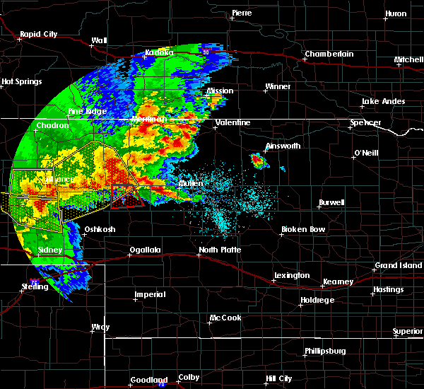 At 647 pm mdt, a severe thunderstorm was located over tralnor lake, or 21 miles southeast of alliance, moving southeast at 45 mph (radar indicated). Hazards include 60 mph wind gusts and penny size hail. Expect damage to roofs. siding. and trees. This severe thunderstorm will remain over mainly rural areas of northeastern morrill and southeastern box butte counties. At 647 pm mdt, a severe thunderstorm was located over tralnor lake, or 21 miles southeast of alliance, moving southeast at 45 mph (radar indicated). Hazards include 60 mph wind gusts and penny size hail. Expect damage to roofs. siding. and trees. This severe thunderstorm will remain over mainly rural areas of northeastern morrill and southeastern box butte counties.
|
| 6/28/2016 6:34 PM MDT | Shingles torn off the roof of the resident in sheridan county NE, 12.9 miles W of Alliance, NE |
| 6/28/2016 6:26 PM MDT |
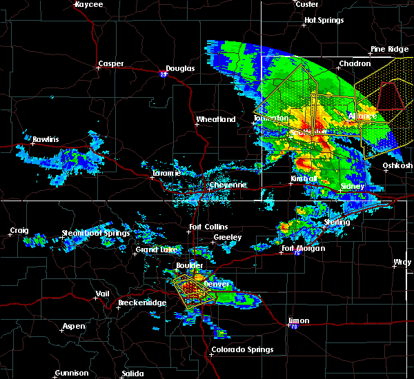 At 625 pm mdt, a severe thunderstorm was located near alliance airport, or near alliance, moving south at 40 mph (radar indicated. at 623 pm mdt...a wind gust to 58 mph was reported at alliance airport). Hazards include 60 mph wind gusts and quarter size hail. Hail damage to vehicles is expected. expect wind damage to roofs, siding, and trees. This severe thunderstorm will remain over mainly rural areas of northern morrill and southern box butte counties. At 625 pm mdt, a severe thunderstorm was located near alliance airport, or near alliance, moving south at 40 mph (radar indicated. at 623 pm mdt...a wind gust to 58 mph was reported at alliance airport). Hazards include 60 mph wind gusts and quarter size hail. Hail damage to vehicles is expected. expect wind damage to roofs, siding, and trees. This severe thunderstorm will remain over mainly rural areas of northern morrill and southern box butte counties.
|
| 6/28/2016 6:04 PM MDT |
 At 604 pm mdt, a severe thunderstorm was located over wild horse butte, or 13 miles north of alliance, moving southeast at 45 mph (trained weather spotters). Hazards include 70 mph wind gusts and quarter size hail. Hail damage to vehicles is expected. expect considerable tree damage. wind damage is also likely to mobile homes, roofs, and outbuildings. This severe thunderstorm will remain over mainly rural areas of northern morrill, south central dawes and box butte counties, including the following locations: marsland. At 604 pm mdt, a severe thunderstorm was located over wild horse butte, or 13 miles north of alliance, moving southeast at 45 mph (trained weather spotters). Hazards include 70 mph wind gusts and quarter size hail. Hail damage to vehicles is expected. expect considerable tree damage. wind damage is also likely to mobile homes, roofs, and outbuildings. This severe thunderstorm will remain over mainly rural areas of northern morrill, south central dawes and box butte counties, including the following locations: marsland.
|
| 6/28/2016 5:23 PM MDT | Storm damage reported in box butte county NE, 3.6 miles NW of Alliance, NE |
| 6/27/2016 9:32 PM MDT |
 At 932 pm mdt, a severe thunderstorm was located over alliance airport, or near alliance, moving southeast at 30 mph (radar indicated). Hazards include 60 mph wind gusts and quarter size hail. Hail damage to vehicles is expected. expect wind damage to roofs, siding, and trees. this severe storm will be near, alliance airport around 935 pm mdt. A tornado watch remains in effect until 1000 pm mdt for central nebraska. At 932 pm mdt, a severe thunderstorm was located over alliance airport, or near alliance, moving southeast at 30 mph (radar indicated). Hazards include 60 mph wind gusts and quarter size hail. Hail damage to vehicles is expected. expect wind damage to roofs, siding, and trees. this severe storm will be near, alliance airport around 935 pm mdt. A tornado watch remains in effect until 1000 pm mdt for central nebraska.
|
| 6/27/2016 9:10 PM MDT |
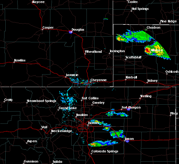 At 910 pm mdt, a severe thunderstorm was located over berea, or 7 miles northwest of alliance, moving southeast at 30 mph (radar indicated). Hazards include 60 mph wind gusts and quarter size hail. Hail damage to vehicles is expected. Expect wind damage to roofs, siding, and trees. At 910 pm mdt, a severe thunderstorm was located over berea, or 7 miles northwest of alliance, moving southeast at 30 mph (radar indicated). Hazards include 60 mph wind gusts and quarter size hail. Hail damage to vehicles is expected. Expect wind damage to roofs, siding, and trees.
|
| 6/12/2016 9:43 PM MDT |
 At 942 pm mdt, severe thunderstorms were located along a line extending from near alliance to 12 miles east of angora to near richardson lake to 9 miles south of lisco to 7 miles south of colton, and are nearly stationary (radar indicated). Hazards include 60 mph wind gusts and penny size hail. Expect damage to roofs. siding. and trees. locations impacted include, alliance, sidney, bridgeport, lodgepole, dalton, gurley, the intersection of highway 385 and 92, bridgeport state recreation area, angora, lorenzo, northport, colton, sidney airport, alliance airport, sunol, brownson and broadwater. This includes interstate 80 in nebraska between mile markers 51 and 77. At 942 pm mdt, severe thunderstorms were located along a line extending from near alliance to 12 miles east of angora to near richardson lake to 9 miles south of lisco to 7 miles south of colton, and are nearly stationary (radar indicated). Hazards include 60 mph wind gusts and penny size hail. Expect damage to roofs. siding. and trees. locations impacted include, alliance, sidney, bridgeport, lodgepole, dalton, gurley, the intersection of highway 385 and 92, bridgeport state recreation area, angora, lorenzo, northport, colton, sidney airport, alliance airport, sunol, brownson and broadwater. This includes interstate 80 in nebraska between mile markers 51 and 77.
|
| 6/12/2016 9:24 PM MDT |
 At 923 pm mdt, severe thunderstorms were located along a line extending from near alliance to near angora to near richardson lake to 10 miles east of gurley to near lorenzo, moving east at 45 mph (radar indicated). Hazards include 60 mph wind gusts and penny size hail. Expect damage to roofs. siding. And trees. At 923 pm mdt, severe thunderstorms were located along a line extending from near alliance to near angora to near richardson lake to 10 miles east of gurley to near lorenzo, moving east at 45 mph (radar indicated). Hazards include 60 mph wind gusts and penny size hail. Expect damage to roofs. siding. And trees.
|
| 6/12/2016 8:57 PM MDT | The severe thunderstorm warning for northwestern cheyenne, eastern banner, morrill, southeastern sioux, eastern scotts bluff, kimball, southern box butte and southeastern laramie counties will expire at 900 pm mdt, the storms which prompted the warning have weakened below severe limits, and no longer pose an immediate threat to life or property. therefore the warning will be allowed to expire. however heavy rain is still possible with these thunderstorms. to report severe weather, contact your nearest law enforcement agency. they will relay your report to the national weather service cheyenne. |
| 6/12/2016 8:57 PM MDT | The severe thunderstorm warning for northwestern cheyenne, eastern banner, morrill, southeastern sioux, eastern scotts bluff, kimball, southern box butte and southeastern laramie counties will expire at 900 pm mdt, the storms which prompted the warning have weakened below severe limits, and no longer pose an immediate threat to life or property. therefore the warning will be allowed to expire. however heavy rain is still possible with these thunderstorms. to report severe weather, contact your nearest law enforcement agency. they will relay your report to the national weather service cheyenne. |
| 6/12/2016 8:11 PM MDT |
 At 810 pm mdt, severe thunderstorms were located along a line extending from 8 miles east of flahertys corner to 6 miles east of lake minatare to near redington to 8 miles north of potter to 6 miles southwest of kimball airport, moving northeast at 25 mph (radar indicated). Hazards include 60 mph wind gusts and nickel size hail. Expect damage to roofs. siding. And trees. At 810 pm mdt, severe thunderstorms were located along a line extending from 8 miles east of flahertys corner to 6 miles east of lake minatare to near redington to 8 miles north of potter to 6 miles southwest of kimball airport, moving northeast at 25 mph (radar indicated). Hazards include 60 mph wind gusts and nickel size hail. Expect damage to roofs. siding. And trees.
|
| 6/12/2016 7:38 PM MDT |
 At 737 pm mdt, severe thunderstorms were located along a line extending from 7 miles west of hemingford to near kilpatrick lake to near moomaws corner to 8 miles southeast of harrisburg to near panorama point, moving east at 45 mph (radar indicated). Hazards include 60 mph wind gusts and nickel size hail. Expect damage to roofs. siding. And trees. At 737 pm mdt, severe thunderstorms were located along a line extending from 7 miles west of hemingford to near kilpatrick lake to near moomaws corner to 8 miles southeast of harrisburg to near panorama point, moving east at 45 mph (radar indicated). Hazards include 60 mph wind gusts and nickel size hail. Expect damage to roofs. siding. And trees.
|
| 6/12/2016 7:24 PM MDT |
 At 723 pm mdt, severe thunderstorms were located along a line extending from near flahertys corner to 7 miles northeast of lake alice to near minatare to 11 miles southwest of harrisburg, moving east at 40 mph (reports received from kneb of 60 to 69 mph winds west of scottsbluff arounf 705pm). Hazards include 60 mph wind gusts and nickel size hail. Expect damage to roofs. siding. and trees. Locations impacted include, scottsbluff, gering, bayard, terrytown, minatare, lake alice, redington, moomaws corner, harrisburg, angora, scotts bluff national monument, lake minatare, the intersection of highway 385 and l62, south bayard junction, berea, chimney rock state park, wildcat hills campground, kilpatrick lake, wildcat hills state recreation area and wild horse butte. At 723 pm mdt, severe thunderstorms were located along a line extending from near flahertys corner to 7 miles northeast of lake alice to near minatare to 11 miles southwest of harrisburg, moving east at 40 mph (reports received from kneb of 60 to 69 mph winds west of scottsbluff arounf 705pm). Hazards include 60 mph wind gusts and nickel size hail. Expect damage to roofs. siding. and trees. Locations impacted include, scottsbluff, gering, bayard, terrytown, minatare, lake alice, redington, moomaws corner, harrisburg, angora, scotts bluff national monument, lake minatare, the intersection of highway 385 and l62, south bayard junction, berea, chimney rock state park, wildcat hills campground, kilpatrick lake, wildcat hills state recreation area and wild horse butte.
|
| 6/12/2016 7:03 PM MDT |
 At 703 pm mdt, severe thunderstorms were located along a line extending from 9 miles southwest of flahertys corner to lake alice to near wildcat hills campground to near albin, moving east at 45 mph (radar indicated). Hazards include 60 mph wind gusts and nickel size hail. Expect damage to roofs. siding. And trees. At 703 pm mdt, severe thunderstorms were located along a line extending from 9 miles southwest of flahertys corner to lake alice to near wildcat hills campground to near albin, moving east at 45 mph (radar indicated). Hazards include 60 mph wind gusts and nickel size hail. Expect damage to roofs. siding. And trees.
|
| 5/24/2016 6:18 PM MDT | The national weather service in cheyenne has issued a * severe thunderstorm warning for. cheyenne county in the panhandle of nebraska. morrill county in the panhandle of nebraska. southern box butte county in the panhandle of nebraska. Until 700 pm mdt. |
| 7/27/2015 8:55 PM MDT | Ping Pong Ball sized hail reported 21.1 miles W of Alliance, NE |
| 7/17/2015 3:56 PM MDT |
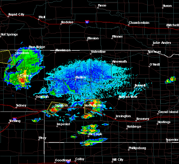 At 355 pm mdt, a severe thunderstorm was located near alliance airport, or 10 miles southeast of alliance, moving east at 30 mph (doppler radar). Hazards include quarter size hail and 60 mph wind gusts. Hail damage to vehicles is expected. expect wind damage to roofs, siding and trees. Locations impacted include, alliance and alliance airport. At 355 pm mdt, a severe thunderstorm was located near alliance airport, or 10 miles southeast of alliance, moving east at 30 mph (doppler radar). Hazards include quarter size hail and 60 mph wind gusts. Hail damage to vehicles is expected. expect wind damage to roofs, siding and trees. Locations impacted include, alliance and alliance airport.
|
| 7/17/2015 3:35 PM MDT |
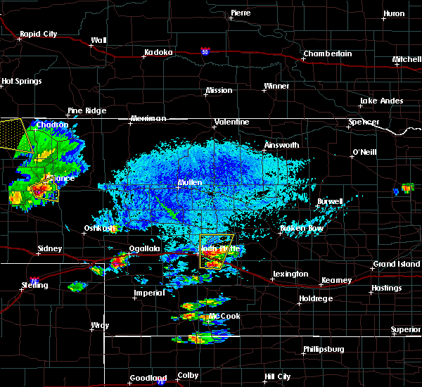 At 334 pm mdt, a severe thunderstorm was located near alliance airport, or 8 miles south of alliance, moving east at 30 mph (trained weather spotters). Hazards include quarter size hail and 60 mph wind gusts. Hail damage to vehicles is expected. Expect wind damage to roofs, siding and trees. At 334 pm mdt, a severe thunderstorm was located near alliance airport, or 8 miles south of alliance, moving east at 30 mph (trained weather spotters). Hazards include quarter size hail and 60 mph wind gusts. Hail damage to vehicles is expected. Expect wind damage to roofs, siding and trees.
|
| 6/25/2015 5:53 PM MDT | Quarter sized hail reported 0.2 miles ESE of Alliance, NE |
| 6/25/2015 5:45 PM MDT | Golf Ball sized hail reported 0.2 miles ESE of Alliance, NE |
| 6/25/2015 5:43 PM MDT |
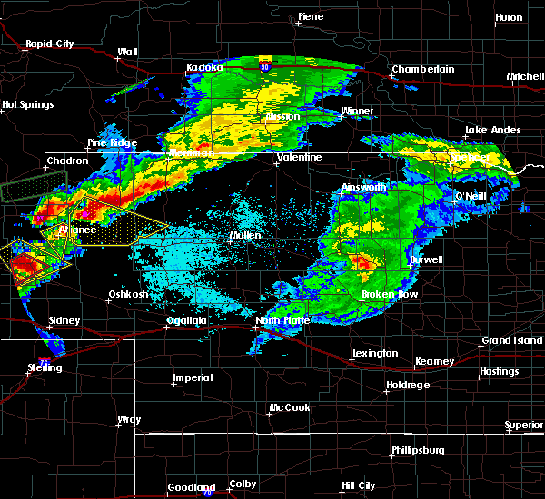 At 542 pm mdt, a severe thunderstorm was located over alliance, moving southeast at 40 mph (trained weather spotters). Hazards include ping pong size hail and 60 mph wind gusts. People and animals outdoors will be injured. expect hail damage to roofs, siding, windows and vehicles. expect wind damage to roofs, siding and trees. Locations impacted include, alliance and alliance airport. At 542 pm mdt, a severe thunderstorm was located over alliance, moving southeast at 40 mph (trained weather spotters). Hazards include ping pong size hail and 60 mph wind gusts. People and animals outdoors will be injured. expect hail damage to roofs, siding, windows and vehicles. expect wind damage to roofs, siding and trees. Locations impacted include, alliance and alliance airport.
|
| 6/25/2015 5:13 PM MDT |
 At 513 pm mdt, a severe thunderstorm was located near hemingford, or 21 miles northwest of alliance, moving southeast at 40 mph. this is a very dangerous storm (radar indicated). Hazards include three inch hail and 60 mph wind gusts. People and animals outdoors will be severely injured. Expect shattered windows, extensive damage to roofs, siding and vehicles. At 513 pm mdt, a severe thunderstorm was located near hemingford, or 21 miles northwest of alliance, moving southeast at 40 mph. this is a very dangerous storm (radar indicated). Hazards include three inch hail and 60 mph wind gusts. People and animals outdoors will be severely injured. Expect shattered windows, extensive damage to roofs, siding and vehicles.
|
| 6/25/2015 1:55 PM MDT | Ping Pong Ball sized hail reported 15.5 miles WNW of Alliance, NE, hail and 40 to 50 mph wind gusts broke windows on north side of house. |
| 6/25/2015 1:45 PM MDT | Golf Ball sized hail reported 12.9 miles W of Alliance, NE |
| 6/25/2015 1:30 PM MDT | Storm damage reported in sheridan county NE, 9.8 miles WNW of Alliance, NE |
| 6/25/2015 1:20 PM MDT | Golf Ball sized hail reported 2.9 miles SW of Alliance, NE, hail lasted from 120 to 127pm. 55mph wind gusts measured. windows broken out of garage and basement. 0.31 inches of liquid measured. |
| 6/25/2015 1:20 PM MDT | Golf Ball sized hail reported 6.6 miles SW of Alliance, NE |
| 6/25/2015 1:18 PM MDT | Golf Ball sized hail reported 5.1 miles SSW of Alliance, NE |
| 6/25/2015 1:18 PM MDT | Grapefruit sized hail reported 5.8 miles SW of Alliance, NE |
| 6/25/2015 1:00 PM MDT |
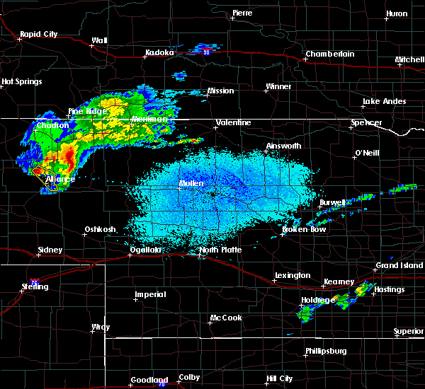 At 1259 pm mdt, a severe thunderstorm was located near wild horse butte, or 9 miles north of alliance, moving southeast at 35 mph (radar indicated). Hazards include quarter size hail and 60 mph wind gusts. Hail damage to vehicles is expected. expect wind damage to roofs, siding and trees. this severe thunderstorm will be near, alliance around 115 pm mdt. alliance airport around 120 pm mdt. This replaces the earlier severe thunderstorm in effect for box butte county. At 1259 pm mdt, a severe thunderstorm was located near wild horse butte, or 9 miles north of alliance, moving southeast at 35 mph (radar indicated). Hazards include quarter size hail and 60 mph wind gusts. Hail damage to vehicles is expected. expect wind damage to roofs, siding and trees. this severe thunderstorm will be near, alliance around 115 pm mdt. alliance airport around 120 pm mdt. This replaces the earlier severe thunderstorm in effect for box butte county.
|
| 6/6/2015 6:18 PM MDT | Golf Ball sized hail reported 4.2 miles S of Alliance, NE, hail ranged from pea to golfball size. |
| 6/6/2015 5:54 PM MDT | At 554 pm mdt, a severe thunderstorm was located near berea, or near alliance, moving east at 25 mph (radar indicated). Hazards include quarter size hail and 60 mph wind gusts. Hail damage to vehicles is expected. expect wind damage to roofs, siding and trees. This severe thunderstorm will remain over mainly rural areas of east central box butte county. |
| 6/6/2015 5:36 PM MDT | At 536 pm mdt, a severe thunderstorm was located over berea, or 11 miles northwest of alliance, moving east at 25 mph (radar indicated). Hazards include quarter size hail and 60 mph wind gusts. Hail damage to vehicles is expected. expect wind damage to roofs, siding and trees. this severe thunderstorm will be near, berea around 540 pm mdt. wild horse butte around 555 pm mdt. Alliance around 605 pm mdt. |
| 5/15/2015 8:00 PM MDT | Quarter sized hail reported 20.8 miles WSW of Alliance, NE, estimated time of 900pm cdt |
| 5/15/2015 6:15 PM MDT | Golf Ball sized hail reported 20 miles W of Alliance, NE |
| 5/15/2015 4:56 PM MDT | At 455 pm mdt, a severe thunderstorm was located over alliance, moving north at 20 mph (law enforcement. at 452 pm mdt...quarter size hail was reported in alliance). Hazards include quarter size hail and 60 mph wind gusts. Hail damage to vehicles is expected. expect wind damage to roofs, siding and trees. this severe thunderstorm will be near, wild horse butte around 530 pm mdt. a tornado watch remains in effect until 800 pm mdt for central nebraska. 1. 00in. |
| 5/15/2015 4:52 PM MDT | Quarter sized hail reported 0.2 miles ESE of Alliance, NE, dime to quarter size hail. |
| 9/29/2014 5:45 PM MDT | Ping Pong Ball sized hail reported 13 miles N of Alliance, NE, hail reported to be just smaller than golf ball. |
| 8/18/2014 4:10 PM MDT | Ping Pong Ball sized hail reported 0.2 miles ESE of Alliance, NE |
| 8/18/2014 4:00 PM MDT | Golf Ball sized hail reported 2.1 miles S of Alliance, NE |
| 6/27/2014 4:20 PM MDT | No estimate of speed but large tree branch down in her yard. heavy rain falling sideway in box butte county NE, 5.8 miles SW of Alliance, NE |
| 6/4/2014 8:50 PM MDT | Quarter sized hail reported 0.2 miles ESE of Alliance, NE, hail size varied from peas to quarters. |
| 6/4/2014 8:50 PM MDT | Shingles blown off a building near antioch...time estimated by radar in sheridan county NE, 12.9 miles W of Alliance, NE |
| 6/4/2014 8:42 PM MDT | Storm damage reported in box butte county NE, 4.5 miles NW of Alliance, NE |
| 6/4/2014 8:15 PM MDT | Quarter sized hail reported 5.3 miles E of Alliance, NE, wind gusts of 40-50 mph preceded the hail. |
| 6/3/2014 6:04 PM MDT | Tennis Ball sized hail reported 27.7 miles NNW of Alliance, NE |
| 6/1/2014 5:12 PM MDT | 40 to 50 mph sustained winds with gusts estimated over 60 mph. shingles off shopp. pea sized hail also occurred. very heavy rain at time of this repor in sheridan county NE, 10 miles WNW of Alliance, NE |
| 6/1/2014 5:05 PM MDT | Precipitation of .93 along with pea-sized hai in box butte county NE, 6.6 miles SW of Alliance, NE |
| 6/1/2014 5:01 PM MDT | Very heavy rai in box butte county NE, 1.2 miles E of Alliance, NE |
| 6/1/2014 5:01 PM MDT | Storm damage reported in box butte county NE, 4.5 miles NW of Alliance, NE |
| 6/1/2014 4:40 PM MDT | Tennis Ball sized hail reported 11.1 miles S of Alliance, NE, via social media. |
| 5/18/2014 8:06 PM MDT | Quarter sized hail reported 8.7 miles SW of Alliance, NE |
| 5/18/2014 8:00 PM MDT | Ping Pong Ball sized hail reported 4.2 miles S of Alliance, NE, most were 1 inch |
| 5/18/2014 7:45 PM MDT | Quarter sized hail reported 4.9 miles S of Alliance, NE |
| 5/18/2014 7:34 PM MDT | Quarter sized hail reported 5.3 miles E of Alliance, NE |
| 10/10/2013 6:32 PM MDT | Storm damage reported in sheridan county NE, 21.1 miles W of Alliance, NE |
| 8/1/2013 7:15 PM MDT | Ping Pong Ball sized hail reported 11 miles WNW of Alliance, NE, hail lasted for 5 minutes |
| 8/1/2013 7:15 PM MDT | Quarter sized hail reported 2 miles N of Alliance, NE |
| 8/1/2013 6:45 PM MDT | Storm damage reported in box butte county NE, 4.5 miles NW of Alliance, NE |
| 8/1/2013 6:37 PM MDT | Quarter sized hail reported 9.3 miles SE of Alliance, NE, this is the correct location from the storm report issued at 641 pm. |
| 8/1/2013 6:36 PM MDT | Quarter sized hail reported 9.6 miles SE of Alliance, NE, mostly dime size with a few quarter size. hail lasted five minutes. |
| 6/16/2013 4:10 PM MDT | Half Dollar sized hail reported 24.4 miles SSW of Alliance, NE |
| 5/17/2013 4:52 PM MDT | Quarter sized hail reported 13.9 miles WSW of Alliance, NE, quarter size hail was reported at estimated time of 552cdt. |
| 5/17/2013 4:17 PM MDT | Quarter sized hail reported 0.2 miles ESE of Alliance, NE, relayed through social media. |
| 6/19/2012 11:43 PM MDT | Quarter sized hail reported 0.2 miles ESE of Alliance, NE |
| 1/1/0001 12:00 AM | Storm damage reported in box butte county NE, 0.2 miles ESE of Alliance, NE |
| 1/1/0001 12:00 AM | Quarter sized hail reported 14.4 miles SW of Alliance, NE |
| 1/1/0001 12:00 AM | A 36 inch diameter branch was torn from a large tre in sheridan county NE, 11 miles WNW of Alliance, NE |
| 1/1/0001 12:00 AM | Storm damage reported in box butte county NE, 0.2 miles ESE of Alliance, NE |
| 1/1/0001 12:00 AM | Storm damage reported in box butte county NE, 0.2 miles ESE of Alliance, NE |
| 1/1/0001 12:00 AM | Storm damage reported in box butte county NE, 0.2 miles ESE of Alliance, NE |
| 1/1/0001 12:00 AM | Very heavy horizontal rainfall with estimated 60 to 70 mph wind gust in box butte county NE, 0.2 miles ESE of Alliance, NE |
| 1/1/0001 12:00 AM | Storm damage reported in box butte county NE, 0.2 miles ESE of Alliance, NE |
| 1/1/0001 12:00 AM | Storm damage reported in box butte county NE, 0.2 miles ESE of Alliance, NE |
| 1/1/0001 12:00 AM | Quarter sized hail reported 14.5 miles E of Alliance, NE, 45 to 50 mph winds. |
Hail Maps for Alliance, NE
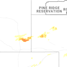
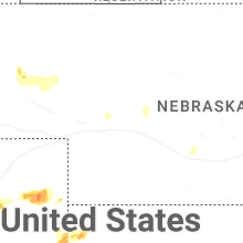
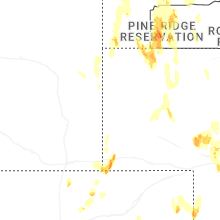
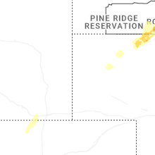
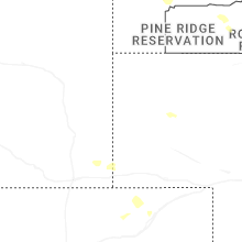
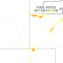
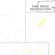
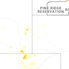
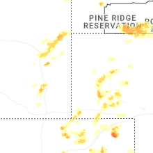
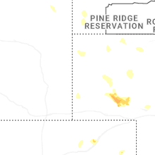


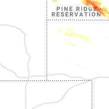


Connect with Interactive Hail Maps