

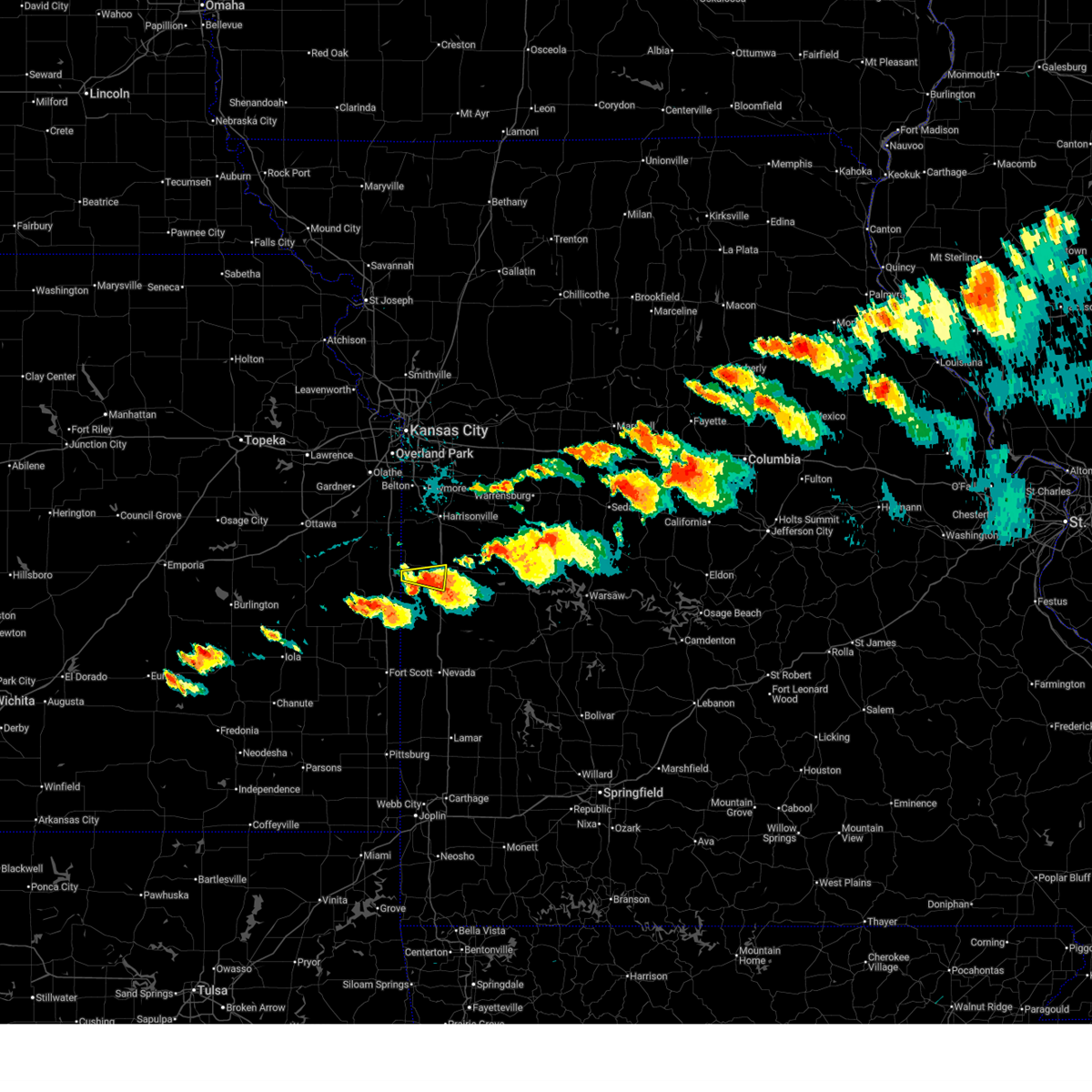
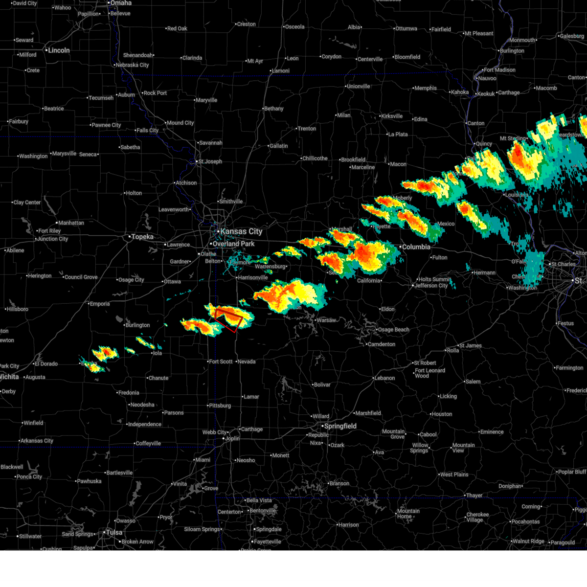
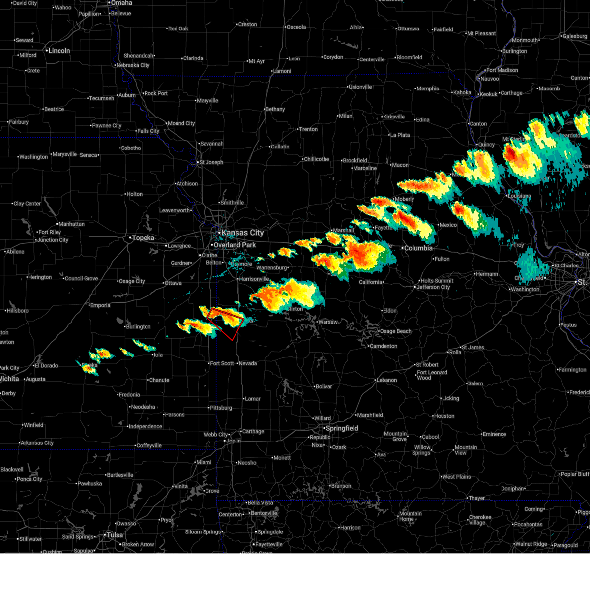
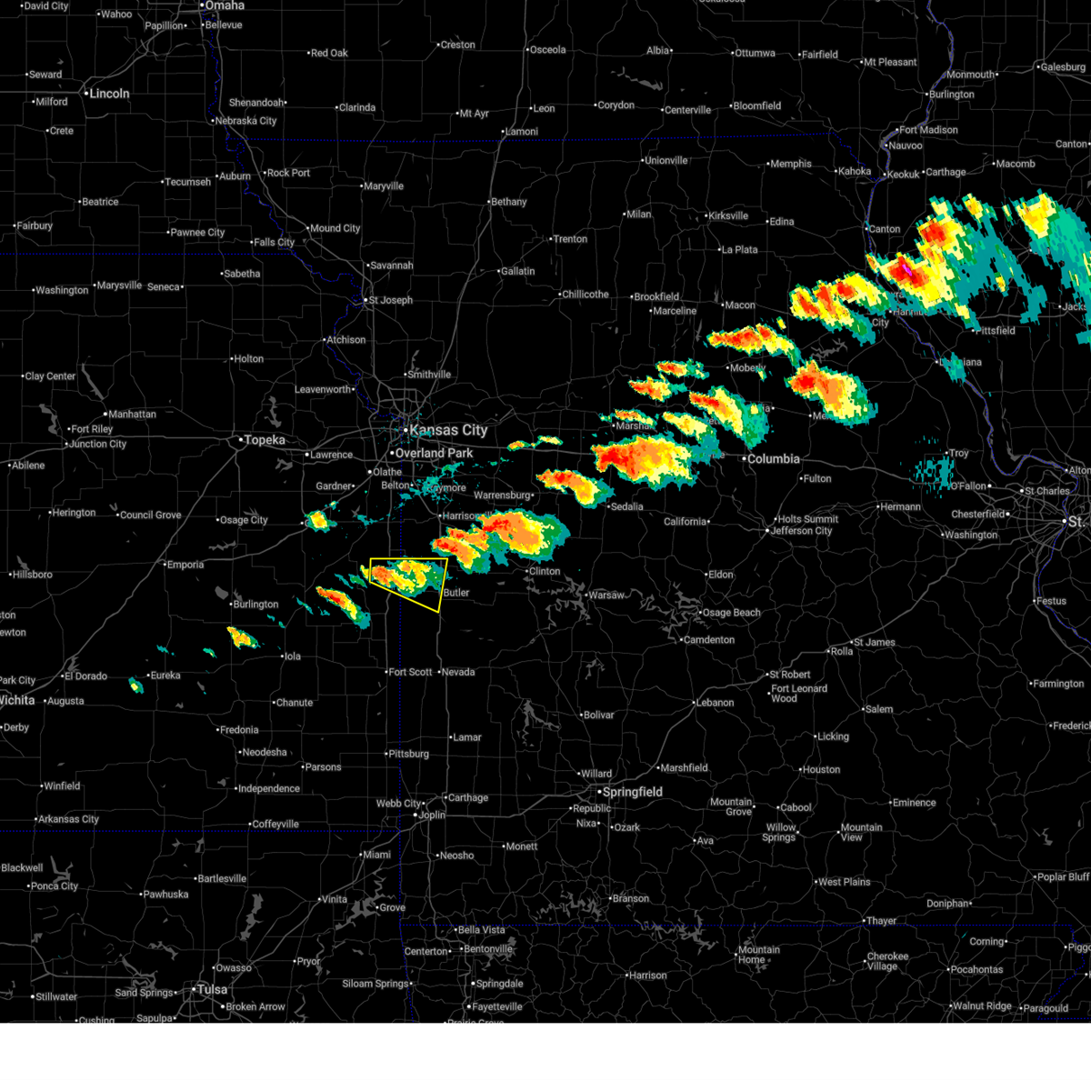
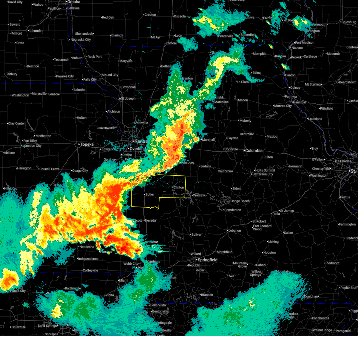
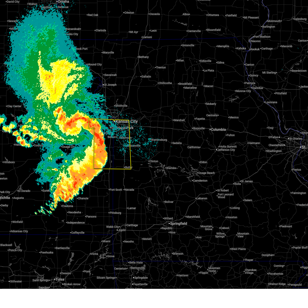
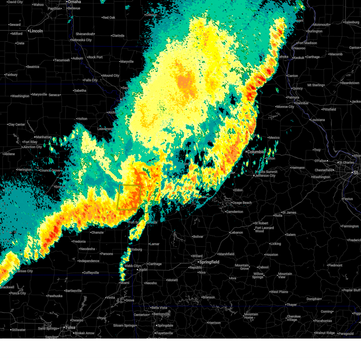
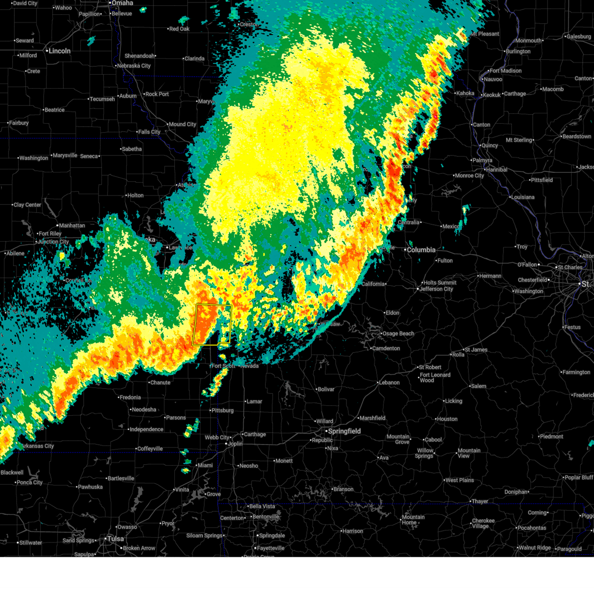
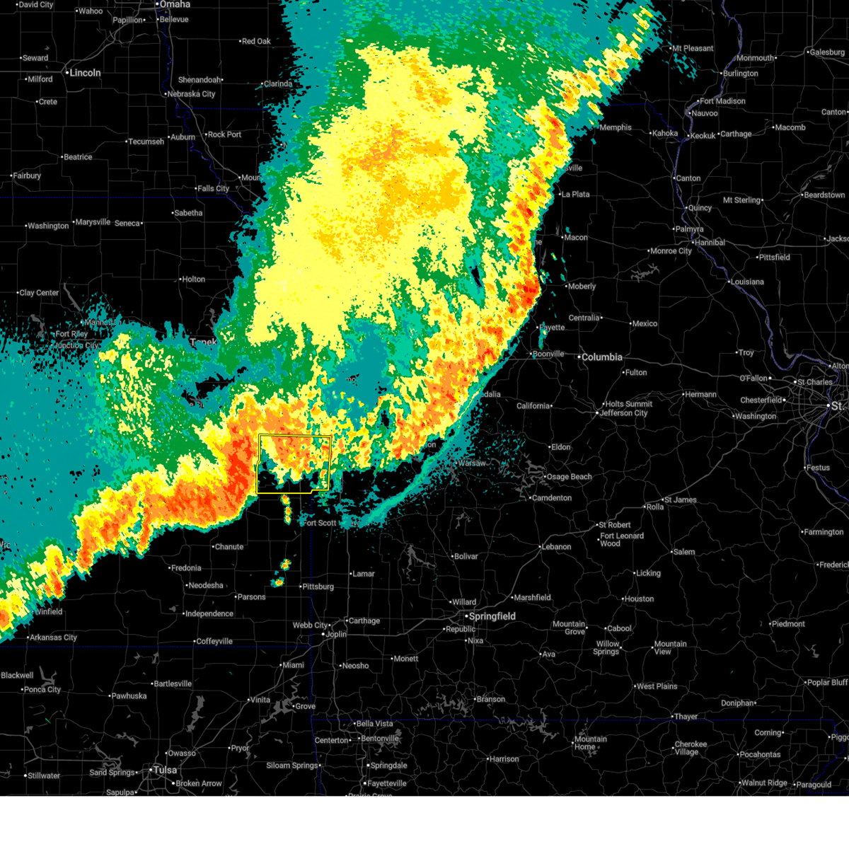
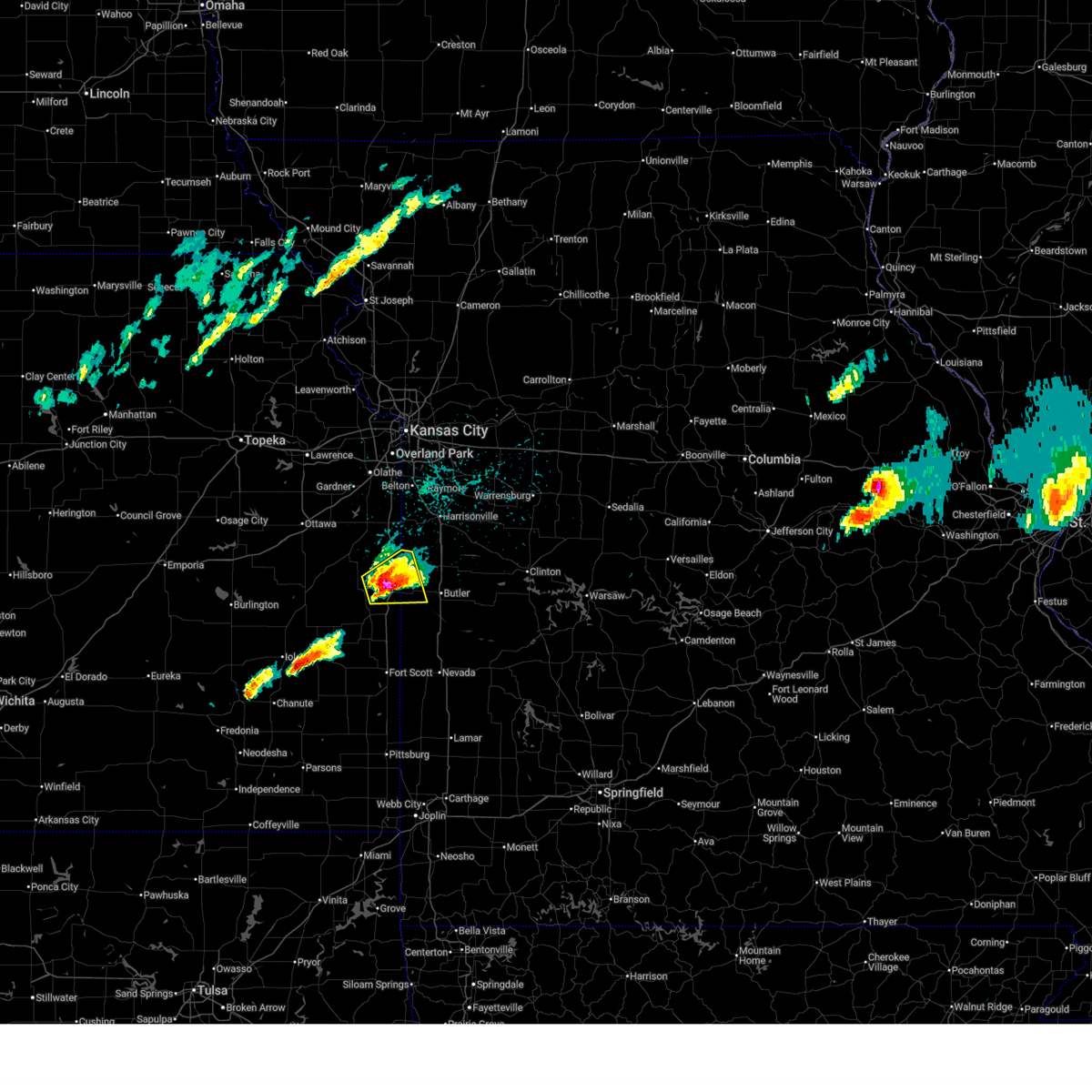
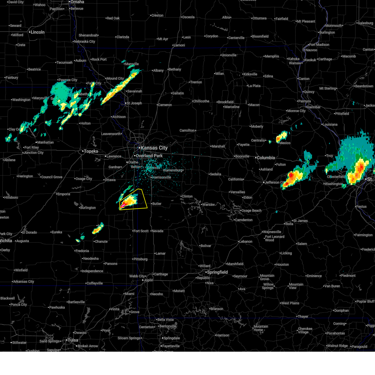
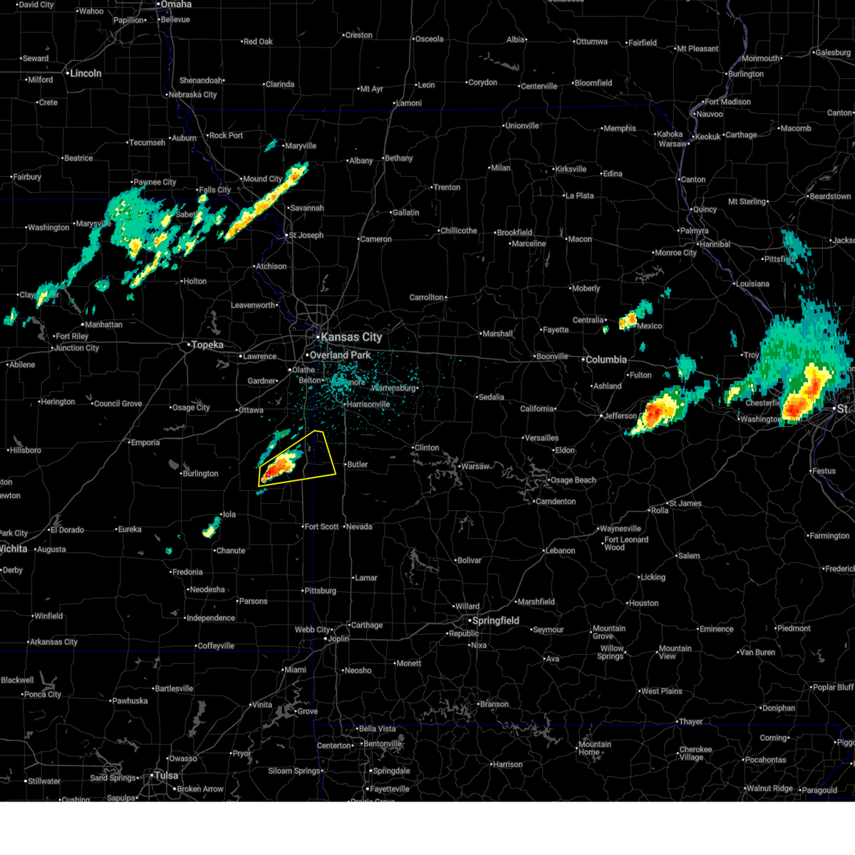
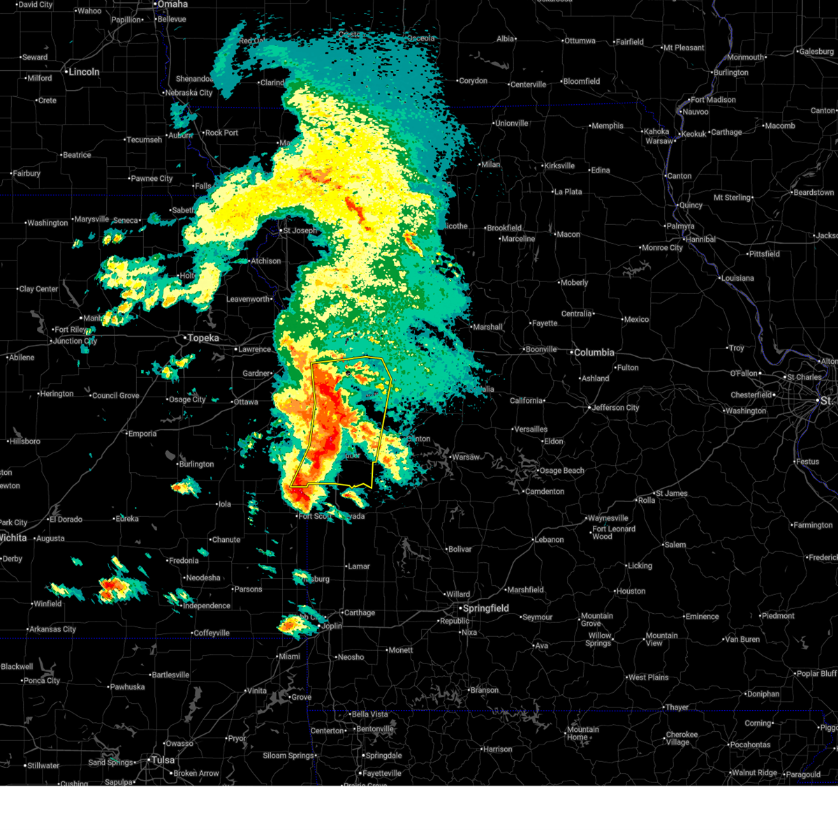
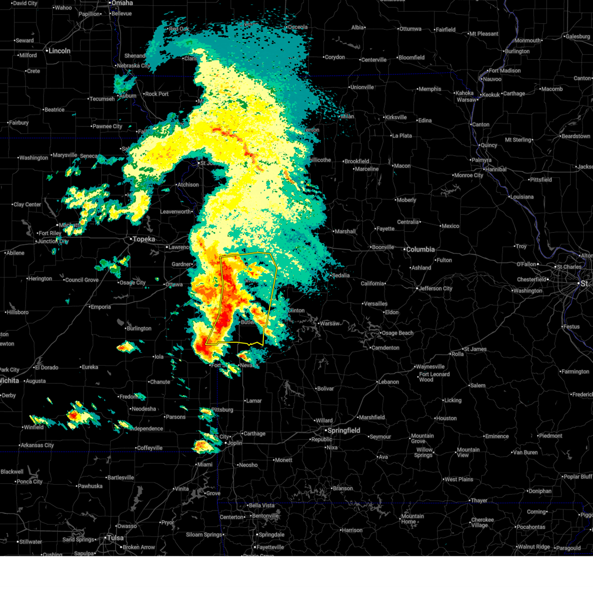
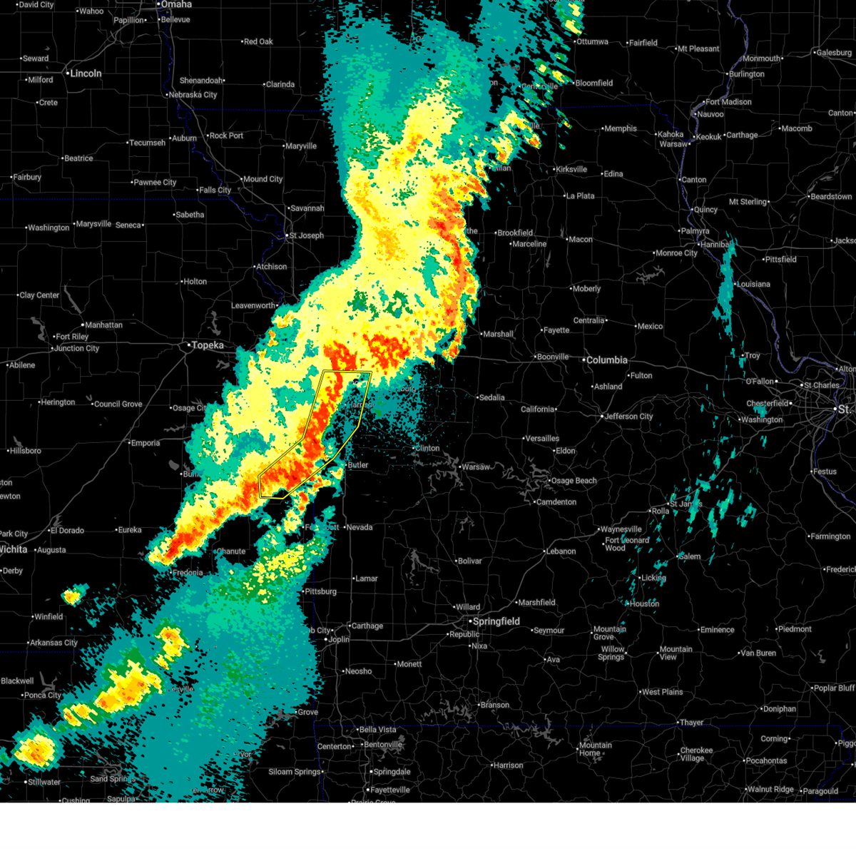
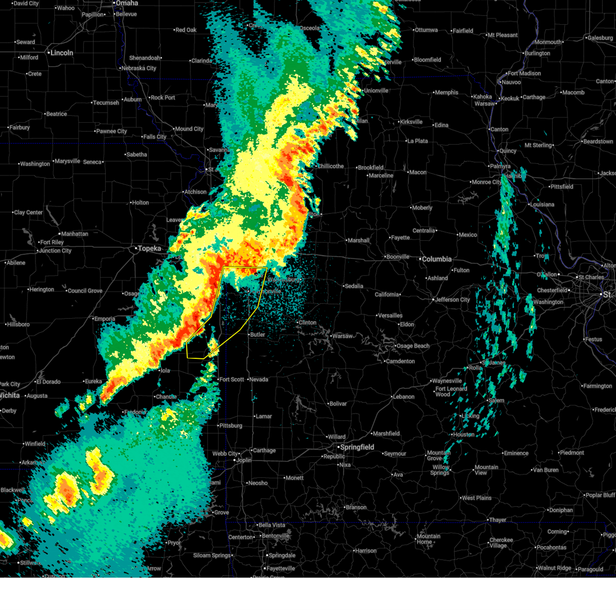
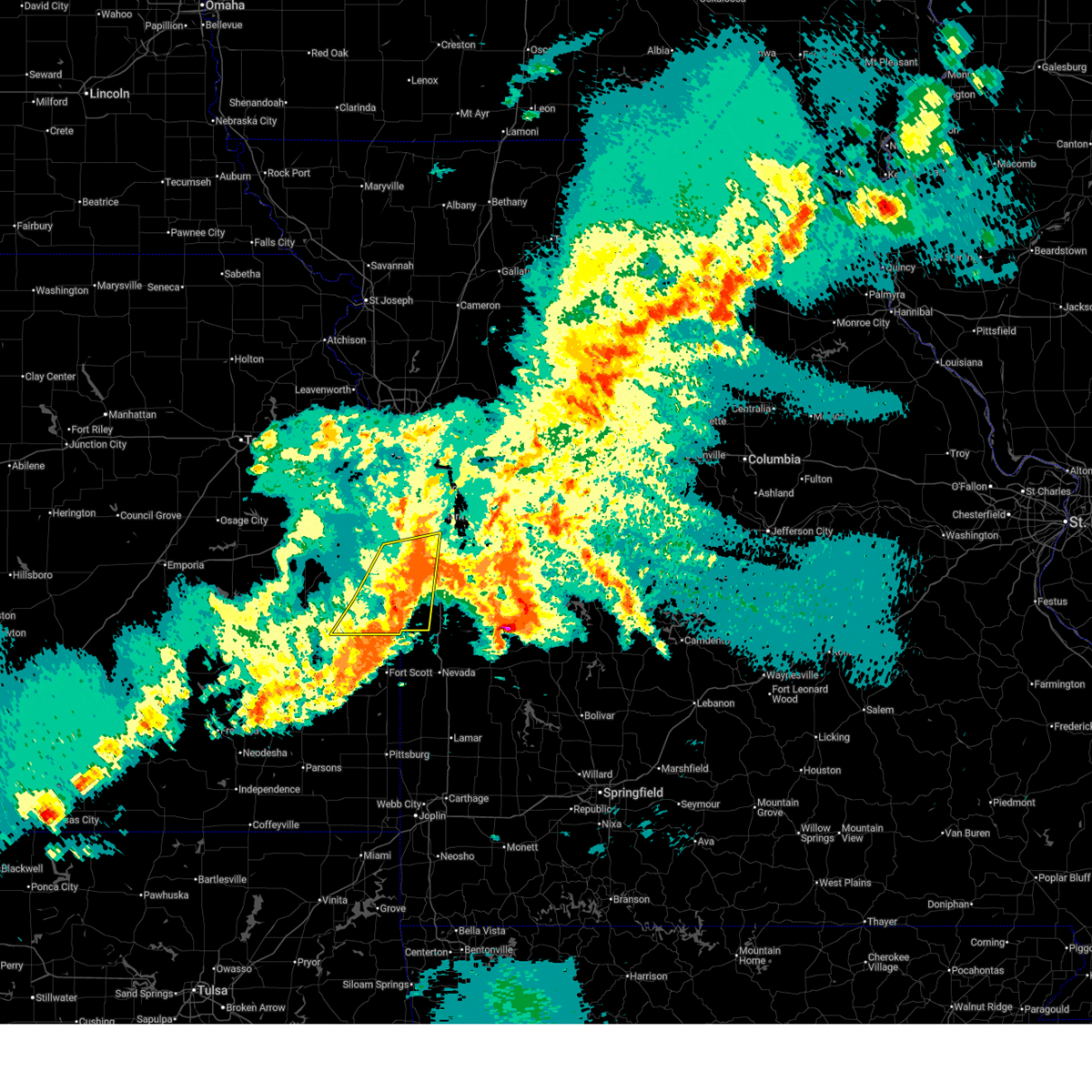
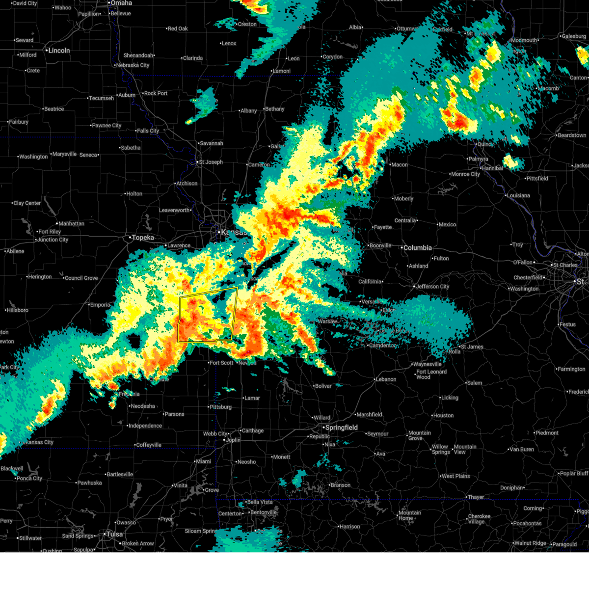
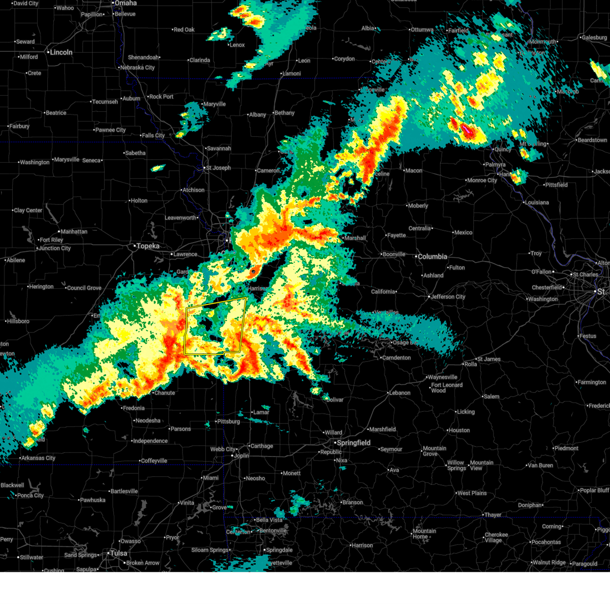
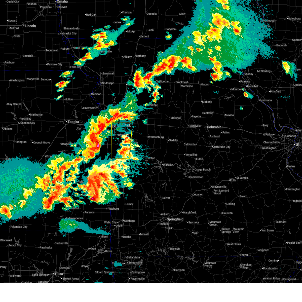
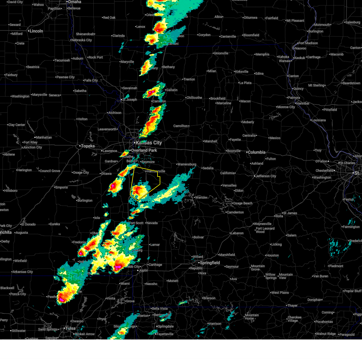
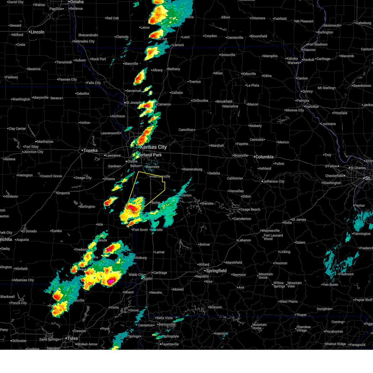
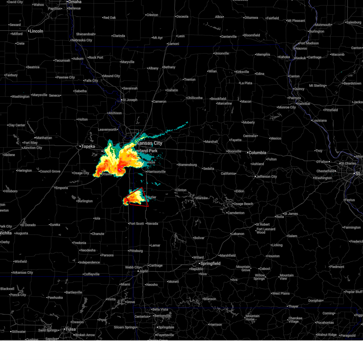
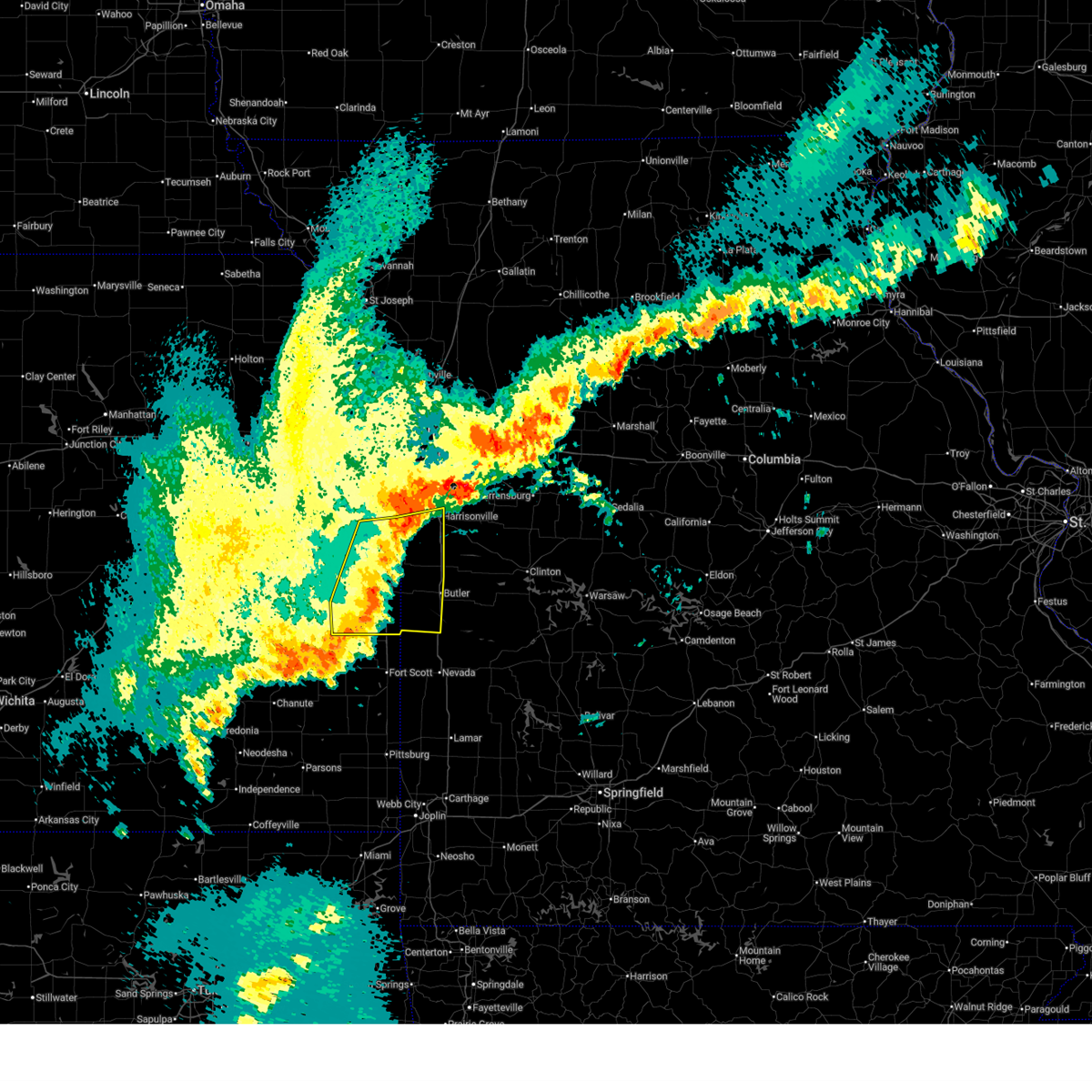
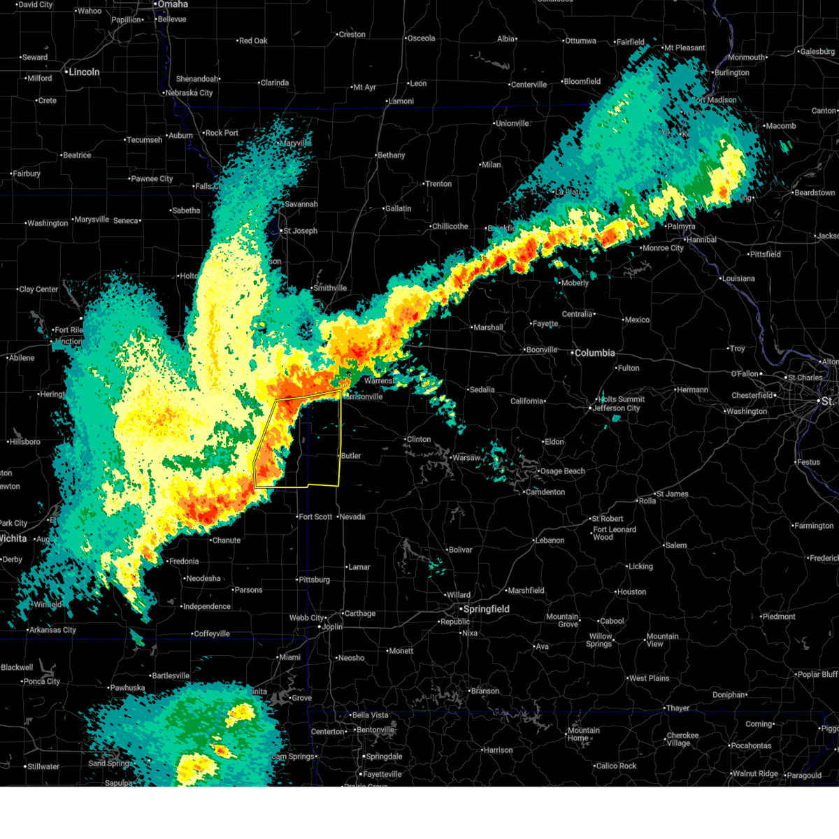
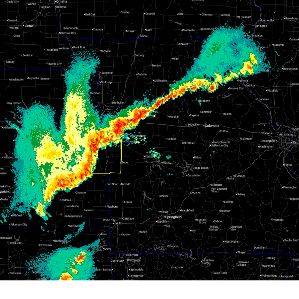
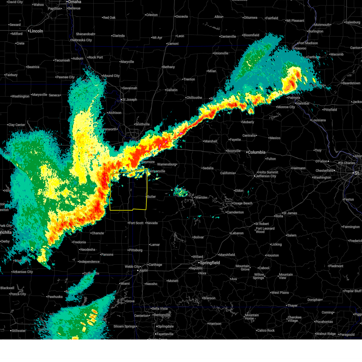
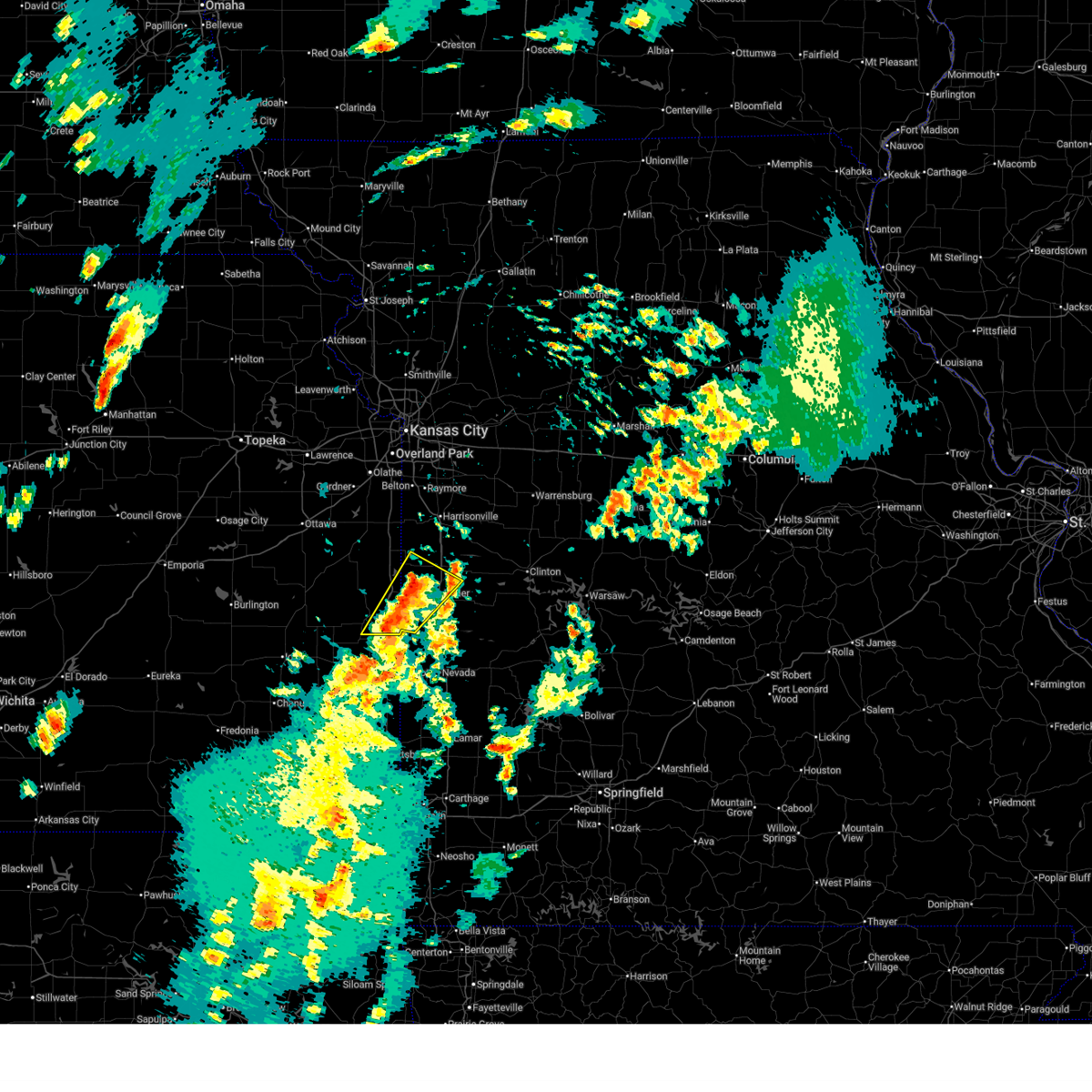
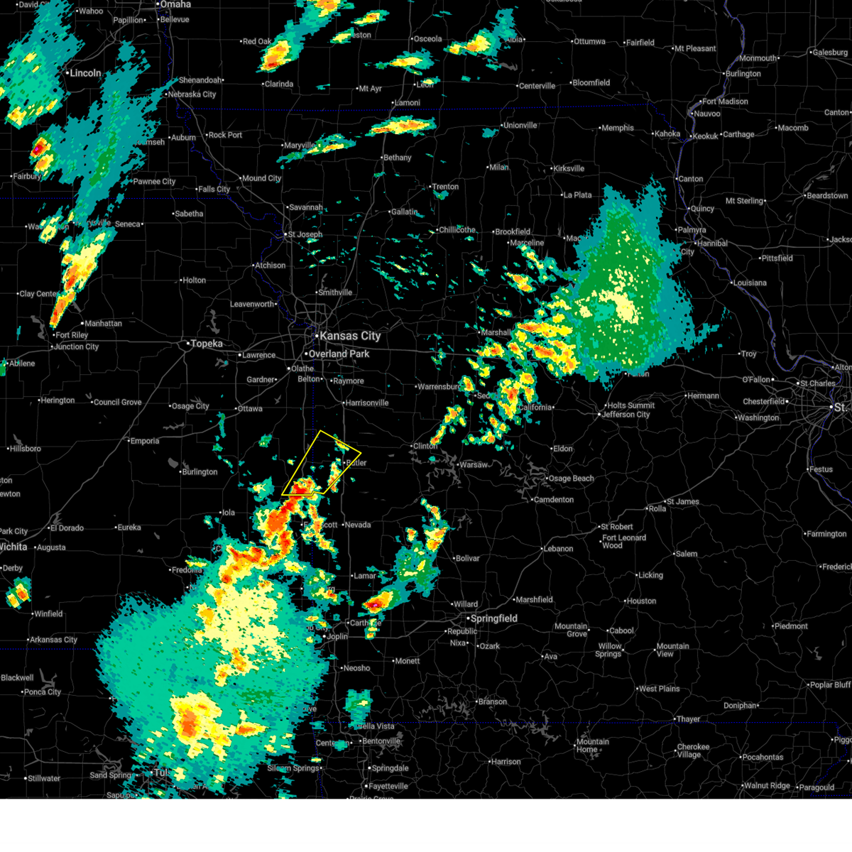
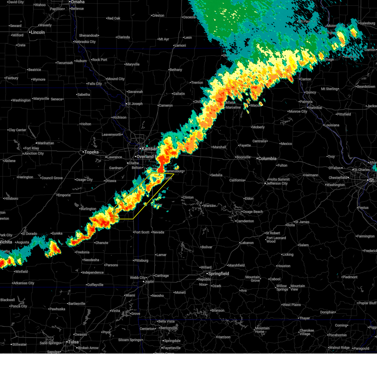
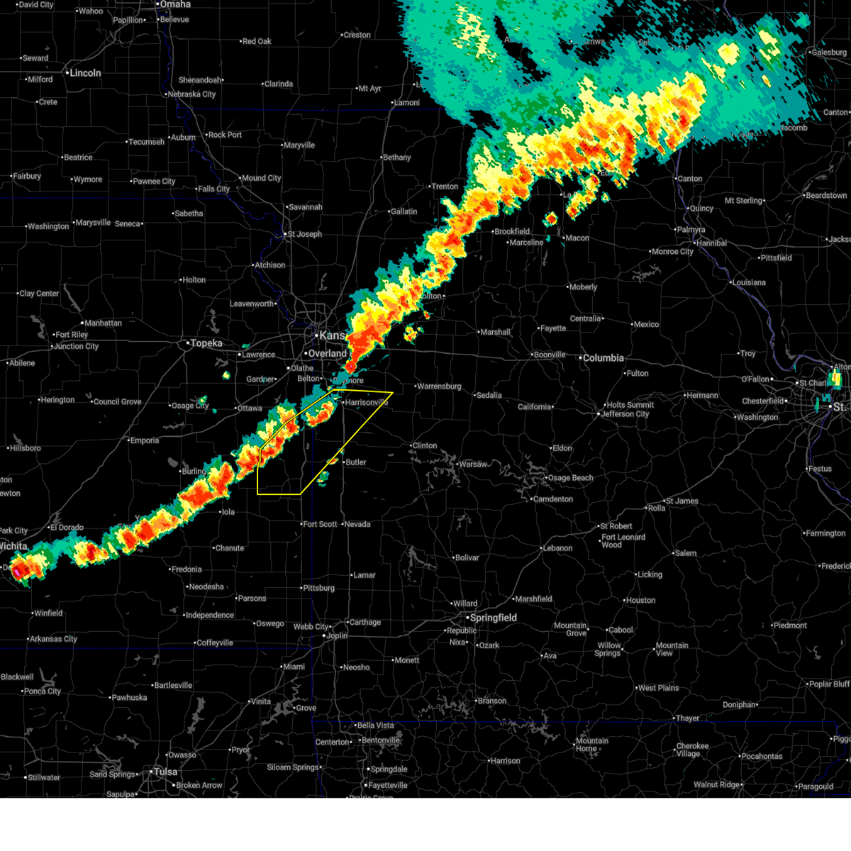
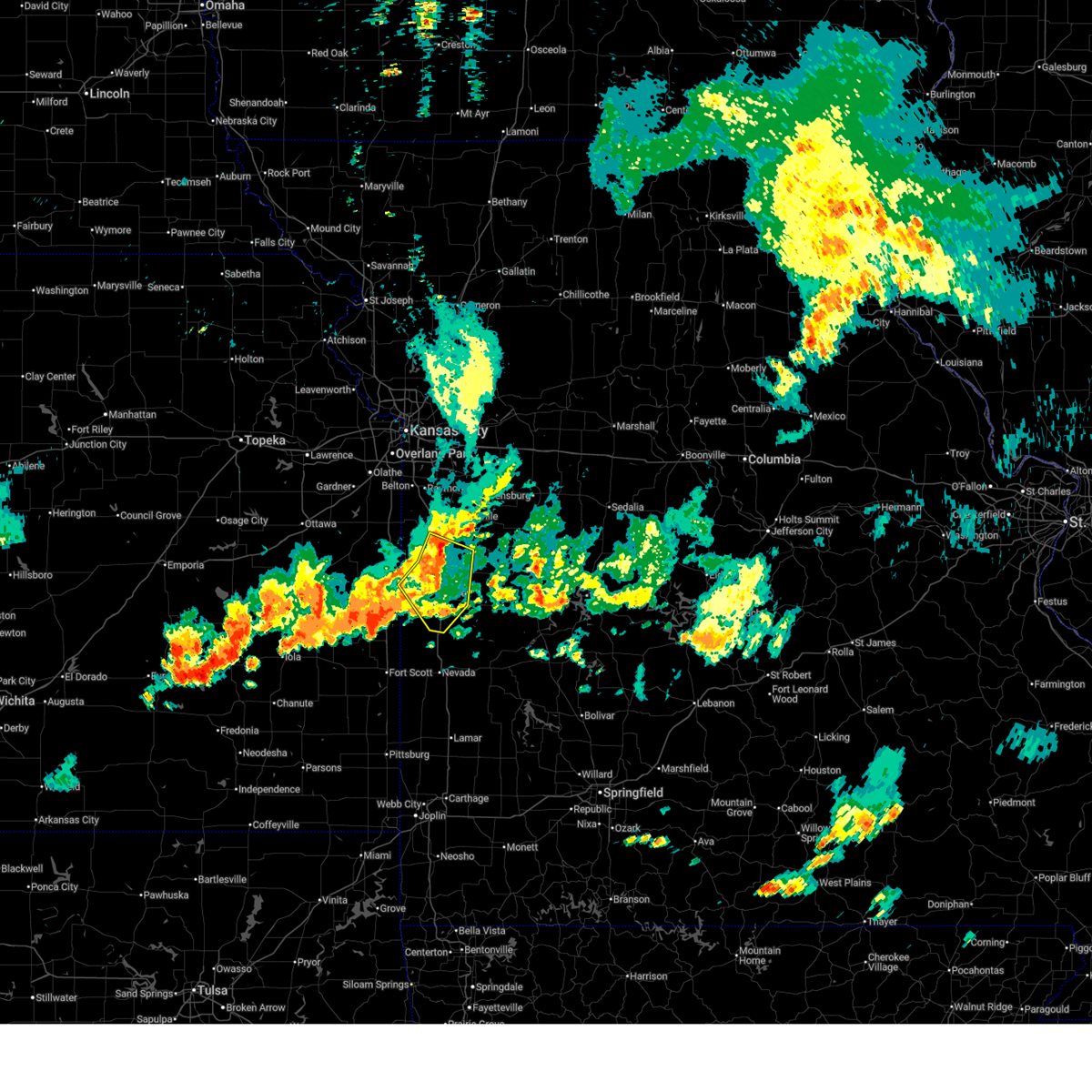
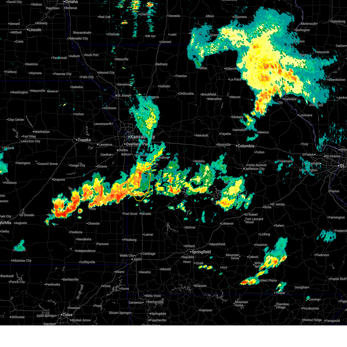
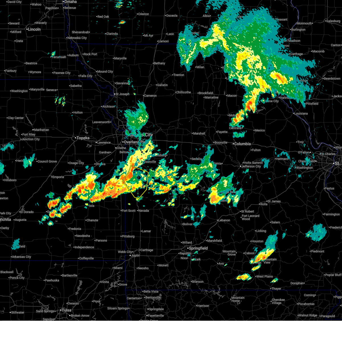
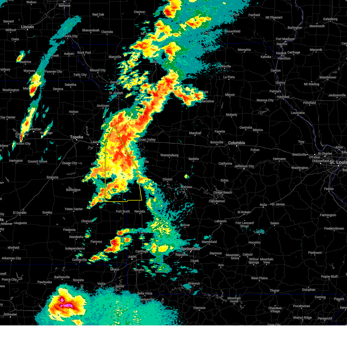
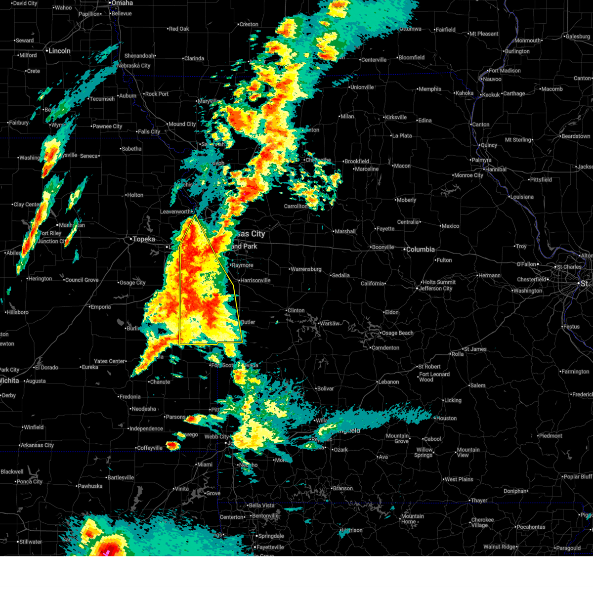
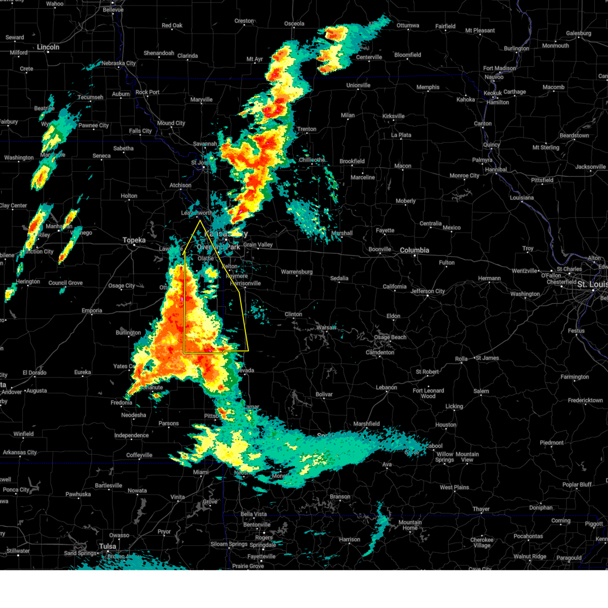
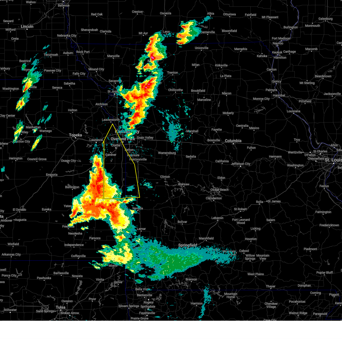
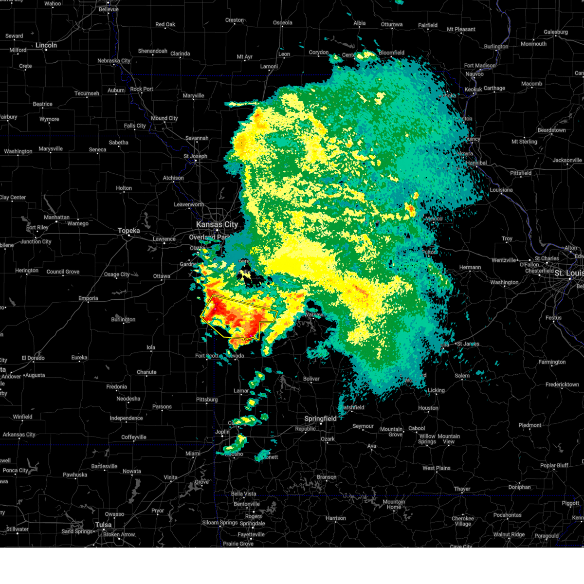
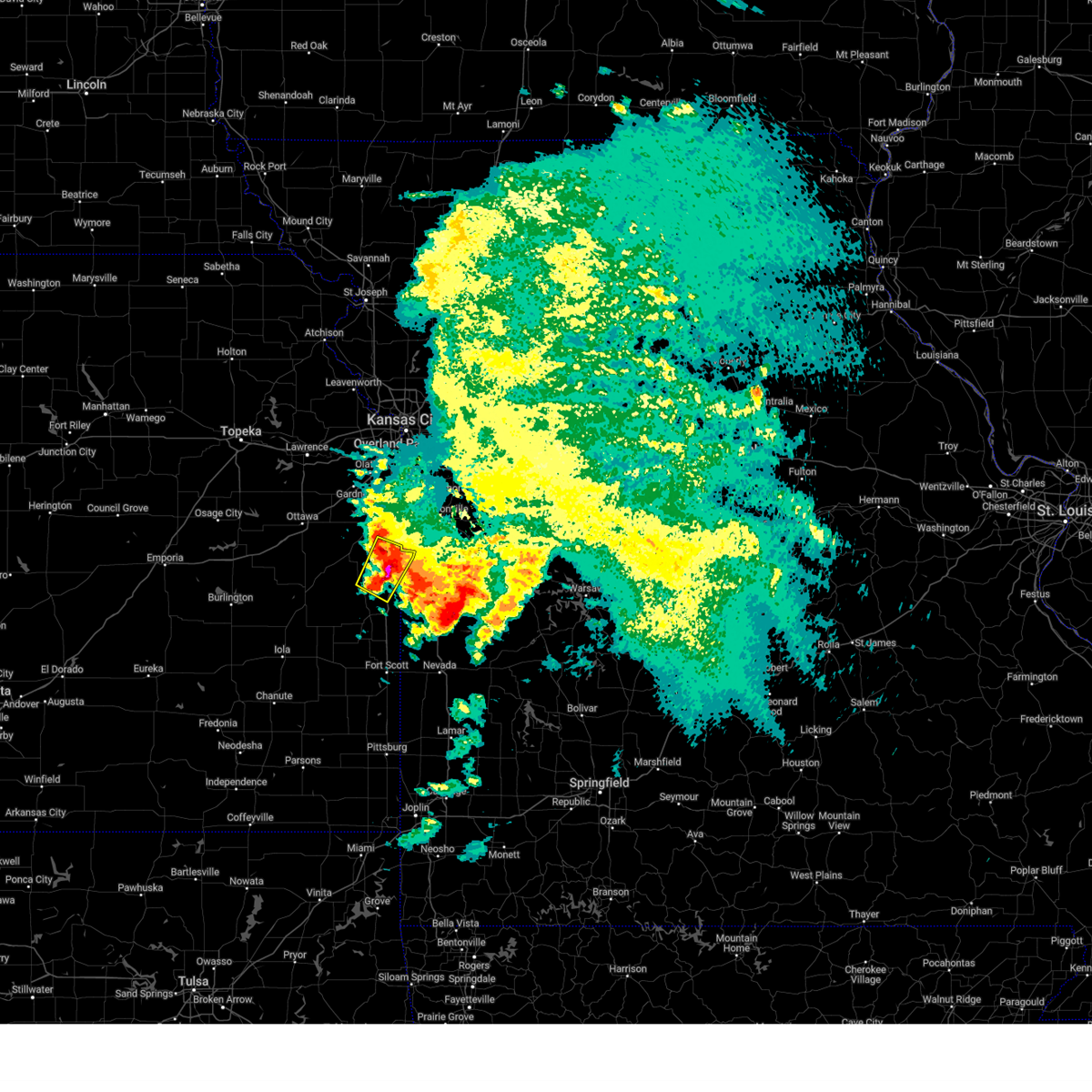
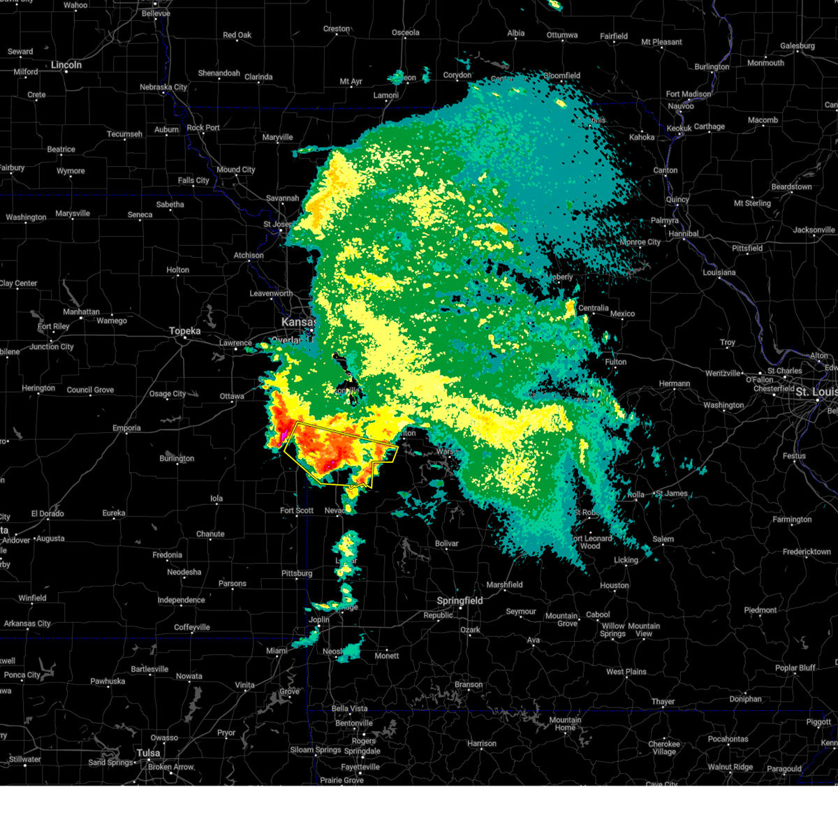
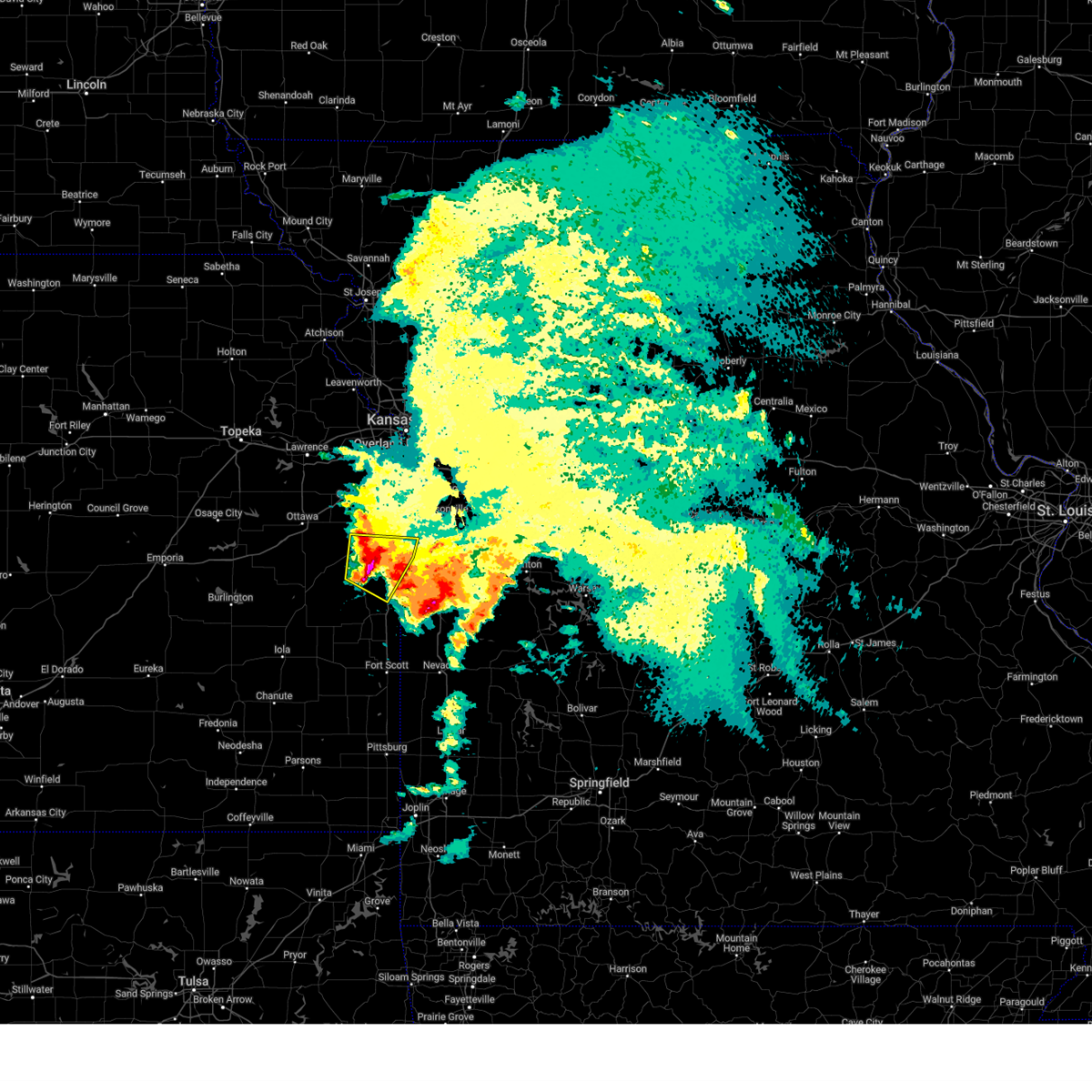
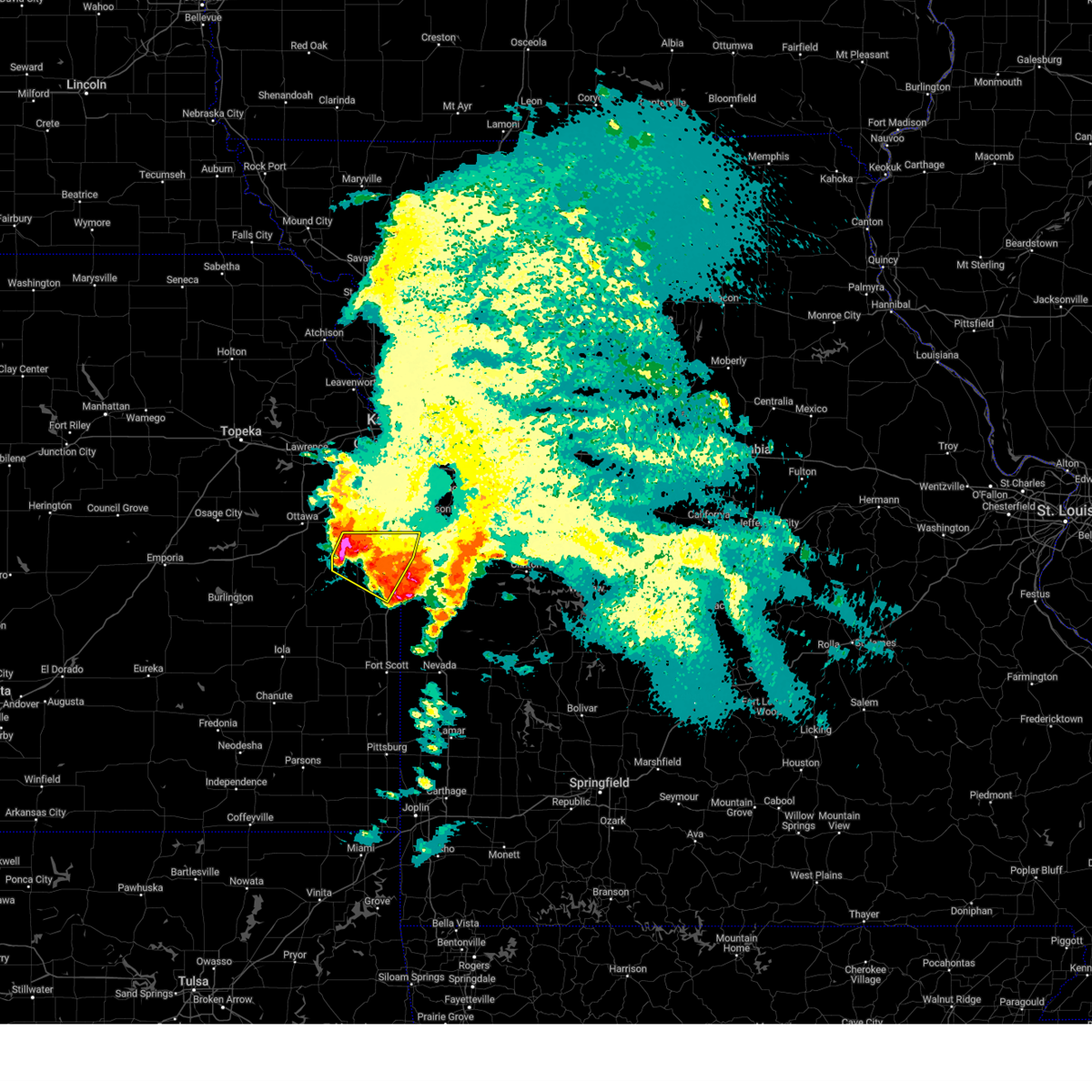
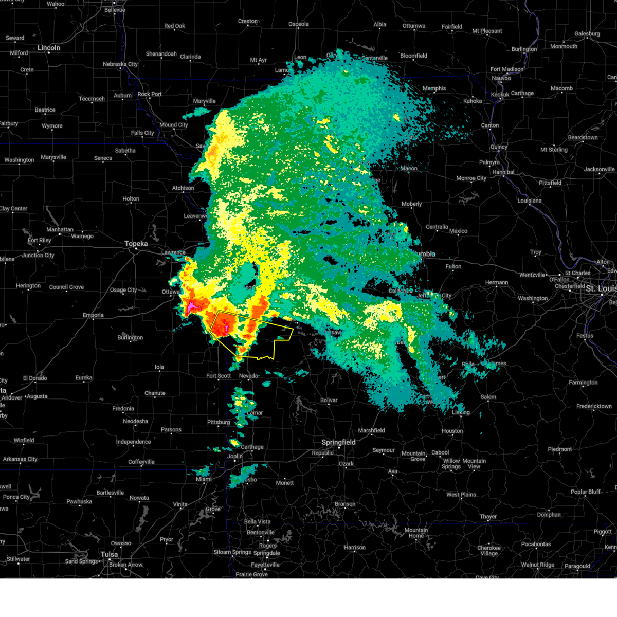
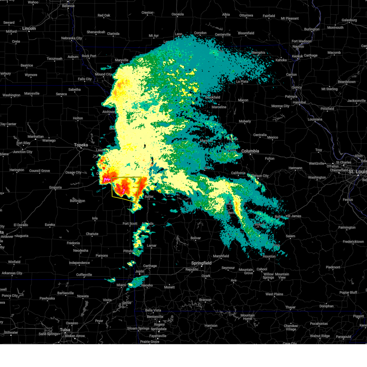
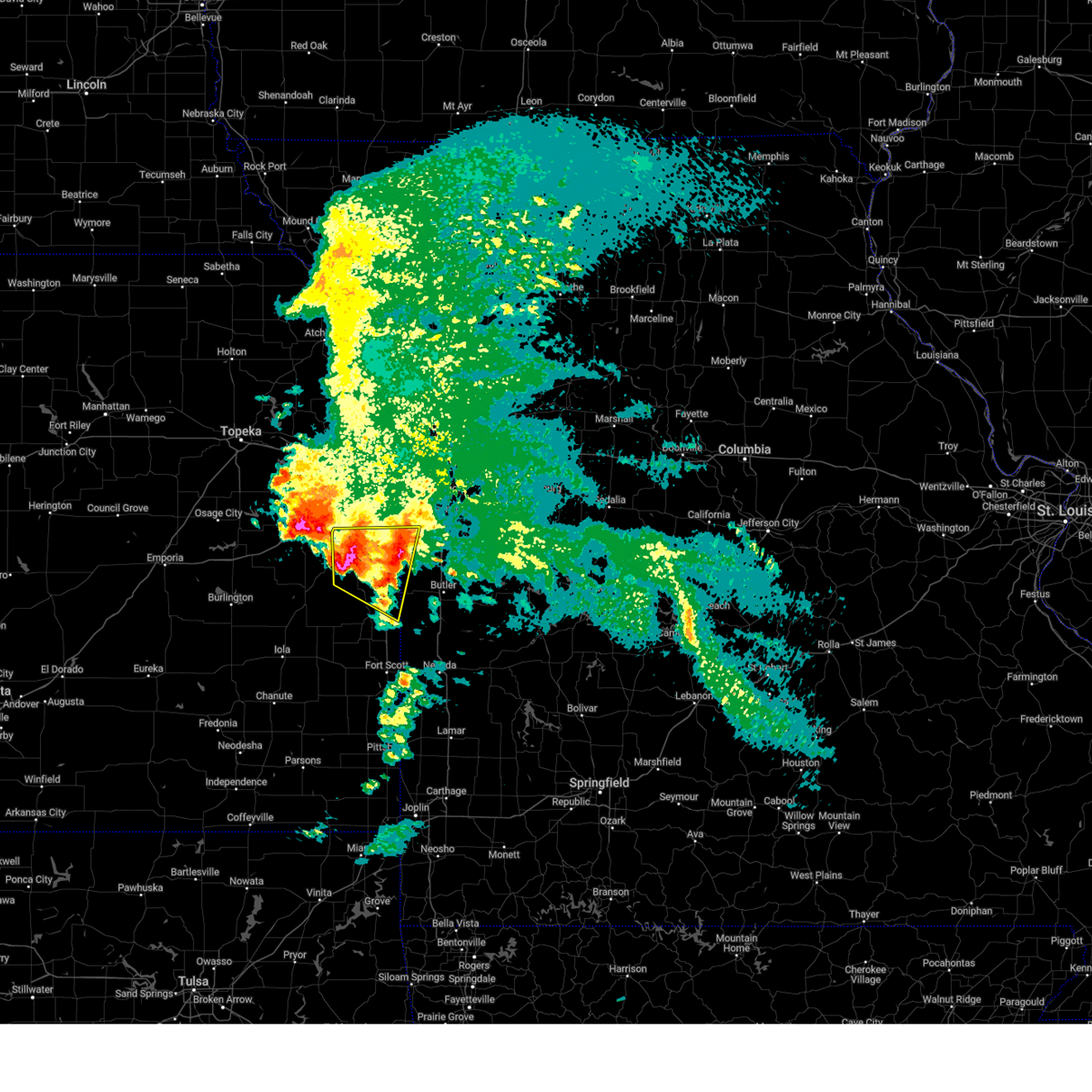
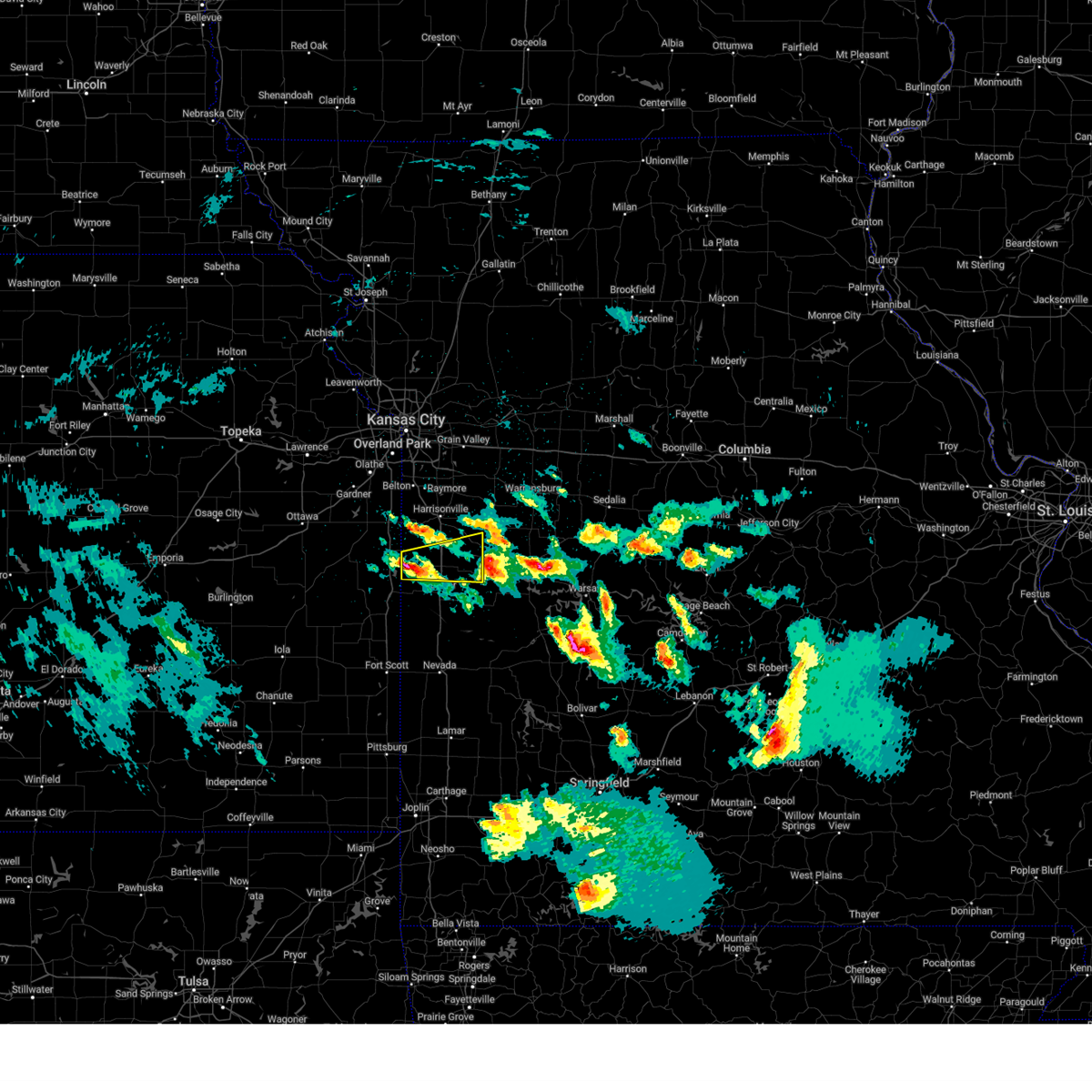
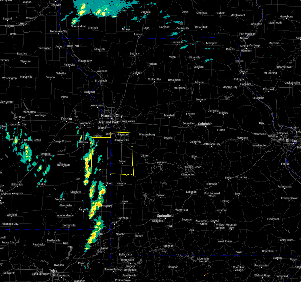
Hail Map for Amsterdam, MO
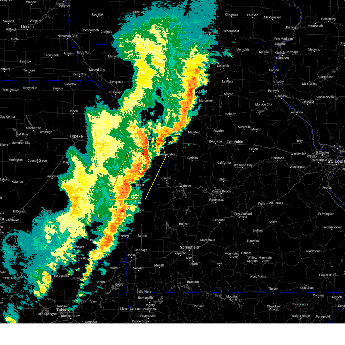
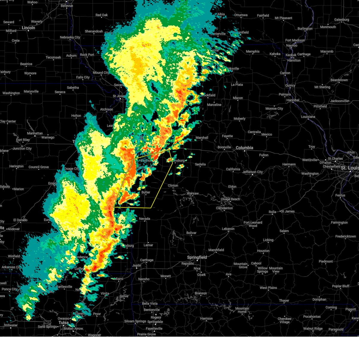
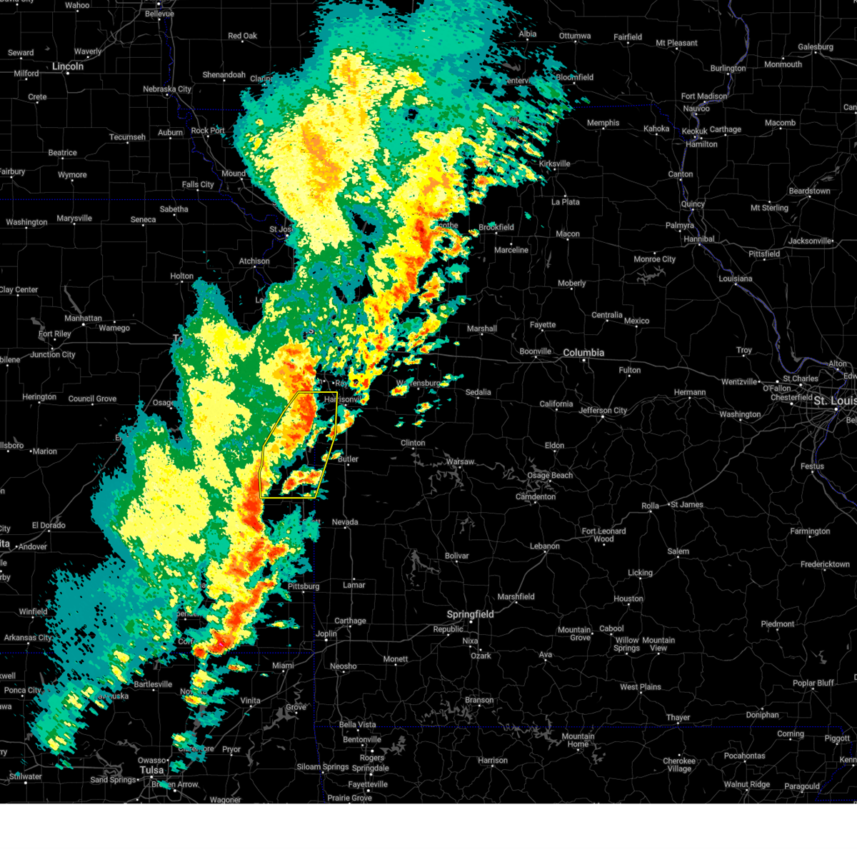
The Amsterdam, MO area has had 1 report of on-the-ground hail by trained spotters, and has been under severe weather warnings 41 times during the past 12 months. Doppler radar has detected hail at or near Amsterdam, MO on 77 occasions, including 8 occasions during the past year.
| Name: | Amsterdam, MO |
| Where Located: | 52.1 miles S of Kansas City, MO |
| Map: | Google Map for Amsterdam, MO |
| Population: | 242 |
| Housing Units: | 106 |
| More Info: | Search Google for Amsterdam, MO |
3
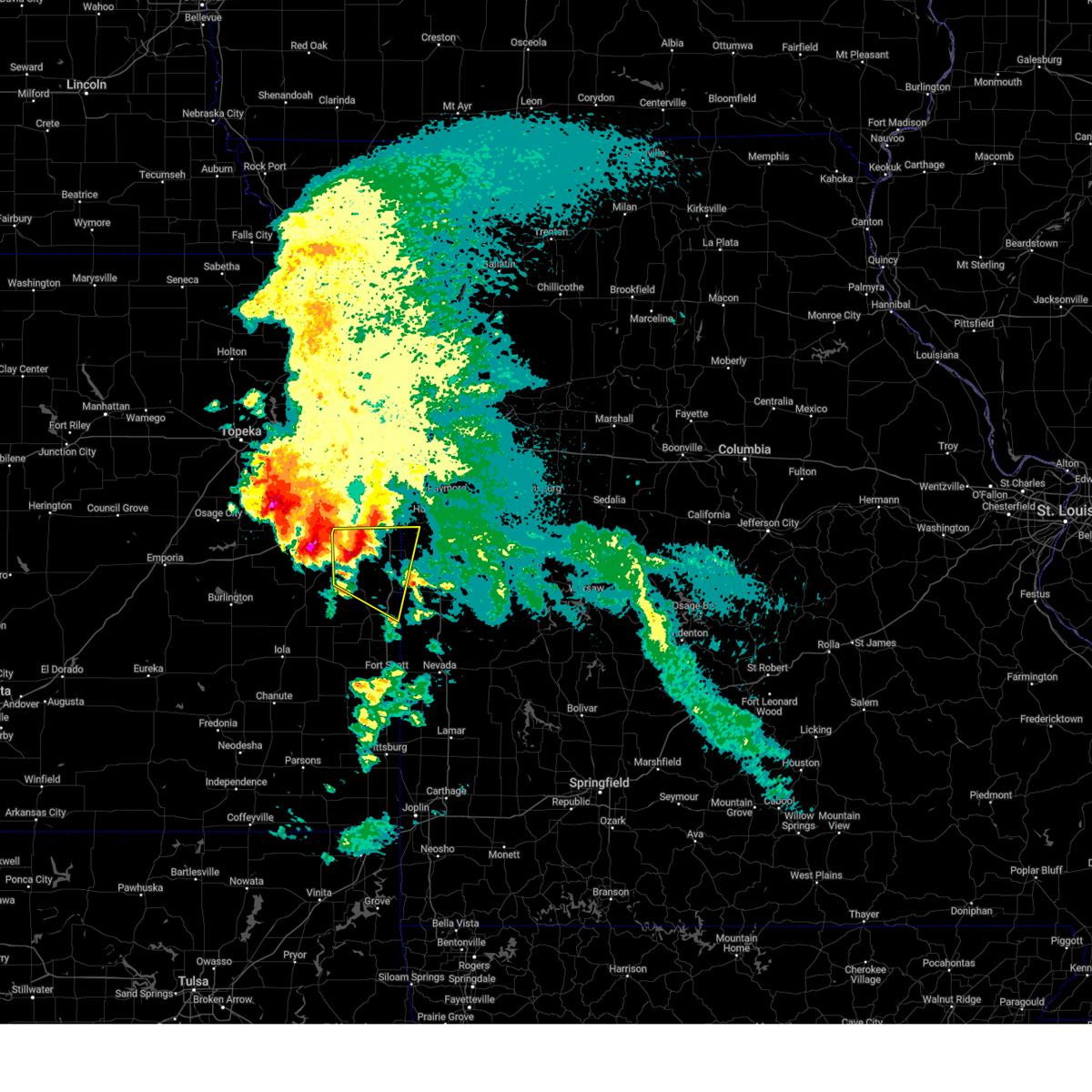
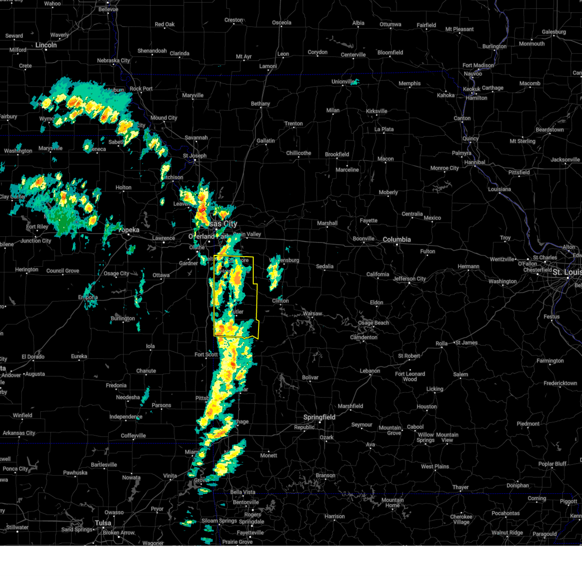
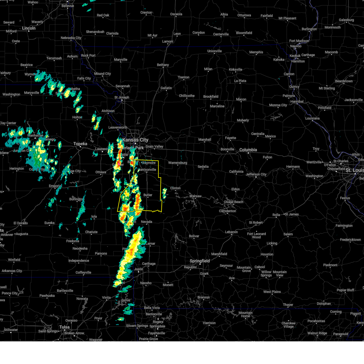
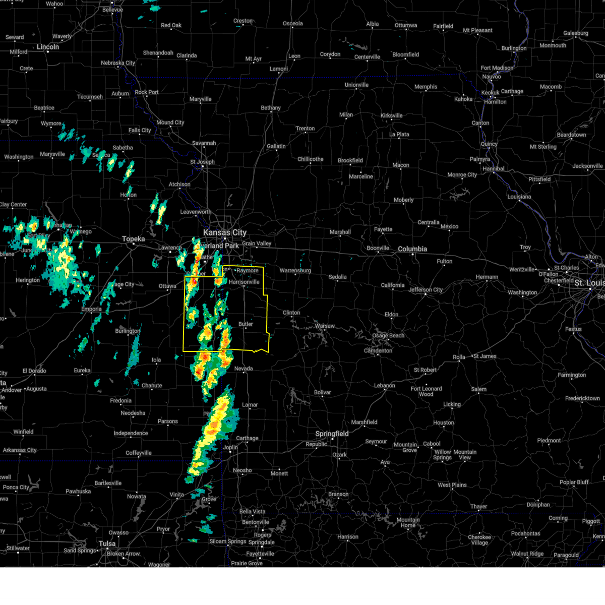
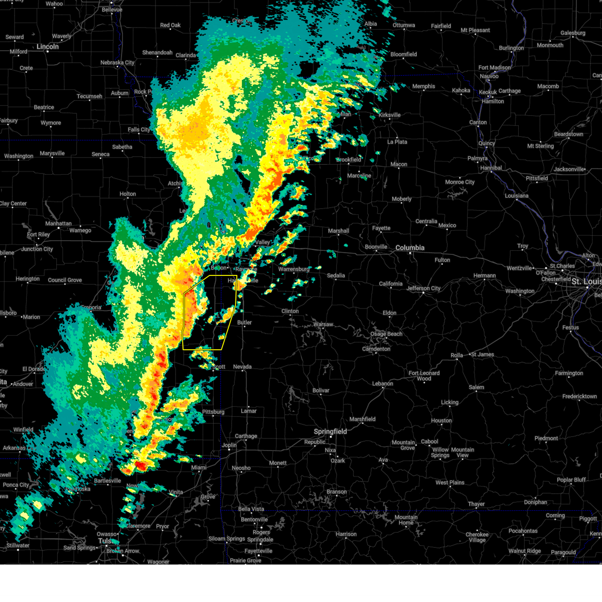
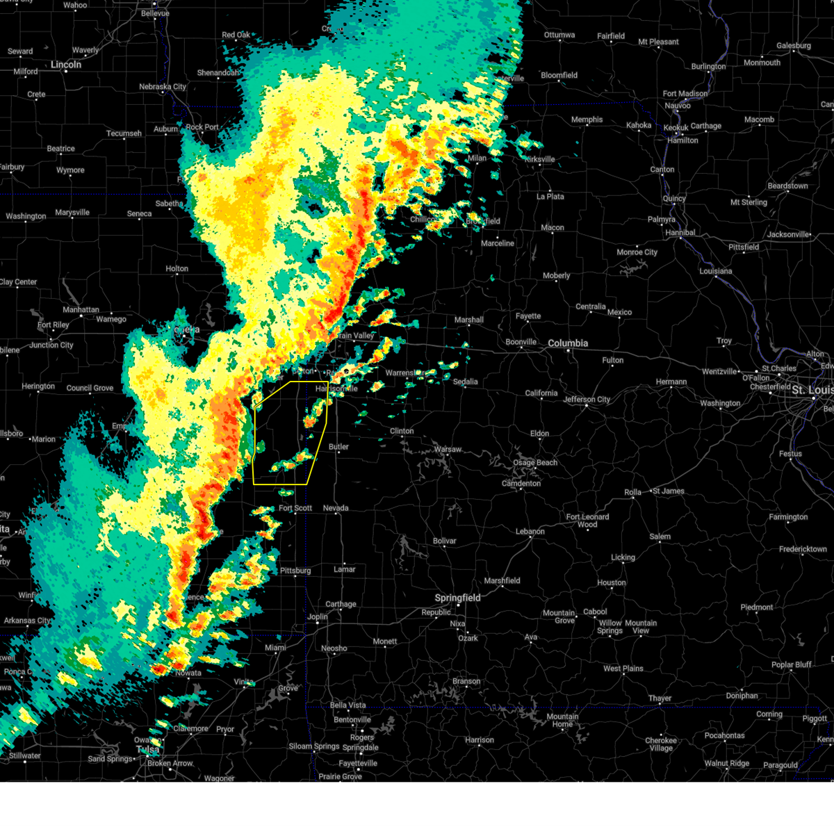
The Top Recent Hail Date for Amsterdam, MO is Monday, April 27, 2026 (5th out of 77)

Hail and Wind Damage Spotted near Amsterdam, MO
| Date / Time | Report Details |
|---|---|
| 6/17/2026 5:23 PM CDT |
 At 522 pm cdt, a severe thunderstorm was located 9 miles west of butler, moving east at 25 mph (radar indicated). Hazards include 60 mph wind gusts and quarter size hail. Hail damage to vehicles is expected. expect wind damage to roofs, siding, and trees. locations impacted include, butler, adrian, amsterdam, and passaic. This includes interstate 49 between mile markers 134 and 141. At 522 pm cdt, a severe thunderstorm was located 9 miles west of butler, moving east at 25 mph (radar indicated). Hazards include 60 mph wind gusts and quarter size hail. Hail damage to vehicles is expected. expect wind damage to roofs, siding, and trees. locations impacted include, butler, adrian, amsterdam, and passaic. This includes interstate 49 between mile markers 134 and 141.
|
| 6/17/2026 5:20 PM CDT |
 At 519 pm cdt, a severe thunderstorm capable of producing a tornado was located 10 miles west of butler, moving east at 35 mph (radar indicated rotation). Hazards include tornado and quarter size hail. Flying debris will be dangerous to those caught without shelter. mobile homes will be damaged or destroyed. damage to roofs, windows, and vehicles will occur. tree damage is likely. locations impacted include, butler, amsterdam, and amoret. This includes interstate 49 between mile markers 126 and 134. At 519 pm cdt, a severe thunderstorm capable of producing a tornado was located 10 miles west of butler, moving east at 35 mph (radar indicated rotation). Hazards include tornado and quarter size hail. Flying debris will be dangerous to those caught without shelter. mobile homes will be damaged or destroyed. damage to roofs, windows, and vehicles will occur. tree damage is likely. locations impacted include, butler, amsterdam, and amoret. This includes interstate 49 between mile markers 126 and 134.
|
| 6/17/2026 5:11 PM CDT |
 Toreax the national weather service in pleasant hill has issued a * tornado warning for, northeastern linn county in east central kansas, southwestern bates county in west central missouri, * until 600 pm cdt. * at 511 pm cdt, a severe thunderstorm capable of producing a tornado was located 7 miles southeast of linn valley, or 7 miles southeast of la cygne, moving southeast at 25 mph (radar indicated rotation). Hazards include tornado and quarter size hail. Flying debris will be dangerous to those caught without shelter. mobile homes will be damaged or destroyed. damage to roofs, windows, and vehicles will occur. Tree damage is likely. Toreax the national weather service in pleasant hill has issued a * tornado warning for, northeastern linn county in east central kansas, southwestern bates county in west central missouri, * until 600 pm cdt. * at 511 pm cdt, a severe thunderstorm capable of producing a tornado was located 7 miles southeast of linn valley, or 7 miles southeast of la cygne, moving southeast at 25 mph (radar indicated rotation). Hazards include tornado and quarter size hail. Flying debris will be dangerous to those caught without shelter. mobile homes will be damaged or destroyed. damage to roofs, windows, and vehicles will occur. Tree damage is likely.
|
| 6/17/2026 5:00 PM CDT |
 Svreax the national weather service in pleasant hill has issued a * severe thunderstorm warning for, southeastern miami county in east central kansas, northeastern linn county in east central kansas, northwestern bates county in west central missouri, * until 545 pm cdt. * at 500 pm cdt, a severe thunderstorm was located over linn valley, or near la cygne, moving east at 25 mph (radar indicated). Hazards include 60 mph wind gusts and quarter size hail. Hail damage to vehicles is expected. Expect wind damage to roofs, siding, and trees. Svreax the national weather service in pleasant hill has issued a * severe thunderstorm warning for, southeastern miami county in east central kansas, northeastern linn county in east central kansas, northwestern bates county in west central missouri, * until 545 pm cdt. * at 500 pm cdt, a severe thunderstorm was located over linn valley, or near la cygne, moving east at 25 mph (radar indicated). Hazards include 60 mph wind gusts and quarter size hail. Hail damage to vehicles is expected. Expect wind damage to roofs, siding, and trees.
|
| 6/13/2026 10:03 PM CDT |
 Svreax the national weather service in pleasant hill has issued a * severe thunderstorm warning for, southern cass county in west central missouri, henry county in west central missouri, bates county in west central missouri, * until 1115 pm cdt. * at 1003 pm cdt, severe thunderstorms were located along a line extending from near chilhowee to near archie to near la cygne to fulton, moving east at 30 mph (radar indicated). Hazards include 60 mph wind gusts and quarter size hail. Hail damage to vehicles is expected. Expect wind damage to roofs, siding, and trees. Svreax the national weather service in pleasant hill has issued a * severe thunderstorm warning for, southern cass county in west central missouri, henry county in west central missouri, bates county in west central missouri, * until 1115 pm cdt. * at 1003 pm cdt, severe thunderstorms were located along a line extending from near chilhowee to near archie to near la cygne to fulton, moving east at 30 mph (radar indicated). Hazards include 60 mph wind gusts and quarter size hail. Hail damage to vehicles is expected. Expect wind damage to roofs, siding, and trees.
|
| 6/9/2026 12:48 AM CDT |
 Svreax the national weather service in pleasant hill has issued a * severe thunderstorm warning for, wyandotte county in northeastern kansas, miami county in east central kansas, northern linn county in east central kansas, southwestern leavenworth county in northeastern kansas, johnson county in east central kansas, cass county in west central missouri, northwestern bates county in west central missouri, jackson county in west central missouri, * until 130 am cdt. * at 1248 am cdt, a severe thunderstorm was located near louisburg, moving east at 60 mph (radar indicated). Hazards include 70 mph wind gusts. Expect considerable tree damage. Damage is likely to mobile homes, roofs, and outbuildings. Svreax the national weather service in pleasant hill has issued a * severe thunderstorm warning for, wyandotte county in northeastern kansas, miami county in east central kansas, northern linn county in east central kansas, southwestern leavenworth county in northeastern kansas, johnson county in east central kansas, cass county in west central missouri, northwestern bates county in west central missouri, jackson county in west central missouri, * until 130 am cdt. * at 1248 am cdt, a severe thunderstorm was located near louisburg, moving east at 60 mph (radar indicated). Hazards include 70 mph wind gusts. Expect considerable tree damage. Damage is likely to mobile homes, roofs, and outbuildings.
|
| 5/19/2026 12:09 AM CDT |
 The storm which prompted the warning has weakened below severe limits, and no longer poses an immediate threat to life or property. therefore, the warning will be allowed to expire. a tornado watch remains in effect until 100 am cdt for east central kansas, and west central missouri. The storm which prompted the warning has weakened below severe limits, and no longer poses an immediate threat to life or property. therefore, the warning will be allowed to expire. a tornado watch remains in effect until 100 am cdt for east central kansas, and west central missouri.
|
| 5/18/2026 11:59 PM CDT |
 At 1159 pm cdt, a severe thunderstorm was located over pleasanton, moving east at 50 mph (radar indicated). Hazards include 60 mph wind gusts. Expect damage to roofs, siding, and trees. Locations impacted include, pleasanton, la cygne, mound city, linn valley, hume, prescott, fontana, amsterdam, amoret, foster, merwin, and worland. At 1159 pm cdt, a severe thunderstorm was located over pleasanton, moving east at 50 mph (radar indicated). Hazards include 60 mph wind gusts. Expect damage to roofs, siding, and trees. Locations impacted include, pleasanton, la cygne, mound city, linn valley, hume, prescott, fontana, amsterdam, amoret, foster, merwin, and worland.
|
| 5/18/2026 11:31 PM CDT |
 Svreax the national weather service in pleasant hill has issued a * severe thunderstorm warning for, southern miami county in east central kansas, linn county in east central kansas, western bates county in west central missouri, * until 1215 am cdt. * at 1131 pm cdt, a severe thunderstorm was located 7 miles north of kincaid, or 9 miles southeast of garnett, moving east at 50 mph (radar indicated). Hazards include 60 mph wind gusts and penny size hail. expect damage to roofs, siding, and trees Svreax the national weather service in pleasant hill has issued a * severe thunderstorm warning for, southern miami county in east central kansas, linn county in east central kansas, western bates county in west central missouri, * until 1215 am cdt. * at 1131 pm cdt, a severe thunderstorm was located 7 miles north of kincaid, or 9 miles southeast of garnett, moving east at 50 mph (radar indicated). Hazards include 60 mph wind gusts and penny size hail. expect damage to roofs, siding, and trees
|
| 5/18/2026 10:39 PM CDT |
 The storm which prompted the warning has weakened below severe limits, and no longer poses an immediate threat to life or property. therefore, the warning will be allowed to expire. however, gusty winds and heavy rain are still possible with this thunderstorm. a tornado watch remains in effect until 100 am cdt for east central kansas, and west central missouri. The storm which prompted the warning has weakened below severe limits, and no longer poses an immediate threat to life or property. therefore, the warning will be allowed to expire. however, gusty winds and heavy rain are still possible with this thunderstorm. a tornado watch remains in effect until 100 am cdt for east central kansas, and west central missouri.
|
| 5/18/2026 10:03 PM CDT |
 Svreax the national weather service in pleasant hill has issued a * severe thunderstorm warning for, southern miami county in east central kansas, northern linn county in east central kansas, southwestern cass county in west central missouri, northwestern bates county in west central missouri, * until 1045 pm cdt. * at 1003 pm cdt, a severe thunderstorm was located near greeley, or 8 miles east of garnett, moving east at 55 mph (radar indicated). Hazards include 60 mph wind gusts. expect damage to roofs, siding, and trees Svreax the national weather service in pleasant hill has issued a * severe thunderstorm warning for, southern miami county in east central kansas, northern linn county in east central kansas, southwestern cass county in west central missouri, northwestern bates county in west central missouri, * until 1045 pm cdt. * at 1003 pm cdt, a severe thunderstorm was located near greeley, or 8 miles east of garnett, moving east at 55 mph (radar indicated). Hazards include 60 mph wind gusts. expect damage to roofs, siding, and trees
|
| 4/27/2026 2:09 PM CDT |
 At 209 pm cdt, a severe thunderstorm was located 7 miles southeast of linn valley, or 7 miles southeast of la cygne, moving east at 40 mph (radar indicated). Hazards include 60 mph wind gusts and half dollar size hail. Hail damage to vehicles is expected. expect wind damage to roofs, siding, and trees. Locations impacted include, drexel, linn valley, amsterdam, amoret, and merwin. At 209 pm cdt, a severe thunderstorm was located 7 miles southeast of linn valley, or 7 miles southeast of la cygne, moving east at 40 mph (radar indicated). Hazards include 60 mph wind gusts and half dollar size hail. Hail damage to vehicles is expected. expect wind damage to roofs, siding, and trees. Locations impacted include, drexel, linn valley, amsterdam, amoret, and merwin.
|
| 4/27/2026 2:07 PM CDT |
 Svreax the national weather service in pleasant hill has issued a * severe thunderstorm warning for, southeastern miami county in east central kansas, northeastern linn county in east central kansas, southeastern cass county in west central missouri, northwestern henry county in west central missouri, northern bates county in west central missouri, southwestern johnson county in west central missouri, * until 245 pm cdt. * at 206 pm cdt, a severe thunderstorm was located 8 miles east of linn valley, or 10 miles east of la cygne, moving northeast at 50 mph (radar indicated). Hazards include 60 mph wind gusts and half dollar size hail. Hail damage to vehicles is expected. Expect wind damage to roofs, siding, and trees. Svreax the national weather service in pleasant hill has issued a * severe thunderstorm warning for, southeastern miami county in east central kansas, northeastern linn county in east central kansas, southeastern cass county in west central missouri, northwestern henry county in west central missouri, northern bates county in west central missouri, southwestern johnson county in west central missouri, * until 245 pm cdt. * at 206 pm cdt, a severe thunderstorm was located 8 miles east of linn valley, or 10 miles east of la cygne, moving northeast at 50 mph (radar indicated). Hazards include 60 mph wind gusts and half dollar size hail. Hail damage to vehicles is expected. Expect wind damage to roofs, siding, and trees.
|
| 4/27/2026 1:58 PM CDT |
 At 158 pm cdt, a severe thunderstorm was located near pleasanton, moving east at 40 mph (radar indicated). Hazards include 60 mph wind gusts and half dollar size hail. Hail damage to vehicles is expected. expect wind damage to roofs, siding, and trees. Locations impacted include, la cygne, drexel, linn valley, amsterdam, amoret, and merwin. At 158 pm cdt, a severe thunderstorm was located near pleasanton, moving east at 40 mph (radar indicated). Hazards include 60 mph wind gusts and half dollar size hail. Hail damage to vehicles is expected. expect wind damage to roofs, siding, and trees. Locations impacted include, la cygne, drexel, linn valley, amsterdam, amoret, and merwin.
|
| 4/27/2026 1:46 PM CDT |
 At 146 pm cdt, a severe thunderstorm was located near mound city, moving east at 40 mph (radar indicated). Hazards include 60 mph wind gusts and half dollar size hail. Hail damage to vehicles is expected. expect wind damage to roofs, siding, and trees. Locations impacted include, pleasanton, la cygne, drexel, linn valley, amsterdam, amoret, merwin, and worland. At 146 pm cdt, a severe thunderstorm was located near mound city, moving east at 40 mph (radar indicated). Hazards include 60 mph wind gusts and half dollar size hail. Hail damage to vehicles is expected. expect wind damage to roofs, siding, and trees. Locations impacted include, pleasanton, la cygne, drexel, linn valley, amsterdam, amoret, merwin, and worland.
|
| 4/27/2026 1:36 PM CDT |
 Svreax the national weather service in pleasant hill has issued a * severe thunderstorm warning for, southeastern miami county in east central kansas, central linn county in east central kansas, northwestern bates county in west central missouri, * until 215 pm cdt. * at 135 pm cdt, a severe thunderstorm was located near blue mound, or 9 miles west of mound city, moving east at 40 mph (radar indicated). Hazards include 60 mph wind gusts and half dollar size hail. Hail damage to vehicles is expected. Expect wind damage to roofs, siding, and trees. Svreax the national weather service in pleasant hill has issued a * severe thunderstorm warning for, southeastern miami county in east central kansas, central linn county in east central kansas, northwestern bates county in west central missouri, * until 215 pm cdt. * at 135 pm cdt, a severe thunderstorm was located near blue mound, or 9 miles west of mound city, moving east at 40 mph (radar indicated). Hazards include 60 mph wind gusts and half dollar size hail. Hail damage to vehicles is expected. Expect wind damage to roofs, siding, and trees.
|
| 4/26/2026 5:31 PM CDT |
 At 530 pm cdt, severe thunderstorms were located along a line extending from near raymore to near harrisonville to near adrian to near hume, moving east at 35 mph (radar indicated). Hazards include 60 mph wind gusts and penny size hail. Expect damage to roofs, siding, and trees. locations impacted include, lee's summit, grandview, belton, raymore, harrisonville, pleasant hill, greenwood, peculiar, butler, holden, adrian, garden city, rich hill, archie, lake winnebago, lone jack, urich, freeman, creighton, and hume. This includes interstate 49 between mile markers 119 and 179. At 530 pm cdt, severe thunderstorms were located along a line extending from near raymore to near harrisonville to near adrian to near hume, moving east at 35 mph (radar indicated). Hazards include 60 mph wind gusts and penny size hail. Expect damage to roofs, siding, and trees. locations impacted include, lee's summit, grandview, belton, raymore, harrisonville, pleasant hill, greenwood, peculiar, butler, holden, adrian, garden city, rich hill, archie, lake winnebago, lone jack, urich, freeman, creighton, and hume. This includes interstate 49 between mile markers 119 and 179.
|
| 4/26/2026 5:24 PM CDT |
 Svreax the national weather service in pleasant hill has issued a * severe thunderstorm warning for, southeastern linn county in east central kansas, cass county in west central missouri, western henry county in west central missouri, bates county in west central missouri, southern jackson county in west central missouri, western johnson county in west central missouri, * until 615 pm cdt. * at 523 pm cdt, severe thunderstorms were located along a line extending from near raymore to harrisonville to near adrian to hume, moving east at 40 mph (radar indicated). Hazards include 60 mph wind gusts and penny size hail. expect damage to roofs, siding, and trees Svreax the national weather service in pleasant hill has issued a * severe thunderstorm warning for, southeastern linn county in east central kansas, cass county in west central missouri, western henry county in west central missouri, bates county in west central missouri, southern jackson county in west central missouri, western johnson county in west central missouri, * until 615 pm cdt. * at 523 pm cdt, severe thunderstorms were located along a line extending from near raymore to harrisonville to near adrian to hume, moving east at 40 mph (radar indicated). Hazards include 60 mph wind gusts and penny size hail. expect damage to roofs, siding, and trees
|
| 4/26/2026 5:13 PM CDT |
 At 513 pm cdt, severe thunderstorms were located along a line extending from drexel to 10 miles west of butler to near hume, moving east at 45 mph (radar indicated). Hazards include 60 mph wind gusts and penny size hail. Expect damage to roofs, siding, and trees. locations impacted include, butler, adrian, rich hill, pleasanton, la cygne, mound city, drexel, linn valley, hume, prescott, amsterdam, amoret, foster, merwin, passaic, worland, and new lancaster. This includes interstate 49 between mile markers 118 and 146. At 513 pm cdt, severe thunderstorms were located along a line extending from drexel to 10 miles west of butler to near hume, moving east at 45 mph (radar indicated). Hazards include 60 mph wind gusts and penny size hail. Expect damage to roofs, siding, and trees. locations impacted include, butler, adrian, rich hill, pleasanton, la cygne, mound city, drexel, linn valley, hume, prescott, amsterdam, amoret, foster, merwin, passaic, worland, and new lancaster. This includes interstate 49 between mile markers 118 and 146.
|
| 4/26/2026 5:03 PM CDT |
 At 502 pm cdt, severe thunderstorms were located along a line extending from 6 miles northeast of fontana to near linn valley to near prescott, moving east at 45 mph (radar indicated). Hazards include 60 mph wind gusts and penny size hail. Expect damage to roofs, siding, and trees. locations impacted include, butler, adrian, rich hill, pleasanton, la cygne, mound city, drexel, linn valley, hume, prescott, fontana, amsterdam, amoret, foster, merwin, passaic, worland, and new lancaster. This includes interstate 49 between mile markers 118 and 146. At 502 pm cdt, severe thunderstorms were located along a line extending from 6 miles northeast of fontana to near linn valley to near prescott, moving east at 45 mph (radar indicated). Hazards include 60 mph wind gusts and penny size hail. Expect damage to roofs, siding, and trees. locations impacted include, butler, adrian, rich hill, pleasanton, la cygne, mound city, drexel, linn valley, hume, prescott, fontana, amsterdam, amoret, foster, merwin, passaic, worland, and new lancaster. This includes interstate 49 between mile markers 118 and 146.
|
| 4/26/2026 4:55 PM CDT |
 Svreax the national weather service in pleasant hill has issued a * severe thunderstorm warning for, southern miami county in east central kansas, linn county in east central kansas, bates county in west central missouri, * until 530 pm cdt. * at 455 pm cdt, severe thunderstorms were located along a line extending from near fontana to near la cygne to near mound city, moving east at 45 mph (radar indicated). Hazards include 60 mph wind gusts and penny size hail. expect damage to roofs, siding, and trees Svreax the national weather service in pleasant hill has issued a * severe thunderstorm warning for, southern miami county in east central kansas, linn county in east central kansas, bates county in west central missouri, * until 530 pm cdt. * at 455 pm cdt, severe thunderstorms were located along a line extending from near fontana to near la cygne to near mound city, moving east at 45 mph (radar indicated). Hazards include 60 mph wind gusts and penny size hail. expect damage to roofs, siding, and trees
|
| 4/23/2026 10:23 PM CDT |
 the severe thunderstorm warning has been cancelled and is no longer in effect the severe thunderstorm warning has been cancelled and is no longer in effect
|
| 4/23/2026 10:23 PM CDT |
 At 1022 pm cdt, severe thunderstorms were located along a line extending from greenwood to 6 miles east of drexel to near mound city, moving east at 35 mph (radar indicated). Hazards include 60 mph wind gusts and nickel size hail. Expect damage to roofs, siding, and trees. locations impacted include, lee's summit, grandview, belton, raymore, harrisonville, pleasant hill, greenwood, peculiar, adrian, pleasanton, la cygne, mound city, archie, lake winnebago, lone jack, drexel, linn valley, cleveland, freeman, and east lynne. This includes interstate 49 between mile markers 143 and 179. At 1022 pm cdt, severe thunderstorms were located along a line extending from greenwood to 6 miles east of drexel to near mound city, moving east at 35 mph (radar indicated). Hazards include 60 mph wind gusts and nickel size hail. Expect damage to roofs, siding, and trees. locations impacted include, lee's summit, grandview, belton, raymore, harrisonville, pleasant hill, greenwood, peculiar, adrian, pleasanton, la cygne, mound city, archie, lake winnebago, lone jack, drexel, linn valley, cleveland, freeman, and east lynne. This includes interstate 49 between mile markers 143 and 179.
|
| 4/23/2026 10:01 PM CDT |
 Svreax the national weather service in pleasant hill has issued a * severe thunderstorm warning for, eastern miami county in east central kansas, linn county in east central kansas, southeastern johnson county in east central kansas, cass county in west central missouri, northwestern bates county in west central missouri, southern jackson county in west central missouri, * until 1045 pm cdt. * at 1001 pm cdt, severe thunderstorms were located along a line extending from near belton to 6 miles west of drexel to 7 miles north of blue mound, moving east at 40 mph (radar indicated). Hazards include 60 mph wind gusts and nickel size hail. expect damage to roofs, siding, and trees Svreax the national weather service in pleasant hill has issued a * severe thunderstorm warning for, eastern miami county in east central kansas, linn county in east central kansas, southeastern johnson county in east central kansas, cass county in west central missouri, northwestern bates county in west central missouri, southern jackson county in west central missouri, * until 1045 pm cdt. * at 1001 pm cdt, severe thunderstorms were located along a line extending from near belton to 6 miles west of drexel to 7 miles north of blue mound, moving east at 40 mph (radar indicated). Hazards include 60 mph wind gusts and nickel size hail. expect damage to roofs, siding, and trees
|
| 4/17/2026 6:16 PM CDT |
 At 615 pm cdt, severe thunderstorms were located along a line extending from drexel to near prescott, moving northeast at 65 mph (public. there are multiple reports of wires down and power outages in linn and southern miami counties). Hazards include 60 mph wind gusts and penny size hail. Expect damage to roofs, siding, and trees. Locations impacted include, pleasanton, la cygne, mound city, drexel, linn valley, hume, blue mound, prescott, amsterdam, amoret, foster, merwin, worland, and new lancaster. At 615 pm cdt, severe thunderstorms were located along a line extending from drexel to near prescott, moving northeast at 65 mph (public. there are multiple reports of wires down and power outages in linn and southern miami counties). Hazards include 60 mph wind gusts and penny size hail. Expect damage to roofs, siding, and trees. Locations impacted include, pleasanton, la cygne, mound city, drexel, linn valley, hume, blue mound, prescott, amsterdam, amoret, foster, merwin, worland, and new lancaster.
|
| 4/17/2026 6:15 PM CDT | Downed wires near 11001 road. time estimated from rada in bates county MO, 3.1 miles WSW of Amsterdam, MO |
| 4/17/2026 6:02 PM CDT |
 At 602 pm cdt, severe thunderstorms were located along a line extending from near fontana to near blue mound, moving northeast at 60 mph (radar indicated). Hazards include 60 mph wind gusts and penny size hail. Expect damage to roofs, siding, and trees. Locations impacted include, osawatomie, pleasanton, la cygne, mound city, drexel, linn valley, hume, parker, blue mound, prescott, fontana, amsterdam, amoret, foster, merwin, worland, new lancaster, and beagle. At 602 pm cdt, severe thunderstorms were located along a line extending from near fontana to near blue mound, moving northeast at 60 mph (radar indicated). Hazards include 60 mph wind gusts and penny size hail. Expect damage to roofs, siding, and trees. Locations impacted include, osawatomie, pleasanton, la cygne, mound city, drexel, linn valley, hume, parker, blue mound, prescott, fontana, amsterdam, amoret, foster, merwin, worland, new lancaster, and beagle.
|
| 4/17/2026 5:46 PM CDT |
 Svreax the national weather service in pleasant hill has issued a * severe thunderstorm warning for, southern miami county in east central kansas, linn county in east central kansas, southwestern cass county in west central missouri, western bates county in west central missouri, * until 630 pm cdt. * at 546 pm cdt, severe thunderstorms were located along a line extending from greeley to near la harpe, moving east at 65 mph (radar indicated). Hazards include 60 mph wind gusts and penny size hail. expect damage to roofs, siding, and trees Svreax the national weather service in pleasant hill has issued a * severe thunderstorm warning for, southern miami county in east central kansas, linn county in east central kansas, southwestern cass county in west central missouri, western bates county in west central missouri, * until 630 pm cdt. * at 546 pm cdt, severe thunderstorms were located along a line extending from greeley to near la harpe, moving east at 65 mph (radar indicated). Hazards include 60 mph wind gusts and penny size hail. expect damage to roofs, siding, and trees
|
| 4/17/2026 5:02 PM CDT |
 Svreax the national weather service in pleasant hill has issued a * severe thunderstorm warning for, cass county in west central missouri, northern bates county in west central missouri, southern jackson county in west central missouri, * until 600 pm cdt. * at 502 pm cdt, severe thunderstorms were located along a line extending from near lenexa to near lane, moving east at 40 mph. these are destructive storms for cass and southern jackson counties (automated weather station). Hazards include 80 mph wind gusts and nickel size hail. Flying debris will be dangerous to those caught without shelter. mobile homes will be heavily damaged. expect considerable damage to roofs, windows, and vehicles. Extensive tree damage and power outages are likely. Svreax the national weather service in pleasant hill has issued a * severe thunderstorm warning for, cass county in west central missouri, northern bates county in west central missouri, southern jackson county in west central missouri, * until 600 pm cdt. * at 502 pm cdt, severe thunderstorms were located along a line extending from near lenexa to near lane, moving east at 40 mph. these are destructive storms for cass and southern jackson counties (automated weather station). Hazards include 80 mph wind gusts and nickel size hail. Flying debris will be dangerous to those caught without shelter. mobile homes will be heavily damaged. expect considerable damage to roofs, windows, and vehicles. Extensive tree damage and power outages are likely.
|
| 4/15/2026 4:24 PM CDT |
 At 424 pm cdt, a severe thunderstorm was located 8 miles west of adrian, moving northeast at 65 mph (radar indicated). Hazards include 60 mph wind gusts and penny size hail. Expect damage to roofs, siding, and trees. locations impacted include, harrisonville, peculiar, butler, adrian, garden city, archie, drexel, cleveland, freeman, creighton, east lynne, lake annette, amsterdam, amoret, west line, merwin, and passaic. This includes interstate 49 between mile markers 134 and 165. At 424 pm cdt, a severe thunderstorm was located 8 miles west of adrian, moving northeast at 65 mph (radar indicated). Hazards include 60 mph wind gusts and penny size hail. Expect damage to roofs, siding, and trees. locations impacted include, harrisonville, peculiar, butler, adrian, garden city, archie, drexel, cleveland, freeman, creighton, east lynne, lake annette, amsterdam, amoret, west line, merwin, and passaic. This includes interstate 49 between mile markers 134 and 165.
|
| 4/15/2026 4:13 PM CDT |
 Svreax the national weather service in pleasant hill has issued a * severe thunderstorm warning for, southeastern miami county in east central kansas, northeastern linn county in east central kansas, cass county in west central missouri, northern bates county in west central missouri, * until 500 pm cdt. * at 412 pm cdt, a severe thunderstorm was located near pleasanton, moving northeast at 55 mph (radar indicated). Hazards include 60 mph wind gusts and quarter size hail. Hail damage to vehicles is expected. Expect wind damage to roofs, siding, and trees. Svreax the national weather service in pleasant hill has issued a * severe thunderstorm warning for, southeastern miami county in east central kansas, northeastern linn county in east central kansas, cass county in west central missouri, northern bates county in west central missouri, * until 500 pm cdt. * at 412 pm cdt, a severe thunderstorm was located near pleasanton, moving northeast at 55 mph (radar indicated). Hazards include 60 mph wind gusts and quarter size hail. Hail damage to vehicles is expected. Expect wind damage to roofs, siding, and trees.
|
| 4/13/2026 8:35 PM CDT |
 Toreax the national weather service in pleasant hill has issued a * tornado warning for, east central linn county in east central kansas, western bates county in west central missouri, * until 900 pm cdt. * at 835 pm cdt, a confirmed tornado was located near pleasanton, moving northeast at 40 mph (weather spotters confirmed tornado). Hazards include damaging tornado. Flying debris will be dangerous to those caught without shelter. mobile homes will be damaged or destroyed. damage to roofs, windows, and vehicles will occur. Tree damage is likely. Toreax the national weather service in pleasant hill has issued a * tornado warning for, east central linn county in east central kansas, western bates county in west central missouri, * until 900 pm cdt. * at 835 pm cdt, a confirmed tornado was located near pleasanton, moving northeast at 40 mph (weather spotters confirmed tornado). Hazards include damaging tornado. Flying debris will be dangerous to those caught without shelter. mobile homes will be damaged or destroyed. damage to roofs, windows, and vehicles will occur. Tree damage is likely.
|
| 3/10/2026 11:16 PM CDT |
 the severe thunderstorm warning has been cancelled and is no longer in effect the severe thunderstorm warning has been cancelled and is no longer in effect
|
| 3/10/2026 11:08 PM CDT |
 At 1107 pm cdt, severe thunderstorms were located along a line extending from louisburg to linn valley to near mound city, moving east at 55 mph (radar indicated). Hazards include 60 mph wind gusts. Expect damage to roofs, siding, and trees. locations impacted include, harrisonville, paola, osawatomie, louisburg, butler, adrian, rich hill, pleasanton, la cygne, mound city, archie, drexel, linn valley, freeman, hume, parker, blue mound, prescott, fontana, and lake annette. This includes interstate 49 between mile markers 118 and 164. At 1107 pm cdt, severe thunderstorms were located along a line extending from louisburg to linn valley to near mound city, moving east at 55 mph (radar indicated). Hazards include 60 mph wind gusts. Expect damage to roofs, siding, and trees. locations impacted include, harrisonville, paola, osawatomie, louisburg, butler, adrian, rich hill, pleasanton, la cygne, mound city, archie, drexel, linn valley, freeman, hume, parker, blue mound, prescott, fontana, and lake annette. This includes interstate 49 between mile markers 118 and 164.
|
| 3/10/2026 11:02 PM CDT |
 At 1101 pm cdt, severe thunderstorms were located along a line extending from near louisburg to near la cygne to near mound city, moving east at 60 mph (radar indicated). Hazards include 60 mph wind gusts. Expect damage to roofs, siding, and trees. locations impacted include, harrisonville, paola, osawatomie, louisburg, butler, adrian, rich hill, pleasanton, la cygne, mound city, archie, drexel, linn valley, freeman, hume, parker, blue mound, prescott, fontana, and lake annette. This includes interstate 49 between mile markers 118 and 164. At 1101 pm cdt, severe thunderstorms were located along a line extending from near louisburg to near la cygne to near mound city, moving east at 60 mph (radar indicated). Hazards include 60 mph wind gusts. Expect damage to roofs, siding, and trees. locations impacted include, harrisonville, paola, osawatomie, louisburg, butler, adrian, rich hill, pleasanton, la cygne, mound city, archie, drexel, linn valley, freeman, hume, parker, blue mound, prescott, fontana, and lake annette. This includes interstate 49 between mile markers 118 and 164.
|
| 3/10/2026 10:48 PM CDT |
 Svreax the national weather service in pleasant hill has issued a * severe thunderstorm warning for, miami county in east central kansas, linn county in east central kansas, southwestern cass county in west central missouri, western bates county in west central missouri, * until 1130 pm cdt. * at 1047 pm cdt, severe thunderstorms were located along a line extending from near rantoul to near greeley to near kincaid, moving east at 50 mph (radar indicated). Hazards include 60 mph wind gusts and penny size hail. expect damage to roofs, siding, and trees Svreax the national weather service in pleasant hill has issued a * severe thunderstorm warning for, miami county in east central kansas, linn county in east central kansas, southwestern cass county in west central missouri, western bates county in west central missouri, * until 1130 pm cdt. * at 1047 pm cdt, severe thunderstorms were located along a line extending from near rantoul to near greeley to near kincaid, moving east at 50 mph (radar indicated). Hazards include 60 mph wind gusts and penny size hail. expect damage to roofs, siding, and trees
|
| 3/6/2026 7:26 PM CST |
 At 725 pm cst, a severe thunderstorm was located over prescott, or 8 miles south of pleasanton, moving northeast at 50 mph (radar indicated). Hazards include 60 mph wind gusts and quarter size hail. Hail damage to vehicles is expected. expect wind damage to roofs, siding, and trees. locations impacted include, butler, pleasanton, hume, prescott, amsterdam, amoret, foster, merwin, passaic, and worland. This includes interstate 49 between mile markers 128 and 140. At 725 pm cst, a severe thunderstorm was located over prescott, or 8 miles south of pleasanton, moving northeast at 50 mph (radar indicated). Hazards include 60 mph wind gusts and quarter size hail. Hail damage to vehicles is expected. expect wind damage to roofs, siding, and trees. locations impacted include, butler, pleasanton, hume, prescott, amsterdam, amoret, foster, merwin, passaic, and worland. This includes interstate 49 between mile markers 128 and 140.
|
| 3/6/2026 7:09 PM CST |
 Svreax the national weather service in pleasant hill has issued a * severe thunderstorm warning for, southeastern linn county in east central kansas, western bates county in west central missouri, * until 745 pm cst. * at 709 pm cst, a severe thunderstorm was located over prescott, or near pleasanton, moving northeast at 55 mph (radar indicated). Hazards include 60 mph wind gusts and quarter size hail. Hail damage to vehicles is expected. Expect wind damage to roofs, siding, and trees. Svreax the national weather service in pleasant hill has issued a * severe thunderstorm warning for, southeastern linn county in east central kansas, western bates county in west central missouri, * until 745 pm cst. * at 709 pm cst, a severe thunderstorm was located over prescott, or near pleasanton, moving northeast at 55 mph (radar indicated). Hazards include 60 mph wind gusts and quarter size hail. Hail damage to vehicles is expected. Expect wind damage to roofs, siding, and trees.
|
| 9/18/2025 3:33 PM CDT | At 333 pm cdt, severe thunderstorms were located along a line extending from 7 miles northeast of fontana to near drexel to 9 miles west of butler, moving northeast at 30 mph (radar indicated). Hazards include 60 mph wind gusts and nickel size hail. Expect damage to roofs, siding, and trees. locations impacted include, louisburg, adrian, archie, drexel, linn valley, cleveland, freeman, lake annette, amsterdam, west line, merwin, passaic, and new lancaster. This includes interstate 49 between mile markers 137 and 154. |
| 9/18/2025 3:20 PM CDT | Svreax the national weather service in pleasant hill has issued a * severe thunderstorm warning for, southeastern miami county in east central kansas, northeastern linn county in east central kansas, southwestern cass county in west central missouri, northwestern bates county in west central missouri, * until 400 pm cdt. * at 320 pm cdt, severe thunderstorms were located along a line extending from near fontana to near linn valley to 6 miles north of hume, moving northeast at 30 mph (radar indicated). Hazards include 60 mph wind gusts and nickel size hail. expect damage to roofs, siding, and trees |
| 7/11/2025 8:31 PM CDT |
 At 830 pm cdt, severe thunderstorms were located along a line extending from near east lynne to mound city, moving east at 25 mph (radar indicated). Hazards include 60 mph wind gusts and quarter size hail. Hail damage to vehicles is expected. expect wind damage to roofs, siding, and trees. locations impacted include, harrisonville, holden, adrian, garden city, pleasanton, la cygne, mound city, archie, drexel, linn valley, freeman, east lynne, blue mound, prescott, amsterdam, amoret, gunn city, merwin, worland, and la tour. This includes interstate 49 between mile markers 140 and 164. At 830 pm cdt, severe thunderstorms were located along a line extending from near east lynne to mound city, moving east at 25 mph (radar indicated). Hazards include 60 mph wind gusts and quarter size hail. Hail damage to vehicles is expected. expect wind damage to roofs, siding, and trees. locations impacted include, harrisonville, holden, adrian, garden city, pleasanton, la cygne, mound city, archie, drexel, linn valley, freeman, east lynne, blue mound, prescott, amsterdam, amoret, gunn city, merwin, worland, and la tour. This includes interstate 49 between mile markers 140 and 164.
|
| 7/11/2025 7:59 PM CDT |
 Svreax the national weather service in pleasant hill has issued a * severe thunderstorm warning for, southeastern miami county in east central kansas, linn county in east central kansas, cass county in west central missouri, northwestern bates county in west central missouri, west central johnson county in west central missouri, * until 845 pm cdt. * at 759 pm cdt, severe thunderstorms were located along a line extending from near harrisonville to 8 miles north of blue mound, moving east at 25 mph (radar indicated). Hazards include 60 mph wind gusts and quarter size hail. Hail damage to vehicles is expected. Expect wind damage to roofs, siding, and trees. Svreax the national weather service in pleasant hill has issued a * severe thunderstorm warning for, southeastern miami county in east central kansas, linn county in east central kansas, cass county in west central missouri, northwestern bates county in west central missouri, west central johnson county in west central missouri, * until 845 pm cdt. * at 759 pm cdt, severe thunderstorms were located along a line extending from near harrisonville to 8 miles north of blue mound, moving east at 25 mph (radar indicated). Hazards include 60 mph wind gusts and quarter size hail. Hail damage to vehicles is expected. Expect wind damage to roofs, siding, and trees.
|
| 6/29/2025 1:40 PM CDT |
 At 140 pm cdt, severe thunderstorms were located along a line extending from archie to butler to 9 miles north of hume, moving southeast at 30 mph (radar indicated). Hazards include 60 mph wind gusts. Expect damage to roofs, siding, and trees. locations impacted include, butler, adrian, rich hill, archie, amoret, foster, and passaic. This includes interstate 49 between mile markers 118 and 152. At 140 pm cdt, severe thunderstorms were located along a line extending from archie to butler to 9 miles north of hume, moving southeast at 30 mph (radar indicated). Hazards include 60 mph wind gusts. Expect damage to roofs, siding, and trees. locations impacted include, butler, adrian, rich hill, archie, amoret, foster, and passaic. This includes interstate 49 between mile markers 118 and 152.
|
| 6/29/2025 1:40 PM CDT |
 the severe thunderstorm warning has been cancelled and is no longer in effect the severe thunderstorm warning has been cancelled and is no longer in effect
|
| 6/29/2025 1:22 PM CDT |
 Svreax the national weather service in pleasant hill has issued a * severe thunderstorm warning for, southeastern miami county in east central kansas, northeastern linn county in east central kansas, southwestern cass county in west central missouri, bates county in west central missouri, * until 200 pm cdt. * at 121 pm cdt, severe thunderstorms were located along a line extending from near freeman to 6 miles west of adrian to 7 miles southeast of linn valley, moving southeast at 30 mph (radar indicated). Hazards include 60 mph wind gusts. expect damage to roofs, siding, and trees Svreax the national weather service in pleasant hill has issued a * severe thunderstorm warning for, southeastern miami county in east central kansas, northeastern linn county in east central kansas, southwestern cass county in west central missouri, bates county in west central missouri, * until 200 pm cdt. * at 121 pm cdt, severe thunderstorms were located along a line extending from near freeman to 6 miles west of adrian to 7 miles southeast of linn valley, moving southeast at 30 mph (radar indicated). Hazards include 60 mph wind gusts. expect damage to roofs, siding, and trees
|
| 5/19/2025 4:13 PM CDT |
 The storms which prompted the warning have weakened below severe limits, and no longer pose an immediate threat to life or property. therefore, the warning will be allowed to expire. however, gusty winds and heavy rain are still possible with these thunderstorms. a tornado watch remains in effect until 900 pm cdt for northeastern and east central kansas, and west central missouri. The storms which prompted the warning have weakened below severe limits, and no longer pose an immediate threat to life or property. therefore, the warning will be allowed to expire. however, gusty winds and heavy rain are still possible with these thunderstorms. a tornado watch remains in effect until 900 pm cdt for northeastern and east central kansas, and west central missouri.
|
| 5/19/2025 3:52 PM CDT |
 At 352 pm cdt, severe thunderstorms were located along a line extending from near bonner springs to near olathe to near linn valley to near hume, moving northeast at 55 mph (radar indicated). Hazards include 60 mph wind gusts and quarter size hail. Hail damage to vehicles is expected. expect wind damage to roofs, siding, and trees. locations impacted include, overland park, olathe, shawnee, lenexa, leavenworth, leawood, gardner, lansing, bonner springs, de soto, paola, spring hill, basehor, osawatomie, edwardsville, louisburg, butler, edgerton, rich hill, and pleasanton. this includes the following highways, interstate 70 in kansas between mile markers 410 and 413. interstate 35 in kansas between mile markers 200 and 226. interstate 435 between mile markers 0 and 16, and between mile markers 79 and 83. kansas turnpike between mile markers 216 and 226. Interstate 49 between mile markers 119 and 134. At 352 pm cdt, severe thunderstorms were located along a line extending from near bonner springs to near olathe to near linn valley to near hume, moving northeast at 55 mph (radar indicated). Hazards include 60 mph wind gusts and quarter size hail. Hail damage to vehicles is expected. expect wind damage to roofs, siding, and trees. locations impacted include, overland park, olathe, shawnee, lenexa, leavenworth, leawood, gardner, lansing, bonner springs, de soto, paola, spring hill, basehor, osawatomie, edwardsville, louisburg, butler, edgerton, rich hill, and pleasanton. this includes the following highways, interstate 70 in kansas between mile markers 410 and 413. interstate 35 in kansas between mile markers 200 and 226. interstate 435 between mile markers 0 and 16, and between mile markers 79 and 83. kansas turnpike between mile markers 216 and 226. Interstate 49 between mile markers 119 and 134.
|
| 5/19/2025 3:34 PM CDT |
 At 334 pm cdt, severe thunderstorms were located along a line extending from near edgerton to near osawatomie to near prescott to near fort scott, moving northeast at 60 mph (radar indicated). Hazards include ping pong ball size hail and 60 mph wind gusts. People and animals outdoors will be injured. expect hail damage to roofs, siding, windows, and vehicles. expect wind damage to roofs, siding, and trees. locations impacted include, overland park, olathe, shawnee, lenexa, leavenworth, leawood, gardner, lansing, bonner springs, de soto, paola, spring hill, basehor, osawatomie, edwardsville, louisburg, butler, edgerton, rich hill, and pleasanton. this includes the following highways, interstate 70 in kansas between mile markers 410 and 413. interstate 35 in kansas between mile markers 200 and 226. interstate 435 between mile markers 0 and 16, and between mile markers 79 and 83. kansas turnpike between mile markers 216 and 226. Interstate 49 between mile markers 119 and 134. At 334 pm cdt, severe thunderstorms were located along a line extending from near edgerton to near osawatomie to near prescott to near fort scott, moving northeast at 60 mph (radar indicated). Hazards include ping pong ball size hail and 60 mph wind gusts. People and animals outdoors will be injured. expect hail damage to roofs, siding, windows, and vehicles. expect wind damage to roofs, siding, and trees. locations impacted include, overland park, olathe, shawnee, lenexa, leavenworth, leawood, gardner, lansing, bonner springs, de soto, paola, spring hill, basehor, osawatomie, edwardsville, louisburg, butler, edgerton, rich hill, and pleasanton. this includes the following highways, interstate 70 in kansas between mile markers 410 and 413. interstate 35 in kansas between mile markers 200 and 226. interstate 435 between mile markers 0 and 16, and between mile markers 79 and 83. kansas turnpike between mile markers 216 and 226. Interstate 49 between mile markers 119 and 134.
|
| 5/19/2025 3:21 PM CDT |
 Svreax the national weather service in pleasant hill has issued a * severe thunderstorm warning for, western wyandotte county in northeastern kansas, miami county in east central kansas, linn county in east central kansas, southeastern leavenworth county in northeastern kansas, johnson county in east central kansas, western cass county in west central missouri, western bates county in west central missouri, * until 415 pm cdt. * at 321 pm cdt, severe thunderstorms were located along a line extending from near ottawa to greeley to 6 miles north of redfield to 7 miles east of hepler, moving northeast at 55 mph (radar indicated). Hazards include ping pong ball size hail and 60 mph wind gusts. People and animals outdoors will be injured. expect hail damage to roofs, siding, windows, and vehicles. Expect wind damage to roofs, siding, and trees. Svreax the national weather service in pleasant hill has issued a * severe thunderstorm warning for, western wyandotte county in northeastern kansas, miami county in east central kansas, linn county in east central kansas, southeastern leavenworth county in northeastern kansas, johnson county in east central kansas, western cass county in west central missouri, western bates county in west central missouri, * until 415 pm cdt. * at 321 pm cdt, severe thunderstorms were located along a line extending from near ottawa to greeley to 6 miles north of redfield to 7 miles east of hepler, moving northeast at 55 mph (radar indicated). Hazards include ping pong ball size hail and 60 mph wind gusts. People and animals outdoors will be injured. expect hail damage to roofs, siding, windows, and vehicles. Expect wind damage to roofs, siding, and trees.
|
| 4/17/2025 6:48 AM CDT |
 At 647 am cdt, a severe thunderstorm was located 10 miles southeast of linn valley, or 11 miles west of butler, moving east at 40 mph (law enforcement reported quarter size hail near linn valley around 635am). Hazards include 60 mph wind gusts and quarter size hail. Hail damage to vehicles is expected. expect wind damage to roofs, siding, and trees. Locations impacted include, amoret, worland, adrian, rich hill, merwin, passaic, montrose, rockville, ballard, foster, amsterdam, butler, la due, linn valley, and pleasanton. At 647 am cdt, a severe thunderstorm was located 10 miles southeast of linn valley, or 11 miles west of butler, moving east at 40 mph (law enforcement reported quarter size hail near linn valley around 635am). Hazards include 60 mph wind gusts and quarter size hail. Hail damage to vehicles is expected. expect wind damage to roofs, siding, and trees. Locations impacted include, amoret, worland, adrian, rich hill, merwin, passaic, montrose, rockville, ballard, foster, amsterdam, butler, la due, linn valley, and pleasanton.
|
| 4/17/2025 6:37 AM CDT |
 At 636 am cdt, a severe thunderstorm was located near schell city, or 13 miles east of rich hill, moving southeast at 55 mph (public. the trailing storm to the northwest produced half- dollar size hail in fontana around 625am). Hazards include 60 mph wind gusts and half dollar size hail. Hail damage to vehicles is expected. expect wind damage to roofs, siding, and trees. Locations impacted include, amoret, la cygne, worland, adrian, rich hill, merwin, passaic, montrose, rockville, ballard, foster, amsterdam, linn valley, butler, la due, and pleasanton. At 636 am cdt, a severe thunderstorm was located near schell city, or 13 miles east of rich hill, moving southeast at 55 mph (public. the trailing storm to the northwest produced half- dollar size hail in fontana around 625am). Hazards include 60 mph wind gusts and half dollar size hail. Hail damage to vehicles is expected. expect wind damage to roofs, siding, and trees. Locations impacted include, amoret, la cygne, worland, adrian, rich hill, merwin, passaic, montrose, rockville, ballard, foster, amsterdam, linn valley, butler, la due, and pleasanton.
|
| 4/17/2025 6:34 AM CDT |
 the severe thunderstorm warning has been cancelled and is no longer in effect the severe thunderstorm warning has been cancelled and is no longer in effect
|
| 4/17/2025 6:34 AM CDT |
 At 634 am cdt, a severe thunderstorm was located over linn valley, or near la cygne, moving southeast at 45 mph (public). Hazards include 60 mph wind gusts and quarter size hail. Hail damage to vehicles is expected. expect wind damage to roofs, siding, and trees. Locations impacted include, la cygne, merwin, new lancaster, linn valley, fontana, drexel, and amsterdam. At 634 am cdt, a severe thunderstorm was located over linn valley, or near la cygne, moving southeast at 45 mph (public). Hazards include 60 mph wind gusts and quarter size hail. Hail damage to vehicles is expected. expect wind damage to roofs, siding, and trees. Locations impacted include, la cygne, merwin, new lancaster, linn valley, fontana, drexel, and amsterdam.
|
| 4/17/2025 6:28 AM CDT |
 At 627 am cdt, a severe thunderstorm was located near rich hill, moving southeast at 55 mph (radar indicated). Hazards include 60 mph wind gusts and quarter size hail. Hail damage to vehicles is expected. expect wind damage to roofs, siding, and trees. Locations impacted include, amoret, la cygne, worland, adrian, rich hill, merwin, passaic, montrose, rockville, ballard, foster, amsterdam, linn valley, butler, la due, and pleasanton. At 627 am cdt, a severe thunderstorm was located near rich hill, moving southeast at 55 mph (radar indicated). Hazards include 60 mph wind gusts and quarter size hail. Hail damage to vehicles is expected. expect wind damage to roofs, siding, and trees. Locations impacted include, amoret, la cygne, worland, adrian, rich hill, merwin, passaic, montrose, rockville, ballard, foster, amsterdam, linn valley, butler, la due, and pleasanton.
|
| 4/17/2025 6:26 AM CDT |
 At 625 am cdt, a severe thunderstorm was located near fontana, or near la cygne, moving east at 55 mph (public. quarter size hail reported in fontana at 623am). Hazards include 60 mph wind gusts and quarter size hail. Hail damage to vehicles is expected. expect wind damage to roofs, siding, and trees. Locations impacted include, la cygne, fontana, drexel, merwin, new lancaster, osawatomie, linn valley, beagle, amsterdam, and paola. At 625 am cdt, a severe thunderstorm was located near fontana, or near la cygne, moving east at 55 mph (public. quarter size hail reported in fontana at 623am). Hazards include 60 mph wind gusts and quarter size hail. Hail damage to vehicles is expected. expect wind damage to roofs, siding, and trees. Locations impacted include, la cygne, fontana, drexel, merwin, new lancaster, osawatomie, linn valley, beagle, amsterdam, and paola.
|
| 4/17/2025 6:13 AM CDT |
 Svreax the national weather service in pleasant hill has issued a * severe thunderstorm warning for, southern miami county in east central kansas, northern linn county in east central kansas, southwestern cass county in west central missouri, northwestern bates county in west central missouri, * until 645 am cdt. * at 613 am cdt, a severe thunderstorm was located over osawatomie, moving southeast at 45 mph (radar indicated). Hazards include 60 mph wind gusts and quarter size hail. Hail damage to vehicles is expected. Expect wind damage to roofs, siding, and trees. Svreax the national weather service in pleasant hill has issued a * severe thunderstorm warning for, southern miami county in east central kansas, northern linn county in east central kansas, southwestern cass county in west central missouri, northwestern bates county in west central missouri, * until 645 am cdt. * at 613 am cdt, a severe thunderstorm was located over osawatomie, moving southeast at 45 mph (radar indicated). Hazards include 60 mph wind gusts and quarter size hail. Hail damage to vehicles is expected. Expect wind damage to roofs, siding, and trees.
|
| 4/17/2025 6:08 AM CDT |
 Svreax the national weather service in pleasant hill has issued a * severe thunderstorm warning for, southeastern miami county in east central kansas, northeastern linn county in east central kansas, southwestern henry county in west central missouri, bates county in west central missouri, * until 700 am cdt. * at 608 am cdt, a severe thunderstorm was located 8 miles northeast of pleasanton, moving southeast at 55 mph (radar indicated). Hazards include 60 mph wind gusts and quarter size hail. Hail damage to vehicles is expected. Expect wind damage to roofs, siding, and trees. Svreax the national weather service in pleasant hill has issued a * severe thunderstorm warning for, southeastern miami county in east central kansas, northeastern linn county in east central kansas, southwestern henry county in west central missouri, bates county in west central missouri, * until 700 am cdt. * at 608 am cdt, a severe thunderstorm was located 8 miles northeast of pleasanton, moving southeast at 55 mph (radar indicated). Hazards include 60 mph wind gusts and quarter size hail. Hail damage to vehicles is expected. Expect wind damage to roofs, siding, and trees.
|
| 4/17/2025 6:01 AM CDT |
 At 600 am cdt, a severe thunderstorm was located near la cygne, moving southeast at 55 mph (radar indicated). Hazards include 60 mph wind gusts and quarter size hail. Hail damage to vehicles is expected. expect wind damage to roofs, siding, and trees. Locations impacted include, la cygne, paola, fontana, parker, merwin, new lancaster, amsterdam, drexel, osawatomie, linn valley, beagle, amoret, and louisburg. At 600 am cdt, a severe thunderstorm was located near la cygne, moving southeast at 55 mph (radar indicated). Hazards include 60 mph wind gusts and quarter size hail. Hail damage to vehicles is expected. expect wind damage to roofs, siding, and trees. Locations impacted include, la cygne, paola, fontana, parker, merwin, new lancaster, amsterdam, drexel, osawatomie, linn valley, beagle, amoret, and louisburg.
|
| 4/17/2025 5:47 AM CDT |
 At 547 am cdt, a severe thunderstorm was located near fontana, or 7 miles west of la cygne, moving east at 50 mph (radar indicated). Hazards include 60 mph wind gusts and quarter size hail. Hail damage to vehicles is expected. expect wind damage to roofs, siding, and trees. Locations impacted include, la cygne, paola, pleasanton, fontana, parker, merwin, new lancaster, amsterdam, drexel, osawatomie, linn valley, beagle, amoret, and louisburg. At 547 am cdt, a severe thunderstorm was located near fontana, or 7 miles west of la cygne, moving east at 50 mph (radar indicated). Hazards include 60 mph wind gusts and quarter size hail. Hail damage to vehicles is expected. expect wind damage to roofs, siding, and trees. Locations impacted include, la cygne, paola, pleasanton, fontana, parker, merwin, new lancaster, amsterdam, drexel, osawatomie, linn valley, beagle, amoret, and louisburg.
|
| 4/17/2025 5:28 AM CDT |
 Svreax the national weather service in pleasant hill has issued a * severe thunderstorm warning for, southern miami county in east central kansas, northern linn county in east central kansas, southwestern cass county in west central missouri, northwestern bates county in west central missouri, * until 615 am cdt. * at 528 am cdt, a severe thunderstorm was located near princeton, or 9 miles south of ottawa, moving east at 45 mph (radar indicated). Hazards include 60 mph wind gusts and quarter size hail. Hail damage to vehicles is expected. Expect wind damage to roofs, siding, and trees. Svreax the national weather service in pleasant hill has issued a * severe thunderstorm warning for, southern miami county in east central kansas, northern linn county in east central kansas, southwestern cass county in west central missouri, northwestern bates county in west central missouri, * until 615 am cdt. * at 528 am cdt, a severe thunderstorm was located near princeton, or 9 miles south of ottawa, moving east at 45 mph (radar indicated). Hazards include 60 mph wind gusts and quarter size hail. Hail damage to vehicles is expected. Expect wind damage to roofs, siding, and trees.
|
| 4/2/2025 6:54 AM CDT |
 At 653 am cdt, a severe thunderstorm was located over butler, moving northeast at 50 mph (radar indicated). Hazards include 70 mph wind gusts and penny size hail. Expect considerable tree damage. damage is likely to mobile homes, roofs, and outbuildings. Locations impacted include, amoret, blairstown, worland, adrian, hume, rich hill, passaic, la tour, garden city, montrose, rockville, ballard, foster, urich, archie, creighton, amsterdam, hartwell, butler, and la due. At 653 am cdt, a severe thunderstorm was located over butler, moving northeast at 50 mph (radar indicated). Hazards include 70 mph wind gusts and penny size hail. Expect considerable tree damage. damage is likely to mobile homes, roofs, and outbuildings. Locations impacted include, amoret, blairstown, worland, adrian, hume, rich hill, passaic, la tour, garden city, montrose, rockville, ballard, foster, urich, archie, creighton, amsterdam, hartwell, butler, and la due.
|
| 4/2/2025 6:54 AM CDT |
 the severe thunderstorm warning has been cancelled and is no longer in effect the severe thunderstorm warning has been cancelled and is no longer in effect
|
| 4/2/2025 6:32 AM CDT |
 Svreax the national weather service in pleasant hill has issued a * severe thunderstorm warning for, southeastern miami county in east central kansas, eastern linn county in east central kansas, southern cass county in west central missouri, western henry county in west central missouri, bates county in west central missouri, southwestern johnson county in west central missouri, * until 715 am cdt. * at 631 am cdt, a severe thunderstorm was located 8 miles east of pleasanton, moving northeast at 60 mph (radar indicated). Hazards include 60 mph wind gusts and penny size hail. expect damage to roofs, siding, and trees Svreax the national weather service in pleasant hill has issued a * severe thunderstorm warning for, southeastern miami county in east central kansas, eastern linn county in east central kansas, southern cass county in west central missouri, western henry county in west central missouri, bates county in west central missouri, southwestern johnson county in west central missouri, * until 715 am cdt. * at 631 am cdt, a severe thunderstorm was located 8 miles east of pleasanton, moving northeast at 60 mph (radar indicated). Hazards include 60 mph wind gusts and penny size hail. expect damage to roofs, siding, and trees
|
| 4/2/2025 5:55 AM CDT |
 Svreax the national weather service in pleasant hill has issued a * severe thunderstorm warning for, miami county in east central kansas, linn county in east central kansas, southeastern johnson county in east central kansas, cass county in west central missouri, northwestern bates county in west central missouri, southern jackson county in west central missouri, northwestern johnson county in west central missouri, * until 645 am cdt. * at 555 am cdt, severe thunderstorms were located along a line extending from near peculiar to near louisburg to near parker to near blue mound, moving east at 40 mph (radar indicated). Hazards include 60 mph wind gusts. expect damage to roofs, siding, and trees Svreax the national weather service in pleasant hill has issued a * severe thunderstorm warning for, miami county in east central kansas, linn county in east central kansas, southeastern johnson county in east central kansas, cass county in west central missouri, northwestern bates county in west central missouri, southern jackson county in west central missouri, northwestern johnson county in west central missouri, * until 645 am cdt. * at 555 am cdt, severe thunderstorms were located along a line extending from near peculiar to near louisburg to near parker to near blue mound, moving east at 40 mph (radar indicated). Hazards include 60 mph wind gusts. expect damage to roofs, siding, and trees
|
| 3/22/2025 11:57 PM CDT |
 Svreax the national weather service in pleasant hill has issued a * severe thunderstorm warning for, southeastern cass county in west central missouri, northern bates county in west central missouri, * until 1245 am cdt. * at 1156 pm cdt, a severe thunderstorm was located near drexel, or 10 miles west of adrian, moving east at 40 mph (radar indicated). Hazards include 60 mph wind gusts and quarter size hail. Hail damage to vehicles is expected. Expect wind damage to roofs, siding, and trees. Svreax the national weather service in pleasant hill has issued a * severe thunderstorm warning for, southeastern cass county in west central missouri, northern bates county in west central missouri, * until 1245 am cdt. * at 1156 pm cdt, a severe thunderstorm was located near drexel, or 10 miles west of adrian, moving east at 40 mph (radar indicated). Hazards include 60 mph wind gusts and quarter size hail. Hail damage to vehicles is expected. Expect wind damage to roofs, siding, and trees.
|
| 3/14/2025 3:22 PM CDT |
 the severe thunderstorm warning has been cancelled and is no longer in effect the severe thunderstorm warning has been cancelled and is no longer in effect
|
| 3/14/2025 3:22 PM CDT |
 At 321 pm cdt, severe thunderstorms were located along a line extending from louisburg to near archie to butler, moving north at 50 mph (radar indicated). Hazards include 70 mph wind gusts and penny size hail. Expect considerable tree damage. damage is likely to mobile homes, roofs, and outbuildings. Locations impacted include, amoret, worland, baldwin park, adrian, merwin, lake winnebago, strasburg, cleveland, ballard, lake annette, amsterdam, harrisonville, west line, butler, east lynne, hume, rich hill, passaic, belton, and garden city. At 321 pm cdt, severe thunderstorms were located along a line extending from louisburg to near archie to butler, moving north at 50 mph (radar indicated). Hazards include 70 mph wind gusts and penny size hail. Expect considerable tree damage. damage is likely to mobile homes, roofs, and outbuildings. Locations impacted include, amoret, worland, baldwin park, adrian, merwin, lake winnebago, strasburg, cleveland, ballard, lake annette, amsterdam, harrisonville, west line, butler, east lynne, hume, rich hill, passaic, belton, and garden city.
|
| 3/14/2025 2:59 PM CDT |
 Svreax the national weather service in pleasant hill has issued a * severe thunderstorm warning for, southeastern miami county in east central kansas, eastern linn county in east central kansas, cass county in west central missouri, bates county in west central missouri, * until 345 pm cdt. * at 259 pm cdt, severe thunderstorms were located along a line extending from la cygne to 7 miles west of butler to 6 miles southwest of rich hill, moving north at 50 mph (radar indicated). Hazards include 70 mph wind gusts and penny size hail. Expect considerable tree damage. Damage is likely to mobile homes, roofs, and outbuildings. Svreax the national weather service in pleasant hill has issued a * severe thunderstorm warning for, southeastern miami county in east central kansas, eastern linn county in east central kansas, cass county in west central missouri, bates county in west central missouri, * until 345 pm cdt. * at 259 pm cdt, severe thunderstorms were located along a line extending from la cygne to 7 miles west of butler to 6 miles southwest of rich hill, moving north at 50 mph (radar indicated). Hazards include 70 mph wind gusts and penny size hail. Expect considerable tree damage. Damage is likely to mobile homes, roofs, and outbuildings.
|
| 3/14/2025 2:48 PM CDT |
 At 248 pm cdt, severe thunderstorms were located along a line extending from de soto to drexel to near prescott, moving north at 60 mph (radar indicated). Hazards include 70 mph wind gusts and penny size hail. Expect considerable tree damage. damage is likely to mobile homes, roofs, and outbuildings. locations impacted include, amoret, baldwin park, pleasanton, lake winnebago, strasburg, lake annette, west line, east lynne, la cygne, parker, fontana, hume, rich hill, chiles, belton, rockville, drexel, osawatomie, mound city, and worland. This includes interstate 35 in kansas between mile markers 200 and 201. At 248 pm cdt, severe thunderstorms were located along a line extending from de soto to drexel to near prescott, moving north at 60 mph (radar indicated). Hazards include 70 mph wind gusts and penny size hail. Expect considerable tree damage. damage is likely to mobile homes, roofs, and outbuildings. locations impacted include, amoret, baldwin park, pleasanton, lake winnebago, strasburg, lake annette, west line, east lynne, la cygne, parker, fontana, hume, rich hill, chiles, belton, rockville, drexel, osawatomie, mound city, and worland. This includes interstate 35 in kansas between mile markers 200 and 201.
|
| 3/14/2025 2:23 PM CDT |
 Svreax the national weather service in pleasant hill has issued a * severe thunderstorm warning for, miami county in east central kansas, linn county in east central kansas, cass county in west central missouri, bates county in west central missouri, * until 300 pm cdt. * at 222 pm cdt, severe thunderstorms were located along a line extending from near edgerton to near pleasanton to near arma, moving northeast at 55 mph (radar indicated). Hazards include 70 mph wind gusts and penny size hail. Expect considerable tree damage. Damage is likely to mobile homes, roofs, and outbuildings. Svreax the national weather service in pleasant hill has issued a * severe thunderstorm warning for, miami county in east central kansas, linn county in east central kansas, cass county in west central missouri, bates county in west central missouri, * until 300 pm cdt. * at 222 pm cdt, severe thunderstorms were located along a line extending from near edgerton to near pleasanton to near arma, moving northeast at 55 mph (radar indicated). Hazards include 70 mph wind gusts and penny size hail. Expect considerable tree damage. Damage is likely to mobile homes, roofs, and outbuildings.
|
| 10/30/2024 8:59 PM CDT |
 At 859 pm cdt, severe thunderstorms were located along a line extending from lone jack to near kingsville to near garden city to hume, moving east at 60 mph (radar indicated). Hazards include 60 mph wind gusts. Expect damage to roofs, siding, and trees. Locations impacted include, lee's summit, belton, raymore, harrisonville, pleasant hill, greenwood, peculiar, louisburg, butler, holden, adrian, garden city, rich hill, pleasanton, la cygne, mound city, archie, lake winnebago, lone jack, and drexel. At 859 pm cdt, severe thunderstorms were located along a line extending from lone jack to near kingsville to near garden city to hume, moving east at 60 mph (radar indicated). Hazards include 60 mph wind gusts. Expect damage to roofs, siding, and trees. Locations impacted include, lee's summit, belton, raymore, harrisonville, pleasant hill, greenwood, peculiar, louisburg, butler, holden, adrian, garden city, rich hill, pleasanton, la cygne, mound city, archie, lake winnebago, lone jack, and drexel.
|
| 10/30/2024 8:39 PM CDT |
 Svreax the national weather service in pleasant hill has issued a * severe thunderstorm warning for, southeastern miami county in east central kansas, eastern linn county in east central kansas, cass county in west central missouri, northwestern henry county in west central missouri, bates county in west central missouri, southwestern lafayette county in west central missouri, southeastern jackson county in west central missouri, western johnson county in west central missouri, * until 930 pm cdt. * at 838 pm cdt, severe thunderstorms were located along a line extending from near belton to near freeman to near linn valley to near mound city, moving east at 50 mph (radar indicated). Hazards include 60 mph wind gusts. expect damage to roofs, siding, and trees Svreax the national weather service in pleasant hill has issued a * severe thunderstorm warning for, southeastern miami county in east central kansas, eastern linn county in east central kansas, cass county in west central missouri, northwestern henry county in west central missouri, bates county in west central missouri, southwestern lafayette county in west central missouri, southeastern jackson county in west central missouri, western johnson county in west central missouri, * until 930 pm cdt. * at 838 pm cdt, severe thunderstorms were located along a line extending from near belton to near freeman to near linn valley to near mound city, moving east at 50 mph (radar indicated). Hazards include 60 mph wind gusts. expect damage to roofs, siding, and trees
|
| 10/30/2024 8:32 PM CDT |
 At 832 pm cdt, severe thunderstorms were located along a line extending from near cleveland to near drexel to near la cygne, moving northeast at 50 mph (radar indicated). Hazards include 60 mph wind gusts. Expect damage to roofs, siding, and trees. Locations impacted include, paola, peculiar, osawatomie, louisburg, pleasanton, la cygne, mound city, drexel, linn valley, cleveland, freeman, hume, parker, blue mound, prescott, fontana, lake annette, amsterdam, amoret, and west line. At 832 pm cdt, severe thunderstorms were located along a line extending from near cleveland to near drexel to near la cygne, moving northeast at 50 mph (radar indicated). Hazards include 60 mph wind gusts. Expect damage to roofs, siding, and trees. Locations impacted include, paola, peculiar, osawatomie, louisburg, pleasanton, la cygne, mound city, drexel, linn valley, cleveland, freeman, hume, parker, blue mound, prescott, fontana, lake annette, amsterdam, amoret, and west line.
|
| 10/30/2024 8:17 PM CDT |
 At 817 pm cdt, severe thunderstorms were located along a line extending from 6 miles northwest of paola to fontana to near blue mound, moving northeast at 65 mph (radar indicated). Hazards include 60 mph wind gusts and penny size hail. Expect damage to roofs, siding, and trees. Locations impacted include, paola, peculiar, osawatomie, louisburg, pleasanton, la cygne, mound city, drexel, linn valley, cleveland, freeman, hume, parker, blue mound, prescott, fontana, lake annette, amsterdam, amoret, and west line. At 817 pm cdt, severe thunderstorms were located along a line extending from 6 miles northwest of paola to fontana to near blue mound, moving northeast at 65 mph (radar indicated). Hazards include 60 mph wind gusts and penny size hail. Expect damage to roofs, siding, and trees. Locations impacted include, paola, peculiar, osawatomie, louisburg, pleasanton, la cygne, mound city, drexel, linn valley, cleveland, freeman, hume, parker, blue mound, prescott, fontana, lake annette, amsterdam, amoret, and west line.
|
| 10/30/2024 8:01 PM CDT |
 Svreax the national weather service in pleasant hill has issued a * severe thunderstorm warning for, miami county in east central kansas, linn county in east central kansas, southwestern cass county in west central missouri, northwestern bates county in west central missouri, * until 845 pm cdt. * at 800 pm cdt, severe thunderstorms were located along a line extending from rantoul to near garnett to near gas, moving northeast at 60 mph (radar indicated). Hazards include 60 mph wind gusts and penny size hail. expect damage to roofs, siding, and trees Svreax the national weather service in pleasant hill has issued a * severe thunderstorm warning for, miami county in east central kansas, linn county in east central kansas, southwestern cass county in west central missouri, northwestern bates county in west central missouri, * until 845 pm cdt. * at 800 pm cdt, severe thunderstorms were located along a line extending from rantoul to near garnett to near gas, moving northeast at 60 mph (radar indicated). Hazards include 60 mph wind gusts and penny size hail. expect damage to roofs, siding, and trees
|
| 9/19/2024 7:19 PM CDT |
 the severe thunderstorm warning has been cancelled and is no longer in effect the severe thunderstorm warning has been cancelled and is no longer in effect
|
| 9/19/2024 7:19 PM CDT |
 At 718 pm cdt, severe thunderstorms were located along a line extending from near louisburg to 6 miles east of linn valley to near pleasanton, moving east at 30 mph (radar indicated). Hazards include 60 mph wind gusts and nickel size hail. Expect damage to roofs, siding, and trees. Locations impacted include, harrisonville, peculiar, butler, adrian, rich hill, archie, drexel, cleveland, freeman, hume, lake annette, amsterdam, amoret, foster, west line, merwin, passaic, and worland. At 718 pm cdt, severe thunderstorms were located along a line extending from near louisburg to 6 miles east of linn valley to near pleasanton, moving east at 30 mph (radar indicated). Hazards include 60 mph wind gusts and nickel size hail. Expect damage to roofs, siding, and trees. Locations impacted include, harrisonville, peculiar, butler, adrian, rich hill, archie, drexel, cleveland, freeman, hume, lake annette, amsterdam, amoret, foster, west line, merwin, passaic, and worland.
|
| 9/19/2024 6:55 PM CDT |
 Svreax the national weather service in pleasant hill has issued a * severe thunderstorm warning for, southeastern miami county in east central kansas, linn county in east central kansas, western cass county in west central missouri, western bates county in west central missouri, * until 745 pm cdt. * at 654 pm cdt, severe thunderstorms were located along a line extending from near paola to near la cygne to near mound city, moving east at 30 mph (radar indicated). Hazards include 60 mph wind gusts and nickel size hail. expect damage to roofs, siding, and trees Svreax the national weather service in pleasant hill has issued a * severe thunderstorm warning for, southeastern miami county in east central kansas, linn county in east central kansas, western cass county in west central missouri, western bates county in west central missouri, * until 745 pm cdt. * at 654 pm cdt, severe thunderstorms were located along a line extending from near paola to near la cygne to near mound city, moving east at 30 mph (radar indicated). Hazards include 60 mph wind gusts and nickel size hail. expect damage to roofs, siding, and trees
|
| 7/2/2024 9:19 PM CDT |
 Svreax the national weather service in pleasant hill has issued a * severe thunderstorm warning for, southeastern miami county in east central kansas, northeastern linn county in east central kansas, cass county in west central missouri, northwestern henry county in west central missouri, northern bates county in west central missouri, southwestern johnson county in west central missouri, * until 945 pm cdt. * at 918 pm cdt, severe thunderstorms were located along a line extending from near lake winnebago to 6 miles south of freeman to 6 miles north of pleasanton, moving east at 55 mph (radar indicated). Hazards include 70 mph wind gusts. Expect considerable tree damage. Damage is likely to mobile homes, roofs, and outbuildings. Svreax the national weather service in pleasant hill has issued a * severe thunderstorm warning for, southeastern miami county in east central kansas, northeastern linn county in east central kansas, cass county in west central missouri, northwestern henry county in west central missouri, northern bates county in west central missouri, southwestern johnson county in west central missouri, * until 945 pm cdt. * at 918 pm cdt, severe thunderstorms were located along a line extending from near lake winnebago to 6 miles south of freeman to 6 miles north of pleasanton, moving east at 55 mph (radar indicated). Hazards include 70 mph wind gusts. Expect considerable tree damage. Damage is likely to mobile homes, roofs, and outbuildings.
|
| 7/2/2024 8:58 PM CDT |
 Svreax the national weather service in pleasant hill has issued a * severe thunderstorm warning for, eastern miami county in east central kansas, northeastern linn county in east central kansas, southwestern cass county in west central missouri, northwestern bates county in west central missouri, * until 930 pm cdt. * at 857 pm cdt, severe thunderstorms were located along a line extending from near cleveland to near louisburg to 7 miles northwest of mound city, moving east at 30 mph (radar indicated). Hazards include 60 mph wind gusts. expect damage to roofs, siding, and trees Svreax the national weather service in pleasant hill has issued a * severe thunderstorm warning for, eastern miami county in east central kansas, northeastern linn county in east central kansas, southwestern cass county in west central missouri, northwestern bates county in west central missouri, * until 930 pm cdt. * at 857 pm cdt, severe thunderstorms were located along a line extending from near cleveland to near louisburg to 7 miles northwest of mound city, moving east at 30 mph (radar indicated). Hazards include 60 mph wind gusts. expect damage to roofs, siding, and trees
|
| 7/2/2024 8:41 PM CDT |
 Svreax the national weather service in pleasant hill has issued a * severe thunderstorm warning for, miami county in east central kansas, northern linn county in east central kansas, southwestern cass county in west central missouri, northwestern bates county in west central missouri, * until 900 pm cdt. * at 840 pm cdt, severe thunderstorms were located along a line extending from near spring hill to near osawatomie to parker, moving east at 55 mph (radar indicated). Hazards include 60 mph wind gusts. expect damage to roofs, siding, and trees Svreax the national weather service in pleasant hill has issued a * severe thunderstorm warning for, miami county in east central kansas, northern linn county in east central kansas, southwestern cass county in west central missouri, northwestern bates county in west central missouri, * until 900 pm cdt. * at 840 pm cdt, severe thunderstorms were located along a line extending from near spring hill to near osawatomie to parker, moving east at 55 mph (radar indicated). Hazards include 60 mph wind gusts. expect damage to roofs, siding, and trees
|
| 6/28/2024 10:40 PM CDT |
 Svreax the national weather service in pleasant hill has issued a * severe thunderstorm warning for, southeastern miami county in east central kansas, linn county in east central kansas, eastern cass county in west central missouri, northern bates county in west central missouri, southwestern johnson county in west central missouri, * until 1115 pm cdt. * at 1040 pm cdt, severe thunderstorms were located along a line extending from near harrisonville to near archie to near linn valley to 8 miles southwest of parker, moving southeast at 35 mph (radar indicated). Hazards include 60 mph wind gusts. expect damage to roofs, siding, and trees Svreax the national weather service in pleasant hill has issued a * severe thunderstorm warning for, southeastern miami county in east central kansas, linn county in east central kansas, eastern cass county in west central missouri, northern bates county in west central missouri, southwestern johnson county in west central missouri, * until 1115 pm cdt. * at 1040 pm cdt, severe thunderstorms were located along a line extending from near harrisonville to near archie to near linn valley to 8 miles southwest of parker, moving southeast at 35 mph (radar indicated). Hazards include 60 mph wind gusts. expect damage to roofs, siding, and trees
|
| 6/26/2024 4:50 AM CDT |
 The storms which prompted the warning have weakened below severe limits, and no longer pose an immediate threat to life or property. therefore, the warning will be allowed to expire. however, gusty winds are still possible with these thunderstorms. a severe thunderstorm watch remains in effect until 700 am cdt for east central kansas, and west central missouri. The storms which prompted the warning have weakened below severe limits, and no longer pose an immediate threat to life or property. therefore, the warning will be allowed to expire. however, gusty winds are still possible with these thunderstorms. a severe thunderstorm watch remains in effect until 700 am cdt for east central kansas, and west central missouri.
|
| 6/26/2024 4:49 AM CDT |
 At 449 am cdt, severe thunderstorms were located along a line extending from near baldwin park to near east lynne to near archie to 7 miles southeast of drexel, moving southeast at 50 mph (radar indicated). Hazards include 60 mph wind gusts. Expect damage to roofs, siding, and trees. Locations impacted include, harrisonville, pleasant hill, lake lotawana, adrian, garden city, archie, lone jack, east lynne, baldwin park, amsterdam, strasburg, gunn city, and merwin. At 449 am cdt, severe thunderstorms were located along a line extending from near baldwin park to near east lynne to near archie to 7 miles southeast of drexel, moving southeast at 50 mph (radar indicated). Hazards include 60 mph wind gusts. Expect damage to roofs, siding, and trees. Locations impacted include, harrisonville, pleasant hill, lake lotawana, adrian, garden city, archie, lone jack, east lynne, baldwin park, amsterdam, strasburg, gunn city, and merwin.
|
| 6/26/2024 4:49 AM CDT |
 the severe thunderstorm warning has been cancelled and is no longer in effect the severe thunderstorm warning has been cancelled and is no longer in effect
|
| 6/26/2024 4:41 AM CDT |
 the severe thunderstorm warning has been cancelled and is no longer in effect the severe thunderstorm warning has been cancelled and is no longer in effect
|
| 6/26/2024 4:41 AM CDT |
 At 440 am cdt, severe thunderstorms were located along a line extending from pleasant hill to harrisonville to near freeman to near drexel, moving east at 45 mph (radar indicated). Hazards include 60 mph wind gusts. Expect damage to roofs, siding, and trees. locations impacted include, lee's summit, raytown, grandview, belton, raymore, harrisonville, pleasant hill, greenwood, peculiar, louisburg, lake lotawana, adrian, garden city, la cygne, archie, lake winnebago, lone jack, drexel, linn valley, and cleveland. This includes interstate 470 between mile markers 5 and 10. At 440 am cdt, severe thunderstorms were located along a line extending from pleasant hill to harrisonville to near freeman to near drexel, moving east at 45 mph (radar indicated). Hazards include 60 mph wind gusts. Expect damage to roofs, siding, and trees. locations impacted include, lee's summit, raytown, grandview, belton, raymore, harrisonville, pleasant hill, greenwood, peculiar, louisburg, lake lotawana, adrian, garden city, la cygne, archie, lake winnebago, lone jack, drexel, linn valley, and cleveland. This includes interstate 470 between mile markers 5 and 10.
|
| 6/26/2024 4:25 AM CDT |
 At 424 am cdt, severe thunderstorms were located along a line extending from near leawood to 8 miles west of belton to near spring hill to near osawatomie, moving southeast at 55 mph (radar indicated). Hazards include 60 mph wind gusts. Expect damage to roofs, siding, and trees. locations impacted include, kansas city, overland park, olathe, lee's summit, shawnee, lenexa, leawood, raytown, grandview, belton, prairie village, raymore, gardner, merriam, harrisonville, mission, pleasant hill, paola, spring hill, and greenwood. this includes the following highways, interstate 35 in kansas between mile markers 210 and 230. interstate 635 near mile marker 0. interstate 470 between mile markers 0 and 11. Interstate 435 between mile markers 0 and 2, and between mile markers 67 and 83. At 424 am cdt, severe thunderstorms were located along a line extending from near leawood to 8 miles west of belton to near spring hill to near osawatomie, moving southeast at 55 mph (radar indicated). Hazards include 60 mph wind gusts. Expect damage to roofs, siding, and trees. locations impacted include, kansas city, overland park, olathe, lee's summit, shawnee, lenexa, leawood, raytown, grandview, belton, prairie village, raymore, gardner, merriam, harrisonville, mission, pleasant hill, paola, spring hill, and greenwood. this includes the following highways, interstate 35 in kansas between mile markers 210 and 230. interstate 635 near mile marker 0. interstate 470 between mile markers 0 and 11. Interstate 435 between mile markers 0 and 2, and between mile markers 67 and 83.
|
| 6/26/2024 4:12 AM CDT |
 Svreax the national weather service in pleasant hill has issued a * severe thunderstorm warning for, miami county in east central kansas, northeastern linn county in east central kansas, johnson county in east central kansas, cass county in west central missouri, northwestern bates county in west central missouri, southern jackson county in west central missouri, * until 500 am cdt. * at 412 am cdt, severe thunderstorms were located along a line extending from shawnee to near olathe to near edgerton to near wellsville, moving southeast at 50 mph (radar indicated). Hazards include 60 mph wind gusts. expect damage to roofs, siding, and trees Svreax the national weather service in pleasant hill has issued a * severe thunderstorm warning for, miami county in east central kansas, northeastern linn county in east central kansas, johnson county in east central kansas, cass county in west central missouri, northwestern bates county in west central missouri, southern jackson county in west central missouri, * until 500 am cdt. * at 412 am cdt, severe thunderstorms were located along a line extending from shawnee to near olathe to near edgerton to near wellsville, moving southeast at 50 mph (radar indicated). Hazards include 60 mph wind gusts. expect damage to roofs, siding, and trees
|
| 5/21/2024 4:35 PM CDT |
 At 434 pm cdt, severe thunderstorms were located along a line extending from near creighton to 8 miles southwest of oak grove, moving northeast at 65 mph (radar indicated). Hazards include 60 mph wind gusts and quarter size hail. Hail damage to vehicles is expected. expect wind damage to roofs, siding, and trees. Locations impacted include, harrisonville, butler, adrian, garden city, rich hill, pleasanton, archie, creighton, hume, east lynne, prescott, amsterdam, amoret, rockville, gunn city, foster, passaic, worland, and ballard. At 434 pm cdt, severe thunderstorms were located along a line extending from near creighton to 8 miles southwest of oak grove, moving northeast at 65 mph (radar indicated). Hazards include 60 mph wind gusts and quarter size hail. Hail damage to vehicles is expected. expect wind damage to roofs, siding, and trees. Locations impacted include, harrisonville, butler, adrian, garden city, rich hill, pleasanton, archie, creighton, hume, east lynne, prescott, amsterdam, amoret, rockville, gunn city, foster, passaic, worland, and ballard.
|
| 5/21/2024 4:35 PM CDT |
 the severe thunderstorm warning has been cancelled and is no longer in effect the severe thunderstorm warning has been cancelled and is no longer in effect
|
| 5/21/2024 4:12 PM CDT |
 At 408 pm cdt, severe thunderstorms were located along a line extending from 8 miles west of butler to near harrisonville, moving northeast at 65 mph (radar indicated). Hazards include 60 mph wind gusts and quarter size hail. Hail damage to vehicles is expected. expect wind damage to roofs, siding, and trees. Locations impacted include, harrisonville, butler, adrian, garden city, rich hill, pleasanton, la cygne, mound city, archie, drexel, linn valley, freeman, creighton, hume, east lynne, prescott, amsterdam, amoret, rockville, and gunn city. At 408 pm cdt, severe thunderstorms were located along a line extending from 8 miles west of butler to near harrisonville, moving northeast at 65 mph (radar indicated). Hazards include 60 mph wind gusts and quarter size hail. Hail damage to vehicles is expected. expect wind damage to roofs, siding, and trees. Locations impacted include, harrisonville, butler, adrian, garden city, rich hill, pleasanton, la cygne, mound city, archie, drexel, linn valley, freeman, creighton, hume, east lynne, prescott, amsterdam, amoret, rockville, and gunn city.
|
| 5/21/2024 3:57 PM CDT |
 Svreax the national weather service in pleasant hill has issued a * severe thunderstorm warning for, southeastern miami county in east central kansas, eastern linn county in east central kansas, southern cass county in west central missouri, bates county in west central missouri, * until 445 pm cdt. * at 356 pm cdt, severe thunderstorms were located along a line extending from near pleasanton to near archie, moving northeast at 65 mph (radar indicated). Hazards include 60 mph wind gusts and quarter size hail. Hail damage to vehicles is expected. Expect wind damage to roofs, siding, and trees. Svreax the national weather service in pleasant hill has issued a * severe thunderstorm warning for, southeastern miami county in east central kansas, eastern linn county in east central kansas, southern cass county in west central missouri, bates county in west central missouri, * until 445 pm cdt. * at 356 pm cdt, severe thunderstorms were located along a line extending from near pleasanton to near archie, moving northeast at 65 mph (radar indicated). Hazards include 60 mph wind gusts and quarter size hail. Hail damage to vehicles is expected. Expect wind damage to roofs, siding, and trees.
|
| 5/6/2024 10:55 PM CDT |
 Svreax the national weather service in pleasant hill has issued a * severe thunderstorm warning for, eastern miami county in east central kansas, eastern linn county in east central kansas, cass county in west central missouri, bates county in west central missouri, * until midnight cdt. * at 1055 pm cdt, severe thunderstorms were located along a line extending from near cleveland to near linn valley to 6 miles southeast of fulton, moving east at 40 mph (radar indicated). Hazards include 60 mph wind gusts and penny size hail. expect damage to roofs, siding, and trees Svreax the national weather service in pleasant hill has issued a * severe thunderstorm warning for, eastern miami county in east central kansas, eastern linn county in east central kansas, cass county in west central missouri, bates county in west central missouri, * until midnight cdt. * at 1055 pm cdt, severe thunderstorms were located along a line extending from near cleveland to near linn valley to 6 miles southeast of fulton, moving east at 40 mph (radar indicated). Hazards include 60 mph wind gusts and penny size hail. expect damage to roofs, siding, and trees
|
| 4/27/2024 8:20 PM CDT |
 The storms which prompted the warning have moved out of the area. therefore, the warning will be allowed to expire. however, heavy rain is still possible with these thunderstorms. a tornado watch remains in effect until midnight cdt for east central kansas, and west central missouri. to report severe weather, contact your nearest law enforcement agency. they will relay your report to the national weather service pleasant hill. The storms which prompted the warning have moved out of the area. therefore, the warning will be allowed to expire. however, heavy rain is still possible with these thunderstorms. a tornado watch remains in effect until midnight cdt for east central kansas, and west central missouri. to report severe weather, contact your nearest law enforcement agency. they will relay your report to the national weather service pleasant hill.
|
| 4/27/2024 8:02 PM CDT |
 Svreax the national weather service in pleasant hill has issued a * severe thunderstorm warning for, southeastern miami county in east central kansas, southwestern cass county in west central missouri, bates county in west central missouri, * until 845 pm cdt. * at 802 pm cdt, severe thunderstorms were located along a line extending from near drexel to near hume, moving northeast at 30 mph (radar indicated). Hazards include 60 mph wind gusts and penny size hail. expect damage to roofs, siding, and trees Svreax the national weather service in pleasant hill has issued a * severe thunderstorm warning for, southeastern miami county in east central kansas, southwestern cass county in west central missouri, bates county in west central missouri, * until 845 pm cdt. * at 802 pm cdt, severe thunderstorms were located along a line extending from near drexel to near hume, moving northeast at 30 mph (radar indicated). Hazards include 60 mph wind gusts and penny size hail. expect damage to roofs, siding, and trees
|
| 4/27/2024 7:52 PM CDT |
 At 752 pm cdt, severe thunderstorms were located along a line extending from near fontana to near prescott, moving northeast at 30 mph (radar indicated). Hazards include 60 mph wind gusts and penny size hail. Expect damage to roofs, siding, and trees. Locations impacted include, louisburg, pleasanton, la cygne, mound city, drexel, linn valley, hume, prescott, fontana, amsterdam, amoret, foster, merwin, worland, and new lancaster. At 752 pm cdt, severe thunderstorms were located along a line extending from near fontana to near prescott, moving northeast at 30 mph (radar indicated). Hazards include 60 mph wind gusts and penny size hail. Expect damage to roofs, siding, and trees. Locations impacted include, louisburg, pleasanton, la cygne, mound city, drexel, linn valley, hume, prescott, fontana, amsterdam, amoret, foster, merwin, worland, and new lancaster.
|
| 4/27/2024 7:39 PM CDT |
 Svreax the national weather service in pleasant hill has issued a * severe thunderstorm warning for, southeastern miami county in east central kansas, linn county in east central kansas, western bates county in west central missouri, * until 830 pm cdt. * at 739 pm cdt, severe thunderstorms were located along a line extending from near parker to near fulton, moving northeast at 30 mph (radar indicated). Hazards include 60 mph wind gusts and penny size hail. expect damage to roofs, siding, and trees Svreax the national weather service in pleasant hill has issued a * severe thunderstorm warning for, southeastern miami county in east central kansas, linn county in east central kansas, western bates county in west central missouri, * until 830 pm cdt. * at 739 pm cdt, severe thunderstorms were located along a line extending from near parker to near fulton, moving northeast at 30 mph (radar indicated). Hazards include 60 mph wind gusts and penny size hail. expect damage to roofs, siding, and trees
|
| 4/16/2024 1:27 PM CDT |
 The storm which prompted the warning has weakened below severe limits, and no longer poses an immediate threat to life or property. therefore, the warning will be allowed to expire. however, gusty winds are still possible with this thunderstorm. a tornado watch remains in effect until 600 pm cdt for west central missouri. The storm which prompted the warning has weakened below severe limits, and no longer poses an immediate threat to life or property. therefore, the warning will be allowed to expire. however, gusty winds are still possible with this thunderstorm. a tornado watch remains in effect until 600 pm cdt for west central missouri.
|
| 4/16/2024 12:56 PM CDT |
 Svreax the national weather service in pleasant hill has issued a * severe thunderstorm warning for, cass county in west central missouri, northwestern bates county in west central missouri, southwestern johnson county in west central missouri, * until 130 pm cdt. * at 1256 pm cdt, a severe thunderstorm was located near archie, or 10 miles northwest of adrian, moving northeast at 40 mph (radar indicated). Hazards include 60 mph wind gusts. expect damage to roofs, siding, and trees Svreax the national weather service in pleasant hill has issued a * severe thunderstorm warning for, cass county in west central missouri, northwestern bates county in west central missouri, southwestern johnson county in west central missouri, * until 130 pm cdt. * at 1256 pm cdt, a severe thunderstorm was located near archie, or 10 miles northwest of adrian, moving northeast at 40 mph (radar indicated). Hazards include 60 mph wind gusts. expect damage to roofs, siding, and trees
|
| 3/14/2024 6:10 AM CDT |
 Svreax the national weather service in pleasant hill has issued a * severe thunderstorm warning for, southeastern cass county in west central missouri, northern bates county in west central missouri, * until 645 am cdt. * at 609 am cdt, a severe thunderstorm was located 10 miles southeast of linn valley, or 11 miles northeast of pleasanton, moving northeast at 65 mph (radar indicated). Hazards include 60 mph wind gusts and half dollar size hail. Hail damage to vehicles is expected. Expect wind damage to roofs, siding, and trees. Svreax the national weather service in pleasant hill has issued a * severe thunderstorm warning for, southeastern cass county in west central missouri, northern bates county in west central missouri, * until 645 am cdt. * at 609 am cdt, a severe thunderstorm was located 10 miles southeast of linn valley, or 11 miles northeast of pleasanton, moving northeast at 65 mph (radar indicated). Hazards include 60 mph wind gusts and half dollar size hail. Hail damage to vehicles is expected. Expect wind damage to roofs, siding, and trees.
|
| 3/14/2024 6:01 AM CDT |
 At 601 am cdt, a severe thunderstorm was located near pleasanton, moving east at 50 mph (radar indicated). Hazards include 60 mph wind gusts and half dollar size hail. Hail damage to vehicles is expected. expect wind damage to roofs, siding, and trees. Locations impacted include, pleasanton, la cygne, linn valley, amsterdam, amoret, and merwin. At 601 am cdt, a severe thunderstorm was located near pleasanton, moving east at 50 mph (radar indicated). Hazards include 60 mph wind gusts and half dollar size hail. Hail damage to vehicles is expected. expect wind damage to roofs, siding, and trees. Locations impacted include, pleasanton, la cygne, linn valley, amsterdam, amoret, and merwin.
|
| 3/14/2024 5:50 AM CDT |
 Svreax the national weather service in pleasant hill has issued a * severe thunderstorm warning for, northeastern linn county in east central kansas, northwestern bates county in west central missouri, * until 615 am cdt. * at 550 am cdt, a severe thunderstorm was located near mound city, moving east at 45 mph (radar indicated). Hazards include 60 mph wind gusts and quarter size hail. Hail damage to vehicles is expected. Expect wind damage to roofs, siding, and trees. Svreax the national weather service in pleasant hill has issued a * severe thunderstorm warning for, northeastern linn county in east central kansas, northwestern bates county in west central missouri, * until 615 am cdt. * at 550 am cdt, a severe thunderstorm was located near mound city, moving east at 45 mph (radar indicated). Hazards include 60 mph wind gusts and quarter size hail. Hail damage to vehicles is expected. Expect wind damage to roofs, siding, and trees.
|
| 3/14/2024 2:56 AM CDT |
 Svreax the national weather service in pleasant hill has issued a * severe thunderstorm warning for, miami county in east central kansas, linn county in east central kansas, western cass county in west central missouri, western bates county in west central missouri, * until 330 am cdt. * at 256 am cdt, a severe thunderstorm was located near fontana, or near la cygne, moving northeast at 35 mph (radar indicated). Hazards include 60 mph wind gusts and quarter size hail. Hail damage to vehicles is expected. Expect wind damage to roofs, siding, and trees. Svreax the national weather service in pleasant hill has issued a * severe thunderstorm warning for, miami county in east central kansas, linn county in east central kansas, western cass county in west central missouri, western bates county in west central missouri, * until 330 am cdt. * at 256 am cdt, a severe thunderstorm was located near fontana, or near la cygne, moving northeast at 35 mph (radar indicated). Hazards include 60 mph wind gusts and quarter size hail. Hail damage to vehicles is expected. Expect wind damage to roofs, siding, and trees.
|
| 9/21/2023 7:58 PM CDT |
 The severe thunderstorm warning for southwestern cass and northwestern bates counties will expire at 800 pm cdt, the storm which prompted the warning has weakened below severe limits, and no longer poses an immediate threat to life or property. therefore, the warning will be allowed to expire. however small hail and heavy rain are still possible with this thunderstorm. The severe thunderstorm warning for southwestern cass and northwestern bates counties will expire at 800 pm cdt, the storm which prompted the warning has weakened below severe limits, and no longer poses an immediate threat to life or property. therefore, the warning will be allowed to expire. however small hail and heavy rain are still possible with this thunderstorm.
|
| 9/21/2023 7:48 PM CDT |
 At 748 pm cdt, a severe thunderstorm was located 7 miles southeast of drexel, or 10 miles west of adrian, and is nearly stationary (radar indicated). Hazards include 60 mph wind gusts and quarter size hail. Hail damage to vehicles is expected. expect wind damage to roofs, siding, and trees. locations impacted include, drexel, amsterdam and merwin. hail threat, radar indicated max hail size, 1. 00 in wind threat, radar indicated max wind gust, 60 mph. At 748 pm cdt, a severe thunderstorm was located 7 miles southeast of drexel, or 10 miles west of adrian, and is nearly stationary (radar indicated). Hazards include 60 mph wind gusts and quarter size hail. Hail damage to vehicles is expected. expect wind damage to roofs, siding, and trees. locations impacted include, drexel, amsterdam and merwin. hail threat, radar indicated max hail size, 1. 00 in wind threat, radar indicated max wind gust, 60 mph.
|
| 9/21/2023 7:35 PM CDT |
 At 734 pm cdt, a severe thunderstorm was located near merwin, or 10 miles east of la cygne, and is nearly stationary (radar indicated). Hazards include 60 mph wind gusts and quarter size hail. Hail damage to vehicles is expected. expect wind damage to roofs, siding, and trees. locations impacted include, drexel, amsterdam and merwin. hail threat, radar indicated max hail size, 1. 00 in wind threat, radar indicated max wind gust, 60 mph. At 734 pm cdt, a severe thunderstorm was located near merwin, or 10 miles east of la cygne, and is nearly stationary (radar indicated). Hazards include 60 mph wind gusts and quarter size hail. Hail damage to vehicles is expected. expect wind damage to roofs, siding, and trees. locations impacted include, drexel, amsterdam and merwin. hail threat, radar indicated max hail size, 1. 00 in wind threat, radar indicated max wind gust, 60 mph.
|
| 9/21/2023 7:23 PM CDT |
 At 723 pm cdt, a severe thunderstorm was located near drexel, or 10 miles east of la cygne, moving east at 10 mph (radar indicated). Hazards include 60 mph wind gusts and half dollar size hail. Hail damage to vehicles is expected. Expect wind damage to roofs, siding, and trees. At 723 pm cdt, a severe thunderstorm was located near drexel, or 10 miles east of la cygne, moving east at 10 mph (radar indicated). Hazards include 60 mph wind gusts and half dollar size hail. Hail damage to vehicles is expected. Expect wind damage to roofs, siding, and trees.
|
| 7/30/2023 8:50 PM CDT |
 At 849 pm cdt, severe thunderstorms were located along a line extending from near oak grove to near archie to near parker, moving southeast at 40 mph (radar indicated). Hazards include 70 mph wind gusts. Expect considerable tree damage. Damage is likely to mobile homes, roofs, and outbuildings. At 849 pm cdt, severe thunderstorms were located along a line extending from near oak grove to near archie to near parker, moving southeast at 40 mph (radar indicated). Hazards include 70 mph wind gusts. Expect considerable tree damage. Damage is likely to mobile homes, roofs, and outbuildings.
|
| 7/12/2023 8:39 PM CDT | Golf Ball sized hail reported 3.5 miles WNW of Amsterdam, MO, reports of golf ball sized hail and and tree damage. |
| 7/12/2023 8:35 PM CDT |
 At 835 pm cdt, a severe thunderstorm was located 9 miles west of butler, moving east at 20 mph (radar indicated). Hazards include 60 mph wind gusts and quarter size hail. Hail damage to vehicles is expected. expect wind damage to roofs, siding, and trees. locations impacted include, butler, rich hill, pleasanton, la cygne, mound city, hume, prescott, amsterdam, amoret, foster, passaic and worland. hail threat, radar indicated max hail size, 1. 00 in wind threat, radar indicated max wind gust, 60 mph. At 835 pm cdt, a severe thunderstorm was located 9 miles west of butler, moving east at 20 mph (radar indicated). Hazards include 60 mph wind gusts and quarter size hail. Hail damage to vehicles is expected. expect wind damage to roofs, siding, and trees. locations impacted include, butler, rich hill, pleasanton, la cygne, mound city, hume, prescott, amsterdam, amoret, foster, passaic and worland. hail threat, radar indicated max hail size, 1. 00 in wind threat, radar indicated max wind gust, 60 mph.
|
| 7/12/2023 8:24 PM CDT |
 At 824 pm cdt, a severe thunderstorm was located 7 miles northeast of pleasanton, moving east at 15 mph (radar indicated). Hazards include 60 mph wind gusts and quarter size hail. Hail damage to vehicles is expected. Expect wind damage to roofs, siding, and trees. At 824 pm cdt, a severe thunderstorm was located 7 miles northeast of pleasanton, moving east at 15 mph (radar indicated). Hazards include 60 mph wind gusts and quarter size hail. Hail damage to vehicles is expected. Expect wind damage to roofs, siding, and trees.
|
| 5/9/2023 6:26 PM CDT |
 At 625 pm cdt, severe thunderstorms were located along a line extending from near archie to near butler to near rich hill, moving east at 35 mph (radar indicated). Hazards include 60 mph wind gusts and quarter size hail. Hail damage to vehicles is expected. expect wind damage to roofs, siding, and trees. locations impacted include, butler, adrian, rich hill, drexel, montrose, hume, amsterdam, amoret, rockville, foster, merwin, passaic, worland, ballard and hartwell. hail threat, radar indicated max hail size, 1. 00 in wind threat, radar indicated max wind gust, 60 mph. At 625 pm cdt, severe thunderstorms were located along a line extending from near archie to near butler to near rich hill, moving east at 35 mph (radar indicated). Hazards include 60 mph wind gusts and quarter size hail. Hail damage to vehicles is expected. expect wind damage to roofs, siding, and trees. locations impacted include, butler, adrian, rich hill, drexel, montrose, hume, amsterdam, amoret, rockville, foster, merwin, passaic, worland, ballard and hartwell. hail threat, radar indicated max hail size, 1. 00 in wind threat, radar indicated max wind gust, 60 mph.
|
| 5/9/2023 6:11 PM CDT |
 At 610 pm cdt, severe thunderstorms were located along a line extending from 7 miles west of archie to near adrian to 6 miles southwest of butler to near hume, moving southeast at 40 mph (radar indicated). Hazards include 60 mph wind gusts and quarter size hail. Hail damage to vehicles is expected. expect wind damage to roofs, siding, and trees. locations impacted include, louisburg, butler, adrian, rich hill, pleasanton, mound city, archie, drexel, linn valley, urich, montrose, creighton, hume, prescott, amsterdam, amoret, rockville, foster, merwin and passaic. hail threat, radar indicated max hail size, 1. 00 in wind threat, radar indicated max wind gust, 60 mph. At 610 pm cdt, severe thunderstorms were located along a line extending from 7 miles west of archie to near adrian to 6 miles southwest of butler to near hume, moving southeast at 40 mph (radar indicated). Hazards include 60 mph wind gusts and quarter size hail. Hail damage to vehicles is expected. expect wind damage to roofs, siding, and trees. locations impacted include, louisburg, butler, adrian, rich hill, pleasanton, mound city, archie, drexel, linn valley, urich, montrose, creighton, hume, prescott, amsterdam, amoret, rockville, foster, merwin and passaic. hail threat, radar indicated max hail size, 1. 00 in wind threat, radar indicated max wind gust, 60 mph.
|
| 5/9/2023 6:05 PM CDT |
 At 605 pm cdt, severe thunderstorms were located along a line extending from near louisburg to near drexel to 9 miles west of butler to near hume, moving east at 35 mph (radar indicated). Hazards include 60 mph wind gusts and quarter size hail. Hail damage to vehicles is expected. expect wind damage to roofs, siding, and trees. locations impacted include, harrisonville, paola, louisburg, butler, adrian, garden city, rich hill, pleasanton, la cygne, mound city, archie, drexel, linn valley, urich, freeman, montrose, creighton, hume, prescott and amsterdam. hail threat, radar indicated max hail size, 1. 00 in wind threat, radar indicated max wind gust, 60 mph. At 605 pm cdt, severe thunderstorms were located along a line extending from near louisburg to near drexel to 9 miles west of butler to near hume, moving east at 35 mph (radar indicated). Hazards include 60 mph wind gusts and quarter size hail. Hail damage to vehicles is expected. expect wind damage to roofs, siding, and trees. locations impacted include, harrisonville, paola, louisburg, butler, adrian, garden city, rich hill, pleasanton, la cygne, mound city, archie, drexel, linn valley, urich, freeman, montrose, creighton, hume, prescott and amsterdam. hail threat, radar indicated max hail size, 1. 00 in wind threat, radar indicated max wind gust, 60 mph.
|
| 5/9/2023 5:50 PM CDT |
 At 550 pm cdt, severe thunderstorms were located along a line extending from near cleveland to drexel to 7 miles southeast of linn valley to near fulton, moving east at 40 mph (trained weather spotters). Hazards include 70 mph wind gusts and ping pong ball size hail. People and animals outdoors will be injured. expect hail damage to roofs, siding, windows, and vehicles. expect considerable tree damage. Wind damage is also likely to mobile homes, roofs, and outbuildings. At 550 pm cdt, severe thunderstorms were located along a line extending from near cleveland to drexel to 7 miles southeast of linn valley to near fulton, moving east at 40 mph (trained weather spotters). Hazards include 70 mph wind gusts and ping pong ball size hail. People and animals outdoors will be injured. expect hail damage to roofs, siding, windows, and vehicles. expect considerable tree damage. Wind damage is also likely to mobile homes, roofs, and outbuildings.
|
| 4/5/2023 1:12 AM CDT |
 The severe thunderstorm warning for southeastern miami, southwestern cass and northwestern bates counties will expire at 115 am cdt, the storm which prompted the warning has weakened below severe limits, and no longer poses an immediate threat to life or property. therefore, the warning will be allowed to expire. however gusty winds are still possible with this thunderstorm. a severe thunderstorm watch remains in effect until 200 am cdt for east central kansas, and west central missouri. a severe thunderstorm watch also remains in effect until 500 am cdt for west central missouri. The severe thunderstorm warning for southeastern miami, southwestern cass and northwestern bates counties will expire at 115 am cdt, the storm which prompted the warning has weakened below severe limits, and no longer poses an immediate threat to life or property. therefore, the warning will be allowed to expire. however gusty winds are still possible with this thunderstorm. a severe thunderstorm watch remains in effect until 200 am cdt for east central kansas, and west central missouri. a severe thunderstorm watch also remains in effect until 500 am cdt for west central missouri.
|
| 4/5/2023 1:04 AM CDT |
 At 103 am cdt, a severe thunderstorm was located near drexel, or 10 miles northeast of la cygne, moving northeast at 60 mph (radar indicated). Hazards include 60 mph wind gusts and quarter size hail. Hail damage to vehicles is expected. expect wind damage to roofs, siding, and trees. locations impacted include, butler, adrian, archie, drexel, freeman, lake annette, amsterdam, merwin and passaic. hail threat, radar indicated max hail size, 1. 00 in wind threat, radar indicated max wind gust, 60 mph. At 103 am cdt, a severe thunderstorm was located near drexel, or 10 miles northeast of la cygne, moving northeast at 60 mph (radar indicated). Hazards include 60 mph wind gusts and quarter size hail. Hail damage to vehicles is expected. expect wind damage to roofs, siding, and trees. locations impacted include, butler, adrian, archie, drexel, freeman, lake annette, amsterdam, merwin and passaic. hail threat, radar indicated max hail size, 1. 00 in wind threat, radar indicated max wind gust, 60 mph.
|
| 4/5/2023 12:47 AM CDT |
 At 1246 am cdt, a severe thunderstorm was located 7 miles southwest of la cygne, moving northeast at 60 mph (radar indicated). Hazards include 60 mph wind gusts and quarter size hail. Hail damage to vehicles is expected. Expect wind damage to roofs, siding, and trees. At 1246 am cdt, a severe thunderstorm was located 7 miles southwest of la cygne, moving northeast at 60 mph (radar indicated). Hazards include 60 mph wind gusts and quarter size hail. Hail damage to vehicles is expected. Expect wind damage to roofs, siding, and trees.
|
| 5/2/2022 9:26 PM CDT |
 At 925 pm cdt, severe thunderstorms were located along a line extending from near overland park to 7 miles northeast of pleasanton, moving east at 50 mph (radar indicated). Hazards include 60 mph wind gusts and nickel size hail. expect damage to roofs, siding, and trees At 925 pm cdt, severe thunderstorms were located along a line extending from near overland park to 7 miles northeast of pleasanton, moving east at 50 mph (radar indicated). Hazards include 60 mph wind gusts and nickel size hail. expect damage to roofs, siding, and trees
|
| 4/29/2022 11:24 PM CDT |
 The severe thunderstorm warning for eastern linn, cass and northwestern bates counties will expire at 1130 pm cdt, the storm which prompted the warning has moved out of the area. therefore, the warning will be allowed to expire. a severe thunderstorm warning remains for eastern cass county. a severe thunderstorm watch remains in effect until 400 am cdt for east central kansas, and west central missouri. The severe thunderstorm warning for eastern linn, cass and northwestern bates counties will expire at 1130 pm cdt, the storm which prompted the warning has moved out of the area. therefore, the warning will be allowed to expire. a severe thunderstorm warning remains for eastern cass county. a severe thunderstorm watch remains in effect until 400 am cdt for east central kansas, and west central missouri.
|
| 4/29/2022 11:17 PM CDT |
 At 1117 pm cdt, a severe thunderstorm was located over east lynne, or near garden city, moving northeast at 40 mph (radar indicated). Hazards include 60 mph wind gusts and quarter size hail. Hail damage to vehicles is expected. expect wind damage to roofs, siding, and trees. locations impacted include, harrisonville, pleasant hill, greenwood, peculiar, adrian, garden city, pleasanton, mound city, archie, lake winnebago, east lynne, prescott, baldwin park, amsterdam, amoret, strasburg, gunn city, merwin, passaic and worland. hail threat, radar indicated max hail size, 1. 00 in wind threat, radar indicated max wind gust, 60 mph. At 1117 pm cdt, a severe thunderstorm was located over east lynne, or near garden city, moving northeast at 40 mph (radar indicated). Hazards include 60 mph wind gusts and quarter size hail. Hail damage to vehicles is expected. expect wind damage to roofs, siding, and trees. locations impacted include, harrisonville, pleasant hill, greenwood, peculiar, adrian, garden city, pleasanton, mound city, archie, lake winnebago, east lynne, prescott, baldwin park, amsterdam, amoret, strasburg, gunn city, merwin, passaic and worland. hail threat, radar indicated max hail size, 1. 00 in wind threat, radar indicated max wind gust, 60 mph.
|
| 4/29/2022 10:57 PM CDT |
 At 1056 pm cdt, a severe thunderstorm was located near freeman, or 9 miles southwest of harrisonville, moving northeast at 45 mph (radar indicated). Hazards include 60 mph wind gusts and quarter size hail. Hail damage to vehicles is expected. expect wind damage to roofs, siding, and trees. locations impacted include, lee`s summit, belton, raymore, harrisonville, pleasant hill, peculiar, louisburg, adrian, garden city, pleasanton, la cygne, mound city, archie, lake winnebago, drexel, linn valley, cleveland, freeman, east lynne and blue mound. hail threat, radar indicated max hail size, 1. 00 in wind threat, radar indicated max wind gust, 60 mph. At 1056 pm cdt, a severe thunderstorm was located near freeman, or 9 miles southwest of harrisonville, moving northeast at 45 mph (radar indicated). Hazards include 60 mph wind gusts and quarter size hail. Hail damage to vehicles is expected. expect wind damage to roofs, siding, and trees. locations impacted include, lee`s summit, belton, raymore, harrisonville, pleasant hill, peculiar, louisburg, adrian, garden city, pleasanton, la cygne, mound city, archie, lake winnebago, drexel, linn valley, cleveland, freeman, east lynne and blue mound. hail threat, radar indicated max hail size, 1. 00 in wind threat, radar indicated max wind gust, 60 mph.
|
| 4/29/2022 10:44 PM CDT |
 At 1044 pm cdt, a severe thunderstorm was located over drexel, or 9 miles south of louisburg, moving northeast at 40 mph (radar indicated). Hazards include 60 mph wind gusts and quarter size hail. Hail damage to vehicles is expected. Expect wind damage to roofs, siding, and trees. At 1044 pm cdt, a severe thunderstorm was located over drexel, or 9 miles south of louisburg, moving northeast at 40 mph (radar indicated). Hazards include 60 mph wind gusts and quarter size hail. Hail damage to vehicles is expected. Expect wind damage to roofs, siding, and trees.
|
| 3/29/2022 11:37 PM CDT |
 At 1137 pm cdt, a severe thunderstorm was located over pleasanton, moving east at 40 mph (radar indicated). Hazards include 60 mph wind gusts. expect damage to roofs, siding, and trees At 1137 pm cdt, a severe thunderstorm was located over pleasanton, moving east at 40 mph (radar indicated). Hazards include 60 mph wind gusts. expect damage to roofs, siding, and trees
|
| 8/13/2021 12:26 AM CDT |
 The severe thunderstorm warning for southeastern miami, northeastern linn and northwestern bates counties will expire at 1230 am cdt, the storm which prompted the warning has weakened below severe limits, and no longer poses an immediate threat to life or property. therefore, the warning will be allowed to expire. however gusty winds are still possible with this thunderstorm. The severe thunderstorm warning for southeastern miami, northeastern linn and northwestern bates counties will expire at 1230 am cdt, the storm which prompted the warning has weakened below severe limits, and no longer poses an immediate threat to life or property. therefore, the warning will be allowed to expire. however gusty winds are still possible with this thunderstorm.
|
| 6/25/2021 5:43 PM CDT |
 The severe thunderstorm warning for cass and northern bates counties will expire at 545 pm cdt, the storms which prompted the warning have weakened below severe limits, and have exited the warned area. therefore, the warning will be allowed to expire. a severe thunderstorm watch remains in effect until 900 pm cdt for east central kansas, and west central missouri. The severe thunderstorm warning for cass and northern bates counties will expire at 545 pm cdt, the storms which prompted the warning have weakened below severe limits, and have exited the warned area. therefore, the warning will be allowed to expire. a severe thunderstorm watch remains in effect until 900 pm cdt for east central kansas, and west central missouri.
|
| 6/25/2021 5:23 PM CDT |
 At 522 pm cdt, severe thunderstorms were located along a line extending from near peculiar to near archie to 9 miles west of butler, moving east at 40 mph (radar indicated). Hazards include 60 mph wind gusts and penny size hail. Expect damage to roofs, siding, and trees. Locations impacted include, lee`s summit, belton, raymore, harrisonville, pleasant hill, greenwood, peculiar, butler, adrian, garden city, archie, lake winnebago, drexel, cleveland, freeman, creighton, east lynne, lake annette, baldwin park and amsterdam. At 522 pm cdt, severe thunderstorms were located along a line extending from near peculiar to near archie to 9 miles west of butler, moving east at 40 mph (radar indicated). Hazards include 60 mph wind gusts and penny size hail. Expect damage to roofs, siding, and trees. Locations impacted include, lee`s summit, belton, raymore, harrisonville, pleasant hill, greenwood, peculiar, butler, adrian, garden city, archie, lake winnebago, drexel, cleveland, freeman, creighton, east lynne, lake annette, baldwin park and amsterdam.
|
| 6/25/2021 5:06 PM CDT |
 At 506 pm cdt, severe thunderstorms were located along a line extending from near cleveland to drexel to near pleasanton, moving east at 40 mph (radar indicated). Hazards include 60 mph wind gusts and penny size hail. Expect damage to roofs, siding, and trees. severe thunderstorms will be near, drexel around 510 pm cdt. cleveland around 515 pm cdt. freeman and lake annette around 520 pm cdt. peculiar around 525 pm cdt. Other locations in the path of these severe thunderstorms include archie, harrisonville, butler, pleasant hill, garden city, east lynne, baldwin park and creighton. At 506 pm cdt, severe thunderstorms were located along a line extending from near cleveland to drexel to near pleasanton, moving east at 40 mph (radar indicated). Hazards include 60 mph wind gusts and penny size hail. Expect damage to roofs, siding, and trees. severe thunderstorms will be near, drexel around 510 pm cdt. cleveland around 515 pm cdt. freeman and lake annette around 520 pm cdt. peculiar around 525 pm cdt. Other locations in the path of these severe thunderstorms include archie, harrisonville, butler, pleasant hill, garden city, east lynne, baldwin park and creighton.
|
| 3/17/2021 5:42 AM CDT |
 The severe thunderstorm warning for east central linn and west central bates counties will expire at 545 am cdt, the storm which prompted the warning has weakened below severe limits, and no longer poses an immediate threat to life or property. therefore, the warning will be allowed to expire. however small hail, gusty winds and heavy rain are still possible with this thunderstorm. a severe thunderstorm watch remains in effect until 800 am cdt for east central kansas, and west central missouri. The severe thunderstorm warning for east central linn and west central bates counties will expire at 545 am cdt, the storm which prompted the warning has weakened below severe limits, and no longer poses an immediate threat to life or property. therefore, the warning will be allowed to expire. however small hail, gusty winds and heavy rain are still possible with this thunderstorm. a severe thunderstorm watch remains in effect until 800 am cdt for east central kansas, and west central missouri.
|
| 3/17/2021 5:35 AM CDT |
 At 535 am cdt, a severe thunderstorm was located near pleasanton, moving northeast at 45 mph (radar indicated). Hazards include quarter size hail. Damage to vehicles is expected. Locations impacted include, pleasanton, hume, amsterdam, amoret, foster and worland. At 535 am cdt, a severe thunderstorm was located near pleasanton, moving northeast at 45 mph (radar indicated). Hazards include quarter size hail. Damage to vehicles is expected. Locations impacted include, pleasanton, hume, amsterdam, amoret, foster and worland.
|
| 3/17/2021 5:19 AM CDT |
 At 519 am cdt, a severe thunderstorm was located over prescott, or near pleasanton, moving northeast at 40 mph (radar indicated). Hazards include quarter size hail. Damage to vehicles is expected. Locations impacted include, pleasanton, la cygne, mound city, linn valley, hume, prescott, amsterdam, amoret, foster and worland. At 519 am cdt, a severe thunderstorm was located over prescott, or near pleasanton, moving northeast at 40 mph (radar indicated). Hazards include quarter size hail. Damage to vehicles is expected. Locations impacted include, pleasanton, la cygne, mound city, linn valley, hume, prescott, amsterdam, amoret, foster and worland.
|
| 3/17/2021 5:02 AM CDT |
 At 502 am cdt, a severe thunderstorm was located 7 miles west of fulton, or 10 miles south of mound city, moving northeast at 45 mph (radar indicated). Hazards include quarter size hail. damage to vehicles is expected At 502 am cdt, a severe thunderstorm was located 7 miles west of fulton, or 10 miles south of mound city, moving northeast at 45 mph (radar indicated). Hazards include quarter size hail. damage to vehicles is expected
|
| 9/27/2020 12:56 PM CDT |
 At 1255 pm cdt, severe thunderstorms were located along a line extending from 6 miles south of holden to 7 miles south of garden city to 9 miles west of adrian, moving southeast at 35 mph (radar indicated). Hazards include 60 mph wind gusts. Expect damage to roofs, siding, and trees. Locations impacted include, butler, holden, adrian, garden city, rich hill, archie, urich, montrose, creighton, chilhowee, amsterdam, blairstown, passaic, la tour, ballard, hartwell and quick city. At 1255 pm cdt, severe thunderstorms were located along a line extending from 6 miles south of holden to 7 miles south of garden city to 9 miles west of adrian, moving southeast at 35 mph (radar indicated). Hazards include 60 mph wind gusts. Expect damage to roofs, siding, and trees. Locations impacted include, butler, holden, adrian, garden city, rich hill, archie, urich, montrose, creighton, chilhowee, amsterdam, blairstown, passaic, la tour, ballard, hartwell and quick city.
|
| 9/27/2020 12:44 PM CDT |
 At 1243 pm cdt, severe thunderstorms were located along a line extending from near kingsville to near garden city to 6 miles south of drexel, moving southeast at 35 mph (radar indicated). Hazards include 60 mph wind gusts. expect damage to roofs, siding, and trees At 1243 pm cdt, severe thunderstorms were located along a line extending from near kingsville to near garden city to 6 miles south of drexel, moving southeast at 35 mph (radar indicated). Hazards include 60 mph wind gusts. expect damage to roofs, siding, and trees
|
| 8/31/2020 9:41 AM CDT |
 The severe thunderstorm warning for southern miami, northern linn, southern cass, west central henry and northern bates counties will expire at 945 am cdt, the storms which prompted the warning have weakened below severe limits, and have exited the warned area. therefore, the warning will be allowed to expire. a severe thunderstorm watch remains in effect until 200 pm cdt for east central kansas, and west central missouri. The severe thunderstorm warning for southern miami, northern linn, southern cass, west central henry and northern bates counties will expire at 945 am cdt, the storms which prompted the warning have weakened below severe limits, and have exited the warned area. therefore, the warning will be allowed to expire. a severe thunderstorm watch remains in effect until 200 pm cdt for east central kansas, and west central missouri.
|
| 8/31/2020 9:05 AM CDT |
 At 904 am cdt, severe thunderstorms were located along a line extending from east lynne to near drexel to near osawatomie, moving southeast at 35 mph (radar indicated). Hazards include 60 mph wind gusts. expect damage to roofs, siding, and trees At 904 am cdt, severe thunderstorms were located along a line extending from east lynne to near drexel to near osawatomie, moving southeast at 35 mph (radar indicated). Hazards include 60 mph wind gusts. expect damage to roofs, siding, and trees
|
| 7/19/2020 5:08 PM CDT |
 The severe thunderstorm warning for northeastern linn and northwestern bates counties will expire at 515 pm cdt, the storm which prompted the warning has weakened below severe limits, and no longer poses an immediate threat to life or property. therefore, the warning will be allowed to expire. however small hail and gusty winds are still possible with this thunderstorm. The severe thunderstorm warning for northeastern linn and northwestern bates counties will expire at 515 pm cdt, the storm which prompted the warning has weakened below severe limits, and no longer poses an immediate threat to life or property. therefore, the warning will be allowed to expire. however small hail and gusty winds are still possible with this thunderstorm.
|
| 7/19/2020 4:50 PM CDT |
 At 450 pm cdt, a severe thunderstorm was located 8 miles southeast of linn valley, or 10 miles east of la cygne, moving east at 15 mph (radar indicated). Hazards include 60 mph wind gusts and quarter size hail. Hail damage to vehicles is expected. Expect wind damage to roofs, siding, and trees. At 450 pm cdt, a severe thunderstorm was located 8 miles southeast of linn valley, or 10 miles east of la cygne, moving east at 15 mph (radar indicated). Hazards include 60 mph wind gusts and quarter size hail. Hail damage to vehicles is expected. Expect wind damage to roofs, siding, and trees.
|
| 6/5/2020 4:12 AM CDT |
 At 412 am cdt, severe thunderstorms were located along a line extending from near harrisonville to 6 miles northwest of butler to hume, moving southeast at 50 mph (radar indicated). Hazards include 70 mph wind gusts and nickel size hail. Expect considerable tree damage. Damage is likely to mobile homes, roofs, and outbuildings. At 412 am cdt, severe thunderstorms were located along a line extending from near harrisonville to 6 miles northwest of butler to hume, moving southeast at 50 mph (radar indicated). Hazards include 70 mph wind gusts and nickel size hail. Expect considerable tree damage. Damage is likely to mobile homes, roofs, and outbuildings.
|
| 6/5/2020 3:23 AM CDT |
 The national weather service in pleasant hill has issued a * severe thunderstorm warning for. southwestern wyandotte county in northeastern kansas. miami county in east central kansas. northern linn county in east central kansas. Johnson county in east central kansas. The national weather service in pleasant hill has issued a * severe thunderstorm warning for. southwestern wyandotte county in northeastern kansas. miami county in east central kansas. northern linn county in east central kansas. Johnson county in east central kansas.
|
| 6/4/2020 2:55 AM CDT |
 At 255 am cdt, severe thunderstorms were located along a line extending from near garden city to near blue mound, moving southeast at 80 mph (radar indicated). Hazards include 60 mph wind gusts and nickel size hail. expect damage to roofs, siding, and trees At 255 am cdt, severe thunderstorms were located along a line extending from near garden city to near blue mound, moving southeast at 80 mph (radar indicated). Hazards include 60 mph wind gusts and nickel size hail. expect damage to roofs, siding, and trees
|
| 6/4/2020 2:21 AM CDT |
 At 221 am cdt, severe thunderstorms were located along a line extending from raymore to near lane, moving southeast at 40 mph (radar indicated). Hazards include 60 mph wind gusts and nickel size hail. expect damage to roofs, siding, and trees At 221 am cdt, severe thunderstorms were located along a line extending from raymore to near lane, moving southeast at 40 mph (radar indicated). Hazards include 60 mph wind gusts and nickel size hail. expect damage to roofs, siding, and trees
|
| 5/4/2020 12:16 PM CDT |
 At 1215 pm cdt, severe thunderstorms were located along a line extending from near lone jack to near kingsville to near adrian, moving east at 55 mph (trained weather spotters). Hazards include 70 mph wind gusts and quarter size hail. Hail damage to vehicles is expected. expect considerable tree damage. wind damage is also likely to mobile homes, roofs, and outbuildings. Locations impacted include, kansas city, lee`s summit, blue springs, raytown, grandview, belton, raymore, grain valley, harrisonville, pleasant hill, greenwood, peculiar, lake lotawana, adrian, garden city, archie, lake winnebago, lone jack, lake tapawingo and east lynne. At 1215 pm cdt, severe thunderstorms were located along a line extending from near lone jack to near kingsville to near adrian, moving east at 55 mph (trained weather spotters). Hazards include 70 mph wind gusts and quarter size hail. Hail damage to vehicles is expected. expect considerable tree damage. wind damage is also likely to mobile homes, roofs, and outbuildings. Locations impacted include, kansas city, lee`s summit, blue springs, raytown, grandview, belton, raymore, grain valley, harrisonville, pleasant hill, greenwood, peculiar, lake lotawana, adrian, garden city, archie, lake winnebago, lone jack, lake tapawingo and east lynne.
|
| 5/4/2020 11:59 AM CDT |
 At 1158 am cdt, severe thunderstorms were located along a line extending from near lee`s summit to near harrisonville to 6 miles southeast of drexel, moving east at 60 mph. 80 mph winds have been reported from kojc airport in olathe. these are very dangerous storms (trained weather spotters). Hazards include 80 mph wind gusts. Flying debris will be dangerous to those caught without shelter. mobile homes will be heavily damaged. expect considerable damage to roofs, windows, and vehicles. extensive tree damage and power outages are likely. Locations impacted include, kansas city, overland park, lee`s summit, blue springs, leawood, raytown, grandview, belton, prairie village, raymore, grain valley, harrisonville, pleasant hill, greenwood, peculiar, louisburg, lake lotawana, adrian, garden city and la cygne. At 1158 am cdt, severe thunderstorms were located along a line extending from near lee`s summit to near harrisonville to 6 miles southeast of drexel, moving east at 60 mph. 80 mph winds have been reported from kojc airport in olathe. these are very dangerous storms (trained weather spotters). Hazards include 80 mph wind gusts. Flying debris will be dangerous to those caught without shelter. mobile homes will be heavily damaged. expect considerable damage to roofs, windows, and vehicles. extensive tree damage and power outages are likely. Locations impacted include, kansas city, overland park, lee`s summit, blue springs, leawood, raytown, grandview, belton, prairie village, raymore, grain valley, harrisonville, pleasant hill, greenwood, peculiar, louisburg, lake lotawana, adrian, garden city and la cygne.
|
| 5/4/2020 11:59 AM CDT |
 At 1137 am cdt, severe thunderstorms were located along a line extending from gardner to near paola to parker, moving east at 50 mph (trained weather spotters). Hazards include 70 mph wind gusts. Expect considerable tree damage. Damage is likely to mobile homes, roofs, and outbuildings. At 1137 am cdt, severe thunderstorms were located along a line extending from gardner to near paola to parker, moving east at 50 mph (trained weather spotters). Hazards include 70 mph wind gusts. Expect considerable tree damage. Damage is likely to mobile homes, roofs, and outbuildings.
|
| 5/4/2020 11:37 AM CDT |
 At 1137 am cdt, severe thunderstorms were located along a line extending from gardner to near paola to parker, moving east at 50 mph (trained weather spotters). Hazards include 70 mph wind gusts. Expect considerable tree damage. Damage is likely to mobile homes, roofs, and outbuildings. At 1137 am cdt, severe thunderstorms were located along a line extending from gardner to near paola to parker, moving east at 50 mph (trained weather spotters). Hazards include 70 mph wind gusts. Expect considerable tree damage. Damage is likely to mobile homes, roofs, and outbuildings.
|
| 5/4/2020 10:19 AM CDT |
 At 1018 am cdt, a severe thunderstorm was located near adrian, moving east at 45 mph (radar indicated). Hazards include 60 mph wind gusts and half dollar size hail. Hail damage to vehicles is expected. expect wind damage to roofs, siding, and trees. Locations impacted include, butler, adrian, archie, drexel, amsterdam, amoret, merwin and passaic. At 1018 am cdt, a severe thunderstorm was located near adrian, moving east at 45 mph (radar indicated). Hazards include 60 mph wind gusts and half dollar size hail. Hail damage to vehicles is expected. expect wind damage to roofs, siding, and trees. Locations impacted include, butler, adrian, archie, drexel, amsterdam, amoret, merwin and passaic.
|
| 5/4/2020 10:07 AM CDT |
 At 1006 am cdt, a severe thunderstorm was located near linn valley, or 8 miles east of la cygne, moving east at 45 mph (radar indicated). Hazards include golf ball size hail and 60 mph wind gusts. People and animals outdoors will be injured. expect hail damage to roofs, siding, windows, and vehicles. expect wind damage to roofs, siding, and trees. Locations impacted include, butler, adrian, la cygne, archie, drexel, linn valley, amsterdam, amoret, merwin, passaic and new lancaster. At 1006 am cdt, a severe thunderstorm was located near linn valley, or 8 miles east of la cygne, moving east at 45 mph (radar indicated). Hazards include golf ball size hail and 60 mph wind gusts. People and animals outdoors will be injured. expect hail damage to roofs, siding, windows, and vehicles. expect wind damage to roofs, siding, and trees. Locations impacted include, butler, adrian, la cygne, archie, drexel, linn valley, amsterdam, amoret, merwin, passaic and new lancaster.
|
| 5/4/2020 9:56 AM CDT |
 At 955 am cdt, a severe thunderstorm was located over la cygne, moving east at 45 mph (radar indicated). Hazards include two inch hail and 70 mph wind gusts. People and animals outdoors will be injured. expect hail damage to roofs, siding, windows, and vehicles. expect considerable tree damage. Wind damage is also likely to mobile homes, roofs, and outbuildings. At 955 am cdt, a severe thunderstorm was located over la cygne, moving east at 45 mph (radar indicated). Hazards include two inch hail and 70 mph wind gusts. People and animals outdoors will be injured. expect hail damage to roofs, siding, windows, and vehicles. expect considerable tree damage. Wind damage is also likely to mobile homes, roofs, and outbuildings.
|
| 8/26/2019 12:00 PM CDT |
 At 1200 pm cdt, a severe thunderstorm was located 10 miles southeast of linn valley, or 12 miles west of butler, moving southeast at 45 mph (radar indicated). Hazards include 60 mph wind gusts. expect damage to roofs, siding, and trees At 1200 pm cdt, a severe thunderstorm was located 10 miles southeast of linn valley, or 12 miles west of butler, moving southeast at 45 mph (radar indicated). Hazards include 60 mph wind gusts. expect damage to roofs, siding, and trees
|
| 8/21/2019 8:12 PM CDT |
 The severe thunderstorm warning for northeastern linn and west central bates counties will expire at 815 pm cdt, the storm which prompted the warning has weakened below severe limits, and no longer poses an immediate threat to life or property. therefore, the warning will be allowed to expire. however gusty winds and heavy rain are still possible with this thunderstorm. The severe thunderstorm warning for northeastern linn and west central bates counties will expire at 815 pm cdt, the storm which prompted the warning has weakened below severe limits, and no longer poses an immediate threat to life or property. therefore, the warning will be allowed to expire. however gusty winds and heavy rain are still possible with this thunderstorm.
|
| 8/21/2019 7:57 PM CDT |
 A severe thunderstorm warning remains in effect until 815 pm cdt for northeastern linn and west central bates counties. at 756 pm cdt, a severe thunderstorm was located near linn valley, or 7 miles east of la cygne, moving southeast at 15 mph. hazard. 60 mph wind gusts and penny size hail. source. Radar indicated. A severe thunderstorm warning remains in effect until 815 pm cdt for northeastern linn and west central bates counties. at 756 pm cdt, a severe thunderstorm was located near linn valley, or 7 miles east of la cygne, moving southeast at 15 mph. hazard. 60 mph wind gusts and penny size hail. source. Radar indicated.
|
| 8/21/2019 7:57 PM CDT |
 At 756 pm cdt, a severe thunderstorm was located near linn valley, or 7 miles east of la cygne, moving southeast at 15 mph (radar indicated). Hazards include 60 mph wind gusts and penny size hail. Expect damage to roofs, siding, and trees. Locations impacted include, la cygne, linn valley, amsterdam, amoret, foster and worland. At 756 pm cdt, a severe thunderstorm was located near linn valley, or 7 miles east of la cygne, moving southeast at 15 mph (radar indicated). Hazards include 60 mph wind gusts and penny size hail. Expect damage to roofs, siding, and trees. Locations impacted include, la cygne, linn valley, amsterdam, amoret, foster and worland.
|
| 8/21/2019 7:43 PM CDT |
 At 743 pm cdt, a severe thunderstorm was located over linn valley, or near la cygne, moving southeast at 15 mph (radar indicated). Hazards include 60 mph wind gusts and quarter size hail. Hail damage to vehicles is expected. Expect wind damage to roofs, siding, and trees. At 743 pm cdt, a severe thunderstorm was located over linn valley, or near la cygne, moving southeast at 15 mph (radar indicated). Hazards include 60 mph wind gusts and quarter size hail. Hail damage to vehicles is expected. Expect wind damage to roofs, siding, and trees.
|
| 8/17/2019 4:25 AM CDT |
 At 425 am cdt, severe thunderstorms were located along a line extending from near pleasant hill to near adrian to near pleasanton, moving east at 30 mph (radar indicated). Hazards include 60 mph wind gusts and nickel size hail. Expect damage to roofs, siding, and trees. Locations impacted include, lee`s summit, raymore, harrisonville, pleasant hill, greenwood, peculiar, louisburg, butler, adrian, pleasanton, la cygne, archie, lake winnebago, drexel, linn valley, cleveland, freeman, lake annette, baldwin park and amsterdam. At 425 am cdt, severe thunderstorms were located along a line extending from near pleasant hill to near adrian to near pleasanton, moving east at 30 mph (radar indicated). Hazards include 60 mph wind gusts and nickel size hail. Expect damage to roofs, siding, and trees. Locations impacted include, lee`s summit, raymore, harrisonville, pleasant hill, greenwood, peculiar, louisburg, butler, adrian, pleasanton, la cygne, archie, lake winnebago, drexel, linn valley, cleveland, freeman, lake annette, baldwin park and amsterdam.
|
| 8/17/2019 4:11 AM CDT |
 At 411 am cdt, severe thunderstorms were located along a line extending from belton to near drexel to 6 miles west of mound city, moving southeast at 40 mph (radar indicated). Hazards include 60 mph wind gusts and quarter size hail. Hail damage to vehicles is expected. expect wind damage to roofs, siding, and trees. Locations impacted include, lee`s summit, grandview, belton, raymore, harrisonville, pleasant hill, paola, peculiar, osawatomie, louisburg, butler, adrian, pleasanton, la cygne, archie, lake winnebago, drexel, linn valley, cleveland and freeman. At 411 am cdt, severe thunderstorms were located along a line extending from belton to near drexel to 6 miles west of mound city, moving southeast at 40 mph (radar indicated). Hazards include 60 mph wind gusts and quarter size hail. Hail damage to vehicles is expected. expect wind damage to roofs, siding, and trees. Locations impacted include, lee`s summit, grandview, belton, raymore, harrisonville, pleasant hill, paola, peculiar, osawatomie, louisburg, butler, adrian, pleasanton, la cygne, archie, lake winnebago, drexel, linn valley, cleveland and freeman.
|
| 8/17/2019 4:04 AM CDT |
 A severe thunderstorm warning remains in effect until 445 am cdt for miami. northern linn. southeastern johnson. cass and northwestern bates counties. At 404 am cdt, severe thunderstorms were located along a line extending from near belton to drexel to 7 miles north of blue mound, moving east at 50 mph. A severe thunderstorm warning remains in effect until 445 am cdt for miami. northern linn. southeastern johnson. cass and northwestern bates counties. At 404 am cdt, severe thunderstorms were located along a line extending from near belton to drexel to 7 miles north of blue mound, moving east at 50 mph.
|
| 8/17/2019 4:04 AM CDT |
 At 404 am cdt, severe thunderstorms were located along a line extending from near belton to drexel to 7 miles north of blue mound, moving east at 50 mph (radar indicated). Hazards include 60 mph wind gusts and quarter size hail. Hail damage to vehicles is expected. expect wind damage to roofs, siding, and trees. Locations impacted include, overland park, olathe, lee`s summit, leawood, grandview, belton, raymore, harrisonville, pleasant hill, paola, spring hill, peculiar, osawatomie, louisburg, butler, adrian, pleasanton, la cygne, archie and lake winnebago. At 404 am cdt, severe thunderstorms were located along a line extending from near belton to drexel to 7 miles north of blue mound, moving east at 50 mph (radar indicated). Hazards include 60 mph wind gusts and quarter size hail. Hail damage to vehicles is expected. expect wind damage to roofs, siding, and trees. Locations impacted include, overland park, olathe, lee`s summit, leawood, grandview, belton, raymore, harrisonville, pleasant hill, paola, spring hill, peculiar, osawatomie, louisburg, butler, adrian, pleasanton, la cygne, archie and lake winnebago.
|
| 8/17/2019 3:49 AM CDT |
 At 349 am cdt, severe thunderstorms were located along a line extending from 6 miles north of louisburg to 6 miles northeast of fontana to near garnett, moving southeast at 40 mph (radar indicated). Hazards include 60 mph wind gusts and quarter size hail. Hail damage to vehicles is expected. Expect wind damage to roofs, siding, and trees. At 349 am cdt, severe thunderstorms were located along a line extending from 6 miles north of louisburg to 6 miles northeast of fontana to near garnett, moving southeast at 40 mph (radar indicated). Hazards include 60 mph wind gusts and quarter size hail. Hail damage to vehicles is expected. Expect wind damage to roofs, siding, and trees.
|
| 8/16/2019 12:35 AM CDT |
 The national weather service in pleasant hill has issued a * severe thunderstorm warning for. southeastern miami county in east central kansas. eastern linn county in east central kansas. bates county in west central missouri. Until 115 am cdt. The national weather service in pleasant hill has issued a * severe thunderstorm warning for. southeastern miami county in east central kansas. eastern linn county in east central kansas. bates county in west central missouri. Until 115 am cdt.
|
| 6/22/2019 10:28 PM CDT |
 At 1028 pm cdt, severe thunderstorms were located along a line extending from near wellington to near parker, moving southeast at 50 mph (radar indicated). Hazards include 60 mph wind gusts. expect damage to roofs, siding, and trees At 1028 pm cdt, severe thunderstorms were located along a line extending from near wellington to near parker, moving southeast at 50 mph (radar indicated). Hazards include 60 mph wind gusts. expect damage to roofs, siding, and trees
|
| 6/21/2019 10:37 AM CDT |
 At 1037 am cdt, a severe thunderstorm was located over oak grove, moving southeast at 40 mph (radar indicated). Hazards include 70 mph wind gusts. Expect considerable tree damage. damage is likely to mobile homes, roofs, and outbuildings. Locations impacted include, independence, lee`s summit, blue springs, grandview, belton, raymore, warrensburg, grain valley, harrisonville, pleasant hill, oak grove, richmond, odessa, greenwood, higginsville, lexington, peculiar, louisburg, carrollton and buckner. At 1037 am cdt, a severe thunderstorm was located over oak grove, moving southeast at 40 mph (radar indicated). Hazards include 70 mph wind gusts. Expect considerable tree damage. damage is likely to mobile homes, roofs, and outbuildings. Locations impacted include, independence, lee`s summit, blue springs, grandview, belton, raymore, warrensburg, grain valley, harrisonville, pleasant hill, oak grove, richmond, odessa, greenwood, higginsville, lexington, peculiar, louisburg, carrollton and buckner.
|
| 6/21/2019 10:28 AM CDT |
 At 1026 am cdt, a severe thunderstorm was located over blue springs, moving southeast at 40 mph (radar indicated). Hazards include 60 mph wind gusts. expect damage to roofs, siding, and trees At 1026 am cdt, a severe thunderstorm was located over blue springs, moving southeast at 40 mph (radar indicated). Hazards include 60 mph wind gusts. expect damage to roofs, siding, and trees
|
| 6/21/2019 10:28 AM CDT |
 The national weather service in pleasant hill has issued a * severe thunderstorm warning for. eastern miami county in east central kansas. northern linn county in east central kansas. cass county in west central missouri. Northwestern bates county in west central missouri. The national weather service in pleasant hill has issued a * severe thunderstorm warning for. eastern miami county in east central kansas. northern linn county in east central kansas. cass county in west central missouri. Northwestern bates county in west central missouri.
|
| 6/1/2019 5:41 PM CDT |
 At 540 pm cdt, severe thunderstorms were located along a line extending from near adrian to 6 miles southwest of blue mound, moving southeast at 30 mph (trained weather spotters quarter size hail at 535 pm in pleasanton kansas). Hazards include 60 mph wind gusts and half dollar size hail. Hail damage to vehicles is expected. expect wind damage to roofs, siding, and trees. Locations impacted include, butler, rich hill, pleasanton, mound city, montrose, hume, blue mound, prescott, amsterdam, amoret, rockville, foster, passaic and worland. At 540 pm cdt, severe thunderstorms were located along a line extending from near adrian to 6 miles southwest of blue mound, moving southeast at 30 mph (trained weather spotters quarter size hail at 535 pm in pleasanton kansas). Hazards include 60 mph wind gusts and half dollar size hail. Hail damage to vehicles is expected. expect wind damage to roofs, siding, and trees. Locations impacted include, butler, rich hill, pleasanton, mound city, montrose, hume, blue mound, prescott, amsterdam, amoret, rockville, foster, passaic and worland.
|
| 6/1/2019 5:26 PM CDT |
 At 526 pm cdt, severe thunderstorms were located along a line extending from near adrian to kincaid, moving southeast at 30 mph (radar indicated). Hazards include 60 mph wind gusts and half dollar size hail. Hail damage to vehicles is expected. Expect wind damage to roofs, siding, and trees. At 526 pm cdt, severe thunderstorms were located along a line extending from near adrian to kincaid, moving southeast at 30 mph (radar indicated). Hazards include 60 mph wind gusts and half dollar size hail. Hail damage to vehicles is expected. Expect wind damage to roofs, siding, and trees.
|
| 6/1/2019 5:16 PM CDT |
 At 516 pm cdt, severe thunderstorms were located along a line extending from near drexel to near blue mound, moving southeast at 45 mph (trained weather spotters). Hazards include 60 mph wind gusts and half dollar size hail. Hail damage to vehicles is expected. expect wind damage to roofs, siding, and trees. Locations impacted include, pleasanton, la cygne, mound city, linn valley, hume, blue mound, prescott, amsterdam, amoret, foster, merwin and worland. At 516 pm cdt, severe thunderstorms were located along a line extending from near drexel to near blue mound, moving southeast at 45 mph (trained weather spotters). Hazards include 60 mph wind gusts and half dollar size hail. Hail damage to vehicles is expected. expect wind damage to roofs, siding, and trees. Locations impacted include, pleasanton, la cygne, mound city, linn valley, hume, blue mound, prescott, amsterdam, amoret, foster, merwin and worland.
|
| 6/1/2019 5:02 PM CDT |
 At 501 pm cdt, severe thunderstorms were located along a line extending from paola to near kincaid, moving southeast at 40 mph (trained weather spotters reported 60 mph wind gusts near la cygne kansas at 455 pm ). Hazards include 60 mph wind gusts and half dollar size hail. Hail damage to vehicles is expected. expect wind damage to roofs, siding, and trees. Locations impacted include, pleasanton, la cygne, mound city, drexel, linn valley, hume, parker, blue mound, prescott, fontana, amsterdam, amoret, foster, merwin, worland and new lancaster. At 501 pm cdt, severe thunderstorms were located along a line extending from paola to near kincaid, moving southeast at 40 mph (trained weather spotters reported 60 mph wind gusts near la cygne kansas at 455 pm ). Hazards include 60 mph wind gusts and half dollar size hail. Hail damage to vehicles is expected. expect wind damage to roofs, siding, and trees. Locations impacted include, pleasanton, la cygne, mound city, drexel, linn valley, hume, parker, blue mound, prescott, fontana, amsterdam, amoret, foster, merwin, worland and new lancaster.
|
| 6/1/2019 4:43 PM CDT |
 At 443 pm cdt, severe thunderstorms were located along a line extending from near wellsville to 6 miles southwest of garnett, moving southeast at 35 mph (radar indicated). Hazards include 60 mph wind gusts and half dollar size hail. Hail damage to vehicles is expected. Expect wind damage to roofs, siding, and trees. At 443 pm cdt, severe thunderstorms were located along a line extending from near wellsville to 6 miles southwest of garnett, moving southeast at 35 mph (radar indicated). Hazards include 60 mph wind gusts and half dollar size hail. Hail damage to vehicles is expected. Expect wind damage to roofs, siding, and trees.
|
| 5/18/2019 2:10 PM CDT |
 At 209 pm cdt, a severe thunderstorm was located 10 miles southeast of hume, or 10 miles southwest of rich hill, moving north at 70 mph (radar indicated). Hazards include 60 mph wind gusts. expect damage to roofs, siding, and trees At 209 pm cdt, a severe thunderstorm was located 10 miles southeast of hume, or 10 miles southwest of rich hill, moving north at 70 mph (radar indicated). Hazards include 60 mph wind gusts. expect damage to roofs, siding, and trees
|
| 4/29/2019 4:21 AM CDT |
 At 421 am cdt, severe thunderstorms were located along a line extending from near drexel to 7 miles southwest of butler to near fulton, moving east at 70 mph (radar indicated). Hazards include 60 mph wind gusts and nickel size hail. Expect damage to roofs, siding, and trees. Locations impacted include, butler, adrian, garden city, rich hill, archie, drexel, creighton, hume, amsterdam, amoret, rockville, foster, merwin, passaic and ballard. At 421 am cdt, severe thunderstorms were located along a line extending from near drexel to 7 miles southwest of butler to near fulton, moving east at 70 mph (radar indicated). Hazards include 60 mph wind gusts and nickel size hail. Expect damage to roofs, siding, and trees. Locations impacted include, butler, adrian, garden city, rich hill, archie, drexel, creighton, hume, amsterdam, amoret, rockville, foster, merwin, passaic and ballard.
|
| 4/29/2019 4:06 AM CDT |
 At 406 am cdt, severe thunderstorms were located along a line extending from near paola to near pleasanton to near bronson, moving east at 65 mph (radar indicated). Hazards include 70 mph wind gusts and nickel size hail. Expect considerable tree damage. damage is likely to mobile homes, roofs, and outbuildings. Locations impacted include, butler, adrian, garden city, rich hill, pleasanton, la cygne, mound city, archie, drexel, linn valley, creighton, hume, prescott, fontana, amsterdam, amoret, rockville, foster, merwin and passaic. At 406 am cdt, severe thunderstorms were located along a line extending from near paola to near pleasanton to near bronson, moving east at 65 mph (radar indicated). Hazards include 70 mph wind gusts and nickel size hail. Expect considerable tree damage. damage is likely to mobile homes, roofs, and outbuildings. Locations impacted include, butler, adrian, garden city, rich hill, pleasanton, la cygne, mound city, archie, drexel, linn valley, creighton, hume, prescott, fontana, amsterdam, amoret, rockville, foster, merwin and passaic.
|
| 4/29/2019 4:00 AM CDT |
 At 400 am cdt, severe thunderstorms were located along a line extending from near osawatomie to near mound city to near moran, moving east at 65 mph (radar indicated). Hazards include 60 mph wind gusts and nickel size hail. expect damage to roofs, siding, and trees At 400 am cdt, severe thunderstorms were located along a line extending from near osawatomie to near mound city to near moran, moving east at 65 mph (radar indicated). Hazards include 60 mph wind gusts and nickel size hail. expect damage to roofs, siding, and trees
|
| 4/17/2019 10:51 PM CDT |
 At 1050 pm cdt, severe thunderstorms were located along a line extending from near belton to freeman to near drexel to near linn valley, moving northeast at 30 mph (radar indicated). Hazards include 60 mph wind gusts and quarter size hail. Hail damage to vehicles is expected. expect wind damage to roofs, siding, and trees. Locations impacted include, lee`s summit, grandview, belton, raymore, harrisonville, peculiar, louisburg, la cygne, lake winnebago, drexel, linn valley, cleveland, freeman, lake annette, amsterdam, west line and merwin. At 1050 pm cdt, severe thunderstorms were located along a line extending from near belton to freeman to near drexel to near linn valley, moving northeast at 30 mph (radar indicated). Hazards include 60 mph wind gusts and quarter size hail. Hail damage to vehicles is expected. expect wind damage to roofs, siding, and trees. Locations impacted include, lee`s summit, grandview, belton, raymore, harrisonville, peculiar, louisburg, la cygne, lake winnebago, drexel, linn valley, cleveland, freeman, lake annette, amsterdam, west line and merwin.
|
| 4/17/2019 10:49 PM CDT |
 At 1049 pm cdt, a severe thunderstorm was located over adrian, moving east at 40 mph (radar indicated). Hazards include 60 mph wind gusts and quarter size hail. Hail damage to vehicles is expected. Expect wind damage to roofs, siding, and trees. At 1049 pm cdt, a severe thunderstorm was located over adrian, moving east at 40 mph (radar indicated). Hazards include 60 mph wind gusts and quarter size hail. Hail damage to vehicles is expected. Expect wind damage to roofs, siding, and trees.
|
| 4/17/2019 10:25 PM CDT |
 At 1023 pm cdt, severe thunderstorms were located along a line extending from 6 miles southeast of spring hill to near louisburg to near linn valley to near la cygne, moving east at 35 mph (radar indicated). Hazards include 60 mph wind gusts and quarter size hail. Hail damage to vehicles is expected. expect wind damage to roofs, siding, and trees. Locations impacted include, lee`s summit, grandview, belton, raymore, harrisonville, paola, peculiar, osawatomie, louisburg, la cygne, lake winnebago, drexel, linn valley, cleveland, freeman, parker, fontana, lake annette, amsterdam and west line. At 1023 pm cdt, severe thunderstorms were located along a line extending from 6 miles southeast of spring hill to near louisburg to near linn valley to near la cygne, moving east at 35 mph (radar indicated). Hazards include 60 mph wind gusts and quarter size hail. Hail damage to vehicles is expected. expect wind damage to roofs, siding, and trees. Locations impacted include, lee`s summit, grandview, belton, raymore, harrisonville, paola, peculiar, osawatomie, louisburg, la cygne, lake winnebago, drexel, linn valley, cleveland, freeman, parker, fontana, lake annette, amsterdam and west line.
|
| 4/17/2019 9:59 PM CDT |
 At 959 pm cdt, severe thunderstorms were located along a line extending from near edgerton to 6 miles northeast of rantoul to lane to near greeley, moving northeast at 25 mph (radar indicated). Hazards include 60 mph wind gusts and quarter size hail. Hail damage to vehicles is expected. Expect wind damage to roofs, siding, and trees. At 959 pm cdt, severe thunderstorms were located along a line extending from near edgerton to 6 miles northeast of rantoul to lane to near greeley, moving northeast at 25 mph (radar indicated). Hazards include 60 mph wind gusts and quarter size hail. Hail damage to vehicles is expected. Expect wind damage to roofs, siding, and trees.
|
| 12/1/2018 12:21 AM CST |
 At 1221 am cst, severe thunderstorms were located along a line extending from la cygne to near linn valley to 6 miles northeast of pleasanton to near butler to 13 miles northeast of hume to near rich hill, moving northeast at 40 mph (radar indicated). Hazards include 60 mph wind gusts. Expect damage to roofs, siding, and trees. Locations impacted include, butler, adrian, rich hill, la cygne, drexel, linn valley, fontana, amsterdam, amoret, rockville, merwin, passaic and new lancaster. At 1221 am cst, severe thunderstorms were located along a line extending from la cygne to near linn valley to 6 miles northeast of pleasanton to near butler to 13 miles northeast of hume to near rich hill, moving northeast at 40 mph (radar indicated). Hazards include 60 mph wind gusts. Expect damage to roofs, siding, and trees. Locations impacted include, butler, adrian, rich hill, la cygne, drexel, linn valley, fontana, amsterdam, amoret, rockville, merwin, passaic and new lancaster.
|
| 12/1/2018 12:08 AM CST |
 At 1207 am cst, severe thunderstorms were located along a line extending from 8 miles southeast of parker to near mound city to near pleasanton to 6 miles northeast of hume to near rich hill to 10 miles north of nevada, moving northeast at 50 mph (radar indicated). Hazards include 60 mph wind gusts. Expect damage to roofs, siding, and trees. Locations impacted include, butler, adrian, rich hill, pleasanton, la cygne, mound city, drexel, linn valley, hume, parker, fontana, amsterdam, amoret, rockville, foster, merwin, passaic, worland and new lancaster. At 1207 am cst, severe thunderstorms were located along a line extending from 8 miles southeast of parker to near mound city to near pleasanton to 6 miles northeast of hume to near rich hill to 10 miles north of nevada, moving northeast at 50 mph (radar indicated). Hazards include 60 mph wind gusts. Expect damage to roofs, siding, and trees. Locations impacted include, butler, adrian, rich hill, pleasanton, la cygne, mound city, drexel, linn valley, hume, parker, fontana, amsterdam, amoret, rockville, foster, merwin, passaic, worland and new lancaster.
|
| 11/30/2018 11:48 PM CST |
 At 1147 pm cst, severe thunderstorms were located along a line extending from near kincaid to near blue mound to 6 miles southwest of fulton to fort scott, moving northeast at 55 mph (radar indicated). Hazards include 60 mph wind gusts. expect damage to roofs, siding, and trees At 1147 pm cst, severe thunderstorms were located along a line extending from near kincaid to near blue mound to 6 miles southwest of fulton to fort scott, moving northeast at 55 mph (radar indicated). Hazards include 60 mph wind gusts. expect damage to roofs, siding, and trees
|
| 8/16/2018 5:10 PM CDT |
 At 509 pm cdt, a severe thunderstorm was located near drexel, or 10 miles northwest of adrian, moving southeast at 35 mph (radar indicated). Hazards include 60 mph wind gusts and quarter size hail. Hail damage to vehicles is expected. Expect wind damage to roofs, siding, and trees. At 509 pm cdt, a severe thunderstorm was located near drexel, or 10 miles northwest of adrian, moving southeast at 35 mph (radar indicated). Hazards include 60 mph wind gusts and quarter size hail. Hail damage to vehicles is expected. Expect wind damage to roofs, siding, and trees.
|
| 7/19/2018 4:47 PM CDT |
 At 446 pm cdt, severe thunderstorms were located along a line extending from raymore to near peculiar to 6 miles southwest of fulton, moving east at 45 mph (radar indicated). Hazards include 60 mph wind gusts and quarter size hail. Hail damage to vehicles is expected. expect wind damage to roofs, siding, and trees. Locations impacted include, overland park, lee`s summit, grandview, belton, raymore, harrisonville, pleasant hill, peculiar, butler, adrian, garden city, rich hill, pleasanton, la cygne, mound city, archie, lake winnebago, drexel, linn valley and freeman. At 446 pm cdt, severe thunderstorms were located along a line extending from raymore to near peculiar to 6 miles southwest of fulton, moving east at 45 mph (radar indicated). Hazards include 60 mph wind gusts and quarter size hail. Hail damage to vehicles is expected. expect wind damage to roofs, siding, and trees. Locations impacted include, overland park, lee`s summit, grandview, belton, raymore, harrisonville, pleasant hill, peculiar, butler, adrian, garden city, rich hill, pleasanton, la cygne, mound city, archie, lake winnebago, drexel, linn valley and freeman.
|
| 7/19/2018 4:15 PM CDT |
 At 414 pm cdt, severe thunderstorms were located along a line extending from near bonner springs to spring hill to near lone elm, moving east at 45 mph (radar indicated). Hazards include 70 mph wind gusts and quarter size hail. Hail damage to vehicles is expected. expect considerable tree damage. Wind damage is also likely to mobile homes, roofs, and outbuildings. At 414 pm cdt, severe thunderstorms were located along a line extending from near bonner springs to spring hill to near lone elm, moving east at 45 mph (radar indicated). Hazards include 70 mph wind gusts and quarter size hail. Hail damage to vehicles is expected. expect considerable tree damage. Wind damage is also likely to mobile homes, roofs, and outbuildings.
|
| 6/12/2018 1:46 AM CDT |
 At 145 am cdt, severe thunderstorms were located along a line extending from 7 miles north of blue mound to 6 miles northwest of pleasanton to 7 miles southeast of linn valley to near adrian, moving southeast at 35 mph (radar indicated). Hazards include 60 mph wind gusts and quarter size hail. Hail damage to vehicles is expected. Expect wind damage to roofs, siding, and trees. At 145 am cdt, severe thunderstorms were located along a line extending from 7 miles north of blue mound to 6 miles northwest of pleasanton to 7 miles southeast of linn valley to near adrian, moving southeast at 35 mph (radar indicated). Hazards include 60 mph wind gusts and quarter size hail. Hail damage to vehicles is expected. Expect wind damage to roofs, siding, and trees.
|
| 5/2/2018 9:22 PM CDT |
 At 921 pm cdt, severe thunderstorms were located along a line extending from near raytown to 8 miles southeast of drexel to near prescott, moving east at 55 mph. this is a dangerous line of storms with potential for embedded tornadoes and 70 mph winds (radar indicated). Hazards include 70 mph wind gusts. Expect considerable tree damage. Damage is likely to mobile homes, roofs, and outbuildings. At 921 pm cdt, severe thunderstorms were located along a line extending from near raytown to 8 miles southeast of drexel to near prescott, moving east at 55 mph. this is a dangerous line of storms with potential for embedded tornadoes and 70 mph winds (radar indicated). Hazards include 70 mph wind gusts. Expect considerable tree damage. Damage is likely to mobile homes, roofs, and outbuildings.
|
| 10/14/2017 7:24 PM CDT |
 At 724 pm cdt, severe thunderstorms were located along a line extending from near parker to near blue mound to near bronson, moving east at 70 mph (radar indicated). Hazards include 60 mph wind gusts and quarter size hail. Hail damage to vehicles is expected. expect wind damage to roofs, siding, and trees. locations impacted include, butler, rich hill, pleasanton, la cygne, mound city, drexel, linn valley, hume, parker, blue mound, prescott, amsterdam, amoret, foster, merwin, passaic and worland. A tornado watch remains in effect until 100 am cdt for east central kansas, and west central missouri. At 724 pm cdt, severe thunderstorms were located along a line extending from near parker to near blue mound to near bronson, moving east at 70 mph (radar indicated). Hazards include 60 mph wind gusts and quarter size hail. Hail damage to vehicles is expected. expect wind damage to roofs, siding, and trees. locations impacted include, butler, rich hill, pleasanton, la cygne, mound city, drexel, linn valley, hume, parker, blue mound, prescott, amsterdam, amoret, foster, merwin, passaic and worland. A tornado watch remains in effect until 100 am cdt for east central kansas, and west central missouri.
|
| 10/14/2017 7:06 PM CDT |
 At 705 pm cdt, severe thunderstorms were located along a line extending from near colony to near lone elm to near humboldt, moving northeast at 80 mph (radar indicated). Hazards include 60 mph wind gusts and quarter size hail. Hail damage to vehicles is expected. Expect wind damage to roofs, siding, and trees. At 705 pm cdt, severe thunderstorms were located along a line extending from near colony to near lone elm to near humboldt, moving northeast at 80 mph (radar indicated). Hazards include 60 mph wind gusts and quarter size hail. Hail damage to vehicles is expected. Expect wind damage to roofs, siding, and trees.
|
| 9/16/2017 5:25 PM CDT |
 At 524 pm cdt, severe thunderstorms were located along a line extending from 7 miles southeast of linn valley to 7 miles west of butler to 7 miles southeast of hume, moving east at 45 mph (radar indicated). Hazards include 60 mph wind gusts and penny size hail. Expect damage to roofs, siding, and trees. Locations impacted include, butler, adrian, rich hill, hume, amsterdam, amoret, rockville, foster, passaic, ballard and worland. At 524 pm cdt, severe thunderstorms were located along a line extending from 7 miles southeast of linn valley to 7 miles west of butler to 7 miles southeast of hume, moving east at 45 mph (radar indicated). Hazards include 60 mph wind gusts and penny size hail. Expect damage to roofs, siding, and trees. Locations impacted include, butler, adrian, rich hill, hume, amsterdam, amoret, rockville, foster, passaic, ballard and worland.
|
| 9/16/2017 5:04 PM CDT |
 At 503 pm cdt, severe thunderstorms were located along a line extending from 6 miles north of mound city to near pleasanton to near fort scott, moving northeast at 45 mph (radar indicated). Hazards include 60 mph wind gusts and penny size hail. expect damage to roofs, siding, and trees At 503 pm cdt, severe thunderstorms were located along a line extending from 6 miles north of mound city to near pleasanton to near fort scott, moving northeast at 45 mph (radar indicated). Hazards include 60 mph wind gusts and penny size hail. expect damage to roofs, siding, and trees
|
| 6/17/2017 1:57 AM CDT |
 The severe thunderstorm warning for southern cass, northwestern henry, northern bates and western johnson counties will expire at 200 am cdt, the storms which prompted the warning have weakened below severe limits, and no longer pose an immediate threat to life or property. therefore the warning will be allowed to expire. however gusty winds to 55 mph are still possible with these thunderstorms. a severe thunderstorm watch remains in effect until 400 am cdt for west central missouri. The severe thunderstorm warning for southern cass, northwestern henry, northern bates and western johnson counties will expire at 200 am cdt, the storms which prompted the warning have weakened below severe limits, and no longer pose an immediate threat to life or property. therefore the warning will be allowed to expire. however gusty winds to 55 mph are still possible with these thunderstorms. a severe thunderstorm watch remains in effect until 400 am cdt for west central missouri.
|
| 6/17/2017 1:48 AM CDT |
 At 147 am cdt, severe thunderstorms were located along a line extending from near warrensburg to near urich to 8 miles southwest of adrian, moving southeast at 45 mph (radar indicated). Hazards include 60 mph wind gusts. Expect damage to roofs, siding, and trees. Locations impacted include, harrisonville, butler, holden, adrian, garden city, archie, drexel, urich, creighton, chilhowee, east lynne, kingsville, centerview, amsterdam, amoret, gunn city, blairstown, merwin, passaic and ballard. At 147 am cdt, severe thunderstorms were located along a line extending from near warrensburg to near urich to 8 miles southwest of adrian, moving southeast at 45 mph (radar indicated). Hazards include 60 mph wind gusts. Expect damage to roofs, siding, and trees. Locations impacted include, harrisonville, butler, holden, adrian, garden city, archie, drexel, urich, creighton, chilhowee, east lynne, kingsville, centerview, amsterdam, amoret, gunn city, blairstown, merwin, passaic and ballard.
|
| 6/17/2017 1:40 AM CDT |
 At 140 am cdt, severe thunderstorms were located along a line extending from 6 miles northeast of holden to near creighton to 8 miles east of linn valley, moving southeast at 50 mph (radar indicated). Hazards include 60 mph wind gusts. Expect damage to roofs, siding, and trees. Locations impacted include, raymore, harrisonville, pleasant hill, oak grove, paola, peculiar, louisburg, butler, holden, adrian, garden city, la cygne, archie, lake winnebago, lone jack, drexel, linn valley, cleveland, urich and freeman. At 140 am cdt, severe thunderstorms were located along a line extending from 6 miles northeast of holden to near creighton to 8 miles east of linn valley, moving southeast at 50 mph (radar indicated). Hazards include 60 mph wind gusts. Expect damage to roofs, siding, and trees. Locations impacted include, raymore, harrisonville, pleasant hill, oak grove, paola, peculiar, louisburg, butler, holden, adrian, garden city, la cygne, archie, lake winnebago, lone jack, drexel, linn valley, cleveland, urich and freeman.
|
| 6/17/2017 1:28 AM CDT |
 At 127 am cdt, severe thunderstorms were located along a line extending from 7 miles south of odessa to near garden city to near drexel, moving southeast at 50 mph (radar indicated). Hazards include 60 mph wind gusts. Expect damage to roofs, siding, and trees. Locations impacted include, raymore, harrisonville, pleasant hill, oak grove, paola, peculiar, louisburg, butler, holden, adrian, garden city, la cygne, archie, lake winnebago, lone jack, drexel, linn valley, cleveland, urich and freeman. At 127 am cdt, severe thunderstorms were located along a line extending from 7 miles south of odessa to near garden city to near drexel, moving southeast at 50 mph (radar indicated). Hazards include 60 mph wind gusts. Expect damage to roofs, siding, and trees. Locations impacted include, raymore, harrisonville, pleasant hill, oak grove, paola, peculiar, louisburg, butler, holden, adrian, garden city, la cygne, archie, lake winnebago, lone jack, drexel, linn valley, cleveland, urich and freeman.
|
| 6/17/2017 1:10 AM CDT |
 At 110 am cdt, severe thunderstorms were located along a line extending from grain valley to near pleasant hill to near spring hill, moving southeast at 45 mph (radar indicated). Hazards include 60 mph wind gusts. expect damage to roofs, siding, and trees At 110 am cdt, severe thunderstorms were located along a line extending from grain valley to near pleasant hill to near spring hill, moving southeast at 45 mph (radar indicated). Hazards include 60 mph wind gusts. expect damage to roofs, siding, and trees
|
| 5/31/2017 2:32 PM CDT |
 At 231 pm cdt, severe thunderstorms were located along a line extending from near adrian to 8 miles southwest of butler to near mound city, moving southeast at 30 mph (trained weather spotters). Hazards include ping pong ball size hail and 60 mph wind gusts. People and animals outdoors will be injured. expect hail damage to roofs, siding, windows, and vehicles. expect wind damage to roofs, siding, and trees. Locations impacted include, butler, adrian, rich hill, pleasanton, mound city, hume, prescott, amsterdam, amoret, rockville, foster, merwin, passaic, worland and ballard. At 231 pm cdt, severe thunderstorms were located along a line extending from near adrian to 8 miles southwest of butler to near mound city, moving southeast at 30 mph (trained weather spotters). Hazards include ping pong ball size hail and 60 mph wind gusts. People and animals outdoors will be injured. expect hail damage to roofs, siding, windows, and vehicles. expect wind damage to roofs, siding, and trees. Locations impacted include, butler, adrian, rich hill, pleasanton, mound city, hume, prescott, amsterdam, amoret, rockville, foster, merwin, passaic, worland and ballard.
|
| 5/31/2017 2:20 PM CDT | Storm damage reported in bates county MO, 0.1 miles S of Amsterdam, MO |
| 5/31/2017 2:05 PM CDT |
 At 205 pm cdt, severe thunderstorms were located along a line extending from near drexel to near linn valley to near mound city, moving southeast at 40 mph (radar indicated). Hazards include golf ball size hail and 60 mph wind gusts. People and animals outdoors will be injured. expect hail damage to roofs, siding, windows, and vehicles. Expect wind damage to roofs, siding, and trees. At 205 pm cdt, severe thunderstorms were located along a line extending from near drexel to near linn valley to near mound city, moving southeast at 40 mph (radar indicated). Hazards include golf ball size hail and 60 mph wind gusts. People and animals outdoors will be injured. expect hail damage to roofs, siding, windows, and vehicles. Expect wind damage to roofs, siding, and trees.
|
| 5/30/2017 7:22 PM CDT |
 At 722 pm cdt, a severe thunderstorm was located near drexel, or 9 miles northeast of la cygne, moving southeast at 35 mph (radar indicated). Hazards include 60 mph wind gusts and half dollar size hail. Hail damage to vehicles is expected. Expect wind damage to roofs, siding, and trees. At 722 pm cdt, a severe thunderstorm was located near drexel, or 9 miles northeast of la cygne, moving southeast at 35 mph (radar indicated). Hazards include 60 mph wind gusts and half dollar size hail. Hail damage to vehicles is expected. Expect wind damage to roofs, siding, and trees.
|
| 5/27/2017 12:29 PM CDT |
 At 1229 pm cdt, a severe thunderstorm was located near drexel, or 8 miles west of adrian, moving east at 30 mph (radar indicated). Hazards include 60 mph wind gusts and half dollar size hail. Hail damage to vehicles is expected. Expect wind damage to roofs, siding, and trees. At 1229 pm cdt, a severe thunderstorm was located near drexel, or 8 miles west of adrian, moving east at 30 mph (radar indicated). Hazards include 60 mph wind gusts and half dollar size hail. Hail damage to vehicles is expected. Expect wind damage to roofs, siding, and trees.
|
| 3/9/2017 11:55 AM CST |
 The severe thunderstorm warning for northwestern bates county will expire at noon cst, the storm which prompted the warning has weakened below severe limits, and no longer pose an immediate threat to life or property. therefore, the warning will be allowed to expire. a severe thunderstorm watch remains in effect until 700 pm cst for west central missouri. The severe thunderstorm warning for northwestern bates county will expire at noon cst, the storm which prompted the warning has weakened below severe limits, and no longer pose an immediate threat to life or property. therefore, the warning will be allowed to expire. a severe thunderstorm watch remains in effect until 700 pm cst for west central missouri.
|
| 3/9/2017 11:33 AM CST |
 At 1133 am cst, a severe thunderstorm was located 7 miles southeast of linn valley, or 10 miles east of la cygne, moving east at 40 mph (radar indicated). Hazards include quarter size hail. damage to vehicles is expected At 1133 am cst, a severe thunderstorm was located 7 miles southeast of linn valley, or 10 miles east of la cygne, moving east at 40 mph (radar indicated). Hazards include quarter size hail. damage to vehicles is expected
|
| 3/6/2017 8:40 PM CST |
 The severe thunderstorm warning for southwestern miami, linn and southwestern bates counties will expire at 845 pm cst, the storm which prompted the warning has moved out of the area. therefore, the warning will be allowed to expire. a tornado watch remains in effect until 1000 pm cst for east central kansas, and west central missouri. The severe thunderstorm warning for southwestern miami, linn and southwestern bates counties will expire at 845 pm cst, the storm which prompted the warning has moved out of the area. therefore, the warning will be allowed to expire. a tornado watch remains in effect until 1000 pm cst for east central kansas, and west central missouri.
|
| 3/6/2017 8:25 PM CST |
 At 824 pm cst, severe thunderstorms were located along a line extending from lake annette to blue mound, moving east at 45 mph (radar indicated). Hazards include 60 mph wind gusts and quarter size hail. Hail damage to vehicles is expected. Expect wind damage to roofs, siding, and trees. At 824 pm cst, severe thunderstorms were located along a line extending from lake annette to blue mound, moving east at 45 mph (radar indicated). Hazards include 60 mph wind gusts and quarter size hail. Hail damage to vehicles is expected. Expect wind damage to roofs, siding, and trees.
|
| 3/6/2017 8:18 PM CST |
 At 817 pm cst, a severe thunderstorm was located near greeley, or 7 miles east of garnett, moving east at 45 mph (radar indicated). Hazards include 60 mph wind gusts and quarter size hail. Hail damage to vehicles is expected. Expect wind damage to roofs, siding, and trees. At 817 pm cst, a severe thunderstorm was located near greeley, or 7 miles east of garnett, moving east at 45 mph (radar indicated). Hazards include 60 mph wind gusts and quarter size hail. Hail damage to vehicles is expected. Expect wind damage to roofs, siding, and trees.
|
| 3/6/2017 7:55 PM CST |
 At 755 pm cst, a severe thunderstorm was located near rantoul, or 8 miles east of ottawa, moving east at 50 mph (radar indicated). Hazards include 60 mph wind gusts and quarter size hail. Hail damage to vehicles is expected. Expect wind damage to roofs, siding, and trees. At 755 pm cst, a severe thunderstorm was located near rantoul, or 8 miles east of ottawa, moving east at 50 mph (radar indicated). Hazards include 60 mph wind gusts and quarter size hail. Hail damage to vehicles is expected. Expect wind damage to roofs, siding, and trees.
|
| 2/28/2017 10:24 PM CST |
 At 1024 pm cst, a severe thunderstorm was located 8 miles northwest of butler, moving east at 60 mph (radar indicated). Hazards include quarter size hail. damage to vehicles is expected At 1024 pm cst, a severe thunderstorm was located 8 miles northwest of butler, moving east at 60 mph (radar indicated). Hazards include quarter size hail. damage to vehicles is expected
|
| 2/28/2017 10:10 PM CST |
 At 1010 pm cst, a severe thunderstorm was located near pleasanton, moving east at 45 mph (radar indicated). Hazards include 60 mph wind gusts and quarter size hail. Hail damage to vehicles is expected. expect wind damage to roofs, siding, and trees. locations impacted include, pleasanton, la cygne, mound city, linn valley, amsterdam, amoret and worland. A tornado watch remains in effect until 100 am cst for east central kansas, and west central missouri. At 1010 pm cst, a severe thunderstorm was located near pleasanton, moving east at 45 mph (radar indicated). Hazards include 60 mph wind gusts and quarter size hail. Hail damage to vehicles is expected. expect wind damage to roofs, siding, and trees. locations impacted include, pleasanton, la cygne, mound city, linn valley, amsterdam, amoret and worland. A tornado watch remains in effect until 100 am cst for east central kansas, and west central missouri.
|
| 2/28/2017 9:48 PM CST |
 At 947 pm cst, a severe thunderstorm was located 8 miles north of blue mound, or 12 miles southeast of garnett, moving east at 50 mph (radar indicated). Hazards include 60 mph wind gusts and quarter size hail. Hail damage to vehicles is expected. Expect wind damage to roofs, siding, and trees. At 947 pm cst, a severe thunderstorm was located 8 miles north of blue mound, or 12 miles southeast of garnett, moving east at 50 mph (radar indicated). Hazards include 60 mph wind gusts and quarter size hail. Hail damage to vehicles is expected. Expect wind damage to roofs, siding, and trees.
|
| 9/9/2016 9:25 PM CDT |
 At 924 pm cdt, a severe thunderstorm was located near linn valley, or 8 miles east of la cygne, moving northeast at 25 mph (radar indicated). Hazards include 60 mph wind gusts. Expect damage to roofs. siding. and trees. Locations impacted include, la cygne, linn valley, amsterdam, amoret and merwin. At 924 pm cdt, a severe thunderstorm was located near linn valley, or 8 miles east of la cygne, moving northeast at 25 mph (radar indicated). Hazards include 60 mph wind gusts. Expect damage to roofs. siding. and trees. Locations impacted include, la cygne, linn valley, amsterdam, amoret and merwin.
|
| 9/9/2016 9:05 PM CDT |
 At 905 pm cdt, a severe thunderstorm was located over la cygne, moving east at 30 mph (radar indicated). Hazards include 60 mph wind gusts. Expect damage to roofs. siding. And trees. At 905 pm cdt, a severe thunderstorm was located over la cygne, moving east at 30 mph (radar indicated). Hazards include 60 mph wind gusts. Expect damage to roofs. siding. And trees.
|
| 7/7/2016 6:04 AM CDT |
 At 604 am cdt, severe thunderstorms were located along a line extending from near windsor to near clinton to 6 miles west of montrose to 7 miles northeast of pleasanton, moving southeast at 65 mph (radar indicated). Hazards include 60 mph wind gusts. Expect damage to roofs. siding. and trees. Locations impacted include, clinton, butler, windsor, adrian, rich hill, pleasanton, la cygne, mound city, linn valley, leeton, calhoun, deepwater, montrose, hume, parker, blue mound, prescott, coal, amsterdam and amoret. At 604 am cdt, severe thunderstorms were located along a line extending from near windsor to near clinton to 6 miles west of montrose to 7 miles northeast of pleasanton, moving southeast at 65 mph (radar indicated). Hazards include 60 mph wind gusts. Expect damage to roofs. siding. and trees. Locations impacted include, clinton, butler, windsor, adrian, rich hill, pleasanton, la cygne, mound city, linn valley, leeton, calhoun, deepwater, montrose, hume, parker, blue mound, prescott, coal, amsterdam and amoret.
|
| 7/7/2016 5:42 AM CDT |
 At 541 am cdt, severe thunderstorms were located along a line extending from 6 miles northwest of warrensburg to near garden city to archie to near osawatomie, moving southeast at 40 mph. this storm has a history of producing 60 mph winds knocking tree limbs down (radar indicated). Hazards include 60 mph wind gusts. Expect damage to roofs. siding. And trees. At 541 am cdt, severe thunderstorms were located along a line extending from 6 miles northwest of warrensburg to near garden city to archie to near osawatomie, moving southeast at 40 mph. this storm has a history of producing 60 mph winds knocking tree limbs down (radar indicated). Hazards include 60 mph wind gusts. Expect damage to roofs. siding. And trees.
|
| 9/10/2015 11:03 PM CDT |
 At 1102 pm cdt, severe thunderstorms were located along a line extending from near peculiar to near east lynne to near archie to near adrian to hume, moving east at 50 mph (radar indicated). Hazards include 60 mph wind gusts. Expect damage to roofs. siding and trees. Locations impacted include, belton, raymore, harrisonville, pleasant hill, peculiar, butler, adrian, garden city, rich hill, pleasanton, archie, lake winnebago, cleveland, freeman, creighton, hume, east lynne, prescott, lake annette and baldwin park. At 1102 pm cdt, severe thunderstorms were located along a line extending from near peculiar to near east lynne to near archie to near adrian to hume, moving east at 50 mph (radar indicated). Hazards include 60 mph wind gusts. Expect damage to roofs. siding and trees. Locations impacted include, belton, raymore, harrisonville, pleasant hill, peculiar, butler, adrian, garden city, rich hill, pleasanton, archie, lake winnebago, cleveland, freeman, creighton, hume, east lynne, prescott, lake annette and baldwin park.
|
| 9/10/2015 10:45 PM CDT |
 At 1044 pm cdt, severe thunderstorms were located along a line extending from near belton to freeman to near drexel to 6 miles east of linn valley to near mound city, moving east at 45 mph (radar indicated). Hazards include 60 mph wind gusts. Expect damage to roofs. Siding and trees. At 1044 pm cdt, severe thunderstorms were located along a line extending from near belton to freeman to near drexel to 6 miles east of linn valley to near mound city, moving east at 45 mph (radar indicated). Hazards include 60 mph wind gusts. Expect damage to roofs. Siding and trees.
|
| 9/10/2015 10:18 PM CDT |
 At 1018 pm cdt, severe thunderstorms were located along a line extending from near spring hill to near paola to near fontana to near parker to near lone elm, moving east at 45 mph (radar indicated). Hazards include 70 mph wind gusts. Expect considerable tree damage. damage is likely to mobile homes, roofs and outbuildings. locations impacted include, olathe, belton, raymore, gardner, harrisonville, pleasant hill, paola, spring hill, peculiar, osawatomie, louisburg, butler, adrian, edgerton, pleasanton, la cygne, mound city, archie, lake winnebago and drexel. This includes interstate 35 in kansas between mile markers 200 and 213. At 1018 pm cdt, severe thunderstorms were located along a line extending from near spring hill to near paola to near fontana to near parker to near lone elm, moving east at 45 mph (radar indicated). Hazards include 70 mph wind gusts. Expect considerable tree damage. damage is likely to mobile homes, roofs and outbuildings. locations impacted include, olathe, belton, raymore, gardner, harrisonville, pleasant hill, paola, spring hill, peculiar, osawatomie, louisburg, butler, adrian, edgerton, pleasanton, la cygne, mound city, archie, lake winnebago and drexel. This includes interstate 35 in kansas between mile markers 200 and 213.
|
| 9/10/2015 10:06 PM CDT |
 At 1005 pm cdt, severe thunderstorms were located along a line extending from near edgerton to near osawatomie to near lane to 7 miles southwest of parker to near colony, moving east at 45 mph (radar indicated). Hazards include 70 mph wind gusts and nickel size hail. Expect considerable tree damage. damage is likely to mobile homes, roofs and outbuildings. locations impacted include, olathe, belton, raymore, gardner, harrisonville, pleasant hill, paola, spring hill, peculiar, osawatomie, louisburg, butler, adrian, edgerton, pleasanton, la cygne, mound city, archie, lake winnebago and drexel. This includes interstate 35 in kansas between mile markers 200 and 213. At 1005 pm cdt, severe thunderstorms were located along a line extending from near edgerton to near osawatomie to near lane to 7 miles southwest of parker to near colony, moving east at 45 mph (radar indicated). Hazards include 70 mph wind gusts and nickel size hail. Expect considerable tree damage. damage is likely to mobile homes, roofs and outbuildings. locations impacted include, olathe, belton, raymore, gardner, harrisonville, pleasant hill, paola, spring hill, peculiar, osawatomie, louisburg, butler, adrian, edgerton, pleasanton, la cygne, mound city, archie, lake winnebago and drexel. This includes interstate 35 in kansas between mile markers 200 and 213.
|
| 9/10/2015 9:51 PM CDT |
 At 950 pm cdt, severe thunderstorms were located along a line extending from near baldwin city to near rantoul to richmond to near garnett to near le roy, moving east at 45 mph (radar indicated). Hazards include 70 mph wind gusts and quarter size hail. Hail damage to vehicles is expected. expect considerable tree damage. Wind damage is also likely to mobile homes, roofs and outbuildings. At 950 pm cdt, severe thunderstorms were located along a line extending from near baldwin city to near rantoul to richmond to near garnett to near le roy, moving east at 45 mph (radar indicated). Hazards include 70 mph wind gusts and quarter size hail. Hail damage to vehicles is expected. expect considerable tree damage. Wind damage is also likely to mobile homes, roofs and outbuildings.
|
| 8/8/2015 7:39 AM CDT |
 At 728 am cdt, a severe thunderstorm was located over linn valley, or near la cygne, moving southeast at 30 mph (radar indicated). Hazards include 60 mph wind gusts and nickel size hail. Expect damage to roofs. siding and trees. Locations impacted include, la cygne, drexel, linn valley, fontana, amsterdam, merwin and new lancaster. At 728 am cdt, a severe thunderstorm was located over linn valley, or near la cygne, moving southeast at 30 mph (radar indicated). Hazards include 60 mph wind gusts and nickel size hail. Expect damage to roofs. siding and trees. Locations impacted include, la cygne, drexel, linn valley, fontana, amsterdam, merwin and new lancaster.
|
| 8/8/2015 7:28 AM CDT |
 At 728 am cdt, a severe thunderstorm was located over linn valley, or near la cygne, moving southeast at 30 mph (radar indicated). Hazards include 60 mph wind gusts and nickel size hail. Expect damage to roofs. siding and trees. Locations impacted include, la cygne, drexel, linn valley, fontana, amsterdam, merwin and new lancaster. At 728 am cdt, a severe thunderstorm was located over linn valley, or near la cygne, moving southeast at 30 mph (radar indicated). Hazards include 60 mph wind gusts and nickel size hail. Expect damage to roofs. siding and trees. Locations impacted include, la cygne, drexel, linn valley, fontana, amsterdam, merwin and new lancaster.
|
| 8/8/2015 7:12 AM CDT |
 At 712 am cdt, a severe thunderstorm was located over fontana, or near la cygne, moving southeast at 25 mph (radar indicated). Hazards include 60 mph wind gusts and quarter size hail. Hail damage to vehicles is expected. Expect wind damage to roofs, siding and trees. At 712 am cdt, a severe thunderstorm was located over fontana, or near la cygne, moving southeast at 25 mph (radar indicated). Hazards include 60 mph wind gusts and quarter size hail. Hail damage to vehicles is expected. Expect wind damage to roofs, siding and trees.
|
| 8/8/2015 7:12 AM CDT |
 The national weather service in pleasant hill has issued a * severe thunderstorm warning for. northeastern linn county in east central kansas. southeastern miami county in east central kansas. northwestern bates county in west central missouri. Until 745 am cdt. The national weather service in pleasant hill has issued a * severe thunderstorm warning for. northeastern linn county in east central kansas. southeastern miami county in east central kansas. northwestern bates county in west central missouri. Until 745 am cdt.
|
| 7/1/2015 11:27 PM CDT |
 At 1122 pm cdt, severe thunderstorms were located along a line extending from greeley to 6 miles east of parker to pleasanton to rich hill, and moving south at 15 mph. at 1110 pm there was a 60 mph wind and power outages in la cynge (radar indicated). Hazards include 60 mph wind gusts and quarter size hail. Hail damage to vehicles is expected. Expect wind damage to roofs, siding and trees. At 1122 pm cdt, severe thunderstorms were located along a line extending from greeley to 6 miles east of parker to pleasanton to rich hill, and moving south at 15 mph. at 1110 pm there was a 60 mph wind and power outages in la cynge (radar indicated). Hazards include 60 mph wind gusts and quarter size hail. Hail damage to vehicles is expected. Expect wind damage to roofs, siding and trees.
|
| 7/1/2015 10:31 PM CDT |
 At 1029 pm cdt, a severe thunderstorm was located 5 miles southwest of adrian, and moving southeast at 25 mph (radar indicated). Hazards include 60 mph wind gusts and quarter size hail. Hail damage to vehicles is expected. Expect wind damage to roofs, siding and trees. At 1029 pm cdt, a severe thunderstorm was located 5 miles southwest of adrian, and moving southeast at 25 mph (radar indicated). Hazards include 60 mph wind gusts and quarter size hail. Hail damage to vehicles is expected. Expect wind damage to roofs, siding and trees.
|
| 6/26/2015 2:57 AM CDT |
 At 254 am cdt, severe thunderstorms were located along a line extending from knob noster to 7 miles northwest of clinton to 9 miles east of butler, and moving southeast at 35 mph (radar indicated). Hazards include 60 mph wind gusts. Expect damage to roofs. siding and trees. Locations impacted include, knob noster, whiteman air force base, clinton, windsor, sedalia, leeton, montrose, la monte, calhoun, deepwater, green ridge, smithton, la due, rockville, coal, brownington, tightwad and sedalia memorial arpt. At 254 am cdt, severe thunderstorms were located along a line extending from knob noster to 7 miles northwest of clinton to 9 miles east of butler, and moving southeast at 35 mph (radar indicated). Hazards include 60 mph wind gusts. Expect damage to roofs. siding and trees. Locations impacted include, knob noster, whiteman air force base, clinton, windsor, sedalia, leeton, montrose, la monte, calhoun, deepwater, green ridge, smithton, la due, rockville, coal, brownington, tightwad and sedalia memorial arpt.
|
| 6/26/2015 2:38 AM CDT |
 At 236 am cdt, severe thunderstorms were located along a line extending from 9 miles south of mayview to 5 miles northeast of creighton to adrian, and moving southeast at 45 mph (radar indicated). Hazards include 60 mph wind gusts. Expect damage to roofs. Siding and trees. At 236 am cdt, severe thunderstorms were located along a line extending from 9 miles south of mayview to 5 miles northeast of creighton to adrian, and moving southeast at 45 mph (radar indicated). Hazards include 60 mph wind gusts. Expect damage to roofs. Siding and trees.
|
| 5/17/2015 12:07 AM CDT | At 1205 am cdt, severe thunderstorms were located along a line extending from greenwood to rich hill, and moving east at 35 mph (radar indicated). Hazards include 60 mph wind gusts. Expect damage to roofs. siding and trees. locations impacted include, adrian, rich hill, butler, pleasant hill, lake lotawana, garden city, holden, odessa, archie, east lynne, lone jack, kingsville, creighton, urich, montrose, chilhowee, passaic, tarsney lakes, strasburg and gunn city. winds around 70 to 80 mph are possible near adrian. this will impact the following interstates, i-70 between mile markers 32 and 49. i-470 between mile markers 2 and 11. 75in. |
| 5/17/2015 12:03 AM CDT | At midnight cdt, severe thunderstorms were located along a line extending from lake winnebago to 5 miles southeast of hume, and moving east at 35 mph (radar indicated). Hazards include 60 mph wind gusts. Expect damage to roofs. Siding and trees. |
| 4/8/2015 4:53 PM CDT | A severe thunderstorm warning remains in effect for southwestern johnson. henry. southern cass and northeastern bates counties in west central missouri until 515 pm cdt. at 435 pm. local law enforcement reported a 60 mph wind gust in amsterdam. at 438 pm. Trained weather spotters reported a 61 mph wind gust west. |
| 4/8/2015 4:36 PM CDT | The national weather service in pleasant hill has issued a * severe thunderstorm warning for. northeastern linn county in east central kansas. southeastern miami county in east central kansas. bates county in west central missouri. Southern cass county in west central missouri. |
| 4/8/2015 4:36 PM CDT | The national weather service in pleasant hill has issued a * severe thunderstorm warning for. northeastern linn county in east central kansas. southeastern miami county in east central kansas. bates county in west central missouri. Southern cass county in west central missouri. |
| 4/8/2015 4:35 PM CDT | Some tree damage in bates county MO, 0.1 miles S of Amsterdam, MO |
| 4/8/2015 4:05 PM CDT | A severe thunderstorm warning remains in effect for linn and southern miami counties in east central kansas. and southwestern bates county in west central missouri until 415 pm cdt. at 402 pm cdt. severe thunderstorms were located along a line extending from richmond to prescott. and moving northeast at 60 mph. hazard. 60 mph wind gusts and nickel size hail. |
| 4/8/2015 4:05 PM CDT | A severe thunderstorm warning remains in effect for linn and southern miami counties in east central kansas. and southwestern bates county in west central missouri until 415 pm cdt. at 402 pm cdt. severe thunderstorms were located along a line extending from richmond to prescott. and moving northeast at 60 mph. hazard. 60 mph wind gusts and nickel size hail. |
| 4/8/2015 3:49 PM CDT | The national weather service in pleasant hill has issued a * severe thunderstorm warning for. linn county in east central kansas. southern miami county in east central kansas. southwestern bates county in west central missouri. Until 415 pm cdt. |
| 4/8/2015 3:49 PM CDT | The national weather service in pleasant hill has issued a * severe thunderstorm warning for. linn county in east central kansas. southern miami county in east central kansas. southwestern bates county in west central missouri. Until 415 pm cdt. |
| 4/7/2015 9:13 PM CDT | A severe thunderstorm warning remains in effect for northeastern linn county in east central kansas. and northwestern bates county in west central missouri until 930 pm cdt. at 911 pm cdt. a severe thunderstorm was located 6 miles northeast of pleasanton. and moving east at 25 mph. hazard. 60 mph wind gusts and half dollar size hail. |
| 4/7/2015 9:13 PM CDT | A severe thunderstorm warning remains in effect for northeastern linn county in east central kansas. and northwestern bates county in west central missouri until 930 pm cdt. at 911 pm cdt. a severe thunderstorm was located 6 miles northeast of pleasanton. and moving east at 25 mph. hazard. 60 mph wind gusts and half dollar size hail. |
| 4/7/2015 8:51 PM CDT | A severe thunderstorm warning remains in effect for northeastern linn and southeastern miami counties in east central kansas. and southwestern cass and northwestern bates counties in west central missouri until 930 pm cdt. at 849 pm cdt. a severe thunderstorm was located 7 miles east of la cygne. And moving east at 25 mph. |
| 4/7/2015 8:51 PM CDT | A severe thunderstorm warning remains in effect for northeastern linn and southeastern miami counties in east central kansas. and southwestern cass and northwestern bates counties in west central missouri until 930 pm cdt. at 849 pm cdt. a severe thunderstorm was located 7 miles east of la cygne. And moving east at 25 mph. |
| 4/7/2015 8:39 PM CDT | The national weather service in pleasant hill has issued a * severe thunderstorm warning for. northeastern linn county in east central kansas. southeastern miami county in east central kansas. northwestern bates county in west central missouri. Southwestern cass county in west central missouri. |
| 4/7/2015 8:39 PM CDT | The national weather service in pleasant hill has issued a * severe thunderstorm warning for. northeastern linn county in east central kansas. southeastern miami county in east central kansas. northwestern bates county in west central missouri. Southwestern cass county in west central missouri. |
Hail Maps for Amsterdam, MO

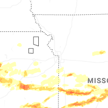

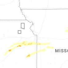
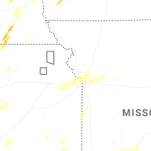


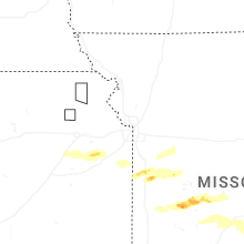


Connect with Interactive Hail Maps