

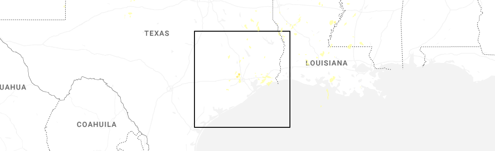
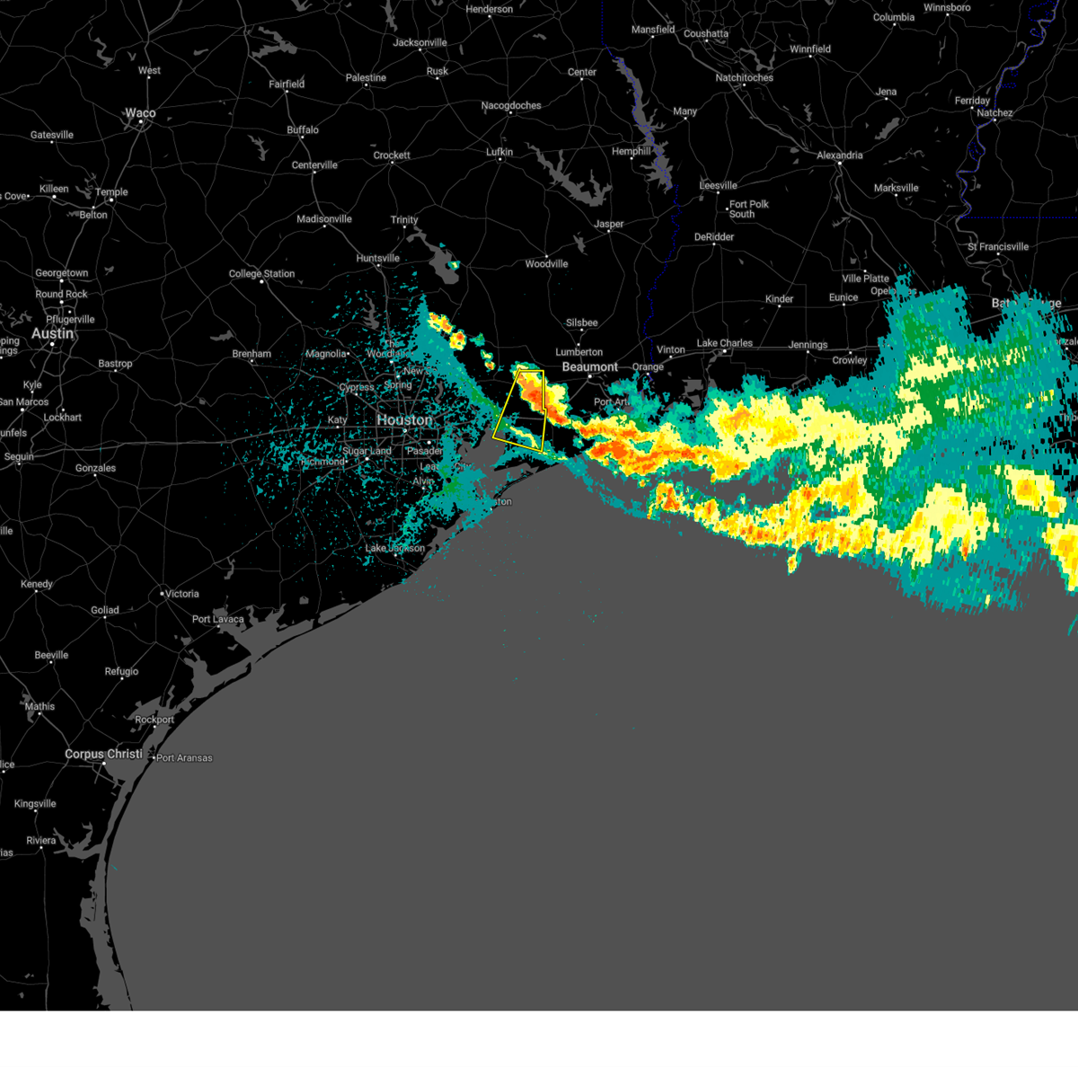
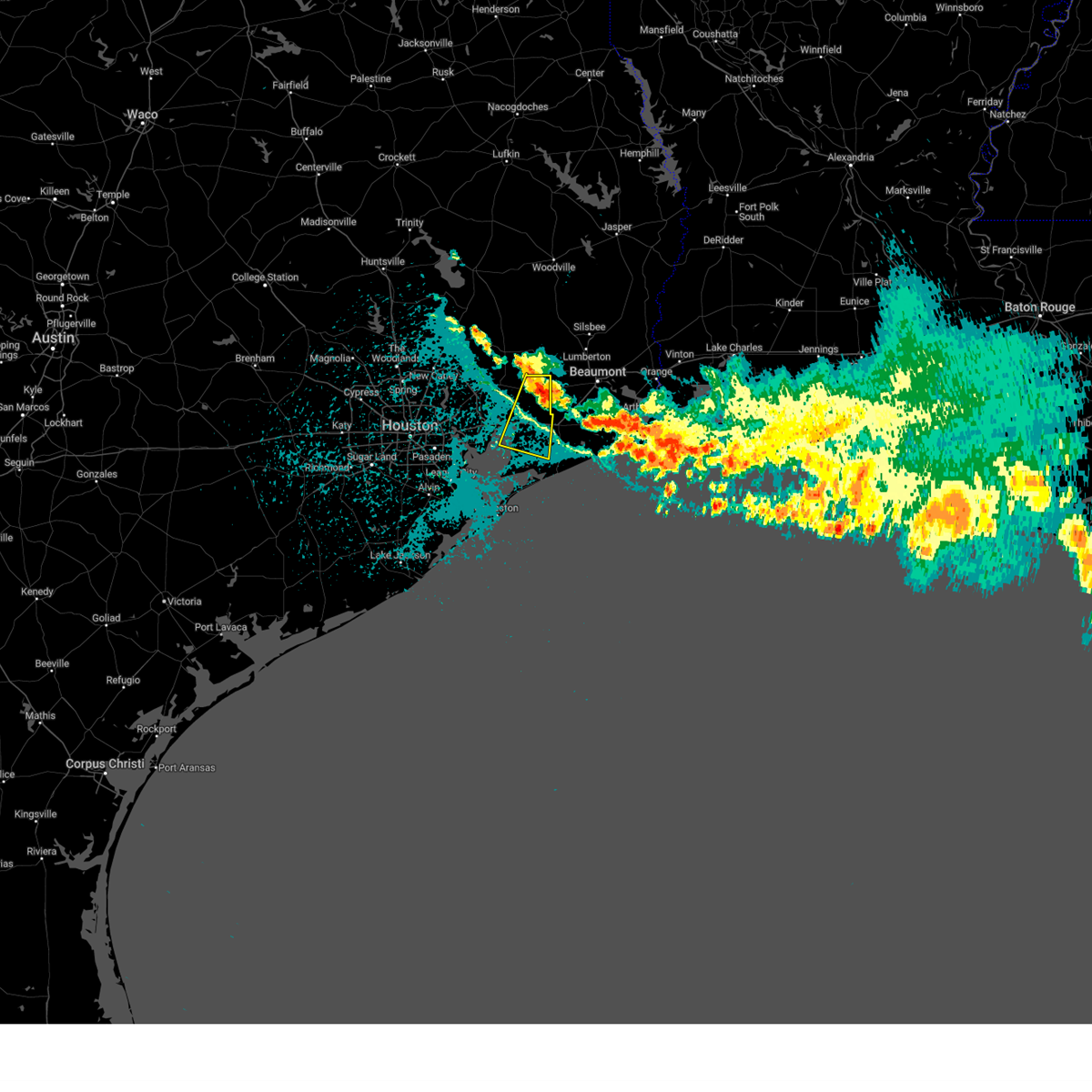
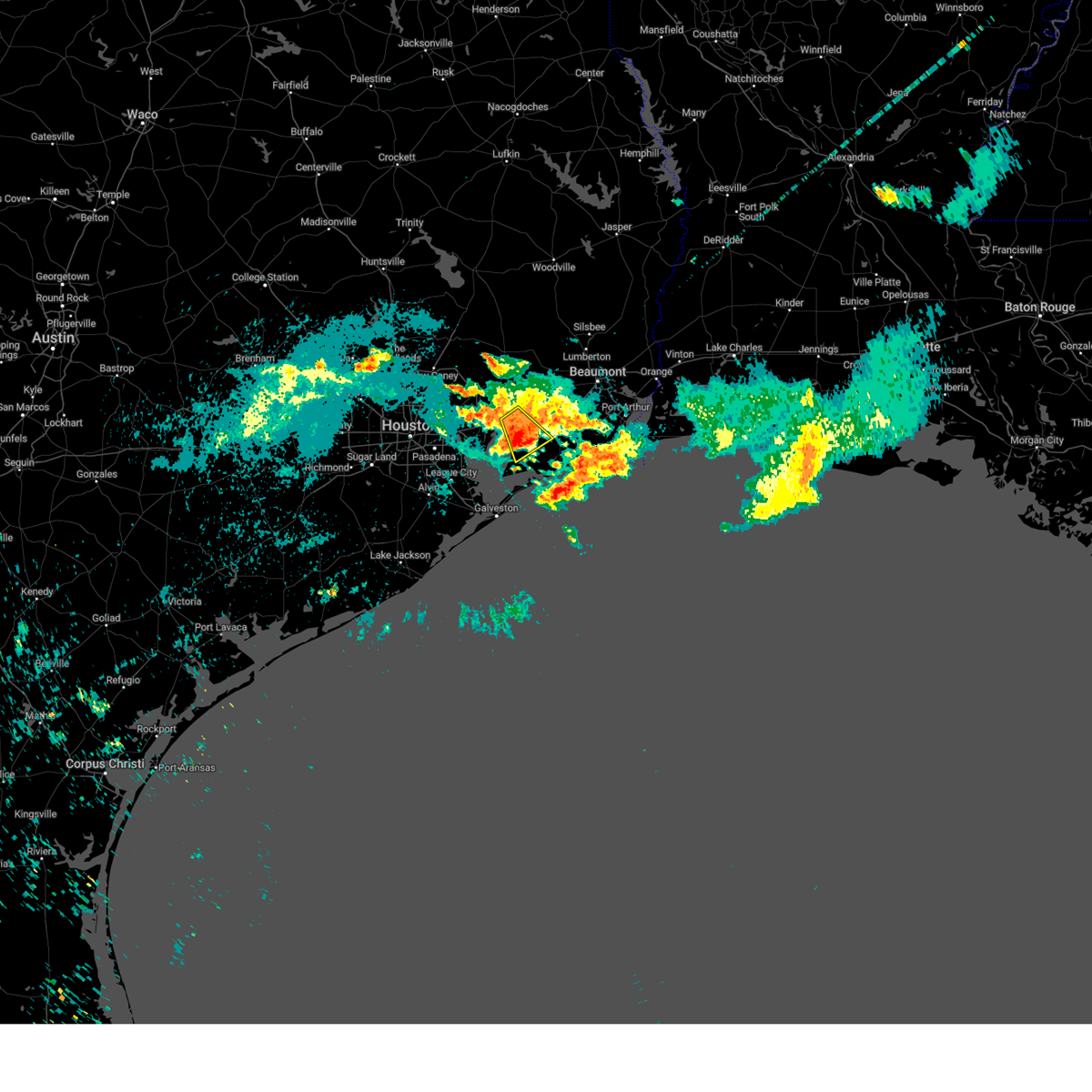
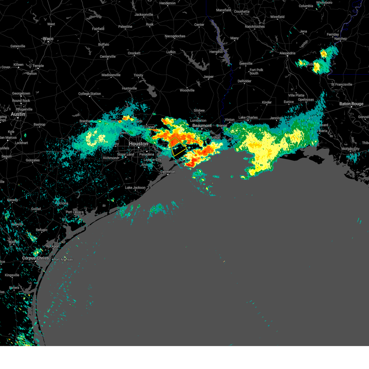
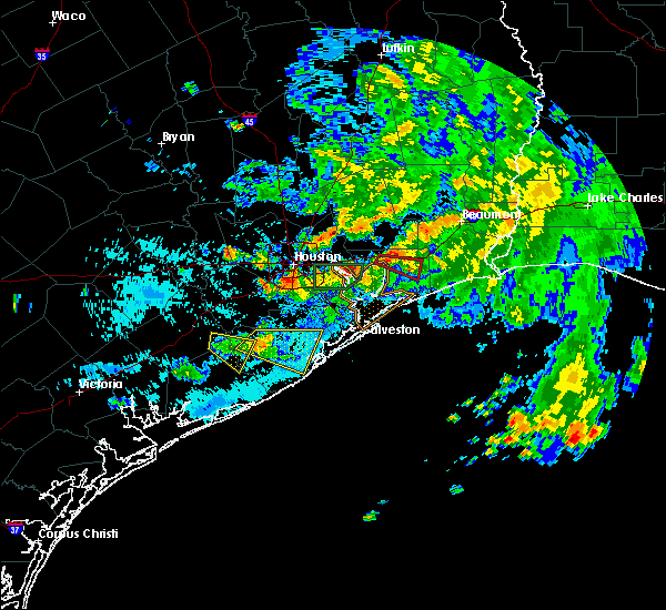
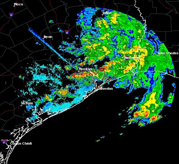
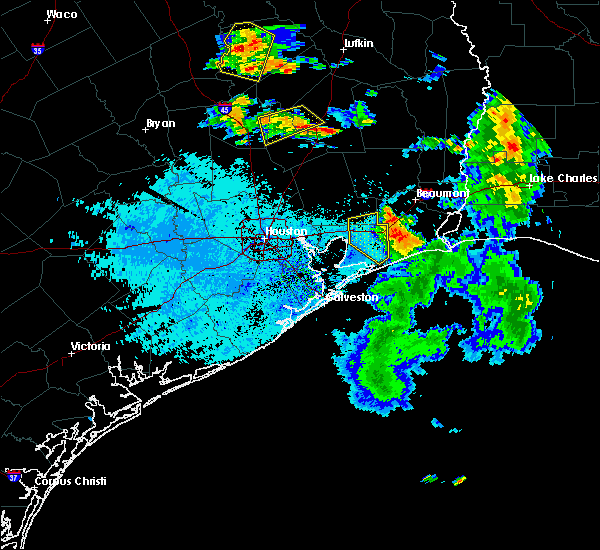
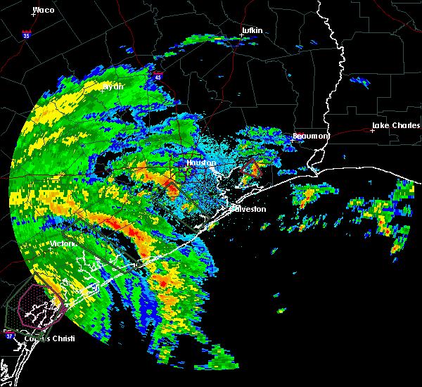
Hail Map for Anahuac, TX
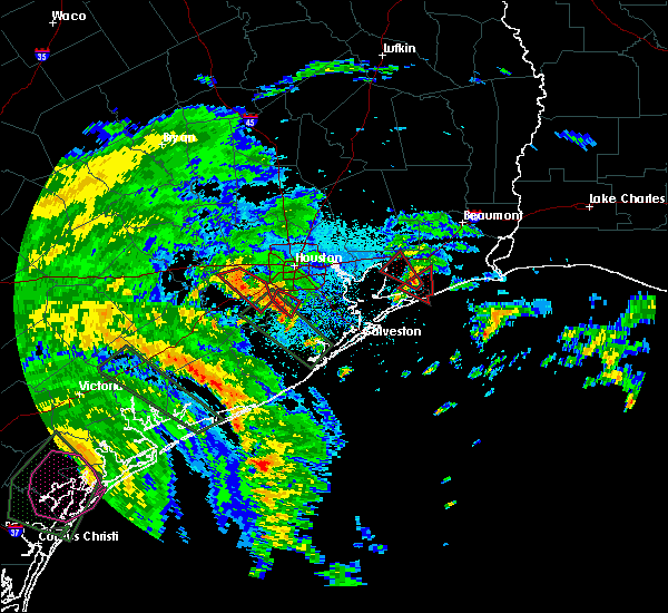
The Anahuac, TX area has had 0 reports of on-the-ground hail by trained spotters, and has been under severe weather warnings 15 times during the past 12 months. Doppler radar has detected hail at or near Anahuac, TX on 42 occasions, including 1 occasion during the past year.
| Name: | Anahuac, TX |
| Where Located: | 41.2 miles E of Houston, TX |
| Map: | Google Map for Anahuac, TX |
| Population: | 2243 |
| Housing Units: | 869 |
| More Info: | Search Google for Anahuac, TX |
3
The Top Recent Hail Date for Anahuac, TX is Monday, August 18, 2025 (11th out of 42)
Hail and Wind Damage Spotted near Anahuac, TX
| Date / Time | Report Details |
|---|---|
| 5/27/2026 3:29 AM CDT |
 Svrhgx the national weather service in league city has issued a * severe thunderstorm warning for, central galveston county in southeastern texas, southwestern chambers county in southeastern texas, southeastern harris county in southeastern texas, * until 400 am cdt. * at 329 am cdt, a severe thunderstorm was located near san leon, or near texas city, moving southeast at 35 mph (radar indicated). Hazards include 60 mph wind gusts. expect damage to roofs, siding, and trees Svrhgx the national weather service in league city has issued a * severe thunderstorm warning for, central galveston county in southeastern texas, southwestern chambers county in southeastern texas, southeastern harris county in southeastern texas, * until 400 am cdt. * at 329 am cdt, a severe thunderstorm was located near san leon, or near texas city, moving southeast at 35 mph (radar indicated). Hazards include 60 mph wind gusts. expect damage to roofs, siding, and trees
|
| 5/23/2026 7:19 AM CDT |
 At 718 am cdt, a severe thunderstorm was located near winnie, or near hamshire, moving northeast at 50 mph (radar indicated). Hazards include 60 mph wind gusts. Expect damage to roofs, siding, and trees. Locations impacted include, anahuac, winnie, stowell, and bolivar peninsula. At 718 am cdt, a severe thunderstorm was located near winnie, or near hamshire, moving northeast at 50 mph (radar indicated). Hazards include 60 mph wind gusts. Expect damage to roofs, siding, and trees. Locations impacted include, anahuac, winnie, stowell, and bolivar peninsula.
|
| 5/23/2026 7:06 AM CDT |
 Svrhgx the national weather service in league city has issued a * severe thunderstorm warning for, northeastern galveston county in southeastern texas, chambers county in southeastern texas, southeastern liberty county in southeastern texas, * until 730 am cdt. * at 706 am cdt, a severe thunderstorm was located near stowell, or 13 miles southwest of hamshire, moving northeast at 50 mph (radar indicated). Hazards include 60 mph wind gusts. expect damage to roofs, siding, and trees Svrhgx the national weather service in league city has issued a * severe thunderstorm warning for, northeastern galveston county in southeastern texas, chambers county in southeastern texas, southeastern liberty county in southeastern texas, * until 730 am cdt. * at 706 am cdt, a severe thunderstorm was located near stowell, or 13 miles southwest of hamshire, moving northeast at 50 mph (radar indicated). Hazards include 60 mph wind gusts. expect damage to roofs, siding, and trees
|
| 2/14/2026 7:32 PM CST |
 At 732 pm cst, severe thunderstorms were located along a line extending from near fannett to 8 miles southwest of stowell to near bolivar peninsula to port bolivar to galveston state park to near san luis pass, moving east at 40 mph (radar indicated). Hazards include 70 mph wind gusts. Expect considerable tree damage. damage is likely to mobile homes, roofs, and outbuildings. Locations impacted include, galveston causeway, galveston island west end, texas city, dickinson, la marque, santa fe, hitchcock, galveston pier 21, anahuac, bayou vista, jamaica beach, tiki island, devers, san leon, scholes field, port bolivar, offatts bayou, galveston pleasure pier, pelican island, and galveston state park. At 732 pm cst, severe thunderstorms were located along a line extending from near fannett to 8 miles southwest of stowell to near bolivar peninsula to port bolivar to galveston state park to near san luis pass, moving east at 40 mph (radar indicated). Hazards include 70 mph wind gusts. Expect considerable tree damage. damage is likely to mobile homes, roofs, and outbuildings. Locations impacted include, galveston causeway, galveston island west end, texas city, dickinson, la marque, santa fe, hitchcock, galveston pier 21, anahuac, bayou vista, jamaica beach, tiki island, devers, san leon, scholes field, port bolivar, offatts bayou, galveston pleasure pier, pelican island, and galveston state park.
|
| 2/14/2026 7:32 PM CST |
 the severe thunderstorm warning has been cancelled and is no longer in effect the severe thunderstorm warning has been cancelled and is no longer in effect
|
| 2/14/2026 7:16 PM CST |
 the severe thunderstorm warning has been cancelled and is no longer in effect the severe thunderstorm warning has been cancelled and is no longer in effect
|
| 2/14/2026 7:16 PM CST |
 At 716 pm cst, severe thunderstorms were located along a line extending from near devers to near anahuac to near beach city to bacliff to near texas city to 6 miles southeast of danbury, moving east at 35 mph (radar indicated). Hazards include 70 mph wind gusts. Expect considerable tree damage. damage is likely to mobile homes, roofs, and outbuildings. Locations impacted include, southeastern pasadena, league city, baytown, galveston causeway, galveston island west end, texas city, southeastern friendswood, la porte, northern lake jackson, alvin, southeastern angleton, dickinson, la marque, santa fe, seabrook, webster, southeastern liberty, hitchcock, beach city, and kemah. At 716 pm cst, severe thunderstorms were located along a line extending from near devers to near anahuac to near beach city to bacliff to near texas city to 6 miles southeast of danbury, moving east at 35 mph (radar indicated). Hazards include 70 mph wind gusts. Expect considerable tree damage. damage is likely to mobile homes, roofs, and outbuildings. Locations impacted include, southeastern pasadena, league city, baytown, galveston causeway, galveston island west end, texas city, southeastern friendswood, la porte, northern lake jackson, alvin, southeastern angleton, dickinson, la marque, santa fe, seabrook, webster, southeastern liberty, hitchcock, beach city, and kemah.
|
| 2/14/2026 6:58 PM CST |
 At 657 pm cst, severe thunderstorms were located along a line extending from ames to mont belvieu to morgan's point to clear lake to league city to angleton, moving east at 40 mph (radar indicated). Hazards include 70 mph wind gusts. Expect considerable tree damage. damage is likely to mobile homes, roofs, and outbuildings. Locations impacted include, pasadena, pearland, league city, baytown, galveston causeway, galveston island west end, texas city, friendswood, la porte, deer park, northern lake jackson, alvin, angleton, dickinson, south houston, la marque, santa fe, seabrook, webster, and liberty. At 657 pm cst, severe thunderstorms were located along a line extending from ames to mont belvieu to morgan's point to clear lake to league city to angleton, moving east at 40 mph (radar indicated). Hazards include 70 mph wind gusts. Expect considerable tree damage. damage is likely to mobile homes, roofs, and outbuildings. Locations impacted include, pasadena, pearland, league city, baytown, galveston causeway, galveston island west end, texas city, friendswood, la porte, deer park, northern lake jackson, alvin, angleton, dickinson, south houston, la marque, santa fe, seabrook, webster, and liberty.
|
| 2/14/2026 6:37 PM CST |
 Svrhgx the national weather service in league city has issued a * severe thunderstorm warning for, galveston county in southeastern texas, southeastern fort bend county in southeastern texas, chambers county in southeastern texas, brazoria county in southeastern texas, southern liberty county in southeastern texas, southeastern harris county in southeastern texas, * until 745 pm cst. * at 637 pm cst, severe thunderstorms were located along a line extending from 6 miles east of lake houston to crosby to jacinto city to south acres / crestmont park to near arcola to near west columbia, moving east at 35 mph (radar indicated). Hazards include 70 mph wind gusts. Expect considerable tree damage. Damage is likely to mobile homes, roofs, and outbuildings. Svrhgx the national weather service in league city has issued a * severe thunderstorm warning for, galveston county in southeastern texas, southeastern fort bend county in southeastern texas, chambers county in southeastern texas, brazoria county in southeastern texas, southern liberty county in southeastern texas, southeastern harris county in southeastern texas, * until 745 pm cst. * at 637 pm cst, severe thunderstorms were located along a line extending from 6 miles east of lake houston to crosby to jacinto city to south acres / crestmont park to near arcola to near west columbia, moving east at 35 mph (radar indicated). Hazards include 70 mph wind gusts. Expect considerable tree damage. Damage is likely to mobile homes, roofs, and outbuildings.
|
| 10/25/2025 4:57 AM CDT | At 456 am cdt, severe thunderstorms were located along a line extending from woodville to near sour lake to 9 miles east of galveston pleasure pier, moving east at 45 mph (radar indicated). Hazards include 60 mph wind gusts. Expect damage to roofs, siding, and trees. Locations impacted include, texas city, la marque, hitchcock, anahuac, devers, pelican island, high island, crystal beach, port bolivar, smith point, gilchrist, rollover pass, bolivar peninsula, stowell, winnie, san leon, galveston island east end, oak island, and hankamer. |
| 10/25/2025 4:57 AM CDT | the severe thunderstorm warning has been cancelled and is no longer in effect |
| 10/25/2025 4:44 AM CDT | Svrhgx the national weather service in league city has issued a * severe thunderstorm warning for, northern galveston county in southeastern texas, chambers county in southeastern texas, eastern liberty county in southeastern texas, southeastern polk county in southeastern texas, southeastern harris county in southeastern texas, * until 530 am cdt. * at 444 am cdt, severe thunderstorms were located along a line extending from 7 miles south of chester to 6 miles northwest of sour lake to near port bolivar, moving east at 45 mph (radar indicated). Hazards include 60 mph wind gusts. expect damage to roofs, siding, and trees |
| 10/25/2025 4:32 AM CDT | At 431 am cdt, severe thunderstorms were located along a line extending from near woodville to sour lake to near port bolivar, moving east at 55 mph (radar indicated). Hazards include 60 mph wind gusts. Expect damage to roofs, siding, and trees. Locations impacted include, eastern pasadena, southeastern pearland, league city, baytown, texas city, friendswood, la porte, deer park, alvin, dickinson, la marque, santa fe, seabrook, webster, liberty, dayton, hitchcock, beach city, kemah, and highlands. |
| 10/25/2025 4:32 AM CDT | the severe thunderstorm warning has been cancelled and is no longer in effect |
| 10/25/2025 3:59 AM CDT | Svrhgx the national weather service in league city has issued a * severe thunderstorm warning for, southern trinity county in southeastern texas, galveston county in southeastern texas, east central fort bend county in southeastern texas, southeastern montgomery county in southeastern texas, san jacinto county in southeastern texas, chambers county in southeastern texas, northeastern brazoria county in southeastern texas, liberty county in southeastern texas, polk county in southeastern texas, eastern harris county in southeastern texas, * until 445 am cdt. * at 358 am cdt, severe thunderstorms were located along a line extending from livingston to near kenefick to near alvin, moving east at 55 mph (radar indicated). Hazards include 60 mph wind gusts. expect damage to roofs, siding, and trees |
| 5/27/2025 1:20 AM CDT |
 Svrhgx the national weather service in league city has issued a * severe thunderstorm warning for, galveston county in southeastern texas, chambers county in southeastern texas, northeastern brazoria county in southeastern texas, southeastern liberty county in southeastern texas, southeastern harris county in southeastern texas, * until 215 am cdt. * at 119 am cdt, severe thunderstorms were located along a line extending from near devers to near alvin, moving east southeast at around 40 mph (radar indicated). Hazards include 60 mph wind gusts. expect damage to roofs, siding, and trees Svrhgx the national weather service in league city has issued a * severe thunderstorm warning for, galveston county in southeastern texas, chambers county in southeastern texas, northeastern brazoria county in southeastern texas, southeastern liberty county in southeastern texas, southeastern harris county in southeastern texas, * until 215 am cdt. * at 119 am cdt, severe thunderstorms were located along a line extending from near devers to near alvin, moving east southeast at around 40 mph (radar indicated). Hazards include 60 mph wind gusts. expect damage to roofs, siding, and trees
|
| 4/21/2025 8:53 AM CDT |
 Svrhgx the national weather service in league city has issued a * severe thunderstorm warning for, northwestern chambers county in southeastern texas, south central liberty county in southeastern texas, eastern harris county in southeastern texas, * until 930 am cdt. * at 853 am cdt, a severe thunderstorm was located near anahuac, or 8 miles northeast of beach city, moving east at 10 mph (radar indicated). Hazards include 60 mph wind gusts and quarter size hail. Hail damage to vehicles is expected. Expect wind damage to roofs, siding, and trees. Svrhgx the national weather service in league city has issued a * severe thunderstorm warning for, northwestern chambers county in southeastern texas, south central liberty county in southeastern texas, eastern harris county in southeastern texas, * until 930 am cdt. * at 853 am cdt, a severe thunderstorm was located near anahuac, or 8 miles northeast of beach city, moving east at 10 mph (radar indicated). Hazards include 60 mph wind gusts and quarter size hail. Hail damage to vehicles is expected. Expect wind damage to roofs, siding, and trees.
|
| 12/28/2024 3:12 PM CST | Mesonet station hilt2 anahua in chambers county TX, 16.1 miles WNW of Anahuac, TX |
| 12/28/2024 2:16 PM CST |
 Torhgx the national weather service in league city has issued a * tornado warning for, eastern chambers county in southeastern texas, * until 300 pm cst. * at 214 pm cst, a severe thunderstorm capable of producing a tornado was located near smith point, or 10 miles east of la porte, moving northeast at 20 mph. this storm has previously produced a tornado. another is likely ongoing, but cannot be confirmed due to no debris over the waters (radar indicated rotation). Hazards include tornado. Flying debris will be dangerous to those caught without shelter. mobile homes will be damaged or destroyed. damage to roofs, windows, and vehicles will occur. tree damage is likely. this dangerous storm will be near, smith point around 220 pm cst. anahuac around 235 pm cst. Other locations impacted by this tornadic thunderstorm include oak island. Torhgx the national weather service in league city has issued a * tornado warning for, eastern chambers county in southeastern texas, * until 300 pm cst. * at 214 pm cst, a severe thunderstorm capable of producing a tornado was located near smith point, or 10 miles east of la porte, moving northeast at 20 mph. this storm has previously produced a tornado. another is likely ongoing, but cannot be confirmed due to no debris over the waters (radar indicated rotation). Hazards include tornado. Flying debris will be dangerous to those caught without shelter. mobile homes will be damaged or destroyed. damage to roofs, windows, and vehicles will occur. tree damage is likely. this dangerous storm will be near, smith point around 220 pm cst. anahuac around 235 pm cst. Other locations impacted by this tornadic thunderstorm include oak island.
|
| 7/8/2024 7:49 AM CDT |
 Torhgx the national weather service in league city has issued a * tornado warning for, northeastern galveston county in southeastern texas, southeastern chambers county in southeastern texas, * until 800 am cdt. * at 748 am cdt, severe thunderstorms capable of producing a tornado was located over rollover pass, or 21 miles northeast of galveston pier 21, moving north at 60 mph (radar indicated rotation). Hazards include tornado. Flying debris will be dangerous to those caught without shelter. mobile homes will be damaged or destroyed. damage to roofs, windows, and vehicles will occur. tree damage is likely. This dangerous storm will be near, bolivar peninsula around 755 am cdt. Torhgx the national weather service in league city has issued a * tornado warning for, northeastern galveston county in southeastern texas, southeastern chambers county in southeastern texas, * until 800 am cdt. * at 748 am cdt, severe thunderstorms capable of producing a tornado was located over rollover pass, or 21 miles northeast of galveston pier 21, moving north at 60 mph (radar indicated rotation). Hazards include tornado. Flying debris will be dangerous to those caught without shelter. mobile homes will be damaged or destroyed. damage to roofs, windows, and vehicles will occur. tree damage is likely. This dangerous storm will be near, bolivar peninsula around 755 am cdt.
|
| 5/31/2024 7:55 AM CDT |
 Svrhgx the national weather service in league city has issued a * severe thunderstorm warning for, northeastern galveston county in southeastern texas, chambers county in southeastern texas, southeastern liberty county in southeastern texas, * until 900 am cdt. * at 754 am cdt, severe thunderstorms were located along a line extending from near hardin to 7 miles east of old river-winfree to near smith point, moving northeast at 25 mph (radar indicated). Hazards include 60 mph wind gusts. expect damage to roofs, siding, and trees Svrhgx the national weather service in league city has issued a * severe thunderstorm warning for, northeastern galveston county in southeastern texas, chambers county in southeastern texas, southeastern liberty county in southeastern texas, * until 900 am cdt. * at 754 am cdt, severe thunderstorms were located along a line extending from near hardin to 7 miles east of old river-winfree to near smith point, moving northeast at 25 mph (radar indicated). Hazards include 60 mph wind gusts. expect damage to roofs, siding, and trees
|
| 5/28/2024 1:22 PM CDT |
 At 122 pm cdt, severe thunderstorms were located along a line extending from 7 miles north of hardin to east little york / homestead to westchase, moving southeast at 50 mph (radar indicated). Hazards include 70 mph wind gusts and quarter size hail. Hail damage to vehicles is expected. expect considerable tree damage. wind damage is also likely to mobile homes, roofs, and outbuildings. Locations impacted include, pasadena, pearland, league city, northeastern sugar land, baytown, missouri city, texas city, friendswood, la porte, deer park, alvin, dickinson, stafford, south houston, bellaire, humble, west university place, la marque, santa fe, and seabrook. At 122 pm cdt, severe thunderstorms were located along a line extending from 7 miles north of hardin to east little york / homestead to westchase, moving southeast at 50 mph (radar indicated). Hazards include 70 mph wind gusts and quarter size hail. Hail damage to vehicles is expected. expect considerable tree damage. wind damage is also likely to mobile homes, roofs, and outbuildings. Locations impacted include, pasadena, pearland, league city, northeastern sugar land, baytown, missouri city, texas city, friendswood, la porte, deer park, alvin, dickinson, stafford, south houston, bellaire, humble, west university place, la marque, santa fe, and seabrook.
|
| 5/28/2024 1:14 PM CDT |
 Svrhgx the national weather service in league city has issued a * severe thunderstorm warning for, northwestern galveston county in southeastern texas, northeastern fort bend county in southeastern texas, northeastern brazoria county in southeastern texas, chambers county in southeastern texas, liberty county in southeastern texas, eastern harris county in southeastern texas, * until 200 pm cdt. * at 114 pm cdt, severe thunderstorms were located along a line extending from 11 miles north of dayton lakes to aldine to near addicks park ten, moving southeast at 50 mph (radar indicated). Hazards include 60 mph wind gusts and quarter size hail. Hail damage to vehicles is expected. Expect wind damage to roofs, siding, and trees. Svrhgx the national weather service in league city has issued a * severe thunderstorm warning for, northwestern galveston county in southeastern texas, northeastern fort bend county in southeastern texas, northeastern brazoria county in southeastern texas, chambers county in southeastern texas, liberty county in southeastern texas, eastern harris county in southeastern texas, * until 200 pm cdt. * at 114 pm cdt, severe thunderstorms were located along a line extending from 11 miles north of dayton lakes to aldine to near addicks park ten, moving southeast at 50 mph (radar indicated). Hazards include 60 mph wind gusts and quarter size hail. Hail damage to vehicles is expected. Expect wind damage to roofs, siding, and trees.
|
| 5/16/2024 7:34 PM CDT |
 the tornado warning has been cancelled and is no longer in effect the tornado warning has been cancelled and is no longer in effect
|
| 5/16/2024 7:21 PM CDT |
 Torhgx the national weather service in league city has issued a * tornado warning for, northeastern chambers county in southeastern texas, southeastern liberty county in southeastern texas, * until 745 pm cdt. * at 721 pm cdt, a severe thunderstorm capable of producing a tornado was located over anahuac, or 9 miles east of beach city, moving northeast at 40 mph (radar indicated rotation). Hazards include tornado. Flying debris will be dangerous to those caught without shelter. mobile homes will be damaged or destroyed. damage to roofs, windows, and vehicles will occur. tree damage is likely. this dangerous storm will be near, anahuac around 725 pm cdt. Other locations impacted by this tornadic thunderstorm include hankamer. Torhgx the national weather service in league city has issued a * tornado warning for, northeastern chambers county in southeastern texas, southeastern liberty county in southeastern texas, * until 745 pm cdt. * at 721 pm cdt, a severe thunderstorm capable of producing a tornado was located over anahuac, or 9 miles east of beach city, moving northeast at 40 mph (radar indicated rotation). Hazards include tornado. Flying debris will be dangerous to those caught without shelter. mobile homes will be damaged or destroyed. damage to roofs, windows, and vehicles will occur. tree damage is likely. this dangerous storm will be near, anahuac around 725 pm cdt. Other locations impacted by this tornadic thunderstorm include hankamer.
|
| 5/16/2024 7:16 PM CDT |
 Svrhgx the national weather service in league city has issued a * severe thunderstorm warning for, northeastern galveston county in southeastern texas, chambers county in southeastern texas, southeastern liberty county in southeastern texas, * until 745 pm cdt. * at 716 pm cdt, severe thunderstorms were located along a line extending from 6 miles southeast of devers to near anahuac to near san leon, moving east at 65 mph (radar indicated). Hazards include 70 mph wind gusts. Expect considerable tree damage. Damage is likely to mobile homes, roofs, and outbuildings. Svrhgx the national weather service in league city has issued a * severe thunderstorm warning for, northeastern galveston county in southeastern texas, chambers county in southeastern texas, southeastern liberty county in southeastern texas, * until 745 pm cdt. * at 716 pm cdt, severe thunderstorms were located along a line extending from 6 miles southeast of devers to near anahuac to near san leon, moving east at 65 mph (radar indicated). Hazards include 70 mph wind gusts. Expect considerable tree damage. Damage is likely to mobile homes, roofs, and outbuildings.
|
| 4/29/2024 3:47 AM CDT |
 At 347 am cdt, a severe thunderstorm was located near old river-winfree, or 10 miles northeast of beach city, moving northeast at 10 mph (radar indicated). Hazards include 60 mph wind gusts and nickel size hail. Expect damage to roofs, siding, and trees. Locations impacted include, anahuac, old river-winfree, devers, wallisville, and hankamer. At 347 am cdt, a severe thunderstorm was located near old river-winfree, or 10 miles northeast of beach city, moving northeast at 10 mph (radar indicated). Hazards include 60 mph wind gusts and nickel size hail. Expect damage to roofs, siding, and trees. Locations impacted include, anahuac, old river-winfree, devers, wallisville, and hankamer.
|
| 4/29/2024 3:38 AM CDT |
 Svrhgx the national weather service in league city has issued a * severe thunderstorm warning for, northern chambers county in southeastern texas, southeastern liberty county in southeastern texas, * until 415 am cdt. * at 337 am cdt, severe thunderstorms were located near cove, or 8 miles northeast of beach city, moving east at 10 mph (radar indicated). Hazards include 60 mph wind gusts and nickel size hail. expect damage to roofs, siding, and trees Svrhgx the national weather service in league city has issued a * severe thunderstorm warning for, northern chambers county in southeastern texas, southeastern liberty county in southeastern texas, * until 415 am cdt. * at 337 am cdt, severe thunderstorms were located near cove, or 8 miles northeast of beach city, moving east at 10 mph (radar indicated). Hazards include 60 mph wind gusts and nickel size hail. expect damage to roofs, siding, and trees
|
| 3/21/2024 7:53 PM CDT |
 The storm which prompted the warning has weakened below severe limits, and no longer poses an immediate threat to life or property. therefore, the warning will be allowed to expire. however, small hail is still possible with this thunderstorm. The storm which prompted the warning has weakened below severe limits, and no longer poses an immediate threat to life or property. therefore, the warning will be allowed to expire. however, small hail is still possible with this thunderstorm.
|
| 3/21/2024 7:40 PM CDT |
 At 739 pm cdt, a severe thunderstorm was located over northwestern mont belvieu, or 9 miles northeast of baytown, moving east at 40 mph (radar indicated). Hazards include quarter size hail. Damage to vehicles is expected. Locations impacted include, northeastern baytown, mont belvieu, anahuac, old river-winfree, cove, and wallisville. At 739 pm cdt, a severe thunderstorm was located over northwestern mont belvieu, or 9 miles northeast of baytown, moving east at 40 mph (radar indicated). Hazards include quarter size hail. Damage to vehicles is expected. Locations impacted include, northeastern baytown, mont belvieu, anahuac, old river-winfree, cove, and wallisville.
|
| 3/21/2024 7:21 PM CDT |
 Svrhgx the national weather service in league city has issued a * severe thunderstorm warning for, northwestern chambers county in southeastern texas, south central liberty county in southeastern texas, east central harris county in southeastern texas, * until 800 pm cdt. * at 721 pm cdt, a severe thunderstorm was located over barrett, moving east at 40 mph (radar indicated). Hazards include quarter size hail. damage to vehicles is expected Svrhgx the national weather service in league city has issued a * severe thunderstorm warning for, northwestern chambers county in southeastern texas, south central liberty county in southeastern texas, east central harris county in southeastern texas, * until 800 pm cdt. * at 721 pm cdt, a severe thunderstorm was located over barrett, moving east at 40 mph (radar indicated). Hazards include quarter size hail. damage to vehicles is expected
|
| 2/3/2024 2:32 AM CST |
 At 232 am cst, a severe thunderstorm was located over anahuac, or 9 miles east of beach city, moving east at 40 mph (radar indicated). Hazards include 60 mph wind gusts. Expect damage to roofs, siding, and trees. locations impacted include, anahuac, winnie, stowell, and oak island. hail threat, radar indicated max hail size, <. 75 in wind threat, radar indicated max wind gust, 60 mph. At 232 am cst, a severe thunderstorm was located over anahuac, or 9 miles east of beach city, moving east at 40 mph (radar indicated). Hazards include 60 mph wind gusts. Expect damage to roofs, siding, and trees. locations impacted include, anahuac, winnie, stowell, and oak island. hail threat, radar indicated max hail size, <. 75 in wind threat, radar indicated max wind gust, 60 mph.
|
| 2/3/2024 2:06 AM CST |
 At 206 am cst, a severe thunderstorm was located over morgan`s point, or near la porte, moving east at 40 mph (radar indicated). Hazards include 60 mph wind gusts. expect damage to roofs, siding, and trees At 206 am cst, a severe thunderstorm was located over morgan`s point, or near la porte, moving east at 40 mph (radar indicated). Hazards include 60 mph wind gusts. expect damage to roofs, siding, and trees
|
| 9/8/2023 4:06 PM CDT |
 At 406 pm cdt, a severe thunderstorm was located near stowell, or 11 miles southwest of hamshire, moving south at 25 mph (radar indicated). Hazards include 60 mph wind gusts and quarter size hail. Hail damage to vehicles is expected. expect wind damage to roofs, siding, and trees. locations impacted include, anahuac, devers and hankamer. hail threat, radar indicated max hail size, 1. 00 in wind threat, radar indicated max wind gust, 60 mph. At 406 pm cdt, a severe thunderstorm was located near stowell, or 11 miles southwest of hamshire, moving south at 25 mph (radar indicated). Hazards include 60 mph wind gusts and quarter size hail. Hail damage to vehicles is expected. expect wind damage to roofs, siding, and trees. locations impacted include, anahuac, devers and hankamer. hail threat, radar indicated max hail size, 1. 00 in wind threat, radar indicated max wind gust, 60 mph.
|
| 9/8/2023 3:59 PM CDT |
 At 359 pm cdt, a severe thunderstorm was located 7 miles west of winnie, or 11 miles west of hamshire, moving south at 25 mph (radar indicated). Hazards include 60 mph wind gusts and quarter size hail. Hail damage to vehicles is expected. expect wind damage to roofs, siding, and trees. locations impacted include, anahuac, devers, hankamer and wallisville. hail threat, radar indicated max hail size, 1. 00 in wind threat, radar indicated max wind gust, 60 mph. At 359 pm cdt, a severe thunderstorm was located 7 miles west of winnie, or 11 miles west of hamshire, moving south at 25 mph (radar indicated). Hazards include 60 mph wind gusts and quarter size hail. Hail damage to vehicles is expected. expect wind damage to roofs, siding, and trees. locations impacted include, anahuac, devers, hankamer and wallisville. hail threat, radar indicated max hail size, 1. 00 in wind threat, radar indicated max wind gust, 60 mph.
|
| 9/8/2023 3:40 PM CDT |
 At 339 pm cdt, a severe thunderstorm was located 7 miles south of devers, or 10 miles southwest of nome, moving south at 35 mph (radar indicated). Hazards include 60 mph wind gusts and quarter size hail. Hail damage to vehicles is expected. Expect wind damage to roofs, siding, and trees. At 339 pm cdt, a severe thunderstorm was located 7 miles south of devers, or 10 miles southwest of nome, moving south at 35 mph (radar indicated). Hazards include 60 mph wind gusts and quarter size hail. Hail damage to vehicles is expected. Expect wind damage to roofs, siding, and trees.
|
| 7/22/2023 10:35 PM CDT |
 The severe thunderstorm warning for northeastern chambers and south central liberty counties will expire at 1045 pm cdt, the storm which prompted the warning has weakened below severe limits, and no longer poses an immediate threat to life or property. therefore, the warning will be allowed to expire. however small hail and gusty winds are still possible with this thunderstorm. The severe thunderstorm warning for northeastern chambers and south central liberty counties will expire at 1045 pm cdt, the storm which prompted the warning has weakened below severe limits, and no longer poses an immediate threat to life or property. therefore, the warning will be allowed to expire. however small hail and gusty winds are still possible with this thunderstorm.
|
| 7/22/2023 10:13 PM CDT |
 At 1013 pm cdt, a severe thunderstorm was located over anahuac, or 13 miles east of beach city, moving southeast at 20 mph (radar indicated). Hazards include 60 mph wind gusts and quarter size hail. Hail damage to vehicles is expected. expect wind damage to roofs, siding, and trees. locations impacted include, anahuac, hankamer, wallisville and oak island. hail threat, radar indicated max hail size, 1. 00 in wind threat, radar indicated max wind gust, 60 mph. At 1013 pm cdt, a severe thunderstorm was located over anahuac, or 13 miles east of beach city, moving southeast at 20 mph (radar indicated). Hazards include 60 mph wind gusts and quarter size hail. Hail damage to vehicles is expected. expect wind damage to roofs, siding, and trees. locations impacted include, anahuac, hankamer, wallisville and oak island. hail threat, radar indicated max hail size, 1. 00 in wind threat, radar indicated max wind gust, 60 mph.
|
| 7/22/2023 9:58 PM CDT |
 At 958 pm cdt, a severe thunderstorm was located near anahuac, or 13 miles northeast of beach city, moving southeast at 20 mph (radar indicated). Hazards include 60 mph wind gusts and quarter size hail. Hail damage to vehicles is expected. Expect wind damage to roofs, siding, and trees. At 958 pm cdt, a severe thunderstorm was located near anahuac, or 13 miles northeast of beach city, moving southeast at 20 mph (radar indicated). Hazards include 60 mph wind gusts and quarter size hail. Hail damage to vehicles is expected. Expect wind damage to roofs, siding, and trees.
|
| 6/10/2023 9:37 PM CDT |
 At 936 pm cdt, severe thunderstorms were located along a line extending from 6 miles northwest of hamshire to 9 miles east of old river-winfree to liberty to 6 miles southwest of dayton to kingwood, moving southeast at 35 mph (radar indicated). Hazards include 60 mph wind gusts. Expect damage to roofs, siding, and trees. locations impacted include, northern baytown, humble, liberty, dayton, beach city, aldine, northside / northline, kingwood, greater greenspoint, spring, highlands, barrett, channelview, crosby, mont belvieu, anahuac, old river-winfree, ames, daisetta and hardin. hail threat, radar indicated max hail size, <. 75 in wind threat, radar indicated max wind gust, 60 mph. At 936 pm cdt, severe thunderstorms were located along a line extending from 6 miles northwest of hamshire to 9 miles east of old river-winfree to liberty to 6 miles southwest of dayton to kingwood, moving southeast at 35 mph (radar indicated). Hazards include 60 mph wind gusts. Expect damage to roofs, siding, and trees. locations impacted include, northern baytown, humble, liberty, dayton, beach city, aldine, northside / northline, kingwood, greater greenspoint, spring, highlands, barrett, channelview, crosby, mont belvieu, anahuac, old river-winfree, ames, daisetta and hardin. hail threat, radar indicated max hail size, <. 75 in wind threat, radar indicated max wind gust, 60 mph.
|
| 6/10/2023 8:56 PM CDT |
 At 856 pm cdt, severe thunderstorms were located along a line extending from near batson to near dayton lakes to 8 miles southeast of cleveland to near splendora to cut and shoot, moving southeast at 35 mph (radar indicated). Hazards include 60 mph wind gusts. expect damage to roofs, siding, and trees At 856 pm cdt, severe thunderstorms were located along a line extending from near batson to near dayton lakes to 8 miles southeast of cleveland to near splendora to cut and shoot, moving southeast at 35 mph (radar indicated). Hazards include 60 mph wind gusts. expect damage to roofs, siding, and trees
|
| 4/15/2023 10:07 PM CDT |
 At 1007 pm cdt, a severe thunderstorm was located over old river-winfree, or 8 miles north of beach city, moving east at 25 mph (radar indicated). Hazards include quarter size hail. Damage to vehicles is expected. locations impacted include, northeastern baytown, beach city, mont belvieu, anahuac, old river-winfree, cove and wallisville. hail threat, radar indicated max hail size, 1. 00 in wind threat, radar indicated max wind gust, <50 mph. At 1007 pm cdt, a severe thunderstorm was located over old river-winfree, or 8 miles north of beach city, moving east at 25 mph (radar indicated). Hazards include quarter size hail. Damage to vehicles is expected. locations impacted include, northeastern baytown, beach city, mont belvieu, anahuac, old river-winfree, cove and wallisville. hail threat, radar indicated max hail size, 1. 00 in wind threat, radar indicated max wind gust, <50 mph.
|
| 4/15/2023 9:48 PM CDT |
 At 948 pm cdt, a severe thunderstorm was located near barrett, moving east at 25 mph (radar indicated). Hazards include quarter size hail. damage to vehicles is expected At 948 pm cdt, a severe thunderstorm was located near barrett, moving east at 25 mph (radar indicated). Hazards include quarter size hail. damage to vehicles is expected
|
| 3/17/2023 3:15 AM CDT |
 At 315 am cdt, severe thunderstorms were located along a line extending from near anahuac to near smith point, moving east at 30 to 40 mph (radar indicated). Hazards include 60 mph wind gusts. expect damage to roofs, siding, and trees At 315 am cdt, severe thunderstorms were located along a line extending from near anahuac to near smith point, moving east at 30 to 40 mph (radar indicated). Hazards include 60 mph wind gusts. expect damage to roofs, siding, and trees
|
| 12/30/2022 1:17 AM CST |
 At 116 am cst, a severe thunderstorm was located near anahuac, or 10 miles east of beach city, moving northeast at 40 mph (radar indicated). Hazards include 60 mph wind gusts. expect damage to roofs, siding, and trees At 116 am cst, a severe thunderstorm was located near anahuac, or 10 miles east of beach city, moving northeast at 40 mph (radar indicated). Hazards include 60 mph wind gusts. expect damage to roofs, siding, and trees
|
| 8/29/2022 10:57 AM CDT | At 1056 am cdt, a severe thunderstorm was located near anahuac, or 14 miles northeast of beach city, moving north at 25 mph (radar indicated). Hazards include 60 mph wind gusts. Expect damage to roofs, siding, and trees. locations impacted include, anahuac, ames, devers, hankamer and wallisville. hail threat, radar indicated max hail size, <. 75 in wind threat, radar indicated max wind gust, 60 mph. |
| 8/29/2022 10:39 AM CDT | At 1039 am cdt, a severe thunderstorm was located over anahuac, or 9 miles east of beach city, moving north at 25 mph (radar indicated). Hazards include 60 mph wind gusts. expect damage to roofs, siding, and trees |
| 10/27/2021 9:58 AM CDT |
 At 957 am cdt, a line of strong thunderstorms was located near anahuac, or 8 miles east of beach city, moving east at 30 mph (radar indicated). Hazards include 60 mph wind gusts. expect damage to roofs, siding, and trees At 957 am cdt, a line of strong thunderstorms was located near anahuac, or 8 miles east of beach city, moving east at 30 mph (radar indicated). Hazards include 60 mph wind gusts. expect damage to roofs, siding, and trees
|
| 8/2/2021 7:20 PM CDT |
 The tornado warning for northeastern chambers county will expire at 730 pm cdt, the storm which prompted the warning has weakened below severe limits, and no longer appears capable of producing a tornado. therefore, the warning will be allowed to expire. The tornado warning for northeastern chambers county will expire at 730 pm cdt, the storm which prompted the warning has weakened below severe limits, and no longer appears capable of producing a tornado. therefore, the warning will be allowed to expire.
|
| 8/2/2021 6:55 PM CDT |
 At 654 pm cdt, a confirmed waterspout was located just offshore near anahuac, or 7 miles east of beach city, moving east at 15 mph (weather spotters confirmed waterspout moving onshore). Hazards include tornado. Flying debris will be dangerous to those caught without shelter. mobile homes will be damaged or destroyed. damage to roofs, windows, and vehicles will occur. tree damage is likely. This tornado will be near, anahuac around 710 pm cdt. At 654 pm cdt, a confirmed waterspout was located just offshore near anahuac, or 7 miles east of beach city, moving east at 15 mph (weather spotters confirmed waterspout moving onshore). Hazards include tornado. Flying debris will be dangerous to those caught without shelter. mobile homes will be damaged or destroyed. damage to roofs, windows, and vehicles will occur. tree damage is likely. This tornado will be near, anahuac around 710 pm cdt.
|
| 1/6/2021 6:16 PM CST |
 At 616 pm cst, a severe thunderstorm was located over san leon, or 7 miles northeast of texas city, moving east at 50 mph (radar indicated). Hazards include 60 mph wind gusts and quarter size hail. Hail damage to vehicles is expected. Expect wind damage to roofs, siding, and trees. At 616 pm cst, a severe thunderstorm was located over san leon, or 7 miles northeast of texas city, moving east at 50 mph (radar indicated). Hazards include 60 mph wind gusts and quarter size hail. Hail damage to vehicles is expected. Expect wind damage to roofs, siding, and trees.
|
| 5/27/2020 5:06 PM CDT |
 At 505 pm cdt, severe thunderstorms were located along a line extending from near nome to beach city to clear lake to pearland to near thompsons, moving east southeast at 50 mph (radar indicated). Hazards include 70 mph wind gusts. Expect considerable tree damage. Damage is likely to mobile homes, roofs, and outbuildings. At 505 pm cdt, severe thunderstorms were located along a line extending from near nome to beach city to clear lake to pearland to near thompsons, moving east southeast at 50 mph (radar indicated). Hazards include 70 mph wind gusts. Expect considerable tree damage. Damage is likely to mobile homes, roofs, and outbuildings.
|
| 5/27/2020 4:28 PM CDT |
 At 428 pm cdt, severe thunderstorms were located along a line extending from near nome to liberty to 6 miles northwest of dayton to near woodbranch to near the woodlands to near tomball to near jersey village to near katy to near brookshire to 9 miles north of eagle lake, moving southeast at 20 mph (radar indicated). Hazards include 60 mph wind gusts. expect damage to roofs, siding, and trees At 428 pm cdt, severe thunderstorms were located along a line extending from near nome to liberty to 6 miles northwest of dayton to near woodbranch to near the woodlands to near tomball to near jersey village to near katy to near brookshire to 9 miles north of eagle lake, moving southeast at 20 mph (radar indicated). Hazards include 60 mph wind gusts. expect damage to roofs, siding, and trees
|
| 4/29/2020 5:29 AM CDT |
 At 528 am cdt, severe thunderstorms continued with a gust front located along a line extending from near stowell to near san leon to near alvin to near brazos bend state park to near east bernard, moving south at 45 mph (radar indicated. this line of storms has a history of producing measured gusts over 50 mph and small hail). Hazards include 60 mph wind gusts and penny size hail. Expect damage to roofs, siding, and trees. Locations impacted include, pasadena, pearland, league city, sugar land, baytown, missouri city, galveston causeway, galveston island west end, texas city, friendswood, la porte, deer park, rosenberg, lake jackson, alvin, angleton, dickinson, stafford, south houston and bellaire. At 528 am cdt, severe thunderstorms continued with a gust front located along a line extending from near stowell to near san leon to near alvin to near brazos bend state park to near east bernard, moving south at 45 mph (radar indicated. this line of storms has a history of producing measured gusts over 50 mph and small hail). Hazards include 60 mph wind gusts and penny size hail. Expect damage to roofs, siding, and trees. Locations impacted include, pasadena, pearland, league city, sugar land, baytown, missouri city, galveston causeway, galveston island west end, texas city, friendswood, la porte, deer park, rosenberg, lake jackson, alvin, angleton, dickinson, stafford, south houston and bellaire.
|
| 4/29/2020 5:18 AM CDT |
 At 516 am cdt, severe thunderstorms were located along a line extending from near winnie to near shoreacres to near pearland to thompsons to near wallis, moving south at 45 mph (radar indicated. this storm has produced a gust to 56 mph at hobby airport, along with reports of small hail). Hazards include 60 mph wind gusts and penny size hail. Expect damage to roofs, siding, and trees. Locations impacted include, pasadena, pearland, league city, sugar land, baytown, missouri city, galveston island west end, galveston causeway, texas city, friendswood, la porte, deer park, rosenberg, lake jackson, alvin, angleton, dickinson, stafford, south houston and bellaire. At 516 am cdt, severe thunderstorms were located along a line extending from near winnie to near shoreacres to near pearland to thompsons to near wallis, moving south at 45 mph (radar indicated. this storm has produced a gust to 56 mph at hobby airport, along with reports of small hail). Hazards include 60 mph wind gusts and penny size hail. Expect damage to roofs, siding, and trees. Locations impacted include, pasadena, pearland, league city, sugar land, baytown, missouri city, galveston island west end, galveston causeway, texas city, friendswood, la porte, deer park, rosenberg, lake jackson, alvin, angleton, dickinson, stafford, south houston and bellaire.
|
| 4/29/2020 4:59 AM CDT |
 The national weather service in league city has issued a * severe thunderstorm warning for. eastern austin county in southeastern texas. galveston county in southeastern texas. fort bend county in southeastern texas. Brazoria county in southeastern texas. The national weather service in league city has issued a * severe thunderstorm warning for. eastern austin county in southeastern texas. galveston county in southeastern texas. fort bend county in southeastern texas. Brazoria county in southeastern texas.
|
| 1/11/2020 1:29 AM CST |
 At 128 am cst, severe thunderstorms were located along a line extending from near nome to 8 miles north of bolivar peninsula to near jamaica beach to 8 miles east of surfside beach, moving east at 75 mph (radar indicated). Hazards include 60 mph wind gusts. Expect damage to roofs, siding, and trees. Locations impacted include, galveston causeway, galveston island west end, texas city, la marque, hitchcock, surfside beach, galveston pier 21, anahuac, bayou vista, jamaica beach, tiki island, devers, high island, scholes field, port bolivar, offatts bayou, galveston pleasure pier, pelican island, galveston state park and crystal beach. At 128 am cst, severe thunderstorms were located along a line extending from near nome to 8 miles north of bolivar peninsula to near jamaica beach to 8 miles east of surfside beach, moving east at 75 mph (radar indicated). Hazards include 60 mph wind gusts. Expect damage to roofs, siding, and trees. Locations impacted include, galveston causeway, galveston island west end, texas city, la marque, hitchcock, surfside beach, galveston pier 21, anahuac, bayou vista, jamaica beach, tiki island, devers, high island, scholes field, port bolivar, offatts bayou, galveston pleasure pier, pelican island, galveston state park and crystal beach.
|
| 1/11/2020 1:11 AM CST |
 At 110 am cst, severe thunderstorms were located along a line extending from near saratoga to near anahuac to near san luis pass to 17 miles south of freeport, moving east at 35 mph (radar indicated). Hazards include 60 mph wind gusts. expect damage to roofs, siding, and trees At 110 am cst, severe thunderstorms were located along a line extending from near saratoga to near anahuac to near san luis pass to 17 miles south of freeport, moving east at 35 mph (radar indicated). Hazards include 60 mph wind gusts. expect damage to roofs, siding, and trees
|
| 1/11/2020 1:04 AM CST |
 At 103 am cst, severe thunderstorms were located along a line extending from 10 miles northwest of ebenezer to near warren to batson to ames to cove to near shoreacres, moving east at 35 mph (these storms have a history of damage reports from law enforcement and the public). Hazards include 60 mph wind gusts. Expect damage to roofs, siding, and trees. Locations impacted include, southeastern pasadena, eastern league city, baytown, texas city, la porte, dickinson, seabrook, liberty, beach city, kemah, nassau bay, mont belvieu, taylor lake village, el lago, anahuac, shoreacres, old river-winfree, clear lake shores, ames and daisetta. At 103 am cst, severe thunderstorms were located along a line extending from 10 miles northwest of ebenezer to near warren to batson to ames to cove to near shoreacres, moving east at 35 mph (these storms have a history of damage reports from law enforcement and the public). Hazards include 60 mph wind gusts. Expect damage to roofs, siding, and trees. Locations impacted include, southeastern pasadena, eastern league city, baytown, texas city, la porte, dickinson, seabrook, liberty, beach city, kemah, nassau bay, mont belvieu, taylor lake village, el lago, anahuac, shoreacres, old river-winfree, clear lake shores, ames and daisetta.
|
| 1/11/2020 12:48 AM CST |
 At 1247 am cst, severe thunderstorms were located along a line extending from 10 miles north of rockland to 8 miles southeast of alabama-coushatta reservation to near hardin to near dayton to near baytown to nassau bay, moving east at 35 mph (these storms have a history of numerous law enforcement and public reports of wind damage). Hazards include 60 mph wind gusts. Expect damage to roofs, siding, and trees. Locations impacted include, pasadena, pearland, league city, baytown, texas city, friendswood, la porte, deer park, alvin, dickinson, south houston, seabrook, webster, liberty, dayton, manvel, beach city, kemah, cloverleaf and south belt / ellington. At 1247 am cst, severe thunderstorms were located along a line extending from 10 miles north of rockland to 8 miles southeast of alabama-coushatta reservation to near hardin to near dayton to near baytown to nassau bay, moving east at 35 mph (these storms have a history of numerous law enforcement and public reports of wind damage). Hazards include 60 mph wind gusts. Expect damage to roofs, siding, and trees. Locations impacted include, pasadena, pearland, league city, baytown, texas city, friendswood, la porte, deer park, alvin, dickinson, south houston, seabrook, webster, liberty, dayton, manvel, beach city, kemah, cloverleaf and south belt / ellington.
|
| 1/11/2020 12:23 AM CST |
 At 1222 am cst, severe thunderstorms were located along a line extending from 8 miles southeast of diboll to 6 miles east of goodrich to 6 miles east of plum grove to near lake houston to houston ship channel to manvel, moving east at 35 mph (public). Hazards include a history of 60 mph wind gusts. expect damage to roofs, siding, and trees At 1222 am cst, severe thunderstorms were located along a line extending from 8 miles southeast of diboll to 6 miles east of goodrich to 6 miles east of plum grove to near lake houston to houston ship channel to manvel, moving east at 35 mph (public). Hazards include a history of 60 mph wind gusts. expect damage to roofs, siding, and trees
|
| 9/18/2019 6:37 PM CDT |
 At 637 pm cdt, a confirmed tornado was located over anahuac, or 12 miles northeast of beach city, moving east at 15 mph (spotter confirmed tornado). Hazards include damaging tornado. Flying debris will be dangerous to those caught without shelter. mobile homes will be damaged or destroyed. damage to roofs, windows, and vehicles will occur. tree damage is likely. This tornadic thunderstorm will remain over mainly rural areas of northeastern chambers county. At 637 pm cdt, a confirmed tornado was located over anahuac, or 12 miles northeast of beach city, moving east at 15 mph (spotter confirmed tornado). Hazards include damaging tornado. Flying debris will be dangerous to those caught without shelter. mobile homes will be damaged or destroyed. damage to roofs, windows, and vehicles will occur. tree damage is likely. This tornadic thunderstorm will remain over mainly rural areas of northeastern chambers county.
|
| 9/18/2019 6:27 PM CDT |
 At 627 pm cdt, a severe thunderstorm capable of producing a tornado was located near anahuac, or 10 miles northeast of beach city, moving east at 15 mph (radar indicated rotation). Hazards include tornado. Expect damage to mobile homes, roofs, and vehicles. This dangerous storm will be near, anahuac around 635 pm cdt. At 627 pm cdt, a severe thunderstorm capable of producing a tornado was located near anahuac, or 10 miles northeast of beach city, moving east at 15 mph (radar indicated rotation). Hazards include tornado. Expect damage to mobile homes, roofs, and vehicles. This dangerous storm will be near, anahuac around 635 pm cdt.
|
| 9/18/2019 5:37 PM CDT |
 The tornado warning for northwestern chambers county will expire at 545 pm cdt, the storm which prompted the warning has weakened below severe limits, and no longer appears capable of producing a tornado. therefore, the warning will be allowed to expire. however gusty winds are still possible with this thunderstorm. the storm could also restrengthen with little warning, producing a funnel cloud or potentially even a landspout on its leading edge. to report severe weather, contact your nearest law enforcement agency. they will relay your report to the national weather service league city. The tornado warning for northwestern chambers county will expire at 545 pm cdt, the storm which prompted the warning has weakened below severe limits, and no longer appears capable of producing a tornado. therefore, the warning will be allowed to expire. however gusty winds are still possible with this thunderstorm. the storm could also restrengthen with little warning, producing a funnel cloud or potentially even a landspout on its leading edge. to report severe weather, contact your nearest law enforcement agency. they will relay your report to the national weather service league city.
|
| 9/18/2019 5:28 PM CDT |
 At 527 pm cdt, a confirmed tornado was located over cove, or 7 miles north of beach city, moving east at 20 mph (public confirmed tornado). Hazards include damaging tornado. Flying debris will be dangerous to those caught without shelter. mobile homes will be damaged or destroyed. damage to roofs, windows, and vehicles will occur. tree damage is likely. the tornado will be near, anahuac around 545 pm cdt. Other locations impacted by this tornadic thunderstorm include hankamer and wallisville. At 527 pm cdt, a confirmed tornado was located over cove, or 7 miles north of beach city, moving east at 20 mph (public confirmed tornado). Hazards include damaging tornado. Flying debris will be dangerous to those caught without shelter. mobile homes will be damaged or destroyed. damage to roofs, windows, and vehicles will occur. tree damage is likely. the tornado will be near, anahuac around 545 pm cdt. Other locations impacted by this tornadic thunderstorm include hankamer and wallisville.
|
| 5/9/2019 11:56 PM CDT |
 At 1155 pm cdt, severe thunderstorms were located along a line extending from near jamaica beach to winnie, moving east at 30 mph (radar indicated). Hazards include 60 mph wind gusts and quarter size hail. Hail damage to vehicles is expected. Expect wind damage to roofs, siding, and trees. At 1155 pm cdt, severe thunderstorms were located along a line extending from near jamaica beach to winnie, moving east at 30 mph (radar indicated). Hazards include 60 mph wind gusts and quarter size hail. Hail damage to vehicles is expected. Expect wind damage to roofs, siding, and trees.
|
| 5/9/2019 11:10 PM CDT |
 At 1110 pm cdt, a line of severe thunderstorms was centered near smith point, or 10 miles south of beach city, moving east at 45 mph (radar indicated). Hazards include ping pong ball size hail and 60 mph wind gusts. People and animals outdoors will be injured. expect hail damage to roofs, siding, windows, and vehicles. Expect wind damage to roofs, siding, and trees. At 1110 pm cdt, a line of severe thunderstorms was centered near smith point, or 10 miles south of beach city, moving east at 45 mph (radar indicated). Hazards include ping pong ball size hail and 60 mph wind gusts. People and animals outdoors will be injured. expect hail damage to roofs, siding, windows, and vehicles. Expect wind damage to roofs, siding, and trees.
|
| 5/9/2019 10:54 PM CDT |
 At 1052 pm cdt, a line of severe thunderstorms was centered near cove, or near beach city, moving east at 35 mph. there are three areas where the largest is currently located, near clear lake, 5 to 10 miles southwest of alvin, and 5 miles northeast of baytown (radar indicated). Hazards include golf ball size hail and 60 mph wind gusts. People and animals outdoors will be injured. expect hail damage to roofs, siding, windows, and vehicles. expect wind damage to roofs, siding, and trees. Locations impacted include, pasadena, eastern pearland, league city, baytown, texas city, friendswood, la porte, deer park, alvin, dickinson, south houston, la marque, santa fe, seabrook, webster, liberty, dayton, hitchcock, southeastern manvel and beach city. At 1052 pm cdt, a line of severe thunderstorms was centered near cove, or near beach city, moving east at 35 mph. there are three areas where the largest is currently located, near clear lake, 5 to 10 miles southwest of alvin, and 5 miles northeast of baytown (radar indicated). Hazards include golf ball size hail and 60 mph wind gusts. People and animals outdoors will be injured. expect hail damage to roofs, siding, windows, and vehicles. expect wind damage to roofs, siding, and trees. Locations impacted include, pasadena, eastern pearland, league city, baytown, texas city, friendswood, la porte, deer park, alvin, dickinson, south houston, la marque, santa fe, seabrook, webster, liberty, dayton, hitchcock, southeastern manvel and beach city.
|
| 5/9/2019 10:43 PM CDT |
 At 1041 pm cdt, a line of severe thunderstorms was centered near baytown, moving east at 35 mph (radar indicated). Hazards include 60 mph wind gusts and quarter size hail. Hail damage to vehicles is possible. Expect wind damage to roofs, siding, and trees. At 1041 pm cdt, a line of severe thunderstorms was centered near baytown, moving east at 35 mph (radar indicated). Hazards include 60 mph wind gusts and quarter size hail. Hail damage to vehicles is possible. Expect wind damage to roofs, siding, and trees.
|
| 4/7/2019 1:35 PM CDT |
 At 134 pm cdt, severe thunderstorms were located along a line extending from near coldspring to near stowell, moving northeast at 45 mph. some of the storms show weak rotation and funnel clouds could be possible. weak tornadoes could form with little to no warning (radar indicated). Hazards include 60 mph wind gusts and pea size hail. expect damage to roofs, siding, and trees At 134 pm cdt, severe thunderstorms were located along a line extending from near coldspring to near stowell, moving northeast at 45 mph. some of the storms show weak rotation and funnel clouds could be possible. weak tornadoes could form with little to no warning (radar indicated). Hazards include 60 mph wind gusts and pea size hail. expect damage to roofs, siding, and trees
|
| 4/7/2019 1:27 PM CDT |
 At 126 pm cdt, severe thunderstorms were located along a line extending from near huntsville to anahuac, moving northeast at 55 mph. some of the storms show weak rotation and funnel clouds could be possible. weak tornadoes could form with little to no warning (radar indicated). Hazards include 60 mph wind gusts and pea size hail. Expect damage to roofs, siding, and trees. Locations impacted include, pasadena, northeastern league city, baytown, conroe, galveston causeway, galveston island west end, texas city, huntsville, la porte, deer park, dickinson, humble, la marque, seabrook, galena park, jacinto city, webster, liberty, cleveland and dayton. At 126 pm cdt, severe thunderstorms were located along a line extending from near huntsville to anahuac, moving northeast at 55 mph. some of the storms show weak rotation and funnel clouds could be possible. weak tornadoes could form with little to no warning (radar indicated). Hazards include 60 mph wind gusts and pea size hail. Expect damage to roofs, siding, and trees. Locations impacted include, pasadena, northeastern league city, baytown, conroe, galveston causeway, galveston island west end, texas city, huntsville, la porte, deer park, dickinson, humble, la marque, seabrook, galena park, jacinto city, webster, liberty, cleveland and dayton.
|
| 4/7/2019 12:58 PM CDT |
 At 1258 pm cdt, severe thunderstorms were located along a line extending from 6 miles northwest of montgomery to 6 miles east of texas city, moving north at 45 mph. pea size hail has been reported with these storms. some of the storms show weak rotation and funnel clouds could be possible. weak tornadoes could form with little to no warning (radar indicated). Hazards include 60 mph wind gusts and penny size hail. expect damage to roofs, siding, and trees At 1258 pm cdt, severe thunderstorms were located along a line extending from 6 miles northwest of montgomery to 6 miles east of texas city, moving north at 45 mph. pea size hail has been reported with these storms. some of the storms show weak rotation and funnel clouds could be possible. weak tornadoes could form with little to no warning (radar indicated). Hazards include 60 mph wind gusts and penny size hail. expect damage to roofs, siding, and trees
|
| 7/5/2018 7:36 PM CDT |
 The severe thunderstorm warning for northeastern galveston, northeastern chambers and southeastern liberty counties will expire at 745 pm cdt, the storms which prompted the warning have moved out of the area. therefore, the warning will be allowed to expire. however gusty winds are still possible with these thunderstorms. remember, a severe thunderstorm warning still remains in effect for southeastern liberty county until 800 pm cdt. The severe thunderstorm warning for northeastern galveston, northeastern chambers and southeastern liberty counties will expire at 745 pm cdt, the storms which prompted the warning have moved out of the area. therefore, the warning will be allowed to expire. however gusty winds are still possible with these thunderstorms. remember, a severe thunderstorm warning still remains in effect for southeastern liberty county until 800 pm cdt.
|
| 7/5/2018 7:02 PM CDT |
 At 701 pm cdt, severe thunderstorms were located along a line extending from 6 miles south of china to 14 miles northeast of high island, moving west at 20 mph (radar indicated). Hazards include 60 mph wind gusts. expect damage to roofs, siding, and trees At 701 pm cdt, severe thunderstorms were located along a line extending from 6 miles south of china to 14 miles northeast of high island, moving west at 20 mph (radar indicated). Hazards include 60 mph wind gusts. expect damage to roofs, siding, and trees
|
| 7/3/2018 7:56 PM CDT |
 The severe thunderstorm warning for chambers and southern liberty counties will expire at 800 pm cdt, the storms which prompted the warning have weakened below severe limits, and no longer pose an immediate threat to life or property. therefore, the warning will be allowed to expire. however gusty winds and heavy rain are still possible with these thunderstorms. The severe thunderstorm warning for chambers and southern liberty counties will expire at 800 pm cdt, the storms which prompted the warning have weakened below severe limits, and no longer pose an immediate threat to life or property. therefore, the warning will be allowed to expire. however gusty winds and heavy rain are still possible with these thunderstorms.
|
| 7/3/2018 7:27 PM CDT |
 At 727 pm cdt, severe thunderstorms were located along a line extending from near hardin to liberty to near devers to 7 miles northwest of high island, moving southwest at 25 mph (radar indicated). Hazards include 60 mph wind gusts and penny size hail. Expect damage to roofs, siding, and trees. Locations impacted include, liberty, dayton, beach city, mont belvieu, anahuac, old river-winfree, ames, daisetta, hardin, kenefick, cove, devers, dayton lakes, stowell, oak island, hankamer, moss hill and wallisville. At 727 pm cdt, severe thunderstorms were located along a line extending from near hardin to liberty to near devers to 7 miles northwest of high island, moving southwest at 25 mph (radar indicated). Hazards include 60 mph wind gusts and penny size hail. Expect damage to roofs, siding, and trees. Locations impacted include, liberty, dayton, beach city, mont belvieu, anahuac, old river-winfree, ames, daisetta, hardin, kenefick, cove, devers, dayton lakes, stowell, oak island, hankamer, moss hill and wallisville.
|
| 7/3/2018 6:56 PM CDT |
 At 656 pm cdt, severe thunderstorms were located along a line extending from batson to near stowell, moving southwest at 25 mph (radar indicated). Hazards include 60 mph wind gusts and penny size hail. expect damage to roofs, siding, and trees At 656 pm cdt, severe thunderstorms were located along a line extending from batson to near stowell, moving southwest at 25 mph (radar indicated). Hazards include 60 mph wind gusts and penny size hail. expect damage to roofs, siding, and trees
|
| 5/26/2018 5:56 PM CDT |
 The severe thunderstorm warning for northwestern chambers and south central liberty counties will expire at 600 pm cdt, the storm which prompted the warning has weakened below severe limits, and no longer poses an immediate threat to life or property. therefore, the warning will be allowed to expire. however gusty winds are still possible with this thunderstorm. The severe thunderstorm warning for northwestern chambers and south central liberty counties will expire at 600 pm cdt, the storm which prompted the warning has weakened below severe limits, and no longer poses an immediate threat to life or property. therefore, the warning will be allowed to expire. however gusty winds are still possible with this thunderstorm.
|
| 5/26/2018 5:36 PM CDT |
 At 535 pm cdt, a severe thunderstorm was located near anahuac, or 12 miles northeast of beach city, moving south at 15 mph (radar indicated). Hazards include 60 mph wind gusts and quarter size hail. Hail damage to vehicles is possible. Wind damage is possible to roofs, siding, and trees. At 535 pm cdt, a severe thunderstorm was located near anahuac, or 12 miles northeast of beach city, moving south at 15 mph (radar indicated). Hazards include 60 mph wind gusts and quarter size hail. Hail damage to vehicles is possible. Wind damage is possible to roofs, siding, and trees.
|
| 3/29/2018 2:51 AM CDT |
 At 251 am cdt, severe thunderstorms were located along a line extending from near daisetta to shoreacres, moving east at 40 mph (radar indicated). Hazards include 60 mph wind gusts and possible brief tornadoes. expect damage to roofs, siding, and trees At 251 am cdt, severe thunderstorms were located along a line extending from near daisetta to shoreacres, moving east at 40 mph (radar indicated). Hazards include 60 mph wind gusts and possible brief tornadoes. expect damage to roofs, siding, and trees
|
| 8/28/2017 12:25 AM CDT |
 At 1225 am cdt, a severe thunderstorm capable of producing a tornado was located near anahuac, or 13 miles east of beach city, moving north at 35 mph (radar indicated rotation). Hazards include tornado. Flying debris will be dangerous to those caught without shelter. mobile homes will be damaged or destroyed. damage to roofs, windows, and vehicles will occur. Tree damage is likely. At 1225 am cdt, a severe thunderstorm capable of producing a tornado was located near anahuac, or 13 miles east of beach city, moving north at 35 mph (radar indicated rotation). Hazards include tornado. Flying debris will be dangerous to those caught without shelter. mobile homes will be damaged or destroyed. damage to roofs, windows, and vehicles will occur. Tree damage is likely.
|
| 8/28/2017 12:17 AM CDT |
 At 1217 am cdt, a severe thunderstorm capable of producing a tornado was located near anahuac, or 8 miles northeast of beach city, moving northwest at 40 mph (radar indicated rotation). Hazards include tornado. Flying debris will be dangerous to those caught without shelter. mobile homes will be damaged or destroyed. damage to roofs, windows, and vehicles will occur. Tree damage is likely. At 1217 am cdt, a severe thunderstorm capable of producing a tornado was located near anahuac, or 8 miles northeast of beach city, moving northwest at 40 mph (radar indicated rotation). Hazards include tornado. Flying debris will be dangerous to those caught without shelter. mobile homes will be damaged or destroyed. damage to roofs, windows, and vehicles will occur. Tree damage is likely.
|
| 8/28/2017 12:00 AM CDT |
 At 1200 am cdt, a severe thunderstorm capable of producing a tornado was located near bolivar peninsula, or 19 miles southeast of beach city, moving northwest at 30 mph (radar indicated rotation). Hazards include tornado. Flying debris will be dangerous to those caught without shelter. mobile homes will be damaged or destroyed. damage to roofs, windows, and vehicles will occur. Tree damage is likely. At 1200 am cdt, a severe thunderstorm capable of producing a tornado was located near bolivar peninsula, or 19 miles southeast of beach city, moving northwest at 30 mph (radar indicated rotation). Hazards include tornado. Flying debris will be dangerous to those caught without shelter. mobile homes will be damaged or destroyed. damage to roofs, windows, and vehicles will occur. Tree damage is likely.
|
| 8/27/2017 11:42 PM CDT |
 The national weather service in league city has issued a * tornado warning for. western chambers county in southeastern texas. south central liberty county in southeastern texas. east central harris county in southeastern texas. Until 1215 am cdt. The national weather service in league city has issued a * tornado warning for. western chambers county in southeastern texas. south central liberty county in southeastern texas. east central harris county in southeastern texas. Until 1215 am cdt.
|
| 8/27/2017 11:08 PM CDT |
 At 1108 pm cdt, a severe thunderstorm capable of producing a tornado was located 7 miles south of anahuac, or 11 miles southeast of beach city, moving northwest at 30 mph (radar indicated rotation). Hazards include tornado. Flying debris will be dangerous to those caught without shelter. mobile homes will be damaged or destroyed. damage to roofs, windows, and vehicles will occur. Tree damage is likely. At 1108 pm cdt, a severe thunderstorm capable of producing a tornado was located 7 miles south of anahuac, or 11 miles southeast of beach city, moving northwest at 30 mph (radar indicated rotation). Hazards include tornado. Flying debris will be dangerous to those caught without shelter. mobile homes will be damaged or destroyed. damage to roofs, windows, and vehicles will occur. Tree damage is likely.
|
| 8/27/2017 9:04 PM CDT |
 At 903 pm cdt, a severe thunderstorm capable of producing a tornado was located 9 miles southeast of anahuac, or 16 miles east of beach city, moving northwest at 25 mph (radar indicated rotation). Hazards include tornado. Flying debris will be dangerous to those caught without shelter. mobile homes will be damaged or destroyed. damage to roofs, windows, and vehicles will occur. Tree damage is likely. At 903 pm cdt, a severe thunderstorm capable of producing a tornado was located 9 miles southeast of anahuac, or 16 miles east of beach city, moving northwest at 25 mph (radar indicated rotation). Hazards include tornado. Flying debris will be dangerous to those caught without shelter. mobile homes will be damaged or destroyed. damage to roofs, windows, and vehicles will occur. Tree damage is likely.
|
| 8/26/2017 4:38 AM CDT |
 The tornado warning for southwestern chambers county will expire at 445 am cdt, the storm which prompted the warning has weakened below severe limits, and no longer appears capable of producing a tornado. therefore the warning will be allowed to expire. a tornado watch remains in effect until 100 pm cdt for southeastern texas. The tornado warning for southwestern chambers county will expire at 445 am cdt, the storm which prompted the warning has weakened below severe limits, and no longer appears capable of producing a tornado. therefore the warning will be allowed to expire. a tornado watch remains in effect until 100 pm cdt for southeastern texas.
|
| 8/26/2017 4:24 AM CDT |
 At 424 am cdt, a severe thunderstorm capable of producing a tornado was located 8 miles northeast of smith point, or 12 miles southeast of beach city, moving northwest at 50 mph (radar indicated rotation). Hazards include tornado. Flying debris will be dangerous to those caught without shelter. mobile homes will be damaged or destroyed. damage to roofs, windows, and vehicles will occur. Tree damage is likely. At 424 am cdt, a severe thunderstorm capable of producing a tornado was located 8 miles northeast of smith point, or 12 miles southeast of beach city, moving northwest at 50 mph (radar indicated rotation). Hazards include tornado. Flying debris will be dangerous to those caught without shelter. mobile homes will be damaged or destroyed. damage to roofs, windows, and vehicles will occur. Tree damage is likely.
|
| 8/26/2017 1:29 AM CDT |
 At 128 am cdt, a severe thunderstorm capable of producing a tornado was located 9 miles southeast of anahuac, or 17 miles southwest of hamshire, moving northwest at 30 mph (radar indicated rotation). Hazards include tornado. Flying debris will be dangerous to those caught without shelter. mobile homes will be damaged or destroyed. damage to roofs, windows, and vehicles will occur. tree damage is likely. Locations impacted include, anahuac. At 128 am cdt, a severe thunderstorm capable of producing a tornado was located 9 miles southeast of anahuac, or 17 miles southwest of hamshire, moving northwest at 30 mph (radar indicated rotation). Hazards include tornado. Flying debris will be dangerous to those caught without shelter. mobile homes will be damaged or destroyed. damage to roofs, windows, and vehicles will occur. tree damage is likely. Locations impacted include, anahuac.
|
| 8/26/2017 1:20 AM CDT |
 At 120 am cdt, a severe thunderstorm capable of producing a tornado was located 8 miles northwest of high island, or 17 miles southwest of hamshire, moving northwest at 30 mph (radar indicated rotation). Hazards include tornado. Flying debris will be dangerous to those caught without shelter. mobile homes will be damaged or destroyed. damage to roofs, windows, and vehicles will occur. Tree damage is likely. At 120 am cdt, a severe thunderstorm capable of producing a tornado was located 8 miles northwest of high island, or 17 miles southwest of hamshire, moving northwest at 30 mph (radar indicated rotation). Hazards include tornado. Flying debris will be dangerous to those caught without shelter. mobile homes will be damaged or destroyed. damage to roofs, windows, and vehicles will occur. Tree damage is likely.
|
| 5/3/2017 8:56 PM CDT |
 At 854 pm cdt, a cluster of severe thunderstorms was located from daisetta to cove, moving southeast at 30 mph. similar storms earlier in the evening produced hail up to golf ball size (radar indicated). Hazards include golf ball size hail. People and animals outdoors will be injured. expect damage to roofs, siding, windows, and vehicles. Locations impacted include, southeastern mont belvieu, anahuac, old river-winfree, daisetta, cove, devers, winnie, stowell, hankamer, wallisville and oak island. At 854 pm cdt, a cluster of severe thunderstorms was located from daisetta to cove, moving southeast at 30 mph. similar storms earlier in the evening produced hail up to golf ball size (radar indicated). Hazards include golf ball size hail. People and animals outdoors will be injured. expect damage to roofs, siding, windows, and vehicles. Locations impacted include, southeastern mont belvieu, anahuac, old river-winfree, daisetta, cove, devers, winnie, stowell, hankamer, wallisville and oak island.
|
| 5/3/2017 8:30 PM CDT |
 At 825 pm cdt, a cluster of severe thunderstorms was located over central liberty county, just northwest of liberty, moving southeast at 30 mph (radar indicated). Hazards include quarter size hail. 60 mph wind gusts. At 825 pm cdt, a cluster of severe thunderstorms was located over central liberty county, just northwest of liberty, moving southeast at 30 mph (radar indicated). Hazards include quarter size hail. 60 mph wind gusts.
|
| 3/29/2017 3:57 PM CDT |
 The tornado warning for northwestern chambers and south central liberty counties will expire at 400 pm cdt, the storm which prompted the warning has weakened below severe limits, and no longer appears capable of producing a tornado. therefore the warning will be allowed to expire. however gusty winds and heavy rain and small hail are still likely with this thunderstorm. a tornado watch remains in effect until 900 pm cdt for southeastern texas. The tornado warning for northwestern chambers and south central liberty counties will expire at 400 pm cdt, the storm which prompted the warning has weakened below severe limits, and no longer appears capable of producing a tornado. therefore the warning will be allowed to expire. however gusty winds and heavy rain and small hail are still likely with this thunderstorm. a tornado watch remains in effect until 900 pm cdt for southeastern texas.
|
| 3/29/2017 3:38 PM CDT |
 At 337 pm cdt, a severe thunderstorm capable of producing a tornado was located over cove, or near beach city, moving northeast at 25 mph (radar indicated rotation). Hazards include tornado. Flying debris will be dangerous to those caught without shelter. mobile homes will be damaged or destroyed. damage to roofs, windows, and vehicles will occur. tree damage is likely. Locations impacted include, beach city, southeastern mont belvieu, old river-winfree, cove and wallisville. At 337 pm cdt, a severe thunderstorm capable of producing a tornado was located over cove, or near beach city, moving northeast at 25 mph (radar indicated rotation). Hazards include tornado. Flying debris will be dangerous to those caught without shelter. mobile homes will be damaged or destroyed. damage to roofs, windows, and vehicles will occur. tree damage is likely. Locations impacted include, beach city, southeastern mont belvieu, old river-winfree, cove and wallisville.
|
| 3/29/2017 3:26 PM CDT |
 At 324 pm cdt, a severe thunderstorm capable of producing a tornado was located over beach city, moving northeast at 25 mph. roof damage has been reported in la porte and pasadena. shipping containers were blown around in la porte (radar indicated rotation). Hazards include tornado. Flying debris will be dangerous to those caught without shelter. mobile homes will be damaged or destroyed. damage to roofs, windows, and vehicles will occur. Tree damage is likely. At 324 pm cdt, a severe thunderstorm capable of producing a tornado was located over beach city, moving northeast at 25 mph. roof damage has been reported in la porte and pasadena. shipping containers were blown around in la porte (radar indicated rotation). Hazards include tornado. Flying debris will be dangerous to those caught without shelter. mobile homes will be damaged or destroyed. damage to roofs, windows, and vehicles will occur. Tree damage is likely.
|
| 3/25/2017 12:36 AM CDT |
 At 1235 am cdt, severe thunderstorms were located along a line extending from near old river-winfree to pearland, moving east southeast at 15 mph (radar indicated). Hazards include 60 mph wind gusts and penny size hail. expect damage to roofs, siding, and trees At 1235 am cdt, severe thunderstorms were located along a line extending from near old river-winfree to pearland, moving east southeast at 15 mph (radar indicated). Hazards include 60 mph wind gusts and penny size hail. expect damage to roofs, siding, and trees
|
| 2/14/2017 10:52 AM CST |
 The severe thunderstorm warning for southeastern liberty, northeastern galveston, chambers and southeastern polk counties will expire at 1100 am cst, the storms which prompted the warning have weakened below severe limits, and no longer pose an immediate threat to life or property. therefore the warning will be allowed to expire. however gusty winds are still possible with these thunderstorms. a tornado watch remains in effect until 100 pm cst for southeastern texas. The severe thunderstorm warning for southeastern liberty, northeastern galveston, chambers and southeastern polk counties will expire at 1100 am cst, the storms which prompted the warning have weakened below severe limits, and no longer pose an immediate threat to life or property. therefore the warning will be allowed to expire. however gusty winds are still possible with these thunderstorms. a tornado watch remains in effect until 100 pm cst for southeastern texas.
|
| 2/14/2017 10:39 AM CST |
 At 1038 am cst, severe thunderstorms were located along a line extending from 6 miles west of warren to near smith point, moving northeast at 35 mph (radar indicated). Hazards include 60 mph wind gusts. Expect damage to roofs, siding, and trees. locations impacted include, anahuac, daisetta, devers, high island, bolivar peninsula, crystal beach, gilchrist, rollover pass, smith point, stowell, winnie, oak island, wallisville and hankamer. A tornado watch remains in effect until 100 pm cst for southeastern texas. At 1038 am cst, severe thunderstorms were located along a line extending from 6 miles west of warren to near smith point, moving northeast at 35 mph (radar indicated). Hazards include 60 mph wind gusts. Expect damage to roofs, siding, and trees. locations impacted include, anahuac, daisetta, devers, high island, bolivar peninsula, crystal beach, gilchrist, rollover pass, smith point, stowell, winnie, oak island, wallisville and hankamer. A tornado watch remains in effect until 100 pm cst for southeastern texas.
|
| 2/14/2017 9:57 AM CST |
 At 956 am cst, severe thunderstorms were located along a line extending from 10 miles southeast of shepherd to hitchcock, moving northeast at 35 mph (radar indicated). Hazards include 60 mph wind gusts. expect damage to roofs, siding, and trees At 956 am cst, severe thunderstorms were located along a line extending from 10 miles southeast of shepherd to hitchcock, moving northeast at 35 mph (radar indicated). Hazards include 60 mph wind gusts. expect damage to roofs, siding, and trees
|
| 2/14/2017 8:56 AM CST |
 At 856 am cst, severe thunderstorms were located along a line extending from near porter heights to golfcrest / bellfort / reveille to near iowa colony, moving east at 60 mph (radar indicated). Hazards include 60 mph wind gusts. expect damage to roofs, siding, and trees At 856 am cst, severe thunderstorms were located along a line extending from near porter heights to golfcrest / bellfort / reveille to near iowa colony, moving east at 60 mph (radar indicated). Hazards include 60 mph wind gusts. expect damage to roofs, siding, and trees
|
| 1/2/2017 8:44 AM CST |
 At 844 am cst, severe thunderstorms were located along a line extending from 7 miles west of warren to near roman forest to thompsons, moving east at 40 mph (radar indicated). Hazards include 60 mph wind gusts and up to penny size hail. expect damage to roofs, siding, and trees At 844 am cst, severe thunderstorms were located along a line extending from 7 miles west of warren to near roman forest to thompsons, moving east at 40 mph (radar indicated). Hazards include 60 mph wind gusts and up to penny size hail. expect damage to roofs, siding, and trees
|
| 6/18/2016 6:46 PM CDT |
 At 643 pm cdt, numerous strong to severe thunderstorms were located along a line extending from chateau woods to anahuac, including the ship channel and surrounding eastern harris county communities, moving southwest at 5 to 10 mph (radar indicated). Hazards include 60 mph wind gusts and quarter size hail. Hail damage to vehicles is expected. expect wind damage to roofs, siding, and trees. Locations impacted include, pasadena, northeastern league city, baytown, texas city, la porte, deer park, dickinson, south houston, humble, seabrook, galena park, jacinto city, webster, beach city, kemah, clear lake, barrett, greater fifth ward, second ward and near northside houston. At 643 pm cdt, numerous strong to severe thunderstorms were located along a line extending from chateau woods to anahuac, including the ship channel and surrounding eastern harris county communities, moving southwest at 5 to 10 mph (radar indicated). Hazards include 60 mph wind gusts and quarter size hail. Hail damage to vehicles is expected. expect wind damage to roofs, siding, and trees. Locations impacted include, pasadena, northeastern league city, baytown, texas city, la porte, deer park, dickinson, south houston, humble, seabrook, galena park, jacinto city, webster, beach city, kemah, clear lake, barrett, greater fifth ward, second ward and near northside houston.
|
| 6/18/2016 6:21 PM CDT |
 At 619 pm cdt, severe thunderstorms were located along a line extending from near woodloch to anahuac, moving southwest at 15 mph. northeastern storm outflow boundaries will collide with sea breeze gust fronts, allowing strong to severe thunderstorms to develop within the warned area (radar indicated). Hazards include 60 mph wind gusts and half dollar size hail. Hail damage to vehicles is expected. Expect wind damage to roofs, siding, and trees. At 619 pm cdt, severe thunderstorms were located along a line extending from near woodloch to anahuac, moving southwest at 15 mph. northeastern storm outflow boundaries will collide with sea breeze gust fronts, allowing strong to severe thunderstorms to develop within the warned area (radar indicated). Hazards include 60 mph wind gusts and half dollar size hail. Hail damage to vehicles is expected. Expect wind damage to roofs, siding, and trees.
|
| 4/27/2016 5:51 AM CDT |
 At 550 am cdt, severe thunderstorms were located along a line extending from near daisetta to 6 miles northeast of san leon, moving east at 45 mph (radar indicated). Hazards include 60 mph wind gusts. Expect damage to roofs. siding. And trees. At 550 am cdt, severe thunderstorms were located along a line extending from near daisetta to 6 miles northeast of san leon, moving east at 45 mph (radar indicated). Hazards include 60 mph wind gusts. Expect damage to roofs. siding. And trees.
|
| 4/27/2016 5:18 AM CDT |
 At 518 am cdt, severe thunderstorms were located along a line extending from lake houston dam to south park to near first colony, moving southeast at 40 mph (radar indicated). Hazards include 60 mph wind gusts. Expect damage to roofs. siding. And trees. At 518 am cdt, severe thunderstorms were located along a line extending from lake houston dam to south park to near first colony, moving southeast at 40 mph (radar indicated). Hazards include 60 mph wind gusts. Expect damage to roofs. siding. And trees.
|
| 4/13/2016 2:27 AM CDT |
 At 224 am cdt, severe thunderstorms were located along a line extending from old river-winfree to league city to near danbury to near bay city, moving southeast at 40 mph (radar indicated). Hazards include 60 mph wind gusts and quarter size hail. Hail damage to vehicles is expected. Expect wind damage to roofs, siding, and trees. At 224 am cdt, severe thunderstorms were located along a line extending from old river-winfree to league city to near danbury to near bay city, moving southeast at 40 mph (radar indicated). Hazards include 60 mph wind gusts and quarter size hail. Hail damage to vehicles is expected. Expect wind damage to roofs, siding, and trees.
|
| 6/16/2015 12:49 PM CDT |
 At 1249 pm cdt, doppler radar indicated a severe thunderstorm capable of producing a tornado. this dangerous storm was located near smith point, or 13 miles southeast of beach city, and moving northwest at 40 mph. At 1249 pm cdt, doppler radar indicated a severe thunderstorm capable of producing a tornado. this dangerous storm was located near smith point, or 13 miles southeast of beach city, and moving northwest at 40 mph.
|
| 5/27/2015 5:28 AM CDT | At 527 am cdt, doppler radar indicated a line of severe thunderstorms capable of producing damaging winds in excess of 60 mph. these storms were located along a line extending from near sour lake to near waller. these storms were nearly stationary. locations impacted include, northwestern pasadena, baytown, deer park, bellaire, humble, west university place, katy, galena park, tomball, jacinto city, liberty, jersey village, dayton, sealy, brookshire, hunters creek village, bunker hill village, piney point village, beach city and astrodome area. |
| 5/27/2015 5:21 AM CDT | At 520 am cdt, doppler radar indicated a line of severe thunderstorms capable of producing damaging winds in excess of 60 mph. these storms were located along a line extending from sour lake to near waller, and moving south at 25 mph. frequent lightning and torrential rainfall is also occurring with this line. |
| 4/19/2015 8:01 PM CDT | At 801 pm cdt, doppler radar indicated a line of severe thunderstorms capable of producing quarter size hail. these storms were located along a line extending from 6 miles south of nome to near cove, and moving southeast at 20 mph. |
| 4/19/2015 7:18 PM CDT | The national weather service in league city has issued a * severe thunderstorm warning for. southeastern liberty county in southeastern texas. northwestern chambers county in southeastern texas. until 800 pm cdt * at 717 pm cdt. Doppler radar indicated a severe thunderstorm. |
| 4/17/2015 8:50 PM CDT | At 850 pm cdt, doppler radar indicated a line of severe thunderstorms capable of producing damaging winds in excess of 60 mph. these storms were located along a line extending from near san jacinto state park to near crystal beach to 15 miles southeast of galveston pleasure pier, and moving east at 55 mph. |
| 5/22/2013 5:30 AM CDT | Trees and powerlines down in anahua in chambers county TX, 0.5 miles NNW of Anahuac, TX |
Hail Maps for Anahuac, TX
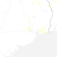
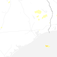


Connect with Interactive Hail Maps