

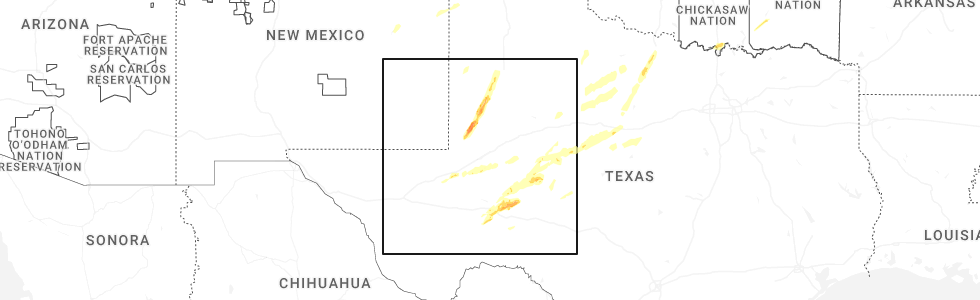
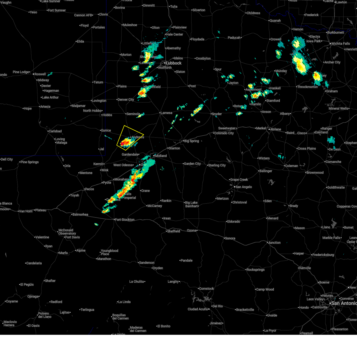
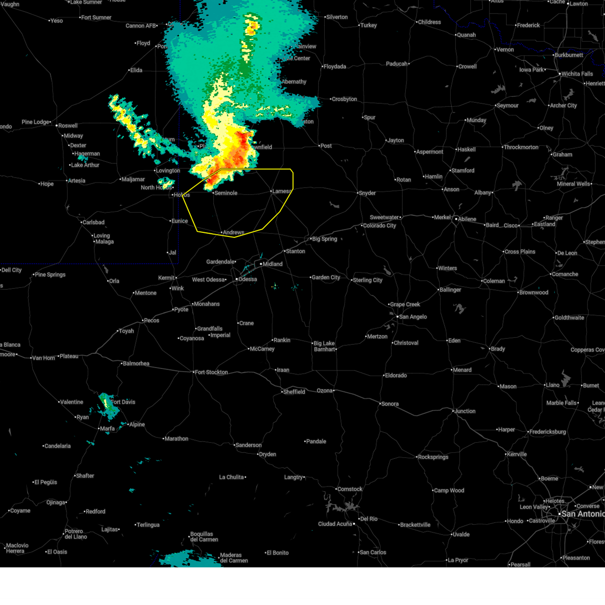
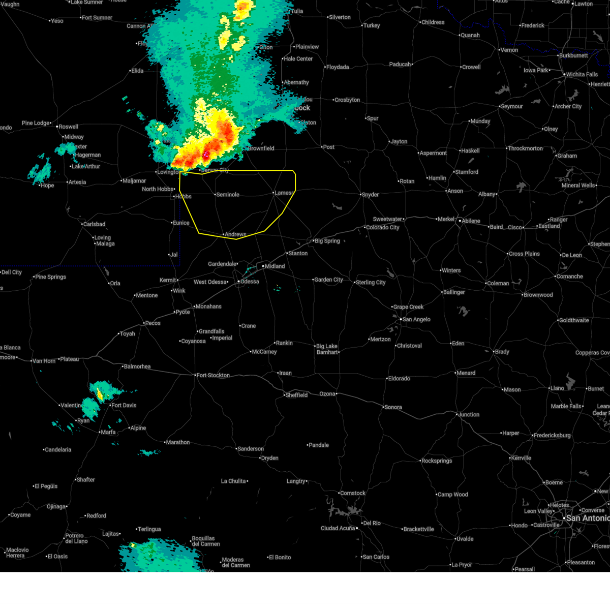
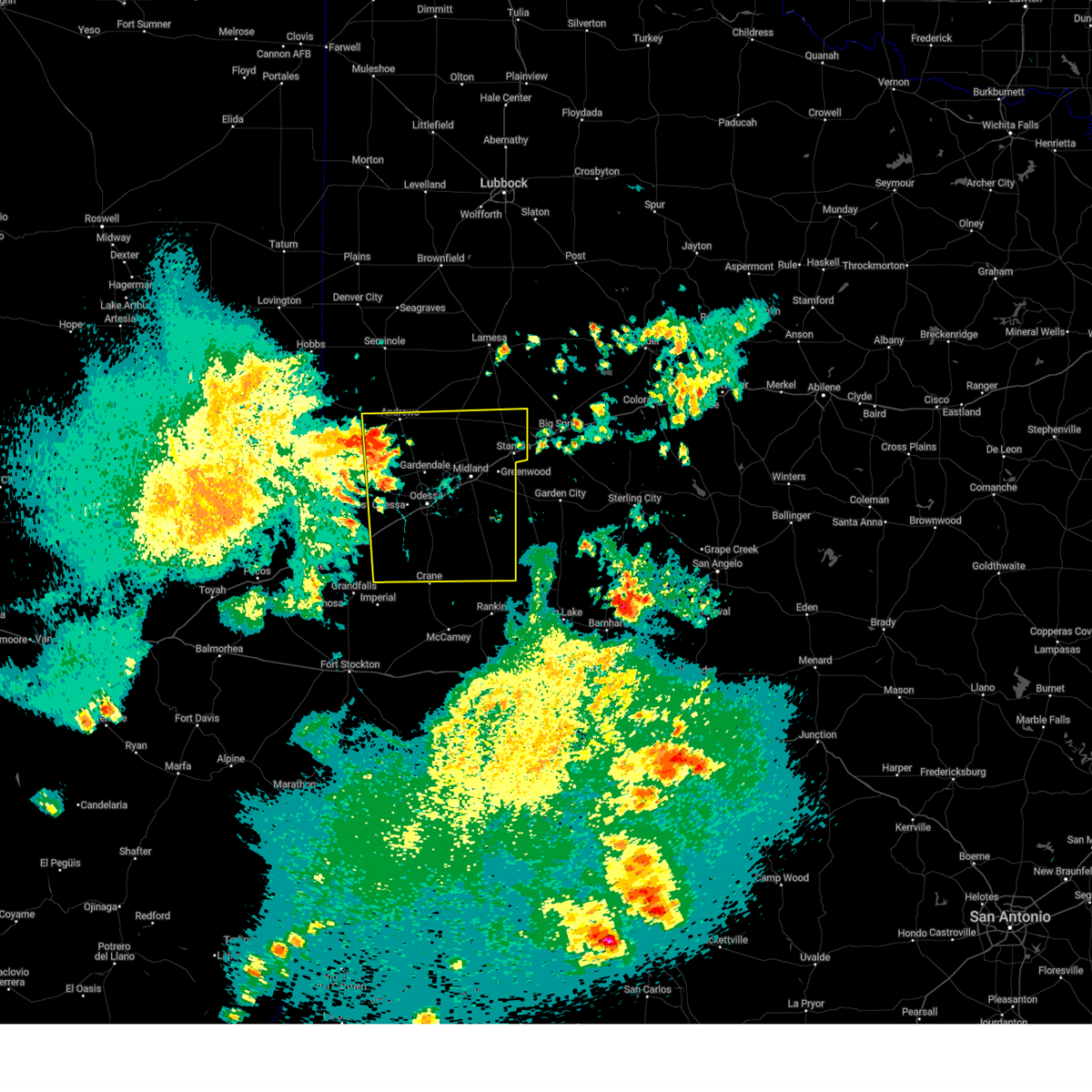
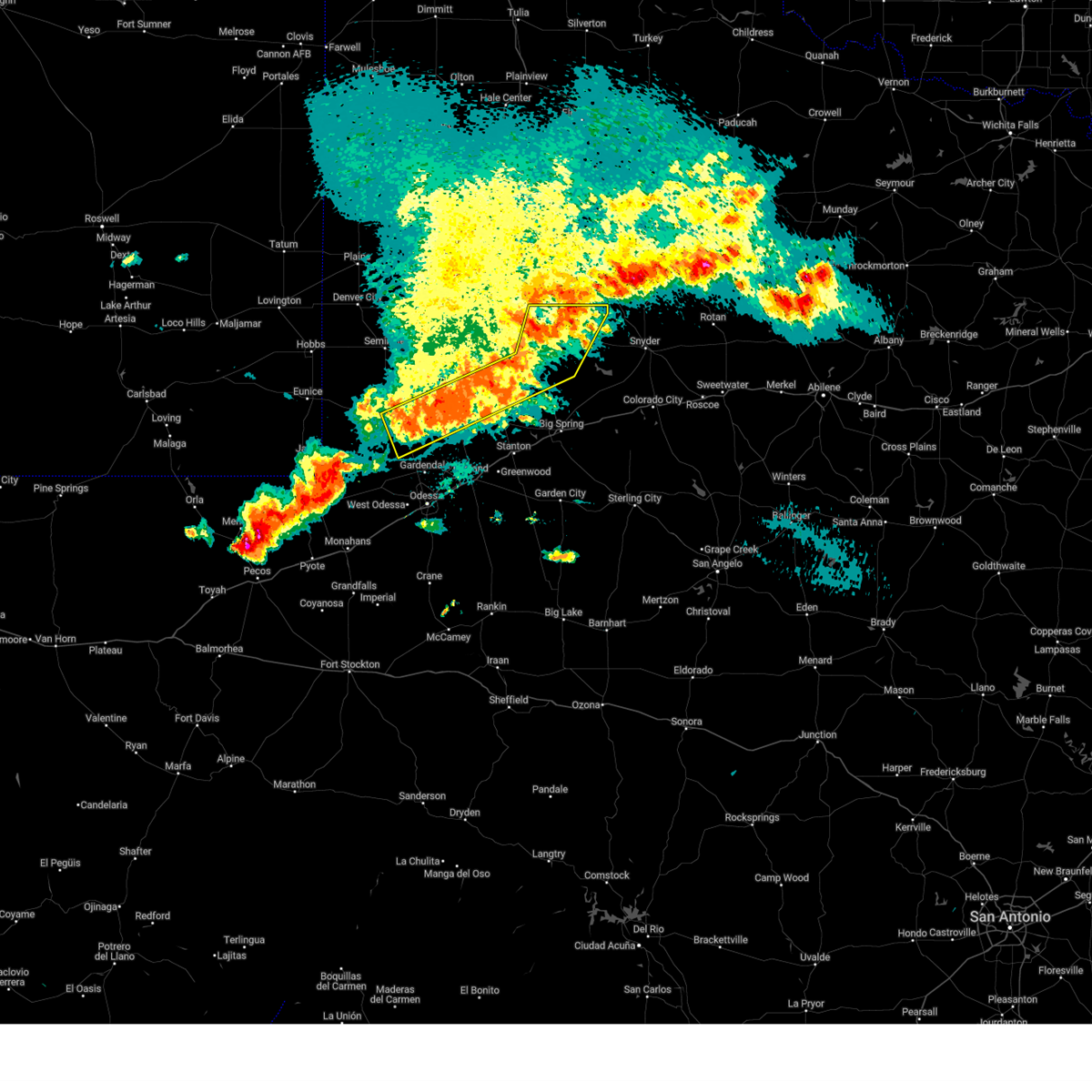
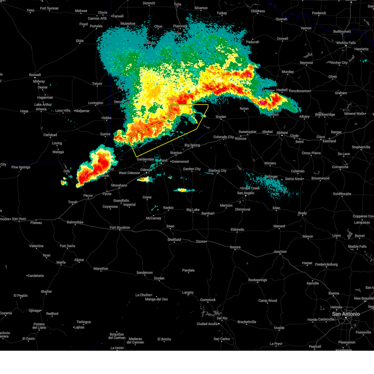
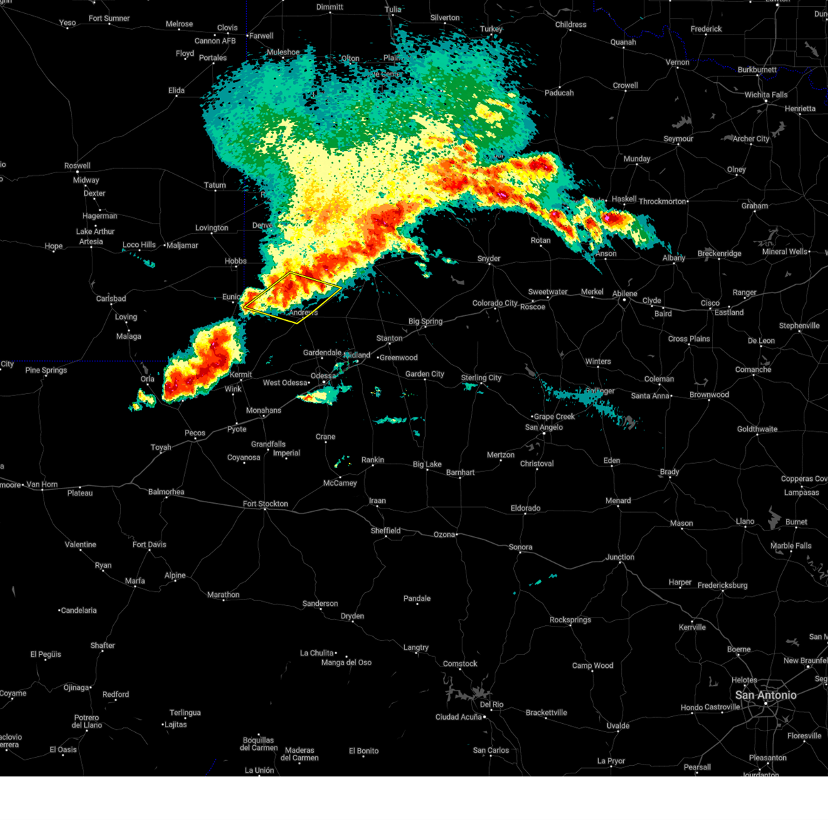
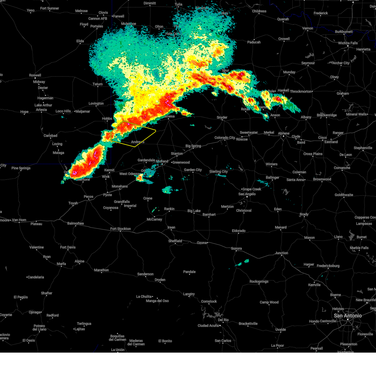
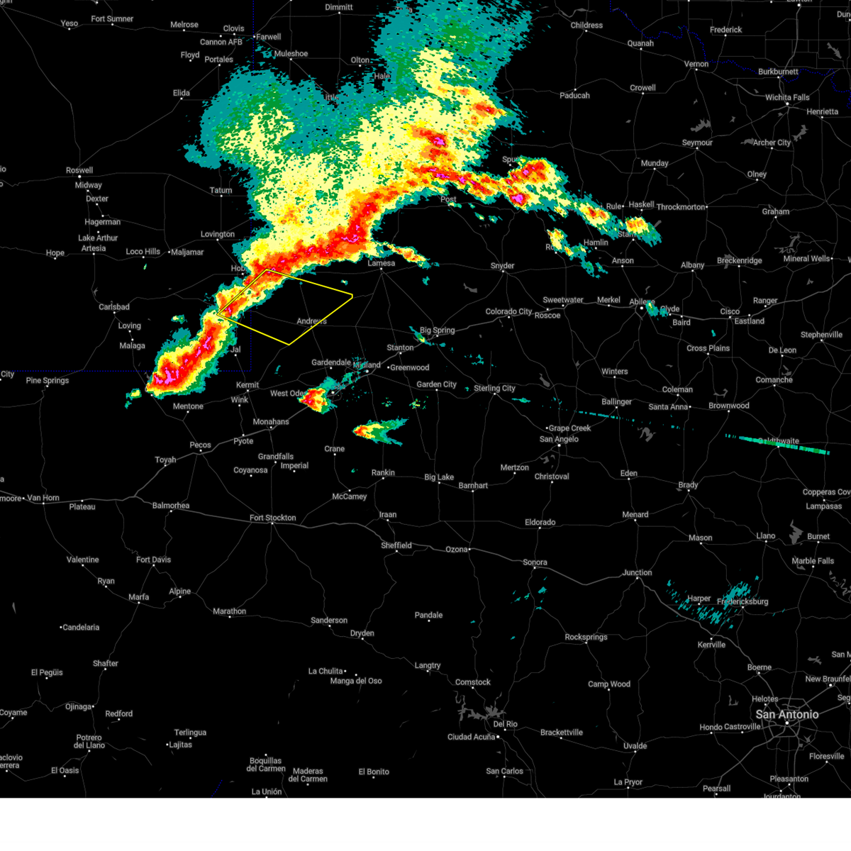
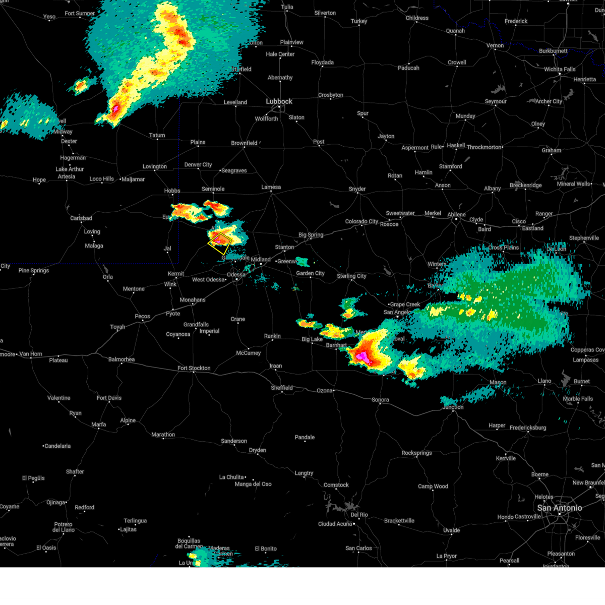
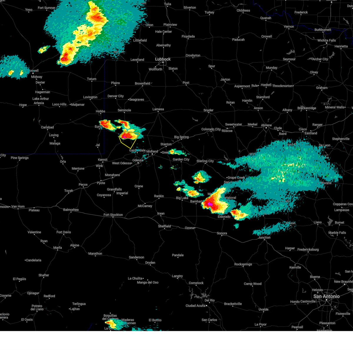
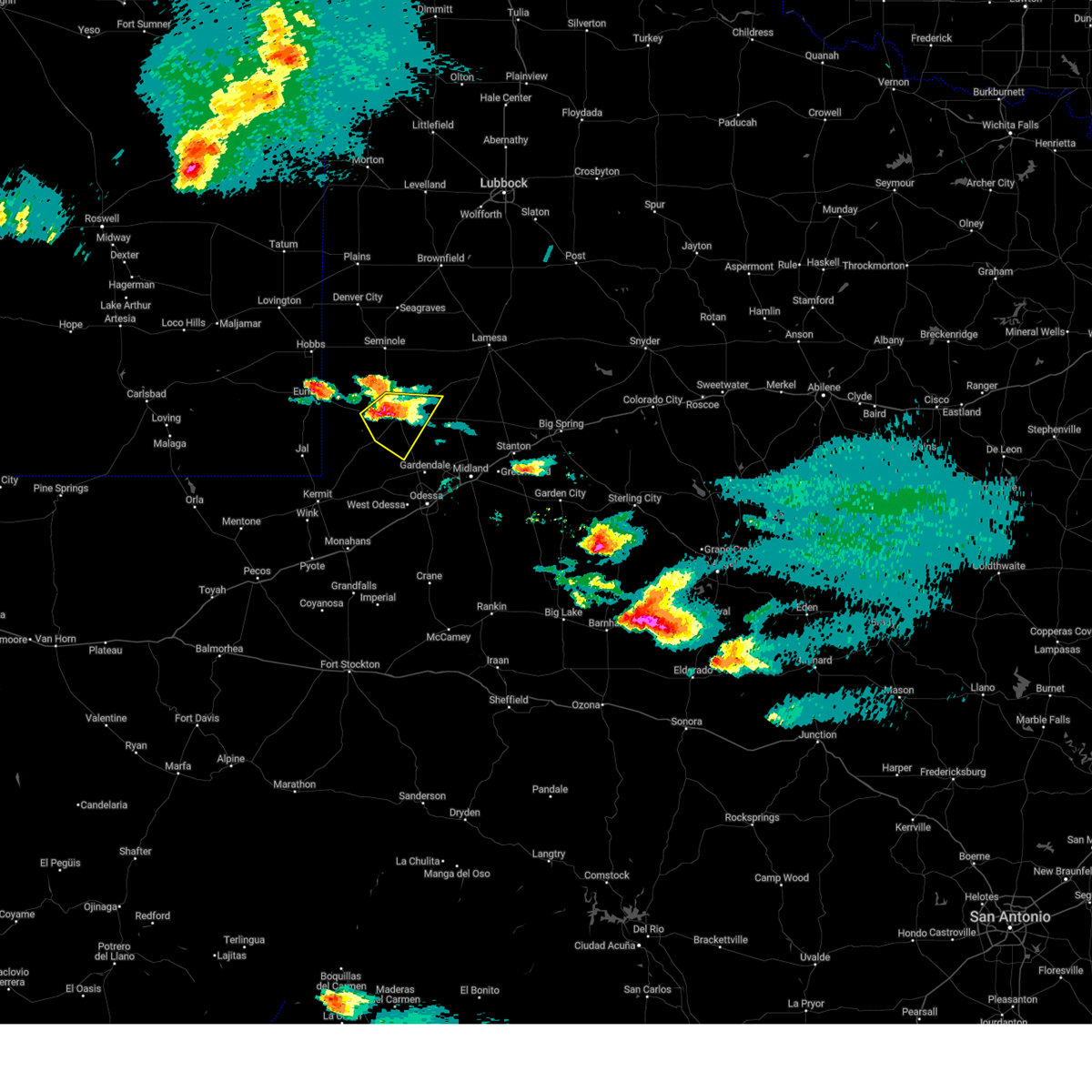
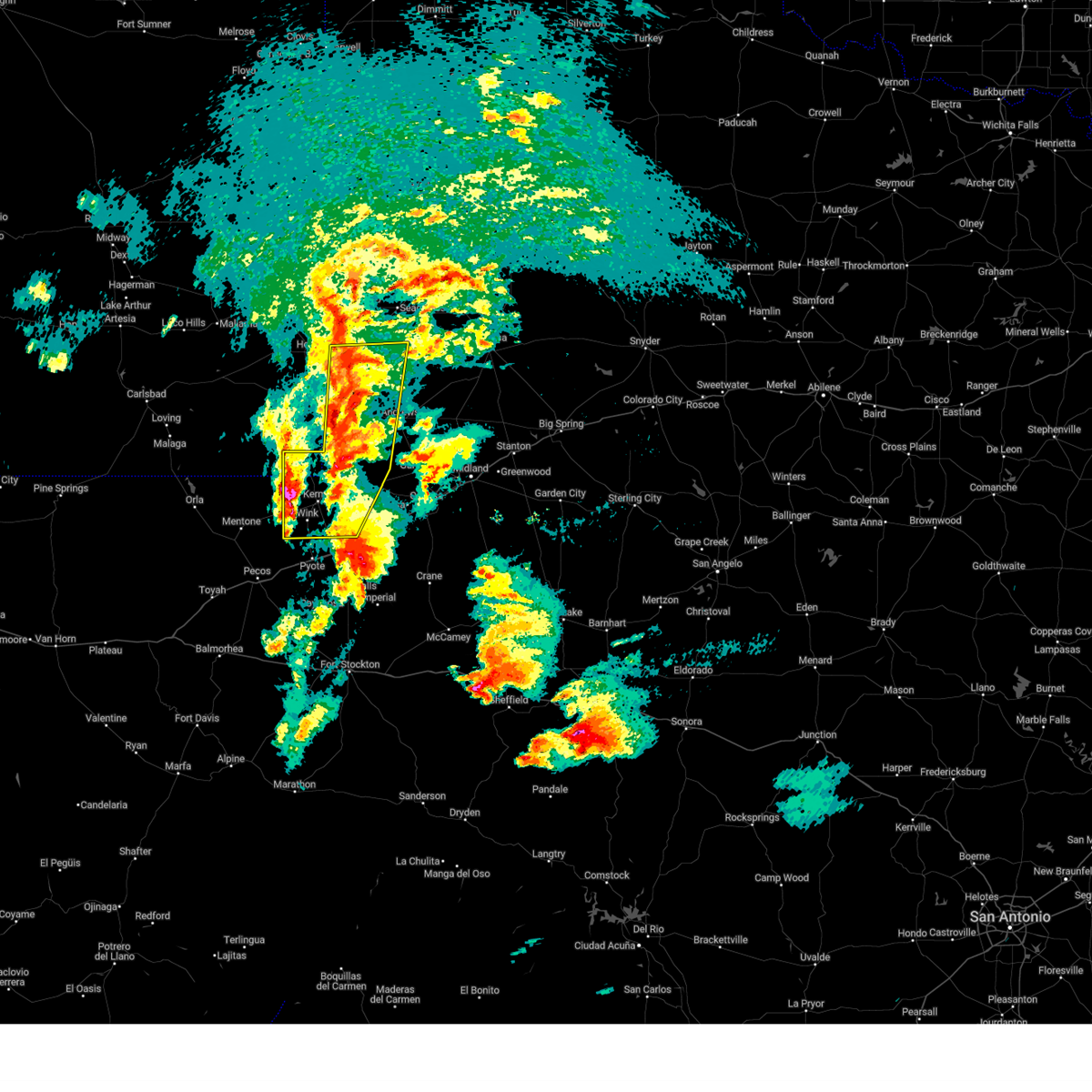
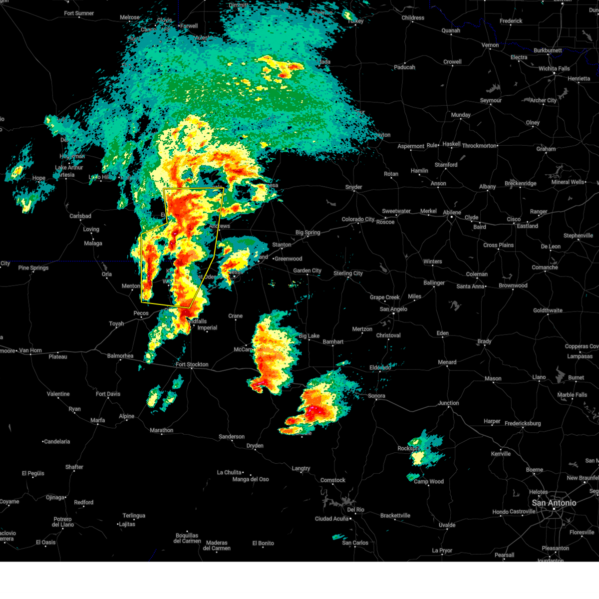
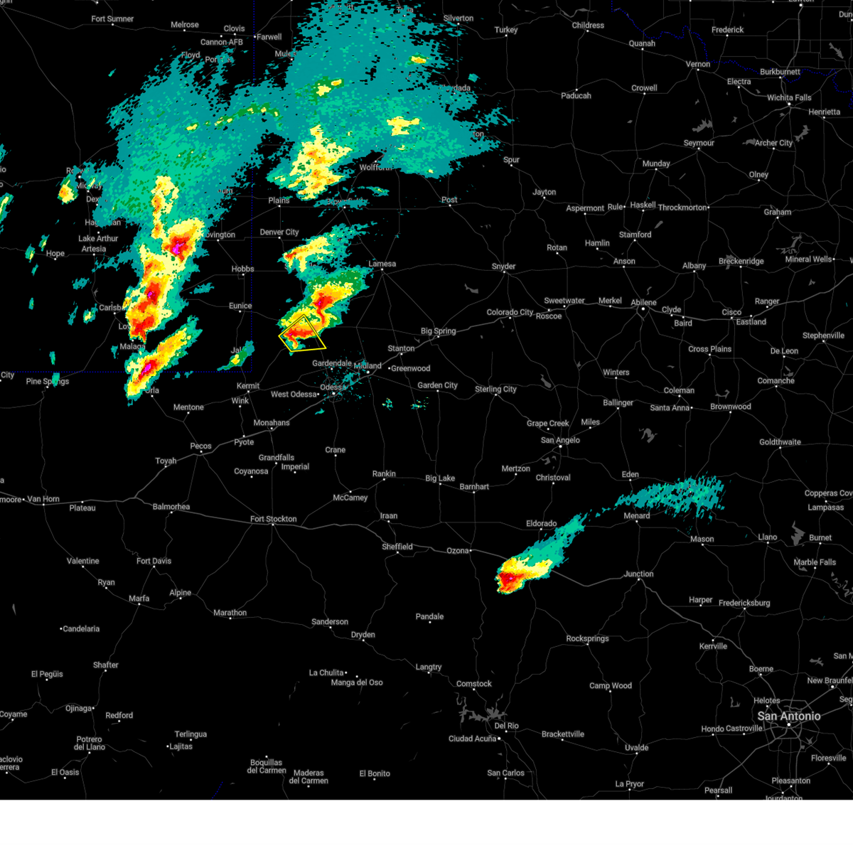
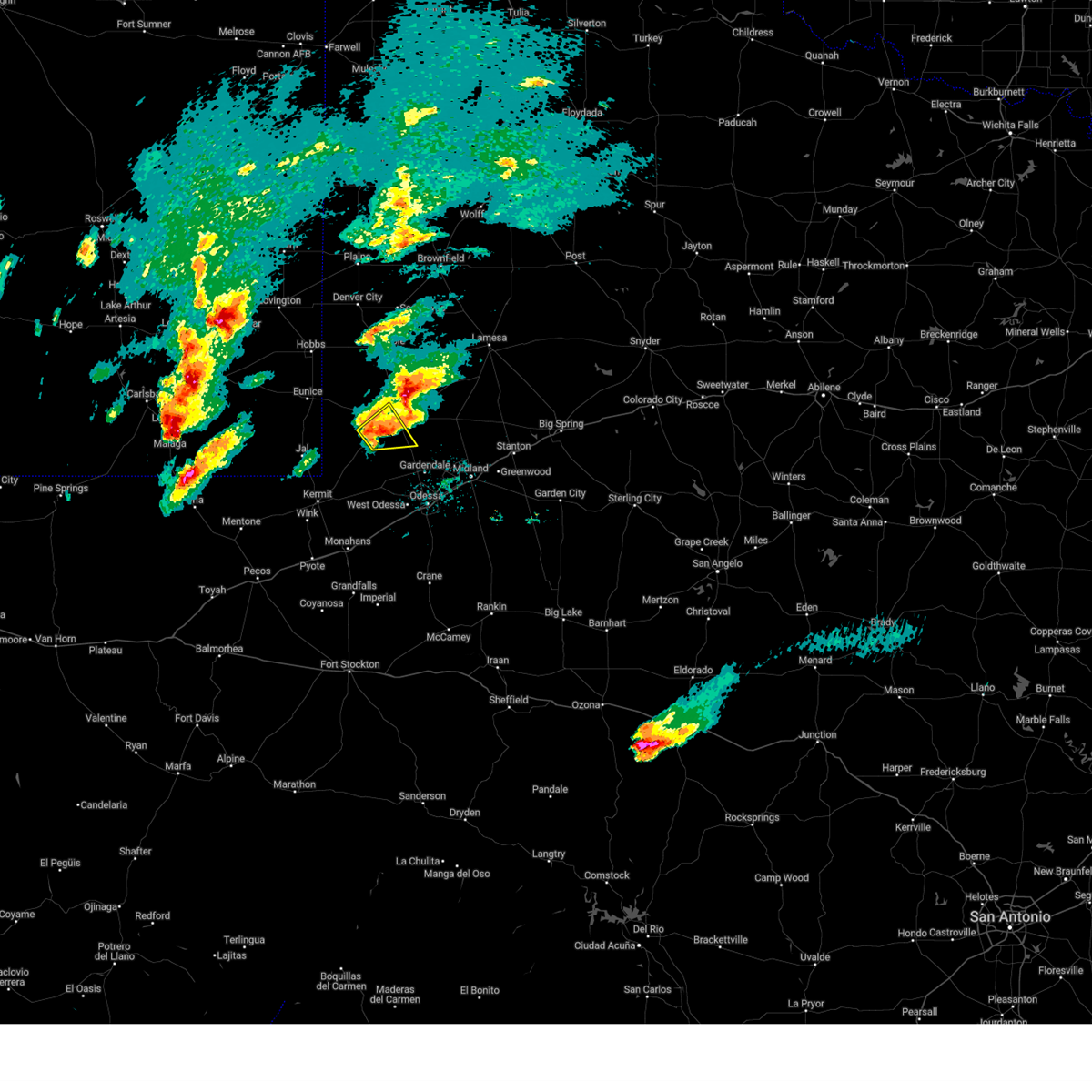
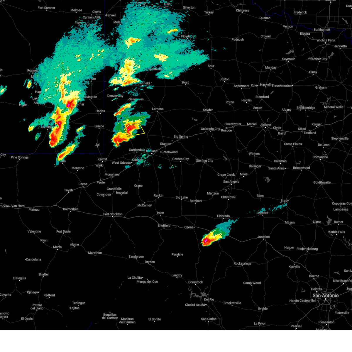
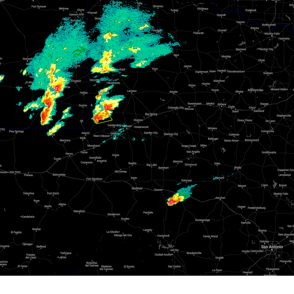
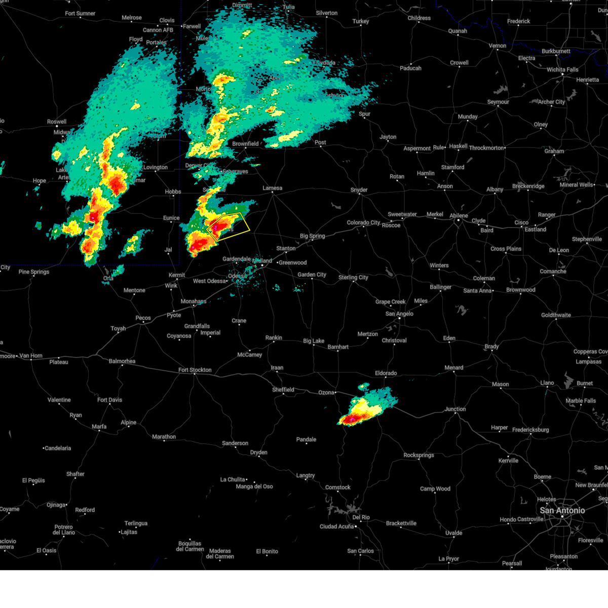
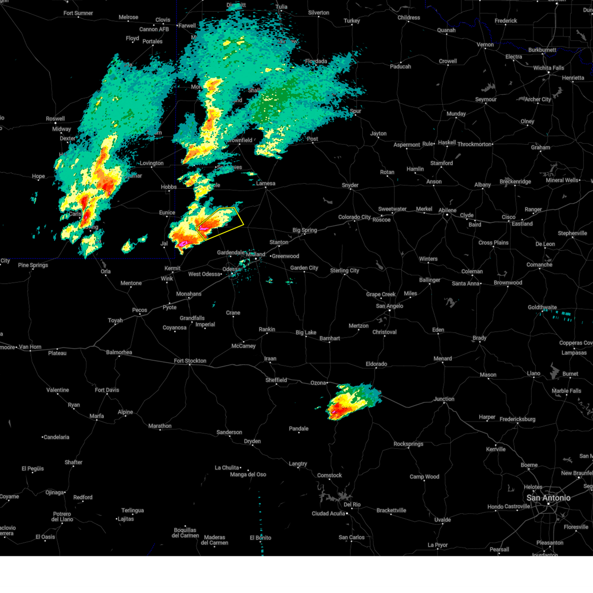
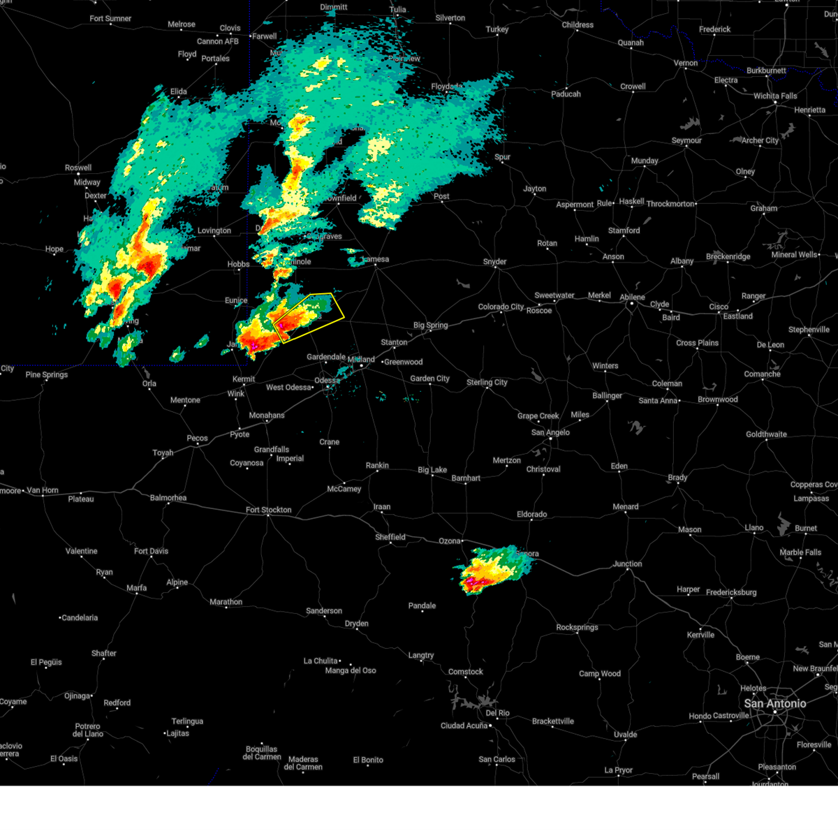
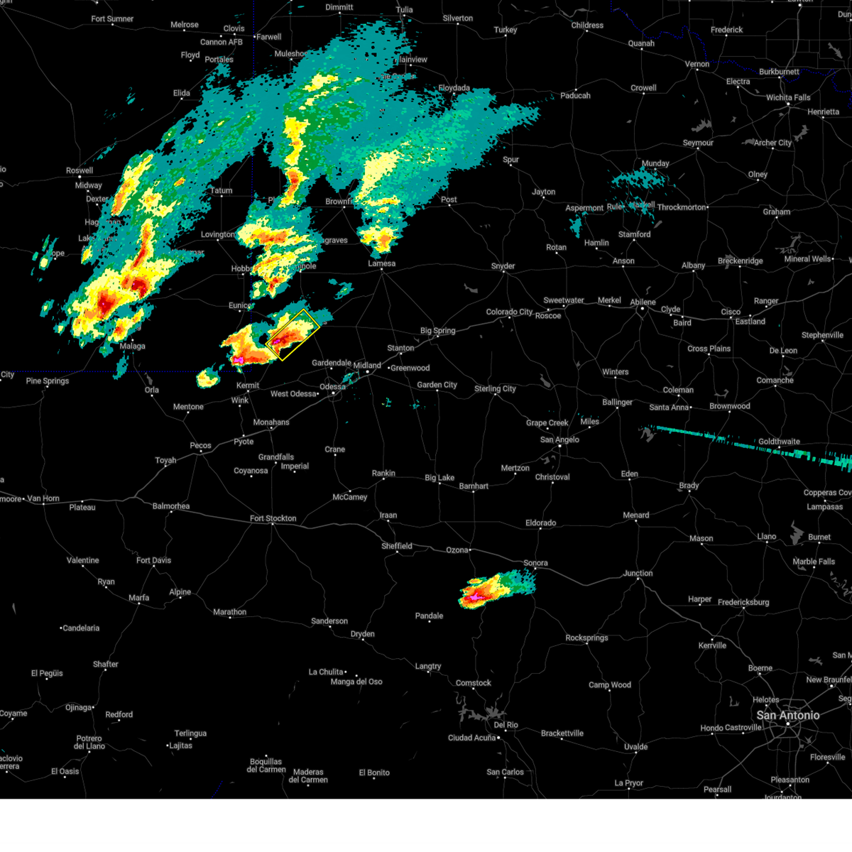
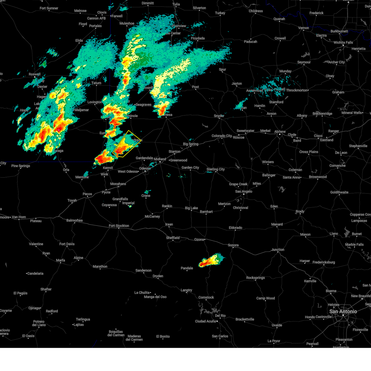
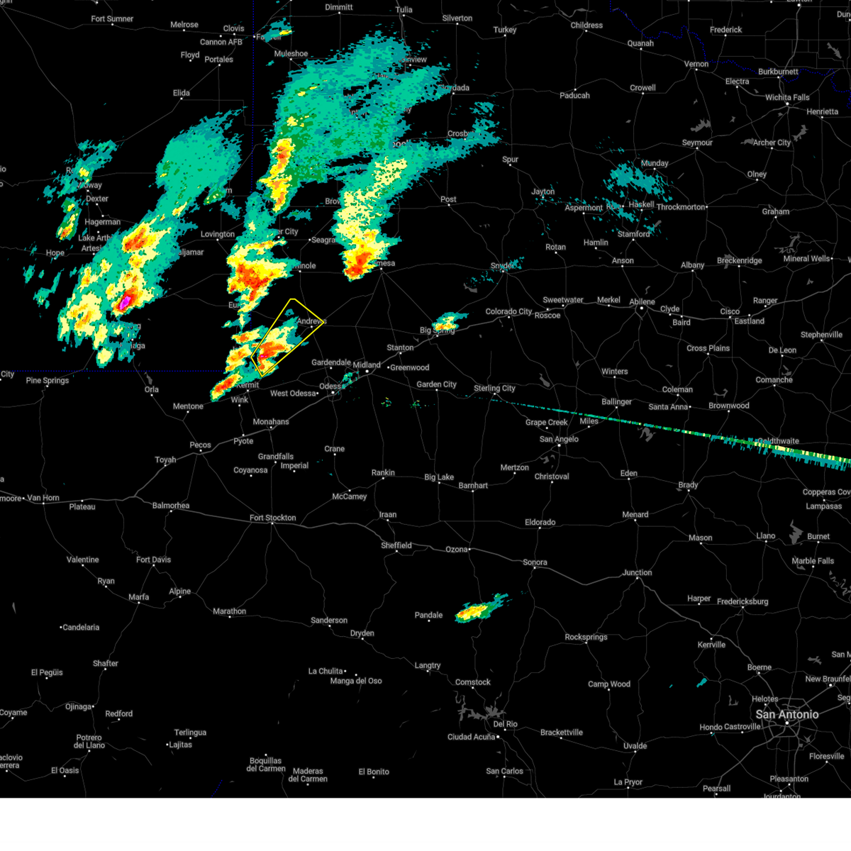
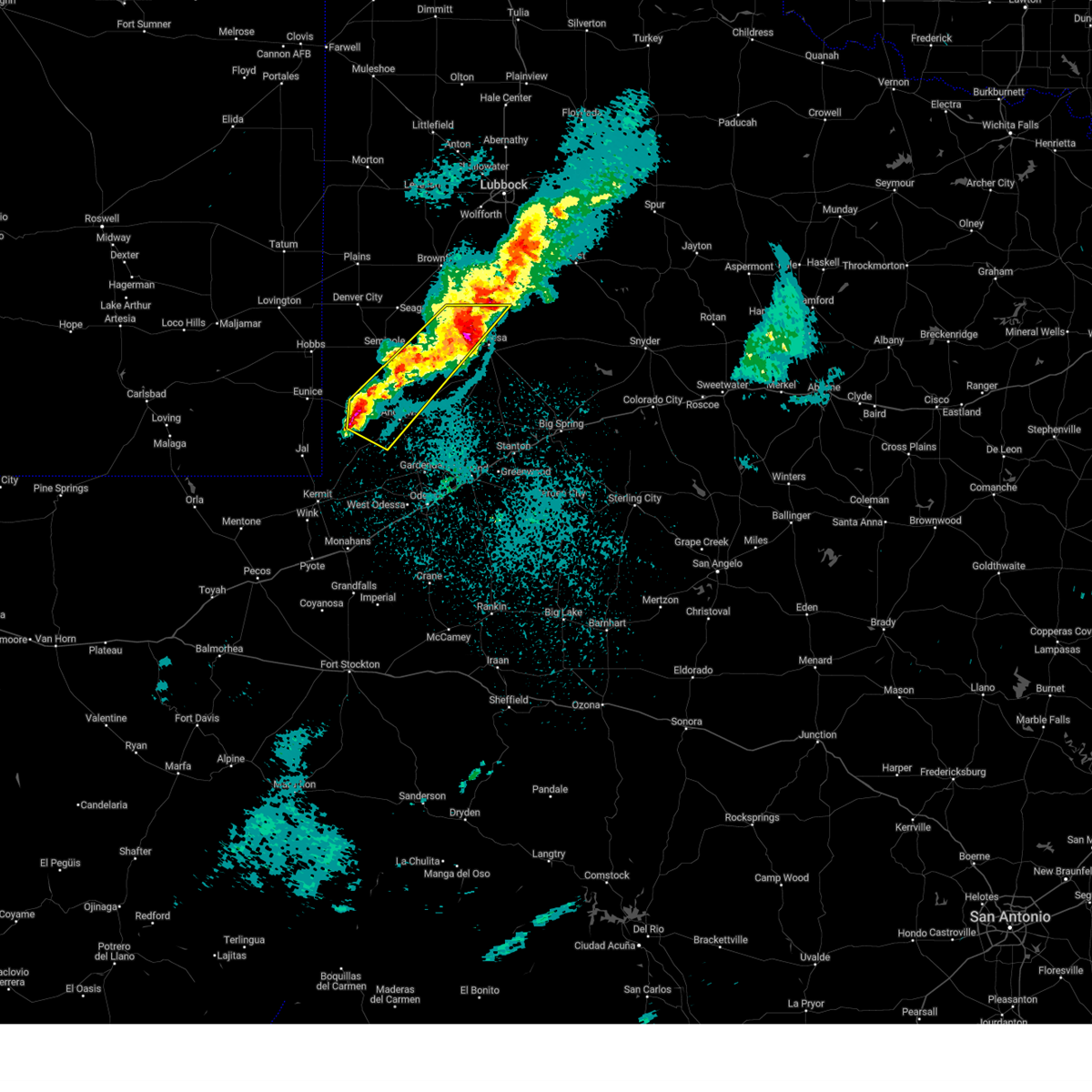
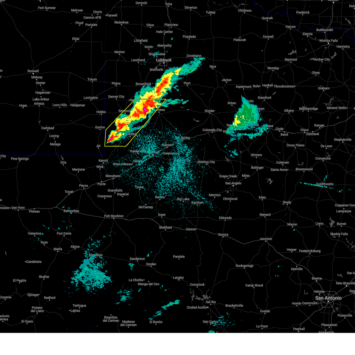
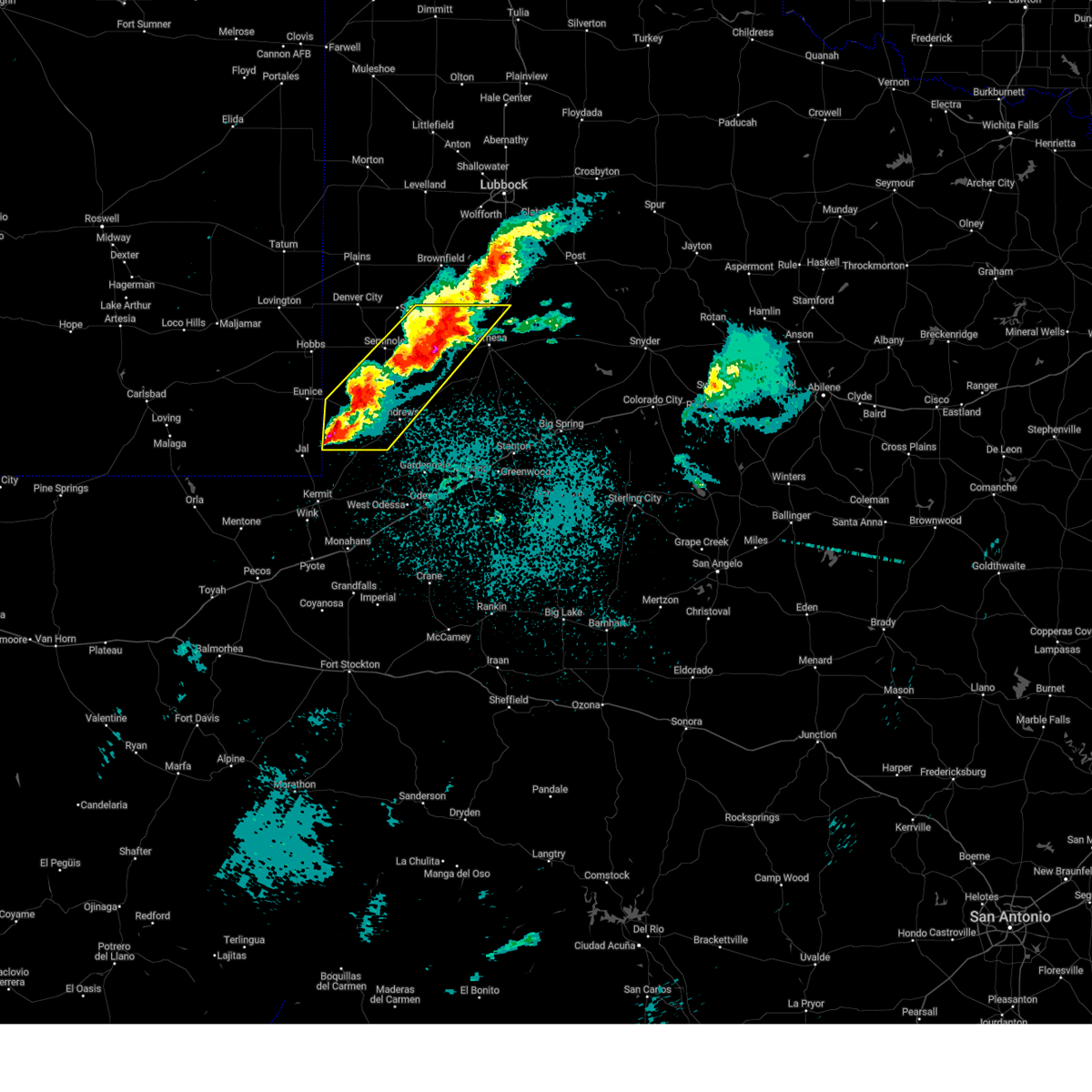
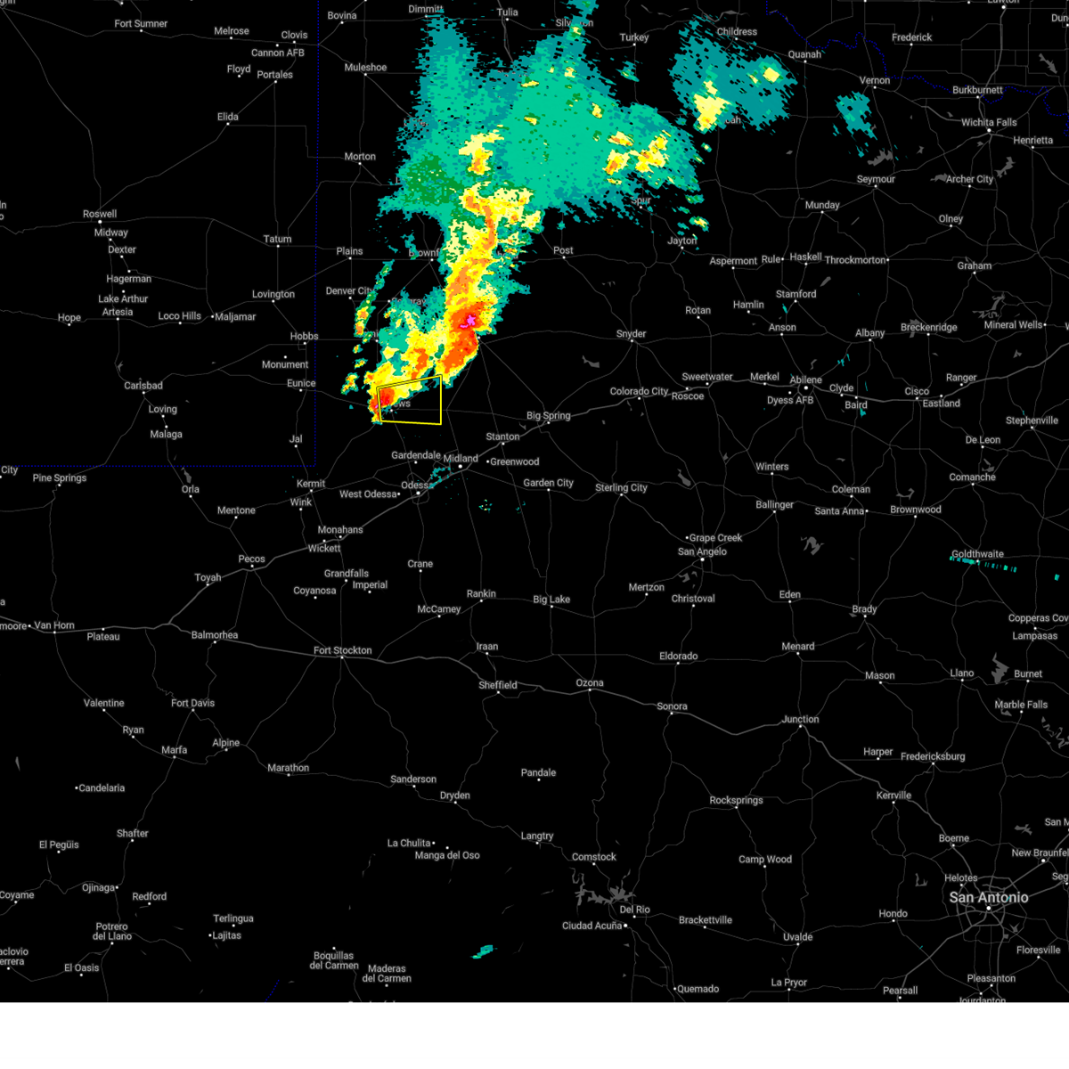
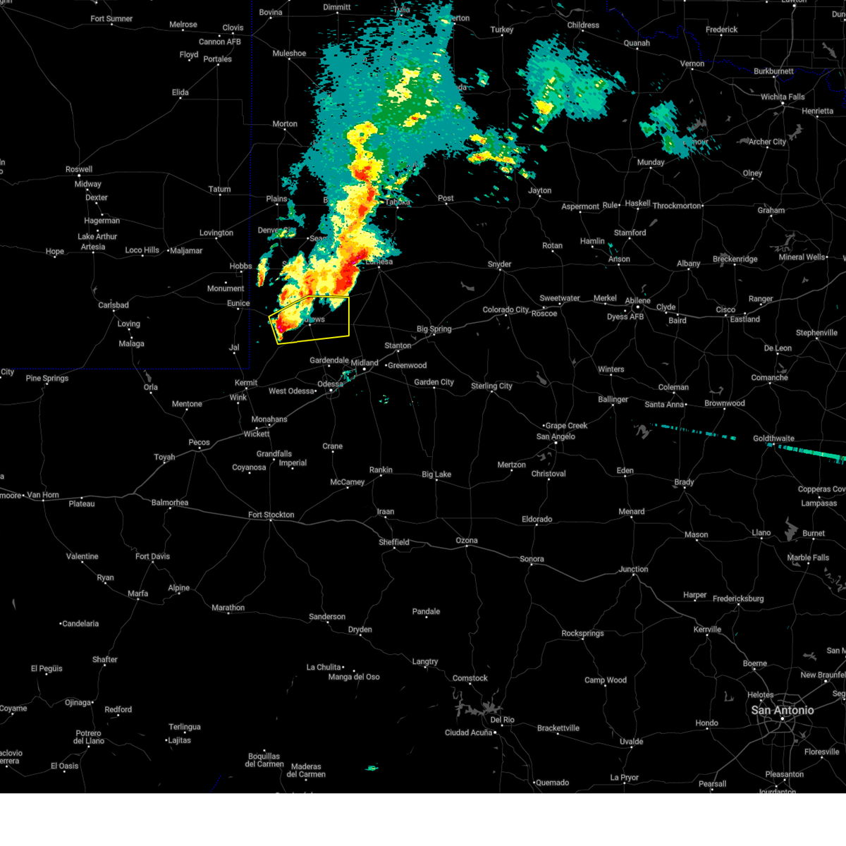
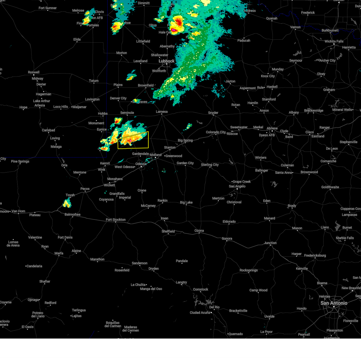
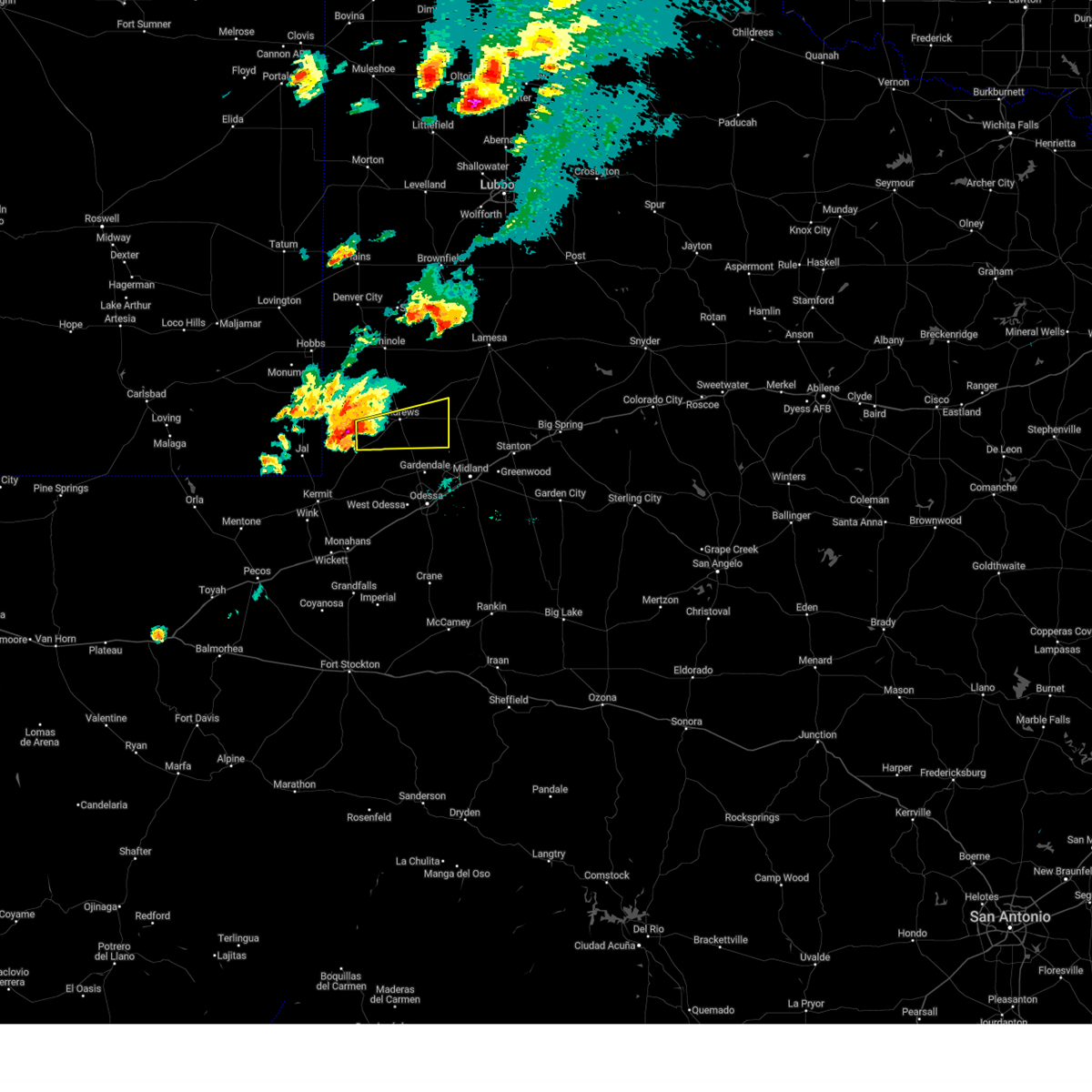
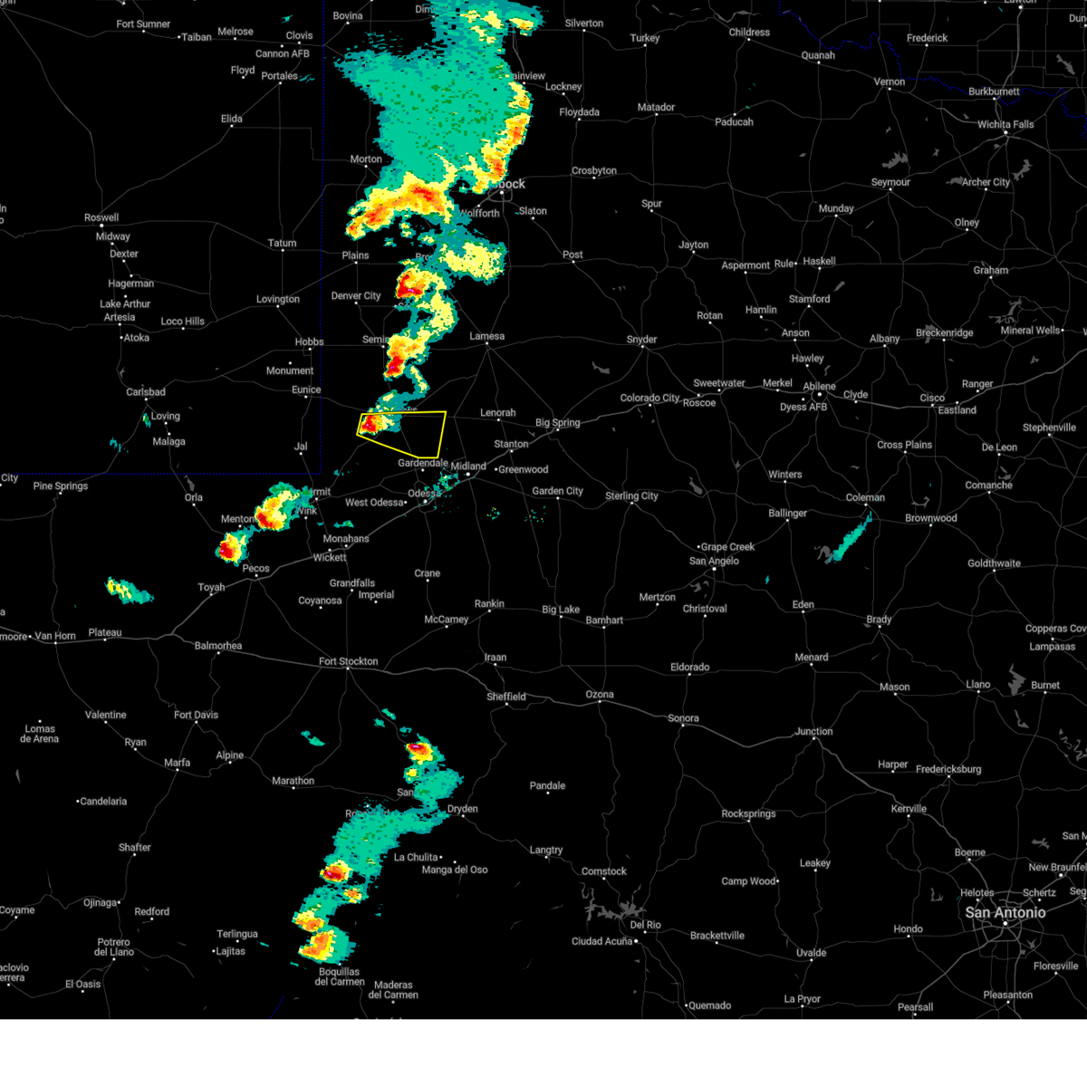
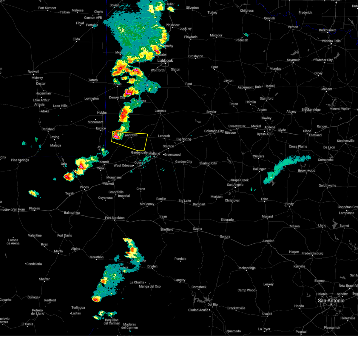
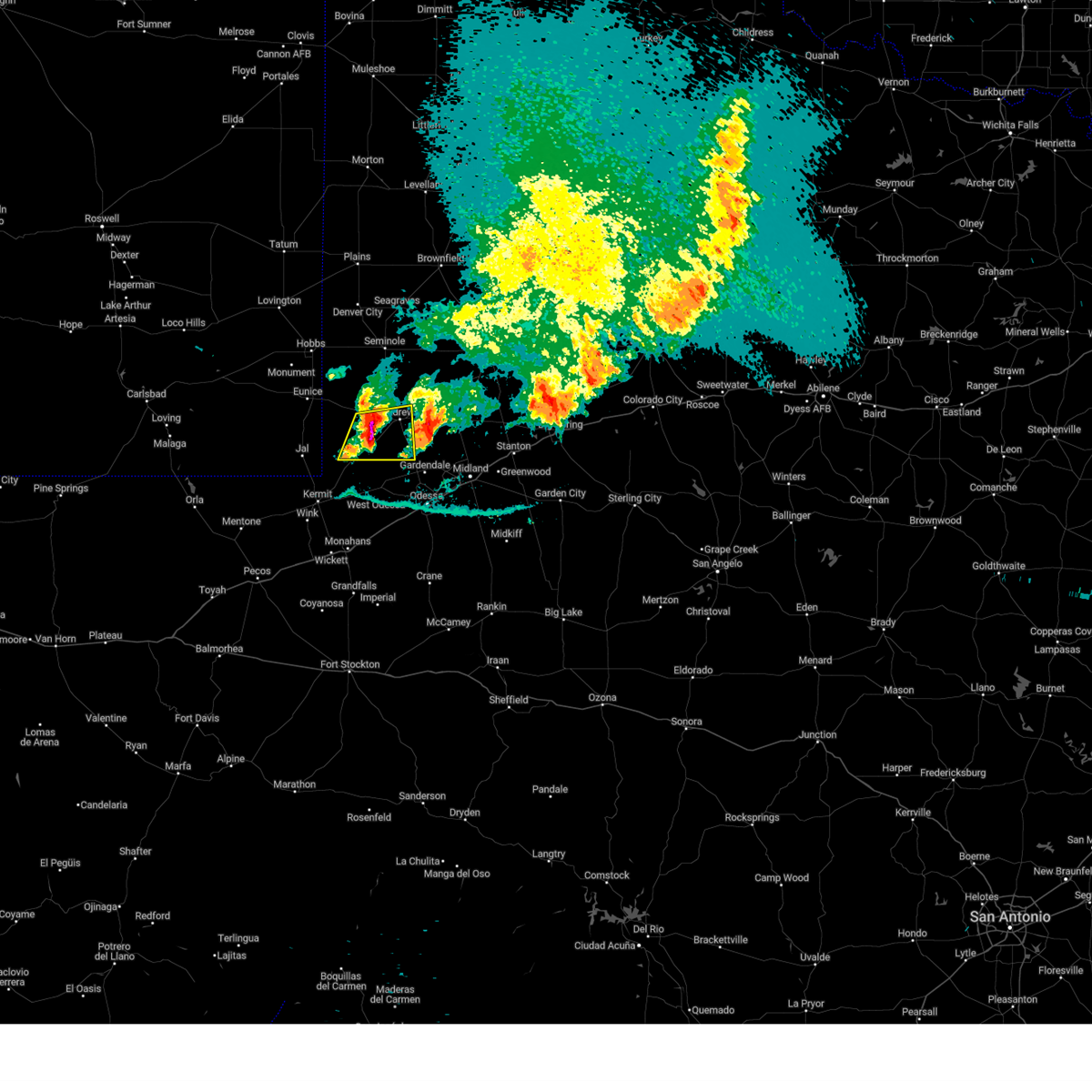
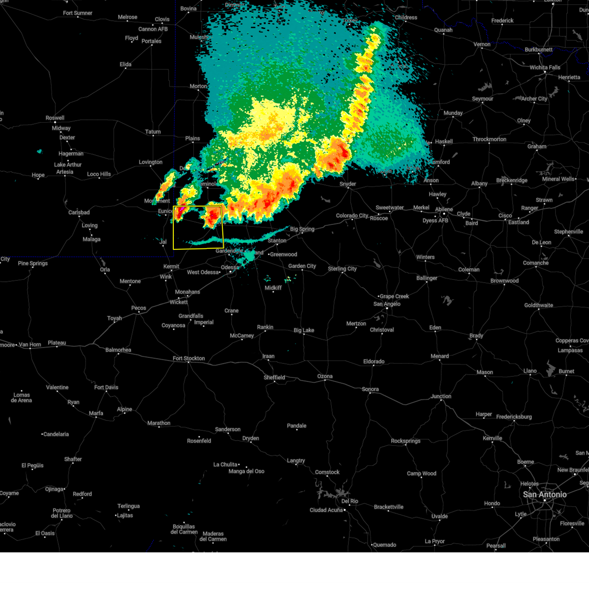
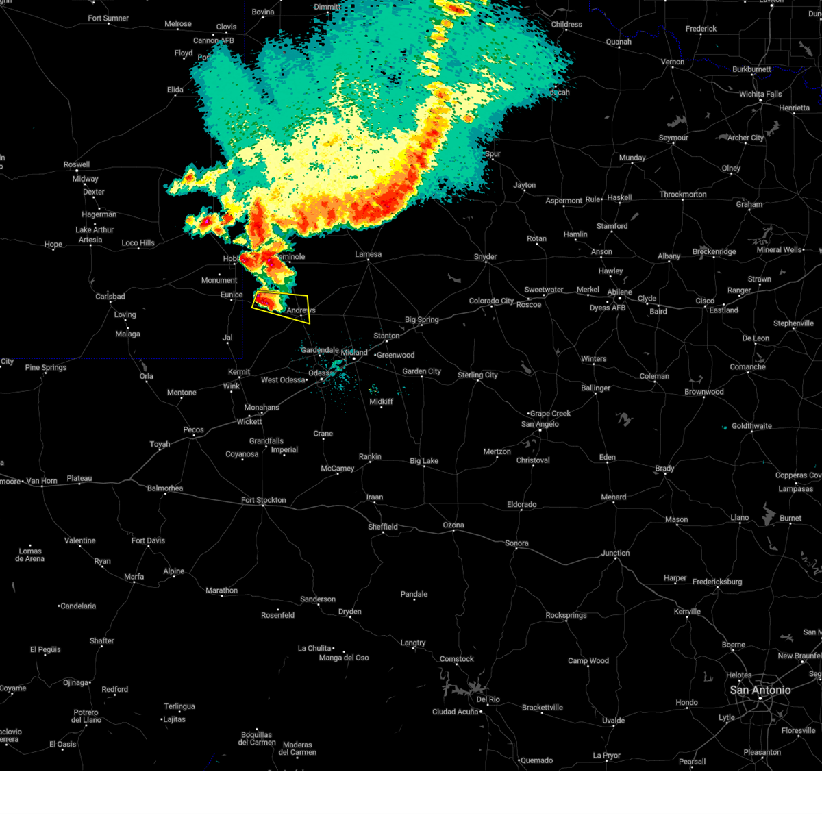
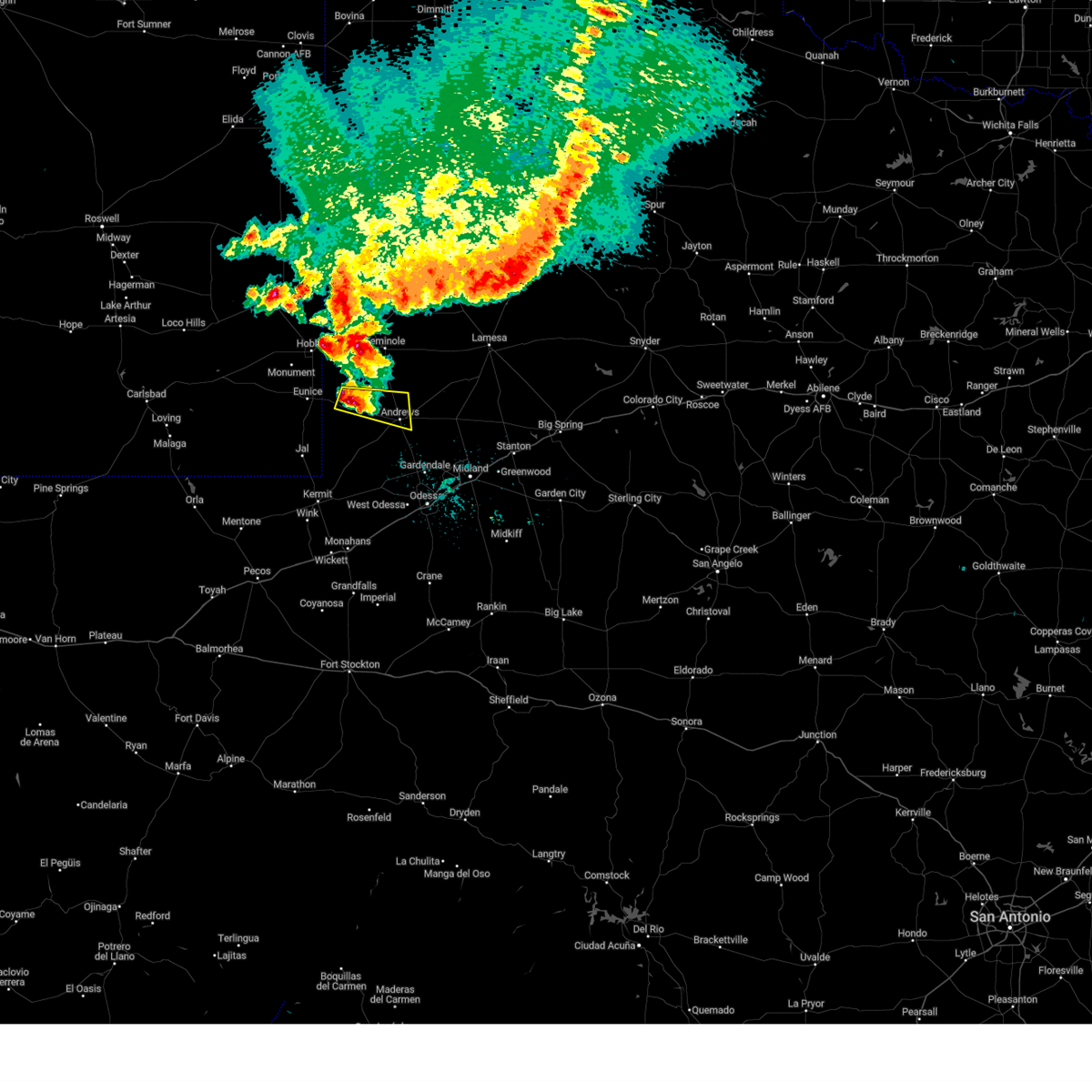
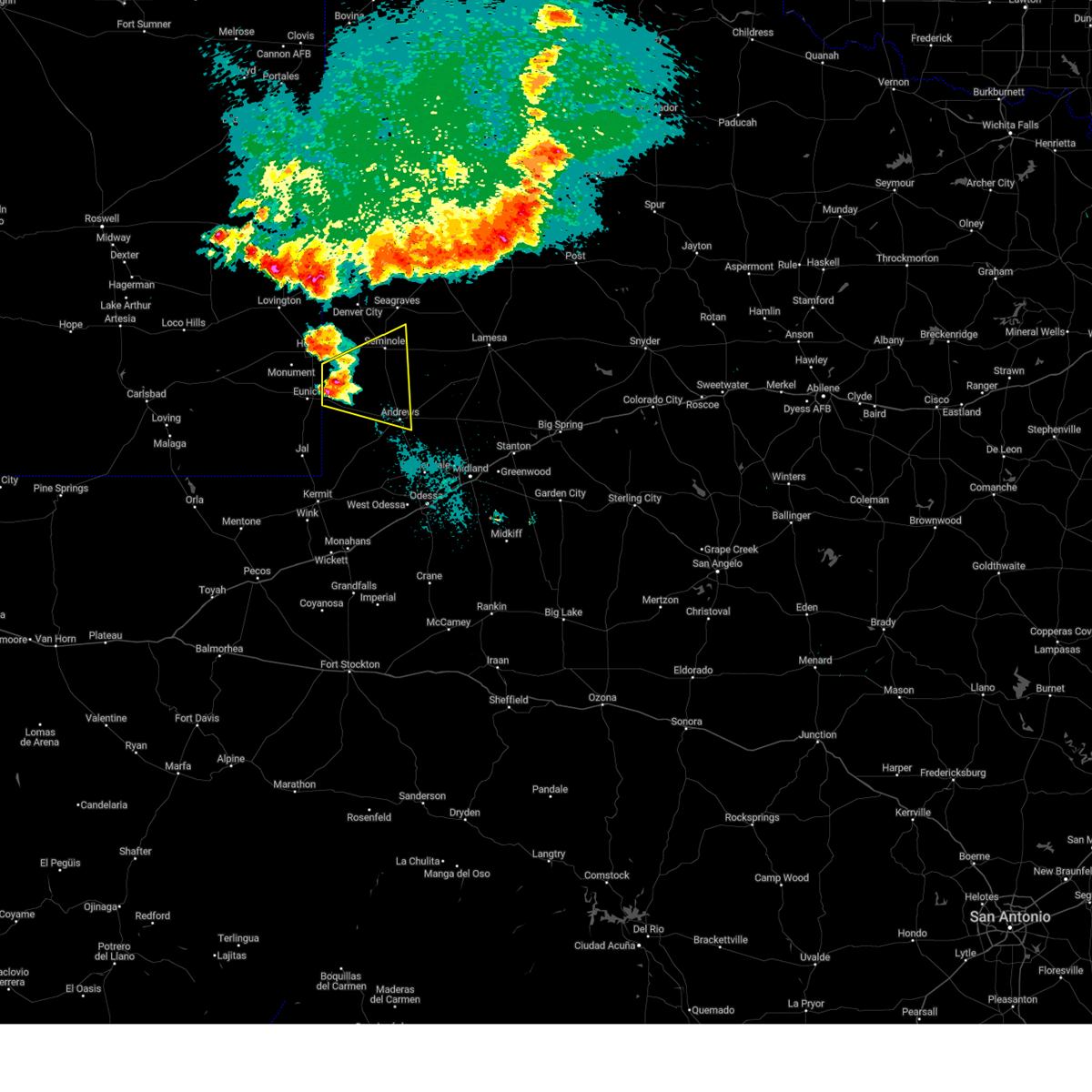
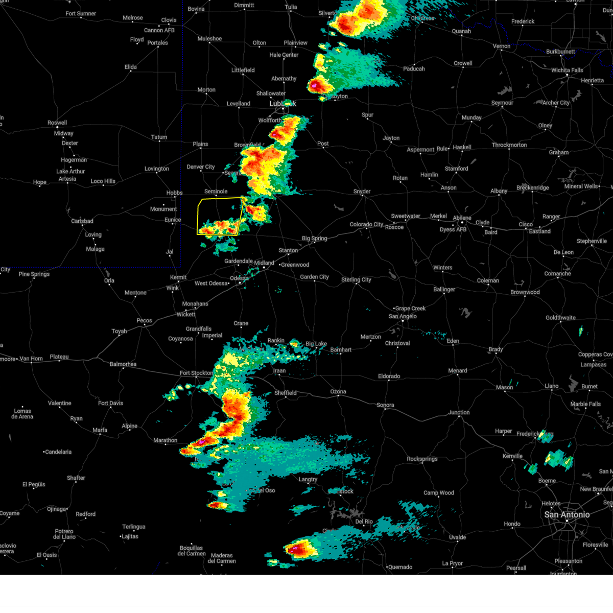
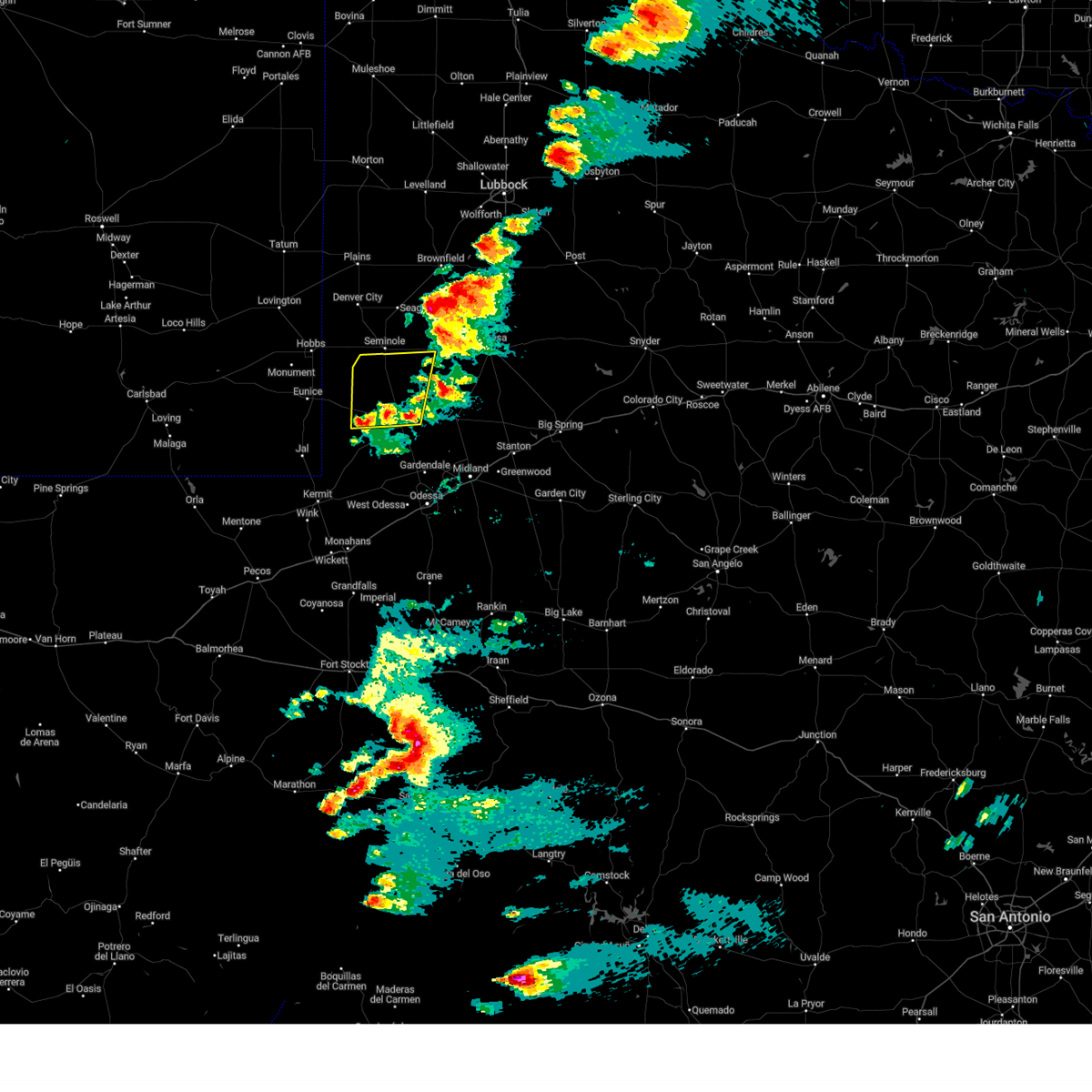
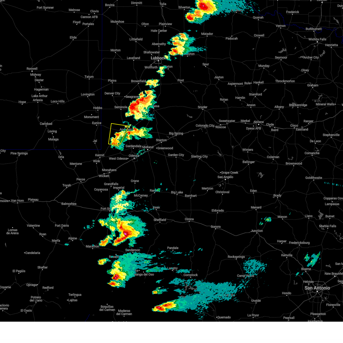
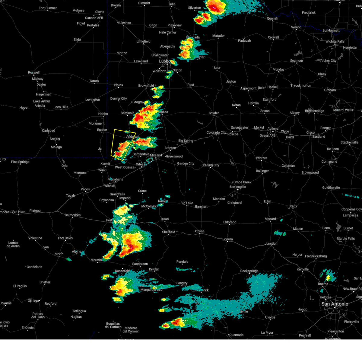
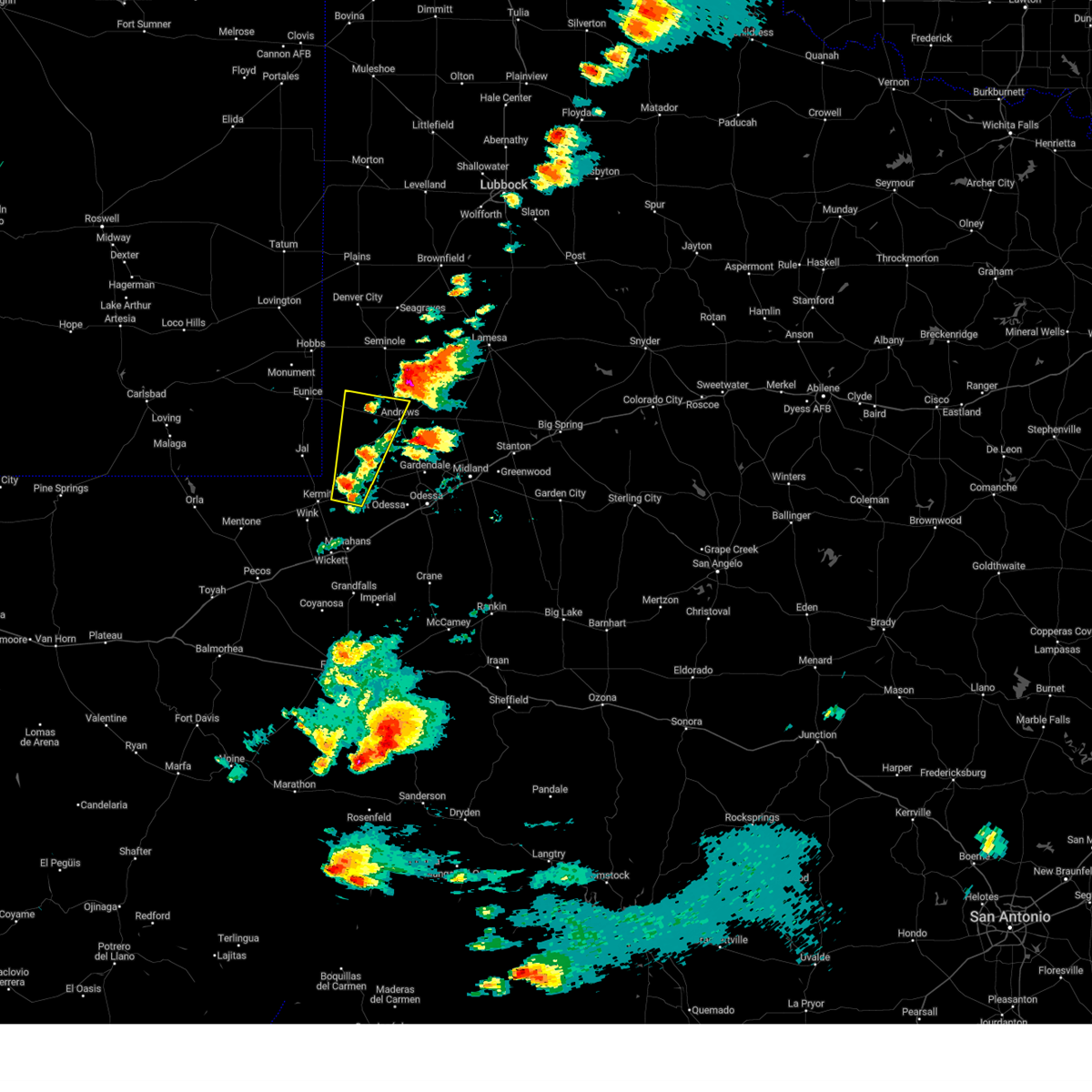
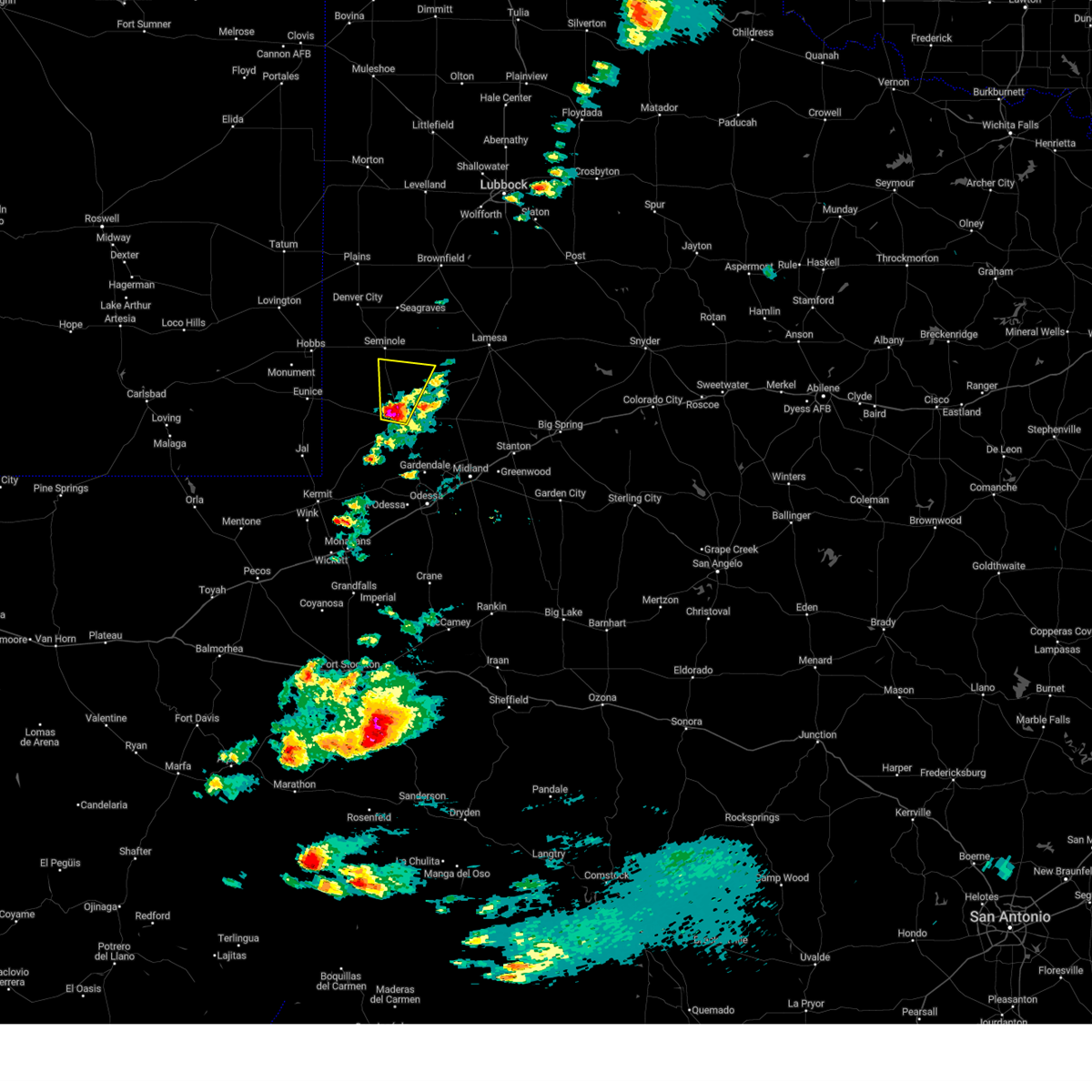
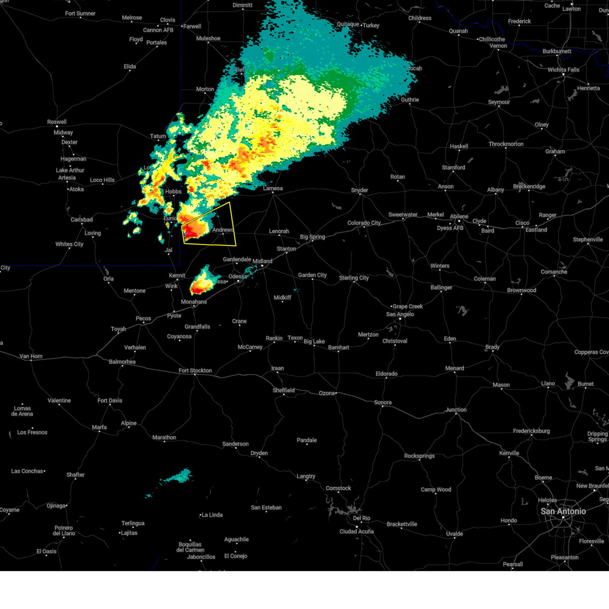
Hail Map for Andrews, TX
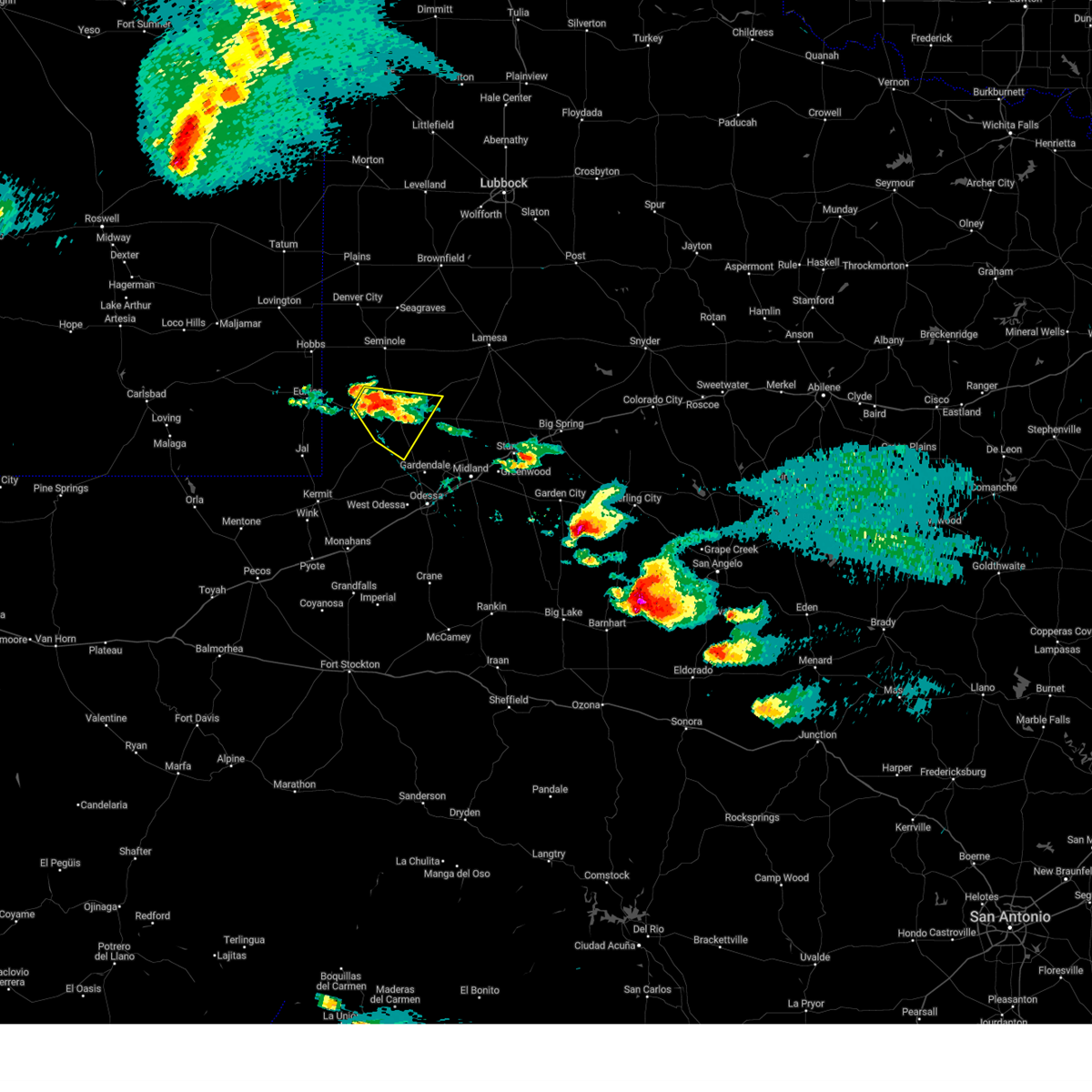
The Andrews, TX area has had 38 reports of on-the-ground hail by trained spotters, and has been under severe weather warnings 12 times during the past 12 months. Doppler radar has detected hail at or near Andrews, TX on 78 occasions, including 2 occasions during the past year.
| Name: | Andrews, TX |
| Where Located: | 34.1 miles NNW of Odessa, TX |
| Map: | Google Map for Andrews, TX |
| Population: | 11088 |
| Housing Units: | 4379 |
| More Info: | Search Google for Andrews, TX |
2
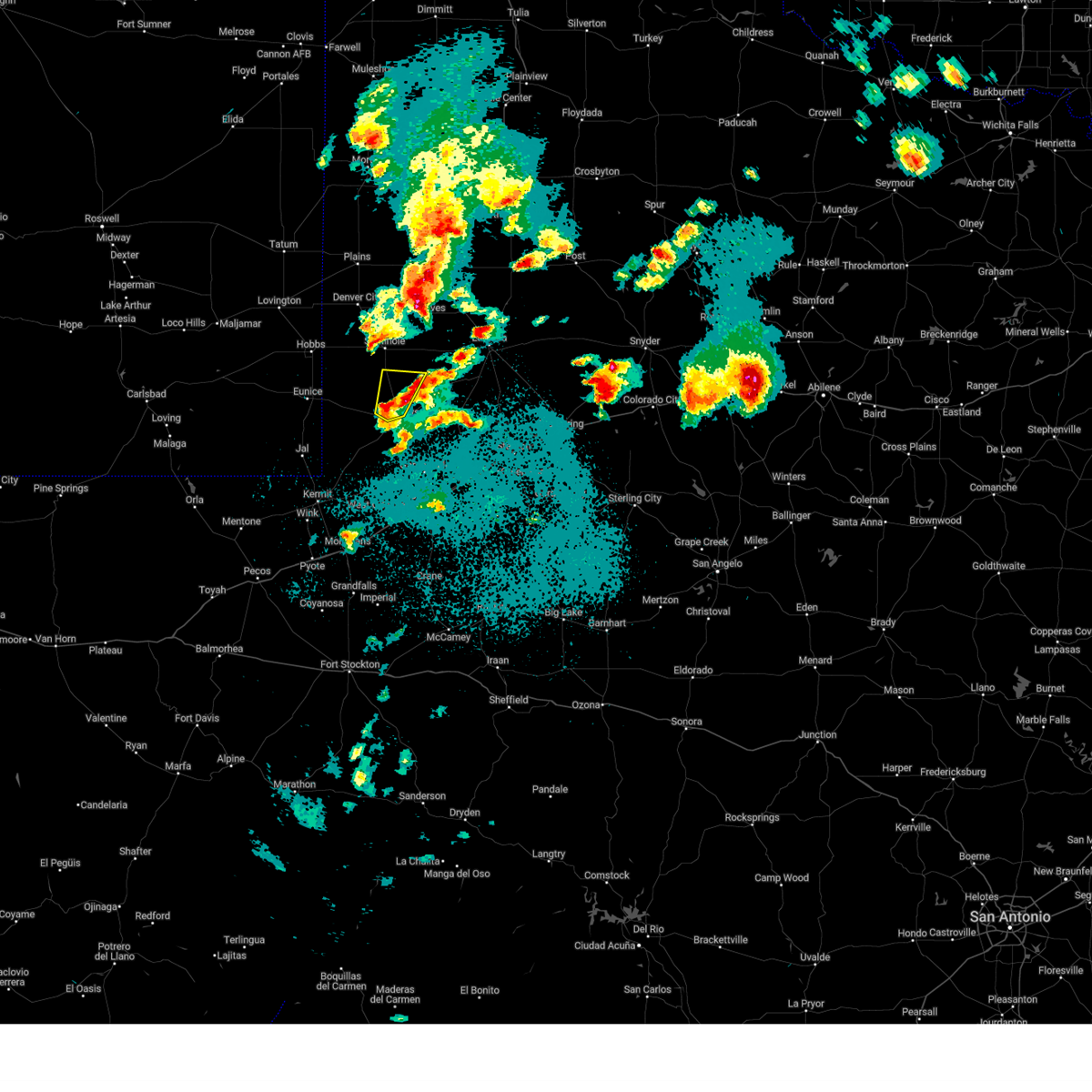
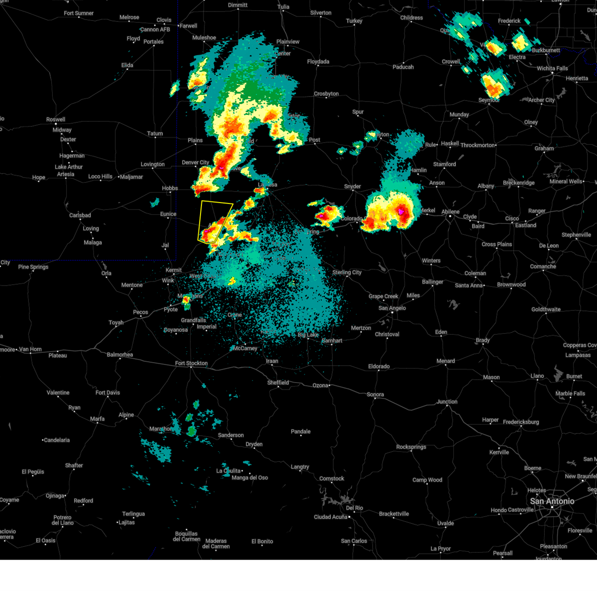
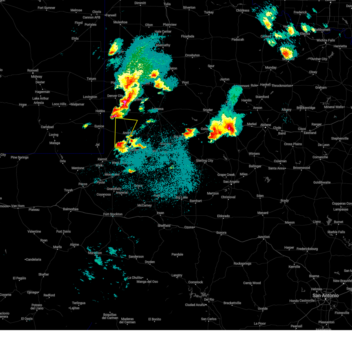
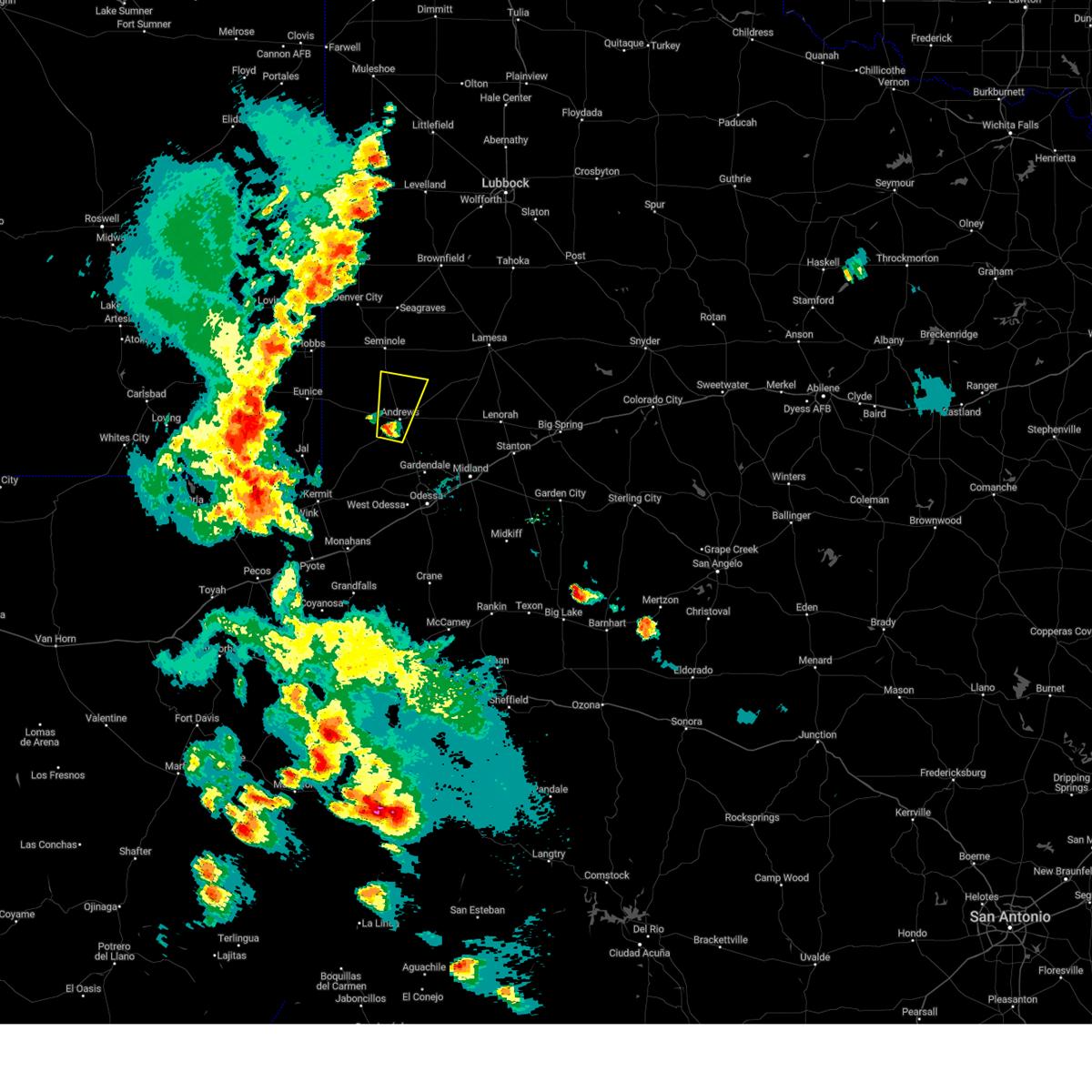
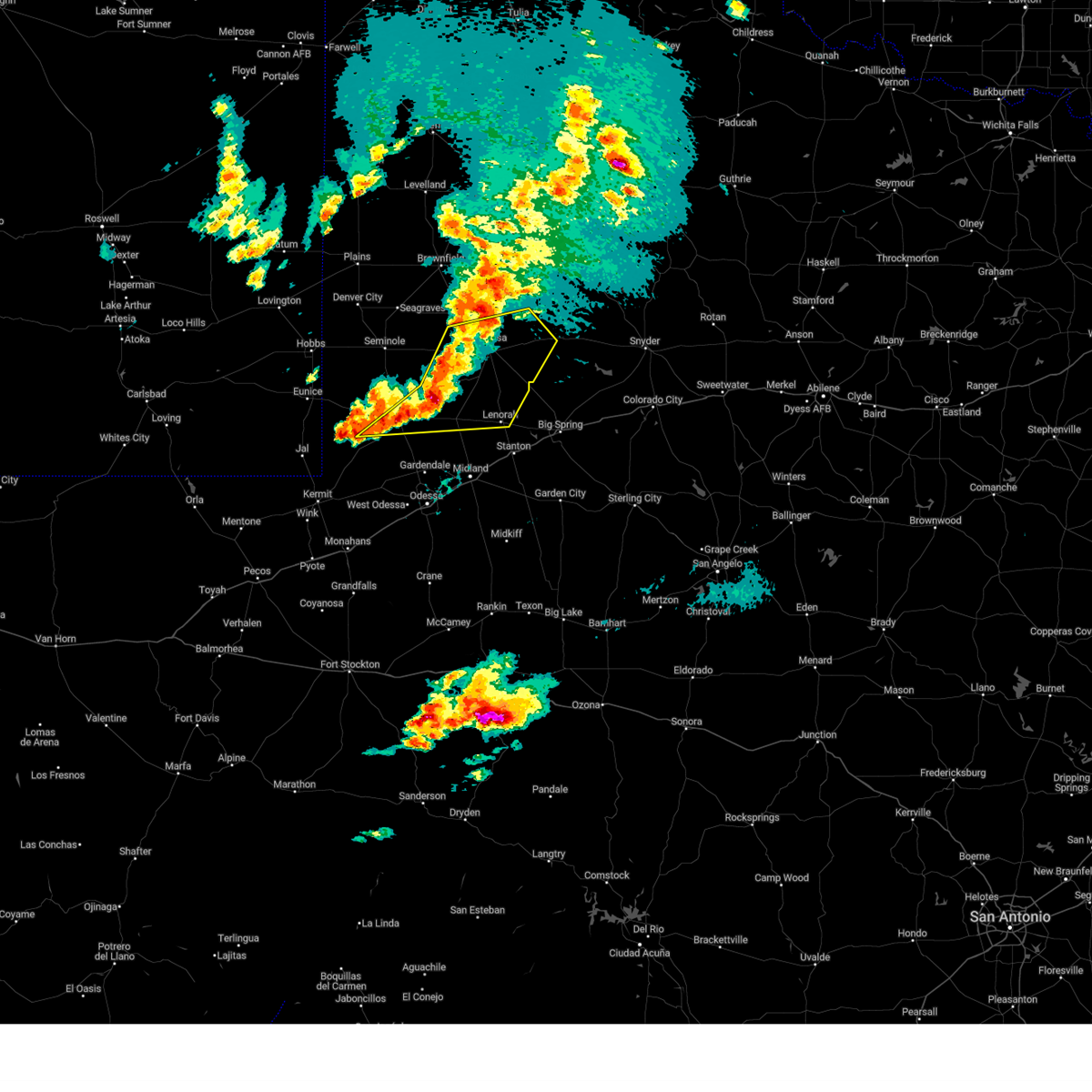
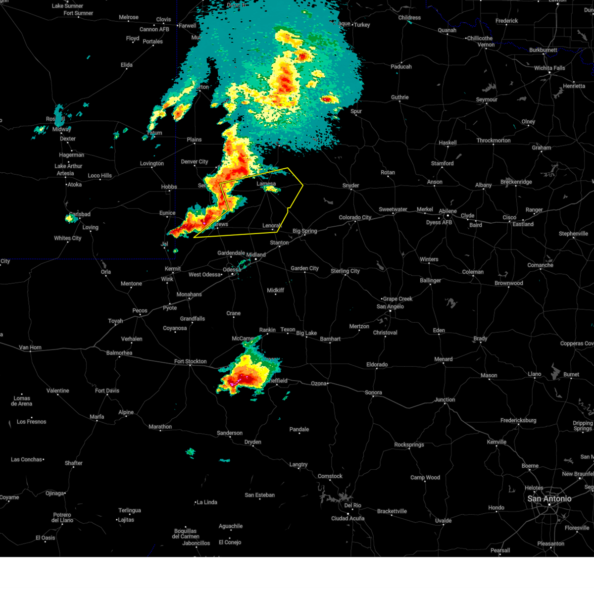
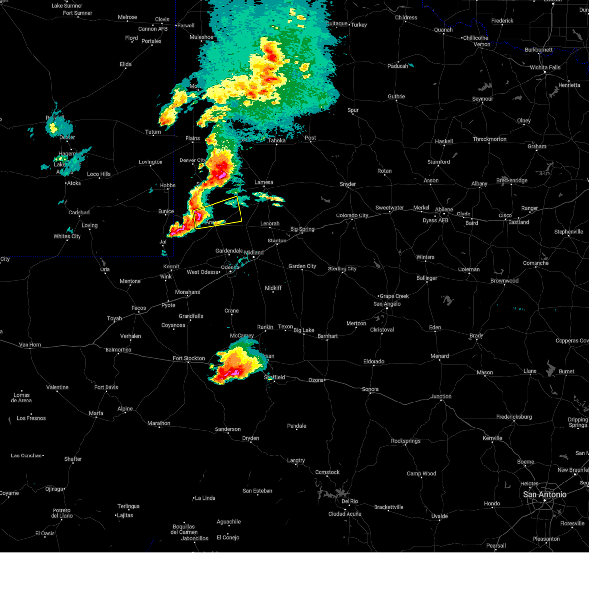
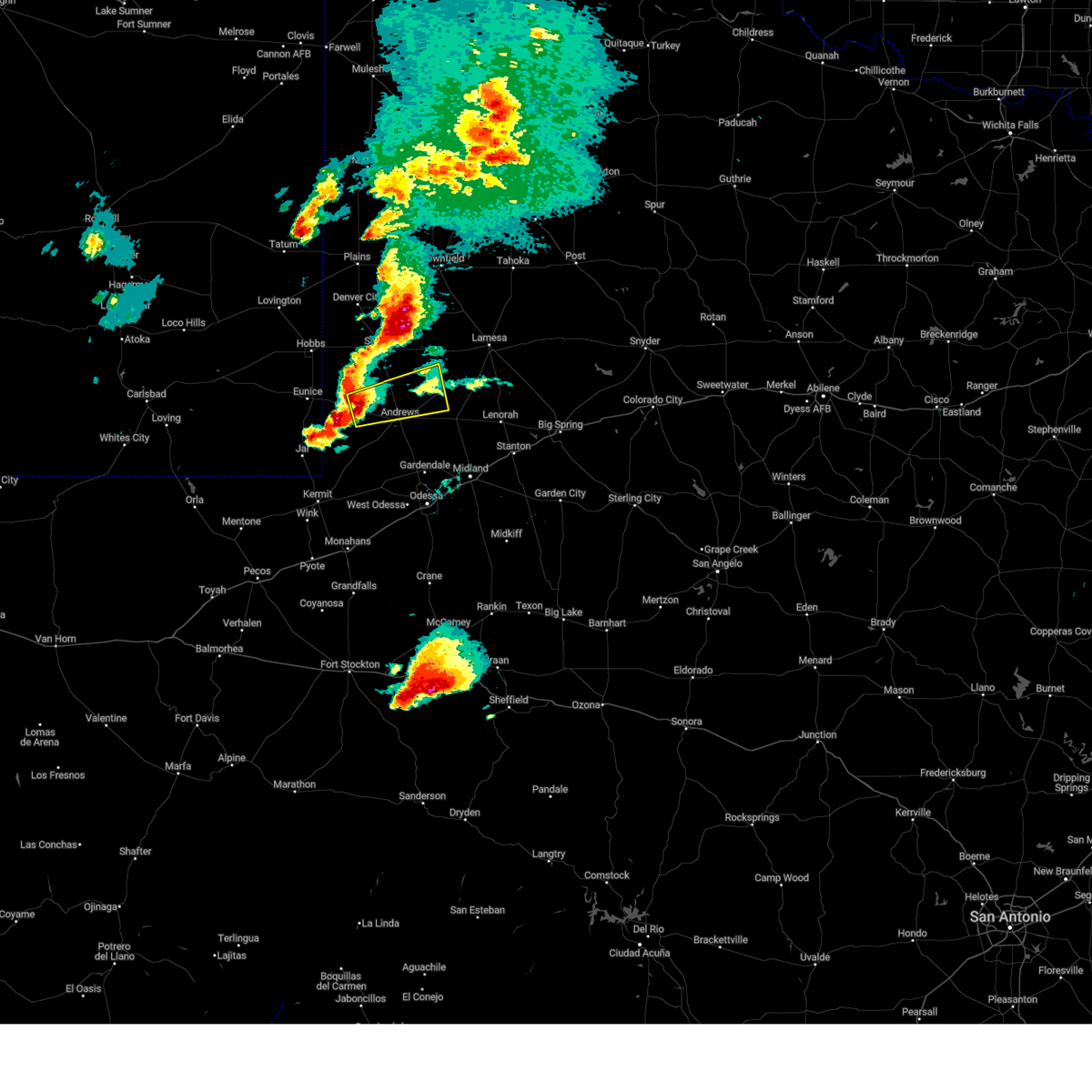
The Top Recent Hail Date for Andrews, TX is Sunday, November 23, 2025 (14th out of 78)
Hail and Wind Damage Spotted near Andrews, TX
| Date / Time | Report Details |
|---|---|
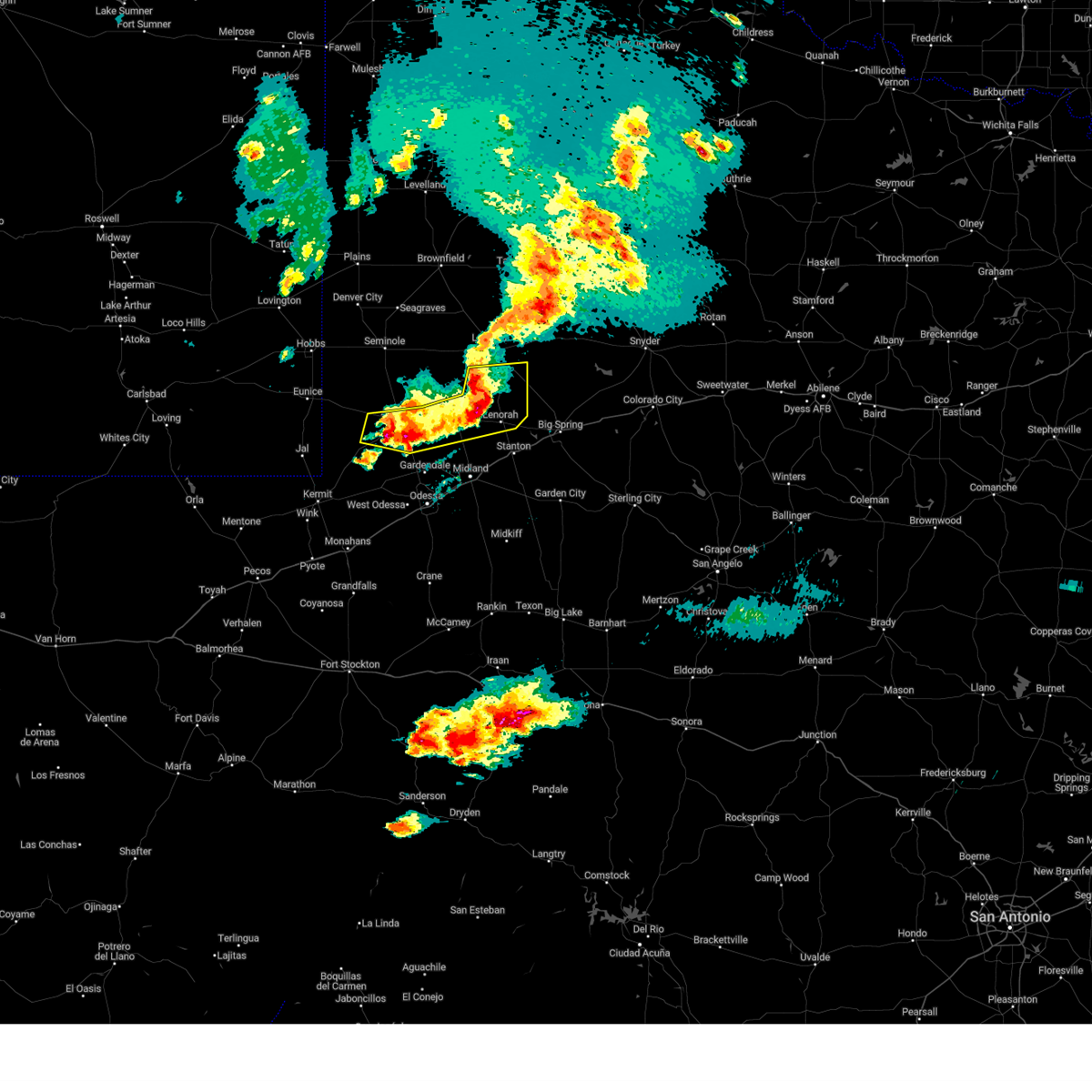
| 11/23/2025 4:40 PM CST |
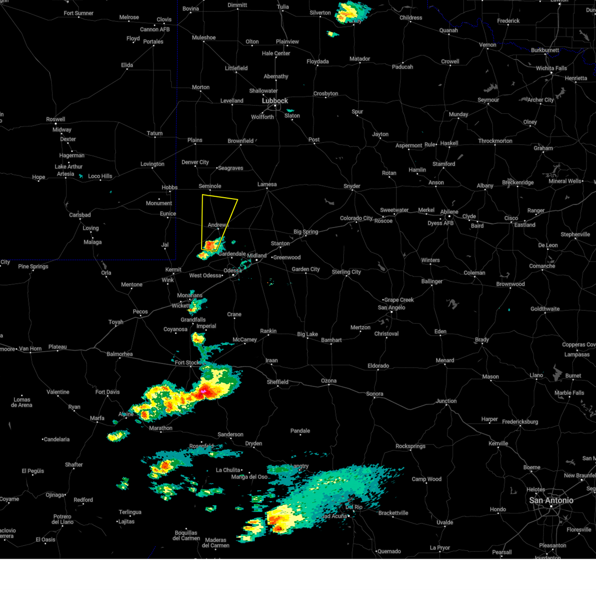
 The storm which prompted the warning has moved out of the area. therefore, the warning will be allowed to expire. a severe thunderstorm watch remains in effect until 1000 pm cst for western texas. The storm which prompted the warning has moved out of the area. therefore, the warning will be allowed to expire. a severe thunderstorm watch remains in effect until 1000 pm cst for western texas.
|
| 11/23/2025 4:29 PM CST |
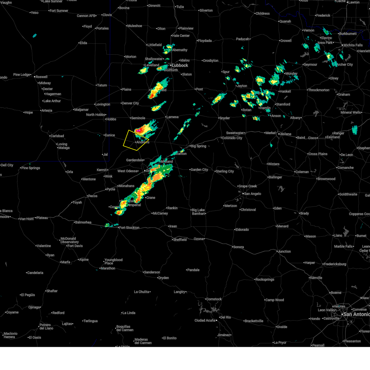
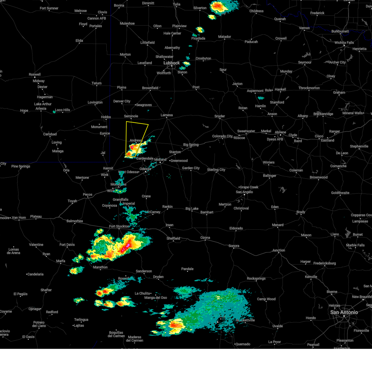
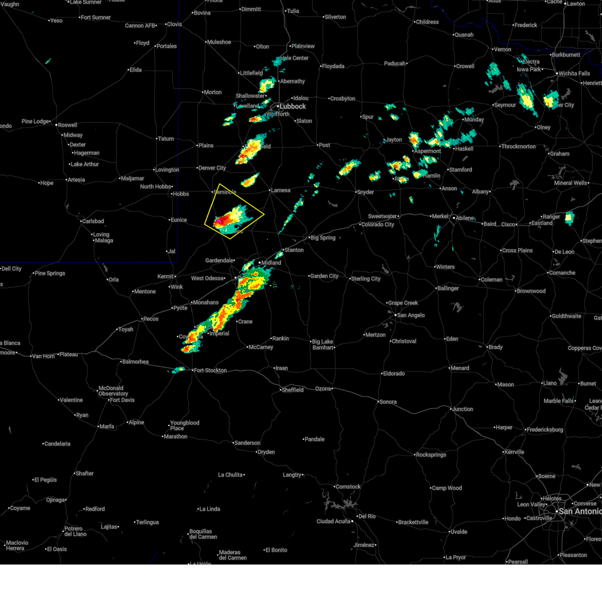 Svrmaf the national weather service in midland has issued a * severe thunderstorm warning for, northeastern andrews county in western texas, southeastern gaines county in western texas, northwestern martin county in western texas, southwestern dawson county in western texas, * until 500 pm cst. * at 429 pm cst, a severe thunderstorm was located near andrews, moving northeast at 40 mph (radar indicated). Hazards include golf ball size hail and 70 mph wind gusts. People and animals outdoors will be injured. expect hail damage to roofs, siding, windows, and vehicles. expect considerable tree damage. Wind damage is also likely to mobile homes, roofs, and outbuildings. Svrmaf the national weather service in midland has issued a * severe thunderstorm warning for, northeastern andrews county in western texas, southeastern gaines county in western texas, northwestern martin county in western texas, southwestern dawson county in western texas, * until 500 pm cst. * at 429 pm cst, a severe thunderstorm was located near andrews, moving northeast at 40 mph (radar indicated). Hazards include golf ball size hail and 70 mph wind gusts. People and animals outdoors will be injured. expect hail damage to roofs, siding, windows, and vehicles. expect considerable tree damage. Wind damage is also likely to mobile homes, roofs, and outbuildings.
|
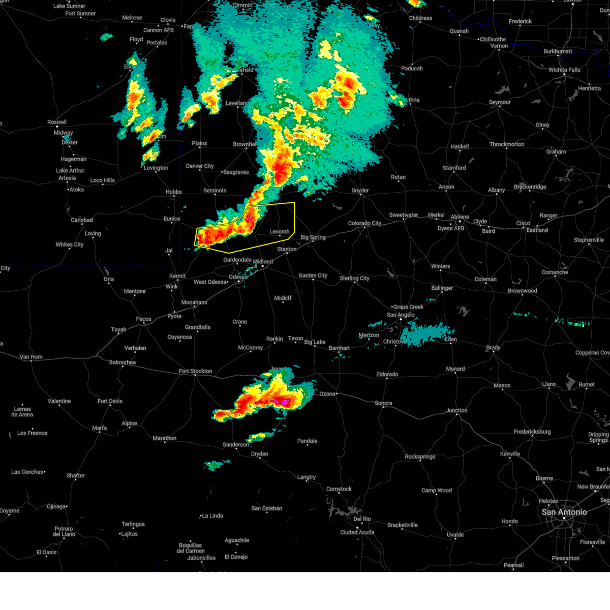
| 11/23/2025 4:21 PM CST |
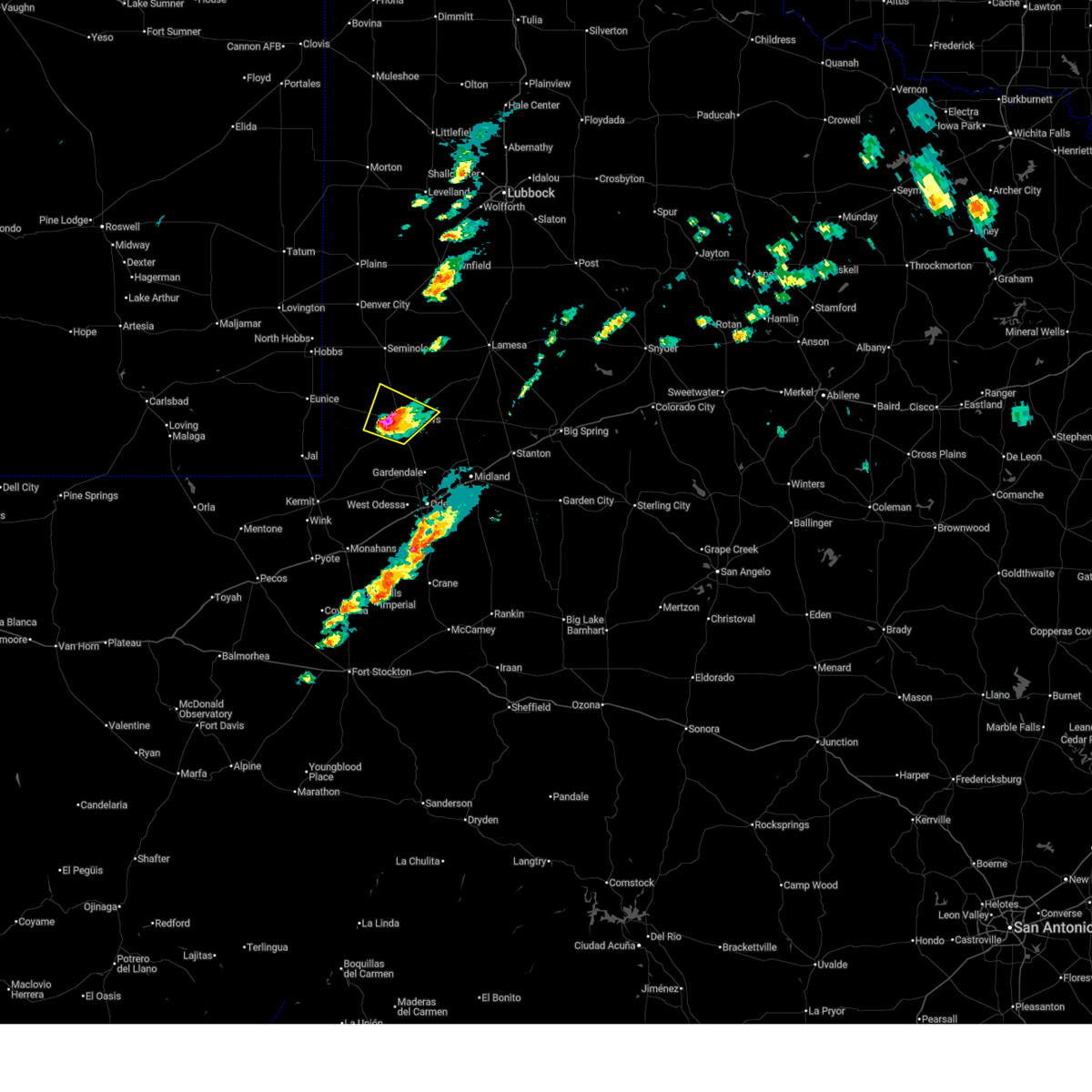 At 420 pm cst, a severe thunderstorm was located over andrews, moving northeast at 50 mph (radar indicated). Hazards include golf ball size hail and 70 mph wind gusts. People and animals outdoors will be injured. expect hail damage to roofs, siding, windows, and vehicles. expect considerable tree damage. wind damage is also likely to mobile homes, roofs, and outbuildings. Locations impacted include, andrews, florey, and andrews county airport. At 420 pm cst, a severe thunderstorm was located over andrews, moving northeast at 50 mph (radar indicated). Hazards include golf ball size hail and 70 mph wind gusts. People and animals outdoors will be injured. expect hail damage to roofs, siding, windows, and vehicles. expect considerable tree damage. wind damage is also likely to mobile homes, roofs, and outbuildings. Locations impacted include, andrews, florey, and andrews county airport.
|
| 11/23/2025 4:12 PM CST | Quarter sized hail reported 8 miles ENE of Andrews, TX, video shared on social media of nickel to quarter sized hail covering the side of the road and in grassy areas along fm 2371 west of andrews. time estimated between 410 |
| 11/23/2025 4:11 PM CST |
 Svrmaf the national weather service in midland has issued a * severe thunderstorm warning for, central andrews county in western texas, * until 445 pm cst. * at 410 pm cst, a severe thunderstorm was located 10 miles southwest of andrews, moving northeast at 40 mph (radar indicated). Hazards include 60 mph wind gusts and quarter size hail. Hail damage to vehicles is expected. Expect wind damage to roofs, siding, and trees. Svrmaf the national weather service in midland has issued a * severe thunderstorm warning for, central andrews county in western texas, * until 445 pm cst. * at 410 pm cst, a severe thunderstorm was located 10 miles southwest of andrews, moving northeast at 40 mph (radar indicated). Hazards include 60 mph wind gusts and quarter size hail. Hail damage to vehicles is expected. Expect wind damage to roofs, siding, and trees.
|
| 10/23/2025 7:43 PM CDT | The storm which prompted the warning has moved out of the area. therefore, the warning will be allowed to expire. |
| 10/23/2025 7:15 PM CDT | At 714 pm cdt, a severe thunderstorm was located near andrews, moving east at 30 mph (radar indicated). Hazards include 60 mph wind gusts and quarter size hail. Hail damage to vehicles is expected. expect wind damage to roofs, siding, and trees. Locations impacted include, andrews. |
| 10/23/2025 6:56 PM CDT | Svrmaf the national weather service in midland has issued a * severe thunderstorm warning for, southeastern andrews county in western texas, * until 745 pm cdt. * at 655 pm cdt, a severe thunderstorm was located 10 miles southwest of andrews, moving east at 30 mph (radar indicated). Hazards include 60 mph wind gusts and quarter size hail. Hail damage to vehicles is expected. Expect wind damage to roofs, siding, and trees. |
| 10/23/2025 6:50 PM CDT | At 649 pm cdt, a severe thunderstorm was located 11 miles northeast of andrews, moving east at 25 mph (radar indicated). Hazards include 70 mph wind gusts and ping pong ball size hail. People and animals outdoors will be injured. expect hail damage to roofs, siding, windows, and vehicles. expect considerable tree damage. wind damage is also likely to mobile homes, roofs, and outbuildings. Locations impacted include, state highway 115 and fm 1788 northeast of andrews. |
| 10/23/2025 6:44 PM CDT | At 643 pm cdt, a severe thunderstorm was located 18 miles west of andrews, moving east at 25 mph (radar indicated). Hazards include 70 mph wind gusts and ping pong ball size hail. People and animals outdoors will be injured. expect hail damage to roofs, siding, windows, and vehicles. expect considerable tree damage. wind damage is also likely to mobile homes, roofs, and outbuildings. Locations impacted include, andrews and frankel city. |
| 10/23/2025 6:37 PM CDT | At 636 pm cdt, a severe thunderstorm was located 7 miles northeast of andrews, moving east at 25 mph (radar indicated). Hazards include 60 mph wind gusts and half dollar size hail. Hail damage to vehicles is expected. expect wind damage to roofs, siding, and trees. Locations impacted include, state highway 115 and fm 1788 northeast of andrews. |
| 10/23/2025 6:33 PM CDT | Svrmaf the national weather service in midland has issued a * severe thunderstorm warning for, northwestern andrews county in western texas, * until 730 pm cdt. * at 633 pm cdt, a severe thunderstorm was located 15 miles southeast of eunice, moving east at 25 mph (radar indicated). Hazards include 60 mph wind gusts and quarter size hail. Hail damage to vehicles is expected. Expect wind damage to roofs, siding, and trees. |
| 10/23/2025 6:28 PM CDT | Svrmaf the national weather service in midland has issued a * severe thunderstorm warning for, northeastern andrews county in western texas, southeastern gaines county in western texas, northwestern martin county in western texas, southwestern dawson county in western texas, * until 715 pm cdt. * at 628 pm cdt, a severe thunderstorm was located 8 miles north of andrews, moving east at 25 mph (radar indicated). Hazards include 60 mph wind gusts and quarter size hail. Hail damage to vehicles is expected. Expect wind damage to roofs, siding, and trees. |
| 6/13/2025 10:27 PM CDT |
 At 1026 pm cdt, severe thunderstorms were located along a line extending from near welch to 15 miles west of lamesa to 16 miles southeast of gaines county airport to 14 miles northwest of andrews to 6 miles east of eunice, moving southeast at 45 mph (radar indicated). Hazards include 70 mph wind gusts and quarter size hail. Hail damage to vehicles is expected. expect considerable tree damage. wind damage is also likely to mobile homes, roofs, and outbuildings. Locations impacted include, andrews, lamesa, seminole, seagraves, seagraves airport, lamesa municipal airport, gaines county airport, welch, los ybanez, loop, sparenberg, florey, punkin center, patricia, arvana, hancock, mckenzie lake, tenmile, frankel city, and paynes corner. At 1026 pm cdt, severe thunderstorms were located along a line extending from near welch to 15 miles west of lamesa to 16 miles southeast of gaines county airport to 14 miles northwest of andrews to 6 miles east of eunice, moving southeast at 45 mph (radar indicated). Hazards include 70 mph wind gusts and quarter size hail. Hail damage to vehicles is expected. expect considerable tree damage. wind damage is also likely to mobile homes, roofs, and outbuildings. Locations impacted include, andrews, lamesa, seminole, seagraves, seagraves airport, lamesa municipal airport, gaines county airport, welch, los ybanez, loop, sparenberg, florey, punkin center, patricia, arvana, hancock, mckenzie lake, tenmile, frankel city, and paynes corner.
|
| 6/13/2025 9:58 PM CDT |
 Svrmaf the national weather service in midland has issued a * severe thunderstorm warning for, northern andrews county in western texas, gaines county in western texas, northwestern martin county in western texas, dawson county in western texas, * until 1045 pm cdt. * at 957 pm cdt, severe thunderstorms were located along a line extending from near brownfield to 9 miles east of seagraves airport to near seminole to 12 miles east of nadine to near hobbs, moving southeast at 50 mph (radar indicated). Hazards include 70 mph wind gusts and quarter size hail. Hail damage to vehicles is expected. expect considerable tree damage. Wind damage is also likely to mobile homes, roofs, and outbuildings. Svrmaf the national weather service in midland has issued a * severe thunderstorm warning for, northern andrews county in western texas, gaines county in western texas, northwestern martin county in western texas, dawson county in western texas, * until 1045 pm cdt. * at 957 pm cdt, severe thunderstorms were located along a line extending from near brownfield to 9 miles east of seagraves airport to near seminole to 12 miles east of nadine to near hobbs, moving southeast at 50 mph (radar indicated). Hazards include 70 mph wind gusts and quarter size hail. Hail damage to vehicles is expected. expect considerable tree damage. Wind damage is also likely to mobile homes, roofs, and outbuildings.
|
| 6/10/2025 7:51 PM CDT |
 Svrmaf the national weather service in midland has issued a * severe thunderstorm warning for, ector county in western texas, southeastern andrews county in western texas, midland county in western texas, martin county in western texas, northern crane county in western texas, northern upton county in western texas, * until 845 pm cdt. * at 750 pm cdt, severe thunderstorms produced an outflow of strong winds that were located along a line extending from 7 miles south of andrews to 12 miles south of west odessa, moving east at 45 mph (radar indicated). Hazards include 70 mph wind gusts and penny size hail. blowing dust restricting visibility to near zero. Expect considerable tree damage. Damage is likely to mobile homes, roofs, and outbuildings. Svrmaf the national weather service in midland has issued a * severe thunderstorm warning for, ector county in western texas, southeastern andrews county in western texas, midland county in western texas, martin county in western texas, northern crane county in western texas, northern upton county in western texas, * until 845 pm cdt. * at 750 pm cdt, severe thunderstorms produced an outflow of strong winds that were located along a line extending from 7 miles south of andrews to 12 miles south of west odessa, moving east at 45 mph (radar indicated). Hazards include 70 mph wind gusts and penny size hail. blowing dust restricting visibility to near zero. Expect considerable tree damage. Damage is likely to mobile homes, roofs, and outbuildings.
|
| 6/10/2025 1:01 PM CDT | Half Dollar sized hail reported 1.9 miles SW of Andrews, TX, andrews police department measured 1.25 inch hail. |
| 6/10/2025 2:13 AM CDT |
 the severe thunderstorm warning has been cancelled and is no longer in effect the severe thunderstorm warning has been cancelled and is no longer in effect
|
| 6/10/2025 2:13 AM CDT |
 At 212 am cdt, severe thunderstorms were located along a line extending from near gail to ackerly to 6 miles south of andrews, moving east at 40 mph (radar indicated). Hazards include 60 mph wind gusts and penny size hail. Expect damage to roofs, siding, and trees. Locations impacted include, andrews, ackerly, gail, sparenberg, tenmile, patricia, vealmoor, klondike, and andrews county airport. At 212 am cdt, severe thunderstorms were located along a line extending from near gail to ackerly to 6 miles south of andrews, moving east at 40 mph (radar indicated). Hazards include 60 mph wind gusts and penny size hail. Expect damage to roofs, siding, and trees. Locations impacted include, andrews, ackerly, gail, sparenberg, tenmile, patricia, vealmoor, klondike, and andrews county airport.
|
| 6/10/2025 2:03 AM CDT |
 At 203 am cdt, severe thunderstorms were located along a line extending from 10 miles northwest of gail to 8 miles northwest of ackerly to near andrews, moving southeast at 30 mph (radar indicated). Hazards include 60 mph wind gusts and penny size hail. Expect damage to roofs, siding, and trees. Locations impacted include, andrews, lamesa, ackerly, gail, lamesa municipal airport, los ybanez, sparenberg, florey, patricia, arvana, hancock, tenmile, vealmoor, key, klondike, and andrews county airport. At 203 am cdt, severe thunderstorms were located along a line extending from 10 miles northwest of gail to 8 miles northwest of ackerly to near andrews, moving southeast at 30 mph (radar indicated). Hazards include 60 mph wind gusts and penny size hail. Expect damage to roofs, siding, and trees. Locations impacted include, andrews, lamesa, ackerly, gail, lamesa municipal airport, los ybanez, sparenberg, florey, patricia, arvana, hancock, tenmile, vealmoor, key, klondike, and andrews county airport.
|
| 6/10/2025 1:44 AM CDT |
 At 144 am cdt, severe thunderstorms were located along a line extending from 11 miles southeast of gaines county airport to 13 miles east of eunice, moving southeast at 25 mph (radar indicated). Hazards include 60 mph wind gusts and penny size hail. Expect damage to roofs, siding, and trees. Locations impacted include, andrews, florey, frankel city, and andrews county airport. At 144 am cdt, severe thunderstorms were located along a line extending from 11 miles southeast of gaines county airport to 13 miles east of eunice, moving southeast at 25 mph (radar indicated). Hazards include 60 mph wind gusts and penny size hail. Expect damage to roofs, siding, and trees. Locations impacted include, andrews, florey, frankel city, and andrews county airport.
|
| 6/10/2025 1:43 AM CDT |
 Svrmaf the national weather service in midland has issued a * severe thunderstorm warning for, eastern andrews county in western texas, southeastern gaines county in western texas, borden county in western texas, northern martin county in western texas, northwestern howard county in western texas, dawson county in western texas, * until 245 am cdt. * at 143 am cdt, severe thunderstorms were located along a line extending from 7 miles southwest of grassland to near lamesa municipal airport to 12 miles northwest of andrews, moving east at 30 mph (radar indicated). Hazards include 60 mph wind gusts and penny size hail. expect damage to roofs, siding, and trees Svrmaf the national weather service in midland has issued a * severe thunderstorm warning for, eastern andrews county in western texas, southeastern gaines county in western texas, borden county in western texas, northern martin county in western texas, northwestern howard county in western texas, dawson county in western texas, * until 245 am cdt. * at 143 am cdt, severe thunderstorms were located along a line extending from 7 miles southwest of grassland to near lamesa municipal airport to 12 miles northwest of andrews, moving east at 30 mph (radar indicated). Hazards include 60 mph wind gusts and penny size hail. expect damage to roofs, siding, and trees
|
| 6/10/2025 1:28 AM CDT |
 At 128 am cdt, severe thunderstorms were located along a line extending from near gaines county airport to 8 miles east of eunice, moving east at 35 mph (radar indicated). Hazards include 60 mph wind gusts and quarter size hail. Hail damage to vehicles is expected. expect wind damage to roofs, siding, and trees. Locations impacted include, andrews, florey, frankel city, and andrews county airport. At 128 am cdt, severe thunderstorms were located along a line extending from near gaines county airport to 8 miles east of eunice, moving east at 35 mph (radar indicated). Hazards include 60 mph wind gusts and quarter size hail. Hail damage to vehicles is expected. expect wind damage to roofs, siding, and trees. Locations impacted include, andrews, florey, frankel city, and andrews county airport.
|
| 6/10/2025 1:28 AM CDT |
 the severe thunderstorm warning has been cancelled and is no longer in effect the severe thunderstorm warning has been cancelled and is no longer in effect
|
| 6/10/2025 1:09 AM CDT |
 Svrmaf the national weather service in midland has issued a * severe thunderstorm warning for, east central lea county in southeastern new mexico, northern andrews county in western texas, southern gaines county in western texas, * until 215 am cdt/115 am mdt/. * at 109 am cdt/1209 am mdt/, severe thunderstorms were located along a line extending from 7 miles west of seminole to near eunice airport, moving east at 20 mph (radar indicated). Hazards include 60 mph wind gusts and quarter size hail. Hail damage to vehicles is expected. Expect wind damage to roofs, siding, and trees. Svrmaf the national weather service in midland has issued a * severe thunderstorm warning for, east central lea county in southeastern new mexico, northern andrews county in western texas, southern gaines county in western texas, * until 215 am cdt/115 am mdt/. * at 109 am cdt/1209 am mdt/, severe thunderstorms were located along a line extending from 7 miles west of seminole to near eunice airport, moving east at 20 mph (radar indicated). Hazards include 60 mph wind gusts and quarter size hail. Hail damage to vehicles is expected. Expect wind damage to roofs, siding, and trees.
|
| 6/9/2025 10:00 PM CDT |
 At 959 pm cdt, a severe thunderstorm was located 9 miles south of andrews, moving southeast at 20 mph (radar indicated). Hazards include 60 mph wind gusts and half dollar size hail. Hail damage to vehicles is expected. expect wind damage to roofs, siding, and trees. Locations impacted include, andrews. At 959 pm cdt, a severe thunderstorm was located 9 miles south of andrews, moving southeast at 20 mph (radar indicated). Hazards include 60 mph wind gusts and half dollar size hail. Hail damage to vehicles is expected. expect wind damage to roofs, siding, and trees. Locations impacted include, andrews.
|
| 6/9/2025 9:43 PM CDT |
 At 942 pm cdt, a severe thunderstorm was located near andrews, moving southeast at 20 mph (radar indicated). Hazards include golf ball size hail and 70 mph wind gusts. People and animals outdoors will be injured. expect hail damage to roofs, siding, windows, and vehicles. expect considerable tree damage. wind damage is also likely to mobile homes, roofs, and outbuildings. Locations impacted include, andrews and andrews county airport. At 942 pm cdt, a severe thunderstorm was located near andrews, moving southeast at 20 mph (radar indicated). Hazards include golf ball size hail and 70 mph wind gusts. People and animals outdoors will be injured. expect hail damage to roofs, siding, windows, and vehicles. expect considerable tree damage. wind damage is also likely to mobile homes, roofs, and outbuildings. Locations impacted include, andrews and andrews county airport.
|
| 6/9/2025 9:31 PM CDT |
 At 931 pm cdt, a severe thunderstorm was located over andrews, moving southeast at 15 mph (radar indicated). Hazards include 60 mph wind gusts and half dollar size hail. Hail damage to vehicles is expected. expect wind damage to roofs, siding, and trees. Locations impacted include, andrews, florey, and andrews county airport. At 931 pm cdt, a severe thunderstorm was located over andrews, moving southeast at 15 mph (radar indicated). Hazards include 60 mph wind gusts and half dollar size hail. Hail damage to vehicles is expected. expect wind damage to roofs, siding, and trees. Locations impacted include, andrews, florey, and andrews county airport.
|
| 6/9/2025 9:14 PM CDT |
 Svrmaf the national weather service in midland has issued a * severe thunderstorm warning for, central andrews county in western texas, * until 1015 pm cdt. * at 914 pm cdt, a severe thunderstorm was located 8 miles northwest of andrews, moving southeast at 10 mph (radar indicated). Hazards include 60 mph wind gusts and quarter size hail. Hail damage to vehicles is expected. Expect wind damage to roofs, siding, and trees. Svrmaf the national weather service in midland has issued a * severe thunderstorm warning for, central andrews county in western texas, * until 1015 pm cdt. * at 914 pm cdt, a severe thunderstorm was located 8 miles northwest of andrews, moving southeast at 10 mph (radar indicated). Hazards include 60 mph wind gusts and quarter size hail. Hail damage to vehicles is expected. Expect wind damage to roofs, siding, and trees.
|
| 6/6/2025 9:15 PM CDT | Awos station ke11 andrew in andrews county TX, 1.4 miles WSW of Andrews, TX |
| 6/6/2025 9:05 PM CDT | Mesonet station 48 2e andrew in andrews county TX, 1.9 miles W of Andrews, TX |
| 5/6/2025 12:55 AM CDT |
 At 1255 am cdt/1155 pm mdt/, severe thunderstorms were located along a line extending from 13 miles west of gaines county airport to 13 miles southeast of jal airport to 9 miles southwest of wink, moving east at 40 mph (radar indicated). Hazards include 60 mph wind gusts and quarter size hail. Hail damage to vehicles is expected. expect wind damage to roofs, siding, and trees. Locations impacted include, andrews, seminole, kermit, jal, wink, jal airport, gaines county airport, florey, notrees, bennett, frankel city, paynes corner, winkler county airport, and monahans sandhills state park. At 1255 am cdt/1155 pm mdt/, severe thunderstorms were located along a line extending from 13 miles west of gaines county airport to 13 miles southeast of jal airport to 9 miles southwest of wink, moving east at 40 mph (radar indicated). Hazards include 60 mph wind gusts and quarter size hail. Hail damage to vehicles is expected. expect wind damage to roofs, siding, and trees. Locations impacted include, andrews, seminole, kermit, jal, wink, jal airport, gaines county airport, florey, notrees, bennett, frankel city, paynes corner, winkler county airport, and monahans sandhills state park.
|
| 5/6/2025 12:55 AM CDT |
 the severe thunderstorm warning has been cancelled and is no longer in effect the severe thunderstorm warning has been cancelled and is no longer in effect
|
| 5/6/2025 12:39 AM CDT |
 Svrmaf the national weather service in midland has issued a * severe thunderstorm warning for, southeastern lea county in southeastern new mexico, northwestern ector county in western texas, western andrews county in western texas, northern ward county in western texas, southwestern gaines county in western texas, winkler county in western texas, eastern loving county in western texas, * until 145 am cdt/1245 am mdt/. * at 1239 am cdt/1139 pm mdt/, severe thunderstorms were located along a line extending from near nadine to near jal to 9 miles north of barstow, moving east at 20 mph (radar indicated). Hazards include 60 mph wind gusts and quarter size hail. Hail damage to vehicles is expected. Expect wind damage to roofs, siding, and trees. Svrmaf the national weather service in midland has issued a * severe thunderstorm warning for, southeastern lea county in southeastern new mexico, northwestern ector county in western texas, western andrews county in western texas, northern ward county in western texas, southwestern gaines county in western texas, winkler county in western texas, eastern loving county in western texas, * until 145 am cdt/1245 am mdt/. * at 1239 am cdt/1139 pm mdt/, severe thunderstorms were located along a line extending from near nadine to near jal to 9 miles north of barstow, moving east at 20 mph (radar indicated). Hazards include 60 mph wind gusts and quarter size hail. Hail damage to vehicles is expected. Expect wind damage to roofs, siding, and trees.
|
| 5/5/2025 10:04 PM CDT |
 the severe thunderstorm warning has been cancelled and is no longer in effect the severe thunderstorm warning has been cancelled and is no longer in effect
|
| 5/5/2025 9:54 PM CDT |
 At 954 pm cdt, a severe thunderstorm was located 9 miles southwest of andrews, moving northeast at 30 mph (radar indicated). Hazards include 60 mph wind gusts and quarter size hail. Hail damage to vehicles is expected. expect wind damage to roofs, siding, and trees. Locations impacted include, andrews. At 954 pm cdt, a severe thunderstorm was located 9 miles southwest of andrews, moving northeast at 30 mph (radar indicated). Hazards include 60 mph wind gusts and quarter size hail. Hail damage to vehicles is expected. expect wind damage to roofs, siding, and trees. Locations impacted include, andrews.
|
| 5/5/2025 9:46 PM CDT |
 At 946 pm cdt, a severe thunderstorm was located near andrews, moving northeast at 25 mph (radar indicated). Hazards include 60 mph wind gusts and half dollar size hail. Hail damage to vehicles is expected. expect wind damage to roofs, siding, and trees. Locations impacted include, andrews, florey, and andrews county airport. At 946 pm cdt, a severe thunderstorm was located near andrews, moving northeast at 25 mph (radar indicated). Hazards include 60 mph wind gusts and half dollar size hail. Hail damage to vehicles is expected. expect wind damage to roofs, siding, and trees. Locations impacted include, andrews, florey, and andrews county airport.
|
| 5/5/2025 9:40 PM CDT |
 Svrmaf the national weather service in midland has issued a * severe thunderstorm warning for, southwestern andrews county in western texas, * until 1015 pm cdt. * at 940 pm cdt, a severe thunderstorm was located 16 miles southwest of andrews, moving northeast at 30 mph (radar indicated). Hazards include 60 mph wind gusts and quarter size hail. Hail damage to vehicles is expected. Expect wind damage to roofs, siding, and trees. Svrmaf the national weather service in midland has issued a * severe thunderstorm warning for, southwestern andrews county in western texas, * until 1015 pm cdt. * at 940 pm cdt, a severe thunderstorm was located 16 miles southwest of andrews, moving northeast at 30 mph (radar indicated). Hazards include 60 mph wind gusts and quarter size hail. Hail damage to vehicles is expected. Expect wind damage to roofs, siding, and trees.
|
| 5/5/2025 9:32 PM CDT |
 At 932 pm cdt, a severe thunderstorm was located over andrews, moving northeast at 30 mph (radar indicated). Hazards include golf ball size hail and 70 mph wind gusts. People and animals outdoors will be injured. expect hail damage to roofs, siding, windows, and vehicles. expect considerable tree damage. wind damage is also likely to mobile homes, roofs, and outbuildings. Locations impacted include, andrews, florey, and andrews county airport. At 932 pm cdt, a severe thunderstorm was located over andrews, moving northeast at 30 mph (radar indicated). Hazards include golf ball size hail and 70 mph wind gusts. People and animals outdoors will be injured. expect hail damage to roofs, siding, windows, and vehicles. expect considerable tree damage. wind damage is also likely to mobile homes, roofs, and outbuildings. Locations impacted include, andrews, florey, and andrews county airport.
|
| 5/5/2025 9:18 PM CDT |
 At 918 pm cdt, a severe thunderstorm was located 8 miles west of andrews, moving northeast at 25 mph (radar indicated). Hazards include ping pong ball size hail and 60 mph wind gusts. People and animals outdoors will be injured. expect hail damage to roofs, siding, windows, and vehicles. expect wind damage to roofs, siding, and trees. Locations impacted include, andrews, florey, and andrews county airport. At 918 pm cdt, a severe thunderstorm was located 8 miles west of andrews, moving northeast at 25 mph (radar indicated). Hazards include ping pong ball size hail and 60 mph wind gusts. People and animals outdoors will be injured. expect hail damage to roofs, siding, windows, and vehicles. expect wind damage to roofs, siding, and trees. Locations impacted include, andrews, florey, and andrews county airport.
|
| 5/5/2025 9:11 PM CDT |
 Svrmaf the national weather service in midland has issued a * severe thunderstorm warning for, central andrews county in western texas, * until 1015 pm cdt. * at 911 pm cdt, a severe thunderstorm was located 12 miles southwest of andrews, moving northeast at 25 mph (radar indicated). Hazards include 60 mph wind gusts and half dollar size hail. Hail damage to vehicles is expected. Expect wind damage to roofs, siding, and trees. Svrmaf the national weather service in midland has issued a * severe thunderstorm warning for, central andrews county in western texas, * until 1015 pm cdt. * at 911 pm cdt, a severe thunderstorm was located 12 miles southwest of andrews, moving northeast at 25 mph (radar indicated). Hazards include 60 mph wind gusts and half dollar size hail. Hail damage to vehicles is expected. Expect wind damage to roofs, siding, and trees.
|
| 5/5/2025 8:53 PM CDT |
 At 853 pm cdt, a severe thunderstorm was located 17 miles southwest of andrews, moving northeast at 20 mph (radar indicated). Hazards include ping pong ball size hail and 60 mph wind gusts. People and animals outdoors will be injured. expect hail damage to roofs, siding, windows, and vehicles. expect wind damage to roofs, siding, and trees. Locations impacted include, andrews and andrews county airport. At 853 pm cdt, a severe thunderstorm was located 17 miles southwest of andrews, moving northeast at 20 mph (radar indicated). Hazards include ping pong ball size hail and 60 mph wind gusts. People and animals outdoors will be injured. expect hail damage to roofs, siding, windows, and vehicles. expect wind damage to roofs, siding, and trees. Locations impacted include, andrews and andrews county airport.
|
| 5/5/2025 8:42 PM CDT |
 the severe thunderstorm warning has been cancelled and is no longer in effect the severe thunderstorm warning has been cancelled and is no longer in effect
|
| 5/5/2025 8:42 PM CDT |
 At 841 pm cdt, a severe thunderstorm was located 18 miles east of jal airport, or 19 miles southwest of andrews, moving northeast at 25 mph (radar indicated). Hazards include 60 mph wind gusts and half dollar size hail. Hail damage to vehicles is expected. expect wind damage to roofs, siding, and trees. Locations impacted include, andrews, frankel city, andrews county airport, and florey. At 841 pm cdt, a severe thunderstorm was located 18 miles east of jal airport, or 19 miles southwest of andrews, moving northeast at 25 mph (radar indicated). Hazards include 60 mph wind gusts and half dollar size hail. Hail damage to vehicles is expected. expect wind damage to roofs, siding, and trees. Locations impacted include, andrews, frankel city, andrews county airport, and florey.
|
| 5/5/2025 8:20 PM CDT |
 Svrmaf the national weather service in midland has issued a * severe thunderstorm warning for, western andrews county in western texas, northeastern winkler county in western texas, * until 915 pm cdt. * at 820 pm cdt, a severe thunderstorm was located 12 miles east of jal airport, or 14 miles east of jal, moving northeast at 25 mph (radar indicated). Hazards include 60 mph wind gusts and half dollar size hail. Hail damage to vehicles is expected. Expect wind damage to roofs, siding, and trees. Svrmaf the national weather service in midland has issued a * severe thunderstorm warning for, western andrews county in western texas, northeastern winkler county in western texas, * until 915 pm cdt. * at 820 pm cdt, a severe thunderstorm was located 12 miles east of jal airport, or 14 miles east of jal, moving northeast at 25 mph (radar indicated). Hazards include 60 mph wind gusts and half dollar size hail. Hail damage to vehicles is expected. Expect wind damage to roofs, siding, and trees.
|
| 4/30/2025 12:35 AM CDT |
 At 1235 am cdt, a severe thunderstorm was located 9 miles northwest of andrews, moving north at 40 mph (radar indicated). Hazards include 60 mph wind gusts and quarter size hail. Hail damage to vehicles is expected. expect wind damage to roofs, siding, and trees. Locations impacted include, andrews, florey, and andrews county airport. At 1235 am cdt, a severe thunderstorm was located 9 miles northwest of andrews, moving north at 40 mph (radar indicated). Hazards include 60 mph wind gusts and quarter size hail. Hail damage to vehicles is expected. expect wind damage to roofs, siding, and trees. Locations impacted include, andrews, florey, and andrews county airport.
|
| 4/30/2025 12:24 AM CDT |
 At 1224 am cdt, a severe thunderstorm was located 8 miles west of andrews, moving north at 40 mph (radar indicated). Hazards include 60 mph wind gusts and quarter size hail. Hail damage to vehicles is expected. expect wind damage to roofs, siding, and trees. Locations impacted include, andrews, florey, and andrews county airport. At 1224 am cdt, a severe thunderstorm was located 8 miles west of andrews, moving north at 40 mph (radar indicated). Hazards include 60 mph wind gusts and quarter size hail. Hail damage to vehicles is expected. expect wind damage to roofs, siding, and trees. Locations impacted include, andrews, florey, and andrews county airport.
|
| 4/30/2025 12:10 AM CDT |
 Svrmaf the national weather service in midland has issued a * severe thunderstorm warning for, central andrews county in western texas, south central gaines county in western texas, * until 100 am cdt. * at 1210 am cdt, a severe thunderstorm was located 14 miles southwest of andrews, moving north at 40 mph (radar indicated). Hazards include 60 mph wind gusts and quarter size hail. Hail damage to vehicles is expected. Expect wind damage to roofs, siding, and trees. Svrmaf the national weather service in midland has issued a * severe thunderstorm warning for, central andrews county in western texas, south central gaines county in western texas, * until 100 am cdt. * at 1210 am cdt, a severe thunderstorm was located 14 miles southwest of andrews, moving north at 40 mph (radar indicated). Hazards include 60 mph wind gusts and quarter size hail. Hail damage to vehicles is expected. Expect wind damage to roofs, siding, and trees.
|
| 4/29/2025 12:35 AM CDT |
 At 1235 am cdt, severe thunderstorms were located along a line extending from 8 miles northwest of lamesa municipal airport to 18 miles west of andrews, moving east at 15 mph (radar indicated). Hazards include ping pong ball size hail and 60 mph wind gusts. People and animals outdoors will be injured. expect hail damage to roofs, siding, windows, and vehicles. expect wind damage to roofs, siding, and trees. Locations impacted include, andrews, welch, florey, frankel city, punkin center, mckenzie lake, and andrews county airport. At 1235 am cdt, severe thunderstorms were located along a line extending from 8 miles northwest of lamesa municipal airport to 18 miles west of andrews, moving east at 15 mph (radar indicated). Hazards include ping pong ball size hail and 60 mph wind gusts. People and animals outdoors will be injured. expect hail damage to roofs, siding, windows, and vehicles. expect wind damage to roofs, siding, and trees. Locations impacted include, andrews, welch, florey, frankel city, punkin center, mckenzie lake, and andrews county airport.
|
| 4/29/2025 12:15 AM CDT |
 At 1214 am cdt, severe thunderstorms were located along a line extending from near welch to 13 miles northeast of jal airport, moving east at 10 mph (radar indicated). Hazards include golf ball size hail and 60 mph wind gusts. People and animals outdoors will be injured. expect hail damage to roofs, siding, windows, and vehicles. expect wind damage to roofs, siding, and trees. Locations impacted include, andrews, seminole, gaines county airport, welch, loop, florey, frankel city, punkin center, mckenzie lake, and andrews county airport. At 1214 am cdt, severe thunderstorms were located along a line extending from near welch to 13 miles northeast of jal airport, moving east at 10 mph (radar indicated). Hazards include golf ball size hail and 60 mph wind gusts. People and animals outdoors will be injured. expect hail damage to roofs, siding, windows, and vehicles. expect wind damage to roofs, siding, and trees. Locations impacted include, andrews, seminole, gaines county airport, welch, loop, florey, frankel city, punkin center, mckenzie lake, and andrews county airport.
|
| 4/29/2025 12:05 AM CDT |
 Svrmaf the national weather service in midland has issued a * severe thunderstorm warning for, central andrews county in western texas, eastern gaines county in western texas, northwestern dawson county in western texas, * until 100 am cdt. * at 1205 am cdt, severe thunderstorms were located along a line extending from near welch to 12 miles northeast of jal airport, moving east at 10 mph (radar indicated). Hazards include 60 mph wind gusts and half dollar size hail. Hail damage to vehicles is expected. Expect wind damage to roofs, siding, and trees. Svrmaf the national weather service in midland has issued a * severe thunderstorm warning for, central andrews county in western texas, eastern gaines county in western texas, northwestern dawson county in western texas, * until 100 am cdt. * at 1205 am cdt, severe thunderstorms were located along a line extending from near welch to 12 miles northeast of jal airport, moving east at 10 mph (radar indicated). Hazards include 60 mph wind gusts and half dollar size hail. Hail damage to vehicles is expected. Expect wind damage to roofs, siding, and trees.
|
| 11/2/2024 8:25 PM CST | Half Dollar sized hail reported 15.8 miles SW of Andrews, TX, report from mping: half dollar (1.25 in.). |
| 11/2/2024 8:04 PM CST |
 At 904 pm cdt, a severe thunderstorm was located near andrews, moving northeast at 30 mph (radar indicated). Hazards include 60 mph wind gusts and quarter size hail. Hail damage to vehicles is expected. expect wind damage to roofs, siding, and trees. Locations impacted include, andrews, florey, and andrews county airport. At 904 pm cdt, a severe thunderstorm was located near andrews, moving northeast at 30 mph (radar indicated). Hazards include 60 mph wind gusts and quarter size hail. Hail damage to vehicles is expected. expect wind damage to roofs, siding, and trees. Locations impacted include, andrews, florey, and andrews county airport.
|
| 11/2/2024 8:36 PM CDT |
 Svrmaf the national weather service in midland has issued a * severe thunderstorm warning for, central andrews county in western texas, * until 930 pm cdt. * at 836 pm cdt, a severe thunderstorm was located 13 miles west of andrews, moving northeast at 30 mph (radar indicated). Hazards include 60 mph wind gusts and quarter size hail. Hail damage to vehicles is expected. Expect wind damage to roofs, siding, and trees. Svrmaf the national weather service in midland has issued a * severe thunderstorm warning for, central andrews county in western texas, * until 930 pm cdt. * at 836 pm cdt, a severe thunderstorm was located 13 miles west of andrews, moving northeast at 30 mph (radar indicated). Hazards include 60 mph wind gusts and quarter size hail. Hail damage to vehicles is expected. Expect wind damage to roofs, siding, and trees.
|
| 9/21/2024 9:46 PM CDT |
 At 946 pm cdt, a severe thunderstorm was located 8 miles east of andrews, moving east at 35 mph (radar indicated). Hazards include two inch hail and 60 mph wind gusts. People and animals outdoors will be injured. expect hail damage to roofs, siding, windows, and vehicles. expect wind damage to roofs, siding, and trees. Locations impacted include, andrews and andrews county airport. At 946 pm cdt, a severe thunderstorm was located 8 miles east of andrews, moving east at 35 mph (radar indicated). Hazards include two inch hail and 60 mph wind gusts. People and animals outdoors will be injured. expect hail damage to roofs, siding, windows, and vehicles. expect wind damage to roofs, siding, and trees. Locations impacted include, andrews and andrews county airport.
|
| 9/21/2024 9:10 PM CDT |
 Svrmaf the national weather service in midland has issued a * severe thunderstorm warning for, southeastern andrews county in western texas, * until 1015 pm cdt. * at 910 pm cdt, a severe thunderstorm was located 12 miles west of andrews, moving east at 35 mph (radar indicated). Hazards include two inch hail and 60 mph wind gusts. People and animals outdoors will be injured. expect hail damage to roofs, siding, windows, and vehicles. Expect wind damage to roofs, siding, and trees. Svrmaf the national weather service in midland has issued a * severe thunderstorm warning for, southeastern andrews county in western texas, * until 1015 pm cdt. * at 910 pm cdt, a severe thunderstorm was located 12 miles west of andrews, moving east at 35 mph (radar indicated). Hazards include two inch hail and 60 mph wind gusts. People and animals outdoors will be injured. expect hail damage to roofs, siding, windows, and vehicles. Expect wind damage to roofs, siding, and trees.
|
| 6/10/2024 7:09 PM CDT |
 At 709 pm cdt, a severe thunderstorm was located 10 miles west of andrews, moving southeast at 25 mph (radar indicated). Hazards include ping pong ball size hail and 60 mph wind gusts. People and animals outdoors will be injured. expect hail damage to roofs, siding, windows, and vehicles. expect wind damage to roofs, siding, and trees. Locations impacted include, andrews and andrews county airport. At 709 pm cdt, a severe thunderstorm was located 10 miles west of andrews, moving southeast at 25 mph (radar indicated). Hazards include ping pong ball size hail and 60 mph wind gusts. People and animals outdoors will be injured. expect hail damage to roofs, siding, windows, and vehicles. expect wind damage to roofs, siding, and trees. Locations impacted include, andrews and andrews county airport.
|
| 6/10/2024 6:43 PM CDT |
 Svrmaf the national weather service in midland has issued a * severe thunderstorm warning for, central andrews county in western texas, * until 745 pm cdt. * at 643 pm cdt, a severe thunderstorm was located 16 miles west of andrews, moving east at 30 mph (radar indicated). Hazards include two inch hail and 70 mph wind gusts. People and animals outdoors will be injured. expect hail damage to roofs, siding, windows, and vehicles. expect considerable tree damage. Wind damage is also likely to mobile homes, roofs, and outbuildings. Svrmaf the national weather service in midland has issued a * severe thunderstorm warning for, central andrews county in western texas, * until 745 pm cdt. * at 643 pm cdt, a severe thunderstorm was located 16 miles west of andrews, moving east at 30 mph (radar indicated). Hazards include two inch hail and 70 mph wind gusts. People and animals outdoors will be injured. expect hail damage to roofs, siding, windows, and vehicles. expect considerable tree damage. Wind damage is also likely to mobile homes, roofs, and outbuildings.
|
| 6/1/2024 1:20 AM CDT |
 the severe thunderstorm warning has been cancelled and is no longer in effect the severe thunderstorm warning has been cancelled and is no longer in effect
|
| 6/1/2024 1:20 AM CDT |
 At 120 am cdt, a severe thunderstorm was located 11 miles southwest of andrews, moving southeast at 30 mph (radar indicated). Hazards include golf ball size hail and 70 mph wind gusts. People and animals outdoors will be injured. expect hail damage to roofs, siding, windows, and vehicles. expect considerable tree damage. wind damage is also likely to mobile homes, roofs, and outbuildings. Locations impacted include, andrews and andrews county airport. At 120 am cdt, a severe thunderstorm was located 11 miles southwest of andrews, moving southeast at 30 mph (radar indicated). Hazards include golf ball size hail and 70 mph wind gusts. People and animals outdoors will be injured. expect hail damage to roofs, siding, windows, and vehicles. expect considerable tree damage. wind damage is also likely to mobile homes, roofs, and outbuildings. Locations impacted include, andrews and andrews county airport.
|
| 6/1/2024 12:43 AM CDT |
 Svrmaf the national weather service in midland has issued a * severe thunderstorm warning for, eastern lea county in southeastern new mexico, andrews county in western texas, southwestern gaines county in western texas, * until 145 am cdt/1245 am mdt/. * at 1243 am cdt/1143 pm mdt/, severe thunderstorms were located along a line extending from near andrews to 11 miles east of eunice, moving southeast at 20 mph (radar indicated). Hazards include 60 mph wind gusts and half dollar size hail. Hail damage to vehicles is expected. Expect wind damage to roofs, siding, and trees. Svrmaf the national weather service in midland has issued a * severe thunderstorm warning for, eastern lea county in southeastern new mexico, andrews county in western texas, southwestern gaines county in western texas, * until 145 am cdt/1245 am mdt/. * at 1243 am cdt/1143 pm mdt/, severe thunderstorms were located along a line extending from near andrews to 11 miles east of eunice, moving southeast at 20 mph (radar indicated). Hazards include 60 mph wind gusts and half dollar size hail. Hail damage to vehicles is expected. Expect wind damage to roofs, siding, and trees.
|
| 5/31/2024 11:29 PM CDT |
 the severe thunderstorm warning has been cancelled and is no longer in effect the severe thunderstorm warning has been cancelled and is no longer in effect
|
| 5/31/2024 11:29 PM CDT |
 At 1129 pm cdt, a severe thunderstorm was located 17 miles east of eunice, moving southeast at 15 mph (radar indicated). Hazards include ping pong ball size hail and 60 mph wind gusts. People and animals outdoors will be injured. expect hail damage to roofs, siding, windows, and vehicles. expect wind damage to roofs, siding, and trees. Locations impacted include, andrews, florey, frankel city, and andrews county airport. At 1129 pm cdt, a severe thunderstorm was located 17 miles east of eunice, moving southeast at 15 mph (radar indicated). Hazards include ping pong ball size hail and 60 mph wind gusts. People and animals outdoors will be injured. expect hail damage to roofs, siding, windows, and vehicles. expect wind damage to roofs, siding, and trees. Locations impacted include, andrews, florey, frankel city, and andrews county airport.
|
| 5/31/2024 11:00 PM CDT |
 Svrmaf the national weather service in midland has issued a * severe thunderstorm warning for, northwestern andrews county in western texas, southwestern gaines county in western texas, * until midnight cdt. * at 1100 pm cdt, a severe thunderstorm was located 12 miles east of eunice, moving east at 25 mph (radar indicated). Hazards include 60 mph wind gusts and quarter size hail. Hail damage to vehicles is expected. Expect wind damage to roofs, siding, and trees. Svrmaf the national weather service in midland has issued a * severe thunderstorm warning for, northwestern andrews county in western texas, southwestern gaines county in western texas, * until midnight cdt. * at 1100 pm cdt, a severe thunderstorm was located 12 miles east of eunice, moving east at 25 mph (radar indicated). Hazards include 60 mph wind gusts and quarter size hail. Hail damage to vehicles is expected. Expect wind damage to roofs, siding, and trees.
|
| 5/1/2024 6:08 PM CDT |
 At 608 pm cdt, a severe thunderstorm was located near andrews, moving north at 10 mph (radar indicated). Hazards include 60 mph wind gusts and quarter size hail. Hail damage to vehicles is expected. expect wind damage to roofs, siding, and trees. Locations impacted include, andrews, gaines county airport, florey, frankel city, and andrews county airport. At 608 pm cdt, a severe thunderstorm was located near andrews, moving north at 10 mph (radar indicated). Hazards include 60 mph wind gusts and quarter size hail. Hail damage to vehicles is expected. expect wind damage to roofs, siding, and trees. Locations impacted include, andrews, gaines county airport, florey, frankel city, and andrews county airport.
|
| 5/1/2024 5:57 PM CDT |
 Svrmaf the national weather service in midland has issued a * severe thunderstorm warning for, northeastern andrews county in western texas, southeastern gaines county in western texas, * until 700 pm cdt. * at 557 pm cdt, a severe thunderstorm was located near andrews, moving north at 10 mph (radar indicated). Hazards include 60 mph wind gusts and quarter size hail. Hail damage to vehicles is expected. Expect wind damage to roofs, siding, and trees. Svrmaf the national weather service in midland has issued a * severe thunderstorm warning for, northeastern andrews county in western texas, southeastern gaines county in western texas, * until 700 pm cdt. * at 557 pm cdt, a severe thunderstorm was located near andrews, moving north at 10 mph (radar indicated). Hazards include 60 mph wind gusts and quarter size hail. Hail damage to vehicles is expected. Expect wind damage to roofs, siding, and trees.
|
| 5/1/2024 5:39 PM CDT |
 the severe thunderstorm warning has been cancelled and is no longer in effect the severe thunderstorm warning has been cancelled and is no longer in effect
|
| 5/1/2024 5:39 PM CDT |
 At 538 pm cdt, a severe thunderstorm was located 16 miles northwest of goldsmith, or 16 miles southwest of andrews, moving north at 35 mph (radar indicated). Hazards include 60 mph wind gusts and quarter size hail. Hail damage to vehicles is expected. expect wind damage to roofs, siding, and trees. Locations impacted include, andrews, frankel city, and andrews county airport. At 538 pm cdt, a severe thunderstorm was located 16 miles northwest of goldsmith, or 16 miles southwest of andrews, moving north at 35 mph (radar indicated). Hazards include 60 mph wind gusts and quarter size hail. Hail damage to vehicles is expected. expect wind damage to roofs, siding, and trees. Locations impacted include, andrews, frankel city, and andrews county airport.
|
| 5/1/2024 5:29 PM CDT |
 At 528 pm cdt, a severe thunderstorm was located 16 miles northwest of goldsmith, or 19 miles east of jal, moving north at 35 mph (radar indicated). Hazards include 60 mph wind gusts and half dollar size hail. Hail damage to vehicles is expected. expect wind damage to roofs, siding, and trees. Locations impacted include, andrews, frankel city, and andrews county airport. At 528 pm cdt, a severe thunderstorm was located 16 miles northwest of goldsmith, or 19 miles east of jal, moving north at 35 mph (radar indicated). Hazards include 60 mph wind gusts and half dollar size hail. Hail damage to vehicles is expected. expect wind damage to roofs, siding, and trees. Locations impacted include, andrews, frankel city, and andrews county airport.
|
| 5/1/2024 5:16 PM CDT |
 Svrmaf the national weather service in midland has issued a * severe thunderstorm warning for, northwestern ector county in western texas, western andrews county in western texas, northeastern winkler county in western texas, * until 600 pm cdt. * at 515 pm cdt, a severe thunderstorm was located 15 miles west of goldsmith, or 16 miles northeast of kermit, moving north at 35 mph (radar indicated). Hazards include 60 mph wind gusts and quarter size hail. Hail damage to vehicles is expected. Expect wind damage to roofs, siding, and trees. Svrmaf the national weather service in midland has issued a * severe thunderstorm warning for, northwestern ector county in western texas, western andrews county in western texas, northeastern winkler county in western texas, * until 600 pm cdt. * at 515 pm cdt, a severe thunderstorm was located 15 miles west of goldsmith, or 16 miles northeast of kermit, moving north at 35 mph (radar indicated). Hazards include 60 mph wind gusts and quarter size hail. Hail damage to vehicles is expected. Expect wind damage to roofs, siding, and trees.
|
| 5/1/2024 4:56 PM CDT |
 Svrmaf the national weather service in midland has issued a * severe thunderstorm warning for, northeastern ector county in western texas, eastern andrews county in western texas, southeastern gaines county in western texas, northwestern martin county in western texas, * until 600 pm cdt. * at 455 pm cdt, a severe thunderstorm was located 13 miles southeast of andrews, moving north at 20 mph (radar indicated). Hazards include 60 mph wind gusts and quarter size hail. Hail damage to vehicles is expected. Expect wind damage to roofs, siding, and trees. Svrmaf the national weather service in midland has issued a * severe thunderstorm warning for, northeastern ector county in western texas, eastern andrews county in western texas, southeastern gaines county in western texas, northwestern martin county in western texas, * until 600 pm cdt. * at 455 pm cdt, a severe thunderstorm was located 13 miles southeast of andrews, moving north at 20 mph (radar indicated). Hazards include 60 mph wind gusts and quarter size hail. Hail damage to vehicles is expected. Expect wind damage to roofs, siding, and trees.
|
| 5/1/2024 4:50 PM CDT |
 At 449 pm cdt, a severe thunderstorm was located near andrews, moving north at 25 mph (trained weather spotters reported 1.5 inch hail on the south side of andrews). Hazards include golf ball size hail and 70 mph wind gusts. People and animals outdoors will be injured. expect hail damage to roofs, siding, windows, and vehicles. expect considerable tree damage. wind damage is also likely to mobile homes, roofs, and outbuildings. Locations impacted include, andrews, florey, and andrews county airport. At 449 pm cdt, a severe thunderstorm was located near andrews, moving north at 25 mph (trained weather spotters reported 1.5 inch hail on the south side of andrews). Hazards include golf ball size hail and 70 mph wind gusts. People and animals outdoors will be injured. expect hail damage to roofs, siding, windows, and vehicles. expect considerable tree damage. wind damage is also likely to mobile homes, roofs, and outbuildings. Locations impacted include, andrews, florey, and andrews county airport.
|
| 5/1/2024 4:46 PM CDT | Quarter sized hail reported 2.2 miles NNW of Andrews, TX |
| 5/1/2024 4:34 PM CDT |
 At 433 pm cdt, a severe thunderstorm was located near andrews, moving north at 25 mph (spotters measured 1.5" hail 8mi southwest of andrews). Hazards include ping pong ball size hail and 60 mph wind gusts. People and animals outdoors will be injured. expect hail damage to roofs, siding, windows, and vehicles. expect wind damage to roofs, siding, and trees. Locations impacted include, andrews, florey, and andrews county airport. At 433 pm cdt, a severe thunderstorm was located near andrews, moving north at 25 mph (spotters measured 1.5" hail 8mi southwest of andrews). Hazards include ping pong ball size hail and 60 mph wind gusts. People and animals outdoors will be injured. expect hail damage to roofs, siding, windows, and vehicles. expect wind damage to roofs, siding, and trees. Locations impacted include, andrews, florey, and andrews county airport.
|
| 5/1/2024 4:32 PM CDT | Ping Pong Ball sized hail reported 9.5 miles NE of Andrews, TX |
| 5/1/2024 4:16 PM CDT |
 Svrmaf the national weather service in midland has issued a * severe thunderstorm warning for, central andrews county in western texas, southeastern gaines county in western texas, * until 515 pm cdt. * at 416 pm cdt, a severe thunderstorm was located 12 miles southwest of andrews, moving north at 25 mph (radar indicated). Hazards include 60 mph wind gusts and quarter size hail. Hail damage to vehicles is expected. Expect wind damage to roofs, siding, and trees. Svrmaf the national weather service in midland has issued a * severe thunderstorm warning for, central andrews county in western texas, southeastern gaines county in western texas, * until 515 pm cdt. * at 416 pm cdt, a severe thunderstorm was located 12 miles southwest of andrews, moving north at 25 mph (radar indicated). Hazards include 60 mph wind gusts and quarter size hail. Hail damage to vehicles is expected. Expect wind damage to roofs, siding, and trees.
|
| 10/2/2023 11:27 PM CDT |
 At 1126 pm cdt, a severe thunderstorm was located 12 miles west of andrews, moving east at 20 mph (radar indicated). Hazards include 60 mph wind gusts and quarter size hail. Hail damage to vehicles is expected. expect wind damage to roofs, siding, and trees. locations impacted include, andrews, florey, frankel city, and andrews county airport. hail threat, radar indicated max hail size, 1. 00 in wind threat, radar indicated max wind gust, 60 mph. At 1126 pm cdt, a severe thunderstorm was located 12 miles west of andrews, moving east at 20 mph (radar indicated). Hazards include 60 mph wind gusts and quarter size hail. Hail damage to vehicles is expected. expect wind damage to roofs, siding, and trees. locations impacted include, andrews, florey, frankel city, and andrews county airport. hail threat, radar indicated max hail size, 1. 00 in wind threat, radar indicated max wind gust, 60 mph.
|
| 10/2/2023 11:09 PM CDT |
 At 1108 pm cdt, a severe thunderstorm was located 15 miles west of andrews, moving east at 20 mph (radar indicated). Hazards include golf ball size hail and 60 mph wind gusts. People and animals outdoors will be injured. expect hail damage to roofs, siding, windows, and vehicles. expect wind damage to roofs, siding, and trees. locations impacted include, andrews, florey, frankel city, and andrews county airport. thunderstorm damage threat, considerable hail threat, radar indicated max hail size, 1. 75 in wind threat, radar indicated max wind gust, 60 mph. At 1108 pm cdt, a severe thunderstorm was located 15 miles west of andrews, moving east at 20 mph (radar indicated). Hazards include golf ball size hail and 60 mph wind gusts. People and animals outdoors will be injured. expect hail damage to roofs, siding, windows, and vehicles. expect wind damage to roofs, siding, and trees. locations impacted include, andrews, florey, frankel city, and andrews county airport. thunderstorm damage threat, considerable hail threat, radar indicated max hail size, 1. 75 in wind threat, radar indicated max wind gust, 60 mph.
|
| 10/2/2023 10:43 PM CDT |
 At 1042 pm cdt, a severe thunderstorm was located 16 miles southeast of eunice, moving east at 20 mph (radar indicated). Hazards include ping pong ball size hail and 60 mph wind gusts. People and animals outdoors will be injured. expect hail damage to roofs, siding, windows, and vehicles. Expect wind damage to roofs, siding, and trees. At 1042 pm cdt, a severe thunderstorm was located 16 miles southeast of eunice, moving east at 20 mph (radar indicated). Hazards include ping pong ball size hail and 60 mph wind gusts. People and animals outdoors will be injured. expect hail damage to roofs, siding, windows, and vehicles. Expect wind damage to roofs, siding, and trees.
|
| 6/7/2023 9:42 PM CDT |
 At 941 pm cdt, a severe thunderstorm was located 15 miles northwest of midland international air and space port, or 16 miles northwest of midland, moving east at 35 mph. this is a destructive storm for gardendale, midland, odessa, and surrounding areas (radar indicated). Hazards include 80 mph wind gusts and quarter size hail. Flying debris will be dangerous to those caught without shelter. mobile homes will be heavily damaged. expect considerable damage to roofs, windows, and vehicles. Extensive tree damage and power outages are likely. At 941 pm cdt, a severe thunderstorm was located 15 miles northwest of midland international air and space port, or 16 miles northwest of midland, moving east at 35 mph. this is a destructive storm for gardendale, midland, odessa, and surrounding areas (radar indicated). Hazards include 80 mph wind gusts and quarter size hail. Flying debris will be dangerous to those caught without shelter. mobile homes will be heavily damaged. expect considerable damage to roofs, windows, and vehicles. Extensive tree damage and power outages are likely.
|
| 6/7/2023 9:29 PM CDT |
 At 929 pm cdt, severe thunderstorms were located along a line extending from 14 miles east of seminole to near goldsmith, moving east at 40 mph (andrews mesonet reported a wind gust of 67 mph). Hazards include 70 mph wind gusts and quarter size hail. Hail damage to vehicles is expected. expect considerable tree damage. wind damage is also likely to mobile homes, roofs, and outbuildings. locations impacted include, midland, odessa, andrews, lamesa, seminole, seagraves, goldsmith, seagraves airport, lenorah, midland international air and space port, gaines county airport, welch, lamesa municipal airport, los ybanez, cotton flat, patricia, arvana, hancock, mckenzie lake and midland airpark. this includes interstate 20 between mile markers 121 and 149. thunderstorm damage threat, considerable hail threat, radar indicated max hail size, 1. 00 in wind threat, observed max wind gust, 70 mph. At 929 pm cdt, severe thunderstorms were located along a line extending from 14 miles east of seminole to near goldsmith, moving east at 40 mph (andrews mesonet reported a wind gust of 67 mph). Hazards include 70 mph wind gusts and quarter size hail. Hail damage to vehicles is expected. expect considerable tree damage. wind damage is also likely to mobile homes, roofs, and outbuildings. locations impacted include, midland, odessa, andrews, lamesa, seminole, seagraves, goldsmith, seagraves airport, lenorah, midland international air and space port, gaines county airport, welch, lamesa municipal airport, los ybanez, cotton flat, patricia, arvana, hancock, mckenzie lake and midland airpark. this includes interstate 20 between mile markers 121 and 149. thunderstorm damage threat, considerable hail threat, radar indicated max hail size, 1. 00 in wind threat, observed max wind gust, 70 mph.
|
| 6/7/2023 9:19 PM CDT | Mesonet station 48 2e andrews in andrews county TX, 1.9 miles W of Andrews, TX |
| 6/7/2023 9:14 PM CDT |
 At 914 pm cdt, severe thunderstorms were located along a line extending from 7 miles northeast of seminole to 14 miles west of goldsmith, moving east at 40 mph (radar indicated). Hazards include 70 mph wind gusts and quarter size hail. Hail damage to vehicles is expected. expect considerable tree damage. wind damage is also likely to mobile homes, roofs, and outbuildings. locations impacted include, midland, odessa, andrews, lamesa, seminole, seagraves, goldsmith, seagraves airport, lenorah, midland international air and space port, gaines county airport, welch, lamesa municipal airport, los ybanez, cotton flat, patricia, arvana, hancock, mckenzie lake and midland airpark. this includes interstate 20 between mile markers 121 and 149. thunderstorm damage threat, considerable hail threat, radar indicated max hail size, 1. 00 in wind threat, radar indicated max wind gust, 70 mph. At 914 pm cdt, severe thunderstorms were located along a line extending from 7 miles northeast of seminole to 14 miles west of goldsmith, moving east at 40 mph (radar indicated). Hazards include 70 mph wind gusts and quarter size hail. Hail damage to vehicles is expected. expect considerable tree damage. wind damage is also likely to mobile homes, roofs, and outbuildings. locations impacted include, midland, odessa, andrews, lamesa, seminole, seagraves, goldsmith, seagraves airport, lenorah, midland international air and space port, gaines county airport, welch, lamesa municipal airport, los ybanez, cotton flat, patricia, arvana, hancock, mckenzie lake and midland airpark. this includes interstate 20 between mile markers 121 and 149. thunderstorm damage threat, considerable hail threat, radar indicated max hail size, 1. 00 in wind threat, radar indicated max wind gust, 70 mph.
|
| 6/7/2023 9:04 PM CDT |
 At 903 pm cdt, severe thunderstorms were located along a line extending from 6 miles north of seminole to 14 miles east of jal airport, moving east at 40 mph (radar indicated). Hazards include 70 mph wind gusts and quarter size hail. Hail damage to vehicles is expected. expect considerable tree damage. wind damage is also likely to mobile homes, roofs, and outbuildings. locations impacted include, midland, odessa, andrews, lamesa, seminole, seagraves, goldsmith, seagraves airport, lenorah, midland international air and space port, gaines county airport, welch, lamesa municipal airport, west odessa, los ybanez, cotton flat, patricia, arvana, hancock and mckenzie lake. this includes interstate 20 between mile markers 115 and 150. thunderstorm damage threat, considerable hail threat, radar indicated max hail size, 1. 00 in wind threat, radar indicated max wind gust, 70 mph. At 903 pm cdt, severe thunderstorms were located along a line extending from 6 miles north of seminole to 14 miles east of jal airport, moving east at 40 mph (radar indicated). Hazards include 70 mph wind gusts and quarter size hail. Hail damage to vehicles is expected. expect considerable tree damage. wind damage is also likely to mobile homes, roofs, and outbuildings. locations impacted include, midland, odessa, andrews, lamesa, seminole, seagraves, goldsmith, seagraves airport, lenorah, midland international air and space port, gaines county airport, welch, lamesa municipal airport, west odessa, los ybanez, cotton flat, patricia, arvana, hancock and mckenzie lake. this includes interstate 20 between mile markers 115 and 150. thunderstorm damage threat, considerable hail threat, radar indicated max hail size, 1. 00 in wind threat, radar indicated max wind gust, 70 mph.
|
| 6/7/2023 8:51 PM CDT |
 At 851 pm cdt/751 pm mdt/, severe thunderstorms were located along a line extending from 9 miles northwest of seminole to 9 miles east of jal airport, moving east at 40 mph (radar indicated). Hazards include 60 mph wind gusts and quarter size hail. Hail damage to vehicles is expected. Expect wind damage to roofs, siding, and trees. At 851 pm cdt/751 pm mdt/, severe thunderstorms were located along a line extending from 9 miles northwest of seminole to 9 miles east of jal airport, moving east at 40 mph (radar indicated). Hazards include 60 mph wind gusts and quarter size hail. Hail damage to vehicles is expected. Expect wind damage to roofs, siding, and trees.
|
| 6/7/2023 8:23 PM CDT |
 At 823 pm cdt, a severe thunderstorm was located near andrews, moving north at 20 mph (public report of quater size hail near the city of andrews). Hazards include 60 mph wind gusts and quarter size hail. Hail damage to vehicles is expected. expect wind damage to roofs, siding, and trees. locations impacted include, andrews, florey and andrews county airport. hail threat, observed max hail size, 1. 00 in wind threat, radar indicated max wind gust, 60 mph. At 823 pm cdt, a severe thunderstorm was located near andrews, moving north at 20 mph (public report of quater size hail near the city of andrews). Hazards include 60 mph wind gusts and quarter size hail. Hail damage to vehicles is expected. expect wind damage to roofs, siding, and trees. locations impacted include, andrews, florey and andrews county airport. hail threat, observed max hail size, 1. 00 in wind threat, radar indicated max wind gust, 60 mph.
|
| 6/7/2023 8:21 PM CDT | Quarter sized hail reported 1 miles E of Andrews, TX, report from mping: quarter (1.00 in.). |
| 6/7/2023 8:14 PM CDT |
 At 814 pm cdt, a severe thunderstorm was located near andrews, moving north at 20 mph (radar indicated). Hazards include 60 mph wind gusts and quarter size hail. Hail damage to vehicles is expected. Expect wind damage to roofs, siding, and trees. At 814 pm cdt, a severe thunderstorm was located near andrews, moving north at 20 mph (radar indicated). Hazards include 60 mph wind gusts and quarter size hail. Hail damage to vehicles is expected. Expect wind damage to roofs, siding, and trees.
|
| 6/2/2023 5:18 PM CDT |
 At 518 pm cdt, severe thunderstorms were located along a line extending from 14 miles south of lamesa to 7 miles northwest of lenorah to 19 miles north of midland to 11 miles southwest of andrews, moving east at 20 mph (storm chaser reports ping-pong ball sized hail 15 miles south-southeast of andrews along hwy 385 at 5:13 pm cdt). Hazards include ping pong ball size hail and 60 mph wind gusts. People and animals outdoors will be injured. expect hail damage to roofs, siding, windows, and vehicles. expect wind damage to roofs, siding, and trees. Locations impacted include, andrews, ackerly, lenorah, tarzan, sparenberg, tenmile, patricia, klondike and andrews county airport. At 518 pm cdt, severe thunderstorms were located along a line extending from 14 miles south of lamesa to 7 miles northwest of lenorah to 19 miles north of midland to 11 miles southwest of andrews, moving east at 20 mph (storm chaser reports ping-pong ball sized hail 15 miles south-southeast of andrews along hwy 385 at 5:13 pm cdt). Hazards include ping pong ball size hail and 60 mph wind gusts. People and animals outdoors will be injured. expect hail damage to roofs, siding, windows, and vehicles. expect wind damage to roofs, siding, and trees. Locations impacted include, andrews, ackerly, lenorah, tarzan, sparenberg, tenmile, patricia, klondike and andrews county airport.
|
| 6/2/2023 4:46 PM CDT |
 At 445 pm cdt, severe thunderstorms were located along a line extending from 18 miles southwest of lamesa to 17 miles west of lenorah to 14 miles east of andrews to 18 miles east of jal airport, moving east at 20 mph (storm chaser reports 2 inch hail 8 miles south of frankel city ). Hazards include ping pong ball size hail and 60 mph wind gusts. People and animals outdoors will be injured. expect hail damage to roofs, siding, windows, and vehicles. Expect wind damage to roofs, siding, and trees. At 445 pm cdt, severe thunderstorms were located along a line extending from 18 miles southwest of lamesa to 17 miles west of lenorah to 14 miles east of andrews to 18 miles east of jal airport, moving east at 20 mph (storm chaser reports 2 inch hail 8 miles south of frankel city ). Hazards include ping pong ball size hail and 60 mph wind gusts. People and animals outdoors will be injured. expect hail damage to roofs, siding, windows, and vehicles. Expect wind damage to roofs, siding, and trees.
|
| 6/2/2023 4:39 PM CDT | Hen Egg sized hail reported 14 miles ENE of Andrews, TX, hail observed along ranch rd 181. |
| 6/2/2023 4:30 PM CDT |
 At 430 pm cdt, severe thunderstorms were located along a line extending from 6 miles southwest of o`donnell to 8 miles southeast of lamesa municipal airport to 15 miles northwest of lenorah, moving east at 40 mph (radar indicated). Hazards include 70 mph wind gusts and quarter size hail. Hail damage to vehicles is expected. expect considerable tree damage. wind damage is also likely to mobile homes, roofs, and outbuildings. Locations impacted include, andrews, lamesa, ackerly, lenorah, lamesa municipal airport, los ybanez, tarzan, sparenberg, punkin center, patricia, arvana, hancock, tenmile, key, klondike and andrews county airport. At 430 pm cdt, severe thunderstorms were located along a line extending from 6 miles southwest of o`donnell to 8 miles southeast of lamesa municipal airport to 15 miles northwest of lenorah, moving east at 40 mph (radar indicated). Hazards include 70 mph wind gusts and quarter size hail. Hail damage to vehicles is expected. expect considerable tree damage. wind damage is also likely to mobile homes, roofs, and outbuildings. Locations impacted include, andrews, lamesa, ackerly, lenorah, lamesa municipal airport, los ybanez, tarzan, sparenberg, punkin center, patricia, arvana, hancock, tenmile, key, klondike and andrews county airport.
|
| 6/2/2023 3:55 PM CDT | Awos station ke11 andrew in andrews county TX, 1.4 miles WSW of Andrews, TX |
| 6/2/2023 3:40 PM CDT |
 At 339 pm cdt, severe thunderstorms were located along a line extending from 10 miles east of seminole to 20 miles southeast of gaines county airport to near andrews, moving east at 40 mph (radar indicated). Hazards include 70 mph wind gusts and quarter size hail. Hail damage to vehicles is expected. expect considerable tree damage. Wind damage is also likely to mobile homes, roofs, and outbuildings. At 339 pm cdt, severe thunderstorms were located along a line extending from 10 miles east of seminole to 20 miles southeast of gaines county airport to near andrews, moving east at 40 mph (radar indicated). Hazards include 70 mph wind gusts and quarter size hail. Hail damage to vehicles is expected. expect considerable tree damage. Wind damage is also likely to mobile homes, roofs, and outbuildings.
|
| 6/2/2023 3:10 PM CDT |
 At 310 pm cdt, a severe thunderstorm was located 8 miles northwest of andrews, moving east at 45 mph (radar indicated). Hazards include 70 mph wind gusts and ping pong ball size hail. People and animals outdoors will be injured. expect hail damage to roofs, siding, windows, and vehicles. expect considerable tree damage. wind damage is also likely to mobile homes, roofs, and outbuildings. Locations impacted include, andrews, florey, frankel city and andrews county airport. At 310 pm cdt, a severe thunderstorm was located 8 miles northwest of andrews, moving east at 45 mph (radar indicated). Hazards include 70 mph wind gusts and ping pong ball size hail. People and animals outdoors will be injured. expect hail damage to roofs, siding, windows, and vehicles. expect considerable tree damage. wind damage is also likely to mobile homes, roofs, and outbuildings. Locations impacted include, andrews, florey, frankel city and andrews county airport.
|
| 6/2/2023 2:58 PM CDT |
 At 258 pm cdt, a severe thunderstorm was located 14 miles west of andrews, moving east at 45 mph (radar indicated). Hazards include 70 mph wind gusts and ping pong ball size hail. People and animals outdoors will be injured. expect hail damage to roofs, siding, windows, and vehicles. expect considerable tree damage. Wind damage is also likely to mobile homes, roofs, and outbuildings. At 258 pm cdt, a severe thunderstorm was located 14 miles west of andrews, moving east at 45 mph (radar indicated). Hazards include 70 mph wind gusts and ping pong ball size hail. People and animals outdoors will be injured. expect hail damage to roofs, siding, windows, and vehicles. expect considerable tree damage. Wind damage is also likely to mobile homes, roofs, and outbuildings.
|
| 5/28/2023 7:50 PM CDT |
 At 749 pm cdt/649 pm mdt/, a severe thunderstorm was located 15 miles northwest of goldsmith, or 15 miles southwest of andrews, moving southeast at 25 mph (radar indicated). Hazards include 70 mph wind gusts and quarter size hail. Hail damage to vehicles is expected. expect considerable tree damage. wind damage is also likely to mobile homes, roofs, and outbuildings. locations impacted include, andrews and frankel city. thunderstorm damage threat, considerable hail threat, radar indicated max hail size, 1. 00 in wind threat, radar indicated max wind gust, 70 mph. At 749 pm cdt/649 pm mdt/, a severe thunderstorm was located 15 miles northwest of goldsmith, or 15 miles southwest of andrews, moving southeast at 25 mph (radar indicated). Hazards include 70 mph wind gusts and quarter size hail. Hail damage to vehicles is expected. expect considerable tree damage. wind damage is also likely to mobile homes, roofs, and outbuildings. locations impacted include, andrews and frankel city. thunderstorm damage threat, considerable hail threat, radar indicated max hail size, 1. 00 in wind threat, radar indicated max wind gust, 70 mph.
|
| 5/28/2023 7:50 PM CDT |
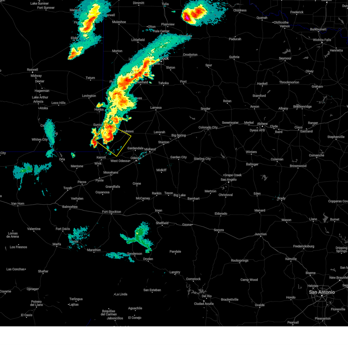 At 749 pm cdt/649 pm mdt/, a severe thunderstorm was located 15 miles northwest of goldsmith, or 15 miles southwest of andrews, moving southeast at 25 mph (radar indicated). Hazards include 70 mph wind gusts and quarter size hail. Hail damage to vehicles is expected. expect considerable tree damage. wind damage is also likely to mobile homes, roofs, and outbuildings. locations impacted include, andrews and frankel city. thunderstorm damage threat, considerable hail threat, radar indicated max hail size, 1. 00 in wind threat, radar indicated max wind gust, 70 mph. At 749 pm cdt/649 pm mdt/, a severe thunderstorm was located 15 miles northwest of goldsmith, or 15 miles southwest of andrews, moving southeast at 25 mph (radar indicated). Hazards include 70 mph wind gusts and quarter size hail. Hail damage to vehicles is expected. expect considerable tree damage. wind damage is also likely to mobile homes, roofs, and outbuildings. locations impacted include, andrews and frankel city. thunderstorm damage threat, considerable hail threat, radar indicated max hail size, 1. 00 in wind threat, radar indicated max wind gust, 70 mph.
|
| 5/28/2023 7:26 PM CDT |
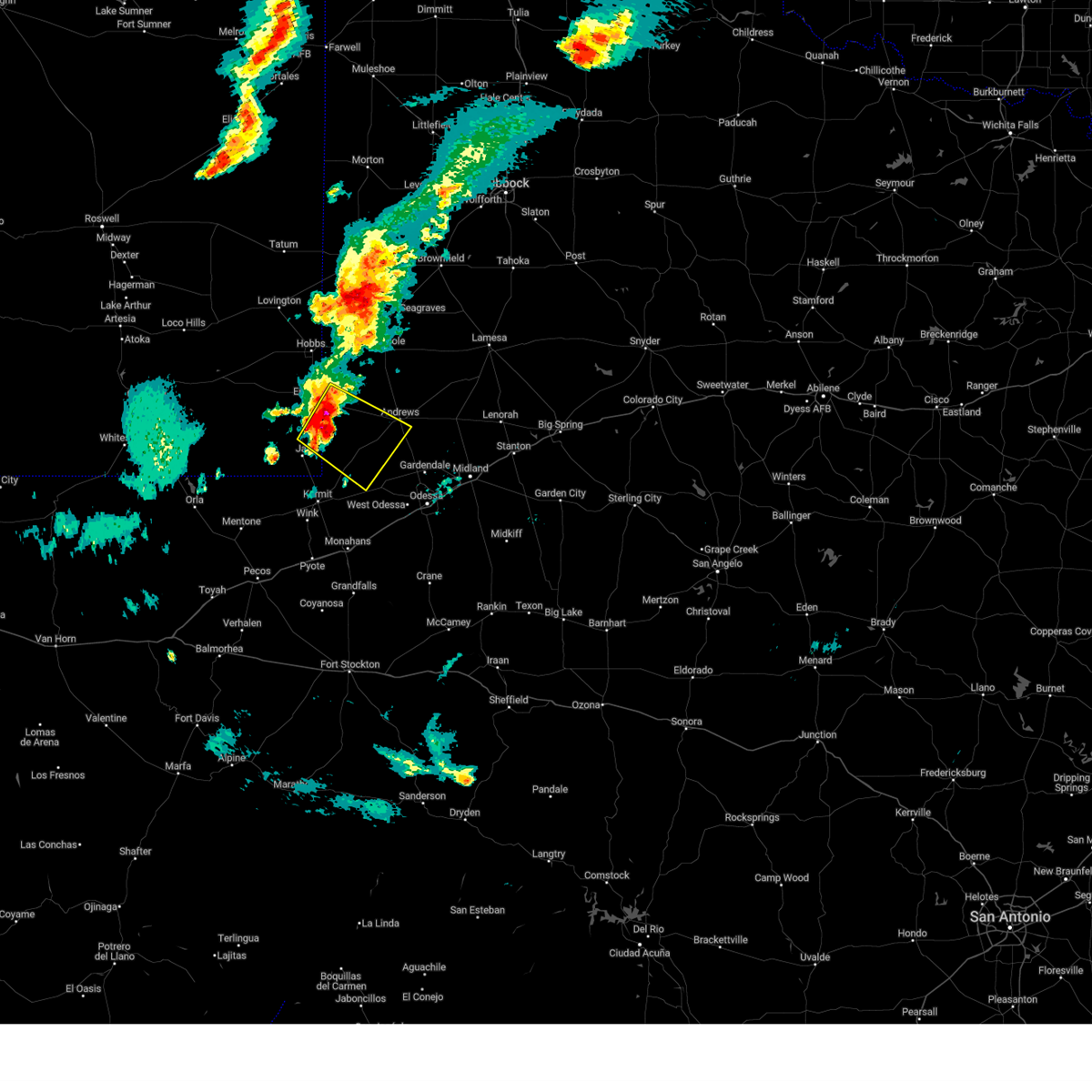 At 726 pm cdt/626 pm mdt/, a severe thunderstorm was located 13 miles northeast of jal airport, or 16 miles northeast of jal, moving southeast at 20 mph (radar indicated). Hazards include 70 mph wind gusts and quarter size hail. Hail damage to vehicles is expected. expect considerable tree damage. Wind damage is also likely to mobile homes, roofs, and outbuildings. At 726 pm cdt/626 pm mdt/, a severe thunderstorm was located 13 miles northeast of jal airport, or 16 miles northeast of jal, moving southeast at 20 mph (radar indicated). Hazards include 70 mph wind gusts and quarter size hail. Hail damage to vehicles is expected. expect considerable tree damage. Wind damage is also likely to mobile homes, roofs, and outbuildings.
|
| 5/28/2023 7:26 PM CDT |
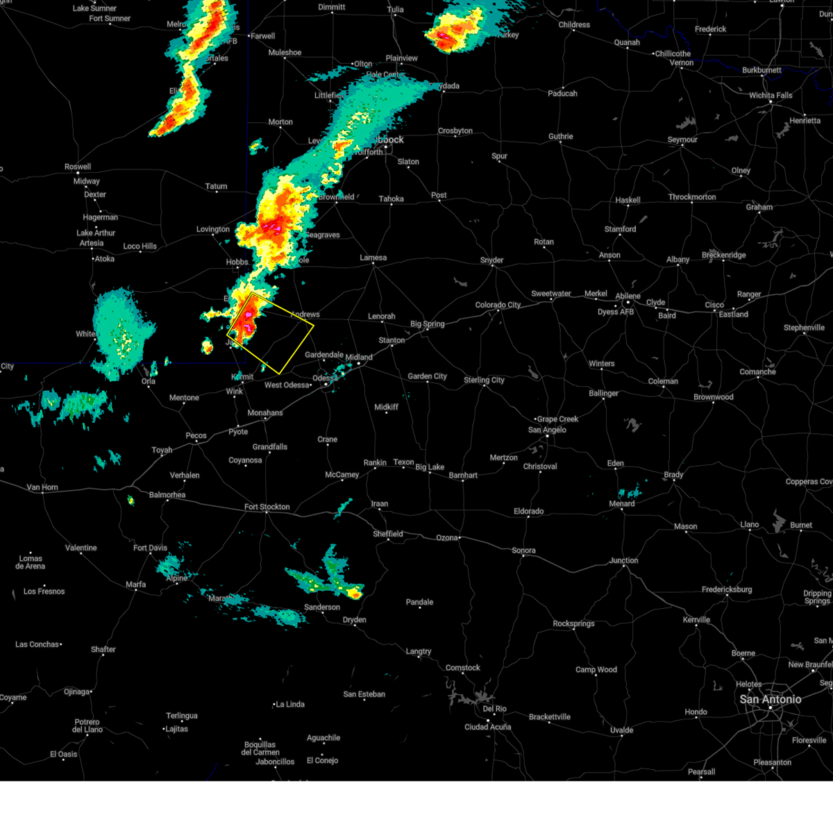 At 726 pm cdt/626 pm mdt/, a severe thunderstorm was located 13 miles northeast of jal airport, or 16 miles northeast of jal, moving southeast at 20 mph (radar indicated). Hazards include 70 mph wind gusts and quarter size hail. Hail damage to vehicles is expected. expect considerable tree damage. Wind damage is also likely to mobile homes, roofs, and outbuildings. At 726 pm cdt/626 pm mdt/, a severe thunderstorm was located 13 miles northeast of jal airport, or 16 miles northeast of jal, moving southeast at 20 mph (radar indicated). Hazards include 70 mph wind gusts and quarter size hail. Hail damage to vehicles is expected. expect considerable tree damage. Wind damage is also likely to mobile homes, roofs, and outbuildings.
|
| 5/19/2023 11:00 PM CDT |
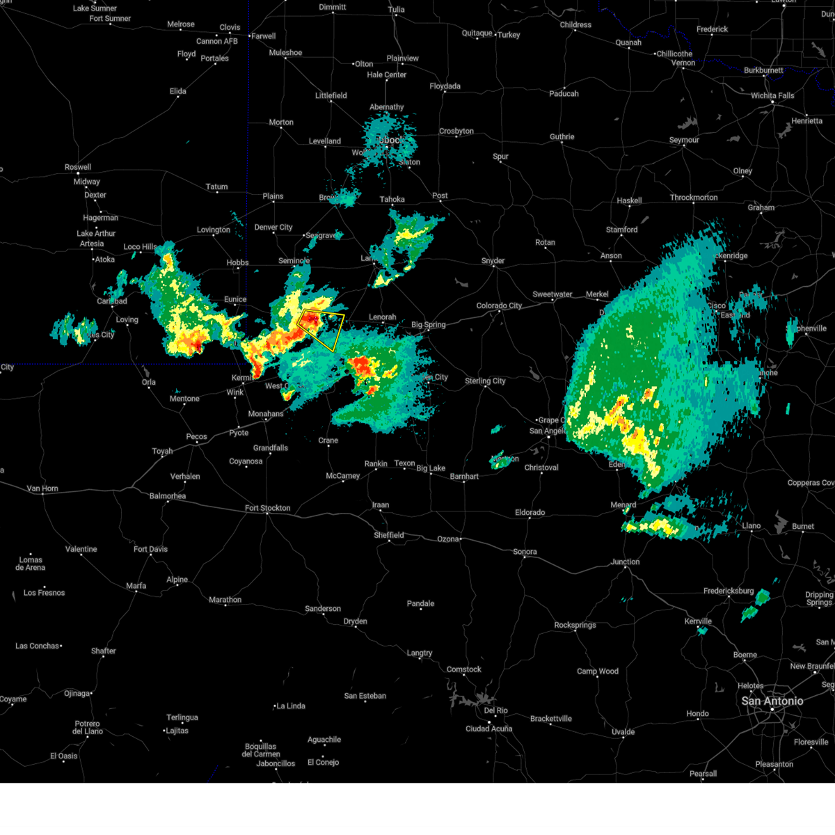 At 1059 pm cdt, a severe thunderstorm was located 8 miles east of andrews, moving east at 25 mph (radar indicated). Hazards include 60 mph wind gusts and quarter size hail. Hail damage to vehicles is expected. expect wind damage to roofs, siding, and trees. locations impacted include, andrews and andrews county airport. hail threat, radar indicated max hail size, 1. 00 in wind threat, radar indicated max wind gust, 60 mph. At 1059 pm cdt, a severe thunderstorm was located 8 miles east of andrews, moving east at 25 mph (radar indicated). Hazards include 60 mph wind gusts and quarter size hail. Hail damage to vehicles is expected. expect wind damage to roofs, siding, and trees. locations impacted include, andrews and andrews county airport. hail threat, radar indicated max hail size, 1. 00 in wind threat, radar indicated max wind gust, 60 mph.
|
| 5/19/2023 10:28 PM CDT |
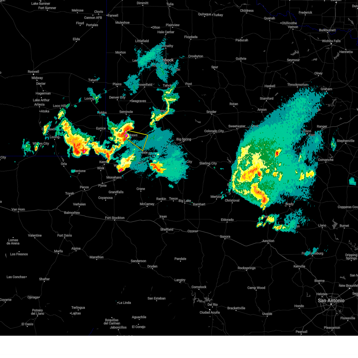 At 1028 pm cdt, a severe thunderstorm was located near andrews, moving southeast at 25 mph (radar indicated). Hazards include 60 mph wind gusts and quarter size hail. Hail damage to vehicles is expected. Expect wind damage to roofs, siding, and trees. At 1028 pm cdt, a severe thunderstorm was located near andrews, moving southeast at 25 mph (radar indicated). Hazards include 60 mph wind gusts and quarter size hail. Hail damage to vehicles is expected. Expect wind damage to roofs, siding, and trees.
|
| 5/19/2023 10:18 PM CDT |
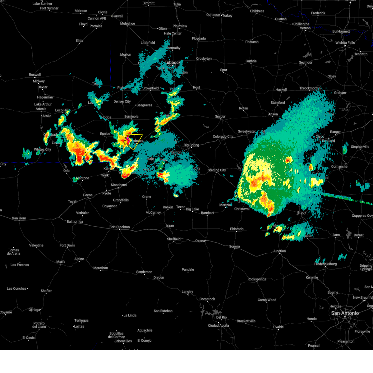 At 1018 pm cdt, a severe thunderstorm was located near andrews, moving southeast at 30 mph (radar indicated). Hazards include 60 mph wind gusts and quarter size hail. Hail damage to vehicles is expected. expect wind damage to roofs, siding, and trees. locations impacted include, andrews, florey and andrews county airport. hail threat, radar indicated max hail size, 1. 00 in wind threat, radar indicated max wind gust, 60 mph. At 1018 pm cdt, a severe thunderstorm was located near andrews, moving southeast at 30 mph (radar indicated). Hazards include 60 mph wind gusts and quarter size hail. Hail damage to vehicles is expected. expect wind damage to roofs, siding, and trees. locations impacted include, andrews, florey and andrews county airport. hail threat, radar indicated max hail size, 1. 00 in wind threat, radar indicated max wind gust, 60 mph.
|
| 5/19/2023 10:05 PM CDT |
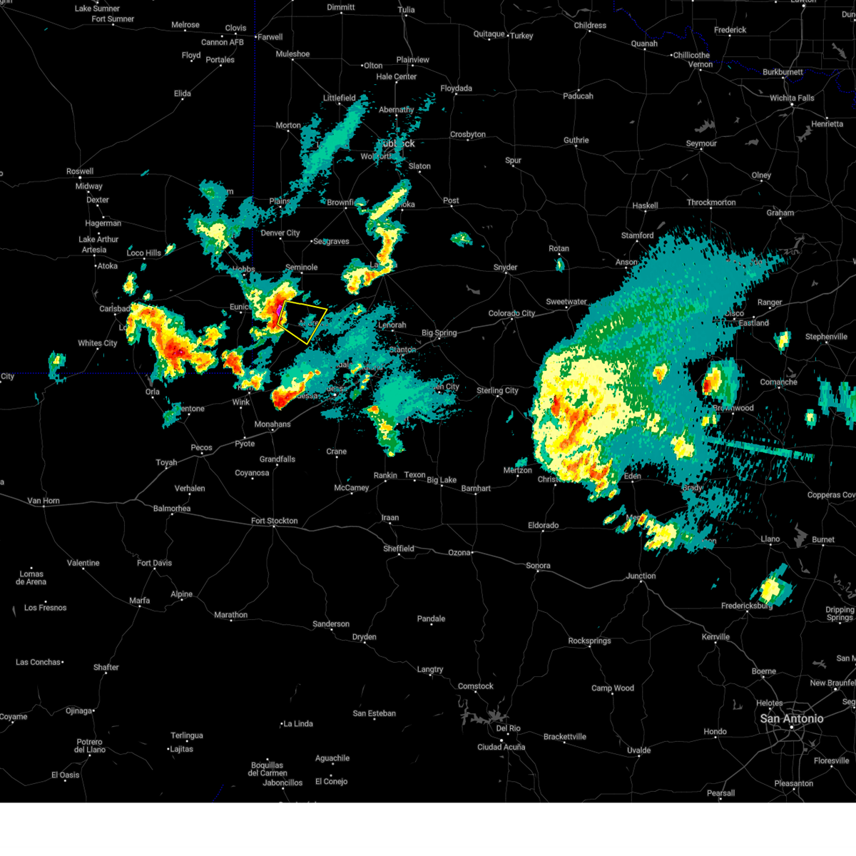 At 1005 pm cdt, a severe thunderstorm was located 11 miles west of andrews, moving southeast at 30 mph (radar indicated). Hazards include ping pong ball size hail and 60 mph wind gusts. People and animals outdoors will be injured. expect hail damage to roofs, siding, windows, and vehicles. expect wind damage to roofs, siding, and trees. locations impacted include, andrews, florey, frankel city and andrews county airport. hail threat, radar indicated max hail size, 1. 50 in wind threat, radar indicated max wind gust, 60 mph. At 1005 pm cdt, a severe thunderstorm was located 11 miles west of andrews, moving southeast at 30 mph (radar indicated). Hazards include ping pong ball size hail and 60 mph wind gusts. People and animals outdoors will be injured. expect hail damage to roofs, siding, windows, and vehicles. expect wind damage to roofs, siding, and trees. locations impacted include, andrews, florey, frankel city and andrews county airport. hail threat, radar indicated max hail size, 1. 50 in wind threat, radar indicated max wind gust, 60 mph.
|
| 5/19/2023 9:47 PM CDT |
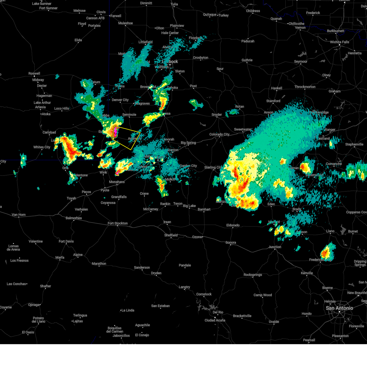 At 947 pm cdt, a severe thunderstorm was located 18 miles east of eunice, moving southeast at 30 mph (radar indicated). Hazards include ping pong ball size hail and 60 mph wind gusts. People and animals outdoors will be injured. expect hail damage to roofs, siding, windows, and vehicles. expect wind damage to roofs, siding, and trees. locations impacted include, andrews, florey, frankel city and andrews county airport. hail threat, radar indicated max hail size, 1. 50 in wind threat, radar indicated max wind gust, 60 mph. At 947 pm cdt, a severe thunderstorm was located 18 miles east of eunice, moving southeast at 30 mph (radar indicated). Hazards include ping pong ball size hail and 60 mph wind gusts. People and animals outdoors will be injured. expect hail damage to roofs, siding, windows, and vehicles. expect wind damage to roofs, siding, and trees. locations impacted include, andrews, florey, frankel city and andrews county airport. hail threat, radar indicated max hail size, 1. 50 in wind threat, radar indicated max wind gust, 60 mph.
|
| 5/19/2023 9:27 PM CDT |
 At 927 pm cdt/827 pm mdt/, a severe thunderstorm was located 9 miles east of eunice, moving southeast at 30 mph (radar indicated). Hazards include 60 mph wind gusts and quarter size hail. Hail damage to vehicles is expected. Expect wind damage to roofs, siding, and trees. At 927 pm cdt/827 pm mdt/, a severe thunderstorm was located 9 miles east of eunice, moving southeast at 30 mph (radar indicated). Hazards include 60 mph wind gusts and quarter size hail. Hail damage to vehicles is expected. Expect wind damage to roofs, siding, and trees.
|
| 5/19/2023 9:27 PM CDT |
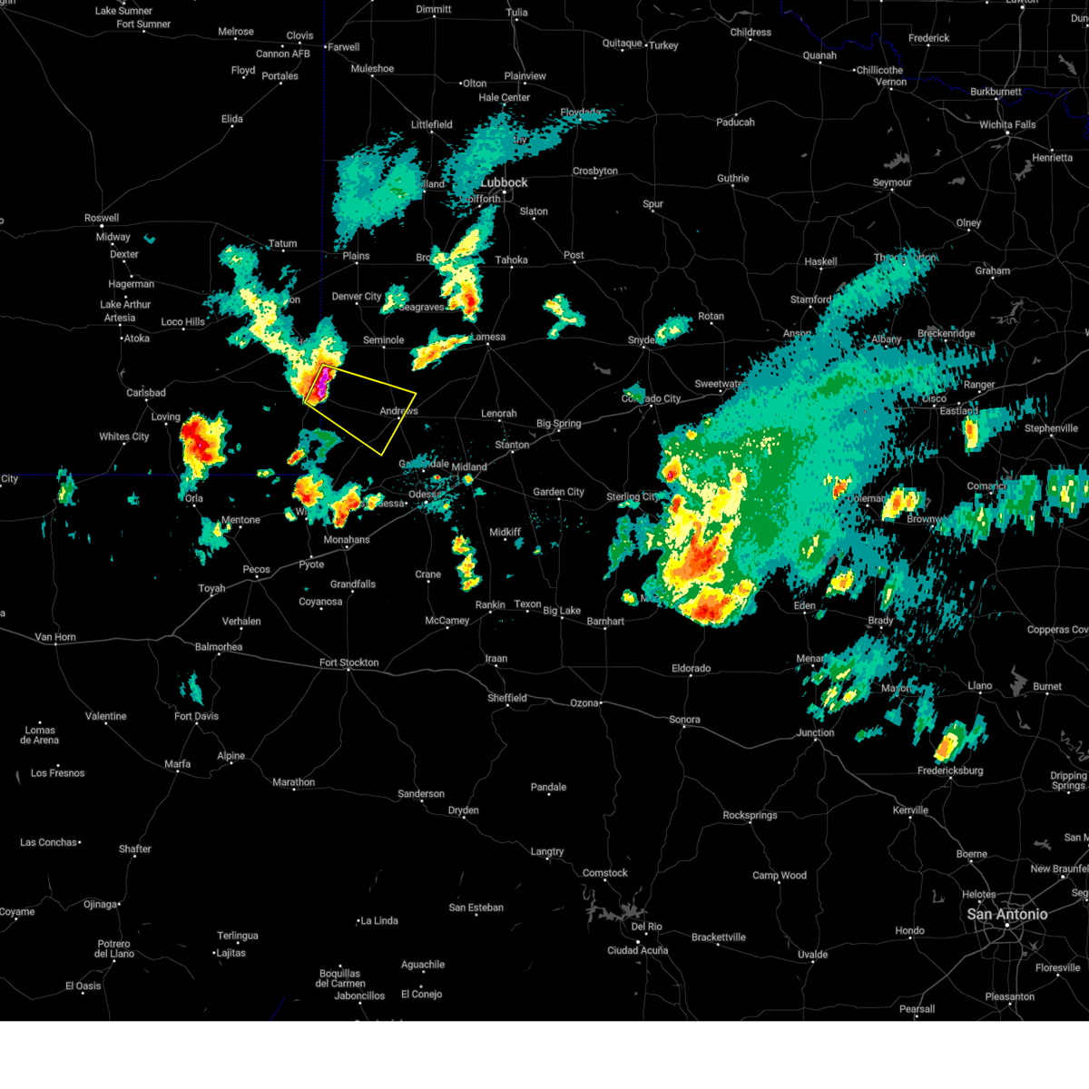 At 927 pm cdt/827 pm mdt/, a severe thunderstorm was located 9 miles east of eunice, moving southeast at 30 mph (radar indicated). Hazards include 60 mph wind gusts and quarter size hail. Hail damage to vehicles is expected. Expect wind damage to roofs, siding, and trees. At 927 pm cdt/827 pm mdt/, a severe thunderstorm was located 9 miles east of eunice, moving southeast at 30 mph (radar indicated). Hazards include 60 mph wind gusts and quarter size hail. Hail damage to vehicles is expected. Expect wind damage to roofs, siding, and trees.
|
| 6/14/2022 8:52 PM CDT |
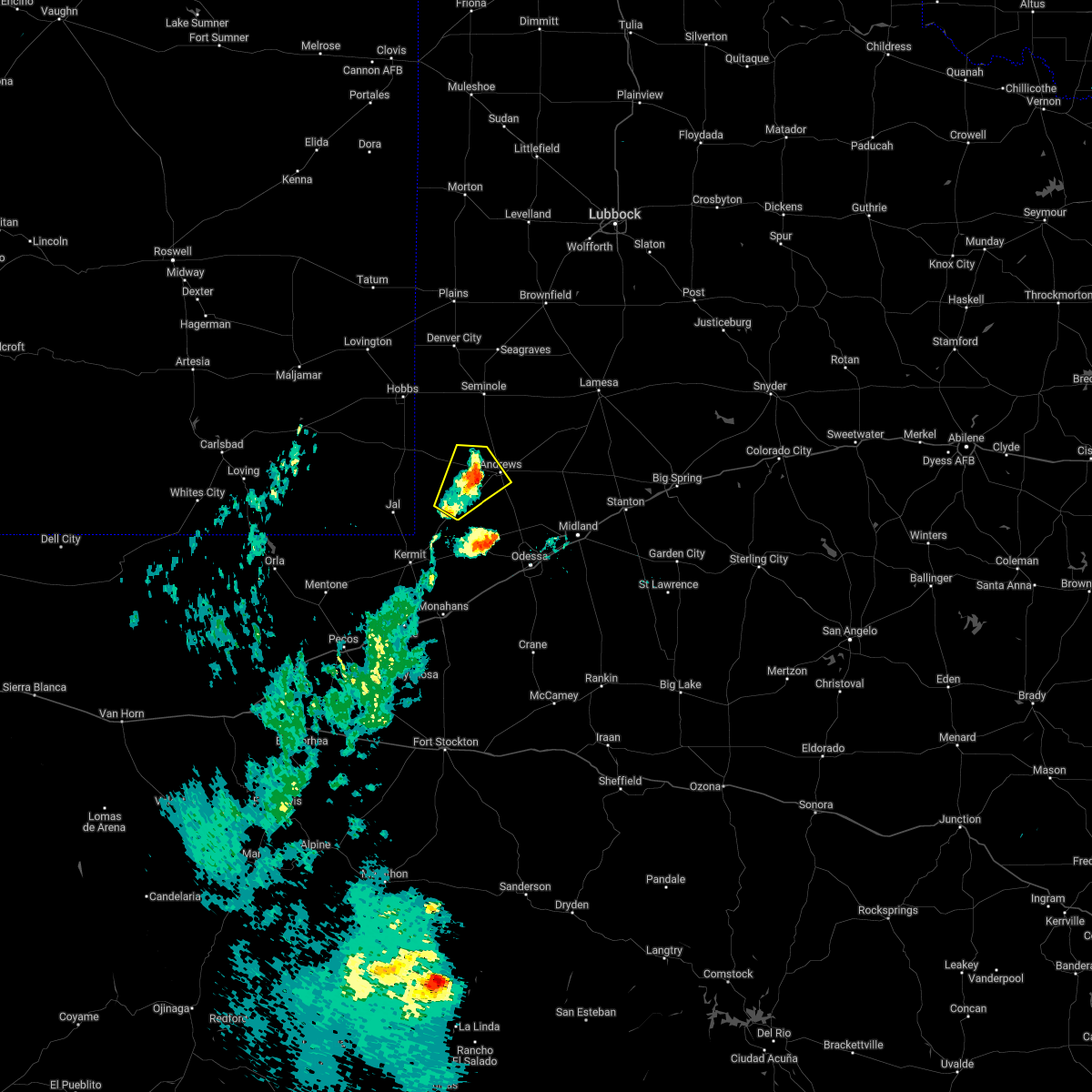 The severe thunderstorm warning for central andrews county will expire at 900 pm cdt, the storm which prompted the warning has weakened below severe limits, and no longer poses an immediate threat to life or property. therefore, the warning will be allowed to expire. The severe thunderstorm warning for central andrews county will expire at 900 pm cdt, the storm which prompted the warning has weakened below severe limits, and no longer poses an immediate threat to life or property. therefore, the warning will be allowed to expire.
|
| 6/14/2022 8:37 PM CDT |
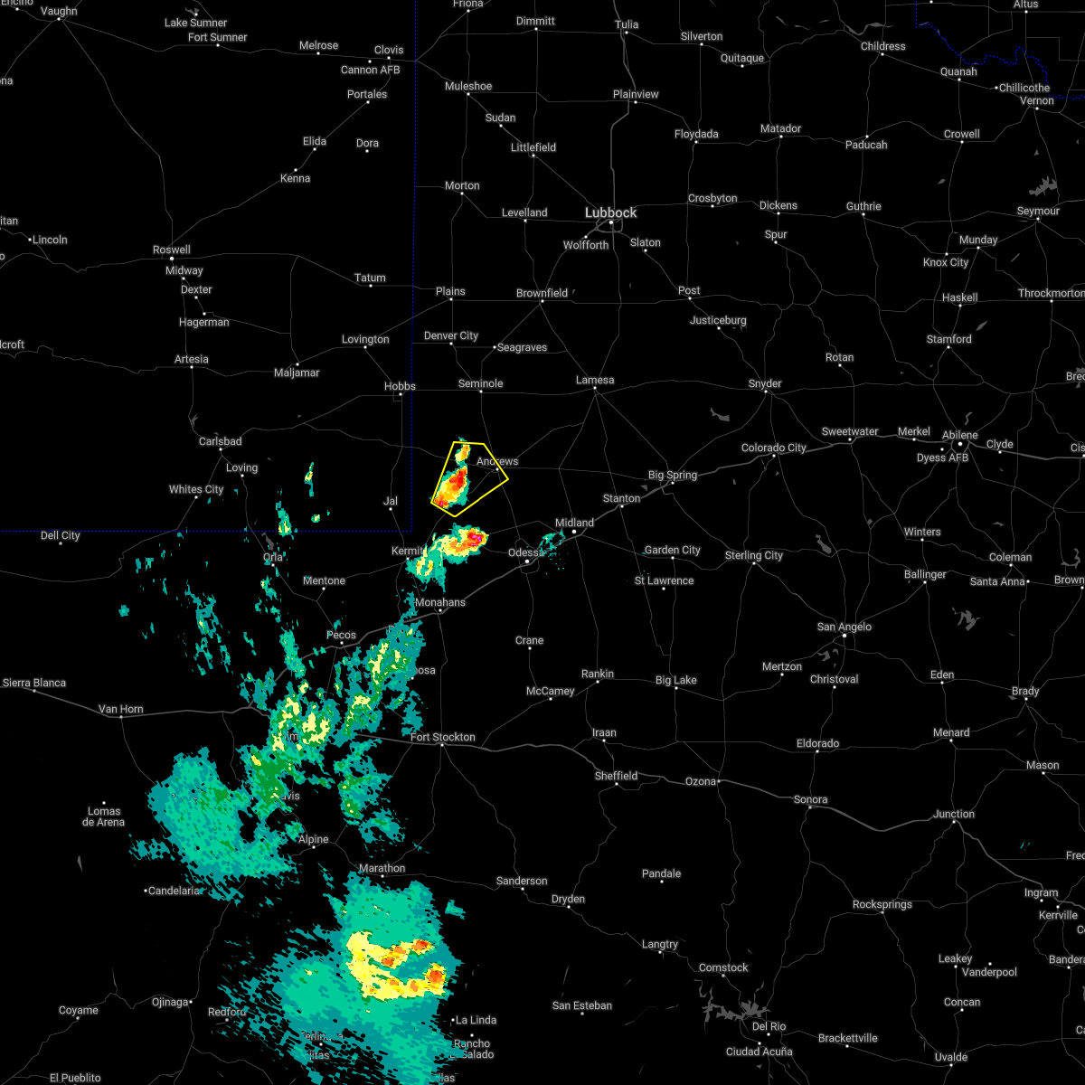 At 837 pm cdt, a severe thunderstorm was located 11 miles west of andrews, moving northeast at 10 mph (radar indicated). Hazards include 60 mph wind gusts and quarter size hail. Hail damage to vehicles is expected. expect wind damage to roofs, siding, and trees. locations impacted include, andrews, frankel city and andrews county airport. hail threat, radar indicated max hail size, 1. 00 in wind threat, radar indicated max wind gust, 60 mph. At 837 pm cdt, a severe thunderstorm was located 11 miles west of andrews, moving northeast at 10 mph (radar indicated). Hazards include 60 mph wind gusts and quarter size hail. Hail damage to vehicles is expected. expect wind damage to roofs, siding, and trees. locations impacted include, andrews, frankel city and andrews county airport. hail threat, radar indicated max hail size, 1. 00 in wind threat, radar indicated max wind gust, 60 mph.
|
| 6/14/2022 7:54 PM CDT |
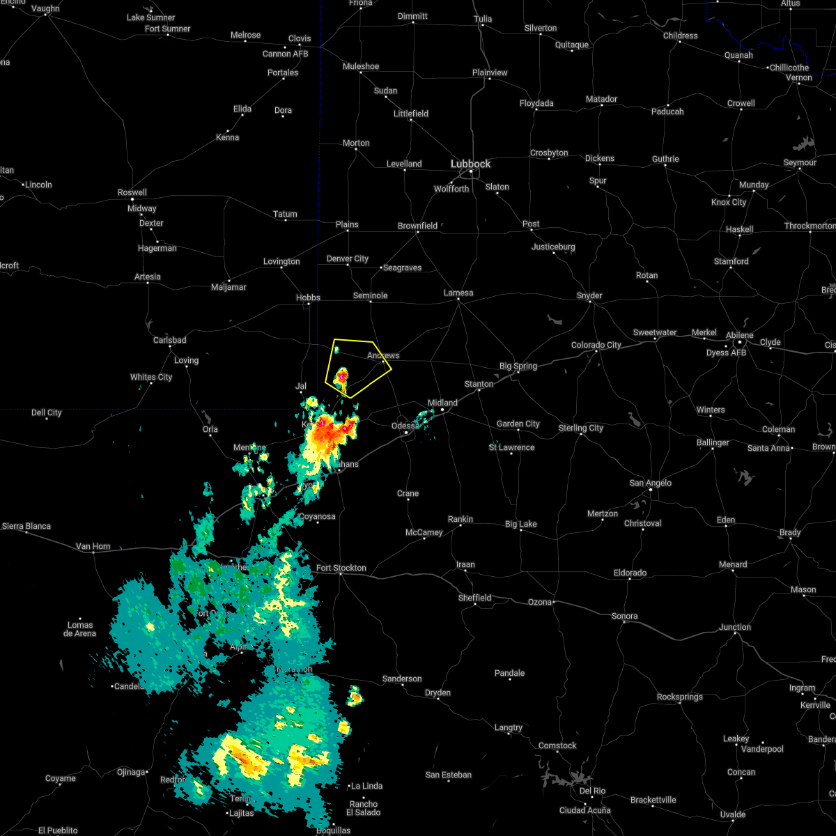 At 753 pm cdt, a severe thunderstorm was located 18 miles east of jal airport, or 19 miles west of andrews, moving northeast at 10 mph (radar indicated). Hazards include 70 mph wind gusts and half dollar size hail. Hail damage to vehicles is expected. expect considerable tree damage. Wind damage is also likely to mobile homes, roofs, and outbuildings. At 753 pm cdt, a severe thunderstorm was located 18 miles east of jal airport, or 19 miles west of andrews, moving northeast at 10 mph (radar indicated). Hazards include 70 mph wind gusts and half dollar size hail. Hail damage to vehicles is expected. expect considerable tree damage. Wind damage is also likely to mobile homes, roofs, and outbuildings.
|
| 6/1/2022 6:38 PM CDT | Golf Ball sized hail reported 16.9 miles NE of Andrews, TX, accumulated hail piles several inches deep covering road. largest stones up to golf ball size. |
| 6/1/2022 5:45 PM CDT |
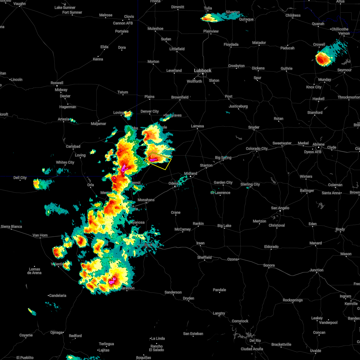 At 545 pm cdt, a severe thunderstorm was located near andrews, moving east at 20 mph (trained weather spotters). Hazards include two inch hail and 70 mph wind gusts. People and animals outdoors will be injured. expect hail damage to roofs, siding, windows, and vehicles. expect considerable tree damage. wind damage is also likely to mobile homes, roofs, and outbuildings. Locations impacted include, andrews. At 545 pm cdt, a severe thunderstorm was located near andrews, moving east at 20 mph (trained weather spotters). Hazards include two inch hail and 70 mph wind gusts. People and animals outdoors will be injured. expect hail damage to roofs, siding, windows, and vehicles. expect considerable tree damage. wind damage is also likely to mobile homes, roofs, and outbuildings. Locations impacted include, andrews.
|
| 6/1/2022 5:33 PM CDT | Hen Egg sized hail reported 13.4 miles ENE of Andrews, TX, report from mping: hen egg (2.00 in.). |
| 6/1/2022 5:20 PM CDT |
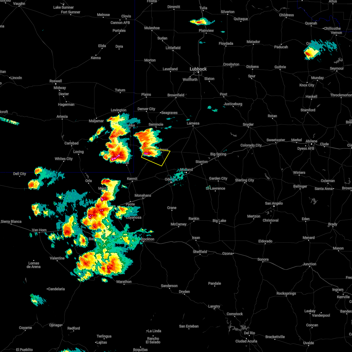 At 520 pm cdt, a severe thunderstorm was located 9 miles west of andrews, moving east at 20 mph (radar indicated). Hazards include two inch hail and 70 mph wind gusts. People and animals outdoors will be injured. expect hail damage to roofs, siding, windows, and vehicles. expect considerable tree damage. wind damage is also likely to mobile homes, roofs, and outbuildings. Locations impacted include, andrews and andrews county airport. At 520 pm cdt, a severe thunderstorm was located 9 miles west of andrews, moving east at 20 mph (radar indicated). Hazards include two inch hail and 70 mph wind gusts. People and animals outdoors will be injured. expect hail damage to roofs, siding, windows, and vehicles. expect considerable tree damage. wind damage is also likely to mobile homes, roofs, and outbuildings. Locations impacted include, andrews and andrews county airport.
|
| 6/1/2022 5:04 PM CDT |
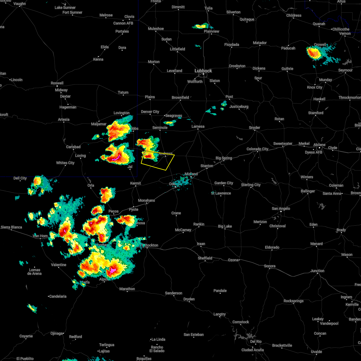 At 504 pm cdt, a severe thunderstorm was located 15 miles west of andrews, moving east at 20 mph (radar indicated). Hazards include ping pong ball size hail and 60 mph wind gusts. People and animals outdoors will be injured. expect hail damage to roofs, siding, windows, and vehicles. expect wind damage to roofs, siding, and trees. Locations impacted include, andrews, andrews county airport and frankel city. At 504 pm cdt, a severe thunderstorm was located 15 miles west of andrews, moving east at 20 mph (radar indicated). Hazards include ping pong ball size hail and 60 mph wind gusts. People and animals outdoors will be injured. expect hail damage to roofs, siding, windows, and vehicles. expect wind damage to roofs, siding, and trees. Locations impacted include, andrews, andrews county airport and frankel city.
|
| 6/1/2022 4:56 PM CDT |
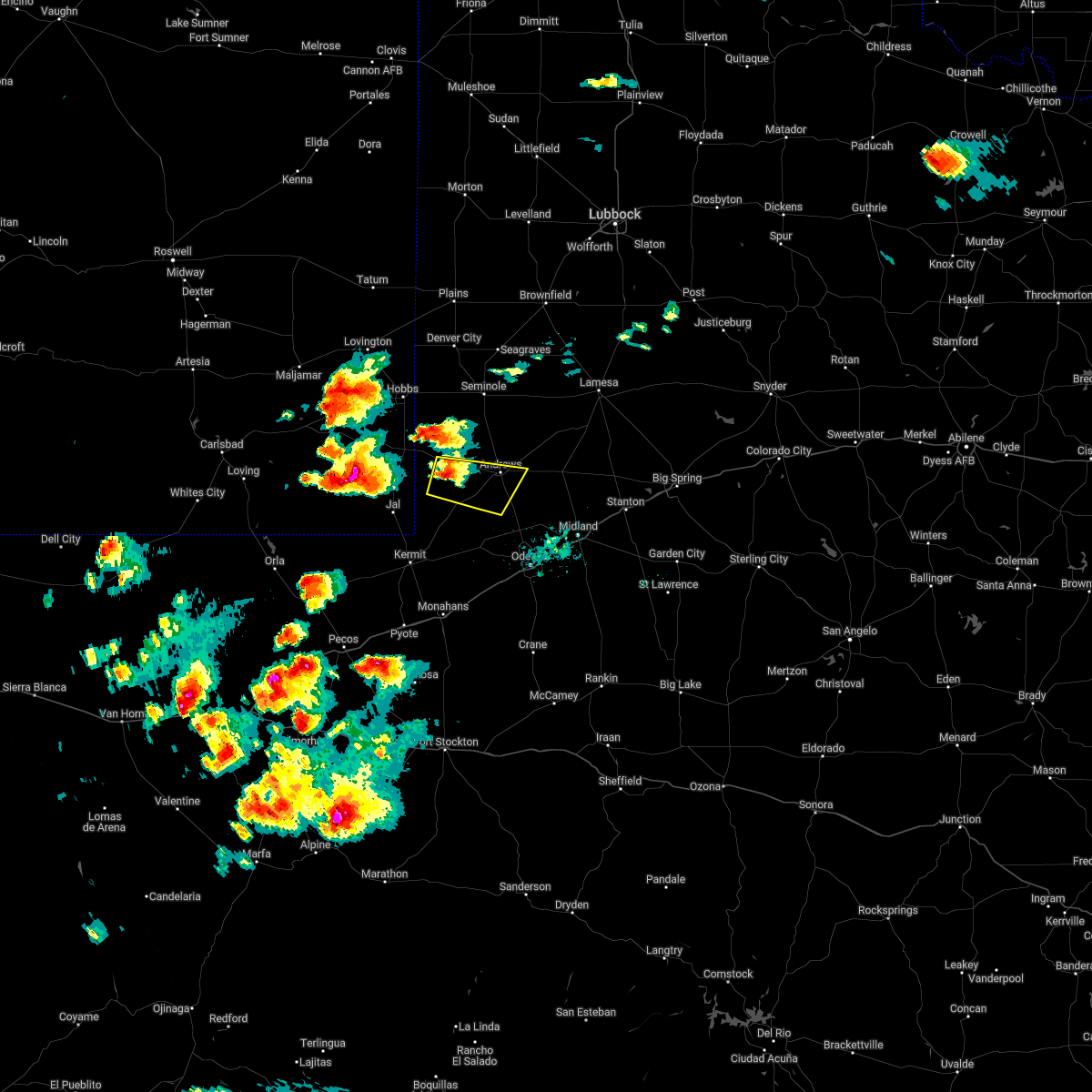 At 456 pm cdt, a severe thunderstorm was located 17 miles west of andrews, moving east at 20 mph (radar indicated). Hazards include 60 mph wind gusts and half dollar size hail. Hail damage to vehicles is expected. Expect wind damage to roofs, siding, and trees. At 456 pm cdt, a severe thunderstorm was located 17 miles west of andrews, moving east at 20 mph (radar indicated). Hazards include 60 mph wind gusts and half dollar size hail. Hail damage to vehicles is expected. Expect wind damage to roofs, siding, and trees.
|
| 5/24/2022 4:45 PM CDT |
 At 445 pm cdt, a severe thunderstorm was located 10 miles east of andrews, moving east at 25 mph (public). Hazards include tennis ball size hail and 60 mph wind gusts. People and animals outdoors will be injured. expect hail damage to roofs, siding, windows, and vehicles. Expect wind damage to roofs, siding, and trees. At 445 pm cdt, a severe thunderstorm was located 10 miles east of andrews, moving east at 25 mph (public). Hazards include tennis ball size hail and 60 mph wind gusts. People and animals outdoors will be injured. expect hail damage to roofs, siding, windows, and vehicles. Expect wind damage to roofs, siding, and trees.
|
| 5/24/2022 4:39 PM CDT |
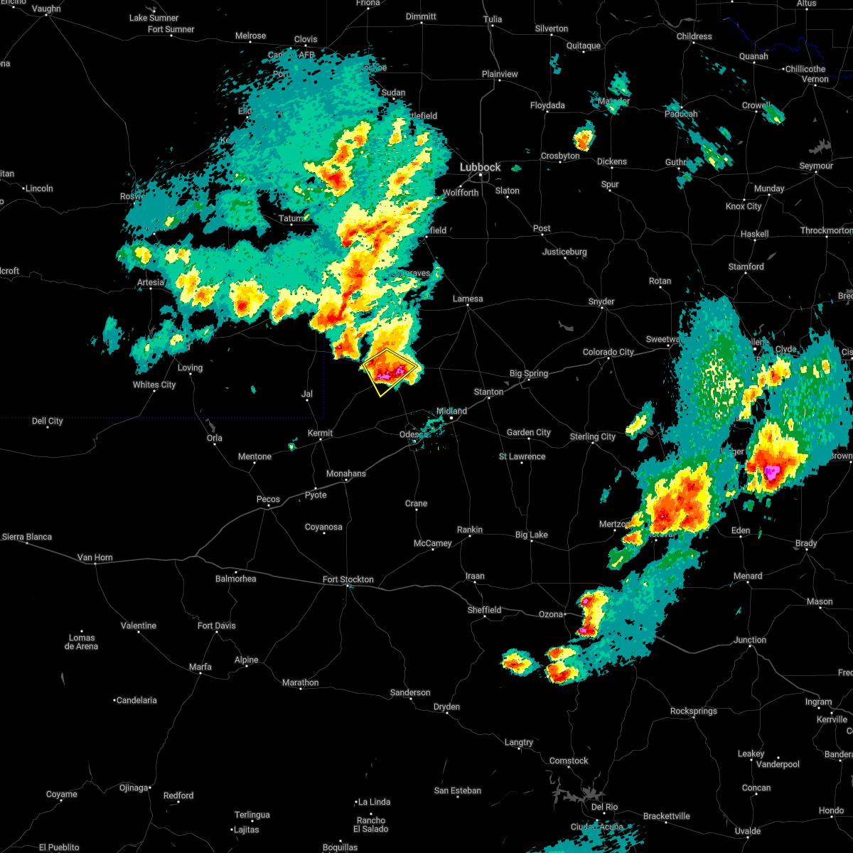 At 439 pm cdt, a severe thunderstorm was located near andrews, moving southeast at 25 mph (public). Hazards include tennis ball size hail and 60 mph wind gusts. People and animals outdoors will be injured. expect hail damage to roofs, siding, windows, and vehicles. expect wind damage to roofs, siding, and trees. Locations impacted include, andrews and andrews county airport. At 439 pm cdt, a severe thunderstorm was located near andrews, moving southeast at 25 mph (public). Hazards include tennis ball size hail and 60 mph wind gusts. People and animals outdoors will be injured. expect hail damage to roofs, siding, windows, and vehicles. expect wind damage to roofs, siding, and trees. Locations impacted include, andrews and andrews county airport.
|
| 5/24/2022 4:34 PM CDT | Tennis Ball sized hail reported 4.8 miles ENE of Andrews, TX, report from mping: tennis ball (2.50 in.). |
| 5/24/2022 4:34 PM CDT |
 At 434 pm cdt, a severe thunderstorm capable of producing a tornado was located near andrews, moving east at 20 mph (radar indicated rotation). Hazards include tornado and tennis ball size hail. Flying debris will be dangerous to those caught without shelter. mobile homes will be damaged or destroyed. damage to roofs, windows, and vehicles will occur. tree damage is likely. this dangerous storm will be near, andrews around 445 pm cdt. Other locations impacted by this tornadic thunderstorm include andrews county airport. At 434 pm cdt, a severe thunderstorm capable of producing a tornado was located near andrews, moving east at 20 mph (radar indicated rotation). Hazards include tornado and tennis ball size hail. Flying debris will be dangerous to those caught without shelter. mobile homes will be damaged or destroyed. damage to roofs, windows, and vehicles will occur. tree damage is likely. this dangerous storm will be near, andrews around 445 pm cdt. Other locations impacted by this tornadic thunderstorm include andrews county airport.
|
| 5/24/2022 4:21 PM CDT |
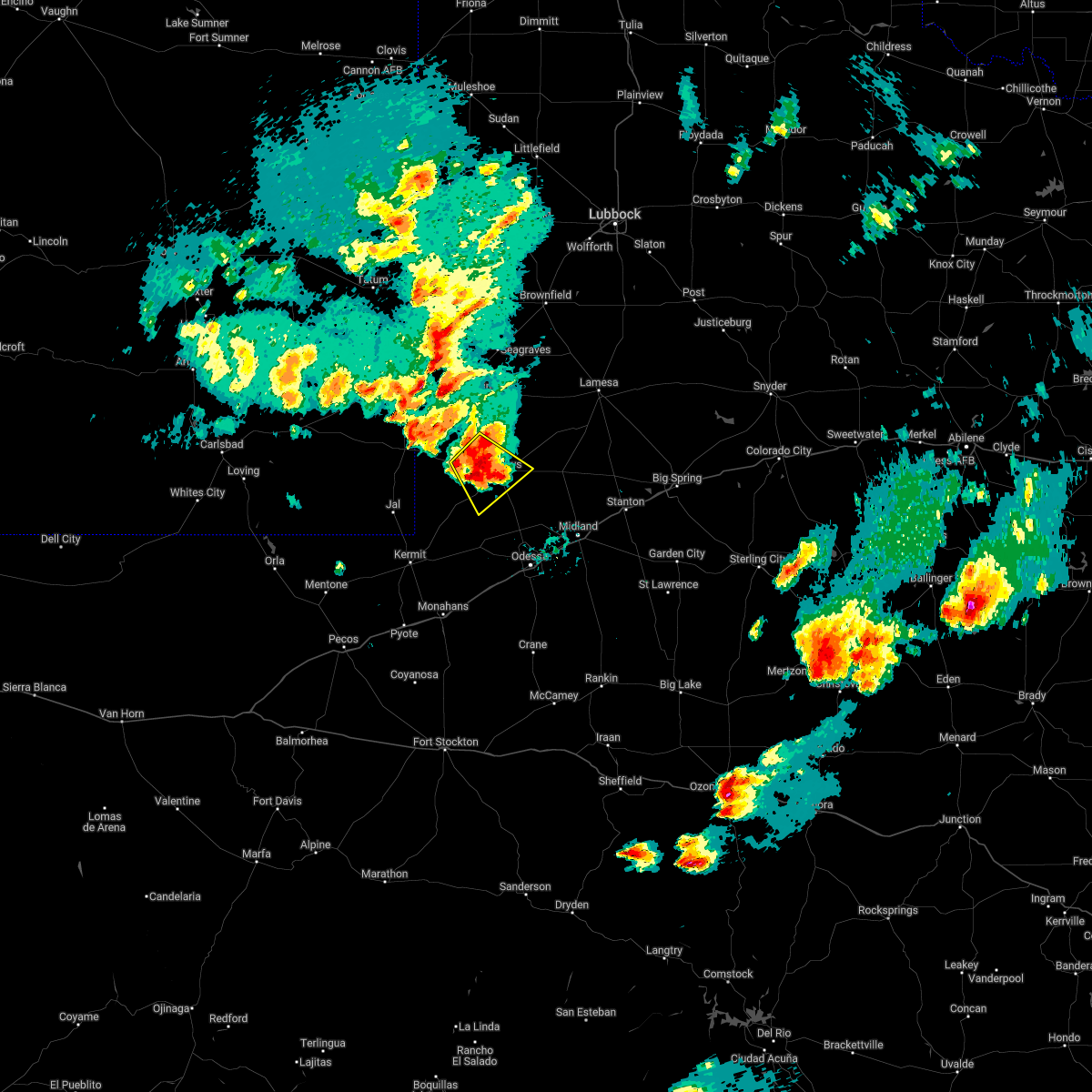 At 420 pm cdt, a severe thunderstorm was located 9 miles west of andrews, moving southeast at 20 mph (radar indicated). Hazards include tennis ball size hail and 60 mph wind gusts. People and animals outdoors will be injured. expect hail damage to roofs, siding, windows, and vehicles. expect wind damage to roofs, siding, and trees. Locations impacted include, andrews, florey, frankel city and andrews county airport. At 420 pm cdt, a severe thunderstorm was located 9 miles west of andrews, moving southeast at 20 mph (radar indicated). Hazards include tennis ball size hail and 60 mph wind gusts. People and animals outdoors will be injured. expect hail damage to roofs, siding, windows, and vehicles. expect wind damage to roofs, siding, and trees. Locations impacted include, andrews, florey, frankel city and andrews county airport.
|
| 5/24/2022 4:19 PM CDT | Quarter sized hail reported 6.2 miles NE of Andrews, TX, report from mping: quarter (1.00 in.). |
| 5/24/2022 4:12 PM CDT | Ping Pong Ball sized hail reported 10.9 miles SE of Andrews, TX, report from mping: ping pong ball (1.50 in.). |
| 5/24/2022 3:56 PM CDT |
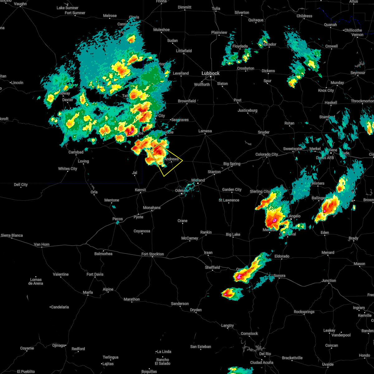 At 356 pm cdt, a severe thunderstorm was located 16 miles southwest of gaines county airport, or 18 miles northwest of andrews, moving southeast at 25 mph (radar indicated). Hazards include golf ball size hail and 60 mph wind gusts. People and animals outdoors will be injured. expect hail damage to roofs, siding, windows, and vehicles. Expect wind damage to roofs, siding, and trees. At 356 pm cdt, a severe thunderstorm was located 16 miles southwest of gaines county airport, or 18 miles northwest of andrews, moving southeast at 25 mph (radar indicated). Hazards include golf ball size hail and 60 mph wind gusts. People and animals outdoors will be injured. expect hail damage to roofs, siding, windows, and vehicles. Expect wind damage to roofs, siding, and trees.
|
| 5/24/2022 3:42 PM CDT | Quarter sized hail reported 17.6 miles ESE of Andrews, TX, report from mping: quarter (1.00 in.). |
| 5/1/2022 6:11 PM CDT | Hen Egg sized hail reported 14.9 miles WSW of Andrews, TX |
| 5/1/2022 6:09 PM CDT |
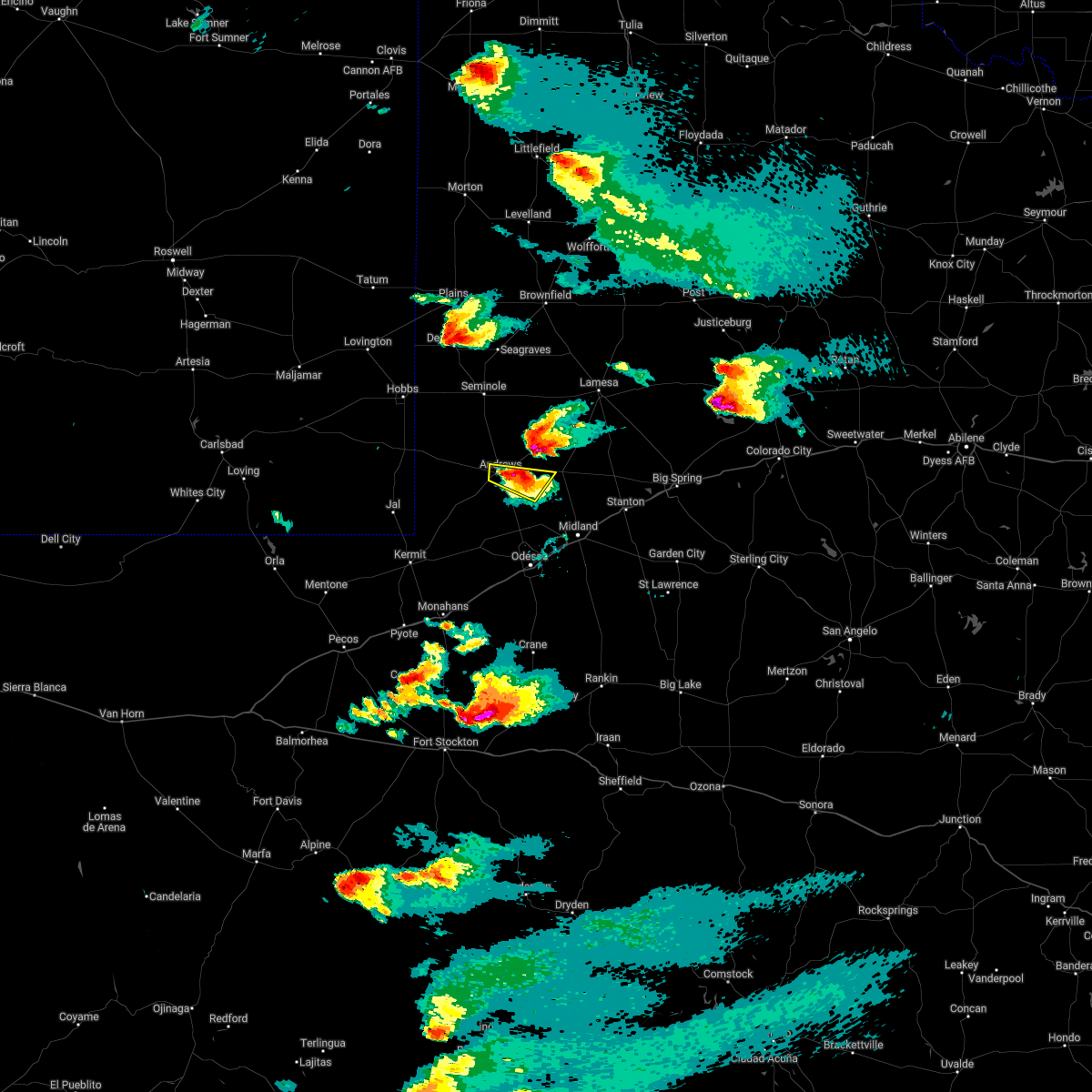 At 609 pm cdt, a severe thunderstorm was located near andrews, moving northeast at 35 mph (radar indicated). Hazards include tennis ball size hail and 70 mph wind gusts. People and animals outdoors will be injured. expect hail damage to roofs, siding, windows, and vehicles. expect considerable tree damage. Wind damage is also likely to mobile homes, roofs, and outbuildings. At 609 pm cdt, a severe thunderstorm was located near andrews, moving northeast at 35 mph (radar indicated). Hazards include tennis ball size hail and 70 mph wind gusts. People and animals outdoors will be injured. expect hail damage to roofs, siding, windows, and vehicles. expect considerable tree damage. Wind damage is also likely to mobile homes, roofs, and outbuildings.
|
| 5/1/2022 5:44 PM CDT |
 At 543 pm cdt, a severe thunderstorm was located 11 miles southwest of andrews, moving northeast at 40 mph. this is a destructive storm moving into andrews (radar indicated). Hazards include 80 mph wind gusts and tennis ball size hail. Flying debris will be dangerous to those caught without shelter. mobile homes will be heavily damaged. expect considerable damage to roofs, windows, and vehicles. extensive tree damage and power outages are likely. locations impacted include, andrews, goldsmith and andrews county airport. thunderstorm damage threat, destructive hail threat, radar indicated max hail size, 2. 50 in wind threat, radar indicated max wind gust, 80 mph. At 543 pm cdt, a severe thunderstorm was located 11 miles southwest of andrews, moving northeast at 40 mph. this is a destructive storm moving into andrews (radar indicated). Hazards include 80 mph wind gusts and tennis ball size hail. Flying debris will be dangerous to those caught without shelter. mobile homes will be heavily damaged. expect considerable damage to roofs, windows, and vehicles. extensive tree damage and power outages are likely. locations impacted include, andrews, goldsmith and andrews county airport. thunderstorm damage threat, destructive hail threat, radar indicated max hail size, 2. 50 in wind threat, radar indicated max wind gust, 80 mph.
|
| 5/1/2022 5:36 PM CDT |
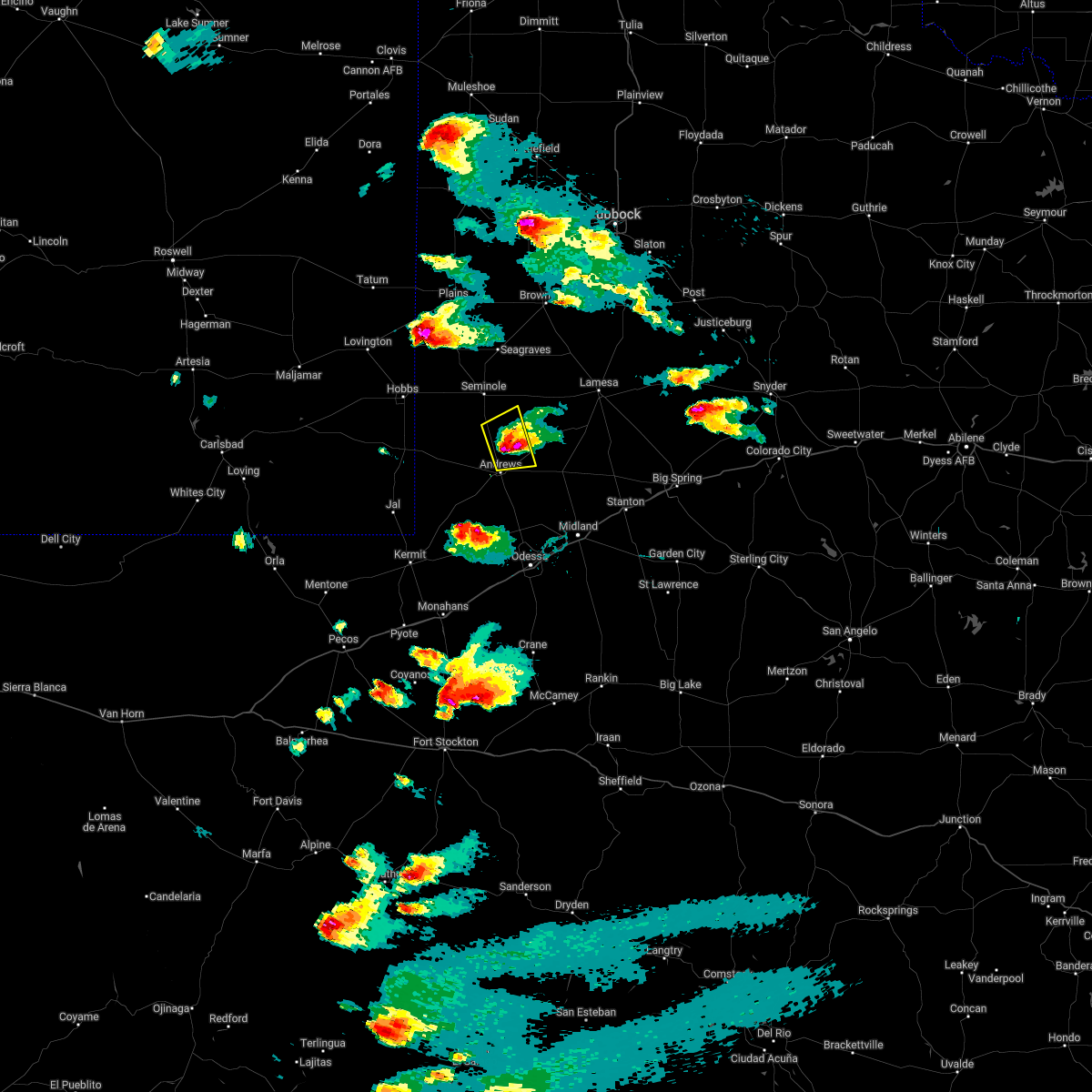 At 535 pm cdt, a severe thunderstorm was located 7 miles north of andrews, moving east at 20 mph. at 5:21 pm, a spotter reported hail greater than 2 inches in diameter. this is a destructive storm for northeast andrews county (radar indicated). Hazards include 80 mph wind gusts and baseball size hail. Flying debris will be dangerous to those caught without shelter. mobile homes will be heavily damaged. expect considerable damage to roofs, windows, and vehicles. extensive tree damage and power outages are likely. locations impacted include, andrews, florey and andrews county airport. thunderstorm damage threat, destructive hail threat, radar indicated max hail size, 2. 75 in wind threat, radar indicated max wind gust, 80 mph. At 535 pm cdt, a severe thunderstorm was located 7 miles north of andrews, moving east at 20 mph. at 5:21 pm, a spotter reported hail greater than 2 inches in diameter. this is a destructive storm for northeast andrews county (radar indicated). Hazards include 80 mph wind gusts and baseball size hail. Flying debris will be dangerous to those caught without shelter. mobile homes will be heavily damaged. expect considerable damage to roofs, windows, and vehicles. extensive tree damage and power outages are likely. locations impacted include, andrews, florey and andrews county airport. thunderstorm damage threat, destructive hail threat, radar indicated max hail size, 2. 75 in wind threat, radar indicated max wind gust, 80 mph.
|
| 5/1/2022 5:28 PM CDT |
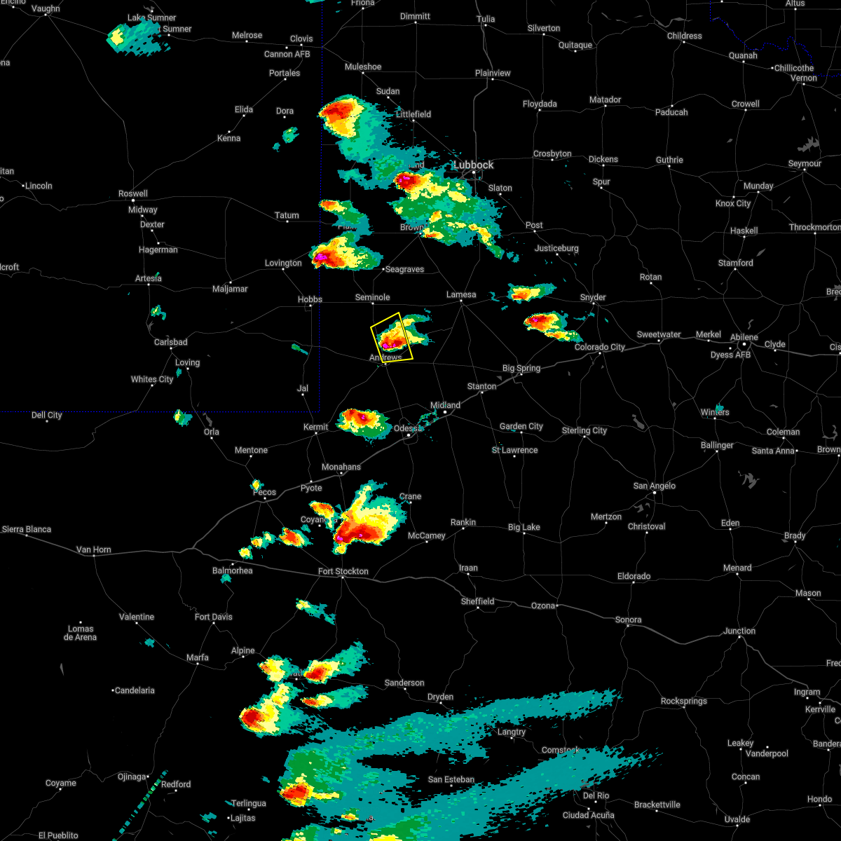 At 528 pm cdt, a severe thunderstorm was located 7 miles north of andrews, moving east at 20 mph (radar indicated). Hazards include two inch hail and 70 mph wind gusts. People and animals outdoors will be injured. expect hail damage to roofs, siding, windows, and vehicles. expect considerable tree damage. wind damage is also likely to mobile homes, roofs, and outbuildings. locations impacted include, andrews, florey and andrews county airport. thunderstorm damage threat, considerable hail threat, radar indicated max hail size, 2. 00 in wind threat, radar indicated max wind gust, 70 mph. At 528 pm cdt, a severe thunderstorm was located 7 miles north of andrews, moving east at 20 mph (radar indicated). Hazards include two inch hail and 70 mph wind gusts. People and animals outdoors will be injured. expect hail damage to roofs, siding, windows, and vehicles. expect considerable tree damage. wind damage is also likely to mobile homes, roofs, and outbuildings. locations impacted include, andrews, florey and andrews county airport. thunderstorm damage threat, considerable hail threat, radar indicated max hail size, 2. 00 in wind threat, radar indicated max wind gust, 70 mph.
|
| 5/1/2022 5:25 PM CDT |
 At 525 pm cdt, a severe thunderstorm was located 10 miles west of goldsmith, or 20 miles northeast of kermit, moving northeast at 35 mph (radar indicated). Hazards include two inch hail and 70 mph wind gusts. People and animals outdoors will be injured. expect hail damage to roofs, siding, windows, and vehicles. expect considerable tree damage. Wind damage is also likely to mobile homes, roofs, and outbuildings. At 525 pm cdt, a severe thunderstorm was located 10 miles west of goldsmith, or 20 miles northeast of kermit, moving northeast at 35 mph (radar indicated). Hazards include two inch hail and 70 mph wind gusts. People and animals outdoors will be injured. expect hail damage to roofs, siding, windows, and vehicles. expect considerable tree damage. Wind damage is also likely to mobile homes, roofs, and outbuildings.
|
| 5/1/2022 5:21 PM CDT | Hen Egg sized hail reported 6.2 miles S of Andrews, TX |
| 5/1/2022 4:55 PM CDT |
 At 455 pm cdt, a severe thunderstorm was located 12 miles northwest of andrews, moving east at 15 mph (radar indicated). Hazards include two inch hail and 70 mph wind gusts. People and animals outdoors will be injured. expect hail damage to roofs, siding, windows, and vehicles. expect considerable tree damage. Wind damage is also likely to mobile homes, roofs, and outbuildings. At 455 pm cdt, a severe thunderstorm was located 12 miles northwest of andrews, moving east at 15 mph (radar indicated). Hazards include two inch hail and 70 mph wind gusts. People and animals outdoors will be injured. expect hail damage to roofs, siding, windows, and vehicles. expect considerable tree damage. Wind damage is also likely to mobile homes, roofs, and outbuildings.
|
| 5/1/2022 4:43 PM CDT |
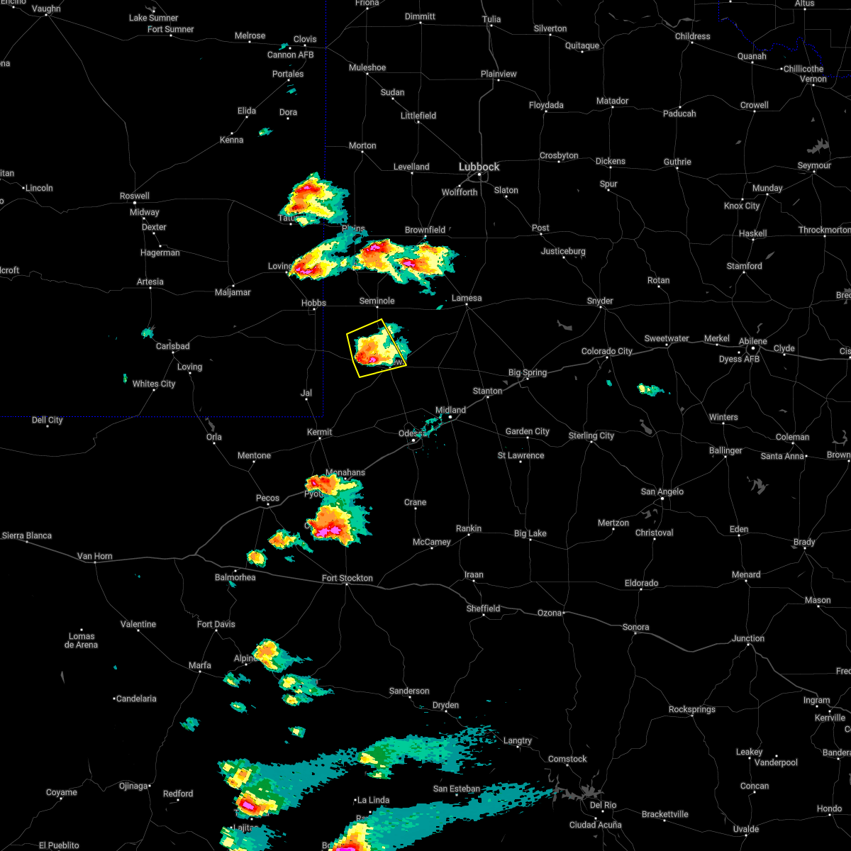 At 443 pm cdt, a severe thunderstorm was located 10 miles west of andrews, moving east at 25 mph (radar indicated). Hazards include two inch hail and 70 mph wind gusts. People and animals outdoors will be injured. expect hail damage to roofs, siding, windows, and vehicles. expect considerable tree damage. wind damage is also likely to mobile homes, roofs, and outbuildings. Locations impacted include, andrews, florey, frankel city and andrews county airport. At 443 pm cdt, a severe thunderstorm was located 10 miles west of andrews, moving east at 25 mph (radar indicated). Hazards include two inch hail and 70 mph wind gusts. People and animals outdoors will be injured. expect hail damage to roofs, siding, windows, and vehicles. expect considerable tree damage. wind damage is also likely to mobile homes, roofs, and outbuildings. Locations impacted include, andrews, florey, frankel city and andrews county airport.
|
| 5/1/2022 4:34 PM CDT | Tennis Ball sized hail reported 9.8 miles E of Andrews, TX |
| 5/1/2022 4:34 PM CDT | Golf Ball sized hail reported 14.2 miles ESE of Andrews, TX |
| 5/1/2022 4:17 PM CDT |
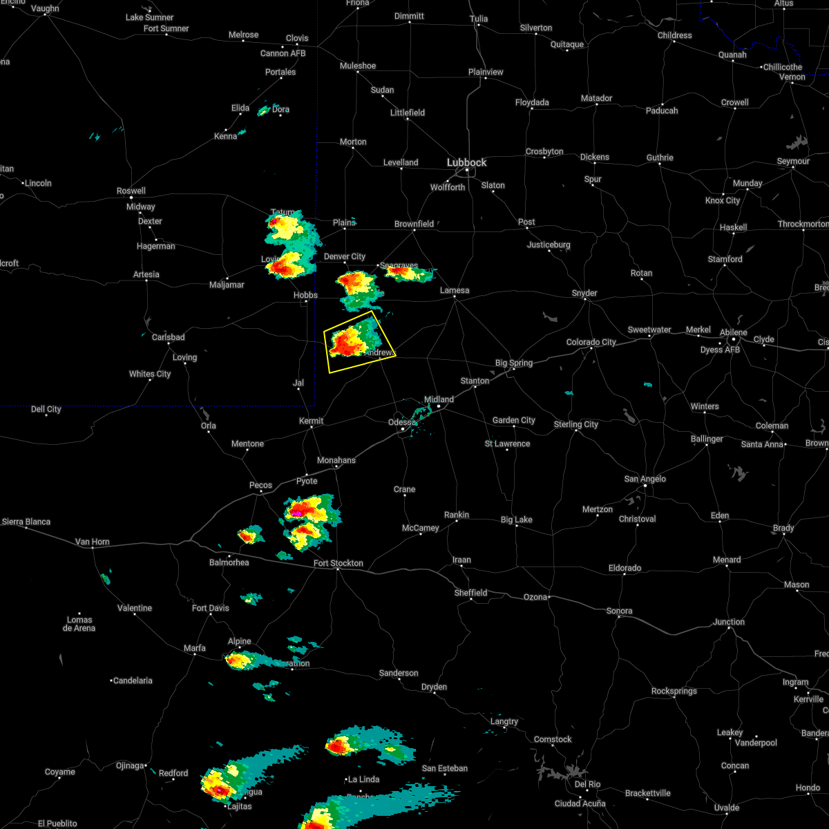 At 416 pm cdt, a severe thunderstorm was located 17 miles west of andrews, moving northeast at 20 mph (radar indicated). Hazards include two inch hail and 70 mph wind gusts. People and animals outdoors will be injured. expect hail damage to roofs, siding, windows, and vehicles. expect considerable tree damage. wind damage is also likely to mobile homes, roofs, and outbuildings. Locations impacted include, andrews, florey, frankel city and andrews county airport. At 416 pm cdt, a severe thunderstorm was located 17 miles west of andrews, moving northeast at 20 mph (radar indicated). Hazards include two inch hail and 70 mph wind gusts. People and animals outdoors will be injured. expect hail damage to roofs, siding, windows, and vehicles. expect considerable tree damage. wind damage is also likely to mobile homes, roofs, and outbuildings. Locations impacted include, andrews, florey, frankel city and andrews county airport.
|
| 5/1/2022 3:57 PM CDT |
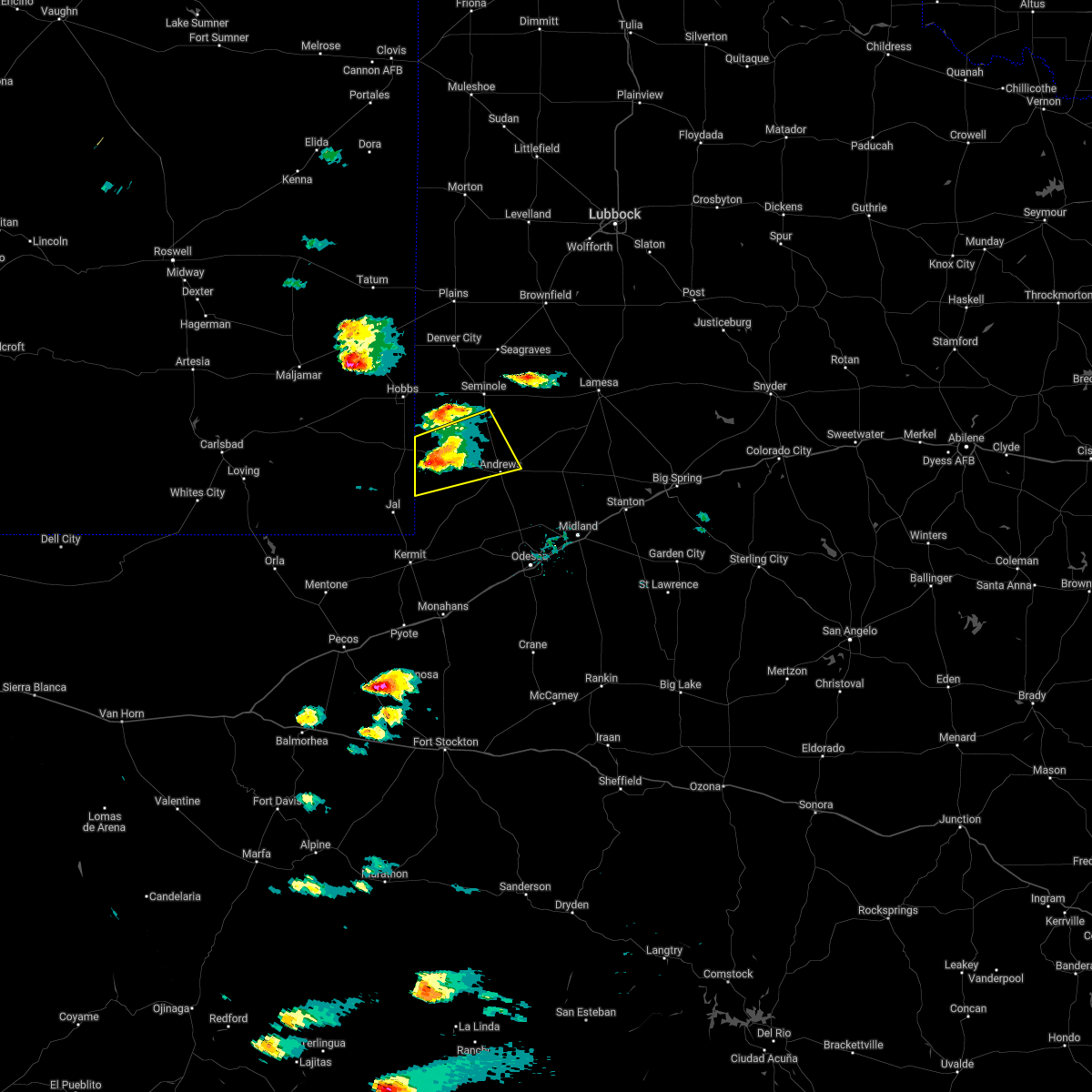 At 356 pm cdt, a severe thunderstorm was located 12 miles southeast of eunice, moving northeast at 20 mph (radar indicated). Hazards include golf ball size hail and 60 mph wind gusts. People and animals outdoors will be injured. expect hail damage to roofs, siding, windows, and vehicles. Expect wind damage to roofs, siding, and trees. At 356 pm cdt, a severe thunderstorm was located 12 miles southeast of eunice, moving northeast at 20 mph (radar indicated). Hazards include golf ball size hail and 60 mph wind gusts. People and animals outdoors will be injured. expect hail damage to roofs, siding, windows, and vehicles. Expect wind damage to roofs, siding, and trees.
|
| 2/21/2022 5:38 PM CST | Andrews mesone in andrews county TX, 1.9 miles W of Andrews, TX |
| 2/16/2022 9:23 PM CST |
 At 922 pm cst, a severe thunderstorm was located near odessa, moving east at 35 mph. blowing dust is also expected (radar indicated). Hazards include 70 mph wind gusts and nickel size hail. Expect considerable tree damage. damage is likely to mobile homes, roofs, and outbuildings. locations impacted include, odessa, andrews, monahans, thorntonville, goldsmith, west odessa, roy hurd memorial airport, monahans sandhills state park, odessa schlemeyer field, notrees, penwell, pleasant farms and andrews county airport. this includes interstate 20 between mile markers 77 and 119. thunderstorm damage threat, considerable hail threat, radar indicated max hail size, 0. 88 in wind threat, radar indicated max wind gust, 70 mph. At 922 pm cst, a severe thunderstorm was located near odessa, moving east at 35 mph. blowing dust is also expected (radar indicated). Hazards include 70 mph wind gusts and nickel size hail. Expect considerable tree damage. damage is likely to mobile homes, roofs, and outbuildings. locations impacted include, odessa, andrews, monahans, thorntonville, goldsmith, west odessa, roy hurd memorial airport, monahans sandhills state park, odessa schlemeyer field, notrees, penwell, pleasant farms and andrews county airport. this includes interstate 20 between mile markers 77 and 119. thunderstorm damage threat, considerable hail threat, radar indicated max hail size, 0. 88 in wind threat, radar indicated max wind gust, 70 mph.
|
| 2/16/2022 8:57 PM CST |
 At 855 pm cst, a severe thunderstorm was located near andrews, moving northeast at 35 mph. the mesonet at andrews reported a 68kt gust at 836 pm (radar indicated). Hazards include 70 mph wind gusts and nickel size hail. Expect considerable tree damage. Damage is likely to mobile homes, roofs, and outbuildings. At 855 pm cst, a severe thunderstorm was located near andrews, moving northeast at 35 mph. the mesonet at andrews reported a 68kt gust at 836 pm (radar indicated). Hazards include 70 mph wind gusts and nickel size hail. Expect considerable tree damage. Damage is likely to mobile homes, roofs, and outbuildings.
|
| 2/16/2022 8:36 PM CST | Andrews mesonet reported 67 mph wind gus in andrews county TX, 2 miles WSW of Andrews, TX |
| 9/30/2021 11:02 AM CDT |
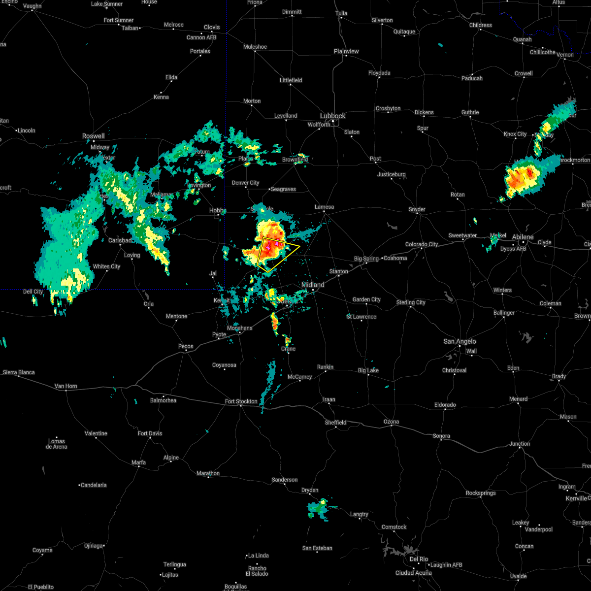 At 1102 am cdt, a severe thunderstorm was located over andrews, moving northeast at 20 mph (radar indicated). Hazards include 60 mph wind gusts and quarter size hail. Hail damage to vehicles is expected. expect wind damage to roofs, siding, and trees. locations impacted include, andrews, florey and andrews county airport. hail threat, radar indicated max hail size, 1. 00 in wind threat, radar indicated max wind gust, 60 mph. At 1102 am cdt, a severe thunderstorm was located over andrews, moving northeast at 20 mph (radar indicated). Hazards include 60 mph wind gusts and quarter size hail. Hail damage to vehicles is expected. expect wind damage to roofs, siding, and trees. locations impacted include, andrews, florey and andrews county airport. hail threat, radar indicated max hail size, 1. 00 in wind threat, radar indicated max wind gust, 60 mph.
|
| 9/30/2021 11:01 AM CDT | Quarter sized hail reported 1.3 miles S of Andrews, TX, spotter reported quarter size hail 1 mile north of andrews on highway 385. |
| 9/30/2021 11:00 AM CDT |
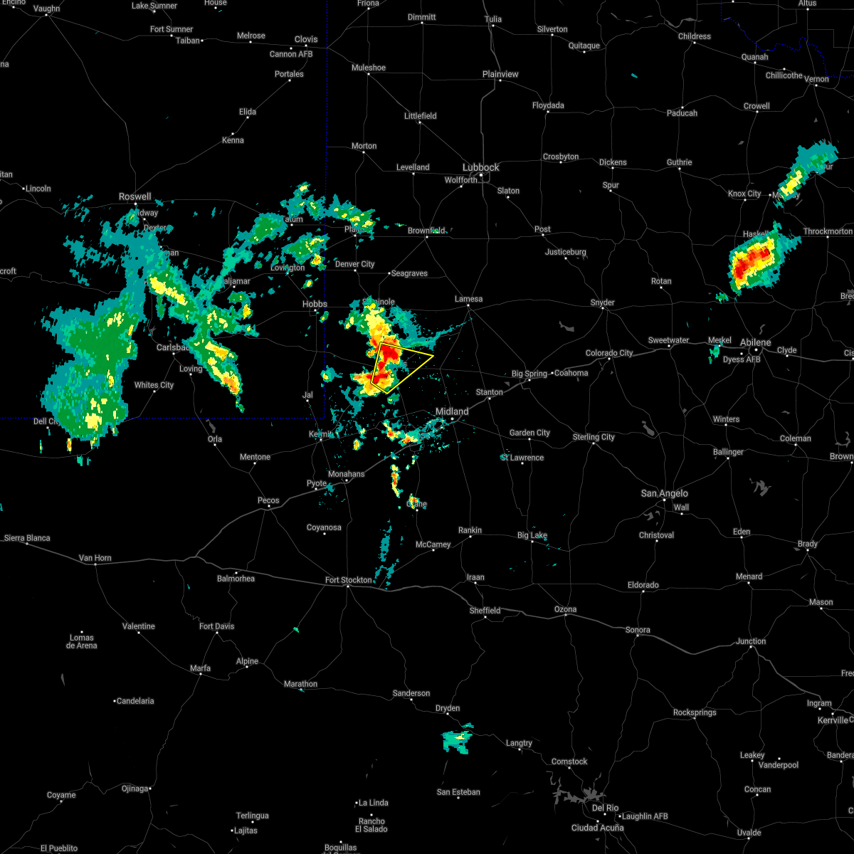 At 1100 am cdt, a severe thunderstorm was located near andrews, moving northeast at 20 mph (radar indicated). Hazards include 60 mph wind gusts and penny size hail. Expect damage to roofs, siding, and trees. locations impacted include, andrews, florey and andrews county airport. hail threat, radar indicated max hail size, 0. 75 in wind threat, radar indicated max wind gust, 60 mph. At 1100 am cdt, a severe thunderstorm was located near andrews, moving northeast at 20 mph (radar indicated). Hazards include 60 mph wind gusts and penny size hail. Expect damage to roofs, siding, and trees. locations impacted include, andrews, florey and andrews county airport. hail threat, radar indicated max hail size, 0. 75 in wind threat, radar indicated max wind gust, 60 mph.
|
| 9/30/2021 10:55 AM CDT | Andrews mesonet measured 62 mph wind gus in andrews county TX, 2.5 miles W of Andrews, TX |
| 9/30/2021 10:51 AM CDT |
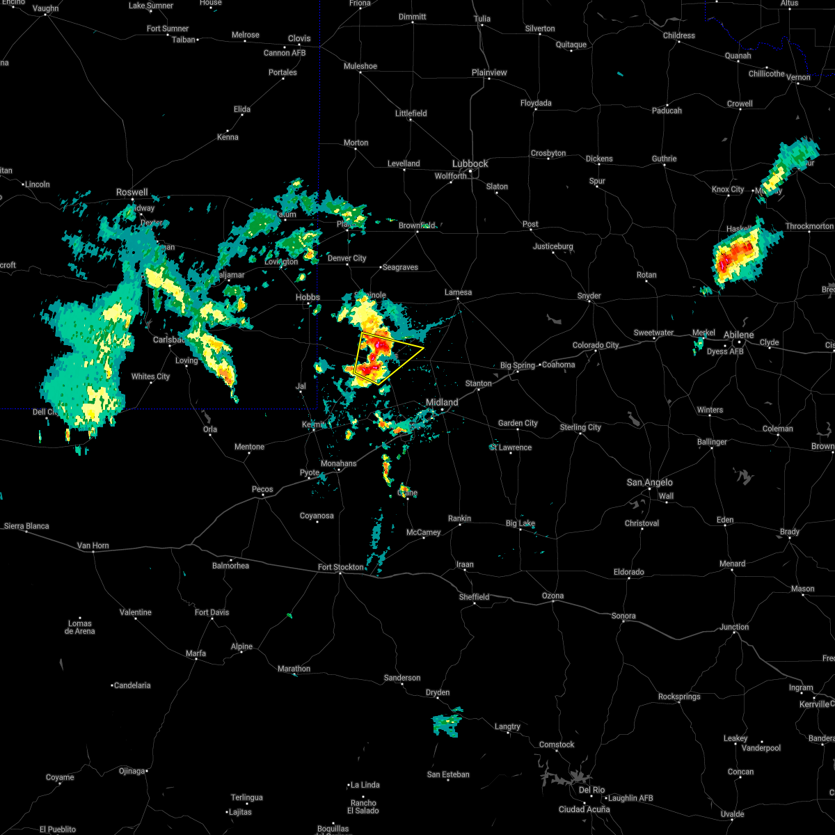 At 1051 am cdt, a severe thunderstorm was located near andrews, moving north at 30 mph (radar indicated). Hazards include 60 mph wind gusts and penny size hail. expect damage to roofs, siding, and trees At 1051 am cdt, a severe thunderstorm was located near andrews, moving north at 30 mph (radar indicated). Hazards include 60 mph wind gusts and penny size hail. expect damage to roofs, siding, and trees
|
| 7/25/2021 6:34 PM CDT |
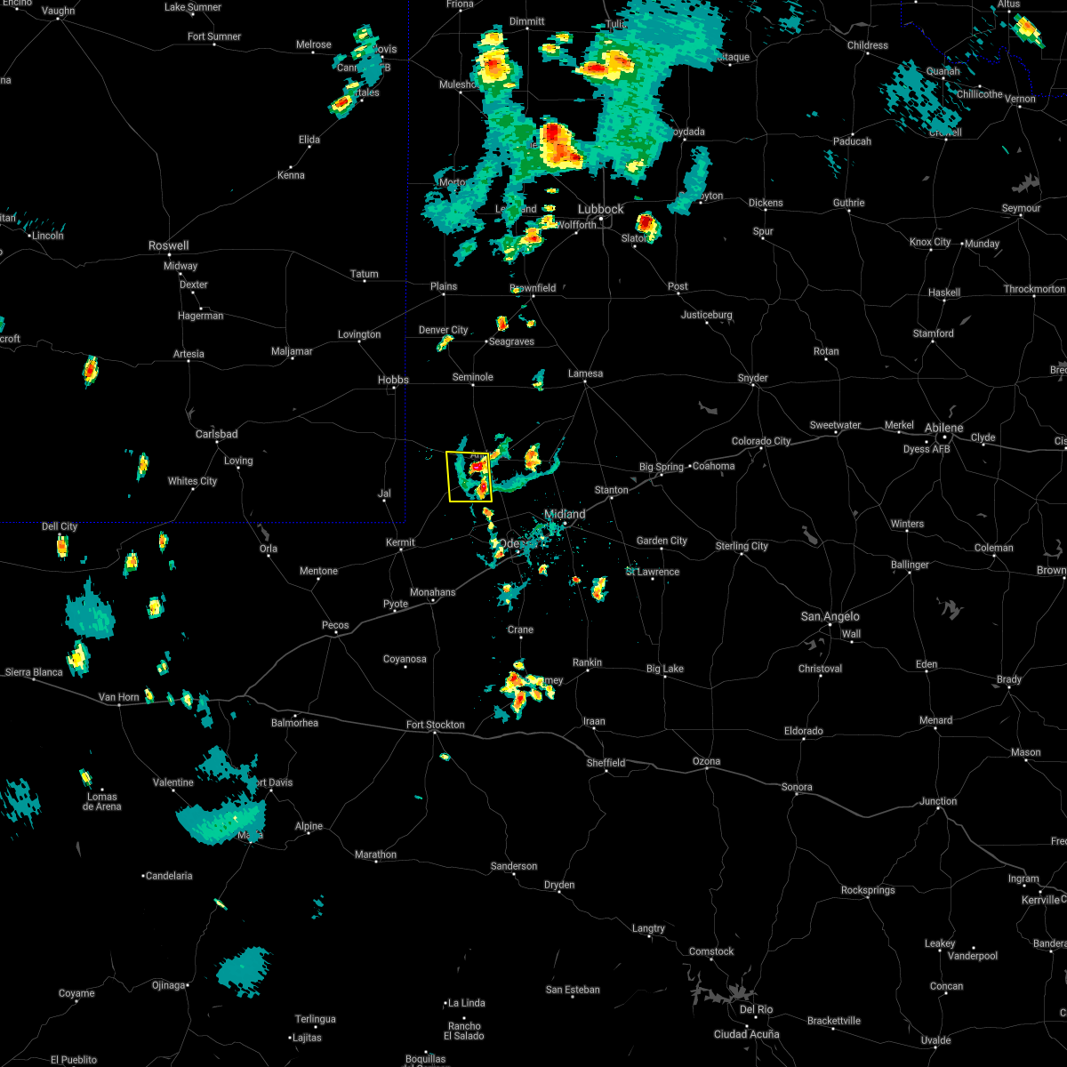 At 634 pm cdt, a severe thunderstorm was located near andrews, moving west at 5 mph (radar indicated). Hazards include 60 mph wind gusts and quarter size hail. Hail damage to vehicles is expected. Expect wind damage to roofs, siding, and trees. At 634 pm cdt, a severe thunderstorm was located near andrews, moving west at 5 mph (radar indicated). Hazards include 60 mph wind gusts and quarter size hail. Hail damage to vehicles is expected. Expect wind damage to roofs, siding, and trees.
|
| 6/2/2021 4:40 PM CDT |
 At 439 pm cdt, a severe thunderstorm was located 8 miles north of goldsmith, or 14 miles south of andrews, moving southeast at 25 mph (radar indicated). Hazards include 60 mph wind gusts and half dollar size hail. Hail damage to vehicles is expected. expect wind damage to roofs, siding, and trees. Locations impacted include, andrews, goldsmith and andrews county airport. At 439 pm cdt, a severe thunderstorm was located 8 miles north of goldsmith, or 14 miles south of andrews, moving southeast at 25 mph (radar indicated). Hazards include 60 mph wind gusts and half dollar size hail. Hail damage to vehicles is expected. expect wind damage to roofs, siding, and trees. Locations impacted include, andrews, goldsmith and andrews county airport.
|
| 6/2/2021 4:14 PM CDT |
 At 414 pm cdt, a severe thunderstorm was located 8 miles southwest of andrews, moving southeast at 25 mph (radar indicated). Hazards include 60 mph wind gusts and quarter size hail. Hail damage to vehicles is expected. Expect wind damage to roofs, siding, and trees. At 414 pm cdt, a severe thunderstorm was located 8 miles southwest of andrews, moving southeast at 25 mph (radar indicated). Hazards include 60 mph wind gusts and quarter size hail. Hail damage to vehicles is expected. Expect wind damage to roofs, siding, and trees.
|
| 6/2/2021 3:47 PM CDT |
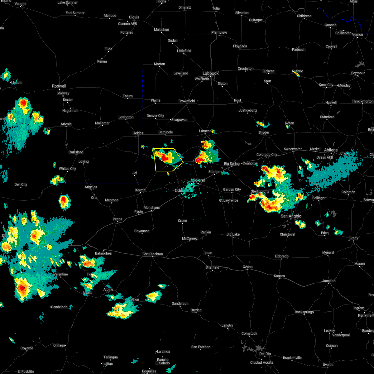 At 345 pm cdt, a severe thunderstorm was located 7 miles west of andrews, moving southeast at 15 mph (radar indicated). Hazards include 60 mph wind gusts and quarter size hail. Hail damage to vehicles is expected. expect wind damage to roofs, siding, and trees. Locations impacted include, andrews, florey, frankel city and andrews county airport. At 345 pm cdt, a severe thunderstorm was located 7 miles west of andrews, moving southeast at 15 mph (radar indicated). Hazards include 60 mph wind gusts and quarter size hail. Hail damage to vehicles is expected. expect wind damage to roofs, siding, and trees. Locations impacted include, andrews, florey, frankel city and andrews county airport.
|
| 6/2/2021 3:33 PM CDT |
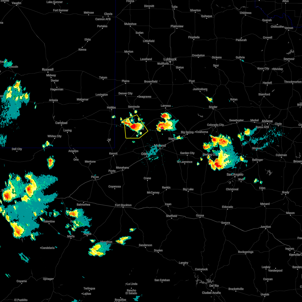 At 333 pm cdt, a severe thunderstorm was located near andrews, moving southeast at 10 mph (radar indicated). Hazards include 60 mph wind gusts and quarter size hail. Hail damage to vehicles is expected. expect wind damage to roofs, siding, and trees. Locations impacted include, andrews, florey, frankel city and andrews county airport. At 333 pm cdt, a severe thunderstorm was located near andrews, moving southeast at 10 mph (radar indicated). Hazards include 60 mph wind gusts and quarter size hail. Hail damage to vehicles is expected. expect wind damage to roofs, siding, and trees. Locations impacted include, andrews, florey, frankel city and andrews county airport.
|
| 6/2/2021 3:20 PM CDT |
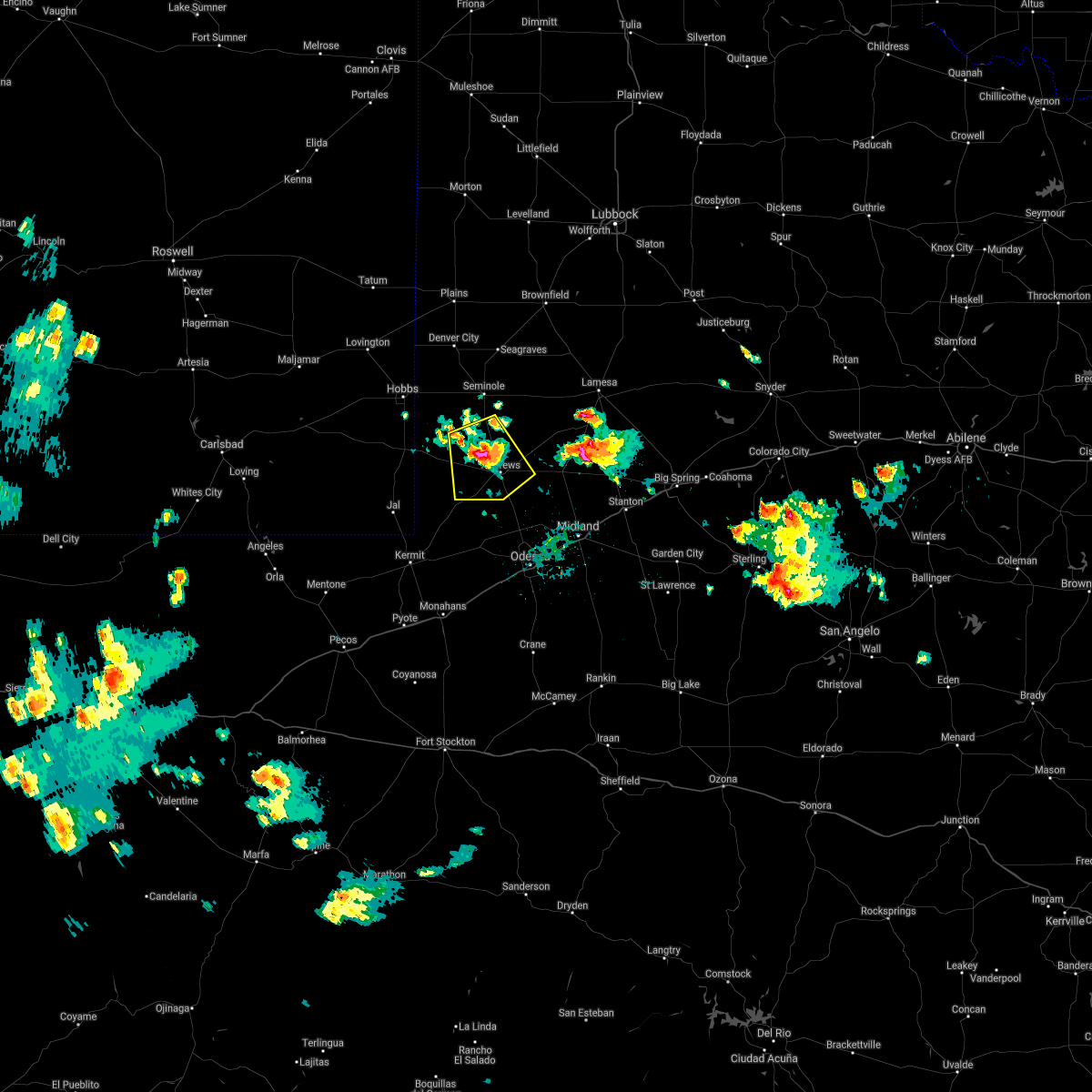 At 320 pm cdt, a severe thunderstorm was located 8 miles northwest of andrews, moving south at 10 mph (radar indicated). Hazards include 60 mph wind gusts and quarter size hail. Hail damage to vehicles is expected. Expect wind damage to roofs, siding, and trees. At 320 pm cdt, a severe thunderstorm was located 8 miles northwest of andrews, moving south at 10 mph (radar indicated). Hazards include 60 mph wind gusts and quarter size hail. Hail damage to vehicles is expected. Expect wind damage to roofs, siding, and trees.
|
| 6/1/2021 8:39 PM CDT |
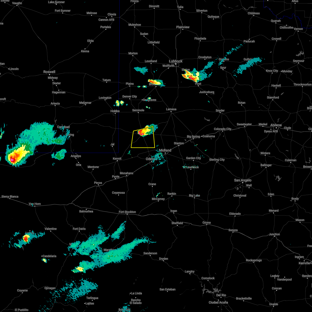 At 839 pm cdt, a severe thunderstorm was located over andrews, moving south at 20 mph (public). Hazards include 60 mph wind gusts and half dollar size hail. Hail damage to vehicles is expected. expect wind damage to roofs, siding, and trees. Locations impacted include, andrews and andrews county airport. At 839 pm cdt, a severe thunderstorm was located over andrews, moving south at 20 mph (public). Hazards include 60 mph wind gusts and half dollar size hail. Hail damage to vehicles is expected. expect wind damage to roofs, siding, and trees. Locations impacted include, andrews and andrews county airport.
|
| 6/1/2021 8:37 PM CDT | Half Dollar sized hail reported 1.4 miles SSE of Andrews, TX |
| 6/1/2021 8:12 PM CDT |
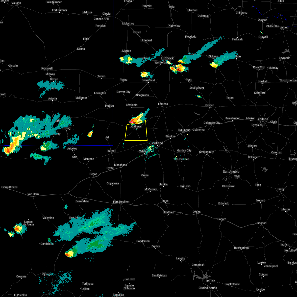 At 812 pm cdt, a severe thunderstorm was located 9 miles north of andrews, moving south at 20 mph (radar indicated). Hazards include 60 mph wind gusts and half dollar size hail. Hail damage to vehicles is expected. Expect wind damage to roofs, siding, and trees. At 812 pm cdt, a severe thunderstorm was located 9 miles north of andrews, moving south at 20 mph (radar indicated). Hazards include 60 mph wind gusts and half dollar size hail. Hail damage to vehicles is expected. Expect wind damage to roofs, siding, and trees.
|
| 5/28/2021 11:17 PM CDT |
 At 1116 pm cdt, a severe thunderstorm was located 10 miles southwest of lenorah, or 11 miles northwest of greenwood, moving southeast at 40 mph (radar indicated). Hazards include 60 mph wind gusts and quarter size hail. Hail damage to vehicles is expected. expect wind damage to roofs, siding, and trees. locations impacted include, midland, odessa, andrews, lamesa, ackerly, greenwood, gail, stanton, goldsmith, lenorah, midland international air and space port, west odessa, lamesa municipal airport, los ybanez, cotton flat, patricia, arvana, hancock, midland airpark and penwell. This includes interstate 20 between mile markers 99 and 163. At 1116 pm cdt, a severe thunderstorm was located 10 miles southwest of lenorah, or 11 miles northwest of greenwood, moving southeast at 40 mph (radar indicated). Hazards include 60 mph wind gusts and quarter size hail. Hail damage to vehicles is expected. expect wind damage to roofs, siding, and trees. locations impacted include, midland, odessa, andrews, lamesa, ackerly, greenwood, gail, stanton, goldsmith, lenorah, midland international air and space port, west odessa, lamesa municipal airport, los ybanez, cotton flat, patricia, arvana, hancock, midland airpark and penwell. This includes interstate 20 between mile markers 99 and 163.
|
| 5/28/2021 10:55 PM CDT | Quarter sized hail reported 0.1 miles WNW of Andrews, TX |
| 5/28/2021 10:45 PM CDT |
 At 1043 pm cdt, a group of severe thunderstorms were located 11 miles south of andrews, to sand, to welch moving south at 45 mph (radar indicated). Hazards include 60 mph wind gusts and quarter size hail. Hail damage to vehicles is expected. Expect wind damage to roofs, siding, and trees. At 1043 pm cdt, a group of severe thunderstorms were located 11 miles south of andrews, to sand, to welch moving south at 45 mph (radar indicated). Hazards include 60 mph wind gusts and quarter size hail. Hail damage to vehicles is expected. Expect wind damage to roofs, siding, and trees.
|
| 5/28/2021 10:32 PM CDT | Andrews mesonet in andrews county TX, 2.5 miles W of Andrews, TX |
| 5/28/2021 10:27 PM CDT |
 At 1026 pm cdt/926 pm mdt/, severe thunderstorms were located along a line extending from near welch to 15 miles east of gaines county airport to 12 miles northwest of andrews to 9 miles east of eunice to 14 miles southwest of eunice airport to 21 miles east of malaga, moving southeast at 50 mph (radar indicated). Hazards include 60 mph wind gusts and quarter size hail. Hail damage to vehicles is expected. expect wind damage to roofs, siding, and trees. Locations impacted include, hobbs, andrews, seminole, eunice, jal, monument, eunice airport, nadine, gaines county airport, welch, loop, florey, mckenzie lake, halfway, frankel city, lea county regional airport, oil center, paynes corner, gaines county park and andrews county airport. At 1026 pm cdt/926 pm mdt/, severe thunderstorms were located along a line extending from near welch to 15 miles east of gaines county airport to 12 miles northwest of andrews to 9 miles east of eunice to 14 miles southwest of eunice airport to 21 miles east of malaga, moving southeast at 50 mph (radar indicated). Hazards include 60 mph wind gusts and quarter size hail. Hail damage to vehicles is expected. expect wind damage to roofs, siding, and trees. Locations impacted include, hobbs, andrews, seminole, eunice, jal, monument, eunice airport, nadine, gaines county airport, welch, loop, florey, mckenzie lake, halfway, frankel city, lea county regional airport, oil center, paynes corner, gaines county park and andrews county airport.
|
| 5/28/2021 9:50 PM CDT |
 At 950 pm cdt/850 pm mdt/, severe thunderstorms were located along a line extending from 7 miles northwest of seagraves to 9 miles south of denver city to nadine to 20 miles south of maljamar, moving south at 35 mph (radar indicated). Hazards include 60 mph wind gusts and half dollar size hail. Hail damage to vehicles is expected. Expect wind damage to roofs, siding, and trees. At 950 pm cdt/850 pm mdt/, severe thunderstorms were located along a line extending from 7 miles northwest of seagraves to 9 miles south of denver city to nadine to 20 miles south of maljamar, moving south at 35 mph (radar indicated). Hazards include 60 mph wind gusts and half dollar size hail. Hail damage to vehicles is expected. Expect wind damage to roofs, siding, and trees.
|
| 6/20/2020 6:54 PM CDT |
 At 652 pm cdt, a severe thunderstorm was located 12 miles northeast of goldsmith, or 15 miles south of andrews, moving south at 10 mph (radar indicated). Hazards include golf ball size hail and 70 mph wind gusts. People and animals outdoors will be injured. expect hail damage to roofs, siding, windows, and vehicles. expect considerable tree damage. wind damage is also likely to mobile homes, roofs, and outbuildings. Locations impacted include, highway 385 south of andrews and midland farms in southeast andrews county. At 652 pm cdt, a severe thunderstorm was located 12 miles northeast of goldsmith, or 15 miles south of andrews, moving south at 10 mph (radar indicated). Hazards include golf ball size hail and 70 mph wind gusts. People and animals outdoors will be injured. expect hail damage to roofs, siding, windows, and vehicles. expect considerable tree damage. wind damage is also likely to mobile homes, roofs, and outbuildings. Locations impacted include, highway 385 south of andrews and midland farms in southeast andrews county.
|
| 6/20/2020 6:28 PM CDT |
 At 628 pm cdt, a severe thunderstorm was located 10 miles south of andrews, moving southeast at 15 mph (radar indicated). Hazards include golf ball size hail and 70 mph wind gusts. People and animals outdoors will be injured. expect hail damage to roofs, siding, windows, and vehicles. expect considerable tree damage. wind damage is also likely to mobile homes, roofs, and outbuildings. Locations impacted include, andrews, goldsmith and andrews county airport. At 628 pm cdt, a severe thunderstorm was located 10 miles south of andrews, moving southeast at 15 mph (radar indicated). Hazards include golf ball size hail and 70 mph wind gusts. People and animals outdoors will be injured. expect hail damage to roofs, siding, windows, and vehicles. expect considerable tree damage. wind damage is also likely to mobile homes, roofs, and outbuildings. Locations impacted include, andrews, goldsmith and andrews county airport.
|
| 6/20/2020 6:13 PM CDT |
 At 613 pm cdt, a severe thunderstorm was located 7 miles southeast of andrews, and is nearly stationary (radar indicated). Hazards include 60 mph wind gusts and quarter size hail. Hail damage to vehicles is expected. Expect wind damage to roofs, siding, and trees. At 613 pm cdt, a severe thunderstorm was located 7 miles southeast of andrews, and is nearly stationary (radar indicated). Hazards include 60 mph wind gusts and quarter size hail. Hail damage to vehicles is expected. Expect wind damage to roofs, siding, and trees.
|
| 6/19/2020 6:27 PM CDT | Quarter sized hail reported 8.5 miles SSE of Andrews, TX |
| 5/23/2020 6:02 PM CDT | Golf Ball sized hail reported 19.3 miles SW of Andrews, TX, along hwy 115 |
| 5/23/2020 6:02 PM CDT |
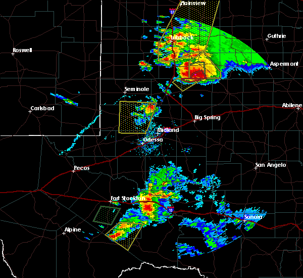 At 559 pm cdt, a severe thunderstorm was located 21 miles southwest of lamesa, moving northeast at 35 mph (radar indicated). Hazards include 60 mph wind gusts and quarter size hail. Hail damage to vehicles is expected. expect wind damage to roofs, siding, and trees. Locations impacted include, open country of northeastern andrews, southeastern gaines, northwestern martin and southwestern dawson counties. At 559 pm cdt, a severe thunderstorm was located 21 miles southwest of lamesa, moving northeast at 35 mph (radar indicated). Hazards include 60 mph wind gusts and quarter size hail. Hail damage to vehicles is expected. expect wind damage to roofs, siding, and trees. Locations impacted include, open country of northeastern andrews, southeastern gaines, northwestern martin and southwestern dawson counties.
|
| 5/23/2020 5:29 PM CDT |
 At 528 pm cdt, a severe thunderstorm was located 11 miles south of andrews, moving north at 30 mph (radar indicated). Hazards include 60 mph wind gusts and half dollar size hail. Hail damage to vehicles is expected. Expect wind damage to roofs, siding, and trees. At 528 pm cdt, a severe thunderstorm was located 11 miles south of andrews, moving north at 30 mph (radar indicated). Hazards include 60 mph wind gusts and half dollar size hail. Hail damage to vehicles is expected. Expect wind damage to roofs, siding, and trees.
|
| 4/10/2020 8:28 PM CDT |
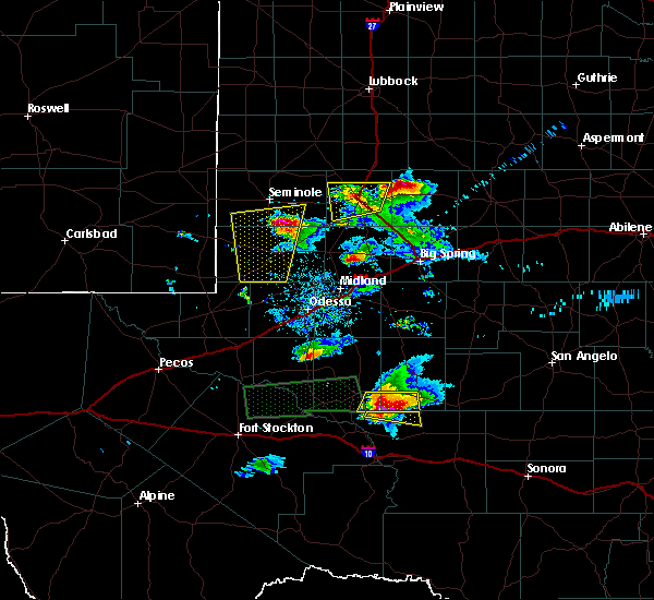 At 827 pm cdt, a severe thunderstorm was located 10 miles southeast of gaines county airport, or 12 miles southeast of seminole, moving north at 30 mph. this storm has a history of producing large hail (radar indicated). Hazards include ping pong ball size hail and 60 mph wind gusts. People and animals outdoors will be injured. expect hail damage to roofs, siding, windows, and vehicles. expect wind damage to roofs, siding, and trees. Locations impacted include, andrews, florey, frankel city and andrews county airport. At 827 pm cdt, a severe thunderstorm was located 10 miles southeast of gaines county airport, or 12 miles southeast of seminole, moving north at 30 mph. this storm has a history of producing large hail (radar indicated). Hazards include ping pong ball size hail and 60 mph wind gusts. People and animals outdoors will be injured. expect hail damage to roofs, siding, windows, and vehicles. expect wind damage to roofs, siding, and trees. Locations impacted include, andrews, florey, frankel city and andrews county airport.
|
| 4/10/2020 8:13 PM CDT |
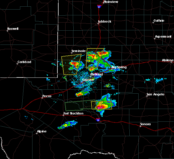 At 811 pm cdt, a severe thunderstorm was located 7 miles northwest of andrews, moving north at 30 mph. media reported golfball size hail 10 miles southwest of andrews on state hwy 115 (radar indicated). Hazards include golf ball size hail and 60 mph wind gusts. People and animals outdoors will be injured. expect hail damage to roofs, siding, windows, and vehicles. expect wind damage to roofs, siding, and trees. Locations impacted include, andrews, florey, frankel city and andrews county airport. At 811 pm cdt, a severe thunderstorm was located 7 miles northwest of andrews, moving north at 30 mph. media reported golfball size hail 10 miles southwest of andrews on state hwy 115 (radar indicated). Hazards include golf ball size hail and 60 mph wind gusts. People and animals outdoors will be injured. expect hail damage to roofs, siding, windows, and vehicles. expect wind damage to roofs, siding, and trees. Locations impacted include, andrews, florey, frankel city and andrews county airport.
|
| 4/10/2020 8:04 PM CDT |
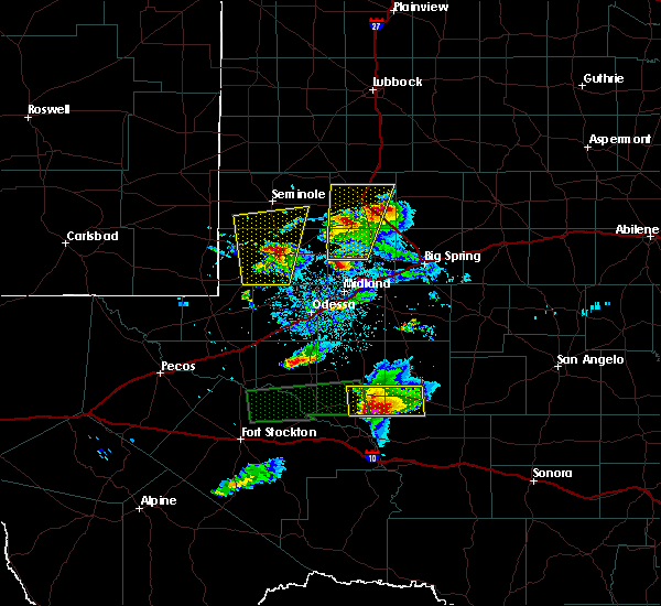 At 804 pm cdt, a severe thunderstorm was located near andrews, moving north at 30 mph (radar indicated). Hazards include 60 mph wind gusts and half dollar size hail. Hail damage to vehicles is expected. expect wind damage to roofs, siding, and trees. Locations impacted include, andrews, florey, frankel city and andrews county airport. At 804 pm cdt, a severe thunderstorm was located near andrews, moving north at 30 mph (radar indicated). Hazards include 60 mph wind gusts and half dollar size hail. Hail damage to vehicles is expected. expect wind damage to roofs, siding, and trees. Locations impacted include, andrews, florey, frankel city and andrews county airport.
|
| 4/10/2020 7:55 PM CDT | Golf Ball sized hail reported 9.8 miles NE of Andrews, TX, hail observed along hwy 115 west of andrews. report relayed by local media |
| 4/10/2020 7:49 PM CDT |
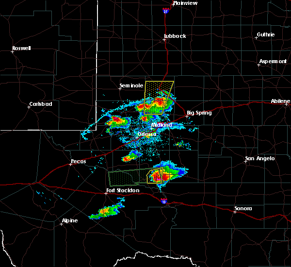 At 749 pm cdt, a severe thunderstorm was located 11 miles southwest of andrews, moving north at 45 mph (radar indicated). Hazards include 60 mph wind gusts and quarter size hail. Hail damage to vehicles is expected. Expect wind damage to roofs, siding, and trees. At 749 pm cdt, a severe thunderstorm was located 11 miles southwest of andrews, moving north at 45 mph (radar indicated). Hazards include 60 mph wind gusts and quarter size hail. Hail damage to vehicles is expected. Expect wind damage to roofs, siding, and trees.
|
| 4/10/2020 6:45 PM CDT |
 At 645 pm cdt, a severe thunderstorm was located 8 miles northwest of odessa, moving north at 30 mph (radar indicated). Hazards include 60 mph wind gusts and quarter size hail. Hail damage to vehicles is expected. Expect wind damage to roofs, siding, and trees. At 645 pm cdt, a severe thunderstorm was located 8 miles northwest of odessa, moving north at 30 mph (radar indicated). Hazards include 60 mph wind gusts and quarter size hail. Hail damage to vehicles is expected. Expect wind damage to roofs, siding, and trees.
|
| 6/21/2019 8:02 PM CDT |
 At 802 pm cdt, a severe thunderstorm was located near goldsmith, or 10 miles north of west odessa, moving northeast at 15 mph (radar indicated). Hazards include 60 mph wind gusts and quarter size hail. Hail damage to vehicles is expected. expect wind damage to roofs, siding, and trees. Locations impacted include, odessa, andrews, west odessa, goldsmith, north cowden and andrews county airport. At 802 pm cdt, a severe thunderstorm was located near goldsmith, or 10 miles north of west odessa, moving northeast at 15 mph (radar indicated). Hazards include 60 mph wind gusts and quarter size hail. Hail damage to vehicles is expected. expect wind damage to roofs, siding, and trees. Locations impacted include, odessa, andrews, west odessa, goldsmith, north cowden and andrews county airport.
|
| 6/21/2019 7:51 PM CDT |
 At 751 pm cdt, a severe thunderstorm was located near goldsmith, or 9 miles northwest of west odessa, moving northeast at 20 mph (radar indicated). Hazards include 60 mph wind gusts and quarter size hail. Hail damage to vehicles is expected. expect wind damage to roofs, siding, and trees. This severe thunderstorm will remain over mainly rural areas of northern ector and southeastern andrews counties, including the following locations, north cowden and andrews county airport. At 751 pm cdt, a severe thunderstorm was located near goldsmith, or 9 miles northwest of west odessa, moving northeast at 20 mph (radar indicated). Hazards include 60 mph wind gusts and quarter size hail. Hail damage to vehicles is expected. expect wind damage to roofs, siding, and trees. This severe thunderstorm will remain over mainly rural areas of northern ector and southeastern andrews counties, including the following locations, north cowden and andrews county airport.
|
| 6/17/2019 7:14 PM CDT |
 At 713 pm cdt, a severe thunderstorm was located 8 miles southeast of gaines county airport, or 11 miles south of seminole, moving northeast at 35 mph. this storm is over us hwy 385 moving into gaines county (radar indicated). Hazards include two inch hail and 60 mph wind gusts. People and animals outdoors will be injured. expect hail damage to roofs, siding, windows, and vehicles. expect wind damage to roofs, siding, and trees. Locations impacted include, andrews, seminole, gaines county airport, florey, frankel city and andrews county airport. At 713 pm cdt, a severe thunderstorm was located 8 miles southeast of gaines county airport, or 11 miles south of seminole, moving northeast at 35 mph. this storm is over us hwy 385 moving into gaines county (radar indicated). Hazards include two inch hail and 60 mph wind gusts. People and animals outdoors will be injured. expect hail damage to roofs, siding, windows, and vehicles. expect wind damage to roofs, siding, and trees. Locations impacted include, andrews, seminole, gaines county airport, florey, frankel city and andrews county airport.
|
| 6/17/2019 7:00 PM CDT |
 At 700 pm cdt, a severe thunderstorm was located 10 miles north of andrews, moving northeast at 30 mph (radar indicated). Hazards include two inch hail and 60 mph wind gusts. People and animals outdoors will be injured. expect hail damage to roofs, siding, windows, and vehicles. expect wind damage to roofs, siding, and trees. Locations impacted include, andrews, seminole, gaines county airport, florey, frankel city and andrews county airport. At 700 pm cdt, a severe thunderstorm was located 10 miles north of andrews, moving northeast at 30 mph (radar indicated). Hazards include two inch hail and 60 mph wind gusts. People and animals outdoors will be injured. expect hail damage to roofs, siding, windows, and vehicles. expect wind damage to roofs, siding, and trees. Locations impacted include, andrews, seminole, gaines county airport, florey, frankel city and andrews county airport.
|
| 6/17/2019 7:00 PM CDT |
 At 659 pm cdt, a severe thunderstorm was located 13 miles northeast of goldsmith, or 15 miles north of odessa, moving northeast at 10 mph. tennis ball sized hail has been reported with this storm 6 miles east of andrews (public). Hazards include tennis ball size hail and 60 mph wind gusts. People and animals outdoors will be injured. expect hail damage to roofs, siding, windows, and vehicles. expect wind damage to roofs, siding, and trees. Locations impacted include, andrews. At 659 pm cdt, a severe thunderstorm was located 13 miles northeast of goldsmith, or 15 miles north of odessa, moving northeast at 10 mph. tennis ball sized hail has been reported with this storm 6 miles east of andrews (public). Hazards include tennis ball size hail and 60 mph wind gusts. People and animals outdoors will be injured. expect hail damage to roofs, siding, windows, and vehicles. expect wind damage to roofs, siding, and trees. Locations impacted include, andrews.
|
| 6/17/2019 6:54 PM CDT | Tennis Ball sized hail reported 6 miles W of Andrews, TX, windows in vehicles were broken. |
| 6/17/2019 6:50 PM CDT |
 The national weather service in midland has issued a * severe thunderstorm warning for. central andrews county in western texas. southeastern gaines county in western texas. until 745 pm cdt. At 650 pm cdt, a severe thunderstorm was located 7 miles northwest. The national weather service in midland has issued a * severe thunderstorm warning for. central andrews county in western texas. southeastern gaines county in western texas. until 745 pm cdt. At 650 pm cdt, a severe thunderstorm was located 7 miles northwest.
|
| 6/17/2019 6:44 PM CDT |
 At 644 pm cdt, a severe thunderstorm was located 11 miles northeast of goldsmith, or 13 miles northwest of odessa, moving northeast at 10 mph (radar indicated). Hazards include 60 mph wind gusts and quarter size hail. Hail damage to vehicles is expected. Expect wind damage to roofs, siding, and trees. At 644 pm cdt, a severe thunderstorm was located 11 miles northeast of goldsmith, or 13 miles northwest of odessa, moving northeast at 10 mph (radar indicated). Hazards include 60 mph wind gusts and quarter size hail. Hail damage to vehicles is expected. Expect wind damage to roofs, siding, and trees.
|
| 5/29/2019 7:42 AM CDT |
 At 742 am cdt, a severe thunderstorm was located 7 miles east of goldsmith, or 12 miles northwest of odessa, moving northeast at 35 mph (radar indicated). Hazards include 60 mph wind gusts and quarter size hail. Hail damage to vehicles is expected. expect wind damage to roofs, siding, and trees. Locations impacted include, odessa, andrews, goldsmith, west odessa, odessa schlemeyer field and andrews county airport. At 742 am cdt, a severe thunderstorm was located 7 miles east of goldsmith, or 12 miles northwest of odessa, moving northeast at 35 mph (radar indicated). Hazards include 60 mph wind gusts and quarter size hail. Hail damage to vehicles is expected. expect wind damage to roofs, siding, and trees. Locations impacted include, odessa, andrews, goldsmith, west odessa, odessa schlemeyer field and andrews county airport.
|
| 5/29/2019 7:13 AM CDT |
 At 713 am cdt, a severe thunderstorm was located 9 miles southwest of goldsmith, or 20 miles west of odessa, moving northeast at 40 mph (radar indicated). Hazards include 60 mph wind gusts and quarter size hail. Hail damage to vehicles is expected. Expect wind damage to roofs, siding, and trees. At 713 am cdt, a severe thunderstorm was located 9 miles southwest of goldsmith, or 20 miles west of odessa, moving northeast at 40 mph (radar indicated). Hazards include 60 mph wind gusts and quarter size hail. Hail damage to vehicles is expected. Expect wind damage to roofs, siding, and trees.
|
| 5/20/2019 9:29 PM CDT |
 At 929 pm cdt, severe thunderstorms were located along a line extending from 10 miles east of andrews to 8 miles east of goldsmith to 12 miles east of monahans, moving northeast at 55 mph (radar indicated). Hazards include two inch hail and 70 mph wind gusts. People and animals outdoors will be injured. expect hail damage to roofs, siding, windows, and vehicles. expect considerable tree damage. wind damage is also likely to mobile homes, roofs, and outbuildings. locations impacted include, midland, odessa, andrews, ackerly, greenwood, stanton, goldsmith, lenorah, midland international air and space port, west odessa, cotton flat, patricia, midland airpark, penwell, stanton municipal aiport, tarzan, sparenberg, warfield, skywest airport and courtney. This includes interstate 20 between mile markers 90 and 162. At 929 pm cdt, severe thunderstorms were located along a line extending from 10 miles east of andrews to 8 miles east of goldsmith to 12 miles east of monahans, moving northeast at 55 mph (radar indicated). Hazards include two inch hail and 70 mph wind gusts. People and animals outdoors will be injured. expect hail damage to roofs, siding, windows, and vehicles. expect considerable tree damage. wind damage is also likely to mobile homes, roofs, and outbuildings. locations impacted include, midland, odessa, andrews, ackerly, greenwood, stanton, goldsmith, lenorah, midland international air and space port, west odessa, cotton flat, patricia, midland airpark, penwell, stanton municipal aiport, tarzan, sparenberg, warfield, skywest airport and courtney. This includes interstate 20 between mile markers 90 and 162.
|
| 5/20/2019 9:21 PM CDT |
 At 921 pm cdt, severe thunderstorms were located along a line extending from near andrews to near goldsmith to 7 miles east of monahans, moving northeast at 55 mph (radar indicated). Hazards include 70 mph wind gusts and half dollar size hail. Hail damage to vehicles is expected. expect considerable tree damage. Wind damage is also likely to mobile homes, roofs, and outbuildings. At 921 pm cdt, severe thunderstorms were located along a line extending from near andrews to near goldsmith to 7 miles east of monahans, moving northeast at 55 mph (radar indicated). Hazards include 70 mph wind gusts and half dollar size hail. Hail damage to vehicles is expected. expect considerable tree damage. Wind damage is also likely to mobile homes, roofs, and outbuildings.
|
| 5/7/2019 6:07 PM CDT |
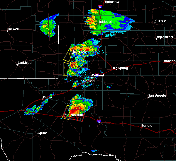 At 607 pm cdt, a severe thunderstorm was located 10 miles west of andrews, moving northeast at 30 mph (radar indicated). Hazards include 60 mph wind gusts and half dollar size hail. Hail damage to vehicles is expected. Expect wind damage to roofs, siding, and trees. At 607 pm cdt, a severe thunderstorm was located 10 miles west of andrews, moving northeast at 30 mph (radar indicated). Hazards include 60 mph wind gusts and half dollar size hail. Hail damage to vehicles is expected. Expect wind damage to roofs, siding, and trees.
|
| 5/7/2019 6:03 PM CDT |
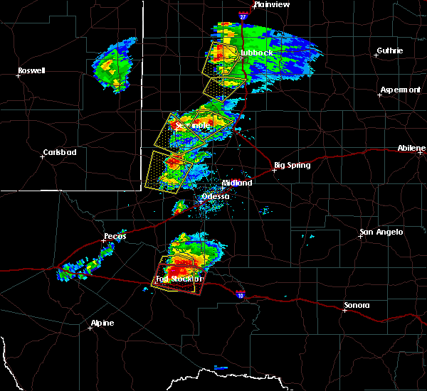 At 602 pm cdt, a severe thunderstorm was located 10 miles west of andrews, moving northeast at 45 mph (radar indicated). Hazards include 60 mph wind gusts and half dollar size hail. Hail damage to vehicles is expected. expect wind damage to roofs, siding, and trees. Locations impacted include, andrews, frankel city and andrews county airport. At 602 pm cdt, a severe thunderstorm was located 10 miles west of andrews, moving northeast at 45 mph (radar indicated). Hazards include 60 mph wind gusts and half dollar size hail. Hail damage to vehicles is expected. expect wind damage to roofs, siding, and trees. Locations impacted include, andrews, frankel city and andrews county airport.
|
| 5/7/2019 5:42 PM CDT |
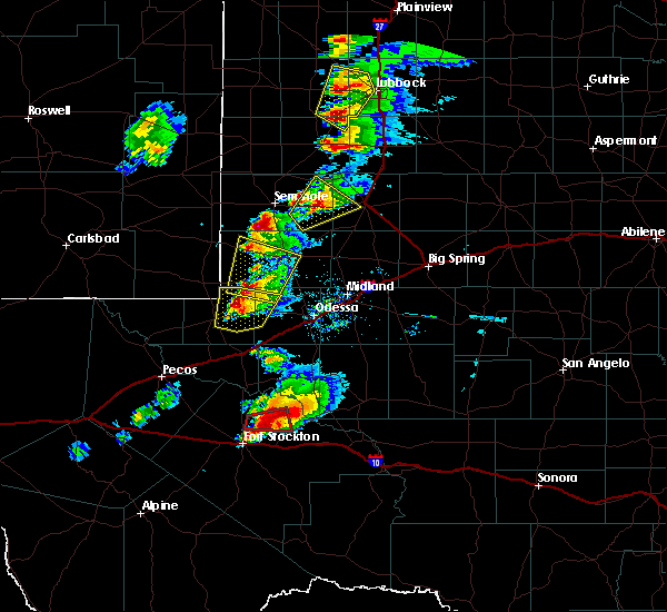 At 541 pm cdt, a severe thunderstorm was located 16 miles northwest of goldsmith, or 20 miles southwest of andrews, moving northeast at 45 mph (radar indicated). Hazards include 60 mph wind gusts and half dollar size hail. Hail damage to vehicles is expected. Expect wind damage to roofs, siding, and trees. At 541 pm cdt, a severe thunderstorm was located 16 miles northwest of goldsmith, or 20 miles southwest of andrews, moving northeast at 45 mph (radar indicated). Hazards include 60 mph wind gusts and half dollar size hail. Hail damage to vehicles is expected. Expect wind damage to roofs, siding, and trees.
|
| 5/7/2019 5:32 PM CDT |
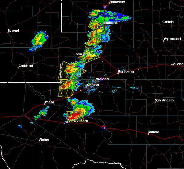 At 531 pm cdt, a severe thunderstorm was located 18 miles southeast of eunice, moving northeast at 35 mph (radar indicated). Hazards include ping pong ball size hail and 60 mph wind gusts. People and animals outdoors will be injured. expect hail damage to roofs, siding, windows, and vehicles. expect wind damage to roofs, siding, and trees. Locations impacted include, andrews, frankel city and andrews county airport. At 531 pm cdt, a severe thunderstorm was located 18 miles southeast of eunice, moving northeast at 35 mph (radar indicated). Hazards include ping pong ball size hail and 60 mph wind gusts. People and animals outdoors will be injured. expect hail damage to roofs, siding, windows, and vehicles. expect wind damage to roofs, siding, and trees. Locations impacted include, andrews, frankel city and andrews county airport.
|
| 5/7/2019 5:30 PM CDT | Quarter sized hail reported 15.1 miles E of Andrews, TX, a few quarters and smaller |
| 5/7/2019 5:06 PM CDT |
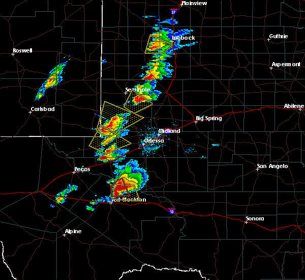 At 505 pm cdt/405 pm mdt/, a severe thunderstorm was located 9 miles east of jal airport, or 11 miles east of jal, moving northeast at 35 mph (radar indicated). Hazards include ping pong ball size hail and 60 mph wind gusts. People and animals outdoors will be injured. expect hail damage to roofs, siding, windows, and vehicles. Expect wind damage to roofs, siding, and trees. At 505 pm cdt/405 pm mdt/, a severe thunderstorm was located 9 miles east of jal airport, or 11 miles east of jal, moving northeast at 35 mph (radar indicated). Hazards include ping pong ball size hail and 60 mph wind gusts. People and animals outdoors will be injured. expect hail damage to roofs, siding, windows, and vehicles. Expect wind damage to roofs, siding, and trees.
|
| 5/7/2019 4:32 PM CDT | Hen Egg sized hail reported 7.2 miles SSE of Andrews, TX, highway 385 and 1967 |
| 5/7/2019 4:27 PM CDT |
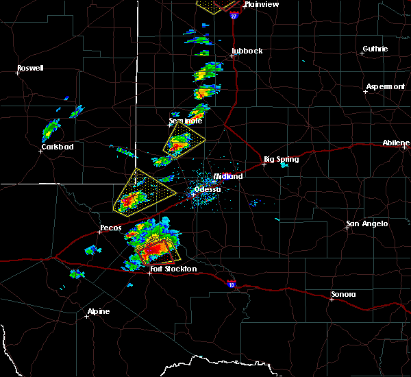 At 427 pm cdt, a severe thunderstorm was located 8 miles north of andrews, moving northeast at 25 mph (radar indicated). Hazards include ping pong ball size hail and 60 mph wind gusts. People and animals outdoors will be injured. expect hail damage to roofs, siding, windows, and vehicles. Expect wind damage to roofs, siding, and trees. At 427 pm cdt, a severe thunderstorm was located 8 miles north of andrews, moving northeast at 25 mph (radar indicated). Hazards include ping pong ball size hail and 60 mph wind gusts. People and animals outdoors will be injured. expect hail damage to roofs, siding, windows, and vehicles. Expect wind damage to roofs, siding, and trees.
|
| 5/5/2019 6:59 PM CDT |
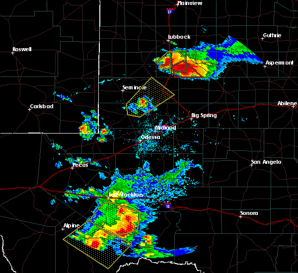 At 658 pm cdt, a severe thunderstorm was located 19 miles northeast of andrews, moving northeast at 30 mph (radar indicated). Hazards include 60 mph wind gusts and half dollar size hail. Hail damage to vehicles is expected. expect wind damage to roofs, siding, and trees. Locations impacted include, andrews, lamesa, welch, lamesa municipal airport, los ybanez, tenmile, patricia, punkin center, mckenzie lake, klondike and andrews county airport. At 658 pm cdt, a severe thunderstorm was located 19 miles northeast of andrews, moving northeast at 30 mph (radar indicated). Hazards include 60 mph wind gusts and half dollar size hail. Hail damage to vehicles is expected. expect wind damage to roofs, siding, and trees. Locations impacted include, andrews, lamesa, welch, lamesa municipal airport, los ybanez, tenmile, patricia, punkin center, mckenzie lake, klondike and andrews county airport.
|
| 5/5/2019 6:39 PM CDT |
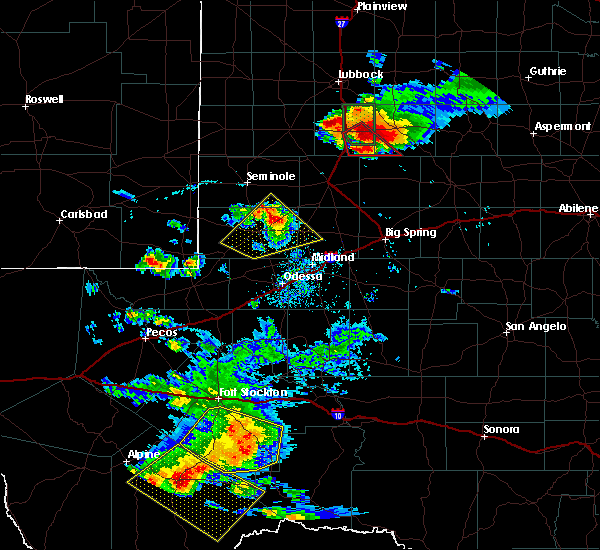 At 638 pm cdt, a severe thunderstorm was located 9 miles northeast of andrews, moving northeast at 30 mph. this storm has a history of large hail to golf ball size (public). Hazards include golf ball size hail and 60 mph wind gusts. People and animals outdoors will be injured. expect hail damage to roofs, siding, windows, and vehicles. Expect wind damage to roofs, siding, and trees. At 638 pm cdt, a severe thunderstorm was located 9 miles northeast of andrews, moving northeast at 30 mph. this storm has a history of large hail to golf ball size (public). Hazards include golf ball size hail and 60 mph wind gusts. People and animals outdoors will be injured. expect hail damage to roofs, siding, windows, and vehicles. Expect wind damage to roofs, siding, and trees.
|
| 5/5/2019 6:25 PM CDT |
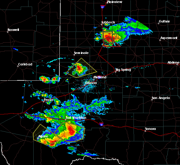 At 624 pm cdt, a severe thunderstorm was located 8 miles east of andrews, moving northeast at 35 mph (public). Hazards include golf ball size hail and 60 mph wind gusts. People and animals outdoors will be injured. expect hail damage to roofs, siding, windows, and vehicles. expect wind damage to roofs, siding, and trees. Locations impacted include, andrews, florey and andrews county airport. At 624 pm cdt, a severe thunderstorm was located 8 miles east of andrews, moving northeast at 35 mph (public). Hazards include golf ball size hail and 60 mph wind gusts. People and animals outdoors will be injured. expect hail damage to roofs, siding, windows, and vehicles. expect wind damage to roofs, siding, and trees. Locations impacted include, andrews, florey and andrews county airport.
|
| 5/5/2019 6:19 PM CDT | Ping Pong Ball sized hail reported 0.9 miles NNE of Andrews, TX |
| 5/5/2019 6:19 PM CDT | Golf Ball sized hail reported 0.1 miles WNW of Andrews, TX |
| 5/5/2019 6:15 PM CDT | Golf Ball sized hail reported 0.8 miles SE of Andrews, TX |
| 5/5/2019 6:06 PM CDT |
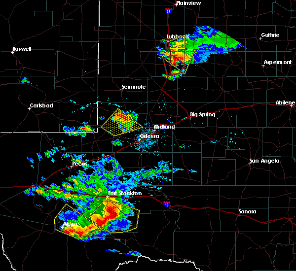 The national weather service in midland has issued a * severe thunderstorm warning for. eastern andrews county in western texas. south central gaines county in western texas. west central martin county in western texas. Until 645 pm cdt. The national weather service in midland has issued a * severe thunderstorm warning for. eastern andrews county in western texas. south central gaines county in western texas. west central martin county in western texas. Until 645 pm cdt.
|
| 5/3/2019 6:11 PM CDT |
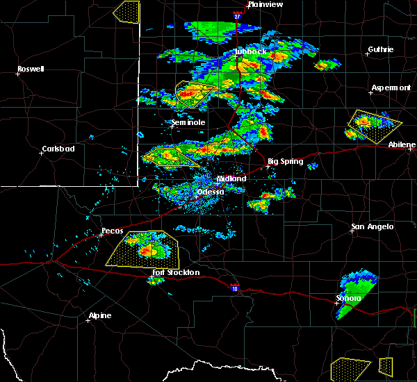 At 611 pm cdt, a severe thunderstorm was located 8 miles west of andrews, moving southeast at 10 mph (radar indicated). Hazards include quarter size hail. Damage to vehicles is expected. Locations impacted include, andrews, frankel city and andrews county airport. At 611 pm cdt, a severe thunderstorm was located 8 miles west of andrews, moving southeast at 10 mph (radar indicated). Hazards include quarter size hail. Damage to vehicles is expected. Locations impacted include, andrews, frankel city and andrews county airport.
|
| 5/3/2019 5:51 PM CDT |
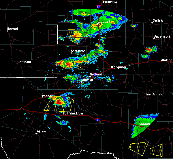 At 551 pm cdt, a severe thunderstorm was located 11 miles northwest of andrews, moving southeast at 10 mph (radar indicated). Hazards include 60 mph wind gusts and quarter size hail. Hail damage to vehicles is expected. expect wind damage to roofs, siding, and trees. Locations impacted include, andrews, frankel city and andrews county airport. At 551 pm cdt, a severe thunderstorm was located 11 miles northwest of andrews, moving southeast at 10 mph (radar indicated). Hazards include 60 mph wind gusts and quarter size hail. Hail damage to vehicles is expected. expect wind damage to roofs, siding, and trees. Locations impacted include, andrews, frankel city and andrews county airport.
|
| 5/3/2019 5:33 PM CDT |
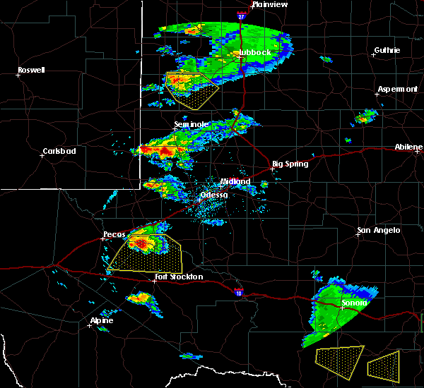 The national weather service in midland has issued a * severe thunderstorm warning for. northern andrews county in western texas. until 645 pm cdt. At 533 pm cdt, a severe thunderstorm was located 13 miles northwest of andrews, moving southeast at 15 mph. The national weather service in midland has issued a * severe thunderstorm warning for. northern andrews county in western texas. until 645 pm cdt. At 533 pm cdt, a severe thunderstorm was located 13 miles northwest of andrews, moving southeast at 15 mph.
|
| 4/23/2019 1:42 AM CDT | Quarter sized hail reported 0.1 miles WNW of Andrews, TX, lots of pea to quarter size hail. |
| 4/23/2019 1:33 AM CDT |
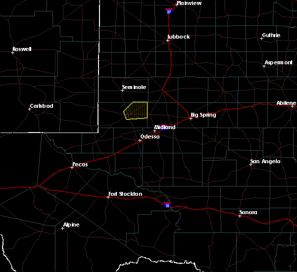 At 133 am cdt, a severe thunderstorm was located over andrews, moving northeast at 30 mph (radar indicated). Hazards include 60 mph wind gusts and half dollar size hail. Hail damage to vehicles is expected. expect wind damage to roofs, siding, and trees. Locations impacted include, andrews and andrews county airport. At 133 am cdt, a severe thunderstorm was located over andrews, moving northeast at 30 mph (radar indicated). Hazards include 60 mph wind gusts and half dollar size hail. Hail damage to vehicles is expected. expect wind damage to roofs, siding, and trees. Locations impacted include, andrews and andrews county airport.
|
| 4/23/2019 1:18 AM CDT |
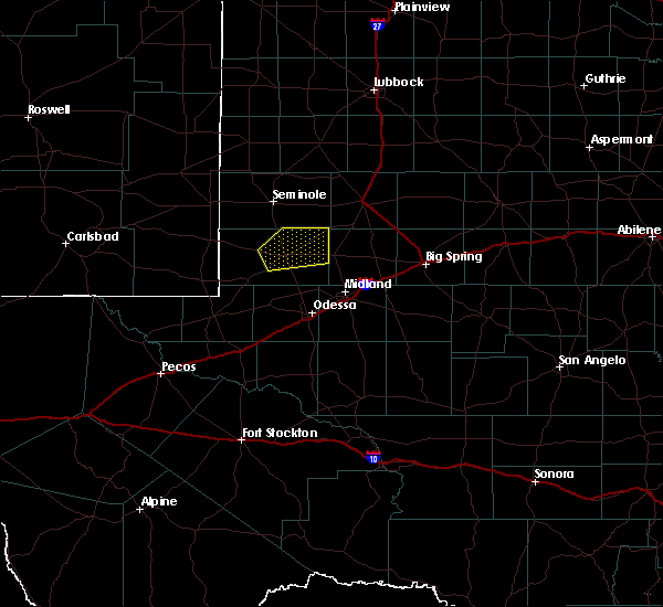 At 118 am cdt, a severe thunderstorm was located near andrews, moving northeast at 30 mph (radar indicated). Hazards include 60 mph wind gusts and half dollar size hail. Hail damage to vehicles is expected. expect wind damage to roofs, siding, and trees. Locations impacted include, andrews, florey and andrews county airport. At 118 am cdt, a severe thunderstorm was located near andrews, moving northeast at 30 mph (radar indicated). Hazards include 60 mph wind gusts and half dollar size hail. Hail damage to vehicles is expected. expect wind damage to roofs, siding, and trees. Locations impacted include, andrews, florey and andrews county airport.
|
| 4/23/2019 12:59 AM CDT |
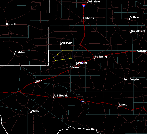 At 1259 am cdt, a severe thunderstorm was located 13 miles west of andrews, moving northeast at 30 mph (radar indicated). Hazards include ping pong ball size hail and 60 mph wind gusts. People and animals outdoors will be injured. expect hail damage to roofs, siding, windows, and vehicles. Expect wind damage to roofs, siding, and trees. At 1259 am cdt, a severe thunderstorm was located 13 miles west of andrews, moving northeast at 30 mph (radar indicated). Hazards include ping pong ball size hail and 60 mph wind gusts. People and animals outdoors will be injured. expect hail damage to roofs, siding, windows, and vehicles. Expect wind damage to roofs, siding, and trees.
|
| 4/5/2019 9:05 PM CDT |
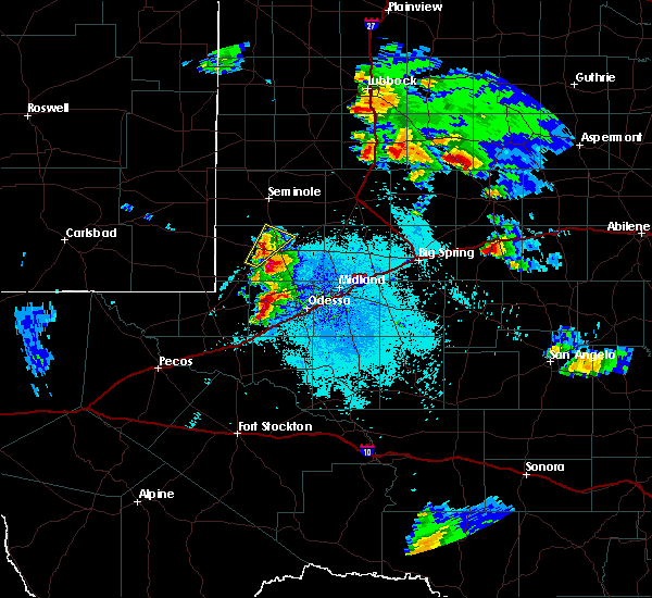 At 903 pm cdt, a severe thunderstorm was located 8 miles west of andrews, moving northeast at 30 mph (radar indicated). Hazards include 60 mph wind gusts and quarter size hail. Hail damage to vehicles is expected. expect wind damage to roofs, siding, and trees. Locations impacted include, andrews, florey and andrews county airport. At 903 pm cdt, a severe thunderstorm was located 8 miles west of andrews, moving northeast at 30 mph (radar indicated). Hazards include 60 mph wind gusts and quarter size hail. Hail damage to vehicles is expected. expect wind damage to roofs, siding, and trees. Locations impacted include, andrews, florey and andrews county airport.
|
| 4/5/2019 8:44 PM CDT |
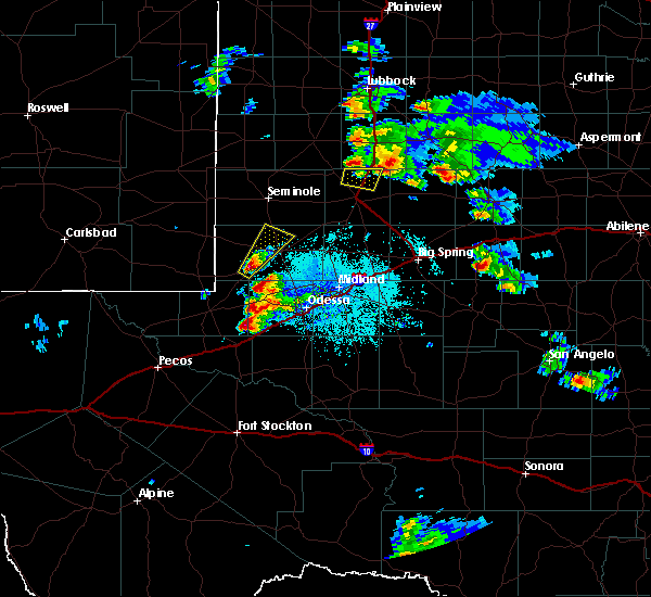 At 843 pm cdt, a severe thunderstorm was located 17 miles southwest of andrews, moving northeast at 25 mph (radar indicated). Hazards include 60 mph wind gusts and quarter size hail. Hail damage to vehicles is expected. Expect wind damage to roofs, siding, and trees. At 843 pm cdt, a severe thunderstorm was located 17 miles southwest of andrews, moving northeast at 25 mph (radar indicated). Hazards include 60 mph wind gusts and quarter size hail. Hail damage to vehicles is expected. Expect wind damage to roofs, siding, and trees.
|
| 3/12/2019 10:12 PM CDT |
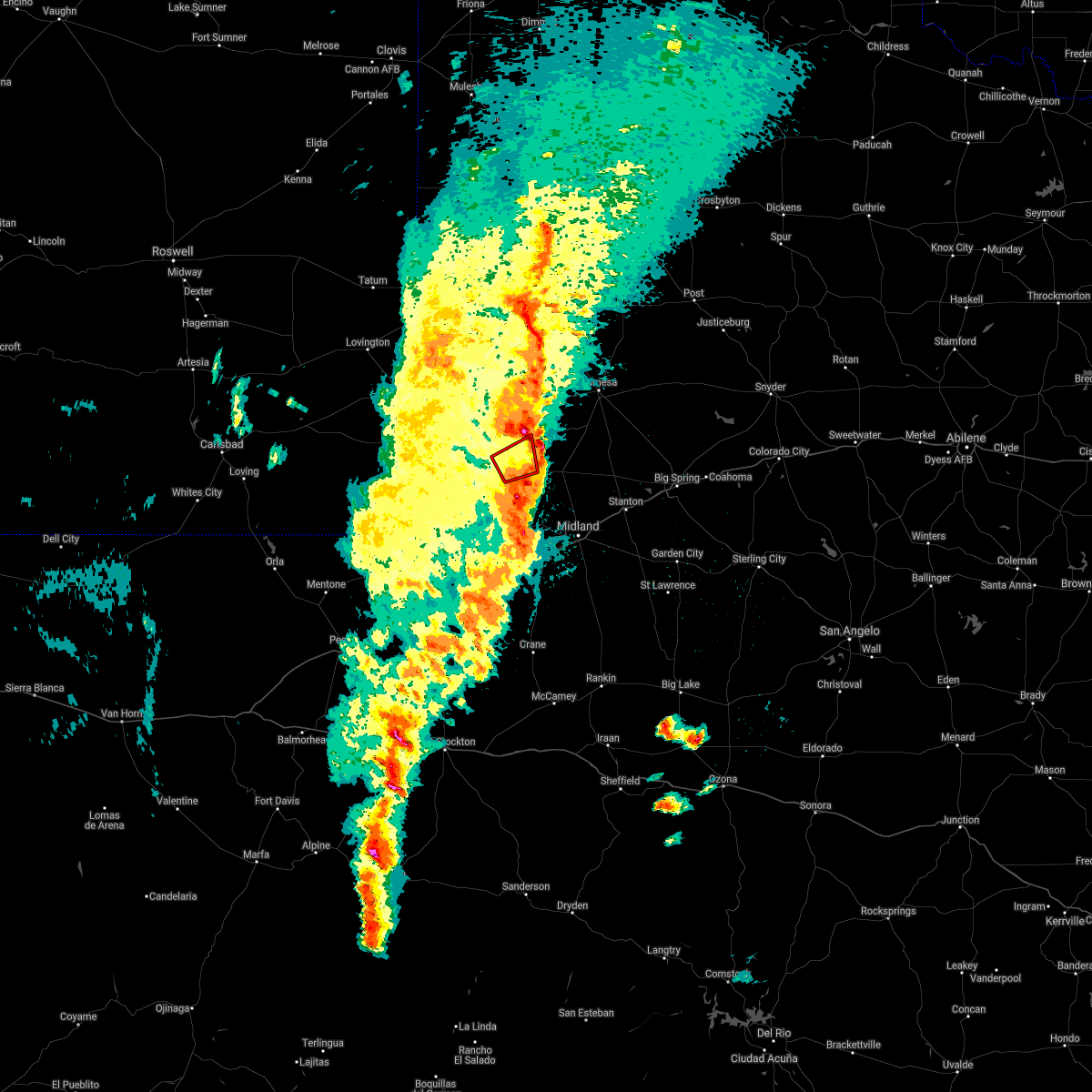 The tornado warning for northeastern andrews county will expire at 1015 pm cdt, the storm which prompted the warning has moved out of the warning area. therefore, the warning will be allowed to expire. a tornado watch remains in effect until 1100 pm cdt for west texas. The tornado warning for northeastern andrews county will expire at 1015 pm cdt, the storm which prompted the warning has moved out of the warning area. therefore, the warning will be allowed to expire. a tornado watch remains in effect until 1100 pm cdt for west texas.
|
| 3/12/2019 10:01 PM CDT |
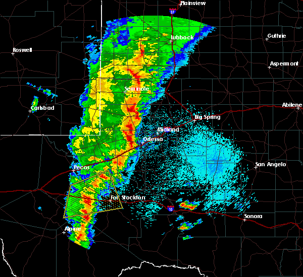 At 1001 pm cdt, a public report of a tornado near andrews, moving northeast at 50 mph (public reported tornado). Hazards include damaging tornado and golf ball size hail. Flying debris will be dangerous to those caught without shelter. mobile homes will be damaged or destroyed. damage to roofs, windows, and vehicles will occur. tree damage is likely. This tornadic thunderstorm will remain over mainly rural areas of northeastern andrews county, including the following locations, andrews county airport. At 1001 pm cdt, a public report of a tornado near andrews, moving northeast at 50 mph (public reported tornado). Hazards include damaging tornado and golf ball size hail. Flying debris will be dangerous to those caught without shelter. mobile homes will be damaged or destroyed. damage to roofs, windows, and vehicles will occur. tree damage is likely. This tornadic thunderstorm will remain over mainly rural areas of northeastern andrews county, including the following locations, andrews county airport.
|
| 12/26/2018 12:40 PM CST | Quarter sized hail reported 1.3 miles S of Andrews, TX, public reported quarter size hail on highway 285... 1.5 miles north of andrews. |
| 6/3/2018 11:36 PM CDT |
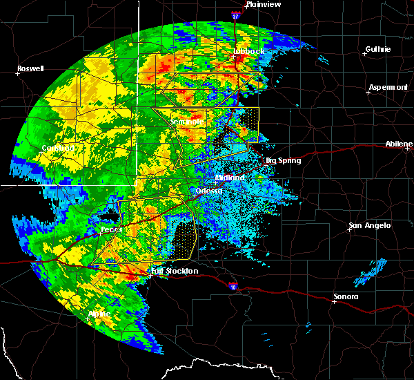 At 1136 pm cdt, severe thunderstorms were located along a line extending from 8 miles southwest of brownfield to near welch to 9 miles southwest of lamesa to 16 miles west of lenorah to 7 miles southeast of andrews, moving northeast at 50 mph (trained weather spotters). Hazards include 70 mph wind gusts and quarter size hail. Hail damage to vehicles is expected. expect considerable tree damage. wind damage is also likely to mobile homes, roofs, and outbuildings. Locations impacted include, andrews, lamesa, seagraves, ackerly, seagraves airport, lamesa municipal airport, welch, los ybanez, loop, sparenberg, patricia, punkin center, arvana, hancock, mckenzie lake, tenmile, gaines county park, key, klondike and andrews county airport. At 1136 pm cdt, severe thunderstorms were located along a line extending from 8 miles southwest of brownfield to near welch to 9 miles southwest of lamesa to 16 miles west of lenorah to 7 miles southeast of andrews, moving northeast at 50 mph (trained weather spotters). Hazards include 70 mph wind gusts and quarter size hail. Hail damage to vehicles is expected. expect considerable tree damage. wind damage is also likely to mobile homes, roofs, and outbuildings. Locations impacted include, andrews, lamesa, seagraves, ackerly, seagraves airport, lamesa municipal airport, welch, los ybanez, loop, sparenberg, patricia, punkin center, arvana, hancock, mckenzie lake, tenmile, gaines county park, key, klondike and andrews county airport.
|
| 6/3/2018 11:21 PM CDT |
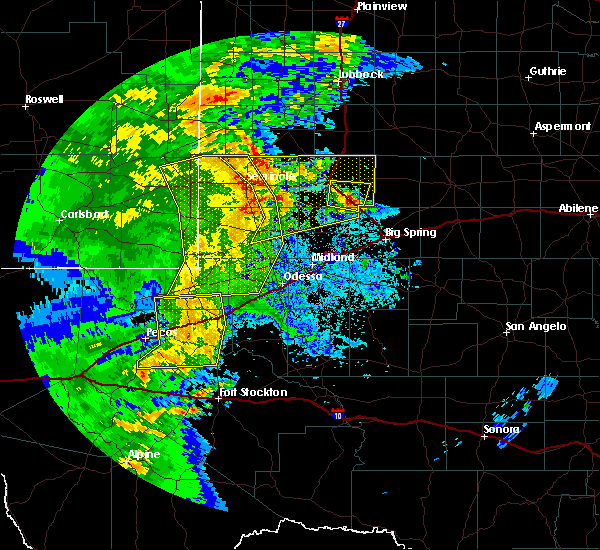 At 1121 pm cdt, severe thunderstorms were located along a line extending from near seagraves airport to 14 miles southwest of welch to 20 miles southwest of lamesa to 13 miles east of andrews to 11 miles north of goldsmith, moving northeast at 45 mph (radar indicated). Hazards include 60 mph wind gusts and quarter size hail. Hail damage to vehicles is expected. Expect wind damage to roofs, siding, and trees. At 1121 pm cdt, severe thunderstorms were located along a line extending from near seagraves airport to 14 miles southwest of welch to 20 miles southwest of lamesa to 13 miles east of andrews to 11 miles north of goldsmith, moving northeast at 45 mph (radar indicated). Hazards include 60 mph wind gusts and quarter size hail. Hail damage to vehicles is expected. Expect wind damage to roofs, siding, and trees.
|
| 6/3/2018 10:59 PM CDT |
 At 1040 pm cdt/940 pm mdt/, severe thunderstorms were located along a line extending from 6 miles northeast of humble city to 11 miles east of eunice to 15 miles east of jal airport to near kermit, moving east at 40 mph (trained weather spotters). Hazards include 70 mph wind gusts and half dollar size hail. Hail damage to vehicles is expected. expect considerable tree damage. Wind damage is also likely to mobile homes, roofs, and outbuildings. At 1040 pm cdt/940 pm mdt/, severe thunderstorms were located along a line extending from 6 miles northeast of humble city to 11 miles east of eunice to 15 miles east of jal airport to near kermit, moving east at 40 mph (trained weather spotters). Hazards include 70 mph wind gusts and half dollar size hail. Hail damage to vehicles is expected. expect considerable tree damage. Wind damage is also likely to mobile homes, roofs, and outbuildings.
|
| 6/3/2018 10:59 PM CDT |
 At 1058 pm cdt/958 pm mdt/, severe thunderstorms were located along a line extending from near denver city to 7 miles south of gaines county airport to 8 miles south of andrews, moving northeast at 40 mph (trained weather spotters). Hazards include 70 mph wind gusts and half dollar size hail. Hail damage to vehicles is expected. expect considerable tree damage. wind damage is also likely to mobile homes, roofs, and outbuildings. Locations impacted include, hobbs, andrews, seminole, kermit, eunice, wink, goldsmith, monument, humble city, nadine, jal airport, gaines county airport, west odessa, florey, knowles, notrees, frankel city, lea county regional airport, industrial airpark and paynes corner. At 1058 pm cdt/958 pm mdt/, severe thunderstorms were located along a line extending from near denver city to 7 miles south of gaines county airport to 8 miles south of andrews, moving northeast at 40 mph (trained weather spotters). Hazards include 70 mph wind gusts and half dollar size hail. Hail damage to vehicles is expected. expect considerable tree damage. wind damage is also likely to mobile homes, roofs, and outbuildings. Locations impacted include, hobbs, andrews, seminole, kermit, eunice, wink, goldsmith, monument, humble city, nadine, jal airport, gaines county airport, west odessa, florey, knowles, notrees, frankel city, lea county regional airport, industrial airpark and paynes corner.
|
| 6/3/2018 10:40 PM CDT |
 At 1040 pm cdt/940 pm mdt/, severe thunderstorms were located along a line extending from 6 miles northeast of humble city to 11 miles east of eunice to 15 miles east of jal airport to near kermit, moving east at 40 mph (trained weather spotters). Hazards include 70 mph wind gusts and half dollar size hail. Hail damage to vehicles is expected. expect considerable tree damage. Wind damage is also likely to mobile homes, roofs, and outbuildings. At 1040 pm cdt/940 pm mdt/, severe thunderstorms were located along a line extending from 6 miles northeast of humble city to 11 miles east of eunice to 15 miles east of jal airport to near kermit, moving east at 40 mph (trained weather spotters). Hazards include 70 mph wind gusts and half dollar size hail. Hail damage to vehicles is expected. expect considerable tree damage. Wind damage is also likely to mobile homes, roofs, and outbuildings.
|
| 9/25/2017 6:07 PM CDT |
 At 604 pm cdt, a severe thunderstorm was located 11 miles southeast of andrews, moving east at 20 mph. received a report of penny sized hail and a few telephone poles were blown down eight miles south of andrews at 5:50 pm cdt (radar indicated). Hazards include 70 mph wind gusts and quarter size hail. Hail damage to vehicles is expected. expect considerable tree damage. wind damage is also likely to mobile homes, roofs, and outbuildings. locations impacted include, odessa, andrews, mission dorado, odessa schelemeyer field, north cowden and andrews county airport. This includes interstate 20 between mile markers 122 and 122. At 604 pm cdt, a severe thunderstorm was located 11 miles southeast of andrews, moving east at 20 mph. received a report of penny sized hail and a few telephone poles were blown down eight miles south of andrews at 5:50 pm cdt (radar indicated). Hazards include 70 mph wind gusts and quarter size hail. Hail damage to vehicles is expected. expect considerable tree damage. wind damage is also likely to mobile homes, roofs, and outbuildings. locations impacted include, odessa, andrews, mission dorado, odessa schelemeyer field, north cowden and andrews county airport. This includes interstate 20 between mile markers 122 and 122.
|
| 9/25/2017 5:26 PM CDT |
 At 526 pm cdt, a severe thunderstorm was located 11 miles southwest of andrews, moving east at 25 mph (radar indicated). Hazards include 70 mph wind gusts and ping pong ball size hail. People and animals outdoors will be injured. expect hail damage to roofs, siding, windows, and vehicles. expect considerable tree damage. Wind damage is also likely to mobile homes, roofs, and outbuildings. At 526 pm cdt, a severe thunderstorm was located 11 miles southwest of andrews, moving east at 25 mph (radar indicated). Hazards include 70 mph wind gusts and ping pong ball size hail. People and animals outdoors will be injured. expect hail damage to roofs, siding, windows, and vehicles. expect considerable tree damage. Wind damage is also likely to mobile homes, roofs, and outbuildings.
|
| 7/4/2017 10:38 PM CDT |
 At 1035 pm cdt/935 pm mdt/, doppler radar was tracking a large gust front from near mesquite, patricia, andrews west to eunice. the gust front was moving to the south at 60 mph (radar indicated). Hazards include 60 mph wind gusts. Expect damage to roofs, siding, and trees. locations impacted include, big spring, andrews, lamesa, eunice, stanton, jal, ackerly, gail, los ybanez, flower grove, patricia, hancock, lenorah, eunice airport, jal airport, vealmoor, luther, sparenberg, lamesa municipal airport and frankel city. This includes interstate 20 between mile markers 156 and 158, and between mile markers 160 and 182. At 1035 pm cdt/935 pm mdt/, doppler radar was tracking a large gust front from near mesquite, patricia, andrews west to eunice. the gust front was moving to the south at 60 mph (radar indicated). Hazards include 60 mph wind gusts. Expect damage to roofs, siding, and trees. locations impacted include, big spring, andrews, lamesa, eunice, stanton, jal, ackerly, gail, los ybanez, flower grove, patricia, hancock, lenorah, eunice airport, jal airport, vealmoor, luther, sparenberg, lamesa municipal airport and frankel city. This includes interstate 20 between mile markers 156 and 158, and between mile markers 160 and 182.
|
| 7/4/2017 10:20 PM CDT |
 At 1017 pm cdt/917 pm mdt/, at 1005 pm cdt/905 pm mdt/, doppler radar was tracking a large gust front ahead of a line of strong thunderstorms from near welch to seagraves to denver city. the gust front was moving to the south at 60 mph (radar indicated). Hazards include 60 mph wind gusts. expect damage to roofs, siding, and trees At 1017 pm cdt/917 pm mdt/, at 1005 pm cdt/905 pm mdt/, doppler radar was tracking a large gust front ahead of a line of strong thunderstorms from near welch to seagraves to denver city. the gust front was moving to the south at 60 mph (radar indicated). Hazards include 60 mph wind gusts. expect damage to roofs, siding, and trees
|
| 6/23/2017 5:48 PM CDT |
 At 535 pm cdt/435 pm mdt/, a severe thunderstorm produced a 74 mph gust at midland airpark. at 545 pm cdt/445 pm mdt/ was located over midland, moving south at 20 mph. another severe thunderstorm was located 7 miles northwest of notrees, moving southeast at 20 mph (radar indicated). Hazards include 70 mph wind gusts and quarter size hail. Hail damage to vehicles is expected. expect considerable tree damage. wind damage is also likely to mobile homes, roofs, and outbuildings. locations impacted include, midland, odessa, andrews, stanton, greenwood, west odessa, goldsmith, cotton flat, lenorah, midland international air and space port, notrees, frankel city, tarzan, florey, warfield, midland airpark, skywest airport, courtney, mission dorado and grady. This includes interstate 20 between mile markers 117 and 162. At 535 pm cdt/435 pm mdt/, a severe thunderstorm produced a 74 mph gust at midland airpark. at 545 pm cdt/445 pm mdt/ was located over midland, moving south at 20 mph. another severe thunderstorm was located 7 miles northwest of notrees, moving southeast at 20 mph (radar indicated). Hazards include 70 mph wind gusts and quarter size hail. Hail damage to vehicles is expected. expect considerable tree damage. wind damage is also likely to mobile homes, roofs, and outbuildings. locations impacted include, midland, odessa, andrews, stanton, greenwood, west odessa, goldsmith, cotton flat, lenorah, midland international air and space port, notrees, frankel city, tarzan, florey, warfield, midland airpark, skywest airport, courtney, mission dorado and grady. This includes interstate 20 between mile markers 117 and 162.
|
| 6/23/2017 5:34 PM CDT |
 At 525 pm cdt/425 pm mdt/, a severe thunderstorm produced 62 mph winds at the mesonet station, 2 miles east of andrews. at 531 pm cdt/431 pm mdt/, another severe thunderstorm was located 2 miles north of midland, moving south at 10 mph (radar indicated). Hazards include 60 mph wind gusts and quarter size hail. Hail damage to vehicles is expected. expect wind damage to roofs, siding, and trees. locations impacted include, midland, odessa, andrews, stanton, greenwood, west odessa, goldsmith, cotton flat, lenorah, midland international air and space port, notrees, frankel city, tarzan, florey, warfield, midland airpark, skywest airport, courtney, mission dorado and grady. This includes interstate 20 between mile markers 117 and 162. At 525 pm cdt/425 pm mdt/, a severe thunderstorm produced 62 mph winds at the mesonet station, 2 miles east of andrews. at 531 pm cdt/431 pm mdt/, another severe thunderstorm was located 2 miles north of midland, moving south at 10 mph (radar indicated). Hazards include 60 mph wind gusts and quarter size hail. Hail damage to vehicles is expected. expect wind damage to roofs, siding, and trees. locations impacted include, midland, odessa, andrews, stanton, greenwood, west odessa, goldsmith, cotton flat, lenorah, midland international air and space port, notrees, frankel city, tarzan, florey, warfield, midland airpark, skywest airport, courtney, mission dorado and grady. This includes interstate 20 between mile markers 117 and 162.
|
| 6/23/2017 5:25 PM CDT | Storm damage reported in andrews county TX, 2.5 miles W of Andrews, TX |
| 6/23/2017 5:05 PM CDT |
 At 503 pm cdt/403 pm mdt/, a severe thunderstorm was located 14 miles northeast of jal airport, or 16 miles northeast of jal, moving southeast at 15 mph. additional severe thunderstorms were located 9 miles northeast of midland and 8 miles north of andrews, moving south at 15 mph (radar indicated). Hazards include 60 mph wind gusts and quarter size hail. Hail damage to vehicles is expected. Expect wind damage to roofs, siding, and trees. At 503 pm cdt/403 pm mdt/, a severe thunderstorm was located 14 miles northeast of jal airport, or 16 miles northeast of jal, moving southeast at 15 mph. additional severe thunderstorms were located 9 miles northeast of midland and 8 miles north of andrews, moving south at 15 mph (radar indicated). Hazards include 60 mph wind gusts and quarter size hail. Hail damage to vehicles is expected. Expect wind damage to roofs, siding, and trees.
|
| 6/23/2017 4:51 PM CDT |
 At 450 pm cdt/350 pm mdt/, a severe thunderstorm was located 13 miles northeast of jal airport, or 15 miles southeast of eunice, moving south at 10 mph (radar indicated). Hazards include 60 mph wind gusts and quarter size hail. Hail damage to vehicles is expected. expect wind damage to roofs, siding, and trees. Locations impacted include, hobbs, andrews, eunice, nadine, monument, frankel city, humble city, florey, lea county regional airport, industrial airpark and andrews county airport. At 450 pm cdt/350 pm mdt/, a severe thunderstorm was located 13 miles northeast of jal airport, or 15 miles southeast of eunice, moving south at 10 mph (radar indicated). Hazards include 60 mph wind gusts and quarter size hail. Hail damage to vehicles is expected. expect wind damage to roofs, siding, and trees. Locations impacted include, hobbs, andrews, eunice, nadine, monument, frankel city, humble city, florey, lea county regional airport, industrial airpark and andrews county airport.
|
| 6/23/2017 4:19 PM CDT |
 At 417 pm cdt/317 pm mdt/, a severe thunderstorm was located near nadine, or near hobbs, moving southeast at 15 mph. additional severe thunderstorms were located 10 miles north of frankel city, and 11 miles west of frankel city, moving southeast at 20 mph (radar indicated). Hazards include 60 mph wind gusts and quarter size hail. Hail damage to vehicles is expected. Expect wind damage to roofs, siding, and trees. At 417 pm cdt/317 pm mdt/, a severe thunderstorm was located near nadine, or near hobbs, moving southeast at 15 mph. additional severe thunderstorms were located 10 miles north of frankel city, and 11 miles west of frankel city, moving southeast at 20 mph (radar indicated). Hazards include 60 mph wind gusts and quarter size hail. Hail damage to vehicles is expected. Expect wind damage to roofs, siding, and trees.
|
| 5/14/2017 7:26 PM CDT |
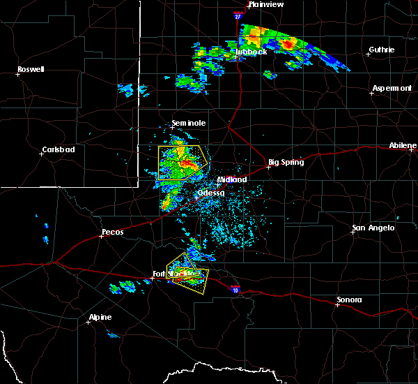 At 725 pm cdt, a severe thunderstorm was located 8 miles southeast of andrews, moving northeast at 30 mph (radar indicated). Hazards include 60 mph wind gusts and quarter size hail. Hail damage to vehicles is expected. expect wind damage to roofs, siding, and trees. Locations impacted include, andrews, frankel city, florey and andrews county airport. At 725 pm cdt, a severe thunderstorm was located 8 miles southeast of andrews, moving northeast at 30 mph (radar indicated). Hazards include 60 mph wind gusts and quarter size hail. Hail damage to vehicles is expected. expect wind damage to roofs, siding, and trees. Locations impacted include, andrews, frankel city, florey and andrews county airport.
|
| 5/14/2017 7:04 PM CDT |
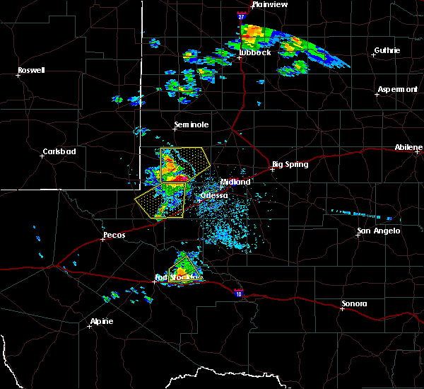 At 703 pm cdt, a severe thunderstorm was located 11 miles northeast of goldsmith, or 12 miles south of andrews, moving northeast at 35 mph (radar indicated). Hazards include 60 mph wind gusts and quarter size hail. Hail damage to vehicles is expected. Expect wind damage to roofs, siding, and trees. At 703 pm cdt, a severe thunderstorm was located 11 miles northeast of goldsmith, or 12 miles south of andrews, moving northeast at 35 mph (radar indicated). Hazards include 60 mph wind gusts and quarter size hail. Hail damage to vehicles is expected. Expect wind damage to roofs, siding, and trees.
|
| 4/16/2017 8:11 PM CDT |
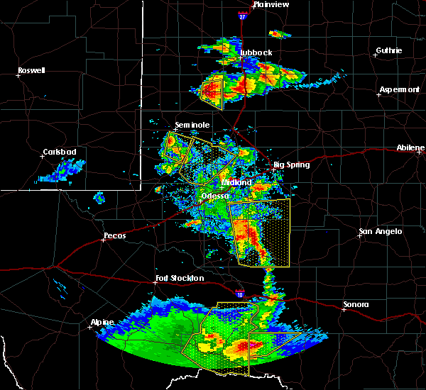 At 811 pm cdt, a severe thunderstorm was located 7 miles southwest of gaines county airport, or 9 miles southwest of seminole, moving northeast at 15 mph (radar indicated). Hazards include 60 mph wind gusts and half dollar size hail. Hail damage to vehicles is expected. expect wind damage to roofs, siding, and trees. Locations impacted include, andrews, gaines county airport, florey and andrews county airport. At 811 pm cdt, a severe thunderstorm was located 7 miles southwest of gaines county airport, or 9 miles southwest of seminole, moving northeast at 15 mph (radar indicated). Hazards include 60 mph wind gusts and half dollar size hail. Hail damage to vehicles is expected. expect wind damage to roofs, siding, and trees. Locations impacted include, andrews, gaines county airport, florey and andrews county airport.
|
| 4/16/2017 7:52 PM CDT |
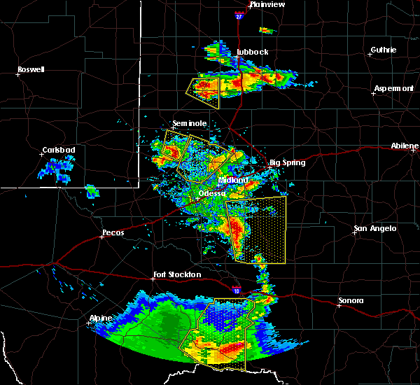 At 751 pm cdt, a severe thunderstorm was located 9 miles northeast of frankel city, or 11 miles northwest of andrews, moving north northeast at 15 mph (radar indicated). Hazards include golf ball size hail and 60 mph wind gusts. People and animals outdoors will be injured. expect hail damage to roofs, siding, windows, and vehicles. Expect wind damage to roofs, siding, and trees. At 751 pm cdt, a severe thunderstorm was located 9 miles northeast of frankel city, or 11 miles northwest of andrews, moving north northeast at 15 mph (radar indicated). Hazards include golf ball size hail and 60 mph wind gusts. People and animals outdoors will be injured. expect hail damage to roofs, siding, windows, and vehicles. Expect wind damage to roofs, siding, and trees.
|
| 4/16/2017 7:39 PM CDT |
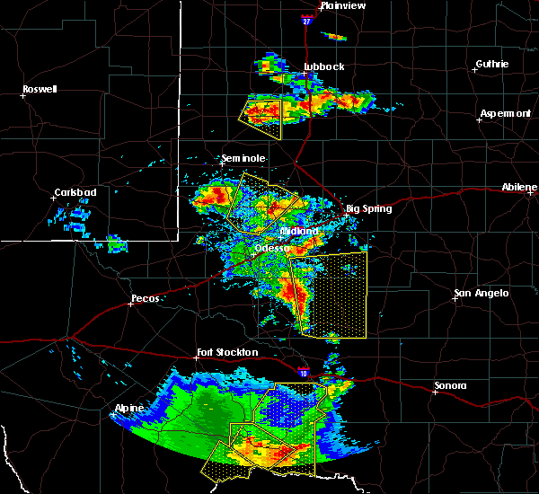 At 738 pm cdt, a severe thunderstorm was located 17 miles west of lenorah, or 22 miles east of andrews, moving northwest at 20 mph (radar indicated). Hazards include 60 mph wind gusts and quarter size hail. Hail damage to vehicles is expected. expect wind damage to roofs, siding, and trees. Locations impacted include, andrews and andrews county airport. At 738 pm cdt, a severe thunderstorm was located 17 miles west of lenorah, or 22 miles east of andrews, moving northwest at 20 mph (radar indicated). Hazards include 60 mph wind gusts and quarter size hail. Hail damage to vehicles is expected. expect wind damage to roofs, siding, and trees. Locations impacted include, andrews and andrews county airport.
|
| 4/16/2017 7:08 PM CDT |
 At 708 pm cdt, a severe thunderstorm was located 12 miles southeast of andrews, moving northeast at 25 mph (radar indicated). Hazards include 60 mph wind gusts and quarter size hail. Hail damage to vehicles is expected. Expect wind damage to roofs, siding, and trees. At 708 pm cdt, a severe thunderstorm was located 12 miles southeast of andrews, moving northeast at 25 mph (radar indicated). Hazards include 60 mph wind gusts and quarter size hail. Hail damage to vehicles is expected. Expect wind damage to roofs, siding, and trees.
|
| 4/16/2017 7:03 PM CDT | Quarter sized hail reported 0.8 miles N of Andrews, TX |
| 4/16/2017 6:55 PM CDT |
 At 654 pm cdt, a severe thunderstorm was located 8 miles south of andrews, moving northeast at 20 mph (radar indicated). Hazards include two inch hail and 60 mph wind gusts. People and animals outdoors will be injured. expect hail damage to roofs, siding, windows, and vehicles. expect wind damage to roofs, siding, and trees. Locations impacted include, andrews, goldsmith, notrees, north cowden and andrews county airport. At 654 pm cdt, a severe thunderstorm was located 8 miles south of andrews, moving northeast at 20 mph (radar indicated). Hazards include two inch hail and 60 mph wind gusts. People and animals outdoors will be injured. expect hail damage to roofs, siding, windows, and vehicles. expect wind damage to roofs, siding, and trees. Locations impacted include, andrews, goldsmith, notrees, north cowden and andrews county airport.
|
| 4/16/2017 6:51 PM CDT |
 At 650 pm cdt, a severe thunderstorm was located 9 miles south of andrews, moving northeast at 20 mph. at 637 pm cdt, golfball sized hail was reported in goldsmith (radar indicated). Hazards include golf ball size hail and 60 mph wind gusts. People and animals outdoors will be injured. expect hail damage to roofs, siding, windows, and vehicles. expect wind damage to roofs, siding, and trees. Locations impacted include, andrews, goldsmith, notrees, north cowden and andrews county airport. At 650 pm cdt, a severe thunderstorm was located 9 miles south of andrews, moving northeast at 20 mph. at 637 pm cdt, golfball sized hail was reported in goldsmith (radar indicated). Hazards include golf ball size hail and 60 mph wind gusts. People and animals outdoors will be injured. expect hail damage to roofs, siding, windows, and vehicles. expect wind damage to roofs, siding, and trees. Locations impacted include, andrews, goldsmith, notrees, north cowden and andrews county airport.
|
| 4/16/2017 6:42 PM CDT |
 At 641 pm cdt, a severe thunderstorm was located 11 miles north of goldsmith, or 12 miles south of andrews, moving north at 35 mph (radar indicated). Hazards include 60 mph wind gusts and quarter size hail. Hail damage to vehicles is expected. expect wind damage to roofs, siding, and trees. Locations impacted include, andrews, west odessa, goldsmith, notrees, north cowden and andrews county airport. At 641 pm cdt, a severe thunderstorm was located 11 miles north of goldsmith, or 12 miles south of andrews, moving north at 35 mph (radar indicated). Hazards include 60 mph wind gusts and quarter size hail. Hail damage to vehicles is expected. expect wind damage to roofs, siding, and trees. Locations impacted include, andrews, west odessa, goldsmith, notrees, north cowden and andrews county airport.
|
| 4/16/2017 6:18 PM CDT |
 At 618 pm cdt, a severe thunderstorm was located over goldsmith, or 10 miles northwest of west odessa, moving northeast at 20 mph (radar indicated). Hazards include 60 mph wind gusts and quarter size hail. Hail damage to vehicles is expected. Expect wind damage to roofs, siding, and trees. At 618 pm cdt, a severe thunderstorm was located over goldsmith, or 10 miles northwest of west odessa, moving northeast at 20 mph (radar indicated). Hazards include 60 mph wind gusts and quarter size hail. Hail damage to vehicles is expected. Expect wind damage to roofs, siding, and trees.
|
| 4/12/2017 9:42 PM CDT |
 At 938 pm cdt, severe thunderstorms were located along a line extending from near gaines county airport to 13 miles northeast of frankel city to near andrews to 9 miles north of notrees, moving northeast at 30 mph (radar indicated). Hazards include 70 mph wind gusts and quarter size hail. Hail damage to vehicles is expected. expect considerable tree damage. Wind damage is also likely to mobile homes, roofs, and outbuildings. At 938 pm cdt, severe thunderstorms were located along a line extending from near gaines county airport to 13 miles northeast of frankel city to near andrews to 9 miles north of notrees, moving northeast at 30 mph (radar indicated). Hazards include 70 mph wind gusts and quarter size hail. Hail damage to vehicles is expected. expect considerable tree damage. Wind damage is also likely to mobile homes, roofs, and outbuildings.
|
| 4/12/2017 9:09 PM CDT |
 At 909 pm cdt, severe thunderstorms were located along a line extending from 6 miles east of nadine to 7 miles southwest of frankel city to 11 miles northeast of kermit, moving east at 30 mph (radar indicated). Hazards include 70 mph wind gusts and quarter size hail. Hail damage to vehicles is expected. expect considerable tree damage. Wind damage is also likely to mobile homes, roofs, and outbuildings. At 909 pm cdt, severe thunderstorms were located along a line extending from 6 miles east of nadine to 7 miles southwest of frankel city to 11 miles northeast of kermit, moving east at 30 mph (radar indicated). Hazards include 70 mph wind gusts and quarter size hail. Hail damage to vehicles is expected. expect considerable tree damage. Wind damage is also likely to mobile homes, roofs, and outbuildings.
|
| 1/1/2017 8:24 PM CST |
 At 823 pm cst, severe thunderstorms were located along a line extending from seagraves airport to 10 miles north of andrews to 9 miles northwest of goldsmith, moving east at 55 mph (radar indicated). Hazards include 60 mph wind gusts and penny size hail. expect damage to roofs, siding, and trees At 823 pm cst, severe thunderstorms were located along a line extending from seagraves airport to 10 miles north of andrews to 9 miles northwest of goldsmith, moving east at 55 mph (radar indicated). Hazards include 60 mph wind gusts and penny size hail. expect damage to roofs, siding, and trees
|
| 1/1/2017 7:52 PM CST |
 At 751 pm cst/651 pm mst/, severe thunderstorms were located along a line extending from 10 miles north of bronco to near denver city to near winkler county airport, moving northeast at 65 mph (69 mph wind gust reported at lea county regional airport). Hazards include 70 mph wind gusts and penny size hail. Expect considerable tree damage. damage is likely to mobile homes, roofs, and outbuildings. Locations impacted include, hobbs, andrews, seminole, kermit, denver city, eunice, seagraves, jal, seagraves airport, nadine, jal airport, gaines county airport, welch, gaines county park, winkler county airport, loop, knowles, frankel city, higginbotham and cedar lake. At 751 pm cst/651 pm mst/, severe thunderstorms were located along a line extending from 10 miles north of bronco to near denver city to near winkler county airport, moving northeast at 65 mph (69 mph wind gust reported at lea county regional airport). Hazards include 70 mph wind gusts and penny size hail. Expect considerable tree damage. damage is likely to mobile homes, roofs, and outbuildings. Locations impacted include, hobbs, andrews, seminole, kermit, denver city, eunice, seagraves, jal, seagraves airport, nadine, jal airport, gaines county airport, welch, gaines county park, winkler county airport, loop, knowles, frankel city, higginbotham and cedar lake.
|
| 1/1/2017 7:28 PM CST |
 At 728 pm cst/628 pm mst/, severe thunderstorms were located along a line extending from near tatum to near hobbs to 6 miles south of mentone, moving northeast at 65 mph (radar indicated). Hazards include 60 mph wind gusts and penny size hail. expect damage to roofs, siding, and trees At 728 pm cst/628 pm mst/, severe thunderstorms were located along a line extending from near tatum to near hobbs to 6 miles south of mentone, moving northeast at 65 mph (radar indicated). Hazards include 60 mph wind gusts and penny size hail. expect damage to roofs, siding, and trees
|
| 11/2/2016 5:39 PM CDT |
 At 538 pm cdt, a severe thunderstorm was located 10 miles northeast of andrews, moving northeast at 20 mph (radar indicated). Hazards include 60 mph wind gusts and half dollar size hail. Hail damage to vehicles is expected. expect wind damage to roofs, siding, and trees. Locations impacted include, rural areas northeast of andrews. At 538 pm cdt, a severe thunderstorm was located 10 miles northeast of andrews, moving northeast at 20 mph (radar indicated). Hazards include 60 mph wind gusts and half dollar size hail. Hail damage to vehicles is expected. expect wind damage to roofs, siding, and trees. Locations impacted include, rural areas northeast of andrews.
|
| 11/2/2016 5:17 PM CDT |
 At 516 pm cdt, a severe thunderstorm was located 14 miles northeast of andrews, moving northeast at 25 mph (radar indicated). Hazards include 60 mph wind gusts and half dollar size hail. Hail damage to vehicles is expected. Expect wind damage to roofs, siding, and trees. At 516 pm cdt, a severe thunderstorm was located 14 miles northeast of andrews, moving northeast at 25 mph (radar indicated). Hazards include 60 mph wind gusts and half dollar size hail. Hail damage to vehicles is expected. Expect wind damage to roofs, siding, and trees.
|
| 11/2/2016 4:43 PM CDT |
 At 441 pm cdt, a severe thunderstorm was located near andrews, moving northeast at 15 mph (radar indicated with a history of golfball). Hazards include golf ball size hail and 60 mph wind gusts. People and animals outdoors will be injured. expect hail damage to roofs, siding, windows, and vehicles. expect wind damage to roofs, siding, and trees. Locations impacted include, 5 miles east northeast of andrews near the intersection of highway 115 and 1788. At 441 pm cdt, a severe thunderstorm was located near andrews, moving northeast at 15 mph (radar indicated with a history of golfball). Hazards include golf ball size hail and 60 mph wind gusts. People and animals outdoors will be injured. expect hail damage to roofs, siding, windows, and vehicles. expect wind damage to roofs, siding, and trees. Locations impacted include, 5 miles east northeast of andrews near the intersection of highway 115 and 1788.
|
| 11/2/2016 4:31 PM CDT |
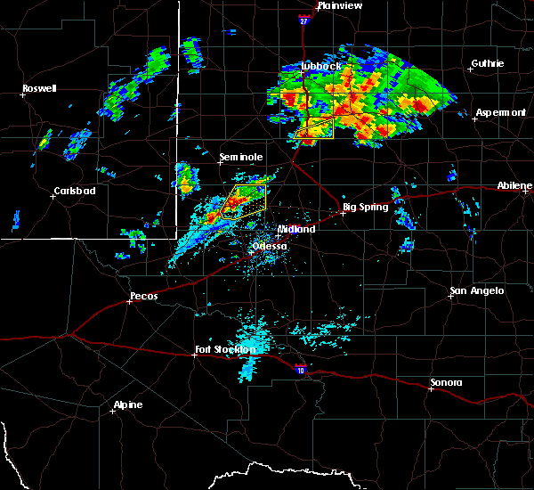 At 429 pm cdt, a severe thunderstorm was located near andrews, moving northeast at 25 mph (at 425 pm cdt the sheriffs office reported golfball hail southeast of andrews). Hazards include golf ball size hail and 60 mph wind gusts. People and animals outdoors will be injured. expect hail damage to roofs, siding, windows, and vehicles. expect wind damage to roofs, siding, and trees. Locations impacted include, andrews and andrews county airport. At 429 pm cdt, a severe thunderstorm was located near andrews, moving northeast at 25 mph (at 425 pm cdt the sheriffs office reported golfball hail southeast of andrews). Hazards include golf ball size hail and 60 mph wind gusts. People and animals outdoors will be injured. expect hail damage to roofs, siding, windows, and vehicles. expect wind damage to roofs, siding, and trees. Locations impacted include, andrews and andrews county airport.
|
| 11/2/2016 4:29 PM CDT | Quarter sized hail reported 0.1 miles WNW of Andrews, TX |
| 11/2/2016 4:25 PM CDT | Golf Ball sized hail reported 3.1 miles NNW of Andrews, TX, the sheriffs office reported just outside the city limits |
| 11/2/2016 4:18 PM CDT |
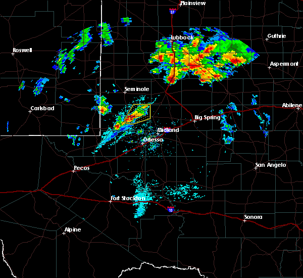 At 417 pm cdt, a severe thunderstorm was located near andrews, moving northeast at 20 mph (radar indicated). Hazards include 60 mph wind gusts and quarter size hail. Hail damage to vehicles is expected. Expect wind damage to roofs, siding, and trees. At 417 pm cdt, a severe thunderstorm was located near andrews, moving northeast at 20 mph (radar indicated). Hazards include 60 mph wind gusts and quarter size hail. Hail damage to vehicles is expected. Expect wind damage to roofs, siding, and trees.
|
| 9/7/2016 7:15 PM CDT | Storm damage reported in andrews county TX, 0.1 miles WNW of Andrews, TX |
| 7/14/2016 8:05 PM CDT | Storm damage reported in andrews county TX, 2.5 miles W of Andrews, TX |
| 7/5/2016 6:35 PM CDT |
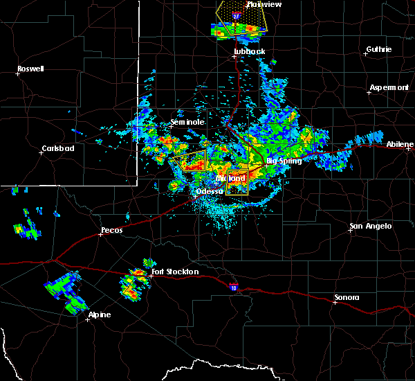 At 634 pm cdt, a severe thunderstorm was located 14 miles east of andrews county airport, or 15 miles east of andrews, moving south at 10 mph (radar indicated). Hazards include 60 mph wind gusts and nickel size hail. Expect damage to roofs. siding. and trees. Locations impacted include, andrews and andrews county airport. At 634 pm cdt, a severe thunderstorm was located 14 miles east of andrews county airport, or 15 miles east of andrews, moving south at 10 mph (radar indicated). Hazards include 60 mph wind gusts and nickel size hail. Expect damage to roofs. siding. and trees. Locations impacted include, andrews and andrews county airport.
|
| 7/5/2016 6:21 PM CDT |
 At 621 pm cdt, a severe thunderstorm was located 12 miles east of andrews county airport, or 12 miles east of andrews, moving northeast at 15 mph (radar indicated). Hazards include 60 mph wind gusts and nickel size hail. Expect damage to roofs. siding. And trees. At 621 pm cdt, a severe thunderstorm was located 12 miles east of andrews county airport, or 12 miles east of andrews, moving northeast at 15 mph (radar indicated). Hazards include 60 mph wind gusts and nickel size hail. Expect damage to roofs. siding. And trees.
|
| 5/31/2016 8:24 PM CDT |
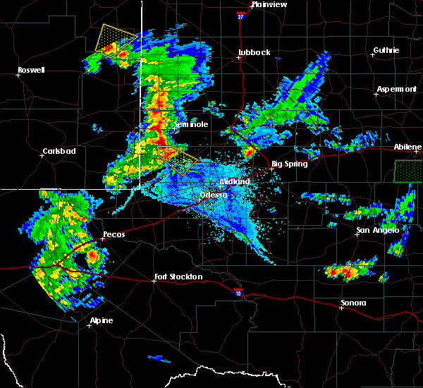 At 824 pm cdt, a severe thunderstorm was located 7 miles northeast of frankel city, or 15 miles northwest of andrews, moving southeast at 25 mph (radar indicated). Hazards include 60 mph wind gusts and quarter size hail. Hail damage to vehicles is expected. Expect wind damage to roofs, siding, and trees. At 824 pm cdt, a severe thunderstorm was located 7 miles northeast of frankel city, or 15 miles northwest of andrews, moving southeast at 25 mph (radar indicated). Hazards include 60 mph wind gusts and quarter size hail. Hail damage to vehicles is expected. Expect wind damage to roofs, siding, and trees.
|
| 3/8/2016 12:11 AM CST |
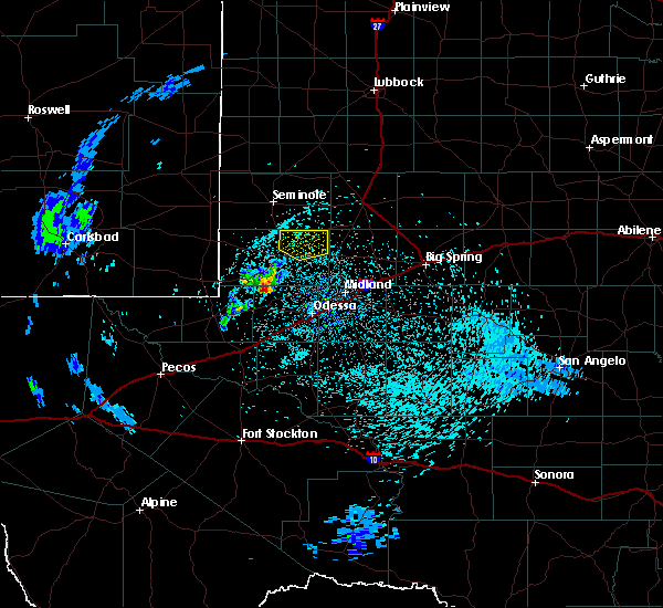 At 1211 am cst, a severe thunderstorm was located 7 miles northeast of andrews county airport, or 9 miles northeast of andrews, moving northeast at 30 mph (radar indicated). Hazards include 60 mph wind gusts and quarter size hail. Hail damage to vehicles is expected. expect wind damage to roofs, siding, and trees. Locations impacted include, andrews and andrews county airport. At 1211 am cst, a severe thunderstorm was located 7 miles northeast of andrews county airport, or 9 miles northeast of andrews, moving northeast at 30 mph (radar indicated). Hazards include 60 mph wind gusts and quarter size hail. Hail damage to vehicles is expected. expect wind damage to roofs, siding, and trees. Locations impacted include, andrews and andrews county airport.
|
| 3/7/2016 11:51 PM CST |
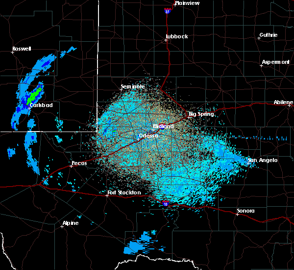 At 1151 pm cst, doppler radar indicated a severe thunderstorm capable of producing quarter size hail and damaging winds in excess of 60 mph. this storm was located near andrews, and moving northeast at 35 mph. At 1151 pm cst, doppler radar indicated a severe thunderstorm capable of producing quarter size hail and damaging winds in excess of 60 mph. this storm was located near andrews, and moving northeast at 35 mph.
|
| 10/22/2015 12:10 AM CDT |
 At 1209 am cdt/1109 pm mdt/, severe thunderstorms were located along a line extending from 8 miles southwest of paynes corner to 6 miles north of kermit, moving northeast at 35 mph (radar indicated). Hazards include 60 mph wind gusts and quarter size hail. Hail damage to vehicles is expected. expect wind damage to roofs, siding and trees. locations impacted include, andrews, kermit, west odessa, eunice, jal, wink, goldsmith, andrews county airport, winkler county airport, frankel city, florey, penwell, notrees, oil center, north cowden, jal airport, eunice airport and bennett. This includes interstate 20 between mile markers 100 and 111. At 1209 am cdt/1109 pm mdt/, severe thunderstorms were located along a line extending from 8 miles southwest of paynes corner to 6 miles north of kermit, moving northeast at 35 mph (radar indicated). Hazards include 60 mph wind gusts and quarter size hail. Hail damage to vehicles is expected. expect wind damage to roofs, siding and trees. locations impacted include, andrews, kermit, west odessa, eunice, jal, wink, goldsmith, andrews county airport, winkler county airport, frankel city, florey, penwell, notrees, oil center, north cowden, jal airport, eunice airport and bennett. This includes interstate 20 between mile markers 100 and 111.
|
| 10/21/2015 10:39 PM MDT |
 At 1138 pm cdt/1038 pm mdt/, doppler radar indicated a line of severe thunderstorms capable of producing quarter size hail and damaging winds in excess of 60 mph. these storms were located along a line extending from near eunice to 7 miles west of winkler county airport, and moving northeast at 35 mph. At 1138 pm cdt/1038 pm mdt/, doppler radar indicated a line of severe thunderstorms capable of producing quarter size hail and damaging winds in excess of 60 mph. these storms were located along a line extending from near eunice to 7 miles west of winkler county airport, and moving northeast at 35 mph.
|
| 8/21/2015 10:03 PM CDT |
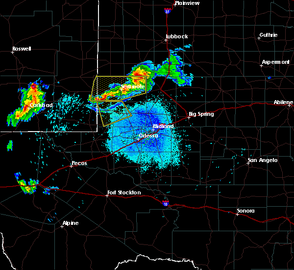 At 1002 pm cdt, a severe thunderstorm was located 12 miles southeast of nadine, or 18 miles southeast of hobbs, moving southeast at 15 mph. strong winds were blowing out in advance of this storm into northwest andrews county (radar indicated). Hazards include 60 mph wind gusts. Expect damage to roofs. siding and trees. Locations impacted include, andrews, frankel city, andrews county airport and florey. At 1002 pm cdt, a severe thunderstorm was located 12 miles southeast of nadine, or 18 miles southeast of hobbs, moving southeast at 15 mph. strong winds were blowing out in advance of this storm into northwest andrews county (radar indicated). Hazards include 60 mph wind gusts. Expect damage to roofs. siding and trees. Locations impacted include, andrews, frankel city, andrews county airport and florey.
|
| 8/21/2015 9:34 PM CDT |
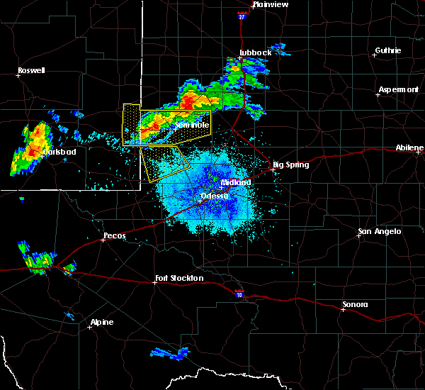 At 933 pm cdt, a severe thunderstorm was located 9 miles east of nadine, or 12 miles southeast of hobbs, moving southeast at 30 mph. strong winds were advancing well ahead of these storms (radar indicated). Hazards include 60 mph wind gusts. Expect damage to roofs. Siding and trees. At 933 pm cdt, a severe thunderstorm was located 9 miles east of nadine, or 12 miles southeast of hobbs, moving southeast at 30 mph. strong winds were advancing well ahead of these storms (radar indicated). Hazards include 60 mph wind gusts. Expect damage to roofs. Siding and trees.
|
| 5/30/2015 12:35 AM CDT | At 1234 am cdt, severe thunderstorms were located along a line extending from loraine to 7 miles southwest of lomax to midland airpark to 13 miles southwest of andrews, and moving south at 35 mph (public reported wind gusts to 60 mph in snyder with this line of storms). Hazards include 70 mph wind gusts and quarter size hail. Hail damage to vehicles is expected. expect considerable tree damage. wind damage is also likely to mobile homes, roofs and outbuildings. Locations impacted include, midland, garden city, odessa, west odessa, greenwood, loraine, lees, valley view, champion creek reservoir, gardendale, cotton flat, spraberry, midland international, warfield, north cowden, mission dorado, odessa schelemeyer field, goldsmith, bigby corner and notrees. |
| 5/29/2015 11:58 PM CDT | At 1153 pm cdt, severe thunderstorms were located along a line extending from winston field to lenorah to 12 miles east of andrews county airport to 9 miles northwest of frankel city, and moving south at 50 mph (radar indicated). Hazards include 70 mph wind gusts and quarter size hail. Hail damage to vehicles is expected. expect considerable tree damage. Wind damage is also likely to mobile homes, roofs and outbuildings. |
| 5/27/2015 9:37 PM CDT | Quarter sized hail reported 0.1 miles WNW of Andrews, TX |
| 5/27/2015 9:25 PM CDT | At 921 pm cdt, a severe thunderstorm was located near andrews, and moving northeast at 15 mph (radar indicated). Hazards include 60 mph wind gusts and half dollar size hail. Hail damage to vehicles is expected. Expect wind damage to roofs, siding and trees. |
| 5/25/2015 6:57 AM CDT | At 655 am cdt, severe thunderstorms were located along a line extending from frankel city to 15 miles east of andrews county airport, and moving northeast at 30 mph (radar indicated). Hazards include 60 mph and quarter size hail. Damage to vehicles is expected. Locations impacted include, seminole, florey, gaines county airport, fairview and fairview in gaines county. |
| 5/25/2015 6:32 AM CDT | At 632 am cdt, a severe thunderstorm was located 16 miles south of frankel city, and moving northeast at 35 mph (radar indicated). Hazards include quarter size hail. damage to vehicles is expected |
| 5/23/2015 4:14 PM CDT | At 413 pm cdt, a severe thunderstorm was located 5 miles south of north cowden, and moving northeast at 30 mph (radar indicated). Hazards include 60 mph wind gusts and quarter size hail. Hail damage to vehicles is expected. expect wind damage to roofs, siding and trees. Locations impacted include, andrews, north cowden, odessa schelemeyer field, gardendale and andrews county airport. |
| 5/23/2015 3:44 PM CDT | At 342 pm cdt, a severe thunderstorm was located near goldsmith, and moving northeast at 30 mph (radar indicated). Hazards include 60 mph wind gusts and quarter size hail. Hail damage to vehicles is expected. Expect wind damage to roofs, siding and trees. |
| 5/14/2015 5:28 PM CDT | At 526 pm cdt, a severe thunderstorm was located 14 miles southeast of eunice, and moving northeast at 35 mph (radar indicated). Hazards include tennis ball size hail and 60 mph wind gusts. People and animals outdoors will be injured. expect hail damage to roofs, siding, windows and vehicles. expect wind damage to roofs, siding and trees. locations impacted include, frankel city and florey. Possible. |
| 5/14/2015 5:28 PM CDT | At 526 pm cdt, a severe thunderstorm was located 14 miles southeast of eunice, and moving northeast at 35 mph (radar indicated). Hazards include tennis ball size hail and 60 mph wind gusts. People and animals outdoors will be injured. expect hail damage to roofs, siding, windows and vehicles. expect wind damage to roofs, siding and trees. locations impacted include, frankel city and florey. Possible. |
| 5/14/2015 5:04 PM CDT | At 403 pm mdt, a severe thunderstorm was located 9 miles southeast of jal, and moving north at 35 mph (radar indicated). Hazards include golf ball size hail and 60 mph wind gusts. People and animals outdoors will be injured. expect hail damage to roofs, siding, windows and vehicles. Expect wind damage to roofs, siding and trees. |
| 5/14/2015 5:04 PM CDT | At 403 pm mdt, a severe thunderstorm was located 9 miles southeast of jal, and moving north at 35 mph (radar indicated). Hazards include golf ball size hail and 60 mph wind gusts. People and animals outdoors will be injured. expect hail damage to roofs, siding, windows and vehicles. Expect wind damage to roofs, siding and trees. |
| 5/8/2015 10:48 PM CDT | At 1043 pm cdt, a severe thunderstorm was located near andrews county airport, and moving northeast at 40 mph (trained weather spotters). Hazards include quarter size hail. Damage to vehicles is expected. locations impacted include, mainly rural areas of northern andrews county. 1. 00in. |
| 5/8/2015 10:43 PM CDT | Quarter sized hail reported 0.1 miles WNW of Andrews, TX |
| 5/8/2015 10:38 PM CDT | At 1033 pm cdt, a severe thunderstorm was located near andrews county airport, and moving northeast at 40 mph (radar indicated). Hazards include quarter size hail. Damage to vehicles is expected. locations impacted include, mainly rural areas of northeastern andrews county. 1. 00in. |
| 5/8/2015 10:21 PM CDT | At 1019 pm cdt, a severe thunderstorm was located 5 miles southwest of andrews, and moving northeast at 40 mph (radar indicated). Hazards include ping pong ball size hail and 60 mph wind gusts. People and animals outdoors will be injured. expect hail damage to roofs, siding, windows and vehicles. Expect wind damage to roofs, siding and trees. |
| 4/8/2015 6:53 PM CDT | The national weather service in midland has issued a * severe thunderstorm warning for. eastern andrews county in west texas. southwestern dawson county in west texas. northeastern ector county in west texas. Martin county in west texas. |
| 8/24/2014 7:15 PM CDT | Storm damage reported in andrews county TX, 2.5 miles W of Andrews, TX |
| 6/5/2013 11:05 PM CDT | From west texas mesonet in andrews county TX, 2.5 miles W of Andrews, TX |
| 6/5/2013 10:20 PM CDT | Ping Pong Ball sized hail reported 14.2 miles ESE of Andrews, TX |
| 10/22/2012 2:15 AM CDT | Local law enforcement reported several trees and power lines downed in andrews county TX, 0.1 miles WNW of Andrews, TX |
| 6/14/2012 8:13 PM CDT | Half Dollar sized hail reported 0.1 miles WNW of Andrews, TX |
| 6/12/2012 9:28 PM CDT | Telephone poles down 1/4 e frankel cit in andrews county TX, 14.2 miles ESE of Andrews, TX |
| 6/12/2012 8:58 PM CDT | Two power poles leaning sse and a third one snapped .125 mi e of frankel city on fm 1967 in andrews county TX, 14.2 miles ESE of Andrews, TX |
Hail Maps for Andrews, TX
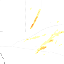
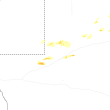
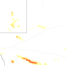
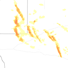
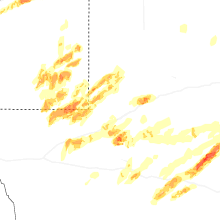

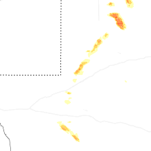
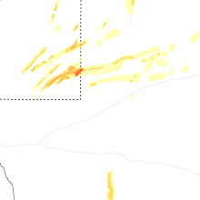


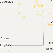


Connect with Interactive Hail Maps