

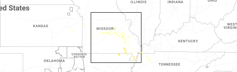
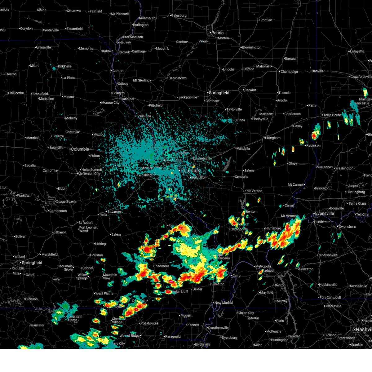
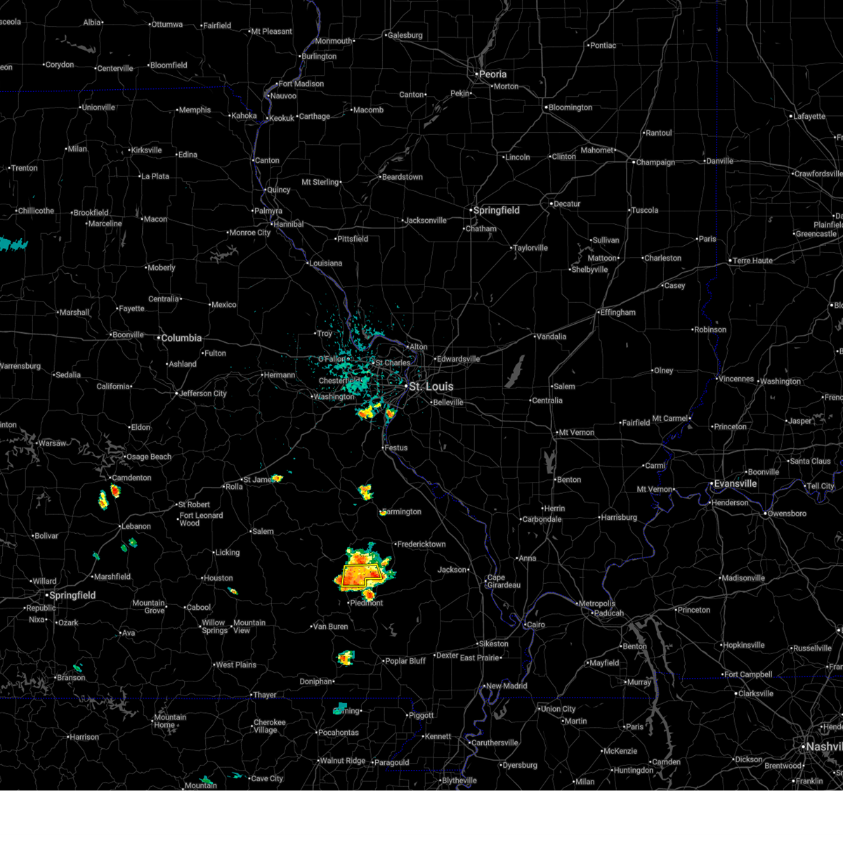
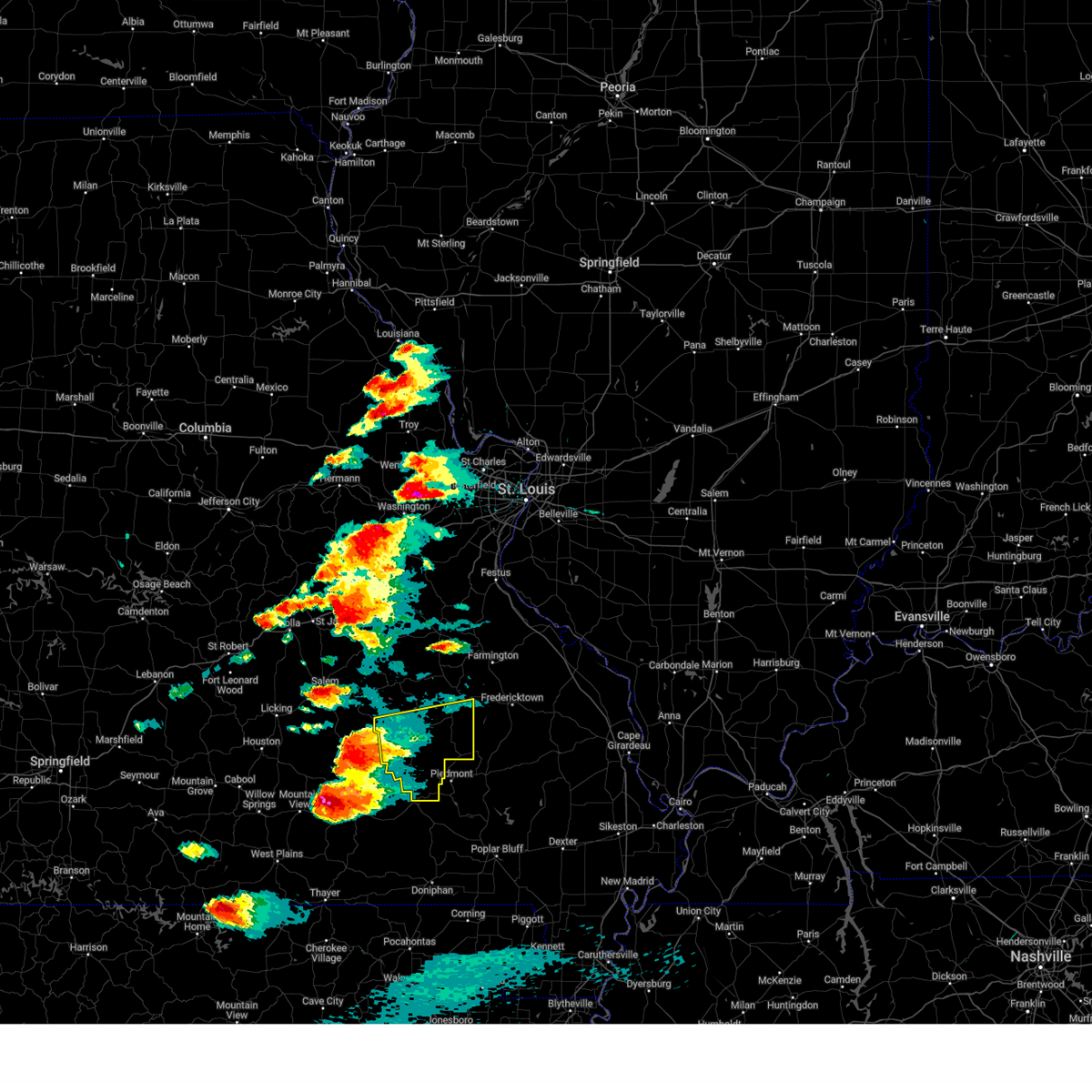
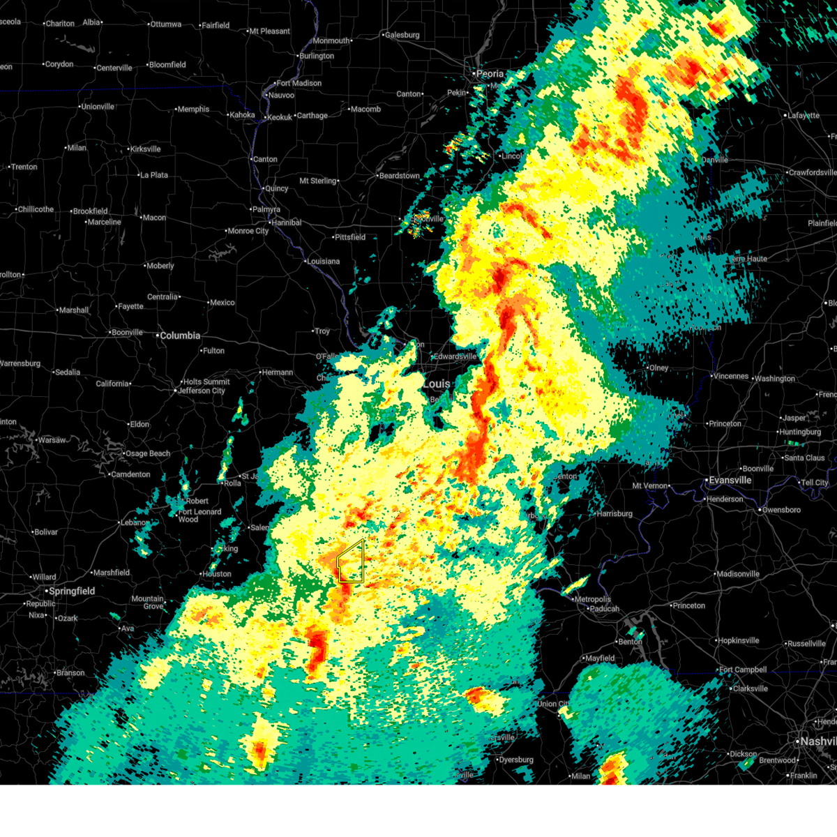
Hail Map for Annapolis, MO
The Annapolis, MO area has had 13 reports of on-the-ground hail by trained spotters, and has been under severe weather warnings 15 times during the past 12 months. Doppler radar has detected hail at or near Annapolis, MO on 63 occasions, including 6 occasions during the past year.
| Name: | Annapolis, MO |
| Where Located: | 49.9 miles ESE of Salem, MO |
| Map: | Google Map for Annapolis, MO |
| Population: | 345 |
| Housing Units: | 171 |
| More Info: | Search Google for Annapolis, MO |
1
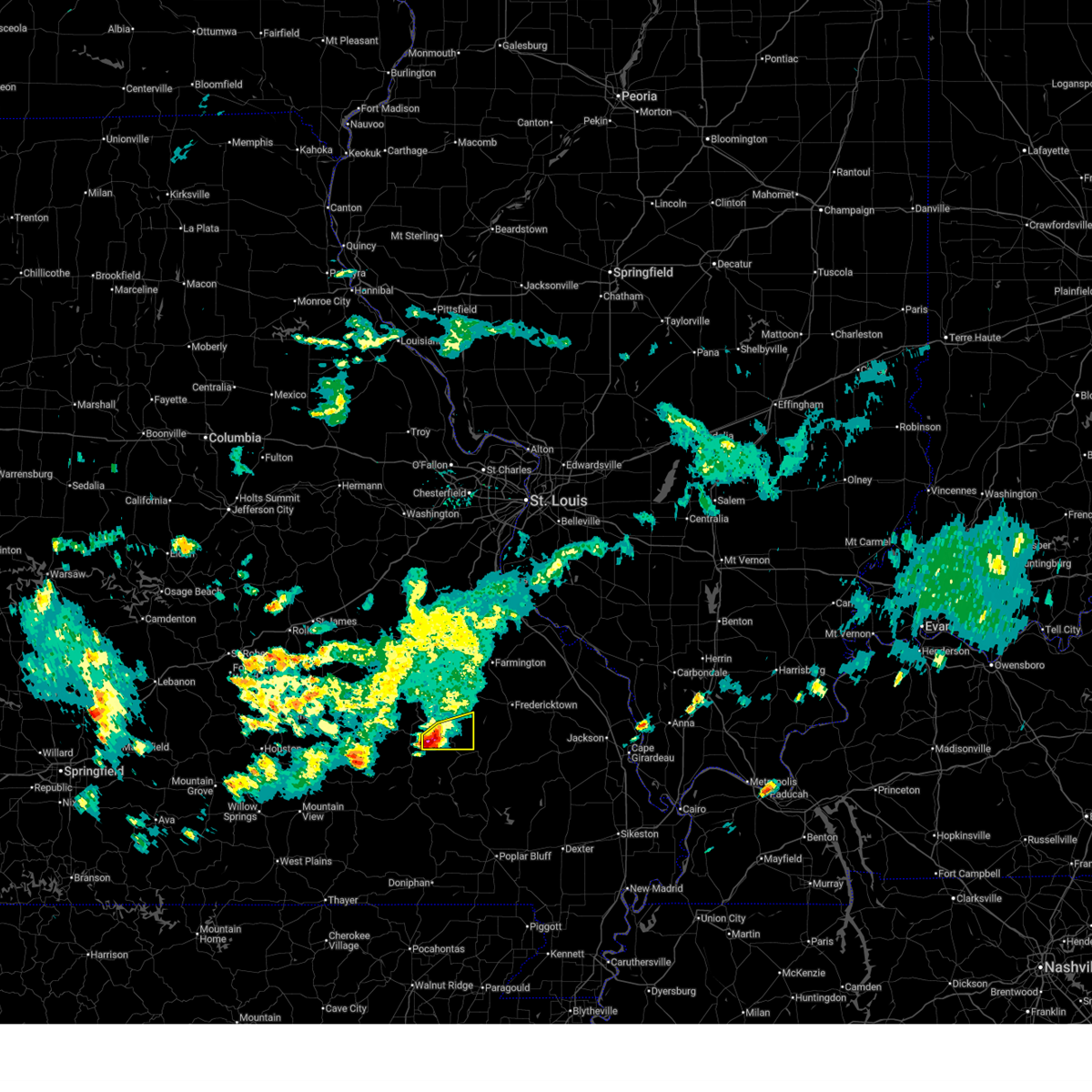
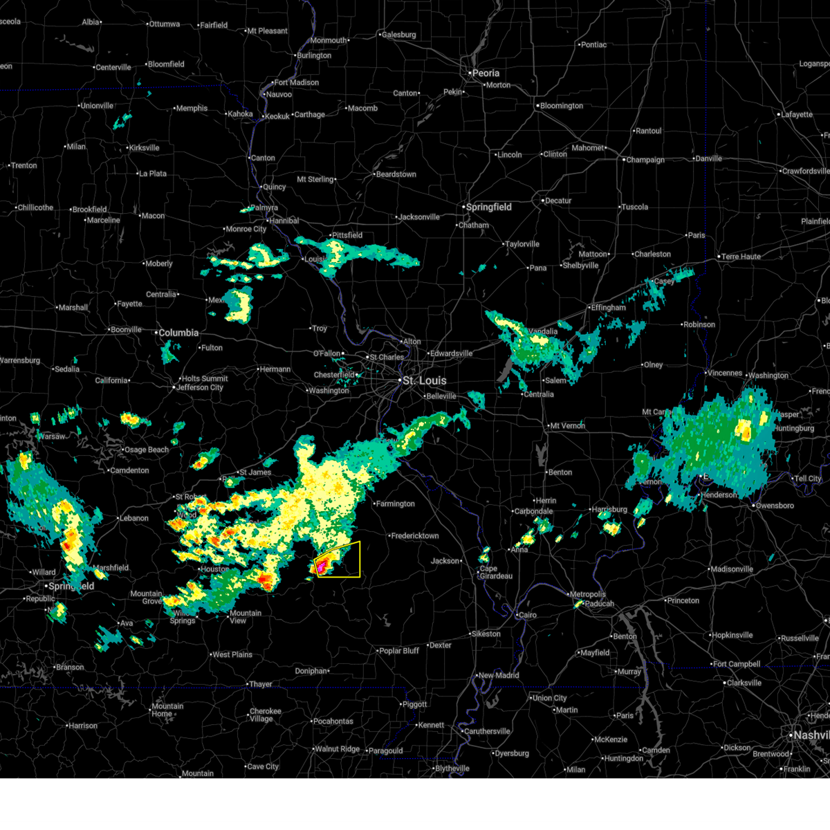
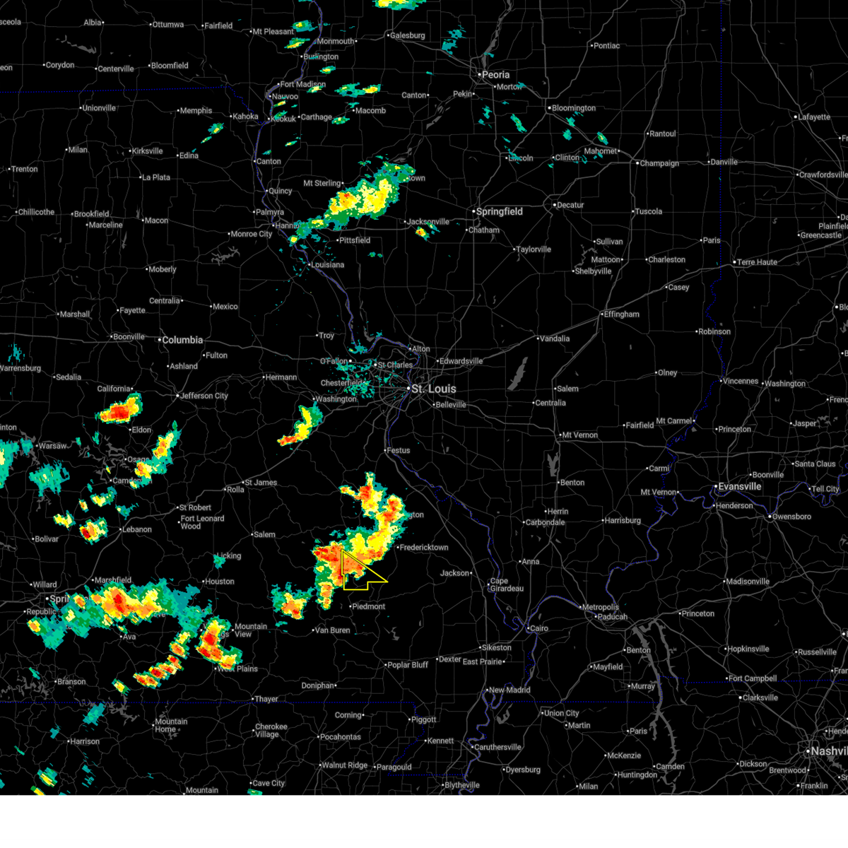
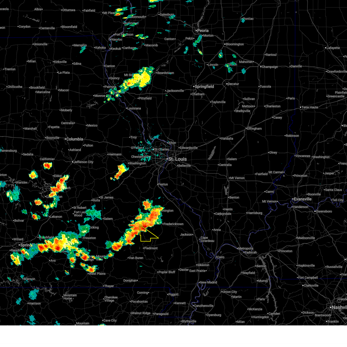
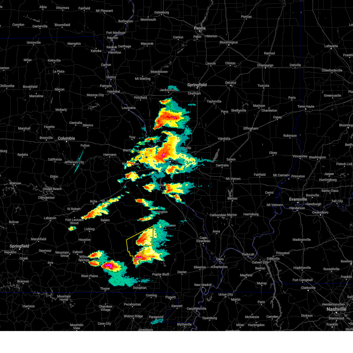
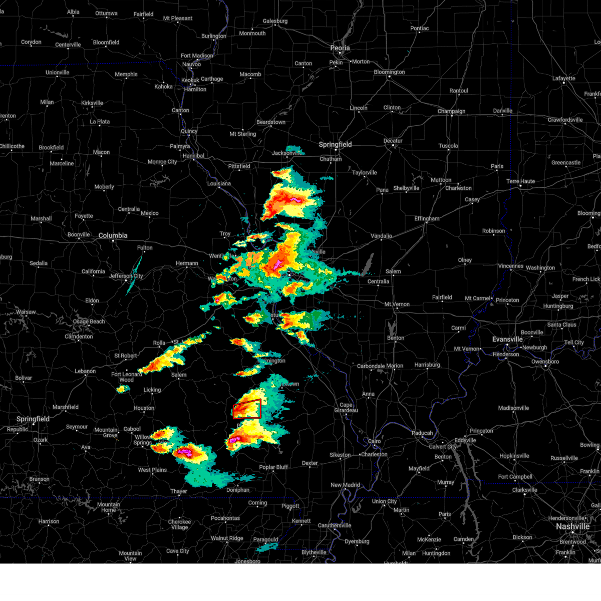
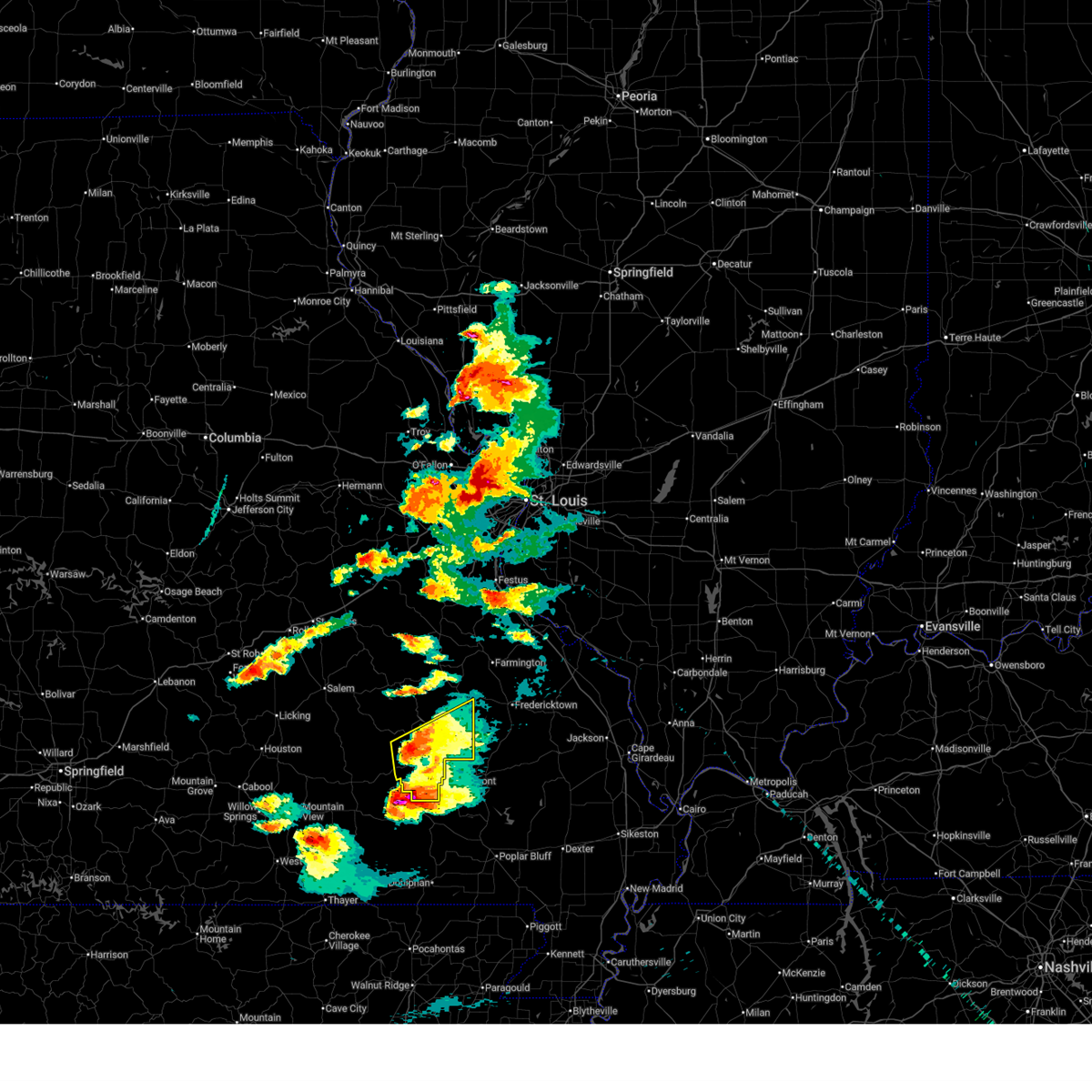
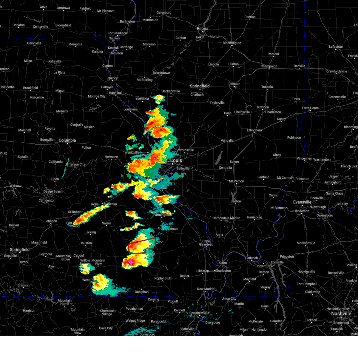
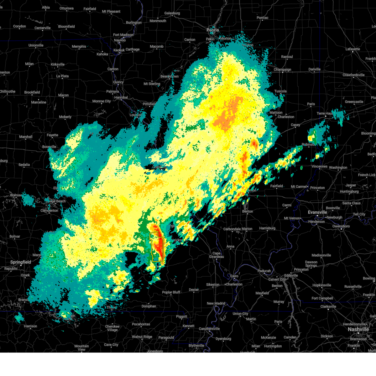
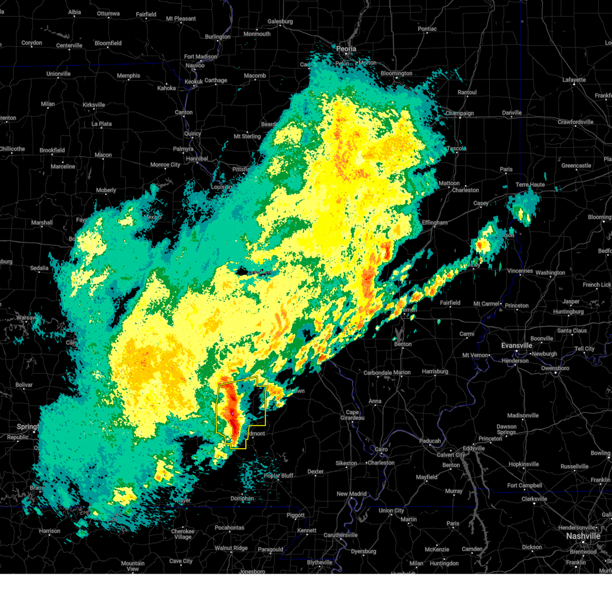
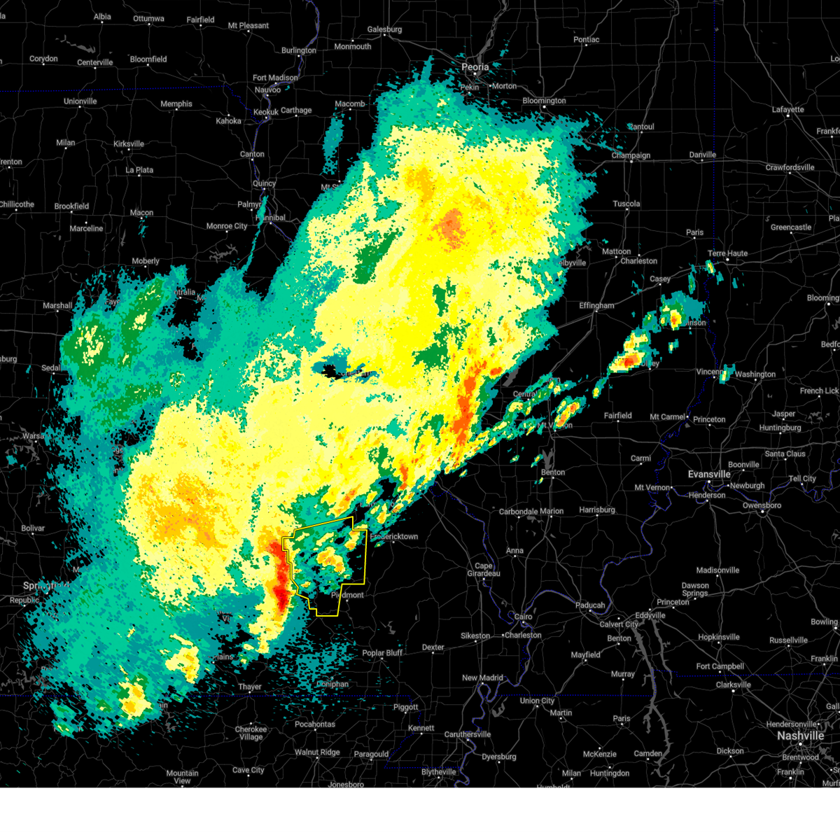
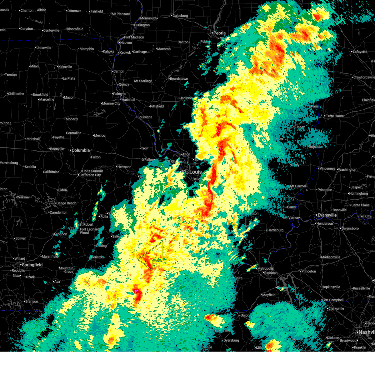
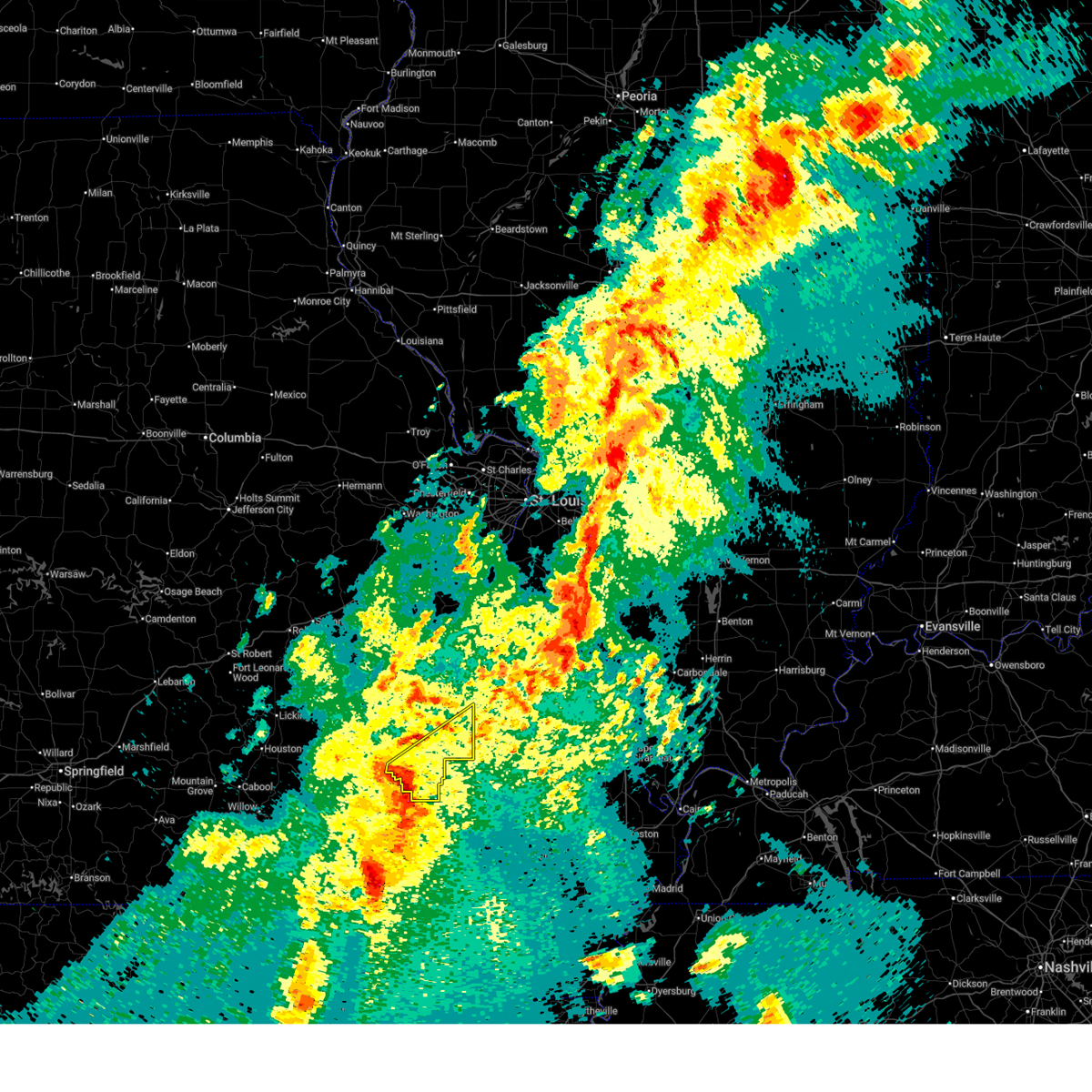
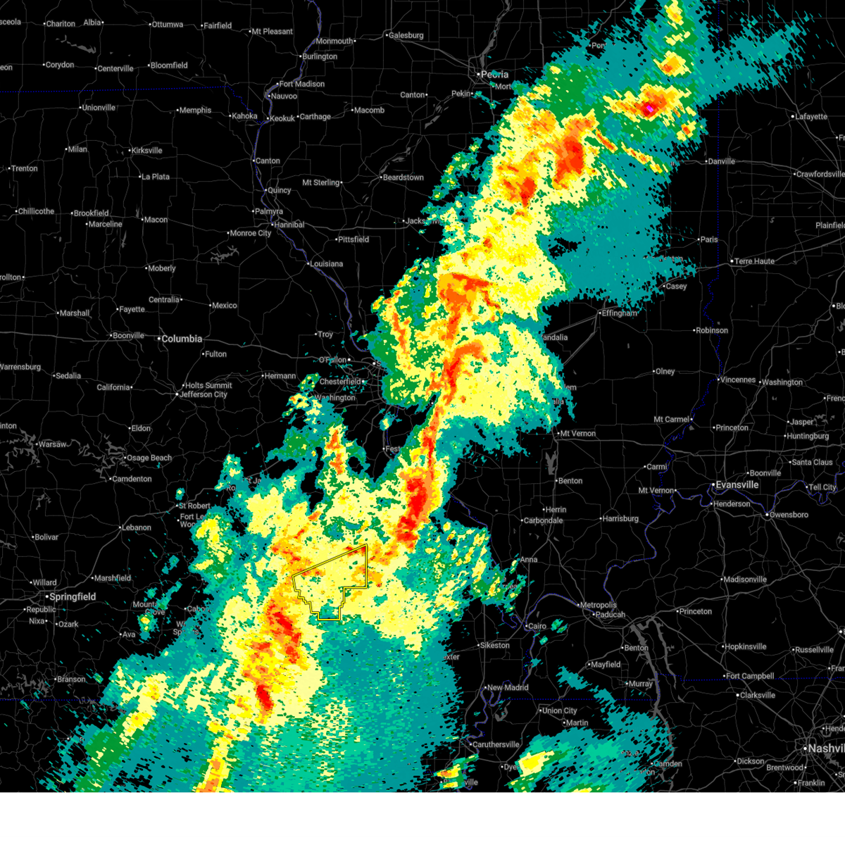
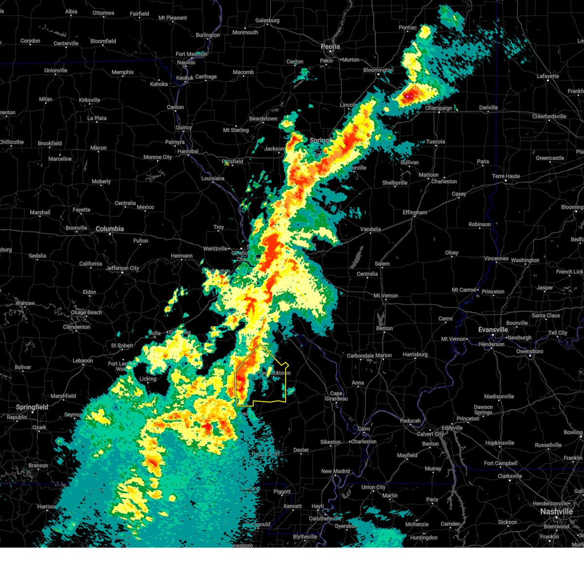
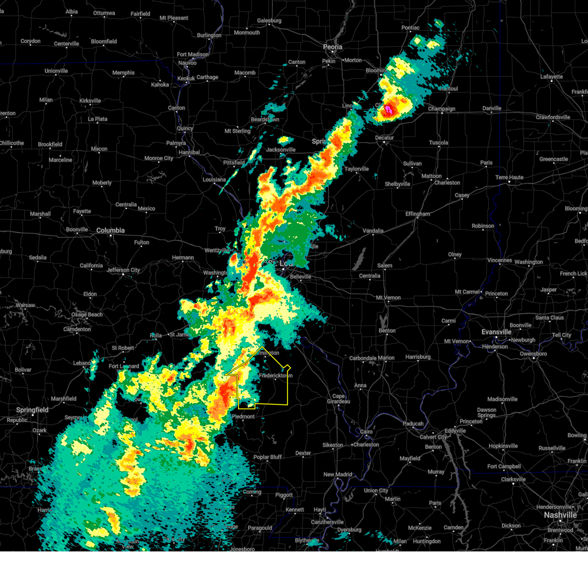
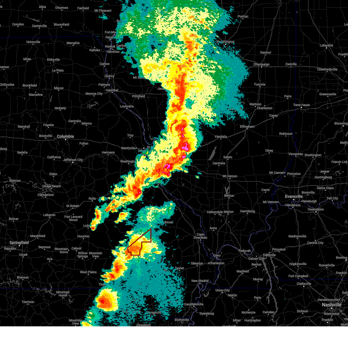
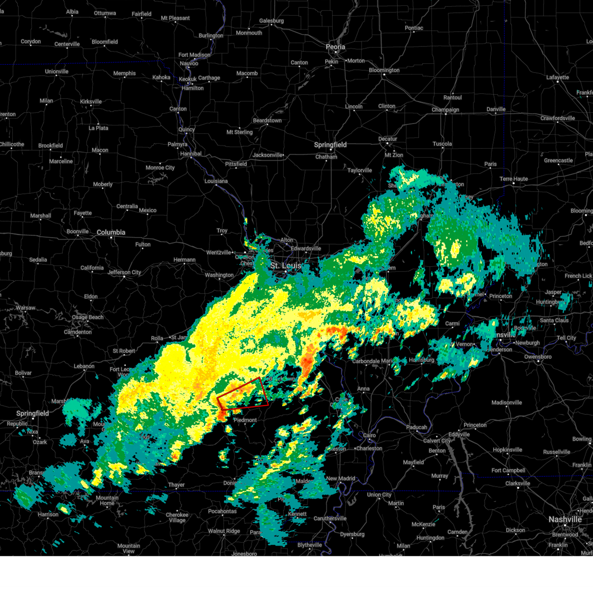
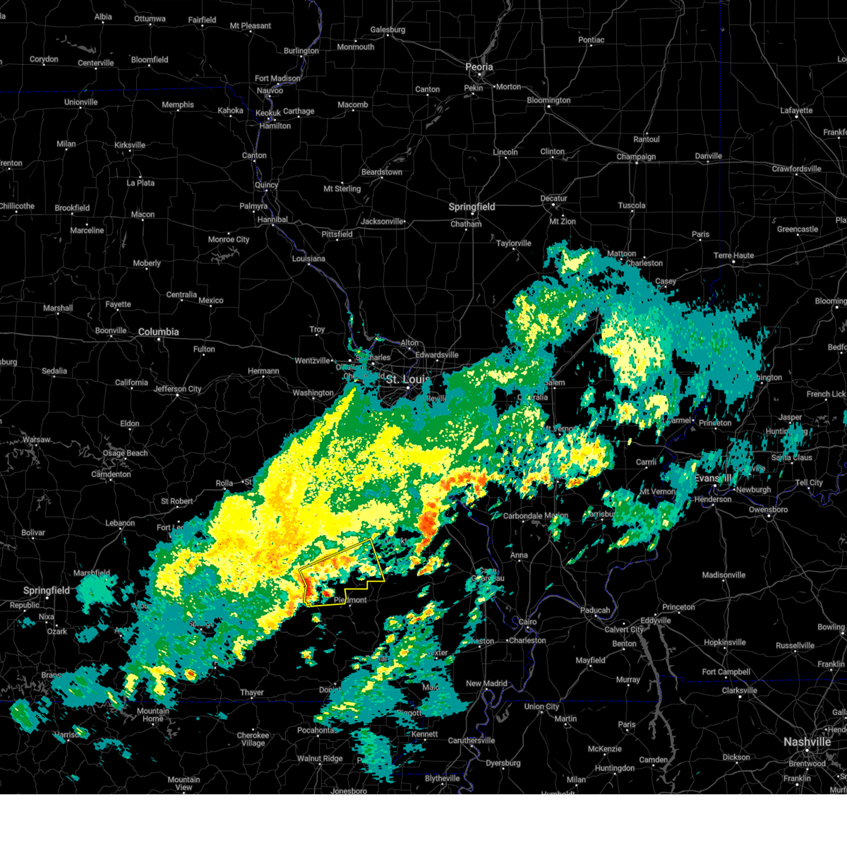
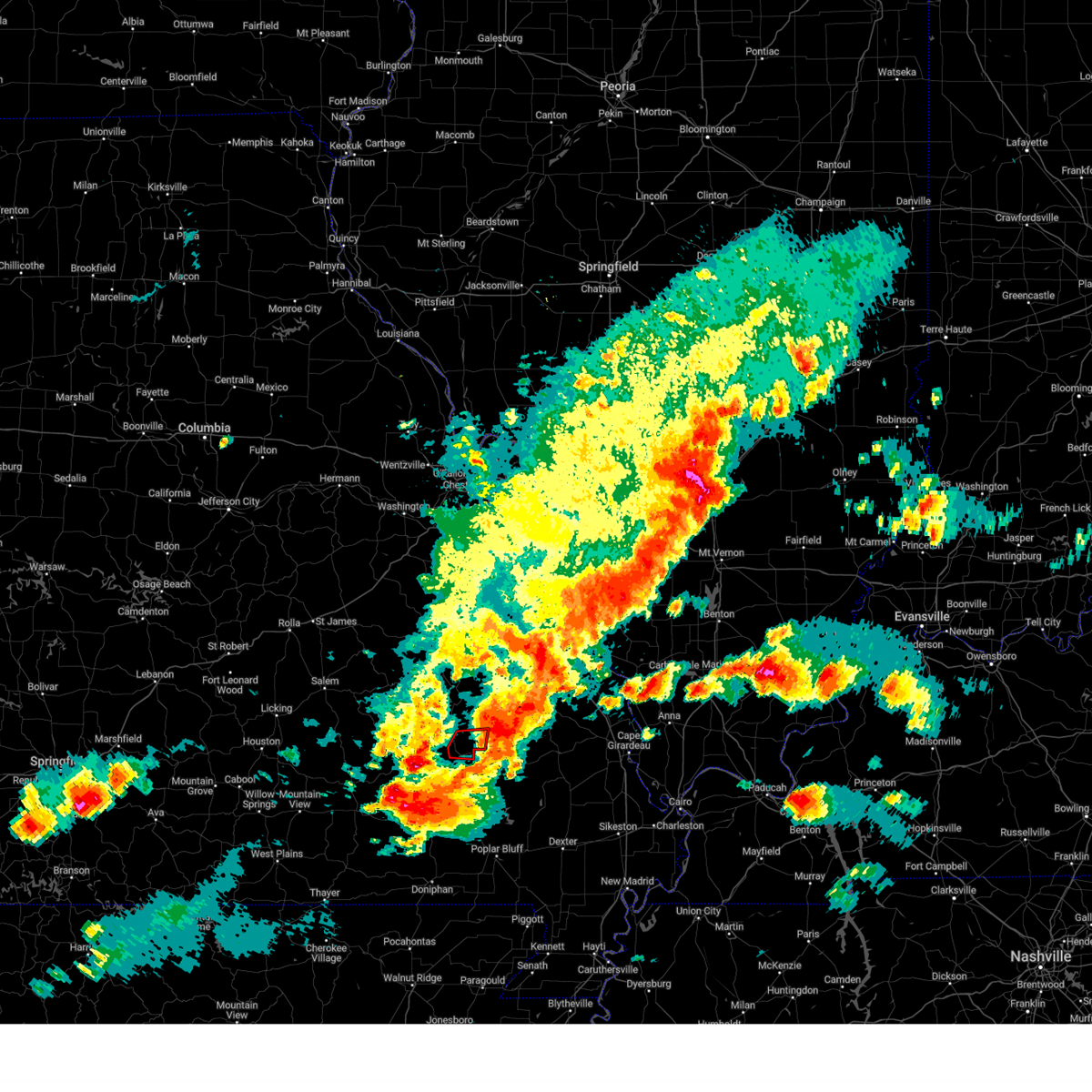
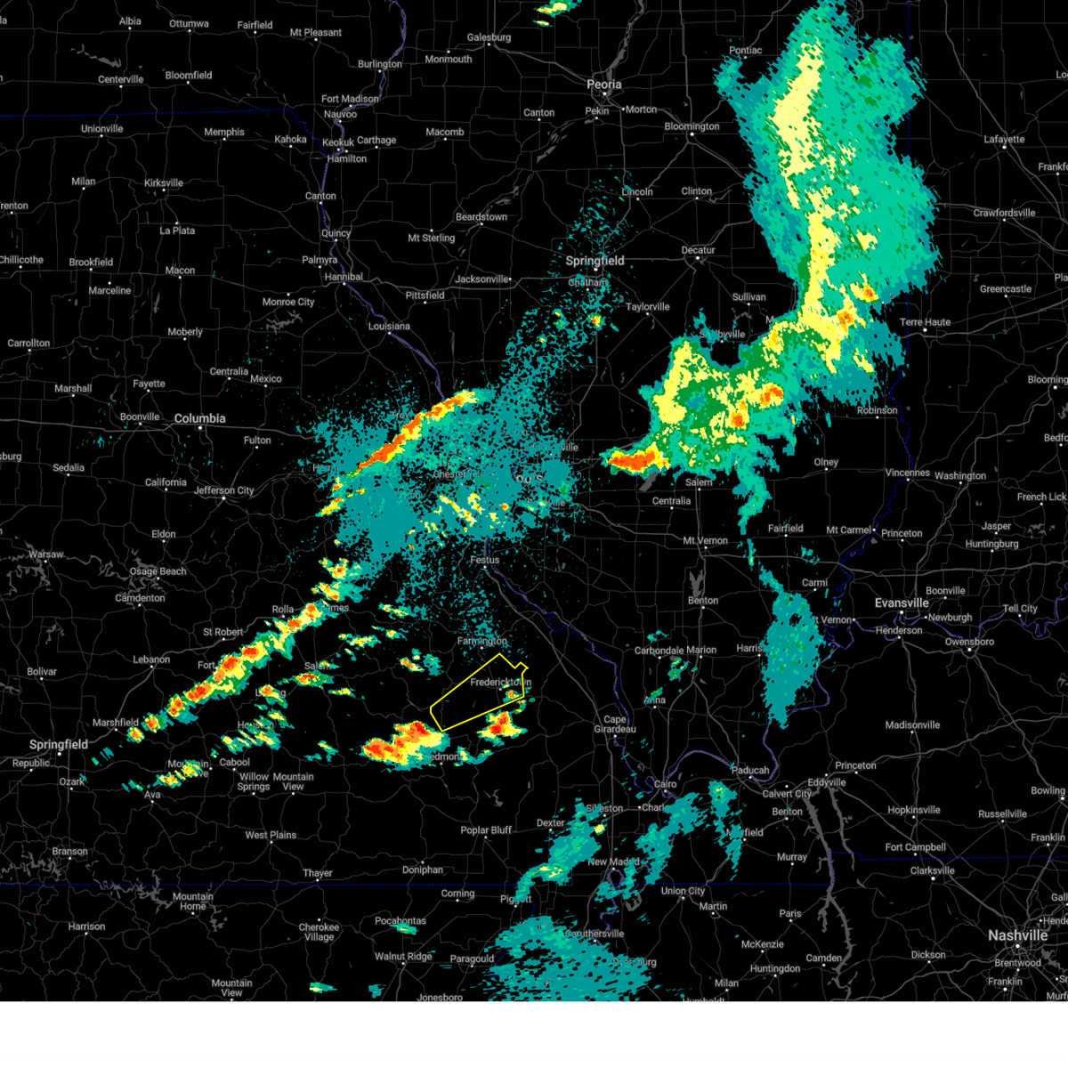
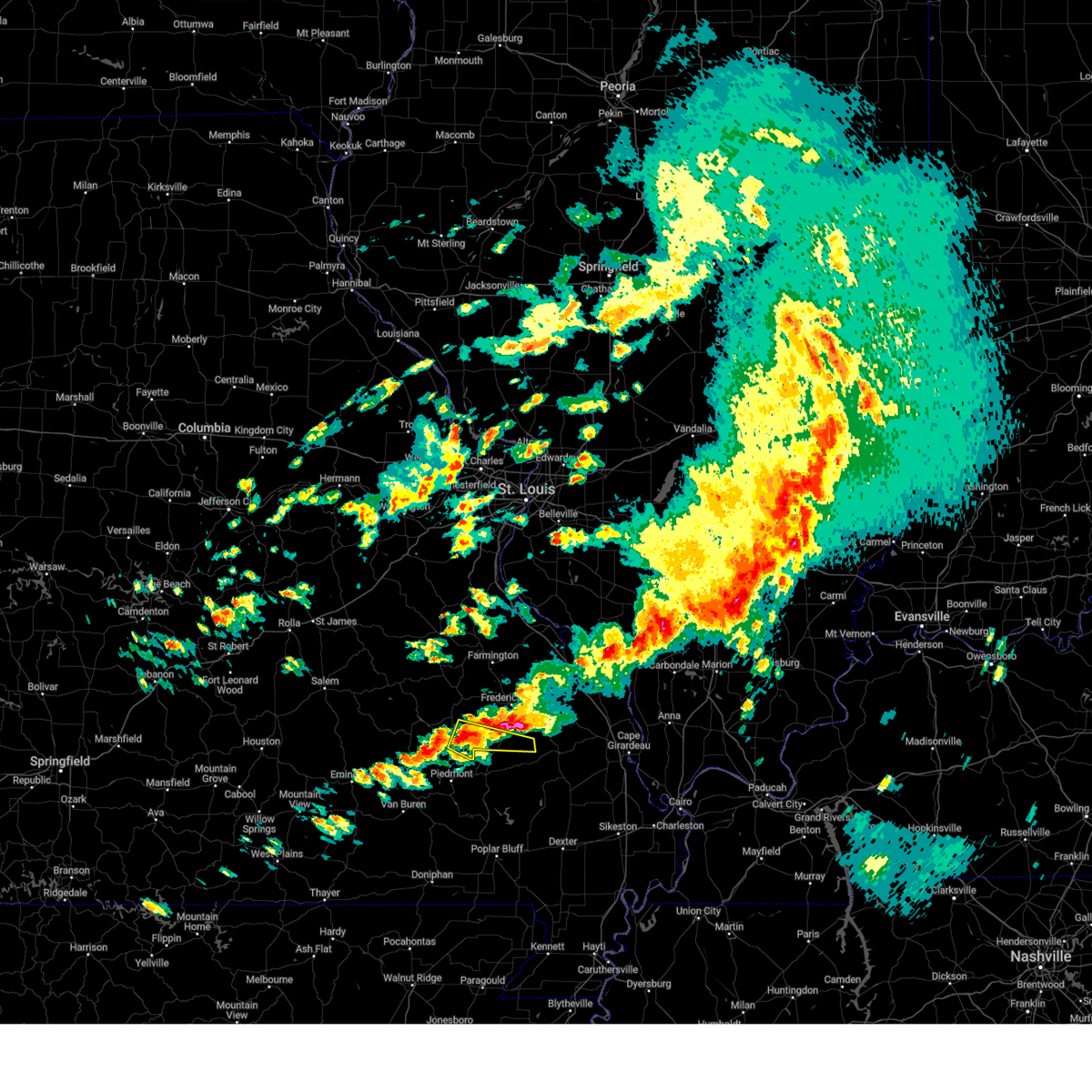
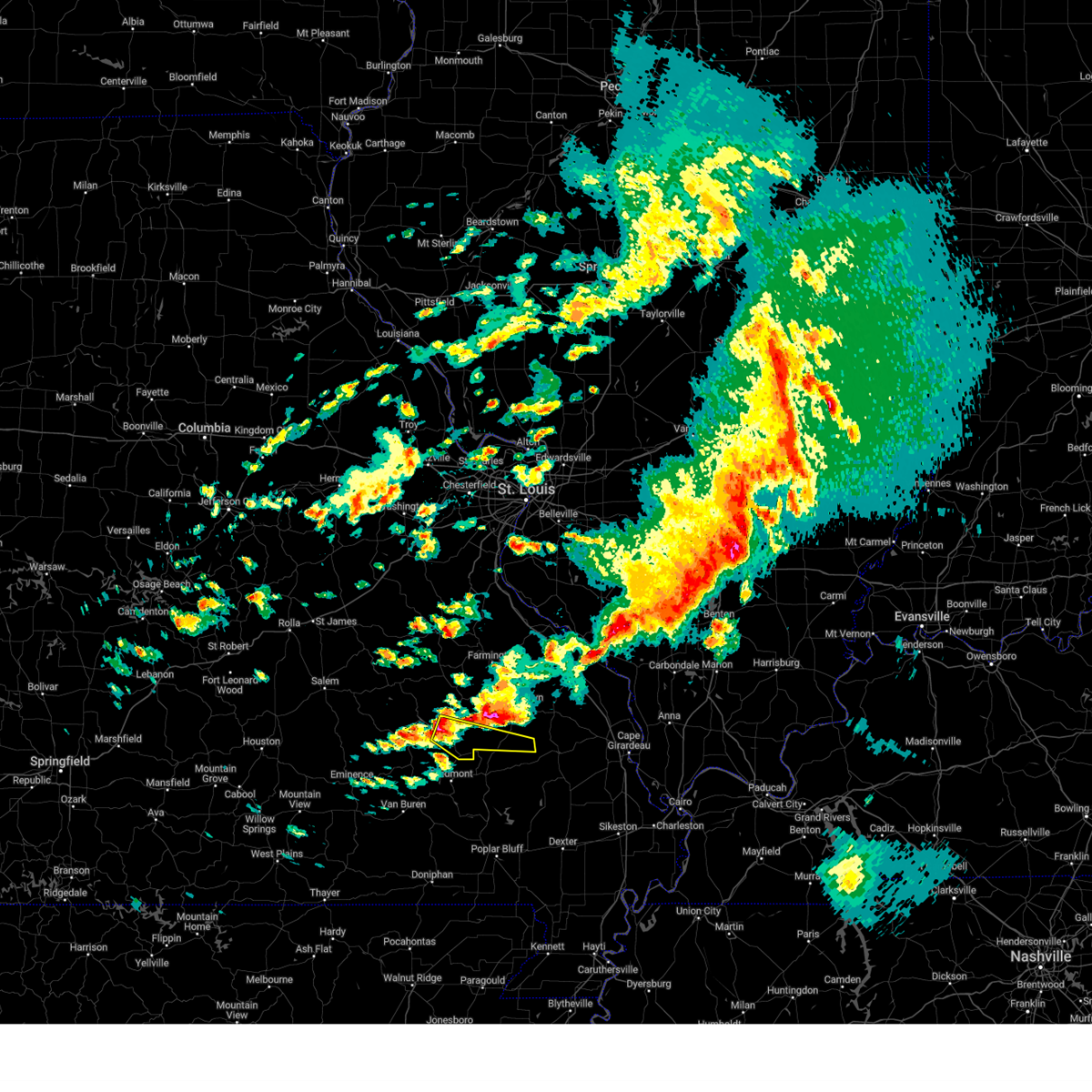
The Top Recent Hail Date for Annapolis, MO is Sunday, May 31, 2026 (13th out of 63)
Hail and Wind Damage Spotted near Annapolis, MO
| Date / Time | Report Details |
|---|---|
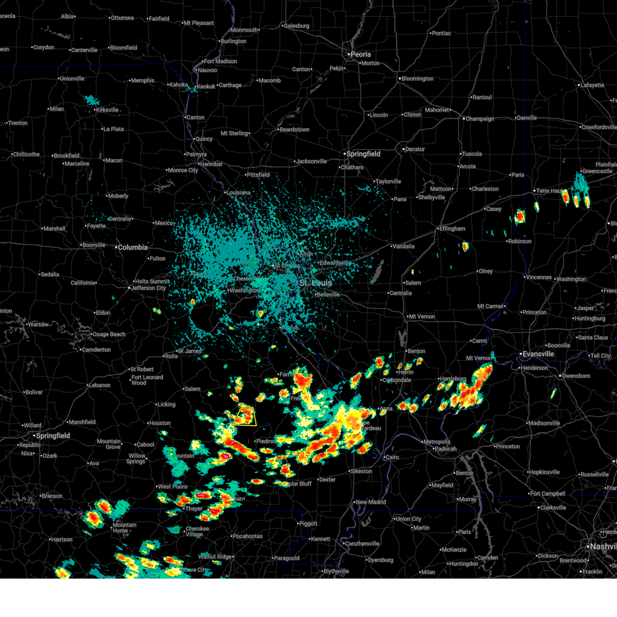
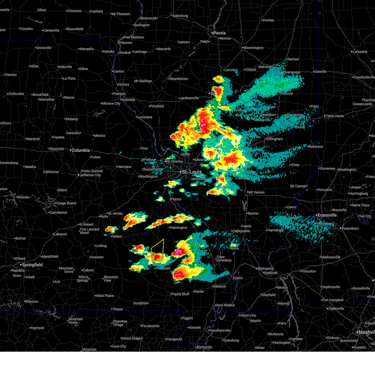
| 5/31/2026 2:42 PM CDT |
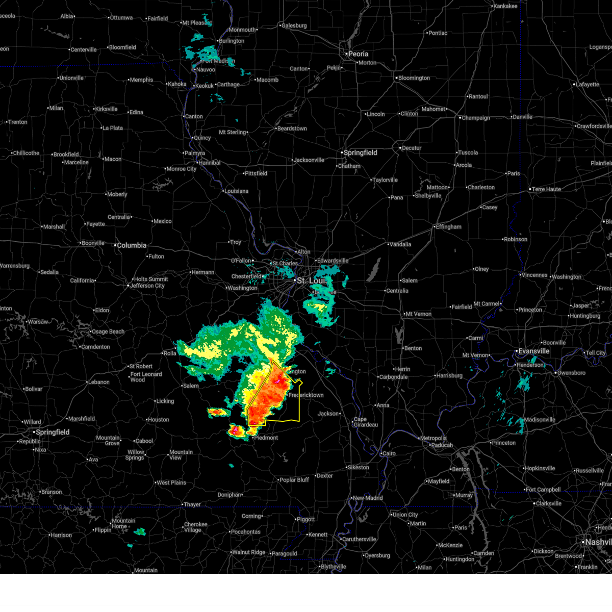 At 242 pm cdt, severe thunderstorms were located along a line from 6 miles northeast of farmington to 5 miles southeast of annapolis, or along a line from 6 miles northeast of farmington to 21 miles south of ironton, moving east at 15 mph (radar indicated). Hazards include 60 mph wind gusts and small hail. Expect damage to roofs, siding, and trees. Locations impacted include, ironton, arcadia, park hills, glover, leadington, doe run, roselle, farmington, annapolis, knob lick, des arc, catherine place, libertyville, fredericktown, junction city, saco, mine la motte, cobalt, buckhorn and marquand. At 242 pm cdt, severe thunderstorms were located along a line from 6 miles northeast of farmington to 5 miles southeast of annapolis, or along a line from 6 miles northeast of farmington to 21 miles south of ironton, moving east at 15 mph (radar indicated). Hazards include 60 mph wind gusts and small hail. Expect damage to roofs, siding, and trees. Locations impacted include, ironton, arcadia, park hills, glover, leadington, doe run, roselle, farmington, annapolis, knob lick, des arc, catherine place, libertyville, fredericktown, junction city, saco, mine la motte, cobalt, buckhorn and marquand.
|
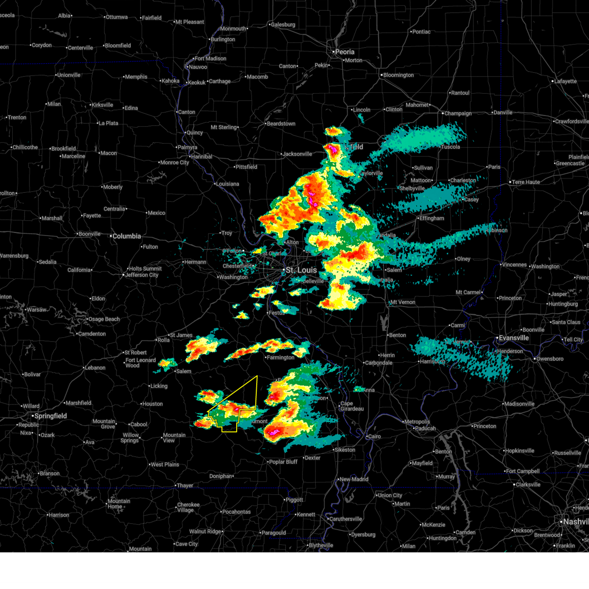
| 5/31/2026 2:23 PM CDT |
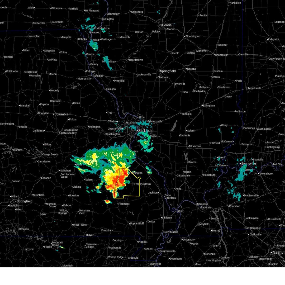 Svrlsx the national weather service in st louis has issued a * severe thunderstorm warning for, eastern iron county in southeastern missouri, madison county in southeastern missouri, saint francois county in southeastern missouri, * until 345 pm cdt. * at 223 pm cdt, severe thunderstorms were located along a line from near farmington to near annapolis, or along a line from near farmington to 21 miles south of ironton, moving east at 15 mph (radar indicated). Hazards include 60 mph wind gusts and quarter size hail. Hail damage to vehicles is expected. Expect wind damage to roofs, siding, and trees. Svrlsx the national weather service in st louis has issued a * severe thunderstorm warning for, eastern iron county in southeastern missouri, madison county in southeastern missouri, saint francois county in southeastern missouri, * until 345 pm cdt. * at 223 pm cdt, severe thunderstorms were located along a line from near farmington to near annapolis, or along a line from near farmington to 21 miles south of ironton, moving east at 15 mph (radar indicated). Hazards include 60 mph wind gusts and quarter size hail. Hail damage to vehicles is expected. Expect wind damage to roofs, siding, and trees.
|
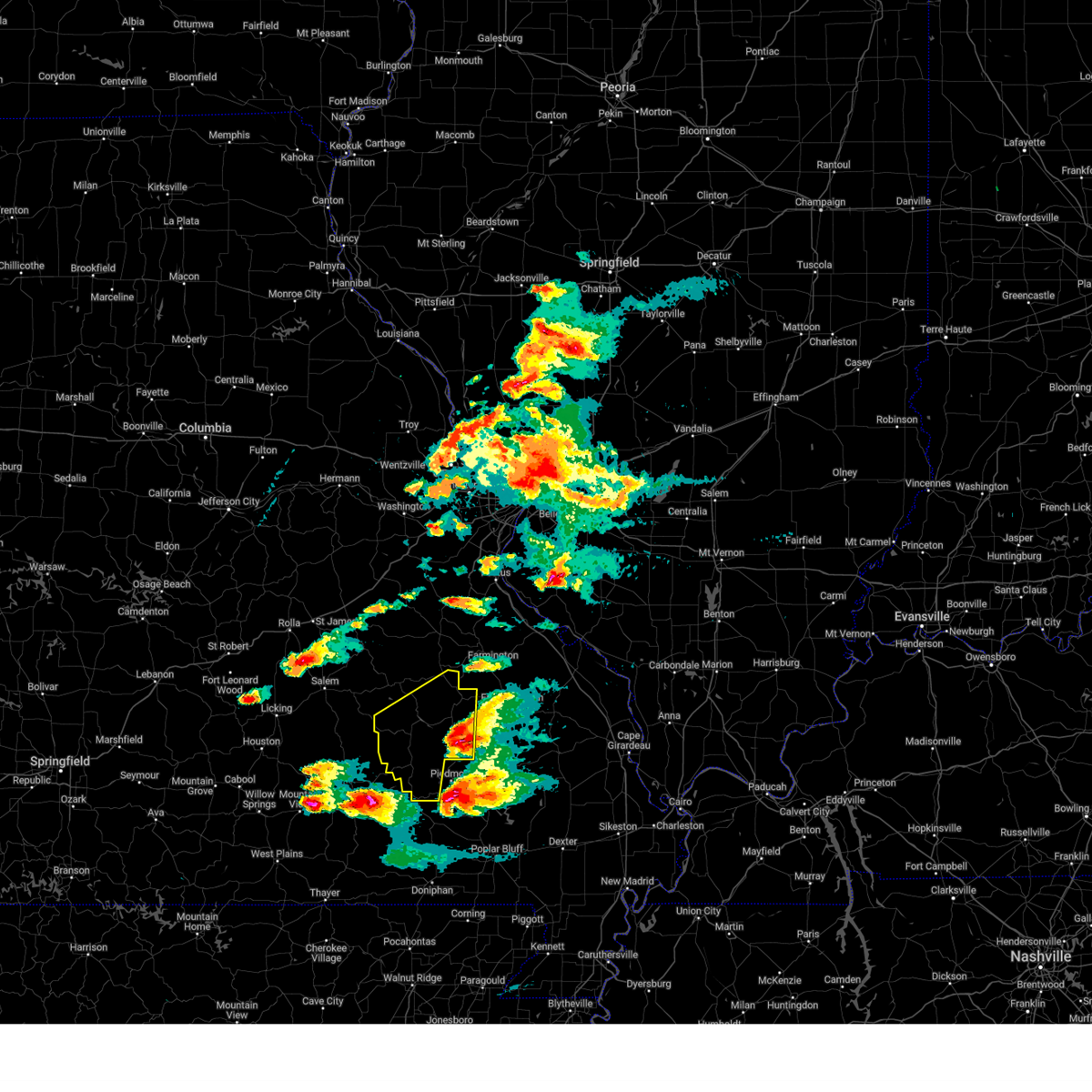
| 4/16/2026 3:58 PM CDT | Ping Pong Ball sized hail reported 12 miles W of Annapolis, MO, delayed report... time estimated from radar. a lot of small hail with a few ping pong sized pieces. |
| 4/1/2026 2:20 PM CDT |
 At 220 pm cdt, a severe thunderstorm was located over annapolis, or 15 miles south of ironton, moving northeast at 20 mph (radar indicated). Hazards include 60 mph wind gusts and quarter size hail. Hail damage to vehicles is expected. expect wind damage to roofs, siding, and trees. this severe thunderstorm will be near, annapolis around 225 pm cdt. Other locations impacted by the severe thunderstorm include sabula and chloride. At 220 pm cdt, a severe thunderstorm was located over annapolis, or 15 miles south of ironton, moving northeast at 20 mph (radar indicated). Hazards include 60 mph wind gusts and quarter size hail. Hail damage to vehicles is expected. expect wind damage to roofs, siding, and trees. this severe thunderstorm will be near, annapolis around 225 pm cdt. Other locations impacted by the severe thunderstorm include sabula and chloride.
|
| 4/1/2026 2:20 PM CDT |
 the severe thunderstorm warning has been cancelled and is no longer in effect the severe thunderstorm warning has been cancelled and is no longer in effect
|
| 4/1/2026 2:07 PM CDT |
 At 207 pm cdt, a severe thunderstorm was located 6 miles west of annapolis, or 19 miles southwest of ironton, moving northeast at 20 mph (radar indicated). Hazards include 60 mph wind gusts and quarter size hail. Hail damage to vehicles is expected. expect wind damage to roofs, siding, and trees. Other locations impacted by the severe thunderstorm include sabula and chloride. At 207 pm cdt, a severe thunderstorm was located 6 miles west of annapolis, or 19 miles southwest of ironton, moving northeast at 20 mph (radar indicated). Hazards include 60 mph wind gusts and quarter size hail. Hail damage to vehicles is expected. expect wind damage to roofs, siding, and trees. Other locations impacted by the severe thunderstorm include sabula and chloride.
|
| 4/1/2026 1:55 PM CDT |
 Svrlsx the national weather service in st louis has issued a * severe thunderstorm warning for, southeastern iron county in southeastern missouri, east central reynolds county in southeastern missouri, * until 245 pm cdt. * at 155 pm cdt, a severe thunderstorm was located 9 miles northeast of ellington, or 22 miles southwest of ironton, moving northeast at 20 mph (radar indicated). Hazards include 60 mph wind gusts and quarter size hail. Hail damage to vehicles is expected. expect wind damage to roofs, siding, and trees. Other locations impacted by the severe thunderstorm include redford, vulcan, sabula and chloride. Svrlsx the national weather service in st louis has issued a * severe thunderstorm warning for, southeastern iron county in southeastern missouri, east central reynolds county in southeastern missouri, * until 245 pm cdt. * at 155 pm cdt, a severe thunderstorm was located 9 miles northeast of ellington, or 22 miles southwest of ironton, moving northeast at 20 mph (radar indicated). Hazards include 60 mph wind gusts and quarter size hail. Hail damage to vehicles is expected. expect wind damage to roofs, siding, and trees. Other locations impacted by the severe thunderstorm include redford, vulcan, sabula and chloride.
|
| 3/7/2026 4:50 AM CST |
 Svrlsx the national weather service in st louis has issued a * severe thunderstorm warning for, southeastern iron county in southeastern missouri, madison county in southeastern missouri, * until 530 am cst. * at 450 am cst, a severe thunderstorm was located near glover, or 11 miles south of ironton, moving east at 45 mph (radar indicated). Hazards include 60 mph wind gusts. expect damage to roofs, siding, and trees Svrlsx the national weather service in st louis has issued a * severe thunderstorm warning for, southeastern iron county in southeastern missouri, madison county in southeastern missouri, * until 530 am cst. * at 450 am cst, a severe thunderstorm was located near glover, or 11 miles south of ironton, moving east at 45 mph (radar indicated). Hazards include 60 mph wind gusts. expect damage to roofs, siding, and trees
|
| 8/19/2025 3:05 PM CDT |
 The storm which prompted the warning has weakened below severe limits, and no longer poses an immediate threat to life or property. therefore, the warning will be allowed to expire. The storm which prompted the warning has weakened below severe limits, and no longer poses an immediate threat to life or property. therefore, the warning will be allowed to expire.
|
| 8/19/2025 2:52 PM CDT |
 At 252 pm cdt, a severe thunderstorm was located 8 miles northwest of annapolis, or 17 miles southwest of ironton, moving south at 5 mph (radar indicated). Hazards include 60 mph wind gusts and quarter size hail. Hail damage to vehicles is expected. expect wind damage to roofs, siding, and trees. Locations impacted include, annapolis, lesterville and redford. At 252 pm cdt, a severe thunderstorm was located 8 miles northwest of annapolis, or 17 miles southwest of ironton, moving south at 5 mph (radar indicated). Hazards include 60 mph wind gusts and quarter size hail. Hail damage to vehicles is expected. expect wind damage to roofs, siding, and trees. Locations impacted include, annapolis, lesterville and redford.
|
| 8/19/2025 2:31 PM CDT |
 Svrlsx the national weather service in st louis has issued a * severe thunderstorm warning for, south central iron county in southeastern missouri, east central reynolds county in southeastern missouri, * until 315 pm cdt. * at 231 pm cdt, a severe thunderstorm was located 6 miles northwest of annapolis, or 16 miles southwest of ironton, moving south at 10 mph (radar indicated). Hazards include 60 mph wind gusts and quarter size hail. Hail damage to vehicles is expected. Expect wind damage to roofs, siding, and trees. Svrlsx the national weather service in st louis has issued a * severe thunderstorm warning for, south central iron county in southeastern missouri, east central reynolds county in southeastern missouri, * until 315 pm cdt. * at 231 pm cdt, a severe thunderstorm was located 6 miles northwest of annapolis, or 16 miles southwest of ironton, moving south at 10 mph (radar indicated). Hazards include 60 mph wind gusts and quarter size hail. Hail damage to vehicles is expected. Expect wind damage to roofs, siding, and trees.
|
| 7/30/2025 5:05 PM CDT |
 the severe thunderstorm warning has been cancelled and is no longer in effect the severe thunderstorm warning has been cancelled and is no longer in effect
|
| 7/30/2025 4:39 PM CDT |
 Svrlsx the national weather service in st louis has issued a * severe thunderstorm warning for, southeastern iron county in southeastern missouri, southwestern madison county in southeastern missouri, * until 545 pm cdt. * at 439 pm cdt, a severe thunderstorm was located over glover, or 11 miles south of ironton, moving southeast at 20 mph (radar indicated). Hazards include 60 mph wind gusts and quarter size hail. Hail damage to vehicles is expected. Expect wind damage to roofs, siding, and trees. Svrlsx the national weather service in st louis has issued a * severe thunderstorm warning for, southeastern iron county in southeastern missouri, southwestern madison county in southeastern missouri, * until 545 pm cdt. * at 439 pm cdt, a severe thunderstorm was located over glover, or 11 miles south of ironton, moving southeast at 20 mph (radar indicated). Hazards include 60 mph wind gusts and quarter size hail. Hail damage to vehicles is expected. Expect wind damage to roofs, siding, and trees.
|
| 7/29/2025 5:12 PM CDT |
 The storm which prompted the warning has weakened below severe limits, and no longer poses an immediate threat to life or property. therefore, the warning will be allowed to expire. The storm which prompted the warning has weakened below severe limits, and no longer poses an immediate threat to life or property. therefore, the warning will be allowed to expire.
|
| 7/29/2025 4:56 PM CDT |
 At 456 pm cdt, a severe thunderstorm was located 5 miles east of annapolis, or 18 miles south of ironton, moving south at 15 mph (radar indicated). Hazards include 60 mph wind gusts and small hail. Expect damage to roofs, siding, and trees. Locations impacted include, annapolis, saco, des arc, vulcan and sabula. At 456 pm cdt, a severe thunderstorm was located 5 miles east of annapolis, or 18 miles south of ironton, moving south at 15 mph (radar indicated). Hazards include 60 mph wind gusts and small hail. Expect damage to roofs, siding, and trees. Locations impacted include, annapolis, saco, des arc, vulcan and sabula.
|
| 7/29/2025 4:44 PM CDT |
 Svrlsx the national weather service in st louis has issued a * severe thunderstorm warning for, southeastern iron county in southeastern missouri, southwestern madison county in southeastern missouri, * until 515 pm cdt. * at 444 pm cdt, a severe thunderstorm was located 6 miles west of saco, or 18 miles south of ironton, moving south at 20 mph (radar indicated). Hazards include 60 mph wind gusts and small hail. expect damage to roofs, siding, and trees Svrlsx the national weather service in st louis has issued a * severe thunderstorm warning for, southeastern iron county in southeastern missouri, southwestern madison county in southeastern missouri, * until 515 pm cdt. * at 444 pm cdt, a severe thunderstorm was located 6 miles west of saco, or 18 miles south of ironton, moving south at 20 mph (radar indicated). Hazards include 60 mph wind gusts and small hail. expect damage to roofs, siding, and trees
|
| 5/16/2025 3:35 PM CDT |
 the severe thunderstorm warning has been cancelled and is no longer in effect the severe thunderstorm warning has been cancelled and is no longer in effect
|
| 5/16/2025 3:27 PM CDT |
 At 327 pm cdt, a severe thunderstorm was located 5 miles east of annapolis, or 17 miles south of ironton, moving northeast at 70 mph (law enforcement reported golf ball sized hail near annapolis). Hazards include golf ball size hail and 60 mph wind gusts. People and animals outdoors will be injured. expect hail damage to roofs, siding, windows, and vehicles. expect wind damage to roofs, siding, and trees. Locations impacted include, annapolis, glover, des arc, sabula, chloride and vulcan. At 327 pm cdt, a severe thunderstorm was located 5 miles east of annapolis, or 17 miles south of ironton, moving northeast at 70 mph (law enforcement reported golf ball sized hail near annapolis). Hazards include golf ball size hail and 60 mph wind gusts. People and animals outdoors will be injured. expect hail damage to roofs, siding, windows, and vehicles. expect wind damage to roofs, siding, and trees. Locations impacted include, annapolis, glover, des arc, sabula, chloride and vulcan.
|
| 5/16/2025 3:27 PM CDT |
 the severe thunderstorm warning has been cancelled and is no longer in effect the severe thunderstorm warning has been cancelled and is no longer in effect
|
| 5/16/2025 3:26 PM CDT | Golf Ball sized hail reported 0.2 miles E of Annapolis, MO, officer reported golf ball size hail in annapolis. |
| 5/16/2025 3:20 PM CDT |
 At 320 pm cdt, a severe thunderstorm was located 14 miles southwest of ellington, or 44 miles southwest of ironton, moving east at 50 mph (radar indicated). Hazards include 60 mph wind gusts and quarter size hail. Hail damage to vehicles is expected. expect wind damage to roofs, siding, and trees. locations impacted include, ellington, annapolis, glover, garwood, des arc, redford, vulcan, sabula and chloride. This includes the following state parks, clearwater lake recreational area. At 320 pm cdt, a severe thunderstorm was located 14 miles southwest of ellington, or 44 miles southwest of ironton, moving east at 50 mph (radar indicated). Hazards include 60 mph wind gusts and quarter size hail. Hail damage to vehicles is expected. expect wind damage to roofs, siding, and trees. locations impacted include, ellington, annapolis, glover, garwood, des arc, redford, vulcan, sabula and chloride. This includes the following state parks, clearwater lake recreational area.
|
| 5/16/2025 2:58 PM CDT |
 Svrlsx the national weather service in st louis has issued a * severe thunderstorm warning for, iron county in southeastern missouri, northwestern madison county in southeastern missouri, reynolds county in southeastern missouri, * until 345 pm cdt. * at 258 pm cdt, a severe thunderstorm was located 13 miles southwest of ellington, or 44 miles southwest of ironton, moving northeast at 65 mph (radar indicated). Hazards include ping pong ball size hail and 60 mph wind gusts. People and animals outdoors will be injured. expect hail damage to roofs, siding, windows, and vehicles. Expect wind damage to roofs, siding, and trees. Svrlsx the national weather service in st louis has issued a * severe thunderstorm warning for, iron county in southeastern missouri, northwestern madison county in southeastern missouri, reynolds county in southeastern missouri, * until 345 pm cdt. * at 258 pm cdt, a severe thunderstorm was located 13 miles southwest of ellington, or 44 miles southwest of ironton, moving northeast at 65 mph (radar indicated). Hazards include ping pong ball size hail and 60 mph wind gusts. People and animals outdoors will be injured. expect hail damage to roofs, siding, windows, and vehicles. Expect wind damage to roofs, siding, and trees.
|
| 5/16/2025 2:52 PM CDT |
 At 252 pm cdt, a severe thunderstorm capable of producing a tornado was located near annapolis, or 20 miles south of ironton, moving east at 45 mph (radar indicated rotation). Hazards include tornado and quarter size hail. Flying debris will be dangerous to those caught without shelter. mobile homes will be damaged or destroyed. damage to roofs, windows and vehicles will occur. tree damage is likely. Locations impacted include, annapolis, des arc, vulcan and sabula. At 252 pm cdt, a severe thunderstorm capable of producing a tornado was located near annapolis, or 20 miles south of ironton, moving east at 45 mph (radar indicated rotation). Hazards include tornado and quarter size hail. Flying debris will be dangerous to those caught without shelter. mobile homes will be damaged or destroyed. damage to roofs, windows and vehicles will occur. tree damage is likely. Locations impacted include, annapolis, des arc, vulcan and sabula.
|
| 5/16/2025 2:52 PM CDT |
 the tornado warning has been cancelled and is no longer in effect the tornado warning has been cancelled and is no longer in effect
|
| 5/16/2025 2:45 PM CDT |
 Thunderstorms have weakened or moved out of the warned area. a tornado watch remains in effect until 700 pm cdt for a portion of southeast missouri. Thunderstorms have weakened or moved out of the warned area. a tornado watch remains in effect until 700 pm cdt for a portion of southeast missouri.
|
| 5/16/2025 2:42 PM CDT |
 At 242 pm cdt, a severe thunderstorm capable of producing a tornado was located 8 miles southwest of annapolis, or 23 miles southwest of ironton, moving east at 45 mph (radar indicated rotation). Hazards include tornado and quarter size hail. Flying debris will be dangerous to those caught without shelter. mobile homes will be damaged or destroyed. damage to roofs, windows and vehicles will occur. tree damage is likely. Locations impacted include, annapolis, des arc, vulcan and sabula. At 242 pm cdt, a severe thunderstorm capable of producing a tornado was located 8 miles southwest of annapolis, or 23 miles southwest of ironton, moving east at 45 mph (radar indicated rotation). Hazards include tornado and quarter size hail. Flying debris will be dangerous to those caught without shelter. mobile homes will be damaged or destroyed. damage to roofs, windows and vehicles will occur. tree damage is likely. Locations impacted include, annapolis, des arc, vulcan and sabula.
|
| 5/16/2025 2:30 PM CDT |
 At 230 pm cdt, a severe thunderstorm was located near ellington, or 26 miles southwest of ironton, moving east at 40 mph (radar indicated). Hazards include ping pong ball size hail and 60 mph wind gusts. People and animals outdoors will be injured. expect hail damage to roofs, siding, windows, and vehicles. expect wind damage to roofs, siding, and trees. locations impacted include, ellington, annapolis, glover, garwood, des arc, redford, lesterville, sabula, vulcan, chloride and hogan. This includes the following state parks, clearwater lake recreational area. At 230 pm cdt, a severe thunderstorm was located near ellington, or 26 miles southwest of ironton, moving east at 40 mph (radar indicated). Hazards include ping pong ball size hail and 60 mph wind gusts. People and animals outdoors will be injured. expect hail damage to roofs, siding, windows, and vehicles. expect wind damage to roofs, siding, and trees. locations impacted include, ellington, annapolis, glover, garwood, des arc, redford, lesterville, sabula, vulcan, chloride and hogan. This includes the following state parks, clearwater lake recreational area.
|
| 5/16/2025 2:25 PM CDT |
 Torlsx the national weather service in st louis has issued a * tornado warning for, southeastern iron county in southeastern missouri, east central reynolds county in southeastern missouri, * until 300 pm cdt. * at 225 pm cdt, a severe thunderstorm capable of producing a tornado was located near ellington, or 32 miles southwest of ironton, moving east at 45 mph (radar indicated rotation). Hazards include tornado and quarter size hail. Flying debris will be dangerous to those caught without shelter. mobile homes will be damaged or destroyed. damage to roofs, windows and vehicles will occur. Tree damage is likely. Torlsx the national weather service in st louis has issued a * tornado warning for, southeastern iron county in southeastern missouri, east central reynolds county in southeastern missouri, * until 300 pm cdt. * at 225 pm cdt, a severe thunderstorm capable of producing a tornado was located near ellington, or 32 miles southwest of ironton, moving east at 45 mph (radar indicated rotation). Hazards include tornado and quarter size hail. Flying debris will be dangerous to those caught without shelter. mobile homes will be damaged or destroyed. damage to roofs, windows and vehicles will occur. Tree damage is likely.
|
| 5/16/2025 2:02 PM CDT |
 Svrlsx the national weather service in st louis has issued a * severe thunderstorm warning for, southeastern iron county in southeastern missouri, reynolds county in southeastern missouri, * until 245 pm cdt. * at 202 pm cdt, a severe thunderstorm was located 16 miles southwest of reynolds, or 43 miles southwest of ironton, moving east at 60 mph (radar indicated). Hazards include ping pong ball size hail and 60 mph wind gusts. People and animals outdoors will be injured. expect hail damage to roofs, siding, windows, and vehicles. Expect wind damage to roofs, siding, and trees. Svrlsx the national weather service in st louis has issued a * severe thunderstorm warning for, southeastern iron county in southeastern missouri, reynolds county in southeastern missouri, * until 245 pm cdt. * at 202 pm cdt, a severe thunderstorm was located 16 miles southwest of reynolds, or 43 miles southwest of ironton, moving east at 60 mph (radar indicated). Hazards include ping pong ball size hail and 60 mph wind gusts. People and animals outdoors will be injured. expect hail damage to roofs, siding, windows, and vehicles. Expect wind damage to roofs, siding, and trees.
|
| 4/20/2025 7:24 PM CDT |
 At 724 pm cdt, severe thunderstorms were located along a line from 6 miles south of pacific to 6 miles south of annapolis, or along a line from 6 miles northwest of cedar hill to 23 miles south of ironton, moving east at 40 mph (radar indicated). Hazards include 60 mph wind gusts and small hail. Expect damage to roofs, siding, and trees. locations impacted include, arnold, farmington, festus, union, columbia, bonne terre, de soto, pevely, desloge, crystal city, st. clair, fredericktown, herculaneum, hillsboro, byrnes mill, potosi, bismarck, ironton, leadwood and cedar hill. this includes the following state parks, washington state park, st. joe state park, st. francois state park, johnsons shut-ins state park, hawn state park, fort davidson historic site, elephant rocks state park, mastodon historic site, taum sauk mountain state park, sandy creek covered bridge historic site, missouri mines historic site, gov. dunklin's grave historic site and robertsville state park. this includes the following highways, interstate 44 in missouri near exit 242. Interstate 55 in missouri between exits 157 and 191. At 724 pm cdt, severe thunderstorms were located along a line from 6 miles south of pacific to 6 miles south of annapolis, or along a line from 6 miles northwest of cedar hill to 23 miles south of ironton, moving east at 40 mph (radar indicated). Hazards include 60 mph wind gusts and small hail. Expect damage to roofs, siding, and trees. locations impacted include, arnold, farmington, festus, union, columbia, bonne terre, de soto, pevely, desloge, crystal city, st. clair, fredericktown, herculaneum, hillsboro, byrnes mill, potosi, bismarck, ironton, leadwood and cedar hill. this includes the following state parks, washington state park, st. joe state park, st. francois state park, johnsons shut-ins state park, hawn state park, fort davidson historic site, elephant rocks state park, mastodon historic site, taum sauk mountain state park, sandy creek covered bridge historic site, missouri mines historic site, gov. dunklin's grave historic site and robertsville state park. this includes the following highways, interstate 44 in missouri near exit 242. Interstate 55 in missouri between exits 157 and 191.
|
| 4/20/2025 7:24 PM CDT |
 the severe thunderstorm warning has been cancelled and is no longer in effect the severe thunderstorm warning has been cancelled and is no longer in effect
|
| 4/20/2025 6:58 PM CDT |
 Svrlsx the national weather service in st louis has issued a * severe thunderstorm warning for, western monroe county in southwestern illinois, northeastern crawford county in east central missouri, southeastern franklin county in east central missouri, jefferson county in east central missouri, southwestern saint louis county in east central missouri, washington county in east central missouri, iron county in southeastern missouri, madison county in southeastern missouri, reynolds county in southeastern missouri, western sainte genevieve county in southeastern missouri, saint francois county in southeastern missouri, * until 800 pm cdt. * at 658 pm cdt, severe thunderstorms were located along a line from near st. clair to over ellington, or along a line from near st. clair to 33 miles southwest of ironton, moving east at 40 mph (radar indicated). Hazards include 60 mph wind gusts and small hail. expect damage to roofs, siding, and trees Svrlsx the national weather service in st louis has issued a * severe thunderstorm warning for, western monroe county in southwestern illinois, northeastern crawford county in east central missouri, southeastern franklin county in east central missouri, jefferson county in east central missouri, southwestern saint louis county in east central missouri, washington county in east central missouri, iron county in southeastern missouri, madison county in southeastern missouri, reynolds county in southeastern missouri, western sainte genevieve county in southeastern missouri, saint francois county in southeastern missouri, * until 800 pm cdt. * at 658 pm cdt, severe thunderstorms were located along a line from near st. clair to over ellington, or along a line from near st. clair to 33 miles southwest of ironton, moving east at 40 mph (radar indicated). Hazards include 60 mph wind gusts and small hail. expect damage to roofs, siding, and trees
|
| 4/19/2025 5:45 AM CDT |
 The thunderstorm has moved east of the warned area and no longer poses a threat to iron county. The thunderstorm has moved east of the warned area and no longer poses a threat to iron county.
|
| 4/19/2025 5:34 AM CDT |
 the severe thunderstorm warning has been cancelled and is no longer in effect the severe thunderstorm warning has been cancelled and is no longer in effect
|
| 4/19/2025 5:34 AM CDT |
 At 534 am cdt, severe thunderstorms were located along a line from near roselle to 11 miles southwest of saco, or along a line from 5 miles northeast of ironton to 25 miles south of ironton, moving east at 60 mph (radar indicated). Hazards include 60 mph wind gusts. Expect damage to roofs, siding, and trees. locations impacted include, ironton, pilot knob, arcadia, annapolis, glover, belleview, des arc, chloride, hogan, sabula, granite and vulcan. This includes the following state parks, fort davidson historic site and elephant rocks state park. At 534 am cdt, severe thunderstorms were located along a line from near roselle to 11 miles southwest of saco, or along a line from 5 miles northeast of ironton to 25 miles south of ironton, moving east at 60 mph (radar indicated). Hazards include 60 mph wind gusts. Expect damage to roofs, siding, and trees. locations impacted include, ironton, pilot knob, arcadia, annapolis, glover, belleview, des arc, chloride, hogan, sabula, granite and vulcan. This includes the following state parks, fort davidson historic site and elephant rocks state park.
|
| 4/19/2025 5:19 AM CDT |
 At 519 am cdt, severe thunderstorms were located along a line from 7 miles southwest of belleview to 9 miles northeast of garwood, or along a line from 11 miles west of ironton to 30 miles south of ironton, moving east at 65 mph (radar indicated). Hazards include 60 mph wind gusts. Expect damage to roofs, siding, and trees. locations impacted include, ironton, reynolds, ellington, pilot knob, arcadia, annapolis, glover, oates, belleview, garwood, centerville, des arc, lesterville, redford, black, sabula, chloride, hogan, vulcan and corridon. This includes the following state parks, johnsons shut-ins state park, fort davidson historic site, elephant rocks state park, taum sauk mountain state park and clearwater lake recreational area. At 519 am cdt, severe thunderstorms were located along a line from 7 miles southwest of belleview to 9 miles northeast of garwood, or along a line from 11 miles west of ironton to 30 miles south of ironton, moving east at 65 mph (radar indicated). Hazards include 60 mph wind gusts. Expect damage to roofs, siding, and trees. locations impacted include, ironton, reynolds, ellington, pilot knob, arcadia, annapolis, glover, oates, belleview, garwood, centerville, des arc, lesterville, redford, black, sabula, chloride, hogan, vulcan and corridon. This includes the following state parks, johnsons shut-ins state park, fort davidson historic site, elephant rocks state park, taum sauk mountain state park and clearwater lake recreational area.
|
| 4/19/2025 5:02 AM CDT |
 Svrlsx the national weather service in st louis has issued a * severe thunderstorm warning for, iron county in southeastern missouri, reynolds county in southeastern missouri, * until 545 am cdt. * at 502 am cdt, severe thunderstorms were located along a line from over oates to 9 miles southwest of ellington, or along a line from 25 miles west of ironton to 39 miles southwest of ironton, moving east at 70 mph (radar indicated). Hazards include 60 mph wind gusts. expect damage to roofs, siding, and trees Svrlsx the national weather service in st louis has issued a * severe thunderstorm warning for, iron county in southeastern missouri, reynolds county in southeastern missouri, * until 545 am cdt. * at 502 am cdt, severe thunderstorms were located along a line from over oates to 9 miles southwest of ellington, or along a line from 25 miles west of ironton to 39 miles southwest of ironton, moving east at 70 mph (radar indicated). Hazards include 60 mph wind gusts. expect damage to roofs, siding, and trees
|
| 4/2/2025 5:40 PM CDT |
 the severe thunderstorm warning has been cancelled and is no longer in effect the severe thunderstorm warning has been cancelled and is no longer in effect
|
| 4/2/2025 5:29 PM CDT |
 At 529 pm cdt, a severe thunderstorm was located 7 miles south of annapolis, or 24 miles south of ironton, moving northeast at 55 mph (radar indicated). Hazards include 60 mph wind gusts and small hail. Expect damage to roofs, siding, and trees. Locations impacted include, annapolis, des arc, sabula, chloride and vulcan. At 529 pm cdt, a severe thunderstorm was located 7 miles south of annapolis, or 24 miles south of ironton, moving northeast at 55 mph (radar indicated). Hazards include 60 mph wind gusts and small hail. Expect damage to roofs, siding, and trees. Locations impacted include, annapolis, des arc, sabula, chloride and vulcan.
|
| 4/2/2025 5:29 PM CDT |
 the severe thunderstorm warning has been cancelled and is no longer in effect the severe thunderstorm warning has been cancelled and is no longer in effect
|
| 4/2/2025 5:21 PM CDT |
 At 521 pm cdt, a severe thunderstorm was located 7 miles east of ellington, or 29 miles southwest of ironton, moving northeast at 55 mph (radar indicated). Hazards include 60 mph wind gusts and small hail. Expect damage to roofs, siding, and trees. locations impacted include, annapolis, des arc, sabula, vulcan, chloride and redford. This includes the following state parks, clearwater lake recreational area. At 521 pm cdt, a severe thunderstorm was located 7 miles east of ellington, or 29 miles southwest of ironton, moving northeast at 55 mph (radar indicated). Hazards include 60 mph wind gusts and small hail. Expect damage to roofs, siding, and trees. locations impacted include, annapolis, des arc, sabula, vulcan, chloride and redford. This includes the following state parks, clearwater lake recreational area.
|
| 4/2/2025 5:12 PM CDT |
 At 512 pm cdt, a severe thunderstorm was located 7 miles south of ellington, or 37 miles southwest of ironton, moving northeast at 55 mph (radar indicated). Hazards include 60 mph wind gusts and small hail. Expect damage to roofs, siding, and trees. locations impacted include, ellington, annapolis, garwood, des arc, redford, vulcan, sabula and chloride. This includes the following state parks, clearwater lake recreational area. At 512 pm cdt, a severe thunderstorm was located 7 miles south of ellington, or 37 miles southwest of ironton, moving northeast at 55 mph (radar indicated). Hazards include 60 mph wind gusts and small hail. Expect damage to roofs, siding, and trees. locations impacted include, ellington, annapolis, garwood, des arc, redford, vulcan, sabula and chloride. This includes the following state parks, clearwater lake recreational area.
|
| 4/2/2025 4:55 PM CDT |
 Svrlsx the national weather service in st louis has issued a * severe thunderstorm warning for, southeastern iron county in southeastern missouri, southeastern reynolds county in southeastern missouri, * until 600 pm cdt. * at 455 pm cdt, a severe thunderstorm was located 20 miles southwest of ellington, or 51 miles southwest of ironton, moving northeast at 55 mph (radar indicated). Hazards include 60 mph wind gusts and small hail. expect damage to roofs, siding, and trees Svrlsx the national weather service in st louis has issued a * severe thunderstorm warning for, southeastern iron county in southeastern missouri, southeastern reynolds county in southeastern missouri, * until 600 pm cdt. * at 455 pm cdt, a severe thunderstorm was located 20 miles southwest of ellington, or 51 miles southwest of ironton, moving northeast at 55 mph (radar indicated). Hazards include 60 mph wind gusts and small hail. expect damage to roofs, siding, and trees
|
| 4/2/2025 4:16 PM CDT |
 At 416 pm cdt, severe thunderstorms were located along a line from over pilot knob to 8 miles east of ellington, or along a line from near ironton to 29 miles south of ironton, moving east at 45 mph (radar indicated). Hazards include 60 mph wind gusts and quarter size hail. Hail damage to vehicles is expected. expect wind damage to roofs, siding, and trees. locations impacted include, farmington, fredericktown, bismarck, ironton, park hills, pilot knob, iron mountain lake, arcadia, annapolis, junction city, cobalt, marquand, roselle, knob lick, saco, glover, iron mountain, buckhorn, leadington and des arc. this includes the following state parks, st. Joe state park, fort davidson historic site, elephant rocks state park and missouri mines historic site. At 416 pm cdt, severe thunderstorms were located along a line from over pilot knob to 8 miles east of ellington, or along a line from near ironton to 29 miles south of ironton, moving east at 45 mph (radar indicated). Hazards include 60 mph wind gusts and quarter size hail. Hail damage to vehicles is expected. expect wind damage to roofs, siding, and trees. locations impacted include, farmington, fredericktown, bismarck, ironton, park hills, pilot knob, iron mountain lake, arcadia, annapolis, junction city, cobalt, marquand, roselle, knob lick, saco, glover, iron mountain, buckhorn, leadington and des arc. this includes the following state parks, st. Joe state park, fort davidson historic site, elephant rocks state park and missouri mines historic site.
|
| 4/2/2025 4:01 PM CDT |
 Svrlsx the national weather service in st louis has issued a * severe thunderstorm warning for, iron county in southeastern missouri, madison county in southeastern missouri, southern saint francois county in southeastern missouri, * until 500 pm cdt. * at 401 pm cdt, severe thunderstorms were located along a line from 7 miles southwest of belleview to 6 miles southwest of ellington, or along a line from 9 miles west of ironton to 37 miles southwest of ironton, moving east at 45 mph (radar indicated). Hazards include 60 mph wind gusts and quarter size hail. Hail damage to vehicles is expected. Expect wind damage to roofs, siding, and trees. Svrlsx the national weather service in st louis has issued a * severe thunderstorm warning for, iron county in southeastern missouri, madison county in southeastern missouri, southern saint francois county in southeastern missouri, * until 500 pm cdt. * at 401 pm cdt, severe thunderstorms were located along a line from 7 miles southwest of belleview to 6 miles southwest of ellington, or along a line from 9 miles west of ironton to 37 miles southwest of ironton, moving east at 45 mph (radar indicated). Hazards include 60 mph wind gusts and quarter size hail. Hail damage to vehicles is expected. Expect wind damage to roofs, siding, and trees.
|
| 3/14/2025 10:32 PM CDT |
 At 1032 pm cdt, an extremely dangerous tornado was located 8 miles south of annapolis, or 25 miles south of ironton, moving northeast at 50 mph. this is a particularly dangerous situation. take cover now! (radar indicated rotation). Hazards include damaging tornado and quarter size hail. You are in a life-threatening situation. flying debris may be deadly to those caught without shelter. mobile homes will be destroyed. considerable damage to homes, businesses, and vehicles is likely and complete destruction is possible. Other locations impacted by the tornado include des arc and vulcan. At 1032 pm cdt, an extremely dangerous tornado was located 8 miles south of annapolis, or 25 miles south of ironton, moving northeast at 50 mph. this is a particularly dangerous situation. take cover now! (radar indicated rotation). Hazards include damaging tornado and quarter size hail. You are in a life-threatening situation. flying debris may be deadly to those caught without shelter. mobile homes will be destroyed. considerable damage to homes, businesses, and vehicles is likely and complete destruction is possible. Other locations impacted by the tornado include des arc and vulcan.
|
| 3/14/2025 10:17 PM CDT |
 At 1017 pm cdt, a confirmed tornado was located near garwood, or 35 miles southwest of ironton, moving northeast at 50 mph (emergency management confirmed tornado). Hazards include damaging tornado and quarter size hail. Flying debris will be dangerous to those caught without shelter. mobile homes will be damaged or destroyed. damage to roofs, windows and vehicles will occur. tree damage is likely. other locations impacted by the tornado include des arc and vulcan. This includes the following state parks, clearwater lake recreational area. At 1017 pm cdt, a confirmed tornado was located near garwood, or 35 miles southwest of ironton, moving northeast at 50 mph (emergency management confirmed tornado). Hazards include damaging tornado and quarter size hail. Flying debris will be dangerous to those caught without shelter. mobile homes will be damaged or destroyed. damage to roofs, windows and vehicles will occur. tree damage is likely. other locations impacted by the tornado include des arc and vulcan. This includes the following state parks, clearwater lake recreational area.
|
| 3/14/2025 10:09 PM CDT |
 At 1009 pm cdt, a confirmed tornado was located 8 miles west of garwood, or 42 miles southwest of ironton, moving northeast at 45 mph (emergency management confirmed tornado). Hazards include damaging tornado and quarter size hail. Flying debris will be dangerous to those caught without shelter. mobile homes will be damaged or destroyed. damage to roofs, windows and vehicles will occur. tree damage is likely. other locations impacted by the tornado include vulcan. This includes the following state parks, clearwater lake recreational area. At 1009 pm cdt, a confirmed tornado was located 8 miles west of garwood, or 42 miles southwest of ironton, moving northeast at 45 mph (emergency management confirmed tornado). Hazards include damaging tornado and quarter size hail. Flying debris will be dangerous to those caught without shelter. mobile homes will be damaged or destroyed. damage to roofs, windows and vehicles will occur. tree damage is likely. other locations impacted by the tornado include vulcan. This includes the following state parks, clearwater lake recreational area.
|
| 3/14/2025 10:01 PM CDT |
 At 1001 pm cdt, a severe thunderstorm capable of producing a tornado was located 12 miles west of garwood, or 48 miles southwest of ironton, moving northeast at 50 mph (radar indicated rotation). Hazards include tornado and quarter size hail. Flying debris will be dangerous to those caught without shelter. mobile homes will be damaged or destroyed. damage to roofs, windows and vehicles will occur. tree damage is likely. other locations impacted by the tornado include des arc and vulcan. This includes the following state parks, clearwater lake recreational area. At 1001 pm cdt, a severe thunderstorm capable of producing a tornado was located 12 miles west of garwood, or 48 miles southwest of ironton, moving northeast at 50 mph (radar indicated rotation). Hazards include tornado and quarter size hail. Flying debris will be dangerous to those caught without shelter. mobile homes will be damaged or destroyed. damage to roofs, windows and vehicles will occur. tree damage is likely. other locations impacted by the tornado include des arc and vulcan. This includes the following state parks, clearwater lake recreational area.
|
| 3/14/2025 9:51 PM CDT |
 Torlsx the national weather service in st louis has issued a * tornado warning for, southeastern iron county in southeastern missouri, southeastern reynolds county in southeastern missouri, * until 1045 pm cdt. * at 951 pm cdt, a severe thunderstorm capable of producing a tornado was located 20 miles southwest of garwood, or 56 miles southwest of ironton, moving northeast at 50 mph (radar indicated rotation). Hazards include tornado and quarter size hail. Flying debris will be dangerous to those caught without shelter. mobile homes will be damaged or destroyed. damage to roofs, windows and vehicles will occur. tree damage is likely. other locations impacted by the tornado include des arc and vulcan. This includes the following state parks, clearwater lake recreational area. Torlsx the national weather service in st louis has issued a * tornado warning for, southeastern iron county in southeastern missouri, southeastern reynolds county in southeastern missouri, * until 1045 pm cdt. * at 951 pm cdt, a severe thunderstorm capable of producing a tornado was located 20 miles southwest of garwood, or 56 miles southwest of ironton, moving northeast at 50 mph (radar indicated rotation). Hazards include tornado and quarter size hail. Flying debris will be dangerous to those caught without shelter. mobile homes will be damaged or destroyed. damage to roofs, windows and vehicles will occur. tree damage is likely. other locations impacted by the tornado include des arc and vulcan. This includes the following state parks, clearwater lake recreational area.
|
| 12/16/2024 7:15 AM CST |
 At 715 am cst, a severe thunderstorm capable of producing a tornado was located 5 miles northwest of annapolis, or 15 miles southwest of ironton, moving northeast at 45 mph (radar indicated rotation). Hazards include tornado. Flying debris will be dangerous to those caught without shelter. mobile homes will be damaged or destroyed. damage to roofs, windows and vehicles will occur. tree damage is likely. this tornado will be near, annapolis around 715 am cst. Other locations impacted by the tornado include chloride and sabula. At 715 am cst, a severe thunderstorm capable of producing a tornado was located 5 miles northwest of annapolis, or 15 miles southwest of ironton, moving northeast at 45 mph (radar indicated rotation). Hazards include tornado. Flying debris will be dangerous to those caught without shelter. mobile homes will be damaged or destroyed. damage to roofs, windows and vehicles will occur. tree damage is likely. this tornado will be near, annapolis around 715 am cst. Other locations impacted by the tornado include chloride and sabula.
|
| 12/16/2024 7:15 AM CST |
 the tornado warning has been cancelled and is no longer in effect the tornado warning has been cancelled and is no longer in effect
|
| 12/16/2024 7:13 AM CST |
 the severe thunderstorm warning has been cancelled and is no longer in effect the severe thunderstorm warning has been cancelled and is no longer in effect
|
| 12/16/2024 7:13 AM CST |
 At 713 am cst, severe thunderstorms were located along a line from near annapolis to 11 miles south of annapolis, or along a line from 16 miles southwest of ironton to 28 miles south of ironton, moving east at 45 mph (radar indicated). Hazards include 60 mph wind gusts and small hail. Expect damage to roofs, siding, and trees. Other locations impacted by the severe thunderstorm include vulcan, des arc, sabula and chloride. At 713 am cst, severe thunderstorms were located along a line from near annapolis to 11 miles south of annapolis, or along a line from 16 miles southwest of ironton to 28 miles south of ironton, moving east at 45 mph (radar indicated). Hazards include 60 mph wind gusts and small hail. Expect damage to roofs, siding, and trees. Other locations impacted by the severe thunderstorm include vulcan, des arc, sabula and chloride.
|
| 12/16/2024 7:02 AM CST |
 Torlsx the national weather service in st louis has issued a * tornado warning for, southeastern iron county in southeastern missouri, southwestern madison county in southeastern missouri, east central reynolds county in southeastern missouri, * until 745 am cst. * at 702 am cst, a severe thunderstorm capable of producing a tornado was located 8 miles north of ellington, or 23 miles southwest of ironton, moving northeast at 45 mph (radar indicated rotation). Hazards include tornado. Flying debris will be dangerous to those caught without shelter. mobile homes will be damaged or destroyed. damage to roofs, windows and vehicles will occur. tree damage is likely. this tornado will be near, annapolis around 715 am cst. Other locations impacted by the tornado include redford, centerville, lesterville, chloride, sabula and hogan. Torlsx the national weather service in st louis has issued a * tornado warning for, southeastern iron county in southeastern missouri, southwestern madison county in southeastern missouri, east central reynolds county in southeastern missouri, * until 745 am cst. * at 702 am cst, a severe thunderstorm capable of producing a tornado was located 8 miles north of ellington, or 23 miles southwest of ironton, moving northeast at 45 mph (radar indicated rotation). Hazards include tornado. Flying debris will be dangerous to those caught without shelter. mobile homes will be damaged or destroyed. damage to roofs, windows and vehicles will occur. tree damage is likely. this tornado will be near, annapolis around 715 am cst. Other locations impacted by the tornado include redford, centerville, lesterville, chloride, sabula and hogan.
|
| 12/16/2024 6:56 AM CST |
 Svrlsx the national weather service in st louis has issued a * severe thunderstorm warning for, southeastern iron county in southeastern missouri, southwestern madison county in southeastern missouri, eastern reynolds county in southeastern missouri, * until 745 am cst. * at 656 am cst, severe thunderstorms were located along a line from near reynolds to near ellington, or along a line from 25 miles southwest of ironton to 34 miles southwest of ironton, moving east at 45 mph (radar indicated). Hazards include 60 mph wind gusts and small hail. Expect damage to roofs, siding, and trees. this severe thunderstorm will be near, ellington and reynolds around 700 am cst. Other locations impacted by the severe thunderstorm include redford, centerville, corridon, lesterville, vulcan, des arc, sabula and chloride. Svrlsx the national weather service in st louis has issued a * severe thunderstorm warning for, southeastern iron county in southeastern missouri, southwestern madison county in southeastern missouri, eastern reynolds county in southeastern missouri, * until 745 am cst. * at 656 am cst, severe thunderstorms were located along a line from near reynolds to near ellington, or along a line from 25 miles southwest of ironton to 34 miles southwest of ironton, moving east at 45 mph (radar indicated). Hazards include 60 mph wind gusts and small hail. Expect damage to roofs, siding, and trees. this severe thunderstorm will be near, ellington and reynolds around 700 am cst. Other locations impacted by the severe thunderstorm include redford, centerville, corridon, lesterville, vulcan, des arc, sabula and chloride.
|
| 6/8/2024 11:06 PM CDT |
 The storm which prompted the warning has moved out of the area. therefore, the warning will be allowed to expire. a severe thunderstorm watch remains in effect until 100 am cdt for southeastern missouri. The storm which prompted the warning has moved out of the area. therefore, the warning will be allowed to expire. a severe thunderstorm watch remains in effect until 100 am cdt for southeastern missouri.
|
| 6/8/2024 10:52 PM CDT |
 At 1051 pm cdt, a severe thunderstorm was located near annapolis, moving southeast at 35 mph (radar indicated). Hazards include 60 mph wind gusts and nickel size hail. Expect damage to roofs, siding, and trees. Locations impacted include, annapolis, des arc, sabula, chloride, redford, and vulcan. At 1051 pm cdt, a severe thunderstorm was located near annapolis, moving southeast at 35 mph (radar indicated). Hazards include 60 mph wind gusts and nickel size hail. Expect damage to roofs, siding, and trees. Locations impacted include, annapolis, des arc, sabula, chloride, redford, and vulcan.
|
| 6/8/2024 10:39 PM CDT |
 At 1039 pm cdt, a severe thunderstorm was located near annapolis, moving southeast at 30 mph (radar indicated). Hazards include 60 mph wind gusts and quarter size hail. Hail damage to vehicles is expected. expect wind damage to roofs, siding, and trees. Locations impacted include, annapolis, des arc, sabula, chloride, redford, vulcan, and lesterville. At 1039 pm cdt, a severe thunderstorm was located near annapolis, moving southeast at 30 mph (radar indicated). Hazards include 60 mph wind gusts and quarter size hail. Hail damage to vehicles is expected. expect wind damage to roofs, siding, and trees. Locations impacted include, annapolis, des arc, sabula, chloride, redford, vulcan, and lesterville.
|
| 6/8/2024 10:28 PM CDT |
 At 1028 pm cdt, a severe thunderstorm was located near lesterville, moving southeast at 35 mph (radar indicated). Hazards include 60 mph wind gusts and quarter size hail. Hail damage to vehicles is expected. expect wind damage to roofs, siding, and trees. Locations impacted include, annapolis, glover, centerville, des arc, sabula, chloride, redford, vulcan, lesterville, and hogan. At 1028 pm cdt, a severe thunderstorm was located near lesterville, moving southeast at 35 mph (radar indicated). Hazards include 60 mph wind gusts and quarter size hail. Hail damage to vehicles is expected. expect wind damage to roofs, siding, and trees. Locations impacted include, annapolis, glover, centerville, des arc, sabula, chloride, redford, vulcan, lesterville, and hogan.
|
| 6/8/2024 10:21 PM CDT |
 At 1021 pm cdt, a severe thunderstorm was located 9 miles west of glover, moving southeast at 35 mph (radar indicated). Hazards include 60 mph wind gusts and penny size hail. Expect damage to roofs, siding, and trees. locations impacted include, annapolis, glover, centerville, des arc, sabula, chloride, redford, hogan, vulcan, lesterville, and black. This also includes johnsons shut-ins state park and taum sauk mountain state park. At 1021 pm cdt, a severe thunderstorm was located 9 miles west of glover, moving southeast at 35 mph (radar indicated). Hazards include 60 mph wind gusts and penny size hail. Expect damage to roofs, siding, and trees. locations impacted include, annapolis, glover, centerville, des arc, sabula, chloride, redford, hogan, vulcan, lesterville, and black. This also includes johnsons shut-ins state park and taum sauk mountain state park.
|
| 6/8/2024 10:07 PM CDT |
 Svrlsx the national weather service in st louis has issued a * severe thunderstorm warning for, iron county in southeastern missouri, northeastern reynolds county in southeastern missouri, * until 1115 pm cdt. * at 1007 pm cdt, a severe thunderstorm was located 7 miles east of oates, moving southeast at 35 mph (radar indicated). Hazards include 60 mph wind gusts and penny size hail. expect damage to roofs, siding, and trees Svrlsx the national weather service in st louis has issued a * severe thunderstorm warning for, iron county in southeastern missouri, northeastern reynolds county in southeastern missouri, * until 1115 pm cdt. * at 1007 pm cdt, a severe thunderstorm was located 7 miles east of oates, moving southeast at 35 mph (radar indicated). Hazards include 60 mph wind gusts and penny size hail. expect damage to roofs, siding, and trees
|
| 5/26/2024 7:20 PM CDT |
 The storm which prompted the warning has moved out of the area. therefore, the warning will be allowed to expire. a tornado watch remains in effect until 1100 pm cdt for southeastern missouri. The storm which prompted the warning has moved out of the area. therefore, the warning will be allowed to expire. a tornado watch remains in effect until 1100 pm cdt for southeastern missouri.
|
| 5/26/2024 7:12 PM CDT |
 At 712 pm cdt, a severe thunderstorm capable of producing a tornado was located near saco, moving east at 30 mph (radar indicated rotation). Hazards include tornado and quarter size hail. Flying debris will be dangerous to those caught without shelter. mobile homes will be damaged or destroyed. damage to roofs, windows, and vehicles will occur. tree damage is likely. This tornadic thunderstorm will remain over mainly rural areas of southeastern iron and southwestern madison counties in southeastern missouri, including the following locations, des arc and vulcan. At 712 pm cdt, a severe thunderstorm capable of producing a tornado was located near saco, moving east at 30 mph (radar indicated rotation). Hazards include tornado and quarter size hail. Flying debris will be dangerous to those caught without shelter. mobile homes will be damaged or destroyed. damage to roofs, windows, and vehicles will occur. tree damage is likely. This tornadic thunderstorm will remain over mainly rural areas of southeastern iron and southwestern madison counties in southeastern missouri, including the following locations, des arc and vulcan.
|
| 5/26/2024 7:12 PM CDT |
 the tornado warning has been cancelled and is no longer in effect the tornado warning has been cancelled and is no longer in effect
|
| 5/26/2024 6:51 PM CDT |
 Torlsx the national weather service in st louis has issued a * tornado warning for, southeastern iron county in southeastern missouri, east central reynolds county in southeastern missouri, southwestern madison county in southeastern missouri, * until 730 pm cdt. * at 651 pm cdt, a severe thunderstorm capable of producing a tornado was located 8 miles west of annapolis, moving east at 20 mph (radar indicated rotation). Hazards include tornado. Flying debris will be dangerous to those caught without shelter. mobile homes will be damaged or destroyed. damage to roofs, windows, and vehicles will occur. tree damage is likely. This dangerous storm will be near, annapolis around 705 pm cdt. Torlsx the national weather service in st louis has issued a * tornado warning for, southeastern iron county in southeastern missouri, east central reynolds county in southeastern missouri, southwestern madison county in southeastern missouri, * until 730 pm cdt. * at 651 pm cdt, a severe thunderstorm capable of producing a tornado was located 8 miles west of annapolis, moving east at 20 mph (radar indicated rotation). Hazards include tornado. Flying debris will be dangerous to those caught without shelter. mobile homes will be damaged or destroyed. damage to roofs, windows, and vehicles will occur. tree damage is likely. This dangerous storm will be near, annapolis around 705 pm cdt.
|
| 5/26/2024 6:17 AM CDT |
 At 617 am cdt, a severe thunderstorm was located near arcadia, moving northeast at 45 mph (radar indicated). Hazards include 60 mph wind gusts. Expect damage to roofs, siding, and trees. locations impacted include, ironton, pilot knob, arcadia, annapolis, glover, belleview, roselle, sabula, chloride, hogan, and granite. This also includes fort davidson historic site and elephant rocks state park. At 617 am cdt, a severe thunderstorm was located near arcadia, moving northeast at 45 mph (radar indicated). Hazards include 60 mph wind gusts. Expect damage to roofs, siding, and trees. locations impacted include, ironton, pilot knob, arcadia, annapolis, glover, belleview, roselle, sabula, chloride, hogan, and granite. This also includes fort davidson historic site and elephant rocks state park.
|
| 5/26/2024 5:59 AM CDT |
 Svrlsx the national weather service in st louis has issued a * severe thunderstorm warning for, iron county in southeastern missouri, * until 645 am cdt. * at 559 am cdt, a severe thunderstorm was located 8 miles east of reynolds, moving northeast at 40 mph (radar indicated). Hazards include 60 mph wind gusts. expect damage to roofs, siding, and trees Svrlsx the national weather service in st louis has issued a * severe thunderstorm warning for, iron county in southeastern missouri, * until 645 am cdt. * at 559 am cdt, a severe thunderstorm was located 8 miles east of reynolds, moving northeast at 40 mph (radar indicated). Hazards include 60 mph wind gusts. expect damage to roofs, siding, and trees
|
| 5/21/2024 11:07 PM CDT |
 Svrlsx the national weather service in st louis has issued a * severe thunderstorm warning for, southeastern iron county in southeastern missouri, northern madison county in southeastern missouri, southeastern st. francois county in southeastern missouri, * until 1145 pm cdt. * at 1107 pm cdt, a severe thunderstorm was located near annapolis, moving northeast at 55 mph (radar indicated). Hazards include 60 mph wind gusts and quarter size hail. Hail damage to vehicles is expected. Expect wind damage to roofs, siding, and trees. Svrlsx the national weather service in st louis has issued a * severe thunderstorm warning for, southeastern iron county in southeastern missouri, northern madison county in southeastern missouri, southeastern st. francois county in southeastern missouri, * until 1145 pm cdt. * at 1107 pm cdt, a severe thunderstorm was located near annapolis, moving northeast at 55 mph (radar indicated). Hazards include 60 mph wind gusts and quarter size hail. Hail damage to vehicles is expected. Expect wind damage to roofs, siding, and trees.
|
| 5/21/2024 11:06 PM CDT | Quarter sized hail reported 3.5 miles S of Annapolis, MO, broadcast media reported quarter sized hail in sabula. |
| 5/8/2024 8:49 PM CDT | Report of power loss in annapolis. exact cause unknown at this tim in iron county MO, 0.2 miles E of Annapolis, MO |
| 5/8/2024 8:49 PM CDT | Report of power loss in annapolis. exact cause unknown at this tim in iron county MO, 0.2 miles E of Annapolis, MO |
| 5/8/2024 8:49 PM CDT | Heavy tree damage and part of a school roof missin in iron county MO, 0.9 miles W of Annapolis, MO |
| 5/8/2024 8:46 PM CDT | Widespread tree damage reported by em. time estimated from rada in reynolds county MO, 6.6 miles NE of Annapolis, MO |
| 5/8/2024 8:45 PM CDT |
 At 845 pm cdt, severe thunderstorms were located along a line extending from 6 miles west of glover to near piedmont, moving east at 45 mph (radar indicated). Hazards include 60 mph wind gusts. Expect damage to roofs, siding, and trees. locations impacted include, ellington, annapolis, glover, centerville, des arc, sabula, chloride, redford, hogan, vulcan, and lesterville. This also includes clearwater lake recreational area. At 845 pm cdt, severe thunderstorms were located along a line extending from 6 miles west of glover to near piedmont, moving east at 45 mph (radar indicated). Hazards include 60 mph wind gusts. Expect damage to roofs, siding, and trees. locations impacted include, ellington, annapolis, glover, centerville, des arc, sabula, chloride, redford, hogan, vulcan, and lesterville. This also includes clearwater lake recreational area.
|
| 5/8/2024 8:37 PM CDT |
 At 836 pm cdt, severe thunderstorms were located along a line extending from 10 miles southeast of oates to near ellington, moving east at 65 mph (radar indicated). Hazards include 60 mph wind gusts. Expect damage to roofs, siding, and trees. locations impacted include, reynolds, ellington, annapolis, glover, centerville, des arc, corridon, redford, hogan, vulcan, sabula, chloride, and lesterville. This also includes clearwater lake recreational area. At 836 pm cdt, severe thunderstorms were located along a line extending from 10 miles southeast of oates to near ellington, moving east at 65 mph (radar indicated). Hazards include 60 mph wind gusts. Expect damage to roofs, siding, and trees. locations impacted include, reynolds, ellington, annapolis, glover, centerville, des arc, corridon, redford, hogan, vulcan, sabula, chloride, and lesterville. This also includes clearwater lake recreational area.
|
| 5/8/2024 8:21 PM CDT |
 Svrlsx the national weather service in st louis has issued a * severe thunderstorm warning for, southeastern iron county in southeastern missouri, reynolds county in southeastern missouri, * until 900 pm cdt. * at 821 pm cdt, severe thunderstorms were located along a line extending from near bunker to near winona, moving east at 45 mph (radar indicated). Hazards include 60 mph wind gusts. expect damage to roofs, siding, and trees Svrlsx the national weather service in st louis has issued a * severe thunderstorm warning for, southeastern iron county in southeastern missouri, reynolds county in southeastern missouri, * until 900 pm cdt. * at 821 pm cdt, severe thunderstorms were located along a line extending from near bunker to near winona, moving east at 45 mph (radar indicated). Hazards include 60 mph wind gusts. expect damage to roofs, siding, and trees
|
| 5/7/2024 4:41 AM CDT |
 At 440 am cdt, severe thunderstorms were located along a line extending from near roselle to near garwood, moving east at 40 mph (radar indicated). Hazards include 60 mph wind gusts. Expect damage to roofs, siding, and trees. locations impacted include, roselle. This also includes johnsons shut-ins state park, fort davidson historic site, elephant rocks state park, taum sauk mountain state park, and clearwater lake recreational area. At 440 am cdt, severe thunderstorms were located along a line extending from near roselle to near garwood, moving east at 40 mph (radar indicated). Hazards include 60 mph wind gusts. Expect damage to roofs, siding, and trees. locations impacted include, roselle. This also includes johnsons shut-ins state park, fort davidson historic site, elephant rocks state park, taum sauk mountain state park, and clearwater lake recreational area.
|
| 5/7/2024 4:41 AM CDT |
 the severe thunderstorm warning has been cancelled and is no longer in effect the severe thunderstorm warning has been cancelled and is no longer in effect
|
| 5/7/2024 4:20 AM CDT |
 Svrlsx the national weather service in st louis has issued a * severe thunderstorm warning for, iron county in southeastern missouri, reynolds county in southeastern missouri, eastern washington county in east central missouri, * until 500 am cdt. * at 420 am cdt, severe thunderstorms were located along a line extending from near hillsboro to iron mountain to near garwood, moving east at 45 mph (radar indicated). Hazards include 60 mph wind gusts. Expect damage to roofs, siding, and trees. severe thunderstorms will be near, ironton, pilot knob, arcadia, annapolis, and glover around 425 am cdt. roselle around 430 am cdt. This also includes washington state park, johnsons shut-ins state park, fort davidson historic site, elephant rocks state park, taum sauk mountain state park, and clearwater lake recreational area. Svrlsx the national weather service in st louis has issued a * severe thunderstorm warning for, iron county in southeastern missouri, reynolds county in southeastern missouri, eastern washington county in east central missouri, * until 500 am cdt. * at 420 am cdt, severe thunderstorms were located along a line extending from near hillsboro to iron mountain to near garwood, moving east at 45 mph (radar indicated). Hazards include 60 mph wind gusts. Expect damage to roofs, siding, and trees. severe thunderstorms will be near, ironton, pilot knob, arcadia, annapolis, and glover around 425 am cdt. roselle around 430 am cdt. This also includes washington state park, johnsons shut-ins state park, fort davidson historic site, elephant rocks state park, taum sauk mountain state park, and clearwater lake recreational area.
|
| 5/7/2024 4:00 AM CDT |
 At 359 am cdt, severe thunderstorms were located along a line extending from near richwoods to 8 miles east of bixby to 7 miles east of eminence, moving east at 55 mph (radar indicated). Hazards include 60 mph wind gusts. Expect damage to roofs, siding, and trees. locations impacted include, potosi, ellington, belleview, old mines, richwoods, irondale, mineral point, ironton, pilot knob, arcadia, annapolis, glover and roselle. This also includes washington state park, johnsons shut-ins state park, fort davidson historic site, elephant rocks state park, taum sauk mountain state park, and clearwater lake recreational area. At 359 am cdt, severe thunderstorms were located along a line extending from near richwoods to 8 miles east of bixby to 7 miles east of eminence, moving east at 55 mph (radar indicated). Hazards include 60 mph wind gusts. Expect damage to roofs, siding, and trees. locations impacted include, potosi, ellington, belleview, old mines, richwoods, irondale, mineral point, ironton, pilot knob, arcadia, annapolis, glover and roselle. This also includes washington state park, johnsons shut-ins state park, fort davidson historic site, elephant rocks state park, taum sauk mountain state park, and clearwater lake recreational area.
|
| 5/7/2024 3:27 AM CDT |
 Svrlsx the national weather service in st louis has issued a * severe thunderstorm warning for, iron county in southeastern missouri, reynolds county in southeastern missouri, washington county in east central missouri, * until 430 am cdt. * at 326 am cdt, severe thunderstorms were located along a line extending from 8 miles northwest of cuba to 6 miles east of salem to near mountain view, moving east at 45 mph (radar indicated). Hazards include 60 mph wind gusts. Expect damage to roofs, siding, and trees. severe thunderstorms will be near, viburnum around 340 am cdt. bixby around 345 am cdt. other locations in the path of these severe thunderstorms include anthonies mill, courtois, oates, reynolds, potosi, ellington, belleview, richwoods, mineral point, old mines, ironton, pilot knob, arcadia, irondale, glover and garwood. This also includes washington state park, johnsons shut-ins state park, fort davidson historic site, elephant rocks state park, taum sauk mountain state park, and clearwater lake recreational area. Svrlsx the national weather service in st louis has issued a * severe thunderstorm warning for, iron county in southeastern missouri, reynolds county in southeastern missouri, washington county in east central missouri, * until 430 am cdt. * at 326 am cdt, severe thunderstorms were located along a line extending from 8 miles northwest of cuba to 6 miles east of salem to near mountain view, moving east at 45 mph (radar indicated). Hazards include 60 mph wind gusts. Expect damage to roofs, siding, and trees. severe thunderstorms will be near, viburnum around 340 am cdt. bixby around 345 am cdt. other locations in the path of these severe thunderstorms include anthonies mill, courtois, oates, reynolds, potosi, ellington, belleview, richwoods, mineral point, old mines, ironton, pilot knob, arcadia, irondale, glover and garwood. This also includes washington state park, johnsons shut-ins state park, fort davidson historic site, elephant rocks state park, taum sauk mountain state park, and clearwater lake recreational area.
|
| 4/18/2024 8:10 PM CDT |
 the severe thunderstorm warning has been cancelled and is no longer in effect the severe thunderstorm warning has been cancelled and is no longer in effect
|
| 4/18/2024 8:10 PM CDT |
 At 810 pm cdt, a severe thunderstorm was located near saco, moving east at 30 mph (radar indicated). Hazards include 60 mph wind gusts and quarter size hail. Hail damage to vehicles is expected. expect wind damage to roofs, siding, and trees. Locations impacted include, annapolis, buckhorn, saco, and vulcan. At 810 pm cdt, a severe thunderstorm was located near saco, moving east at 30 mph (radar indicated). Hazards include 60 mph wind gusts and quarter size hail. Hail damage to vehicles is expected. expect wind damage to roofs, siding, and trees. Locations impacted include, annapolis, buckhorn, saco, and vulcan.
|
| 4/18/2024 8:07 PM CDT | Quarter sized hail reported 0.2 miles E of Annapolis, MO |
| 4/18/2024 7:54 PM CDT |
 Svrlsx the national weather service in st louis has issued a * severe thunderstorm warning for, southeastern iron county in southeastern missouri, eastern reynolds county in southeastern missouri, southern madison county in southeastern missouri, * until 845 pm cdt. * at 754 pm cdt, a severe thunderstorm was located near annapolis, moving east at 35 mph (radar indicated). Hazards include 60 mph wind gusts and quarter size hail. Hail damage to vehicles is expected. Expect wind damage to roofs, siding, and trees. Svrlsx the national weather service in st louis has issued a * severe thunderstorm warning for, southeastern iron county in southeastern missouri, eastern reynolds county in southeastern missouri, southern madison county in southeastern missouri, * until 845 pm cdt. * at 754 pm cdt, a severe thunderstorm was located near annapolis, moving east at 35 mph (radar indicated). Hazards include 60 mph wind gusts and quarter size hail. Hail damage to vehicles is expected. Expect wind damage to roofs, siding, and trees.
|
| 4/18/2024 6:52 PM CDT |
 the severe thunderstorm warning has been cancelled and is no longer in effect the severe thunderstorm warning has been cancelled and is no longer in effect
|
| 4/18/2024 6:52 PM CDT |
 At 651 pm cdt, severe thunderstorms were located along a line extending from near okawville to baldwin to near rocky ridge, moving east at 70 mph. a severe thunderstorm was also located north of lesterville (radar indicated). Hazards include 70 mph wind gusts and quarter size hail. Hail damage to vehicles is expected. expect considerable tree damage. wind damage is also likely to mobile homes, roofs, and outbuildings. locations impacted include, farmington, chester, bonne terre, desloge, ste. genevieve, sparta, fredericktown, red bud, nashville, bismarck, ironton, leadwood, bremen, park hills, reynolds, steeleville, new athens, marissa, ellington, and coulterville. this also includes st. joe state park, st. francois state park, johnsons shut-ins state park, hawn state park, fort davidson historic site, felix valle house state park, elephant rocks state park, taum sauk mountain state park, missouri mines historic site, and clearwater lake recreational area. this includes the following highways, interstate 64 in illinois between exits 50 and 61. Interstate 55 in missouri between exits 141 and 162. At 651 pm cdt, severe thunderstorms were located along a line extending from near okawville to baldwin to near rocky ridge, moving east at 70 mph. a severe thunderstorm was also located north of lesterville (radar indicated). Hazards include 70 mph wind gusts and quarter size hail. Hail damage to vehicles is expected. expect considerable tree damage. wind damage is also likely to mobile homes, roofs, and outbuildings. locations impacted include, farmington, chester, bonne terre, desloge, ste. genevieve, sparta, fredericktown, red bud, nashville, bismarck, ironton, leadwood, bremen, park hills, reynolds, steeleville, new athens, marissa, ellington, and coulterville. this also includes st. joe state park, st. francois state park, johnsons shut-ins state park, hawn state park, fort davidson historic site, felix valle house state park, elephant rocks state park, taum sauk mountain state park, missouri mines historic site, and clearwater lake recreational area. this includes the following highways, interstate 64 in illinois between exits 50 and 61. Interstate 55 in missouri between exits 141 and 162.
|
| 4/18/2024 6:13 PM CDT |
 Svrlsx the national weather service in st louis has issued a * severe thunderstorm warning for, monroe county in southwestern illinois, washington county in south central illinois, randolph county in southwestern illinois, southeastern st. clair county in southwestern illinois, iron county in southeastern missouri, southeastern jefferson county in east central missouri, ste. genevieve county in southeastern missouri, reynolds county in southeastern missouri, madison county in southeastern missouri, southern washington county in east central missouri, st. francois county in southeastern missouri, * until 730 pm cdt. * at 613 pm cdt, severe thunderstorms were located along a line extending from waterloo to 6 miles northwest of bonne terre to 7 miles north of bunker, moving southeast at 35 mph (radar indicated). Hazards include 60 mph wind gusts and quarter size hail. Hail damage to vehicles is expected. Expect wind damage to roofs, siding, and trees. Svrlsx the national weather service in st louis has issued a * severe thunderstorm warning for, monroe county in southwestern illinois, washington county in south central illinois, randolph county in southwestern illinois, southeastern st. clair county in southwestern illinois, iron county in southeastern missouri, southeastern jefferson county in east central missouri, ste. genevieve county in southeastern missouri, reynolds county in southeastern missouri, madison county in southeastern missouri, southern washington county in east central missouri, st. francois county in southeastern missouri, * until 730 pm cdt. * at 613 pm cdt, severe thunderstorms were located along a line extending from waterloo to 6 miles northwest of bonne terre to 7 miles north of bunker, moving southeast at 35 mph (radar indicated). Hazards include 60 mph wind gusts and quarter size hail. Hail damage to vehicles is expected. Expect wind damage to roofs, siding, and trees.
|
| 3/14/2024 6:41 PM CDT |
 The storms which prompted the warning have moved out of the area. therefore, the warning will be allowed to expire. a tornado watch remains in effect until 900 pm cdt for southeastern and east central missouri. The storms which prompted the warning have moved out of the area. therefore, the warning will be allowed to expire. a tornado watch remains in effect until 900 pm cdt for southeastern and east central missouri.
|
| 3/14/2024 6:34 PM CDT |
 At 634 pm cdt, severe thunderstorms were located along a line extending from richwoods to leadwood to near knob lick to 6 miles north of saco to near sam a. baker state park, moving east at 55 mph (radar indicated). Hazards include 60 mph wind gusts and penny size hail. Expect damage to roofs, siding, and trees. locations impacted include, potosi, ironton, pilot knob, arcadia, irondale, mineral point, annapolis, richwoods, belleview, old mines, glover, des arc, caledonia, hogan, vulcan, cadet, granite, sabula, chloride, and latty. This also includes washington state park, fort davidson historic site, and elephant rocks state park. At 634 pm cdt, severe thunderstorms were located along a line extending from richwoods to leadwood to near knob lick to 6 miles north of saco to near sam a. baker state park, moving east at 55 mph (radar indicated). Hazards include 60 mph wind gusts and penny size hail. Expect damage to roofs, siding, and trees. locations impacted include, potosi, ironton, pilot knob, arcadia, irondale, mineral point, annapolis, richwoods, belleview, old mines, glover, des arc, caledonia, hogan, vulcan, cadet, granite, sabula, chloride, and latty. This also includes washington state park, fort davidson historic site, and elephant rocks state park.
|
| 3/14/2024 6:34 PM CDT |
 the severe thunderstorm warning has been cancelled and is no longer in effect the severe thunderstorm warning has been cancelled and is no longer in effect
|
| 3/14/2024 6:20 PM CDT |
 At 620 pm cdt, severe thunderstorms were located along a line extending from near anthonies mill to 7 miles west of irondale to pilot knob to near annapolis to 6 miles west of piedmont, moving east at 55 mph (law enforcement reported a tree down across the highway in centerville). Hazards include 60 mph wind gusts and penny size hail. Expect damage to roofs, siding, and trees. locations impacted include, potosi, ironton, pilot knob, arcadia, irondale, mineral point, annapolis, old mines, glover, richwoods, belleview, garwood, des arc, caledonia, belgrade, cadet, black, granite, sabula, and chloride. This also includes washington state park, johnsons shut-ins state park, fort davidson historic site, elephant rocks state park, taum sauk mountain state park, and clearwater lake recreational area. At 620 pm cdt, severe thunderstorms were located along a line extending from near anthonies mill to 7 miles west of irondale to pilot knob to near annapolis to 6 miles west of piedmont, moving east at 55 mph (law enforcement reported a tree down across the highway in centerville). Hazards include 60 mph wind gusts and penny size hail. Expect damage to roofs, siding, and trees. locations impacted include, potosi, ironton, pilot knob, arcadia, irondale, mineral point, annapolis, old mines, glover, richwoods, belleview, garwood, des arc, caledonia, belgrade, cadet, black, granite, sabula, and chloride. This also includes washington state park, johnsons shut-ins state park, fort davidson historic site, elephant rocks state park, taum sauk mountain state park, and clearwater lake recreational area.
|
| 3/14/2024 6:09 PM CDT |
 At 608 pm cdt, severe thunderstorms were located along a line extending from 6 miles southeast of leasburg to 6 miles east of courtois to 9 miles northwest of glover to 6 miles west of annapolis to near garwood, moving east at 55 mph (radar indicated). Hazards include 70 mph wind gusts and penny size hail. Expect considerable tree damage. damage is likely to mobile homes, roofs, and outbuildings. locations impacted include, potosi, steelville, ironton, anthonies mill, reynolds, ellington, pilot knob, viburnum, arcadia, irondale, mineral point, annapolis, old mines, glover, bixby, cherryville, richwoods, courtois, belleview, and oates. This also includes washington state park, onondaga cave state park, johnsons shut-ins state park, fort davidson historic site, elephant rocks state park, taum sauk mountain state park, and clearwater lake recreational area. At 608 pm cdt, severe thunderstorms were located along a line extending from 6 miles southeast of leasburg to 6 miles east of courtois to 9 miles northwest of glover to 6 miles west of annapolis to near garwood, moving east at 55 mph (radar indicated). Hazards include 70 mph wind gusts and penny size hail. Expect considerable tree damage. damage is likely to mobile homes, roofs, and outbuildings. locations impacted include, potosi, steelville, ironton, anthonies mill, reynolds, ellington, pilot knob, viburnum, arcadia, irondale, mineral point, annapolis, old mines, glover, bixby, cherryville, richwoods, courtois, belleview, and oates. This also includes washington state park, onondaga cave state park, johnsons shut-ins state park, fort davidson historic site, elephant rocks state park, taum sauk mountain state park, and clearwater lake recreational area.
|
| 3/14/2024 5:27 PM CDT |
 Svrlsx the national weather service in st louis has issued a * severe thunderstorm warning for, crawford county in east central missouri, iron county in southeastern missouri, reynolds county in southeastern missouri, washington county in east central missouri, * until 645 pm cdt. * at 527 pm cdt, severe thunderstorms were located along a line extending from 6 miles south of newburg to near salem to 14 miles southwest of bunker to near eminence to 7 miles southeast of mountain view, moving east at 55 mph (radar indicated). Hazards include 70 mph wind gusts and quarter size hail. Hail damage to vehicles is expected. expect considerable tree damage. Wind damage is also likely to mobile homes, roofs, and outbuildings. Svrlsx the national weather service in st louis has issued a * severe thunderstorm warning for, crawford county in east central missouri, iron county in southeastern missouri, reynolds county in southeastern missouri, washington county in east central missouri, * until 645 pm cdt. * at 527 pm cdt, severe thunderstorms were located along a line extending from 6 miles south of newburg to near salem to 14 miles southwest of bunker to near eminence to 7 miles southeast of mountain view, moving east at 55 mph (radar indicated). Hazards include 70 mph wind gusts and quarter size hail. Hail damage to vehicles is expected. expect considerable tree damage. Wind damage is also likely to mobile homes, roofs, and outbuildings.
|
| 9/6/2023 2:39 AM CDT |
 At 238 am cdt, severe thunderstorms were located along a line extending from 6 miles northwest of glover to near annapolis, moving east at 50 mph (radar indicated). Hazards include 60 mph wind gusts. Expect damage to roofs, siding, and trees. locations impacted include, fredericktown, ironton, pilot knob, arcadia, annapolis, buckhorn, glover, roselle, saco, des arc, catherine place, hogan, vulcan, sabula, chloride, and lesterville. this also includes johnsons shut-ins state park, fort davidson historic site, and taum sauk mountain state park. hail threat, radar indicated max hail size, <. 75 in wind threat, radar indicated max wind gust, 60 mph. At 238 am cdt, severe thunderstorms were located along a line extending from 6 miles northwest of glover to near annapolis, moving east at 50 mph (radar indicated). Hazards include 60 mph wind gusts. Expect damage to roofs, siding, and trees. locations impacted include, fredericktown, ironton, pilot knob, arcadia, annapolis, buckhorn, glover, roselle, saco, des arc, catherine place, hogan, vulcan, sabula, chloride, and lesterville. this also includes johnsons shut-ins state park, fort davidson historic site, and taum sauk mountain state park. hail threat, radar indicated max hail size, <. 75 in wind threat, radar indicated max wind gust, 60 mph.
|
| 9/6/2023 2:31 AM CDT |
 At 231 am cdt, severe thunderstorms were located along a line extending from near oates to near lesterville to 8 miles northwest of piedmont, moving east at 40 mph (radar indicated). Hazards include 60 mph wind gusts. Expect damage to roofs, siding, and trees. locations impacted include, fredericktown, ironton, pilot knob, arcadia, annapolis, buckhorn, glover, roselle, saco, centerville, des arc, catherine place, redford, hogan, vulcan, black, sabula, chloride, and lesterville. This also includes johnsons shut-ins state park, fort davidson historic site, and taum sauk mountain state park. At 231 am cdt, severe thunderstorms were located along a line extending from near oates to near lesterville to 8 miles northwest of piedmont, moving east at 40 mph (radar indicated). Hazards include 60 mph wind gusts. Expect damage to roofs, siding, and trees. locations impacted include, fredericktown, ironton, pilot knob, arcadia, annapolis, buckhorn, glover, roselle, saco, centerville, des arc, catherine place, redford, hogan, vulcan, black, sabula, chloride, and lesterville. This also includes johnsons shut-ins state park, fort davidson historic site, and taum sauk mountain state park.
|
| 9/6/2023 2:21 AM CDT |
 At 221 am cdt, a severe thunderstorm was located 8 miles east of reynolds, moving northeast at 45 mph (radar indicated). Hazards include 60 mph wind gusts. expect damage to roofs, siding, and trees At 221 am cdt, a severe thunderstorm was located 8 miles east of reynolds, moving northeast at 45 mph (radar indicated). Hazards include 60 mph wind gusts. expect damage to roofs, siding, and trees
|
| 8/4/2023 3:56 AM CDT |
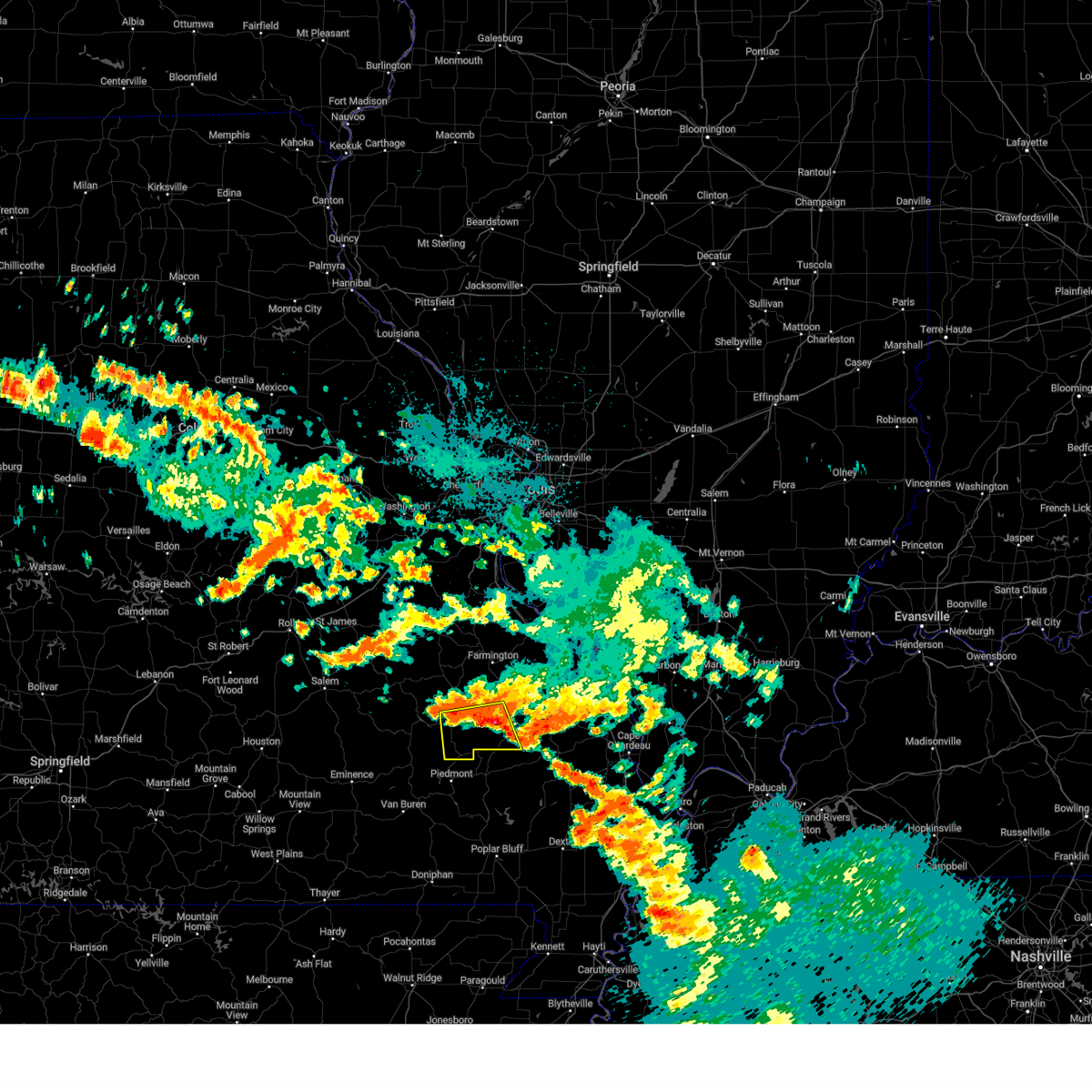 At 356 am cdt, a severe thunderstorm was located near glover, moving southeast at 30 mph (radar indicated). Hazards include 60 mph wind gusts and quarter size hail. Hail damage to vehicles is expected. Expect wind damage to roofs, siding, and trees. At 356 am cdt, a severe thunderstorm was located near glover, moving southeast at 30 mph (radar indicated). Hazards include 60 mph wind gusts and quarter size hail. Hail damage to vehicles is expected. Expect wind damage to roofs, siding, and trees.
|
| 8/3/2023 1:10 AM CDT |
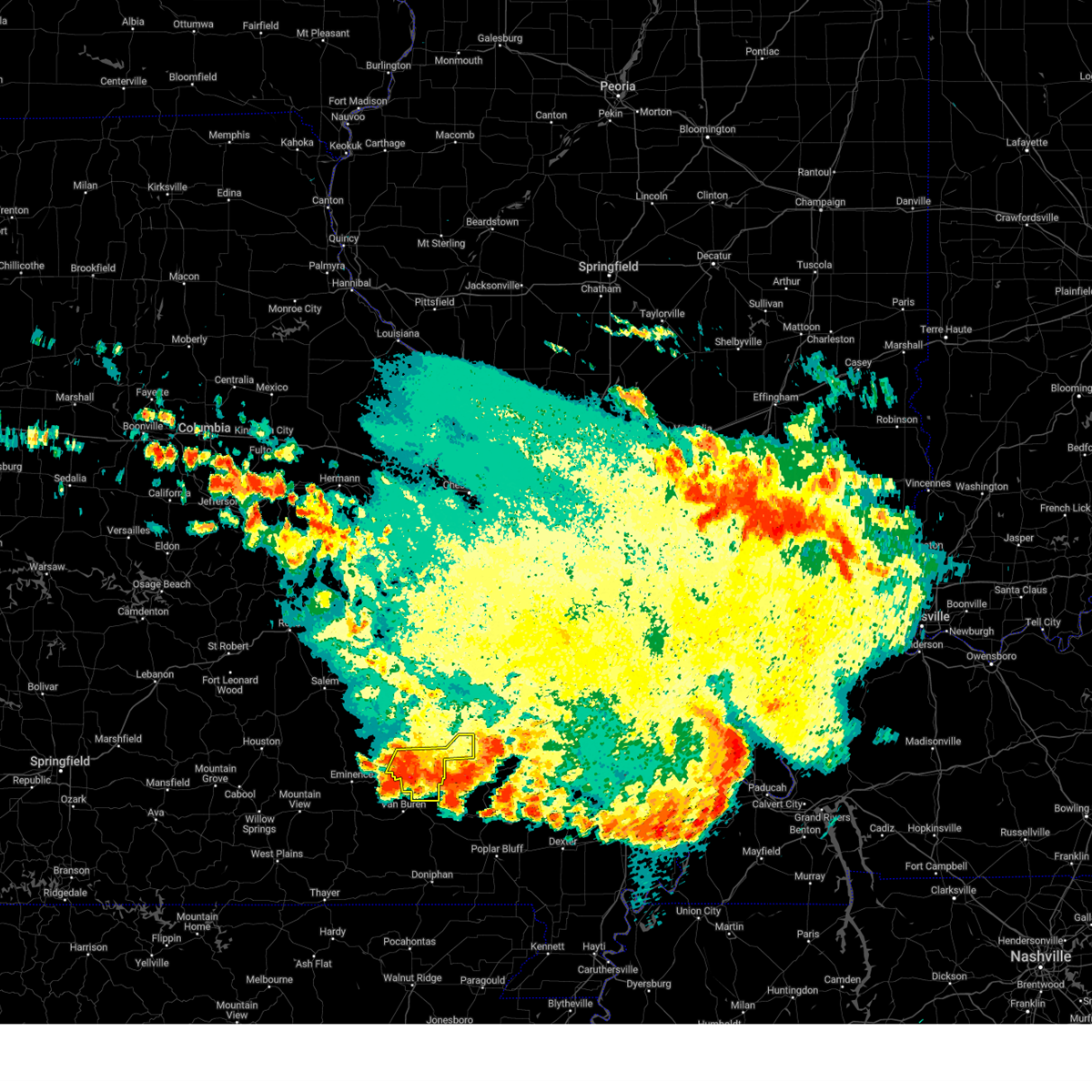 The severe thunderstorm warning for southeastern iron and southeastern reynolds counties will expire at 115 am cdt, the storm which prompted the warning has moved out of the area. therefore, the warning will be allowed to expire. a severe thunderstorm watch remains in effect until 300 am cdt for southeastern missouri. The severe thunderstorm warning for southeastern iron and southeastern reynolds counties will expire at 115 am cdt, the storm which prompted the warning has moved out of the area. therefore, the warning will be allowed to expire. a severe thunderstorm watch remains in effect until 300 am cdt for southeastern missouri.
|
| 8/3/2023 1:00 AM CDT |
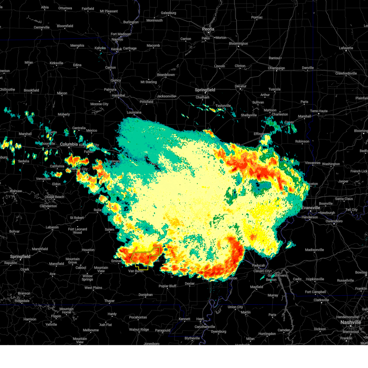 At 100 am cdt, a severe thunderstorm was located near piedmont, moving southeast at 50 mph (radar indicated). Hazards include 60 mph wind gusts and nickel size hail. Expect damage to roofs, siding, and trees. locations impacted include, ellington, annapolis, garwood, des arc, redford, and vulcan. this also includes clearwater lake recreational area. hail threat, radar indicated max hail size, 0. 88 in wind threat, radar indicated max wind gust, 60 mph. At 100 am cdt, a severe thunderstorm was located near piedmont, moving southeast at 50 mph (radar indicated). Hazards include 60 mph wind gusts and nickel size hail. Expect damage to roofs, siding, and trees. locations impacted include, ellington, annapolis, garwood, des arc, redford, and vulcan. this also includes clearwater lake recreational area. hail threat, radar indicated max hail size, 0. 88 in wind threat, radar indicated max wind gust, 60 mph.
|
| 8/3/2023 12:45 AM CDT |
 At 1245 am cdt, a severe thunderstorm was located near annapolis, moving east at 50 mph (radar indicated). Hazards include 60 mph wind gusts and nickel size hail. Expect damage to roofs, siding, and trees. locations impacted include, ellington, annapolis, glover, garwood, centerville, des arc, sabula, chloride, redford, hogan, vulcan, and lesterville. this also includes clearwater lake recreational area. hail threat, radar indicated max hail size, 0. 88 in wind threat, radar indicated max wind gust, 60 mph. At 1245 am cdt, a severe thunderstorm was located near annapolis, moving east at 50 mph (radar indicated). Hazards include 60 mph wind gusts and nickel size hail. Expect damage to roofs, siding, and trees. locations impacted include, ellington, annapolis, glover, garwood, centerville, des arc, sabula, chloride, redford, hogan, vulcan, and lesterville. this also includes clearwater lake recreational area. hail threat, radar indicated max hail size, 0. 88 in wind threat, radar indicated max wind gust, 60 mph.
|
| 8/3/2023 12:26 AM CDT |
 At 1226 am cdt, a severe thunderstorm was located 7 miles east of reynolds, moving southeast at 40 mph (radar indicated). Hazards include 60 mph wind gusts and nickel size hail. expect damage to roofs, siding, and trees At 1226 am cdt, a severe thunderstorm was located 7 miles east of reynolds, moving southeast at 40 mph (radar indicated). Hazards include 60 mph wind gusts and nickel size hail. expect damage to roofs, siding, and trees
|
| 5/15/2023 3:22 PM CDT |
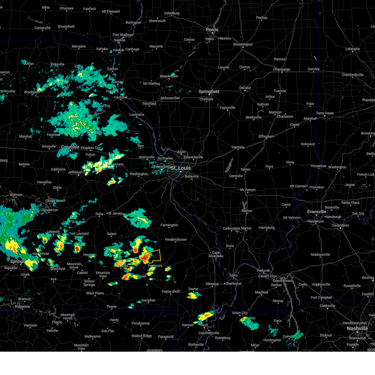 At 322 pm cdt, a severe thunderstorm was located 7 miles northeast of ellington, moving east at 25 mph (radar indicated). Hazards include 60 mph wind gusts and quarter size hail. Hail damage to vehicles is expected. Expect wind damage to roofs, siding, and trees. At 322 pm cdt, a severe thunderstorm was located 7 miles northeast of ellington, moving east at 25 mph (radar indicated). Hazards include 60 mph wind gusts and quarter size hail. Hail damage to vehicles is expected. Expect wind damage to roofs, siding, and trees.
|
| 5/8/2023 9:05 PM CDT |
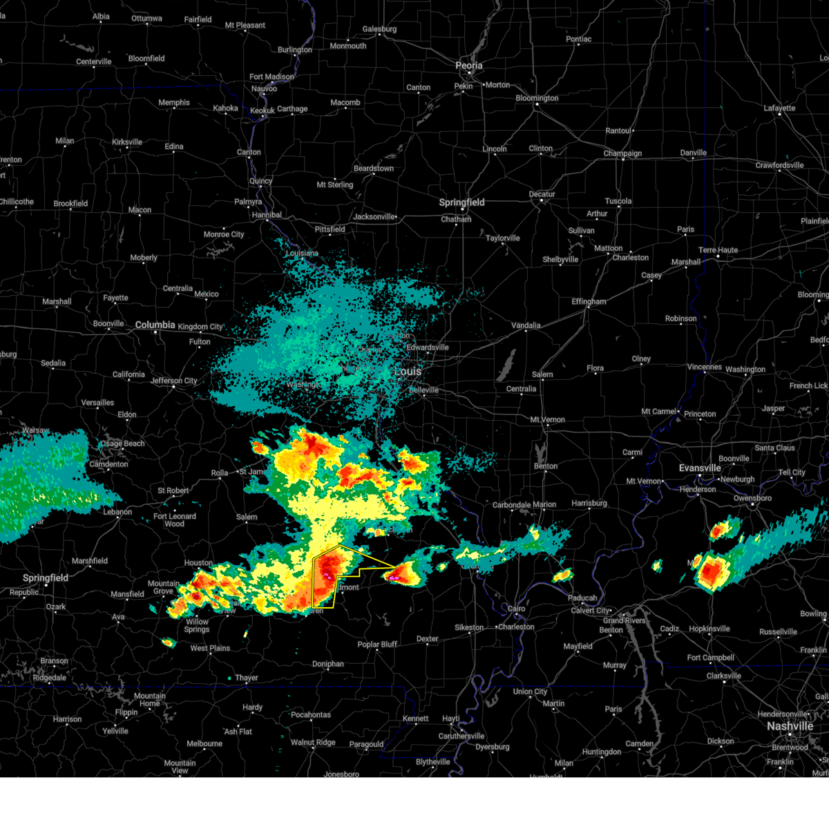 At 904 pm cdt, severe thunderstorms were located along a line extending from 6 miles northwest of sam a. baker state park to 6 miles southeast of garwood, moving southeast at 40 mph (radar indicated). Hazards include 60 mph wind gusts and quarter size hail. Hail damage to vehicles is expected. expect wind damage to roofs, siding, and trees. locations impacted include, annapolis, buckhorn, garwood, saco, des arc, sabula, chloride, redford, and vulcan. this also includes clearwater lake recreational area. hail threat, radar indicated max hail size, 1. 00 in wind threat, radar indicated max wind gust, 60 mph. At 904 pm cdt, severe thunderstorms were located along a line extending from 6 miles northwest of sam a. baker state park to 6 miles southeast of garwood, moving southeast at 40 mph (radar indicated). Hazards include 60 mph wind gusts and quarter size hail. Hail damage to vehicles is expected. expect wind damage to roofs, siding, and trees. locations impacted include, annapolis, buckhorn, garwood, saco, des arc, sabula, chloride, redford, and vulcan. this also includes clearwater lake recreational area. hail threat, radar indicated max hail size, 1. 00 in wind threat, radar indicated max wind gust, 60 mph.
|
| 5/8/2023 8:49 PM CDT |
 At 849 pm cdt, severe thunderstorms were located along a line extending from near glover to near garwood, moving southeast at 35 mph (radar indicated). Hazards include 70 mph wind gusts and quarter size hail. Hail damage to vehicles is expected. expect considerable tree damage. wind damage is also likely to mobile homes, roofs, and outbuildings. locations impacted include, reynolds, ellington, annapolis, buckhorn, glover, garwood, saco, centerville, des arc, corridon, redford, hogan, vulcan, black, sabula, chloride, and lesterville. This also includes johnsons shut-ins state park, taum sauk mountain state park, and clearwater lake recreational area. At 849 pm cdt, severe thunderstorms were located along a line extending from near glover to near garwood, moving southeast at 35 mph (radar indicated). Hazards include 70 mph wind gusts and quarter size hail. Hail damage to vehicles is expected. expect considerable tree damage. wind damage is also likely to mobile homes, roofs, and outbuildings. locations impacted include, reynolds, ellington, annapolis, buckhorn, glover, garwood, saco, centerville, des arc, corridon, redford, hogan, vulcan, black, sabula, chloride, and lesterville. This also includes johnsons shut-ins state park, taum sauk mountain state park, and clearwater lake recreational area.
|
| 5/8/2023 8:33 PM CDT |
 At 832 pm cdt, severe thunderstorms were located along a line extending from 10 miles east of oates to 7 miles northwest of ellington, moving east at 25 mph (radar indicated). Hazards include 70 mph wind gusts and quarter size hail. Hail damage to vehicles is expected. expect considerable tree damage. wind damage is also likely to mobile homes, roofs, and outbuildings. locations impacted include, reynolds, ellington, annapolis, buckhorn, glover, oates, garwood, saco, centerville, des arc, corridon, redford, hogan, vulcan, black, sabula, chloride, and lesterville. This also includes johnsons shut-ins state park, taum sauk mountain state park, and clearwater lake recreational area. At 832 pm cdt, severe thunderstorms were located along a line extending from 10 miles east of oates to 7 miles northwest of ellington, moving east at 25 mph (radar indicated). Hazards include 70 mph wind gusts and quarter size hail. Hail damage to vehicles is expected. expect considerable tree damage. wind damage is also likely to mobile homes, roofs, and outbuildings. locations impacted include, reynolds, ellington, annapolis, buckhorn, glover, oates, garwood, saco, centerville, des arc, corridon, redford, hogan, vulcan, black, sabula, chloride, and lesterville. This also includes johnsons shut-ins state park, taum sauk mountain state park, and clearwater lake recreational area.
|
| 5/8/2023 8:13 PM CDT |
 At 813 pm cdt, severe thunderstorms were located along a line extending from 6 miles southeast of oates to 6 miles south of bunker, moving southeast at 40 mph (radar indicated). Hazards include 60 mph wind gusts and quarter size hail. Hail damage to vehicles is expected. Expect wind damage to roofs, siding, and trees. At 813 pm cdt, severe thunderstorms were located along a line extending from 6 miles southeast of oates to 6 miles south of bunker, moving southeast at 40 mph (radar indicated). Hazards include 60 mph wind gusts and quarter size hail. Hail damage to vehicles is expected. Expect wind damage to roofs, siding, and trees.
|
| 5/8/2023 7:44 PM CDT |
 At 744 pm cdt, a severe thunderstorm was located near annapolis. a second severe thunderstorm was located near oates. both thunderstorms were moving southeast at 20 mph (radar indicated). Hazards include ping pong ball size hail and 60 mph wind gusts. People and animals outdoors will be injured. expect hail damage to roofs, siding, windows, and vehicles. expect wind damage to roofs, siding, and trees. locations impacted include, annapolis, glover, oates, bixby, centerville, des arc, sabula, chloride, hogan, vulcan, lesterville, and black. this also includes johnsons shut-ins state park and taum sauk mountain state park. hail threat, radar indicated max hail size, 1. 50 in wind threat, radar indicated max wind gust, 60 mph. At 744 pm cdt, a severe thunderstorm was located near annapolis. a second severe thunderstorm was located near oates. both thunderstorms were moving southeast at 20 mph (radar indicated). Hazards include ping pong ball size hail and 60 mph wind gusts. People and animals outdoors will be injured. expect hail damage to roofs, siding, windows, and vehicles. expect wind damage to roofs, siding, and trees. locations impacted include, annapolis, glover, oates, bixby, centerville, des arc, sabula, chloride, hogan, vulcan, lesterville, and black. this also includes johnsons shut-ins state park and taum sauk mountain state park. hail threat, radar indicated max hail size, 1. 50 in wind threat, radar indicated max wind gust, 60 mph.
|
| 5/8/2023 7:36 PM CDT | Quarter sized hail reported 0.7 miles E of Annapolis, MO, quarter sized hail covering the ground. |
| 5/8/2023 7:36 PM CDT | Quarter sized hail reported 0.2 miles E of Annapolis, MO, report from mping: quarter (1.00 in.). |
| 5/8/2023 7:19 PM CDT |
 At 719 pm cdt, a severe thunderstorm was located 10 miles northeast of reynolds, moving southeast at 20 mph (radar indicated). Hazards include 60 mph wind gusts and quarter size hail. Hail damage to vehicles is expected. Expect wind damage to roofs, siding, and trees. At 719 pm cdt, a severe thunderstorm was located 10 miles northeast of reynolds, moving southeast at 20 mph (radar indicated). Hazards include 60 mph wind gusts and quarter size hail. Hail damage to vehicles is expected. Expect wind damage to roofs, siding, and trees.
|
| 3/23/2023 9:35 PM CDT |
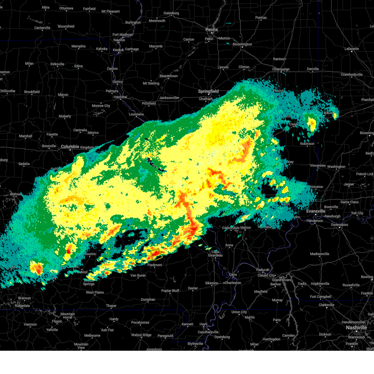 At 934 pm cdt, a severe thunderstorm was located over annapolis, moving northeast at 40 mph (radar indicated). Hazards include 60 mph wind gusts and quarter size hail. Hail damage to vehicles is expected. expect wind damage to roofs, siding, and trees. locations impacted include, annapolis, des arc, sabula and vulcan. hail threat, radar indicated max hail size, 1. 00 in wind threat, radar indicated max wind gust, 60 mph. At 934 pm cdt, a severe thunderstorm was located over annapolis, moving northeast at 40 mph (radar indicated). Hazards include 60 mph wind gusts and quarter size hail. Hail damage to vehicles is expected. expect wind damage to roofs, siding, and trees. locations impacted include, annapolis, des arc, sabula and vulcan. hail threat, radar indicated max hail size, 1. 00 in wind threat, radar indicated max wind gust, 60 mph.
|
| 3/23/2023 9:32 PM CDT | Quarter sized hail reported 0.2 miles E of Annapolis, MO, time estimated from radar. |
| 3/23/2023 9:24 PM CDT |
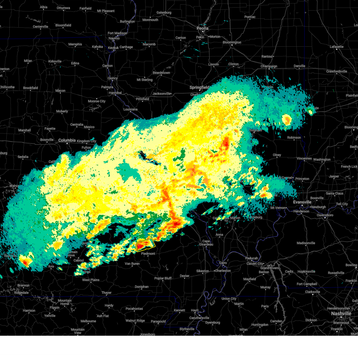 At 923 pm cdt, a severe thunderstorm was located near annapolis, moving east at 50 mph (radar indicated). Hazards include 60 mph wind gusts and quarter size hail. Hail damage to vehicles is expected. expect wind damage to roofs, siding, and trees. locations impacted include, annapolis. hail threat, radar indicated max hail size, 1. 00 in wind threat, radar indicated max wind gust, 60 mph. At 923 pm cdt, a severe thunderstorm was located near annapolis, moving east at 50 mph (radar indicated). Hazards include 60 mph wind gusts and quarter size hail. Hail damage to vehicles is expected. expect wind damage to roofs, siding, and trees. locations impacted include, annapolis. hail threat, radar indicated max hail size, 1. 00 in wind threat, radar indicated max wind gust, 60 mph.
|
| 3/23/2023 9:08 PM CDT |
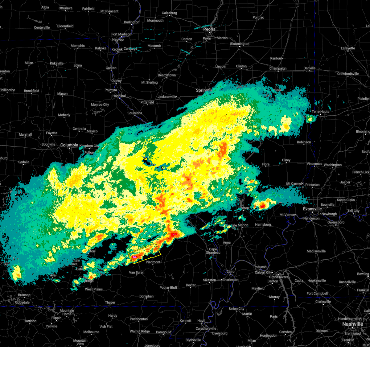 At 907 pm cdt, a severe thunderstorm was located near ellington, moving east at 35 mph (radar indicated). Hazards include 60 mph wind gusts and half dollar size hail. Hail damage to vehicles is expected. expect wind damage to roofs, siding, and trees. this severe thunderstorm will be near, ellington around 915 pm cdt. other locations in the path of this severe thunderstorm include annapolis. hail threat, radar indicated max hail size, 1. 25 in wind threat, radar indicated max wind gust, 60 mph. At 907 pm cdt, a severe thunderstorm was located near ellington, moving east at 35 mph (radar indicated). Hazards include 60 mph wind gusts and half dollar size hail. Hail damage to vehicles is expected. expect wind damage to roofs, siding, and trees. this severe thunderstorm will be near, ellington around 915 pm cdt. other locations in the path of this severe thunderstorm include annapolis. hail threat, radar indicated max hail size, 1. 25 in wind threat, radar indicated max wind gust, 60 mph.
|
| 3/23/2023 8:15 PM CDT |
 At 815 pm cdt, a severe thunderstorm was located 9 miles east of reynolds, moving east at 50 mph (radar indicated). Hazards include ping pong ball size hail and 60 mph wind gusts. People and animals outdoors will be injured. expect hail damage to roofs, siding, windows, and vehicles. expect wind damage to roofs, siding, and trees. locations impacted include, annapolis and glover. this also includes taum sauk mountain state park. hail threat, radar indicated max hail size, 1. 50 in wind threat, radar indicated max wind gust, 60 mph. At 815 pm cdt, a severe thunderstorm was located 9 miles east of reynolds, moving east at 50 mph (radar indicated). Hazards include ping pong ball size hail and 60 mph wind gusts. People and animals outdoors will be injured. expect hail damage to roofs, siding, windows, and vehicles. expect wind damage to roofs, siding, and trees. locations impacted include, annapolis and glover. this also includes taum sauk mountain state park. hail threat, radar indicated max hail size, 1. 50 in wind threat, radar indicated max wind gust, 60 mph.
|
| 3/23/2023 7:53 PM CDT |
 At 752 pm cdt, a severe thunderstorm was located 8 miles south of bunker, moving east at 45 mph (radar indicated). Hazards include ping pong ball size hail and 60 mph wind gusts. People and animals outdoors will be injured. expect hail damage to roofs, siding, windows, and vehicles. expect wind damage to roofs, siding, and trees. this severe thunderstorm will be near, bunker around 800 pm cdt. reynolds around 805 pm cdt. other locations in the path of this severe thunderstorm include glover. this also includes johnsons shut-ins state park, fort davidson historic site, elephant rocks state park, and taum sauk mountain state park. hail threat, radar indicated max hail size, 1. 50 in wind threat, radar indicated max wind gust, 60 mph. At 752 pm cdt, a severe thunderstorm was located 8 miles south of bunker, moving east at 45 mph (radar indicated). Hazards include ping pong ball size hail and 60 mph wind gusts. People and animals outdoors will be injured. expect hail damage to roofs, siding, windows, and vehicles. expect wind damage to roofs, siding, and trees. this severe thunderstorm will be near, bunker around 800 pm cdt. reynolds around 805 pm cdt. other locations in the path of this severe thunderstorm include glover. this also includes johnsons shut-ins state park, fort davidson historic site, elephant rocks state park, and taum sauk mountain state park. hail threat, radar indicated max hail size, 1. 50 in wind threat, radar indicated max wind gust, 60 mph.
|
| 2/16/2023 1:16 AM CST |
 At 116 am cst, a severe thunderstorm was located near sam a. baker state park, moving north at 45 mph (radar indicated). Hazards include 60 mph wind gusts and quarter size hail. Hail damage to vehicles is expected. expect wind damage to roofs, siding, and trees. locations impacted include, arcadia, annapolis, glover, saco, des arc, sabula, chloride, hogan and vulcan. hail threat, radar indicated max hail size, 1. 00 in wind threat, radar indicated max wind gust, 60 mph. At 116 am cst, a severe thunderstorm was located near sam a. baker state park, moving north at 45 mph (radar indicated). Hazards include 60 mph wind gusts and quarter size hail. Hail damage to vehicles is expected. expect wind damage to roofs, siding, and trees. locations impacted include, arcadia, annapolis, glover, saco, des arc, sabula, chloride, hogan and vulcan. hail threat, radar indicated max hail size, 1. 00 in wind threat, radar indicated max wind gust, 60 mph.
|
| 2/16/2023 1:05 AM CST |
 At 104 am cst, a severe thunderstorm was located over piedmont, moving north at 45 mph (radar indicated). Hazards include 60 mph wind gusts and quarter size hail. Hail damage to vehicles is expected. Expect wind damage to roofs, siding, and trees. At 104 am cst, a severe thunderstorm was located over piedmont, moving north at 45 mph (radar indicated). Hazards include 60 mph wind gusts and quarter size hail. Hail damage to vehicles is expected. Expect wind damage to roofs, siding, and trees.
|
| 8/20/2022 9:19 PM CDT | Golf Ball sized hail reported 2.8 miles S of Annapolis, MO, hail up to golfball size... though most were one inch in diameter. |
| 8/20/2022 9:15 PM CDT |
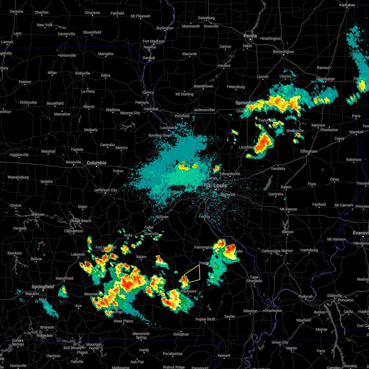 At 915 pm cdt, a severe thunderstorm was located over annapolis, moving northeast at 30 mph (radar indicated). Hazards include 60 mph wind gusts and quarter size hail. Hail damage to vehicles is expected. Expect wind damage to roofs, siding, and trees. At 915 pm cdt, a severe thunderstorm was located over annapolis, moving northeast at 30 mph (radar indicated). Hazards include 60 mph wind gusts and quarter size hail. Hail damage to vehicles is expected. Expect wind damage to roofs, siding, and trees.
|
| 5/19/2022 4:12 PM CDT |
 The severe thunderstorm warning for southern crawford, iron, reynolds and southern washington counties will expire at 415 pm cdt, the storms which prompted the warning have weakened below severe limits, and no longer pose an immediate threat to life or property. therefore, the warning will be allowed to expire. however gusty winds are still possible with these thunderstorms. a tornado watch remains in effect until 700 pm cdt for southeastern and east central missouri. The severe thunderstorm warning for southern crawford, iron, reynolds and southern washington counties will expire at 415 pm cdt, the storms which prompted the warning have weakened below severe limits, and no longer pose an immediate threat to life or property. therefore, the warning will be allowed to expire. however gusty winds are still possible with these thunderstorms. a tornado watch remains in effect until 700 pm cdt for southeastern and east central missouri.
|
| 5/19/2022 3:54 PM CDT |
 At 353 pm cdt, severe thunderstorms were located along a line extending from anthonies mill to 8 miles southwest of ellington, moving east at 50 mph (radar indicated). Hazards include 70 mph wind gusts. Expect considerable tree damage. damage is likely to mobile homes, roofs, and outbuildings. locations impacted include, ellington. This also includes johnsons shut-ins state park, fort davidson historic site, elephant rocks state park, dillard mill historic site, taum sauk mountain state park, and clearwater lake recreational area. At 353 pm cdt, severe thunderstorms were located along a line extending from anthonies mill to 8 miles southwest of ellington, moving east at 50 mph (radar indicated). Hazards include 70 mph wind gusts. Expect considerable tree damage. damage is likely to mobile homes, roofs, and outbuildings. locations impacted include, ellington. This also includes johnsons shut-ins state park, fort davidson historic site, elephant rocks state park, dillard mill historic site, taum sauk mountain state park, and clearwater lake recreational area.
|
| 5/19/2022 3:21 PM CDT |
 At 320 pm cdt, severe thunderstorms were located along a line extending from near st. james to 6 miles east of summersville, moving east at 50 mph (trained weather spotters reported wind damage to a house near duke, mo). Hazards include 70 mph wind gusts. Expect considerable tree damage. damage is likely to mobile homes, roofs, and outbuildings. severe thunderstorms will be near, steelville around 330 pm cdt. other locations in the path of these severe thunderstorms include ellington. This also includes johnsons shut-ins state park, fort davidson historic site, elephant rocks state park, dillard mill historic site, taum sauk mountain state park, and clearwater lake recreational area. At 320 pm cdt, severe thunderstorms were located along a line extending from near st. james to 6 miles east of summersville, moving east at 50 mph (trained weather spotters reported wind damage to a house near duke, mo). Hazards include 70 mph wind gusts. Expect considerable tree damage. damage is likely to mobile homes, roofs, and outbuildings. severe thunderstorms will be near, steelville around 330 pm cdt. other locations in the path of these severe thunderstorms include ellington. This also includes johnsons shut-ins state park, fort davidson historic site, elephant rocks state park, dillard mill historic site, taum sauk mountain state park, and clearwater lake recreational area.
|
| 10/24/2021 10:36 PM CDT |
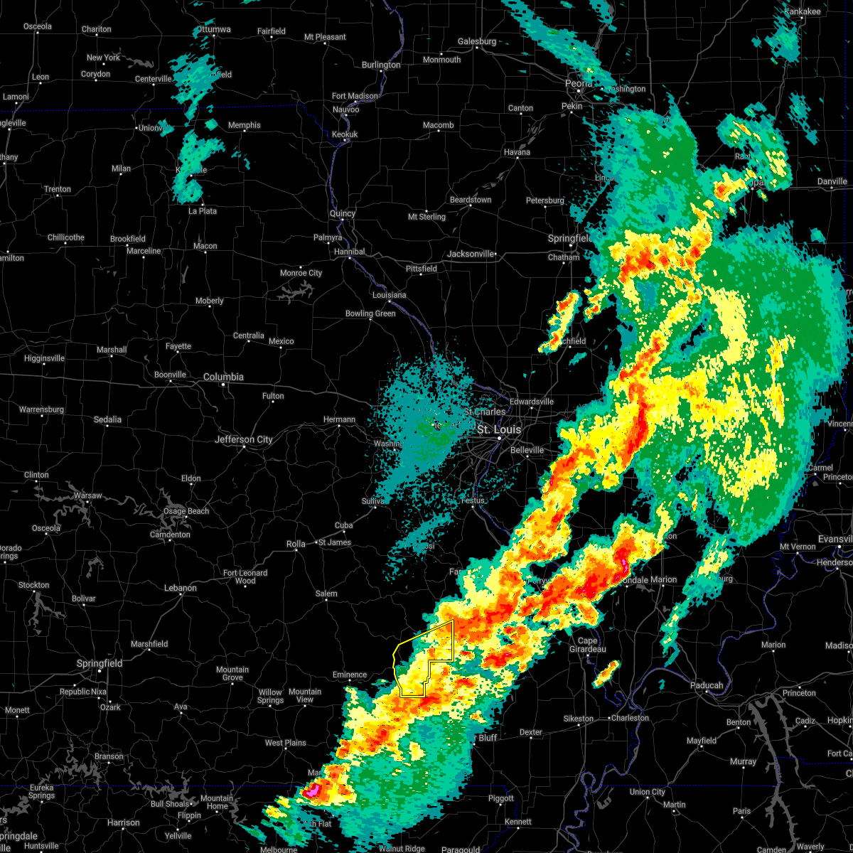 The severe thunderstorm warning for southeastern iron and southeastern reynolds counties will expire at 1045 pm cdt, the storm which prompted the warning has weakened below severe limits, and has exited the warned area. therefore, the warning will be allowed to expire. a tornado watch remains in effect until 1100 pm cdt for southeastern missouri. The severe thunderstorm warning for southeastern iron and southeastern reynolds counties will expire at 1045 pm cdt, the storm which prompted the warning has weakened below severe limits, and has exited the warned area. therefore, the warning will be allowed to expire. a tornado watch remains in effect until 1100 pm cdt for southeastern missouri.
|
| 10/24/2021 10:23 PM CDT |
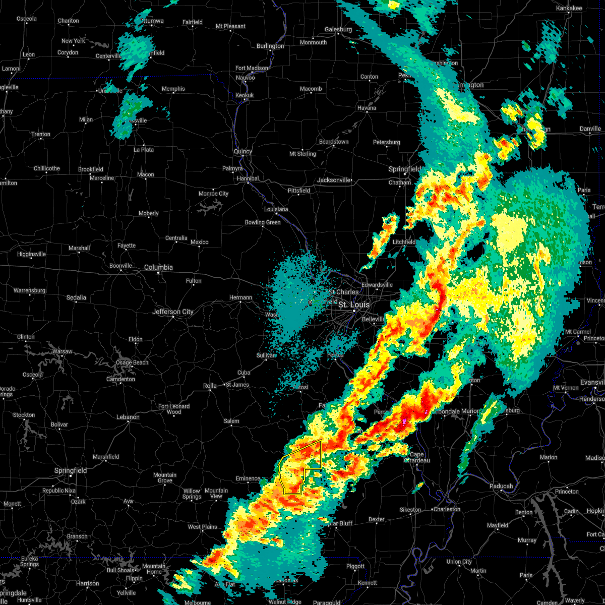 At 1023 pm cdt, a severe thunderstorm was located 7 miles east of ellington, moving east at 50 mph (radar indicated). Hazards include 60 mph wind gusts. Expect damage to roofs, siding, and trees. locations impacted include, annapolis. This also includes clearwater lake recreational area. At 1023 pm cdt, a severe thunderstorm was located 7 miles east of ellington, moving east at 50 mph (radar indicated). Hazards include 60 mph wind gusts. Expect damage to roofs, siding, and trees. locations impacted include, annapolis. This also includes clearwater lake recreational area.
|
| 10/24/2021 10:07 PM CDT |
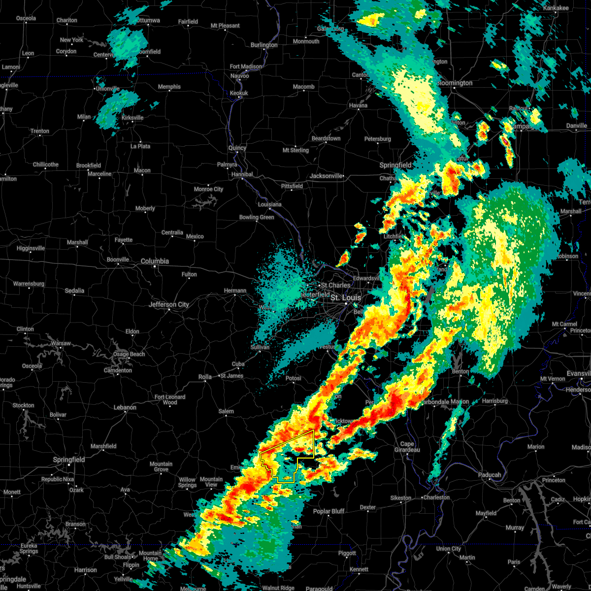 At 1007 pm cdt, a severe thunderstorm was located near ellington, moving east at 50 mph (radar indicated). Hazards include 60 mph wind gusts. Expect damage to roofs, siding, and trees. this severe thunderstorm will be near, ellington around 1015 pm cdt. other locations in the path of this severe thunderstorm include annapolis. This also includes clearwater lake recreational area. At 1007 pm cdt, a severe thunderstorm was located near ellington, moving east at 50 mph (radar indicated). Hazards include 60 mph wind gusts. Expect damage to roofs, siding, and trees. this severe thunderstorm will be near, ellington around 1015 pm cdt. other locations in the path of this severe thunderstorm include annapolis. This also includes clearwater lake recreational area.
|
| 10/24/2021 9:11 PM CDT |
 At 910 pm cdt, a severe thunderstorm capable of producing a tornado was located over annapolis, moving northeast at 35 mph. another possible tornado was located north of saco, moving northeast at 35 mph (radar indicated rotation). Hazards include tornado. Flying debris will be dangerous to those caught without shelter. mobile homes will be damaged or destroyed. damage to roofs, windows, and vehicles will occur. tree damage is likely. this dangerous storm will be near, saco around 930 pm cdt. Other locations in the path of this tornadic thunderstorm include fredericktown, cobalt, junction city and marquand. At 910 pm cdt, a severe thunderstorm capable of producing a tornado was located over annapolis, moving northeast at 35 mph. another possible tornado was located north of saco, moving northeast at 35 mph (radar indicated rotation). Hazards include tornado. Flying debris will be dangerous to those caught without shelter. mobile homes will be damaged or destroyed. damage to roofs, windows, and vehicles will occur. tree damage is likely. this dangerous storm will be near, saco around 930 pm cdt. Other locations in the path of this tornadic thunderstorm include fredericktown, cobalt, junction city and marquand.
|
| 10/24/2021 8:51 PM CDT |
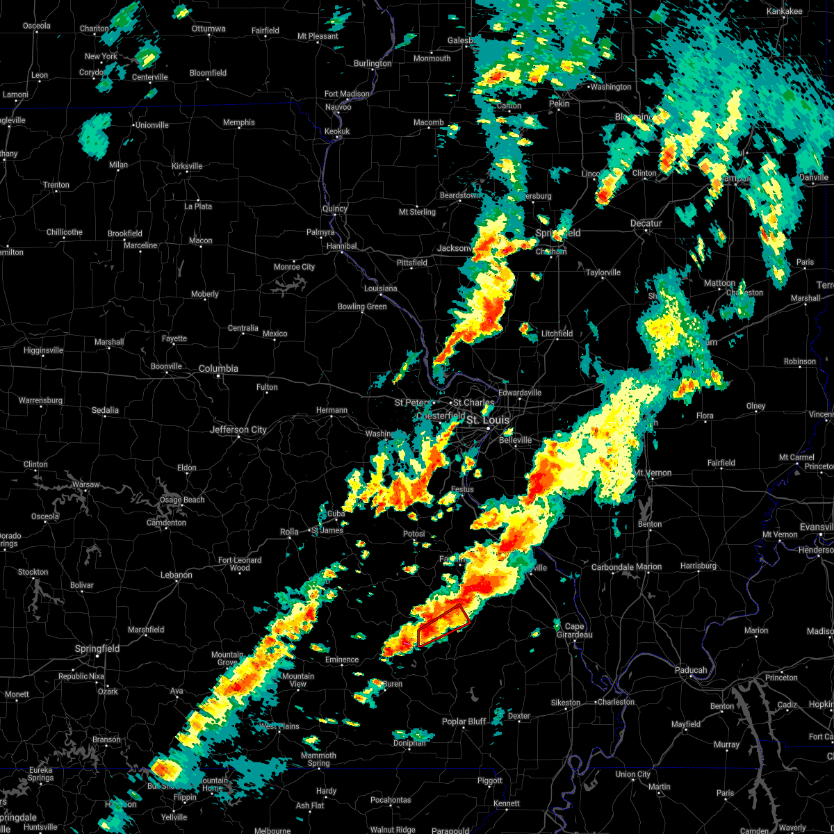 At 851 pm cdt, a severe thunderstorm capable of producing a tornado was located over annapolis, moving east at 35 mph (radar indicated rotation). Hazards include tornado. Flying debris will be dangerous to those caught without shelter. mobile homes will be damaged or destroyed. damage to roofs, windows, and vehicles will occur. tree damage is likely. Locations impacted include, annapolis and vulcan. At 851 pm cdt, a severe thunderstorm capable of producing a tornado was located over annapolis, moving east at 35 mph (radar indicated rotation). Hazards include tornado. Flying debris will be dangerous to those caught without shelter. mobile homes will be damaged or destroyed. damage to roofs, windows, and vehicles will occur. tree damage is likely. Locations impacted include, annapolis and vulcan.
|
| 10/24/2021 8:30 PM CDT |
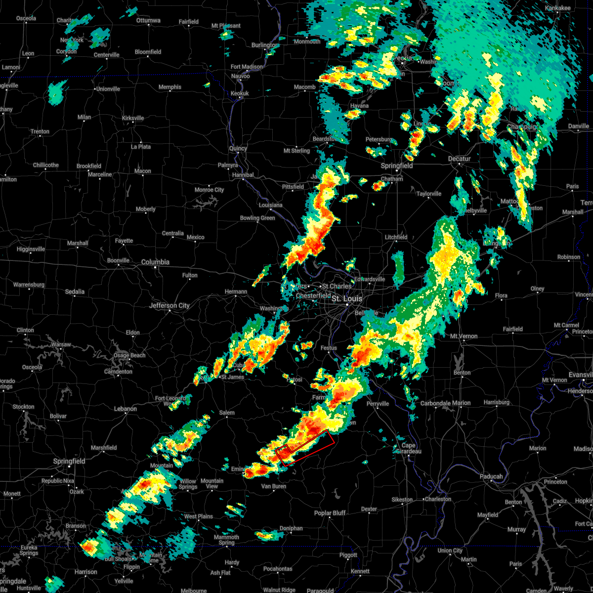 At 830 pm cdt, a severe thunderstorm capable of producing a tornado was located 7 miles northeast of ellington, moving northeast at 40 mph (radar indicated rotation). Hazards include tornado. Flying debris will be dangerous to those caught without shelter. mobile homes will be damaged or destroyed. damage to roofs, windows, and vehicles will occur. tree damage is likely. Locations impacted include, annapolis, redford and vulcan. At 830 pm cdt, a severe thunderstorm capable of producing a tornado was located 7 miles northeast of ellington, moving northeast at 40 mph (radar indicated rotation). Hazards include tornado. Flying debris will be dangerous to those caught without shelter. mobile homes will be damaged or destroyed. damage to roofs, windows, and vehicles will occur. tree damage is likely. Locations impacted include, annapolis, redford and vulcan.
|
| 10/24/2021 8:23 PM CDT |
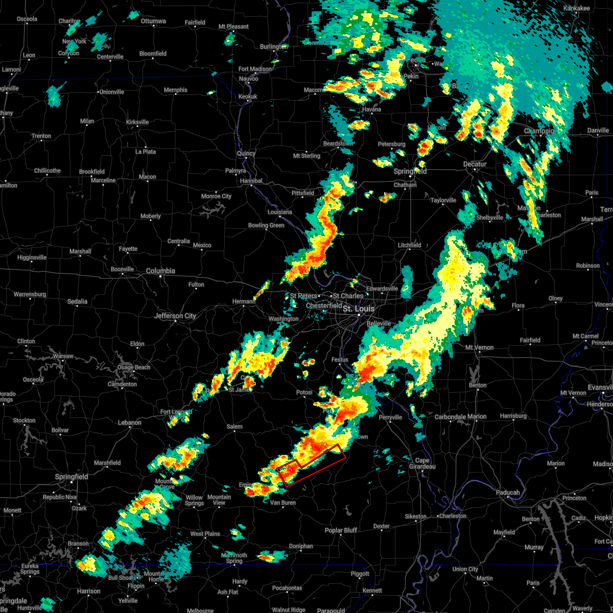 At 823 pm cdt, a severe thunderstorm capable of producing a tornado was located near ellington, moving northeast at 45 mph (radar indicated rotation). Hazards include tornado. Flying debris will be dangerous to those caught without shelter. mobile homes will be damaged or destroyed. damage to roofs, windows, and vehicles will occur. Tree damage is likely. At 823 pm cdt, a severe thunderstorm capable of producing a tornado was located near ellington, moving northeast at 45 mph (radar indicated rotation). Hazards include tornado. Flying debris will be dangerous to those caught without shelter. mobile homes will be damaged or destroyed. damage to roofs, windows, and vehicles will occur. Tree damage is likely.
|
| 8/31/2021 10:13 PM CDT |
 At 1012 pm cdt, severe thunderstorms were located along a line extending from near cobalt to 6 miles southwest of fredericktown to near glover, moving southeast at 25 mph (radar indicated). Hazards include 60 mph wind gusts. Expect damage to roofs, siding, and trees. locations impacted include, fredericktown, arcadia, annapolis, junction city, cobalt, marquand, buckhorn, glover, saco, des arc, catherine place, hogan, vulcan, black, sabula, mine la motte, chloride and lesterville. This also includes taum sauk mountain state park. At 1012 pm cdt, severe thunderstorms were located along a line extending from near cobalt to 6 miles southwest of fredericktown to near glover, moving southeast at 25 mph (radar indicated). Hazards include 60 mph wind gusts. Expect damage to roofs, siding, and trees. locations impacted include, fredericktown, arcadia, annapolis, junction city, cobalt, marquand, buckhorn, glover, saco, des arc, catherine place, hogan, vulcan, black, sabula, mine la motte, chloride and lesterville. This also includes taum sauk mountain state park.
|
| 8/31/2021 9:49 PM CDT |
 At 948 pm cdt, severe thunderstorms were located along a line extending from near farmington to near knob lick to 9 miles east of oates, moving southeast at 30 mph (radar indicated). Hazards include 60 mph wind gusts. expect damage to roofs, siding, and trees At 948 pm cdt, severe thunderstorms were located along a line extending from near farmington to near knob lick to 9 miles east of oates, moving southeast at 30 mph (radar indicated). Hazards include 60 mph wind gusts. expect damage to roofs, siding, and trees
|
| 7/31/2021 5:26 PM CDT |
 At 526 pm cdt, a severe thunderstorm was located near oates, moving east at 20 mph (radar indicated). Hazards include 60 mph wind gusts and quarter size hail. Hail damage to vehicles is expected. expect wind damage to roofs, siding, and trees. locations impacted include, ironton, arcadia, glover, oates, sabula, chloride, hogan, lesterville and black. This also includes johnsons shut-ins state park and taum sauk mountain state park. At 526 pm cdt, a severe thunderstorm was located near oates, moving east at 20 mph (radar indicated). Hazards include 60 mph wind gusts and quarter size hail. Hail damage to vehicles is expected. expect wind damage to roofs, siding, and trees. locations impacted include, ironton, arcadia, glover, oates, sabula, chloride, hogan, lesterville and black. This also includes johnsons shut-ins state park and taum sauk mountain state park.
|
| 7/31/2021 5:15 PM CDT |
 At 515 pm cdt, a severe thunderstorm was located near oates, moving southeast at 15 mph (radar indicated). Hazards include 60 mph wind gusts and quarter size hail. Hail damage to vehicles is expected. Expect wind damage to roofs, siding, and trees. At 515 pm cdt, a severe thunderstorm was located near oates, moving southeast at 15 mph (radar indicated). Hazards include 60 mph wind gusts and quarter size hail. Hail damage to vehicles is expected. Expect wind damage to roofs, siding, and trees.
|
| 7/10/2021 2:44 AM CDT |
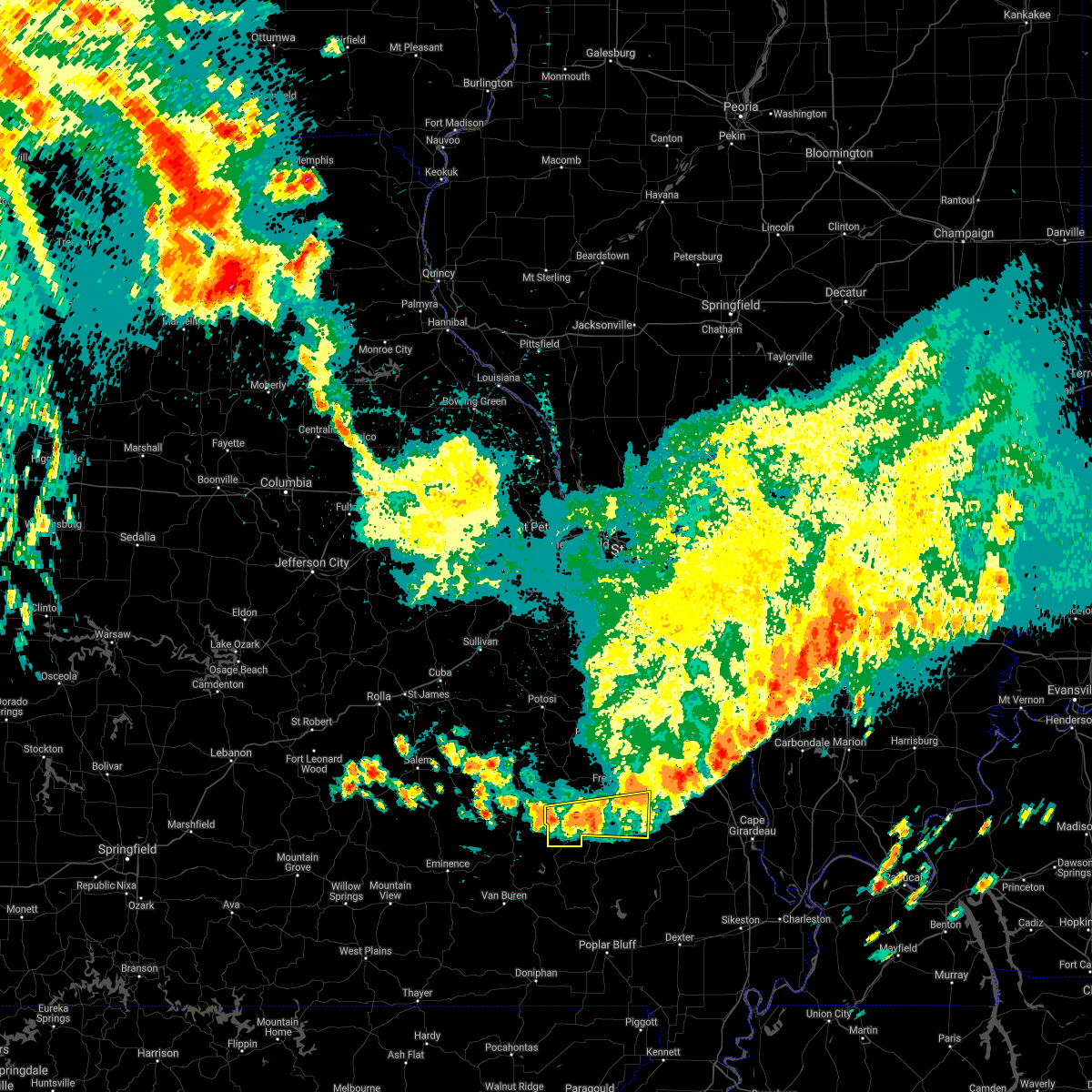 At 244 am cdt, severe thunderstorms were located along a line extending from near patton to sam a. baker state park, moving southeast at 35 mph (radar indicated). Hazards include 60 mph wind gusts and quarter size hail. Hail damage to vehicles is expected. expect wind damage to roofs, siding, and trees. These severe thunderstorms will remain over mainly rural areas of southeastern iron and southern madison counties in southeastern missouri, including the following locations, sabula, des arc, chloride and vulcan. At 244 am cdt, severe thunderstorms were located along a line extending from near patton to sam a. baker state park, moving southeast at 35 mph (radar indicated). Hazards include 60 mph wind gusts and quarter size hail. Hail damage to vehicles is expected. expect wind damage to roofs, siding, and trees. These severe thunderstorms will remain over mainly rural areas of southeastern iron and southern madison counties in southeastern missouri, including the following locations, sabula, des arc, chloride and vulcan.
|
| 7/10/2021 2:29 AM CDT |
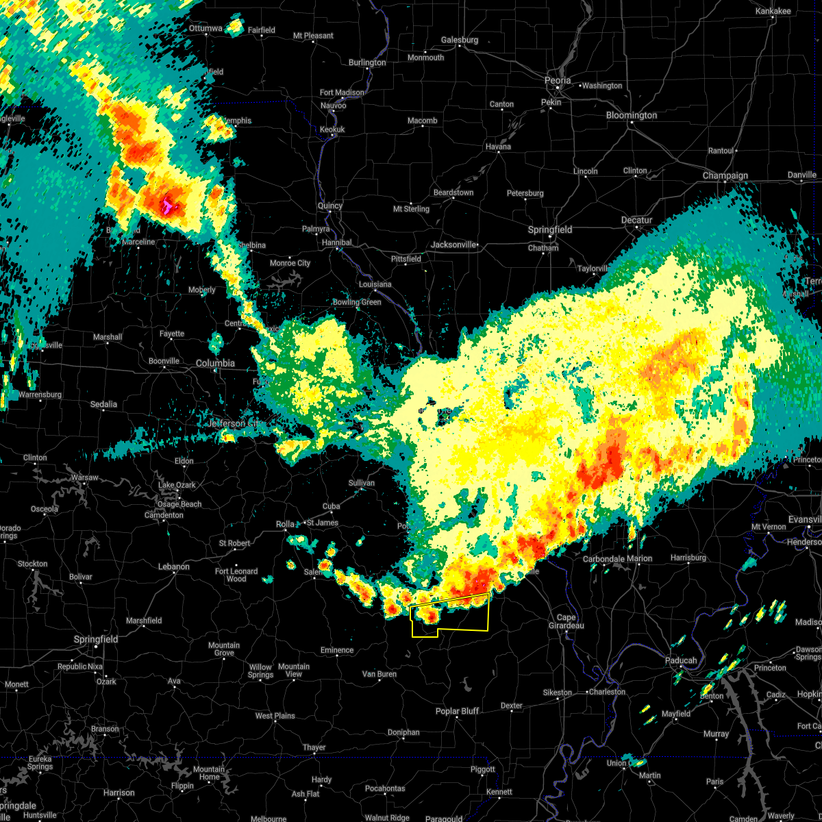 At 229 am cdt, severe thunderstorms were located along a line extending from near marquand to near annapolis, moving southeast at 35 mph (radar indicated). Hazards include 60 mph wind gusts and half dollar size hail. Hail damage to vehicles is expected. expect wind damage to roofs, siding, and trees. Severe thunderstorms will be near, marquand around 235 am cdt. At 229 am cdt, severe thunderstorms were located along a line extending from near marquand to near annapolis, moving southeast at 35 mph (radar indicated). Hazards include 60 mph wind gusts and half dollar size hail. Hail damage to vehicles is expected. expect wind damage to roofs, siding, and trees. Severe thunderstorms will be near, marquand around 235 am cdt.
|
| 3/27/2021 8:33 PM CDT |
 At 832 pm cdt, severe thunderstorms were located along a line extending from near junction city to near garwood, moving east at 45 mph (radar indicated). Hazards include 60 mph wind gusts and quarter size hail. Hail damage to vehicles is expected. expect wind damage to roofs, siding, and trees. locations impacted include, fredericktown, annapolis, junction city, cobalt, marquand, buckhorn, roselle, garwood, saco, des arc, catherine place, vulcan, sabula, mine la motte and chloride. This also includes clearwater lake recreational area. At 832 pm cdt, severe thunderstorms were located along a line extending from near junction city to near garwood, moving east at 45 mph (radar indicated). Hazards include 60 mph wind gusts and quarter size hail. Hail damage to vehicles is expected. expect wind damage to roofs, siding, and trees. locations impacted include, fredericktown, annapolis, junction city, cobalt, marquand, buckhorn, roselle, garwood, saco, des arc, catherine place, vulcan, sabula, mine la motte and chloride. This also includes clearwater lake recreational area.
|
| 3/27/2021 8:16 PM CDT |
 At 816 pm cdt, a severe thunderstorm was located near glover, moving east at 55 mph (radar indicated). Hazards include 60 mph wind gusts and quarter size hail. Hail damage to vehicles is expected. expect wind damage to roofs, siding, and trees. locations impacted include, fredericktown, ironton, ellington, pilot knob, arcadia, annapolis, junction city, cobalt, marquand, buckhorn, glover, roselle, garwood, saco, des arc, catherine place, redford, hogan, vulcan and sabula. This also includes fort davidson historic site and clearwater lake recreational area. At 816 pm cdt, a severe thunderstorm was located near glover, moving east at 55 mph (radar indicated). Hazards include 60 mph wind gusts and quarter size hail. Hail damage to vehicles is expected. expect wind damage to roofs, siding, and trees. locations impacted include, fredericktown, ironton, ellington, pilot knob, arcadia, annapolis, junction city, cobalt, marquand, buckhorn, glover, roselle, garwood, saco, des arc, catherine place, redford, hogan, vulcan and sabula. This also includes fort davidson historic site and clearwater lake recreational area.
|
| 3/27/2021 7:53 PM CDT |
 At 753 pm cdt, a severe thunderstorm was located near reynolds, moving east at 55 mph (radar indicated). Hazards include 60 mph wind gusts and quarter size hail. Hail damage to vehicles is expected. Expect wind damage to roofs, siding, and trees. At 753 pm cdt, a severe thunderstorm was located near reynolds, moving east at 55 mph (radar indicated). Hazards include 60 mph wind gusts and quarter size hail. Hail damage to vehicles is expected. Expect wind damage to roofs, siding, and trees.
|
| 4/28/2020 10:06 PM CDT |
 At 1005 pm cdt, severe thunderstorms were located along a line extending from weingarten to near coffman to near knob lick to near roselle to near saco to near greenville to near brush arbor, moving east at 45 mph (radar indicated). Hazards include 60 mph wind gusts and penny size hail. Expect damage to roofs, siding, and trees. locations impacted include, farmington, fredericktown, ironton, park hills, pilot knob, iron mountain lake, arcadia, st. mary, annapolis, junction city, cobalt, marquand, knob lick, iron mountain, buckhorn, weingarten, glover, womac, coffman and roselle. this also includes st. joe state park, hawn state park, fort davidson historic site, elephant rocks state park, and missouri mines historic site. This includes interstate 55 in missouri between exits 141 and 143. At 1005 pm cdt, severe thunderstorms were located along a line extending from weingarten to near coffman to near knob lick to near roselle to near saco to near greenville to near brush arbor, moving east at 45 mph (radar indicated). Hazards include 60 mph wind gusts and penny size hail. Expect damage to roofs, siding, and trees. locations impacted include, farmington, fredericktown, ironton, park hills, pilot knob, iron mountain lake, arcadia, st. mary, annapolis, junction city, cobalt, marquand, knob lick, iron mountain, buckhorn, weingarten, glover, womac, coffman and roselle. this also includes st. joe state park, hawn state park, fort davidson historic site, elephant rocks state park, and missouri mines historic site. This includes interstate 55 in missouri between exits 141 and 143.
|
| 4/28/2020 9:42 PM CDT |
 At 941 pm cdt, severe thunderstorms were located along a line extending from near bonne terre to desloge to near bismarck to near iron mountain to glover to 6 miles northeast of garwood, moving east at 50 mph (radar indicated). Hazards include 60 mph wind gusts and penny size hail. expect damage to roofs, siding, and trees At 941 pm cdt, severe thunderstorms were located along a line extending from near bonne terre to desloge to near bismarck to near iron mountain to glover to 6 miles northeast of garwood, moving east at 50 mph (radar indicated). Hazards include 60 mph wind gusts and penny size hail. expect damage to roofs, siding, and trees
|
| 10/21/2019 3:47 AM CDT |
 At 345 am cdt, severe thunderstorms were located along a line extending from 6 miles southeast of miramiguoa park to near glover, moving northeast at 65 mph (radar indicated). Hazards include 60 mph wind gusts. Expect damage to roofs, siding, and trees. locations impacted include, sullivan, cuba, potosi, bourbon, ironton, anthonies mill, pilot knob, arcadia, irondale, mineral point, annapolis, leasburg, old mines, glover, richwoods, belleview, roselle, des arc, caledonia and st. cloud. this also includes washington state park, onondaga cave state park, johnsons shut-ins state park, fort davidson historic site, elephant rocks state park, and taum sauk mountain state park. This includes interstate 44 in missouri between exits 208 and 218. At 345 am cdt, severe thunderstorms were located along a line extending from 6 miles southeast of miramiguoa park to near glover, moving northeast at 65 mph (radar indicated). Hazards include 60 mph wind gusts. Expect damage to roofs, siding, and trees. locations impacted include, sullivan, cuba, potosi, bourbon, ironton, anthonies mill, pilot knob, arcadia, irondale, mineral point, annapolis, leasburg, old mines, glover, richwoods, belleview, roselle, des arc, caledonia and st. cloud. this also includes washington state park, onondaga cave state park, johnsons shut-ins state park, fort davidson historic site, elephant rocks state park, and taum sauk mountain state park. This includes interstate 44 in missouri between exits 208 and 218.
|
| 10/21/2019 3:08 AM CDT |
 At 307 am cdt, severe thunderstorms were located along a line extending from 11 miles north of salem to near eminence, moving northeast at 65 mph (radar indicated). Hazards include 60 mph wind gusts. expect damage to roofs, siding, and trees At 307 am cdt, severe thunderstorms were located along a line extending from 11 miles north of salem to near eminence, moving northeast at 65 mph (radar indicated). Hazards include 60 mph wind gusts. expect damage to roofs, siding, and trees
|
| 8/26/2019 3:31 PM CDT |
 At 331 pm cdt, severe thunderstorms were located along a line extending from near miramiguoa park to near old mines to 8 miles west of belleview to 8 miles southwest of bunker, moving east at 55 mph (radar indicated). Hazards include 60 mph wind gusts. Expect damage to roofs, siding, and trees. locations impacted include, sullivan, bonne terre, de soto, desloge, hillsboro, potosi, bismarck, ironton, leadwood, anthonies mill, park hills, reynolds, ellington, pilot knob, iron mountain lake, arcadia, irondale, mineral point, annapolis and cedar hill lakes. this also includes washington state park, st. francois state park, johnsons shut-ins state park, fort davidson historic site, elephant rocks state park, taum sauk mountain state park, sandy creek covered bridge historic site, meramec state park, and clearwater lake recreational area. This includes interstate 44 in missouri near exit 230. At 331 pm cdt, severe thunderstorms were located along a line extending from near miramiguoa park to near old mines to 8 miles west of belleview to 8 miles southwest of bunker, moving east at 55 mph (radar indicated). Hazards include 60 mph wind gusts. Expect damage to roofs, siding, and trees. locations impacted include, sullivan, bonne terre, de soto, desloge, hillsboro, potosi, bismarck, ironton, leadwood, anthonies mill, park hills, reynolds, ellington, pilot knob, iron mountain lake, arcadia, irondale, mineral point, annapolis and cedar hill lakes. this also includes washington state park, st. francois state park, johnsons shut-ins state park, fort davidson historic site, elephant rocks state park, taum sauk mountain state park, sandy creek covered bridge historic site, meramec state park, and clearwater lake recreational area. This includes interstate 44 in missouri near exit 230.
|
| 8/26/2019 3:04 PM CDT |
 At 303 pm cdt, severe thunderstorms were located along a line extending from near rosebud to near leasburg to near cherryville to 8 miles east of licking, moving east at 55 mph (radar indicated). Hazards include 60 mph wind gusts. expect damage to roofs, siding, and trees At 303 pm cdt, severe thunderstorms were located along a line extending from near rosebud to near leasburg to near cherryville to 8 miles east of licking, moving east at 55 mph (radar indicated). Hazards include 60 mph wind gusts. expect damage to roofs, siding, and trees
|
| 8/20/2019 3:47 PM CDT |
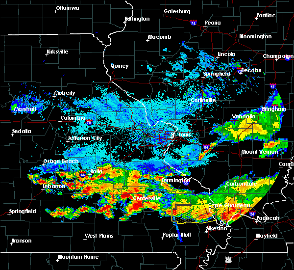 At 346 pm cdt, a cluster of severe thunderstorms were located acorss southern iron county, moving southeast at 10 mph (radar indicated). Hazards include 60 mph wind gusts and quarter size hail. Hail damage to vehicles is expected. expect wind damage to roofs, siding, and trees. Locations impacted include, annapolis, glover, saco, des arc, sabula, chloride, hogan and vulcan. At 346 pm cdt, a cluster of severe thunderstorms were located acorss southern iron county, moving southeast at 10 mph (radar indicated). Hazards include 60 mph wind gusts and quarter size hail. Hail damage to vehicles is expected. expect wind damage to roofs, siding, and trees. Locations impacted include, annapolis, glover, saco, des arc, sabula, chloride, hogan and vulcan.
|
| 8/20/2019 3:14 PM CDT |
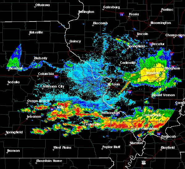 The national weather service in st louis has issued a * severe thunderstorm warning for. southeastern iron county in southeastern missouri. southwestern madison county in southeastern missouri. until 415 pm cdt. At 313 pm cdt, a severe thunderstorm was located near glover,. The national weather service in st louis has issued a * severe thunderstorm warning for. southeastern iron county in southeastern missouri. southwestern madison county in southeastern missouri. until 415 pm cdt. At 313 pm cdt, a severe thunderstorm was located near glover,.
|
| 8/6/2019 5:09 PM CDT |
 At 509 pm cdt, severe thunderstorms were located along a line extending from 6 miles east of glover to 7 miles east of reynolds, moving south at 25 mph (radar indicated). Hazards include 60 mph wind gusts and half dollar size hail. Hail damage to vehicles is expected. expect wind damage to roofs, siding, and trees. locations impacted include, reynolds, ellington, annapolis, glover, oates, garwood, centerville, des arc, corridon, redford, hogan, vulcan, black, sabula, chloride and lesterville. This also includes johnsons shut-ins state park, taum sauk mountain state park, and clearwater lake recreational area. At 509 pm cdt, severe thunderstorms were located along a line extending from 6 miles east of glover to 7 miles east of reynolds, moving south at 25 mph (radar indicated). Hazards include 60 mph wind gusts and half dollar size hail. Hail damage to vehicles is expected. expect wind damage to roofs, siding, and trees. locations impacted include, reynolds, ellington, annapolis, glover, oates, garwood, centerville, des arc, corridon, redford, hogan, vulcan, black, sabula, chloride and lesterville. This also includes johnsons shut-ins state park, taum sauk mountain state park, and clearwater lake recreational area.
|
| 8/6/2019 4:59 PM CDT |
 At 458 pm cdt, severe thunderstorms were located along a line extending from near arcadia to 7 miles northeast of reynolds, moving south at 25 mph (radar indicated). Hazards include 60 mph wind gusts and half dollar size hail. Hail damage to vehicles is expected. Expect wind damage to roofs, siding, and trees. At 458 pm cdt, severe thunderstorms were located along a line extending from near arcadia to 7 miles northeast of reynolds, moving south at 25 mph (radar indicated). Hazards include 60 mph wind gusts and half dollar size hail. Hail damage to vehicles is expected. Expect wind damage to roofs, siding, and trees.
|
| 5/29/2019 4:57 PM CDT |
 At 437 pm cdt, a severe thunderstorm was located near piedmont, moving east at 30 mph (radar indicated). Hazards include 60 mph wind gusts and quarter size hail. Hail damage to vehicles is expected. expect wind damage to roofs, siding, and trees. Locations impacted include, annapolis, des arc, redford and vulcan. At 437 pm cdt, a severe thunderstorm was located near piedmont, moving east at 30 mph (radar indicated). Hazards include 60 mph wind gusts and quarter size hail. Hail damage to vehicles is expected. expect wind damage to roofs, siding, and trees. Locations impacted include, annapolis, des arc, redford and vulcan.
|
| 5/29/2019 4:37 PM CDT |
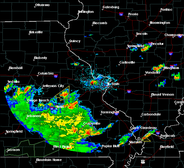 At 437 pm cdt, a severe thunderstorm was located near piedmont, moving east at 30 mph (radar indicated). Hazards include 60 mph wind gusts and quarter size hail. Hail damage to vehicles is expected. expect wind damage to roofs, siding, and trees. Locations impacted include, annapolis, des arc, redford and vulcan. At 437 pm cdt, a severe thunderstorm was located near piedmont, moving east at 30 mph (radar indicated). Hazards include 60 mph wind gusts and quarter size hail. Hail damage to vehicles is expected. expect wind damage to roofs, siding, and trees. Locations impacted include, annapolis, des arc, redford and vulcan.
|
| 5/29/2019 4:28 PM CDT |
 At 428 pm cdt, a severe thunderstorm was located near ellington, moving northeast at 15 mph (radar indicated). Hazards include 60 mph wind gusts and quarter size hail. Hail damage to vehicles is expected. expect wind damage to roofs, siding, and trees. Locations impacted include, ellington, annapolis, des arc, sabula, redford, vulcan and lesterville. At 428 pm cdt, a severe thunderstorm was located near ellington, moving northeast at 15 mph (radar indicated). Hazards include 60 mph wind gusts and quarter size hail. Hail damage to vehicles is expected. expect wind damage to roofs, siding, and trees. Locations impacted include, ellington, annapolis, des arc, sabula, redford, vulcan and lesterville.
|
| 5/29/2019 4:19 PM CDT |
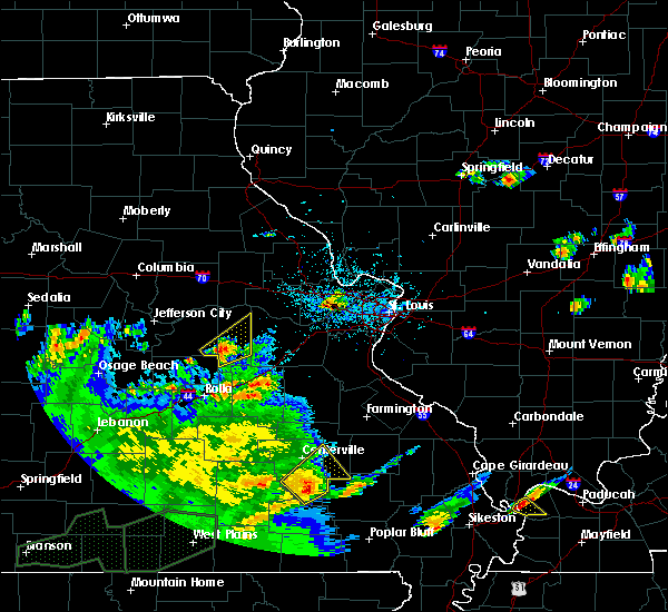 At 419 pm cdt, a severe thunderstorm was located near ellington, moving northeast at 15 mph (radar indicated). Hazards include 60 mph wind gusts and quarter size hail. Hail damage to vehicles is expected. Expect wind damage to roofs, siding, and trees. At 419 pm cdt, a severe thunderstorm was located near ellington, moving northeast at 15 mph (radar indicated). Hazards include 60 mph wind gusts and quarter size hail. Hail damage to vehicles is expected. Expect wind damage to roofs, siding, and trees.
|
| 5/21/2019 2:07 PM CDT |
 The severe thunderstorm warning for iron county in southeastern missouri, jefferson county in east central missouri, west central ste. genevieve, northeastern reynolds and western madison counties in southeastern missouri, eastern washington, southeastern franklin counties in east central missouri and st. francois counties in southeastern missouri will expire at 715 pm cdt, the storms which prompted the warning have moved out of the area. therefore, the warning will be allowed to expire. a tornado watch remains in effect until 1000 pm cdt for southeastern and east central missouri. remember, a severe thunderstorm warning still remains in effect for portions of these counties. The severe thunderstorm warning for iron county in southeastern missouri, jefferson county in east central missouri, west central ste. genevieve, northeastern reynolds and western madison counties in southeastern missouri, eastern washington, southeastern franklin counties in east central missouri and st. francois counties in southeastern missouri will expire at 715 pm cdt, the storms which prompted the warning have moved out of the area. therefore, the warning will be allowed to expire. a tornado watch remains in effect until 1000 pm cdt for southeastern and east central missouri. remember, a severe thunderstorm warning still remains in effect for portions of these counties.
|
| 5/21/2019 1:34 PM CDT |
 At 634 pm cdt, severe thunderstorms were located along a line extending from byrnes mill to near sam a. baker state park, moving east at 35 mph (radar indicated). Hazards include 60 mph wind gusts and penny size hail. Expect damage to roofs, siding, and trees. locations impacted include, farmington, festus, bonne terre, de soto, pevely, desloge, herculaneum, hillsboro, byrnes mill, potosi, bismarck, ironton, leadwood, high ridge, antonia, cedar hill, barnhart, murphy, park hills and olympian village. this also includes washington state park, st. joe state park, st. Francois state park, fort davidson historic site, elephant rocks state park, taum sauk mountain state park, sandy creek covered bridge historic site, and missouri mines historic site. At 634 pm cdt, severe thunderstorms were located along a line extending from byrnes mill to near sam a. baker state park, moving east at 35 mph (radar indicated). Hazards include 60 mph wind gusts and penny size hail. Expect damage to roofs, siding, and trees. locations impacted include, farmington, festus, bonne terre, de soto, pevely, desloge, herculaneum, hillsboro, byrnes mill, potosi, bismarck, ironton, leadwood, high ridge, antonia, cedar hill, barnhart, murphy, park hills and olympian village. this also includes washington state park, st. joe state park, st. Francois state park, fort davidson historic site, elephant rocks state park, taum sauk mountain state park, sandy creek covered bridge historic site, and missouri mines historic site.
|
| 5/21/2019 12:59 PM CDT |
 The national weather service in st louis has issued a * severe thunderstorm warning for. iron county in southeastern missouri. eastern crawford county in east central missouri. jefferson county in east central missouri. west central ste. Genevieve county in southeastern missouri. The national weather service in st louis has issued a * severe thunderstorm warning for. iron county in southeastern missouri. eastern crawford county in east central missouri. jefferson county in east central missouri. west central ste. Genevieve county in southeastern missouri.
|
| 12/1/2018 2:57 AM CST |
 At 257 am cst, severe thunderstorms were located along a line extending from near oates to 8 miles west of annapolis to near piedmont, moving east at 65 mph (radar indicated). Hazards include 60 mph wind gusts. Expect damage to roofs, siding, and trees. locations impacted include, ironton, ellington, pilot knob, viburnum, arcadia, annapolis, belleview, glover, oates, bixby, roselle, centerville, des arc, redford, hogan, vulcan, black, granite, sabula and chloride. This also includes johnsons shut-ins state park, fort davidson historic site, elephant rocks state park, taum sauk mountain state park, and clearwater lake recreational area. At 257 am cst, severe thunderstorms were located along a line extending from near oates to 8 miles west of annapolis to near piedmont, moving east at 65 mph (radar indicated). Hazards include 60 mph wind gusts. Expect damage to roofs, siding, and trees. locations impacted include, ironton, ellington, pilot knob, viburnum, arcadia, annapolis, belleview, glover, oates, bixby, roselle, centerville, des arc, redford, hogan, vulcan, black, granite, sabula and chloride. This also includes johnsons shut-ins state park, fort davidson historic site, elephant rocks state park, taum sauk mountain state park, and clearwater lake recreational area.
|
| 12/1/2018 2:37 AM CST |
 At 236 am cst, severe thunderstorms were located along a line extending from near bunker to near van buren, moving northeast at 65 mph (radar indicated). Hazards include 60 mph wind gusts. expect damage to roofs, siding, and trees At 236 am cst, severe thunderstorms were located along a line extending from near bunker to near van buren, moving northeast at 65 mph (radar indicated). Hazards include 60 mph wind gusts. expect damage to roofs, siding, and trees
|
| 5/31/2018 6:04 PM CDT |
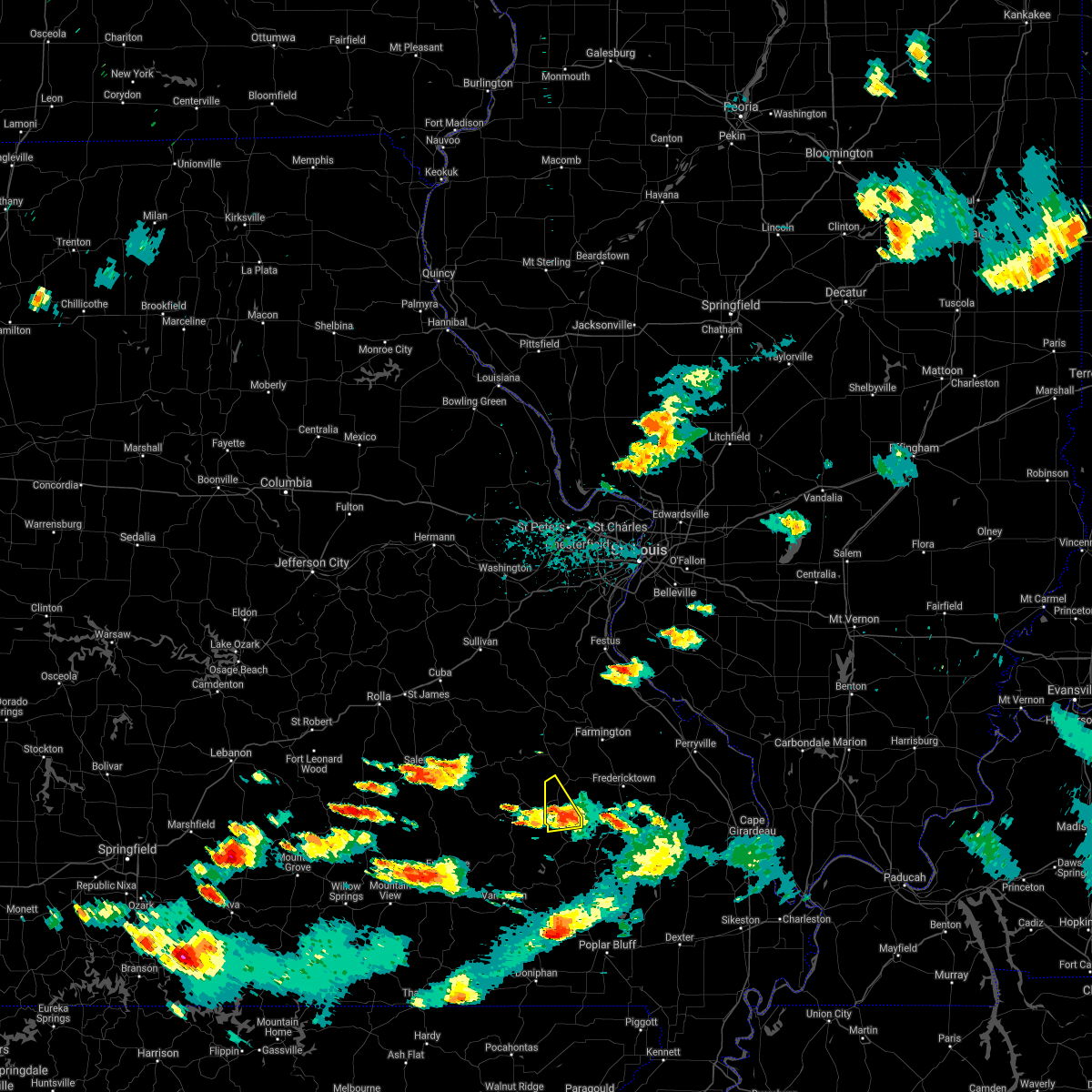 At 604 pm cdt, a severe thunderstorm was located near glover, moving northeast at 30 mph (radar indicated). Hazards include 60 mph wind gusts and quarter size hail. Hail damage to vehicles is expected. expect wind damage to roofs, siding, and trees. locations impacted include, annapolis, glover, sabula, chloride and hogan. A tornado watch remains in effect until 800 pm cdt for southeastern missouri. At 604 pm cdt, a severe thunderstorm was located near glover, moving northeast at 30 mph (radar indicated). Hazards include 60 mph wind gusts and quarter size hail. Hail damage to vehicles is expected. expect wind damage to roofs, siding, and trees. locations impacted include, annapolis, glover, sabula, chloride and hogan. A tornado watch remains in effect until 800 pm cdt for southeastern missouri.
|
| 5/31/2018 5:56 PM CDT |
 At 556 pm cdt, a severe thunderstorm was located near annapolis, moving northeast at 30 mph (radar indicated). Hazards include 60 mph wind gusts and quarter size hail. Hail damage to vehicles is expected. expect wind damage to roofs, siding, and trees. locations impacted include, annapolis, glover, centerville, sabula, chloride, hogan, lesterville and black. this also includes johnsons shut-ins state park and taum sauk mountain state park. A tornado watch remains in effect until 800 pm cdt for southeastern missouri. At 556 pm cdt, a severe thunderstorm was located near annapolis, moving northeast at 30 mph (radar indicated). Hazards include 60 mph wind gusts and quarter size hail. Hail damage to vehicles is expected. expect wind damage to roofs, siding, and trees. locations impacted include, annapolis, glover, centerville, sabula, chloride, hogan, lesterville and black. this also includes johnsons shut-ins state park and taum sauk mountain state park. A tornado watch remains in effect until 800 pm cdt for southeastern missouri.
|
| 5/31/2018 5:39 PM CDT |
 At 538 pm cdt, a severe thunderstorm was located 7 miles east of reynolds, moving northeast at 30 mph (radar indicated). Hazards include 60 mph wind gusts and quarter size hail. Hail damage to vehicles is expected. Expect wind damage to roofs, siding, and trees. At 538 pm cdt, a severe thunderstorm was located 7 miles east of reynolds, moving northeast at 30 mph (radar indicated). Hazards include 60 mph wind gusts and quarter size hail. Hail damage to vehicles is expected. Expect wind damage to roofs, siding, and trees.
|
| 4/3/2018 3:51 PM CDT |
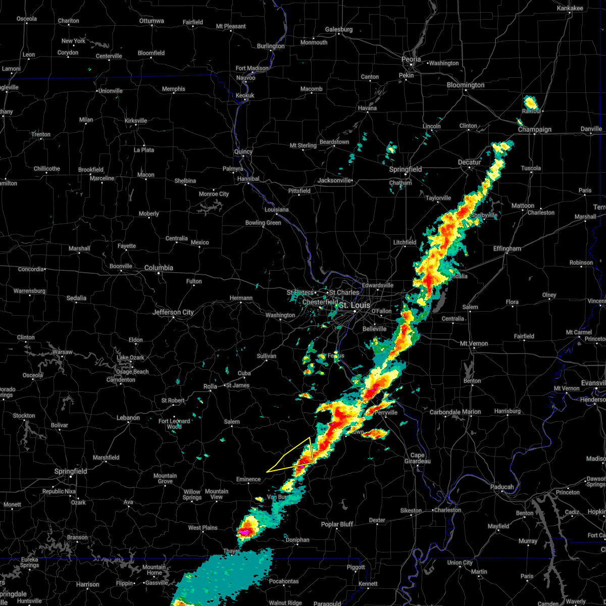 The severe thunderstorm warning for southeastern iron and east central reynolds counties will expire at 400 pm cdt, the severe thunderstorm which prompted the warning has moved out of most of the warned area. a new warning has replaced some of the eastern portions of the warning. therefore, the warning will be allowed to expire. a tornado watch remains in effect until 800 pm cdt for southeastern missouri. The severe thunderstorm warning for southeastern iron and east central reynolds counties will expire at 400 pm cdt, the severe thunderstorm which prompted the warning has moved out of most of the warned area. a new warning has replaced some of the eastern portions of the warning. therefore, the warning will be allowed to expire. a tornado watch remains in effect until 800 pm cdt for southeastern missouri.
|
| 4/3/2018 3:46 PM CDT |
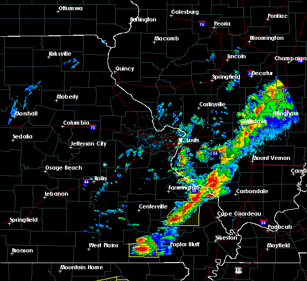 At 346 pm cdt, a severe thunderstorm was located near annapolis, moving east at 45 mph (radar indicated). Hazards include golf ball size hail and 60 mph wind gusts. People and animals outdoors will be injured. expect hail damage to roofs, siding, windows, and vehicles. Expect wind damage to roofs, siding, and trees. At 346 pm cdt, a severe thunderstorm was located near annapolis, moving east at 45 mph (radar indicated). Hazards include golf ball size hail and 60 mph wind gusts. People and animals outdoors will be injured. expect hail damage to roofs, siding, windows, and vehicles. Expect wind damage to roofs, siding, and trees.
|
| 4/3/2018 3:39 PM CDT |
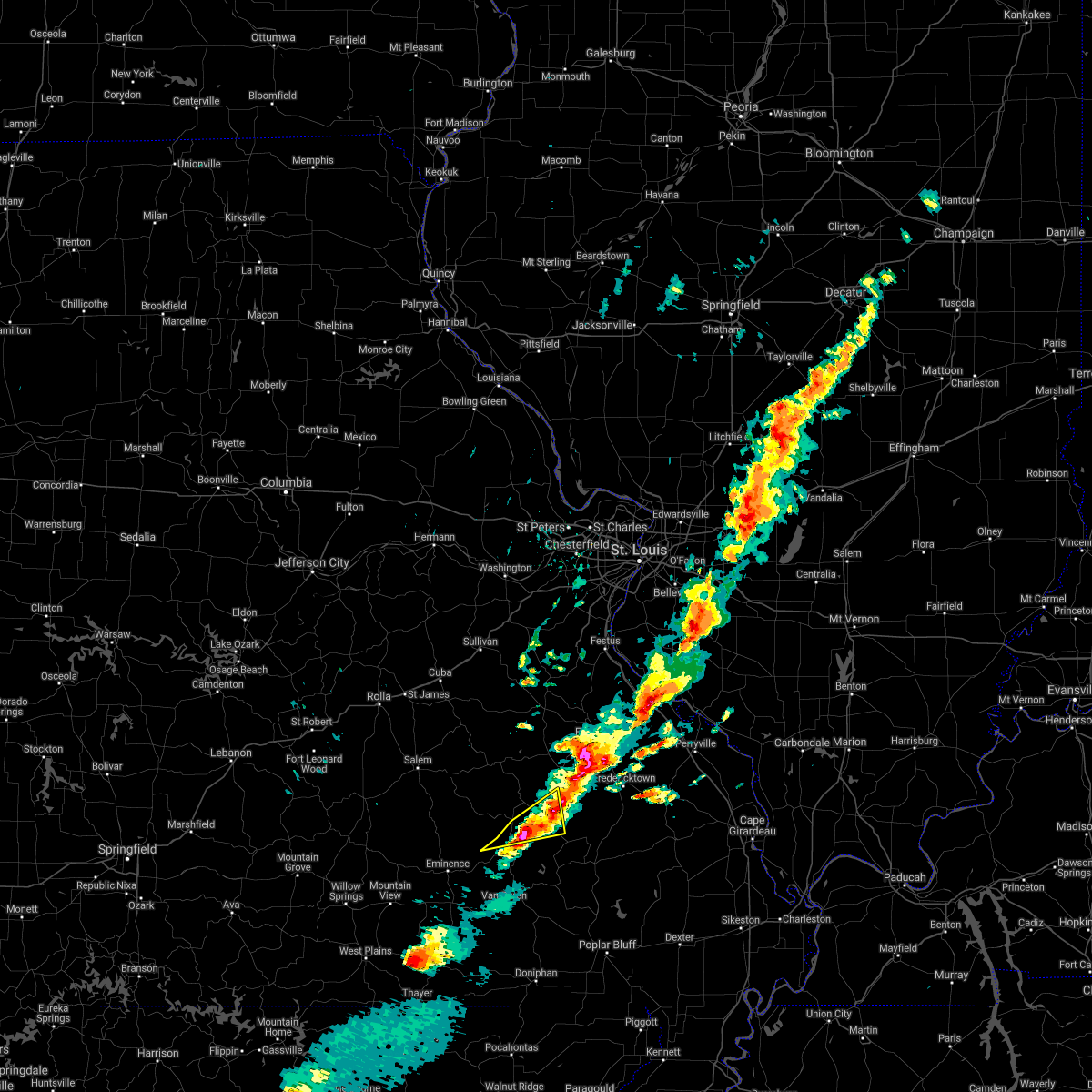 At 338 pm cdt, a severe thunderstorm was located near glover, moving east at 45 mph (radar indicated). Hazards include 60 mph wind gusts and quarter size hail. Hail damage to vehicles is expected. expect wind damage to roofs, siding, and trees. locations impacted include, annapolis, glover, sabula, chloride, redford, hogan and lesterville. A tornado watch remains in effect until 800 pm cdt for southeastern missouri. At 338 pm cdt, a severe thunderstorm was located near glover, moving east at 45 mph (radar indicated). Hazards include 60 mph wind gusts and quarter size hail. Hail damage to vehicles is expected. expect wind damage to roofs, siding, and trees. locations impacted include, annapolis, glover, sabula, chloride, redford, hogan and lesterville. A tornado watch remains in effect until 800 pm cdt for southeastern missouri.
|
| 4/3/2018 3:13 PM CDT |
 At 312 pm cdt, a severe thunderstorm was located over reynolds, moving east at 45 mph (radar indicated). Hazards include 60 mph wind gusts and quarter size hail. Hail damage to vehicles is expected. Expect wind damage to roofs, siding, and trees. At 312 pm cdt, a severe thunderstorm was located over reynolds, moving east at 45 mph (radar indicated). Hazards include 60 mph wind gusts and quarter size hail. Hail damage to vehicles is expected. Expect wind damage to roofs, siding, and trees.
|
| 5/27/2017 5:08 PM CDT |
 The severe thunderstorm warning for southeastern iron and southeastern reynolds counties will expire at 515 pm cdt, the storms which prompted the warning have moved out of the area. therefore the warning will be allowed to expire. however gusty winds are still possible with these thunderstorms. a tornado watch remains in effect until 700 pm cdt for southeastern missouri. The severe thunderstorm warning for southeastern iron and southeastern reynolds counties will expire at 515 pm cdt, the storms which prompted the warning have moved out of the area. therefore the warning will be allowed to expire. however gusty winds are still possible with these thunderstorms. a tornado watch remains in effect until 700 pm cdt for southeastern missouri.
|
| 5/27/2017 5:03 PM CDT |
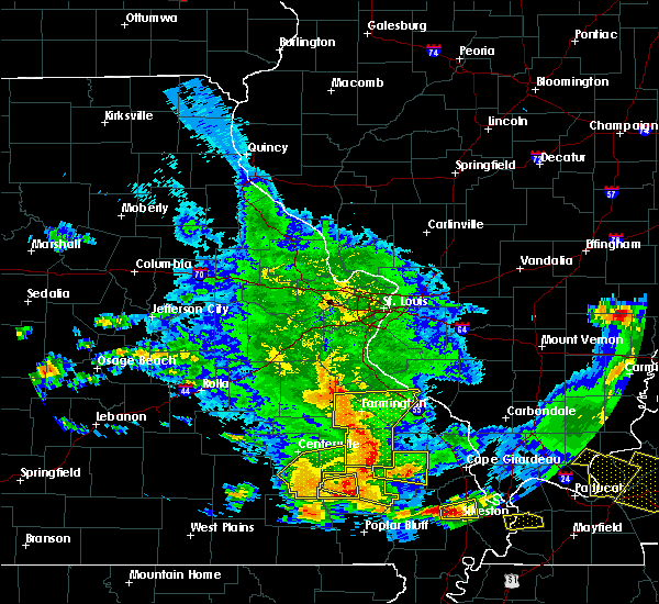 At 503 pm cdt, severe thunderstorms were located along a line extending from 7 miles north of saco to near piedmont, moving east at 60 mph (radar indicated). Hazards include 60 mph wind gusts. Expect damage to roofs, siding, and trees. locations impacted include, ellington, annapolis, garwood, des arc, sabula, chloride, redford and vulcan. this also includes clearwater lake recreational area. A tornado watch remains in effect until 700 pm cdt for southeastern missouri. At 503 pm cdt, severe thunderstorms were located along a line extending from 7 miles north of saco to near piedmont, moving east at 60 mph (radar indicated). Hazards include 60 mph wind gusts. Expect damage to roofs, siding, and trees. locations impacted include, ellington, annapolis, garwood, des arc, sabula, chloride, redford and vulcan. this also includes clearwater lake recreational area. A tornado watch remains in effect until 700 pm cdt for southeastern missouri.
|
| 5/27/2017 4:43 PM CDT |
 At 443 pm cdt, severe thunderstorms were located along a line extending from near glover to near ellington, moving east at 70 mph. these are very dangerous storms (radar indicated). Hazards include 80 mph wind gusts. Flying debris will be dangerous to those caught without shelter. mobile homes will be heavily damaged. expect considerable damage to roofs, windows, and vehicles. extensive tree damage and power outages are likely. locations impacted include, reynolds, ellington, annapolis, glover, garwood, centerville, des arc, corridon, redford, vulcan, sabula, chloride and lesterville. this also includes clearwater lake recreational area. A tornado watch remains in effect until 700 pm cdt for southeastern missouri. At 443 pm cdt, severe thunderstorms were located along a line extending from near glover to near ellington, moving east at 70 mph. these are very dangerous storms (radar indicated). Hazards include 80 mph wind gusts. Flying debris will be dangerous to those caught without shelter. mobile homes will be heavily damaged. expect considerable damage to roofs, windows, and vehicles. extensive tree damage and power outages are likely. locations impacted include, reynolds, ellington, annapolis, glover, garwood, centerville, des arc, corridon, redford, vulcan, sabula, chloride and lesterville. this also includes clearwater lake recreational area. A tornado watch remains in effect until 700 pm cdt for southeastern missouri.
|
| 5/27/2017 4:19 PM CDT |
 At 419 pm cdt, severe thunderstorms were located along a line extending from near bunker to 8 miles west of eminence, moving east at 60 mph (radar indicated). Hazards include 70 mph wind gusts. Expect considerable tree damage. Damage is likely to mobile homes, roofs, and outbuildings. At 419 pm cdt, severe thunderstorms were located along a line extending from near bunker to 8 miles west of eminence, moving east at 60 mph (radar indicated). Hazards include 70 mph wind gusts. Expect considerable tree damage. Damage is likely to mobile homes, roofs, and outbuildings.
|
| 5/27/2017 4:02 PM CDT | Trees down in sac in madison county MO, 13.6 miles W of Annapolis, MO |
| 5/27/2017 3:40 PM CDT |
 At 340 pm cdt, a severe thunderstorm was located near annapolis, moving east at 20 mph (trained weather spotters). Hazards include half dollar size hail. Damage to vehicles is expected. locations impacted include, annapolis, glover, sabula, chloride and hogan. A tornado watch remains in effect until 700 pm cdt for southeastern missouri. At 340 pm cdt, a severe thunderstorm was located near annapolis, moving east at 20 mph (trained weather spotters). Hazards include half dollar size hail. Damage to vehicles is expected. locations impacted include, annapolis, glover, sabula, chloride and hogan. A tornado watch remains in effect until 700 pm cdt for southeastern missouri.
|
| 5/27/2017 3:35 PM CDT | Half Dollar sized hail reported 4.8 miles S of Annapolis, MO |
| 5/27/2017 3:35 PM CDT | Half Dollar sized hail reported 2.8 miles S of Annapolis, MO |
| 5/27/2017 3:26 PM CDT |
 At 326 pm cdt, a severe thunderstorm was located near glover, moving east at 35 mph (radar indicated). Hazards include half dollar size hail. Damage to vehicles is expected. locations impacted include, annapolis, glover, sabula, chloride and hogan. A tornado watch remains in effect until 700 pm cdt for southeastern missouri. At 326 pm cdt, a severe thunderstorm was located near glover, moving east at 35 mph (radar indicated). Hazards include half dollar size hail. Damage to vehicles is expected. locations impacted include, annapolis, glover, sabula, chloride and hogan. A tornado watch remains in effect until 700 pm cdt for southeastern missouri.
|
| 5/27/2017 3:10 PM CDT |
 At 310 pm cdt, a severe thunderstorm was located 9 miles west of annapolis, moving east at 20 mph (law enforcement). Hazards include quarter size hail. damage to vehicles is expected At 310 pm cdt, a severe thunderstorm was located 9 miles west of annapolis, moving east at 20 mph (law enforcement). Hazards include quarter size hail. damage to vehicles is expected
|
| 5/27/2017 3:10 PM CDT |
 At 326 pm cdt, a severe thunderstorm was located near glover, moving east at 35 mph (radar indicated). Hazards include half dollar size hail. Damage to vehicles is expected. locations impacted include, annapolis, glover, sabula, chloride and hogan. A tornado watch remains in effect until 700 pm cdt for southeastern missouri. At 326 pm cdt, a severe thunderstorm was located near glover, moving east at 35 mph (radar indicated). Hazards include half dollar size hail. Damage to vehicles is expected. locations impacted include, annapolis, glover, sabula, chloride and hogan. A tornado watch remains in effect until 700 pm cdt for southeastern missouri.
|
| 4/28/2017 9:48 PM CDT |
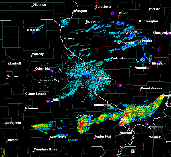 At 947 pm cdt, a severe thunderstorm was located near ellington, moving northeast at 50 mph (radar indicated). Hazards include golf ball size hail. People and animals outdoors will be injured. expect damage to roofs, siding, windows, and vehicles. locations impacted include, annapolis, des arc, sabula and vulcan. This also includes clearwater lake recreational area. At 947 pm cdt, a severe thunderstorm was located near ellington, moving northeast at 50 mph (radar indicated). Hazards include golf ball size hail. People and animals outdoors will be injured. expect damage to roofs, siding, windows, and vehicles. locations impacted include, annapolis, des arc, sabula and vulcan. This also includes clearwater lake recreational area.
|
| 4/28/2017 9:40 PM CDT |
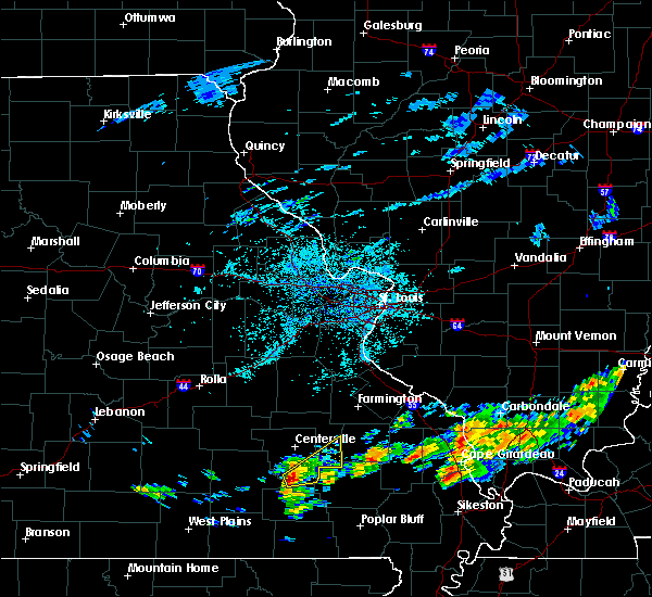 At 940 pm cdt, a severe thunderstorm was located near ellington, moving northeast at 50 mph (radar indicated). Hazards include half dollar size hail. damage to vehicles is expected At 940 pm cdt, a severe thunderstorm was located near ellington, moving northeast at 50 mph (radar indicated). Hazards include half dollar size hail. damage to vehicles is expected
|
| 4/26/2017 12:24 PM CDT |
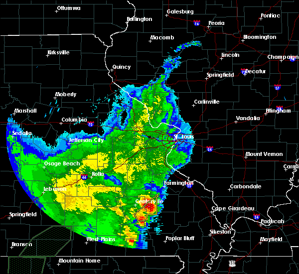 At 1224 pm cdt, a severe thunderstorm was located near annapolis, moving northeast at 45 mph (radar indicated). Hazards include 60 mph wind gusts and quarter size hail. Hail damage to vehicles is expected. expect wind damage to roofs, siding, and trees. Locations impacted include, annapolis, glover, des arc, sabula, chloride and vulcan. At 1224 pm cdt, a severe thunderstorm was located near annapolis, moving northeast at 45 mph (radar indicated). Hazards include 60 mph wind gusts and quarter size hail. Hail damage to vehicles is expected. expect wind damage to roofs, siding, and trees. Locations impacted include, annapolis, glover, des arc, sabula, chloride and vulcan.
|
| 4/26/2017 12:20 PM CDT | Quarter sized hail reported 0.2 miles E of Annapolis, MO, hail approaching quarter size at the onset of event quickly diminished in size thereafter. |
| 4/26/2017 12:10 PM CDT |
 At 1209 pm cdt, a severe thunderstorm was located near annapolis, moving northeast at 45 mph (radar indicated). Hazards include 60 mph wind gusts and quarter size hail. Hail damage to vehicles is expected. expect wind damage to roofs, siding, and trees. Locations impacted include, annapolis, glover, roselle, des arc, sabula, chloride, redford and vulcan. At 1209 pm cdt, a severe thunderstorm was located near annapolis, moving northeast at 45 mph (radar indicated). Hazards include 60 mph wind gusts and quarter size hail. Hail damage to vehicles is expected. expect wind damage to roofs, siding, and trees. Locations impacted include, annapolis, glover, roselle, des arc, sabula, chloride, redford and vulcan.
|
| 4/26/2017 11:55 AM CDT |
 At 1155 am cdt, a severe thunderstorm was located near ellington, moving northeast at 45 mph (radar indicated). Hazards include 60 mph wind gusts and quarter size hail. Hail damage to vehicles is expected. Expect wind damage to roofs, siding, and trees. At 1155 am cdt, a severe thunderstorm was located near ellington, moving northeast at 45 mph (radar indicated). Hazards include 60 mph wind gusts and quarter size hail. Hail damage to vehicles is expected. Expect wind damage to roofs, siding, and trees.
|
| 3/1/2017 3:29 AM CST |
 At 329 am cst, a severe thunderstorm was located near annapolis, moving east at 85 mph (radar indicated). Hazards include 60 mph wind gusts and quarter size hail. Hail damage to vehicles is expected. expect wind damage to roofs, siding, and trees. locations impacted include, ironton, ellington, arcadia, annapolis, glover, garwood, centerville, des arc, redford, hogan, vulcan, black, sabula, chloride and lesterville. this also includes johnsons shut-ins state park, taum sauk mountain state park, and clearwater lake recreational area. A tornado watch remains in effect until 400 am cst for southeastern missouri. At 329 am cst, a severe thunderstorm was located near annapolis, moving east at 85 mph (radar indicated). Hazards include 60 mph wind gusts and quarter size hail. Hail damage to vehicles is expected. expect wind damage to roofs, siding, and trees. locations impacted include, ironton, ellington, arcadia, annapolis, glover, garwood, centerville, des arc, redford, hogan, vulcan, black, sabula, chloride and lesterville. this also includes johnsons shut-ins state park, taum sauk mountain state park, and clearwater lake recreational area. A tornado watch remains in effect until 400 am cst for southeastern missouri.
|
| 3/1/2017 3:11 AM CST |
 At 311 am cst, a severe thunderstorm was located 9 miles south of bunker, moving east at 80 mph (radar indicated). Hazards include 60 mph wind gusts and quarter size hail. Hail damage to vehicles is expected. Expect wind damage to roofs, siding, and trees. At 311 am cst, a severe thunderstorm was located 9 miles south of bunker, moving east at 80 mph (radar indicated). Hazards include 60 mph wind gusts and quarter size hail. Hail damage to vehicles is expected. Expect wind damage to roofs, siding, and trees.
|
| 7/6/2016 11:25 AM CDT |
 At 1125 am cdt, severe thunderstorms were located along a line extending from 10 miles south of cherryville to near bixby to 6 miles west of glover to near annapolis to near piedmont, moving east at 55 mph (radar indicated). Hazards include 60 mph wind gusts. Expect damage to roofs. siding. And trees. At 1125 am cdt, severe thunderstorms were located along a line extending from 10 miles south of cherryville to near bixby to 6 miles west of glover to near annapolis to near piedmont, moving east at 55 mph (radar indicated). Hazards include 60 mph wind gusts. Expect damage to roofs. siding. And trees.
|
| 7/6/2016 11:17 AM CDT |
 At 1116 am cdt, severe thunderstorms were located along a line extending from near salem to near viburnum to 8 miles west of annapolis to near garwood, moving east at 50 mph (radar indicated). Hazards include 60 mph wind gusts. Expect damage to roofs. siding. and trees. locations impacted include, ironton, reynolds, ellington, pilot knob, viburnum, arcadia, annapolis, bixby, garwood, glover, oates, belleview, courtois, centerville, des arc, caledonia, dillard, black, hogan and chloride. This also includes johnsons shut-ins state park, fort davidson historic site, elephant rocks state park, dillard mill historic site, taum sauk mountain state park, and clearwater lake recreational area. At 1116 am cdt, severe thunderstorms were located along a line extending from near salem to near viburnum to 8 miles west of annapolis to near garwood, moving east at 50 mph (radar indicated). Hazards include 60 mph wind gusts. Expect damage to roofs. siding. and trees. locations impacted include, ironton, reynolds, ellington, pilot knob, viburnum, arcadia, annapolis, bixby, garwood, glover, oates, belleview, courtois, centerville, des arc, caledonia, dillard, black, hogan and chloride. This also includes johnsons shut-ins state park, fort davidson historic site, elephant rocks state park, dillard mill historic site, taum sauk mountain state park, and clearwater lake recreational area.
|
| 7/6/2016 10:44 AM CDT |
 The national weather service in st louis has issued a * severe thunderstorm warning for. iron county in southeastern missouri. southeastern crawford county in east central missouri. reynolds county in southeastern missouri. Southwestern washington county in east central missouri. The national weather service in st louis has issued a * severe thunderstorm warning for. iron county in southeastern missouri. southeastern crawford county in east central missouri. reynolds county in southeastern missouri. Southwestern washington county in east central missouri.
|
| 12/23/2015 9:58 AM CST | The national weather service in st louis has issued a * severe thunderstorm warning for. southwestern st. francois county in southeastern missouri. eastern iron county in southeastern missouri. madison county in southeastern missouri. Until 1045 am cst. |
| 8/10/2015 12:59 AM CDT |
 At 1257 am cdt, severe thunderstorms were located along a line extending from near saco to 9 miles west of annapolis, moving southeast at 30 mph. several weak circulations are evident on radar in southern madison county on the leading edge of the line of storms (radar indicated). Hazards include 60 mph wind gusts. Expect damage to roofs. Siding and trees. At 1257 am cdt, severe thunderstorms were located along a line extending from near saco to 9 miles west of annapolis, moving southeast at 30 mph. several weak circulations are evident on radar in southern madison county on the leading edge of the line of storms (radar indicated). Hazards include 60 mph wind gusts. Expect damage to roofs. Siding and trees.
|
| 7/20/2015 5:02 PM CDT |
 At 501 pm cdt, a severe thunderstorm was located over annapolis, moving east at 20 mph (radar indicated). Hazards include 60 mph wind gusts and penny size hail. Expect damage to roofs. Siding and trees. At 501 pm cdt, a severe thunderstorm was located over annapolis, moving east at 20 mph (radar indicated). Hazards include 60 mph wind gusts and penny size hail. Expect damage to roofs. Siding and trees.
|
| 5/10/2015 4:18 PM CDT | At 414 pm cdt, a severe thunderstorm was located near annapolis, and moving northeast at 40 mph (radar indicated). Hazards include 60 mph wind gusts and quarter size hail. Hail damage to vehicles is expected. Expect wind damage to roofs, siding and trees. |
| 4/9/2015 8:20 PM CDT | A severe thunderstorm warning remains in effect for madison and iron counties until 845 pm cdt. at 816 pm cdt. a severe thunderstorm was located 6 miles south of roselle. and moving east at 50 mph. hazard. 60 mph wind gusts and quarter size hail. source. Radar indicated. |
| 4/9/2015 7:59 PM CDT | The national weather service in st louis has issued a * severe thunderstorm warning for. iron county in southeast missouri. madison county in southeast missouri. northeastern reynolds county in southeast missouri. Until 845 pm cdt. |
| 4/9/2015 7:37 PM CDT | A severe thunderstorm warning remains in effect for northern reynolds and iron counties until 800 pm cdt. at 734 pm cdt. a severe thunderstorm was located 6 miles north of reynolds. and moving east at 35 mph. hazard. 60 mph wind gusts and quarter size hail. source. Radar indicated. |
| 4/9/2015 7:17 PM CDT | The national weather service in st louis has issued a * severe thunderstorm warning for. iron county in southeast missouri. northern reynolds county in southeast missouri. until 800 pm cdt * at 714 pm cdt. a severe thunderstorm was located near bunker. And. |
| 3/25/2015 8:06 PM CDT | The national weather service in st louis has issued a * severe thunderstorm warning for. iron county in southeast missouri. until 845 pm cdt * at 803 pm cdt. Severe thunderstorms were located along a line extending from 6 miles northwest of annapolis to piedmont to 11. |
| 8/7/2013 3:55 AM CDT | Tree blown down onto highway 49 just north of annapoli in iron county MO, 0.7 miles SSE of Annapolis, MO |
| 7/23/2013 6:30 PM CDT | Quarter sized hail reported 0.2 miles E of Annapolis, MO, reported from iron county ems |
| 7/23/2013 6:23 PM CDT | Quarter sized hail reported 0.2 miles E of Annapolis, MO |
| 9/6/2012 4:25 PM CDT | Tree fell onto house...time est from radar in iron county MO, 0.2 miles E of Annapolis, MO |
| 1/1/0001 12:00 AM | Tree blown down...unknown size...blocking state hwy c east of annapolis in iron county MO, 2 miles W of Annapolis, MO |
Hail Maps for Annapolis, MO
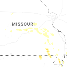
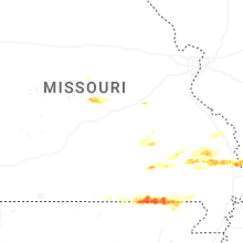
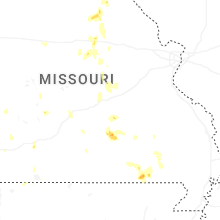
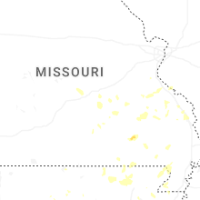
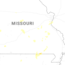
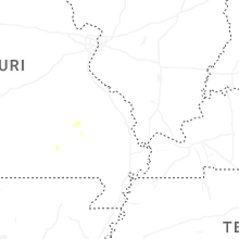

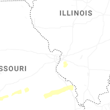


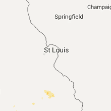


Connect with Interactive Hail Maps