

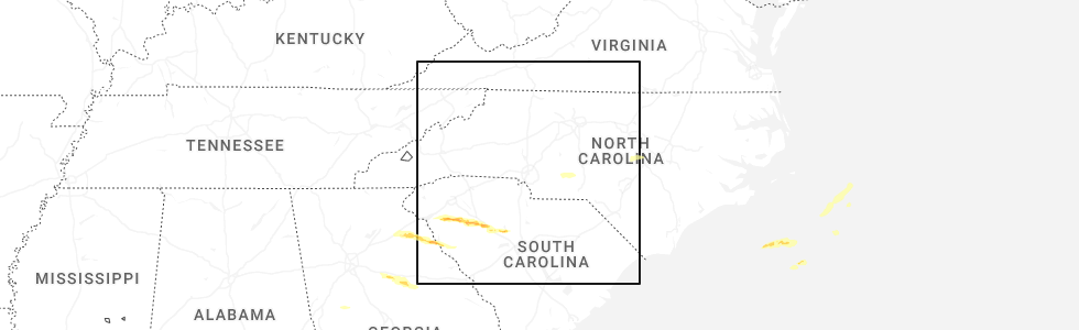
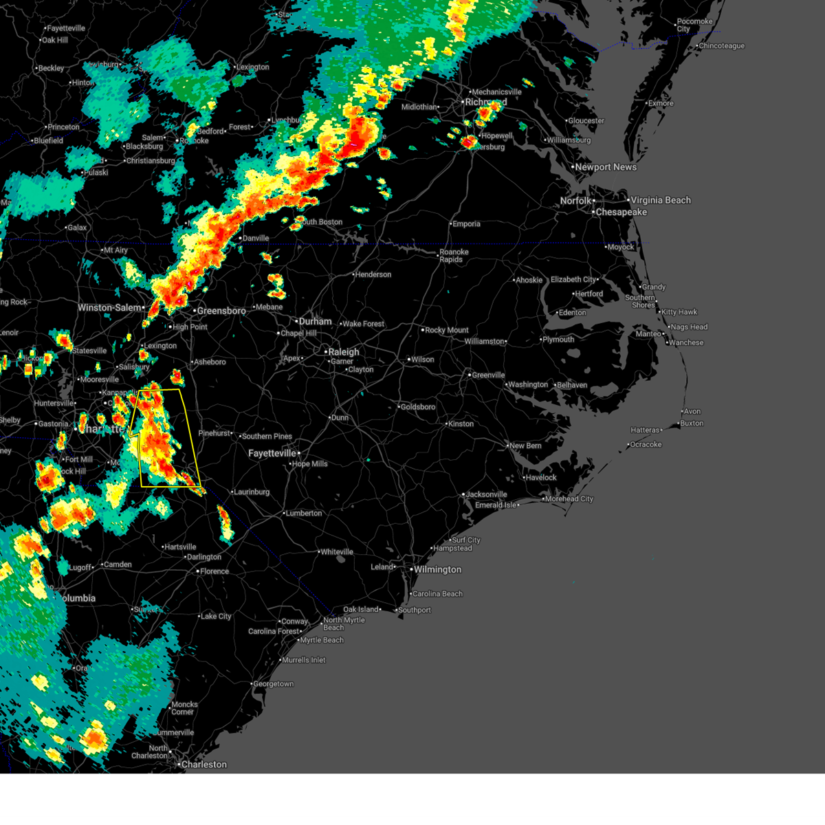
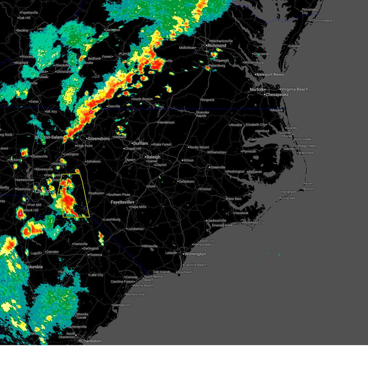
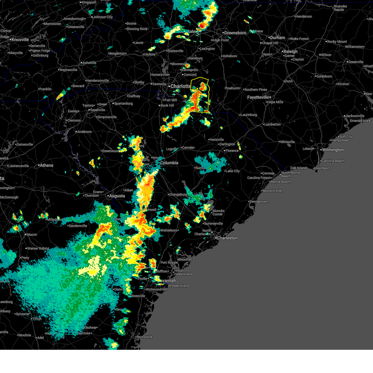
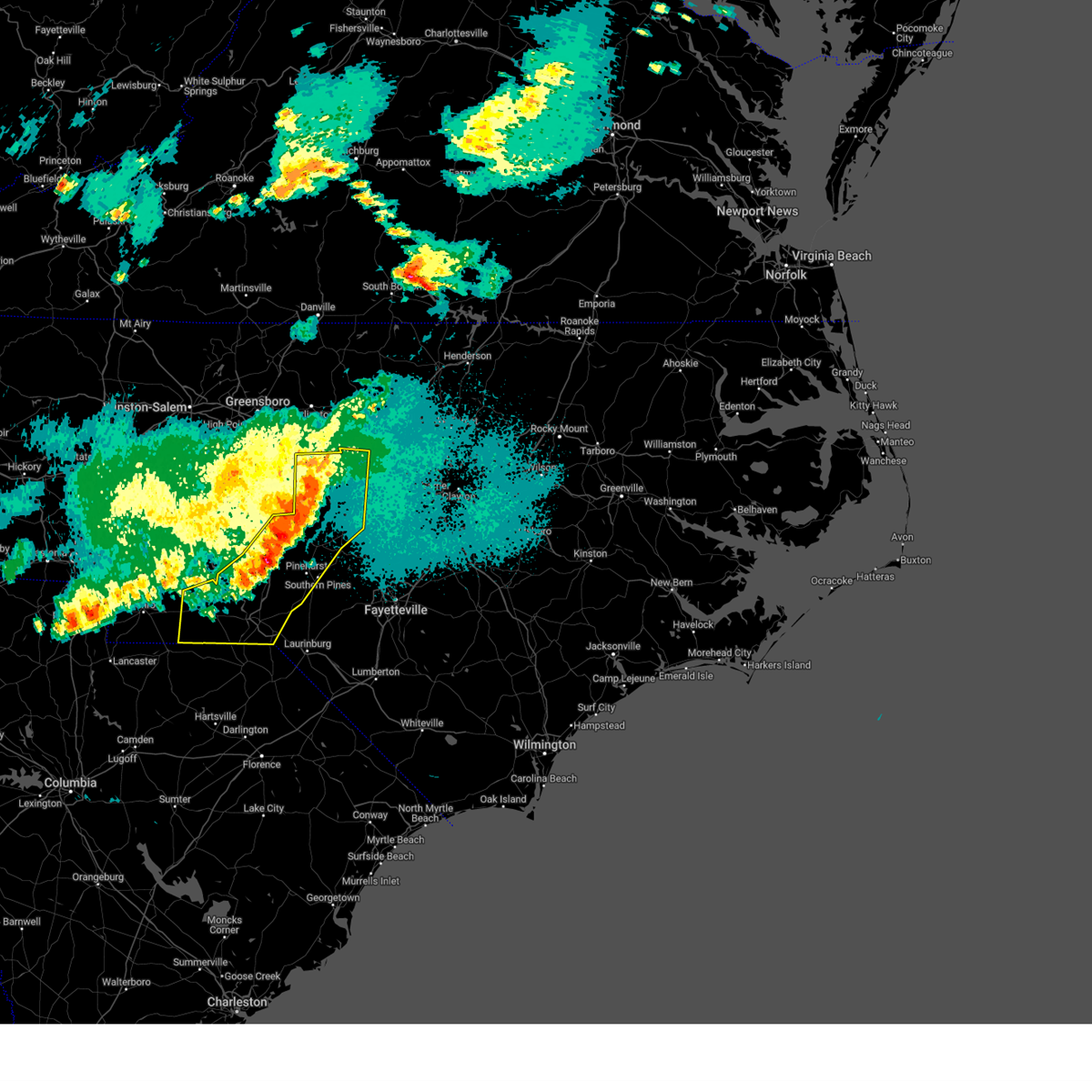
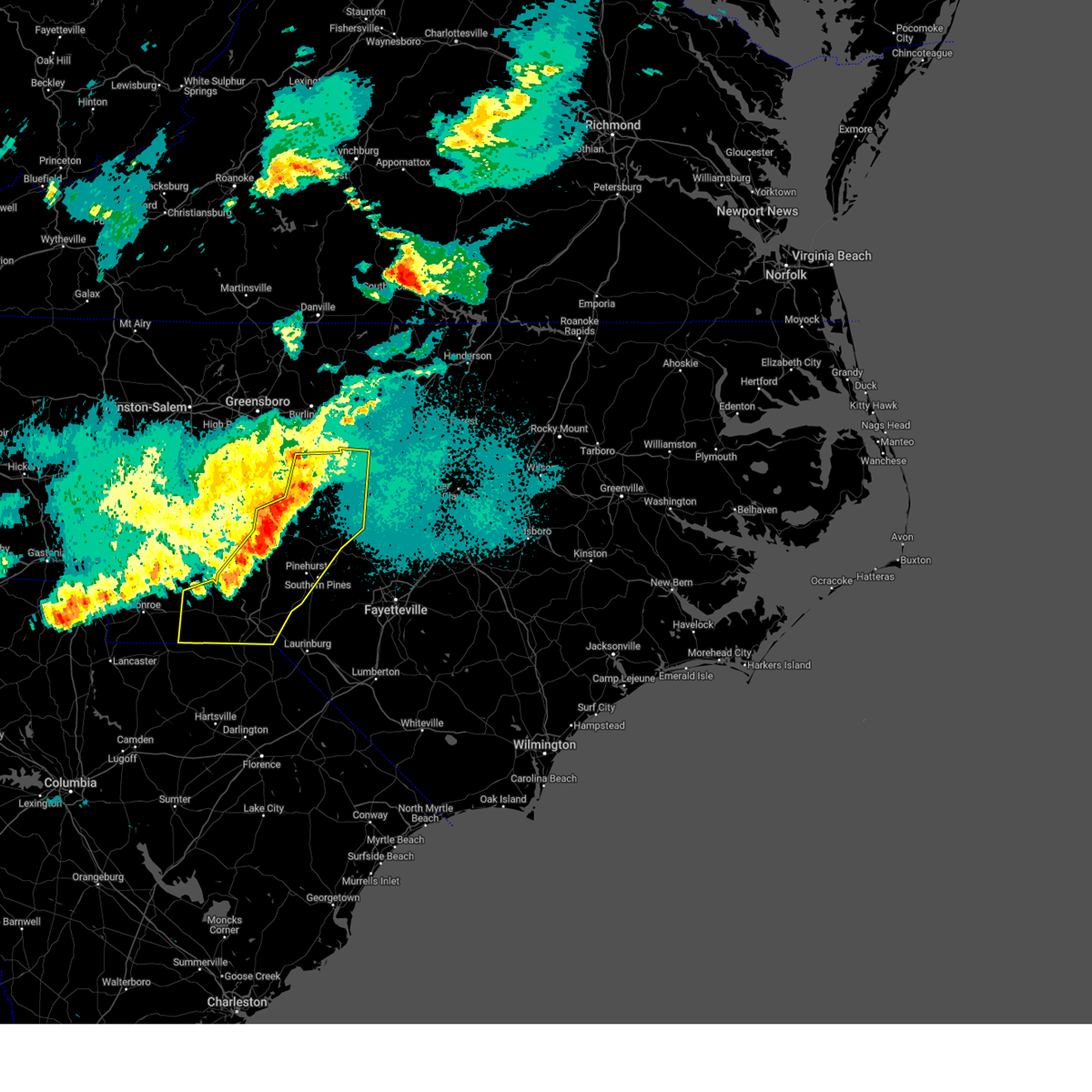
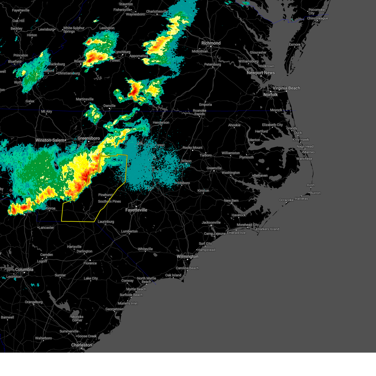
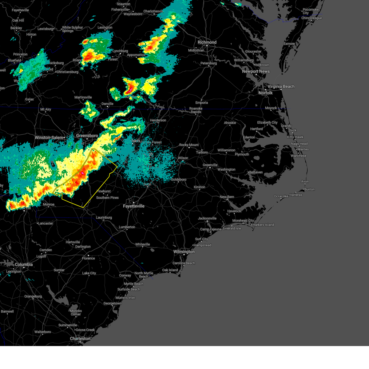
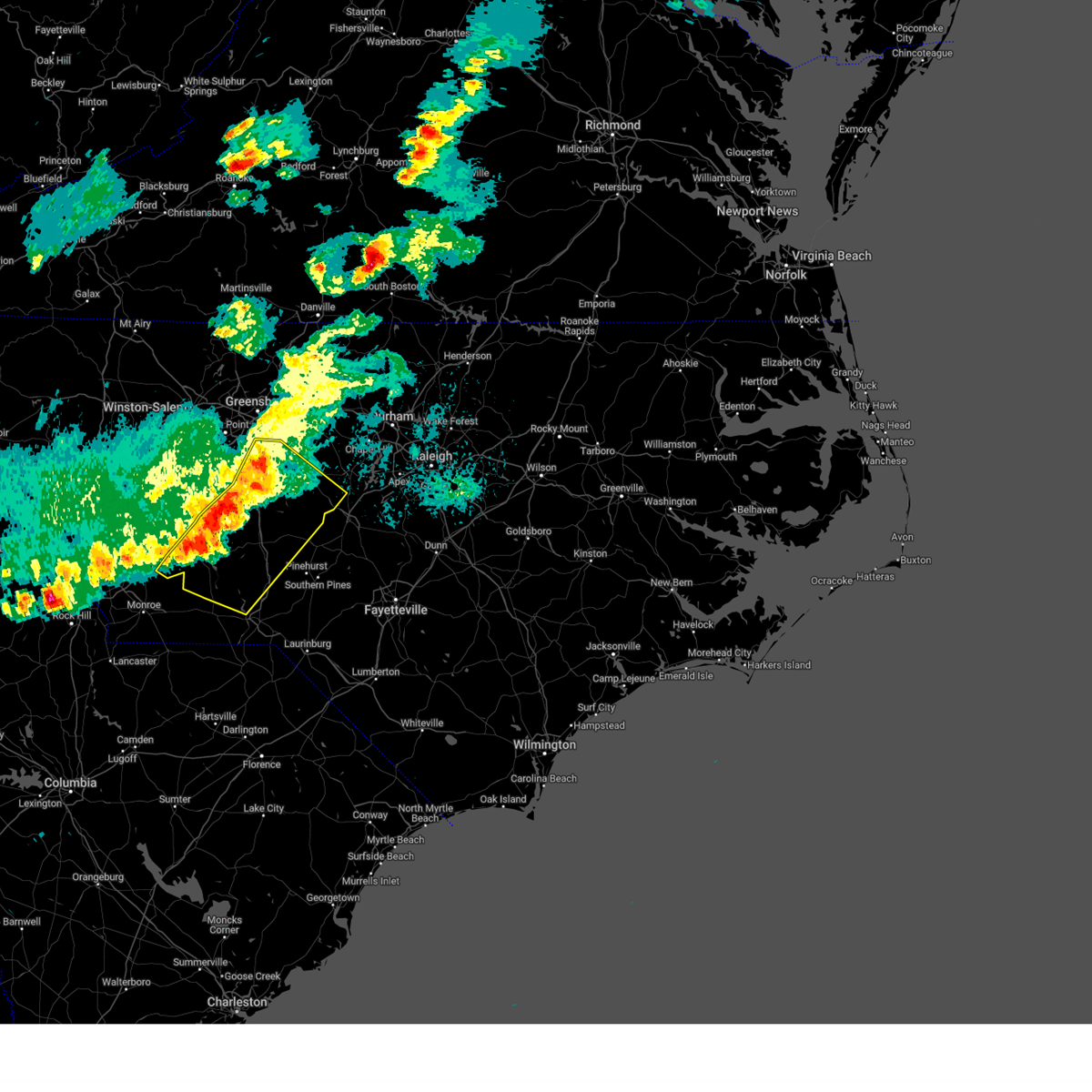
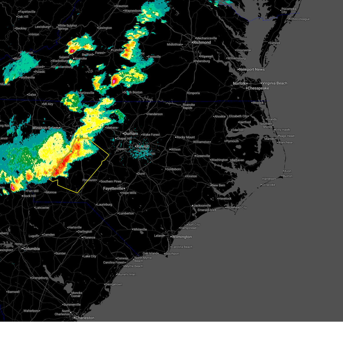
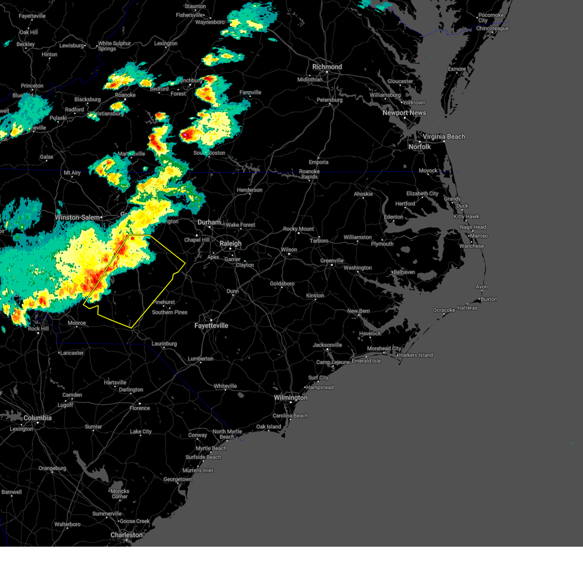
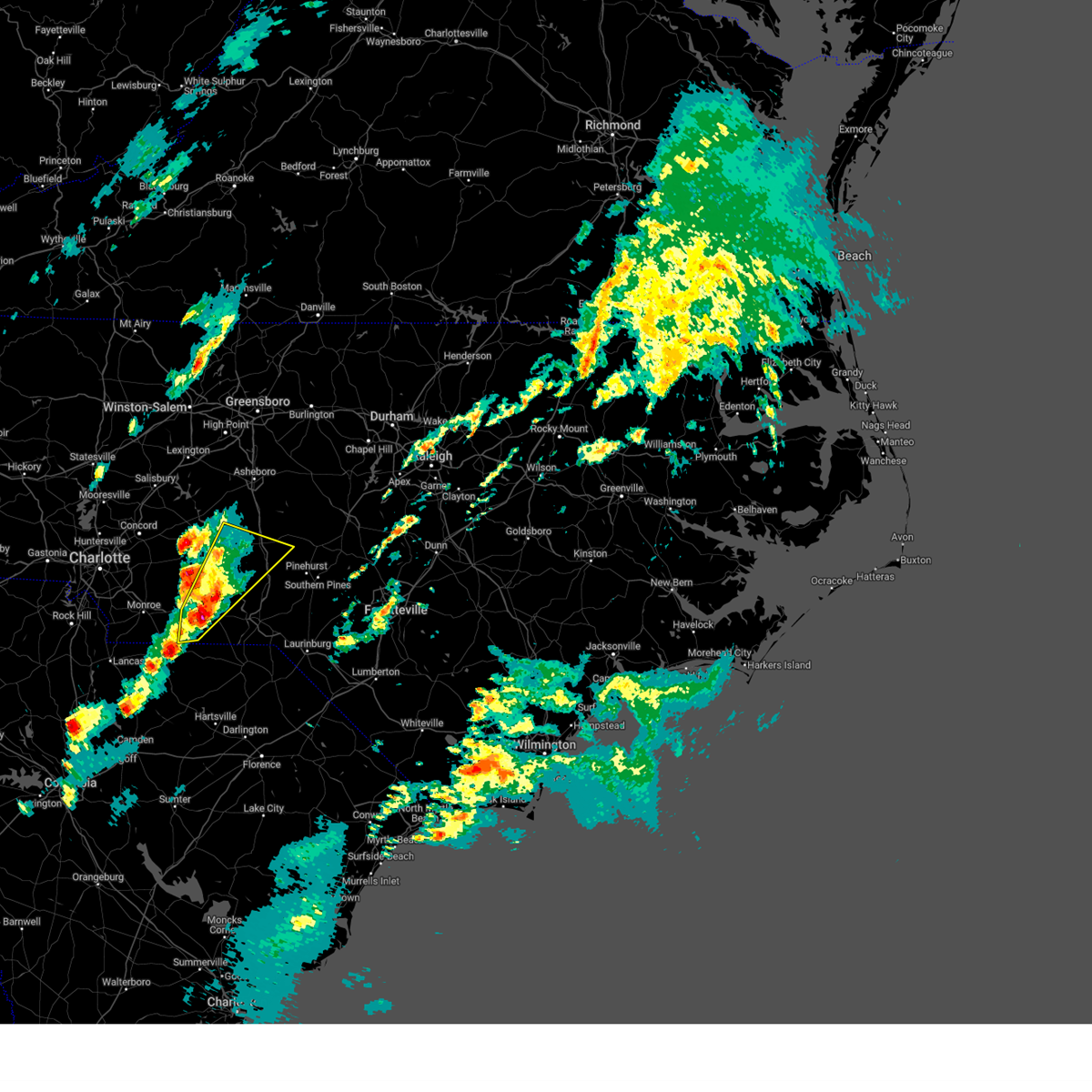
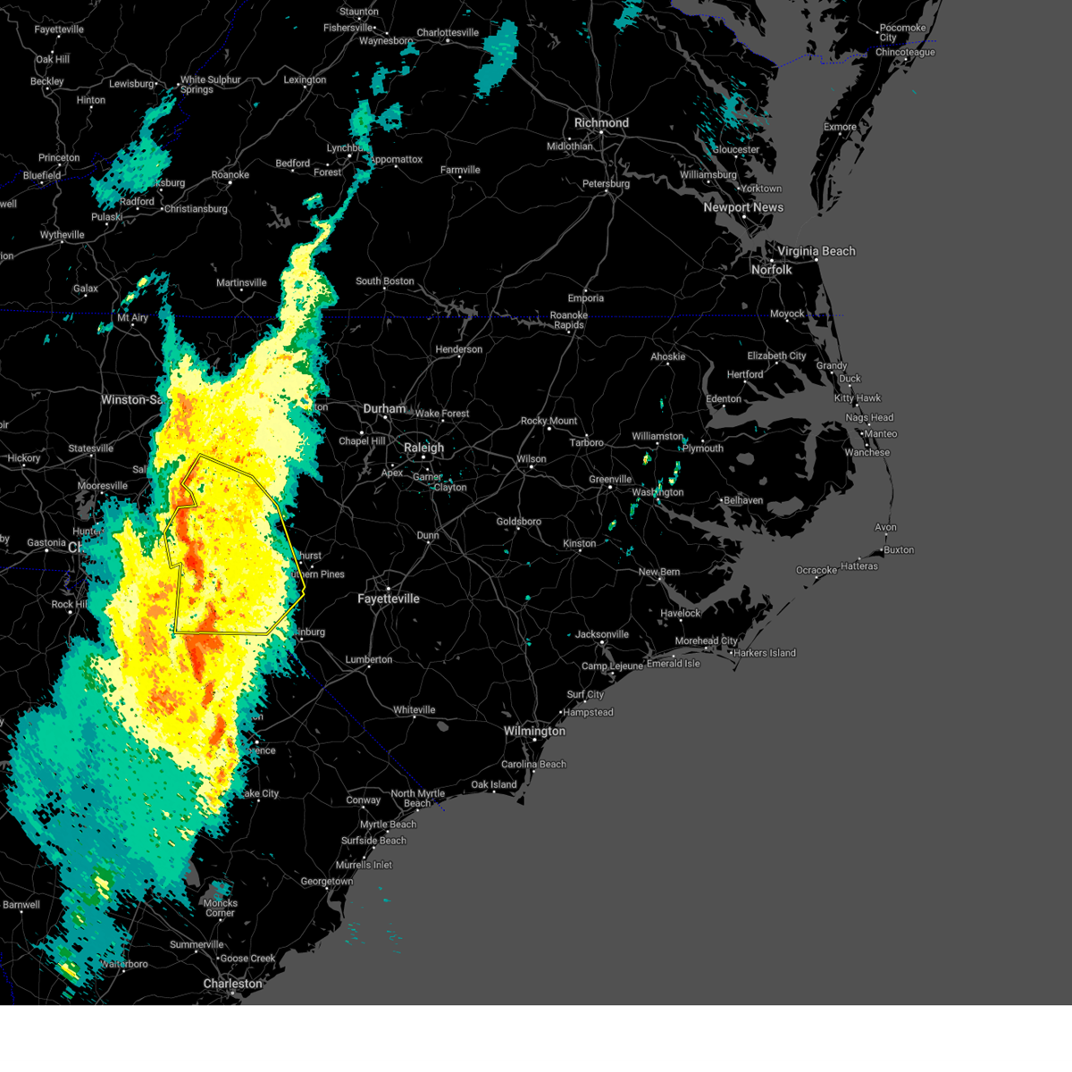
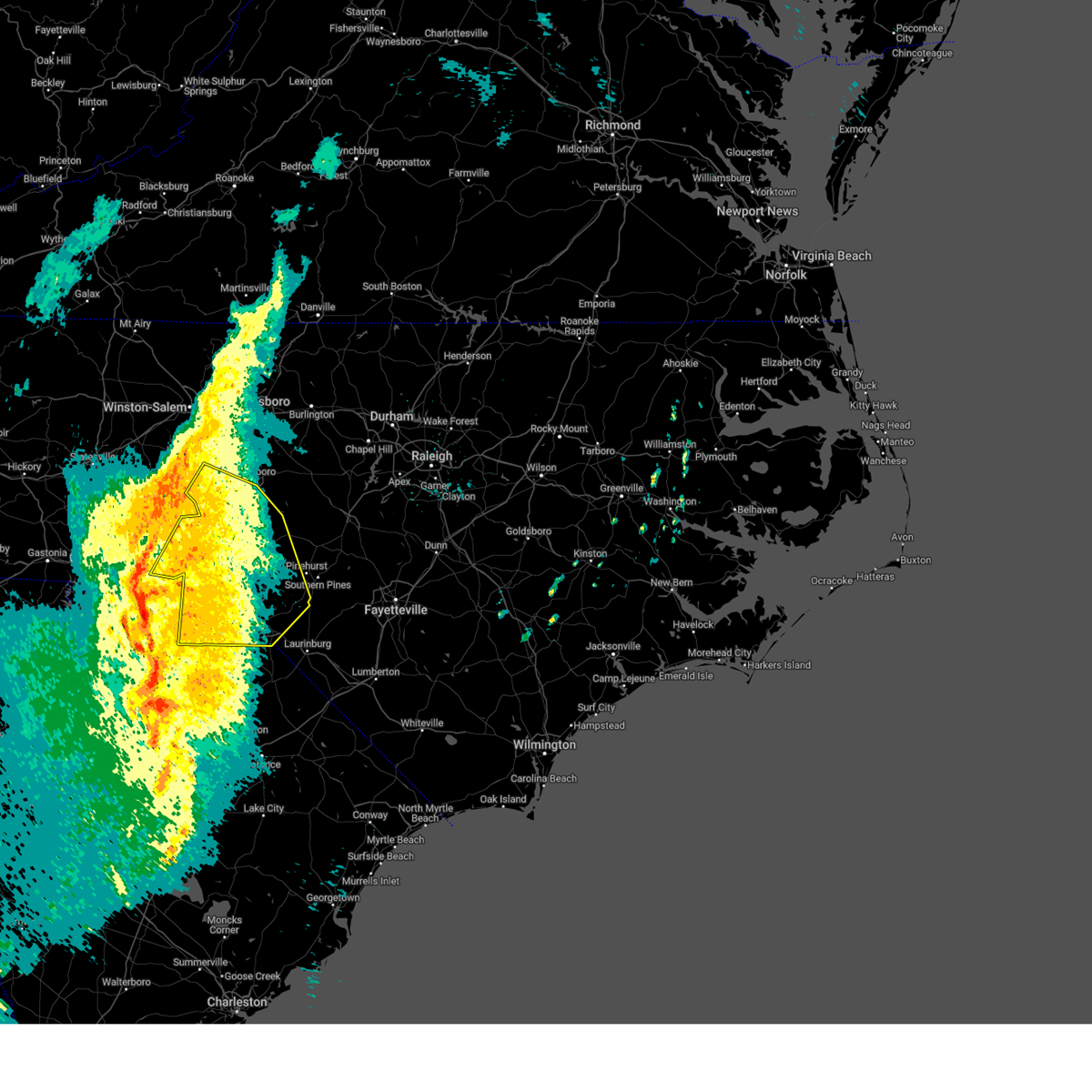
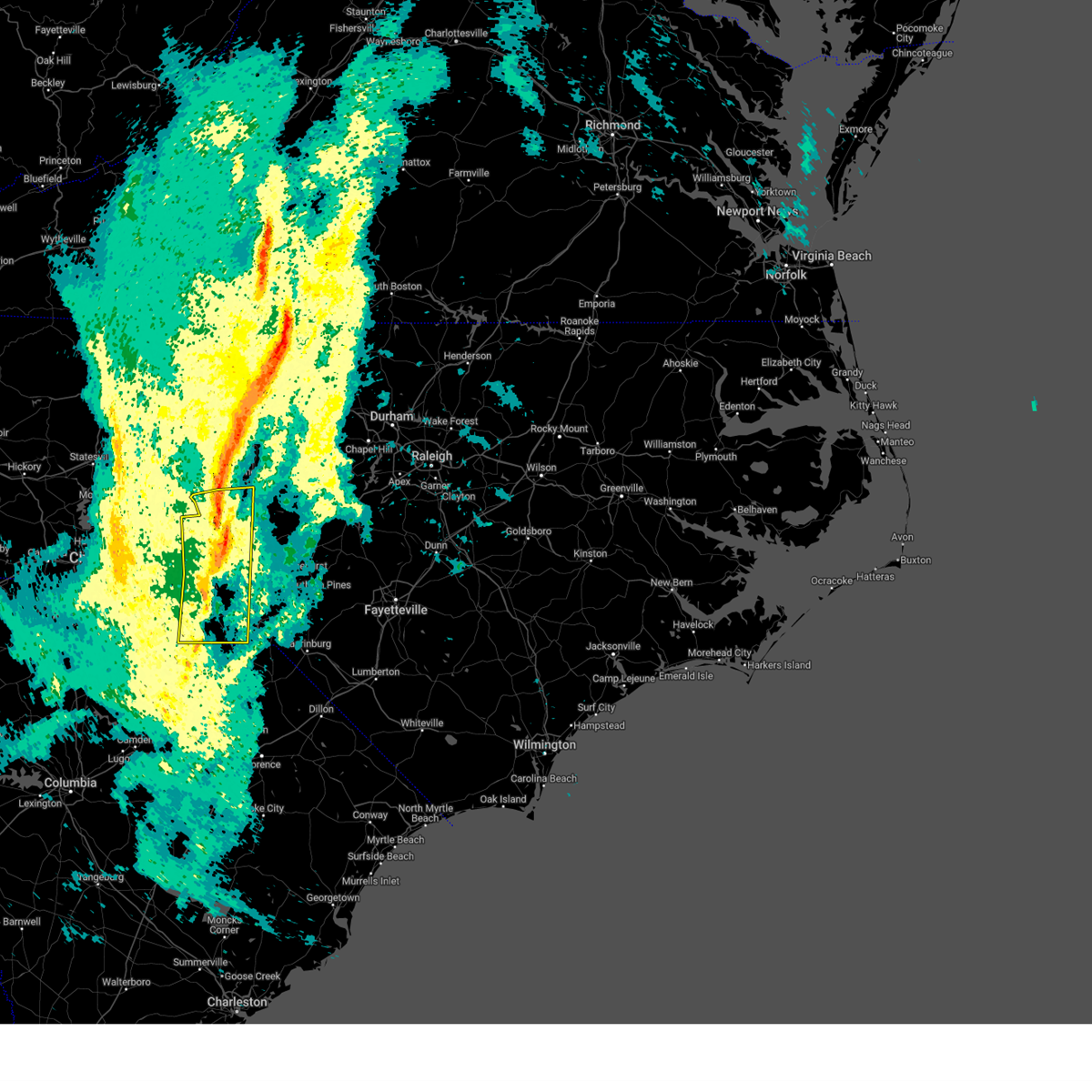
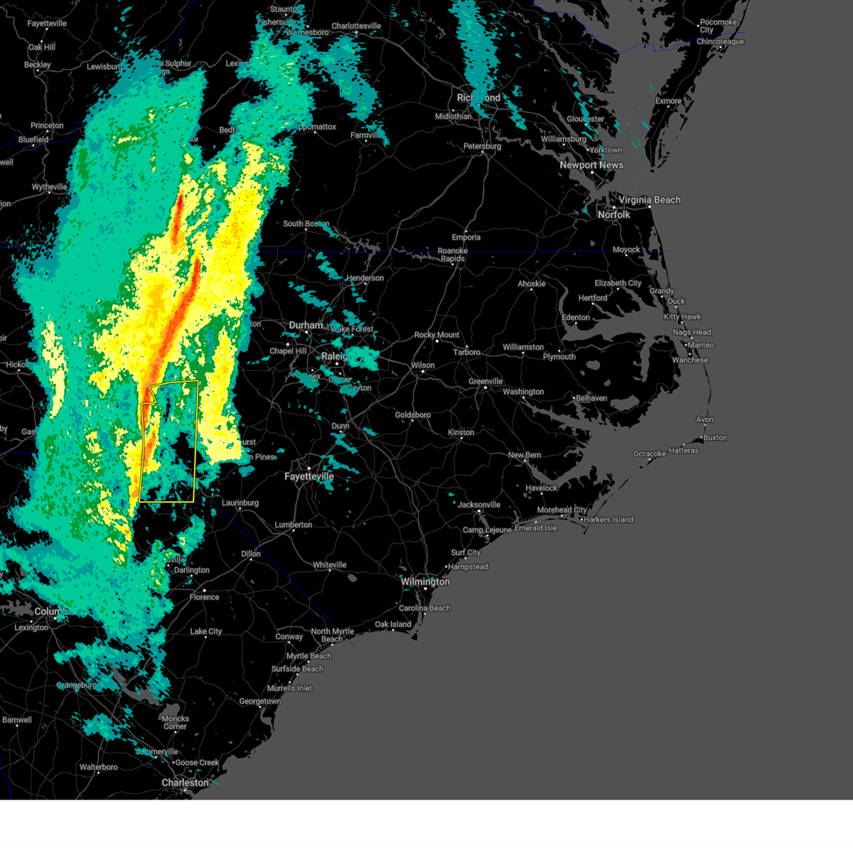
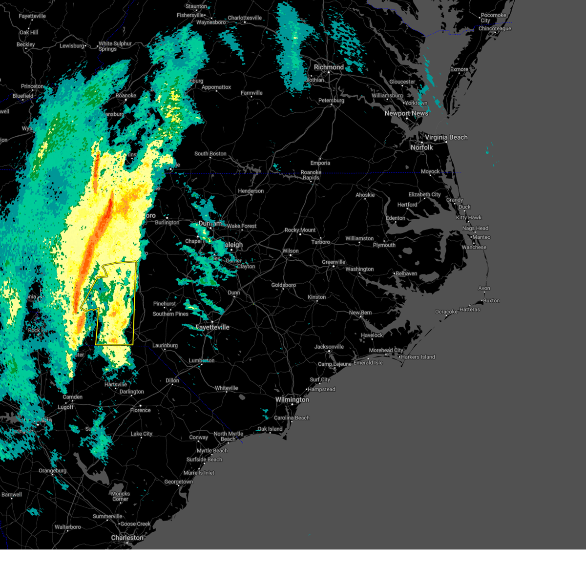
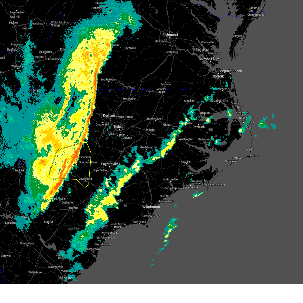
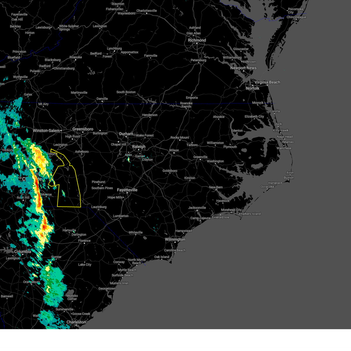
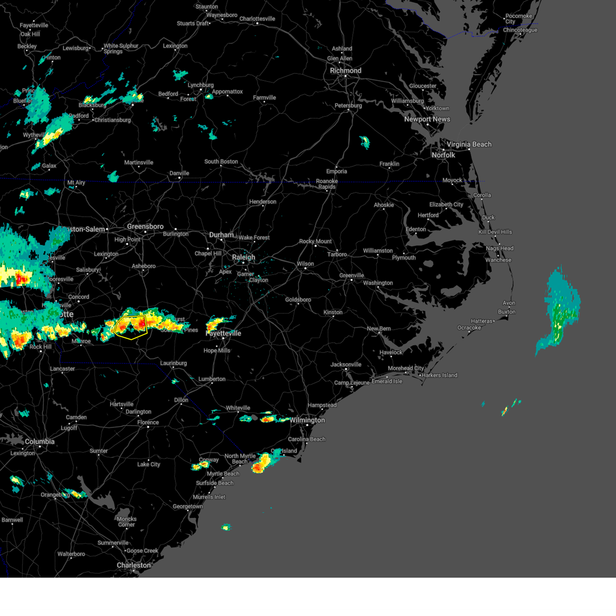
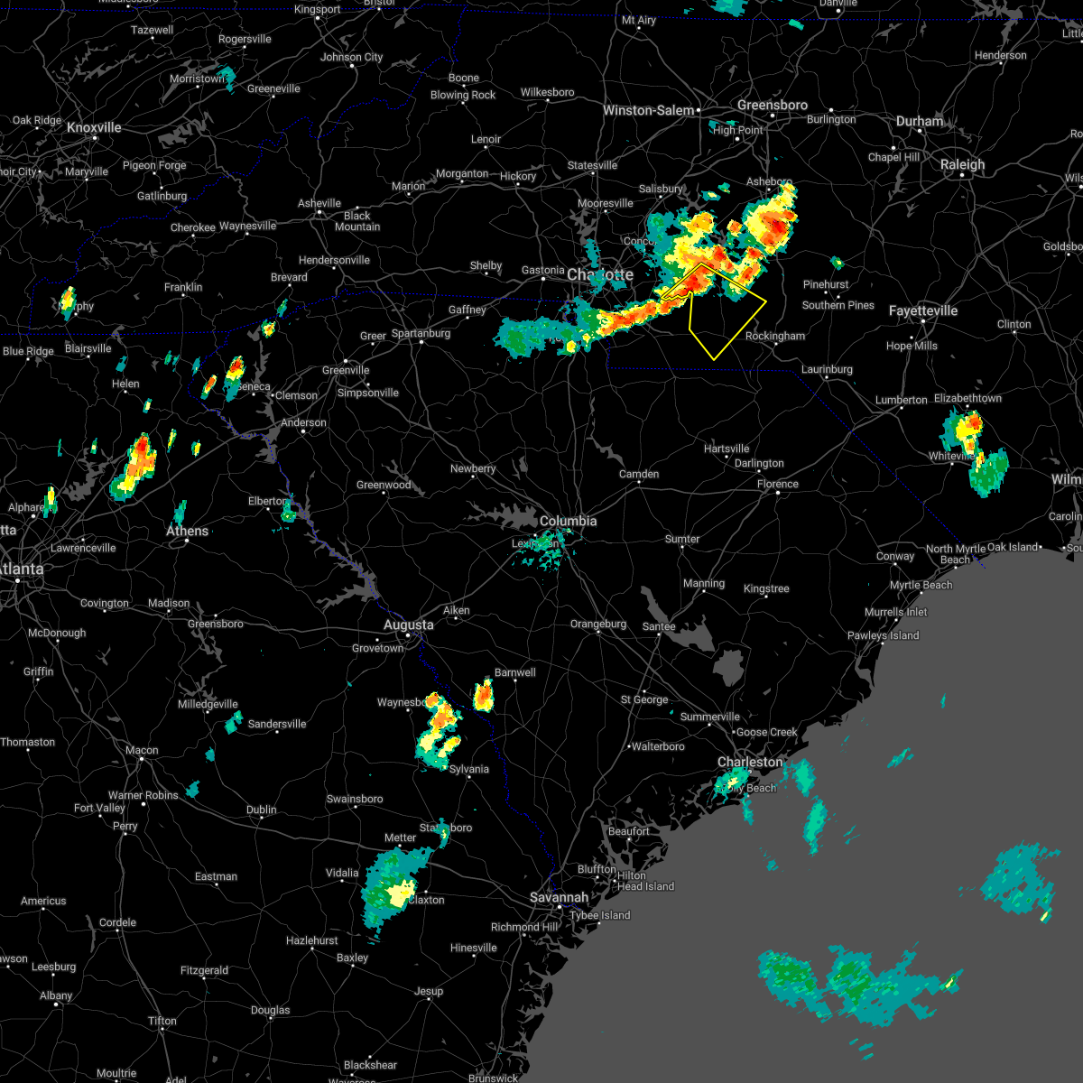
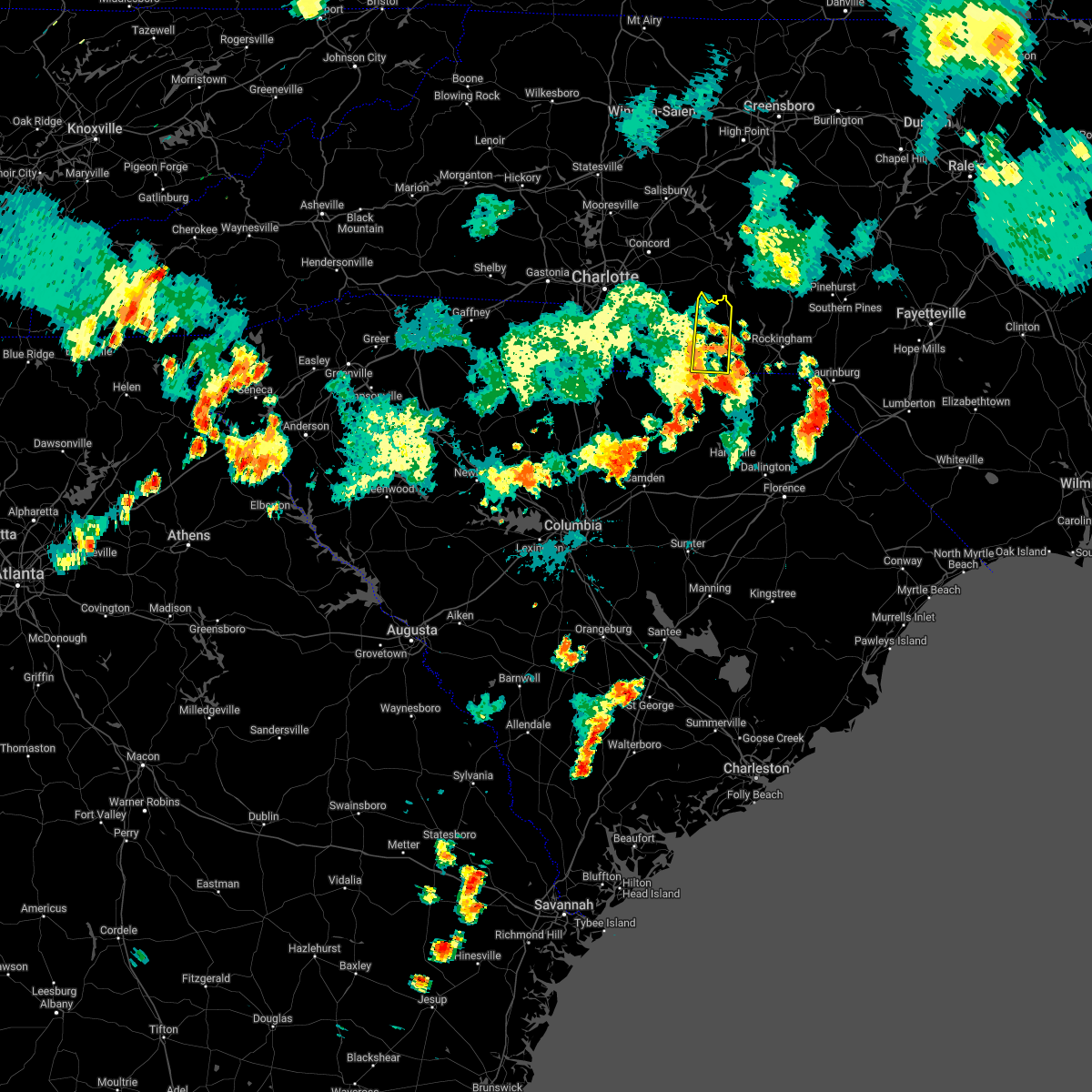
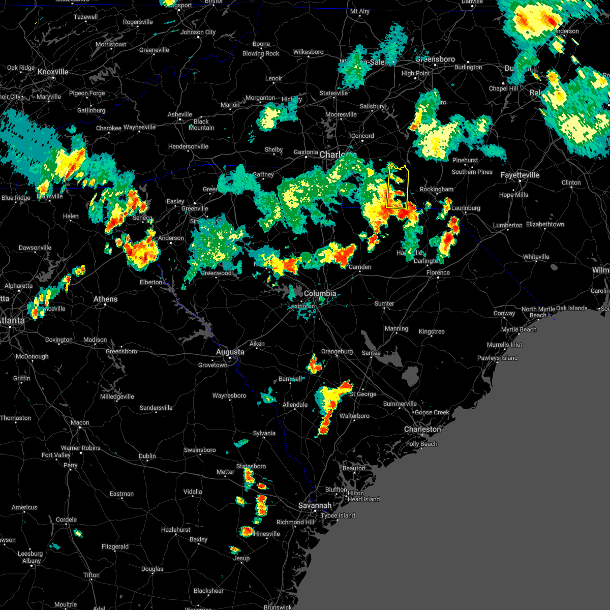
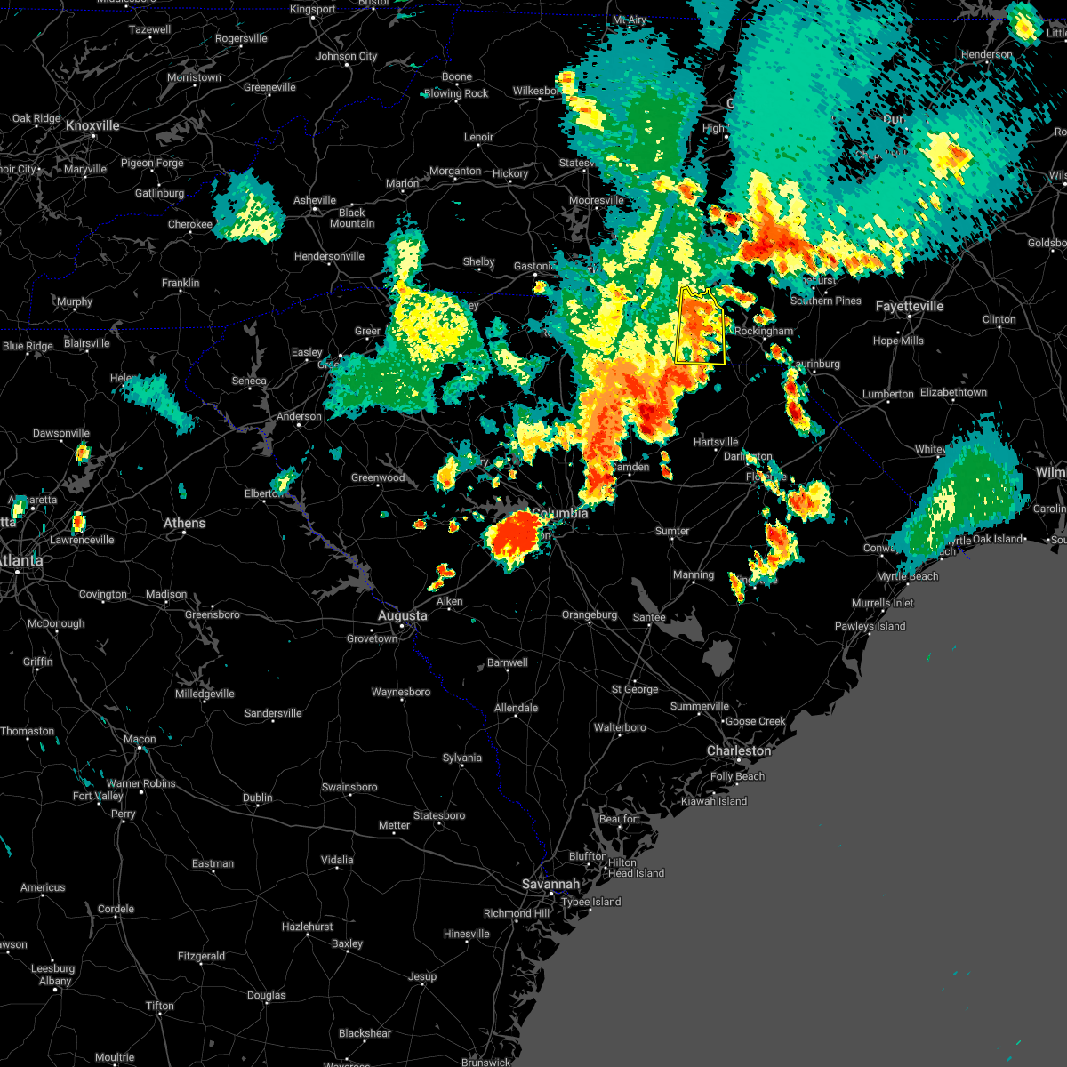
Hail Map for Ansonville, NC
The Ansonville, NC area has had 1 report of on-the-ground hail by trained spotters, and has been under severe weather warnings 6 times during the past 12 months. Doppler radar has detected hail at or near Ansonville, NC on 46 occasions, including 2 occasions during the past year.
| Name: | Ansonville, NC |
| Where Located: | 41.7 miles ESE of Charlotte, NC |
| Map: | Google Map for Ansonville, NC |
| Population: | 631 |
| Housing Units: | 307 |
| More Info: | Search Google for Ansonville, NC |
0
The Top Recent Hail Date for Ansonville, NC is Saturday, November 8, 2025 (31st out of 46)
Hail and Wind Damage Spotted near Ansonville, NC
| Date / Time | Report Details |
|---|---|
| 3/16/2026 4:51 PM EDT |
 Svrrah the national weather service in raleigh has issued a * severe thunderstorm warning for, northwestern moore county in central north carolina, southeastern davidson county in central north carolina, anson county in central north carolina, montgomery county in central north carolina, richmond county in central north carolina, randolph county in central north carolina, stanly county in central north carolina, * until 530 pm edt. * at 451 pm edt, severe thunderstorms were located along a line extending from near rockwell to near albemarle to 7 miles southeast of sturdivants, moving northeast at 45 mph (radar indicated). Hazards include 60 mph wind gusts. expect damage to roofs, siding, and trees Svrrah the national weather service in raleigh has issued a * severe thunderstorm warning for, northwestern moore county in central north carolina, southeastern davidson county in central north carolina, anson county in central north carolina, montgomery county in central north carolina, richmond county in central north carolina, randolph county in central north carolina, stanly county in central north carolina, * until 530 pm edt. * at 451 pm edt, severe thunderstorms were located along a line extending from near rockwell to near albemarle to 7 miles southeast of sturdivants, moving northeast at 45 mph (radar indicated). Hazards include 60 mph wind gusts. expect damage to roofs, siding, and trees
|
| 3/16/2026 10:19 AM EDT |
 Svrrah the national weather service in raleigh has issued a * severe thunderstorm warning for, southern davidson county in central north carolina, northwestern anson county in central north carolina, montgomery county in central north carolina, western randolph county in central north carolina, stanly county in central north carolina, south central guilford county in central north carolina, * until 1100 am edt. * at 1019 am edt, severe thunderstorms were located along a line extending from near high rock lake to near unionville, moving northeast at 55 mph (radar indicated). Hazards include 60 mph wind gusts. expect damage to roofs, siding, and trees Svrrah the national weather service in raleigh has issued a * severe thunderstorm warning for, southern davidson county in central north carolina, northwestern anson county in central north carolina, montgomery county in central north carolina, western randolph county in central north carolina, stanly county in central north carolina, south central guilford county in central north carolina, * until 1100 am edt. * at 1019 am edt, severe thunderstorms were located along a line extending from near high rock lake to near unionville, moving northeast at 55 mph (radar indicated). Hazards include 60 mph wind gusts. expect damage to roofs, siding, and trees
|
| 7/9/2025 6:19 PM EDT |
 At 618 pm edt, severe thunderstorms were located along a line extending from 8 miles southwest of troy to 8 miles east of ansonville to near rockingham, moving north at 20 mph (law enforcement). Hazards include 60 mph wind gusts. Expect damage to roofs, siding, and trees. Locations impacted include, albemarle, rockingham, wadesboro, troy, badin lake, ansonville, norwood, badin, mount gilead, and richfield. At 618 pm edt, severe thunderstorms were located along a line extending from 8 miles southwest of troy to 8 miles east of ansonville to near rockingham, moving north at 20 mph (law enforcement). Hazards include 60 mph wind gusts. Expect damage to roofs, siding, and trees. Locations impacted include, albemarle, rockingham, wadesboro, troy, badin lake, ansonville, norwood, badin, mount gilead, and richfield.
|
| 7/9/2025 6:05 PM EDT |
 At 604 pm edt, severe thunderstorms were located in a cluster from near badin lake to 6 miles north of ansonville to near wadesboro, moving northeast at 25 mph (law enforcement). Hazards include 60 mph wind gusts. Expect damage to roofs, siding, and trees. Locations impacted include, albemarle, rockingham, wadesboro, troy, badin lake, ansonville, plyler, polkton, norwood, and badin. At 604 pm edt, severe thunderstorms were located in a cluster from near badin lake to 6 miles north of ansonville to near wadesboro, moving northeast at 25 mph (law enforcement). Hazards include 60 mph wind gusts. Expect damage to roofs, siding, and trees. Locations impacted include, albemarle, rockingham, wadesboro, troy, badin lake, ansonville, plyler, polkton, norwood, and badin.
|
| 7/9/2025 5:45 PM EDT |
 Svrrah the national weather service in raleigh has issued a * severe thunderstorm warning for, anson county in central north carolina, western montgomery county in central north carolina, western richmond county in central north carolina, stanly county in central north carolina, * until 630 pm edt. * at 545 pm edt, severe thunderstorms were located along a line extending from near plyler to 7 miles southwest of wadesboro, moving northeast at 20 mph (radar indicated). Hazards include 60 mph wind gusts. expect damage to roofs, siding, and trees Svrrah the national weather service in raleigh has issued a * severe thunderstorm warning for, anson county in central north carolina, western montgomery county in central north carolina, western richmond county in central north carolina, stanly county in central north carolina, * until 630 pm edt. * at 545 pm edt, severe thunderstorms were located along a line extending from near plyler to 7 miles southwest of wadesboro, moving northeast at 20 mph (radar indicated). Hazards include 60 mph wind gusts. expect damage to roofs, siding, and trees
|
| 7/9/2025 5:06 PM EDT |
 Svrrah the national weather service in raleigh has issued a * severe thunderstorm warning for, western anson county in central north carolina, southern stanly county in central north carolina, * until 545 pm edt. * at 505 pm edt, a severe thunderstorm was located 7 miles northeast of marshville, or 14 miles northeast of monroe, moving north at 5 mph (radar indicated). Hazards include 60 mph wind gusts. expect damage to roofs, siding, and trees Svrrah the national weather service in raleigh has issued a * severe thunderstorm warning for, western anson county in central north carolina, southern stanly county in central north carolina, * until 545 pm edt. * at 505 pm edt, a severe thunderstorm was located 7 miles northeast of marshville, or 14 miles northeast of monroe, moving north at 5 mph (radar indicated). Hazards include 60 mph wind gusts. expect damage to roofs, siding, and trees
|
| 5/8/2025 9:24 PM EDT |
 At 924 pm edt, severe thunderstorms were located along a line extending from 8 miles northeast of siler city to near goldston to 6 miles northwest of carthage to 10 miles east of biscoe to 11 miles northwest of rockingham, moving east at 30 mph (radar indicated). Hazards include 60 mph wind gusts. Expect damage to roofs, siding, and trees. Locations impacted include, sanford, southern pines, rockingham, wadesboro, pittsboro, carthage, siler city, pinehurst, hamlet, and aberdeen. At 924 pm edt, severe thunderstorms were located along a line extending from 8 miles northeast of siler city to near goldston to 6 miles northwest of carthage to 10 miles east of biscoe to 11 miles northwest of rockingham, moving east at 30 mph (radar indicated). Hazards include 60 mph wind gusts. Expect damage to roofs, siding, and trees. Locations impacted include, sanford, southern pines, rockingham, wadesboro, pittsboro, carthage, siler city, pinehurst, hamlet, and aberdeen.
|
| 5/8/2025 9:24 PM EDT |
 the severe thunderstorm warning has been cancelled and is no longer in effect the severe thunderstorm warning has been cancelled and is no longer in effect
|
| 5/8/2025 9:14 PM EDT |
 At 914 pm edt, severe thunderstorms were located along a line extending from 7 miles north of siler city to 6 miles west of goldston to 13 miles southeast of north carolina zoo to 8 miles southeast of seagrove to 7 miles east of biscoe to 9 miles east of ansonville, moving east at 25 mph (radar indicated). Hazards include 60 mph wind gusts. Expect damage to roofs, siding, and trees. Locations impacted include, sanford, southern pines, rockingham, wadesboro, pittsboro, troy, carthage, siler city, pinehurst, and hamlet. At 914 pm edt, severe thunderstorms were located along a line extending from 7 miles north of siler city to 6 miles west of goldston to 13 miles southeast of north carolina zoo to 8 miles southeast of seagrove to 7 miles east of biscoe to 9 miles east of ansonville, moving east at 25 mph (radar indicated). Hazards include 60 mph wind gusts. Expect damage to roofs, siding, and trees. Locations impacted include, sanford, southern pines, rockingham, wadesboro, pittsboro, troy, carthage, siler city, pinehurst, and hamlet.
|
| 5/8/2025 8:57 PM EDT |
 Svrrah the national weather service in raleigh has issued a * severe thunderstorm warning for, moore county in central north carolina, anson county in central north carolina, eastern montgomery county in central north carolina, richmond county in central north carolina, southeastern randolph county in central north carolina, lee county in central north carolina, chatham county in central north carolina, * until 1000 pm edt. * at 856 pm edt, severe thunderstorms were located along a line extending from 9 miles north of siler city to 12 miles west of goldston to near seagrove to near biscoe to near ansonville, moving southeast at 25 mph (radar indicated). Hazards include 60 mph wind gusts and penny size hail. expect damage to roofs, siding, and trees Svrrah the national weather service in raleigh has issued a * severe thunderstorm warning for, moore county in central north carolina, anson county in central north carolina, eastern montgomery county in central north carolina, richmond county in central north carolina, southeastern randolph county in central north carolina, lee county in central north carolina, chatham county in central north carolina, * until 1000 pm edt. * at 856 pm edt, severe thunderstorms were located along a line extending from 9 miles north of siler city to 12 miles west of goldston to near seagrove to near biscoe to near ansonville, moving southeast at 25 mph (radar indicated). Hazards include 60 mph wind gusts and penny size hail. expect damage to roofs, siding, and trees
|
| 5/8/2025 8:50 PM EDT |
 the severe thunderstorm warning has been cancelled and is no longer in effect the severe thunderstorm warning has been cancelled and is no longer in effect
|
| 5/8/2025 8:50 PM EDT |
 At 849 pm edt, severe thunderstorms were located along a line extending from 13 miles east of randleman to 8 miles southwest of siler city to near seagrove to 7 miles north of ansonville, moving east at 40 mph (radar indicated). Hazards include 60 mph wind gusts and penny size hail. Expect damage to roofs, siding, and trees. Locations impacted include, asheboro, albemarle, troy, siler city, north carolina zoo, badin lake, biscoe, ansonville, goldston, and seagrove. At 849 pm edt, severe thunderstorms were located along a line extending from 13 miles east of randleman to 8 miles southwest of siler city to near seagrove to 7 miles north of ansonville, moving east at 40 mph (radar indicated). Hazards include 60 mph wind gusts and penny size hail. Expect damage to roofs, siding, and trees. Locations impacted include, asheboro, albemarle, troy, siler city, north carolina zoo, badin lake, biscoe, ansonville, goldston, and seagrove.
|
| 5/8/2025 8:35 PM EDT |
 At 835 pm edt, severe thunderstorms were located along a line extending from 6 miles northeast of randleman to near north carolina zoo to 7 miles north of troy to near albemarle, moving east at 45 mph (radar indicated). Hazards include 60 mph wind gusts and penny size hail. Expect damage to roofs, siding, and trees. Locations impacted include, asheboro, albemarle, randleman, troy, siler city, badin lake, north carolina zoo, biscoe, ansonville, and goldston. At 835 pm edt, severe thunderstorms were located along a line extending from 6 miles northeast of randleman to near north carolina zoo to 7 miles north of troy to near albemarle, moving east at 45 mph (radar indicated). Hazards include 60 mph wind gusts and penny size hail. Expect damage to roofs, siding, and trees. Locations impacted include, asheboro, albemarle, randleman, troy, siler city, badin lake, north carolina zoo, biscoe, ansonville, and goldston.
|
| 5/8/2025 8:27 PM EDT |
 At 827 pm edt, severe thunderstorms were located along a line extending from 8 miles northeast of randleman to 6 miles south of albemarle, moving east at 40 mph (radar indicated). Hazards include 60 mph wind gusts and quarter size hail. Hail damage to vehicles is expected. expect wind damage to roofs, siding, and trees. Locations impacted include, asheboro, albemarle, randleman, troy, siler city, badin lake, north carolina zoo, biscoe, ansonville, and goldston. At 827 pm edt, severe thunderstorms were located along a line extending from 8 miles northeast of randleman to 6 miles south of albemarle, moving east at 40 mph (radar indicated). Hazards include 60 mph wind gusts and quarter size hail. Hail damage to vehicles is expected. expect wind damage to roofs, siding, and trees. Locations impacted include, asheboro, albemarle, randleman, troy, siler city, badin lake, north carolina zoo, biscoe, ansonville, and goldston.
|
| 5/8/2025 8:14 PM EDT |
 Svrrah the national weather service in raleigh has issued a * severe thunderstorm warning for, northwestern moore county in central north carolina, southeastern davidson county in central north carolina, northern anson county in central north carolina, montgomery county in central north carolina, northwestern richmond county in central north carolina, randolph county in central north carolina, stanly county in central north carolina, southwestern chatham county in central north carolina, * until 900 pm edt. * at 814 pm edt, severe thunderstorms were located along a line extending from 6 miles north of randleman to near plyler, moving southeast at 40 mph (radar indicated). Hazards include 60 mph wind gusts and quarter size hail. Hail damage to vehicles is expected. Expect wind damage to roofs, siding, and trees. Svrrah the national weather service in raleigh has issued a * severe thunderstorm warning for, northwestern moore county in central north carolina, southeastern davidson county in central north carolina, northern anson county in central north carolina, montgomery county in central north carolina, northwestern richmond county in central north carolina, randolph county in central north carolina, stanly county in central north carolina, southwestern chatham county in central north carolina, * until 900 pm edt. * at 814 pm edt, severe thunderstorms were located along a line extending from 6 miles north of randleman to near plyler, moving southeast at 40 mph (radar indicated). Hazards include 60 mph wind gusts and quarter size hail. Hail damage to vehicles is expected. Expect wind damage to roofs, siding, and trees.
|
| 3/16/2025 6:49 PM EDT | Multiple reports of trees down in ansonville. radar estimated tim in anson county NC, 0.4 miles NW of Ansonville, NC |
| 3/16/2025 6:41 PM EDT |
 Svrrah the national weather service in raleigh has issued a * severe thunderstorm warning for, west central moore county in central north carolina, anson county in central north carolina, montgomery county in central north carolina, northwestern richmond county in central north carolina, southeastern stanly county in central north carolina, * until 730 pm edt. * at 640 pm edt, a severe thunderstorm was located near wadesboro, moving northeast at 55 mph (radar indicated). Hazards include 60 mph wind gusts and nickel size hail. expect damage to roofs, siding, and trees Svrrah the national weather service in raleigh has issued a * severe thunderstorm warning for, west central moore county in central north carolina, anson county in central north carolina, montgomery county in central north carolina, northwestern richmond county in central north carolina, southeastern stanly county in central north carolina, * until 730 pm edt. * at 640 pm edt, a severe thunderstorm was located near wadesboro, moving northeast at 55 mph (radar indicated). Hazards include 60 mph wind gusts and nickel size hail. expect damage to roofs, siding, and trees
|
| 3/16/2025 9:47 AM EDT |
 At 947 am edt, severe thunderstorms were located along a line extending from 7 miles east of high rock lake to 6 miles north of ansonville to 10 miles southeast of wadesboro, moving northeast at 50 mph (radar indicated). Hazards include 60 mph wind gusts and quarter size hail. Hail damage to vehicles is expected. expect wind damage to roofs, siding, and trees. Locations impacted include, blewett falls lake, steeds, badin, fish tales marina, denton, new london, white store, covington, pekin, and biscoe. At 947 am edt, severe thunderstorms were located along a line extending from 7 miles east of high rock lake to 6 miles north of ansonville to 10 miles southeast of wadesboro, moving northeast at 50 mph (radar indicated). Hazards include 60 mph wind gusts and quarter size hail. Hail damage to vehicles is expected. expect wind damage to roofs, siding, and trees. Locations impacted include, blewett falls lake, steeds, badin, fish tales marina, denton, new london, white store, covington, pekin, and biscoe.
|
| 3/16/2025 9:15 AM EDT |
 Svrrah the national weather service in raleigh has issued a * severe thunderstorm warning for, western moore county in central north carolina, north central scotland county in central north carolina, southeastern davidson county in central north carolina, anson county in central north carolina, montgomery county in central north carolina, richmond county in central north carolina, southwestern randolph county in central north carolina, stanly county in central north carolina, * until 1000 am edt. * at 914 am edt, severe thunderstorms were located along a line extending from near fairview in union county to near pageland to 6 miles east of mt pisgah, moving northeast at 60 mph. upper level roation can be seen on radar moving over trinity, in union county nc (radar indicated). Hazards include 60 mph wind gusts and quarter size hail. Hail damage to vehicles is expected. Expect wind damage to roofs, siding, and trees. Svrrah the national weather service in raleigh has issued a * severe thunderstorm warning for, western moore county in central north carolina, north central scotland county in central north carolina, southeastern davidson county in central north carolina, anson county in central north carolina, montgomery county in central north carolina, richmond county in central north carolina, southwestern randolph county in central north carolina, stanly county in central north carolina, * until 1000 am edt. * at 914 am edt, severe thunderstorms were located along a line extending from near fairview in union county to near pageland to 6 miles east of mt pisgah, moving northeast at 60 mph. upper level roation can be seen on radar moving over trinity, in union county nc (radar indicated). Hazards include 60 mph wind gusts and quarter size hail. Hail damage to vehicles is expected. Expect wind damage to roofs, siding, and trees.
|
| 3/5/2025 9:24 AM EST |
 The storms which prompted the warning have weakened below severe limits, and no longer pose an immediate threat to life or property. therefore, the warning will be allowed to expire. however, gusty winds are still possible with these thunderstorms, especially across northern stanly and southern randolph counties. a tornado watch remains in effect until 100 pm est for central north carolina. The storms which prompted the warning have weakened below severe limits, and no longer pose an immediate threat to life or property. therefore, the warning will be allowed to expire. however, gusty winds are still possible with these thunderstorms, especially across northern stanly and southern randolph counties. a tornado watch remains in effect until 100 pm est for central north carolina.
|
| 3/5/2025 9:05 AM EST |
 At 905 am est, severe thunderstorms were located along a line extending from 8 miles southeast of high rock lake to near sturdivants, moving northeast at 50 mph (radar indicated). Hazards include 60 mph wind gusts. Expect damage to roofs, siding, and trees. Locations impacted include, albemarle, blewett falls lake, eldorado, badin, fish tales marina, denton, new london, white store, covington and pekin. At 905 am est, severe thunderstorms were located along a line extending from 8 miles southeast of high rock lake to near sturdivants, moving northeast at 50 mph (radar indicated). Hazards include 60 mph wind gusts. Expect damage to roofs, siding, and trees. Locations impacted include, albemarle, blewett falls lake, eldorado, badin, fish tales marina, denton, new london, white store, covington and pekin.
|
| 3/5/2025 8:39 AM EST |
 Svrrah the national weather service in raleigh has issued a * severe thunderstorm warning for, southeastern davidson county in central north carolina, anson county in central north carolina, montgomery county in central north carolina, western richmond county in central north carolina, southwestern randolph county in central north carolina, stanly county in central north carolina, * until 930 am est. * at 838 am est, severe thunderstorms were located along a line extending from near rockwell to 8 miles south of monroe, moving northeast at 70 mph (radar indicated). Hazards include 60 mph wind gusts. expect damage to roofs, siding, and trees Svrrah the national weather service in raleigh has issued a * severe thunderstorm warning for, southeastern davidson county in central north carolina, anson county in central north carolina, montgomery county in central north carolina, western richmond county in central north carolina, southwestern randolph county in central north carolina, stanly county in central north carolina, * until 930 am est. * at 838 am est, severe thunderstorms were located along a line extending from near rockwell to 8 miles south of monroe, moving northeast at 70 mph (radar indicated). Hazards include 60 mph wind gusts. expect damage to roofs, siding, and trees
|
| 2/16/2025 8:19 AM EST |
 At 819 am est, severe thunderstorms were located along a line extending from 8 miles east of biscoe to 13 miles northwest of hoffman to 6 miles east of carolina sandhills wildlife refuge, moving east at 75 mph (radar indicated). Hazards include 60 mph wind gusts. Expect damage to roofs, siding, and trees. Locations impacted include, blewett falls lake, aberdeen, white store, covington, pekin, biscoe, carthage, southern pines, east rockingham, and morven. At 819 am est, severe thunderstorms were located along a line extending from 8 miles east of biscoe to 13 miles northwest of hoffman to 6 miles east of carolina sandhills wildlife refuge, moving east at 75 mph (radar indicated). Hazards include 60 mph wind gusts. Expect damage to roofs, siding, and trees. Locations impacted include, blewett falls lake, aberdeen, white store, covington, pekin, biscoe, carthage, southern pines, east rockingham, and morven.
|
| 2/16/2025 7:51 AM EST |
 Svrrah the national weather service in raleigh has issued a * severe thunderstorm warning for, moore county in central north carolina, scotland county in central north carolina, anson county in central north carolina, montgomery county in central north carolina, richmond county in central north carolina, southeastern stanly county in central north carolina, northwestern hoke county in central north carolina, * until 830 am est. * at 751 am est, severe thunderstorms were located along a line extending from near albemarle to 6 miles northeast of marshville to near westville, moving east at 70 mph (radar indicated). Hazards include 60 mph wind gusts. expect damage to roofs, siding, and trees Svrrah the national weather service in raleigh has issued a * severe thunderstorm warning for, moore county in central north carolina, scotland county in central north carolina, anson county in central north carolina, montgomery county in central north carolina, richmond county in central north carolina, southeastern stanly county in central north carolina, northwestern hoke county in central north carolina, * until 830 am est. * at 751 am est, severe thunderstorms were located along a line extending from near albemarle to 6 miles northeast of marshville to near westville, moving east at 70 mph (radar indicated). Hazards include 60 mph wind gusts. expect damage to roofs, siding, and trees
|
| 12/29/2024 10:26 AM EST |
 Torrah the national weather service in raleigh has issued a * tornado warning for, central anson county in central north carolina, south central montgomery county in central north carolina, northwestern richmond county in central north carolina, * until 1100 am est. * at 1026 am est, a severe thunderstorm capable of producing a tornado was located over wadesboro, moving northeast at 35 mph (radar indicated rotation). Hazards include tornado. Flying debris will be dangerous to those caught without shelter. mobile homes will be damaged or destroyed. damage to roofs, windows, and vehicles will occur. tree damage is likely. this dangerous storm will be near, ansonville around 1030 am est. Other locations impacted by this tornadic thunderstorm include blewett falls lake, covington, polkton, lilesville, and ellerbe. Torrah the national weather service in raleigh has issued a * tornado warning for, central anson county in central north carolina, south central montgomery county in central north carolina, northwestern richmond county in central north carolina, * until 1100 am est. * at 1026 am est, a severe thunderstorm capable of producing a tornado was located over wadesboro, moving northeast at 35 mph (radar indicated rotation). Hazards include tornado. Flying debris will be dangerous to those caught without shelter. mobile homes will be damaged or destroyed. damage to roofs, windows, and vehicles will occur. tree damage is likely. this dangerous storm will be near, ansonville around 1030 am est. Other locations impacted by this tornadic thunderstorm include blewett falls lake, covington, polkton, lilesville, and ellerbe.
|
| 12/29/2024 10:21 AM EST |
 Svrrah the national weather service in raleigh has issued a * severe thunderstorm warning for, forsyth county in central north carolina, western moore county in central north carolina, scotland county in central north carolina, davidson county in central north carolina, eastern anson county in central north carolina, montgomery county in central north carolina, richmond county in central north carolina, randolph county in central north carolina, eastern stanly county in central north carolina, western guilford county in central north carolina, * until 1100 am est. * at 1021 am est, severe thunderstorms were located along a line extending from bermuda run to near high rock lake to 6 miles north of ansonville to 8 miles north of chesterfield, moving northeast at 40 mph (radar indicated). Hazards include 60 mph wind gusts. expect damage to roofs, siding, and trees Svrrah the national weather service in raleigh has issued a * severe thunderstorm warning for, forsyth county in central north carolina, western moore county in central north carolina, scotland county in central north carolina, davidson county in central north carolina, eastern anson county in central north carolina, montgomery county in central north carolina, richmond county in central north carolina, randolph county in central north carolina, eastern stanly county in central north carolina, western guilford county in central north carolina, * until 1100 am est. * at 1021 am est, severe thunderstorms were located along a line extending from bermuda run to near high rock lake to 6 miles north of ansonville to 8 miles north of chesterfield, moving northeast at 40 mph (radar indicated). Hazards include 60 mph wind gusts. expect damage to roofs, siding, and trees
|
| 12/29/2024 9:57 AM EST |
 At 957 am est, severe thunderstorms were located along a line extending from near mt pleasant to 6 miles northeast of unionville to near wingate, moving northeast at 55 mph (radar indicated). Hazards include 60 mph wind gusts. Expect damage to roofs, siding, and trees. Locations impacted include, albemarle, wadesboro, badin lake, ansonville, plyler, midland, polkton, locust, norwood, and badin. At 957 am est, severe thunderstorms were located along a line extending from near mt pleasant to 6 miles northeast of unionville to near wingate, moving northeast at 55 mph (radar indicated). Hazards include 60 mph wind gusts. Expect damage to roofs, siding, and trees. Locations impacted include, albemarle, wadesboro, badin lake, ansonville, plyler, midland, polkton, locust, norwood, and badin.
|
| 12/29/2024 9:40 AM EST |
 Svrrah the national weather service in raleigh has issued a * severe thunderstorm warning for, southern davidson county in central north carolina, anson county in central north carolina, western montgomery county in central north carolina, western richmond county in central north carolina, stanly county in central north carolina, * until 1030 am est. * at 940 am est, severe thunderstorms were located along a line extending from charlotte motor speedway to near lake park to 6 miles north of buford, moving northeast at 55 mph (radar indicated). Hazards include 60 mph wind gusts. expect damage to roofs, siding, and trees Svrrah the national weather service in raleigh has issued a * severe thunderstorm warning for, southern davidson county in central north carolina, anson county in central north carolina, western montgomery county in central north carolina, western richmond county in central north carolina, stanly county in central north carolina, * until 1030 am est. * at 940 am est, severe thunderstorms were located along a line extending from charlotte motor speedway to near lake park to 6 miles north of buford, moving northeast at 55 mph (radar indicated). Hazards include 60 mph wind gusts. expect damage to roofs, siding, and trees
|
| 8/30/2024 7:25 PM EDT |
 The storms which prompted the warning have weakened. therefore, the warning will be allowed to expire. however, gusty winds and heavy rain are still possible with these thunderstorms. to report severe weather, contact your nearest law enforcement agency. they will relay your report to the national weather service raleigh. The storms which prompted the warning have weakened. therefore, the warning will be allowed to expire. however, gusty winds and heavy rain are still possible with these thunderstorms. to report severe weather, contact your nearest law enforcement agency. they will relay your report to the national weather service raleigh.
|
| 8/30/2024 6:46 PM EDT |
 Svrrah the national weather service in raleigh has issued a * severe thunderstorm warning for, south central moore county in central north carolina, central scotland county in central north carolina, anson county in central north carolina, southern montgomery county in central north carolina, richmond county in central north carolina, southeastern stanly county in central north carolina, west central hoke county in central north carolina, * until 730 pm edt. * at 645 pm edt, severe thunderstorms were located along a line extending from near ansonville to near hoffman, moving southwest at 35 mph (radar indicated). Hazards include 60 mph wind gusts. expect damage to roofs, siding, and trees Svrrah the national weather service in raleigh has issued a * severe thunderstorm warning for, south central moore county in central north carolina, central scotland county in central north carolina, anson county in central north carolina, southern montgomery county in central north carolina, richmond county in central north carolina, southeastern stanly county in central north carolina, west central hoke county in central north carolina, * until 730 pm edt. * at 645 pm edt, severe thunderstorms were located along a line extending from near ansonville to near hoffman, moving southwest at 35 mph (radar indicated). Hazards include 60 mph wind gusts. expect damage to roofs, siding, and trees
|
| 5/15/2024 3:54 PM EDT |
 The storm which prompted the warning has moved out of the area. therefore, the warning will be allowed to expire. a severe thunderstorm watch remains in effect until 800 pm edt for central north carolina. remember, a severe thunderstorm warning still remains in effect for montgomery and richmond counties through 430 pm edt. The storm which prompted the warning has moved out of the area. therefore, the warning will be allowed to expire. a severe thunderstorm watch remains in effect until 800 pm edt for central north carolina. remember, a severe thunderstorm warning still remains in effect for montgomery and richmond counties through 430 pm edt.
|
| 5/15/2024 3:46 PM EDT |
 At 345 pm edt, a severe thunderstorm was located 10 miles northeast of ansonville, or 13 miles south of troy, moving east at 10 mph (radar indicated). Hazards include 60 mph wind gusts and quarter size hail. Hail damage to vehicles is expected. expect wind damage to roofs, siding, and trees. Locations impacted include, ansonville, norwood, mount gilead, uwharrie haven, covington, pekin, lake tillery, and blewett falls lake. At 345 pm edt, a severe thunderstorm was located 10 miles northeast of ansonville, or 13 miles south of troy, moving east at 10 mph (radar indicated). Hazards include 60 mph wind gusts and quarter size hail. Hail damage to vehicles is expected. expect wind damage to roofs, siding, and trees. Locations impacted include, ansonville, norwood, mount gilead, uwharrie haven, covington, pekin, lake tillery, and blewett falls lake.
|
| 5/15/2024 3:29 PM EDT |
 At 328 pm edt, a severe thunderstorm was located 8 miles northeast of ansonville, or 13 miles southwest of troy, moving east at 15 mph (radar indicated). Hazards include 60 mph wind gusts and quarter size hail. Hail damage to vehicles is expected. expect wind damage to roofs, siding, and trees. Locations impacted include, ansonville, norwood, mount gilead, lilesville, uwharrie haven, blewett falls lake, covington, pekin, and lake tillery. At 328 pm edt, a severe thunderstorm was located 8 miles northeast of ansonville, or 13 miles southwest of troy, moving east at 15 mph (radar indicated). Hazards include 60 mph wind gusts and quarter size hail. Hail damage to vehicles is expected. expect wind damage to roofs, siding, and trees. Locations impacted include, ansonville, norwood, mount gilead, lilesville, uwharrie haven, blewett falls lake, covington, pekin, and lake tillery.
|
| 5/15/2024 3:10 PM EDT |
 Svrrah the national weather service in raleigh has issued a * severe thunderstorm warning for, northern anson county in central north carolina, southwestern montgomery county in central north carolina, northwestern richmond county in central north carolina, southeastern stanly county in central north carolina, * until 400 pm edt. * at 310 pm edt, a severe thunderstorm was located near ansonville, or 13 miles southeast of albemarle, moving east at 10 mph (radar indicated). Hazards include 60 mph wind gusts and quarter size hail. Hail damage to vehicles is expected. Expect wind damage to roofs, siding, and trees. Svrrah the national weather service in raleigh has issued a * severe thunderstorm warning for, northern anson county in central north carolina, southwestern montgomery county in central north carolina, northwestern richmond county in central north carolina, southeastern stanly county in central north carolina, * until 400 pm edt. * at 310 pm edt, a severe thunderstorm was located near ansonville, or 13 miles southeast of albemarle, moving east at 10 mph (radar indicated). Hazards include 60 mph wind gusts and quarter size hail. Hail damage to vehicles is expected. Expect wind damage to roofs, siding, and trees.
|
| 5/8/2024 5:56 PM EDT |
 The storms which prompted the warning have weakened below severe limits, and have exited the warned area. therefore, the warning will be allowed to expire. however, small hail, gusty winds and heavy rain are still possible with these thunderstorms. a severe thunderstorm watch remains in effect until 1000 pm edt for central north carolina. to report severe weather, contact your nearest law enforcement agency. they will relay your report to the national weather service raleigh. remember, a severe thunderstorm warning still remains in effect for portions of montgomery county. The storms which prompted the warning have weakened below severe limits, and have exited the warned area. therefore, the warning will be allowed to expire. however, small hail, gusty winds and heavy rain are still possible with these thunderstorms. a severe thunderstorm watch remains in effect until 1000 pm edt for central north carolina. to report severe weather, contact your nearest law enforcement agency. they will relay your report to the national weather service raleigh. remember, a severe thunderstorm warning still remains in effect for portions of montgomery county.
|
| 5/8/2024 5:30 PM EDT |
 At 526 pm edt, a severe thunderstorm extending from 6 miles east of albemarle to 9 miles east of ansonville to 7 miles southwest of wadesboro, moving east at 40 mph (law enforcement reported widespread trees down and power outages between the cities of locust and albemarle). Hazards include 70 mph wind gusts and quarter size hail. Expect considerable tree damage. wind damage is also likely to mobile homes, roofs, and outbuildings. hail damage to vehicles is expected. Locations impacted include, albemarle, rockingham, wadesboro, troy, badin lake, ansonville, plyler, polkton, norwood, and badin. At 526 pm edt, a severe thunderstorm extending from 6 miles east of albemarle to 9 miles east of ansonville to 7 miles southwest of wadesboro, moving east at 40 mph (law enforcement reported widespread trees down and power outages between the cities of locust and albemarle). Hazards include 70 mph wind gusts and quarter size hail. Expect considerable tree damage. wind damage is also likely to mobile homes, roofs, and outbuildings. hail damage to vehicles is expected. Locations impacted include, albemarle, rockingham, wadesboro, troy, badin lake, ansonville, plyler, polkton, norwood, and badin.
|
| 5/8/2024 5:16 PM EDT |
 Svrrah the national weather service in raleigh has issued a * severe thunderstorm warning for, anson county in central north carolina, southern montgomery county in central north carolina, western richmond county in central north carolina, stanly county in central north carolina, * until 600 pm edt. * at 515 pm edt, a severe thunderstorm extending from albemarle to near ansonville to near sturdivants, moving east at 40 mph (radar indicated). Hazards include 70 mph wind gusts and quarter size hail. Hail damage to vehicles is expected. expect considerable tree damage. Wind damage is also likely to mobile homes, roofs, and outbuildings. Svrrah the national weather service in raleigh has issued a * severe thunderstorm warning for, anson county in central north carolina, southern montgomery county in central north carolina, western richmond county in central north carolina, stanly county in central north carolina, * until 600 pm edt. * at 515 pm edt, a severe thunderstorm extending from albemarle to near ansonville to near sturdivants, moving east at 40 mph (radar indicated). Hazards include 70 mph wind gusts and quarter size hail. Hail damage to vehicles is expected. expect considerable tree damage. Wind damage is also likely to mobile homes, roofs, and outbuildings.
|
| 5/8/2024 4:58 PM EDT |
 At 457 pm edt, a severe thunderstorm extending from near mt pleasant to 7 miles west of ansonville to wingate, moving east at 40 mph across stanly and anson counties (radar indicated). Hazards include 70 mph wind gusts and quarter size hail. Hail damage to vehicles is expected. expect considerable tree damage. wind damage is also likely to mobile homes, roofs, and outbuildings. Locations impacted include, albemarle, wadesboro, ansonville, plyler, polkton, norwood, badin, oakboro, mount gilead, and lilesville. At 457 pm edt, a severe thunderstorm extending from near mt pleasant to 7 miles west of ansonville to wingate, moving east at 40 mph across stanly and anson counties (radar indicated). Hazards include 70 mph wind gusts and quarter size hail. Hail damage to vehicles is expected. expect considerable tree damage. wind damage is also likely to mobile homes, roofs, and outbuildings. Locations impacted include, albemarle, wadesboro, ansonville, plyler, polkton, norwood, badin, oakboro, mount gilead, and lilesville.
|
| 5/8/2024 4:31 PM EDT |
 Svrrah the national weather service in raleigh has issued a * severe thunderstorm warning for, anson county in central north carolina, western montgomery county in central north carolina, western richmond county in central north carolina, stanly county in central north carolina, * until 515 pm edt. * at 429 pm edt, a severe thunderstorm extending from coddle creek reservoir to near fairview in union county to weddington, moving east at 55 mph into stanly and anson counties (radar indicated). Hazards include 70 mph wind gusts and quarter size hail. Hail damage to vehicles is expected. expect considerable tree damage. Wind damage is also likely to mobile homes, roofs, and outbuildings. Svrrah the national weather service in raleigh has issued a * severe thunderstorm warning for, anson county in central north carolina, western montgomery county in central north carolina, western richmond county in central north carolina, stanly county in central north carolina, * until 515 pm edt. * at 429 pm edt, a severe thunderstorm extending from coddle creek reservoir to near fairview in union county to weddington, moving east at 55 mph into stanly and anson counties (radar indicated). Hazards include 70 mph wind gusts and quarter size hail. Hail damage to vehicles is expected. expect considerable tree damage. Wind damage is also likely to mobile homes, roofs, and outbuildings.
|
| 4/20/2024 3:03 PM EDT |
 Svrrah the national weather service in raleigh has issued a * severe thunderstorm warning for, central anson county in central north carolina, central richmond county in central north carolina, * until 345 pm edt. * at 302 pm edt, a severe thunderstorm was located near ansonville, or near wadesboro, moving east at 15 mph (radar indicated). Hazards include 60 mph wind gusts and quarter size hail. Hail damage to vehicles is expected. Expect wind damage to roofs, siding, and trees. Svrrah the national weather service in raleigh has issued a * severe thunderstorm warning for, central anson county in central north carolina, central richmond county in central north carolina, * until 345 pm edt. * at 302 pm edt, a severe thunderstorm was located near ansonville, or near wadesboro, moving east at 15 mph (radar indicated). Hazards include 60 mph wind gusts and quarter size hail. Hail damage to vehicles is expected. Expect wind damage to roofs, siding, and trees.
|
| 4/11/2024 8:23 PM EDT | Multiple trees reported down on ansonville polkton roa in anson county NC, 0.4 miles NW of Ansonville, NC |
| 4/11/2024 8:18 PM EDT |
 Svrrah the national weather service in raleigh has issued a * severe thunderstorm warning for, moore county in central north carolina, anson county in central north carolina, montgomery county in central north carolina, richmond county in central north carolina, south central randolph county in central north carolina, southeastern stanly county in central north carolina, * until 900 pm edt. * at 817 pm edt, a severe thunderstorm was located 8 miles east of ansonville, or 11 miles northeast of wadesboro, moving northeast at 40 mph (radar indicated). Hazards include 60 mph wind gusts. expect damage to roofs, siding, and trees Svrrah the national weather service in raleigh has issued a * severe thunderstorm warning for, moore county in central north carolina, anson county in central north carolina, montgomery county in central north carolina, richmond county in central north carolina, south central randolph county in central north carolina, southeastern stanly county in central north carolina, * until 900 pm edt. * at 817 pm edt, a severe thunderstorm was located 8 miles east of ansonville, or 11 miles northeast of wadesboro, moving northeast at 40 mph (radar indicated). Hazards include 60 mph wind gusts. expect damage to roofs, siding, and trees
|
| 1/9/2024 3:22 PM EST |
 At 322 pm est, severe thunderstorms were located along a line extending from 7 miles east of rockwell to near sturdivants, moving northeast at 70 mph (radar indicated). Hazards include 60 mph wind gusts. expect damage to roofs, siding, and trees At 322 pm est, severe thunderstorms were located along a line extending from 7 miles east of rockwell to near sturdivants, moving northeast at 70 mph (radar indicated). Hazards include 60 mph wind gusts. expect damage to roofs, siding, and trees
|
| 9/7/2023 8:24 PM EDT |
 At 824 pm edt, severe thunderstorms were located along a line extending from near mt pleasant to 11 miles east of midland to near ansonville, moving northeast at 20 mph (radar indicated). Hazards include 60 mph wind gusts and quarter size hail. Hail damage to vehicles is expected. expect wind damage to roofs, siding, and trees. locations impacted include, ansonville, fairview in union county, locust, oakboro, stanfield and finger. hail threat, radar indicated max hail size, 1. 00 in wind threat, radar indicated max wind gust, 60 mph. At 824 pm edt, severe thunderstorms were located along a line extending from near mt pleasant to 11 miles east of midland to near ansonville, moving northeast at 20 mph (radar indicated). Hazards include 60 mph wind gusts and quarter size hail. Hail damage to vehicles is expected. expect wind damage to roofs, siding, and trees. locations impacted include, ansonville, fairview in union county, locust, oakboro, stanfield and finger. hail threat, radar indicated max hail size, 1. 00 in wind threat, radar indicated max wind gust, 60 mph.
|
| 9/7/2023 8:19 PM EDT |
 At 819 pm edt, severe thunderstorms were located along a line extending from near mt pleasant to 8 miles east of unionville to 7 miles north of marshville, moving northeast at 25 mph (radar indicated). Hazards include 60 mph wind gusts and quarter size hail. Hail damage to vehicles is expected. expect wind damage to roofs, siding, and trees. locations impacted include, wadesboro, ansonville, fairview in union county, polkton, locust, oakboro, stanfield, peachland, finger and white store. hail threat, radar indicated max hail size, 1. 00 in wind threat, radar indicated max wind gust, 60 mph. At 819 pm edt, severe thunderstorms were located along a line extending from near mt pleasant to 8 miles east of unionville to 7 miles north of marshville, moving northeast at 25 mph (radar indicated). Hazards include 60 mph wind gusts and quarter size hail. Hail damage to vehicles is expected. expect wind damage to roofs, siding, and trees. locations impacted include, wadesboro, ansonville, fairview in union county, polkton, locust, oakboro, stanfield, peachland, finger and white store. hail threat, radar indicated max hail size, 1. 00 in wind threat, radar indicated max wind gust, 60 mph.
|
| 9/7/2023 8:06 PM EDT |
 At 806 pm edt, severe thunderstorms were located along a line extending from near midland to near wingate to near sturdivants, moving northeast at 15 mph (radar indicated). Hazards include 60 mph wind gusts and quarter size hail. Hail damage to vehicles is expected. expect wind damage to roofs, siding, and trees. locations impacted include, wadesboro, ansonville, fairview in union county, polkton, locust, oakboro, stanfield, morven, peachland and mcfarlan. hail threat, radar indicated max hail size, 1. 00 in wind threat, radar indicated max wind gust, 60 mph. At 806 pm edt, severe thunderstorms were located along a line extending from near midland to near wingate to near sturdivants, moving northeast at 15 mph (radar indicated). Hazards include 60 mph wind gusts and quarter size hail. Hail damage to vehicles is expected. expect wind damage to roofs, siding, and trees. locations impacted include, wadesboro, ansonville, fairview in union county, polkton, locust, oakboro, stanfield, morven, peachland and mcfarlan. hail threat, radar indicated max hail size, 1. 00 in wind threat, radar indicated max wind gust, 60 mph.
|
| 9/7/2023 7:54 PM EDT |
 At 754 pm edt, severe thunderstorms were located along a line extending from near wingate to near pageland to 11 miles south of sturdivants, moving northeast at 25 mph (radar indicated). Hazards include 60 mph wind gusts and quarter size hail. Hail damage to vehicles is expected. Expect wind damage to roofs, siding, and trees. At 754 pm edt, severe thunderstorms were located along a line extending from near wingate to near pageland to 11 miles south of sturdivants, moving northeast at 25 mph (radar indicated). Hazards include 60 mph wind gusts and quarter size hail. Hail damage to vehicles is expected. Expect wind damage to roofs, siding, and trees.
|
| 8/15/2023 5:37 PM EDT |
 At 537 pm edt, severe thunderstorms were located along a line extending from 8 miles north of badin lake to 12 miles south of troy to near sturdivants, moving east at 40 mph (radar indicated). Hazards include 60 mph wind gusts. Expect damage to roofs, siding, and trees. locations impacted include, troy, ansonville, polkton, norwood, badin, mount gilead, peachland, uwharrie haven, morrow mountain state park and covington. hail threat, radar indicated max hail size, <. 75 in wind threat, radar indicated max wind gust, 60 mph. At 537 pm edt, severe thunderstorms were located along a line extending from 8 miles north of badin lake to 12 miles south of troy to near sturdivants, moving east at 40 mph (radar indicated). Hazards include 60 mph wind gusts. Expect damage to roofs, siding, and trees. locations impacted include, troy, ansonville, polkton, norwood, badin, mount gilead, peachland, uwharrie haven, morrow mountain state park and covington. hail threat, radar indicated max hail size, <. 75 in wind threat, radar indicated max wind gust, 60 mph.
|
| 8/15/2023 5:28 PM EDT |
 At 527 pm edt, severe thunderstorms were located along a line extending from 6 miles northwest of badin lake to 8 miles northeast of ansonville to near sturdivants, moving east at 40 mph (radar indicated). Hazards include 60 mph wind gusts. Expect damage to roofs, siding, and trees. locations impacted include, albemarle, wadesboro, troy, badin lake, ansonville, polkton, norwood, badin, mount gilead and new london. hail threat, radar indicated max hail size, <. 75 in wind threat, radar indicated max wind gust, 60 mph. At 527 pm edt, severe thunderstorms were located along a line extending from 6 miles northwest of badin lake to 8 miles northeast of ansonville to near sturdivants, moving east at 40 mph (radar indicated). Hazards include 60 mph wind gusts. Expect damage to roofs, siding, and trees. locations impacted include, albemarle, wadesboro, troy, badin lake, ansonville, polkton, norwood, badin, mount gilead and new london. hail threat, radar indicated max hail size, <. 75 in wind threat, radar indicated max wind gust, 60 mph.
|
| 8/15/2023 5:01 PM EDT |
 At 500 pm edt, severe thunderstorms were located along a line extending from near rockwell to 8 miles west of ansonville to near buford, moving east at 40 mph (radar indicated). Hazards include 60 mph wind gusts. expect damage to roofs, siding, and trees At 500 pm edt, severe thunderstorms were located along a line extending from near rockwell to 8 miles west of ansonville to near buford, moving east at 40 mph (radar indicated). Hazards include 60 mph wind gusts. expect damage to roofs, siding, and trees
|
| 8/10/2023 10:25 AM EDT |
 At 1025 am edt, a severe thunderstorm was located 8 miles east of wadesboro, moving east at 55 mph (radar indicated). Hazards include 60 mph wind gusts and penny size hail. expect damage to roofs, siding, and trees At 1025 am edt, a severe thunderstorm was located 8 miles east of wadesboro, moving east at 55 mph (radar indicated). Hazards include 60 mph wind gusts and penny size hail. expect damage to roofs, siding, and trees
|
| 8/7/2023 6:27 PM EDT |
 The severe thunderstorm warning for anson, southwestern montgomery, western richmond and southern stanly counties will expire at 630 pm edt, a new severe thunderstorm warning has been issued for the area and is in effect until 715 pm edt. The severe thunderstorm warning for anson, southwestern montgomery, western richmond and southern stanly counties will expire at 630 pm edt, a new severe thunderstorm warning has been issued for the area and is in effect until 715 pm edt.
|
| 8/7/2023 6:23 PM EDT | Trees and power lines down countywid in anson county NC, 0.4 miles NW of Ansonville, NC |
| 8/7/2023 5:54 PM EDT |
 At 554 pm edt, severe thunderstorms were located along a line extending from near albemarle to near unionville, moving east at 60 mph (radar indicated). Hazards include 60 mph wind gusts. expect damage to roofs, siding, and trees At 554 pm edt, severe thunderstorms were located along a line extending from near albemarle to near unionville, moving east at 60 mph (radar indicated). Hazards include 60 mph wind gusts. expect damage to roofs, siding, and trees
|
| 1/12/2023 7:48 PM EST |
 At 748 pm est, severe thunderstorms were located along a line extending from 10 miles east of randleman to sturdivants, moving east at 60 mph (radar indicated). Hazards include 60 mph wind gusts. expect damage to roofs, siding, and trees At 748 pm est, severe thunderstorms were located along a line extending from 10 miles east of randleman to sturdivants, moving east at 60 mph (radar indicated). Hazards include 60 mph wind gusts. expect damage to roofs, siding, and trees
|
| 1/12/2023 7:30 PM EST |
 At 729 pm est, severe thunderstorms were located along a line extending from near randleman to 10 miles north of marshville, moving northeast at 65 mph (radar indicated). Hazards include 60 mph wind gusts and penny size hail. Expect damage to roofs, siding, and trees. locations impacted include, asheboro, albemarle, troy, badin lake, north carolina zoo, ansonville, seagrove, plyler, midland and polkton. hail threat, radar indicated max hail size, 0. 75 in wind threat, radar indicated max wind gust, 60 mph. At 729 pm est, severe thunderstorms were located along a line extending from near randleman to 10 miles north of marshville, moving northeast at 65 mph (radar indicated). Hazards include 60 mph wind gusts and penny size hail. Expect damage to roofs, siding, and trees. locations impacted include, asheboro, albemarle, troy, badin lake, north carolina zoo, ansonville, seagrove, plyler, midland and polkton. hail threat, radar indicated max hail size, 0. 75 in wind threat, radar indicated max wind gust, 60 mph.
|
| 1/12/2023 7:10 PM EST |
 At 710 pm est, severe thunderstorms were located along a line extending from 6 miles southeast of lexington to wesley chapel, moving east at 65 mph (radar indicated). Hazards include 60 mph wind gusts and penny size hail. expect damage to roofs, siding, and trees At 710 pm est, severe thunderstorms were located along a line extending from 6 miles southeast of lexington to wesley chapel, moving east at 65 mph (radar indicated). Hazards include 60 mph wind gusts and penny size hail. expect damage to roofs, siding, and trees
|
| 7/25/2022 7:52 PM EDT |
 At 752 pm edt, severe thunderstorms were located along a line extending from 8 miles east of marshville to 8 miles west of rockingham, moving east at 20 mph (radar indicated). Hazards include 60 mph wind gusts. Expect damage to roofs, siding, and trees. locations impacted include, rockingham, wadesboro, hamlet, ansonville, polkton, norwood, mount gilead, ellerbe, dobbins heights and lilesville. hail threat, radar indicated max hail size, <. 75 in wind threat, radar indicated max wind gust, 60 mph. At 752 pm edt, severe thunderstorms were located along a line extending from 8 miles east of marshville to 8 miles west of rockingham, moving east at 20 mph (radar indicated). Hazards include 60 mph wind gusts. Expect damage to roofs, siding, and trees. locations impacted include, rockingham, wadesboro, hamlet, ansonville, polkton, norwood, mount gilead, ellerbe, dobbins heights and lilesville. hail threat, radar indicated max hail size, <. 75 in wind threat, radar indicated max wind gust, 60 mph.
|
| 7/25/2022 7:35 PM EDT |
 At 735 pm edt, severe thunderstorms were located along a line extending from near marshville to near wadesboro, moving east at 25 mph (radar indicated). Hazards include 60 mph wind gusts. expect damage to roofs, siding, and trees At 735 pm edt, severe thunderstorms were located along a line extending from near marshville to near wadesboro, moving east at 25 mph (radar indicated). Hazards include 60 mph wind gusts. expect damage to roofs, siding, and trees
|
| 7/20/2022 8:14 PM EDT |
 At 814 pm edt, a severe thunderstorm was located 7 miles northeast of ansonville, or 13 miles southwest of troy, moving east at 30 mph (radar indicated). Hazards include 60 mph wind gusts. Expect damage to roofs, siding, and trees. locations impacted include, ansonville, norwood, mount gilead, uwharrie haven, covington, lake tillery and blewett falls lake. hail threat, radar indicated max hail size, <. 75 in wind threat, radar indicated max wind gust, 60 mph. At 814 pm edt, a severe thunderstorm was located 7 miles northeast of ansonville, or 13 miles southwest of troy, moving east at 30 mph (radar indicated). Hazards include 60 mph wind gusts. Expect damage to roofs, siding, and trees. locations impacted include, ansonville, norwood, mount gilead, uwharrie haven, covington, lake tillery and blewett falls lake. hail threat, radar indicated max hail size, <. 75 in wind threat, radar indicated max wind gust, 60 mph.
|
| 7/20/2022 7:52 PM EDT |
 At 751 pm edt, a severe thunderstorm was located 10 miles northwest of ansonville, or 12 miles south of albemarle, moving southeast at 20 mph (radar indicated). Hazards include 60 mph wind gusts. expect damage to roofs, siding, and trees At 751 pm edt, a severe thunderstorm was located 10 miles northwest of ansonville, or 12 miles south of albemarle, moving southeast at 20 mph (radar indicated). Hazards include 60 mph wind gusts. expect damage to roofs, siding, and trees
|
| 7/6/2022 8:53 PM EDT |
 The severe thunderstorm warning for western anson county will expire at 900 pm edt, the storms which prompted the warning have weakened below severe limits, and have exited the warned area. therefore, the warning will be allowed to expire. however, heavy rain is still possible with these thunderstorms. a severe thunderstorm watch remains in effect until 1100 pm edt for central north carolina. to report severe weather, contact your nearest law enforcement agency. they will relay your report to the national weather service raleigh. The severe thunderstorm warning for western anson county will expire at 900 pm edt, the storms which prompted the warning have weakened below severe limits, and have exited the warned area. therefore, the warning will be allowed to expire. however, heavy rain is still possible with these thunderstorms. a severe thunderstorm watch remains in effect until 1100 pm edt for central north carolina. to report severe weather, contact your nearest law enforcement agency. they will relay your report to the national weather service raleigh.
|
| 7/6/2022 8:40 PM EDT |
 At 840 pm edt, severe thunderstorms were located along a line extending from near ansonville to 6 miles west of wadesboro to 7 miles east of pageland, moving southeast at 15 mph (radar indicated). Hazards include 60 mph wind gusts. Expect damage to roofs, siding, and trees. locations impacted include, ansonville, polkton, peachland and white store. hail threat, radar indicated max hail size, <. 75 in wind threat, radar indicated max wind gust, 60 mph. At 840 pm edt, severe thunderstorms were located along a line extending from near ansonville to 6 miles west of wadesboro to 7 miles east of pageland, moving southeast at 15 mph (radar indicated). Hazards include 60 mph wind gusts. Expect damage to roofs, siding, and trees. locations impacted include, ansonville, polkton, peachland and white store. hail threat, radar indicated max hail size, <. 75 in wind threat, radar indicated max wind gust, 60 mph.
|
| 7/6/2022 8:24 PM EDT |
 At 824 pm edt, severe thunderstorms were located along a line extending from 8 miles northwest of ansonville to 6 miles northeast of sturdivants to near pageland, moving southeast at 20 mph (radar indicated). Hazards include 60 mph wind gusts. Expect damage to roofs, siding, and trees. locations impacted include, ansonville, polkton, locust, norwood, oakboro, stanfield, peachland, white store and lake tillery. hail threat, radar indicated max hail size, <. 75 in wind threat, radar indicated max wind gust, 60 mph. At 824 pm edt, severe thunderstorms were located along a line extending from 8 miles northwest of ansonville to 6 miles northeast of sturdivants to near pageland, moving southeast at 20 mph (radar indicated). Hazards include 60 mph wind gusts. Expect damage to roofs, siding, and trees. locations impacted include, ansonville, polkton, locust, norwood, oakboro, stanfield, peachland, white store and lake tillery. hail threat, radar indicated max hail size, <. 75 in wind threat, radar indicated max wind gust, 60 mph.
|
| 7/6/2022 7:57 PM EDT |
 At 756 pm edt, severe thunderstorms were located along a line extending from near midland to near wingate to near buford, moving southeast at 15 mph (radar indicated). Hazards include 60 mph wind gusts. expect damage to roofs, siding, and trees At 756 pm edt, severe thunderstorms were located along a line extending from near midland to near wingate to near buford, moving southeast at 15 mph (radar indicated). Hazards include 60 mph wind gusts. expect damage to roofs, siding, and trees
|
| 6/17/2022 6:54 PM EDT |
 At 654 pm edt, severe thunderstorms were located along a line extending from near hoffman to near rockingham to near chesterfield, moving east at 45 mph (radar indicated). Hazards include 60 mph wind gusts and nickel size hail. expect damage to roofs, siding, and trees At 654 pm edt, severe thunderstorms were located along a line extending from near hoffman to near rockingham to near chesterfield, moving east at 45 mph (radar indicated). Hazards include 60 mph wind gusts and nickel size hail. expect damage to roofs, siding, and trees
|
| 6/16/2022 5:55 PM EDT |
 At 555 pm edt, a severe thunderstorm was located near sturdivants, or 8 miles west of wadesboro, moving south at 15 mph (radar indicated). Hazards include 60 mph wind gusts and nickel size hail. Expect damage to roofs, siding, and trees. locations impacted include, wadesboro, ansonville, polkton, peachland and white store. hail threat, radar indicated max hail size, 0. 88 in wind threat, radar indicated max wind gust, 60 mph. At 555 pm edt, a severe thunderstorm was located near sturdivants, or 8 miles west of wadesboro, moving south at 15 mph (radar indicated). Hazards include 60 mph wind gusts and nickel size hail. Expect damage to roofs, siding, and trees. locations impacted include, wadesboro, ansonville, polkton, peachland and white store. hail threat, radar indicated max hail size, 0. 88 in wind threat, radar indicated max wind gust, 60 mph.
|
| 6/16/2022 5:29 PM EDT | Report of a tree down in the city of ansonville blocking the roadway. time estimated by rada in anson county NC, 0.4 miles NW of Ansonville, NC |
| 6/16/2022 5:08 PM EDT |
 At 507 pm edt, a severe thunderstorm was located 10 miles north of marshville, or 16 miles northeast of monroe, moving south at 15 mph (radar indicated). Hazards include 60 mph wind gusts and nickel size hail. expect damage to roofs, siding, and trees At 507 pm edt, a severe thunderstorm was located 10 miles north of marshville, or 16 miles northeast of monroe, moving south at 15 mph (radar indicated). Hazards include 60 mph wind gusts and nickel size hail. expect damage to roofs, siding, and trees
|
| 6/16/2022 4:27 PM EDT |
 At 425 pm edt, a severe thunderstorm was located near plyler, or near albemarle, and is nearly stationary. a second severe thunderstorm was located northeast of locust (radar indicated). Hazards include 60 mph wind gusts and nickel size hail. expect damage to roofs, siding, and trees At 425 pm edt, a severe thunderstorm was located near plyler, or near albemarle, and is nearly stationary. a second severe thunderstorm was located northeast of locust (radar indicated). Hazards include 60 mph wind gusts and nickel size hail. expect damage to roofs, siding, and trees
|
| 5/27/2022 7:34 AM EDT |
 At 734 am edt, a severe thunderstorm was located 7 miles east of ansonville, or 12 miles north of wadesboro, moving northeast at 45 mph (radar indicated). Hazards include 60 mph wind gusts and quarter size hail. Hail damage to vehicles is expected. Expect wind damage to roofs, siding, and trees. At 734 am edt, a severe thunderstorm was located 7 miles east of ansonville, or 12 miles north of wadesboro, moving northeast at 45 mph (radar indicated). Hazards include 60 mph wind gusts and quarter size hail. Hail damage to vehicles is expected. Expect wind damage to roofs, siding, and trees.
|
| 5/23/2022 2:39 PM EDT |
 The severe thunderstorm warning for anson, montgomery, central richmond and stanly counties will expire at 245 pm edt, the storms which prompted the warning have moved out of the area. therefore, the warning will be allowed to expire. however gusty winds are still possible with these thunderstorms. The severe thunderstorm warning for anson, montgomery, central richmond and stanly counties will expire at 245 pm edt, the storms which prompted the warning have moved out of the area. therefore, the warning will be allowed to expire. however gusty winds are still possible with these thunderstorms.
|
| 5/23/2022 2:14 PM EDT |
 At 214 pm edt, severe thunderstorms were located along a line extending from near albemarle to 8 miles northeast of wadesboro, moving northeast at 55 mph (radar indicated). Hazards include 60 mph wind gusts. Expect damage to roofs, siding, and trees. Locations impacted include, albemarle, rockingham, wadesboro, troy, badin lake, hamlet, ansonville, plyler, polkton and norwood. At 214 pm edt, severe thunderstorms were located along a line extending from near albemarle to 8 miles northeast of wadesboro, moving northeast at 55 mph (radar indicated). Hazards include 60 mph wind gusts. Expect damage to roofs, siding, and trees. Locations impacted include, albemarle, rockingham, wadesboro, troy, badin lake, hamlet, ansonville, plyler, polkton and norwood.
|
| 5/23/2022 1:44 PM EDT |
 At 144 pm edt, severe thunderstorms were located along a line extending from near midland to near sturdivants, moving northeast at 40 mph (radar indicated). Hazards include 60 mph wind gusts. expect damage to roofs, siding, and trees At 144 pm edt, severe thunderstorms were located along a line extending from near midland to near sturdivants, moving northeast at 40 mph (radar indicated). Hazards include 60 mph wind gusts. expect damage to roofs, siding, and trees
|
| 5/6/2022 7:21 PM EDT |
 At 720 pm edt, a severe thunderstorm was located 9 miles south of troy, moving northeast at 60 mph (radar indicated). Hazards include 60 mph wind gusts and half dollar size hail. Hail damage to vehicles is expected. Expect wind damage to roofs, siding, and trees. At 720 pm edt, a severe thunderstorm was located 9 miles south of troy, moving northeast at 60 mph (radar indicated). Hazards include 60 mph wind gusts and half dollar size hail. Hail damage to vehicles is expected. Expect wind damage to roofs, siding, and trees.
|
| 5/6/2022 7:13 PM EDT |
 At 713 pm edt, a severe thunderstorm was located near ansonville, or 14 miles north of wadesboro, moving northeast at 65 mph (radar indicated). Hazards include quarter size hail. Damage to vehicles is expected. locations impacted include, albemarle, rockingham, wadesboro, hamlet, ansonville, hoffman, polkton, locust, norwood and badin. hail threat, radar indicated max hail size, 1. 00 in wind threat, radar indicated max wind gust, <50 mph. At 713 pm edt, a severe thunderstorm was located near ansonville, or 14 miles north of wadesboro, moving northeast at 65 mph (radar indicated). Hazards include quarter size hail. Damage to vehicles is expected. locations impacted include, albemarle, rockingham, wadesboro, hamlet, ansonville, hoffman, polkton, locust, norwood and badin. hail threat, radar indicated max hail size, 1. 00 in wind threat, radar indicated max wind gust, <50 mph.
|
| 5/6/2022 6:50 PM EDT |
 At 649 pm edt, a severe thunderstorm was located near sturdivants, or 15 miles southeast of monroe, moving east at 55 mph (radar indicated). Hazards include 60 mph wind gusts and quarter size hail. Hail damage to vehicles is expected. Expect wind damage to roofs, siding, and trees. At 649 pm edt, a severe thunderstorm was located near sturdivants, or 15 miles southeast of monroe, moving east at 55 mph (radar indicated). Hazards include 60 mph wind gusts and quarter size hail. Hail damage to vehicles is expected. Expect wind damage to roofs, siding, and trees.
|
| 5/6/2022 6:19 PM EDT |
 At 619 pm edt, a severe thunderstorm was located near wadesboro, moving northeast at 45 mph (radar indicated). Hazards include ping pong ball size hail and 60 mph wind gusts. People and animals outdoors will be injured. expect hail damage to roofs, siding, windows, and vehicles. expect wind damage to roofs, siding, and trees. locations impacted include, rockingham, wadesboro, hamlet, ansonville, hoffman, polkton, ellerbe, dobbins heights, lilesville and morven. hail threat, radar indicated max hail size, 1. 50 in wind threat, radar indicated max wind gust, 60 mph. At 619 pm edt, a severe thunderstorm was located near wadesboro, moving northeast at 45 mph (radar indicated). Hazards include ping pong ball size hail and 60 mph wind gusts. People and animals outdoors will be injured. expect hail damage to roofs, siding, windows, and vehicles. expect wind damage to roofs, siding, and trees. locations impacted include, rockingham, wadesboro, hamlet, ansonville, hoffman, polkton, ellerbe, dobbins heights, lilesville and morven. hail threat, radar indicated max hail size, 1. 50 in wind threat, radar indicated max wind gust, 60 mph.
|
| 5/6/2022 6:06 PM EDT |
 At 606 pm edt, a severe thunderstorm was located near chesterfield, or 13 miles south of wadesboro, moving northeast at 45 mph (radar indicated). Hazards include 60 mph wind gusts and quarter size hail. Hail damage to vehicles is expected. Expect wind damage to roofs, siding, and trees. At 606 pm edt, a severe thunderstorm was located near chesterfield, or 13 miles south of wadesboro, moving northeast at 45 mph (radar indicated). Hazards include 60 mph wind gusts and quarter size hail. Hail damage to vehicles is expected. Expect wind damage to roofs, siding, and trees.
|
| 4/26/2022 2:39 PM EDT |
 At 238 pm edt, a severe thunderstorm was located over wadesboro, moving east at 30 mph (radar indicated). Hazards include 60 mph wind gusts and quarter size hail. Hail damage to vehicles is expected. Expect wind damage to roofs, siding, and trees. At 238 pm edt, a severe thunderstorm was located over wadesboro, moving east at 30 mph (radar indicated). Hazards include 60 mph wind gusts and quarter size hail. Hail damage to vehicles is expected. Expect wind damage to roofs, siding, and trees.
|
| 4/26/2022 2:08 PM EDT |
 At 206 pm edt, severe thunderstorms were located along a line extending from 6 miles southeast of thomasville to badin lake to near ansonville, moving east at 30 mph (radar indicated). Hazards include 60 mph wind gusts and quarter size hail. Hail damage to vehicles is expected. expect wind damage to roofs, siding, and trees. these severe storms will be near, asheboro and randleman around 220 pm edt. seagrove around 225 pm edt. north carolina zoo around 230 pm edt. other locations impacted by these severe thunderstorms include uwharrie haven, norman, blewett falls lake, trinity and steeds. hail threat, radar indicated max hail size, 1. 00 in wind threat, radar indicated max wind gust, 60 mph. At 206 pm edt, severe thunderstorms were located along a line extending from 6 miles southeast of thomasville to badin lake to near ansonville, moving east at 30 mph (radar indicated). Hazards include 60 mph wind gusts and quarter size hail. Hail damage to vehicles is expected. expect wind damage to roofs, siding, and trees. these severe storms will be near, asheboro and randleman around 220 pm edt. seagrove around 225 pm edt. north carolina zoo around 230 pm edt. other locations impacted by these severe thunderstorms include uwharrie haven, norman, blewett falls lake, trinity and steeds. hail threat, radar indicated max hail size, 1. 00 in wind threat, radar indicated max wind gust, 60 mph.
|
| 4/26/2022 1:55 PM EDT |
 At 154 pm edt, severe thunderstorms were located along a line extending from 6 miles south of thomasville to near badin lake to near ansonville, moving northeast at 35 mph (radar indicated). Hazards include 60 mph wind gusts and quarter size hail. Hail damage to vehicles is expected. expect wind damage to roofs, siding, and trees. these severe storms will be near, thomasville around 200 pm edt. randleman around 215 pm edt. seagrove around 230 pm edt. north carolina zoo around 230 pm edt. other locations impacted by these severe thunderstorms include blewett falls lake, trinity, steeds, eldorado and badin. hail threat, radar indicated max hail size, 1. 00 in wind threat, radar indicated max wind gust, 60 mph. At 154 pm edt, severe thunderstorms were located along a line extending from 6 miles south of thomasville to near badin lake to near ansonville, moving northeast at 35 mph (radar indicated). Hazards include 60 mph wind gusts and quarter size hail. Hail damage to vehicles is expected. expect wind damage to roofs, siding, and trees. these severe storms will be near, thomasville around 200 pm edt. randleman around 215 pm edt. seagrove around 230 pm edt. north carolina zoo around 230 pm edt. other locations impacted by these severe thunderstorms include blewett falls lake, trinity, steeds, eldorado and badin. hail threat, radar indicated max hail size, 1. 00 in wind threat, radar indicated max wind gust, 60 mph.
|
| 4/26/2022 1:37 PM EDT |
 At 136 pm edt, severe thunderstorms were located along a line extending from 6 miles southeast of lexington to plyler to near marshville, moving east at 30 mph (radar indicated). Hazards include 60 mph wind gusts and quarter size hail. Hail damage to vehicles is expected. expect wind damage to roofs, siding, and trees. severe thunderstorms will be near, albemarle around 150 pm edt. thomasville around 155 pm edt. wadesboro, badin lake and ansonville around 200 pm edt. asheboro and troy around 220 pm edt. randleman around 225 pm edt. seagrove around 230 pm edt. other locations impacted by these severe thunderstorms include blewett falls lake, trinity, steeds, eldorado and badin. hail threat, radar indicated max hail size, 1. 00 in wind threat, radar indicated max wind gust, 60 mph. At 136 pm edt, severe thunderstorms were located along a line extending from 6 miles southeast of lexington to plyler to near marshville, moving east at 30 mph (radar indicated). Hazards include 60 mph wind gusts and quarter size hail. Hail damage to vehicles is expected. expect wind damage to roofs, siding, and trees. severe thunderstorms will be near, albemarle around 150 pm edt. thomasville around 155 pm edt. wadesboro, badin lake and ansonville around 200 pm edt. asheboro and troy around 220 pm edt. randleman around 225 pm edt. seagrove around 230 pm edt. other locations impacted by these severe thunderstorms include blewett falls lake, trinity, steeds, eldorado and badin. hail threat, radar indicated max hail size, 1. 00 in wind threat, radar indicated max wind gust, 60 mph.
|
| 3/31/2022 1:56 PM EDT |
 At 155 pm edt, a severe thunderstorm was located near ansonville, or near wadesboro, moving northeast at 45 mph (radar indicated). Hazards include 60 mph wind gusts. Expect damage to roofs, siding, and trees. Locations impacted include, wadesboro, ansonville, polkton, mount gilead, ellerbe, candor, lilesville, morven, peachland and norman. At 155 pm edt, a severe thunderstorm was located near ansonville, or near wadesboro, moving northeast at 45 mph (radar indicated). Hazards include 60 mph wind gusts. Expect damage to roofs, siding, and trees. Locations impacted include, wadesboro, ansonville, polkton, mount gilead, ellerbe, candor, lilesville, morven, peachland and norman.
|
| 3/31/2022 1:42 PM EDT |
 At 142 pm edt, a severe thunderstorm was located 7 miles west of wadesboro, moving northeast at 40 mph (radar indicated). Hazards include 60 mph wind gusts. expect damage to roofs, siding, and trees At 142 pm edt, a severe thunderstorm was located 7 miles west of wadesboro, moving northeast at 40 mph (radar indicated). Hazards include 60 mph wind gusts. expect damage to roofs, siding, and trees
|
| 3/31/2022 1:25 PM EDT |
 At 125 pm edt, a severe thunderstorm capable of producing a tornado was located near ansonville, or 13 miles northwest of wadesboro, moving northeast at 70 mph (radar indicated rotation). Hazards include tornado. Flying debris will be dangerous to those caught without shelter. mobile homes will be damaged or destroyed. damage to roofs, windows, and vehicles will occur. tree damage is likely. this dangerous storm will be near, troy and biscoe around 145 pm edt. Other locations impacted by this tornadic thunderstorm include norwood, uwharrie haven, steeds, star and morrow mountain state park. At 125 pm edt, a severe thunderstorm capable of producing a tornado was located near ansonville, or 13 miles northwest of wadesboro, moving northeast at 70 mph (radar indicated rotation). Hazards include tornado. Flying debris will be dangerous to those caught without shelter. mobile homes will be damaged or destroyed. damage to roofs, windows, and vehicles will occur. tree damage is likely. this dangerous storm will be near, troy and biscoe around 145 pm edt. Other locations impacted by this tornadic thunderstorm include norwood, uwharrie haven, steeds, star and morrow mountain state park.
|
| 12/11/2021 6:13 PM EST |
 At 613 pm est, severe thunderstorms were located along a line extending from north carolina zoo to 8 miles northwest of chesterfield, moving east at 40 mph (radar indicated). Hazards include 60 mph wind gusts. expect damage to roofs, siding, and trees At 613 pm est, severe thunderstorms were located along a line extending from north carolina zoo to 8 miles northwest of chesterfield, moving east at 40 mph (radar indicated). Hazards include 60 mph wind gusts. expect damage to roofs, siding, and trees
|
| 8/14/2021 2:09 PM EDT |
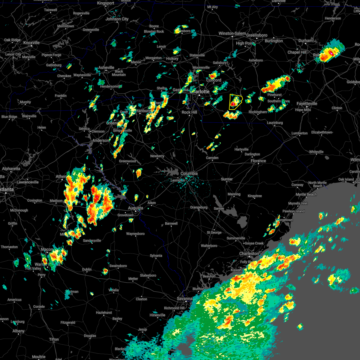 At 209 pm edt, a severe thunderstorm was located 7 miles west of ansonville, or 12 miles northwest of wadesboro, moving northeast at 5 mph (radar indicated). Hazards include 60 mph wind gusts and quarter size hail. Hail damage to vehicles is expected. Expect wind damage to roofs, siding, and trees. At 209 pm edt, a severe thunderstorm was located 7 miles west of ansonville, or 12 miles northwest of wadesboro, moving northeast at 5 mph (radar indicated). Hazards include 60 mph wind gusts and quarter size hail. Hail damage to vehicles is expected. Expect wind damage to roofs, siding, and trees.
|
| 8/10/2021 5:39 PM EDT |
 At 538 pm edt, a severe thunderstorm was located 7 miles north of wadesboro, moving east at 15 mph (radar indicated). Hazards include 60 mph wind gusts and nickel size hail. expect damage to roofs, siding, and trees At 538 pm edt, a severe thunderstorm was located 7 miles north of wadesboro, moving east at 15 mph (radar indicated). Hazards include 60 mph wind gusts and nickel size hail. expect damage to roofs, siding, and trees
|
| 3/27/2021 5:18 PM EDT |
 At 517 pm edt, severe thunderstorms were located along a line extending from 6 miles southeast of seagrove to near unionville, moving east at 45 mph. the storm near seven lakes is showing signs of rotation and a tornado is possible with that storm (radar indicated). Hazards include 60 mph wind gusts. Expect damage to roofs, siding, and trees. Locations impacted include, albemarle, wadesboro, troy, pinehurst, biscoe, ansonville, hoffman, polkton, norwood and oakboro. At 517 pm edt, severe thunderstorms were located along a line extending from 6 miles southeast of seagrove to near unionville, moving east at 45 mph. the storm near seven lakes is showing signs of rotation and a tornado is possible with that storm (radar indicated). Hazards include 60 mph wind gusts. Expect damage to roofs, siding, and trees. Locations impacted include, albemarle, wadesboro, troy, pinehurst, biscoe, ansonville, hoffman, polkton, norwood and oakboro.
|
| 3/27/2021 5:07 PM EDT |
 At 507 pm edt, severe thunderstorms were located along a line extending from near seagrove to near fairview in union county, moving east at 45 mph (radar indicated). Hazards include 60 mph wind gusts. expect damage to roofs, siding, and trees At 507 pm edt, severe thunderstorms were located along a line extending from near seagrove to near fairview in union county, moving east at 45 mph (radar indicated). Hazards include 60 mph wind gusts. expect damage to roofs, siding, and trees
|
| 3/25/2021 7:10 PM EDT |
 At 710 pm edt, severe thunderstorms were located along a line extending from near badin lake to 6 miles west of troy to near wadesboro, moving east at 35 mph (radar indicated). Hazards include 60 mph wind gusts. Expect damage to roofs, siding, and trees. Locations impacted include, asheboro, rockingham, wadesboro, randleman, troy, badin lake, north carolina zoo, hamlet, biscoe and seagrove. At 710 pm edt, severe thunderstorms were located along a line extending from near badin lake to 6 miles west of troy to near wadesboro, moving east at 35 mph (radar indicated). Hazards include 60 mph wind gusts. Expect damage to roofs, siding, and trees. Locations impacted include, asheboro, rockingham, wadesboro, randleman, troy, badin lake, north carolina zoo, hamlet, biscoe and seagrove.
|
| 3/25/2021 6:54 PM EDT |
 At 654 pm edt, severe thunderstorms were located along a line extending from 7 miles north of plyler to near albemarle to near sturdivants, moving east at 35 mph (radar indicated). Hazards include 60 mph wind gusts. expect damage to roofs, siding, and trees At 654 pm edt, severe thunderstorms were located along a line extending from 7 miles north of plyler to near albemarle to near sturdivants, moving east at 35 mph (radar indicated). Hazards include 60 mph wind gusts. expect damage to roofs, siding, and trees
|
| 3/18/2021 6:07 PM EDT |
 At 606 pm edt, a severe thunderstorm was located over sturdivants, or 12 miles west of wadesboro, moving east at 45 mph (radar indicated). Hazards include 60 mph wind gusts and penny size hail. expect damage to roofs, siding, and trees At 606 pm edt, a severe thunderstorm was located over sturdivants, or 12 miles west of wadesboro, moving east at 45 mph (radar indicated). Hazards include 60 mph wind gusts and penny size hail. expect damage to roofs, siding, and trees
|
| 7/10/2020 9:48 PM EDT |
 At 947 pm edt, severe thunderstorms were located along a line extending from 11 miles southeast of north carolina zoo to near biscoe to 6 miles east of ansonville, moving east at 25 mph (radar indicated). Hazards include 60 mph wind gusts. expect damage to roofs, siding, and trees At 947 pm edt, severe thunderstorms were located along a line extending from 11 miles southeast of north carolina zoo to near biscoe to 6 miles east of ansonville, moving east at 25 mph (radar indicated). Hazards include 60 mph wind gusts. expect damage to roofs, siding, and trees
|
| 6/22/2020 8:06 PM EDT |
 At 805 pm edt, severe thunderstorms were located along a line extending from near albemarle to 9 miles northwest of ansonville, moving east at 30 mph (law enforcement). Hazards include 60 mph wind gusts. Expect damage to roofs, siding, and trees. Locations impacted include, albemarle, wadesboro, badin lake, ansonville, polkton, norwood, badin, peachland, morrow mountain state park and lake tillery. At 805 pm edt, severe thunderstorms were located along a line extending from near albemarle to 9 miles northwest of ansonville, moving east at 30 mph (law enforcement). Hazards include 60 mph wind gusts. Expect damage to roofs, siding, and trees. Locations impacted include, albemarle, wadesboro, badin lake, ansonville, polkton, norwood, badin, peachland, morrow mountain state park and lake tillery.
|
| 6/22/2020 7:42 PM EDT |
 At 741 pm edt, a cluster of severe thunderstorms were located along a line extending from near plyler to near midland and stanfield, moving east at 25 mph (radar indicated). Hazards include 60 mph wind gusts. Expect damage to roofs, siding, and trees. Locations impacted include, albemarle, wadesboro, badin lake, ansonville, plyler, midland, polkton, locust, norwood and badin. At 741 pm edt, a cluster of severe thunderstorms were located along a line extending from near plyler to near midland and stanfield, moving east at 25 mph (radar indicated). Hazards include 60 mph wind gusts. Expect damage to roofs, siding, and trees. Locations impacted include, albemarle, wadesboro, badin lake, ansonville, plyler, midland, polkton, locust, norwood and badin.
|
| 6/22/2020 7:20 PM EDT |
 At 719 pm edt, a severe thunderstorm was located over mint hill, or 13 miles north of monroe, moving east at 20 mph (radar indicated). Hazards include 60 mph wind gusts. expect damage to roofs, siding, and trees At 719 pm edt, a severe thunderstorm was located over mint hill, or 13 miles north of monroe, moving east at 20 mph (radar indicated). Hazards include 60 mph wind gusts. expect damage to roofs, siding, and trees
|
| 6/11/2020 10:42 PM EDT |
 The severe thunderstorm warning for northern anson, southern montgomery, northwestern richmond and stanly counties will expire at 1045 pm edt, the storms which prompted the warning have weakened below severe limits, and no longer pose an immediate threat to life or property. therefore, the warning will be allowed to expire. however heavy rain is still possible with these thunderstorms. The severe thunderstorm warning for northern anson, southern montgomery, northwestern richmond and stanly counties will expire at 1045 pm edt, the storms which prompted the warning have weakened below severe limits, and no longer pose an immediate threat to life or property. therefore, the warning will be allowed to expire. however heavy rain is still possible with these thunderstorms.
|
| 6/11/2020 10:24 PM EDT |
 At 1024 pm edt, severe thunderstorms were located along a line extending from near biscoe to 6 miles south of albemarle, moving south at 5 mph (radar indicated). Hazards include 60 mph wind gusts. Expect damage to roofs, siding, and trees. Locations impacted include, albemarle, ansonville, locust, norwood, badin, oakboro, stanfield, mount gilead, candor and norman. At 1024 pm edt, severe thunderstorms were located along a line extending from near biscoe to 6 miles south of albemarle, moving south at 5 mph (radar indicated). Hazards include 60 mph wind gusts. Expect damage to roofs, siding, and trees. Locations impacted include, albemarle, ansonville, locust, norwood, badin, oakboro, stanfield, mount gilead, candor and norman.
|
| 6/11/2020 10:09 PM EDT |
 At 1009 pm edt, severe thunderstorms were located along a line extending from near biscoe to near albemarle, moving south at 5 mph (radar indicated). Hazards include 60 mph wind gusts. Expect damage to roofs, siding, and trees. Locations impacted include, albemarle, troy, biscoe, ansonville, plyler, locust, norwood, badin, oakboro and stanfield. At 1009 pm edt, severe thunderstorms were located along a line extending from near biscoe to near albemarle, moving south at 5 mph (radar indicated). Hazards include 60 mph wind gusts. Expect damage to roofs, siding, and trees. Locations impacted include, albemarle, troy, biscoe, ansonville, plyler, locust, norwood, badin, oakboro and stanfield.
|
| 6/11/2020 9:43 PM EDT |
 At 942 pm edt, severe thunderstorms were located along a line extending from near biscoe to near albemarle, moving south at 5 mph (radar indicated). Hazards include 60 mph wind gusts. expect damage to roofs, siding, and trees At 942 pm edt, severe thunderstorms were located along a line extending from near biscoe to near albemarle, moving south at 5 mph (radar indicated). Hazards include 60 mph wind gusts. expect damage to roofs, siding, and trees
|
| 5/29/2020 1:41 PM EDT |
 The severe thunderstorm warning for anson, montgomery, western richmond and stanly counties will expire at 145 pm edt, the storms which prompted the warning has weakened. therefore, the warning will be allowed to expire. however, heavy downpours will continue over the next 30 minutes, resulting in some the threat for some minor flooding. The severe thunderstorm warning for anson, montgomery, western richmond and stanly counties will expire at 145 pm edt, the storms which prompted the warning has weakened. therefore, the warning will be allowed to expire. however, heavy downpours will continue over the next 30 minutes, resulting in some the threat for some minor flooding.
|
| 5/29/2020 1:27 PM EDT |
 At 127 pm edt, severe thunderstorms were located along a line extending from near albemarle to 6 miles northwest of ansonville to 8 miles southwest of wadesboro, moving east at 35 mph (radar indicated). Hazards include 60 mph wind gusts. Expect damage to roofs, siding, and trees. Locations impacted include, albemarle, wadesboro, troy, badin lake, biscoe, ansonville, plyler, midland, polkton and locust. At 127 pm edt, severe thunderstorms were located along a line extending from near albemarle to 6 miles northwest of ansonville to 8 miles southwest of wadesboro, moving east at 35 mph (radar indicated). Hazards include 60 mph wind gusts. Expect damage to roofs, siding, and trees. Locations impacted include, albemarle, wadesboro, troy, badin lake, biscoe, ansonville, plyler, midland, polkton and locust.
|
| 5/29/2020 1:04 PM EDT |
 At 103 pm edt, severe thunderstorms were located along a line extending from near mt pleasant to 8 miles north of marshville to 7 miles northeast of buford, moving east-northeast at 35 mph (radar indicated). Hazards include 60 mph wind gusts. Expect damage to roofs, siding, and trees. Locations impacted include, albemarle, wadesboro, troy, badin lake, biscoe, ansonville, plyler, midland, polkton and locust. At 103 pm edt, severe thunderstorms were located along a line extending from near mt pleasant to 8 miles north of marshville to 7 miles northeast of buford, moving east-northeast at 35 mph (radar indicated). Hazards include 60 mph wind gusts. Expect damage to roofs, siding, and trees. Locations impacted include, albemarle, wadesboro, troy, badin lake, biscoe, ansonville, plyler, midland, polkton and locust.
|
| 5/29/2020 12:50 PM EDT |
 At 1250 pm edt, severe thunderstorms were located along a line extending from near midland to wingate to near buford, moving east at 35 mph (radar indicated). Hazards include 60 mph wind gusts. expect damage to roofs, siding, and trees At 1250 pm edt, severe thunderstorms were located along a line extending from near midland to wingate to near buford, moving east at 35 mph (radar indicated). Hazards include 60 mph wind gusts. expect damage to roofs, siding, and trees
|
| 5/28/2020 7:09 PM EDT |
 The severe thunderstorm warning for anson and southeastern stanly counties will expire at 715 pm edt, the storms which prompted the warning have weakened and therefore the warning will be allowed to expire. however gusty winds are still possible with these thunderstorms, and additional warnings may be needed this evening. be ready to seek shelter if severe weather threatens your area. The severe thunderstorm warning for anson and southeastern stanly counties will expire at 715 pm edt, the storms which prompted the warning have weakened and therefore the warning will be allowed to expire. however gusty winds are still possible with these thunderstorms, and additional warnings may be needed this evening. be ready to seek shelter if severe weather threatens your area.
|
| 5/28/2020 6:50 PM EDT |
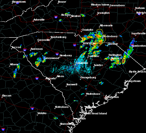 At 649 pm edt, a severe thunderstorm was located near ansonville, or 10 miles northwest of wadesboro, moving northeast at 35 mph (radar indicated). Hazards include 60 mph wind gusts and penny size hail. Expect damage to roofs, siding, and trees. Locations impacted include, wadesboro, ansonville, polkton, norwood, lilesville, morven, peachland, white store and lake tillery. At 649 pm edt, a severe thunderstorm was located near ansonville, or 10 miles northwest of wadesboro, moving northeast at 35 mph (radar indicated). Hazards include 60 mph wind gusts and penny size hail. Expect damage to roofs, siding, and trees. Locations impacted include, wadesboro, ansonville, polkton, norwood, lilesville, morven, peachland, white store and lake tillery.
|
| 5/28/2020 6:34 PM EDT |
 At 633 pm edt, severe thunderstorms were located along a line extending from sturdivants to 8 miles north of carolina sandhills wildlife refuge, moving northeast at 15 mph (radar indicated). Hazards include 60 mph wind gusts and penny size hail. Expect damage to roofs, siding, and trees. These severe thunderstorms will remain over mainly rural areas of anson and southeastern stanly counties, including the following locations, norwood, polkton, lilesville, morven and white store. At 633 pm edt, severe thunderstorms were located along a line extending from sturdivants to 8 miles north of carolina sandhills wildlife refuge, moving northeast at 15 mph (radar indicated). Hazards include 60 mph wind gusts and penny size hail. Expect damage to roofs, siding, and trees. These severe thunderstorms will remain over mainly rural areas of anson and southeastern stanly counties, including the following locations, norwood, polkton, lilesville, morven and white store.
|
| 5/22/2020 5:16 PM EDT |
 At 516 pm edt, severe thunderstorms were located along a line extending from near albemarle to 10 miles south of troy to near chesterfield, moving east at 55 mph (radar indicated). Hazards include 60 mph wind gusts and penny size hail. Expect damage to roofs, siding, and trees. Locations impacted include, albemarle, rockingham, wadesboro, troy, badin lake, hamlet, biscoe, ansonville, plyler and norwood. At 516 pm edt, severe thunderstorms were located along a line extending from near albemarle to 10 miles south of troy to near chesterfield, moving east at 55 mph (radar indicated). Hazards include 60 mph wind gusts and penny size hail. Expect damage to roofs, siding, and trees. Locations impacted include, albemarle, rockingham, wadesboro, troy, badin lake, hamlet, biscoe, ansonville, plyler and norwood.
|
| 5/22/2020 5:03 PM EDT |
 At 503 pm edt, severe thunderstorms were located along a line extending from near plyler to 7 miles northeast of ansonville to 7 miles east of pageland, moving east at 50 mph (radar indicated). Hazards include 60 mph wind gusts and nickel size hail. Expect damage to roofs, siding, and trees. Locations impacted include, albemarle, rockingham, wadesboro, troy, badin lake, hamlet, biscoe, ansonville, plyler and polkton. At 503 pm edt, severe thunderstorms were located along a line extending from near plyler to 7 miles northeast of ansonville to 7 miles east of pageland, moving east at 50 mph (radar indicated). Hazards include 60 mph wind gusts and nickel size hail. Expect damage to roofs, siding, and trees. Locations impacted include, albemarle, rockingham, wadesboro, troy, badin lake, hamlet, biscoe, ansonville, plyler and polkton.
|
| 5/22/2020 4:32 PM EDT |
 At 432 pm edt, severe thunderstorms were located along a line extending from west concord to fairview in union county to near lancaster, moving northeast at 55 mph (radar indicated). Hazards include 60 mph wind gusts and nickel size hail. expect damage to roofs, siding, and trees At 432 pm edt, severe thunderstorms were located along a line extending from west concord to fairview in union county to near lancaster, moving northeast at 55 mph (radar indicated). Hazards include 60 mph wind gusts and nickel size hail. expect damage to roofs, siding, and trees
|
| 5/21/2020 2:54 PM EDT |
 At 253 pm edt, severe thunderstorms were located along a line extending from 6 miles northwest of ansonville to 8 miles west of wadesboro to near pageland, moving north at 20 mph (radar indicated). Hazards include 60 mph wind gusts. Expect damage to roofs, siding, and trees. Locations impacted include, albemarle, wadesboro, troy, badin lake, ansonville, plyler, polkton, locust, norwood and badin. At 253 pm edt, severe thunderstorms were located along a line extending from 6 miles northwest of ansonville to 8 miles west of wadesboro to near pageland, moving north at 20 mph (radar indicated). Hazards include 60 mph wind gusts. Expect damage to roofs, siding, and trees. Locations impacted include, albemarle, wadesboro, troy, badin lake, ansonville, plyler, polkton, locust, norwood and badin.
|
| 5/21/2020 2:27 PM EDT |
 At 227 pm edt, severe thunderstorms were located along a line extending from near ansonville to 6 miles northwest of wadesboro to 6 miles east of pageland, moving north at 20 mph (radar indicated). Hazards include 60 mph wind gusts. Expect damage to roofs, siding, and trees. Locations impacted include, albemarle, wadesboro, troy, badin lake, ansonville, plyler, polkton, locust, norwood and badin. At 227 pm edt, severe thunderstorms were located along a line extending from near ansonville to 6 miles northwest of wadesboro to 6 miles east of pageland, moving north at 20 mph (radar indicated). Hazards include 60 mph wind gusts. Expect damage to roofs, siding, and trees. Locations impacted include, albemarle, wadesboro, troy, badin lake, ansonville, plyler, polkton, locust, norwood and badin.
|
| 5/21/2020 2:19 PM EDT |
 At 219 pm edt, severe thunderstorms were located along a line extending from near badin lake to near ansonville to near pageland, moving north at 10 mph (radar indicated). Hazards include 60 mph wind gusts. expect damage to roofs, siding, and trees At 219 pm edt, severe thunderstorms were located along a line extending from near badin lake to near ansonville to near pageland, moving north at 10 mph (radar indicated). Hazards include 60 mph wind gusts. expect damage to roofs, siding, and trees
|
| 5/21/2020 1:54 PM EDT |
 At 153 pm edt, doppler radar indicated severe thunderstorms capable of producing damaging winds in excess of 60 mph. these storms were located along a line extending from 10 miles southeast of high rock lake to near badin lake to 10 miles northwest of ansonville to near sturdivants, moving northeast at 10 mph. locations impacted include, albemarle, wadesboro, troy, badin lake, biscoe, ansonville, seagrove, plyler, polkton and norwood. At 153 pm edt, doppler radar indicated severe thunderstorms capable of producing damaging winds in excess of 60 mph. these storms were located along a line extending from 10 miles southeast of high rock lake to near badin lake to 10 miles northwest of ansonville to near sturdivants, moving northeast at 10 mph. locations impacted include, albemarle, wadesboro, troy, badin lake, biscoe, ansonville, seagrove, plyler, polkton and norwood.
|
| 5/21/2020 1:15 PM EDT |
 At 114 pm edt, severe thunderstorms were located along a line extending from 6 miles west of badin lake to near albemarle to 8 miles west of ansonville to near sturdivants, moving northeast at 25 mph (radar indicated). Hazards include 60 mph wind gusts. damage to roofs, siding, and trees At 114 pm edt, severe thunderstorms were located along a line extending from 6 miles west of badin lake to near albemarle to 8 miles west of ansonville to near sturdivants, moving northeast at 25 mph (radar indicated). Hazards include 60 mph wind gusts. damage to roofs, siding, and trees
|
| 4/25/2020 11:53 PM EDT |
 The severe thunderstorm warning for northwestern moore, southeastern davidson, northern anson, montgomery, northwestern richmond, randolph and stanly counties will expire at midnight edt, the storms which prompted the warning have weakened below severe limits, and no longer pose an immediate threat to life or property. therefore, the warning will be allowed to expire. to report severe weather, contact your nearest law enforcement agency. they will relay your report to the national weather service raleigh. The severe thunderstorm warning for northwestern moore, southeastern davidson, northern anson, montgomery, northwestern richmond, randolph and stanly counties will expire at midnight edt, the storms which prompted the warning have weakened below severe limits, and no longer pose an immediate threat to life or property. therefore, the warning will be allowed to expire. to report severe weather, contact your nearest law enforcement agency. they will relay your report to the national weather service raleigh.
|
| 4/25/2020 11:37 PM EDT |
 At 1136 pm edt, severe thunderstorms were located along a line extending from 9 miles east of randleman to 6 miles east of north carolina zoo to 7 miles southeast of albemarle, moving east at 30 mph (radar indicated). Hazards include 60 mph wind gusts and half dollar size hail. Hail damage to vehicles is expected. expect wind damage to roofs, siding, and trees. Locations impacted include, asheboro, albemarle, randleman, troy, badin lake, north carolina zoo, biscoe, ansonville, seagrove and plyler. At 1136 pm edt, severe thunderstorms were located along a line extending from 9 miles east of randleman to 6 miles east of north carolina zoo to 7 miles southeast of albemarle, moving east at 30 mph (radar indicated). Hazards include 60 mph wind gusts and half dollar size hail. Hail damage to vehicles is expected. expect wind damage to roofs, siding, and trees. Locations impacted include, asheboro, albemarle, randleman, troy, badin lake, north carolina zoo, biscoe, ansonville, seagrove and plyler.
|
| 4/25/2020 11:18 PM EDT |
 At 1118 pm edt, severe thunderstorms were located along a line extending from near randleman to near north carolina zoo to 9 miles south of plyler, moving northeast at 55 mph (radar indicated). Hazards include 60 mph wind gusts and half dollar size hail. Hail damage to vehicles is expected. expect wind damage to roofs, siding, and trees. Locations impacted include, asheboro, albemarle, randleman, troy, badin lake, north carolina zoo, biscoe, ansonville, seagrove and plyler. At 1118 pm edt, severe thunderstorms were located along a line extending from near randleman to near north carolina zoo to 9 miles south of plyler, moving northeast at 55 mph (radar indicated). Hazards include 60 mph wind gusts and half dollar size hail. Hail damage to vehicles is expected. expect wind damage to roofs, siding, and trees. Locations impacted include, asheboro, albemarle, randleman, troy, badin lake, north carolina zoo, biscoe, ansonville, seagrove and plyler.
|
| 4/25/2020 10:57 PM EDT |
 At 1056 pm edt, severe thunderstorms were located along a line extending from 9 miles southeast of lexington to near badin lake to 6 miles southeast of midland, moving east at 30 mph (radar indicated). Hazards include 60 mph wind gusts and quarter size hail. Hail damage to vehicles is expected. Expect wind damage to roofs, siding, and trees. At 1056 pm edt, severe thunderstorms were located along a line extending from 9 miles southeast of lexington to near badin lake to 6 miles southeast of midland, moving east at 30 mph (radar indicated). Hazards include 60 mph wind gusts and quarter size hail. Hail damage to vehicles is expected. Expect wind damage to roofs, siding, and trees.
|
| 4/25/2020 10:57 PM EDT |
 The national weather service in raleigh has issued a * severe thunderstorm warning for. northwestern moore county in central north carolina. southeastern davidson county in central north carolina. northern anson county in central north carolina. Montgomery county in central north carolina. The national weather service in raleigh has issued a * severe thunderstorm warning for. northwestern moore county in central north carolina. southeastern davidson county in central north carolina. northern anson county in central north carolina. Montgomery county in central north carolina.
|
| 4/13/2020 6:30 AM EDT |
 At 630 am edt, severe thunderstorms were located along a line extending from near seagrove to 12 miles east of ansonville to mt pisgah, moving northeast at 60 mph (radar indicated). Hazards include 60 mph wind gusts. Expect damage to roofs, siding, and trees. Locations impacted include, albemarle, rockingham, wadesboro, troy, carthage, badin lake, pinehurst, hamlet, biscoe and ansonville. At 630 am edt, severe thunderstorms were located along a line extending from near seagrove to 12 miles east of ansonville to mt pisgah, moving northeast at 60 mph (radar indicated). Hazards include 60 mph wind gusts. Expect damage to roofs, siding, and trees. Locations impacted include, albemarle, rockingham, wadesboro, troy, carthage, badin lake, pinehurst, hamlet, biscoe and ansonville.
|
| 4/13/2020 6:12 AM EDT |
 At 612 am edt, severe thunderstorms were located along a line extending from near north carolina zoo to 9 miles northeast of ansonville to near kershaw, moving northeast at 65 mph (radar indicated). Hazards include 60 mph wind gusts. Expect damage to roofs, siding, and trees. Locations impacted include, albemarle, rockingham, wadesboro, troy, carthage, badin lake, pinehurst, hamlet, biscoe and ansonville. At 612 am edt, severe thunderstorms were located along a line extending from near north carolina zoo to 9 miles northeast of ansonville to near kershaw, moving northeast at 65 mph (radar indicated). Hazards include 60 mph wind gusts. Expect damage to roofs, siding, and trees. Locations impacted include, albemarle, rockingham, wadesboro, troy, carthage, badin lake, pinehurst, hamlet, biscoe and ansonville.
|
| 4/13/2020 6:09 AM EDT |
 At 609 am edt, severe thunderstorms were located along a line extending from 6 miles north of troy to near ansonville to westville, moving northeast at 90 mph (radar indicated). Hazards include 60 mph wind gusts. Expect damage to roofs, siding, and trees. Locations impacted include, albemarle, rockingham, wadesboro, troy, carthage, badin lake, pinehurst, hamlet, biscoe and ansonville. At 609 am edt, severe thunderstorms were located along a line extending from 6 miles north of troy to near ansonville to westville, moving northeast at 90 mph (radar indicated). Hazards include 60 mph wind gusts. Expect damage to roofs, siding, and trees. Locations impacted include, albemarle, rockingham, wadesboro, troy, carthage, badin lake, pinehurst, hamlet, biscoe and ansonville.
|
| 4/13/2020 5:52 AM EDT |
 At 552 am edt, severe thunderstorms were located along a line extending from 8 miles southwest of seagrove to near ansonville to near buford, moving northeast at 55 mph (radar indicated). Hazards include 60 mph wind gusts. expect damage to roofs, siding, and trees At 552 am edt, severe thunderstorms were located along a line extending from 8 miles southwest of seagrove to near ansonville to near buford, moving northeast at 55 mph (radar indicated). Hazards include 60 mph wind gusts. expect damage to roofs, siding, and trees
|
| 4/13/2020 5:42 AM EDT |
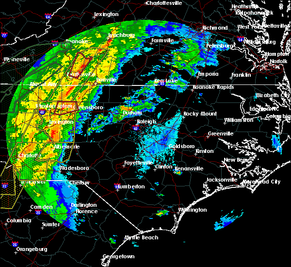 At 542 am edt, severe thunderstorms were located along a line extending from 7 miles northwest of ansonville to near pageland, moving northeast at 60 mph (radar indicated). Hazards include 60 mph wind gusts. Expect damage to roofs, siding, and trees. Locations impacted include, wadesboro, ansonville, polkton, lilesville, morven, peachland, mcfarlan, blewett falls lake and white store. At 542 am edt, severe thunderstorms were located along a line extending from 7 miles northwest of ansonville to near pageland, moving northeast at 60 mph (radar indicated). Hazards include 60 mph wind gusts. Expect damage to roofs, siding, and trees. Locations impacted include, wadesboro, ansonville, polkton, lilesville, morven, peachland, mcfarlan, blewett falls lake and white store.
|
| 4/13/2020 5:21 AM EDT |
 At 521 am edt, severe thunderstorms were located along a line extending from 8 miles northwest of ansonville to 6 miles east of buford, moving northeast at 70 mph (radar indicated). Hazards include 60 mph wind gusts. expect damage to roofs, siding, and trees At 521 am edt, severe thunderstorms were located along a line extending from 8 miles northwest of ansonville to 6 miles east of buford, moving northeast at 70 mph (radar indicated). Hazards include 60 mph wind gusts. expect damage to roofs, siding, and trees
|
| 2/6/2020 3:25 PM EST |
 At 324 pm est, a severe thunderstorm was located 8 miles east of marshville, or 9 miles northwest of wadesboro, moving northeast at 55 mph (radar indicated). Hazards include 60 mph wind gusts and penny size hail. expect damage to roofs, siding, and trees At 324 pm est, a severe thunderstorm was located 8 miles east of marshville, or 9 miles northwest of wadesboro, moving northeast at 55 mph (radar indicated). Hazards include 60 mph wind gusts and penny size hail. expect damage to roofs, siding, and trees
|
| 2/6/2020 1:07 PM EST |
 At 106 pm est, severe thunderstorms were located along a line extending from near asheboro to 6 miles southwest of troy to near ansonville, moving east at 45 mph (radar indicated). Hazards include 60 mph wind gusts. Expect damage to roofs, siding, and trees. Locations impacted include, albemarle, troy, badin lake, biscoe, ansonville, norwood, badin, mount gilead, star and candor. At 106 pm est, severe thunderstorms were located along a line extending from near asheboro to 6 miles southwest of troy to near ansonville, moving east at 45 mph (radar indicated). Hazards include 60 mph wind gusts. Expect damage to roofs, siding, and trees. Locations impacted include, albemarle, troy, badin lake, biscoe, ansonville, norwood, badin, mount gilead, star and candor.
|
| 2/6/2020 12:35 PM EST |
 At 1234 pm est, severe thunderstorms were located along a line extending from near high rock lake to near hemby bridge to near indian land, moving east at 65 mph (radar indicated). Hazards include 60 mph wind gusts. expect damage to roofs, siding, and trees At 1234 pm est, severe thunderstorms were located along a line extending from near high rock lake to near hemby bridge to near indian land, moving east at 65 mph (radar indicated). Hazards include 60 mph wind gusts. expect damage to roofs, siding, and trees
|
| 1/11/2020 10:38 PM EST |
 At 1037 pm est, severe thunderstorms were located along a line extending from 7 miles southeast of midland to 7 miles north of mt pisgah, moving east at 65 mph (radar indicated). Hazards include 60 mph wind gusts. expect damage to roofs, siding, and trees At 1037 pm est, severe thunderstorms were located along a line extending from 7 miles southeast of midland to 7 miles north of mt pisgah, moving east at 65 mph (radar indicated). Hazards include 60 mph wind gusts. expect damage to roofs, siding, and trees
|
| 10/31/2019 7:27 PM EDT |
 At 725 pm edt, severe thunderstorms were located along a line extending from near mebane to near biscoe, moving northeast at 55 mph (radar indicated). Hazards include 70 mph wind gusts. the primary location for this wind will be just west of swepsonville and saxapahaw. Expect considerable tree damage. damage is likely to mobile homes, roofs, and outbuildings. locations impacted include, burlington, asheboro, graham, rockingham, wadesboro, troy, siler city, north carolina zoo, mebane and hamlet. A tornado watch remains in effect until 1100 pm edt for central north carolina. At 725 pm edt, severe thunderstorms were located along a line extending from near mebane to near biscoe, moving northeast at 55 mph (radar indicated). Hazards include 70 mph wind gusts. the primary location for this wind will be just west of swepsonville and saxapahaw. Expect considerable tree damage. damage is likely to mobile homes, roofs, and outbuildings. locations impacted include, burlington, asheboro, graham, rockingham, wadesboro, troy, siler city, north carolina zoo, mebane and hamlet. A tornado watch remains in effect until 1100 pm edt for central north carolina.
|
| 10/31/2019 7:19 PM EDT |
 At 718 pm edt, a severe thunderstorm was located 11 miles south of troy, moving northeast at 45 mph (radar indicated). Hazards include 60 mph wind gusts. Expect damage to roofs, siding, and trees. locations impacted include, rockingham, wadesboro, troy, biscoe, ansonville, polkton, norwood, mount gilead, ellerbe and lilesville. A tornado watch remains in effect until 1100 pm edt for central north carolina. At 718 pm edt, a severe thunderstorm was located 11 miles south of troy, moving northeast at 45 mph (radar indicated). Hazards include 60 mph wind gusts. Expect damage to roofs, siding, and trees. locations impacted include, rockingham, wadesboro, troy, biscoe, ansonville, polkton, norwood, mount gilead, ellerbe and lilesville. A tornado watch remains in effect until 1100 pm edt for central north carolina.
|
| 10/31/2019 7:01 PM EDT |
 At 700 pm edt, a severe thunderstorm capable of producing a tornado was located 7 miles east of ansonville, or 12 miles northeast of wadesboro, moving northeast at 50 mph (radar indicated rotation). Hazards include tornado. Flying debris will be dangerous to those caught without shelter. mobile homes will be damaged or destroyed. damage to roofs, windows, and vehicles will occur. tree damage is likely. Locations impacted include, ansonville, norwood, mount gilead, ellerbe, norman, uwharrie haven, derby, covington, pekin and blewett falls lake. At 700 pm edt, a severe thunderstorm capable of producing a tornado was located 7 miles east of ansonville, or 12 miles northeast of wadesboro, moving northeast at 50 mph (radar indicated rotation). Hazards include tornado. Flying debris will be dangerous to those caught without shelter. mobile homes will be damaged or destroyed. damage to roofs, windows, and vehicles will occur. tree damage is likely. Locations impacted include, ansonville, norwood, mount gilead, ellerbe, norman, uwharrie haven, derby, covington, pekin and blewett falls lake.
|
| 10/31/2019 6:48 PM EDT |
 At 647 pm edt, severe thunderstorms were located along a line extending from near randleman to 7 miles west of ansonville, moving northeast at 50 mph (radar indicated). Hazards include 60 mph wind gusts. expect damage to roofs, siding, and trees At 647 pm edt, severe thunderstorms were located along a line extending from near randleman to 7 miles west of ansonville, moving northeast at 50 mph (radar indicated). Hazards include 60 mph wind gusts. expect damage to roofs, siding, and trees
|
| 10/31/2019 6:45 PM EDT |
 At 644 pm edt, a severe thunderstorm capable of producing a tornado was located 8 miles west of wadesboro, moving northeast at 55 mph (radar indicated rotation). Hazards include tornado. Flying debris will be dangerous to those caught without shelter. mobile homes will be damaged or destroyed. damage to roofs, windows, and vehicles will occur. Tree damage is likely. At 644 pm edt, a severe thunderstorm capable of producing a tornado was located 8 miles west of wadesboro, moving northeast at 55 mph (radar indicated rotation). Hazards include tornado. Flying debris will be dangerous to those caught without shelter. mobile homes will be damaged or destroyed. damage to roofs, windows, and vehicles will occur. Tree damage is likely.
|
| 10/31/2019 6:26 PM EDT |
 At 626 pm edt, a severe thunderstorm was located near wingate, or near monroe, moving northeast at 45 mph (radar indicated). Hazards include 60 mph wind gusts. expect damage to roofs, siding, and trees At 626 pm edt, a severe thunderstorm was located near wingate, or near monroe, moving northeast at 45 mph (radar indicated). Hazards include 60 mph wind gusts. expect damage to roofs, siding, and trees
|
| 8/20/2019 3:56 PM EDT |
 At 355 pm edt, a severe thunderstorm was located over ansonville, or 11 miles north of wadesboro, moving northeast at 20 mph (radar indicated). Hazards include 60 mph wind gusts and quarter size hail. Hail damage to vehicles is expected. Expect wind damage to roofs, siding, and trees. At 355 pm edt, a severe thunderstorm was located over ansonville, or 11 miles north of wadesboro, moving northeast at 20 mph (radar indicated). Hazards include 60 mph wind gusts and quarter size hail. Hail damage to vehicles is expected. Expect wind damage to roofs, siding, and trees.
|
| 6/22/2019 5:19 PM EDT |
 A severe thunderstorm warning remains in effect until 545 pm edt for anson and richmond counties. at 518 pm edt, a severe thunderstorm was located 8 miles north of cheraw municipal airport, or 10 miles southeast of wadesboro, moving southeast at 40 mph. hazard. 60 mph wind gusts and nickel size hail. A severe thunderstorm warning remains in effect until 545 pm edt for anson and richmond counties. at 518 pm edt, a severe thunderstorm was located 8 miles north of cheraw municipal airport, or 10 miles southeast of wadesboro, moving southeast at 40 mph. hazard. 60 mph wind gusts and nickel size hail.
|
| 6/22/2019 5:00 PM EDT |
 At 500 pm edt, a severe thunderstorm was located near sturdivants, or 8 miles west of wadesboro, moving east at 50 mph (radar indicated). Hazards include 60 mph wind gusts and nickel size hail. Expect damage to roofs, siding, and trees. Locations impacted include, rockingham, wadesboro, hamlet, ansonville, sturdivants, polkton, norwood, oakboro, ellerbe and dobbins heights. At 500 pm edt, a severe thunderstorm was located near sturdivants, or 8 miles west of wadesboro, moving east at 50 mph (radar indicated). Hazards include 60 mph wind gusts and nickel size hail. Expect damage to roofs, siding, and trees. Locations impacted include, rockingham, wadesboro, hamlet, ansonville, sturdivants, polkton, norwood, oakboro, ellerbe and dobbins heights.
|
| 6/22/2019 4:41 PM EDT |
 The national weather service in raleigh has issued a * severe thunderstorm warning for. anson county in central north carolina. southwestern montgomery county in central north carolina. richmond county in central north carolina. Southern stanly county in central north carolina. The national weather service in raleigh has issued a * severe thunderstorm warning for. anson county in central north carolina. southwestern montgomery county in central north carolina. richmond county in central north carolina. Southern stanly county in central north carolina.
|
| 5/11/2019 5:49 PM EDT |
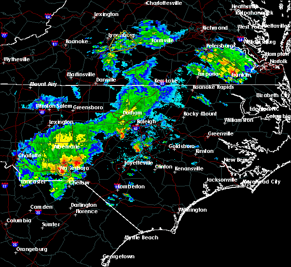 At 549 pm edt, a severe thunderstorm was located over wadesboro, moving east at 25 mph (radar indicated). Hazards include 60 mph wind gusts. Expect damage to roofs, siding, and trees. Locations impacted include, wadesboro, ansonville, lilesville and blewett falls lake. At 549 pm edt, a severe thunderstorm was located over wadesboro, moving east at 25 mph (radar indicated). Hazards include 60 mph wind gusts. Expect damage to roofs, siding, and trees. Locations impacted include, wadesboro, ansonville, lilesville and blewett falls lake.
|
| 5/11/2019 5:26 PM EDT |
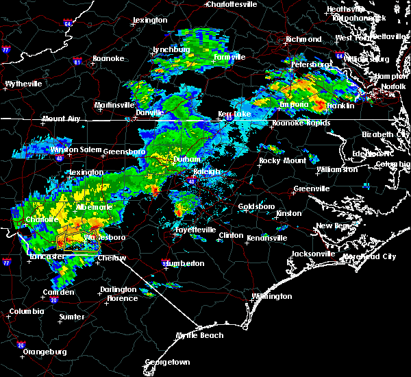 At 526 pm edt, a severe thunderstorm was located near marshville, or 13 miles east of monroe, moving east at 25 mph (radar indicated). Hazards include 60 mph wind gusts and quarter size hail. Hail damage to vehicles is expected. Expect wind damage to roofs, siding, and trees. At 526 pm edt, a severe thunderstorm was located near marshville, or 13 miles east of monroe, moving east at 25 mph (radar indicated). Hazards include 60 mph wind gusts and quarter size hail. Hail damage to vehicles is expected. Expect wind damage to roofs, siding, and trees.
|
| 5/11/2019 4:51 PM EDT |
 At 450 pm edt, a severe thunderstorm capable of producing a tornado was located near ansonville, or 13 miles north of wadesboro, moving east at 25 mph (radar indicated rotation). Hazards include tornado and ping pong ball size hail. Flying debris will be dangerous to those caught without shelter. mobile homes will be damaged or destroyed. damage to roofs, windows, and vehicles will occur. Tree damage is likely. At 450 pm edt, a severe thunderstorm capable of producing a tornado was located near ansonville, or 13 miles north of wadesboro, moving east at 25 mph (radar indicated rotation). Hazards include tornado and ping pong ball size hail. Flying debris will be dangerous to those caught without shelter. mobile homes will be damaged or destroyed. damage to roofs, windows, and vehicles will occur. Tree damage is likely.
|
| 5/11/2019 4:49 PM EDT |
 At 449 pm edt, a severe thunderstorm was located near ansonville, or 13 miles north of wadesboro, moving east at 25 mph (radar indicated). Hazards include ping pong ball size hail and 60 mph wind gusts. People and animals outdoors will be injured. expect hail damage to roofs, siding, windows, and vehicles. expect wind damage to roofs, siding, and trees. Locations impacted include, ansonville, norwood, mount gilead, ellerbe, uwharrie haven, covington, pekin, lake tillery and blewett falls lake. At 449 pm edt, a severe thunderstorm was located near ansonville, or 13 miles north of wadesboro, moving east at 25 mph (radar indicated). Hazards include ping pong ball size hail and 60 mph wind gusts. People and animals outdoors will be injured. expect hail damage to roofs, siding, windows, and vehicles. expect wind damage to roofs, siding, and trees. Locations impacted include, ansonville, norwood, mount gilead, ellerbe, uwharrie haven, covington, pekin, lake tillery and blewett falls lake.
|
| 5/11/2019 4:34 PM EDT |
 At 434 pm edt, a severe thunderstorm was located 8 miles northwest of ansonville, or 13 miles south of albemarle, moving east at 25 mph (radar indicated). Hazards include 60 mph wind gusts and half dollar size hail. Hail damage to vehicles is expected. Expect wind damage to roofs, siding, and trees. At 434 pm edt, a severe thunderstorm was located 8 miles northwest of ansonville, or 13 miles south of albemarle, moving east at 25 mph (radar indicated). Hazards include 60 mph wind gusts and half dollar size hail. Hail damage to vehicles is expected. Expect wind damage to roofs, siding, and trees.
|
| 5/4/2019 6:51 PM EDT |
 At 651 pm edt, a severe thunderstorm was located near wadesboro, moving northeast at 30 mph (radar indicated). Hazards include 60 mph wind gusts and quarter size hail. Hail damage to vehicles is expected. expect wind damage to roofs, siding, and trees. Locations impacted include, rockingham, wadesboro, ansonville, lilesville, morven, mcfarlan, diggs, east rockingham and blewett falls lake. At 651 pm edt, a severe thunderstorm was located near wadesboro, moving northeast at 30 mph (radar indicated). Hazards include 60 mph wind gusts and quarter size hail. Hail damage to vehicles is expected. expect wind damage to roofs, siding, and trees. Locations impacted include, rockingham, wadesboro, ansonville, lilesville, morven, mcfarlan, diggs, east rockingham and blewett falls lake.
|
| 5/4/2019 6:34 PM EDT |
 At 633 pm edt, a severe thunderstorm was located 8 miles north of chesterfield, or 9 miles southwest of wadesboro, moving east at 30 mph. this storm is showing weak signs of rotation (radar indicated). Hazards include 60 mph wind gusts, heavy rainfall, and quarter size hail. Hail damage to vehicles is expected. expect wind damage to roofs, siding, and trees. Locations impacted include, rockingham, wadesboro, ansonville, polkton, lilesville, morven, peachland, mcfarlan, diggs and east rockingham. At 633 pm edt, a severe thunderstorm was located 8 miles north of chesterfield, or 9 miles southwest of wadesboro, moving east at 30 mph. this storm is showing weak signs of rotation (radar indicated). Hazards include 60 mph wind gusts, heavy rainfall, and quarter size hail. Hail damage to vehicles is expected. expect wind damage to roofs, siding, and trees. Locations impacted include, rockingham, wadesboro, ansonville, polkton, lilesville, morven, peachland, mcfarlan, diggs and east rockingham.
|
| 5/4/2019 6:16 PM EDT |
 At 615 pm edt, a severe thunderstorm was located near sturdivants, or 15 miles southwest of wadesboro, moving northeast at 30 mph (radar indicated). Hazards include 60 mph wind gusts and quarter size hail. Hail damage to vehicles is expected. Expect wind damage to roofs, siding, and trees. At 615 pm edt, a severe thunderstorm was located near sturdivants, or 15 miles southwest of wadesboro, moving northeast at 30 mph (radar indicated). Hazards include 60 mph wind gusts and quarter size hail. Hail damage to vehicles is expected. Expect wind damage to roofs, siding, and trees.
|
| 4/19/2019 3:36 PM EDT |
 At 336 pm edt, a severe thunderstorm was located near ansonville, or near wadesboro, moving northeast at 45 mph (radar indicated). Hazards include 60 mph wind gusts. Expect damage to roofs, siding, and trees. locations impacted include, albemarle, wadesboro, troy, badin lake, biscoe, ansonville, plyler, polkton, norwood and badin. A tornado watch remains in effect until 500 pm edt for central north carolina. At 336 pm edt, a severe thunderstorm was located near ansonville, or near wadesboro, moving northeast at 45 mph (radar indicated). Hazards include 60 mph wind gusts. Expect damage to roofs, siding, and trees. locations impacted include, albemarle, wadesboro, troy, badin lake, biscoe, ansonville, plyler, polkton, norwood and badin. A tornado watch remains in effect until 500 pm edt for central north carolina.
|
| 4/19/2019 3:17 PM EDT |
 At 314 pm edt, a line of severe thunderstorms were moving northeast at 55 mph into anson and stanly counties. the storms extended from near ansonville to 10 miles west of albemarle. these storms are moving quickly (radar indicated). Hazards include 60 mph wind gusts. expect damage to roofs, siding, and trees At 314 pm edt, a line of severe thunderstorms were moving northeast at 55 mph into anson and stanly counties. the storms extended from near ansonville to 10 miles west of albemarle. these storms are moving quickly (radar indicated). Hazards include 60 mph wind gusts. expect damage to roofs, siding, and trees
|
| 4/19/2019 2:29 PM EDT |
 At 228 pm edt, severe thunderstorms were located along a line extending from 10 miles south of troy to near hamlet, moving northeast at 50 mph (radar indicated). Hazards include 60 mph wind gusts. expect damage to roofs, siding, and trees At 228 pm edt, severe thunderstorms were located along a line extending from 10 miles south of troy to near hamlet, moving northeast at 50 mph (radar indicated). Hazards include 60 mph wind gusts. expect damage to roofs, siding, and trees
|
| 2/12/2019 6:19 PM EST |
 At 618 pm est, severe thunderstorms were located along a line extending from 8 miles east of ansonville to near wadesboro to near chesterfield, moving east at 45 mph (radar indicated). Hazards include 60 mph wind gusts. Expect damage to roofs, siding, and trees. Locations impacted include, rockingham, wadesboro, ansonville, lilesville, morven, mcfarlan, diggs, east rockingham and blewett falls lake. At 618 pm est, severe thunderstorms were located along a line extending from 8 miles east of ansonville to near wadesboro to near chesterfield, moving east at 45 mph (radar indicated). Hazards include 60 mph wind gusts. Expect damage to roofs, siding, and trees. Locations impacted include, rockingham, wadesboro, ansonville, lilesville, morven, mcfarlan, diggs, east rockingham and blewett falls lake.
|
| 2/12/2019 6:04 PM EST |
 At 603 pm est, severe thunderstorms were located along a line extending from near ansonville to 7 miles north of chesterfield, moving northeast at 55 mph (radar indicated). Hazards include 60 mph wind gusts. Expect damage to roofs, siding, and trees. Locations impacted include, rockingham, wadesboro, ansonville, lilesville, morven, mcfarlan, diggs, east rockingham and blewett falls lake. At 603 pm est, severe thunderstorms were located along a line extending from near ansonville to 7 miles north of chesterfield, moving northeast at 55 mph (radar indicated). Hazards include 60 mph wind gusts. Expect damage to roofs, siding, and trees. Locations impacted include, rockingham, wadesboro, ansonville, lilesville, morven, mcfarlan, diggs, east rockingham and blewett falls lake.
|
| 2/12/2019 5:41 PM EST |
 At 540 pm est, a severe thunderstorm was located near pageland, or 15 miles east of lancaster, moving northeast at 40 mph (radar indicated). Hazards include 60 mph wind gusts. expect damage to roofs, siding, and trees At 540 pm est, a severe thunderstorm was located near pageland, or 15 miles east of lancaster, moving northeast at 40 mph (radar indicated). Hazards include 60 mph wind gusts. expect damage to roofs, siding, and trees
|
| 9/27/2018 10:42 PM EDT |
 At 1041 pm edt, severe thunderstorms were located along a line extending from 7 miles northeast of randleman to troy to 6 miles north of chesterfield, moving northeast at 50 mph (radar indicated). Hazards include 60 mph wind gusts. expect damage to roofs, siding, and trees At 1041 pm edt, severe thunderstorms were located along a line extending from 7 miles northeast of randleman to troy to 6 miles north of chesterfield, moving northeast at 50 mph (radar indicated). Hazards include 60 mph wind gusts. expect damage to roofs, siding, and trees
|
| 9/27/2018 9:41 PM EDT |
 At 939 pm edt, severe thunderstorms were located along a line extending from near china grove to fairview in union county to near heath springs, moving northeast at 60 mph (radar indicated). Hazards include 60 mph wind gusts. expect damage to roofs, siding, and trees At 939 pm edt, severe thunderstorms were located along a line extending from near china grove to fairview in union county to near heath springs, moving northeast at 60 mph (radar indicated). Hazards include 60 mph wind gusts. expect damage to roofs, siding, and trees
|
| 9/10/2018 4:36 PM EDT |
 At 436 pm edt, a severe thunderstorm was located near ansonville, or 8 miles north of wadesboro, moving northeast at 15 mph (radar indicated). Hazards include 60 mph wind gusts. Expect damage to roofs, siding, and trees. Locations impacted include, ansonville, locust, norwood, oakboro, stanfield, mount gilead, lilesville, uwharrie haven, blewett falls lake and lake tillery. At 436 pm edt, a severe thunderstorm was located near ansonville, or 8 miles north of wadesboro, moving northeast at 15 mph (radar indicated). Hazards include 60 mph wind gusts. Expect damage to roofs, siding, and trees. Locations impacted include, ansonville, locust, norwood, oakboro, stanfield, mount gilead, lilesville, uwharrie haven, blewett falls lake and lake tillery.
|
| 9/10/2018 4:10 PM EDT |
 At 410 pm edt, a severe thunderstorm was located over wadesboro, moving northeast at 15 mph (radar indicated). Hazards include 60 mph wind gusts and penny size hail. Expect damage to roofs, siding, and trees. Locations impacted include, wadesboro, ansonville, polkton, locust, norwood, oakboro, stanfield, mount gilead, lilesville and peachland. At 410 pm edt, a severe thunderstorm was located over wadesboro, moving northeast at 15 mph (radar indicated). Hazards include 60 mph wind gusts and penny size hail. Expect damage to roofs, siding, and trees. Locations impacted include, wadesboro, ansonville, polkton, locust, norwood, oakboro, stanfield, mount gilead, lilesville and peachland.
|
| 9/10/2018 3:50 PM EDT |
 At 350 pm edt, a severe thunderstorm was located near wadesboro, moving north at 20 mph (radar indicated). Hazards include 60 mph wind gusts and quarter size hail. Hail damage to vehicles is expected. Expect wind damage to roofs, siding, and trees. At 350 pm edt, a severe thunderstorm was located near wadesboro, moving north at 20 mph (radar indicated). Hazards include 60 mph wind gusts and quarter size hail. Hail damage to vehicles is expected. Expect wind damage to roofs, siding, and trees.
|
| 8/12/2018 8:46 PM EDT |
 At 845 pm edt, a severe thunderstorm was located near ansonville, or 13 miles south of albemarle, moving east at 15 mph (radar indicated). Hazards include 60 mph wind gusts. Expect damage to roofs, siding, and trees. Locations impacted include, albemarle, troy, ansonville, plyler, norwood, badin, oakboro, mount gilead, uwharrie haven and morrow mountain state park. At 845 pm edt, a severe thunderstorm was located near ansonville, or 13 miles south of albemarle, moving east at 15 mph (radar indicated). Hazards include 60 mph wind gusts. Expect damage to roofs, siding, and trees. Locations impacted include, albemarle, troy, ansonville, plyler, norwood, badin, oakboro, mount gilead, uwharrie haven and morrow mountain state park.
|
| 8/12/2018 8:21 PM EDT |
 At 820 pm edt, a severe thunderstorm was located 10 miles northwest of ansonville, or 12 miles south of albemarle, moving east at 15 mph (radar indicated). Hazards include 60 mph wind gusts. expect damage to roofs, siding, and trees At 820 pm edt, a severe thunderstorm was located 10 miles northwest of ansonville, or 12 miles south of albemarle, moving east at 15 mph (radar indicated). Hazards include 60 mph wind gusts. expect damage to roofs, siding, and trees
|
| 7/23/2018 6:53 PM EDT |
 At 650 pm edt, a pair of severe thunderstorms were located along a line extending from 6 miles east of wadesboro to 12 miles northeast of chesterfield, moving north at 15 mph (radar indicated). Hazards include 60 mph wind gusts. Expect damage to roofs, siding, and trees. Locations impacted include, wadesboro, ansonville, lilesville, morven, mcfarlan, diggs and blewett falls lake. At 650 pm edt, a pair of severe thunderstorms were located along a line extending from 6 miles east of wadesboro to 12 miles northeast of chesterfield, moving north at 15 mph (radar indicated). Hazards include 60 mph wind gusts. Expect damage to roofs, siding, and trees. Locations impacted include, wadesboro, ansonville, lilesville, morven, mcfarlan, diggs and blewett falls lake.
|
| 7/23/2018 6:31 PM EDT |
 At 630 pm edt, a severe thunderstorm was located 9 miles northeast of chesterfield, or 10 miles southeast of wadesboro, moving north at 15 mph (radar indicated). Hazards include 60 mph wind gusts. expect damage to roofs, siding, and trees At 630 pm edt, a severe thunderstorm was located 9 miles northeast of chesterfield, or 10 miles southeast of wadesboro, moving north at 15 mph (radar indicated). Hazards include 60 mph wind gusts. expect damage to roofs, siding, and trees
|
| 7/22/2018 9:06 PM EDT |
 The severe thunderstorm warning for northwestern anson, western montgomery and stanly counties will expire at 915 pm edt, the storms which prompted the warning have weakened below severe limits, and no longer pose an immediate threat to life or property. therefore, the warning will be allowed to expire. to report severe weather, contact your nearest law enforcement agency. they will relay your report to the national weather service raleigh. The severe thunderstorm warning for northwestern anson, western montgomery and stanly counties will expire at 915 pm edt, the storms which prompted the warning have weakened below severe limits, and no longer pose an immediate threat to life or property. therefore, the warning will be allowed to expire. to report severe weather, contact your nearest law enforcement agency. they will relay your report to the national weather service raleigh.
|
| 7/22/2018 8:49 PM EDT |
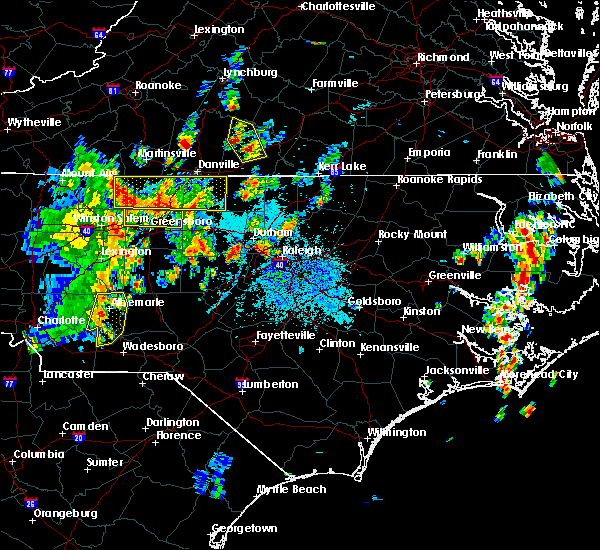 At 849 pm edt, severe thunderstorms were located along a line extending from near badin lake to near plyler to 8 miles west of ansonville, moving northeast at 20 mph (radar indicated). Hazards include 60 mph wind gusts. Expect damage to roofs, siding, and trees. Locations impacted include, albemarle, badin lake, ansonville, plyler, norwood, badin, oakboro, richfield, new london and uwharrie haven. At 849 pm edt, severe thunderstorms were located along a line extending from near badin lake to near plyler to 8 miles west of ansonville, moving northeast at 20 mph (radar indicated). Hazards include 60 mph wind gusts. Expect damage to roofs, siding, and trees. Locations impacted include, albemarle, badin lake, ansonville, plyler, norwood, badin, oakboro, richfield, new london and uwharrie haven.
|
| 7/22/2018 8:37 PM EDT |
 At 837 pm edt, severe thunderstorms were located along a line extending from near plyler to 11 miles east of midland, moving northeast at 15 mph (radar indicated). Hazards include 60 mph wind gusts. Expect damage to roofs, siding, and trees. Locations impacted include, albemarle, badin lake, ansonville, plyler, locust, norwood, badin, oakboro, stanfield and richfield. At 837 pm edt, severe thunderstorms were located along a line extending from near plyler to 11 miles east of midland, moving northeast at 15 mph (radar indicated). Hazards include 60 mph wind gusts. Expect damage to roofs, siding, and trees. Locations impacted include, albemarle, badin lake, ansonville, plyler, locust, norwood, badin, oakboro, stanfield and richfield.
|
| 7/22/2018 8:09 PM EDT |
 At 809 pm edt, severe thunderstorms were located along a line extending from near mt pleasant to near fairview in union county to 7 miles south of wingate, moving northeast at 25 mph (radar indicated). Hazards include 60 mph wind gusts. expect damage to roofs, siding, and trees At 809 pm edt, severe thunderstorms were located along a line extending from near mt pleasant to near fairview in union county to 7 miles south of wingate, moving northeast at 25 mph (radar indicated). Hazards include 60 mph wind gusts. expect damage to roofs, siding, and trees
|
| 7/6/2018 5:38 PM EDT |
 At 537 pm edt, severe thunderstorms were located along a line extending from near carthage to 7 miles south of troy to near ansonville, and are nearly stationary (law enforcement). Hazards include 60 mph wind gusts and nickel size hail. Expect damage to roofs, siding, and trees. Locations impacted include, southern pines, rockingham, wadesboro, carthage, pinehurst, hamlet, aberdeen, ansonville, hoffman and polkton. At 537 pm edt, severe thunderstorms were located along a line extending from near carthage to 7 miles south of troy to near ansonville, and are nearly stationary (law enforcement). Hazards include 60 mph wind gusts and nickel size hail. Expect damage to roofs, siding, and trees. Locations impacted include, southern pines, rockingham, wadesboro, carthage, pinehurst, hamlet, aberdeen, ansonville, hoffman and polkton.
|
| 7/6/2018 4:59 PM EDT |
 At 458 pm edt, severe thunderstorms with a history of producing wind damage were located along a line extending from 6 miles west of carthage to 7 miles south of troy to near ansonville, and are nearly stationary (law enforcement reports several trees down across montgomery county, including within the city of troy and biscoe). Hazards include 60 mph wind gusts and quarter size hail. Hail damage to vehicles is expected. expect wind damage to roofs, siding, and trees. Locations impacted include, southern pines, rockingham, wadesboro, troy, carthage, pinehurst, hamlet, aberdeen, biscoe and ansonville. At 458 pm edt, severe thunderstorms with a history of producing wind damage were located along a line extending from 6 miles west of carthage to 7 miles south of troy to near ansonville, and are nearly stationary (law enforcement reports several trees down across montgomery county, including within the city of troy and biscoe). Hazards include 60 mph wind gusts and quarter size hail. Hail damage to vehicles is expected. expect wind damage to roofs, siding, and trees. Locations impacted include, southern pines, rockingham, wadesboro, troy, carthage, pinehurst, hamlet, aberdeen, biscoe and ansonville.
|
| 7/6/2018 4:44 PM EDT |
 At 444 pm edt, severe thunderstorms were located along a line extending from 6 miles west of carthage to 7 miles south of troy to near ansonville, and are nearly stationary (radar indicated). Hazards include 60 mph wind gusts and quarter size hail. Hail damage to vehicles is expected. Expect wind damage to roofs, siding, and trees. At 444 pm edt, severe thunderstorms were located along a line extending from 6 miles west of carthage to 7 miles south of troy to near ansonville, and are nearly stationary (radar indicated). Hazards include 60 mph wind gusts and quarter size hail. Hail damage to vehicles is expected. Expect wind damage to roofs, siding, and trees.
|
| 6/27/2018 6:15 PM EDT |
 At 614 pm edt, a severe thunderstorm was located near ansonville, or 11 miles north of wadesboro, moving southeast at 25 mph (radar indicated). Hazards include 60 mph wind gusts. expect damage to roofs, siding, and trees At 614 pm edt, a severe thunderstorm was located near ansonville, or 11 miles north of wadesboro, moving southeast at 25 mph (radar indicated). Hazards include 60 mph wind gusts. expect damage to roofs, siding, and trees
|
| 6/25/2018 7:41 PM EDT |
 The national weather service in raleigh has issued a * severe thunderstorm warning for. anson county in central north carolina. southeastern montgomery county in central north carolina. richmond county in central north carolina. Southeastern stanly county in central north carolina. The national weather service in raleigh has issued a * severe thunderstorm warning for. anson county in central north carolina. southeastern montgomery county in central north carolina. richmond county in central north carolina. Southeastern stanly county in central north carolina.
|
| 6/11/2018 2:34 PM EDT |
 At 233 pm edt, a severe thunderstorm was located over ansonville, or 10 miles north of wadesboro, moving southeast at 10 mph (radar indicated). Hazards include 60 mph wind gusts and quarter size hail. Hail damage to vehicles is expected. expect wind damage to roofs, siding, and trees. Locations impacted include, wadesboro, ansonville, polkton, locust, norwood, oakboro, stanfield, mount gilead, lilesville and uwharrie haven. At 233 pm edt, a severe thunderstorm was located over ansonville, or 10 miles north of wadesboro, moving southeast at 10 mph (radar indicated). Hazards include 60 mph wind gusts and quarter size hail. Hail damage to vehicles is expected. expect wind damage to roofs, siding, and trees. Locations impacted include, wadesboro, ansonville, polkton, locust, norwood, oakboro, stanfield, mount gilead, lilesville and uwharrie haven.
|
| 6/11/2018 2:05 PM EDT |
 The national weather service in raleigh has issued a * severe thunderstorm warning for. central anson county in central north carolina. southern montgomery county in central north carolina. northwestern richmond county in central north carolina. Southern stanly county in central north carolina. The national weather service in raleigh has issued a * severe thunderstorm warning for. central anson county in central north carolina. southern montgomery county in central north carolina. northwestern richmond county in central north carolina. Southern stanly county in central north carolina.
|
| 4/15/2018 4:38 PM EDT |
 At 437 pm edt, a line of severe thunderstorms were moving or training northward through anson and eastern stanly counties. these storm line will move east into richmond and montgomery counties, while individual storms will move northward along the line (radar indicated). Hazards include 60 mph wind gusts and quarter size hail. Hail damage to vehicles is expected. Expect wind damage to roofs, siding, and trees. At 437 pm edt, a line of severe thunderstorms were moving or training northward through anson and eastern stanly counties. these storm line will move east into richmond and montgomery counties, while individual storms will move northward along the line (radar indicated). Hazards include 60 mph wind gusts and quarter size hail. Hail damage to vehicles is expected. Expect wind damage to roofs, siding, and trees.
|
| 4/15/2018 4:24 PM EDT |
 The severe thunderstorm warning for western anson and stanly counties will expire at 430 pm edt, the storm which prompted the warning has moved out of the area. therefore the warning will be allowed to expire. however gusty winds and heavy rain are still possible with this thunderstorm. a tornado watch remains in effect until 1100 pm edt for central north carolina. to report severe weather, contact your nearest law enforcement agency. they will relay your report to the national weather service raleigh. The severe thunderstorm warning for western anson and stanly counties will expire at 430 pm edt, the storm which prompted the warning has moved out of the area. therefore the warning will be allowed to expire. however gusty winds and heavy rain are still possible with this thunderstorm. a tornado watch remains in effect until 1100 pm edt for central north carolina. to report severe weather, contact your nearest law enforcement agency. they will relay your report to the national weather service raleigh.
|
| 4/15/2018 4:00 PM EDT |
 At 359 pm edt, a severe thunderstorm was located over plyler, or near albemarle, moving northeast at 55 mph (radar indicated). Hazards include 70 mph wind gusts and quarter size hail. Hail damage to vehicles is expected. expect considerable tree damage. wind damage is also likely to mobile homes, roofs, and outbuildings. locations impacted include, albemarle, badin lake, ansonville, plyler, midland, polkton, locust, norwood, badin and oakboro. A tornado watch remains in effect until 1100 pm edt for central north carolina. At 359 pm edt, a severe thunderstorm was located over plyler, or near albemarle, moving northeast at 55 mph (radar indicated). Hazards include 70 mph wind gusts and quarter size hail. Hail damage to vehicles is expected. expect considerable tree damage. wind damage is also likely to mobile homes, roofs, and outbuildings. locations impacted include, albemarle, badin lake, ansonville, plyler, midland, polkton, locust, norwood, badin and oakboro. A tornado watch remains in effect until 1100 pm edt for central north carolina.
|
| 4/15/2018 3:45 PM EDT |
 At 344 pm edt, a severe thunderstorm was located near midland, or 14 miles north of monroe, moving northeast at 50 mph (radar indicated). Hazards include 70 mph wind gusts and quarter size hail. Hail damage to vehicles is expected. expect considerable tree damage. Wind damage is also likely to mobile homes, roofs, and outbuildings. At 344 pm edt, a severe thunderstorm was located near midland, or 14 miles north of monroe, moving northeast at 50 mph (radar indicated). Hazards include 70 mph wind gusts and quarter size hail. Hail damage to vehicles is expected. expect considerable tree damage. Wind damage is also likely to mobile homes, roofs, and outbuildings.
|
| 7/28/2017 5:59 PM EDT |
 At 556 pm edt, a severe thunderstorm was located 9 miles southeast of sturdivants, or 11 miles southwest of wadesboro, moving east at 20 mph (radar indicated). Hazards include 60 mph wind gusts. Expect damage to trees and crops. Locations impacted include, albemarle, wadesboro, badin lake, ansonville, plyler, midland, polkton, locust, norwood and badin. At 556 pm edt, a severe thunderstorm was located 9 miles southeast of sturdivants, or 11 miles southwest of wadesboro, moving east at 20 mph (radar indicated). Hazards include 60 mph wind gusts. Expect damage to trees and crops. Locations impacted include, albemarle, wadesboro, badin lake, ansonville, plyler, midland, polkton, locust, norwood and badin.
|
| 7/28/2017 5:26 PM EDT |
 At 524 pm edt, a line of severe thunderstorms were located from near monroe to concord, moving moving northeast at 25 mph (radar indicated). Hazards include 60 mph wind gusts. expect damage to trees and crops At 524 pm edt, a line of severe thunderstorms were located from near monroe to concord, moving moving northeast at 25 mph (radar indicated). Hazards include 60 mph wind gusts. expect damage to trees and crops
|
| 7/18/2017 7:37 PM EDT |
 The severe thunderstorm warning for anson and richmond counties will expire at 745 pm edt, the storm which prompted the warning has weakened below severe limits, and no longer poses an immediate threat to life or property. therefore the warning will be allowed to expire. however gusty winds and heavy rain are still possible with this thunderstorm. to report severe weather, contact your nearest law enforcement agency. they will relay your report to the national weather service raleigh. The severe thunderstorm warning for anson and richmond counties will expire at 745 pm edt, the storm which prompted the warning has weakened below severe limits, and no longer poses an immediate threat to life or property. therefore the warning will be allowed to expire. however gusty winds and heavy rain are still possible with this thunderstorm. to report severe weather, contact your nearest law enforcement agency. they will relay your report to the national weather service raleigh.
|
| 7/18/2017 7:08 PM EDT |
 At 705 pm edt, a severe thunderstorm was located near rockingham, moving southwest at 10 mph (radar indicated). Hazards include 60 mph wind gusts and quarter size hail. Hail damage to vehicles is expected. expect wind damage to roofs, siding, and trees. Locations impacted include, rockingham, wadesboro, hamlet, ansonville, hoffman, polkton, ellerbe, dobbins heights, lilesville and morven. At 705 pm edt, a severe thunderstorm was located near rockingham, moving southwest at 10 mph (radar indicated). Hazards include 60 mph wind gusts and quarter size hail. Hail damage to vehicles is expected. expect wind damage to roofs, siding, and trees. Locations impacted include, rockingham, wadesboro, hamlet, ansonville, hoffman, polkton, ellerbe, dobbins heights, lilesville and morven.
|
| 7/18/2017 6:41 PM EDT |
 The national weather service in raleigh has issued a * severe thunderstorm warning for. anson county in central north carolina. richmond county in central north carolina. Until 745 pm edt * at 641 pm edt, a severe thunderstorm was located over rockingham,. The national weather service in raleigh has issued a * severe thunderstorm warning for. anson county in central north carolina. richmond county in central north carolina. Until 745 pm edt * at 641 pm edt, a severe thunderstorm was located over rockingham,.
|
| 7/5/2017 7:30 PM EDT |
 At 729 pm edt, severe thunderstorms were located along a line extending from 11 miles southeast of ansonville to near wadesboro, moving east at 30 mph (radar indicated). Hazards include 60 mph wind gusts. Expect damage to roofs, siding, and trees. Locations impacted include, rockingham, wadesboro, hamlet, ansonville, polkton, ellerbe, lilesville, morven, peachland and norman. At 729 pm edt, severe thunderstorms were located along a line extending from 11 miles southeast of ansonville to near wadesboro, moving east at 30 mph (radar indicated). Hazards include 60 mph wind gusts. Expect damage to roofs, siding, and trees. Locations impacted include, rockingham, wadesboro, hamlet, ansonville, polkton, ellerbe, lilesville, morven, peachland and norman.
|
| 7/5/2017 7:05 PM EDT |
 At 704 pm edt, severe thunderstorms were located along a line extending from 7 miles northwest of ansonville to 8 miles northeast of marshville to 8 miles southeast of mineral springs, moving east at 20 mph (radar indicated). Hazards include 60 mph wind gusts. expect damage to roofs, siding, and trees At 704 pm edt, severe thunderstorms were located along a line extending from 7 miles northwest of ansonville to 8 miles northeast of marshville to 8 miles southeast of mineral springs, moving east at 20 mph (radar indicated). Hazards include 60 mph wind gusts. expect damage to roofs, siding, and trees
|
| 7/5/2017 6:55 PM EDT |
 At 655 pm edt, a severe thunderstorm was located 7 miles northwest of ansonville, or 13 miles south of albemarle, moving east at 30 mph (radar indicated). Hazards include 60 mph wind gusts. Expect damage to roofs, siding, and trees. Locations impacted include, ansonville, norwood, oakboro, mount gilead, uwharrie haven, blewett falls lake, pekin, covington and lake tillery. At 655 pm edt, a severe thunderstorm was located 7 miles northwest of ansonville, or 13 miles south of albemarle, moving east at 30 mph (radar indicated). Hazards include 60 mph wind gusts. Expect damage to roofs, siding, and trees. Locations impacted include, ansonville, norwood, oakboro, mount gilead, uwharrie haven, blewett falls lake, pekin, covington and lake tillery.
|
| 7/5/2017 6:44 PM EDT |
 At 643 pm edt, a severe thunderstorm was located 10 miles east of midland, or 13 miles southwest of albemarle, moving east at 20 mph (radar indicated). Hazards include 60 mph wind gusts. Expect damage to roofs, siding, and trees. Locations impacted include, ansonville, norwood, oakboro, stanfield and mount gilead. At 643 pm edt, a severe thunderstorm was located 10 miles east of midland, or 13 miles southwest of albemarle, moving east at 20 mph (radar indicated). Hazards include 60 mph wind gusts. Expect damage to roofs, siding, and trees. Locations impacted include, ansonville, norwood, oakboro, stanfield and mount gilead.
|
| 7/5/2017 6:21 PM EDT |
 At 620 pm edt, severe thunderstorms were located along a line extending from near plyler to near midland, moving east at 35 mph (radar indicated). Hazards include 60 mph wind gusts. expect damage to roofs, siding, and trees At 620 pm edt, severe thunderstorms were located along a line extending from near plyler to near midland, moving east at 35 mph (radar indicated). Hazards include 60 mph wind gusts. expect damage to roofs, siding, and trees
|
| 6/19/2017 11:08 PM EDT |
 The severe thunderstorm warning for anson, southern montgomery, richmond and southeastern stanly counties will expire at 1115 pm edt, the storms which prompted the warning have weakened below severe limits, and no longer pose an immediate threat to life or property. therefore the warning will be allowed to expire. however, gusty winds and heavy rain will remain possible with these thunderstorms. The severe thunderstorm warning for anson, southern montgomery, richmond and southeastern stanly counties will expire at 1115 pm edt, the storms which prompted the warning have weakened below severe limits, and no longer pose an immediate threat to life or property. therefore the warning will be allowed to expire. however, gusty winds and heavy rain will remain possible with these thunderstorms.
|
| 6/19/2017 10:57 PM EDT |
 At 1057 pm edt, severe thunderstorms were located along a line extending from 13 miles north of rockingham to 8 miles east of sturdivants, moving northeast at 30 mph (radar indicated). Hazards include 60 mph wind gusts. Expect damage to roofs, siding, and trees. Locations impacted include, rockingham, wadesboro, ansonville, polkton, mount gilead, ellerbe, candor, lilesville, morven and peachland. At 1057 pm edt, severe thunderstorms were located along a line extending from 13 miles north of rockingham to 8 miles east of sturdivants, moving northeast at 30 mph (radar indicated). Hazards include 60 mph wind gusts. Expect damage to roofs, siding, and trees. Locations impacted include, rockingham, wadesboro, ansonville, polkton, mount gilead, ellerbe, candor, lilesville, morven and peachland.
|
| 6/19/2017 10:46 PM EDT |
 At 1046 pm edt, severe thunderstorms were located along a line extending from near ansonville to near monroe, moving northeast at 35 mph (radar indicated). Hazards include 60 mph wind gusts. Expect damage to roofs, siding, and trees. Locations impacted include, rockingham, wadesboro, ansonville, polkton, mount gilead, ellerbe, candor, lilesville, morven and peachland. At 1046 pm edt, severe thunderstorms were located along a line extending from near ansonville to near monroe, moving northeast at 35 mph (radar indicated). Hazards include 60 mph wind gusts. Expect damage to roofs, siding, and trees. Locations impacted include, rockingham, wadesboro, ansonville, polkton, mount gilead, ellerbe, candor, lilesville, morven and peachland.
|
| 6/19/2017 10:31 PM EDT |
 At 1030 pm edt, severe thunderstorms were located along a line extending from near ansonville to sturdivants, moving east at 25 mph (radar indicated). Hazards include 60 mph wind gusts. Expect damage to roofs, siding, and trees. Locations impacted include, rockingham, wadesboro, ansonville, polkton, mount gilead, ellerbe, candor, lilesville, morven and peachland. At 1030 pm edt, severe thunderstorms were located along a line extending from near ansonville to sturdivants, moving east at 25 mph (radar indicated). Hazards include 60 mph wind gusts. Expect damage to roofs, siding, and trees. Locations impacted include, rockingham, wadesboro, ansonville, polkton, mount gilead, ellerbe, candor, lilesville, morven and peachland.
|
| 6/19/2017 10:18 PM EDT |
 At 1018 pm edt, severe thunderstorms were located along a line extending from near ansonville to 6 miles west of sturdivants, moving east at 25 mph (radar indicated). Hazards include 60 mph wind gusts. expect damage to roofs, siding, and trees At 1018 pm edt, severe thunderstorms were located along a line extending from near ansonville to 6 miles west of sturdivants, moving east at 25 mph (radar indicated). Hazards include 60 mph wind gusts. expect damage to roofs, siding, and trees
|
| 5/24/2017 4:25 PM EDT |
 At 425 pm edt, a severe thunderstorm was located near hamlet, or 10 miles west of laurinburg, moving north at 50 mph (radar indicated). Hazards include 60 mph wind gusts and penny size hail. Expect damage to roofs, siding, and trees. locations impacted include, laurinburg, rockingham, wadesboro, raeford, hamlet, maxton, ansonville, hoffman, antioch and polkton. A tornado watch remains in effect until midnight edt for central north carolina. At 425 pm edt, a severe thunderstorm was located near hamlet, or 10 miles west of laurinburg, moving north at 50 mph (radar indicated). Hazards include 60 mph wind gusts and penny size hail. Expect damage to roofs, siding, and trees. locations impacted include, laurinburg, rockingham, wadesboro, raeford, hamlet, maxton, ansonville, hoffman, antioch and polkton. A tornado watch remains in effect until midnight edt for central north carolina.
|
| 5/24/2017 4:10 PM EDT |
 At 409 pm edt, a severe thunderstorm was located near cheraw, moving north at 45 mph (radar indicated). Hazards include 60 mph wind gusts. expect damage to siding and trees At 409 pm edt, a severe thunderstorm was located near cheraw, moving north at 45 mph (radar indicated). Hazards include 60 mph wind gusts. expect damage to siding and trees
|
| 5/5/2017 2:34 AM EDT |
 At 234 am edt, a severe thunderstorm capable of producing a tornado was located near ansonville, or 8 miles north of wadesboro, moving northeast at 50 mph (radar indicated rotation). Hazards include tornado. Flying debris will be dangerous to those caught without shelter. mobile homes will be damaged or destroyed. damage to roofs, windows, and vehicles will occur. tree damage is likely. Locations impacted include, troy, biscoe, ansonville, norwood, mount gilead, star, uwharrie haven, steeds, pekin and lake tillery. At 234 am edt, a severe thunderstorm capable of producing a tornado was located near ansonville, or 8 miles north of wadesboro, moving northeast at 50 mph (radar indicated rotation). Hazards include tornado. Flying debris will be dangerous to those caught without shelter. mobile homes will be damaged or destroyed. damage to roofs, windows, and vehicles will occur. tree damage is likely. Locations impacted include, troy, biscoe, ansonville, norwood, mount gilead, star, uwharrie haven, steeds, pekin and lake tillery.
|
| 5/5/2017 2:31 AM EDT |
 At 231 am edt, severe thunderstorms were located along a line extending from near ansonville to 6 miles south of wadesboro, moving northeast at 55 mph (radar indicated). Hazards include 60 mph wind gusts. Expect damage to roofs, siding, and trees. locations impacted include, wadesboro, troy, biscoe, ansonville, mount gilead, star, candor, lilesville, norman and blewett falls lake. A tornado watch remains in effect until 300 am edt for central north carolina. At 231 am edt, severe thunderstorms were located along a line extending from near ansonville to 6 miles south of wadesboro, moving northeast at 55 mph (radar indicated). Hazards include 60 mph wind gusts. Expect damage to roofs, siding, and trees. locations impacted include, wadesboro, troy, biscoe, ansonville, mount gilead, star, candor, lilesville, norman and blewett falls lake. A tornado watch remains in effect until 300 am edt for central north carolina.
|
| 5/5/2017 2:26 AM EDT |
 At 225 am edt, a severe thunderstorm capable of producing a tornado was located near wadesboro, moving northeast at 50 mph (radar indicated rotation). Hazards include tornado. Flying debris will be dangerous to those caught without shelter. mobile homes will be damaged or destroyed. damage to roofs, windows, and vehicles will occur. Tree damage is likely. At 225 am edt, a severe thunderstorm capable of producing a tornado was located near wadesboro, moving northeast at 50 mph (radar indicated rotation). Hazards include tornado. Flying debris will be dangerous to those caught without shelter. mobile homes will be damaged or destroyed. damage to roofs, windows, and vehicles will occur. Tree damage is likely.
|
| 5/5/2017 2:12 AM EDT |
 At 212 am edt, a severe thunderstorm was located 8 miles southeast of sturdivants, or 11 miles southwest of wadesboro, moving northeast at 50 mph (radar indicated). Hazards include 60 mph wind gusts. expect damage to roofs, siding, and trees At 212 am edt, a severe thunderstorm was located 8 miles southeast of sturdivants, or 11 miles southwest of wadesboro, moving northeast at 50 mph (radar indicated). Hazards include 60 mph wind gusts. expect damage to roofs, siding, and trees
|
| 5/1/2017 7:01 PM EDT |
 At 700 pm edt, a severe thunderstorm was located over ansonville, or 9 miles north of wadesboro, moving northeast at 45 mph (radar indicated). Hazards include 60 mph wind gusts. Expect damage to roofs, siding, and trees. Locations impacted include, wadesboro, ansonville, mount gilead, ellerbe, lilesville, norman, blewett falls lake, covington and pekin. At 700 pm edt, a severe thunderstorm was located over ansonville, or 9 miles north of wadesboro, moving northeast at 45 mph (radar indicated). Hazards include 60 mph wind gusts. Expect damage to roofs, siding, and trees. Locations impacted include, wadesboro, ansonville, mount gilead, ellerbe, lilesville, norman, blewett falls lake, covington and pekin.
|
| 5/1/2017 6:43 PM EDT |
 At 642 pm edt, a severe thunderstorm was located near marshville, or 12 miles west of wadesboro, moving northeast at 35 mph (radar indicated). Hazards include 60 mph wind gusts. expect damage to roofs, siding, and trees At 642 pm edt, a severe thunderstorm was located near marshville, or 12 miles west of wadesboro, moving northeast at 35 mph (radar indicated). Hazards include 60 mph wind gusts. expect damage to roofs, siding, and trees
|
| 11/30/2016 7:25 PM EST |
 At 724 pm est, severe thunderstorms were located along a line extending from near badin lake to near wadesboro to 9 miles east of kershaw, moving northeast at 60 mph (radar indicated). Hazards include 60 mph wind gusts. Expect damage to roofs. siding. and trees. Locations impacted include, albemarle, rockingham, wadesboro, troy, badin lake, hamlet, biscoe, ansonville andhoffman. At 724 pm est, severe thunderstorms were located along a line extending from near badin lake to near wadesboro to 9 miles east of kershaw, moving northeast at 60 mph (radar indicated). Hazards include 60 mph wind gusts. Expect damage to roofs. siding. and trees. Locations impacted include, albemarle, rockingham, wadesboro, troy, badin lake, hamlet, biscoe, ansonville andhoffman.
|
| 11/30/2016 6:54 PM EST |
 At 650 pm est, severe thunderstorms were located along a line extending from just east of charlotte to 7 miles south of mineral springs to 12 miles south of great falls, moving northeast at 55 mph (radar indicated). Hazards include 60 mph wind gusts. Expect damage to roofs. siding. And trees. At 650 pm est, severe thunderstorms were located along a line extending from just east of charlotte to 7 miles south of mineral springs to 12 miles south of great falls, moving northeast at 55 mph (radar indicated). Hazards include 60 mph wind gusts. Expect damage to roofs. siding. And trees.
|
| 8/27/2016 6:02 PM EDT |
 At 601 pm edt, severe thunderstorms were located along a line extending from 6 miles southeast of wadesboro to near ansonville, moving southwest at 25 mph (radar indicated). Hazards include 60 mph wind gusts. Expect damage to roofs. siding. and trees. Locations impacted include, wadesboro, ansonville, polkton, lilesville, morven, peachland, mcfarlan, white store and blewett falls lake. At 601 pm edt, severe thunderstorms were located along a line extending from 6 miles southeast of wadesboro to near ansonville, moving southwest at 25 mph (radar indicated). Hazards include 60 mph wind gusts. Expect damage to roofs. siding. and trees. Locations impacted include, wadesboro, ansonville, polkton, lilesville, morven, peachland, mcfarlan, white store and blewett falls lake.
|
| 8/27/2016 5:41 PM EDT |
 At 540 pm edt, severe thunderstorms were located along a line extending from wadesboro to 7 miles south of albemarle, moving west at 30 mph (radar indicated). Hazards include 60 mph wind gusts. Expect damage to roofs. siding. and trees. Locations impacted include, wadesboro, ansonville, fairview in union county, polkton, locust, oakboro, stanfield, lilesville, morven and peachland. At 540 pm edt, severe thunderstorms were located along a line extending from wadesboro to 7 miles south of albemarle, moving west at 30 mph (radar indicated). Hazards include 60 mph wind gusts. Expect damage to roofs. siding. and trees. Locations impacted include, wadesboro, ansonville, fairview in union county, polkton, locust, oakboro, stanfield, lilesville, morven and peachland.
|
| 8/27/2016 5:13 PM EDT |
 At 512 pm edt, severe thunderstorms were located along a line extending from 8 miles east of wadesboro to near badin lake, moving southwest at 30 mph (radar indicated). Hazards include 60 mph wind gusts. Expect damage to roofs. siding. And trees. At 512 pm edt, severe thunderstorms were located along a line extending from 8 miles east of wadesboro to near badin lake, moving southwest at 30 mph (radar indicated). Hazards include 60 mph wind gusts. Expect damage to roofs. siding. And trees.
|
| 7/16/2016 7:03 PM EDT |
 At 702 pm edt, severe thunderstorms were located along a line extending from badin lake to 8 miles southwest of troy to near sturdivants, moving east at 40 mph (radar indicated). Hazards include 60 mph wind gusts. Expect damage to roofs. siding. and trees. Locations impacted include, albemarle, rockingham, wadesboro, troy, badin lake, biscoe, ansonville, polkton, norwood and badin. At 702 pm edt, severe thunderstorms were located along a line extending from badin lake to 8 miles southwest of troy to near sturdivants, moving east at 40 mph (radar indicated). Hazards include 60 mph wind gusts. Expect damage to roofs. siding. and trees. Locations impacted include, albemarle, rockingham, wadesboro, troy, badin lake, biscoe, ansonville, polkton, norwood and badin.
|
| 7/16/2016 6:40 PM EDT |
 At 640 pm edt, severe thunderstorms were located along a line extending from near plyler to 12 miles northwest of ansonville to near wingate, moving east at 30 mph (radar indicated). Hazards include 60 mph wind gusts. Expect damage to roofs. siding. And trees. At 640 pm edt, severe thunderstorms were located along a line extending from near plyler to 12 miles northwest of ansonville to near wingate, moving east at 30 mph (radar indicated). Hazards include 60 mph wind gusts. Expect damage to roofs. siding. And trees.
|
| 7/15/2016 1:57 PM EDT |
 At 155 pm edt, a severe thunderstorm was located near wadesboro, moving east at 30 mph (radar indicated. at 140 pm...damaging wind was reported in wadesboro, resulting in downed trees and power lines). Hazards include 60 mph wind gusts and quarter size hail. Hail damage to vehicles is expected. expect wind damage to roofs, siding, and trees. Locations impacted include, rockingham, wadesboro, ansonville, polkton, ellerbe, lilesville, morven, norman, mcfarlan and diggs. At 155 pm edt, a severe thunderstorm was located near wadesboro, moving east at 30 mph (radar indicated. at 140 pm...damaging wind was reported in wadesboro, resulting in downed trees and power lines). Hazards include 60 mph wind gusts and quarter size hail. Hail damage to vehicles is expected. expect wind damage to roofs, siding, and trees. Locations impacted include, rockingham, wadesboro, ansonville, polkton, ellerbe, lilesville, morven, norman, mcfarlan and diggs.
|
| 7/15/2016 1:43 PM EDT |
 At 141 pm edt, a severe thunderstorm was located 7 miles southwest of wadesboro, moving northeast at 20 mph (radar indicated). Hazards include 60 mph wind gusts and quarter size hail. Hail damage to vehicles is expected. expect wind damage to roofs, siding, and trees. Locations impacted include, rockingham, wadesboro, ansonville, polkton, ellerbe, lilesville, morven, peachland, norman and mcfarlan. At 141 pm edt, a severe thunderstorm was located 7 miles southwest of wadesboro, moving northeast at 20 mph (radar indicated). Hazards include 60 mph wind gusts and quarter size hail. Hail damage to vehicles is expected. expect wind damage to roofs, siding, and trees. Locations impacted include, rockingham, wadesboro, ansonville, polkton, ellerbe, lilesville, morven, peachland, norman and mcfarlan.
|
| 7/15/2016 1:19 PM EDT |
 At 119 pm edt, a severe thunderstorm was located near sturdivants, or 14 miles southwest of wadesboro, moving northeast at 20 mph (radar indicated). Hazards include 60 mph wind gusts and quarter size hail. Hail damage to vehicles is expected. Expect wind damage to roofs, siding, and trees. At 119 pm edt, a severe thunderstorm was located near sturdivants, or 14 miles southwest of wadesboro, moving northeast at 20 mph (radar indicated). Hazards include 60 mph wind gusts and quarter size hail. Hail damage to vehicles is expected. Expect wind damage to roofs, siding, and trees.
|
| 7/11/2016 6:27 PM EDT | The severe thunderstorm warning for stanly and northwestern anson counties will expire at 630 pm edt, the storms which prompted the warning have weakened below severe limits, and no longer pose an immediate threat to life or property. therefore the warning will be allowed to expire. however small hail, gusty winds and heavy rain are still possible with these thunderstorms. |
| 7/11/2016 6:16 PM EDT |
 At 616 pm edt, severe thunderstorms were located along a line extending from near midland to 7 miles east of sturdivants, moving east at 25 mph (radar indicated). Hazards include 60 mph wind gusts and quarter size hail. Hail damage to vehicles is expected. expect wind damage to roofs, siding, and trees. Locations impacted include, albemarle, badin lake, ansonville, plyler, locust, norwood, badin, oakboro, stanfield and richfield. At 616 pm edt, severe thunderstorms were located along a line extending from near midland to 7 miles east of sturdivants, moving east at 25 mph (radar indicated). Hazards include 60 mph wind gusts and quarter size hail. Hail damage to vehicles is expected. expect wind damage to roofs, siding, and trees. Locations impacted include, albemarle, badin lake, ansonville, plyler, locust, norwood, badin, oakboro, stanfield and richfield.
|
| 7/11/2016 6:06 PM EDT |
 At 606 pm edt, severe thunderstorms were located along a line extending from near midland to near sturdivants, moving east at 25 mph (radar indicated). Hazards include 60 mph wind gusts and quarter size hail. Hail damage to vehicles is expected. expect wind damage to roofs, siding, and trees. Locations impacted include, albemarle, wadesboro, badin lake, ansonville, plyler, midland, polkton, locust, norwood and badin. At 606 pm edt, severe thunderstorms were located along a line extending from near midland to near sturdivants, moving east at 25 mph (radar indicated). Hazards include 60 mph wind gusts and quarter size hail. Hail damage to vehicles is expected. expect wind damage to roofs, siding, and trees. Locations impacted include, albemarle, wadesboro, badin lake, ansonville, plyler, midland, polkton, locust, norwood and badin.
|
| 7/11/2016 5:49 PM EDT |
 At 548 pm edt, severe thunderstorms were located along a line extending from near reedy creek park to near sturdivants, moving east at 25 mph (radar indicated). Hazards include 60 mph wind gusts and quarter size hail. Hail damage to vehicles is expected. Expect wind damage to roofs, siding, and trees. At 548 pm edt, severe thunderstorms were located along a line extending from near reedy creek park to near sturdivants, moving east at 25 mph (radar indicated). Hazards include 60 mph wind gusts and quarter size hail. Hail damage to vehicles is expected. Expect wind damage to roofs, siding, and trees.
|
| 7/8/2016 9:52 PM EDT |
 At 952 pm edt, a severe thunderstorm was located over rockingham, moving southeast at 55 mph (law enforcement). Hazards include 60 mph wind gusts. Expect damage to roofs. siding. And trees. At 952 pm edt, a severe thunderstorm was located over rockingham, moving southeast at 55 mph (law enforcement). Hazards include 60 mph wind gusts. Expect damage to roofs. siding. And trees.
|
| 7/8/2016 9:05 PM EDT |
 At 905 pm edt, severe thunderstorms were located along a line extending from albemarle to near lake park, moving east at 45 mph (radar indicated). Hazards include 60 mph wind gusts and penny size hail. Expect damage to roofs. siding. And trees. At 905 pm edt, severe thunderstorms were located along a line extending from albemarle to near lake park, moving east at 45 mph (radar indicated). Hazards include 60 mph wind gusts and penny size hail. Expect damage to roofs. siding. And trees.
|
| 6/29/2016 7:21 PM EDT |
 At 720 pm edt, a severe thunderstorm was located just southeast of norwood, moving east at 15 mph (radar indicated). Hazards include 60 mph wind gusts and quarter size hail. Hail damage to vehicles is expected. expect wind damage to roofs, siding, and trees. Locations impacted include, troy, biscoe, ansonville, norwood, mount gilead, star, candor, norman, pekin and steeds. At 720 pm edt, a severe thunderstorm was located just southeast of norwood, moving east at 15 mph (radar indicated). Hazards include 60 mph wind gusts and quarter size hail. Hail damage to vehicles is expected. expect wind damage to roofs, siding, and trees. Locations impacted include, troy, biscoe, ansonville, norwood, mount gilead, star, candor, norman, pekin and steeds.
|
| 6/29/2016 6:58 PM EDT |
 At 658 pm edt, a severe thunderstorm was located near troy, moving east at 15 mph (radar indicated). Hazards include 60 mph wind gusts and quarter size hail. Hail damage to vehicles is expected. Expect wind damage to roofs, siding, and trees. At 658 pm edt, a severe thunderstorm was located near troy, moving east at 15 mph (radar indicated). Hazards include 60 mph wind gusts and quarter size hail. Hail damage to vehicles is expected. Expect wind damage to roofs, siding, and trees.
|
| 5/3/2016 5:55 PM EDT | Quarter sized hail reported 0.4 miles NW of Ansonville, NC, quarter sized hail in ansonville. report from social media. time estimated from radar. |
| 5/3/2016 5:51 PM EDT |
 At 551 pm edt, a severe thunderstorm was located near ansonville, or near wadesboro, moving east at 35 mph (radar indicated). Hazards include 60 mph wind gusts and quarter size hail. Hail damage to vehicles is expected. Expect wind damage to roofs, siding, and trees. At 551 pm edt, a severe thunderstorm was located near ansonville, or near wadesboro, moving east at 35 mph (radar indicated). Hazards include 60 mph wind gusts and quarter size hail. Hail damage to vehicles is expected. Expect wind damage to roofs, siding, and trees.
|
| 2/24/2016 3:23 PM EST |
 At 322 pm est, doppler radar continued to indicate a line of severe thunderstorms capable of producing damaging winds in excess of 58 mph. these storms were located along a line extending from 6 miles northwest of biscoe to 6 miles southeast of wadesboro, moving northeast at 60 mph. locations impacted include, rockingham, wadesboro, troy, hamlet, biscoe, ansonville, polkton, mount gilead, ellerbe and star. a tornado watch remains in effect until 700 pm est for central north carolina. At 322 pm est, doppler radar continued to indicate a line of severe thunderstorms capable of producing damaging winds in excess of 58 mph. these storms were located along a line extending from 6 miles northwest of biscoe to 6 miles southeast of wadesboro, moving northeast at 60 mph. locations impacted include, rockingham, wadesboro, troy, hamlet, biscoe, ansonville, polkton, mount gilead, ellerbe and star. a tornado watch remains in effect until 700 pm est for central north carolina.
|
| 2/24/2016 2:55 PM EST |
 At 252 pm est, doppler radar indicated several severe thunderstorms within the warned area, the strongest of which was located near seagrove, or 8 miles northeast of troy, moving northeast at 60 mph. a separate severe thunderstorm was located 2 miles north of pekin, moving northeast at 60 mph. locations impacted include, steeds, candor, troy, star, biscoe, a tornado watch remains in effect until 700 pm est for central north carolina. At 252 pm est, doppler radar indicated several severe thunderstorms within the warned area, the strongest of which was located near seagrove, or 8 miles northeast of troy, moving northeast at 60 mph. a separate severe thunderstorm was located 2 miles north of pekin, moving northeast at 60 mph. locations impacted include, steeds, candor, troy, star, biscoe, a tornado watch remains in effect until 700 pm est for central north carolina.
|
| 2/24/2016 2:25 PM EST |
 At 224 pm est, doppler radar indicated a line of severe thunderstorms capable of producing damaging winds up to 60 mph. these storms were located along a line extending from 9 miles northeast of badin lake to 6 miles east of pageland, and moving east at 20 mph. At 224 pm est, doppler radar indicated a line of severe thunderstorms capable of producing damaging winds up to 60 mph. these storms were located along a line extending from 9 miles northeast of badin lake to 6 miles east of pageland, and moving east at 20 mph.
|
| 2/24/2016 2:02 PM EST |
 At 202 pm est, doppler radar continued to indicate a line of severe thunderstorms capable of producing damaging winds in excess of 58 mph. these storms were located along a line extending from near badin lake to 6 miles southeast of sturdivants, moving northeast at 20 mph. locations impacted include, albemarle, wadesboro, troy, badin lake, biscoe, ansonville, plyler, midland, polkton and locust. a tornado watch remains in effect until 700 pm est for central north carolina. At 202 pm est, doppler radar continued to indicate a line of severe thunderstorms capable of producing damaging winds in excess of 58 mph. these storms were located along a line extending from near badin lake to 6 miles southeast of sturdivants, moving northeast at 20 mph. locations impacted include, albemarle, wadesboro, troy, badin lake, biscoe, ansonville, plyler, midland, polkton and locust. a tornado watch remains in effect until 700 pm est for central north carolina.
|
| 2/24/2016 1:43 PM EST |
 At 143 pm est, doppler radar indicated a line of severe thunderstorms capable of producing damaging winds in excess of 58 mph. these storms were located along a line extending from 8 miles east of high rock lake to 6 miles south of wingate, and moving northeast at 105 mph. At 143 pm est, doppler radar indicated a line of severe thunderstorms capable of producing damaging winds in excess of 58 mph. these storms were located along a line extending from 8 miles east of high rock lake to 6 miles south of wingate, and moving northeast at 105 mph.
|
| 7/20/2015 10:37 PM EDT |
 The severe thunderstorm warning for montgomery, southeastern stanly, northwestern richmond and northeastern anson counties will expire at 1045 pm edt, the storm which prompted the warning has weakened below severe limits, and no longer poses an immediate threat to life or property. therefore the warning will be allowed to expire. The severe thunderstorm warning for montgomery, southeastern stanly, northwestern richmond and northeastern anson counties will expire at 1045 pm edt, the storm which prompted the warning has weakened below severe limits, and no longer poses an immediate threat to life or property. therefore the warning will be allowed to expire.
|
| 7/20/2015 10:20 PM EDT |
 At 1019 pm edt, doppler radar continued to indicate severe thunderstorms capable of producing damaging winds in excess of 58 mph. these storms were located near troy and mount gilead, moving east at 25 mph. locations impacted include, troy, biscoe, ansonville, norwood, mount gilead, ellerbe, star, candor, covington and morrow mountain state park. At 1019 pm edt, doppler radar continued to indicate severe thunderstorms capable of producing damaging winds in excess of 58 mph. these storms were located near troy and mount gilead, moving east at 25 mph. locations impacted include, troy, biscoe, ansonville, norwood, mount gilead, ellerbe, star, candor, covington and morrow mountain state park.
|
| 7/20/2015 10:05 PM EDT |
 At 1002 pm edt, doppler radar indicated severe thunderstorms capable of producing damaging winds in excess of 58 mph. these storms were located over norwood and 7 miles southeast of albemarle, moving east at 15 mph. At 1002 pm edt, doppler radar indicated severe thunderstorms capable of producing damaging winds in excess of 58 mph. these storms were located over norwood and 7 miles southeast of albemarle, moving east at 15 mph.
|
| 7/13/2015 9:47 PM EDT |
 At 946 pm edt, doppler radar continued to indicate a line of severe thunderstorms capable of producing damaging winds in excess of 58 mph. these storms were located along a line extending from 12 miles east of high rock lake to 6 miles east of badin lake to 6 miles west of ansonville, moving east at 35 mph. locations impacted include, albemarle, badin lake, ansonville, norwood, badin, morrow mountain state park, pinehaven marina, fish tales marina, eldorado and whip-o-will campground. At 946 pm edt, doppler radar continued to indicate a line of severe thunderstorms capable of producing damaging winds in excess of 58 mph. these storms were located along a line extending from 12 miles east of high rock lake to 6 miles east of badin lake to 6 miles west of ansonville, moving east at 35 mph. locations impacted include, albemarle, badin lake, ansonville, norwood, badin, morrow mountain state park, pinehaven marina, fish tales marina, eldorado and whip-o-will campground.
|
| 7/13/2015 9:08 PM EDT |
 At 908 pm edt, doppler radar indicated a line of severe thunderstorms capable of producing quarter size hail and damaging winds in excess of 58 mph. these storms were located along a line extending from faith to 6 miles north of plyler to midland, and moving east at 20 mph. At 908 pm edt, doppler radar indicated a line of severe thunderstorms capable of producing quarter size hail and damaging winds in excess of 58 mph. these storms were located along a line extending from faith to 6 miles north of plyler to midland, and moving east at 20 mph.
|
| 6/30/2015 5:45 PM EDT |
 At 543 pm edt, doppler radar continued to indicate a line of severe thunderstorms capable of producing damaging winds in excess of 58 mph. these storms were located along a line extending from 6 miles southeast of seagrove to 10 miles southeast of biscoe to near wadesboro, moving northeast at 40 mph. wind damage has been reported across portions of anson county with these storms. locations impacted include, southern pines, rockingham, wadesboro, carthage, pinehurst, hamlet, aberdeen, biscoe, ansonville and hoffman. At 543 pm edt, doppler radar continued to indicate a line of severe thunderstorms capable of producing damaging winds in excess of 58 mph. these storms were located along a line extending from 6 miles southeast of seagrove to 10 miles southeast of biscoe to near wadesboro, moving northeast at 40 mph. wind damage has been reported across portions of anson county with these storms. locations impacted include, southern pines, rockingham, wadesboro, carthage, pinehurst, hamlet, aberdeen, biscoe, ansonville and hoffman.
|
| 6/30/2015 5:31 PM EDT |
 At 531 pm edt, doppler radar indicated a line of severe thunderstorms capable of producing damaging winds in excess of 58 mph. these storms were located along a line extending from near seagrove to 11 miles south of biscoe to near sturdivants, and moving northeast at 45 mph. At 531 pm edt, doppler radar indicated a line of severe thunderstorms capable of producing damaging winds in excess of 58 mph. these storms were located along a line extending from near seagrove to 11 miles south of biscoe to near sturdivants, and moving northeast at 45 mph.
|
| 6/26/2015 9:09 PM EDT | At 908 pm edt, doppler radar continued to indicate a cluster of severe thunderstorms capable of producing damaging winds in excess of 58 mph. these storms were located along a line extending from 7 miles east of ansonville to 6 miles northeast of hamlet to near laurinburg, moving northeast at 20 mph. locations impacted include, laurinburg, rockingham, wadesboro, raeford, hamlet, maxton, ansonville, hoffman, antioch and polkton. |
| 6/26/2015 8:53 PM EDT | At 852 pm edt, doppler radar indicated a line of severe thunderstorms capable of producing quarter size hail and damaging winds in excess of 58 mph. these storms were located along a line extending from 7 miles northwest of rockingham to 6 miles northeast of hamlet, and moving northeast at 20 mph. |
| 6/18/2015 4:40 PM EDT | Tree down on route 10 in anson county NC, 6.9 miles WNW of Ansonville, NC |
| 6/18/2015 4:30 PM EDT | At 429 pm edt, doppler radar indicated a severe thunderstorm capable of producing quarter size hail and damaging winds in excess of 58 mph. this storm was located over ansonville, or 8 miles north of wadesboro, and moving east at 15 mph. strong storms wre also intensifying over richmond county near ellerbe. |
| 6/2/2015 4:42 PM EDT | The severe thunderstorm warning for western montgomery. southeastern stanly. northwestern richmond and northeastern anson counties will expire at 445 pm edt. to report severe weather. contact your nearest law enforcement agency. They will relay your report to the national weather service raleigh. |
| 6/2/2015 4:23 PM EDT | At 422 pm edt, doppler radar continued to indicate a severe thunderstorm capable of producing quarter size hail and damaging winds in excess of 58 mph. this storm was located 9 miles north of ansonville, or 12 miles southeast of albemarle, moving northeast at 30 mph. locations impacted include, albemarle, badin lake, ansonville, norwood, badin, mount gilead, ellerbe, covington, morrow mountain state park and pekin. |
| 6/2/2015 4:06 PM EDT | At 405 pm edt, doppler radar indicated a severe thunderstorm capable of producing quarter size hail and damaging winds in excess of 58 mph. this storm was located near ansonville, or 13 miles south of albemarle, and moving northeast at 30 mph. |
| 6/1/2015 4:09 PM EDT | The severe thunderstorm warning for southwestern montgomery, southeastern stanly, northwestern richmond and northern anson counties will expire at 415 pm edt, the storm which prompted the warning has weakened below severe limits, and no longer poses an immediate threat to life or property. therefore the warning will be allowed to expire. |
| 6/1/2015 3:49 PM EDT | Trees down on planck rd in the ansonville area. radar estimated time in anson county NC, 3.7 miles SSE of Ansonville, NC |
| 6/1/2015 3:47 PM EDT | At 347 pm edt, doppler radar continued to indicate a severe thunderstorm capable of producing quarter size hail and damaging winds in excess of 58 mph. this storm was located near ansonville, or 13 miles north of wadesboro, moving northeast at 20 mph. locations impacted include, albemarle, ansonville, norwood, mount gilead, covington, pekin, lake tillery and uwharrie haven. |
| 6/1/2015 3:36 PM EDT | At 335 pm edt, doppler radar indicated a severe thunderstorm capable of producing quarter size hail and damaging winds in excess of 58 mph. this storm was located over ansonville, or 10 miles north of wadesboro, and moving northeast at 20 mph. |
| 6/30/2013 6:35 PM EDT | Tree down blocking the southbound lane of highway 52 in ansonville. time estimated via rada in anson county NC, 1.3 miles NW of Ansonville, NC |
| 6/13/2013 6:45 PM EDT | Numerous trees and power lines blown down...especially across the north half of the county in anson county NC, 3.8 miles NNW of Ansonville, NC |
| 6/13/2013 6:35 PM EDT | Numerous trees and power lines blown down...especially across the north half of the county in anson county NC, 3.8 miles NNW of Ansonville, NC |
| 7/28/2012 7:57 PM EDT | Tree down in anson county NC, 3.8 miles WNW of Ansonville, NC |
| 7/8/2012 4:50 PM EDT | Trees blown down near highway 52 and state road 1637. time estimate in anson county NC, 2.5 miles NNE of Ansonville, NC |
| 3/24/2012 7:10 PM EDT | Fire dept responded to a tree blown down across hwy 52 just north of ansonville in anson county NC, 1.8 miles S of Ansonville, NC |
| 1/1/0001 12:00 AM | One tree down off highway 109n in anson county NC, 6.7 miles WNW of Ansonville, NC |
| 1/1/0001 12:00 AM | Tree down on ansonville-polkton road in anson county NC, 0.4 miles NE of Ansonville, NC |
| 1/1/0001 12:00 AM | Tree down on mt vernon road in anson county NC, 0.4 miles NE of Ansonville, NC |
Hail Maps for Ansonville, NC
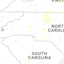
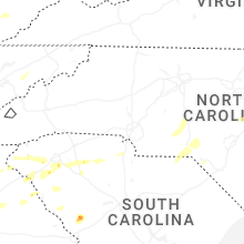


Connect with Interactive Hail Maps