

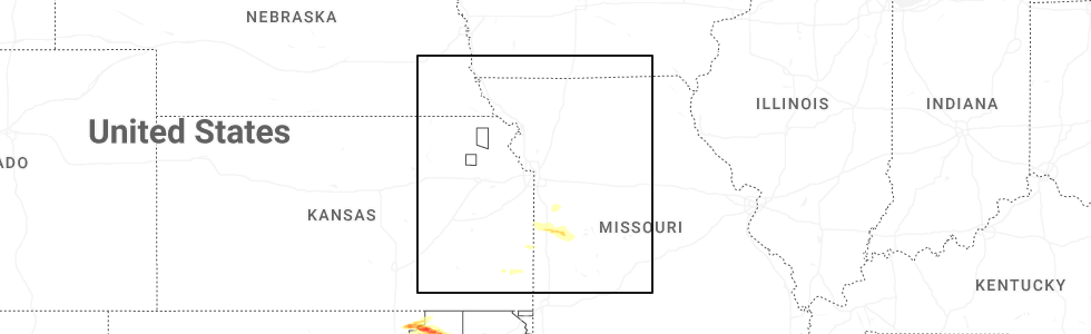
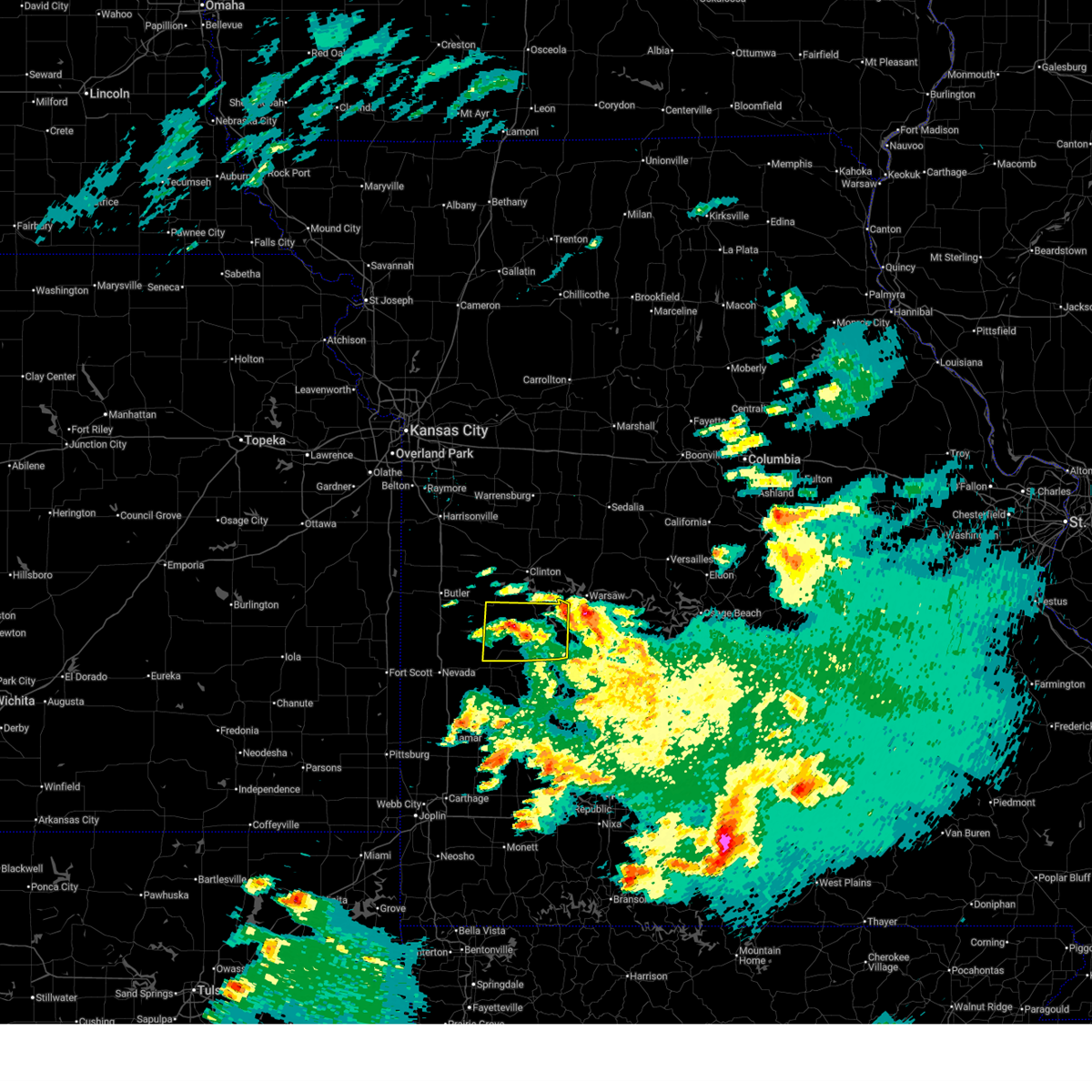
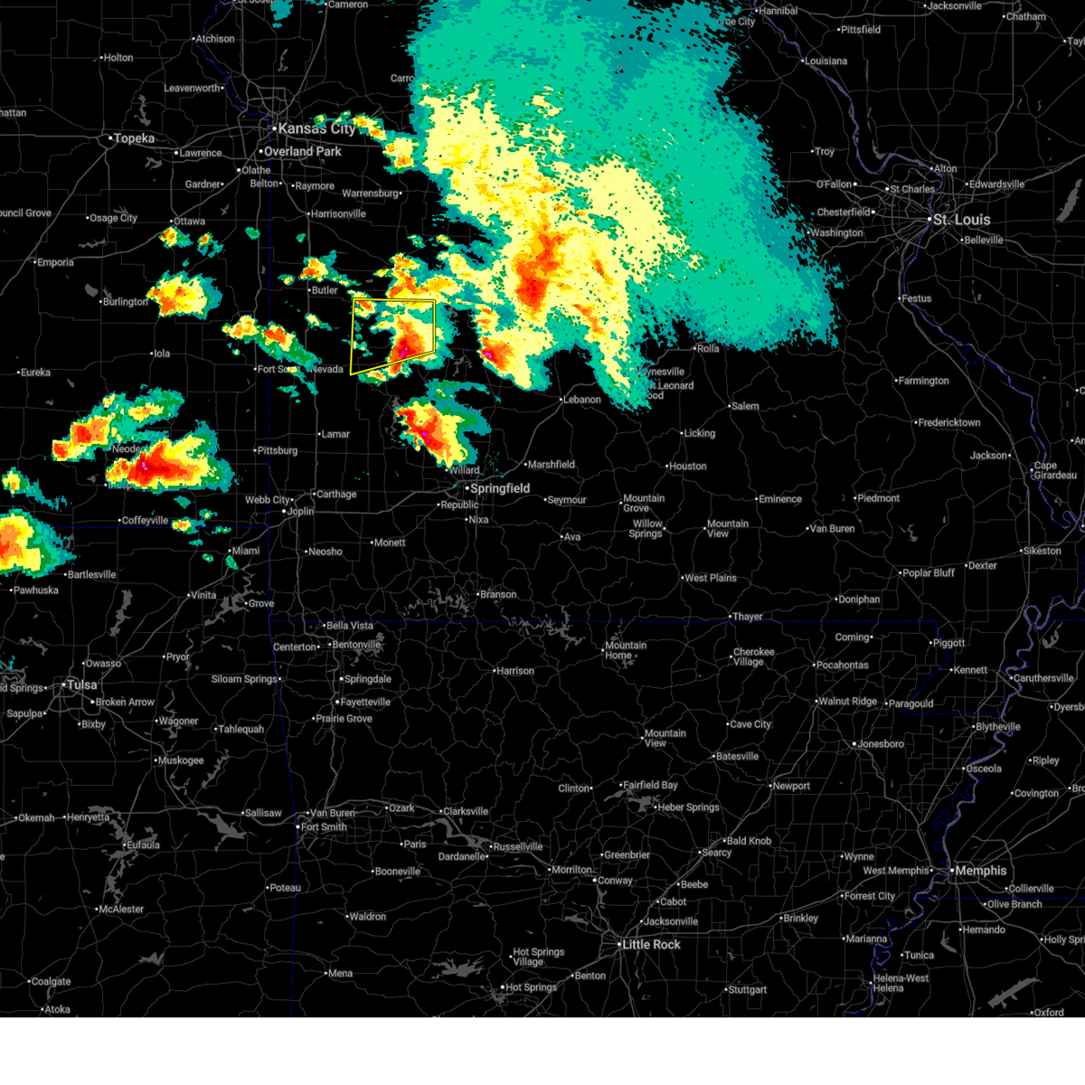
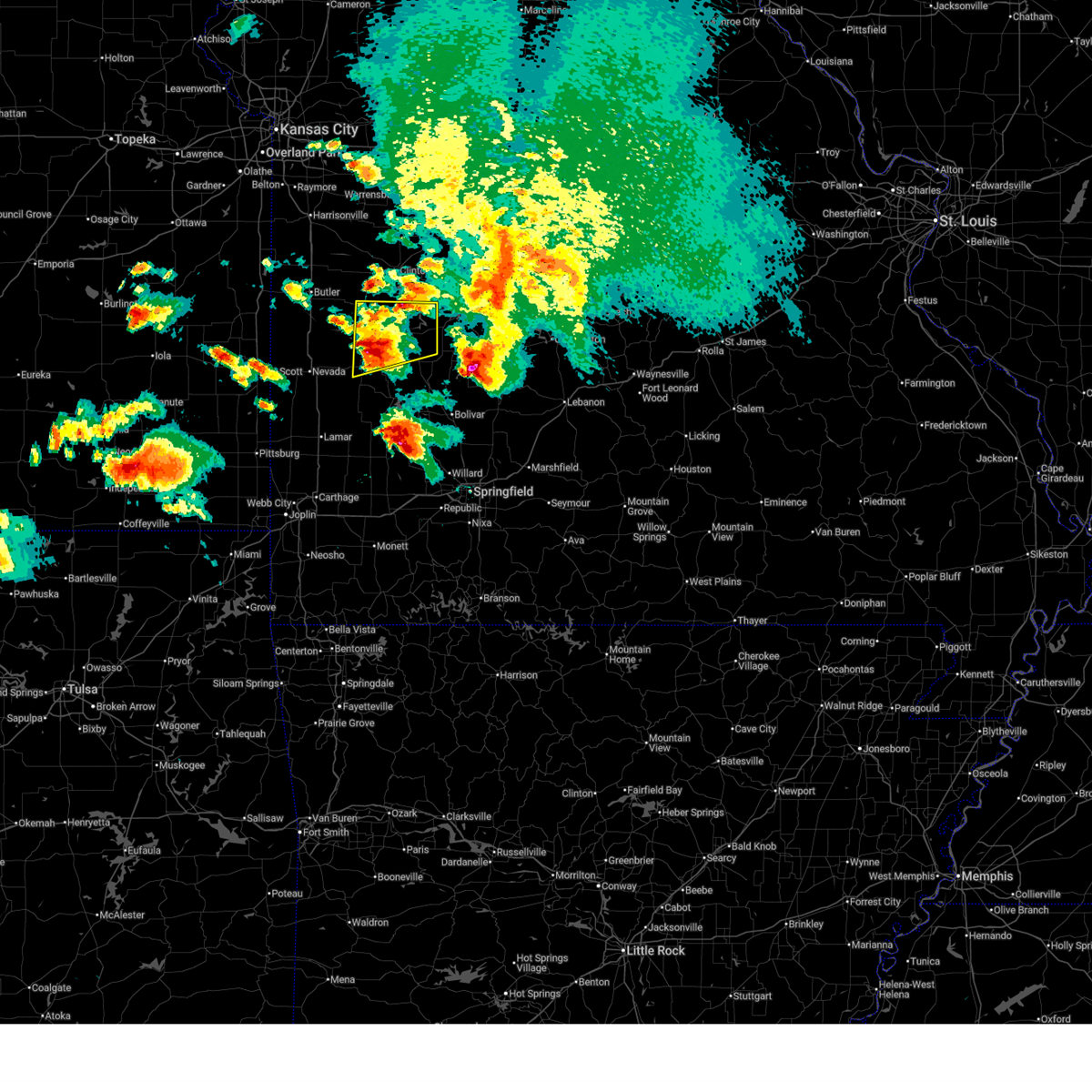
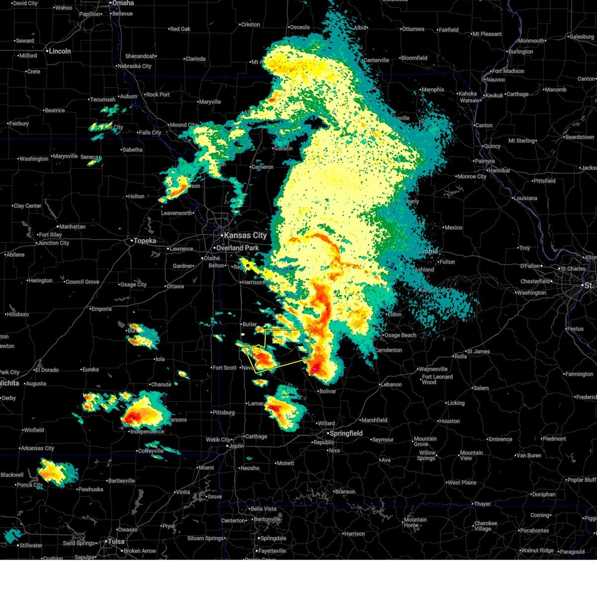
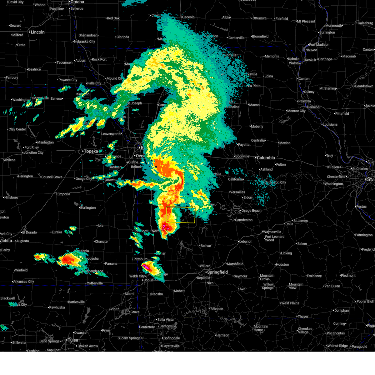
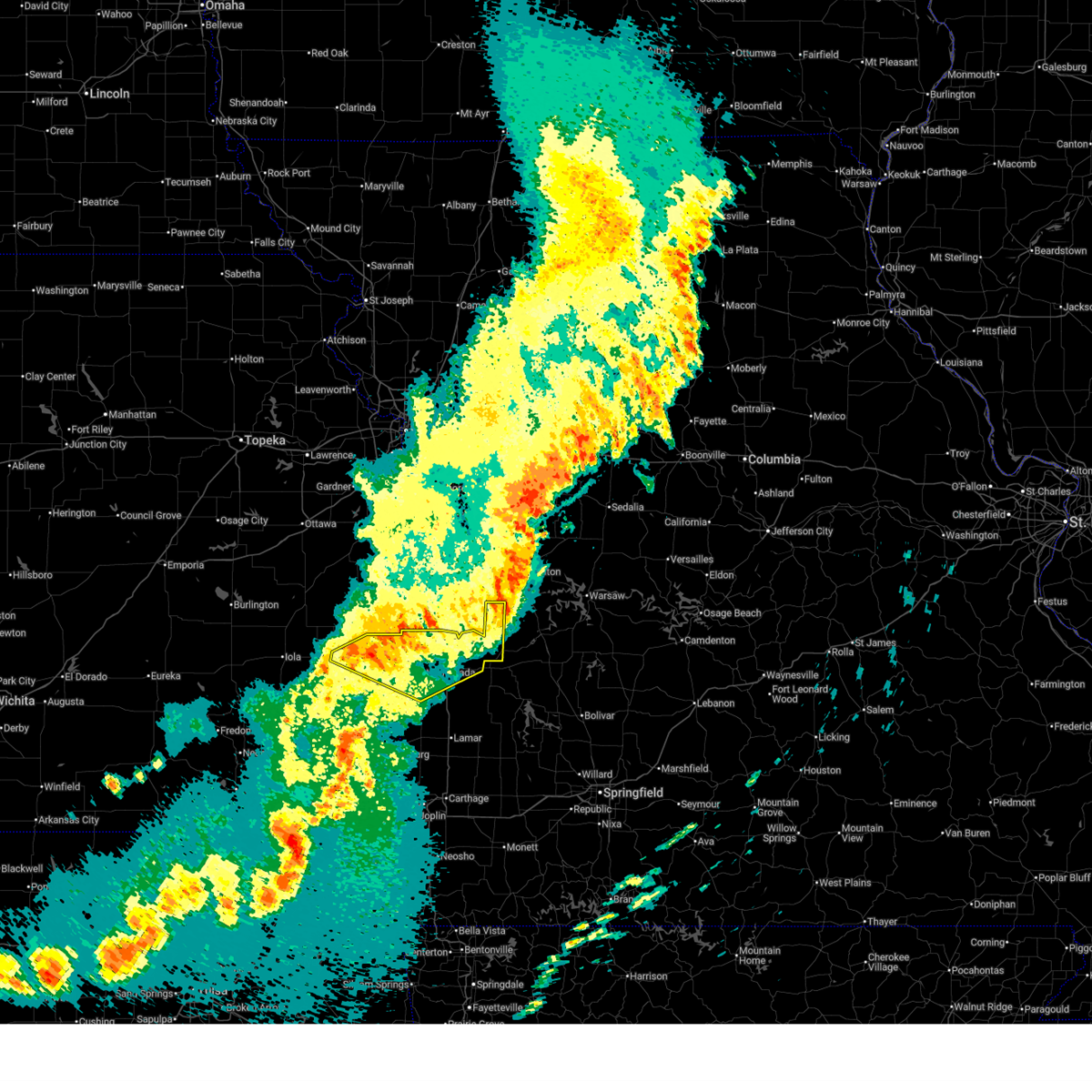
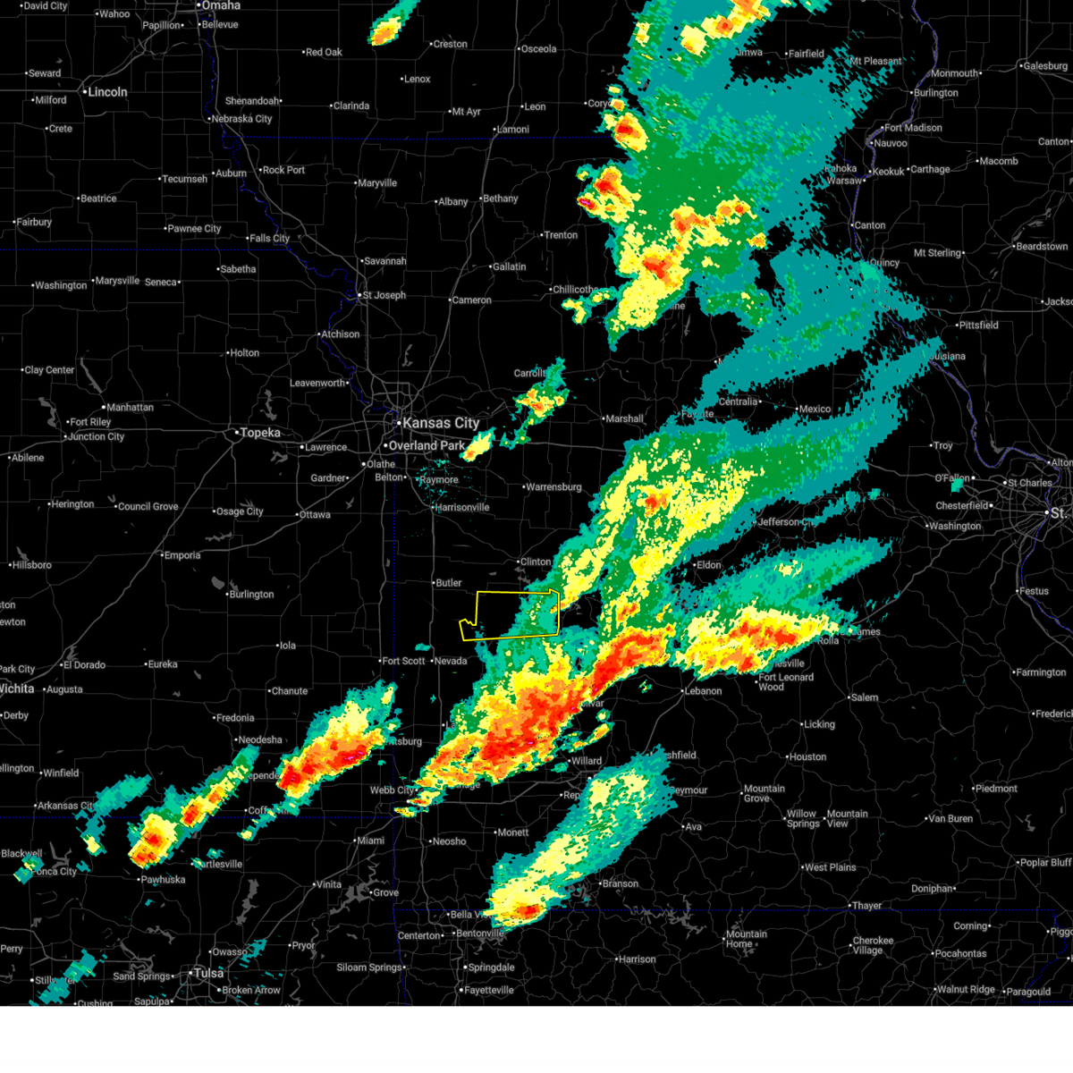
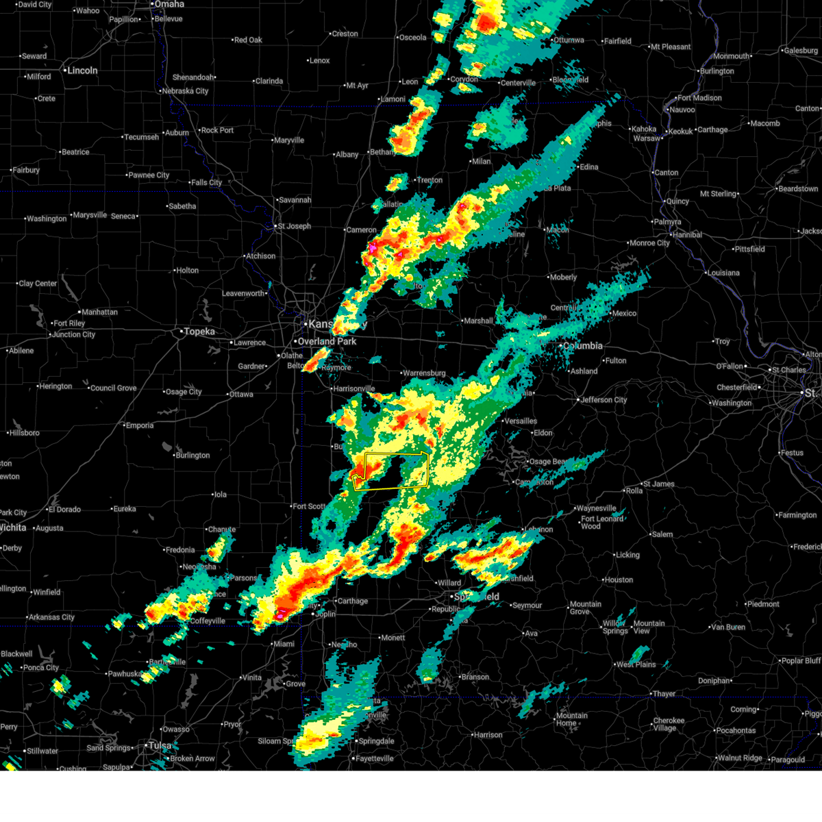
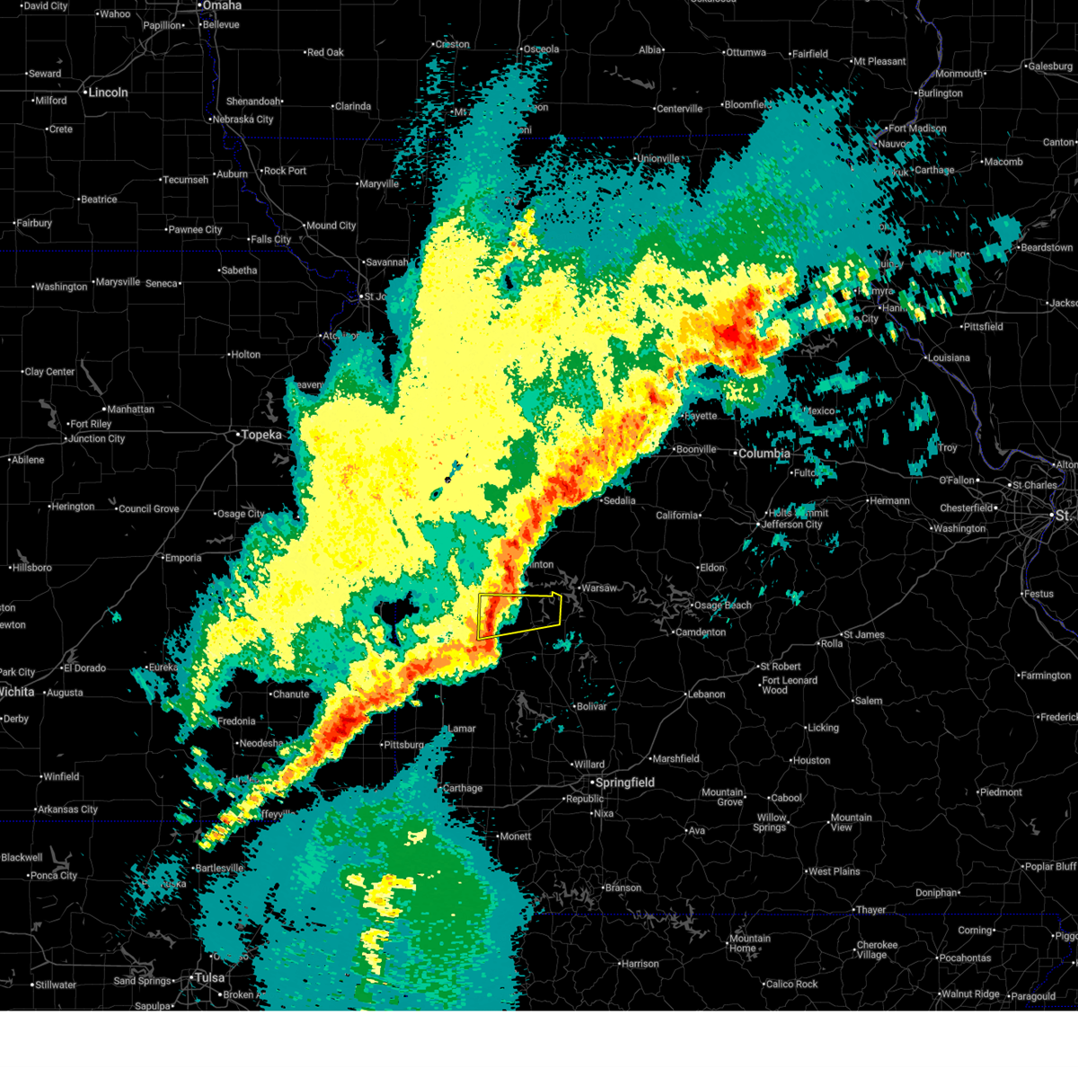
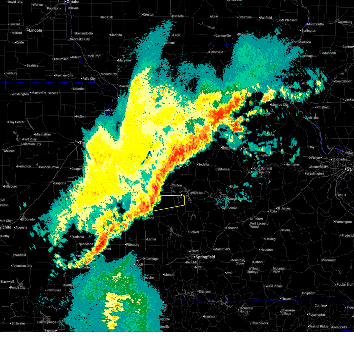
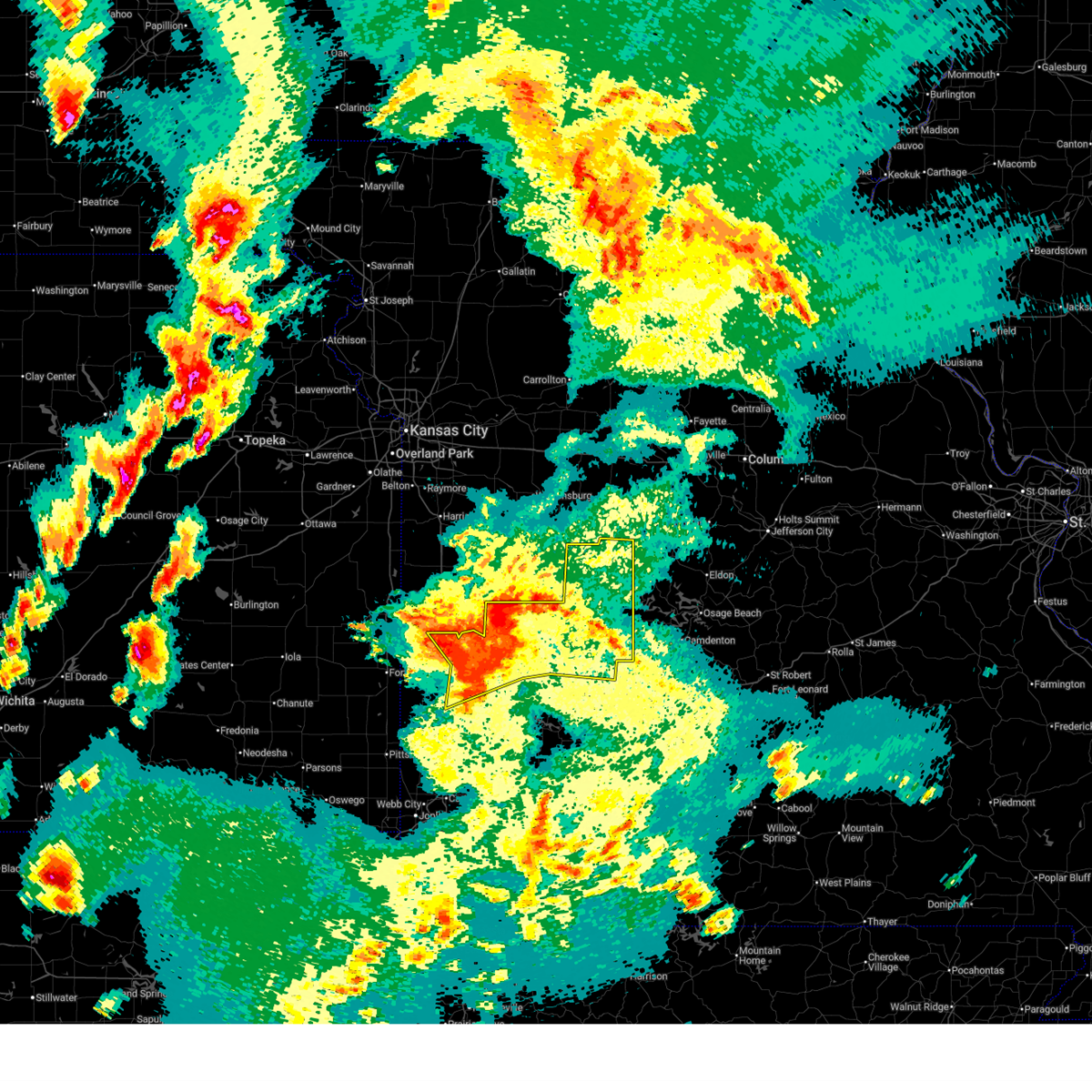
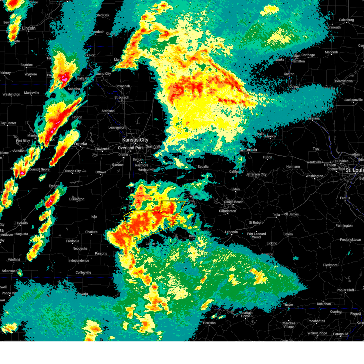
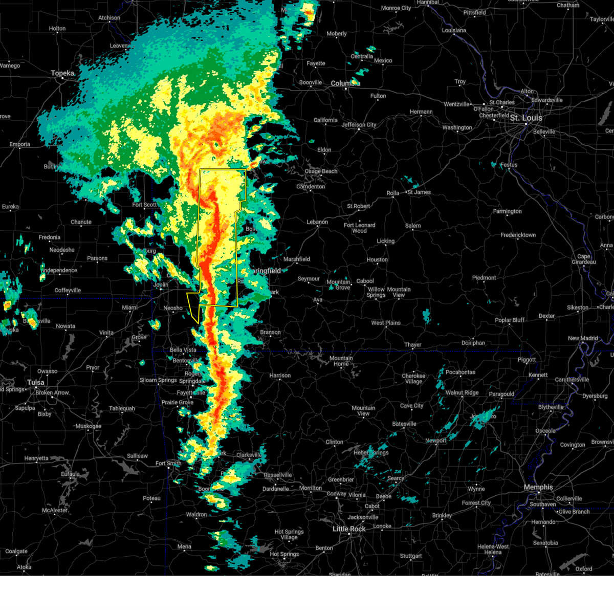
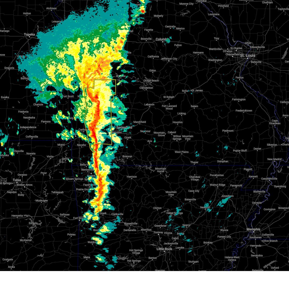
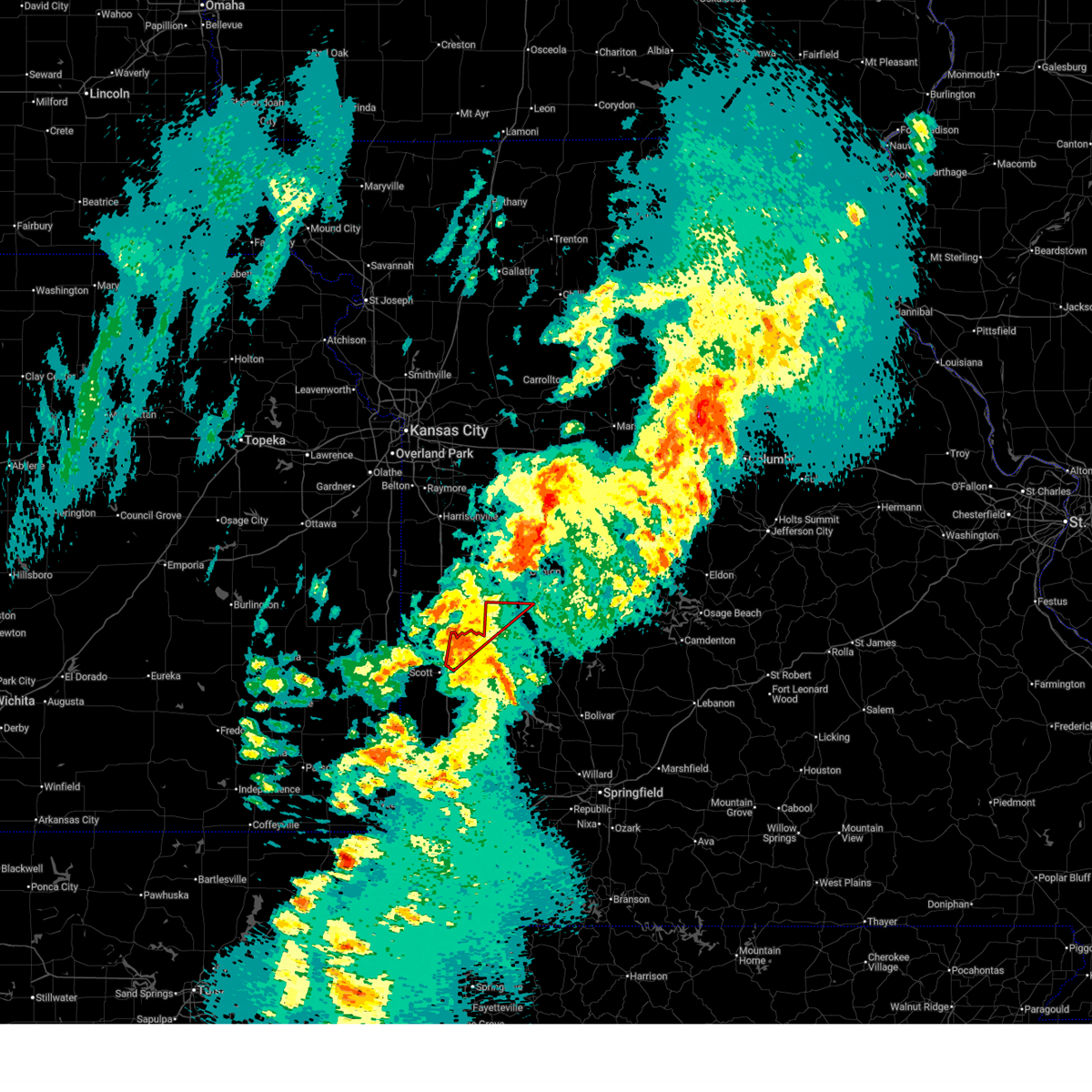
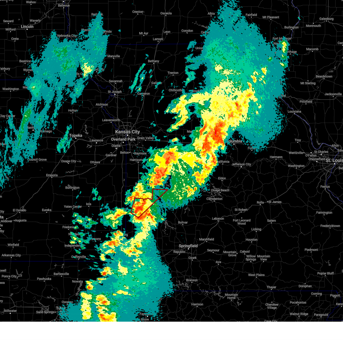
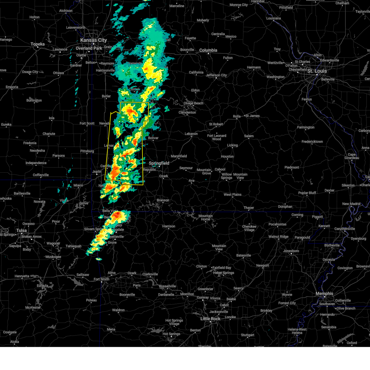
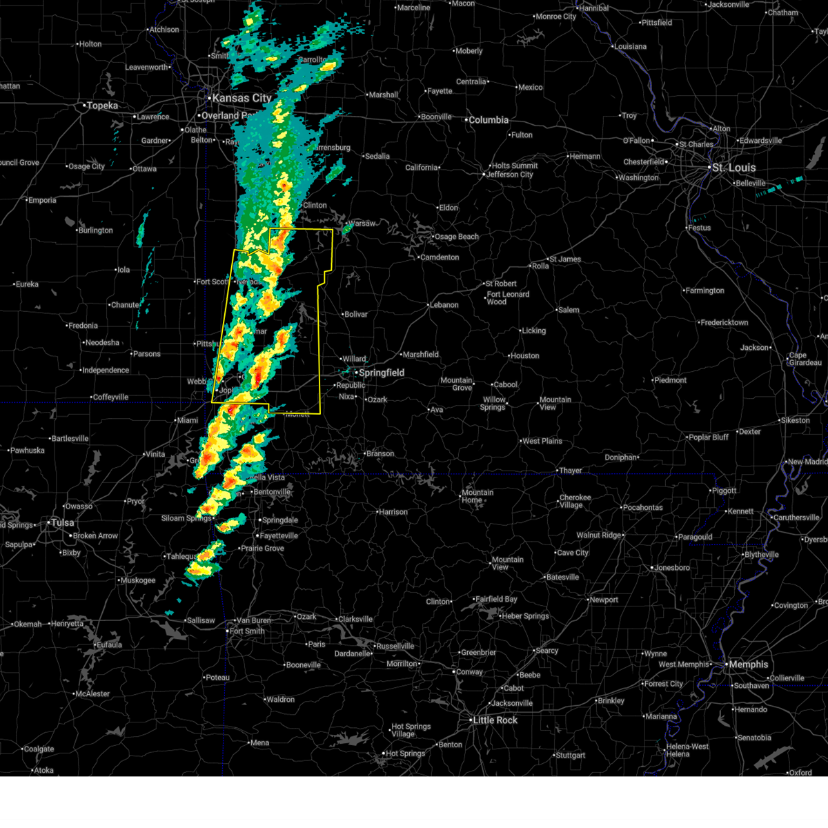
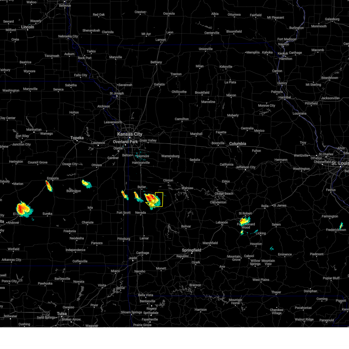
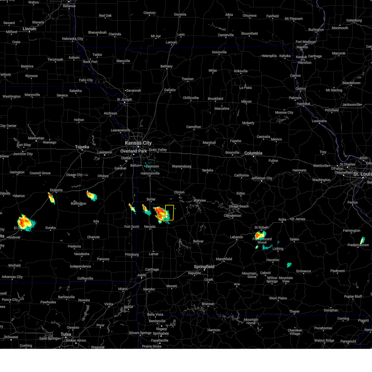
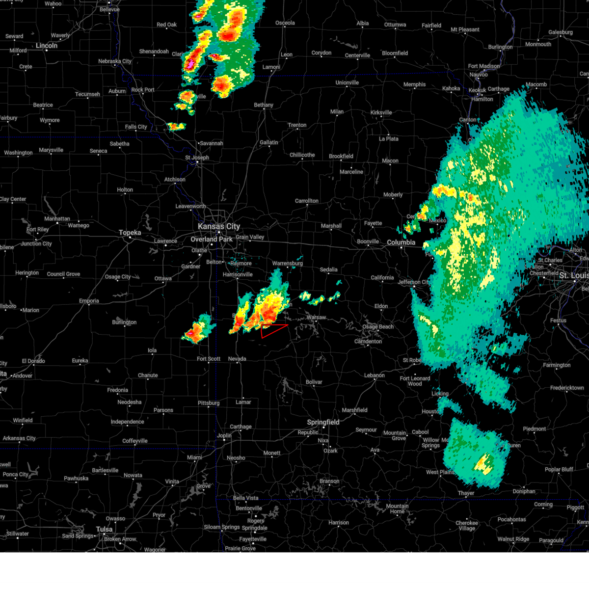
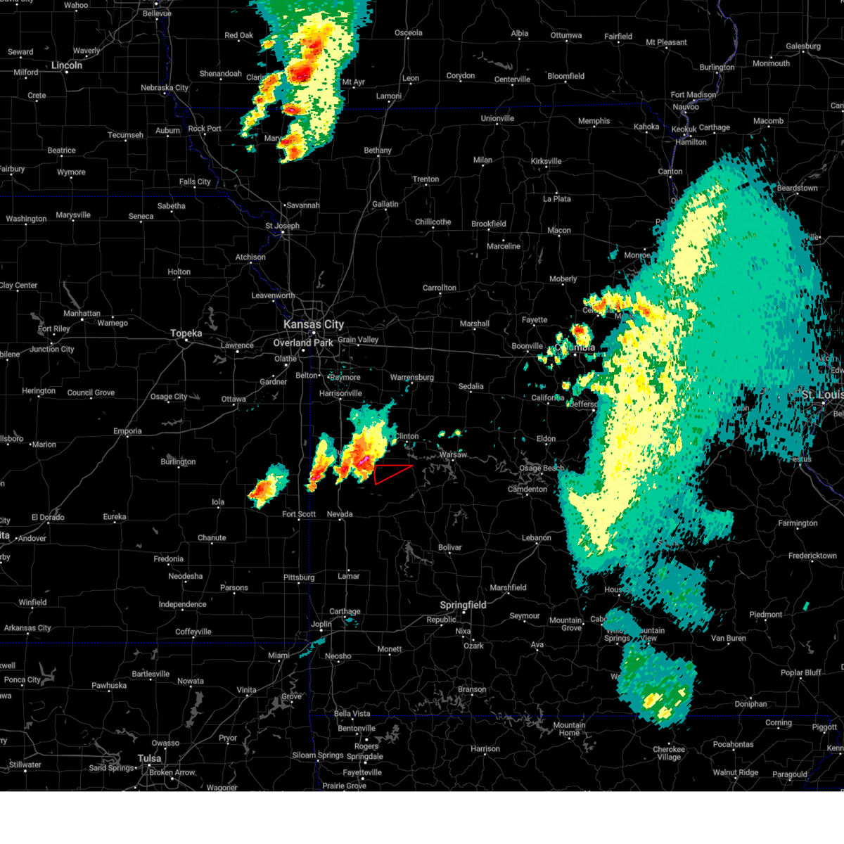
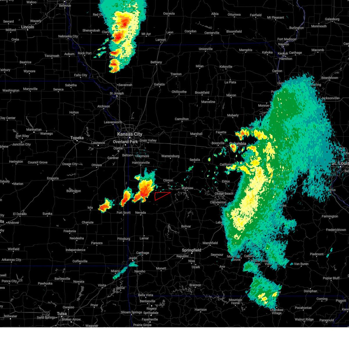
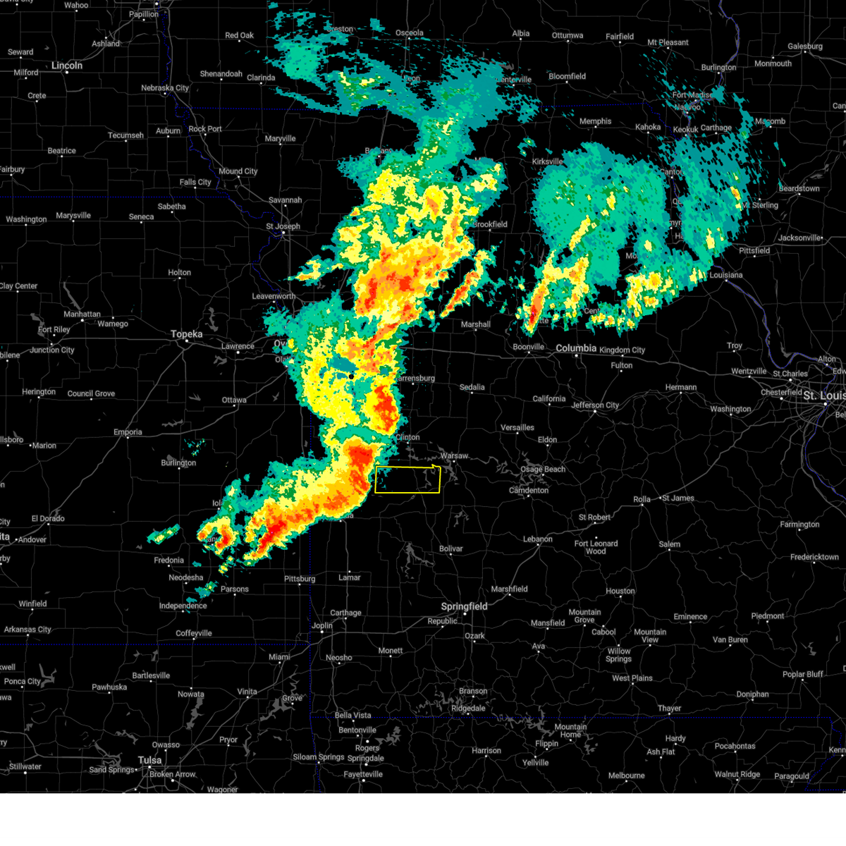
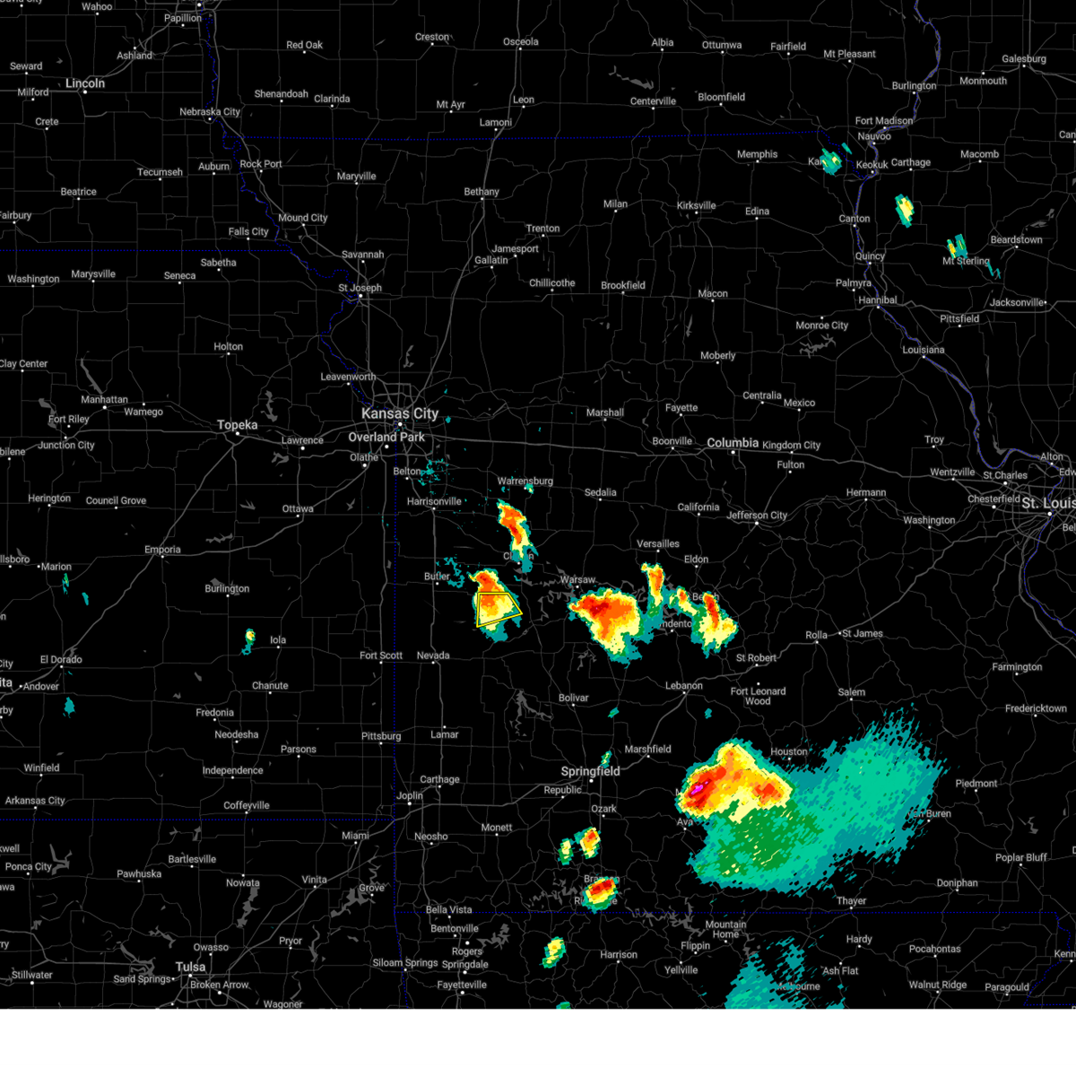
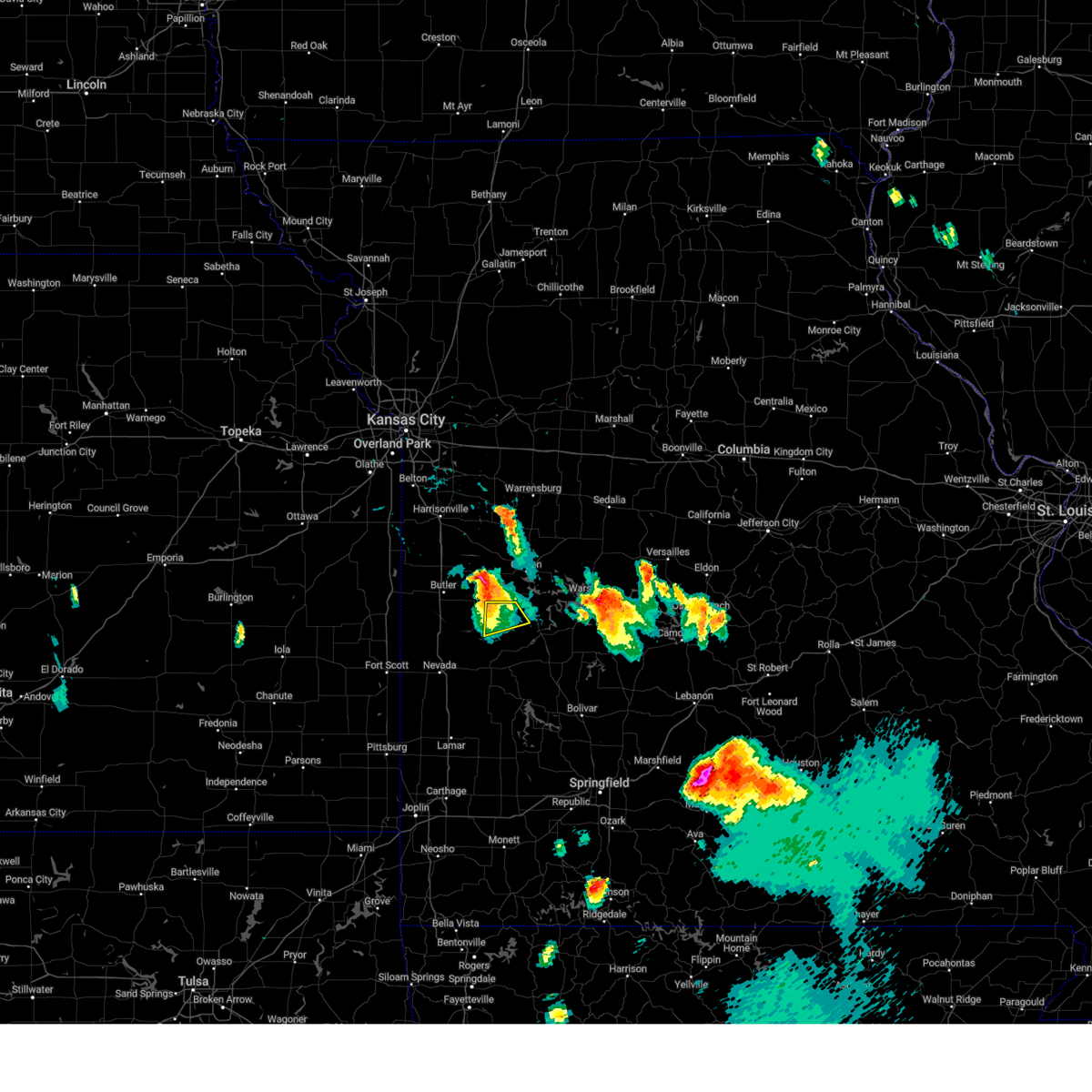
Hail Map for Appleton City, MO
The Appleton City, MO area has had 9 reports of on-the-ground hail by trained spotters, and has been under severe weather warnings 25 times during the past 12 months. Doppler radar has detected hail at or near Appleton City, MO on 66 occasions, including 4 occasions during the past year.
| Name: | Appleton City, MO |
| Where Located: | 69.7 miles SSE of Kansas City, MO |
| Map: | Google Map for Appleton City, MO |
| Population: | 1127 |
| Housing Units: | 617 |
| More Info: | Search Google for Appleton City, MO |
3
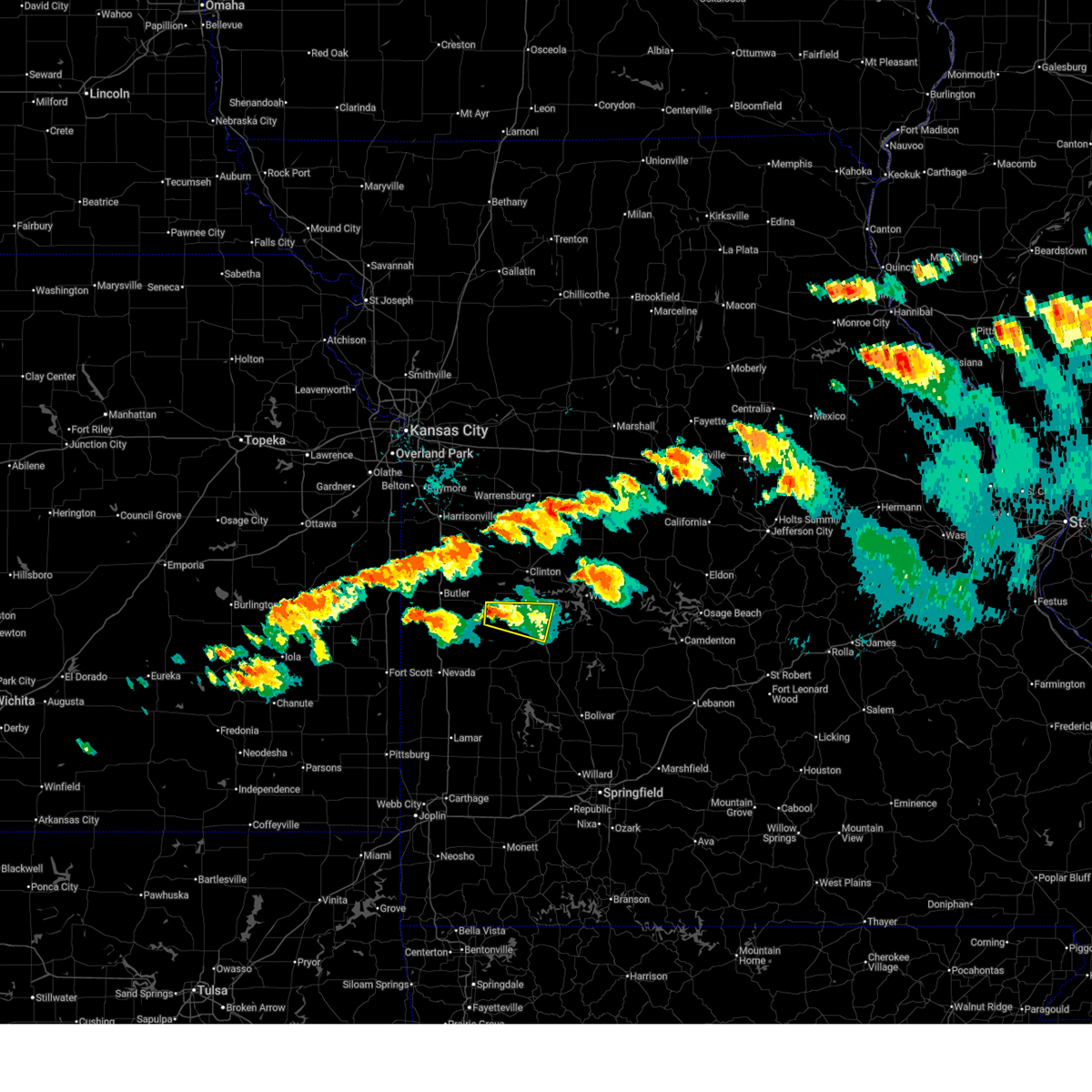
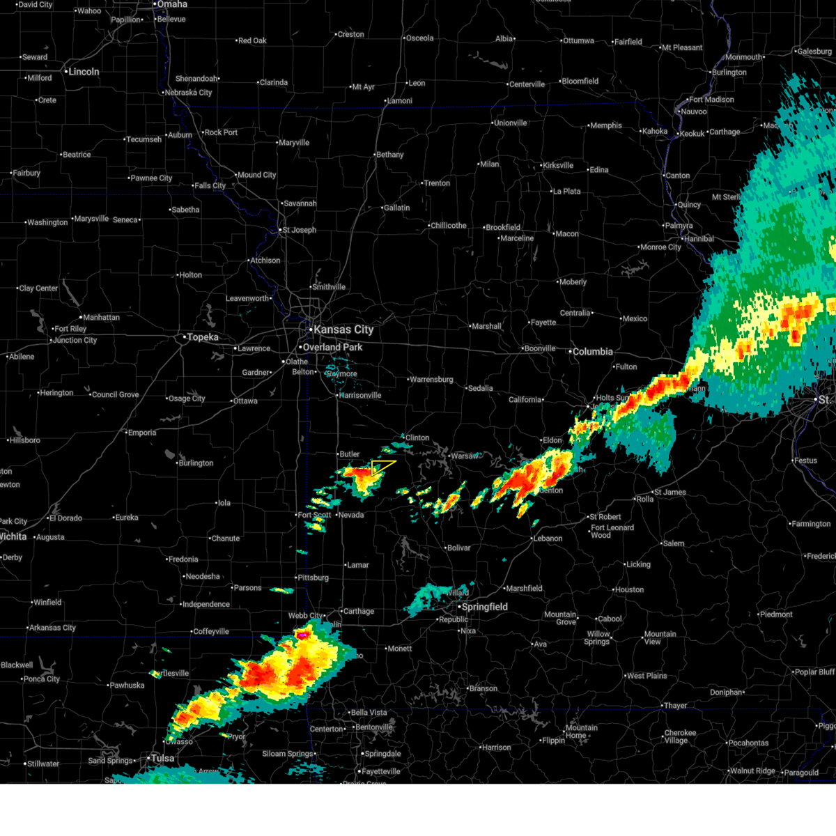
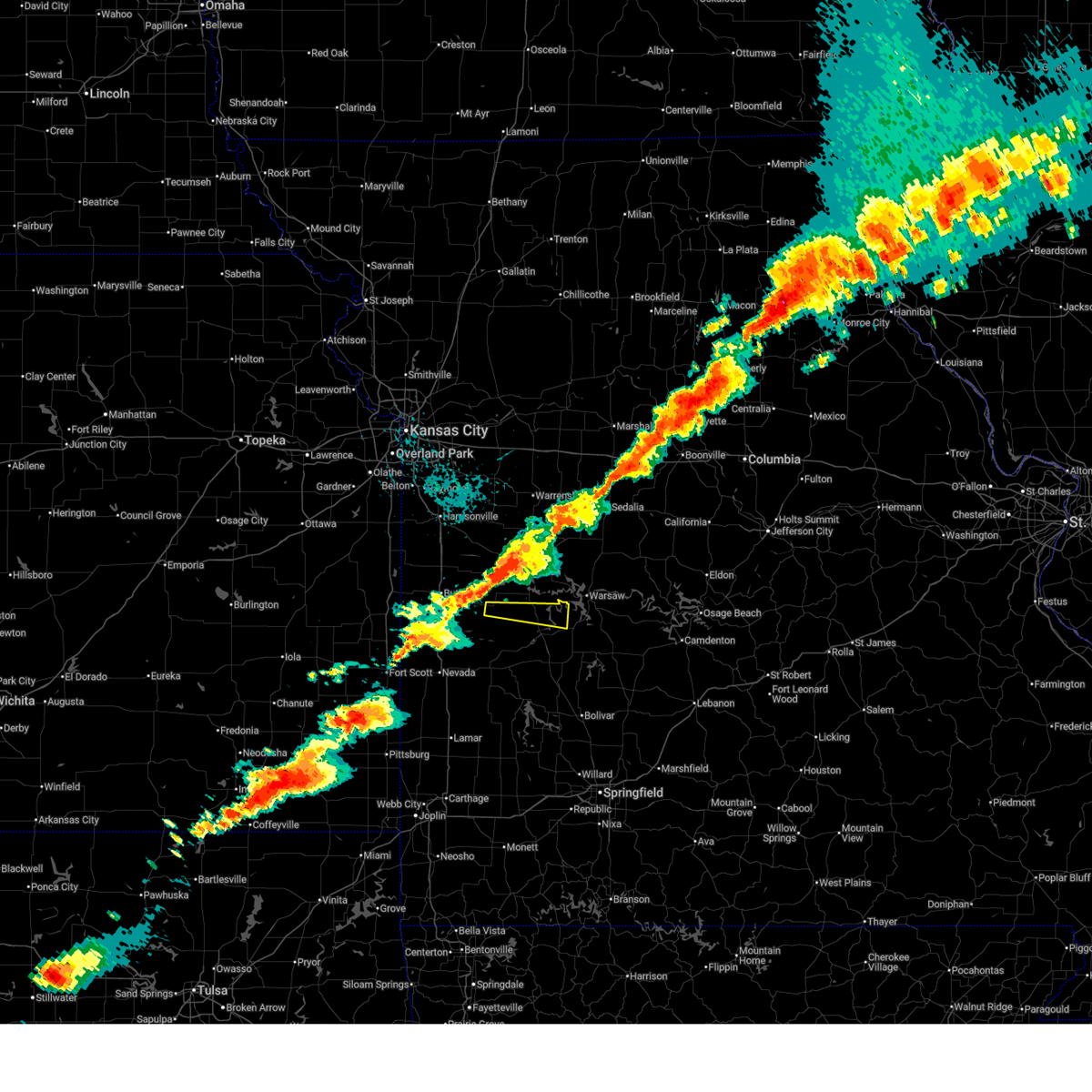
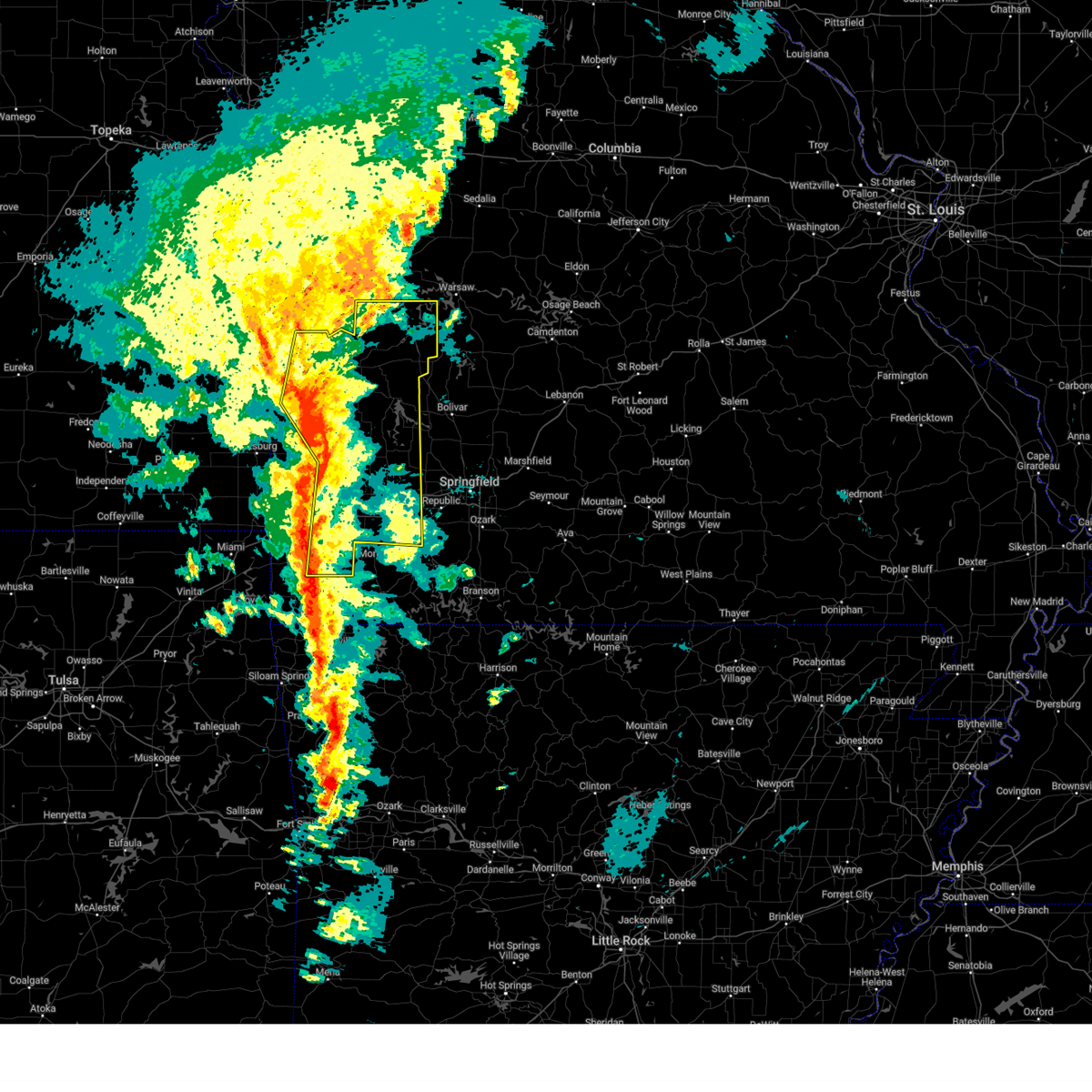
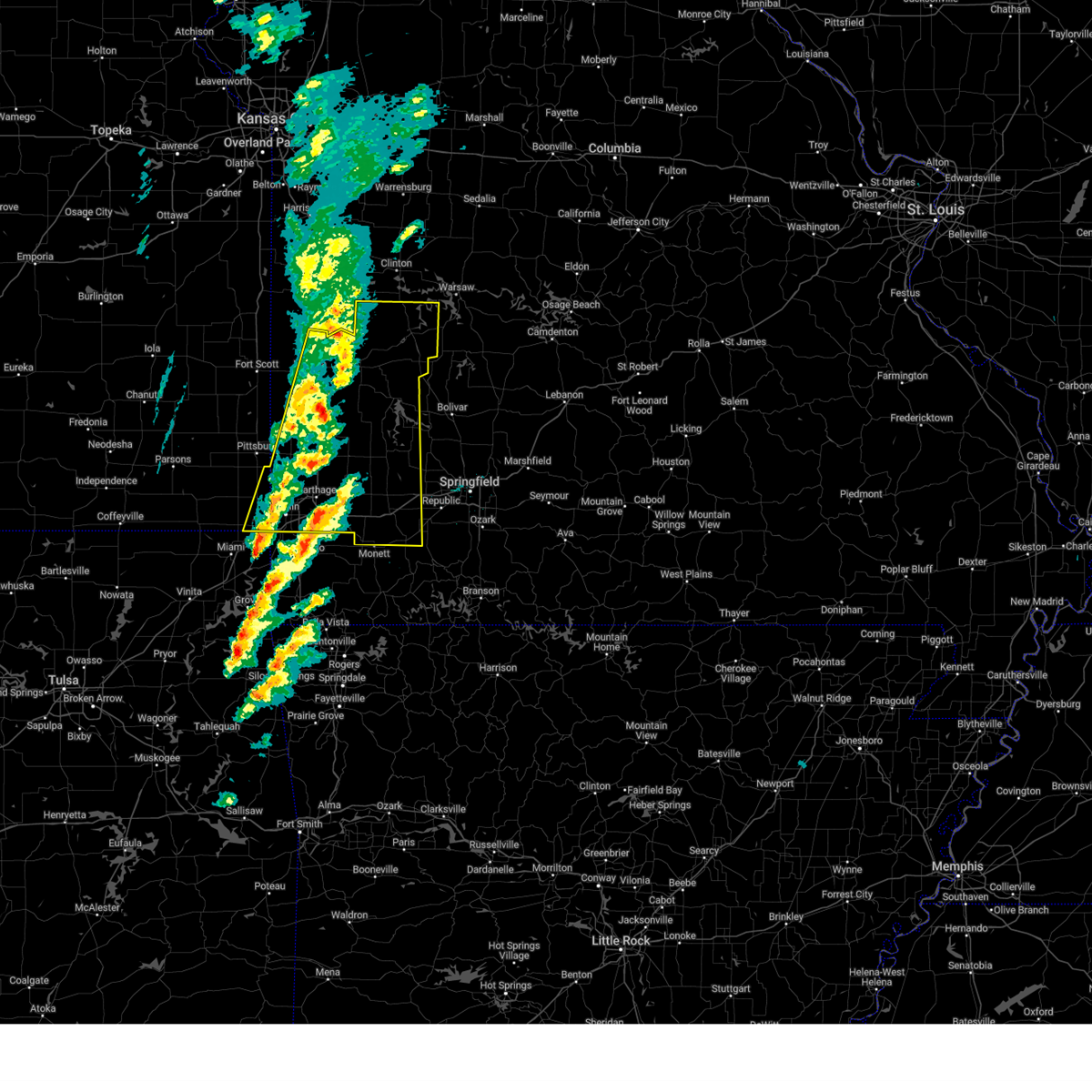
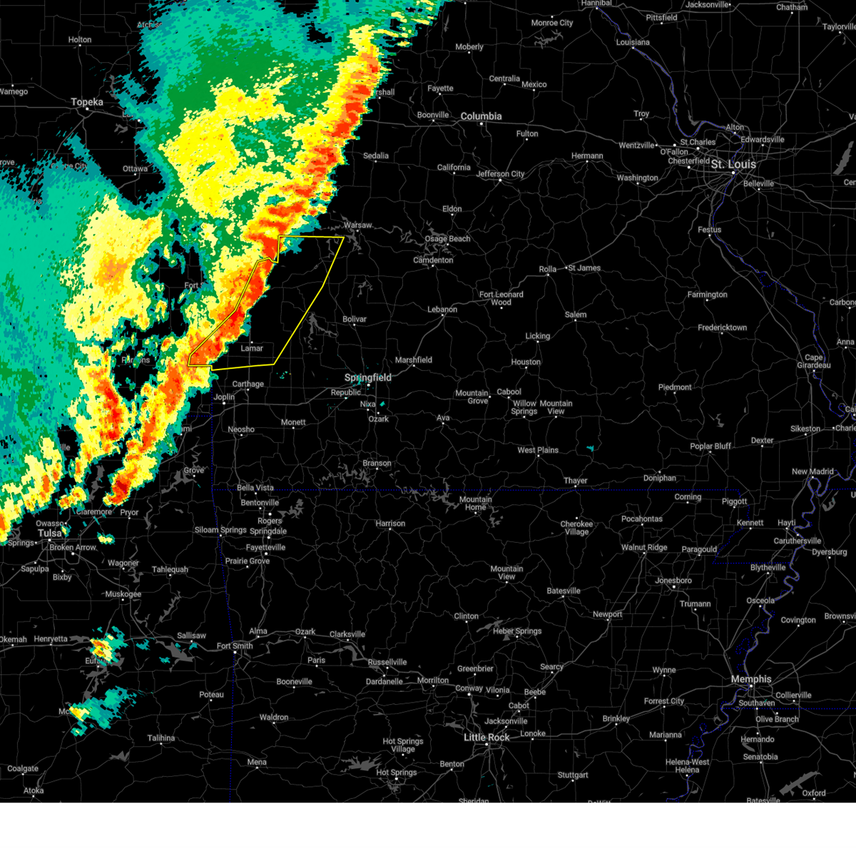
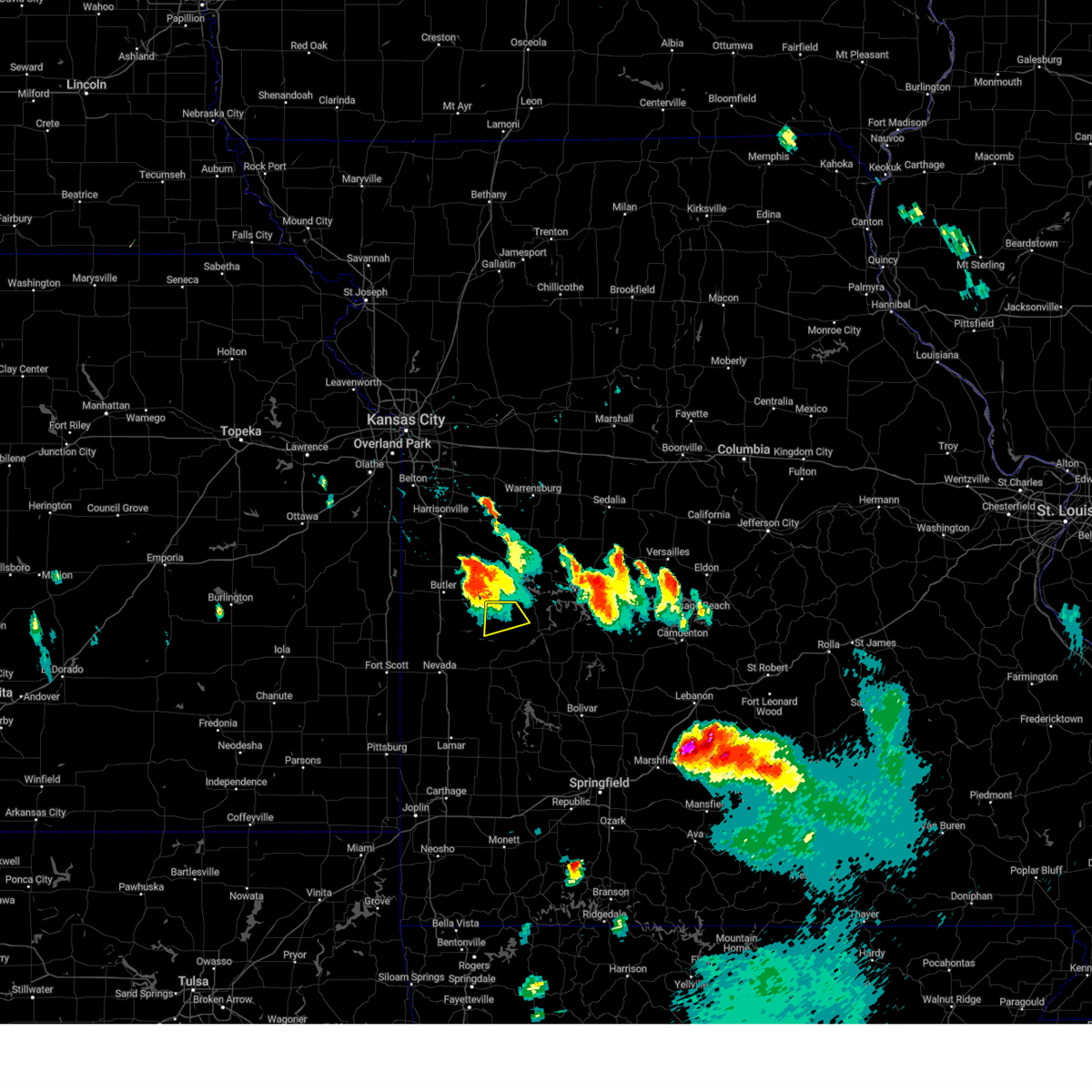
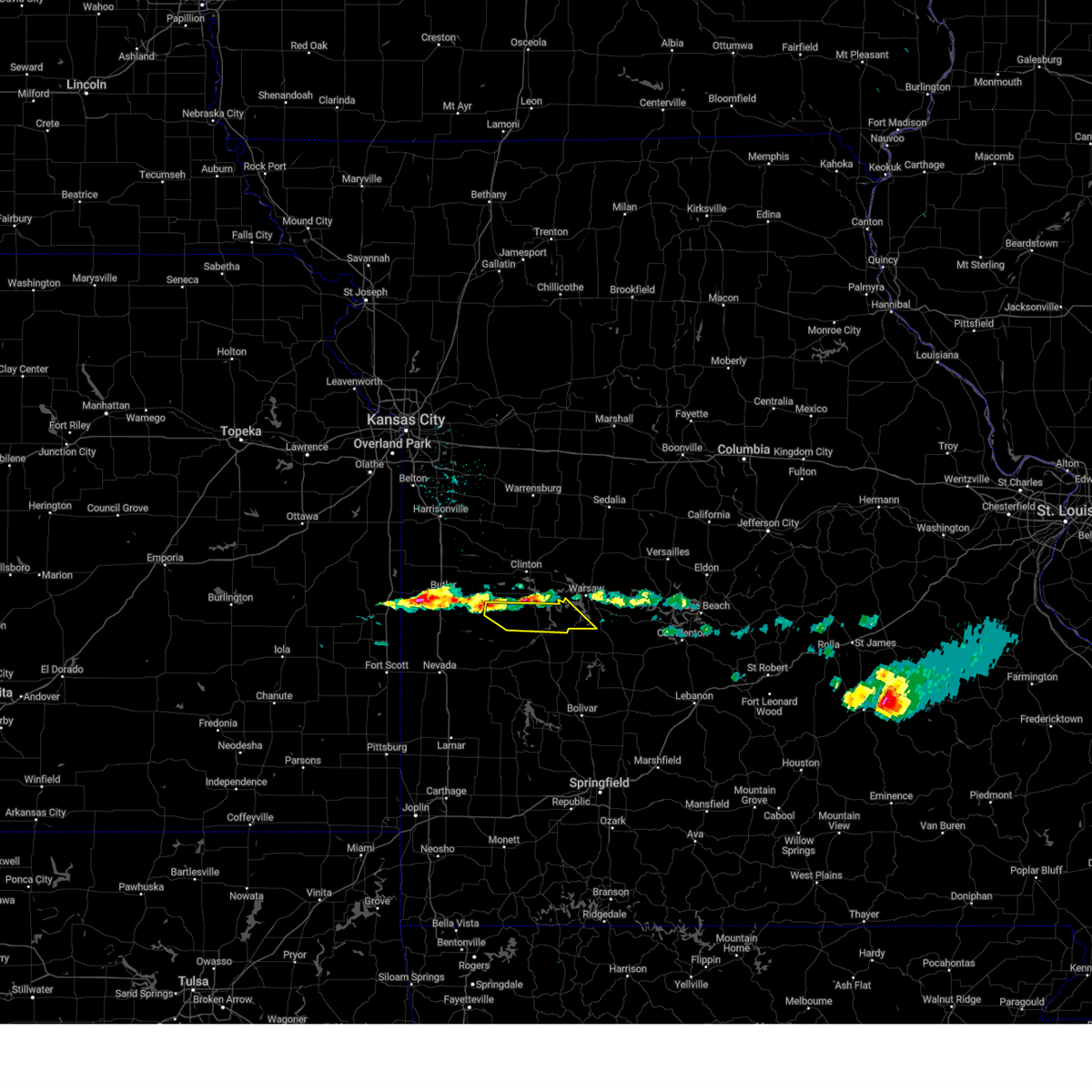
The Top Recent Hail Date for Appleton City, MO is Friday, May 8, 2026 (3rd out of 66)
Hail and Wind Damage Spotted near Appleton City, MO
| Date / Time | Report Details |
|---|---|
| 6/17/2026 6:28 PM CDT |
 the severe thunderstorm warning has been cancelled and is no longer in effect the severe thunderstorm warning has been cancelled and is no longer in effect
|
| 6/17/2026 5:57 PM CDT |
 Svrsgf the national weather service in springfield has issued a * severe thunderstorm warning for, northern st. clair county in west central missouri, * until 700 pm cdt. * at 557 pm cdt, a severe thunderstorm was located 8 miles west of appleton city, or 9 miles southeast of butler, moving southeast at 30 mph (radar indicated). Hazards include 60 mph wind gusts and quarter size hail. Hail damage to vehicles is expected. Expect wind damage to roofs, siding, and trees. Svrsgf the national weather service in springfield has issued a * severe thunderstorm warning for, northern st. clair county in west central missouri, * until 700 pm cdt. * at 557 pm cdt, a severe thunderstorm was located 8 miles west of appleton city, or 9 miles southeast of butler, moving southeast at 30 mph (radar indicated). Hazards include 60 mph wind gusts and quarter size hail. Hail damage to vehicles is expected. Expect wind damage to roofs, siding, and trees.
|
| 6/13/2026 10:37 PM CDT |
 Svrsgf the national weather service in springfield has issued a * severe thunderstorm warning for, cedar county in southwestern missouri, st. clair county in west central missouri, * until 1130 pm cdt. * at 1036 pm cdt, severe thunderstorms were located along a line extending from near butler to 7 miles southeast of rich hill to 6 miles southwest of nevada, moving east at 45 mph (radar indicated). Hazards include 60 mph wind gusts and penny size hail. expect damage to roofs, siding, and trees Svrsgf the national weather service in springfield has issued a * severe thunderstorm warning for, cedar county in southwestern missouri, st. clair county in west central missouri, * until 1130 pm cdt. * at 1036 pm cdt, severe thunderstorms were located along a line extending from near butler to 7 miles southeast of rich hill to 6 miles southwest of nevada, moving east at 45 mph (radar indicated). Hazards include 60 mph wind gusts and penny size hail. expect damage to roofs, siding, and trees
|
| 6/11/2026 8:33 PM CDT | Golf Ball sized hail reported 1.8 miles E of Appleton City, MO, report relayed by em. |
| 6/11/2026 8:22 PM CDT | Hen Egg sized hail reported 0.7 miles E of Appleton City, MO |
| 6/11/2026 8:11 PM CDT |
 Svrsgf the national weather service in springfield has issued a * severe thunderstorm warning for, northwestern st. clair county in west central missouri, * until 845 pm cdt. * at 810 pm cdt, a severe thunderstorm was located near appleton city, or 15 miles southeast of butler, moving northeast at 50 mph (radar indicated). Hazards include half dollar size hail. damage to vehicles is expected Svrsgf the national weather service in springfield has issued a * severe thunderstorm warning for, northwestern st. clair county in west central missouri, * until 845 pm cdt. * at 810 pm cdt, a severe thunderstorm was located near appleton city, or 15 miles southeast of butler, moving northeast at 50 mph (radar indicated). Hazards include half dollar size hail. damage to vehicles is expected
|
| 6/11/2026 5:23 PM CDT |
 Svrsgf the national weather service in springfield has issued a * severe thunderstorm warning for, northern st. clair county in west central missouri, * until 615 pm cdt. * at 522 pm cdt, a severe thunderstorm was located over montrose, or 13 miles southwest of clinton, moving east at 30 mph (radar indicated). Hazards include 60 mph wind gusts and half dollar size hail. Hail damage to vehicles is expected. Expect wind damage to roofs, siding, and trees. Svrsgf the national weather service in springfield has issued a * severe thunderstorm warning for, northern st. clair county in west central missouri, * until 615 pm cdt. * at 522 pm cdt, a severe thunderstorm was located over montrose, or 13 miles southwest of clinton, moving east at 30 mph (radar indicated). Hazards include 60 mph wind gusts and half dollar size hail. Hail damage to vehicles is expected. Expect wind damage to roofs, siding, and trees.
|
| 6/7/2026 3:39 PM CDT |
 Svrsgf the national weather service in springfield has issued a * severe thunderstorm warning for, northwestern st. clair county in west central missouri, * until 430 pm cdt. * at 339 pm cdt, a severe thunderstorm was located 9 miles southeast of appleton city, or 14 miles north of el dorado springs, moving north at 40 mph (radar indicated). Hazards include 60 mph wind gusts. expect damage to roofs, siding, and trees Svrsgf the national weather service in springfield has issued a * severe thunderstorm warning for, northwestern st. clair county in west central missouri, * until 430 pm cdt. * at 339 pm cdt, a severe thunderstorm was located 9 miles southeast of appleton city, or 14 miles north of el dorado springs, moving north at 40 mph (radar indicated). Hazards include 60 mph wind gusts. expect damage to roofs, siding, and trees
|
| 5/8/2026 5:49 PM CDT |
 Svrsgf the national weather service in springfield has issued a * severe thunderstorm warning for, northern st. clair county in west central missouri, * until 645 pm cdt. * at 548 pm cdt, a severe thunderstorm was located near appleton city, or 12 miles east of butler, moving east at 40 mph (radar indicated). Hazards include 60 mph wind gusts and half dollar size hail. Hail damage to vehicles is expected. Expect wind damage to roofs, siding, and trees. Svrsgf the national weather service in springfield has issued a * severe thunderstorm warning for, northern st. clair county in west central missouri, * until 645 pm cdt. * at 548 pm cdt, a severe thunderstorm was located near appleton city, or 12 miles east of butler, moving east at 40 mph (radar indicated). Hazards include 60 mph wind gusts and half dollar size hail. Hail damage to vehicles is expected. Expect wind damage to roofs, siding, and trees.
|
| 4/28/2026 3:03 PM CDT |
 the severe thunderstorm warning has been cancelled and is no longer in effect the severe thunderstorm warning has been cancelled and is no longer in effect
|
| 4/28/2026 2:43 PM CDT |
 At 243 pm cdt, a severe thunderstorm was located over osceola, or 19 miles southwest of warsaw, moving northeast at 55 mph (radar indicated). Hazards include 60 mph wind gusts and quarter size hail. Hail damage to vehicles is expected. expect wind damage to roofs, siding, and trees. Locations impacted include, truman lake, appleton city, osceola, lowry city, roscoe, vista, gerster, harper, iconium, tiffin, johnson city, taberville, and monegaw springs. At 243 pm cdt, a severe thunderstorm was located over osceola, or 19 miles southwest of warsaw, moving northeast at 55 mph (radar indicated). Hazards include 60 mph wind gusts and quarter size hail. Hail damage to vehicles is expected. expect wind damage to roofs, siding, and trees. Locations impacted include, truman lake, appleton city, osceola, lowry city, roscoe, vista, gerster, harper, iconium, tiffin, johnson city, taberville, and monegaw springs.
|
| 4/28/2026 2:15 PM CDT |
 Svrsgf the national weather service in springfield has issued a * severe thunderstorm warning for, st. clair county in west central missouri, * until 315 pm cdt. * at 215 pm cdt, a severe thunderstorm was located over el dorado springs, moving northeast at 50 mph (radar indicated). Hazards include golf ball size hail and 60 mph wind gusts. People and animals outdoors will be injured. expect hail damage to roofs, siding, windows, and vehicles. Expect wind damage to roofs, siding, and trees. Svrsgf the national weather service in springfield has issued a * severe thunderstorm warning for, st. clair county in west central missouri, * until 315 pm cdt. * at 215 pm cdt, a severe thunderstorm was located over el dorado springs, moving northeast at 50 mph (radar indicated). Hazards include golf ball size hail and 60 mph wind gusts. People and animals outdoors will be injured. expect hail damage to roofs, siding, windows, and vehicles. Expect wind damage to roofs, siding, and trees.
|
| 4/26/2026 9:42 PM CDT |
 Torsgf the national weather service in springfield has issued a * tornado warning for, northern st. clair county in west central missouri, * until 1030 pm cdt. * at 942 pm cdt, a severe thunderstorm capable of producing a tornado was located near appleton city, or 15 miles north of el dorado springs, moving east at 15 mph (radar indicated rotation). Hazards include tornado and quarter size hail. Flying debris will be dangerous to those caught without shelter. mobile homes will be damaged or destroyed. damage to roofs, windows, and vehicles will occur. Tree damage is likely. Torsgf the national weather service in springfield has issued a * tornado warning for, northern st. clair county in west central missouri, * until 1030 pm cdt. * at 942 pm cdt, a severe thunderstorm capable of producing a tornado was located near appleton city, or 15 miles north of el dorado springs, moving east at 15 mph (radar indicated rotation). Hazards include tornado and quarter size hail. Flying debris will be dangerous to those caught without shelter. mobile homes will be damaged or destroyed. damage to roofs, windows, and vehicles will occur. Tree damage is likely.
|
| 4/26/2026 9:39 PM CDT |
 Svrsgf the national weather service in springfield has issued a * severe thunderstorm warning for, northern st. clair county in west central missouri, * until 1045 pm cdt. * at 938 pm cdt, a severe thunderstorm was located over appleton city, or 19 miles east of butler, moving east at 25 mph (radar indicated). Hazards include 60 mph wind gusts and quarter size hail. Hail damage to vehicles is expected. Expect wind damage to roofs, siding, and trees. Svrsgf the national weather service in springfield has issued a * severe thunderstorm warning for, northern st. clair county in west central missouri, * until 1045 pm cdt. * at 938 pm cdt, a severe thunderstorm was located over appleton city, or 19 miles east of butler, moving east at 25 mph (radar indicated). Hazards include 60 mph wind gusts and quarter size hail. Hail damage to vehicles is expected. Expect wind damage to roofs, siding, and trees.
|
| 4/26/2026 8:11 PM CDT |
 The severe thunderstorm which prompted the warning has moved out of the warned area. therefore, the warning will be allowed to expire. a tornado watch remains in effect until 200 am cdt for central, southwestern and west central missouri. remember, a tornado warning still remains in effect for southeastern st. clair and northeastern cedar counties. The severe thunderstorm which prompted the warning has moved out of the warned area. therefore, the warning will be allowed to expire. a tornado watch remains in effect until 200 am cdt for central, southwestern and west central missouri. remember, a tornado warning still remains in effect for southeastern st. clair and northeastern cedar counties.
|
| 4/26/2026 7:38 PM CDT |
 At 737 pm cdt, a severe thunderstorm was located 9 miles northeast of el dorado springs, moving east at 30 mph (trained weather spotters). Hazards include tennis ball size hail and 60 mph wind gusts. People and animals outdoors will be injured. expect hail damage to roofs, siding, windows, and vehicles. expect wind damage to roofs, siding, and trees. Locations impacted include, truman lake, el dorado springs, appleton city, osceola, lowry city, roscoe, vista, gerster, harper, iconium, tiffin, johnson city, taberville, cedar springs, and monegaw springs. At 737 pm cdt, a severe thunderstorm was located 9 miles northeast of el dorado springs, moving east at 30 mph (trained weather spotters). Hazards include tennis ball size hail and 60 mph wind gusts. People and animals outdoors will be injured. expect hail damage to roofs, siding, windows, and vehicles. expect wind damage to roofs, siding, and trees. Locations impacted include, truman lake, el dorado springs, appleton city, osceola, lowry city, roscoe, vista, gerster, harper, iconium, tiffin, johnson city, taberville, cedar springs, and monegaw springs.
|
| 4/26/2026 7:13 PM CDT |
 Svrsgf the national weather service in springfield has issued a * severe thunderstorm warning for, northwestern cedar county in southwestern missouri, st. clair county in west central missouri, northeastern vernon county in west central missouri, * until 815 pm cdt. * at 712 pm cdt, a severe thunderstorm was located near el dorado springs, moving east at 40 mph (radar indicated). Hazards include 60 mph wind gusts and quarter size hail. Hail damage to vehicles is expected. Expect wind damage to roofs, siding, and trees. Svrsgf the national weather service in springfield has issued a * severe thunderstorm warning for, northwestern cedar county in southwestern missouri, st. clair county in west central missouri, northeastern vernon county in west central missouri, * until 815 pm cdt. * at 712 pm cdt, a severe thunderstorm was located near el dorado springs, moving east at 40 mph (radar indicated). Hazards include 60 mph wind gusts and quarter size hail. Hail damage to vehicles is expected. Expect wind damage to roofs, siding, and trees.
|
| 4/26/2026 6:12 PM CDT |
 Svrsgf the national weather service in springfield has issued a * severe thunderstorm warning for, st. clair county in west central missouri, * until 700 pm cdt. * at 612 pm cdt, a severe thunderstorm was located near appleton city, or 18 miles north of el dorado springs, moving east at 45 mph (radar indicated). Hazards include 60 mph wind gusts and quarter size hail. Hail damage to vehicles is expected. Expect wind damage to roofs, siding, and trees. Svrsgf the national weather service in springfield has issued a * severe thunderstorm warning for, st. clair county in west central missouri, * until 700 pm cdt. * at 612 pm cdt, a severe thunderstorm was located near appleton city, or 18 miles north of el dorado springs, moving east at 45 mph (radar indicated). Hazards include 60 mph wind gusts and quarter size hail. Hail damage to vehicles is expected. Expect wind damage to roofs, siding, and trees.
|
| 4/23/2026 11:21 PM CDT |
 The storms which prompted the warning have weakened below severe limits, and no longer pose an immediate threat to life or property. therefore, the warning will be allowed to expire. however, gusty winds are still possible with these thunderstorms. a severe thunderstorm watch remains in effect until 400 am cdt for southeastern kansas, and southwestern and west central missouri. to report severe weather, contact your nearest law enforcement agency. they will relay your report to the national weather service springfield. remember, a severe thunderstorm warning still remains in effect for st. clair county. The storms which prompted the warning have weakened below severe limits, and no longer pose an immediate threat to life or property. therefore, the warning will be allowed to expire. however, gusty winds are still possible with these thunderstorms. a severe thunderstorm watch remains in effect until 400 am cdt for southeastern kansas, and southwestern and west central missouri. to report severe weather, contact your nearest law enforcement agency. they will relay your report to the national weather service springfield. remember, a severe thunderstorm warning still remains in effect for st. clair county.
|
| 4/23/2026 10:37 PM CDT |
 Svrsgf the national weather service in springfield has issued a * severe thunderstorm warning for, northern bourbon county in southeastern kansas, western st. clair county in west central missouri, vernon county in west central missouri, * until 1130 pm cdt. * at 1037 pm cdt, severe thunderstorms were located along a line extending from adrian to near hume to near uniontown, moving east at 30 mph (radar indicated). Hazards include 60 mph wind gusts and quarter size hail. Hail damage to vehicles is expected. Expect wind damage to roofs, siding, and trees. Svrsgf the national weather service in springfield has issued a * severe thunderstorm warning for, northern bourbon county in southeastern kansas, western st. clair county in west central missouri, vernon county in west central missouri, * until 1130 pm cdt. * at 1037 pm cdt, severe thunderstorms were located along a line extending from adrian to near hume to near uniontown, moving east at 30 mph (radar indicated). Hazards include 60 mph wind gusts and quarter size hail. Hail damage to vehicles is expected. Expect wind damage to roofs, siding, and trees.
|
| 4/17/2026 6:55 PM CDT |
 Svrsgf the national weather service in springfield has issued a * severe thunderstorm warning for, northern hickory county in central missouri, southwestern benton county in central missouri, st. clair county in west central missouri, * until 730 pm cdt. * at 655 pm cdt, a severe thunderstorm was located 7 miles southeast of appleton city, or 17 miles north of el dorado springs, moving east at 60 mph (radar indicated). Hazards include 60 mph wind gusts and quarter size hail. Hail damage to vehicles is expected. Expect wind damage to roofs, siding, and trees. Svrsgf the national weather service in springfield has issued a * severe thunderstorm warning for, northern hickory county in central missouri, southwestern benton county in central missouri, st. clair county in west central missouri, * until 730 pm cdt. * at 655 pm cdt, a severe thunderstorm was located 7 miles southeast of appleton city, or 17 miles north of el dorado springs, moving east at 60 mph (radar indicated). Hazards include 60 mph wind gusts and quarter size hail. Hail damage to vehicles is expected. Expect wind damage to roofs, siding, and trees.
|
| 4/17/2026 6:47 PM CDT |
 Svrsgf the national weather service in springfield has issued a * severe thunderstorm warning for, northwestern cedar county in southwestern missouri, western st. clair county in west central missouri, central vernon county in west central missouri, * until 730 pm cdt. * at 647 pm cdt, severe thunderstorms were located along a line extending from near schell city to near walker to near nevada to 10 miles east of fort scott, moving east at 55 mph (radar indicated). Hazards include 60 mph wind gusts and quarter size hail. Hail damage to vehicles is expected. Expect wind damage to roofs, siding, and trees. Svrsgf the national weather service in springfield has issued a * severe thunderstorm warning for, northwestern cedar county in southwestern missouri, western st. clair county in west central missouri, central vernon county in west central missouri, * until 730 pm cdt. * at 647 pm cdt, severe thunderstorms were located along a line extending from near schell city to near walker to near nevada to 10 miles east of fort scott, moving east at 55 mph (radar indicated). Hazards include 60 mph wind gusts and quarter size hail. Hail damage to vehicles is expected. Expect wind damage to roofs, siding, and trees.
|
| 4/17/2026 6:09 PM CDT | Powerlines reported down by passer byer a hwy and m hwy between lowry city and appleton cit in st. clair county MO, 6.2 miles WNW of Appleton City, MO |
| 4/15/2026 7:06 PM CDT |
 The storm which prompted the warning has weakened below severe limits, and has exited the warned area. therefore, the warning will be allowed to expire. a tornado watch remains in effect until 900 pm cdt for central and west central missouri. The storm which prompted the warning has weakened below severe limits, and has exited the warned area. therefore, the warning will be allowed to expire. a tornado watch remains in effect until 900 pm cdt for central and west central missouri.
|
| 4/15/2026 6:09 PM CDT |
 Svrsgf the national weather service in springfield has issued a * severe thunderstorm warning for, st. clair county in west central missouri, northeastern vernon county in west central missouri, * until 715 pm cdt. * at 609 pm cdt, a severe thunderstorm was located over schell city, or 9 miles north of el dorado springs, moving east at 40 mph (radar indicated). Hazards include 60 mph wind gusts and quarter size hail. Hail damage to vehicles is expected. Expect wind damage to roofs, siding, and trees. Svrsgf the national weather service in springfield has issued a * severe thunderstorm warning for, st. clair county in west central missouri, northeastern vernon county in west central missouri, * until 715 pm cdt. * at 609 pm cdt, a severe thunderstorm was located over schell city, or 9 miles north of el dorado springs, moving east at 40 mph (radar indicated). Hazards include 60 mph wind gusts and quarter size hail. Hail damage to vehicles is expected. Expect wind damage to roofs, siding, and trees.
|
| 3/11/2026 12:19 AM CDT |
 the severe thunderstorm warning has been cancelled and is no longer in effect the severe thunderstorm warning has been cancelled and is no longer in effect
|
| 3/11/2026 12:19 AM CDT |
 At 1219 am cdt, a severe thunderstorm was located 7 miles southeast of appleton city, or 15 miles north of el dorado springs, moving east at 40 mph (radar indicated). Hazards include 60 mph wind gusts and quarter size hail. Hail damage to vehicles is expected. expect wind damage to roofs, siding, and trees. Locations impacted include, truman lake, appleton city, osceola, lowry city, johnson city, taberville, harper, iconium, and monegaw springs. At 1219 am cdt, a severe thunderstorm was located 7 miles southeast of appleton city, or 15 miles north of el dorado springs, moving east at 40 mph (radar indicated). Hazards include 60 mph wind gusts and quarter size hail. Hail damage to vehicles is expected. expect wind damage to roofs, siding, and trees. Locations impacted include, truman lake, appleton city, osceola, lowry city, johnson city, taberville, harper, iconium, and monegaw springs.
|
| 3/11/2026 12:06 AM CDT |
 Svrsgf the national weather service in springfield has issued a * severe thunderstorm warning for, northern st. clair county in west central missouri, northeastern vernon county in west central missouri, * until 1245 am cdt. * at 1205 am cdt, a severe thunderstorm was located near schell city, or 12 miles east of rich hill, moving east at 45 mph (radar indicated). Hazards include 60 mph wind gusts and quarter size hail. Hail damage to vehicles is expected. Expect wind damage to roofs, siding, and trees. Svrsgf the national weather service in springfield has issued a * severe thunderstorm warning for, northern st. clair county in west central missouri, northeastern vernon county in west central missouri, * until 1245 am cdt. * at 1205 am cdt, a severe thunderstorm was located near schell city, or 12 miles east of rich hill, moving east at 45 mph (radar indicated). Hazards include 60 mph wind gusts and quarter size hail. Hail damage to vehicles is expected. Expect wind damage to roofs, siding, and trees.
|
| 5/19/2025 6:40 PM CDT |
 Svrsgf the national weather service in springfield has issued a * severe thunderstorm warning for, hickory county in central missouri, northern cedar county in southwestern missouri, benton county in central missouri, st. clair county in west central missouri, eastern vernon county in west central missouri, * until 745 pm cdt. * at 640 pm cdt, severe thunderstorms were located along a line extending from near lowry city to 10 miles southwest of osceola to 8 miles east of sheldon, moving east at 45 mph (radar indicated). Hazards include 60 mph wind gusts and quarter size hail. Hail damage to vehicles is expected. Expect wind damage to roofs, siding, and trees. Svrsgf the national weather service in springfield has issued a * severe thunderstorm warning for, hickory county in central missouri, northern cedar county in southwestern missouri, benton county in central missouri, st. clair county in west central missouri, eastern vernon county in west central missouri, * until 745 pm cdt. * at 640 pm cdt, severe thunderstorms were located along a line extending from near lowry city to 10 miles southwest of osceola to 8 miles east of sheldon, moving east at 45 mph (radar indicated). Hazards include 60 mph wind gusts and quarter size hail. Hail damage to vehicles is expected. Expect wind damage to roofs, siding, and trees.
|
| 5/19/2025 5:59 PM CDT |
 Svrsgf the national weather service in springfield has issued a * severe thunderstorm warning for, eastern bourbon county in southeastern kansas, northwestern barton county in southwestern missouri, northwestern cedar county in southwestern missouri, st. clair county in west central missouri, vernon county in west central missouri, * until 645 pm cdt. * at 558 pm cdt, a severe thunderstorm was located over nevada, moving northeast at 30 mph (radar indicated). Hazards include 60 mph wind gusts and quarter size hail. Hail damage to vehicles is expected. Expect wind damage to roofs, siding, and trees. Svrsgf the national weather service in springfield has issued a * severe thunderstorm warning for, eastern bourbon county in southeastern kansas, northwestern barton county in southwestern missouri, northwestern cedar county in southwestern missouri, st. clair county in west central missouri, vernon county in west central missouri, * until 645 pm cdt. * at 558 pm cdt, a severe thunderstorm was located over nevada, moving northeast at 30 mph (radar indicated). Hazards include 60 mph wind gusts and quarter size hail. Hail damage to vehicles is expected. Expect wind damage to roofs, siding, and trees.
|
| 4/20/2025 3:18 PM CDT |
 At 318 pm cdt, severe thunderstorms were located along a line extending from near appleton city to 6 miles south of osceola to near miller, moving northeast at 60 mph (radar indicated). Hazards include 70 mph wind gusts and penny size hail. Expect considerable tree damage. damage is likely to mobile homes, roofs, and outbuildings. locations impacted include, vista, appleton city, cane hill, aurora, umber view heights, osceola, mount vernon, pennsboro, neola, lowry city, freistatt, el dorado springs, monegaw springs, olympia, red oak, marionville, caplinger mills, wagoner, stockton state park, and jerico springs. This includes interstate 44 between mile markers 33 and 58. At 318 pm cdt, severe thunderstorms were located along a line extending from near appleton city to 6 miles south of osceola to near miller, moving northeast at 60 mph (radar indicated). Hazards include 70 mph wind gusts and penny size hail. Expect considerable tree damage. damage is likely to mobile homes, roofs, and outbuildings. locations impacted include, vista, appleton city, cane hill, aurora, umber view heights, osceola, mount vernon, pennsboro, neola, lowry city, freistatt, el dorado springs, monegaw springs, olympia, red oak, marionville, caplinger mills, wagoner, stockton state park, and jerico springs. This includes interstate 44 between mile markers 33 and 58.
|
| 4/20/2025 3:18 PM CDT |
 the severe thunderstorm warning has been cancelled and is no longer in effect the severe thunderstorm warning has been cancelled and is no longer in effect
|
| 4/20/2025 3:17 PM CDT |
 At 317 pm cdt, severe thunderstorms were located along a line extending from near appleton city to near osceola to near miller, moving northeast at 60 mph (radar indicated). Hazards include 70 mph wind gusts and penny size hail. Expect considerable tree damage. damage is likely to mobile homes, roofs, and outbuildings. locations impacted include, vista, appleton city, cane hill, fairview, aurora, umber view heights, osceola, mount vernon, pennsboro, neola, lowry city, freistatt, el dorado springs, monegaw springs, olympia, red oak, marionville, caplinger mills, wagoner, and stockton state park. This includes interstate 44 between mile markers 33 and 58. At 317 pm cdt, severe thunderstorms were located along a line extending from near appleton city to near osceola to near miller, moving northeast at 60 mph (radar indicated). Hazards include 70 mph wind gusts and penny size hail. Expect considerable tree damage. damage is likely to mobile homes, roofs, and outbuildings. locations impacted include, vista, appleton city, cane hill, fairview, aurora, umber view heights, osceola, mount vernon, pennsboro, neola, lowry city, freistatt, el dorado springs, monegaw springs, olympia, red oak, marionville, caplinger mills, wagoner, and stockton state park. This includes interstate 44 between mile markers 33 and 58.
|
| 4/20/2025 3:17 PM CDT |
 the severe thunderstorm warning has been cancelled and is no longer in effect the severe thunderstorm warning has been cancelled and is no longer in effect
|
| 4/20/2025 3:06 PM CDT |
 At 305 pm cdt, severe thunderstorms were located along a line extending from near schell city to 10 miles north of stockton to 6 miles east of sarcoxie, moving northeast at 60 mph (radar indicated). Hazards include 70 mph wind gusts and penny size hail. Expect considerable tree damage. damage is likely to mobile homes, roofs, and outbuildings. locations impacted include, vista, appleton city, sarcoxie, cane hill, fairview, aurora, umber view heights, osceola, mount vernon, pennsboro, neola, lowry city, freistatt, el dorado springs, monegaw springs, olympia, red oak, marionville, golden city, and walker. This includes interstate 44 between mile markers 24 and 58. At 305 pm cdt, severe thunderstorms were located along a line extending from near schell city to 10 miles north of stockton to 6 miles east of sarcoxie, moving northeast at 60 mph (radar indicated). Hazards include 70 mph wind gusts and penny size hail. Expect considerable tree damage. damage is likely to mobile homes, roofs, and outbuildings. locations impacted include, vista, appleton city, sarcoxie, cane hill, fairview, aurora, umber view heights, osceola, mount vernon, pennsboro, neola, lowry city, freistatt, el dorado springs, monegaw springs, olympia, red oak, marionville, golden city, and walker. This includes interstate 44 between mile markers 24 and 58.
|
| 4/20/2025 2:37 PM CDT |
 Svrsgf the national weather service in springfield has issued a * severe thunderstorm warning for, barton county in southwestern missouri, eastern newton county in southwestern missouri, cedar county in southwestern missouri, lawrence county in southwestern missouri, st. clair county in west central missouri, vernon county in west central missouri, eastern jasper county in southwestern missouri, dade county in southwestern missouri, * until 330 pm cdt. * at 236 pm cdt, severe thunderstorms were located along a line extending from 7 miles northwest of sheldon to 8 miles east of lamar to near goodman, moving northeast at 60 mph (radar indicated). Hazards include 60 mph wind gusts and penny size hail. expect damage to roofs, siding, and trees Svrsgf the national weather service in springfield has issued a * severe thunderstorm warning for, barton county in southwestern missouri, eastern newton county in southwestern missouri, cedar county in southwestern missouri, lawrence county in southwestern missouri, st. clair county in west central missouri, vernon county in west central missouri, eastern jasper county in southwestern missouri, dade county in southwestern missouri, * until 330 pm cdt. * at 236 pm cdt, severe thunderstorms were located along a line extending from 7 miles northwest of sheldon to 8 miles east of lamar to near goodman, moving northeast at 60 mph (radar indicated). Hazards include 60 mph wind gusts and penny size hail. expect damage to roofs, siding, and trees
|
| 4/17/2025 6:41 AM CDT |
 Svrsgf the national weather service in springfield has issued a * severe thunderstorm warning for, northern cedar county in southwestern missouri, southwestern benton county in central missouri, st. clair county in west central missouri, northeastern vernon county in west central missouri, * until 730 am cdt. * at 640 am cdt, a severe thunderstorm was located near schell city, or 13 miles east of rich hill, moving east at 50 mph (radar indicated). Hazards include 60 mph wind gusts and quarter size hail. Hail damage to vehicles is expected. Expect wind damage to roofs, siding, and trees. Svrsgf the national weather service in springfield has issued a * severe thunderstorm warning for, northern cedar county in southwestern missouri, southwestern benton county in central missouri, st. clair county in west central missouri, northeastern vernon county in west central missouri, * until 730 am cdt. * at 640 am cdt, a severe thunderstorm was located near schell city, or 13 miles east of rich hill, moving east at 50 mph (radar indicated). Hazards include 60 mph wind gusts and quarter size hail. Hail damage to vehicles is expected. Expect wind damage to roofs, siding, and trees.
|
| 4/2/2025 8:12 AM CDT |
 The storm which prompted the warning has moved out of the area. therefore, the warning will be allowed to expire. a tornado watch remains in effect until noon cdt for west central missouri. The storm which prompted the warning has moved out of the area. therefore, the warning will be allowed to expire. a tornado watch remains in effect until noon cdt for west central missouri.
|
| 4/2/2025 8:01 AM CDT |
 At 800 am cdt, a severe thunderstorm capable of producing a tornado was located near appleton city, or 17 miles north of el dorado springs, moving northeast at 70 mph (radar indicated rotation). Hazards include tornado and quarter size hail. Flying debris will be dangerous to those caught without shelter. mobile homes will be damaged or destroyed. damage to roofs, windows, and vehicles will occur. tree damage is likely. Locations impacted include, appleton city. At 800 am cdt, a severe thunderstorm capable of producing a tornado was located near appleton city, or 17 miles north of el dorado springs, moving northeast at 70 mph (radar indicated rotation). Hazards include tornado and quarter size hail. Flying debris will be dangerous to those caught without shelter. mobile homes will be damaged or destroyed. damage to roofs, windows, and vehicles will occur. tree damage is likely. Locations impacted include, appleton city.
|
| 4/2/2025 8:01 AM CDT |
 the tornado warning has been cancelled and is no longer in effect the tornado warning has been cancelled and is no longer in effect
|
| 4/2/2025 7:53 AM CDT |
 At 752 am cdt, a severe thunderstorm capable of producing a tornado was located over schell city, or 12 miles northwest of el dorado springs, moving northeast at 70 mph (radar indicated rotation). Hazards include tornado and quarter size hail. Flying debris will be dangerous to those caught without shelter. mobile homes will be damaged or destroyed. damage to roofs, windows, and vehicles will occur. tree damage is likely. Locations impacted include, appleton city, schell city, and johnson city. At 752 am cdt, a severe thunderstorm capable of producing a tornado was located over schell city, or 12 miles northwest of el dorado springs, moving northeast at 70 mph (radar indicated rotation). Hazards include tornado and quarter size hail. Flying debris will be dangerous to those caught without shelter. mobile homes will be damaged or destroyed. damage to roofs, windows, and vehicles will occur. tree damage is likely. Locations impacted include, appleton city, schell city, and johnson city.
|
| 4/2/2025 7:45 AM CDT |
 At 745 am cdt, a confirmed tornado was located over walker, or 7 miles northeast of nevada, moving northeast at 70 mph (radar confirmed tornado). Hazards include damaging tornado and quarter size hail. Flying debris will be dangerous to those caught without shelter. mobile homes will be damaged or destroyed. damage to roofs, windows, and vehicles will occur. tree damage is likely. Locations impacted include, appleton city, walker, schell city, harwood, and johnson city. At 745 am cdt, a confirmed tornado was located over walker, or 7 miles northeast of nevada, moving northeast at 70 mph (radar confirmed tornado). Hazards include damaging tornado and quarter size hail. Flying debris will be dangerous to those caught without shelter. mobile homes will be damaged or destroyed. damage to roofs, windows, and vehicles will occur. tree damage is likely. Locations impacted include, appleton city, walker, schell city, harwood, and johnson city.
|
| 4/2/2025 7:39 AM CDT |
 Torsgf the national weather service in springfield has issued a * tornado warning for, northwestern st. clair county in west central missouri, northwestern vernon county in west central missouri, * until 815 am cdt. * at 739 am cdt, a tornado producing storm was located over nevada, moving northeast at 70 mph (radar confirmed tornado). Hazards include damaging tornado and quarter size hail. Flying debris will be dangerous to those caught without shelter. mobile homes will be damaged or destroyed. damage to roofs, windows, and vehicles will occur. Tree damage is likely. Torsgf the national weather service in springfield has issued a * tornado warning for, northwestern st. clair county in west central missouri, northwestern vernon county in west central missouri, * until 815 am cdt. * at 739 am cdt, a tornado producing storm was located over nevada, moving northeast at 70 mph (radar confirmed tornado). Hazards include damaging tornado and quarter size hail. Flying debris will be dangerous to those caught without shelter. mobile homes will be damaged or destroyed. damage to roofs, windows, and vehicles will occur. Tree damage is likely.
|
| 3/14/2025 4:31 PM CDT |
 At 429 pm cdt, severe thunderstorms located across southeast kansas and west missouri, moving northeast at 65 mph (emergency management). Hazards include 70 mph wind gusts and quarter size hail. Hail damage to vehicles is expected. expect considerable tree damage. wind damage is also likely to mobile homes, roofs, and outbuildings. locations impacted include, vista, fidelity, appleton city, sarcoxie, cane hill, lamar heights, carthage, aurora, umber view heights, osceola, mount vernon, pennsboro, neola, lowry city, freistatt, el dorado springs, monegaw springs, boston, olympia, and red oak. this includes the following highways, interstate 44 between mile markers 16 and 58. Interstate 49 between mile markers 36 and 71. At 429 pm cdt, severe thunderstorms located across southeast kansas and west missouri, moving northeast at 65 mph (emergency management). Hazards include 70 mph wind gusts and quarter size hail. Hail damage to vehicles is expected. expect considerable tree damage. wind damage is also likely to mobile homes, roofs, and outbuildings. locations impacted include, vista, fidelity, appleton city, sarcoxie, cane hill, lamar heights, carthage, aurora, umber view heights, osceola, mount vernon, pennsboro, neola, lowry city, freistatt, el dorado springs, monegaw springs, boston, olympia, and red oak. this includes the following highways, interstate 44 between mile markers 16 and 58. Interstate 49 between mile markers 36 and 71.
|
| 3/14/2025 4:07 PM CDT |
 the severe thunderstorm warning has been cancelled and is no longer in effect the severe thunderstorm warning has been cancelled and is no longer in effect
|
| 3/14/2025 4:07 PM CDT |
 At 403 pm cdt, severe thunderstorms located across southeast kansas and west missouri, moving northeast at 60 mph (emergency management. over the past hour, wind gusts up to 60 to 70 mph have been reported, with tree limbs down, across southeast kansas and west missouri). Hazards include 70 mph wind gusts and quarter size hail. Hail damage to vehicles is expected. expect considerable tree damage. wind damage is also likely to mobile homes, roofs, and outbuildings. locations impacted include, fidelity, appleton city, sarcoxie, aurora, osceola, lowry city, milo, boston, olympia, red oak, marionville, caplinger mills, brooklyn heights, kenoma, stotts city, reeds, avilla, sheldon, roscoe, and bearcreek. this includes the following highways, interstate 44 between mile markers 5 and 58. Interstate 49 between mile markers 32 and 103, and between mile markers 106 and 107. At 403 pm cdt, severe thunderstorms located across southeast kansas and west missouri, moving northeast at 60 mph (emergency management. over the past hour, wind gusts up to 60 to 70 mph have been reported, with tree limbs down, across southeast kansas and west missouri). Hazards include 70 mph wind gusts and quarter size hail. Hail damage to vehicles is expected. expect considerable tree damage. wind damage is also likely to mobile homes, roofs, and outbuildings. locations impacted include, fidelity, appleton city, sarcoxie, aurora, osceola, lowry city, milo, boston, olympia, red oak, marionville, caplinger mills, brooklyn heights, kenoma, stotts city, reeds, avilla, sheldon, roscoe, and bearcreek. this includes the following highways, interstate 44 between mile markers 5 and 58. Interstate 49 between mile markers 32 and 103, and between mile markers 106 and 107.
|
| 3/14/2025 3:42 PM CDT |
 Svrsgf the national weather service in springfield has issued a * severe thunderstorm warning for, eastern cherokee county in southeastern kansas, barton county in southwestern missouri, northern newton county in southwestern missouri, cedar county in southwestern missouri, lawrence county in southwestern missouri, st. clair county in west central missouri, vernon county in west central missouri, jasper county in southwestern missouri, dade county in southwestern missouri, * until 445 pm cdt. * at 341 pm cdt, a severe thunderstorm was located near lamar, moving northeast at 70 mph (radar indicated). Hazards include 70 mph wind gusts and penny size hail. these storms have been reported to down tree limbs with measured gusts up to 60 to 70 mph. Expect considerable tree damage. Damage is likely to mobile homes, roofs, and outbuildings. Svrsgf the national weather service in springfield has issued a * severe thunderstorm warning for, eastern cherokee county in southeastern kansas, barton county in southwestern missouri, northern newton county in southwestern missouri, cedar county in southwestern missouri, lawrence county in southwestern missouri, st. clair county in west central missouri, vernon county in west central missouri, jasper county in southwestern missouri, dade county in southwestern missouri, * until 445 pm cdt. * at 341 pm cdt, a severe thunderstorm was located near lamar, moving northeast at 70 mph (radar indicated). Hazards include 70 mph wind gusts and penny size hail. these storms have been reported to down tree limbs with measured gusts up to 60 to 70 mph. Expect considerable tree damage. Damage is likely to mobile homes, roofs, and outbuildings.
|
| 10/30/2024 9:45 PM CDT |
 Svrsgf the national weather service in springfield has issued a * severe thunderstorm warning for, southeastern crawford county in southeastern kansas, barton county in southwestern missouri, cedar county in southwestern missouri, st. clair county in west central missouri, eastern vernon county in west central missouri, northwestern jasper county in southwestern missouri, northwestern dade county in southwestern missouri, * until 1015 pm cdt. * at 944 pm cdt, severe thunderstorms were located along a line extending from near montrose to 8 miles south of walker to 8 miles southeast of pittsburg, moving east at 50 mph (radar indicated). Hazards include 60 mph wind gusts and penny size hail. expect damage to roofs, siding, and trees Svrsgf the national weather service in springfield has issued a * severe thunderstorm warning for, southeastern crawford county in southeastern kansas, barton county in southwestern missouri, cedar county in southwestern missouri, st. clair county in west central missouri, eastern vernon county in west central missouri, northwestern jasper county in southwestern missouri, northwestern dade county in southwestern missouri, * until 1015 pm cdt. * at 944 pm cdt, severe thunderstorms were located along a line extending from near montrose to 8 miles south of walker to 8 miles southeast of pittsburg, moving east at 50 mph (radar indicated). Hazards include 60 mph wind gusts and penny size hail. expect damage to roofs, siding, and trees
|
| 7/11/2024 7:26 PM CDT |
 The storm which prompted the warning has moved out of the area. therefore, the warning will be allowed to expire. however, small hail and gusty winds are still possible with this thunderstorm complex. The storm which prompted the warning has moved out of the area. therefore, the warning will be allowed to expire. however, small hail and gusty winds are still possible with this thunderstorm complex.
|
| 7/11/2024 7:05 PM CDT |
 the severe thunderstorm warning has been cancelled and is no longer in effect the severe thunderstorm warning has been cancelled and is no longer in effect
|
| 7/11/2024 7:05 PM CDT |
 At 705 pm cdt, a severe thunderstorm was located near appleton city, or 18 miles north of el dorado springs, moving east at 15 mph (radar indicated). Hazards include 60 mph wind gusts and quarter size hail. Hail damage to vehicles is expected. expect wind damage to roofs, siding, and trees. Locations impacted include, appleton city and johnson city. At 705 pm cdt, a severe thunderstorm was located near appleton city, or 18 miles north of el dorado springs, moving east at 15 mph (radar indicated). Hazards include 60 mph wind gusts and quarter size hail. Hail damage to vehicles is expected. expect wind damage to roofs, siding, and trees. Locations impacted include, appleton city and johnson city.
|
| 7/11/2024 6:52 PM CDT |
 At 652 pm cdt, a severe thunderstorm was located near appleton city, or 16 miles east of rich hill, moving east at 20 mph (radar indicated). Hazards include ping pong ball size hail and 60 mph wind gusts. People and animals outdoors will be injured. expect hail damage to roofs, siding, windows, and vehicles. expect wind damage to roofs, siding, and trees. Locations impacted include, appleton city, schell city, taberville, and johnson city. At 652 pm cdt, a severe thunderstorm was located near appleton city, or 16 miles east of rich hill, moving east at 20 mph (radar indicated). Hazards include ping pong ball size hail and 60 mph wind gusts. People and animals outdoors will be injured. expect hail damage to roofs, siding, windows, and vehicles. expect wind damage to roofs, siding, and trees. Locations impacted include, appleton city, schell city, taberville, and johnson city.
|
| 7/11/2024 6:46 PM CDT |
 Svrsgf the national weather service in springfield has issued a * severe thunderstorm warning for, northwestern st. clair county in west central missouri, northeastern vernon county in west central missouri, * until 730 pm cdt. * at 645 pm cdt, a severe thunderstorm was located near appleton city, or 13 miles east of rich hill, moving east at 10 mph (radar indicated). Hazards include 60 mph wind gusts and half dollar size hail. Hail damage to vehicles is expected. Expect wind damage to roofs, siding, and trees. Svrsgf the national weather service in springfield has issued a * severe thunderstorm warning for, northwestern st. clair county in west central missouri, northeastern vernon county in west central missouri, * until 730 pm cdt. * at 645 pm cdt, a severe thunderstorm was located near appleton city, or 13 miles east of rich hill, moving east at 10 mph (radar indicated). Hazards include 60 mph wind gusts and half dollar size hail. Hail damage to vehicles is expected. Expect wind damage to roofs, siding, and trees.
|
| 5/26/2024 4:21 PM CDT |
 At 419 pm cdt, a severe thunderstorm was located near osceola, or 14 miles northeast of el dorado springs, moving east at 50 mph (radar indicated. at 415 pm, ping pong size hail was reported west of osceola). Hazards include golf ball size hail and 60 mph wind gusts. People and animals outdoors will be injured. expect hail damage to roofs, siding, windows, and vehicles. expect wind damage to roofs, siding, and trees. Locations impacted include, truman lake, appleton city, osceola, lowry city, collins, roscoe, vista, gerster, harper, iconium, tiffin, johnson city, taberville, and monegaw springs. At 419 pm cdt, a severe thunderstorm was located near osceola, or 14 miles northeast of el dorado springs, moving east at 50 mph (radar indicated. at 415 pm, ping pong size hail was reported west of osceola). Hazards include golf ball size hail and 60 mph wind gusts. People and animals outdoors will be injured. expect hail damage to roofs, siding, windows, and vehicles. expect wind damage to roofs, siding, and trees. Locations impacted include, truman lake, appleton city, osceola, lowry city, collins, roscoe, vista, gerster, harper, iconium, tiffin, johnson city, taberville, and monegaw springs.
|
| 5/26/2024 4:01 PM CDT |
 Svrsgf the national weather service in springfield has issued a * severe thunderstorm warning for, st. clair county in west central missouri, * until 500 pm cdt. * at 401 pm cdt, a severe thunderstorm was located 7 miles northeast of schell city, or 14 miles north of el dorado springs, moving east at 35 mph (radar indicated). Hazards include golf ball size hail and 60 mph wind gusts. People and animals outdoors will be injured. expect hail damage to roofs, siding, windows, and vehicles. Expect wind damage to roofs, siding, and trees. Svrsgf the national weather service in springfield has issued a * severe thunderstorm warning for, st. clair county in west central missouri, * until 500 pm cdt. * at 401 pm cdt, a severe thunderstorm was located 7 miles northeast of schell city, or 14 miles north of el dorado springs, moving east at 35 mph (radar indicated). Hazards include golf ball size hail and 60 mph wind gusts. People and animals outdoors will be injured. expect hail damage to roofs, siding, windows, and vehicles. Expect wind damage to roofs, siding, and trees.
|
| 5/21/2024 5:41 PM CDT |
 At 541 pm cdt, a severe thunderstorm was located 8 miles southeast of appleton city, or 18 miles north of el dorado springs, moving east at 40 mph (radar indicated). Hazards include 60 mph wind gusts and half dollar size hail. Hail damage to vehicles is expected. expect wind damage to roofs, siding, and trees. Locations impacted include, truman lake, appleton city, osceola, lowry city, roscoe, vista, gerster, harper, iconium, tiffin, johnson city, taberville, and monegaw springs. At 541 pm cdt, a severe thunderstorm was located 8 miles southeast of appleton city, or 18 miles north of el dorado springs, moving east at 40 mph (radar indicated). Hazards include 60 mph wind gusts and half dollar size hail. Hail damage to vehicles is expected. expect wind damage to roofs, siding, and trees. Locations impacted include, truman lake, appleton city, osceola, lowry city, roscoe, vista, gerster, harper, iconium, tiffin, johnson city, taberville, and monegaw springs.
|
| 5/21/2024 5:41 PM CDT |
 the severe thunderstorm warning has been cancelled and is no longer in effect the severe thunderstorm warning has been cancelled and is no longer in effect
|
| 5/21/2024 5:09 PM CDT |
 Svrsgf the national weather service in springfield has issued a * severe thunderstorm warning for, st. clair county in west central missouri, northeastern vernon county in west central missouri, * until 600 pm cdt. * at 509 pm cdt, a severe thunderstorm was located over schell city, or 11 miles southeast of rich hill, moving east at 65 mph (radar indicated). Hazards include 60 mph wind gusts and half dollar size hail. Hail damage to vehicles is expected. Expect wind damage to roofs, siding, and trees. Svrsgf the national weather service in springfield has issued a * severe thunderstorm warning for, st. clair county in west central missouri, northeastern vernon county in west central missouri, * until 600 pm cdt. * at 509 pm cdt, a severe thunderstorm was located over schell city, or 11 miles southeast of rich hill, moving east at 65 mph (radar indicated). Hazards include 60 mph wind gusts and half dollar size hail. Hail damage to vehicles is expected. Expect wind damage to roofs, siding, and trees.
|
| 5/8/2024 1:44 PM CDT |
 the severe thunderstorm warning has been cancelled and is no longer in effect the severe thunderstorm warning has been cancelled and is no longer in effect
|
| 5/8/2024 1:17 PM CDT |
 Svrsgf the national weather service in springfield has issued a * severe thunderstorm warning for, western st. clair county in west central missouri, northeastern vernon county in west central missouri, * until 200 pm cdt. * at 117 pm cdt, a severe thunderstorm was located over walker, or 10 miles northeast of nevada, moving northeast at 30 mph (radar indicated). Hazards include 60 mph wind gusts and quarter size hail. Hail damage to vehicles is expected. Expect wind damage to roofs, siding, and trees. Svrsgf the national weather service in springfield has issued a * severe thunderstorm warning for, western st. clair county in west central missouri, northeastern vernon county in west central missouri, * until 200 pm cdt. * at 117 pm cdt, a severe thunderstorm was located over walker, or 10 miles northeast of nevada, moving northeast at 30 mph (radar indicated). Hazards include 60 mph wind gusts and quarter size hail. Hail damage to vehicles is expected. Expect wind damage to roofs, siding, and trees.
|
| 4/27/2024 11:25 PM CDT |
 The storm which prompted the warning has weakened below severe limits, and no longer poses an immediate threat to life or property. therefore, the warning will be allowed to expire. however, small hail and heavy rain are still possible with this thunderstorm. a tornado watch remains in effect until midnight cdt for southwestern and west central missouri. The storm which prompted the warning has weakened below severe limits, and no longer poses an immediate threat to life or property. therefore, the warning will be allowed to expire. however, small hail and heavy rain are still possible with this thunderstorm. a tornado watch remains in effect until midnight cdt for southwestern and west central missouri.
|
| 4/27/2024 11:13 PM CDT |
 At 1113 pm cdt, a severe thunderstorm was located over el dorado springs, moving east at 25 mph (radar indicated). Hazards include 60 mph wind gusts and quarter size hail. Hail damage to vehicles is expected. expect wind damage to roofs, siding, and trees. Locations impacted include, truman lake, el dorado springs, appleton city, osceola, lowry city, collins, roscoe, vista, olympia, caplinger mills, tiffin, johnson city, taberville, filley, cedar springs, and monegaw springs. At 1113 pm cdt, a severe thunderstorm was located over el dorado springs, moving east at 25 mph (radar indicated). Hazards include 60 mph wind gusts and quarter size hail. Hail damage to vehicles is expected. expect wind damage to roofs, siding, and trees. Locations impacted include, truman lake, el dorado springs, appleton city, osceola, lowry city, collins, roscoe, vista, olympia, caplinger mills, tiffin, johnson city, taberville, filley, cedar springs, and monegaw springs.
|
| 4/27/2024 11:13 PM CDT |
 the severe thunderstorm warning has been cancelled and is no longer in effect the severe thunderstorm warning has been cancelled and is no longer in effect
|
| 4/27/2024 10:59 PM CDT |
 At 1058 pm cdt, a severe thunderstorm was located near walker, or near el dorado springs, moving east at 30 mph (radar indicated). Hazards include 60 mph wind gusts and quarter size hail. Hail damage to vehicles is expected. expect wind damage to roofs, siding, and trees. Locations impacted include, truman lake, el dorado springs, appleton city, osceola, lowry city, montevallo, schell city, collins, roscoe, vista, harwood, olympia, caplinger mills, tiffin, johnson city, taberville, filley, cedar springs, and monegaw springs. At 1058 pm cdt, a severe thunderstorm was located near walker, or near el dorado springs, moving east at 30 mph (radar indicated). Hazards include 60 mph wind gusts and quarter size hail. Hail damage to vehicles is expected. expect wind damage to roofs, siding, and trees. Locations impacted include, truman lake, el dorado springs, appleton city, osceola, lowry city, montevallo, schell city, collins, roscoe, vista, harwood, olympia, caplinger mills, tiffin, johnson city, taberville, filley, cedar springs, and monegaw springs.
|
| 4/27/2024 10:38 PM CDT |
 Svrsgf the national weather service in springfield has issued a * severe thunderstorm warning for, northern cedar county in southwestern missouri, st. clair county in west central missouri, eastern vernon county in west central missouri, * until 1130 pm cdt. * at 1038 pm cdt, a severe thunderstorm was located near nevada, moving east at 30 mph (radar indicated). Hazards include 60 mph wind gusts and quarter size hail. Hail damage to vehicles is expected. Expect wind damage to roofs, siding, and trees. Svrsgf the national weather service in springfield has issued a * severe thunderstorm warning for, northern cedar county in southwestern missouri, st. clair county in west central missouri, eastern vernon county in west central missouri, * until 1130 pm cdt. * at 1038 pm cdt, a severe thunderstorm was located near nevada, moving east at 30 mph (radar indicated). Hazards include 60 mph wind gusts and quarter size hail. Hail damage to vehicles is expected. Expect wind damage to roofs, siding, and trees.
|
| 4/27/2024 10:10 PM CDT |
 the severe thunderstorm warning has been cancelled and is no longer in effect the severe thunderstorm warning has been cancelled and is no longer in effect
|
| 4/27/2024 10:10 PM CDT |
 At 1010 pm cdt, a severe thunderstorm was located 7 miles southwest of nevada, moving east at 40 mph (radar indicated). Hazards include 60 mph wind gusts and quarter size hail. Hail damage to vehicles is expected. expect wind damage to roofs, siding, and trees. locations impacted include, truman lake, nevada, el dorado springs, appleton city, osceola, lowry city, sheldon, montevallo, walker, schell city, bronaugh, collins, moundville, roscoe, richards, milo, deerfield, vista, metz, and harwood. This includes interstate 49 between mile markers 77 and 106. At 1010 pm cdt, a severe thunderstorm was located 7 miles southwest of nevada, moving east at 40 mph (radar indicated). Hazards include 60 mph wind gusts and quarter size hail. Hail damage to vehicles is expected. expect wind damage to roofs, siding, and trees. locations impacted include, truman lake, nevada, el dorado springs, appleton city, osceola, lowry city, sheldon, montevallo, walker, schell city, bronaugh, collins, moundville, roscoe, richards, milo, deerfield, vista, metz, and harwood. This includes interstate 49 between mile markers 77 and 106.
|
| 4/27/2024 9:50 PM CDT |
 Svrsgf the national weather service in springfield has issued a * severe thunderstorm warning for, northwestern barton county in southwestern missouri, northern cedar county in southwestern missouri, st. clair county in west central missouri, vernon county in west central missouri, * until 1045 pm cdt. * at 949 pm cdt, a severe thunderstorm was located near el dorado springs, moving east at 30 mph (radar indicated). Hazards include 60 mph wind gusts and quarter size hail. Hail damage to vehicles is expected. Expect wind damage to roofs, siding, and trees. Svrsgf the national weather service in springfield has issued a * severe thunderstorm warning for, northwestern barton county in southwestern missouri, northern cedar county in southwestern missouri, st. clair county in west central missouri, vernon county in west central missouri, * until 1045 pm cdt. * at 949 pm cdt, a severe thunderstorm was located near el dorado springs, moving east at 30 mph (radar indicated). Hazards include 60 mph wind gusts and quarter size hail. Hail damage to vehicles is expected. Expect wind damage to roofs, siding, and trees.
|
| 4/27/2024 9:09 PM CDT |
 Svrsgf the national weather service in springfield has issued a * severe thunderstorm warning for, st. clair county in west central missouri, northeastern vernon county in west central missouri, * until 1000 pm cdt. * at 909 pm cdt, a severe thunderstorm was located near schell city, or 13 miles north of el dorado springs, moving east at 30 mph (radar indicated). Hazards include 60 mph wind gusts and quarter size hail. Hail damage to vehicles is expected. Expect wind damage to roofs, siding, and trees. Svrsgf the national weather service in springfield has issued a * severe thunderstorm warning for, st. clair county in west central missouri, northeastern vernon county in west central missouri, * until 1000 pm cdt. * at 909 pm cdt, a severe thunderstorm was located near schell city, or 13 miles north of el dorado springs, moving east at 30 mph (radar indicated). Hazards include 60 mph wind gusts and quarter size hail. Hail damage to vehicles is expected. Expect wind damage to roofs, siding, and trees.
|
| 4/26/2024 7:08 PM CDT |
 the tornado warning has been cancelled and is no longer in effect the tornado warning has been cancelled and is no longer in effect
|
| 4/26/2024 6:52 PM CDT |
 At 650 pm cdt, a severe thunderstorm capable of producing a tornado was located near appleton city, or 14 miles southeast of butler, moving northeast at 30 mph. this storm has a history of producing tornadoes and golf ball size hail (radar indicated rotation). Hazards include tornado and golf ball size hail. Flying debris will be dangerous to those caught without shelter. mobile homes will be damaged or destroyed. damage to roofs, windows, and vehicles will occur. tree damage is likely. Locations impacted include, appleton city. At 650 pm cdt, a severe thunderstorm capable of producing a tornado was located near appleton city, or 14 miles southeast of butler, moving northeast at 30 mph. this storm has a history of producing tornadoes and golf ball size hail (radar indicated rotation). Hazards include tornado and golf ball size hail. Flying debris will be dangerous to those caught without shelter. mobile homes will be damaged or destroyed. damage to roofs, windows, and vehicles will occur. tree damage is likely. Locations impacted include, appleton city.
|
| 4/26/2024 6:40 PM CDT |
 Torsgf the national weather service in springfield has issued a * tornado warning for, northwestern st. clair county in west central missouri, * until 730 pm cdt. * at 639 pm cdt, a severe thunderstorm capable of producing a tornado was located 8 miles northwest of schell city, or 9 miles east of rich hill, moving northeast at 40 mph. this storm has a history of producing tornadoes and golf ball size hail (radar indicated rotation). Hazards include tornado and golf ball size hail. Flying debris will be dangerous to those caught without shelter. mobile homes will be damaged or destroyed. damage to roofs, windows, and vehicles will occur. Tree damage is likely. Torsgf the national weather service in springfield has issued a * tornado warning for, northwestern st. clair county in west central missouri, * until 730 pm cdt. * at 639 pm cdt, a severe thunderstorm capable of producing a tornado was located 8 miles northwest of schell city, or 9 miles east of rich hill, moving northeast at 40 mph. this storm has a history of producing tornadoes and golf ball size hail (radar indicated rotation). Hazards include tornado and golf ball size hail. Flying debris will be dangerous to those caught without shelter. mobile homes will be damaged or destroyed. damage to roofs, windows, and vehicles will occur. Tree damage is likely.
|
| 4/26/2024 5:55 PM CDT |
 Svreax the national weather service in pleasant hill has issued a * severe thunderstorm warning for, southeastern linn county in east central kansas, southern bates county in west central missouri, * until 645 pm cdt. * at 555 pm cdt, a severe thunderstorm was located near fulton, or 12 miles south of pleasanton, moving east at 45 mph (radar indicated). Hazards include golf ball size hail and 60 mph wind gusts. People and animals outdoors will be injured. expect hail damage to roofs, siding, windows, and vehicles. Expect wind damage to roofs, siding, and trees. Svreax the national weather service in pleasant hill has issued a * severe thunderstorm warning for, southeastern linn county in east central kansas, southern bates county in west central missouri, * until 645 pm cdt. * at 555 pm cdt, a severe thunderstorm was located near fulton, or 12 miles south of pleasanton, moving east at 45 mph (radar indicated). Hazards include golf ball size hail and 60 mph wind gusts. People and animals outdoors will be injured. expect hail damage to roofs, siding, windows, and vehicles. Expect wind damage to roofs, siding, and trees.
|
| 3/14/2024 4:00 AM CDT |
 Svrsgf the national weather service in springfield has issued a * severe thunderstorm warning for, northern st. clair county in west central missouri, * until 445 am cdt. * at 400 am cdt, a severe thunderstorm was located near appleton city, or 15 miles north of el dorado springs, moving east at 60 mph (radar indicated). Hazards include 60 mph wind gusts and quarter size hail. Hail damage to vehicles is expected. Expect wind damage to roofs, siding, and trees. Svrsgf the national weather service in springfield has issued a * severe thunderstorm warning for, northern st. clair county in west central missouri, * until 445 am cdt. * at 400 am cdt, a severe thunderstorm was located near appleton city, or 15 miles north of el dorado springs, moving east at 60 mph (radar indicated). Hazards include 60 mph wind gusts and quarter size hail. Hail damage to vehicles is expected. Expect wind damage to roofs, siding, and trees.
|
| 9/23/2023 7:02 PM CDT |
 At 702 pm cdt, a severe thunderstorm was located 10 miles southeast of appleton city, or 14 miles north of el dorado springs, moving east at 25 mph (radar indicated). Hazards include 60 mph wind gusts and half dollar size hail. Hail damage to vehicles is expected. expect wind damage to roofs, siding, and trees. locations impacted include, truman lake, appleton city, osceola, lowry city, schell city, roscoe, vista, harwood, gerster, harper, iconium, tiffin, johnson city, taberville and monegaw springs. This includes interstate 49 near mile marker 107. At 702 pm cdt, a severe thunderstorm was located 10 miles southeast of appleton city, or 14 miles north of el dorado springs, moving east at 25 mph (radar indicated). Hazards include 60 mph wind gusts and half dollar size hail. Hail damage to vehicles is expected. expect wind damage to roofs, siding, and trees. locations impacted include, truman lake, appleton city, osceola, lowry city, schell city, roscoe, vista, harwood, gerster, harper, iconium, tiffin, johnson city, taberville and monegaw springs. This includes interstate 49 near mile marker 107.
|
| 9/23/2023 6:56 PM CDT |
 At 654 pm cdt, a severe thunderstorm was located 8 miles northwest of schell city, or 10 miles east of rich hill, moving east at 25 mph (radar indicated). Hazards include 60 mph wind gusts and half dollar size hail. Hail damage to vehicles is expected. Expect wind damage to roofs, siding, and trees. At 654 pm cdt, a severe thunderstorm was located 8 miles northwest of schell city, or 10 miles east of rich hill, moving east at 25 mph (radar indicated). Hazards include 60 mph wind gusts and half dollar size hail. Hail damage to vehicles is expected. Expect wind damage to roofs, siding, and trees.
|
| 9/23/2023 6:49 PM CDT | Storm damage reported in st. clair county MO, 2.2 miles NNE of Appleton City, MO |
| 9/23/2023 6:28 PM CDT |
 At 628 pm cdt, severe thunderstorms were located along a line extending from near windsor to 6 miles east of deepwater to 7 miles east of schell city, moving east at 25 mph (radar indicated). Hazards include 60 mph wind gusts and quarter size hail. Hail damage to vehicles is expected. expect wind damage to roofs, siding, and trees. locations impacted include, pomme de terre lake, truman lake, truman state park, pomme de terre state park, warsaw, pittsburg, lincoln, appleton city, cole camp, osceola, lowry city, hermitage, weaubleau, wheatland, preston, cross timbers, collins, flemington, roscoe and ionia. hail threat, radar indicated max hail size, 1. 00 in wind threat, radar indicated max wind gust, 60 mph. At 628 pm cdt, severe thunderstorms were located along a line extending from near windsor to 6 miles east of deepwater to 7 miles east of schell city, moving east at 25 mph (radar indicated). Hazards include 60 mph wind gusts and quarter size hail. Hail damage to vehicles is expected. expect wind damage to roofs, siding, and trees. locations impacted include, pomme de terre lake, truman lake, truman state park, pomme de terre state park, warsaw, pittsburg, lincoln, appleton city, cole camp, osceola, lowry city, hermitage, weaubleau, wheatland, preston, cross timbers, collins, flemington, roscoe and ionia. hail threat, radar indicated max hail size, 1. 00 in wind threat, radar indicated max wind gust, 60 mph.
|
| 9/23/2023 6:07 PM CDT |
 At 606 pm cdt, severe thunderstorms were located along a line extending from windsor to near deepwater to 6 miles northwest of appleton city, moving southeast at 35 mph (radar indicated). Hazards include 60 mph wind gusts and quarter size hail. Hail damage to vehicles is expected. Expect wind damage to roofs, siding, and trees. At 606 pm cdt, severe thunderstorms were located along a line extending from windsor to near deepwater to 6 miles northwest of appleton city, moving southeast at 35 mph (radar indicated). Hazards include 60 mph wind gusts and quarter size hail. Hail damage to vehicles is expected. Expect wind damage to roofs, siding, and trees.
|
| 7/30/2023 9:09 PM CDT |
 At 907 pm cdt, a severe thunderstorm was located near clinton, moving southeast at 55 mph (trained weather spotters). Hazards include 70 mph wind gusts. Expect considerable tree damage. Damage is likely to mobile homes, roofs, and outbuildings. At 907 pm cdt, a severe thunderstorm was located near clinton, moving southeast at 55 mph (trained weather spotters). Hazards include 70 mph wind gusts. Expect considerable tree damage. Damage is likely to mobile homes, roofs, and outbuildings.
|
| 7/24/2023 9:40 AM CDT |
 At 939 am cdt, severe thunderstorms were located along a line extending from near clinton to appleton city to near rich hill, moving southeast at 35 mph (radar indicated). Hazards include 60 mph wind gusts. expect damage to roofs, siding, and trees At 939 am cdt, severe thunderstorms were located along a line extending from near clinton to appleton city to near rich hill, moving southeast at 35 mph (radar indicated). Hazards include 60 mph wind gusts. expect damage to roofs, siding, and trees
|
| 7/17/2023 7:39 PM CDT |
 At 739 pm cdt, a severe thunderstorm was located over montrose, or 16 miles southwest of clinton, moving southeast at 20 mph (radar indicated). Hazards include ping pong ball size hail and 60 mph wind gusts. People and animals outdoors will be injured. expect hail damage to roofs, siding, windows, and vehicles. expect wind damage to roofs, siding, and trees. locations impacted include, appleton city and johnson city. hail threat, radar indicated max hail size, 1. 50 in wind threat, radar indicated max wind gust, 60 mph. At 739 pm cdt, a severe thunderstorm was located over montrose, or 16 miles southwest of clinton, moving southeast at 20 mph (radar indicated). Hazards include ping pong ball size hail and 60 mph wind gusts. People and animals outdoors will be injured. expect hail damage to roofs, siding, windows, and vehicles. expect wind damage to roofs, siding, and trees. locations impacted include, appleton city and johnson city. hail threat, radar indicated max hail size, 1. 50 in wind threat, radar indicated max wind gust, 60 mph.
|
| 7/17/2023 7:36 PM CDT | Quarter sized hail reported 0.2 miles ENE of Appleton City, MO |
| 7/17/2023 7:29 PM CDT |
 At 728 pm cdt, a severe thunderstorm was located near montrose, or 15 miles east of butler, moving southeast at 20 mph (trained weather spotters). Hazards include tennis ball size hail and 60 mph wind gusts. People and animals outdoors will be injured. expect hail damage to roofs, siding, windows, and vehicles. expect wind damage to roofs, siding, and trees. locations impacted include, appleton city and johnson city. thunderstorm damage threat, considerable hail threat, observed max hail size, 2. 50 in wind threat, radar indicated max wind gust, 60 mph. At 728 pm cdt, a severe thunderstorm was located near montrose, or 15 miles east of butler, moving southeast at 20 mph (trained weather spotters). Hazards include tennis ball size hail and 60 mph wind gusts. People and animals outdoors will be injured. expect hail damage to roofs, siding, windows, and vehicles. expect wind damage to roofs, siding, and trees. locations impacted include, appleton city and johnson city. thunderstorm damage threat, considerable hail threat, observed max hail size, 2. 50 in wind threat, radar indicated max wind gust, 60 mph.
|
| 7/17/2023 7:14 PM CDT |
 At 714 pm cdt, a severe thunderstorm was located 9 miles northwest of montrose, or 13 miles east of adrian, moving southeast at 25 mph (radar indicated). Hazards include golf ball size hail and 60 mph wind gusts. People and animals outdoors will be injured. expect hail damage to roofs, siding, windows, and vehicles. Expect wind damage to roofs, siding, and trees. At 714 pm cdt, a severe thunderstorm was located 9 miles northwest of montrose, or 13 miles east of adrian, moving southeast at 25 mph (radar indicated). Hazards include golf ball size hail and 60 mph wind gusts. People and animals outdoors will be injured. expect hail damage to roofs, siding, windows, and vehicles. Expect wind damage to roofs, siding, and trees.
|
| 5/9/2023 7:29 PM CDT |
 At 729 pm cdt, severe thunderstorms were located along a line extending from near lowry city to 6 miles south of stockton to near sarcoxie to near seneca, moving southeast at 35 mph (radar indicated). Hazards include 60 mph wind gusts and quarter size hail. Hail damage to vehicles is expected. Expect wind damage to roofs, siding, and trees. At 729 pm cdt, severe thunderstorms were located along a line extending from near lowry city to 6 miles south of stockton to near sarcoxie to near seneca, moving southeast at 35 mph (radar indicated). Hazards include 60 mph wind gusts and quarter size hail. Hail damage to vehicles is expected. Expect wind damage to roofs, siding, and trees.
|
| 5/9/2023 6:46 PM CDT |
 At 645 pm cdt, severe thunderstorms were located along a line extending from 7 miles west of montrose to near walker to 6 miles northwest of lamar to cherokee, moving southeast at 45 mph (radar indicated). Hazards include 60 mph wind gusts and quarter size hail. Hail damage to vehicles is expected. Expect wind damage to roofs, siding, and trees. At 645 pm cdt, severe thunderstorms were located along a line extending from 7 miles west of montrose to near walker to 6 miles northwest of lamar to cherokee, moving southeast at 45 mph (radar indicated). Hazards include 60 mph wind gusts and quarter size hail. Hail damage to vehicles is expected. Expect wind damage to roofs, siding, and trees.
|
| 5/8/2023 5:12 PM CDT | Quarter sized hail reported 0.2 miles ENE of Appleton City, MO, via social media picture. |
| 5/8/2023 5:01 PM CDT |
 At 501 pm cdt, severe thunderstorms were located along a line extending from near deepwater to appleton city, moving east at 20 mph (radar indicated). Hazards include 60 mph wind gusts and half dollar size hail. Hail damage to vehicles is expected. Expect wind damage to roofs, siding, and trees. At 501 pm cdt, severe thunderstorms were located along a line extending from near deepwater to appleton city, moving east at 20 mph (radar indicated). Hazards include 60 mph wind gusts and half dollar size hail. Hail damage to vehicles is expected. Expect wind damage to roofs, siding, and trees.
|
| 4/5/2023 3:26 AM CDT |
 The severe thunderstorm warning for st. clair county will expire at 330 am cdt, the storm which prompted the warning has weakened below severe limits, and no longer poses an immediate threat to life or property. therefore, the warning will be allowed to expire. a severe thunderstorm watch remains in effect until 1000 am cdt for central, southwestern and west central missouri. The severe thunderstorm warning for st. clair county will expire at 330 am cdt, the storm which prompted the warning has weakened below severe limits, and no longer poses an immediate threat to life or property. therefore, the warning will be allowed to expire. a severe thunderstorm watch remains in effect until 1000 am cdt for central, southwestern and west central missouri.
|
| 4/5/2023 2:36 AM CDT |
 At 236 am cdt, a severe thunderstorm was located over walker, or near nevada, moving northeast at 65 mph (radar indicated). Hazards include 60 mph wind gusts and quarter size hail. Hail damage to vehicles is expected. Expect wind damage to roofs, siding, and trees. At 236 am cdt, a severe thunderstorm was located over walker, or near nevada, moving northeast at 65 mph (radar indicated). Hazards include 60 mph wind gusts and quarter size hail. Hail damage to vehicles is expected. Expect wind damage to roofs, siding, and trees.
|
| 5/15/2022 9:31 AM CDT |
 At 931 am cdt, severe thunderstorms were located along a line extending from 7 miles north of clinton to 6 miles southwest of deepwater to near walker, moving east at 45 mph (radar indicated). Hazards include 60 mph wind gusts and quarter size hail. Hail damage to vehicles is expected. expect wind damage to roofs, siding, and trees. locations impacted include, pomme de terre lake, truman lake, truman state park, pomme de terre state park, el dorado springs, warsaw, stockton, pittsburg, lincoln, appleton city, cole camp, osceola, lowry city, hermitage, weaubleau, wheatland, walker, schell city, preston, cross timbers, this includes interstate 49 between mile markers 99 and 107. hail threat, radar indicated max hail size, 1. 00 in wind threat, radar indicated max wind gust, 60 mph. At 931 am cdt, severe thunderstorms were located along a line extending from 7 miles north of clinton to 6 miles southwest of deepwater to near walker, moving east at 45 mph (radar indicated). Hazards include 60 mph wind gusts and quarter size hail. Hail damage to vehicles is expected. expect wind damage to roofs, siding, and trees. locations impacted include, pomme de terre lake, truman lake, truman state park, pomme de terre state park, el dorado springs, warsaw, stockton, pittsburg, lincoln, appleton city, cole camp, osceola, lowry city, hermitage, weaubleau, wheatland, walker, schell city, preston, cross timbers, this includes interstate 49 between mile markers 99 and 107. hail threat, radar indicated max hail size, 1. 00 in wind threat, radar indicated max wind gust, 60 mph.
|
| 5/15/2022 9:18 AM CDT |
 At 917 am cdt, severe thunderstorms were located along a line extending from near chilhowee to montrose to near rich hill, moving southeast at 45 mph (radar indicated). Hazards include 60 mph wind gusts and penny size hail. expect damage to roofs, siding, and trees At 917 am cdt, severe thunderstorms were located along a line extending from near chilhowee to montrose to near rich hill, moving southeast at 45 mph (radar indicated). Hazards include 60 mph wind gusts and penny size hail. expect damage to roofs, siding, and trees
|
| 3/5/2022 7:20 PM CST |
 At 720 pm cst, severe thunderstorms were located along a line extending from near clinton to near schell city, moving southeast at 30 mph (radar indicated). Hazards include 60 mph wind gusts and quarter size hail. Hail damage to vehicles is expected. Expect wind damage to roofs, siding, and trees. At 720 pm cst, severe thunderstorms were located along a line extending from near clinton to near schell city, moving southeast at 30 mph (radar indicated). Hazards include 60 mph wind gusts and quarter size hail. Hail damage to vehicles is expected. Expect wind damage to roofs, siding, and trees.
|
| 3/5/2022 6:58 PM CST |
 At 658 pm cst, severe thunderstorms were located along a line extending from near waverly to near chilhowee to near butler, moving east at 40 mph (radar indicated). Hazards include 60 mph wind gusts and quarter size hail. Hail damage to vehicles is expected. expect wind damage to roofs, siding, and trees. locations impacted include, warrensburg, higginsville, butler, knob noster, concordia, whiteman air force base, waverly, leeton, urich, corder, alma, montrose, creighton, chilhowee, whiteman afb, centerview, emma, aullville, blairstown and fayetteville. this includes interstate 70 in missouri between mile markers 49 and 62. hail threat, radar indicated max hail size, 1. 00 in wind threat, radar indicated max wind gust, 60 mph. At 658 pm cst, severe thunderstorms were located along a line extending from near waverly to near chilhowee to near butler, moving east at 40 mph (radar indicated). Hazards include 60 mph wind gusts and quarter size hail. Hail damage to vehicles is expected. expect wind damage to roofs, siding, and trees. locations impacted include, warrensburg, higginsville, butler, knob noster, concordia, whiteman air force base, waverly, leeton, urich, corder, alma, montrose, creighton, chilhowee, whiteman afb, centerview, emma, aullville, blairstown and fayetteville. this includes interstate 70 in missouri between mile markers 49 and 62. hail threat, radar indicated max hail size, 1. 00 in wind threat, radar indicated max wind gust, 60 mph.
|
| 7/31/2021 4:07 PM CDT |
 At 407 pm cdt, severe thunderstorms were located along a line extending from 6 miles southeast of appleton city to osceola, moving south at 15 mph (radar indicated). Hazards include 60 mph wind gusts and quarter size hail. Hail damage to vehicles is expected. expect wind damage to roofs, siding, and trees. severe thunderstorms will be near, osceola around 410 pm cdt. Other locations impacted by these severe thunderstorms include truman lake, roscoe, vista, gerster, tiffin, johnson city, taberville and monegaw springs. At 407 pm cdt, severe thunderstorms were located along a line extending from 6 miles southeast of appleton city to osceola, moving south at 15 mph (radar indicated). Hazards include 60 mph wind gusts and quarter size hail. Hail damage to vehicles is expected. expect wind damage to roofs, siding, and trees. severe thunderstorms will be near, osceola around 410 pm cdt. Other locations impacted by these severe thunderstorms include truman lake, roscoe, vista, gerster, tiffin, johnson city, taberville and monegaw springs.
|
| 6/5/2020 4:41 AM CDT |
 At 440 am cdt, severe thunderstorms were located along a line extending from 10 miles north of warrensburg to near chilhowee to 6 miles west of appleton city, moving southeast at 50 mph (radar indicated). Hazards include 60 mph wind gusts and penny size hail. expect damage to roofs, siding, and trees At 440 am cdt, severe thunderstorms were located along a line extending from 10 miles north of warrensburg to near chilhowee to 6 miles west of appleton city, moving southeast at 50 mph (radar indicated). Hazards include 60 mph wind gusts and penny size hail. expect damage to roofs, siding, and trees
|
| 6/4/2020 3:21 AM CDT |
 At 321 am cdt, severe thunderstorms were located along a line extending from near clinton to near hume to near la harpe, moving southeast at 45 mph (radar indicated). Hazards include 60 mph wind gusts and quarter size hail. Hail damage to vehicles is expected. Expect wind damage to roofs, siding, and trees. At 321 am cdt, severe thunderstorms were located along a line extending from near clinton to near hume to near la harpe, moving southeast at 45 mph (radar indicated). Hazards include 60 mph wind gusts and quarter size hail. Hail damage to vehicles is expected. Expect wind damage to roofs, siding, and trees.
|
| 5/15/2020 1:04 AM CDT |
 At 104 am cdt, severe thunderstorms were located along a line extending from 6 miles southeast of montrose to near el dorado springs to 6 miles south of nevada, moving southeast at 40 mph (radar indicated). Hazards include 60 mph wind gusts. expect damage to roofs, siding, and trees At 104 am cdt, severe thunderstorms were located along a line extending from 6 miles southeast of montrose to near el dorado springs to 6 miles south of nevada, moving southeast at 40 mph (radar indicated). Hazards include 60 mph wind gusts. expect damage to roofs, siding, and trees
|
| 5/4/2020 1:02 PM CDT |
 At 102 pm cdt, severe thunderstorms were located along a line extending from 8 miles west of warsaw to 9 miles east of el dorado springs, moving east at 55 mph (radar indicated). Hazards include 70 mph wind gusts and quarter size hail. Hail damage to vehicles is expected. expect considerable tree damage. wind damage is also likely to mobile homes, roofs, and outbuildings. Locations impacted include, truman lake, appleton city, osceola, lowry city, schell city, collins, roscoe, vista, harwood, gerster, harper, iconium, tiffin, johnson city, taberville, monegaw springs,. At 102 pm cdt, severe thunderstorms were located along a line extending from 8 miles west of warsaw to 9 miles east of el dorado springs, moving east at 55 mph (radar indicated). Hazards include 70 mph wind gusts and quarter size hail. Hail damage to vehicles is expected. expect considerable tree damage. wind damage is also likely to mobile homes, roofs, and outbuildings. Locations impacted include, truman lake, appleton city, osceola, lowry city, schell city, collins, roscoe, vista, harwood, gerster, harper, iconium, tiffin, johnson city, taberville, monegaw springs,.
|
| 5/4/2020 12:25 PM CDT |
 At 1224 pm cdt, severe thunderstorms were located along a line extending from 9 miles northwest of montrose to 8 miles southwest of rich hill, moving east at 55 mph (radar indicated). Hazards include 70 mph wind gusts and quarter size hail. Hail damage to vehicles is expected. expect considerable tree damage. Wind damage is also likely to mobile homes, roofs, and outbuildings. At 1224 pm cdt, severe thunderstorms were located along a line extending from 9 miles northwest of montrose to 8 miles southwest of rich hill, moving east at 55 mph (radar indicated). Hazards include 70 mph wind gusts and quarter size hail. Hail damage to vehicles is expected. expect considerable tree damage. Wind damage is also likely to mobile homes, roofs, and outbuildings.
|
| 5/3/2020 9:55 AM CDT |
 At 954 am cdt, severe thunderstorms were located along a line extending from near lowry city to near miller, moving east at 45 mph (radar indicated). Hazards include golf ball size hail and 60 to 70 mph wind gusts. People and animals outdoors will be injured. expect hail damage to roofs, siding, windows, and vehicles. expect wind damage to roofs, siding, and trees. Locations impacted include, stockton lake, truman lake, stockton state park, el dorado springs, stockton, greenfield, appleton city, osceola, lockwood, lowry city, everton, dadeville, jerico springs, collins, roscoe, south greenfield, arcola, vista, umber view heights, gerster,. At 954 am cdt, severe thunderstorms were located along a line extending from near lowry city to near miller, moving east at 45 mph (radar indicated). Hazards include golf ball size hail and 60 to 70 mph wind gusts. People and animals outdoors will be injured. expect hail damage to roofs, siding, windows, and vehicles. expect wind damage to roofs, siding, and trees. Locations impacted include, stockton lake, truman lake, stockton state park, el dorado springs, stockton, greenfield, appleton city, osceola, lockwood, lowry city, everton, dadeville, jerico springs, collins, roscoe, south greenfield, arcola, vista, umber view heights, gerster,.
|
| 5/3/2020 9:42 AM CDT | Tree limbs down mainly north of highway 52 in appleton city. time estimated from rada in st. clair county MO, 0.2 miles ENE of Appleton City, MO |
| 5/3/2020 9:37 AM CDT |
 At 936 am cdt, severe thunderstorms were located along a line extending from near appleton city to 8 miles south of golden city, moving east at 45 mph (radar indicated). Hazards include golf ball size hail and 60 to 70 mph wind gusts. People and animals outdoors will be injured. expect hail damage to roofs, siding, windows, and vehicles. Expect wind damage to roofs, siding, and trees. At 936 am cdt, severe thunderstorms were located along a line extending from near appleton city to 8 miles south of golden city, moving east at 45 mph (radar indicated). Hazards include golf ball size hail and 60 to 70 mph wind gusts. People and animals outdoors will be injured. expect hail damage to roofs, siding, windows, and vehicles. Expect wind damage to roofs, siding, and trees.
|
| 10/10/2019 5:17 PM CDT |
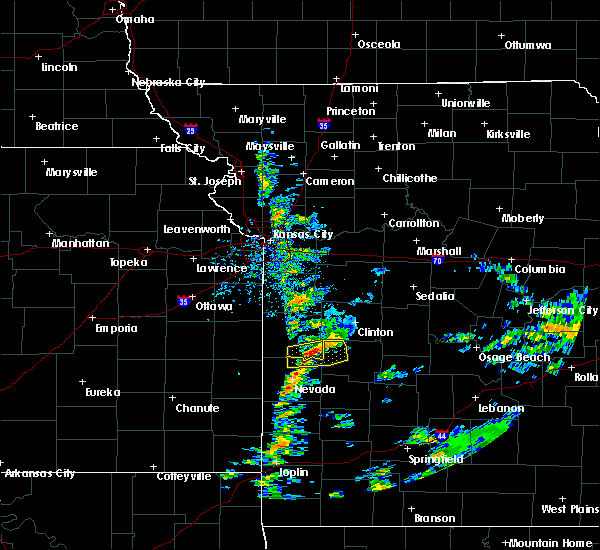 At 517 pm cdt, a severe thunderstorm was located near appleton city, or 15 miles east of rich hill, moving east at 30 mph (radar indicated). Hazards include 60 mph wind gusts and quarter size hail. Hail damage to vehicles is expected. expect wind damage to roofs, siding, and trees. Locations impacted include, appleton city, schell city, taberville, monegaw springs, johnson city,. At 517 pm cdt, a severe thunderstorm was located near appleton city, or 15 miles east of rich hill, moving east at 30 mph (radar indicated). Hazards include 60 mph wind gusts and quarter size hail. Hail damage to vehicles is expected. expect wind damage to roofs, siding, and trees. Locations impacted include, appleton city, schell city, taberville, monegaw springs, johnson city,.
|
| 10/10/2019 4:55 PM CDT |
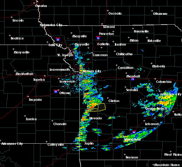 At 454 pm cdt, a severe thunderstorm was located near rich hill, moving east at 30 mph (radar indicated). Hazards include 60 mph wind gusts and quarter size hail. Hail damage to vehicles is expected. Expect wind damage to roofs, siding, and trees. At 454 pm cdt, a severe thunderstorm was located near rich hill, moving east at 30 mph (radar indicated). Hazards include 60 mph wind gusts and quarter size hail. Hail damage to vehicles is expected. Expect wind damage to roofs, siding, and trees.
|
| 8/26/2019 12:55 PM CDT |
 At 1255 pm cdt, severe thunderstorms were located along a line extending from near montrose to near schell city to nevada, moving southeast at 25 mph (radar indicated). Hazards include 60 mph wind gusts. expect damage to roofs, siding, and trees At 1255 pm cdt, severe thunderstorms were located along a line extending from near montrose to near schell city to nevada, moving southeast at 25 mph (radar indicated). Hazards include 60 mph wind gusts. expect damage to roofs, siding, and trees
|
| 8/26/2019 12:19 PM CDT |
 At 1218 pm cdt, severe thunderstorms were located along a line extending from 8 miles east of adrian to near butler to near prescott, moving southeast at 25 mph (radar indicated). Hazards include 60 mph wind gusts. expect damage to roofs, siding, and trees At 1218 pm cdt, severe thunderstorms were located along a line extending from 8 miles east of adrian to near butler to near prescott, moving southeast at 25 mph (radar indicated). Hazards include 60 mph wind gusts. expect damage to roofs, siding, and trees
|
| 8/16/2019 1:51 AM CDT |
 At 151 am cdt, severe thunderstorms were located along a line extending from near nevada to near arcadia to near hepler, moving east at 45 mph (radar indicated). Hazards include 70 mph wind gusts and half dollar size hail. Hail damage to vehicles is expected. expect considerable tree damage. Wind damage is also likely to mobile homes, roofs, and outbuildings. At 151 am cdt, severe thunderstorms were located along a line extending from near nevada to near arcadia to near hepler, moving east at 45 mph (radar indicated). Hazards include 70 mph wind gusts and half dollar size hail. Hail damage to vehicles is expected. expect considerable tree damage. Wind damage is also likely to mobile homes, roofs, and outbuildings.
|
| 8/16/2019 1:33 AM CDT |
 At 133 am cdt, severe thunderstorms were located along a line extending from 6 miles southeast of appleton city to near el dorado springs to nevada to 8 miles southwest of uniontown, moving southeast at 50 mph. these are very dangerous storms (radar indicated). Hazards include 80 mph wind gusts and half dollar size hail. Flying debris will be dangerous to those caught without shelter. mobile homes will be heavily damaged. expect considerable damage to roofs, windows, and vehicles. extensive tree damage and power outages are likely. Locations impacted include, nevada, fort scott, el dorado springs, appleton city, osceola, marmaton, sheldon, bronson, montevallo, uniontown, walker, schell city, bronaugh, fulton, redfield, moundville, roscoe, richards, milo, mapleton, this includes interstate 49 between mile markers 77 and 107. At 133 am cdt, severe thunderstorms were located along a line extending from 6 miles southeast of appleton city to near el dorado springs to nevada to 8 miles southwest of uniontown, moving southeast at 50 mph. these are very dangerous storms (radar indicated). Hazards include 80 mph wind gusts and half dollar size hail. Flying debris will be dangerous to those caught without shelter. mobile homes will be heavily damaged. expect considerable damage to roofs, windows, and vehicles. extensive tree damage and power outages are likely. Locations impacted include, nevada, fort scott, el dorado springs, appleton city, osceola, marmaton, sheldon, bronson, montevallo, uniontown, walker, schell city, bronaugh, fulton, redfield, moundville, roscoe, richards, milo, mapleton, this includes interstate 49 between mile markers 77 and 107.
|
| 8/16/2019 1:07 AM CDT |
 At 106 am cdt, severe thunderstorms were located along a line extending from near butler to near rich hill to near fulton to near redfield, moving southeast at 45 mph. these are very dangerous storms (radar indicated). Hazards include 80 mph wind gusts and half dollar size hail. Flying debris will be dangerous to those caught without shelter. mobile homes will be heavily damaged. expect considerable damage to roofs, windows, and vehicles. Extensive tree damage and power outages are likely. At 106 am cdt, severe thunderstorms were located along a line extending from near butler to near rich hill to near fulton to near redfield, moving southeast at 45 mph. these are very dangerous storms (radar indicated). Hazards include 80 mph wind gusts and half dollar size hail. Flying debris will be dangerous to those caught without shelter. mobile homes will be heavily damaged. expect considerable damage to roofs, windows, and vehicles. Extensive tree damage and power outages are likely.
|
| 6/22/2019 11:31 PM CDT |
 At 1131 pm cdt, severe thunderstorms were located along a line extending from near sedalia to 7 miles east of green ridge to near warsaw to near lowry city, moving east at 55 mph (radar indicated). Hazards include 70 mph wind gusts and penny size hail. Expect considerable tree damage. damage is likely to mobile homes, roofs, and outbuildings. Locations impacted include, truman lake, lake of the ozarks, truman state park, versailles, warsaw, lincoln, appleton city, cole camp, stover, lowry city, syracuse, climax springs, ionia, palo pinto, lakeview heights, florence, crockerville, fristoe, knobby, racket,. At 1131 pm cdt, severe thunderstorms were located along a line extending from near sedalia to 7 miles east of green ridge to near warsaw to near lowry city, moving east at 55 mph (radar indicated). Hazards include 70 mph wind gusts and penny size hail. Expect considerable tree damage. damage is likely to mobile homes, roofs, and outbuildings. Locations impacted include, truman lake, lake of the ozarks, truman state park, versailles, warsaw, lincoln, appleton city, cole camp, stover, lowry city, syracuse, climax springs, ionia, palo pinto, lakeview heights, florence, crockerville, fristoe, knobby, racket,.
|
| 6/22/2019 11:07 PM CDT |
 At 1106 pm cdt, severe thunderstorms were located along a line extending from near warrensburg to leeton to near clinton to appleton city, moving east at 45 mph (radar indicated). Hazards include 70 mph wind gusts and penny size hail. Expect considerable tree damage. Damage is likely to mobile homes, roofs, and outbuildings. At 1106 pm cdt, severe thunderstorms were located along a line extending from near warrensburg to leeton to near clinton to appleton city, moving east at 45 mph (radar indicated). Hazards include 70 mph wind gusts and penny size hail. Expect considerable tree damage. Damage is likely to mobile homes, roofs, and outbuildings.
|
| 6/21/2019 12:33 PM CDT |
 At 1219 pm cdt, severe thunderstorms were located along a line extending from near warsaw to 9 miles southwest of osceola to near arcadia, moving east at 35 mph (radar indicated). Hazards include 60 mph wind gusts and penny size hail. Expect damage to roofs, siding, and trees. Locations impacted include, pomme de terre lake, truman lake, stockton lake, prairie state park, pomme de terre state park, stockton state park, nevada, fort scott, lamar, el dorado springs, frontenac, girard, stockton, arma, pittsburg, appleton city, humansville, osceola, marmaton, liberal, this includes interstate 49 between mile markers 67 and 107. At 1219 pm cdt, severe thunderstorms were located along a line extending from near warsaw to 9 miles southwest of osceola to near arcadia, moving east at 35 mph (radar indicated). Hazards include 60 mph wind gusts and penny size hail. Expect damage to roofs, siding, and trees. Locations impacted include, pomme de terre lake, truman lake, stockton lake, prairie state park, pomme de terre state park, stockton state park, nevada, fort scott, lamar, el dorado springs, frontenac, girard, stockton, arma, pittsburg, appleton city, humansville, osceola, marmaton, liberal, this includes interstate 49 between mile markers 67 and 107.
|
| 6/21/2019 12:20 PM CDT |
 At 1219 pm cdt, severe thunderstorms were located along a line extending from near warsaw to 9 miles southwest of osceola to near arcadia, moving east at 35 mph (radar indicated). Hazards include 60 mph wind gusts and penny size hail. Expect damage to roofs, siding, and trees. Locations impacted include, pomme de terre lake, truman lake, stockton lake, prairie state park, pomme de terre state park, stockton state park, nevada, fort scott, lamar, el dorado springs, frontenac, girard, stockton, arma, pittsburg, appleton city, humansville, osceola, marmaton, liberal, this includes interstate 49 between mile markers 67 and 107. At 1219 pm cdt, severe thunderstorms were located along a line extending from near warsaw to 9 miles southwest of osceola to near arcadia, moving east at 35 mph (radar indicated). Hazards include 60 mph wind gusts and penny size hail. Expect damage to roofs, siding, and trees. Locations impacted include, pomme de terre lake, truman lake, stockton lake, prairie state park, pomme de terre state park, stockton state park, nevada, fort scott, lamar, el dorado springs, frontenac, girard, stockton, arma, pittsburg, appleton city, humansville, osceola, marmaton, liberal, this includes interstate 49 between mile markers 67 and 107.
|
| 6/21/2019 11:56 AM CDT |
 At 1154 am cdt, severe thunderstorms were located along a line extending from near deepwater to near schell city to near redfield, moving east at 35 mph (radar indicated). Hazards include 60 mph wind gusts and penny size hail. expect damage to roofs, siding, and trees At 1154 am cdt, severe thunderstorms were located along a line extending from near deepwater to near schell city to near redfield, moving east at 35 mph (radar indicated). Hazards include 60 mph wind gusts and penny size hail. expect damage to roofs, siding, and trees
|
| 6/21/2019 11:38 AM CDT |
 At 1138 am cdt, severe thunderstorms were located along a line extending from near clinton to 7 miles east of rich hill to near bronson, moving east at 35 mph (radar indicated). Hazards include 60 mph wind gusts and penny size hail. Expect damage to roofs, siding, and trees. Locations impacted include, truman lake, nevada, fort scott, el dorado springs, appleton city, marmaton, lowry city, bronson, uniontown, walker, schell city, fulton, redfield, moundville, roscoe, richards, mapleton, deerfield, metz, harwood, this includes interstate 49 between mile markers 87 and 107. At 1138 am cdt, severe thunderstorms were located along a line extending from near clinton to 7 miles east of rich hill to near bronson, moving east at 35 mph (radar indicated). Hazards include 60 mph wind gusts and penny size hail. Expect damage to roofs, siding, and trees. Locations impacted include, truman lake, nevada, fort scott, el dorado springs, appleton city, marmaton, lowry city, bronson, uniontown, walker, schell city, fulton, redfield, moundville, roscoe, richards, mapleton, deerfield, metz, harwood, this includes interstate 49 between mile markers 87 and 107.
|
| 6/21/2019 11:05 AM CDT |
 At 1104 am cdt, severe thunderstorms were located along a line extending from near archie to near hume to 6 miles southeast of kincaid, moving east at 35 mph (radar indicated). Hazards include 60 mph wind gusts. expect damage to roofs, siding, and trees At 1104 am cdt, severe thunderstorms were located along a line extending from near archie to near hume to 6 miles southeast of kincaid, moving east at 35 mph (radar indicated). Hazards include 60 mph wind gusts. expect damage to roofs, siding, and trees
|
| 5/22/2019 7:26 PM CDT |
 At 726 pm cdt, a severe thunderstorm was located over el dorado springs, moving northeast at 40 mph. additional severe thunderstorms are located over northern st. clair county (radar indicated). Hazards include ping pong ball size hail and 60 mph wind gusts. People and animals outdoors will be injured. expect hail damage to roofs, siding, windows, and vehicles. Expect wind damage to roofs, siding, and trees. At 726 pm cdt, a severe thunderstorm was located over el dorado springs, moving northeast at 40 mph. additional severe thunderstorms are located over northern st. clair county (radar indicated). Hazards include ping pong ball size hail and 60 mph wind gusts. People and animals outdoors will be injured. expect hail damage to roofs, siding, windows, and vehicles. Expect wind damage to roofs, siding, and trees.
|
| 5/20/2019 9:23 PM CDT |
 At 922 pm cdt, severe thunderstorms were located along a line extending from 6 miles southeast of montrose to 8 miles southwest of osceola to near stockton to 10 miles north of greenfield to lockwood, moving northeast at 50 mph (radar indicated). Hazards include 70 mph wind gusts and quarter size hail. Hail damage to vehicles is expected. expect considerable tree damage. wind damage is also likely to mobile homes, roofs, and outbuildings. Locations impacted include, stockton lake, truman lake, stockton state park, el dorado springs, stockton, greenfield, appleton city, osceola, lockwood, lowry city, everton, dadeville, collins, roscoe, south greenfield, arcola, vista, umber view heights, gerster, bearcreek,. At 922 pm cdt, severe thunderstorms were located along a line extending from 6 miles southeast of montrose to 8 miles southwest of osceola to near stockton to 10 miles north of greenfield to lockwood, moving northeast at 50 mph (radar indicated). Hazards include 70 mph wind gusts and quarter size hail. Hail damage to vehicles is expected. expect considerable tree damage. wind damage is also likely to mobile homes, roofs, and outbuildings. Locations impacted include, stockton lake, truman lake, stockton state park, el dorado springs, stockton, greenfield, appleton city, osceola, lockwood, lowry city, everton, dadeville, collins, roscoe, south greenfield, arcola, vista, umber view heights, gerster, bearcreek,.
|
| 5/20/2019 8:57 PM CDT |
 At 856 pm cdt, severe thunderstorms were located along a line extending from 7 miles southeast of rich hill to 8 miles south of el dorado springs to 13 miles east of lamar to near golden city, moving northeast at 60 mph (radar indicated). Hazards include 70 mph wind gusts and quarter size hail. Hail damage to vehicles is expected. expect considerable tree damage. Wind damage is also likely to mobile homes, roofs, and outbuildings. At 856 pm cdt, severe thunderstorms were located along a line extending from 7 miles southeast of rich hill to 8 miles south of el dorado springs to 13 miles east of lamar to near golden city, moving northeast at 60 mph (radar indicated). Hazards include 70 mph wind gusts and quarter size hail. Hail damage to vehicles is expected. expect considerable tree damage. Wind damage is also likely to mobile homes, roofs, and outbuildings.
|
| 5/20/2019 8:50 PM CDT |
 At 849 pm cdt, a severe thunderstorm was located 8 miles northwest of nevada, moving northeast at 60 mph (radar indicated). Hazards include 60 mph wind gusts. expect damage to roofs, siding, and trees At 849 pm cdt, a severe thunderstorm was located 8 miles northwest of nevada, moving northeast at 60 mph (radar indicated). Hazards include 60 mph wind gusts. expect damage to roofs, siding, and trees
|
| 5/18/2019 3:09 PM CDT |
 At 308 pm cdt, severe thunderstorms were located along a line extending from near appleton city to 11 miles north of stockton, moving northeast at 45 mph (radar indicated). Hazards include 60 mph wind gusts. Expect damage to roofs, siding, and trees. Locations impacted include, truman lake, pomme de terre lake, el dorado springs, appleton city, osceola, lowry city, hermitage, weaubleau, wheatland, collins, roscoe, vista, gerster, olympia, quincy, caplinger mills, harper, iconium, tiffin, johnson city,. At 308 pm cdt, severe thunderstorms were located along a line extending from near appleton city to 11 miles north of stockton, moving northeast at 45 mph (radar indicated). Hazards include 60 mph wind gusts. Expect damage to roofs, siding, and trees. Locations impacted include, truman lake, pomme de terre lake, el dorado springs, appleton city, osceola, lowry city, hermitage, weaubleau, wheatland, collins, roscoe, vista, gerster, olympia, quincy, caplinger mills, harper, iconium, tiffin, johnson city,.
|
| 5/18/2019 2:46 PM CDT |
 At 246 pm cdt, severe thunderstorms were located along a line extending from 6 miles west of schell city to 7 miles south of el dorado springs, moving northeast at 40 mph (radar indicated). Hazards include 60 mph wind gusts and quarter size hail. Hail damage to vehicles is expected. Expect wind damage to roofs, siding, and trees. At 246 pm cdt, severe thunderstorms were located along a line extending from 6 miles west of schell city to 7 miles south of el dorado springs, moving northeast at 40 mph (radar indicated). Hazards include 60 mph wind gusts and quarter size hail. Hail damage to vehicles is expected. Expect wind damage to roofs, siding, and trees.
|
| 5/6/2019 10:19 PM CDT |
 At 1019 pm cdt, severe thunderstorms were located along a line extending from near appleton city to 7 miles east of schell city to 7 miles southeast of rich hill to near nevada, moving southeast at 25 mph (law enforcement). Hazards include 70 mph wind gusts and quarter size hail. Hail damage to vehicles is expected. expect considerable tree damage. wind damage is also likely to mobile homes, roofs, and outbuildings. Locations impacted include, nevada, appleton city, schell city, harwood, horton, johnson city, this includes interstate 49 between mile markers 92 and 106. At 1019 pm cdt, severe thunderstorms were located along a line extending from near appleton city to 7 miles east of schell city to 7 miles southeast of rich hill to near nevada, moving southeast at 25 mph (law enforcement). Hazards include 70 mph wind gusts and quarter size hail. Hail damage to vehicles is expected. expect considerable tree damage. wind damage is also likely to mobile homes, roofs, and outbuildings. Locations impacted include, nevada, appleton city, schell city, harwood, horton, johnson city, this includes interstate 49 between mile markers 92 and 106.
|
| 5/6/2019 10:12 PM CDT |
 At 1011 pm cdt, severe thunderstorms were located along a line extending from appleton city to near nevada, moving southeast at 30 mph (law enforcement). Hazards include 70 mph wind gusts and quarter size hail. Hail damage to vehicles is expected. expect considerable tree damage. wind damage is also likely to mobile homes, roofs, and outbuildings. Locations impacted include, nevada, appleton city, schell city, metz, harwood, stotesbury, horton, johnson city, this includes interstate 49 between mile markers 92 and 107. At 1011 pm cdt, severe thunderstorms were located along a line extending from appleton city to near nevada, moving southeast at 30 mph (law enforcement). Hazards include 70 mph wind gusts and quarter size hail. Hail damage to vehicles is expected. expect considerable tree damage. wind damage is also likely to mobile homes, roofs, and outbuildings. Locations impacted include, nevada, appleton city, schell city, metz, harwood, stotesbury, horton, johnson city, this includes interstate 49 between mile markers 92 and 107.
|
| 5/6/2019 9:48 PM CDT |
 At 948 pm cdt, severe thunderstorms were located along a line extending from 7 miles southeast of butler to near hume, moving east at 25 mph (radar indicated). Hazards include 60 mph wind gusts and quarter size hail. Hail damage to vehicles is expected. Expect wind damage to roofs, siding, and trees. At 948 pm cdt, severe thunderstorms were located along a line extending from 7 miles southeast of butler to near hume, moving east at 25 mph (radar indicated). Hazards include 60 mph wind gusts and quarter size hail. Hail damage to vehicles is expected. Expect wind damage to roofs, siding, and trees.
|
| 2/6/2019 8:48 PM CST |
 At 847 pm cst, a severe thunderstorm was located 7 miles southeast of appleton city, or 17 miles north of el dorado springs, moving northeast at 55 mph. nickel size hail has been reported with this storm from nevada to schell city (radar indicated). Hazards include quarter size hail. Damage to vehicles is expected. Locations impacted include, appleton city, lowry city, roscoe, taberville, monegaw springs, johnson city,. At 847 pm cst, a severe thunderstorm was located 7 miles southeast of appleton city, or 17 miles north of el dorado springs, moving northeast at 55 mph. nickel size hail has been reported with this storm from nevada to schell city (radar indicated). Hazards include quarter size hail. Damage to vehicles is expected. Locations impacted include, appleton city, lowry city, roscoe, taberville, monegaw springs, johnson city,.
|
| 2/6/2019 8:31 PM CST |
 At 831 pm cst, a severe thunderstorm was located near schell city, or 8 miles northwest of el dorado springs, moving northeast at 55 mph (radar indicated). Hazards include quarter size hail. damage to vehicles is expected At 831 pm cst, a severe thunderstorm was located near schell city, or 8 miles northwest of el dorado springs, moving northeast at 55 mph (radar indicated). Hazards include quarter size hail. damage to vehicles is expected
|
| 12/1/2018 12:43 AM CST |
 At 1243 am cst, severe thunderstorms were located along a line extending from near schell city to 9 miles west of stockton to near miller, moving east at 40 mph (radar indicated). Hazards include 60 mph wind gusts. Expect damage to roofs, siding, and trees. Locations impacted include, stockton lake, truman lake, stockton state park, el dorado springs, stockton, greenfield, appleton city, osceola, lockwood, lowry city, everton, dadeville, jerico springs, collins, roscoe, south greenfield, arcola, vista, umber view heights, gerster, a tornado watch remains in effect until 500 am cst for southwestern and west central missouri. At 1243 am cst, severe thunderstorms were located along a line extending from near schell city to 9 miles west of stockton to near miller, moving east at 40 mph (radar indicated). Hazards include 60 mph wind gusts. Expect damage to roofs, siding, and trees. Locations impacted include, stockton lake, truman lake, stockton state park, el dorado springs, stockton, greenfield, appleton city, osceola, lockwood, lowry city, everton, dadeville, jerico springs, collins, roscoe, south greenfield, arcola, vista, umber view heights, gerster, a tornado watch remains in effect until 500 am cst for southwestern and west central missouri.
|
| 12/1/2018 12:25 AM CST |
 At 1225 am cst, severe thunderstorms were located along a line extending from 6 miles west of schell city to 8 miles east of sheldon to 9 miles northeast of carthage, moving east at 40 mph (radar indicated). Hazards include 60 mph wind gusts. expect damage to roofs, siding, and trees At 1225 am cst, severe thunderstorms were located along a line extending from 6 miles west of schell city to 8 miles east of sheldon to 9 miles northeast of carthage, moving east at 40 mph (radar indicated). Hazards include 60 mph wind gusts. expect damage to roofs, siding, and trees
|
| 8/30/2018 9:26 AM CDT |
 The severe thunderstorm warning for st. clair county will expire at 930 am cdt, the storm which prompted the warning has weakened below severe limits, however additional strong storms had developed to the northeast of caplinger mills and will produce up to nickel size hail as they track eastward over southeast st clair county into the collins area. The severe thunderstorm warning for st. clair county will expire at 930 am cdt, the storm which prompted the warning has weakened below severe limits, however additional strong storms had developed to the northeast of caplinger mills and will produce up to nickel size hail as they track eastward over southeast st clair county into the collins area.
|
| 8/30/2018 8:54 AM CDT |
 At 851 am cdt, a severe thunderstorm was located 7 miles northeast of el dorado springs, moving east at 25 mph. additional strong storms extended northward into the appleton city area (radar indicated). Hazards include 60 mph wind gusts and quarter size hail. Hail damage to vehicles is expected. Expect wind damage to roofs, siding, and trees. At 851 am cdt, a severe thunderstorm was located 7 miles northeast of el dorado springs, moving east at 25 mph. additional strong storms extended northward into the appleton city area (radar indicated). Hazards include 60 mph wind gusts and quarter size hail. Hail damage to vehicles is expected. Expect wind damage to roofs, siding, and trees.
|
| 8/10/2018 4:11 PM CDT | Multiple trees down in town. time estimated by rada in st. clair county MO, 0.2 miles ENE of Appleton City, MO |
| 7/20/2018 3:37 AM CDT |
 The severe thunderstorm warning for st. clair county will expire at 345 am cdt, the storm which prompted the warning has weakened below severe limits, and no longer poses an immediate threat to life or property. therefore, the warning will be allowed to expire. however heavy rain is still possible with this thunderstorm. to report severe weather, contact your nearest law enforcement agency. they will relay your report to the national weather service springfield. The severe thunderstorm warning for st. clair county will expire at 345 am cdt, the storm which prompted the warning has weakened below severe limits, and no longer poses an immediate threat to life or property. therefore, the warning will be allowed to expire. however heavy rain is still possible with this thunderstorm. to report severe weather, contact your nearest law enforcement agency. they will relay your report to the national weather service springfield.
|
| 7/20/2018 3:25 AM CDT |
 At 324 am cdt, a severe thunderstorm was located near osceola, or 16 miles northeast of el dorado springs, moving east at 45 mph (radar indicated). Hazards include quarter size hail. Damage to vehicles is expected. Locations impacted include, truman lake, appleton city, osceola, lowry city, collins, roscoe, vista, gerster, harper, iconium, tiffin, johnson city, taberville, monegaw springs,. At 324 am cdt, a severe thunderstorm was located near osceola, or 16 miles northeast of el dorado springs, moving east at 45 mph (radar indicated). Hazards include quarter size hail. Damage to vehicles is expected. Locations impacted include, truman lake, appleton city, osceola, lowry city, collins, roscoe, vista, gerster, harper, iconium, tiffin, johnson city, taberville, monegaw springs,.
|
| 7/20/2018 3:10 AM CDT |
 At 309 am cdt, a severe thunderstorm was located near schell city, or 13 miles north of el dorado springs, moving east at 35 mph. a second strong to severe storm was located 5 miles south of osceola and also moving east around 35 mph (radar indicated). Hazards include half dollar size hail. Damage to vehicles is expected. Locations impacted include, truman lake, appleton city, osceola, lowry city, schell city, collins, roscoe, vista, gerster, harper, iconium, tiffin, johnson city, taberville, monegaw springs,. At 309 am cdt, a severe thunderstorm was located near schell city, or 13 miles north of el dorado springs, moving east at 35 mph. a second strong to severe storm was located 5 miles south of osceola and also moving east around 35 mph (radar indicated). Hazards include half dollar size hail. Damage to vehicles is expected. Locations impacted include, truman lake, appleton city, osceola, lowry city, schell city, collins, roscoe, vista, gerster, harper, iconium, tiffin, johnson city, taberville, monegaw springs,.
|
| 7/20/2018 2:55 AM CDT |
 At 254 am cdt, a severe thunderstorm was located near schell city, or 14 miles east of rich hill, moving east at 45 mph (radar indicated). Hazards include half dollar size hail. damage to vehicles is expected At 254 am cdt, a severe thunderstorm was located near schell city, or 14 miles east of rich hill, moving east at 45 mph (radar indicated). Hazards include half dollar size hail. damage to vehicles is expected
|
| 7/19/2018 5:39 PM CDT |
 The severe thunderstorm warning for western st. clair county will expire at 545 pm cdt, the storm which prompted the warning has weakened below severe limits, and no longer poses an immediate threat to life or property. therefore, the warning will be allowed to expire. however heavy rain is still possible with this thunderstorm. a severe thunderstorm watch remains in effect until 900 pm cdt for southwestern and west central missouri. The severe thunderstorm warning for western st. clair county will expire at 545 pm cdt, the storm which prompted the warning has weakened below severe limits, and no longer poses an immediate threat to life or property. therefore, the warning will be allowed to expire. however heavy rain is still possible with this thunderstorm. a severe thunderstorm watch remains in effect until 900 pm cdt for southwestern and west central missouri.
|
| 7/19/2018 4:45 PM CDT | Quarter sized hail reported 0.2 miles ENE of Appleton City, MO, pea to nickle to a few quarter size hail. |
| 7/19/2018 4:43 PM CDT |
 At 441 pm cdt, a severe thunderstorm was located near montrose, or 13 miles east of butler, moving south at 30 mph (radar indicated). Hazards include 60 mph wind gusts and quarter size hail. Hail damage to vehicles is expected. Expect wind damage to roofs, siding, and trees. At 441 pm cdt, a severe thunderstorm was located near montrose, or 13 miles east of butler, moving south at 30 mph (radar indicated). Hazards include 60 mph wind gusts and quarter size hail. Hail damage to vehicles is expected. Expect wind damage to roofs, siding, and trees.
|
| 7/19/2018 3:53 PM CDT | Quarter sized hail reported 0.2 miles ENE of Appleton City, MO, quarter size hail. |
| 7/19/2018 3:37 PM CDT |
 At 337 pm cdt, a severe thunderstorm was located over montrose, or 16 miles east of butler, moving south at 35 mph (radar indicated). Hazards include ping pong ball size hail and 60 mph wind gusts. People and animals outdoors will be injured. expect hail damage to roofs, siding, windows, and vehicles. Expect wind damage to roofs, siding, and trees. At 337 pm cdt, a severe thunderstorm was located over montrose, or 16 miles east of butler, moving south at 35 mph (radar indicated). Hazards include ping pong ball size hail and 60 mph wind gusts. People and animals outdoors will be injured. expect hail damage to roofs, siding, windows, and vehicles. Expect wind damage to roofs, siding, and trees.
|
| 5/19/2018 5:21 PM CDT |
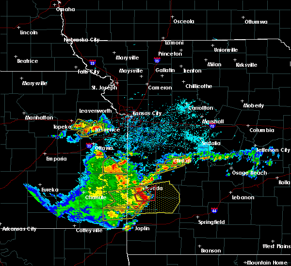 The severe thunderstorm warning for northern st. clair county will expire at 530 pm cdt, the storm which prompted the warning has weakened below severe limits, and has exited the warned area. therefore, the warning will be allowed to expire. a severe thunderstorm watch remains in effect until 1000 pm cdt for west central missouri. The severe thunderstorm warning for northern st. clair county will expire at 530 pm cdt, the storm which prompted the warning has weakened below severe limits, and has exited the warned area. therefore, the warning will be allowed to expire. a severe thunderstorm watch remains in effect until 1000 pm cdt for west central missouri.
|
| 5/19/2018 4:46 PM CDT |
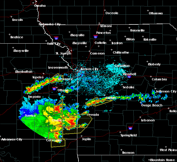 At 446 pm cdt, a severe thunderstorm was located near schell city, or 13 miles east of rich hill, moving northeast at 30 mph (radar indicated). Hazards include 60 mph wind gusts and quarter size hail. Hail damage to vehicles is expected. Expect wind damage to roofs, siding, and trees. At 446 pm cdt, a severe thunderstorm was located near schell city, or 13 miles east of rich hill, moving northeast at 30 mph (radar indicated). Hazards include 60 mph wind gusts and quarter size hail. Hail damage to vehicles is expected. Expect wind damage to roofs, siding, and trees.
|
| 5/19/2018 7:50 AM CDT | Quarter sized hail reported 0.4 miles W of Appleton City, MO |
| 5/19/2018 7:50 AM CDT | Tree limbs down throughout town up to five inches in diamete in st. clair county MO, 0.2 miles ENE of Appleton City, MO |
| 5/19/2018 7:48 AM CDT |
 At 748 am cdt, a severe thunderstorm was located near appleton city, or 15 miles southeast of butler, moving northeast at 20 mph (radar indicated). Hazards include 60 mph wind gusts and quarter size hail. Hail damage to vehicles is expected. Expect wind damage to roofs, siding, and trees. At 748 am cdt, a severe thunderstorm was located near appleton city, or 15 miles southeast of butler, moving northeast at 20 mph (radar indicated). Hazards include 60 mph wind gusts and quarter size hail. Hail damage to vehicles is expected. Expect wind damage to roofs, siding, and trees.
|
| 5/2/2018 10:19 PM CDT |
 At 1018 pm cdt, severe thunderstorms were located along a line extending from near montrose to 6 miles southwest of appleton city to near walker, moving east at 35 mph (radar indicated). Hazards include 60 mph wind gusts and quarter size hail. Hail damage to vehicles is expected. expect wind damage to roofs, siding, and trees. Locations impacted include, truman lake, appleton city, osceola, lowry city, schell city, roscoe, vista, gerster, harper, iconium, johnson city, taberville, monegaw springs,. At 1018 pm cdt, severe thunderstorms were located along a line extending from near montrose to 6 miles southwest of appleton city to near walker, moving east at 35 mph (radar indicated). Hazards include 60 mph wind gusts and quarter size hail. Hail damage to vehicles is expected. expect wind damage to roofs, siding, and trees. Locations impacted include, truman lake, appleton city, osceola, lowry city, schell city, roscoe, vista, gerster, harper, iconium, johnson city, taberville, monegaw springs,.
|
| 5/2/2018 10:08 PM CDT |
 At 1007 pm cdt, severe thunderstorms were located along a line extending from 10 miles northwest of montrose to 7 miles east of rich hill to 9 miles north of nevada, moving east at 35 mph (radar indicated). Hazards include 60 mph wind gusts and quarter size hail. Hail damage to vehicles is expected. Expect wind damage to roofs, siding, and trees. At 1007 pm cdt, severe thunderstorms were located along a line extending from 10 miles northwest of montrose to 7 miles east of rich hill to 9 miles north of nevada, moving east at 35 mph (radar indicated). Hazards include 60 mph wind gusts and quarter size hail. Hail damage to vehicles is expected. Expect wind damage to roofs, siding, and trees.
|
| 12/4/2017 4:06 PM CST |
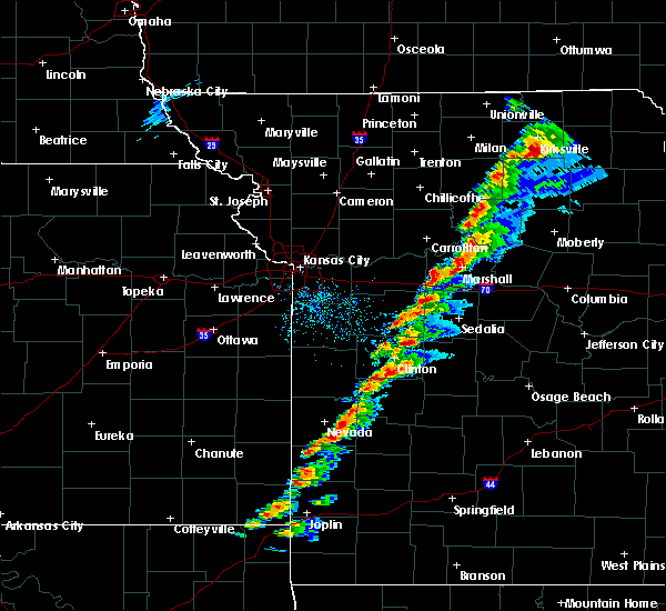 The severe thunderstorm warning for northwestern st. clair county will expire at 415 pm cst, the storm which prompted the warning has weakened below severe limits, and no longer poses an immediate threat to life or property. therefore the warning will be allowed to expire. however small hail and gusty winds are still possible with this thunderstorm. a severe thunderstorm watch remains in effect until 900 pm cst for west central missouri. to report severe weather, contact your nearest law enforcement agency. they will relay your report to the national weather service springfield. The severe thunderstorm warning for northwestern st. clair county will expire at 415 pm cst, the storm which prompted the warning has weakened below severe limits, and no longer poses an immediate threat to life or property. therefore the warning will be allowed to expire. however small hail and gusty winds are still possible with this thunderstorm. a severe thunderstorm watch remains in effect until 900 pm cst for west central missouri. to report severe weather, contact your nearest law enforcement agency. they will relay your report to the national weather service springfield.
|
| 12/4/2017 3:52 PM CST |
 At 352 pm cst, a severe thunderstorm was located over appleton city, or 17 miles southeast of butler, moving east at 30 mph (radar indicated). Hazards include 60 mph wind gusts and nickel size hail. Expect damage to roofs, siding, and trees. Locations impacted include, appleton city,. At 352 pm cst, a severe thunderstorm was located over appleton city, or 17 miles southeast of butler, moving east at 30 mph (radar indicated). Hazards include 60 mph wind gusts and nickel size hail. Expect damage to roofs, siding, and trees. Locations impacted include, appleton city,.
|
| 12/4/2017 3:32 PM CST |
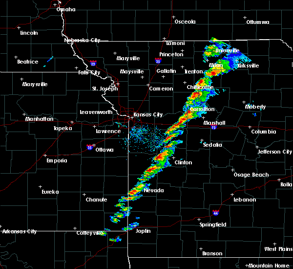 At 332 pm cst, a severe thunderstorm was located 7 miles east of rich hill, moving east at 40 mph (radar indicated). Hazards include 60 mph wind gusts and quarter size hail. Hail damage to vehicles is expected. Expect wind damage to roofs, siding, and trees. At 332 pm cst, a severe thunderstorm was located 7 miles east of rich hill, moving east at 40 mph (radar indicated). Hazards include 60 mph wind gusts and quarter size hail. Hail damage to vehicles is expected. Expect wind damage to roofs, siding, and trees.
|
| 10/21/2017 11:14 PM CDT |
 At 1113 pm cdt, severe thunderstorms were located along a line extending from near deepwater to 8 miles east of el dorado springs, moving east at 45 mph (radar indicated). Hazards include 60 mph wind gusts. Expect damage to roofs, siding, and trees. Locations impacted include, truman lake, el dorado springs, appleton city, humansville, osceola, lowry city, weaubleau, collins, roscoe, vista, gerster, caplinger mills, harper, iconium, tiffin, johnson city, taberville, cedar springs, monegaw springs,. At 1113 pm cdt, severe thunderstorms were located along a line extending from near deepwater to 8 miles east of el dorado springs, moving east at 45 mph (radar indicated). Hazards include 60 mph wind gusts. Expect damage to roofs, siding, and trees. Locations impacted include, truman lake, el dorado springs, appleton city, humansville, osceola, lowry city, weaubleau, collins, roscoe, vista, gerster, caplinger mills, harper, iconium, tiffin, johnson city, taberville, cedar springs, monegaw springs,.
|
| 10/21/2017 10:59 PM CDT |
 At 1058 pm cdt, severe thunderstorms were located along a line extending from appleton city to near el dorado springs, moving east at 45 mph (radar indicated). Hazards include 60 mph wind gusts. Expect damage to roofs, siding, and trees. Locations impacted include, truman lake, el dorado springs, appleton city, humansville, osceola, lowry city, weaubleau, collins, roscoe, vista, gerster, caplinger mills, harper, iconium, tiffin, johnson city, taberville, cedar springs, monegaw springs,. At 1058 pm cdt, severe thunderstorms were located along a line extending from appleton city to near el dorado springs, moving east at 45 mph (radar indicated). Hazards include 60 mph wind gusts. Expect damage to roofs, siding, and trees. Locations impacted include, truman lake, el dorado springs, appleton city, humansville, osceola, lowry city, weaubleau, collins, roscoe, vista, gerster, caplinger mills, harper, iconium, tiffin, johnson city, taberville, cedar springs, monegaw springs,.
|
| 10/21/2017 10:44 PM CDT |
 At 1043 pm cdt, severe thunderstorms were located along a line extending from 8 miles west of appleton city to near walker, moving east at 50 mph (public. near metz on interstate 49...60 to 70 mph wind gusts were reported). Hazards include 70 mph wind gusts and penny size hail. Expect considerable tree damage. damage is likely to mobile homes, roofs, and outbuildings. Locations impacted include, truman lake, nevada, el dorado springs, appleton city, humansville, osceola, lowry city, weaubleau, walker, schell city, collins, roscoe, vista, harwood, gerster, caplinger mills, harper, iconium, tiffin, johnson city, this includes interstate 49 between mile markers 86 and 97. At 1043 pm cdt, severe thunderstorms were located along a line extending from 8 miles west of appleton city to near walker, moving east at 50 mph (public. near metz on interstate 49...60 to 70 mph wind gusts were reported). Hazards include 70 mph wind gusts and penny size hail. Expect considerable tree damage. damage is likely to mobile homes, roofs, and outbuildings. Locations impacted include, truman lake, nevada, el dorado springs, appleton city, humansville, osceola, lowry city, weaubleau, walker, schell city, collins, roscoe, vista, harwood, gerster, caplinger mills, harper, iconium, tiffin, johnson city, this includes interstate 49 between mile markers 86 and 97.
|
| 10/21/2017 10:34 PM CDT |
 At 1033 pm cdt, severe thunderstorms were located along a line extending from near rich hill to near nevada, moving east at 45 mph (law enforcement. recently...60 to 70 mph winds were reported in northern vernon county). Hazards include 60 mph wind gusts and penny size hail. expect damage to roofs, siding, and trees At 1033 pm cdt, severe thunderstorms were located along a line extending from near rich hill to near nevada, moving east at 45 mph (law enforcement. recently...60 to 70 mph winds were reported in northern vernon county). Hazards include 60 mph wind gusts and penny size hail. expect damage to roofs, siding, and trees
|
| 6/17/2017 3:18 AM CDT |
 At 318 am cdt, severe thunderstorms were located along a line extending from near schell city to 6 miles northwest of nevada to 6 miles east of fort scott to near redfield, moving southeast at 70 mph (radar indicated). Hazards include 60 mph wind gusts. Expect damage to roofs, siding, and trees. Locations impacted include, nevada, fort scott, appleton city, marmaton, walker, schell city, fulton, redfield, moundville, richards, milo, mapleton, deerfield, metz, harwood, stotesbury, horton, harding, hammond, johnson city,. At 318 am cdt, severe thunderstorms were located along a line extending from near schell city to 6 miles northwest of nevada to 6 miles east of fort scott to near redfield, moving southeast at 70 mph (radar indicated). Hazards include 60 mph wind gusts. Expect damage to roofs, siding, and trees. Locations impacted include, nevada, fort scott, appleton city, marmaton, walker, schell city, fulton, redfield, moundville, richards, milo, mapleton, deerfield, metz, harwood, stotesbury, horton, harding, hammond, johnson city,.
|
| 6/17/2017 2:55 AM CDT |
 At 255 am cdt, severe thunderstorms were located along a line extending from 8 miles east of linn valley to near pleasanton to 7 miles west of fulton to kincaid, moving southeast at 40 mph (radar indicated). Hazards include 60 mph wind gusts and quarter size hail. Hail damage to vehicles is expected. Expect wind damage to roofs, siding, and trees. At 255 am cdt, severe thunderstorms were located along a line extending from 8 miles east of linn valley to near pleasanton to 7 miles west of fulton to kincaid, moving southeast at 40 mph (radar indicated). Hazards include 60 mph wind gusts and quarter size hail. Hail damage to vehicles is expected. Expect wind damage to roofs, siding, and trees.
|
| 6/17/2017 2:27 AM CDT |
 At 226 am cdt, severe thunderstorms were located along a line extending from near la monte to 8 miles south of sedalia to near cole camp to near warsaw to 10 miles east of lowry city to near osceola to near schell city to 8 miles north of walker, moving southeast at 55 mph (radar indicated). Hazards include 60 mph wind gusts. Expect damage to roofs, siding, and trees. Locations impacted include, truman lake, truman state park, warsaw, lincoln, appleton city, cole camp, osceola, lowry city, roscoe, ionia, vista, palo pinto, crockerville, harper, iconium, racket, tiffin, edmonson, mora, johnson city,. At 226 am cdt, severe thunderstorms were located along a line extending from near la monte to 8 miles south of sedalia to near cole camp to near warsaw to 10 miles east of lowry city to near osceola to near schell city to 8 miles north of walker, moving southeast at 55 mph (radar indicated). Hazards include 60 mph wind gusts. Expect damage to roofs, siding, and trees. Locations impacted include, truman lake, truman state park, warsaw, lincoln, appleton city, cole camp, osceola, lowry city, roscoe, ionia, vista, palo pinto, crockerville, harper, iconium, racket, tiffin, edmonson, mora, johnson city,.
|
| 6/17/2017 2:01 AM CDT |
 At 200 am cdt, severe thunderstorms were located along a line extending from near higginsville to near knob noster to whiteman afb to near leeton to near clinton to near montrose to butler to 12 miles southwest of adrian, moving southeast at 45 mph (radar indicated). Hazards include 60 mph wind gusts. expect damage to roofs, siding, and trees At 200 am cdt, severe thunderstorms were located along a line extending from near higginsville to near knob noster to whiteman afb to near leeton to near clinton to near montrose to butler to 12 miles southwest of adrian, moving southeast at 45 mph (radar indicated). Hazards include 60 mph wind gusts. expect damage to roofs, siding, and trees
|
| 5/31/2017 3:30 PM CDT |
 At 329 pm cdt, severe thunderstorms were located along a line extending from near clinton to 9 miles east of schell city to near el dorado springs to 8 miles west of nevada, moving east at 30 mph (radar indicated). Hazards include golf ball size hail and 70 mph wind gusts. People and animals outdoors will be injured. expect hail damage to roofs, siding, windows, and vehicles. expect considerable tree damage. wind damage is also likely to mobile homes, roofs, and outbuildings. Locations impacted include, truman lake, nevada, el dorado springs, appleton city, osceola, lowry city, walker, schell city, collins, roscoe, deerfield, vista, metz, harwood, gerster, horton, caplinger mills, harper, iconium, tiffin,. At 329 pm cdt, severe thunderstorms were located along a line extending from near clinton to 9 miles east of schell city to near el dorado springs to 8 miles west of nevada, moving east at 30 mph (radar indicated). Hazards include golf ball size hail and 70 mph wind gusts. People and animals outdoors will be injured. expect hail damage to roofs, siding, windows, and vehicles. expect considerable tree damage. wind damage is also likely to mobile homes, roofs, and outbuildings. Locations impacted include, truman lake, nevada, el dorado springs, appleton city, osceola, lowry city, walker, schell city, collins, roscoe, deerfield, vista, metz, harwood, gerster, horton, caplinger mills, harper, iconium, tiffin,.
|
| 5/31/2017 3:16 PM CDT |
 At 315 pm cdt, severe thunderstorms were located along a line extending from 6 miles southwest of clinton to near schell city to walker to near fort scott, moving southeast at 35 mph (radar indicated). Hazards include golf ball size hail and 70 mph wind gusts. People and animals outdoors will be injured. expect hail damage to roofs, siding, windows, and vehicles. expect considerable tree damage. wind damage is also likely to mobile homes, roofs, and outbuildings. Locations impacted include, truman lake, nevada, fort scott, el dorado springs, appleton city, osceola, lowry city, walker, schell city, fulton, collins, roscoe, richards, mapleton, deerfield, vista, metz, harwood, gerster, stotesbury,. At 315 pm cdt, severe thunderstorms were located along a line extending from 6 miles southwest of clinton to near schell city to walker to near fort scott, moving southeast at 35 mph (radar indicated). Hazards include golf ball size hail and 70 mph wind gusts. People and animals outdoors will be injured. expect hail damage to roofs, siding, windows, and vehicles. expect considerable tree damage. wind damage is also likely to mobile homes, roofs, and outbuildings. Locations impacted include, truman lake, nevada, fort scott, el dorado springs, appleton city, osceola, lowry city, walker, schell city, fulton, collins, roscoe, richards, mapleton, deerfield, vista, metz, harwood, gerster, stotesbury,.
|
| 5/31/2017 2:59 PM CDT |
 At 258 pm cdt, severe thunderstorms were located along a line extending from 6 miles northwest of montrose to near schell city to near fort scott, moving southeast at 35 mph (public reported 60 mph winds in rich hill). Hazards include golf ball size hail and 70 mph wind gusts. People and animals outdoors will be injured. expect hail damage to roofs, siding, windows, and vehicles. expect wind damage to roofs, siding, and trees. Locations impacted include, truman lake, nevada, fort scott, el dorado springs, appleton city, osceola, lowry city, walker, schell city, fulton, collins, roscoe, richards, mapleton, deerfield, vista, metz, harwood, gerster, stotesbury,. At 258 pm cdt, severe thunderstorms were located along a line extending from 6 miles northwest of montrose to near schell city to near fort scott, moving southeast at 35 mph (public reported 60 mph winds in rich hill). Hazards include golf ball size hail and 70 mph wind gusts. People and animals outdoors will be injured. expect hail damage to roofs, siding, windows, and vehicles. expect wind damage to roofs, siding, and trees. Locations impacted include, truman lake, nevada, fort scott, el dorado springs, appleton city, osceola, lowry city, walker, schell city, fulton, collins, roscoe, richards, mapleton, deerfield, vista, metz, harwood, gerster, stotesbury,.
|
| 5/31/2017 2:44 PM CDT |
 At 243 pm cdt, severe thunderstorms were located along a line extending from 7 miles east of adrian to near butler to 6 miles west of fulton, moving east at 30 mph (radar indicated). Hazards include golf ball size hail and 70 mph wind gusts. People and animals outdoors will be injured. expect hail damage to roofs, siding, windows, and vehicles. expect considerable tree damage. Wind damage is also likely to mobile homes, roofs, and outbuildings. At 243 pm cdt, severe thunderstorms were located along a line extending from 7 miles east of adrian to near butler to 6 miles west of fulton, moving east at 30 mph (radar indicated). Hazards include golf ball size hail and 70 mph wind gusts. People and animals outdoors will be injured. expect hail damage to roofs, siding, windows, and vehicles. expect considerable tree damage. Wind damage is also likely to mobile homes, roofs, and outbuildings.
|
| 3/9/2017 1:17 PM CST |
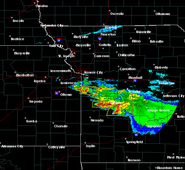 At 116 pm cst, a severe thunderstorm was located over appleton city, or 17 miles east of butler, moving east at 35 mph (radar indicated). Hazards include 60 mph wind gusts and quarter size hail. Hail damage to vehicles is expected. Expect wind damage to roofs, siding, and trees. At 116 pm cst, a severe thunderstorm was located over appleton city, or 17 miles east of butler, moving east at 35 mph (radar indicated). Hazards include 60 mph wind gusts and quarter size hail. Hail damage to vehicles is expected. Expect wind damage to roofs, siding, and trees.
|
| 3/9/2017 1:15 PM CST | Golf Ball sized hail reported 0.7 miles SSE of Appleton City, MO, . |
| 3/6/2017 9:19 PM CST |
 At 919 pm cst, a severe thunderstorm was located near appleton city, or 15 miles southwest of clinton, moving east at 60 mph (radar indicated). Hazards include 70 mph wind gusts and quarter size hail. Hail damage to vehicles is expected. expect considerable tree damage. Wind damage is also likely to mobile homes, roofs, and outbuildings. At 919 pm cst, a severe thunderstorm was located near appleton city, or 15 miles southwest of clinton, moving east at 60 mph (radar indicated). Hazards include 70 mph wind gusts and quarter size hail. Hail damage to vehicles is expected. expect considerable tree damage. Wind damage is also likely to mobile homes, roofs, and outbuildings.
|
| 7/13/2016 12:31 PM CDT |
 At 1231 pm cdt, severe thunderstorms were located along a line extending from near lowry city to near stockton, moving east at 55 mph (radar indicated). Hazards include 60 mph wind gusts and quarter size hail. Hail damage to vehicles is expected. expect wind damage to roofs, siding, and trees. Locations impacted include, stockton lake, truman lake, stockton state park, el dorado springs, stockton, appleton city, humansville, osceola, lowry city, fair play, weaubleau, jerico springs, collins, flemington, roscoe, aldrich, arcola, vista, umber view heights, gerster,. At 1231 pm cdt, severe thunderstorms were located along a line extending from near lowry city to near stockton, moving east at 55 mph (radar indicated). Hazards include 60 mph wind gusts and quarter size hail. Hail damage to vehicles is expected. expect wind damage to roofs, siding, and trees. Locations impacted include, stockton lake, truman lake, stockton state park, el dorado springs, stockton, appleton city, humansville, osceola, lowry city, fair play, weaubleau, jerico springs, collins, flemington, roscoe, aldrich, arcola, vista, umber view heights, gerster,.
|
| 7/13/2016 12:15 PM CDT |
 At 1215 pm cdt, severe thunderstorms were located along a line extending from near appleton city to 12 miles east of sheldon, moving east at 55 mph (radar indicated). Hazards include 60 mph wind gusts and quarter size hail. Hail damage to vehicles is expected. Expect wind damage to roofs, siding, and trees. At 1215 pm cdt, severe thunderstorms were located along a line extending from near appleton city to 12 miles east of sheldon, moving east at 55 mph (radar indicated). Hazards include 60 mph wind gusts and quarter size hail. Hail damage to vehicles is expected. Expect wind damage to roofs, siding, and trees.
|
| 7/12/2016 7:24 AM CDT |
 The severe thunderstorm warning for northern cedar, st. clair and western benton counties will expire at 730 am cdt, the storms which prompted the warning have weakened below severe limits, and exited the warned area. therefore the warning will be allowed to expire. The severe thunderstorm warning for northern cedar, st. clair and western benton counties will expire at 730 am cdt, the storms which prompted the warning have weakened below severe limits, and exited the warned area. therefore the warning will be allowed to expire.
|
| 7/12/2016 7:10 AM CDT |
 At 709 am cdt, severe thunderstorms were located along a line extending from 6 miles north of lincoln to 10 miles south of el dorado springs, moving east at 50 mph (radar indicated). Hazards include 60 mph wind gusts. Expect damage to roofs. siding. and trees. Locations impacted include, truman lake, truman state park, el dorado springs, warsaw, lincoln, appleton city, osceola, lowry city, collins, roscoe, ionia, vista, gerster, filley, cedar springs, palo pinto, racket, monegaw springs, harper, brandon,. At 709 am cdt, severe thunderstorms were located along a line extending from 6 miles north of lincoln to 10 miles south of el dorado springs, moving east at 50 mph (radar indicated). Hazards include 60 mph wind gusts. Expect damage to roofs. siding. and trees. Locations impacted include, truman lake, truman state park, el dorado springs, warsaw, lincoln, appleton city, osceola, lowry city, collins, roscoe, ionia, vista, gerster, filley, cedar springs, palo pinto, racket, monegaw springs, harper, brandon,.
|
| 7/12/2016 6:47 AM CDT |
 At 646 am cdt, severe thunderstorms were located along a line extending from near clinton to near nevada, moving southeast at 45 mph (radar indicated). Hazards include 60 mph wind gusts. Expect damage to roofs. siding. And trees. At 646 am cdt, severe thunderstorms were located along a line extending from near clinton to near nevada, moving southeast at 45 mph (radar indicated). Hazards include 60 mph wind gusts. Expect damage to roofs. siding. And trees.
|
| 7/7/2016 6:44 AM CDT |
 At 644 am cdt, severe thunderstorms were located along a line extending from 7 miles north of versailles to 12 miles east of warsaw to near lowry city, moving southeast at 55 mph (radar indicated). Hazards include 60 mph wind gusts. Expect damage to roofs. siding. and trees. Locations impacted include, truman lake, lake of the ozarks, truman state park, versailles, village of four seasons, warsaw, lincoln, appleton city, cole camp, stover, osceola, laurie, lowry city, sunrise beach, barnett, syracuse, collins, gravois mills, roscoe, ionia,. At 644 am cdt, severe thunderstorms were located along a line extending from 7 miles north of versailles to 12 miles east of warsaw to near lowry city, moving southeast at 55 mph (radar indicated). Hazards include 60 mph wind gusts. Expect damage to roofs. siding. and trees. Locations impacted include, truman lake, lake of the ozarks, truman state park, versailles, village of four seasons, warsaw, lincoln, appleton city, cole camp, stover, osceola, laurie, lowry city, sunrise beach, barnett, syracuse, collins, gravois mills, roscoe, ionia,.
|
| 7/7/2016 6:06 AM CDT |
 At 605 am cdt, severe thunderstorms were located along a line extending from near marshall to 6 miles north of windsor to 7 miles northeast of butler, moving southeast at 50 mph (radar indicated). Hazards include 60 mph wind gusts. Expect damage to roofs. siding. And trees. At 605 am cdt, severe thunderstorms were located along a line extending from near marshall to 6 miles north of windsor to 7 miles northeast of butler, moving southeast at 50 mph (radar indicated). Hazards include 60 mph wind gusts. Expect damage to roofs. siding. And trees.
|
| 5/26/2016 7:24 PM CDT |
 The severe thunderstorm warning for st. clair county will expire at 730 pm cdt, the storms which prompted the warning have weakened below severe limits, and no longer pose an immediate threat to life or property. therefore the warning will be allowed to expire. however small hail is still possible with these thunderstorms. The severe thunderstorm warning for st. clair county will expire at 730 pm cdt, the storms which prompted the warning have weakened below severe limits, and no longer pose an immediate threat to life or property. therefore the warning will be allowed to expire. however small hail is still possible with these thunderstorms.
|
| 5/26/2016 7:02 PM CDT |
 At 701 pm cdt, severe thunderstorms were located along a line extending from 6 miles northeast of schell city to 8 miles southwest of osceola, moving northeast at 45 mph (radar indicated). Hazards include 60 mph wind gusts and quarter size hail. Hail damage to vehicles is expected. Expect wind damage to roofs, siding, and trees. At 701 pm cdt, severe thunderstorms were located along a line extending from 6 miles northeast of schell city to 8 miles southwest of osceola, moving northeast at 45 mph (radar indicated). Hazards include 60 mph wind gusts and quarter size hail. Hail damage to vehicles is expected. Expect wind damage to roofs, siding, and trees.
|
| 4/27/2016 12:44 AM CDT |
 At 1243 am cdt, severe thunderstorms were located along a line extending from 9 miles southeast of butler to near schell city to near el dorado springs to 10 miles northeast of sheldon to 9 miles east of lamar, moving northeast at 40 mph (radar indicated). Hazards include 70 mph wind gusts and quarter size hail. Hail damage to vehicles is expected. expect considerable tree damage. Wind damage is also likely to mobile homes, roofs, and outbuildings. At 1243 am cdt, severe thunderstorms were located along a line extending from 9 miles southeast of butler to near schell city to near el dorado springs to 10 miles northeast of sheldon to 9 miles east of lamar, moving northeast at 40 mph (radar indicated). Hazards include 70 mph wind gusts and quarter size hail. Hail damage to vehicles is expected. expect considerable tree damage. Wind damage is also likely to mobile homes, roofs, and outbuildings.
|
| 4/10/2016 7:43 PM CDT |
 At 742 pm cdt, a severe thunderstorm was located near appleton city, or 15 miles southwest of clinton, moving east at 45 mph (radar indicated). Hazards include 60 mph wind gusts and half dollar size hail. Hail damage to vehicles is expected. expect wind damage to roofs, siding, and trees. Locations impacted include, truman lake, appleton city, lowry city, iconium,. At 742 pm cdt, a severe thunderstorm was located near appleton city, or 15 miles southwest of clinton, moving east at 45 mph (radar indicated). Hazards include 60 mph wind gusts and half dollar size hail. Hail damage to vehicles is expected. expect wind damage to roofs, siding, and trees. Locations impacted include, truman lake, appleton city, lowry city, iconium,.
|
| 4/10/2016 7:36 PM CDT |
 At 736 pm cdt, a severe thunderstorm was located over appleton city, or 18 miles southwest of clinton, moving east at 45 mph (radar indicated). Hazards include 60 mph wind gusts and quarter size hail. Hail damage to vehicles is expected. Expect wind damage to roofs, siding, and trees. At 736 pm cdt, a severe thunderstorm was located over appleton city, or 18 miles southwest of clinton, moving east at 45 mph (radar indicated). Hazards include 60 mph wind gusts and quarter size hail. Hail damage to vehicles is expected. Expect wind damage to roofs, siding, and trees.
|
| 8/10/2015 5:45 AM CDT |
 At 543 am cdt, severe thunderstorms were located along a line extending from near warsaw to near lowry city to appleton city, moving southeast at 25 mph (radar indicated. at 535 am...the automated weather station in clinton missouri measure a 63 mph wind gust. damaging winds are expected with this line of storms). Hazards include 60 mph wind gusts and nickel size hail. Expect damage to roofs. siding and trees. Locations impacted include, truman lake, truman state park, warsaw, appleton city, osceola, lowry city, hermitage, wheatland, cross timbers, roscoe, vista, gerster, fristoe, quincy, racket, monegaw springs, harper, iconium, tiffin, taberville,. At 543 am cdt, severe thunderstorms were located along a line extending from near warsaw to near lowry city to appleton city, moving southeast at 25 mph (radar indicated. at 535 am...the automated weather station in clinton missouri measure a 63 mph wind gust. damaging winds are expected with this line of storms). Hazards include 60 mph wind gusts and nickel size hail. Expect damage to roofs. siding and trees. Locations impacted include, truman lake, truman state park, warsaw, appleton city, osceola, lowry city, hermitage, wheatland, cross timbers, roscoe, vista, gerster, fristoe, quincy, racket, monegaw springs, harper, iconium, tiffin, taberville,.
|
| 8/10/2015 5:27 AM CDT |
 At 527 am cdt, severe thunderstorms were located along a line extending from 8 miles west of lincoln to near deepwater to near montrose, moving southeast at 25 mph (radar indicated). Hazards include 60 mph wind gusts and nickel size hail. Expect damage to roofs. Siding and trees. At 527 am cdt, severe thunderstorms were located along a line extending from 8 miles west of lincoln to near deepwater to near montrose, moving southeast at 25 mph (radar indicated). Hazards include 60 mph wind gusts and nickel size hail. Expect damage to roofs. Siding and trees.
|
| 6/26/2015 3:14 AM CDT |
 At 311 am cdt, severe thunderstorms were located along a line extending from 16 miles northwest of lincoln to 9 miles east of lowry city to schell city to 15 miles northwest of walker, and moving southeast at 40 mph (law enforcement. this line of storms has a history of producing tree damage in clinton). Hazards include 70 mph wind gusts and penny size hail. Expect considerable tree damage. damage is likely to mobile homes, roofs and outbuildings. locations impacted include, appleton city, cole camp, lincoln, lowry city, nevada, osceola, schell city, walker and warsaw. this warning also includes lake of the ozarks, truman lake and truman state park. A severe thunderstorm watch remains in effect until 900 am cdt friday morning for southeast kansas and southern missouri. At 311 am cdt, severe thunderstorms were located along a line extending from 16 miles northwest of lincoln to 9 miles east of lowry city to schell city to 15 miles northwest of walker, and moving southeast at 40 mph (law enforcement. this line of storms has a history of producing tree damage in clinton). Hazards include 70 mph wind gusts and penny size hail. Expect considerable tree damage. damage is likely to mobile homes, roofs and outbuildings. locations impacted include, appleton city, cole camp, lincoln, lowry city, nevada, osceola, schell city, walker and warsaw. this warning also includes lake of the ozarks, truman lake and truman state park. A severe thunderstorm watch remains in effect until 900 am cdt friday morning for southeast kansas and southern missouri.
|
| 6/26/2015 2:58 AM CDT |
 At 256 am cdt, severe thunderstorms were located along a line extending from butler to clinton to 10 miles west of sedalia, and moving southeast at 40 mph (radar indicated). Hazards include 60 mph wind gusts and penny size hail. Expect damage to roofs. Siding and trees. At 256 am cdt, severe thunderstorms were located along a line extending from butler to clinton to 10 miles west of sedalia, and moving southeast at 40 mph (radar indicated). Hazards include 60 mph wind gusts and penny size hail. Expect damage to roofs. Siding and trees.
|
| 6/26/2015 2:57 AM CDT |
 At 254 am cdt, severe thunderstorms were located along a line extending from knob noster to 7 miles northwest of clinton to 9 miles east of butler, and moving southeast at 35 mph (radar indicated). Hazards include 60 mph wind gusts. Expect damage to roofs. siding and trees. Locations impacted include, knob noster, whiteman air force base, clinton, windsor, sedalia, leeton, montrose, la monte, calhoun, deepwater, green ridge, smithton, la due, rockville, coal, brownington, tightwad and sedalia memorial arpt. At 254 am cdt, severe thunderstorms were located along a line extending from knob noster to 7 miles northwest of clinton to 9 miles east of butler, and moving southeast at 35 mph (radar indicated). Hazards include 60 mph wind gusts. Expect damage to roofs. siding and trees. Locations impacted include, knob noster, whiteman air force base, clinton, windsor, sedalia, leeton, montrose, la monte, calhoun, deepwater, green ridge, smithton, la due, rockville, coal, brownington, tightwad and sedalia memorial arpt.
|
| 6/26/2015 2:38 AM CDT |
 At 236 am cdt, severe thunderstorms were located along a line extending from 9 miles south of mayview to 5 miles northeast of creighton to adrian, and moving southeast at 45 mph (radar indicated). Hazards include 60 mph wind gusts. Expect damage to roofs. Siding and trees. At 236 am cdt, severe thunderstorms were located along a line extending from 9 miles south of mayview to 5 miles northeast of creighton to adrian, and moving southeast at 45 mph (radar indicated). Hazards include 60 mph wind gusts. Expect damage to roofs. Siding and trees.
|
| 5/17/2015 12:40 AM CDT | At 1237 am cdt, severe thunderstorms were located along a line extending from 5 miles southwest of appleton city to 11 miles south of verdella, and moving east at 40 mph (radar indicated). Hazards include 60 mph wind gusts. Expect damage to roofs. siding and trees. locations impacted include, appleton city, el dorado springs, nevada, schell city, sheldon, verdella and walker. this storm produced a 55 mph wind gust near nevada. a tornado watch remains in effect until 500 am cdt sunday morning for southeast kansas and southwestern missouri. 75in. |
| 5/17/2015 12:31 AM CDT | At 1207 am, local law enforcement reported straight line wind damage in adrian. at 1228 am cdt, severe thunderstorms were located along a line extending from 7 miles east of lone jack to 6 miles north of schell city, and moving east at 40 mph (radar indicated). Hazards include 60 mph wind gusts. Expect damage to roofs. siding and trees. locations impacted include, holden, odessa, urich, montrose, chilhowee, rockville, quick city, pittsville, lake lafayette, blairstown, hartwell, centerview and la due. winds up to 80 mph are possible near lake lafayette and odessa. this will impact i-70 between mile markers 32 and 49. 75in. |
| 5/17/2015 12:29 AM CDT | At 1226 am cdt, severe thunderstorms were located along a line extending from 9 miles northwest of schell city to 5 miles southeast of mindenmines, and moving east at 40 mph (radar indicated. along with radar indications of strong winds, the airport in nevada recorded a wind gust of 55 mph). Hazards include 60 mph wind gusts. Expect damage to roofs. siding and trees. locations impacted include, appleton city, el dorado springs, golden city, lamar, liberal, mindenmines, nevada, schell city, sheldon, verdella and walker. this warning also includes prairie state park. a tornado watch remains in effect until 500 am cdt sunday morning for southeast kansas and southwestern missouri. 75in. |
| 5/17/2015 12:21 AM CDT | At 1218 am cdt, severe thunderstorms were located along a line extending from lone jack to 6 miles east of rich hill, and moving east at 40 mph (radar indicated). Hazards include 60 mph wind gusts. Expect damage to roofs. siding and trees. locations impacted include, holden, odessa, kingsville, creighton, urich, montrose, chilhowee, la tour, ballard, bates city, pittsville, rockville, lake lafayette, quick city, blairstown, hartwell, centerview and la due. winds up to 80 mph are possible near creighton, garden city, la tour, and east lynn this will impact i-70 between mile markers 32 and 49. 75in. |
| 5/17/2015 12:12 AM CDT | At 1210 am cdt, severe thunderstorms were located along a line extending from 15 miles northwest of walker to 10 miles southwest of mindenmines, and moving east at 40 mph (radar indicated). Hazards include 60 mph wind gusts. Expect damage to roofs. Siding and trees. |
| 5/17/2015 12:07 AM CDT | At 1205 am cdt, severe thunderstorms were located along a line extending from greenwood to rich hill, and moving east at 35 mph (radar indicated). Hazards include 60 mph wind gusts. Expect damage to roofs. siding and trees. locations impacted include, adrian, rich hill, butler, pleasant hill, lake lotawana, garden city, holden, odessa, archie, east lynne, lone jack, kingsville, creighton, urich, montrose, chilhowee, passaic, tarsney lakes, strasburg and gunn city. winds around 70 to 80 mph are possible near adrian. this will impact the following interstates, i-70 between mile markers 32 and 49. i-470 between mile markers 2 and 11. 75in. |
| 5/17/2015 12:03 AM CDT | At midnight cdt, severe thunderstorms were located along a line extending from lake winnebago to 5 miles southeast of hume, and moving east at 35 mph (radar indicated). Hazards include 60 mph wind gusts. Expect damage to roofs. Siding and trees. |
| 4/8/2015 4:36 PM CDT | The national weather service in pleasant hill has issued a * severe thunderstorm warning for. northeastern linn county in east central kansas. southeastern miami county in east central kansas. bates county in west central missouri. Southern cass county in west central missouri. |
| 4/8/2015 4:36 PM CDT | The national weather service in pleasant hill has issued a * severe thunderstorm warning for. northeastern linn county in east central kansas. southeastern miami county in east central kansas. bates county in west central missouri. Southern cass county in west central missouri. |
| 9/5/2014 5:01 PM CDT | Public reporting 50 to 60 mph winds near northwest 800 road...half way between appleton city and johnson city in st. clair county MO, 7.2 miles NW of Appleton City, MO |
| 7/29/2012 7:45 PM CDT | A barn was heavily damaged and power lines down near highway a and highway f in st. clair county MO, 5.2 miles WNW of Appleton City, MO |
| 1/1/0001 12:00 AM | Quarter sized hail reported 0.2 miles ENE of Appleton City, MO |
| 1/1/0001 12:00 AM | Tree down on power line and a few limbs down across 5th street in st. clair county MO, 1.4 miles ESE of Appleton City, MO |
Hail Maps for Appleton City, MO


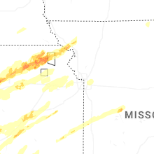


Connect with Interactive Hail Maps