

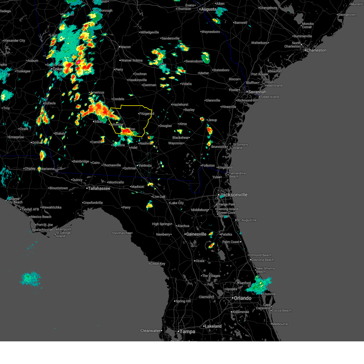
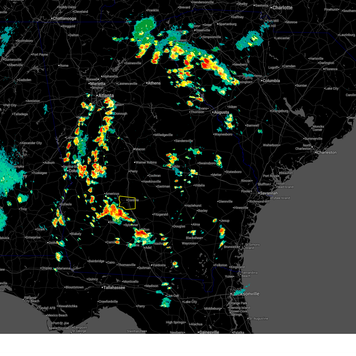
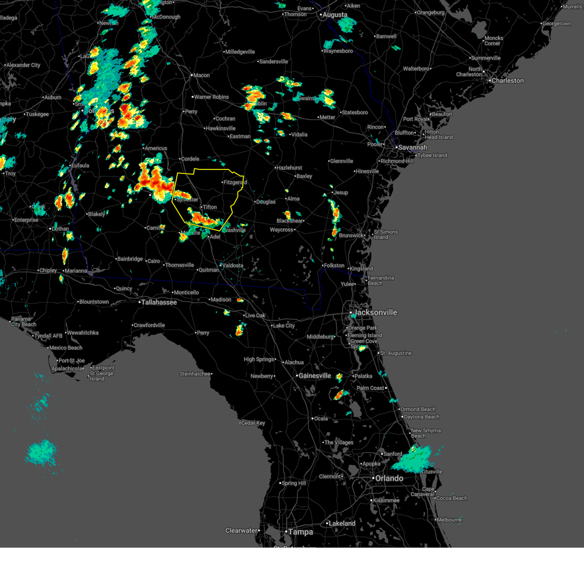
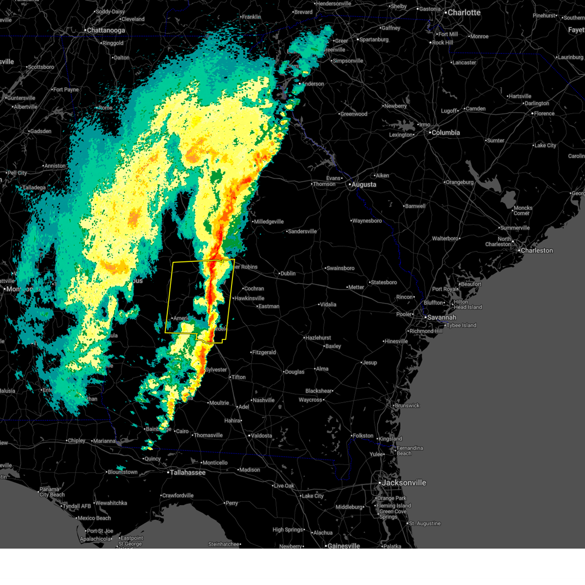
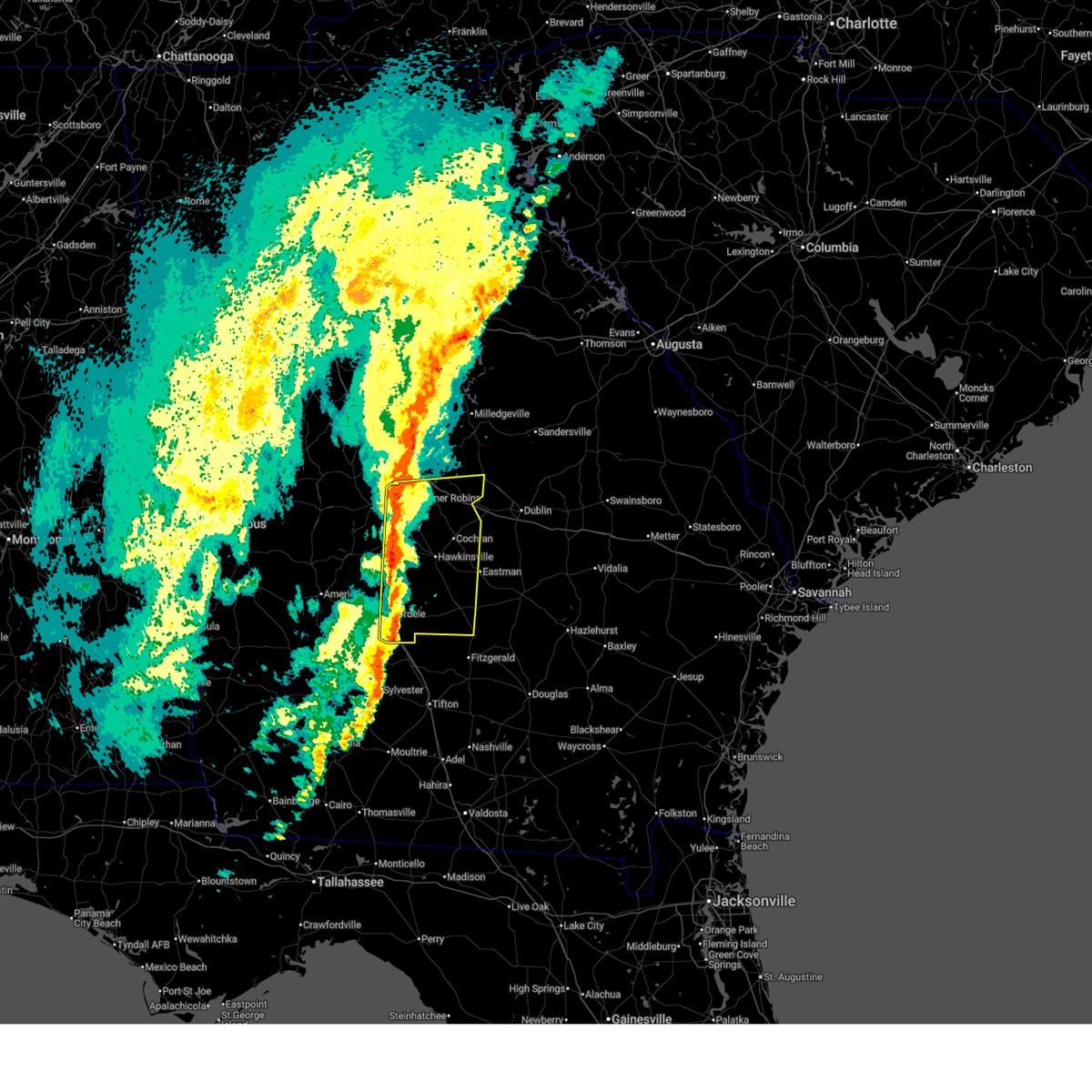
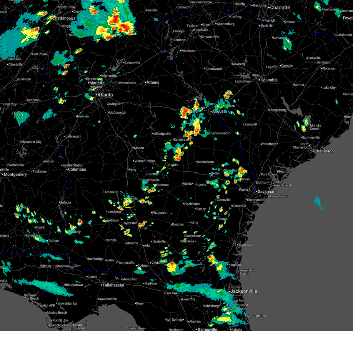
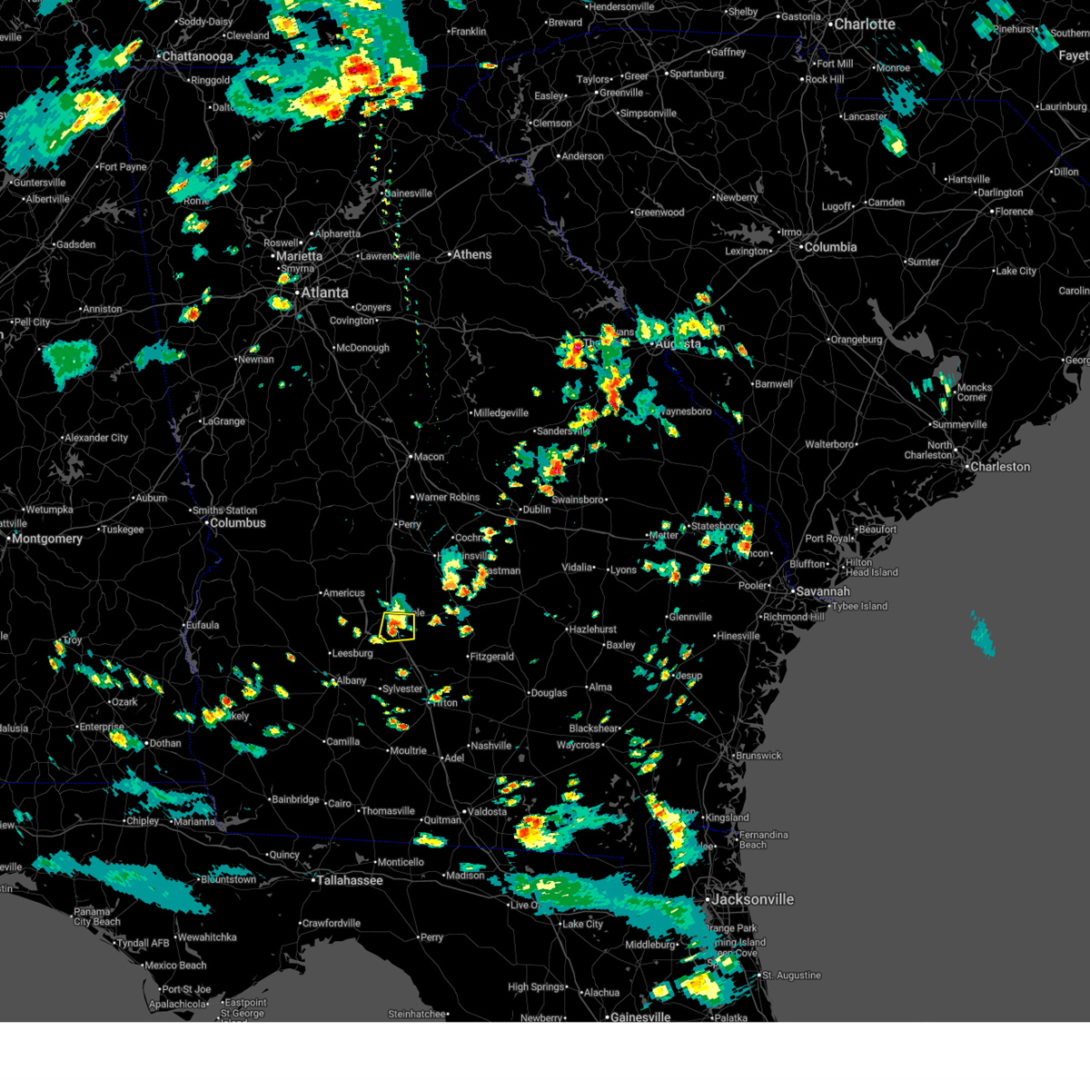
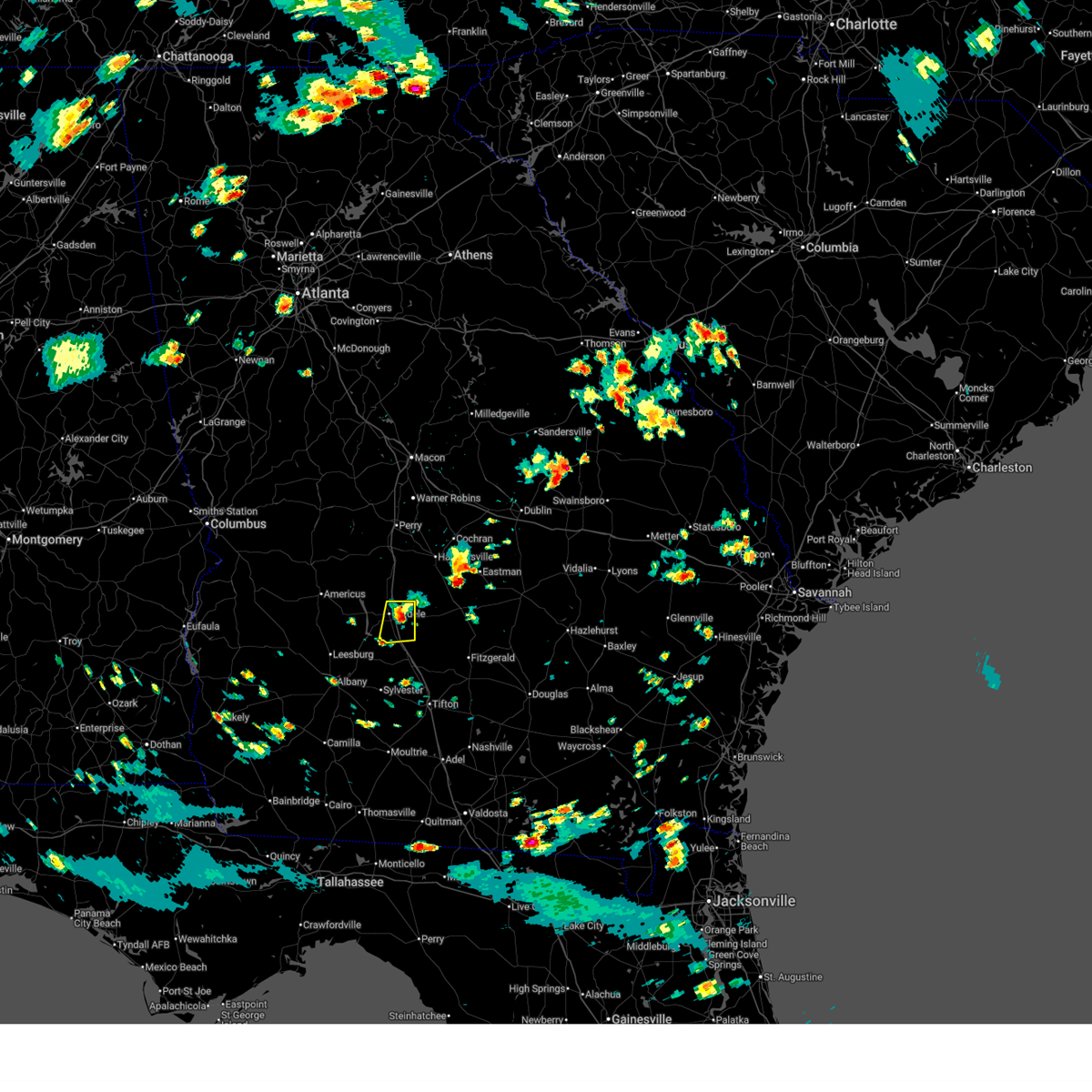
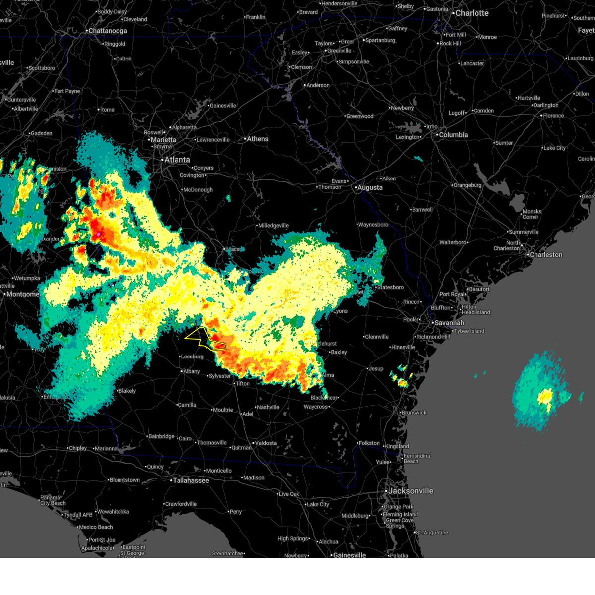
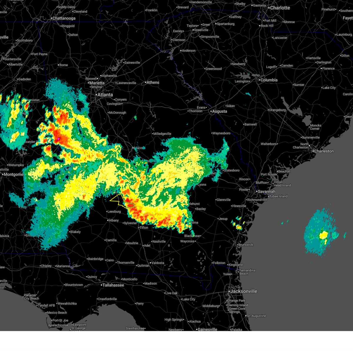
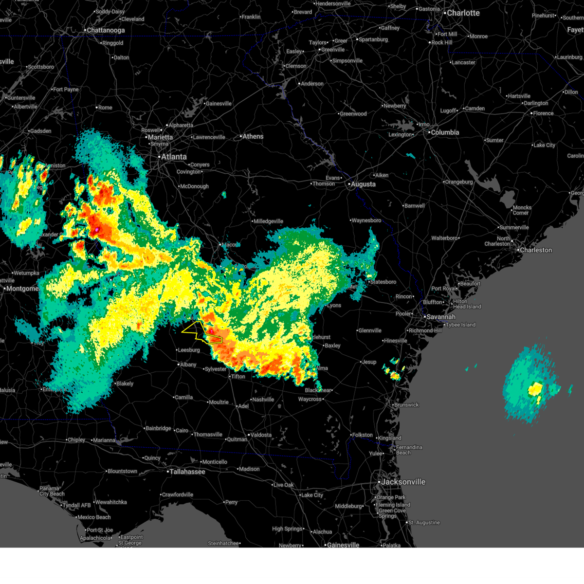
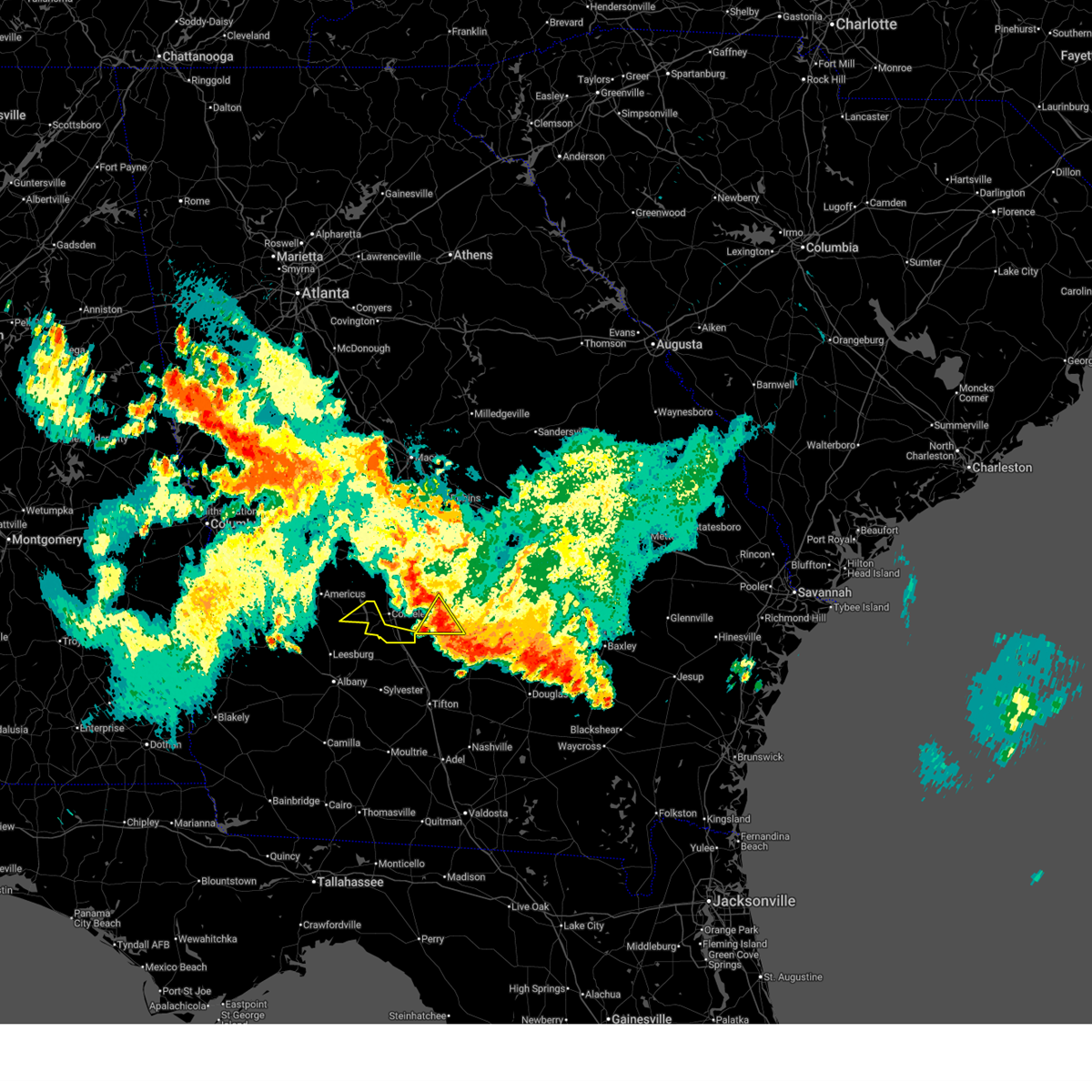
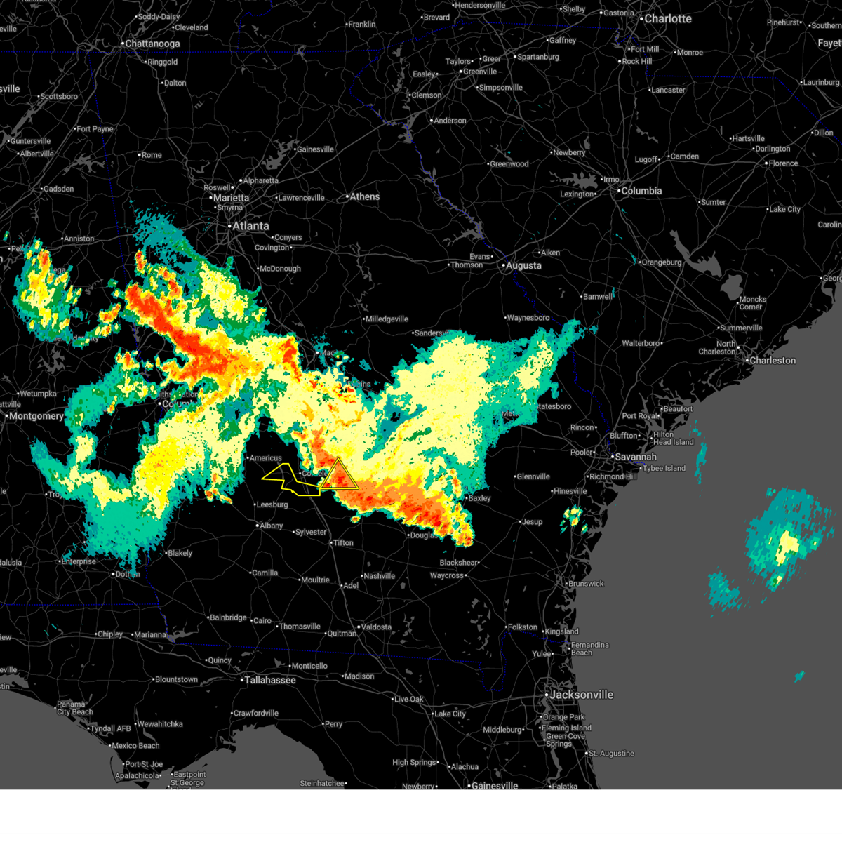
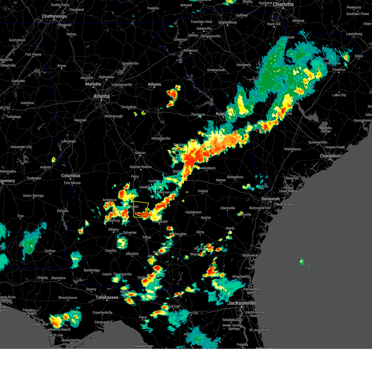
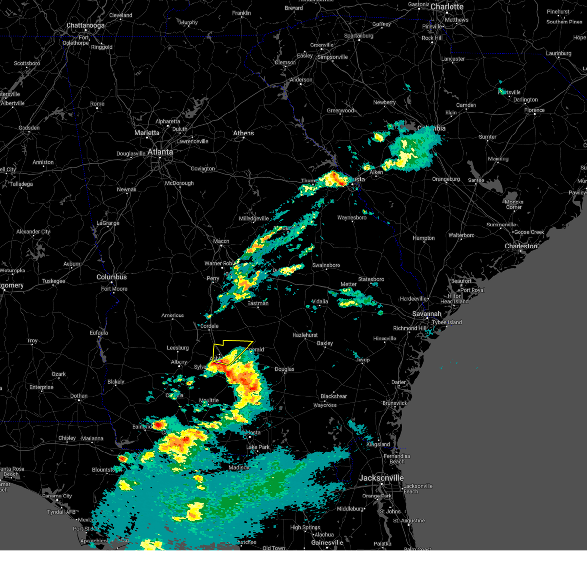
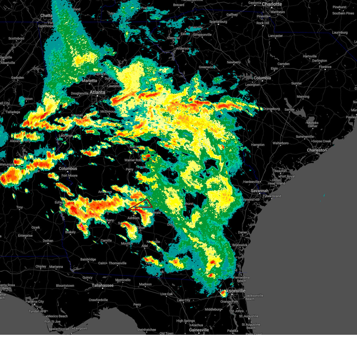
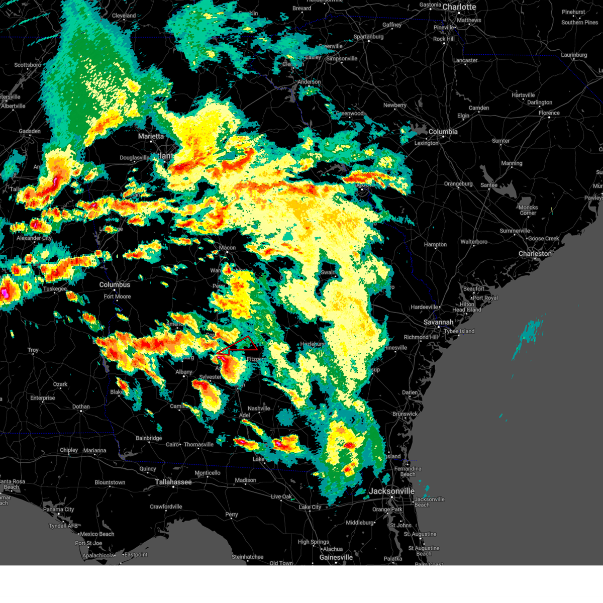
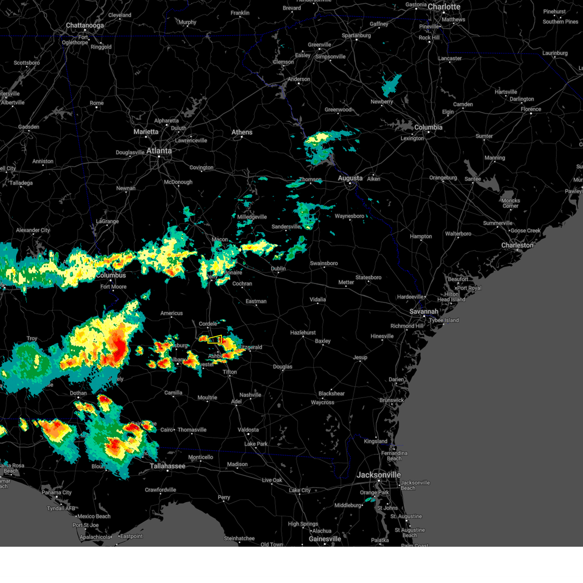
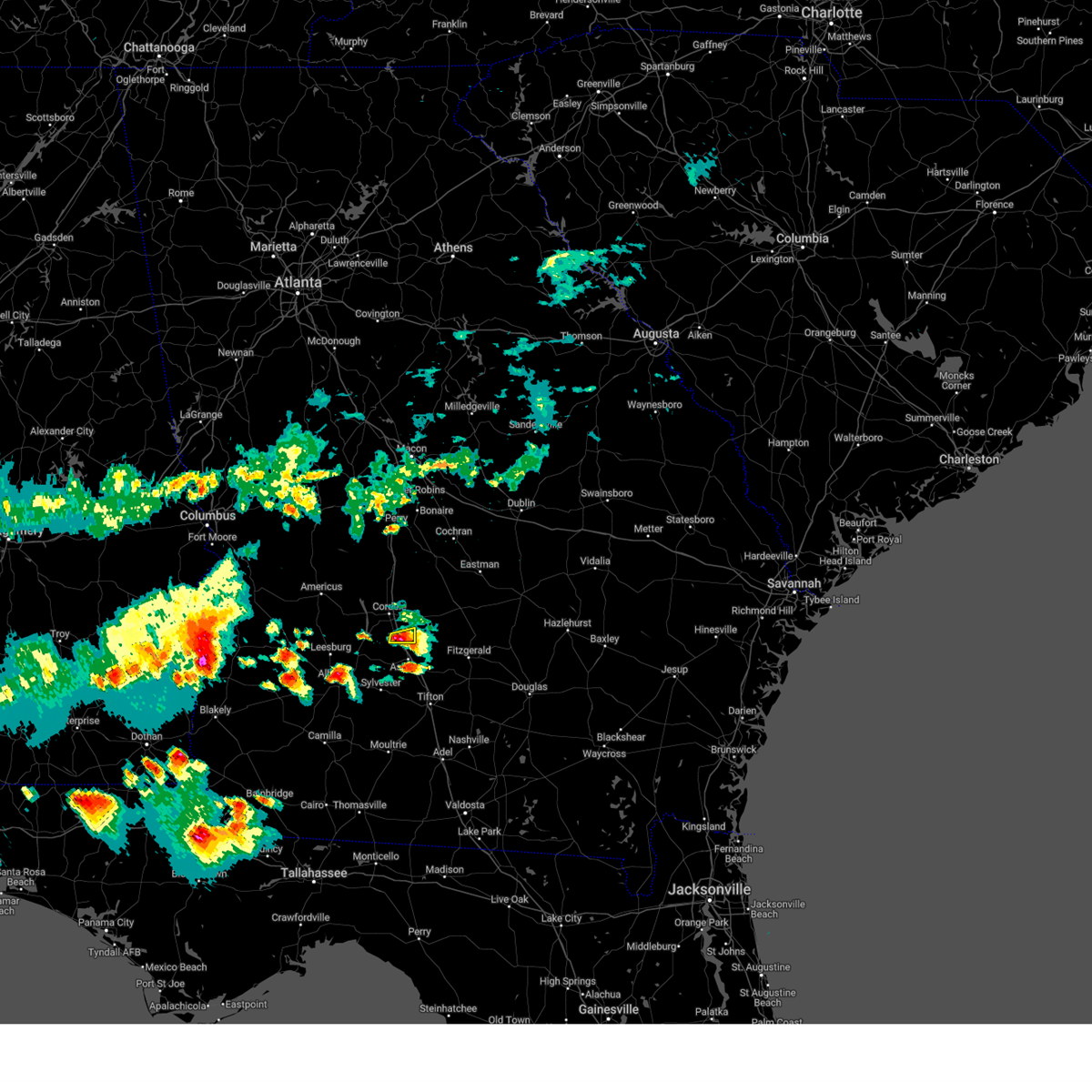
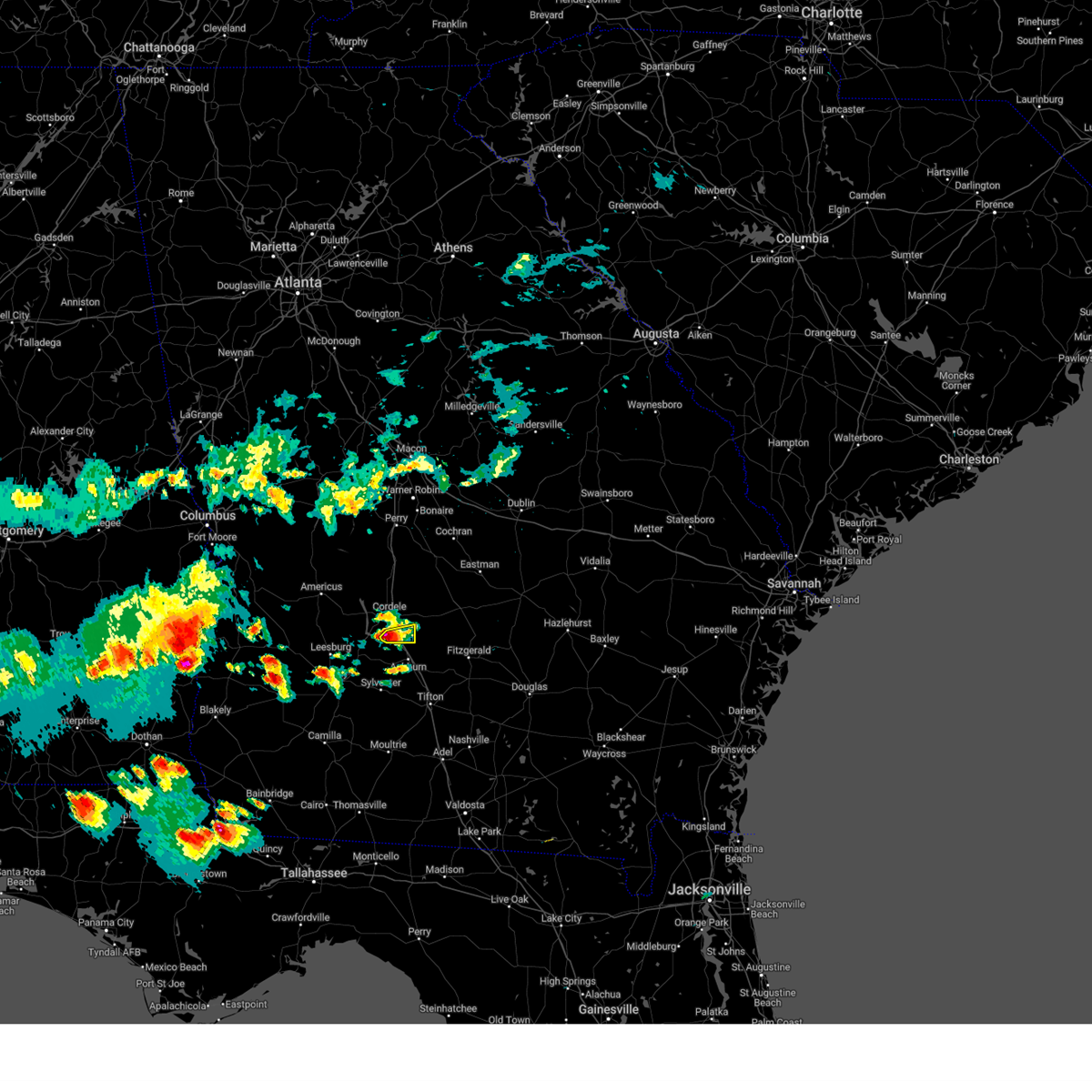
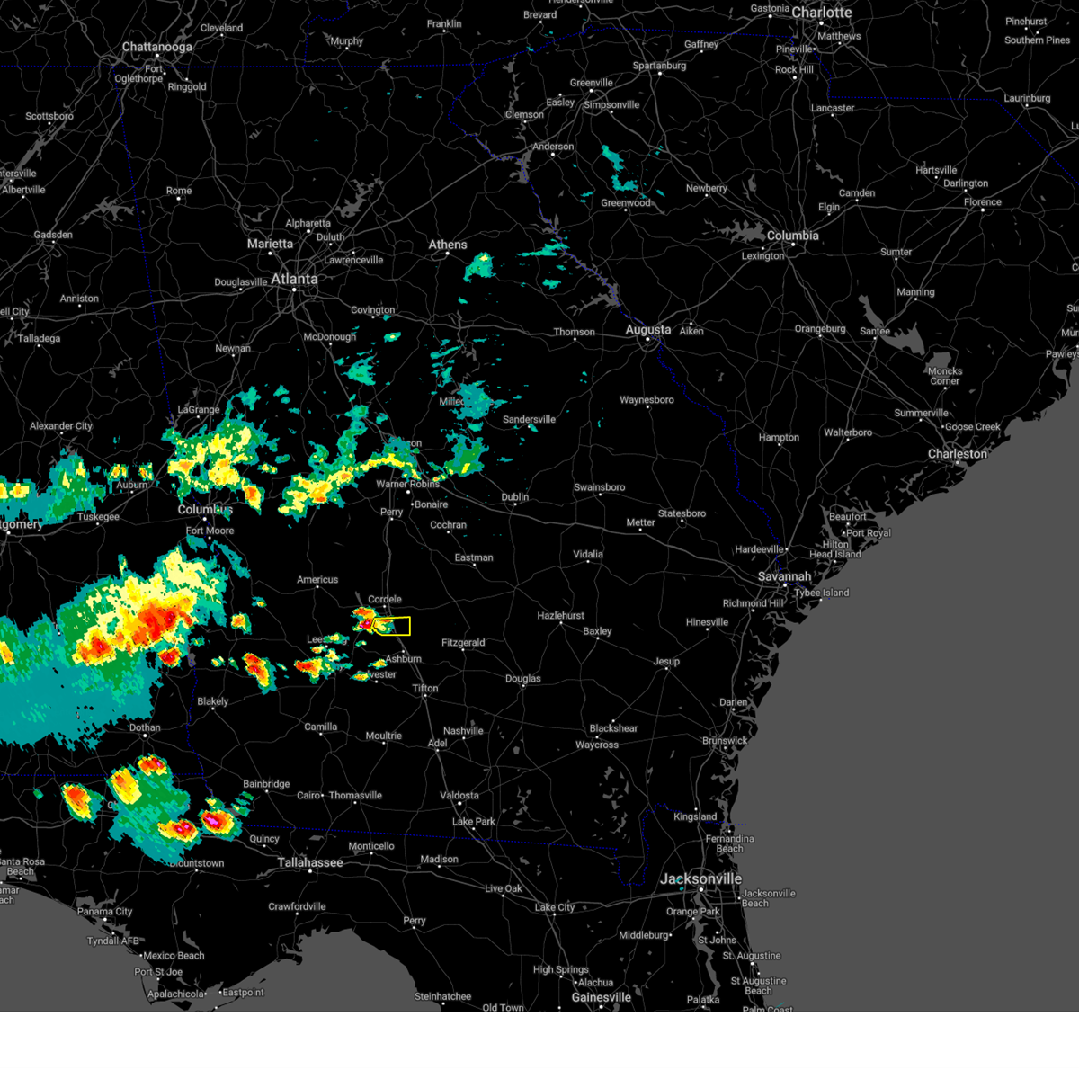
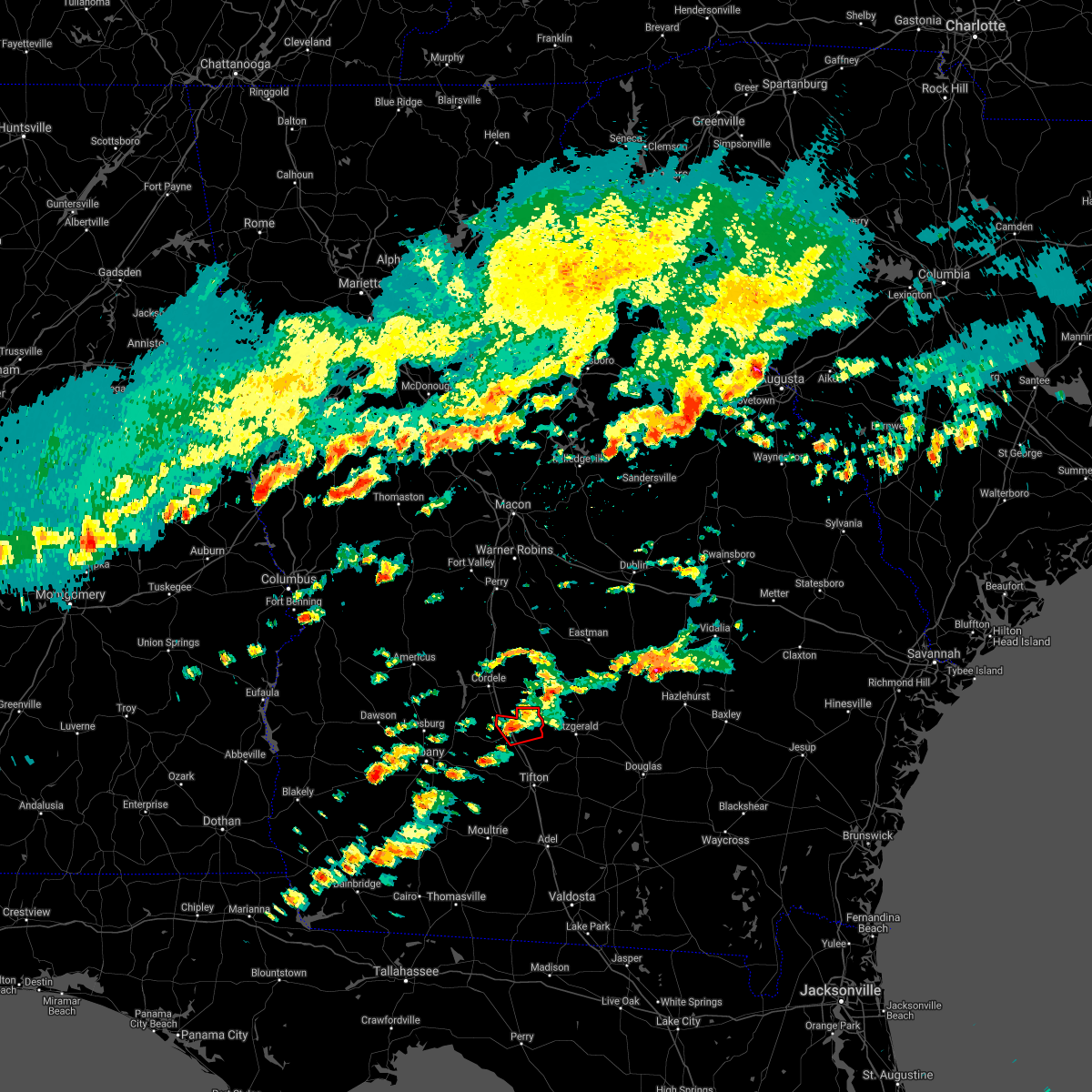
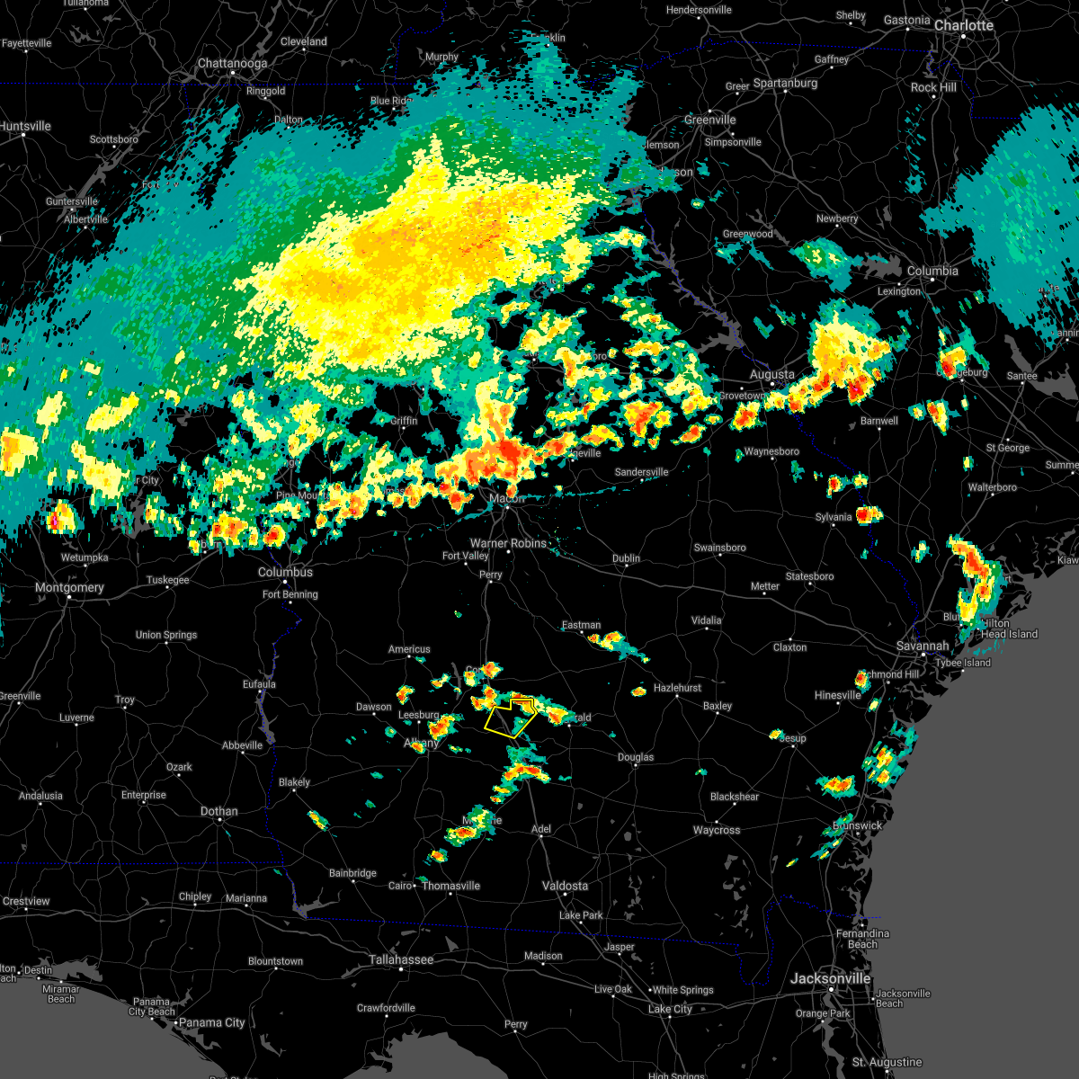
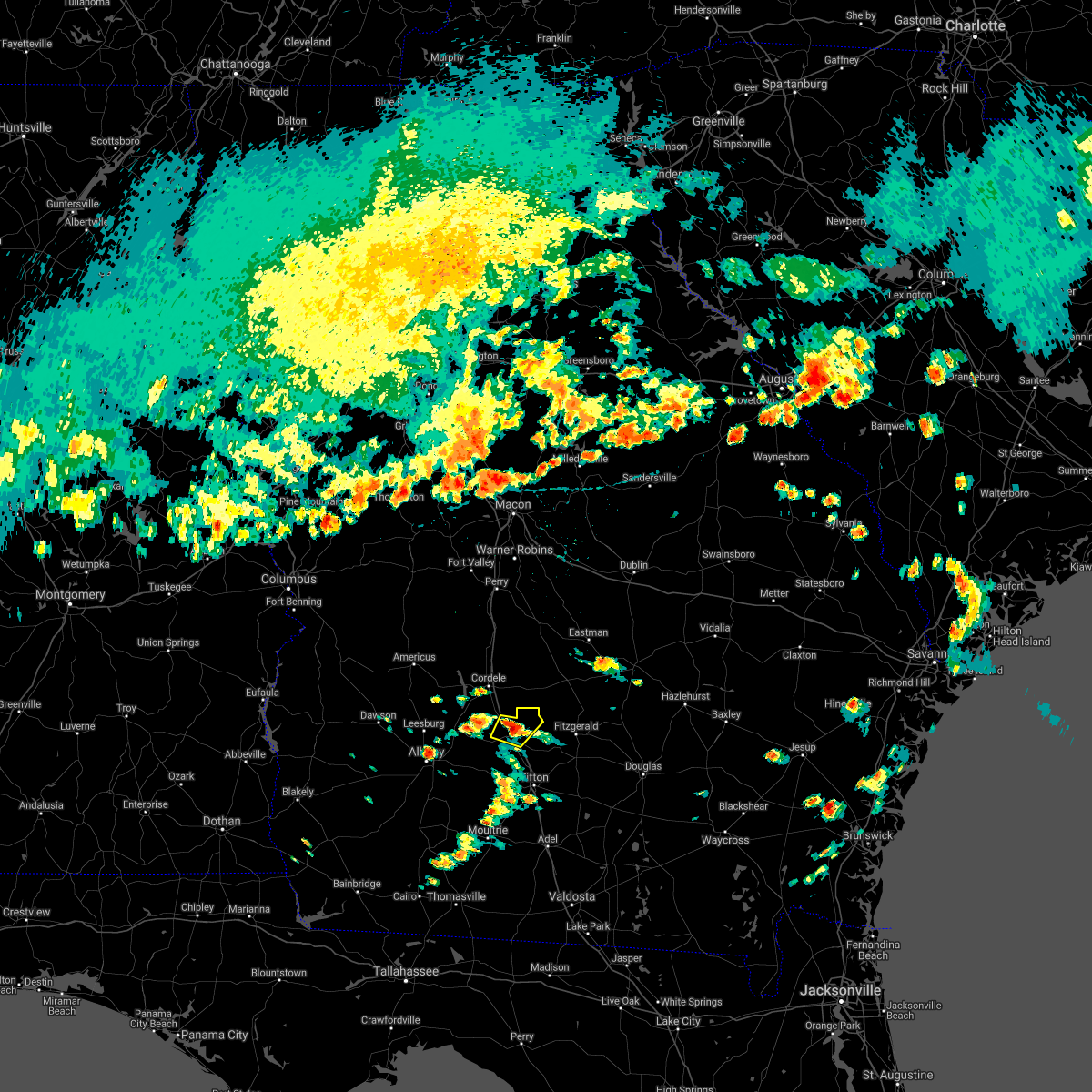
Hail Map for Arabi, GA
The Arabi, GA area has had 3 reports of on-the-ground hail by trained spotters, and has been under severe weather warnings 18 times during the past 12 months. Doppler radar has detected hail at or near Arabi, GA on 68 occasions, including 2 occasions during the past year.
| Name: | Arabi, GA |
| Where Located: | 56.7 miles WNW of Douglas, GA |
| Map: | Google Map for Arabi, GA |
| Population: | 586 |
| Housing Units: | 255 |
| More Info: | Search Google for Arabi, GA |
1
The Top Recent Hail Date for Arabi, GA is Wednesday, June 25, 2025 (15th out of 68)

Hail and Wind Damage Spotted near Arabi, GA
| Date / Time | Report Details |
|---|---|
| 5/22/2026 3:59 PM EDT |
 The storm which prompted the warning has weakened below severe limits, and no longer poses an immediate threat to life or property. therefore, the warning will be allowed to expire. however, gusty winds and heavy rain are still possible with this thunderstorm. The storm which prompted the warning has weakened below severe limits, and no longer poses an immediate threat to life or property. therefore, the warning will be allowed to expire. however, gusty winds and heavy rain are still possible with this thunderstorm.
|
| 5/22/2026 3:35 PM EDT |
 At 335 pm edt, a severe thunderstorm was located over unionville, or over tifton, moving north at 20 mph (radar indicated). Hazards include 60 mph wind gusts and nickel size hail. Expect damage to roofs, siding, and trees. Locations impacted include, tifton, ashburn, ocilla, fitzgerald, sylvester, enigma, poulan, ty ty, alapaha, phillipsburg, mystic, unionville, worth, terrell, sycamore, sumner, rebecca, scooterville, osierfield, and waterloo. At 335 pm edt, a severe thunderstorm was located over unionville, or over tifton, moving north at 20 mph (radar indicated). Hazards include 60 mph wind gusts and nickel size hail. Expect damage to roofs, siding, and trees. Locations impacted include, tifton, ashburn, ocilla, fitzgerald, sylvester, enigma, poulan, ty ty, alapaha, phillipsburg, mystic, unionville, worth, terrell, sycamore, sumner, rebecca, scooterville, osierfield, and waterloo.
|
| 5/22/2026 3:32 PM EDT |
 Svrffc the national weather service in peachtree city has issued a * severe thunderstorm warning for, crisp county in central georgia, * until 400 pm edt. * at 332 pm edt, a severe thunderstorm was located over doles, or 14 miles west of ashburn, moving north at 25 mph (radar indicated). Hazards include 60 mph wind gusts and quarter size hail. Hail damage to vehicles is expected. Expect wind damage to roofs, siding, and trees. Svrffc the national weather service in peachtree city has issued a * severe thunderstorm warning for, crisp county in central georgia, * until 400 pm edt. * at 332 pm edt, a severe thunderstorm was located over doles, or 14 miles west of ashburn, moving north at 25 mph (radar indicated). Hazards include 60 mph wind gusts and quarter size hail. Hail damage to vehicles is expected. Expect wind damage to roofs, siding, and trees.
|
| 5/22/2026 3:20 PM EDT |
 Svrtae the national weather service in tallahassee has issued a * severe thunderstorm warning for, northern cook county in south central georgia, irwin county in south central georgia, northwestern berrien county in south central georgia, turner county in south central georgia, northeastern colquitt county in south central georgia, tift county in south central georgia, ben hill county in south central georgia, eastern worth county in south central georgia, * until 445 pm edt. * at 320 pm edt, severe thunderstorms were located along a line extending from omega to 7 miles east of lenox, moving northeast at 15 mph (radar indicated). Hazards include 60 mph wind gusts. expect damage to roofs, siding, and trees Svrtae the national weather service in tallahassee has issued a * severe thunderstorm warning for, northern cook county in south central georgia, irwin county in south central georgia, northwestern berrien county in south central georgia, turner county in south central georgia, northeastern colquitt county in south central georgia, tift county in south central georgia, ben hill county in south central georgia, eastern worth county in south central georgia, * until 445 pm edt. * at 320 pm edt, severe thunderstorms were located along a line extending from omega to 7 miles east of lenox, moving northeast at 15 mph (radar indicated). Hazards include 60 mph wind gusts. expect damage to roofs, siding, and trees
|
| 3/12/2026 7:08 AM EDT |
 The storms which prompted the warning have moved out of the area. therefore, the warning has been allowed to expire. however, gusty winds are still possible with these thunderstorms. a tornado watch remains in effect until 900 am edt for central and west central georgia. remember, a severe thunderstorm warning still remains in effect for peach, houston, dooly, crisp, pulaski, marion, and wilcox counties. The storms which prompted the warning have moved out of the area. therefore, the warning has been allowed to expire. however, gusty winds are still possible with these thunderstorms. a tornado watch remains in effect until 900 am edt for central and west central georgia. remember, a severe thunderstorm warning still remains in effect for peach, houston, dooly, crisp, pulaski, marion, and wilcox counties.
|
| 3/12/2026 6:56 AM EDT |
 Svrffc the national weather service in peachtree city has issued a * severe thunderstorm warning for, southwestern wilkinson county in central georgia, western dodge county in central georgia, south central bibb county in central georgia, pulaski county in central georgia, twiggs county in central georgia, wilcox county in central georgia, eastern dooly county in central georgia, bleckley county in central georgia, eastern peach county in central georgia, houston county in central georgia, crisp county in central georgia, * until 745 am edt. * at 656 am edt, severe thunderstorms were located along a line extending from near centerville to near sibley, moving east at 40 mph (radar indicated). Hazards include 60 mph wind gusts. expect damage to roofs, siding, and trees Svrffc the national weather service in peachtree city has issued a * severe thunderstorm warning for, southwestern wilkinson county in central georgia, western dodge county in central georgia, south central bibb county in central georgia, pulaski county in central georgia, twiggs county in central georgia, wilcox county in central georgia, eastern dooly county in central georgia, bleckley county in central georgia, eastern peach county in central georgia, houston county in central georgia, crisp county in central georgia, * until 745 am edt. * at 656 am edt, severe thunderstorms were located along a line extending from near centerville to near sibley, moving east at 40 mph (radar indicated). Hazards include 60 mph wind gusts. expect damage to roofs, siding, and trees
|
| 3/12/2026 6:30 AM EDT |
 At 629 am edt, severe thunderstorms were located along a line extending from near lee pope to oglethorpe to near scrutchins, moving east at 45 mph (radar indicated). Hazards include 70 mph wind gusts. Expect considerable tree damage. damage is likely to mobile homes, roofs, and outbuildings. Locations impacted include, americus, perry, cordele, fort valley, hawkinsville, vienna, butler, oglethorpe, warner robins, centerville, byron, unadilla, montezuma, marshallville, reynolds, arabi, byromville, ideal, pinehurst, and leslie. At 629 am edt, severe thunderstorms were located along a line extending from near lee pope to oglethorpe to near scrutchins, moving east at 45 mph (radar indicated). Hazards include 70 mph wind gusts. Expect considerable tree damage. damage is likely to mobile homes, roofs, and outbuildings. Locations impacted include, americus, perry, cordele, fort valley, hawkinsville, vienna, butler, oglethorpe, warner robins, centerville, byron, unadilla, montezuma, marshallville, reynolds, arabi, byromville, ideal, pinehurst, and leslie.
|
| 3/12/2026 6:30 AM EDT |
 Svrtae the national weather service in tallahassee has issued a * severe thunderstorm warning for, east central jackson county in the panhandle of florida, gadsden county in big bend florida, mitchell county in southwestern georgia, southeastern lee county in southwestern georgia, southeastern seminole county in southwestern georgia, colquitt county in south central georgia, tift county in south central georgia, worth county in south central georgia, decatur county in southwestern georgia, grady county in southwestern georgia, turner county in south central georgia, eastern dougherty county in southwestern georgia, central baker county in southwestern georgia, thomas county in south central georgia, * until 730 am edt/630 am cdt/. * at 630 am edt/530 am cdt/, severe thunderstorms were located along a line extending from near de soto to near newton to chattahoochee, moving east at 45 mph (radar indicated). Hazards include 60 mph wind gusts. expect damage to roofs, siding, and trees Svrtae the national weather service in tallahassee has issued a * severe thunderstorm warning for, east central jackson county in the panhandle of florida, gadsden county in big bend florida, mitchell county in southwestern georgia, southeastern lee county in southwestern georgia, southeastern seminole county in southwestern georgia, colquitt county in south central georgia, tift county in south central georgia, worth county in south central georgia, decatur county in southwestern georgia, grady county in southwestern georgia, turner county in south central georgia, eastern dougherty county in southwestern georgia, central baker county in southwestern georgia, thomas county in south central georgia, * until 730 am edt/630 am cdt/. * at 630 am edt/530 am cdt/, severe thunderstorms were located along a line extending from near de soto to near newton to chattahoochee, moving east at 45 mph (radar indicated). Hazards include 60 mph wind gusts. expect damage to roofs, siding, and trees
|
| 3/12/2026 6:19 AM EDT |
 Svrffc the national weather service in peachtree city has issued a * severe thunderstorm warning for, macon county in west central georgia, western pulaski county in central georgia, southwestern twiggs county in central georgia, western wilcox county in central georgia, dooly county in central georgia, peach county in central georgia, houston county in central georgia, southern crawford county in central georgia, eastern schley county in west central georgia, sumter county in west central georgia, crisp county in central georgia, eastern taylor county in west central georgia, * until 700 am edt. * at 619 am edt, severe thunderstorms were located along a line extending from near reynolds to fountainville to neyami, moving east at 45 mph (radar indicated). Hazards include 60 mph wind gusts. expect damage to roofs, siding, and trees Svrffc the national weather service in peachtree city has issued a * severe thunderstorm warning for, macon county in west central georgia, western pulaski county in central georgia, southwestern twiggs county in central georgia, western wilcox county in central georgia, dooly county in central georgia, peach county in central georgia, houston county in central georgia, southern crawford county in central georgia, eastern schley county in west central georgia, sumter county in west central georgia, crisp county in central georgia, eastern taylor county in west central georgia, * until 700 am edt. * at 619 am edt, severe thunderstorms were located along a line extending from near reynolds to fountainville to neyami, moving east at 45 mph (radar indicated). Hazards include 60 mph wind gusts. expect damage to roofs, siding, and trees
|
| 6/27/2025 4:53 PM EDT |
 The storm which prompted the warning has weakened below severe limits, and no longer poses an immediate threat to life or property. therefore, the warning will be allowed to expire. to report severe weather, contact your nearest law enforcement agency. they will relay your report to the national weather service peachtree city. The storm which prompted the warning has weakened below severe limits, and no longer poses an immediate threat to life or property. therefore, the warning will be allowed to expire. to report severe weather, contact your nearest law enforcement agency. they will relay your report to the national weather service peachtree city.
|
| 6/27/2025 4:40 PM EDT |
 At 440 pm edt, a severe thunderstorm was located near wenona, or near cordele, moving south at 10 mph (radar indicated). Hazards include 60 mph wind gusts and quarter size hail. Hail damage to vehicles is expected. expect wind damage to roofs, siding, and trees. Locations impacted include, cordele, arabi, wenona, and hatley. At 440 pm edt, a severe thunderstorm was located near wenona, or near cordele, moving south at 10 mph (radar indicated). Hazards include 60 mph wind gusts and quarter size hail. Hail damage to vehicles is expected. expect wind damage to roofs, siding, and trees. Locations impacted include, cordele, arabi, wenona, and hatley.
|
| 6/27/2025 4:13 PM EDT |
 Svrffc the national weather service in peachtree city has issued a * severe thunderstorm warning for, crisp county in central georgia, * until 500 pm edt. * at 413 pm edt, a severe thunderstorm was located over east crisp, or near cordele, moving south at 10 mph (radar indicated). Hazards include 60 mph wind gusts and quarter size hail. Hail damage to vehicles is expected. Expect wind damage to roofs, siding, and trees. Svrffc the national weather service in peachtree city has issued a * severe thunderstorm warning for, crisp county in central georgia, * until 500 pm edt. * at 413 pm edt, a severe thunderstorm was located over east crisp, or near cordele, moving south at 10 mph (radar indicated). Hazards include 60 mph wind gusts and quarter size hail. Hail damage to vehicles is expected. Expect wind damage to roofs, siding, and trees.
|
| 6/26/2025 2:25 AM EDT |
 the severe thunderstorm warning has been cancelled and is no longer in effect the severe thunderstorm warning has been cancelled and is no longer in effect
|
| 6/26/2025 2:25 AM EDT |
 At 225 am edt, severe thunderstorms were located along a line extending from near scrutchins to doles, moving southwest at 45 mph (radar indicated). Hazards include 60 mph wind gusts. Expect damage to roofs, siding, and trees. Locations impacted include, arabi, de soto, cobb, fort early, georgia veterans memorial st pk, and raines. At 225 am edt, severe thunderstorms were located along a line extending from near scrutchins to doles, moving southwest at 45 mph (radar indicated). Hazards include 60 mph wind gusts. Expect damage to roofs, siding, and trees. Locations impacted include, arabi, de soto, cobb, fort early, georgia veterans memorial st pk, and raines.
|
| 6/26/2025 2:23 AM EDT |
 the severe thunderstorm warning has been cancelled and is no longer in effect the severe thunderstorm warning has been cancelled and is no longer in effect
|
| 6/26/2025 2:23 AM EDT |
 At 223 am edt, severe thunderstorms were located along a line extending from near leslie to near doles, moving southwest at 45 mph (radar indicated). Hazards include 60 mph wind gusts. Expect damage to roofs, siding, and trees. Locations impacted include, arabi, de soto, cobb, fort early, georgia veterans memorial st pk, and raines. At 223 am edt, severe thunderstorms were located along a line extending from near leslie to near doles, moving southwest at 45 mph (radar indicated). Hazards include 60 mph wind gusts. Expect damage to roofs, siding, and trees. Locations impacted include, arabi, de soto, cobb, fort early, georgia veterans memorial st pk, and raines.
|
| 6/26/2025 2:01 AM EDT |
 Svrffc the national weather service in peachtree city has issued a * severe thunderstorm warning for, southwestern wilcox county in central georgia, southeastern sumter county in west central georgia, southwestern crisp county in central georgia, * until 245 am edt. * at 200 am edt, severe thunderstorms were located along a line extending from near georgia veterans memorial st pk to amboy, moving southwest at 45 mph (radar indicated). Hazards include 60 mph wind gusts. expect damage to roofs, siding, and trees Svrffc the national weather service in peachtree city has issued a * severe thunderstorm warning for, southwestern wilcox county in central georgia, southeastern sumter county in west central georgia, southwestern crisp county in central georgia, * until 245 am edt. * at 200 am edt, severe thunderstorms were located along a line extending from near georgia veterans memorial st pk to amboy, moving southwest at 45 mph (radar indicated). Hazards include 60 mph wind gusts. expect damage to roofs, siding, and trees
|
| 6/26/2025 2:00 AM EDT |
 Svrffc the national weather service in peachtree city has issued a * severe thunderstorm warning for, southwestern wilcox county in central georgia, southeastern sumter county in west central georgia, southwestern crisp county in central georgia, * until 245 am edt. * at 200 am edt, severe thunderstorms were located along a line extending from near georgia veterans memorial st pk to amboy, moving southwest at 45 mph (radar indicated). Hazards include 60 mph wind gusts. expect damage to roofs, siding, and trees Svrffc the national weather service in peachtree city has issued a * severe thunderstorm warning for, southwestern wilcox county in central georgia, southeastern sumter county in west central georgia, southwestern crisp county in central georgia, * until 245 am edt. * at 200 am edt, severe thunderstorms were located along a line extending from near georgia veterans memorial st pk to amboy, moving southwest at 45 mph (radar indicated). Hazards include 60 mph wind gusts. expect damage to roofs, siding, and trees
|
| 6/9/2025 3:56 PM EDT |
 The storm which prompted the warning has weakened below severe limits, and no longer poses an immediate threat to life or property. therefore, the warning will be allowed to expire. however, gusty winds to 40 mph and heavy rain are still possible with this thunderstorm. The storm which prompted the warning has weakened below severe limits, and no longer poses an immediate threat to life or property. therefore, the warning will be allowed to expire. however, gusty winds to 40 mph and heavy rain are still possible with this thunderstorm.
|
| 6/9/2025 3:20 PM EDT |
 Svrtae the national weather service in tallahassee has issued a * severe thunderstorm warning for, turner county in south central georgia, northeastern dougherty county in southwestern georgia, south central lee county in southwestern georgia, northwestern tift county in south central georgia, central worth county in south central georgia, * until 400 pm edt. * at 320 pm edt, a severe thunderstorm was located near marine corps logistics base, or 8 miles east of albany, moving east at 45 mph (radar indicated). Hazards include 60 mph wind gusts and penny size hail. expect damage to roofs, siding, and trees Svrtae the national weather service in tallahassee has issued a * severe thunderstorm warning for, turner county in south central georgia, northeastern dougherty county in southwestern georgia, south central lee county in southwestern georgia, northwestern tift county in south central georgia, central worth county in south central georgia, * until 400 pm edt. * at 320 pm edt, a severe thunderstorm was located near marine corps logistics base, or 8 miles east of albany, moving east at 45 mph (radar indicated). Hazards include 60 mph wind gusts and penny size hail. expect damage to roofs, siding, and trees
|
| 4/7/2025 10:05 AM EDT |
 the severe thunderstorm warning has been cancelled and is no longer in effect the severe thunderstorm warning has been cancelled and is no longer in effect
|
| 4/7/2025 9:30 AM EDT |
 Svrffc the national weather service in peachtree city has issued a * severe thunderstorm warning for, northwestern dodge county in central georgia, pulaski county in central georgia, wilcox county in central georgia, southeastern dooly county in central georgia, southwestern bleckley county in central georgia, crisp county in central georgia, * until 1015 am edt. * at 930 am edt, a severe thunderstorm was located over pineview, or 12 miles south of hawkinsville, moving northeast at 50 mph (radar indicated). Hazards include 60 mph wind gusts. expect damage to roofs, siding, and trees Svrffc the national weather service in peachtree city has issued a * severe thunderstorm warning for, northwestern dodge county in central georgia, pulaski county in central georgia, wilcox county in central georgia, southeastern dooly county in central georgia, southwestern bleckley county in central georgia, crisp county in central georgia, * until 1015 am edt. * at 930 am edt, a severe thunderstorm was located over pineview, or 12 miles south of hawkinsville, moving northeast at 50 mph (radar indicated). Hazards include 60 mph wind gusts. expect damage to roofs, siding, and trees
|
| 3/31/2025 3:05 PM EDT |
 Svrffc the national weather service in peachtree city has issued a * severe thunderstorm warning for, southeastern laurens county in central georgia, dodge county in central georgia, southern pulaski county in central georgia, wilcox county in central georgia, southeastern dooly county in central georgia, crisp county in central georgia, * until 345 pm edt. * at 305 pm edt, severe thunderstorms were located along a line extending from wallace to near raines, moving east at 45 mph (radar indicated). Hazards include 60 mph wind gusts and quarter size hail. Hail damage to vehicles is expected. Expect wind damage to roofs, siding, and trees. Svrffc the national weather service in peachtree city has issued a * severe thunderstorm warning for, southeastern laurens county in central georgia, dodge county in central georgia, southern pulaski county in central georgia, wilcox county in central georgia, southeastern dooly county in central georgia, crisp county in central georgia, * until 345 pm edt. * at 305 pm edt, severe thunderstorms were located along a line extending from wallace to near raines, moving east at 45 mph (radar indicated). Hazards include 60 mph wind gusts and quarter size hail. Hail damage to vehicles is expected. Expect wind damage to roofs, siding, and trees.
|
| 3/5/2025 4:03 AM EST |
 Svrtae the national weather service in tallahassee has issued a * severe thunderstorm warning for, cook county in south central georgia, irwin county in south central georgia, berrien county in south central georgia, turner county in south central georgia, colquitt county in south central georgia, tift county in south central georgia, ben hill county in south central georgia, eastern worth county in south central georgia, * until 530 am est. * at 403 am est, severe thunderstorms were located along a line extending from 7 miles west of arabi to pelham, moving east at 35 mph (radar indicated). Hazards include 60 mph wind gusts. expect damage to roofs, siding, and trees Svrtae the national weather service in tallahassee has issued a * severe thunderstorm warning for, cook county in south central georgia, irwin county in south central georgia, berrien county in south central georgia, turner county in south central georgia, colquitt county in south central georgia, tift county in south central georgia, ben hill county in south central georgia, eastern worth county in south central georgia, * until 530 am est. * at 403 am est, severe thunderstorms were located along a line extending from 7 miles west of arabi to pelham, moving east at 35 mph (radar indicated). Hazards include 60 mph wind gusts. expect damage to roofs, siding, and trees
|
| 2/16/2025 6:57 AM EST |
 Svrffc the national weather service in peachtree city has issued a * severe thunderstorm warning for, southern laurens county in central georgia, northwestern toombs county in southeastern georgia, dodge county in central georgia, telfair county in central georgia, southwestern treutlen county in east central georgia, wilcox county in central georgia, wheeler county in central georgia, southeastern crisp county in central georgia, montgomery county in central georgia, * until 800 am est. * at 657 am est, severe thunderstorms were located along a line extending from dexter to near eastman to dakota, moving southeast at 45 mph (radar indicated). Hazards include 60 mph wind gusts. expect damage to roofs, siding, and trees Svrffc the national weather service in peachtree city has issued a * severe thunderstorm warning for, southern laurens county in central georgia, northwestern toombs county in southeastern georgia, dodge county in central georgia, telfair county in central georgia, southwestern treutlen county in east central georgia, wilcox county in central georgia, wheeler county in central georgia, southeastern crisp county in central georgia, montgomery county in central georgia, * until 800 am est. * at 657 am est, severe thunderstorms were located along a line extending from dexter to near eastman to dakota, moving southeast at 45 mph (radar indicated). Hazards include 60 mph wind gusts. expect damage to roofs, siding, and trees
|
| 2/16/2025 6:36 AM EST |
 At 636 am est, severe thunderstorms were located along a line extending from near cary to finleyson to near doles, moving southeast at 50 mph (radar indicated). Hazards include 60 mph wind gusts. Expect damage to roofs, siding, and trees. Locations impacted include, cordele, cochran, eastman, hawkinsville, vienna, abbeville, chester, rochelle, arabi, dexter, cadwell, pineview, rhine, pitts, rentz, union, plainfield, mobley crossing, mock springs, and seville. At 636 am est, severe thunderstorms were located along a line extending from near cary to finleyson to near doles, moving southeast at 50 mph (radar indicated). Hazards include 60 mph wind gusts. Expect damage to roofs, siding, and trees. Locations impacted include, cordele, cochran, eastman, hawkinsville, vienna, abbeville, chester, rochelle, arabi, dexter, cadwell, pineview, rhine, pitts, rentz, union, plainfield, mobley crossing, mock springs, and seville.
|
| 2/16/2025 6:36 AM EST |
 the severe thunderstorm warning has been cancelled and is no longer in effect the severe thunderstorm warning has been cancelled and is no longer in effect
|
| 2/16/2025 6:17 AM EST |
 Svrtae the national weather service in tallahassee has issued a * severe thunderstorm warning for, turner county in south central georgia, mitchell county in southwestern georgia, colquitt county in south central georgia, tift county in south central georgia, worth county in south central georgia, * until 745 am est. * at 616 am est, severe thunderstorms were located along a line extending from near leslie to 7 miles northwest of donalsonville, moving east at 45 mph (radar indicated). Hazards include 60 mph wind gusts. expect damage to roofs, siding, and trees Svrtae the national weather service in tallahassee has issued a * severe thunderstorm warning for, turner county in south central georgia, mitchell county in southwestern georgia, colquitt county in south central georgia, tift county in south central georgia, worth county in south central georgia, * until 745 am est. * at 616 am est, severe thunderstorms were located along a line extending from near leslie to 7 miles northwest of donalsonville, moving east at 45 mph (radar indicated). Hazards include 60 mph wind gusts. expect damage to roofs, siding, and trees
|
| 2/16/2025 5:55 AM EST |
 Svrffc the national weather service in peachtree city has issued a * severe thunderstorm warning for, southwestern laurens county in central georgia, dodge county in central georgia, houston county in central georgia, sumter county in west central georgia, crisp county in central georgia, macon county in west central georgia, pulaski county in central georgia, southern twiggs county in central georgia, wilcox county in central georgia, dooly county in central georgia, bleckley county in central georgia, southeastern webster county in west central georgia, peach county in central georgia, southeastern crawford county in central georgia, southeastern schley county in west central georgia, * until 700 am est. * at 555 am est, severe thunderstorms were located along a line extending from near jack brown estates to near montezuma to near croxton crossroads, moving southeast at 50 mph (radar indicated). Hazards include 60 mph wind gusts. expect damage to roofs, siding, and trees Svrffc the national weather service in peachtree city has issued a * severe thunderstorm warning for, southwestern laurens county in central georgia, dodge county in central georgia, houston county in central georgia, sumter county in west central georgia, crisp county in central georgia, macon county in west central georgia, pulaski county in central georgia, southern twiggs county in central georgia, wilcox county in central georgia, dooly county in central georgia, bleckley county in central georgia, southeastern webster county in west central georgia, peach county in central georgia, southeastern crawford county in central georgia, southeastern schley county in west central georgia, * until 700 am est. * at 555 am est, severe thunderstorms were located along a line extending from near jack brown estates to near montezuma to near croxton crossroads, moving southeast at 50 mph (radar indicated). Hazards include 60 mph wind gusts. expect damage to roofs, siding, and trees
|
| 8/3/2024 6:20 PM EDT |
 Svrffc the national weather service in peachtree city has issued a * severe thunderstorm warning for, southwestern wilcox county in central georgia, southeastern dooly county in central georgia, eastern crisp county in central georgia, * until 700 pm edt. * at 619 pm edt, a severe thunderstorm was located over hatley, or 8 miles southeast of cordele, moving north at 10 mph (radar indicated). Hazards include 60 mph wind gusts and quarter size hail. Hail damage to vehicles is expected. Expect wind damage to roofs, siding, and trees. Svrffc the national weather service in peachtree city has issued a * severe thunderstorm warning for, southwestern wilcox county in central georgia, southeastern dooly county in central georgia, eastern crisp county in central georgia, * until 700 pm edt. * at 619 pm edt, a severe thunderstorm was located over hatley, or 8 miles southeast of cordele, moving north at 10 mph (radar indicated). Hazards include 60 mph wind gusts and quarter size hail. Hail damage to vehicles is expected. Expect wind damage to roofs, siding, and trees.
|
| 6/10/2024 2:31 PM EDT |
 Svrffc the national weather service in peachtree city has issued a * severe thunderstorm warning for, crisp county in central georgia, * until 315 pm edt. * at 231 pm edt, a severe thunderstorm was located over warwick, or 13 miles southwest of cordele, moving east at 20 mph (radar indicated). Hazards include 60 mph wind gusts and quarter size hail. Hail damage to vehicles is expected. Expect wind damage to roofs, siding, and trees. Svrffc the national weather service in peachtree city has issued a * severe thunderstorm warning for, crisp county in central georgia, * until 315 pm edt. * at 231 pm edt, a severe thunderstorm was located over warwick, or 13 miles southwest of cordele, moving east at 20 mph (radar indicated). Hazards include 60 mph wind gusts and quarter size hail. Hail damage to vehicles is expected. Expect wind damage to roofs, siding, and trees.
|
| 5/27/2024 5:18 PM EDT |
 Svrffc the national weather service in peachtree city has issued a * severe thunderstorm warning for, southwestern wilcox county in central georgia, crisp county in central georgia, * until 600 pm edt. * at 516 pm edt, a severe thunderstorm was located over raines, or near cordele, moving east at 20 mph (radar indicated. at 510 pm, trees were reported down near lake blackshear). Hazards include 60 mph wind gusts and quarter size hail. Hail damage to vehicles is expected. Expect wind damage to roofs, siding, and trees. Svrffc the national weather service in peachtree city has issued a * severe thunderstorm warning for, southwestern wilcox county in central georgia, crisp county in central georgia, * until 600 pm edt. * at 516 pm edt, a severe thunderstorm was located over raines, or near cordele, moving east at 20 mph (radar indicated. at 510 pm, trees were reported down near lake blackshear). Hazards include 60 mph wind gusts and quarter size hail. Hail damage to vehicles is expected. Expect wind damage to roofs, siding, and trees.
|
| 5/27/2024 4:31 PM EDT |
 Svrffc the national weather service in peachtree city has issued a * severe thunderstorm warning for, southeastern sumter county in west central georgia, western crisp county in central georgia, * until 515 pm edt. * at 431 pm edt, a severe thunderstorm was located near scrutchins, or 10 miles south of americus, moving east at 20 mph (radar indicated). Hazards include 60 mph wind gusts and quarter size hail. Hail damage to vehicles is expected. Expect wind damage to roofs, siding, and trees. Svrffc the national weather service in peachtree city has issued a * severe thunderstorm warning for, southeastern sumter county in west central georgia, western crisp county in central georgia, * until 515 pm edt. * at 431 pm edt, a severe thunderstorm was located near scrutchins, or 10 miles south of americus, moving east at 20 mph (radar indicated). Hazards include 60 mph wind gusts and quarter size hail. Hail damage to vehicles is expected. Expect wind damage to roofs, siding, and trees.
|
| 3/27/2024 4:32 AM EDT |
 the severe thunderstorm warning has been cancelled and is no longer in effect the severe thunderstorm warning has been cancelled and is no longer in effect
|
| 3/27/2024 4:32 AM EDT |
 At 431 am edt, a severe thunderstorm was located near ashburn, moving northeast at 60 mph (radar indicated). Hazards include golf ball size hail and 60 mph wind gusts. People and animals outdoors will be injured. expect hail damage to roofs, siding, windows, and vehicles. expect wind damage to roofs, siding, and trees. Locations impacted include, ashburn, worth, sycamore, rebecca, amboy, sibley, inaha, coverdale, turner co airport, irwinville airport, dakota, arp, and abba. At 431 am edt, a severe thunderstorm was located near ashburn, moving northeast at 60 mph (radar indicated). Hazards include golf ball size hail and 60 mph wind gusts. People and animals outdoors will be injured. expect hail damage to roofs, siding, windows, and vehicles. expect wind damage to roofs, siding, and trees. Locations impacted include, ashburn, worth, sycamore, rebecca, amboy, sibley, inaha, coverdale, turner co airport, irwinville airport, dakota, arp, and abba.
|
| 3/27/2024 4:30 AM EDT |
 Svrffc the national weather service in peachtree city has issued a * severe thunderstorm warning for, southwestern dodge county in central georgia, west central telfair county in central georgia, wilcox county in central georgia, southeastern crisp county in central georgia, * until 515 am edt. * at 430 am edt, a severe thunderstorm was located near turner co airport, or near ashburn, moving northeast at 50 mph (radar indicated). Hazards include ping pong ball size hail and 60 mph wind gusts. People and animals outdoors will be injured. expect hail damage to roofs, siding, windows, and vehicles. Expect wind damage to roofs, siding, and trees. Svrffc the national weather service in peachtree city has issued a * severe thunderstorm warning for, southwestern dodge county in central georgia, west central telfair county in central georgia, wilcox county in central georgia, southeastern crisp county in central georgia, * until 515 am edt. * at 430 am edt, a severe thunderstorm was located near turner co airport, or near ashburn, moving northeast at 50 mph (radar indicated). Hazards include ping pong ball size hail and 60 mph wind gusts. People and animals outdoors will be injured. expect hail damage to roofs, siding, windows, and vehicles. Expect wind damage to roofs, siding, and trees.
|
| 3/27/2024 4:17 AM EDT |
 Svrtae the national weather service in tallahassee has issued a * severe thunderstorm warning for, northwestern irwin county in south central georgia, turner county in south central georgia, northwestern tift county in south central georgia, northwestern ben hill county in south central georgia, east central worth county in south central georgia, * until 500 am edt. * at 417 am edt, a severe thunderstorm was located near poulan, or near sylvester, moving northeast at 55 mph (radar indicated). Hazards include ping pong ball size hail and 60 mph wind gusts. People and animals outdoors will be injured. expect hail damage to roofs, siding, windows, and vehicles. Expect wind damage to roofs, siding, and trees. Svrtae the national weather service in tallahassee has issued a * severe thunderstorm warning for, northwestern irwin county in south central georgia, turner county in south central georgia, northwestern tift county in south central georgia, northwestern ben hill county in south central georgia, east central worth county in south central georgia, * until 500 am edt. * at 417 am edt, a severe thunderstorm was located near poulan, or near sylvester, moving northeast at 55 mph (radar indicated). Hazards include ping pong ball size hail and 60 mph wind gusts. People and animals outdoors will be injured. expect hail damage to roofs, siding, windows, and vehicles. Expect wind damage to roofs, siding, and trees.
|
| 3/15/2024 7:09 PM EDT |
 The storm which prompted the warning has weakened below severe limits, and no longer poses an immediate threat to life or property. therefore, the warning will be allowed to expire. however, small hail is still possible with this thunderstorm. The storm which prompted the warning has weakened below severe limits, and no longer poses an immediate threat to life or property. therefore, the warning will be allowed to expire. however, small hail is still possible with this thunderstorm.
|
| 3/15/2024 6:50 PM EDT |
 Svrffc the national weather service in peachtree city has issued a * severe thunderstorm warning for, crisp county in central georgia, * until 715 pm edt. * at 650 pm edt, a severe thunderstorm was located over warwick, or 13 miles southwest of cordele, moving east at 45 mph (radar indicated). Hazards include 60 mph wind gusts and quarter size hail. Hail damage to vehicles is expected. Expect wind damage to roofs, siding, and trees. Svrffc the national weather service in peachtree city has issued a * severe thunderstorm warning for, crisp county in central georgia, * until 715 pm edt. * at 650 pm edt, a severe thunderstorm was located over warwick, or 13 miles southwest of cordele, moving east at 45 mph (radar indicated). Hazards include 60 mph wind gusts and quarter size hail. Hail damage to vehicles is expected. Expect wind damage to roofs, siding, and trees.
|
| 1/9/2024 11:05 AM EST |
 At 1105 am est, severe thunderstorms were located along a line extending from near arabi to 8 miles northeast of ochlocknee, moving east at 45 mph (radar indicated). Hazards include 70 mph wind gusts. Expect considerable tree damage. Damage is likely to mobile homes, roofs, and outbuildings. At 1105 am est, severe thunderstorms were located along a line extending from near arabi to 8 miles northeast of ochlocknee, moving east at 45 mph (radar indicated). Hazards include 70 mph wind gusts. Expect considerable tree damage. Damage is likely to mobile homes, roofs, and outbuildings.
|
| 1/9/2024 10:56 AM EST |
 At 1056 am est, severe thunderstorms were located along a line extending from warwick to near doles to red rock, moving northeast at 70 mph (radar indicated). Hazards include 60 mph wind gusts. expect damage to roofs, siding, and trees At 1056 am est, severe thunderstorms were located along a line extending from warwick to near doles to red rock, moving northeast at 70 mph (radar indicated). Hazards include 60 mph wind gusts. expect damage to roofs, siding, and trees
|
| 1/9/2024 10:54 AM EST |
 At 1053 am est, severe thunderstorms were located along a line extending from robins afb to dooling to warwick, moving northeast at 75 mph (radar indicated). Hazards include 60 mph wind gusts. Expect damage to roofs, siding, and trees. Locations impacted include, perry, cordele, cochran, hawkinsville, vienna, warner robins, unadilla, arabi, byromville, pineview, pinehurst, pitts, danville, montrose, lilly, allentown, dooling, robins afb, hayneville, and robins air force base. At 1053 am est, severe thunderstorms were located along a line extending from robins afb to dooling to warwick, moving northeast at 75 mph (radar indicated). Hazards include 60 mph wind gusts. Expect damage to roofs, siding, and trees. Locations impacted include, perry, cordele, cochran, hawkinsville, vienna, warner robins, unadilla, arabi, byromville, pineview, pinehurst, pitts, danville, montrose, lilly, allentown, dooling, robins afb, hayneville, and robins air force base.
|
| 1/9/2024 10:30 AM EST |
 At 1030 am est, severe thunderstorms were located along a line extending from near centerville to perry to near dooling to near huntington, moving northeast at 45 mph (radar indicated). Hazards include 60 mph wind gusts. expect damage to roofs, siding, and trees At 1030 am est, severe thunderstorms were located along a line extending from near centerville to perry to near dooling to near huntington, moving northeast at 45 mph (radar indicated). Hazards include 60 mph wind gusts. expect damage to roofs, siding, and trees
|
| 9/7/2023 9:09 PM EDT |
 The severe thunderstorm warning for dodge, southern pulaski, central telfair, wilcox, southeastern dooly and eastern crisp counties will expire at 915 pm edt, the storms which prompted the warning have weakened below severe limits, and no longer pose an immediate threat to life or property. therefore, the warning will be allowed to expire. however, gusty winds are still possible with these thunderstorms. The severe thunderstorm warning for dodge, southern pulaski, central telfair, wilcox, southeastern dooly and eastern crisp counties will expire at 915 pm edt, the storms which prompted the warning have weakened below severe limits, and no longer pose an immediate threat to life or property. therefore, the warning will be allowed to expire. however, gusty winds are still possible with these thunderstorms.
|
| 9/7/2023 8:49 PM EDT |
 At 849 pm edt, severe thunderstorms were located along a line extending from near godwinsville to near finleyson to near hatley, moving southeast at 25 mph (radar indicated). Hazards include 60 mph wind gusts and quarter size hail. Hail damage to vehicles is expected. expect wind damage to roofs, siding, and trees. locations impacted include, cordele, mcrae, eastman, abbeville, helena, rochelle, milan, arabi, pineview, rhine, chauncey, pitts, union, seville, ocmulgee banks, finleyson, jay bird springs, pleasant view, tippettville, and double run. hail threat, radar indicated max hail size, 1. 00 in wind threat, radar indicated max wind gust, 60 mph. At 849 pm edt, severe thunderstorms were located along a line extending from near godwinsville to near finleyson to near hatley, moving southeast at 25 mph (radar indicated). Hazards include 60 mph wind gusts and quarter size hail. Hail damage to vehicles is expected. expect wind damage to roofs, siding, and trees. locations impacted include, cordele, mcrae, eastman, abbeville, helena, rochelle, milan, arabi, pineview, rhine, chauncey, pitts, union, seville, ocmulgee banks, finleyson, jay bird springs, pleasant view, tippettville, and double run. hail threat, radar indicated max hail size, 1. 00 in wind threat, radar indicated max wind gust, 60 mph.
|
| 9/7/2023 8:25 PM EDT |
 At 825 pm edt, severe thunderstorms were located along a line extending from near plainfield to near mock springs to near cordele, moving southeast at 25 mph (radar indicated). Hazards include 60 mph wind gusts and quarter size hail. Hail damage to vehicles is expected. Expect wind damage to roofs, siding, and trees. At 825 pm edt, severe thunderstorms were located along a line extending from near plainfield to near mock springs to near cordele, moving southeast at 25 mph (radar indicated). Hazards include 60 mph wind gusts and quarter size hail. Hail damage to vehicles is expected. Expect wind damage to roofs, siding, and trees.
|
| 8/8/2023 6:20 PM EDT |
 The severe thunderstorm warning for southern dodge, telfair, wilcox, central wheeler and southeastern crisp counties will expire at 630 pm edt, the storms which prompted the warning have weakened below severe limits, and have exited the warned area. therefore, the warning will be allowed to expire. a severe thunderstorm watch remains in effect until 900 pm edt for central georgia. a severe thunderstorm watch also remains in effect until 1100 pm edt for central georgia. The severe thunderstorm warning for southern dodge, telfair, wilcox, central wheeler and southeastern crisp counties will expire at 630 pm edt, the storms which prompted the warning have weakened below severe limits, and have exited the warned area. therefore, the warning will be allowed to expire. a severe thunderstorm watch remains in effect until 900 pm edt for central georgia. a severe thunderstorm watch also remains in effect until 1100 pm edt for central georgia.
|
| 8/8/2023 5:49 PM EDT |
 At 549 pm edt, severe thunderstorms were located along a line extending from near jay bird springs to near milan to double run, moving east at 55 mph (radar indicated). Hazards include 60 mph wind gusts and quarter size hail. Hail damage to vehicles is expected. Expect wind damage to roofs, siding, and trees. At 549 pm edt, severe thunderstorms were located along a line extending from near jay bird springs to near milan to double run, moving east at 55 mph (radar indicated). Hazards include 60 mph wind gusts and quarter size hail. Hail damage to vehicles is expected. Expect wind damage to roofs, siding, and trees.
|
| 7/30/2023 5:35 PM EDT |
 The severe thunderstorm warning for southern crisp county will expire at 545 pm edt, the severe thunderstorm which prompted the warning has moved out of the warned area. therefore, the warning will be allowed to expire. The severe thunderstorm warning for southern crisp county will expire at 545 pm edt, the severe thunderstorm which prompted the warning has moved out of the warned area. therefore, the warning will be allowed to expire.
|
| 7/30/2023 4:55 PM EDT |
 At 455 pm edt, a severe thunderstorm was located over arabi, or near cordele, moving east at 20 mph (radar indicated). Hazards include 60 mph wind gusts and quarter size hail. Hail damage to vehicles is expected. Expect wind damage to roofs, siding, and trees. At 455 pm edt, a severe thunderstorm was located over arabi, or near cordele, moving east at 20 mph (radar indicated). Hazards include 60 mph wind gusts and quarter size hail. Hail damage to vehicles is expected. Expect wind damage to roofs, siding, and trees.
|
| 7/30/2023 4:35 PM EDT |
 At 435 pm edt, a severe thunderstorm was located over lamar, or 10 miles east of americus, moving east at 20 mph (radar indicated). Hazards include 60 mph wind gusts and quarter size hail. Hail damage to vehicles is expected. Expect wind damage to roofs, siding, and trees. At 435 pm edt, a severe thunderstorm was located over lamar, or 10 miles east of americus, moving east at 20 mph (radar indicated). Hazards include 60 mph wind gusts and quarter size hail. Hail damage to vehicles is expected. Expect wind damage to roofs, siding, and trees.
|
| 7/22/2023 12:52 PM EDT |
 At 1252 pm edt, severe thunderstorms were located along a line extending from 7 miles northeast of marine corps logistics base to 8 miles northwest of baconton to 7 miles south of leary to 7 miles southwest of arlington, moving southeast at 20 mph (radar indicated). Hazards include 60 mph wind gusts and penny size hail. expect damage to roofs, siding, and trees At 1252 pm edt, severe thunderstorms were located along a line extending from 7 miles northeast of marine corps logistics base to 8 miles northwest of baconton to 7 miles south of leary to 7 miles southwest of arlington, moving southeast at 20 mph (radar indicated). Hazards include 60 mph wind gusts and penny size hail. expect damage to roofs, siding, and trees
|
| 7/22/2023 12:47 PM EDT |
 At 1246 pm edt, a severe thunderstorm was located over hatley, or 9 miles southeast of cordele, moving east at 25 mph (radar indicated). Hazards include 60 mph wind gusts. Expect damage to roofs, siding, and trees. locations impacted include, arabi, wenona and hatley. hail threat, radar indicated max hail size, <. 75 in wind threat, radar indicated max wind gust, 60 mph. At 1246 pm edt, a severe thunderstorm was located over hatley, or 9 miles southeast of cordele, moving east at 25 mph (radar indicated). Hazards include 60 mph wind gusts. Expect damage to roofs, siding, and trees. locations impacted include, arabi, wenona and hatley. hail threat, radar indicated max hail size, <. 75 in wind threat, radar indicated max wind gust, 60 mph.
|
| 7/22/2023 12:29 PM EDT |
 At 1228 pm edt, a severe thunderstorm was located over wenona, or near cordele, moving east at 25 mph (radar indicated). Hazards include 60 mph wind gusts and penny size hail. Expect damage to roofs, siding, and trees. locations impacted include, cordele, arabi, fort early, georgia veterans memorial st pk, raines, wenona and hatley. hail threat, radar indicated max hail size, 0. 75 in wind threat, radar indicated max wind gust, 60 mph. At 1228 pm edt, a severe thunderstorm was located over wenona, or near cordele, moving east at 25 mph (radar indicated). Hazards include 60 mph wind gusts and penny size hail. Expect damage to roofs, siding, and trees. locations impacted include, cordele, arabi, fort early, georgia veterans memorial st pk, raines, wenona and hatley. hail threat, radar indicated max hail size, 0. 75 in wind threat, radar indicated max wind gust, 60 mph.
|
| 7/22/2023 12:17 PM EDT |
 At 1216 pm edt, a severe thunderstorm was located over raines, or 7 miles southwest of cordele, moving east at 25 mph (radar indicated). Hazards include 60 mph wind gusts and penny size hail. expect damage to roofs, siding, and trees At 1216 pm edt, a severe thunderstorm was located over raines, or 7 miles southwest of cordele, moving east at 25 mph (radar indicated). Hazards include 60 mph wind gusts and penny size hail. expect damage to roofs, siding, and trees
|
| 7/1/2023 10:10 PM EDT |
 At 1010 pm edt, a severe thunderstorm was located 7 miles southeast of ashburn, moving south at 15 mph (radar indicated). Hazards include 60 mph wind gusts. expect damage to roofs, siding, and trees At 1010 pm edt, a severe thunderstorm was located 7 miles southeast of ashburn, moving south at 15 mph (radar indicated). Hazards include 60 mph wind gusts. expect damage to roofs, siding, and trees
|
| 6/25/2023 10:20 PM EDT |
 The severe thunderstorm warning for south central dodge, telfair, southern wilcox, southern wheeler and southern crisp counties will expire at 1030 pm edt, the storms which prompted the warning have moved out of the area. therefore, the warning will be allowed to expire. The severe thunderstorm warning for south central dodge, telfair, southern wilcox, southern wheeler and southern crisp counties will expire at 1030 pm edt, the storms which prompted the warning have moved out of the area. therefore, the warning will be allowed to expire.
|
| 6/25/2023 9:56 PM EDT |
 At 956 pm edt, severe thunderstorms were located along a line extending from near jordan to near browning to near arabi, moving southeast at 35 mph (radar indicated). Hazards include 60 mph wind gusts. Expect damage to roofs, siding, and trees. locations impacted include, cordele, mcrae, abbeville, alamo, helena, lumber city, rochelle, glenwood, milan, arabi, rhine, scotland, pitts, jacksonville, towns, horse creek wma, spring hill, china hill, raines and double run. hail threat, radar indicated max hail size, <. 75 in wind threat, radar indicated max wind gust, 60 mph. At 956 pm edt, severe thunderstorms were located along a line extending from near jordan to near browning to near arabi, moving southeast at 35 mph (radar indicated). Hazards include 60 mph wind gusts. Expect damage to roofs, siding, and trees. locations impacted include, cordele, mcrae, abbeville, alamo, helena, lumber city, rochelle, glenwood, milan, arabi, rhine, scotland, pitts, jacksonville, towns, horse creek wma, spring hill, china hill, raines and double run. hail threat, radar indicated max hail size, <. 75 in wind threat, radar indicated max wind gust, 60 mph.
|
| 6/25/2023 9:27 PM EDT |
 At 927 pm edt, severe thunderstorms were located along a line extending from near cedar grove to near union to near georgia veterans memorial st pk, moving southeast at 35 mph (radar indicated). Hazards include 60 mph wind gusts. expect damage to roofs, siding, and trees At 927 pm edt, severe thunderstorms were located along a line extending from near cedar grove to near union to near georgia veterans memorial st pk, moving southeast at 35 mph (radar indicated). Hazards include 60 mph wind gusts. expect damage to roofs, siding, and trees
|
| 6/15/2023 8:48 AM EDT |
 At 848 am edt, a severe thunderstorm was located over cobb, or 12 miles west of cordele, moving east at 40 mph (radar indicated). Hazards include 60 mph wind gusts and quarter size hail. Hail damage to vehicles is expected. Expect wind damage to roofs, siding, and trees. At 848 am edt, a severe thunderstorm was located over cobb, or 12 miles west of cordele, moving east at 40 mph (radar indicated). Hazards include 60 mph wind gusts and quarter size hail. Hail damage to vehicles is expected. Expect wind damage to roofs, siding, and trees.
|
| 6/14/2023 3:59 PM EDT |
 At 359 pm edt, a confirmed tornado was located near ashburn, moving east at 40 mph (weather spotters confirmed tornado). Hazards include damaging tornado and quarter size hail. Flying debris will be dangerous to those caught without shelter. mobile homes will be damaged or destroyed. damage to roofs, windows, and vehicles will occur. tree damage is likely. Locations impacted include, rochelle, arabi, double run, antioch church and owensboro. At 359 pm edt, a confirmed tornado was located near ashburn, moving east at 40 mph (weather spotters confirmed tornado). Hazards include damaging tornado and quarter size hail. Flying debris will be dangerous to those caught without shelter. mobile homes will be damaged or destroyed. damage to roofs, windows, and vehicles will occur. tree damage is likely. Locations impacted include, rochelle, arabi, double run, antioch church and owensboro.
|
| 6/14/2023 3:41 PM EDT |
 At 340 pm edt, a severe thunderstorm capable of producing a tornado was located near dakota, or near ashburn, moving east at 40 mph (radar indicated rotation). Hazards include tornado and quarter size hail. Flying debris will be dangerous to those caught without shelter. mobile homes will be damaged or destroyed. damage to roofs, windows, and vehicles will occur. Tree damage is likely. At 340 pm edt, a severe thunderstorm capable of producing a tornado was located near dakota, or near ashburn, moving east at 40 mph (radar indicated rotation). Hazards include tornado and quarter size hail. Flying debris will be dangerous to those caught without shelter. mobile homes will be damaged or destroyed. damage to roofs, windows, and vehicles will occur. Tree damage is likely.
|
| 6/14/2023 8:19 AM EDT |
 At 819 am edt, severe thunderstorms were located along a line extending from methvins to near vienna to near mock springs, moving southeast at 25 mph (radar indicated). Hazards include 60 mph wind gusts. expect damage to roofs, siding, and trees At 819 am edt, severe thunderstorms were located along a line extending from methvins to near vienna to near mock springs, moving southeast at 25 mph (radar indicated). Hazards include 60 mph wind gusts. expect damage to roofs, siding, and trees
|
| 6/13/2023 3:36 PM EDT |
 The severe thunderstorm warning for southeastern crisp county will expire at 345 pm edt, the storm which prompted the warning has weakened below severe limits, and has exited the warned area. therefore, the warning will be allowed to expire. The severe thunderstorm warning for southeastern crisp county will expire at 345 pm edt, the storm which prompted the warning has weakened below severe limits, and has exited the warned area. therefore, the warning will be allowed to expire.
|
| 6/13/2023 3:22 PM EDT |
 At 322 pm edt, a severe thunderstorm was located over sibley, or 7 miles north of ashburn, moving east at 25 mph (radar indicated). Hazards include 60 mph wind gusts and quarter size hail. Hail damage to vehicles is expected. expect wind damage to roofs, siding, and trees. locations impacted include, arabi. hail threat, radar indicated max hail size, 1. 00 in wind threat, radar indicated max wind gust, 60 mph. At 322 pm edt, a severe thunderstorm was located over sibley, or 7 miles north of ashburn, moving east at 25 mph (radar indicated). Hazards include 60 mph wind gusts and quarter size hail. Hail damage to vehicles is expected. expect wind damage to roofs, siding, and trees. locations impacted include, arabi. hail threat, radar indicated max hail size, 1. 00 in wind threat, radar indicated max wind gust, 60 mph.
|
| 6/13/2023 3:20 PM EDT | Quarter sized hail reported 0.4 miles ESE of Arabi, GA, em via law enforcement reported 1 inch hail in arabi and surrounding locations. spotters also reported 1 inch hail just east along i-75. |
| 6/13/2023 3:15 PM EDT |
 At 314 pm edt, a severe thunderstorm was located over arabi, or 8 miles north of ashburn, moving east at 35 mph (radar indicated). Hazards include 60 mph wind gusts and quarter size hail. Hail damage to vehicles is expected. expect wind damage to roofs, siding, and trees. locations impacted include, arabi and hatley. hail threat, radar indicated max hail size, 1. 00 in wind threat, radar indicated max wind gust, 60 mph. At 314 pm edt, a severe thunderstorm was located over arabi, or 8 miles north of ashburn, moving east at 35 mph (radar indicated). Hazards include 60 mph wind gusts and quarter size hail. Hail damage to vehicles is expected. expect wind damage to roofs, siding, and trees. locations impacted include, arabi and hatley. hail threat, radar indicated max hail size, 1. 00 in wind threat, radar indicated max wind gust, 60 mph.
|
| 6/13/2023 3:09 PM EDT |
 At 309 pm edt, a severe thunderstorm was located over arabi, or 8 miles south of cordele, moving east at 35 mph (radar indicated). Hazards include ping pong ball size hail and 60 mph wind gusts. People and animals outdoors will be injured. expect hail damage to roofs, siding, windows, and vehicles. expect wind damage to roofs, siding, and trees. locations impacted include, arabi and hatley. hail threat, radar indicated max hail size, 1. 50 in wind threat, radar indicated max wind gust, 60 mph. At 309 pm edt, a severe thunderstorm was located over arabi, or 8 miles south of cordele, moving east at 35 mph (radar indicated). Hazards include ping pong ball size hail and 60 mph wind gusts. People and animals outdoors will be injured. expect hail damage to roofs, siding, windows, and vehicles. expect wind damage to roofs, siding, and trees. locations impacted include, arabi and hatley. hail threat, radar indicated max hail size, 1. 50 in wind threat, radar indicated max wind gust, 60 mph.
|
| 6/13/2023 2:59 PM EDT |
 At 258 pm edt, a severe thunderstorm was located over raines, or 7 miles southwest of cordele, moving east at 35 mph (radar indicated). Hazards include ping pong ball size hail and 60 mph wind gusts. People and animals outdoors will be injured. expect hail damage to roofs, siding, windows, and vehicles. Expect wind damage to roofs, siding, and trees. At 258 pm edt, a severe thunderstorm was located over raines, or 7 miles southwest of cordele, moving east at 35 mph (radar indicated). Hazards include ping pong ball size hail and 60 mph wind gusts. People and animals outdoors will be injured. expect hail damage to roofs, siding, windows, and vehicles. Expect wind damage to roofs, siding, and trees.
|
| 6/12/2023 5:43 AM EDT |
 At 542 am edt, severe thunderstorms were located along a line extending from 8 miles south of rochelle to near ashburn to near poulan to 6 miles north of doerun, moving southeast at 35 mph (radar indicated). Hazards include 60 mph wind gusts. expect damage to roofs, siding, and trees At 542 am edt, severe thunderstorms were located along a line extending from 8 miles south of rochelle to near ashburn to near poulan to 6 miles north of doerun, moving southeast at 35 mph (radar indicated). Hazards include 60 mph wind gusts. expect damage to roofs, siding, and trees
|
| 4/13/2023 3:07 PM EDT |
 The severe thunderstorm warning for southwestern pulaski, western wilcox, eastern dooly and crisp counties will expire at 315 pm edt, the storm which prompted the warning has weakened below severe limits, and no longer poses an immediate threat to life or property. therefore, the warning will be allowed to expire. however gusty winds are still possible with this thunderstorm. a tornado watch remains in effect until 700 pm edt for central georgia. to report severe weather, contact your nearest law enforcement agency. they will relay your report to the national weather service peachtree city. The severe thunderstorm warning for southwestern pulaski, western wilcox, eastern dooly and crisp counties will expire at 315 pm edt, the storm which prompted the warning has weakened below severe limits, and no longer poses an immediate threat to life or property. therefore, the warning will be allowed to expire. however gusty winds are still possible with this thunderstorm. a tornado watch remains in effect until 700 pm edt for central georgia. to report severe weather, contact your nearest law enforcement agency. they will relay your report to the national weather service peachtree city.
|
| 4/13/2023 2:34 PM EDT |
 At 234 pm edt, a severe thunderstorm was located near wenona, or 3 miles south of cordele, moving northeast at 30 mph (radar indicated). Hazards include 60 mph wind gusts and quarter size hail. Hail damage to vehicles is expected. Expect wind damage to roofs, siding, and trees. At 234 pm edt, a severe thunderstorm was located near wenona, or 3 miles south of cordele, moving northeast at 30 mph (radar indicated). Hazards include 60 mph wind gusts and quarter size hail. Hail damage to vehicles is expected. Expect wind damage to roofs, siding, and trees.
|
| 4/1/2023 2:02 PM EDT |
 At 202 pm edt, a severe thunderstorm was located over rochelle, or 10 miles west of abbeville, moving east at 50 mph (radar indicated). Hazards include 60 mph wind gusts and penny size hail. Expect damage to roofs, siding, and trees. locations impacted include, cordele, abbeville, rochelle, arabi, pitts, east crisp, antioch church, seville, hatley, double run, tremont, wenona and owensboro. hail threat, radar indicated max hail size, 0. 75 in wind threat, radar indicated max wind gust, 60 mph. At 202 pm edt, a severe thunderstorm was located over rochelle, or 10 miles west of abbeville, moving east at 50 mph (radar indicated). Hazards include 60 mph wind gusts and penny size hail. Expect damage to roofs, siding, and trees. locations impacted include, cordele, abbeville, rochelle, arabi, pitts, east crisp, antioch church, seville, hatley, double run, tremont, wenona and owensboro. hail threat, radar indicated max hail size, 0. 75 in wind threat, radar indicated max wind gust, 60 mph.
|
| 4/1/2023 1:44 PM EDT |
 At 143 pm edt, a severe thunderstorm was located over cordele, moving east at 50 mph (radar indicated). Hazards include 60 mph wind gusts and penny size hail. expect damage to roofs, siding, and trees At 143 pm edt, a severe thunderstorm was located over cordele, moving east at 50 mph (radar indicated). Hazards include 60 mph wind gusts and penny size hail. expect damage to roofs, siding, and trees
|
| 1/12/2023 6:48 PM EST |
 At 647 pm est, severe thunderstorms were located along a line extending from near mock springs to near pope city to seville to arabi, moving northeast at 55 mph (radar indicated). Hazards include 60 mph wind gusts and penny size hail. expect damage to roofs, siding, and trees At 647 pm est, severe thunderstorms were located along a line extending from near mock springs to near pope city to seville to arabi, moving northeast at 55 mph (radar indicated). Hazards include 60 mph wind gusts and penny size hail. expect damage to roofs, siding, and trees
|
| 1/12/2023 6:27 PM EST |
 At 627 pm est, a severe thunderstorm was located over raines, or 8 miles southwest of cordele, moving east at 50 mph (radar indicated). Hazards include 60 mph wind gusts. expect damage to roofs, siding, and trees At 627 pm est, a severe thunderstorm was located over raines, or 8 miles southwest of cordele, moving east at 50 mph (radar indicated). Hazards include 60 mph wind gusts. expect damage to roofs, siding, and trees
|
| 7/19/2022 1:22 PM EDT | Tree down on powerlines on buford r in crisp county GA, 1.1 miles ENE of Arabi, GA |
| 7/19/2022 1:15 PM EDT |
 At 115 pm edt, a severe thunderstorm was located over raines, or near cordele, moving northeast at 20 mph (radar indicated). Hazards include 60 mph wind gusts and penny size hail. expect damage to roofs, siding, and trees At 115 pm edt, a severe thunderstorm was located over raines, or near cordele, moving northeast at 20 mph (radar indicated). Hazards include 60 mph wind gusts and penny size hail. expect damage to roofs, siding, and trees
|
| 6/24/2022 3:09 PM EDT |
 At 308 pm edt, a severe thunderstorm was located near ashburn, moving southeast at 10 mph (radar indicated). Hazards include 60 mph wind gusts. expect damage to roofs, siding, and trees At 308 pm edt, a severe thunderstorm was located near ashburn, moving southeast at 10 mph (radar indicated). Hazards include 60 mph wind gusts. expect damage to roofs, siding, and trees
|
| 4/6/2022 4:18 PM EDT |
 At 418 pm edt, a confirmed tornado was located over east crisp, or near cordele, moving east at 20 mph (radar confirmed tornado). Hazards include damaging tornado. Flying debris will be dangerous to those caught without shelter. mobile homes will be damaged or destroyed. damage to roofs, windows, and vehicles will occur. tree damage is likely. Locations impacted include, cordele, rochelle, arabi, pitts, east crisp, richwood, pope city, seville, hatley, pleasant view, tippettville, double run, tremont, wenona and owensboro. At 418 pm edt, a confirmed tornado was located over east crisp, or near cordele, moving east at 20 mph (radar confirmed tornado). Hazards include damaging tornado. Flying debris will be dangerous to those caught without shelter. mobile homes will be damaged or destroyed. damage to roofs, windows, and vehicles will occur. tree damage is likely. Locations impacted include, cordele, rochelle, arabi, pitts, east crisp, richwood, pope city, seville, hatley, pleasant view, tippettville, double run, tremont, wenona and owensboro.
|
| 4/6/2022 4:02 PM EDT |
 At 402 pm edt, a tornado producing storm was located over cordele, moving east at 20 mph (radar confirmed tornado). Hazards include damaging tornado. Flying debris will be dangerous to those caught without shelter. mobile homes will be damaged or destroyed. damage to roofs, windows, and vehicles will occur. Tree damage is likely. At 402 pm edt, a tornado producing storm was located over cordele, moving east at 20 mph (radar confirmed tornado). Hazards include damaging tornado. Flying debris will be dangerous to those caught without shelter. mobile homes will be damaged or destroyed. damage to roofs, windows, and vehicles will occur. Tree damage is likely.
|
| 4/6/2022 3:59 PM EDT |
 At 359 pm edt, a severe thunderstorm was located over georgia veterans memorial st pk, or near cordele, moving northeast at 25 mph (radar indicated). Hazards include golf ball size hail and 60 mph wind gusts. People and animals outdoors will be injured. expect hail damage to roofs, siding, windows, and vehicles. Expect wind damage to roofs, siding, and trees. At 359 pm edt, a severe thunderstorm was located over georgia veterans memorial st pk, or near cordele, moving northeast at 25 mph (radar indicated). Hazards include golf ball size hail and 60 mph wind gusts. People and animals outdoors will be injured. expect hail damage to roofs, siding, windows, and vehicles. Expect wind damage to roofs, siding, and trees.
|
| 4/5/2022 3:52 PM EDT |
 At 352 pm edt, severe thunderstorms were located along a line extending from near montrose to near ocmulgee banks to bowens mill, moving east at 60 mph (radar indicated). Hazards include 60 mph wind gusts and penny size hail. Expect damage to roofs, siding, and trees. locations impacted include, perry, cordele, cochran, hawkinsville, vienna, abbeville, unadilla, rochelle, arabi, pineview, pinehurst, pitts, hayneville, houston lake, mobley crossing, mock springs, seville, finleyson, ocmulgee public fishing area and paulk. hail threat, radar indicated max hail size, 0. 75 in wind threat, radar indicated max wind gust, 60 mph. At 352 pm edt, severe thunderstorms were located along a line extending from near montrose to near ocmulgee banks to bowens mill, moving east at 60 mph (radar indicated). Hazards include 60 mph wind gusts and penny size hail. Expect damage to roofs, siding, and trees. locations impacted include, perry, cordele, cochran, hawkinsville, vienna, abbeville, unadilla, rochelle, arabi, pineview, pinehurst, pitts, hayneville, houston lake, mobley crossing, mock springs, seville, finleyson, ocmulgee public fishing area and paulk. hail threat, radar indicated max hail size, 0. 75 in wind threat, radar indicated max wind gust, 60 mph.
|
| 4/5/2022 3:13 PM EDT |
 At 313 pm edt, severe thunderstorms were located along a line extending from near miami valley to near flint river wma to near warwick, moving east at 60 mph (radar indicated). Hazards include 60 mph wind gusts and penny size hail. expect damage to roofs, siding, and trees At 313 pm edt, severe thunderstorms were located along a line extending from near miami valley to near flint river wma to near warwick, moving east at 60 mph (radar indicated). Hazards include 60 mph wind gusts and penny size hail. expect damage to roofs, siding, and trees
|
| 1/2/2022 4:19 PM EST |
 At 419 pm est, a severe thunderstorm was located near hatley, or 9 miles north of ashburn, moving northeast at 45 mph (radar indicated). Hazards include 60 mph wind gusts and nickel size hail. Expect damage to roofs, siding, and trees. Locations impacted include, cordele, rochelle, arabi, pitts, east crisp, pleasant view, double run, wenona, antioch church, owensboro, seville and hatley. At 419 pm est, a severe thunderstorm was located near hatley, or 9 miles north of ashburn, moving northeast at 45 mph (radar indicated). Hazards include 60 mph wind gusts and nickel size hail. Expect damage to roofs, siding, and trees. Locations impacted include, cordele, rochelle, arabi, pitts, east crisp, pleasant view, double run, wenona, antioch church, owensboro, seville and hatley.
|
| 1/2/2022 4:04 PM EST |
 At 404 pm est, a severe thunderstorm was located near doles, or 9 miles west of ashburn, moving northeast at 45 mph (radar indicated). Hazards include 60 mph wind gusts and penny size hail. expect damage to roofs, siding, and trees At 404 pm est, a severe thunderstorm was located near doles, or 9 miles west of ashburn, moving northeast at 45 mph (radar indicated). Hazards include 60 mph wind gusts and penny size hail. expect damage to roofs, siding, and trees
|
| 12/30/2021 1:41 PM EST |
 At 141 pm est, a severe thunderstorm capable of producing a tornado was located over ashburn, moving northeast at 25 mph (radar indicated rotation). Hazards include tornado. Flying debris will be dangerous to those caught without shelter. mobile homes will be damaged or destroyed. damage to roofs, windows, and vehicles will occur. tree damage is likely. Locations impacted include, ashburn, worth, sycamore, rebecca, amboy, turner co airport, dakota and sibley. At 141 pm est, a severe thunderstorm capable of producing a tornado was located over ashburn, moving northeast at 25 mph (radar indicated rotation). Hazards include tornado. Flying debris will be dangerous to those caught without shelter. mobile homes will be damaged or destroyed. damage to roofs, windows, and vehicles will occur. tree damage is likely. Locations impacted include, ashburn, worth, sycamore, rebecca, amboy, turner co airport, dakota and sibley.
|
| 12/30/2021 1:34 PM EST |
 At 133 pm est, a severe thunderstorm capable of producing a tornado was located over ashburn, moving northeast at 25 mph (radar indicated rotation). Hazards include tornado. Flying debris will be dangerous to those caught without shelter. mobile homes will be damaged or destroyed. damage to roofs, windows, and vehicles will occur. tree damage is likely. This tornadic thunderstorm will remain over mainly rural areas of turner county, including the following locations, worth, sycamore, amboy, rebecca, turner co airport, dakota and sibley. At 133 pm est, a severe thunderstorm capable of producing a tornado was located over ashburn, moving northeast at 25 mph (radar indicated rotation). Hazards include tornado. Flying debris will be dangerous to those caught without shelter. mobile homes will be damaged or destroyed. damage to roofs, windows, and vehicles will occur. tree damage is likely. This tornadic thunderstorm will remain over mainly rural areas of turner county, including the following locations, worth, sycamore, amboy, rebecca, turner co airport, dakota and sibley.
|
| 6/12/2021 6:50 PM EDT |
 At 650 pm edt, severe thunderstorms were located along a line extending from 6 miles northeast of fitzgerald to 6 miles northeast of marine corps logistics base, moving southeast at 30 mph (radar indicated). Hazards include 60 mph wind gusts and penny size hail. expect damage to roofs, siding, and trees At 650 pm edt, severe thunderstorms were located along a line extending from 6 miles northeast of fitzgerald to 6 miles northeast of marine corps logistics base, moving southeast at 30 mph (radar indicated). Hazards include 60 mph wind gusts and penny size hail. expect damage to roofs, siding, and trees
|
| 5/4/2021 5:50 PM EDT |
 The severe thunderstorm warning for central turner county will expire at 600 pm edt, the storm which prompted the warning has weakened below severe limits, and has exited the warned area. therefore, the warning will be allowed to expire. to report severe weather, contact your nearest law enforcement agency. they will relay your report to the national weather service tallahassee. The severe thunderstorm warning for central turner county will expire at 600 pm edt, the storm which prompted the warning has weakened below severe limits, and has exited the warned area. therefore, the warning will be allowed to expire. to report severe weather, contact your nearest law enforcement agency. they will relay your report to the national weather service tallahassee.
|
| 5/4/2021 5:32 PM EDT |
 At 532 pm edt, a severe thunderstorm was located over ashburn, moving northeast at 25 mph (radar indicated). Hazards include 60 mph wind gusts. expect damage to roofs, siding, and trees At 532 pm edt, a severe thunderstorm was located over ashburn, moving northeast at 25 mph (radar indicated). Hazards include 60 mph wind gusts. expect damage to roofs, siding, and trees
|
| 4/20/2020 2:36 AM EDT |
 At 236 am edt, a severe thunderstorm was located near pitts, or 13 miles southwest of abbeville, moving east at 55 mph (radar indicated). Hazards include 60 mph wind gusts. Expect damage to roofs, siding, and trees. Locations impacted include, abbeville, rochelle, arabi, pitts, east crisp, browning, double run, antioch church, owensboro, seville and hatley. At 236 am edt, a severe thunderstorm was located near pitts, or 13 miles southwest of abbeville, moving east at 55 mph (radar indicated). Hazards include 60 mph wind gusts. Expect damage to roofs, siding, and trees. Locations impacted include, abbeville, rochelle, arabi, pitts, east crisp, browning, double run, antioch church, owensboro, seville and hatley.
|
| 4/20/2020 2:28 AM EDT |
 At 228 am edt, severe thunderstorms were located along a line extending from near cordele to 7 miles northeast of doerun to 6 miles west of riverside, moving east at 50 mph (radar indicated). Hazards include 70 mph wind gusts and quarter size hail. Hail damage to vehicles is expected. expect considerable tree damage. wind damage is also likely to mobile homes, roofs, and outbuildings. Locations impacted include, newton, tifton, albany, putney, ashburn, sylvester, leesburg, camilla, moultrie, sparks, omega, norman park, baconton, lenox, poulan, doerun, ty ty, phillipsburg, unionville and east albany. At 228 am edt, severe thunderstorms were located along a line extending from near cordele to 7 miles northeast of doerun to 6 miles west of riverside, moving east at 50 mph (radar indicated). Hazards include 70 mph wind gusts and quarter size hail. Hail damage to vehicles is expected. expect considerable tree damage. wind damage is also likely to mobile homes, roofs, and outbuildings. Locations impacted include, newton, tifton, albany, putney, ashburn, sylvester, leesburg, camilla, moultrie, sparks, omega, norman park, baconton, lenox, poulan, doerun, ty ty, phillipsburg, unionville and east albany.
|
| 4/20/2020 2:14 AM EDT |
 At 214 am edt, severe thunderstorms were located along a line extending from 6 miles east of desoto to 6 miles northwest of doerun to 7 miles east of camilla, moving east at 50 mph (radar indicated). Hazards include 70 mph wind gusts. Expect considerable tree damage. damage is likely to mobile homes, roofs, and outbuildings. Locations impacted include, newton, tifton, albany, putney, ashburn, sylvester, leesburg, camilla, moultrie, sparks, omega, norman park, baconton, lenox, poulan, doerun, ty ty, phillipsburg, unionville and east albany. At 214 am edt, severe thunderstorms were located along a line extending from 6 miles east of desoto to 6 miles northwest of doerun to 7 miles east of camilla, moving east at 50 mph (radar indicated). Hazards include 70 mph wind gusts. Expect considerable tree damage. damage is likely to mobile homes, roofs, and outbuildings. Locations impacted include, newton, tifton, albany, putney, ashburn, sylvester, leesburg, camilla, moultrie, sparks, omega, norman park, baconton, lenox, poulan, doerun, ty ty, phillipsburg, unionville and east albany.
|
| 4/20/2020 2:11 AM EDT |
 At 211 am edt, a severe thunderstorm was located over fort early, or 10 miles southwest of cordele, moving east at 55 mph (radar indicated). Hazards include 60 mph wind gusts and penny size hail. expect damage to roofs, siding, and trees At 211 am edt, a severe thunderstorm was located over fort early, or 10 miles southwest of cordele, moving east at 55 mph (radar indicated). Hazards include 60 mph wind gusts and penny size hail. expect damage to roofs, siding, and trees
|
| 4/20/2020 1:38 AM EDT |
 At 138 am edt, severe thunderstorms were located along a line extending from near plains to 8 miles east of leary to 7 miles west of newton, moving east at 50 mph (radar indicated). Hazards include 70 mph wind gusts. Expect considerable tree damage. Damage is likely to mobile homes, roofs, and outbuildings. At 138 am edt, severe thunderstorms were located along a line extending from near plains to 8 miles east of leary to 7 miles west of newton, moving east at 50 mph (radar indicated). Hazards include 70 mph wind gusts. Expect considerable tree damage. Damage is likely to mobile homes, roofs, and outbuildings.
|
| 4/13/2020 5:01 AM EDT |
 At 500 am edt, severe thunderstorms were located along a line extending from nunez to near workmore, moving east at 45 mph (radar indicated). Hazards include 60 mph wind gusts. Expect damage to roofs, siding, and trees. Locations impacted include, cordele, mcrae, eastman, soperton, abbeville, alamo, mount vernon, helena, rochelle, glenwood, milan, arabi, ailey, rhine, scotland, chauncey, pitts, tarrytown, union and towns. At 500 am edt, severe thunderstorms were located along a line extending from nunez to near workmore, moving east at 45 mph (radar indicated). Hazards include 60 mph wind gusts. Expect damage to roofs, siding, and trees. Locations impacted include, cordele, mcrae, eastman, soperton, abbeville, alamo, mount vernon, helena, rochelle, glenwood, milan, arabi, ailey, rhine, scotland, chauncey, pitts, tarrytown, union and towns.
|
| 4/13/2020 4:46 AM EDT |
 At 446 am edt, a severe thunderstorm capable of producing a tornado was located just west of arabi, or 7 miles south of cordele, moving east at 55 mph (radar indicated rotation). Hazards include tornado. Flying debris will be dangerous to those caught without shelter. mobile homes will be damaged or destroyed. damage to roofs, windows, and vehicles will occur. Tree damage is likely. At 446 am edt, a severe thunderstorm capable of producing a tornado was located just west of arabi, or 7 miles south of cordele, moving east at 55 mph (radar indicated rotation). Hazards include tornado. Flying debris will be dangerous to those caught without shelter. mobile homes will be damaged or destroyed. damage to roofs, windows, and vehicles will occur. Tree damage is likely.
|
| 4/13/2020 4:38 AM EDT |
 At 438 am edt, severe thunderstorms were located along a line extending from orianna to near bowens mill, moving east at 45 mph (radar indicated). Hazards include 60 mph wind gusts. Expect damage to roofs, siding, and trees. Locations impacted include, dublin, cordele, mcrae, eastman, soperton, abbeville, alamo, mount vernon, helena, rochelle, glenwood, milan, arabi, cadwell, ailey, rhine, scotland, chauncey, pitts and rentz. At 438 am edt, severe thunderstorms were located along a line extending from orianna to near bowens mill, moving east at 45 mph (radar indicated). Hazards include 60 mph wind gusts. Expect damage to roofs, siding, and trees. Locations impacted include, dublin, cordele, mcrae, eastman, soperton, abbeville, alamo, mount vernon, helena, rochelle, glenwood, milan, arabi, cadwell, ailey, rhine, scotland, chauncey, pitts and rentz.
|
| 4/13/2020 4:22 AM EDT |
 At 422 am edt, severe thunderstorms were located along a line extending from near minter to owensboro, moving east at 45 mph (radar indicated). Hazards include 60 mph wind gusts. Expect damage to roofs, siding, and trees. Locations impacted include, dublin, cordele, eastman, abbeville, chester, rochelle, arabi, dexter, dudley, cadwell, pineview, rhine, chauncey, pitts, rentz, union, dubois, plainfield, cedar grove and rockledge. At 422 am edt, severe thunderstorms were located along a line extending from near minter to owensboro, moving east at 45 mph (radar indicated). Hazards include 60 mph wind gusts. Expect damage to roofs, siding, and trees. Locations impacted include, dublin, cordele, eastman, abbeville, chester, rochelle, arabi, dexter, dudley, cadwell, pineview, rhine, chauncey, pitts, rentz, union, dubois, plainfield, cedar grove and rockledge.
|
| 4/13/2020 4:17 AM EDT |
 At 416 am edt, severe thunderstorms were located along a line extending from near dublin to near owensboro, moving east at 45 mph (radar indicated). Hazards include 60 mph wind gusts. expect damage to roofs, siding, and trees At 416 am edt, severe thunderstorms were located along a line extending from near dublin to near owensboro, moving east at 45 mph (radar indicated). Hazards include 60 mph wind gusts. expect damage to roofs, siding, and trees
|
| 4/13/2020 3:37 AM EDT |
 At 337 am edt, severe thunderstorms were located along a line extending from tarversville to near cobb, moving east at 45 mph (radar indicated). Hazards include 60 mph wind gusts. expect damage to roofs, siding, and trees At 337 am edt, severe thunderstorms were located along a line extending from tarversville to near cobb, moving east at 45 mph (radar indicated). Hazards include 60 mph wind gusts. expect damage to roofs, siding, and trees
|
| 4/13/2020 3:01 AM EDT |
 At 301 am edt, severe thunderstorms were located along a line extending from near powerville to near croxton crossroads, moving east at 55 mph (radar indicated). Hazards include 60 mph wind gusts. expect damage to roofs, siding, and trees At 301 am edt, severe thunderstorms were located along a line extending from near powerville to near croxton crossroads, moving east at 55 mph (radar indicated). Hazards include 60 mph wind gusts. expect damage to roofs, siding, and trees
|
| 3/31/2020 1:53 PM EDT |
 At 153 pm edt, a severe thunderstorm was located over oakfield, or 12 miles east of leesburg, moving northeast at 60 mph (radar indicated). Hazards include 60 mph wind gusts. expect damage to roofs, siding, and trees At 153 pm edt, a severe thunderstorm was located over oakfield, or 12 miles east of leesburg, moving northeast at 60 mph (radar indicated). Hazards include 60 mph wind gusts. expect damage to roofs, siding, and trees
|
| 6/22/2019 9:11 PM EDT |
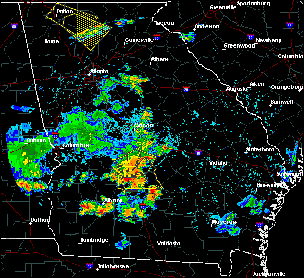 At 911 pm edt, severe thunderstorms were located along a line extending from near wallace to tremont to near raines, moving south at 55 mph (radar indicated). Hazards include 60 mph wind gusts and quarter size hail. Hail damage to vehicles is expected. Expect wind damage to roofs, siding, and trees. At 911 pm edt, severe thunderstorms were located along a line extending from near wallace to tremont to near raines, moving south at 55 mph (radar indicated). Hazards include 60 mph wind gusts and quarter size hail. Hail damage to vehicles is expected. Expect wind damage to roofs, siding, and trees.
|
| 6/22/2019 8:28 PM EDT |
 At 827 pm edt, a severe thunderstorm was located over cordele, moving east at 20 mph (radar indicated). Hazards include 60 mph wind gusts and quarter size hail. Hail damage to vehicles is expected. Expect wind damage to roofs, siding, and trees. At 827 pm edt, a severe thunderstorm was located over cordele, moving east at 20 mph (radar indicated). Hazards include 60 mph wind gusts and quarter size hail. Hail damage to vehicles is expected. Expect wind damage to roofs, siding, and trees.
|
| 6/20/2019 6:07 PM EDT |
 At 607 pm edt, a severe thunderstorm was located over abbeville, moving east at 55 mph (radar indicated). Hazards include 60 mph wind gusts. Expect damage to roofs, siding, and trees. Locations impacted include, cordele, eastman, abbeville, rochelle, milan, arabi, rhine, chauncey, pitts, jacksonville, union, east crisp, antioch church, seville, hatley, jay bird springs, temperance, browning, china hill and five points. At 607 pm edt, a severe thunderstorm was located over abbeville, moving east at 55 mph (radar indicated). Hazards include 60 mph wind gusts. Expect damage to roofs, siding, and trees. Locations impacted include, cordele, eastman, abbeville, rochelle, milan, arabi, rhine, chauncey, pitts, jacksonville, union, east crisp, antioch church, seville, hatley, jay bird springs, temperance, browning, china hill and five points.
|
| 6/20/2019 5:49 PM EDT |
 The national weather service in peachtree city has issued a * severe thunderstorm warning for. southern dodge county in central georgia. southern pulaski county in central georgia. western telfair county in central georgia. Wilcox county in central georgia. The national weather service in peachtree city has issued a * severe thunderstorm warning for. southern dodge county in central georgia. southern pulaski county in central georgia. western telfair county in central georgia. Wilcox county in central georgia.
|
| 6/20/2019 5:21 PM EDT |
 At 520 pm edt, a severe thunderstorm was located over cobb, or 11 miles west of cordele, moving east at 35 mph (radar indicated). Hazards include 60 mph wind gusts and quarter size hail. Hail damage to vehicles is expected. Expect wind damage to roofs, siding, and trees. At 520 pm edt, a severe thunderstorm was located over cobb, or 11 miles west of cordele, moving east at 35 mph (radar indicated). Hazards include 60 mph wind gusts and quarter size hail. Hail damage to vehicles is expected. Expect wind damage to roofs, siding, and trees.
|
| 5/12/2019 2:21 PM EDT |
 The severe thunderstorm warning for wilcox and crisp counties will expire at 230 pm edt, the storm which prompted the warning is weakening below severe limits, and no longer poses an immediate threat to life or property. therefore, the warning will be allowed to expire at 230 pm edt. however small hail, gusty winds and heavy rain are still possible with this thunderstorm. a severe thunderstorm watch remains in effect until 900 pm edt for central georgia. to report severe weather, contact your nearest law enforcement agency. they will relay your report to the national weather service peachtree city. The severe thunderstorm warning for wilcox and crisp counties will expire at 230 pm edt, the storm which prompted the warning is weakening below severe limits, and no longer poses an immediate threat to life or property. therefore, the warning will be allowed to expire at 230 pm edt. however small hail, gusty winds and heavy rain are still possible with this thunderstorm. a severe thunderstorm watch remains in effect until 900 pm edt for central georgia. to report severe weather, contact your nearest law enforcement agency. they will relay your report to the national weather service peachtree city.
|
| 5/12/2019 1:51 PM EDT |
 The national weather service in peachtree city has issued a * severe thunderstorm warning for. wilcox county in central georgia. crisp county in central georgia. until 230 pm edt. At 150 pm edt, a severe thunderstorm was southwest of cordele,. The national weather service in peachtree city has issued a * severe thunderstorm warning for. wilcox county in central georgia. crisp county in central georgia. until 230 pm edt. At 150 pm edt, a severe thunderstorm was southwest of cordele,.
|
| 4/19/2019 10:10 AM EDT |
 At 1010 am edt, a severe thunderstorm was located over poulan, or near sylvester, moving northeast at 65 mph (radar indicated). Hazards include 60 mph wind gusts. expect damage to roofs, siding, and trees At 1010 am edt, a severe thunderstorm was located over poulan, or near sylvester, moving northeast at 65 mph (radar indicated). Hazards include 60 mph wind gusts. expect damage to roofs, siding, and trees
|
| 3/3/2019 4:19 PM EST |
 At 419 pm est, a severe thunderstorm was located near doles, or 10 miles northwest of ashburn, moving east at 45 mph (radar indicated). Hazards include 60 mph wind gusts and quarter size hail. Hail damage to vehicles is expected. Expect wind damage to roofs, siding, and trees. At 419 pm est, a severe thunderstorm was located near doles, or 10 miles northwest of ashburn, moving east at 45 mph (radar indicated). Hazards include 60 mph wind gusts and quarter size hail. Hail damage to vehicles is expected. Expect wind damage to roofs, siding, and trees.
|
| 3/3/2019 4:14 PM EST |
 At 414 pm est, a severe thunderstorm capable of producing a tornado was located 9 miles southwest of arabi, or 13 miles west of ashburn, moving northeast at 45 mph (radar indicated rotation). Hazards include tornado and quarter size hail. Flying debris will be dangerous to those caught without shelter. mobile homes will be damaged or destroyed. damage to roofs, windows, and vehicles will occur. tree damage is likely. This tornadic thunderstorm will remain over mainly rural areas of northwestern turner and northwestern worth counties, including the following locations, dakota, sibley, doles, oakfield and warwick. At 414 pm est, a severe thunderstorm capable of producing a tornado was located 9 miles southwest of arabi, or 13 miles west of ashburn, moving northeast at 45 mph (radar indicated rotation). Hazards include tornado and quarter size hail. Flying debris will be dangerous to those caught without shelter. mobile homes will be damaged or destroyed. damage to roofs, windows, and vehicles will occur. tree damage is likely. This tornadic thunderstorm will remain over mainly rural areas of northwestern turner and northwestern worth counties, including the following locations, dakota, sibley, doles, oakfield and warwick.
|
| 3/3/2019 2:46 PM EST |
 At 246 pm est, a severe thunderstorm was located near ashburn, moving northeast at 40 mph (radar indicated). Hazards include golf ball size hail and 60 mph wind gusts. People and animals outdoors will be injured. expect hail damage to roofs, siding, windows, and vehicles. Expect wind damage to roofs, siding, and trees. At 246 pm est, a severe thunderstorm was located near ashburn, moving northeast at 40 mph (radar indicated). Hazards include golf ball size hail and 60 mph wind gusts. People and animals outdoors will be injured. expect hail damage to roofs, siding, windows, and vehicles. Expect wind damage to roofs, siding, and trees.
|
| 12/2/2018 9:40 AM EST |
 At 940 am est, a severe thunderstorm was located over poulan, or over sylvester, moving northeast at 60 mph (radar indicated). Hazards include 60 mph wind gusts. Expect damage to roofs, siding, and trees. locations impacted include, sylvester, ashburn, poulan, ty ty, marine corps logistics base, worth, terrell, sycamore, sumner, bridgeboro, minton, amboy, sylvester airport, anderson city, tempy, parkerville, inaha, red rock, pritchetts and crestwood. A tornado watch remains in effect until 1100 am est for south central and southwestern georgia. At 940 am est, a severe thunderstorm was located over poulan, or over sylvester, moving northeast at 60 mph (radar indicated). Hazards include 60 mph wind gusts. Expect damage to roofs, siding, and trees. locations impacted include, sylvester, ashburn, poulan, ty ty, marine corps logistics base, worth, terrell, sycamore, sumner, bridgeboro, minton, amboy, sylvester airport, anderson city, tempy, parkerville, inaha, red rock, pritchetts and crestwood. A tornado watch remains in effect until 1100 am est for south central and southwestern georgia.
|
| 12/2/2018 9:27 AM EST |
 At 927 am est, doppler radar indicated a severe thunderstorm capable of producing damaging winds in excess of 60 mph. this storm was located near putney, and moving northeast at 60 mph. At 927 am est, doppler radar indicated a severe thunderstorm capable of producing damaging winds in excess of 60 mph. this storm was located near putney, and moving northeast at 60 mph.
|
| 8/10/2018 7:23 PM EDT |
 At 723 pm edt, severe thunderstorms were located along a line extending from near arabi to near marine corps logistics base, moving east at 25 mph (radar indicated). Hazards include 60 mph wind gusts. expect damage to roofs, siding, and trees At 723 pm edt, severe thunderstorms were located along a line extending from near arabi to near marine corps logistics base, moving east at 25 mph (radar indicated). Hazards include 60 mph wind gusts. expect damage to roofs, siding, and trees
|
| 8/6/2018 6:35 PM EDT |
 The severe thunderstorm warning for west central irwin, turner, tift and worth counties will expire at 645 pm edt, the storm which prompted the warning has weakened below severe limits, and no longer poses an immediate threat to life or property. therefore, the warning will be allowed to expire. to report severe weather, contact your nearest law enforcement agency. they will relay your report to the national weather service tallahassee. The severe thunderstorm warning for west central irwin, turner, tift and worth counties will expire at 645 pm edt, the storm which prompted the warning has weakened below severe limits, and no longer poses an immediate threat to life or property. therefore, the warning will be allowed to expire. to report severe weather, contact your nearest law enforcement agency. they will relay your report to the national weather service tallahassee.
|
| 8/6/2018 6:00 PM EDT |
 At 600 pm edt, a severe thunderstorm was located near ashburn, moving southwest at 10 mph (radar indicated). Hazards include 60 mph wind gusts. expect damage to roofs, siding, and trees At 600 pm edt, a severe thunderstorm was located near ashburn, moving southwest at 10 mph (radar indicated). Hazards include 60 mph wind gusts. expect damage to roofs, siding, and trees
|
| 6/28/2018 3:26 PM EDT |
 At 326 pm edt, severe thunderstorms were located along a line extending from maddox to east crisp, moving south at 35 mph (radar indicated). Hazards include 60 mph wind gusts. Expect damage to roofs, siding, and trees. Locations impacted include, americus, cordele, vienna, arabi, byromville, pinehurst, leslie, andersonville, lilly, de soto, desoto, cobb, sumter, lamar, richwood, new era, huntington, pennington, drayton and methvins. At 326 pm edt, severe thunderstorms were located along a line extending from maddox to east crisp, moving south at 35 mph (radar indicated). Hazards include 60 mph wind gusts. Expect damage to roofs, siding, and trees. Locations impacted include, americus, cordele, vienna, arabi, byromville, pinehurst, leslie, andersonville, lilly, de soto, desoto, cobb, sumter, lamar, richwood, new era, huntington, pennington, drayton and methvins.
|
| 6/28/2018 3:12 PM EDT |
 At 311 pm edt, severe thunderstorms were located along a line extending from near new era to tippettville, moving south at 35 mph (radar indicated). Hazards include 60 mph wind gusts. expect damage to roofs, siding, and trees At 311 pm edt, severe thunderstorms were located along a line extending from near new era to tippettville, moving south at 35 mph (radar indicated). Hazards include 60 mph wind gusts. expect damage to roofs, siding, and trees
|
| 6/25/2018 7:41 PM EDT |
 At 709 pm edt, a severe thunderstorm was located over wenona, or near cordele, moving southeast at 20 mph (radar indicated). Hazards include 60 mph wind gusts and quarter size hail. Hail damage to vehicles is expected. Expect wind damage to roofs, siding, and trees. At 709 pm edt, a severe thunderstorm was located over wenona, or near cordele, moving southeast at 20 mph (radar indicated). Hazards include 60 mph wind gusts and quarter size hail. Hail damage to vehicles is expected. Expect wind damage to roofs, siding, and trees.
|
| 6/25/2018 7:09 PM EDT |
 At 709 pm edt, a severe thunderstorm was located over wenona, or near cordele, moving southeast at 20 mph (radar indicated). Hazards include 60 mph wind gusts and quarter size hail. Hail damage to vehicles is expected. Expect wind damage to roofs, siding, and trees. At 709 pm edt, a severe thunderstorm was located over wenona, or near cordele, moving southeast at 20 mph (radar indicated). Hazards include 60 mph wind gusts and quarter size hail. Hail damage to vehicles is expected. Expect wind damage to roofs, siding, and trees.
|
| 8/30/2017 4:19 PM EDT |
 At 419 pm edt, a severe thunderstorm was located over hatley, or 9 miles east of cordele, moving northeast at 35 mph (radar indicated). Hazards include 60 mph wind gusts. Expect damage to roofs, siding, and trees. Locations impacted include, cordele, arabi, east crisp, tremont, wenona and hatley. At 419 pm edt, a severe thunderstorm was located over hatley, or 9 miles east of cordele, moving northeast at 35 mph (radar indicated). Hazards include 60 mph wind gusts. Expect damage to roofs, siding, and trees. Locations impacted include, cordele, arabi, east crisp, tremont, wenona and hatley.
|
| 8/30/2017 4:04 PM EDT |
 At 403 pm edt, a severe thunderstorm was located near cordele, moving northeast at 40 mph (radar indicated). Hazards include 60 mph wind gusts. Expect damage to roofs, siding, and trees. Locations impacted include, cordele, vienna, arabi, east crisp, fort early, georgia veterans memorial st pk, richwood, tippettville, raines, tremont, wenona and hatley. At 403 pm edt, a severe thunderstorm was located near cordele, moving northeast at 40 mph (radar indicated). Hazards include 60 mph wind gusts. Expect damage to roofs, siding, and trees. Locations impacted include, cordele, vienna, arabi, east crisp, fort early, georgia veterans memorial st pk, richwood, tippettville, raines, tremont, wenona and hatley.
|
| 8/30/2017 3:44 PM EDT |
 At 344 pm edt, a severe thunderstorm was located over fort early, or 10 miles southwest of cordele, moving northeast at 40 mph (radar indicated). Hazards include 60 mph wind gusts and pea size hail. expect damage to roofs, siding, and trees At 344 pm edt, a severe thunderstorm was located over fort early, or 10 miles southwest of cordele, moving northeast at 40 mph (radar indicated). Hazards include 60 mph wind gusts and pea size hail. expect damage to roofs, siding, and trees
|
| 5/23/2017 1:47 PM EDT |
 At 147 pm edt, a severe thunderstorm capable of producing a tornado was located over wenona, or near cordele, moving northeast at 35 mph (radar indicated rotation). Hazards include tornado. Flying debris will be dangerous to those caught without shelter. mobile homes will be damaged or destroyed. damage to roofs, windows, and vehicles will occur. Tree damage is likely. At 147 pm edt, a severe thunderstorm capable of producing a tornado was located over wenona, or near cordele, moving northeast at 35 mph (radar indicated rotation). Hazards include tornado. Flying debris will be dangerous to those caught without shelter. mobile homes will be damaged or destroyed. damage to roofs, windows, and vehicles will occur. Tree damage is likely.
|
| 5/23/2017 1:30 PM EDT |
 At 130 pm edt, a severe thunderstorm was located near warwick, or 10 miles southwest of cordele, moving northeast at 40 mph (radar indicated). Hazards include 60 mph wind gusts and penny size hail. expect damage to roofs, siding, and trees At 130 pm edt, a severe thunderstorm was located near warwick, or 10 miles southwest of cordele, moving northeast at 40 mph (radar indicated). Hazards include 60 mph wind gusts and penny size hail. expect damage to roofs, siding, and trees
|
| 5/20/2017 3:13 PM EDT |
 At 313 pm edt, a severe thunderstorm was located near cordele, moving north at 20 mph (radar indicated). Hazards include 60 mph wind gusts. Expect damage to roofs, siding, and trees. Locations impacted include, cordele, arabi, east crisp, georgia veterans memorial st pk, raines, tremont, wenona and hatley. At 313 pm edt, a severe thunderstorm was located near cordele, moving north at 20 mph (radar indicated). Hazards include 60 mph wind gusts. Expect damage to roofs, siding, and trees. Locations impacted include, cordele, arabi, east crisp, georgia veterans memorial st pk, raines, tremont, wenona and hatley.
|
| 5/20/2017 2:38 PM EDT |
 At 237 pm edt, a severe thunderstorm was located near sibley, or 7 miles northwest of ashburn, moving north at 25 mph (radar indicated). Hazards include 60 mph wind gusts and penny size hail. expect damage to roofs, siding, and trees At 237 pm edt, a severe thunderstorm was located near sibley, or 7 miles northwest of ashburn, moving north at 25 mph (radar indicated). Hazards include 60 mph wind gusts and penny size hail. expect damage to roofs, siding, and trees
|
| 4/5/2017 3:35 PM EDT |
 At 334 pm edt, a severe thunderstorm was located 10 miles south of rochelle, or 12 miles northeast of ashburn, moving east at 55 mph (trained weather spotters). Hazards include quarter size hail. Damage to vehicles is expected. locations impacted include, fitzgerald, ashburn, ocilla, mystic, worth, terrell, sycamore, rebecca, lulaville, amboy, sibley, inaha, coverdale, irwinville, fitzgerald municipal a/p, hobby, turner co airport, irwinville airport, dakota and arp. A tornado watch remains in effect until 800 pm edt for south central georgia. At 334 pm edt, a severe thunderstorm was located 10 miles south of rochelle, or 12 miles northeast of ashburn, moving east at 55 mph (trained weather spotters). Hazards include quarter size hail. Damage to vehicles is expected. locations impacted include, fitzgerald, ashburn, ocilla, mystic, worth, terrell, sycamore, rebecca, lulaville, amboy, sibley, inaha, coverdale, irwinville, fitzgerald municipal a/p, hobby, turner co airport, irwinville airport, dakota and arp. A tornado watch remains in effect until 800 pm edt for south central georgia.
|
| 4/5/2017 3:23 PM EDT |
 At 323 pm edt, a severe thunderstorm capable of producing a tornado was located over arabi, or 9 miles south of cordele, moving east at 30 mph (radar indicated rotation). Hazards include tornado and quarter size hail. Flying debris will be dangerous to those caught without shelter. mobile homes will be damaged or destroyed. damage to roofs, windows, and vehicles will occur. tree damage is likely. Locations impacted include, rochelle, arabi, pitts, east crisp, double run, wenona, seville and hatley. At 323 pm edt, a severe thunderstorm capable of producing a tornado was located over arabi, or 9 miles south of cordele, moving east at 30 mph (radar indicated rotation). Hazards include tornado and quarter size hail. Flying debris will be dangerous to those caught without shelter. mobile homes will be damaged or destroyed. damage to roofs, windows, and vehicles will occur. tree damage is likely. Locations impacted include, rochelle, arabi, pitts, east crisp, double run, wenona, seville and hatley.
|
| 4/5/2017 3:20 PM EDT | Quarter sized hail reported 0.4 miles ESE of Arabi, GA, quarter sized hail confirmed in arabi |
| 4/5/2017 3:16 PM EDT |
 At 315 pm edt, a severe thunderstorm was located 7 miles west of ashburn, moving east at 55 mph (radar indicated). Hazards include 60 mph wind gusts and half dollar size hail. Hail damage to vehicles is expected. Expect wind damage to roofs, siding, and trees. At 315 pm edt, a severe thunderstorm was located 7 miles west of ashburn, moving east at 55 mph (radar indicated). Hazards include 60 mph wind gusts and half dollar size hail. Hail damage to vehicles is expected. Expect wind damage to roofs, siding, and trees.
|
| 4/5/2017 2:54 PM EDT |
 At 254 pm edt, a severe thunderstorm capable of producing a tornado was located over oakfield, or 13 miles east of leesburg, moving east at 30 mph (radar indicated rotation). Hazards include tornado and quarter size hail. Flying debris will be dangerous to those caught without shelter. mobile homes will be damaged or destroyed. damage to roofs, windows, and vehicles will occur. Tree damage is likely. At 254 pm edt, a severe thunderstorm capable of producing a tornado was located over oakfield, or 13 miles east of leesburg, moving east at 30 mph (radar indicated rotation). Hazards include tornado and quarter size hail. Flying debris will be dangerous to those caught without shelter. mobile homes will be damaged or destroyed. damage to roofs, windows, and vehicles will occur. Tree damage is likely.
|
| 4/3/2017 1:58 PM EDT |
 At 158 pm edt, severe thunderstorms were located along a line extending from unadilla to near vienna to raines, moving east at 35 mph (radar indicated). Hazards include 60 mph wind gusts and nickel size hail. expect damage to roofs, siding, and trees At 158 pm edt, severe thunderstorms were located along a line extending from unadilla to near vienna to raines, moving east at 35 mph (radar indicated). Hazards include 60 mph wind gusts and nickel size hail. expect damage to roofs, siding, and trees
|
| 2/7/2017 6:10 PM EST |
 At 610 pm est, severe thunderstorms were located extending from near browndale to near tippettville to near warwick, moving east at 40 mph (radar indicated). Hazards include 60 mph wind gusts and penny size hail. expect damage to roofs, siding, and trees At 610 pm est, severe thunderstorms were located extending from near browndale to near tippettville to near warwick, moving east at 40 mph (radar indicated). Hazards include 60 mph wind gusts and penny size hail. expect damage to roofs, siding, and trees
|
| 1/22/2017 4:08 PM EST |
 At 407 pm est, a confirmed large and destructive tornado was located over double run, or 12 miles northeast of ashburn, moving northeast at 60 mph. tornado emergency for southern wilcox county. this is a particularly dangerous situation. take cover now! (public confirmed tornado). Hazards include deadly tornado. You are in a life-threatening situation. flying debris may be deadly to those caught without shelter. mobile homes will be destroyed. considerable damage to homes, businesses, and vehicles is likely and complete destruction is possible. Locations impacted include, abbeville, rochelle, arabi, pineview, pitts, east crisp, cedar creek, antioch church, pope city, seville, hatley, browning, pleasant view, double run and owensboro. At 407 pm est, a confirmed large and destructive tornado was located over double run, or 12 miles northeast of ashburn, moving northeast at 60 mph. tornado emergency for southern wilcox county. this is a particularly dangerous situation. take cover now! (public confirmed tornado). Hazards include deadly tornado. You are in a life-threatening situation. flying debris may be deadly to those caught without shelter. mobile homes will be destroyed. considerable damage to homes, businesses, and vehicles is likely and complete destruction is possible. Locations impacted include, abbeville, rochelle, arabi, pineview, pitts, east crisp, cedar creek, antioch church, pope city, seville, hatley, browning, pleasant view, double run and owensboro.
|
| 1/22/2017 3:59 PM EST |
 At 358 pm est, a confirmed large and extremely dangerous tornado was located near sibley, or 7 miles north of ashburn, moving northeast at 65 mph. this is a particularly dangerous situation. take cover now! (public confirmed tornado). Hazards include damaging tornado. You are in a life-threatening situation. flying debris may be deadly to those caught without shelter. mobile homes will be destroyed. considerable damage to homes, businesses, and vehicles is likely and complete destruction is possible. Locations impacted include, cordele, abbeville, rochelle, arabi, pineview, pitts, east crisp, cedar creek, antioch church, pope city, seville, hatley, browning, pleasant view, double run, wenona and owensboro. At 358 pm est, a confirmed large and extremely dangerous tornado was located near sibley, or 7 miles north of ashburn, moving northeast at 65 mph. this is a particularly dangerous situation. take cover now! (public confirmed tornado). Hazards include damaging tornado. You are in a life-threatening situation. flying debris may be deadly to those caught without shelter. mobile homes will be destroyed. considerable damage to homes, businesses, and vehicles is likely and complete destruction is possible. Locations impacted include, cordele, abbeville, rochelle, arabi, pineview, pitts, east crisp, cedar creek, antioch church, pope city, seville, hatley, browning, pleasant view, double run, wenona and owensboro.
|
| 1/22/2017 3:42 PM EST |
 At 341 pm est, a confirmed large and extremely dangerous tornado was located near doles, or 10 miles northwest of sylvester, moving northeast at 65 mph. this is a particularly dangerous situation. take cover now! (radar confirmed tornado). Hazards include damaging tornado. You are in a life-threatening situation. flying debris may be deadly to those caught without shelter. mobile homes will be destroyed. Considerable damage to homes, businesses, and vehicles is likely and complete destruction is possible. At 341 pm est, a confirmed large and extremely dangerous tornado was located near doles, or 10 miles northwest of sylvester, moving northeast at 65 mph. this is a particularly dangerous situation. take cover now! (radar confirmed tornado). Hazards include damaging tornado. You are in a life-threatening situation. flying debris may be deadly to those caught without shelter. mobile homes will be destroyed. Considerable damage to homes, businesses, and vehicles is likely and complete destruction is possible.
|
| 1/22/2017 11:11 AM EST | Multpile trees reported down across arabi warwick road in southern crisp count in crisp county GA, 5.6 miles E of Arabi, GA |
| 1/22/2017 1:04 AM EST |
 At 103 am est, a severe thunderstorm was located near ashburn, moving east at 45 mph (radar indicated). Hazards include 60 mph wind gusts and quarter size hail. Hail damage to vehicles is expected. Expect wind damage to roofs, siding, and trees. At 103 am est, a severe thunderstorm was located near ashburn, moving east at 45 mph (radar indicated). Hazards include 60 mph wind gusts and quarter size hail. Hail damage to vehicles is expected. Expect wind damage to roofs, siding, and trees.
|
| 1/21/2017 12:53 PM EST |
 At 1253 pm est, severe thunderstorms were located extending from pulaski state prison to near tippettville to near arabi, moving east at 50 mph (radar indicated). Hazards include 60 mph wind gusts. expect damage to roofs, siding, and trees At 1253 pm est, severe thunderstorms were located extending from pulaski state prison to near tippettville to near arabi, moving east at 50 mph (radar indicated). Hazards include 60 mph wind gusts. expect damage to roofs, siding, and trees
|
| 1/2/2017 10:51 PM EST |
 At 1051 pm est, a severe thunderstorm was located over worth, or near ashburn, moving east at 65 mph (radar indicated). Hazards include 60 mph wind gusts. expect damage to roofs, siding, and trees At 1051 pm est, a severe thunderstorm was located over worth, or near ashburn, moving east at 65 mph (radar indicated). Hazards include 60 mph wind gusts. expect damage to roofs, siding, and trees
|
| 6/25/2016 6:08 PM EDT |
 At 605 pm edt, a severe thunderstorm was located near pitts, or 11 miles east of cordele, moving southwest at 15 mph (radar indicated). Hazards include 60 mph wind gusts and quarter size hail. Hail damage to vehicles is expected. expect wind damage to roofs, siding, and trees. Other locations in the warning include but are not limited to rochelle, arabi, pitts, hatley, double run and seville. At 605 pm edt, a severe thunderstorm was located near pitts, or 11 miles east of cordele, moving southwest at 15 mph (radar indicated). Hazards include 60 mph wind gusts and quarter size hail. Hail damage to vehicles is expected. expect wind damage to roofs, siding, and trees. Other locations in the warning include but are not limited to rochelle, arabi, pitts, hatley, double run and seville.
|
| 6/17/2016 9:14 PM EDT |
 At 914 pm edt, severe thunderstorms were located along a line extending from near rhine to near arabi, moving southeast at 30 mph (radar indicated). Hazards include 60 mph wind gusts and quarter size hail. Hail damage to vehicles is expected. expect wind damage to roofs, siding, and trees. Other locations in the warning include but are not limited to abbeville, rochelle, arabi, rhine, pitts, antioch church, double run, hatley, owensboro and browning. At 914 pm edt, severe thunderstorms were located along a line extending from near rhine to near arabi, moving southeast at 30 mph (radar indicated). Hazards include 60 mph wind gusts and quarter size hail. Hail damage to vehicles is expected. expect wind damage to roofs, siding, and trees. Other locations in the warning include but are not limited to abbeville, rochelle, arabi, rhine, pitts, antioch church, double run, hatley, owensboro and browning.
|
| 6/17/2016 8:58 PM EDT |
 At 857 pm edt, severe thunderstorms were located along a line extending from near rhine to cordele, moving southeast at 30 mph (radar indicated). Hazards include 60 mph wind gusts and quarter size hail. Hail damage to vehicles is expected. expect wind damage to roofs, siding, and trees. Other locations in the warning include but are not limited to cordele, abbeville, rochelle, arabi, rhine, pitts, tremont, antioch church, double run, hatley, wenona, owensboro, seville, browning and east crisp. At 857 pm edt, severe thunderstorms were located along a line extending from near rhine to cordele, moving southeast at 30 mph (radar indicated). Hazards include 60 mph wind gusts and quarter size hail. Hail damage to vehicles is expected. expect wind damage to roofs, siding, and trees. Other locations in the warning include but are not limited to cordele, abbeville, rochelle, arabi, rhine, pitts, tremont, antioch church, double run, hatley, wenona, owensboro, seville, browning and east crisp.
|
| 6/17/2016 8:22 PM EDT |
 At 822 pm edt, severe thunderstorms were located along a line extending from 9 miles southeast of hawkinsville to near andersonville, moving southeast at 40 mph (radar indicated). Hazards include 60 mph wind gusts and quarter size hail. Hail damage to vehicles is expected. expect wind damage to roofs, siding, and trees. Other locations in the warning include but are not limited to cordele, vienna, abbeville, rochelle, arabi, byromville, pineview, pinehurst, rhine, pitts, lilly, union, antioch church, cedar creek, richwood, pope city, drayton, ocmulgee banks, owensboro and tippettville. At 822 pm edt, severe thunderstorms were located along a line extending from 9 miles southeast of hawkinsville to near andersonville, moving southeast at 40 mph (radar indicated). Hazards include 60 mph wind gusts and quarter size hail. Hail damage to vehicles is expected. expect wind damage to roofs, siding, and trees. Other locations in the warning include but are not limited to cordele, vienna, abbeville, rochelle, arabi, byromville, pineview, pinehurst, rhine, pitts, lilly, union, antioch church, cedar creek, richwood, pope city, drayton, ocmulgee banks, owensboro and tippettville.
|
| 5/3/2016 7:36 PM EDT |
 At 736 pm edt, a severe thunderstorm was located 9 miles southwest of cordele, moving northeast at 35 mph (radar indicated). Hazards include 70 mph wind gusts and quarter size hail. Hail damage to vehicles is expected. expect considerable tree damage. wind damage is also likely to mobile homes, roofs, and outbuildings. Other locations in the warning include but are not limited to cordele, vienna, arabi, cobb, tremont, georgia veterans memorial st pk, richwood, wenona, east crisp, fort early and raines. At 736 pm edt, a severe thunderstorm was located 9 miles southwest of cordele, moving northeast at 35 mph (radar indicated). Hazards include 70 mph wind gusts and quarter size hail. Hail damage to vehicles is expected. expect considerable tree damage. wind damage is also likely to mobile homes, roofs, and outbuildings. Other locations in the warning include but are not limited to cordele, vienna, arabi, cobb, tremont, georgia veterans memorial st pk, richwood, wenona, east crisp, fort early and raines.
|
| 2/24/2016 1:33 AM EST |
 At 133 am est, a severe thunderstorm was located near cordele, moving northeast at 60 mph (radar indicated). Hazards include 70 mph wind gusts. Expect considerable tree damage. damage is likely to mobile homes, roofs and outbuildings. other locations in the warning include but are not limited to cordele, arabi, tremont, georgia veterans memorial st pk, hatley, wenona, east crisp, fort early and raines. A tornado watch remains in effect until 600 am est for west central georgia. At 133 am est, a severe thunderstorm was located near cordele, moving northeast at 60 mph (radar indicated). Hazards include 70 mph wind gusts. Expect considerable tree damage. damage is likely to mobile homes, roofs and outbuildings. other locations in the warning include but are not limited to cordele, arabi, tremont, georgia veterans memorial st pk, hatley, wenona, east crisp, fort early and raines. A tornado watch remains in effect until 600 am est for west central georgia.
|
| 2/24/2016 1:27 AM EST |
 At 126 am est, a severe thunderstorm was located 9 miles southeast of desoto, or 10 miles southwest of cordele, moving northeast at 60 mph (radar indicated). Hazards include 60 mph wind gusts. Expect damage to roofs. siding and trees. other locations in the warning include but are not limited to cordele, arabi, tremont, georgia veterans memorial st pk, hatley, wenona, east crisp, fort early and raines. A tornado watch remains in effect until 600 am est for west central georgia. At 126 am est, a severe thunderstorm was located 9 miles southeast of desoto, or 10 miles southwest of cordele, moving northeast at 60 mph (radar indicated). Hazards include 60 mph wind gusts. Expect damage to roofs. siding and trees. other locations in the warning include but are not limited to cordele, arabi, tremont, georgia veterans memorial st pk, hatley, wenona, east crisp, fort early and raines. A tornado watch remains in effect until 600 am est for west central georgia.
|
| 7/19/2015 7:03 PM EDT | Tree down at highway 33 near rocky mount church r in worth county GA, 7 miles NE of Arabi, GA |
| 7/19/2015 6:50 PM EDT |
 At 650 pm edt, a severe thunderstorm was located over arabi, or 7 miles south of cordele, moving east at 15 mph (radar indicated). Hazards include 60 mph wind gusts and quarter size hail. Hail damage to vehicles is expected. expect wind damage to roofs, siding and trees. Other locations in the warning include but are not limited to arabi, hatley and wenona. At 650 pm edt, a severe thunderstorm was located over arabi, or 7 miles south of cordele, moving east at 15 mph (radar indicated). Hazards include 60 mph wind gusts and quarter size hail. Hail damage to vehicles is expected. expect wind damage to roofs, siding and trees. Other locations in the warning include but are not limited to arabi, hatley and wenona.
|
| 6/30/2015 2:54 PM EDT |
 At 254 pm edt, the national weather service has detected a severe thunderstorm capable of producing damaging winds in excess of 60 mph. this storm was located near poulan, or 7 miles northeast of sylvester, and moving southeast at 35 mph. At 254 pm edt, the national weather service has detected a severe thunderstorm capable of producing damaging winds in excess of 60 mph. this storm was located near poulan, or 7 miles northeast of sylvester, and moving southeast at 35 mph.
|
| 6/23/2015 2:52 PM EDT |
 At 252 pm edt, a severe thunderstorm was located near cordele, moving southeast at 15 mph (radar indicated). Hazards include 60 mph wind gusts and quarter size hail. Hail damage to vehicles is expected. expect wind damage to roofs, siding and trees. Other locations in the warning include but are not limited to cordele, arabi, pitts, tremont, double run, hatley, wenona, east crisp, owensboro and seville. At 252 pm edt, a severe thunderstorm was located near cordele, moving southeast at 15 mph (radar indicated). Hazards include 60 mph wind gusts and quarter size hail. Hail damage to vehicles is expected. expect wind damage to roofs, siding and trees. Other locations in the warning include but are not limited to cordele, arabi, pitts, tremont, double run, hatley, wenona, east crisp, owensboro and seville.
|
| 6/17/2015 7:36 PM EDT |
 At 735 pm edt, doppler radar indicated a line of severe thunderstorms capable of producing damaging winds in excess of 60 mph. these storms were located along a line extending from ashburn to 7 miles east of baconton, moving west at 15 mph. locations impacted include, albany, ashburn, putney, sylvester, poulan, marine corps logistics base, east albany, turner city, worth, terrell, sycamore, sumner, isabella, crestwood, sylvester airport, dakota, livingston, acree, pecan city and southwest ga regional a/p. At 735 pm edt, doppler radar indicated a line of severe thunderstorms capable of producing damaging winds in excess of 60 mph. these storms were located along a line extending from ashburn to 7 miles east of baconton, moving west at 15 mph. locations impacted include, albany, ashburn, putney, sylvester, poulan, marine corps logistics base, east albany, turner city, worth, terrell, sycamore, sumner, isabella, crestwood, sylvester airport, dakota, livingston, acree, pecan city and southwest ga regional a/p.
|
| 6/17/2015 7:10 PM EDT |
 At 710 pm edt, the national weather service has detected a line of severe thunderstorms capable of producing damaging winds in excess of 60 mph. these storms were located along a line extending from 7 miles south of rochelle to near doerun, and moving west at 5 mph. there are reports of at least 7 trees down in turner county. At 710 pm edt, the national weather service has detected a line of severe thunderstorms capable of producing damaging winds in excess of 60 mph. these storms were located along a line extending from 7 miles south of rochelle to near doerun, and moving west at 5 mph. there are reports of at least 7 trees down in turner county.
|
| 6/17/2015 6:31 PM EDT |
 At 631 pm edt, the national weather service has detected a severe thunderstorm capable of producing damaging winds in excess of 60 mph. this storm was located 8 miles southeast of ashburn, and moving northwest at 20 mph. At 631 pm edt, the national weather service has detected a severe thunderstorm capable of producing damaging winds in excess of 60 mph. this storm was located 8 miles southeast of ashburn, and moving northwest at 20 mph.
|
| 4/25/2015 6:41 PM EDT | At 641 pm edt, a severe thunderstorm was located over desoto, or 13 miles southeast of americus, moving east at 45 mph (radar indicated). Hazards include 60 mph wind gusts and quarter size hail. Hail damage to vehicles is expected. expect wind damage to roofs, siding and trees. other locations in the warning include but are not limited to cordele, vienna, rochelle, arabi, pineview, leslie, pitts, de soto, desoto, cobb, lamar, richwood, pope city, drayton, tippettville, seville, raines, georgia veterans memorial st pk, tremont and double run. 1. 00in. |
| 4/19/2015 12:13 PM EDT | At 1213 pm edt, a severe thunderstorm with weak rotation was located 11 miles south southwest of cordele, moving northeast at 35 mph (radar indicated). Hazards include 60 mph wind gusts. Expect damage to roofs. siding and trees. other locations in the warning include but are not limited to cordele, arabi, tremont, hatley, wenona, east crisp, pleasant view and seville. a tornado watch remains in effect until 300 pm edt for central georgia. Possible. |
| 6/21/2014 6:08 PM EDT | 4-5 large pecan trees down along with tipped over irrigation pivots north of antioch rd. other trees and powerlines down nearby als in crisp county GA, 5 miles ESE of Arabi, GA |
| 6/6/2014 8:26 PM EDT | A couple of trees down just east of 75 near arab in crisp county GA, 2 miles W of Arabi, GA |
| 7/1/2012 9:09 PM EDT | Crisp county 911 relayed reports of several downed trees and lines including 2 trees downed onto a house. radar estimated time from 2109 edt to 2123 ed in crisp county GA, 6.2 miles WSW of Arabi, GA |
| 10/13/2011 5:08 PM EDT | Quarter sized hail reported 1.6 miles WSW of Arabi, GA, public reported quarter sized hail at the plantation house near arabi. |
| 1/1/0001 12:00 AM | Crisp county ema relayed numerous reports of downed trees in southern portions of the count in crisp county GA, 2.3 miles SSE of Arabi, GA |
Hail Maps for Arabi, GA


Connect with Interactive Hail Maps