

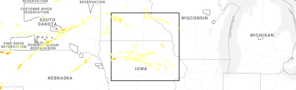
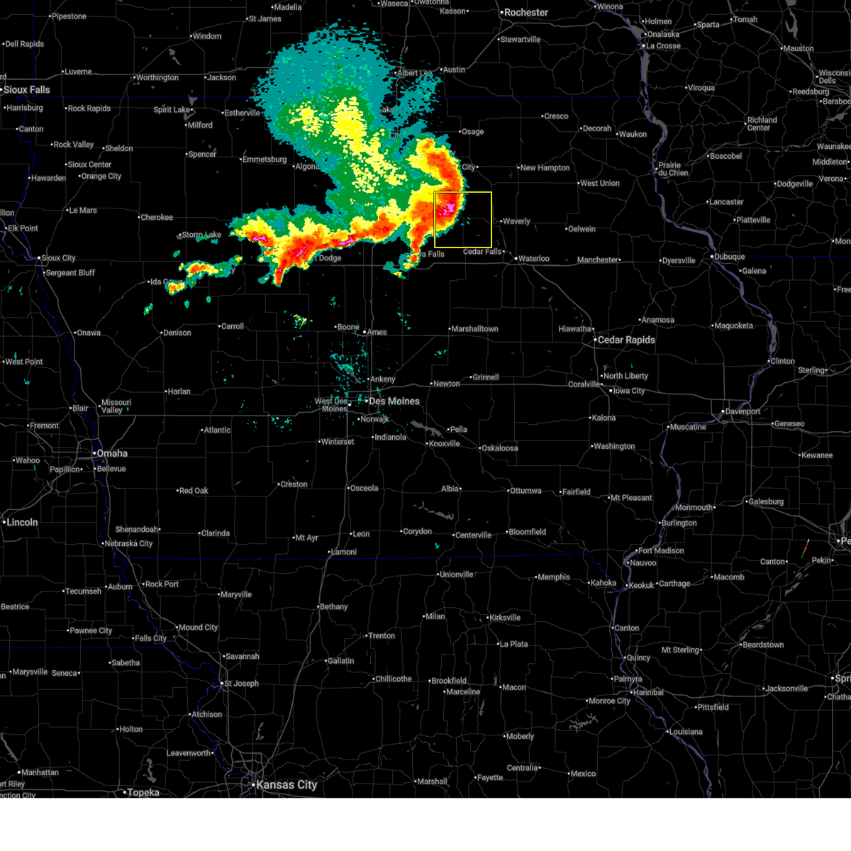
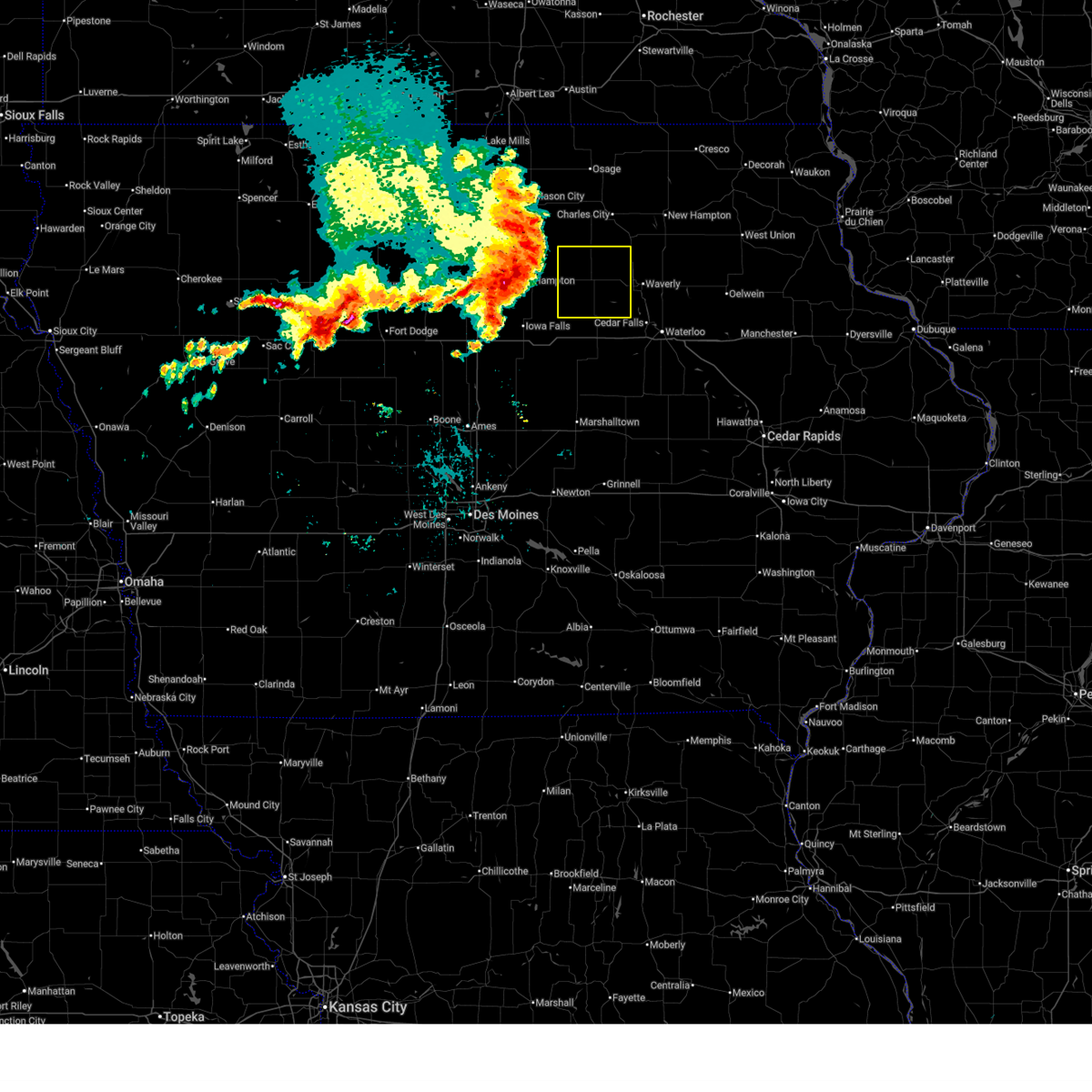
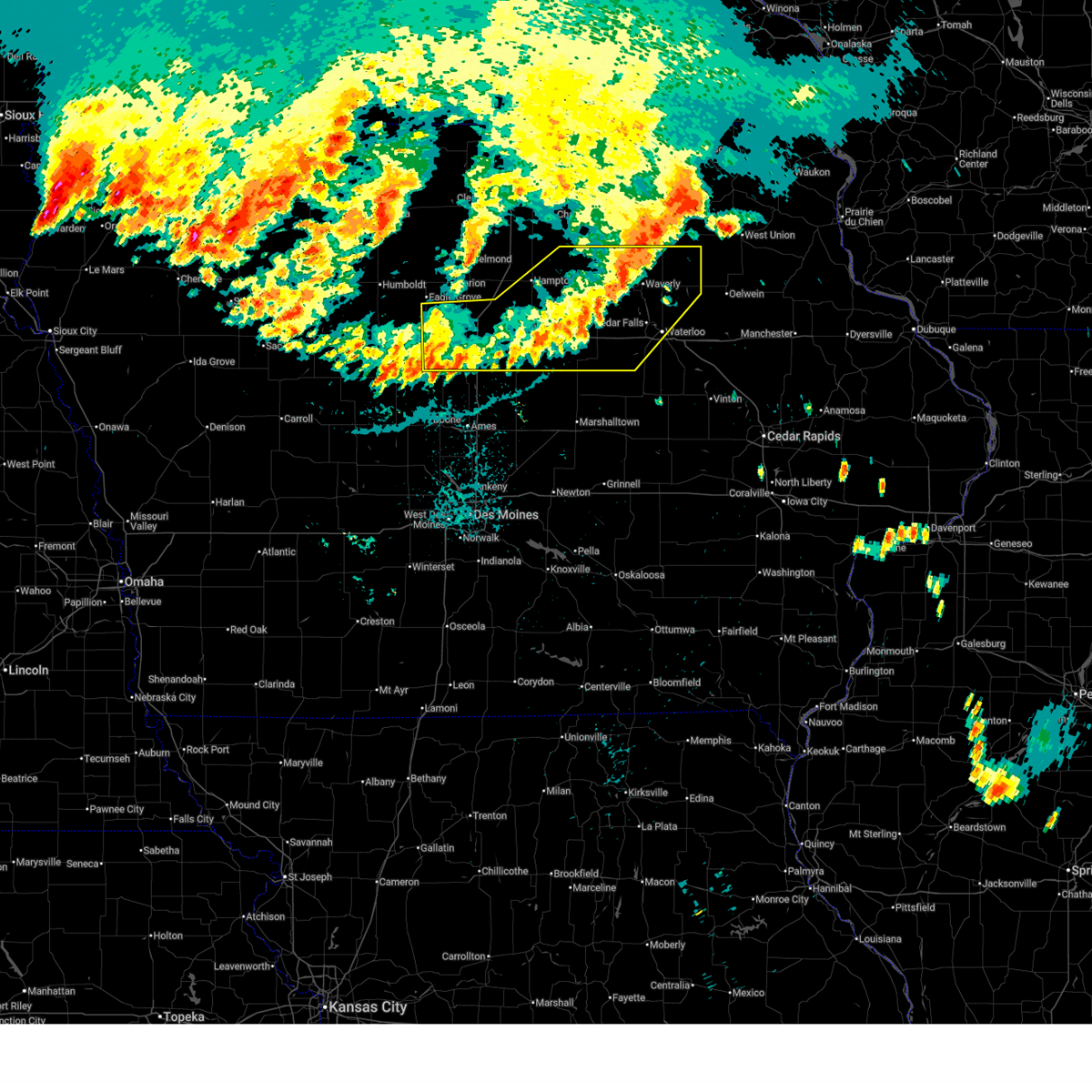
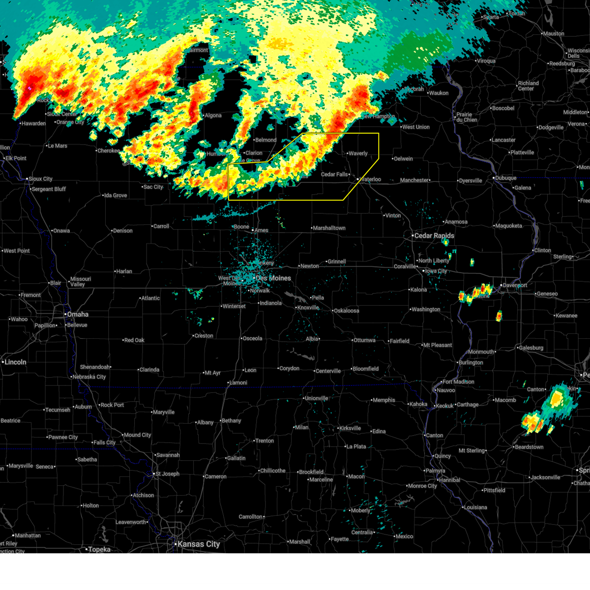
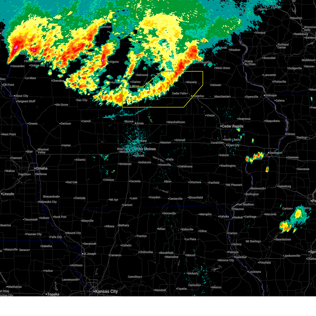
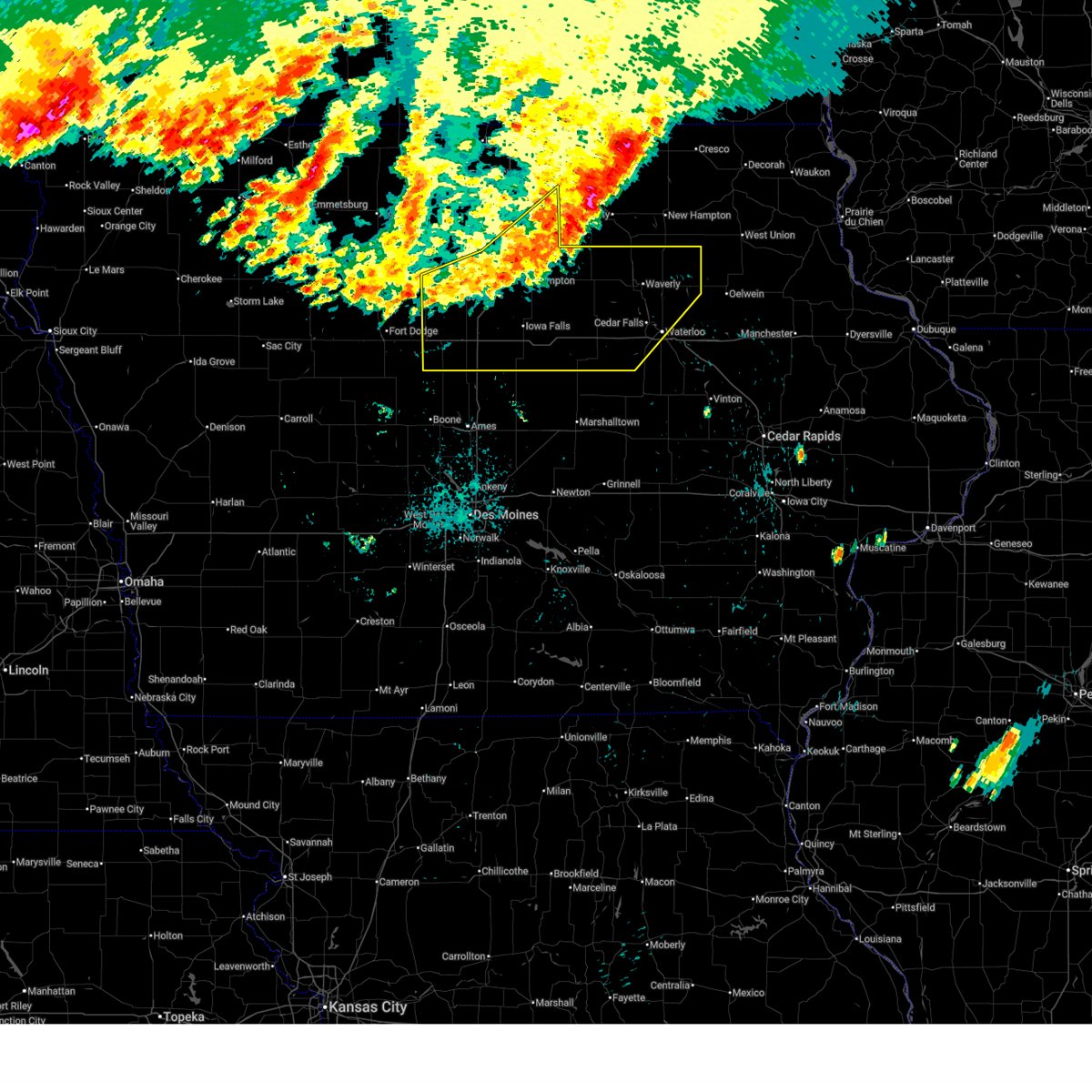
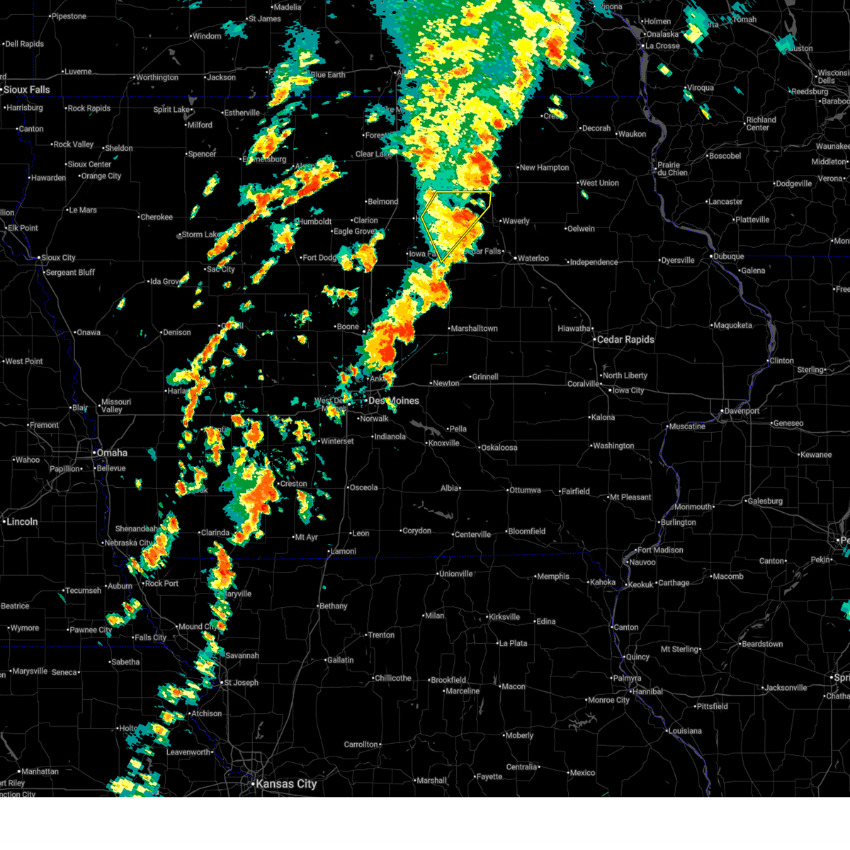
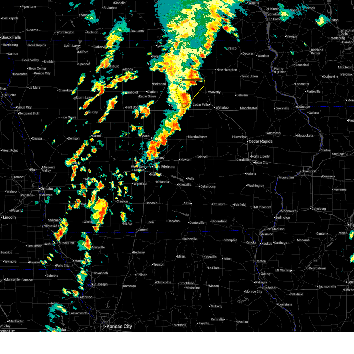
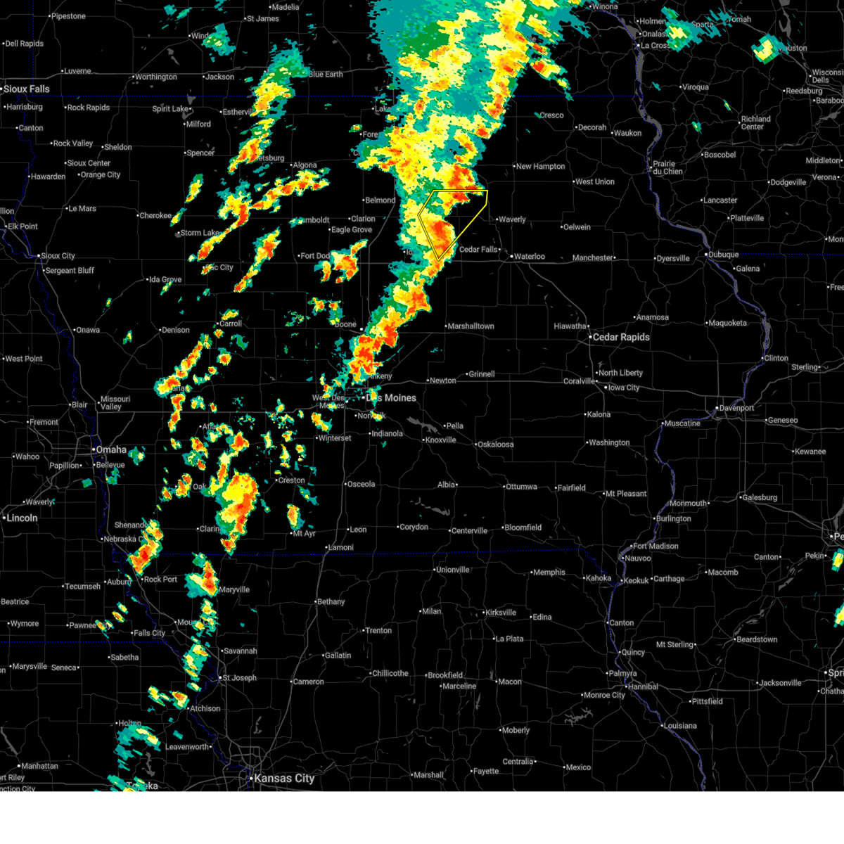
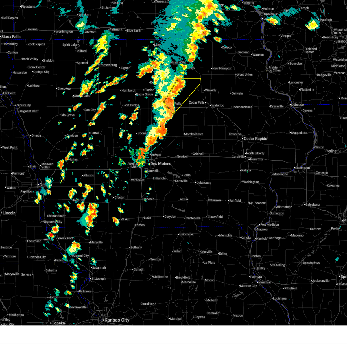
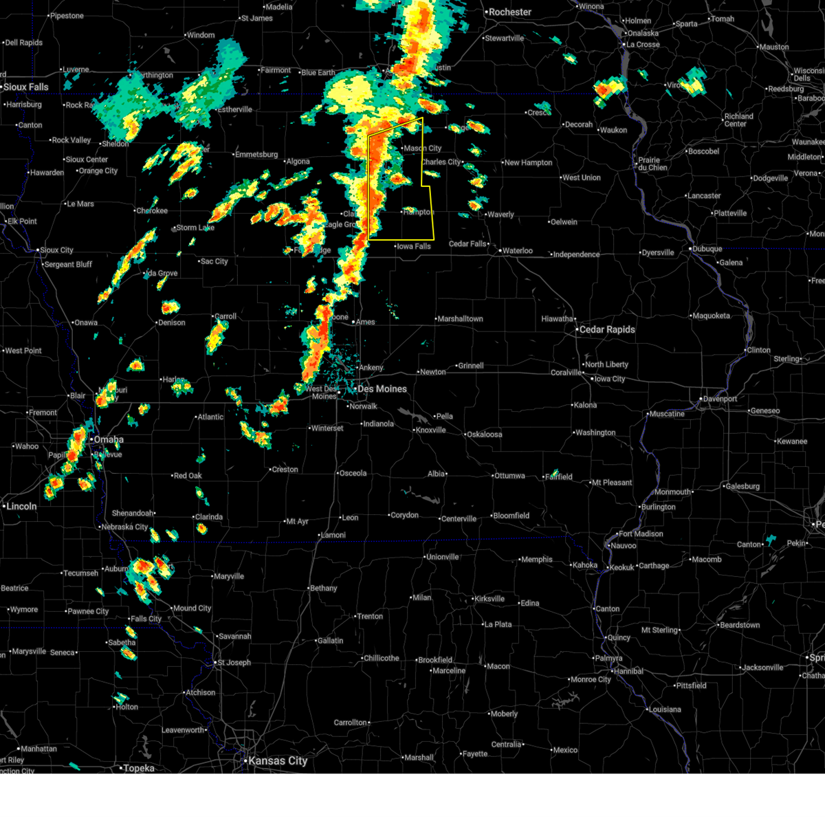
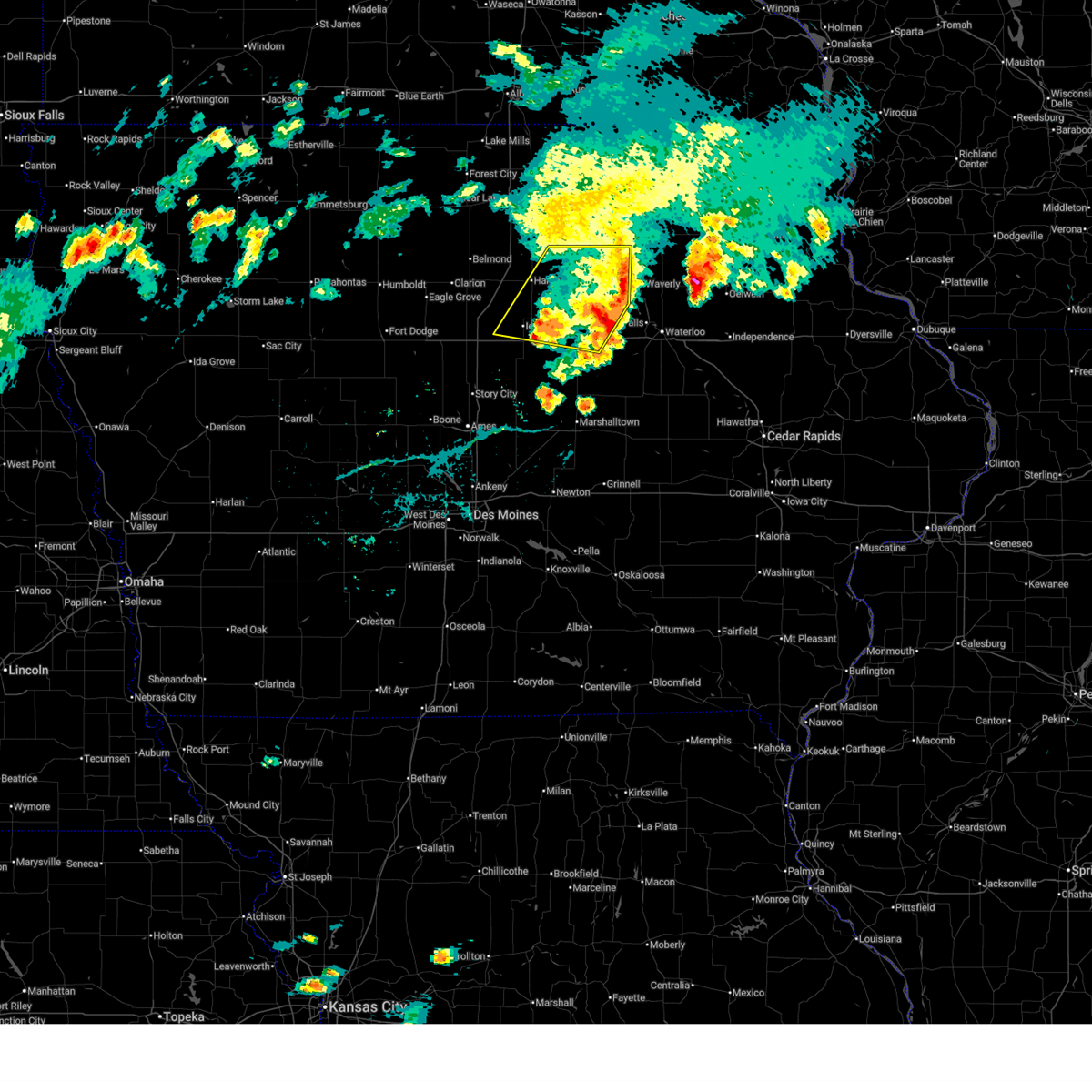
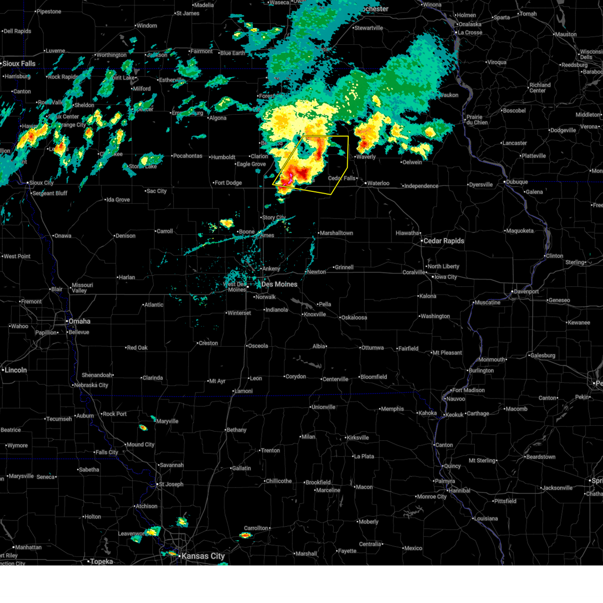
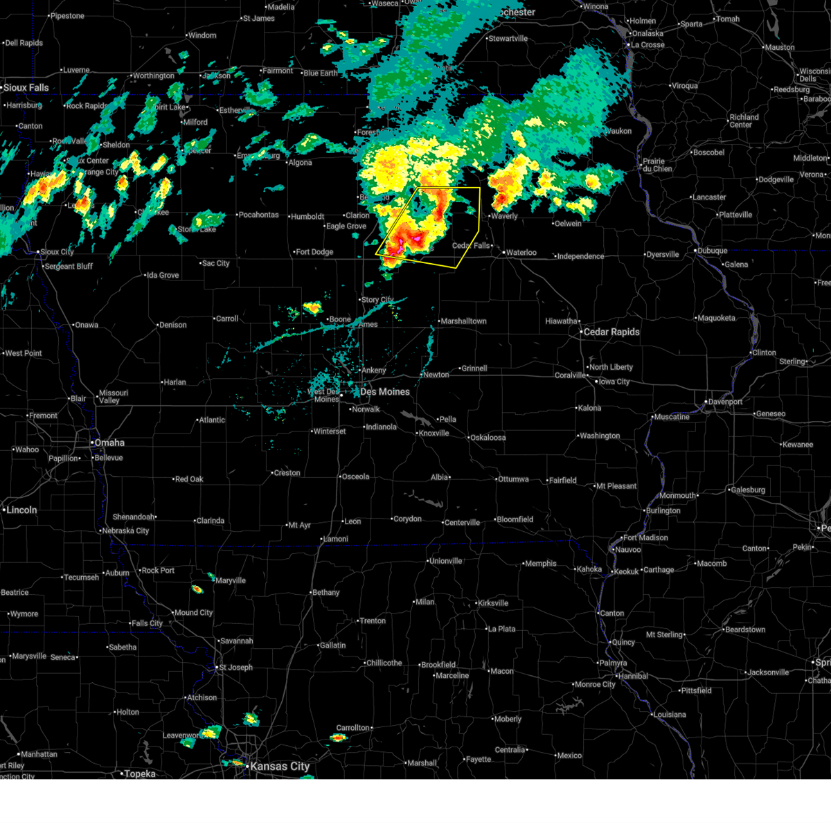
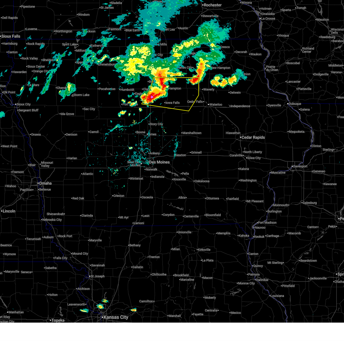
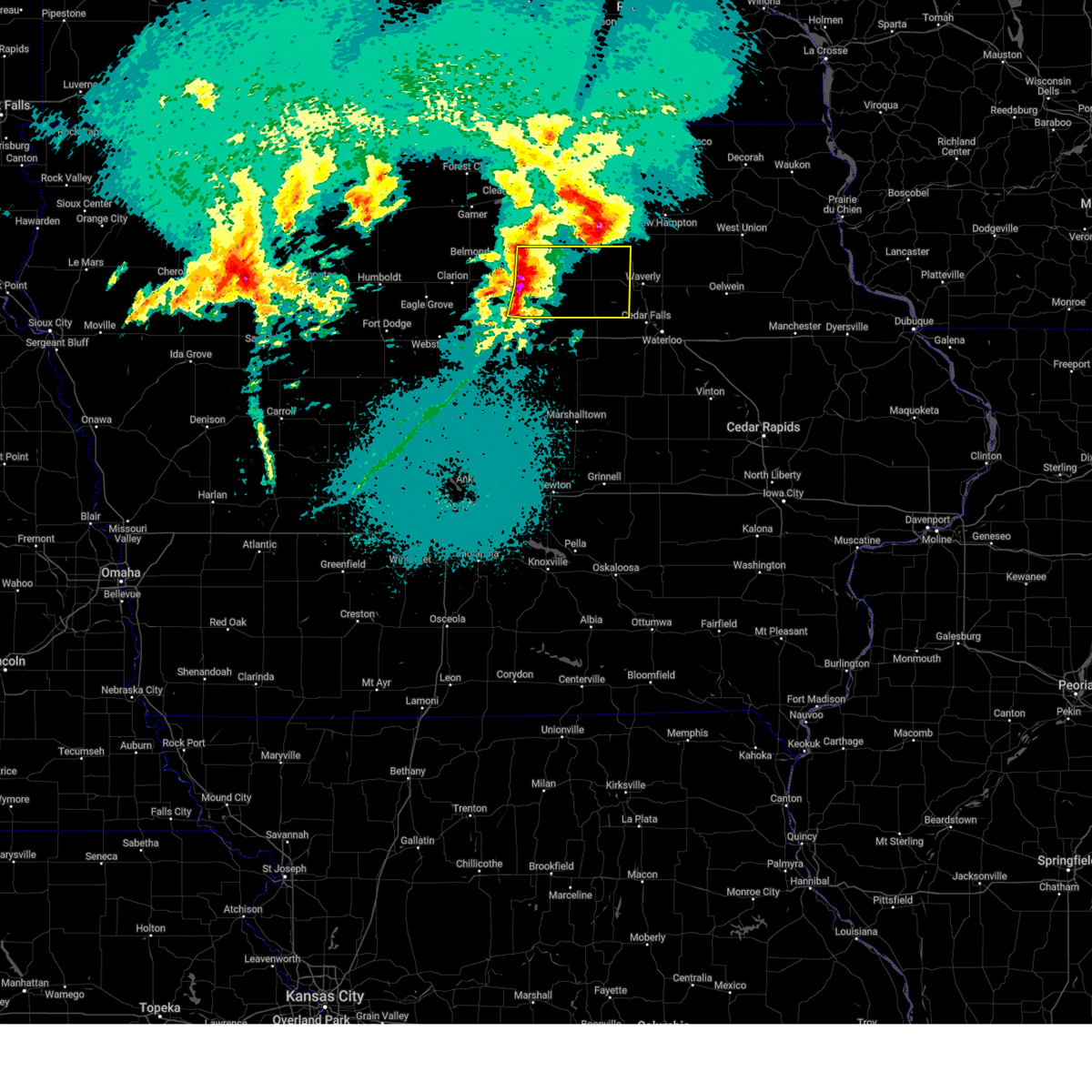
Hail Map for Aredale, IA
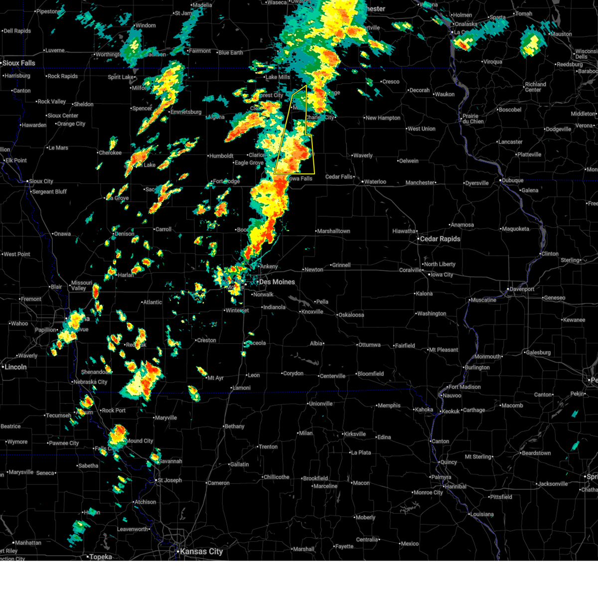
The Aredale, IA area has had 2 reports of on-the-ground hail by trained spotters, and has been under severe weather warnings 17 times during the past 12 months. Doppler radar has detected hail at or near Aredale, IA on 67 occasions, including 7 occasions during the past year.
| Name: | Aredale, IA |
| Where Located: | 23.8 miles SSE of Mason City, IA |
| Map: | Google Map for Aredale, IA |
| Population: | 74 |
| Housing Units: | 40 |
| More Info: | Search Google for Aredale, IA |
1
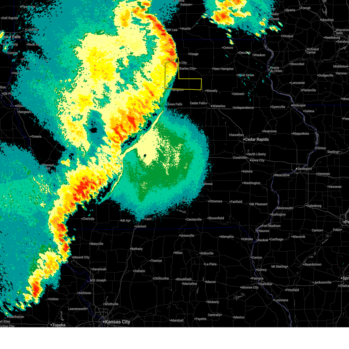
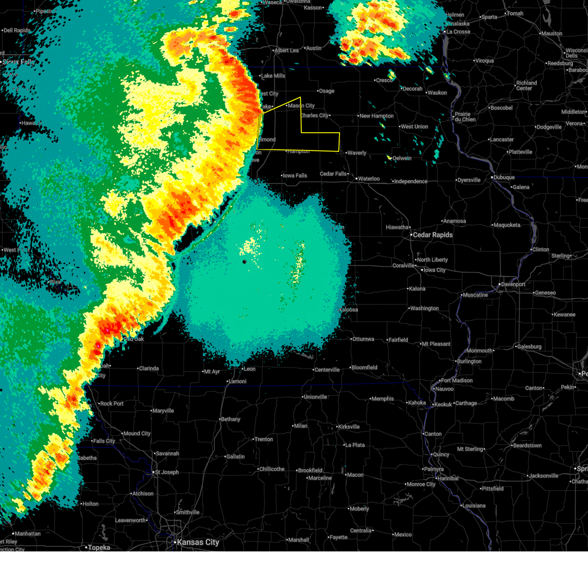
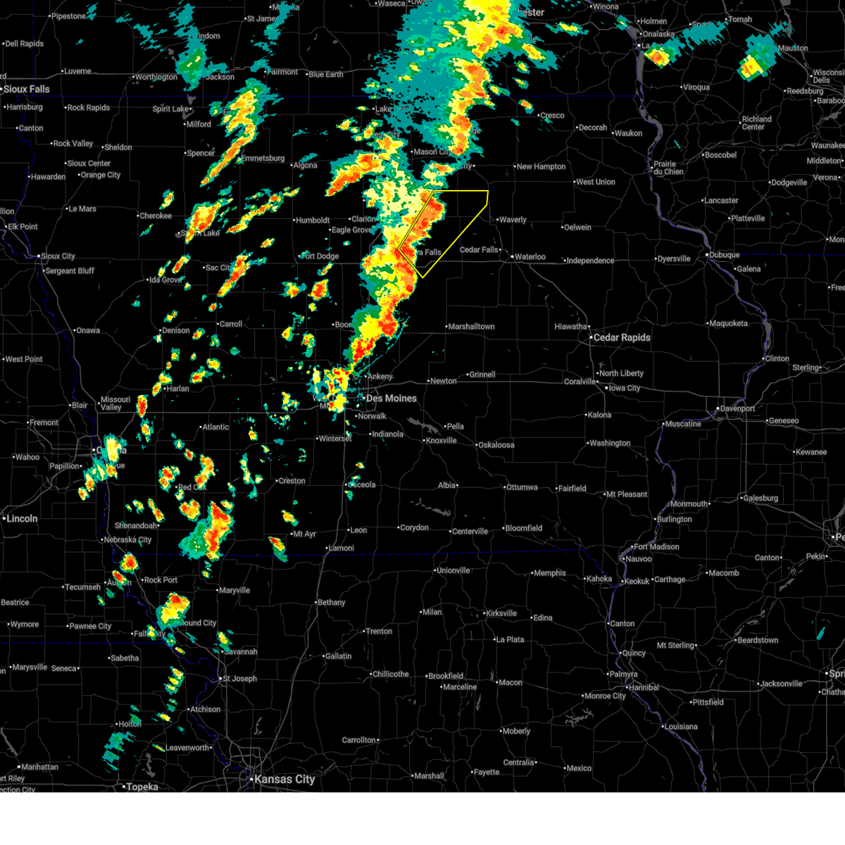
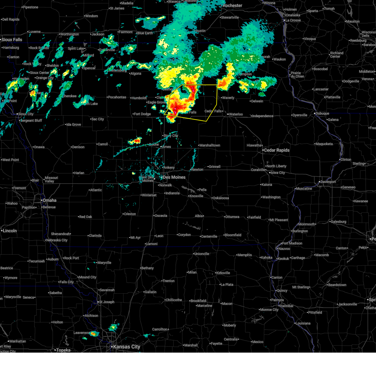
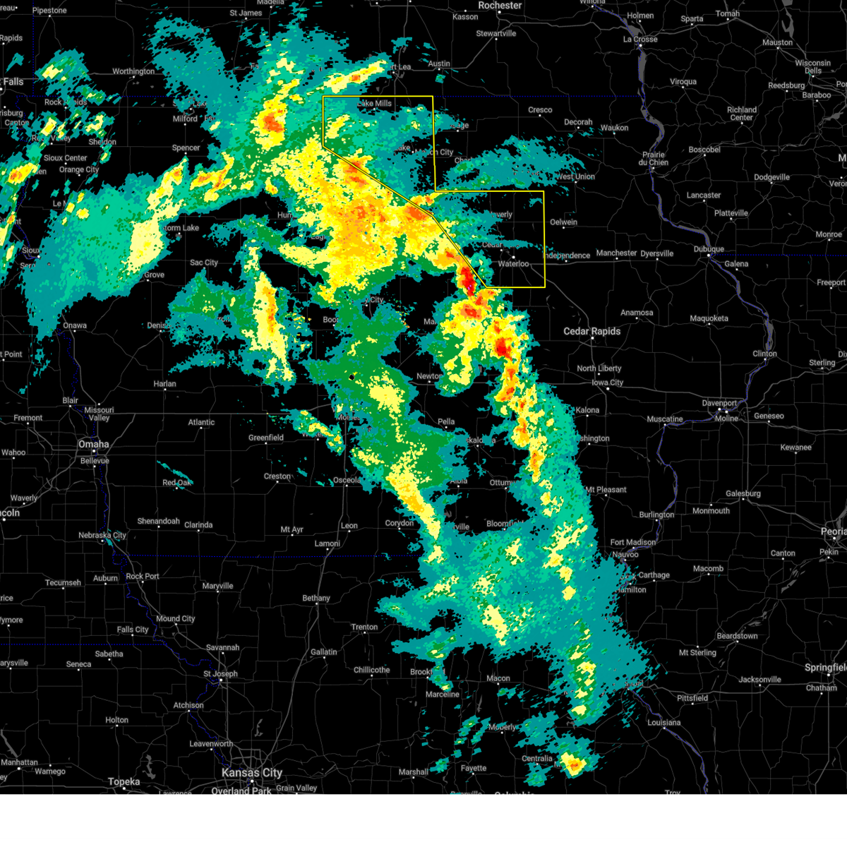
The Top Recent Hail Date for Aredale, IA is Friday, August 15, 2025 (10th out of 67)
Hail and Wind Damage Spotted near Aredale, IA
| Date / Time | Report Details |
|---|---|
| 6/10/2026 7:29 PM CDT |
 At 728 pm cdt, a severe thunderstorm was located near aredale, or 10 miles northwest of allison, moving east at 15 mph (radar indicated). Hazards include 60 mph wind gusts and quarter size hail. Hail damage to vehicles is expected. expect wind damage to roofs, siding, and trees. Locations impacted include, greene and aredale. At 728 pm cdt, a severe thunderstorm was located near aredale, or 10 miles northwest of allison, moving east at 15 mph (radar indicated). Hazards include 60 mph wind gusts and quarter size hail. Hail damage to vehicles is expected. expect wind damage to roofs, siding, and trees. Locations impacted include, greene and aredale.
|
| 6/10/2026 7:29 PM CDT |
 the severe thunderstorm warning has been cancelled and is no longer in effect the severe thunderstorm warning has been cancelled and is no longer in effect
|
| 6/10/2026 7:13 PM CDT |
 Svrdmx the national weather service in des moines has issued a * severe thunderstorm warning for, northeastern franklin county in north central iowa, northern butler county in north central iowa, southeastern cerro gordo county in north central iowa, * until 815 pm cdt. * at 713 pm cdt, a severe thunderstorm was located over dougherty, or 13 miles northeast of hampton, moving east at 15 mph (radar indicated). Hazards include 60 mph wind gusts and quarter size hail. Hail damage to vehicles is expected. Expect wind damage to roofs, siding, and trees. Svrdmx the national weather service in des moines has issued a * severe thunderstorm warning for, northeastern franklin county in north central iowa, northern butler county in north central iowa, southeastern cerro gordo county in north central iowa, * until 815 pm cdt. * at 713 pm cdt, a severe thunderstorm was located over dougherty, or 13 miles northeast of hampton, moving east at 15 mph (radar indicated). Hazards include 60 mph wind gusts and quarter size hail. Hail damage to vehicles is expected. Expect wind damage to roofs, siding, and trees.
|
| 5/17/2026 10:39 PM CDT |
 the severe thunderstorm warning has been cancelled and is no longer in effect the severe thunderstorm warning has been cancelled and is no longer in effect
|
| 5/17/2026 10:39 PM CDT |
 At 1038 pm cdt, a severe thunderstorm was located over marble rock, or 11 miles west of charles city, moving east at 55 mph (trained weather spotters). Hazards include 60 mph wind gusts. Expect damage to roofs, siding, and trees. Locations impacted include, mason city, hampton, allison, clarksville, nora springs, sheffield, greene, rockwell, dumont, bristow, rock falls, hansell, chapin, aredale, dougherty, burchinal, portland, beeds lake state park, and allison municipal airport. At 1038 pm cdt, a severe thunderstorm was located over marble rock, or 11 miles west of charles city, moving east at 55 mph (trained weather spotters). Hazards include 60 mph wind gusts. Expect damage to roofs, siding, and trees. Locations impacted include, mason city, hampton, allison, clarksville, nora springs, sheffield, greene, rockwell, dumont, bristow, rock falls, hansell, chapin, aredale, dougherty, burchinal, portland, beeds lake state park, and allison municipal airport.
|
| 5/17/2026 10:11 PM CDT |
 Svrdmx the national weather service in des moines has issued a * severe thunderstorm warning for, northeastern wright county in north central iowa, northern franklin county in north central iowa, southeastern hancock county in north central iowa, northern butler county in north central iowa, cerro gordo county in north central iowa, * until 1100 pm cdt. * at 1011 pm cdt, a severe thunderstorm was located over thornton, or 14 miles southeast of garner, moving east at 55 mph (trained weather spotters). Hazards include 60 mph wind gusts. expect damage to roofs, siding, and trees Svrdmx the national weather service in des moines has issued a * severe thunderstorm warning for, northeastern wright county in north central iowa, northern franklin county in north central iowa, southeastern hancock county in north central iowa, northern butler county in north central iowa, cerro gordo county in north central iowa, * until 1100 pm cdt. * at 1011 pm cdt, a severe thunderstorm was located over thornton, or 14 miles southeast of garner, moving east at 55 mph (trained weather spotters). Hazards include 60 mph wind gusts. expect damage to roofs, siding, and trees
|
| 4/17/2026 2:11 PM CDT |
 Svrdmx the national weather service in des moines has issued a * severe thunderstorm warning for, northeastern hardin county in central iowa, northwestern bremer county in northeastern iowa, southeastern franklin county in north central iowa, northwestern grundy county in central iowa, butler county in north central iowa, * until 245 pm cdt. * at 211 pm cdt, a severe thunderstorm was located near ackley municipal airport, or 13 miles southwest of allison, moving northeast at 50 mph (radar indicated). Hazards include 60 mph wind gusts and quarter size hail. Hail damage to vehicles is expected. Expect wind damage to roofs, siding, and trees. Svrdmx the national weather service in des moines has issued a * severe thunderstorm warning for, northeastern hardin county in central iowa, northwestern bremer county in northeastern iowa, southeastern franklin county in north central iowa, northwestern grundy county in central iowa, butler county in north central iowa, * until 245 pm cdt. * at 211 pm cdt, a severe thunderstorm was located near ackley municipal airport, or 13 miles southwest of allison, moving northeast at 50 mph (radar indicated). Hazards include 60 mph wind gusts and quarter size hail. Hail damage to vehicles is expected. Expect wind damage to roofs, siding, and trees.
|
| 4/14/2026 3:49 PM CDT |
 Svrdmx the national weather service in des moines has issued a * severe thunderstorm warning for, northern butler county in north central iowa, * until 430 pm cdt. * at 348 pm cdt, a severe thunderstorm was located over dumont, or 7 miles west of allison, moving northeast at 35 mph (radar indicated). Hazards include 60 mph wind gusts and half dollar size hail. Hail damage to vehicles is expected. Expect wind damage to roofs, siding, and trees. Svrdmx the national weather service in des moines has issued a * severe thunderstorm warning for, northern butler county in north central iowa, * until 430 pm cdt. * at 348 pm cdt, a severe thunderstorm was located over dumont, or 7 miles west of allison, moving northeast at 35 mph (radar indicated). Hazards include 60 mph wind gusts and half dollar size hail. Hail damage to vehicles is expected. Expect wind damage to roofs, siding, and trees.
|
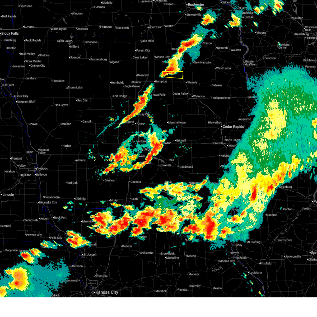
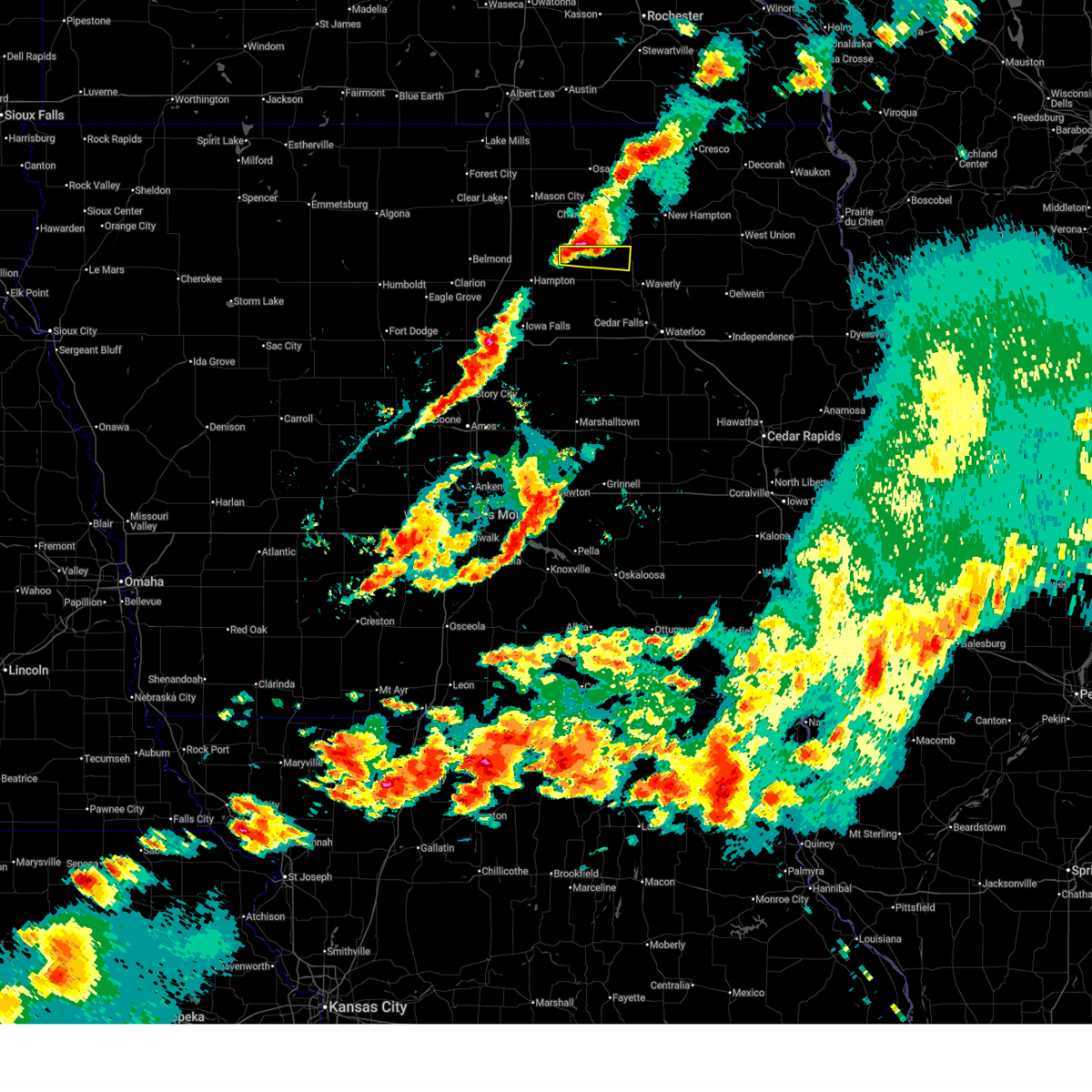
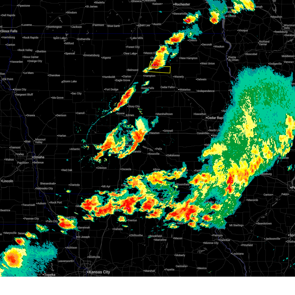
| 8/15/2025 2:53 PM CDT |
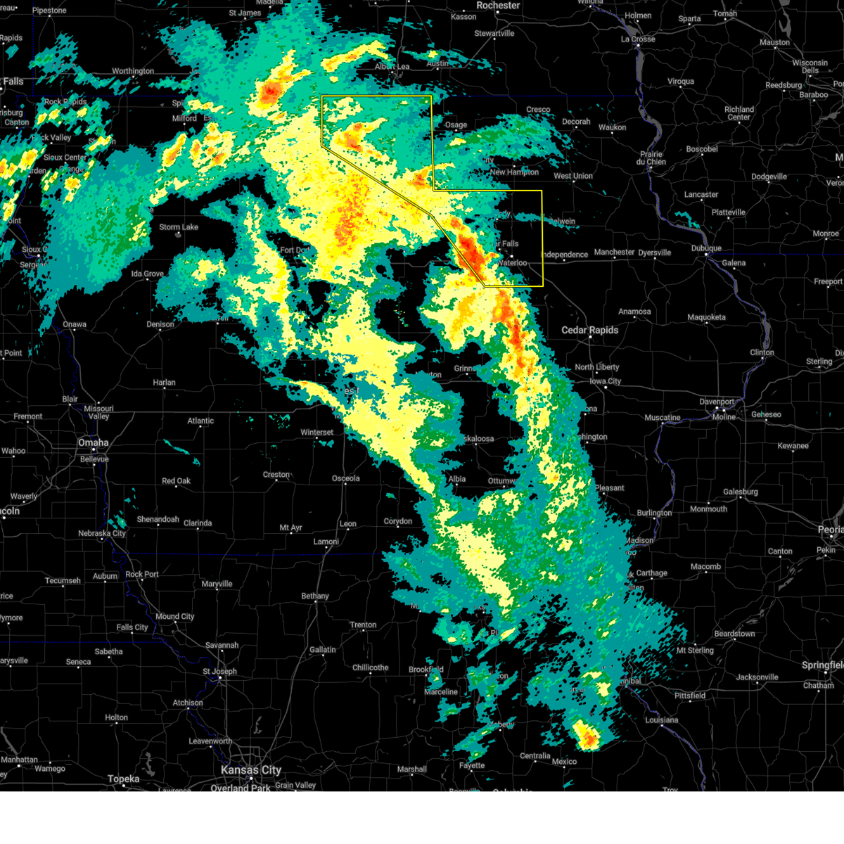
 At 252 pm cdt, severe thunderstorms were located along a line extending from rudd to near greene to 4 miles north of ackley, moving east at 40 mph (law enforcement reported trees and power lines down in hampton). Hazards include 60 mph wind gusts. Expect damage to roofs, siding, and trees. Locations impacted include, allison, parkersburg, clarksville, shell rock, greene, aplington, dumont, new hartford, bristow, aredale, and allison municipal airport. At 252 pm cdt, severe thunderstorms were located along a line extending from rudd to near greene to 4 miles north of ackley, moving east at 40 mph (law enforcement reported trees and power lines down in hampton). Hazards include 60 mph wind gusts. Expect damage to roofs, siding, and trees. Locations impacted include, allison, parkersburg, clarksville, shell rock, greene, aplington, dumont, new hartford, bristow, aredale, and allison municipal airport.
|
| 8/15/2025 2:40 PM CDT | Tree down on a power line. time estimate in butler county IA, 0.3 miles NW of Aredale, IA |
| 8/15/2025 2:32 PM CDT |
 Svrdmx the national weather service in des moines has issued a * severe thunderstorm warning for, butler county in north central iowa, * until 300 pm cdt. * at 231 pm cdt, severe thunderstorms were located along a line extending from portland to near aredale to near bradford, moving east at 45 mph (radar indicated). Hazards include 60 mph wind gusts. expect damage to roofs, siding, and trees Svrdmx the national weather service in des moines has issued a * severe thunderstorm warning for, butler county in north central iowa, * until 300 pm cdt. * at 231 pm cdt, severe thunderstorms were located along a line extending from portland to near aredale to near bradford, moving east at 45 mph (radar indicated). Hazards include 60 mph wind gusts. expect damage to roofs, siding, and trees
|
| 7/29/2025 12:36 AM CDT |
 the severe thunderstorm warning has been cancelled and is no longer in effect the severe thunderstorm warning has been cancelled and is no longer in effect
|
| 7/29/2025 12:36 AM CDT |
 At 1234 am cdt, severe thunderstorms were located along a line extending from 4 miles southeast of emmons to manly to 5 miles south of portland to bradford, moving east at 45 mph (radar indicated. wind gusts from automated and personal weather stations have been generally been between 40 and 55 mph). Hazards include 60 mph wind gusts and penny size hail. Expect damage to roofs, siding, and trees. locations impacted include, mason city, hampton, northwood, allison, parkersburg, ackley, clarksville, manly, shell rock, sheffield, greene, aplington, rockwell, emmons, mason city municipal airport, clear lake, dumont, new hartford, latimer, and thornton. This includes interstate 35 between mile markers 156 and 218. At 1234 am cdt, severe thunderstorms were located along a line extending from 4 miles southeast of emmons to manly to 5 miles south of portland to bradford, moving east at 45 mph (radar indicated. wind gusts from automated and personal weather stations have been generally been between 40 and 55 mph). Hazards include 60 mph wind gusts and penny size hail. Expect damage to roofs, siding, and trees. locations impacted include, mason city, hampton, northwood, allison, parkersburg, ackley, clarksville, manly, shell rock, sheffield, greene, aplington, rockwell, emmons, mason city municipal airport, clear lake, dumont, new hartford, latimer, and thornton. This includes interstate 35 between mile markers 156 and 218.
|
| 7/29/2025 12:11 AM CDT |
 Svrdmx the national weather service in des moines has issued a * severe thunderstorm warning for, worth county in north central iowa, eastern wright county in north central iowa, franklin county in north central iowa, eastern hancock county in north central iowa, butler county in north central iowa, cerro gordo county in north central iowa, eastern winnebago county in north central iowa, * until 130 am cdt. * at 1211 am cdt, severe thunderstorms were located along a line extending from 5 miles south of kiester to near pilot knob state park to 4 miles southwest of clear lake state park to big wall lake, moving east at 45 mph (radar indicated). Hazards include 60 mph wind gusts and penny size hail. expect damage to roofs, siding, and trees Svrdmx the national weather service in des moines has issued a * severe thunderstorm warning for, worth county in north central iowa, eastern wright county in north central iowa, franklin county in north central iowa, eastern hancock county in north central iowa, butler county in north central iowa, cerro gordo county in north central iowa, eastern winnebago county in north central iowa, * until 130 am cdt. * at 1211 am cdt, severe thunderstorms were located along a line extending from 5 miles south of kiester to near pilot knob state park to 4 miles southwest of clear lake state park to big wall lake, moving east at 45 mph (radar indicated). Hazards include 60 mph wind gusts and penny size hail. expect damage to roofs, siding, and trees
|
| 7/28/2025 12:54 AM CDT |
 The storms which prompted the warning have weakened below severe limits, and no longer pose an immediate threat to life or property. therefore, the warning will be allowed to expire. however, gusty winds are still possible with these thunderstorms. The storms which prompted the warning have weakened below severe limits, and no longer pose an immediate threat to life or property. therefore, the warning will be allowed to expire. however, gusty winds are still possible with these thunderstorms.
|
| 7/28/2025 12:39 AM CDT |
 the severe thunderstorm warning has been cancelled and is no longer in effect the severe thunderstorm warning has been cancelled and is no longer in effect
|
| 7/28/2025 12:39 AM CDT |
 At 1238 am cdt, severe thunderstorms were located along a line extending from waverly to near steamboat rock to 5 miles south of blairsburg, moving southeast at 45 mph (radar indicated). Hazards include 60 mph wind gusts. Expect damage to roofs, siding, and trees. locations impacted include, waterloo, cedar falls, waverly, webster city, iowa falls, hampton, eldora, grundy center, allison, hudson, sumner, parkersburg, denver, reinbeck, ackley, clarksville, tripoli, shell rock, jewell junction, and dike. This includes interstate 35 between mile markers 133 and 158. At 1238 am cdt, severe thunderstorms were located along a line extending from waverly to near steamboat rock to 5 miles south of blairsburg, moving southeast at 45 mph (radar indicated). Hazards include 60 mph wind gusts. Expect damage to roofs, siding, and trees. locations impacted include, waterloo, cedar falls, waverly, webster city, iowa falls, hampton, eldora, grundy center, allison, hudson, sumner, parkersburg, denver, reinbeck, ackley, clarksville, tripoli, shell rock, jewell junction, and dike. This includes interstate 35 between mile markers 133 and 158.
|
| 7/28/2025 12:13 AM CDT |
 Svrdmx the national weather service in des moines has issued a * severe thunderstorm warning for, hardin county in central iowa, western black hawk county in northeastern iowa, bremer county in northeastern iowa, wright county in north central iowa, franklin county in north central iowa, grundy county in central iowa, butler county in north central iowa, hamilton county in central iowa, southern cerro gordo county in north central iowa, * until 100 am cdt. * at 1212 am cdt, severe thunderstorms were located along a line extending from 4 miles south of greene to alden to 4 miles northeast of duncombe, moving southeast at 45 mph (radar indicated). Hazards include 60 mph wind gusts. expect damage to roofs, siding, and trees Svrdmx the national weather service in des moines has issued a * severe thunderstorm warning for, hardin county in central iowa, western black hawk county in northeastern iowa, bremer county in northeastern iowa, wright county in north central iowa, franklin county in north central iowa, grundy county in central iowa, butler county in north central iowa, hamilton county in central iowa, southern cerro gordo county in north central iowa, * until 100 am cdt. * at 1212 am cdt, severe thunderstorms were located along a line extending from 4 miles south of greene to alden to 4 miles northeast of duncombe, moving southeast at 45 mph (radar indicated). Hazards include 60 mph wind gusts. expect damage to roofs, siding, and trees
|
| 6/26/2025 3:32 PM CDT |
 At 331 pm cdt, a severe thunderstorm was located over clarksville, or 5 miles east of allison, moving northeast at 45 mph (radar indicated). Hazards include 60 mph wind gusts. Expect damage to roofs, siding, and trees. Locations impacted include, allison, clarksville, greene, aplington, dumont, bristow, hansell, aredale, and allison municipal airport. At 331 pm cdt, a severe thunderstorm was located over clarksville, or 5 miles east of allison, moving northeast at 45 mph (radar indicated). Hazards include 60 mph wind gusts. Expect damage to roofs, siding, and trees. Locations impacted include, allison, clarksville, greene, aplington, dumont, bristow, hansell, aredale, and allison municipal airport.
|
| 6/26/2025 3:19 PM CDT |
 the severe thunderstorm warning has been cancelled and is no longer in effect the severe thunderstorm warning has been cancelled and is no longer in effect
|
| 6/26/2025 3:19 PM CDT |
 At 319 pm cdt, a severe thunderstorm was located near allison, moving northeast at 45 mph (radar indicated). Hazards include 70 mph wind gusts. Expect considerable tree damage. damage is likely to mobile homes, roofs, and outbuildings. Locations impacted include, allison, clarksville, greene, aplington, dumont, bristow, hansell, aredale, and allison municipal airport. At 319 pm cdt, a severe thunderstorm was located near allison, moving northeast at 45 mph (radar indicated). Hazards include 70 mph wind gusts. Expect considerable tree damage. damage is likely to mobile homes, roofs, and outbuildings. Locations impacted include, allison, clarksville, greene, aplington, dumont, bristow, hansell, aredale, and allison municipal airport.
|
| 6/26/2025 3:05 PM CDT |
 At 304 pm cdt, a severe thunderstorm was located near ackley municipal airport, or 13 miles southeast of hampton, moving northeast at 45 mph (radar indicated). Hazards include 60 mph wind gusts. Expect damage to roofs, siding, and trees. Locations impacted include, iowa falls, eldora, allison, ackley, clarksville, greene, aplington, dumont, steamboat rock, geneva, bristow, bradford, hansell, aredale, owasa, allison municipal airport, and ackley municipal airport. At 304 pm cdt, a severe thunderstorm was located near ackley municipal airport, or 13 miles southeast of hampton, moving northeast at 45 mph (radar indicated). Hazards include 60 mph wind gusts. Expect damage to roofs, siding, and trees. Locations impacted include, iowa falls, eldora, allison, ackley, clarksville, greene, aplington, dumont, steamboat rock, geneva, bristow, bradford, hansell, aredale, owasa, allison municipal airport, and ackley municipal airport.
|
| 6/26/2025 2:54 PM CDT |
 Svrdmx the national weather service in des moines has issued a * severe thunderstorm warning for, northeastern hardin county in central iowa, southeastern franklin county in north central iowa, northwestern grundy county in central iowa, butler county in north central iowa, * until 345 pm cdt. * at 254 pm cdt, a severe thunderstorm was located 5 miles east of iowa falls, moving northeast at 30 mph (radar indicated). Hazards include 60 mph wind gusts. expect damage to roofs, siding, and trees Svrdmx the national weather service in des moines has issued a * severe thunderstorm warning for, northeastern hardin county in central iowa, southeastern franklin county in north central iowa, northwestern grundy county in central iowa, butler county in north central iowa, * until 345 pm cdt. * at 254 pm cdt, a severe thunderstorm was located 5 miles east of iowa falls, moving northeast at 30 mph (radar indicated). Hazards include 60 mph wind gusts. expect damage to roofs, siding, and trees
|
| 6/26/2025 2:44 PM CDT |
 The storms which prompted the warning have weakened below severe limits, and no longer pose an immediate threat to life or property. therefore, the warning will be allowed to expire. however, gusty winds are still possible with these thunderstorms. a severe thunderstorm watch remains in effect until 900 pm cdt for north central iowa. The storms which prompted the warning have weakened below severe limits, and no longer pose an immediate threat to life or property. therefore, the warning will be allowed to expire. however, gusty winds are still possible with these thunderstorms. a severe thunderstorm watch remains in effect until 900 pm cdt for north central iowa.
|
| 6/26/2025 2:31 PM CDT |
 At 231 pm cdt, severe thunderstorms were located along a line extending from county roads a 39 and s 70 to near bradford, moving northeast at 35 mph (radar indicated). Hazards include 60 mph wind gusts. Expect damage to roofs, siding, and trees. Locations impacted include, mason city, hampton, ackley, nora springs, sheffield, rockwell, dumont, plymouth, coulter, grafton, geneva, rock falls, bradford, hansell, chapin, aredale, dougherty, portland, beeds lake state park, and hampton municipal airport. At 231 pm cdt, severe thunderstorms were located along a line extending from county roads a 39 and s 70 to near bradford, moving northeast at 35 mph (radar indicated). Hazards include 60 mph wind gusts. Expect damage to roofs, siding, and trees. Locations impacted include, mason city, hampton, ackley, nora springs, sheffield, rockwell, dumont, plymouth, coulter, grafton, geneva, rock falls, bradford, hansell, chapin, aredale, dougherty, portland, beeds lake state park, and hampton municipal airport.
|
| 6/26/2025 2:17 PM CDT |
 At 216 pm cdt, severe thunderstorms were located along a line extending from near plymouth to 4 miles east of popejoy, moving east at 30 mph (radar indicated). Hazards include 60 mph wind gusts. Expect damage to roofs, siding, and trees. locations impacted include, mason city, hampton, ackley, nora springs, manly, sheffield, rockwell, mason city municipal airport, clear lake, dumont, latimer, thornton, plymouth, coulter, grafton, geneva, swaledale, rock falls, bradford, and hansell. This includes interstate 35 between mile markers 160 and 202. At 216 pm cdt, severe thunderstorms were located along a line extending from near plymouth to 4 miles east of popejoy, moving east at 30 mph (radar indicated). Hazards include 60 mph wind gusts. Expect damage to roofs, siding, and trees. locations impacted include, mason city, hampton, ackley, nora springs, manly, sheffield, rockwell, mason city municipal airport, clear lake, dumont, latimer, thornton, plymouth, coulter, grafton, geneva, swaledale, rock falls, bradford, and hansell. This includes interstate 35 between mile markers 160 and 202.
|
| 6/26/2025 1:54 PM CDT |
 Svrdmx the national weather service in des moines has issued a * severe thunderstorm warning for, southeastern worth county in north central iowa, franklin county in north central iowa, western butler county in north central iowa, cerro gordo county in north central iowa, * until 245 pm cdt. * at 154 pm cdt, severe thunderstorms were located along a line extending from near mason city municipal airport to popejoy, moving northeast at 35 mph (radar indicated). Hazards include 60 mph wind gusts. expect damage to roofs, siding, and trees Svrdmx the national weather service in des moines has issued a * severe thunderstorm warning for, southeastern worth county in north central iowa, franklin county in north central iowa, western butler county in north central iowa, cerro gordo county in north central iowa, * until 245 pm cdt. * at 154 pm cdt, severe thunderstorms were located along a line extending from near mason city municipal airport to popejoy, moving northeast at 35 mph (radar indicated). Hazards include 60 mph wind gusts. expect damage to roofs, siding, and trees
|
| 6/11/2025 7:11 PM CDT |
 The storms which prompted the warning have weakened below severe limits, and have exited the warned area. therefore, the warning will be allowed to expire. however, gusty winds are still possible with these thunderstorms. a severe thunderstorm watch remains in effect until 1000 pm cdt for central, north central and northeastern iowa. The storms which prompted the warning have weakened below severe limits, and have exited the warned area. therefore, the warning will be allowed to expire. however, gusty winds are still possible with these thunderstorms. a severe thunderstorm watch remains in effect until 1000 pm cdt for central, north central and northeastern iowa.
|
| 6/11/2025 6:43 PM CDT |
 At 643 pm cdt, severe thunderstorms were located along a line extending from county roads 147 and t 34 to 6 miles southwest of allison to near iowa falls, moving east at 35 mph (radar indicated). Hazards include 60 mph wind gusts and quarter size hail. Hail damage to vehicles is expected. expect wind damage to roofs, siding, and trees. Locations impacted include, iowa falls, hampton, allison, parkersburg, ackley, clarksville, shell rock, greene, aplington, alden, wellsburg, dumont, new hartford, holland, stout, geneva, bristow, bradford, hansell, and aredale. At 643 pm cdt, severe thunderstorms were located along a line extending from county roads 147 and t 34 to 6 miles southwest of allison to near iowa falls, moving east at 35 mph (radar indicated). Hazards include 60 mph wind gusts and quarter size hail. Hail damage to vehicles is expected. expect wind damage to roofs, siding, and trees. Locations impacted include, iowa falls, hampton, allison, parkersburg, ackley, clarksville, shell rock, greene, aplington, alden, wellsburg, dumont, new hartford, holland, stout, geneva, bristow, bradford, hansell, and aredale.
|
| 6/11/2025 6:43 PM CDT |
 the severe thunderstorm warning has been cancelled and is no longer in effect the severe thunderstorm warning has been cancelled and is no longer in effect
|
| 6/11/2025 6:32 PM CDT |
 the severe thunderstorm warning has been cancelled and is no longer in effect the severe thunderstorm warning has been cancelled and is no longer in effect
|
| 6/11/2025 6:32 PM CDT |
 At 632 pm cdt, severe thunderstorms were located along a line extending from rockford to 5 miles south of dumont to near iowa falls, moving east at 35 mph (a personal weather station reported a 61 mph wind gust near williams). Hazards include 60 mph wind gusts and quarter size hail. Hail damage to vehicles is expected. expect wind damage to roofs, siding, and trees. locations impacted include, iowa falls, hampton, allison, parkersburg, ackley, clarksville, shell rock, sheffield, greene, aplington, alden, wellsburg, dumont, new hartford, latimer, williams, holland, coulter, stout, and geneva. This includes interstate 35 near mile marker 146, and between mile markers 156 and 173. At 632 pm cdt, severe thunderstorms were located along a line extending from rockford to 5 miles south of dumont to near iowa falls, moving east at 35 mph (a personal weather station reported a 61 mph wind gust near williams). Hazards include 60 mph wind gusts and quarter size hail. Hail damage to vehicles is expected. expect wind damage to roofs, siding, and trees. locations impacted include, iowa falls, hampton, allison, parkersburg, ackley, clarksville, shell rock, sheffield, greene, aplington, alden, wellsburg, dumont, new hartford, latimer, williams, holland, coulter, stout, and geneva. This includes interstate 35 near mile marker 146, and between mile markers 156 and 173.
|
| 6/11/2025 6:10 PM CDT |
 Svrdmx the national weather service in des moines has issued a * severe thunderstorm warning for, northern hardin county in central iowa, southeastern wright county in north central iowa, franklin county in north central iowa, northwestern grundy county in central iowa, butler county in north central iowa, northeastern hamilton county in central iowa, * until 715 pm cdt. * at 610 pm cdt, severe thunderstorms were located along a line extending from near rockwell to near geneva to williams, moving east at 35 mph (radar indicated). Hazards include 60 mph wind gusts and quarter size hail. Hail damage to vehicles is expected. Expect wind damage to roofs, siding, and trees. Svrdmx the national weather service in des moines has issued a * severe thunderstorm warning for, northern hardin county in central iowa, southeastern wright county in north central iowa, franklin county in north central iowa, northwestern grundy county in central iowa, butler county in north central iowa, northeastern hamilton county in central iowa, * until 715 pm cdt. * at 610 pm cdt, severe thunderstorms were located along a line extending from near rockwell to near geneva to williams, moving east at 35 mph (radar indicated). Hazards include 60 mph wind gusts and quarter size hail. Hail damage to vehicles is expected. Expect wind damage to roofs, siding, and trees.
|
| 4/18/2025 4:48 AM CDT |
 Svrdmx the national weather service in des moines has issued a * severe thunderstorm warning for, northeastern franklin county in north central iowa, butler county in north central iowa, * until 530 am cdt. * at 447 am cdt, severe thunderstorms were located along a line extending from near mason city to near sheffield to hampton municipal airport, moving east at 60 mph (radar indicated). Hazards include 60 mph wind gusts and quarter size hail. Hail damage to vehicles is expected. Expect wind damage to roofs, siding, and trees. Svrdmx the national weather service in des moines has issued a * severe thunderstorm warning for, northeastern franklin county in north central iowa, butler county in north central iowa, * until 530 am cdt. * at 447 am cdt, severe thunderstorms were located along a line extending from near mason city to near sheffield to hampton municipal airport, moving east at 60 mph (radar indicated). Hazards include 60 mph wind gusts and quarter size hail. Hail damage to vehicles is expected. Expect wind damage to roofs, siding, and trees.
|
| 4/18/2025 3:22 AM CDT |
 At 322 am cdt, severe thunderstorms were located along a line extending from near dougherty to near dumont to near ackley, moving east at 55 mph (law enforcement reported golf ball sized hail in hampton). Hazards include golf ball size hail and 60 mph wind gusts. People and animals outdoors will be injured. expect hail damage to roofs, siding, windows, and vehicles. expect wind damage to roofs, siding, and trees. Locations impacted include, clarksville, bristow, parkersburg, allison, geneva, hansell, new hartford, aredale, dumont, allison municipal airport, shell rock, aplington, greene, and ackley. At 322 am cdt, severe thunderstorms were located along a line extending from near dougherty to near dumont to near ackley, moving east at 55 mph (law enforcement reported golf ball sized hail in hampton). Hazards include golf ball size hail and 60 mph wind gusts. People and animals outdoors will be injured. expect hail damage to roofs, siding, windows, and vehicles. expect wind damage to roofs, siding, and trees. Locations impacted include, clarksville, bristow, parkersburg, allison, geneva, hansell, new hartford, aredale, dumont, allison municipal airport, shell rock, aplington, greene, and ackley.
|
| 4/18/2025 3:12 AM CDT |
 Svrdmx the national weather service in des moines has issued a * severe thunderstorm warning for, franklin county in north central iowa, butler county in north central iowa, * until 400 am cdt. * at 312 am cdt, severe thunderstorms were located along a line extending from near sheffield to hampton to near iowa falls, moving east at 50 mph (radar indicated). Hazards include golf ball size hail and 60 mph wind gusts. People and animals outdoors will be injured. expect hail damage to roofs, siding, windows, and vehicles. Expect wind damage to roofs, siding, and trees. Svrdmx the national weather service in des moines has issued a * severe thunderstorm warning for, franklin county in north central iowa, butler county in north central iowa, * until 400 am cdt. * at 312 am cdt, severe thunderstorms were located along a line extending from near sheffield to hampton to near iowa falls, moving east at 50 mph (radar indicated). Hazards include golf ball size hail and 60 mph wind gusts. People and animals outdoors will be injured. expect hail damage to roofs, siding, windows, and vehicles. Expect wind damage to roofs, siding, and trees.
|
| 3/19/2025 5:55 AM CDT |
 the severe thunderstorm warning has been cancelled and is no longer in effect the severe thunderstorm warning has been cancelled and is no longer in effect
|
| 3/19/2025 5:50 AM CDT |
 At 549 am cdt, a severe thunderstorm was located over bradford, or 7 miles south of hampton, moving northeast at 35 mph (radar indicated). Hazards include quarter size hail. Damage to vehicles is expected. Locations impacted include, aredale, hampton municipal airport, dumont, chapin, bradford, beeds lake state park, geneva, hampton, hansell, bristow, and sheffield. At 549 am cdt, a severe thunderstorm was located over bradford, or 7 miles south of hampton, moving northeast at 35 mph (radar indicated). Hazards include quarter size hail. Damage to vehicles is expected. Locations impacted include, aredale, hampton municipal airport, dumont, chapin, bradford, beeds lake state park, geneva, hampton, hansell, bristow, and sheffield.
|
| 3/19/2025 5:50 AM CDT |
 the severe thunderstorm warning has been cancelled and is no longer in effect the severe thunderstorm warning has been cancelled and is no longer in effect
|
| 3/19/2025 5:37 AM CDT |
 Svrdmx the national weather service in des moines has issued a * severe thunderstorm warning for, north central hardin county in central iowa, eastern franklin county in north central iowa, northwestern butler county in north central iowa, * until 615 am cdt. * at 536 am cdt, a severe thunderstorm was located over iowa falls, moving northeast at 35 mph (radar indicated). Hazards include quarter size hail. damage to vehicles is expected Svrdmx the national weather service in des moines has issued a * severe thunderstorm warning for, north central hardin county in central iowa, eastern franklin county in north central iowa, northwestern butler county in north central iowa, * until 615 am cdt. * at 536 am cdt, a severe thunderstorm was located over iowa falls, moving northeast at 35 mph (radar indicated). Hazards include quarter size hail. damage to vehicles is expected
|
| 3/14/2025 7:24 PM CDT |
 At 722 pm cdt, severe thunderstorms were located along a line extending from near crystal lake to near dougherty to near hudson, moving north at 60 mph (trained weather spotters. at 720pm, a trained spotter reported a wind gust of 71mph in grundy center). Hazards include 70 mph wind gusts. Expect considerable tree damage. damage is likely to mobile homes, roofs, and outbuildings. locations impacted include, clarksville, lake mills municipal airport, mcintosh woods state park, forest city municipal airport, plainfield, grafton, waterloo, george wyth state park, buffalo center, mason city, readlyn, eagle lake state park, kensett, ventura, evansdale, thompson, dike, cedar falls, hayfield, and janesville. this includes the following highways, interstate 35 between mile markers 177 and 218. Interstate 380 between mile markers 57 and 73. At 722 pm cdt, severe thunderstorms were located along a line extending from near crystal lake to near dougherty to near hudson, moving north at 60 mph (trained weather spotters. at 720pm, a trained spotter reported a wind gust of 71mph in grundy center). Hazards include 70 mph wind gusts. Expect considerable tree damage. damage is likely to mobile homes, roofs, and outbuildings. locations impacted include, clarksville, lake mills municipal airport, mcintosh woods state park, forest city municipal airport, plainfield, grafton, waterloo, george wyth state park, buffalo center, mason city, readlyn, eagle lake state park, kensett, ventura, evansdale, thompson, dike, cedar falls, hayfield, and janesville. this includes the following highways, interstate 35 between mile markers 177 and 218. Interstate 380 between mile markers 57 and 73.
|
| 3/14/2025 7:11 PM CDT |
 Svrdmx the national weather service in des moines has issued a * severe thunderstorm warning for, black hawk county in northeastern iowa, worth county in north central iowa, bremer county in northeastern iowa, northeastern franklin county in north central iowa, northern hancock county in north central iowa, northeastern grundy county in central iowa, butler county in north central iowa, cerro gordo county in north central iowa, winnebago county in north central iowa, * until 815 pm cdt. * at 710 pm cdt, severe thunderstorms were located along a line extending from near eagle lake state park to aredale to 6 miles north of tf clark state park, moving northeast at 45 mph (radar indicated). Hazards include 60 mph wind gusts. expect damage to roofs, siding, and trees Svrdmx the national weather service in des moines has issued a * severe thunderstorm warning for, black hawk county in northeastern iowa, worth county in north central iowa, bremer county in northeastern iowa, northeastern franklin county in north central iowa, northern hancock county in north central iowa, northeastern grundy county in central iowa, butler county in north central iowa, cerro gordo county in north central iowa, winnebago county in north central iowa, * until 815 pm cdt. * at 710 pm cdt, severe thunderstorms were located along a line extending from near eagle lake state park to aredale to 6 miles north of tf clark state park, moving northeast at 45 mph (radar indicated). Hazards include 60 mph wind gusts. expect damage to roofs, siding, and trees
|
| 5/24/2024 5:57 AM CDT |
 Svrdmx the national weather service in des moines has issued a * severe thunderstorm warning for, northern poweshiek county in central iowa, eastern marshall county in central iowa, northeastern hardin county in central iowa, black hawk county in northeastern iowa, tama county in central iowa, bremer county in northeastern iowa, eastern franklin county in north central iowa, grundy county in central iowa, butler county in north central iowa, northeastern jasper county in central iowa, * until 700 am cdt. * at 556 am cdt, severe thunderstorms were located along a line extending from aredale to lincoln to near tama, moving east at 50 mph (public). Hazards include 60 mph wind gusts and quarter size hail. Hail damage to vehicles is expected. Expect wind damage to roofs, siding, and trees. Svrdmx the national weather service in des moines has issued a * severe thunderstorm warning for, northern poweshiek county in central iowa, eastern marshall county in central iowa, northeastern hardin county in central iowa, black hawk county in northeastern iowa, tama county in central iowa, bremer county in northeastern iowa, eastern franklin county in north central iowa, grundy county in central iowa, butler county in north central iowa, northeastern jasper county in central iowa, * until 700 am cdt. * at 556 am cdt, severe thunderstorms were located along a line extending from aredale to lincoln to near tama, moving east at 50 mph (public). Hazards include 60 mph wind gusts and quarter size hail. Hail damage to vehicles is expected. Expect wind damage to roofs, siding, and trees.
|
| 5/24/2024 5:52 AM CDT |
 At 552 am cdt, severe thunderstorms were located along a line extending from near hampton municipal airport to liscomb to near laurel, moving east at 45 mph (radar indicated). Hazards include 60 mph wind gusts and penny size hail. Expect damage to roofs, siding, and trees. locations impacted include, marshalltown, newton, grinnell, iowa falls, hampton, eldora, grundy center, toledo, allison, tama, parkersburg, reinbeck, ackley, state center, sheffield, aplington, conrad, meskwaki casino, rock creek lake, and iowa speedway. this includes the following highways, interstate 35 between mile markers 167 and 178. Interstate 80 between mile markers 165 and 167. At 552 am cdt, severe thunderstorms were located along a line extending from near hampton municipal airport to liscomb to near laurel, moving east at 45 mph (radar indicated). Hazards include 60 mph wind gusts and penny size hail. Expect damage to roofs, siding, and trees. locations impacted include, marshalltown, newton, grinnell, iowa falls, hampton, eldora, grundy center, toledo, allison, tama, parkersburg, reinbeck, ackley, state center, sheffield, aplington, conrad, meskwaki casino, rock creek lake, and iowa speedway. this includes the following highways, interstate 35 between mile markers 167 and 178. Interstate 80 between mile markers 165 and 167.
|
| 5/24/2024 5:52 AM CDT |
 the severe thunderstorm warning has been cancelled and is no longer in effect the severe thunderstorm warning has been cancelled and is no longer in effect
|
| 5/24/2024 5:41 AM CDT |
 At 541 am cdt, severe thunderstorms were located along a line extending from near coulter to 4 miles northeast of clemons to 5 miles east of baxter, moving east at 45 mph (public). Hazards include 60 mph wind gusts and penny size hail. Expect damage to roofs, siding, and trees. locations impacted include, marshalltown, newton, grinnell, iowa falls, hampton, eldora, grundy center, toledo, allison, tama, belmond, colfax, parkersburg, reinbeck, ackley, state center, sheffield, aplington, conrad, and baxter. this includes the following highways, interstate 35 between mile markers 147 and 178. Interstate 80 between mile markers 151 and 168. At 541 am cdt, severe thunderstorms were located along a line extending from near coulter to 4 miles northeast of clemons to 5 miles east of baxter, moving east at 45 mph (public). Hazards include 60 mph wind gusts and penny size hail. Expect damage to roofs, siding, and trees. locations impacted include, marshalltown, newton, grinnell, iowa falls, hampton, eldora, grundy center, toledo, allison, tama, belmond, colfax, parkersburg, reinbeck, ackley, state center, sheffield, aplington, conrad, and baxter. this includes the following highways, interstate 35 between mile markers 147 and 178. Interstate 80 between mile markers 151 and 168.
|
| 5/24/2024 5:18 AM CDT |
 Svrdmx the national weather service in des moines has issued a * severe thunderstorm warning for, northwestern poweshiek county in central iowa, eastern polk county in central iowa, story county in central iowa, marshall county in central iowa, hardin county in central iowa, western tama county in central iowa, wright county in north central iowa, franklin county in north central iowa, grundy county in central iowa, western butler county in north central iowa, northern jasper county in central iowa, hamilton county in central iowa, * until 615 am cdt. * at 517 am cdt, severe thunderstorms were located along a line extending from 4 miles northwest of big wall lake to near mccallsburg to near mingo, moving east at 45 mph (radar indicated). Hazards include 60 mph wind gusts and quarter size hail. Hail damage to vehicles is expected. Expect wind damage to roofs, siding, and trees. Svrdmx the national weather service in des moines has issued a * severe thunderstorm warning for, northwestern poweshiek county in central iowa, eastern polk county in central iowa, story county in central iowa, marshall county in central iowa, hardin county in central iowa, western tama county in central iowa, wright county in north central iowa, franklin county in north central iowa, grundy county in central iowa, western butler county in north central iowa, northern jasper county in central iowa, hamilton county in central iowa, * until 615 am cdt. * at 517 am cdt, severe thunderstorms were located along a line extending from 4 miles northwest of big wall lake to near mccallsburg to near mingo, moving east at 45 mph (radar indicated). Hazards include 60 mph wind gusts and quarter size hail. Hail damage to vehicles is expected. Expect wind damage to roofs, siding, and trees.
|
| 5/21/2024 5:51 PM CDT |
 At 551 pm cdt, severe thunderstorms were located along a line extending from near powersville to near reinbeck, moving east at 60 mph (radar indicated). Hazards include 60 mph wind gusts and nickel size hail. Expect damage to roofs, siding, and trees. Locations impacted include, waterloo, cedar falls, waverly, grundy center, allison, hudson, parkersburg, reinbeck, clarksville, shell rock, dike, greene, aplington, uni-dome and mcleod center, janesville, wellsburg, dumont, new hartford, plainfield, and holland. At 551 pm cdt, severe thunderstorms were located along a line extending from near powersville to near reinbeck, moving east at 60 mph (radar indicated). Hazards include 60 mph wind gusts and nickel size hail. Expect damage to roofs, siding, and trees. Locations impacted include, waterloo, cedar falls, waverly, grundy center, allison, hudson, parkersburg, reinbeck, clarksville, shell rock, dike, greene, aplington, uni-dome and mcleod center, janesville, wellsburg, dumont, new hartford, plainfield, and holland.
|
| 5/21/2024 5:51 PM CDT |
 the severe thunderstorm warning has been cancelled and is no longer in effect the severe thunderstorm warning has been cancelled and is no longer in effect
|
| 5/21/2024 5:27 PM CDT | Emergency manager reported damage to farmstead outbuildings near the intersection of clay ave and 160th st near dumont. damage included an outbuilding being blown ove in butler county IA, 1.6 miles NW of Aredale, IA |
| 5/21/2024 5:17 PM CDT |
 Svrdmx the national weather service in des moines has issued a * severe thunderstorm warning for, eastern hardin county in central iowa, western black hawk county in northeastern iowa, northwestern tama county in central iowa, western bremer county in northeastern iowa, eastern franklin county in north central iowa, grundy county in central iowa, butler county in north central iowa, * until 615 pm cdt. * at 516 pm cdt, severe thunderstorms were located along a line extending from dougherty to 5 miles north of zearing, moving northeast at 40 mph (radar indicated). Hazards include 60 mph wind gusts and nickel size hail. expect damage to roofs, siding, and trees Svrdmx the national weather service in des moines has issued a * severe thunderstorm warning for, eastern hardin county in central iowa, western black hawk county in northeastern iowa, northwestern tama county in central iowa, western bremer county in northeastern iowa, eastern franklin county in north central iowa, grundy county in central iowa, butler county in north central iowa, * until 615 pm cdt. * at 516 pm cdt, severe thunderstorms were located along a line extending from dougherty to 5 miles north of zearing, moving northeast at 40 mph (radar indicated). Hazards include 60 mph wind gusts and nickel size hail. expect damage to roofs, siding, and trees
|
| 5/21/2024 5:09 PM CDT |
 At 508 pm cdt, severe thunderstorms were located along a line extending from near dougherty to dumont to near ackley, moving east at 45 mph (radar indicated. personal weather station gusts have been between 45 and 55 mph near and west of hampton as these storms passed through). Hazards include 60 mph wind gusts and penny size hail. Expect damage to roofs, siding, and trees. Locations impacted include, iowa falls, allison, parkersburg, ackley, clarksville, shell rock, greene, aplington, dumont, new hartford, stout, geneva, bristow, hansell, aredale, dougherty, allison municipal airport, and ackley municipal airport. At 508 pm cdt, severe thunderstorms were located along a line extending from near dougherty to dumont to near ackley, moving east at 45 mph (radar indicated. personal weather station gusts have been between 45 and 55 mph near and west of hampton as these storms passed through). Hazards include 60 mph wind gusts and penny size hail. Expect damage to roofs, siding, and trees. Locations impacted include, iowa falls, allison, parkersburg, ackley, clarksville, shell rock, greene, aplington, dumont, new hartford, stout, geneva, bristow, hansell, aredale, dougherty, allison municipal airport, and ackley municipal airport.
|
| 5/21/2024 4:50 PM CDT |
 Svrdmx the national weather service in des moines has issued a * severe thunderstorm warning for, northeastern hardin county in central iowa, eastern franklin county in north central iowa, northern grundy county in central iowa, butler county in north central iowa, southeastern cerro gordo county in north central iowa, * until 530 pm cdt. * at 449 pm cdt, severe thunderstorms were located along a line extending from sheffield to hampton to 4 miles north of iowa falls, moving east at 45 mph (radar indicated. a personal weather station near dows reported a 53 mph wind gust). Hazards include 60 mph wind gusts and penny size hail. expect damage to roofs, siding, and trees Svrdmx the national weather service in des moines has issued a * severe thunderstorm warning for, northeastern hardin county in central iowa, eastern franklin county in north central iowa, northern grundy county in central iowa, butler county in north central iowa, southeastern cerro gordo county in north central iowa, * until 530 pm cdt. * at 449 pm cdt, severe thunderstorms were located along a line extending from sheffield to hampton to 4 miles north of iowa falls, moving east at 45 mph (radar indicated. a personal weather station near dows reported a 53 mph wind gust). Hazards include 60 mph wind gusts and penny size hail. expect damage to roofs, siding, and trees
|
| 8/11/2023 10:15 PM CDT |
 At 1015 pm cdt, a severe thunderstorm was located near chapin, or 7 miles northwest of hampton, moving east at 40 mph (radar indicated). Hazards include quarter size hail. damage to vehicles is expected At 1015 pm cdt, a severe thunderstorm was located near chapin, or 7 miles northwest of hampton, moving east at 40 mph (radar indicated). Hazards include quarter size hail. damage to vehicles is expected
|
| 8/11/2023 10:01 PM CDT |
 At 1000 pm cdt, a severe thunderstorm was located near dougherty, or 11 miles northeast of hampton, moving southeast at 45 mph (radar indicated). Hazards include quarter size hail. Damage to vehicles is expected. locations impacted include, sheffield and aredale. hail threat, radar indicated max hail size, 1. 00 in wind threat, radar indicated max wind gust, <50 mph. At 1000 pm cdt, a severe thunderstorm was located near dougherty, or 11 miles northeast of hampton, moving southeast at 45 mph (radar indicated). Hazards include quarter size hail. Damage to vehicles is expected. locations impacted include, sheffield and aredale. hail threat, radar indicated max hail size, 1. 00 in wind threat, radar indicated max wind gust, <50 mph.
|
| 8/11/2023 9:45 PM CDT |
 At 944 pm cdt, a severe thunderstorm was located near rockwell, or 13 miles north of hampton, moving southeast at 45 mph (radar indicated). Hazards include quarter size hail. damage to vehicles is expected At 944 pm cdt, a severe thunderstorm was located near rockwell, or 13 miles north of hampton, moving southeast at 45 mph (radar indicated). Hazards include quarter size hail. damage to vehicles is expected
|
| 8/11/2023 9:40 PM CDT |
 At 940 pm cdt, a severe thunderstorm was located near chapin, or 5 miles northeast of hampton, moving southeast at 45 mph (radar indicated). Hazards include quarter size hail. damage to vehicles is expected At 940 pm cdt, a severe thunderstorm was located near chapin, or 5 miles northeast of hampton, moving southeast at 45 mph (radar indicated). Hazards include quarter size hail. damage to vehicles is expected
|
| 7/13/2023 3:39 PM CDT |
 At 339 pm cdt, a severe thunderstorm was located over aredale, or 9 miles northwest of allison, moving southeast at 25 mph (radar indicated). Hazards include 60 mph wind gusts and quarter size hail. Hail damage to vehicles is expected. Expect wind damage to roofs, siding, and trees. At 339 pm cdt, a severe thunderstorm was located over aredale, or 9 miles northwest of allison, moving southeast at 25 mph (radar indicated). Hazards include 60 mph wind gusts and quarter size hail. Hail damage to vehicles is expected. Expect wind damage to roofs, siding, and trees.
|
| 6/24/2023 4:24 PM CDT |
 The severe thunderstorm warning for east central franklin and northwestern butler counties will expire at 430 pm cdt, the storm which prompted the warning has weakened below severe limits, and no longer poses an immediate threat to life or property. therefore, the warning will be allowed to expire. however small hail and gusty winds are still possible with this thunderstorm. a tornado watch remains in effect until 700 pm cdt for north central iowa. The severe thunderstorm warning for east central franklin and northwestern butler counties will expire at 430 pm cdt, the storm which prompted the warning has weakened below severe limits, and no longer poses an immediate threat to life or property. therefore, the warning will be allowed to expire. however small hail and gusty winds are still possible with this thunderstorm. a tornado watch remains in effect until 700 pm cdt for north central iowa.
|
| 6/24/2023 4:10 PM CDT |
 At 408 pm cdt, a severe thunderstorm was located near aredale, or 9 miles northeast of hampton, moving northeast at 40 mph (at 4pm, trained weather spotters reported quarter sized hail near hansell). Hazards include 60 mph wind gusts and half dollar size hail. Hail damage to vehicles is expected. expect wind damage to roofs, siding, and trees. locations impacted include, dumont, bristow, hansell and aredale. hail threat, radar indicated max hail size, 1. 25 in wind threat, radar indicated max wind gust, 60 mph. At 408 pm cdt, a severe thunderstorm was located near aredale, or 9 miles northeast of hampton, moving northeast at 40 mph (at 4pm, trained weather spotters reported quarter sized hail near hansell). Hazards include 60 mph wind gusts and half dollar size hail. Hail damage to vehicles is expected. expect wind damage to roofs, siding, and trees. locations impacted include, dumont, bristow, hansell and aredale. hail threat, radar indicated max hail size, 1. 25 in wind threat, radar indicated max wind gust, 60 mph.
|
| 6/24/2023 3:59 PM CDT |
 At 358 pm cdt, a severe thunderstorm was located over hansell, or near hampton, moving northeast at 25 mph (radar indicated). Hazards include two inch hail and 60 mph wind gusts. People and animals outdoors will be injured. expect hail damage to roofs, siding, windows, and vehicles. expect wind damage to roofs, siding, and trees. locations impacted include, dumont, aredale and bristow. thunderstorm damage threat, considerable hail threat, radar indicated max hail size, 2. 00 in wind threat, radar indicated max wind gust, 60 mph. At 358 pm cdt, a severe thunderstorm was located over hansell, or near hampton, moving northeast at 25 mph (radar indicated). Hazards include two inch hail and 60 mph wind gusts. People and animals outdoors will be injured. expect hail damage to roofs, siding, windows, and vehicles. expect wind damage to roofs, siding, and trees. locations impacted include, dumont, aredale and bristow. thunderstorm damage threat, considerable hail threat, radar indicated max hail size, 2. 00 in wind threat, radar indicated max wind gust, 60 mph.
|
| 6/24/2023 3:51 PM CDT |
 At 351 pm cdt, a severe thunderstorm was located over hansell, or near hampton, moving northeast at 20 mph (radar indicated). Hazards include golf ball size hail and 60 mph wind gusts. People and animals outdoors will be injured. expect hail damage to roofs, siding, windows, and vehicles. expect wind damage to roofs, siding, and trees. this severe storm will be near, hansell around 400 pm cdt. other locations in the path of this severe thunderstorm include dumont, aredale and bristow. thunderstorm damage threat, considerable hail threat, radar indicated max hail size, 1. 75 in wind threat, radar indicated max wind gust, 60 mph. At 351 pm cdt, a severe thunderstorm was located over hansell, or near hampton, moving northeast at 20 mph (radar indicated). Hazards include golf ball size hail and 60 mph wind gusts. People and animals outdoors will be injured. expect hail damage to roofs, siding, windows, and vehicles. expect wind damage to roofs, siding, and trees. this severe storm will be near, hansell around 400 pm cdt. other locations in the path of this severe thunderstorm include dumont, aredale and bristow. thunderstorm damage threat, considerable hail threat, radar indicated max hail size, 1. 75 in wind threat, radar indicated max wind gust, 60 mph.
|
| 6/24/2023 3:46 PM CDT |
 At 346 pm cdt, a severe thunderstorm was located over geneva, or near hampton, moving northeast at 20 mph (radar indicated). Hazards include 60 mph wind gusts and quarter size hail. Hail damage to vehicles is expected. expect wind damage to roofs, siding, and trees. this severe thunderstorm will be near, hansell around 400 pm cdt. other locations in the path of this severe thunderstorm include dumont, aredale and bristow. hail threat, radar indicated max hail size, 1. 00 in wind threat, radar indicated max wind gust, 60 mph. At 346 pm cdt, a severe thunderstorm was located over geneva, or near hampton, moving northeast at 20 mph (radar indicated). Hazards include 60 mph wind gusts and quarter size hail. Hail damage to vehicles is expected. expect wind damage to roofs, siding, and trees. this severe thunderstorm will be near, hansell around 400 pm cdt. other locations in the path of this severe thunderstorm include dumont, aredale and bristow. hail threat, radar indicated max hail size, 1. 00 in wind threat, radar indicated max wind gust, 60 mph.
|
| 4/4/2023 7:13 PM CDT |
 The severe thunderstorm warning for northeastern franklin and butler counties will expire at 715 pm cdt, the storm which prompted the warning has moved out of the area. therefore, the warning will be allowed to expire. a severe thunderstorm watch remains in effect until 100 am cdt for north central and northeastern iowa. The severe thunderstorm warning for northeastern franklin and butler counties will expire at 715 pm cdt, the storm which prompted the warning has moved out of the area. therefore, the warning will be allowed to expire. a severe thunderstorm watch remains in effect until 100 am cdt for north central and northeastern iowa.
|
| 4/4/2023 6:35 PM CDT |
 At 635 pm cdt, a severe thunderstorm was located 5 miles southwest of dumont, or 10 miles southeast of hampton, moving northeast at 55 mph (radar indicated). Hazards include ping pong ball size hail. People and animals outdoors will be injured. expect damage to roofs, siding, windows, and vehicles. this severe thunderstorm will be near, dumont around 640 pm cdt. bristow and aredale around 645 pm cdt. allison and allison municipal airport around 650 pm cdt. greene around 655 pm cdt. hail threat, radar indicated max hail size, 1. 50 in wind threat, radar indicated max wind gust, <50 mph. At 635 pm cdt, a severe thunderstorm was located 5 miles southwest of dumont, or 10 miles southeast of hampton, moving northeast at 55 mph (radar indicated). Hazards include ping pong ball size hail. People and animals outdoors will be injured. expect damage to roofs, siding, windows, and vehicles. this severe thunderstorm will be near, dumont around 640 pm cdt. bristow and aredale around 645 pm cdt. allison and allison municipal airport around 650 pm cdt. greene around 655 pm cdt. hail threat, radar indicated max hail size, 1. 50 in wind threat, radar indicated max wind gust, <50 mph.
|
| 7/5/2022 7:31 PM CDT |
 At 730 pm cdt, severe thunderstorms were located along a line extending from 7 miles east of sheffield to 11 miles northeast of roland, moving east at 40 mph (radar indicated). Hazards include 60 mph wind gusts. expect damage to roofs, siding, and trees At 730 pm cdt, severe thunderstorms were located along a line extending from 7 miles east of sheffield to 11 miles northeast of roland, moving east at 40 mph (radar indicated). Hazards include 60 mph wind gusts. expect damage to roofs, siding, and trees
|
| 6/28/2022 8:33 PM CDT |
 At 832 pm cdt, a severe thunderstorm was located near allison, moving southeast at 35 mph (radar indicated). Hazards include 60 mph wind gusts and quarter size hail. Hail damage to vehicles is expected. expect wind damage to roofs, siding, and trees. locations impacted include, allison, aplington and allison municipal airport. hail threat, radar indicated max hail size, 1. 00 in wind threat, radar indicated max wind gust, 60 mph. At 832 pm cdt, a severe thunderstorm was located near allison, moving southeast at 35 mph (radar indicated). Hazards include 60 mph wind gusts and quarter size hail. Hail damage to vehicles is expected. expect wind damage to roofs, siding, and trees. locations impacted include, allison, aplington and allison municipal airport. hail threat, radar indicated max hail size, 1. 00 in wind threat, radar indicated max wind gust, 60 mph.
|
| 6/28/2022 8:09 PM CDT |
 At 807 pm cdt, a severe thunderstorm was located near hampton, moving southeast at 35 mph (radar indicated). Hazards include 60 mph wind gusts and half dollar size hail. Hail damage to vehicles is expected. expect wind damage to roofs, siding, and trees. this severe thunderstorm will be near, geneva around 815 pm cdt. aredale around 820 pm cdt. other locations in the path of this severe thunderstorm include dumont, bristow, allison, allison municipal airport and aplington. hail threat, radar indicated max hail size, 1. 25 in wind threat, radar indicated max wind gust, 60 mph. At 807 pm cdt, a severe thunderstorm was located near hampton, moving southeast at 35 mph (radar indicated). Hazards include 60 mph wind gusts and half dollar size hail. Hail damage to vehicles is expected. expect wind damage to roofs, siding, and trees. this severe thunderstorm will be near, geneva around 815 pm cdt. aredale around 820 pm cdt. other locations in the path of this severe thunderstorm include dumont, bristow, allison, allison municipal airport and aplington. hail threat, radar indicated max hail size, 1. 25 in wind threat, radar indicated max wind gust, 60 mph.
|
| 6/14/2022 10:55 PM CDT |
 At 1054 pm cdt, a severe thunderstorm was located 7 miles north of ackley, or 11 miles southeast of hampton, moving northeast at 30 mph (radar indicated). Hazards include 60 mph wind gusts and half dollar size hail. Hail damage to vehicles is expected. expect wind damage to roofs, siding, and trees. locations impacted include, aplington, dumont, bristow, allison and allison municipal airport. hail threat, radar indicated max hail size, 1. 25 in wind threat, radar indicated max wind gust, 60 mph. At 1054 pm cdt, a severe thunderstorm was located 7 miles north of ackley, or 11 miles southeast of hampton, moving northeast at 30 mph (radar indicated). Hazards include 60 mph wind gusts and half dollar size hail. Hail damage to vehicles is expected. expect wind damage to roofs, siding, and trees. locations impacted include, aplington, dumont, bristow, allison and allison municipal airport. hail threat, radar indicated max hail size, 1. 25 in wind threat, radar indicated max wind gust, 60 mph.
|
| 6/14/2022 10:38 PM CDT |
 At 1037 pm cdt, a severe thunderstorm was located 7 miles northeast of iowa falls, moving northeast at 35 mph (radar indicated). Hazards include 60 mph wind gusts and half dollar size hail. Hail damage to vehicles is expected. expect wind damage to roofs, siding, and trees. this severe thunderstorm will be near, ackley, geneva and ackley municipal airport around 1045 pm cdt. hansell around 1050 pm cdt. other locations in the path of this severe thunderstorm include aplington, dumont, bristow, allison and allison municipal airport. hail threat, radar indicated max hail size, 1. 25 in wind threat, radar indicated max wind gust, 60 mph. At 1037 pm cdt, a severe thunderstorm was located 7 miles northeast of iowa falls, moving northeast at 35 mph (radar indicated). Hazards include 60 mph wind gusts and half dollar size hail. Hail damage to vehicles is expected. expect wind damage to roofs, siding, and trees. this severe thunderstorm will be near, ackley, geneva and ackley municipal airport around 1045 pm cdt. hansell around 1050 pm cdt. other locations in the path of this severe thunderstorm include aplington, dumont, bristow, allison and allison municipal airport. hail threat, radar indicated max hail size, 1. 25 in wind threat, radar indicated max wind gust, 60 mph.
|
| 6/5/2022 4:55 PM CDT |
 The severe thunderstorm warning for northeastern hardin, eastern franklin, northwestern grundy and western butler counties will expire at 500 pm cdt, the storm which prompted the warning has weakened below severe limits, and no longer poses an immediate threat to life or property. therefore, the warning will be allowed to expire. however gusty winds and heavy rain are still possible with this thunderstorm. to report severe weather, contact your nearest law enforcement agency. they will relay your report to the national weather service des moines. The severe thunderstorm warning for northeastern hardin, eastern franklin, northwestern grundy and western butler counties will expire at 500 pm cdt, the storm which prompted the warning has weakened below severe limits, and no longer poses an immediate threat to life or property. therefore, the warning will be allowed to expire. however gusty winds and heavy rain are still possible with this thunderstorm. to report severe weather, contact your nearest law enforcement agency. they will relay your report to the national weather service des moines.
|
| 6/5/2022 4:38 PM CDT |
 At 438 pm cdt, a severe thunderstorm was located 10 miles north of ackley, or 10 miles east of hampton, moving east at 25 mph (radar indicated). Hazards include 60 mph wind gusts and penny size hail. Expect damage to roofs, siding, and trees. locations impacted include, bristow. hail threat, radar indicated max hail size, 0. 75 in wind threat, radar indicated max wind gust, 60 mph. At 438 pm cdt, a severe thunderstorm was located 10 miles north of ackley, or 10 miles east of hampton, moving east at 25 mph (radar indicated). Hazards include 60 mph wind gusts and penny size hail. Expect damage to roofs, siding, and trees. locations impacted include, bristow. hail threat, radar indicated max hail size, 0. 75 in wind threat, radar indicated max wind gust, 60 mph.
|
| 6/5/2022 4:20 PM CDT |
 At 420 pm cdt, a severe thunderstorm was located near hampton, moving east at 25 mph (radar indicated). Hazards include 60 mph wind gusts and penny size hail. Expect damage to roofs, siding, and trees. this severe thunderstorm will be near, hansell around 430 pm cdt. other locations in the path of this severe thunderstorm include dumont and bristow. hail threat, radar indicated max hail size, 0. 75 in wind threat, radar indicated max wind gust, 60 mph. At 420 pm cdt, a severe thunderstorm was located near hampton, moving east at 25 mph (radar indicated). Hazards include 60 mph wind gusts and penny size hail. Expect damage to roofs, siding, and trees. this severe thunderstorm will be near, hansell around 430 pm cdt. other locations in the path of this severe thunderstorm include dumont and bristow. hail threat, radar indicated max hail size, 0. 75 in wind threat, radar indicated max wind gust, 60 mph.
|
| 5/30/2022 8:51 PM CDT |
 At 851 pm cdt, a severe thunderstorm was located 7 miles southwest of marble rock, or 14 miles northwest of allison, moving northeast at 55 mph (radar indicated). Hazards include 60 mph wind gusts and penny size hail. Expect damage to roofs, siding, and trees. locations impacted include, greene. hail threat, radar indicated max hail size, 0. 75 in wind threat, radar indicated max wind gust, 60 mph. At 851 pm cdt, a severe thunderstorm was located 7 miles southwest of marble rock, or 14 miles northwest of allison, moving northeast at 55 mph (radar indicated). Hazards include 60 mph wind gusts and penny size hail. Expect damage to roofs, siding, and trees. locations impacted include, greene. hail threat, radar indicated max hail size, 0. 75 in wind threat, radar indicated max wind gust, 60 mph.
|
| 5/30/2022 8:36 PM CDT |
 At 835 pm cdt, a severe thunderstorm was located over hampton, moving northeast at 55 mph (radar indicated). Hazards include 60 mph wind gusts and penny size hail. Expect damage to roofs, siding, and trees. this severe thunderstorm will be near, hansell around 840 pm cdt. sheffield around 845 pm cdt. aredale and dougherty around 850 pm cdt. other locations in the path of this severe thunderstorm include greene. this includes interstate 35 between mile markers 138 and 173. hail threat, radar indicated max hail size, 0. 75 in wind threat, radar indicated max wind gust, 60 mph. At 835 pm cdt, a severe thunderstorm was located over hampton, moving northeast at 55 mph (radar indicated). Hazards include 60 mph wind gusts and penny size hail. Expect damage to roofs, siding, and trees. this severe thunderstorm will be near, hansell around 840 pm cdt. sheffield around 845 pm cdt. aredale and dougherty around 850 pm cdt. other locations in the path of this severe thunderstorm include greene. this includes interstate 35 between mile markers 138 and 173. hail threat, radar indicated max hail size, 0. 75 in wind threat, radar indicated max wind gust, 60 mph.
|
| 12/15/2021 6:48 PM CST |
 At 648 pm cst, a severe thunderstorm capable of producing a tornado was located 9 miles southeast of sheffield, or 9 miles northeast of hampton, moving northeast at 60 mph (radar indicated rotation). Hazards include tornado. Flying debris will be dangerous to those caught without shelter. mobile homes will be damaged or destroyed. damage to roofs, windows, and vehicles will occur. tree damage is likely. Locations impacted include, greene, aredale and dougherty. At 648 pm cst, a severe thunderstorm capable of producing a tornado was located 9 miles southeast of sheffield, or 9 miles northeast of hampton, moving northeast at 60 mph (radar indicated rotation). Hazards include tornado. Flying debris will be dangerous to those caught without shelter. mobile homes will be damaged or destroyed. damage to roofs, windows, and vehicles will occur. tree damage is likely. Locations impacted include, greene, aredale and dougherty.
|
| 12/15/2021 6:37 PM CST |
 At 637 pm cst, a severe thunderstorm capable of producing a tornado was located near hampton, moving northeast at 70 mph (radar indicated rotation). Hazards include tornado. Flying debris will be dangerous to those caught without shelter. mobile homes will be damaged or destroyed. damage to roofs, windows, and vehicles will occur. tree damage is likely. This tornadic thunderstorm will remain over mainly rural areas of eastern franklin, northwestern butler and southeastern cerro gordo counties, including the following locations, dougherty, aredale, hampton municipal airport, hansell, geneva and beeds lake state park. At 637 pm cst, a severe thunderstorm capable of producing a tornado was located near hampton, moving northeast at 70 mph (radar indicated rotation). Hazards include tornado. Flying debris will be dangerous to those caught without shelter. mobile homes will be damaged or destroyed. damage to roofs, windows, and vehicles will occur. tree damage is likely. This tornadic thunderstorm will remain over mainly rural areas of eastern franklin, northwestern butler and southeastern cerro gordo counties, including the following locations, dougherty, aredale, hampton municipal airport, hansell, geneva and beeds lake state park.
|
| 12/15/2021 6:30 PM CST |
 At 629 pm cst, severe thunderstorms were located along a line extending from near easton to 9 miles north of grinnell, moving northeast at 110 mph (radar indicated). Hazards include 70 mph wind gusts. Expect considerable tree damage. damage is likely to mobile homes, roofs, and outbuildings. severe thunderstorms will be near, toledo and tama around 635 pm cst. dysart around 645 pm cst. this includes the following highways, interstate 35 between mile markers 178 and 218. interstate 380 between mile markers 56 and 73. thunderstorm damage threat, considerable hail threat, radar indicated max hail size, <. 75 in wind threat, radar indicated max wind gust, 70 mph. At 629 pm cst, severe thunderstorms were located along a line extending from near easton to 9 miles north of grinnell, moving northeast at 110 mph (radar indicated). Hazards include 70 mph wind gusts. Expect considerable tree damage. damage is likely to mobile homes, roofs, and outbuildings. severe thunderstorms will be near, toledo and tama around 635 pm cst. dysart around 645 pm cst. this includes the following highways, interstate 35 between mile markers 178 and 218. interstate 380 between mile markers 56 and 73. thunderstorm damage threat, considerable hail threat, radar indicated max hail size, <. 75 in wind threat, radar indicated max wind gust, 70 mph.
|
| 8/24/2021 1:41 PM CDT |
 At 140 pm cdt, a severe thunderstorm was located near allison, moving east at 45 mph (radar indicated). Hazards include 60 mph wind gusts and quarter size hail. Hail damage to vehicles is expected. expect wind damage to roofs, siding, and trees. locations impacted include, allison, clarksville, shell rock, dumont, new hartford, bristow, aredale and allison municipal airport. hail threat, radar indicated max hail size, 1. 00 in wind threat, radar indicated max wind gust, 60 mph. At 140 pm cdt, a severe thunderstorm was located near allison, moving east at 45 mph (radar indicated). Hazards include 60 mph wind gusts and quarter size hail. Hail damage to vehicles is expected. expect wind damage to roofs, siding, and trees. locations impacted include, allison, clarksville, shell rock, dumont, new hartford, bristow, aredale and allison municipal airport. hail threat, radar indicated max hail size, 1. 00 in wind threat, radar indicated max wind gust, 60 mph.
|
| 8/24/2021 1:24 PM CDT |
 At 124 pm cdt, a severe thunderstorm was located near hampton, moving east at 40 mph (hampton awos reported a 64 mph wind gust). Hazards include golf ball size hail and 60 mph wind gusts. People and animals outdoors will be injured. expect hail damage to roofs, siding, windows, and vehicles. expect wind damage to roofs, siding, and trees. locations impacted include, allison, parkersburg, clarksville, shell rock, aplington, dumont, new hartford, bristow, aredale and allison municipal airport. thunderstorm damage threat, considerable hail threat, radar indicated max hail size, 1. 75 in wind threat, observed max wind gust, 60 mph. At 124 pm cdt, a severe thunderstorm was located near hampton, moving east at 40 mph (hampton awos reported a 64 mph wind gust). Hazards include golf ball size hail and 60 mph wind gusts. People and animals outdoors will be injured. expect hail damage to roofs, siding, windows, and vehicles. expect wind damage to roofs, siding, and trees. locations impacted include, allison, parkersburg, clarksville, shell rock, aplington, dumont, new hartford, bristow, aredale and allison municipal airport. thunderstorm damage threat, considerable hail threat, radar indicated max hail size, 1. 75 in wind threat, observed max wind gust, 60 mph.
|
| 8/24/2021 1:18 PM CDT |
 At 117 pm cdt, a severe thunderstorm was located near hampton, moving east at 40 mph (radar indicated). Hazards include golf ball size hail and 60 mph wind gusts. People and animals outdoors will be injured. expect hail damage to roofs, siding, windows, and vehicles. Expect wind damage to roofs, siding, and trees. At 117 pm cdt, a severe thunderstorm was located near hampton, moving east at 40 mph (radar indicated). Hazards include golf ball size hail and 60 mph wind gusts. People and animals outdoors will be injured. expect hail damage to roofs, siding, windows, and vehicles. Expect wind damage to roofs, siding, and trees.
|
| 7/14/2021 9:42 AM CDT |
 The severe thunderstorm warning for north central grundy, butler and southeastern cerro gordo counties will expire at 945 am cdt, the storms which prompted the warning have weakened below severe limits, or have exited the warned area. therefore, the warning will be allowed to expire. however gusty winds are still possible with these thunderstorms. a severe thunderstorm watch remains in effect until 300 pm cdt for central, north central and northeastern iowa. The severe thunderstorm warning for north central grundy, butler and southeastern cerro gordo counties will expire at 945 am cdt, the storms which prompted the warning have weakened below severe limits, or have exited the warned area. therefore, the warning will be allowed to expire. however gusty winds are still possible with these thunderstorms. a severe thunderstorm watch remains in effect until 300 pm cdt for central, north central and northeastern iowa.
|
| 7/14/2021 9:29 AM CDT |
 At 929 am cdt, severe thunderstorms were located along a line extending from near rockford to near parkersburg, moving east at 30 mph (radar indicated). Hazards include 60 mph wind gusts. Expect damage to roofs, siding, and trees. Locations impacted include, mason city, allison, parkersburg, greene, aplington, dumont, new hartford, stout, bristow, rock falls, aredale, dougherty, portland and allison municipal airport. At 929 am cdt, severe thunderstorms were located along a line extending from near rockford to near parkersburg, moving east at 30 mph (radar indicated). Hazards include 60 mph wind gusts. Expect damage to roofs, siding, and trees. Locations impacted include, mason city, allison, parkersburg, greene, aplington, dumont, new hartford, stout, bristow, rock falls, aredale, dougherty, portland and allison municipal airport.
|
| 7/14/2021 9:06 AM CDT |
 At 905 am cdt, severe thunderstorms were located along a line extending from near rockwell to near aplington, moving east at 30 mph (radar indicated). Hazards include 60 mph wind gusts and nickel size hail. Expect damage to roofs, siding, and trees. locations impacted include, aplington and parkersburg. This includes interstate 35 between mile markers 172 and 193. At 905 am cdt, severe thunderstorms were located along a line extending from near rockwell to near aplington, moving east at 30 mph (radar indicated). Hazards include 60 mph wind gusts and nickel size hail. Expect damage to roofs, siding, and trees. locations impacted include, aplington and parkersburg. This includes interstate 35 between mile markers 172 and 193.
|
| 7/14/2021 8:39 AM CDT |
 At 838 am cdt, severe thunderstorms were located along a line extending from 9 miles south of clear lake to near iowa falls, moving east at 25 mph (radar indicated). Hazards include 60 mph wind gusts and nickel size hail. expect damage to roofs, siding, and trees At 838 am cdt, severe thunderstorms were located along a line extending from 9 miles south of clear lake to near iowa falls, moving east at 25 mph (radar indicated). Hazards include 60 mph wind gusts and nickel size hail. expect damage to roofs, siding, and trees
|
| 6/20/2021 5:39 PM CDT |
 The severe thunderstorm warning for western bremer, eastern franklin and butler counties will expire at 545 pm cdt, the storm which prompted the warning has weakened below severe limits, and no longer poses an immediate threat to life or property. therefore, the warning will be allowed to expire. however gusty winds and heavy rain are still possible with this thunderstorm. a severe thunderstorm watch remains in effect until 900 pm cdt for north central and northeastern iowa. to report severe weather, contact your nearest law enforcement agency. they will relay your report to the national weather service des moines. The severe thunderstorm warning for western bremer, eastern franklin and butler counties will expire at 545 pm cdt, the storm which prompted the warning has weakened below severe limits, and no longer poses an immediate threat to life or property. therefore, the warning will be allowed to expire. however gusty winds and heavy rain are still possible with this thunderstorm. a severe thunderstorm watch remains in effect until 900 pm cdt for north central and northeastern iowa. to report severe weather, contact your nearest law enforcement agency. they will relay your report to the national weather service des moines.
|
| 6/20/2021 5:27 PM CDT |
 At 527 pm cdt, a severe thunderstorm was located near waverly, moving east at 35 mph (radar indicated). Hazards include 60 mph wind gusts and quarter size hail. Hail damage to vehicles is expected. expect wind damage to roofs, siding, and trees. Locations impacted include, waverly, allison, clarksville, shell rock, greene, janesville, dumont, plainfield, bristow, aredale, allison municipal airport and waverly municipal airport. At 527 pm cdt, a severe thunderstorm was located near waverly, moving east at 35 mph (radar indicated). Hazards include 60 mph wind gusts and quarter size hail. Hail damage to vehicles is expected. expect wind damage to roofs, siding, and trees. Locations impacted include, waverly, allison, clarksville, shell rock, greene, janesville, dumont, plainfield, bristow, aredale, allison municipal airport and waverly municipal airport.
|
| 6/20/2021 5:13 PM CDT |
 At 513 pm cdt, a severe thunderstorm was located near clarksville, or 7 miles northwest of waverly, moving east at 45 mph (radar indicated). Hazards include 60 mph wind gusts and quarter size hail. Hail damage to vehicles is expected. expect wind damage to roofs, siding, and trees. Locations impacted include, waverly. At 513 pm cdt, a severe thunderstorm was located near clarksville, or 7 miles northwest of waverly, moving east at 45 mph (radar indicated). Hazards include 60 mph wind gusts and quarter size hail. Hail damage to vehicles is expected. expect wind damage to roofs, siding, and trees. Locations impacted include, waverly.
|
| 6/20/2021 4:54 PM CDT |
 At 454 pm cdt, a severe thunderstorm was located 8 miles southwest of greene, or 9 miles northwest of allison, moving east at 55 mph (radar indicated). Hazards include 60 mph wind gusts and quarter size hail. Hail damage to vehicles is expected. expect wind damage to roofs, siding, and trees. this severe thunderstorm will be near, greene around 500 pm cdt. allison around 505 pm cdt. clarksville around 510 pm cdt. Other locations in the path of this severe thunderstorm include shell rock and waverly. At 454 pm cdt, a severe thunderstorm was located 8 miles southwest of greene, or 9 miles northwest of allison, moving east at 55 mph (radar indicated). Hazards include 60 mph wind gusts and quarter size hail. Hail damage to vehicles is expected. expect wind damage to roofs, siding, and trees. this severe thunderstorm will be near, greene around 500 pm cdt. allison around 505 pm cdt. clarksville around 510 pm cdt. Other locations in the path of this severe thunderstorm include shell rock and waverly.
|
| 9/6/2020 4:21 AM CDT |
 At 407 am cdt, severe thunderstorms were located along a line extending from near rockford to 7 miles northeast of big wall lake, moving southeast at 45 mph (radar indicated). Hazards include 60 mph wind gusts and nickel size hail. Expect damage to roofs, siding, and trees. locations impacted include, iowa falls, hampton, nora springs, sheffield, greene, rockwell, alden, dumont, dows, latimer, coulter, alexander, geneva, swaledale, bristow, rowan, bradford, hansell, chapin and popejoy. This includes interstate 35 between mile markers 152 and 181. At 407 am cdt, severe thunderstorms were located along a line extending from near rockford to 7 miles northeast of big wall lake, moving southeast at 45 mph (radar indicated). Hazards include 60 mph wind gusts and nickel size hail. Expect damage to roofs, siding, and trees. locations impacted include, iowa falls, hampton, nora springs, sheffield, greene, rockwell, alden, dumont, dows, latimer, coulter, alexander, geneva, swaledale, bristow, rowan, bradford, hansell, chapin and popejoy. This includes interstate 35 between mile markers 152 and 181.
|
| 9/6/2020 4:07 AM CDT |
 At 407 am cdt, severe thunderstorms were located along a line extending from near rockford to 7 miles northeast of big wall lake, moving southeast at 45 mph (radar indicated). Hazards include 60 mph wind gusts and nickel size hail. Expect damage to roofs, siding, and trees. locations impacted include, iowa falls, hampton, nora springs, sheffield, greene, rockwell, alden, dumont, dows, latimer, coulter, alexander, geneva, swaledale, bristow, rowan, bradford, hansell, chapin and popejoy. This includes interstate 35 between mile markers 152 and 181. At 407 am cdt, severe thunderstorms were located along a line extending from near rockford to 7 miles northeast of big wall lake, moving southeast at 45 mph (radar indicated). Hazards include 60 mph wind gusts and nickel size hail. Expect damage to roofs, siding, and trees. locations impacted include, iowa falls, hampton, nora springs, sheffield, greene, rockwell, alden, dumont, dows, latimer, coulter, alexander, geneva, swaledale, bristow, rowan, bradford, hansell, chapin and popejoy. This includes interstate 35 between mile markers 152 and 181.
|
| 9/6/2020 3:40 AM CDT |
 At 339 am cdt, severe thunderstorms were located along a line extending from near mason city to 8 miles northwest of clarion, moving southeast at 45 mph (radar indicated). Hazards include 60 mph wind gusts and quarter size hail. Hail damage to vehicles is expected. Expect wind damage to roofs, siding, and trees. At 339 am cdt, severe thunderstorms were located along a line extending from near mason city to 8 miles northwest of clarion, moving southeast at 45 mph (radar indicated). Hazards include 60 mph wind gusts and quarter size hail. Hail damage to vehicles is expected. Expect wind damage to roofs, siding, and trees.
|
| 7/11/2020 3:41 PM CDT |
 The severe thunderstorm warning for northeastern franklin, northwestern butler and southeastern cerro gordo counties will expire at 345 pm cdt, the storm which prompted the warning has weakened below severe limits, and no longer poses an immediate threat to life or property. therefore, the warning will be allowed to expire. a severe thunderstorm watch remains in effect until 800 pm cdt for north central iowa. The severe thunderstorm warning for northeastern franklin, northwestern butler and southeastern cerro gordo counties will expire at 345 pm cdt, the storm which prompted the warning has weakened below severe limits, and no longer poses an immediate threat to life or property. therefore, the warning will be allowed to expire. a severe thunderstorm watch remains in effect until 800 pm cdt for north central iowa.
|
| 7/11/2020 3:34 PM CDT |
 At 334 pm cdt, a severe thunderstorm was located 9 miles northeast of hampton, moving southeast at 25 mph (trained weather spotters). Hazards include 60 mph wind gusts and quarter size hail. Hail damage to vehicles is expected. expect wind damage to roofs, siding, and trees. Locations impacted include, dumont, hansell and aredale. At 334 pm cdt, a severe thunderstorm was located 9 miles northeast of hampton, moving southeast at 25 mph (trained weather spotters). Hazards include 60 mph wind gusts and quarter size hail. Hail damage to vehicles is expected. expect wind damage to roofs, siding, and trees. Locations impacted include, dumont, hansell and aredale.
|
| 7/11/2020 3:19 PM CDT |
 At 318 pm cdt, a severe thunderstorm was located over sheffield, or 9 miles north of hampton, moving southeast at 20 mph (trained weather spotters reported ping pong ball hail at 210 pm cdt). Hazards include ping pong ball size hail and 60 mph wind gusts. People and animals outdoors will be injured. expect hail damage to roofs, siding, windows, and vehicles. expect wind damage to roofs, siding, and trees. Locations impacted include, sheffield, dumont, hansell, chapin, aredale and dougherty. At 318 pm cdt, a severe thunderstorm was located over sheffield, or 9 miles north of hampton, moving southeast at 20 mph (trained weather spotters reported ping pong ball hail at 210 pm cdt). Hazards include ping pong ball size hail and 60 mph wind gusts. People and animals outdoors will be injured. expect hail damage to roofs, siding, windows, and vehicles. expect wind damage to roofs, siding, and trees. Locations impacted include, sheffield, dumont, hansell, chapin, aredale and dougherty.
|
| 7/11/2020 3:03 PM CDT |
 At 303 pm cdt, a severe thunderstorm was located near sheffield, or 12 miles north of hampton, moving southeast at 20 mph (radar indicated). Hazards include ping pong ball size hail and 60 mph wind gusts. People and animals outdoors will be injured. expect hail damage to roofs, siding, windows, and vehicles. Expect wind damage to roofs, siding, and trees. At 303 pm cdt, a severe thunderstorm was located near sheffield, or 12 miles north of hampton, moving southeast at 20 mph (radar indicated). Hazards include ping pong ball size hail and 60 mph wind gusts. People and animals outdoors will be injured. expect hail damage to roofs, siding, windows, and vehicles. Expect wind damage to roofs, siding, and trees.
|
| 6/21/2020 9:04 PM CDT |
 At 903 pm cdt, a severe thunderstorm was located near allison, moving northeast at 35 mph (radar indicated). Hazards include 60 mph wind gusts. Expect damage to roofs, siding, and trees. Locations impacted include, hampton, allison, ackley, clarksville, shell rock, greene, aplington, dumont, plainfield, frederika, geneva, bristow, bradford, hansell, hampton municipal airport and allison municipal airport. At 903 pm cdt, a severe thunderstorm was located near allison, moving northeast at 35 mph (radar indicated). Hazards include 60 mph wind gusts. Expect damage to roofs, siding, and trees. Locations impacted include, hampton, allison, ackley, clarksville, shell rock, greene, aplington, dumont, plainfield, frederika, geneva, bristow, bradford, hansell, hampton municipal airport and allison municipal airport.
|
| 6/21/2020 8:48 PM CDT |
 At 847 pm cdt, a severe thunderstorm was located 8 miles east of hampton, moving northeast at 35 mph (radar indicated). Hazards include 60 mph wind gusts and quarter size hail. Hail damage to vehicles is expected. expect wind damage to roofs, siding, and trees. Locations impacted include, hampton, allison, ackley, clarksville, shell rock, greene, aplington, dumont, plainfield, frederika, geneva, bristow, bradford, hansell, aredale, hampton municipal airport and allison municipal airport. At 847 pm cdt, a severe thunderstorm was located 8 miles east of hampton, moving northeast at 35 mph (radar indicated). Hazards include 60 mph wind gusts and quarter size hail. Hail damage to vehicles is expected. expect wind damage to roofs, siding, and trees. Locations impacted include, hampton, allison, ackley, clarksville, shell rock, greene, aplington, dumont, plainfield, frederika, geneva, bristow, bradford, hansell, aredale, hampton municipal airport and allison municipal airport.
|
| 6/21/2020 8:30 PM CDT |
 At 829 pm cdt, a severe thunderstorm was located 7 miles north of iowa falls, moving northeast at 35 mph (radar indicated). Hazards include 60 mph wind gusts and quarter size hail. Hail damage to vehicles is expected. expect wind damage to roofs, siding, and trees. Emergency management reports numerous instances of 60 to 70 mph winds with these storms and trees and powerlines down. At 829 pm cdt, a severe thunderstorm was located 7 miles north of iowa falls, moving northeast at 35 mph (radar indicated). Hazards include 60 mph wind gusts and quarter size hail. Hail damage to vehicles is expected. expect wind damage to roofs, siding, and trees. Emergency management reports numerous instances of 60 to 70 mph winds with these storms and trees and powerlines down.
|
| 6/21/2020 8:09 PM CDT |
 At 808 pm cdt, a severe thunderstorm was located 8 miles southwest of greene, or 8 miles northwest of allison, moving northeast at 35 mph. numerous other strong cells are ongoing within the warned area as well (radar indicated). Hazards include 60 mph wind gusts and quarter size hail. Hail damage to vehicles is expected. expect wind damage to roofs, siding, and trees. Locations impacted include, hampton, greene, dumont, coulter, geneva, bristow, bradford, hansell, chapin, aredale, hampton municipal airport and beeds lake state park. At 808 pm cdt, a severe thunderstorm was located 8 miles southwest of greene, or 8 miles northwest of allison, moving northeast at 35 mph. numerous other strong cells are ongoing within the warned area as well (radar indicated). Hazards include 60 mph wind gusts and quarter size hail. Hail damage to vehicles is expected. expect wind damage to roofs, siding, and trees. Locations impacted include, hampton, greene, dumont, coulter, geneva, bristow, bradford, hansell, chapin, aredale, hampton municipal airport and beeds lake state park.
|
| 6/21/2020 7:38 PM CDT |
 At 738 pm cdt, a severe thunderstorm was located over hampton, moving northeast at 35 mph (radar indicated). Hazards include 60 mph wind gusts and quarter size hail. Hail damage to vehicles is expected. Expect wind damage to roofs, siding, and trees. At 738 pm cdt, a severe thunderstorm was located over hampton, moving northeast at 35 mph (radar indicated). Hazards include 60 mph wind gusts and quarter size hail. Hail damage to vehicles is expected. Expect wind damage to roofs, siding, and trees.
|
| 9/9/2019 7:33 PM CDT |
 At 732 pm cdt, a severe thunderstorm was located near allison, moving northeast at 85 mph (trained weather spotters. at 707 pm trained spotters reported 60 mph wind and damage to large tree limbs south of hubbard). Hazards include 60 mph wind gusts. expect damage to roofs, siding, and trees At 732 pm cdt, a severe thunderstorm was located near allison, moving northeast at 85 mph (trained weather spotters. at 707 pm trained spotters reported 60 mph wind and damage to large tree limbs south of hubbard). Hazards include 60 mph wind gusts. expect damage to roofs, siding, and trees
|
| 9/9/2019 6:29 PM CDT |
 At 628 pm cdt, severe thunderstorms were located along a line extending from near rockwell to near shell rock to near reinbeck, moving northeast at 50 mph (radar indicated). Hazards include 60 mph wind gusts and penny size hail. Expect damage to roofs, siding, and trees. Locations impacted include, grundy center, allison, parkersburg, reinbeck, clarksville, shell rock, dike, sheffield, greene, aplington, conrad, wellsburg, dumont, new hartford, holland, stout, beaman, lincoln, bristow and hansell. At 628 pm cdt, severe thunderstorms were located along a line extending from near rockwell to near shell rock to near reinbeck, moving northeast at 50 mph (radar indicated). Hazards include 60 mph wind gusts and penny size hail. Expect damage to roofs, siding, and trees. Locations impacted include, grundy center, allison, parkersburg, reinbeck, clarksville, shell rock, dike, sheffield, greene, aplington, conrad, wellsburg, dumont, new hartford, holland, stout, beaman, lincoln, bristow and hansell.
|
| 9/9/2019 6:17 PM CDT |
 At 617 pm cdt, severe thunderstorms were located along a line extending from near hampton to near parkersburg to 6 miles southeast of conrad, moving northeast at 50 mph (radar indicated). Hazards include 60 mph wind gusts and penny size hail. Expect damage to roofs, siding, and trees. Locations impacted include, hampton, eldora, grundy center, allison, parkersburg, reinbeck, ackley, clarksville, shell rock, dike, sheffield, greene, aplington, conrad, gladbrook, wellsburg, dumont, new hartford, albion and union. At 617 pm cdt, severe thunderstorms were located along a line extending from near hampton to near parkersburg to 6 miles southeast of conrad, moving northeast at 50 mph (radar indicated). Hazards include 60 mph wind gusts and penny size hail. Expect damage to roofs, siding, and trees. Locations impacted include, hampton, eldora, grundy center, allison, parkersburg, reinbeck, ackley, clarksville, shell rock, dike, sheffield, greene, aplington, conrad, gladbrook, wellsburg, dumont, new hartford, albion and union.
|
| 9/9/2019 5:53 PM CDT |
 At 553 pm cdt, severe thunderstorms were located along a line extending from 7 miles east of big wall lake to 6 miles east of eldora to 7 miles southeast of state center, moving northeast at 50 mph (radar indicated). Hazards include 60 mph wind gusts and penny size hail. expect damage to roofs, siding, and trees At 553 pm cdt, severe thunderstorms were located along a line extending from 7 miles east of big wall lake to 6 miles east of eldora to 7 miles southeast of state center, moving northeast at 50 mph (radar indicated). Hazards include 60 mph wind gusts and penny size hail. expect damage to roofs, siding, and trees
|
| 8/5/2019 9:05 PM CDT |
 The severe thunderstorm warning for northeastern hardin, east central wright, franklin, northwestern grundy and butler counties will expire at 915 pm cdt, the storms which prompted the warning have moved out of the area. therefore, the warning will be allowed to expire. however gusty winds are still possible with these thunderstorms. a severe thunderstorm watch remains in effect until 1100 pm cdt for central and north central iowa. The severe thunderstorm warning for northeastern hardin, east central wright, franklin, northwestern grundy and butler counties will expire at 915 pm cdt, the storms which prompted the warning have moved out of the area. therefore, the warning will be allowed to expire. however gusty winds are still possible with these thunderstorms. a severe thunderstorm watch remains in effect until 1100 pm cdt for central and north central iowa.
|
| 8/5/2019 8:44 PM CDT |
 At 843 pm cdt, severe thunderstorms were located along a line extending from 10 miles northwest of allison to near ackley to 6 miles north of iowa falls to 11 miles southwest of hampton, moving southeast at 40 mph (radar indicated. the hampton airport reported a 43 mph wind gust at 8:35pm). Hazards include 60 mph wind gusts. Expect damage to roofs, siding, and trees. locations impacted include, iowa falls, hampton, allison, parkersburg, ackley, clarksville, sheffield, aplington, alden, dumont, dows, latimer, coulter, alexander, geneva, bristow, rowan, bradford, hansell and chapin. This includes interstate 35 between mile markers 153 and 175. At 843 pm cdt, severe thunderstorms were located along a line extending from 10 miles northwest of allison to near ackley to 6 miles north of iowa falls to 11 miles southwest of hampton, moving southeast at 40 mph (radar indicated. the hampton airport reported a 43 mph wind gust at 8:35pm). Hazards include 60 mph wind gusts. Expect damage to roofs, siding, and trees. locations impacted include, iowa falls, hampton, allison, parkersburg, ackley, clarksville, sheffield, aplington, alden, dumont, dows, latimer, coulter, alexander, geneva, bristow, rowan, bradford, hansell and chapin. This includes interstate 35 between mile markers 153 and 175.
|
| 8/5/2019 8:30 PM CDT |
 At 829 pm cdt, severe thunderstorms were located along a line extending from near sheffield to near hampton to 12 miles northwest of iowa falls to 8 miles southeast of elm lake, moving southeast at 40 mph (radar indicated). Hazards include 60 mph wind gusts. expect damage to roofs, siding, and trees At 829 pm cdt, severe thunderstorms were located along a line extending from near sheffield to near hampton to 12 miles northwest of iowa falls to 8 miles southeast of elm lake, moving southeast at 40 mph (radar indicated). Hazards include 60 mph wind gusts. expect damage to roofs, siding, and trees
|
| 7/20/2019 11:35 AM CDT |
 At 1131 am cdt, the leading edge of severe winds associated with northern iowa thunderstorms was along a line extending from sheffield to 10 miles south of webster city, moving east at 60 mph (radar indicated. at 1115am 60 mph winds were reported at the clarion airport). Hazards include 60 mph wind gusts. Expect damage to roofs, siding, and trees. severe thunderstorms will be near, sheffield around 1135 am cdt. jewell junction around 1145 am cdt. greene around 1150 am cdt. clarksville around 1200 pm cdt. eldora around 1210 pm cdt. other locations impacted by these severe thunderstorms include steamboat rock, blairsburg, radcliffe, bradford, iowa falls municipal airport, kamrar, wellsburg, geneva, hansell and union. This includes interstate 35 between mile markers 127 and 150, and between mile markers 155 and 172. At 1131 am cdt, the leading edge of severe winds associated with northern iowa thunderstorms was along a line extending from sheffield to 10 miles south of webster city, moving east at 60 mph (radar indicated. at 1115am 60 mph winds were reported at the clarion airport). Hazards include 60 mph wind gusts. Expect damage to roofs, siding, and trees. severe thunderstorms will be near, sheffield around 1135 am cdt. jewell junction around 1145 am cdt. greene around 1150 am cdt. clarksville around 1200 pm cdt. eldora around 1210 pm cdt. other locations impacted by these severe thunderstorms include steamboat rock, blairsburg, radcliffe, bradford, iowa falls municipal airport, kamrar, wellsburg, geneva, hansell and union. This includes interstate 35 between mile markers 127 and 150, and between mile markers 155 and 172.
|
| 7/18/2019 8:45 AM CDT |
 At 844 am cdt, a severe thunderstorm was located near iowa falls, moving northeast at 40 mph (radar indicated). Hazards include 60 mph wind gusts and quarter size hail. Hail damage to vehicles is expected. Expect wind damage to roofs, siding, and trees. At 844 am cdt, a severe thunderstorm was located near iowa falls, moving northeast at 40 mph (radar indicated). Hazards include 60 mph wind gusts and quarter size hail. Hail damage to vehicles is expected. Expect wind damage to roofs, siding, and trees.
|
| 6/30/2019 5:13 PM CDT |
 The severe thunderstorm warning for northern black hawk, bremer and butler counties will expire at 515 pm cdt, the storms which prompted the warning have weakened below severe limits, and no longer pose an immediate threat to life or property. therefore, the warning will be allowed to expire. however gusty winds are still possible with these thunderstorms. a severe thunderstorm watch remains in effect until 900 pm cdt for north central and northeastern iowa. The severe thunderstorm warning for northern black hawk, bremer and butler counties will expire at 515 pm cdt, the storms which prompted the warning have weakened below severe limits, and no longer pose an immediate threat to life or property. therefore, the warning will be allowed to expire. however gusty winds are still possible with these thunderstorms. a severe thunderstorm watch remains in effect until 900 pm cdt for north central and northeastern iowa.
|
| 6/30/2019 5:00 PM CDT |
 At 459 pm cdt, severe thunderstorms were located along a line extending from near jesup to near shell rock to 8 miles northwest of allison, moving south at 50 mph (radar indicated). Hazards include 60 mph wind gusts. Expect damage to roofs, siding, and trees. Locations impacted include, waterloo, cedar falls, waverly, allison, sumner, parkersburg, denver, clarksville, tripoli, shell rock, greene, aplington, waterloo municipal airport, janesville, dunkerton, readlyn, dumont, new hartford, plainfield and frederika. At 459 pm cdt, severe thunderstorms were located along a line extending from near jesup to near shell rock to 8 miles northwest of allison, moving south at 50 mph (radar indicated). Hazards include 60 mph wind gusts. Expect damage to roofs, siding, and trees. Locations impacted include, waterloo, cedar falls, waverly, allison, sumner, parkersburg, denver, clarksville, tripoli, shell rock, greene, aplington, waterloo municipal airport, janesville, dunkerton, readlyn, dumont, new hartford, plainfield and frederika.
|
| 6/30/2019 4:27 PM CDT |
 At 426 pm cdt, a severe thunderstorm was located near fredericksburg, or 12 miles south of new hampton, moving south at 35 mph (public. home weather station just west of fredericksburg reported a wind gust 65 mph). Hazards include 60 mph wind gusts. expect damage to roofs, siding, and trees At 426 pm cdt, a severe thunderstorm was located near fredericksburg, or 12 miles south of new hampton, moving south at 35 mph (public. home weather station just west of fredericksburg reported a wind gust 65 mph). Hazards include 60 mph wind gusts. expect damage to roofs, siding, and trees
|
| 6/27/2019 12:41 PM CDT |
 The severe thunderstorm warning for northern hardin, eastern wright, franklin, southeastern hancock, western grundy, western butler, southern cerro gordo and northeastern hamilton counties will expire at 1245 pm cdt, the storms which prompted the warning have weakened below severe limits, and no longer pose an immediate threat to life or property. therefore, the warning will be allowed to expire. however small hail and gusty winds are still possible with these thunderstorms. a severe thunderstorm watch remains in effect until 700 pm cdt for central and north central iowa. The severe thunderstorm warning for northern hardin, eastern wright, franklin, southeastern hancock, western grundy, western butler, southern cerro gordo and northeastern hamilton counties will expire at 1245 pm cdt, the storms which prompted the warning have weakened below severe limits, and no longer pose an immediate threat to life or property. therefore, the warning will be allowed to expire. however small hail and gusty winds are still possible with these thunderstorms. a severe thunderstorm watch remains in effect until 700 pm cdt for central and north central iowa.
|
| 6/27/2019 12:24 PM CDT |
 At 1223 pm cdt, severe thunderstorms were located along a line extending from near rockwell to 7 miles southeast of big wall lake, moving east at 40 mph (radar indicated). Hazards include 60 mph wind gusts and quarter size hail. Hail damage to vehicles is expected. expect wind damage to roofs, siding, and trees. locations impacted include, iowa falls, hampton, garner, clarion, eldora, belmond, ackley, sheffield, greene, aplington, rockwell, elm lake, big wall lake, alden, wellsburg, dumont, dows, latimer, klemme and thornton. This includes interstate 35 between mile markers 147 and 190. At 1223 pm cdt, severe thunderstorms were located along a line extending from near rockwell to 7 miles southeast of big wall lake, moving east at 40 mph (radar indicated). Hazards include 60 mph wind gusts and quarter size hail. Hail damage to vehicles is expected. expect wind damage to roofs, siding, and trees. locations impacted include, iowa falls, hampton, garner, clarion, eldora, belmond, ackley, sheffield, greene, aplington, rockwell, elm lake, big wall lake, alden, wellsburg, dumont, dows, latimer, klemme and thornton. This includes interstate 35 between mile markers 147 and 190.
|
| 6/27/2019 12:04 PM CDT |
 At 1203 pm cdt, a severe thunderstorm was located 8 miles east of belmond, or 13 miles northwest of hampton, moving east at 50 mph (radar indicated). Hazards include 60 mph wind gusts and quarter size hail. Hail damage to vehicles is expected. Expect wind damage to roofs, siding, and trees. At 1203 pm cdt, a severe thunderstorm was located 8 miles east of belmond, or 13 miles northwest of hampton, moving east at 50 mph (radar indicated). Hazards include 60 mph wind gusts and quarter size hail. Hail damage to vehicles is expected. Expect wind damage to roofs, siding, and trees.
|
| 4/17/2019 4:57 PM CDT |
 At 457 pm cdt, a severe thunderstorm was located over shell rock, or near waverly, moving east at 40 mph (radar indicated). Hazards include 60 mph wind gusts. Expect damage to roofs, siding, and trees. Locations impacted include, allison, clarksville, shell rock, greene, rockwell, dumont, plainfield, frederika, bristow, aredale, dougherty, portland and allison municipal airport. At 457 pm cdt, a severe thunderstorm was located over shell rock, or near waverly, moving east at 40 mph (radar indicated). Hazards include 60 mph wind gusts. Expect damage to roofs, siding, and trees. Locations impacted include, allison, clarksville, shell rock, greene, rockwell, dumont, plainfield, frederika, bristow, aredale, dougherty, portland and allison municipal airport.
|
| 4/17/2019 4:30 PM CDT |
 At 430 pm cdt, a severe thunderstorm was located over aplington, or 12 miles southwest of allison, moving east at 40 mph (radar indicated). Hazards include 60 mph wind gusts. expect damage to roofs, siding, and trees At 430 pm cdt, a severe thunderstorm was located over aplington, or 12 miles southwest of allison, moving east at 40 mph (radar indicated). Hazards include 60 mph wind gusts. expect damage to roofs, siding, and trees
|
| 8/28/2018 1:25 PM CDT |
 The severe thunderstorm warning for northeastern wright, northern franklin, southeastern hancock, northwestern butler and southern cerro gordo counties will expire at 130 pm cdt, the storm which prompted the warning has weakened below severe limits, and has exited the warned area. therefore, the warning will be allowed to expire. a severe thunderstorm watch remains in effect until 900 pm cdt for north central iowa. to report severe weather, contact your nearest law enforcement agency. they will relay your report to the national weather service des moines. The severe thunderstorm warning for northeastern wright, northern franklin, southeastern hancock, northwestern butler and southern cerro gordo counties will expire at 130 pm cdt, the storm which prompted the warning has weakened below severe limits, and has exited the warned area. therefore, the warning will be allowed to expire. a severe thunderstorm watch remains in effect until 900 pm cdt for north central iowa. to report severe weather, contact your nearest law enforcement agency. they will relay your report to the national weather service des moines.
|
| 8/28/2018 12:58 PM CDT |
 At 1257 pm cdt, a severe thunderstorm was located 8 miles southwest of sheffield, or 10 miles northwest of hampton, moving northeast at 40 mph (radar indicated). Hazards include ping pong ball size hail. People and animals outdoors will be injured. expect damage to roofs, siding, windows, and vehicles. locations impacted include, hampton, sheffield, rockwell, latimer, thornton, coulter, meservey, alexander, swaledale, bristow, hansell, chapin, aredale, dougherty, beeds lake state park and hampton municipal airport. This includes interstate 35 between mile markers 163 and 190. At 1257 pm cdt, a severe thunderstorm was located 8 miles southwest of sheffield, or 10 miles northwest of hampton, moving northeast at 40 mph (radar indicated). Hazards include ping pong ball size hail. People and animals outdoors will be injured. expect damage to roofs, siding, windows, and vehicles. locations impacted include, hampton, sheffield, rockwell, latimer, thornton, coulter, meservey, alexander, swaledale, bristow, hansell, chapin, aredale, dougherty, beeds lake state park and hampton municipal airport. This includes interstate 35 between mile markers 163 and 190.
|
| 8/28/2018 12:47 PM CDT |
 At 1247 pm cdt, a severe thunderstorm was located 8 miles southeast of belmond, or 13 miles west of hampton, moving northeast at 40 mph (radar indicated). Hazards include quarter size hail. damage to vehicles is expected At 1247 pm cdt, a severe thunderstorm was located 8 miles southeast of belmond, or 13 miles west of hampton, moving northeast at 40 mph (radar indicated). Hazards include quarter size hail. damage to vehicles is expected
|
| 8/28/2018 8:51 AM CDT |
 The severe thunderstorm warning for northeastern franklin, northwestern butler and eastern cerro gordo counties will expire at 900 am cdt, the storm which prompted the warning has moved out of the area. therefore, the warning will be allowed to expire. to report severe weather, contact your nearest law enforcement agency. they will relay your report to the national weather service des moines. The severe thunderstorm warning for northeastern franklin, northwestern butler and eastern cerro gordo counties will expire at 900 am cdt, the storm which prompted the warning has moved out of the area. therefore, the warning will be allowed to expire. to report severe weather, contact your nearest law enforcement agency. they will relay your report to the national weather service des moines.
|
| 8/28/2018 8:44 AM CDT |
 At 844 am cdt, a severe thunderstorm was located near nora springs, or 10 miles southeast of mason city, moving east at 45 mph (radar indicated). Hazards include 60 mph wind gusts and half dollar size hail. Hail damage to vehicles is expected. Expect wind damage to roofs, siding, and trees. At 844 am cdt, a severe thunderstorm was located near nora springs, or 10 miles southeast of mason city, moving east at 45 mph (radar indicated). Hazards include 60 mph wind gusts and half dollar size hail. Hail damage to vehicles is expected. Expect wind damage to roofs, siding, and trees.
|
| 8/28/2018 8:19 AM CDT |
 At 818 am cdt, a severe thunderstorm was located near mason city municipal airport, or 7 miles southwest of mason city, moving east at 45 mph (trained weather spotters. at roughly 810 am, trained spotters reported 2 inch hail in garner). Hazards include golf ball size hail and 60 mph wind gusts. People and animals outdoors will be injured. expect hail damage to roofs, siding, windows, and vehicles. expect wind damage to roofs, siding, and trees. locations impacted include, mason city, nora springs, manly, sheffield, rockwell, mason city municipal airport, clear lake, ventura, thornton, plymouth, fertile, meservey, grafton, hanlontown, alexander, swaledale, rock falls, chapin, aredale and dougherty. This includes interstate 35 between mile markers 171 and 204. At 818 am cdt, a severe thunderstorm was located near mason city municipal airport, or 7 miles southwest of mason city, moving east at 45 mph (trained weather spotters. at roughly 810 am, trained spotters reported 2 inch hail in garner). Hazards include golf ball size hail and 60 mph wind gusts. People and animals outdoors will be injured. expect hail damage to roofs, siding, windows, and vehicles. expect wind damage to roofs, siding, and trees. locations impacted include, mason city, nora springs, manly, sheffield, rockwell, mason city municipal airport, clear lake, ventura, thornton, plymouth, fertile, meservey, grafton, hanlontown, alexander, swaledale, rock falls, chapin, aredale and dougherty. This includes interstate 35 between mile markers 171 and 204.
|
| 8/28/2018 8:07 AM CDT |
 At 807 am cdt, a severe thunderstorm was located near clear lake, or near garner, moving east at 45 mph (radar indicated). Hazards include 60 mph wind gusts and half dollar size hail. Hail damage to vehicles is expected. Expect wind damage to roofs, siding, and trees. At 807 am cdt, a severe thunderstorm was located near clear lake, or near garner, moving east at 45 mph (radar indicated). Hazards include 60 mph wind gusts and half dollar size hail. Hail damage to vehicles is expected. Expect wind damage to roofs, siding, and trees.
|
| 6/30/2018 3:56 PM CDT |
 At 355 pm cdt, a severe thunderstorm was located 9 miles east of hampton, moving east at 30 mph (radar indicated). Hazards include 60 mph wind gusts and nickel size hail. expect damage to roofs, siding, and trees At 355 pm cdt, a severe thunderstorm was located 9 miles east of hampton, moving east at 30 mph (radar indicated). Hazards include 60 mph wind gusts and nickel size hail. expect damage to roofs, siding, and trees
|
| 5/1/2018 5:44 PM CDT |
 At 544 pm cdt, a severe thunderstorm was located over marble rock, or 10 miles southwest of charles city, moving northeast at 45 mph (radar indicated). Hazards include 60 mph wind gusts and quarter size hail. Hail damage to vehicles is expected. expect wind damage to roofs, siding, and trees. locations impacted include, allison, clarksville, nora springs, sheffield, greene, rockwell, dumont, bristow, chapin, aredale, dougherty and allison municipal airport. This includes interstate 35 between mile markers 171 and 172. At 544 pm cdt, a severe thunderstorm was located over marble rock, or 10 miles southwest of charles city, moving northeast at 45 mph (radar indicated). Hazards include 60 mph wind gusts and quarter size hail. Hail damage to vehicles is expected. expect wind damage to roofs, siding, and trees. locations impacted include, allison, clarksville, nora springs, sheffield, greene, rockwell, dumont, bristow, chapin, aredale, dougherty and allison municipal airport. This includes interstate 35 between mile markers 171 and 172.
|
| 5/1/2018 5:24 PM CDT |
 At 524 pm cdt, a severe thunderstorm was located 9 miles northeast of hampton, moving northeast at 45 mph (radar indicated). Hazards include 60 mph wind gusts and quarter size hail. Hail damage to vehicles is expected. Expect wind damage to roofs, siding, and trees. At 524 pm cdt, a severe thunderstorm was located 9 miles northeast of hampton, moving northeast at 45 mph (radar indicated). Hazards include 60 mph wind gusts and quarter size hail. Hail damage to vehicles is expected. Expect wind damage to roofs, siding, and trees.
|
| 4/18/2018 6:26 AM CDT |
 The severe thunderstorm warning for northwestern butler county will expire at 630 am cdt. the storm which prompted the warning has weakened below severe limits, and no longer poses an immediate threat to life or property. Therefore the warning will be allowed to expire. The severe thunderstorm warning for northwestern butler county will expire at 630 am cdt. the storm which prompted the warning has weakened below severe limits, and no longer poses an immediate threat to life or property. Therefore the warning will be allowed to expire.
|
| 4/18/2018 6:08 AM CDT |
 At 608 am cdt, a severe thunderstorm was located 7 miles east of hampton, moving northeast at 30 mph (trained weather spotters). Hazards include quarter size hail. Damage to vehicles is expected. Locations impacted include, greene, dumont, bristow and aredale. At 608 am cdt, a severe thunderstorm was located 7 miles east of hampton, moving northeast at 30 mph (trained weather spotters). Hazards include quarter size hail. Damage to vehicles is expected. Locations impacted include, greene, dumont, bristow and aredale.
|
| 4/18/2018 5:52 AM CDT |
 At 552 am cdt, a severe thunderstorm was located near hampton, moving northeast at 30 mph (trained weather spotters). Hazards include quarter size hail. Damage to vehicles is expected. Locations impacted include, hampton, greene, dumont, bristow, hansell and aredale. At 552 am cdt, a severe thunderstorm was located near hampton, moving northeast at 30 mph (trained weather spotters). Hazards include quarter size hail. Damage to vehicles is expected. Locations impacted include, hampton, greene, dumont, bristow, hansell and aredale.
|
| 4/18/2018 5:43 AM CDT |
 At 542 am cdt, a severe thunderstorm was located near hampton, moving northeast at 30 mph (trained weather spotters reported quarter sized hail near alden at 5:37 am). Hazards include quarter size hail. damage to vehicles is expected At 542 am cdt, a severe thunderstorm was located near hampton, moving northeast at 30 mph (trained weather spotters reported quarter sized hail near alden at 5:37 am). Hazards include quarter size hail. damage to vehicles is expected
|
| 4/13/2018 8:55 PM CDT |
 The severe thunderstorm warning for northeastern franklin, northern butler and southeastern cerro gordo counties will expire at 900 pm cdt, the storms which prompted the warning have moved out of the area. therefore the warning will be allowed to expire. however gusty winds and heavy rain are still possible with these thunderstorms. The severe thunderstorm warning for northeastern franklin, northern butler and southeastern cerro gordo counties will expire at 900 pm cdt, the storms which prompted the warning have moved out of the area. therefore the warning will be allowed to expire. however gusty winds and heavy rain are still possible with these thunderstorms.
|
| 4/13/2018 8:44 PM CDT |
 At 835 pm cdt, severe thunderstorms were located along a line extending from rockwell to 7 miles west of allison to near aplington, moving northeast at 50 mph (trained weather spotters). Hazards include 60 mph wind gusts. Expect damage to roofs, siding, and trees. locations impacted include, allison, parkersburg, clarksville, shell rock, sheffield, greene, aplington, rockwell, dumont, new hartford, bristow, hansell, chapin, aredale, dougherty and allison municipal airport. This includes interstate 35 near mile marker 176. At 835 pm cdt, severe thunderstorms were located along a line extending from rockwell to 7 miles west of allison to near aplington, moving northeast at 50 mph (trained weather spotters). Hazards include 60 mph wind gusts. Expect damage to roofs, siding, and trees. locations impacted include, allison, parkersburg, clarksville, shell rock, sheffield, greene, aplington, rockwell, dumont, new hartford, bristow, hansell, chapin, aredale, dougherty and allison municipal airport. This includes interstate 35 near mile marker 176.
|
| 4/13/2018 8:35 PM CDT |
 At 835 pm cdt, severe thunderstorms were located along a line extending from rockwell to 7 miles west of allison to near aplington, moving northeast at 50 mph (trained weather spotters). Hazards include 60 mph wind gusts. Expect damage to roofs, siding, and trees. locations impacted include, allison, parkersburg, clarksville, shell rock, sheffield, greene, aplington, rockwell, dumont, new hartford, bristow, hansell, chapin, aredale, dougherty and allison municipal airport. This includes interstate 35 near mile marker 176. At 835 pm cdt, severe thunderstorms were located along a line extending from rockwell to 7 miles west of allison to near aplington, moving northeast at 50 mph (trained weather spotters). Hazards include 60 mph wind gusts. Expect damage to roofs, siding, and trees. locations impacted include, allison, parkersburg, clarksville, shell rock, sheffield, greene, aplington, rockwell, dumont, new hartford, bristow, hansell, chapin, aredale, dougherty and allison municipal airport. This includes interstate 35 near mile marker 176.
|
| 4/13/2018 8:19 PM CDT |
 The national weather service in des moines has issued a * severe thunderstorm warning for. eastern franklin county in north central iowa. northwestern grundy county in central iowa. butler county in north central iowa. Southeastern cerro gordo county in north central iowa. The national weather service in des moines has issued a * severe thunderstorm warning for. eastern franklin county in north central iowa. northwestern grundy county in central iowa. butler county in north central iowa. Southeastern cerro gordo county in north central iowa.
|
| 6/29/2017 4:18 PM CDT |
 At 918 pm cdt, severe thunderstorms were located along a line extending from 9 miles east of sheffield to near ackley, moving east at 40 mph (radar indicated). Hazards include 60 mph wind gusts. Expect damage to roofs, siding, and trees. Locations impacted include, hampton, ackley, sheffield, aplington, dumont, geneva, bristow, bradford, hansell, chapin, aredale, beeds lake state park and hampton municipal airport. At 918 pm cdt, severe thunderstorms were located along a line extending from 9 miles east of sheffield to near ackley, moving east at 40 mph (radar indicated). Hazards include 60 mph wind gusts. Expect damage to roofs, siding, and trees. Locations impacted include, hampton, ackley, sheffield, aplington, dumont, geneva, bristow, bradford, hansell, chapin, aredale, beeds lake state park and hampton municipal airport.
|
| 6/29/2017 4:02 PM CDT |
 At 902 pm cdt, severe thunderstorms were located along a line extending from near sheffield to near iowa falls, moving east at 35 mph (emergency management). Hazards include 60 mph wind gusts. expect damage to roofs, siding, and trees At 902 pm cdt, severe thunderstorms were located along a line extending from near sheffield to near iowa falls, moving east at 35 mph (emergency management). Hazards include 60 mph wind gusts. expect damage to roofs, siding, and trees
|
| 6/22/2017 8:59 PM CDT | Quarter sized hail reported 1.6 miles NW of Aredale, IA |
| 6/22/2017 8:57 PM CDT |
 The severe thunderstorm warning for northeastern franklin and northwestern butler counties will expire at 900 pm cdt, this warning will expire at 9 pm, however a new severe thunderstorm warning was issued for portions of franklin and butler counties until 10 pm. The severe thunderstorm warning for northeastern franklin and northwestern butler counties will expire at 900 pm cdt, this warning will expire at 9 pm, however a new severe thunderstorm warning was issued for portions of franklin and butler counties until 10 pm.
|
| 6/22/2017 8:55 PM CDT |
 At 855 pm cdt, a severe thunderstorm was located 11 miles southwest of greene, or 11 miles northwest of allison, moving east at 30 mph (radar indicated). Hazards include two inch hail. People and animals outdoors will be injured. Expect damage to roofs, siding, windows, and vehicles. At 855 pm cdt, a severe thunderstorm was located 11 miles southwest of greene, or 11 miles northwest of allison, moving east at 30 mph (radar indicated). Hazards include two inch hail. People and animals outdoors will be injured. Expect damage to roofs, siding, windows, and vehicles.
|
| 6/22/2017 8:48 PM CDT |
 At 848 pm cdt, a severe thunderstorm was located 7 miles southeast of sheffield, or 9 miles northeast of hampton, moving east at 25 mph (radar indicated). Hazards include two inch hail. People and animals outdoors will be injured. expect damage to roofs, siding, windows, and vehicles. Locations impacted include, dumont, bristow and aredale. At 848 pm cdt, a severe thunderstorm was located 7 miles southeast of sheffield, or 9 miles northeast of hampton, moving east at 25 mph (radar indicated). Hazards include two inch hail. People and animals outdoors will be injured. expect damage to roofs, siding, windows, and vehicles. Locations impacted include, dumont, bristow and aredale.
|
| 6/22/2017 8:36 PM CDT |
 At 835 pm cdt, a severe thunderstorm was located over sheffield, or 8 miles north of hampton, moving east at 30 mph (radar indicated). Hazards include ping pong ball size hail. People and animals outdoors will be injured. expect damage to roofs, siding, windows, and vehicles. Locations impacted include, sheffield, dumont, bristow, chapin and aredale. At 835 pm cdt, a severe thunderstorm was located over sheffield, or 8 miles north of hampton, moving east at 30 mph (radar indicated). Hazards include ping pong ball size hail. People and animals outdoors will be injured. expect damage to roofs, siding, windows, and vehicles. Locations impacted include, sheffield, dumont, bristow, chapin and aredale.
|
| 6/22/2017 8:22 PM CDT |
 At 822 pm cdt, a severe thunderstorm was located near sheffield, or 11 miles northwest of hampton, moving east at 25 mph (radar indicated). Hazards include quarter size hail. damage to vehicles is expected At 822 pm cdt, a severe thunderstorm was located near sheffield, or 11 miles northwest of hampton, moving east at 25 mph (radar indicated). Hazards include quarter size hail. damage to vehicles is expected
|
| 6/15/2017 6:38 PM CDT |
 The severe thunderstorm warning for western butler county will expire at 645 pm cdt, the storm which prompted the warning has been replaced with a new warning. remember, a severe thunderstorm warning still remains in effect for much of butler county until 7:15pm. The severe thunderstorm warning for western butler county will expire at 645 pm cdt, the storm which prompted the warning has been replaced with a new warning. remember, a severe thunderstorm warning still remains in effect for much of butler county until 7:15pm.
|
| 6/15/2017 6:28 PM CDT |
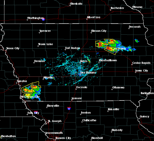 At 628 pm cdt, a severe thunderstorm was located 8 miles west of allison, moving east at 35 mph (radar indicated). Hazards include 60 mph wind gusts and half dollar size hail. Hail damage to vehicles is expected. expect wind damage to roofs, siding, and trees. Locations impacted include, dumont, bristow and aredale. At 628 pm cdt, a severe thunderstorm was located 8 miles west of allison, moving east at 35 mph (radar indicated). Hazards include 60 mph wind gusts and half dollar size hail. Hail damage to vehicles is expected. expect wind damage to roofs, siding, and trees. Locations impacted include, dumont, bristow and aredale.
|
| 6/15/2017 6:12 PM CDT |
 At 612 pm cdt, a severe thunderstorm was located near hampton, moving east at 35 mph (radar indicated). Hazards include 60 mph wind gusts and half dollar size hail. Hail damage to vehicles is expected. Expect wind damage to roofs, siding, and trees. At 612 pm cdt, a severe thunderstorm was located near hampton, moving east at 35 mph (radar indicated). Hazards include 60 mph wind gusts and half dollar size hail. Hail damage to vehicles is expected. Expect wind damage to roofs, siding, and trees.
|
| 6/15/2017 5:51 PM CDT |
 At 550 pm cdt, a severe thunderstorm was located 9 miles west of allison, moving east at 40 mph (radar indicated). Hazards include 60 mph wind gusts and half dollar size hail. Hail damage to vehicles is expected. expect wind damage to roofs, siding, and trees. Locations impacted include, allison, clarksville, greene, dumont, bristow, hansell, aredale and allison municipal airport. At 550 pm cdt, a severe thunderstorm was located 9 miles west of allison, moving east at 40 mph (radar indicated). Hazards include 60 mph wind gusts and half dollar size hail. Hail damage to vehicles is expected. expect wind damage to roofs, siding, and trees. Locations impacted include, allison, clarksville, greene, dumont, bristow, hansell, aredale and allison municipal airport.
|
| 6/15/2017 5:43 PM CDT |
 At 542 pm cdt, a severe thunderstorm was located 7 miles east of hampton, moving east at 40 mph (trained weather spotters. at 5:34pm, trained spotters reported ping pong sized hail and 60 mph winds). Hazards include ping pong ball size hail and 60 mph wind gusts. People and animals outdoors will be injured. expect hail damage to roofs, siding, windows, and vehicles. expect wind damage to roofs, siding, and trees. Locations impacted include, hampton, allison, clarksville, greene, dumont, geneva, bristow, hansell, aredale, allison municipal airport and beeds lake state park. At 542 pm cdt, a severe thunderstorm was located 7 miles east of hampton, moving east at 40 mph (trained weather spotters. at 5:34pm, trained spotters reported ping pong sized hail and 60 mph winds). Hazards include ping pong ball size hail and 60 mph wind gusts. People and animals outdoors will be injured. expect hail damage to roofs, siding, windows, and vehicles. expect wind damage to roofs, siding, and trees. Locations impacted include, hampton, allison, clarksville, greene, dumont, geneva, bristow, hansell, aredale, allison municipal airport and beeds lake state park.
|
| 6/15/2017 5:32 PM CDT |
 At 531 pm cdt, a severe thunderstorm was located over hampton, moving east at 40 mph (radar indicated). Hazards include 60 mph wind gusts and quarter size hail. Hail damage to vehicles is expected. Expect wind damage to roofs, siding, and trees. At 531 pm cdt, a severe thunderstorm was located over hampton, moving east at 40 mph (radar indicated). Hazards include 60 mph wind gusts and quarter size hail. Hail damage to vehicles is expected. Expect wind damage to roofs, siding, and trees.
|
| 5/17/2017 6:05 PM CDT |
 At 604 pm cdt, severe thunderstorms were located along a line extending from near marble rock to 6 miles west of tripoli to jesup, moving north at 55 mph (trained weather spotters. at 553 pm...70 mph winds were reported at the waterloo airport. numerous trees were reported down in town). Hazards include 70 mph wind gusts and nickel size hail. Expect considerable tree damage. damage is likely to mobile homes, roofs, and outbuildings. locations impacted include, waterloo, cedar falls, waverly, allison, evansdale, jesup, la porte city, hudson, sumner, denver, clarksville, tripoli, shell rock, greene, elk run heights, crossroads mall, waterloo municipal airport, uni-dome and mcleod center, janesville and washburn. this includes interstate 380 between mile markers 56 and 73. A tornado watch remains in effect until 700 pm cdt for central, north central and northeastern iowa. At 604 pm cdt, severe thunderstorms were located along a line extending from near marble rock to 6 miles west of tripoli to jesup, moving north at 55 mph (trained weather spotters. at 553 pm...70 mph winds were reported at the waterloo airport. numerous trees were reported down in town). Hazards include 70 mph wind gusts and nickel size hail. Expect considerable tree damage. damage is likely to mobile homes, roofs, and outbuildings. locations impacted include, waterloo, cedar falls, waverly, allison, evansdale, jesup, la porte city, hudson, sumner, denver, clarksville, tripoli, shell rock, greene, elk run heights, crossroads mall, waterloo municipal airport, uni-dome and mcleod center, janesville and washburn. this includes interstate 380 between mile markers 56 and 73. A tornado watch remains in effect until 700 pm cdt for central, north central and northeastern iowa.
|
| 5/17/2017 5:47 PM CDT |
 At 545 pm cdt, severe thunderstorms were located along a line extending from 7 miles northeast of hampton to near shell rock to 7 miles west of la porte city, moving northeast at 70 mph (trained weather spotters. numerous reports of 60 to 70 mph winds have been reported over northeast iowa. doppler radar indicates that the strongest winds are now moving into the southern sections of the waterloo area). Hazards include 70 mph wind gusts and nickel size hail. Expect considerable tree damage. damage is likely to mobile homes, roofs, and outbuildings. locations impacted include, waterloo, cedar falls, waverly, allison, evansdale, jesup, la porte city, hudson, sumner, parkersburg, denver, clarksville, tripoli, shell rock, greene, aplington, elk run heights, crossroads mall, waterloo municipal airport and uni-dome and mcleod center. this includes interstate 380 between mile markers 56 and 73. A tornado watch remains in effect until 700 pm cdt for central, north central and northeastern iowa. At 545 pm cdt, severe thunderstorms were located along a line extending from 7 miles northeast of hampton to near shell rock to 7 miles west of la porte city, moving northeast at 70 mph (trained weather spotters. numerous reports of 60 to 70 mph winds have been reported over northeast iowa. doppler radar indicates that the strongest winds are now moving into the southern sections of the waterloo area). Hazards include 70 mph wind gusts and nickel size hail. Expect considerable tree damage. damage is likely to mobile homes, roofs, and outbuildings. locations impacted include, waterloo, cedar falls, waverly, allison, evansdale, jesup, la porte city, hudson, sumner, parkersburg, denver, clarksville, tripoli, shell rock, greene, aplington, elk run heights, crossroads mall, waterloo municipal airport and uni-dome and mcleod center. this includes interstate 380 between mile markers 56 and 73. A tornado watch remains in effect until 700 pm cdt for central, north central and northeastern iowa.
|
| 5/17/2017 5:32 PM CDT |
 At 531 pm cdt, severe thunderstorms were located along a line extending from 6 miles north of iowa falls to 6 miles west of dike to near traer, moving northeast at 70 mph (trained weather spotters. numerous reports of 60 to 70 mph winds with tree damage across central and northeastern iowa). Hazards include 70 mph wind gusts and nickel size hail. Expect considerable tree damage. Damage is likely to mobile homes, roofs, and outbuildings. At 531 pm cdt, severe thunderstorms were located along a line extending from 6 miles north of iowa falls to 6 miles west of dike to near traer, moving northeast at 70 mph (trained weather spotters. numerous reports of 60 to 70 mph winds with tree damage across central and northeastern iowa). Hazards include 70 mph wind gusts and nickel size hail. Expect considerable tree damage. Damage is likely to mobile homes, roofs, and outbuildings.
|
| 5/16/2017 10:31 PM CDT |
 At 1030 pm cdt, severe thunderstorms were located along a line extending from near manly to nora springs to near sheffield, moving northeast at 40 mph (trained weather spotters). Hazards include 70 mph wind gusts and pea size hail. at 1025 pm, 71 mph wind gust was reported in grafton. Expect considerable tree damage. damage is likely to mobile homes, roofs, and outbuildings. Locations impacted include, mason city, northwood, manly, sheffield, greene, rockwell, plymouth, kensett, grafton, bristow, rock falls, chapin, aredale, dougherty, portland, bolan and northwood municipal. At 1030 pm cdt, severe thunderstorms were located along a line extending from near manly to nora springs to near sheffield, moving northeast at 40 mph (trained weather spotters). Hazards include 70 mph wind gusts and pea size hail. at 1025 pm, 71 mph wind gust was reported in grafton. Expect considerable tree damage. damage is likely to mobile homes, roofs, and outbuildings. Locations impacted include, mason city, northwood, manly, sheffield, greene, rockwell, plymouth, kensett, grafton, bristow, rock falls, chapin, aredale, dougherty, portland, bolan and northwood municipal.
|
| 5/16/2017 10:15 PM CDT |
 At 1014 pm cdt, severe thunderstorms were located along a line extending from 7 miles north of mason city municipal airport to near mason city to near hampton, moving northeast at 40 mph (radar indicated). Hazards include 60 mph wind gusts and penny size hail. expect damage to roofs, siding, and trees At 1014 pm cdt, severe thunderstorms were located along a line extending from 7 miles north of mason city municipal airport to near mason city to near hampton, moving northeast at 40 mph (radar indicated). Hazards include 60 mph wind gusts and penny size hail. expect damage to roofs, siding, and trees
|
| 5/15/2017 7:07 PM CDT |
 At 707 pm cdt, a severe thunderstorm was located over allison, moving east at 40 mph (trained weather spotters). Hazards include 60 mph wind gusts and half dollar size hail. Hail damage to vehicles is expected. expect wind damage to roofs, siding, and trees. Locations impacted include, allison, dumont, bristow, aredale and allison municipal airport. At 707 pm cdt, a severe thunderstorm was located over allison, moving east at 40 mph (trained weather spotters). Hazards include 60 mph wind gusts and half dollar size hail. Hail damage to vehicles is expected. expect wind damage to roofs, siding, and trees. Locations impacted include, allison, dumont, bristow, aredale and allison municipal airport.
|
| 5/15/2017 6:54 PM CDT |
 At 654 pm cdt, a severe thunderstorm was located 7 miles west of allison, moving east at 40 mph (trained weather spotters up to half dollar size hail with these storms). Hazards include 60 mph wind gusts and half dollar size hail. Hail damage to vehicles is expected. expect wind damage to roofs, siding, and trees. Locations impacted include, allison, dumont, geneva, bristow, hansell, aredale and allison municipal airport. At 654 pm cdt, a severe thunderstorm was located 7 miles west of allison, moving east at 40 mph (trained weather spotters up to half dollar size hail with these storms). Hazards include 60 mph wind gusts and half dollar size hail. Hail damage to vehicles is expected. expect wind damage to roofs, siding, and trees. Locations impacted include, allison, dumont, geneva, bristow, hansell, aredale and allison municipal airport.
|
| 5/15/2017 6:41 PM CDT |
 At 640 pm cdt, a severe thunderstorm was located near hampton, moving east at 40 mph (radar indicated). Hazards include 60 mph wind gusts and quarter size hail. Hail damage to vehicles is expected. Expect wind damage to roofs, siding, and trees. At 640 pm cdt, a severe thunderstorm was located near hampton, moving east at 40 mph (radar indicated). Hazards include 60 mph wind gusts and quarter size hail. Hail damage to vehicles is expected. Expect wind damage to roofs, siding, and trees.
|
| 5/15/2017 6:27 PM CDT |
 At 627 pm cdt, severe thunderstorms were located along a line extending from near greene to 9 miles east of big wall lake, moving east at 30 mph (radar indicated). Hazards include 60 mph wind gusts and half dollar size hail. Hail damage to vehicles is expected. expect wind damage to roofs, siding, and trees. locations impacted include, hampton, sheffield, greene, rockwell, dumont, dows, latimer, thornton, coulter, meservey, alexander, bradford, hansell, chapin, aredale, dougherty, beeds lake state park and hampton municipal airport. This includes interstate 35 between mile markers 159 and 181. At 627 pm cdt, severe thunderstorms were located along a line extending from near greene to 9 miles east of big wall lake, moving east at 30 mph (radar indicated). Hazards include 60 mph wind gusts and half dollar size hail. Hail damage to vehicles is expected. expect wind damage to roofs, siding, and trees. locations impacted include, hampton, sheffield, greene, rockwell, dumont, dows, latimer, thornton, coulter, meservey, alexander, bradford, hansell, chapin, aredale, dougherty, beeds lake state park and hampton municipal airport. This includes interstate 35 between mile markers 159 and 181.
|
| 5/15/2017 5:58 PM CDT |
 At 558 pm cdt, severe thunderstorms were located along a line extending from 6 miles southwest of marble rock to near big wall lake, moving east at 30 mph (radar indicated). Hazards include ping pong ball size hail and 60 mph wind gusts. People and animals outdoors will be injured. expect hail damage to roofs, siding, windows, and vehicles. Expect wind damage to roofs, siding, and trees. At 558 pm cdt, severe thunderstorms were located along a line extending from 6 miles southwest of marble rock to near big wall lake, moving east at 30 mph (radar indicated). Hazards include ping pong ball size hail and 60 mph wind gusts. People and animals outdoors will be injured. expect hail damage to roofs, siding, windows, and vehicles. Expect wind damage to roofs, siding, and trees.
|
| 3/23/2017 2:23 PM CDT |
 The severe thunderstorm warning for northeastern franklin, northwestern butler and southeastern cerro gordo counties will expire at 230 pm cdt, the storm which prompted the warning has weakened below severe limits, and no longer poses an immediate threat to life or property. therefore the warning will be allowed to expire. The severe thunderstorm warning for northeastern franklin, northwestern butler and southeastern cerro gordo counties will expire at 230 pm cdt, the storm which prompted the warning has weakened below severe limits, and no longer poses an immediate threat to life or property. therefore the warning will be allowed to expire.
|
| 3/23/2017 2:19 PM CDT |
 At 218 pm cdt, a severe thunderstorm was located 7 miles southeast of sheffield, or 9 miles northeast of hampton, moving east at 60 mph (radar indicated). Hazards include quarter size hail. Damage to vehicles is expected. Locations impacted include, hampton, sheffield, dumont, bristow, hansell, chapin, aredale and dougherty. At 218 pm cdt, a severe thunderstorm was located 7 miles southeast of sheffield, or 9 miles northeast of hampton, moving east at 60 mph (radar indicated). Hazards include quarter size hail. Damage to vehicles is expected. Locations impacted include, hampton, sheffield, dumont, bristow, hansell, chapin, aredale and dougherty.
|
| 3/23/2017 2:05 PM CDT |
 At 204 pm cdt, a severe thunderstorm was located 7 miles northwest of hampton, moving east at 60 mph (radar indicated). Hazards include quarter size hail. damage to vehicles is expected At 204 pm cdt, a severe thunderstorm was located 7 miles northwest of hampton, moving east at 60 mph (radar indicated). Hazards include quarter size hail. damage to vehicles is expected
|
| 9/21/2016 5:13 PM CDT |
 At 513 pm cdt, a severe thunderstorm was located near marble rock, or 14 miles northwest of allison, moving east at 20 mph (radar indicated). Hazards include 60 mph wind gusts and quarter size hail. Hail damage to vehicles is expected. Expect wind damage to roofs, siding, and trees. At 513 pm cdt, a severe thunderstorm was located near marble rock, or 14 miles northwest of allison, moving east at 20 mph (radar indicated). Hazards include 60 mph wind gusts and quarter size hail. Hail damage to vehicles is expected. Expect wind damage to roofs, siding, and trees.
|
| 7/17/2016 11:22 AM CDT |
 At 1121 am cdt, a severe thunderstorm was located near hampton, moving east at 60 mph (radar indicated). Hazards include 60 mph wind gusts and quarter size hail. Hail damage to vehicles is expected. expect wind damage to roofs, siding, and trees. Locations impacted include, hampton, aplington, dumont, latimer, coulter, geneva, bristow, bradford, hansell, chapin, popejoy, aredale, beeds lake state park and hampton municipal airport. At 1121 am cdt, a severe thunderstorm was located near hampton, moving east at 60 mph (radar indicated). Hazards include 60 mph wind gusts and quarter size hail. Hail damage to vehicles is expected. expect wind damage to roofs, siding, and trees. Locations impacted include, hampton, aplington, dumont, latimer, coulter, geneva, bristow, bradford, hansell, chapin, popejoy, aredale, beeds lake state park and hampton municipal airport.
|
| 7/17/2016 11:12 AM CDT |
 At 1112 am cdt, a severe thunderstorm was located near hampton, moving east at 60 mph (radar indicated). Hazards include 60 mph wind gusts and quarter size hail. Hail damage to vehicles is expected. expect wind damage to roofs, siding, and trees. Locations impacted include, hampton, aplington, dumont, dows, latimer, coulter, alexander, geneva, bristow, bradford, hansell, chapin, popejoy, aredale, beeds lake state park and hampton municipal airport. At 1112 am cdt, a severe thunderstorm was located near hampton, moving east at 60 mph (radar indicated). Hazards include 60 mph wind gusts and quarter size hail. Hail damage to vehicles is expected. expect wind damage to roofs, siding, and trees. Locations impacted include, hampton, aplington, dumont, dows, latimer, coulter, alexander, geneva, bristow, bradford, hansell, chapin, popejoy, aredale, beeds lake state park and hampton municipal airport.
|
| 7/17/2016 11:04 AM CDT |
 At 1103 am cdt, a severe thunderstorm was located 11 miles northeast of big wall lake, or 13 miles west of hampton, moving east at 60 mph (radar indicated). Hazards include 60 mph wind gusts and quarter size hail. Hail damage to vehicles is expected. Expect wind damage to roofs, siding, and trees. At 1103 am cdt, a severe thunderstorm was located 11 miles northeast of big wall lake, or 13 miles west of hampton, moving east at 60 mph (radar indicated). Hazards include 60 mph wind gusts and quarter size hail. Hail damage to vehicles is expected. Expect wind damage to roofs, siding, and trees.
|
| 7/17/2016 10:39 AM CDT | The severe thunderstorm warning for western butler and east central franklin counties will expire at 1045 am cdt, the storm which prompted the warning has weakened below severe limits, and no longer pose an immediate threat to life or property. therefore the warning will be allowed to expire. |
| 7/17/2016 10:27 AM CDT |
 At 1027 am cdt, a severe thunderstorm was located 8 miles west of allison, moving east at 35 mph (trained weather spotters). Hazards include 60 mph wind gusts and quarter size hail. Hail damage to vehicles is expected. expect wind damage to roofs, siding, and trees. Locations impacted include, allison, dumont, geneva, bristow, hansell, aredale and allison municipal airport. At 1027 am cdt, a severe thunderstorm was located 8 miles west of allison, moving east at 35 mph (trained weather spotters). Hazards include 60 mph wind gusts and quarter size hail. Hail damage to vehicles is expected. expect wind damage to roofs, siding, and trees. Locations impacted include, allison, dumont, geneva, bristow, hansell, aredale and allison municipal airport.
|
| 7/17/2016 10:14 AM CDT |
 At 1013 am cdt, a severe thunderstorm was located near hampton, moving east at 35 mph (trained weather spotters reported quarter sized hail in hampton at 1012 am). Hazards include 60 mph wind gusts and half dollar size hail. Hail damage to vehicles is expected. expect wind damage to roofs, siding, and trees. Locations impacted include, hampton, allison, dumont, geneva, bristow, hansell, aredale, hampton municipal airport, beeds lake state park and allison municipal airport. At 1013 am cdt, a severe thunderstorm was located near hampton, moving east at 35 mph (trained weather spotters reported quarter sized hail in hampton at 1012 am). Hazards include 60 mph wind gusts and half dollar size hail. Hail damage to vehicles is expected. expect wind damage to roofs, siding, and trees. Locations impacted include, hampton, allison, dumont, geneva, bristow, hansell, aredale, hampton municipal airport, beeds lake state park and allison municipal airport.
|
| 7/17/2016 10:05 AM CDT |
 At 1004 am cdt, a severe thunderstorm was located over hampton, moving east at 35 mph (radar indicated). Hazards include 60 mph wind gusts and half dollar size hail. Hail damage to vehicles is expected. Expect wind damage to roofs, siding, and trees. At 1004 am cdt, a severe thunderstorm was located over hampton, moving east at 35 mph (radar indicated). Hazards include 60 mph wind gusts and half dollar size hail. Hail damage to vehicles is expected. Expect wind damage to roofs, siding, and trees.
|
| 6/22/2015 7:54 AM CDT |
 At 753 am cdt, severe thunderstorms were located along a line extending from 5 miles southwest of nashua to 3 miles south of aplington to 4 miles southwest of jewell junction, moving east at 75 mph (radar indicated). Hazards include 60 mph wind gusts and penny size hail. Expect damage to roofs. Siding and trees. At 753 am cdt, severe thunderstorms were located along a line extending from 5 miles southwest of nashua to 3 miles south of aplington to 4 miles southwest of jewell junction, moving east at 75 mph (radar indicated). Hazards include 60 mph wind gusts and penny size hail. Expect damage to roofs. Siding and trees.
|
| 6/22/2015 7:40 AM CDT |
 At 740 am cdt, severe thunderstorms were located along a line extending from 7 miles west of greene to 3 miles northeast of iowa falls to 7 miles west of jewell junction, moving east at 70 mph (radar indicated). Hazards include 60 mph wind gusts and penny size hail. Expect damage to roofs. siding and trees. locations impacted include, webster city, iowa falls, hampton, clarion, eldora, allison, eagle grove, belmond, parkersburg, ackley, clarksville, jewell junction, sheffield, greene, aplington, elm lake, big wall lake, hubbard, alden and wellsburg. This includes interstate 35 between mile markers 129 and 178. At 740 am cdt, severe thunderstorms were located along a line extending from 7 miles west of greene to 3 miles northeast of iowa falls to 7 miles west of jewell junction, moving east at 70 mph (radar indicated). Hazards include 60 mph wind gusts and penny size hail. Expect damage to roofs. siding and trees. locations impacted include, webster city, iowa falls, hampton, clarion, eldora, allison, eagle grove, belmond, parkersburg, ackley, clarksville, jewell junction, sheffield, greene, aplington, elm lake, big wall lake, hubbard, alden and wellsburg. This includes interstate 35 between mile markers 129 and 178.
|
| 6/22/2015 7:16 AM CDT |
 At 716 am cdt, severe thunderstorms were located along a line extending from 10 miles northeast of belmond to 4 miles west of big wall lake to 7 miles north of gowrie, moving east at 70 mph (radar indicated). Hazards include 60 mph wind gusts and penny size hail. Expect damage to roofs. Siding and trees. At 716 am cdt, severe thunderstorms were located along a line extending from 10 miles northeast of belmond to 4 miles west of big wall lake to 7 miles north of gowrie, moving east at 70 mph (radar indicated). Hazards include 60 mph wind gusts and penny size hail. Expect damage to roofs. Siding and trees.
|
| 1/1/0001 12:00 AM | Quarter sized hail reported 2.4 miles NW of Aredale, IA, sheriff reported nickel to quarter size hail one mile south and one mile west of aredale. |
Hail Maps for Aredale, IA
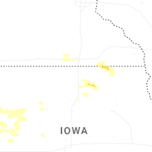
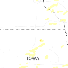

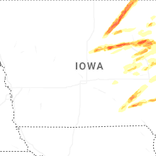
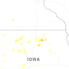
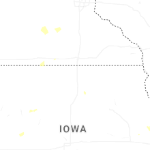
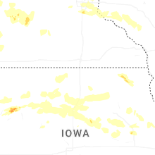
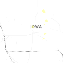
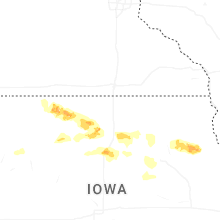
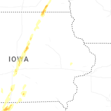


Connect with Interactive Hail Maps