

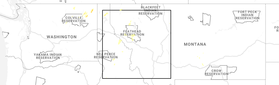
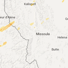
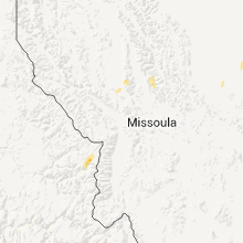
Hail Map for Arlee, MT
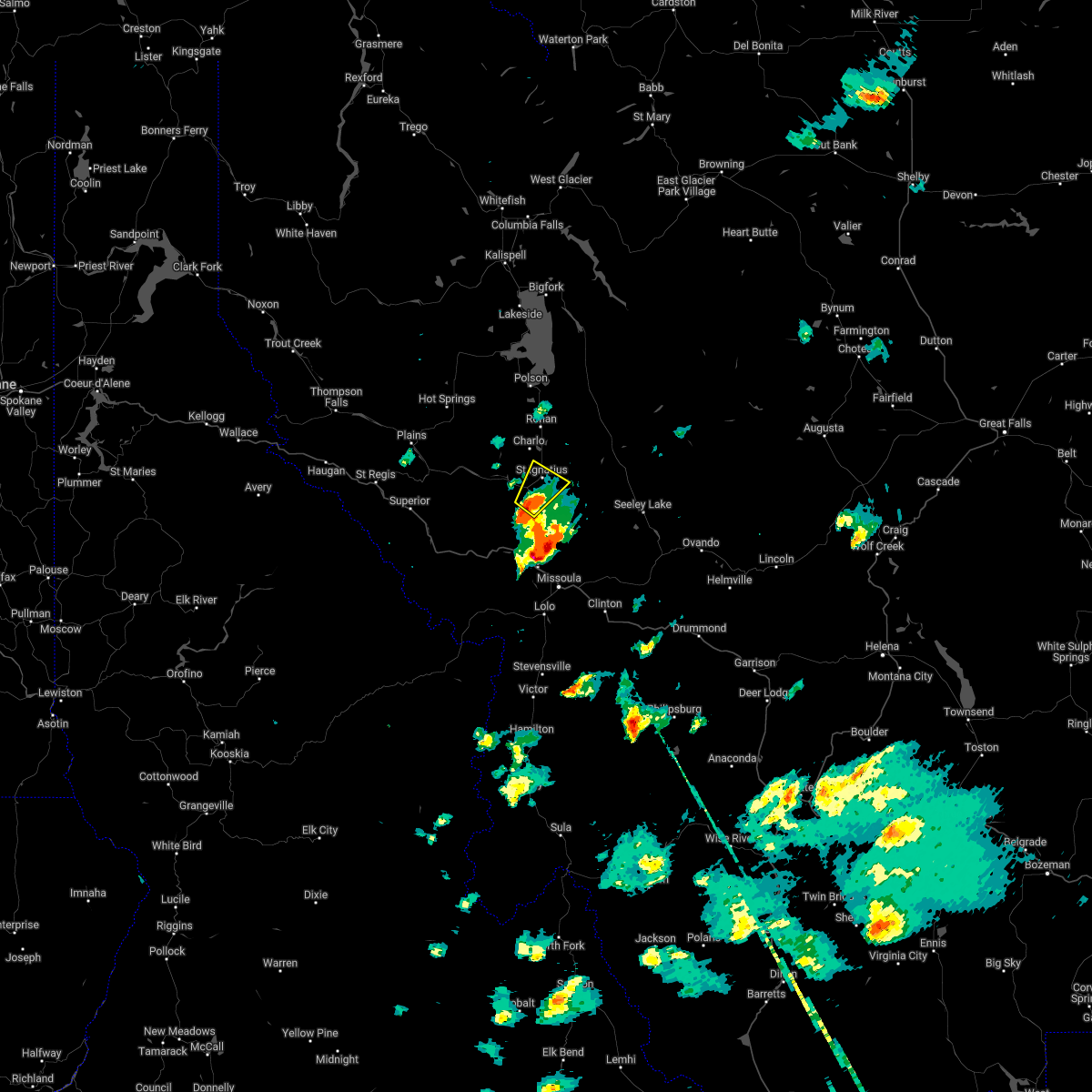
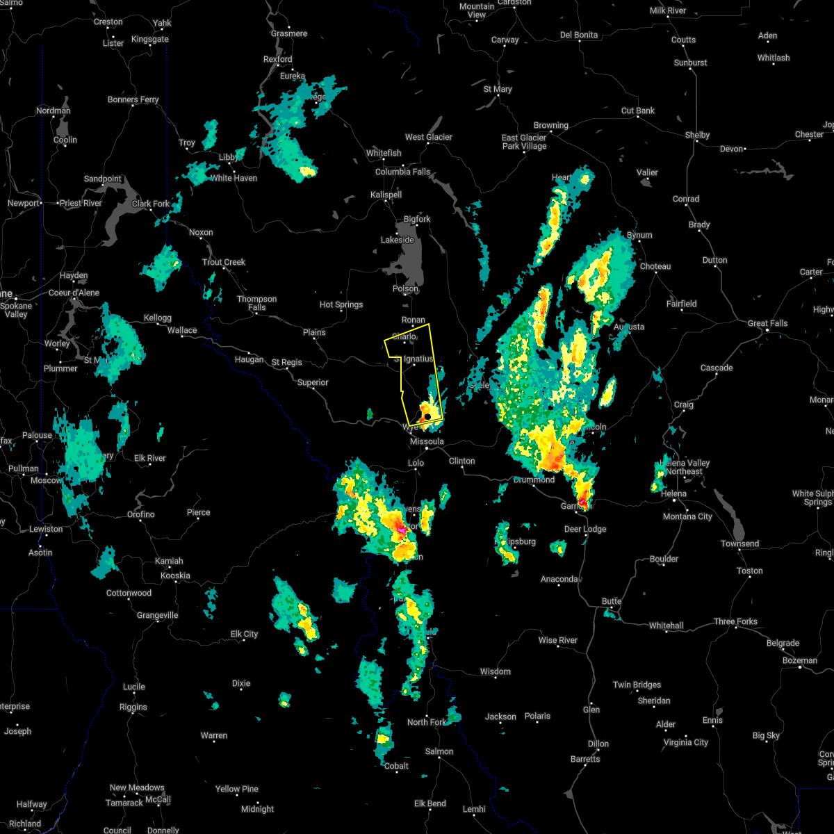
The Arlee, MT area has had 1 report of on-the-ground hail by trained spotters, and has been under severe weather warnings 0 times during the past 12 months. Doppler radar has detected hail at or near Arlee, MT on 8 occasions, including 1 occasion during the past year.
| Name: | Arlee, MT |
| Where Located: | 20.8 miles N of Missoula, MT |
| Map: | Google Map for Arlee, MT |
| Population: | 636 |
| Housing Units: | 297 |
| More Info: | Search Google for Arlee, MT |
0
The Top Recent Hail Date for Arlee, MT is Sunday, May 21, 2023 (8th out of 8)
Hail and Wind Damage Spotted near Arlee, MT
| Date / Time | Report Details |
|---|---|
| 7/8/2022 3:55 PM MDT |
 At 355 pm mdt, a severe thunderstorm was located over ravalli, or 25 miles north of missoula, moving northeast at 15 mph (radar indicated). Hazards include 60 mph wind gusts and quarter size hail. Hail damage to vehicles is expected. Expect wind damage to roofs, siding, and trees. At 355 pm mdt, a severe thunderstorm was located over ravalli, or 25 miles north of missoula, moving northeast at 15 mph (radar indicated). Hazards include 60 mph wind gusts and quarter size hail. Hail damage to vehicles is expected. Expect wind damage to roofs, siding, and trees.
|
| 6/18/2022 1:31 PM MDT |
 At 131 pm mdt, a severe thunderstorm was located near ravalli, or 26 miles north of missoula, moving north at 40 mph (radar indicated). Hazards include 60 mph wind gusts and quarter size hail. Hail damage to vehicles is expected. expect wind damage to roofs, siding, and trees. locations impacted include, ravalli, st. ignatius, arlee, allentown, moiese, kicking horse, charlo and fort connah. hail threat, radar indicated max hail size, 1. 00 in wind threat, radar indicated max wind gust, 60 mph. At 131 pm mdt, a severe thunderstorm was located near ravalli, or 26 miles north of missoula, moving north at 40 mph (radar indicated). Hazards include 60 mph wind gusts and quarter size hail. Hail damage to vehicles is expected. expect wind damage to roofs, siding, and trees. locations impacted include, ravalli, st. ignatius, arlee, allentown, moiese, kicking horse, charlo and fort connah. hail threat, radar indicated max hail size, 1. 00 in wind threat, radar indicated max wind gust, 60 mph.
|
| 6/18/2022 1:20 PM MDT | Quarter sized hail reported 0.6 miles N of Arlee, MT, facebook report. |
| 6/18/2022 1:15 PM MDT |
 At 115 pm mdt, a severe thunderstorm was located near arlee, or 17 miles north of missoula, moving north at 45 mph (radar indicated). Hazards include 60 mph wind gusts and quarter size hail. Hail damage to vehicles is expected. Expect wind damage to roofs, siding, and trees. At 115 pm mdt, a severe thunderstorm was located near arlee, or 17 miles north of missoula, moving north at 45 mph (radar indicated). Hazards include 60 mph wind gusts and quarter size hail. Hail damage to vehicles is expected. Expect wind damage to roofs, siding, and trees.
|
| 5/6/2018 7:06 PM MDT |
 The severe thunderstorm warning for southwestern missoula county will expire at 715 pm mdt, the severe thunderstorm which prompted the warning has weakened and is moving out of the warned area. therefore, the warning will be allowed to expire. strong winds near 40 mph, heavy rain, and small hail will continue for another 10 to 20 minutes. The severe thunderstorm warning for southwestern missoula county will expire at 715 pm mdt, the severe thunderstorm which prompted the warning has weakened and is moving out of the warned area. therefore, the warning will be allowed to expire. strong winds near 40 mph, heavy rain, and small hail will continue for another 10 to 20 minutes.
|
| 5/6/2018 6:40 PM MDT |
 At 640 pm mdt, a severe thunderstorm was located near missoula, moving north at 40 mph (radar indicated). Hazards include 60 mph wind gusts and nickel size hail. expect damage to roofs, siding, and trees At 640 pm mdt, a severe thunderstorm was located near missoula, moving north at 40 mph (radar indicated). Hazards include 60 mph wind gusts and nickel size hail. expect damage to roofs, siding, and trees
|
| 7/17/2016 9:51 PM MDT |
 At 951 pm mdt, multiple trained weather spotters reported a severe thunderstorm producing quarter size hail and damaging winds in excess of 60 mph. this storm was located 10 miles northeast of bonner-west riverside, or 15 miles east of missoula, moving northeast at 55 mph. locations impacted include, missoula, lolo, stevensville, evaro, wye, bonner-west riverside, frenchtown, florence, east missoula, arlee, twin creeks, clinton, potomac and turah. At 951 pm mdt, multiple trained weather spotters reported a severe thunderstorm producing quarter size hail and damaging winds in excess of 60 mph. this storm was located 10 miles northeast of bonner-west riverside, or 15 miles east of missoula, moving northeast at 55 mph. locations impacted include, missoula, lolo, stevensville, evaro, wye, bonner-west riverside, frenchtown, florence, east missoula, arlee, twin creeks, clinton, potomac and turah.
|
| 7/17/2016 9:27 PM MDT |
 At 926 pm mdt, doppler radar indicated a severe thunderstorm capable of producing damaging winds in excess of 60 mph. this storm was located over lolo, or 10 miles south of missoula, and moving northeast at 55 mph. nickel size to quarter size hail may also accompany the damaging winds. At 926 pm mdt, doppler radar indicated a severe thunderstorm capable of producing damaging winds in excess of 60 mph. this storm was located over lolo, or 10 miles south of missoula, and moving northeast at 55 mph. nickel size to quarter size hail may also accompany the damaging winds.
|
| 8/10/2015 7:14 PM MDT | Time of event is approximate in lake county MT, 0.6 miles N of Arlee, MT |
Hail Maps for Arlee, MT


Connect with Interactive Hail Maps