

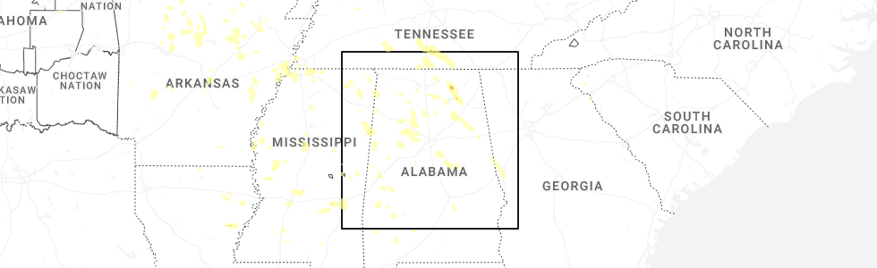
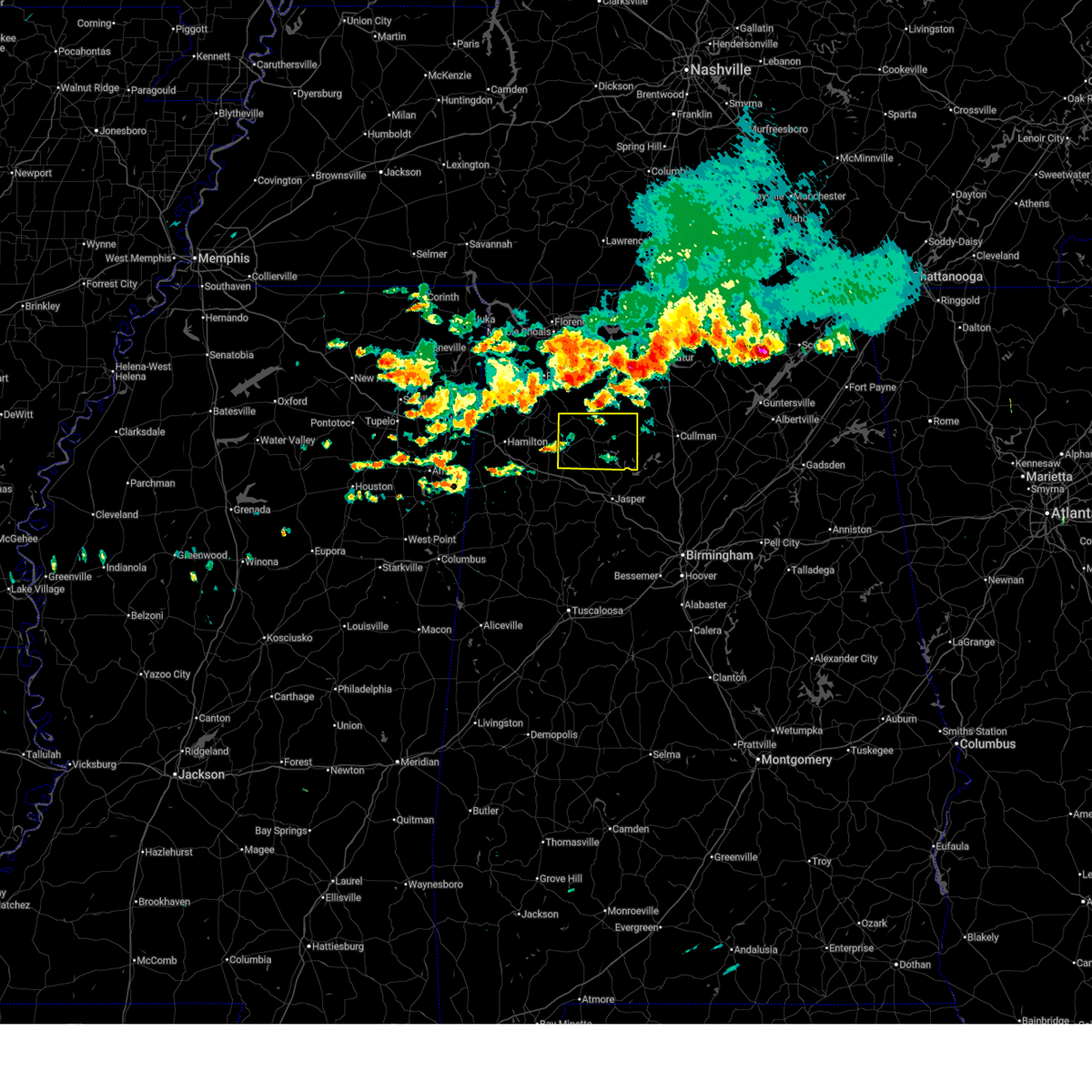
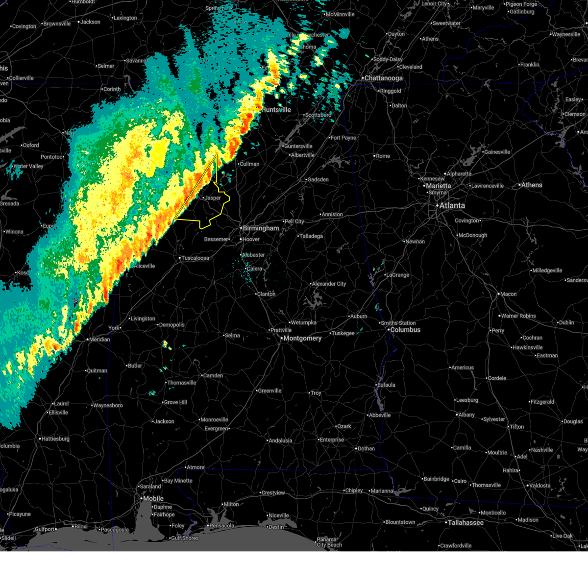
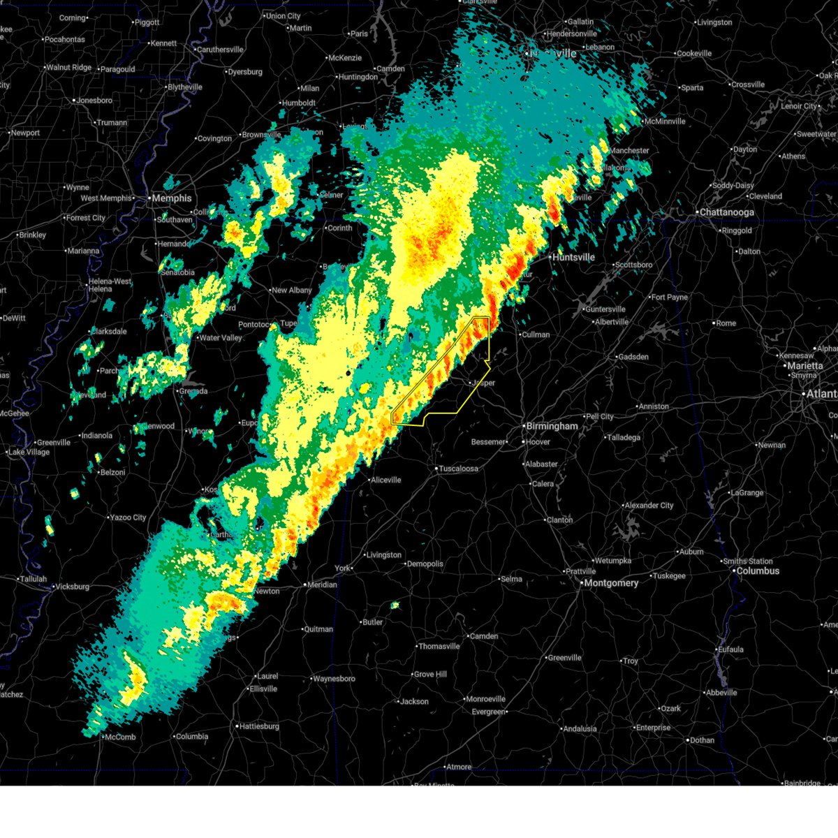
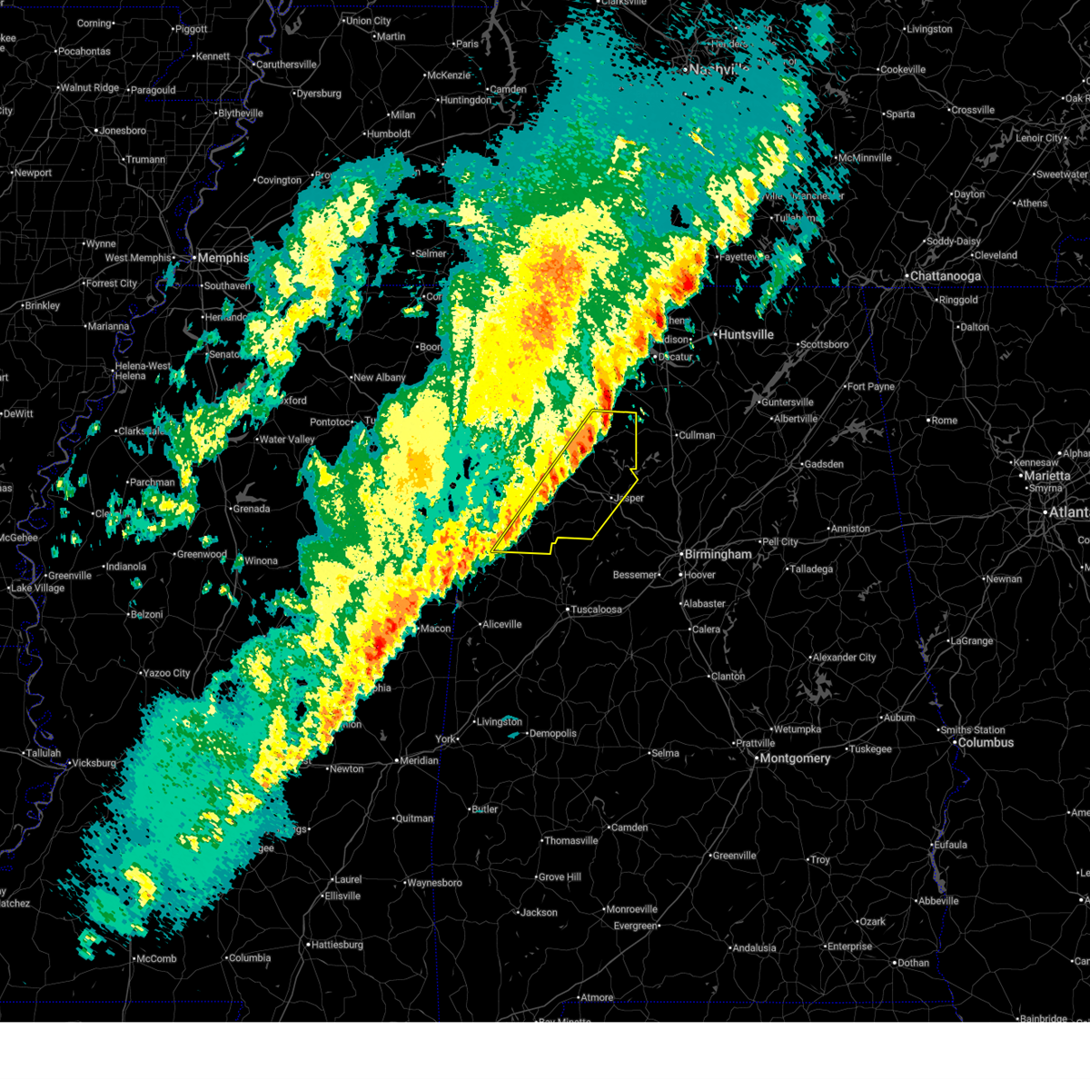
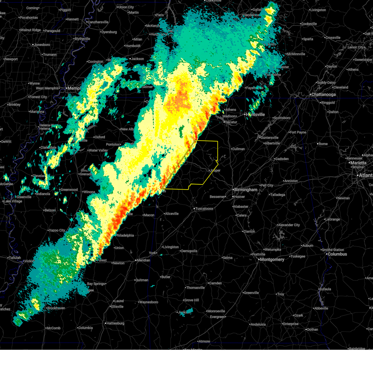
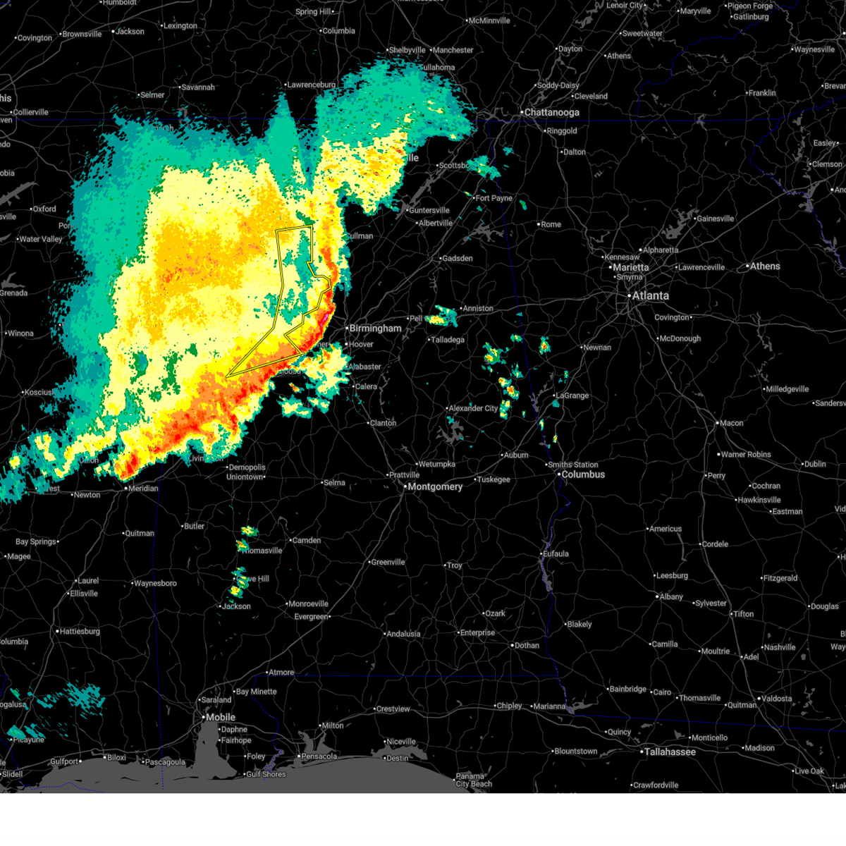
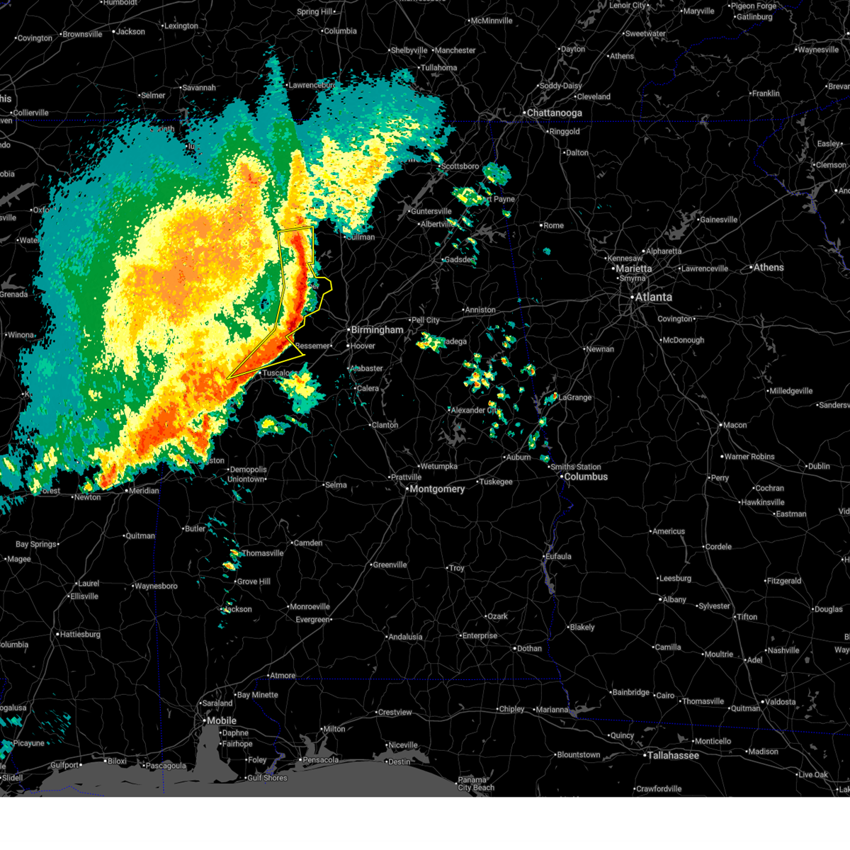
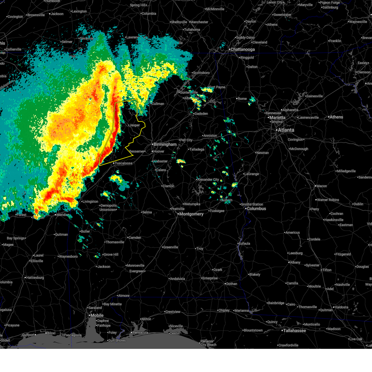
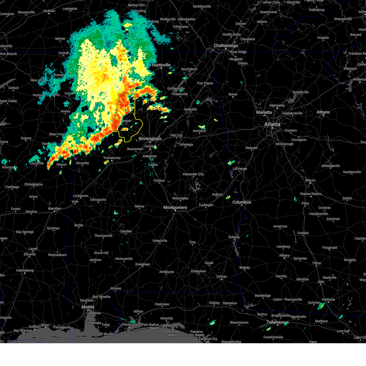
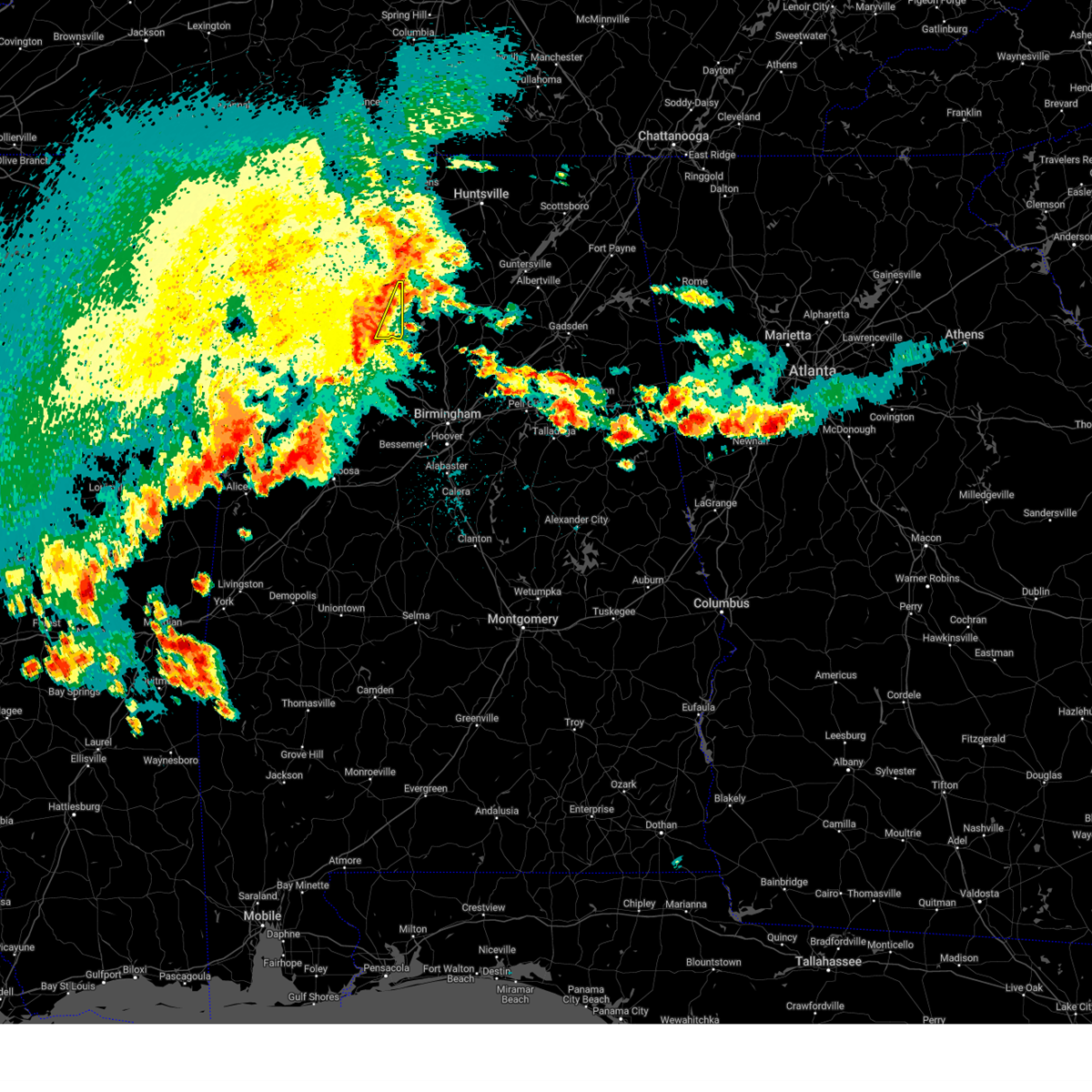
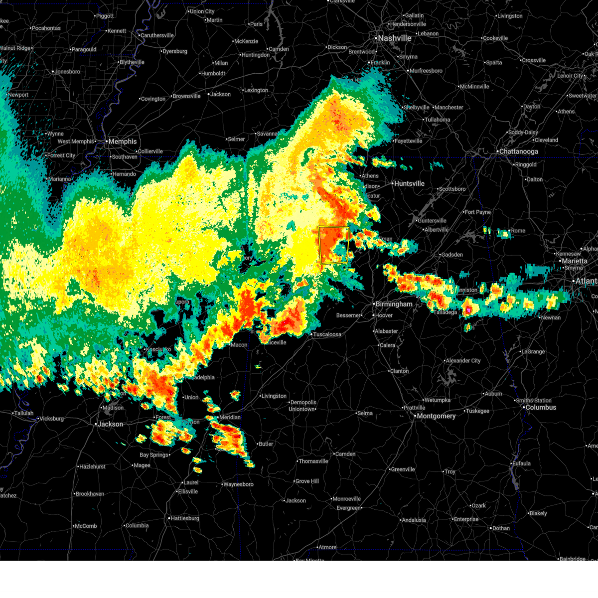
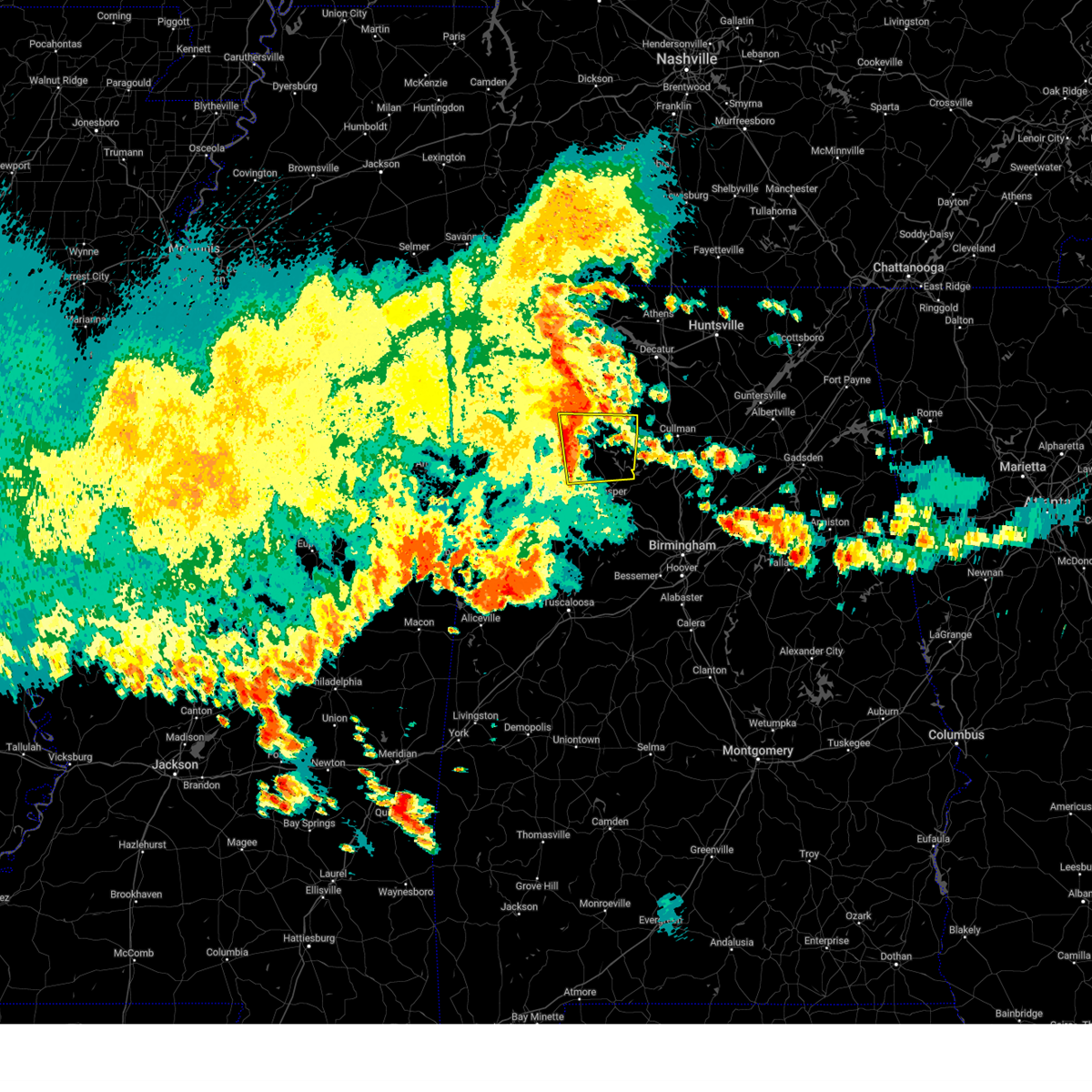
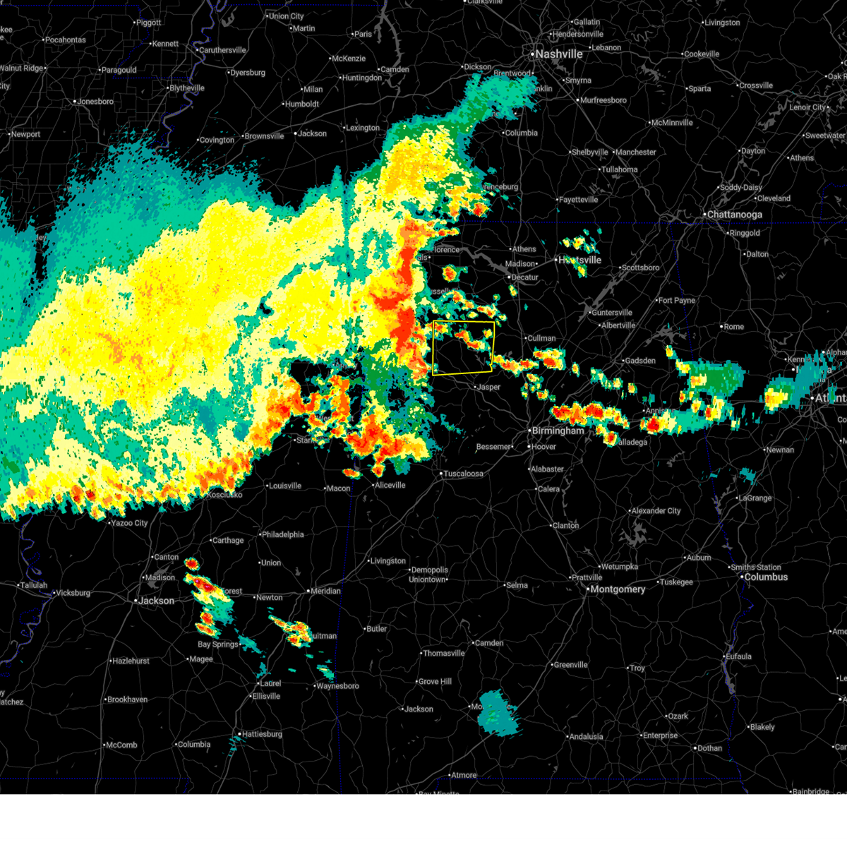
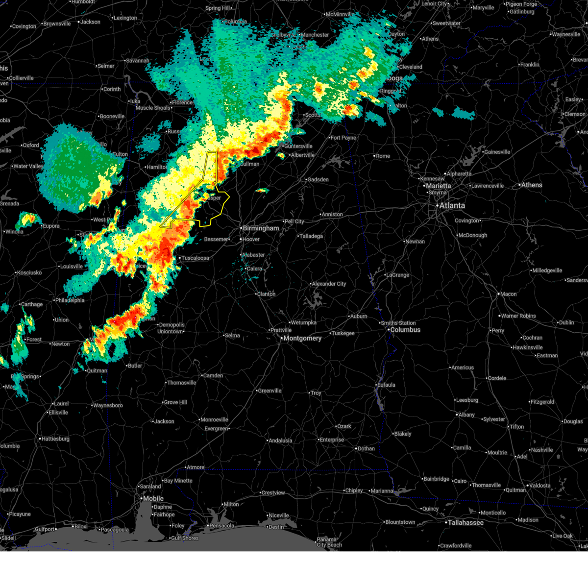
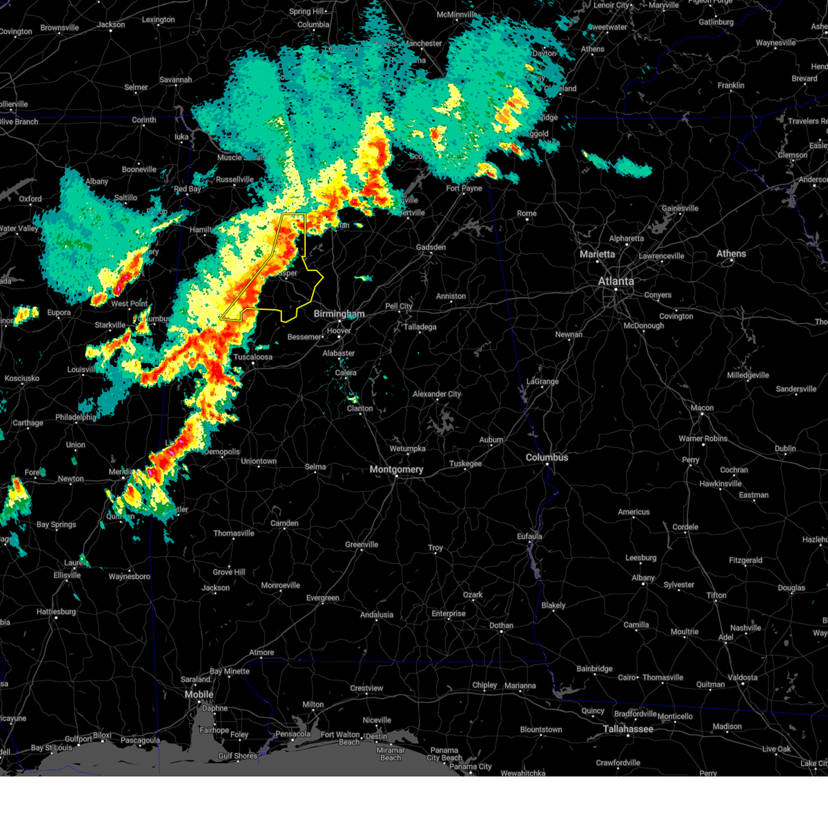
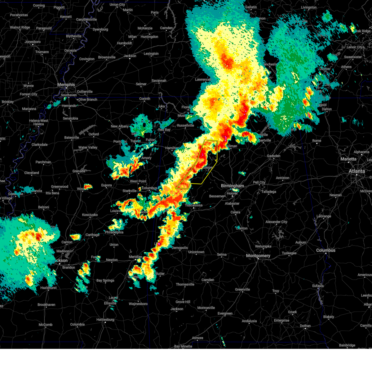
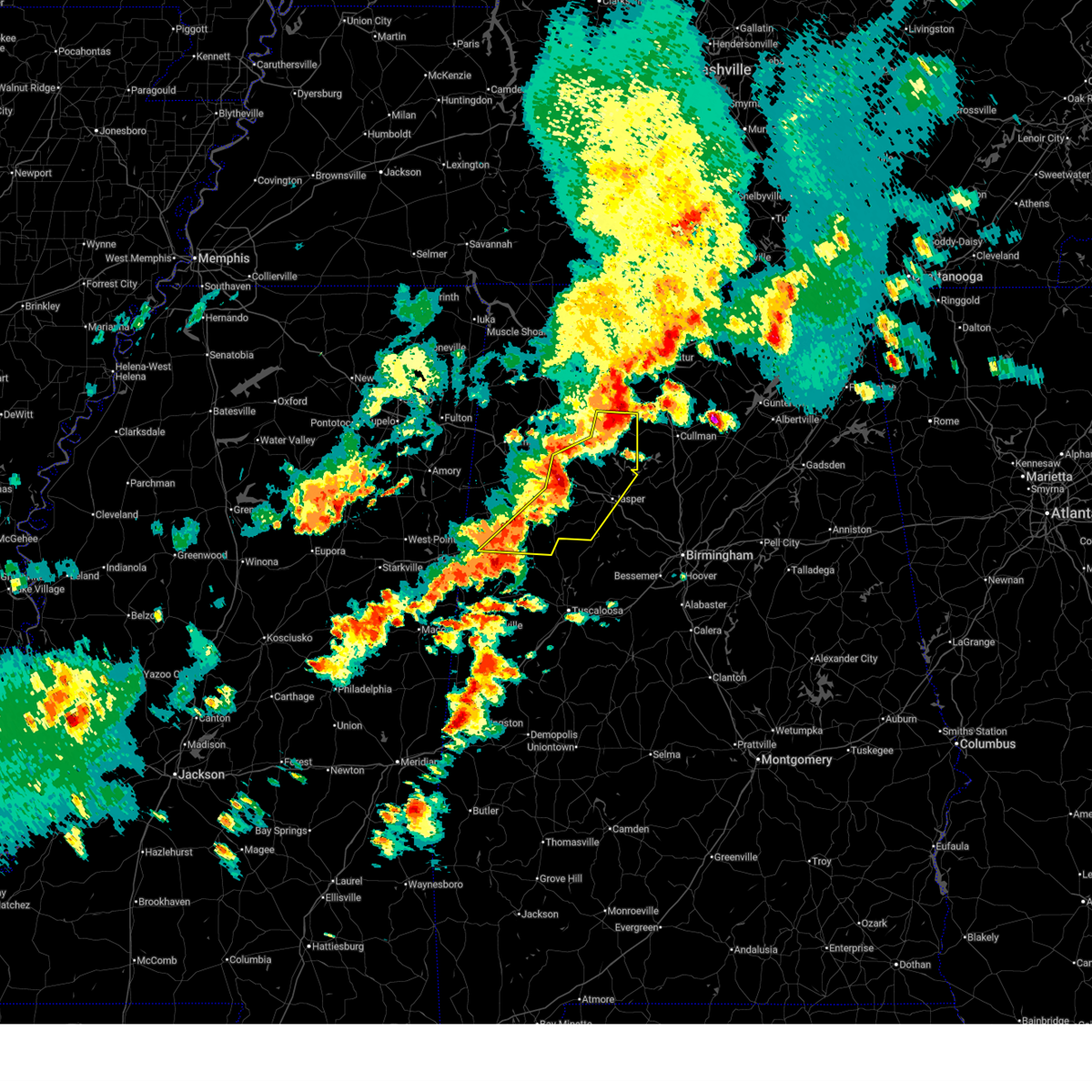
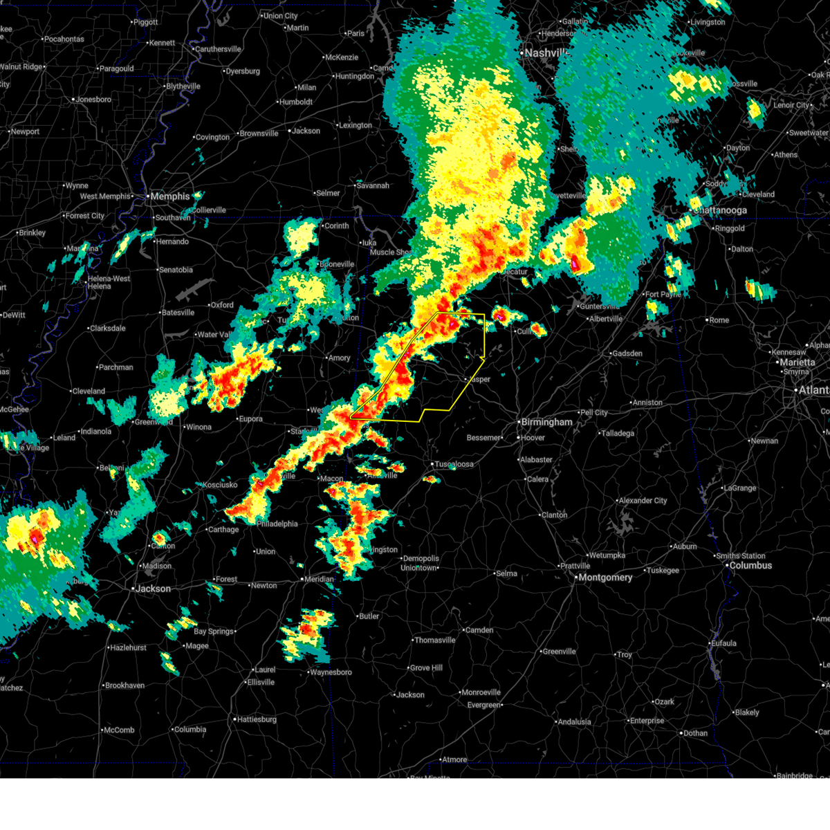
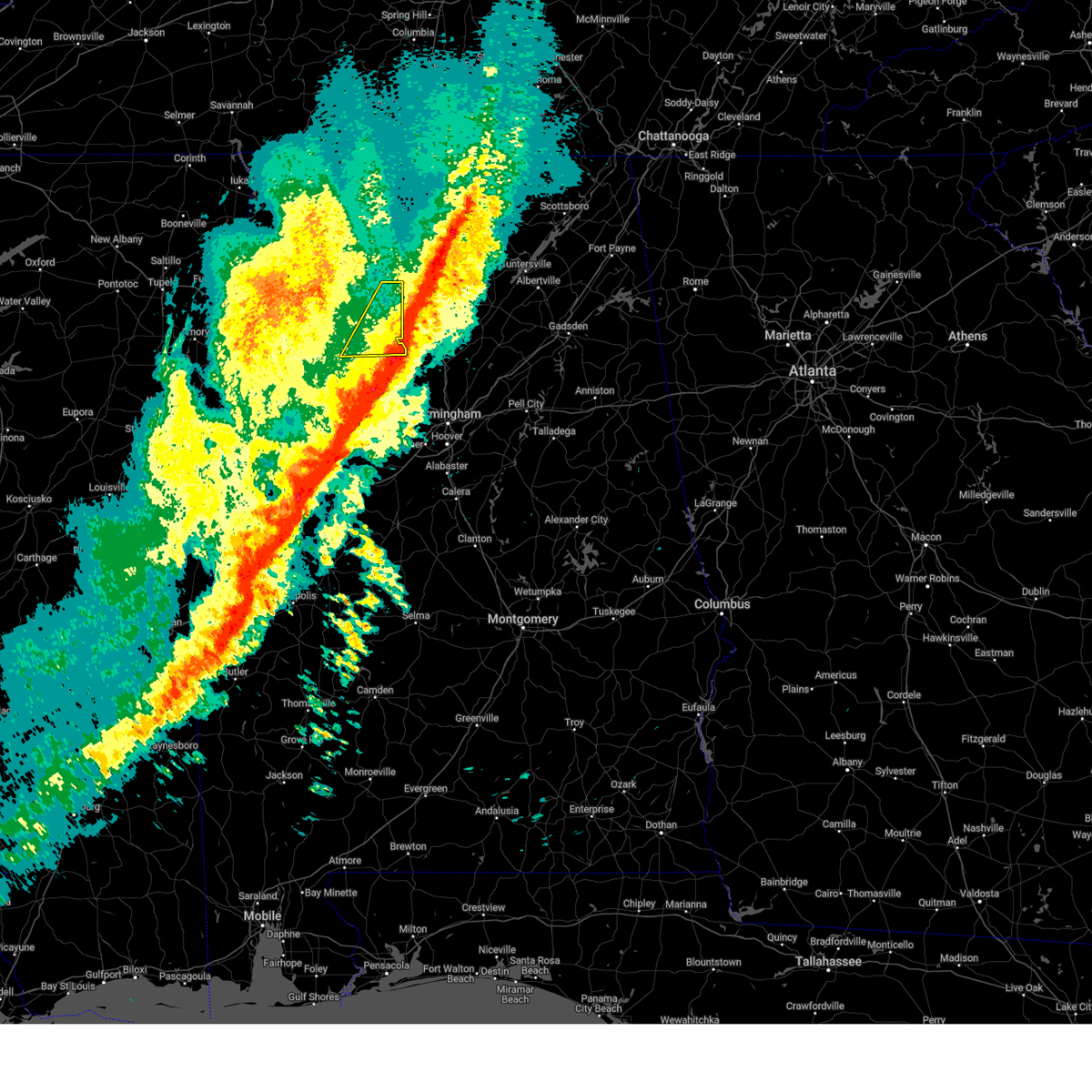
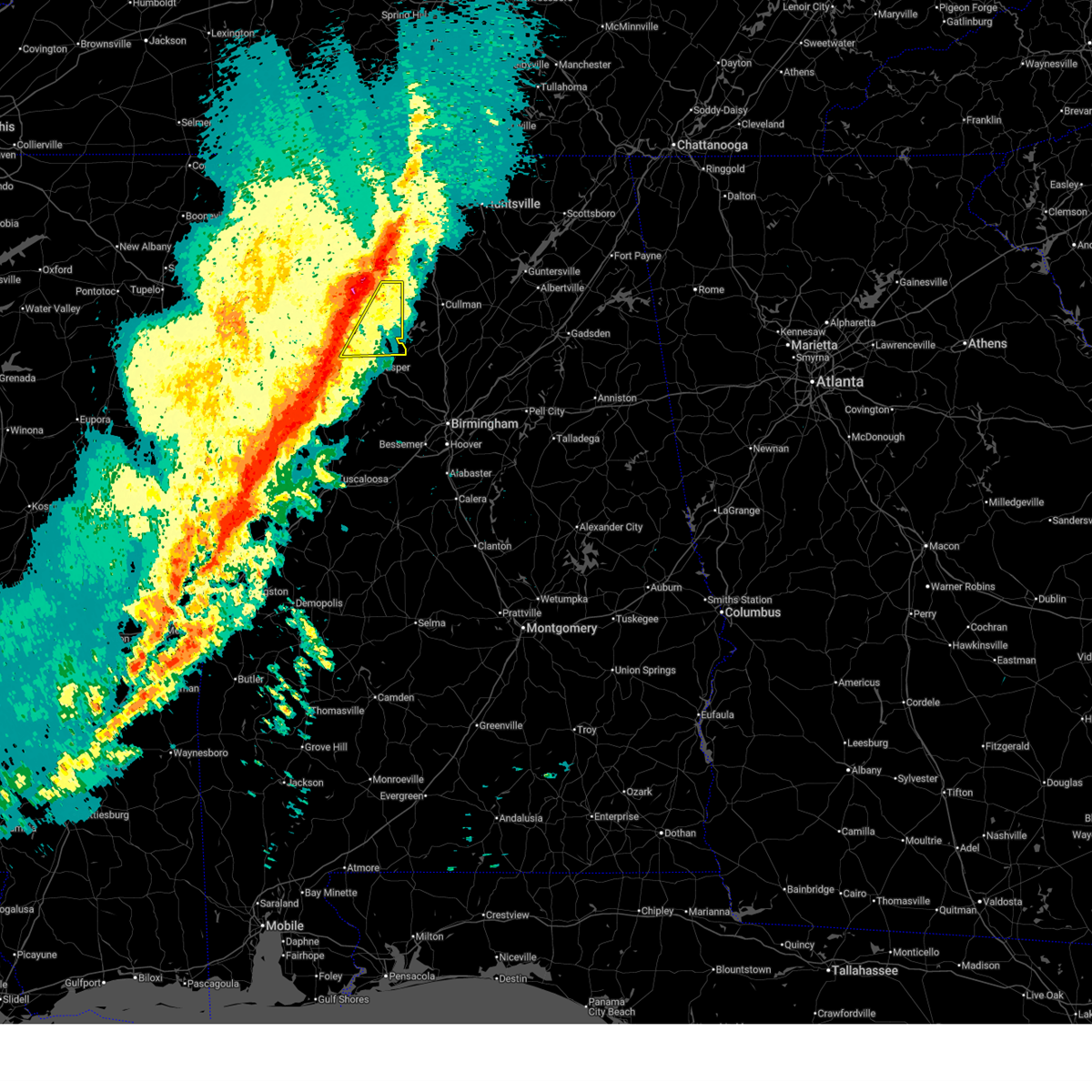
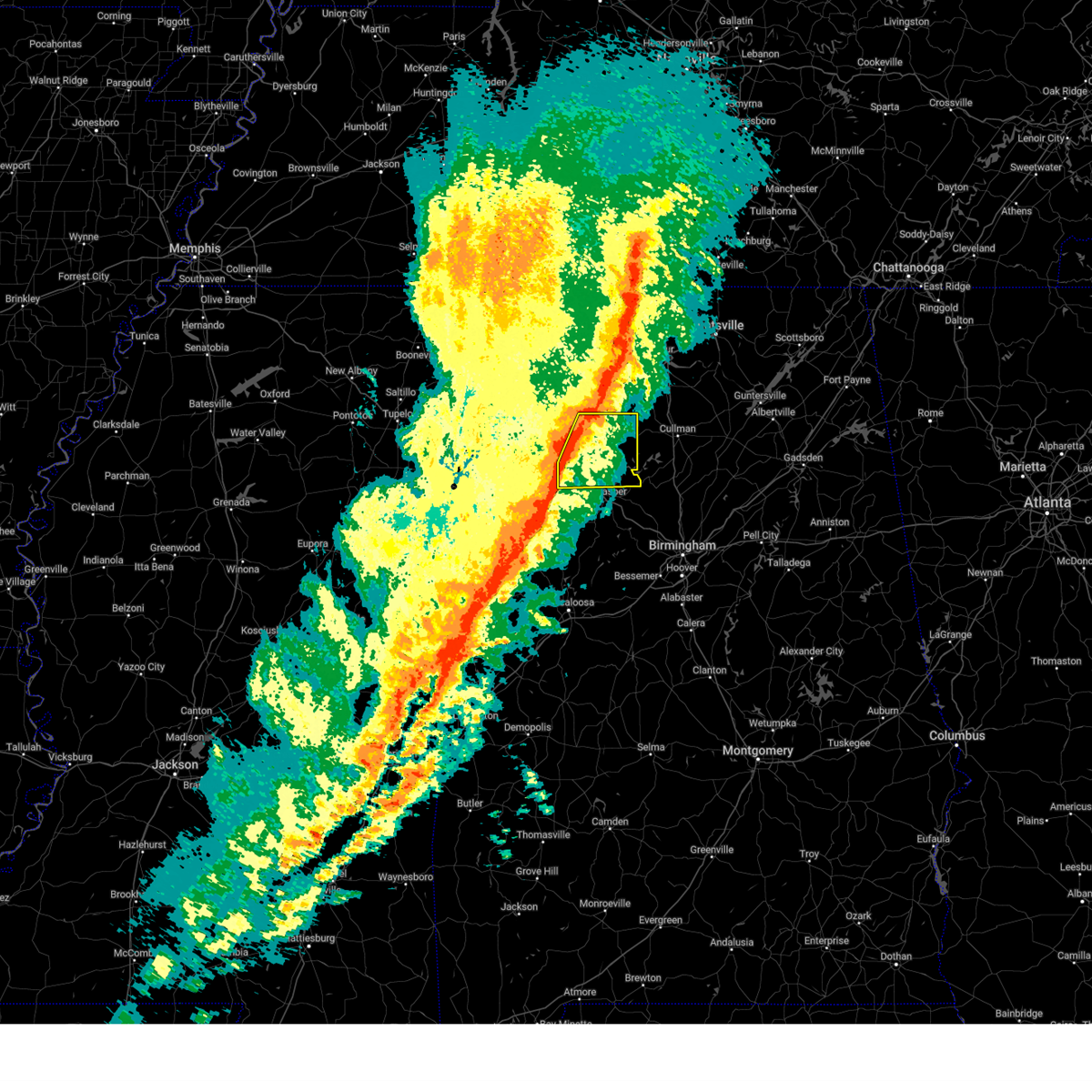
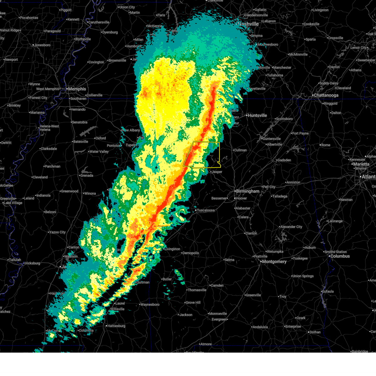
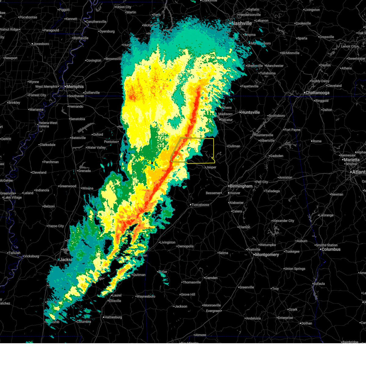
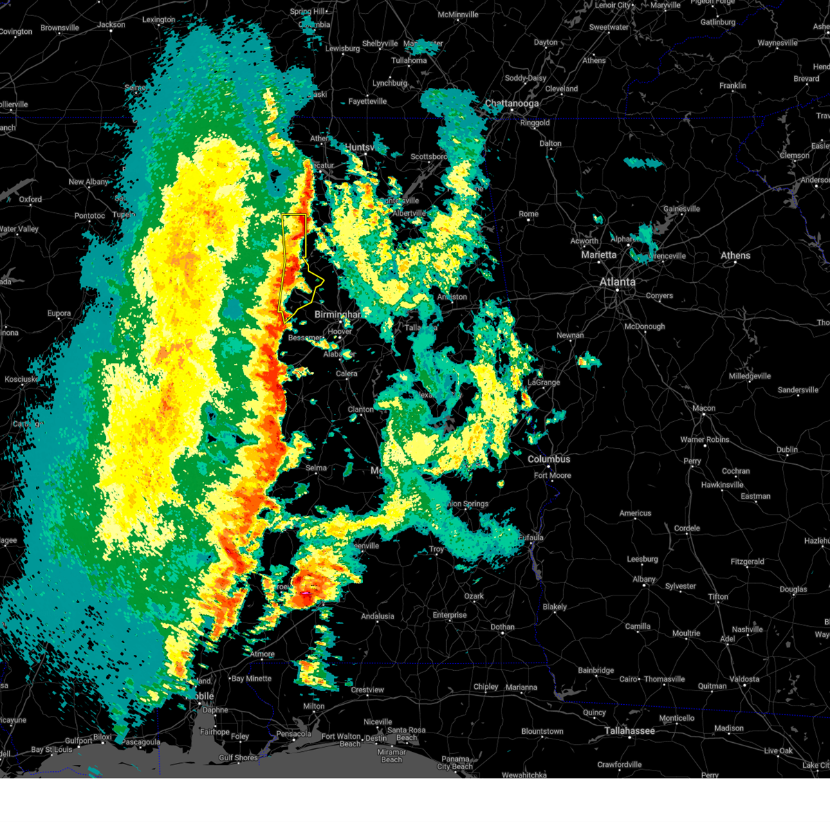
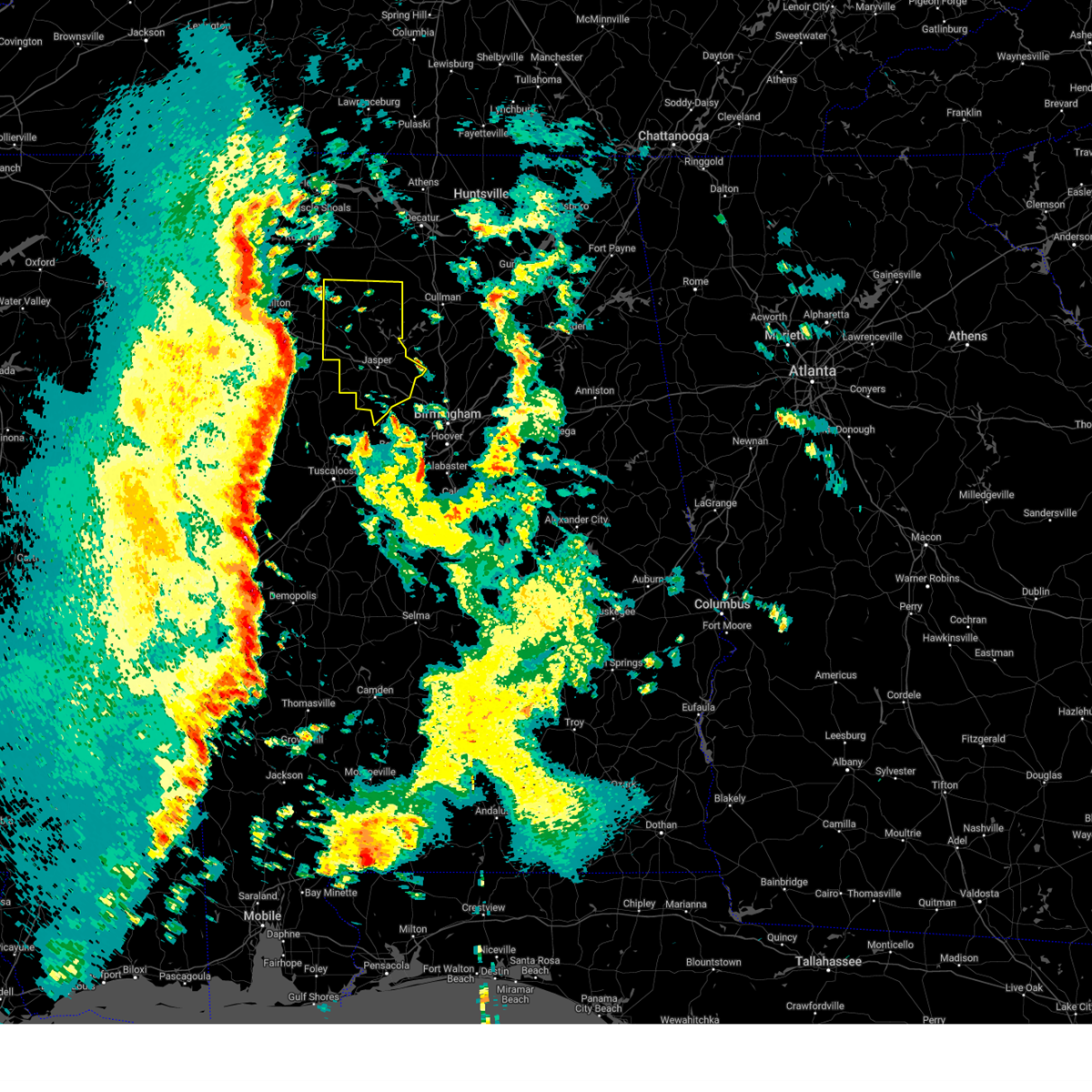
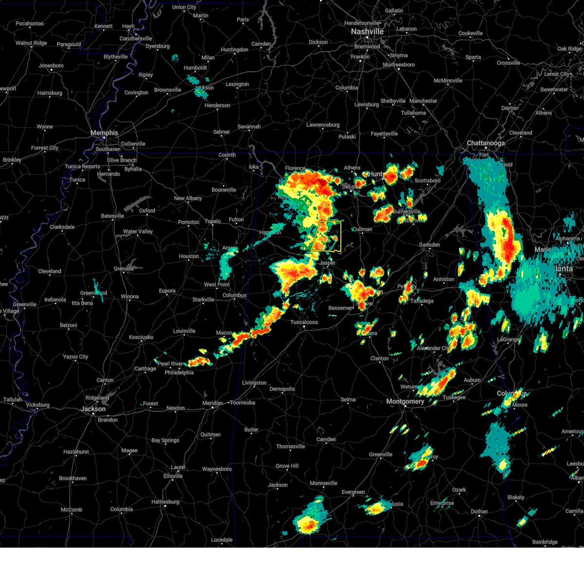
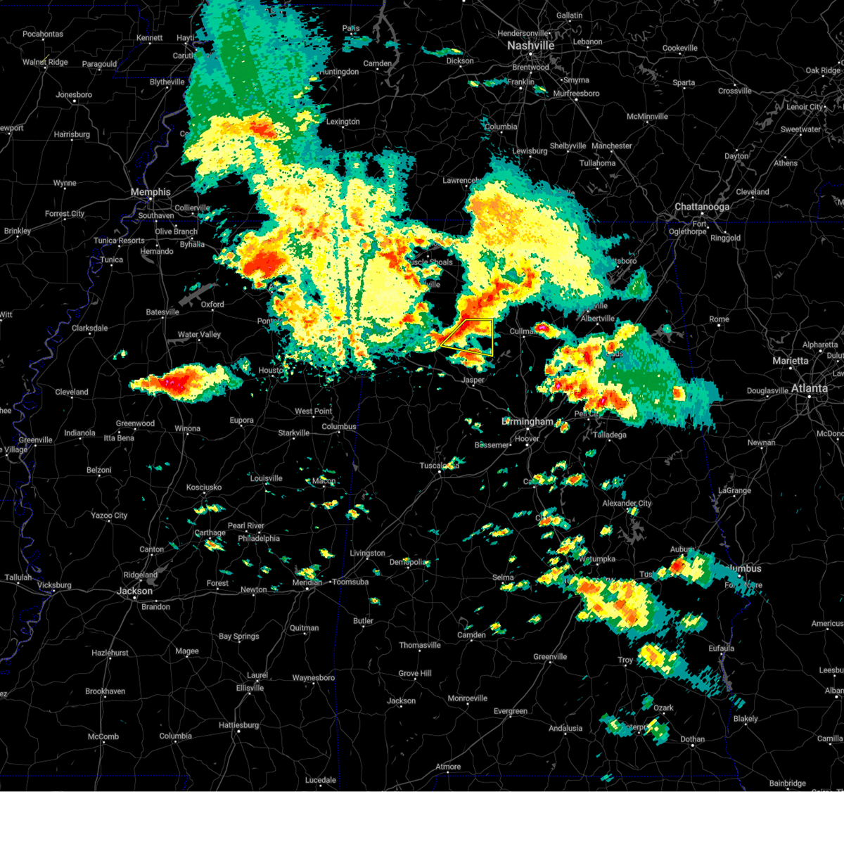
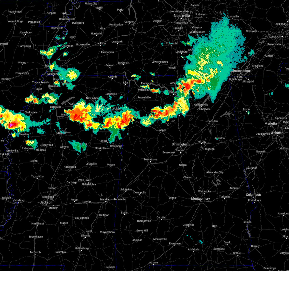
Hail Map for Arley, AL
The Arley, AL area has had 5 reports of on-the-ground hail by trained spotters, and has been under severe weather warnings 13 times during the past 12 months. Doppler radar has detected hail at or near Arley, AL on 75 occasions, including 4 occasions during the past year.
| Name: | Arley, AL |
| Where Located: | 45.2 miles NNW of Birmingham, AL |
| Map: | Google Map for Arley, AL |
| Population: | 357 |
| Housing Units: | 174 |
| More Info: | Search Google for Arley, AL |
1
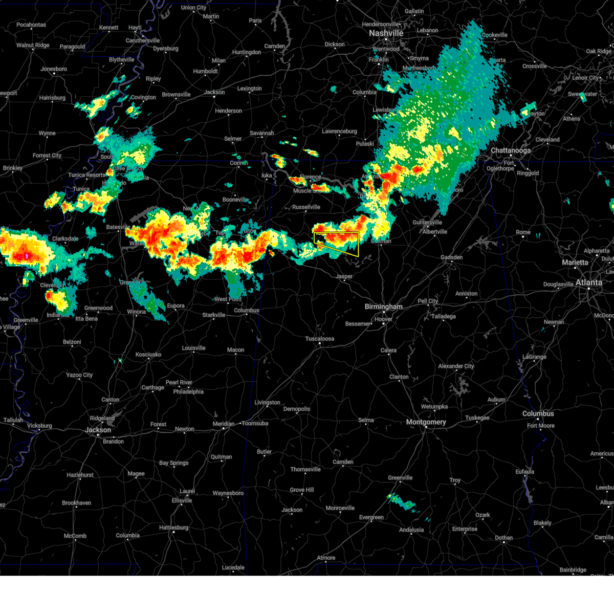
The Top Recent Hail Date for Arley, AL is Monday, June 1, 2026 (8th out of 75)
Hail and Wind Damage Spotted near Arley, AL
| Date / Time | Report Details |
|---|---|
| 6/1/2026 1:50 PM CDT |
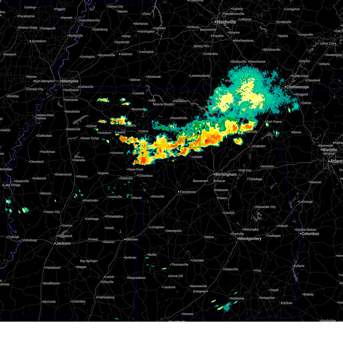 At 150 pm cdt, severe thunderstorms were located along a line extending from good hope to near eldridge, moving southeast at 30 mph (radar indicated). Hazards include 60 mph wind gusts and quarter size hail. Hail damage to vehicles is expected. expect wind damage to roofs, siding, and trees. Locations impacted include, lynn, arley, double springs, addison, nauvoo, houston recreational area, camp mcdowell, ashbank, nesmith, smith lake, poplar springs, helicon, corinth rec area, falls city, houston, natural bridge, mill branch, maple branch, hullett branch, and clear creek. At 150 pm cdt, severe thunderstorms were located along a line extending from good hope to near eldridge, moving southeast at 30 mph (radar indicated). Hazards include 60 mph wind gusts and quarter size hail. Hail damage to vehicles is expected. expect wind damage to roofs, siding, and trees. Locations impacted include, lynn, arley, double springs, addison, nauvoo, houston recreational area, camp mcdowell, ashbank, nesmith, smith lake, poplar springs, helicon, corinth rec area, falls city, houston, natural bridge, mill branch, maple branch, hullett branch, and clear creek.
|
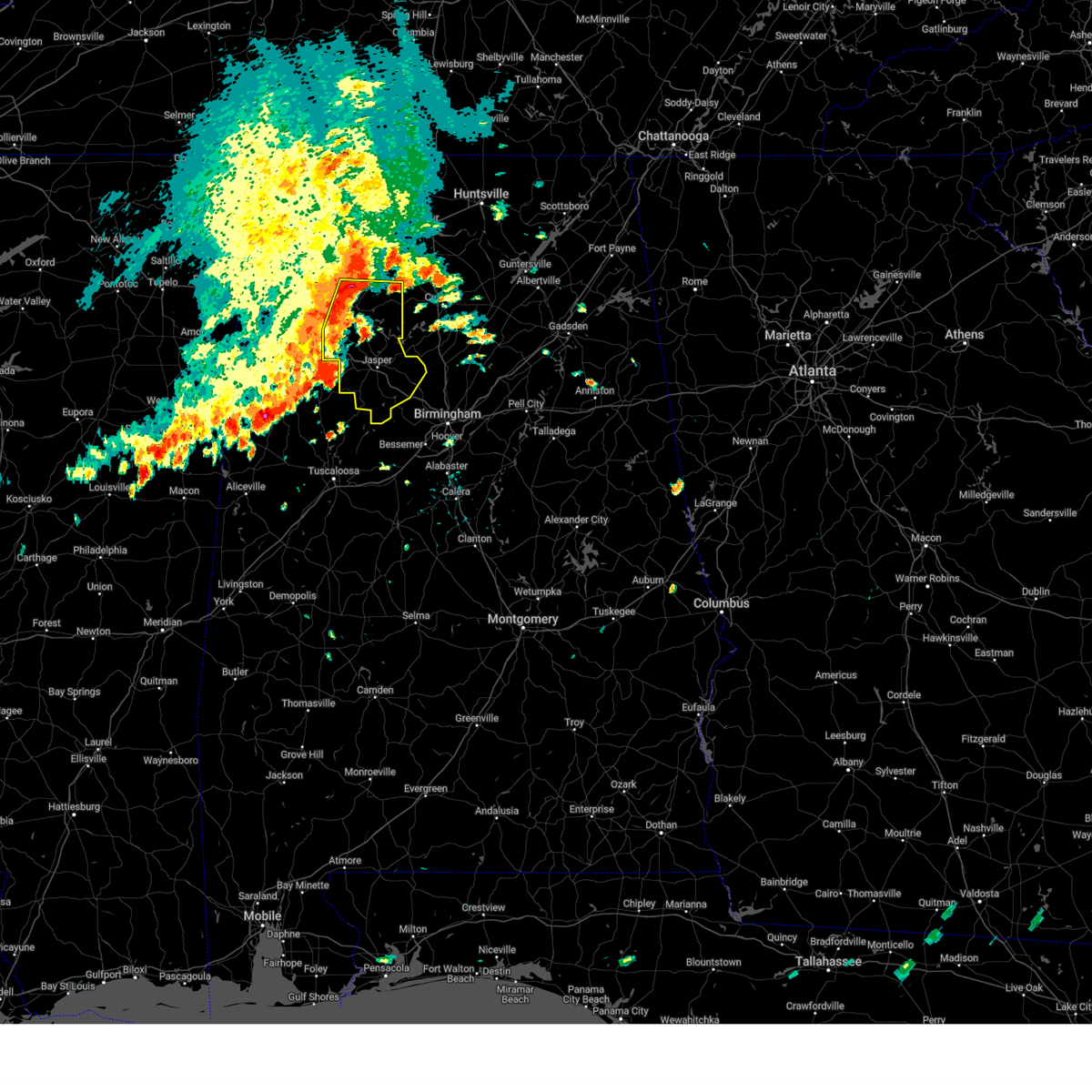
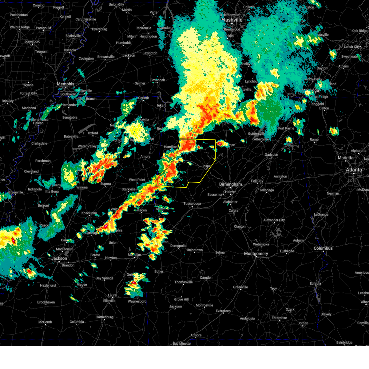
| 6/1/2026 1:39 PM CDT |
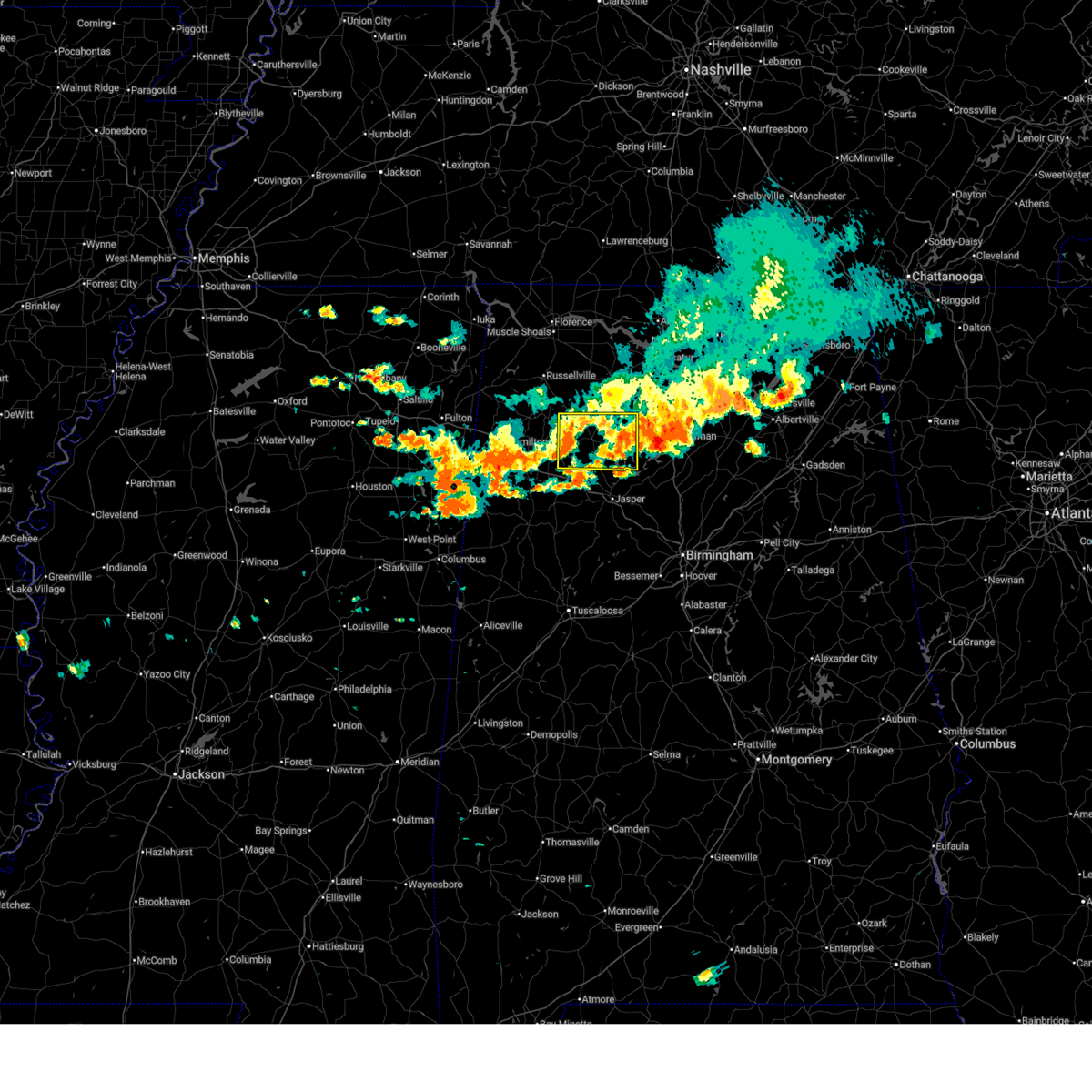 At 138 pm cdt, severe thunderstorms were located along a line extending from near cullman to near lake buttahatchee, moving southeast at 30 mph (radar indicated). Hazards include 60 mph wind gusts and quarter size hail. Hail damage to vehicles is expected. expect wind damage to roofs, siding, and trees. Locations impacted include, haleyville, lynn, arley, double springs, addison, nauvoo, houston recreational area, camp mcdowell, ashbank, nesmith, brushy lake, poplar springs, ashridge, falls city, moreland, smith lake, helicon, inmanfield, sardis, and corinth rec area. At 138 pm cdt, severe thunderstorms were located along a line extending from near cullman to near lake buttahatchee, moving southeast at 30 mph (radar indicated). Hazards include 60 mph wind gusts and quarter size hail. Hail damage to vehicles is expected. expect wind damage to roofs, siding, and trees. Locations impacted include, haleyville, lynn, arley, double springs, addison, nauvoo, houston recreational area, camp mcdowell, ashbank, nesmith, brushy lake, poplar springs, ashridge, falls city, moreland, smith lake, helicon, inmanfield, sardis, and corinth rec area.
|
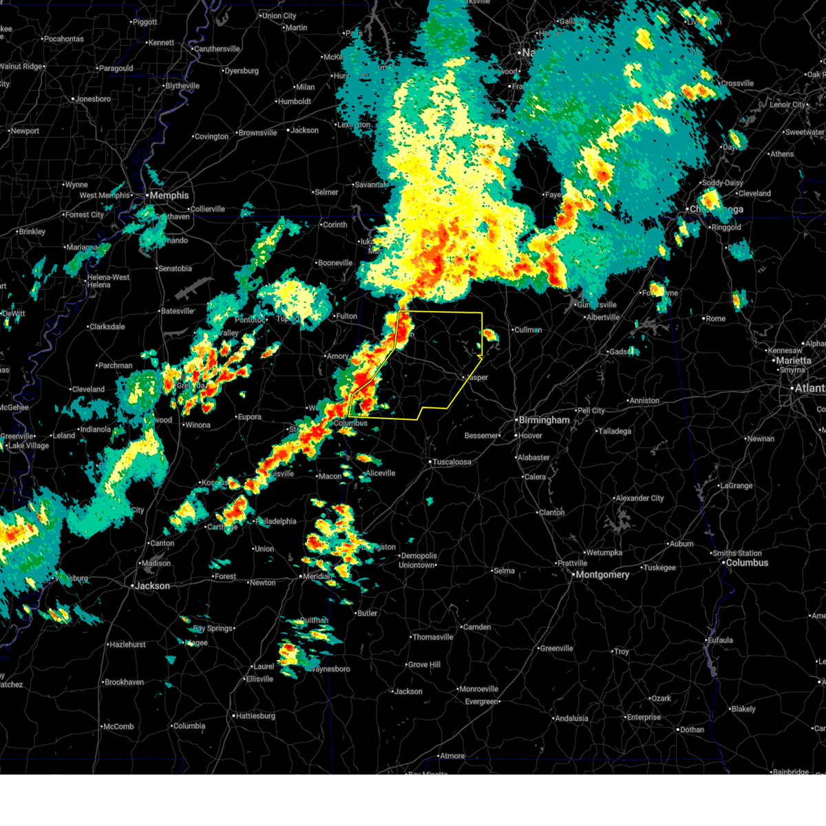
| 6/1/2026 1:22 PM CDT |
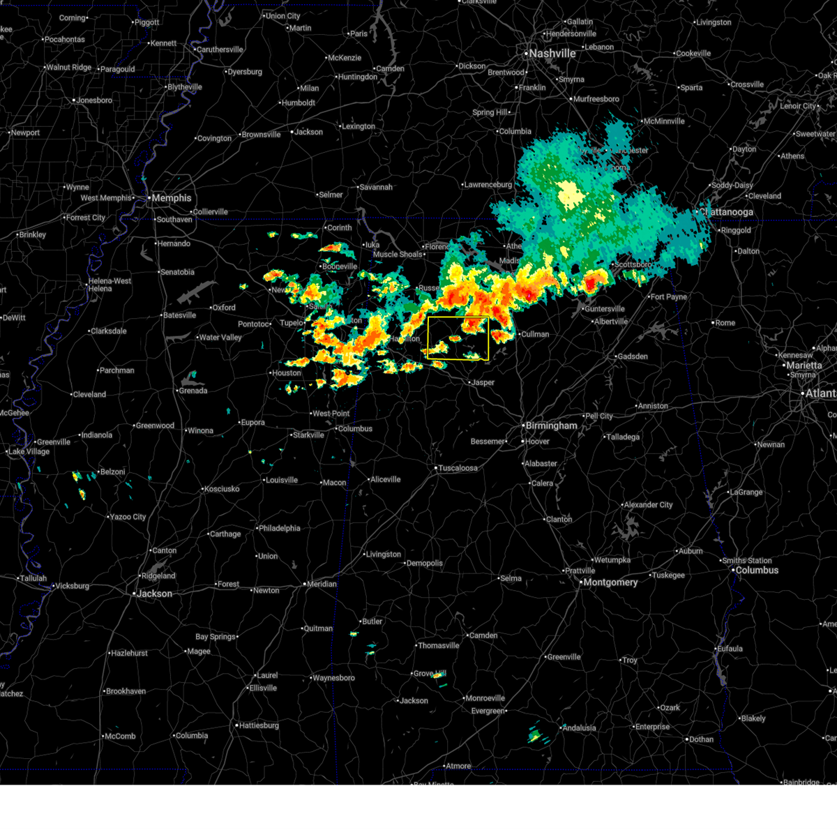 At 122 pm cdt, severe thunderstorms were located along a line extending from 6 miles southwest of falkville to near lake buttahatchee, moving southeast at 35 mph (radar indicated). Hazards include 60 mph wind gusts and quarter size hail. Hail damage to vehicles is expected. expect wind damage to roofs, siding, and trees. Locations impacted include, haleyville, lynn, arley, double springs, addison, nauvoo, houston recreational area, camp mcdowell, ashbank, nesmith, brushy lake, poplar springs, ashridge, falls city, moreland, smith lake, helicon, inmanfield, sardis, and corinth rec area. At 122 pm cdt, severe thunderstorms were located along a line extending from 6 miles southwest of falkville to near lake buttahatchee, moving southeast at 35 mph (radar indicated). Hazards include 60 mph wind gusts and quarter size hail. Hail damage to vehicles is expected. expect wind damage to roofs, siding, and trees. Locations impacted include, haleyville, lynn, arley, double springs, addison, nauvoo, houston recreational area, camp mcdowell, ashbank, nesmith, brushy lake, poplar springs, ashridge, falls city, moreland, smith lake, helicon, inmanfield, sardis, and corinth rec area.
|
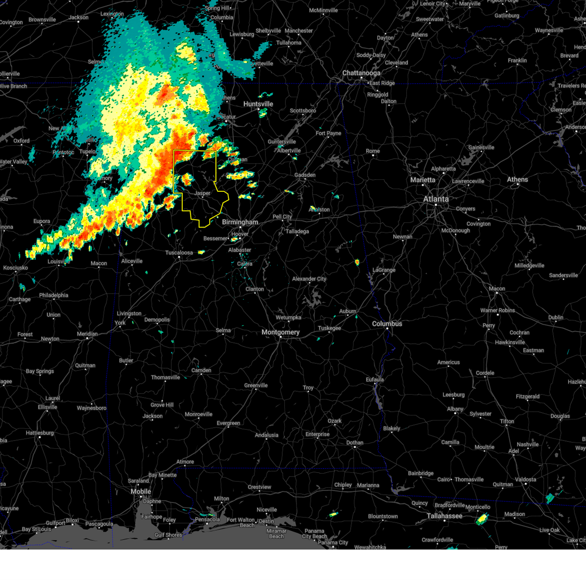
| 6/1/2026 1:03 PM CDT |
 Svrbmx the national weather service in birmingham has issued a * severe thunderstorm warning for, winston county in northwestern alabama, * until 200 pm cdt. * at 103 pm cdt, a severe thunderstorm was located near brushy lake, or 11 miles south of moulton, moving southeast at 25 mph (radar indicated). Hazards include 60 mph wind gusts and quarter size hail. Hail damage to vehicles is expected. Expect wind damage to roofs, siding, and trees. Svrbmx the national weather service in birmingham has issued a * severe thunderstorm warning for, winston county in northwestern alabama, * until 200 pm cdt. * at 103 pm cdt, a severe thunderstorm was located near brushy lake, or 11 miles south of moulton, moving southeast at 25 mph (radar indicated). Hazards include 60 mph wind gusts and quarter size hail. Hail damage to vehicles is expected. Expect wind damage to roofs, siding, and trees.
|
| 3/16/2026 12:25 AM CDT |
 Svrbmx the national weather service in birmingham has issued a * severe thunderstorm warning for, walker county in central alabama, southeastern winston county in northwestern alabama, southeastern fayette county in west central alabama, * until 115 am cdt. * at 1225 am cdt, severe thunderstorms were located along a line extending from near nesmith to near boley springs, moving east at 40 mph (radar indicated). Hazards include 60 mph wind gusts. expect damage to roofs, siding, and trees Svrbmx the national weather service in birmingham has issued a * severe thunderstorm warning for, walker county in central alabama, southeastern winston county in northwestern alabama, southeastern fayette county in west central alabama, * until 115 am cdt. * at 1225 am cdt, severe thunderstorms were located along a line extending from near nesmith to near boley springs, moving east at 40 mph (radar indicated). Hazards include 60 mph wind gusts. expect damage to roofs, siding, and trees
|
| 3/16/2026 12:12 AM CDT |
 the severe thunderstorm warning has been cancelled and is no longer in effect the severe thunderstorm warning has been cancelled and is no longer in effect
|
| 3/16/2026 12:12 AM CDT |
 At 1212 am cdt, severe thunderstorms were located along a line extending from 6 miles northeast of sardis to 6 miles south of camp mcdowell to 8 miles south of bankston, moving east at 45 mph (radar indicated). Hazards include 60 mph wind gusts. Expect damage to roofs, siding, and trees. Locations impacted include, jasper, fayette, carbon hill, arley, berry, double springs, parrish, oakman, addison, kansas, nauvoo, eldridge, curry, camp mcdowell, nesmith, ashbank, poplar springs, boley springs, falls city, and bankston. At 1212 am cdt, severe thunderstorms were located along a line extending from 6 miles northeast of sardis to 6 miles south of camp mcdowell to 8 miles south of bankston, moving east at 45 mph (radar indicated). Hazards include 60 mph wind gusts. Expect damage to roofs, siding, and trees. Locations impacted include, jasper, fayette, carbon hill, arley, berry, double springs, parrish, oakman, addison, kansas, nauvoo, eldridge, curry, camp mcdowell, nesmith, ashbank, poplar springs, boley springs, falls city, and bankston.
|
| 3/15/2026 11:57 PM CDT |
 At 1157 pm cdt, severe thunderstorms were located along a line extending from brushy lake to kansas to ashcraft corner, moving east at 50 mph (radar indicated). Hazards include 60 mph wind gusts. Expect damage to roofs, siding, and trees. Locations impacted include, jasper, fayette, carbon hill, millport, lynn, arley, berry, double springs, parrish, oakman, addison, glen allen, kennedy, kansas, nauvoo, belk, eldridge, curry, houston recreational area, and camp mcdowell. At 1157 pm cdt, severe thunderstorms were located along a line extending from brushy lake to kansas to ashcraft corner, moving east at 50 mph (radar indicated). Hazards include 60 mph wind gusts. Expect damage to roofs, siding, and trees. Locations impacted include, jasper, fayette, carbon hill, millport, lynn, arley, berry, double springs, parrish, oakman, addison, glen allen, kennedy, kansas, nauvoo, belk, eldridge, curry, houston recreational area, and camp mcdowell.
|
| 3/15/2026 11:38 PM CDT |
 Svrbmx the national weather service in birmingham has issued a * severe thunderstorm warning for, walker county in central alabama, southeastern marion county in northwestern alabama, winston county in northwestern alabama, fayette county in west central alabama, southeastern lamar county in west central alabama, * until 1230 am cdt. * at 1138 pm cdt, severe thunderstorms were located along a line extending from near needmore to near bluff to 6 miles north of ethelsville, moving east at 45 mph (radar indicated). Hazards include 60 mph wind gusts. expect damage to roofs, siding, and trees Svrbmx the national weather service in birmingham has issued a * severe thunderstorm warning for, walker county in central alabama, southeastern marion county in northwestern alabama, winston county in northwestern alabama, fayette county in west central alabama, southeastern lamar county in west central alabama, * until 1230 am cdt. * at 1138 pm cdt, severe thunderstorms were located along a line extending from near needmore to near bluff to 6 miles north of ethelsville, moving east at 45 mph (radar indicated). Hazards include 60 mph wind gusts. expect damage to roofs, siding, and trees
|
| 11/25/2025 4:39 AM CST |
 The storms which prompted the warning have moved out of the area. therefore, the warning will be allowed to expire. The storms which prompted the warning have moved out of the area. therefore, the warning will be allowed to expire.
|
| 11/25/2025 4:19 AM CST |
 the severe thunderstorm warning has been cancelled and is no longer in effect the severe thunderstorm warning has been cancelled and is no longer in effect
|
| 11/25/2025 4:19 AM CST |
 At 419 am cst, severe thunderstorms were located along a line extending from helicon to lynns park to near bull city to near holt, moving east at 50 mph (radar indicated). Hazards include 60 mph wind gusts. Expect damage to roofs, siding, and trees. Locations impacted include, northern tuscaloosa, northport, jasper, sumiton, cordova, dora, arley, double springs, parrish, coker, oakman, addison, sipsey, west jefferson, curry, gorgas steam plant, houston recreational area, camp mcdowell, nesmith, and lake lurleen state park. At 419 am cst, severe thunderstorms were located along a line extending from helicon to lynns park to near bull city to near holt, moving east at 50 mph (radar indicated). Hazards include 60 mph wind gusts. Expect damage to roofs, siding, and trees. Locations impacted include, northern tuscaloosa, northport, jasper, sumiton, cordova, dora, arley, double springs, parrish, coker, oakman, addison, sipsey, west jefferson, curry, gorgas steam plant, houston recreational area, camp mcdowell, nesmith, and lake lurleen state park.
|
| 11/25/2025 3:57 AM CST |
 Svrbmx the national weather service in birmingham has issued a * severe thunderstorm warning for, walker county in central alabama, northern tuscaloosa county in west central alabama, winston county in northwestern alabama, eastern fayette county in west central alabama, * until 445 am cst. * at 357 am cst, severe thunderstorms were located along a line extending from near winston free state barn to near oakman to near samantha to 6 miles southeast of gordo, moving east at 50 mph (radar indicated). Hazards include 60 mph wind gusts. expect damage to roofs, siding, and trees Svrbmx the national weather service in birmingham has issued a * severe thunderstorm warning for, walker county in central alabama, northern tuscaloosa county in west central alabama, winston county in northwestern alabama, eastern fayette county in west central alabama, * until 445 am cst. * at 357 am cst, severe thunderstorms were located along a line extending from near winston free state barn to near oakman to near samantha to 6 miles southeast of gordo, moving east at 50 mph (radar indicated). Hazards include 60 mph wind gusts. expect damage to roofs, siding, and trees
|
| 6/7/2025 1:50 PM CDT | Tree down on mobile home on county road 940... south of the intersections with county roads 970 and 81 in cullman county AL, 8.1 miles WSW of Arley, AL |
| 6/7/2025 1:40 PM CDT |
 At 140 pm cdt, severe thunderstorms were located along a line extending from near inmanfield to near jasper to near boley springs, moving east at 60 mph (radar indicated). Hazards include 70 mph wind gusts and penny size hail. Expect considerable tree damage. damage is likely to mobile homes, roofs, and outbuildings. Locations impacted include, jasper, sumiton, cordova, dora, carbon hill, arley, double springs, parrish, oakman, addison, sipsey, west jefferson, curry, houston recreational area, camp mcdowell, gorgas steam plant, nesmith, brushy lake, poplar springs, and burnwell. At 140 pm cdt, severe thunderstorms were located along a line extending from near inmanfield to near jasper to near boley springs, moving east at 60 mph (radar indicated). Hazards include 70 mph wind gusts and penny size hail. Expect considerable tree damage. damage is likely to mobile homes, roofs, and outbuildings. Locations impacted include, jasper, sumiton, cordova, dora, carbon hill, arley, double springs, parrish, oakman, addison, sipsey, west jefferson, curry, houston recreational area, camp mcdowell, gorgas steam plant, nesmith, brushy lake, poplar springs, and burnwell.
|
| 6/7/2025 1:37 PM CDT | Trees down in the arley are in winston county AL, 0.8 miles E of Arley, AL |
| 6/7/2025 1:36 PM CDT | Trees down in the houston are in winston county AL, 5 miles SE of Arley, AL |
| 6/7/2025 1:29 PM CDT |
 At 129 pm cdt, severe thunderstorms were located along a line extending from near brushy lake to near carbon hill to near bankston, moving east at 60 mph (radar indicated). Hazards include 70 mph wind gusts and penny size hail. Expect considerable tree damage. damage is likely to mobile homes, roofs, and outbuildings. Locations impacted include, jasper, sumiton, cordova, dora, carbon hill, lynn, arley, double springs, parrish, oakman, addison, sipsey, west jefferson, kansas, nauvoo, eldridge, curry, houston recreational area, camp mcdowell, and gorgas steam plant. At 129 pm cdt, severe thunderstorms were located along a line extending from near brushy lake to near carbon hill to near bankston, moving east at 60 mph (radar indicated). Hazards include 70 mph wind gusts and penny size hail. Expect considerable tree damage. damage is likely to mobile homes, roofs, and outbuildings. Locations impacted include, jasper, sumiton, cordova, dora, carbon hill, lynn, arley, double springs, parrish, oakman, addison, sipsey, west jefferson, kansas, nauvoo, eldridge, curry, houston recreational area, camp mcdowell, and gorgas steam plant.
|
| 6/7/2025 1:17 PM CDT |
 At 117 pm cdt, severe thunderstorms were located along a line extending from near needmore to near eldridge to belk, moving east at 60 mph (radar indicated). Hazards include 70 mph wind gusts and penny size hail. Expect considerable tree damage. damage is likely to mobile homes, roofs, and outbuildings. Locations impacted include, jasper, haleyville, sumiton, cordova, dora, carbon hill, lynn, arley, double springs, parrish, oakman, addison, sipsey, west jefferson, kansas, nauvoo, eldridge, curry, houston recreational area, and camp mcdowell. At 117 pm cdt, severe thunderstorms were located along a line extending from near needmore to near eldridge to belk, moving east at 60 mph (radar indicated). Hazards include 70 mph wind gusts and penny size hail. Expect considerable tree damage. damage is likely to mobile homes, roofs, and outbuildings. Locations impacted include, jasper, haleyville, sumiton, cordova, dora, carbon hill, lynn, arley, double springs, parrish, oakman, addison, sipsey, west jefferson, kansas, nauvoo, eldridge, curry, houston recreational area, and camp mcdowell.
|
| 6/7/2025 1:01 PM CDT |
 Svrbmx the national weather service in birmingham has issued a * severe thunderstorm warning for, walker county in central alabama, winston county in northwestern alabama, * until 215 pm cdt. * at 101 pm cdt, severe thunderstorms were located along a line extending from near hackleburg to near gu-win to 7 miles east of caledonia, moving east at 60 mph (radar indicated). Hazards include 70 mph wind gusts and penny size hail. Expect considerable tree damage. Damage is likely to mobile homes, roofs, and outbuildings. Svrbmx the national weather service in birmingham has issued a * severe thunderstorm warning for, walker county in central alabama, winston county in northwestern alabama, * until 215 pm cdt. * at 101 pm cdt, severe thunderstorms were located along a line extending from near hackleburg to near gu-win to 7 miles east of caledonia, moving east at 60 mph (radar indicated). Hazards include 70 mph wind gusts and penny size hail. Expect considerable tree damage. Damage is likely to mobile homes, roofs, and outbuildings.
|
| 5/25/2025 9:25 PM CDT |
 Svrbmx the national weather service in birmingham has issued a * severe thunderstorm warning for, eastern winston county in northwestern alabama, * until 945 pm cdt. * at 925 pm cdt, severe thunderstorms were located along a line extending from near sardis to near jasper, moving east at 25 mph (radar indicated). Hazards include 60 mph wind gusts. expect damage to roofs, siding, and trees Svrbmx the national weather service in birmingham has issued a * severe thunderstorm warning for, eastern winston county in northwestern alabama, * until 945 pm cdt. * at 925 pm cdt, severe thunderstorms were located along a line extending from near sardis to near jasper, moving east at 25 mph (radar indicated). Hazards include 60 mph wind gusts. expect damage to roofs, siding, and trees
|
| 5/25/2025 9:15 PM CDT |
 At 915 pm cdt, severe thunderstorms were located along a line extending from near moreland to near camp mcdowell, moving east at 30 mph (radar indicated). Hazards include 60 mph wind gusts and nickel size hail. Expect damage to roofs, siding, and trees. Locations impacted include, arley, double springs, addison, curry, houston recreational area, camp mcdowell, nesmith, poplar springs, ashridge, falls city, moreland, smith lake, helicon, inmanfield, sardis, corinth rec area, winston free state barn, houston, mill branch, and clear creek. At 915 pm cdt, severe thunderstorms were located along a line extending from near moreland to near camp mcdowell, moving east at 30 mph (radar indicated). Hazards include 60 mph wind gusts and nickel size hail. Expect damage to roofs, siding, and trees. Locations impacted include, arley, double springs, addison, curry, houston recreational area, camp mcdowell, nesmith, poplar springs, ashridge, falls city, moreland, smith lake, helicon, inmanfield, sardis, corinth rec area, winston free state barn, houston, mill branch, and clear creek.
|
| 5/25/2025 8:57 PM CDT |
 At 857 pm cdt, severe thunderstorms were located along a line extending from near phil campbell to near nauvoo, moving east at 20 mph (radar indicated). Hazards include 60 mph wind gusts and quarter size hail. Hail damage to vehicles is expected. expect wind damage to roofs, siding, and trees. Locations impacted include, haleyville, carbon hill, lynn, arley, double springs, addison, kansas, nauvoo, curry, houston recreational area, camp mcdowell, ashbank, nesmith, poplar springs, ashridge, falls city, moreland, smith lake, helicon, and inmanfield. At 857 pm cdt, severe thunderstorms were located along a line extending from near phil campbell to near nauvoo, moving east at 20 mph (radar indicated). Hazards include 60 mph wind gusts and quarter size hail. Hail damage to vehicles is expected. expect wind damage to roofs, siding, and trees. Locations impacted include, haleyville, carbon hill, lynn, arley, double springs, addison, kansas, nauvoo, curry, houston recreational area, camp mcdowell, ashbank, nesmith, poplar springs, ashridge, falls city, moreland, smith lake, helicon, and inmanfield.
|
| 5/25/2025 8:33 PM CDT |
 Svrbmx the national weather service in birmingham has issued a * severe thunderstorm warning for, northwestern walker county in central alabama, winston county in northwestern alabama, * until 930 pm cdt. * at 832 pm cdt, severe thunderstorms were located along a line extending from near hackleburg to near eldridge, moving east at 20 mph (radar indicated). Hazards include 60 mph wind gusts and quarter size hail. Hail damage to vehicles is expected. Expect wind damage to roofs, siding, and trees. Svrbmx the national weather service in birmingham has issued a * severe thunderstorm warning for, northwestern walker county in central alabama, winston county in northwestern alabama, * until 930 pm cdt. * at 832 pm cdt, severe thunderstorms were located along a line extending from near hackleburg to near eldridge, moving east at 20 mph (radar indicated). Hazards include 60 mph wind gusts and quarter size hail. Hail damage to vehicles is expected. Expect wind damage to roofs, siding, and trees.
|
| 5/17/2025 4:00 AM CDT |
 Svrbmx the national weather service in birmingham has issued a * severe thunderstorm warning for, walker county in central alabama, tuscaloosa county in west central alabama, pickens county in west central alabama, southwestern blount county in central alabama, northern greene county in west central alabama, jefferson county in central alabama, southeastern winston county in northwestern alabama, fayette county in west central alabama, southeastern lamar county in west central alabama, * until 500 am cdt. * at 400 am cdt, severe thunderstorms were located along a line extending from smith dam to near ethelsville, moving southeast at 35 mph (radar indicated). Hazards include 60 mph wind gusts and quarter size hail. Hail damage to vehicles is expected. Expect wind damage to roofs, siding, and trees. Svrbmx the national weather service in birmingham has issued a * severe thunderstorm warning for, walker county in central alabama, tuscaloosa county in west central alabama, pickens county in west central alabama, southwestern blount county in central alabama, northern greene county in west central alabama, jefferson county in central alabama, southeastern winston county in northwestern alabama, fayette county in west central alabama, southeastern lamar county in west central alabama, * until 500 am cdt. * at 400 am cdt, severe thunderstorms were located along a line extending from smith dam to near ethelsville, moving southeast at 35 mph (radar indicated). Hazards include 60 mph wind gusts and quarter size hail. Hail damage to vehicles is expected. Expect wind damage to roofs, siding, and trees.
|
| 5/2/2025 4:42 PM CDT |
 At 442 pm cdt, severe thunderstorms were located along a line extending from 8 miles southwest of falkville to near smith dam to near boley springs, moving east at 40 mph (radar indicated). Hazards include 60 mph wind gusts and quarter size hail. Hail damage to vehicles is expected. expect wind damage to roofs, siding, and trees. Locations impacted include, curry, gorgas steam plant, mill branch, sumiton, nesmith, powellville, corona, battle branch, hidden cove campground, townley, boley springs, addison town hall, berry, wilson bend, devils branch, burnwell, duncan bridge, falls city, beloit, and quinton. At 442 pm cdt, severe thunderstorms were located along a line extending from 8 miles southwest of falkville to near smith dam to near boley springs, moving east at 40 mph (radar indicated). Hazards include 60 mph wind gusts and quarter size hail. Hail damage to vehicles is expected. expect wind damage to roofs, siding, and trees. Locations impacted include, curry, gorgas steam plant, mill branch, sumiton, nesmith, powellville, corona, battle branch, hidden cove campground, townley, boley springs, addison town hall, berry, wilson bend, devils branch, burnwell, duncan bridge, falls city, beloit, and quinton.
|
| 5/2/2025 4:26 PM CDT |
 Svrbmx the national weather service in birmingham has issued a * severe thunderstorm warning for, walker county in central alabama, eastern winston county in northwestern alabama, eastern fayette county in west central alabama, * until 545 pm cdt. * at 426 pm cdt, severe thunderstorms were located along a line extending from near inmanfield to curry to 7 miles south of bankston, moving east at 40 mph (radar indicated). Hazards include 60 mph wind gusts and quarter size hail. Hail damage to vehicles is expected. Expect wind damage to roofs, siding, and trees. Svrbmx the national weather service in birmingham has issued a * severe thunderstorm warning for, walker county in central alabama, eastern winston county in northwestern alabama, eastern fayette county in west central alabama, * until 545 pm cdt. * at 426 pm cdt, severe thunderstorms were located along a line extending from near inmanfield to curry to 7 miles south of bankston, moving east at 40 mph (radar indicated). Hazards include 60 mph wind gusts and quarter size hail. Hail damage to vehicles is expected. Expect wind damage to roofs, siding, and trees.
|
| 5/2/2025 4:20 PM CDT |
 At 420 pm cdt, severe thunderstorms were located along a line extending from near falkville to near falls city to 6 miles northwest of oakman to 7 miles northwest of samantha, moving east at 35 mph (radar indicated). Hazards include 70 mph wind gusts and quarter size hail. Hail damage to vehicles is expected. expect considerable tree damage. wind damage is also likely to mobile homes, roofs, and outbuildings. Locations impacted include, curry, houston recreational area, camp mcdowell, mill branch, clear creek, nesmith, ashbank, winston county airport, cane creek, bull branch, brushy lake, coon creek, poplar springs, corona, battle branch, hidden cove campground, townley, black pond, boley springs, and addison town hall. At 420 pm cdt, severe thunderstorms were located along a line extending from near falkville to near falls city to 6 miles northwest of oakman to 7 miles northwest of samantha, moving east at 35 mph (radar indicated). Hazards include 70 mph wind gusts and quarter size hail. Hail damage to vehicles is expected. expect considerable tree damage. wind damage is also likely to mobile homes, roofs, and outbuildings. Locations impacted include, curry, houston recreational area, camp mcdowell, mill branch, clear creek, nesmith, ashbank, winston county airport, cane creek, bull branch, brushy lake, coon creek, poplar springs, corona, battle branch, hidden cove campground, townley, black pond, boley springs, and addison town hall.
|
| 5/2/2025 4:20 PM CDT |
 the severe thunderstorm warning has been cancelled and is no longer in effect the severe thunderstorm warning has been cancelled and is no longer in effect
|
| 5/2/2025 4:02 PM CDT |
 At 402 pm cdt, severe thunderstorms were located along a line extending from near inmanfield to near arley to 8 miles south of carbon hill to ashcraft corner, moving east at 35 mph (radar indicated). Hazards include 70 mph wind gusts and quarter size hail. Hail damage to vehicles is expected. expect considerable tree damage. wind damage is also likely to mobile homes, roofs, and outbuildings. Locations impacted include, curry, cody, houston recreational area, camp mcdowell, mill branch, richard arthur field, clear creek, lynn, nesmith, ashbank, winston county airport, cane creek, fayette, bull branch, brushy lake, coon creek, poplar springs, corona, battle branch, and hidden cove campground. At 402 pm cdt, severe thunderstorms were located along a line extending from near inmanfield to near arley to 8 miles south of carbon hill to ashcraft corner, moving east at 35 mph (radar indicated). Hazards include 70 mph wind gusts and quarter size hail. Hail damage to vehicles is expected. expect considerable tree damage. wind damage is also likely to mobile homes, roofs, and outbuildings. Locations impacted include, curry, cody, houston recreational area, camp mcdowell, mill branch, richard arthur field, clear creek, lynn, nesmith, ashbank, winston county airport, cane creek, fayette, bull branch, brushy lake, coon creek, poplar springs, corona, battle branch, and hidden cove campground.
|
| 5/2/2025 3:46 PM CDT |
 At 346 pm cdt, severe thunderstorms were located along a line extending from near brushy lake to near houston recreational area to bankston to near millport, moving east at 50 mph (radar indicated). Hazards include 60 mph wind gusts and quarter size hail. Hail damage to vehicles is expected. expect wind damage to roofs, siding, and trees. Locations impacted include, cody, camp mcdowell, wayside, clear creek, lynn, ashbank, fayette, pebble, bull branch, coon creek, hightogy, piney grove, natural bridge, black pond, weiss, bazemore, addison town hall, blooming grove, berry, and millport. At 346 pm cdt, severe thunderstorms were located along a line extending from near brushy lake to near houston recreational area to bankston to near millport, moving east at 50 mph (radar indicated). Hazards include 60 mph wind gusts and quarter size hail. Hail damage to vehicles is expected. expect wind damage to roofs, siding, and trees. Locations impacted include, cody, camp mcdowell, wayside, clear creek, lynn, ashbank, fayette, pebble, bull branch, coon creek, hightogy, piney grove, natural bridge, black pond, weiss, bazemore, addison town hall, blooming grove, berry, and millport.
|
| 5/2/2025 3:29 PM CDT |
 At 329 pm cdt, severe thunderstorms were located along a line extending from near needmore to 6 miles north of lynn to near belk to 6 miles southwest of millport, moving east at 45 mph (radar indicated). Hazards include 60 mph wind gusts and quarter size hail. Hail damage to vehicles is expected. expect wind damage to roofs, siding, and trees. Locations impacted include, cody, camp mcdowell, wayside, clear creek, lynn, ashbank, fayette, pebble, bull branch, coon creek, hightogy, piney grove, natural bridge, black pond, weiss, bazemore, addison town hall, blooming grove, tessner, and berry. At 329 pm cdt, severe thunderstorms were located along a line extending from near needmore to 6 miles north of lynn to near belk to 6 miles southwest of millport, moving east at 45 mph (radar indicated). Hazards include 60 mph wind gusts and quarter size hail. Hail damage to vehicles is expected. expect wind damage to roofs, siding, and trees. Locations impacted include, cody, camp mcdowell, wayside, clear creek, lynn, ashbank, fayette, pebble, bull branch, coon creek, hightogy, piney grove, natural bridge, black pond, weiss, bazemore, addison town hall, blooming grove, tessner, and berry.
|
| 5/2/2025 3:16 PM CDT |
 Svrbmx the national weather service in birmingham has issued a * severe thunderstorm warning for, western walker county in central alabama, eastern marion county in northwestern alabama, winston county in northwestern alabama, fayette county in west central alabama, southern lamar county in west central alabama, * until 430 pm cdt. * at 316 pm cdt, severe thunderstorms were located along a line extending from near hackleburg to near brilliant to near vernon to near steens, moving east at 35 mph (radar indicated). Hazards include 60 mph wind gusts and quarter size hail. Hail damage to vehicles is expected. Expect wind damage to roofs, siding, and trees. Svrbmx the national weather service in birmingham has issued a * severe thunderstorm warning for, western walker county in central alabama, eastern marion county in northwestern alabama, winston county in northwestern alabama, fayette county in west central alabama, southern lamar county in west central alabama, * until 430 pm cdt. * at 316 pm cdt, severe thunderstorms were located along a line extending from near hackleburg to near brilliant to near vernon to near steens, moving east at 35 mph (radar indicated). Hazards include 60 mph wind gusts and quarter size hail. Hail damage to vehicles is expected. Expect wind damage to roofs, siding, and trees.
|
| 2/16/2025 12:23 AM CST |
 the severe thunderstorm warning has been cancelled and is no longer in effect the severe thunderstorm warning has been cancelled and is no longer in effect
|
| 2/16/2025 12:10 AM CST |
 At 1210 am cst, severe thunderstorms were located along a line extending from near inmanfield to 6 miles south of camp mcdowell, moving east at 45 mph (radar indicated). Hazards include 60 mph wind gusts. Expect damage to roofs, siding, and trees. Locations impacted include, jasper, carbon hill, arley, addison, curry, camp mcdowell, smith dam, nesmith, poplar springs, falls city, smith lake, helicon, inmanfield, sardis, corinth rec area, houston, mill branch, winston county airport, cane creek, and bull branch. At 1210 am cst, severe thunderstorms were located along a line extending from near inmanfield to 6 miles south of camp mcdowell, moving east at 45 mph (radar indicated). Hazards include 60 mph wind gusts. Expect damage to roofs, siding, and trees. Locations impacted include, jasper, carbon hill, arley, addison, curry, camp mcdowell, smith dam, nesmith, poplar springs, falls city, smith lake, helicon, inmanfield, sardis, corinth rec area, houston, mill branch, winston county airport, cane creek, and bull branch.
|
| 2/15/2025 11:55 PM CST |
 At 1155 pm cst, severe thunderstorms were located along a line extending from near moreland to kansas, moving east at 50 mph (radar indicated). Hazards include 60 mph wind gusts. Expect damage to roofs, siding, and trees. Locations impacted include, jasper, carbon hill, lynn, arley, double springs, addison, kansas, nauvoo, eldridge, curry, houston recreational area, camp mcdowell, smith dam, nesmith, ashbank, brushy lake, poplar springs, ashridge, falls city, and moreland. At 1155 pm cst, severe thunderstorms were located along a line extending from near moreland to kansas, moving east at 50 mph (radar indicated). Hazards include 60 mph wind gusts. Expect damage to roofs, siding, and trees. Locations impacted include, jasper, carbon hill, lynn, arley, double springs, addison, kansas, nauvoo, eldridge, curry, houston recreational area, camp mcdowell, smith dam, nesmith, ashbank, brushy lake, poplar springs, ashridge, falls city, and moreland.
|
| 2/15/2025 11:55 PM CST |
 the severe thunderstorm warning has been cancelled and is no longer in effect the severe thunderstorm warning has been cancelled and is no longer in effect
|
| 2/15/2025 11:48 PM CST |
 At 1148 pm cst, severe thunderstorms were located along a line extending from near ashridge to near eldridge, moving east at 50 mph (radar indicated). Hazards include 60 mph wind gusts. Expect damage to roofs, siding, and trees. Locations impacted include, jasper, winfield, haleyville, carbon hill, lynn, arley, double springs, brilliant, addison, glen allen, kansas, nauvoo, eldridge, curry, houston recreational area, camp mcdowell, smith dam, nesmith, ashbank, and brushy lake. At 1148 pm cst, severe thunderstorms were located along a line extending from near ashridge to near eldridge, moving east at 50 mph (radar indicated). Hazards include 60 mph wind gusts. Expect damage to roofs, siding, and trees. Locations impacted include, jasper, winfield, haleyville, carbon hill, lynn, arley, double springs, brilliant, addison, glen allen, kansas, nauvoo, eldridge, curry, houston recreational area, camp mcdowell, smith dam, nesmith, ashbank, and brushy lake.
|
| 2/15/2025 11:38 PM CST |
 Svrbmx the national weather service in birmingham has issued a * severe thunderstorm warning for, northern walker county in central alabama, eastern marion county in northwestern alabama, winston county in northwestern alabama, * until 1245 am cst. * at 1138 pm cst, severe thunderstorms were located along a line extending from near needmore to gu-win, moving east at 45 mph (radar indicated). Hazards include 60 mph wind gusts. expect damage to roofs, siding, and trees Svrbmx the national weather service in birmingham has issued a * severe thunderstorm warning for, northern walker county in central alabama, eastern marion county in northwestern alabama, winston county in northwestern alabama, * until 1245 am cst. * at 1138 pm cst, severe thunderstorms were located along a line extending from near needmore to gu-win, moving east at 45 mph (radar indicated). Hazards include 60 mph wind gusts. expect damage to roofs, siding, and trees
|
| 12/28/2024 11:05 PM CST |
 At 1104 pm cst, severe thunderstorms were located along a line extending from near moulton to near smith lake to near west jefferson, moving northeast at 60 mph (radar indicated). Hazards include 60 mph wind gusts. Expect damage to roofs, siding, and trees. Locations impacted include, jasper, sumiton, cordova, dora, arley, parrish, addison, sipsey, west jefferson, curry, gorgas steam plant, smith dam, nesmith, brushy lake, burnwell, falls city, beloit, quinton, moreland, and smith lake. At 1104 pm cst, severe thunderstorms were located along a line extending from near moulton to near smith lake to near west jefferson, moving northeast at 60 mph (radar indicated). Hazards include 60 mph wind gusts. Expect damage to roofs, siding, and trees. Locations impacted include, jasper, sumiton, cordova, dora, arley, parrish, addison, sipsey, west jefferson, curry, gorgas steam plant, smith dam, nesmith, brushy lake, burnwell, falls city, beloit, quinton, moreland, and smith lake.
|
| 12/28/2024 9:58 PM CST |
 Svrbmx the national weather service in birmingham has issued a * severe thunderstorm warning for, walker county in central alabama, winston county in northwestern alabama, * until 1115 pm cst. * at 957 pm cst, severe thunderstorms were located along a line extending from 8 miles southeast of red bay to near glen allen to near ashcraft corner, moving northeast at 60 mph (radar indicated). Hazards include 70 mph wind gusts. Expect considerable tree damage. Damage is likely to mobile homes, roofs, and outbuildings. Svrbmx the national weather service in birmingham has issued a * severe thunderstorm warning for, walker county in central alabama, winston county in northwestern alabama, * until 1115 pm cst. * at 957 pm cst, severe thunderstorms were located along a line extending from 8 miles southeast of red bay to near glen allen to near ashcraft corner, moving northeast at 60 mph (radar indicated). Hazards include 70 mph wind gusts. Expect considerable tree damage. Damage is likely to mobile homes, roofs, and outbuildings.
|
| 6/5/2024 8:32 PM CDT |
 the severe thunderstorm warning has been cancelled and is no longer in effect the severe thunderstorm warning has been cancelled and is no longer in effect
|
| 6/5/2024 8:21 PM CDT |
 At 820 pm cdt, severe thunderstorms were located along a line extending from helicon to quinton, moving east at 50 mph (radar indicated). Hazards include 60 mph wind gusts. Expect damage to roofs, siding, and trees. Locations impacted include, sumiton, dora, arley, addison, sipsey, curry, smith dam, nesmith, smith lake, helicon, rocky hollow, falls city, quinton, mill branch, maple branch, empire, little dismal creek, powellville, battle branch, and hidden cove campground. At 820 pm cdt, severe thunderstorms were located along a line extending from helicon to quinton, moving east at 50 mph (radar indicated). Hazards include 60 mph wind gusts. Expect damage to roofs, siding, and trees. Locations impacted include, sumiton, dora, arley, addison, sipsey, curry, smith dam, nesmith, smith lake, helicon, rocky hollow, falls city, quinton, mill branch, maple branch, empire, little dismal creek, powellville, battle branch, and hidden cove campground.
|
| 6/5/2024 7:59 PM CDT |
 Svrbmx the national weather service in birmingham has issued a * severe thunderstorm warning for, walker county in central alabama, southeastern winston county in northwestern alabama, * until 845 pm cdt. * at 758 pm cdt, severe thunderstorms were located along a line extending from camp mcdowell to near bankhead lock and dam, moving northeast at 50 mph (radar indicated). Hazards include 60 mph wind gusts. expect damage to roofs, siding, and trees Svrbmx the national weather service in birmingham has issued a * severe thunderstorm warning for, walker county in central alabama, southeastern winston county in northwestern alabama, * until 845 pm cdt. * at 758 pm cdt, severe thunderstorms were located along a line extending from camp mcdowell to near bankhead lock and dam, moving northeast at 50 mph (radar indicated). Hazards include 60 mph wind gusts. expect damage to roofs, siding, and trees
|
| 6/5/2024 7:50 PM CDT |
 At 750 pm cdt, severe thunderstorms were located along a line extending from 10 miles west of moulton to near brushy lake to 7 miles northwest of jasper, moving northeast at 35 mph (radar indicated). Hazards include 60 mph wind gusts. Expect damage to roofs, siding, and trees. Locations impacted include, jasper, carbon hill, arley, addison, nauvoo, curry, camp mcdowell, smith dam, nesmith, brushy lake, poplar springs, falls city, moreland, smith lake, helicon, inmanfield, sardis, corinth rec area, houston, and mill branch. At 750 pm cdt, severe thunderstorms were located along a line extending from 10 miles west of moulton to near brushy lake to 7 miles northwest of jasper, moving northeast at 35 mph (radar indicated). Hazards include 60 mph wind gusts. Expect damage to roofs, siding, and trees. Locations impacted include, jasper, carbon hill, arley, addison, nauvoo, curry, camp mcdowell, smith dam, nesmith, brushy lake, poplar springs, falls city, moreland, smith lake, helicon, inmanfield, sardis, corinth rec area, houston, and mill branch.
|
| 6/5/2024 7:32 PM CDT |
 At 732 pm cdt, severe thunderstorms were located along a line extending from near needmore to winston free state barn to 7 miles northwest of oakman, moving northeast at 35 mph (radar indicated). Hazards include 70 mph wind gusts. Expect considerable tree damage. damage is likely to mobile homes, roofs, and outbuildings. Locations impacted include, jasper, haleyville, carbon hill, lynn, arley, double springs, addison, kansas, nauvoo, eldridge, curry, houston recreational area, camp mcdowell, smith dam, nesmith, ashbank, brushy lake, poplar springs, ashridge, and falls city. At 732 pm cdt, severe thunderstorms were located along a line extending from near needmore to winston free state barn to 7 miles northwest of oakman, moving northeast at 35 mph (radar indicated). Hazards include 70 mph wind gusts. Expect considerable tree damage. damage is likely to mobile homes, roofs, and outbuildings. Locations impacted include, jasper, haleyville, carbon hill, lynn, arley, double springs, addison, kansas, nauvoo, eldridge, curry, houston recreational area, camp mcdowell, smith dam, nesmith, ashbank, brushy lake, poplar springs, ashridge, and falls city.
|
| 6/5/2024 7:05 PM CDT |
 Svrbmx the national weather service in birmingham has issued a * severe thunderstorm warning for, northern walker county in central alabama, winston county in northwestern alabama, * until 800 pm cdt. * at 705 pm cdt, severe thunderstorms were located along a line extending from 6 miles northwest of hackleburg to near brilliant to bankston, moving northeast at 50 mph (radar indicated). Hazards include 60 mph wind gusts. expect damage to roofs, siding, and trees Svrbmx the national weather service in birmingham has issued a * severe thunderstorm warning for, northern walker county in central alabama, winston county in northwestern alabama, * until 800 pm cdt. * at 705 pm cdt, severe thunderstorms were located along a line extending from 6 miles northwest of hackleburg to near brilliant to bankston, moving northeast at 50 mph (radar indicated). Hazards include 60 mph wind gusts. expect damage to roofs, siding, and trees
|
| 4/19/2024 7:52 AM CDT |
 the severe thunderstorm warning has been cancelled and is no longer in effect the severe thunderstorm warning has been cancelled and is no longer in effect
|
| 4/19/2024 7:45 AM CDT |
 At 745 am cdt, a severe thunderstorm was located over houston recreational area, or 10 miles northeast of lynn, moving southeast at 30 mph (radar indicated). Hazards include 60 mph wind gusts. Expect damage to roofs, siding, and trees. Locations impacted include, haleyville, lynn, arley, double springs, nauvoo, houston recreational area, camp mcdowell, ashbank, smith lake, poplar springs, ashridge, corinth rec area, falls city, winston free state barn, houston, natural bridge, mill branch, hullett branch, clear creek, and winston county airport. At 745 am cdt, a severe thunderstorm was located over houston recreational area, or 10 miles northeast of lynn, moving southeast at 30 mph (radar indicated). Hazards include 60 mph wind gusts. Expect damage to roofs, siding, and trees. Locations impacted include, haleyville, lynn, arley, double springs, nauvoo, houston recreational area, camp mcdowell, ashbank, smith lake, poplar springs, ashridge, corinth rec area, falls city, winston free state barn, houston, natural bridge, mill branch, hullett branch, clear creek, and winston county airport.
|
| 4/19/2024 7:25 AM CDT |
 Svrbmx the national weather service in birmingham has issued a * severe thunderstorm warning for, winston county in northwestern alabama, * until 815 am cdt. * at 725 am cdt, a severe thunderstorm was located over needmore, or over haleyville, moving southeast at 25 mph (radar indicated). Hazards include 60 mph wind gusts and quarter size hail. Hail damage to vehicles is expected. Expect wind damage to roofs, siding, and trees. Svrbmx the national weather service in birmingham has issued a * severe thunderstorm warning for, winston county in northwestern alabama, * until 815 am cdt. * at 725 am cdt, a severe thunderstorm was located over needmore, or over haleyville, moving southeast at 25 mph (radar indicated). Hazards include 60 mph wind gusts and quarter size hail. Hail damage to vehicles is expected. Expect wind damage to roofs, siding, and trees.
|
| 8/7/2023 2:21 PM CDT |
 At 221 pm cdt, severe thunderstorms were located along a line extending from near moreland to near carbon hill, moving east at 35 mph (radar indicated). Hazards include 60 mph wind gusts and quarter size hail. Hail damage to vehicles is expected. expect wind damage to roofs, siding, and trees. locations impacted include, haleyville, lynn, arley, double springs, addison, nauvoo, houston recreational area, camp mcdowell, nesmith, ashbank, brushy lake, poplar springs, ashridge, falls city, moreland, smith lake, helicon, inmanfield, sardis and corinth rec area. hail threat, radar indicated max hail size, 1. 00 in wind threat, radar indicated max wind gust, 60 mph. At 221 pm cdt, severe thunderstorms were located along a line extending from near moreland to near carbon hill, moving east at 35 mph (radar indicated). Hazards include 60 mph wind gusts and quarter size hail. Hail damage to vehicles is expected. expect wind damage to roofs, siding, and trees. locations impacted include, haleyville, lynn, arley, double springs, addison, nauvoo, houston recreational area, camp mcdowell, nesmith, ashbank, brushy lake, poplar springs, ashridge, falls city, moreland, smith lake, helicon, inmanfield, sardis and corinth rec area. hail threat, radar indicated max hail size, 1. 00 in wind threat, radar indicated max wind gust, 60 mph.
|
| 8/7/2023 1:39 PM CDT |
 At 139 pm cdt, severe thunderstorms were located along a line extending from haleyville to near bluff, moving east at 35 mph (radar indicated). Hazards include 60 mph wind gusts and quarter size hail. Hail damage to vehicles is expected. Expect wind damage to roofs, siding, and trees. At 139 pm cdt, severe thunderstorms were located along a line extending from haleyville to near bluff, moving east at 35 mph (radar indicated). Hazards include 60 mph wind gusts and quarter size hail. Hail damage to vehicles is expected. Expect wind damage to roofs, siding, and trees.
|
| 8/6/2023 2:41 PM CDT |
 At 241 pm cdt, severe thunderstorms were located along a line extending from near inmanfield to near curry, moving east at 45 mph (emergency management). Hazards include 60 mph wind gusts. Expect damage to roofs, siding, and trees. locations impacted include, arley, double springs, addison, houston recreational area, camp mcdowell, nesmith, smith lake, brushy lake, poplar springs, helicon, inmanfield, sardis, corinth rec area, falls city, moreland, winston free state barn, houston, mill branch, maple branch and hullett branch. hail threat, radar indicated max hail size, <. 75 in wind threat, radar indicated max wind gust, 60 mph. At 241 pm cdt, severe thunderstorms were located along a line extending from near inmanfield to near curry, moving east at 45 mph (emergency management). Hazards include 60 mph wind gusts. Expect damage to roofs, siding, and trees. locations impacted include, arley, double springs, addison, houston recreational area, camp mcdowell, nesmith, smith lake, brushy lake, poplar springs, helicon, inmanfield, sardis, corinth rec area, falls city, moreland, winston free state barn, houston, mill branch, maple branch and hullett branch. hail threat, radar indicated max hail size, <. 75 in wind threat, radar indicated max wind gust, 60 mph.
|
| 8/6/2023 2:39 PM CDT | Several reports of trees down in the arley are in winston county AL, 1.1 miles NE of Arley, AL |
| 8/6/2023 2:26 PM CDT |
 At 226 pm cdt, severe thunderstorms were located along a line extending from near ashridge to near carbon hill, moving east at 45 mph (emergency management). Hazards include 70 mph wind gusts and quarter size hail. Hail damage to vehicles is expected. expect considerable tree damage. wind damage is also likely to mobile homes, roofs, and outbuildings. locations impacted include, haleyville, lynn, arley, double springs, addison, nauvoo, houston recreational area, camp mcdowell, nesmith, ashbank, brushy lake, poplar springs, ashridge, falls city, moreland, smith lake, helicon, inmanfield, sardis and corinth rec area. thunderstorm damage threat, considerable hail threat, radar indicated max hail size, 1. 00 in wind threat, radar indicated max wind gust, 70 mph. At 226 pm cdt, severe thunderstorms were located along a line extending from near ashridge to near carbon hill, moving east at 45 mph (emergency management). Hazards include 70 mph wind gusts and quarter size hail. Hail damage to vehicles is expected. expect considerable tree damage. wind damage is also likely to mobile homes, roofs, and outbuildings. locations impacted include, haleyville, lynn, arley, double springs, addison, nauvoo, houston recreational area, camp mcdowell, nesmith, ashbank, brushy lake, poplar springs, ashridge, falls city, moreland, smith lake, helicon, inmanfield, sardis and corinth rec area. thunderstorm damage threat, considerable hail threat, radar indicated max hail size, 1. 00 in wind threat, radar indicated max wind gust, 70 mph.
|
| 8/6/2023 2:00 PM CDT |
 At 200 pm cdt, severe thunderstorms were located along a line extending from hackleburg to near fayette, moving east at 45 mph (radar indicated). Hazards include 70 mph wind gusts and quarter size hail. Hail damage to vehicles is expected. expect considerable tree damage. Wind damage is also likely to mobile homes, roofs, and outbuildings. At 200 pm cdt, severe thunderstorms were located along a line extending from hackleburg to near fayette, moving east at 45 mph (radar indicated). Hazards include 70 mph wind gusts and quarter size hail. Hail damage to vehicles is expected. expect considerable tree damage. Wind damage is also likely to mobile homes, roofs, and outbuildings.
|
| 8/5/2023 7:53 PM CDT |
 At 752 pm cdt, severe thunderstorms were located along a line extending from near ashridge to nauvoo, moving east at 35 mph (radar indicated). Hazards include 60 mph wind gusts and quarter size hail. Hail damage to vehicles is expected. Expect wind damage to roofs, siding, and trees. At 752 pm cdt, severe thunderstorms were located along a line extending from near ashridge to nauvoo, moving east at 35 mph (radar indicated). Hazards include 60 mph wind gusts and quarter size hail. Hail damage to vehicles is expected. Expect wind damage to roofs, siding, and trees.
|
| 6/29/2023 6:05 PM CDT |
 At 605 pm cdt, severe thunderstorms were located along a line extending from near falls city to near eldridge, moving south at 35 mph (radar indicated). Hazards include 60 mph wind gusts and quarter size hail. Hail damage to vehicles is expected. expect wind damage to roofs, siding, and trees. locations impacted include, jasper, cordova, carbon hill, lynn, arley, berry, parrish, oakman, kansas, nauvoo, eldridge, curry, camp mcdowell, ashbank, poplar springs, smith lake, west corona, yellow creek, coon creek and cedrum area. hail threat, radar indicated max hail size, 1. 00 in wind threat, radar indicated max wind gust, 60 mph. At 605 pm cdt, severe thunderstorms were located along a line extending from near falls city to near eldridge, moving south at 35 mph (radar indicated). Hazards include 60 mph wind gusts and quarter size hail. Hail damage to vehicles is expected. expect wind damage to roofs, siding, and trees. locations impacted include, jasper, cordova, carbon hill, lynn, arley, berry, parrish, oakman, kansas, nauvoo, eldridge, curry, camp mcdowell, ashbank, poplar springs, smith lake, west corona, yellow creek, coon creek and cedrum area. hail threat, radar indicated max hail size, 1. 00 in wind threat, radar indicated max wind gust, 60 mph.
|
| 6/29/2023 6:00 PM CDT |
 At 600 pm cdt, severe thunderstorms were located along a line extending from near arley to near lynn, moving south at 30 mph (radar indicated). Hazards include 70 mph wind gusts and quarter size hail. Hail damage to vehicles is expected. expect considerable tree damage. wind damage is also likely to mobile homes, roofs, and outbuildings. locations impacted include, lynn, arley, double springs, addison, houston recreational area, corinth rec area, helicon, winston free state barn, smith lake, houston, natural bridge, addison town hall, hullett branch, clear creek, winston county airport, cane creek, bull branch, yellow creek, mill creek and rockhouse creek. thunderstorm damage threat, considerable hail threat, radar indicated max hail size, 1. 00 in wind threat, radar indicated max wind gust, 70 mph. At 600 pm cdt, severe thunderstorms were located along a line extending from near arley to near lynn, moving south at 30 mph (radar indicated). Hazards include 70 mph wind gusts and quarter size hail. Hail damage to vehicles is expected. expect considerable tree damage. wind damage is also likely to mobile homes, roofs, and outbuildings. locations impacted include, lynn, arley, double springs, addison, houston recreational area, corinth rec area, helicon, winston free state barn, smith lake, houston, natural bridge, addison town hall, hullett branch, clear creek, winston county airport, cane creek, bull branch, yellow creek, mill creek and rockhouse creek. thunderstorm damage threat, considerable hail threat, radar indicated max hail size, 1. 00 in wind threat, radar indicated max wind gust, 70 mph.
|
| 6/29/2023 5:53 PM CDT |
 At 553 pm cdt, a severe thunderstorm was located over poplar springs, or 8 miles east of lynn, moving south at 55 mph (radar indicated). Hazards include 60 mph wind gusts and quarter size hail. Hail damage to vehicles is expected. Expect wind damage to roofs, siding, and trees. At 553 pm cdt, a severe thunderstorm was located over poplar springs, or 8 miles east of lynn, moving south at 55 mph (radar indicated). Hazards include 60 mph wind gusts and quarter size hail. Hail damage to vehicles is expected. Expect wind damage to roofs, siding, and trees.
|
| 6/29/2023 5:39 PM CDT |
 At 538 pm cdt, a severe thunderstorm was located near ashridge, or 12 miles east of haleyville, moving south at 35 mph (radar indicated). Hazards include golf ball size hail and 70 mph wind gusts. People and animals outdoors will be injured. expect hail damage to roofs, siding, windows, and vehicles. expect considerable tree damage. wind damage is also likely to mobile homes, roofs, and outbuildings. locations impacted include, haleyville, lynn, arley, double springs, addison, houston recreational area, nesmith, brushy lake, helicon, inmanfield, ashridge, sardis, corinth rec area, needmore, moreland, winston free state barn, smith lake, houston, natural bridge and posey field airport. thunderstorm damage threat, considerable hail threat, radar indicated max hail size, 1. 75 in wind threat, radar indicated max wind gust, 70 mph. At 538 pm cdt, a severe thunderstorm was located near ashridge, or 12 miles east of haleyville, moving south at 35 mph (radar indicated). Hazards include golf ball size hail and 70 mph wind gusts. People and animals outdoors will be injured. expect hail damage to roofs, siding, windows, and vehicles. expect considerable tree damage. wind damage is also likely to mobile homes, roofs, and outbuildings. locations impacted include, haleyville, lynn, arley, double springs, addison, houston recreational area, nesmith, brushy lake, helicon, inmanfield, ashridge, sardis, corinth rec area, needmore, moreland, winston free state barn, smith lake, houston, natural bridge and posey field airport. thunderstorm damage threat, considerable hail threat, radar indicated max hail size, 1. 75 in wind threat, radar indicated max wind gust, 70 mph.
|
| 6/29/2023 5:18 PM CDT |
 At 518 pm cdt, a severe thunderstorm was located near moulton, moving south at 20 mph (radar indicated). Hazards include golf ball size hail and 70 mph wind gusts. People and animals outdoors will be injured. expect hail damage to roofs, siding, windows, and vehicles. expect considerable tree damage. Wind damage is also likely to mobile homes, roofs, and outbuildings. At 518 pm cdt, a severe thunderstorm was located near moulton, moving south at 20 mph (radar indicated). Hazards include golf ball size hail and 70 mph wind gusts. People and animals outdoors will be injured. expect hail damage to roofs, siding, windows, and vehicles. expect considerable tree damage. Wind damage is also likely to mobile homes, roofs, and outbuildings.
|
| 6/14/2023 1:06 PM CDT |
 At 106 pm cdt, a severe thunderstorm was located near corinth rec area, or near arley, moving east at 60 mph (public). Hazards include 60 mph wind gusts and quarter size hail. Hail damage to vehicles is expected. expect wind damage to roofs, siding, and trees. locations impacted include, lynn, arley, double springs, addison, nauvoo, houston recreational area, camp mcdowell, nesmith, ashbank, smith lake, poplar springs, helicon, inmanfield, sardis, corinth rec area, falls city, houston, mill branch, maple branch and hullett branch. hail threat, radar indicated max hail size, 1. 00 in wind threat, radar indicated max wind gust, 60 mph. At 106 pm cdt, a severe thunderstorm was located near corinth rec area, or near arley, moving east at 60 mph (public). Hazards include 60 mph wind gusts and quarter size hail. Hail damage to vehicles is expected. expect wind damage to roofs, siding, and trees. locations impacted include, lynn, arley, double springs, addison, nauvoo, houston recreational area, camp mcdowell, nesmith, ashbank, smith lake, poplar springs, helicon, inmanfield, sardis, corinth rec area, falls city, houston, mill branch, maple branch and hullett branch. hail threat, radar indicated max hail size, 1. 00 in wind threat, radar indicated max wind gust, 60 mph.
|
| 6/14/2023 12:33 PM CDT |
 At 1233 pm cdt, a severe thunderstorm was located over brinn, or 9 miles east of hamilton, moving east at 45 mph (radar indicated). Hazards include 60 mph wind gusts and quarter size hail. Hail damage to vehicles is expected. Expect wind damage to roofs, siding, and trees. At 1233 pm cdt, a severe thunderstorm was located over brinn, or 9 miles east of hamilton, moving east at 45 mph (radar indicated). Hazards include 60 mph wind gusts and quarter size hail. Hail damage to vehicles is expected. Expect wind damage to roofs, siding, and trees.
|
| 6/14/2023 10:56 AM CDT |
 At 1055 am cdt, severe thunderstorms were located along a line extending from brushy lake to winston free state barn, moving east at 35 mph (radar indicated). Hazards include 60 mph wind gusts and penny size hail. expect damage to roofs, siding, and trees At 1055 am cdt, severe thunderstorms were located along a line extending from brushy lake to winston free state barn, moving east at 35 mph (radar indicated). Hazards include 60 mph wind gusts and penny size hail. expect damage to roofs, siding, and trees
|
| 6/11/2023 9:10 PM CDT |
 At 910 pm cdt, a severe thunderstorm was located over ashridge, or 9 miles east of haleyville, moving southeast at 35 mph (radar indicated). Hazards include 60 mph wind gusts and quarter size hail. Hail damage to vehicles is expected. expect wind damage to roofs, siding, and trees. locations impacted include, arley, double springs, addison, houston recreational area, nesmith, brushy lake, helicon, inmanfield, ashridge, sardis, moreland, winston free state barn, smith lake, houston, mill branch, hullett branch, winston county airport, cane creek, bull branch and grayson. hail threat, radar indicated max hail size, 1. 00 in wind threat, radar indicated max wind gust, 60 mph. At 910 pm cdt, a severe thunderstorm was located over ashridge, or 9 miles east of haleyville, moving southeast at 35 mph (radar indicated). Hazards include 60 mph wind gusts and quarter size hail. Hail damage to vehicles is expected. expect wind damage to roofs, siding, and trees. locations impacted include, arley, double springs, addison, houston recreational area, nesmith, brushy lake, helicon, inmanfield, ashridge, sardis, moreland, winston free state barn, smith lake, houston, mill branch, hullett branch, winston county airport, cane creek, bull branch and grayson. hail threat, radar indicated max hail size, 1. 00 in wind threat, radar indicated max wind gust, 60 mph.
|
| 6/11/2023 8:54 PM CDT |
 At 854 pm cdt, a severe thunderstorm was located near needmore, or 7 miles northeast of haleyville, moving southeast at 40 mph (radar indicated). Hazards include 60 mph wind gusts and quarter size hail. Hail damage to vehicles is expected. Expect wind damage to roofs, siding, and trees. At 854 pm cdt, a severe thunderstorm was located near needmore, or 7 miles northeast of haleyville, moving southeast at 40 mph (radar indicated). Hazards include 60 mph wind gusts and quarter size hail. Hail damage to vehicles is expected. Expect wind damage to roofs, siding, and trees.
|
| 3/25/2023 12:20 AM CDT |
 At 1220 am cdt, severe thunderstorms were located along a line extending from falkville to near sardis to near addison, moving east at 65 mph (radar indicated). Hazards include 60 mph wind gusts. Expect damage to roofs, siding, and trees. locations impacted include, lynn, arley, double springs, addison, houston recreational area, nesmith, helicon, inmanfield, ashridge, sardis, corinth rec area, moreland, winston free state barn, smith lake, houston, natural bridge, mill branch, hullett branch, clear creek and winston county airport. hail threat, radar indicated max hail size, <. 75 in wind threat, observed max wind gust, 60 mph. At 1220 am cdt, severe thunderstorms were located along a line extending from falkville to near sardis to near addison, moving east at 65 mph (radar indicated). Hazards include 60 mph wind gusts. Expect damage to roofs, siding, and trees. locations impacted include, lynn, arley, double springs, addison, houston recreational area, nesmith, helicon, inmanfield, ashridge, sardis, corinth rec area, moreland, winston free state barn, smith lake, houston, natural bridge, mill branch, hullett branch, clear creek and winston county airport. hail threat, radar indicated max hail size, <. 75 in wind threat, observed max wind gust, 60 mph.
|
| 3/24/2023 11:58 PM CDT |
 At 1157 pm cdt, severe thunderstorms were located along a line extending from near moreland to near winston free state barn to near lynn, moving east at 65 mph. a wind gust of 59 mph was recently measured in haleyville (radar indicated). Hazards include 60 mph wind gusts. Expect damage to roofs, siding, and trees. locations impacted include, haleyville, lynn, arley, double springs, addison, houston recreational area, nesmith, brushy lake, helicon, inmanfield, ashridge, sardis, corinth rec area, needmore, moreland, winston free state barn, smith lake, houston, natural bridge and posey field airport. hail threat, radar indicated max hail size, <. 75 in wind threat, observed max wind gust, 60 mph. At 1157 pm cdt, severe thunderstorms were located along a line extending from near moreland to near winston free state barn to near lynn, moving east at 65 mph. a wind gust of 59 mph was recently measured in haleyville (radar indicated). Hazards include 60 mph wind gusts. Expect damage to roofs, siding, and trees. locations impacted include, haleyville, lynn, arley, double springs, addison, houston recreational area, nesmith, brushy lake, helicon, inmanfield, ashridge, sardis, corinth rec area, needmore, moreland, winston free state barn, smith lake, houston, natural bridge and posey field airport. hail threat, radar indicated max hail size, <. 75 in wind threat, observed max wind gust, 60 mph.
|
| 3/24/2023 11:43 PM CDT |
 At 1143 pm cdt, severe thunderstorms were located along a line extending from near needmore to lake buttahatchee to near brilliant, moving east at 60 mph (radar indicated). Hazards include 60 mph wind gusts. expect damage to roofs, siding, and trees At 1143 pm cdt, severe thunderstorms were located along a line extending from near needmore to lake buttahatchee to near brilliant, moving east at 60 mph (radar indicated). Hazards include 60 mph wind gusts. expect damage to roofs, siding, and trees
|
| 3/3/2023 11:35 AM CST |
 The severe thunderstorm warning for western walker, eastern winston and east central fayette counties will expire at 1145 am cst, the storms which prompted the warning have moved out of the area. therefore, the warning will be allowed to expire. a tornado watch remains in effect until 100 pm cst for central, northwestern and west central alabama. a tornado watch also remains in effect until 400 pm cst for west central alabama. The severe thunderstorm warning for western walker, eastern winston and east central fayette counties will expire at 1145 am cst, the storms which prompted the warning have moved out of the area. therefore, the warning will be allowed to expire. a tornado watch remains in effect until 100 pm cst for central, northwestern and west central alabama. a tornado watch also remains in effect until 400 pm cst for west central alabama.
|
| 3/3/2023 11:19 AM CST |
 At 1118 am cst, severe thunderstorms were located along a line extending from 6 miles west of huntsville international airport to 7 miles east of boley springs, moving east at 45 mph (radar indicated). Hazards include 60 mph wind gusts. Expect damage to roofs, siding, and trees. locations impacted include, jasper, arley, oakman, addison, curry, camp mcdowell, nesmith, smith lake, helicon, inmanfield, boley springs, sardis, corinth rec area, falls city, houston, mill branch, maple branch, hullett branch, west corona and little dismal creek. hail threat, radar indicated max hail size, <. 75 in wind threat, radar indicated max wind gust, 60 mph. At 1118 am cst, severe thunderstorms were located along a line extending from 6 miles west of huntsville international airport to 7 miles east of boley springs, moving east at 45 mph (radar indicated). Hazards include 60 mph wind gusts. Expect damage to roofs, siding, and trees. locations impacted include, jasper, arley, oakman, addison, curry, camp mcdowell, nesmith, smith lake, helicon, inmanfield, boley springs, sardis, corinth rec area, falls city, houston, mill branch, maple branch, hullett branch, west corona and little dismal creek. hail threat, radar indicated max hail size, <. 75 in wind threat, radar indicated max wind gust, 60 mph.
|
| 3/3/2023 10:56 AM CST |
 At 1055 am cst, severe thunderstorms were located along a line extending from 7 miles east of courtland to near bankston, moving east at 50 mph (radar indicated). Hazards include 60 mph wind gusts. Expect damage to roofs, siding, and trees. locations impacted include, jasper, carbon hill, lynn, arley, berry, double springs, oakman, addison, kansas, nauvoo, eldridge, curry, houston recreational area, camp mcdowell, nesmith, ashbank, brushy lake, poplar springs, ashridge and boley springs. hail threat, radar indicated max hail size, <. 75 in wind threat, radar indicated max wind gust, 60 mph. At 1055 am cst, severe thunderstorms were located along a line extending from 7 miles east of courtland to near bankston, moving east at 50 mph (radar indicated). Hazards include 60 mph wind gusts. Expect damage to roofs, siding, and trees. locations impacted include, jasper, carbon hill, lynn, arley, berry, double springs, oakman, addison, kansas, nauvoo, eldridge, curry, houston recreational area, camp mcdowell, nesmith, ashbank, brushy lake, poplar springs, ashridge and boley springs. hail threat, radar indicated max hail size, <. 75 in wind threat, radar indicated max wind gust, 60 mph.
|
| 3/3/2023 10:30 AM CST |
 At 1028 am cst, severe thunderstorms were located along a line extending from near leighton to gu-win, moving east at 40 mph (radar indicated). Hazards include 60 mph wind gusts. expect damage to roofs, siding, and trees At 1028 am cst, severe thunderstorms were located along a line extending from near leighton to gu-win, moving east at 40 mph (radar indicated). Hazards include 60 mph wind gusts. expect damage to roofs, siding, and trees
|
| 1/12/2023 9:25 AM CST |
 At 925 am cst, severe thunderstorms were located along a line extending from near smith lake to near smith dam to near jasper, moving northeast at 60 mph (radar indicated). Hazards include 60 mph wind gusts. Expect damage to roofs, siding, and trees. locations impacted include, jasper, arley, sipsey, curry, smith dam, nesmith, smith lake, helicon, falls city, lynns park, mill branch, maple branch, little dismal creek, powellville, battle branch, hidden cove campground, panther branch, wilson bend, devils branch and duncan bridge. hail threat, radar indicated max hail size, <. 75 in wind threat, radar indicated max wind gust, 60 mph. At 925 am cst, severe thunderstorms were located along a line extending from near smith lake to near smith dam to near jasper, moving northeast at 60 mph (radar indicated). Hazards include 60 mph wind gusts. Expect damage to roofs, siding, and trees. locations impacted include, jasper, arley, sipsey, curry, smith dam, nesmith, smith lake, helicon, falls city, lynns park, mill branch, maple branch, little dismal creek, powellville, battle branch, hidden cove campground, panther branch, wilson bend, devils branch and duncan bridge. hail threat, radar indicated max hail size, <. 75 in wind threat, radar indicated max wind gust, 60 mph.
|
| 1/12/2023 9:08 AM CST |
 At 907 am cst, severe thunderstorms were located along a line extending from near nauvoo to 7 miles west of jasper to near oakman, moving northeast at 60 mph (radar indicated). Hazards include 60 mph wind gusts. expect damage to roofs, siding, and trees At 907 am cst, severe thunderstorms were located along a line extending from near nauvoo to 7 miles west of jasper to near oakman, moving northeast at 60 mph (radar indicated). Hazards include 60 mph wind gusts. expect damage to roofs, siding, and trees
|
| 8/15/2022 3:59 PM CDT |
 At 358 pm cdt, a severe thunderstorm was located over camp mcdowell, or 7 miles southwest of arley, moving southeast at 20 mph (radar indicated). Hazards include 60 mph wind gusts. Expect damage to roofs, siding, and trees. locations impacted include, jasper, arley, double springs, curry, camp mcdowell, smith lake, poplar springs, corinth rec area, falls city, maple branch, clear creek, little dismal creek, yellow creek, coon creek, rockhouse creek, battle branch, hidden cove campground, black pond, wilson bend and devils branch. hail threat, radar indicated max hail size, <. 75 in wind threat, radar indicated max wind gust, 60 mph. At 358 pm cdt, a severe thunderstorm was located over camp mcdowell, or 7 miles southwest of arley, moving southeast at 20 mph (radar indicated). Hazards include 60 mph wind gusts. Expect damage to roofs, siding, and trees. locations impacted include, jasper, arley, double springs, curry, camp mcdowell, smith lake, poplar springs, corinth rec area, falls city, maple branch, clear creek, little dismal creek, yellow creek, coon creek, rockhouse creek, battle branch, hidden cove campground, black pond, wilson bend and devils branch. hail threat, radar indicated max hail size, <. 75 in wind threat, radar indicated max wind gust, 60 mph.
|
| 8/15/2022 3:46 PM CDT |
 At 346 pm cdt, a severe thunderstorm was located near corinth rec area, or 9 miles west of arley, moving southeast at 20 mph (radar indicated). Hazards include 60 mph wind gusts and nickel size hail. Expect damage to roofs, siding, and trees. locations impacted include, jasper, arley, double springs, curry, houston recreational area, camp mcdowell, smith lake, poplar springs, corinth rec area, falls city, maple branch, hullett branch, clear creek, winston county airport, cane creek, little dismal creek, yellow creek, coon creek, rockhouse creek and battle branch. hail threat, radar indicated max hail size, 0. 88 in wind threat, radar indicated max wind gust, 60 mph. At 346 pm cdt, a severe thunderstorm was located near corinth rec area, or 9 miles west of arley, moving southeast at 20 mph (radar indicated). Hazards include 60 mph wind gusts and nickel size hail. Expect damage to roofs, siding, and trees. locations impacted include, jasper, arley, double springs, curry, houston recreational area, camp mcdowell, smith lake, poplar springs, corinth rec area, falls city, maple branch, hullett branch, clear creek, winston county airport, cane creek, little dismal creek, yellow creek, coon creek, rockhouse creek and battle branch. hail threat, radar indicated max hail size, 0. 88 in wind threat, radar indicated max wind gust, 60 mph.
|
| 8/15/2022 3:31 PM CDT |
 At 331 pm cdt, a severe thunderstorm was located near poplar springs, or 8 miles east of lynn, moving southeast at 20 mph (radar indicated). Hazards include 60 mph wind gusts and nickel size hail. expect damage to roofs, siding, and trees At 331 pm cdt, a severe thunderstorm was located near poplar springs, or 8 miles east of lynn, moving southeast at 20 mph (radar indicated). Hazards include 60 mph wind gusts and nickel size hail. expect damage to roofs, siding, and trees
|
| 7/9/2022 5:08 PM CDT |
 At 508 pm cdt, severe thunderstorms were located along a line extending from near helicon to near lynn, moving southeast at 5 mph (radar indicated). Hazards include 60 mph wind gusts. Expect damage to roofs, siding, and trees. locations impacted include, lynn, arley, double springs, nauvoo, houston recreational area, camp mcdowell, ashbank, smith lake, poplar springs, helicon, corinth rec area, falls city, winston free state barn, houston, natural bridge, mill branch, maple branch, hullett branch, clear creek and winston county airport. hail threat, radar indicated max hail size, <. 75 in wind threat, radar indicated max wind gust, 60 mph. At 508 pm cdt, severe thunderstorms were located along a line extending from near helicon to near lynn, moving southeast at 5 mph (radar indicated). Hazards include 60 mph wind gusts. Expect damage to roofs, siding, and trees. locations impacted include, lynn, arley, double springs, nauvoo, houston recreational area, camp mcdowell, ashbank, smith lake, poplar springs, helicon, corinth rec area, falls city, winston free state barn, houston, natural bridge, mill branch, maple branch, hullett branch, clear creek and winston county airport. hail threat, radar indicated max hail size, <. 75 in wind threat, radar indicated max wind gust, 60 mph.
|
| 7/9/2022 4:41 PM CDT |
 At 441 pm cdt, severe thunderstorms were located along a line extending from near helicon to near lake buttahatchee, moving southeast at 15 mph (radar indicated). Hazards include 60 mph wind gusts. expect damage to roofs, siding, and trees At 441 pm cdt, severe thunderstorms were located along a line extending from near helicon to near lake buttahatchee, moving southeast at 15 mph (radar indicated). Hazards include 60 mph wind gusts. expect damage to roofs, siding, and trees
|
| 6/8/2022 6:51 PM CDT |
 The severe thunderstorm warning for central winston county will expire at 700 pm cdt, the storms which prompted the warning have moved out of the area. therefore, the warning will be allowed to expire. however gusty winds and heavy rain are still possible with these thunderstorms. a severe thunderstorm watch remains in effect until 1000 pm cdt for northwestern alabama. The severe thunderstorm warning for central winston county will expire at 700 pm cdt, the storms which prompted the warning have moved out of the area. therefore, the warning will be allowed to expire. however gusty winds and heavy rain are still possible with these thunderstorms. a severe thunderstorm watch remains in effect until 1000 pm cdt for northwestern alabama.
|
| 6/8/2022 6:39 PM CDT |
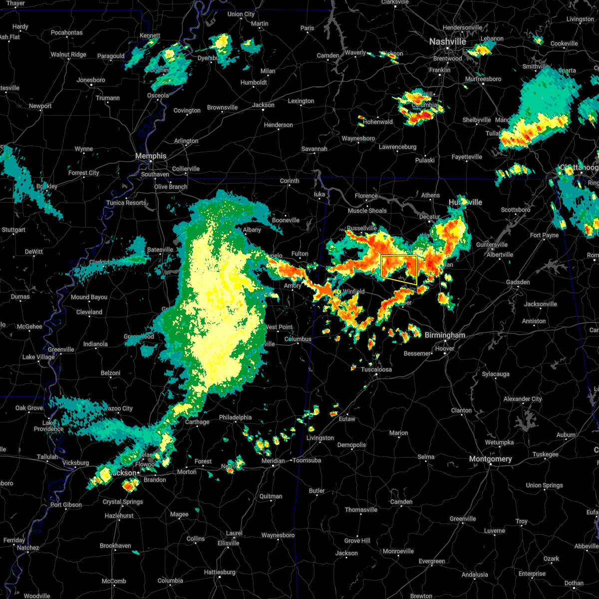 At 638 pm cdt, severe thunderstorms were located along a line extending from near winston free state barn to nesmith, moving southeast at 30 mph (radar indicated). Hazards include 60 mph wind gusts. Expect damage to roofs, siding, and trees. locations impacted include, arley, double springs, addison, houston recreational area, smith lake, brushy lake, helicon, inmanfield, ashridge, sardis, corinth rec area, falls city, moreland, winston free state barn, houston, mill branch, hullett branch, winston county airport, cane creek and bull branch. hail threat, radar indicated max hail size, <. 75 in wind threat, radar indicated max wind gust, 60 mph. At 638 pm cdt, severe thunderstorms were located along a line extending from near winston free state barn to nesmith, moving southeast at 30 mph (radar indicated). Hazards include 60 mph wind gusts. Expect damage to roofs, siding, and trees. locations impacted include, arley, double springs, addison, houston recreational area, smith lake, brushy lake, helicon, inmanfield, ashridge, sardis, corinth rec area, falls city, moreland, winston free state barn, houston, mill branch, hullett branch, winston county airport, cane creek and bull branch. hail threat, radar indicated max hail size, <. 75 in wind threat, radar indicated max wind gust, 60 mph.
|
| 6/8/2022 6:18 PM CDT |
 At 618 pm cdt, severe thunderstorms were located along a line extending from near haleyville to near moreland to sardis, moving southeast at 35 mph (radar indicated). Hazards include 60 mph wind gusts and quarter size hail. Hail damage to vehicles is expected. Expect wind damage to roofs, siding, and trees. At 618 pm cdt, severe thunderstorms were located along a line extending from near haleyville to near moreland to sardis, moving southeast at 35 mph (radar indicated). Hazards include 60 mph wind gusts and quarter size hail. Hail damage to vehicles is expected. Expect wind damage to roofs, siding, and trees.
|
| 12/29/2021 7:28 PM CST |
 At 728 pm cst, a severe thunderstorm was located near smith dam, or 9 miles northeast of jasper, moving east at 50 mph (radar indicated). Hazards include 60 mph wind gusts. Expect damage to roofs, siding, and trees. locations impacted include, jasper, arley, curry, camp mcdowell, smith dam, smith lake, falls city, maple branch, little dismal creek, coon creek, powellville, lupton, hidden cove campground, battle branch, wilson bend, devils branch, seymour branch, duncan bridge, bear branch and little bear branch. hail threat, radar indicated max hail size, <. 75 in wind threat, radar indicated max wind gust, 60 mph. At 728 pm cst, a severe thunderstorm was located near smith dam, or 9 miles northeast of jasper, moving east at 50 mph (radar indicated). Hazards include 60 mph wind gusts. Expect damage to roofs, siding, and trees. locations impacted include, jasper, arley, curry, camp mcdowell, smith dam, smith lake, falls city, maple branch, little dismal creek, coon creek, powellville, lupton, hidden cove campground, battle branch, wilson bend, devils branch, seymour branch, duncan bridge, bear branch and little bear branch. hail threat, radar indicated max hail size, <. 75 in wind threat, radar indicated max wind gust, 60 mph.
|
| 12/29/2021 7:13 PM CST |
 At 713 pm cst, a severe thunderstorm was located near camp mcdowell, or 8 miles northeast of carbon hill, moving east at 50 mph (radar indicated). Hazards include 60 mph wind gusts. expect damage to roofs, siding, and trees At 713 pm cst, a severe thunderstorm was located near camp mcdowell, or 8 miles northeast of carbon hill, moving east at 50 mph (radar indicated). Hazards include 60 mph wind gusts. expect damage to roofs, siding, and trees
|
| 5/6/2021 6:27 PM CDT |
 At 626 pm cdt, severe thunderstorms were located along a line extending from near ashridge to near lake buttahatchee to near detroit, moving southeast at 50 mph (radar indicated). Hazards include 60 mph wind gusts. expect damage to roofs, siding, and trees At 626 pm cdt, severe thunderstorms were located along a line extending from near ashridge to near lake buttahatchee to near detroit, moving southeast at 50 mph (radar indicated). Hazards include 60 mph wind gusts. expect damage to roofs, siding, and trees
|
| 5/4/2021 9:40 AM CDT |
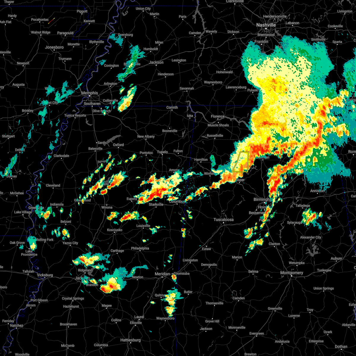 The severe thunderstorm warning for eastern winston county will expire at 945 am cdt, the storm which prompted the warning has moved out of the area. therefore, the warning will be allowed to expire. a tornado watch remains in effect until 400 pm cdt for central and northwestern alabama. to report severe weather, contact your nearest law enforcement agency. they will relay your report to the national weather service birmingham. The severe thunderstorm warning for eastern winston county will expire at 945 am cdt, the storm which prompted the warning has moved out of the area. therefore, the warning will be allowed to expire. a tornado watch remains in effect until 400 pm cdt for central and northwestern alabama. to report severe weather, contact your nearest law enforcement agency. they will relay your report to the national weather service birmingham.
|
| 5/4/2021 9:30 AM CDT |
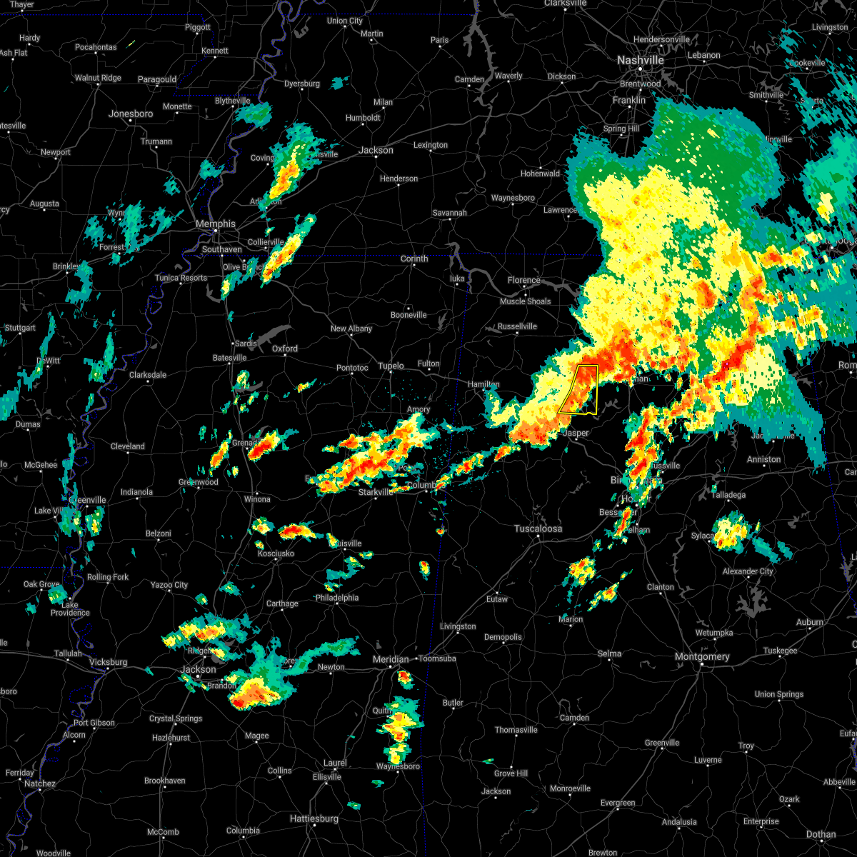 At 930 am cdt, a severe thunderstorm was located over inmanfield, or 10 miles north of arley, moving northeast at 55 mph (radar indicated). Hazards include 60 mph wind gusts. Expect damage to roofs, siding, and trees. Locations impacted include, arley, addison, camp mcdowell, nesmith, smith lake, poplar springs, helicon, inmanfield, sardis, corinth rec area, falls city, houston, mill branch, maple branch, hullett branch, little dismal creek, bull branch, yellow creek, coon creek and rockhouse creek. At 930 am cdt, a severe thunderstorm was located over inmanfield, or 10 miles north of arley, moving northeast at 55 mph (radar indicated). Hazards include 60 mph wind gusts. Expect damage to roofs, siding, and trees. Locations impacted include, arley, addison, camp mcdowell, nesmith, smith lake, poplar springs, helicon, inmanfield, sardis, corinth rec area, falls city, houston, mill branch, maple branch, hullett branch, little dismal creek, bull branch, yellow creek, coon creek and rockhouse creek.
|
| 5/4/2021 9:20 AM CDT |
 At 919 am cdt, a severe thunderstorm was located near houston recreational area, or 8 miles northwest of arley, moving northeast at 50 mph (radar indicated). Hazards include 60 mph wind gusts. Expect damage to roofs, siding, and trees. Locations impacted include, arley, double springs, addison, houston recreational area, camp mcdowell, nesmith, ashbank, smith lake, brushy lake, poplar springs, helicon, inmanfield, sardis, corinth rec area, falls city, moreland, winston free state barn, houston, mill branch and maple branch. At 919 am cdt, a severe thunderstorm was located near houston recreational area, or 8 miles northwest of arley, moving northeast at 50 mph (radar indicated). Hazards include 60 mph wind gusts. Expect damage to roofs, siding, and trees. Locations impacted include, arley, double springs, addison, houston recreational area, camp mcdowell, nesmith, ashbank, smith lake, brushy lake, poplar springs, helicon, inmanfield, sardis, corinth rec area, falls city, moreland, winston free state barn, houston, mill branch and maple branch.
|
| 5/4/2021 9:07 AM CDT |
 At 906 am cdt, a severe thunderstorm was located near ashbank, or near lynn, moving northeast at 55 mph (radar indicated). Hazards include 60 mph wind gusts. expect damage to roofs, siding, and trees At 906 am cdt, a severe thunderstorm was located near ashbank, or near lynn, moving northeast at 55 mph (radar indicated). Hazards include 60 mph wind gusts. expect damage to roofs, siding, and trees
|
| 4/9/2021 1:29 PM CDT |
 At 129 pm cdt, a severe thunderstorm was located over curry, or near arley, moving northeast at 20 mph (radar indicated). Hazards include 60 mph wind gusts and quarter size hail. Hail damage to vehicles is expected. expect wind damage to roofs, siding, and trees. Locations impacted include, jasper, arley, curry, smith lake, falls city, mill branch, maple branch, wilson bend, devils branch, seymour branch, duncan bridge, little dismal creek, yellow creek, bear branch, little bear branch, coon creek, raccoon branch, big bear branch, hidden cove campground and battle branch. At 129 pm cdt, a severe thunderstorm was located over curry, or near arley, moving northeast at 20 mph (radar indicated). Hazards include 60 mph wind gusts and quarter size hail. Hail damage to vehicles is expected. expect wind damage to roofs, siding, and trees. Locations impacted include, jasper, arley, curry, smith lake, falls city, mill branch, maple branch, wilson bend, devils branch, seymour branch, duncan bridge, little dismal creek, yellow creek, bear branch, little bear branch, coon creek, raccoon branch, big bear branch, hidden cove campground and battle branch.
|
| 4/9/2021 1:00 PM CDT |
 At 1259 pm cdt, a severe thunderstorm was located near jasper, moving northeast at 20 mph (radar indicated). Hazards include ping pong ball size hail and 60 mph wind gusts. People and animals outdoors will be injured. expect hail damage to roofs, siding, windows, and vehicles. expect wind damage to roofs, siding, and trees. Locations impacted include, jasper, arley, curry, smith lake, falls city, houston, mill branch, maple branch, little dismal creek, yellow creek, coon creek, lupton, hidden cove campground, battle branch, wilson bend, devils branch, seymour branch, duncan bridge, bear branch and little bear branch. At 1259 pm cdt, a severe thunderstorm was located near jasper, moving northeast at 20 mph (radar indicated). Hazards include ping pong ball size hail and 60 mph wind gusts. People and animals outdoors will be injured. expect hail damage to roofs, siding, windows, and vehicles. expect wind damage to roofs, siding, and trees. Locations impacted include, jasper, arley, curry, smith lake, falls city, houston, mill branch, maple branch, little dismal creek, yellow creek, coon creek, lupton, hidden cove campground, battle branch, wilson bend, devils branch, seymour branch, duncan bridge, bear branch and little bear branch.
|
| 4/9/2021 12:51 PM CDT |
 At 1251 pm cdt, a severe thunderstorm was located near jasper, moving northeast at 20 mph (radar indicated). Hazards include ping pong ball size hail and 60 mph wind gusts. People and animals outdoors will be injured. expect hail damage to roofs, siding, windows, and vehicles. Expect wind damage to roofs, siding, and trees. At 1251 pm cdt, a severe thunderstorm was located near jasper, moving northeast at 20 mph (radar indicated). Hazards include ping pong ball size hail and 60 mph wind gusts. People and animals outdoors will be injured. expect hail damage to roofs, siding, windows, and vehicles. Expect wind damage to roofs, siding, and trees.
|
| 3/28/2021 5:55 AM CDT | Report from mping: 3-inch tree limbs broken; power poles broke in cullman county AL, 7.9 miles W of Arley, AL |
| 3/28/2021 5:13 AM CDT |
 At 513 am cdt, a severe thunderstorm was located near good hope, or near cullman, moving east at 65 mph (radar indicated). Hazards include 60 mph wind gusts and nickel size hail. Expect damage to roofs, siding, and trees. Locations impacted include, jasper, addison, curry, nesmith, smith lake, helicon, inmanfield, sardis, mill branch, maple branch, little dismal creek, powellville, hidden cove campground, battle branch, addison town hall, panther branch, wilson bend, devils branch, upshaw and duncan bridge. At 513 am cdt, a severe thunderstorm was located near good hope, or near cullman, moving east at 65 mph (radar indicated). Hazards include 60 mph wind gusts and nickel size hail. Expect damage to roofs, siding, and trees. Locations impacted include, jasper, addison, curry, nesmith, smith lake, helicon, inmanfield, sardis, mill branch, maple branch, little dismal creek, powellville, hidden cove campground, battle branch, addison town hall, panther branch, wilson bend, devils branch, upshaw and duncan bridge.
|
| 3/28/2021 5:06 AM CDT |
 At 506 am cdt, a severe thunderstorm was located near helicon, or 7 miles east of arley, moving east at 65 mph (radar indicated). Hazards include 60 mph wind gusts and nickel size hail. Expect damage to roofs, siding, and trees. Locations impacted include, jasper, arley, addison, curry, nesmith, smith lake, helicon, inmanfield, sardis, falls city, moreland, houston, mill branch, maple branch, hullett branch, little dismal creek, bull branch, yellow creek, coon creek and powellville. At 506 am cdt, a severe thunderstorm was located near helicon, or 7 miles east of arley, moving east at 65 mph (radar indicated). Hazards include 60 mph wind gusts and nickel size hail. Expect damage to roofs, siding, and trees. Locations impacted include, jasper, arley, addison, curry, nesmith, smith lake, helicon, inmanfield, sardis, falls city, moreland, houston, mill branch, maple branch, hullett branch, little dismal creek, bull branch, yellow creek, coon creek and powellville.
|
| 3/28/2021 4:56 AM CDT |
 At 456 am cdt, a severe thunderstorm was located over falls city, or near arley, moving east at 65 mph (radar indicated). Hazards include 60 mph wind gusts and nickel size hail. Expect damage to roofs, siding, and trees. Locations impacted include, jasper, carbon hill, arley, double springs, addison, curry, houston recreational area, camp mcdowell, nesmith, poplar springs, falls city, moreland, smith lake, helicon, inmanfield, sardis, corinth rec area, winston free state barn, houston and mill branch. At 456 am cdt, a severe thunderstorm was located over falls city, or near arley, moving east at 65 mph (radar indicated). Hazards include 60 mph wind gusts and nickel size hail. Expect damage to roofs, siding, and trees. Locations impacted include, jasper, carbon hill, arley, double springs, addison, curry, houston recreational area, camp mcdowell, nesmith, poplar springs, falls city, moreland, smith lake, helicon, inmanfield, sardis, corinth rec area, winston free state barn, houston and mill branch.
|
| 3/28/2021 4:45 AM CDT |
 At 445 am cdt, a severe thunderstorm was located over poplar springs, or near lynn, moving east at 65 mph (radar indicated). Hazards include 60 mph wind gusts and nickel size hail. Expect damage to roofs, siding, and trees. Locations impacted include, jasper, carbon hill, lynn, arley, double springs, addison, kansas, nauvoo, eldridge, curry, houston recreational area, camp mcdowell, nesmith, ashbank, poplar springs, falls city, moreland, smith lake, helicon and inmanfield. At 445 am cdt, a severe thunderstorm was located over poplar springs, or near lynn, moving east at 65 mph (radar indicated). Hazards include 60 mph wind gusts and nickel size hail. Expect damage to roofs, siding, and trees. Locations impacted include, jasper, carbon hill, lynn, arley, double springs, addison, kansas, nauvoo, eldridge, curry, houston recreational area, camp mcdowell, nesmith, ashbank, poplar springs, falls city, moreland, smith lake, helicon and inmanfield.
|
| 3/28/2021 4:32 AM CDT |
 At 431 am cdt, a severe thunderstorm was located near brilliant, or near winfield, moving east at 65 mph (radar indicated). Hazards include 70 mph wind gusts and nickel size hail. Expect considerable tree damage. Damage is likely to mobile homes, roofs, and outbuildings. At 431 am cdt, a severe thunderstorm was located near brilliant, or near winfield, moving east at 65 mph (radar indicated). Hazards include 70 mph wind gusts and nickel size hail. Expect considerable tree damage. Damage is likely to mobile homes, roofs, and outbuildings.
|
| 8/28/2020 6:09 PM CDT |
 The severe thunderstorm warning for northwestern walker and southern winston counties will expire at 615 pm cdt, the storm which prompted the warning has weakened below severe limits, and no longer poses an immediate threat to life or property. therefore, the warning will be allowed to expire. however small hail is still possible with this thunderstorm. a tornado watch remains in effect until 800 pm cdt for central, northwestern and west central alabama. to report severe weather, contact your nearest law enforcement agency. they will relay your report to the national weather service birmingham. The severe thunderstorm warning for northwestern walker and southern winston counties will expire at 615 pm cdt, the storm which prompted the warning has weakened below severe limits, and no longer poses an immediate threat to life or property. therefore, the warning will be allowed to expire. however small hail is still possible with this thunderstorm. a tornado watch remains in effect until 800 pm cdt for central, northwestern and west central alabama. to report severe weather, contact your nearest law enforcement agency. they will relay your report to the national weather service birmingham.
|
| 8/28/2020 5:57 PM CDT |
 A severe thunderstorm warning remains in effect until 615 pm cdt for northwestern walker and southern winston counties. at 557 pm cdt, a severe thunderstorm was located near nauvoo, or near carbon hill, moving east at 35 mph. hazard. 60 mph wind gusts and penny size hail. source. Radar indicated. A severe thunderstorm warning remains in effect until 615 pm cdt for northwestern walker and southern winston counties. at 557 pm cdt, a severe thunderstorm was located near nauvoo, or near carbon hill, moving east at 35 mph. hazard. 60 mph wind gusts and penny size hail. source. Radar indicated.
|
| 8/28/2020 5:42 PM CDT |
 At 542 pm cdt, a severe thunderstorm was located over camp mcdowell, or 8 miles southwest of arley, moving east at 45 mph (radar indicated). Hazards include 60 mph wind gusts and penny size hail. Expect damage to roofs, siding, and trees. Locations impacted include, jasper, carbon hill, lynn, arley, kansas, nauvoo, eldridge, curry, camp mcdowell, smith dam, ashbank, smith lake, poplar springs, helicon, corinth rec area, falls city, houston, mill branch, maple branch and hullett branch. At 542 pm cdt, a severe thunderstorm was located over camp mcdowell, or 8 miles southwest of arley, moving east at 45 mph (radar indicated). Hazards include 60 mph wind gusts and penny size hail. Expect damage to roofs, siding, and trees. Locations impacted include, jasper, carbon hill, lynn, arley, kansas, nauvoo, eldridge, curry, camp mcdowell, smith dam, ashbank, smith lake, poplar springs, helicon, corinth rec area, falls city, houston, mill branch, maple branch and hullett branch.
|
| 8/28/2020 5:21 PM CDT |
 At 521 pm cdt, a severe thunderstorm was located near lynn, moving east at 45 mph (radar indicated). Hazards include 60 mph wind gusts and penny size hail. expect damage to roofs, siding, and trees At 521 pm cdt, a severe thunderstorm was located near lynn, moving east at 45 mph (radar indicated). Hazards include 60 mph wind gusts and penny size hail. expect damage to roofs, siding, and trees
|
| 7/12/2020 11:38 AM CDT |
 At 1137 am cdt, severe thunderstorms were located along a line extending from 7 miles northeast of phil campbell to near hackleburg to 9 miles northwest of weston, moving southeast at 35 mph (radar indicated). Hazards include 60 mph wind gusts and quarter size hail. Hail damage to vehicles is expected. Expect wind damage to roofs, siding, and trees. At 1137 am cdt, severe thunderstorms were located along a line extending from 7 miles northeast of phil campbell to near hackleburg to 9 miles northwest of weston, moving southeast at 35 mph (radar indicated). Hazards include 60 mph wind gusts and quarter size hail. Hail damage to vehicles is expected. Expect wind damage to roofs, siding, and trees.
|
| 7/12/2020 11:30 AM CDT | Trees down north of arley. time estimated by rada in winston county AL, 2.7 miles S of Arley, AL |
| 7/12/2020 11:21 AM CDT |
 At 1120 am cdt, a severe thunderstorm was located over helicon, or near arley, moving southeast at 40 mph (radar indicated). Hazards include 60 mph wind gusts and quarter size hail. Hail damage to vehicles is expected. expect wind damage to roofs, siding, and trees. Locations impacted include, arley, addison, sardis, nesmith, brushy lake, helicon, moreland, inmanfield, smith lake, houston, addison town hall, mill branch, panther branch, upshaw, winston county airport, cane creek, bull branch, mill creek, grayson and addison municipal airport. At 1120 am cdt, a severe thunderstorm was located over helicon, or near arley, moving southeast at 40 mph (radar indicated). Hazards include 60 mph wind gusts and quarter size hail. Hail damage to vehicles is expected. expect wind damage to roofs, siding, and trees. Locations impacted include, arley, addison, sardis, nesmith, brushy lake, helicon, moreland, inmanfield, smith lake, houston, addison town hall, mill branch, panther branch, upshaw, winston county airport, cane creek, bull branch, mill creek, grayson and addison municipal airport.
|
| 7/12/2020 10:57 AM CDT |
 At 1057 am cdt, a severe thunderstorm was located near moreland, or 14 miles south of moulton, moving southeast at 40 mph (radar indicated). Hazards include 60 mph wind gusts and quarter size hail. Hail damage to vehicles is expected. Expect wind damage to roofs, siding, and trees. At 1057 am cdt, a severe thunderstorm was located near moreland, or 14 miles south of moulton, moving southeast at 40 mph (radar indicated). Hazards include 60 mph wind gusts and quarter size hail. Hail damage to vehicles is expected. Expect wind damage to roofs, siding, and trees.
|
| 6/5/2020 5:27 PM CDT |
 At 527 pm cdt, a severe thunderstorm was located over arley, moving southeast at 10 mph (radar indicated). Hazards include 60 mph wind gusts and quarter size hail. Hail damage to vehicles is expected. expect wind damage to roofs, siding, and trees. Locations impacted include, arley, double springs, addison, houston recreational area, nesmith, smith lake, helicon, corinth rec area, falls city, moreland, winston free state barn, houston, mill branch, maple branch, hullett branch, winston county airport, cane creek, little dismal creek, bull branch and yellow creek. At 527 pm cdt, a severe thunderstorm was located over arley, moving southeast at 10 mph (radar indicated). Hazards include 60 mph wind gusts and quarter size hail. Hail damage to vehicles is expected. expect wind damage to roofs, siding, and trees. Locations impacted include, arley, double springs, addison, houston recreational area, nesmith, smith lake, helicon, corinth rec area, falls city, moreland, winston free state barn, houston, mill branch, maple branch, hullett branch, winston county airport, cane creek, little dismal creek, bull branch and yellow creek.
|
| 6/5/2020 5:11 PM CDT |
 At 510 pm cdt, a severe thunderstorm was located near corinth rec area, or near arley, moving southeast at 10 mph (radar indicated). Hazards include 60 mph wind gusts and quarter size hail. Hail damage to vehicles is expected. Expect wind damage to roofs, siding, and trees. At 510 pm cdt, a severe thunderstorm was located near corinth rec area, or near arley, moving southeast at 10 mph (radar indicated). Hazards include 60 mph wind gusts and quarter size hail. Hail damage to vehicles is expected. Expect wind damage to roofs, siding, and trees.
|
| 4/12/2020 8:18 PM CDT |
 At 818 pm cdt, a confirmed tornado was located near carbon hill, moving northeast at 40 mph (radar confirmed tornado). Hazards include damaging tornado. Flying debris will be dangerous to those caught without shelter. mobile homes will be damaged or destroyed. damage to roofs, windows, and vehicles will occur. tree damage is likely. Locations impacted include, carbon hill, arley, addison, kansas, nauvoo, camp mcdowell, nesmith, poplar springs, helicon, inmanfield, sardis, corinth rec area, falls city, smith lake, houston, mill branch, hullett branch, winston county airport, cane creek and little dismal creek. At 818 pm cdt, a confirmed tornado was located near carbon hill, moving northeast at 40 mph (radar confirmed tornado). Hazards include damaging tornado. Flying debris will be dangerous to those caught without shelter. mobile homes will be damaged or destroyed. damage to roofs, windows, and vehicles will occur. tree damage is likely. Locations impacted include, carbon hill, arley, addison, kansas, nauvoo, camp mcdowell, nesmith, poplar springs, helicon, inmanfield, sardis, corinth rec area, falls city, smith lake, houston, mill branch, hullett branch, winston county airport, cane creek and little dismal creek.
|
| 4/12/2020 8:15 PM CDT |
 At 815 pm cdt, a severe thunderstorm capable of producing a tornado was located over carbon hill, moving northeast at 40 mph (radar indicated rotation). Hazards include tornado. Flying debris will be dangerous to those caught without shelter. mobile homes will be damaged or destroyed. damage to roofs, windows, and vehicles will occur. Tree damage is likely. At 815 pm cdt, a severe thunderstorm capable of producing a tornado was located over carbon hill, moving northeast at 40 mph (radar indicated rotation). Hazards include tornado. Flying debris will be dangerous to those caught without shelter. mobile homes will be damaged or destroyed. damage to roofs, windows, and vehicles will occur. Tree damage is likely.
|
| 3/29/2020 2:53 AM CDT |
 At 253 am cdt, severe thunderstorms were located along a line extending from near ashridge to arley to 6 miles west of jasper, moving northeast at 75 mph (radar indicated). Hazards include 60 mph wind gusts and quarter size hail. Hail damage to vehicles is expected. expect wind damage to roofs, siding, and trees. Locations impacted include, jasper, carbon hill, arley, double springs, addison, kansas, nauvoo, curry, houston recreational area, camp mcdowell, smith dam, nesmith, ashbank, brushy lake, poplar springs, falls city, moreland, smith lake, helicon and inmanfield. At 253 am cdt, severe thunderstorms were located along a line extending from near ashridge to arley to 6 miles west of jasper, moving northeast at 75 mph (radar indicated). Hazards include 60 mph wind gusts and quarter size hail. Hail damage to vehicles is expected. expect wind damage to roofs, siding, and trees. Locations impacted include, jasper, carbon hill, arley, double springs, addison, kansas, nauvoo, curry, houston recreational area, camp mcdowell, smith dam, nesmith, ashbank, brushy lake, poplar springs, falls city, moreland, smith lake, helicon and inmanfield.
|
| 3/29/2020 2:39 AM CDT |
 At 239 am cdt, severe thunderstorms were located along a line extending from near lake buttahatchee to nauvoo to 8 miles north of berry, moving northeast at 75 mph (radar indicated). Hazards include 60 mph wind gusts and quarter size hail. Hail damage to vehicles is expected. expect wind damage to roofs, siding, and trees. Locations impacted include, jasper, haleyville, carbon hill, lynn, arley, double springs, addison, kansas, nauvoo, eldridge, curry, houston recreational area, camp mcdowell, smith dam, nesmith, ashbank, brushy lake, poplar springs, ashridge and falls city. At 239 am cdt, severe thunderstorms were located along a line extending from near lake buttahatchee to nauvoo to 8 miles north of berry, moving northeast at 75 mph (radar indicated). Hazards include 60 mph wind gusts and quarter size hail. Hail damage to vehicles is expected. expect wind damage to roofs, siding, and trees. Locations impacted include, jasper, haleyville, carbon hill, lynn, arley, double springs, addison, kansas, nauvoo, eldridge, curry, houston recreational area, camp mcdowell, smith dam, nesmith, ashbank, brushy lake, poplar springs, ashridge and falls city.
|
| 3/29/2020 2:27 AM CDT |
 At 227 am cdt, severe thunderstorms were located along a line extending from near brilliant to near eldridge to near fayette, moving northeast at 75 mph (radar indicated). Hazards include ping pong ball size hail and 60 mph wind gusts. People and animals outdoors will be injured. expect hail damage to roofs, siding, windows, and vehicles. Expect wind damage to roofs, siding, and trees. At 227 am cdt, severe thunderstorms were located along a line extending from near brilliant to near eldridge to near fayette, moving northeast at 75 mph (radar indicated). Hazards include ping pong ball size hail and 60 mph wind gusts. People and animals outdoors will be injured. expect hail damage to roofs, siding, windows, and vehicles. Expect wind damage to roofs, siding, and trees.
|
| 1/11/2020 12:28 PM CST | Trees and powerlines down in arley along hickory lane... county road 12... and county road 13 in winston county AL, 1.6 miles ENE of Arley, AL |
| 1/11/2020 12:24 PM CST |
 At 1224 pm cst, severe thunderstorms were located along a line extending from brushy lake to curry, moving east at 45 mph (radar indicated). Hazards include 60 mph wind gusts. expect damage to roofs, siding, and trees At 1224 pm cst, severe thunderstorms were located along a line extending from brushy lake to curry, moving east at 45 mph (radar indicated). Hazards include 60 mph wind gusts. expect damage to roofs, siding, and trees
|
| 8/7/2019 7:06 PM CDT | A boat dock sustained some minor damage at smith lak in winston county AL, 7 miles N of Arley, AL |
| 6/22/2019 2:39 PM CDT |
 At 222 pm cdt, severe thunderstorms were located along a line extending from camp mcdowell to brushy lake, moving east at 25 mph (radar indicated). Hazards include 60 mph wind gusts and nickel size hail. expect damage to roofs, siding, and trees At 222 pm cdt, severe thunderstorms were located along a line extending from camp mcdowell to brushy lake, moving east at 25 mph (radar indicated). Hazards include 60 mph wind gusts and nickel size hail. expect damage to roofs, siding, and trees
|
| 6/22/2019 2:22 PM CDT |
 At 222 pm cdt, severe thunderstorms were located along a line extending from camp mcdowell to brushy lake, moving east at 25 mph (radar indicated). Hazards include 60 mph wind gusts and nickel size hail. expect damage to roofs, siding, and trees At 222 pm cdt, severe thunderstorms were located along a line extending from camp mcdowell to brushy lake, moving east at 25 mph (radar indicated). Hazards include 60 mph wind gusts and nickel size hail. expect damage to roofs, siding, and trees
|
| 6/20/2019 2:40 AM CDT |
 At 240 am cdt, severe thunderstorms were located along a line extending from 8 miles northeast of inmanfield to lynns park to coaling, moving east at 50 mph (radar indicated). Hazards include 60 mph wind gusts and penny size hail. Expect damage to roofs, siding, and trees. Locations impacted include, tuscaloosa, northport, jasper, sumiton, cordova, dora, arley, holt, lake view, brookwood, coaling, vance, double springs, parrish, oakman, addison, sipsey, west jefferson, camp mcdowell and mcfarland mall. At 240 am cdt, severe thunderstorms were located along a line extending from 8 miles northeast of inmanfield to lynns park to coaling, moving east at 50 mph (radar indicated). Hazards include 60 mph wind gusts and penny size hail. Expect damage to roofs, siding, and trees. Locations impacted include, tuscaloosa, northport, jasper, sumiton, cordova, dora, arley, holt, lake view, brookwood, coaling, vance, double springs, parrish, oakman, addison, sipsey, west jefferson, camp mcdowell and mcfarland mall.
|
| 6/20/2019 2:21 AM CDT |
 At 221 am cdt, severe thunderstorms were located along a line extending from 6 miles northwest of brushy lake to near oakman to shelton state community college, moving east at 50 mph (radar indicated). Hazards include 60 mph wind gusts and penny size hail. Expect damage to roofs, siding, and trees. Locations impacted include, tuscaloosa, northport, jasper, haleyville, sumiton, cordova, dora, carbon hill, lynn, arley, holt, lake view, brookwood, coaling, vance, berry, double springs, parrish, coker and oakman. At 221 am cdt, severe thunderstorms were located along a line extending from 6 miles northwest of brushy lake to near oakman to shelton state community college, moving east at 50 mph (radar indicated). Hazards include 60 mph wind gusts and penny size hail. Expect damage to roofs, siding, and trees. Locations impacted include, tuscaloosa, northport, jasper, haleyville, sumiton, cordova, dora, carbon hill, lynn, arley, holt, lake view, brookwood, coaling, vance, berry, double springs, parrish, coker and oakman.
|
| 6/20/2019 1:52 AM CDT |
 The national weather service in birmingham has issued a * severe thunderstorm warning for. walker county in central alabama. tuscaloosa county in west central alabama. eastern marion county in northwestern alabama. Winston county in northwestern alabama. The national weather service in birmingham has issued a * severe thunderstorm warning for. walker county in central alabama. tuscaloosa county in west central alabama. eastern marion county in northwestern alabama. Winston county in northwestern alabama.
|
| 5/9/2019 11:54 AM CDT |
 At 1124 am cdt, severe thunderstorms were located along a line extending from 7 miles northwest of moreland to near camp mcdowell, moving east at 30 mph (radar indicated). Hazards include 60 mph wind gusts. Expect damage to roofs, siding, and trees. Locations impacted include, arley, double springs, addison, houston recreational area, camp mcdowell, nesmith, smith lake, brushy lake, poplar springs, helicon, inmanfield, sardis, corinth rec area, falls city, moreland, winston free state barn, houston, mill branch, maple branch and hullett branch. At 1124 am cdt, severe thunderstorms were located along a line extending from 7 miles northwest of moreland to near camp mcdowell, moving east at 30 mph (radar indicated). Hazards include 60 mph wind gusts. Expect damage to roofs, siding, and trees. Locations impacted include, arley, double springs, addison, houston recreational area, camp mcdowell, nesmith, smith lake, brushy lake, poplar springs, helicon, inmanfield, sardis, corinth rec area, falls city, moreland, winston free state barn, houston, mill branch, maple branch and hullett branch.
|
| 5/9/2019 11:41 AM CDT |
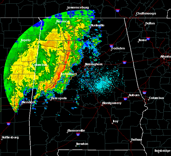 At 1124 am cdt, severe thunderstorms were located along a line extending from 7 miles northwest of moreland to near camp mcdowell, moving east at 30 mph (radar indicated). Hazards include 60 mph wind gusts. Expect damage to roofs, siding, and trees. Locations impacted include, arley, double springs, addison, houston recreational area, camp mcdowell, nesmith, smith lake, brushy lake, poplar springs, helicon, inmanfield, sardis, corinth rec area, falls city, moreland, winston free state barn, houston, mill branch, maple branch and hullett branch. At 1124 am cdt, severe thunderstorms were located along a line extending from 7 miles northwest of moreland to near camp mcdowell, moving east at 30 mph (radar indicated). Hazards include 60 mph wind gusts. Expect damage to roofs, siding, and trees. Locations impacted include, arley, double springs, addison, houston recreational area, camp mcdowell, nesmith, smith lake, brushy lake, poplar springs, helicon, inmanfield, sardis, corinth rec area, falls city, moreland, winston free state barn, houston, mill branch, maple branch and hullett branch.
|
| 5/9/2019 11:24 AM CDT |
 At 1111 am cdt, severe thunderstorms were located along a line extending from near ashridge to near nauvoo, moving east at 30 mph (radar indicated). Hazards include 60 mph wind gusts. expect damage to roofs, siding, and trees At 1111 am cdt, severe thunderstorms were located along a line extending from near ashridge to near nauvoo, moving east at 30 mph (radar indicated). Hazards include 60 mph wind gusts. expect damage to roofs, siding, and trees
|
| 5/9/2019 11:11 AM CDT |
 At 1111 am cdt, severe thunderstorms were located along a line extending from near ashridge to near nauvoo, moving east at 30 mph (radar indicated). Hazards include 60 mph wind gusts. expect damage to roofs, siding, and trees At 1111 am cdt, severe thunderstorms were located along a line extending from near ashridge to near nauvoo, moving east at 30 mph (radar indicated). Hazards include 60 mph wind gusts. expect damage to roofs, siding, and trees
|
| 4/18/2019 7:29 PM CDT |
 At 728 pm cdt, severe thunderstorms were located along a line extending from 8 miles northeast of needmore to near lynn, moving east at 45 mph (radar indicated). Hazards include 70 mph wind gusts. Expect considerable tree damage. damage is likely to mobile homes, roofs, and outbuildings. locations impacted include, haleyville, lynn, arley, double springs, addison, nauvoo, houston recreational area, camp mcdowell, nesmith, ashbank, brushy lake, poplar springs, ashridge, falls city, moreland, smith lake, helicon, inmanfield, sardis and corinth rec area. A tornado watch remains in effect until 1100 pm cdt for central and northwestern alabama. At 728 pm cdt, severe thunderstorms were located along a line extending from 8 miles northeast of needmore to near lynn, moving east at 45 mph (radar indicated). Hazards include 70 mph wind gusts. Expect considerable tree damage. damage is likely to mobile homes, roofs, and outbuildings. locations impacted include, haleyville, lynn, arley, double springs, addison, nauvoo, houston recreational area, camp mcdowell, nesmith, ashbank, brushy lake, poplar springs, ashridge, falls city, moreland, smith lake, helicon, inmanfield, sardis and corinth rec area. A tornado watch remains in effect until 1100 pm cdt for central and northwestern alabama.
|
| 4/18/2019 7:16 PM CDT |
 At 715 pm cdt, severe thunderstorms were located along a line extending from near phil campbell to near lake buttahatchee, moving east at 45 mph (radar indicated). Hazards include 70 mph wind gusts. Expect considerable tree damage. Damage is likely to mobile homes, roofs, and outbuildings. At 715 pm cdt, severe thunderstorms were located along a line extending from near phil campbell to near lake buttahatchee, moving east at 45 mph (radar indicated). Hazards include 70 mph wind gusts. Expect considerable tree damage. Damage is likely to mobile homes, roofs, and outbuildings.
|
| 4/14/2019 2:51 AM CDT |
 At 251 am cdt, severe thunderstorms were located along a line extending from brushy lake to near falls city to near jasper, moving northeast at 35 mph (radar indicated). Hazards include 60 mph wind gusts and penny size hail. Expect damage to roofs, siding, and trees. locations impacted include, jasper, arley, addison, curry, smith dam, nesmith, smith lake, brushy lake, helicon, inmanfield, sardis, falls city, moreland, camp mcdowell, houston, mill branch, maple branch, hullett branch, little dismal creek and bull branch. A tornado watch remains in effect until 300 am cdt for central and northwestern alabama. At 251 am cdt, severe thunderstorms were located along a line extending from brushy lake to near falls city to near jasper, moving northeast at 35 mph (radar indicated). Hazards include 60 mph wind gusts and penny size hail. Expect damage to roofs, siding, and trees. locations impacted include, jasper, arley, addison, curry, smith dam, nesmith, smith lake, brushy lake, helicon, inmanfield, sardis, falls city, moreland, camp mcdowell, houston, mill branch, maple branch, hullett branch, little dismal creek and bull branch. A tornado watch remains in effect until 300 am cdt for central and northwestern alabama.
|
| 4/14/2019 2:34 AM CDT |
 At 234 am cdt, severe thunderstorms were located along a line extending from near brushy lake to 6 miles west of jasper, moving northeast at 40 mph (radar indicated). Hazards include 60 mph wind gusts and penny size hail. expect damage to roofs, siding, and trees At 234 am cdt, severe thunderstorms were located along a line extending from near brushy lake to 6 miles west of jasper, moving northeast at 40 mph (radar indicated). Hazards include 60 mph wind gusts and penny size hail. expect damage to roofs, siding, and trees
|
| 3/14/2019 3:55 PM CDT | Bleachers were blown down near the fire station. baseball dugout damage in winston county AL, 0.2 miles ENE of Arley, AL |
| 3/14/2019 3:52 PM CDT | Trees blown down on hickory lane. quarter same hail was reported at the same locatio in winston county AL, 2.4 miles NE of Arley, AL |
| 2/23/2019 3:39 PM CST |
 At 339 pm cst, a severe thunderstorm capable of producing a tornado was located over helicon, or near arley, moving northeast at 45 mph (radar indicated rotation). Hazards include tornado. Flying debris will be dangerous to those caught without shelter. mobile homes will be damaged or destroyed. damage to roofs, windows, and vehicles will occur. tree damage is likely. Locations impacted include, helicon, nesmith, smith lake, bear branch, mill branch, maple branch, wilson bend, hidden cove campground and cutoff branch. At 339 pm cst, a severe thunderstorm capable of producing a tornado was located over helicon, or near arley, moving northeast at 45 mph (radar indicated rotation). Hazards include tornado. Flying debris will be dangerous to those caught without shelter. mobile homes will be damaged or destroyed. damage to roofs, windows, and vehicles will occur. tree damage is likely. Locations impacted include, helicon, nesmith, smith lake, bear branch, mill branch, maple branch, wilson bend, hidden cove campground and cutoff branch.
|
| 2/23/2019 3:19 PM CST |
 At 319 pm cst, a severe thunderstorm capable of producing a tornado was located near curry, or 7 miles north of jasper, moving northeast at 45 mph (radar indicated rotation). Hazards include tornado. Flying debris will be dangerous to those caught without shelter. mobile homes will be damaged or destroyed. damage to roofs, windows, and vehicles will occur. Tree damage is likely. At 319 pm cst, a severe thunderstorm capable of producing a tornado was located near curry, or 7 miles north of jasper, moving northeast at 45 mph (radar indicated rotation). Hazards include tornado. Flying debris will be dangerous to those caught without shelter. mobile homes will be damaged or destroyed. damage to roofs, windows, and vehicles will occur. Tree damage is likely.
|
| 6/16/2018 8:10 PM CDT | A few trees were blown down near arle in winston county AL, 0.8 miles E of Arley, AL |
| 4/3/2018 10:26 PM CDT |
 At 1026 pm cdt, severe thunderstorms were located along a line extending from near carbon hill to near inmanfield, moving east at 60 mph (radar indicated). Hazards include 70 mph wind gusts and penny size hail. Expect considerable tree damage. damage is likely to mobile homes, roofs, and outbuildings. Locations impacted include, jasper, carbon hill, lynn, arley, double springs, addison, sipsey, kansas, nauvoo, eldridge, curry, houston recreational area, camp mcdowell, smith dam, nesmith, ashbank, brushy lake, poplar springs, falls city and moreland. At 1026 pm cdt, severe thunderstorms were located along a line extending from near carbon hill to near inmanfield, moving east at 60 mph (radar indicated). Hazards include 70 mph wind gusts and penny size hail. Expect considerable tree damage. damage is likely to mobile homes, roofs, and outbuildings. Locations impacted include, jasper, carbon hill, lynn, arley, double springs, addison, sipsey, kansas, nauvoo, eldridge, curry, houston recreational area, camp mcdowell, smith dam, nesmith, ashbank, brushy lake, poplar springs, falls city and moreland.
|
| 4/3/2018 9:51 PM CDT |
 At 950 pm cdt, severe thunderstorms were located along a line extending from near guin to near phil campbell, moving east at 60 mph (radar indicated). Hazards include 70 mph wind gusts. Expect considerable tree damage. Damage is likely to mobile homes, roofs, and outbuildings. At 950 pm cdt, severe thunderstorms were located along a line extending from near guin to near phil campbell, moving east at 60 mph (radar indicated). Hazards include 70 mph wind gusts. Expect considerable tree damage. Damage is likely to mobile homes, roofs, and outbuildings.
|
| 3/19/2018 7:33 PM CDT |
 At 733 pm cdt, severe thunderstorms were located along a line extending from 6 miles east of sardis to near double springs, moving east at 30 mph (radar indicated). Hazards include 60 mph wind gusts and quarter size hail. Hail damage to vehicles is expected. expect wind damage to roofs, siding, and trees. locations impacted include, arley, double springs, addison, houston recreational area, nesmith, brushy lake, helicon, inmanfield, sardis, corinth rec area, moreland, winston free state barn, smith lake, houston, mill branch, hullett branch, winston county airport, cane creek, bull branch and yellow creek. A tornado watch remains in effect until 1100 pm cdt for northwestern alabama. At 733 pm cdt, severe thunderstorms were located along a line extending from 6 miles east of sardis to near double springs, moving east at 30 mph (radar indicated). Hazards include 60 mph wind gusts and quarter size hail. Hail damage to vehicles is expected. expect wind damage to roofs, siding, and trees. locations impacted include, arley, double springs, addison, houston recreational area, nesmith, brushy lake, helicon, inmanfield, sardis, corinth rec area, moreland, winston free state barn, smith lake, houston, mill branch, hullett branch, winston county airport, cane creek, bull branch and yellow creek. A tornado watch remains in effect until 1100 pm cdt for northwestern alabama.
|
| 3/19/2018 7:28 PM CDT | Ping Pong Ball sized hail reported 4.2 miles SSW of Arley, AL |
| 3/19/2018 7:11 PM CDT |
 At 711 pm cdt, severe thunderstorms were located along a line extending from near sardis to near haleyville, moving east at 35 mph (radar indicated). Hazards include 60 mph wind gusts and quarter size hail. Hail damage to vehicles is expected. expect wind damage to roofs, siding, and trees. locations impacted include, haleyville, arley, double springs, addison, houston recreational area, nesmith, brushy lake, helicon, inmanfield, ashridge, sardis, corinth rec area, needmore, moreland, winston free state barn, smith lake, houston, mill branch, hullett branch and winston county airport. A tornado watch remains in effect until 1100 pm cdt for northwestern alabama. At 711 pm cdt, severe thunderstorms were located along a line extending from near sardis to near haleyville, moving east at 35 mph (radar indicated). Hazards include 60 mph wind gusts and quarter size hail. Hail damage to vehicles is expected. expect wind damage to roofs, siding, and trees. locations impacted include, haleyville, arley, double springs, addison, houston recreational area, nesmith, brushy lake, helicon, inmanfield, ashridge, sardis, corinth rec area, needmore, moreland, winston free state barn, smith lake, houston, mill branch, hullett branch and winston county airport. A tornado watch remains in effect until 1100 pm cdt for northwestern alabama.
|
| 3/19/2018 6:56 PM CDT |
 At 656 pm cdt, severe thunderstorms were located along a line extending from near brushy lake to haleyville, moving east at 40 mph (radar indicated). Hazards include 60 mph wind gusts and quarter size hail. Hail damage to vehicles is expected. Expect wind damage to roofs, siding, and trees. At 656 pm cdt, severe thunderstorms were located along a line extending from near brushy lake to haleyville, moving east at 40 mph (radar indicated). Hazards include 60 mph wind gusts and quarter size hail. Hail damage to vehicles is expected. Expect wind damage to roofs, siding, and trees.
|
| 3/19/2018 6:45 PM CDT |
 At 645 pm cdt, a severe thunderstorm was located over addison, or 7 miles north of arley, moving east at 45 mph (radar indicated). Hazards include golf ball size hail and 60 mph wind gusts. People and animals outdoors will be injured. expect hail damage to roofs, siding, windows, and vehicles. expect wind damage to roofs, siding, and trees. locations impacted include, arley, addison, sardis, nesmith, brushy lake, helicon, moreland, inmanfield, smith lake, addison town hall, panther branch, upshaw and addison municipal airport. A tornado watch remains in effect until 1100 pm cdt for northwestern alabama. At 645 pm cdt, a severe thunderstorm was located over addison, or 7 miles north of arley, moving east at 45 mph (radar indicated). Hazards include golf ball size hail and 60 mph wind gusts. People and animals outdoors will be injured. expect hail damage to roofs, siding, windows, and vehicles. expect wind damage to roofs, siding, and trees. locations impacted include, arley, addison, sardis, nesmith, brushy lake, helicon, moreland, inmanfield, smith lake, addison town hall, panther branch, upshaw and addison municipal airport. A tornado watch remains in effect until 1100 pm cdt for northwestern alabama.
|
| 3/19/2018 6:34 PM CDT |
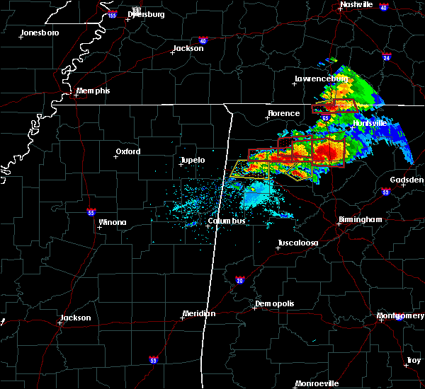 At 634 pm cdt, a severe thunderstorm was located over corinth rec area, or 7 miles northwest of arley, moving east at 45 mph (radar indicated). Hazards include golf ball size hail and 60 mph wind gusts. People and animals outdoors will be injured. expect hail damage to roofs, siding, windows, and vehicles. Expect wind damage to roofs, siding, and trees. At 634 pm cdt, a severe thunderstorm was located over corinth rec area, or 7 miles northwest of arley, moving east at 45 mph (radar indicated). Hazards include golf ball size hail and 60 mph wind gusts. People and animals outdoors will be injured. expect hail damage to roofs, siding, windows, and vehicles. Expect wind damage to roofs, siding, and trees.
|
| 11/18/2017 5:50 PM CST |
 At 550 pm cst, a severe thunderstorm was located over moreland, or 11 miles north of arley, moving east at 65 mph (radar indicated). Hazards include 60 mph wind gusts. expect damage to roofs, siding, and trees At 550 pm cst, a severe thunderstorm was located over moreland, or 11 miles north of arley, moving east at 65 mph (radar indicated). Hazards include 60 mph wind gusts. expect damage to roofs, siding, and trees
|
| 5/28/2017 2:05 AM CDT |
 At 205 am cdt, severe thunderstorms were located along a line extending from 7 miles west of cullman to near kansas, moving southeast at 45 mph (radar indicated). Hazards include 70 mph wind gusts. Expect considerable tree damage. damage is likely to mobile homes, roofs, and outbuildings. Locations impacted include, jasper, sumiton, cordova, dora, carbon hill, lynn, arley, double springs, parrish, oakman, addison, sipsey, west jefferson, kansas, nauvoo, eldridge, curry, gorgas steam plant, houston recreational area and smith dam. At 205 am cdt, severe thunderstorms were located along a line extending from 7 miles west of cullman to near kansas, moving southeast at 45 mph (radar indicated). Hazards include 70 mph wind gusts. Expect considerable tree damage. damage is likely to mobile homes, roofs, and outbuildings. Locations impacted include, jasper, sumiton, cordova, dora, carbon hill, lynn, arley, double springs, parrish, oakman, addison, sipsey, west jefferson, kansas, nauvoo, eldridge, curry, gorgas steam plant, houston recreational area and smith dam.
|
| 5/28/2017 1:43 AM CDT |
 At 143 am cdt, severe thunderstorms were located along a line extending from near brushy lake to winfield, moving southeast at 60 mph (radar indicated). Hazards include 70 mph wind gusts. Expect considerable tree damage. damage is likely to mobile homes, roofs, and outbuildings. Locations impacted include, jasper, haleyville, sumiton, cordova, dora, carbon hill, lynn, arley, double springs, parrish, oakman, addison, sipsey, west jefferson, kansas, nauvoo, eldridge, curry, gorgas steam plant and houston recreational area. At 143 am cdt, severe thunderstorms were located along a line extending from near brushy lake to winfield, moving southeast at 60 mph (radar indicated). Hazards include 70 mph wind gusts. Expect considerable tree damage. damage is likely to mobile homes, roofs, and outbuildings. Locations impacted include, jasper, haleyville, sumiton, cordova, dora, carbon hill, lynn, arley, double springs, parrish, oakman, addison, sipsey, west jefferson, kansas, nauvoo, eldridge, curry, gorgas steam plant and houston recreational area.
|
| 5/28/2017 1:21 AM CDT |
 At 121 am cdt, severe thunderstorms were located along a line extending from 7 miles northeast of phil campbell to near detroit, moving southeast at 60 mph (radar indicated). Hazards include 70 mph wind gusts. Expect considerable tree damage. Damage is likely to mobile homes, roofs, and outbuildings. At 121 am cdt, severe thunderstorms were located along a line extending from 7 miles northeast of phil campbell to near detroit, moving southeast at 60 mph (radar indicated). Hazards include 70 mph wind gusts. Expect considerable tree damage. Damage is likely to mobile homes, roofs, and outbuildings.
|
| 4/30/2017 1:46 PM CDT | Trees blown down in helico in winston county AL, 4.2 miles SW of Arley, AL |
| 4/30/2017 1:14 PM CDT |
 At 113 pm cdt, severe thunderstorms were located along a line extending from near russellville to 10 miles north of ashridge to 6 miles west of jasper, moving northeast at 50 mph (radar indicated). Hazards include 70 mph wind gusts. Expect considerable tree damage. damage is likely to mobile homes, roofs, and outbuildings. locations impacted include, jasper, haleyville, sumiton, cordova, dora, carbon hill, lynn, arley, double springs, parrish, oakman, addison, sipsey, kansas, nauvoo, eldridge, curry, gorgas steam plant, houston recreational area and nesmith. A tornado watch remains in effect until 700 pm cdt for northwestern, west central alabama. At 113 pm cdt, severe thunderstorms were located along a line extending from near russellville to 10 miles north of ashridge to 6 miles west of jasper, moving northeast at 50 mph (radar indicated). Hazards include 70 mph wind gusts. Expect considerable tree damage. damage is likely to mobile homes, roofs, and outbuildings. locations impacted include, jasper, haleyville, sumiton, cordova, dora, carbon hill, lynn, arley, double springs, parrish, oakman, addison, sipsey, kansas, nauvoo, eldridge, curry, gorgas steam plant, houston recreational area and nesmith. A tornado watch remains in effect until 700 pm cdt for northwestern, west central alabama.
|
| 4/30/2017 12:54 PM CDT |
 At 1254 pm cdt, severe thunderstorms were located along a line extending from near hackleburg to near haleyville to boley springs, moving northeast at 50 mph (radar indicated). Hazards include 70 mph wind gusts. Expect considerable tree damage. Damage is likely to mobile homes, roofs, and outbuildings. At 1254 pm cdt, severe thunderstorms were located along a line extending from near hackleburg to near haleyville to boley springs, moving northeast at 50 mph (radar indicated). Hazards include 70 mph wind gusts. Expect considerable tree damage. Damage is likely to mobile homes, roofs, and outbuildings.
|
| 3/10/2017 12:18 AM CST |
 At 1218 am cst, a severe thunderstorm was located near lake buttahatchee, or near haleyville, moving east at 45 mph (radar indicated). Hazards include 60 mph wind gusts and half dollar size hail. Hail damage to vehicles is expected. Expect wind damage to roofs, siding, and trees. At 1218 am cst, a severe thunderstorm was located near lake buttahatchee, or near haleyville, moving east at 45 mph (radar indicated). Hazards include 60 mph wind gusts and half dollar size hail. Hail damage to vehicles is expected. Expect wind damage to roofs, siding, and trees.
|
| 3/1/2017 2:41 PM CST |
 At 240 pm cst, a severe thunderstorm was located near curry, or 7 miles north of jasper, moving east at 50 mph (radar indicated). Hazards include 60 mph wind gusts and quarter size hail. Hail damage to vehicles is expected. expect wind damage to roofs, siding, and trees. locations impacted include, jasper, curry, camp mcdowell, smith dam, smith lake, falls city, poplar springs, maple branch, wilson bend, devils branch, seymour branch, duncan bridge, little dismal creek, bear branch, coon creek, raccoon branch, battle branch, hidden cove campground, butler branch and walker county airport. A tornado watch remains in effect until 600 pm cst for northwestern alabama. At 240 pm cst, a severe thunderstorm was located near curry, or 7 miles north of jasper, moving east at 50 mph (radar indicated). Hazards include 60 mph wind gusts and quarter size hail. Hail damage to vehicles is expected. expect wind damage to roofs, siding, and trees. locations impacted include, jasper, curry, camp mcdowell, smith dam, smith lake, falls city, poplar springs, maple branch, wilson bend, devils branch, seymour branch, duncan bridge, little dismal creek, bear branch, coon creek, raccoon branch, battle branch, hidden cove campground, butler branch and walker county airport. A tornado watch remains in effect until 600 pm cst for northwestern alabama.
|
| 3/1/2017 2:26 PM CST |
 At 225 pm cst, a severe thunderstorm was located over nauvoo, or near carbon hill, moving east at 40 mph (radar indicated). Hazards include 60 mph wind gusts and quarter size hail. Hail damage to vehicles is expected. expect wind damage to roofs, siding, and trees. locations impacted include, jasper, carbon hill, arley, nauvoo, curry, camp mcdowell, smith dam, ashbank, smith lake, poplar springs, falls city, maple branch, little dismal creek, coon creek, lupton, battle branch, hidden cove campground, wilson bend, devils branch and seymour branch. A tornado watch remains in effect until 600 pm cst for northwestern alabama. At 225 pm cst, a severe thunderstorm was located over nauvoo, or near carbon hill, moving east at 40 mph (radar indicated). Hazards include 60 mph wind gusts and quarter size hail. Hail damage to vehicles is expected. expect wind damage to roofs, siding, and trees. locations impacted include, jasper, carbon hill, arley, nauvoo, curry, camp mcdowell, smith dam, ashbank, smith lake, poplar springs, falls city, maple branch, little dismal creek, coon creek, lupton, battle branch, hidden cove campground, wilson bend, devils branch and seymour branch. A tornado watch remains in effect until 600 pm cst for northwestern alabama.
|
| 3/1/2017 2:15 PM CST |
 At 215 pm cst, a severe thunderstorm was located near eldridge, or near carbon hill, moving east at 50 mph (radar indicated). Hazards include 60 mph wind gusts and quarter size hail. Hail damage to vehicles is expected. Expect wind damage to roofs, siding, and trees. At 215 pm cst, a severe thunderstorm was located near eldridge, or near carbon hill, moving east at 50 mph (radar indicated). Hazards include 60 mph wind gusts and quarter size hail. Hail damage to vehicles is expected. Expect wind damage to roofs, siding, and trees.
|
| 11/30/2016 2:43 AM CST |
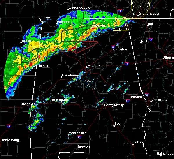 At 243 am cst, a severe thunderstorm capable of producing a tornado was located over falls city, or over arley, moving northeast at 45 mph (radar indicated rotation). Hazards include tornado and golf ball size hail. Flying debris will be dangerous to those caught without shelter. mobile homes will be damaged or destroyed. damage to roofs, windows, and vehicles will occur. tree damage is likely. Locations impacted include, arley, falls city, helicon, smith lake, bear branch, battle branch, little bear branch, maple branch, little dismal creek, devils branch, hidden cove campground, panther branch, mill branch, cutoff branch, big bear branch, duncan bridge, wilson bend and butler branch. At 243 am cst, a severe thunderstorm capable of producing a tornado was located over falls city, or over arley, moving northeast at 45 mph (radar indicated rotation). Hazards include tornado and golf ball size hail. Flying debris will be dangerous to those caught without shelter. mobile homes will be damaged or destroyed. damage to roofs, windows, and vehicles will occur. tree damage is likely. Locations impacted include, arley, falls city, helicon, smith lake, bear branch, battle branch, little bear branch, maple branch, little dismal creek, devils branch, hidden cove campground, panther branch, mill branch, cutoff branch, big bear branch, duncan bridge, wilson bend and butler branch.
|
| 11/30/2016 2:38 AM CST |
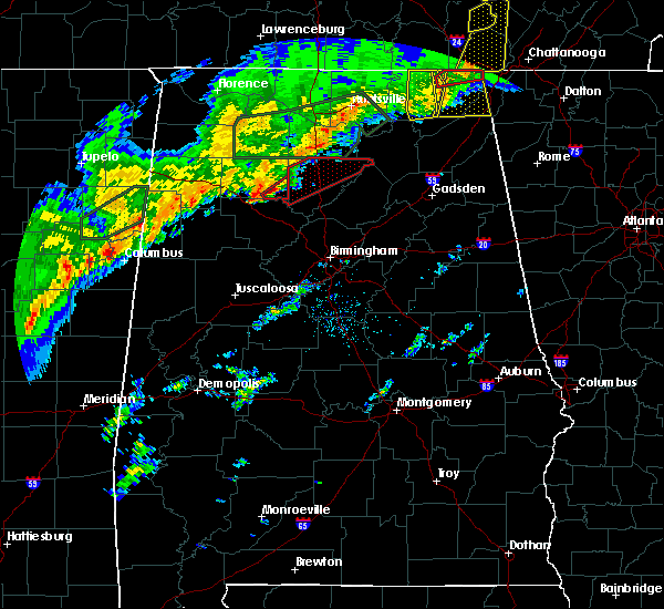 At 238 am cst, a severe thunderstorm capable of producing a tornado was located over falls city, or near arley, moving northeast at 50 mph (radar indicated rotation). Hazards include tornado. Flying debris will be dangerous to those caught without shelter. mobile homes will be damaged or destroyed. damage to roofs, windows, and vehicles will occur. tree damage is likely. Locations impacted include, arley, falls city, helicon, smith lake, bear branch, battle branch, coon creek, little bear branch, maple branch, little dismal creek, devils branch, hidden cove campground, panther branch, mill branch, cutoff branch, big bear branch, duncan bridge, wilson bend and butler branch. At 238 am cst, a severe thunderstorm capable of producing a tornado was located over falls city, or near arley, moving northeast at 50 mph (radar indicated rotation). Hazards include tornado. Flying debris will be dangerous to those caught without shelter. mobile homes will be damaged or destroyed. damage to roofs, windows, and vehicles will occur. tree damage is likely. Locations impacted include, arley, falls city, helicon, smith lake, bear branch, battle branch, coon creek, little bear branch, maple branch, little dismal creek, devils branch, hidden cove campground, panther branch, mill branch, cutoff branch, big bear branch, duncan bridge, wilson bend and butler branch.
|
| 11/30/2016 2:33 AM CST |
 At 232 am cst, a severe thunderstorm capable of producing a tornado was located near curry, or 7 miles southwest of arley, moving northeast at 50 mph (radar indicated rotation). Hazards include tornado. Flying debris will be dangerous to those caught without shelter. mobile homes will be damaged or destroyed. damage to roofs, windows, and vehicles will occur. Tree damage is likely. At 232 am cst, a severe thunderstorm capable of producing a tornado was located near curry, or 7 miles southwest of arley, moving northeast at 50 mph (radar indicated rotation). Hazards include tornado. Flying debris will be dangerous to those caught without shelter. mobile homes will be damaged or destroyed. damage to roofs, windows, and vehicles will occur. Tree damage is likely.
|
| 11/29/2016 10:19 PM CST |
 At 1019 pm cst, a severe thunderstorm capable of producing a tornado was located over nesmith, or near arley, moving northeast at 45 mph (radar indicated rotation). Hazards include tornado. Flying debris will be dangerous to those caught without shelter. mobile homes will be damaged or destroyed. damage to roofs, windows, and vehicles will occur. tree damage is likely. Locations impacted include, arley, addison, helicon, sardis, nesmith, smith lake, panther branch, addison town hall and addison municipal airport. At 1019 pm cst, a severe thunderstorm capable of producing a tornado was located over nesmith, or near arley, moving northeast at 45 mph (radar indicated rotation). Hazards include tornado. Flying debris will be dangerous to those caught without shelter. mobile homes will be damaged or destroyed. damage to roofs, windows, and vehicles will occur. tree damage is likely. Locations impacted include, arley, addison, helicon, sardis, nesmith, smith lake, panther branch, addison town hall and addison municipal airport.
|
| 11/29/2016 9:00 PM CST | Trees down along county road 946 in crane hil in cullman county AL, 7.8 miles W of Arley, AL |
| 11/29/2016 9:00 PM CST |
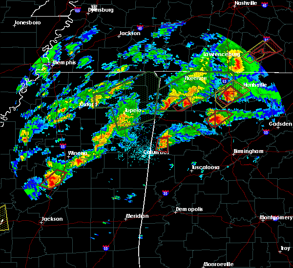 At 900 pm cst, a confirmed tornado was located over nesmith, or 7 miles northeast of arley, moving northeast at 45 mph (radar confirmed tornado). Hazards include damaging tornado and ping pong ball size hail. Flying debris will be dangerous to those caught without shelter. mobile homes will be damaged or destroyed. damage to roofs, windows, and vehicles will occur. tree damage is likely. Locations impacted include, arley, addison, sardis, helicon, nesmith, smith lake, houston, addison town hall, addison municipal airport, hidden cove campground, panther branch, mill branch and cutoff branch. At 900 pm cst, a confirmed tornado was located over nesmith, or 7 miles northeast of arley, moving northeast at 45 mph (radar confirmed tornado). Hazards include damaging tornado and ping pong ball size hail. Flying debris will be dangerous to those caught without shelter. mobile homes will be damaged or destroyed. damage to roofs, windows, and vehicles will occur. tree damage is likely. Locations impacted include, arley, addison, sardis, helicon, nesmith, smith lake, houston, addison town hall, addison municipal airport, hidden cove campground, panther branch, mill branch and cutoff branch.
|
| 11/29/2016 8:58 PM CST |
 At 858 pm cst, a severe thunderstorm capable of producing a tornado was located over helicon, or near arley, moving northeast at 45 mph (radar indicated rotation). Hazards include tornado and ping pong ball size hail. Flying debris will be dangerous to those caught without shelter. mobile homes will be damaged or destroyed. damage to roofs, windows, and vehicles will occur. tree damage is likely. Locations impacted include, arley, addison, sardis, helicon, nesmith, smith lake, houston, addison town hall, addison municipal airport, hidden cove campground, panther branch, mill branch and cutoff branch. At 858 pm cst, a severe thunderstorm capable of producing a tornado was located over helicon, or near arley, moving northeast at 45 mph (radar indicated rotation). Hazards include tornado and ping pong ball size hail. Flying debris will be dangerous to those caught without shelter. mobile homes will be damaged or destroyed. damage to roofs, windows, and vehicles will occur. tree damage is likely. Locations impacted include, arley, addison, sardis, helicon, nesmith, smith lake, houston, addison town hall, addison municipal airport, hidden cove campground, panther branch, mill branch and cutoff branch.
|
| 11/29/2016 8:57 PM CST | Mobile home seriously damaged on county rd 77 in the helicon community. multiple trees down. possible tornado. reported by helican fire. via social media. time based on in winston county AL, 4.2 miles SW of Arley, AL |
| 11/29/2016 8:51 PM CST | Multiple trees down on county road 12 near arley... via social media. possible tornad in winston county AL, 0.9 miles NNW of Arley, AL |
| 11/29/2016 8:49 PM CST |
 At 849 pm cst, a severe thunderstorm capable of producing a tornado was located over falls city, or over arley, moving northeast at 45 mph (radar indicated rotation). Hazards include tornado and ping pong ball size hail. Flying debris will be dangerous to those caught without shelter. mobile homes will be damaged or destroyed. damage to roofs, windows, and vehicles will occur. tree damage is likely. Locations impacted include, arley, addison, falls city, sardis, camp mcdowell, corinth rec area, helicon, smith lake, inmanfield, nesmith, houston, black pond, upshaw, hullett branch, bear branch, battle branch, curtis crossroads, maple branch, little dismal creek and devils branch. At 849 pm cst, a severe thunderstorm capable of producing a tornado was located over falls city, or over arley, moving northeast at 45 mph (radar indicated rotation). Hazards include tornado and ping pong ball size hail. Flying debris will be dangerous to those caught without shelter. mobile homes will be damaged or destroyed. damage to roofs, windows, and vehicles will occur. tree damage is likely. Locations impacted include, arley, addison, falls city, sardis, camp mcdowell, corinth rec area, helicon, smith lake, inmanfield, nesmith, houston, black pond, upshaw, hullett branch, bear branch, battle branch, curtis crossroads, maple branch, little dismal creek and devils branch.
|
| 11/29/2016 8:39 PM CST |
 At 839 pm cst, a severe thunderstorm capable of producing a tornado was located over camp mcdowell, or 9 miles southwest of arley, moving northeast at 45 mph (radar indicated rotation). Hazards include tornado. Flying debris will be dangerous to those caught without shelter. mobile homes will be damaged or destroyed. damage to roofs, windows, and vehicles will occur. tree damage is likely. Locations impacted include, jasper, arley, addison, falls city, sardis, camp mcdowell, curry, corinth rec area, helicon, smith lake, inmanfield, nesmith, poplar springs, houston, raccoon branch, black pond, upshaw, hullett branch, bear branch and clear creek. At 839 pm cst, a severe thunderstorm capable of producing a tornado was located over camp mcdowell, or 9 miles southwest of arley, moving northeast at 45 mph (radar indicated rotation). Hazards include tornado. Flying debris will be dangerous to those caught without shelter. mobile homes will be damaged or destroyed. damage to roofs, windows, and vehicles will occur. tree damage is likely. Locations impacted include, jasper, arley, addison, falls city, sardis, camp mcdowell, curry, corinth rec area, helicon, smith lake, inmanfield, nesmith, poplar springs, houston, raccoon branch, black pond, upshaw, hullett branch, bear branch and clear creek.
|
| 11/29/2016 8:24 PM CST |
 At 823 pm cst, a severe thunderstorm capable of producing a tornado was located over carbon hill, moving northeast at 45 mph (radar indicated rotation). Hazards include tornado. Flying debris will be dangerous to those caught without shelter. mobile homes will be damaged or destroyed. damage to roofs, windows, and vehicles will occur. Tree damage is likely. At 823 pm cst, a severe thunderstorm capable of producing a tornado was located over carbon hill, moving northeast at 45 mph (radar indicated rotation). Hazards include tornado. Flying debris will be dangerous to those caught without shelter. mobile homes will be damaged or destroyed. damage to roofs, windows, and vehicles will occur. Tree damage is likely.
|
| 11/29/2016 7:35 PM CST |
 At 734 pm cst, a severe thunderstorm capable of producing a tornado was located over brilliant, or 8 miles north of winfield, moving northeast at 45 mph (radar indicated rotation). Hazards include tornado. Flying debris will be dangerous to those caught without shelter. mobile homes will be damaged or destroyed. damage to roofs, windows, and vehicles will occur. tree damage is likely. Locations impacted include, winfield, haleyville, lynn, arley, double springs, brilliant, falls city, ashridge, corinth rec area, ashbank, houston recreational area, needmore, brinn, winston free state barn, poplar springs, lake buttahatchee, smith lake, bear creek, twin and natural bridge. At 734 pm cst, a severe thunderstorm capable of producing a tornado was located over brilliant, or 8 miles north of winfield, moving northeast at 45 mph (radar indicated rotation). Hazards include tornado. Flying debris will be dangerous to those caught without shelter. mobile homes will be damaged or destroyed. damage to roofs, windows, and vehicles will occur. tree damage is likely. Locations impacted include, winfield, haleyville, lynn, arley, double springs, brilliant, falls city, ashridge, corinth rec area, ashbank, houston recreational area, needmore, brinn, winston free state barn, poplar springs, lake buttahatchee, smith lake, bear creek, twin and natural bridge.
|
| 11/29/2016 7:28 PM CST |
 At 727 pm cst, a severe thunderstorm capable of producing a tornado was located near gu-win, or near winfield, moving northeast at 45 mph (radar indicated rotation). Hazards include tornado. Flying debris will be dangerous to those caught without shelter. mobile homes will be damaged or destroyed. damage to roofs, windows, and vehicles will occur. Tree damage is likely. At 727 pm cst, a severe thunderstorm capable of producing a tornado was located near gu-win, or near winfield, moving northeast at 45 mph (radar indicated rotation). Hazards include tornado. Flying debris will be dangerous to those caught without shelter. mobile homes will be damaged or destroyed. damage to roofs, windows, and vehicles will occur. Tree damage is likely.
|
| 6/17/2016 2:05 PM CDT |
 At 205 pm cdt, severe thunderstorms were located along a line extending from near guin to near smith dam, moving southeast at 30 mph (radar indicated). Hazards include 60 mph wind gusts and quarter size hail. Hail damage to vehicles is expected. expect wind damage to roofs, siding, and trees. Locations impacted include, jasper, hamilton, winfield, fayette, sumiton, cordova, dora, carbon hill, lynn, arley, guin, berry, double springs, parrish, brilliant, oakman, glen allen, sipsey, west jefferson and kansas. At 205 pm cdt, severe thunderstorms were located along a line extending from near guin to near smith dam, moving southeast at 30 mph (radar indicated). Hazards include 60 mph wind gusts and quarter size hail. Hail damage to vehicles is expected. expect wind damage to roofs, siding, and trees. Locations impacted include, jasper, hamilton, winfield, fayette, sumiton, cordova, dora, carbon hill, lynn, arley, guin, berry, double springs, parrish, brilliant, oakman, glen allen, sipsey, west jefferson and kansas.
|
| 6/17/2016 1:44 PM CDT |
 At 144 pm cdt, severe thunderstorms were located along a line extending from near beaverton to near smith lake, moving south at 25 mph (radar indicated). Hazards include 60 mph wind gusts and quarter size hail. Hail damage to vehicles is expected. Expect wind damage to roofs, siding, and trees. At 144 pm cdt, severe thunderstorms were located along a line extending from near beaverton to near smith lake, moving south at 25 mph (radar indicated). Hazards include 60 mph wind gusts and quarter size hail. Hail damage to vehicles is expected. Expect wind damage to roofs, siding, and trees.
|
| 6/17/2016 1:34 PM CDT |
 At 134 pm cdt, severe thunderstorms were located along a line extending from near helicon to hackleburg to near tremont, moving southeast at 30 mph (radar indicated). Hazards include ping pong ball size hail and 60 mph wind gusts. People and animals outdoors will be injured. expect hail damage to roofs, siding, windows, and vehicles. expect wind damage to roofs, siding, and trees. Locations impacted include, hamilton, winfield, haleyville, lynn, arley, guin, hackleburg, double springs, brilliant, addison, glen allen, nauvoo, gu-win, sardis, camp mcdowell, helicon, brushy lake, smith lake, ashbank and inmanfield. At 134 pm cdt, severe thunderstorms were located along a line extending from near helicon to hackleburg to near tremont, moving southeast at 30 mph (radar indicated). Hazards include ping pong ball size hail and 60 mph wind gusts. People and animals outdoors will be injured. expect hail damage to roofs, siding, windows, and vehicles. expect wind damage to roofs, siding, and trees. Locations impacted include, hamilton, winfield, haleyville, lynn, arley, guin, hackleburg, double springs, brilliant, addison, glen allen, nauvoo, gu-win, sardis, camp mcdowell, helicon, brushy lake, smith lake, ashbank and inmanfield.
|
| 6/17/2016 12:48 PM CDT |
 At 1246 pm cdt, severe thunderstorms were located along a line extending from near sardis to near red bay, moving south at 20 mph (radar indicated). Hazards include ping pong ball size hail and 60 mph wind gusts. People and animals outdoors will be injured. expect hail damage to roofs, siding, windows, and vehicles. Expect wind damage to roofs, siding, and trees. At 1246 pm cdt, severe thunderstorms were located along a line extending from near sardis to near red bay, moving south at 20 mph (radar indicated). Hazards include ping pong ball size hail and 60 mph wind gusts. People and animals outdoors will be injured. expect hail damage to roofs, siding, windows, and vehicles. Expect wind damage to roofs, siding, and trees.
|
| 7/14/2015 7:17 PM CDT |
 At 716 pm cdt, severe thunderstorms were located along a line extending from 6 miles east of nesmith to near nauvoo to near winfield to near crews, moving south at 50 mph (radar indicated). Hazards include 70 mph wind gusts and quarter size hail. Hail damage to vehicles is expected. expect considerable tree damage. wind damage is also likely to mobile homes, roofs and outbuildings. Locations impacted include, hamilton, winfield, lynn, arley, guin, double springs, brilliant, addison, glen allen, nauvoo, gu-win, camp mcdowell, helicon, smith lake, ashbank, poplar springs, falls city, corinth rec area, houston recreational area and brinn. At 716 pm cdt, severe thunderstorms were located along a line extending from 6 miles east of nesmith to near nauvoo to near winfield to near crews, moving south at 50 mph (radar indicated). Hazards include 70 mph wind gusts and quarter size hail. Hail damage to vehicles is expected. expect considerable tree damage. wind damage is also likely to mobile homes, roofs and outbuildings. Locations impacted include, hamilton, winfield, lynn, arley, guin, double springs, brilliant, addison, glen allen, nauvoo, gu-win, camp mcdowell, helicon, smith lake, ashbank, poplar springs, falls city, corinth rec area, houston recreational area and brinn.
|
| 7/14/2015 6:59 PM CDT |
 At 659 pm cdt, severe thunderstorms were located along a line extending from near sardis to near lynn to near brinn to 6 miles north of detroit, moving southeast at 45 mph (radar indicated). Hazards include 70 mph wind gusts and quarter size hail. Hail damage to vehicles is expected. expect considerable tree damage. wind damage is also likely to mobile homes, roofs and outbuildings. Locations impacted include, hamilton, winfield, haleyville, lynn, arley, guin, hackleburg, double springs, brilliant, addison, glen allen, nauvoo, gu-win, sardis, camp mcdowell, helicon, smith lake, ashbank, inmanfield and needmore. At 659 pm cdt, severe thunderstorms were located along a line extending from near sardis to near lynn to near brinn to 6 miles north of detroit, moving southeast at 45 mph (radar indicated). Hazards include 70 mph wind gusts and quarter size hail. Hail damage to vehicles is expected. expect considerable tree damage. wind damage is also likely to mobile homes, roofs and outbuildings. Locations impacted include, hamilton, winfield, haleyville, lynn, arley, guin, hackleburg, double springs, brilliant, addison, glen allen, nauvoo, gu-win, sardis, camp mcdowell, helicon, smith lake, ashbank, inmanfield and needmore.
|
| 7/14/2015 6:42 PM CDT |
 At 642 pm cdt, severe thunderstorms were located along a line extending from near trinity to 6 miles northeast of phil campbell to near belgreen to near red bay, moving south at 40 mph (radar indicated). Hazards include 70 mph wind gusts and quarter size hail. Hail damage to vehicles is expected. expect considerable tree damage. Wind damage is also likely to mobile homes, roofs and outbuildings. At 642 pm cdt, severe thunderstorms were located along a line extending from near trinity to 6 miles northeast of phil campbell to near belgreen to near red bay, moving south at 40 mph (radar indicated). Hazards include 70 mph wind gusts and quarter size hail. Hail damage to vehicles is expected. expect considerable tree damage. Wind damage is also likely to mobile homes, roofs and outbuildings.
|
| 4/20/2015 1:49 AM CDT | At 148 am cdt, severe thunderstorms were located along a line extending from sardis to near kansas, moving east at 45 mph (radar indicated). Hazards include 60 mph wind gusts and quarter size hail. Tree damage is possible. locations impacted include, jasper, carbon hill, arley, addison, kansas, nauvoo, falls city, sardis, camp mcdowell, curry, corinth rec area, helicon, smith dam, smith lake, nesmith, poplar springs, houston, raccoon branch, black pond and gamble. 1. 00in. |
| 4/20/2015 1:36 AM CDT | At 135 am cdt, severe thunderstorms were located along a line extending from near moreland to 6 miles southeast of nauvoo, moving east at 60 mph (radar indicated). Hazards include 60 mph wind gusts and quarter size hail. Tree damage is possible. locations impacted include, jasper, carbon hill, arley, double springs, addison, kansas, nauvoo, sardis, camp mcdowell, curry, helicon, brushy lake, smith lake, ashbank, inmanfield, poplar springs, falls city, corinth rec area, smith dam and moreland. 1. 00in. |
| 4/20/2015 1:16 AM CDT | At 116 am cdt, severe thunderstorms were located along a line extending from 6 miles north of lynn to 6 miles south of glen allen, moving east at 50 mph (radar indicated). Hazards include 60 mph wind gusts and quarter size hail. Hail damage to vehicles is possible. Expect wind damage to roofs, siding and trees. |
| 3/31/2015 4:39 PM CDT | The severe thunderstorm warning for southeastern winston county will expire at 445 pm cdt. the storm which prompted the warning has moved out of the area. therefore the warning will be allowed to expire. A severe thunderstorm watch remains in effect until 700 pm cdt for northwestern alabama. |
| 3/31/2015 4:29 PM CDT | The national weather service in birmingham has issued a * severe thunderstorm warning for. southeastern winston county in northwestern alabama. until 445 pm cdt * at 428 pm cdt. a severe thunderstorm was located near arley. Moving east at 35 mph. |
| 3/31/2015 3:23 PM CST | Quarter sized hail reported 1.1 miles NE of Arley, AL |
| 3/31/2015 4:18 PM CDT | A severe thunderstorm warning remains in effect until 430 pm cdt for northeastern walker and southeastern winston counties. at 417 pm cdt. a severe thunderstorm was located near smith dam. or 10 miles southeast of arley. moving east at 50 mph. hazard. 60 mph wind gusts and quarter size hail. source. Radar indicated. |
| 3/31/2015 4:05 PM CDT | A severe thunderstorm warning remains in effect until 430 pm cdt for northern walker and southern winston counties. at 404 pm cdt. a severe thunderstorm was located over curry. or near arley. moving east at 50 mph. hazard. 60 mph wind gusts and quarter size hail. source. Radar indicated. |
| 3/31/2015 3:47 PM CDT | A severe thunderstorm warning remains in effect until 430 pm cdt for northern walker and southern winston counties. at 346 pm cdt. a severe thunderstorm was located over nauvoo. or near carbon hill. moving east at 45 mph. hazard. 60 mph wind gusts and quarter size hail. source. Radar indicated. |
| 3/31/2015 3:30 PM CDT | The national weather service in birmingham has issued a * severe thunderstorm warning for. southeastern marion county in northwestern alabama. northern walker county in central alabama. southern winston county in northwestern alabama. Northeastern fayette county in west central alabama. |
| 10/13/2014 4:20 PM CDT | Tree reported down on hom in winston county AL, 4.2 miles SW of Arley, AL |
| 10/13/2014 4:20 PM CDT | Tree down on house on hwy 47 south of arle in winston county AL, 2.3 miles NNE of Arley, AL |
| 6/17/2013 12:37 PM CDT | Trees and powerlines down along old houston rd and farley rd near arley. winds estimated at 45-50 mp in winston county AL, 1.4 miles E of Arley, AL |
| 4/11/2013 3:30 PM CDT | A tree was reported blown down on cr 35 in cullman county AL, 7.3 miles W of Arley, AL |
| 3/18/2013 3:06 PM CDT | Trees blown blow in cullman county AL, 7.8 miles W of Arley, AL |
| 3/18/2013 3:06 PM CDT | Trees blown dow in cullman county AL, 7.8 miles W of Arley, AL |
| 1/30/2013 5:56 AM CST | Winds of 100 mph knocked down hundreds of trees south of houston in a swath of damage 1.2 miles long and 1000 yds wide at its widest point. a dozen homes were damaged d in winston county AL, 4.2 miles E of Arley, AL |
| 6/11/2012 7:32 PM CDT | Trees down on powerlines near guthreys crossing and county road 22 in cullman county AL, 7.8 miles W of Arley, AL |
| 3/31/2012 7:11 PM CDT | Tree down on a house on county road 126 in helico in winston county AL, 4.2 miles SW of Arley, AL |
| 3/31/2012 7:11 PM CDT | Updated...large oak tree fell onto a home along cr 126 causing extensive damage to the in winston county AL, 4.2 miles SW of Arley, AL |
| 3/31/2012 7:02 PM CDT | Golf Ball sized hail reported 5.1 miles WSW of Arley, AL, golf ball size hail reported in the community of helicon. the large hail damaged several vehicles in the area. time estimated from radar. |
| 1/1/0001 12:00 AM | Quarter sized hail reported 7.1 miles WNW of Arley, AL, quarter-size hail reported at big ridge on smith lake. |
| 1/1/0001 12:00 AM | Trees and powerlines down in and around arle in winston county AL, 1.1 miles NE of Arley, AL |
| 1/1/0001 12:00 AM | Powerlines down blocking cr 41 and cr 275 in winston county AL, 1.1 miles NE of Arley, AL |
| 1/1/0001 12:00 AM | Quarter sized hail reported 7.8 miles W of Arley, AL |
| 1/1/0001 12:00 AM | Trees dow in winston county AL, 1.1 miles NE of Arley, AL |
Hail Maps for Arley, AL
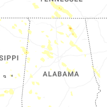
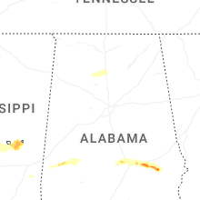

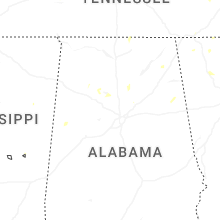
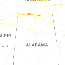
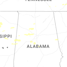
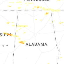

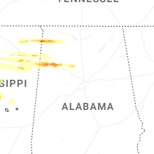
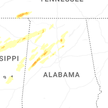
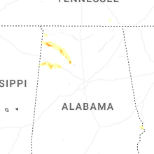


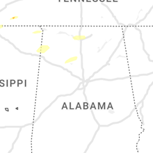


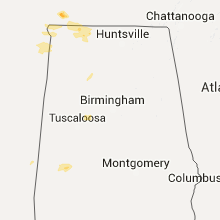


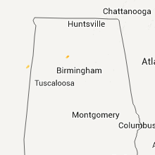
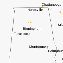


Connect with Interactive Hail Maps