

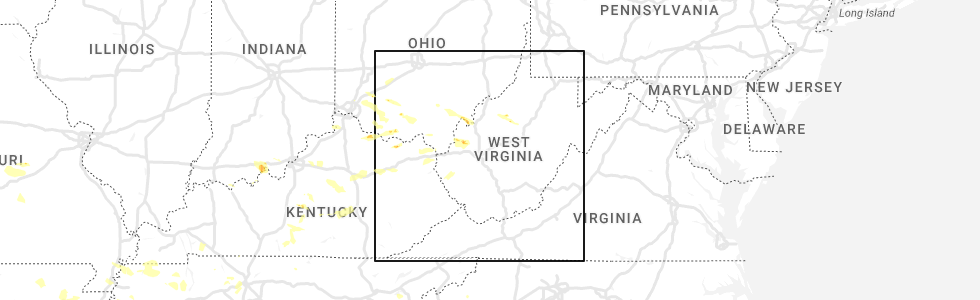
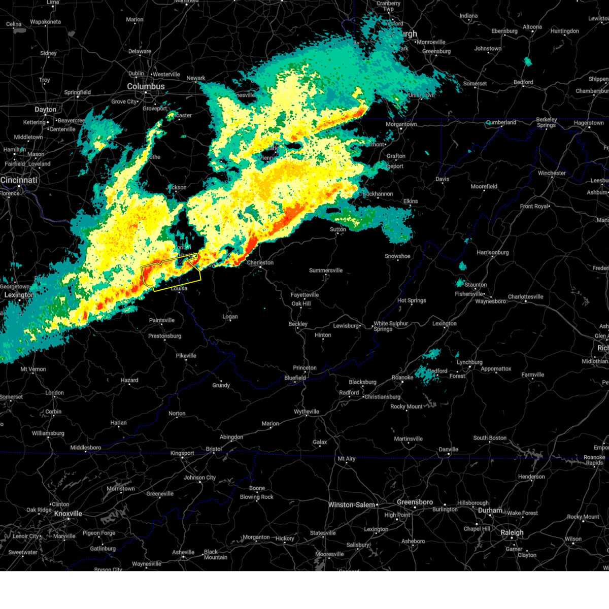
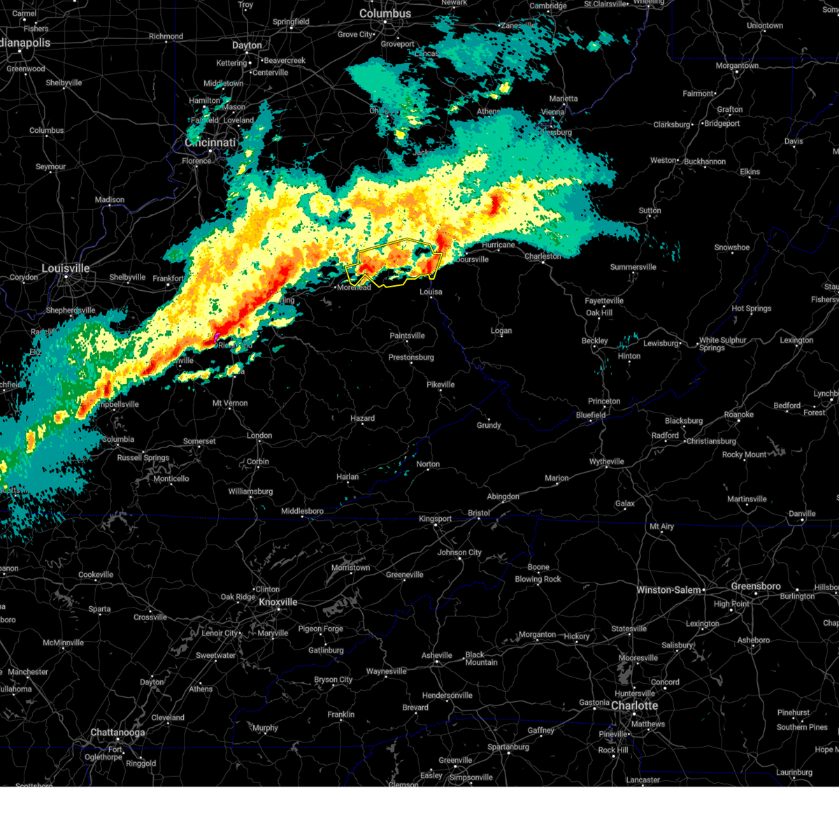
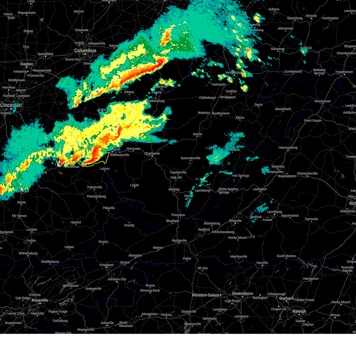
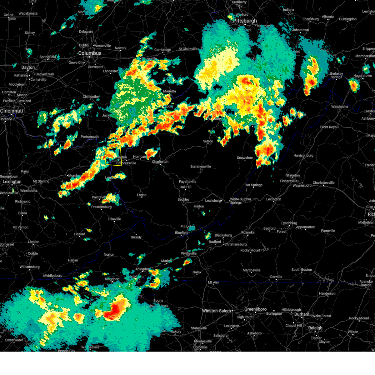
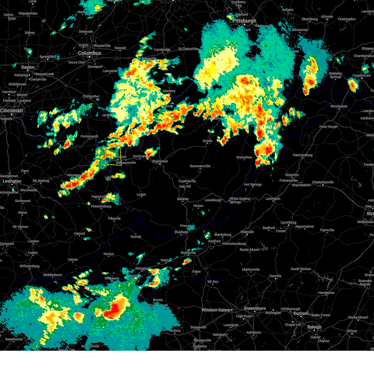
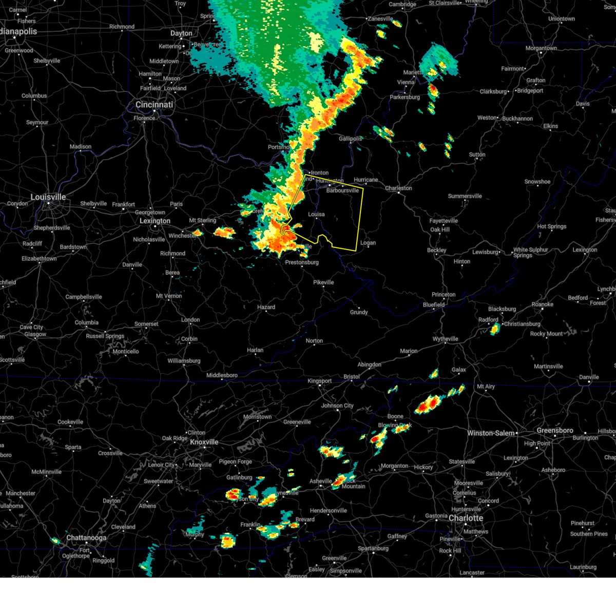
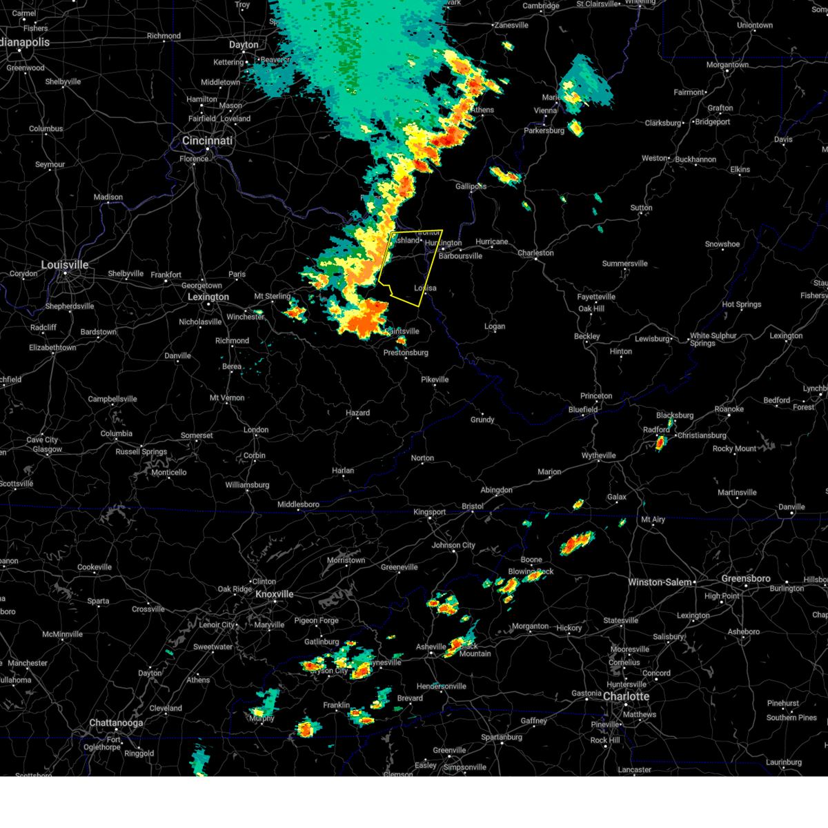
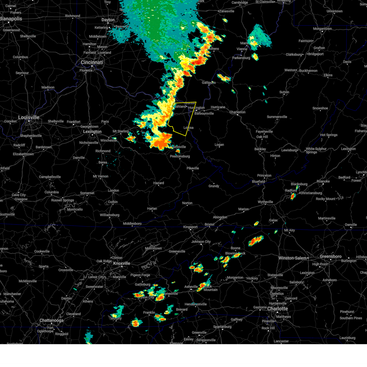
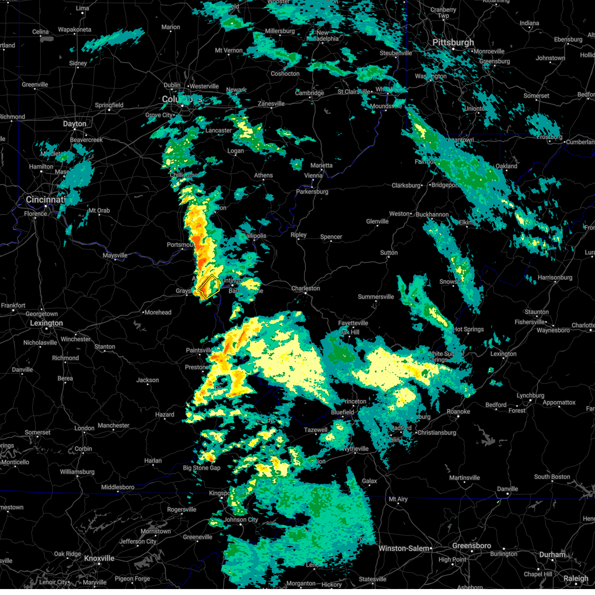
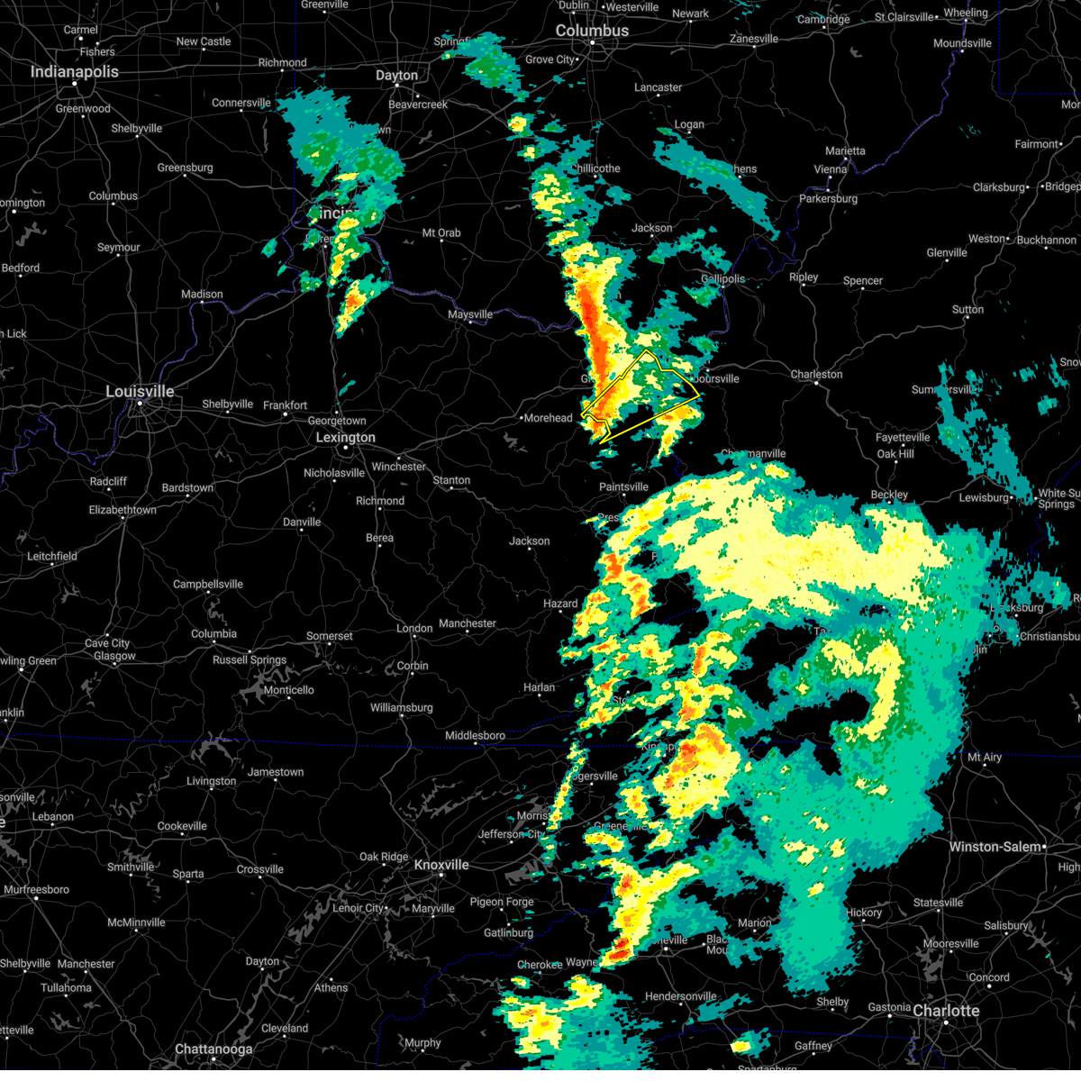
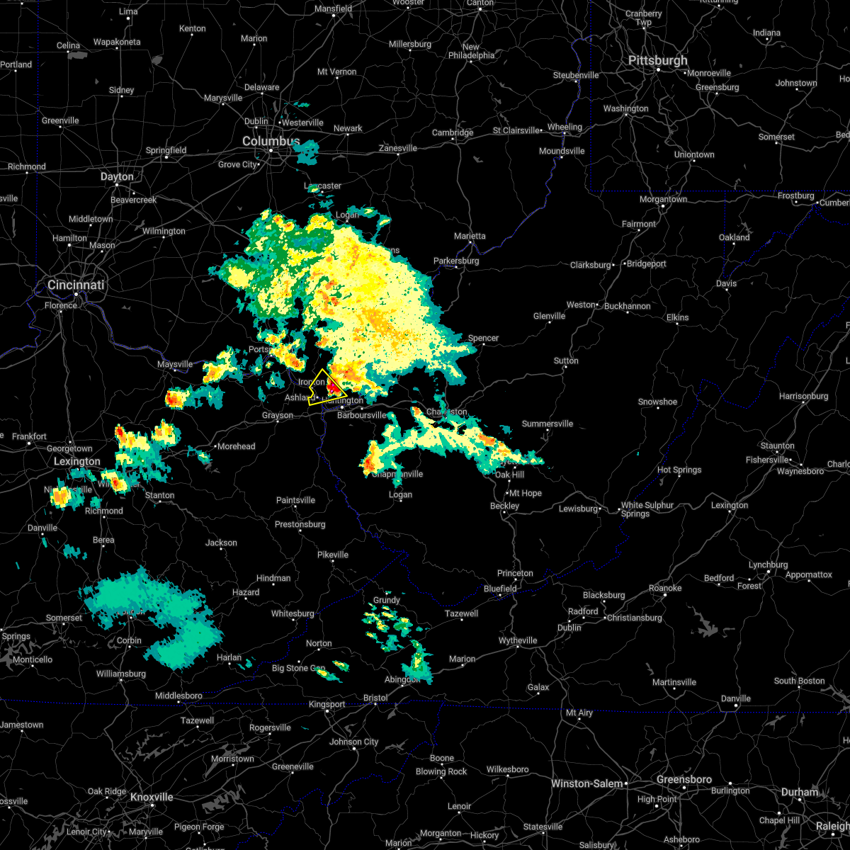
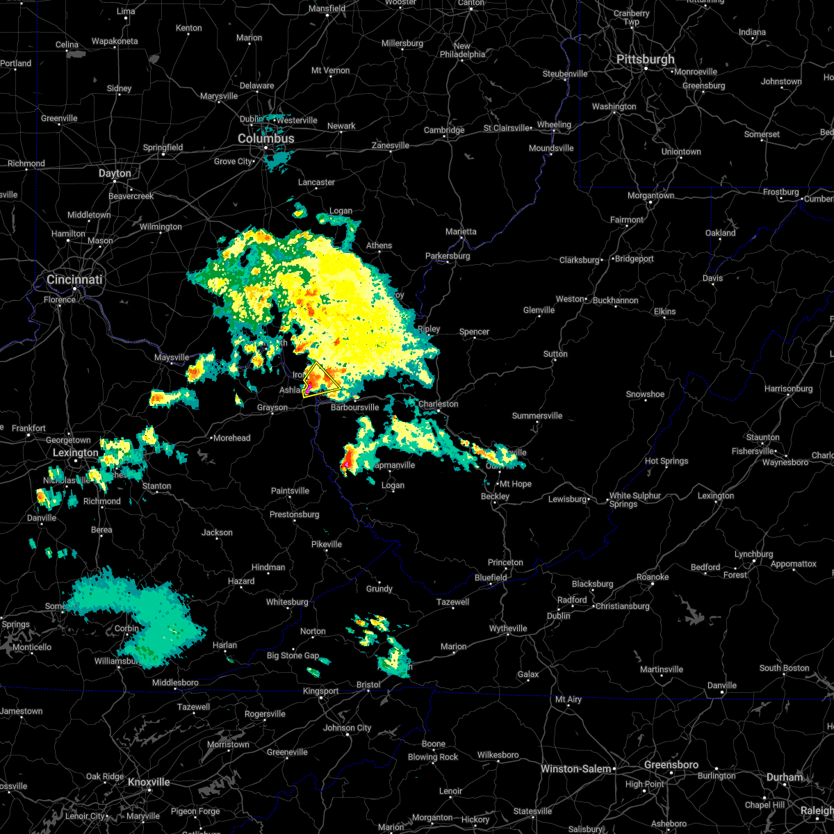
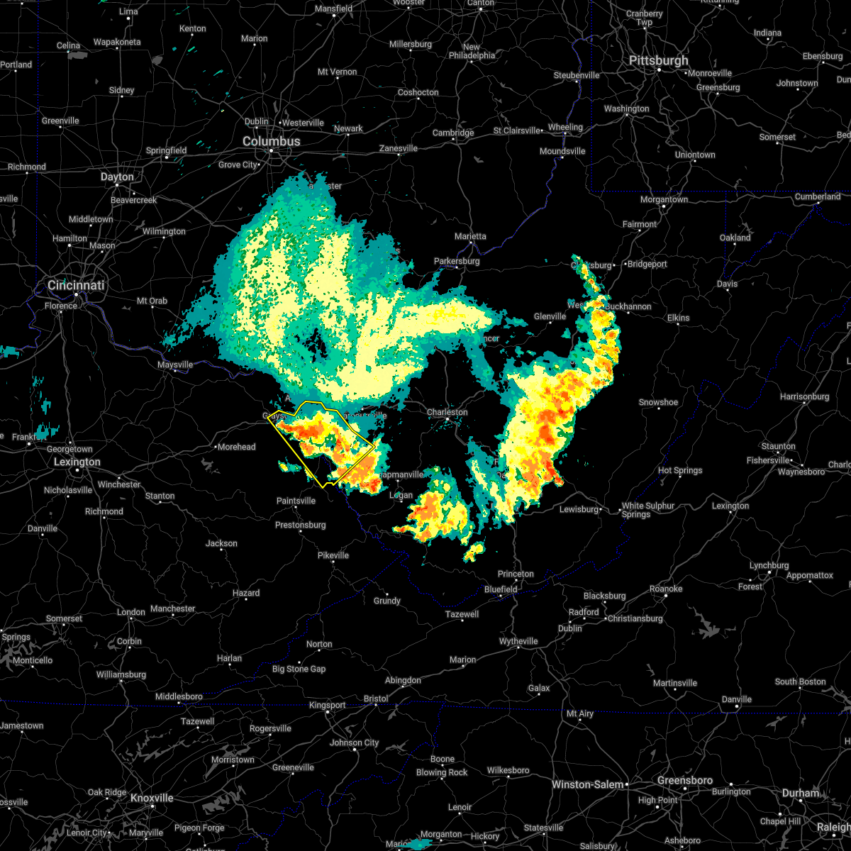
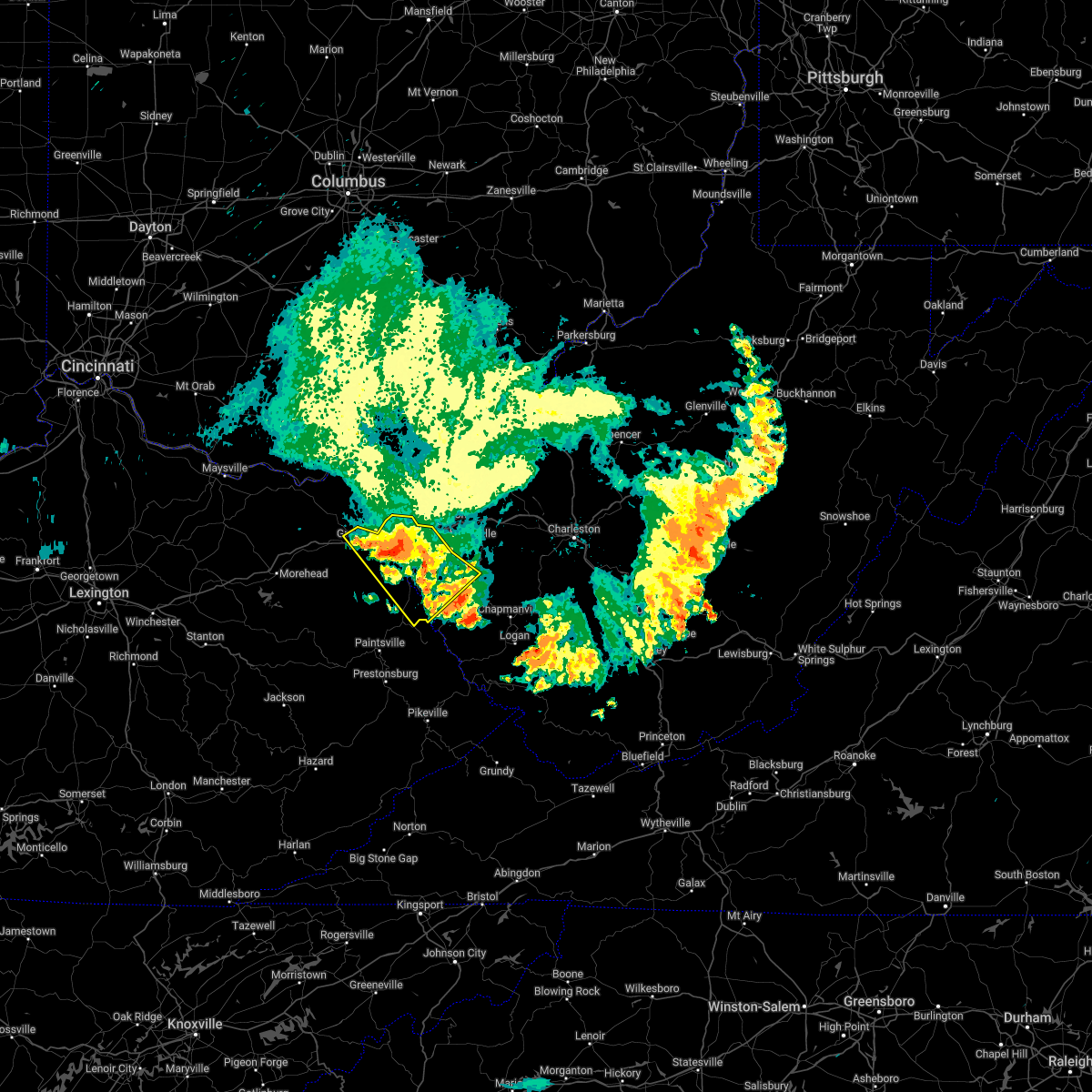
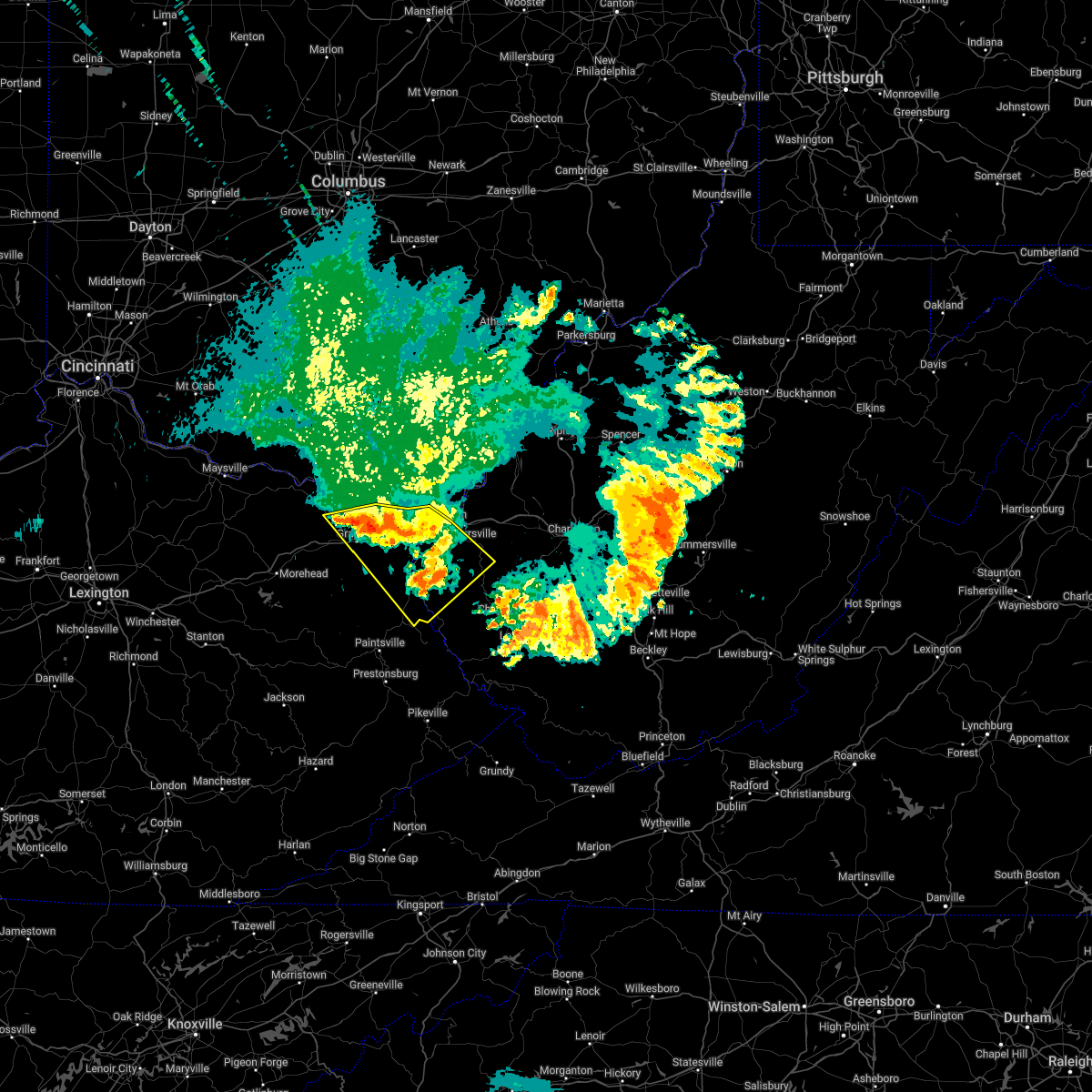
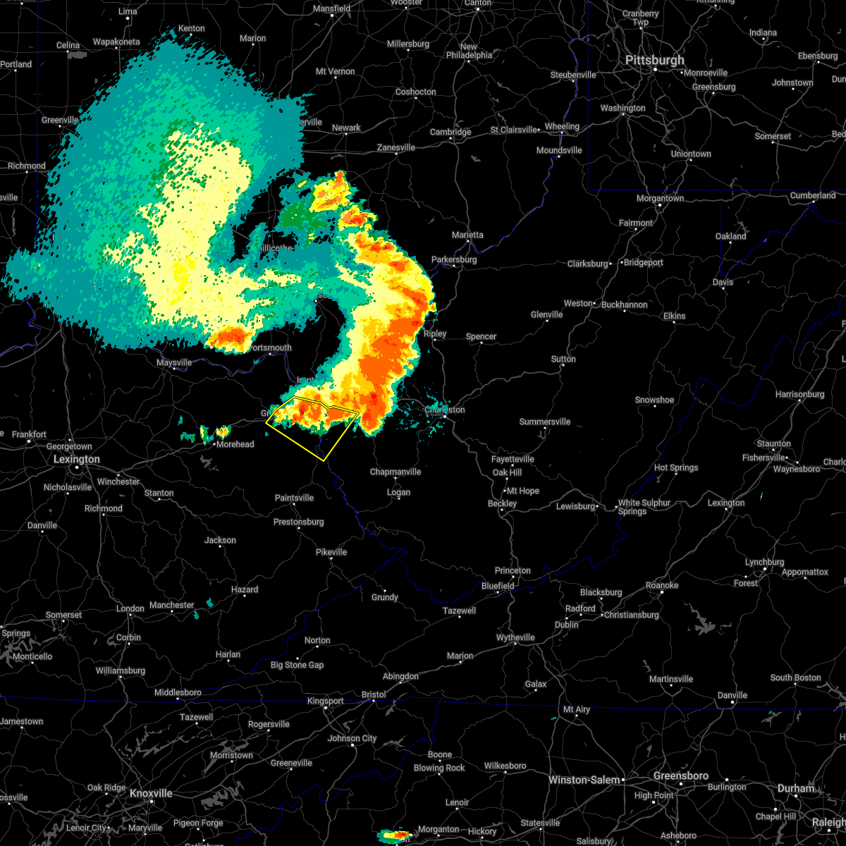
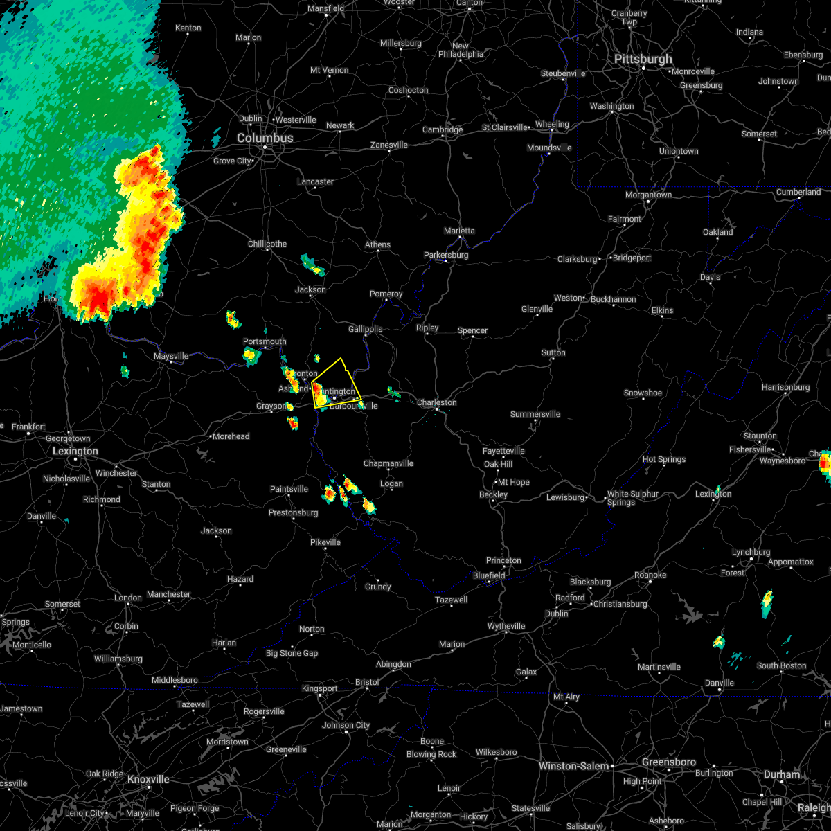
Hail Map for Ashland, KY
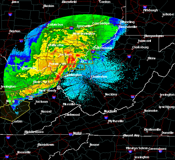
The Ashland, KY area has had 7 reports of on-the-ground hail by trained spotters, and has been under severe weather warnings 24 times during the past 12 months. Doppler radar has detected hail at or near Ashland, KY on 44 occasions, including 2 occasions during the past year.
| Name: | Ashland, KY |
| Where Located: | 54.8 miles W of Charleston, WV |
| Map: | Google Map for Ashland, KY |
| Population: | 21684 |
| Housing Units: | 10584 |
| More Info: | Search Google for Ashland, KY |
1
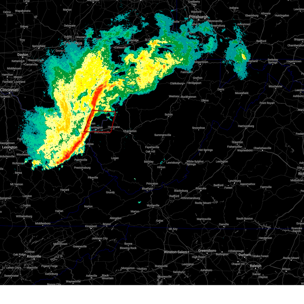
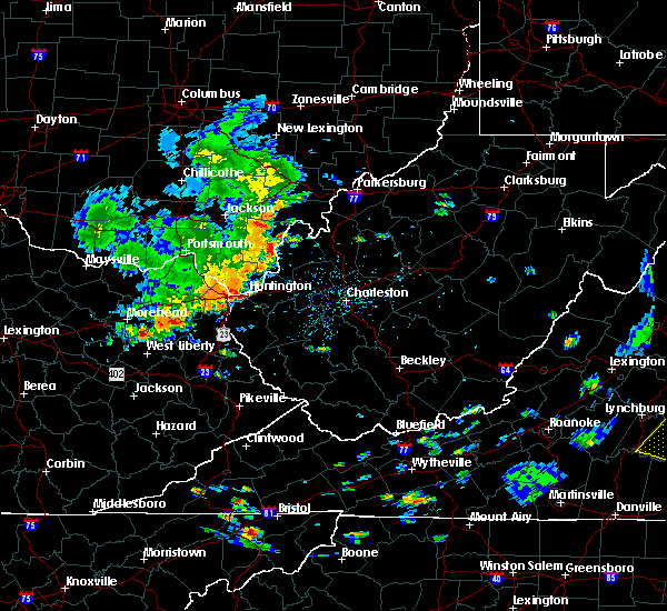
The Top Recent Hail Date for Ashland, KY is Tuesday, July 18, 2023 (8th out of 44)
Hail and Wind Damage Spotted near Ashland, KY
| Date / Time | Report Details |
|---|---|
| 4/2/2024 10:27 AM EDT |
 Torrlx the national weather service in charleston west virginia has issued a * tornado warning for, northeastern boyd county in northeastern kentucky, southern gallia county in southeastern ohio, lawrence county in southeastern ohio, southwestern mason county in western west virginia, cabell county in central west virginia, west central putnam county in western west virginia, north central wayne county in western west virginia, * until 1100 am edt. * at 1026 am edt, severe thunderstorms capable of producing both tornadoes and extensive straight line wind damage were located along a line extending from 9 miles northeast of lake vesuvius to near ashland, moving east at 55 mph (radar indicated rotation). Hazards include tornado. Flying debris will be dangerous to those caught without shelter. mobile homes will be damaged or destroyed. damage to roofs, windows, and vehicles will occur. tree damage is likely. these dangerous storms will be near, huntington, ashland, chesapeake, kenova, catlettsburg, and ceredo around 1030 am edt. proctorville around 1035 am edt. barboursville around 1040 am edt. ona around 1045 am edt. milton and culloden around 1050 am edt. Other locations impacted by these tornadic storms include pea ridge, burlington, athalia, crown city, south point, green bottom, scottown, waterloo, ashton, and aid. Torrlx the national weather service in charleston west virginia has issued a * tornado warning for, northeastern boyd county in northeastern kentucky, southern gallia county in southeastern ohio, lawrence county in southeastern ohio, southwestern mason county in western west virginia, cabell county in central west virginia, west central putnam county in western west virginia, north central wayne county in western west virginia, * until 1100 am edt. * at 1026 am edt, severe thunderstorms capable of producing both tornadoes and extensive straight line wind damage were located along a line extending from 9 miles northeast of lake vesuvius to near ashland, moving east at 55 mph (radar indicated rotation). Hazards include tornado. Flying debris will be dangerous to those caught without shelter. mobile homes will be damaged or destroyed. damage to roofs, windows, and vehicles will occur. tree damage is likely. these dangerous storms will be near, huntington, ashland, chesapeake, kenova, catlettsburg, and ceredo around 1030 am edt. proctorville around 1035 am edt. barboursville around 1040 am edt. ona around 1045 am edt. milton and culloden around 1050 am edt. Other locations impacted by these tornadic storms include pea ridge, burlington, athalia, crown city, south point, green bottom, scottown, waterloo, ashton, and aid.
|
| 4/2/2024 10:25 AM EDT | Trailer overturned and houses nearby destroye in boyd county KY, 3.3 miles E of Ashland, KY |
| 4/2/2024 10:25 AM EDT | Trees and power lines down on lowman dr and leighwood d in boyd county KY, 1.8 miles NNE of Ashland, KY |
| 4/2/2024 10:22 AM EDT |
 Svrrlx the national weather service in charleston west virginia has issued a * severe thunderstorm warning for, boyd county in northeastern kentucky, lawrence county in northeastern kentucky, southeastern carter county in northeastern kentucky, south central gallia county in southeastern ohio, southeastern lawrence county in southeastern ohio, southwestern mason county in western west virginia, cabell county in central west virginia, northwestern mingo county in southern west virginia, putnam county in western west virginia, western lincoln county in central west virginia, wayne county in western west virginia, * until 1100 am edt. * at 1021 am edt, severe thunderstorms were located along a line extending from near lake vesuvius to logville, moving east at 65 mph (radar indicated). Hazards include 60 mph wind gusts. expect damage to roofs, siding, and trees Svrrlx the national weather service in charleston west virginia has issued a * severe thunderstorm warning for, boyd county in northeastern kentucky, lawrence county in northeastern kentucky, southeastern carter county in northeastern kentucky, south central gallia county in southeastern ohio, southeastern lawrence county in southeastern ohio, southwestern mason county in western west virginia, cabell county in central west virginia, northwestern mingo county in southern west virginia, putnam county in western west virginia, western lincoln county in central west virginia, wayne county in western west virginia, * until 1100 am edt. * at 1021 am edt, severe thunderstorms were located along a line extending from near lake vesuvius to logville, moving east at 65 mph (radar indicated). Hazards include 60 mph wind gusts. expect damage to roofs, siding, and trees
|
| 4/2/2024 10:21 AM EDT | Wind gust measured on a davis weather station mounted on the roof of the boyd county eoc. several buildings in the industrial park also have garage doors blown in and h in boyd county KY, 7 miles NE of Ashland, KY |
| 4/2/2024 10:15 AM EDT |
 At 1014 am edt, severe thunderstorms were located along a line extending from near lake vesuvius to stark, moving east at 60 mph (radar indicated). Hazards include 60 mph wind gusts. Expect damage to roofs, siding, and trees. Locations impacted include, ashland, ironton, grayson, coal grove, cannonsburg, lake vesuvius, grayson lake state park, catlettsburg, greenup, princess, coalton, denton, greenbo lake, oldtown, naples, rush, flatwoods, south point, russell, and raceland. At 1014 am edt, severe thunderstorms were located along a line extending from near lake vesuvius to stark, moving east at 60 mph (radar indicated). Hazards include 60 mph wind gusts. Expect damage to roofs, siding, and trees. Locations impacted include, ashland, ironton, grayson, coal grove, cannonsburg, lake vesuvius, grayson lake state park, catlettsburg, greenup, princess, coalton, denton, greenbo lake, oldtown, naples, rush, flatwoods, south point, russell, and raceland.
|
| 4/2/2024 10:00 AM EDT |
 At 959 am edt, severe thunderstorms were located along a line extending from letitia to brandy, moving east at 60 mph (radar indicated). Hazards include 60 mph wind gusts. Expect damage to roofs, siding, and trees. Locations impacted include, ashland, ironton, grayson, coal grove, olive hill, cannonsburg, lake vesuvius, grayson lake state park, carter caves state park, catlettsburg, greenup, princess, coalton, denton, gesling, greenbo lake, oldtown, naples, rush, and load. At 959 am edt, severe thunderstorms were located along a line extending from letitia to brandy, moving east at 60 mph (radar indicated). Hazards include 60 mph wind gusts. Expect damage to roofs, siding, and trees. Locations impacted include, ashland, ironton, grayson, coal grove, olive hill, cannonsburg, lake vesuvius, grayson lake state park, carter caves state park, catlettsburg, greenup, princess, coalton, denton, gesling, greenbo lake, oldtown, naples, rush, and load.
|
| 4/2/2024 9:49 AM EDT |
 Svrrlx the national weather service in charleston west virginia has issued a * severe thunderstorm warning for, central boyd county in northeastern kentucky, greenup county in northeastern kentucky, carter county in northeastern kentucky, southern lawrence county in southeastern ohio, * until 1030 am edt. * at 949 am edt, severe thunderstorms were located along a line extending from near vanceburg to owingsville, moving east at 60 mph (radar indicated). Hazards include 60 mph wind gusts. expect damage to roofs, siding, and trees Svrrlx the national weather service in charleston west virginia has issued a * severe thunderstorm warning for, central boyd county in northeastern kentucky, greenup county in northeastern kentucky, carter county in northeastern kentucky, southern lawrence county in southeastern ohio, * until 1030 am edt. * at 949 am edt, severe thunderstorms were located along a line extending from near vanceburg to owingsville, moving east at 60 mph (radar indicated). Hazards include 60 mph wind gusts. expect damage to roofs, siding, and trees
|
| 2/28/2024 8:39 AM EST |
 The storm which prompted the warning has moved out of the area. therefore, the warning will be allowed to expire. however, gusty winds and heavy rain are still possible with this thunderstorm. a tornado watch remains in effect until 900 am est for northeastern kentucky. a tornado watch also remains in effect until 1000 am est for southeastern ohio, and central and western west virginia. The storm which prompted the warning has moved out of the area. therefore, the warning will be allowed to expire. however, gusty winds and heavy rain are still possible with this thunderstorm. a tornado watch remains in effect until 900 am est for northeastern kentucky. a tornado watch also remains in effect until 1000 am est for southeastern ohio, and central and western west virginia.
|
| 2/28/2024 8:27 AM EST |
 At 827 am est, a severe thunderstorm was located near ceredo, or 7 miles southwest of huntington, moving east at 60 mph (radar indicated). Hazards include 60 mph wind gusts and penny size hail. Expect damage to roofs, siding, and trees. Locations impacted include, huntington, wayne, chesapeake, proctorville, beech fork state park, cannonsburg, kenova, catlettsburg, ceredo, princess, durbin, coalton, burnaugh, centerville, rush, south point, burlington, lockwood, lavalette, and buchanan. At 827 am est, a severe thunderstorm was located near ceredo, or 7 miles southwest of huntington, moving east at 60 mph (radar indicated). Hazards include 60 mph wind gusts and penny size hail. Expect damage to roofs, siding, and trees. Locations impacted include, huntington, wayne, chesapeake, proctorville, beech fork state park, cannonsburg, kenova, catlettsburg, ceredo, princess, durbin, coalton, burnaugh, centerville, rush, south point, burlington, lockwood, lavalette, and buchanan.
|
| 2/28/2024 8:11 AM EST |
 Svrrlx the national weather service in charleston west virginia has issued a * severe thunderstorm warning for, boyd county in northeastern kentucky, northwestern lawrence county in northeastern kentucky, southeastern carter county in northeastern kentucky, south central lawrence county in southeastern ohio, northwestern wayne county in western west virginia, * until 845 am est. * at 809 am est, a severe thunderstorm was located over denton, or near grayson, moving east at 60 mph (radar indicated). Hazards include 60 mph wind gusts and penny size hail. expect damage to roofs, siding, and trees Svrrlx the national weather service in charleston west virginia has issued a * severe thunderstorm warning for, boyd county in northeastern kentucky, northwestern lawrence county in northeastern kentucky, southeastern carter county in northeastern kentucky, south central lawrence county in southeastern ohio, northwestern wayne county in western west virginia, * until 845 am est. * at 809 am est, a severe thunderstorm was located over denton, or near grayson, moving east at 60 mph (radar indicated). Hazards include 60 mph wind gusts and penny size hail. expect damage to roofs, siding, and trees
|
| 2/28/2024 7:24 AM EST |
 Svrrlx the national weather service in charleston west virginia has issued a * severe thunderstorm warning for, northeastern boyd county in northeastern kentucky, southeastern lawrence county in southeastern ohio, southwestern mason county in western west virginia, northern cabell county in central west virginia, northwestern putnam county in western west virginia, * until 800 am est. * at 724 am est, a severe thunderstorm was located near proctorville, moving east at 60 mph (radar indicated). Hazards include 60 mph wind gusts and penny size hail. expect damage to roofs, siding, and trees Svrrlx the national weather service in charleston west virginia has issued a * severe thunderstorm warning for, northeastern boyd county in northeastern kentucky, southeastern lawrence county in southeastern ohio, southwestern mason county in western west virginia, northern cabell county in central west virginia, northwestern putnam county in western west virginia, * until 800 am est. * at 724 am est, a severe thunderstorm was located near proctorville, moving east at 60 mph (radar indicated). Hazards include 60 mph wind gusts and penny size hail. expect damage to roofs, siding, and trees
|
| 2/28/2024 7:20 AM EST |
 At 720 am est, a severe thunderstorm was located over catlettsburg, or near ashland, moving east at 60 mph (radar indicated). Hazards include 60 mph wind gusts and penny size hail. Expect damage to roofs, siding, and trees. Locations impacted include, huntington, ashland, grayson, olive hill, cannonsburg, grayson lake state park, carter caves state park, kenova, catlettsburg, ceredo, princess, coalton, denton, burnaugh, gesling, oldtown, naples, rush, durbin, and carter. At 720 am est, a severe thunderstorm was located over catlettsburg, or near ashland, moving east at 60 mph (radar indicated). Hazards include 60 mph wind gusts and penny size hail. Expect damage to roofs, siding, and trees. Locations impacted include, huntington, ashland, grayson, olive hill, cannonsburg, grayson lake state park, carter caves state park, kenova, catlettsburg, ceredo, princess, coalton, denton, burnaugh, gesling, oldtown, naples, rush, durbin, and carter.
|
| 2/28/2024 7:15 AM EST | Storm damage reported in boyd county KY, 0.3 miles NNE of Ashland, KY |
| 2/28/2024 7:05 AM EST |
 Svrrlx the national weather service in charleston west virginia has issued a * severe thunderstorm warning for, boyd county in northeastern kentucky, southeastern greenup county in northeastern kentucky, carter county in northeastern kentucky, northwestern wayne county in western west virginia, * until 730 am est. * at 705 am est, a severe thunderstorm was located near grayson, moving east at 60 mph (radar indicated). Hazards include 60 mph wind gusts and penny size hail. expect damage to roofs, siding, and trees Svrrlx the national weather service in charleston west virginia has issued a * severe thunderstorm warning for, boyd county in northeastern kentucky, southeastern greenup county in northeastern kentucky, carter county in northeastern kentucky, northwestern wayne county in western west virginia, * until 730 am est. * at 705 am est, a severe thunderstorm was located near grayson, moving east at 60 mph (radar indicated). Hazards include 60 mph wind gusts and penny size hail. expect damage to roofs, siding, and trees
|
| 2/28/2024 3:50 AM EST |
 Svrrlx the national weather service in charleston west virginia has issued a * severe thunderstorm warning for, northeastern boyd county in northeastern kentucky, southeastern greenup county in northeastern kentucky, southern gallia county in southeastern ohio, lawrence county in southeastern ohio, southwestern mason county in western west virginia, northern cabell county in central west virginia, west central putnam county in western west virginia, northern wayne county in western west virginia, * until 415 am est. * at 349 am est, a severe thunderstorm was located over ashland, moving northeast at 70 mph (radar indicated). Hazards include 60 mph wind gusts. expect damage to roofs, siding, and trees Svrrlx the national weather service in charleston west virginia has issued a * severe thunderstorm warning for, northeastern boyd county in northeastern kentucky, southeastern greenup county in northeastern kentucky, southern gallia county in southeastern ohio, lawrence county in southeastern ohio, southwestern mason county in western west virginia, northern cabell county in central west virginia, west central putnam county in western west virginia, northern wayne county in western west virginia, * until 415 am est. * at 349 am est, a severe thunderstorm was located over ashland, moving northeast at 70 mph (radar indicated). Hazards include 60 mph wind gusts. expect damage to roofs, siding, and trees
|
| 8/7/2023 2:46 PM EDT |
 At 245 pm edt, a severe thunderstorm was located near coal grove, moving east at 50 mph (radar indicated). Hazards include 60 mph wind gusts and nickel size hail. expect damage to roofs, siding, and trees At 245 pm edt, a severe thunderstorm was located near coal grove, moving east at 50 mph (radar indicated). Hazards include 60 mph wind gusts and nickel size hail. expect damage to roofs, siding, and trees
|
| 7/28/2023 2:40 PM EDT | Trees and power lines down... the power is ou in greenup county KY, 3.3 miles ESE of Ashland, KY |
| 7/28/2023 2:16 PM EDT | Storm damage reported in boyd county KY, 7 miles NE of Ashland, KY |
| 7/28/2023 2:15 PM EDT | Corrects previous non-tstm wnd gst report from 2 wnw cannonsburg. mesonet station gw3636 ashlan in boyd county KY, 7 miles NE of Ashland, KY |
| 7/28/2023 2:06 PM EDT |
 At 206 pm edt, a severe thunderstorm was located near durbin, or near yatesville lake state park, moving southeast at 50 mph (radar indicated). Hazards include 60 mph wind gusts and nickel size hail. expect damage to roofs, siding, and trees At 206 pm edt, a severe thunderstorm was located near durbin, or near yatesville lake state park, moving southeast at 50 mph (radar indicated). Hazards include 60 mph wind gusts and nickel size hail. expect damage to roofs, siding, and trees
|
| 7/28/2023 2:04 PM EDT | Boyd county eo in boyd county KY, 7 miles NE of Ashland, KY |
| 7/28/2023 2:02 PM EDT |
 At 202 pm edt, a severe thunderstorm was located over rush, or near cannonsburg, moving east at 45 mph (radar indicated). Hazards include 60 mph wind gusts. Expect damage to roofs, siding, and trees. locations impacted include, huntington, ashland, ironton, grayson, louisa, coal grove, cannonsburg, yatesville lake state park, kenova, catlettsburg, ceredo, webbville, princess, coalton, denton, burnaugh, greenbo lake, oldtown, naples, and rush. hail threat, radar indicated max hail size, <. 75 in wind threat, radar indicated max wind gust, 60 mph. At 202 pm edt, a severe thunderstorm was located over rush, or near cannonsburg, moving east at 45 mph (radar indicated). Hazards include 60 mph wind gusts. Expect damage to roofs, siding, and trees. locations impacted include, huntington, ashland, ironton, grayson, louisa, coal grove, cannonsburg, yatesville lake state park, kenova, catlettsburg, ceredo, webbville, princess, coalton, denton, burnaugh, greenbo lake, oldtown, naples, and rush. hail threat, radar indicated max hail size, <. 75 in wind threat, radar indicated max wind gust, 60 mph.
|
| 7/28/2023 1:46 PM EDT |
 At 146 pm edt, a severe thunderstorm was located near grayson, moving southeast at 45 mph (radar indicated). Hazards include 60 mph wind gusts. expect damage to roofs, siding, and trees At 146 pm edt, a severe thunderstorm was located near grayson, moving southeast at 45 mph (radar indicated). Hazards include 60 mph wind gusts. expect damage to roofs, siding, and trees
|
| 7/18/2023 6:00 PM EDT | Multiple trees with power lines down. time estimated from rada in greenup county KY, 3.7 miles SE of Ashland, KY |
| 7/18/2023 5:52 PM EDT | Trees down. time estimated from rada in greenup county KY, 4 miles ESE of Ashland, KY |
| 3/3/2023 5:06 PM EST |
 The severe thunderstorm warning for central boyd county will expire at 515 pm est, the storm which prompted the warning has moved out of the area. therefore, the warning will be allowed to expire. however gusty winds are still possible this afternoon. a tornado watch remains in effect until 700 pm est for northeastern kentucky, southeastern ohio, and western west virginia. to report severe weather, contact your nearest law enforcement agency. they will relay your report to the national weather service charleston west virginia. The severe thunderstorm warning for central boyd county will expire at 515 pm est, the storm which prompted the warning has moved out of the area. therefore, the warning will be allowed to expire. however gusty winds are still possible this afternoon. a tornado watch remains in effect until 700 pm est for northeastern kentucky, southeastern ohio, and western west virginia. to report severe weather, contact your nearest law enforcement agency. they will relay your report to the national weather service charleston west virginia.
|
| 3/3/2023 4:59 PM EST |
 At 458 pm est, a severe thunderstorm was located over cannonsburg, moving northeast at 55 mph (radar indicated). Hazards include 60 mph wind gusts. Expect damage to roofs, siding, and trees. locations impacted include, ashland, ironton, coal grove, cannonsburg, kenova, catlettsburg, princess, coalton, russell, bellefonte, westwood, summit and mavity. hail threat, radar indicated max hail size, <. 75 in wind threat, radar indicated max wind gust, 60 mph. At 458 pm est, a severe thunderstorm was located over cannonsburg, moving northeast at 55 mph (radar indicated). Hazards include 60 mph wind gusts. Expect damage to roofs, siding, and trees. locations impacted include, ashland, ironton, coal grove, cannonsburg, kenova, catlettsburg, princess, coalton, russell, bellefonte, westwood, summit and mavity. hail threat, radar indicated max hail size, <. 75 in wind threat, radar indicated max wind gust, 60 mph.
|
| 3/3/2023 4:44 PM EST |
 At 444 pm est, a severe thunderstorm was located near webbville, or near grayson lake state park, moving northeast at 55 mph (radar indicated). Hazards include 60 mph wind gusts. expect damage to roofs, siding, and trees At 444 pm est, a severe thunderstorm was located near webbville, or near grayson lake state park, moving northeast at 55 mph (radar indicated). Hazards include 60 mph wind gusts. expect damage to roofs, siding, and trees
|
| 3/3/2023 4:25 PM EST |
 At 424 pm est, a severe thunderstorm was located near grayson, moving east at 60 mph (radar indicated). Hazards include 60 mph wind gusts. Expect damage to roofs, siding, and trees. locations impacted include, ashland, grayson, olive hill, blaine, cannonsburg, grayson lake state park, yatesville lake state park, carter caves state park, greenup, webbville, princess, coalton, denton, gesling, greenbo lake, oldtown, naples, martha, rush and load. hail threat, radar indicated max hail size, <. 75 in wind threat, radar indicated max wind gust, 60 mph. At 424 pm est, a severe thunderstorm was located near grayson, moving east at 60 mph (radar indicated). Hazards include 60 mph wind gusts. Expect damage to roofs, siding, and trees. locations impacted include, ashland, grayson, olive hill, blaine, cannonsburg, grayson lake state park, yatesville lake state park, carter caves state park, greenup, webbville, princess, coalton, denton, gesling, greenbo lake, oldtown, naples, martha, rush and load. hail threat, radar indicated max hail size, <. 75 in wind threat, radar indicated max wind gust, 60 mph.
|
| 3/3/2023 4:07 PM EST |
 At 406 pm est, a severe thunderstorm was located over grayson, moving east at 60 mph (radar indicated). Hazards include 60 mph wind gusts. expect damage to roofs, siding, and trees At 406 pm est, a severe thunderstorm was located over grayson, moving east at 60 mph (radar indicated). Hazards include 60 mph wind gusts. expect damage to roofs, siding, and trees
|
| 10/12/2022 5:22 PM EDT |
 The severe thunderstorm warning for northeastern boyd and southwestern lawrence counties will expire at 530 pm edt, the storm which prompted the warning has weakened below severe limits, and has exited the warned area. therefore, the warning will be allowed to expire. however gusty winds are still possible with this thunderstorm. The severe thunderstorm warning for northeastern boyd and southwestern lawrence counties will expire at 530 pm edt, the storm which prompted the warning has weakened below severe limits, and has exited the warned area. therefore, the warning will be allowed to expire. however gusty winds are still possible with this thunderstorm.
|
| 10/12/2022 5:10 PM EDT |
 At 510 pm edt, a severe thunderstorm was located over ironton, moving northeast at 30 mph (radar indicated). Hazards include 60 mph wind gusts and quarter size hail. Hail damage to vehicles is expected. expect wind damage to roofs, siding, and trees. Locations impacted include, ashland, ironton, coal grove, lake vesuvius and westwood. At 510 pm edt, a severe thunderstorm was located over ironton, moving northeast at 30 mph (radar indicated). Hazards include 60 mph wind gusts and quarter size hail. Hail damage to vehicles is expected. expect wind damage to roofs, siding, and trees. Locations impacted include, ashland, ironton, coal grove, lake vesuvius and westwood.
|
| 10/12/2022 5:00 PM EDT |
 At 500 pm edt, a severe thunderstorm was located over naples, or near cannonsburg, moving northeast at 30 mph (radar indicated). Hazards include 60 mph wind gusts and quarter size hail. Hail damage to vehicles is expected. Expect wind damage to roofs, siding, and trees. At 500 pm edt, a severe thunderstorm was located over naples, or near cannonsburg, moving northeast at 30 mph (radar indicated). Hazards include 60 mph wind gusts and quarter size hail. Hail damage to vehicles is expected. Expect wind damage to roofs, siding, and trees.
|
| 7/23/2022 3:10 PM EDT | Multiple trees down along county road in boyd county KY, 7.5 miles NE of Ashland, KY |
| 7/6/2022 5:29 PM EDT | Multiple trees and powerlines down at summit in boyd county KY, 3.7 miles ENE of Ashland, KY |
| 7/6/2022 5:15 PM EDT |
 At 514 pm edt, severe thunderstorms were located along a line extending from 6 miles northeast of oak hill to near lake vesuvius to naples, moving east at 50 mph (radar indicated). Hazards include 60 mph wind gusts. expect damage to roofs, siding, and trees At 514 pm edt, severe thunderstorms were located along a line extending from 6 miles northeast of oak hill to near lake vesuvius to naples, moving east at 50 mph (radar indicated). Hazards include 60 mph wind gusts. expect damage to roofs, siding, and trees
|
| 7/6/2022 5:07 PM EDT |
 At 506 pm edt, severe thunderstorms were located along a line extending from 7 miles north of clarktown to 6 miles southwest of letitia to goddard, and are nearly stationary (radar indicated). Hazards include 60 mph wind gusts and penny size hail. Expect damage to roofs, siding, and trees. locations impacted include, ashland, ironton, jackson, grayson, coal grove, olive hill, oak hill, rio grande, lake vesuvius, carter caves state park, grayson lake state park, greenup, coalton, gesling, greenbo lake, oldtown, naples, load, letitia and gallia. hail threat, radar indicated max hail size, 0. 75 in wind threat, radar indicated max wind gust, 60 mph. At 506 pm edt, severe thunderstorms were located along a line extending from 7 miles north of clarktown to 6 miles southwest of letitia to goddard, and are nearly stationary (radar indicated). Hazards include 60 mph wind gusts and penny size hail. Expect damage to roofs, siding, and trees. locations impacted include, ashland, ironton, jackson, grayson, coal grove, olive hill, oak hill, rio grande, lake vesuvius, carter caves state park, grayson lake state park, greenup, coalton, gesling, greenbo lake, oldtown, naples, load, letitia and gallia. hail threat, radar indicated max hail size, 0. 75 in wind threat, radar indicated max wind gust, 60 mph.
|
| 7/6/2022 4:48 PM EDT |
 At 446 pm edt, severe thunderstorms were located along a line extending from 7 miles north of clarktown to 6 miles southwest of letitia to goddard, moving southeast at 35 mph (radar indicated). Hazards include 60 mph wind gusts and penny size hail. expect damage to roofs, siding, and trees At 446 pm edt, severe thunderstorms were located along a line extending from 7 miles north of clarktown to 6 miles southwest of letitia to goddard, moving southeast at 35 mph (radar indicated). Hazards include 60 mph wind gusts and penny size hail. expect damage to roofs, siding, and trees
|
| 6/22/2022 6:52 PM EDT |
 At 652 pm edt, severe thunderstorms were located along a line extending from near clarktown to stoops, moving south at 45 mph (radar indicated). Hazards include 60 mph wind gusts. expect damage to roofs, siding, and trees At 652 pm edt, severe thunderstorms were located along a line extending from near clarktown to stoops, moving south at 45 mph (radar indicated). Hazards include 60 mph wind gusts. expect damage to roofs, siding, and trees
|
| 6/17/2022 1:51 PM EDT |
 At 151 pm edt, severe thunderstorms were located along a line extending from near south webster to near vanceburg, moving east at 50 mph (radar indicated). Hazards include 60 mph wind gusts. expect damage to roofs, siding, and trees At 151 pm edt, severe thunderstorms were located along a line extending from near south webster to near vanceburg, moving east at 50 mph (radar indicated). Hazards include 60 mph wind gusts. expect damage to roofs, siding, and trees
|
| 6/13/2022 10:23 PM EDT |
 The severe thunderstorm warning for boyd, central lawrence, southeastern carter, west central lincoln and wayne counties will expire at 1030 pm edt, the storm which prompted the warning has weakened below severe limits, and no longer poses an immediate threat to life or property. therefore, the warning will be allowed to expire. however gusty winds are still possible with this thunderstorm. a severe thunderstorm watch remains in effect until 100 am edt for northeastern kentucky, and central and western west virginia. The severe thunderstorm warning for boyd, central lawrence, southeastern carter, west central lincoln and wayne counties will expire at 1030 pm edt, the storm which prompted the warning has weakened below severe limits, and no longer poses an immediate threat to life or property. therefore, the warning will be allowed to expire. however gusty winds are still possible with this thunderstorm. a severe thunderstorm watch remains in effect until 100 am edt for northeastern kentucky, and central and western west virginia.
|
| 6/13/2022 10:15 PM EDT |
 At 1015 pm edt, a severe thunderstorm was located over centerville, or near wayne, moving southeast at 50 mph (radar indicated). Hazards include 60 mph wind gusts and penny size hail. Expect damage to roofs, siding, and trees. locations impacted include, huntington, ashland, grayson, louisa, wayne, beech fork state park, cannonsburg, yatesville lake state park, kenova, catlettsburg, ceredo, fort gay, princess, coalton, denton, burnaugh, rush, durbin, east lynn lake and centerville. hail threat, radar indicated max hail size, 0. 75 in wind threat, radar indicated max wind gust, 60 mph. At 1015 pm edt, a severe thunderstorm was located over centerville, or near wayne, moving southeast at 50 mph (radar indicated). Hazards include 60 mph wind gusts and penny size hail. Expect damage to roofs, siding, and trees. locations impacted include, huntington, ashland, grayson, louisa, wayne, beech fork state park, cannonsburg, yatesville lake state park, kenova, catlettsburg, ceredo, fort gay, princess, coalton, denton, burnaugh, rush, durbin, east lynn lake and centerville. hail threat, radar indicated max hail size, 0. 75 in wind threat, radar indicated max wind gust, 60 mph.
|
| 6/13/2022 9:55 PM EDT |
 At 954 pm edt, a severe thunderstorm was located over coalton, or near cannonsburg, moving southeast at 50 mph (radar indicated). Hazards include 60 mph wind gusts and penny size hail. expect damage to roofs, siding, and trees At 954 pm edt, a severe thunderstorm was located over coalton, or near cannonsburg, moving southeast at 50 mph (radar indicated). Hazards include 60 mph wind gusts and penny size hail. expect damage to roofs, siding, and trees
|
| 6/13/2022 9:36 PM EDT | Multiple trees down on cactus stree in boyd county KY, 0.3 miles NNE of Ashland, KY |
| 6/13/2022 9:36 PM EDT | Multiple trees down on cactus stree in boyd county KY, 0.3 miles NNE of Ashland, KY |
| 6/13/2022 9:09 PM EDT | Multiple trees down on cactus stree in boyd county KY, 0.3 miles NNE of Ashland, KY |
| 6/13/2022 9:09 PM EDT | Multiple trees down on cactus stree in boyd county KY, 0.3 miles NNE of Ashland, KY |
| 6/13/2022 8:51 PM EDT |
 At 850 pm edt, severe thunderstorms were located along a line extending from 8 miles northeast of rutland to near proctorville to near oldtown, moving east at 40 mph (radar indicated). Hazards include 70 mph wind gusts and quarter size hail. Hail damage to vehicles is expected. expect considerable tree damage. wind damage is also likely to mobile homes, roofs, and outbuildings. locations impacted include, huntington, ashland, ironton, point pleasant, gallipolis, ripley, winfield, coal grove, pomeroy, wayne, hamlin, chesapeake, racine, coolville, beech fork state park, cannonsburg, forked run state park, hurricane, barboursville and ravenswood. thunderstorm damage threat, considerable hail threat, radar indicated max hail size, 1. 00 in wind threat, radar indicated max wind gust, 70 mph. At 850 pm edt, severe thunderstorms were located along a line extending from 8 miles northeast of rutland to near proctorville to near oldtown, moving east at 40 mph (radar indicated). Hazards include 70 mph wind gusts and quarter size hail. Hail damage to vehicles is expected. expect considerable tree damage. wind damage is also likely to mobile homes, roofs, and outbuildings. locations impacted include, huntington, ashland, ironton, point pleasant, gallipolis, ripley, winfield, coal grove, pomeroy, wayne, hamlin, chesapeake, racine, coolville, beech fork state park, cannonsburg, forked run state park, hurricane, barboursville and ravenswood. thunderstorm damage threat, considerable hail threat, radar indicated max hail size, 1. 00 in wind threat, radar indicated max wind gust, 70 mph.
|
| 6/13/2022 8:42 PM EDT |
 At 842 pm edt, severe thunderstorms were located along a line extending from near naples to near grayson, moving east at 35 mph (radar indicated). Hazards include 60 mph wind gusts and penny size hail. Expect damage to roofs, siding, and trees. locations impacted include, huntington, ashland, grayson, louisa, wayne, beech fork state park, cannonsburg, yatesville lake state park, kenova, catlettsburg, ceredo, fort gay, princess, coalton, denton, burnaugh, naples, rush, durbin and centerville. hail threat, radar indicated max hail size, 0. 75 in wind threat, radar indicated max wind gust, 60 mph. At 842 pm edt, severe thunderstorms were located along a line extending from near naples to near grayson, moving east at 35 mph (radar indicated). Hazards include 60 mph wind gusts and penny size hail. Expect damage to roofs, siding, and trees. locations impacted include, huntington, ashland, grayson, louisa, wayne, beech fork state park, cannonsburg, yatesville lake state park, kenova, catlettsburg, ceredo, fort gay, princess, coalton, denton, burnaugh, naples, rush, durbin and centerville. hail threat, radar indicated max hail size, 0. 75 in wind threat, radar indicated max wind gust, 60 mph.
|
| 6/13/2022 8:25 PM EDT | Multiple trees down on cactus stree in boyd county KY, 0.3 miles NNE of Ashland, KY |
| 6/13/2022 8:09 PM EDT | Multiple trees down on cactus stree in boyd county KY, 0.3 miles NNE of Ashland, KY |
| 6/13/2022 6:36 PM EDT |
 At 636 pm edt, a severe thunderstorm was located near coal grove, moving northeast at 20 mph (radar indicated). Hazards include 60 mph wind gusts and quarter size hail. Hail damage to vehicles is expected. Expect wind damage to roofs, siding, and trees. At 636 pm edt, a severe thunderstorm was located near coal grove, moving northeast at 20 mph (radar indicated). Hazards include 60 mph wind gusts and quarter size hail. Hail damage to vehicles is expected. Expect wind damage to roofs, siding, and trees.
|
| 6/13/2021 4:54 PM EDT |
 At 453 pm edt, a severe thunderstorm was located near gesling, or 10 miles north of carter caves state park, moving southeast at 25 mph (radar indicated). Hazards include 60 mph wind gusts and quarter size hail. Hail damage to vehicles is expected. Expect wind damage to roofs, siding, and trees. At 453 pm edt, a severe thunderstorm was located near gesling, or 10 miles north of carter caves state park, moving southeast at 25 mph (radar indicated). Hazards include 60 mph wind gusts and quarter size hail. Hail damage to vehicles is expected. Expect wind damage to roofs, siding, and trees.
|
| 3/18/2021 2:14 PM EDT |
 At 214 pm edt, a severe thunderstorm was located over rush, or near cannonsburg, moving northeast at 40 mph (radar indicated). Hazards include 60 mph wind gusts and penny size hail. Expect damage to roofs, siding, and trees. Locations impacted include, ashland, ironton, grayson, coal grove, cannonsburg, kenova, catlettsburg, ceredo, princess, coalton, naples, rush, flatwoods, south point, russell, burlington, bellefonte, westwood, summit and mavity. At 214 pm edt, a severe thunderstorm was located over rush, or near cannonsburg, moving northeast at 40 mph (radar indicated). Hazards include 60 mph wind gusts and penny size hail. Expect damage to roofs, siding, and trees. Locations impacted include, ashland, ironton, grayson, coal grove, cannonsburg, kenova, catlettsburg, ceredo, princess, coalton, naples, rush, flatwoods, south point, russell, burlington, bellefonte, westwood, summit and mavity.
|
| 3/18/2021 2:00 PM EDT |
 At 200 pm edt, a severe thunderstorm was located over denton, or near grayson, moving northeast at 40 mph (radar indicated). Hazards include 60 mph wind gusts and quarter size hail. Hail damage to vehicles is expected. Expect wind damage to roofs, siding, and trees. At 200 pm edt, a severe thunderstorm was located over denton, or near grayson, moving northeast at 40 mph (radar indicated). Hazards include 60 mph wind gusts and quarter size hail. Hail damage to vehicles is expected. Expect wind damage to roofs, siding, and trees.
|
| 8/1/2020 3:58 PM EDT |
 At 358 pm edt, severe thunderstorms were located along a line extending from south shore to near greenup to near rush, moving northeast at 40 mph (radar indicated). Hazards include 60 mph wind gusts and penny size hail. expect damage to roofs, siding, and trees At 358 pm edt, severe thunderstorms were located along a line extending from south shore to near greenup to near rush, moving northeast at 40 mph (radar indicated). Hazards include 60 mph wind gusts and penny size hail. expect damage to roofs, siding, and trees
|
| 7/22/2020 4:58 PM EDT |
 At 458 pm edt, a severe thunderstorm was located over ceredo, or near chesapeake, moving east at 30 mph (radar indicated). Hazards include 60 mph wind gusts. expect damage to roofs, siding, and trees At 458 pm edt, a severe thunderstorm was located over ceredo, or near chesapeake, moving east at 30 mph (radar indicated). Hazards include 60 mph wind gusts. expect damage to roofs, siding, and trees
|
| 6/10/2020 8:58 PM EDT |
 The severe thunderstorm warning for northern boyd, southeastern greenup, east central carter, gallia, southeastern jackson, lawrence and northwestern cabell counties will expire at 900 pm edt, the storms which prompted the warning have weakened below severe limits, and no longer pose an immediate threat to life or property. therefore, the warning will be allowed to expire. however gusty winds are still possible with these thunderstorms. a severe thunderstorm watch remains in effect until 100 am edt for northeastern kentucky, southeastern ohio, and central and western west virginia. to report severe weather, contact your nearest law enforcement agency. they will relay your report to the national weather service charleston west virginia. remember, a tornado warning still remains in effect for gallia county until 9 15 pm edt. The severe thunderstorm warning for northern boyd, southeastern greenup, east central carter, gallia, southeastern jackson, lawrence and northwestern cabell counties will expire at 900 pm edt, the storms which prompted the warning have weakened below severe limits, and no longer pose an immediate threat to life or property. therefore, the warning will be allowed to expire. however gusty winds are still possible with these thunderstorms. a severe thunderstorm watch remains in effect until 100 am edt for northeastern kentucky, southeastern ohio, and central and western west virginia. to report severe weather, contact your nearest law enforcement agency. they will relay your report to the national weather service charleston west virginia. remember, a tornado warning still remains in effect for gallia county until 9 15 pm edt.
|
| 6/10/2020 8:24 PM EDT |
 At 824 pm edt, severe thunderstorms were located along a line extending from rio grande to near lake vesuvius to near oldtown, moving northeast at 40 mph (radar indicated). Hazards include 60 mph wind gusts and quarter size hail. Hail damage to vehicles is expected. expect wind damage to roofs, siding, and trees. Locations impacted include, huntington, ashland, ironton, grayson, gallipolis, coal grove, oak hill, rio grande, chesapeake, cannonsburg, lake vesuvius, kenova, catlettsburg, ceredo, princess, coalton, naples, gallia, flatwoods and south point. At 824 pm edt, severe thunderstorms were located along a line extending from rio grande to near lake vesuvius to near oldtown, moving northeast at 40 mph (radar indicated). Hazards include 60 mph wind gusts and quarter size hail. Hail damage to vehicles is expected. expect wind damage to roofs, siding, and trees. Locations impacted include, huntington, ashland, ironton, grayson, gallipolis, coal grove, oak hill, rio grande, chesapeake, cannonsburg, lake vesuvius, kenova, catlettsburg, ceredo, princess, coalton, naples, gallia, flatwoods and south point.
|
| 6/10/2020 7:59 PM EDT |
 At 758 pm edt, severe thunderstorms were located along a line extending from near south webster to near greenbo lake to near olive hill, moving northeast at 45 mph (radar indicated). Hazards include 70 mph wind gusts and half dollar size hail. Hail damage to vehicles is expected. expect considerable tree damage. Wind damage is also likely to mobile homes, roofs, and outbuildings. At 758 pm edt, severe thunderstorms were located along a line extending from near south webster to near greenbo lake to near olive hill, moving northeast at 45 mph (radar indicated). Hazards include 70 mph wind gusts and half dollar size hail. Hail damage to vehicles is expected. expect considerable tree damage. Wind damage is also likely to mobile homes, roofs, and outbuildings.
|
| 4/9/2020 12:39 AM EDT |
 At 1239 am edt, severe thunderstorms were located along a line extending from 10 miles east of lake vesuvius to barnrock, moving southeast at 65 mph (radar indicated). Hazards include 70 mph wind gusts and penny size hail. Expect considerable tree damage. damage is likely to mobile homes, roofs, and outbuildings. Locations impacted include, ashland, ironton, gallipolis, coal grove, cannonsburg, kenova, catlettsburg, princess, rush, south point, waterloo, aid, westwood, crown city, athalia, scottown, summit, gallopolis ferry and mavity. At 1239 am edt, severe thunderstorms were located along a line extending from 10 miles east of lake vesuvius to barnrock, moving southeast at 65 mph (radar indicated). Hazards include 70 mph wind gusts and penny size hail. Expect considerable tree damage. damage is likely to mobile homes, roofs, and outbuildings. Locations impacted include, ashland, ironton, gallipolis, coal grove, cannonsburg, kenova, catlettsburg, princess, rush, south point, waterloo, aid, westwood, crown city, athalia, scottown, summit, gallopolis ferry and mavity.
|
| 4/9/2020 12:29 AM EDT |
 At 1228 am edt, severe thunderstorms were located along a line extending from 8 miles south of oak hill to culver, moving southeast at 65 mph (radar indicated). Hazards include 70 mph wind gusts and penny size hail. Expect considerable tree damage. damage is likely to mobile homes, roofs, and outbuildings. Locations impacted include, ashland, ironton, grayson, gallipolis, coal grove, cannonsburg, lake vesuvius, kenova, catlettsburg, greenup, princess, coalton, denton, oldtown, naples, rush, flatwoods, south point, russell and vernon. At 1228 am edt, severe thunderstorms were located along a line extending from 8 miles south of oak hill to culver, moving southeast at 65 mph (radar indicated). Hazards include 70 mph wind gusts and penny size hail. Expect considerable tree damage. damage is likely to mobile homes, roofs, and outbuildings. Locations impacted include, ashland, ironton, grayson, gallipolis, coal grove, cannonsburg, lake vesuvius, kenova, catlettsburg, greenup, princess, coalton, denton, oldtown, naples, rush, flatwoods, south point, russell and vernon.
|
| 4/9/2020 12:12 AM EDT |
 At 1212 am edt, severe thunderstorms were located along a line extending from near jackson to near olive hill, moving east at 60 mph (radar indicated). Hazards include 70 mph wind gusts and penny size hail. Expect considerable tree damage. damage is likely to mobile homes, roofs, and outbuildings. Locations impacted include, ashland, ironton, jackson, wellston, grayson, gallipolis, coal grove, olive hill, cannonsburg, lake vesuvius, carter caves state park, kenova, catlettsburg, greenup, coalton, denton, gesling, greenbo lake, oldtown and load. At 1212 am edt, severe thunderstorms were located along a line extending from near jackson to near olive hill, moving east at 60 mph (radar indicated). Hazards include 70 mph wind gusts and penny size hail. Expect considerable tree damage. damage is likely to mobile homes, roofs, and outbuildings. Locations impacted include, ashland, ironton, jackson, wellston, grayson, gallipolis, coal grove, olive hill, cannonsburg, lake vesuvius, carter caves state park, kenova, catlettsburg, greenup, coalton, denton, gesling, greenbo lake, oldtown and load.
|
| 4/8/2020 11:52 PM EDT |
 At 1151 pm edt, severe thunderstorms were located along a line extending from 10 miles west of lucasville to 8 miles southwest of vanceburg to ewington, moving southeast at 65 mph (radar indicated). Hazards include 70 mph wind gusts and penny size hail. Expect considerable tree damage. Damage is likely to mobile homes, roofs, and outbuildings. At 1151 pm edt, severe thunderstorms were located along a line extending from 10 miles west of lucasville to 8 miles southwest of vanceburg to ewington, moving southeast at 65 mph (radar indicated). Hazards include 70 mph wind gusts and penny size hail. Expect considerable tree damage. Damage is likely to mobile homes, roofs, and outbuildings.
|
| 4/8/2020 2:01 PM EDT |
 At 159 pm edt, severe thunderstorms were located along a line extending from near greenup to 9 miles north of proctorville, moving southeast at 30 mph (radar indicated). Hazards include 60 mph wind gusts and quarter size hail. Hail damage to vehicles is expected. Expect wind damage to roofs, siding, and trees. At 159 pm edt, severe thunderstorms were located along a line extending from near greenup to 9 miles north of proctorville, moving southeast at 30 mph (radar indicated). Hazards include 60 mph wind gusts and quarter size hail. Hail damage to vehicles is expected. Expect wind damage to roofs, siding, and trees.
|
| 1/11/2020 3:14 PM EST | Tree blown down onto woodland ave in boyd county KY, 0.3 miles NNE of Ashland, KY |
| 1/11/2020 3:13 PM EST | Tree down on louise drive in boyd county KY, 5.4 miles NE of Ashland, KY |
| 1/11/2020 2:55 PM EST |
 At 255 pm est, severe thunderstorms were located along a line extending from new boston to grayson, moving east at 55 mph (radar indicated). Hazards include 60 mph wind gusts. Expect damage to roofs, siding, and trees. Locations impacted include, ashland, ironton, grayson, coal grove, oak hill, cannonsburg, lake vesuvius, grayson lake state park, greenup, princess, coalton, denton, greenbo lake, oldtown, naples, rush, load, letitia, flatwoods and russell. At 255 pm est, severe thunderstorms were located along a line extending from new boston to grayson, moving east at 55 mph (radar indicated). Hazards include 60 mph wind gusts. Expect damage to roofs, siding, and trees. Locations impacted include, ashland, ironton, grayson, coal grove, oak hill, cannonsburg, lake vesuvius, grayson lake state park, greenup, princess, coalton, denton, greenbo lake, oldtown, naples, rush, load, letitia, flatwoods and russell.
|
| 1/11/2020 2:43 PM EST |
 At 243 pm est, severe thunderstorms were located along a line extending from near letitia to near olive hill, moving east at 50 mph (radar indicated). Hazards include 60 mph wind gusts. expect damage to roofs, siding, and trees At 243 pm est, severe thunderstorms were located along a line extending from near letitia to near olive hill, moving east at 50 mph (radar indicated). Hazards include 60 mph wind gusts. expect damage to roofs, siding, and trees
|
| 6/16/2019 8:22 PM EDT | Tree down on powerlines... smashed unoccupied car in boyd county KY, 0.3 miles NNE of Ashland, KY |
| 6/16/2019 8:22 PM EDT |
 At 822 pm edt, severe thunderstorms were located along a line extending from near franklin furnace to near cannonsburg to near martha, moving east at 30 mph (radar indicated). Hazards include 60 mph wind gusts and quarter size hail. Hail damage to vehicles is expected. expect wind damage to roofs, siding, and trees. Locations impacted include, huntington, ashland, ironton, grayson, louisa, coal grove, wayne, chesapeake, proctorville, blaine, beech fork state park, cannonsburg, lake vesuvius, yatesville lake state park, barboursville, kenova, catlettsburg, ceredo, fort gay and coalton. At 822 pm edt, severe thunderstorms were located along a line extending from near franklin furnace to near cannonsburg to near martha, moving east at 30 mph (radar indicated). Hazards include 60 mph wind gusts and quarter size hail. Hail damage to vehicles is expected. expect wind damage to roofs, siding, and trees. Locations impacted include, huntington, ashland, ironton, grayson, louisa, coal grove, wayne, chesapeake, proctorville, blaine, beech fork state park, cannonsburg, lake vesuvius, yatesville lake state park, barboursville, kenova, catlettsburg, ceredo, fort gay and coalton.
|
| 6/16/2019 8:20 PM EDT | Large tree across road in 200 block of mccowan rd in boyd county KY, 2.5 miles ESE of Ashland, KY |
| 6/16/2019 7:59 PM EDT |
 At 759 pm edt, severe thunderstorms were located along a line extending from near letitia to near grayson to near little sandy, moving east at 30 mph (radar indicated). Hazards include 60 mph wind gusts and quarter size hail. Hail damage to vehicles is expected. Expect wind damage to roofs, siding, and trees. At 759 pm edt, severe thunderstorms were located along a line extending from near letitia to near grayson to near little sandy, moving east at 30 mph (radar indicated). Hazards include 60 mph wind gusts and quarter size hail. Hail damage to vehicles is expected. Expect wind damage to roofs, siding, and trees.
|
| 6/16/2019 1:40 PM EDT |
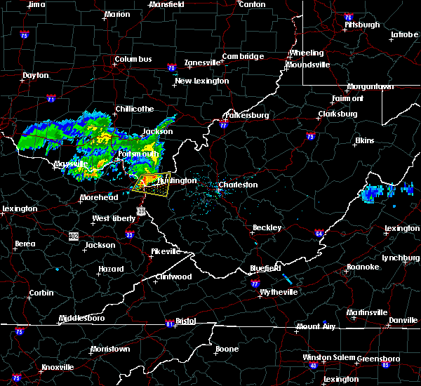 At 126 pm edt, a severe thunderstorm was located over naples, or near ironton, moving east at 40 mph (radar indicated). Hazards include 60 mph wind gusts and nickel size hail. expect damage to roofs, siding, and trees At 126 pm edt, a severe thunderstorm was located over naples, or near ironton, moving east at 40 mph (radar indicated). Hazards include 60 mph wind gusts and nickel size hail. expect damage to roofs, siding, and trees
|
| 6/16/2019 1:40 PM EDT |
 At 140 pm edt, a severe thunderstorm was located near ashland, moving east at 40 mph (radar indicated). Hazards include 60 mph wind gusts and penny size hail. Expect damage to roofs, siding, and trees. Locations impacted include, huntington, ashland, coal grove, chesapeake, proctorville, beech fork state park, cannonsburg, barboursville, kenova, catlettsburg, ceredo, south point, burlington, athalia, lavalette, scottown, pea ridge, green bottom and mavity. At 140 pm edt, a severe thunderstorm was located near ashland, moving east at 40 mph (radar indicated). Hazards include 60 mph wind gusts and penny size hail. Expect damage to roofs, siding, and trees. Locations impacted include, huntington, ashland, coal grove, chesapeake, proctorville, beech fork state park, cannonsburg, barboursville, kenova, catlettsburg, ceredo, south point, burlington, athalia, lavalette, scottown, pea ridge, green bottom and mavity.
|
| 6/16/2019 1:40 PM EDT |
 A severe thunderstorm warning remains in effect until 200 pm edt for northeastern boyd. southeastern lawrence. western cabell and northern wayne counties. at 140 pm edt, a severe thunderstorm was located near ashland, moving east at 40 mph. hazard. 60 mph wind gusts and penny size hail. A severe thunderstorm warning remains in effect until 200 pm edt for northeastern boyd. southeastern lawrence. western cabell and northern wayne counties. at 140 pm edt, a severe thunderstorm was located near ashland, moving east at 40 mph. hazard. 60 mph wind gusts and penny size hail.
|
| 6/16/2019 1:27 PM EDT |
 At 126 pm edt, a severe thunderstorm was located over naples, or near ironton, moving east at 40 mph (radar indicated). Hazards include 60 mph wind gusts and nickel size hail. expect damage to roofs, siding, and trees At 126 pm edt, a severe thunderstorm was located over naples, or near ironton, moving east at 40 mph (radar indicated). Hazards include 60 mph wind gusts and nickel size hail. expect damage to roofs, siding, and trees
|
| 6/2/2019 1:43 PM EDT |
 At 126 pm edt, a severe thunderstorm was located over ironton, moving southeast at 25 mph (radar indicated). Hazards include 65 mph wind gusts and half dollar size hail. Hail damage to vehicles is expected. Expect wind damage to roofs, siding, and trees. At 126 pm edt, a severe thunderstorm was located over ironton, moving southeast at 25 mph (radar indicated). Hazards include 65 mph wind gusts and half dollar size hail. Hail damage to vehicles is expected. Expect wind damage to roofs, siding, and trees.
|
| 6/2/2019 1:43 PM EDT |
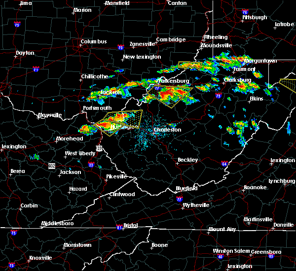 At 143 pm edt, a severe thunderstorm was located near coal grove, moving southeast at 25 mph (radar indicated). Hazards include ping pong ball size hail and 60 mph wind gusts. People and animals outdoors will be injured. expect hail damage to roofs, siding, windows, and vehicles. expect wind damage to roofs, siding, and trees. Locations impacted include, huntington, ashland, ironton, coal grove, chesapeake, proctorville, barboursville, kenova, catlettsburg, ceredo, flatwoods, south point, russell, burlington, bellefonte, westwood, athalia, lavalette, scottown and pea ridge. At 143 pm edt, a severe thunderstorm was located near coal grove, moving southeast at 25 mph (radar indicated). Hazards include ping pong ball size hail and 60 mph wind gusts. People and animals outdoors will be injured. expect hail damage to roofs, siding, windows, and vehicles. expect wind damage to roofs, siding, and trees. Locations impacted include, huntington, ashland, ironton, coal grove, chesapeake, proctorville, barboursville, kenova, catlettsburg, ceredo, flatwoods, south point, russell, burlington, bellefonte, westwood, athalia, lavalette, scottown and pea ridge.
|
| 6/2/2019 1:26 PM EDT |
 At 126 pm edt, a severe thunderstorm was located over ironton, moving southeast at 25 mph (radar indicated). Hazards include 65 mph wind gusts and half dollar size hail. Hail damage to vehicles is expected. Expect wind damage to roofs, siding, and trees. At 126 pm edt, a severe thunderstorm was located over ironton, moving southeast at 25 mph (radar indicated). Hazards include 65 mph wind gusts and half dollar size hail. Hail damage to vehicles is expected. Expect wind damage to roofs, siding, and trees.
|
| 5/17/2019 7:13 PM EDT |
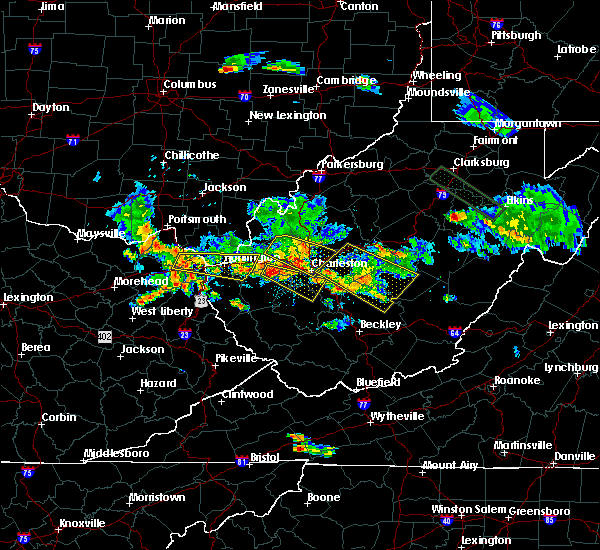 At 713 pm edt, a severe thunderstorm was located over naples, or near cannonsburg, moving east at 45 mph (radar indicated). Hazards include 60 mph wind gusts and penny size hail. expect damage to roofs, siding, and trees At 713 pm edt, a severe thunderstorm was located over naples, or near cannonsburg, moving east at 45 mph (radar indicated). Hazards include 60 mph wind gusts and penny size hail. expect damage to roofs, siding, and trees
|
| 4/14/2019 5:53 PM EDT |
 The severe thunderstorm warning for boyd, north central lawrence, east central carter and northwestern wayne counties will expire at 600 pm edt, the storm which prompted the warning has moved out of the area. therefore, the warning will be allowed to expire. a tornado watch remains in effect until 900 pm edt for northeastern kentucky, southeastern ohio, and western west virginia. The severe thunderstorm warning for boyd, north central lawrence, east central carter and northwestern wayne counties will expire at 600 pm edt, the storm which prompted the warning has moved out of the area. therefore, the warning will be allowed to expire. a tornado watch remains in effect until 900 pm edt for northeastern kentucky, southeastern ohio, and western west virginia.
|
| 4/14/2019 5:53 PM EDT |
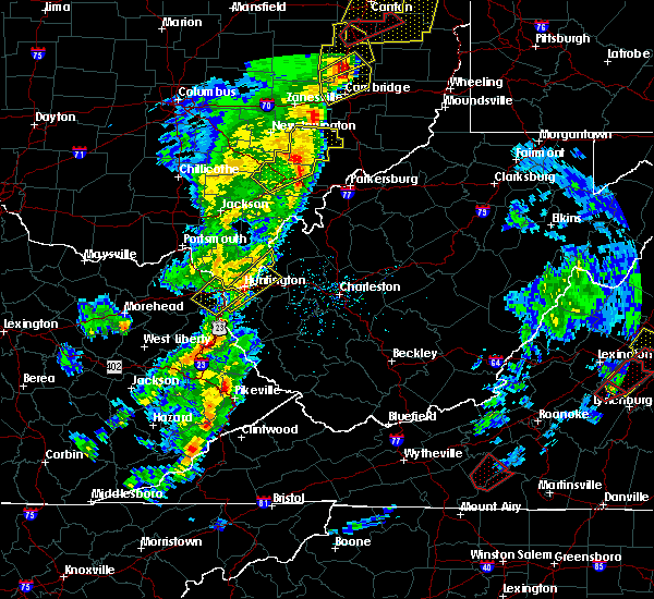 The severe thunderstorm warning for boyd, north central lawrence, east central carter and northwestern wayne counties will expire at 600 pm edt, the storm which prompted the warning has moved out of the area. therefore, the warning will be allowed to expire. a tornado watch remains in effect until 900 pm edt for northeastern kentucky, southeastern ohio, and western west virginia. The severe thunderstorm warning for boyd, north central lawrence, east central carter and northwestern wayne counties will expire at 600 pm edt, the storm which prompted the warning has moved out of the area. therefore, the warning will be allowed to expire. a tornado watch remains in effect until 900 pm edt for northeastern kentucky, southeastern ohio, and western west virginia.
|
| 4/14/2019 5:40 PM EDT |
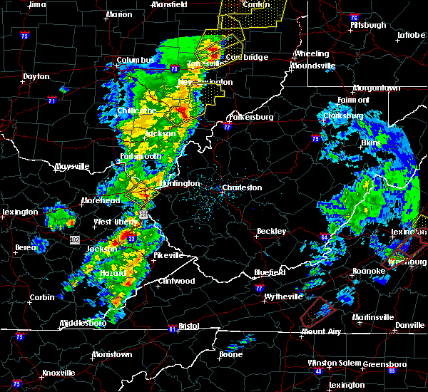 At 539 pm edt, a severe thunderstorm was located over durbin, or 7 miles south of cannonsburg, moving northeast at 60 mph (radar indicated). Hazards include 60 mph wind gusts and penny size hail. Expect damage to roofs, siding, and trees. Locations impacted include, huntington, ashland, coal grove, cannonsburg, kenova, catlettsburg, ceredo, princess, durbin, coalton, burnaugh, rush, burlington, westwood, lockwood, summit, buchanan and mavity. At 539 pm edt, a severe thunderstorm was located over durbin, or 7 miles south of cannonsburg, moving northeast at 60 mph (radar indicated). Hazards include 60 mph wind gusts and penny size hail. Expect damage to roofs, siding, and trees. Locations impacted include, huntington, ashland, coal grove, cannonsburg, kenova, catlettsburg, ceredo, princess, durbin, coalton, burnaugh, rush, burlington, westwood, lockwood, summit, buchanan and mavity.
|
| 4/14/2019 5:24 PM EDT |
 At 523 pm edt, a severe thunderstorm was located over webbville, or 8 miles southeast of grayson lake state park, moving northeast at 60 mph (radar indicated). Hazards include 60 mph wind gusts and penny size hail. expect damage to roofs, siding, and trees At 523 pm edt, a severe thunderstorm was located over webbville, or 8 miles southeast of grayson lake state park, moving northeast at 60 mph (radar indicated). Hazards include 60 mph wind gusts and penny size hail. expect damage to roofs, siding, and trees
|
| 10/20/2018 9:10 PM EDT | Tree down blocking the roadway on oakview ave due to high win in boyd county KY, 0.4 miles S of Ashland, KY |
| 9/2/2018 4:08 PM EDT |
 At 408 pm edt, a severe thunderstorm was located over naples, or near cannonsburg, and is nearly stationary (radar indicated). Hazards include 60 mph wind gusts and quarter size hail. Minor hail damage to vehicles is possible. Expect wind damage to trees and power lines, resulting in some power outages. At 408 pm edt, a severe thunderstorm was located over naples, or near cannonsburg, and is nearly stationary (radar indicated). Hazards include 60 mph wind gusts and quarter size hail. Minor hail damage to vehicles is possible. Expect wind damage to trees and power lines, resulting in some power outages.
|
| 7/20/2018 5:45 PM EDT | Multiple trees and wires reported down in boyd county as indicated on local morning news in boyd county KY, 9.6 miles NE of Ashland, KY |
| 5/31/2018 6:00 PM EDT | A large tree was uprooted and fell on top of a hous in boyd county KY, 0.3 miles NNE of Ashland, KY |
| 5/10/2018 2:10 PM EDT | Em reported two trees down. 1 one on shucks creek road and the other in central park in ashland. pea-sized hail was also reported in the cel in boyd county KY, 0.4 miles S of Ashland, KY |
| 1/23/2018 12:09 AM EST |
 The severe thunderstorm warning for northeastern boyd, south central gallia, southeastern lawrence and northwestern wayne counties will expire at 1215 am est, the storms which prompted the warning have weakened below severe limits, and no longer pose an immediate threat to life or property. therefore the warning will be allowed to expire. however small hail and gusty winds are still possible with these thunderstorms. to report severe weather, contact your nearest law enforcement agency. they will relay your report to the national weather service charleston west virginia. The severe thunderstorm warning for northeastern boyd, south central gallia, southeastern lawrence and northwestern wayne counties will expire at 1215 am est, the storms which prompted the warning have weakened below severe limits, and no longer pose an immediate threat to life or property. therefore the warning will be allowed to expire. however small hail and gusty winds are still possible with these thunderstorms. to report severe weather, contact your nearest law enforcement agency. they will relay your report to the national weather service charleston west virginia.
|
| 1/23/2018 12:00 AM EST |
 At 1159 pm est, severe thunderstorms were located along a line extending from lake vesuvius to near coal grove to catlettsburg, moving northeast at 65 mph (radar indicated). Hazards include 60 mph wind gusts and quarter size hail. Hail damage to vehicles is expected. expect wind damage to roofs, siding, and trees. locations impacted include, huntington, ashland, ironton, coal grove, chesapeake, lake vesuvius, kenova, catlettsburg, ceredo, south point, burlington, aid and scottown. this includes the following highways, interstate 64 in kentucky between mile markers 188 and 191. Interstate 64 in west virginia between mile markers 1 and 6. At 1159 pm est, severe thunderstorms were located along a line extending from lake vesuvius to near coal grove to catlettsburg, moving northeast at 65 mph (radar indicated). Hazards include 60 mph wind gusts and quarter size hail. Hail damage to vehicles is expected. expect wind damage to roofs, siding, and trees. locations impacted include, huntington, ashland, ironton, coal grove, chesapeake, lake vesuvius, kenova, catlettsburg, ceredo, south point, burlington, aid and scottown. this includes the following highways, interstate 64 in kentucky between mile markers 188 and 191. Interstate 64 in west virginia between mile markers 1 and 6.
|
| 1/22/2018 11:53 PM EST | Tree limb down on valley view drive... time estimated from radar in boyd county KY, 1.7 miles NNW of Ashland, KY |
| 1/22/2018 11:49 PM EST |
 At 1149 pm est, severe thunderstorms were located along a line extending from ironton to near rush, moving northeast at 65 mph (radar indicated). Hazards include 60 mph wind gusts and quarter size hail. Hail damage to vehicles is expected. Expect wind damage to roofs, siding, and trees. At 1149 pm est, severe thunderstorms were located along a line extending from ironton to near rush, moving northeast at 65 mph (radar indicated). Hazards include 60 mph wind gusts and quarter size hail. Hail damage to vehicles is expected. Expect wind damage to roofs, siding, and trees.
|
| 7/7/2017 8:46 PM EDT |
 At 846 pm edt, severe thunderstorms were located along a line extending from near racine to near rush, moving southeast at 35 mph (radar indicated). Hazards include 60 mph wind gusts and nickel size hail. expect damage to roofs, siding, and trees At 846 pm edt, severe thunderstorms were located along a line extending from near racine to near rush, moving southeast at 35 mph (radar indicated). Hazards include 60 mph wind gusts and nickel size hail. expect damage to roofs, siding, and trees
|
| 7/7/2017 8:32 PM EDT |
 At 832 pm edt, severe thunderstorms were located along a line extending from new haven to near oldtown, moving southeast at 25 mph (radar indicated). Hazards include 60 mph wind gusts and nickel size hail. Expect damage to roofs, siding, and trees. locations impacted include, ashland, ironton, point pleasant, grayson, gallipolis, coal grove, pomeroy, olive hill, rio grande, chesapeake, racine, rutland, cannonsburg, lake vesuvius, carter caves state park, kenova, catlettsburg, new haven, ceredo and greenup. This includes interstate 64 in kentucky between mile markers 151 and 190. At 832 pm edt, severe thunderstorms were located along a line extending from new haven to near oldtown, moving southeast at 25 mph (radar indicated). Hazards include 60 mph wind gusts and nickel size hail. Expect damage to roofs, siding, and trees. locations impacted include, ashland, ironton, point pleasant, grayson, gallipolis, coal grove, pomeroy, olive hill, rio grande, chesapeake, racine, rutland, cannonsburg, lake vesuvius, carter caves state park, kenova, catlettsburg, new haven, ceredo and greenup. This includes interstate 64 in kentucky between mile markers 151 and 190.
|
| 7/7/2017 8:16 PM EDT |
 At 816 pm edt, severe thunderstorms were located along a line extending from near pomeroy to near load, moving southeast at 30 mph (radar indicated). Hazards include 60 mph wind gusts and nickel size hail. Expect damage to roofs, siding, and trees. locations impacted include, ashland, portsmouth, ironton, jackson, wellston, point pleasant, grayson, gallipolis, coal grove, pomeroy, olive hill, oak hill, rio grande, chesapeake, racine, rutland, cannonsburg, lake vesuvius, carter caves state park and kenova. This includes interstate 64 in kentucky between mile markers 151 and 190. At 816 pm edt, severe thunderstorms were located along a line extending from near pomeroy to near load, moving southeast at 30 mph (radar indicated). Hazards include 60 mph wind gusts and nickel size hail. Expect damage to roofs, siding, and trees. locations impacted include, ashland, portsmouth, ironton, jackson, wellston, point pleasant, grayson, gallipolis, coal grove, pomeroy, olive hill, oak hill, rio grande, chesapeake, racine, rutland, cannonsburg, lake vesuvius, carter caves state park and kenova. This includes interstate 64 in kentucky between mile markers 151 and 190.
|
| 7/7/2017 7:47 PM EDT |
 At 747 pm edt, severe thunderstorms were located along a line extending from 8 miles south of chesterhill to near vanceburg, moving southeast at 30 mph (radar indicated). Hazards include 60 mph wind gusts and nickel size hail. expect damage to roofs, siding, and trees At 747 pm edt, severe thunderstorms were located along a line extending from 8 miles south of chesterhill to near vanceburg, moving southeast at 30 mph (radar indicated). Hazards include 60 mph wind gusts and nickel size hail. expect damage to roofs, siding, and trees
|
| 5/20/2017 4:35 PM EDT | Large branches on top of car in ashland in boyd county KY, 0.3 miles NNE of Ashland, KY |
| 5/20/2017 3:43 PM EDT |
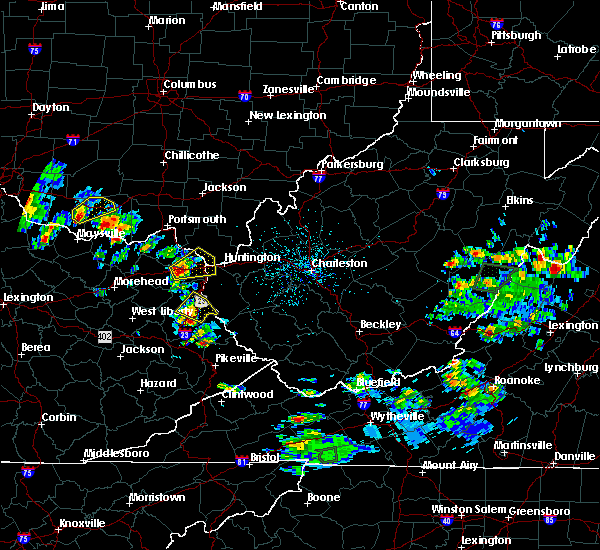 At 343 pm edt, a severe thunderstorm was located over coalton, or near cannonsburg, moving northeast at 15 mph (radar indicated). Hazards include two inch hail and 60 mph wind gusts. People and animals outdoors will be injured. expect hail damage to roofs, siding, windows, and vehicles. expect wind damage to roofs, siding, and trees. locations impacted include, huntington, ashland, ironton, coal grove, cannonsburg, kenova, catlettsburg, ceredo, princess, coalton, naples, rush, flatwoods, south point, russell, burlington, bellefonte, westwood, summit and mavity. this includes the following highways, interstate 64 in kentucky between mile markers 174 and 191. Interstate 64 in west virginia between mile markers 1 and 5. At 343 pm edt, a severe thunderstorm was located over coalton, or near cannonsburg, moving northeast at 15 mph (radar indicated). Hazards include two inch hail and 60 mph wind gusts. People and animals outdoors will be injured. expect hail damage to roofs, siding, windows, and vehicles. expect wind damage to roofs, siding, and trees. locations impacted include, huntington, ashland, ironton, coal grove, cannonsburg, kenova, catlettsburg, ceredo, princess, coalton, naples, rush, flatwoods, south point, russell, burlington, bellefonte, westwood, summit and mavity. this includes the following highways, interstate 64 in kentucky between mile markers 174 and 191. Interstate 64 in west virginia between mile markers 1 and 5.
|
| 5/20/2017 3:32 PM EDT |
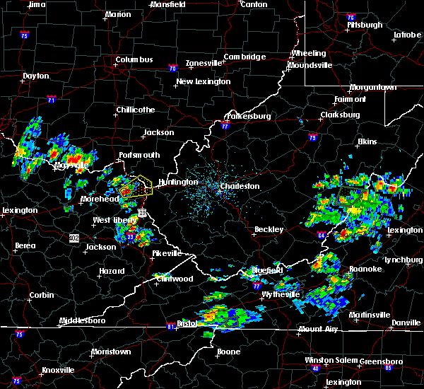 At 332 pm edt, a severe thunderstorm was located over rush, or near grayson, moving northeast at 15 mph (radar indicated). Hazards include 60 mph wind gusts and quarter size hail. Hail damage to vehicles is expected. Expect wind damage to roofs, siding, and trees. At 332 pm edt, a severe thunderstorm was located over rush, or near grayson, moving northeast at 15 mph (radar indicated). Hazards include 60 mph wind gusts and quarter size hail. Hail damage to vehicles is expected. Expect wind damage to roofs, siding, and trees.
|
| 4/29/2017 3:38 AM EDT |
 At 338 am edt, a severe thunderstorm was located over coal grove, moving east at 60 mph (radar indicated). Hazards include 60 mph wind gusts and penny size hail. Expect damage to roofs, siding, and trees. locations impacted include, huntington, ashland, ironton, coal grove, chesapeake, proctorville, cannonsburg, lake vesuvius, barboursville, kenova, catlettsburg, ceredo, greenup, princess, coalton, greenbo lake, oldtown, naples, rush and durbin. this includes the following highways, interstate 64 in kentucky between mile markers 174 and 191. Interstate 64 in west virginia between mile markers 1 and 15. At 338 am edt, a severe thunderstorm was located over coal grove, moving east at 60 mph (radar indicated). Hazards include 60 mph wind gusts and penny size hail. Expect damage to roofs, siding, and trees. locations impacted include, huntington, ashland, ironton, coal grove, chesapeake, proctorville, cannonsburg, lake vesuvius, barboursville, kenova, catlettsburg, ceredo, greenup, princess, coalton, greenbo lake, oldtown, naples, rush and durbin. this includes the following highways, interstate 64 in kentucky between mile markers 174 and 191. Interstate 64 in west virginia between mile markers 1 and 15.
|
| 4/29/2017 3:10 AM EDT |
 At 310 am edt, a severe thunderstorm was located 7 miles northeast of camp dix, or 12 miles north of carter caves state park, moving east at 60 mph (radar indicated). Hazards include 60 mph wind gusts and penny size hail. expect damage to roofs, siding, and trees At 310 am edt, a severe thunderstorm was located 7 miles northeast of camp dix, or 12 miles north of carter caves state park, moving east at 60 mph (radar indicated). Hazards include 60 mph wind gusts and penny size hail. expect damage to roofs, siding, and trees
|
| 4/5/2017 10:10 PM EDT |
 The severe thunderstorm warning for boyd, southeastern greenup, east central carter and lawrence counties will expire at 1015 pm edt, the storm which prompted the warning has weakened below severe limits, and no longer pose an immediate threat to life or property. therefore the warning will be allowed to expire. however heavy rain is still possible with this thunderstorm. The severe thunderstorm warning for boyd, southeastern greenup, east central carter and lawrence counties will expire at 1015 pm edt, the storm which prompted the warning has weakened below severe limits, and no longer pose an immediate threat to life or property. therefore the warning will be allowed to expire. however heavy rain is still possible with this thunderstorm.
|
| 4/5/2017 10:00 PM EDT |
 At 959 pm edt, a severe thunderstorm was located over coal grove, moving east at 55 mph (radar indicated). Hazards include 60 mph wind gusts. Expect damage to roofs, siding, and trees. locations impacted include, ashland, ironton, coal grove, cannonsburg, lake vesuvius, kenova, catlettsburg, ceredo, greenup, princess, coalton, greenbo lake, naples, rush, franklin furnace, flatwoods, south point, russell, vernon and raceland. This includes interstate 64 in kentucky between mile markers 179 and 191. At 959 pm edt, a severe thunderstorm was located over coal grove, moving east at 55 mph (radar indicated). Hazards include 60 mph wind gusts. Expect damage to roofs, siding, and trees. locations impacted include, ashland, ironton, coal grove, cannonsburg, lake vesuvius, kenova, catlettsburg, ceredo, greenup, princess, coalton, greenbo lake, naples, rush, franklin furnace, flatwoods, south point, russell, vernon and raceland. This includes interstate 64 in kentucky between mile markers 179 and 191.
|
| 4/5/2017 9:43 PM EDT |
 At 942 pm edt, a severe thunderstorm was located over oldtown, or 7 miles north of grayson, moving east at 55 mph (radar indicated). Hazards include 60 mph wind gusts. expect damage to roofs, siding, and trees At 942 pm edt, a severe thunderstorm was located over oldtown, or 7 miles north of grayson, moving east at 55 mph (radar indicated). Hazards include 60 mph wind gusts. expect damage to roofs, siding, and trees
|
| 3/1/2017 9:28 AM EST |
 At 927 am est, severe thunderstorms were located along a line extending from kenova to near charley, moving east at 55 mph (radar indicated). Hazards include 70 mph wind gusts and half dollar size hail. Hail damage to vehicles is expected. expect considerable tree damage. wind damage is also likely to mobile homes, roofs, and outbuildings. locations impacted include, huntington, ashland, louisa, coal grove, wayne, chesapeake, proctorville, blaine, beech fork state park, cannonsburg, yatesville lake state park, barboursville, kenova, catlettsburg, ceredo, fort gay, webbville, princess, coalton and burnaugh. this includes the following highways, interstate 64 in kentucky between mile markers 181 and 191. Interstate 64 in west virginia between mile markers 1 and 21. At 927 am est, severe thunderstorms were located along a line extending from kenova to near charley, moving east at 55 mph (radar indicated). Hazards include 70 mph wind gusts and half dollar size hail. Hail damage to vehicles is expected. expect considerable tree damage. wind damage is also likely to mobile homes, roofs, and outbuildings. locations impacted include, huntington, ashland, louisa, coal grove, wayne, chesapeake, proctorville, blaine, beech fork state park, cannonsburg, yatesville lake state park, barboursville, kenova, catlettsburg, ceredo, fort gay, webbville, princess, coalton and burnaugh. this includes the following highways, interstate 64 in kentucky between mile markers 181 and 191. Interstate 64 in west virginia between mile markers 1 and 21.
|
| 3/1/2017 9:05 AM EST |
 At 905 am est, severe thunderstorms were located along a line extending from near lake hope state park to near coal grove, moving east at 55 mph (radar indicated). Hazards include 70 mph wind gusts and half dollar size hail. Hail damage to vehicles is expected. expect considerable tree damage. wind damage is also likely to mobile homes, roofs, and outbuildings. locations impacted include, athens, ashland, ironton, jackson, wellston, point pleasant, gallipolis, coal grove, pomeroy, mcarthur, oak hill, rio grande, albany, rutland, lake vesuvius, mason, gallia, vernon, waterloo and middleport. This includes interstate 64 in west virginia near mile marker 23. At 905 am est, severe thunderstorms were located along a line extending from near lake hope state park to near coal grove, moving east at 55 mph (radar indicated). Hazards include 70 mph wind gusts and half dollar size hail. Hail damage to vehicles is expected. expect considerable tree damage. wind damage is also likely to mobile homes, roofs, and outbuildings. locations impacted include, athens, ashland, ironton, jackson, wellston, point pleasant, gallipolis, coal grove, pomeroy, mcarthur, oak hill, rio grande, albany, rutland, lake vesuvius, mason, gallia, vernon, waterloo and middleport. This includes interstate 64 in west virginia near mile marker 23.
|
| 3/1/2017 9:01 AM EST |
 At 900 am est, severe thunderstorms were located along a line extending from near gesling to sandy hook, moving east at 55 mph (radar indicated). Hazards include 70 mph wind gusts and half dollar size hail. Hail damage to vehicles is expected. expect considerable tree damage. Wind damage is also likely to mobile homes, roofs, and outbuildings. At 900 am est, severe thunderstorms were located along a line extending from near gesling to sandy hook, moving east at 55 mph (radar indicated). Hazards include 70 mph wind gusts and half dollar size hail. Hail damage to vehicles is expected. expect considerable tree damage. Wind damage is also likely to mobile homes, roofs, and outbuildings.
|
| 3/1/2017 9:01 AM EST |
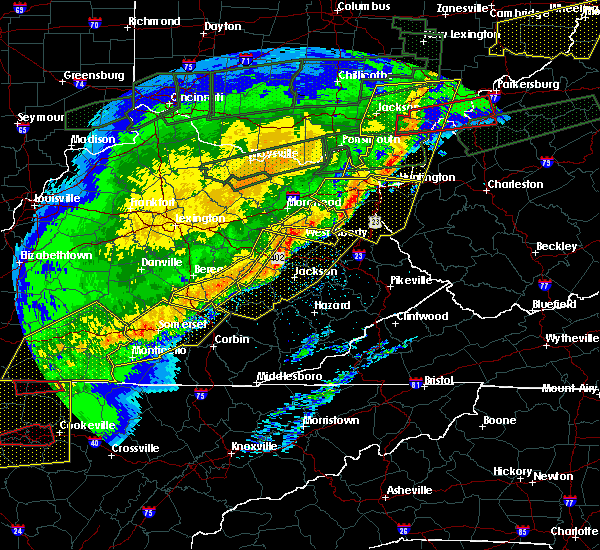 At 900 am est, severe thunderstorms were located along a line extending from near gesling to sandy hook, moving east at 55 mph (radar indicated). Hazards include 70 mph wind gusts and half dollar size hail. Hail damage to vehicles is expected. expect considerable tree damage. Wind damage is also likely to mobile homes, roofs, and outbuildings. At 900 am est, severe thunderstorms were located along a line extending from near gesling to sandy hook, moving east at 55 mph (radar indicated). Hazards include 70 mph wind gusts and half dollar size hail. Hail damage to vehicles is expected. expect considerable tree damage. Wind damage is also likely to mobile homes, roofs, and outbuildings.
|
| 3/1/2017 8:48 AM EST |
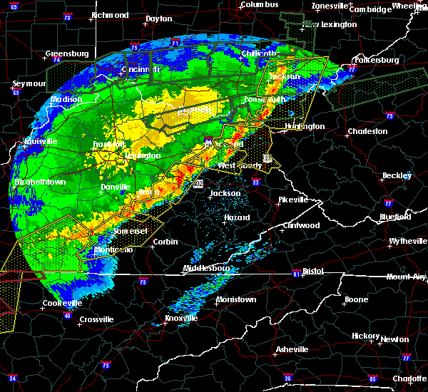 At 847 am est, severe thunderstorms were located along a line extending from near gesling to lytten, moving east at 55 mph (radar indicated). Hazards include 70 mph wind gusts and half dollar size hail. Hail damage to vehicles is expected. expect considerable tree damage. wind damage is also likely to mobile homes, roofs, and outbuildings. locations impacted include, ashland, grayson, louisa, olive hill, blaine, cannonsburg, grayson lake state park, yatesville lake state park, carter caves state park, catlettsburg, webbville, princess, coalton, denton, burnaugh, gesling, oldtown, naples, martha and rush. This includes interstate 64 in kentucky between mile markers 149 and 191. At 847 am est, severe thunderstorms were located along a line extending from near gesling to lytten, moving east at 55 mph (radar indicated). Hazards include 70 mph wind gusts and half dollar size hail. Hail damage to vehicles is expected. expect considerable tree damage. wind damage is also likely to mobile homes, roofs, and outbuildings. locations impacted include, ashland, grayson, louisa, olive hill, blaine, cannonsburg, grayson lake state park, yatesville lake state park, carter caves state park, catlettsburg, webbville, princess, coalton, denton, burnaugh, gesling, oldtown, naples, martha and rush. This includes interstate 64 in kentucky between mile markers 149 and 191.
|
| 3/1/2017 8:47 AM EST |
 At 846 am est, severe thunderstorms were located along a line extending from near mcarthur to near greenbo lake, moving east at 55 mph (radar indicated). Hazards include 70 mph wind gusts and half dollar size hail. Hail damage to vehicles is expected. expect considerable tree damage. Wind damage is also likely to mobile homes, roofs, and outbuildings. At 846 am est, severe thunderstorms were located along a line extending from near mcarthur to near greenbo lake, moving east at 55 mph (radar indicated). Hazards include 70 mph wind gusts and half dollar size hail. Hail damage to vehicles is expected. expect considerable tree damage. Wind damage is also likely to mobile homes, roofs, and outbuildings.
|
| 3/1/2017 8:35 AM EST |
 At 835 am est, severe thunderstorms were located along a line extending from camp dix to crix, moving east at 55 mph (radar indicated). Hazards include 70 mph wind gusts and half dollar size hail. Hail damage to vehicles is expected. expect considerable tree damage. Wind damage is also likely to mobile homes, roofs, and outbuildings. At 835 am est, severe thunderstorms were located along a line extending from camp dix to crix, moving east at 55 mph (radar indicated). Hazards include 70 mph wind gusts and half dollar size hail. Hail damage to vehicles is expected. expect considerable tree damage. Wind damage is also likely to mobile homes, roofs, and outbuildings.
|
| 2/25/2017 1:07 AM EST |
 The severe thunderstorm warning for boyd, southeastern greenup, southeastern carter and southwestern lawrence counties will expire at 115 am est, the storms which prompted the warning are moving out of the warned area. therefore the warning will be allowed to expire on time. The severe thunderstorm warning for boyd, southeastern greenup, southeastern carter and southwestern lawrence counties will expire at 115 am est, the storms which prompted the warning are moving out of the warned area. therefore the warning will be allowed to expire on time.
|
| 2/25/2017 12:43 AM EST |
 At 1243 am est, severe thunderstorms were located along a line extending from near carter caves state park to grayson lake state park to isonville, moving northeast at 60 mph (radar indicated). Hazards include 60 mph wind gusts and nickel size hail. expect damage to roofs, siding, and trees At 1243 am est, severe thunderstorms were located along a line extending from near carter caves state park to grayson lake state park to isonville, moving northeast at 60 mph (radar indicated). Hazards include 60 mph wind gusts and nickel size hail. expect damage to roofs, siding, and trees
|
| 12/18/2016 1:53 AM EST |
 The severe thunderstorm warning for northwestern carter, greenup, lawrence, gallia, south central vinton, jackson and west central mason counties will expire at 200 am est, the storm which prompted the warning has weakened below severe limits, and no longer pose an immediate threat to life or property. therefore the warning will be allowed to expire. however gusty winds and heavy rain are still possible with this thunderstorm. The severe thunderstorm warning for northwestern carter, greenup, lawrence, gallia, south central vinton, jackson and west central mason counties will expire at 200 am est, the storm which prompted the warning has weakened below severe limits, and no longer pose an immediate threat to life or property. therefore the warning will be allowed to expire. however gusty winds and heavy rain are still possible with this thunderstorm.
|
| 12/18/2016 1:14 AM EST |
 At 114 am est, a severe thunderstorm was located over letitia, or near portsmouth, moving northeast at 55 mph (radar indicated). Hazards include 60 mph wind gusts. expect damage to roofs, siding, and trees At 114 am est, a severe thunderstorm was located over letitia, or near portsmouth, moving northeast at 55 mph (radar indicated). Hazards include 60 mph wind gusts. expect damage to roofs, siding, and trees
|
| 7/14/2016 4:51 PM EDT |
 The severe thunderstorm warning for greenup, northeastern carter, northern boyd, lawrence, south central gallia and central cabell counties will expire at 500 pm edt, the storm which prompted the warning has moved out of the area. therefore, the warning will be allowed to expire. however gusty winds are still possible with this thunderstorm. The severe thunderstorm warning for greenup, northeastern carter, northern boyd, lawrence, south central gallia and central cabell counties will expire at 500 pm edt, the storm which prompted the warning has moved out of the area. therefore, the warning will be allowed to expire. however gusty winds are still possible with this thunderstorm.
|
| 7/14/2016 4:28 PM EDT | Estimated 60 mph winds at the kyova mall with lamp posts knocked down in the parking lo in boyd county KY, 5.4 miles NE of Ashland, KY |
| 7/14/2016 4:25 PM EDT | Large tree with power lines down in roadway in boyd county KY, 5.4 miles NE of Ashland, KY |
| 7/14/2016 4:03 PM EDT |
 At 402 pm edt, a line of severe thunderstorms were located over greenbo lake, or 10 miles north of grayson, moving east at 40 mph (radar indicated). Hazards include 60 mph wind gusts. Expect damage to roofs. siding. And trees. At 402 pm edt, a line of severe thunderstorms were located over greenbo lake, or 10 miles north of grayson, moving east at 40 mph (radar indicated). Hazards include 60 mph wind gusts. Expect damage to roofs. siding. And trees.
|
| 7/6/2016 8:38 PM EDT |
 At 837 pm edt, a severe thunderstorm was located over grayson, moving east at 30 mph (radar indicated). Hazards include 70 mph wind gusts and quarter size hail. Hail damage to vehicles is expected. expect considerable tree damage. wind damage is also likely to mobile homes, roofs, and outbuildings. Locations impacted include, ashland, grayson, cannonsburg, denton, rush, coalton, durbin, princess, mavity, hitchins and summit. At 837 pm edt, a severe thunderstorm was located over grayson, moving east at 30 mph (radar indicated). Hazards include 70 mph wind gusts and quarter size hail. Hail damage to vehicles is expected. expect considerable tree damage. wind damage is also likely to mobile homes, roofs, and outbuildings. Locations impacted include, ashland, grayson, cannonsburg, denton, rush, coalton, durbin, princess, mavity, hitchins and summit.
|
| 7/6/2016 8:22 PM EDT |
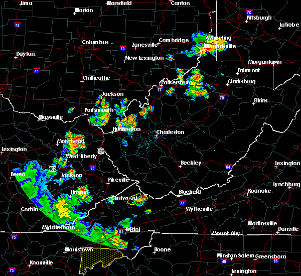 At 822 pm edt, a severe thunderstorm was located near grayson, moving east at 30 mph (radar indicated). Hazards include golf ball size hail and 70 mph wind gusts. People and animals outdoors will be injured. expect hail damage to roofs, siding, windows, and vehicles. expect considerable tree damage. Wind damage is also likely to mobile homes, roofs, and outbuildings. At 822 pm edt, a severe thunderstorm was located near grayson, moving east at 30 mph (radar indicated). Hazards include golf ball size hail and 70 mph wind gusts. People and animals outdoors will be injured. expect hail damage to roofs, siding, windows, and vehicles. expect considerable tree damage. Wind damage is also likely to mobile homes, roofs, and outbuildings.
|
| 6/23/2016 3:55 PM EDT |
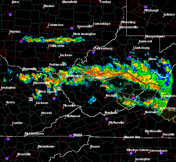 At 354 pm edt, a severe thunderstorm was located near coal grove, moving southeast at 45 mph (radar indicated). Hazards include 60 mph wind gusts and quarter size hail. Hail damage to vehicles is expected. Expect wind damage to roofs, siding, and trees. At 354 pm edt, a severe thunderstorm was located near coal grove, moving southeast at 45 mph (radar indicated). Hazards include 60 mph wind gusts and quarter size hail. Hail damage to vehicles is expected. Expect wind damage to roofs, siding, and trees.
|
| 6/23/2016 3:45 PM EDT |
 At 344 pm edt, a severe thunderstorm was located over naples, or near cannonsburg, moving east at 45 mph (radar indicated). Hazards include 60 mph wind gusts. Expect damage to roofs. siding. and trees. locations impacted include, huntington, ashland, ironton, coal grove, cannonsburg, kenova, catlettsburg, ceredo, coalton, princess, naples, oldtown, flatwoods, south point, russell, raceland, burlington, wurtland, bellefonte and westwood. A tornado watch remains in effect until 1000 pm edt for northeastern kentucky, southeastern ohio, and western and central west virginia. At 344 pm edt, a severe thunderstorm was located over naples, or near cannonsburg, moving east at 45 mph (radar indicated). Hazards include 60 mph wind gusts. Expect damage to roofs. siding. and trees. locations impacted include, huntington, ashland, ironton, coal grove, cannonsburg, kenova, catlettsburg, ceredo, coalton, princess, naples, oldtown, flatwoods, south point, russell, raceland, burlington, wurtland, bellefonte and westwood. A tornado watch remains in effect until 1000 pm edt for northeastern kentucky, southeastern ohio, and western and central west virginia.
|
| 6/23/2016 3:45 PM EDT |
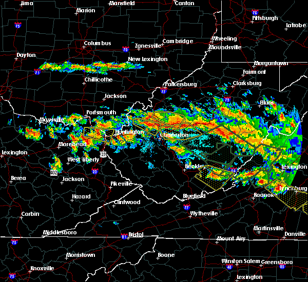 At 344 pm edt, a severe thunderstorm was located over naples, or near cannonsburg, moving east at 45 mph (radar indicated). Hazards include 60 mph wind gusts. Expect damage to roofs. siding. and trees. locations impacted include, huntington, ashland, ironton, coal grove, cannonsburg, kenova, catlettsburg, ceredo, coalton, princess, naples, oldtown, flatwoods, south point, russell, raceland, burlington, wurtland, bellefonte and westwood. A tornado watch remains in effect until 1000 pm edt for northeastern kentucky, southeastern ohio, and western and central west virginia. At 344 pm edt, a severe thunderstorm was located over naples, or near cannonsburg, moving east at 45 mph (radar indicated). Hazards include 60 mph wind gusts. Expect damage to roofs. siding. and trees. locations impacted include, huntington, ashland, ironton, coal grove, cannonsburg, kenova, catlettsburg, ceredo, coalton, princess, naples, oldtown, flatwoods, south point, russell, raceland, burlington, wurtland, bellefonte and westwood. A tornado watch remains in effect until 1000 pm edt for northeastern kentucky, southeastern ohio, and western and central west virginia.
|
| 6/23/2016 3:34 PM EDT |
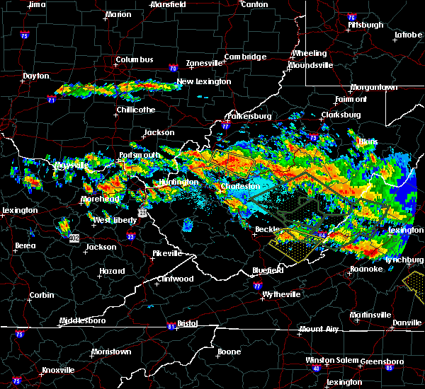 At 334 pm edt, a severe thunderstorm was located over oldtown, or 8 miles north of grayson, moving east at 50 mph (radar indicated). Hazards include 60 mph wind gusts and quarter size hail. Hail damage to vehicles is expected. Expect wind damage to roofs, siding, and trees. At 334 pm edt, a severe thunderstorm was located over oldtown, or 8 miles north of grayson, moving east at 50 mph (radar indicated). Hazards include 60 mph wind gusts and quarter size hail. Hail damage to vehicles is expected. Expect wind damage to roofs, siding, and trees.
|
| 6/23/2016 6:58 AM EDT |
 At 658 am edt, severe thunderstorms were located along a line extending from 14 miles east of lake vesuvius to near farley, moving southeast at 45 mph (radar indicated). Hazards include 60 mph wind gusts. Expect damage to roofs. siding. And trees. At 658 am edt, severe thunderstorms were located along a line extending from 14 miles east of lake vesuvius to near farley, moving southeast at 45 mph (radar indicated). Hazards include 60 mph wind gusts. Expect damage to roofs. siding. And trees.
|
| 6/23/2016 6:17 AM EDT |
 At 616 am edt, severe thunderstorms were located along a line extending from near jackson to 9 miles west of lucasville to near tollesboro, moving southeast at 50 mph (radar indicated). Hazards include 60 mph wind gusts. Expect damage to roofs. siding. And trees. At 616 am edt, severe thunderstorms were located along a line extending from near jackson to 9 miles west of lucasville to near tollesboro, moving southeast at 50 mph (radar indicated). Hazards include 60 mph wind gusts. Expect damage to roofs. siding. And trees.
|
| 6/21/2016 2:24 PM EDT |
 At 224 pm edt, a severe thunderstorm was located over oldtown, or near grayson, moving southeast at 40 mph (radar indicated). Hazards include 60 mph wind gusts and quarter size hail. Hail damage to vehicles is expected. expect wind damage to roofs, siding, and trees. Locations impacted include, ashland, grayson, cannonsburg, catlettsburg, rush, coalton, princess, greenbo lake, denton, naples, oldtown, hitchins, warnock, hopewell, mavity and summit. At 224 pm edt, a severe thunderstorm was located over oldtown, or near grayson, moving southeast at 40 mph (radar indicated). Hazards include 60 mph wind gusts and quarter size hail. Hail damage to vehicles is expected. expect wind damage to roofs, siding, and trees. Locations impacted include, ashland, grayson, cannonsburg, catlettsburg, rush, coalton, princess, greenbo lake, denton, naples, oldtown, hitchins, warnock, hopewell, mavity and summit.
|
| 6/21/2016 2:03 PM EDT |
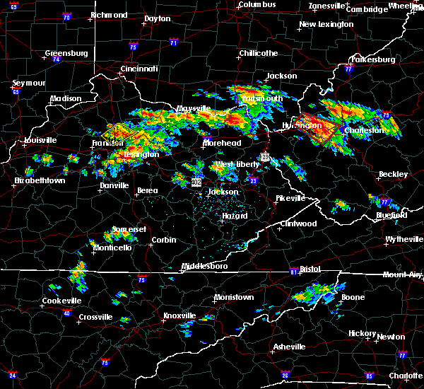 At 203 pm edt, a severe thunderstorm was located near load, or 12 miles north of carter caves state park, moving southeast at 40 mph (radar indicated). Hazards include 60 mph wind gusts and quarter size hail. Hail damage to vehicles is expected. Expect wind damage to roofs, siding, and trees. At 203 pm edt, a severe thunderstorm was located near load, or 12 miles north of carter caves state park, moving southeast at 40 mph (radar indicated). Hazards include 60 mph wind gusts and quarter size hail. Hail damage to vehicles is expected. Expect wind damage to roofs, siding, and trees.
|
| 5/1/2016 5:02 PM EDT |
 At 501 pm edt, a severe thunderstorm was located over grayson, moving east at 35 mph. golf ball size hail was reported 5 miles north of olive hill at 4:40 p.m (public). Hazards include golf ball size hail and 60 mph wind gusts. People and animals outdoors will be injured. expect hail damage to roofs, siding, windows, and vehicles. expect wind damage to roofs, siding, and trees. Locations impacted include, ashland, grayson, cannonsburg, kenova, catlettsburg, ceredo, rush, coalton, durbin, princess, denton, naples, oldtown, south point, buchanan, hitchins, hopewell, mavity, grahn and summit. At 501 pm edt, a severe thunderstorm was located over grayson, moving east at 35 mph. golf ball size hail was reported 5 miles north of olive hill at 4:40 p.m (public). Hazards include golf ball size hail and 60 mph wind gusts. People and animals outdoors will be injured. expect hail damage to roofs, siding, windows, and vehicles. expect wind damage to roofs, siding, and trees. Locations impacted include, ashland, grayson, cannonsburg, kenova, catlettsburg, ceredo, rush, coalton, durbin, princess, denton, naples, oldtown, south point, buchanan, hitchins, hopewell, mavity, grahn and summit.
|
| 5/1/2016 5:02 PM EDT |
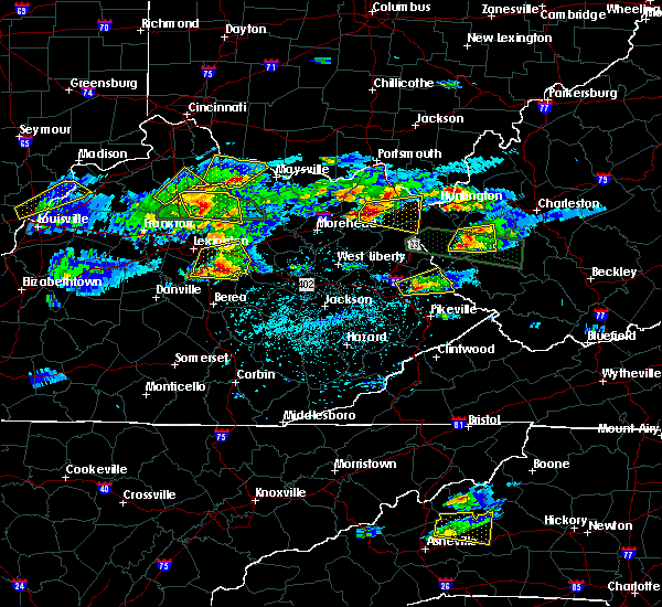 At 501 pm edt, a severe thunderstorm was located over grayson, moving east at 35 mph. golf ball size hail was reported 5 miles north of olive hill at 4:40 p.m (public). Hazards include golf ball size hail and 60 mph wind gusts. People and animals outdoors will be injured. expect hail damage to roofs, siding, windows, and vehicles. expect wind damage to roofs, siding, and trees. Locations impacted include, ashland, grayson, cannonsburg, kenova, catlettsburg, ceredo, rush, coalton, durbin, princess, denton, naples, oldtown, south point, buchanan, hitchins, hopewell, mavity, grahn and summit. At 501 pm edt, a severe thunderstorm was located over grayson, moving east at 35 mph. golf ball size hail was reported 5 miles north of olive hill at 4:40 p.m (public). Hazards include golf ball size hail and 60 mph wind gusts. People and animals outdoors will be injured. expect hail damage to roofs, siding, windows, and vehicles. expect wind damage to roofs, siding, and trees. Locations impacted include, ashland, grayson, cannonsburg, kenova, catlettsburg, ceredo, rush, coalton, durbin, princess, denton, naples, oldtown, south point, buchanan, hitchins, hopewell, mavity, grahn and summit.
|
| 5/1/2016 4:48 PM EDT |
 At 448 pm edt, a severe thunderstorm was located over carter caves state park, moving east at 35 mph (radar indicated). Hazards include 60 mph wind gusts and half dollar size hail. Hail damage to vehicles is expected. Expect wind damage to roofs, siding, and trees. At 448 pm edt, a severe thunderstorm was located over carter caves state park, moving east at 35 mph (radar indicated). Hazards include 60 mph wind gusts and half dollar size hail. Hail damage to vehicles is expected. Expect wind damage to roofs, siding, and trees.
|
| 5/1/2016 4:48 PM EDT |
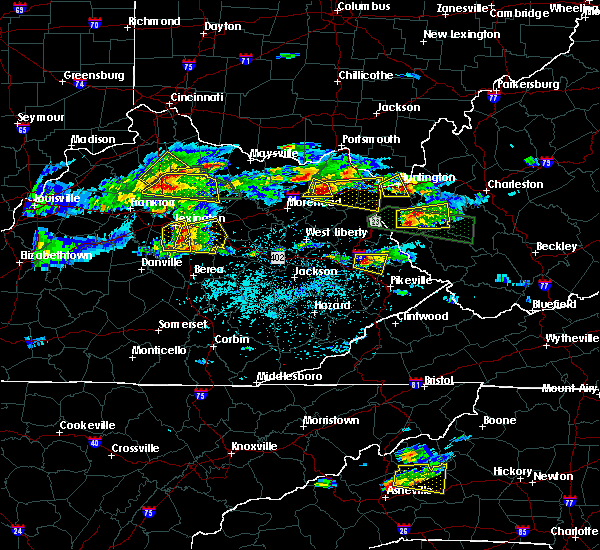 At 448 pm edt, a severe thunderstorm was located over carter caves state park, moving east at 35 mph (radar indicated). Hazards include 60 mph wind gusts and half dollar size hail. Hail damage to vehicles is expected. Expect wind damage to roofs, siding, and trees. At 448 pm edt, a severe thunderstorm was located over carter caves state park, moving east at 35 mph (radar indicated). Hazards include 60 mph wind gusts and half dollar size hail. Hail damage to vehicles is expected. Expect wind damage to roofs, siding, and trees.
|
| 7/14/2015 5:52 PM EDT |
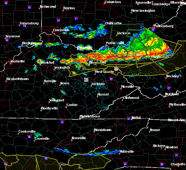 At 549 pm edt, doppler radar indicated a line of severe thunderstorms capable of producing damaging winds in excess of 60 mph. these storms were located along a line extending from culloden to princess to near olive hill, moving south at 35 mph. locations impacted include, huntington, ashland, grayson, louisa, coal grove, olive hill, wayne, hamlin, chesapeake, proctorville, beech fork state park, cannonsburg, carter caves state park, grayson lake state park, yatesville lake state park, barboursville, kenova, milton, catlettsburg and ceredo. At 549 pm edt, doppler radar indicated a line of severe thunderstorms capable of producing damaging winds in excess of 60 mph. these storms were located along a line extending from culloden to princess to near olive hill, moving south at 35 mph. locations impacted include, huntington, ashland, grayson, louisa, coal grove, olive hill, wayne, hamlin, chesapeake, proctorville, beech fork state park, cannonsburg, carter caves state park, grayson lake state park, yatesville lake state park, barboursville, kenova, milton, catlettsburg and ceredo.
|
| 7/14/2015 5:35 PM EDT | Several trees and power lines dow in boyd county KY, 0.3 miles NNE of Ashland, KY |
| 7/14/2015 5:11 PM EDT |
 At 509 pm edt, doppler radar indicated a line of severe thunderstorms capable of producing damaging winds in excess of 60 mph. these storms were located along a line extending from south shore to near vanceburg to near manchester, and moving southeast at 55 mph. At 509 pm edt, doppler radar indicated a line of severe thunderstorms capable of producing damaging winds in excess of 60 mph. these storms were located along a line extending from south shore to near vanceburg to near manchester, and moving southeast at 55 mph.
|
| 6/26/2015 8:22 PM EDT | Quarter sized hail reported 0.3 miles NNE of Ashland, KY, quarter sized hail in the town of ashland. |
| 6/26/2015 8:19 PM EDT | At 818 pm edt, doppler radar indicated a severe thunderstorm capable of producing half dollar size hail and damaging winds in excess of 60 mph. this storm was located over coal grove, and moving east at 25 mph. |
| 6/26/2015 8:19 PM EDT | At 818 pm edt, doppler radar indicated a severe thunderstorm capable of producing half dollar size hail and damaging winds in excess of 60 mph. this storm was located over coal grove, and moving east at 25 mph. |
| 6/26/2015 8:19 PM EDT | At 818 pm edt, doppler radar indicated a severe thunderstorm capable of producing half dollar size hail and damaging winds in excess of 60 mph. this storm was located over coal grove, and moving east at 25 mph. |
| 5/11/2015 5:17 PM EDT | At 514 pm edt, national weather service doppler radar indicated a severe thunderstorm capable of producing quarter size hail, and damaging winds in excess of 60 mph. this storm was located 12 miles west of carter caves state park, or 11 miles northwest of olive hill, moving east at 35 mph. * other locations in the warning include but are not limited to princess, naples, oldtown, load, greenbo lake, gesling, coalton, catlettsburg and greenup. this will impact the following interstate, i-64 between mile markers 156 and 191 in kentucky. a severe thunderstorm watch remains in effect until 1000 pm edt monday evening for central kentucky and southeast ohio and central west virginia. please report hail or strong wind to the national weather service by calling toll free, 800-401-9535, when you can do so safely. you may also report severe weather by posting your report to the charleston west virginia national weather service facebook page, or by using the twitter hashtag, nwsrlx. |
| 5/11/2015 5:17 PM EDT | At 514 pm edt, national weather service doppler radar indicated a severe thunderstorm capable of producing quarter size hail, and damaging winds in excess of 60 mph. this storm was located 12 miles west of carter caves state park, or 11 miles northwest of olive hill, moving east at 35 mph. * other locations in the warning include but are not limited to princess, naples, oldtown, load, greenbo lake, gesling, coalton, catlettsburg and greenup. this will impact the following interstate, i-64 between mile markers 156 and 191 in kentucky. a severe thunderstorm watch remains in effect until 1000 pm edt monday evening for central kentucky and southeast ohio and central west virginia. please report hail or strong wind to the national weather service by calling toll free, 800-401-9535, when you can do so safely. you may also report severe weather by posting your report to the charleston west virginia national weather service facebook page, or by using the twitter hashtag, nwsrlx. |
| 4/8/2015 1:35 PM EDT | A severe thunderstorm warning remains in effect until 200 pm edt for southern greenup. carter and boyd counties in kentucky. and eastern meigs. lawrence. southern gallia and extreme southeastern athens counties in southeast ohio. and northern wayne. cabell. northern jackson and mason counties in west virginia. at 122 pm edt. National weather service doppler radar continued to. |
| 4/8/2015 1:35 PM EDT | A severe thunderstorm warning remains in effect until 200 pm edt for southern greenup. carter and boyd counties in kentucky. and eastern meigs. lawrence. southern gallia and extreme southeastern athens counties in southeast ohio. and northern wayne. cabell. northern jackson and mason counties in west virginia. at 122 pm edt. National weather service doppler radar continued to. |
| 4/8/2015 1:35 PM EDT | A severe thunderstorm warning remains in effect until 200 pm edt for southern greenup. carter and boyd counties in kentucky. and eastern meigs. lawrence. southern gallia and extreme southeastern athens counties in southeast ohio. and northern wayne. cabell. northern jackson and mason counties in west virginia. at 122 pm edt. National weather service doppler radar continued to. |
| 4/8/2015 12:56 PM EDT | The national weather service in charleston has issued a * severe thunderstorm warning for. boyd county in kentucky. this includes the cities of. cannonsburg. ashland. carter county in kentucky. this includes the cities of. olive hill. Grayson lake state. |
| 4/8/2015 12:56 PM EDT | The national weather service in charleston has issued a * severe thunderstorm warning for. boyd county in kentucky. this includes the cities of. cannonsburg. ashland. carter county in kentucky. this includes the cities of. olive hill. Grayson lake state. |
| 4/8/2015 12:56 PM EDT | The national weather service in charleston has issued a * severe thunderstorm warning for. boyd county in kentucky. this includes the cities of. cannonsburg. ashland. carter county in kentucky. this includes the cities of. olive hill. Grayson lake state. |
| 4/2/2015 7:34 PM EDT | A severe thunderstorm warning remains in effect until 745 pm edt for southeastern greenup. eastern carter. boyd and western lawrence counties in kentucky. at 732 pm edt. national weather service doppler radar continued to indicate a line of severe thunderstorms capable of producing damaging winds in excess of 60 mph. These storms were located along a line. |
| 4/2/2015 7:15 PM EDT | The national weather service in charleston has issued a * severe thunderstorm warning for. boyd county in kentucky. this includes the cities of. cannonsburg. ashland. carter county in kentucky. this includes the cities of. olive hill. Grayson lake state. |
| 7/8/2014 2:36 PM EDT | A tree reported dow in boyd county KY, 0.3 miles NNE of Ashland, KY |
| 6/10/2014 8:10 PM EDT | Multiple trees down near 1840 hoods creek pike road in boyd county KY, 0.3 miles NNE of Ashland, KY |
| 6/10/2014 8:08 PM EDT | Several trees down near neade springs r in boyd county KY, 0.3 miles NNE of Ashland, KY |
| 11/1/2013 2:15 AM EDT | Storm damage reported in boyd county KY, 0.3 miles NNE of Ashland, KY |
| 8/28/2013 6:35 PM EDT | Roof blown off marathon gas station at 2900 winchester av in boyd county KY, 0.3 miles NNE of Ashland, KY |
| 8/28/2013 6:27 PM EDT | Roof blown off castle apartments on winchester ave. at about the 2300 bloc in boyd county KY, 0.3 miles NNE of Ashland, KY |
| 4/16/2013 9:50 PM EDT | Multiple trees down along rt. 5 in ashland... ky in boyd county KY, 1.2 miles SSW of Ashland, KY |
| 4/16/2013 8:18 PM EDT | Multiple trees down along rt. 5 in ashland... ky in boyd county KY, 1.2 miles SSW of Ashland, KY |
| 9/26/2012 7:32 PM EDT | Quarter sized hail reported 9.6 miles NE of Ashland, KY |
| 7/1/2012 8:25 PM EDT | Numerous trees down in russell and surrounding are in boyd county KY, 1.2 miles SSW of Ashland, KY |
| 1/1/0001 12:00 AM | Several trees down in ashland area and throughout count in boyd county KY, 0.3 miles NNE of Ashland, KY |
| 1/1/0001 12:00 AM | Half Dollar sized hail reported 0.7 miles SE of Ashland, KY |
| 1/1/0001 12:00 AM | Quarter sized hail reported 0.7 miles SE of Ashland, KY |
| 1/1/0001 12:00 AM | Quarter sized hail reported 0.7 miles SE of Ashland, KY |
| 1/1/0001 12:00 AM | Quarter sized hail reported 0.3 miles NNE of Ashland, KY, quarter to golf ball sized hail reported. |
| 1/1/0001 12:00 AM | Quarter sized hail reported 5.3 miles NE of Ashland, KY |
| 1/1/0001 12:00 AM | Trees down throughout the count in boyd county KY, 0.3 miles NNE of Ashland, KY |
| 1/1/0001 12:00 AM | Downed trees and power line in boyd county KY, 0.3 miles NNE of Ashland, KY |
| 1/1/0001 12:00 AM | Tree down on car at city par in boyd county KY, 0.3 miles NNE of Ashland, KY |
| 1/1/0001 12:00 AM | Multiple trees reported down around the city of ashland in boyd county KY, 0.3 miles NNE of Ashland, KY |
| 1/1/0001 12:00 AM | Structural damage reported...portions of a roof blown off a house and porch furniture damaged in boyd county KY, 0.3 miles NNE of Ashland, KY |
| 1/1/0001 12:00 AM | Roof off part of a home on beech street. included photo on wsaz web sit in boyd county KY, 0.3 miles NNE of Ashland, KY |
| 1/1/0001 12:00 AM | Trees down in boyd county KY, 1.2 miles SSW of Ashland, KY |
Hail Maps for Ashland, KY


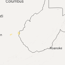


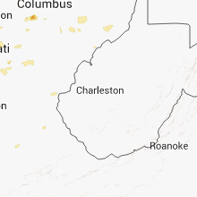


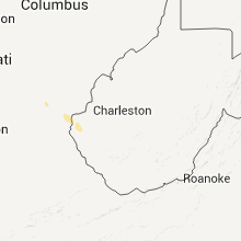


Connect with Interactive Hail Maps