

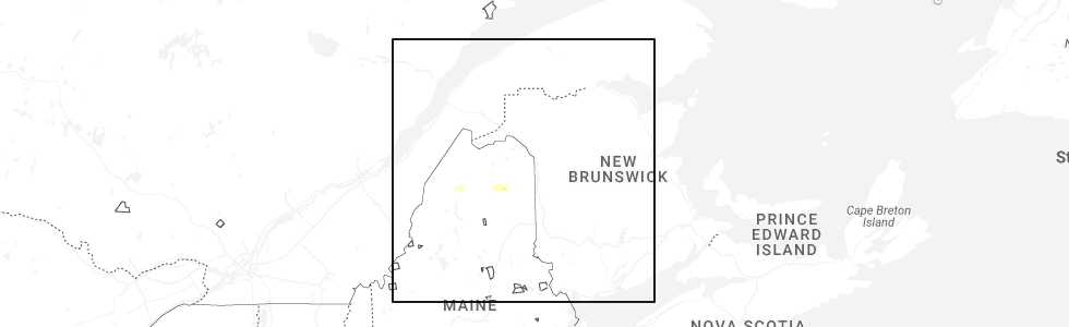
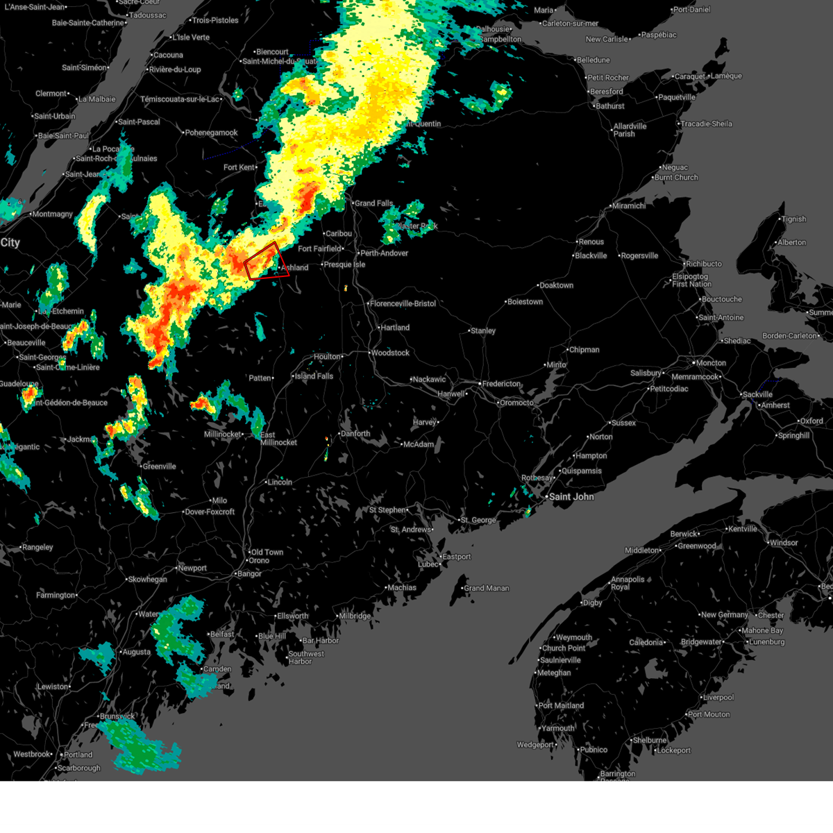
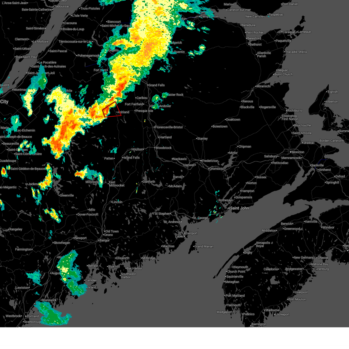
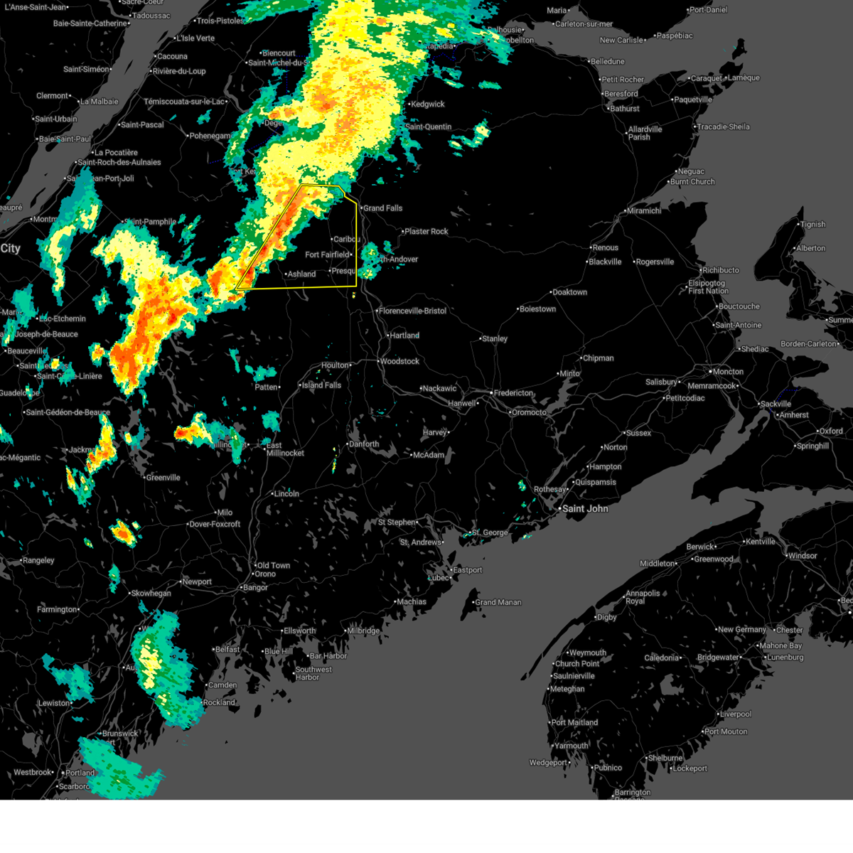
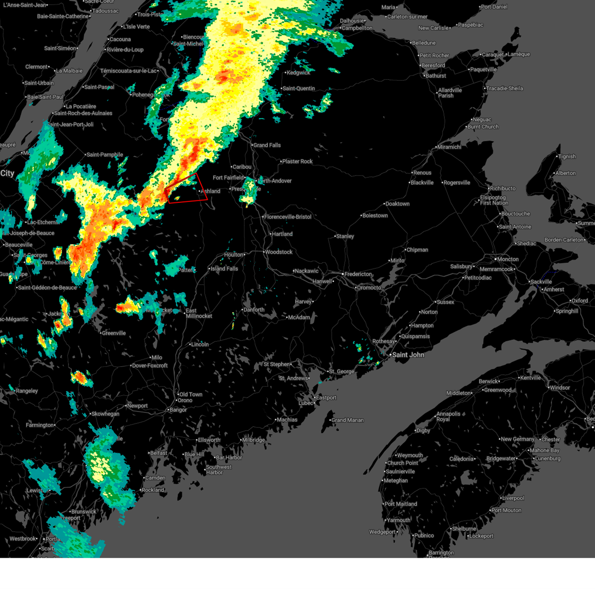
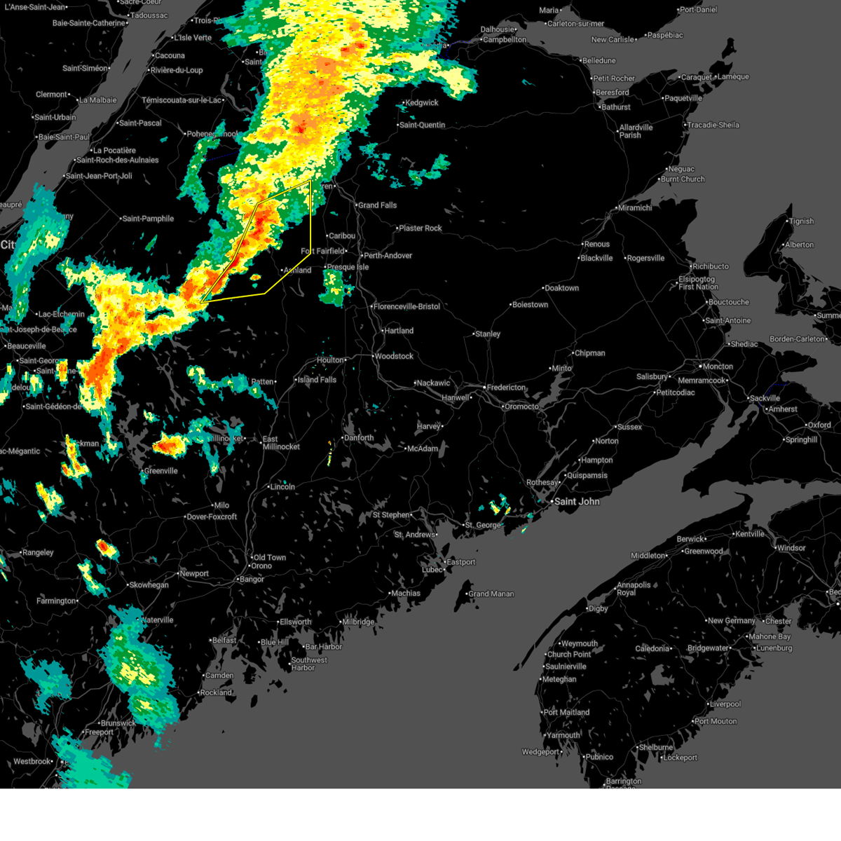
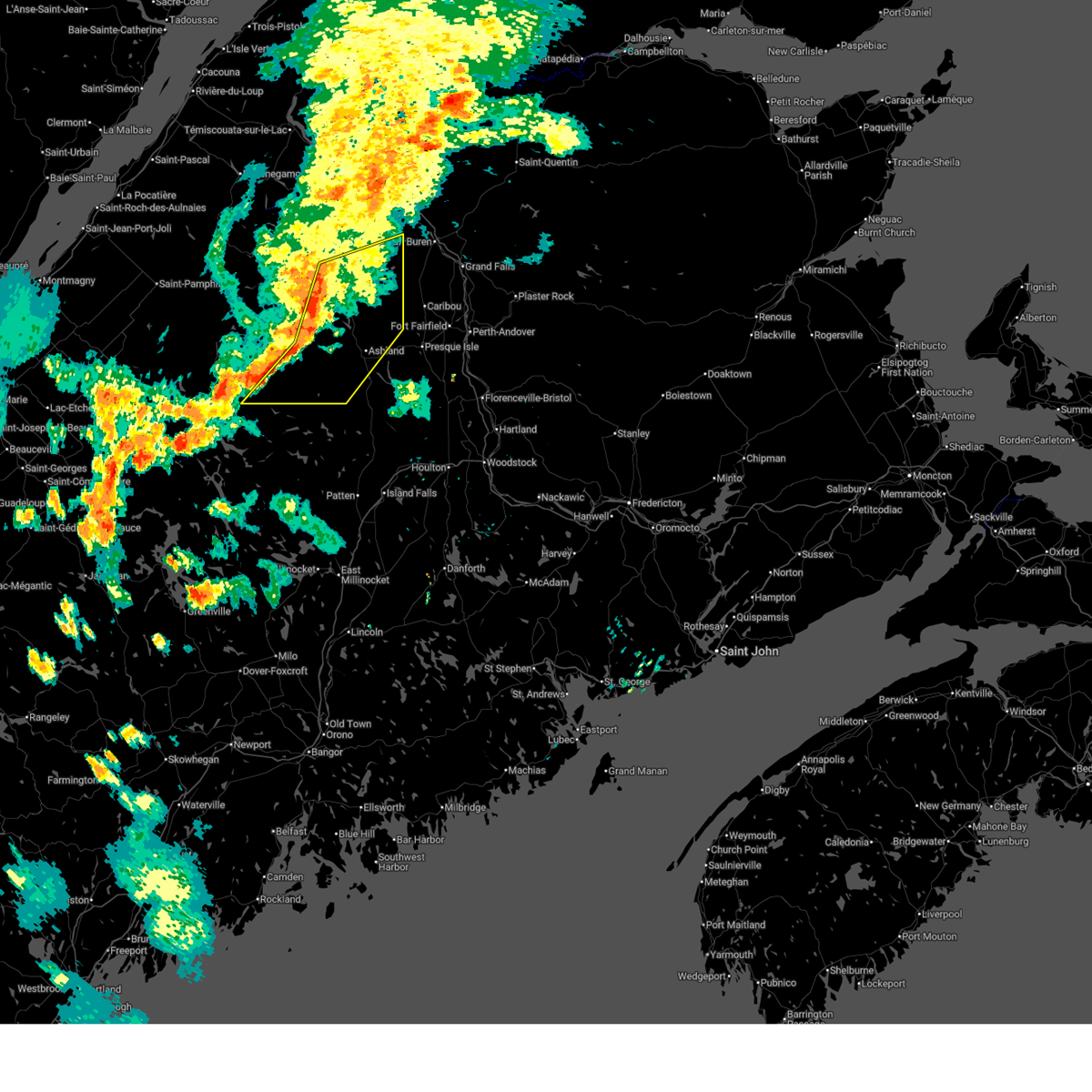
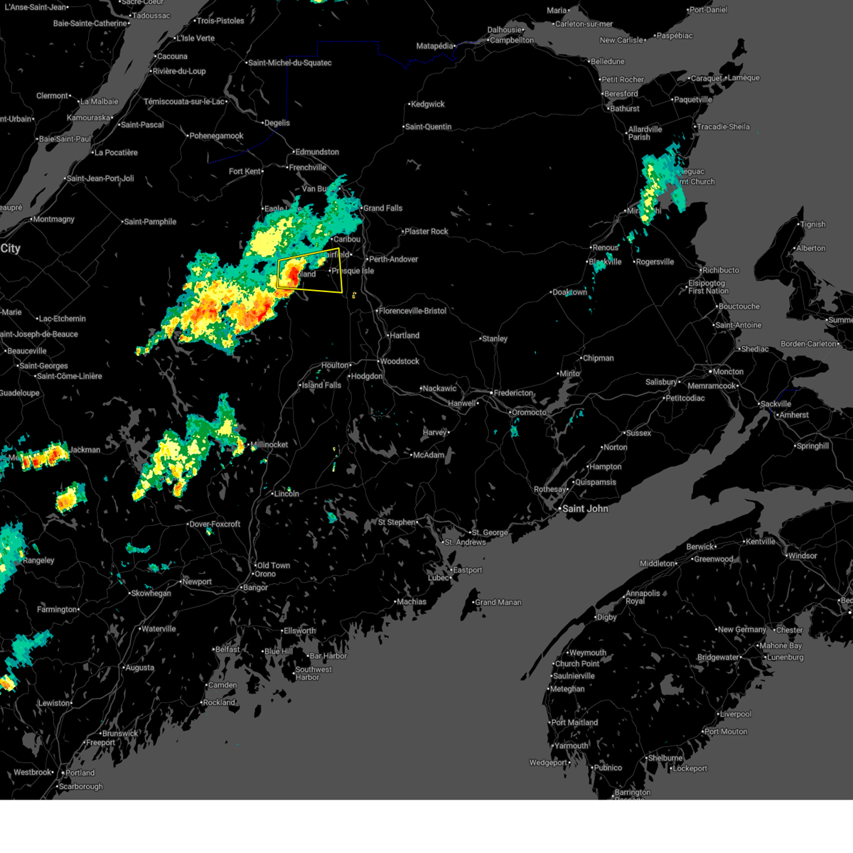
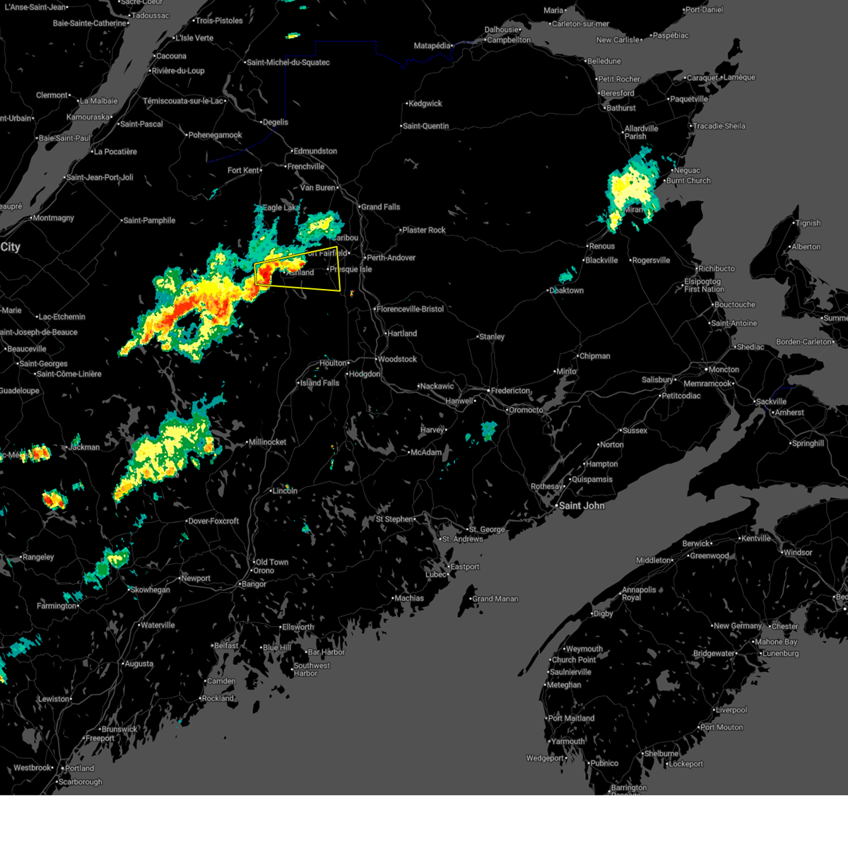
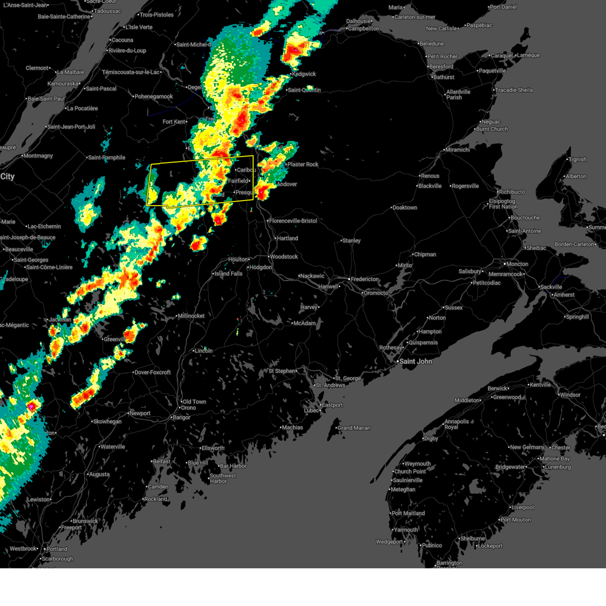
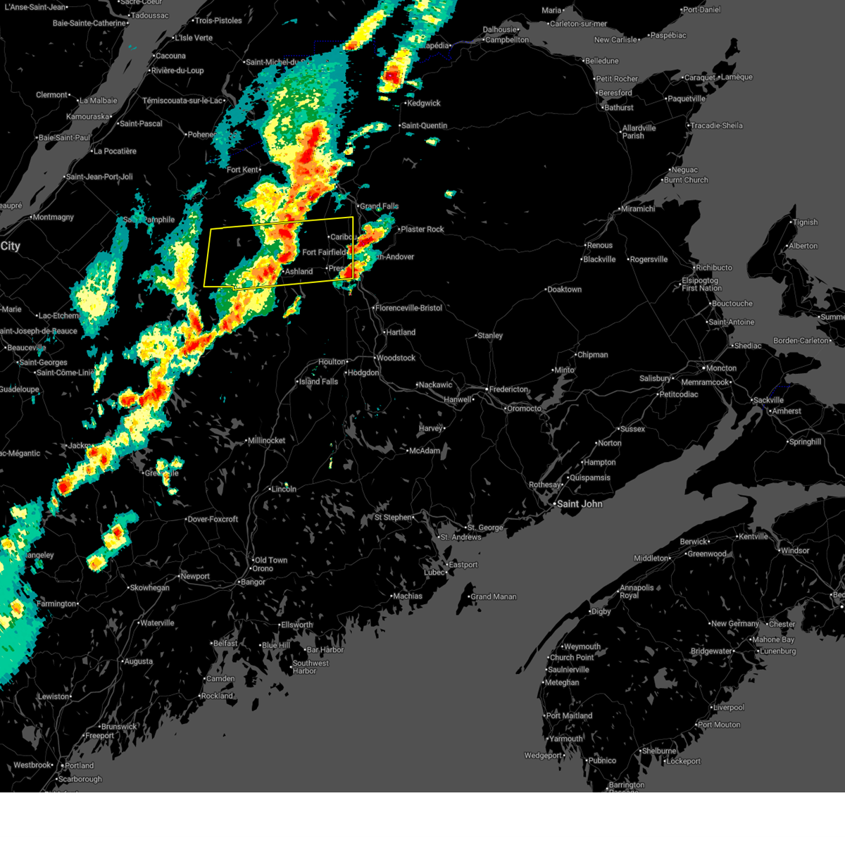
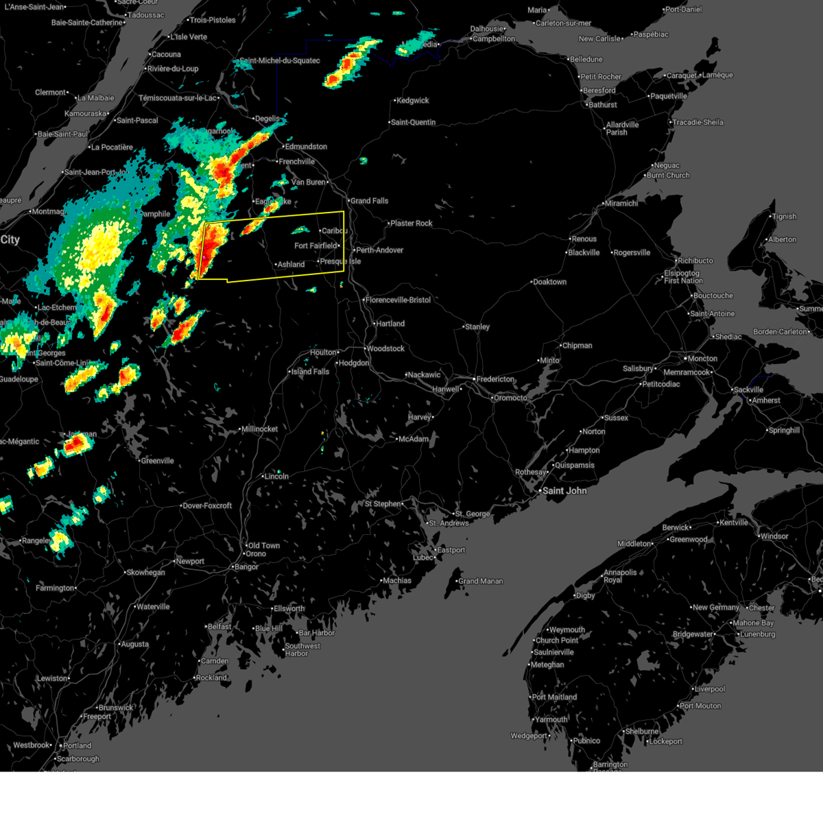
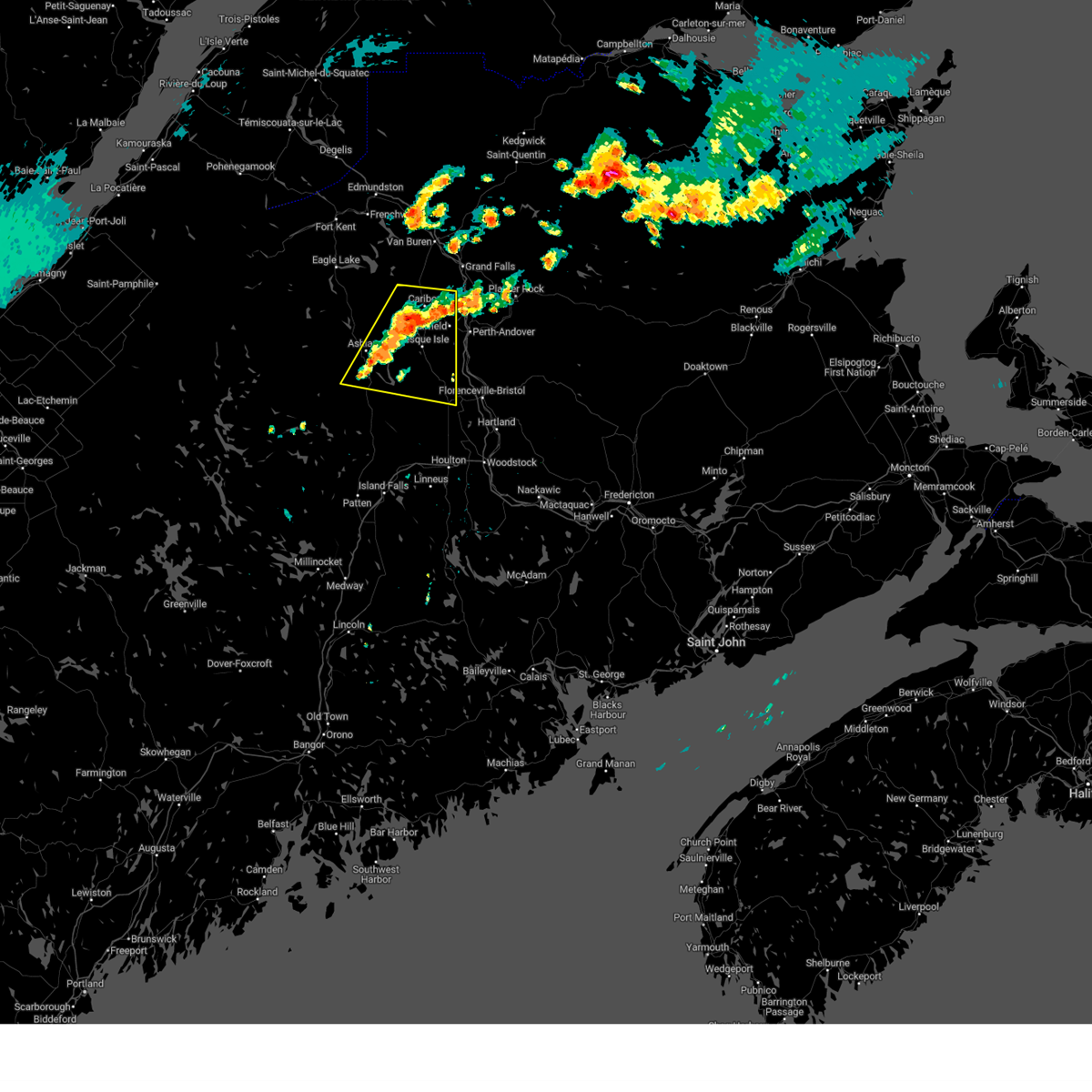
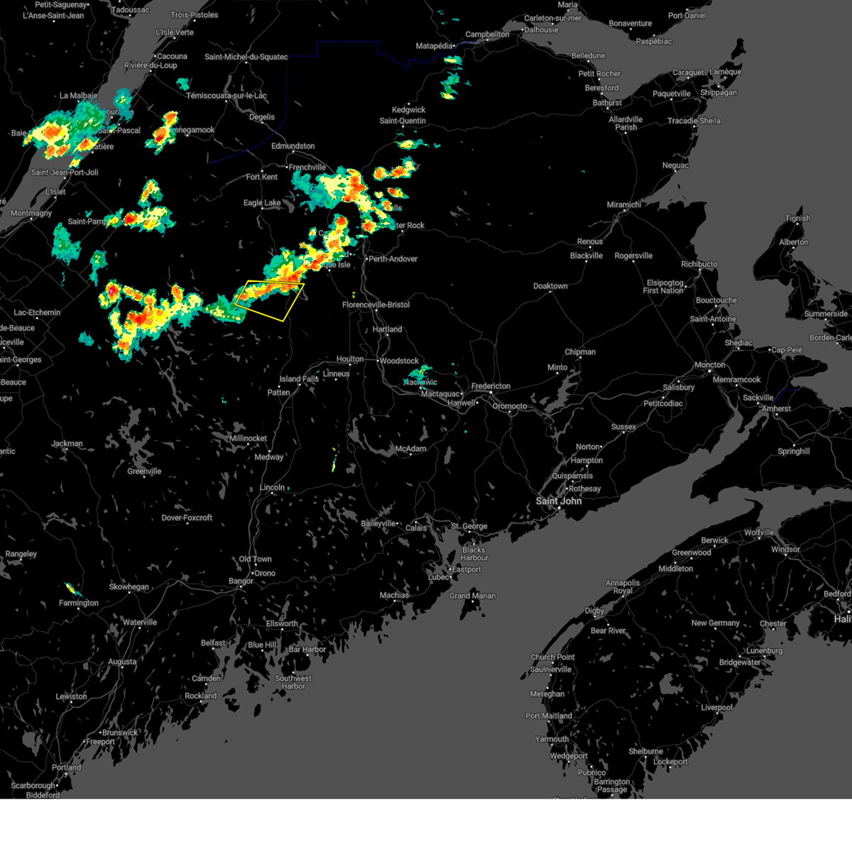
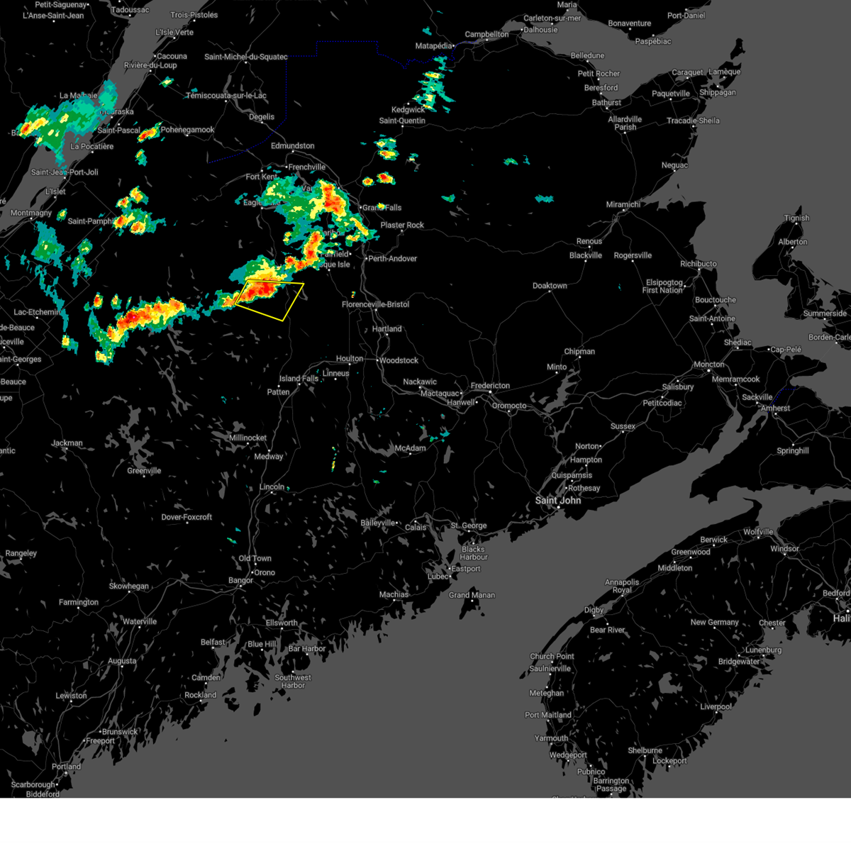
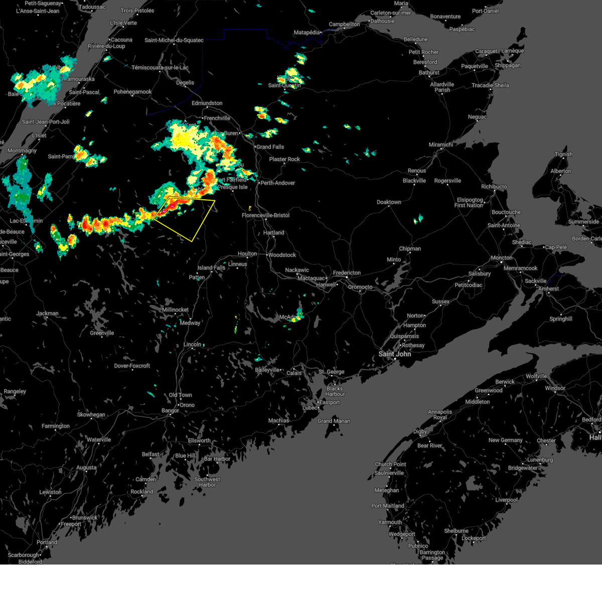
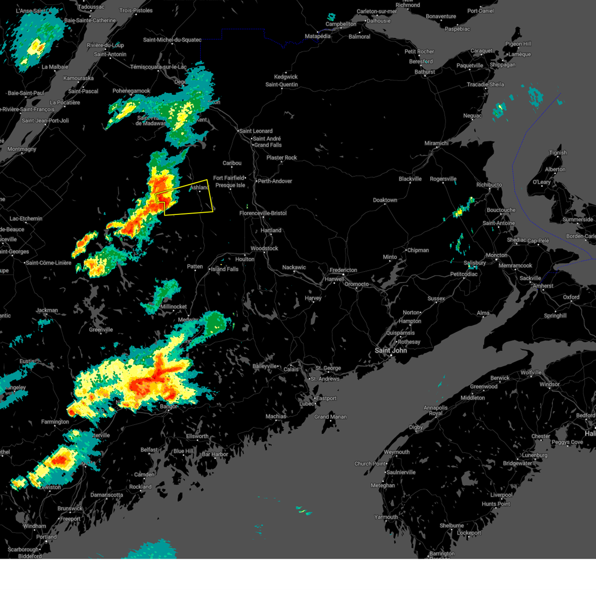
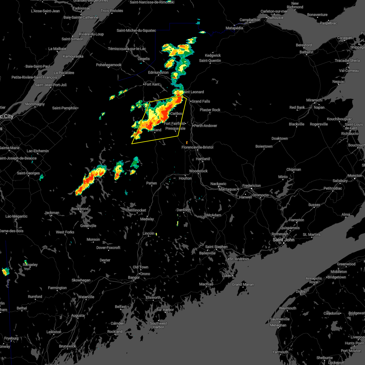
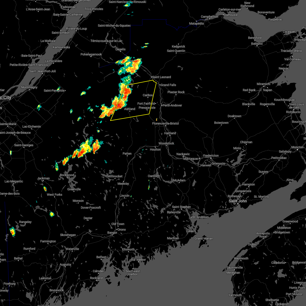
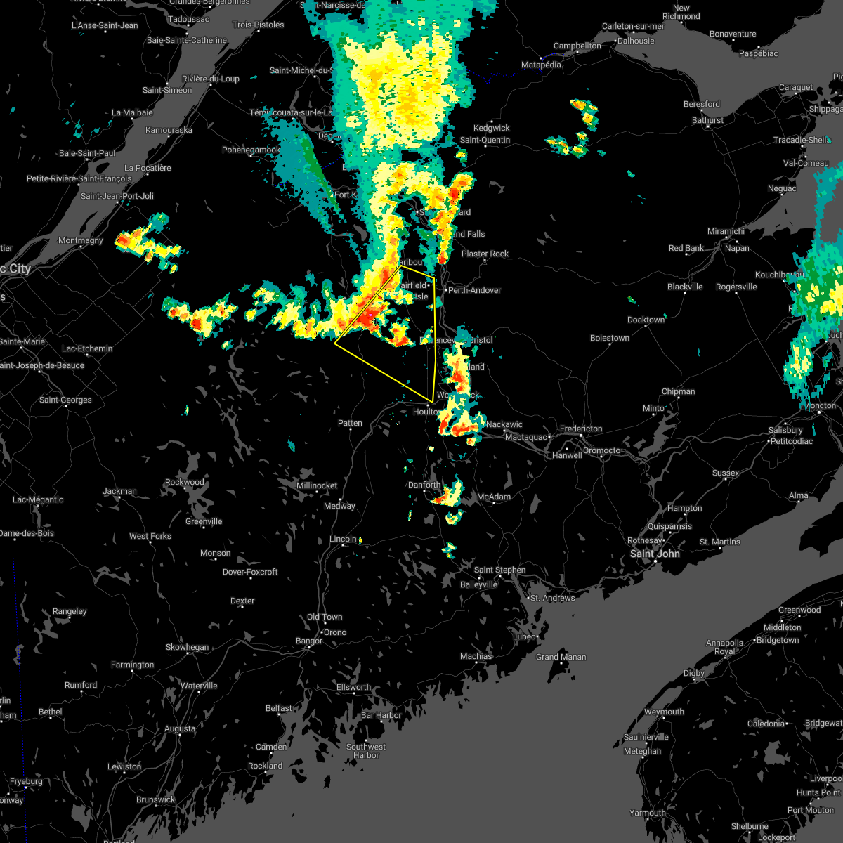
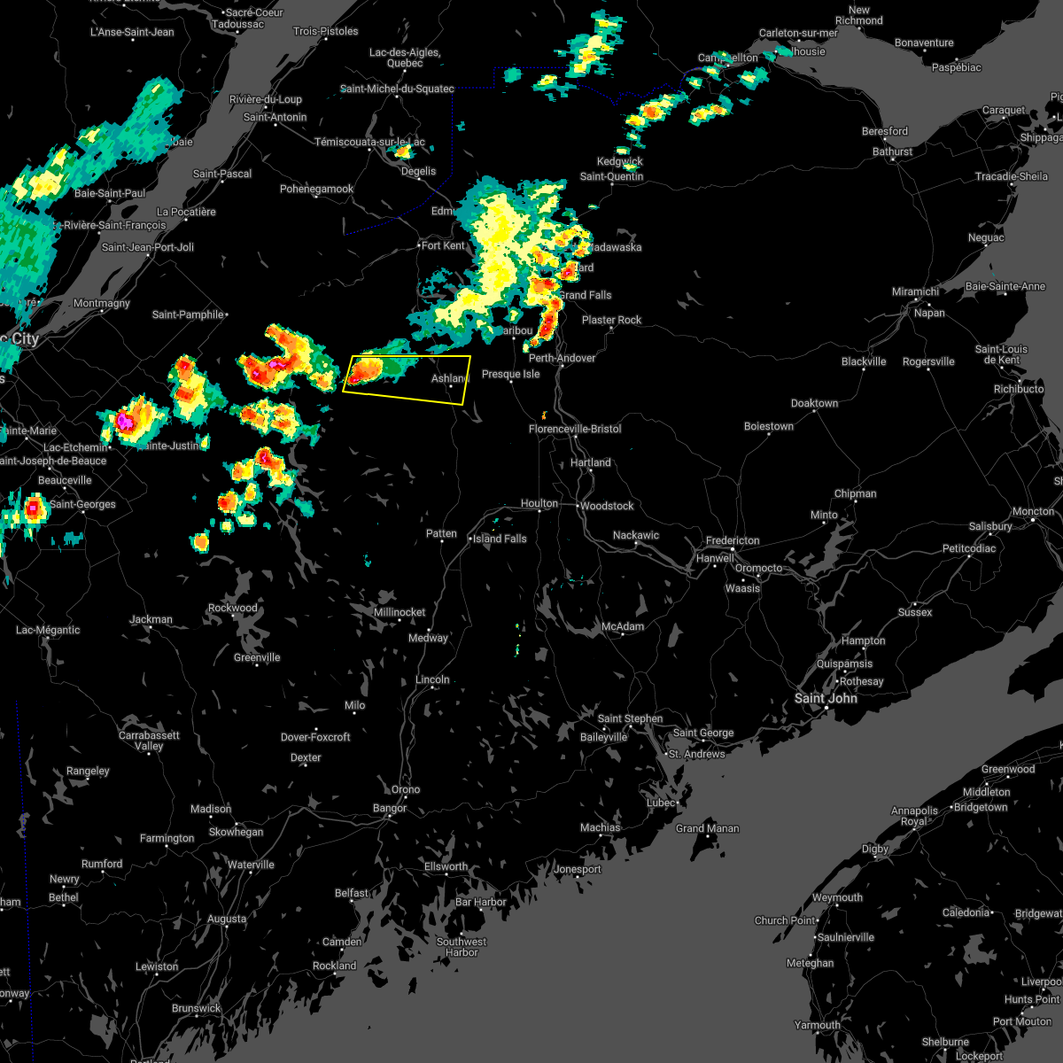
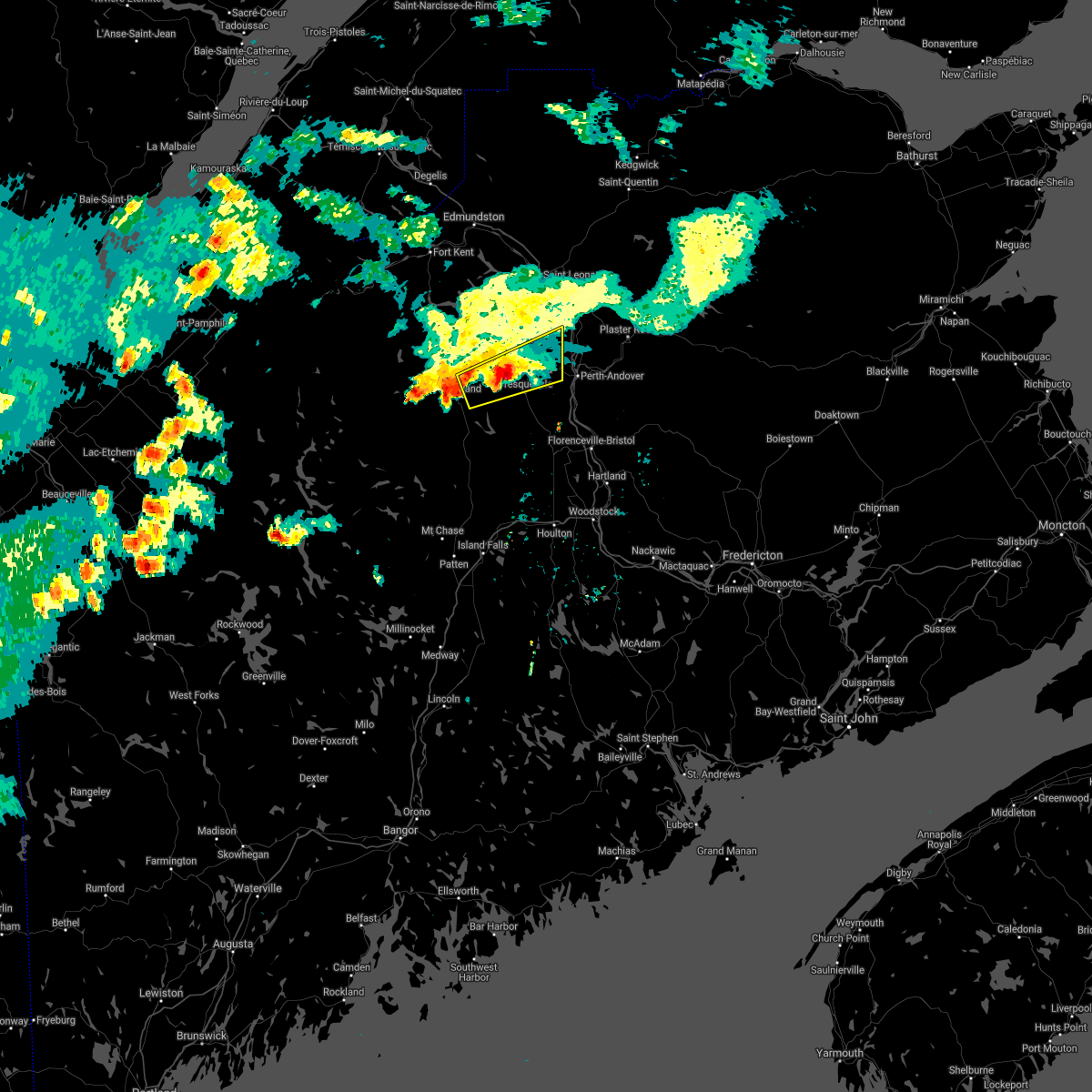
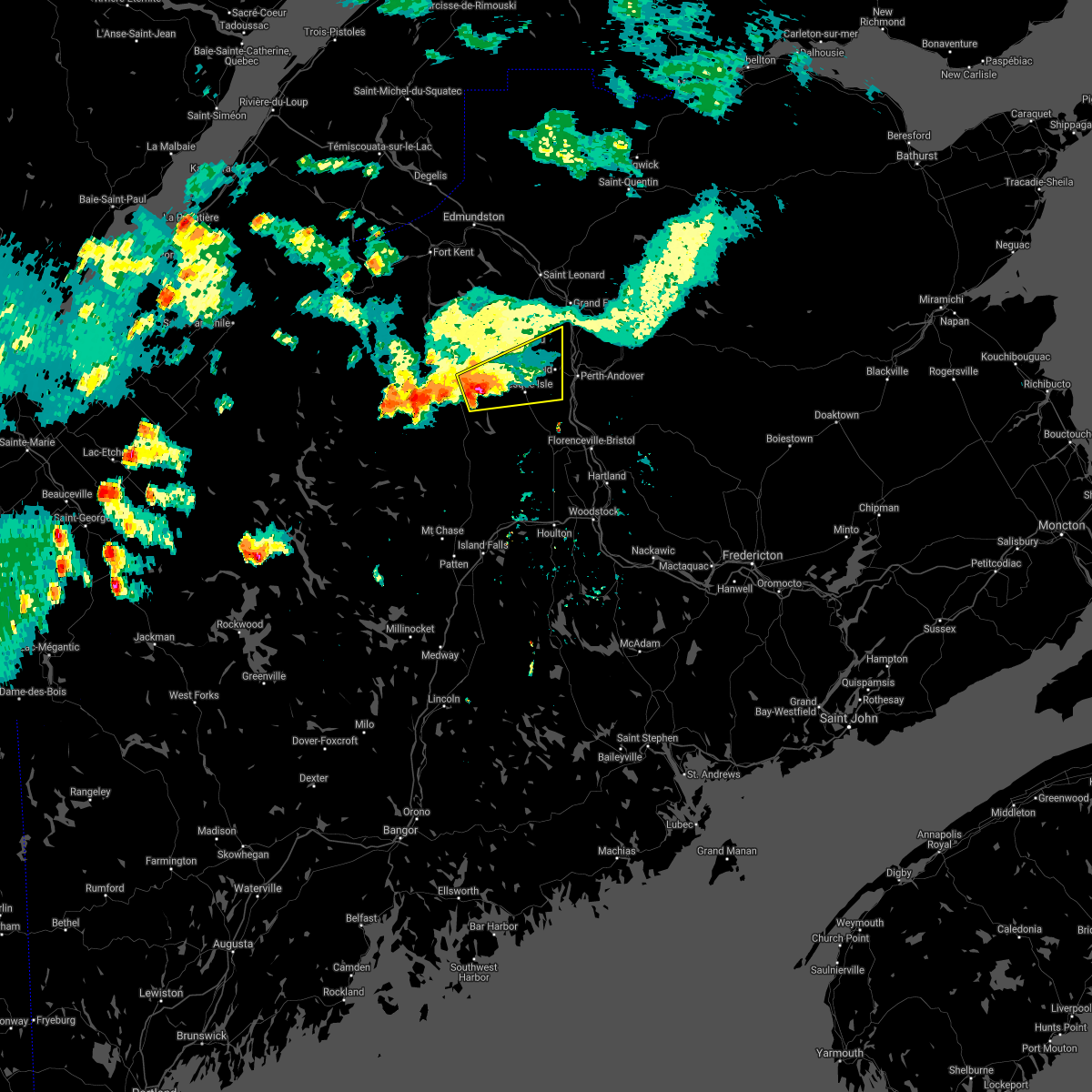
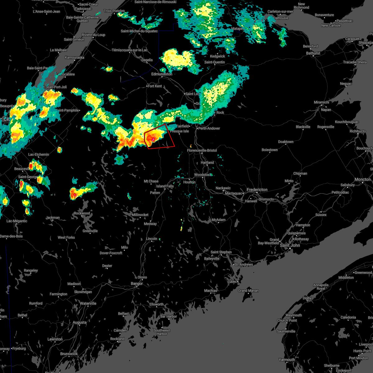
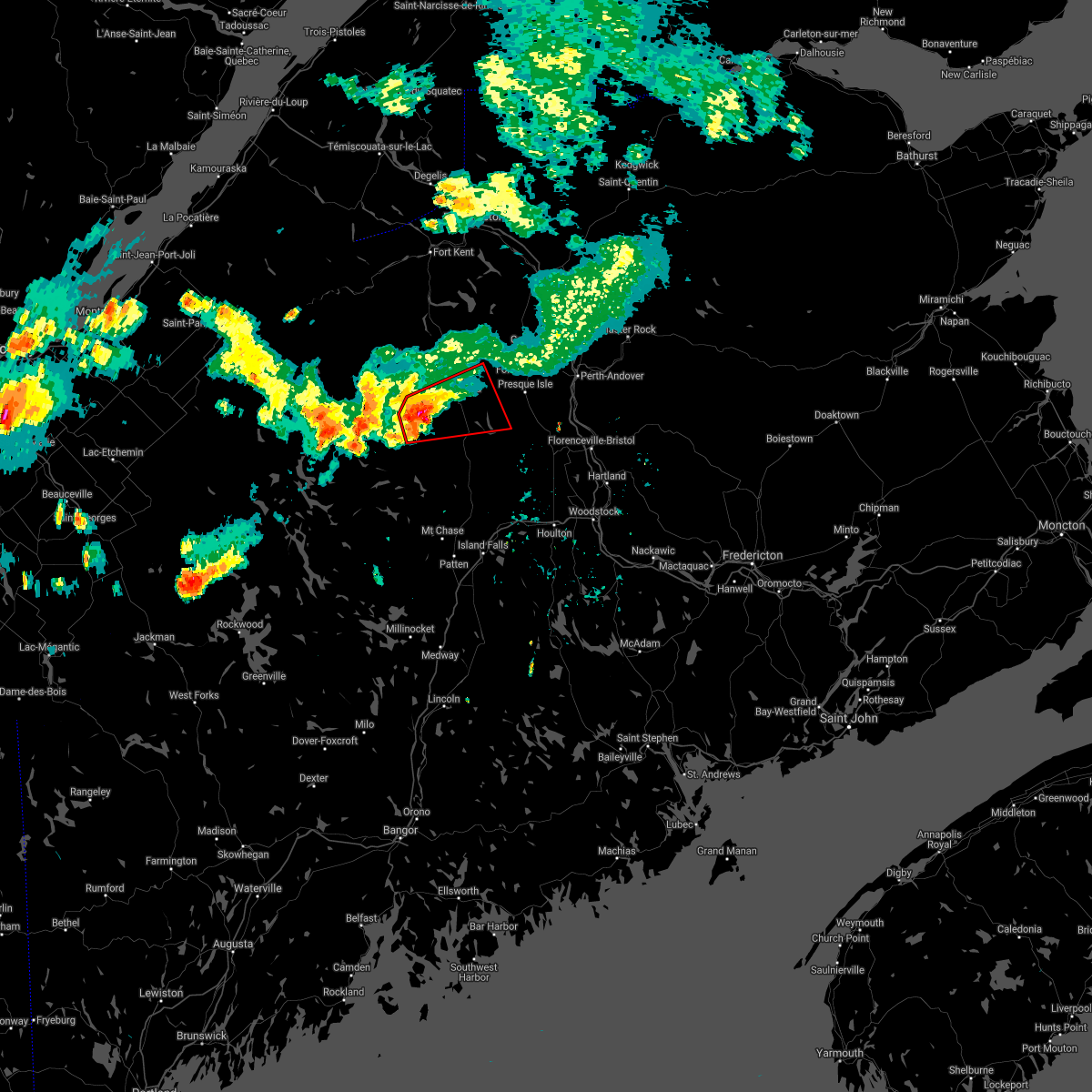
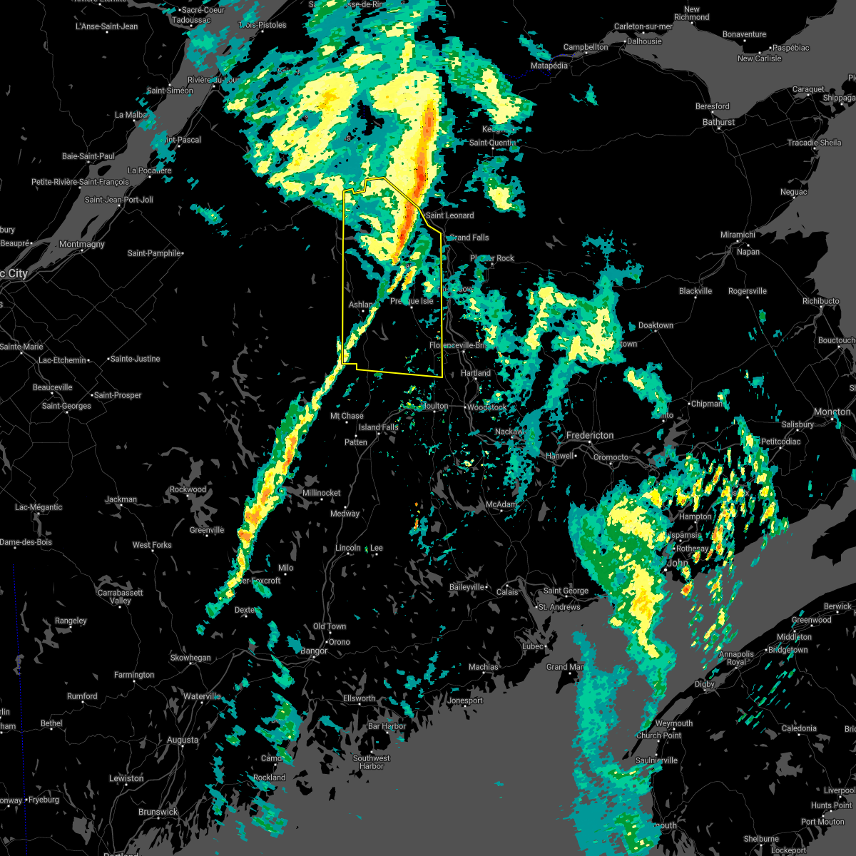
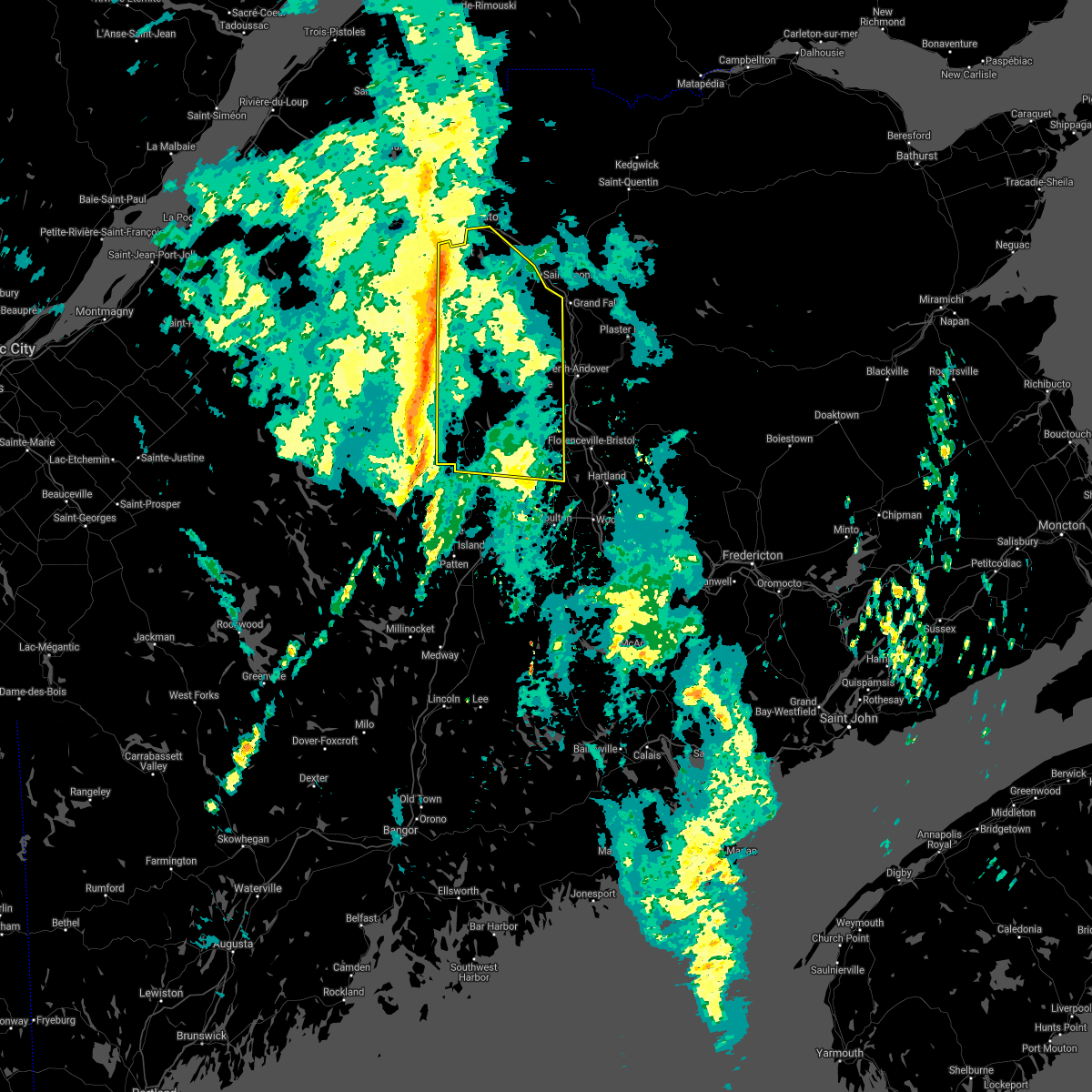
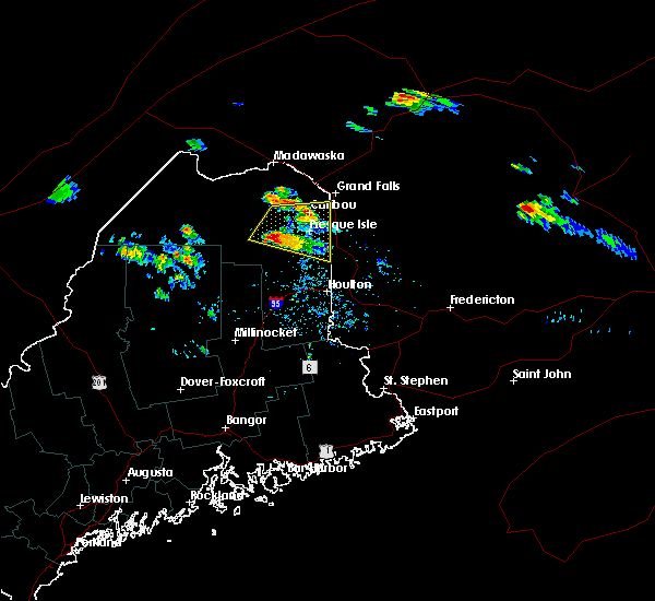
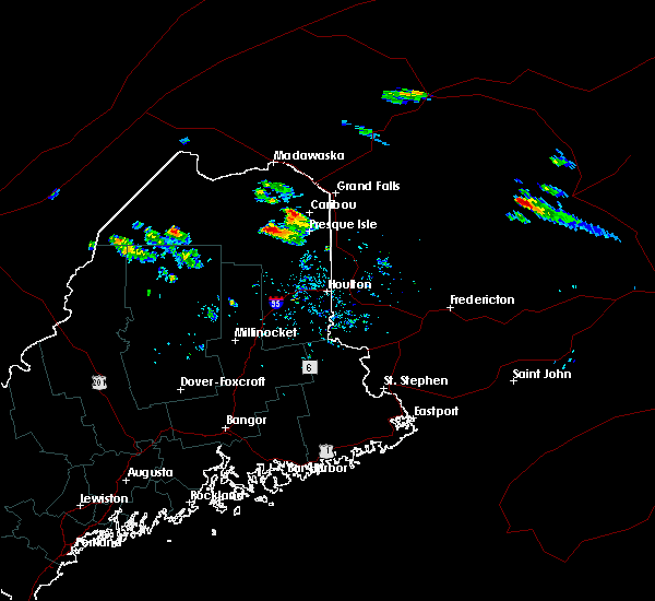
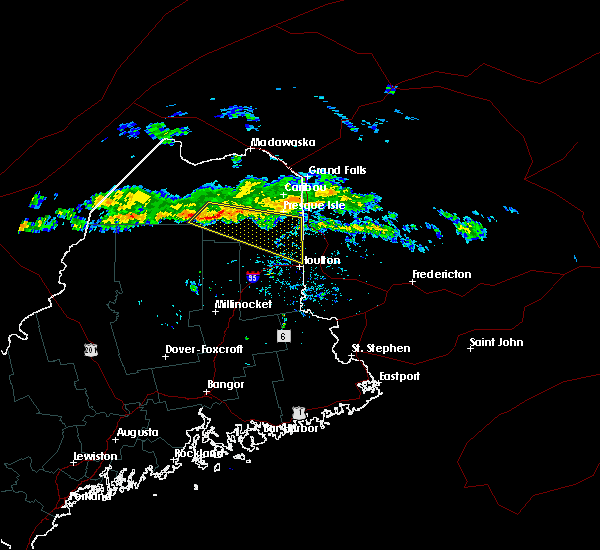
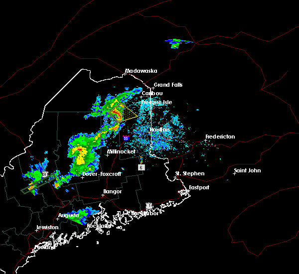
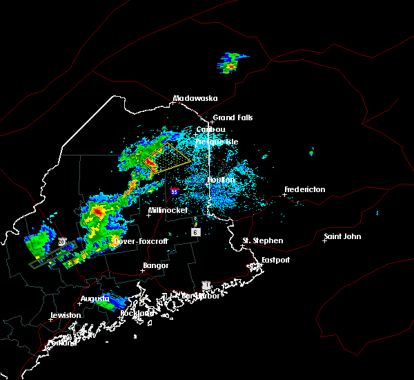
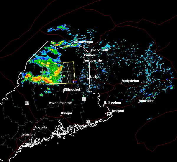
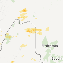
Hail Map for Ashland, ME
The Ashland, ME area has had 2 reports of on-the-ground hail by trained spotters, and has been under severe weather warnings 11 times during the past 12 months. Doppler radar has detected hail at or near Ashland, ME on 10 occasions, including 1 occasion during the past year.
| Name: | Ashland, ME |
| Where Located: | 24.5 miles SW of Caribou, ME |
| Map: | Google Map for Ashland, ME |
| Population: | 709 |
| Housing Units: | 388 |
| More Info: | Search Google for Ashland, ME |
5
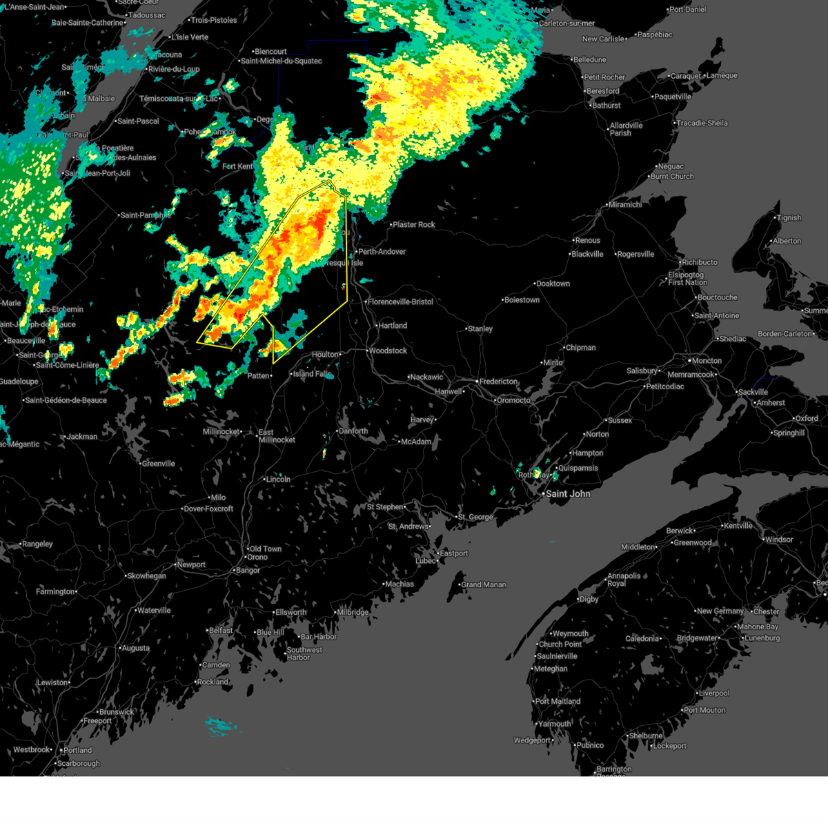
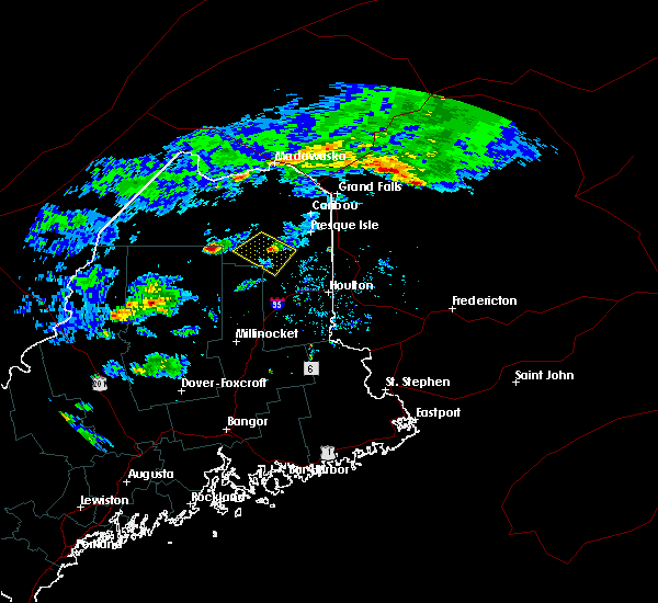
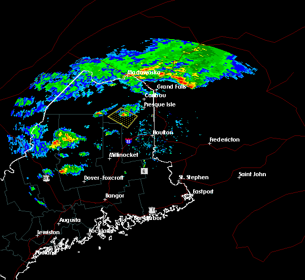
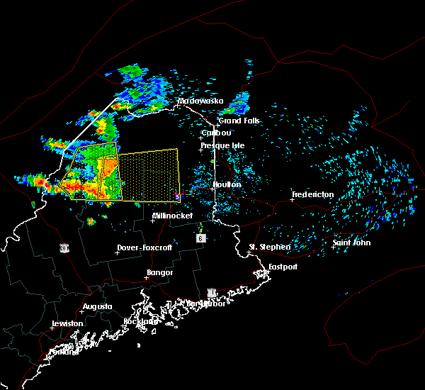
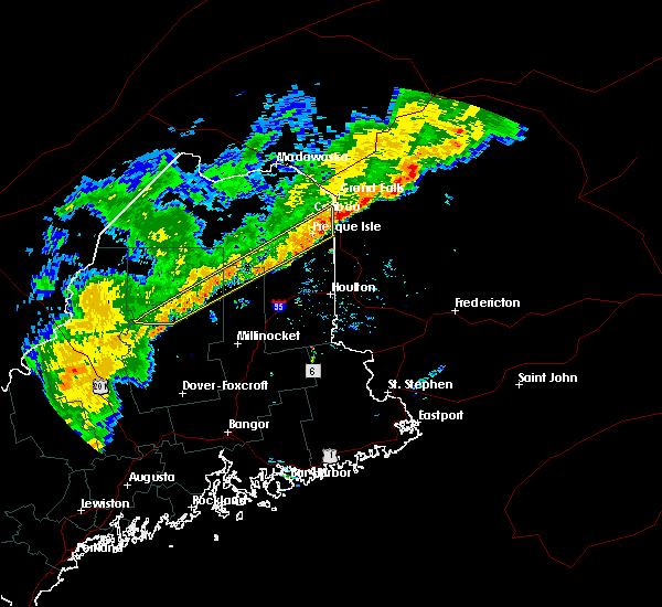
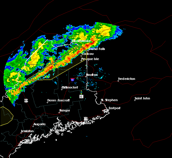
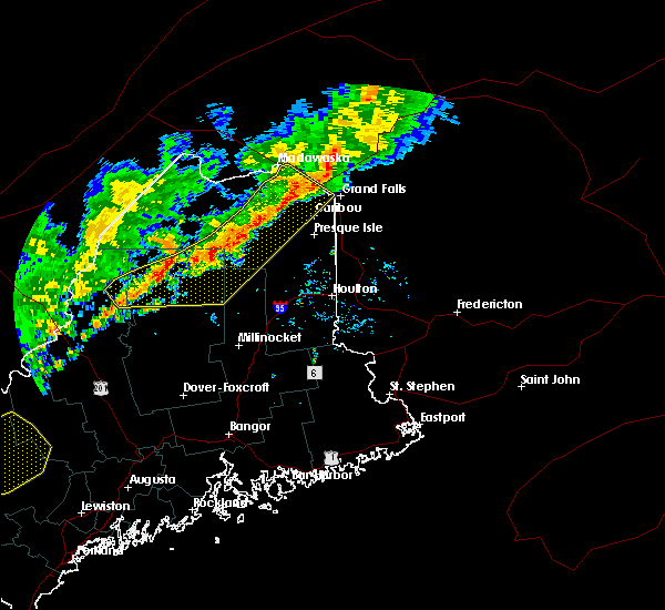
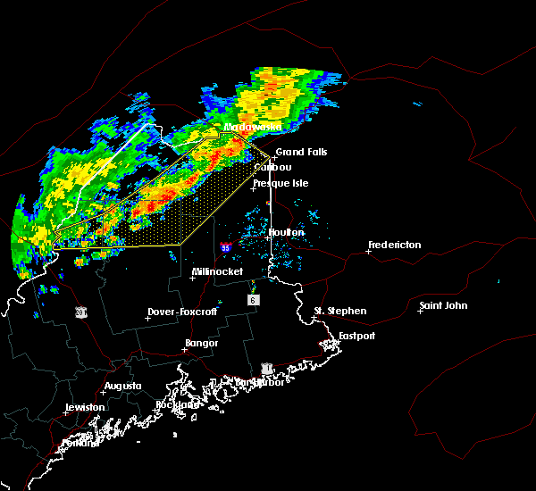
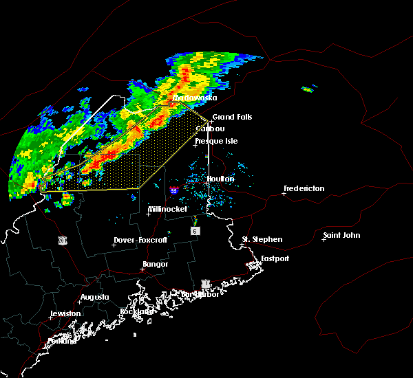
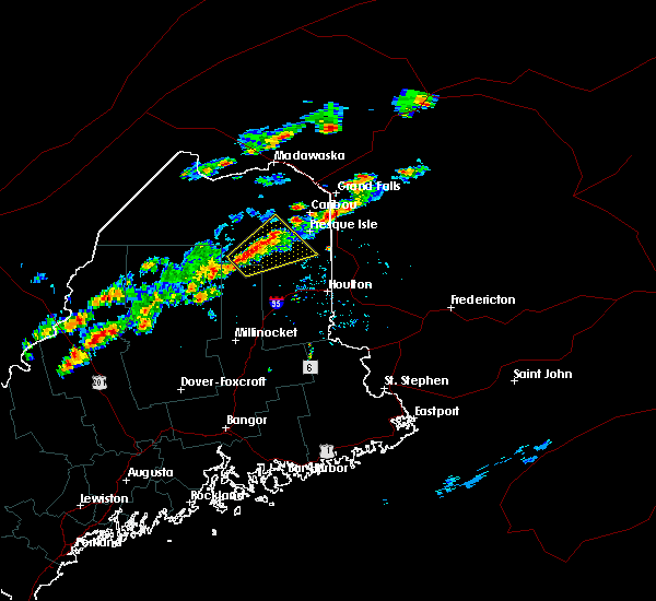
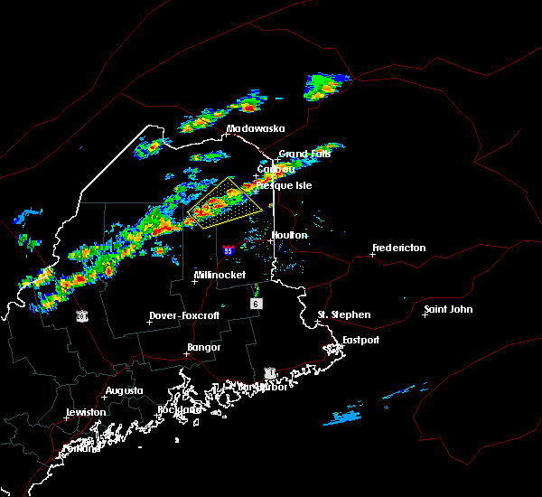
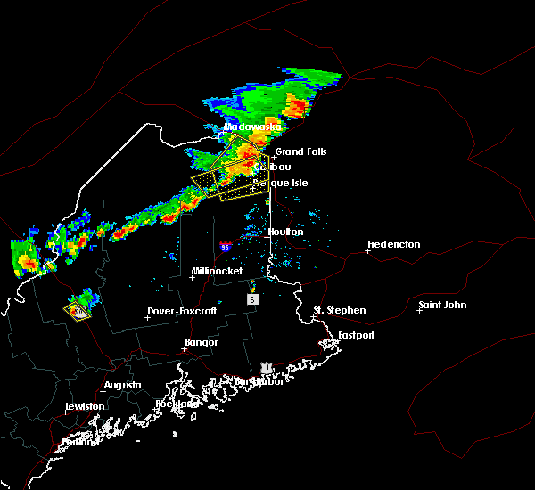
The Top Recent Hail Date for Ashland, ME is Monday, July 14, 2025 (1st out of 10)
Hail and Wind Damage Spotted near Ashland, ME
| Date / Time | Report Details |
|---|---|
| 8/13/2025 4:12 PM EDT | A small cluster of big trees snapped at the edge of a farmers field. time estimated by rada in aroostook county ME, 9.1 miles SSE of Ashland, ME |
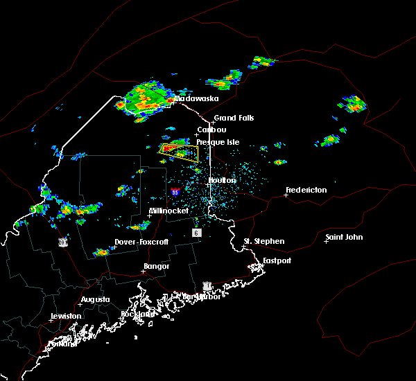
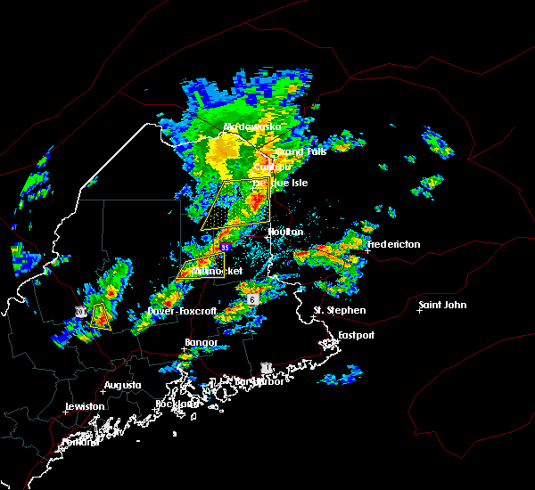
| 7/17/2025 6:45 PM EDT |
 At 644 pm edt, severe thunderstorms were located along a line extending from caribou to ashland to moosehorn crossing, moving east at 40 mph (radar indicated). Hazards include 60 mph wind gusts. Expect damage to trees and power lines. locations impacted include, presque isle, caribou, fort fairfield, limestone, van buren, portage, mapleton, washburn, mars hill, ashland, easton, woodland, bridgewater, portage lake, masardis, oxbow, loring, moosehorn crossing, scopan, and nashville plantation. this includes the following highways, us highway 1 between bridgewater and van buren. State highway 11 between knowles corner and portage. At 644 pm edt, severe thunderstorms were located along a line extending from caribou to ashland to moosehorn crossing, moving east at 40 mph (radar indicated). Hazards include 60 mph wind gusts. Expect damage to trees and power lines. locations impacted include, presque isle, caribou, fort fairfield, limestone, van buren, portage, mapleton, washburn, mars hill, ashland, easton, woodland, bridgewater, portage lake, masardis, oxbow, loring, moosehorn crossing, scopan, and nashville plantation. this includes the following highways, us highway 1 between bridgewater and van buren. State highway 11 between knowles corner and portage.
|
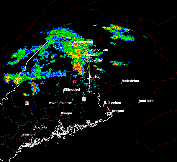
| 7/17/2025 6:09 PM EDT |
 Svrcar the national weather service in caribou maine has issued a * severe thunderstorm warning for, northeastern piscataquis county in north central maine, eastern aroostook county in northern maine, north central penobscot county in east central maine, * until 715 pm edt. * at 609 pm edt, severe thunderstorms were located along a line extending from 6 miles south of van buren to near chesuncook lake, moving east at 40 mph (radar indicated). Hazards include 60 mph wind gusts. expect damage to trees and power lines Svrcar the national weather service in caribou maine has issued a * severe thunderstorm warning for, northeastern piscataquis county in north central maine, eastern aroostook county in northern maine, north central penobscot county in east central maine, * until 715 pm edt. * at 609 pm edt, severe thunderstorms were located along a line extending from 6 miles south of van buren to near chesuncook lake, moving east at 40 mph (radar indicated). Hazards include 60 mph wind gusts. expect damage to trees and power lines
|
| 7/17/2025 5:44 PM EDT |
 At 543 pm edt, severe thunderstorms were located along a line extending from near van buren to near ashland, moving east at 30 mph (radar indicated). Hazards include 60 mph wind gusts. Expect damage to trees and power lines. these severe storms will be near, caribou, van buren, mapleton, washburn, ashland, and woodland around 555 pm edt. limestone around 600 pm edt. presque isle and loring around 610 pm edt. fort fairfield around 615 pm edt. other locations impacted by these severe thunderstorms include scopan mountain, chapman, wade, connor, stockholm, caswell, westmanland, cyr plantation, hamlin, and castle hill. this includes the following highways, us highway 1 between presque isle and van buren. State highway 11 between ashland and portage. At 543 pm edt, severe thunderstorms were located along a line extending from near van buren to near ashland, moving east at 30 mph (radar indicated). Hazards include 60 mph wind gusts. Expect damage to trees and power lines. these severe storms will be near, caribou, van buren, mapleton, washburn, ashland, and woodland around 555 pm edt. limestone around 600 pm edt. presque isle and loring around 610 pm edt. fort fairfield around 615 pm edt. other locations impacted by these severe thunderstorms include scopan mountain, chapman, wade, connor, stockholm, caswell, westmanland, cyr plantation, hamlin, and castle hill. this includes the following highways, us highway 1 between presque isle and van buren. State highway 11 between ashland and portage.
|
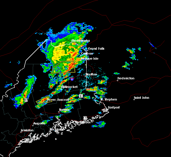
| 7/17/2025 5:29 PM EDT |
 The storm which prompted the warning no longer appears capable of producing a tornado. therefore, the tornado warning will be allowed to expire. a severe thunderstorm warning still remains in effect for these areas until 615 pm. a severe thunderstorm watch remains in effect until 900 pm edt for northern maine. The storm which prompted the warning no longer appears capable of producing a tornado. therefore, the tornado warning will be allowed to expire. a severe thunderstorm warning still remains in effect for these areas until 615 pm. a severe thunderstorm watch remains in effect until 900 pm edt for northern maine.
|
| 7/17/2025 5:18 PM EDT |
 At 517 pm edt, a severe thunderstorm capable of producing a tornado was located near nashville plantation, or 8 miles southwest of portage, moving east at 30 mph (radar indicated rotation). Hazards include tornado. Flying debris will be dangerous to those caught without shelter. mobile homes will be damaged or destroyed. damage to roofs, windows, and vehicles will occur. tree damage is likely. this dangerous storm will be near, portage lake around 525 pm edt. other locations impacted by this tornadic thunderstorm include garfield and nashville. This includes state highway 11 between ashland and portage. At 517 pm edt, a severe thunderstorm capable of producing a tornado was located near nashville plantation, or 8 miles southwest of portage, moving east at 30 mph (radar indicated rotation). Hazards include tornado. Flying debris will be dangerous to those caught without shelter. mobile homes will be damaged or destroyed. damage to roofs, windows, and vehicles will occur. tree damage is likely. this dangerous storm will be near, portage lake around 525 pm edt. other locations impacted by this tornadic thunderstorm include garfield and nashville. This includes state highway 11 between ashland and portage.
|
| 7/17/2025 5:10 PM EDT |
 Svrcar the national weather service in caribou maine has issued a * severe thunderstorm warning for, northeastern aroostook county in northern maine, * until 615 pm edt. * at 509 pm edt, severe thunderstorms were located along a line extending from madawaska lake to just west of ashland, moving east at 25 mph (radar indicated). Hazards include 60 mph wind gusts. Expect damage to trees and power lines. severe thunderstorms will be near, portage, ashland, portage lake, nashville plantation, and madawaska lake around 520 pm edt. woodland around 530 pm edt. caribou and washburn around 545 pm edt. limestone and mapleton around 555 pm edt. presque isle and loring around 555 pm edt. fort fairfield around 615 pm edt. other locations impacted by these severe thunderstorms include scopan mountain, chapman, wade, sinclair, connor, stockholm, caswell, westmanland, cyr plantation, and hamlin. this includes the following highways, us highway 1 between presque isle and van buren. State highway 11 between ashland and portage. Svrcar the national weather service in caribou maine has issued a * severe thunderstorm warning for, northeastern aroostook county in northern maine, * until 615 pm edt. * at 509 pm edt, severe thunderstorms were located along a line extending from madawaska lake to just west of ashland, moving east at 25 mph (radar indicated). Hazards include 60 mph wind gusts. Expect damage to trees and power lines. severe thunderstorms will be near, portage, ashland, portage lake, nashville plantation, and madawaska lake around 520 pm edt. woodland around 530 pm edt. caribou and washburn around 545 pm edt. limestone and mapleton around 555 pm edt. presque isle and loring around 555 pm edt. fort fairfield around 615 pm edt. other locations impacted by these severe thunderstorms include scopan mountain, chapman, wade, sinclair, connor, stockholm, caswell, westmanland, cyr plantation, and hamlin. this includes the following highways, us highway 1 between presque isle and van buren. State highway 11 between ashland and portage.
|
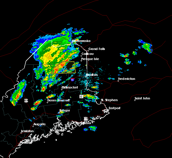
| 7/17/2025 5:03 PM EDT |
 Torcar the national weather service in caribou maine has issued a * tornado warning for, eastern aroostook county in northern maine, * until 530 pm edt. * at 502 pm edt, a severe thunderstorm capable of producing a tornado was located over russel crossing, or 15 miles southwest of portage, moving east at 30 mph (radar indicated rotation). Hazards include tornado. Flying debris will be dangerous to those caught without shelter. mobile homes will be damaged or destroyed. damage to roofs, windows, and vehicles will occur. tree damage is likely. this dangerous storm will be near, nashville plantation around 510 pm edt. portage and ashland around 525 pm edt. other locations impacted by this tornadic thunderstorm include garfield and nashville. This includes state highway 11 between ashland and portage. Torcar the national weather service in caribou maine has issued a * tornado warning for, eastern aroostook county in northern maine, * until 530 pm edt. * at 502 pm edt, a severe thunderstorm capable of producing a tornado was located over russel crossing, or 15 miles southwest of portage, moving east at 30 mph (radar indicated rotation). Hazards include tornado. Flying debris will be dangerous to those caught without shelter. mobile homes will be damaged or destroyed. damage to roofs, windows, and vehicles will occur. tree damage is likely. this dangerous storm will be near, nashville plantation around 510 pm edt. portage and ashland around 525 pm edt. other locations impacted by this tornadic thunderstorm include garfield and nashville. This includes state highway 11 between ashland and portage.
|
| 7/17/2025 4:48 PM EDT |
 At 448 pm edt, severe thunderstorms were located along a line extending from 7 miles southeast of eagle lake to 6 miles northeast of big machias lake to 10 miles southwest of russel crossing, moving east at 30 mph (radar indicated). Hazards include 60 mph wind gusts and penny size hail. Expect damage to trees and power lines. locations impacted include, eagle lake, portage, washburn, ashland, woodland, portage lake, russel crossing, madawaska lake, big machias lake, nashville plantation, cross lake, new sweden, castle hill, perham, wade, stockholm, winterville, westmanland, guerette, and garfield. This includes state highway 11 between ashland and eagle lake. At 448 pm edt, severe thunderstorms were located along a line extending from 7 miles southeast of eagle lake to 6 miles northeast of big machias lake to 10 miles southwest of russel crossing, moving east at 30 mph (radar indicated). Hazards include 60 mph wind gusts and penny size hail. Expect damage to trees and power lines. locations impacted include, eagle lake, portage, washburn, ashland, woodland, portage lake, russel crossing, madawaska lake, big machias lake, nashville plantation, cross lake, new sweden, castle hill, perham, wade, stockholm, winterville, westmanland, guerette, and garfield. This includes state highway 11 between ashland and eagle lake.
|
| 7/17/2025 4:31 PM EDT |
 Svrcar the national weather service in caribou maine has issued a * severe thunderstorm warning for, northeastern piscataquis county in north central maine, northeastern aroostook county in northern maine, * until 515 pm edt. * at 430 pm edt, severe thunderstorms were located along a line extending from near eagle lake to big machias lake to 10 miles east of churchill dam, moving east at 30 mph. the line is approaching the route 11 corridor from eagle lake to portage to masardis (radar indicated). Hazards include 60 mph wind gusts. expect damage to trees and power lines Svrcar the national weather service in caribou maine has issued a * severe thunderstorm warning for, northeastern piscataquis county in north central maine, northeastern aroostook county in northern maine, * until 515 pm edt. * at 430 pm edt, severe thunderstorms were located along a line extending from near eagle lake to big machias lake to 10 miles east of churchill dam, moving east at 30 mph. the line is approaching the route 11 corridor from eagle lake to portage to masardis (radar indicated). Hazards include 60 mph wind gusts. expect damage to trees and power lines
|
| 7/14/2025 4:49 PM EDT | Trees down and pole snapped near ashland high school closing roa in aroostook county ME, 0.6 miles SSE of Ashland, ME |
| 7/14/2025 4:28 PM EDT |
 At 428 pm edt, a severe thunderstorm was located near ashland, or 11 miles southeast of portage, moving east at 30 mph (radar indicated). Hazards include 60 mph wind gusts and quarter size hail. Minor hail damage to vehicles is possible. expect wind damage to trees and power lines. locations impacted include, presque isle, caribou, mapleton, washburn, ashland, nashville plantation, westfield, chapman, castle hill, wade, scopan mountain, and garfield. this includes the following highways, us highway 1 near presque isle. State highway 11 near ashland. At 428 pm edt, a severe thunderstorm was located near ashland, or 11 miles southeast of portage, moving east at 30 mph (radar indicated). Hazards include 60 mph wind gusts and quarter size hail. Minor hail damage to vehicles is possible. expect wind damage to trees and power lines. locations impacted include, presque isle, caribou, mapleton, washburn, ashland, nashville plantation, westfield, chapman, castle hill, wade, scopan mountain, and garfield. this includes the following highways, us highway 1 near presque isle. State highway 11 near ashland.
|
| 7/14/2025 4:26 PM EDT | Corrects timing of previous tstm wnd dmg report from 1 ese ashland. trees down and pole snapped near ashland high school closing roa in aroostook county ME, 0.6 miles SSE of Ashland, ME |
| 7/14/2025 4:25 PM EDT | Large tree uproote in aroostook county ME, 0.6 miles SSE of Ashland, ME |
| 7/14/2025 4:19 PM EDT | Quarter sized hail reported 0.6 miles SSE of Ashland, ME, quarter size hail in ashland. |
| 7/14/2025 4:19 PM EDT | Tree down across the roa in aroostook county ME, 0.9 miles NNE of Ashland, ME |
| 7/14/2025 4:10 PM EDT |
 Svrcar the national weather service in caribou maine has issued a * severe thunderstorm warning for, east central aroostook county in northern maine, * until 515 pm edt. * at 409 pm edt, a severe thunderstorm was located near nashville plantation, or 7 miles south of portage, moving east at 25 mph (radar indicated). Hazards include 60 mph wind gusts and quarter size hail. Minor hail damage to vehicles is possible. Expect wind damage to trees and power lines. Svrcar the national weather service in caribou maine has issued a * severe thunderstorm warning for, east central aroostook county in northern maine, * until 515 pm edt. * at 409 pm edt, a severe thunderstorm was located near nashville plantation, or 7 miles south of portage, moving east at 25 mph (radar indicated). Hazards include 60 mph wind gusts and quarter size hail. Minor hail damage to vehicles is possible. Expect wind damage to trees and power lines.
|
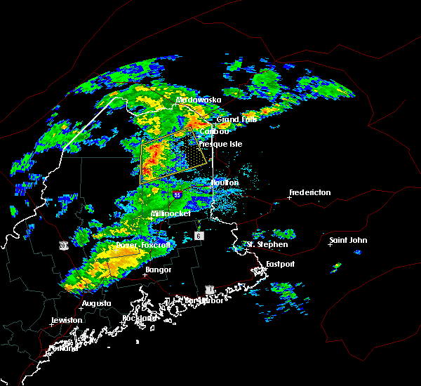
| 7/3/2025 12:16 PM EDT |
 The storm which prompted the warning has weakened below severe limits, and no longer poses an immediate threat to life or property. therefore, the warning will be allowed to expire. however, small hail and gusty winds are still possible with this thunderstorm. a severe thunderstorm watch remains in effect until 600 pm edt for northern and north central maine. to report severe weather, contact your nearest law enforcement agency. they will relay your report to the national weather service caribou maine. The storm which prompted the warning has weakened below severe limits, and no longer poses an immediate threat to life or property. therefore, the warning will be allowed to expire. however, small hail and gusty winds are still possible with this thunderstorm. a severe thunderstorm watch remains in effect until 600 pm edt for northern and north central maine. to report severe weather, contact your nearest law enforcement agency. they will relay your report to the national weather service caribou maine.
|
| 7/3/2025 11:56 AM EDT |
 At 1153 am edt, a severe thunderstorm was located near washburn, moving east at 45 mph (radar indicated). Hazards include 60 mph wind gusts and quarter size hail. Minor hail damage to vehicles is possible. expect wind damage to trees and power lines. locations impacted include, presque isle, caribou, fort fairfield, limestone, portage, mapleton, washburn, ashland, easton, woodland, portage lake, russel crossing, big machias lake, loring, fish river lake, nashville plantation, new sweden, chapman, connor, and castle hill. this includes the following highways, us highway 1 between presque isle and caribou. State highway 11 between ashland and portage. At 1153 am edt, a severe thunderstorm was located near washburn, moving east at 45 mph (radar indicated). Hazards include 60 mph wind gusts and quarter size hail. Minor hail damage to vehicles is possible. expect wind damage to trees and power lines. locations impacted include, presque isle, caribou, fort fairfield, limestone, portage, mapleton, washburn, ashland, easton, woodland, portage lake, russel crossing, big machias lake, loring, fish river lake, nashville plantation, new sweden, chapman, connor, and castle hill. this includes the following highways, us highway 1 between presque isle and caribou. State highway 11 between ashland and portage.
|
| 7/3/2025 11:42 AM EDT | Multiple trees and powerlines down in the portage... me area. time estimated by rada in aroostook county ME, 10.2 miles SSE of Ashland, ME |
| 7/3/2025 10:58 AM EDT |
 Svrcar the national weather service in caribou maine has issued a * severe thunderstorm warning for, east central aroostook county in northern maine, * until 1215 pm edt. * at 1057 am edt, a severe thunderstorm was located near big machias lake, or 15 miles south of deboullie mountain, moving east at 55 mph (emergency management). Hazards include 60 mph wind gusts and quarter size hail. Minor hail damage to vehicles is possible. Expect wind damage to trees and power lines. Svrcar the national weather service in caribou maine has issued a * severe thunderstorm warning for, east central aroostook county in northern maine, * until 1215 pm edt. * at 1057 am edt, a severe thunderstorm was located near big machias lake, or 15 miles south of deboullie mountain, moving east at 55 mph (emergency management). Hazards include 60 mph wind gusts and quarter size hail. Minor hail damage to vehicles is possible. Expect wind damage to trees and power lines.
|
| 8/3/2024 8:37 PM EDT |
 Svrcar the national weather service in caribou maine has issued a * severe thunderstorm warning for, east central aroostook county in northern maine, * until 915 pm edt. * at 837 pm edt, severe thunderstorms were located along a line extending from near limestone to near masardis, moving east at 25 mph (radar indicated). Hazards include 60 mph wind gusts and quarter size hail. Minor hail damage to vehicles is possible. Expect wind damage to trees and power lines. Svrcar the national weather service in caribou maine has issued a * severe thunderstorm warning for, east central aroostook county in northern maine, * until 915 pm edt. * at 837 pm edt, severe thunderstorms were located along a line extending from near limestone to near masardis, moving east at 25 mph (radar indicated). Hazards include 60 mph wind gusts and quarter size hail. Minor hail damage to vehicles is possible. Expect wind damage to trees and power lines.
|
| 8/2/2024 3:15 PM EDT | Small tree fell on wires on route 11 one mile north of oxbow road. tree and cable lines caught on fire. fire department and utility on scene. time estimated based on ra in aroostook county ME, 10.5 miles N of Ashland, ME |
| 7/30/2024 5:07 PM EDT |
 The storm which prompted the warning has weakened below severe limits, and has exited the warned area. therefore, the warning will be allowed to expire. however, heavy rain is still possible with this thunderstorm. The storm which prompted the warning has weakened below severe limits, and has exited the warned area. therefore, the warning will be allowed to expire. however, heavy rain is still possible with this thunderstorm.
|
| 7/30/2024 4:45 PM EDT |
 At 445 pm edt, a severe thunderstorm was located 9 miles north of moosehorn crossing, or 21 miles southwest of portage, moving east at 20 mph (radar indicated). Hazards include 60 mph wind gusts and quarter size hail. Minor hail damage to vehicles is possible. expect wind damage to trees and power lines. Locations impacted include, ashland, masardis, oxbow, scopan, and garfield. At 445 pm edt, a severe thunderstorm was located 9 miles north of moosehorn crossing, or 21 miles southwest of portage, moving east at 20 mph (radar indicated). Hazards include 60 mph wind gusts and quarter size hail. Minor hail damage to vehicles is possible. expect wind damage to trees and power lines. Locations impacted include, ashland, masardis, oxbow, scopan, and garfield.
|
| 7/30/2024 4:45 PM EDT |
 the severe thunderstorm warning has been cancelled and is no longer in effect the severe thunderstorm warning has been cancelled and is no longer in effect
|
| 7/30/2024 4:27 PM EDT |
 Svrcar the national weather service in caribou maine has issued a * severe thunderstorm warning for, northeastern piscataquis county in north central maine, central aroostook county in northern maine, north central penobscot county in east central maine, * until 515 pm edt. * at 427 pm edt, a severe thunderstorm was located 10 miles south of russel crossing, or 24 miles southwest of portage, moving east at 20 mph (radar indicated). Hazards include 60 mph wind gusts and quarter size hail. Minor hail damage to vehicles is possible. Expect wind damage to trees and power lines. Svrcar the national weather service in caribou maine has issued a * severe thunderstorm warning for, northeastern piscataquis county in north central maine, central aroostook county in northern maine, north central penobscot county in east central maine, * until 515 pm edt. * at 427 pm edt, a severe thunderstorm was located 10 miles south of russel crossing, or 24 miles southwest of portage, moving east at 20 mph (radar indicated). Hazards include 60 mph wind gusts and quarter size hail. Minor hail damage to vehicles is possible. Expect wind damage to trees and power lines.
|
| 5/23/2024 2:49 PM EDT | 2 large trees down across cottage road in portage. time estimated by rada in aroostook county ME, 11.4 miles SSE of Ashland, ME |
| 5/23/2024 2:49 PM EDT | 3 large trees down on powerlines on the west road. power was out in the tow in aroostook county ME, 10.5 miles SSE of Ashland, ME |
| 8/13/2023 4:49 PM EDT |
 At 449 pm edt, a severe thunderstorm was located near russel crossing, or 20 miles southwest of portage, moving east at 25 mph (radar indicated). Hazards include 70 mph wind gusts and quarter size hail. Minor hail damage to vehicles is possible. expect considerable tree damage. Wind damage is also likely to mobile homes, roofs, and outbuildings. At 449 pm edt, a severe thunderstorm was located near russel crossing, or 20 miles southwest of portage, moving east at 25 mph (radar indicated). Hazards include 70 mph wind gusts and quarter size hail. Minor hail damage to vehicles is possible. expect considerable tree damage. Wind damage is also likely to mobile homes, roofs, and outbuildings.
|
| 7/7/2023 2:36 PM EDT | Tree down on power line in garfield plantation. time estimated based on rada in aroostook county ME, 3.1 miles ENE of Ashland, ME |
| 8/30/2022 6:13 PM EDT |
 The severe thunderstorm warning for northeastern aroostook county will expire at 615 pm edt, the storms which prompted the warning have weakened below severe limits, but frequent cloud to ground lightning and heavy downpours are still likely. therefore, the warning will be allowed to expire. however heavy rain is still possible with these thunderstorms. The severe thunderstorm warning for northeastern aroostook county will expire at 615 pm edt, the storms which prompted the warning have weakened below severe limits, but frequent cloud to ground lightning and heavy downpours are still likely. therefore, the warning will be allowed to expire. however heavy rain is still possible with these thunderstorms.
|
| 8/30/2022 5:29 PM EDT |
 At 529 pm edt, severe thunderstorms were located along a line extending from 6 miles southwest of madawaska lake to 6 miles southeast of russel crossing, moving east at 35 mph (radar indicated). Hazards include 60 mph wind gusts and nickel size hail. expect damage to trees and power lines At 529 pm edt, severe thunderstorms were located along a line extending from 6 miles southwest of madawaska lake to 6 miles southeast of russel crossing, moving east at 35 mph (radar indicated). Hazards include 60 mph wind gusts and nickel size hail. expect damage to trees and power lines
|
| 7/19/2022 3:54 PM EDT |
 At 353 pm edt, severe thunderstorms were located along a line extending from near caribou to masardis, moving southeast at 45 mph (radar indicated). Hazards include 60 mph wind gusts. expect damage to trees and power lines At 353 pm edt, severe thunderstorms were located along a line extending from near caribou to masardis, moving southeast at 45 mph (radar indicated). Hazards include 60 mph wind gusts. expect damage to trees and power lines
|
| 5/21/2022 4:56 PM EDT |
 At 456 pm edt, a severe thunderstorm was located 8 miles west of big machias lake, or 19 miles south of deboullie mountain, moving east at 40 mph (radar indicated). Hazards include 60 mph wind gusts and quarter size hail. Minor hail damage to vehicles is possible. Expect wind damage to trees and power lines. At 456 pm edt, a severe thunderstorm was located 8 miles west of big machias lake, or 19 miles south of deboullie mountain, moving east at 40 mph (radar indicated). Hazards include 60 mph wind gusts and quarter size hail. Minor hail damage to vehicles is possible. Expect wind damage to trees and power lines.
|
| 6/21/2021 5:57 PM EDT |
 At 556 pm edt, a severe thunderstorm was located near mapleton, or near presque isle, moving northeast at 30 mph. another strong to severe thunderstorm was located north of ashland (radar indicated). Hazards include 60 mph wind gusts and quarter size hail. Minor hail damage to vehicles is possible. expect wind damage to trees and power lines. Locations impacted include, presque isle, caribou, fort fairfield, limestone, mapleton, washburn, ashland, woodland, chapman, castle hill and wade. At 556 pm edt, a severe thunderstorm was located near mapleton, or near presque isle, moving northeast at 30 mph. another strong to severe thunderstorm was located north of ashland (radar indicated). Hazards include 60 mph wind gusts and quarter size hail. Minor hail damage to vehicles is possible. expect wind damage to trees and power lines. Locations impacted include, presque isle, caribou, fort fairfield, limestone, mapleton, washburn, ashland, woodland, chapman, castle hill and wade.
|
| 6/21/2021 5:37 PM EDT |
 At 536 pm edt, a severe thunderstorm was located near ashland, or 10 miles southeast of portage, moving northeast at 30 mph (radar indicated). Hazards include 60 mph wind gusts and quarter size hail. Minor hail damage to vehicles is possible. Expect wind damage to trees and power lines. At 536 pm edt, a severe thunderstorm was located near ashland, or 10 miles southeast of portage, moving northeast at 30 mph (radar indicated). Hazards include 60 mph wind gusts and quarter size hail. Minor hail damage to vehicles is possible. Expect wind damage to trees and power lines.
|
| 6/21/2021 5:12 PM EDT |
 At 512 pm edt, a severe thunderstorm capable of producing a tornado was located near ashland, or 12 miles south of portage, moving east at 25 mph (radar indicated rotation). Hazards include tornado and quarter size hail. Flying debris will be dangerous to those caught without shelter. mobile homes will be damaged or destroyed. damage to roofs, windows, and vehicles will occur. tree damage is likely. this dangerous storm will be near, nashville plantation around 525 pm edt. ashland around 540 pm edt. Other locations impacted by this tornadic thunderstorm include scopan mountain, squa pan, castle hill, garfield, nashville, chapman and wade. At 512 pm edt, a severe thunderstorm capable of producing a tornado was located near ashland, or 12 miles south of portage, moving east at 25 mph (radar indicated rotation). Hazards include tornado and quarter size hail. Flying debris will be dangerous to those caught without shelter. mobile homes will be damaged or destroyed. damage to roofs, windows, and vehicles will occur. tree damage is likely. this dangerous storm will be near, nashville plantation around 525 pm edt. ashland around 540 pm edt. Other locations impacted by this tornadic thunderstorm include scopan mountain, squa pan, castle hill, garfield, nashville, chapman and wade.
|
| 6/21/2021 4:59 PM EDT |
 At 458 pm edt, a severe thunderstorm capable of producing a tornado was located 7 miles southeast of russel crossing, or 15 miles southwest of portage, moving northeast at 35 mph (radar indicated rotation). Hazards include tornado and quarter size hail. Flying debris will be dangerous to those caught without shelter. mobile homes will be damaged or destroyed. damage to roofs, windows, and vehicles will occur. tree damage is likely. this dangerous storm will be near, nashville plantation around 520 pm edt. ashland around 530 pm edt. Other locations impacted by this tornadic thunderstorm include scopan mountain, squa pan, castle hill, garfield, nashville, chapman and wade. At 458 pm edt, a severe thunderstorm capable of producing a tornado was located 7 miles southeast of russel crossing, or 15 miles southwest of portage, moving northeast at 35 mph (radar indicated rotation). Hazards include tornado and quarter size hail. Flying debris will be dangerous to those caught without shelter. mobile homes will be damaged or destroyed. damage to roofs, windows, and vehicles will occur. tree damage is likely. this dangerous storm will be near, nashville plantation around 520 pm edt. ashland around 530 pm edt. Other locations impacted by this tornadic thunderstorm include scopan mountain, squa pan, castle hill, garfield, nashville, chapman and wade.
|
| 9/30/2020 12:41 PM EDT |
 The severe thunderstorm warning for northeastern aroostook county will expire at 1245 pm edt, the line of showers which prompted the warning have moved out of the area. therefore, the warning will be allowed to expire. however gusty winds to 40 mph are still possible. The severe thunderstorm warning for northeastern aroostook county will expire at 1245 pm edt, the line of showers which prompted the warning have moved out of the area. therefore, the warning will be allowed to expire. however gusty winds to 40 mph are still possible.
|
| 9/30/2020 12:01 PM EDT |
 At 1159 am edt, intense showers with embedded thunder were located along a line extending from near frenchville to 7 miles southeast of moosehorn crossing, moving east at 50 mph (radar indicated). Hazards include 60 mph wind gusts. expect damage to trees and power lines At 1159 am edt, intense showers with embedded thunder were located along a line extending from near frenchville to 7 miles southeast of moosehorn crossing, moving east at 50 mph (radar indicated). Hazards include 60 mph wind gusts. expect damage to trees and power lines
|
| 7/9/2020 1:23 PM EDT | 2 trees down on state roa in aroostook county ME, 6.1 miles SW of Ashland, ME |
| 7/9/2020 1:20 PM EDT |
 At 119 pm edt, a severe thunderstorm was located near ashland, or 12 miles southeast of portage, moving south at 15 mph (radar indicated). Hazards include 60 mph wind gusts and quarter size hail. Minor hail damage to vehicles is possible. Expect wind damage to trees and power lines. At 119 pm edt, a severe thunderstorm was located near ashland, or 12 miles southeast of portage, moving south at 15 mph (radar indicated). Hazards include 60 mph wind gusts and quarter size hail. Minor hail damage to vehicles is possible. Expect wind damage to trees and power lines.
|
| 7/9/2020 12:56 PM EDT |
 The national weather service in caribou maine has issued a * severe thunderstorm warning for. east central aroostook county in northern maine. until 200 pm edt. At 1254 pm edt, severe thunderstorms were located along a line extending from near woodland to 6 miles west of mapleton, moving. The national weather service in caribou maine has issued a * severe thunderstorm warning for. east central aroostook county in northern maine. until 200 pm edt. At 1254 pm edt, severe thunderstorms were located along a line extending from near woodland to 6 miles west of mapleton, moving.
|
| 7/5/2020 3:10 PM EDT |
 The severe thunderstorm warning for east central aroostook county will expire at 315 pm edt, the storm which prompted the warning has weakened below severe limits, but heavy downpours are still likely. therefore, the warning will be allowed to expire. The severe thunderstorm warning for east central aroostook county will expire at 315 pm edt, the storm which prompted the warning has weakened below severe limits, but heavy downpours are still likely. therefore, the warning will be allowed to expire.
|
| 7/5/2020 2:54 PM EDT |
 At 252 pm edt, a severe thunderstorm was located near masardis, or 20 miles south of portage, moving southeast at 20 mph (radar indicated). Hazards include 60 mph wind gusts and quarter size hail. Minor hail damage to vehicles is possible. expect wind damage to trees and power lines. Locations impacted include, ashland, masardis, oxbow, scopan, nashville plantation, scopan lake, squa pan, saint croix and garfield. At 252 pm edt, a severe thunderstorm was located near masardis, or 20 miles south of portage, moving southeast at 20 mph (radar indicated). Hazards include 60 mph wind gusts and quarter size hail. Minor hail damage to vehicles is possible. expect wind damage to trees and power lines. Locations impacted include, ashland, masardis, oxbow, scopan, nashville plantation, scopan lake, squa pan, saint croix and garfield.
|
| 7/5/2020 2:31 PM EDT |
 At 230 pm edt, a severe thunderstorm was located near masardis, or 15 miles south of portage, moving southeast at 20 mph (radar indicated). Hazards include 60 mph wind gusts and quarter size hail. Minor hail damage to vehicles is possible. Expect wind damage to trees and power lines. At 230 pm edt, a severe thunderstorm was located near masardis, or 15 miles south of portage, moving southeast at 20 mph (radar indicated). Hazards include 60 mph wind gusts and quarter size hail. Minor hail damage to vehicles is possible. Expect wind damage to trees and power lines.
|
| 7/31/2019 11:30 AM EDT | Large tree limbs down at ashland community library. reported via social medi in aroostook county ME, 0.6 miles SSE of Ashland, ME |
| 10/9/2018 11:57 PM EDT |
 The severe thunderstorm warning for east central aroostook county will expire at midnight edt, the storm which prompted the warning has weakened below severe limits, but heavy downpours are still likely. therefore, the warning will be allowed to expire. The severe thunderstorm warning for east central aroostook county will expire at midnight edt, the storm which prompted the warning has weakened below severe limits, but heavy downpours are still likely. therefore, the warning will be allowed to expire.
|
| 10/9/2018 11:37 PM EDT |
 At 1136 pm edt, a severe thunderstorm was located near scopan, or 14 miles southwest of presque isle, moving southeast at 35 mph (radar indicated). Hazards include 60 mph wind gusts. Expect damage to trees and power lines. Locations impacted include, presque isle, houlton, mapleton, mars hill, ashland, easton, bridgewater, portage lake, masardis, oxbow, scopan, nashville plantation, dudley township, littleton, monticello, blaine, westfield, chapman, castle hill and scopan lake. At 1136 pm edt, a severe thunderstorm was located near scopan, or 14 miles southwest of presque isle, moving southeast at 35 mph (radar indicated). Hazards include 60 mph wind gusts. Expect damage to trees and power lines. Locations impacted include, presque isle, houlton, mapleton, mars hill, ashland, easton, bridgewater, portage lake, masardis, oxbow, scopan, nashville plantation, dudley township, littleton, monticello, blaine, westfield, chapman, castle hill and scopan lake.
|
| 10/9/2018 11:01 PM EDT |
 At 1100 pm edt, a severe thunderstorm was located near russel crossing, or 11 miles southwest of portage, moving southeast at 40 mph (radar indicated). Hazards include 60 mph wind gusts. damage to trees and power lines At 1100 pm edt, a severe thunderstorm was located near russel crossing, or 11 miles southwest of portage, moving southeast at 40 mph (radar indicated). Hazards include 60 mph wind gusts. damage to trees and power lines
|
| 7/28/2018 9:49 PM EDT |
 At 948 pm edt, a severe thunderstorm was located near masardis, or 17 miles south of portage, moving northeast at 35 mph (radar indicated). Hazards include 60 mph wind gusts and quarter size hail. Minor hail damage to vehicles is possible. expect wind damage to trees and power lines. Locations impacted include, ashland, masardis, oxbow, scopan, nashville plantation, scopan lake, squa pan and garfield. At 948 pm edt, a severe thunderstorm was located near masardis, or 17 miles south of portage, moving northeast at 35 mph (radar indicated). Hazards include 60 mph wind gusts and quarter size hail. Minor hail damage to vehicles is possible. expect wind damage to trees and power lines. Locations impacted include, ashland, masardis, oxbow, scopan, nashville plantation, scopan lake, squa pan and garfield.
|
| 7/28/2018 9:31 PM EDT |
 At 930 pm edt, a severe thunderstorm was located near oxbow, or 22 miles south of portage, moving northeast at 30 mph (radar indicated). Hazards include 60 mph wind gusts and quarter size hail. Minor hail damage to vehicles is possible. Expect wind damage to trees and power lines. At 930 pm edt, a severe thunderstorm was located near oxbow, or 22 miles south of portage, moving northeast at 30 mph (radar indicated). Hazards include 60 mph wind gusts and quarter size hail. Minor hail damage to vehicles is possible. Expect wind damage to trees and power lines.
|
| 7/2/2018 6:01 AM EDT |
 At 559 am edt, a severe thunderstorm was located 9 miles southeast of russel crossing moving east at 45 mph (radar indicated). Hazards include 60 mph wind gusts and nickel size hail. Expect damage to trees and power lines. Locations impacted include, patten, ashland, sherman, island falls, masardis, mount chase, oxbow, russel crossing, south branch pond, tamway, churchill dam, moosehorn crossing, telos lake, shin pond, baxter state park, chesuncook, nashville plantation, chamberlain lake, katahdin woods and waters national monument and stacyville. At 559 am edt, a severe thunderstorm was located 9 miles southeast of russel crossing moving east at 45 mph (radar indicated). Hazards include 60 mph wind gusts and nickel size hail. Expect damage to trees and power lines. Locations impacted include, patten, ashland, sherman, island falls, masardis, mount chase, oxbow, russel crossing, south branch pond, tamway, churchill dam, moosehorn crossing, telos lake, shin pond, baxter state park, chesuncook, nashville plantation, chamberlain lake, katahdin woods and waters national monument and stacyville.
|
| 7/2/2018 5:21 AM EDT |
 The national weather service in caribou maine has issued a * severe thunderstorm warning for. northeastern piscataquis county in north central maine. central aroostook county in northern maine. north central penobscot county in east central maine. Until 615 am edt. The national weather service in caribou maine has issued a * severe thunderstorm warning for. northeastern piscataquis county in north central maine. central aroostook county in northern maine. north central penobscot county in east central maine. Until 615 am edt.
|
| 8/15/2017 9:13 PM EDT |
 At 912 pm edt, a severe thunderstorm was located over washburn, or 9 miles southwest of caribou, moving northeast at 40 mph (radar indicated). Hazards include 60 mph wind gusts. Expect damage to trees and power lines. locations impacted include, presque isle, caribou, portage, mapleton, washburn, mars hill, ashland, woodland, portage lake, masardis, oxbow, moosehorn crossing, scopan, nashville plantation, blaine, new sweden, westfield, chapman, castle hill and perham. this includes the following highways, us highway 1 blaine and near presque isle. State highway 11 between masardis and portage. At 912 pm edt, a severe thunderstorm was located over washburn, or 9 miles southwest of caribou, moving northeast at 40 mph (radar indicated). Hazards include 60 mph wind gusts. Expect damage to trees and power lines. locations impacted include, presque isle, caribou, portage, mapleton, washburn, mars hill, ashland, woodland, portage lake, masardis, oxbow, moosehorn crossing, scopan, nashville plantation, blaine, new sweden, westfield, chapman, castle hill and perham. this includes the following highways, us highway 1 blaine and near presque isle. State highway 11 between masardis and portage.
|
| 8/15/2017 8:41 PM EDT |
 At 841 pm edt, a severe thunderstorm was located near nashville plantation, or 8 miles southwest of portage, moving northeast at 40 mph (radar indicated). Hazards include 60 mph wind gusts. expect damage to trees and power lines At 841 pm edt, a severe thunderstorm was located near nashville plantation, or 8 miles southwest of portage, moving northeast at 40 mph (radar indicated). Hazards include 60 mph wind gusts. expect damage to trees and power lines
|
| 7/16/2017 12:46 PM EDT |
 At 1244 pm edt, a severe thunderstorm was located near ashland, moving southeast at 25 mph (radar indicated). Hazards include 60 mph wind gusts and quarter size hail. Minor hail damage to vehicles is possible. expect wind damage to trees and power lines. locations impacted include, presque isle, mapleton, ashland, masardis, nashville plantation, scopan, westfield, chapman, castle hill, scopan mountain, squa pan and garfield. this storm is also showing signs of rotation and a tornado cannot totally be ruled out. this includes the following highways, us highway 1 near presque isle. State highway 11 near ashland. At 1244 pm edt, a severe thunderstorm was located near ashland, moving southeast at 25 mph (radar indicated). Hazards include 60 mph wind gusts and quarter size hail. Minor hail damage to vehicles is possible. expect wind damage to trees and power lines. locations impacted include, presque isle, mapleton, ashland, masardis, nashville plantation, scopan, westfield, chapman, castle hill, scopan mountain, squa pan and garfield. this storm is also showing signs of rotation and a tornado cannot totally be ruled out. this includes the following highways, us highway 1 near presque isle. State highway 11 near ashland.
|
| 7/16/2017 12:22 PM EDT |
 At 1219 pm edt, a severe thunderstorm was located near ashland, moving east at 30 mph (radar indicated). Hazards include 60 mph wind gusts and quarter size hail. Minor hail damage to vehicles is possible. expect wind damage to trees and power lines. this severe thunderstorm will be near, mapleton around 1255 pm edt. presque isle around 100 pm edt. other locations impacted by this severe thunderstorm include chapman, castle hill, garfield and westfield. this includes the following highways, us highway 1 near presque isle. State highway 11 near ashland. At 1219 pm edt, a severe thunderstorm was located near ashland, moving east at 30 mph (radar indicated). Hazards include 60 mph wind gusts and quarter size hail. Minor hail damage to vehicles is possible. expect wind damage to trees and power lines. this severe thunderstorm will be near, mapleton around 1255 pm edt. presque isle around 100 pm edt. other locations impacted by this severe thunderstorm include chapman, castle hill, garfield and westfield. this includes the following highways, us highway 1 near presque isle. State highway 11 near ashland.
|
| 7/22/2016 4:03 PM EDT |
 At 403 pm edt, a severe thunderstorm was located near mars hill, or 9 miles southeast of presque isle, moving east at 35 mph (radar indicated). Hazards include 60 mph wind gusts and quarter size hail. Hail damage to vehicles is expected. expect wind damage to roofs, siding, and trees. Locations impacted include, presque isle, fort fairfield, mapleton, mars hill, ashland, easton, bridgewater, masardis, scopan, monticello, blaine, westfield, chapman, castle hill, scopan mountain, scopan lake and number nine mountain. At 403 pm edt, a severe thunderstorm was located near mars hill, or 9 miles southeast of presque isle, moving east at 35 mph (radar indicated). Hazards include 60 mph wind gusts and quarter size hail. Hail damage to vehicles is expected. expect wind damage to roofs, siding, and trees. Locations impacted include, presque isle, fort fairfield, mapleton, mars hill, ashland, easton, bridgewater, masardis, scopan, monticello, blaine, westfield, chapman, castle hill, scopan mountain, scopan lake and number nine mountain.
|
| 7/22/2016 3:41 PM EDT |
 At 340 pm edt, a severe thunderstorm was located over scopan, or 14 miles southwest of presque isle, moving east at 30 mph (radar indicated). Hazards include 60 mph wind gusts and quarter size hail. Hail damage to vehicles is expected. Expect wind damage to roofs, siding, and trees. At 340 pm edt, a severe thunderstorm was located over scopan, or 14 miles southwest of presque isle, moving east at 30 mph (radar indicated). Hazards include 60 mph wind gusts and quarter size hail. Hail damage to vehicles is expected. Expect wind damage to roofs, siding, and trees.
|
| 7/14/2016 7:31 PM EDT |
 At 729 pm edt, severe thunderstorms were located along a line extending from 7 miles northeast of fort fairfield to 6 miles northwest of kokadjo, moving south at 20 mph (radar indicated). Hazards include 60 mph wind gusts and quarter size hail. Expect wind damage to roofs. siding. and trees. Locations impacted include, presque isle, caribou, fort fairfield, limestone, baxter st park, mapleton, washburn, ashland, easton, masardis, oxbow, lobster township, moosehorn crossing, northeast carry, scopan, south branch pond, telos lake, baxter state park, chesuncook and westfield. At 729 pm edt, severe thunderstorms were located along a line extending from 7 miles northeast of fort fairfield to 6 miles northwest of kokadjo, moving south at 20 mph (radar indicated). Hazards include 60 mph wind gusts and quarter size hail. Expect wind damage to roofs. siding. and trees. Locations impacted include, presque isle, caribou, fort fairfield, limestone, baxter st park, mapleton, washburn, ashland, easton, masardis, oxbow, lobster township, moosehorn crossing, northeast carry, scopan, south branch pond, telos lake, baxter state park, chesuncook and westfield.
|
| 7/14/2016 6:45 PM EDT |
 At 645 pm edt, severe thunderstorms were located along a line extending from 7 miles northeast of loring to near northeast carry, moving southeast at 20 mph (radar indicated). Hazards include 60 mph wind gusts and quarter size hail. Expect wind damage to roofs. siding. And trees. At 645 pm edt, severe thunderstorms were located along a line extending from 7 miles northeast of loring to near northeast carry, moving southeast at 20 mph (radar indicated). Hazards include 60 mph wind gusts and quarter size hail. Expect wind damage to roofs. siding. And trees.
|
| 7/14/2016 6:23 PM EDT |
 At 622 pm edt, severe thunderstorms were located along a line extending from 12 miles east of van buren to near seboomook, moving southeast at 20 mph (radar indicated). Hazards include 60 mph wind gusts and quarter size hail. Expect wind damage to roofs. siding. and trees. Locations impacted include, presque isle, caribou, fort fairfield, limestone, van buren, portage, mapleton, washburn, ashland, woodland, portage lake, masardis, oxbow, nashville plantation, moosehorn crossing, loring, chesuncook, chamberlain lake, tamway and russel crossing. At 622 pm edt, severe thunderstorms were located along a line extending from 12 miles east of van buren to near seboomook, moving southeast at 20 mph (radar indicated). Hazards include 60 mph wind gusts and quarter size hail. Expect wind damage to roofs. siding. and trees. Locations impacted include, presque isle, caribou, fort fairfield, limestone, van buren, portage, mapleton, washburn, ashland, woodland, portage lake, masardis, oxbow, nashville plantation, moosehorn crossing, loring, chesuncook, chamberlain lake, tamway and russel crossing.
|
| 7/14/2016 5:59 PM EDT |
 At 559 pm edt, severe thunderstorms were located along a line extending from van buren to 8 miles northwest of seboomook, moving southeast at 20 mph (radar indicated). Hazards include 60 mph wind gusts and quarter size hail. Expect wind damage to roofs. siding. And trees. At 559 pm edt, severe thunderstorms were located along a line extending from van buren to 8 miles northwest of seboomook, moving southeast at 20 mph (radar indicated). Hazards include 60 mph wind gusts and quarter size hail. Expect wind damage to roofs. siding. And trees.
|
| 7/14/2016 5:38 PM EDT |
 At 537 pm edt, severe thunderstorms were located along a line extending from grand isle to 9 miles west of chesuncook, moving southeast at 35 mph (radar indicated). Hazards include 60 mph wind gusts and quarter size hail. Expect wind damage to roofs. siding. and trees. Locations impacted include, caribou, madawaska, limestone, van buren, eagle lake, portage, mapleton, washburn, ashland, woodland, frenchville, portage lake, new canada, masardis, oxbow, moosehorn crossing, south branch pond, big machias lake, caucomgomoc lake and fish river lake. At 537 pm edt, severe thunderstorms were located along a line extending from grand isle to 9 miles west of chesuncook, moving southeast at 35 mph (radar indicated). Hazards include 60 mph wind gusts and quarter size hail. Expect wind damage to roofs. siding. and trees. Locations impacted include, caribou, madawaska, limestone, van buren, eagle lake, portage, mapleton, washburn, ashland, woodland, frenchville, portage lake, new canada, masardis, oxbow, moosehorn crossing, south branch pond, big machias lake, caucomgomoc lake and fish river lake.
|
| 7/14/2016 5:15 PM EDT |
 At 514 pm edt, severe thunderstorms were located along a line extending from madawaska to 14 miles west of rockwood, moving east at 40 mph (radar indicated). Hazards include 60 mph wind gusts and quarter size hail. Expect wind damage to roofs. siding. And trees. At 514 pm edt, severe thunderstorms were located along a line extending from madawaska to 14 miles west of rockwood, moving east at 40 mph (radar indicated). Hazards include 60 mph wind gusts and quarter size hail. Expect wind damage to roofs. siding. And trees.
|
| 6/28/2016 2:39 PM EDT |
 At 237 pm edt, a severe thunderstorm was located near masardis, moving northeast at 35 mph (radar indicated). Hazards include 60 mph wind gusts and quarter size hail. Hail damage to vehicles is expected. expect wind damage to roofs, siding, and trees. Locations impacted include, presque isle, mapleton, washburn, ashland, bridgewater, masardis, oxbow, scopan, nashville plantation, blaine, westfield, chapman, castle hill, perham, wade, scopan mountain, squa pan, scopan lake, number nine mountain and saint croix. At 237 pm edt, a severe thunderstorm was located near masardis, moving northeast at 35 mph (radar indicated). Hazards include 60 mph wind gusts and quarter size hail. Hail damage to vehicles is expected. expect wind damage to roofs, siding, and trees. Locations impacted include, presque isle, mapleton, washburn, ashland, bridgewater, masardis, oxbow, scopan, nashville plantation, blaine, westfield, chapman, castle hill, perham, wade, scopan mountain, squa pan, scopan lake, number nine mountain and saint croix.
|
| 6/28/2016 2:16 PM EDT |
 At 216 pm edt, a severe thunderstorm was located near oxbow, or 19 miles south of portage, moving northeast at 35 mph (radar indicated). Hazards include 60 mph wind gusts and quarter size hail. Hail damage to vehicles is expected. Expect wind damage to roofs, siding, and trees. At 216 pm edt, a severe thunderstorm was located near oxbow, or 19 miles south of portage, moving northeast at 35 mph (radar indicated). Hazards include 60 mph wind gusts and quarter size hail. Hail damage to vehicles is expected. Expect wind damage to roofs, siding, and trees.
|
| 6/28/2016 2:02 PM EDT | 5 inch diameter tree into power lines between ashland and presque isle me on rte 16 in aroostook county ME, 0.6 miles SSW of Ashland, ME |
| 6/28/2016 1:51 PM EDT |
 At 148 pm edt, a severe thunderstorm was located near mapleton, moving northeast at 40 mph (radar indicated). Hazards include 60 mph wind gusts and quarter size hail. Hail damage to vehicles is expected. expect wind damage to roofs, siding, and trees. Locations impacted include, mapleton, ashland, masardis, oxbow, scopan, nashville plantation, westfield, chapman, castle hill, perham, wade, scopan mountain, squa pan, scopan lake, saint croix and garfield. At 148 pm edt, a severe thunderstorm was located near mapleton, moving northeast at 40 mph (radar indicated). Hazards include 60 mph wind gusts and quarter size hail. Hail damage to vehicles is expected. expect wind damage to roofs, siding, and trees. Locations impacted include, mapleton, ashland, masardis, oxbow, scopan, nashville plantation, westfield, chapman, castle hill, perham, wade, scopan mountain, squa pan, scopan lake, saint croix and garfield.
|
| 6/28/2016 1:29 PM EDT |
 At 128 pm edt, a severe thunderstorm was located near masardis, or 14 miles southeast of portage, moving northeast at 40 mph (radar indicated). Hazards include 60 mph wind gusts and quarter size hail. Hail damage to vehicles is expected. Expect wind damage to roofs, siding, and trees. At 128 pm edt, a severe thunderstorm was located near masardis, or 14 miles southeast of portage, moving northeast at 40 mph (radar indicated). Hazards include 60 mph wind gusts and quarter size hail. Hail damage to vehicles is expected. Expect wind damage to roofs, siding, and trees.
|
| 8/3/2015 7:17 PM EDT |
 At 714 pm edt, a line of severe thunderstorms extended from near stockholm, to caribou, to presque isle moving northeast at 45 mph (radar indicated). Hazards include 60 mph wind gusts and quarter size hail. Hail damage to vehicles is expected. expect wind damage to roofs, siding and trees. Locations impacted include, presque isle, caribou, fort fairfield, limestone, van buren, portage, mapleton, washburn, mars hill, ashland, easton, woodland, bridgewater, portage lake, masardis, oxbow, madawaska lake, nashville plantation, moosehorn crossing and loring. At 714 pm edt, a line of severe thunderstorms extended from near stockholm, to caribou, to presque isle moving northeast at 45 mph (radar indicated). Hazards include 60 mph wind gusts and quarter size hail. Hail damage to vehicles is expected. expect wind damage to roofs, siding and trees. Locations impacted include, presque isle, caribou, fort fairfield, limestone, van buren, portage, mapleton, washburn, mars hill, ashland, easton, woodland, bridgewater, portage lake, masardis, oxbow, madawaska lake, nashville plantation, moosehorn crossing and loring.
|
| 8/3/2015 6:41 PM EDT |
 At 639 pm edt, a severe thunderstorm was located 9 miles southwest of ashland, or 14 miles south of portage, moving northeast at 45 mph (radar indicated). Hazards include 60 mph wind gusts and quarter size hail. Hail damage to vehicles is expected. Expect wind damage to roofs, siding and trees. At 639 pm edt, a severe thunderstorm was located 9 miles southwest of ashland, or 14 miles south of portage, moving northeast at 45 mph (radar indicated). Hazards include 60 mph wind gusts and quarter size hail. Hail damage to vehicles is expected. Expect wind damage to roofs, siding and trees.
|
| 8/3/2015 4:57 PM EDT |
 At 454 pm edt, a severe thunderstorm was located 11 miles northeast of limestone, moving northeast at 50 mph (radar indicated). Hazards include 60 mph wind gusts and quarter size hail. Hail damage to vehicles is expected. expect wind damage to roofs, siding and trees. Locations impacted include, presque isle, caribou, madawaska, fort fairfield, limestone, van buren, mapleton, washburn, ashland, easton, woodland, masardis, madawaska lake, lille, loring, cross lake, new sweden, chapman, grand isle and connor. At 454 pm edt, a severe thunderstorm was located 11 miles northeast of limestone, moving northeast at 50 mph (radar indicated). Hazards include 60 mph wind gusts and quarter size hail. Hail damage to vehicles is expected. expect wind damage to roofs, siding and trees. Locations impacted include, presque isle, caribou, madawaska, fort fairfield, limestone, van buren, mapleton, washburn, ashland, easton, woodland, masardis, madawaska lake, lille, loring, cross lake, new sweden, chapman, grand isle and connor.
|
| 8/3/2015 4:39 PM EDT |
 The severe thunderstorm warning for east central aroostook county will expire at 445 pm edt, the severe thunderstorm which prompted the warning allowed to expire and a new warning has been issued. a severe thunderstorm watch remains in effect until 900 pm edt for northern maine. remember, a severe thunderstorm warning still remains in effect. The severe thunderstorm warning for east central aroostook county will expire at 445 pm edt, the severe thunderstorm which prompted the warning allowed to expire and a new warning has been issued. a severe thunderstorm watch remains in effect until 900 pm edt for northern maine. remember, a severe thunderstorm warning still remains in effect.
|
| 8/3/2015 4:37 PM EDT |
 At 436 pm edt, a severe thunderstorm was located near caribou, moving northeast at 50 mph (radar indicated). Hazards include 70 mph wind gusts and quarter size hail. Hail damage to vehicles is expected. expect considerable tree damage. Wind damage is also likely to mobile homes, roofs and outbuildings. At 436 pm edt, a severe thunderstorm was located near caribou, moving northeast at 50 mph (radar indicated). Hazards include 70 mph wind gusts and quarter size hail. Hail damage to vehicles is expected. expect considerable tree damage. Wind damage is also likely to mobile homes, roofs and outbuildings.
|
| 8/3/2015 4:33 PM EDT |
 At 431 pm edt, a severe thunderstorm was located near caribou, and is nearly stationary (observed 62 mph wind gust at caribou weather office). Hazards include 60 mph wind gusts and quarter size hail. Hail damage to vehicles is expected. expect wind damage to roofs, siding and trees. Locations impacted include, presque isle, caribou, fort fairfield, limestone, portage, mapleton, washburn, ashland, woodland, portage lake, nashville plantation, loring, new sweden, connor, castle hill, perham, caswell, wade, stockholm and westmanland. At 431 pm edt, a severe thunderstorm was located near caribou, and is nearly stationary (observed 62 mph wind gust at caribou weather office). Hazards include 60 mph wind gusts and quarter size hail. Hail damage to vehicles is expected. expect wind damage to roofs, siding and trees. Locations impacted include, presque isle, caribou, fort fairfield, limestone, portage, mapleton, washburn, ashland, woodland, portage lake, nashville plantation, loring, new sweden, connor, castle hill, perham, caswell, wade, stockholm and westmanland.
|
| 8/3/2015 4:05 PM EDT |
 At 404 pm edt, a severe thunderstorm was located over portage, moving northeast at 40 mph (radar indicated). Hazards include 60 mph wind gusts and quarter size hail. Hail damage to vehicles is expected. Expect wind damage to roofs, siding and trees. At 404 pm edt, a severe thunderstorm was located over portage, moving northeast at 40 mph (radar indicated). Hazards include 60 mph wind gusts and quarter size hail. Hail damage to vehicles is expected. Expect wind damage to roofs, siding and trees.
|
| 8/1/2015 1:58 PM EDT |
 At 158 pm edt, a severe thunderstorm was located near mars hill, or 14 miles south of fort fairfield, and is nearly stationary (radar indicated). Hazards include 60 mph wind gusts. Expect damage to roofs. siding and trees. Locations impacted include, presque isle, caribou, fort fairfield, mapleton, washburn, mars hill, ashland, easton, bridgewater, masardis, oxbow, scopan, dudley township, monticello, blaine, westfield, chapman, castle hill, wade and saint croix. At 158 pm edt, a severe thunderstorm was located near mars hill, or 14 miles south of fort fairfield, and is nearly stationary (radar indicated). Hazards include 60 mph wind gusts. Expect damage to roofs. siding and trees. Locations impacted include, presque isle, caribou, fort fairfield, mapleton, washburn, mars hill, ashland, easton, bridgewater, masardis, oxbow, scopan, dudley township, monticello, blaine, westfield, chapman, castle hill, wade and saint croix.
|
| 8/1/2015 1:25 PM EDT |
 At 124 pm edt, a severe thunderstorm was located over scopan, or 15 miles southwest of presque isle, moving east at 30 mph (radar indicated). Hazards include 60 mph wind gusts. Expect damage to roofs. Siding and trees. At 124 pm edt, a severe thunderstorm was located over scopan, or 15 miles southwest of presque isle, moving east at 30 mph (radar indicated). Hazards include 60 mph wind gusts. Expect damage to roofs. Siding and trees.
|
| 8/1/2015 1:22 PM EDT |
 At 121 pm edt, a severe thunderstorm was located 7 miles southeast of oxbow, or 22 miles north of patten, moving northeast at 15 mph (radar indicated). Hazards include 60 mph wind gusts. Expect damage to roofs. siding and trees. Locations impacted include, ashland, masardis, oxbow, scopan, moosehorn crossing, nashville plantation, castle hill, squa pan, saint croix, grand lake seboeis, webbertown and garfield. At 121 pm edt, a severe thunderstorm was located 7 miles southeast of oxbow, or 22 miles north of patten, moving northeast at 15 mph (radar indicated). Hazards include 60 mph wind gusts. Expect damage to roofs. siding and trees. Locations impacted include, ashland, masardis, oxbow, scopan, moosehorn crossing, nashville plantation, castle hill, squa pan, saint croix, grand lake seboeis, webbertown and garfield.
|
| 8/1/2015 12:55 PM EDT |
 At 1254 pm edt, a severe thunderstorm was located near moosehorn crossing, or 25 miles north of baxter st park, moving east at 50 mph (radar indicated). Hazards include 60 mph wind gusts. Expect damage to roofs. Siding and trees. At 1254 pm edt, a severe thunderstorm was located near moosehorn crossing, or 25 miles north of baxter st park, moving east at 50 mph (radar indicated). Hazards include 60 mph wind gusts. Expect damage to roofs. Siding and trees.
|
| 5/27/2015 6:09 PM EDT | At 608 pm edt, a severe thunderstorm was located near woodland, or 10 miles northwest of caribou, and is nearly stationary (radar indicated). Hazards include 60 mph wind gusts. Expect damage to roofs. siding and trees. Locations impacted include, ashland, nashville plantation and garfield. |
| 5/27/2015 6:05 PM EDT | At 603 pm edt, a severe thunderstorm was located near portage, moving northeast at 35 mph (radar indicated). Hazards include 60 mph wind gusts. Possible damage to siding and trees. Locations impacted include, ashland, masardis, scopan, nashville plantation, squa pan and garfield. |
| 5/27/2015 5:51 PM EDT | At 550 pm edt, a severe thunderstorm was located near moosehorn crossing, or 25 miles south of portage, moving northeast at 35 mph (radar indicated). Hazards include 60 mph wind gusts. Expect damage to roofs. Siding and trees. |
| 5/27/2015 5:31 PM EDT | At 530 pm edt, a severe thunderstorm was located 7 miles southwest of russel crossing, or 22 miles southwest of portage, moving northeast at 35 mph (radar indicated). Hazards include 60 mph wind gusts. Expect damage to roofs. Siding and trees. |
| 9/11/2013 4:30 PM EDT | Widespread tree down along rte 1 in aroostook county ME, 19.5 miles N of Ashland, ME |
| 9/11/2013 4:20 PM EDT | Trees down all around deputy trapped unable to move vehicle along rte 11 in oxbo in aroostook county ME, 14.7 miles NNE of Ashland, ME |
| 6/2/2013 7:15 PM EDT | Tree down on route 11. time is estimate in aroostook county ME, 0.9 miles SE of Ashland, ME |
| 6/2/2013 7:10 PM EDT | Tree down on route 1 in aroostook county ME, 0.9 miles SE of Ashland, ME |
| 6/2/2013 7:10 PM EDT | Trees down on route 11. time is estimate in aroostook county ME, 14.7 miles NNE of Ashland, ME |
| 1/1/0001 12:00 AM | Trees down in aroostook county ME, 0.9 miles SE of Ashland, ME |
| 1/1/0001 12:00 AM | Garage moved approximately 8-10 feet of its foundatio in aroostook county ME, 0.9 miles SE of Ashland, ME |
| 1/1/0001 12:00 AM | Many trees down in aroostook county ME, 0.9 miles SE of Ashland, ME |
| 1/1/0001 12:00 AM | Trees down in aroostook county ME, 0.9 miles SE of Ashland, ME |
| 1/1/0001 12:00 AM | Large tree down in tow in aroostook county ME, 10.3 miles SSE of Ashland, ME |
| 1/1/0001 12:00 AM | Quarter sized hail reported 0.9 miles NNE of Ashland, ME, hail covered the ground |
| 1/1/0001 12:00 AM | Numerous trees and powerlines down in ashlan in aroostook county ME, 0.9 miles SE of Ashland, ME |
| 1/1/0001 12:00 AM | Numerous trees and powerlines down in ashlan in aroostook county ME, 0.9 miles SE of Ashland, ME |
| 1/1/0001 12:00 AM | Numerous trees and power lines down across ashlan in aroostook county ME, 0.9 miles SE of Ashland, ME |
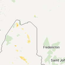
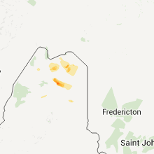
Hail Maps for Ashland, ME


Connect with Interactive Hail Maps