

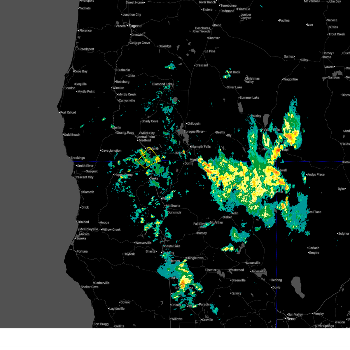
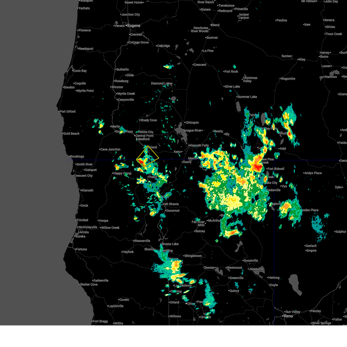
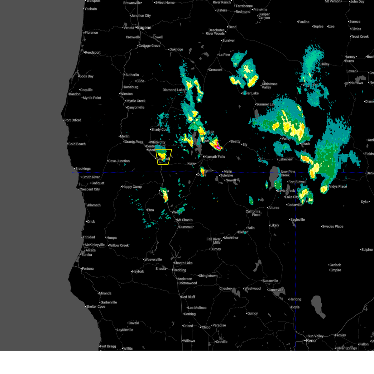
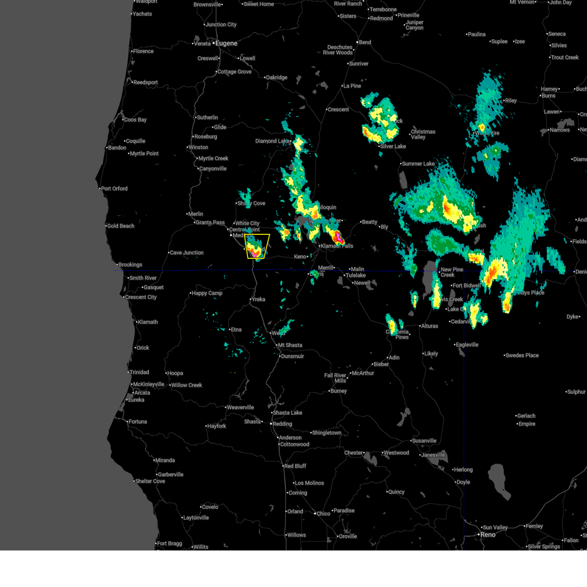
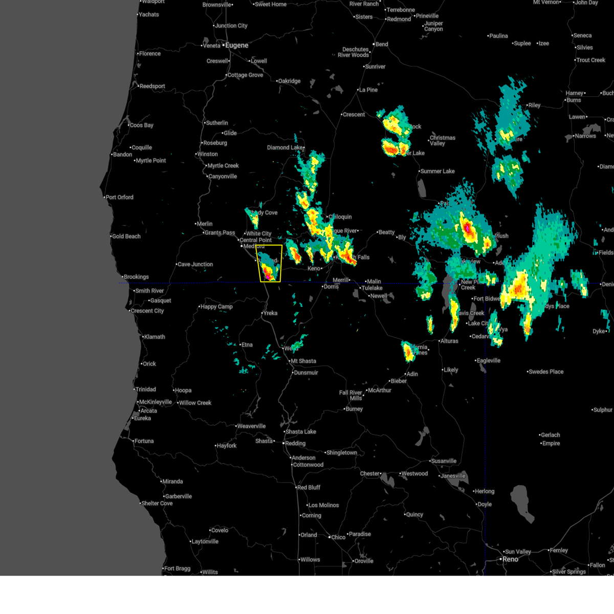
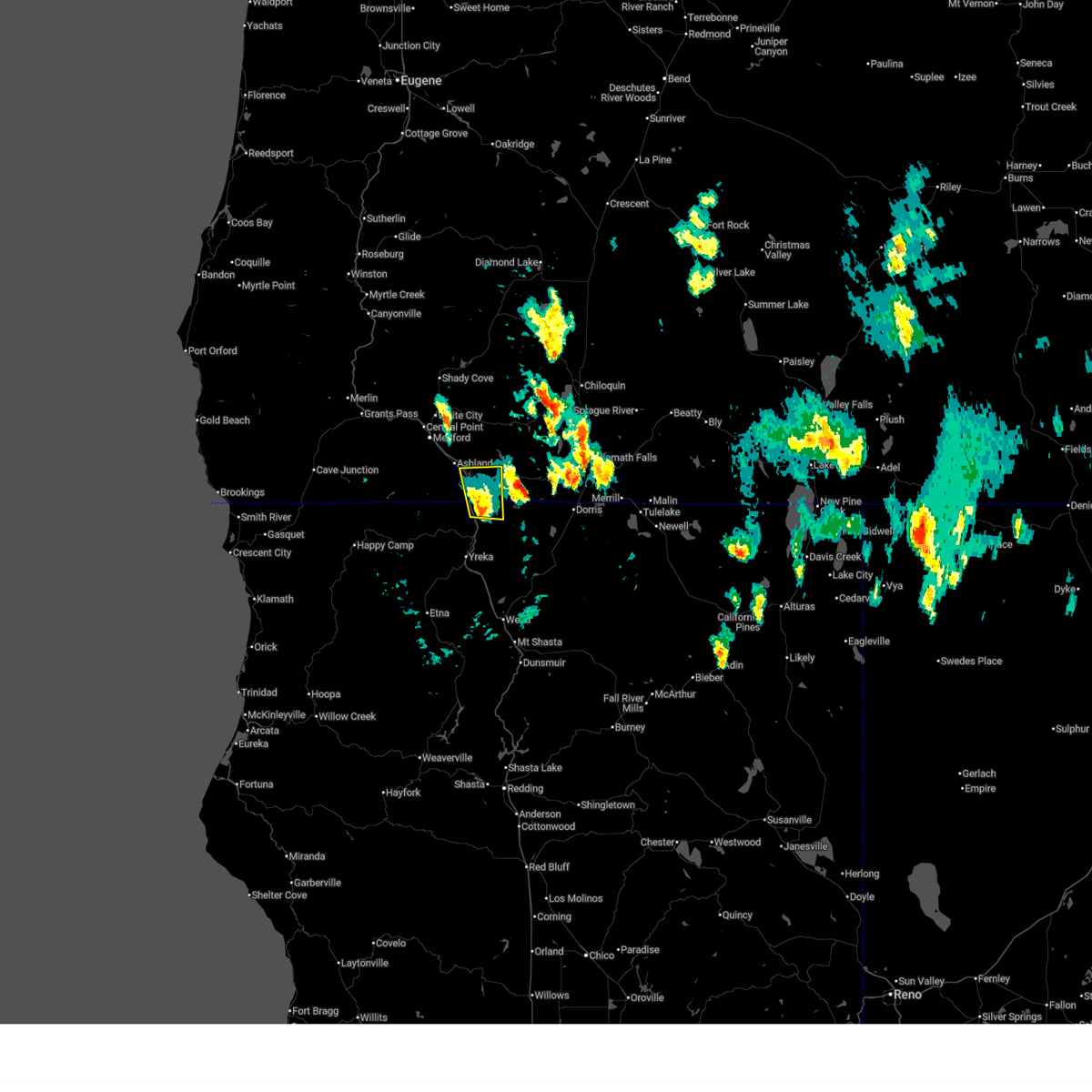
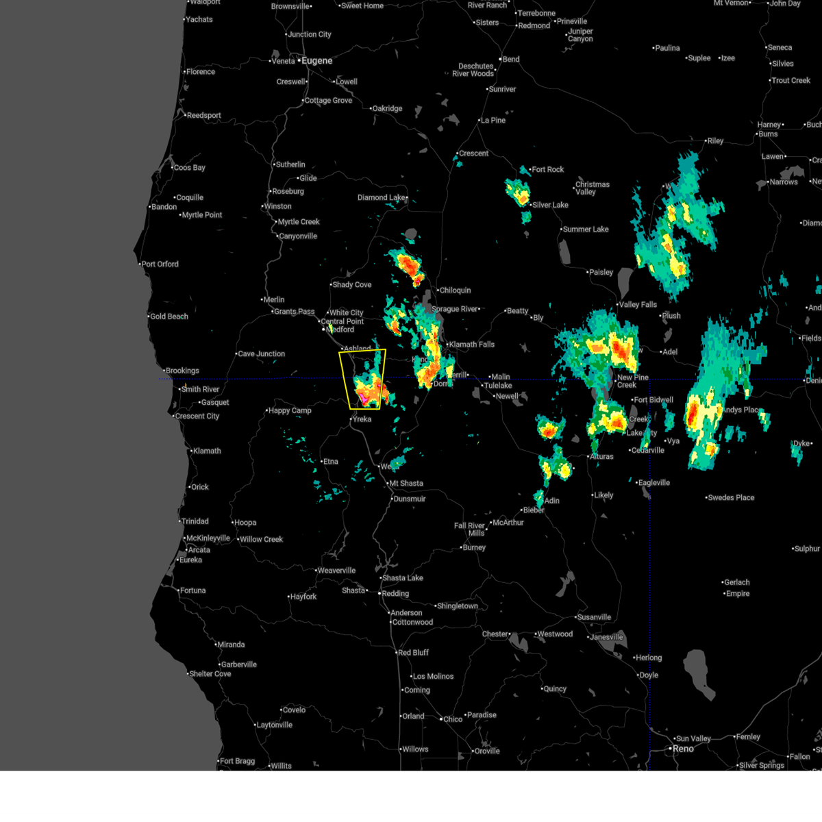
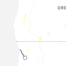
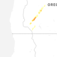
Hail Map for Ashland, OR
The Ashland, OR area has had 1 report of on-the-ground hail by trained spotters, and has been under severe weather warnings 2 times during the past 12 months. Doppler radar has detected hail at or near Ashland, OR on 8 occasions, including 1 occasion during the past year.
| Name: | Ashland, OR |
| Where Located: | 13.6 miles SE of Medford, OR |
| Map: | Google Map for Ashland, OR |
| Population: | 20078 |
| Housing Units: | 10455 |
| More Info: | Search Google for Ashland, OR |
1
The Top Recent Hail Date for Ashland, OR is Thursday, April 9, 2026 (4th out of 8)

Hail and Wind Damage Spotted near Ashland, OR
| Date / Time | Report Details |
|---|---|
| 8/26/2025 8:39 PM PDT |
 The storm which prompted the warning has weakened below severe limits, and no longer poses an immediate threat to life or property. therefore, the warning will be allowed to expire. The storm which prompted the warning has weakened below severe limits, and no longer poses an immediate threat to life or property. therefore, the warning will be allowed to expire.
|
| 8/26/2025 8:05 PM PDT |
 Svrmfr the national weather service in medford has issued a * severe thunderstorm warning for, north central siskiyou county in northern california, south central jackson county in southwestern oregon, * until 845 pm pdt. * at 805 pm pdt, a severe thunderstorm was located near grouse gap snow park, or 12 miles south of ashland, moving northeast at 15 mph (radar indicated). Hazards include 60 mph wind gusts and quarter size hail. Hail damage to vehicles is expected. Expect wind damage to roofs, siding, and trees. Svrmfr the national weather service in medford has issued a * severe thunderstorm warning for, north central siskiyou county in northern california, south central jackson county in southwestern oregon, * until 845 pm pdt. * at 805 pm pdt, a severe thunderstorm was located near grouse gap snow park, or 12 miles south of ashland, moving northeast at 15 mph (radar indicated). Hazards include 60 mph wind gusts and quarter size hail. Hail damage to vehicles is expected. Expect wind damage to roofs, siding, and trees.
|
| 7/3/2025 7:10 PM PDT |
 The storm which prompted the warning has weakened below severe limits, and no longer poses an immediate threat to life or property. therefore, the warning will be allowed to expire. however small hail and gusty winds are still possible with this thunderstorm. The storm which prompted the warning has weakened below severe limits, and no longer poses an immediate threat to life or property. therefore, the warning will be allowed to expire. however small hail and gusty winds are still possible with this thunderstorm.
|
| 7/3/2025 7:00 PM PDT | Quarter sized hail reported 4.1 miles NW of Ashland, OR, public reported 1.00 inch (quarter size) hail at emigrant lake. |
| 7/3/2025 6:59 PM PDT |
 At 658 pm pdt, a severe thunderstorm was located over emigrant lake, or near ashland, moving north at 25 mph (radar indicated). Hazards include 60 mph wind gusts and quarter size hail. Hail damage to vehicles is expected. expect wind damage to roofs, siding, and trees. Locations impacted include, ashland, emigrant lake, hyatt lake campground, and buck prairie nordic trails. At 658 pm pdt, a severe thunderstorm was located over emigrant lake, or near ashland, moving north at 25 mph (radar indicated). Hazards include 60 mph wind gusts and quarter size hail. Hail damage to vehicles is expected. expect wind damage to roofs, siding, and trees. Locations impacted include, ashland, emigrant lake, hyatt lake campground, and buck prairie nordic trails.
|
| 7/3/2025 6:43 PM PDT |
 Svrmfr the national weather service in medford has issued a * severe thunderstorm warning for, southeastern jackson county in southwestern oregon, * until 715 pm pdt. * at 642 pm pdt, a severe thunderstorm was located over siskiyou summit, or 10 miles southeast of ashland, moving north at 25 mph (radar indicated). Hazards include 60 mph wind gusts and half dollar size hail. Hail damage to vehicles is expected. Expect wind damage to roofs, siding, and trees. Svrmfr the national weather service in medford has issued a * severe thunderstorm warning for, southeastern jackson county in southwestern oregon, * until 715 pm pdt. * at 642 pm pdt, a severe thunderstorm was located over siskiyou summit, or 10 miles southeast of ashland, moving north at 25 mph (radar indicated). Hazards include 60 mph wind gusts and half dollar size hail. Hail damage to vehicles is expected. Expect wind damage to roofs, siding, and trees.
|
| 7/3/2025 6:27 PM PDT |
 At 627 pm pdt, a severe thunderstorm was located over pilot rock, or 14 miles southeast of ashland, moving north at 30 mph (radar indicated). Hazards include 60 mph wind gusts and quarter size hail. Hail damage to vehicles is expected. expect wind damage to roofs, siding, and trees. Locations impacted include, pilot rock, i 5 siskiyou summit, emigrant lake, hyatt lake campground, siskiyou summit, camp creek at iron gate lake, and hilt. At 627 pm pdt, a severe thunderstorm was located over pilot rock, or 14 miles southeast of ashland, moving north at 30 mph (radar indicated). Hazards include 60 mph wind gusts and quarter size hail. Hail damage to vehicles is expected. expect wind damage to roofs, siding, and trees. Locations impacted include, pilot rock, i 5 siskiyou summit, emigrant lake, hyatt lake campground, siskiyou summit, camp creek at iron gate lake, and hilt.
|
| 7/3/2025 6:08 PM PDT |
 Svrmfr the national weather service in medford has issued a * severe thunderstorm warning for, north central siskiyou county in northern california, southeastern jackson county in southwestern oregon, * until 645 pm pdt. * at 608 pm pdt, a severe thunderstorm was located near hornbrook, or 11 miles northeast of yreka, moving north at 30 mph (radar indicated). Hazards include 60 mph wind gusts and quarter size hail. Hail damage to vehicles is expected. Expect wind damage to roofs, siding, and trees. Svrmfr the national weather service in medford has issued a * severe thunderstorm warning for, north central siskiyou county in northern california, southeastern jackson county in southwestern oregon, * until 645 pm pdt. * at 608 pm pdt, a severe thunderstorm was located near hornbrook, or 11 miles northeast of yreka, moving north at 30 mph (radar indicated). Hazards include 60 mph wind gusts and quarter size hail. Hail damage to vehicles is expected. Expect wind damage to roofs, siding, and trees.
|
| 7/7/2015 8:14 PM PDT |
 At 812 pm pdt, trained weather spotters reported a severe thunderstorm producing damaging winds in excess of 40 mph. this storm was located near talent. this storm was moving northwest at 10 to 15 mph. in addition, at 0810 pdt..1/2 inch size hail was reported by a weather spotter. locations impacted include, medford, ashland, central point, talent, jacksonville, roxy ann peak, agate reservoir, emigrant lake, jacksonville woodlands association trails, britt gardens, white city and phoenix. At 812 pm pdt, trained weather spotters reported a severe thunderstorm producing damaging winds in excess of 40 mph. this storm was located near talent. this storm was moving northwest at 10 to 15 mph. in addition, at 0810 pdt..1/2 inch size hail was reported by a weather spotter. locations impacted include, medford, ashland, central point, talent, jacksonville, roxy ann peak, agate reservoir, emigrant lake, jacksonville woodlands association trails, britt gardens, white city and phoenix.
|
| 7/7/2015 7:56 PM PDT |
 At 755 pm pdt, doppler radar indicated a severe thunderstorm with strong winds gusting to 60 mph, small hail, and frequent lightning. this storm was located near buck prairie nordic trails, or near ashland, and moving northeast at 15 mph. At 755 pm pdt, doppler radar indicated a severe thunderstorm with strong winds gusting to 60 mph, small hail, and frequent lightning. this storm was located near buck prairie nordic trails, or near ashland, and moving northeast at 15 mph.
|
| 8/5/2012 7:39 PM PDT | 2 to 3 inch diameter tree limbs downed by outflow winds from collapsing thunderstorms. a couple of rolls of th in jackson county OR, 0.1 miles SW of Ashland, OR |
Hail Maps for Ashland, OR


Connect with Interactive Hail Maps