

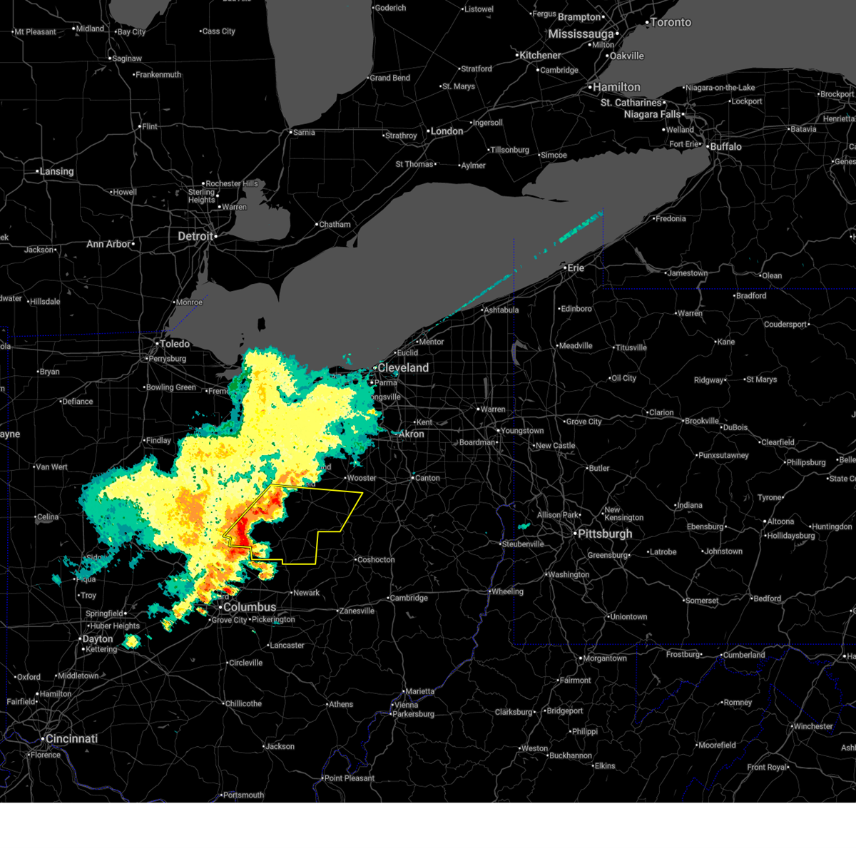
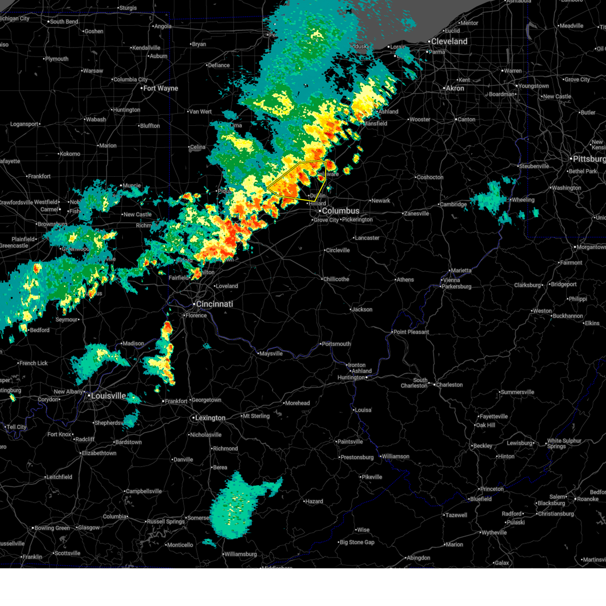
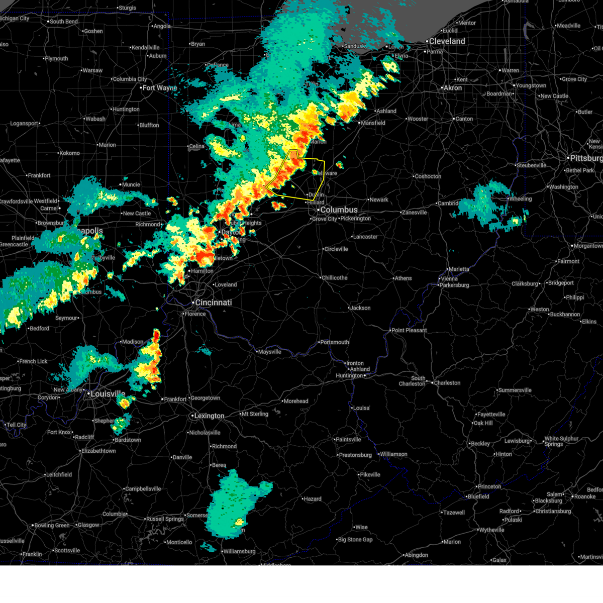
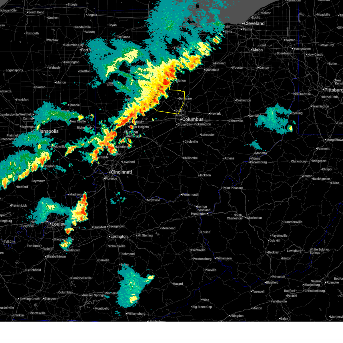
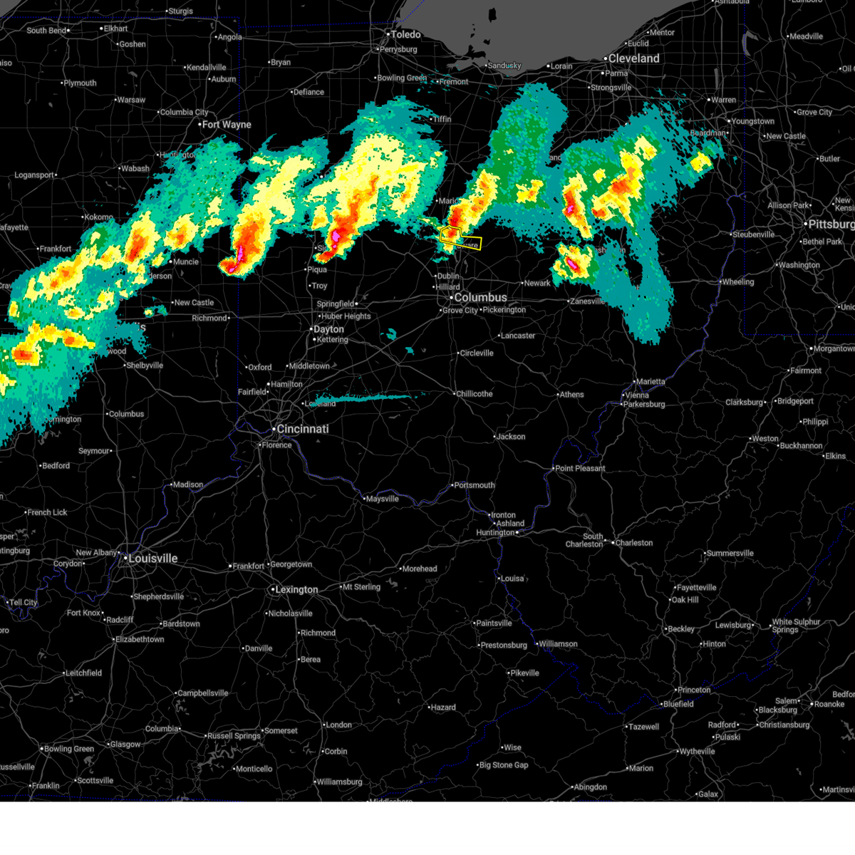
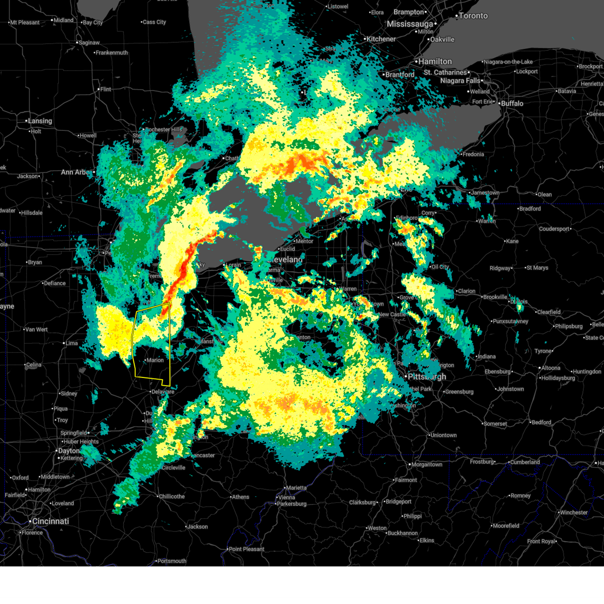
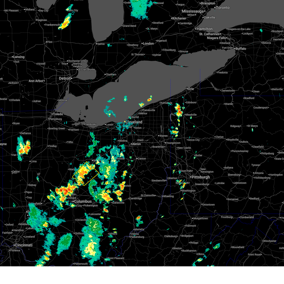
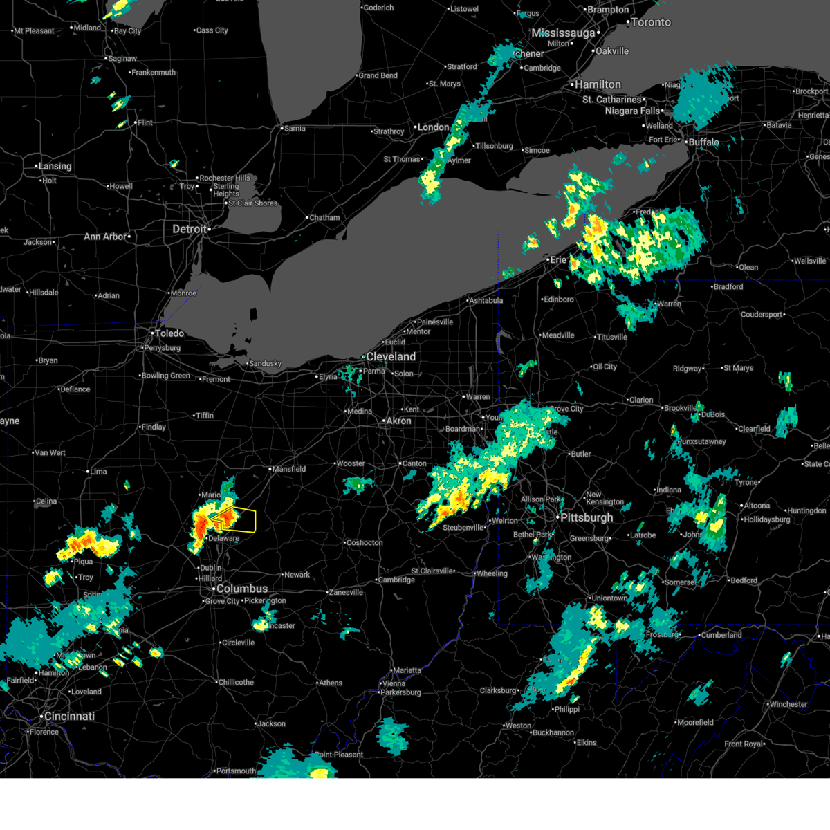
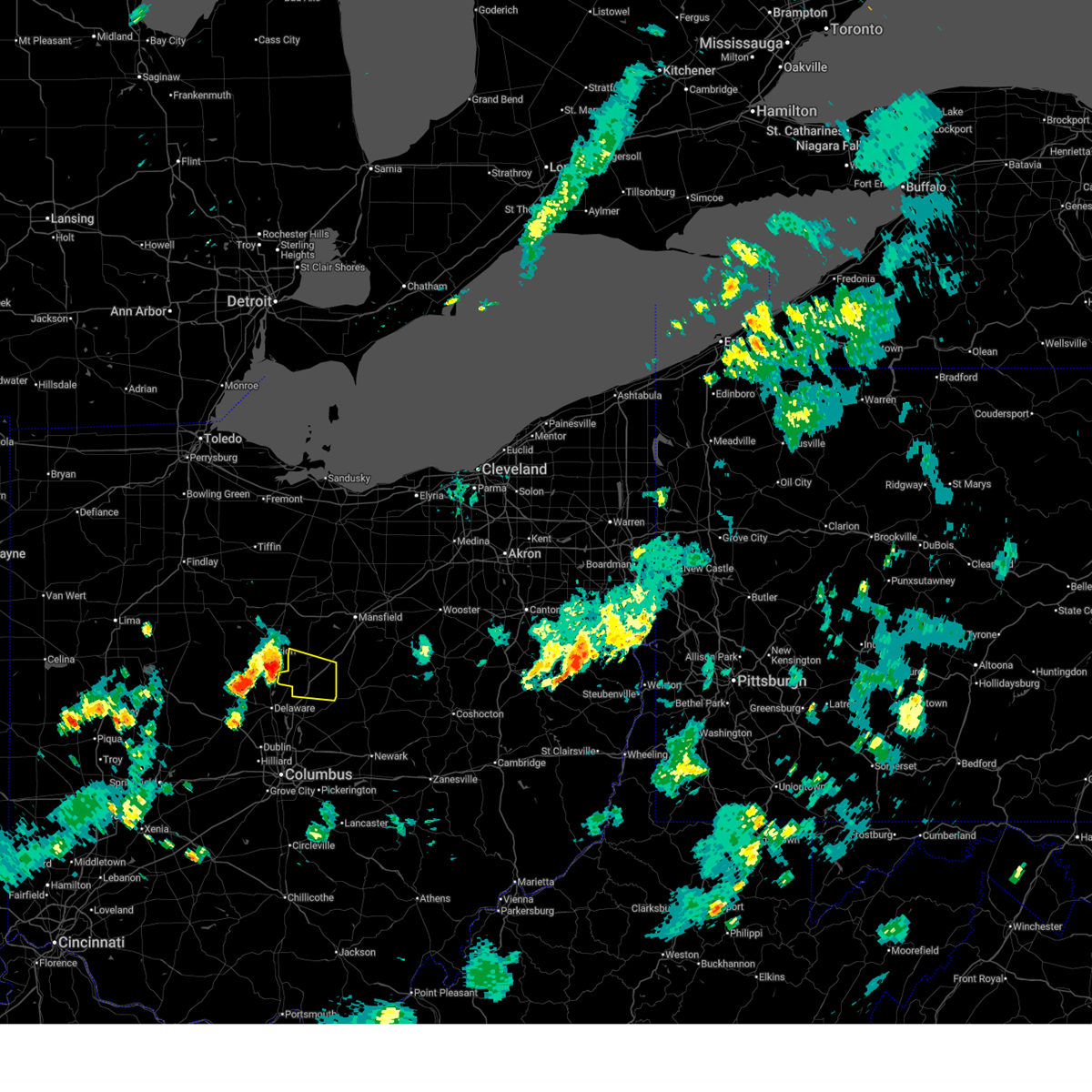
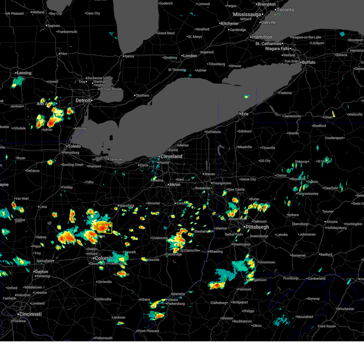
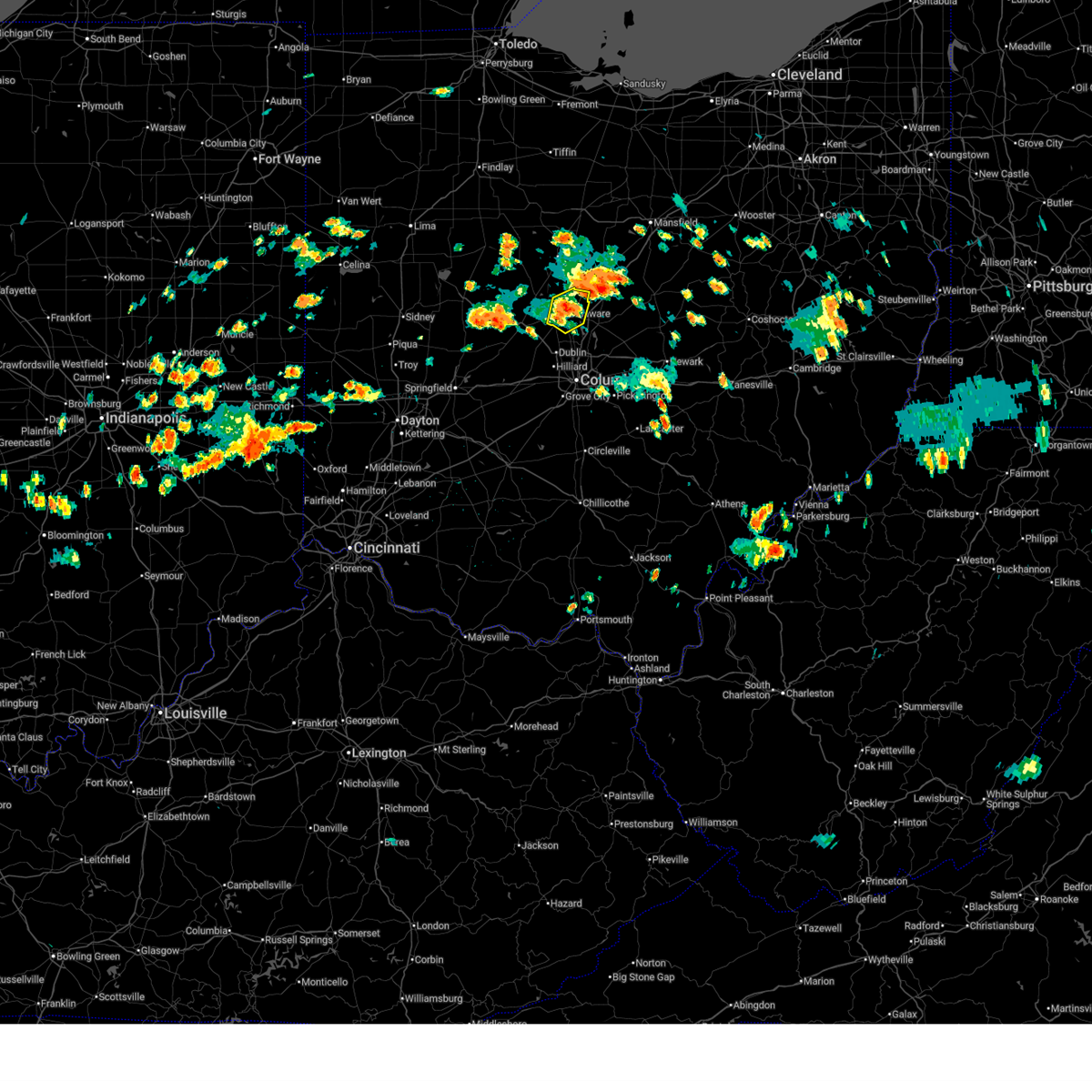
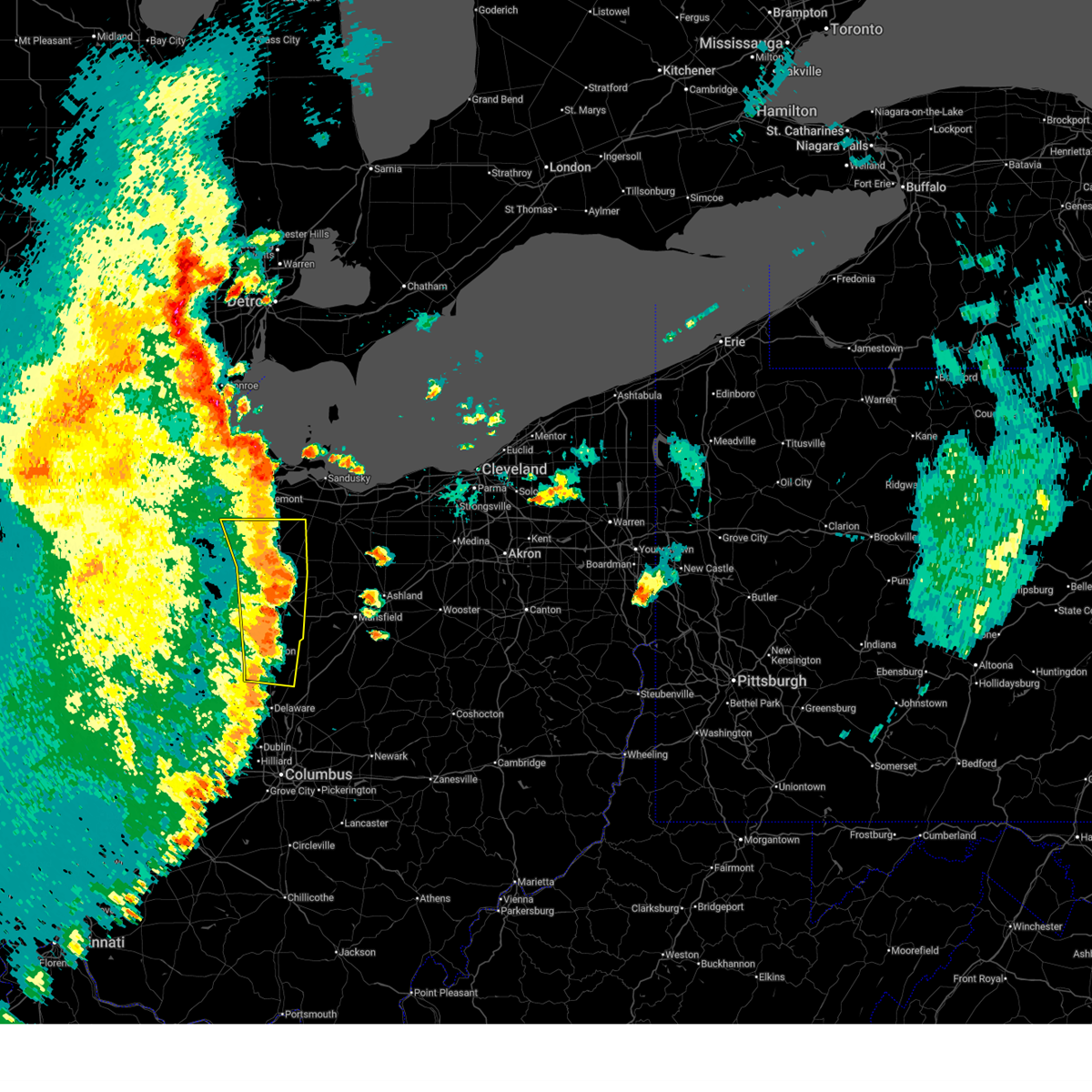
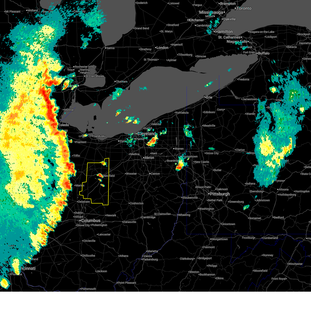
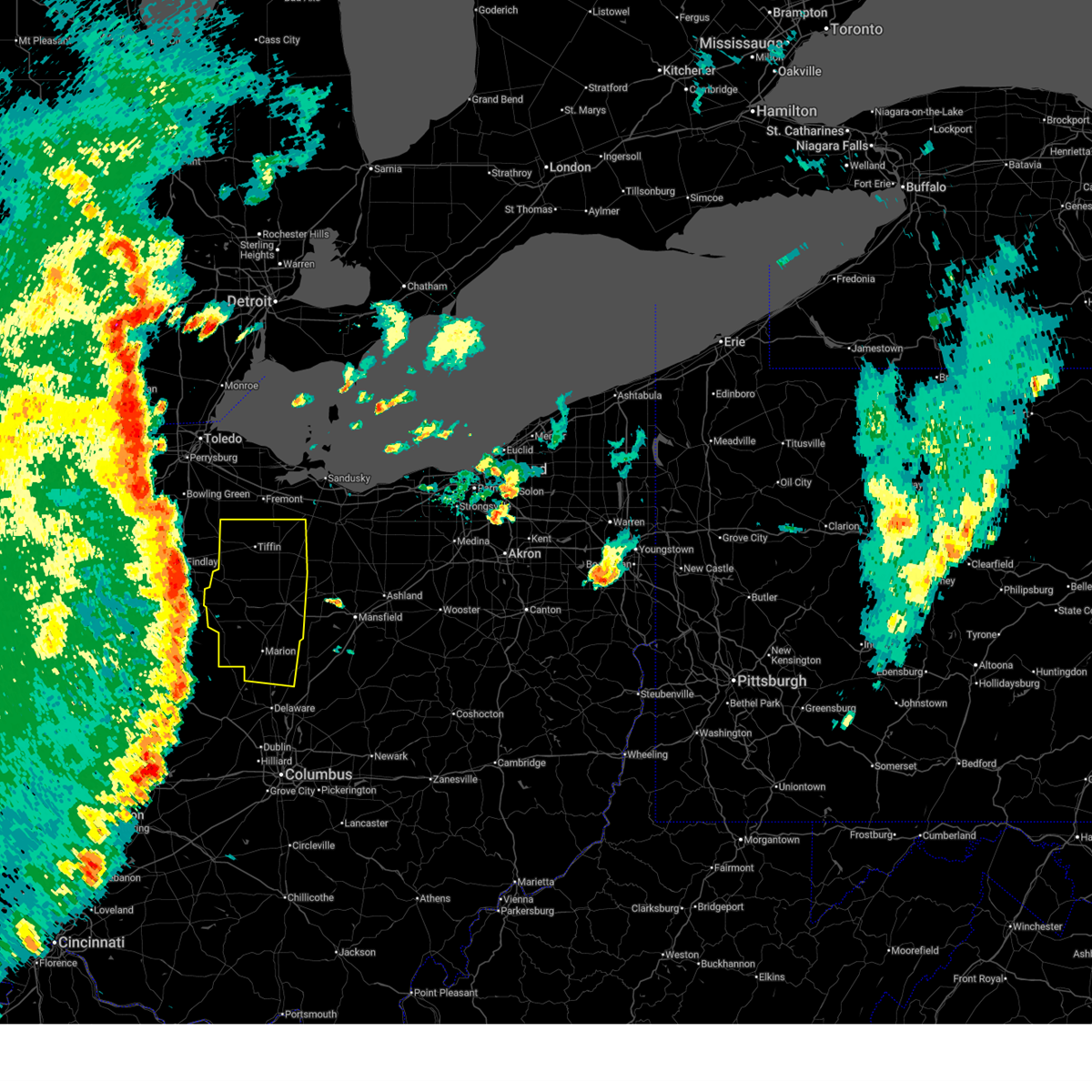
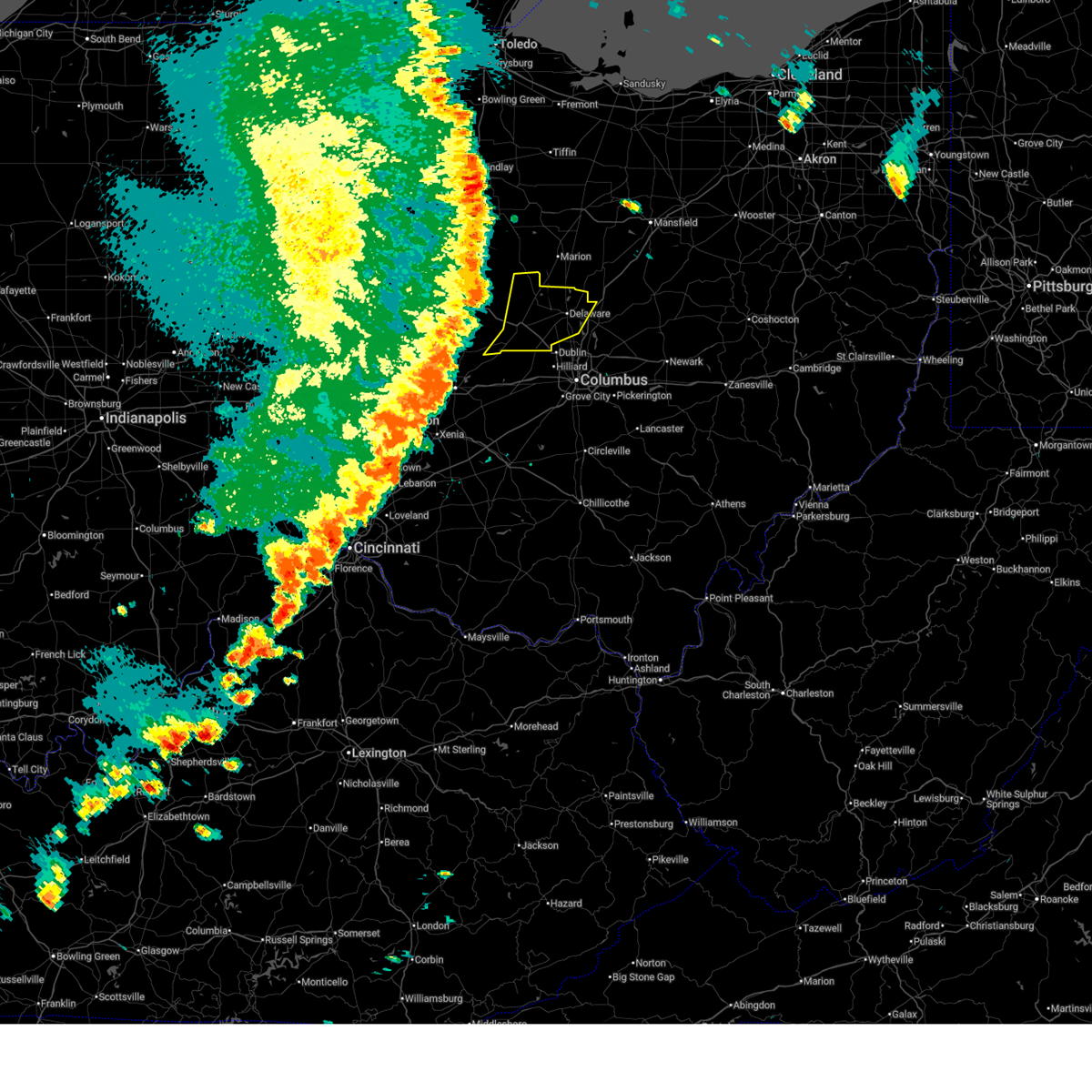
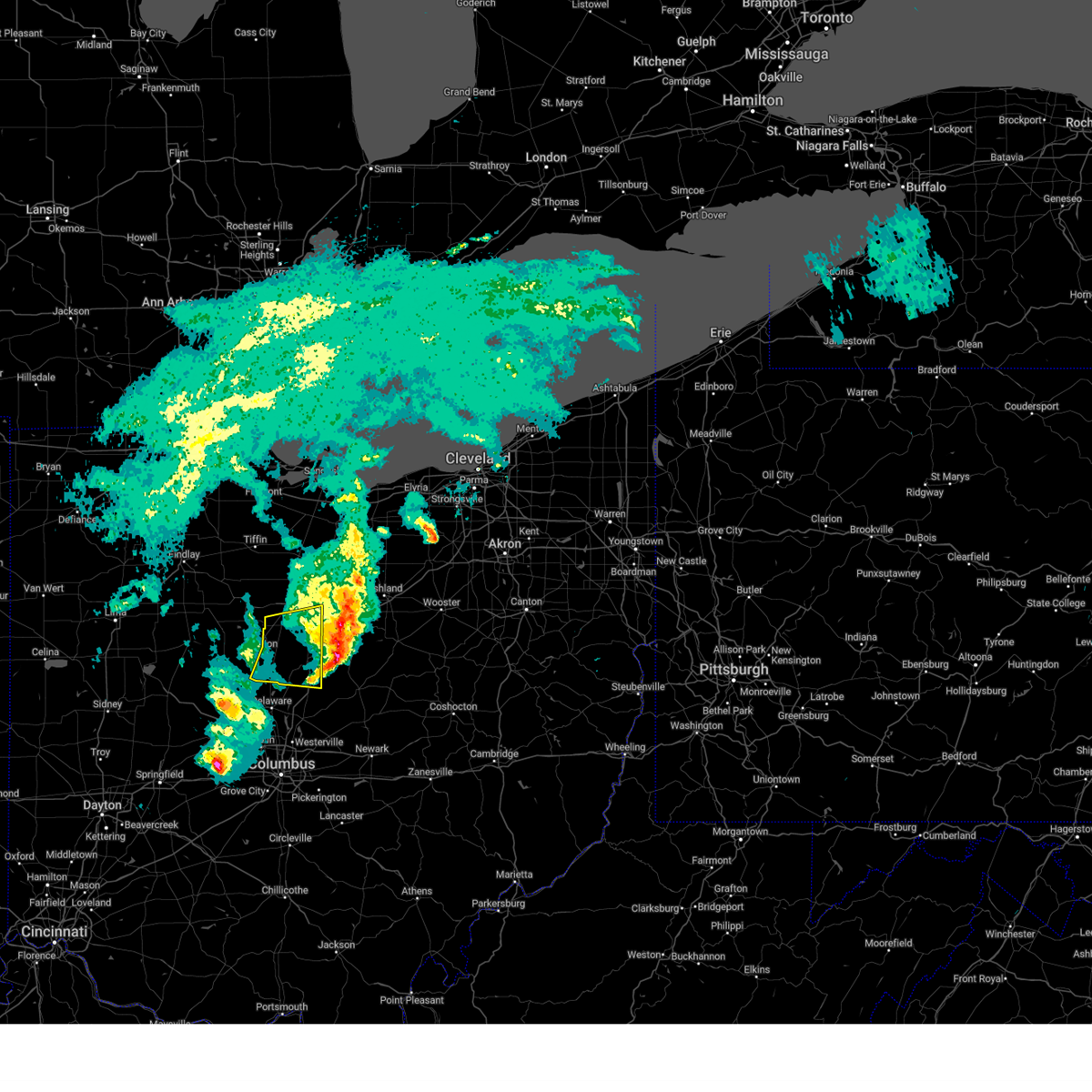
Hail Map for Ashley, OH
The Ashley, OH area has had 0 reports of on-the-ground hail by trained spotters, and has been under severe weather warnings 30 times during the past 12 months. Doppler radar has detected hail at or near Ashley, OH on 40 occasions, including 4 occasions during the past year.
| Name: | Ashley, OH |
| Where Located: | 31 miles N of Columbus, OH |
| Map: | Google Map for Ashley, OH |
| Population: | 1330 |
| Housing Units: | 542 |
| More Info: | Search Google for Ashley, OH |
2
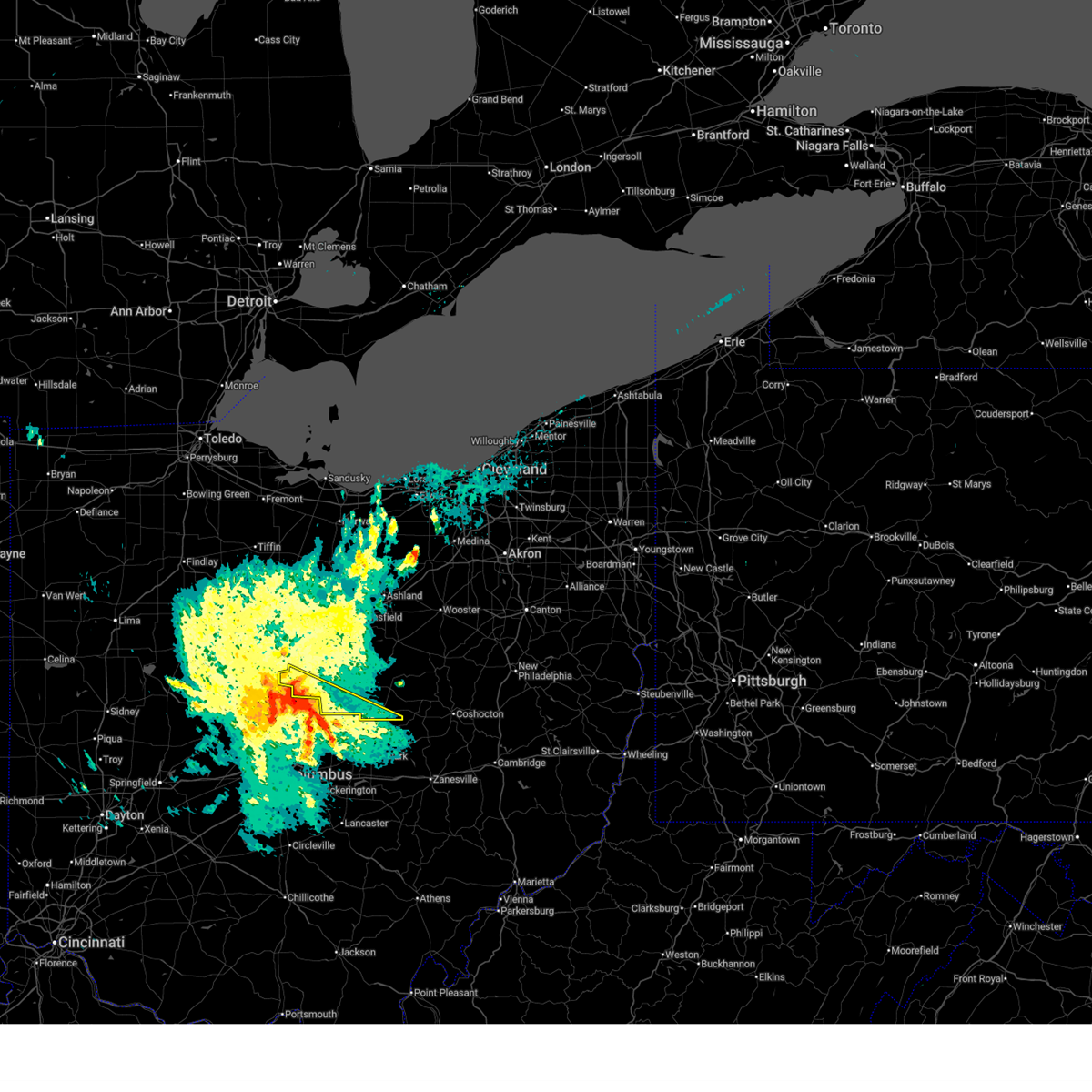
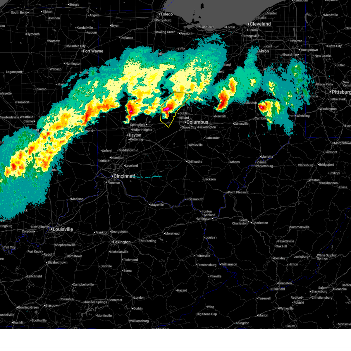
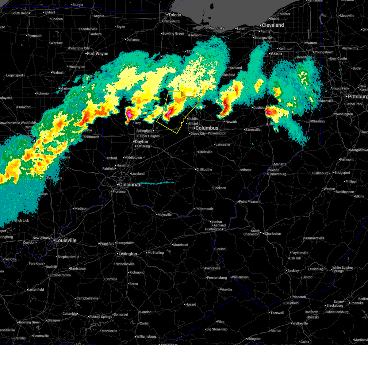
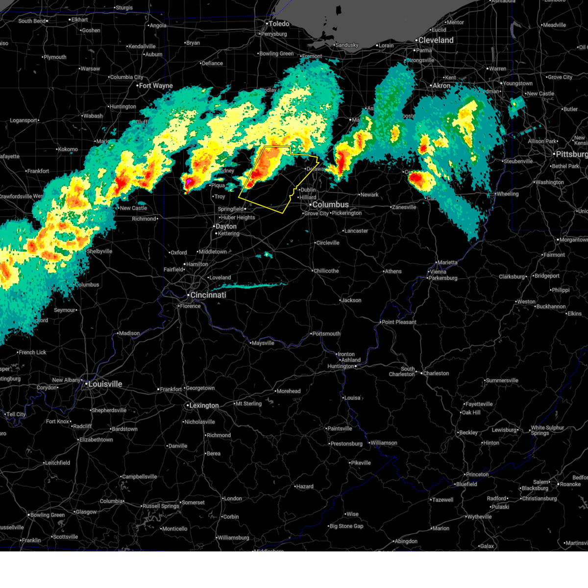
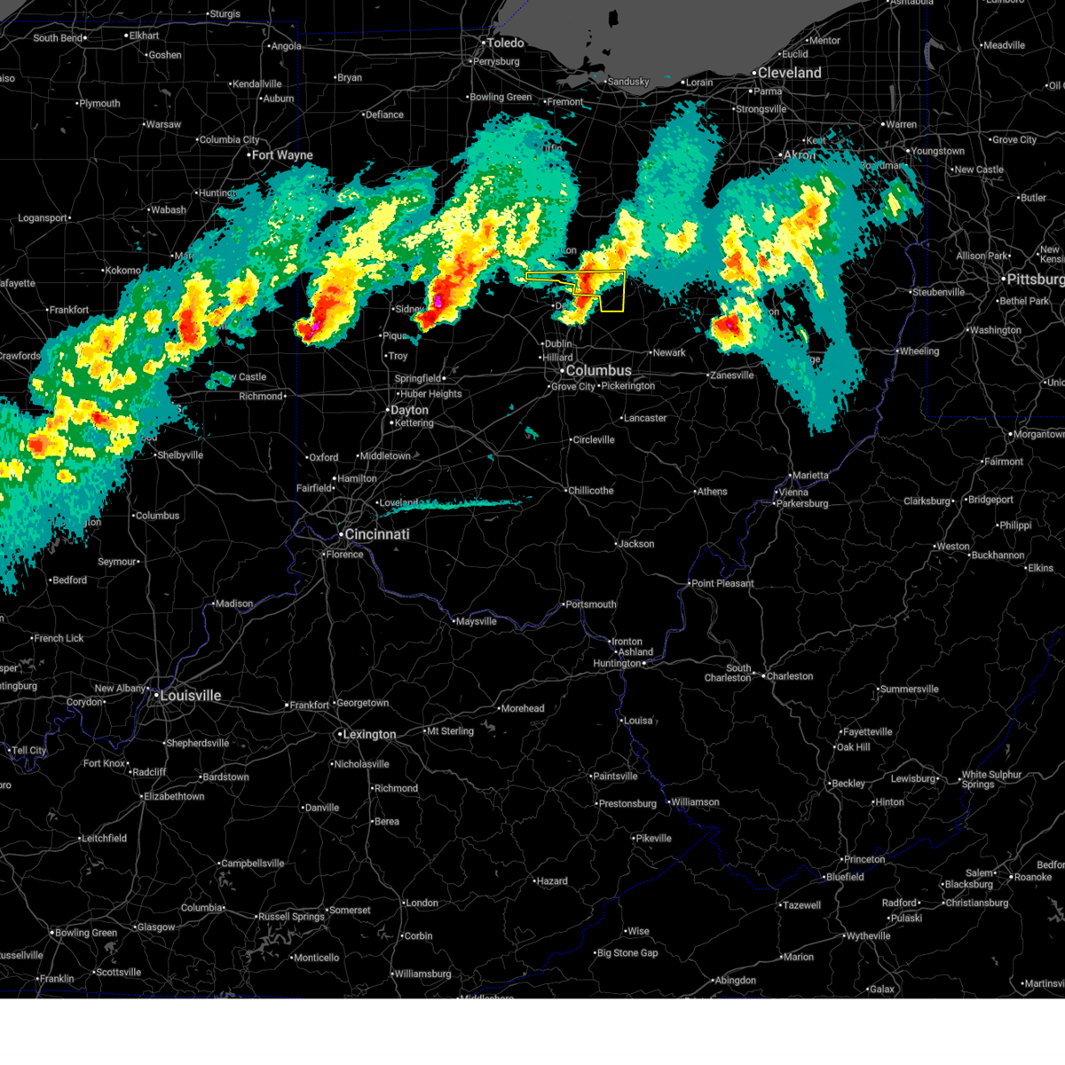
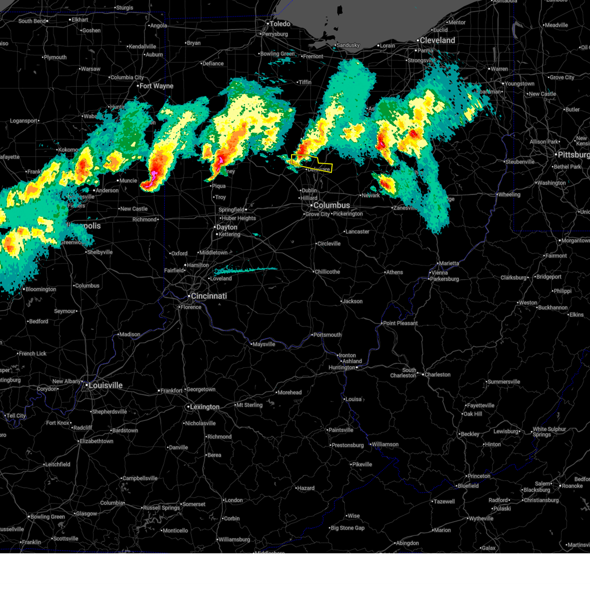
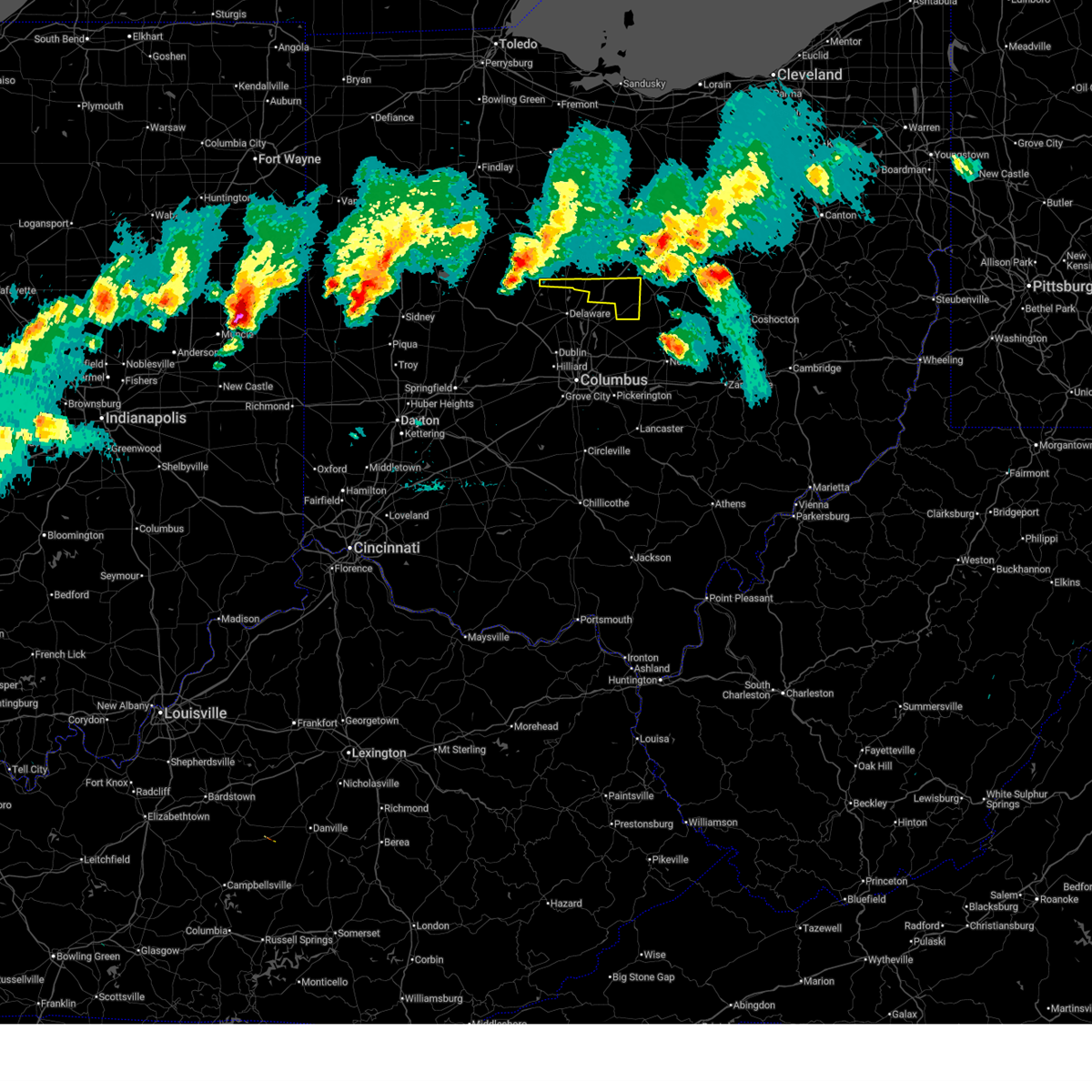
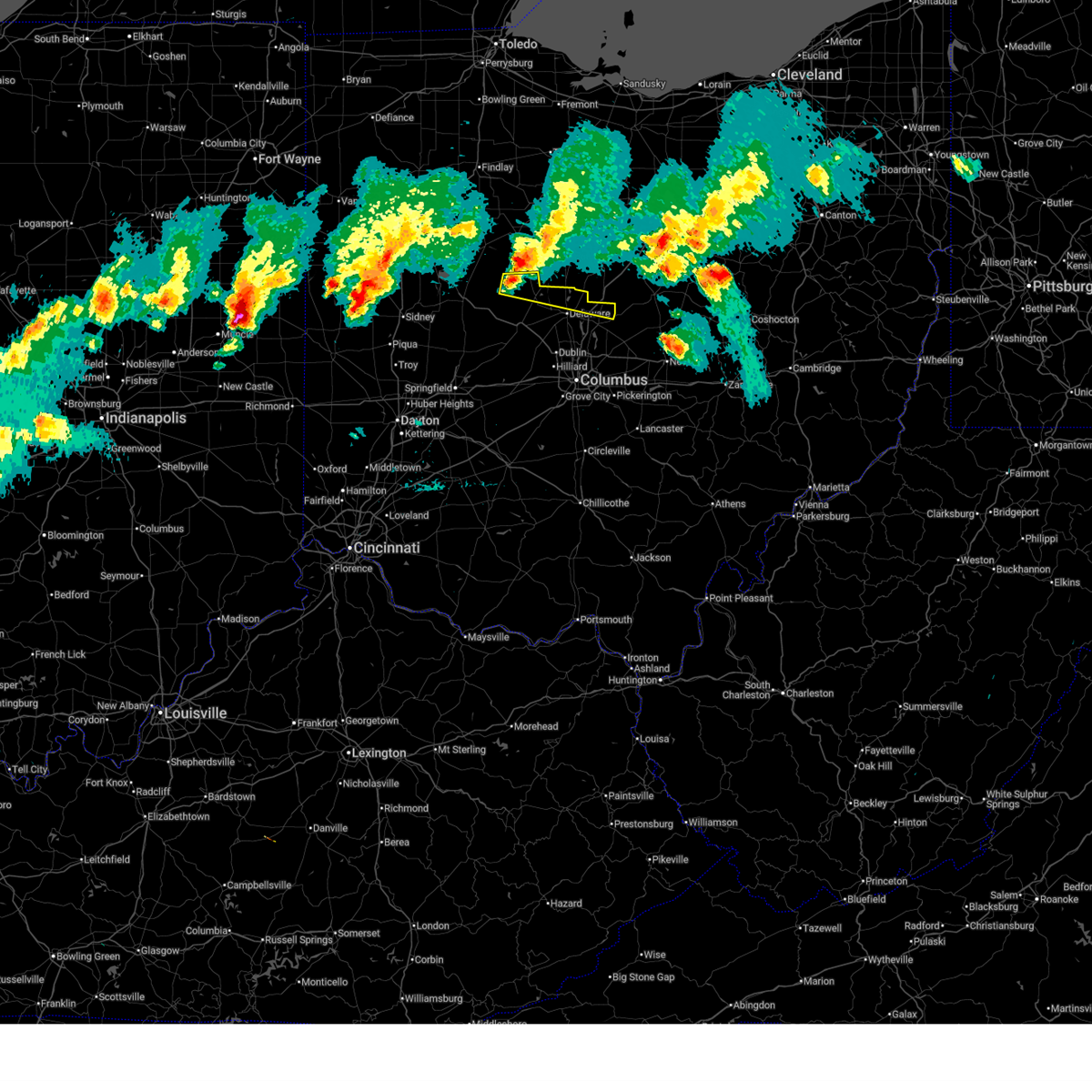
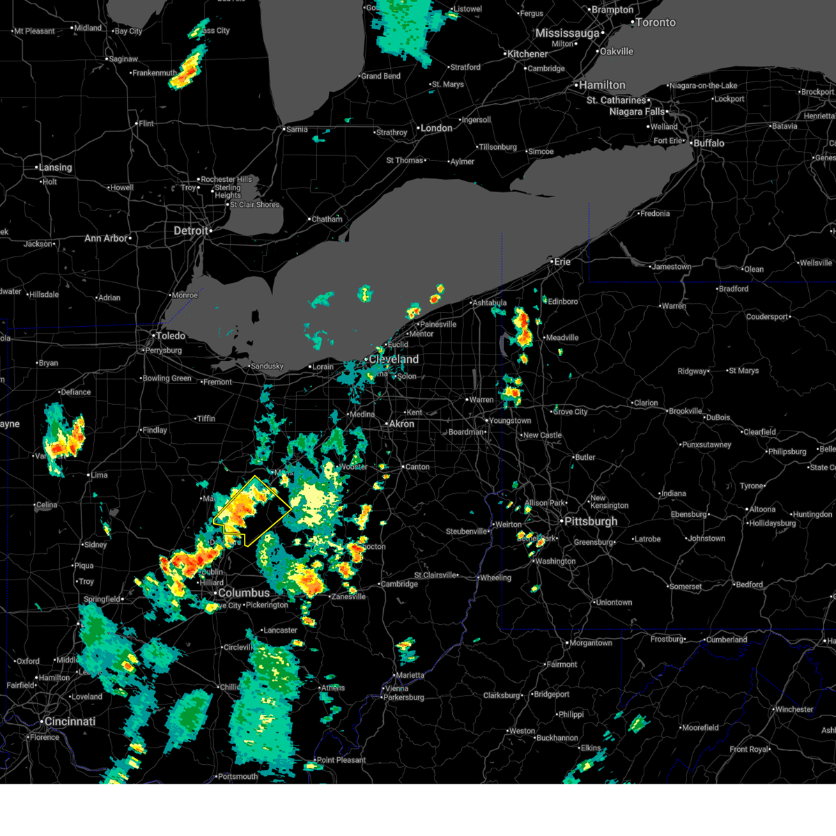
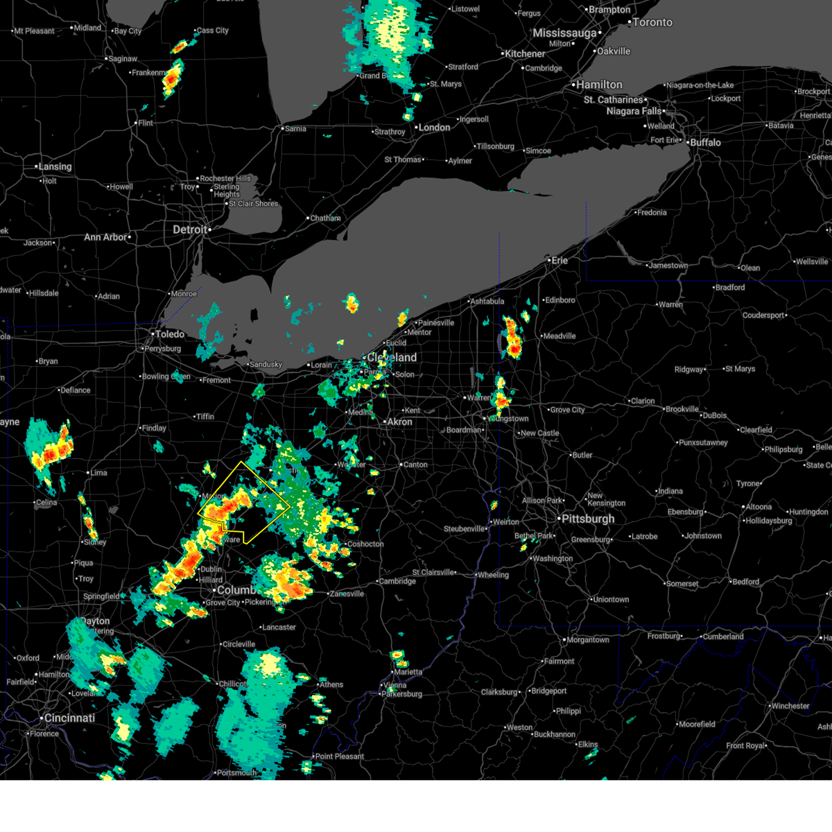
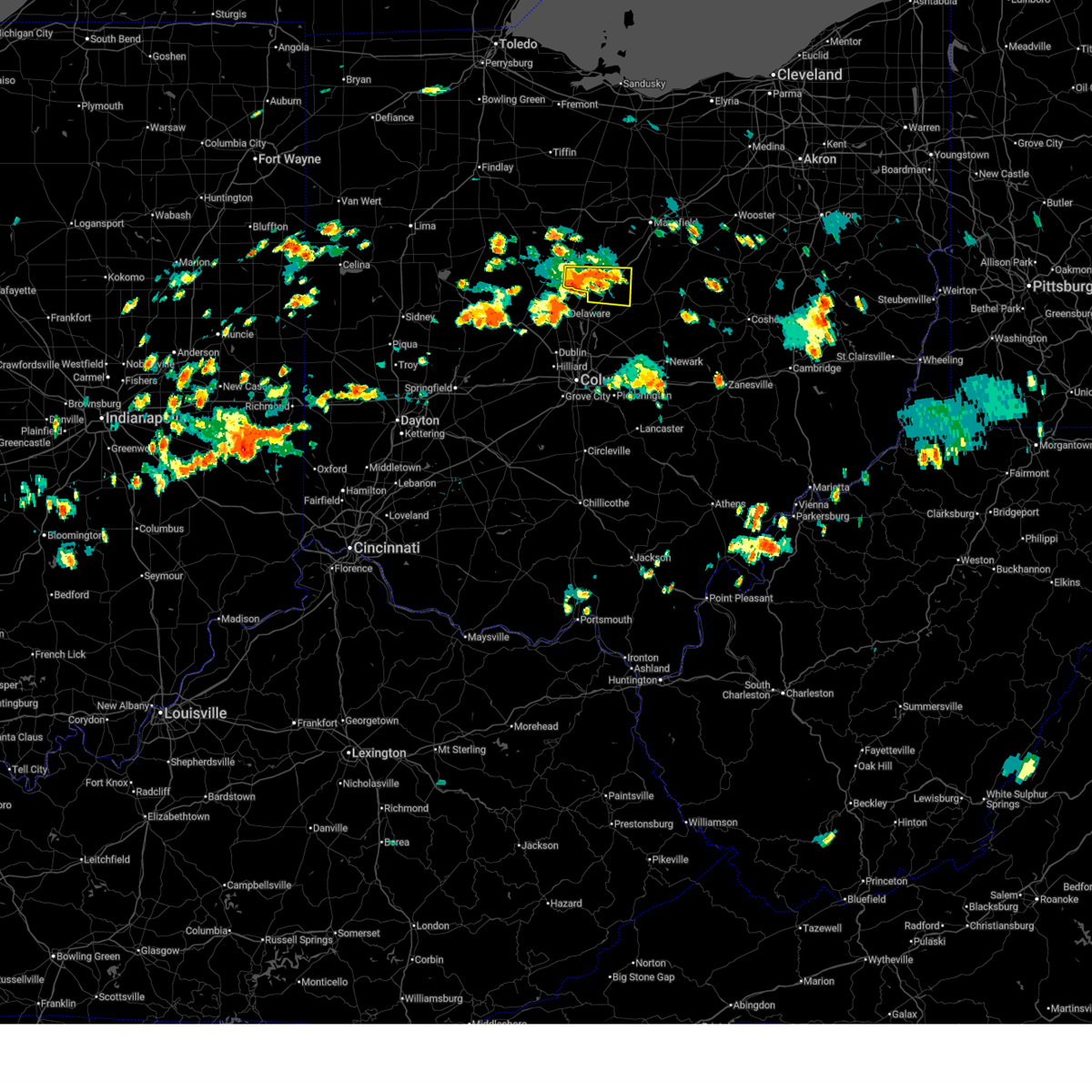
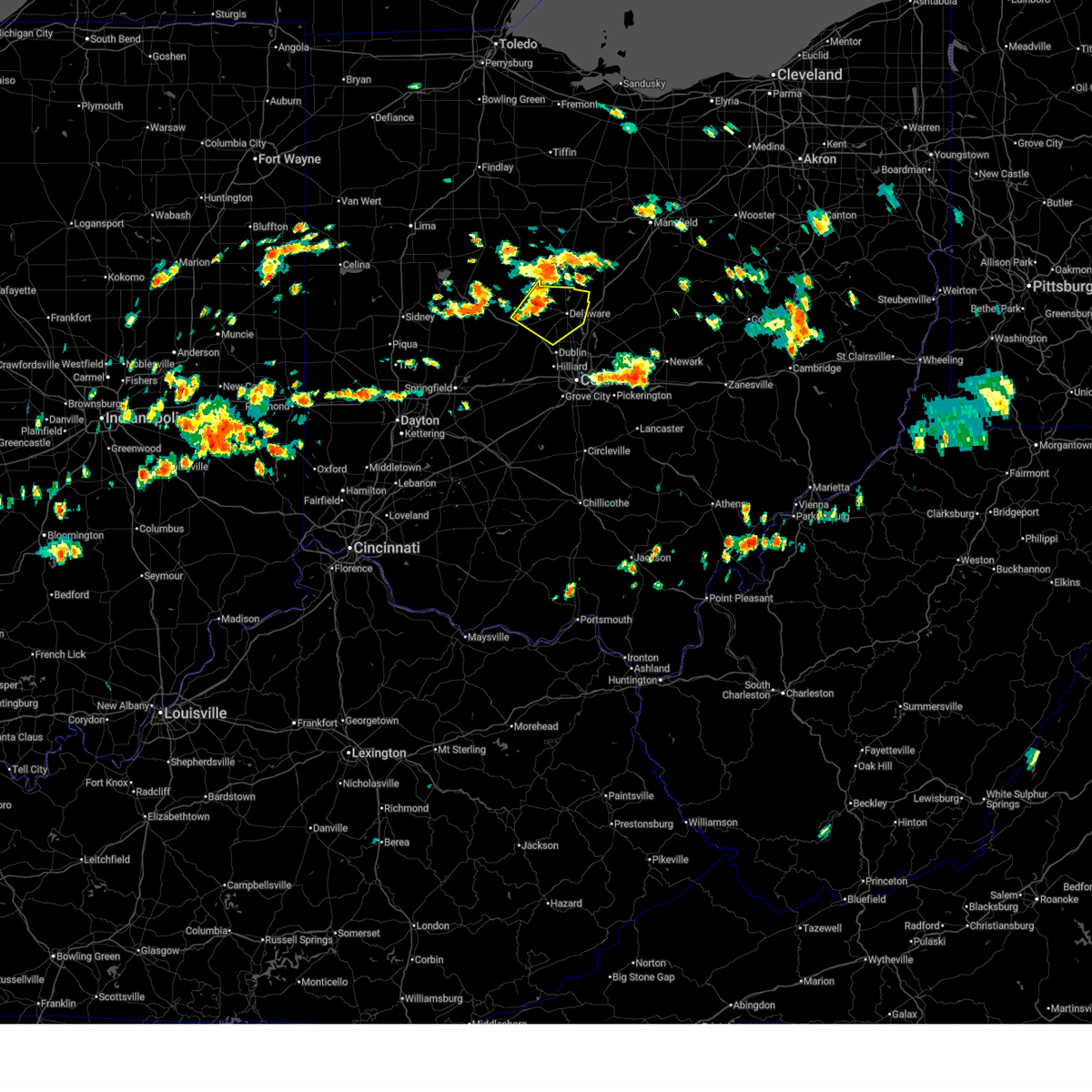
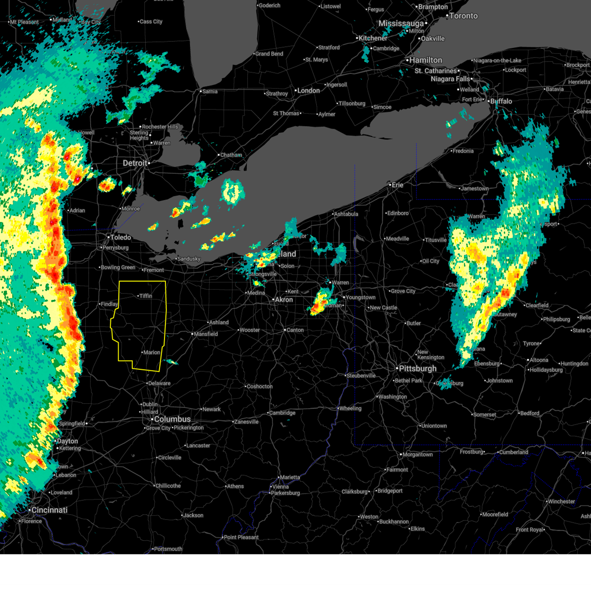
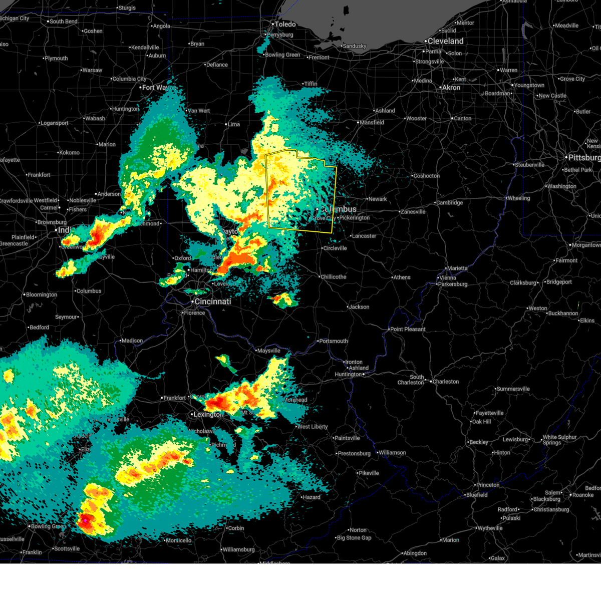
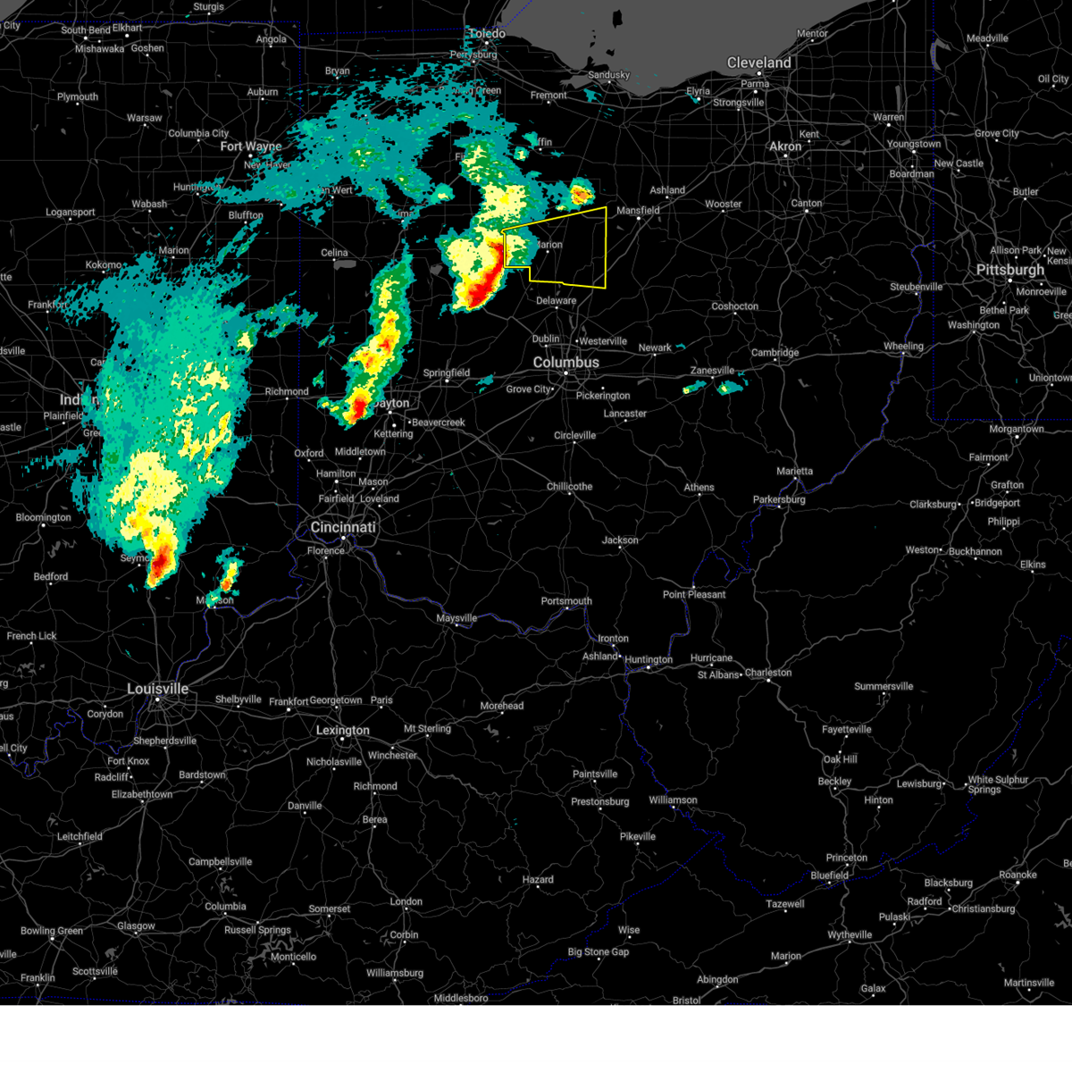
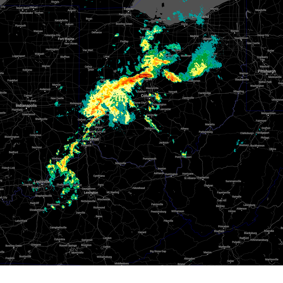
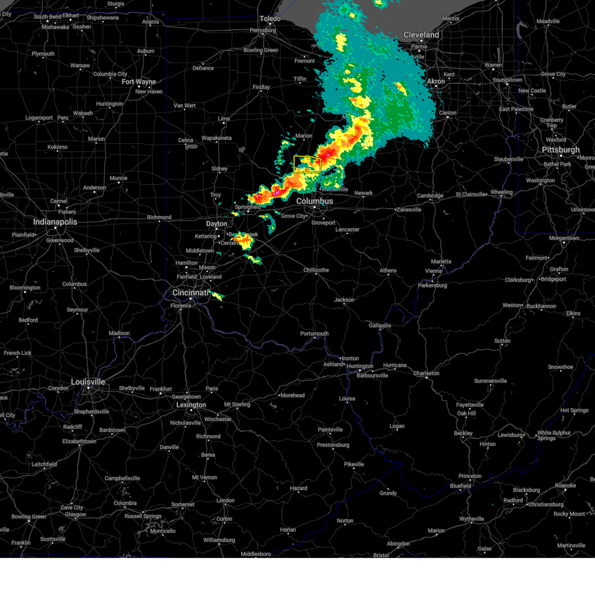
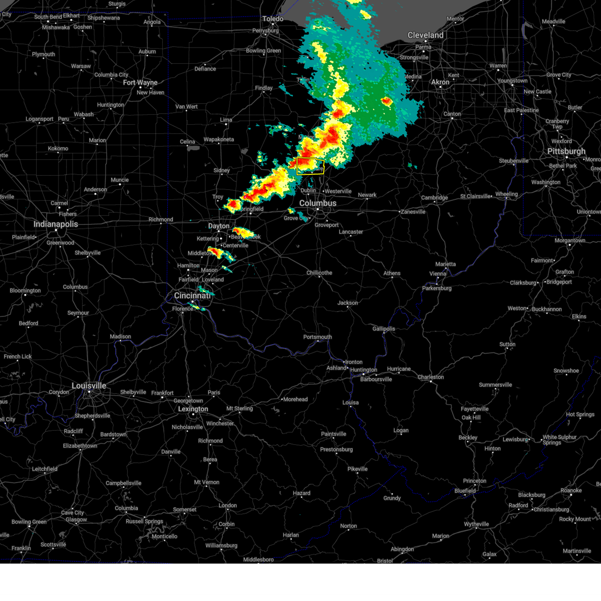
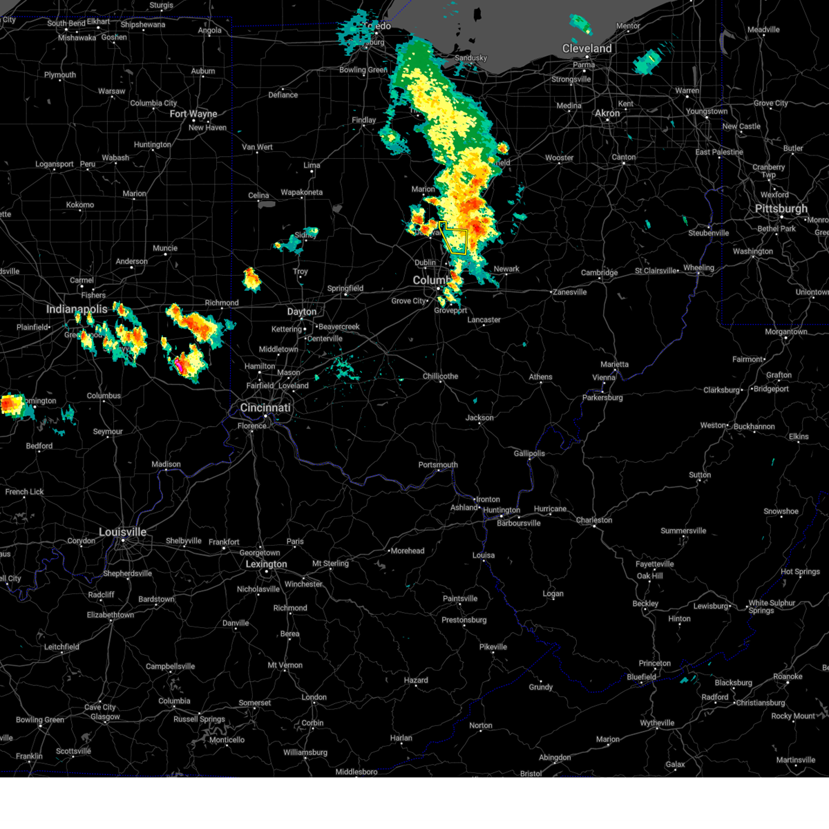
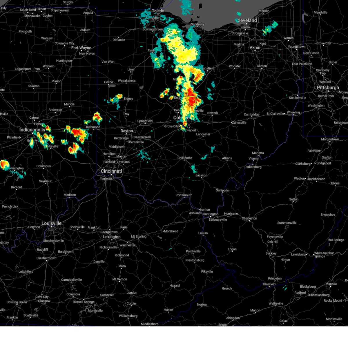
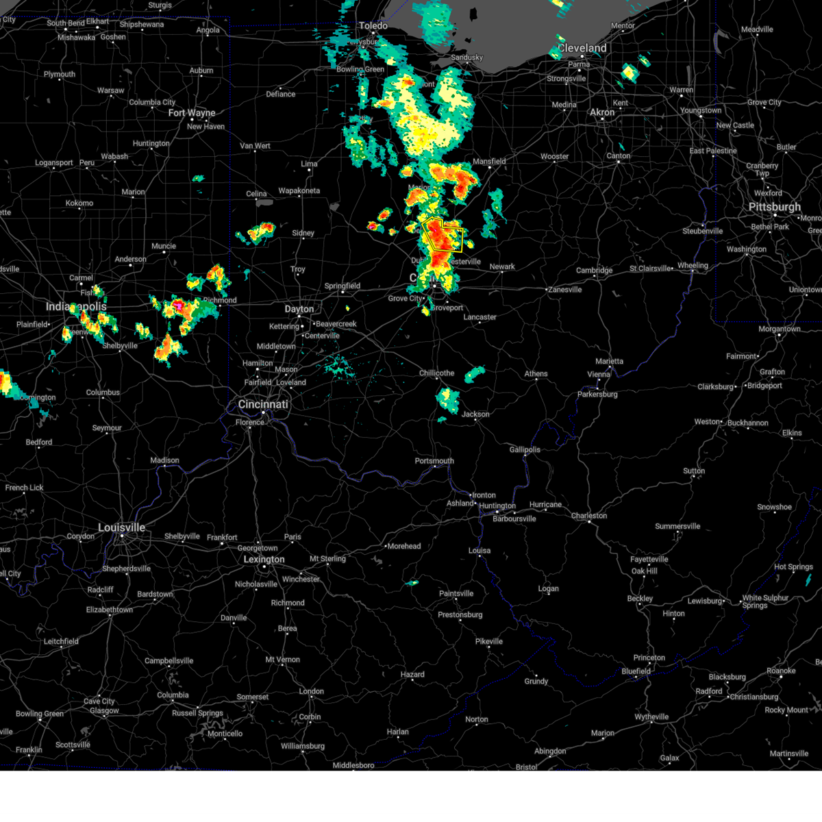
The Top Recent Hail Date for Ashley, OH is Friday, July 10, 2026 (9th out of 40)
Hail and Wind Damage Spotted near Ashley, OH
| Date / Time | Report Details |
|---|---|
| 7/10/2026 5:46 PM EDT |
 The storm which prompted the warning has weakened below severe limits, and no longer poses an immediate threat to life or property. therefore, the warning has been allowed to expire. however, gusty winds and heavy rain are still possible with this thunderstorm. The storm which prompted the warning has weakened below severe limits, and no longer poses an immediate threat to life or property. therefore, the warning has been allowed to expire. however, gusty winds and heavy rain are still possible with this thunderstorm.
|
| 7/10/2026 5:36 PM EDT |
 At 536 pm edt, a severe thunderstorm was located near ashley, or 11 miles south of mount gilead, moving east at 15 mph (radar indicated). Hazards include 60 mph wind gusts and penny size hail. Expect damage to trees and power lines. Locations impacted include, mount vernon, cardington, centerburg, ashley, sparta, marengo, and fulton. At 536 pm edt, a severe thunderstorm was located near ashley, or 11 miles south of mount gilead, moving east at 15 mph (radar indicated). Hazards include 60 mph wind gusts and penny size hail. Expect damage to trees and power lines. Locations impacted include, mount vernon, cardington, centerburg, ashley, sparta, marengo, and fulton.
|
| 7/10/2026 5:20 PM EDT |
 Svriln the national weather service in wilmington has issued a * severe thunderstorm warning for, northeastern delaware county in central ohio, northwestern licking county in central ohio, * until 600 pm edt. * at 520 pm edt, a severe thunderstorm was located near ashley, moving southeast at 20 mph (radar indicated). Hazards include 60 mph wind gusts. expect damage to trees and power lines Svriln the national weather service in wilmington has issued a * severe thunderstorm warning for, northeastern delaware county in central ohio, northwestern licking county in central ohio, * until 600 pm edt. * at 520 pm edt, a severe thunderstorm was located near ashley, moving southeast at 20 mph (radar indicated). Hazards include 60 mph wind gusts. expect damage to trees and power lines
|
| 7/10/2026 5:20 PM EDT |
 Svrcle the national weather service in cleveland has issued a * severe thunderstorm warning for, southern morrow county in north central ohio, southwestern knox county in north central ohio, * until 545 pm edt. * at 519 pm edt, a severe thunderstorm was located over ashley, or 11 miles northeast of delaware, moving southeast at 20 mph (radar indicated). Hazards include 60 mph wind gusts and penny size hail. expect damage to trees and power lines Svrcle the national weather service in cleveland has issued a * severe thunderstorm warning for, southern morrow county in north central ohio, southwestern knox county in north central ohio, * until 545 pm edt. * at 519 pm edt, a severe thunderstorm was located over ashley, or 11 miles northeast of delaware, moving southeast at 20 mph (radar indicated). Hazards include 60 mph wind gusts and penny size hail. expect damage to trees and power lines
|
| 7/3/2026 8:51 PM EDT |
 Svrcle the national weather service in cleveland has issued a * severe thunderstorm warning for, richland county in north central ohio, eastern marion county in north central ohio, central ashland county in north central ohio, morrow county in north central ohio, southeastern crawford county in north central ohio, southern wayne county in northeastern ohio, northwestern holmes county in northeastern ohio, northwestern knox county in north central ohio, * until 930 pm edt. * at 850 pm edt, severe thunderstorms were located along a line extending from near ashland to marion, moving southeast at 30 mph (radar indicated). Hazards include 60 mph wind gusts. expect damage to trees and power lines Svrcle the national weather service in cleveland has issued a * severe thunderstorm warning for, richland county in north central ohio, eastern marion county in north central ohio, central ashland county in north central ohio, morrow county in north central ohio, southeastern crawford county in north central ohio, southern wayne county in northeastern ohio, northwestern holmes county in northeastern ohio, northwestern knox county in north central ohio, * until 930 pm edt. * at 850 pm edt, severe thunderstorms were located along a line extending from near ashland to marion, moving southeast at 30 mph (radar indicated). Hazards include 60 mph wind gusts. expect damage to trees and power lines
|
| 6/6/2026 11:50 AM EDT |
 Svrcle the national weather service in cleveland has issued a * severe thunderstorm warning for, southern richland county in north central ohio, southern ashland county in north central ohio, morrow county in north central ohio, southwestern wayne county in northeastern ohio, western holmes county in northeastern ohio, knox county in north central ohio, * until 1230 pm edt. * at 1150 am edt, severe thunderstorms were located along a line extending from lexington to near polaris, moving east at 60 mph (radar indicated). Hazards include 60 mph wind gusts and penny size hail. expect damage to trees and power lines Svrcle the national weather service in cleveland has issued a * severe thunderstorm warning for, southern richland county in north central ohio, southern ashland county in north central ohio, morrow county in north central ohio, southwestern wayne county in northeastern ohio, western holmes county in northeastern ohio, knox county in north central ohio, * until 1230 pm edt. * at 1150 am edt, severe thunderstorms were located along a line extending from lexington to near polaris, moving east at 60 mph (radar indicated). Hazards include 60 mph wind gusts and penny size hail. expect damage to trees and power lines
|
| 5/19/2026 8:25 PM EDT |
 Svriln the national weather service in wilmington has issued a * severe thunderstorm warning for, northern franklin county in central ohio, delaware county in central ohio, northwestern licking county in central ohio, southeastern union county in central ohio, northeastern madison county in central ohio, * until 930 pm edt. * at 825 pm edt, a severe thunderstorm was located over dublin, moving east at 25 mph (radar indicated). Hazards include 60 mph wind gusts and penny size hail. expect damage to trees and power lines Svriln the national weather service in wilmington has issued a * severe thunderstorm warning for, northern franklin county in central ohio, delaware county in central ohio, northwestern licking county in central ohio, southeastern union county in central ohio, northeastern madison county in central ohio, * until 930 pm edt. * at 825 pm edt, a severe thunderstorm was located over dublin, moving east at 25 mph (radar indicated). Hazards include 60 mph wind gusts and penny size hail. expect damage to trees and power lines
|
| 5/19/2026 8:13 PM EDT |
 At 813 pm edt, a severe thunderstorm was located near new california, moving southeast at 30 mph (radar indicated). Hazards include 60 mph wind gusts and penny size hail. Expect damage to trees and power lines. Locations impacted include, dublin, delaware, upper arlington, hilliard, marysville, worthington, powell, plain city, north lewisburg, ashley, new california, radnor, milford center, shawnee hills, ostrander, woodstock, magnetic springs, unionville center, and cable. At 813 pm edt, a severe thunderstorm was located near new california, moving southeast at 30 mph (radar indicated). Hazards include 60 mph wind gusts and penny size hail. Expect damage to trees and power lines. Locations impacted include, dublin, delaware, upper arlington, hilliard, marysville, worthington, powell, plain city, north lewisburg, ashley, new california, radnor, milford center, shawnee hills, ostrander, woodstock, magnetic springs, unionville center, and cable.
|
| 5/19/2026 8:01 PM EDT |
 At 801 pm edt, a severe thunderstorm was located over marysville, moving east at 30 mph (radar indicated). Hazards include 60 mph wind gusts. Expect damage to trees and power lines. Locations impacted include, dublin, delaware, upper arlington, hilliard, marysville, worthington, powell, plain city, richwood, north lewisburg, ashley, new california, radnor, milford center, shawnee hills, ostrander, woodstock, magnetic springs, and unionville center. At 801 pm edt, a severe thunderstorm was located over marysville, moving east at 30 mph (radar indicated). Hazards include 60 mph wind gusts. Expect damage to trees and power lines. Locations impacted include, dublin, delaware, upper arlington, hilliard, marysville, worthington, powell, plain city, richwood, north lewisburg, ashley, new california, radnor, milford center, shawnee hills, ostrander, woodstock, magnetic springs, and unionville center.
|
| 5/19/2026 7:49 PM EDT |
 Svriln the national weather service in wilmington has issued a * severe thunderstorm warning for, northeastern champaign county in west central ohio, northwestern franklin county in central ohio, southeastern logan county in west central ohio, delaware county in central ohio, union county in central ohio, northeastern madison county in central ohio, * until 830 pm edt. * at 748 pm edt, a severe thunderstorm was located 7 miles southwest of richwood, moving southeast at 30 mph (radar indicated). Hazards include 60 mph wind gusts. expect damage to trees and power lines Svriln the national weather service in wilmington has issued a * severe thunderstorm warning for, northeastern champaign county in west central ohio, northwestern franklin county in central ohio, southeastern logan county in west central ohio, delaware county in central ohio, union county in central ohio, northeastern madison county in central ohio, * until 830 pm edt. * at 748 pm edt, a severe thunderstorm was located 7 miles southwest of richwood, moving southeast at 30 mph (radar indicated). Hazards include 60 mph wind gusts. expect damage to trees and power lines
|
| 4/14/2026 9:05 PM EDT |
 Svrcle the national weather service in cleveland has issued a * severe thunderstorm warning for, southern morrow county in north central ohio, southern knox county in north central ohio, * until 945 pm edt. * at 904 pm edt, a severe thunderstorm was located near sunbury, or 13 miles east of delaware, moving east at 45 mph (radar indicated). Hazards include 60 mph wind gusts. expect damage to trees and power lines Svrcle the national weather service in cleveland has issued a * severe thunderstorm warning for, southern morrow county in north central ohio, southern knox county in north central ohio, * until 945 pm edt. * at 904 pm edt, a severe thunderstorm was located near sunbury, or 13 miles east of delaware, moving east at 45 mph (radar indicated). Hazards include 60 mph wind gusts. expect damage to trees and power lines
|
| 4/14/2026 8:47 PM EDT |
 Svriln the national weather service in wilmington has issued a * severe thunderstorm warning for, northeastern franklin county in central ohio, delaware county in central ohio, western licking county in central ohio, * until 930 pm edt. * at 846 pm edt, a severe thunderstorm was located near marysville, moving east at 45 mph (radar indicated). Hazards include 60 mph wind gusts. expect damage to trees and power lines Svriln the national weather service in wilmington has issued a * severe thunderstorm warning for, northeastern franklin county in central ohio, delaware county in central ohio, western licking county in central ohio, * until 930 pm edt. * at 846 pm edt, a severe thunderstorm was located near marysville, moving east at 45 mph (radar indicated). Hazards include 60 mph wind gusts. expect damage to trees and power lines
|
| 3/26/2026 8:30 PM EDT |
 the severe thunderstorm warning has been cancelled and is no longer in effect the severe thunderstorm warning has been cancelled and is no longer in effect
|
| 3/26/2026 8:30 PM EDT |
 At 830 pm edt, severe thunderstorms were located along a line extending from near shelby to 8 miles east of marion, moving southeast at 70 mph (radar indicated). Hazards include 60 mph wind gusts and quarter size hail. Minor damage to vehicles is possible. expect damage to trees and power lines. Locations impacted include, mansfield, marion, bucyrus, mount gilead, galion, shelby, ontario, lexington, crestline, cardington, bellville, ashley, new washington, morral, waldo, chesterville, chatfield, sparta, butler, and nevada. At 830 pm edt, severe thunderstorms were located along a line extending from near shelby to 8 miles east of marion, moving southeast at 70 mph (radar indicated). Hazards include 60 mph wind gusts and quarter size hail. Minor damage to vehicles is possible. expect damage to trees and power lines. Locations impacted include, mansfield, marion, bucyrus, mount gilead, galion, shelby, ontario, lexington, crestline, cardington, bellville, ashley, new washington, morral, waldo, chesterville, chatfield, sparta, butler, and nevada.
|
| 3/26/2026 8:06 PM EDT |
 Svrcle the national weather service in cleveland has issued a * severe thunderstorm warning for, southern huron county in north central ohio, richland county in north central ohio, seneca county in northwestern ohio, marion county in north central ohio, wyandot county in northwestern ohio, morrow county in north central ohio, south central sandusky county in northwestern ohio, crawford county in north central ohio, southeastern hancock county in northwestern ohio, * until 900 pm edt. * at 805 pm edt, severe thunderstorms were located along a line extending from near tiffin to near forest, moving southeast at 70 mph (radar indicated). Hazards include 60 mph wind gusts and quarter size hail. Minor damage to vehicles is possible. Expect damage to trees and power lines. Svrcle the national weather service in cleveland has issued a * severe thunderstorm warning for, southern huron county in north central ohio, richland county in north central ohio, seneca county in northwestern ohio, marion county in north central ohio, wyandot county in northwestern ohio, morrow county in north central ohio, south central sandusky county in northwestern ohio, crawford county in north central ohio, southeastern hancock county in northwestern ohio, * until 900 pm edt. * at 805 pm edt, severe thunderstorms were located along a line extending from near tiffin to near forest, moving southeast at 70 mph (radar indicated). Hazards include 60 mph wind gusts and quarter size hail. Minor damage to vehicles is possible. Expect damage to trees and power lines.
|
| 3/22/2026 9:57 PM EDT |
 the severe thunderstorm warning has been cancelled and is no longer in effect the severe thunderstorm warning has been cancelled and is no longer in effect
|
| 3/22/2026 9:57 PM EDT |
 At 957 pm edt, severe thunderstorms were located along a line extending from richwood to 6 miles southwest of mechanicsburg, moving southeast at 40 mph (radar indicated). Hazards include 60 mph wind gusts and half dollar size hail. Minor hail damage to vehicles is possible. expect wind damage to trees and power lines. locations impacted include, dublin, delaware, marysville, powell, plain city, west jefferson, ashley, new california, choctaw lake, radnor, milford center, shawnee hills, ostrander, lafayette, magnetic springs, unionville center, delaware state park, rosedale, state route 4 at state route 161, and resaca. This includes i-70 in ohio between mile markers 76 and 84. At 957 pm edt, severe thunderstorms were located along a line extending from richwood to 6 miles southwest of mechanicsburg, moving southeast at 40 mph (radar indicated). Hazards include 60 mph wind gusts and half dollar size hail. Minor hail damage to vehicles is possible. expect wind damage to trees and power lines. locations impacted include, dublin, delaware, marysville, powell, plain city, west jefferson, ashley, new california, choctaw lake, radnor, milford center, shawnee hills, ostrander, lafayette, magnetic springs, unionville center, delaware state park, rosedale, state route 4 at state route 161, and resaca. This includes i-70 in ohio between mile markers 76 and 84.
|
| 3/22/2026 9:48 PM EDT |
 At 948 pm edt, severe thunderstorms were located along a line extending from near richwood to near northridge, moving southeast at 45 mph (radar indicated). Hazards include 60 mph wind gusts and quarter size hail. Minor hail damage to vehicles is possible. expect wind damage to trees and power lines. locations impacted include, dublin, delaware, marysville, london, powell, plain city, west jefferson, richwood, mechanicsburg, north lewisburg, ashley, west mansfield, choctaw lake, new california, radnor, milford center, shawnee hills, ostrander, lafayette, and woodstock. This includes i-70 in ohio between mile markers 74 and 84. At 948 pm edt, severe thunderstorms were located along a line extending from near richwood to near northridge, moving southeast at 45 mph (radar indicated). Hazards include 60 mph wind gusts and quarter size hail. Minor hail damage to vehicles is possible. expect wind damage to trees and power lines. locations impacted include, dublin, delaware, marysville, london, powell, plain city, west jefferson, richwood, mechanicsburg, north lewisburg, ashley, west mansfield, choctaw lake, new california, radnor, milford center, shawnee hills, ostrander, lafayette, and woodstock. This includes i-70 in ohio between mile markers 74 and 84.
|
| 3/22/2026 9:38 PM EDT |
 Svriln the national weather service in wilmington has issued a * severe thunderstorm warning for, eastern champaign county in west central ohio, southeastern logan county in west central ohio, western delaware county in central ohio, northeastern clark county in west central ohio, union county in central ohio, northeastern madison county in central ohio, * until 1030 pm edt. * at 937 pm edt, severe thunderstorms were located along a line extending from 6 miles north of west mansfield to near st. paris, moving southeast at 40 mph (trained weather spotters). Hazards include 60 mph wind gusts and quarter size hail. Minor hail damage to vehicles is possible. Expect wind damage to trees and power lines. Svriln the national weather service in wilmington has issued a * severe thunderstorm warning for, eastern champaign county in west central ohio, southeastern logan county in west central ohio, western delaware county in central ohio, northeastern clark county in west central ohio, union county in central ohio, northeastern madison county in central ohio, * until 1030 pm edt. * at 937 pm edt, severe thunderstorms were located along a line extending from 6 miles north of west mansfield to near st. paris, moving southeast at 40 mph (trained weather spotters). Hazards include 60 mph wind gusts and quarter size hail. Minor hail damage to vehicles is possible. Expect wind damage to trees and power lines.
|
| 3/22/2026 9:27 PM EDT |
 The storm which prompted the warning has moved out of the area. therefore, the warning will be allowed to expire. a new severe thunderstorm warning has been issued for southeastern morrow county and knox county until 1015 pm edt. a severe thunderstorm watch remains in effect until midnight edt for north central ohio. The storm which prompted the warning has moved out of the area. therefore, the warning will be allowed to expire. a new severe thunderstorm warning has been issued for southeastern morrow county and knox county until 1015 pm edt. a severe thunderstorm watch remains in effect until midnight edt for north central ohio.
|
| 3/22/2026 9:19 PM EDT |
 At 919 pm edt, a severe thunderstorm was located near ashley, moving east at 65 mph (radar indicated). Hazards include quarter size hail. Minor damage to vehicles is possible. locations impacted include, delaware, ashley, kilbourne, delaware state park, leonardsburg, and olive green. This includes i-71 in ohio between mile markers 133 and 138. At 919 pm edt, a severe thunderstorm was located near ashley, moving east at 65 mph (radar indicated). Hazards include quarter size hail. Minor damage to vehicles is possible. locations impacted include, delaware, ashley, kilbourne, delaware state park, leonardsburg, and olive green. This includes i-71 in ohio between mile markers 133 and 138.
|
| 3/22/2026 9:11 PM EDT |
 the severe thunderstorm warning has been cancelled and is no longer in effect the severe thunderstorm warning has been cancelled and is no longer in effect
|
| 3/22/2026 9:11 PM EDT |
 At 911 pm edt, a severe thunderstorm was located near waldo, moving east at 65 mph (radar indicated). Hazards include quarter size hail. Minor damage to vehicles is possible. locations impacted include, delaware, ashley, radnor, delaware state park, leonardsburg, olive green, and kilbourne. This includes i-71 in ohio between mile markers 133 and 138. At 911 pm edt, a severe thunderstorm was located near waldo, moving east at 65 mph (radar indicated). Hazards include quarter size hail. Minor damage to vehicles is possible. locations impacted include, delaware, ashley, radnor, delaware state park, leonardsburg, olive green, and kilbourne. This includes i-71 in ohio between mile markers 133 and 138.
|
| 3/22/2026 8:58 PM EDT |
 Svrcle the national weather service in cleveland has issued a * severe thunderstorm warning for, south central marion county in north central ohio, southern morrow county in north central ohio, southwestern knox county in north central ohio, * until 930 pm edt. * at 858 pm edt, a severe thunderstorm was located near la rue, or 9 miles southwest of marion, moving east at 60 mph (radar indicated). Hazards include quarter size hail. minor damage to vehicles is possible Svrcle the national weather service in cleveland has issued a * severe thunderstorm warning for, south central marion county in north central ohio, southern morrow county in north central ohio, southwestern knox county in north central ohio, * until 930 pm edt. * at 858 pm edt, a severe thunderstorm was located near la rue, or 9 miles southwest of marion, moving east at 60 mph (radar indicated). Hazards include quarter size hail. minor damage to vehicles is possible
|
| 3/22/2026 8:55 PM EDT |
 Svriln the national weather service in wilmington has issued a * severe thunderstorm warning for, northern delaware county in central ohio, northern union county in central ohio, * until 930 pm edt. * at 855 pm edt, a severe thunderstorm was located near richwood, moving east at 65 mph (radar indicated). Hazards include quarter size hail. minor damage to vehicles is possible Svriln the national weather service in wilmington has issued a * severe thunderstorm warning for, northern delaware county in central ohio, northern union county in central ohio, * until 930 pm edt. * at 855 pm edt, a severe thunderstorm was located near richwood, moving east at 65 mph (radar indicated). Hazards include quarter size hail. minor damage to vehicles is possible
|
| 3/11/2026 11:31 AM EDT |
 The storms which prompted the warning have moved out of the warned area. therefore, the warning has been allowed to expire. a tornado watch remains in effect until 500 pm edt for north central and northwestern ohio. The storms which prompted the warning have moved out of the warned area. therefore, the warning has been allowed to expire. a tornado watch remains in effect until 500 pm edt for north central and northwestern ohio.
|
| 3/11/2026 11:14 AM EDT |
 At 1114 am edt, severe thunderstorms were located along a line extending from bloomville to near chatfield to 6 miles south of bucyrus, moving east at 65 mph (radar indicated). Hazards include 60 mph wind gusts. Expect damage to trees and power lines. Locations impacted include, marion, bucyrus, upper sandusky, mount gilead, cardington, ashley, prospect, new washington, bloomville, sycamore, morral, waldo, chatfield, attica, benton, nevada, caledonia, edison, green camp, and fulton. At 1114 am edt, severe thunderstorms were located along a line extending from bloomville to near chatfield to 6 miles south of bucyrus, moving east at 65 mph (radar indicated). Hazards include 60 mph wind gusts. Expect damage to trees and power lines. Locations impacted include, marion, bucyrus, upper sandusky, mount gilead, cardington, ashley, prospect, new washington, bloomville, sycamore, morral, waldo, chatfield, attica, benton, nevada, caledonia, edison, green camp, and fulton.
|
| 3/11/2026 10:57 AM EDT |
 At 1056 am edt, severe thunderstorms were located along a line extending from near new riegel to near forest, moving northeast at 65 mph (radar indicated). Hazards include 60 mph wind gusts. Expect damage to trees and power lines. Locations impacted include, marion, bucyrus, upper sandusky, mount gilead, cardington, forest, ashley, prospect, new washington, bloomville, sycamore, la rue, morral, waldo, chatfield, marseilles, carey, attica, benton, and nevada. At 1056 am edt, severe thunderstorms were located along a line extending from near new riegel to near forest, moving northeast at 65 mph (radar indicated). Hazards include 60 mph wind gusts. Expect damage to trees and power lines. Locations impacted include, marion, bucyrus, upper sandusky, mount gilead, cardington, forest, ashley, prospect, new washington, bloomville, sycamore, la rue, morral, waldo, chatfield, marseilles, carey, attica, benton, and nevada.
|
| 3/11/2026 10:57 AM EDT |
 the severe thunderstorm warning has been cancelled and is no longer in effect the severe thunderstorm warning has been cancelled and is no longer in effect
|
| 3/11/2026 10:29 AM EDT |
 Svrcle the national weather service in cleveland has issued a * severe thunderstorm warning for, southern seneca county in northwestern ohio, marion county in north central ohio, wyandot county in northwestern ohio, western morrow county in north central ohio, crawford county in north central ohio, southern hancock county in northwestern ohio, * until 1130 am edt. * at 1028 am edt, severe thunderstorms were located along a line extending from near ada to near waynesfield to near jackson center, moving east at 60 mph (radar indicated). Hazards include 60 mph wind gusts. expect damage to trees and power lines Svrcle the national weather service in cleveland has issued a * severe thunderstorm warning for, southern seneca county in northwestern ohio, marion county in north central ohio, wyandot county in northwestern ohio, western morrow county in north central ohio, crawford county in north central ohio, southern hancock county in northwestern ohio, * until 1130 am edt. * at 1028 am edt, severe thunderstorms were located along a line extending from near ada to near waynesfield to near jackson center, moving east at 60 mph (radar indicated). Hazards include 60 mph wind gusts. expect damage to trees and power lines
|
| 7/12/2025 5:21 PM EDT |
 The storm which prompted the warning has weakened below severe limits, and no longer poses an immediate threat to life or property. therefore, the warning will be allowed to expire. however, gusty winds and heavy rain are still possible with this thunderstorm. The storm which prompted the warning has weakened below severe limits, and no longer poses an immediate threat to life or property. therefore, the warning will be allowed to expire. however, gusty winds and heavy rain are still possible with this thunderstorm.
|
| 7/12/2025 5:10 PM EDT |
 At 510 pm edt, a severe thunderstorm was located near chesterville, or near mount gilead, moving east at 25 mph (radar indicated). Hazards include 60 mph wind gusts and penny size hail. Expect damage to trees and power lines. Locations impacted include, mount gilead, lexington, fredericktown, cardington, bellville, centerburg, ashley, chesterville, sparta, waterford, edison, marengo, fulton, north liberty, and shauck. At 510 pm edt, a severe thunderstorm was located near chesterville, or near mount gilead, moving east at 25 mph (radar indicated). Hazards include 60 mph wind gusts and penny size hail. Expect damage to trees and power lines. Locations impacted include, mount gilead, lexington, fredericktown, cardington, bellville, centerburg, ashley, chesterville, sparta, waterford, edison, marengo, fulton, north liberty, and shauck.
|
| 7/12/2025 5:10 PM EDT |
 the severe thunderstorm warning has been cancelled and is no longer in effect the severe thunderstorm warning has been cancelled and is no longer in effect
|
| 7/12/2025 4:52 PM EDT |
 Svrcle the national weather service in cleveland has issued a * severe thunderstorm warning for, southwestern richland county in north central ohio, eastern marion county in north central ohio, morrow county in north central ohio, southeastern crawford county in north central ohio, northwestern knox county in north central ohio, * until 530 pm edt. * at 452 pm edt, a severe thunderstorm was located over cardington, or near mount gilead, moving northeast at 15 mph (radar indicated). Hazards include 60 mph wind gusts and penny size hail. expect damage to trees and power lines Svrcle the national weather service in cleveland has issued a * severe thunderstorm warning for, southwestern richland county in north central ohio, eastern marion county in north central ohio, morrow county in north central ohio, southeastern crawford county in north central ohio, northwestern knox county in north central ohio, * until 530 pm edt. * at 452 pm edt, a severe thunderstorm was located over cardington, or near mount gilead, moving northeast at 15 mph (radar indicated). Hazards include 60 mph wind gusts and penny size hail. expect damage to trees and power lines
|
| 6/30/2025 9:21 PM EDT |
 The storm which prompted the warning has weakened below severe limits, and has exited the warned area. therefore, the warning will be allowed to expire. The storm which prompted the warning has weakened below severe limits, and has exited the warned area. therefore, the warning will be allowed to expire.
|
| 6/30/2025 9:03 PM EDT |
 At 903 pm edt, a severe thunderstorm was located near sparta, or 9 miles south of mount gilead, moving east at 30 mph (radar indicated). Hazards include 60 mph wind gusts. Expect damage to trees and power lines. Locations impacted include, cardington, ashley, chesterville, sparta, marengo, and fulton. At 903 pm edt, a severe thunderstorm was located near sparta, or 9 miles south of mount gilead, moving east at 30 mph (radar indicated). Hazards include 60 mph wind gusts. Expect damage to trees and power lines. Locations impacted include, cardington, ashley, chesterville, sparta, marengo, and fulton.
|
| 6/30/2025 8:38 PM EDT |
 Svrcle the national weather service in cleveland has issued a * severe thunderstorm warning for, morrow county in north central ohio, * until 930 pm edt. * at 838 pm edt, a severe thunderstorm was located near waldo, or 10 miles southeast of marion, moving east at 30 mph (radar indicated). Hazards include 60 mph wind gusts and penny size hail. expect damage to trees and power lines Svrcle the national weather service in cleveland has issued a * severe thunderstorm warning for, morrow county in north central ohio, * until 930 pm edt. * at 838 pm edt, a severe thunderstorm was located near waldo, or 10 miles southeast of marion, moving east at 30 mph (radar indicated). Hazards include 60 mph wind gusts and penny size hail. expect damage to trees and power lines
|
| 6/25/2025 2:29 PM EDT |
 the severe thunderstorm warning has been cancelled and is no longer in effect the severe thunderstorm warning has been cancelled and is no longer in effect
|
| 6/25/2025 2:29 PM EDT |
 At 228 pm edt, a severe thunderstorm was located near sparta, or 11 miles south of mount gilead, moving east at 20 mph (radar indicated). Hazards include 60 mph wind gusts. Expect damage to trees and power lines. Locations impacted include, ashley, chesterville, sparta, marengo, and fulton. At 228 pm edt, a severe thunderstorm was located near sparta, or 11 miles south of mount gilead, moving east at 20 mph (radar indicated). Hazards include 60 mph wind gusts. Expect damage to trees and power lines. Locations impacted include, ashley, chesterville, sparta, marengo, and fulton.
|
| 6/25/2025 2:23 PM EDT |
 The storm which prompted the warning has weakened below severe limits and no longer poses an immediate threat to life or property. therefore, the warning will be allowed to expire. however, gusty winds are still possible with this thunderstorm. please report previous wind damage or hail to the national weather service by going to our website at weather.gov/iln and submitting your report via social media. The storm which prompted the warning has weakened below severe limits and no longer poses an immediate threat to life or property. therefore, the warning will be allowed to expire. however, gusty winds are still possible with this thunderstorm. please report previous wind damage or hail to the national weather service by going to our website at weather.gov/iln and submitting your report via social media.
|
| 6/25/2025 2:20 PM EDT |
 the severe thunderstorm warning has been cancelled and is no longer in effect the severe thunderstorm warning has been cancelled and is no longer in effect
|
| 6/25/2025 2:20 PM EDT |
 At 220 pm edt, a severe thunderstorm was located near delaware, moving east at 15 mph (radar indicated). Hazards include 60 mph wind gusts. Expect damage to trees and power lines. Locations impacted include, delaware, ashley, radnor, warrensburg, delaware state park, leonardsburg, stratford, bellepoint, kilbourne, and state route 257 at us route 36. At 220 pm edt, a severe thunderstorm was located near delaware, moving east at 15 mph (radar indicated). Hazards include 60 mph wind gusts. Expect damage to trees and power lines. Locations impacted include, delaware, ashley, radnor, warrensburg, delaware state park, leonardsburg, stratford, bellepoint, kilbourne, and state route 257 at us route 36.
|
| 6/25/2025 2:10 PM EDT |
 Svrcle the national weather service in cleveland has issued a * severe thunderstorm warning for, southeastern marion county in north central ohio, southern morrow county in north central ohio, * until 300 pm edt. * at 210 pm edt, a severe thunderstorm was located near waldo, or 9 miles southeast of marion, moving east at 10 mph (radar indicated). Hazards include 60 mph wind gusts and penny size hail. expect damage to trees and power lines Svrcle the national weather service in cleveland has issued a * severe thunderstorm warning for, southeastern marion county in north central ohio, southern morrow county in north central ohio, * until 300 pm edt. * at 210 pm edt, a severe thunderstorm was located near waldo, or 9 miles southeast of marion, moving east at 10 mph (radar indicated). Hazards include 60 mph wind gusts and penny size hail. expect damage to trees and power lines
|
| 6/25/2025 1:53 PM EDT |
 Svriln the national weather service in wilmington has issued a * severe thunderstorm warning for, western delaware county in central ohio, eastern union county in central ohio, * until 230 pm edt. * at 152 pm edt, a severe thunderstorm was located near richwood, moving east at 15 mph (radar indicated). Hazards include 60 mph wind gusts. expect damage to trees and power lines Svriln the national weather service in wilmington has issued a * severe thunderstorm warning for, western delaware county in central ohio, eastern union county in central ohio, * until 230 pm edt. * at 152 pm edt, a severe thunderstorm was located near richwood, moving east at 15 mph (radar indicated). Hazards include 60 mph wind gusts. expect damage to trees and power lines
|
| 6/18/2025 8:13 PM EDT |
 At 812 pm edt, severe thunderstorms were located along a line extending from ashley to 6 miles southwest of grove city, moving east at 30 mph (a 56 mph wind gust was reported at columbus ohio state university aiport at 759 pm). Hazards include 60 mph wind gusts. Expect damage to trees and power lines. locations impacted include, columbus, newark, dublin, westerville, reynoldsburg, grove city, delaware, upper arlington, gahanna, hilliard, pickerington, worthington, bexley, heath, granville, pataskala, powell, canal winchester, groveport, and johnstown. this includes the following interstates, i-70 in ohio between mile markers 87 and 131. I-71 in ohio between mile markers 91 and 138. At 812 pm edt, severe thunderstorms were located along a line extending from ashley to 6 miles southwest of grove city, moving east at 30 mph (a 56 mph wind gust was reported at columbus ohio state university aiport at 759 pm). Hazards include 60 mph wind gusts. Expect damage to trees and power lines. locations impacted include, columbus, newark, dublin, westerville, reynoldsburg, grove city, delaware, upper arlington, gahanna, hilliard, pickerington, worthington, bexley, heath, granville, pataskala, powell, canal winchester, groveport, and johnstown. this includes the following interstates, i-70 in ohio between mile markers 87 and 131. I-71 in ohio between mile markers 91 and 138.
|
| 6/18/2025 7:55 PM EDT |
 Svriln the national weather service in wilmington has issued a * severe thunderstorm warning for, franklin county in central ohio, northwestern fairfield county in central ohio, delaware county in central ohio, licking county in central ohio, southeastern union county in central ohio, northeastern madison county in central ohio, * until 915 pm edt. * at 755 pm edt, severe thunderstorms were located along a line extending from near waldo to 7 miles north of mount sterling, moving east at 30 mph (radar indicated). Hazards include 60 mph wind gusts. expect damage to trees and power lines Svriln the national weather service in wilmington has issued a * severe thunderstorm warning for, franklin county in central ohio, northwestern fairfield county in central ohio, delaware county in central ohio, licking county in central ohio, southeastern union county in central ohio, northeastern madison county in central ohio, * until 915 pm edt. * at 755 pm edt, severe thunderstorms were located along a line extending from near waldo to 7 miles north of mount sterling, moving east at 30 mph (radar indicated). Hazards include 60 mph wind gusts. expect damage to trees and power lines
|
| 6/18/2025 7:52 PM EDT |
 At 752 pm edt, severe thunderstorms were located along a line extending from near gibsonburg to near tiffin to upper sandusky, moving northeast at 55 mph (radar indicated). Hazards include 70 mph wind gusts. Expect considerable tree damage. damage is likely to mobile homes, roofs, and outbuildings. Locations impacted include, marion, tiffin, fostoria, bucyrus, upper sandusky, cardington, green springs, ashley, prospect, new washington, bloomville, sycamore, morral, waldo, new riegel, chatfield, attica, benton, nevada, and bettsville. At 752 pm edt, severe thunderstorms were located along a line extending from near gibsonburg to near tiffin to upper sandusky, moving northeast at 55 mph (radar indicated). Hazards include 70 mph wind gusts. Expect considerable tree damage. damage is likely to mobile homes, roofs, and outbuildings. Locations impacted include, marion, tiffin, fostoria, bucyrus, upper sandusky, cardington, green springs, ashley, prospect, new washington, bloomville, sycamore, morral, waldo, new riegel, chatfield, attica, benton, nevada, and bettsville.
|
| 6/18/2025 7:43 PM EDT |
 Svrcle the national weather service in cleveland has issued a * severe thunderstorm warning for, richland county in north central ohio, northwestern ashland county in north central ohio, morrow county in north central ohio, eastern crawford county in north central ohio, knox county in north central ohio, * until 900 pm edt. * at 743 pm edt, severe thunderstorms were located along a line extending from near upper sandusky to near marion to near marysville, moving east at 55 mph (radar indicated). Hazards include 70 mph wind gusts. Expect considerable tree damage. Damage is likely to mobile homes, roofs, and outbuildings. Svrcle the national weather service in cleveland has issued a * severe thunderstorm warning for, richland county in north central ohio, northwestern ashland county in north central ohio, morrow county in north central ohio, eastern crawford county in north central ohio, knox county in north central ohio, * until 900 pm edt. * at 743 pm edt, severe thunderstorms were located along a line extending from near upper sandusky to near marion to near marysville, moving east at 55 mph (radar indicated). Hazards include 70 mph wind gusts. Expect considerable tree damage. Damage is likely to mobile homes, roofs, and outbuildings.
|
| 6/18/2025 7:20 PM EDT |
 At 719 pm edt, severe thunderstorms were located along a line extending from near deshler to near arlington to 7 miles west of kenton, moving northeast at 55 mph (radar indicated). Hazards include 70 mph wind gusts. Expect considerable tree damage. damage is likely to mobile homes, roofs, and outbuildings. Locations impacted include, marion, tiffin, fostoria, bucyrus, upper sandusky, cardington, forest, green springs, ashley, prospect, new washington, bloomville, sycamore, la rue, morral, waldo, new riegel, chatfield, marseilles, and carey. At 719 pm edt, severe thunderstorms were located along a line extending from near deshler to near arlington to 7 miles west of kenton, moving northeast at 55 mph (radar indicated). Hazards include 70 mph wind gusts. Expect considerable tree damage. damage is likely to mobile homes, roofs, and outbuildings. Locations impacted include, marion, tiffin, fostoria, bucyrus, upper sandusky, cardington, forest, green springs, ashley, prospect, new washington, bloomville, sycamore, la rue, morral, waldo, new riegel, chatfield, marseilles, and carey.
|
| 6/18/2025 7:18 PM EDT |
 Svriln the national weather service in wilmington has issued a * severe thunderstorm warning for, east central champaign county in west central ohio, western delaware county in central ohio, union county in central ohio, * until 800 pm edt. * at 717 pm edt, severe thunderstorms were located along a line extending from 8 miles south of kenton to 6 miles north of north lewisburg to near mechanicsburg, moving east at 50 mph (radar indicated). Hazards include 60 mph wind gusts. expect damage to trees and power lines Svriln the national weather service in wilmington has issued a * severe thunderstorm warning for, east central champaign county in west central ohio, western delaware county in central ohio, union county in central ohio, * until 800 pm edt. * at 717 pm edt, severe thunderstorms were located along a line extending from 8 miles south of kenton to 6 miles north of north lewisburg to near mechanicsburg, moving east at 50 mph (radar indicated). Hazards include 60 mph wind gusts. expect damage to trees and power lines
|
| 6/18/2025 7:11 PM EDT |
 Svrcle the national weather service in cleveland has issued a * severe thunderstorm warning for, seneca county in northwestern ohio, marion county in north central ohio, wyandot county in northwestern ohio, western morrow county in north central ohio, crawford county in north central ohio, * until 815 pm edt. * at 711 pm edt, severe thunderstorms were located along a line extending from leipsic to near arlington to near chippewa park, moving northeast at 55 mph (radar indicated). Hazards include 60 mph wind gusts. expect damage to trees and power lines Svrcle the national weather service in cleveland has issued a * severe thunderstorm warning for, seneca county in northwestern ohio, marion county in north central ohio, wyandot county in northwestern ohio, western morrow county in north central ohio, crawford county in north central ohio, * until 815 pm edt. * at 711 pm edt, severe thunderstorms were located along a line extending from leipsic to near arlington to near chippewa park, moving northeast at 55 mph (radar indicated). Hazards include 60 mph wind gusts. expect damage to trees and power lines
|
| 5/16/2025 10:27 PM EDT |
 The storms which prompted the warning have moved out of the area. therefore, the warning will be allowed to expire. a tornado watch remains in effect until 300 am edt for central ohio. please report previous wind damage or hail to the national weather service by going to our website at weather.gov/iln and submitting your report via social media. The storms which prompted the warning have moved out of the area. therefore, the warning will be allowed to expire. a tornado watch remains in effect until 300 am edt for central ohio. please report previous wind damage or hail to the national weather service by going to our website at weather.gov/iln and submitting your report via social media.
|
| 5/16/2025 10:03 PM EDT |
 At 1003 pm edt, severe thunderstorms were located along a line extending from near waldo to near grove city, moving east at 45 mph (radar indicated). Hazards include 60 mph wind gusts. Expect damage to trees and power lines. locations impacted include, port columbus airport, groveport, alum creek state park, delaware state park, olive green, gahanna, upper arlington, brice, grove city, slate run metro park, sunbury, clintonville, westerville, center village, galena, valleyview, worthington, kilbourne, grandview heights, and whitehall. this includes the following interstates, i-70 in ohio between mile markers 94 and 110. I-71 in ohio between mile markers 96 and 138. At 1003 pm edt, severe thunderstorms were located along a line extending from near waldo to near grove city, moving east at 45 mph (radar indicated). Hazards include 60 mph wind gusts. Expect damage to trees and power lines. locations impacted include, port columbus airport, groveport, alum creek state park, delaware state park, olive green, gahanna, upper arlington, brice, grove city, slate run metro park, sunbury, clintonville, westerville, center village, galena, valleyview, worthington, kilbourne, grandview heights, and whitehall. this includes the following interstates, i-70 in ohio between mile markers 94 and 110. I-71 in ohio between mile markers 96 and 138.
|
| 5/16/2025 10:03 PM EDT |
 the severe thunderstorm warning has been cancelled and is no longer in effect the severe thunderstorm warning has been cancelled and is no longer in effect
|
| 5/16/2025 9:55 PM EDT |
 the severe thunderstorm warning has been cancelled and is no longer in effect the severe thunderstorm warning has been cancelled and is no longer in effect
|
| 5/16/2025 9:55 PM EDT |
 At 954 pm edt, severe thunderstorms were located along a line extending from near prospect to near mount sterling, moving east at 45 mph (radar indicated). Hazards include 60 mph wind gusts. Expect damage to trees and power lines. locations impacted include, port columbus airport, alum creek state park, dublin, gahanna, upper arlington, sunbury, clintonville, westerville, warrensburg, center village, worthington, kilbourne, hilliard, new california, grandview heights, whitehall, commercial point, orient, amity, and lilly chapel. this includes the following interstates, i-70 in ohio between mile markers 82 and 110. I-71 in ohio between mile markers 89 and 138. At 954 pm edt, severe thunderstorms were located along a line extending from near prospect to near mount sterling, moving east at 45 mph (radar indicated). Hazards include 60 mph wind gusts. Expect damage to trees and power lines. locations impacted include, port columbus airport, alum creek state park, dublin, gahanna, upper arlington, sunbury, clintonville, westerville, warrensburg, center village, worthington, kilbourne, hilliard, new california, grandview heights, whitehall, commercial point, orient, amity, and lilly chapel. this includes the following interstates, i-70 in ohio between mile markers 82 and 110. I-71 in ohio between mile markers 89 and 138.
|
| 5/16/2025 9:52 PM EDT |
 Svrcle the national weather service in cleveland has issued a * severe thunderstorm warning for, richland county in north central ohio, eastern marion county in north central ohio, morrow county in north central ohio, crawford county in north central ohio, knox county in north central ohio, * until 1030 pm edt. * at 952 pm edt, severe thunderstorms were located along a line extending from morral to near delaware, moving east at 60 mph (radar indicated). Hazards include 60 mph wind gusts. expect damage to trees and power lines Svrcle the national weather service in cleveland has issued a * severe thunderstorm warning for, richland county in north central ohio, eastern marion county in north central ohio, morrow county in north central ohio, crawford county in north central ohio, knox county in north central ohio, * until 1030 pm edt. * at 952 pm edt, severe thunderstorms were located along a line extending from morral to near delaware, moving east at 60 mph (radar indicated). Hazards include 60 mph wind gusts. expect damage to trees and power lines
|
| 5/16/2025 9:26 PM EDT |
 Svriln the national weather service in wilmington has issued a * severe thunderstorm warning for, eastern champaign county in west central ohio, franklin county in central ohio, southeastern logan county in west central ohio, northern pickaway county in central ohio, delaware county in central ohio, eastern clark county in west central ohio, union county in central ohio, madison county in central ohio, * until 1030 pm edt. * at 926 pm edt, severe thunderstorms were located along a line extending from near west mansfield to near south charleston, moving east at 50 mph (radar indicated). Hazards include 60 mph wind gusts. expect damage to trees and power lines Svriln the national weather service in wilmington has issued a * severe thunderstorm warning for, eastern champaign county in west central ohio, franklin county in central ohio, southeastern logan county in west central ohio, northern pickaway county in central ohio, delaware county in central ohio, eastern clark county in west central ohio, union county in central ohio, madison county in central ohio, * until 1030 pm edt. * at 926 pm edt, severe thunderstorms were located along a line extending from near west mansfield to near south charleston, moving east at 50 mph (radar indicated). Hazards include 60 mph wind gusts. expect damage to trees and power lines
|
| 4/19/2025 11:26 AM EDT |
 The storm which prompted the warning has moved out of the area. therefore, the warning will be allowed to expire. The storm which prompted the warning has moved out of the area. therefore, the warning will be allowed to expire.
|
| 4/19/2025 11:05 AM EDT |
 the severe thunderstorm warning has been cancelled and is no longer in effect the severe thunderstorm warning has been cancelled and is no longer in effect
|
| 4/19/2025 11:05 AM EDT |
 At 1105 am edt, a severe thunderstorm was located near bucyrus, moving northeast at 65 mph (radar indicated). Hazards include 60 mph wind gusts and penny size hail. Expect damage to trees and power lines. Locations impacted include, marion, bucyrus, mount gilead, galion, crestline, cardington, ashley, prospect, waldo, caledonia, edison, fulton, north robinson, iberia, and state route 229 at us route 23. At 1105 am edt, a severe thunderstorm was located near bucyrus, moving northeast at 65 mph (radar indicated). Hazards include 60 mph wind gusts and penny size hail. Expect damage to trees and power lines. Locations impacted include, marion, bucyrus, mount gilead, galion, crestline, cardington, ashley, prospect, waldo, caledonia, edison, fulton, north robinson, iberia, and state route 229 at us route 23.
|
| 4/19/2025 10:42 AM EDT |
 Svrcle the national weather service in cleveland has issued a * severe thunderstorm warning for, marion county in north central ohio, southeastern wyandot county in northwestern ohio, central morrow county in north central ohio, southern crawford county in north central ohio, * until 1130 am edt. * at 1041 am edt, a severe thunderstorm was located over la rue, or 12 miles east of kenton, moving northeast at 65 mph (radar indicated). Hazards include 60 mph wind gusts and penny size hail. expect damage to trees and power lines Svrcle the national weather service in cleveland has issued a * severe thunderstorm warning for, marion county in north central ohio, southeastern wyandot county in northwestern ohio, central morrow county in north central ohio, southern crawford county in north central ohio, * until 1130 am edt. * at 1041 am edt, a severe thunderstorm was located over la rue, or 12 miles east of kenton, moving northeast at 65 mph (radar indicated). Hazards include 60 mph wind gusts and penny size hail. expect damage to trees and power lines
|
| 4/3/2025 1:48 AM EDT |
 Svrcle the national weather service in cleveland has issued a * severe thunderstorm warning for, richland county in north central ohio, ashland county in north central ohio, morrow county in north central ohio, northwestern holmes county in northeastern ohio, knox county in north central ohio, * until 230 am edt. * at 148 am edt, severe thunderstorms were located along a line extending from 7 miles northeast of mount gilead to near delaware, moving northeast at 65 mph (radar indicated). Hazards include 60 mph wind gusts and penny size hail. expect damage to trees and power lines Svrcle the national weather service in cleveland has issued a * severe thunderstorm warning for, richland county in north central ohio, ashland county in north central ohio, morrow county in north central ohio, northwestern holmes county in northeastern ohio, knox county in north central ohio, * until 230 am edt. * at 148 am edt, severe thunderstorms were located along a line extending from 7 miles northeast of mount gilead to near delaware, moving northeast at 65 mph (radar indicated). Hazards include 60 mph wind gusts and penny size hail. expect damage to trees and power lines
|
| 8/6/2024 5:50 PM EDT |
 the severe thunderstorm warning has been cancelled and is no longer in effect the severe thunderstorm warning has been cancelled and is no longer in effect
|
| 8/6/2024 5:50 PM EDT |
 At 550 pm edt, severe thunderstorms were located along a line extending from 8 miles northeast of marion to near morral, moving southeast at 35 mph (radar indicated). Hazards include 60 mph wind gusts and penny size hail. Expect damage to trees and power lines. Locations impacted include, marion, mount gilead, cardington, ashley, prospect, la rue, morral, waldo, chesterville, sparta, caledonia, new bloomington, edison, green camp, marengo, fulton, iberia, and shauck. At 550 pm edt, severe thunderstorms were located along a line extending from 8 miles northeast of marion to near morral, moving southeast at 35 mph (radar indicated). Hazards include 60 mph wind gusts and penny size hail. Expect damage to trees and power lines. Locations impacted include, marion, mount gilead, cardington, ashley, prospect, la rue, morral, waldo, chesterville, sparta, caledonia, new bloomington, edison, green camp, marengo, fulton, iberia, and shauck.
|
| 8/6/2024 5:38 PM EDT |
 Svrcle the national weather service in cleveland has issued a * severe thunderstorm warning for, marion county in north central ohio, southeastern wyandot county in northwestern ohio, morrow county in north central ohio, southern crawford county in north central ohio, * until 630 pm edt. * at 538 pm edt, severe thunderstorms were located along a line extending from near bucyrus to near marseilles, moving east at 35 mph (radar indicated). Hazards include 60 mph wind gusts and penny size hail. expect damage to trees and power lines Svrcle the national weather service in cleveland has issued a * severe thunderstorm warning for, marion county in north central ohio, southeastern wyandot county in northwestern ohio, morrow county in north central ohio, southern crawford county in north central ohio, * until 630 pm edt. * at 538 pm edt, severe thunderstorms were located along a line extending from near bucyrus to near marseilles, moving east at 35 mph (radar indicated). Hazards include 60 mph wind gusts and penny size hail. expect damage to trees and power lines
|
| 6/5/2024 9:13 PM EDT |
 The storm which prompted the warning has weakened below severe limits and no longer appears capable of producing a tornado. therefore, the warning will be allowed to expire. please report previous tornadoes, wind damage or hail to the national weather service by going to our website at weather.gov/iln and submitting your report via social media. The storm which prompted the warning has weakened below severe limits and no longer appears capable of producing a tornado. therefore, the warning will be allowed to expire. please report previous tornadoes, wind damage or hail to the national weather service by going to our website at weather.gov/iln and submitting your report via social media.
|
| 6/5/2024 8:56 PM EDT |
 the tornado warning has been cancelled and is no longer in effect the tornado warning has been cancelled and is no longer in effect
|
| 6/5/2024 8:56 PM EDT |
 At 855 pm edt, a severe thunderstorm capable of producing a tornado was located near prospect, moving east at 25 mph (radar indicated rotation). Hazards include tornado. Flying debris will be dangerous to those caught without shelter. mobile homes will be damaged or destroyed. damage to roofs, windows, and vehicles will occur. tree damage is likely. Locations impacted include, ashley, radnor, and delaware state park. At 855 pm edt, a severe thunderstorm capable of producing a tornado was located near prospect, moving east at 25 mph (radar indicated rotation). Hazards include tornado. Flying debris will be dangerous to those caught without shelter. mobile homes will be damaged or destroyed. damage to roofs, windows, and vehicles will occur. tree damage is likely. Locations impacted include, ashley, radnor, and delaware state park.
|
| 6/5/2024 8:49 PM EDT |
 Toriln the national weather service in wilmington has issued a * tornado warning for, northwestern delaware county in central ohio, northeastern union county in central ohio, * until 915 pm edt. * at 848 pm edt, a severe thunderstorm capable of producing a tornado was located over richwood, moving east at 25 mph (radar indicated rotation). Hazards include tornado. Flying debris will be dangerous to those caught without shelter. mobile homes will be damaged or destroyed. damage to roofs, windows, and vehicles will occur. Tree damage is likely. Toriln the national weather service in wilmington has issued a * tornado warning for, northwestern delaware county in central ohio, northeastern union county in central ohio, * until 915 pm edt. * at 848 pm edt, a severe thunderstorm capable of producing a tornado was located over richwood, moving east at 25 mph (radar indicated rotation). Hazards include tornado. Flying debris will be dangerous to those caught without shelter. mobile homes will be damaged or destroyed. damage to roofs, windows, and vehicles will occur. Tree damage is likely.
|
| 4/17/2024 4:49 PM EDT |
 At 449 pm edt, severe thunderstorms were located along a line extending from near savannah to bellville to near ashley, moving east at 45 mph (radar indicated). Hazards include 60 mph wind gusts and quarter size hail. Minor damage to vehicles is possible. expect damage to trees and power lines. Locations impacted include, mansfield, ashland, mount vernon, mount gilead, lexington, loudonville, fredericktown, gambier, cardington, bellville, centerburg, ashley, danville, hayesville, savannah, polk, chesterville, sparta, waterford, and butler. At 449 pm edt, severe thunderstorms were located along a line extending from near savannah to bellville to near ashley, moving east at 45 mph (radar indicated). Hazards include 60 mph wind gusts and quarter size hail. Minor damage to vehicles is possible. expect damage to trees and power lines. Locations impacted include, mansfield, ashland, mount vernon, mount gilead, lexington, loudonville, fredericktown, gambier, cardington, bellville, centerburg, ashley, danville, hayesville, savannah, polk, chesterville, sparta, waterford, and butler.
|
| 4/17/2024 4:42 PM EDT |
 the severe thunderstorm warning has been cancelled and is no longer in effect the severe thunderstorm warning has been cancelled and is no longer in effect
|
| 4/17/2024 4:42 PM EDT |
 At 442 pm edt, severe thunderstorms were located along a line extending from 7 miles northeast of shelby to near lexington to near waldo, moving east at 45 mph (radar indicated). Hazards include 60 mph wind gusts and quarter size hail. Minor damage to vehicles is possible. expect damage to trees and power lines. Locations impacted include, mansfield, ashland, mount vernon, mount gilead, shelby, ontario, lexington, loudonville, fredericktown, gambier, cardington, bellville, centerburg, ashley, danville, hayesville, savannah, polk, chesterville, and sparta. At 442 pm edt, severe thunderstorms were located along a line extending from 7 miles northeast of shelby to near lexington to near waldo, moving east at 45 mph (radar indicated). Hazards include 60 mph wind gusts and quarter size hail. Minor damage to vehicles is possible. expect damage to trees and power lines. Locations impacted include, mansfield, ashland, mount vernon, mount gilead, shelby, ontario, lexington, loudonville, fredericktown, gambier, cardington, bellville, centerburg, ashley, danville, hayesville, savannah, polk, chesterville, and sparta.
|
| 4/17/2024 4:38 PM EDT |
 The storm which prompted the warning has weakened and is moving out of the warned area. therefore, the warning will be allowed to expire. a tornado watch remains in effect until 700 pm edt for central ohio. please report previous wind damage or hail to the national weather service by going to our website at weather.gov/iln and submitting your report via social media. The storm which prompted the warning has weakened and is moving out of the warned area. therefore, the warning will be allowed to expire. a tornado watch remains in effect until 700 pm edt for central ohio. please report previous wind damage or hail to the national weather service by going to our website at weather.gov/iln and submitting your report via social media.
|
| 4/17/2024 4:32 PM EDT |
 Svrcle the national weather service in cleveland has issued a * severe thunderstorm warning for, richland county in north central ohio, eastern marion county in north central ohio, ashland county in north central ohio, morrow county in north central ohio, southeastern crawford county in north central ohio, knox county in north central ohio, western holmes county in northeastern ohio, * until 530 pm edt. * at 432 pm edt, severe thunderstorms were located along a line extending from shelby to 6 miles northeast of mount gilead to 6 miles south of prospect, moving east at 45 mph (radar indicated). Hazards include 60 mph wind gusts and quarter size hail. Minor damage to vehicles is possible. Expect damage to trees and power lines. Svrcle the national weather service in cleveland has issued a * severe thunderstorm warning for, richland county in north central ohio, eastern marion county in north central ohio, ashland county in north central ohio, morrow county in north central ohio, southeastern crawford county in north central ohio, knox county in north central ohio, western holmes county in northeastern ohio, * until 530 pm edt. * at 432 pm edt, severe thunderstorms were located along a line extending from shelby to 6 miles northeast of mount gilead to 6 miles south of prospect, moving east at 45 mph (radar indicated). Hazards include 60 mph wind gusts and quarter size hail. Minor damage to vehicles is possible. Expect damage to trees and power lines.
|
| 4/17/2024 4:28 PM EDT |
 the severe thunderstorm warning has been cancelled and is no longer in effect the severe thunderstorm warning has been cancelled and is no longer in effect
|
| 4/17/2024 4:28 PM EDT |
 At 428 pm edt, a severe thunderstorm was located near waldo, moving east at 40 mph (radar indicated). Hazards include 60 mph wind gusts and quarter size hail. Minor hail damage to vehicles is possible. expect wind damage to trees and power lines. Locations impacted include, delaware, ashley, radnor, warrensburg, delaware state park, leonardsburg, kilbourne, and state route 257 at us route 36. At 428 pm edt, a severe thunderstorm was located near waldo, moving east at 40 mph (radar indicated). Hazards include 60 mph wind gusts and quarter size hail. Minor hail damage to vehicles is possible. expect wind damage to trees and power lines. Locations impacted include, delaware, ashley, radnor, warrensburg, delaware state park, leonardsburg, kilbourne, and state route 257 at us route 36.
|
| 4/17/2024 4:14 PM EDT |
 At 414 pm edt, a severe thunderstorm was located over richwood, moving east at 55 mph (radar indicated). Hazards include 60 mph wind gusts and quarter size hail. Minor hail damage to vehicles is possible. expect wind damage to trees and power lines. Locations impacted include, delaware, richwood, ashley, radnor, magnetic springs, raymond, delaware state park, broadway, warrensburg, pharisburg, somersville, leonardsburg, kilbourne, essex, and state route 257 at us route 36. At 414 pm edt, a severe thunderstorm was located over richwood, moving east at 55 mph (radar indicated). Hazards include 60 mph wind gusts and quarter size hail. Minor hail damage to vehicles is possible. expect wind damage to trees and power lines. Locations impacted include, delaware, richwood, ashley, radnor, magnetic springs, raymond, delaware state park, broadway, warrensburg, pharisburg, somersville, leonardsburg, kilbourne, essex, and state route 257 at us route 36.
|
| 4/17/2024 4:14 PM EDT |
 the severe thunderstorm warning has been cancelled and is no longer in effect the severe thunderstorm warning has been cancelled and is no longer in effect
|
| 4/17/2024 4:04 PM EDT |
 Svriln the national weather service in wilmington has issued a * severe thunderstorm warning for, eastern logan county in west central ohio, northwestern delaware county in central ohio, northern union county in central ohio, * until 445 pm edt. * at 403 pm edt, a severe thunderstorm was located over west mansfield, moving east at 50 mph (radar indicated). Hazards include 60 mph wind gusts and quarter size hail. Minor hail damage to vehicles is possible. Expect wind damage to trees and power lines. Svriln the national weather service in wilmington has issued a * severe thunderstorm warning for, eastern logan county in west central ohio, northwestern delaware county in central ohio, northern union county in central ohio, * until 445 pm edt. * at 403 pm edt, a severe thunderstorm was located over west mansfield, moving east at 50 mph (radar indicated). Hazards include 60 mph wind gusts and quarter size hail. Minor hail damage to vehicles is possible. Expect wind damage to trees and power lines.
|
| 8/25/2023 3:33 AM EDT |
 At 333 am edt, severe thunderstorms were located along a line extending from near danville to near delaware, moving southeast at 50 mph (radar indicated). Hazards include 70 mph wind gusts and penny size hail. Expect considerable tree damage. damage is likely to mobile homes, roofs, and outbuildings. locations impacted include, mount vernon, gambier, utica, centerburg, ashley, sparta, marengo, fulton, martinsburg and bladensburg. thunderstorm damage threat, considerable hail threat, radar indicated max hail size, 0. 75 in wind threat, radar indicated max wind gust, 70 mph. At 333 am edt, severe thunderstorms were located along a line extending from near danville to near delaware, moving southeast at 50 mph (radar indicated). Hazards include 70 mph wind gusts and penny size hail. Expect considerable tree damage. damage is likely to mobile homes, roofs, and outbuildings. locations impacted include, mount vernon, gambier, utica, centerburg, ashley, sparta, marengo, fulton, martinsburg and bladensburg. thunderstorm damage threat, considerable hail threat, radar indicated max hail size, 0. 75 in wind threat, radar indicated max wind gust, 70 mph.
|
| 8/25/2023 3:20 AM EDT |
 At 319 am edt, severe thunderstorms were located along a line extending from 7 miles northwest of danville to prospect, moving southeast at 35 mph (radar indicated). Hazards include 70 mph wind gusts and penny size hail. Expect considerable tree damage. damage is likely to mobile homes, roofs, and outbuildings. locations impacted include, marion, mount vernon, mount gilead, fredericktown, gambier, utica, cardington, centerburg, ashley, danville, waldo, chesterville, sparta, waterford, edison, marengo, fulton, martinsburg, north liberty and bladensburg. thunderstorm damage threat, considerable hail threat, radar indicated max hail size, 0. 75 in wind threat, radar indicated max wind gust, 70 mph. At 319 am edt, severe thunderstorms were located along a line extending from 7 miles northwest of danville to prospect, moving southeast at 35 mph (radar indicated). Hazards include 70 mph wind gusts and penny size hail. Expect considerable tree damage. damage is likely to mobile homes, roofs, and outbuildings. locations impacted include, marion, mount vernon, mount gilead, fredericktown, gambier, utica, cardington, centerburg, ashley, danville, waldo, chesterville, sparta, waterford, edison, marengo, fulton, martinsburg, north liberty and bladensburg. thunderstorm damage threat, considerable hail threat, radar indicated max hail size, 0. 75 in wind threat, radar indicated max wind gust, 70 mph.
|
| 8/25/2023 3:16 AM EDT |
 At 316 am edt, a severe thunderstorm was located near fredericktown, moving southeast at 40 mph (radar indicated). Hazards include 60 mph wind gusts. expect damage to trees and power lines At 316 am edt, a severe thunderstorm was located near fredericktown, moving southeast at 40 mph (radar indicated). Hazards include 60 mph wind gusts. expect damage to trees and power lines
|
| 8/25/2023 3:04 AM EDT |
 At 303 am edt, severe thunderstorms were located along a line extending from 8 miles northwest of danville to prospect, moving southeast at 45 mph (radar indicated). Hazards include 60 mph wind gusts and penny size hail. Expect damage to trees and power lines. locations impacted include, mansfield, marion, mount vernon, mount gilead, lexington, fredericktown, gambier, utica, cardington, bellville, centerburg, ashley, prospect, danville, waldo, chesterville, sparta, waterford, butler and caledonia. hail threat, radar indicated max hail size, 0. 75 in wind threat, radar indicated max wind gust, 60 mph. At 303 am edt, severe thunderstorms were located along a line extending from 8 miles northwest of danville to prospect, moving southeast at 45 mph (radar indicated). Hazards include 60 mph wind gusts and penny size hail. Expect damage to trees and power lines. locations impacted include, mansfield, marion, mount vernon, mount gilead, lexington, fredericktown, gambier, utica, cardington, bellville, centerburg, ashley, prospect, danville, waldo, chesterville, sparta, waterford, butler and caledonia. hail threat, radar indicated max hail size, 0. 75 in wind threat, radar indicated max wind gust, 60 mph.
|
| 8/25/2023 2:41 AM EDT |
 At 240 am edt, severe thunderstorms were located along a line extending from near lexington to near marseilles, moving southeast at 50 mph (radar indicated). Hazards include 60 mph wind gusts. expect damage to trees and power lines At 240 am edt, severe thunderstorms were located along a line extending from near lexington to near marseilles, moving southeast at 50 mph (radar indicated). Hazards include 60 mph wind gusts. expect damage to trees and power lines
|
| 8/24/2023 2:27 AM EDT |
 The severe thunderstorm warning for marion, wyandot, morrow, southwestern crawford and hancock counties will expire at 230 am edt, the storms which prompted the warning have moved out of the area. therefore, the warning will be allowed to expire. however gusty winds and heavy rain are still possible with these thunderstorms. The severe thunderstorm warning for marion, wyandot, morrow, southwestern crawford and hancock counties will expire at 230 am edt, the storms which prompted the warning have moved out of the area. therefore, the warning will be allowed to expire. however gusty winds and heavy rain are still possible with these thunderstorms.
|
| 8/24/2023 1:49 AM EDT |
 At 149 am edt, severe thunderstorms were located along a line extending from 7 miles northeast of marion to near upper sandusky to near arcadia, moving southwest at 40 mph (radar indicated). Hazards include 60 mph wind gusts. expect damage to trees and power lines At 149 am edt, severe thunderstorms were located along a line extending from 7 miles northeast of marion to near upper sandusky to near arcadia, moving southwest at 40 mph (radar indicated). Hazards include 60 mph wind gusts. expect damage to trees and power lines
|
| 7/29/2023 5:04 AM EDT |
 At 504 am edt, severe thunderstorms were located along a line extending from near new washington to near waldo, moving east at 45 mph (radar indicated). Hazards include 60 mph wind gusts. expect damage to trees and power lines At 504 am edt, severe thunderstorms were located along a line extending from near new washington to near waldo, moving east at 45 mph (radar indicated). Hazards include 60 mph wind gusts. expect damage to trees and power lines
|
| 7/23/2023 5:51 PM EDT |
 The severe thunderstorm warning for northeastern delaware county will expire at 600 pm edt, the storm which prompted the warning has moved out of the area. therefore, the warning will be allowed to expire. please report previous wind damage or hail to the national weather service by going to our website at weather.gov/iln and submitting your report via social media. The severe thunderstorm warning for northeastern delaware county will expire at 600 pm edt, the storm which prompted the warning has moved out of the area. therefore, the warning will be allowed to expire. please report previous wind damage or hail to the national weather service by going to our website at weather.gov/iln and submitting your report via social media.
|
| 7/23/2023 5:29 PM EDT |
 At 528 pm edt, a severe thunderstorm was located near ashley, moving northeast at 20 mph (radar indicated). Hazards include 60 mph wind gusts and penny size hail. Expect damage to trees and power lines. locations impacted include, sunbury, ashley, galena, kilbourne and olive green. this includes i-71 in ohio between mile markers 132 and 138. hail threat, radar indicated max hail size, 0. 75 in wind threat, radar indicated max wind gust, 60 mph. At 528 pm edt, a severe thunderstorm was located near ashley, moving northeast at 20 mph (radar indicated). Hazards include 60 mph wind gusts and penny size hail. Expect damage to trees and power lines. locations impacted include, sunbury, ashley, galena, kilbourne and olive green. this includes i-71 in ohio between mile markers 132 and 138. hail threat, radar indicated max hail size, 0. 75 in wind threat, radar indicated max wind gust, 60 mph.
|
| 7/23/2023 5:21 PM EDT |
 At 521 pm edt, severe thunderstorms were located along a line extending from near ashley to 6 miles north of sunbury to polaris, moving northeast at 35 mph (radar indicated). Hazards include 60 mph wind gusts and quarter size hail. Minor damage to vehicles is possible. Expect damage to trees and power lines. At 521 pm edt, severe thunderstorms were located along a line extending from near ashley to 6 miles north of sunbury to polaris, moving northeast at 35 mph (radar indicated). Hazards include 60 mph wind gusts and quarter size hail. Minor damage to vehicles is possible. Expect damage to trees and power lines.
|
| 7/23/2023 5:16 PM EDT |
 At 516 pm edt, a severe thunderstorm was located near ashley, moving northeast at 20 mph (radar indicated). Hazards include 60 mph wind gusts and quarter size hail. Minor hail damage to vehicles is possible. Expect wind damage to trees and power lines. At 516 pm edt, a severe thunderstorm was located near ashley, moving northeast at 20 mph (radar indicated). Hazards include 60 mph wind gusts and quarter size hail. Minor hail damage to vehicles is possible. Expect wind damage to trees and power lines.
|
| 7/20/2023 8:41 PM EDT |
 At 841 pm edt, a severe thunderstorm was located near sparta, or 10 miles south of mount gilead, moving east at 45 mph (radar indicated). Hazards include 60 mph wind gusts and penny size hail. Expect damage to trees and power lines. locations impacted include, mount vernon, mount gilead, fredericktown, gambier, utica, cardington, centerburg, ashley, danville, chesterville, sparta, waterford, edison, marengo, fulton, martinsburg, gann and bladensburg. hail threat, radar indicated max hail size, 0. 75 in wind threat, radar indicated max wind gust, 60 mph. At 841 pm edt, a severe thunderstorm was located near sparta, or 10 miles south of mount gilead, moving east at 45 mph (radar indicated). Hazards include 60 mph wind gusts and penny size hail. Expect damage to trees and power lines. locations impacted include, mount vernon, mount gilead, fredericktown, gambier, utica, cardington, centerburg, ashley, danville, chesterville, sparta, waterford, edison, marengo, fulton, martinsburg, gann and bladensburg. hail threat, radar indicated max hail size, 0. 75 in wind threat, radar indicated max wind gust, 60 mph.
|
| 7/20/2023 8:35 PM EDT |
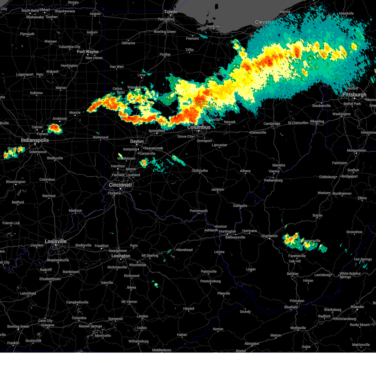 At 835 pm edt, a severe thunderstorm was located near ashley, moving east at 50 mph (radar indicated). Hazards include 70 mph wind gusts and penny size hail. Expect considerable tree damage. damage is likely to mobile homes, roofs, and outbuildings. locations impacted include, ashley, leonardsburg, olive green and kilbourne. this includes i-71 in ohio between mile markers 135 and 138. thunderstorm damage threat, considerable hail threat, radar indicated max hail size, 0. 75 in wind threat, radar indicated max wind gust, 70 mph. At 835 pm edt, a severe thunderstorm was located near ashley, moving east at 50 mph (radar indicated). Hazards include 70 mph wind gusts and penny size hail. Expect considerable tree damage. damage is likely to mobile homes, roofs, and outbuildings. locations impacted include, ashley, leonardsburg, olive green and kilbourne. this includes i-71 in ohio between mile markers 135 and 138. thunderstorm damage threat, considerable hail threat, radar indicated max hail size, 0. 75 in wind threat, radar indicated max wind gust, 70 mph.
|
| 7/20/2023 8:26 PM EDT |
 At 825 pm edt, a severe thunderstorm was located near ashley, or 9 miles north of delaware, moving east at 50 mph (radar indicated). Hazards include 60 mph wind gusts and quarter size hail. Minor damage to vehicles is possible. Expect damage to trees and power lines. At 825 pm edt, a severe thunderstorm was located near ashley, or 9 miles north of delaware, moving east at 50 mph (radar indicated). Hazards include 60 mph wind gusts and quarter size hail. Minor damage to vehicles is possible. Expect damage to trees and power lines.
|
| 7/20/2023 8:24 PM EDT |
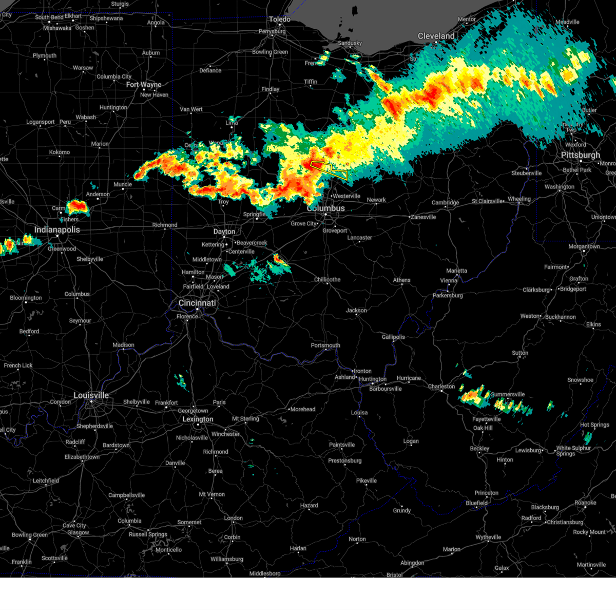 At 824 pm edt, a severe thunderstorm was located near delaware state park, moving east at 50 mph (radar indicated). Hazards include 70 mph wind gusts and penny size hail. Expect considerable tree damage. Damage is likely to mobile homes, roofs, and outbuildings. At 824 pm edt, a severe thunderstorm was located near delaware state park, moving east at 50 mph (radar indicated). Hazards include 70 mph wind gusts and penny size hail. Expect considerable tree damage. Damage is likely to mobile homes, roofs, and outbuildings.
|
| 7/2/2023 5:51 PM EDT |
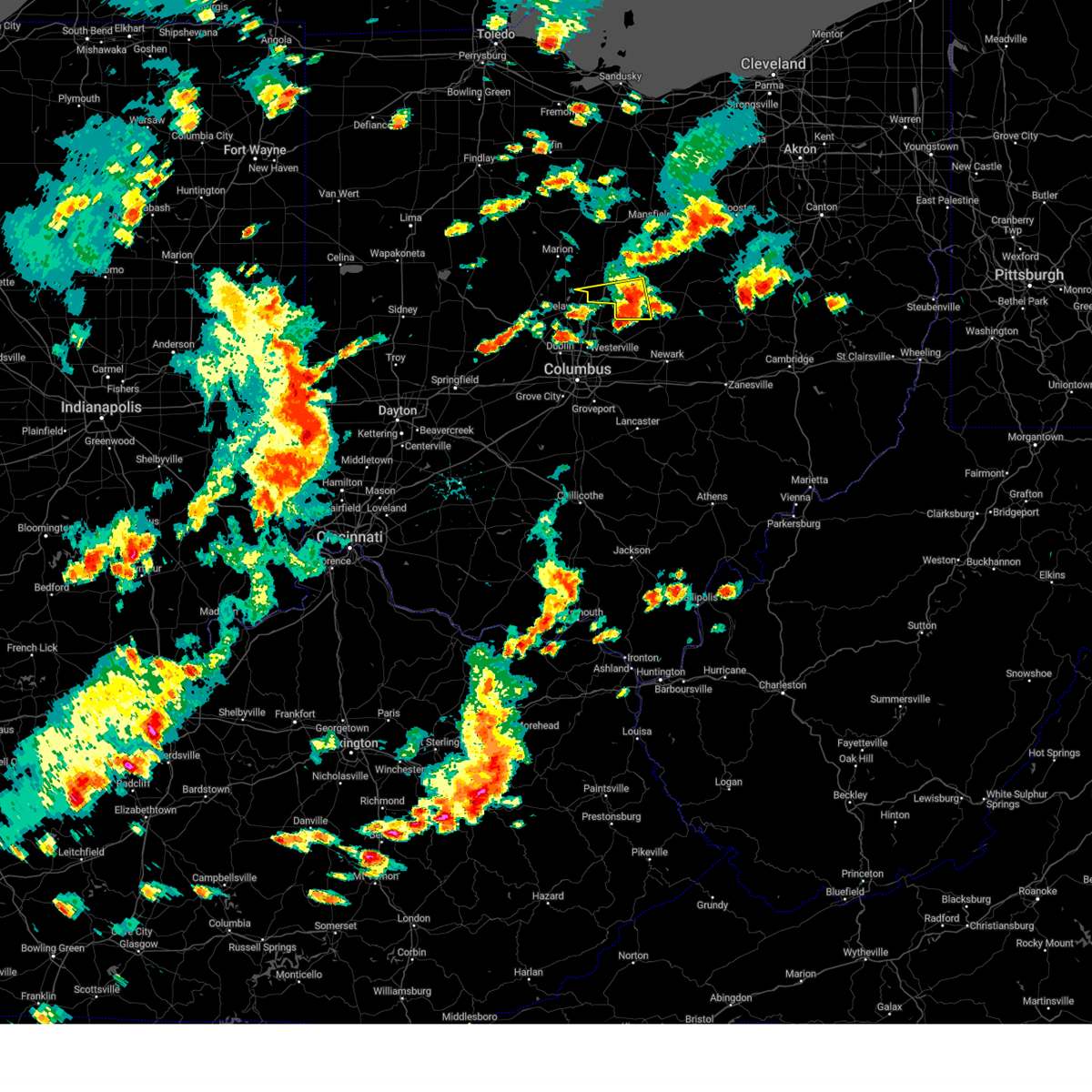 The severe thunderstorm warning for southern morrow and southwestern knox counties will expire at 600 pm edt, the storm which prompted the warning has weakened below severe limits, and no longer poses an immediate threat to life or property. therefore, the warning will be allowed to expire. however gusty winds and heavy rain are still possible with this thunderstorm. The severe thunderstorm warning for southern morrow and southwestern knox counties will expire at 600 pm edt, the storm which prompted the warning has weakened below severe limits, and no longer poses an immediate threat to life or property. therefore, the warning will be allowed to expire. however gusty winds and heavy rain are still possible with this thunderstorm.
|
| 7/2/2023 5:25 PM EDT |
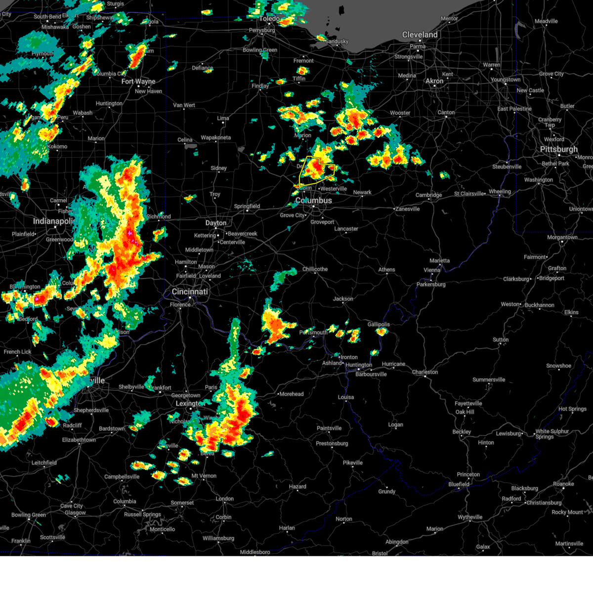 The severe thunderstorm warning for delaware county will expire at 530 pm edt, the storm which prompted the warning has weakened below severe limits, and no longer poses an immediate threat to life or property. therefore, the warning will be allowed to expire. however gusty winds and heavy rain are still possible with this thunderstorm. a severe thunderstorm watch remains in effect until 900 pm edt for central ohio. please report previous wind damage or hail to the national weather service by going to our website at weather.gov/iln and submitting your report via social media. The severe thunderstorm warning for delaware county will expire at 530 pm edt, the storm which prompted the warning has weakened below severe limits, and no longer poses an immediate threat to life or property. therefore, the warning will be allowed to expire. however gusty winds and heavy rain are still possible with this thunderstorm. a severe thunderstorm watch remains in effect until 900 pm edt for central ohio. please report previous wind damage or hail to the national weather service by going to our website at weather.gov/iln and submitting your report via social media.
|
| 7/2/2023 5:14 PM EDT |
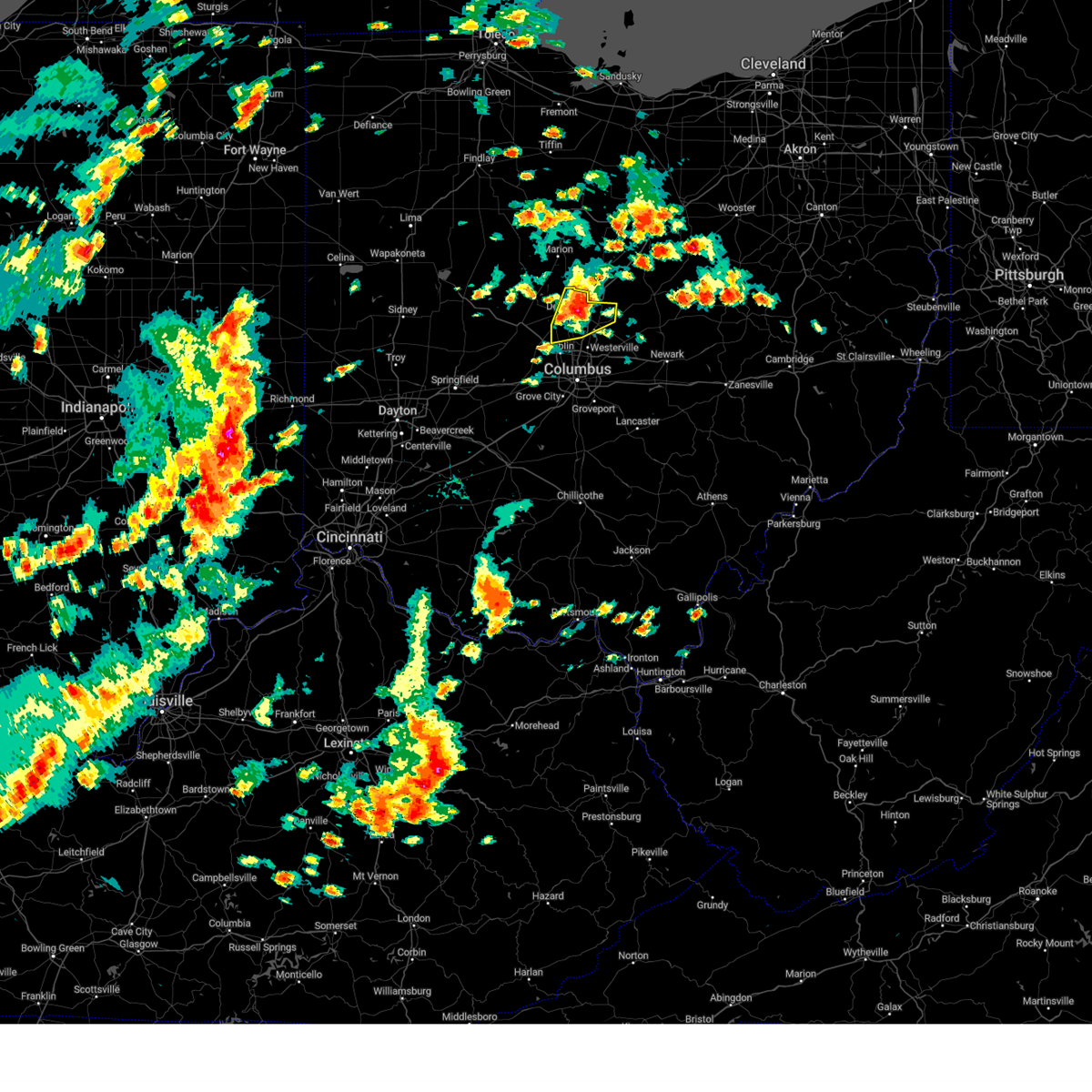 At 514 pm edt, a severe thunderstorm was located near delaware, moving east at 30 mph (radar indicated). Hazards include 60 mph wind gusts and penny size hail. Expect damage to trees and power lines. locations impacted include, delaware, powell, sunbury, ashley, shawnee hills, galena, interstate 71 at us route 36/state route 37, alum creek state park, delaware state park, olive green, stratford, bellepoint, leonardsburg, kilbourne and lewis center. this includes i-71 in ohio between mile markers 126 and 138. hail threat, radar indicated max hail size, 0. 75 in wind threat, observed max wind gust, 60 mph. At 514 pm edt, a severe thunderstorm was located near delaware, moving east at 30 mph (radar indicated). Hazards include 60 mph wind gusts and penny size hail. Expect damage to trees and power lines. locations impacted include, delaware, powell, sunbury, ashley, shawnee hills, galena, interstate 71 at us route 36/state route 37, alum creek state park, delaware state park, olive green, stratford, bellepoint, leonardsburg, kilbourne and lewis center. this includes i-71 in ohio between mile markers 126 and 138. hail threat, radar indicated max hail size, 0. 75 in wind threat, observed max wind gust, 60 mph.
|
| 7/2/2023 5:10 PM EDT |
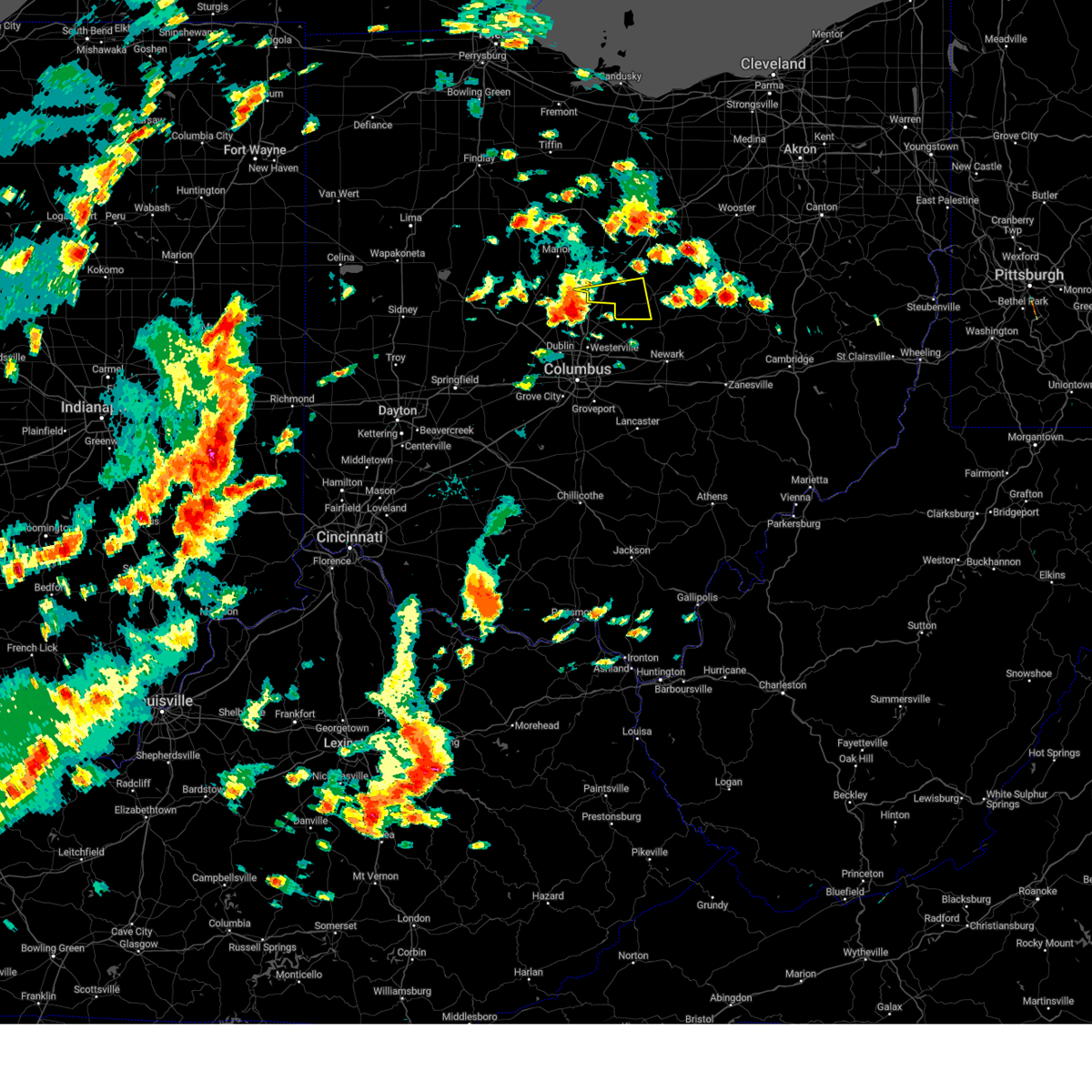 At 510 pm edt, a severe thunderstorm was located near delaware, moving east at 35 mph (radar indicated). Hazards include 60 mph wind gusts and quarter size hail. Minor damage to vehicles is possible. Expect damage to trees and power lines. At 510 pm edt, a severe thunderstorm was located near delaware, moving east at 35 mph (radar indicated). Hazards include 60 mph wind gusts and quarter size hail. Minor damage to vehicles is possible. Expect damage to trees and power lines.
|
| 7/2/2023 5:04 PM EDT |
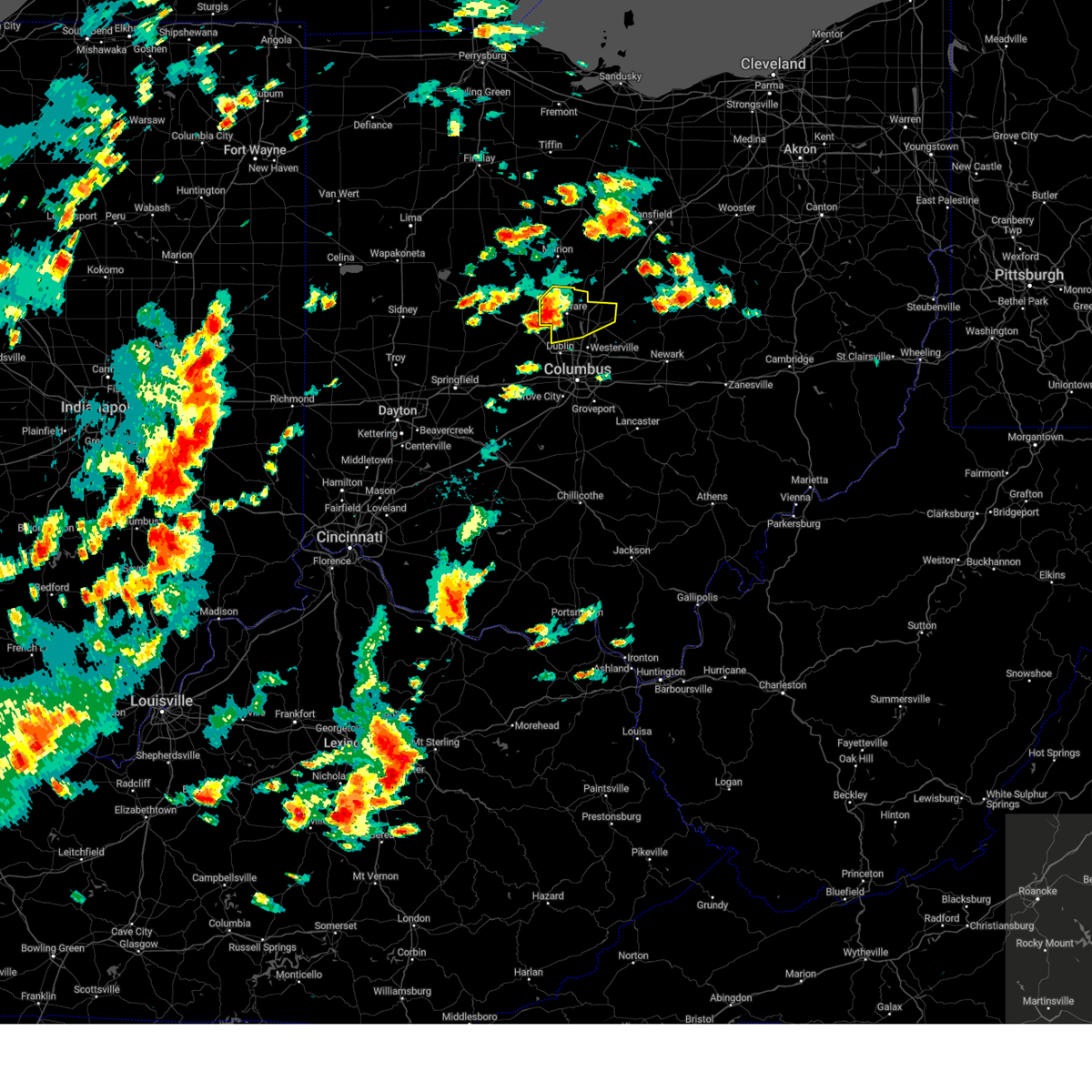 At 503 pm edt, a severe thunderstorm was located over delaware, moving east at 30 mph (radar indicated). Hazards include 60 mph wind gusts and penny size hail. Expect damage to trees and power lines. locations impacted include, delaware, powell, sunbury, ashley, radnor, shawnee hills, galena, ostrander, interstate 71 at us route 36/state route 37, alum creek state park, delaware state park, olive green, stratford, bellepoint, warrensburg, leonardsburg, kilbourne, state route 257 at us route 36, lewis center and state route 229 at us route 23. this includes i-71 in ohio between mile markers 126 and 138. hail threat, radar indicated max hail size, 0. 75 in wind threat, observed max wind gust, 60 mph. At 503 pm edt, a severe thunderstorm was located over delaware, moving east at 30 mph (radar indicated). Hazards include 60 mph wind gusts and penny size hail. Expect damage to trees and power lines. locations impacted include, delaware, powell, sunbury, ashley, radnor, shawnee hills, galena, ostrander, interstate 71 at us route 36/state route 37, alum creek state park, delaware state park, olive green, stratford, bellepoint, warrensburg, leonardsburg, kilbourne, state route 257 at us route 36, lewis center and state route 229 at us route 23. this includes i-71 in ohio between mile markers 126 and 138. hail threat, radar indicated max hail size, 0. 75 in wind threat, observed max wind gust, 60 mph.
|
| 7/2/2023 4:49 PM EDT |
 At 449 pm edt, a severe thunderstorm was located 7 miles west of delaware, moving east at 30 mph (radar indicated). Hazards include 60 mph wind gusts and penny size hail. expect damage to trees and power lines At 449 pm edt, a severe thunderstorm was located 7 miles west of delaware, moving east at 30 mph (radar indicated). Hazards include 60 mph wind gusts and penny size hail. expect damage to trees and power lines
|
| 4/21/2023 5:13 PM EDT |
 At 512 pm edt, severe thunderstorms were located along a line extending from near waldo to near ashley to near sunbury, moving northeast at 45 mph (radar indicated). Hazards include 60 mph wind gusts and penny size hail. Expect damage to trees and power lines. locations impacted include, mount vernon, mount gilead, lexington, fredericktown, gambier, cardington, bellville, centerburg, ashley, waldo, chesterville, sparta, waterford, caledonia, edison, marengo, fulton, iberia, shauck and state route 229 at us route 23. hail threat, radar indicated max hail size, 0. 75 in wind threat, radar indicated max wind gust, 60 mph. At 512 pm edt, severe thunderstorms were located along a line extending from near waldo to near ashley to near sunbury, moving northeast at 45 mph (radar indicated). Hazards include 60 mph wind gusts and penny size hail. Expect damage to trees and power lines. locations impacted include, mount vernon, mount gilead, lexington, fredericktown, gambier, cardington, bellville, centerburg, ashley, waldo, chesterville, sparta, waterford, caledonia, edison, marengo, fulton, iberia, shauck and state route 229 at us route 23. hail threat, radar indicated max hail size, 0. 75 in wind threat, radar indicated max wind gust, 60 mph.
|
| 4/21/2023 5:07 PM EDT |
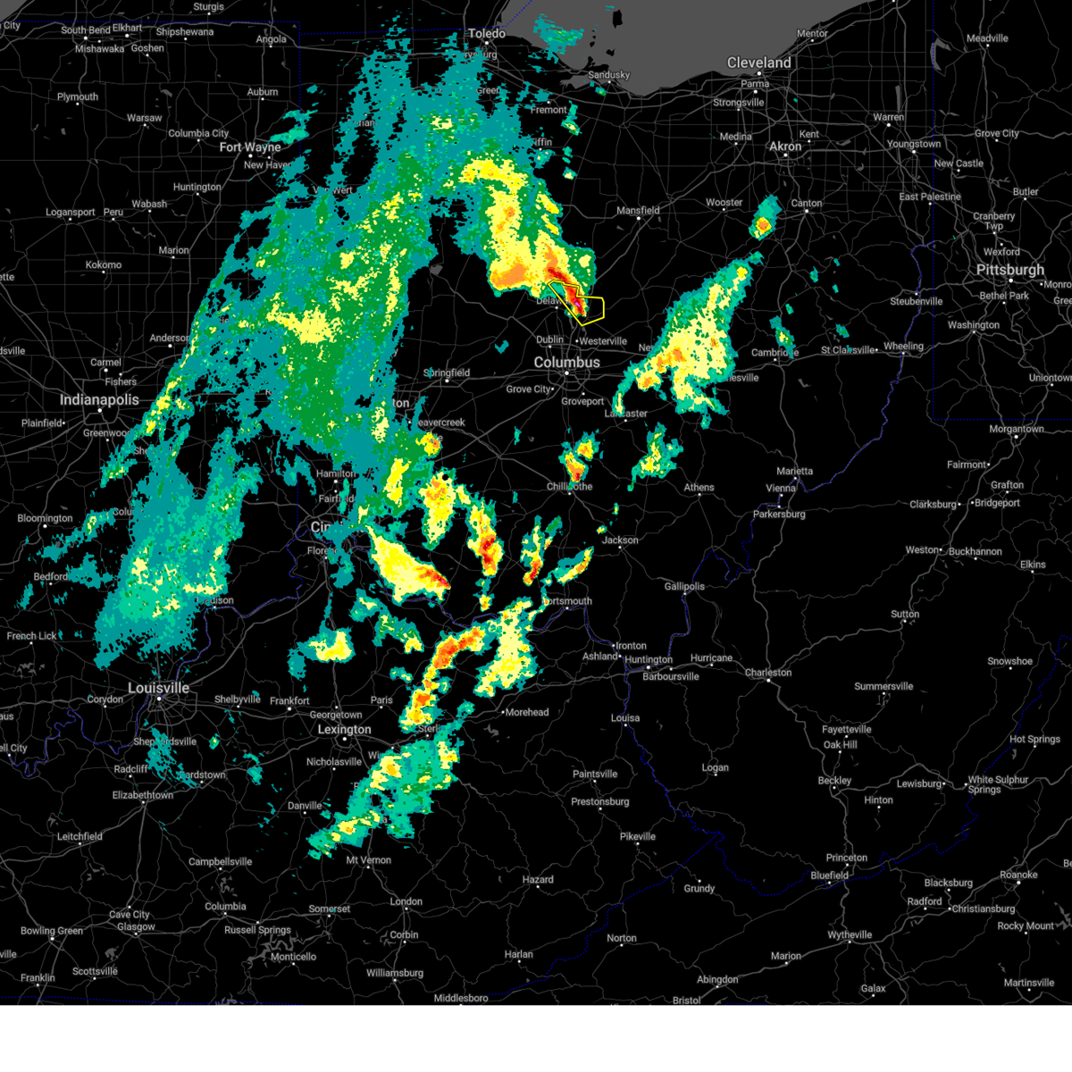 At 507 pm edt, a severe thunderstorm was located near ashley, moving northeast at 45 mph (radar indicated). Hazards include 60 mph wind gusts and quarter size hail. Minor hail damage to vehicles is possible. expect wind damage to trees and power lines. locations impacted include, sunbury, ashley, galena, interstate 71 at us route 36/state route 37, delaware state park, leonardsburg, olive green, state route 229 at us route 23 and kilbourne. this includes i-71 in ohio between mile markers 129 and 138. hail threat, radar indicated max hail size, 1. 00 in wind threat, radar indicated max wind gust, 60 mph. At 507 pm edt, a severe thunderstorm was located near ashley, moving northeast at 45 mph (radar indicated). Hazards include 60 mph wind gusts and quarter size hail. Minor hail damage to vehicles is possible. expect wind damage to trees and power lines. locations impacted include, sunbury, ashley, galena, interstate 71 at us route 36/state route 37, delaware state park, leonardsburg, olive green, state route 229 at us route 23 and kilbourne. this includes i-71 in ohio between mile markers 129 and 138. hail threat, radar indicated max hail size, 1. 00 in wind threat, radar indicated max wind gust, 60 mph.
|
| 4/21/2023 4:52 PM EDT |
 At 452 pm edt, a severe thunderstorm was located over delaware, moving northeast at 55 mph (radar indicated). Hazards include 60 mph wind gusts and quarter size hail. Minor damage to vehicles is possible. Expect damage to trees and power lines. At 452 pm edt, a severe thunderstorm was located over delaware, moving northeast at 55 mph (radar indicated). Hazards include 60 mph wind gusts and quarter size hail. Minor damage to vehicles is possible. Expect damage to trees and power lines.
|
| 4/21/2023 4:48 PM EDT |
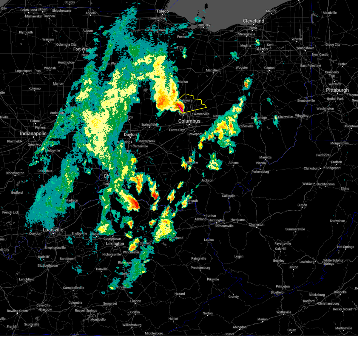 At 447 pm edt, a severe thunderstorm was located near powell, moving northeast at 45 mph (radar indicated). Hazards include 60 mph wind gusts and quarter size hail. Minor hail damage to vehicles is possible. Expect wind damage to trees and power lines. At 447 pm edt, a severe thunderstorm was located near powell, moving northeast at 45 mph (radar indicated). Hazards include 60 mph wind gusts and quarter size hail. Minor hail damage to vehicles is possible. Expect wind damage to trees and power lines.
|
| 4/1/2023 11:33 AM EDT |
 At 1132 am edt, severe thunderstorms were located along a line extending from near bucyrus to near richwood, moving east at 55 mph (radar indicated). Hazards include 60 mph wind gusts and penny size hail. expect damage to trees and power lines At 1132 am edt, severe thunderstorms were located along a line extending from near bucyrus to near richwood, moving east at 55 mph (radar indicated). Hazards include 60 mph wind gusts and penny size hail. expect damage to trees and power lines
|
| 7/23/2022 11:53 AM EDT |
 The severe thunderstorm warning for northwestern franklin and western delaware counties in central ohio, southeastern clark county in west central ohio, madison and eastern union counties in central ohio will expire at noon edt, the storms which prompted the warning have moved out of the warned area.therefore, the warning will be allowed to expire. gusty winds are still possible with these thunderstorms as they move through the columbus metro area. a severe thunderstorm watch remains in effect until 200 pm edt for central and west central ohio. please report previous wind damage or hail to the national weather service by going to our website at weather.gov/iln and submitting your report via social media. The severe thunderstorm warning for northwestern franklin and western delaware counties in central ohio, southeastern clark county in west central ohio, madison and eastern union counties in central ohio will expire at noon edt, the storms which prompted the warning have moved out of the warned area.therefore, the warning will be allowed to expire. gusty winds are still possible with these thunderstorms as they move through the columbus metro area. a severe thunderstorm watch remains in effect until 200 pm edt for central and west central ohio. please report previous wind damage or hail to the national weather service by going to our website at weather.gov/iln and submitting your report via social media.
|
| 7/23/2022 11:53 AM EDT |
 At 1152 am edt, severe thunderstorms were located along a line extending from near mansfield to near ashley, moving east at 45 mph (radar indicated). Hazards include 60 mph wind gusts. Expect damage to trees and power lines. locations impacted include, mount gilead, fredericktown, cardington, bellville, ashley, chesterville, sparta, waterford, butler, edison, marengo, fulton, north liberty, iberia and shauck. hail threat, radar indicated max hail size, <. 75 in wind threat, radar indicated max wind gust, 60 mph. At 1152 am edt, severe thunderstorms were located along a line extending from near mansfield to near ashley, moving east at 45 mph (radar indicated). Hazards include 60 mph wind gusts. Expect damage to trees and power lines. locations impacted include, mount gilead, fredericktown, cardington, bellville, ashley, chesterville, sparta, waterford, butler, edison, marengo, fulton, north liberty, iberia and shauck. hail threat, radar indicated max hail size, <. 75 in wind threat, radar indicated max wind gust, 60 mph.
|
| 7/23/2022 11:43 AM EDT |
 At 1142 am edt, severe thunderstorms were located along a line extending from delaware to london, moving east at 50 mph (radar indicated). Hazards include 60 mph wind gusts and penny size hail. Expect damage to trees and power lines. locations impacted include, columbus, dublin, delaware, hilliard, marysville, london, jefferson, powell, plain city, west jefferson, south charleston, ashley, new california, lake darby, lisbon, radnor, shawnee hills, ostrander, lafayette and magnetic springs. this includes i-70 in ohio between mile markers 74 and 91. hail threat, radar indicated max hail size, 0. 75 in wind threat, radar indicated max wind gust, 60 mph. At 1142 am edt, severe thunderstorms were located along a line extending from delaware to london, moving east at 50 mph (radar indicated). Hazards include 60 mph wind gusts and penny size hail. Expect damage to trees and power lines. locations impacted include, columbus, dublin, delaware, hilliard, marysville, london, jefferson, powell, plain city, west jefferson, south charleston, ashley, new california, lake darby, lisbon, radnor, shawnee hills, ostrander, lafayette and magnetic springs. this includes i-70 in ohio between mile markers 74 and 91. hail threat, radar indicated max hail size, 0. 75 in wind threat, radar indicated max wind gust, 60 mph.
|
| 7/23/2022 11:27 AM EDT |
 At 1126 am edt, severe thunderstorms were located along a line extending from near crestline to waldo, moving east at 40 mph (radar indicated). Hazards include 60 mph wind gusts. expect damage to trees and power lines At 1126 am edt, severe thunderstorms were located along a line extending from near crestline to waldo, moving east at 40 mph (radar indicated). Hazards include 60 mph wind gusts. expect damage to trees and power lines
|
| 7/23/2022 11:25 AM EDT |
 At 1125 am edt, severe thunderstorms were located along a line extending from 6 miles south of richwood to south charleston, moving east at 55 mph (radar indicated). Hazards include 60 mph wind gusts and penny size hail. Expect damage to trees and power lines. locations impacted include, columbus, springfield, dublin, delaware, hilliard, marysville, london, jefferson, powell, plain city, west jefferson, richwood, south charleston, mechanicsburg, ashley, choctaw lake, new california, lake darby, harmony and lisbon. this includes i-70 in ohio between mile markers 54 and 91. hail threat, radar indicated max hail size, 0. 75 in wind threat, radar indicated max wind gust, 60 mph. At 1125 am edt, severe thunderstorms were located along a line extending from 6 miles south of richwood to south charleston, moving east at 55 mph (radar indicated). Hazards include 60 mph wind gusts and penny size hail. Expect damage to trees and power lines. locations impacted include, columbus, springfield, dublin, delaware, hilliard, marysville, london, jefferson, powell, plain city, west jefferson, richwood, south charleston, mechanicsburg, ashley, choctaw lake, new california, lake darby, harmony and lisbon. this includes i-70 in ohio between mile markers 54 and 91. hail threat, radar indicated max hail size, 0. 75 in wind threat, radar indicated max wind gust, 60 mph.
|
| 7/23/2022 11:13 AM EDT |
 At 1112 am edt, severe thunderstorms were located along a line extending from west mansfield to springfield, moving east at 40 mph (radar indicated). Hazards include 60 mph wind gusts and penny size hail. expect damage to trees and power lines At 1112 am edt, severe thunderstorms were located along a line extending from west mansfield to springfield, moving east at 40 mph (radar indicated). Hazards include 60 mph wind gusts and penny size hail. expect damage to trees and power lines
|
| 7/5/2022 11:57 PM EDT |
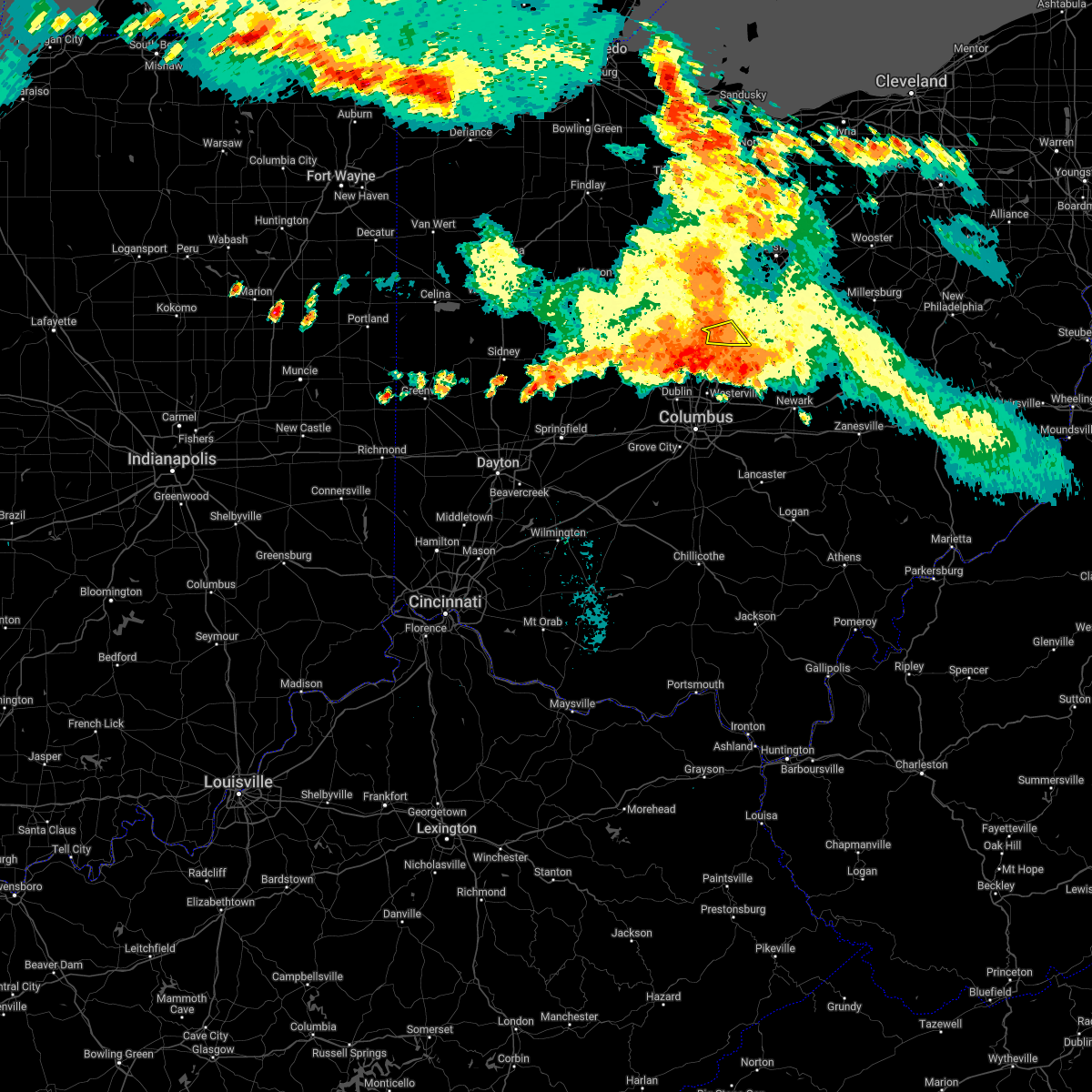 At 1157 pm edt, a severe thunderstorm was located near ashley, or 12 miles south of mount gilead, moving southeast at 30 mph (radar indicated). Hazards include 60 mph wind gusts. expect damage to trees and power lines At 1157 pm edt, a severe thunderstorm was located near ashley, or 12 miles south of mount gilead, moving southeast at 30 mph (radar indicated). Hazards include 60 mph wind gusts. expect damage to trees and power lines
|
| 6/16/2022 3:36 PM EDT |
 At 336 pm edt, severe thunderstorms were located along a line extending from millersburg to near ashley, moving east at 30 mph (radar indicated). Hazards include 60 mph wind gusts and quarter size hail. Minor damage to vehicles is possible. expect damage to trees and power lines. locations impacted include, mount vernon, millersburg, berlin, walnut creek, fredericktown, gambier, sugarcreek, centerburg, ashley, danville, killbuck, glenmont, chesterville, nashville, sparta, farmerstown, baltic, marengo, fulton and martinsburg. hail threat, radar indicated max hail size, 1. 00 in wind threat, radar indicated max wind gust, 60 mph. At 336 pm edt, severe thunderstorms were located along a line extending from millersburg to near ashley, moving east at 30 mph (radar indicated). Hazards include 60 mph wind gusts and quarter size hail. Minor damage to vehicles is possible. expect damage to trees and power lines. locations impacted include, mount vernon, millersburg, berlin, walnut creek, fredericktown, gambier, sugarcreek, centerburg, ashley, danville, killbuck, glenmont, chesterville, nashville, sparta, farmerstown, baltic, marengo, fulton and martinsburg. hail threat, radar indicated max hail size, 1. 00 in wind threat, radar indicated max wind gust, 60 mph.
|
| 6/16/2022 3:16 PM EDT |
 At 315 pm edt, severe thunderstorms were located along a line extending from nashville to near waldo, moving east-southeast at 30 mph (radar indicated). Hazards include 60 mph wind gusts and quarter size hail. Minor damage to vehicles is possible. Expect damage to trees and power lines. At 315 pm edt, severe thunderstorms were located along a line extending from nashville to near waldo, moving east-southeast at 30 mph (radar indicated). Hazards include 60 mph wind gusts and quarter size hail. Minor damage to vehicles is possible. Expect damage to trees and power lines.
|
| 6/14/2022 3:52 AM EDT |
 At 351 am edt, a severe thunderstorm was located near dunkirk, moving southeast at 45 mph (radar indicated). Hazards include 60 mph wind gusts and quarter size hail. Minor hail damage to vehicles is possible. Expect wind damage to trees and power lines. At 351 am edt, a severe thunderstorm was located near dunkirk, moving southeast at 45 mph (radar indicated). Hazards include 60 mph wind gusts and quarter size hail. Minor hail damage to vehicles is possible. Expect wind damage to trees and power lines.
|
| 6/14/2022 3:30 AM EDT |
 At 330 am edt, severe thunderstorms were located along a line extending from polk to cardington, moving southeast at 60 mph (radar indicated). Hazards include 60 mph wind gusts. expect damage to trees and power lines At 330 am edt, severe thunderstorms were located along a line extending from polk to cardington, moving southeast at 60 mph (radar indicated). Hazards include 60 mph wind gusts. expect damage to trees and power lines
|
| 6/14/2022 12:31 AM EDT |
 At 1230 am edt, a severe thunderstorm was located over dublin, moving east at 65 mph (radar indicated). Hazards include 70 mph wind gusts and penny size hail. Expect considerable tree damage. damage is likely to mobile homes, roofs, and outbuildings. locations impacted include, columbus, dublin, westerville, reynoldsburg, delaware, upper arlington, gahanna, hilliard, marysville, worthington, bexley, powell, sunbury, plain city, west jefferson, ashley, minerva park, new california, polaris and ohio state university. this includes the following interstates, i-70 in ohio between mile markers 82 and 111. i-71 in ohio between mile markers 104 and 138. thunderstorm damage threat, considerable hail threat, radar indicated max hail size, 0. 75 in wind threat, radar indicated max wind gust, 70 mph. At 1230 am edt, a severe thunderstorm was located over dublin, moving east at 65 mph (radar indicated). Hazards include 70 mph wind gusts and penny size hail. Expect considerable tree damage. damage is likely to mobile homes, roofs, and outbuildings. locations impacted include, columbus, dublin, westerville, reynoldsburg, delaware, upper arlington, gahanna, hilliard, marysville, worthington, bexley, powell, sunbury, plain city, west jefferson, ashley, minerva park, new california, polaris and ohio state university. this includes the following interstates, i-70 in ohio between mile markers 82 and 111. i-71 in ohio between mile markers 104 and 138. thunderstorm damage threat, considerable hail threat, radar indicated max hail size, 0. 75 in wind threat, radar indicated max wind gust, 70 mph.
|
| 6/14/2022 12:11 AM EDT |
 At 1211 am edt, a severe thunderstorm was located near north lewisburg, moving east at 65 mph (radar indicated). Hazards include 70 mph wind gusts and penny size hail. Expect considerable tree damage. Damage is likely to mobile homes, roofs, and outbuildings. At 1211 am edt, a severe thunderstorm was located near north lewisburg, moving east at 65 mph (radar indicated). Hazards include 70 mph wind gusts and penny size hail. Expect considerable tree damage. Damage is likely to mobile homes, roofs, and outbuildings.
|
| 6/14/2022 12:06 AM EDT |
 The severe thunderstorm warning for delaware and northeastern union counties in central ohio will expire at 1215 am edt, the severe thunderstorm which prompted the warning has moved out of the warned area. therefore, the warning will be allowed to expire. however gusty winds and heavy rain are still possible with this thunderstorm. a severe thunderstorm watch remains in effect until 300 am edt for central ohio. please report previous wind damage or hail to the national weather service by going to our website at weather.gov/iln and submitting your report via social media. remember, a severe thunderstorm warning still remains in effect for union county until 1245 am edt. The severe thunderstorm warning for delaware and northeastern union counties in central ohio will expire at 1215 am edt, the severe thunderstorm which prompted the warning has moved out of the warned area. therefore, the warning will be allowed to expire. however gusty winds and heavy rain are still possible with this thunderstorm. a severe thunderstorm watch remains in effect until 300 am edt for central ohio. please report previous wind damage or hail to the national weather service by going to our website at weather.gov/iln and submitting your report via social media. remember, a severe thunderstorm warning still remains in effect for union county until 1245 am edt.
|
| 6/13/2022 11:54 PM EDT |
 At 1153 pm edt, a severe thunderstorm was located over johnstown, moving southeast at 50 mph (radar indicated). Hazards include 70 mph wind gusts and penny size hail. Expect considerable tree damage. damage is likely to mobile homes, roofs, and outbuildings. locations impacted include, dublin, westerville, delaware, powell, sunbury, ashley, polaris, radnor, shawnee hills, galena, ostrander, magnetic springs, alum creek state park, delaware state park, olive green, warrensburg, center village, kilbourne, columbus zoo and lewis center. this includes i-71 in ohio between mile markers 122 and 138. thunderstorm damage threat, considerable hail threat, radar indicated max hail size, 0. 75 in wind threat, radar indicated max wind gust, 70 mph. At 1153 pm edt, a severe thunderstorm was located over johnstown, moving southeast at 50 mph (radar indicated). Hazards include 70 mph wind gusts and penny size hail. Expect considerable tree damage. damage is likely to mobile homes, roofs, and outbuildings. locations impacted include, dublin, westerville, delaware, powell, sunbury, ashley, polaris, radnor, shawnee hills, galena, ostrander, magnetic springs, alum creek state park, delaware state park, olive green, warrensburg, center village, kilbourne, columbus zoo and lewis center. this includes i-71 in ohio between mile markers 122 and 138. thunderstorm damage threat, considerable hail threat, radar indicated max hail size, 0. 75 in wind threat, radar indicated max wind gust, 70 mph.
|
| 6/13/2022 11:48 PM EDT |
 At 1148 pm edt, severe thunderstorms were located along a line extending from near glenmont to near utica, moving east at 75 mph (trained weather spotters). Hazards include 70 mph wind gusts and penny size hail. Expect considerable tree damage. damage is likely to mobile homes, roofs, and outbuildings. locations impacted include, mansfield, ashland, mount vernon, lexington, loudonville, fredericktown, gambier, bellville, centerburg, ashley, danville, hayesville, chesterville, sparta, butler, perrysville, lucas, jeromesville, marengo and martinsburg. thunderstorm damage threat, considerable hail threat, radar indicated max hail size, 0. 75 in wind threat, radar indicated max wind gust, 70 mph. At 1148 pm edt, severe thunderstorms were located along a line extending from near glenmont to near utica, moving east at 75 mph (trained weather spotters). Hazards include 70 mph wind gusts and penny size hail. Expect considerable tree damage. damage is likely to mobile homes, roofs, and outbuildings. locations impacted include, mansfield, ashland, mount vernon, lexington, loudonville, fredericktown, gambier, bellville, centerburg, ashley, danville, hayesville, chesterville, sparta, butler, perrysville, lucas, jeromesville, marengo and martinsburg. thunderstorm damage threat, considerable hail threat, radar indicated max hail size, 0. 75 in wind threat, radar indicated max wind gust, 70 mph.
|
| 6/13/2022 11:24 PM EDT |
 At 1123 pm edt, a severe thunderstorm was located near ashley, moving southeast at 50 mph (radar indicated). Hazards include 70 mph wind gusts and penny size hail. Expect considerable tree damage. damage is likely to mobile homes, roofs, and outbuildings. locations impacted include, dublin, westerville, delaware, kenton, powell, sunbury, richwood, ashley, polaris, radnor, shawnee hills, galena, ostrander, mount victory, ridgeway, magnetic springs, alum creek state park, delaware state park, olive green and pfeiffer. this includes i-71 in ohio between mile markers 122 and 138. thunderstorm damage threat, considerable hail threat, radar indicated max hail size, 0. 75 in wind threat, radar indicated max wind gust, 70 mph. At 1123 pm edt, a severe thunderstorm was located near ashley, moving southeast at 50 mph (radar indicated). Hazards include 70 mph wind gusts and penny size hail. Expect considerable tree damage. damage is likely to mobile homes, roofs, and outbuildings. locations impacted include, dublin, westerville, delaware, kenton, powell, sunbury, richwood, ashley, polaris, radnor, shawnee hills, galena, ostrander, mount victory, ridgeway, magnetic springs, alum creek state park, delaware state park, olive green and pfeiffer. this includes i-71 in ohio between mile markers 122 and 138. thunderstorm damage threat, considerable hail threat, radar indicated max hail size, 0. 75 in wind threat, radar indicated max wind gust, 70 mph.
|
| 6/13/2022 11:24 PM EDT |
 At 1124 pm edt, severe thunderstorms were located along a line extending from near lexington to near chesterville to near ashley, moving southeast at 75 mph (trained weather spotters). Hazards include 70 mph wind gusts and half dollar size hail. People and animals outdoors will be injured. expect hail damage to roofs, siding, windows, and vehicles. expect considerable tree damage. wind damage is also likely to mobile homes, roofs, and outbuildings. locations impacted include, mansfield, ashland, mount vernon, mount gilead, ontario, lexington, crestline, loudonville, fredericktown, gambier, cardington, bellville, centerburg, ashley, danville, hayesville, chesterville, sparta, waterford and butler. thunderstorm damage threat, considerable hail threat, radar indicated max hail size, 1. 25 in wind threat, radar indicated max wind gust, 70 mph. At 1124 pm edt, severe thunderstorms were located along a line extending from near lexington to near chesterville to near ashley, moving southeast at 75 mph (trained weather spotters). Hazards include 70 mph wind gusts and half dollar size hail. People and animals outdoors will be injured. expect hail damage to roofs, siding, windows, and vehicles. expect considerable tree damage. wind damage is also likely to mobile homes, roofs, and outbuildings. locations impacted include, mansfield, ashland, mount vernon, mount gilead, ontario, lexington, crestline, loudonville, fredericktown, gambier, cardington, bellville, centerburg, ashley, danville, hayesville, chesterville, sparta, waterford and butler. thunderstorm damage threat, considerable hail threat, radar indicated max hail size, 1. 25 in wind threat, radar indicated max wind gust, 70 mph.
|
| 6/13/2022 11:12 PM EDT |
 At 1111 pm edt, severe thunderstorms were located along a line extending from crestline to 7 miles northwest of mount gilead to near marion, moving southeast at 75 mph (radar indicated). Hazards include 70 mph wind gusts and quarter size hail. Minor damage to vehicles is possible. expect considerable tree damage. Wind damage is also likely to mobile homes, roofs, and outbuildings. At 1111 pm edt, severe thunderstorms were located along a line extending from crestline to 7 miles northwest of mount gilead to near marion, moving southeast at 75 mph (radar indicated). Hazards include 70 mph wind gusts and quarter size hail. Minor damage to vehicles is possible. expect considerable tree damage. Wind damage is also likely to mobile homes, roofs, and outbuildings.
|
| 6/13/2022 11:12 PM EDT |
 At 1111 pm edt, a severe thunderstorm was located near prospect, moving southeast at 50 mph (radar indicated). Hazards include 70 mph wind gusts and penny size hail. Expect considerable tree damage. Damage is likely to mobile homes, roofs, and outbuildings. At 1111 pm edt, a severe thunderstorm was located near prospect, moving southeast at 50 mph (radar indicated). Hazards include 70 mph wind gusts and penny size hail. Expect considerable tree damage. Damage is likely to mobile homes, roofs, and outbuildings.
|
| 6/8/2022 7:55 PM EDT |
 The severe thunderstorm warning for northeastern delaware county will expire at 800 pm edt, an additional severe thunderstorm warning is now in effect for northeastern delaware county and northern licking county until 900 pm. a tornado watch remains in effect until 1000 pm edt for central ohio. please report previous wind damage or hail to the national weather service by going to our website at weather.gov/iln and submitting your report via social media. The severe thunderstorm warning for northeastern delaware county will expire at 800 pm edt, an additional severe thunderstorm warning is now in effect for northeastern delaware county and northern licking county until 900 pm. a tornado watch remains in effect until 1000 pm edt for central ohio. please report previous wind damage or hail to the national weather service by going to our website at weather.gov/iln and submitting your report via social media.
|
| 6/8/2022 7:44 PM EDT |
 At 744 pm edt, a severe thunderstorm was located near sunbury, moving east at 40 mph (radar indicated). Hazards include 60 mph wind gusts. Expect damage to trees and power lines. locations impacted include, ashley, kilbourne, leonardsburg and olive green. this includes i-71 in ohio between mile markers 132 and 138. hail threat, radar indicated max hail size, <. 75 in wind threat, radar indicated max wind gust, 60 mph. At 744 pm edt, a severe thunderstorm was located near sunbury, moving east at 40 mph (radar indicated). Hazards include 60 mph wind gusts. Expect damage to trees and power lines. locations impacted include, ashley, kilbourne, leonardsburg and olive green. this includes i-71 in ohio between mile markers 132 and 138. hail threat, radar indicated max hail size, <. 75 in wind threat, radar indicated max wind gust, 60 mph.
|
| 6/8/2022 7:37 PM EDT |
 At 736 pm edt, a severe thunderstorm was located over mount gilead, moving east at 50 mph (radar indicated). Hazards include 60 mph wind gusts. Expect damage to trees and power lines. locations impacted include, mount gilead, cardington, ashley, edison, marengo and fulton. hail threat, radar indicated max hail size, <. 75 in wind threat, radar indicated max wind gust, 60 mph. At 736 pm edt, a severe thunderstorm was located over mount gilead, moving east at 50 mph (radar indicated). Hazards include 60 mph wind gusts. Expect damage to trees and power lines. locations impacted include, mount gilead, cardington, ashley, edison, marengo and fulton. hail threat, radar indicated max hail size, <. 75 in wind threat, radar indicated max wind gust, 60 mph.
|
| 6/8/2022 7:33 PM EDT |
 At 732 pm edt, a severe thunderstorm was located near delaware, moving east at 25 mph (radar indicated). Hazards include 60 mph wind gusts. Expect damage to trees and power lines. locations impacted include, delaware, sunbury, ashley, warrensburg, delaware state park, leonardsburg, olive green, stratford and kilbourne. this includes i-71 in ohio between mile markers 130 and 138. hail threat, radar indicated max hail size, <. 75 in wind threat, radar indicated max wind gust, 60 mph. At 732 pm edt, a severe thunderstorm was located near delaware, moving east at 25 mph (radar indicated). Hazards include 60 mph wind gusts. Expect damage to trees and power lines. locations impacted include, delaware, sunbury, ashley, warrensburg, delaware state park, leonardsburg, olive green, stratford and kilbourne. this includes i-71 in ohio between mile markers 130 and 138. hail threat, radar indicated max hail size, <. 75 in wind threat, radar indicated max wind gust, 60 mph.
|
| 6/8/2022 7:22 PM EDT |
 At 721 pm edt, a severe thunderstorm was located near delaware, moving east at 40 mph (radar indicated). Hazards include 60 mph wind gusts. expect damage to trees and power lines At 721 pm edt, a severe thunderstorm was located near delaware, moving east at 40 mph (radar indicated). Hazards include 60 mph wind gusts. expect damage to trees and power lines
|
| 6/8/2022 7:16 PM EDT |
 At 716 pm edt, a severe thunderstorm was located over prospect, or 9 miles south of marion, moving east at 35 mph (radar indicated). Hazards include 60 mph wind gusts. expect damage to trees and power lines At 716 pm edt, a severe thunderstorm was located over prospect, or 9 miles south of marion, moving east at 35 mph (radar indicated). Hazards include 60 mph wind gusts. expect damage to trees and power lines
|
| 8/11/2021 5:11 PM EDT |
 At 511 pm edt, severe thunderstorms were located along a line extending from near savannah to bellville to near sunbury, moving east at 45 mph (radar indicated). Hazards include 60 mph wind gusts. Expect damage to trees and power lines. locations impacted include, mansfield, mount vernon, mount gilead, lexington, loudonville, fredericktown, gambier, utica, cardington, bellville, centerburg, ashley, danville, chesterville, sparta, waterford, butler, perrysville, lucas and marengo. hail threat, radar indicated max hail size, <. 75 in wind threat, radar indicated max wind gust, 60 mph. At 511 pm edt, severe thunderstorms were located along a line extending from near savannah to bellville to near sunbury, moving east at 45 mph (radar indicated). Hazards include 60 mph wind gusts. Expect damage to trees and power lines. locations impacted include, mansfield, mount vernon, mount gilead, lexington, loudonville, fredericktown, gambier, utica, cardington, bellville, centerburg, ashley, danville, chesterville, sparta, waterford, butler, perrysville, lucas and marengo. hail threat, radar indicated max hail size, <. 75 in wind threat, radar indicated max wind gust, 60 mph.
|
| 8/11/2021 4:50 PM EDT |
 At 448 pm edt, a severe thunderstorm was located near ostrander, moving east at 45 mph (radar indicated). Hazards include 60 mph wind gusts. Expect damage to trees and power lines. locations impacted include, delaware, marysville, powell, ashley, radnor, milford center, shawnee hills, ostrander, magnetic springs, alum creek state park, delaware state park, stratford, bellepoint, warrensburg, pharisburg, watkins, leonardsburg, kilbourne and new dover. this includes i-71 in ohio between mile markers 123 and 139. hail threat, radar indicated max hail size, <. 75 in wind threat, radar indicated max wind gust, 60 mph. At 448 pm edt, a severe thunderstorm was located near ostrander, moving east at 45 mph (radar indicated). Hazards include 60 mph wind gusts. Expect damage to trees and power lines. locations impacted include, delaware, marysville, powell, ashley, radnor, milford center, shawnee hills, ostrander, magnetic springs, alum creek state park, delaware state park, stratford, bellepoint, warrensburg, pharisburg, watkins, leonardsburg, kilbourne and new dover. this includes i-71 in ohio between mile markers 123 and 139. hail threat, radar indicated max hail size, <. 75 in wind threat, radar indicated max wind gust, 60 mph.
|
| 8/11/2021 4:39 PM EDT |
 At 438 pm edt, a severe thunderstorm was located near marysville, moving east at 35 mph (radar indicated). Hazards include 60 mph wind gusts. Expect damage to trees and power lines. locations impacted include, marysville, delaware, powell, richwood, ashley, radnor, milford center, shawnee hills, ostrander, magnetic springs, alum creek state park, raymond, delaware state park, broadway, warrensburg, pottersburg, kilbourne, essex and lewis center. this includes i-71 in ohio between mile markers 123 and 139. hail threat, radar indicated max hail size, <. 75 in wind threat, radar indicated max wind gust, 60 mph. At 438 pm edt, a severe thunderstorm was located near marysville, moving east at 35 mph (radar indicated). Hazards include 60 mph wind gusts. Expect damage to trees and power lines. locations impacted include, marysville, delaware, powell, richwood, ashley, radnor, milford center, shawnee hills, ostrander, magnetic springs, alum creek state park, raymond, delaware state park, broadway, warrensburg, pottersburg, kilbourne, essex and lewis center. this includes i-71 in ohio between mile markers 123 and 139. hail threat, radar indicated max hail size, <. 75 in wind threat, radar indicated max wind gust, 60 mph.
|
| 8/11/2021 4:30 PM EDT |
 At 429 pm edt, severe thunderstorms were located along a line extending from near bucyrus to near marion to near west mansfield, moving east at 40 mph (radar indicated). Hazards include 60 mph wind gusts. expect damage to trees and power lines At 429 pm edt, severe thunderstorms were located along a line extending from near bucyrus to near marion to near west mansfield, moving east at 40 mph (radar indicated). Hazards include 60 mph wind gusts. expect damage to trees and power lines
|
| 8/11/2021 4:24 PM EDT |
 At 423 pm edt, a severe thunderstorm was located near west mansfield, moving east at 45 mph (radar indicated). Hazards include 60 mph wind gusts. expect damage to trees and power lines At 423 pm edt, a severe thunderstorm was located near west mansfield, moving east at 45 mph (radar indicated). Hazards include 60 mph wind gusts. expect damage to trees and power lines
|
| 6/29/2021 4:37 PM EDT |
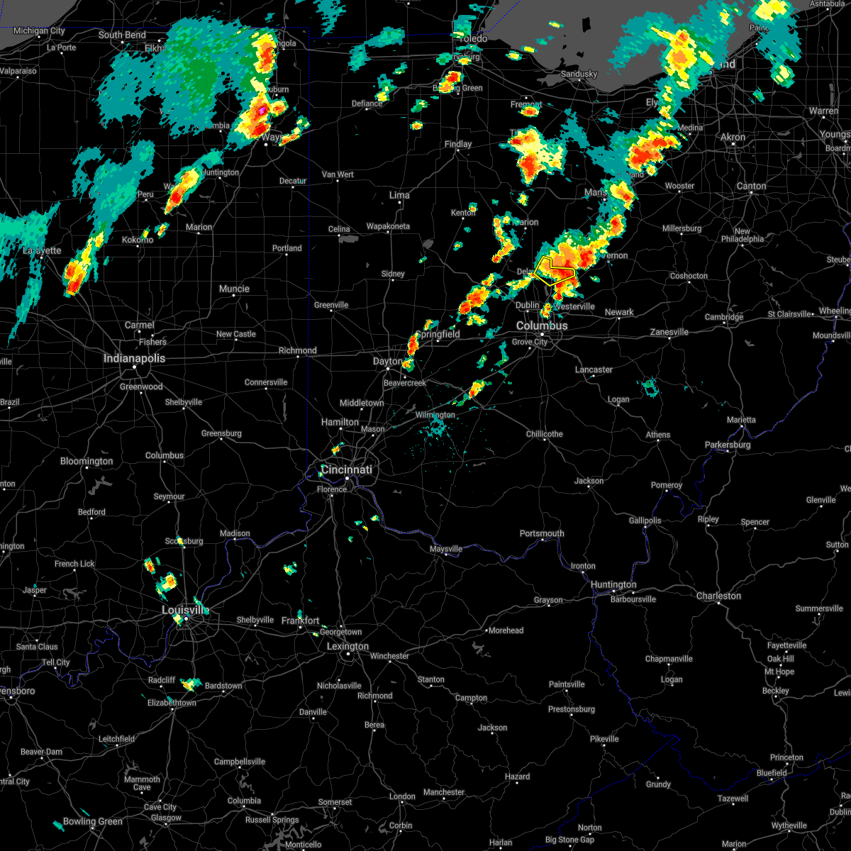 The severe thunderstorm warning for northeastern delaware county will expire at 445 pm edt, the storm which prompted the warning has weakened below severe limits, and no longer poses an immediate threat to life or property. therefore, the warning will be allowed to expire. please report previous wind damage or hail to the national weather service by going to our website at weather.gov/iln and submitting your report via social media. The severe thunderstorm warning for northeastern delaware county will expire at 445 pm edt, the storm which prompted the warning has weakened below severe limits, and no longer poses an immediate threat to life or property. therefore, the warning will be allowed to expire. please report previous wind damage or hail to the national weather service by going to our website at weather.gov/iln and submitting your report via social media.
|
| 6/29/2021 4:31 PM EDT |
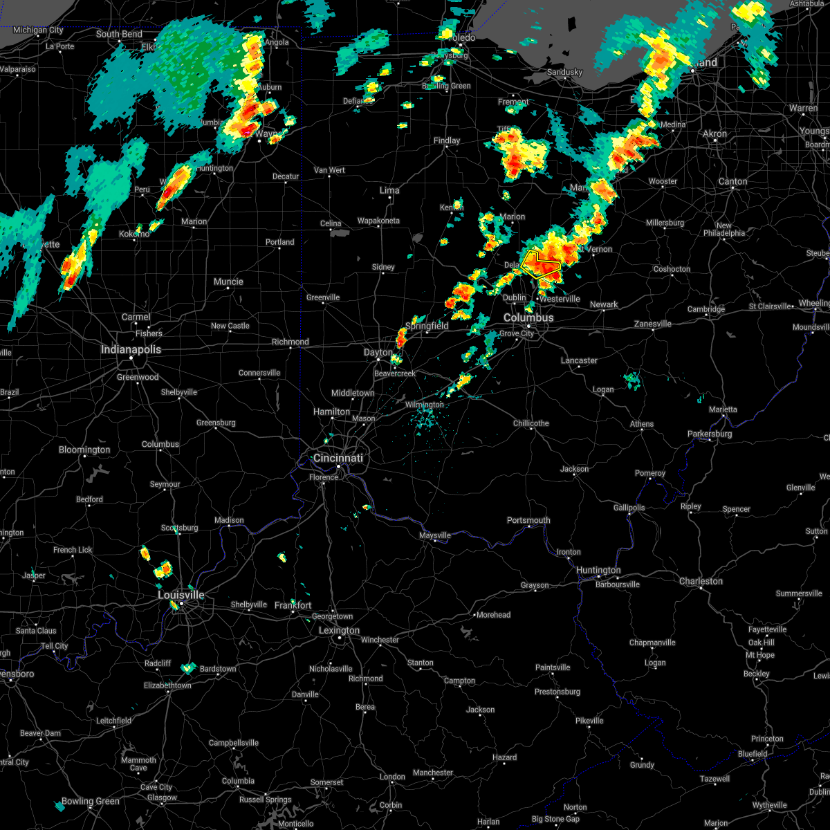 At 431 pm edt, a severe thunderstorm was located near ashley, moving northeast at 10 mph (radar indicated). Hazards include 60 mph wind gusts and penny size hail. Expect damage to trees and power lines. locations impacted include, ashley, interstate 71 at us route 36/state route 37, kilbourne, leonardsburg and olive green. This includes i-71 in ohio between mile markers 130 and 138. At 431 pm edt, a severe thunderstorm was located near ashley, moving northeast at 10 mph (radar indicated). Hazards include 60 mph wind gusts and penny size hail. Expect damage to trees and power lines. locations impacted include, ashley, interstate 71 at us route 36/state route 37, kilbourne, leonardsburg and olive green. This includes i-71 in ohio between mile markers 130 and 138.
|
| 6/29/2021 4:22 PM EDT |
 At 421 pm edt, a severe thunderstorm was located near delaware, moving northeast at 10 mph (radar indicated). Hazards include 60 mph wind gusts and penny size hail. Expect damage to trees and power lines. locations impacted include, delaware, ashley, interstate 71 at us route 36/state route 37, kilbourne, leonardsburg and olive green. This includes i-71 in ohio between mile markers 130 and 138. At 421 pm edt, a severe thunderstorm was located near delaware, moving northeast at 10 mph (radar indicated). Hazards include 60 mph wind gusts and penny size hail. Expect damage to trees and power lines. locations impacted include, delaware, ashley, interstate 71 at us route 36/state route 37, kilbourne, leonardsburg and olive green. This includes i-71 in ohio between mile markers 130 and 138.
|
| 6/29/2021 4:06 PM EDT |
 At 406 pm edt, a severe thunderstorm was located near delaware, moving northeast at 10 mph (radar indicated). Hazards include 60 mph wind gusts and penny size hail. expect damage to trees and power lines At 406 pm edt, a severe thunderstorm was located near delaware, moving northeast at 10 mph (radar indicated). Hazards include 60 mph wind gusts and penny size hail. expect damage to trees and power lines
|
| 11/15/2020 12:16 PM EST |
 At 1214 pm est, severe thunderstorms were located along a line extending from near chesterville to minerva park to 6 miles west of south bloomfield, moving east at 40 mph (ohio state university airport reported 58 mph). Hazards include 60 mph wind gusts. Expect damage to trees and power lines. locations impacted include, columbus, dublin, westerville, reynoldsburg, grove city, delaware, upper arlington, gahanna, hilliard, worthington, bexley, powell, canal winchester, groveport, sunbury, ashley, minerva park, ohio state university, polaris and easton. this includes the following interstates, i-70 in ohio between mile markers 93 and 111. I-71 in ohio between mile markers 96 and 138. At 1214 pm est, severe thunderstorms were located along a line extending from near chesterville to minerva park to 6 miles west of south bloomfield, moving east at 40 mph (ohio state university airport reported 58 mph). Hazards include 60 mph wind gusts. Expect damage to trees and power lines. locations impacted include, columbus, dublin, westerville, reynoldsburg, grove city, delaware, upper arlington, gahanna, hilliard, worthington, bexley, powell, canal winchester, groveport, sunbury, ashley, minerva park, ohio state university, polaris and easton. this includes the following interstates, i-70 in ohio between mile markers 93 and 111. I-71 in ohio between mile markers 96 and 138.
|
| 11/15/2020 12:08 PM EST |
 At 1208 pm est, severe thunderstorms were located along a line extending from near bellevue to near bucyrus, moving east at 55 mph (radar indicated). Hazards include 70 mph wind gusts. Expect considerable tree damage. damage is likely to mobile homes, roofs, and outbuildings. Locations impacted include, mansfield, sandusky, norwalk, western vermilion, mount gilead, galion, shelby, willard, ontario, lexington, crestline, new london, cardington, plymouth, northern milan, milan, ashley, wakeman, new washington and chesterville. At 1208 pm est, severe thunderstorms were located along a line extending from near bellevue to near bucyrus, moving east at 55 mph (radar indicated). Hazards include 70 mph wind gusts. Expect considerable tree damage. damage is likely to mobile homes, roofs, and outbuildings. Locations impacted include, mansfield, sandusky, norwalk, western vermilion, mount gilead, galion, shelby, willard, ontario, lexington, crestline, new london, cardington, plymouth, northern milan, milan, ashley, wakeman, new washington and chesterville.
|
| 11/15/2020 12:00 PM EST |
 At 1200 pm est, severe thunderstorms were located along a line extending from near cardington to upper arlington to mount sterling, moving east at 65 mph (radar indicated). Hazards include 60 mph wind gusts. Expect damage to trees and power lines. locations impacted include, columbus, dublin, westerville, reynoldsburg, grove city, delaware, upper arlington, gahanna, hilliard, marysville, worthington, bexley, jefferson, powell, canal winchester, groveport, sunbury, plain city, west jefferson and mount sterling. this includes the following interstates, i-70 in ohio between mile markers 79 and 111. I-71 in ohio between mile markers 78 and 138. At 1200 pm est, severe thunderstorms were located along a line extending from near cardington to upper arlington to mount sterling, moving east at 65 mph (radar indicated). Hazards include 60 mph wind gusts. Expect damage to trees and power lines. locations impacted include, columbus, dublin, westerville, reynoldsburg, grove city, delaware, upper arlington, gahanna, hilliard, marysville, worthington, bexley, jefferson, powell, canal winchester, groveport, sunbury, plain city, west jefferson and mount sterling. this includes the following interstates, i-70 in ohio between mile markers 79 and 111. I-71 in ohio between mile markers 78 and 138.
|
| 11/15/2020 11:55 AM EST |
 At 1154 am est, severe thunderstorms were located along a line extending from near green springs to morral, moving northeast at 55 mph (radar indicated). Hazards include 70 mph wind gusts. Expect considerable tree damage. damage is likely to mobile homes, roofs, and outbuildings. Locations impacted include, mansfield, marion, sandusky, norwalk, bucyrus, western vermilion, mount gilead, kelleys island, put-in-bay, galion, shelby, bellevue, willard, ontario, lexington, crestline, new london, cardington, plymouth and northern milan. At 1154 am est, severe thunderstorms were located along a line extending from near green springs to morral, moving northeast at 55 mph (radar indicated). Hazards include 70 mph wind gusts. Expect considerable tree damage. damage is likely to mobile homes, roofs, and outbuildings. Locations impacted include, mansfield, marion, sandusky, norwalk, bucyrus, western vermilion, mount gilead, kelleys island, put-in-bay, galion, shelby, bellevue, willard, ontario, lexington, crestline, new london, cardington, plymouth and northern milan.
|
| 11/15/2020 11:45 AM EST |
 At 1144 am est, severe thunderstorms were located along a line extending from la rue to near plain city to 6 miles southeast of south charleston, moving east at 40 mph (radar indicated). Hazards include 60 mph wind gusts. Expect damage to trees and power lines. locations impacted include, columbus, dublin, westerville, reynoldsburg, grove city, delaware, upper arlington, gahanna, hilliard, marysville, worthington, bexley, london, jefferson, powell, canal winchester, groveport, sunbury, plain city and west jefferson. this includes the following interstates, i-70 in ohio between mile markers 71 and 111. I-71 in ohio between mile markers 76 and 138. At 1144 am est, severe thunderstorms were located along a line extending from la rue to near plain city to 6 miles southeast of south charleston, moving east at 40 mph (radar indicated). Hazards include 60 mph wind gusts. Expect damage to trees and power lines. locations impacted include, columbus, dublin, westerville, reynoldsburg, grove city, delaware, upper arlington, gahanna, hilliard, marysville, worthington, bexley, london, jefferson, powell, canal winchester, groveport, sunbury, plain city and west jefferson. this includes the following interstates, i-70 in ohio between mile markers 71 and 111. I-71 in ohio between mile markers 76 and 138.
|
| 11/15/2020 11:38 AM EST |
 At 1138 am est, severe thunderstorms were located along a line extending from near tiffin to near la rue, moving northeast at 55 mph (radar indicated). Hazards include 70 mph wind gusts. Expect considerable tree damage. Damage is likely to mobile homes, roofs, and outbuildings. At 1138 am est, severe thunderstorms were located along a line extending from near tiffin to near la rue, moving northeast at 55 mph (radar indicated). Hazards include 70 mph wind gusts. Expect considerable tree damage. Damage is likely to mobile homes, roofs, and outbuildings.
|
| 11/15/2020 11:34 AM EST |
 At 1133 am est, severe thunderstorms were located along a line extending from 6 miles southwest of la rue to near mechanicsburg to cedarville, moving east at 40 mph (radar indicated). Hazards include 60 mph wind gusts. expect damage to trees and power lines At 1133 am est, severe thunderstorms were located along a line extending from 6 miles southwest of la rue to near mechanicsburg to cedarville, moving east at 40 mph (radar indicated). Hazards include 60 mph wind gusts. expect damage to trees and power lines
|
| 9/7/2020 5:42 PM EDT |
 The severe thunderstorm warning for northern franklin, delaware and west central licking counties will expire at 545 pm edt, the storm which prompted the warning has moved out of the area. therefore, the warning will be allowed to expire. please report previous wind damage or hail to the national weather service by going to our website at weather.gov/iln and submitting your report via social media. The severe thunderstorm warning for northern franklin, delaware and west central licking counties will expire at 545 pm edt, the storm which prompted the warning has moved out of the area. therefore, the warning will be allowed to expire. please report previous wind damage or hail to the national weather service by going to our website at weather.gov/iln and submitting your report via social media.
|
| 9/7/2020 5:16 PM EDT |
 At 516 pm edt, a severe thunderstorm was located near sparta, or near mount vernon, moving east at 30 mph (radar indicated). Hazards include 60 mph wind gusts and quarter size hail. Minor damage to vehicles is possible. Expect damage to trees and power lines. At 516 pm edt, a severe thunderstorm was located near sparta, or near mount vernon, moving east at 30 mph (radar indicated). Hazards include 60 mph wind gusts and quarter size hail. Minor damage to vehicles is possible. Expect damage to trees and power lines.
|
| 9/7/2020 5:07 PM EDT |
 At 506 pm edt, a severe thunderstorm was located 7 miles northeast of marysville, moving east at 40 mph (radar indicated). Hazards include 60 mph wind gusts. Expect damage to trees and power lines. locations impacted include, columbus, dublin, westerville, delaware, gahanna, worthington, pataskala, powell, sunbury, ashley, minerva park, polaris, new albany, radnor, shawnee hills, galena, ostrander, riverlea, alum creek state park and delaware state park. This includes i-71 in ohio between mile markers 116 and 138. At 506 pm edt, a severe thunderstorm was located 7 miles northeast of marysville, moving east at 40 mph (radar indicated). Hazards include 60 mph wind gusts. Expect damage to trees and power lines. locations impacted include, columbus, dublin, westerville, delaware, gahanna, worthington, pataskala, powell, sunbury, ashley, minerva park, polaris, new albany, radnor, shawnee hills, galena, ostrander, riverlea, alum creek state park and delaware state park. This includes i-71 in ohio between mile markers 116 and 138.
|
| 9/7/2020 4:54 PM EDT |
 At 454 pm edt, a severe thunderstorm was located near marysville, moving east at 40 mph (radar indicated). Hazards include 60 mph wind gusts. expect damage to trees and power lines At 454 pm edt, a severe thunderstorm was located near marysville, moving east at 40 mph (radar indicated). Hazards include 60 mph wind gusts. expect damage to trees and power lines
|
| 8/28/2020 1:42 PM EDT |
 The severe thunderstorm warning for northern delaware county will expire at 145 pm edt, the storms which prompted the warning have moved out of the area. therefore, the warning will be allowed to expire. please report previous wind damage or hail to the national weather service by going to our website at weather.gov/iln and submitting your report via social media. The severe thunderstorm warning for northern delaware county will expire at 145 pm edt, the storms which prompted the warning have moved out of the area. therefore, the warning will be allowed to expire. please report previous wind damage or hail to the national weather service by going to our website at weather.gov/iln and submitting your report via social media.
|
| 8/28/2020 1:25 PM EDT |
 At 125 pm edt, severe thunderstorms were located along a line extending from near richwood to near centerburg, moving east at 50 mph (radar indicated). Hazards include 60 mph wind gusts. expect damage to trees and power lines At 125 pm edt, severe thunderstorms were located along a line extending from near richwood to near centerburg, moving east at 50 mph (radar indicated). Hazards include 60 mph wind gusts. expect damage to trees and power lines
|
| 8/28/2020 1:22 PM EDT |
 At 121 pm edt, severe thunderstorms were located along a line extending from 6 miles west of kenton to near utica, moving northeast at 35 mph (radar indicated). Hazards include 60 mph wind gusts. expect damage to trees and power lines At 121 pm edt, severe thunderstorms were located along a line extending from 6 miles west of kenton to near utica, moving northeast at 35 mph (radar indicated). Hazards include 60 mph wind gusts. expect damage to trees and power lines
|
| 7/10/2020 3:41 PM EDT |
 The severe thunderstorm warning for eastern marion, western morrow and crawford counties will expire at 345 pm edt, the storms which prompted the warning have weakened below severe limits, and have exited the warned area. therefore, the warning will be allowed to expire. The severe thunderstorm warning for eastern marion, western morrow and crawford counties will expire at 345 pm edt, the storms which prompted the warning have weakened below severe limits, and have exited the warned area. therefore, the warning will be allowed to expire.
|
| 7/10/2020 3:29 PM EDT |
 At 328 pm edt, severe thunderstorms were located along a line extending from 6 miles southeast of ashley to sunbury to near gahanna, moving east at 30 mph (radar indicated). Hazards include 60 mph wind gusts. Expect damage to trees and power lines. Locations impacted include, columbus, westerville, delaware, gahanna, worthington, sunbury, ashley, minerva park, polaris, easton, new albany, galena, interstate 71 at us route 36/state route 37, alum creek state park, delaware state park, olive green, huber ridge, center village, leonardsburg and kilbourne. At 328 pm edt, severe thunderstorms were located along a line extending from 6 miles southeast of ashley to sunbury to near gahanna, moving east at 30 mph (radar indicated). Hazards include 60 mph wind gusts. Expect damage to trees and power lines. Locations impacted include, columbus, westerville, delaware, gahanna, worthington, sunbury, ashley, minerva park, polaris, easton, new albany, galena, interstate 71 at us route 36/state route 37, alum creek state park, delaware state park, olive green, huber ridge, center village, leonardsburg and kilbourne.
|
| 7/10/2020 3:26 PM EDT |
 At 326 pm edt, severe thunderstorms were located along a line extending from near willard to near mount gilead, moving northeast at 40 mph (radar indicated). Hazards include 60 mph wind gusts. Expect damage to trees and power lines. Locations impacted include, bucyrus, mount gilead, galion, crestline, cardington, ashley, new washington, waldo, chatfield, caledonia, edison, tiro, north robinson, sulpher springs, iberia and state route 229 at us route 23. At 326 pm edt, severe thunderstorms were located along a line extending from near willard to near mount gilead, moving northeast at 40 mph (radar indicated). Hazards include 60 mph wind gusts. Expect damage to trees and power lines. Locations impacted include, bucyrus, mount gilead, galion, crestline, cardington, ashley, new washington, waldo, chatfield, caledonia, edison, tiro, north robinson, sulpher springs, iberia and state route 229 at us route 23.
|
| 7/10/2020 3:05 PM EDT |
 At 305 pm edt, severe thunderstorms were located along a line extending from near waldo to near delaware to dublin, moving east at 30 mph (radar indicated). Hazards include 60 mph wind gusts. expect damage to trees and power lines At 305 pm edt, severe thunderstorms were located along a line extending from near waldo to near delaware to dublin, moving east at 30 mph (radar indicated). Hazards include 60 mph wind gusts. expect damage to trees and power lines
|
| 7/10/2020 2:59 PM EDT |
 At 259 pm edt, severe thunderstorms were located along a line extending from 6 miles northwest of bucyrus to near waldo, moving northeast at 40 mph (radar indicated). Hazards include 60 mph wind gusts. expect damage to trees and power lines At 259 pm edt, severe thunderstorms were located along a line extending from 6 miles northwest of bucyrus to near waldo, moving northeast at 40 mph (radar indicated). Hazards include 60 mph wind gusts. expect damage to trees and power lines
|
| 6/10/2020 6:40 PM EDT |
 The severe thunderstorm warning for eastern marion, morrow and crawford counties will expire at 645 pm edt, the storms which prompted the warning have moved out of the area. therefore, the warning will be allowed to expire. a severe thunderstorm watch remains in effect until 1000 pm edt for north central and northwestern ohio. The severe thunderstorm warning for eastern marion, morrow and crawford counties will expire at 645 pm edt, the storms which prompted the warning have moved out of the area. therefore, the warning will be allowed to expire. a severe thunderstorm watch remains in effect until 1000 pm edt for north central and northwestern ohio.
|
| 6/10/2020 6:19 PM EDT |
 At 619 pm edt, a severe thunderstorm was located near sunbury, moving east at 30 mph (radar indicated). Hazards include 60 mph wind gusts. Expect damage to trees and power lines. locations impacted include, westerville, delaware, powell, sunbury, ashley, polaris, galena, interstate 71 at us route 36/state route 37, alum creek state park, olive green, stratford, center village, leonardsburg, kilbourne and lewis center. This includes i-71 in ohio between mile markers 122 and 138. At 619 pm edt, a severe thunderstorm was located near sunbury, moving east at 30 mph (radar indicated). Hazards include 60 mph wind gusts. Expect damage to trees and power lines. locations impacted include, westerville, delaware, powell, sunbury, ashley, polaris, galena, interstate 71 at us route 36/state route 37, alum creek state park, olive green, stratford, center village, leonardsburg, kilbourne and lewis center. This includes i-71 in ohio between mile markers 122 and 138.
|
| 6/10/2020 6:18 PM EDT |
 At 618 pm edt, severe thunderstorms were located along a line extending from near bucyrus to near mount gilead, moving northeast at 60 mph (radar indicated). Hazards include 70 mph wind gusts and nickel size hail. Expect considerable tree damage. damage is likely to mobile homes, roofs, and outbuildings. Locations impacted include, bucyrus, mount gilead, galion, crestline, cardington, ashley, new washington, waldo, chatfield, benton, caledonia, edison, tiro, fulton, north robinson, oceola, sulpher springs, iberia and shauck. At 618 pm edt, severe thunderstorms were located along a line extending from near bucyrus to near mount gilead, moving northeast at 60 mph (radar indicated). Hazards include 70 mph wind gusts and nickel size hail. Expect considerable tree damage. damage is likely to mobile homes, roofs, and outbuildings. Locations impacted include, bucyrus, mount gilead, galion, crestline, cardington, ashley, new washington, waldo, chatfield, benton, caledonia, edison, tiro, fulton, north robinson, oceola, sulpher springs, iberia and shauck.
|
| 6/10/2020 5:50 PM EDT |
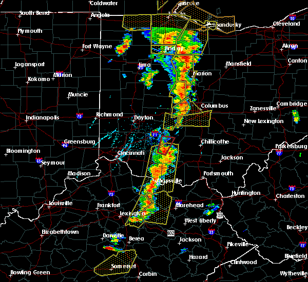 At 550 pm edt, a severe thunderstorm was located near new california, moving east at 30 mph (radar indicated). Hazards include 60 mph wind gusts. expect damage to trees and power lines At 550 pm edt, a severe thunderstorm was located near new california, moving east at 30 mph (radar indicated). Hazards include 60 mph wind gusts. expect damage to trees and power lines
|
| 6/10/2020 5:50 PM EDT |
 At 550 pm edt, severe thunderstorms were located along a line extending from near la rue to near delaware, moving northeast at 60 mph (radar indicated). Hazards include 60 mph wind gusts and quarter size hail. Minor damage to vehicles is possible. Expect damage to trees and power lines. At 550 pm edt, severe thunderstorms were located along a line extending from near la rue to near delaware, moving northeast at 60 mph (radar indicated). Hazards include 60 mph wind gusts and quarter size hail. Minor damage to vehicles is possible. Expect damage to trees and power lines.
|
| 6/4/2020 12:52 PM EDT |
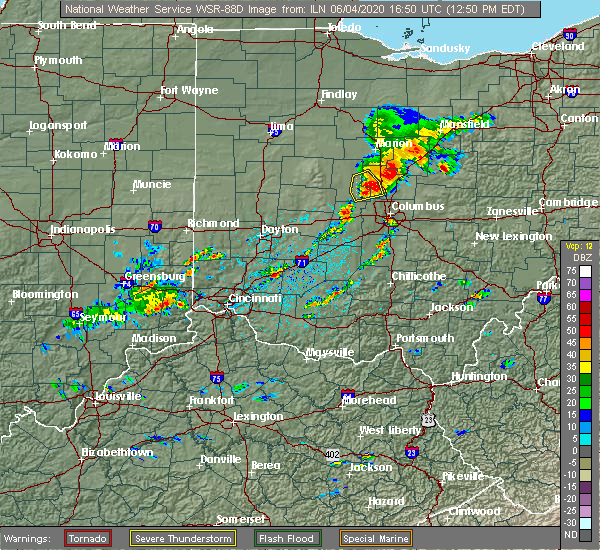 At 1251 pm edt, a severe thunderstorm was located near sunbury, moving east at 40 mph (radar indicated). Hazards include 60 mph wind gusts and quarter size hail. Minor hail damage to vehicles is possible. Expect wind damage to trees and power lines. At 1251 pm edt, a severe thunderstorm was located near sunbury, moving east at 40 mph (radar indicated). Hazards include 60 mph wind gusts and quarter size hail. Minor hail damage to vehicles is possible. Expect wind damage to trees and power lines.
|
| 5/14/2020 5:49 PM EDT |
 At 549 pm edt, severe thunderstorms were located along a line extending from near ashley to near delaware to near lake darby, moving east at 50 mph (radar indicated). Hazards include 60 mph wind gusts. Expect damage to trees and power lines. locations impacted include, columbus, dublin, westerville, delaware, upper arlington, gahanna, hilliard, worthington, bexley, powell, sunbury, plain city, west jefferson, ashley, minerva park, new california, polaris, ohio state university, easton and lake darby. this includes the following interstates, i-70 in ohio between mile markers 81 and 97. I-71 in ohio between mile markers 109 and 138. At 549 pm edt, severe thunderstorms were located along a line extending from near ashley to near delaware to near lake darby, moving east at 50 mph (radar indicated). Hazards include 60 mph wind gusts. Expect damage to trees and power lines. locations impacted include, columbus, dublin, westerville, delaware, upper arlington, gahanna, hilliard, worthington, bexley, powell, sunbury, plain city, west jefferson, ashley, minerva park, new california, polaris, ohio state university, easton and lake darby. this includes the following interstates, i-70 in ohio between mile markers 81 and 97. I-71 in ohio between mile markers 109 and 138.
|
| 5/14/2020 5:26 PM EDT |
 At 526 pm edt, severe thunderstorms were located along a line extending from 6 miles west of richwood to near marysville to near south charleston, moving east at 55 mph (radar indicated). Hazards include 60 mph wind gusts. expect damage to trees and power lines At 526 pm edt, severe thunderstorms were located along a line extending from 6 miles west of richwood to near marysville to near south charleston, moving east at 55 mph (radar indicated). Hazards include 60 mph wind gusts. expect damage to trees and power lines
|
| 8/18/2019 11:38 PM EDT |
 At 1137 pm edt, a severe thunderstorm was located over sunbury, moving east at 40 mph (radar indicated). Hazards include 60 mph wind gusts. expect damage to trees and power lines At 1137 pm edt, a severe thunderstorm was located over sunbury, moving east at 40 mph (radar indicated). Hazards include 60 mph wind gusts. expect damage to trees and power lines
|
| 7/2/2019 8:56 PM EDT |
 The severe thunderstorm warning for southern morrow and northwestern knox counties will expire at 900 pm edt, this warning will be allowed to expire. however, a severe thunderstorm warning still remains in effect for portions of morrow and knox counties until 945 pm edt. to report severe weather, contact your nearest law enforcement agency. they will relay your report to the national weather service cleveland. The severe thunderstorm warning for southern morrow and northwestern knox counties will expire at 900 pm edt, this warning will be allowed to expire. however, a severe thunderstorm warning still remains in effect for portions of morrow and knox counties until 945 pm edt. to report severe weather, contact your nearest law enforcement agency. they will relay your report to the national weather service cleveland.
|
| 7/2/2019 8:41 PM EDT |
 At 840 pm edt, severe thunderstorms were located along a line extending from near mount vernon to near sunbury, moving southeast at 35 mph (radar indicated). Hazards include 60 mph wind gusts and penny size hail. Expect damage to trees and power lines. Locations impacted include, mount vernon, mount gilead, fredericktown, cardington, centerburg, ashley, chesterville, sparta, waterford, marengo and fulton. At 840 pm edt, severe thunderstorms were located along a line extending from near mount vernon to near sunbury, moving southeast at 35 mph (radar indicated). Hazards include 60 mph wind gusts and penny size hail. Expect damage to trees and power lines. Locations impacted include, mount vernon, mount gilead, fredericktown, cardington, centerburg, ashley, chesterville, sparta, waterford, marengo and fulton.
|
| 7/2/2019 8:30 PM EDT |
 At 830 pm edt, severe thunderstorms were located along a line extending from near chesterville to near delaware, moving east at 25 mph (radar indicated). Hazards include 60 mph wind gusts and quarter size hail. Minor damage to vehicles is possible. Expect damage to trees and power lines. At 830 pm edt, severe thunderstorms were located along a line extending from near chesterville to near delaware, moving east at 25 mph (radar indicated). Hazards include 60 mph wind gusts and quarter size hail. Minor damage to vehicles is possible. Expect damage to trees and power lines.
|
| 7/2/2019 8:04 PM EDT |
 At 804 pm edt, severe thunderstorms were located along a line extending from near mount gilead to near prospect, moving southeast at 35 mph (radar indicated). Hazards include 60 mph wind gusts and quarter size hail. Minor damage to vehicles is possible. Expect damage to trees and power lines. At 804 pm edt, severe thunderstorms were located along a line extending from near mount gilead to near prospect, moving southeast at 35 mph (radar indicated). Hazards include 60 mph wind gusts and quarter size hail. Minor damage to vehicles is possible. Expect damage to trees and power lines.
|
| 7/2/2019 5:34 PM EDT |
 At 534 pm edt, severe thunderstorms were located along a line extending from near lexington to near ashley, moving southeast at 25 mph (radar indicated). Hazards include 60 mph wind gusts and quarter size hail. Minor damage to vehicles is possible. Expect damage to trees and power lines. At 534 pm edt, severe thunderstorms were located along a line extending from near lexington to near ashley, moving southeast at 25 mph (radar indicated). Hazards include 60 mph wind gusts and quarter size hail. Minor damage to vehicles is possible. Expect damage to trees and power lines.
|
| 6/15/2019 11:22 PM EDT |
 At 1122 pm edt, a severe thunderstorm capable of producing a tornado was located near delaware, moving east at 40 mph (radar indicated rotation). Hazards include tornado. Flying debris will be dangerous to those caught without shelter. mobile homes will be damaged or destroyed. damage to roofs, windows, and vehicles will occur. tree damage is likely. locations impacted include, delaware, sunbury, ashley, interstate 71 at us route 36/state route 37, leonardsburg, olive green, stratford and kilbourne. This includes i-71 in ohio between mile markers 130 and 139. At 1122 pm edt, a severe thunderstorm capable of producing a tornado was located near delaware, moving east at 40 mph (radar indicated rotation). Hazards include tornado. Flying debris will be dangerous to those caught without shelter. mobile homes will be damaged or destroyed. damage to roofs, windows, and vehicles will occur. tree damage is likely. locations impacted include, delaware, sunbury, ashley, interstate 71 at us route 36/state route 37, leonardsburg, olive green, stratford and kilbourne. This includes i-71 in ohio between mile markers 130 and 139.
|
| 6/15/2019 11:13 PM EDT |
 At 1113 pm edt, a severe thunderstorm capable of producing a tornado was located over delaware, moving east at 40 mph (radar indicated rotation). Hazards include tornado. Flying debris will be dangerous to those caught without shelter. mobile homes will be damaged or destroyed. damage to roofs, windows, and vehicles will occur. Tree damage is likely. At 1113 pm edt, a severe thunderstorm capable of producing a tornado was located over delaware, moving east at 40 mph (radar indicated rotation). Hazards include tornado. Flying debris will be dangerous to those caught without shelter. mobile homes will be damaged or destroyed. damage to roofs, windows, and vehicles will occur. Tree damage is likely.
|
| 6/5/2019 4:30 PM EDT |
 At 429 pm edt, a severe thunderstorm was located over cardington, or near mount gilead, moving east at 30 mph (radar indicated). Hazards include 60 mph wind gusts and quarter size hail. Minor damage to vehicles is possible. expect damage to trees and power lines. Locations impacted include, mount gilead, fredericktown, cardington, centerburg, ashley, chesterville, sparta, edison, marengo and fulton. At 429 pm edt, a severe thunderstorm was located over cardington, or near mount gilead, moving east at 30 mph (radar indicated). Hazards include 60 mph wind gusts and quarter size hail. Minor damage to vehicles is possible. expect damage to trees and power lines. Locations impacted include, mount gilead, fredericktown, cardington, centerburg, ashley, chesterville, sparta, edison, marengo and fulton.
|
| 6/5/2019 4:11 PM EDT |
 At 411 pm edt, a severe thunderstorm was located over waldo, or 7 miles southeast of marion, moving east at 30 mph (radar indicated). Hazards include 60 mph wind gusts and half dollar size hail. People and animals outdoors will be injured. expect hail damage to roofs, siding, windows, and vehicles. Expect damage to trees and power lines. At 411 pm edt, a severe thunderstorm was located over waldo, or 7 miles southeast of marion, moving east at 30 mph (radar indicated). Hazards include 60 mph wind gusts and half dollar size hail. People and animals outdoors will be injured. expect hail damage to roofs, siding, windows, and vehicles. Expect damage to trees and power lines.
|
| 6/2/2019 1:56 AM EDT |
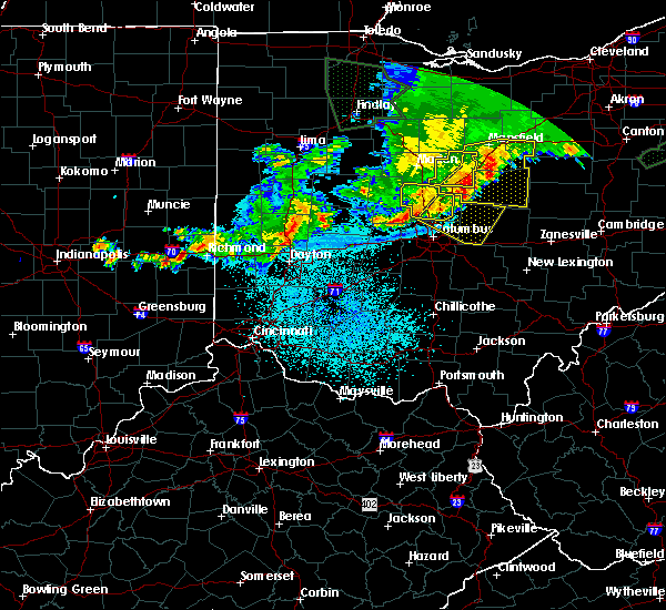 The severe thunderstorm warning for delaware county will expire at 200 am edt, the storm which prompted the warning is moving out of the current warning area. therefore, the warning will be allowed to expire. however, a severe thunderstorm warning continues far parts of southeastern delaware county until 215 am edt. please report previous wind damage or hail to the national weather service by going to our website at weather.gov/iln and submitting your report via social media. The severe thunderstorm warning for delaware county will expire at 200 am edt, the storm which prompted the warning is moving out of the current warning area. therefore, the warning will be allowed to expire. however, a severe thunderstorm warning continues far parts of southeastern delaware county until 215 am edt. please report previous wind damage or hail to the national weather service by going to our website at weather.gov/iln and submitting your report via social media.
|
| 6/2/2019 1:35 AM EDT |
 At 134 am edt, a severe thunderstorm was located over delaware, moving southeast at 40 mph (radar indicated). Hazards include 60 mph wind gusts. Expect damage to trees and power lines. locations impacted include, westerville, delaware, powell, sunbury, ashley, polaris, radnor, shawnee hills, galena, ostrander, interstate 71 at us route 36/state route 37, alum creek state park, delaware state park, olive green, stratford, bellepoint, warrensburg, leonardsburg, kilbourne and columbus zoo. This includes i-71 in ohio between mile markers 122 and 139. At 134 am edt, a severe thunderstorm was located over delaware, moving southeast at 40 mph (radar indicated). Hazards include 60 mph wind gusts. Expect damage to trees and power lines. locations impacted include, westerville, delaware, powell, sunbury, ashley, polaris, radnor, shawnee hills, galena, ostrander, interstate 71 at us route 36/state route 37, alum creek state park, delaware state park, olive green, stratford, bellepoint, warrensburg, leonardsburg, kilbourne and columbus zoo. This includes i-71 in ohio between mile markers 122 and 139.
|
| 6/2/2019 1:25 AM EDT |
 At 125 am edt, a severe thunderstorm was located near delaware, moving southeast at 40 mph (radar indicated). Hazards include 60 mph wind gusts and penny size hail. expect damage to trees and power lines At 125 am edt, a severe thunderstorm was located near delaware, moving southeast at 40 mph (radar indicated). Hazards include 60 mph wind gusts and penny size hail. expect damage to trees and power lines
|
| 6/1/2019 7:18 PM EDT |
 At 718 pm edt, a severe thunderstorm was located over ashley, or 9 miles southwest of mount gilead, moving east at 20 mph (radar indicated). Hazards include 60 mph wind gusts and quarter size hail. Minor damage to vehicles is possible. Expect damage to trees and power lines. At 718 pm edt, a severe thunderstorm was located over ashley, or 9 miles southwest of mount gilead, moving east at 20 mph (radar indicated). Hazards include 60 mph wind gusts and quarter size hail. Minor damage to vehicles is possible. Expect damage to trees and power lines.
|
| 5/26/2019 7:31 AM EDT |
 At 730 am edt, severe thunderstorms were located along a line extending from near ashley to dublin, moving east at 35 mph (radar indicated). Hazards include 60 mph wind gusts. expect damage to trees and power lines At 730 am edt, severe thunderstorms were located along a line extending from near ashley to dublin, moving east at 35 mph (radar indicated). Hazards include 60 mph wind gusts. expect damage to trees and power lines
|
| 5/26/2019 7:23 AM EDT |
 The national weather service in cleveland has issued a * severe thunderstorm warning for. morrow county in north central ohio. crawford county in north central ohio. until 815 am edt. At 723 am edt, severe thunderstorms were located along a line. The national weather service in cleveland has issued a * severe thunderstorm warning for. morrow county in north central ohio. crawford county in north central ohio. until 815 am edt. At 723 am edt, severe thunderstorms were located along a line.
|
| 5/26/2019 7:21 AM EDT |
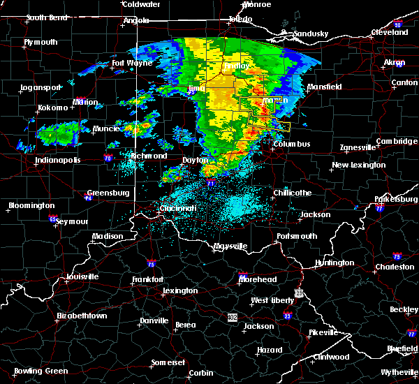 At 721 am edt, a severe thunderstorm was located near waldo, moving east at 25 mph (radar indicated). Hazards include 60 mph wind gusts and penny size hail. Expect damage to trees and power lines. locations impacted include, delaware, sunbury, ashley, radnor, interstate 71 at us route 36/state route 37, warrensburg, delaware state park, leonardsburg, olive green, kilbourne and state route 229 at us route 23. This includes i-71 in ohio between mile markers 130 and 138. At 721 am edt, a severe thunderstorm was located near waldo, moving east at 25 mph (radar indicated). Hazards include 60 mph wind gusts and penny size hail. Expect damage to trees and power lines. locations impacted include, delaware, sunbury, ashley, radnor, interstate 71 at us route 36/state route 37, warrensburg, delaware state park, leonardsburg, olive green, kilbourne and state route 229 at us route 23. This includes i-71 in ohio between mile markers 130 and 138.
|
| 5/26/2019 7:08 AM EDT |
 At 708 am edt, a severe thunderstorm was located near prospect, moving east at 50 mph (radar indicated). Hazards include 60 mph wind gusts. expect damage to trees and power lines At 708 am edt, a severe thunderstorm was located near prospect, moving east at 50 mph (radar indicated). Hazards include 60 mph wind gusts. expect damage to trees and power lines
|
| 4/12/2019 9:23 AM EDT |
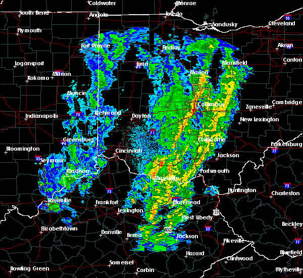 At 923 am edt, a severe thunderstorm was located near sunbury, moving east at 45 mph (radar indicated). Hazards include 60 mph wind gusts. Expect damage to trees and power lines. locations impacted include, sunbury, ashley, galena, interstate 71 at us route 36/state route 37, alum creek state park, leonardsburg, olive green and kilbourne. This includes i-71 in ohio between mile markers 124 and 138. At 923 am edt, a severe thunderstorm was located near sunbury, moving east at 45 mph (radar indicated). Hazards include 60 mph wind gusts. Expect damage to trees and power lines. locations impacted include, sunbury, ashley, galena, interstate 71 at us route 36/state route 37, alum creek state park, leonardsburg, olive green and kilbourne. This includes i-71 in ohio between mile markers 124 and 138.
|
| 4/12/2019 9:12 AM EDT |
 At 911 am edt, a severe thunderstorm was located over delaware, moving northeast at 55 mph (radar indicated). Hazards include 60 mph wind gusts. expect damage to trees and power lines At 911 am edt, a severe thunderstorm was located over delaware, moving northeast at 55 mph (radar indicated). Hazards include 60 mph wind gusts. expect damage to trees and power lines
|
| 6/8/2018 4:24 PM EDT |
 The severe thunderstorm warning for northeastern franklin, delaware and northeastern union counties in central ohio will expire at 430 pm edt, the storm which prompted the warning has weakened below severe limits, and no longer poses an immediate threat to life or property. therefore, the warning will be allowed to expire. however gusty winds and heavy rain are still possible with this thunderstorm. please report previous wind damage or hail to the national weather service by going to our website at weather.gov/iln and submitting your report via social media. The severe thunderstorm warning for northeastern franklin, delaware and northeastern union counties in central ohio will expire at 430 pm edt, the storm which prompted the warning has weakened below severe limits, and no longer poses an immediate threat to life or property. therefore, the warning will be allowed to expire. however gusty winds and heavy rain are still possible with this thunderstorm. please report previous wind damage or hail to the national weather service by going to our website at weather.gov/iln and submitting your report via social media.
|
| 6/8/2018 4:03 PM EDT |
 At 403 pm edt, a severe thunderstorm was located near delaware, moving southeast at 25 mph (radar indicated). Hazards include 60 mph wind gusts and quarter size hail. Minor hail damage to vehicles is possible. expect wind damage to trees and power lines. locations impacted include, columbus, westerville, delaware, gahanna, worthington, powell, sunbury, ashley, minerva park, polaris, easton, radnor, shawnee hills, galena, ostrander, riverlea, alum creek state park, delaware state park, olive green and warrensburg. This includes i-71 in ohio between mile markers 116 and 138. At 403 pm edt, a severe thunderstorm was located near delaware, moving southeast at 25 mph (radar indicated). Hazards include 60 mph wind gusts and quarter size hail. Minor hail damage to vehicles is possible. expect wind damage to trees and power lines. locations impacted include, columbus, westerville, delaware, gahanna, worthington, powell, sunbury, ashley, minerva park, polaris, easton, radnor, shawnee hills, galena, ostrander, riverlea, alum creek state park, delaware state park, olive green and warrensburg. This includes i-71 in ohio between mile markers 116 and 138.
|
| 6/8/2018 3:46 PM EDT |
 At 346 pm edt, a severe thunderstorm was located over richwood, moving southeast at 25 mph (radar indicated). Hazards include 60 mph wind gusts and quarter size hail. Minor hail damage to vehicles is possible. Expect wind damage to trees and power lines. At 346 pm edt, a severe thunderstorm was located over richwood, moving southeast at 25 mph (radar indicated). Hazards include 60 mph wind gusts and quarter size hail. Minor hail damage to vehicles is possible. Expect wind damage to trees and power lines.
|
| 5/21/2018 10:13 PM EDT |
 The severe thunderstorm warning for northern franklin. delaware. northwestern licking. northeastern madison and southeastern union counties in central ohio will expire at 1015 pm edt. The storms which prompted the warning have weakened below severe limits, and no longer pose an immediate threat to life or property. The severe thunderstorm warning for northern franklin. delaware. northwestern licking. northeastern madison and southeastern union counties in central ohio will expire at 1015 pm edt. The storms which prompted the warning have weakened below severe limits, and no longer pose an immediate threat to life or property.
|
| 5/21/2018 9:35 PM EDT |
 At 934 pm edt, severe thunderstorms were located along a line extending from near delaware to near west jefferson, moving east at 30 mph (radar indicated). Hazards include 60 mph wind gusts and quarter size hail. Minor hail damage to vehicles is possible. expect wind damage to trees and power lines. locations impacted include, columbus, dublin, westerville, delaware, upper arlington, gahanna, hilliard, marysville, worthington, london, jefferson, powell, sunbury, plain city, west jefferson, ashley, minerva park, choctaw lake, new california and polaris. this includes the following interstates, i-70 in ohio between mile markers 71 and 101. I-71 in ohio between mile markers 106 and 138. At 934 pm edt, severe thunderstorms were located along a line extending from near delaware to near west jefferson, moving east at 30 mph (radar indicated). Hazards include 60 mph wind gusts and quarter size hail. Minor hail damage to vehicles is possible. expect wind damage to trees and power lines. locations impacted include, columbus, dublin, westerville, delaware, upper arlington, gahanna, hilliard, marysville, worthington, london, jefferson, powell, sunbury, plain city, west jefferson, ashley, minerva park, choctaw lake, new california and polaris. this includes the following interstates, i-70 in ohio between mile markers 71 and 101. I-71 in ohio between mile markers 106 and 138.
|
| 5/21/2018 9:15 PM EDT |
 At 914 pm edt, severe thunderstorms were located along a line extending from near delaware to choctaw lake, moving east at 30 mph (radar indicated). Hazards include 60 mph wind gusts and quarter size hail. Minor hail damage to vehicles is possible. Expect wind damage to trees and power lines. At 914 pm edt, severe thunderstorms were located along a line extending from near delaware to choctaw lake, moving east at 30 mph (radar indicated). Hazards include 60 mph wind gusts and quarter size hail. Minor hail damage to vehicles is possible. Expect wind damage to trees and power lines.
|
| 5/21/2018 8:48 PM EDT |
 At 847 pm edt, a severe thunderstorm was located near new california, moving northeast at 10 mph (trained weather spotters reported quarter size hail). Hazards include 60 mph wind gusts and quarter size hail. Minor hail damage to vehicles is possible. Expect wind damage to trees and power lines. At 847 pm edt, a severe thunderstorm was located near new california, moving northeast at 10 mph (trained weather spotters reported quarter size hail). Hazards include 60 mph wind gusts and quarter size hail. Minor hail damage to vehicles is possible. Expect wind damage to trees and power lines.
|
| 5/21/2018 8:26 PM EDT |
 At 810 pm edt, a severe thunderstorm was located over richwood, moving east at 25 mph (radar indicated). Hazards include 60 mph wind gusts. Expect damage to trees and power lines. locations impacted include, delaware, richwood, ashley, radnor, magnetic springs, delaware state park, broadway, warrensburg, pharisburg, somersville, leonardsburg, kilbourne and essex. This includes i-71 in ohio between mile markers 136 and 138. At 810 pm edt, a severe thunderstorm was located over richwood, moving east at 25 mph (radar indicated). Hazards include 60 mph wind gusts. Expect damage to trees and power lines. locations impacted include, delaware, richwood, ashley, radnor, magnetic springs, delaware state park, broadway, warrensburg, pharisburg, somersville, leonardsburg, kilbourne and essex. This includes i-71 in ohio between mile markers 136 and 138.
|
| 5/21/2018 8:10 PM EDT |
 At 810 pm edt, a severe thunderstorm was located over richwood, moving east at 25 mph (radar indicated). Hazards include 60 mph wind gusts. Expect damage to trees and power lines. locations impacted include, delaware, richwood, ashley, radnor, magnetic springs, delaware state park, broadway, warrensburg, pharisburg, somersville, leonardsburg, kilbourne and essex. This includes i-71 in ohio between mile markers 136 and 138. At 810 pm edt, a severe thunderstorm was located over richwood, moving east at 25 mph (radar indicated). Hazards include 60 mph wind gusts. Expect damage to trees and power lines. locations impacted include, delaware, richwood, ashley, radnor, magnetic springs, delaware state park, broadway, warrensburg, pharisburg, somersville, leonardsburg, kilbourne and essex. This includes i-71 in ohio between mile markers 136 and 138.
|
| 5/21/2018 7:55 PM EDT |
 At 755 pm edt, a severe thunderstorm was located near richwood, moving east at 35 mph (radar indicated). Hazards include 60 mph wind gusts. expect damage to trees and power lines At 755 pm edt, a severe thunderstorm was located near richwood, moving east at 35 mph (radar indicated). Hazards include 60 mph wind gusts. expect damage to trees and power lines
|
| 5/4/2018 3:42 PM EDT |
 The severe thunderstorm warning for morrow county will expire at 345 pm edt, the storm which prompted the warning has moved out of the area. therefore the warning will be allowed to expire. a severe thunderstorm watch remains in effect until 700 pm edt for north central ohio. The severe thunderstorm warning for morrow county will expire at 345 pm edt, the storm which prompted the warning has moved out of the area. therefore the warning will be allowed to expire. a severe thunderstorm watch remains in effect until 700 pm edt for north central ohio.
|
| 5/4/2018 3:25 PM EDT |
 The severe thunderstorm warning for northern delaware and northeastern union counties in central ohio will expire at 330 pm edt, the severe thunderstorm which prompted the warning has weakened. therefore, the warning will be allowed to expire. however gusty winds are still possible with this thunderstorm. please report previous wind damage or hail to the national weather service by going to our website at weather.gov/iln and submitting your report via social media. The severe thunderstorm warning for northern delaware and northeastern union counties in central ohio will expire at 330 pm edt, the severe thunderstorm which prompted the warning has weakened. therefore, the warning will be allowed to expire. however gusty winds are still possible with this thunderstorm. please report previous wind damage or hail to the national weather service by going to our website at weather.gov/iln and submitting your report via social media.
|
| 5/4/2018 3:24 PM EDT |
 A severe thunderstorm warning remains in effect until 345 pm edt for morrow county. at 323 pm edt, a severe thunderstorm was located over mount gilead, moving east at 55 mph. hazard. 60 mph wind gusts and nickel size hail. source. Radar indicated. A severe thunderstorm warning remains in effect until 345 pm edt for morrow county. at 323 pm edt, a severe thunderstorm was located over mount gilead, moving east at 55 mph. hazard. 60 mph wind gusts and nickel size hail. source. Radar indicated.
|
| 5/4/2018 3:15 PM EDT |
 At 315 pm edt, a severe thunderstorm was located near richwood, moving east at 40 mph (radar indicated). Hazards include 60 mph wind gusts. Expect damage to trees and power lines. locations impacted include, delaware, richwood, ashley, radnor, magnetic springs, warrensburg, pharisburg, delaware state park, leonardsburg, olive green and kilbourne. This includes i-71 in ohio between mile markers 134 and 138. At 315 pm edt, a severe thunderstorm was located near richwood, moving east at 40 mph (radar indicated). Hazards include 60 mph wind gusts. Expect damage to trees and power lines. locations impacted include, delaware, richwood, ashley, radnor, magnetic springs, warrensburg, pharisburg, delaware state park, leonardsburg, olive green and kilbourne. This includes i-71 in ohio between mile markers 134 and 138.
|
| 5/4/2018 3:02 PM EDT |
 At 302 pm edt, a severe thunderstorm was located over prospect, or 9 miles southwest of marion, moving east at 55 mph (radar indicated). Hazards include 60 mph wind gusts and nickel size hail. expect damage to trees and power lines At 302 pm edt, a severe thunderstorm was located over prospect, or 9 miles southwest of marion, moving east at 55 mph (radar indicated). Hazards include 60 mph wind gusts and nickel size hail. expect damage to trees and power lines
|
| 5/4/2018 3:01 PM EDT |
 A severe thunderstorm warning remains in effect until 330 pm edt for northern delaware and northern union counties in central ohio. at 301 pm edt, a severe thunderstorm was located near richwood, moving east at 55 mph. hazard. 60 mph wind gusts. source. Radar indicated. A severe thunderstorm warning remains in effect until 330 pm edt for northern delaware and northern union counties in central ohio. at 301 pm edt, a severe thunderstorm was located near richwood, moving east at 55 mph. hazard. 60 mph wind gusts. source. Radar indicated.
|
| 5/4/2018 2:45 PM EDT |
 The national weather service in wilmington has issued a * severe thunderstorm warning for. eastern logan county in west central ohio. northern delaware county in central ohio. northern union county in central ohio. Until 330 pm edt. The national weather service in wilmington has issued a * severe thunderstorm warning for. eastern logan county in west central ohio. northern delaware county in central ohio. northern union county in central ohio. Until 330 pm edt.
|
| 5/4/2018 2:45 PM EDT |
 At 245 pm edt, a severe thunderstorm was located near bellefontaine, moving east at 55 mph (radar indicated). Hazards include 60 mph wind gusts. expect damage to trees and power lines At 245 pm edt, a severe thunderstorm was located near bellefontaine, moving east at 55 mph (radar indicated). Hazards include 60 mph wind gusts. expect damage to trees and power lines
|
| 11/18/2017 5:38 PM EST |
 The severe thunderstorm warning for central delaware and east central union counties in central ohio will expire at 545 pm est, the storm which prompted the warning has weakened below severe limits, and no longer poses an immediate threat to life or property. therefore, the warning will be allowed to expire. a severe thunderstorm watch remains in effect until 800 pm est for central ohio. please report previous wind damage or hail to the national weather service by going to our website at weather.gov/iln and submitting your report via social media. The severe thunderstorm warning for central delaware and east central union counties in central ohio will expire at 545 pm est, the storm which prompted the warning has weakened below severe limits, and no longer poses an immediate threat to life or property. therefore, the warning will be allowed to expire. a severe thunderstorm watch remains in effect until 800 pm est for central ohio. please report previous wind damage or hail to the national weather service by going to our website at weather.gov/iln and submitting your report via social media.
|
| 11/18/2017 5:35 PM EST |
 At 534 pm est, a severe thunderstorm was located over delaware, moving east at 45 mph (radar indicated). Hazards include 60 mph wind gusts. Expect damage to trees and power lines. locations impacted include, delaware, marysville, sunbury, ashley, radnor, galena, ostrander, interstate 71 at us route 36/state route 37, alum creek state park, delaware state park, stratford, bellepoint, warrensburg, leonardsburg, kilbourne, new dover, state route 257 at us route 36 and lewis center. This includes i-71 in ohio between mile markers 125 and 136. At 534 pm est, a severe thunderstorm was located over delaware, moving east at 45 mph (radar indicated). Hazards include 60 mph wind gusts. Expect damage to trees and power lines. locations impacted include, delaware, marysville, sunbury, ashley, radnor, galena, ostrander, interstate 71 at us route 36/state route 37, alum creek state park, delaware state park, stratford, bellepoint, warrensburg, leonardsburg, kilbourne, new dover, state route 257 at us route 36 and lewis center. This includes i-71 in ohio between mile markers 125 and 136.
|
| 11/18/2017 5:23 PM EST |
 At 523 pm est, a severe thunderstorm was located 7 miles northeast of marysville, moving east at 45 mph (radar indicated). Hazards include 60 mph wind gusts. Expect damage to trees and power lines. locations impacted include, delaware, marysville, sunbury, richwood, ashley, radnor, galena, ostrander, magnetic springs, interstate 71 at us route 36/state route 37, alum creek state park, delaware state park, stratford, bellepoint, warrensburg, pharisburg, leonardsburg, state route 229 at us route 23, kilbourne and new dover. This includes i-71 in ohio between mile markers 125 and 136. At 523 pm est, a severe thunderstorm was located 7 miles northeast of marysville, moving east at 45 mph (radar indicated). Hazards include 60 mph wind gusts. Expect damage to trees and power lines. locations impacted include, delaware, marysville, sunbury, richwood, ashley, radnor, galena, ostrander, magnetic springs, interstate 71 at us route 36/state route 37, alum creek state park, delaware state park, stratford, bellepoint, warrensburg, pharisburg, leonardsburg, state route 229 at us route 23, kilbourne and new dover. This includes i-71 in ohio between mile markers 125 and 136.
|
| 11/18/2017 5:16 PM EST |
 At 516 pm est, a severe thunderstorm was located near marysville, moving east at 50 mph (radar indicated). Hazards include 60 mph wind gusts. expect damage to trees and power lines At 516 pm est, a severe thunderstorm was located near marysville, moving east at 50 mph (radar indicated). Hazards include 60 mph wind gusts. expect damage to trees and power lines
|
| 7/22/2017 6:46 AM EDT |
 At 646 am edt, a severe thunderstorm was located near ashley, or 10 miles northeast of delaware, moving east at 25 mph (radar indicated). Hazards include 60 mph wind gusts. expect damage to trees and power lines At 646 am edt, a severe thunderstorm was located near ashley, or 10 miles northeast of delaware, moving east at 25 mph (radar indicated). Hazards include 60 mph wind gusts. expect damage to trees and power lines
|
| 7/22/2017 6:43 AM EDT |
 At 642 am edt, a severe thunderstorm was located over ashley, moving east at 45 mph (trained weather spotters). Hazards include 60 mph wind gusts. expect damage to trees and power lines At 642 am edt, a severe thunderstorm was located over ashley, moving east at 45 mph (trained weather spotters). Hazards include 60 mph wind gusts. expect damage to trees and power lines
|
| 7/10/2017 2:25 PM EDT |
 At 225 pm edt, a severe thunderstorm was located over marysville, moving east at 45 mph (radar indicated). Hazards include 60 mph wind gusts and penny size hail. expect damage to trees and power lines At 225 pm edt, a severe thunderstorm was located over marysville, moving east at 45 mph (radar indicated). Hazards include 60 mph wind gusts and penny size hail. expect damage to trees and power lines
|
| 7/7/2017 1:28 PM EDT |
 The severe thunderstorm warning for marion and morrow counties will expire at 130 pm edt, the storm which prompted the warning has weakened below severe limits, and has exited the warned area. therefore, the warning will be allowed to expire. however small hail and gusty winds are still possible with these thunderstorms across the southern parts of marion and morrow counties. a severe thunderstorm watch remains in effect until 500 pm edt for north central ohio. The severe thunderstorm warning for marion and morrow counties will expire at 130 pm edt, the storm which prompted the warning has weakened below severe limits, and has exited the warned area. therefore, the warning will be allowed to expire. however small hail and gusty winds are still possible with these thunderstorms across the southern parts of marion and morrow counties. a severe thunderstorm watch remains in effect until 500 pm edt for north central ohio.
|
| 7/7/2017 1:20 PM EDT |
 At 119 pm edt, a severe thunderstorm was located near ashley, moving east at 30 mph (radar indicated). Hazards include 60 mph wind gusts and quarter size hail. Minor hail damage to vehicles is possible. expect wind damage to trees and power lines. locations impacted include, ashley, interstate 71 at us route 36/state route 37, delaware state park, leonardsburg, olive green, state route 229 at us route 23 and kilbourne. This includes i-71 in ohio between mile markers 131 and 138. At 119 pm edt, a severe thunderstorm was located near ashley, moving east at 30 mph (radar indicated). Hazards include 60 mph wind gusts and quarter size hail. Minor hail damage to vehicles is possible. expect wind damage to trees and power lines. locations impacted include, ashley, interstate 71 at us route 36/state route 37, delaware state park, leonardsburg, olive green, state route 229 at us route 23 and kilbourne. This includes i-71 in ohio between mile markers 131 and 138.
|
| 7/7/2017 1:10 PM EDT |
 At 108 pm edt, a cluster of severe thunderstorms were located east to west across central marion and morrow counties moving southeast at 45 mph (radar indicated). Hazards include 60 mph wind gusts and quarter size hail. Minor damage to vehicles is possible. expect damage to trees and power lines. Locations impacted include, marion, mount gilead, cardington, ashley, prospect, la rue, waldo, chesterville, sparta, new bloomington, edison, green camp, marengo, fulton, shauck and state route 229 at us route 23. At 108 pm edt, a cluster of severe thunderstorms were located east to west across central marion and morrow counties moving southeast at 45 mph (radar indicated). Hazards include 60 mph wind gusts and quarter size hail. Minor damage to vehicles is possible. expect damage to trees and power lines. Locations impacted include, marion, mount gilead, cardington, ashley, prospect, la rue, waldo, chesterville, sparta, new bloomington, edison, green camp, marengo, fulton, shauck and state route 229 at us route 23.
|
| 7/7/2017 1:08 PM EDT |
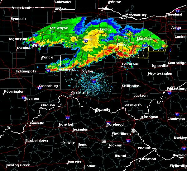 At 107 pm edt, a severe thunderstorm was located near delaware, moving east at 30 mph (radar indicated). Hazards include 60 mph wind gusts and quarter size hail. Minor hail damage to vehicles is possible. Expect wind damage to trees and power lines. At 107 pm edt, a severe thunderstorm was located near delaware, moving east at 30 mph (radar indicated). Hazards include 60 mph wind gusts and quarter size hail. Minor hail damage to vehicles is possible. Expect wind damage to trees and power lines.
|
| 7/7/2017 12:44 PM EDT |
 At 1242 pm edt, a severe thunderstorm was located near mount gilead, moving southeast at 30 mph (radar indicated). Hazards include 60 mph wind gusts and quarter size hail. Minor damage to vehicles is possible. expect damage to trees and power lines. Locations impacted include, marion, bucyrus, mount gilead, galion, crestline, cardington, ashley, prospect, la rue, morral, waldo, chesterville, sparta, caledonia, new bloomington, edison, green camp, marengo, fulton and north robinson. At 1242 pm edt, a severe thunderstorm was located near mount gilead, moving southeast at 30 mph (radar indicated). Hazards include 60 mph wind gusts and quarter size hail. Minor damage to vehicles is possible. expect damage to trees and power lines. Locations impacted include, marion, bucyrus, mount gilead, galion, crestline, cardington, ashley, prospect, la rue, morral, waldo, chesterville, sparta, caledonia, new bloomington, edison, green camp, marengo, fulton and north robinson.
|
| 7/7/2017 12:19 PM EDT |
 The national weather service in cleveland has issued a * severe thunderstorm warning for. marion county in north central ohio. southern wyandot county in northwestern ohio. morrow county in north central ohio. Crawford county in north central ohio. The national weather service in cleveland has issued a * severe thunderstorm warning for. marion county in north central ohio. southern wyandot county in northwestern ohio. morrow county in north central ohio. Crawford county in north central ohio.
|
| 6/13/2017 5:26 PM EDT |
 The severe thunderstorm warning for morrow county will expire at 530 pm edt, the storm which prompted the warning has weakened below severe limits, and no longer poses an immediate threat to life or property. therefore the warning will be allowed to expire. The severe thunderstorm warning for morrow county will expire at 530 pm edt, the storm which prompted the warning has weakened below severe limits, and no longer poses an immediate threat to life or property. therefore the warning will be allowed to expire.
|
| 6/13/2017 4:37 PM EDT |
 At 436 pm edt, a severe thunderstorm was located near mount gilead, moving southeast at 10 mph (radar indicated). Hazards include 60 mph wind gusts and quarter size hail. Minor damage to vehicles is possible. Expect damage to trees and power lines. At 436 pm edt, a severe thunderstorm was located near mount gilead, moving southeast at 10 mph (radar indicated). Hazards include 60 mph wind gusts and quarter size hail. Minor damage to vehicles is possible. Expect damage to trees and power lines.
|
| 5/1/2017 9:51 AM EDT |
 The severe thunderstorm warning for northeastern delaware county will expire at 1000 am edt, the storm which prompted the warning has weakened below severe limits, and has exited the warned area. therefore, the warning will be allowed to expire. please report previous wind damage or hail to the national weather service by going to our website at weather.gov/iln and submitting your report via social media. The severe thunderstorm warning for northeastern delaware county will expire at 1000 am edt, the storm which prompted the warning has weakened below severe limits, and has exited the warned area. therefore, the warning will be allowed to expire. please report previous wind damage or hail to the national weather service by going to our website at weather.gov/iln and submitting your report via social media.
|
| 5/1/2017 9:43 AM EDT |
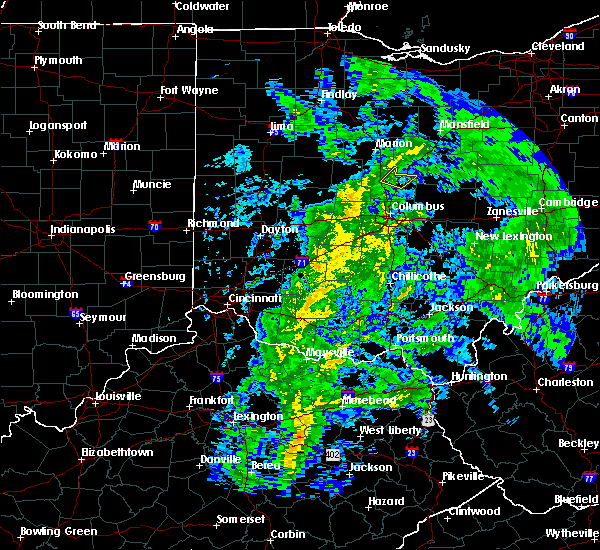 At 943 am edt, a severe thunderstorm was located near sunbury, moving northeast at 40 mph (radar indicated). Hazards include 60 mph wind gusts. expect damage to roofs, siding, and trees At 943 am edt, a severe thunderstorm was located near sunbury, moving northeast at 40 mph (radar indicated). Hazards include 60 mph wind gusts. expect damage to roofs, siding, and trees
|
| 4/5/2017 7:58 PM EDT |
 At 758 pm edt, a severe thunderstorm was located near powell, moving northeast at 40 mph (radar indicated). Hazards include 60 mph wind gusts. Expect damage to roofs, siding, and trees. locations impacted include, columbus, dublin, westerville, delaware, upper arlington, hilliard, worthington, powell, ashley, polaris, radnor, shawnee hills, ostrander, riverlea, alum creek state park, delaware state park, warrensburg, kilbourne, columbus zoo and lewis center. This includes i-71 in ohio between mile markers 117 and 134. At 758 pm edt, a severe thunderstorm was located near powell, moving northeast at 40 mph (radar indicated). Hazards include 60 mph wind gusts. Expect damage to roofs, siding, and trees. locations impacted include, columbus, dublin, westerville, delaware, upper arlington, hilliard, worthington, powell, ashley, polaris, radnor, shawnee hills, ostrander, riverlea, alum creek state park, delaware state park, warrensburg, kilbourne, columbus zoo and lewis center. This includes i-71 in ohio between mile markers 117 and 134.
|
| 4/5/2017 7:46 PM EDT |
 At 745 pm edt, a severe thunderstorm was located over marysville, moving northeast at 50 mph (radar indicated). Hazards include 60 mph wind gusts and penny size hail. expect damage to roofs, siding, and trees At 745 pm edt, a severe thunderstorm was located over marysville, moving northeast at 50 mph (radar indicated). Hazards include 60 mph wind gusts and penny size hail. expect damage to roofs, siding, and trees
|
| 3/1/2017 12:55 AM EST |
 At 1254 am est, severe thunderstorms were located along a line extending from near fostoria to 6 miles northwest of crestline to near chesterville, moving northeast at 85 mph (radar indicated). Hazards include 60 mph wind gusts and quarter size hail. Hail damage to vehicles is expected. Expect wind damage to roofs, siding, and trees. At 1254 am est, severe thunderstorms were located along a line extending from near fostoria to 6 miles northwest of crestline to near chesterville, moving northeast at 85 mph (radar indicated). Hazards include 60 mph wind gusts and quarter size hail. Hail damage to vehicles is expected. Expect wind damage to roofs, siding, and trees.
|
| 1/10/2017 9:07 PM EST |
 At 907 pm est, a severe thunderstorm was located near vanlue, or 10 miles south of fostoria, moving east at 70 mph (radar indicated). Hazards include 60 mph wind gusts. expect damage to roofs, siding, and trees At 907 pm est, a severe thunderstorm was located near vanlue, or 10 miles south of fostoria, moving east at 70 mph (radar indicated). Hazards include 60 mph wind gusts. expect damage to roofs, siding, and trees
|
| 9/10/2016 5:12 PM EDT |
 At 511 pm edt, severe thunderstorms were located along a line extending from near strongsville to 6 miles southwest of lexington, moving northeast at 45 mph (radar indicated). Hazards include 60 mph wind gusts and nickel size hail. Expect damage to roofs. siding and trees. Locations impacted include, mansfield, medina, wooster, ashland, mount vernon, mount gilead, brunswick, wadsworth, rittman, ontario, lexington, lodi, loudonville, fredericktown, creston, cardington, bellville, centerburg, west salem and chippewa lake. At 511 pm edt, severe thunderstorms were located along a line extending from near strongsville to 6 miles southwest of lexington, moving northeast at 45 mph (radar indicated). Hazards include 60 mph wind gusts and nickel size hail. Expect damage to roofs. siding and trees. Locations impacted include, mansfield, medina, wooster, ashland, mount vernon, mount gilead, brunswick, wadsworth, rittman, ontario, lexington, lodi, loudonville, fredericktown, creston, cardington, bellville, centerburg, west salem and chippewa lake.
|
| 9/10/2016 4:44 PM EDT |
 At 442 pm edt, severe thunderstorms were located along a line extending from near wellington to ashley, moving northeast at 45 mph. another severe thunderstorm was located near mount gilead. this storm is also moving northeast at 45 mph (radar indicated). Hazards include 60 mph wind gusts and nickel size hail. Expect damage to roofs. Siding and trees. At 442 pm edt, severe thunderstorms were located along a line extending from near wellington to ashley, moving northeast at 45 mph. another severe thunderstorm was located near mount gilead. this storm is also moving northeast at 45 mph (radar indicated). Hazards include 60 mph wind gusts and nickel size hail. Expect damage to roofs. Siding and trees.
|
| 7/13/2016 8:25 PM EDT | Power pole knocked down. time estimated from rada in delaware county OH, 0 miles ESE of Ashley, OH |
| 6/23/2016 1:06 AM EDT |
 At 105 am edt, a severe thunderstorm was located near delaware, moving east at 30 mph (radar indicated). Hazards include 60 mph wind gusts and quarter size hail. Hail damage to vehicles is expected. expect wind damage to roofs, siding, and trees. locations impacted include, columbus, westerville, delaware, marysville, powell, sunbury, richwood, ashley, polaris, new albany, radnor, galena, ostrander, magnetic springs, warrensburg, essex, kilbourne, leonardsburg, stratford and new dover. A tornado watch remains in effect until 500 am edt for central ohio. At 105 am edt, a severe thunderstorm was located near delaware, moving east at 30 mph (radar indicated). Hazards include 60 mph wind gusts and quarter size hail. Hail damage to vehicles is expected. expect wind damage to roofs, siding, and trees. locations impacted include, columbus, westerville, delaware, marysville, powell, sunbury, richwood, ashley, polaris, new albany, radnor, galena, ostrander, magnetic springs, warrensburg, essex, kilbourne, leonardsburg, stratford and new dover. A tornado watch remains in effect until 500 am edt for central ohio.
|
| 6/23/2016 12:46 AM EDT |
 At 1246 am edt, a severe thunderstorm was located near delaware, moving southeast at 30 mph (radar indicated). Hazards include 60 mph wind gusts and quarter size hail. Hail damage to vehicles is expected. Expect wind damage to roofs, siding, and trees. At 1246 am edt, a severe thunderstorm was located near delaware, moving southeast at 30 mph (radar indicated). Hazards include 60 mph wind gusts and quarter size hail. Hail damage to vehicles is expected. Expect wind damage to roofs, siding, and trees.
|
| 5/1/2016 3:50 PM EDT |
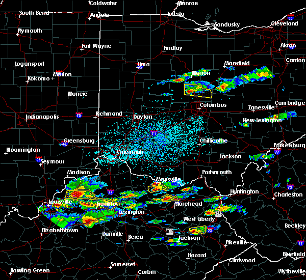 At 350 pm edt, a severe thunderstorm was located near delaware, moving east at 25 mph (radar indicated). Hazards include 60 mph wind gusts and quarter size hail. Hail damage to vehicles is expected. expect wind damage to roofs, siding, and trees. Locations impacted include, delaware, sunbury, ashley, radnor, galena, ostrander, bellepoint, warrensburg, delaware state park, alum creek state park, kilbourne, leonardsburg, stratford, olive green, interstate 71 at us route 36/state route 37 and state route 257 at us route 36. At 350 pm edt, a severe thunderstorm was located near delaware, moving east at 25 mph (radar indicated). Hazards include 60 mph wind gusts and quarter size hail. Hail damage to vehicles is expected. expect wind damage to roofs, siding, and trees. Locations impacted include, delaware, sunbury, ashley, radnor, galena, ostrander, bellepoint, warrensburg, delaware state park, alum creek state park, kilbourne, leonardsburg, stratford, olive green, interstate 71 at us route 36/state route 37 and state route 257 at us route 36.
|
| 5/1/2016 3:35 PM EDT |
 At 335 pm edt, a severe thunderstorm was located near richwood, moving east at 25 mph (radar indicated). Hazards include 60 mph wind gusts and quarter size hail. Hail damage to vehicles is expected. expect wind damage to roofs, siding, and trees. Locations impacted include, delaware, marysville, sunbury, richwood, ashley, radnor, galena, ostrander, magnetic springs, bellepoint, warrensburg, delaware state park, alum creek state park, kilbourne, leonardsburg, stratford, olive green, new dover, interstate 71 at us route 36/state route 37 and state route 257 at us route 36. At 335 pm edt, a severe thunderstorm was located near richwood, moving east at 25 mph (radar indicated). Hazards include 60 mph wind gusts and quarter size hail. Hail damage to vehicles is expected. expect wind damage to roofs, siding, and trees. Locations impacted include, delaware, marysville, sunbury, richwood, ashley, radnor, galena, ostrander, magnetic springs, bellepoint, warrensburg, delaware state park, alum creek state park, kilbourne, leonardsburg, stratford, olive green, new dover, interstate 71 at us route 36/state route 37 and state route 257 at us route 36.
|
| 5/1/2016 3:19 PM EDT |
 At 319 pm edt, a severe thunderstorm was located near west mansfield, moving east at 25 mph (radar indicated). Hazards include 60 mph wind gusts and quarter size hail. Hail damage to vehicles is expected. Expect wind damage to roofs, siding, and trees. At 319 pm edt, a severe thunderstorm was located near west mansfield, moving east at 25 mph (radar indicated). Hazards include 60 mph wind gusts and quarter size hail. Hail damage to vehicles is expected. Expect wind damage to roofs, siding, and trees.
|
| 7/14/2015 2:12 PM EDT | The severe thunderstorm warning for southeastern delaware and northwestern licking counties will expire at 215 pm edt. the storms which prompted the warning have moved out of the area. therefore the warning will be allowed to expire. Another severe thunderstorm warning remains in effect for southern delaware county. |
| 7/14/2015 2:09 PM EDT |
 The severe thunderstorm warning for southern morrow county will expire at 215 pm edt, the storm which prompted the warning has moved out of the area. therefore the warning will be allowed to expire. a severe thunderstorm watch remains in effect until 800 pm edt for north central ohio. The severe thunderstorm warning for southern morrow county will expire at 215 pm edt, the storm which prompted the warning has moved out of the area. therefore the warning will be allowed to expire. a severe thunderstorm watch remains in effect until 800 pm edt for north central ohio.
|
| 7/14/2015 2:00 PM EDT |
 At 158 pm edt, a severe thunderstorm was located near sparta, or 10 miles south of mount gilead, moving east at 35 mph. trees were downed from these storms as they moved through marion county into morrow county (radar indicated). Hazards include 60 mph wind gusts. Expect damage to roofs. siding and trees. Locations impacted include, cardington, ashley, chesterville, sparta, marengo and fulton. At 158 pm edt, a severe thunderstorm was located near sparta, or 10 miles south of mount gilead, moving east at 35 mph. trees were downed from these storms as they moved through marion county into morrow county (radar indicated). Hazards include 60 mph wind gusts. Expect damage to roofs. siding and trees. Locations impacted include, cardington, ashley, chesterville, sparta, marengo and fulton.
|
| 7/14/2015 1:49 PM EDT |
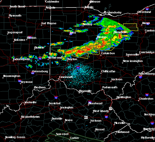 At 149 pm edt, radar indicated severe thunderstorms located along a line extending from near sunbury to near powell, moving southeast at 45 mph. storm hazards include, winds to 60 mph, penny size hail, locations impacted include, delaware, sunbury, ashley, galena, hartford, bellepoint, alum creek state park, lewis center, kilbourne, leonardsburg, stratford and olive green. At 149 pm edt, radar indicated severe thunderstorms located along a line extending from near sunbury to near powell, moving southeast at 45 mph. storm hazards include, winds to 60 mph, penny size hail, locations impacted include, delaware, sunbury, ashley, galena, hartford, bellepoint, alum creek state park, lewis center, kilbourne, leonardsburg, stratford and olive green.
|
| 7/14/2015 1:37 PM EDT |
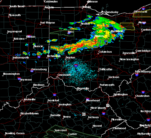 At 136 pm edt, radar indicated severe thunderstorms located along a line extending from near ashley to near delaware, moving east at 45 mph. storm hazards include, winds to 60 mph, penny size hail,. At 136 pm edt, radar indicated severe thunderstorms located along a line extending from near ashley to near delaware, moving east at 45 mph. storm hazards include, winds to 60 mph, penny size hail,.
|
| 7/14/2015 1:27 PM EDT |
 At 127 pm edt, a severe thunderstorm was located over waldo, or 9 miles south of marion, moving east at 35 mph (radar indicated). Hazards include 60 mph wind gusts. Expect damage to roofs. Siding and trees. At 127 pm edt, a severe thunderstorm was located over waldo, or 9 miles south of marion, moving east at 35 mph (radar indicated). Hazards include 60 mph wind gusts. Expect damage to roofs. Siding and trees.
|
| 6/30/2015 9:09 PM EDT |
 At 908 pm edt, a severe thunderstorm was located over waldo, or 10 miles southeast of marion, moving east at 25 mph (radar indicated). Hazards include 60 mph wind gusts and quarter size hail. Hail damage to vehicles is expected. Expect wind damage to roofs, siding and trees. At 908 pm edt, a severe thunderstorm was located over waldo, or 10 miles southeast of marion, moving east at 25 mph (radar indicated). Hazards include 60 mph wind gusts and quarter size hail. Hail damage to vehicles is expected. Expect wind damage to roofs, siding and trees.
|
| 6/18/2015 7:25 PM EDT | At 724 pm edt, radar continued to indicate a severe thunderstorm located near delaware state park, moving east at 60 mph. storm hazards include, winds to 60 mph, very heavy rain which may cause minor flooding, locations impacted include, ashley and sunbury. in addition, leonardsburg, kilbourne, galena and olive green are near the path of this storm. this includes the following interstate, i-71 between mile markers 128 and 139,. |
| 6/18/2015 7:12 PM EDT | At 710 pm edt, radar indicated a severe thunderstorm located near richwood, moving east at 60 mph. storm hazards include, winds to 60 mph, very heavy rain which may cause minor flooding,. |
| 6/18/2015 7:06 PM EDT | At 706 pm edt, severe thunderstorms were located along a line extending from near marseilles to near richwood to 7 miles southeast of west mansfield, moving east at 50 mph (radar indicated). Hazards include 70 mph wind gusts. Expect considerable tree damage. Damage is likely to mobile homes, roofs and outbuildings. |
| 5/27/2015 7:30 PM EDT | At 730 pm edt, radar continued to indicate a severe thunderstorm located near delaware state park, moving east at 35 mph. storm hazards include, winds to 60 mph, penny size hail, locations impacted include, ashley. in addition, delaware state park, leonardsburg and kilbourne are near the path of this storm. |
| 5/27/2015 7:19 PM EDT | At 718 pm edt, radar indicated a severe thunderstorm located near warrensburg, moving east at 35 mph. storm hazards include, winds to 60 mph, penny size hail,. |
| 5/26/2015 7:13 PM EDT | At 712 pm edt, a severe thunderstorm was located near cardington, or 7 miles south of mount gilead, moving northeast at 55 mph (radar indicated). Hazards include 60 mph wind gusts. Expect damage to roofs. Siding and trees. |
| 7/27/2014 1:45 PM EDT | Several trees down across the northern part of the county. time and specific location estimate in delaware county OH, 0 miles ESE of Ashley, OH |
Hail Maps for Ashley, OH
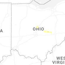
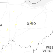
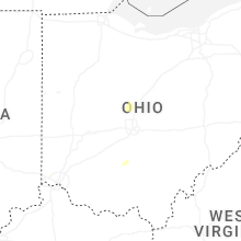
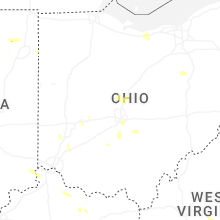


Connect with Interactive Hail Maps