

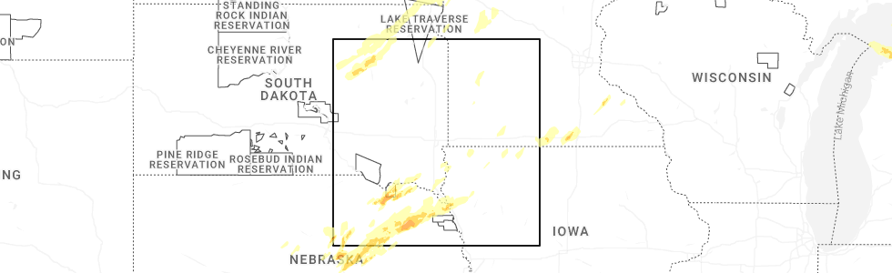
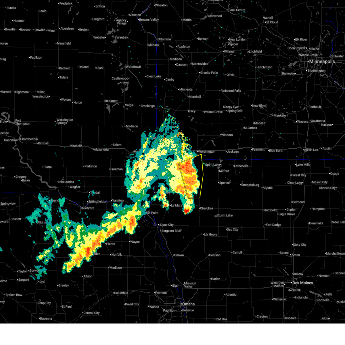
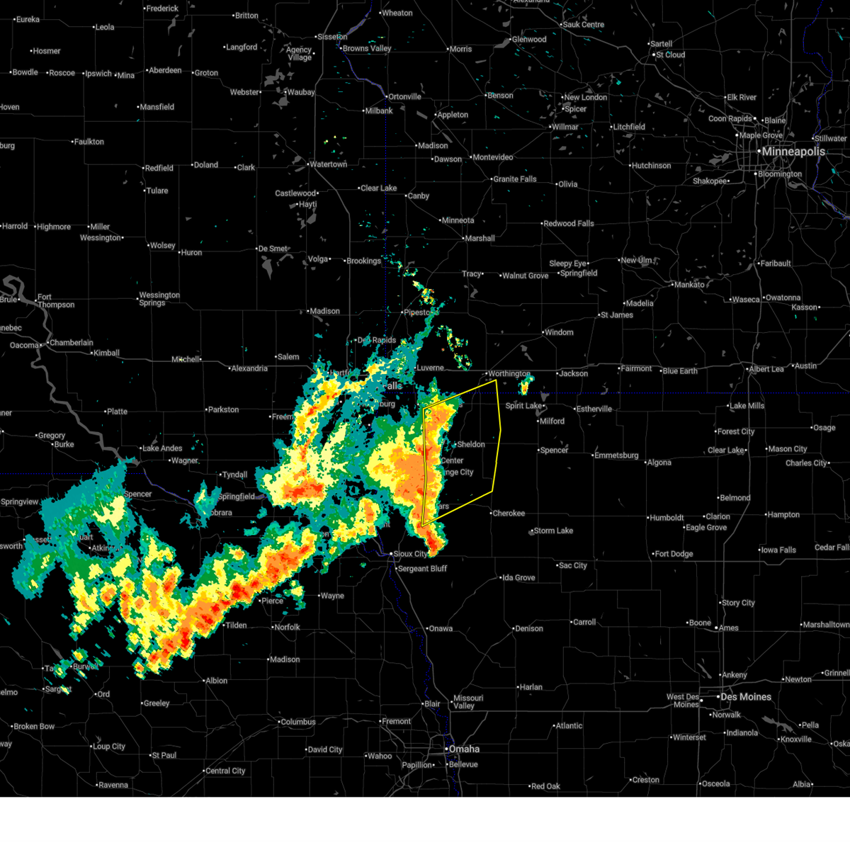
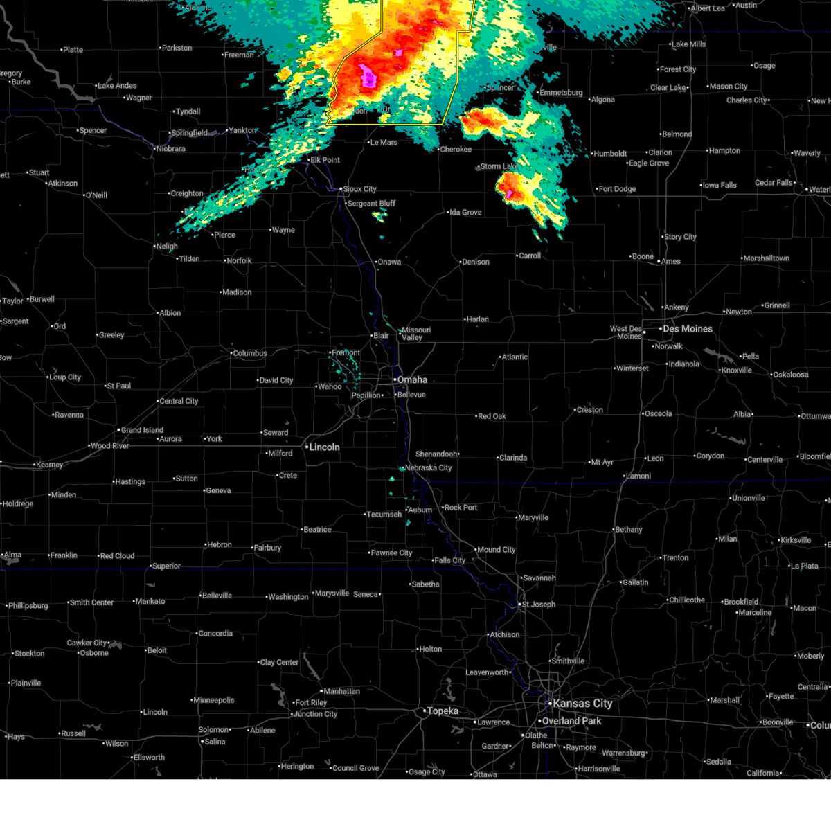
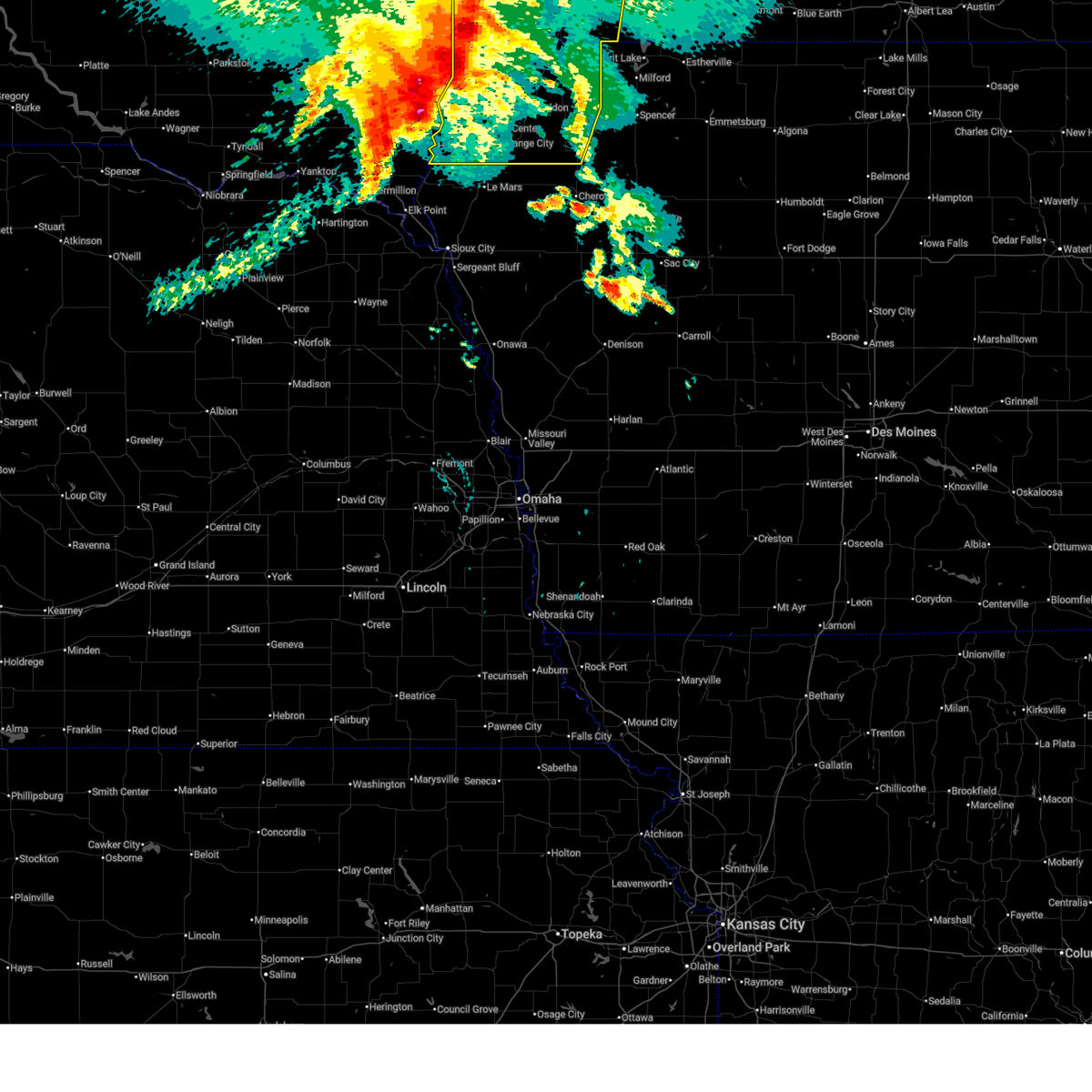
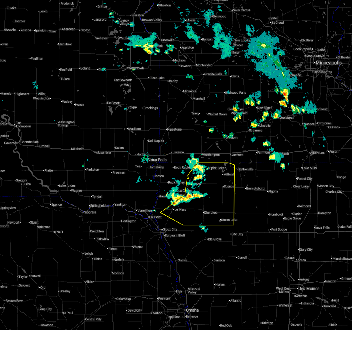
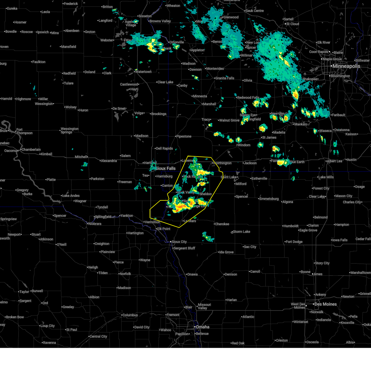
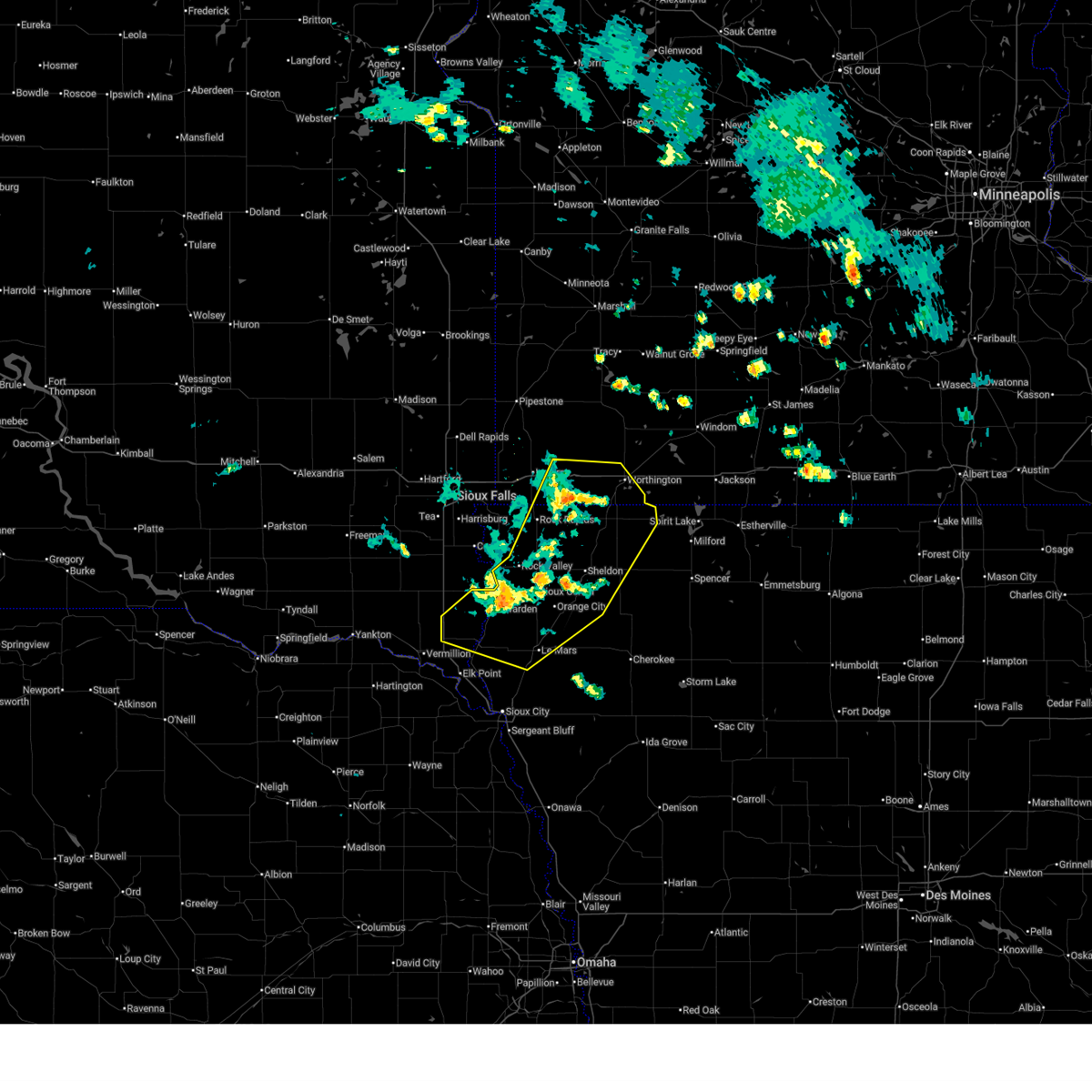
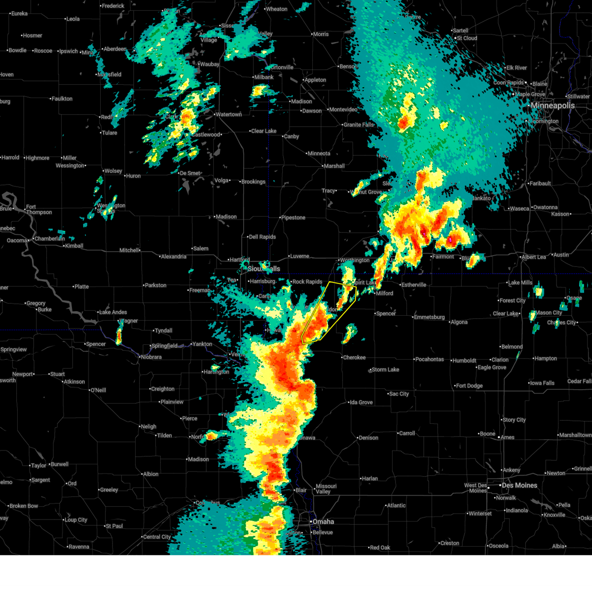
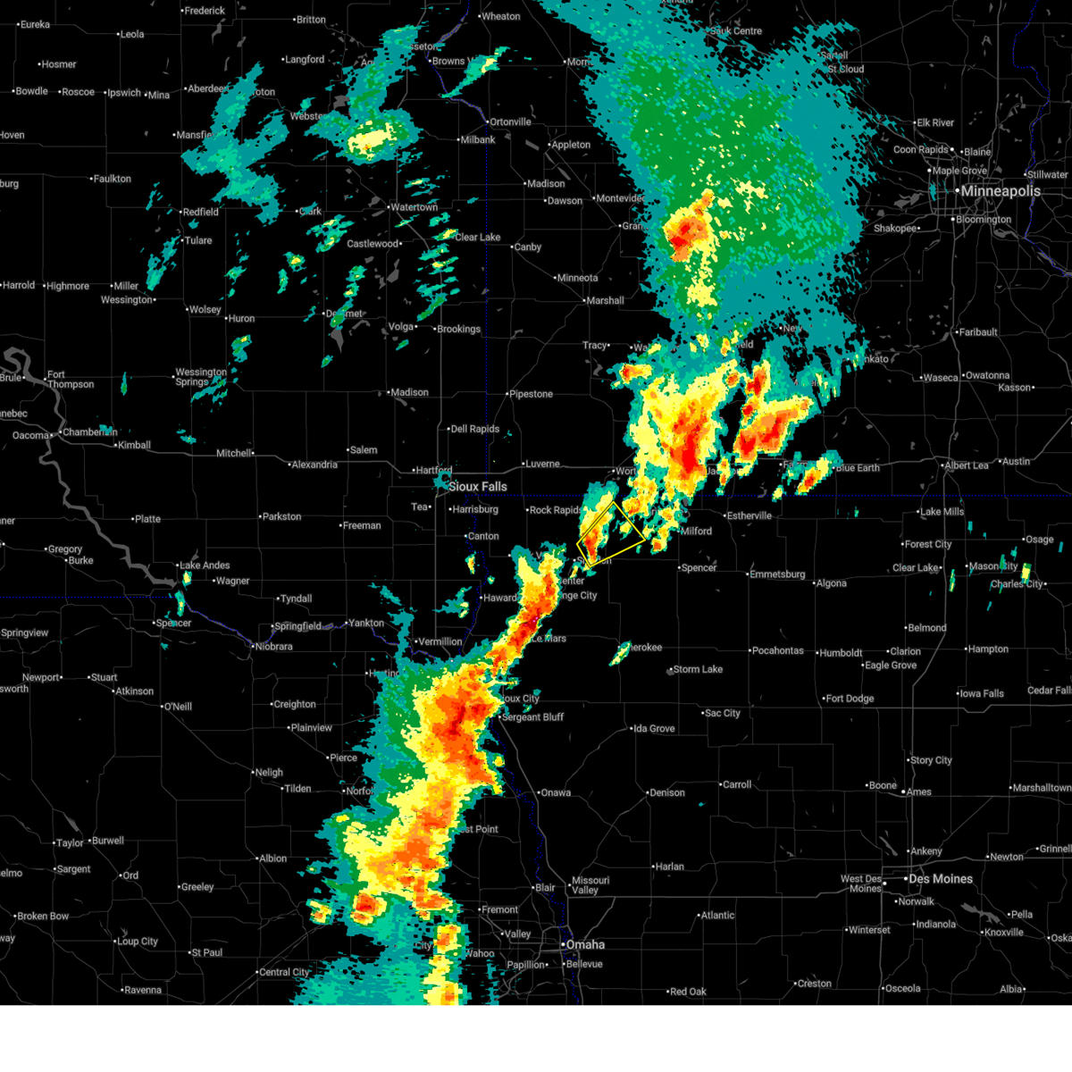
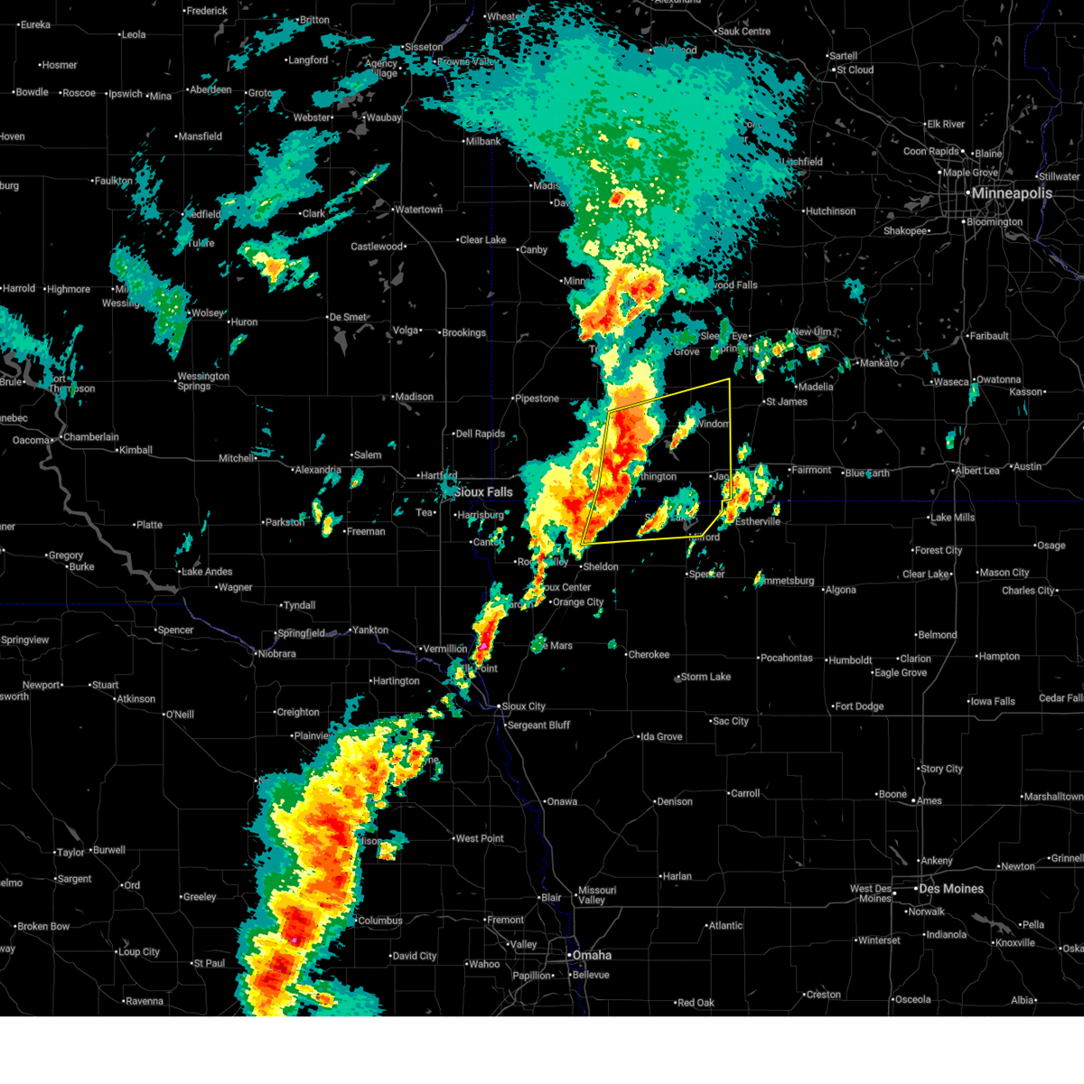
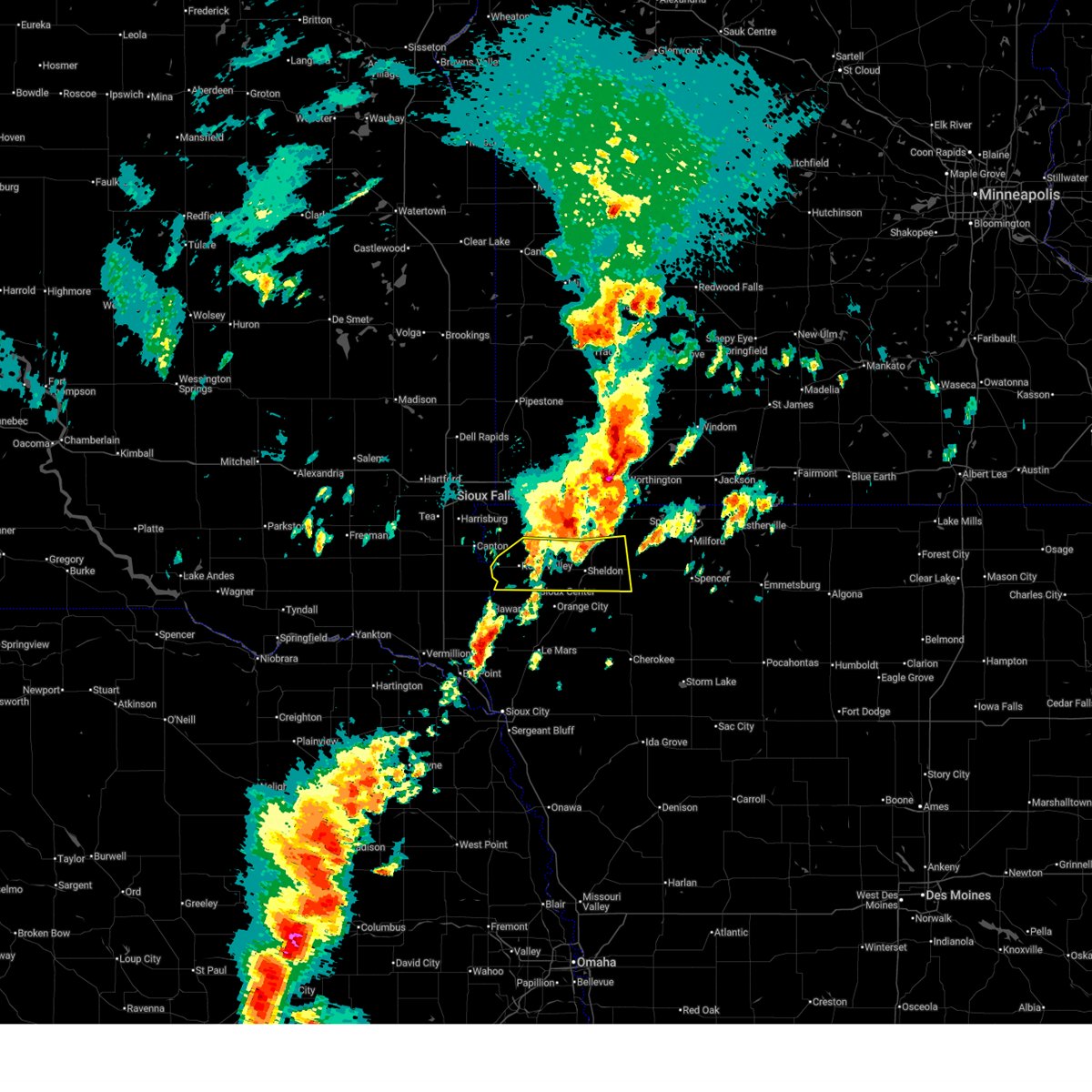
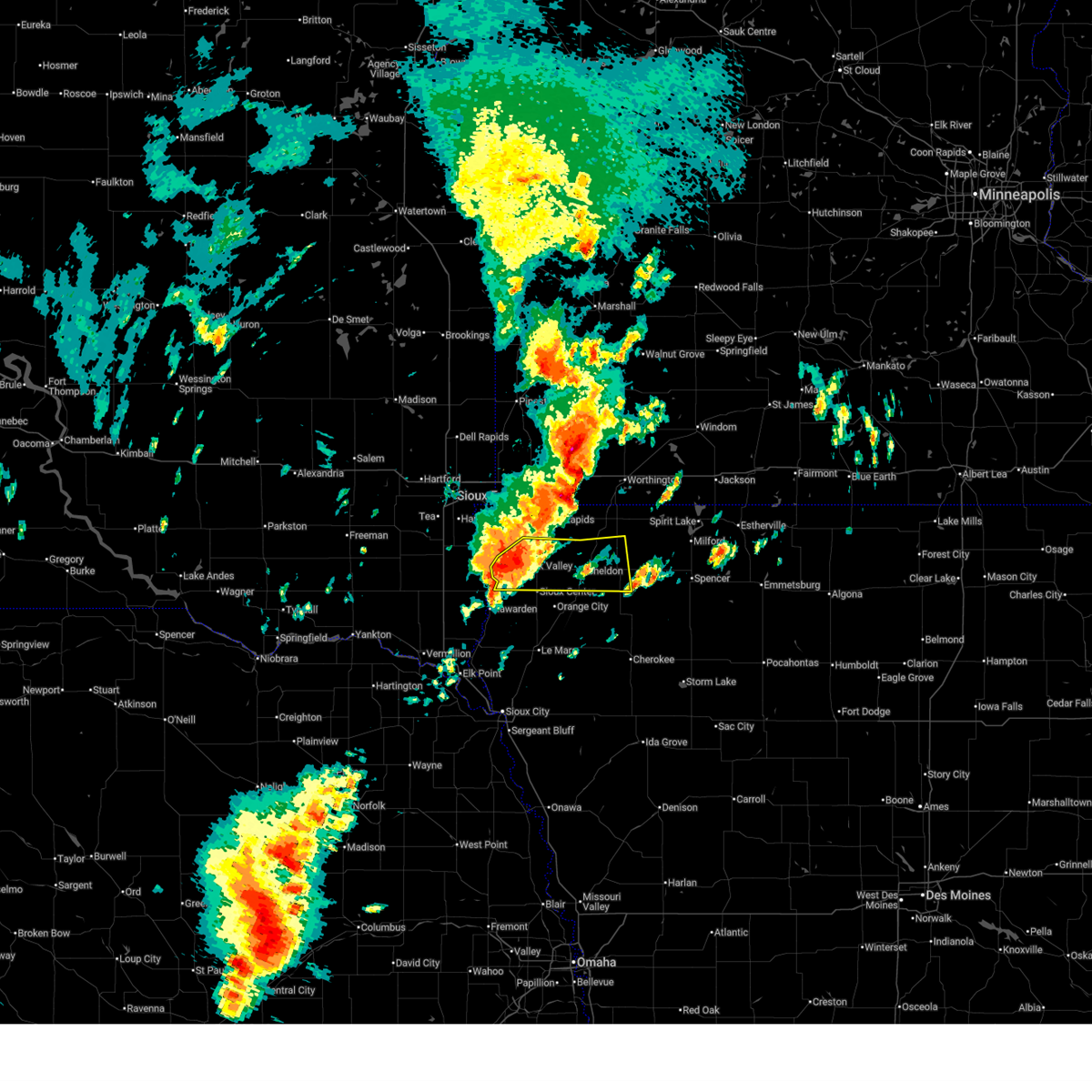
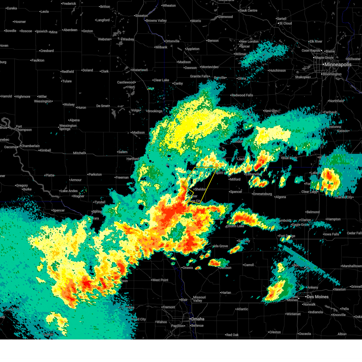
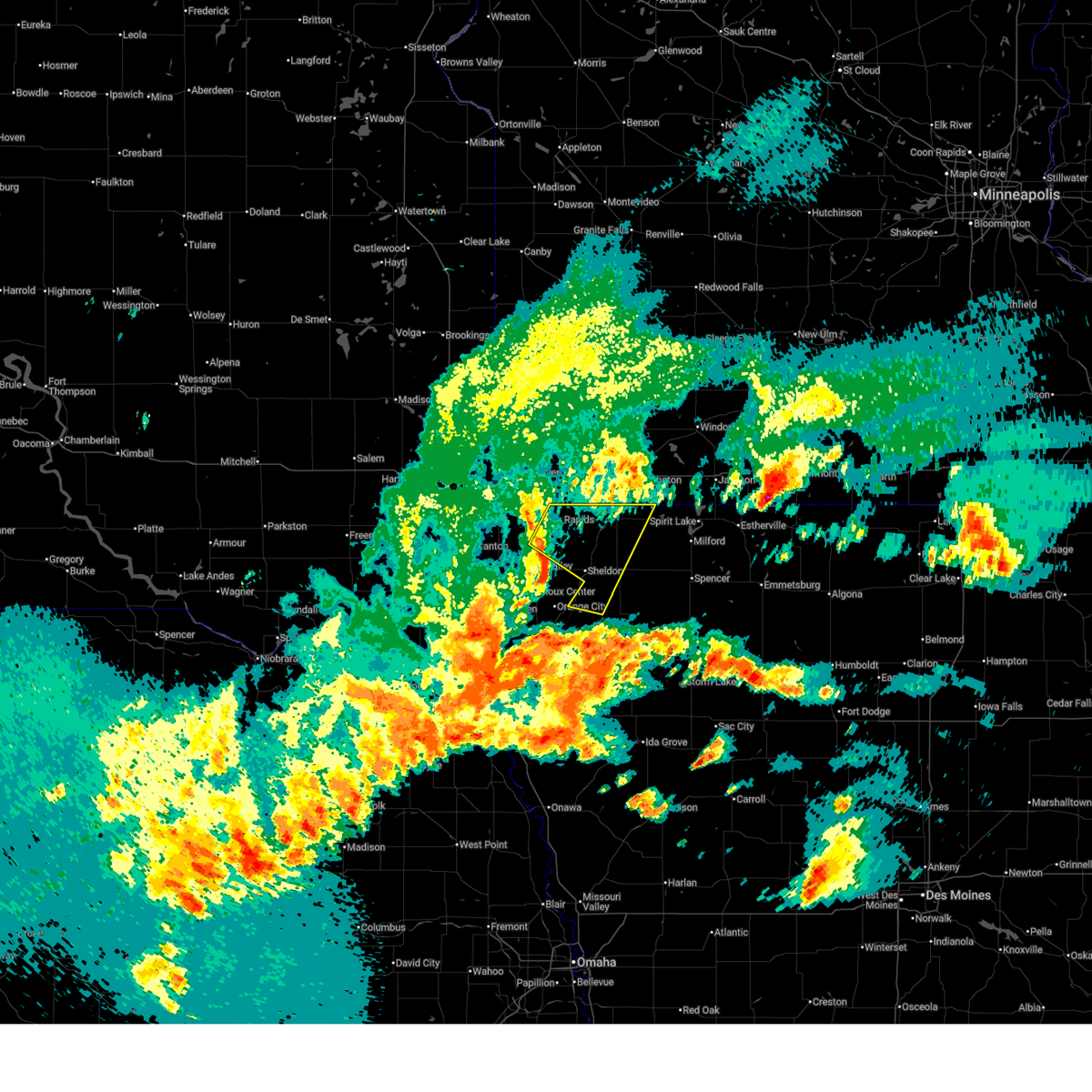
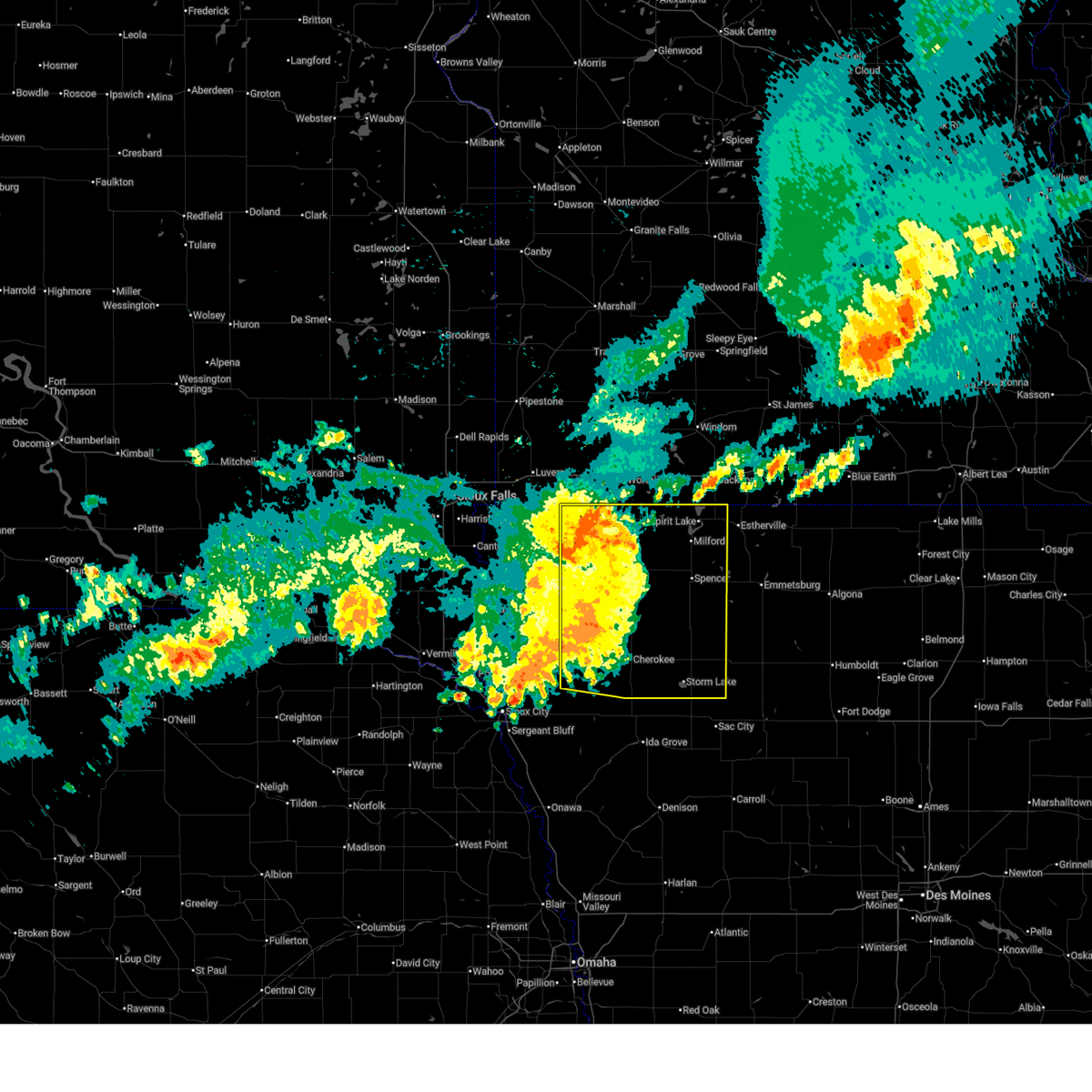
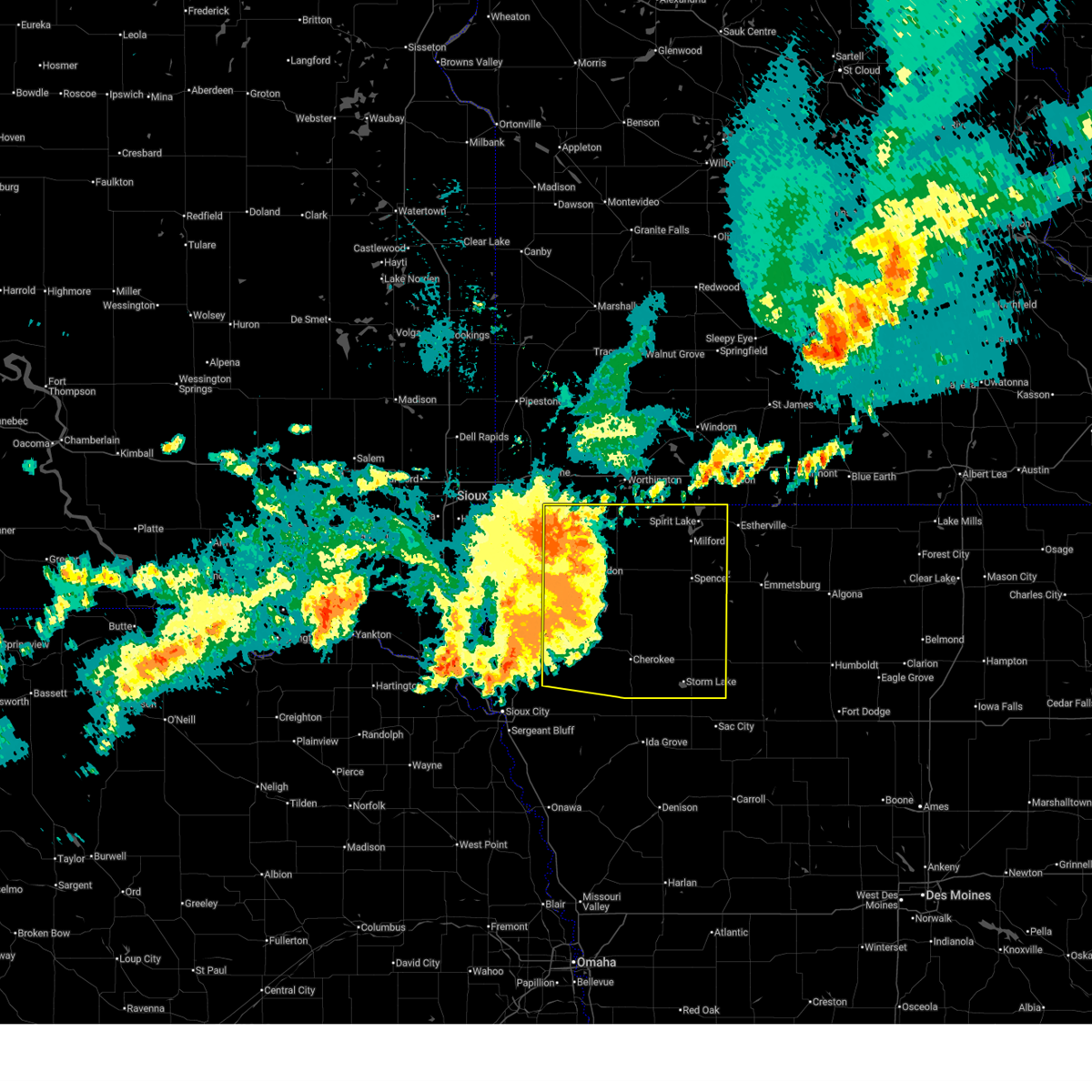
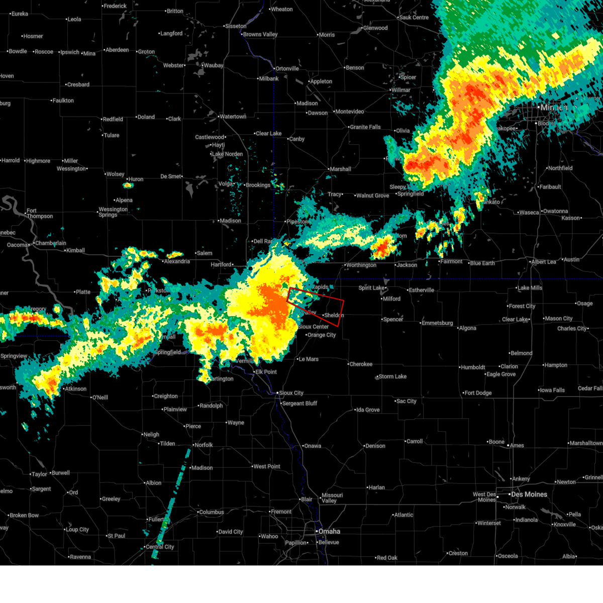
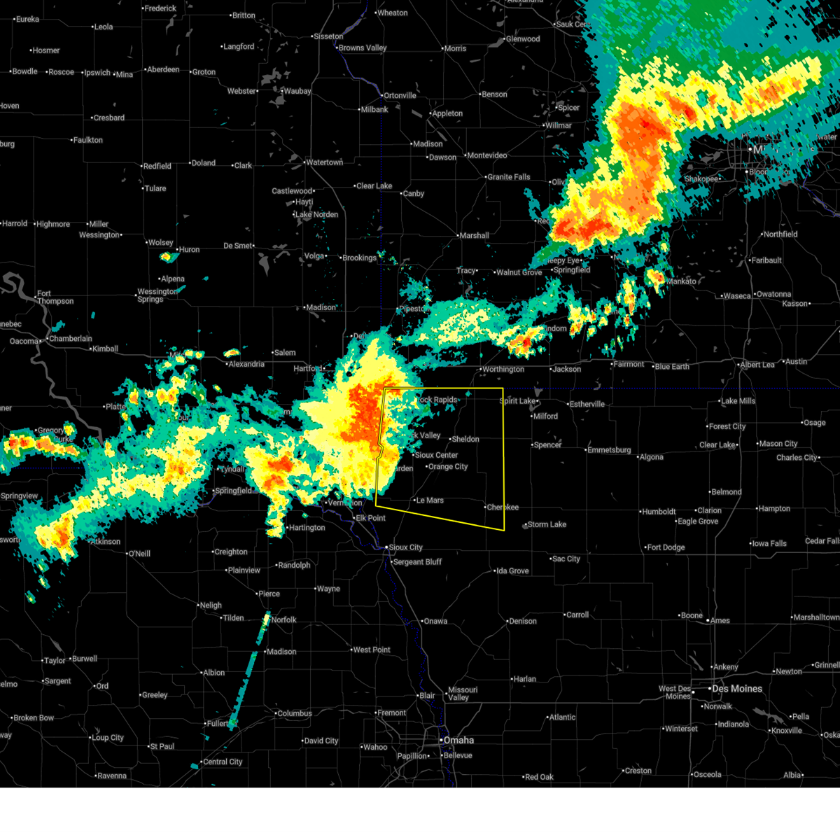
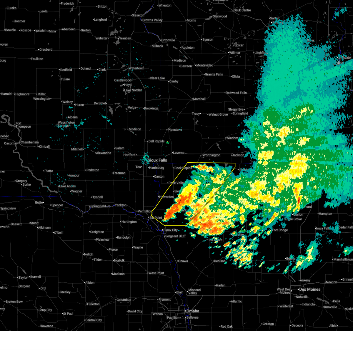
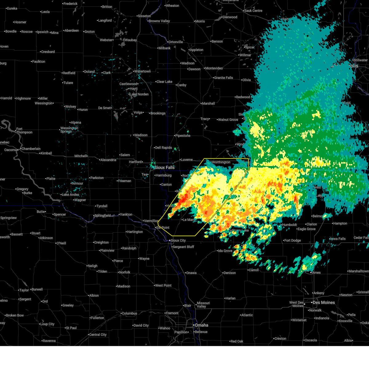
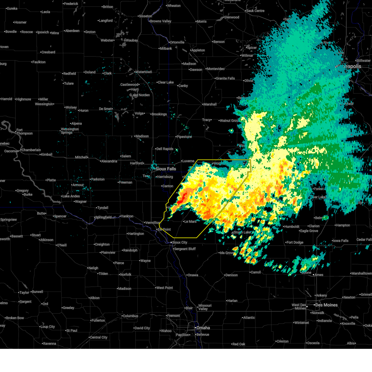
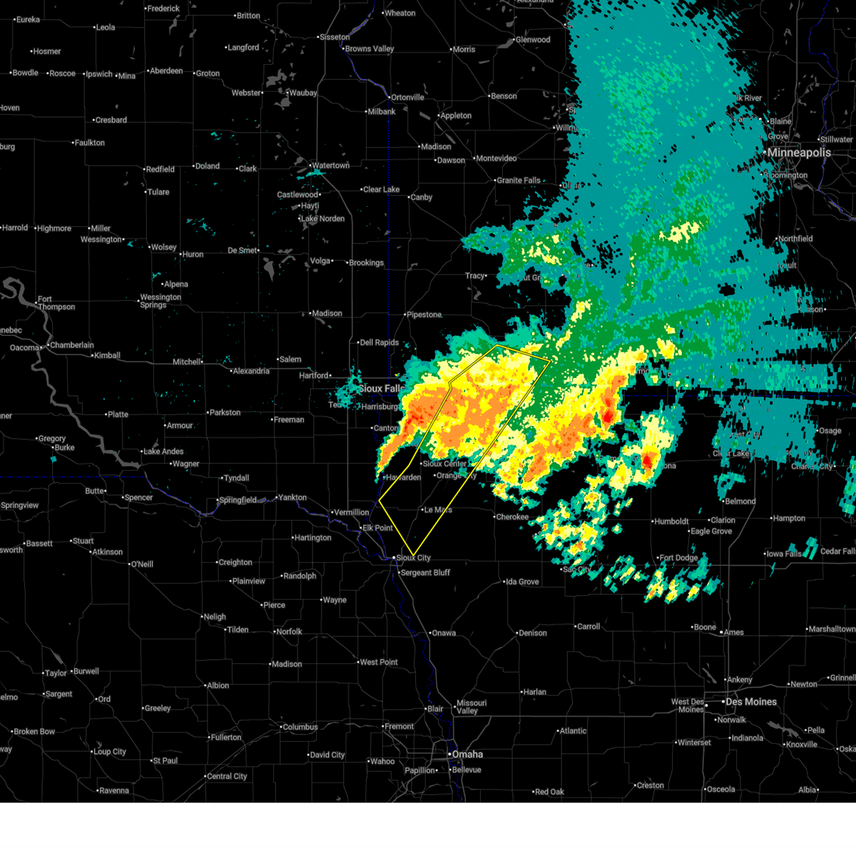
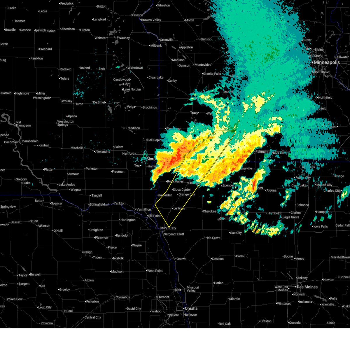
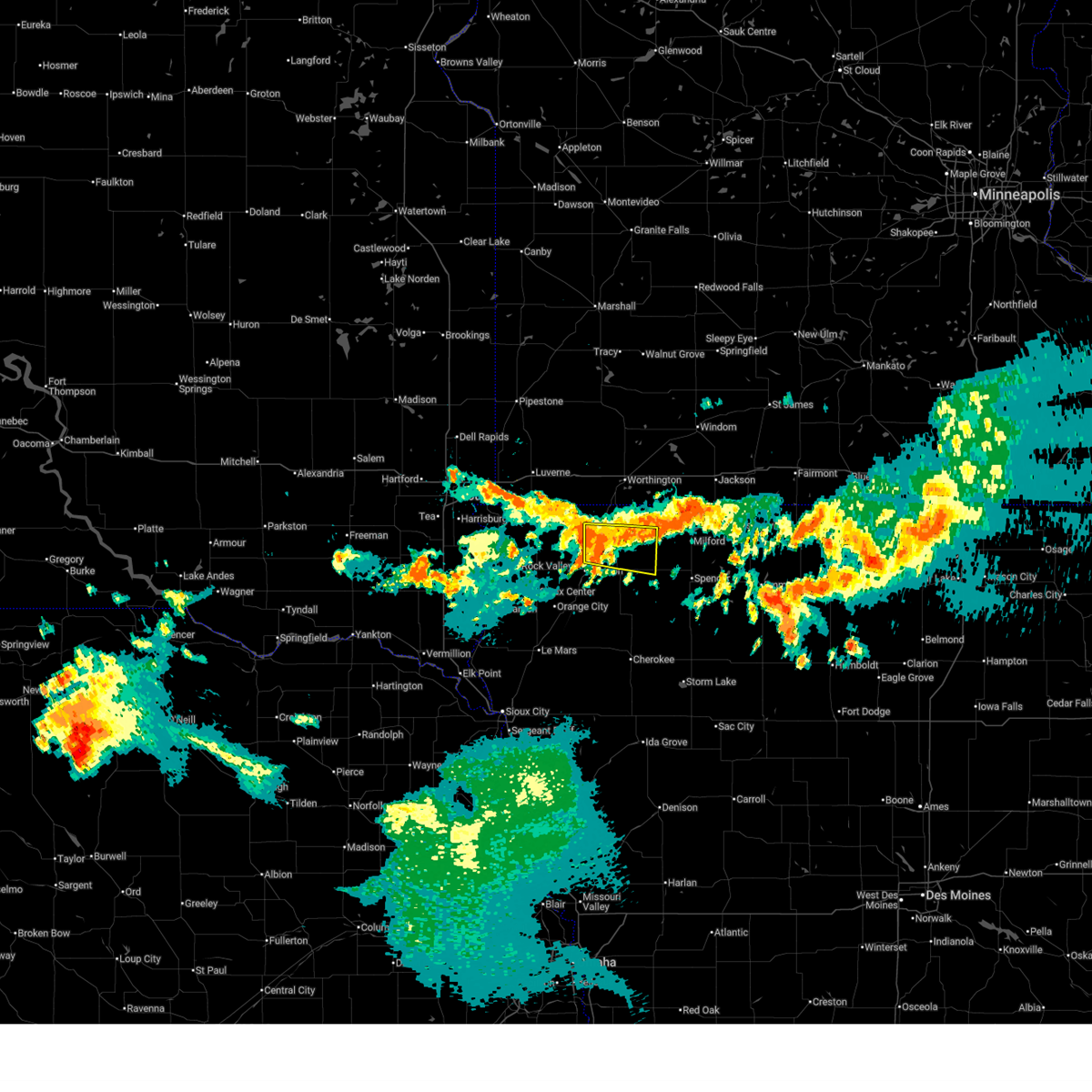
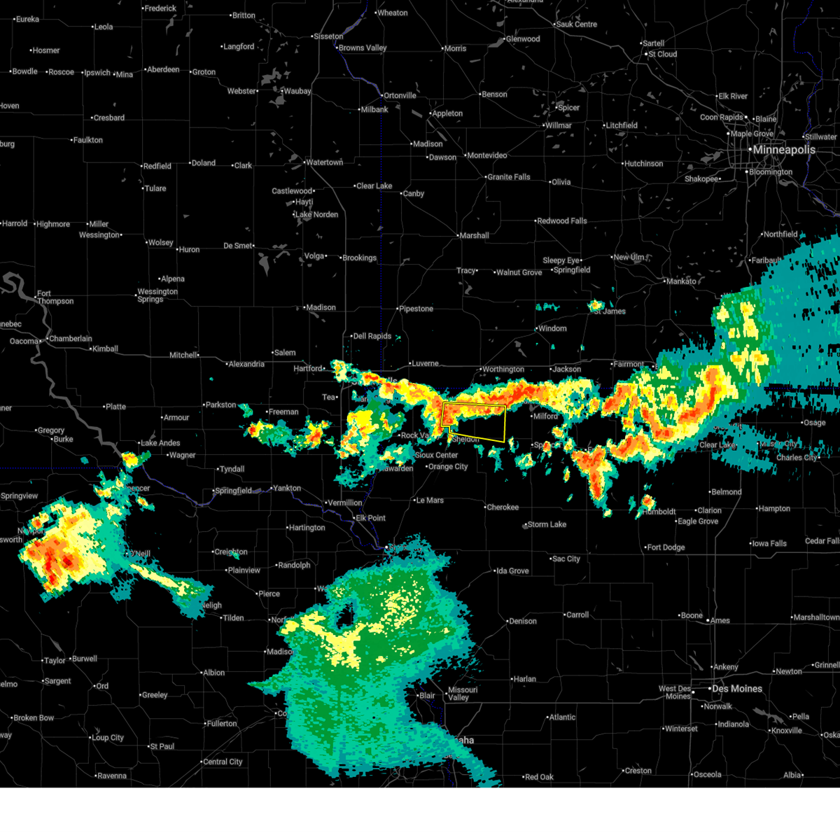
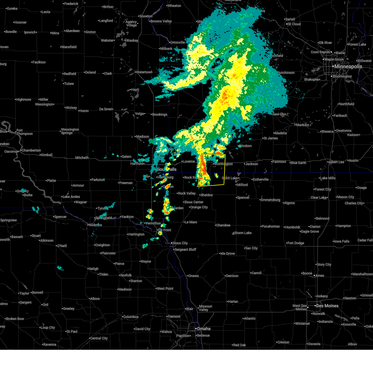
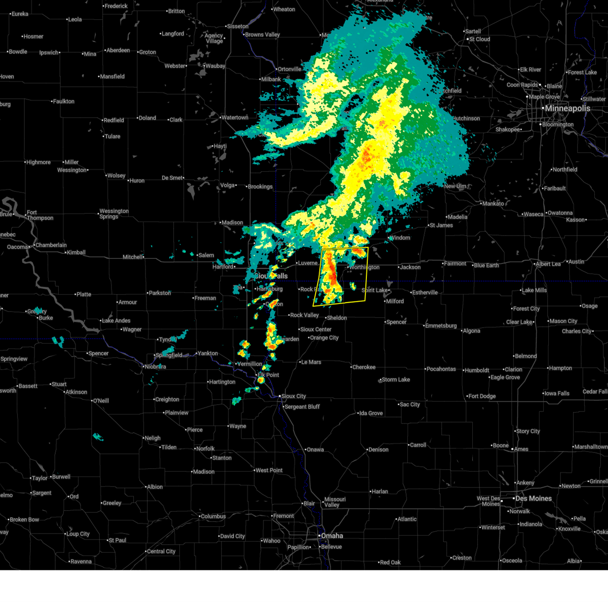
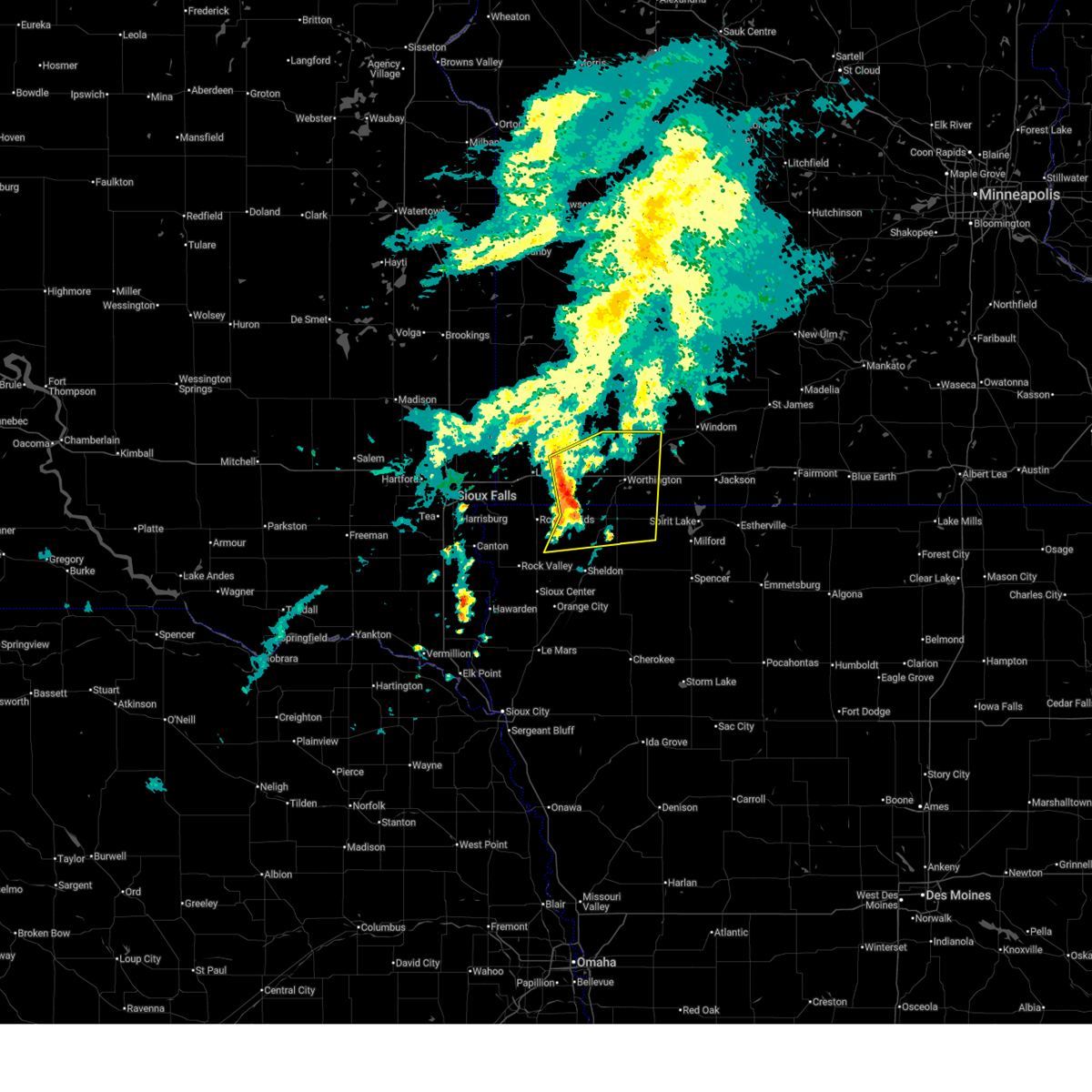
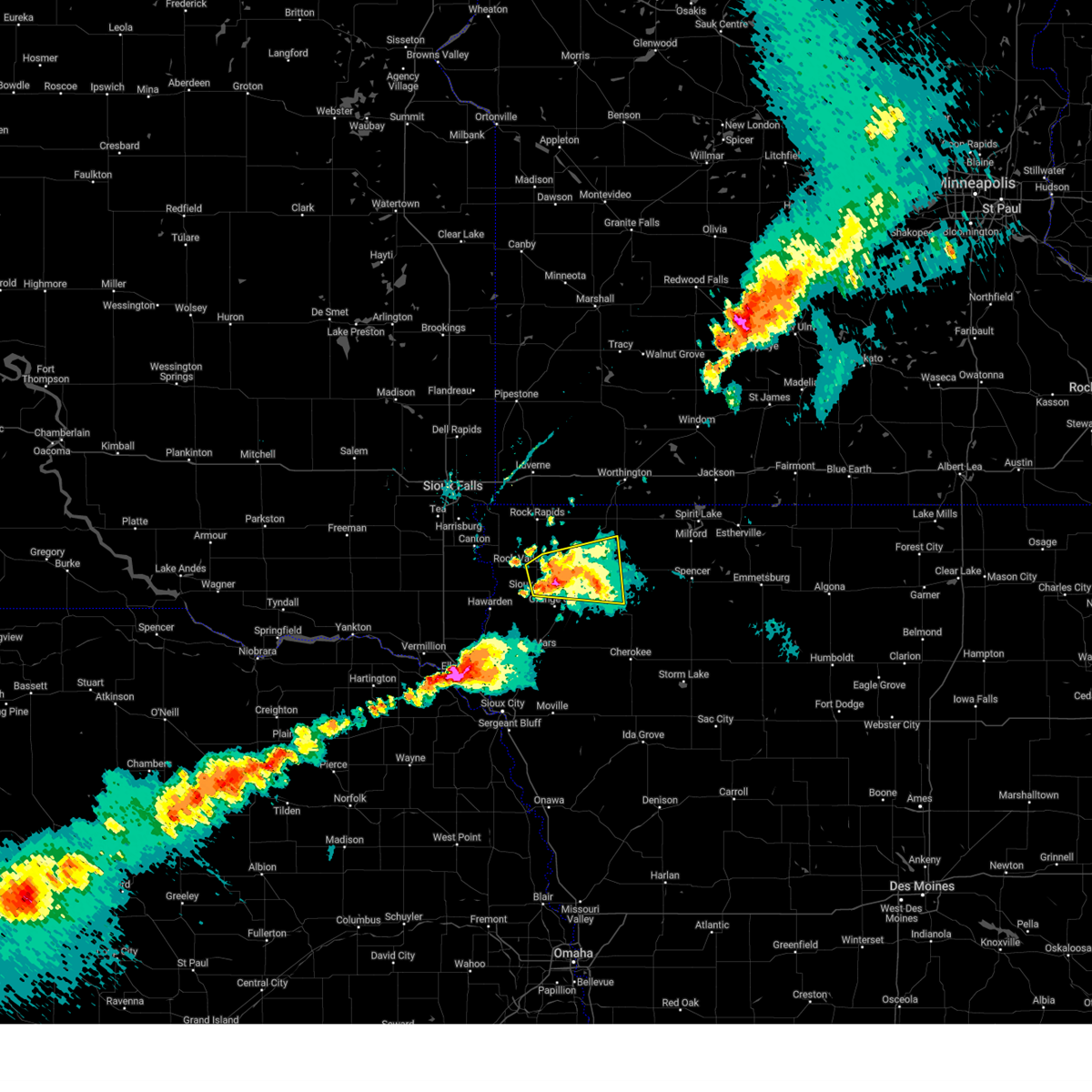
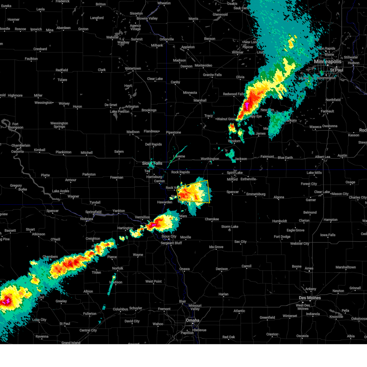
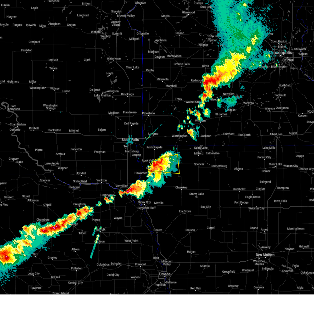
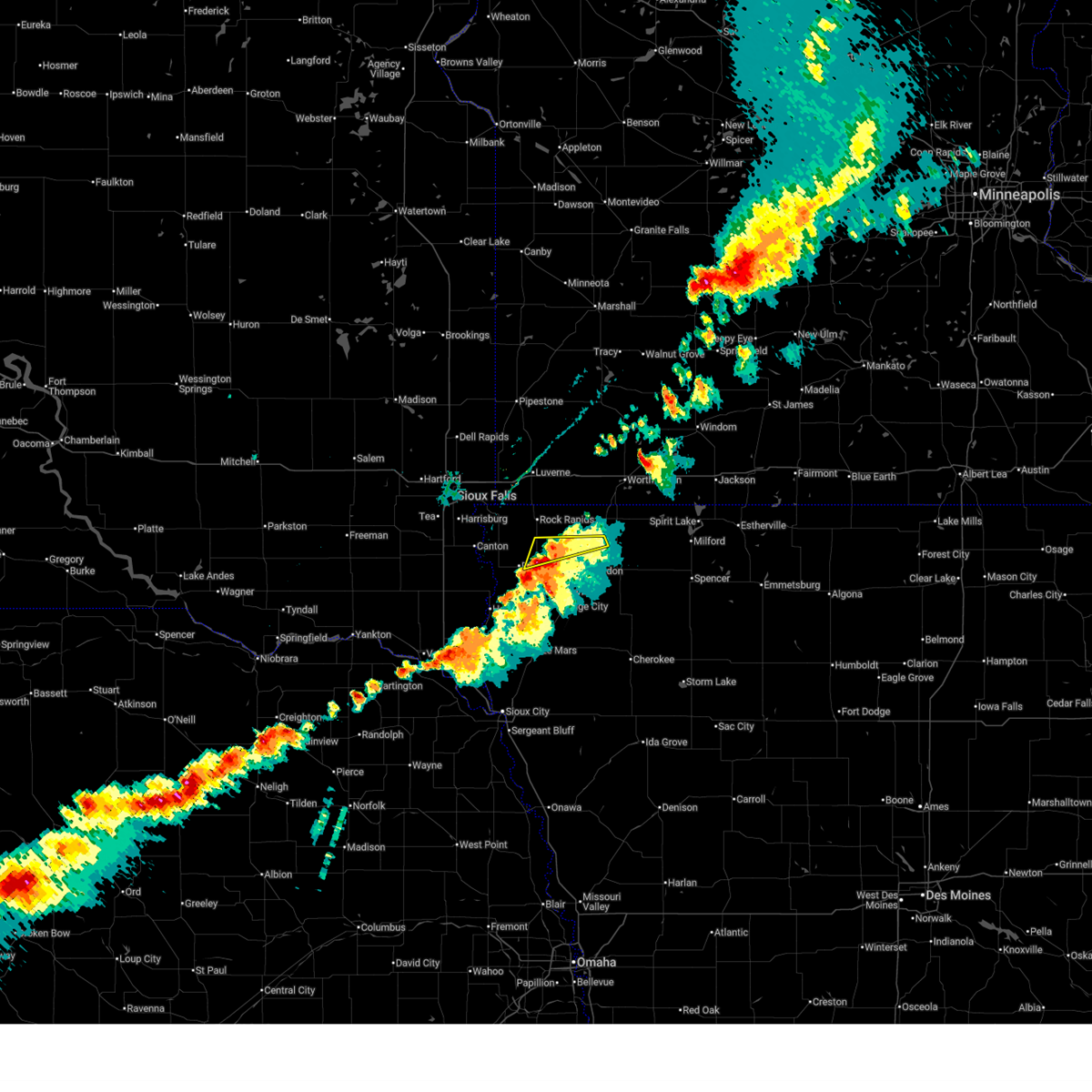
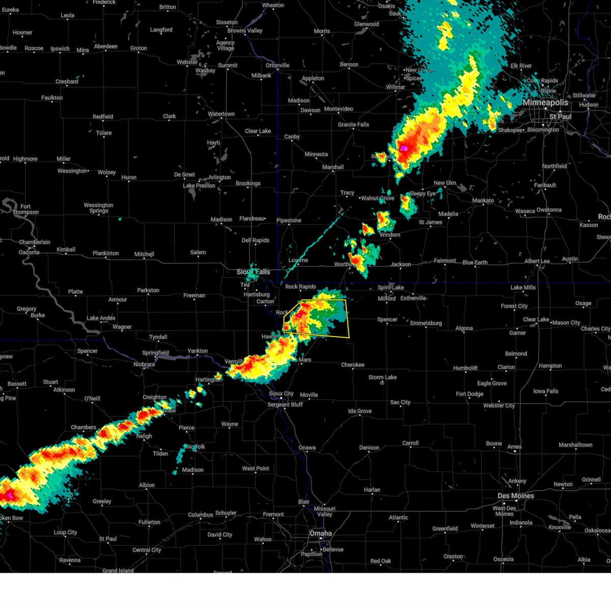
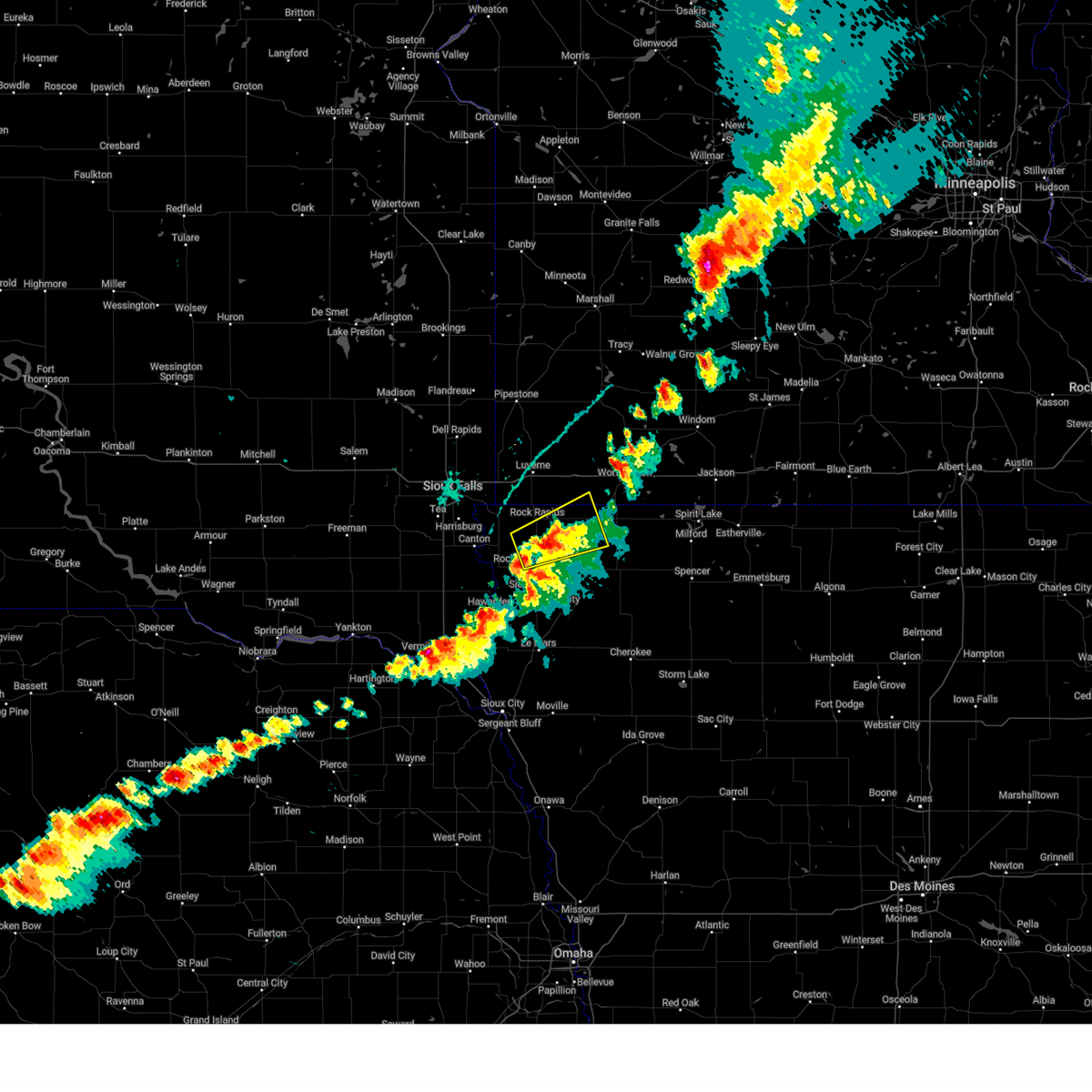
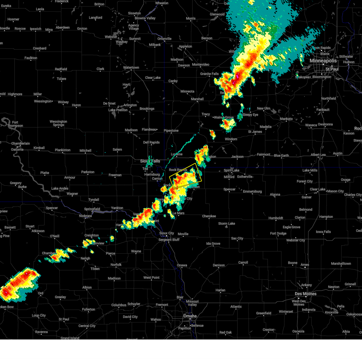
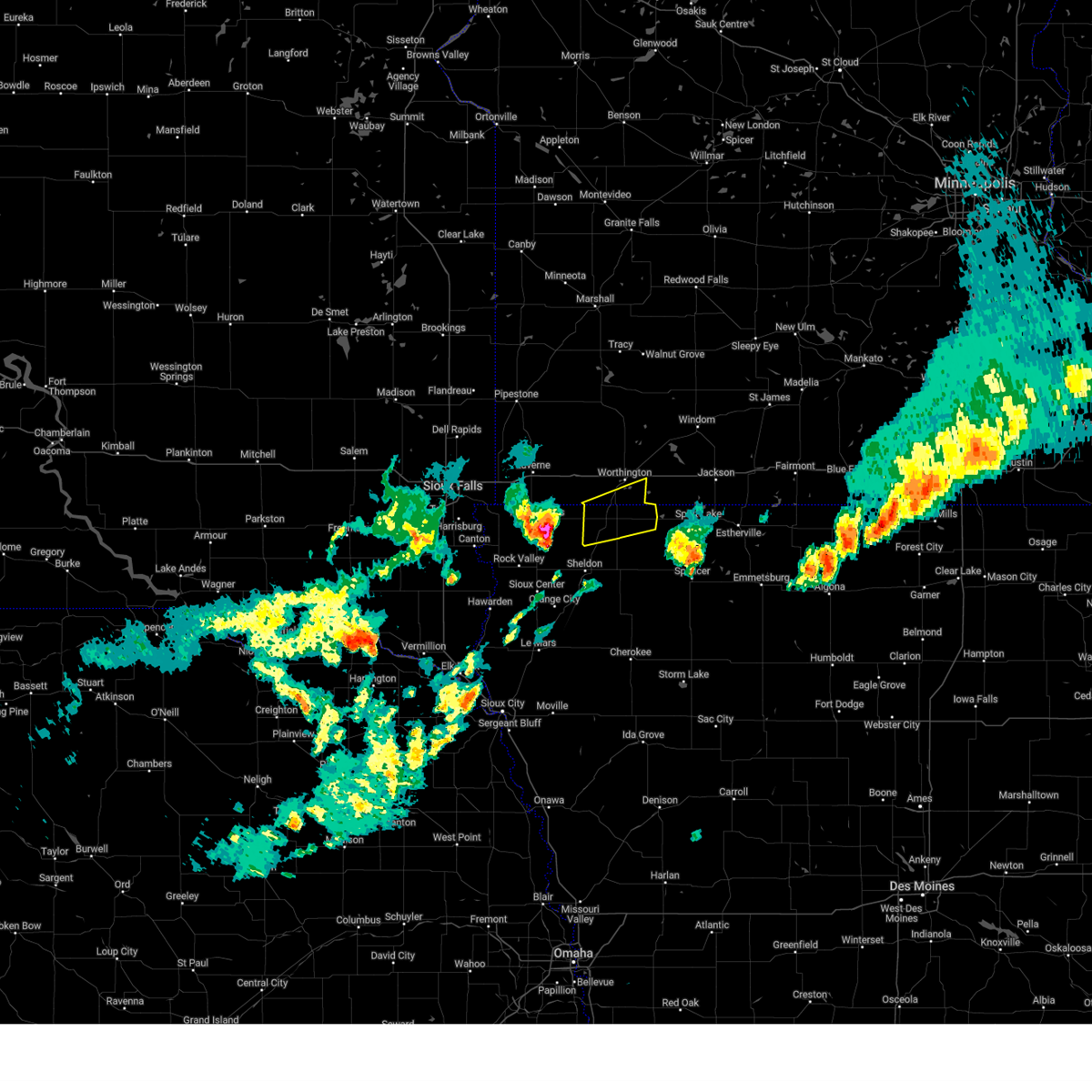
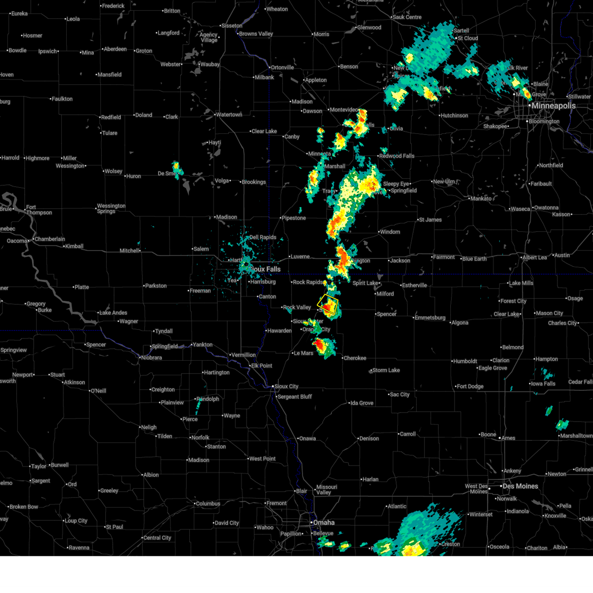
Hail Map for Ashton, IA
The Ashton, IA area has had 6 reports of on-the-ground hail by trained spotters, and has been under severe weather warnings 41 times during the past 12 months. Doppler radar has detected hail at or near Ashton, IA on 50 occasions, including 3 occasions during the past year.
| Name: | Ashton, IA |
| Where Located: | 50 miles ESE of Sioux Falls, SD |
| Map: | Google Map for Ashton, IA |
| Population: | 458 |
| Housing Units: | 211 |
| More Info: | Search Google for Ashton, IA |
0
The Top Recent Hail Date for Ashton, IA is Monday, June 29, 2026 (27th out of 50)
Hail and Wind Damage Spotted near Ashton, IA
| Date / Time | Report Details |
|---|---|
| 7/1/2026 5:05 AM CDT |
 At 505 am cdt, severe thunderstorms were located along a line extending from near adrian to near ellsworth to george, moving east at 60 mph (radar indicated). Hazards include 60 mph wind gusts. Expect damage to roofs, siding, and trees. Locations impacted include, little rock, rushmore, wilmont, worthington and sibley. At 505 am cdt, severe thunderstorms were located along a line extending from near adrian to near ellsworth to george, moving east at 60 mph (radar indicated). Hazards include 60 mph wind gusts. Expect damage to roofs, siding, and trees. Locations impacted include, little rock, rushmore, wilmont, worthington and sibley.
|
| 7/1/2026 4:47 AM CDT |
 Svrfsd the national weather service in sioux falls has issued a * severe thunderstorm warning for, lyon county in northwestern iowa, western osceola county in northwestern iowa, southeastern rock county in southwestern minnesota, nobles county in southwestern minnesota, * until 530 am cdt. * at 446 am cdt, severe thunderstorms were located along a line extending from near luverne to near rock rapids to doon, moving east at 45 mph (radar indicated). Hazards include 60 mph wind gusts. Expect damage to roofs, siding, and trees. severe thunderstorms will be near, luverne, rock rapids, doon, and blue mounds state park around 450 am cdt. george and ellsworth around 455 am cdt. adrian around 500 am cdt. little rock around 505 am cdt. Other locations in the path of these severe thunderstorms include sibley, ashton, rushmore and worthington. Svrfsd the national weather service in sioux falls has issued a * severe thunderstorm warning for, lyon county in northwestern iowa, western osceola county in northwestern iowa, southeastern rock county in southwestern minnesota, nobles county in southwestern minnesota, * until 530 am cdt. * at 446 am cdt, severe thunderstorms were located along a line extending from near luverne to near rock rapids to doon, moving east at 45 mph (radar indicated). Hazards include 60 mph wind gusts. Expect damage to roofs, siding, and trees. severe thunderstorms will be near, luverne, rock rapids, doon, and blue mounds state park around 450 am cdt. george and ellsworth around 455 am cdt. adrian around 500 am cdt. little rock around 505 am cdt. Other locations in the path of these severe thunderstorms include sibley, ashton, rushmore and worthington.
|
| 6/30/2026 2:21 AM CDT |
 Svrfsd the national weather service in sioux falls has issued a * severe thunderstorm warning for, osceola county in northwestern iowa, dickinson county in northwestern iowa, northern clay county in northwestern iowa, eastern o'brien county in northwestern iowa, jackson county in southwestern minnesota, southeastern nobles county in southwestern minnesota, * until 315 am cdt. * at 220 am cdt, severe thunderstorms were located along a line extending from near ocheyedan to near melvin to near hartley, moving east at 50 mph (public. this line of storms is producing gusts between 65 and 70 mph). Hazards include 70 mph wind gusts. Expect considerable tree damage. damage is likely to mobile homes, roofs, and outbuildings. severe thunderstorms will be near, hartley, everly, ocheyedan, and harris around 225 am cdt. spencer in clay county, lake park, and round lake around 230 am cdt. milford, arnolds park, wahpeton, west okoboji, and fostoria around 235 am cdt. spirit lake, okoboji, and orleans around 240 am cdt. Other locations in the path of these severe thunderstorms include terril, superior, lost island lake and jackson in jackson county. Svrfsd the national weather service in sioux falls has issued a * severe thunderstorm warning for, osceola county in northwestern iowa, dickinson county in northwestern iowa, northern clay county in northwestern iowa, eastern o'brien county in northwestern iowa, jackson county in southwestern minnesota, southeastern nobles county in southwestern minnesota, * until 315 am cdt. * at 220 am cdt, severe thunderstorms were located along a line extending from near ocheyedan to near melvin to near hartley, moving east at 50 mph (public. this line of storms is producing gusts between 65 and 70 mph). Hazards include 70 mph wind gusts. Expect considerable tree damage. damage is likely to mobile homes, roofs, and outbuildings. severe thunderstorms will be near, hartley, everly, ocheyedan, and harris around 225 am cdt. spencer in clay county, lake park, and round lake around 230 am cdt. milford, arnolds park, wahpeton, west okoboji, and fostoria around 235 am cdt. spirit lake, okoboji, and orleans around 240 am cdt. Other locations in the path of these severe thunderstorms include terril, superior, lost island lake and jackson in jackson county.
|
| 6/30/2026 2:15 AM CDT |
 At 214 am cdt, severe thunderstorms were located along a line extending from sibley to near sanborn to near paullina, moving northeast at 60 mph (public. at 210 am cdt, a 67 mph wind gust was reported by a personal weather station in ashton). Hazards include 70 mph wind gusts. Expect considerable tree damage. damage is likely to mobile homes, roofs, and outbuildings. These severe storms will be near, hartley and ocheyedan around 220 am cdt. At 214 am cdt, severe thunderstorms were located along a line extending from sibley to near sanborn to near paullina, moving northeast at 60 mph (public. at 210 am cdt, a 67 mph wind gust was reported by a personal weather station in ashton). Hazards include 70 mph wind gusts. Expect considerable tree damage. damage is likely to mobile homes, roofs, and outbuildings. These severe storms will be near, hartley and ocheyedan around 220 am cdt.
|
| 6/30/2026 2:10 AM CDT | Davis personal weather statio in osceola county IA, 0 miles NW of Ashton, IA |
| 6/30/2026 1:54 AM CDT |
 Svrfsd the national weather service in sioux falls has issued a * severe thunderstorm warning for, northwestern cherokee county in northwestern iowa, southeastern lyon county in northwestern iowa, osceola county in northwestern iowa, eastern sioux county in northwestern iowa, northeastern plymouth county in northwestern iowa, o'brien county in northwestern iowa, southeastern nobles county in southwestern minnesota, * until 245 am cdt. * at 153 am cdt, severe thunderstorms were located along a line extending from near matlock to near hospers to near remsen, moving northeast at 40 mph (radar indicated). Hazards include 60 mph wind gusts. Expect damage to roofs, siding, and trees. severe thunderstorms will be near, sheldon, remsen, hospers, ashton, granville, and matlock around 200 am cdt. marcus and archer around 205 am cdt. sibley, sanborn, and paullina around 210 am cdt. Other locations in the path of these severe thunderstorms include primghar, melvin, hartley and ocheyedan. Svrfsd the national weather service in sioux falls has issued a * severe thunderstorm warning for, northwestern cherokee county in northwestern iowa, southeastern lyon county in northwestern iowa, osceola county in northwestern iowa, eastern sioux county in northwestern iowa, northeastern plymouth county in northwestern iowa, o'brien county in northwestern iowa, southeastern nobles county in southwestern minnesota, * until 245 am cdt. * at 153 am cdt, severe thunderstorms were located along a line extending from near matlock to near hospers to near remsen, moving northeast at 40 mph (radar indicated). Hazards include 60 mph wind gusts. Expect damage to roofs, siding, and trees. severe thunderstorms will be near, sheldon, remsen, hospers, ashton, granville, and matlock around 200 am cdt. marcus and archer around 205 am cdt. sibley, sanborn, and paullina around 210 am cdt. Other locations in the path of these severe thunderstorms include primghar, melvin, hartley and ocheyedan.
|
| 6/28/2026 6:17 AM CDT |
 At 617 am cdt, severe thunderstorms were located along a line extending from near melvin to near primghar, moving northeast at 45 mph (public. at 609 am cdt, quarter size hail was reported in sanborn). Hazards include 60 mph wind gusts and half dollar size hail. Hail damage to vehicles is expected. expect wind damage to roofs, siding, and trees. Locations impacted include, hartley, melvin, everly, ocheyedan, harris and lake park. At 617 am cdt, severe thunderstorms were located along a line extending from near melvin to near primghar, moving northeast at 45 mph (public. at 609 am cdt, quarter size hail was reported in sanborn). Hazards include 60 mph wind gusts and half dollar size hail. Hail damage to vehicles is expected. expect wind damage to roofs, siding, and trees. Locations impacted include, hartley, melvin, everly, ocheyedan, harris and lake park.
|
| 6/28/2026 5:58 AM CDT |
 Svrfsd the national weather service in sioux falls has issued a * severe thunderstorm warning for, southeastern lyon county in northwestern iowa, osceola county in northwestern iowa, western dickinson county in northwestern iowa, northeastern sioux county in northwestern iowa, northwestern clay county in northwestern iowa, o'brien county in northwestern iowa, * until 700 am cdt. * at 557 am cdt, severe thunderstorms were located along a line extending from matlock to near hospers, moving east at 30 mph (radar indicated). Hazards include 60 mph wind gusts and half dollar size hail. Hail damage to vehicles is expected. expect wind damage to roofs, siding, and trees. severe thunderstorms will be near, sheldon and archer around 600 am cdt. sanborn and ashton around 605 am cdt. primghar around 610 am cdt. Other locations in the path of these severe thunderstorms include melvin, hartley and everly. Svrfsd the national weather service in sioux falls has issued a * severe thunderstorm warning for, southeastern lyon county in northwestern iowa, osceola county in northwestern iowa, western dickinson county in northwestern iowa, northeastern sioux county in northwestern iowa, northwestern clay county in northwestern iowa, o'brien county in northwestern iowa, * until 700 am cdt. * at 557 am cdt, severe thunderstorms were located along a line extending from matlock to near hospers, moving east at 30 mph (radar indicated). Hazards include 60 mph wind gusts and half dollar size hail. Hail damage to vehicles is expected. expect wind damage to roofs, siding, and trees. severe thunderstorms will be near, sheldon and archer around 600 am cdt. sanborn and ashton around 605 am cdt. primghar around 610 am cdt. Other locations in the path of these severe thunderstorms include melvin, hartley and everly.
|
| 6/28/2026 5:37 AM CDT |
 At 535 am cdt, severe thunderstorms were located along a line extending from near fulda to near round lake to hull, moving east at 60 mph (radar indicated). Hazards include two inch hail and 60 mph wind gusts. the largest hail would be in northern sioux county from rock valley to hull to boyden. People and animals outdoors will be injured. expect hail damage to roofs, siding, windows, and vehicles. expect wind damage to roofs, siding, and trees. Locations impacted include, worthington, sibley, boyden, ocheyedan, brewster, ashton, round lake, matlock, sheldon, heron lake, harris and melvin. At 535 am cdt, severe thunderstorms were located along a line extending from near fulda to near round lake to hull, moving east at 60 mph (radar indicated). Hazards include two inch hail and 60 mph wind gusts. the largest hail would be in northern sioux county from rock valley to hull to boyden. People and animals outdoors will be injured. expect hail damage to roofs, siding, windows, and vehicles. expect wind damage to roofs, siding, and trees. Locations impacted include, worthington, sibley, boyden, ocheyedan, brewster, ashton, round lake, matlock, sheldon, heron lake, harris and melvin.
|
| 6/28/2026 5:37 AM CDT |
 the severe thunderstorm warning has been cancelled and is no longer in effect the severe thunderstorm warning has been cancelled and is no longer in effect
|
| 6/28/2026 5:00 AM CDT |
 Svrfsd the national weather service in sioux falls has issued a * severe thunderstorm warning for, lyon county in northwestern iowa, osceola county in northwestern iowa, sioux county in northwestern iowa, o'brien county in northwestern iowa, rock county in southwestern minnesota, western jackson county in southwestern minnesota, nobles county in southwestern minnesota, southern murray county in southwestern minnesota, southeastern pipestone county in southwestern minnesota, southwestern cottonwood county in southwestern minnesota, * until 600 am cdt. * at 459 am cdt, severe thunderstorms were located along a line extending from near edgerton to near rock rapids to alcester, moving east at 50 mph (radar indicated). Hazards include 70 mph wind gusts and nickel size hail. Expect considerable tree damage. damage is likely to mobile homes, roofs, and outbuildings. severe thunderstorms will be near, rock rapids, hawarden, rock valley, adrian, doon, ellsworth, leota, chandler, lismore, and alvord around 505 am cdt. george and wilmont around 510 am cdt. hull, little rock, and rushmore around 515 am cdt. Other locations in the path of these severe thunderstorms include sioux center, slayton, worthington, fulda, sibley, boyden, matlock, brewster, ashton, sheldon and round lake. Svrfsd the national weather service in sioux falls has issued a * severe thunderstorm warning for, lyon county in northwestern iowa, osceola county in northwestern iowa, sioux county in northwestern iowa, o'brien county in northwestern iowa, rock county in southwestern minnesota, western jackson county in southwestern minnesota, nobles county in southwestern minnesota, southern murray county in southwestern minnesota, southeastern pipestone county in southwestern minnesota, southwestern cottonwood county in southwestern minnesota, * until 600 am cdt. * at 459 am cdt, severe thunderstorms were located along a line extending from near edgerton to near rock rapids to alcester, moving east at 50 mph (radar indicated). Hazards include 70 mph wind gusts and nickel size hail. Expect considerable tree damage. damage is likely to mobile homes, roofs, and outbuildings. severe thunderstorms will be near, rock rapids, hawarden, rock valley, adrian, doon, ellsworth, leota, chandler, lismore, and alvord around 505 am cdt. george and wilmont around 510 am cdt. hull, little rock, and rushmore around 515 am cdt. Other locations in the path of these severe thunderstorms include sioux center, slayton, worthington, fulda, sibley, boyden, matlock, brewster, ashton, sheldon and round lake.
|
| 6/17/2026 5:54 PM CDT |
 Svrfsd the national weather service in sioux falls has issued a * severe thunderstorm warning for, cherokee county in northwestern iowa, osceola county in northwestern iowa, dickinson county in northwestern iowa, eastern sioux county in northwestern iowa, eastern plymouth county in northwestern iowa, buena vista county in northwestern iowa, clay county in northwestern iowa, o'brien county in northwestern iowa, * until 645 pm cdt. * at 554 pm cdt, severe thunderstorms were located along a line extending from near round lake to near paullina to near merrill, moving southeast at 65 mph (radar indicated). Hazards include 60 mph wind gusts. Expect damage to roofs, siding, and trees. severe thunderstorms will be near, le mars, hartley, remsen, marcus, lake park, paullina, primghar, merrill, sutherland, and ocheyedan around 600 pm cdt. everly, cleghorn, and larrabee around 605 pm cdt. spencer in clay county, cherokee, spirit lake, milford, kingsley, arnolds park, okoboji, royal, wahpeton, and peterson around 610 pm cdt. Other locations in the path of these severe thunderstorms include aurelia, sioux rapids, quimby, washta, linn grove, greenville, terril, webb, alta, marathon, truesdale, storm lake, albert city, lakeside and newell. Svrfsd the national weather service in sioux falls has issued a * severe thunderstorm warning for, cherokee county in northwestern iowa, osceola county in northwestern iowa, dickinson county in northwestern iowa, eastern sioux county in northwestern iowa, eastern plymouth county in northwestern iowa, buena vista county in northwestern iowa, clay county in northwestern iowa, o'brien county in northwestern iowa, * until 645 pm cdt. * at 554 pm cdt, severe thunderstorms were located along a line extending from near round lake to near paullina to near merrill, moving southeast at 65 mph (radar indicated). Hazards include 60 mph wind gusts. Expect damage to roofs, siding, and trees. severe thunderstorms will be near, le mars, hartley, remsen, marcus, lake park, paullina, primghar, merrill, sutherland, and ocheyedan around 600 pm cdt. everly, cleghorn, and larrabee around 605 pm cdt. spencer in clay county, cherokee, spirit lake, milford, kingsley, arnolds park, okoboji, royal, wahpeton, and peterson around 610 pm cdt. Other locations in the path of these severe thunderstorms include aurelia, sioux rapids, quimby, washta, linn grove, greenville, terril, webb, alta, marathon, truesdale, storm lake, albert city, lakeside and newell.
|
| 6/17/2026 5:43 PM CDT |
 At 542 pm cdt, severe thunderstorms were located along a line extending from little rock to near hull to 6 miles south of union grove state park, moving east at 60 mph (trained weather spotters. at 525 pm cdt, a trained weather spotter reported a 5.50 inch tree branch down in rock valley, iowa). Hazards include 60 mph wind gusts. Expect damage to roofs, siding, and trees. these severe storms will be near, sioux center, orange city, sheldon, sibley, hawarden, akron, boyden, ireton, little rock, and ashton around 545 pm cdt. alton, hospers, and craig around 550 pm cdt. sanborn, ocheyedan, melvin, archer, and struble around 555 pm cdt. Other locations in the path of these severe thunderstorms include granville, harris and le mars. At 542 pm cdt, severe thunderstorms were located along a line extending from little rock to near hull to 6 miles south of union grove state park, moving east at 60 mph (trained weather spotters. at 525 pm cdt, a trained weather spotter reported a 5.50 inch tree branch down in rock valley, iowa). Hazards include 60 mph wind gusts. Expect damage to roofs, siding, and trees. these severe storms will be near, sioux center, orange city, sheldon, sibley, hawarden, akron, boyden, ireton, little rock, and ashton around 545 pm cdt. alton, hospers, and craig around 550 pm cdt. sanborn, ocheyedan, melvin, archer, and struble around 555 pm cdt. Other locations in the path of these severe thunderstorms include granville, harris and le mars.
|
| 6/17/2026 5:37 PM CDT |
 At 537 pm cdt, severe thunderstorms were located along a line extending from near little rock to near hull to near union grove state park, moving southeast at 50 mph (radar indicated). Hazards include 60 mph wind gusts. Expect damage to roofs, siding, and trees. these severe storms will be near, sioux center, hawarden, hull, akron, george, boyden, ireton, little rock, and matlock around 540 pm cdt. Other locations in the path of these severe thunderstorms include orange city, sheldon, sibley, ashton, maurice, craig, alton, hospers, struble, granville, archer, le mars, sanborn, merrill and melvin. At 537 pm cdt, severe thunderstorms were located along a line extending from near little rock to near hull to near union grove state park, moving southeast at 50 mph (radar indicated). Hazards include 60 mph wind gusts. Expect damage to roofs, siding, and trees. these severe storms will be near, sioux center, hawarden, hull, akron, george, boyden, ireton, little rock, and matlock around 540 pm cdt. Other locations in the path of these severe thunderstorms include orange city, sheldon, sibley, ashton, maurice, craig, alton, hospers, struble, granville, archer, le mars, sanborn, merrill and melvin.
|
| 6/17/2026 5:22 PM CDT |
 At 520 pm cdt, severe thunderstorms were located along a line extending from near ellsworth to near inwood to beresford, moving southeast at 60 mph (mesonet. at 511 pm, a 59 mph wind gust was reported 4 miles east of irene, south dakota). Hazards include 60 mph wind gusts. Expect damage to roofs, siding, and trees. these severe storms will be near, rock rapids, rock valley, alcester, doon, ellsworth, and hudson around 525 pm cdt. hawarden, hull, george, and little rock around 530 pm cdt. Other locations in the path of these severe thunderstorms include sioux center, sibley, boyden, ireton, matlock, orange city, sheldon, ashton, maurice, craig, alton, hospers, struble, le mars, sanborn, granville, melvin and archer. At 520 pm cdt, severe thunderstorms were located along a line extending from near ellsworth to near inwood to beresford, moving southeast at 60 mph (mesonet. at 511 pm, a 59 mph wind gust was reported 4 miles east of irene, south dakota). Hazards include 60 mph wind gusts. Expect damage to roofs, siding, and trees. these severe storms will be near, rock rapids, rock valley, alcester, doon, ellsworth, and hudson around 525 pm cdt. hawarden, hull, george, and little rock around 530 pm cdt. Other locations in the path of these severe thunderstorms include sioux center, sibley, boyden, ireton, matlock, orange city, sheldon, ashton, maurice, craig, alton, hospers, struble, le mars, sanborn, granville, melvin and archer.
|
| 6/17/2026 5:10 PM CDT |
 Svrfsd the national weather service in sioux falls has issued a * severe thunderstorm warning for, lyon county in northwestern iowa, osceola county in northwestern iowa, sioux county in northwestern iowa, northern plymouth county in northwestern iowa, western o'brien county in northwestern iowa, rock county in southwestern minnesota, southern nobles county in southwestern minnesota, northern clay county in southeastern south dakota, lincoln county in southeastern south dakota, northern union county in southeastern south dakota, * until 600 pm cdt. * at 509 pm cdt, severe thunderstorms were located along a line extending from near luverne to near canton to near centerville, moving southeast at 60 mph (mesonet. at 452 pm cdt, a 57 mph wind gust was reported 3 miles east southeast of parker, sd). Hazards include 60 mph wind gusts. Expect damage to roofs, siding, and trees. severe thunderstorms will be near, canton, rock rapids, beresford, inwood, lester, alvord, fairview, and newton hills state park around 515 pm cdt. rock valley, alcester, doon, ellsworth, and hudson around 520 pm cdt. hawarden and george around 525 pm cdt. Other locations in the path of these severe thunderstorms include sioux center, hull, little rock, sibley, boyden, ireton, ashton, matlock, orange city, sheldon, maurice, craig, alton, hospers, melvin, struble, le mars, sanborn, granville and archer. Svrfsd the national weather service in sioux falls has issued a * severe thunderstorm warning for, lyon county in northwestern iowa, osceola county in northwestern iowa, sioux county in northwestern iowa, northern plymouth county in northwestern iowa, western o'brien county in northwestern iowa, rock county in southwestern minnesota, southern nobles county in southwestern minnesota, northern clay county in southeastern south dakota, lincoln county in southeastern south dakota, northern union county in southeastern south dakota, * until 600 pm cdt. * at 509 pm cdt, severe thunderstorms were located along a line extending from near luverne to near canton to near centerville, moving southeast at 60 mph (mesonet. at 452 pm cdt, a 57 mph wind gust was reported 3 miles east southeast of parker, sd). Hazards include 60 mph wind gusts. Expect damage to roofs, siding, and trees. severe thunderstorms will be near, canton, rock rapids, beresford, inwood, lester, alvord, fairview, and newton hills state park around 515 pm cdt. rock valley, alcester, doon, ellsworth, and hudson around 520 pm cdt. hawarden and george around 525 pm cdt. Other locations in the path of these severe thunderstorms include sioux center, hull, little rock, sibley, boyden, ireton, ashton, matlock, orange city, sheldon, maurice, craig, alton, hospers, melvin, struble, le mars, sanborn, granville and archer.
|
| 5/25/2026 1:12 AM CDT |
 Svrfsd the national weather service in sioux falls has issued a * severe thunderstorm warning for, southeastern lyon county in northwestern iowa, southwestern osceola county in northwestern iowa, northeastern sioux county in northwestern iowa, northern o'brien county in northwestern iowa, * until 200 am cdt. * at 111 am cdt, a severe thunderstorm was located over matlock, or 7 miles north of sheldon, moving southeast at 30 mph (radar indicated). Hazards include 60 mph wind gusts and quarter size hail. Hail damage to vehicles is expected. expect wind damage to roofs, siding, and trees. this severe thunderstorm will be near, sheldon and ashton around 115 am cdt. sanborn around 120 am cdt. archer around 125 am cdt. melvin around 130 am cdt. Other locations in the path of this severe thunderstorm include primghar and hartley. Svrfsd the national weather service in sioux falls has issued a * severe thunderstorm warning for, southeastern lyon county in northwestern iowa, southwestern osceola county in northwestern iowa, northeastern sioux county in northwestern iowa, northern o'brien county in northwestern iowa, * until 200 am cdt. * at 111 am cdt, a severe thunderstorm was located over matlock, or 7 miles north of sheldon, moving southeast at 30 mph (radar indicated). Hazards include 60 mph wind gusts and quarter size hail. Hail damage to vehicles is expected. expect wind damage to roofs, siding, and trees. this severe thunderstorm will be near, sheldon and ashton around 115 am cdt. sanborn around 120 am cdt. archer around 125 am cdt. melvin around 130 am cdt. Other locations in the path of this severe thunderstorm include primghar and hartley.
|
| 5/17/2026 8:00 PM CDT |
 Svrfsd the national weather service in sioux falls has issued a * severe thunderstorm warning for, southern osceola county in northwestern iowa, southeastern sioux county in northwestern iowa, northeastern plymouth county in northwestern iowa, northwestern o'brien county in northwestern iowa, * until 845 pm cdt. * at 759 pm cdt, a severe thunderstorm was located over archer, or 8 miles southeast of sheldon, moving northeast at 35 mph (radar indicated). Hazards include 60 mph wind gusts and quarter size hail. Hail damage to vehicles is expected. expect wind damage to roofs, siding, and trees. this severe thunderstorm will be near, sanborn and melvin around 805 pm cdt. Hartley around 810 pm cdt. Svrfsd the national weather service in sioux falls has issued a * severe thunderstorm warning for, southern osceola county in northwestern iowa, southeastern sioux county in northwestern iowa, northeastern plymouth county in northwestern iowa, northwestern o'brien county in northwestern iowa, * until 845 pm cdt. * at 759 pm cdt, a severe thunderstorm was located over archer, or 8 miles southeast of sheldon, moving northeast at 35 mph (radar indicated). Hazards include 60 mph wind gusts and quarter size hail. Hail damage to vehicles is expected. expect wind damage to roofs, siding, and trees. this severe thunderstorm will be near, sanborn and melvin around 805 pm cdt. Hartley around 810 pm cdt.
|
| 5/17/2026 7:20 PM CDT |
 Svrfsd the national weather service in sioux falls has issued a * severe thunderstorm warning for, southeastern osceola county in northwestern iowa, northwestern o'brien county in northwestern iowa, * until 800 pm cdt. * at 720 pm cdt, a severe thunderstorm was located near ashton, or near sheldon, moving northeast at 25 mph (radar indicated). Hazards include 60 mph wind gusts and half dollar size hail. Hail damage to vehicles is expected. expect wind damage to roofs, siding, and trees. this severe thunderstorm will be near, sanborn, ashton, and melvin around 725 pm cdt. Ocheyedan around 740 pm cdt. Svrfsd the national weather service in sioux falls has issued a * severe thunderstorm warning for, southeastern osceola county in northwestern iowa, northwestern o'brien county in northwestern iowa, * until 800 pm cdt. * at 720 pm cdt, a severe thunderstorm was located near ashton, or near sheldon, moving northeast at 25 mph (radar indicated). Hazards include 60 mph wind gusts and half dollar size hail. Hail damage to vehicles is expected. expect wind damage to roofs, siding, and trees. this severe thunderstorm will be near, sanborn, ashton, and melvin around 725 pm cdt. Ocheyedan around 740 pm cdt.
|
| 5/17/2026 6:30 PM CDT |
 Svrfsd the national weather service in sioux falls has issued a * severe thunderstorm warning for, osceola county in northwestern iowa, dickinson county in northwestern iowa, jackson county in southwestern minnesota, eastern nobles county in southwestern minnesota, southeastern murray county in southwestern minnesota, southern cottonwood county in southwestern minnesota, * until 745 pm cdt. * at 629 pm cdt, severe thunderstorms were located along a line extending from fulda to near round lake to near sibley, moving east at 35 mph (public. at 618 pm cdt, quarter sized hail was reported 5 miles southwest of worthington). Hazards include 70 mph wind gusts and half dollar size hail. Hail damage to vehicles is expected. expect considerable tree damage. wind damage is also likely to mobile homes, roofs, and outbuildings. severe thunderstorms will be near, ocheyedan, brewster, round lake, and harris around 635 pm cdt. heron lake around 640 pm cdt. lake park around 645 pm cdt. Other locations in the path of these severe thunderstorms include lakefield, windom, jackson in jackson county, kilen woods state park, spirit lake, bergen, okoboji, orleans, wahpeton, bingham lake and west okoboji. Svrfsd the national weather service in sioux falls has issued a * severe thunderstorm warning for, osceola county in northwestern iowa, dickinson county in northwestern iowa, jackson county in southwestern minnesota, eastern nobles county in southwestern minnesota, southeastern murray county in southwestern minnesota, southern cottonwood county in southwestern minnesota, * until 745 pm cdt. * at 629 pm cdt, severe thunderstorms were located along a line extending from fulda to near round lake to near sibley, moving east at 35 mph (public. at 618 pm cdt, quarter sized hail was reported 5 miles southwest of worthington). Hazards include 70 mph wind gusts and half dollar size hail. Hail damage to vehicles is expected. expect considerable tree damage. wind damage is also likely to mobile homes, roofs, and outbuildings. severe thunderstorms will be near, ocheyedan, brewster, round lake, and harris around 635 pm cdt. heron lake around 640 pm cdt. lake park around 645 pm cdt. Other locations in the path of these severe thunderstorms include lakefield, windom, jackson in jackson county, kilen woods state park, spirit lake, bergen, okoboji, orleans, wahpeton, bingham lake and west okoboji.
|
| 5/17/2026 6:23 PM CDT |
 the severe thunderstorm warning has been cancelled and is no longer in effect the severe thunderstorm warning has been cancelled and is no longer in effect
|
| 5/17/2026 5:56 PM CDT |
 Svrfsd the national weather service in sioux falls has issued a * severe thunderstorm warning for, southeastern lyon county in northwestern iowa, southwestern osceola county in northwestern iowa, northern sioux county in northwestern iowa, northwestern o'brien county in northwestern iowa, * until 700 pm cdt. * at 556 pm cdt, a severe thunderstorm was located over doon, or 12 miles north of sioux center, moving east at 40 mph (radar indicated). Hazards include 60 mph wind gusts and quarter size hail. Hail damage to vehicles is expected. expect wind damage to roofs, siding, and trees. this severe thunderstorm will be near, hull and doon around 600 pm cdt. george and boyden around 605 pm cdt. matlock around 610 pm cdt. Other locations in the path of this severe thunderstorm include ashton and melvin. Svrfsd the national weather service in sioux falls has issued a * severe thunderstorm warning for, southeastern lyon county in northwestern iowa, southwestern osceola county in northwestern iowa, northern sioux county in northwestern iowa, northwestern o'brien county in northwestern iowa, * until 700 pm cdt. * at 556 pm cdt, a severe thunderstorm was located over doon, or 12 miles north of sioux center, moving east at 40 mph (radar indicated). Hazards include 60 mph wind gusts and quarter size hail. Hail damage to vehicles is expected. expect wind damage to roofs, siding, and trees. this severe thunderstorm will be near, hull and doon around 600 pm cdt. george and boyden around 605 pm cdt. matlock around 610 pm cdt. Other locations in the path of this severe thunderstorm include ashton and melvin.
|
| 7/29/2025 10:31 PM CDT |
 the severe thunderstorm warning has been cancelled and is no longer in effect the severe thunderstorm warning has been cancelled and is no longer in effect
|
| 7/29/2025 9:59 PM CDT |
 At 959 pm cdt, severe thunderstorms were located along a line extending from near ocheyedan to alton, moving east at 35 mph (radar indicated). Hazards include 60 mph wind gusts. Expect damage to roofs, siding, and trees. These severe storms will be near, sheldon, sanborn, hospers, ocheyedan, melvin, harris, and archer around 1005 pm cdt. At 959 pm cdt, severe thunderstorms were located along a line extending from near ocheyedan to alton, moving east at 35 mph (radar indicated). Hazards include 60 mph wind gusts. Expect damage to roofs, siding, and trees. These severe storms will be near, sheldon, sanborn, hospers, ocheyedan, melvin, harris, and archer around 1005 pm cdt.
|
| 7/29/2025 9:45 PM CDT |
 Svrfsd the national weather service in sioux falls has issued a * severe thunderstorm warning for, eastern lyon county in northwestern iowa, osceola county in northwestern iowa, northeastern sioux county in northwestern iowa, western o'brien county in northwestern iowa, * until 1045 pm cdt. * at 945 pm cdt, severe thunderstorms were located along a line extending from 7 miles north of sibley to near maurice, moving southeast at 35 mph (radar indicated). Hazards include 60 mph wind gusts. Expect damage to roofs, siding, and trees. severe thunderstorms will be near, sheldon, sibley, hospers, ashton, and matlock around 950 pm cdt. ocheyedan around 955 pm cdt. sanborn, melvin, and archer around 1000 pm cdt. Harris around 1005 pm cdt. Svrfsd the national weather service in sioux falls has issued a * severe thunderstorm warning for, eastern lyon county in northwestern iowa, osceola county in northwestern iowa, northeastern sioux county in northwestern iowa, western o'brien county in northwestern iowa, * until 1045 pm cdt. * at 945 pm cdt, severe thunderstorms were located along a line extending from 7 miles north of sibley to near maurice, moving southeast at 35 mph (radar indicated). Hazards include 60 mph wind gusts. Expect damage to roofs, siding, and trees. severe thunderstorms will be near, sheldon, sibley, hospers, ashton, and matlock around 950 pm cdt. ocheyedan around 955 pm cdt. sanborn, melvin, and archer around 1000 pm cdt. Harris around 1005 pm cdt.
|
| 7/28/2025 10:12 PM CDT |
 At 1010 pm cdt, severe thunderstorms were located along a line extending from near sibley to near ocheyedan to hartley to near larrabee to 6 miles west of cherokee, moving east at 60 mph. these are destructive storms for ocheyedan, to everly, to aurelia, iowa! (radar indicated). Hazards include 80 mph wind gusts and penny size hail. Flying debris will be dangerous to those caught without shelter. mobile homes will be heavily damaged. expect considerable damage to roofs, windows, and vehicles. extensive tree damage and power outages are likely. these severe storms will be near, cherokee, lake park, aurelia, everly, ocheyedan, royal, peterson, and harris around 1015 pm cdt. Other locations in the path of these severe thunderstorms include spencer in clay county, milford, wahpeton, west okoboji, fostoria, linn grove, greenville, spirit lake, alta, arnolds park, okoboji, sioux rapids, storm lake, orleans, terril, marathon, webb, truesdale, albert city and superior. At 1010 pm cdt, severe thunderstorms were located along a line extending from near sibley to near ocheyedan to hartley to near larrabee to 6 miles west of cherokee, moving east at 60 mph. these are destructive storms for ocheyedan, to everly, to aurelia, iowa! (radar indicated). Hazards include 80 mph wind gusts and penny size hail. Flying debris will be dangerous to those caught without shelter. mobile homes will be heavily damaged. expect considerable damage to roofs, windows, and vehicles. extensive tree damage and power outages are likely. these severe storms will be near, cherokee, lake park, aurelia, everly, ocheyedan, royal, peterson, and harris around 1015 pm cdt. Other locations in the path of these severe thunderstorms include spencer in clay county, milford, wahpeton, west okoboji, fostoria, linn grove, greenville, spirit lake, alta, arnolds park, okoboji, sioux rapids, storm lake, orleans, terril, marathon, webb, truesdale, albert city and superior.
|
| 7/28/2025 9:55 PM CDT |
 Svrfsd the national weather service in sioux falls has issued a * severe thunderstorm warning for, cherokee county in northwestern iowa, eastern lyon county in northwestern iowa, osceola county in northwestern iowa, dickinson county in northwestern iowa, eastern sioux county in northwestern iowa, eastern plymouth county in northwestern iowa, buena vista county in northwestern iowa, clay county in northwestern iowa, o'brien county in northwestern iowa, * until 1115 pm cdt. * at 954 pm cdt, severe thunderstorms were located along a line extending from near little rock to ashton to near archer to near marcus to 7 miles north of kingsley, moving east at 60 mph. these are destructive storms for sibley, to paulina, to cherokee, iowa! (radar indicated). Hazards include 80 mph wind gusts and penny size hail. Flying debris will be dangerous to those caught without shelter. mobile homes will be heavily damaged. expect considerable damage to roofs, windows, and vehicles. extensive tree damage and power outages are likely. severe thunderstorms will be near, sibley, sanborn, marcus, paullina, primghar, little rock, cleghorn, melvin, and larrabee around 1000 pm cdt. cherokee, hartley, sutherland, and ocheyedan around 1005 pm cdt. everly, peterson, and harris around 1010 pm cdt. Other locations in the path of these severe thunderstorms include lake park, aurelia, royal, linn grove, spencer in clay county, spirit lake, milford, arnolds park, okoboji, sioux rapids, wahpeton, west okoboji, fostoria, greenville, orleans, terril, webb, superior, truesdale and marathon. Svrfsd the national weather service in sioux falls has issued a * severe thunderstorm warning for, cherokee county in northwestern iowa, eastern lyon county in northwestern iowa, osceola county in northwestern iowa, dickinson county in northwestern iowa, eastern sioux county in northwestern iowa, eastern plymouth county in northwestern iowa, buena vista county in northwestern iowa, clay county in northwestern iowa, o'brien county in northwestern iowa, * until 1115 pm cdt. * at 954 pm cdt, severe thunderstorms were located along a line extending from near little rock to ashton to near archer to near marcus to 7 miles north of kingsley, moving east at 60 mph. these are destructive storms for sibley, to paulina, to cherokee, iowa! (radar indicated). Hazards include 80 mph wind gusts and penny size hail. Flying debris will be dangerous to those caught without shelter. mobile homes will be heavily damaged. expect considerable damage to roofs, windows, and vehicles. extensive tree damage and power outages are likely. severe thunderstorms will be near, sibley, sanborn, marcus, paullina, primghar, little rock, cleghorn, melvin, and larrabee around 1000 pm cdt. cherokee, hartley, sutherland, and ocheyedan around 1005 pm cdt. everly, peterson, and harris around 1010 pm cdt. Other locations in the path of these severe thunderstorms include lake park, aurelia, royal, linn grove, spencer in clay county, spirit lake, milford, arnolds park, okoboji, sioux rapids, wahpeton, west okoboji, fostoria, greenville, orleans, terril, webb, superior, truesdale and marathon.
|
| 7/28/2025 9:52 PM CDT |
 The storm which prompted the warning has weakened below severe limits, and no longer appears capable of producing a tornado. therefore, the warning will be allowed to expire. a severe thunderstorm watch remains in effect until 100 am cdt for northwestern iowa. The storm which prompted the warning has weakened below severe limits, and no longer appears capable of producing a tornado. therefore, the warning will be allowed to expire. a severe thunderstorm watch remains in effect until 100 am cdt for northwestern iowa.
|
| 7/28/2025 9:49 PM CDT |
 At 947 pm cdt, severe thunderstorms were located along a line extending from near little rock to near hospers to near archer to near marcus to near remsen, moving east at 65 mph. these are destructive storms for ashton, to granville, to marcus, iowa! (public. at 940 pm, a 92 mph gust was reported 1 mile northwest of orange city!). Hazards include 90 mph wind gusts and penny size hail. You are in a life-threatening situation. flying debris may be deadly to those caught without shelter. mobile homes will be heavily damaged or destroyed. homes and businesses will have substantial roof and window damage. expect extensive tree damage and power outages. Locations impacted include, le mars, sioux center, orange city, cherokee, sheldon, sibley, rock rapids, hull, hartley, remsen, sanborn, alton, marcus, george, paullina, aurelia, primghar, merrill, boyden, and hospers. At 947 pm cdt, severe thunderstorms were located along a line extending from near little rock to near hospers to near archer to near marcus to near remsen, moving east at 65 mph. these are destructive storms for ashton, to granville, to marcus, iowa! (public. at 940 pm, a 92 mph gust was reported 1 mile northwest of orange city!). Hazards include 90 mph wind gusts and penny size hail. You are in a life-threatening situation. flying debris may be deadly to those caught without shelter. mobile homes will be heavily damaged or destroyed. homes and businesses will have substantial roof and window damage. expect extensive tree damage and power outages. Locations impacted include, le mars, sioux center, orange city, cherokee, sheldon, sibley, rock rapids, hull, hartley, remsen, sanborn, alton, marcus, george, paullina, aurelia, primghar, merrill, boyden, and hospers.
|
| 7/28/2025 9:47 PM CDT |
 At 946 pm cdt, a severe thunderstorm capable of producing a tornado was located over matlock, or near sheldon, moving east at 55 mph (radar indicated rotation). Hazards include tornado. Flying debris will be dangerous to those caught without shelter. mobile homes will be damaged or destroyed. damage to roofs, windows, and vehicles will occur. tree damage is likely. this dangerous storm will be near, sheldon, sanborn, and ashton around 950 pm cdt. Other locations in the path of this tornadic thunderstorm include archer. At 946 pm cdt, a severe thunderstorm capable of producing a tornado was located over matlock, or near sheldon, moving east at 55 mph (radar indicated rotation). Hazards include tornado. Flying debris will be dangerous to those caught without shelter. mobile homes will be damaged or destroyed. damage to roofs, windows, and vehicles will occur. tree damage is likely. this dangerous storm will be near, sheldon, sanborn, and ashton around 950 pm cdt. Other locations in the path of this tornadic thunderstorm include archer.
|
| 7/28/2025 9:40 PM CDT |
 At 938 pm cdt, severe thunderstorms were located along a line extending from near ellsworth to near boyden to near hospers to near alton to near remsen, moving east at 60 mph. these are destructive storms for rock rapids, to hospers, to remsen, iowa! (public. at 930 pm, a 65 mph gust was in hawarden, iowa!). Hazards include 80 mph wind gusts and penny size hail. Flying debris will be dangerous to those caught without shelter. mobile homes will be heavily damaged. expect considerable damage to roofs, windows, and vehicles. extensive tree damage and power outages are likely. Locations impacted include, sheldon, sibley, marcus, paullina, hospers, little rock, ashton, granville, archer, matlock, sanborn, primghar, cleghorn, cherokee, sutherland, ocheyedan, melvin, larrabee, hartley, harris and aurelia. At 938 pm cdt, severe thunderstorms were located along a line extending from near ellsworth to near boyden to near hospers to near alton to near remsen, moving east at 60 mph. these are destructive storms for rock rapids, to hospers, to remsen, iowa! (public. at 930 pm, a 65 mph gust was in hawarden, iowa!). Hazards include 80 mph wind gusts and penny size hail. Flying debris will be dangerous to those caught without shelter. mobile homes will be heavily damaged. expect considerable damage to roofs, windows, and vehicles. extensive tree damage and power outages are likely. Locations impacted include, sheldon, sibley, marcus, paullina, hospers, little rock, ashton, granville, archer, matlock, sanborn, primghar, cleghorn, cherokee, sutherland, ocheyedan, melvin, larrabee, hartley, harris and aurelia.
|
| 7/28/2025 9:34 PM CDT |
 Torfsd the national weather service in sioux falls has issued a * tornado warning for, southeastern lyon county in northwestern iowa, southwestern osceola county in northwestern iowa, northeastern sioux county in northwestern iowa, northwestern o'brien county in northwestern iowa, * until 1000 pm cdt. * at 933 pm cdt, a severe thunderstorm capable of producing a tornado was located near doon, or near rock rapids, moving east at 50 mph (radar indicated rotation). Hazards include tornado. Flying debris will be dangerous to those caught without shelter. mobile homes will be damaged or destroyed. damage to roofs, windows, and vehicles will occur. tree damage is likely. this dangerous storm will be near, george and matlock around 940 pm cdt. sheldon and ashton around 945 pm cdt. Other locations in the path of this tornadic thunderstorm include archer. Torfsd the national weather service in sioux falls has issued a * tornado warning for, southeastern lyon county in northwestern iowa, southwestern osceola county in northwestern iowa, northeastern sioux county in northwestern iowa, northwestern o'brien county in northwestern iowa, * until 1000 pm cdt. * at 933 pm cdt, a severe thunderstorm capable of producing a tornado was located near doon, or near rock rapids, moving east at 50 mph (radar indicated rotation). Hazards include tornado. Flying debris will be dangerous to those caught without shelter. mobile homes will be damaged or destroyed. damage to roofs, windows, and vehicles will occur. tree damage is likely. this dangerous storm will be near, george and matlock around 940 pm cdt. sheldon and ashton around 945 pm cdt. Other locations in the path of this tornadic thunderstorm include archer.
|
| 7/28/2025 9:23 PM CDT |
 Svrfsd the national weather service in sioux falls has issued a * severe thunderstorm warning for, cherokee county in northwestern iowa, lyon county in northwestern iowa, osceola county in northwestern iowa, sioux county in northwestern iowa, northern plymouth county in northwestern iowa, o'brien county in northwestern iowa, * until 1000 pm cdt. * at 922 pm cdt, severe thunderstorms were located along a line extending from hills to near hudson to near sioux center to near craig to 9 miles northwest of merrill, moving east at 65 mph. these are destructive storms for lester, to sioux center, to le mars, iowa! (radar indicated). Hazards include 80 mph wind gusts and penny size hail. Flying debris will be dangerous to those caught without shelter. mobile homes will be heavily damaged. expect considerable damage to roofs, windows, and vehicles. extensive tree damage and power outages are likely. severe thunderstorms will be near, le mars, sioux center, orange city, rock rapids, rock valley, doon, lester, maurice, alvord, and craig around 925 pm cdt. hull and alton around 930 pm cdt. remsen, george, boyden, hospers, and granville around 935 pm cdt. sheldon, marcus, little rock, and matlock around 940 pm cdt. Other locations in the path of these severe thunderstorms include sibley, paullina, ashton, cleghorn, archer, sanborn, primghar, cherokee, sutherland, ocheyedan, melvin and larrabee. Svrfsd the national weather service in sioux falls has issued a * severe thunderstorm warning for, cherokee county in northwestern iowa, lyon county in northwestern iowa, osceola county in northwestern iowa, sioux county in northwestern iowa, northern plymouth county in northwestern iowa, o'brien county in northwestern iowa, * until 1000 pm cdt. * at 922 pm cdt, severe thunderstorms were located along a line extending from hills to near hudson to near sioux center to near craig to 9 miles northwest of merrill, moving east at 65 mph. these are destructive storms for lester, to sioux center, to le mars, iowa! (radar indicated). Hazards include 80 mph wind gusts and penny size hail. Flying debris will be dangerous to those caught without shelter. mobile homes will be heavily damaged. expect considerable damage to roofs, windows, and vehicles. extensive tree damage and power outages are likely. severe thunderstorms will be near, le mars, sioux center, orange city, rock rapids, rock valley, doon, lester, maurice, alvord, and craig around 925 pm cdt. hull and alton around 930 pm cdt. remsen, george, boyden, hospers, and granville around 935 pm cdt. sheldon, marcus, little rock, and matlock around 940 pm cdt. Other locations in the path of these severe thunderstorms include sibley, paullina, ashton, cleghorn, archer, sanborn, primghar, cherokee, sutherland, ocheyedan, melvin and larrabee.
|
| 7/28/2025 1:44 AM CDT |
 At 144 am cdt, severe thunderstorms were located along a line extending from near sibley to near jefferson, moving southeast at 25 mph (radar indicated). Hazards include 60 mph wind gusts and quarter size hail. Hail damage to vehicles is expected. expect wind damage to roofs, siding, and trees. Locations impacted include, le mars, orange city, sheldon, alton, hinton, merrill, hospers, ocheyedan, ashton, struble, granville, melvin, sanborn, archer, remsen, primghar, hartley and paullina. At 144 am cdt, severe thunderstorms were located along a line extending from near sibley to near jefferson, moving southeast at 25 mph (radar indicated). Hazards include 60 mph wind gusts and quarter size hail. Hail damage to vehicles is expected. expect wind damage to roofs, siding, and trees. Locations impacted include, le mars, orange city, sheldon, alton, hinton, merrill, hospers, ocheyedan, ashton, struble, granville, melvin, sanborn, archer, remsen, primghar, hartley and paullina.
|
| 7/28/2025 1:22 AM CDT |
 At 122 am cdt, severe thunderstorms were located along a line extending from near rushmore to near elk point, moving east at 25 mph (personal weather station reported a wind gust of 60 mph at 12:40 am cdt 2 south of orange city). Hazards include 60 mph wind gusts and quarter size hail. Hail damage to vehicles is expected. expect wind damage to roofs, siding, and trees. these severe storms will be near, sioux center, hull, akron, george, boyden, ireton, little rock, and craig around 125 am cdt. sibley, maurice, and matlock around 130 am cdt. ashton around 135 am cdt. Other locations in the path of these severe thunderstorms include worthington, orange city, sheldon, struble and alton. At 122 am cdt, severe thunderstorms were located along a line extending from near rushmore to near elk point, moving east at 25 mph (personal weather station reported a wind gust of 60 mph at 12:40 am cdt 2 south of orange city). Hazards include 60 mph wind gusts and quarter size hail. Hail damage to vehicles is expected. expect wind damage to roofs, siding, and trees. these severe storms will be near, sioux center, hull, akron, george, boyden, ireton, little rock, and craig around 125 am cdt. sibley, maurice, and matlock around 130 am cdt. ashton around 135 am cdt. Other locations in the path of these severe thunderstorms include worthington, orange city, sheldon, struble and alton.
|
| 7/28/2025 1:15 AM CDT |
 Svrfsd the national weather service in sioux falls has issued a * severe thunderstorm warning for, northwestern cherokee county in northwestern iowa, eastern lyon county in northwestern iowa, osceola county in northwestern iowa, dickinson county in northwestern iowa, sioux county in northwestern iowa, plymouth county in northwestern iowa, northwestern clay county in northwestern iowa, o'brien county in northwestern iowa, southern jackson county in southwestern minnesota, southern nobles county in southwestern minnesota, * until 200 am cdt. * at 114 am cdt, severe thunderstorms were located along a line extending from near rushmore to near elk point, moving southeast at 25 mph (radar indicated). Hazards include 60 mph wind gusts and quarter size hail. Hail damage to vehicles is expected. expect wind damage to roofs, siding, and trees. severe thunderstorms will be near, sioux center, hull, akron, george, ireton, and little rock around 120 am cdt. sibley, boyden, craig, and matlock around 125 am cdt. ashton and maurice around 130 am cdt. Other locations in the path of these severe thunderstorms include orange city, sheldon, struble, alton, le mars, merrill and hospers. Svrfsd the national weather service in sioux falls has issued a * severe thunderstorm warning for, northwestern cherokee county in northwestern iowa, eastern lyon county in northwestern iowa, osceola county in northwestern iowa, dickinson county in northwestern iowa, sioux county in northwestern iowa, plymouth county in northwestern iowa, northwestern clay county in northwestern iowa, o'brien county in northwestern iowa, southern jackson county in southwestern minnesota, southern nobles county in southwestern minnesota, * until 200 am cdt. * at 114 am cdt, severe thunderstorms were located along a line extending from near rushmore to near elk point, moving southeast at 25 mph (radar indicated). Hazards include 60 mph wind gusts and quarter size hail. Hail damage to vehicles is expected. expect wind damage to roofs, siding, and trees. severe thunderstorms will be near, sioux center, hull, akron, george, ireton, and little rock around 120 am cdt. sibley, boyden, craig, and matlock around 125 am cdt. ashton and maurice around 130 am cdt. Other locations in the path of these severe thunderstorms include orange city, sheldon, struble, alton, le mars, merrill and hospers.
|
| 7/28/2025 12:50 AM CDT |
 At 1249 am cdt, severe thunderstorms were located along a line extending from near kilen woods state park to near akron, moving southeast at 50 mph (radar indicated). Hazards include 60 mph wind gusts. Expect damage to roofs, siding, and trees. Locations impacted include, le mars, orange city, sheldon, sanborn, alton, lake park, hospers, maurice, melvin, harris, merrill, granville, remsen and hinton. At 1249 am cdt, severe thunderstorms were located along a line extending from near kilen woods state park to near akron, moving southeast at 50 mph (radar indicated). Hazards include 60 mph wind gusts. Expect damage to roofs, siding, and trees. Locations impacted include, le mars, orange city, sheldon, sanborn, alton, lake park, hospers, maurice, melvin, harris, merrill, granville, remsen and hinton.
|
| 7/28/2025 12:50 AM CDT |
 the severe thunderstorm warning has been cancelled and is no longer in effect the severe thunderstorm warning has been cancelled and is no longer in effect
|
| 7/28/2025 12:30 AM CDT |
 Svrfsd the national weather service in sioux falls has issued a * severe thunderstorm warning for, eastern lyon county in northwestern iowa, northwestern woodbury county in west central iowa, osceola county in northwestern iowa, northwestern dickinson county in northwestern iowa, sioux county in northwestern iowa, central plymouth county in northwestern iowa, western o'brien county in northwestern iowa, western jackson county in southwestern minnesota, eastern nobles county in southwestern minnesota, southeastern cottonwood county in southwestern minnesota, * until 115 am cdt. * at 1230 am cdt, severe thunderstorms were located along a line extending from near heron lake to alcester, moving southeast at 50 mph (radar indicated). Hazards include 60 mph wind gusts. Expect damage to roofs, siding, and trees. severe thunderstorms will be near, worthington, sibley, hull, george, heron lake, brewster, little rock, and round lake around 1235 am cdt. sioux center, lakefield, boyden, ireton, ocheyedan, ashton, matlock, and kilen woods state park around 1240 am cdt. sheldon, maurice, harris, and craig around 1245 am cdt. orange city, alton, lake park, hospers, melvin, and struble around 1250 am cdt. Other locations in the path of these severe thunderstorms include le mars, sanborn, granville, archer, merrill, remsen and hinton. Svrfsd the national weather service in sioux falls has issued a * severe thunderstorm warning for, eastern lyon county in northwestern iowa, northwestern woodbury county in west central iowa, osceola county in northwestern iowa, northwestern dickinson county in northwestern iowa, sioux county in northwestern iowa, central plymouth county in northwestern iowa, western o'brien county in northwestern iowa, western jackson county in southwestern minnesota, eastern nobles county in southwestern minnesota, southeastern cottonwood county in southwestern minnesota, * until 115 am cdt. * at 1230 am cdt, severe thunderstorms were located along a line extending from near heron lake to alcester, moving southeast at 50 mph (radar indicated). Hazards include 60 mph wind gusts. Expect damage to roofs, siding, and trees. severe thunderstorms will be near, worthington, sibley, hull, george, heron lake, brewster, little rock, and round lake around 1235 am cdt. sioux center, lakefield, boyden, ireton, ocheyedan, ashton, matlock, and kilen woods state park around 1240 am cdt. sheldon, maurice, harris, and craig around 1245 am cdt. orange city, alton, lake park, hospers, melvin, and struble around 1250 am cdt. Other locations in the path of these severe thunderstorms include le mars, sanborn, granville, archer, merrill, remsen and hinton.
|
| 7/19/2025 2:58 AM CDT |
 the severe thunderstorm warning has been cancelled and is no longer in effect the severe thunderstorm warning has been cancelled and is no longer in effect
|
| 7/19/2025 2:58 AM CDT |
 At 257 am cdt, a severe thunderstorm was located near melvin, or 7 miles southeast of sibley, moving east at 50 mph (radar indicated). Hazards include 70 mph wind gusts. Expect considerable tree damage. damage is likely to mobile homes, roofs, and outbuildings. This severe thunderstorm will remain over mainly rural areas of southern osceola and northern o'brien counties. At 257 am cdt, a severe thunderstorm was located near melvin, or 7 miles southeast of sibley, moving east at 50 mph (radar indicated). Hazards include 70 mph wind gusts. Expect considerable tree damage. damage is likely to mobile homes, roofs, and outbuildings. This severe thunderstorm will remain over mainly rural areas of southern osceola and northern o'brien counties.
|
| 7/19/2025 2:48 AM CDT |
 Svrfsd the national weather service in sioux falls has issued a * severe thunderstorm warning for, southeastern lyon county in northwestern iowa, southern osceola county in northwestern iowa, northern o'brien county in northwestern iowa, * until 315 am cdt. * at 247 am cdt, a severe thunderstorm was located over ashton, or near sibley, moving east at 55 mph (radar indicated). Hazards include 60 mph wind gusts. Expect damage to roofs, siding, and trees. this severe thunderstorm will be near, melvin around 255 am cdt. Hartley around 305 am cdt. Svrfsd the national weather service in sioux falls has issued a * severe thunderstorm warning for, southeastern lyon county in northwestern iowa, southern osceola county in northwestern iowa, northern o'brien county in northwestern iowa, * until 315 am cdt. * at 247 am cdt, a severe thunderstorm was located over ashton, or near sibley, moving east at 55 mph (radar indicated). Hazards include 60 mph wind gusts. Expect damage to roofs, siding, and trees. this severe thunderstorm will be near, melvin around 255 am cdt. Hartley around 305 am cdt.
|
| 6/11/2025 2:14 PM CDT |
 At 213 pm cdt, severe thunderstorms were located along a line extending from near wilmont to 6 miles southwest of worthington to near ashton, moving east at 45 mph (public report of trees down in sibley). Hazards include 70 mph wind gusts and nickel size hail. Expect considerable tree damage. damage is likely to mobile homes, roofs, and outbuildings. these severe storms will be near, worthington, sibley, ocheyedan, ashton, and round lake around 220 pm cdt. Brewster and harris around 225 pm cdt. At 213 pm cdt, severe thunderstorms were located along a line extending from near wilmont to 6 miles southwest of worthington to near ashton, moving east at 45 mph (public report of trees down in sibley). Hazards include 70 mph wind gusts and nickel size hail. Expect considerable tree damage. damage is likely to mobile homes, roofs, and outbuildings. these severe storms will be near, worthington, sibley, ocheyedan, ashton, and round lake around 220 pm cdt. Brewster and harris around 225 pm cdt.
|
| 6/11/2025 2:09 PM CDT |
 the severe thunderstorm warning has been cancelled and is no longer in effect the severe thunderstorm warning has been cancelled and is no longer in effect
|
| 6/11/2025 2:09 PM CDT |
 At 209 pm cdt, severe thunderstorms were located along a line extending from near wilmont to 8 miles southeast of rushmore to near george, moving east at 45 mph (public report of tree damage in or near little rock). Hazards include 70 mph wind gusts and nickel size hail. Expect considerable tree damage. damage is likely to mobile homes, roofs, and outbuildings. these severe storms will be near, worthington, sibley, ashton, and round lake around 215 pm cdt. Other locations in the path of these severe thunderstorms include ocheyedan, brewster and harris. At 209 pm cdt, severe thunderstorms were located along a line extending from near wilmont to 8 miles southeast of rushmore to near george, moving east at 45 mph (public report of tree damage in or near little rock). Hazards include 70 mph wind gusts and nickel size hail. Expect considerable tree damage. damage is likely to mobile homes, roofs, and outbuildings. these severe storms will be near, worthington, sibley, ashton, and round lake around 215 pm cdt. Other locations in the path of these severe thunderstorms include ocheyedan, brewster and harris.
|
| 6/11/2025 1:56 PM CDT |
 Svrfsd the national weather service in sioux falls has issued a * severe thunderstorm warning for, eastern lyon county in northwestern iowa, osceola county in northwestern iowa, east central rock county in southwestern minnesota, western jackson county in southwestern minnesota, nobles county in southwestern minnesota, * until 245 pm cdt. * at 156 pm cdt, severe thunderstorms were located along a line extending from near lismore to near little rock to near george, moving east at 45 mph (public weather station reported a gust of 62 mph 4 miles southeast of rock rapids at 1:35 pm cdt). Hazards include 60 mph wind gusts and nickel size hail. Expect damage to roofs, siding, and trees. severe thunderstorms will be near, sibley, george, little rock, rushmore, and wilmont around 200 pm cdt. worthington and ashton around 205 pm cdt. round lake around 215 pm cdt. Other locations in the path of these severe thunderstorms include ocheyedan, brewster and harris. Svrfsd the national weather service in sioux falls has issued a * severe thunderstorm warning for, eastern lyon county in northwestern iowa, osceola county in northwestern iowa, east central rock county in southwestern minnesota, western jackson county in southwestern minnesota, nobles county in southwestern minnesota, * until 245 pm cdt. * at 156 pm cdt, severe thunderstorms were located along a line extending from near lismore to near little rock to near george, moving east at 45 mph (public weather station reported a gust of 62 mph 4 miles southeast of rock rapids at 1:35 pm cdt). Hazards include 60 mph wind gusts and nickel size hail. Expect damage to roofs, siding, and trees. severe thunderstorms will be near, sibley, george, little rock, rushmore, and wilmont around 200 pm cdt. worthington and ashton around 205 pm cdt. round lake around 215 pm cdt. Other locations in the path of these severe thunderstorms include ocheyedan, brewster and harris.
|
| 6/11/2025 1:45 PM CDT |
 At 145 pm cdt, severe thunderstorms were located along a line extending from near ellsworth to near little rock to george to near hull, moving east at 40 mph (radar indicated). Hazards include 60 mph wind gusts and nickel size hail. Expect damage to roofs, siding, and trees. these severe storms will be near, sibley, george, little rock, and ashton around 150 pm cdt. Other locations in the path of these severe thunderstorms include ocheyedan. At 145 pm cdt, severe thunderstorms were located along a line extending from near ellsworth to near little rock to george to near hull, moving east at 40 mph (radar indicated). Hazards include 60 mph wind gusts and nickel size hail. Expect damage to roofs, siding, and trees. these severe storms will be near, sibley, george, little rock, and ashton around 150 pm cdt. Other locations in the path of these severe thunderstorms include ocheyedan.
|
| 6/11/2025 1:33 PM CDT |
 Svrfsd the national weather service in sioux falls has issued a * severe thunderstorm warning for, eastern lyon county in northwestern iowa, osceola county in northwestern iowa, southeastern rock county in southwestern minnesota, southern nobles county in southwestern minnesota, * until 200 pm cdt. * at 132 pm cdt, severe thunderstorms were located along a line extending from near ellsworth to near george to near doon to near rock valley, moving east at 40 mph (public weather station just south of rock rapids reported wind gusts in excess of 58 mph). Hazards include 60 mph wind gusts and penny size hail. Expect damage to roofs, siding, and trees. severe thunderstorms will be near, george, doon, and little rock around 140 pm cdt. Sibley around 145 pm cdt. Svrfsd the national weather service in sioux falls has issued a * severe thunderstorm warning for, eastern lyon county in northwestern iowa, osceola county in northwestern iowa, southeastern rock county in southwestern minnesota, southern nobles county in southwestern minnesota, * until 200 pm cdt. * at 132 pm cdt, severe thunderstorms were located along a line extending from near ellsworth to near george to near doon to near rock valley, moving east at 40 mph (public weather station just south of rock rapids reported wind gusts in excess of 58 mph). Hazards include 60 mph wind gusts and penny size hail. Expect damage to roofs, siding, and trees. severe thunderstorms will be near, george, doon, and little rock around 140 pm cdt. Sibley around 145 pm cdt.
|
| 6/2/2025 6:27 PM CDT |
 The storm which prompted the warning has moved out of the area. therefore, the warning will be allowed to expire. a severe thunderstorm watch remains in effect until 100 am cdt for northwestern iowa. The storm which prompted the warning has moved out of the area. therefore, the warning will be allowed to expire. a severe thunderstorm watch remains in effect until 100 am cdt for northwestern iowa.
|
| 6/2/2025 6:13 PM CDT |
 At 613 pm cdt, a severe thunderstorm was located near sheldon, moving east at 35 mph (radar indicated). Hazards include 60 mph wind gusts and quarter size hail. Hail damage to vehicles is expected. expect wind damage to roofs, siding, and trees. Locations impacted include, sioux center, sheldon, hull, sanborn, primghar, boyden, hospers, ashton, archer, and matlock. At 613 pm cdt, a severe thunderstorm was located near sheldon, moving east at 35 mph (radar indicated). Hazards include 60 mph wind gusts and quarter size hail. Hail damage to vehicles is expected. expect wind damage to roofs, siding, and trees. Locations impacted include, sioux center, sheldon, hull, sanborn, primghar, boyden, hospers, ashton, archer, and matlock.
|
| 6/2/2025 6:00 PM CDT |
 At 600 pm cdt, a severe thunderstorm was located near boyden, or 7 miles northeast of sioux center, moving east at 35 mph (radar indicated). Hazards include 60 mph wind gusts and quarter size hail. Hail damage to vehicles is expected. expect wind damage to roofs, siding, and trees. Locations impacted include, sheldon, boyden, hospers, matlock, archer, sanborn and primghar. At 600 pm cdt, a severe thunderstorm was located near boyden, or 7 miles northeast of sioux center, moving east at 35 mph (radar indicated). Hazards include 60 mph wind gusts and quarter size hail. Hail damage to vehicles is expected. expect wind damage to roofs, siding, and trees. Locations impacted include, sheldon, boyden, hospers, matlock, archer, sanborn and primghar.
|
| 6/2/2025 5:51 PM CDT |
 The storm which prompted the warning has moved out of the area. therefore, the warning will be allowed to expire. a severe thunderstorm watch remains in effect until 100 am cdt for northwestern iowa. The storm which prompted the warning has moved out of the area. therefore, the warning will be allowed to expire. a severe thunderstorm watch remains in effect until 100 am cdt for northwestern iowa.
|
| 6/2/2025 5:43 PM CDT |
 At 543 pm cdt, a severe thunderstorm was located near sibley, moving east at 35 mph (radar indicated). Hazards include 60 mph wind gusts and half dollar size hail. Hail damage to vehicles is expected. expect wind damage to roofs, siding, and trees. Locations impacted include, george and ashton. At 543 pm cdt, a severe thunderstorm was located near sibley, moving east at 35 mph (radar indicated). Hazards include 60 mph wind gusts and half dollar size hail. Hail damage to vehicles is expected. expect wind damage to roofs, siding, and trees. Locations impacted include, george and ashton.
|
| 6/2/2025 5:43 PM CDT |
 the severe thunderstorm warning has been cancelled and is no longer in effect the severe thunderstorm warning has been cancelled and is no longer in effect
|
| 6/2/2025 5:41 PM CDT |
 Svrfsd the national weather service in sioux falls has issued a * severe thunderstorm warning for, southeastern lyon county in northwestern iowa, southwestern osceola county in northwestern iowa, northeastern sioux county in northwestern iowa, northwestern o'brien county in northwestern iowa, * until 630 pm cdt. * at 541 pm cdt, a severe thunderstorm was located near rock valley, or near sioux center, moving east at 35 mph (radar indicated). Hazards include 60 mph wind gusts and quarter size hail. Hail damage to vehicles is expected. expect wind damage to roofs, siding, and trees. this severe thunderstorm will be near, sioux center and hull around 545 pm cdt. boyden around 550 pm cdt. sheldon and hospers around 600 pm cdt. Other locations in the path of this severe thunderstorm include matlock and archer. Svrfsd the national weather service in sioux falls has issued a * severe thunderstorm warning for, southeastern lyon county in northwestern iowa, southwestern osceola county in northwestern iowa, northeastern sioux county in northwestern iowa, northwestern o'brien county in northwestern iowa, * until 630 pm cdt. * at 541 pm cdt, a severe thunderstorm was located near rock valley, or near sioux center, moving east at 35 mph (radar indicated). Hazards include 60 mph wind gusts and quarter size hail. Hail damage to vehicles is expected. expect wind damage to roofs, siding, and trees. this severe thunderstorm will be near, sioux center and hull around 545 pm cdt. boyden around 550 pm cdt. sheldon and hospers around 600 pm cdt. Other locations in the path of this severe thunderstorm include matlock and archer.
|
| 6/2/2025 5:29 PM CDT |
 At 529 pm cdt, a severe thunderstorm was located over george, or 10 miles southeast of rock rapids, moving east at 35 mph (radar indicated). Hazards include 60 mph wind gusts and half dollar size hail. Hail damage to vehicles is expected. expect wind damage to roofs, siding, and trees. Locations impacted include, sibley, little rock and ashton. At 529 pm cdt, a severe thunderstorm was located over george, or 10 miles southeast of rock rapids, moving east at 35 mph (radar indicated). Hazards include 60 mph wind gusts and half dollar size hail. Hail damage to vehicles is expected. expect wind damage to roofs, siding, and trees. Locations impacted include, sibley, little rock and ashton.
|
| 6/2/2025 5:12 PM CDT |
 Svrfsd the national weather service in sioux falls has issued a * severe thunderstorm warning for, eastern lyon county in northwestern iowa, western osceola county in northwestern iowa, north central sioux county in northwestern iowa, south central nobles county in southwestern minnesota, * until 600 pm cdt. * at 511 pm cdt, a severe thunderstorm was located over doon, or 9 miles south of rock rapids, moving east at 35 mph (radar indicated). Hazards include 60 mph wind gusts and half dollar size hail. Hail damage to vehicles is expected. expect wind damage to roofs, siding, and trees. this severe thunderstorm will be near, rock rapids and george around 515 pm cdt. little rock around 530 pm cdt. Other locations in the path of this severe thunderstorm include sibley and ashton. Svrfsd the national weather service in sioux falls has issued a * severe thunderstorm warning for, eastern lyon county in northwestern iowa, western osceola county in northwestern iowa, north central sioux county in northwestern iowa, south central nobles county in southwestern minnesota, * until 600 pm cdt. * at 511 pm cdt, a severe thunderstorm was located over doon, or 9 miles south of rock rapids, moving east at 35 mph (radar indicated). Hazards include 60 mph wind gusts and half dollar size hail. Hail damage to vehicles is expected. expect wind damage to roofs, siding, and trees. this severe thunderstorm will be near, rock rapids and george around 515 pm cdt. little rock around 530 pm cdt. Other locations in the path of this severe thunderstorm include sibley and ashton.
|
| 4/28/2025 7:13 PM CDT |
 Svrfsd the national weather service in sioux falls has issued a * severe thunderstorm warning for, osceola county in northwestern iowa, southeastern nobles county in southwestern minnesota, * until 800 pm cdt. * at 713 pm cdt, a severe thunderstorm was located near george, or 10 miles west of sibley, moving east at 65 mph (radar indicated). Hazards include ping pong ball size hail and 60 mph wind gusts. People and animals outdoors will be injured. expect hail damage to roofs, siding, windows, and vehicles. expect wind damage to roofs, siding, and trees. this severe thunderstorm will be near, ashton and sibley around 720 pm cdt. ocheyedan around 725 pm cdt. Harris and round lake around 730 pm cdt. Svrfsd the national weather service in sioux falls has issued a * severe thunderstorm warning for, osceola county in northwestern iowa, southeastern nobles county in southwestern minnesota, * until 800 pm cdt. * at 713 pm cdt, a severe thunderstorm was located near george, or 10 miles west of sibley, moving east at 65 mph (radar indicated). Hazards include ping pong ball size hail and 60 mph wind gusts. People and animals outdoors will be injured. expect hail damage to roofs, siding, windows, and vehicles. expect wind damage to roofs, siding, and trees. this severe thunderstorm will be near, ashton and sibley around 720 pm cdt. ocheyedan around 725 pm cdt. Harris and round lake around 730 pm cdt.
|
| 7/10/2024 3:05 PM CDT |
 The storm which prompted the warning has moved out of the area. therefore, the warning will be allowed to expire. The storm which prompted the warning has moved out of the area. therefore, the warning will be allowed to expire.
|
| 7/10/2024 2:49 PM CDT |
 At 249 pm cdt, a severe thunderstorm was located near sanborn, or near sheldon, moving south at 25 mph (radar indicated). Hazards include ping pong ball size hail and 60 mph wind gusts. People and animals outdoors will be injured. expect hail damage to roofs, siding, windows, and vehicles. expect wind damage to roofs, siding, and trees. This severe storm will be near, sanborn around 255 pm cdt. At 249 pm cdt, a severe thunderstorm was located near sanborn, or near sheldon, moving south at 25 mph (radar indicated). Hazards include ping pong ball size hail and 60 mph wind gusts. People and animals outdoors will be injured. expect hail damage to roofs, siding, windows, and vehicles. expect wind damage to roofs, siding, and trees. This severe storm will be near, sanborn around 255 pm cdt.
|
| 7/10/2024 2:39 PM CDT |
 At 237 pm cdt, a severe thunderstorm was located near ashton, or near sibley, moving southwest at 20 mph (trained weather spotters. at 230 pm, quarter size hail was reported 5 miles southeast of sibley, ia!). Hazards include 60 mph wind gusts and quarter size hail. Hail damage to vehicles is expected. expect wind damage to roofs, siding, and trees. This severe storm will be near, sanborn and ashton around 245 pm cdt. At 237 pm cdt, a severe thunderstorm was located near ashton, or near sibley, moving southwest at 20 mph (trained weather spotters. at 230 pm, quarter size hail was reported 5 miles southeast of sibley, ia!). Hazards include 60 mph wind gusts and quarter size hail. Hail damage to vehicles is expected. expect wind damage to roofs, siding, and trees. This severe storm will be near, sanborn and ashton around 245 pm cdt.
|
| 7/10/2024 2:36 PM CDT |
 At 236 pm cdt, a severe thunderstorm was located near ashton, or near sibley, moving south at 20 mph (radar indicated). Hazards include 60 mph wind gusts and quarter size hail. Hail damage to vehicles is expected. expect wind damage to roofs, siding, and trees. This severe storm will be near, sanborn, ashton, and melvin around 240 pm cdt. At 236 pm cdt, a severe thunderstorm was located near ashton, or near sibley, moving south at 20 mph (radar indicated). Hazards include 60 mph wind gusts and quarter size hail. Hail damage to vehicles is expected. expect wind damage to roofs, siding, and trees. This severe storm will be near, sanborn, ashton, and melvin around 240 pm cdt.
|
| 7/10/2024 2:36 PM CDT |
 the severe thunderstorm warning has been cancelled and is no longer in effect the severe thunderstorm warning has been cancelled and is no longer in effect
|
| 7/10/2024 2:26 PM CDT |
 Svrfsd the national weather service in sioux falls has issued a * severe thunderstorm warning for, southeastern lyon county in northwestern iowa, western osceola county in northwestern iowa, northeastern sioux county in northwestern iowa, northwestern o'brien county in northwestern iowa, * until 315 pm cdt. * at 225 pm cdt, a severe thunderstorm was located over sibley, moving southwest at 20 mph (radar indicated). Hazards include 60 mph wind gusts and quarter size hail. Hail damage to vehicles is expected. expect wind damage to roofs, siding, and trees. this severe thunderstorm will be near, ashton and melvin around 230 pm cdt. Other locations in the path of this severe thunderstorm include sanborn and matlock. Svrfsd the national weather service in sioux falls has issued a * severe thunderstorm warning for, southeastern lyon county in northwestern iowa, western osceola county in northwestern iowa, northeastern sioux county in northwestern iowa, northwestern o'brien county in northwestern iowa, * until 315 pm cdt. * at 225 pm cdt, a severe thunderstorm was located over sibley, moving southwest at 20 mph (radar indicated). Hazards include 60 mph wind gusts and quarter size hail. Hail damage to vehicles is expected. expect wind damage to roofs, siding, and trees. this severe thunderstorm will be near, ashton and melvin around 230 pm cdt. Other locations in the path of this severe thunderstorm include sanborn and matlock.
|
| 5/20/2024 9:05 PM CDT |
 At 905 pm cdt, a severe thunderstorm was located near melvin, or 9 miles northeast of sheldon, moving northeast at 15 mph (radar indicated). Hazards include two inch hail and 60 mph wind gusts. People and animals outdoors will be injured. expect hail damage to roofs, siding, windows, and vehicles. expect wind damage to roofs, siding, and trees. This severe storm will be near, melvin around 910 pm cdt. At 905 pm cdt, a severe thunderstorm was located near melvin, or 9 miles northeast of sheldon, moving northeast at 15 mph (radar indicated). Hazards include two inch hail and 60 mph wind gusts. People and animals outdoors will be injured. expect hail damage to roofs, siding, windows, and vehicles. expect wind damage to roofs, siding, and trees. This severe storm will be near, melvin around 910 pm cdt.
|
| 5/20/2024 8:58 PM CDT |
 Svrfsd the national weather service in sioux falls has issued a * severe thunderstorm warning for, southeastern osceola county in northwestern iowa, northern o'brien county in northwestern iowa, * until 945 pm cdt. * at 858 pm cdt, a severe thunderstorm was located near melvin, or 9 miles northeast of sheldon, moving northeast at 10 mph (radar indicated). Hazards include ping pong ball size hail and 60 mph wind gusts. People and animals outdoors will be injured. expect hail damage to roofs, siding, windows, and vehicles. expect wind damage to roofs, siding, and trees. This severe thunderstorm will be near, melvin around 905 pm cdt. Svrfsd the national weather service in sioux falls has issued a * severe thunderstorm warning for, southeastern osceola county in northwestern iowa, northern o'brien county in northwestern iowa, * until 945 pm cdt. * at 858 pm cdt, a severe thunderstorm was located near melvin, or 9 miles northeast of sheldon, moving northeast at 10 mph (radar indicated). Hazards include ping pong ball size hail and 60 mph wind gusts. People and animals outdoors will be injured. expect hail damage to roofs, siding, windows, and vehicles. expect wind damage to roofs, siding, and trees. This severe thunderstorm will be near, melvin around 905 pm cdt.
|
| 7/13/2023 8:41 PM CDT |
 The severe thunderstorm warning for east central lyon, southwestern osceola and north central o`brien counties will expire at 845 pm cdt, the storm which prompted the warning has moved out of the area. therefore, the warning will be allowed to expire. however small hail and gusty winds are still possible with this thunderstorm. a severe thunderstorm watch remains in effect until midnight cdt for northwestern iowa, and southwestern minnesota. remember, a severe thunderstorm warning still remains in effect for parts of osceola and o`brien counties!. The severe thunderstorm warning for east central lyon, southwestern osceola and north central o`brien counties will expire at 845 pm cdt, the storm which prompted the warning has moved out of the area. therefore, the warning will be allowed to expire. however small hail and gusty winds are still possible with this thunderstorm. a severe thunderstorm watch remains in effect until midnight cdt for northwestern iowa, and southwestern minnesota. remember, a severe thunderstorm warning still remains in effect for parts of osceola and o`brien counties!.
|
| 7/13/2023 8:25 PM CDT |
 At 824 pm cdt, a severe thunderstorm was located near sibley, moving southeast at 40 mph (trained weather spotters. at 820 pm, trained weather spotters reported a 62 mph gust 1 mile west of sibley, iowa!). Hazards include two inch hail and 60 mph wind gusts. People and animals outdoors will be injured. expect hail damage to roofs, siding, windows, and vehicles. expect wind damage to roofs, siding, and trees. locations impacted include, sibley, ashton and melvin. thunderstorm damage threat, considerable hail threat, radar indicated max hail size, 2. 00 in wind threat, radar indicated max wind gust, 60 mph. At 824 pm cdt, a severe thunderstorm was located near sibley, moving southeast at 40 mph (trained weather spotters. at 820 pm, trained weather spotters reported a 62 mph gust 1 mile west of sibley, iowa!). Hazards include two inch hail and 60 mph wind gusts. People and animals outdoors will be injured. expect hail damage to roofs, siding, windows, and vehicles. expect wind damage to roofs, siding, and trees. locations impacted include, sibley, ashton and melvin. thunderstorm damage threat, considerable hail threat, radar indicated max hail size, 2. 00 in wind threat, radar indicated max wind gust, 60 mph.
|
| 7/13/2023 8:20 PM CDT |
 At 820 pm cdt, a severe thunderstorm was located over sibley, moving southeast at 35 mph (radar indicated). Hazards include two inch hail and 60 mph wind gusts. People and animals outdoors will be injured. expect hail damage to roofs, siding, windows, and vehicles. expect wind damage to roofs, siding, and trees. locations impacted include, sibley, ashton and melvin. thunderstorm damage threat, considerable hail threat, radar indicated max hail size, 2. 00 in wind threat, radar indicated max wind gust, 60 mph. At 820 pm cdt, a severe thunderstorm was located over sibley, moving southeast at 35 mph (radar indicated). Hazards include two inch hail and 60 mph wind gusts. People and animals outdoors will be injured. expect hail damage to roofs, siding, windows, and vehicles. expect wind damage to roofs, siding, and trees. locations impacted include, sibley, ashton and melvin. thunderstorm damage threat, considerable hail threat, radar indicated max hail size, 2. 00 in wind threat, radar indicated max wind gust, 60 mph.
|
| 7/13/2023 8:06 PM CDT |
 At 806 pm cdt, a severe thunderstorm was located over little rock, or near sibley, moving southeast at 35 mph (radar indicated). Hazards include golf ball size hail and 60 mph wind gusts. People and animals outdoors will be injured. expect hail damage to roofs, siding, windows, and vehicles. expect wind damage to roofs, siding, and trees. locations impacted include, sibley, ashton, sheldon and melvin. thunderstorm damage threat, considerable hail threat, radar indicated max hail size, 1. 75 in wind threat, radar indicated max wind gust, 60 mph. At 806 pm cdt, a severe thunderstorm was located over little rock, or near sibley, moving southeast at 35 mph (radar indicated). Hazards include golf ball size hail and 60 mph wind gusts. People and animals outdoors will be injured. expect hail damage to roofs, siding, windows, and vehicles. expect wind damage to roofs, siding, and trees. locations impacted include, sibley, ashton, sheldon and melvin. thunderstorm damage threat, considerable hail threat, radar indicated max hail size, 1. 75 in wind threat, radar indicated max wind gust, 60 mph.
|
| 7/13/2023 7:53 PM CDT |
 At 752 pm cdt, a severe thunderstorm was located near ellsworth, or 13 miles northeast of rock rapids, moving southeast at 40 mph (radar indicated). Hazards include golf ball size hail and 60 mph wind gusts. People and animals outdoors will be injured. expect hail damage to roofs, siding, windows, and vehicles. expect wind damage to roofs, siding, and trees. this severe thunderstorm will be near, little rock around 805 pm cdt. other locations in the path of this severe thunderstorm include sibley, ashton, sheldon and melvin. thunderstorm damage threat, considerable hail threat, radar indicated max hail size, 1. 75 in wind threat, radar indicated max wind gust, 60 mph. At 752 pm cdt, a severe thunderstorm was located near ellsworth, or 13 miles northeast of rock rapids, moving southeast at 40 mph (radar indicated). Hazards include golf ball size hail and 60 mph wind gusts. People and animals outdoors will be injured. expect hail damage to roofs, siding, windows, and vehicles. expect wind damage to roofs, siding, and trees. this severe thunderstorm will be near, little rock around 805 pm cdt. other locations in the path of this severe thunderstorm include sibley, ashton, sheldon and melvin. thunderstorm damage threat, considerable hail threat, radar indicated max hail size, 1. 75 in wind threat, radar indicated max wind gust, 60 mph.
|
| 7/12/2023 5:42 AM CDT |
 The severe thunderstorm warning for southeastern lyon, osceola, eastern sioux and o`brien counties will expire at 545 am cdt, the storms which prompted the warning have weakened below severe limits, and no longer pose an immediate threat to life or property. therefore, the warning will be allowed to expire. however gusty winds and heavy rain are still possible with these thunderstorms. a severe thunderstorm watch remains in effect until 800 am cdt for northwestern iowa. The severe thunderstorm warning for southeastern lyon, osceola, eastern sioux and o`brien counties will expire at 545 am cdt, the storms which prompted the warning have weakened below severe limits, and no longer pose an immediate threat to life or property. therefore, the warning will be allowed to expire. however gusty winds and heavy rain are still possible with these thunderstorms. a severe thunderstorm watch remains in effect until 800 am cdt for northwestern iowa.
|
| 7/12/2023 5:31 AM CDT |
 At 529 am cdt, severe thunderstorms were located along a line extending from near ocheyedan to near archer to near marcus, moving east at 45 mph (radar indicated). Hazards include 60 mph wind gusts. Expect damage to roofs, siding, and trees. locations impacted include, primghar, ocheyedan, melvin, harris, hartley and sutherland. hail threat, radar indicated max hail size, <. 75 in wind threat, radar indicated max wind gust, 60 mph. At 529 am cdt, severe thunderstorms were located along a line extending from near ocheyedan to near archer to near marcus, moving east at 45 mph (radar indicated). Hazards include 60 mph wind gusts. Expect damage to roofs, siding, and trees. locations impacted include, primghar, ocheyedan, melvin, harris, hartley and sutherland. hail threat, radar indicated max hail size, <. 75 in wind threat, radar indicated max wind gust, 60 mph.
|
| 7/12/2023 4:59 AM CDT |
 At 459 am cdt, severe thunderstorms were located along a line extending from near ellsworth to near hull to craig, moving east at 50 mph (radar indicated). Hazards include 60 mph wind gusts. Expect damage to roofs, siding, and trees. severe thunderstorms will be near, george and boyden around 505 am cdt. orange city, little rock and matlock around 510 am cdt. sheldon, sibley, alton and hospers around 515 am cdt. other locations in the path of these severe thunderstorms include ashton, granville, sanborn, archer, primghar, ocheyedan, melvin, paullina, harris and hartley. hail threat, radar indicated max hail size, <. 75 in wind threat, radar indicated max wind gust, 60 mph. At 459 am cdt, severe thunderstorms were located along a line extending from near ellsworth to near hull to craig, moving east at 50 mph (radar indicated). Hazards include 60 mph wind gusts. Expect damage to roofs, siding, and trees. severe thunderstorms will be near, george and boyden around 505 am cdt. orange city, little rock and matlock around 510 am cdt. sheldon, sibley, alton and hospers around 515 am cdt. other locations in the path of these severe thunderstorms include ashton, granville, sanborn, archer, primghar, ocheyedan, melvin, paullina, harris and hartley. hail threat, radar indicated max hail size, <. 75 in wind threat, radar indicated max wind gust, 60 mph.
|
| 7/10/2023 5:32 PM CDT |
 At 530 pm cdt, a severe thunderstorm was located near melvin, or 8 miles south of sibley, moving east at 30 mph (trained weather spotters. at 5:21 pm, pea to golf ball sized hail was reported near ashton, iowa). Hazards include golf ball size hail and 60 mph wind gusts. People and animals outdoors will be injured. expect hail damage to roofs, siding, windows, and vehicles. expect wind damage to roofs, siding, and trees. this severe storm will be near, melvin around 540 pm cdt. other locations in the path of this severe thunderstorm include hartley, ocheyedan and harris. thunderstorm damage threat, considerable hail threat, observed max hail size, 1. 75 in wind threat, radar indicated max wind gust, 60 mph. At 530 pm cdt, a severe thunderstorm was located near melvin, or 8 miles south of sibley, moving east at 30 mph (trained weather spotters. at 5:21 pm, pea to golf ball sized hail was reported near ashton, iowa). Hazards include golf ball size hail and 60 mph wind gusts. People and animals outdoors will be injured. expect hail damage to roofs, siding, windows, and vehicles. expect wind damage to roofs, siding, and trees. this severe storm will be near, melvin around 540 pm cdt. other locations in the path of this severe thunderstorm include hartley, ocheyedan and harris. thunderstorm damage threat, considerable hail threat, observed max hail size, 1. 75 in wind threat, radar indicated max wind gust, 60 mph.
|
| 7/10/2023 5:22 PM CDT |
 At 519 pm cdt, a severe thunderstorm was located over ashton, or 7 miles south of sibley, moving east at 45 mph (trained weather spotters. at 515 pm, ping pong ball sized hail and 50-60 mph winds were reported 3 miles northeast of sheldon, iowa). Hazards include golf ball size hail and 60 mph wind gusts. People and animals outdoors will be injured. expect hail damage to roofs, siding, windows, and vehicles. expect wind damage to roofs, siding, and trees. this severe storm will be near, melvin around 530 pm cdt. other locations in the path of this severe thunderstorm include hartley, ocheyedan and harris. thunderstorm damage threat, considerable hail threat, radar indicated max hail size, 1. 75 in wind threat, radar indicated max wind gust, 60 mph. At 519 pm cdt, a severe thunderstorm was located over ashton, or 7 miles south of sibley, moving east at 45 mph (trained weather spotters. at 515 pm, ping pong ball sized hail and 50-60 mph winds were reported 3 miles northeast of sheldon, iowa). Hazards include golf ball size hail and 60 mph wind gusts. People and animals outdoors will be injured. expect hail damage to roofs, siding, windows, and vehicles. expect wind damage to roofs, siding, and trees. this severe storm will be near, melvin around 530 pm cdt. other locations in the path of this severe thunderstorm include hartley, ocheyedan and harris. thunderstorm damage threat, considerable hail threat, radar indicated max hail size, 1. 75 in wind threat, radar indicated max wind gust, 60 mph.
|
| 7/10/2023 5:21 PM CDT | Golf Ball sized hail reported 0 miles NW of Ashton, IA, hail ranging in size from pea to golf ball size. tree limbs 2-3 inches in diamater also downed. |
| 7/10/2023 5:19 PM CDT | Half Dollar sized hail reported 0 miles NW of Ashton, IA, report from mping: half dollar (1.25 in.). |
| 7/10/2023 5:12 PM CDT |
 At 511 pm cdt, a severe thunderstorm was located over matlock, or near sheldon, moving east at 45 mph (radar indicated). Hazards include 60 mph wind gusts and half dollar size hail. Hail damage to vehicles is expected. expect wind damage to roofs, siding, and trees. this severe thunderstorm will be near, ashton around 520 pm cdt. sibley and sanborn around 525 pm cdt. melvin around 530 pm cdt. other locations in the path of this severe thunderstorm include hartley, ocheyedan and harris. hail threat, radar indicated max hail size, 1. 25 in wind threat, radar indicated max wind gust, 60 mph. At 511 pm cdt, a severe thunderstorm was located over matlock, or near sheldon, moving east at 45 mph (radar indicated). Hazards include 60 mph wind gusts and half dollar size hail. Hail damage to vehicles is expected. expect wind damage to roofs, siding, and trees. this severe thunderstorm will be near, ashton around 520 pm cdt. sibley and sanborn around 525 pm cdt. melvin around 530 pm cdt. other locations in the path of this severe thunderstorm include hartley, ocheyedan and harris. hail threat, radar indicated max hail size, 1. 25 in wind threat, radar indicated max wind gust, 60 mph.
|
| 6/24/2023 5:13 AM CDT |
 At 513 am cdt, severe thunderstorms were located along a line extending from near pipestone to near blue mounds state park to near ashton, moving northeast at 55 mph (radar indicated). Hazards include 60 mph wind gusts. Expect damage to roofs, siding, and trees. locations impacted include, adrian, edgerton, sibley, leota, lismore, melvin, wilmont, chandler, holland, woodstock, ocheyedan, lake wilson, ruthton, harris, worthington, slayton, fulda, round lake, current lake, brewster, currie, lake shetek state park and dovray. hail threat, radar indicated max hail size, <. 75 in wind threat, radar indicated max wind gust, 60 mph. At 513 am cdt, severe thunderstorms were located along a line extending from near pipestone to near blue mounds state park to near ashton, moving northeast at 55 mph (radar indicated). Hazards include 60 mph wind gusts. Expect damage to roofs, siding, and trees. locations impacted include, adrian, edgerton, sibley, leota, lismore, melvin, wilmont, chandler, holland, woodstock, ocheyedan, lake wilson, ruthton, harris, worthington, slayton, fulda, round lake, current lake, brewster, currie, lake shetek state park and dovray. hail threat, radar indicated max hail size, <. 75 in wind threat, radar indicated max wind gust, 60 mph.
|
| 6/24/2023 4:45 AM CDT |
 At 445 am cdt, severe thunderstorms were located along a line extending from near baltic to near valley springs to sioux center, moving northeast at 70 mph (radar indicated). Hazards include 60 mph wind gusts. Expect damage to roofs, siding, and trees. severe thunderstorms will be near, rock rapids, hills and beaver creek around 450 am cdt. boyden, egan and sherman around 455 am cdt. sheldon, luverne, flandreau, george, jasper, ellsworth, matlock and blue mounds state park around 500 am cdt. sanborn, ashton, hardwick and trosky around 505 am cdt. other locations in the path of these severe thunderstorms include pipestone, sibley, adrian, edgerton, little rock, leota, rushmore, lismore, pipestone national monument, wilmont, melvin, holland, woodstock, ocheyedan, chandler, lake wilson, ruthton, slayton, round lake, harris and current lake. hail threat, radar indicated max hail size, <. 75 in wind threat, radar indicated max wind gust, 60 mph. At 445 am cdt, severe thunderstorms were located along a line extending from near baltic to near valley springs to sioux center, moving northeast at 70 mph (radar indicated). Hazards include 60 mph wind gusts. Expect damage to roofs, siding, and trees. severe thunderstorms will be near, rock rapids, hills and beaver creek around 450 am cdt. boyden, egan and sherman around 455 am cdt. sheldon, luverne, flandreau, george, jasper, ellsworth, matlock and blue mounds state park around 500 am cdt. sanborn, ashton, hardwick and trosky around 505 am cdt. other locations in the path of these severe thunderstorms include pipestone, sibley, adrian, edgerton, little rock, leota, rushmore, lismore, pipestone national monument, wilmont, melvin, holland, woodstock, ocheyedan, chandler, lake wilson, ruthton, slayton, round lake, harris and current lake. hail threat, radar indicated max hail size, <. 75 in wind threat, radar indicated max wind gust, 60 mph.
|
| 8/18/2022 6:56 PM CDT |
 At 656 pm cdt, a severe thunderstorm was located near ashton, or near sibley, moving east at 35 mph (radar indicated). Hazards include 60 mph wind gusts and quarter size hail. Hail damage to vehicles is expected. expect wind damage to roofs, siding, and trees. this severe thunderstorm will be near, sanborn, ocheyedan and melvin around 705 pm cdt. hartley around 720 pm cdt. everly around 735 pm cdt. other locations impacted by this severe thunderstorm include moneta. hail threat, radar indicated max hail size, 1. 00 in wind threat, radar indicated max wind gust, 60 mph. At 656 pm cdt, a severe thunderstorm was located near ashton, or near sibley, moving east at 35 mph (radar indicated). Hazards include 60 mph wind gusts and quarter size hail. Hail damage to vehicles is expected. expect wind damage to roofs, siding, and trees. this severe thunderstorm will be near, sanborn, ocheyedan and melvin around 705 pm cdt. hartley around 720 pm cdt. everly around 735 pm cdt. other locations impacted by this severe thunderstorm include moneta. hail threat, radar indicated max hail size, 1. 00 in wind threat, radar indicated max wind gust, 60 mph.
|
| 7/5/2022 5:58 PM CDT |
 At 557 pm cdt, severe thunderstorms were located along a line extending from 6 miles northeast of rushmore to 6 miles south of jackson to near high lake, moving east at 45 mph (radar indicated). Hazards include 60 mph wind gusts. Expect damage to roofs, siding, and trees. locations impacted by these severe thunderstorms include alpha, kinbrae, wilder, dundee, okabena and bigelow. hail threat, radar indicated max hail size, <. 75 in wind threat, radar indicated max wind gust, 60 mph. At 557 pm cdt, severe thunderstorms were located along a line extending from 6 miles northeast of rushmore to 6 miles south of jackson to near high lake, moving east at 45 mph (radar indicated). Hazards include 60 mph wind gusts. Expect damage to roofs, siding, and trees. locations impacted by these severe thunderstorms include alpha, kinbrae, wilder, dundee, okabena and bigelow. hail threat, radar indicated max hail size, <. 75 in wind threat, radar indicated max wind gust, 60 mph.
|
| 7/5/2022 5:40 PM CDT |
 At 537 pm cdt, severe thunderstorms were located along a line extending from near lismore to 8 miles northwest of orleans to near arnolds park, moving east at 45 mph (trained weather spotters. at 530 pm cdt, the public measured a 64 mph wind gust in rock rapids). Hazards include 60 mph wind gusts. Expect damage to roofs, siding, and trees. locations impacted include, brewster, round lake, heron lake, lakefield, kilen woods state park, bergen and jackson in jackson county. hail threat, radar indicated max hail size, <. 75 in wind threat, radar indicated max wind gust, 60 mph. At 537 pm cdt, severe thunderstorms were located along a line extending from near lismore to 8 miles northwest of orleans to near arnolds park, moving east at 45 mph (trained weather spotters. at 530 pm cdt, the public measured a 64 mph wind gust in rock rapids). Hazards include 60 mph wind gusts. Expect damage to roofs, siding, and trees. locations impacted include, brewster, round lake, heron lake, lakefield, kilen woods state park, bergen and jackson in jackson county. hail threat, radar indicated max hail size, <. 75 in wind threat, radar indicated max wind gust, 60 mph.
|
| 7/5/2022 5:20 PM CDT |
 At 518 pm cdt, severe thunderstorms were located along a line extending from near blue mounds state park to near round lake to near lake park, moving east at 45 mph (trained weather spotters). Hazards include 70 mph wind gusts. at 505 pm, a 64 mph wind gust was measured 1 mile west-southwest of magnolia. Expect considerable tree damage. damage is likely to mobile homes, roofs, and outbuildings. these severe storms will be near, round lake around 525 pm cdt. damaging winds of 60 to 80 mph may persist for 30 minutes across portions of rock, nobles, and lyon counties. other locations in the path of these severe thunderstorms include lakefield, wilmont, kilen woods state park, jackson in jackson county, rushmore, worthington, brewster and heron lake. thunderstorm damage threat, considerable hail threat, radar indicated max hail size, <. 75 in wind threat, radar indicated max wind gust, 70 mph. At 518 pm cdt, severe thunderstorms were located along a line extending from near blue mounds state park to near round lake to near lake park, moving east at 45 mph (trained weather spotters). Hazards include 70 mph wind gusts. at 505 pm, a 64 mph wind gust was measured 1 mile west-southwest of magnolia. Expect considerable tree damage. damage is likely to mobile homes, roofs, and outbuildings. these severe storms will be near, round lake around 525 pm cdt. damaging winds of 60 to 80 mph may persist for 30 minutes across portions of rock, nobles, and lyon counties. other locations in the path of these severe thunderstorms include lakefield, wilmont, kilen woods state park, jackson in jackson county, rushmore, worthington, brewster and heron lake. thunderstorm damage threat, considerable hail threat, radar indicated max hail size, <. 75 in wind threat, radar indicated max wind gust, 70 mph.
|
| 7/5/2022 5:12 PM CDT |
 At 510 pm cdt, severe thunderstorms were located along a line extending from 6 miles west of blue mounds state park to near worthington to near harris, moving east at 45 mph (radar indicated). Hazards include 70 mph wind gusts. Expect considerable tree damage. damage is likely to mobile homes, roofs, and outbuildings. severe thunderstorms will be near, round lake around 520 pm cdt. leota around 530 pm cdt. damaging winds are occurring well behind the main line of storms. winds at sioux falls airport gusted over 60 mph for over 30 minutes. other locations in the path of these severe thunderstorms include ellsworth, lismore, lakefield, adrian, wilmont, kilen woods state park, jackson in jackson county, worthington and brewster. thunderstorm damage threat, considerable hail threat, radar indicated max hail size, <. 75 in wind threat, radar indicated max wind gust, 70 mph. At 510 pm cdt, severe thunderstorms were located along a line extending from 6 miles west of blue mounds state park to near worthington to near harris, moving east at 45 mph (radar indicated). Hazards include 70 mph wind gusts. Expect considerable tree damage. damage is likely to mobile homes, roofs, and outbuildings. severe thunderstorms will be near, round lake around 520 pm cdt. leota around 530 pm cdt. damaging winds are occurring well behind the main line of storms. winds at sioux falls airport gusted over 60 mph for over 30 minutes. other locations in the path of these severe thunderstorms include ellsworth, lismore, lakefield, adrian, wilmont, kilen woods state park, jackson in jackson county, worthington and brewster. thunderstorm damage threat, considerable hail threat, radar indicated max hail size, <. 75 in wind threat, radar indicated max wind gust, 70 mph.
|
| 7/5/2022 5:00 PM CDT |
 At 458 pm cdt, severe thunderstorms were located along a line extending from 6 miles east of wilmont to near ocheyedan to near paullina, moving east at 45 mph. these are destructive storms for beaver creek, garretson, and luverne (radar indicated. at 442 pm cdt, a 73 mph wind gust was reported 1 mile west of beaver creek). Hazards include 80 mph wind gusts and quarter size hail. Flying debris will be dangerous to those caught without shelter. mobile homes will be heavily damaged. expect considerable damage to roofs, windows, and vehicles. extensive tree damage and power outages are likely. these severe storms will be near, round lake and harris around 505 pm cdt. hartley around 510 pm cdt. brewster around 515 pm cdt. other locations impacted by these severe thunderstorms include kenneth, moneta, calumet, kinbrae, dundee, steen, magnolia and bigelow. thunderstorm damage threat, destructive hail threat, radar indicated max hail size, 1. 00 in wind threat, radar indicated max wind gust, 80 mph. At 458 pm cdt, severe thunderstorms were located along a line extending from 6 miles east of wilmont to near ocheyedan to near paullina, moving east at 45 mph. these are destructive storms for beaver creek, garretson, and luverne (radar indicated. at 442 pm cdt, a 73 mph wind gust was reported 1 mile west of beaver creek). Hazards include 80 mph wind gusts and quarter size hail. Flying debris will be dangerous to those caught without shelter. mobile homes will be heavily damaged. expect considerable damage to roofs, windows, and vehicles. extensive tree damage and power outages are likely. these severe storms will be near, round lake and harris around 505 pm cdt. hartley around 510 pm cdt. brewster around 515 pm cdt. other locations impacted by these severe thunderstorms include kenneth, moneta, calumet, kinbrae, dundee, steen, magnolia and bigelow. thunderstorm damage threat, destructive hail threat, radar indicated max hail size, 1. 00 in wind threat, radar indicated max wind gust, 80 mph.
|
| 7/5/2022 4:36 PM CDT |
 At 434 pm cdt, severe thunderstorms were located along a line extending from leota to near sibley to near hospers, moving east at 45 mph. these are destructive storms for sioux falls, brandon, and harrisburg (radar indicated). Hazards include 80 mph wind gusts and quarter size hail. at 433 pm, an 80 mph gust was reported at sioux falls airport. Flying debris will be dangerous to those caught without shelter. mobile homes will be heavily damaged. expect considerable damage to roofs, windows, and vehicles. extensive tree damage and power outages are likely. these severe storms will be near, sibley and ashton around 440 pm cdt. rushmore, melvin and archer around 450 pm cdt. sanborn, paullina, ocheyedan and round lake around 455 pm cdt. primghar and harris around 500 pm cdt. worthington around 505 pm cdt. hartley, sutherland and brewster around 510 pm cdt. other locations impacted by these severe thunderstorms include kenneth, moneta, calumet, kinbrae, dundee, steen, magnolia and bigelow. thunderstorm damage threat, destructive hail threat, radar indicated max hail size, 1. 00 in wind threat, radar indicated max wind gust, 80 mph. At 434 pm cdt, severe thunderstorms were located along a line extending from leota to near sibley to near hospers, moving east at 45 mph. these are destructive storms for sioux falls, brandon, and harrisburg (radar indicated). Hazards include 80 mph wind gusts and quarter size hail. at 433 pm, an 80 mph gust was reported at sioux falls airport. Flying debris will be dangerous to those caught without shelter. mobile homes will be heavily damaged. expect considerable damage to roofs, windows, and vehicles. extensive tree damage and power outages are likely. these severe storms will be near, sibley and ashton around 440 pm cdt. rushmore, melvin and archer around 450 pm cdt. sanborn, paullina, ocheyedan and round lake around 455 pm cdt. primghar and harris around 500 pm cdt. worthington around 505 pm cdt. hartley, sutherland and brewster around 510 pm cdt. other locations impacted by these severe thunderstorms include kenneth, moneta, calumet, kinbrae, dundee, steen, magnolia and bigelow. thunderstorm damage threat, destructive hail threat, radar indicated max hail size, 1. 00 in wind threat, radar indicated max wind gust, 80 mph.
|
| 7/5/2022 4:10 PM CDT |
 At 409 pm cdt, severe thunderstorms were located along a line extending from near jasper to near rock rapids to near hudson, moving east at 45 mph (radar indicated). Hazards include 70 mph wind gusts and quarter size hail. Hail damage to vehicles is expected. expect considerable tree damage. wind damage is also likely to mobile homes, roofs, and outbuildings. severe thunderstorms will be near, rock rapids, hull and doon around 415 pm cdt. george and ellsworth around 420 pm cdt. boyden, maurice and matlock around 425 pm cdt. orange city and little rock around 430 pm cdt. sheldon, sibley, alton, ashton and leota around 435 pm cdt. adrian, hospers and lismore around 440 pm cdt. sanborn, wilmont and granville around 445 pm cdt. ocheyedan, rushmore, melvin and archer around 450 pm cdt. other locations impacted by these severe thunderstorms include kenneth, moneta, calumet, kinbrae, dundee, steen, magnolia and bigelow. thunderstorm damage threat, considerable hail threat, radar indicated max hail size, 1. 00 in wind threat, radar indicated max wind gust, 70 mph. At 409 pm cdt, severe thunderstorms were located along a line extending from near jasper to near rock rapids to near hudson, moving east at 45 mph (radar indicated). Hazards include 70 mph wind gusts and quarter size hail. Hail damage to vehicles is expected. expect considerable tree damage. wind damage is also likely to mobile homes, roofs, and outbuildings. severe thunderstorms will be near, rock rapids, hull and doon around 415 pm cdt. george and ellsworth around 420 pm cdt. boyden, maurice and matlock around 425 pm cdt. orange city and little rock around 430 pm cdt. sheldon, sibley, alton, ashton and leota around 435 pm cdt. adrian, hospers and lismore around 440 pm cdt. sanborn, wilmont and granville around 445 pm cdt. ocheyedan, rushmore, melvin and archer around 450 pm cdt. other locations impacted by these severe thunderstorms include kenneth, moneta, calumet, kinbrae, dundee, steen, magnolia and bigelow. thunderstorm damage threat, considerable hail threat, radar indicated max hail size, 1. 00 in wind threat, radar indicated max wind gust, 70 mph.
|
| 5/30/2022 7:05 PM CDT |
 At 705 pm cdt, severe thunderstorms were located along a line extending from near worthington to near linn grove, moving east at 65 mph (radar indicated). Hazards include 60 mph wind gusts. Expect damage to roofs, siding, and trees. locations impacted include, greenville, webb, lake park, milford, lakefield, okoboji, wahpeton, west okoboji, spirit lake, arnolds park, orleans, kilen woods state park, jackson in jackson county and superior. hail threat, radar indicated max hail size, <. 75 in wind threat, radar indicated max wind gust, 60 mph. At 705 pm cdt, severe thunderstorms were located along a line extending from near worthington to near linn grove, moving east at 65 mph (radar indicated). Hazards include 60 mph wind gusts. Expect damage to roofs, siding, and trees. locations impacted include, greenville, webb, lake park, milford, lakefield, okoboji, wahpeton, west okoboji, spirit lake, arnolds park, orleans, kilen woods state park, jackson in jackson county and superior. hail threat, radar indicated max hail size, <. 75 in wind threat, radar indicated max wind gust, 60 mph.
|
| 5/30/2022 6:52 PM CDT | Gust measured via unl mobile mesone in osceola county IA, 0.7 miles N of Ashton, IA |
| 5/30/2022 6:45 PM CDT |
 At 644 pm cdt, severe thunderstorms were located along a line extending from near ellsworth to near cleghorn, moving east at 65 mph (radar indicated). Hazards include 60 mph wind gusts. Expect damage to roofs, siding, and trees. severe thunderstorms will be near, paullina around 650 pm cdt. sutherland around 655 pm cdt. sibley and peterson around 700 pm cdt. other locations in the path of these severe thunderstorms include worthington, ocheyedan, brewster, round lake, greenville, lake park, harris, webb, milford, lakefield, okoboji, orleans, wahpeton, west okoboji, spirit lake, jackson in jackson county, arnolds park, superior and kilen woods state park. hail threat, radar indicated max hail size, <. 75 in wind threat, radar indicated max wind gust, 60 mph. At 644 pm cdt, severe thunderstorms were located along a line extending from near ellsworth to near cleghorn, moving east at 65 mph (radar indicated). Hazards include 60 mph wind gusts. Expect damage to roofs, siding, and trees. severe thunderstorms will be near, paullina around 650 pm cdt. sutherland around 655 pm cdt. sibley and peterson around 700 pm cdt. other locations in the path of these severe thunderstorms include worthington, ocheyedan, brewster, round lake, greenville, lake park, harris, webb, milford, lakefield, okoboji, orleans, wahpeton, west okoboji, spirit lake, jackson in jackson county, arnolds park, superior and kilen woods state park. hail threat, radar indicated max hail size, <. 75 in wind threat, radar indicated max wind gust, 60 mph.
|
| 5/30/2022 3:43 AM CDT |
 The severe thunderstorm warning for osceola, dickinson, jackson, nobles, murray and cottonwood counties will expire at 345 am cdt, the storms which prompted the warning have weakened below severe limits, and have exited the warned area. therefore, the warning will be allowed to expire. however gusty winds are still possible with these thunderstorms. a severe thunderstorm watch remains in effect until 800 am cdt for northwestern iowa, and southwestern minnesota. The severe thunderstorm warning for osceola, dickinson, jackson, nobles, murray and cottonwood counties will expire at 345 am cdt, the storms which prompted the warning have weakened below severe limits, and have exited the warned area. therefore, the warning will be allowed to expire. however gusty winds are still possible with these thunderstorms. a severe thunderstorm watch remains in effect until 800 am cdt for northwestern iowa, and southwestern minnesota.
|
| 5/30/2022 3:15 AM CDT |
 At 313 am cdt, severe thunderstorms were located along a line extending from 6 miles north of westbrook to near lakefield to near hartley, moving east at 55 mph (instrumentation. observation site near worthington, minnesota recorded a gust 66 mph at 2:58 am). Hazards include 70 mph wind gusts and ping pong ball size hail. People and animals outdoors will be injured. expect hail damage to roofs, siding, windows, and vehicles. expect considerable tree damage. wind damage is also likely to mobile homes, roofs, and outbuildings. Locations impacted include, windom, lakefield, jackson in jackson county, jeffers, bingham lake, kilen woods state park, spirit lake, milford, arnolds park, bergen, okoboji, west okoboji, terril and superior. At 313 am cdt, severe thunderstorms were located along a line extending from 6 miles north of westbrook to near lakefield to near hartley, moving east at 55 mph (instrumentation. observation site near worthington, minnesota recorded a gust 66 mph at 2:58 am). Hazards include 70 mph wind gusts and ping pong ball size hail. People and animals outdoors will be injured. expect hail damage to roofs, siding, windows, and vehicles. expect considerable tree damage. wind damage is also likely to mobile homes, roofs, and outbuildings. Locations impacted include, windom, lakefield, jackson in jackson county, jeffers, bingham lake, kilen woods state park, spirit lake, milford, arnolds park, bergen, okoboji, west okoboji, terril and superior.
|
| 5/30/2022 2:57 AM CDT |
 At 255 am cdt, severe thunderstorms were located along a line extending from lake shetek state park to worthington to sanborn, moving east at 60 mph (instrumentation. an observation site at worthington, mn gusted to 59 mph at 2:53 am). Hazards include 70 mph wind gusts and quarter size hail. Hail damage to vehicles is expected. expect considerable tree damage. wind damage is also likely to mobile homes, roofs, and outbuildings. these severe storms will be near, round lake around 300 am cdt. Other locations in the path of these severe thunderstorms include brewster, harris, dovray, lake park, westbrook, heron lake, storden, lakefield, orleans, jeffers, spirit lake, milford, arnolds park, okoboji, wahpeton, west okoboji, kilen woods state park, jackson in jackson county, bergen, terril and superior. At 255 am cdt, severe thunderstorms were located along a line extending from lake shetek state park to worthington to sanborn, moving east at 60 mph (instrumentation. an observation site at worthington, mn gusted to 59 mph at 2:53 am). Hazards include 70 mph wind gusts and quarter size hail. Hail damage to vehicles is expected. expect considerable tree damage. wind damage is also likely to mobile homes, roofs, and outbuildings. these severe storms will be near, round lake around 300 am cdt. Other locations in the path of these severe thunderstorms include brewster, harris, dovray, lake park, westbrook, heron lake, storden, lakefield, orleans, jeffers, spirit lake, milford, arnolds park, okoboji, wahpeton, west okoboji, kilen woods state park, jackson in jackson county, bergen, terril and superior.
|
| 5/30/2022 2:40 AM CDT |
 At 240 am cdt, severe thunderstorms were located along a line extending from near current lake to near rushmore to near sheldon, moving east at 55 mph (radar indicated). Hazards include 70 mph wind gusts. Expect considerable tree damage. damage is likely to mobile homes, roofs, and outbuildings. severe thunderstorms will be near, sibley and rushmore around 245 am cdt. slayton around 250 am cdt. worthington, ocheyedan, currie, melvin and lake shetek state park around 255 am cdt. brewster, round lake, harris and dovray around 300 am cdt. Other locations in the path of these severe thunderstorms include lake park, westbrook, heron lake, storden, milford, lakefield, okoboji, orleans, jeffers, wahpeton and west okoboji. At 240 am cdt, severe thunderstorms were located along a line extending from near current lake to near rushmore to near sheldon, moving east at 55 mph (radar indicated). Hazards include 70 mph wind gusts. Expect considerable tree damage. damage is likely to mobile homes, roofs, and outbuildings. severe thunderstorms will be near, sibley and rushmore around 245 am cdt. slayton around 250 am cdt. worthington, ocheyedan, currie, melvin and lake shetek state park around 255 am cdt. brewster, round lake, harris and dovray around 300 am cdt. Other locations in the path of these severe thunderstorms include lake park, westbrook, heron lake, storden, milford, lakefield, okoboji, orleans, jeffers, wahpeton and west okoboji.
|
| 5/30/2022 2:32 AM CDT |
 At 232 am cdt, a severe squall line capable of producing both tornadoes and extensive straight line wind damage was located near george, or 11 miles northwest of sheldon, moving east at 60 mph (radar indicated rotation). Hazards include tornado and quarter size hail. Flying debris will be dangerous to those caught without shelter. mobile homes will be damaged or destroyed. damage to roofs, windows, and vehicles will occur. tree damage is likely. these dangerous storms will be near, ashton around 245 am cdt. sibley and melvin around 250 am cdt. Ocheyedan around 300 am cdt. At 232 am cdt, a severe squall line capable of producing both tornadoes and extensive straight line wind damage was located near george, or 11 miles northwest of sheldon, moving east at 60 mph (radar indicated rotation). Hazards include tornado and quarter size hail. Flying debris will be dangerous to those caught without shelter. mobile homes will be damaged or destroyed. damage to roofs, windows, and vehicles will occur. tree damage is likely. these dangerous storms will be near, ashton around 245 am cdt. sibley and melvin around 250 am cdt. Ocheyedan around 300 am cdt.
|
| 5/30/2022 2:22 AM CDT |
 At 221 am cdt, a severe thunderstorm capable of producing a tornado was located over doon, or 11 miles north of sioux center, moving east at 55 mph (radar indicated rotation). Hazards include tornado and quarter size hail. Flying debris will be dangerous to those caught without shelter. mobile homes will be damaged or destroyed. damage to roofs, windows, and vehicles will occur. tree damage is likely. this dangerous storm will be near, hull around 225 am cdt. boyden around 230 am cdt. george and matlock around 235 am cdt. Other locations in the path of this tornadic thunderstorm include sibley, ashton and melvin. At 221 am cdt, a severe thunderstorm capable of producing a tornado was located over doon, or 11 miles north of sioux center, moving east at 55 mph (radar indicated rotation). Hazards include tornado and quarter size hail. Flying debris will be dangerous to those caught without shelter. mobile homes will be damaged or destroyed. damage to roofs, windows, and vehicles will occur. tree damage is likely. this dangerous storm will be near, hull around 225 am cdt. boyden around 230 am cdt. george and matlock around 235 am cdt. Other locations in the path of this tornadic thunderstorm include sibley, ashton and melvin.
|
| 5/12/2022 8:13 PM CDT |
 At 813 pm cdt, severe thunderstorms were located along a line extending from near jasper to near sibley, moving northeast at 65 mph (radar indicated). Hazards include 70 mph wind gusts and half dollar size hail. Hail damage to vehicles is expected. expect considerable tree damage. wind damage is also likely to mobile homes, roofs, and outbuildings. severe thunderstorms will be near, sibley around 820 pm cdt. pipestone, edgerton and rushmore around 825 pm cdt. other locations in the path of these severe thunderstorms include worthington, round lake, lake wilson, holland, woodstock, brewster, ruthton, current lake, lakefield, heron lake and lake shetek state park. thunderstorm damage threat, considerable hail threat, radar indicated max hail size, 1. 25 in wind threat, radar indicated max wind gust, 70 mph. At 813 pm cdt, severe thunderstorms were located along a line extending from near jasper to near sibley, moving northeast at 65 mph (radar indicated). Hazards include 70 mph wind gusts and half dollar size hail. Hail damage to vehicles is expected. expect considerable tree damage. wind damage is also likely to mobile homes, roofs, and outbuildings. severe thunderstorms will be near, sibley around 820 pm cdt. pipestone, edgerton and rushmore around 825 pm cdt. other locations in the path of these severe thunderstorms include worthington, round lake, lake wilson, holland, woodstock, brewster, ruthton, current lake, lakefield, heron lake and lake shetek state park. thunderstorm damage threat, considerable hail threat, radar indicated max hail size, 1. 25 in wind threat, radar indicated max wind gust, 70 mph.
|
| 5/12/2022 5:51 PM CDT |
 At 549 pm cdt, severe thunderstorms were located along a line extending from near rushmore to near melvin to near sutherland, moving east at 60 mph (radar indicated). Hazards include 70 mph wind gusts. Expect considerable tree damage. damage is likely to mobile homes, roofs, and outbuildings. severe thunderstorms will be near, fulda, round lake, peterson and harris around 600 pm cdt. lake park, everly, brewster, royal and linn grove around 605 pm cdt. milford, okoboji, sioux rapids, wahpeton, west okoboji, fostoria and greenville around 610 pm cdt. spencer in clay county, spirit lake, arnolds park, heron lake, orleans and webb around 615 pm cdt. lakefield and terril around 620 pm cdt. windom, jackson in jackson county, superior and kilen woods state park around 625 pm cdt. mountain lake, bergen and bingham lake around 630 pm cdt. other locations impacted by these severe thunderstorms include moneta, delft, dickens, calumet, rossie, alpha, kinbrae, wilder, gillett grove and dundee. thunderstorm damage threat, considerable hail threat, radar indicated max hail size, <. 75 in wind threat, radar indicated max wind gust, 70 mph. At 549 pm cdt, severe thunderstorms were located along a line extending from near rushmore to near melvin to near sutherland, moving east at 60 mph (radar indicated). Hazards include 70 mph wind gusts. Expect considerable tree damage. damage is likely to mobile homes, roofs, and outbuildings. severe thunderstorms will be near, fulda, round lake, peterson and harris around 600 pm cdt. lake park, everly, brewster, royal and linn grove around 605 pm cdt. milford, okoboji, sioux rapids, wahpeton, west okoboji, fostoria and greenville around 610 pm cdt. spencer in clay county, spirit lake, arnolds park, heron lake, orleans and webb around 615 pm cdt. lakefield and terril around 620 pm cdt. windom, jackson in jackson county, superior and kilen woods state park around 625 pm cdt. mountain lake, bergen and bingham lake around 630 pm cdt. other locations impacted by these severe thunderstorms include moneta, delft, dickens, calumet, rossie, alpha, kinbrae, wilder, gillett grove and dundee. thunderstorm damage threat, considerable hail threat, radar indicated max hail size, <. 75 in wind threat, radar indicated max wind gust, 70 mph.
|
| 5/12/2022 5:22 PM CDT |
 At 522 pm cdt, severe thunderstorms were located along a line extending from near lester to hospers to kingsley, moving northeast at 70 mph (radar indicated). Hazards include 70 mph wind gusts. Expect considerable tree damage. damage is likely to mobile homes, roofs, and outbuildings. severe thunderstorms will be near, rock rapids, paullina, boyden, hospers and granville around 525 pm cdt. sheldon, remsen, ellsworth, archer and matlock around 530 pm cdt. sanborn, marcus, primghar, little rock and ashton around 535 pm cdt. sibley, hartley, adrian, cleghorn and melvin around 540 pm cdt. cherokee, everly, rushmore, lismore and larrabee around 545 pm cdt. worthington, ocheyedan and wilmont around 550 pm cdt. sutherland, round lake, peterson and harris around 555 pm cdt. spirit lake, milford, arnolds park, lake park, okoboji, brewster, royal, wahpeton, west okoboji and linn grove around 600 pm cdt. other locations impacted by these severe thunderstorms include oyens, moneta, brunsville, calumet, rossie, kinbrae, dundee, steen, magnolia and bigelow. thunderstorm damage threat, considerable hail threat, radar indicated max hail size, <. 75 in wind threat, radar indicated max wind gust, 70 mph. At 522 pm cdt, severe thunderstorms were located along a line extending from near lester to hospers to kingsley, moving northeast at 70 mph (radar indicated). Hazards include 70 mph wind gusts. Expect considerable tree damage. damage is likely to mobile homes, roofs, and outbuildings. severe thunderstorms will be near, rock rapids, paullina, boyden, hospers and granville around 525 pm cdt. sheldon, remsen, ellsworth, archer and matlock around 530 pm cdt. sanborn, marcus, primghar, little rock and ashton around 535 pm cdt. sibley, hartley, adrian, cleghorn and melvin around 540 pm cdt. cherokee, everly, rushmore, lismore and larrabee around 545 pm cdt. worthington, ocheyedan and wilmont around 550 pm cdt. sutherland, round lake, peterson and harris around 555 pm cdt. spirit lake, milford, arnolds park, lake park, okoboji, brewster, royal, wahpeton, west okoboji and linn grove around 600 pm cdt. other locations impacted by these severe thunderstorms include oyens, moneta, brunsville, calumet, rossie, kinbrae, dundee, steen, magnolia and bigelow. thunderstorm damage threat, considerable hail threat, radar indicated max hail size, <. 75 in wind threat, radar indicated max wind gust, 70 mph.
|
| 5/12/2022 4:53 PM CDT |
 At 452 pm cdt, severe thunderstorms were located along a line extending from near beresford to 6 miles west of craig to near sioux city, moving northeast at 70 mph. these are destructive storms for le mars, rock rapids, sioux center, sibley and surrounding areas (radar indicated). Hazards include 80 mph wind gusts. Flying debris will be dangerous to those caught without shelter. mobile homes will be heavily damaged. expect considerable damage to roofs, windows, and vehicles. extensive tree damage and power outages are likely. severe thunderstorms will be near, hawarden and craig around 455 pm cdt. le mars, hinton, ireton, struble and newton hills state park around 500 pm cdt. merrill, hudson, maurice and fairview around 505 pm cdt. sioux center, orange city, rock valley, kingsley, alton and inwood around 510 pm cdt. hull, remsen, boyden, doon, granville, lester and alvord around 515 pm cdt. rock rapids, hospers and matlock around 520 pm cdt. sheldon, marcus, george, paullina, cleghorn and archer around 525 pm cdt. cherokee, sibley, hartley, sanborn, aurelia, primghar, sutherland, ellsworth, little rock and ashton around 530 pm cdt. Other locations impacted by these severe thunderstorms include oyens, brunsville, calumet, steen, chatsworth, magnolia, meriden and westfield. At 452 pm cdt, severe thunderstorms were located along a line extending from near beresford to 6 miles west of craig to near sioux city, moving northeast at 70 mph. these are destructive storms for le mars, rock rapids, sioux center, sibley and surrounding areas (radar indicated). Hazards include 80 mph wind gusts. Flying debris will be dangerous to those caught without shelter. mobile homes will be heavily damaged. expect considerable damage to roofs, windows, and vehicles. extensive tree damage and power outages are likely. severe thunderstorms will be near, hawarden and craig around 455 pm cdt. le mars, hinton, ireton, struble and newton hills state park around 500 pm cdt. merrill, hudson, maurice and fairview around 505 pm cdt. sioux center, orange city, rock valley, kingsley, alton and inwood around 510 pm cdt. hull, remsen, boyden, doon, granville, lester and alvord around 515 pm cdt. rock rapids, hospers and matlock around 520 pm cdt. sheldon, marcus, george, paullina, cleghorn and archer around 525 pm cdt. cherokee, sibley, hartley, sanborn, aurelia, primghar, sutherland, ellsworth, little rock and ashton around 530 pm cdt. Other locations impacted by these severe thunderstorms include oyens, brunsville, calumet, steen, chatsworth, magnolia, meriden and westfield.
|
| 4/23/2022 5:59 AM CDT |
 At 559 am cdt, a severe thunderstorm was located over sibley, moving north at 55 mph (radar indicated). Hazards include 60 mph wind gusts and quarter size hail. Hail damage to vehicles is expected. expect wind damage to roofs, siding, and trees. this severe thunderstorm will be near, rushmore around 615 am cdt. round lake around 620 am cdt. worthington around 625 am cdt. brewster around 630 am cdt. other locations impacted by this severe thunderstorm include bigelow. hail threat, radar indicated max hail size, 1. 00 in wind threat, radar indicated max wind gust, 60 mph. At 559 am cdt, a severe thunderstorm was located over sibley, moving north at 55 mph (radar indicated). Hazards include 60 mph wind gusts and quarter size hail. Hail damage to vehicles is expected. expect wind damage to roofs, siding, and trees. this severe thunderstorm will be near, rushmore around 615 am cdt. round lake around 620 am cdt. worthington around 625 am cdt. brewster around 630 am cdt. other locations impacted by this severe thunderstorm include bigelow. hail threat, radar indicated max hail size, 1. 00 in wind threat, radar indicated max wind gust, 60 mph.
|
| 9/17/2021 1:49 AM CDT |
 At 149 am cdt, severe thunderstorms were located along a line extending from near windom to lake park to near hartley, moving east at 50 mph (radar indicated). Hazards include 60 mph wind gusts. Expect damage to roofs, siding, and trees. locations impacted include, okoboji, wahpeton, kilen woods state park, spirit lake, milford, arnolds park, orleans, west okoboji, superior, spencer in clay county, fostoria and lost island lake. hail threat, radar indicated max hail size, <. 75 in wind threat, observed max wind gust, 60 mph. At 149 am cdt, severe thunderstorms were located along a line extending from near windom to lake park to near hartley, moving east at 50 mph (radar indicated). Hazards include 60 mph wind gusts. Expect damage to roofs, siding, and trees. locations impacted include, okoboji, wahpeton, kilen woods state park, spirit lake, milford, arnolds park, orleans, west okoboji, superior, spencer in clay county, fostoria and lost island lake. hail threat, radar indicated max hail size, <. 75 in wind threat, observed max wind gust, 60 mph.
|
| 9/17/2021 1:23 AM CDT |
 At 123 am cdt, severe thunderstorms were located along a line extending from 6 miles southeast of fulda to near sibley to near hospers, moving east at 50 mph (radar indicated). Hazards include 60 mph wind gusts. Expect damage to roofs, siding, and trees. severe thunderstorms will be near, brewster around 130 am cdt. heron lake and ocheyedan around 135 am cdt. sanborn, round lake and harris around 140 am cdt. other locations in the path of these severe thunderstorms include lake park, hartley, milford, okoboji, wahpeton, kilen woods state park, spirit lake, arnolds park, orleans, everly, west okoboji, spencer in clay county, fostoria and superior. hail threat, radar indicated max hail size, <. 75 in wind threat, observed max wind gust, 60 mph. At 123 am cdt, severe thunderstorms were located along a line extending from 6 miles southeast of fulda to near sibley to near hospers, moving east at 50 mph (radar indicated). Hazards include 60 mph wind gusts. Expect damage to roofs, siding, and trees. severe thunderstorms will be near, brewster around 130 am cdt. heron lake and ocheyedan around 135 am cdt. sanborn, round lake and harris around 140 am cdt. other locations in the path of these severe thunderstorms include lake park, hartley, milford, okoboji, wahpeton, kilen woods state park, spirit lake, arnolds park, orleans, everly, west okoboji, spencer in clay county, fostoria and superior. hail threat, radar indicated max hail size, <. 75 in wind threat, observed max wind gust, 60 mph.
|
| 9/17/2021 1:03 AM CDT |
 At 103 am cdt, severe thunderstorms were located along a line extending from wilmont to little rock to hull, moving east at 60 mph (radar indicated). Hazards include 70 mph wind gusts. Expect considerable tree damage. damage is likely to mobile homes, roofs, and outbuildings. locations impacted include, sibley, wilmont, sheldon, ocheyedan, brewster, round lake, archer, sanborn, primghar, heron lake, melvin, harris, hartley, lake park, lakefield, okoboji, wahpeton, spirit lake, orleans and kilen woods state park. thunderstorm damage threat, considerable hail threat, radar indicated max hail size, <. 75 in wind threat, radar indicated max wind gust, 70 mph. At 103 am cdt, severe thunderstorms were located along a line extending from wilmont to little rock to hull, moving east at 60 mph (radar indicated). Hazards include 70 mph wind gusts. Expect considerable tree damage. damage is likely to mobile homes, roofs, and outbuildings. locations impacted include, sibley, wilmont, sheldon, ocheyedan, brewster, round lake, archer, sanborn, primghar, heron lake, melvin, harris, hartley, lake park, lakefield, okoboji, wahpeton, spirit lake, orleans and kilen woods state park. thunderstorm damage threat, considerable hail threat, radar indicated max hail size, <. 75 in wind threat, radar indicated max wind gust, 70 mph.
|
| 9/17/2021 12:36 AM CDT |
 At 1235 am cdt, severe thunderstorms were located along a line extending from near sherman to near larchwood to near newton hills state park, moving east at 60 mph (radar indicated). Hazards include 70 mph wind gusts. Expect considerable tree damage. damage is likely to mobile homes, roofs, and outbuildings. severe thunderstorms will be near, hills, lester and alvord around 1240 am cdt. luverne, rock rapids, hardwick and blue mounds state park around 1245 am cdt. rock valley, doon, ellsworth and lismore around 1255 am cdt. other locations in the path of these severe thunderstorms include sioux center, hull, little rock, wilmont, sibley, boyden, matlock, sheldon, ocheyedan, brewster, round lake and archer. thunderstorm damage threat, considerable hail threat, radar indicated max hail size, <. 75 in wind threat, radar indicated max wind gust, 70 mph. At 1235 am cdt, severe thunderstorms were located along a line extending from near sherman to near larchwood to near newton hills state park, moving east at 60 mph (radar indicated). Hazards include 70 mph wind gusts. Expect considerable tree damage. damage is likely to mobile homes, roofs, and outbuildings. severe thunderstorms will be near, hills, lester and alvord around 1240 am cdt. luverne, rock rapids, hardwick and blue mounds state park around 1245 am cdt. rock valley, doon, ellsworth and lismore around 1255 am cdt. other locations in the path of these severe thunderstorms include sioux center, hull, little rock, wilmont, sibley, boyden, matlock, sheldon, ocheyedan, brewster, round lake and archer. thunderstorm damage threat, considerable hail threat, radar indicated max hail size, <. 75 in wind threat, radar indicated max wind gust, 70 mph.
|
| 8/28/2021 9:55 PM CDT |
 The severe thunderstorm warning for eastern lyon, osceola, northwestern dickinson, northern sioux, northwestern o`brien, jackson and nobles counties will expire at 1000 pm cdt, the storms which prompted the warning have weakened below severe limits, and no longer pose an immediate threat to life or property. therefore, the warning will be allowed to expire. however gusty winds to 50 miles per hour and heavy rain are still possible with these thunderstorms. a severe thunderstorm watch remains in effect until 1100 pm cdt for northwestern iowa, and southwestern minnesota. The severe thunderstorm warning for eastern lyon, osceola, northwestern dickinson, northern sioux, northwestern o`brien, jackson and nobles counties will expire at 1000 pm cdt, the storms which prompted the warning have weakened below severe limits, and no longer pose an immediate threat to life or property. therefore, the warning will be allowed to expire. however gusty winds to 50 miles per hour and heavy rain are still possible with these thunderstorms. a severe thunderstorm watch remains in effect until 1100 pm cdt for northwestern iowa, and southwestern minnesota.
|
| 8/28/2021 9:45 PM CDT |
 At 945 pm cdt, severe thunderstorms were located along a line extending from near heron lake to near worthington to near little rock to near sioux center, moving east at 45 mph (radar indicated). Hazards include 60 mph wind gusts. Expect damage to roofs, siding, and trees. these severe storms will be near, worthington, heron lake and brewster around 950 pm cdt. matlock around 1005 pm cdt. sheldon, lakefield and ocheyedan around 1010 pm cdt. round lake, harris, archer and kilen woods state park around 1015 pm cdt. sanborn and lake park around 1020 pm cdt. melvin around 1025 pm cdt. Other locations impacted by these severe thunderstorms include kinbrae, wilder, dundee, okabena and bigelow. At 945 pm cdt, severe thunderstorms were located along a line extending from near heron lake to near worthington to near little rock to near sioux center, moving east at 45 mph (radar indicated). Hazards include 60 mph wind gusts. Expect damage to roofs, siding, and trees. these severe storms will be near, worthington, heron lake and brewster around 950 pm cdt. matlock around 1005 pm cdt. sheldon, lakefield and ocheyedan around 1010 pm cdt. round lake, harris, archer and kilen woods state park around 1015 pm cdt. sanborn and lake park around 1020 pm cdt. melvin around 1025 pm cdt. Other locations impacted by these severe thunderstorms include kinbrae, wilder, dundee, okabena and bigelow.
|
| 8/28/2021 9:21 PM CDT |
 At 920 pm cdt, severe thunderstorms were located along a line extending from near fulda to rushmore to near rock rapids to near hudson, moving east at 60 mph (radar indicated). Hazards include 60 mph wind gusts. Expect damage to roofs, siding, and trees. these severe storms will be near, rushmore around 925 pm cdt. worthington and little rock around 930 pm cdt. ashton and round lake around 935 pm cdt. sioux center, sibley, hull, heron lake and brewster around 940 pm cdt. boyden and melvin around 945 pm cdt. ocheyedan, matlock and kilen woods state park around 950 pm cdt. sheldon, lakefield and harris around 955 pm cdt. lake park and archer around 1000 pm cdt. Other locations impacted by these severe thunderstorms include kenneth, kinbrae, wilder, dundee, steen, magnolia, okabena and bigelow. At 920 pm cdt, severe thunderstorms were located along a line extending from near fulda to rushmore to near rock rapids to near hudson, moving east at 60 mph (radar indicated). Hazards include 60 mph wind gusts. Expect damage to roofs, siding, and trees. these severe storms will be near, rushmore around 925 pm cdt. worthington and little rock around 930 pm cdt. ashton and round lake around 935 pm cdt. sioux center, sibley, hull, heron lake and brewster around 940 pm cdt. boyden and melvin around 945 pm cdt. ocheyedan, matlock and kilen woods state park around 950 pm cdt. sheldon, lakefield and harris around 955 pm cdt. lake park and archer around 1000 pm cdt. Other locations impacted by these severe thunderstorms include kenneth, kinbrae, wilder, dundee, steen, magnolia, okabena and bigelow.
|
| 8/28/2021 9:13 PM CDT |
 At 912 pm cdt, severe thunderstorms were located along a line extending from near wilmont to near adrian to rock rapids to near alcester, moving east at 65 mph (radar indicated). Hazards include 60 mph wind gusts. Expect damage to roofs, siding, and trees. severe thunderstorms will be near, adrian, ellsworth and rushmore around 920 pm cdt. little rock around 925 pm cdt. worthington and rock valley around 930 pm cdt. sioux center, doon and brewster around 935 pm cdt. hull around 940 pm cdt. george, boyden, heron lake and round lake around 945 pm cdt. sheldon and matlock around 950 pm cdt. ashton and kilen woods state park around 955 pm cdt. other locations impacted by these severe thunderstorms include kenneth, kinbrae, wilder, dundee, steen, magnolia, okabena and bigelow. hail threat, radar indicated max hail size, <. 75 in wind threat, radar indicated max wind gust, 60 mph. At 912 pm cdt, severe thunderstorms were located along a line extending from near wilmont to near adrian to rock rapids to near alcester, moving east at 65 mph (radar indicated). Hazards include 60 mph wind gusts. Expect damage to roofs, siding, and trees. severe thunderstorms will be near, adrian, ellsworth and rushmore around 920 pm cdt. little rock around 925 pm cdt. worthington and rock valley around 930 pm cdt. sioux center, doon and brewster around 935 pm cdt. hull around 940 pm cdt. george, boyden, heron lake and round lake around 945 pm cdt. sheldon and matlock around 950 pm cdt. ashton and kilen woods state park around 955 pm cdt. other locations impacted by these severe thunderstorms include kenneth, kinbrae, wilder, dundee, steen, magnolia, okabena and bigelow. hail threat, radar indicated max hail size, <. 75 in wind threat, radar indicated max wind gust, 60 mph.
|
| 8/28/2021 8:52 PM CDT |
 At 851 pm cdt, severe thunderstorms were located along a line extending from near hardwick to near luverne to near inwood to near canton, moving east at 70 mph (radar indicated). Hazards include 60 mph wind gusts. Expect damage to roofs, siding, and trees. severe thunderstorms will be near, luverne and leota around 855 pm cdt. adrian and lismore around 900 pm cdt. rock rapids, rushmore and wilmont around 905 pm cdt. rock valley and doon around 910 pm cdt. worthington, george, brewster, ellsworth and little rock around 915 pm cdt. other locations impacted by these severe thunderstorms include kinbrae, kenneth, steen, magnolia and bigelow. hail threat, radar indicated max hail size, <. 75 in wind threat, radar indicated max wind gust, 60 mph. At 851 pm cdt, severe thunderstorms were located along a line extending from near hardwick to near luverne to near inwood to near canton, moving east at 70 mph (radar indicated). Hazards include 60 mph wind gusts. Expect damage to roofs, siding, and trees. severe thunderstorms will be near, luverne and leota around 855 pm cdt. adrian and lismore around 900 pm cdt. rock rapids, rushmore and wilmont around 905 pm cdt. rock valley and doon around 910 pm cdt. worthington, george, brewster, ellsworth and little rock around 915 pm cdt. other locations impacted by these severe thunderstorms include kinbrae, kenneth, steen, magnolia and bigelow. hail threat, radar indicated max hail size, <. 75 in wind threat, radar indicated max wind gust, 60 mph.
|
| 8/27/2021 1:52 AM CDT |
 At 152 am cdt, severe thunderstorms were located along a line extending from near ocheyedan to near sanborn to near paullina, moving east at 45 mph (radar indicated). Hazards include 60 mph wind gusts. Expect damage to roofs, siding, and trees. severe thunderstorms will be near, hartley and ocheyedan around 200 am cdt. round lake and harris around 205 am cdt. everly around 210 am cdt. other locations in the path of these severe thunderstorms include lake park, peterson, spencer in clay county, okoboji, royal, wahpeton, fostoria, linn grove, spirit lake, sioux rapids, orleans, greenville, terril, webb and superior. hail threat, radar indicated max hail size, <. 75 in wind threat, radar indicated max wind gust, 60 mph. At 152 am cdt, severe thunderstorms were located along a line extending from near ocheyedan to near sanborn to near paullina, moving east at 45 mph (radar indicated). Hazards include 60 mph wind gusts. Expect damage to roofs, siding, and trees. severe thunderstorms will be near, hartley and ocheyedan around 200 am cdt. round lake and harris around 205 am cdt. everly around 210 am cdt. other locations in the path of these severe thunderstorms include lake park, peterson, spencer in clay county, okoboji, royal, wahpeton, fostoria, linn grove, spirit lake, sioux rapids, orleans, greenville, terril, webb and superior. hail threat, radar indicated max hail size, <. 75 in wind threat, radar indicated max wind gust, 60 mph.
|
| 8/27/2021 1:29 AM CDT |
 At 129 am cdt, severe thunderstorms were located along a line extending from george to sheldon to near alton, moving east at 45 mph (radar indicated). Hazards include 70 mph wind gusts. Expect considerable tree damage. damage is likely to mobile homes, roofs, and outbuildings. Locations impacted include, sheldon, archer, ashton, sibley, sanborn, melvin, hartley, paullina, primghar and ocheyedan. At 129 am cdt, severe thunderstorms were located along a line extending from george to sheldon to near alton, moving east at 45 mph (radar indicated). Hazards include 70 mph wind gusts. Expect considerable tree damage. damage is likely to mobile homes, roofs, and outbuildings. Locations impacted include, sheldon, archer, ashton, sibley, sanborn, melvin, hartley, paullina, primghar and ocheyedan.
|
| 8/27/2021 1:09 AM CDT |
 At 109 am cdt, severe thunderstorms were located along a line extending from doon to near sioux center to near struble, moving east at 45 mph (radar indicated). Hazards include 70 mph wind gusts. Expect considerable tree damage. damage is likely to mobile homes, roofs, and outbuildings. severe thunderstorms will be near, boyden and hospers around 120 am cdt. remsen, george and matlock around 125 am cdt. Other locations in the path of these severe thunderstorms include sheldon, alton, archer, granville, sibley, sanborn, ashton, melvin, hartley, paullina, primghar and ocheyedan. At 109 am cdt, severe thunderstorms were located along a line extending from doon to near sioux center to near struble, moving east at 45 mph (radar indicated). Hazards include 70 mph wind gusts. Expect considerable tree damage. damage is likely to mobile homes, roofs, and outbuildings. severe thunderstorms will be near, boyden and hospers around 120 am cdt. remsen, george and matlock around 125 am cdt. Other locations in the path of these severe thunderstorms include sheldon, alton, archer, granville, sibley, sanborn, ashton, melvin, hartley, paullina, primghar and ocheyedan.
|
| 7/5/2021 8:17 PM CDT |
 At 817 pm cdt, a severe thunderstorm was located over melvin, or 10 miles southeast of sibley, moving east at 30 mph (radar indicated). Hazards include 60 mph wind gusts and penny size hail. Expect damage to roofs, siding, and trees. This severe thunderstorm will remain over mainly rural areas of southeastern lyon, osceola and northern o`brien counties. At 817 pm cdt, a severe thunderstorm was located over melvin, or 10 miles southeast of sibley, moving east at 30 mph (radar indicated). Hazards include 60 mph wind gusts and penny size hail. Expect damage to roofs, siding, and trees. This severe thunderstorm will remain over mainly rural areas of southeastern lyon, osceola and northern o`brien counties.
|
| 7/5/2021 8:03 PM CDT | Several branches estimated at 6 inches in diameter broken down by wind gust in osceola county IA, 0 miles NW of Ashton, IA |
| 7/5/2021 7:57 PM CDT |
 At 756 pm cdt, a severe thunderstorm was located over ashton, or near sibley, moving east at 30 mph (radar indicated). Hazards include 60 mph wind gusts and penny size hail. Expect damage to roofs, siding, and trees. this severe thunderstorm will be near, sibley around 800 pm cdt. Melvin around 815 pm cdt. At 756 pm cdt, a severe thunderstorm was located over ashton, or near sibley, moving east at 30 mph (radar indicated). Hazards include 60 mph wind gusts and penny size hail. Expect damage to roofs, siding, and trees. this severe thunderstorm will be near, sibley around 800 pm cdt. Melvin around 815 pm cdt.
|
| 7/5/2021 7:34 PM CDT |
 At 733 pm cdt, severe thunderstorms were located along a line extending from near leota to near ellsworth to george, moving east at 35 mph (radar indicated). Hazards include 70 mph wind gusts and penny size hail. Expect considerable tree damage. damage is likely to mobile homes, roofs, and outbuildings. these severe storms will be near, adrian around 740 pm cdt. little rock and lismore around 745 pm cdt. rushmore around 750 pm cdt. ashton and wilmont around 755 pm cdt. sibley around 800 pm cdt. worthington around 810 pm cdt. Other locations impacted by these severe thunderstorms include kenneth, steen, magnolia and bigelow. At 733 pm cdt, severe thunderstorms were located along a line extending from near leota to near ellsworth to george, moving east at 35 mph (radar indicated). Hazards include 70 mph wind gusts and penny size hail. Expect considerable tree damage. damage is likely to mobile homes, roofs, and outbuildings. these severe storms will be near, adrian around 740 pm cdt. little rock and lismore around 745 pm cdt. rushmore around 750 pm cdt. ashton and wilmont around 755 pm cdt. sibley around 800 pm cdt. worthington around 810 pm cdt. Other locations impacted by these severe thunderstorms include kenneth, steen, magnolia and bigelow.
|
| 7/5/2021 7:16 PM CDT |
 At 716 pm cdt, severe thunderstorms were located along a line extending from near trosky to 7 miles south of luverne to near alvord, moving east at 35 mph (radar indicated). Hazards include 70 mph wind gusts and penny size hail. Expect considerable tree damage. damage is likely to mobile homes, roofs, and outbuildings. severe thunderstorms will be near, rock rapids around 720 pm cdt. ellsworth around 730 pm cdt. george around 735 pm cdt. adrian and leota around 740 pm cdt. little rock and lismore around 745 pm cdt. rushmore around 750 pm cdt. sibley, ashton and wilmont around 755 pm cdt. Other locations impacted by these severe thunderstorms include kenneth, steen, magnolia and bigelow. At 716 pm cdt, severe thunderstorms were located along a line extending from near trosky to 7 miles south of luverne to near alvord, moving east at 35 mph (radar indicated). Hazards include 70 mph wind gusts and penny size hail. Expect considerable tree damage. damage is likely to mobile homes, roofs, and outbuildings. severe thunderstorms will be near, rock rapids around 720 pm cdt. ellsworth around 730 pm cdt. george around 735 pm cdt. adrian and leota around 740 pm cdt. little rock and lismore around 745 pm cdt. rushmore around 750 pm cdt. sibley, ashton and wilmont around 755 pm cdt. Other locations impacted by these severe thunderstorms include kenneth, steen, magnolia and bigelow.
|
| 4/5/2021 10:52 PM CDT |
 The severe thunderstorm warning for western osceola and southeastern nobles counties will expire at 1100 pm cdt, the storm which prompted the warning has weakened below severe limits, and no longer poses an immediate threat to life or property. therefore, the warning will be allowed to expire. however gusty winds up to 50 mph are still possible with this thunderstorm. The severe thunderstorm warning for western osceola and southeastern nobles counties will expire at 1100 pm cdt, the storm which prompted the warning has weakened below severe limits, and no longer poses an immediate threat to life or property. therefore, the warning will be allowed to expire. however gusty winds up to 50 mph are still possible with this thunderstorm.
|
| 4/5/2021 10:46 PM CDT |
 At 1045 pm cdt, a severe thunderstorm was located near sibley, moving east at 35 mph (radar indicated). Hazards include 60 mph wind gusts and quarter size hail. Hail damage to vehicles is expected. expect wind damage to roofs, siding, and trees. This severe thunderstorm will remain over mainly rural areas of western osceola and southeastern nobles counties, including the following locations, bigelow. At 1045 pm cdt, a severe thunderstorm was located near sibley, moving east at 35 mph (radar indicated). Hazards include 60 mph wind gusts and quarter size hail. Hail damage to vehicles is expected. expect wind damage to roofs, siding, and trees. This severe thunderstorm will remain over mainly rural areas of western osceola and southeastern nobles counties, including the following locations, bigelow.
|
| 4/5/2021 10:27 PM CDT |
 At 1027 pm cdt, a severe thunderstorm was located over little rock, or 7 miles northwest of sibley, moving east at 35 mph (radar indicated). Hazards include 60 mph wind gusts and quarter size hail. Hail damage to vehicles is expected. expect wind damage to roofs, siding, and trees. this severe storm will be near, sibley around 1040 pm cdt. Other locations impacted by this severe thunderstorm include bigelow. At 1027 pm cdt, a severe thunderstorm was located over little rock, or 7 miles northwest of sibley, moving east at 35 mph (radar indicated). Hazards include 60 mph wind gusts and quarter size hail. Hail damage to vehicles is expected. expect wind damage to roofs, siding, and trees. this severe storm will be near, sibley around 1040 pm cdt. Other locations impacted by this severe thunderstorm include bigelow.
|
| 4/5/2021 10:07 PM CDT |
 At 1007 pm cdt, a severe thunderstorm was located over rock rapids, moving east at 35 mph (radar indicated). Hazards include 60 mph wind gusts and half dollar size hail. Hail damage to vehicles is expected. expect wind damage to roofs, siding, and trees. this severe thunderstorm will be near, ellsworth around 1015 pm cdt. george around 1020 pm cdt. little rock around 1030 pm cdt. sibley and ashton around 1040 pm cdt. melvin around 1055 pm cdt. Other locations impacted by this severe thunderstorm include bigelow and steen. At 1007 pm cdt, a severe thunderstorm was located over rock rapids, moving east at 35 mph (radar indicated). Hazards include 60 mph wind gusts and half dollar size hail. Hail damage to vehicles is expected. expect wind damage to roofs, siding, and trees. this severe thunderstorm will be near, ellsworth around 1015 pm cdt. george around 1020 pm cdt. little rock around 1030 pm cdt. sibley and ashton around 1040 pm cdt. melvin around 1055 pm cdt. Other locations impacted by this severe thunderstorm include bigelow and steen.
|
| 10/11/2020 6:52 PM CDT |
 At 652 pm cdt, severe thunderstorms were located along a line extending from near little rock to near matlock, moving east at 40 mph (radar indicated). Hazards include 60 mph wind gusts. Expect damage to roofs, siding, and trees. severe thunderstorms will be near, sibley and ashton around 700 pm cdt. melvin around 715 pm cdt. ocheyedan around 720 pm cdt. round lake and harris around 725 pm cdt. lake park around 730 pm cdt. Other locations impacted by these severe thunderstorms include bigelow. At 652 pm cdt, severe thunderstorms were located along a line extending from near little rock to near matlock, moving east at 40 mph (radar indicated). Hazards include 60 mph wind gusts. Expect damage to roofs, siding, and trees. severe thunderstorms will be near, sibley and ashton around 700 pm cdt. melvin around 715 pm cdt. ocheyedan around 720 pm cdt. round lake and harris around 725 pm cdt. lake park around 730 pm cdt. Other locations impacted by these severe thunderstorms include bigelow.
|
| 8/10/2020 6:24 AM CDT |
 The severe thunderstorm warning for northeastern lyon, osceola, southeastern rock and southern nobles counties will expire at 630 am cdt, the storm which prompted the warning has weakened below severe limits, and no longer poses an immediate threat to life or property. therefore, the warning will be allowed to expire. however small hail is still possible with this thunderstorm. a severe thunderstorm watch remains in effect until 1100 am cdt for northwestern iowa. The severe thunderstorm warning for northeastern lyon, osceola, southeastern rock and southern nobles counties will expire at 630 am cdt, the storm which prompted the warning has weakened below severe limits, and no longer poses an immediate threat to life or property. therefore, the warning will be allowed to expire. however small hail is still possible with this thunderstorm. a severe thunderstorm watch remains in effect until 1100 am cdt for northwestern iowa.
|
| 8/10/2020 5:59 AM CDT |
 At 551 am cdt, a severe thunderstorm was located near rock rapids, moving east at 45 mph (radar indicated). Hazards include 60 mph wind gusts and quarter size hail. Hail damage to vehicles is expected. expect wind damage to roofs, siding, and trees. this severe thunderstorm will be near, ellsworth around 600 am cdt. little rock around 610 am cdt. sibley and ashton around 620 am cdt. ocheyedan and melvin around 630 am cdt. Other locations impacted by this severe thunderstorm include bigelow. At 551 am cdt, a severe thunderstorm was located near rock rapids, moving east at 45 mph (radar indicated). Hazards include 60 mph wind gusts and quarter size hail. Hail damage to vehicles is expected. expect wind damage to roofs, siding, and trees. this severe thunderstorm will be near, ellsworth around 600 am cdt. little rock around 610 am cdt. sibley and ashton around 620 am cdt. ocheyedan and melvin around 630 am cdt. Other locations impacted by this severe thunderstorm include bigelow.
|
| 8/10/2020 5:51 AM CDT |
 At 551 am cdt, a severe thunderstorm was located near rock rapids, moving east at 45 mph (radar indicated). Hazards include 60 mph wind gusts and quarter size hail. Hail damage to vehicles is expected. expect wind damage to roofs, siding, and trees. this severe thunderstorm will be near, ellsworth around 600 am cdt. little rock around 610 am cdt. sibley and ashton around 620 am cdt. ocheyedan and melvin around 630 am cdt. Other locations impacted by this severe thunderstorm include bigelow. At 551 am cdt, a severe thunderstorm was located near rock rapids, moving east at 45 mph (radar indicated). Hazards include 60 mph wind gusts and quarter size hail. Hail damage to vehicles is expected. expect wind damage to roofs, siding, and trees. this severe thunderstorm will be near, ellsworth around 600 am cdt. little rock around 610 am cdt. sibley and ashton around 620 am cdt. ocheyedan and melvin around 630 am cdt. Other locations impacted by this severe thunderstorm include bigelow.
|
| 8/9/2020 2:52 AM CDT |
 The severe thunderstorm warning for lyon, western osceola, sioux, northwestern o`brien, southern rock and southwestern nobles counties will expire at 300 am cdt, the storms which prompted the warning have weakened below severe limits, and no longer pose an immediate threat to life or property. therefore, the warning will be allowed to expire. however gusty winds are still possible with these thunderstorms. a severe thunderstorm watch remains in effect until 500 am cdt for northwestern iowa, and southwestern minnesota. The severe thunderstorm warning for lyon, western osceola, sioux, northwestern o`brien, southern rock and southwestern nobles counties will expire at 300 am cdt, the storms which prompted the warning have weakened below severe limits, and no longer pose an immediate threat to life or property. therefore, the warning will be allowed to expire. however gusty winds are still possible with these thunderstorms. a severe thunderstorm watch remains in effect until 500 am cdt for northwestern iowa, and southwestern minnesota.
|
| 8/9/2020 2:36 AM CDT |
 At 236 am cdt, severe thunderstorms were located along a line extending from 7 miles west of ellsworth to hull to near sioux center, moving east at 65 mph (radar indicated). Hazards include 60 mph wind gusts and penny size hail. Expect damage to roofs, siding, and trees. these severe storms will be near, alton, george, boyden, ellsworth and matlock around 245 am cdt. adrian and hospers around 250 am cdt. sheldon, ashton and rushmore around 255 am cdt. sibley and archer around 300 am cdt. sanborn around 305 am cdt. Other locations impacted by these severe thunderstorms include bigelow and steen. At 236 am cdt, severe thunderstorms were located along a line extending from 7 miles west of ellsworth to hull to near sioux center, moving east at 65 mph (radar indicated). Hazards include 60 mph wind gusts and penny size hail. Expect damage to roofs, siding, and trees. these severe storms will be near, alton, george, boyden, ellsworth and matlock around 245 am cdt. adrian and hospers around 250 am cdt. sheldon, ashton and rushmore around 255 am cdt. sibley and archer around 300 am cdt. sanborn around 305 am cdt. Other locations impacted by these severe thunderstorms include bigelow and steen.
|
| 8/9/2020 2:18 AM CDT |
 At 218 am cdt, severe thunderstorms were located along a line extending from near larchwood to hudson to near hawarden, moving east at 65 mph (radar indicated). Hazards include 60 mph wind gusts and penny size hail. Expect damage to roofs, siding, and trees. severe thunderstorms will be near, hills and lester around 225 am cdt. rock valley and doon around 230 am cdt. sioux center, hull and maurice around 235 am cdt. orange city, boyden and ellsworth around 240 am cdt. alton, adrian, george and matlock around 245 am cdt. hospers and rushmore around 250 am cdt. sheldon, sibley, ashton and archer around 255 am cdt. sanborn around 300 am cdt. Other locations impacted by these severe thunderstorms include bigelow, steen and chatsworth. At 218 am cdt, severe thunderstorms were located along a line extending from near larchwood to hudson to near hawarden, moving east at 65 mph (radar indicated). Hazards include 60 mph wind gusts and penny size hail. Expect damage to roofs, siding, and trees. severe thunderstorms will be near, hills and lester around 225 am cdt. rock valley and doon around 230 am cdt. sioux center, hull and maurice around 235 am cdt. orange city, boyden and ellsworth around 240 am cdt. alton, adrian, george and matlock around 245 am cdt. hospers and rushmore around 250 am cdt. sheldon, sibley, ashton and archer around 255 am cdt. sanborn around 300 am cdt. Other locations impacted by these severe thunderstorms include bigelow, steen and chatsworth.
|
| 6/21/2020 4:17 PM CDT |
 At 416 pm cdt, severe thunderstorms were located along a line extending from george to near matlock to near sheldon, moving northeast at 45 mph (trained weather spotters. at 359 pm cdt tree damage was reported 1 mile south southwest of hull). Hazards include 60 mph wind gusts and quarter size hail. Hail damage to vehicles is expected. expect wind damage to roofs, siding, and trees. these severe storms will be near, little rock and ashton around 425 pm cdt. sanborn around 430 pm cdt. sibley around 435 pm cdt. Melvin around 440 pm cdt. At 416 pm cdt, severe thunderstorms were located along a line extending from george to near matlock to near sheldon, moving northeast at 45 mph (trained weather spotters. at 359 pm cdt tree damage was reported 1 mile south southwest of hull). Hazards include 60 mph wind gusts and quarter size hail. Hail damage to vehicles is expected. expect wind damage to roofs, siding, and trees. these severe storms will be near, little rock and ashton around 425 pm cdt. sanborn around 430 pm cdt. sibley around 435 pm cdt. Melvin around 440 pm cdt.
|
| 6/21/2020 4:01 PM CDT |
 At 354 pm cdt, severe thunderstorms were located along a line extending from doon to hull to near sioux center, moving northeast at 40 mph (radar indicated). Hazards include 60 mph wind gusts and quarter size hail. Hail damage to vehicles is expected. expect wind damage to roofs, siding, and trees. severe thunderstorms will be near, boyden around 405 pm cdt. george and matlock around 410 pm cdt. sheldon around 415 pm cdt. little rock and ashton around 425 pm cdt. sibley and sanborn around 430 pm cdt. Melvin around 435 pm cdt. At 354 pm cdt, severe thunderstorms were located along a line extending from doon to hull to near sioux center, moving northeast at 40 mph (radar indicated). Hazards include 60 mph wind gusts and quarter size hail. Hail damage to vehicles is expected. expect wind damage to roofs, siding, and trees. severe thunderstorms will be near, boyden around 405 pm cdt. george and matlock around 410 pm cdt. sheldon around 415 pm cdt. little rock and ashton around 425 pm cdt. sibley and sanborn around 430 pm cdt. Melvin around 435 pm cdt.
|
| 6/21/2020 4:01 PM CDT |
 At 400 pm cdt, severe thunderstorms were located along a line extending from near doon to near hull to 6 miles southwest of boyden, moving northeast at 45 mph (trained weather spotters. at 359 pm cdt tree damage was reported 1 mile south southwest of hull). Hazards include 60 mph wind gusts and quarter size hail. Hail damage to vehicles is expected. expect wind damage to roofs, siding, and trees. these severe storms will be near, george, boyden and matlock around 410 pm cdt. sheldon around 420 pm cdt. little rock and ashton around 425 pm cdt. sibley and sanborn around 430 pm cdt. Melvin around 435 pm cdt. At 400 pm cdt, severe thunderstorms were located along a line extending from near doon to near hull to 6 miles southwest of boyden, moving northeast at 45 mph (trained weather spotters. at 359 pm cdt tree damage was reported 1 mile south southwest of hull). Hazards include 60 mph wind gusts and quarter size hail. Hail damage to vehicles is expected. expect wind damage to roofs, siding, and trees. these severe storms will be near, george, boyden and matlock around 410 pm cdt. sheldon around 420 pm cdt. little rock and ashton around 425 pm cdt. sibley and sanborn around 430 pm cdt. Melvin around 435 pm cdt.
|
| 6/21/2020 3:55 PM CDT |
 At 354 pm cdt, severe thunderstorms were located along a line extending from doon to hull to near sioux center, moving northeast at 40 mph (radar indicated). Hazards include 60 mph wind gusts and quarter size hail. Hail damage to vehicles is expected. expect wind damage to roofs, siding, and trees. severe thunderstorms will be near, boyden around 405 pm cdt. george and matlock around 410 pm cdt. sheldon around 415 pm cdt. little rock and ashton around 425 pm cdt. sibley and sanborn around 430 pm cdt. Melvin around 435 pm cdt. At 354 pm cdt, severe thunderstorms were located along a line extending from doon to hull to near sioux center, moving northeast at 40 mph (radar indicated). Hazards include 60 mph wind gusts and quarter size hail. Hail damage to vehicles is expected. expect wind damage to roofs, siding, and trees. severe thunderstorms will be near, boyden around 405 pm cdt. george and matlock around 410 pm cdt. sheldon around 415 pm cdt. little rock and ashton around 425 pm cdt. sibley and sanborn around 430 pm cdt. Melvin around 435 pm cdt.
|
| 6/21/2020 3:55 PM CDT |
 The national weather service in sioux falls has issued a * severe thunderstorm warning for. eastern lyon county in northwestern iowa. western osceola county in northwestern iowa. northeastern sioux county in northwestern iowa. Northwestern o`brien county in northwestern iowa. The national weather service in sioux falls has issued a * severe thunderstorm warning for. eastern lyon county in northwestern iowa. western osceola county in northwestern iowa. northeastern sioux county in northwestern iowa. Northwestern o`brien county in northwestern iowa.
|
| 9/11/2019 1:07 AM CDT |
 At 106 am cdt, severe thunderstorms were located along a line extending from near round lake to near melvin to near archer, moving east at 30 mph (radar indicated). Hazards include 60 mph wind gusts and penny size hail. Expect damage to roofs, siding, and trees. these severe storms will be near, ocheyedan and melvin around 110 am cdt. sanborn and harris around 120 am cdt. primghar around 125 am cdt. lake park around 130 am cdt. Other locations impacted by these severe thunderstorms include dickens, moneta and bigelow. At 106 am cdt, severe thunderstorms were located along a line extending from near round lake to near melvin to near archer, moving east at 30 mph (radar indicated). Hazards include 60 mph wind gusts and penny size hail. Expect damage to roofs, siding, and trees. these severe storms will be near, ocheyedan and melvin around 110 am cdt. sanborn and harris around 120 am cdt. primghar around 125 am cdt. lake park around 130 am cdt. Other locations impacted by these severe thunderstorms include dickens, moneta and bigelow.
|
| 9/11/2019 12:44 AM CDT |
 At 1243 am cdt, severe thunderstorms were located along a line extending from near sibley to ashton to near sioux center, moving east at 70 mph (radar indicated). Hazards include 60 mph wind gusts and quarter size hail. Hail damage to vehicles is expected. expect wind damage to roofs, siding, and trees. severe thunderstorms will be near, sanborn and melvin around 1250 am cdt. hartley and ocheyedan around 1255 am cdt. lake park, harris and archer around 100 am cdt. primghar around 105 am cdt. spencer in clay county, spirit lake, milford, arnolds park, okoboji, orleans, wahpeton, west okoboji and fostoria around 110 am cdt. everly around 115 am cdt. royal, terril and superior around 120 am cdt. Other locations impacted by these severe thunderstorms include dickens, moneta and bigelow. At 1243 am cdt, severe thunderstorms were located along a line extending from near sibley to ashton to near sioux center, moving east at 70 mph (radar indicated). Hazards include 60 mph wind gusts and quarter size hail. Hail damage to vehicles is expected. expect wind damage to roofs, siding, and trees. severe thunderstorms will be near, sanborn and melvin around 1250 am cdt. hartley and ocheyedan around 1255 am cdt. lake park, harris and archer around 100 am cdt. primghar around 105 am cdt. spencer in clay county, spirit lake, milford, arnolds park, okoboji, orleans, wahpeton, west okoboji and fostoria around 110 am cdt. everly around 115 am cdt. royal, terril and superior around 120 am cdt. Other locations impacted by these severe thunderstorms include dickens, moneta and bigelow.
|
| 9/11/2019 12:27 AM CDT |
 At 1227 am cdt, severe thunderstorms were located along a line extending from near leota to rushmore to near little rock, moving east at 45 mph. these are very dangerous storms (emergency management). Hazards include 80 mph wind gusts and quarter size hail. Flying debris will be dangerous to those caught without shelter. mobile homes will be heavily damaged. expect considerable damage to roofs, windows, and vehicles. extensive tree damage and power outages are likely. these severe storms will be near, worthington around 1245 am cdt. Other locations impacted by these severe thunderstorms include kenneth, steen, magnolia and bigelow. At 1227 am cdt, severe thunderstorms were located along a line extending from near leota to rushmore to near little rock, moving east at 45 mph. these are very dangerous storms (emergency management). Hazards include 80 mph wind gusts and quarter size hail. Flying debris will be dangerous to those caught without shelter. mobile homes will be heavily damaged. expect considerable damage to roofs, windows, and vehicles. extensive tree damage and power outages are likely. these severe storms will be near, worthington around 1245 am cdt. Other locations impacted by these severe thunderstorms include kenneth, steen, magnolia and bigelow.
|
| 9/11/2019 12:15 AM CDT |
 At 1214 am cdt, severe thunderstorms were located along a line extending from near hardwick to near ellsworth to near george, moving east at 45 mph. these are very dangerous storms (emergency management). Hazards include 80 mph wind gusts and quarter size hail. Flying debris will be dangerous to those caught without shelter. mobile homes will be heavily damaged. expect considerable damage to roofs, windows, and vehicles. extensive tree damage and power outages are likely. these severe storms will be near, adrian around 1225 am cdt. little rock, leota, rushmore and lismore around 1230 am cdt. sibley and ashton around 1235 am cdt. wilmont around 1240 am cdt. worthington around 1245 am cdt. Other locations impacted by these severe thunderstorms include kenneth, steen, magnolia and bigelow. At 1214 am cdt, severe thunderstorms were located along a line extending from near hardwick to near ellsworth to near george, moving east at 45 mph. these are very dangerous storms (emergency management). Hazards include 80 mph wind gusts and quarter size hail. Flying debris will be dangerous to those caught without shelter. mobile homes will be heavily damaged. expect considerable damage to roofs, windows, and vehicles. extensive tree damage and power outages are likely. these severe storms will be near, adrian around 1225 am cdt. little rock, leota, rushmore and lismore around 1230 am cdt. sibley and ashton around 1235 am cdt. wilmont around 1240 am cdt. worthington around 1245 am cdt. Other locations impacted by these severe thunderstorms include kenneth, steen, magnolia and bigelow.
|
| 9/10/2019 11:59 PM CDT |
 At 1158 pm cdt, severe thunderstorms were located along a line extending from near garretson to near hills to near alvord, moving east at 45 mph. these are very dangerous storms (emergency management). Hazards include 80 mph wind gusts and quarter size hail. Flying debris will be dangerous to those caught without shelter. mobile homes will be heavily damaged. expect considerable damage to roofs, windows, and vehicles. extensive tree damage and power outages are likely. severe thunderstorms will be near, rock rapids around 1210 am cdt. luverne, ellsworth, hardwick and blue mounds state park around 1215 am cdt. adrian, george and matlock around 1220 am cdt. little rock, leota, rushmore and lismore around 1230 am cdt. sibley and ashton around 1235 am cdt. wilmont around 1240 am cdt. worthington around 1245 am cdt. Other locations impacted by these severe thunderstorms include kenneth, steen, magnolia and bigelow. At 1158 pm cdt, severe thunderstorms were located along a line extending from near garretson to near hills to near alvord, moving east at 45 mph. these are very dangerous storms (emergency management). Hazards include 80 mph wind gusts and quarter size hail. Flying debris will be dangerous to those caught without shelter. mobile homes will be heavily damaged. expect considerable damage to roofs, windows, and vehicles. extensive tree damage and power outages are likely. severe thunderstorms will be near, rock rapids around 1210 am cdt. luverne, ellsworth, hardwick and blue mounds state park around 1215 am cdt. adrian, george and matlock around 1220 am cdt. little rock, leota, rushmore and lismore around 1230 am cdt. sibley and ashton around 1235 am cdt. wilmont around 1240 am cdt. worthington around 1245 am cdt. Other locations impacted by these severe thunderstorms include kenneth, steen, magnolia and bigelow.
|
| 8/17/2019 11:14 PM CDT |
 At 1114 pm cdt, severe thunderstorms were located along a line extending from near heron lake to ocheyedan to sheldon, moving east at 60 mph (radar indicated). Hazards include 60 mph wind gusts. Expect damage to roofs, siding, and trees. these severe storms will be near, heron lake and harris around 1120 pm cdt. lakefield and lake park around 1125 pm cdt. spirit lake, hartley, okoboji, wahpeton, west okoboji and kilen woods state park around 1130 pm cdt. Other locations impacted by these severe thunderstorms include kinbrae, wilder, dundee, okabena, bigelow and magnolia. At 1114 pm cdt, severe thunderstorms were located along a line extending from near heron lake to ocheyedan to sheldon, moving east at 60 mph (radar indicated). Hazards include 60 mph wind gusts. Expect damage to roofs, siding, and trees. these severe storms will be near, heron lake and harris around 1120 pm cdt. lakefield and lake park around 1125 pm cdt. spirit lake, hartley, okoboji, wahpeton, west okoboji and kilen woods state park around 1130 pm cdt. Other locations impacted by these severe thunderstorms include kinbrae, wilder, dundee, okabena, bigelow and magnolia.
|
| 8/17/2019 11:14 PM CDT |
 A severe thunderstorm warning remains in effect until 1130 pm cdt for eastern lyon. osceola. western dickinson. northern sioux. northwestern clay. o`brien. southeastern rock. jackson. nobles. southeastern murray. southwestern cottonwood and southeastern lincoln counties. At 1114 pm cdt, severe thunderstorms were located along a line. A severe thunderstorm warning remains in effect until 1130 pm cdt for eastern lyon. osceola. western dickinson. northern sioux. northwestern clay. o`brien. southeastern rock. jackson. nobles. southeastern murray. southwestern cottonwood and southeastern lincoln counties. At 1114 pm cdt, severe thunderstorms were located along a line.
|
| 8/17/2019 10:46 PM CDT |
 The national weather service in sioux falls has issued a * severe thunderstorm warning for. eastern lyon county in northwestern iowa. osceola county in northwestern iowa. western dickinson county in northwestern iowa. Northern sioux county in northwestern iowa. The national weather service in sioux falls has issued a * severe thunderstorm warning for. eastern lyon county in northwestern iowa. osceola county in northwestern iowa. western dickinson county in northwestern iowa. Northern sioux county in northwestern iowa.
|
| 8/17/2019 10:46 PM CDT |
 At 1046 pm cdt, severe thunderstorms were located along a line extending from near lismore to near rock rapids to near rock valley, moving east at 60 mph (radar indicated). Hazards include 60 mph wind gusts. Expect damage to roofs, siding, and trees. severe thunderstorms will be near, george, wilmont and lismore around 1050 pm cdt. little rock around 1055 pm cdt. ashton around 1100 pm cdt. sibley, fulda, boyden and matlock around 1105 pm cdt. sheldon, hospers, brewster and melvin around 1110 pm cdt. ocheyedan around 1115 pm cdt. sanborn, heron lake, harris and archer around 1120 pm cdt. lakefield, lake park and primghar around 1125 pm cdt. Other locations impacted by these severe thunderstorms include kinbrae, wilder, dundee, okabena, bigelow and magnolia. At 1046 pm cdt, severe thunderstorms were located along a line extending from near lismore to near rock rapids to near rock valley, moving east at 60 mph (radar indicated). Hazards include 60 mph wind gusts. Expect damage to roofs, siding, and trees. severe thunderstorms will be near, george, wilmont and lismore around 1050 pm cdt. little rock around 1055 pm cdt. ashton around 1100 pm cdt. sibley, fulda, boyden and matlock around 1105 pm cdt. sheldon, hospers, brewster and melvin around 1110 pm cdt. ocheyedan around 1115 pm cdt. sanborn, heron lake, harris and archer around 1120 pm cdt. lakefield, lake park and primghar around 1125 pm cdt. Other locations impacted by these severe thunderstorms include kinbrae, wilder, dundee, okabena, bigelow and magnolia.
|
| 8/17/2019 10:46 PM CDT |
 The national weather service in sioux falls has issued a * severe thunderstorm warning for. eastern lyon county in northwestern iowa. osceola county in northwestern iowa. western dickinson county in northwestern iowa. Northern sioux county in northwestern iowa. The national weather service in sioux falls has issued a * severe thunderstorm warning for. eastern lyon county in northwestern iowa. osceola county in northwestern iowa. western dickinson county in northwestern iowa. Northern sioux county in northwestern iowa.
|
| 8/17/2019 10:41 PM CDT |
 At 1041 pm cdt, a severe thunderstorm capable of producing a tornado was located over rock rapids, moving east at 55 mph (radar indicated rotation). Hazards include tornado. Flying debris will be dangerous to those caught without shelter. mobile homes will be damaged or destroyed. damage to roofs, windows, and vehicles will occur. tree damage is likely. this dangerous storm will be near, george around 1050 pm cdt. little rock around 1055 pm cdt. ashton around 1100 pm cdt. sibley around 1105 pm cdt. Other locations impacted by this tornadic thunderstorm include bigelow. At 1041 pm cdt, a severe thunderstorm capable of producing a tornado was located over rock rapids, moving east at 55 mph (radar indicated rotation). Hazards include tornado. Flying debris will be dangerous to those caught without shelter. mobile homes will be damaged or destroyed. damage to roofs, windows, and vehicles will occur. tree damage is likely. this dangerous storm will be near, george around 1050 pm cdt. little rock around 1055 pm cdt. ashton around 1100 pm cdt. sibley around 1105 pm cdt. Other locations impacted by this tornadic thunderstorm include bigelow.
|
| 7/20/2019 9:10 AM CDT |
 At 909 am cdt, severe thunderstorms were located along a line extending from near fulda to near sibley to near sioux center, moving east at 45 mph (radar indicated. at 900 am cdt automated equipment at rushmore minnesota reported a wind gust of 65 mph). Hazards include 60 mph wind gusts. Expect damage to roofs, siding, and trees. these severe storms will be near, sibley around 915 am cdt. ocheyedan and brewster around 920 am cdt. heron lake and round lake around 925 am cdt. hospers, granville and harris around 930 am cdt. lake park around 935 am cdt. archer around 940 am cdt. spirit lake, milford, arnolds park, paullina, bergen, primghar, okoboji, orleans, wahpeton and west okoboji around 945 am cdt. Other locations impacted by these severe thunderstorms include moneta, calumet, rossie, alpha, kinbrae, okabena, bigelow and wilder. At 909 am cdt, severe thunderstorms were located along a line extending from near fulda to near sibley to near sioux center, moving east at 45 mph (radar indicated. at 900 am cdt automated equipment at rushmore minnesota reported a wind gust of 65 mph). Hazards include 60 mph wind gusts. Expect damage to roofs, siding, and trees. these severe storms will be near, sibley around 915 am cdt. ocheyedan and brewster around 920 am cdt. heron lake and round lake around 925 am cdt. hospers, granville and harris around 930 am cdt. lake park around 935 am cdt. archer around 940 am cdt. spirit lake, milford, arnolds park, paullina, bergen, primghar, okoboji, orleans, wahpeton and west okoboji around 945 am cdt. Other locations impacted by these severe thunderstorms include moneta, calumet, rossie, alpha, kinbrae, okabena, bigelow and wilder.
|
| 7/20/2019 9:02 AM CDT |
 At 902 am cdt, severe thunderstorms were located along a line extending from near fulda to near little rock to near ireton, moving east at 45 mph (radar indicated). Hazards include 60 mph wind gusts. Expect damage to roofs, siding, and trees. severe thunderstorms will be near, sibley and little rock around 905 am cdt. orange city, ocheyedan and brewster around 920 am cdt. alton, heron lake and round lake around 925 am cdt. hospers, granville and harris around 930 am cdt. lake park around 935 am cdt. lakefield around 940 am cdt. spirit lake, jackson in jackson county, milford, arnolds park, paullina, bergen, okoboji, orleans, wahpeton and west okoboji around 945 am cdt. Other locations impacted by these severe thunderstorms include moneta, calumet, rossie, alpha, kinbrae, okabena, bigelow and wilder. At 902 am cdt, severe thunderstorms were located along a line extending from near fulda to near little rock to near ireton, moving east at 45 mph (radar indicated). Hazards include 60 mph wind gusts. Expect damage to roofs, siding, and trees. severe thunderstorms will be near, sibley and little rock around 905 am cdt. orange city, ocheyedan and brewster around 920 am cdt. alton, heron lake and round lake around 925 am cdt. hospers, granville and harris around 930 am cdt. lake park around 935 am cdt. lakefield around 940 am cdt. spirit lake, jackson in jackson county, milford, arnolds park, paullina, bergen, okoboji, orleans, wahpeton and west okoboji around 945 am cdt. Other locations impacted by these severe thunderstorms include moneta, calumet, rossie, alpha, kinbrae, okabena, bigelow and wilder.
|
| 7/17/2019 8:05 AM CDT |
 At 805 am cdt, severe thunderstorms were located along a line extending from sibley to near hartley to near sutherland, moving east at 45 mph (radar indicated). Hazards include 60 mph wind gusts. Expect damage to roofs, siding, and trees. these severe storms will be near, hartley around 810 am cdt. everly and ocheyedan around 815 am cdt. Other locations impacted by these severe thunderstorms include calumet and moneta. At 805 am cdt, severe thunderstorms were located along a line extending from sibley to near hartley to near sutherland, moving east at 45 mph (radar indicated). Hazards include 60 mph wind gusts. Expect damage to roofs, siding, and trees. these severe storms will be near, hartley around 810 am cdt. everly and ocheyedan around 815 am cdt. Other locations impacted by these severe thunderstorms include calumet and moneta.
|
| 7/17/2019 7:27 AM CDT |
 At 726 am cdt, severe thunderstorms were located along a line extending from near doon to near orange city to near merrill, moving east at 50 mph (radar indicated). Hazards include 70 mph wind gusts. Expect considerable tree damage. damage is likely to mobile homes, roofs, and outbuildings. severe thunderstorms will be near, george and hospers around 735 am cdt. boyden, granville and matlock around 740 am cdt. sheldon, paullina and ashton around 750 am cdt. primghar and archer around 755 am cdt. sanborn, sutherland and melvin around 800 am cdt. hartley around 810 am cdt. everly and royal around 815 am cdt. Other locations impacted by these severe thunderstorms include calumet and moneta. At 726 am cdt, severe thunderstorms were located along a line extending from near doon to near orange city to near merrill, moving east at 50 mph (radar indicated). Hazards include 70 mph wind gusts. Expect considerable tree damage. damage is likely to mobile homes, roofs, and outbuildings. severe thunderstorms will be near, george and hospers around 735 am cdt. boyden, granville and matlock around 740 am cdt. sheldon, paullina and ashton around 750 am cdt. primghar and archer around 755 am cdt. sanborn, sutherland and melvin around 800 am cdt. hartley around 810 am cdt. everly and royal around 815 am cdt. Other locations impacted by these severe thunderstorms include calumet and moneta.
|
| 7/4/2019 3:25 AM CDT |
 At 324 am cdt, severe thunderstorms were located along a line extending from near rushmore to near ashton, moving east at 35 mph (radar indicated). Hazards include 60 mph wind gusts. Expect damage to roofs, siding, and trees. severe thunderstorms will be near, worthington and melvin around 345 am cdt. round lake around 355 am cdt. Other locations impacted by these severe thunderstorms include bigelow. At 324 am cdt, severe thunderstorms were located along a line extending from near rushmore to near ashton, moving east at 35 mph (radar indicated). Hazards include 60 mph wind gusts. Expect damage to roofs, siding, and trees. severe thunderstorms will be near, worthington and melvin around 345 am cdt. round lake around 355 am cdt. Other locations impacted by these severe thunderstorms include bigelow.
|
| 6/27/2019 9:26 AM CDT |
 The severe thunderstorm warning for southeastern lyon, southern osceola, sioux and northwestern o`brien counties will expire at 930 am cdt, the storms which prompted the warning have weakened below severe limits, and no longer pose an immediate threat to life or property. therefore, the warning will be allowed to expire. however gusty winds, small hail, and heavy rain are still possible with these thunderstorms. remember a flash flood warning remains in effect for portions of sioux and lyon counties until 1215 pm cdt. a severe thunderstorm watch remains in effect until 100 pm cdt for northwestern iowa, and southeastern south dakota. The severe thunderstorm warning for southeastern lyon, southern osceola, sioux and northwestern o`brien counties will expire at 930 am cdt, the storms which prompted the warning have weakened below severe limits, and no longer pose an immediate threat to life or property. therefore, the warning will be allowed to expire. however gusty winds, small hail, and heavy rain are still possible with these thunderstorms. remember a flash flood warning remains in effect for portions of sioux and lyon counties until 1215 pm cdt. a severe thunderstorm watch remains in effect until 100 pm cdt for northwestern iowa, and southeastern south dakota.
|
| 6/27/2019 9:15 AM CDT |
 At 914 am cdt, severe thunderstorms were located along a line extending from near ashton to near matlock to near maurice, moving east at 30 mph (radar indicated. at 855 am cdt, a trained spotter reported tree branches down 4 miles north-northeast of hawarden). Hazards include 60 mph wind gusts and quarter size hail. Hail damage to vehicles is expected. expect wind damage to roofs, siding, and trees. these severe storms will be near, sheldon and matlock around 920 am cdt. ashton around 925 am cdt. Sanborn, hospers, melvin and archer around 930 am cdt. At 914 am cdt, severe thunderstorms were located along a line extending from near ashton to near matlock to near maurice, moving east at 30 mph (radar indicated. at 855 am cdt, a trained spotter reported tree branches down 4 miles north-northeast of hawarden). Hazards include 60 mph wind gusts and quarter size hail. Hail damage to vehicles is expected. expect wind damage to roofs, siding, and trees. these severe storms will be near, sheldon and matlock around 920 am cdt. ashton around 925 am cdt. Sanborn, hospers, melvin and archer around 930 am cdt.
|
| 6/27/2019 9:01 AM CDT |
 At 859 am cdt, severe thunderstorms were located along a line extending from near little rock to near george to near sioux center, moving east at 35 mph (radar indicated). Hazards include 70 mph wind gusts and quarter size hail. Hail damage to vehicles is expected. expect considerable tree damage. wind damage is also likely to mobile homes, roofs, and outbuildings. these severe storms will be near, little rock and matlock around 905 am cdt. hull and ashton around 910 am cdt. sibley around 915 am cdt. orange city around 920 am cdt. boyden and melvin around 925 am cdt. hospers, ocheyedan and harris around 930 am cdt. Other locations impacted by these severe thunderstorms include bigelow. At 859 am cdt, severe thunderstorms were located along a line extending from near little rock to near george to near sioux center, moving east at 35 mph (radar indicated). Hazards include 70 mph wind gusts and quarter size hail. Hail damage to vehicles is expected. expect considerable tree damage. wind damage is also likely to mobile homes, roofs, and outbuildings. these severe storms will be near, little rock and matlock around 905 am cdt. hull and ashton around 910 am cdt. sibley around 915 am cdt. orange city around 920 am cdt. boyden and melvin around 925 am cdt. hospers, ocheyedan and harris around 930 am cdt. Other locations impacted by these severe thunderstorms include bigelow.
|
| 6/27/2019 8:40 AM CDT |
 At 839 am cdt, severe thunderstorms were located along a line extending from near ellsworth to 6 miles west of george to near hudson, moving east at 35 mph (radar indicated. at 823 am cdt, quarter size hail was reported near lester). Hazards include 70 mph wind gusts and half dollar size hail. Hail damage to vehicles is expected. expect considerable tree damage. wind damage is also likely to mobile homes, roofs, and outbuildings. severe thunderstorms will be near, george around 850 am cdt. matlock around 855 am cdt. little rock around 900 am cdt. sioux center around 905 am cdt. hull and ashton around 910 am cdt. orange city and sibley around 915 am cdt. boyden around 920 am cdt. melvin around 925 am cdt. Other locations impacted by these severe thunderstorms include bigelow. At 839 am cdt, severe thunderstorms were located along a line extending from near ellsworth to 6 miles west of george to near hudson, moving east at 35 mph (radar indicated. at 823 am cdt, quarter size hail was reported near lester). Hazards include 70 mph wind gusts and half dollar size hail. Hail damage to vehicles is expected. expect considerable tree damage. wind damage is also likely to mobile homes, roofs, and outbuildings. severe thunderstorms will be near, george around 850 am cdt. matlock around 855 am cdt. little rock around 900 am cdt. sioux center around 905 am cdt. hull and ashton around 910 am cdt. orange city and sibley around 915 am cdt. boyden around 920 am cdt. melvin around 925 am cdt. Other locations impacted by these severe thunderstorms include bigelow.
|
| 5/14/2019 8:11 PM CDT |
 The severe thunderstorm warning for western osceola and northern o`brien counties will expire at 815 pm cdt, the storm which prompted the warning has weakened below severe limits, and no longer poses an immediate threat to life or property. therefore, the warning will be allowed to expire. however small hail and gusty winds are still possible with this thunderstorm. The severe thunderstorm warning for western osceola and northern o`brien counties will expire at 815 pm cdt, the storm which prompted the warning has weakened below severe limits, and no longer poses an immediate threat to life or property. therefore, the warning will be allowed to expire. however small hail and gusty winds are still possible with this thunderstorm.
|
| 5/14/2019 8:03 PM CDT |
 At 802 pm cdt, a severe thunderstorm was located near sanborn, or near sheldon, moving south at 30 mph (trained weather spotters reported ping pong ball sized hail in ashton at 750 pm). Hazards include 60 mph wind gusts and quarter size hail. Hail damage to vehicles is expected. expect wind damage to roofs, siding, and trees. This severe storm will be near, primghar and archer around 815 pm cdt. At 802 pm cdt, a severe thunderstorm was located near sanborn, or near sheldon, moving south at 30 mph (trained weather spotters reported ping pong ball sized hail in ashton at 750 pm). Hazards include 60 mph wind gusts and quarter size hail. Hail damage to vehicles is expected. expect wind damage to roofs, siding, and trees. This severe storm will be near, primghar and archer around 815 pm cdt.
|
| 5/14/2019 7:51 PM CDT |
 At 750 pm cdt, a severe thunderstorm was located over ashton, or 7 miles south of sibley, moving south at 30 mph (radar indicated). Hazards include 60 mph wind gusts and quarter size hail. Hail damage to vehicles is expected. expect wind damage to roofs, siding, and trees. this severe storm will be near, melvin around 755 pm cdt. sheldon around 800 pm cdt. sanborn around 805 pm cdt. Primghar and archer around 815 pm cdt. At 750 pm cdt, a severe thunderstorm was located over ashton, or 7 miles south of sibley, moving south at 30 mph (radar indicated). Hazards include 60 mph wind gusts and quarter size hail. Hail damage to vehicles is expected. expect wind damage to roofs, siding, and trees. this severe storm will be near, melvin around 755 pm cdt. sheldon around 800 pm cdt. sanborn around 805 pm cdt. Primghar and archer around 815 pm cdt.
|
| 5/14/2019 7:50 PM CDT | Ping Pong Ball sized hail reported 0 miles NW of Ashton, IA |
| 5/14/2019 7:37 PM CDT |
 At 737 pm cdt, a severe thunderstorm was located over sibley, moving south at 30 mph (radar indicated). Hazards include 60 mph wind gusts and quarter size hail. Hail damage to vehicles is expected. expect wind damage to roofs, siding, and trees. this severe thunderstorm will be near, ashton around 745 pm cdt. melvin around 755 pm cdt. sheldon around 800 pm cdt. sanborn around 805 pm cdt. Primghar and archer around 815 pm cdt. At 737 pm cdt, a severe thunderstorm was located over sibley, moving south at 30 mph (radar indicated). Hazards include 60 mph wind gusts and quarter size hail. Hail damage to vehicles is expected. expect wind damage to roofs, siding, and trees. this severe thunderstorm will be near, ashton around 745 pm cdt. melvin around 755 pm cdt. sheldon around 800 pm cdt. sanborn around 805 pm cdt. Primghar and archer around 815 pm cdt.
|
| 5/14/2019 7:27 PM CDT |
 At 726 pm cdt, a severe thunderstorm was located near sibley, moving south at 30 mph (trained weather spotters). Hazards include at 717 pm, a trained weather spotter reported quarter size hail and winds in excess of 50 mph five miels south of rushmore. Hail damage to vehicles is expected. expect wind damage to roofs, siding, and trees. this severe storm will be near, sibley around 735 pm cdt. ashton around 745 pm cdt. Other locations impacted by this severe thunderstorm include bigelow. At 726 pm cdt, a severe thunderstorm was located near sibley, moving south at 30 mph (trained weather spotters). Hazards include at 717 pm, a trained weather spotter reported quarter size hail and winds in excess of 50 mph five miels south of rushmore. Hail damage to vehicles is expected. expect wind damage to roofs, siding, and trees. this severe storm will be near, sibley around 735 pm cdt. ashton around 745 pm cdt. Other locations impacted by this severe thunderstorm include bigelow.
|
| 5/14/2019 7:12 PM CDT |
 At 711 pm cdt, a severe thunderstorm was located over rushmore, or 11 miles west of worthington, moving south at 30 mph (radar indicated). Hazards include 60 mph wind gusts and quarter size hail. Hail damage to vehicles is expected. expect wind damage to roofs, siding, and trees. this severe thunderstorm will be near, little rock around 730 pm cdt. sibley around 735 pm cdt. ashton around 745 pm cdt. Other locations impacted by this severe thunderstorm include bigelow. At 711 pm cdt, a severe thunderstorm was located over rushmore, or 11 miles west of worthington, moving south at 30 mph (radar indicated). Hazards include 60 mph wind gusts and quarter size hail. Hail damage to vehicles is expected. expect wind damage to roofs, siding, and trees. this severe thunderstorm will be near, little rock around 730 pm cdt. sibley around 735 pm cdt. ashton around 745 pm cdt. Other locations impacted by this severe thunderstorm include bigelow.
|
| 8/28/2018 5:06 AM CDT |
 At 502 am cdt, a severe thunderstorm was located near matlock, or 9 miles northwest of sheldon, moving east at 40 mph (radar indicated). Hazards include 60 mph wind gusts and quarter size hail. Hail damage to vehicles is expected. expect wind damage to roofs, siding, and trees. This severe storm will be near, ashton around 515 am cdt. At 502 am cdt, a severe thunderstorm was located near matlock, or 9 miles northwest of sheldon, moving east at 40 mph (radar indicated). Hazards include 60 mph wind gusts and quarter size hail. Hail damage to vehicles is expected. expect wind damage to roofs, siding, and trees. This severe storm will be near, ashton around 515 am cdt.
|
| 8/28/2018 5:02 AM CDT |
 At 442 am cdt, a severe thunderstorm was located over doon, or 11 miles south of rock rapids, moving east at 45 mph (trained weather spotters. at 436 am cdt quarter sized hail was reported in rock valley). Hazards include 60 mph wind gusts and half dollar size hail. Hail damage to vehicles is expected. expect wind damage to roofs, siding, and trees. this severe storm will be near, george around 455 am cdt. matlock around 500 am cdt. Ashton around 510 am cdt. At 442 am cdt, a severe thunderstorm was located over doon, or 11 miles south of rock rapids, moving east at 45 mph (trained weather spotters. at 436 am cdt quarter sized hail was reported in rock valley). Hazards include 60 mph wind gusts and half dollar size hail. Hail damage to vehicles is expected. expect wind damage to roofs, siding, and trees. this severe storm will be near, george around 455 am cdt. matlock around 500 am cdt. Ashton around 510 am cdt.
|
| 8/28/2018 4:43 AM CDT |
 At 433 am cdt, a severe thunderstorm was located near inwood, or 10 miles east of canton, moving east at 40 mph (radar indicated). Hazards include 60 mph wind gusts and half dollar size hail. Hail damage to vehicles is expected. expect wind damage to roofs, siding, and trees. this severe thunderstorm will be near, rock valley and alvord around 440 am cdt. doon around 445 am cdt. hull around 450 am cdt. george around 500 am cdt. matlock around 505 am cdt. Ashton around 515 am cdt. At 433 am cdt, a severe thunderstorm was located near inwood, or 10 miles east of canton, moving east at 40 mph (radar indicated). Hazards include 60 mph wind gusts and half dollar size hail. Hail damage to vehicles is expected. expect wind damage to roofs, siding, and trees. this severe thunderstorm will be near, rock valley and alvord around 440 am cdt. doon around 445 am cdt. hull around 450 am cdt. george around 500 am cdt. matlock around 505 am cdt. Ashton around 515 am cdt.
|
| 8/28/2018 4:35 AM CDT |
 At 433 am cdt, a severe thunderstorm was located near inwood, or 10 miles east of canton, moving east at 40 mph (radar indicated). Hazards include 60 mph wind gusts and half dollar size hail. Hail damage to vehicles is expected. expect wind damage to roofs, siding, and trees. this severe thunderstorm will be near, rock valley and alvord around 440 am cdt. doon around 445 am cdt. hull around 450 am cdt. george around 500 am cdt. matlock around 505 am cdt. Ashton around 515 am cdt. At 433 am cdt, a severe thunderstorm was located near inwood, or 10 miles east of canton, moving east at 40 mph (radar indicated). Hazards include 60 mph wind gusts and half dollar size hail. Hail damage to vehicles is expected. expect wind damage to roofs, siding, and trees. this severe thunderstorm will be near, rock valley and alvord around 440 am cdt. doon around 445 am cdt. hull around 450 am cdt. george around 500 am cdt. matlock around 505 am cdt. Ashton around 515 am cdt.
|
| 6/14/2018 6:20 AM CDT |
 The national weather service in sioux falls has issued a * severe thunderstorm warning for. eastern lyon county in northwestern iowa. western osceola county in northwestern iowa. until 645 am cdt. At 620 am cdt, a severe thunderstorm was located near little rock,. The national weather service in sioux falls has issued a * severe thunderstorm warning for. eastern lyon county in northwestern iowa. western osceola county in northwestern iowa. until 645 am cdt. At 620 am cdt, a severe thunderstorm was located near little rock,.
|
| 5/1/2018 7:52 PM CDT |
 The severe thunderstorm warning for southeastern lyon, southwestern osceola, northeastern sioux and northwestern o`brien counties will expire at 800 pm cdt, the storm which prompted the warning has weakened below severe limits, and no longer poses an immediate threat to life or property. therefore the warning will be allowed to expire. however small hail is still possible with this thunderstorm. The severe thunderstorm warning for southeastern lyon, southwestern osceola, northeastern sioux and northwestern o`brien counties will expire at 800 pm cdt, the storm which prompted the warning has weakened below severe limits, and no longer poses an immediate threat to life or property. therefore the warning will be allowed to expire. however small hail is still possible with this thunderstorm.
|
| 5/1/2018 7:38 PM CDT |
 At 714 pm cdt, a severe thunderstorm was located near sioux center, moving northeast at 45 mph (radar indicated). Hazards include 60 mph wind gusts and half dollar size hail. Hail damage to vehicles is expected. expect wind damage to roofs, siding, and trees. this severe thunderstorm will be near, sioux center around 720 pm cdt. hull around 730 pm cdt. boyden around 735 pm cdt. matlock around 740 pm cdt. sheldon around 745 pm cdt. Ashton around 755 pm cdt. At 714 pm cdt, a severe thunderstorm was located near sioux center, moving northeast at 45 mph (radar indicated). Hazards include 60 mph wind gusts and half dollar size hail. Hail damage to vehicles is expected. expect wind damage to roofs, siding, and trees. this severe thunderstorm will be near, sioux center around 720 pm cdt. hull around 730 pm cdt. boyden around 735 pm cdt. matlock around 740 pm cdt. sheldon around 745 pm cdt. Ashton around 755 pm cdt.
|
| 5/1/2018 7:15 PM CDT |
 The national weather service in sioux falls has issued a * severe thunderstorm warning for. southeastern lyon county in northwestern iowa. southwestern osceola county in northwestern iowa. eastern sioux county in northwestern iowa. Northwestern o`brien county in northwestern iowa. The national weather service in sioux falls has issued a * severe thunderstorm warning for. southeastern lyon county in northwestern iowa. southwestern osceola county in northwestern iowa. eastern sioux county in northwestern iowa. Northwestern o`brien county in northwestern iowa.
|
| 10/3/2017 2:55 AM CDT |
 The severe thunderstorm warning for east central lyon, osceola and southeastern nobles counties will expire at 300 am cdt, the storm which prompted the warning has weakened below severe limits, and no longer poses an immediate threat to life or property. therefore the warning will be allowed to expire. however gusty winds are still possible with this thunderstorm. The severe thunderstorm warning for east central lyon, osceola and southeastern nobles counties will expire at 300 am cdt, the storm which prompted the warning has weakened below severe limits, and no longer poses an immediate threat to life or property. therefore the warning will be allowed to expire. however gusty winds are still possible with this thunderstorm.
|
| 10/3/2017 2:47 AM CDT |
 At 247 am cdt, a severe thunderstorm was located over ocheyedan, or 8 miles east of sibley, moving northeast at 55 mph (radar indicated). Hazards include 70 mph wind gusts and nickel size hail. Expect considerable tree damage. damage is likely to mobile homes, roofs, and outbuildings. this severe storm will be near, harris around 255 am cdt. round lake around 300 am cdt. Other locations impacted by this severe thunderstorm include bigelow. At 247 am cdt, a severe thunderstorm was located over ocheyedan, or 8 miles east of sibley, moving northeast at 55 mph (radar indicated). Hazards include 70 mph wind gusts and nickel size hail. Expect considerable tree damage. damage is likely to mobile homes, roofs, and outbuildings. this severe storm will be near, harris around 255 am cdt. round lake around 300 am cdt. Other locations impacted by this severe thunderstorm include bigelow.
|
| 10/3/2017 2:29 AM CDT |
 At 228 am cdt, a severe thunderstorm was located near sibley, moving northeast at 55 mph (radar indicated). Hazards include 70 mph wind gusts and nickel size hail. Expect considerable tree damage. damage is likely to mobile homes, roofs, and outbuildings. this severe thunderstorm will be near, ocheyedan around 245 am cdt. round lake and harris around 250 am cdt. Other locations impacted by this severe thunderstorm include bigelow. At 228 am cdt, a severe thunderstorm was located near sibley, moving northeast at 55 mph (radar indicated). Hazards include 70 mph wind gusts and nickel size hail. Expect considerable tree damage. damage is likely to mobile homes, roofs, and outbuildings. this severe thunderstorm will be near, ocheyedan around 245 am cdt. round lake and harris around 250 am cdt. Other locations impacted by this severe thunderstorm include bigelow.
|
| 8/1/2017 5:30 PM CDT |
 At 530 pm cdt, a severe thunderstorm was located over sibley, moving southeast at 10 mph (radar indicated). Hazards include 60 mph wind gusts and quarter size hail. Hail damage to vehicles is expected. expect wind damage to roofs, siding, and trees. this severe thunderstorm will be near, ashton around 550 pm cdt. Melvin around 600 pm cdt. At 530 pm cdt, a severe thunderstorm was located over sibley, moving southeast at 10 mph (radar indicated). Hazards include 60 mph wind gusts and quarter size hail. Hail damage to vehicles is expected. expect wind damage to roofs, siding, and trees. this severe thunderstorm will be near, ashton around 550 pm cdt. Melvin around 600 pm cdt.
|
| 6/13/2017 10:37 PM CDT |
 The severe thunderstorm warning for osceola, northwestern o`brien, lyon, southeastern lincoln, southwestern jackson, nobles, murray and southwestern cottonwood counties will expire at 1045 pm cdt, the storms which prompted the warning have moved out of the area. therefore the warning will be allowed to expire. however gusty winds are still possible with these thunderstorms. a tornado watch remains in effect until 200 am cdt for northwestern iowa, and southwestern minnesota. The severe thunderstorm warning for osceola, northwestern o`brien, lyon, southeastern lincoln, southwestern jackson, nobles, murray and southwestern cottonwood counties will expire at 1045 pm cdt, the storms which prompted the warning have moved out of the area. therefore the warning will be allowed to expire. however gusty winds are still possible with these thunderstorms. a tornado watch remains in effect until 200 am cdt for northwestern iowa, and southwestern minnesota.
|
| 6/13/2017 10:20 PM CDT |
 At 1020 pm cdt, severe thunderstorms were located along a line extending from near tracy to near sibley, moving east at 55 mph (radar indicated). Hazards include 70 mph wind gusts and penny size hail. Expect considerable tree damage. damage is likely to mobile homes, roofs, and outbuildings. these severe storms will be near, tracy around 1025 pm cdt. harris around 1035 pm cdt. other locations impacted by these severe thunderstorms include avoca, lynd, garvin, hadley, kinbrae, dundee, iona and bigelow. A tornado watch remains in effect until 200 am cdt for northwestern iowa, and southwestern minnesota. At 1020 pm cdt, severe thunderstorms were located along a line extending from near tracy to near sibley, moving east at 55 mph (radar indicated). Hazards include 70 mph wind gusts and penny size hail. Expect considerable tree damage. damage is likely to mobile homes, roofs, and outbuildings. these severe storms will be near, tracy around 1025 pm cdt. harris around 1035 pm cdt. other locations impacted by these severe thunderstorms include avoca, lynd, garvin, hadley, kinbrae, dundee, iona and bigelow. A tornado watch remains in effect until 200 am cdt for northwestern iowa, and southwestern minnesota.
|
| 6/13/2017 9:58 PM CDT |
 At 957 pm cdt, severe thunderstorms were located along a line extending from near ghent to near hawarden, moving east at 20 mph (radar indicated). Hazards include 70 mph wind gusts and penny size hail. Expect considerable tree damage. damage is likely to mobile homes, roofs, and outbuildings. severe thunderstorms will be near, minneota and ghent around 1005 pm cdt. marshall around 1015 pm cdt. cottonwood around 1035 pm cdt. other locations impacted by these severe thunderstorms include kenneth, avoca, lynd, garvin, hadley, kinbrae, dundee, steen, iona and magnolia. precautionary/preparedness actions, for your protection move to an interior room on the lowest floor of a building. this is a dangerous situation. these storms are producing widespread wind damage across parts of southwest minnesota. Seek shelter now inside a sturdy structure and stay away from windows! && a tornado watch remains in effect until 200 am cdt for northwestern iowa, and southwestern minnesota. At 957 pm cdt, severe thunderstorms were located along a line extending from near ghent to near hawarden, moving east at 20 mph (radar indicated). Hazards include 70 mph wind gusts and penny size hail. Expect considerable tree damage. damage is likely to mobile homes, roofs, and outbuildings. severe thunderstorms will be near, minneota and ghent around 1005 pm cdt. marshall around 1015 pm cdt. cottonwood around 1035 pm cdt. other locations impacted by these severe thunderstorms include kenneth, avoca, lynd, garvin, hadley, kinbrae, dundee, steen, iona and magnolia. precautionary/preparedness actions, for your protection move to an interior room on the lowest floor of a building. this is a dangerous situation. these storms are producing widespread wind damage across parts of southwest minnesota. Seek shelter now inside a sturdy structure and stay away from windows! && a tornado watch remains in effect until 200 am cdt for northwestern iowa, and southwestern minnesota.
|
| 5/28/2017 7:56 PM CDT |
 The national weather service in sioux falls has issued a * severe thunderstorm warning for. east central lyon county in northwestern iowa. osceola county in northwestern iowa. western dickinson county in northwestern iowa. Northwestern clay county in northwestern iowa. The national weather service in sioux falls has issued a * severe thunderstorm warning for. east central lyon county in northwestern iowa. osceola county in northwestern iowa. western dickinson county in northwestern iowa. Northwestern clay county in northwestern iowa.
|
| 5/28/2017 7:56 PM CDT |
 At 756 pm cdt, severe thunderstorms were located along a line extending from near worthington to near george, moving east at 60 mph (radar indicated). Hazards include 60 mph wind gusts. Expect damage to roofs, siding, and trees. severe thunderstorms will be near, ocheyedan and round lake around 805 pm cdt. sanborn and harris around 810 pm cdt. lake park and melvin around 815 pm cdt. hartley around 820 pm cdt. spirit lake, milford, arnolds park, okoboji, orleans, wahpeton and west okoboji around 825 pm cdt. Other locations impacted by these severe thunderstorms include bigelow and moneta. At 756 pm cdt, severe thunderstorms were located along a line extending from near worthington to near george, moving east at 60 mph (radar indicated). Hazards include 60 mph wind gusts. Expect damage to roofs, siding, and trees. severe thunderstorms will be near, ocheyedan and round lake around 805 pm cdt. sanborn and harris around 810 pm cdt. lake park and melvin around 815 pm cdt. hartley around 820 pm cdt. spirit lake, milford, arnolds park, okoboji, orleans, wahpeton and west okoboji around 825 pm cdt. Other locations impacted by these severe thunderstorms include bigelow and moneta.
|
| 9/5/2016 2:11 AM CDT | At 205 am cdt, a severe thunderstorm was located near sibley, moving east at 45 mph (radar indicated). Hazards include 60 mph wind gusts. Expect considerable tree damage. damage is likely to mobile homes, roofs, and outbuildings. this severe storm will be near, melvin around 210 am cdt. Ocheyedan around 215 am cdt. |
| 9/5/2016 2:05 AM CDT |
 At 205 am cdt, a severe thunderstorm was located near sibley, moving east at 45 mph (radar indicated). Hazards include 60 mph wind gusts. Expect considerable tree damage. damage is likely to mobile homes, roofs, and outbuildings. this severe storm will be near, melvin around 210 am cdt. Ocheyedan around 215 am cdt. At 205 am cdt, a severe thunderstorm was located near sibley, moving east at 45 mph (radar indicated). Hazards include 60 mph wind gusts. Expect considerable tree damage. damage is likely to mobile homes, roofs, and outbuildings. this severe storm will be near, melvin around 210 am cdt. Ocheyedan around 215 am cdt.
|
| 9/5/2016 1:52 AM CDT |
 At 152 am cdt, a severe thunderstorm was located near george, or 8 miles west of sibley, moving east at 45 mph (radar indicated). Hazards include 70 mph wind gusts. Expect considerable tree damage. damage is likely to mobile homes, roofs, and outbuildings. this severe storm will be near, sibley and ashton around 200 am cdt. Ocheyedan and melvin around 215 am cdt. At 152 am cdt, a severe thunderstorm was located near george, or 8 miles west of sibley, moving east at 45 mph (radar indicated). Hazards include 70 mph wind gusts. Expect considerable tree damage. damage is likely to mobile homes, roofs, and outbuildings. this severe storm will be near, sibley and ashton around 200 am cdt. Ocheyedan and melvin around 215 am cdt.
|
| 9/5/2016 1:37 AM CDT |
 At 137 am cdt, a severe thunderstorm was located near rock rapids, moving east at 45 mph (radar indicated). Hazards include 70 mph wind gusts. Expect considerable tree damage. damage is likely to mobile homes, roofs, and outbuildings. this severe thunderstorm will be near, george around 145 am cdt. little rock around 155 am cdt. sibley and ashton around 200 am cdt. Ocheyedan and melvin around 215 am cdt. At 137 am cdt, a severe thunderstorm was located near rock rapids, moving east at 45 mph (radar indicated). Hazards include 70 mph wind gusts. Expect considerable tree damage. damage is likely to mobile homes, roofs, and outbuildings. this severe thunderstorm will be near, george around 145 am cdt. little rock around 155 am cdt. sibley and ashton around 200 am cdt. Ocheyedan and melvin around 215 am cdt.
|
| 8/11/2016 3:29 AM CDT |
 At 329 am cdt, severe thunderstorms were located along a line extending from near george to near hull to near sioux center, moving east at 40 mph (radar indicated). Hazards include 60 mph wind gusts. Expect damage to roofs. siding. and trees. these severe storms will be near, orange city and boyden around 335 am cdt. alton and matlock around 340 am cdt. Sheldon, hospers, ashton and granville around 345 am cdt. At 329 am cdt, severe thunderstorms were located along a line extending from near george to near hull to near sioux center, moving east at 40 mph (radar indicated). Hazards include 60 mph wind gusts. Expect damage to roofs. siding. and trees. these severe storms will be near, orange city and boyden around 335 am cdt. alton and matlock around 340 am cdt. Sheldon, hospers, ashton and granville around 345 am cdt.
|
| 8/11/2016 3:15 AM CDT |
 At 315 am cdt, severe thunderstorms were located along a line extending from alvord to near rock valley, moving east at 40 mph (radar indicated). Hazards include 60 mph wind gusts. Expect damage to roofs. siding. and trees. severe thunderstorms will be near, sioux center, hull and doon around 325 am cdt. george around 335 am cdt. orange city and boyden around 340 am cdt. Sheldon, alton, hospers, granville and matlock around 345 am cdt. At 315 am cdt, severe thunderstorms were located along a line extending from alvord to near rock valley, moving east at 40 mph (radar indicated). Hazards include 60 mph wind gusts. Expect damage to roofs. siding. and trees. severe thunderstorms will be near, sioux center, hull and doon around 325 am cdt. george around 335 am cdt. orange city and boyden around 340 am cdt. Sheldon, alton, hospers, granville and matlock around 345 am cdt.
|
| 7/13/2016 8:24 AM CDT |
 At 823 am cdt, a severe thunderstorm was located over melvin, or 11 miles southeast of sibley, moving east at 55 mph (trained weather spotters. at 815 am cdt a 62 mph wind gust was reported in sheldon). Hazards include 60 mph wind gusts and quarter size hail. Hail damage to vehicles is expected. expect wind damage to roofs, siding, and trees. this severe storm will be near, fostoria around 845 am cdt. milford, arnolds park, okoboji, wahpeton and west okoboji around 850 am cdt. spirit lake around 855 am cdt. terril and superior around 900 am cdt. Other locations impacted by this severe thunderstorm include moneta. At 823 am cdt, a severe thunderstorm was located over melvin, or 11 miles southeast of sibley, moving east at 55 mph (trained weather spotters. at 815 am cdt a 62 mph wind gust was reported in sheldon). Hazards include 60 mph wind gusts and quarter size hail. Hail damage to vehicles is expected. expect wind damage to roofs, siding, and trees. this severe storm will be near, fostoria around 845 am cdt. milford, arnolds park, okoboji, wahpeton and west okoboji around 850 am cdt. spirit lake around 855 am cdt. terril and superior around 900 am cdt. Other locations impacted by this severe thunderstorm include moneta.
|
| 7/13/2016 8:09 AM CDT |
 At 809 am cdt, a severe thunderstorm was located over sheldon, moving east at 65 mph (radar indicated). Hazards include 60 mph wind gusts and quarter size hail. Hail damage to vehicles is expected. expect wind damage to roofs, siding, and trees. this severe thunderstorm will be near, sanborn and melvin around 820 am cdt. hartley around 825 am cdt. fostoria around 840 am cdt. milford, arnolds park, okoboji, wahpeton and west okoboji around 845 am cdt. terril around 850 am cdt. superior around 855 am cdt. Other locations impacted by this severe thunderstorm include moneta. At 809 am cdt, a severe thunderstorm was located over sheldon, moving east at 65 mph (radar indicated). Hazards include 60 mph wind gusts and quarter size hail. Hail damage to vehicles is expected. expect wind damage to roofs, siding, and trees. this severe thunderstorm will be near, sanborn and melvin around 820 am cdt. hartley around 825 am cdt. fostoria around 840 am cdt. milford, arnolds park, okoboji, wahpeton and west okoboji around 845 am cdt. terril around 850 am cdt. superior around 855 am cdt. Other locations impacted by this severe thunderstorm include moneta.
|
| 7/13/2016 7:00 AM CDT |
 At 659 am cdt, a severe thunderstorm was located over ashton, or near sheldon, moving northeast at 45 mph (radar indicated). Hazards include 60 mph wind gusts and half dollar size hail. Hail damage to vehicles is expected. expect wind damage to roofs, siding, and trees. this severe storm will be near, melvin around 715 am cdt. Ocheyedan around 725 am cdt. At 659 am cdt, a severe thunderstorm was located over ashton, or near sheldon, moving northeast at 45 mph (radar indicated). Hazards include 60 mph wind gusts and half dollar size hail. Hail damage to vehicles is expected. expect wind damage to roofs, siding, and trees. this severe storm will be near, melvin around 715 am cdt. Ocheyedan around 725 am cdt.
|
| 7/13/2016 6:49 AM CDT |
 At 648 am cdt, a severe thunderstorm was located over matlock, or near sheldon, moving northeast at 40 mph (radar indicated). Hazards include half dollar size hail. Damage to vehicles is expected. this severe thunderstorm will be near, sanborn and ashton around 705 am cdt. melvin around 715 am cdt. Ocheyedan around 725 am cdt. At 648 am cdt, a severe thunderstorm was located over matlock, or near sheldon, moving northeast at 40 mph (radar indicated). Hazards include half dollar size hail. Damage to vehicles is expected. this severe thunderstorm will be near, sanborn and ashton around 705 am cdt. melvin around 715 am cdt. Ocheyedan around 725 am cdt.
|
| 6/17/2016 8:44 PM CDT |
 At 842 pm cdt, severe thunderstorms were located along a line extending from 6 miles south of worthing to near granville, moving south at 20 mph (trained weather spotters. widespread spotter and public reports of 50 mph with occasional gusts to 60 mph). Hazards include prolonged 60 mph wind gusts and penny size hail. Expect damage to roofs. siding. and trees. Locations impacted include, spencer in clay county, sioux center, orange city, sheldon, canton, sibley, rock rapids, rock valley, milford, hull, hartley, sanborn, alton, arnolds park, george, paullina, primghar, larchwood, inwood and okoboji. At 842 pm cdt, severe thunderstorms were located along a line extending from 6 miles south of worthing to near granville, moving south at 20 mph (trained weather spotters. widespread spotter and public reports of 50 mph with occasional gusts to 60 mph). Hazards include prolonged 60 mph wind gusts and penny size hail. Expect damage to roofs. siding. and trees. Locations impacted include, spencer in clay county, sioux center, orange city, sheldon, canton, sibley, rock rapids, rock valley, milford, hull, hartley, sanborn, alton, arnolds park, george, paullina, primghar, larchwood, inwood and okoboji.
|
| 6/17/2016 8:18 PM CDT |
 At 818 pm cdt, severe thunderstorms were located along a line extending from near worthing to near hospers, moving south at 20 mph (trained weather spotters). Hazards include prolonged 60 mph wind gusts and penny size hail. Expect damage to roofs. siding. And trees. At 818 pm cdt, severe thunderstorms were located along a line extending from near worthing to near hospers, moving south at 20 mph (trained weather spotters). Hazards include prolonged 60 mph wind gusts and penny size hail. Expect damage to roofs. siding. And trees.
|
| 6/10/2016 10:03 PM CDT |
 At 1003 pm cdt, a severe thunderstorm was located near ashton, or near sheldon, moving southeast at 20 mph (radar indicated). Hazards include 60 mph wind gusts and penny size hail. Expect damage to roofs. siding. and trees. this severe thunderstorm will be near, sanborn, melvin and archer around 1020 pm cdt. primghar around 1035 pm cdt. Hartley around 1045 pm cdt. At 1003 pm cdt, a severe thunderstorm was located near ashton, or near sheldon, moving southeast at 20 mph (radar indicated). Hazards include 60 mph wind gusts and penny size hail. Expect damage to roofs. siding. and trees. this severe thunderstorm will be near, sanborn, melvin and archer around 1020 pm cdt. primghar around 1035 pm cdt. Hartley around 1045 pm cdt.
|
| 5/26/2016 12:11 AM CDT | The severe thunderstorm warning for southern osceola. southeastern lyon and northern o`brien counties will expire at 1215 am cdt. the storm which prompted the warning has moved out of the area. therefore the warning will be allowed to expire. However heavy rain and wind gusts to 40 mph are still possible with this thunderstorm. |
| 5/26/2016 12:03 AM CDT |
 At 1202 am cdt, a severe thunderstorm was located over sanborn, or 10 miles east of sheldon, moving east at 40 mph (trained weather spotters. at 1146 pm cdt...a 59 mph wind gust was reported by the sheldon observation station). Hazards include 60 mph wind gusts and penny size hail. Expect damage to roofs. siding. and trees. This severe storm will be near, hartley around 1215 am cdt. At 1202 am cdt, a severe thunderstorm was located over sanborn, or 10 miles east of sheldon, moving east at 40 mph (trained weather spotters. at 1146 pm cdt...a 59 mph wind gust was reported by the sheldon observation station). Hazards include 60 mph wind gusts and penny size hail. Expect damage to roofs. siding. and trees. This severe storm will be near, hartley around 1215 am cdt.
|
| 5/25/2016 11:50 PM CDT |
 At 1149 pm cdt, a severe thunderstorm was located over sheldon, moving east at 45 mph (trained weather spotters. a 59 mph wind gust was reported in sheldon iowa). Hazards include 60 mph wind gusts and penny size hail. Expect damage to roofs. siding. and trees. this severe storm will be near, sanborn and primghar around 1200 am cdt. melvin around 1205 am cdt. Hartley around 1210 am cdt. At 1149 pm cdt, a severe thunderstorm was located over sheldon, moving east at 45 mph (trained weather spotters. a 59 mph wind gust was reported in sheldon iowa). Hazards include 60 mph wind gusts and penny size hail. Expect damage to roofs. siding. and trees. this severe storm will be near, sanborn and primghar around 1200 am cdt. melvin around 1205 am cdt. Hartley around 1210 am cdt.
|
| 5/25/2016 11:39 PM CDT |
 At 1139 pm cdt, a severe thunderstorm was located over sheldon, moving east at 45 mph (radar indicated). Hazards include 60 mph wind gusts and penny size hail. Expect damage to roofs. siding. and trees. this severe storm will be near, archer around 1150 pm cdt. sanborn and primghar around 1155 pm cdt. melvin around 1200 am cdt. Hartley around 1205 am cdt. At 1139 pm cdt, a severe thunderstorm was located over sheldon, moving east at 45 mph (radar indicated). Hazards include 60 mph wind gusts and penny size hail. Expect damage to roofs. siding. and trees. this severe storm will be near, archer around 1150 pm cdt. sanborn and primghar around 1155 pm cdt. melvin around 1200 am cdt. Hartley around 1205 am cdt.
|
| 5/25/2016 11:24 PM CDT |
 At 1124 pm cdt, a severe thunderstorm was located over hull, or 7 miles northeast of sioux center, moving east at 45 mph (radar indicated). Hazards include 60 mph wind gusts and penny size hail. Expect damage to roofs. siding. and trees. this severe thunderstorm will be near, boyden around 1130 pm cdt. matlock around 1135 pm cdt. sheldon and hospers around 1140 pm cdt. archer around 1150 pm cdt. sanborn and primghar around 1155 pm cdt. melvin around 1200 am cdt. Hartley around 1205 am cdt. At 1124 pm cdt, a severe thunderstorm was located over hull, or 7 miles northeast of sioux center, moving east at 45 mph (radar indicated). Hazards include 60 mph wind gusts and penny size hail. Expect damage to roofs. siding. and trees. this severe thunderstorm will be near, boyden around 1130 pm cdt. matlock around 1135 pm cdt. sheldon and hospers around 1140 pm cdt. archer around 1150 pm cdt. sanborn and primghar around 1155 pm cdt. melvin around 1200 am cdt. Hartley around 1205 am cdt.
|
| 5/23/2016 6:05 PM CDT | Quarter sized hail reported 5.2 miles ESE of Ashton, IA |
| 5/23/2016 5:58 PM CDT | Quarter sized hail reported 3.5 miles E of Ashton, IA |
| 5/23/2016 5:54 PM CDT | A severe thunderstorm warning remains in effect until 615 pm cdt for southwestern osceola. southeastern lyon. northeastern sioux and northwestern o`brien counties. at 553 pm cdt. a severe thunderstorm was located over matlock. or near sheldon. moving north at 35 mph. hazard. 60 mph wind gusts and quarter size hail. |
| 5/23/2016 5:41 PM CDT | A severe thunderstorm warning remains in effect until 615 pm cdt for southwestern osceola. southeastern lyon. northeastern sioux and northwestern o`brien counties. at 540 pm cdt. a severe thunderstorm was located over matlock. or near sheldon. moving northeast at 40 mph. hazard. 60 mph wind gusts and quarter size hail. |
| 4/24/2016 8:45 PM CDT |
 At 845 pm cdt, a severe thunderstorm was located over archer, or near sheldon, moving northeast at 45 mph (radar indicated). Hazards include 60 mph wind gusts. Expect damage to roofs. siding. and trees. this severe thunderstorm will be near, sanborn around 855 pm cdt. hartley around 900 pm cdt. melvin around 905 pm cdt. ocheyedan around 915 pm cdt. harris around 920 pm cdt. Lake park around 925 pm cdt. At 845 pm cdt, a severe thunderstorm was located over archer, or near sheldon, moving northeast at 45 mph (radar indicated). Hazards include 60 mph wind gusts. Expect damage to roofs. siding. and trees. this severe thunderstorm will be near, sanborn around 855 pm cdt. hartley around 900 pm cdt. melvin around 905 pm cdt. ocheyedan around 915 pm cdt. harris around 920 pm cdt. Lake park around 925 pm cdt.
|
| 9/9/2015 6:14 PM CDT |
 At 612 pm cdt, a severe thunderstorm was located near sanborn, or 7 miles east of sheldon, moving southeast at 20 mph (radar indicated). Hazards include 60 mph wind gusts and quarter size hail. Hail damage to vehicles is expected. expect wind damage to roofs, siding and trees. this severe storm will be near, sanborn around 620 pm cdt. hartley around 630 pm cdt. The threat for damaging winds looks to be increasing with this storm as it moves toward sanborn. At 612 pm cdt, a severe thunderstorm was located near sanborn, or 7 miles east of sheldon, moving southeast at 20 mph (radar indicated). Hazards include 60 mph wind gusts and quarter size hail. Hail damage to vehicles is expected. expect wind damage to roofs, siding and trees. this severe storm will be near, sanborn around 620 pm cdt. hartley around 630 pm cdt. The threat for damaging winds looks to be increasing with this storm as it moves toward sanborn.
|
| 9/9/2015 5:48 PM CDT |
 At 548 pm cdt, a severe thunderstorm was located near george, or 10 miles northwest of sheldon, moving east at 45 mph (radar indicated). Hazards include 60 mph wind gusts and half dollar size hail. Hail damage to vehicles is expected. expect wind damage to roofs, siding and trees. this severe thunderstorm will be near, sheldon and ashton around 600 pm cdt. sanborn and melvin around 615 pm cdt. Hartley around 625 pm cdt. At 548 pm cdt, a severe thunderstorm was located near george, or 10 miles northwest of sheldon, moving east at 45 mph (radar indicated). Hazards include 60 mph wind gusts and half dollar size hail. Hail damage to vehicles is expected. expect wind damage to roofs, siding and trees. this severe thunderstorm will be near, sheldon and ashton around 600 pm cdt. sanborn and melvin around 615 pm cdt. Hartley around 625 pm cdt.
|
| 9/9/2015 5:05 PM CDT |
 At 505 pm cdt, a severe thunderstorm was located near little rock, or near sibley, moving east at 25 mph (radar indicated). Hazards include 60 mph wind gusts and half dollar size hail. Hail damage to vehicles is expected. expect wind damage to roofs, siding and trees. This severe storm will be near, sibley and ashton around 515 pm cdt. At 505 pm cdt, a severe thunderstorm was located near little rock, or near sibley, moving east at 25 mph (radar indicated). Hazards include 60 mph wind gusts and half dollar size hail. Hail damage to vehicles is expected. expect wind damage to roofs, siding and trees. This severe storm will be near, sibley and ashton around 515 pm cdt.
|
| 9/9/2015 4:41 PM CDT |
 At 441 pm cdt, a severe thunderstorm was located near rock rapids, moving east at 25 mph (radar indicated). Hazards include 60 mph wind gusts and half dollar size hail. Hail damage to vehicles is expected. expect wind damage to roofs, siding and trees. this severe thunderstorm will be near, george around 450 pm cdt. little rock around 500 pm cdt. Sibley and ashton around 515 pm cdt. At 441 pm cdt, a severe thunderstorm was located near rock rapids, moving east at 25 mph (radar indicated). Hazards include 60 mph wind gusts and half dollar size hail. Hail damage to vehicles is expected. expect wind damage to roofs, siding and trees. this severe thunderstorm will be near, george around 450 pm cdt. little rock around 500 pm cdt. Sibley and ashton around 515 pm cdt.
|
| 6/22/2015 6:11 AM CDT |
 The severe thunderstorm warning for eastern lyon, dickinson, northern clay, northeastern sioux, osceola, northern o`brien, southeastern murray, jackson, southern cottonwood and nobles counties will expire at 615 am cdt, the storms which prompted the warning have moved out of the area. therefore the warning will be allowed to expire. however gusty winds are still possible. a severe thunderstorm watch remains in effect until 1000 am cdt for northwestern iowa and southwestern minnesota. The severe thunderstorm warning for eastern lyon, dickinson, northern clay, northeastern sioux, osceola, northern o`brien, southeastern murray, jackson, southern cottonwood and nobles counties will expire at 615 am cdt, the storms which prompted the warning have moved out of the area. therefore the warning will be allowed to expire. however gusty winds are still possible. a severe thunderstorm watch remains in effect until 1000 am cdt for northwestern iowa and southwestern minnesota.
|
| 6/22/2015 6:05 AM CDT |
 At 604 am cdt, severe thunderstorms were located along a line extending from near butterfield to near sherburn to fostoria, moving east at 70 mph (emergency management reported 60 mph gusts in mountain lake at 602 am). Hazards include 60 mph wind gusts. Expect damage to roofs. siding and trees. These severe thunderstorms will remain over mainly rural areas of eastern lyon, dickinson, northern clay, northeastern sioux, osceola, northern o`brien, southeastern murray, jackson, southern cottonwood and nobles counties, including the following locations, okabena, alpha, delft, dundee, dickens, avoca, bigelow, wilder, kinbrae and iona. At 604 am cdt, severe thunderstorms were located along a line extending from near butterfield to near sherburn to fostoria, moving east at 70 mph (emergency management reported 60 mph gusts in mountain lake at 602 am). Hazards include 60 mph wind gusts. Expect damage to roofs. siding and trees. These severe thunderstorms will remain over mainly rural areas of eastern lyon, dickinson, northern clay, northeastern sioux, osceola, northern o`brien, southeastern murray, jackson, southern cottonwood and nobles counties, including the following locations, okabena, alpha, delft, dundee, dickens, avoca, bigelow, wilder, kinbrae and iona.
|
| 6/22/2015 5:59 AM CDT |
 At 559 am cdt, severe thunderstorms were located along a line extending from near mountain lake to jackson in jackson county to near everly, moving east at 70 mph (radar indicated). Hazards include 60 mph wind gusts. Expect damage to roofs. siding and trees. these severe storms will be near, terril around 615 am cdt. Other locations impacted by these severe thunderstorms include okabena, alpha, delft, dundee, dickens, avoca, bigelow, wilder, kinbrae and iona. At 559 am cdt, severe thunderstorms were located along a line extending from near mountain lake to jackson in jackson county to near everly, moving east at 70 mph (radar indicated). Hazards include 60 mph wind gusts. Expect damage to roofs. siding and trees. these severe storms will be near, terril around 615 am cdt. Other locations impacted by these severe thunderstorms include okabena, alpha, delft, dundee, dickens, avoca, bigelow, wilder, kinbrae and iona.
|
| 6/22/2015 5:47 AM CDT |
 At 547 am cdt, severe thunderstorms were located along a line extending from 8 miles south of storden to 6 miles southwest of lakefield to near melvin, moving east at 75 mph (radar indicated). Hazards include 60 mph wind gusts. Expect damage to roofs. siding and trees. these severe storms will be near, lakefield around 550 am cdt. windom and kilen woods state park around 555 am cdt. jackson in jackson county, mountain lake, everly and bingham lake around 600 am cdt. spencer in clay county and fostoria around 605 am cdt. terril around 615 am cdt. Other locations impacted by these severe thunderstorms include okabena, alpha, delft, dundee, dickens, avoca, bigelow, wilder, kinbrae and iona. At 547 am cdt, severe thunderstorms were located along a line extending from 8 miles south of storden to 6 miles southwest of lakefield to near melvin, moving east at 75 mph (radar indicated). Hazards include 60 mph wind gusts. Expect damage to roofs. siding and trees. these severe storms will be near, lakefield around 550 am cdt. windom and kilen woods state park around 555 am cdt. jackson in jackson county, mountain lake, everly and bingham lake around 600 am cdt. spencer in clay county and fostoria around 605 am cdt. terril around 615 am cdt. Other locations impacted by these severe thunderstorms include okabena, alpha, delft, dundee, dickens, avoca, bigelow, wilder, kinbrae and iona.
|
| 6/22/2015 5:41 AM CDT |
 The severe thunderstorm warning for lyon, northern sioux, osceola, northwestern o`brien, nobles, rock, southeastern minnehaha and central lincoln counties will expire at 545 am cdt, the storms which prompted the warning have moved out of the area. therefore the warning will be allowed to expire. a severe thunderstorm watch remains in effect until 1000 am cdt for northwestern iowa, southwestern minnesota and southeastern south dakota. The severe thunderstorm warning for lyon, northern sioux, osceola, northwestern o`brien, nobles, rock, southeastern minnehaha and central lincoln counties will expire at 545 am cdt, the storms which prompted the warning have moved out of the area. therefore the warning will be allowed to expire. a severe thunderstorm watch remains in effect until 1000 am cdt for northwestern iowa, southwestern minnesota and southeastern south dakota.
|
| 6/22/2015 5:33 AM CDT |
 At 532 am cdt, severe thunderstorms were located along a line extending from 6 miles northeast of rushmore to near sibley to near matlock, moving east at 65 mph (radar indicated). Hazards include 70 mph wind gusts. Expect considerable tree damage. damage is likely to mobile homes, roofs and outbuildings. these severe storms will be near, worthington around 540 am cdt. ocheyedan, brewster and round lake around 545 am cdt. Other locations impacted by these severe thunderstorms include bigelow, magnolia, steen and kenneth. At 532 am cdt, severe thunderstorms were located along a line extending from 6 miles northeast of rushmore to near sibley to near matlock, moving east at 65 mph (radar indicated). Hazards include 70 mph wind gusts. Expect considerable tree damage. damage is likely to mobile homes, roofs and outbuildings. these severe storms will be near, worthington around 540 am cdt. ocheyedan, brewster and round lake around 545 am cdt. Other locations impacted by these severe thunderstorms include bigelow, magnolia, steen and kenneth.
|
| 6/22/2015 5:30 AM CDT |
 At 529 am cdt, severe thunderstorms were located along a line extending from near slayton to near rushmore to near boyden, moving east at 70 mph (radar indicated). Hazards include 60 mph wind gusts. Expect damage to roofs. siding and trees. severe thunderstorms will be near, worthington and fulda around 535 am cdt. brewster, ashton and round lake around 540 am cdt. sanborn around 545 am cdt. melvin around 550 am cdt. windom, lakefield, hartley and kilen woods state park around 555 am cdt. jackson in jackson county, everly and bingham lake around 600 am cdt. spencer in clay county, mountain lake and fostoria around 605 am cdt. milford around 610 am cdt. Other locations impacted by these severe thunderstorms include okabena, alpha, delft, dundee, dickens, avoca, bigelow, wilder, kinbrae and iona. At 529 am cdt, severe thunderstorms were located along a line extending from near slayton to near rushmore to near boyden, moving east at 70 mph (radar indicated). Hazards include 60 mph wind gusts. Expect damage to roofs. siding and trees. severe thunderstorms will be near, worthington and fulda around 535 am cdt. brewster, ashton and round lake around 540 am cdt. sanborn around 545 am cdt. melvin around 550 am cdt. windom, lakefield, hartley and kilen woods state park around 555 am cdt. jackson in jackson county, everly and bingham lake around 600 am cdt. spencer in clay county, mountain lake and fostoria around 605 am cdt. milford around 610 am cdt. Other locations impacted by these severe thunderstorms include okabena, alpha, delft, dundee, dickens, avoca, bigelow, wilder, kinbrae and iona.
|
| 6/22/2015 5:15 AM CDT |
 At 514 am cdt, severe thunderstorms were located along a line extending from near hardwick to 6 miles west of ellsworth to near inwood, moving east at 70 mph. these are very dangerous storms (radar indicated). Hazards include 80 mph wind gusts. Flying debris will be dangerous to those caught without shelter. mobile homes will be heavily damaged. expect considerable damage to roofs, windows and vehicles. extensive tree damage and power outages are likely. these severe storms will be near, ellsworth, leota and lismore around 520 am cdt. adrian, little rock and wilmont around 525 am cdt. george and rushmore around 530 am cdt. matlock around 535 am cdt. worthington, ocheyedan and ashton around 540 am cdt. sibley, brewster and round lake around 545 am cdt. Other locations impacted by these severe thunderstorms include bigelow, magnolia, steen and kenneth. At 514 am cdt, severe thunderstorms were located along a line extending from near hardwick to 6 miles west of ellsworth to near inwood, moving east at 70 mph. these are very dangerous storms (radar indicated). Hazards include 80 mph wind gusts. Flying debris will be dangerous to those caught without shelter. mobile homes will be heavily damaged. expect considerable damage to roofs, windows and vehicles. extensive tree damage and power outages are likely. these severe storms will be near, ellsworth, leota and lismore around 520 am cdt. adrian, little rock and wilmont around 525 am cdt. george and rushmore around 530 am cdt. matlock around 535 am cdt. worthington, ocheyedan and ashton around 540 am cdt. sibley, brewster and round lake around 545 am cdt. Other locations impacted by these severe thunderstorms include bigelow, magnolia, steen and kenneth.
|
| 6/22/2015 5:06 AM CDT |
 At 506 am cdt, severe thunderstorms were located along a line extending from 6 miles west of hardwick to hills to near canton, moving east at 65 mph. these are very dangerous storms (radar indicated). Hazards include 100 mph wind gusts. You are in a life-threatening situation. flying debris may be deadly to those caught without shelter. mobile homes will be destroyed. expect considerable damage to homes and businesses. expect extensive tree damage and power outages. severe thunderstorms will be near, lester and hardwick around 510 am cdt. luverne, rock rapids and blue mounds state park around 515 am cdt. ellsworth and alvord around 520 am cdt. rock valley, adrian, doon and lismore around 525 am cdt. hull, little rock, rushmore and wilmont around 530 am cdt. sibley, george and boyden around 535 am cdt. worthington and matlock around 540 am cdt. sheldon, ocheyedan, brewster and round lake around 545 am cdt. Other locations impacted by these severe thunderstorms include bigelow, magnolia, steen and kenneth. At 506 am cdt, severe thunderstorms were located along a line extending from 6 miles west of hardwick to hills to near canton, moving east at 65 mph. these are very dangerous storms (radar indicated). Hazards include 100 mph wind gusts. You are in a life-threatening situation. flying debris may be deadly to those caught without shelter. mobile homes will be destroyed. expect considerable damage to homes and businesses. expect extensive tree damage and power outages. severe thunderstorms will be near, lester and hardwick around 510 am cdt. luverne, rock rapids and blue mounds state park around 515 am cdt. ellsworth and alvord around 520 am cdt. rock valley, adrian, doon and lismore around 525 am cdt. hull, little rock, rushmore and wilmont around 530 am cdt. sibley, george and boyden around 535 am cdt. worthington and matlock around 540 am cdt. sheldon, ocheyedan, brewster and round lake around 545 am cdt. Other locations impacted by these severe thunderstorms include bigelow, magnolia, steen and kenneth.
|
| 6/20/2015 4:41 AM CDT | The severe thunderstorm warning for dickinson, northern clay, osceola, southeastern murray, jackson, cottonwood and eastern nobles counties will expire at 445 am cdt, the storms which prompted the warning have weakened below severe limits, and exited the warned area. therefore the warning will be allowed to expire. however gusty winds are still possible with these thunderstorms. a severe thunderstorm watch remains in effect until 600 am cdt for northwestern iowa and southwestern minnesota. |
| 6/20/2015 4:41 AM CDT | The severe thunderstorm warning for dickinson, northern clay, osceola, southeastern murray, jackson, cottonwood and eastern nobles counties will expire at 445 am cdt, the storms which prompted the warning have weakened below severe limits, and exited the warned area. therefore the warning will be allowed to expire. however gusty winds are still possible with these thunderstorms. a severe thunderstorm watch remains in effect until 600 am cdt for northwestern iowa and southwestern minnesota. |
| 6/20/2015 4:29 AM CDT |
 At 427 am cdt, severe thunderstorms were located along a line extending from near jeffers to near lakefield to near ocheyedan, moving east at 65 mph (radar indicated). Hazards include 60 mph wind gusts. Expect damage to roofs. siding and trees. these severe storms will be near, jackson in jackson county, bergen and kilen woods state park around 435 am cdt. comfrey around 440 am cdt. spirit lake, milford, arnolds park, okoboji, wahpeton and west okoboji around 445 am cdt. Other locations impacted by these severe thunderstorms include okabena, alpha, delft, dundee, bigelow, wilder, kinbrae and sanborn. At 427 am cdt, severe thunderstorms were located along a line extending from near jeffers to near lakefield to near ocheyedan, moving east at 65 mph (radar indicated). Hazards include 60 mph wind gusts. Expect damage to roofs. siding and trees. these severe storms will be near, jackson in jackson county, bergen and kilen woods state park around 435 am cdt. comfrey around 440 am cdt. spirit lake, milford, arnolds park, okoboji, wahpeton and west okoboji around 445 am cdt. Other locations impacted by these severe thunderstorms include okabena, alpha, delft, dundee, bigelow, wilder, kinbrae and sanborn.
|
| 6/20/2015 4:18 AM CDT |
 At 417 am cdt, severe thunderstorms were located along a line extending from near storden to near brewster to sibley, moving east at 65 mph (radar indicated). Hazards include 60 mph wind gusts. Expect damage to roofs. siding and trees. these severe storms will be near, jeffers around 425 am cdt. lakefield around 430 am cdt. jackson in jackson county, lake park, bergen, harris and kilen woods state park around 435 am cdt. comfrey around 440 am cdt. spirit lake, milford, arnolds park, okoboji, orleans, wahpeton and west okoboji around 445 am cdt. Other locations impacted by these severe thunderstorms include okabena, alpha, delft, dundee, avoca, bigelow, wilder, kinbrae and sanborn. At 417 am cdt, severe thunderstorms were located along a line extending from near storden to near brewster to sibley, moving east at 65 mph (radar indicated). Hazards include 60 mph wind gusts. Expect damage to roofs. siding and trees. these severe storms will be near, jeffers around 425 am cdt. lakefield around 430 am cdt. jackson in jackson county, lake park, bergen, harris and kilen woods state park around 435 am cdt. comfrey around 440 am cdt. spirit lake, milford, arnolds park, okoboji, orleans, wahpeton and west okoboji around 445 am cdt. Other locations impacted by these severe thunderstorms include okabena, alpha, delft, dundee, avoca, bigelow, wilder, kinbrae and sanborn.
|
| 6/20/2015 4:11 AM CDT |
 At 410 am cdt, severe thunderstorms were located along a line extending from dovray to near worthington to near george, moving east at 60 mph (radar indicated). Hazards include 60 mph wind gusts. Expect damage to roofs. siding and trees. these severe storms will be near, worthington, westbrook, brewster and dovray around 415 am cdt. storden around 420 am cdt. jeffers around 425 am cdt. lakefield, ocheyedan and melvin around 430 am cdt. bingham lake and kilen woods state park around 435 am cdt. jackson in jackson county, mountain lake and comfrey around 440 am cdt. milford, west okoboji and fostoria around 445 am cdt. Other locations impacted by these severe thunderstorms include okabena, alpha, delft, dundee, avoca, hadley, bigelow, wilder, kinbrae and iona. At 410 am cdt, severe thunderstorms were located along a line extending from dovray to near worthington to near george, moving east at 60 mph (radar indicated). Hazards include 60 mph wind gusts. Expect damage to roofs. siding and trees. these severe storms will be near, worthington, westbrook, brewster and dovray around 415 am cdt. storden around 420 am cdt. jeffers around 425 am cdt. lakefield, ocheyedan and melvin around 430 am cdt. bingham lake and kilen woods state park around 435 am cdt. jackson in jackson county, mountain lake and comfrey around 440 am cdt. milford, west okoboji and fostoria around 445 am cdt. Other locations impacted by these severe thunderstorms include okabena, alpha, delft, dundee, avoca, hadley, bigelow, wilder, kinbrae and iona.
|
| 6/20/2015 3:56 AM CDT |
 At 355 am cdt, severe thunderstorms were located along a line extending from 6 miles northwest of slayton to near lismore to near alvord, moving east at 65 mph (radar indicated). Hazards include 60 mph wind gusts. Expect damage to roofs. siding and trees. severe thunderstorms will be near, slayton, rushmore, wilmont and lake shetek state park around 400 am cdt. currie around 405 am cdt. worthington and dovray around 410 am cdt. westbrook and brewster around 415 am cdt. sibley, ashton and storden around 420 am cdt. jeffers and melvin around 425 am cdt. lakefield around 430 am cdt. bingham lake and kilen woods state park around 435 am cdt. Other locations impacted by these severe thunderstorms include okabena, alpha, delft, dundee, avoca, hadley, bigelow, wilder, kinbrae and iona. At 355 am cdt, severe thunderstorms were located along a line extending from 6 miles northwest of slayton to near lismore to near alvord, moving east at 65 mph (radar indicated). Hazards include 60 mph wind gusts. Expect damage to roofs. siding and trees. severe thunderstorms will be near, slayton, rushmore, wilmont and lake shetek state park around 400 am cdt. currie around 405 am cdt. worthington and dovray around 410 am cdt. westbrook and brewster around 415 am cdt. sibley, ashton and storden around 420 am cdt. jeffers and melvin around 425 am cdt. lakefield around 430 am cdt. bingham lake and kilen woods state park around 435 am cdt. Other locations impacted by these severe thunderstorms include okabena, alpha, delft, dundee, avoca, hadley, bigelow, wilder, kinbrae and iona.
|
| 8/23/2011 12:58 AM CDT | Quarter sized hail reported 0 miles NW of Ashton, IA, also estimated 60 mph winds with 3 inch branches down. |
Hail Maps for Ashton, IA
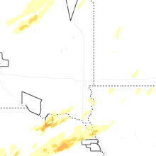
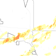
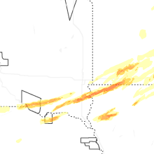


Connect with Interactive Hail Maps