

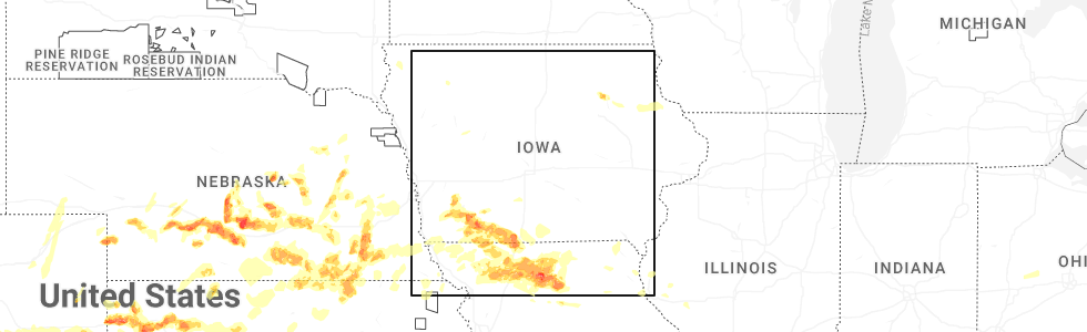
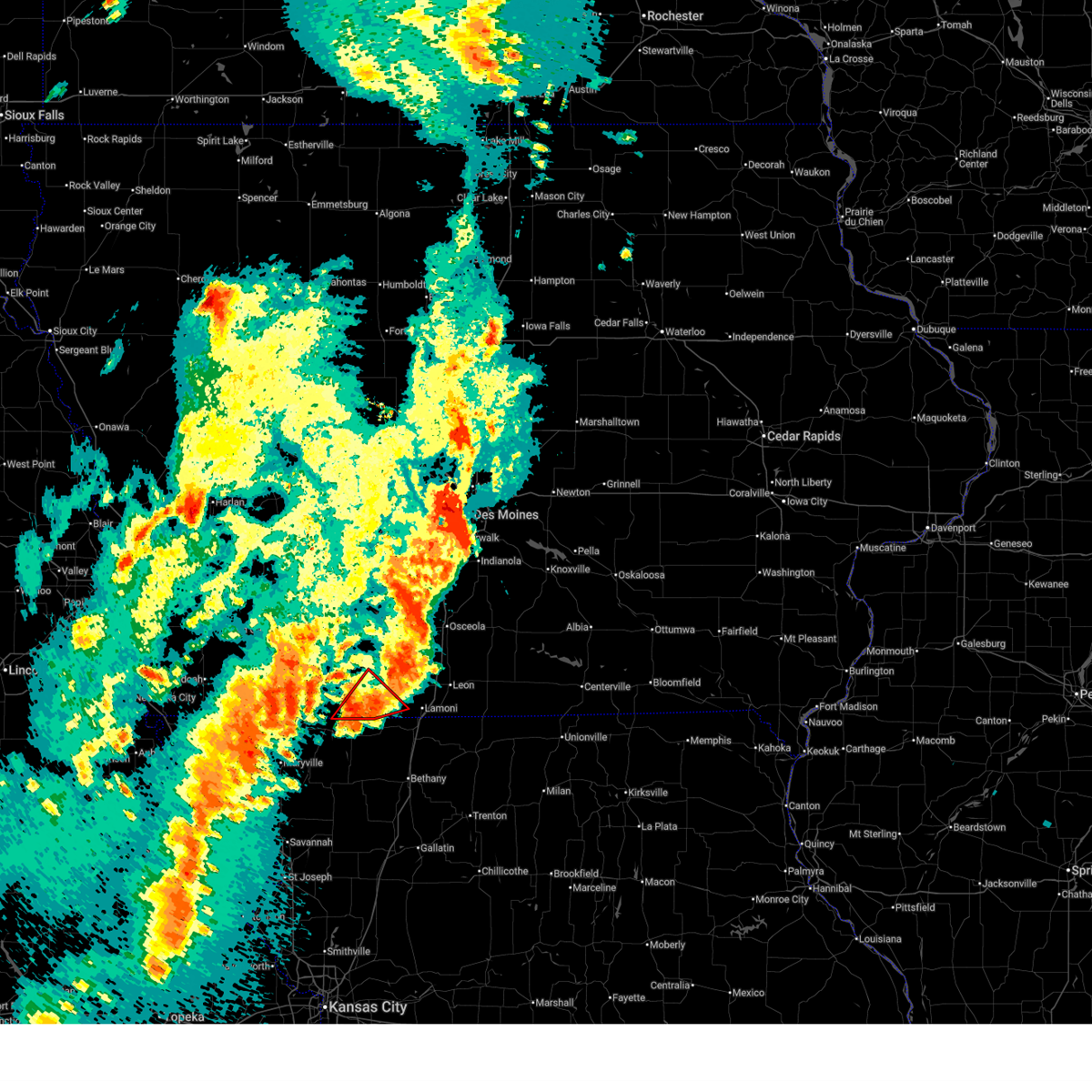
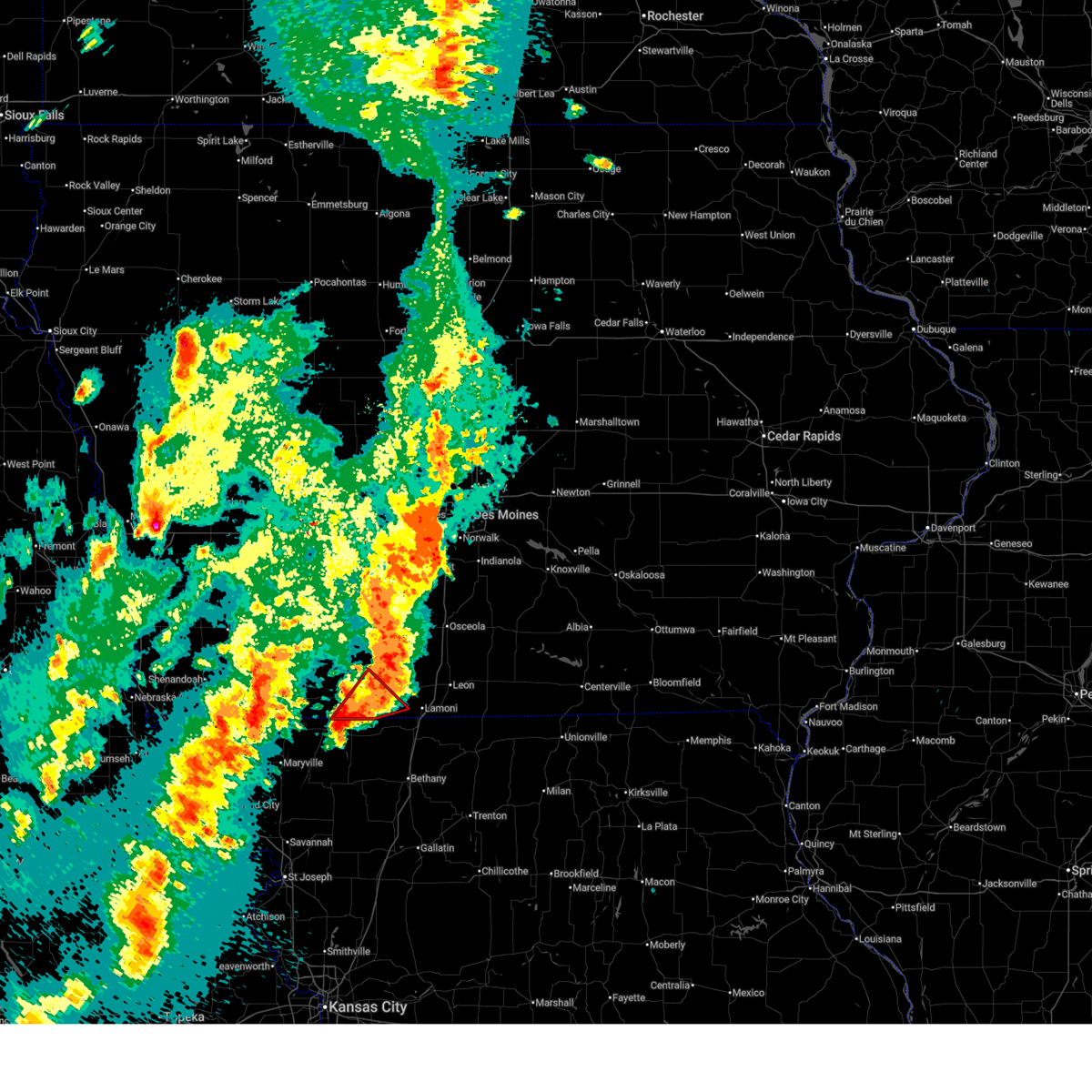
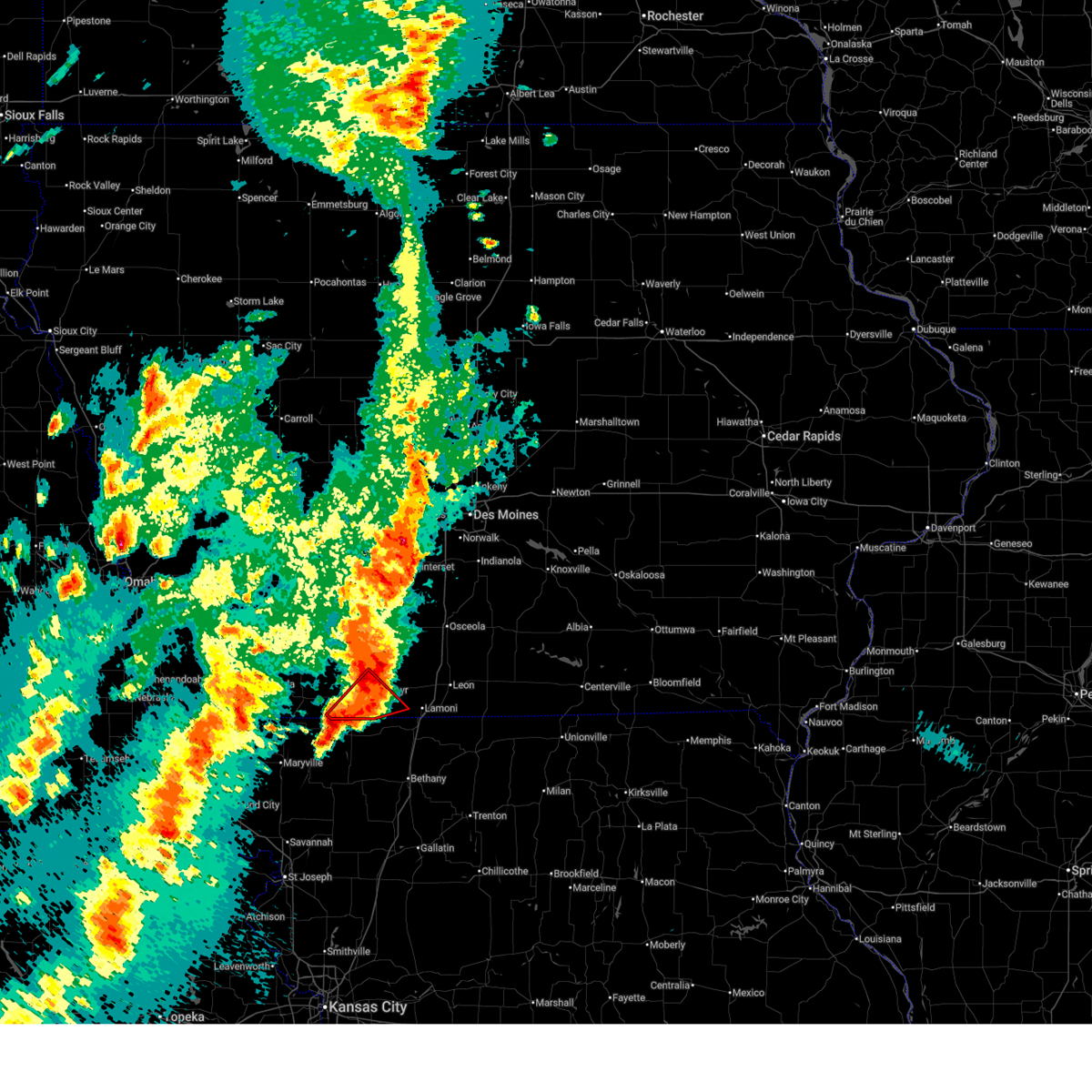
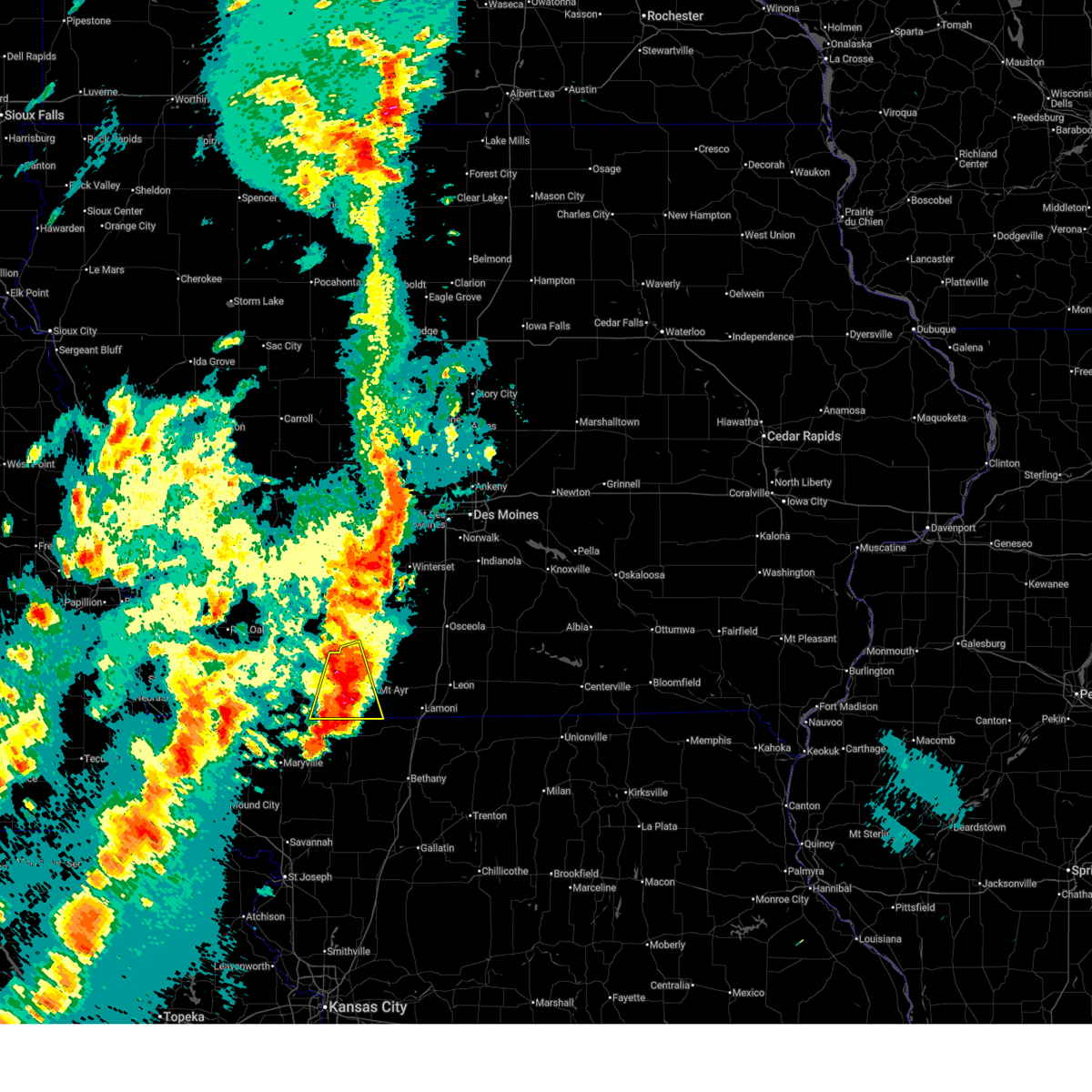
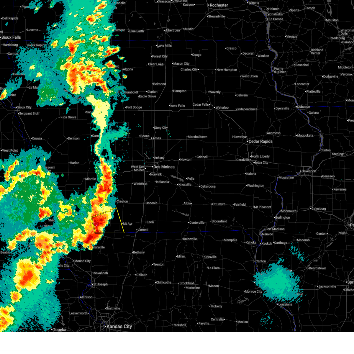
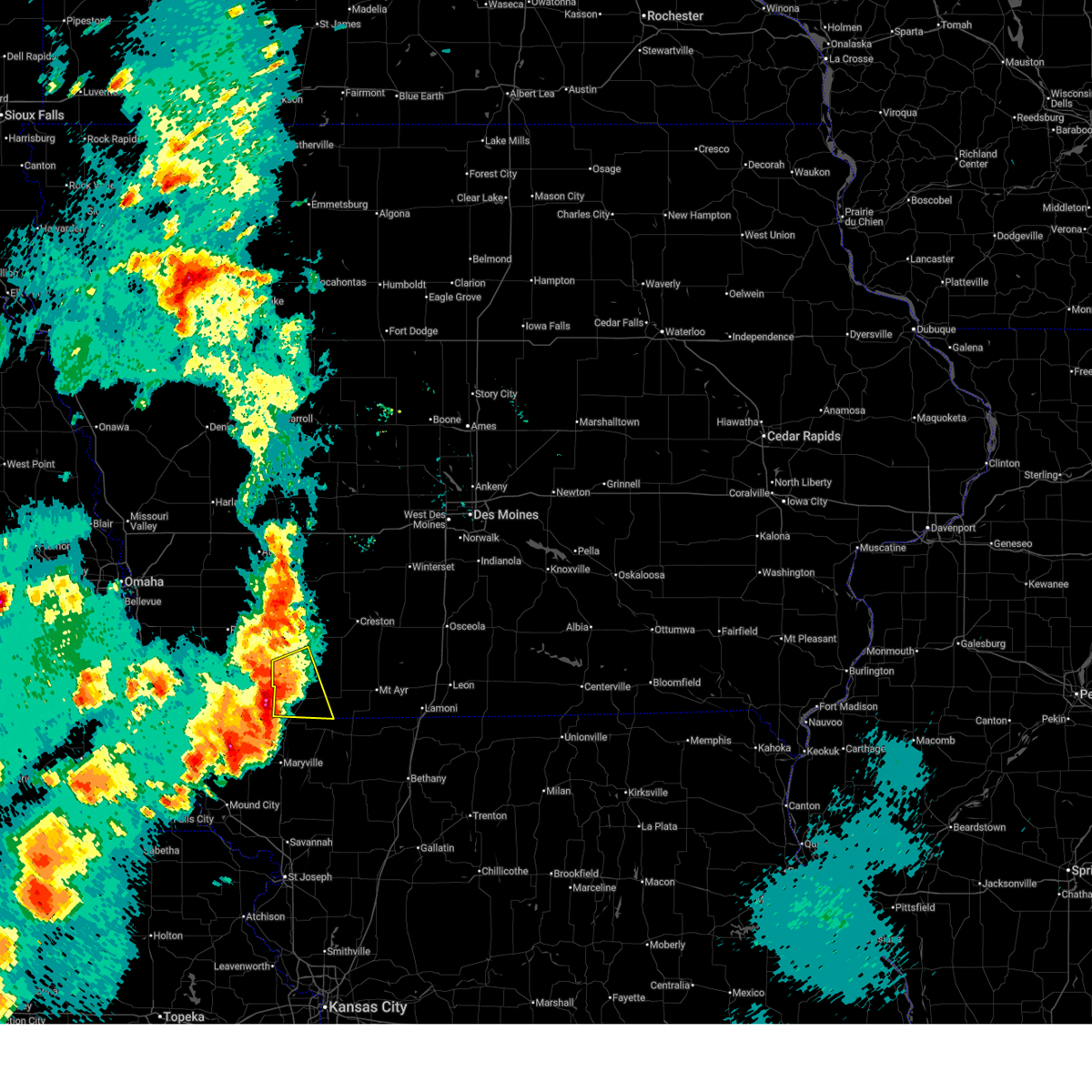
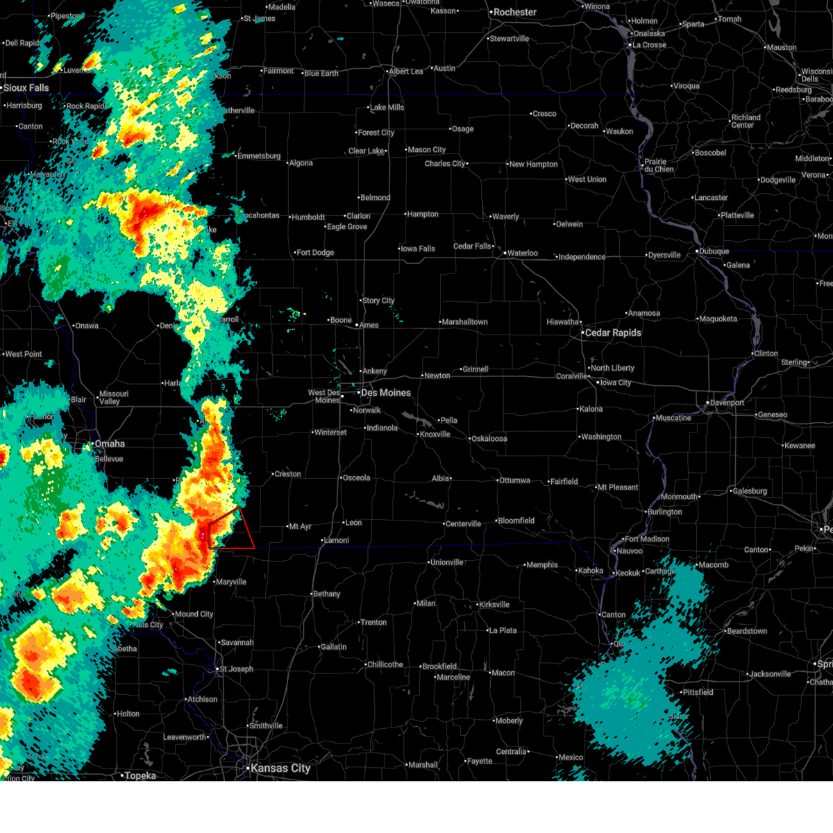
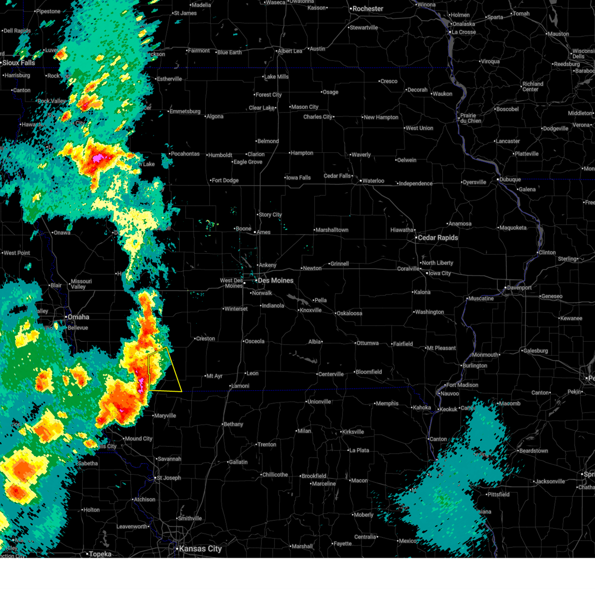
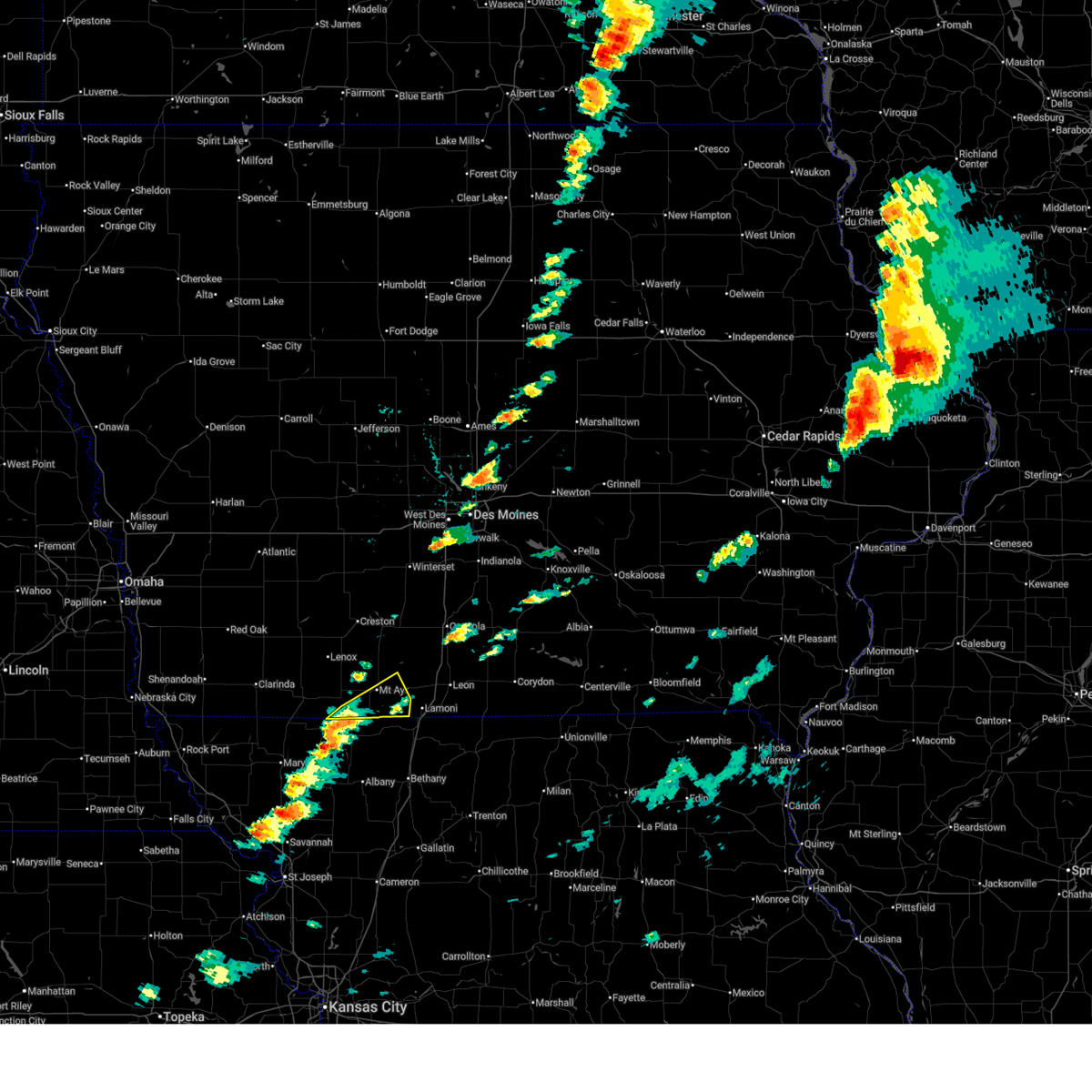
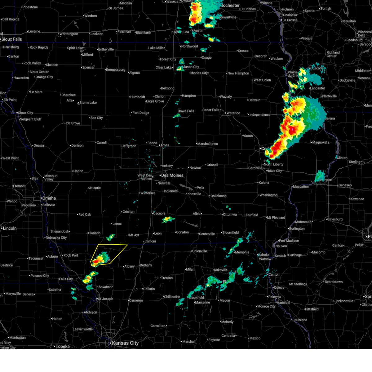
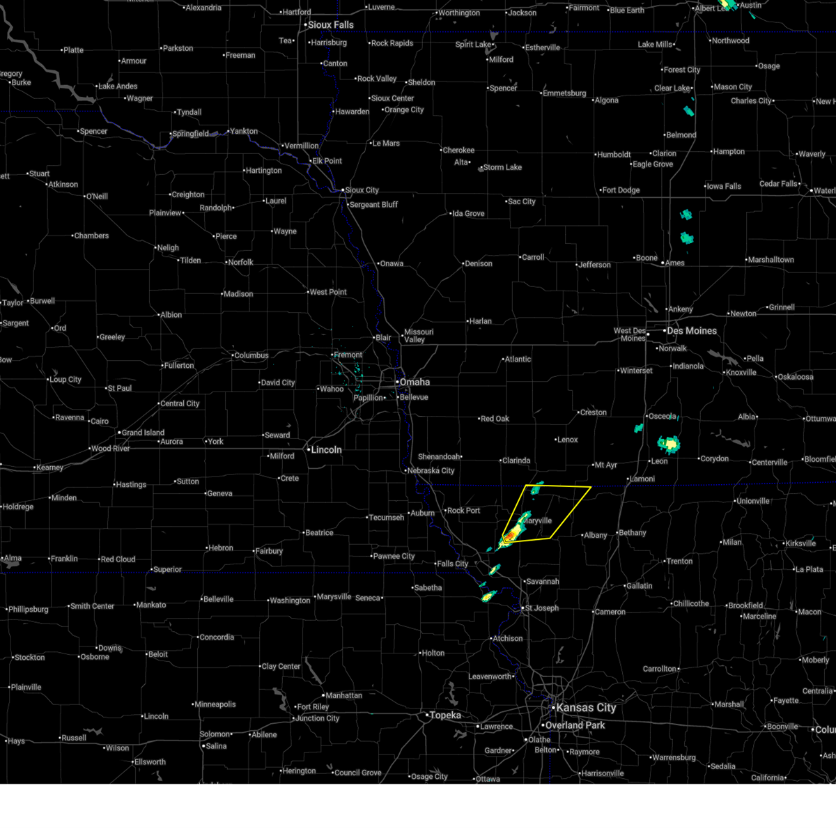
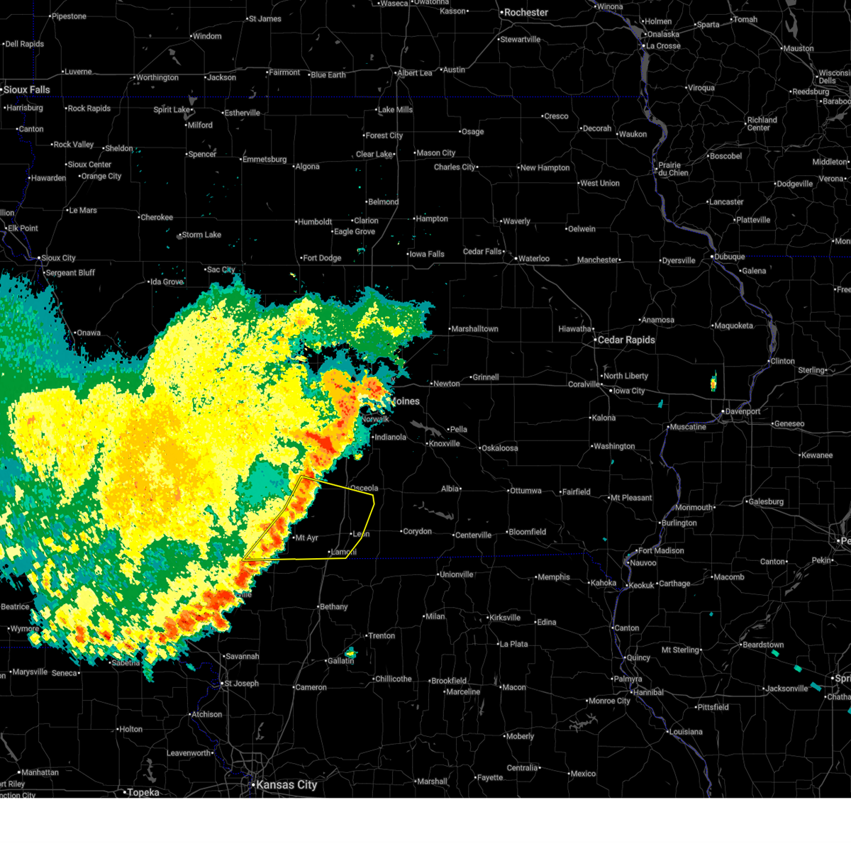
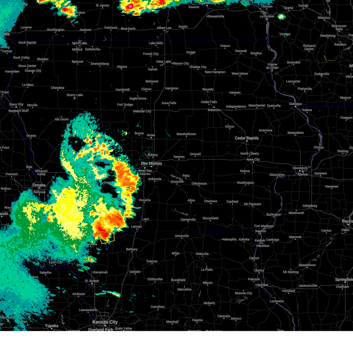
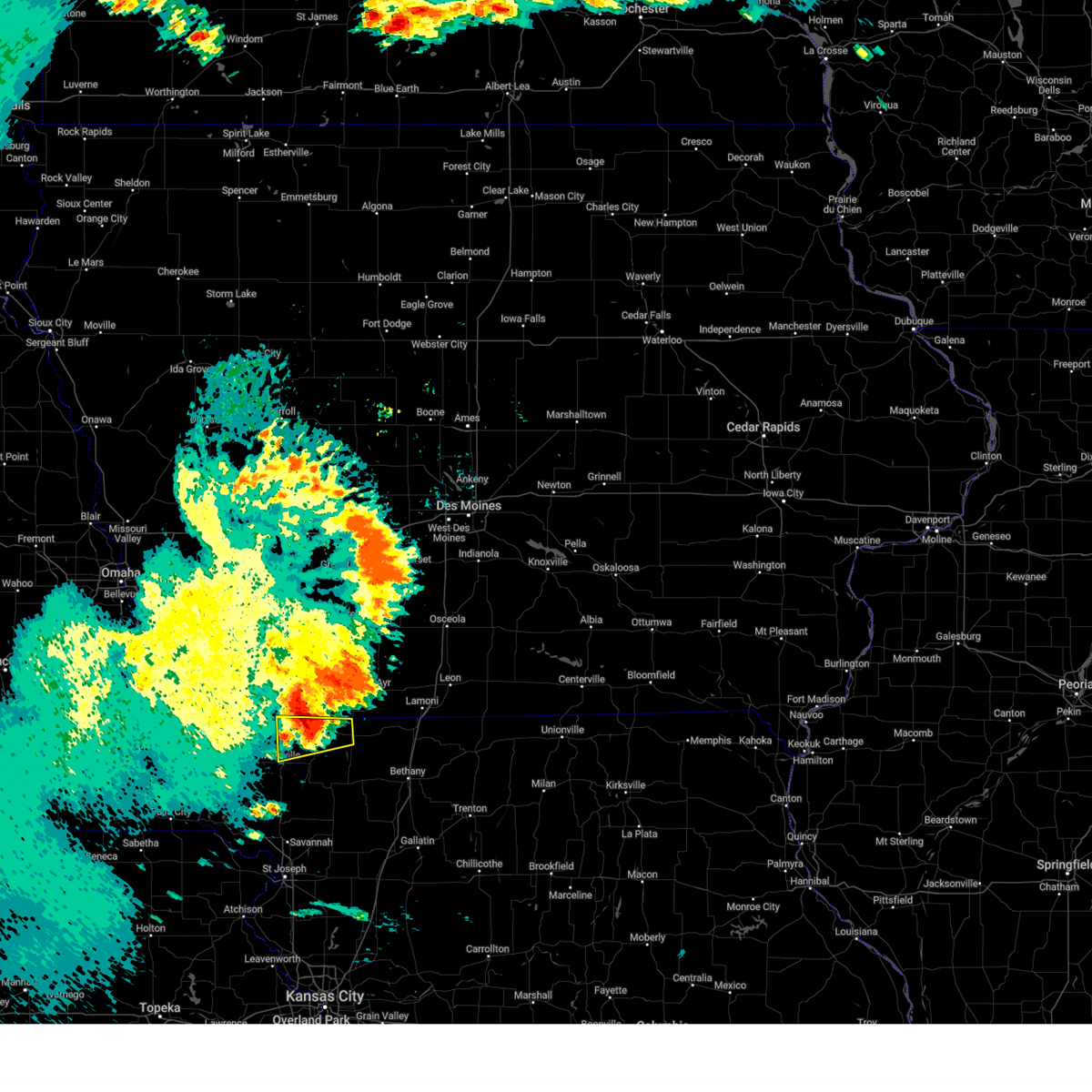
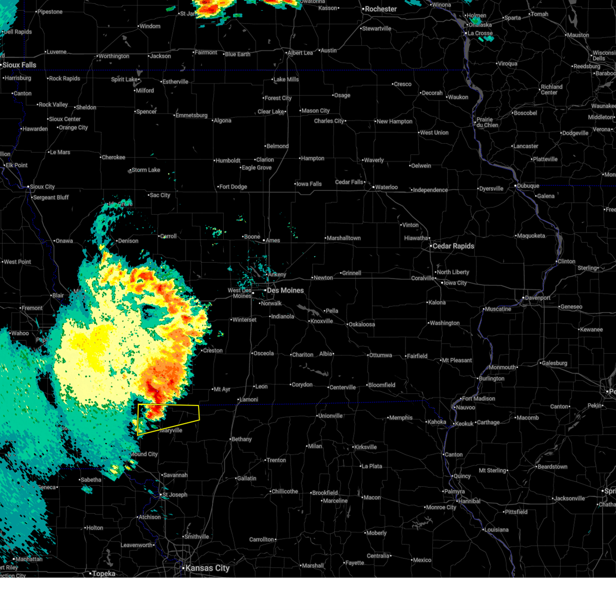
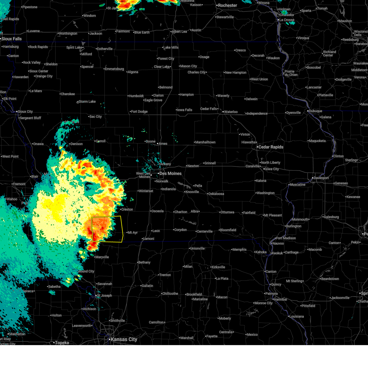
Hail Map for Athelstan, MO
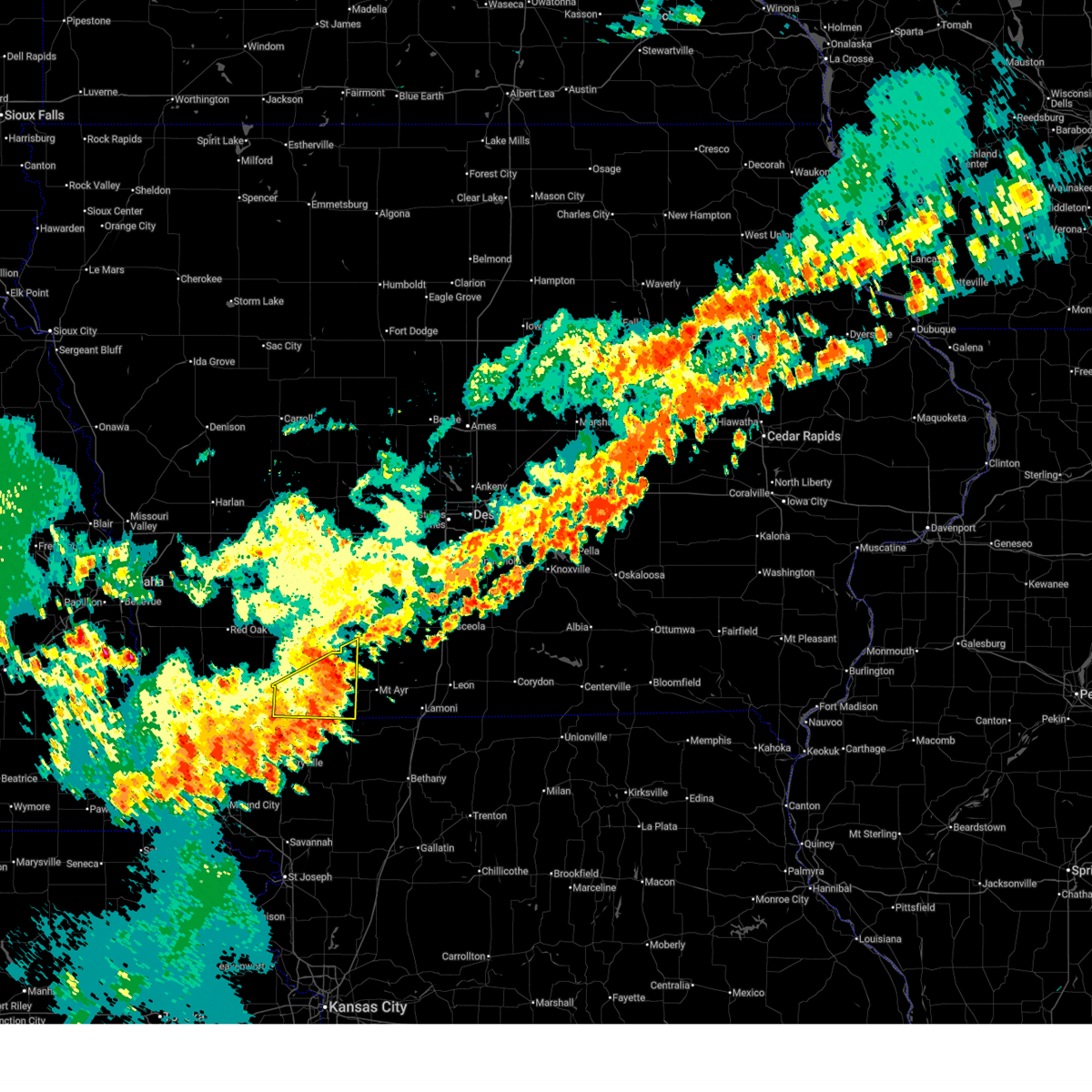
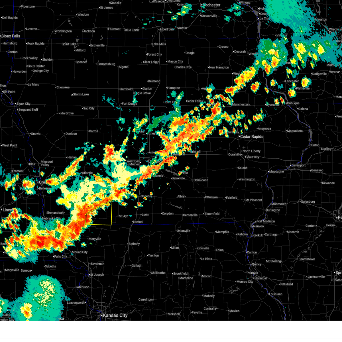
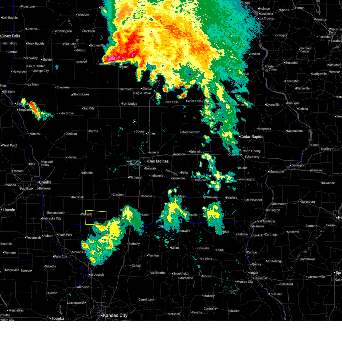
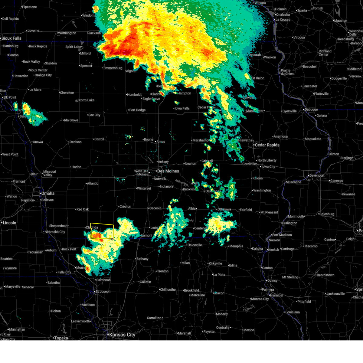
The Athelstan, MO area has had 0 reports of on-the-ground hail by trained spotters, and has been under severe weather warnings 32 times during the past 12 months. Doppler radar has detected hail at or near Athelstan, MO on 81 occasions, including 7 occasions during the past year.
| Name: | Athelstan, MO |
| Where Located: | 85.3 miles SW of Des Moines, IA |
| Map: | Google Map for Athelstan, MO |
| Population: | 19 |
| Housing Units: | 13 |
| More Info: | Search Google for Athelstan, MO |
5
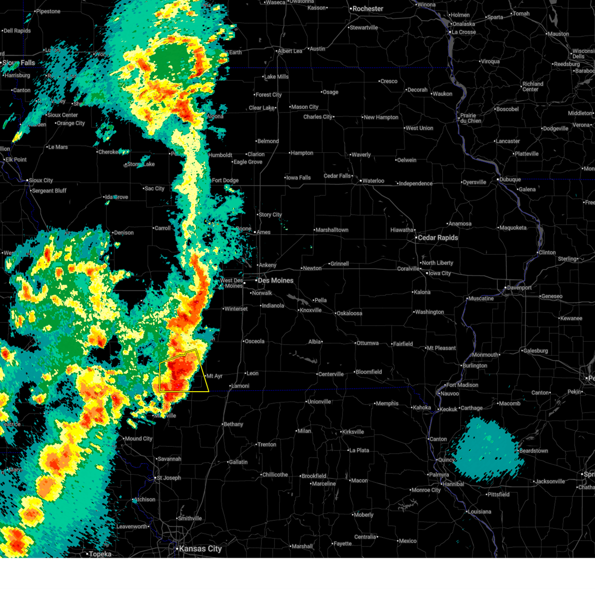
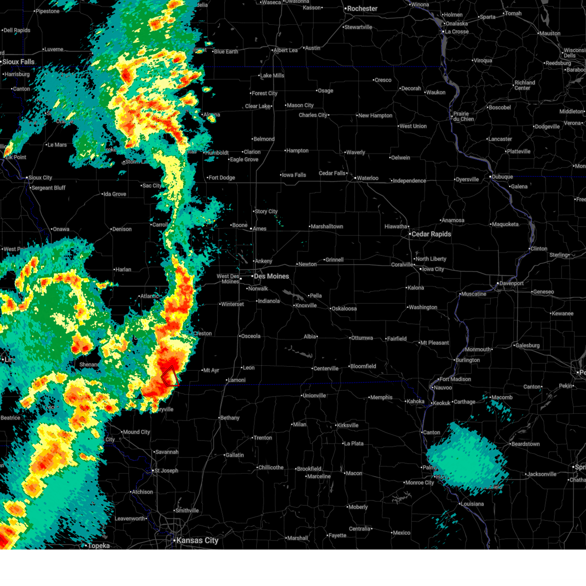
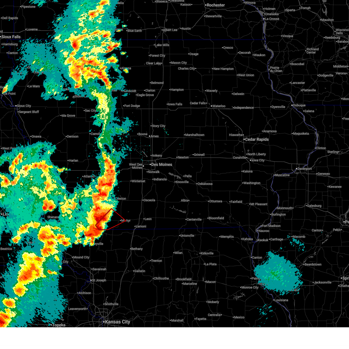
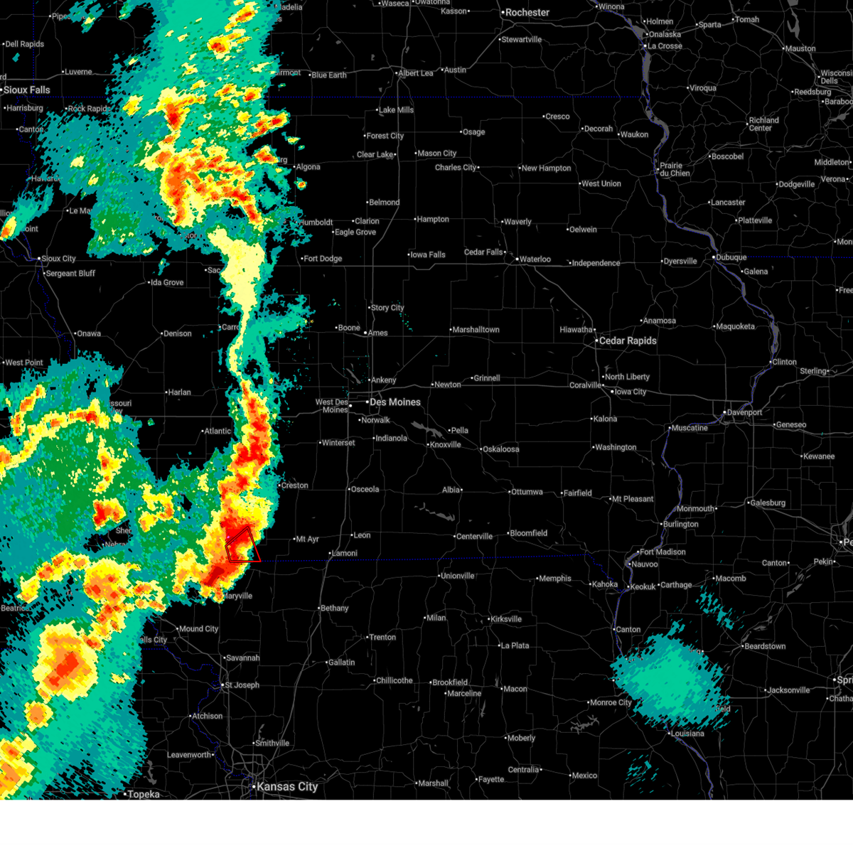
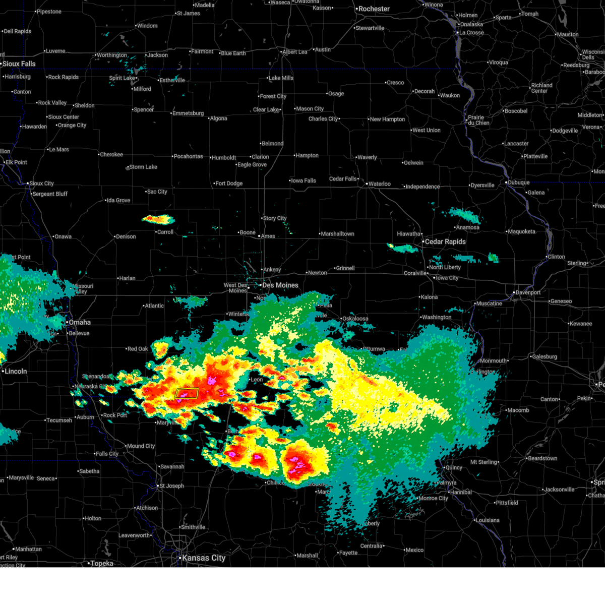
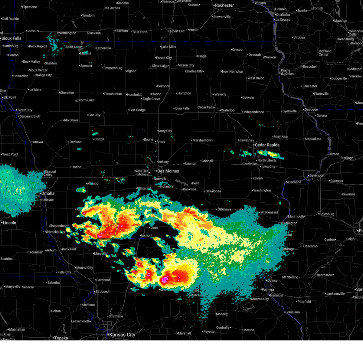
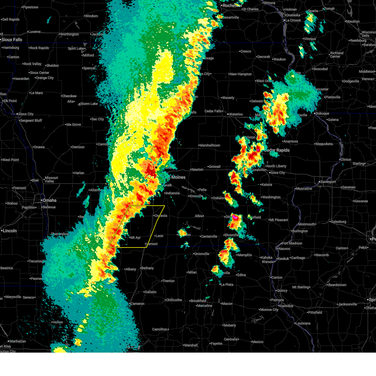
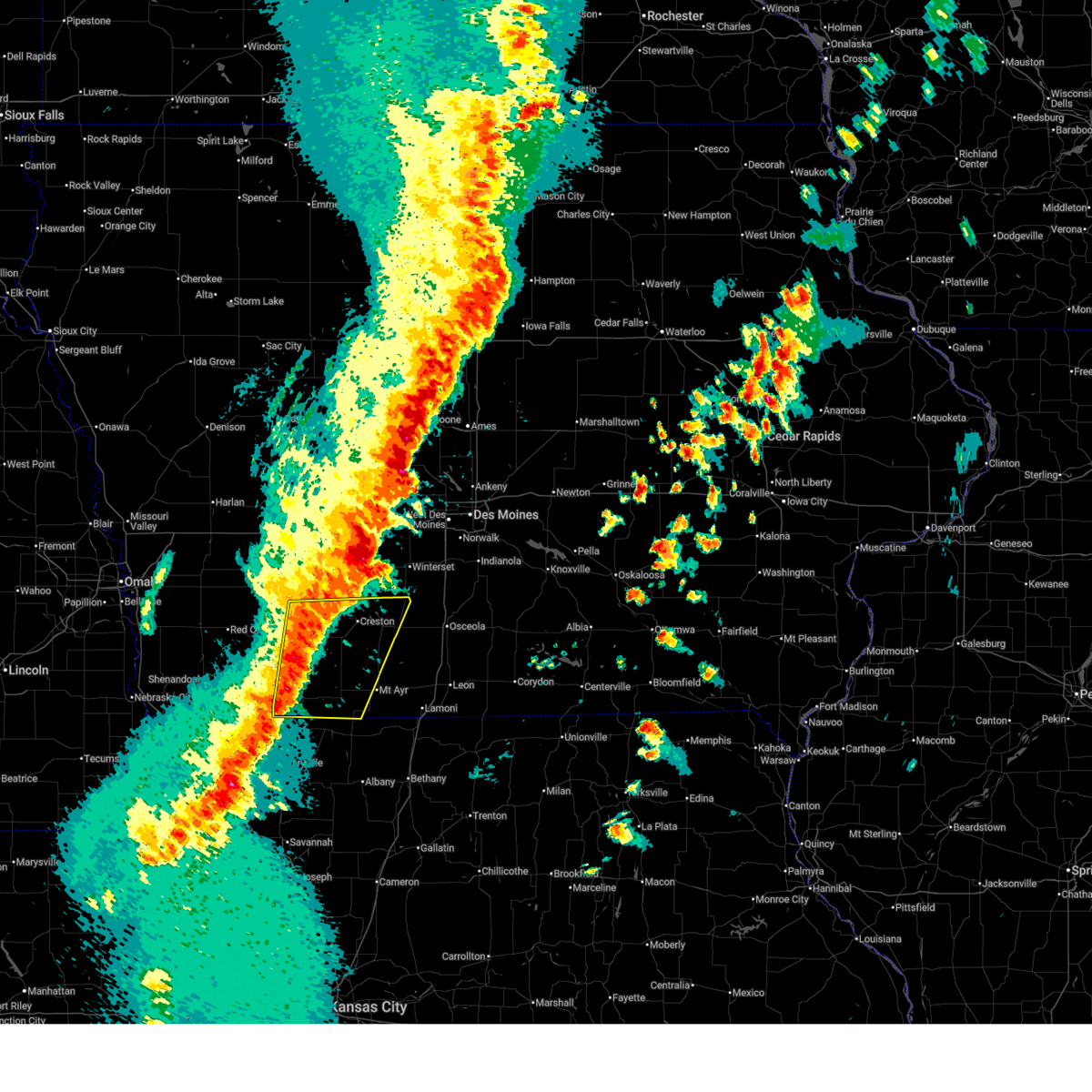
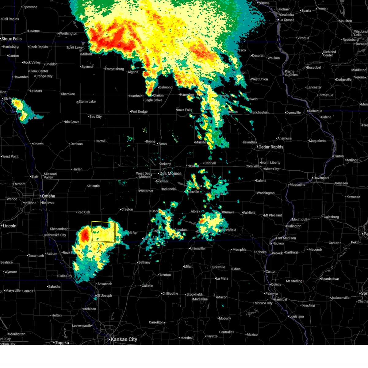
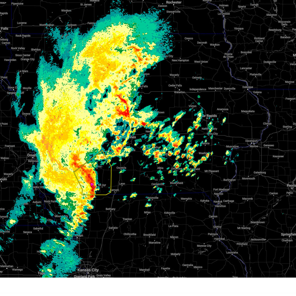
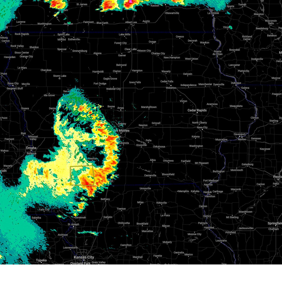
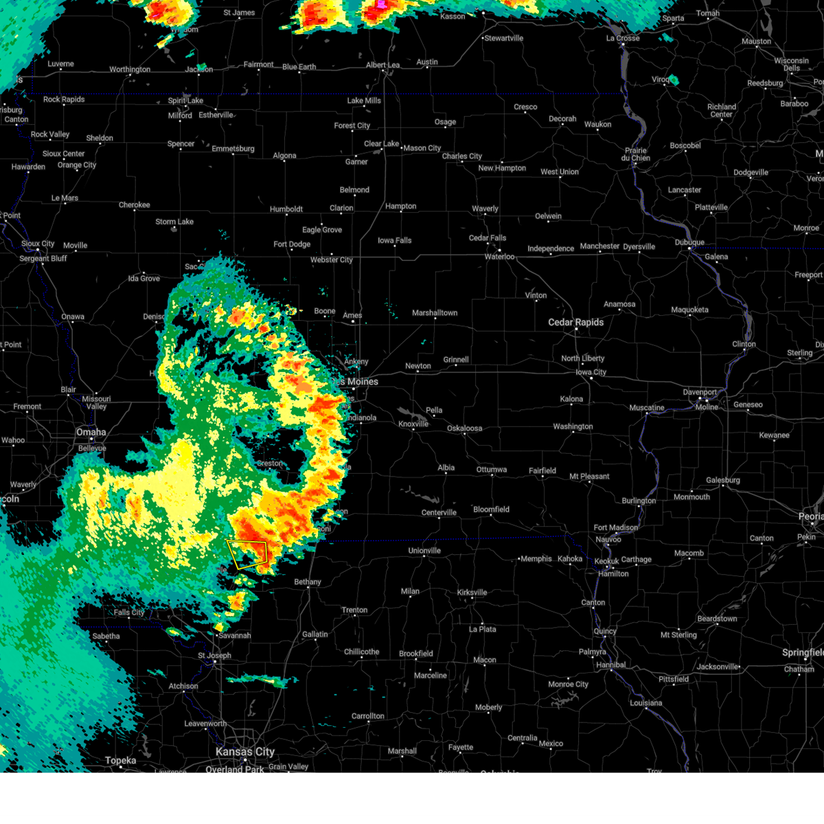
The Top Recent Hail Date for Athelstan, MO is Saturday, May 16, 2026 (2nd out of 81)
Hail and Wind Damage Spotted near Athelstan, MO
| Date / Time | Report Details |
|---|---|
| 6/13/2026 10:40 AM CDT |
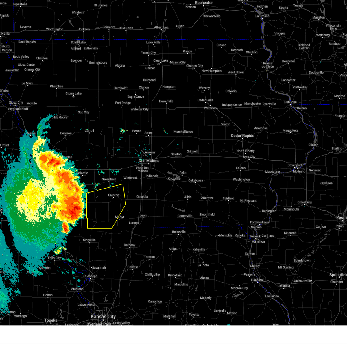
 At 1039 am cdt, severe thunderstorms were located along a line extending from 5 miles southeast of kent to benton to 4 miles southeast of sheridan, moving east at 40 mph (radar indicated). Hazards include 60 mph wind gusts and quarter size hail. Hail damage to vehicles is expected. expect wind damage to roofs, siding, and trees. Locations impacted include, mount ayr, bedford, lenox, clearfield, diagonal, blockton, tingley, sharpsburg, redding, shannon city, conway, benton, maloy, delphos, athelstan, lake of three fires state park, bedford municipal airport, and mt ayr municipal airport. At 1039 am cdt, severe thunderstorms were located along a line extending from 5 miles southeast of kent to benton to 4 miles southeast of sheridan, moving east at 40 mph (radar indicated). Hazards include 60 mph wind gusts and quarter size hail. Hail damage to vehicles is expected. expect wind damage to roofs, siding, and trees. Locations impacted include, mount ayr, bedford, lenox, clearfield, diagonal, blockton, tingley, sharpsburg, redding, shannon city, conway, benton, maloy, delphos, athelstan, lake of three fires state park, bedford municipal airport, and mt ayr municipal airport.
|
| 6/13/2026 10:18 AM CDT |
 Svrdmx the national weather service in des moines has issued a * severe thunderstorm warning for, southwestern union county in south central iowa, ringgold county in south central iowa, southeastern adams county in southwestern iowa, taylor county in southwestern iowa, * until 1100 am cdt. * at 1018 am cdt, severe thunderstorms were located along a line extending from near prescott to sharpsburg to near hopkins, moving east at 40 mph (radar indicated). Hazards include 60 mph wind gusts and quarter size hail. Hail damage to vehicles is expected. Expect wind damage to roofs, siding, and trees. Svrdmx the national weather service in des moines has issued a * severe thunderstorm warning for, southwestern union county in south central iowa, ringgold county in south central iowa, southeastern adams county in southwestern iowa, taylor county in southwestern iowa, * until 1100 am cdt. * at 1018 am cdt, severe thunderstorms were located along a line extending from near prescott to sharpsburg to near hopkins, moving east at 40 mph (radar indicated). Hazards include 60 mph wind gusts and quarter size hail. Hail damage to vehicles is expected. Expect wind damage to roofs, siding, and trees.
|
| 6/11/2026 6:32 AM CDT |
 Svreax the national weather service in pleasant hill has issued a * severe thunderstorm warning for, western worth county in northwestern missouri, northern nodaway county in northwestern missouri, * until 715 am cdt. * at 632 am cdt, severe thunderstorms were located along a line extending from 7 miles southeast of clarinda to near shambaugh to near blanchard, moving east at 55 mph (radar indicated). Hazards include 60 mph wind gusts and quarter size hail. Hail damage to vehicles is expected. Expect wind damage to roofs, siding, and trees. Svreax the national weather service in pleasant hill has issued a * severe thunderstorm warning for, western worth county in northwestern missouri, northern nodaway county in northwestern missouri, * until 715 am cdt. * at 632 am cdt, severe thunderstorms were located along a line extending from 7 miles southeast of clarinda to near shambaugh to near blanchard, moving east at 55 mph (radar indicated). Hazards include 60 mph wind gusts and quarter size hail. Hail damage to vehicles is expected. Expect wind damage to roofs, siding, and trees.
|
| 5/18/2026 7:48 PM CDT |
 At 748 pm cdt, a severe thunderstorm capable of producing a tornado was located over redding, or 10 miles southwest of mount ayr, moving northeast at 20 mph (radar indicated rotation). Hazards include tornado. Flying debris will be dangerous to those caught without shelter. mobile homes will be damaged or destroyed. damage to roofs, windows, and vehicles will occur. tree damage is likely. this dangerous storm will be near, delphos around 755 pm cdt. mount ayr and mt ayr municipal airport around 805 pm cdt. Other locations impacted by this tornadic thunderstorm include delphos, redding, maloy, mt ayr municipal airport, benton, blockton, and athelstan. At 748 pm cdt, a severe thunderstorm capable of producing a tornado was located over redding, or 10 miles southwest of mount ayr, moving northeast at 20 mph (radar indicated rotation). Hazards include tornado. Flying debris will be dangerous to those caught without shelter. mobile homes will be damaged or destroyed. damage to roofs, windows, and vehicles will occur. tree damage is likely. this dangerous storm will be near, delphos around 755 pm cdt. mount ayr and mt ayr municipal airport around 805 pm cdt. Other locations impacted by this tornadic thunderstorm include delphos, redding, maloy, mt ayr municipal airport, benton, blockton, and athelstan.
|
| 5/18/2026 7:28 PM CDT |
 At 728 pm cdt, a severe thunderstorm capable of producing a tornado was located over grant city, or 17 miles southwest of mount ayr, moving northeast at 20 mph (radar indicated rotation). Hazards include tornado. Flying debris will be dangerous to those caught without shelter. mobile homes will be damaged or destroyed. damage to roofs, windows, and vehicles will occur. tree damage is likely. this dangerous storm will be near, redding around 735 pm cdt. delphos around 750 pm cdt. Other locations impacted by this tornadic thunderstorm include delphos, redding, maloy, mt ayr municipal airport, benton, blockton, and athelstan. At 728 pm cdt, a severe thunderstorm capable of producing a tornado was located over grant city, or 17 miles southwest of mount ayr, moving northeast at 20 mph (radar indicated rotation). Hazards include tornado. Flying debris will be dangerous to those caught without shelter. mobile homes will be damaged or destroyed. damage to roofs, windows, and vehicles will occur. tree damage is likely. this dangerous storm will be near, redding around 735 pm cdt. delphos around 750 pm cdt. Other locations impacted by this tornadic thunderstorm include delphos, redding, maloy, mt ayr municipal airport, benton, blockton, and athelstan.
|
| 5/18/2026 7:16 PM CDT |
 Tordmx the national weather service in des moines has issued a * tornado warning for, southern ringgold county in south central iowa, southeastern taylor county in southwestern iowa, * until 800 pm cdt. * at 716 pm cdt, a severe thunderstorm capable of producing a tornado was located over blockton, or 14 miles southeast of bedford, moving northeast at 30 mph (radar indicated rotation). Hazards include tornado. Flying debris will be dangerous to those caught without shelter. mobile homes will be damaged or destroyed. damage to roofs, windows, and vehicles will occur. tree damage is likely. this dangerous storm will be near, blockton and redding around 720 pm cdt. maloy and delphos around 725 pm cdt. benton around 730 pm cdt. mount ayr around 740 pm cdt. mt ayr municipal airport around 745 pm cdt. Other locations impacted by this tornadic thunderstorm include delphos, redding, maloy, mt ayr municipal airport, benton, blockton, and athelstan. Tordmx the national weather service in des moines has issued a * tornado warning for, southern ringgold county in south central iowa, southeastern taylor county in southwestern iowa, * until 800 pm cdt. * at 716 pm cdt, a severe thunderstorm capable of producing a tornado was located over blockton, or 14 miles southeast of bedford, moving northeast at 30 mph (radar indicated rotation). Hazards include tornado. Flying debris will be dangerous to those caught without shelter. mobile homes will be damaged or destroyed. damage to roofs, windows, and vehicles will occur. tree damage is likely. this dangerous storm will be near, blockton and redding around 720 pm cdt. maloy and delphos around 725 pm cdt. benton around 730 pm cdt. mount ayr around 740 pm cdt. mt ayr municipal airport around 745 pm cdt. Other locations impacted by this tornadic thunderstorm include delphos, redding, maloy, mt ayr municipal airport, benton, blockton, and athelstan.
|
| 5/18/2026 6:58 PM CDT |
 At 658 pm cdt, a severe thunderstorm was located near clearfield, or 10 miles west of mount ayr, moving northeast at 35 mph (radar indicated). Hazards include 60 mph wind gusts and quarter size hail. Hail damage to vehicles is expected. expect wind damage to roofs, siding, and trees. Locations impacted include, mount ayr, lenox, clearfield, diagonal, blockton, redding, benton, maloy, delphos, and athelstan. At 658 pm cdt, a severe thunderstorm was located near clearfield, or 10 miles west of mount ayr, moving northeast at 35 mph (radar indicated). Hazards include 60 mph wind gusts and quarter size hail. Hail damage to vehicles is expected. expect wind damage to roofs, siding, and trees. Locations impacted include, mount ayr, lenox, clearfield, diagonal, blockton, redding, benton, maloy, delphos, and athelstan.
|
| 5/18/2026 6:44 PM CDT |
 At 644 pm cdt, a severe thunderstorm was located near conway, or 7 miles east of bedford, moving northeast at 30 mph (radar indicated). Hazards include 60 mph wind gusts and half dollar size hail. Hail damage to vehicles is expected. expect wind damage to roofs, siding, and trees. Locations impacted include, mount ayr, bedford, lenox, clearfield, diagonal, blockton, gravity, sharpsburg, redding, conway, benton, maloy, delphos, athelstan, lake of three fires state park, and bedford municipal airport. At 644 pm cdt, a severe thunderstorm was located near conway, or 7 miles east of bedford, moving northeast at 30 mph (radar indicated). Hazards include 60 mph wind gusts and half dollar size hail. Hail damage to vehicles is expected. expect wind damage to roofs, siding, and trees. Locations impacted include, mount ayr, bedford, lenox, clearfield, diagonal, blockton, gravity, sharpsburg, redding, conway, benton, maloy, delphos, athelstan, lake of three fires state park, and bedford municipal airport.
|
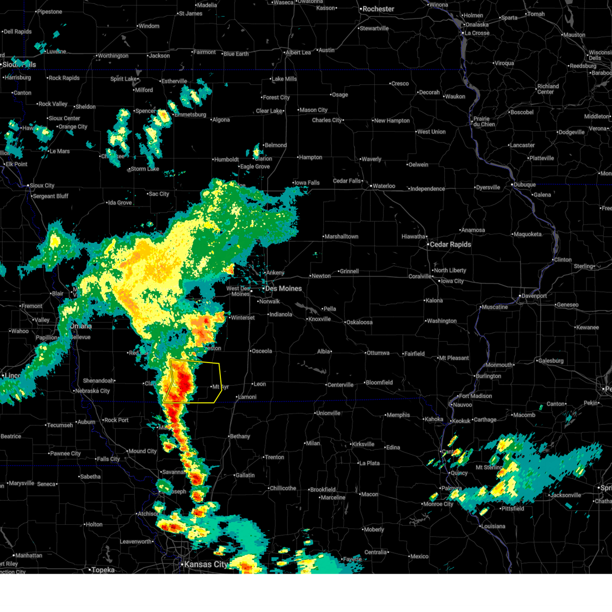
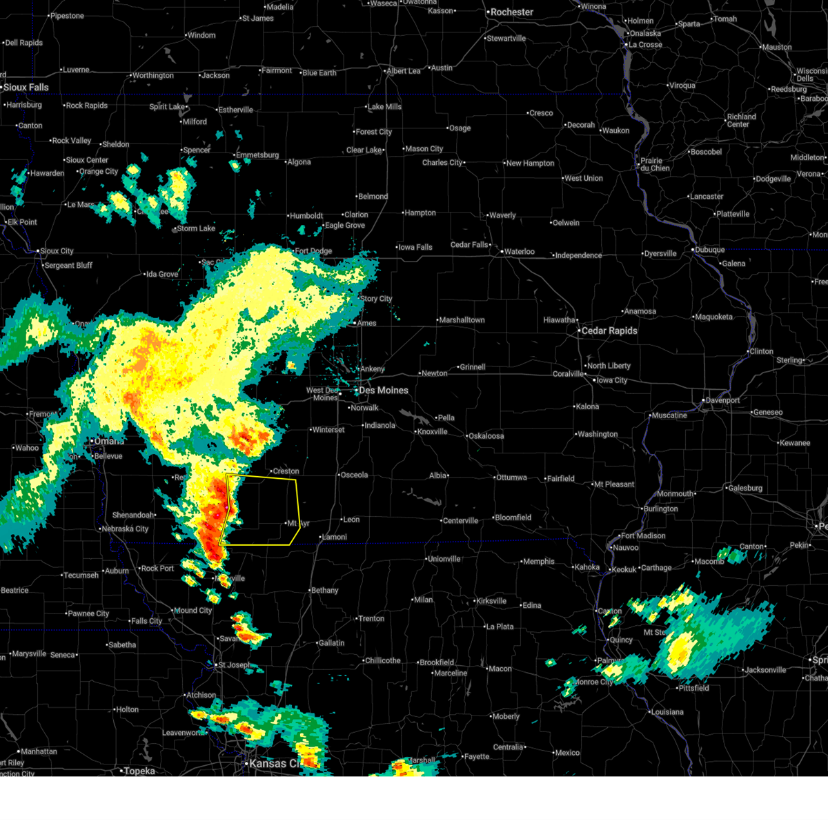
| 5/18/2026 6:33 PM CDT |
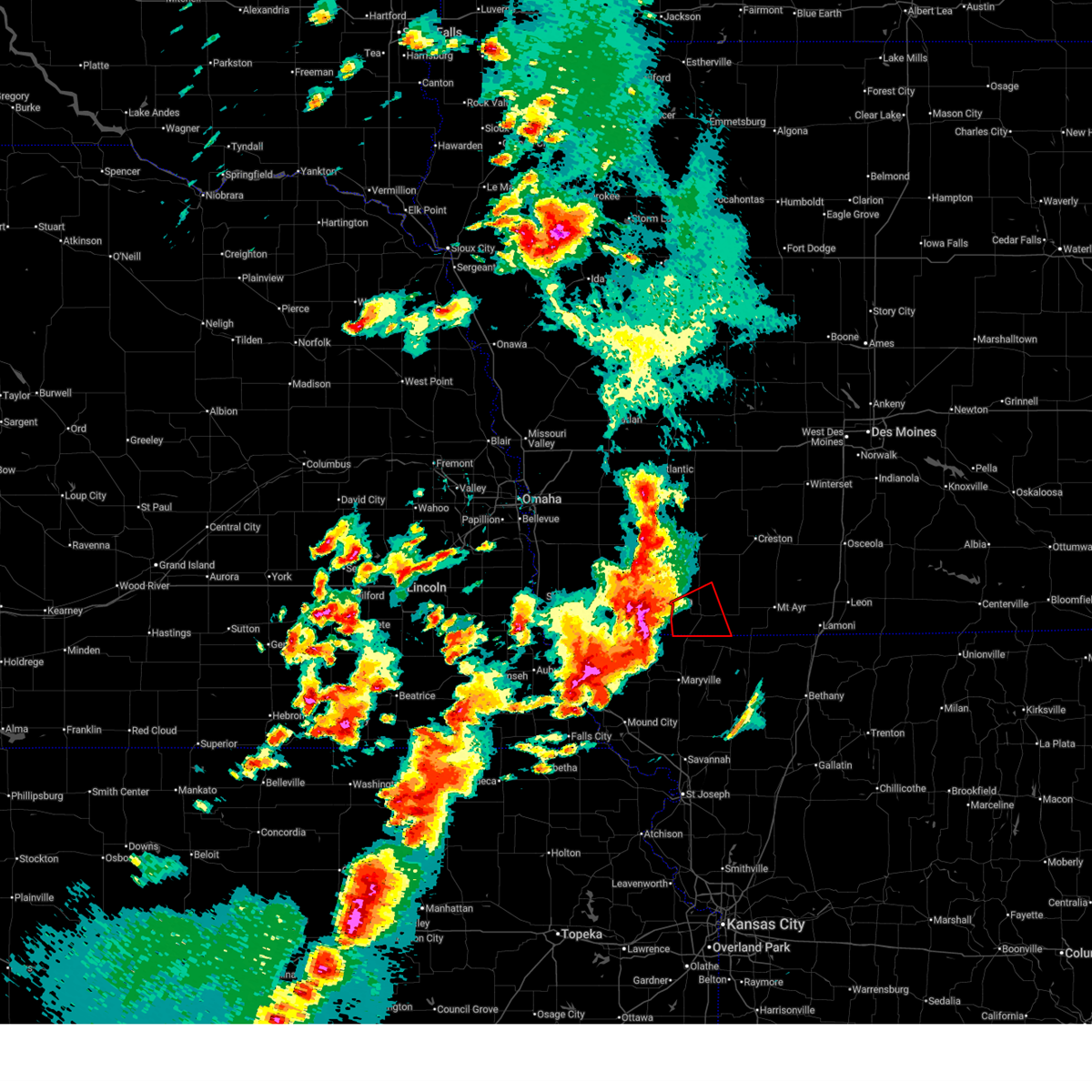
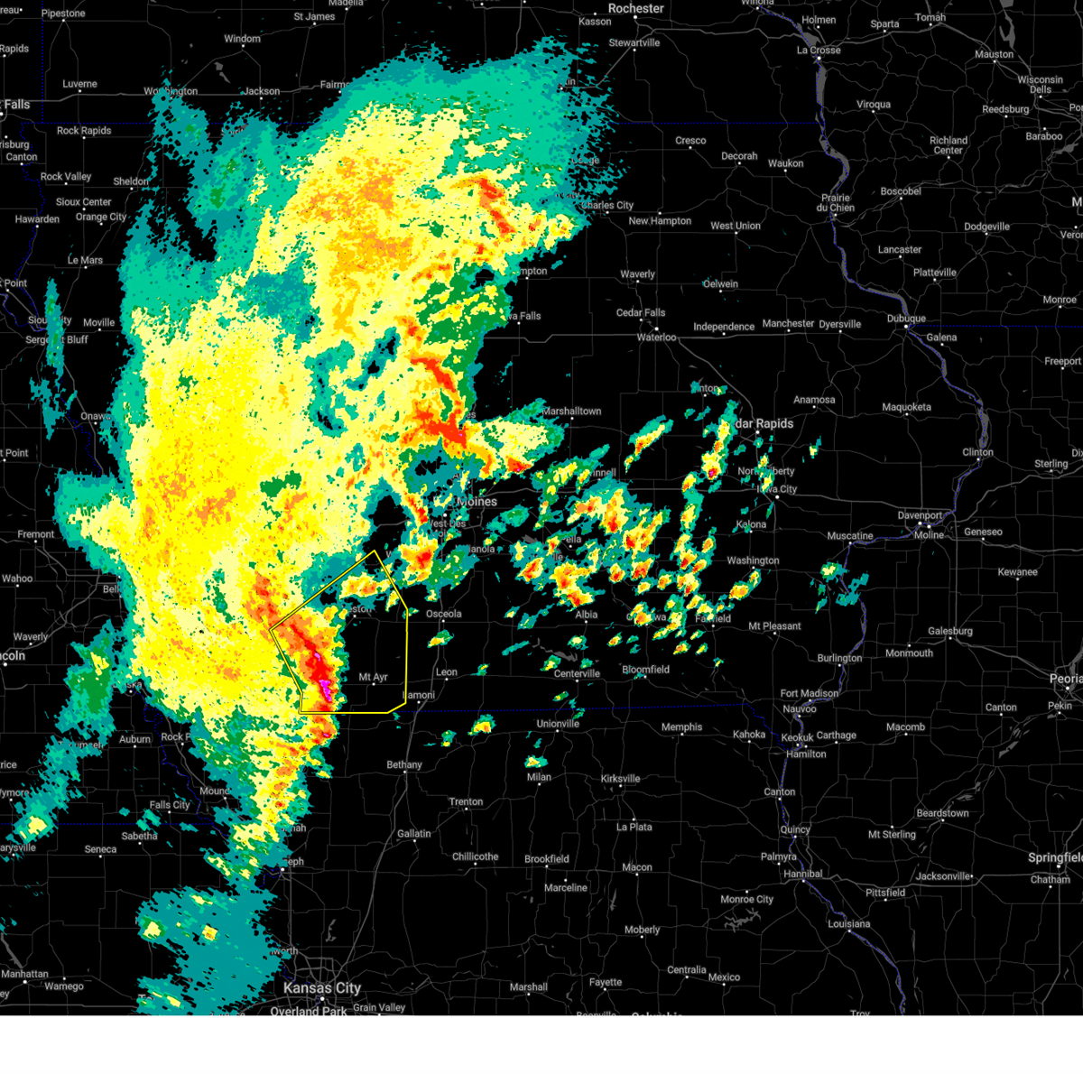
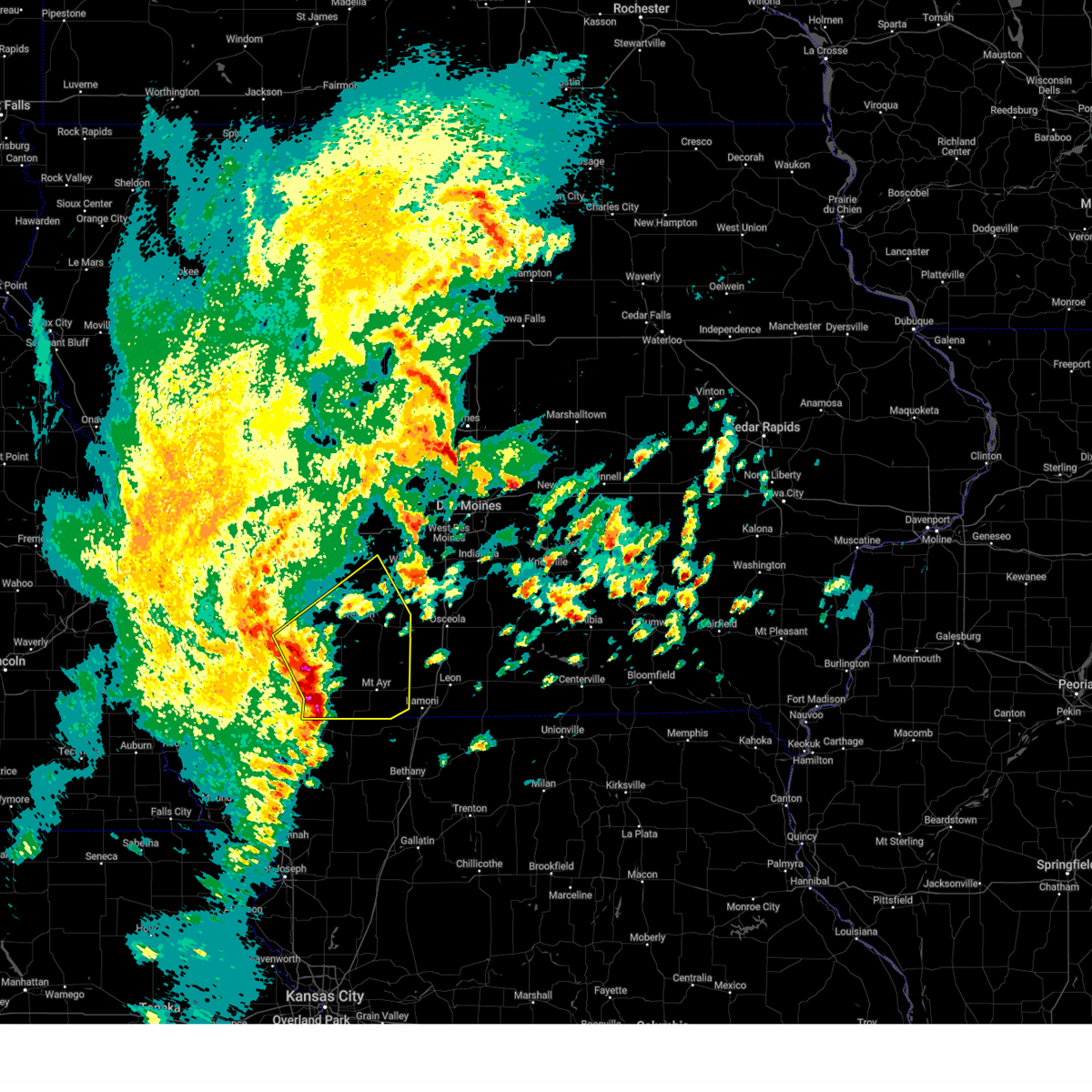
 At 633 pm cdt, a severe thunderstorm capable of producing a tornado was located near athelstan, or 7 miles southeast of bedford, moving east at 25 mph (radar indicated rotation). Hazards include tornado and half dollar size hail. Flying debris will be dangerous to those caught without shelter. mobile homes will be damaged or destroyed. damage to roofs, windows, and vehicles will occur. tree damage is likely. Locations impacted include, bedford, athelstan, and bedford municipal airport. At 633 pm cdt, a severe thunderstorm capable of producing a tornado was located near athelstan, or 7 miles southeast of bedford, moving east at 25 mph (radar indicated rotation). Hazards include tornado and half dollar size hail. Flying debris will be dangerous to those caught without shelter. mobile homes will be damaged or destroyed. damage to roofs, windows, and vehicles will occur. tree damage is likely. Locations impacted include, bedford, athelstan, and bedford municipal airport.
|
| 5/18/2026 6:31 PM CDT |
 Tordmx the national weather service in des moines has issued a * tornado warning for, western ringgold county in south central iowa, southeastern taylor county in southwestern iowa, * until 730 pm cdt. * at 631 pm cdt, a severe thunderstorm capable of producing a tornado was located near athelstan, or 7 miles southeast of bedford, moving northeast at 30 mph (radar indicated rotation). Hazards include tornado and half dollar size hail. Flying debris will be dangerous to those caught without shelter. mobile homes will be damaged or destroyed. damage to roofs, windows, and vehicles will occur. tree damage is likely. this dangerous storm will be near, athelstan and athelstan around 635 pm cdt. blockton around 640 pm cdt. maloy around 645 pm cdt. benton around 650 pm cdt. diagonal around 705 pm cdt. Other locations impacted by this tornadic thunderstorm include delphos, diagonal, maloy, mt ayr municipal airport, benton, blockton, athelstan, clearfield, bedford municipal airport, and redding. Tordmx the national weather service in des moines has issued a * tornado warning for, western ringgold county in south central iowa, southeastern taylor county in southwestern iowa, * until 730 pm cdt. * at 631 pm cdt, a severe thunderstorm capable of producing a tornado was located near athelstan, or 7 miles southeast of bedford, moving northeast at 30 mph (radar indicated rotation). Hazards include tornado and half dollar size hail. Flying debris will be dangerous to those caught without shelter. mobile homes will be damaged or destroyed. damage to roofs, windows, and vehicles will occur. tree damage is likely. this dangerous storm will be near, athelstan and athelstan around 635 pm cdt. blockton around 640 pm cdt. maloy around 645 pm cdt. benton around 650 pm cdt. diagonal around 705 pm cdt. Other locations impacted by this tornadic thunderstorm include delphos, diagonal, maloy, mt ayr municipal airport, benton, blockton, athelstan, clearfield, bedford municipal airport, and redding.
|
| 5/18/2026 6:24 PM CDT |
 At 624 pm cdt, a severe thunderstorm capable of producing a tornado was located near bedford municipal airport, or 5 miles southeast of bedford, moving northeast at 30 mph (radar indicated rotation). Hazards include tornado and ping pong ball size hail. Flying debris will be dangerous to those caught without shelter. mobile homes will be damaged or destroyed. damage to roofs, windows, and vehicles will occur. tree damage is likely. This tornadic thunderstorm will remain over mainly rural areas of southeastern taylor county, including the following locations, conway, athelstan, lake of three fires state park, and bedford municipal airport. At 624 pm cdt, a severe thunderstorm capable of producing a tornado was located near bedford municipal airport, or 5 miles southeast of bedford, moving northeast at 30 mph (radar indicated rotation). Hazards include tornado and ping pong ball size hail. Flying debris will be dangerous to those caught without shelter. mobile homes will be damaged or destroyed. damage to roofs, windows, and vehicles will occur. tree damage is likely. This tornadic thunderstorm will remain over mainly rural areas of southeastern taylor county, including the following locations, conway, athelstan, lake of three fires state park, and bedford municipal airport.
|
| 5/18/2026 6:22 PM CDT |
 Svrdmx the national weather service in des moines has issued a * severe thunderstorm warning for, southwestern union county in south central iowa, western ringgold county in south central iowa, taylor county in southwestern iowa, * until 715 pm cdt. * at 622 pm cdt, a severe thunderstorm was located over bedford, moving east at 35 mph (radar indicated). Hazards include ping pong ball size hail and 60 mph wind gusts. People and animals outdoors will be injured. expect hail damage to roofs, siding, windows, and vehicles. Expect wind damage to roofs, siding, and trees. Svrdmx the national weather service in des moines has issued a * severe thunderstorm warning for, southwestern union county in south central iowa, western ringgold county in south central iowa, taylor county in southwestern iowa, * until 715 pm cdt. * at 622 pm cdt, a severe thunderstorm was located over bedford, moving east at 35 mph (radar indicated). Hazards include ping pong ball size hail and 60 mph wind gusts. People and animals outdoors will be injured. expect hail damage to roofs, siding, windows, and vehicles. Expect wind damage to roofs, siding, and trees.
|
| 5/18/2026 6:05 PM CDT |
 At 605 pm cdt, a severe thunderstorm was located near bedford municipal airport, or near bedford, moving east at 45 mph (radar indicated). Hazards include 70 mph wind gusts and ping pong ball size hail. People and animals outdoors will be injured. expect hail damage to roofs, siding, windows, and vehicles. expect considerable tree damage. wind damage is also likely to mobile homes, roofs, and outbuildings. Locations impacted include, bedford, new market, gravity, sharpsburg, conway, athelstan, lake of three fires state park, and bedford municipal airport. At 605 pm cdt, a severe thunderstorm was located near bedford municipal airport, or near bedford, moving east at 45 mph (radar indicated). Hazards include 70 mph wind gusts and ping pong ball size hail. People and animals outdoors will be injured. expect hail damage to roofs, siding, windows, and vehicles. expect considerable tree damage. wind damage is also likely to mobile homes, roofs, and outbuildings. Locations impacted include, bedford, new market, gravity, sharpsburg, conway, athelstan, lake of three fires state park, and bedford municipal airport.
|
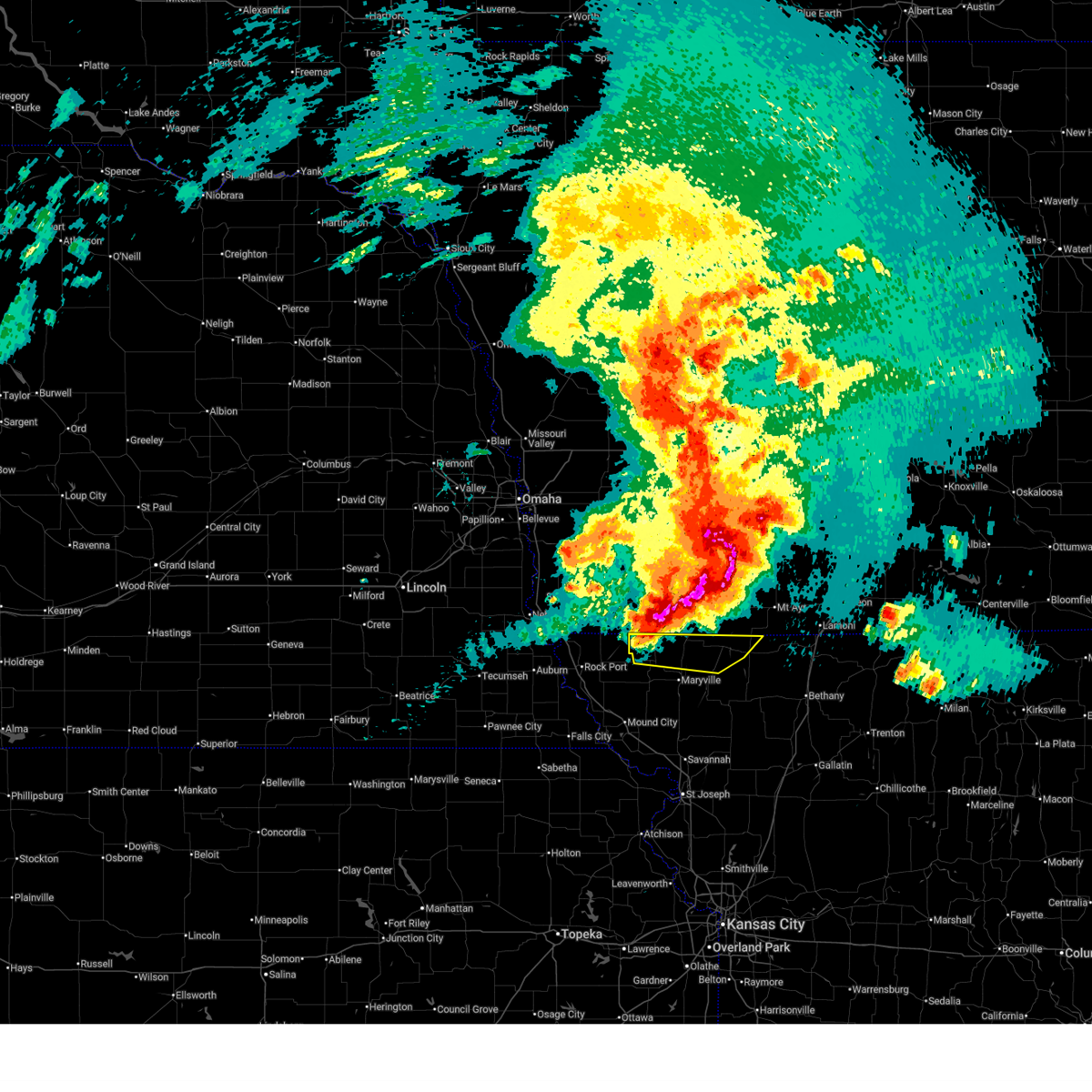
| 5/18/2026 5:56 PM CDT |
 At 556 pm cdt, a severe thunderstorm capable of producing a tornado was located 6 miles east of shambaugh, or 9 miles southeast of clarinda, moving east at 25 mph (radar indicated rotation). Hazards include tornado and ping pong ball size hail. Flying debris will be dangerous to those caught without shelter. mobile homes will be damaged or destroyed. damage to roofs, windows, and vehicles will occur. tree damage is likely. this dangerous storm will be near, bedford around 610 pm cdt. bedford municipal airport around 615 pm cdt. lake of three fires state park around 620 pm cdt. conway around 630 pm cdt. Other locations impacted by this tornadic thunderstorm include lake of three fires state park, sharpsburg, conway, new market, athelstan, bedford municipal airport, and gravity. At 556 pm cdt, a severe thunderstorm capable of producing a tornado was located 6 miles east of shambaugh, or 9 miles southeast of clarinda, moving east at 25 mph (radar indicated rotation). Hazards include tornado and ping pong ball size hail. Flying debris will be dangerous to those caught without shelter. mobile homes will be damaged or destroyed. damage to roofs, windows, and vehicles will occur. tree damage is likely. this dangerous storm will be near, bedford around 610 pm cdt. bedford municipal airport around 615 pm cdt. lake of three fires state park around 620 pm cdt. conway around 630 pm cdt. Other locations impacted by this tornadic thunderstorm include lake of three fires state park, sharpsburg, conway, new market, athelstan, bedford municipal airport, and gravity.
|
| 5/18/2026 5:54 PM CDT |
 At 553 pm cdt, a severe thunderstorm was located near shambaugh, or 7 miles southeast of clarinda, moving east at 35 mph. this is a destructive storm for taylor county (trained weather spotters reported an 84 mph wind gust south of clarinda). Hazards include 80 mph wind gusts and ping pong ball size hail. Flying debris will be dangerous to those caught without shelter. mobile homes will be heavily damaged. expect considerable damage to roofs, windows, and vehicles. extensive tree damage and power outages are likely. Locations impacted include, bedford, new market, gravity, sharpsburg, conway, athelstan, lake of three fires state park, and bedford municipal airport. At 553 pm cdt, a severe thunderstorm was located near shambaugh, or 7 miles southeast of clarinda, moving east at 35 mph. this is a destructive storm for taylor county (trained weather spotters reported an 84 mph wind gust south of clarinda). Hazards include 80 mph wind gusts and ping pong ball size hail. Flying debris will be dangerous to those caught without shelter. mobile homes will be heavily damaged. expect considerable damage to roofs, windows, and vehicles. extensive tree damage and power outages are likely. Locations impacted include, bedford, new market, gravity, sharpsburg, conway, athelstan, lake of three fires state park, and bedford municipal airport.
|
| 5/18/2026 5:45 PM CDT |
 At 544 pm cdt, a severe thunderstorm capable of producing a tornado was located over braddyville, or 10 miles south of clarinda, moving east at 35 mph (weather spotters reported a funnel cloud looking west from bedford). Hazards include tornado and ping pong ball size hail. Flying debris will be dangerous to those caught without shelter. mobile homes will be damaged or destroyed. damage to roofs, windows, and vehicles will occur. tree damage is likely. this dangerous storm will be near, bedford municipal airport around 600 pm cdt. bedford around 605 pm cdt. Other locations impacted by this tornadic thunderstorm include lake of three fires state park, sharpsburg, conway, new market, athelstan, bedford municipal airport, and gravity. At 544 pm cdt, a severe thunderstorm capable of producing a tornado was located over braddyville, or 10 miles south of clarinda, moving east at 35 mph (weather spotters reported a funnel cloud looking west from bedford). Hazards include tornado and ping pong ball size hail. Flying debris will be dangerous to those caught without shelter. mobile homes will be damaged or destroyed. damage to roofs, windows, and vehicles will occur. tree damage is likely. this dangerous storm will be near, bedford municipal airport around 600 pm cdt. bedford around 605 pm cdt. Other locations impacted by this tornadic thunderstorm include lake of three fires state park, sharpsburg, conway, new market, athelstan, bedford municipal airport, and gravity.
|
| 5/18/2026 5:34 PM CDT |
 Svrdmx the national weather service in des moines has issued a * severe thunderstorm warning for, southwestern adams county in southwestern iowa, taylor county in southwestern iowa, * until 630 pm cdt. * at 534 pm cdt, a severe thunderstorm was located over braddyville, or 10 miles south of clarinda, moving east at 45 mph (radar indicated). Hazards include ping pong ball size hail and 60 mph wind gusts. People and animals outdoors will be injured. expect hail damage to roofs, siding, windows, and vehicles. Expect wind damage to roofs, siding, and trees. Svrdmx the national weather service in des moines has issued a * severe thunderstorm warning for, southwestern adams county in southwestern iowa, taylor county in southwestern iowa, * until 630 pm cdt. * at 534 pm cdt, a severe thunderstorm was located over braddyville, or 10 miles south of clarinda, moving east at 45 mph (radar indicated). Hazards include ping pong ball size hail and 60 mph wind gusts. People and animals outdoors will be injured. expect hail damage to roofs, siding, windows, and vehicles. Expect wind damage to roofs, siding, and trees.
|
| 5/17/2026 10:53 PM CDT |
 Svreax the national weather service in pleasant hill has issued a * severe thunderstorm warning for, western worth county in northwestern missouri, northwestern gentry county in northwestern missouri, northeastern atchison county in northwestern missouri, northeastern holt county in northwestern missouri, nodaway county in northwestern missouri, northern andrew county in northwestern missouri, * until 1145 pm cdt. * at 1053 pm cdt, severe thunderstorms were located along a line extending from near braddyville to near skidmore to near forest city, moving east at 45 mph (automated weather station). Hazards include 60 mph wind gusts and penny size hail. expect damage to roofs, siding, and trees Svreax the national weather service in pleasant hill has issued a * severe thunderstorm warning for, western worth county in northwestern missouri, northwestern gentry county in northwestern missouri, northeastern atchison county in northwestern missouri, northeastern holt county in northwestern missouri, nodaway county in northwestern missouri, northern andrew county in northwestern missouri, * until 1145 pm cdt. * at 1053 pm cdt, severe thunderstorms were located along a line extending from near braddyville to near skidmore to near forest city, moving east at 45 mph (automated weather station). Hazards include 60 mph wind gusts and penny size hail. expect damage to roofs, siding, and trees
|
| 5/16/2026 7:36 PM CDT |
 The storm which prompted the warning has weakened below severe limits, and no longer poses an immediate threat to life or property. therefore, the warning will be allowed to expire. a tornado watch remains in effect until 1100 pm cdt for south central and southwestern iowa. The storm which prompted the warning has weakened below severe limits, and no longer poses an immediate threat to life or property. therefore, the warning will be allowed to expire. a tornado watch remains in effect until 1100 pm cdt for south central and southwestern iowa.
|
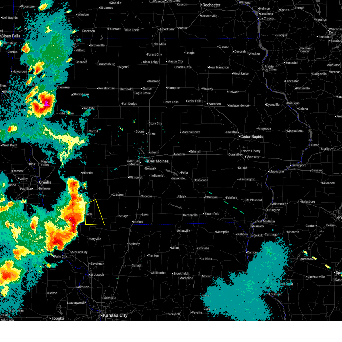
| 5/16/2026 7:20 PM CDT |
 Svrdmx the national weather service in des moines has issued a * severe thunderstorm warning for, southwestern ringgold county in south central iowa, southeastern taylor county in southwestern iowa, * until 745 pm cdt. * at 720 pm cdt, a severe thunderstorm was located over athelstan, or 14 miles southeast of bedford, moving east at 20 mph (radar indicated). Hazards include ping pong ball size hail and 60 mph wind gusts. People and animals outdoors will be injured. expect hail damage to roofs, siding, windows, and vehicles. Expect wind damage to roofs, siding, and trees. Svrdmx the national weather service in des moines has issued a * severe thunderstorm warning for, southwestern ringgold county in south central iowa, southeastern taylor county in southwestern iowa, * until 745 pm cdt. * at 720 pm cdt, a severe thunderstorm was located over athelstan, or 14 miles southeast of bedford, moving east at 20 mph (radar indicated). Hazards include ping pong ball size hail and 60 mph wind gusts. People and animals outdoors will be injured. expect hail damage to roofs, siding, windows, and vehicles. Expect wind damage to roofs, siding, and trees.
|
| 5/16/2026 6:52 PM CDT |
 Svrdmx the national weather service in des moines has issued a * severe thunderstorm warning for, southwestern ringgold county in south central iowa, southeastern taylor county in southwestern iowa, * until 715 pm cdt. * at 652 pm cdt, a severe thunderstorm was located over bedford municipal airport, or near bedford, moving east at 35 mph (radar indicated). Hazards include 60 mph wind gusts and quarter size hail. Hail damage to vehicles is expected. Expect wind damage to roofs, siding, and trees. Svrdmx the national weather service in des moines has issued a * severe thunderstorm warning for, southwestern ringgold county in south central iowa, southeastern taylor county in southwestern iowa, * until 715 pm cdt. * at 652 pm cdt, a severe thunderstorm was located over bedford municipal airport, or near bedford, moving east at 35 mph (radar indicated). Hazards include 60 mph wind gusts and quarter size hail. Hail damage to vehicles is expected. Expect wind damage to roofs, siding, and trees.
|
| 4/23/2026 7:59 PM CDT |
 Svrdmx the national weather service in des moines has issued a * severe thunderstorm warning for, western decatur county in south central iowa, southern madison county in south central iowa, union county in south central iowa, ringgold county in south central iowa, southeastern taylor county in southwestern iowa, clarke county in south central iowa, southwestern warren county in south central iowa, * until 900 pm cdt. * at 758 pm cdt, severe thunderstorms were located along a line extending from truro to arispe to near redding, moving east at 25 mph (radar indicated). Hazards include 60 mph wind gusts and penny size hail. expect damage to roofs, siding, and trees Svrdmx the national weather service in des moines has issued a * severe thunderstorm warning for, western decatur county in south central iowa, southern madison county in south central iowa, union county in south central iowa, ringgold county in south central iowa, southeastern taylor county in southwestern iowa, clarke county in south central iowa, southwestern warren county in south central iowa, * until 900 pm cdt. * at 758 pm cdt, severe thunderstorms were located along a line extending from truro to arispe to near redding, moving east at 25 mph (radar indicated). Hazards include 60 mph wind gusts and penny size hail. expect damage to roofs, siding, and trees
|
| 4/23/2026 7:09 PM CDT |
 Svrdmx the national weather service in des moines has issued a * severe thunderstorm warning for, southwestern madison county in south central iowa, union county in south central iowa, western ringgold county in south central iowa, adams county in southwestern iowa, taylor county in southwestern iowa, southern adair county in southwestern iowa, * until 815 pm cdt. * at 708 pm cdt, severe thunderstorms were located along a line extending from 4 miles southeast of orient to 4 miles north of lenox to near hopkins, moving east at 30 mph (radar indicated). Hazards include 60 mph wind gusts and quarter size hail. Hail damage to vehicles is expected. Expect wind damage to roofs, siding, and trees. Svrdmx the national weather service in des moines has issued a * severe thunderstorm warning for, southwestern madison county in south central iowa, union county in south central iowa, western ringgold county in south central iowa, adams county in southwestern iowa, taylor county in southwestern iowa, southern adair county in southwestern iowa, * until 815 pm cdt. * at 708 pm cdt, severe thunderstorms were located along a line extending from 4 miles southeast of orient to 4 miles north of lenox to near hopkins, moving east at 30 mph (radar indicated). Hazards include 60 mph wind gusts and quarter size hail. Hail damage to vehicles is expected. Expect wind damage to roofs, siding, and trees.
|
| 4/17/2026 1:52 PM CDT |
 Svrdmx the national weather service in des moines has issued a * severe thunderstorm warning for, southern ringgold county in south central iowa, southeastern taylor county in southwestern iowa, * until 230 pm cdt. * at 152 pm cdt, a severe thunderstorm was located near grant city, or 16 miles southeast of bedford, moving northeast at 40 mph (radar indicated). Hazards include 60 mph wind gusts and half dollar size hail. Hail damage to vehicles is expected. Expect wind damage to roofs, siding, and trees. Svrdmx the national weather service in des moines has issued a * severe thunderstorm warning for, southern ringgold county in south central iowa, southeastern taylor county in southwestern iowa, * until 230 pm cdt. * at 152 pm cdt, a severe thunderstorm was located near grant city, or 16 miles southeast of bedford, moving northeast at 40 mph (radar indicated). Hazards include 60 mph wind gusts and half dollar size hail. Hail damage to vehicles is expected. Expect wind damage to roofs, siding, and trees.
|
| 4/17/2026 1:26 PM CDT |
 At 126 pm cdt, a severe thunderstorm was located over maryville, moving northeast at 40 mph (radar indicated). Hazards include ping pong ball size hail and 60 mph wind gusts. People and animals outdoors will be injured. expect hail damage to roofs, siding, windows, and vehicles. expect wind damage to roofs, siding, and trees. Locations impacted include, maryville, grant city, hopkins, ravenwood, irena, sheridan, parnell, pickering, and athelstan. At 126 pm cdt, a severe thunderstorm was located over maryville, moving northeast at 40 mph (radar indicated). Hazards include ping pong ball size hail and 60 mph wind gusts. People and animals outdoors will be injured. expect hail damage to roofs, siding, windows, and vehicles. expect wind damage to roofs, siding, and trees. Locations impacted include, maryville, grant city, hopkins, ravenwood, irena, sheridan, parnell, pickering, and athelstan.
|
| 4/17/2026 1:16 PM CDT |
 Svreax the national weather service in pleasant hill has issued a * severe thunderstorm warning for, worth county in northwestern missouri, northwestern gentry county in northwestern missouri, eastern nodaway county in northwestern missouri, * until 200 pm cdt. * at 116 pm cdt, a severe thunderstorm was located near maryville, moving northeast at 45 mph (radar indicated). Hazards include ping pong ball size hail and 60 mph wind gusts. People and animals outdoors will be injured. expect hail damage to roofs, siding, windows, and vehicles. Expect wind damage to roofs, siding, and trees. Svreax the national weather service in pleasant hill has issued a * severe thunderstorm warning for, worth county in northwestern missouri, northwestern gentry county in northwestern missouri, eastern nodaway county in northwestern missouri, * until 200 pm cdt. * at 116 pm cdt, a severe thunderstorm was located near maryville, moving northeast at 45 mph (radar indicated). Hazards include ping pong ball size hail and 60 mph wind gusts. People and animals outdoors will be injured. expect hail damage to roofs, siding, windows, and vehicles. Expect wind damage to roofs, siding, and trees.
|
| 7/8/2025 12:56 AM CDT |
 Svrdmx the national weather service in des moines has issued a * severe thunderstorm warning for, decatur county in south central iowa, eastern union county in south central iowa, ringgold county in south central iowa, southeastern taylor county in southwestern iowa, southern clarke county in south central iowa, * until 145 am cdt. * at 1254 am cdt, severe thunderstorms were located along a line extending from murray to sun valley lake to near irena, moving southeast at 30 mph (radar indicated). Hazards include 60 mph wind gusts. expect damage to roofs, siding, and trees Svrdmx the national weather service in des moines has issued a * severe thunderstorm warning for, decatur county in south central iowa, eastern union county in south central iowa, ringgold county in south central iowa, southeastern taylor county in southwestern iowa, southern clarke county in south central iowa, * until 145 am cdt. * at 1254 am cdt, severe thunderstorms were located along a line extending from murray to sun valley lake to near irena, moving southeast at 30 mph (radar indicated). Hazards include 60 mph wind gusts. expect damage to roofs, siding, and trees
|
| 6/23/2025 6:58 PM CDT |
 The severe thunderstorm which prompted the warning has moved out of much of the warned area. therefore, the warning will be allowed to expire. a severe thunderstorm watch remains in effect until 1000 pm cdt for south central and southwestern iowa. remember, a severe thunderstorm warning still remains in effect for northeast taylor county into parts of adams, ringgold and union counties. The severe thunderstorm which prompted the warning has moved out of much of the warned area. therefore, the warning will be allowed to expire. a severe thunderstorm watch remains in effect until 1000 pm cdt for south central and southwestern iowa. remember, a severe thunderstorm warning still remains in effect for northeast taylor county into parts of adams, ringgold and union counties.
|
| 6/23/2025 6:18 PM CDT |
 Svrdmx the national weather service in des moines has issued a * severe thunderstorm warning for, southwestern union county in south central iowa, western ringgold county in south central iowa, taylor county in southwestern iowa, * until 700 pm cdt. * at 617 pm cdt, a severe thunderstorm was located near bedford, moving east at 35 mph (radar indicated). Hazards include 60 mph wind gusts. expect damage to roofs, siding, and trees Svrdmx the national weather service in des moines has issued a * severe thunderstorm warning for, southwestern union county in south central iowa, western ringgold county in south central iowa, taylor county in southwestern iowa, * until 700 pm cdt. * at 617 pm cdt, a severe thunderstorm was located near bedford, moving east at 35 mph (radar indicated). Hazards include 60 mph wind gusts. expect damage to roofs, siding, and trees
|
| 6/20/2025 3:09 AM CDT |
 The storm which prompted the warning has weakened below severe limits, and has exited the warned area. therefore, the warning will be allowed to expire. however, gusty winds are still possible with this thunderstorm. The storm which prompted the warning has weakened below severe limits, and has exited the warned area. therefore, the warning will be allowed to expire. however, gusty winds are still possible with this thunderstorm.
|
| 6/20/2025 2:47 AM CDT |
 At 247 am cdt, a severe thunderstorm was located over bedford municipal airport, or near bedford, moving east at 30 mph (radar indicated). Hazards include 60 mph wind gusts. Expect damage to roofs, siding, and trees. Locations impacted include, bedford, new market, blockton, gravity, conway, athelstan, lake of three fires state park, and bedford municipal airport. At 247 am cdt, a severe thunderstorm was located over bedford municipal airport, or near bedford, moving east at 30 mph (radar indicated). Hazards include 60 mph wind gusts. Expect damage to roofs, siding, and trees. Locations impacted include, bedford, new market, blockton, gravity, conway, athelstan, lake of three fires state park, and bedford municipal airport.
|
| 6/20/2025 2:26 AM CDT |
 Svrdmx the national weather service in des moines has issued a * severe thunderstorm warning for, taylor county in southwestern iowa, * until 315 am cdt. * at 226 am cdt, a severe thunderstorm was located over shambaugh, or 5 miles southeast of clarinda, moving east at 30 mph (radar indicated). Hazards include 60 mph wind gusts and penny size hail. expect damage to roofs, siding, and trees Svrdmx the national weather service in des moines has issued a * severe thunderstorm warning for, taylor county in southwestern iowa, * until 315 am cdt. * at 226 am cdt, a severe thunderstorm was located over shambaugh, or 5 miles southeast of clarinda, moving east at 30 mph (radar indicated). Hazards include 60 mph wind gusts and penny size hail. expect damage to roofs, siding, and trees
|
| 6/15/2025 8:30 PM CDT |
 the severe thunderstorm warning has been cancelled and is no longer in effect the severe thunderstorm warning has been cancelled and is no longer in effect
|
| 6/15/2025 8:28 PM CDT |
 At 828 pm cdt, a severe thunderstorm was located near bedford municipal airport, or 6 miles southeast of bedford, moving south at 25 mph (radar indicated). Hazards include 60 mph wind gusts and quarter size hail. Hail damage to vehicles is expected. expect wind damage to roofs, siding, and trees. Locations impacted include, blockton, athelstan, and bedford municipal airport. At 828 pm cdt, a severe thunderstorm was located near bedford municipal airport, or 6 miles southeast of bedford, moving south at 25 mph (radar indicated). Hazards include 60 mph wind gusts and quarter size hail. Hail damage to vehicles is expected. expect wind damage to roofs, siding, and trees. Locations impacted include, blockton, athelstan, and bedford municipal airport.
|
| 6/15/2025 8:14 PM CDT |
 Svrdmx the national weather service in des moines has issued a * severe thunderstorm warning for, southeastern taylor county in southwestern iowa, * until 900 pm cdt. * at 813 pm cdt, a severe thunderstorm was located 5 miles southeast of lake of three fires state park, or 5 miles east of bedford, moving south at 15 mph (radar indicated). Hazards include 60 mph wind gusts and quarter size hail. Hail damage to vehicles is expected. Expect wind damage to roofs, siding, and trees. Svrdmx the national weather service in des moines has issued a * severe thunderstorm warning for, southeastern taylor county in southwestern iowa, * until 900 pm cdt. * at 813 pm cdt, a severe thunderstorm was located 5 miles southeast of lake of three fires state park, or 5 miles east of bedford, moving south at 15 mph (radar indicated). Hazards include 60 mph wind gusts and quarter size hail. Hail damage to vehicles is expected. Expect wind damage to roofs, siding, and trees.
|
| 10/30/2024 2:28 PM CDT |
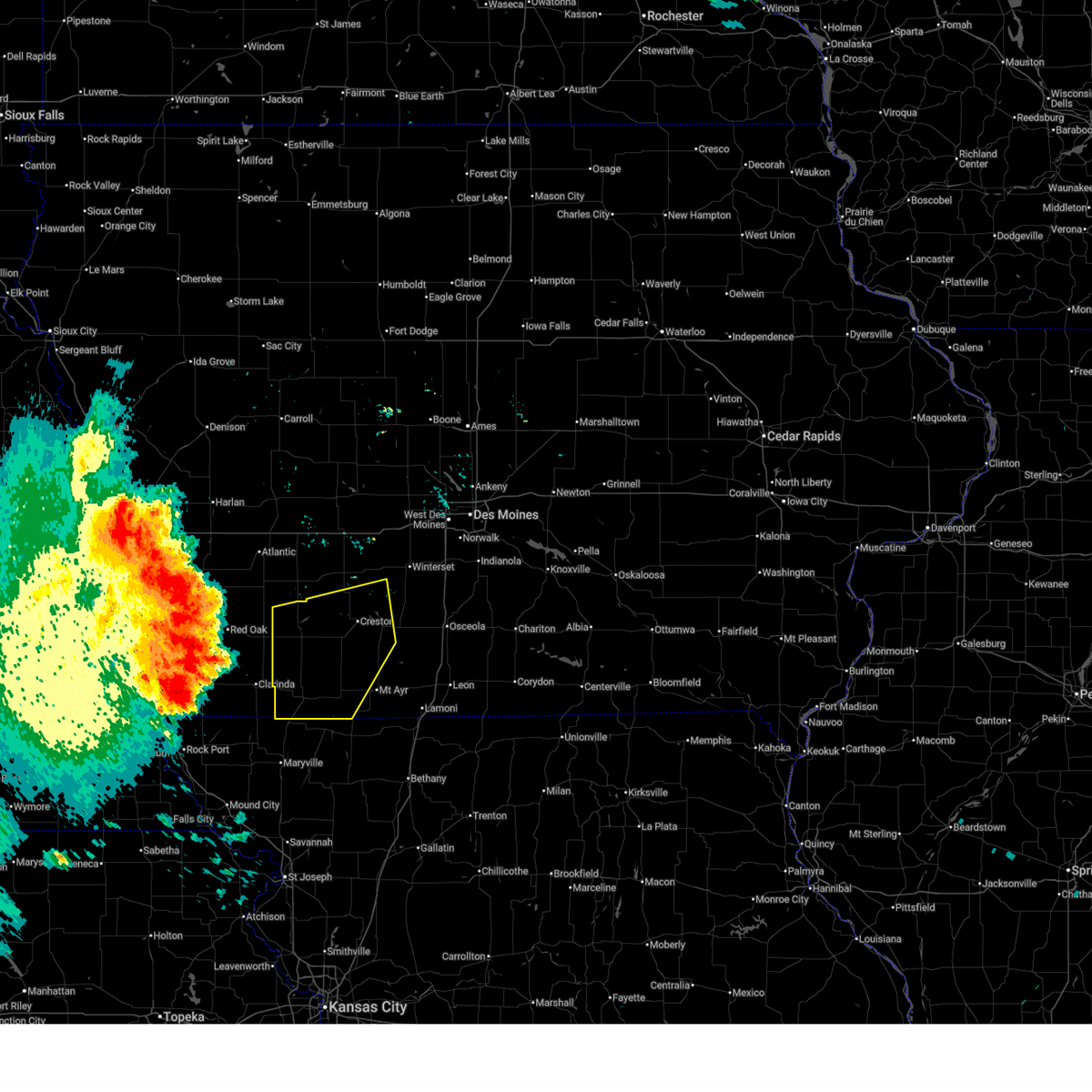
 At 228 pm cdt, severe thunderstorms were located along a line extending from 6 miles west of green valley lake state park to near shannon city to redding, moving northeast at 55 mph (radar indicated). Hazards include 60 mph wind gusts and quarter size hail. Hail damage to vehicles is expected. expect wind damage to roofs, siding, and trees. Locations impacted include, creston, mount ayr, corning, bedford, lenox, sun valley lake, green valley lake, lake icaria, afton, orient, clearfield, lorimor, diagonal, kellerton, prescott, blockton, gravity, tingley, nodaway, and macksburg. At 228 pm cdt, severe thunderstorms were located along a line extending from 6 miles west of green valley lake state park to near shannon city to redding, moving northeast at 55 mph (radar indicated). Hazards include 60 mph wind gusts and quarter size hail. Hail damage to vehicles is expected. expect wind damage to roofs, siding, and trees. Locations impacted include, creston, mount ayr, corning, bedford, lenox, sun valley lake, green valley lake, lake icaria, afton, orient, clearfield, lorimor, diagonal, kellerton, prescott, blockton, gravity, tingley, nodaway, and macksburg.
|
| 10/30/2024 2:19 PM CDT |
 At 218 pm cdt, severe thunderstorms were located along a line extending from near lake icaria to clearfield to near sheridan, moving northeast at 50 mph (radar indicated). Hazards include ping pong ball size hail and 60 mph wind gusts. People and animals outdoors will be injured. expect hail damage to roofs, siding, windows, and vehicles. expect wind damage to roofs, siding, and trees. Locations impacted include, creston, mount ayr, corning, bedford, lenox, sun valley lake, green valley lake, lake icaria, afton, orient, clearfield, lorimor, diagonal, kellerton, prescott, blockton, gravity, tingley, nodaway, and macksburg. At 218 pm cdt, severe thunderstorms were located along a line extending from near lake icaria to clearfield to near sheridan, moving northeast at 50 mph (radar indicated). Hazards include ping pong ball size hail and 60 mph wind gusts. People and animals outdoors will be injured. expect hail damage to roofs, siding, windows, and vehicles. expect wind damage to roofs, siding, and trees. Locations impacted include, creston, mount ayr, corning, bedford, lenox, sun valley lake, green valley lake, lake icaria, afton, orient, clearfield, lorimor, diagonal, kellerton, prescott, blockton, gravity, tingley, nodaway, and macksburg.
|
| 10/30/2024 2:14 PM CDT |
 Svrdmx the national weather service in des moines has issued a * severe thunderstorm warning for, southwestern madison county in south central iowa, union county in south central iowa, ringgold county in south central iowa, adams county in southwestern iowa, taylor county in southwestern iowa, southeastern adair county in southwestern iowa, * until 300 pm cdt. * at 213 pm cdt, severe thunderstorms were located along a line extending from corning to near conway to near sheridan, moving northeast at 50 mph (radar indicated). Hazards include 60 mph wind gusts and quarter size hail. Hail damage to vehicles is expected. Expect wind damage to roofs, siding, and trees. Svrdmx the national weather service in des moines has issued a * severe thunderstorm warning for, southwestern madison county in south central iowa, union county in south central iowa, ringgold county in south central iowa, adams county in southwestern iowa, taylor county in southwestern iowa, southeastern adair county in southwestern iowa, * until 300 pm cdt. * at 213 pm cdt, severe thunderstorms were located along a line extending from corning to near conway to near sheridan, moving northeast at 50 mph (radar indicated). Hazards include 60 mph wind gusts and quarter size hail. Hail damage to vehicles is expected. Expect wind damage to roofs, siding, and trees.
|
| 7/31/2024 8:13 PM CDT |
 The storms which prompted the warning have weakened below severe limits, and have exited the warned area. therefore, the warning will be allowed to expire. however, gusty winds are still possible with these thunderstorms. a severe thunderstorm watch remains in effect until 100 am cdt for south central and southwestern iowa. The storms which prompted the warning have weakened below severe limits, and have exited the warned area. therefore, the warning will be allowed to expire. however, gusty winds are still possible with these thunderstorms. a severe thunderstorm watch remains in effect until 100 am cdt for south central and southwestern iowa.
|
| 7/31/2024 8:09 PM CDT |
 The storm which prompted the warning has weakened below severe limits, and no longer poses an immediate threat to life or property. therefore, the warning will be allowed to expire. a severe thunderstorm watch remains in effect until 100 am cdt for northwestern missouri. The storm which prompted the warning has weakened below severe limits, and no longer poses an immediate threat to life or property. therefore, the warning will be allowed to expire. a severe thunderstorm watch remains in effect until 100 am cdt for northwestern missouri.
|
| 7/31/2024 8:05 PM CDT |
 At 804 pm cdt, a severe thunderstorm was located near athelstan, or 9 miles east of bedford, moving east at 30 mph (radar indicated). Hazards include 60 mph wind gusts and quarter size hail. Hail damage to vehicles is expected. expect wind damage to roofs, siding, and trees. Locations impacted include, grant city, irena, sheridan, parnell, and athelstan. At 804 pm cdt, a severe thunderstorm was located near athelstan, or 9 miles east of bedford, moving east at 30 mph (radar indicated). Hazards include 60 mph wind gusts and quarter size hail. Hail damage to vehicles is expected. expect wind damage to roofs, siding, and trees. Locations impacted include, grant city, irena, sheridan, parnell, and athelstan.
|
| 7/31/2024 7:50 PM CDT |
 At 750 pm cdt, a severe thunderstorm was located near bedford, moving east at 30 mph (radar indicated). Hazards include 60 mph wind gusts and quarter size hail. Hail damage to vehicles is expected. expect wind damage to roofs, siding, and trees. Locations impacted include, maryville, grant city, hopkins, irena, sheridan, parnell, pickering, and athelstan. At 750 pm cdt, a severe thunderstorm was located near bedford, moving east at 30 mph (radar indicated). Hazards include 60 mph wind gusts and quarter size hail. Hail damage to vehicles is expected. expect wind damage to roofs, siding, and trees. Locations impacted include, maryville, grant city, hopkins, irena, sheridan, parnell, pickering, and athelstan.
|
| 7/31/2024 7:30 PM CDT |
 Svreax the national weather service in pleasant hill has issued a * severe thunderstorm warning for, western worth county in northwestern missouri, northern nodaway county in northwestern missouri, * until 815 pm cdt. * at 729 pm cdt, a severe thunderstorm was located over hopkins, or 10 miles southwest of bedford, moving east at 30 mph (radar indicated). Hazards include 60 mph wind gusts and quarter size hail. Hail damage to vehicles is expected. Expect wind damage to roofs, siding, and trees. Svreax the national weather service in pleasant hill has issued a * severe thunderstorm warning for, western worth county in northwestern missouri, northern nodaway county in northwestern missouri, * until 815 pm cdt. * at 729 pm cdt, a severe thunderstorm was located over hopkins, or 10 miles southwest of bedford, moving east at 30 mph (radar indicated). Hazards include 60 mph wind gusts and quarter size hail. Hail damage to vehicles is expected. Expect wind damage to roofs, siding, and trees.
|
| 7/31/2024 7:27 PM CDT |
 Svrdmx the national weather service in des moines has issued a * severe thunderstorm warning for, southwestern union county in south central iowa, western ringgold county in south central iowa, southern adams county in southwestern iowa, taylor county in southwestern iowa, * until 815 pm cdt. * at 727 pm cdt, severe thunderstorms were located along a line extending from 4 miles south of nodaway to near new market to near hopkins, moving east at 25 mph (radar indicated). Hazards include 60 mph wind gusts and quarter size hail. Hail damage to vehicles is expected. Expect wind damage to roofs, siding, and trees. Svrdmx the national weather service in des moines has issued a * severe thunderstorm warning for, southwestern union county in south central iowa, western ringgold county in south central iowa, southern adams county in southwestern iowa, taylor county in southwestern iowa, * until 815 pm cdt. * at 727 pm cdt, severe thunderstorms were located along a line extending from 4 miles south of nodaway to near new market to near hopkins, moving east at 25 mph (radar indicated). Hazards include 60 mph wind gusts and quarter size hail. Hail damage to vehicles is expected. Expect wind damage to roofs, siding, and trees.
|
| 7/31/2024 6:50 PM CDT |
 At 649 pm cdt, severe thunderstorms were located along a line extending from 5 miles northwest of hacklebarney woods county park to hepburn to northboro, moving east at 40 mph (radar indicated). Hazards include 60 mph wind gusts and nickel size hail. Expect damage to roofs, siding, and trees. Locations impacted include, creston, corning, bedford, lenox, green valley lake, lake icaria, afton, new market, orient, clearfield, diagonal, prescott, blockton, gravity, tingley, nodaway, macksburg, cromwell, arispe, and sharpsburg. At 649 pm cdt, severe thunderstorms were located along a line extending from 5 miles northwest of hacklebarney woods county park to hepburn to northboro, moving east at 40 mph (radar indicated). Hazards include 60 mph wind gusts and nickel size hail. Expect damage to roofs, siding, and trees. Locations impacted include, creston, corning, bedford, lenox, green valley lake, lake icaria, afton, new market, orient, clearfield, diagonal, prescott, blockton, gravity, tingley, nodaway, macksburg, cromwell, arispe, and sharpsburg.
|
| 7/31/2024 6:37 PM CDT |
 Svrdmx the national weather service in des moines has issued a * severe thunderstorm warning for, southwestern madison county in south central iowa, union county in south central iowa, western ringgold county in south central iowa, adams county in southwestern iowa, taylor county in southwestern iowa, southern adair county in southwestern iowa, * until 730 pm cdt. * at 636 pm cdt, severe thunderstorms were located along a line extending from 4 miles northeast of red oak to 6 miles west of hepburn to 6 miles west of northboro, moving east at 45 mph (radar indicated). Hazards include 70 mph wind gusts and nickel size hail. Expect considerable tree damage. Damage is likely to mobile homes, roofs, and outbuildings. Svrdmx the national weather service in des moines has issued a * severe thunderstorm warning for, southwestern madison county in south central iowa, union county in south central iowa, western ringgold county in south central iowa, adams county in southwestern iowa, taylor county in southwestern iowa, southern adair county in southwestern iowa, * until 730 pm cdt. * at 636 pm cdt, severe thunderstorms were located along a line extending from 4 miles northeast of red oak to 6 miles west of hepburn to 6 miles west of northboro, moving east at 45 mph (radar indicated). Hazards include 70 mph wind gusts and nickel size hail. Expect considerable tree damage. Damage is likely to mobile homes, roofs, and outbuildings.
|
| 6/25/2024 11:15 PM CDT |
 At 1115 pm cdt, severe thunderstorms were located along a line extending from 8 miles northwest of mount ayr to 6 miles east of bedford to near hopkins, moving southeast at 35 mph (radar indicated). Hazards include 70 mph wind gusts and nickel size hail. Expect considerable tree damage. damage is likely to mobile homes, roofs, and outbuildings. locations impacted include, grant city, hopkins, eagleville, irena, sheridan, blythedale, parnell, clearmont, pickering, worth, allendale, denver, athelstan, and hatfield. This includes interstate 35 in missouri between mile markers 106 and 114. At 1115 pm cdt, severe thunderstorms were located along a line extending from 8 miles northwest of mount ayr to 6 miles east of bedford to near hopkins, moving southeast at 35 mph (radar indicated). Hazards include 70 mph wind gusts and nickel size hail. Expect considerable tree damage. damage is likely to mobile homes, roofs, and outbuildings. locations impacted include, grant city, hopkins, eagleville, irena, sheridan, blythedale, parnell, clearmont, pickering, worth, allendale, denver, athelstan, and hatfield. This includes interstate 35 in missouri between mile markers 106 and 114.
|
| 6/25/2024 11:04 PM CDT |
 Svreax the national weather service in pleasant hill has issued a * severe thunderstorm warning for, worth county in northwestern missouri, northern harrison county in north central missouri, northeastern nodaway county in northwestern missouri, * until midnight cdt. * at 1103 pm cdt, severe thunderstorms were located along a line extending from 7 miles east of lenox to near bedford to near shambaugh, moving southeast at 35 mph (radar indicated). Hazards include 60 mph wind gusts and nickel size hail. expect damage to roofs, siding, and trees Svreax the national weather service in pleasant hill has issued a * severe thunderstorm warning for, worth county in northwestern missouri, northern harrison county in north central missouri, northeastern nodaway county in northwestern missouri, * until midnight cdt. * at 1103 pm cdt, severe thunderstorms were located along a line extending from 7 miles east of lenox to near bedford to near shambaugh, moving southeast at 35 mph (radar indicated). Hazards include 60 mph wind gusts and nickel size hail. expect damage to roofs, siding, and trees
|
| 6/25/2024 10:47 PM CDT |
 Svrdmx the national weather service in des moines has issued a * severe thunderstorm warning for, southwestern decatur county in south central iowa, southern ringgold county in south central iowa, southern taylor county in southwestern iowa, * until 1145 pm cdt. * at 1047 pm cdt, a severe thunderstorm was located over new market, or 8 miles east of clarinda, moving southeast at 60 mph (radar indicated). Hazards include 60 mph wind gusts and quarter size hail. Hail damage to vehicles is expected. Expect wind damage to roofs, siding, and trees. Svrdmx the national weather service in des moines has issued a * severe thunderstorm warning for, southwestern decatur county in south central iowa, southern ringgold county in south central iowa, southern taylor county in southwestern iowa, * until 1145 pm cdt. * at 1047 pm cdt, a severe thunderstorm was located over new market, or 8 miles east of clarinda, moving southeast at 60 mph (radar indicated). Hazards include 60 mph wind gusts and quarter size hail. Hail damage to vehicles is expected. Expect wind damage to roofs, siding, and trees.
|
| 6/15/2024 8:59 PM CDT |
 The storms which prompted the warning have weakened below severe limits, and no longer pose an immediate threat to life or property. therefore, the warning will be allowed to expire. however, gusty winds and heavy rain are still possible with these thunderstorms. a severe thunderstorm watch remains in effect until 200 am cdt for southwestern iowa. The storms which prompted the warning have weakened below severe limits, and no longer pose an immediate threat to life or property. therefore, the warning will be allowed to expire. however, gusty winds and heavy rain are still possible with these thunderstorms. a severe thunderstorm watch remains in effect until 200 am cdt for southwestern iowa.
|
| 6/15/2024 8:40 PM CDT |
 At 840 pm cdt, severe thunderstorms were located along a line extending from near grant to near villisca to 5 miles west of hopkins to 5 miles west of maryville, moving northeast at 45 mph (radar indicated). Hazards include 60 mph wind gusts and penny size hail. Expect damage to roofs, siding, and trees. Locations impacted include, corning, bedford, lenox, griswold, lake icaria, lewis, new market, massena, cumberland, prescott, gravity, bridgewater, nodaway, sharpsburg, conway, carbon, athelstan, lake of three fires state park, corning municipal airport, and bedford municipal airport. At 840 pm cdt, severe thunderstorms were located along a line extending from near grant to near villisca to 5 miles west of hopkins to 5 miles west of maryville, moving northeast at 45 mph (radar indicated). Hazards include 60 mph wind gusts and penny size hail. Expect damage to roofs, siding, and trees. Locations impacted include, corning, bedford, lenox, griswold, lake icaria, lewis, new market, massena, cumberland, prescott, gravity, bridgewater, nodaway, sharpsburg, conway, carbon, athelstan, lake of three fires state park, corning municipal airport, and bedford municipal airport.
|
| 6/15/2024 8:18 PM CDT |
 Svrdmx the national weather service in des moines has issued a * severe thunderstorm warning for, southern cass county in southwestern iowa, adams county in southwestern iowa, taylor county in southwestern iowa, southwestern adair county in southwestern iowa, * until 900 pm cdt. * at 817 pm cdt, severe thunderstorms were located along a line extending from near red oak to near essex to near burlington junction to 4 miles north of mound city, moving northeast at 50 mph (radar indicated). Hazards include 60 mph wind gusts and penny size hail. expect damage to roofs, siding, and trees Svrdmx the national weather service in des moines has issued a * severe thunderstorm warning for, southern cass county in southwestern iowa, adams county in southwestern iowa, taylor county in southwestern iowa, southwestern adair county in southwestern iowa, * until 900 pm cdt. * at 817 pm cdt, severe thunderstorms were located along a line extending from near red oak to near essex to near burlington junction to 4 miles north of mound city, moving northeast at 50 mph (radar indicated). Hazards include 60 mph wind gusts and penny size hail. expect damage to roofs, siding, and trees
|
| 5/24/2024 5:14 AM CDT |
 The storms which prompted the warning have weakened below severe limits, and no longer pose an immediate threat to life or property. therefore, the warning will be allowed to expire. however, gusty winds are still possible with these thunderstorms. a severe thunderstorm watch remains in effect until 1000 am cdt for north central and northwestern missouri. The storms which prompted the warning have weakened below severe limits, and no longer pose an immediate threat to life or property. therefore, the warning will be allowed to expire. however, gusty winds are still possible with these thunderstorms. a severe thunderstorm watch remains in effect until 1000 am cdt for north central and northwestern missouri.
|
| 5/24/2024 4:54 AM CDT |
 At 453 am cdt, severe thunderstorms were located along a line extending from near mount ayr to 6 miles east of ravenwood to near king city, moving east at 40 mph (radar indicated). Hazards include 60 mph wind gusts. Expect damage to roofs, siding, and trees. Locations impacted include, albany, stanberry, king city, grant city, ravenwood, irena, barnard, conception junction, sheridan, parnell, bolckow, darlington, mcfall, guilford, clyde, gentry, arkoe, worth, allendale, and rea. At 453 am cdt, severe thunderstorms were located along a line extending from near mount ayr to 6 miles east of ravenwood to near king city, moving east at 40 mph (radar indicated). Hazards include 60 mph wind gusts. Expect damage to roofs, siding, and trees. Locations impacted include, albany, stanberry, king city, grant city, ravenwood, irena, barnard, conception junction, sheridan, parnell, bolckow, darlington, mcfall, guilford, clyde, gentry, arkoe, worth, allendale, and rea.
|
| 5/24/2024 4:24 AM CDT |
 Svreax the national weather service in pleasant hill has issued a * severe thunderstorm warning for, worth county in northwestern missouri, gentry county in northwestern missouri, nodaway county in northwestern missouri, northern andrew county in northwestern missouri, * until 515 am cdt. * at 423 am cdt, severe thunderstorms were located along a line extending from 7 miles north of athelstan to near maryville to 8 miles east of maitland, moving east at 45 mph (radar indicated). Hazards include 60 mph wind gusts. expect damage to roofs, siding, and trees Svreax the national weather service in pleasant hill has issued a * severe thunderstorm warning for, worth county in northwestern missouri, gentry county in northwestern missouri, nodaway county in northwestern missouri, northern andrew county in northwestern missouri, * until 515 am cdt. * at 423 am cdt, severe thunderstorms were located along a line extending from 7 miles north of athelstan to near maryville to 8 miles east of maitland, moving east at 45 mph (radar indicated). Hazards include 60 mph wind gusts. expect damage to roofs, siding, and trees
|
| 5/21/2024 3:33 PM CDT |
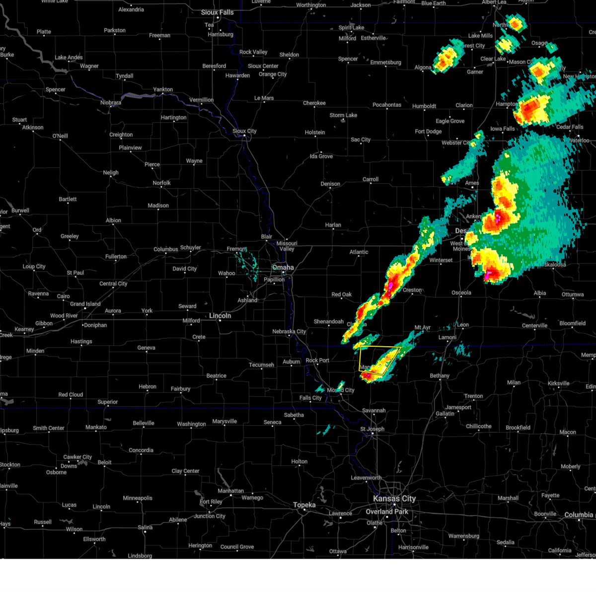
 Tordmx the national weather service in des moines has issued a * tornado warning for, south central union county in south central iowa, central ringgold county in south central iowa, southeastern taylor county in southwestern iowa, * until 415 pm cdt. * at 332 pm cdt, a severe thunderstorm capable of producing a tornado was located over blockton, or 12 miles east of bedford, moving northeast at 40 mph (radar indicated rotation). Hazards include tornado and quarter size hail. Flying debris will be dangerous to those caught without shelter. mobile homes will be damaged or destroyed. damage to roofs, windows, and vehicles will occur. tree damage is likely. this dangerous storm will be near, benton and maloy around 340 pm cdt. diagonal around 350 pm cdt. shannon city around 400 pm cdt. tingley around 405 pm cdt. Other locations impacted by this tornadic thunderstorm include delphos, arispe, ellston, tingley, diagonal, maloy, shannon city, benton, blockton, and athelstan. Tordmx the national weather service in des moines has issued a * tornado warning for, south central union county in south central iowa, central ringgold county in south central iowa, southeastern taylor county in southwestern iowa, * until 415 pm cdt. * at 332 pm cdt, a severe thunderstorm capable of producing a tornado was located over blockton, or 12 miles east of bedford, moving northeast at 40 mph (radar indicated rotation). Hazards include tornado and quarter size hail. Flying debris will be dangerous to those caught without shelter. mobile homes will be damaged or destroyed. damage to roofs, windows, and vehicles will occur. tree damage is likely. this dangerous storm will be near, benton and maloy around 340 pm cdt. diagonal around 350 pm cdt. shannon city around 400 pm cdt. tingley around 405 pm cdt. Other locations impacted by this tornadic thunderstorm include delphos, arispe, ellston, tingley, diagonal, maloy, shannon city, benton, blockton, and athelstan.
|
| 4/26/2024 7:55 PM CDT |
 At 755 pm cdt, a severe thunderstorm was located 7 miles north of ravenwood, or 14 miles northeast of maryville, moving northeast at 45 mph (radar indicated). Hazards include 60 mph wind gusts and quarter size hail. Hail damage to vehicles is expected. expect wind damage to roofs, siding, and trees. Locations impacted include, grant city, irena, sheridan, parnell, and athelstan. At 755 pm cdt, a severe thunderstorm was located 7 miles north of ravenwood, or 14 miles northeast of maryville, moving northeast at 45 mph (radar indicated). Hazards include 60 mph wind gusts and quarter size hail. Hail damage to vehicles is expected. expect wind damage to roofs, siding, and trees. Locations impacted include, grant city, irena, sheridan, parnell, and athelstan.
|
| 4/26/2024 7:36 PM CDT |
 Svreax the national weather service in pleasant hill has issued a * severe thunderstorm warning for, western worth county in northwestern missouri, eastern nodaway county in northwestern missouri, * until 815 pm cdt. * at 735 pm cdt, a severe thunderstorm was located over maryville, moving northeast at 45 mph (radar indicated). Hazards include 60 mph wind gusts and half dollar size hail. Hail damage to vehicles is expected. Expect wind damage to roofs, siding, and trees. Svreax the national weather service in pleasant hill has issued a * severe thunderstorm warning for, western worth county in northwestern missouri, eastern nodaway county in northwestern missouri, * until 815 pm cdt. * at 735 pm cdt, a severe thunderstorm was located over maryville, moving northeast at 45 mph (radar indicated). Hazards include 60 mph wind gusts and half dollar size hail. Hail damage to vehicles is expected. Expect wind damage to roofs, siding, and trees.
|
| 4/26/2024 6:07 PM CDT |
 Svrdmx the national weather service in des moines has issued a * severe thunderstorm warning for, southern adams county in southwestern iowa, taylor county in southwestern iowa, * until 645 pm cdt. * at 607 pm cdt, a severe thunderstorm was located over new market, or 6 miles east of clarinda, moving northeast at 50 mph (radar indicated). Hazards include 60 mph wind gusts. expect damage to roofs, siding, and trees Svrdmx the national weather service in des moines has issued a * severe thunderstorm warning for, southern adams county in southwestern iowa, taylor county in southwestern iowa, * until 645 pm cdt. * at 607 pm cdt, a severe thunderstorm was located over new market, or 6 miles east of clarinda, moving northeast at 50 mph (radar indicated). Hazards include 60 mph wind gusts. expect damage to roofs, siding, and trees
|
| 4/16/2024 10:00 AM CDT |
 The storm which prompted the warning has weakened below severe limits, and no longer poses an immediate threat to life or property. therefore, the warning has been allowed to expire. however, gusty winds are still possible with this thunderstorm. The storm which prompted the warning has weakened below severe limits, and no longer poses an immediate threat to life or property. therefore, the warning has been allowed to expire. however, gusty winds are still possible with this thunderstorm.
|
| 4/16/2024 9:27 AM CDT |
 The storm which prompted the warning has moved out of the area. therefore, the warning will be allowed to expire. The storm which prompted the warning has moved out of the area. therefore, the warning will be allowed to expire.
|
| 4/16/2024 9:19 AM CDT |
 At 919 am cdt, a severe thunderstorm was located 6 miles southeast of lake of three fires state park, or 6 miles east of bedford, moving northeast at 60 mph (radar indicated). Hazards include 60 mph wind gusts and penny size hail. Expect damage to roofs, siding, and trees. Locations impacted include, creston, corning, bedford, lenox, green valley lake, lake icaria, new market, clearfield, diagonal, prescott, blockton, gravity, nodaway, cromwell, sharpsburg, redding, kent, conway, benton, and carbon. At 919 am cdt, a severe thunderstorm was located 6 miles southeast of lake of three fires state park, or 6 miles east of bedford, moving northeast at 60 mph (radar indicated). Hazards include 60 mph wind gusts and penny size hail. Expect damage to roofs, siding, and trees. Locations impacted include, creston, corning, bedford, lenox, green valley lake, lake icaria, new market, clearfield, diagonal, prescott, blockton, gravity, nodaway, cromwell, sharpsburg, redding, kent, conway, benton, and carbon.
|
| 4/16/2024 9:13 AM CDT |
 At 912 am cdt, a severe thunderstorm was located near athelstan, or 9 miles southeast of bedford, moving northeast at 50 mph (radar indicated). Hazards include 60 mph wind gusts. Expect damage to roofs, siding, and trees. Locations impacted include, maryville, hopkins, sheridan, parnell, pickering, and athelstan. At 912 am cdt, a severe thunderstorm was located near athelstan, or 9 miles southeast of bedford, moving northeast at 50 mph (radar indicated). Hazards include 60 mph wind gusts. Expect damage to roofs, siding, and trees. Locations impacted include, maryville, hopkins, sheridan, parnell, pickering, and athelstan.
|
| 4/16/2024 9:13 AM CDT |
 the severe thunderstorm warning has been cancelled and is no longer in effect the severe thunderstorm warning has been cancelled and is no longer in effect
|
| 4/16/2024 9:03 AM CDT |
 Svrdmx the national weather service in des moines has issued a * severe thunderstorm warning for, western union county in south central iowa, adams county in southwestern iowa, western ringgold county in south central iowa, taylor county in southwestern iowa, * until 1000 am cdt. * at 902 am cdt, a severe thunderstorm was located near hopkins, or 10 miles south of bedford, moving north at 60 mph (radar indicated). Hazards include 60 mph wind gusts and penny size hail. expect damage to roofs, siding, and trees Svrdmx the national weather service in des moines has issued a * severe thunderstorm warning for, western union county in south central iowa, adams county in southwestern iowa, western ringgold county in south central iowa, taylor county in southwestern iowa, * until 1000 am cdt. * at 902 am cdt, a severe thunderstorm was located near hopkins, or 10 miles south of bedford, moving north at 60 mph (radar indicated). Hazards include 60 mph wind gusts and penny size hail. expect damage to roofs, siding, and trees
|
| 4/16/2024 8:52 AM CDT |
 Svreax the national weather service in pleasant hill has issued a * severe thunderstorm warning for, worth county in northwestern missouri, northwestern gentry county in northwestern missouri, northwestern harrison county in north central missouri, eastern nodaway county in northwestern missouri, * until 930 am cdt. * at 851 am cdt, a severe thunderstorm was located near maryville, moving northeast at 55 mph (radar indicated). Hazards include 60 mph wind gusts. expect damage to roofs, siding, and trees Svreax the national weather service in pleasant hill has issued a * severe thunderstorm warning for, worth county in northwestern missouri, northwestern gentry county in northwestern missouri, northwestern harrison county in north central missouri, eastern nodaway county in northwestern missouri, * until 930 am cdt. * at 851 am cdt, a severe thunderstorm was located near maryville, moving northeast at 55 mph (radar indicated). Hazards include 60 mph wind gusts. expect damage to roofs, siding, and trees
|
| 6/29/2023 8:54 AM CDT |
 At 853 am cdt, severe thunderstorms were located along a line extending from 5 miles south of lake anita state park to near kent to blockton, moving east at 55 mph (radar indicated). Hazards include 60 mph wind gusts and penny size hail. expect damage to roofs, siding, and trees At 853 am cdt, severe thunderstorms were located along a line extending from 5 miles south of lake anita state park to near kent to blockton, moving east at 55 mph (radar indicated). Hazards include 60 mph wind gusts and penny size hail. expect damage to roofs, siding, and trees
|
| 4/4/2023 7:42 PM CDT |
 At 741 pm cdt, severe thunderstorms were located along a line extending from near greenfield municipal airport to 5 miles northwest of hopkins, moving east at 35 mph (radar indicated). Hazards include 60 mph wind gusts and quarter size hail. Hail damage to vehicles is expected. expect wind damage to roofs, siding, and trees. severe thunderstorms will be near, bedford and gravity around 800 pm cdt. other locations in the path of these severe thunderstorms include lake of three fires state park, conway, blockton, clearfield, redding, maloy, delphos, benton and diagonal. hail threat, radar indicated max hail size, 1. 00 in wind threat, radar indicated max wind gust, 60 mph. At 741 pm cdt, severe thunderstorms were located along a line extending from near greenfield municipal airport to 5 miles northwest of hopkins, moving east at 35 mph (radar indicated). Hazards include 60 mph wind gusts and quarter size hail. Hail damage to vehicles is expected. expect wind damage to roofs, siding, and trees. severe thunderstorms will be near, bedford and gravity around 800 pm cdt. other locations in the path of these severe thunderstorms include lake of three fires state park, conway, blockton, clearfield, redding, maloy, delphos, benton and diagonal. hail threat, radar indicated max hail size, 1. 00 in wind threat, radar indicated max wind gust, 60 mph.
|
| 4/4/2023 7:01 PM CDT |
 At 701 pm cdt, a severe thunderstorm was located near bedford municipal airport, or 6 miles south of bedford, moving northeast at 65 mph (radar indicated). Hazards include 60 mph wind gusts and half dollar size hail. Hail damage to vehicles is expected. expect wind damage to roofs, siding, and trees. this severe thunderstorm will be near, bedford around 705 pm cdt. gravity and lake of three fires state park around 710 pm cdt. sharpsburg and conway around 715 pm cdt. clearfield around 720 pm cdt. other locations in the path of this severe thunderstorm include lenox, kent, creston, cromwell, creston municipal airport, green valley lake, orient and green valley lake state park. hail threat, radar indicated max hail size, 1. 25 in wind threat, radar indicated max wind gust, 60 mph. At 701 pm cdt, a severe thunderstorm was located near bedford municipal airport, or 6 miles south of bedford, moving northeast at 65 mph (radar indicated). Hazards include 60 mph wind gusts and half dollar size hail. Hail damage to vehicles is expected. expect wind damage to roofs, siding, and trees. this severe thunderstorm will be near, bedford around 705 pm cdt. gravity and lake of three fires state park around 710 pm cdt. sharpsburg and conway around 715 pm cdt. clearfield around 720 pm cdt. other locations in the path of this severe thunderstorm include lenox, kent, creston, cromwell, creston municipal airport, green valley lake, orient and green valley lake state park. hail threat, radar indicated max hail size, 1. 25 in wind threat, radar indicated max wind gust, 60 mph.
|
| 4/4/2023 6:49 PM CDT |
 At 648 pm cdt, a severe thunderstorm was located over maryville, moving northeast at 70 mph (radar indicated). Hazards include 60 mph wind gusts and half dollar size hail. Hail damage to vehicles is expected. Expect wind damage to roofs, siding, and trees. At 648 pm cdt, a severe thunderstorm was located over maryville, moving northeast at 70 mph (radar indicated). Hazards include 60 mph wind gusts and half dollar size hail. Hail damage to vehicles is expected. Expect wind damage to roofs, siding, and trees.
|
| 7/7/2022 2:34 AM CDT |
 At 234 am cdt, severe thunderstorms were located along a line extending from near villisca to near ravenwood to near dearborn, moving northeast at 50 mph (radar indicated). Hazards include 60 mph wind gusts and quarter size hail. Hail damage to vehicles is expected. expect wind damage to roofs, siding, and trees. locations impacted include, st. joseph, maryville, savannah, albany, wathena, elwood, stanberry, maysville, highland, troy, country club villa, country club, king city, grant city, oregon, stewartsville, burlington junction, hopkins, ravenwood and union star. this includes the following highways, interstate 29 between mile markers 44 and 79. interstate 229 between mile markers 2 and 14. hail threat, radar indicated max hail size, 1. 00 in wind threat, radar indicated max wind gust, 60 mph. At 234 am cdt, severe thunderstorms were located along a line extending from near villisca to near ravenwood to near dearborn, moving northeast at 50 mph (radar indicated). Hazards include 60 mph wind gusts and quarter size hail. Hail damage to vehicles is expected. expect wind damage to roofs, siding, and trees. locations impacted include, st. joseph, maryville, savannah, albany, wathena, elwood, stanberry, maysville, highland, troy, country club villa, country club, king city, grant city, oregon, stewartsville, burlington junction, hopkins, ravenwood and union star. this includes the following highways, interstate 29 between mile markers 44 and 79. interstate 229 between mile markers 2 and 14. hail threat, radar indicated max hail size, 1. 00 in wind threat, radar indicated max wind gust, 60 mph.
|
| 7/7/2022 2:07 AM CDT |
 At 206 am cdt, severe thunderstorms were located along a line extending from near shenandoah to near skidmore to near nortonville, moving northeast at 50 mph (radar indicated). Hazards include 60 mph wind gusts and nickel size hail. expect damage to roofs, siding, and trees At 206 am cdt, severe thunderstorms were located along a line extending from near shenandoah to near skidmore to near nortonville, moving northeast at 50 mph (radar indicated). Hazards include 60 mph wind gusts and nickel size hail. expect damage to roofs, siding, and trees
|
| 6/7/2022 11:26 PM CDT |
 The severe thunderstorm warning for southern taylor county will expire at 1130 pm cdt, the storm which prompted the warning has weakened below severe limits, and no longer poses an immediate threat to life or property. therefore, the warning will be allowed to expire. however gusty winds and heavy rain are still possible with this thunderstorm. a severe thunderstorm watch remains in effect until 300 am cdt for south central and southwestern iowa. The severe thunderstorm warning for southern taylor county will expire at 1130 pm cdt, the storm which prompted the warning has weakened below severe limits, and no longer poses an immediate threat to life or property. therefore, the warning will be allowed to expire. however gusty winds and heavy rain are still possible with this thunderstorm. a severe thunderstorm watch remains in effect until 300 am cdt for south central and southwestern iowa.
|
| 6/7/2022 11:00 PM CDT |
 At 1100 pm cdt, a severe thunderstorm was located near athelstan, or 8 miles southeast of bedford, moving east at 25 mph (radar indicated). Hazards include 60 mph wind gusts and quarter size hail. Hail damage to vehicles is expected. expect wind damage to roofs, siding, and trees. locations impacted include, bedford, blockton, athelstan and bedford municipal airport. hail threat, radar indicated max hail size, 1. 00 in wind threat, radar indicated max wind gust, 60 mph. At 1100 pm cdt, a severe thunderstorm was located near athelstan, or 8 miles southeast of bedford, moving east at 25 mph (radar indicated). Hazards include 60 mph wind gusts and quarter size hail. Hail damage to vehicles is expected. expect wind damage to roofs, siding, and trees. locations impacted include, bedford, blockton, athelstan and bedford municipal airport. hail threat, radar indicated max hail size, 1. 00 in wind threat, radar indicated max wind gust, 60 mph.
|
| 6/7/2022 10:49 PM CDT |
 At 1049 pm cdt, a severe thunderstorm was located near bedford, moving east at 25 mph (radar indicated). Hazards include 60 mph wind gusts and half dollar size hail. Hail damage to vehicles is expected. expect wind damage to roofs, siding, and trees. locations impacted include, athelstan, athelstan and blockton. hail threat, radar indicated max hail size, 1. 25 in wind threat, radar indicated max wind gust, 60 mph. At 1049 pm cdt, a severe thunderstorm was located near bedford, moving east at 25 mph (radar indicated). Hazards include 60 mph wind gusts and half dollar size hail. Hail damage to vehicles is expected. expect wind damage to roofs, siding, and trees. locations impacted include, athelstan, athelstan and blockton. hail threat, radar indicated max hail size, 1. 25 in wind threat, radar indicated max wind gust, 60 mph.
|
| 6/7/2022 10:37 PM CDT |
 At 1037 pm cdt, a severe thunderstorm was located over bedford, moving east at 25 mph (radar indicated). Hazards include two inch hail and 60 mph wind gusts. People and animals outdoors will be injured. expect hail damage to roofs, siding, windows, and vehicles. expect wind damage to roofs, siding, and trees. this severe storm will be near, bedford, bedford municipal airport and lake of three fires state park around 1040 pm cdt. other locations in the path of this severe thunderstorm include athelstan, athelstan and blockton. thunderstorm damage threat, considerable hail threat, radar indicated max hail size, 2. 00 in wind threat, radar indicated max wind gust, 60 mph. At 1037 pm cdt, a severe thunderstorm was located over bedford, moving east at 25 mph (radar indicated). Hazards include two inch hail and 60 mph wind gusts. People and animals outdoors will be injured. expect hail damage to roofs, siding, windows, and vehicles. expect wind damage to roofs, siding, and trees. this severe storm will be near, bedford, bedford municipal airport and lake of three fires state park around 1040 pm cdt. other locations in the path of this severe thunderstorm include athelstan, athelstan and blockton. thunderstorm damage threat, considerable hail threat, radar indicated max hail size, 2. 00 in wind threat, radar indicated max wind gust, 60 mph.
|
| 6/7/2022 10:30 PM CDT |
 At 1029 pm cdt, a severe thunderstorm was located near bedford, moving east at 25 mph (radar indicated). Hazards include ping pong ball size hail and 60 mph wind gusts. People and animals outdoors will be injured. expect hail damage to roofs, siding, windows, and vehicles. expect wind damage to roofs, siding, and trees. this severe thunderstorm will be near, bedford, bedford municipal airport and lake of three fires state park around 1040 pm cdt. other locations in the path of this severe thunderstorm include athelstan, athelstan and blockton. hail threat, radar indicated max hail size, 1. 50 in wind threat, radar indicated max wind gust, 60 mph. At 1029 pm cdt, a severe thunderstorm was located near bedford, moving east at 25 mph (radar indicated). Hazards include ping pong ball size hail and 60 mph wind gusts. People and animals outdoors will be injured. expect hail damage to roofs, siding, windows, and vehicles. expect wind damage to roofs, siding, and trees. this severe thunderstorm will be near, bedford, bedford municipal airport and lake of three fires state park around 1040 pm cdt. other locations in the path of this severe thunderstorm include athelstan, athelstan and blockton. hail threat, radar indicated max hail size, 1. 50 in wind threat, radar indicated max wind gust, 60 mph.
|
| 5/17/2022 4:45 PM CDT |
 At 445 pm cdt, a severe thunderstorm was located near irena, or 11 miles southwest of mount ayr, moving east at 45 mph (radar indicated). Hazards include 60 mph wind gusts and quarter size hail. Hail damage to vehicles is expected. Expect wind damage to roofs, siding, and trees. At 445 pm cdt, a severe thunderstorm was located near irena, or 11 miles southwest of mount ayr, moving east at 45 mph (radar indicated). Hazards include 60 mph wind gusts and quarter size hail. Hail damage to vehicles is expected. Expect wind damage to roofs, siding, and trees.
|
| 5/17/2022 4:29 PM CDT |
 At 427 pm cdt, the leading edge of a severe thunderstorm was located near bedford, moving east at 40 mph (radar indicated). Hazards include 60 mph wind gusts and half dollar size hail. Hail damage to vehicles is expected. expect wind damage to roofs, siding, and trees. locations impacted include, bedford, new market, clearfield, blockton, gravity, conway, athelstan, lake of three fires state park and bedford municipal airport. hail threat, radar indicated max hail size, 1. 25 in wind threat, radar indicated max wind gust, 60 mph. At 427 pm cdt, the leading edge of a severe thunderstorm was located near bedford, moving east at 40 mph (radar indicated). Hazards include 60 mph wind gusts and half dollar size hail. Hail damage to vehicles is expected. expect wind damage to roofs, siding, and trees. locations impacted include, bedford, new market, clearfield, blockton, gravity, conway, athelstan, lake of three fires state park and bedford municipal airport. hail threat, radar indicated max hail size, 1. 25 in wind threat, radar indicated max wind gust, 60 mph.
|
| 5/17/2022 4:12 PM CDT |
 At 412 pm cdt, a severe thunderstorm was located near braddyville, or 11 miles west of bedford, moving east at 35 mph (radar indicated). Hazards include 60 mph wind gusts and quarter size hail. Hail damage to vehicles is expected. Expect wind damage to roofs, siding, and trees. At 412 pm cdt, a severe thunderstorm was located near braddyville, or 11 miles west of bedford, moving east at 35 mph (radar indicated). Hazards include 60 mph wind gusts and quarter size hail. Hail damage to vehicles is expected. Expect wind damage to roofs, siding, and trees.
|
| 12/15/2021 4:13 PM CST |
 At 412 pm cst, severe thunderstorms were located along a line extending from near pisgah to near hamburg, moving northeast at 70 mph. these are destructive storms for southwest iowa! (radar indicated). Hazards include 80 mph wind gusts. Flying debris will be dangerous to those caught without shelter. mobile homes will be heavily damaged. expect considerable damage to roofs, windows, and vehicles. Extensive tree damage and power outages are likely. At 412 pm cst, severe thunderstorms were located along a line extending from near pisgah to near hamburg, moving northeast at 70 mph. these are destructive storms for southwest iowa! (radar indicated). Hazards include 80 mph wind gusts. Flying debris will be dangerous to those caught without shelter. mobile homes will be heavily damaged. expect considerable damage to roofs, windows, and vehicles. Extensive tree damage and power outages are likely.
|
| 7/30/2021 10:47 PM CDT |
 At 1047 pm cdt, severe thunderstorms were located along a line extending from near grant city to near ravenwood to near burlington junction, moving southeast at 30 mph (radar indicated). Hazards include 60 mph wind gusts and quarter size hail. Hail damage to vehicles is expected. expect wind damage to roofs, siding, and trees. Locations impacted include, maryville, grant city, burlington junction, hopkins, ravenwood, skidmore, irena, conception junction, sheridan, parnell, clearmont, elmo, pickering, braddyville, clyde, gentry, arkoe, worth, allendale and quitman. At 1047 pm cdt, severe thunderstorms were located along a line extending from near grant city to near ravenwood to near burlington junction, moving southeast at 30 mph (radar indicated). Hazards include 60 mph wind gusts and quarter size hail. Hail damage to vehicles is expected. expect wind damage to roofs, siding, and trees. Locations impacted include, maryville, grant city, burlington junction, hopkins, ravenwood, skidmore, irena, conception junction, sheridan, parnell, clearmont, elmo, pickering, braddyville, clyde, gentry, arkoe, worth, allendale and quitman.
|
| 7/30/2021 10:38 PM CDT |
 At 1037 pm cdt, severe thunderstorms were located along a line extending from athelstan to 6 miles northeast of maryville to 7 miles south of blanchard, moving southeast at 30 mph (radar indicated). Hazards include 60 mph wind gusts and quarter size hail. Hail damage to vehicles is expected. expect wind damage to roofs, siding, and trees. Locations impacted include, maryville, grant city, burlington junction, hopkins, ravenwood, skidmore, irena, conception junction, sheridan, parnell, clearmont, elmo, pickering, braddyville, westboro, clyde, gentry, arkoe, worth and allendale. At 1037 pm cdt, severe thunderstorms were located along a line extending from athelstan to 6 miles northeast of maryville to 7 miles south of blanchard, moving southeast at 30 mph (radar indicated). Hazards include 60 mph wind gusts and quarter size hail. Hail damage to vehicles is expected. expect wind damage to roofs, siding, and trees. Locations impacted include, maryville, grant city, burlington junction, hopkins, ravenwood, skidmore, irena, conception junction, sheridan, parnell, clearmont, elmo, pickering, braddyville, westboro, clyde, gentry, arkoe, worth and allendale.
|
| 7/30/2021 10:05 PM CDT |
 At 1004 pm cdt, severe thunderstorms were located along a line extending from near bedford to braddyville to 6 miles southeast of farragut, moving southeast at 30 mph (radar indicated). Hazards include 60 mph wind gusts and quarter size hail. Hail damage to vehicles is expected. Expect wind damage to roofs, siding, and trees. At 1004 pm cdt, severe thunderstorms were located along a line extending from near bedford to braddyville to 6 miles southeast of farragut, moving southeast at 30 mph (radar indicated). Hazards include 60 mph wind gusts and quarter size hail. Hail damage to vehicles is expected. Expect wind damage to roofs, siding, and trees.
|
| 7/10/2021 2:05 AM CDT |
 At 205 am cdt, severe thunderstorms were located along a line extending from irena to near troy, moving southeast at 45 mph (radar indicated). Hazards include 70 mph wind gusts and penny size hail. Expect considerable tree damage. damage is likely to mobile homes, roofs, and outbuildings. Locations impacted include, maryville, savannah, albany, stanberry, mound city, maysville, country club villa, country club, king city, grant city, oregon, burlington junction, hopkins, ravenwood, union star, maitland, amazonia, skidmore, forest city and fillmore. At 205 am cdt, severe thunderstorms were located along a line extending from irena to near troy, moving southeast at 45 mph (radar indicated). Hazards include 70 mph wind gusts and penny size hail. Expect considerable tree damage. damage is likely to mobile homes, roofs, and outbuildings. Locations impacted include, maryville, savannah, albany, stanberry, mound city, maysville, country club villa, country club, king city, grant city, oregon, burlington junction, hopkins, ravenwood, union star, maitland, amazonia, skidmore, forest city and fillmore.
|
| 7/10/2021 1:42 AM CDT |
 The severe thunderstorm warning for southwestern union, southeastern adams, northwestern ringgold and taylor counties will expire at 145 am cdt, the storms which prompted the warning have weakened below severe limits, and no longer pose an immediate threat to life or property. therefore, the warning will be allowed to expire. however gusty winds are still possible with these thunderstorms. a severe thunderstorm watch remains in effect until 500 am cdt for south central and southwestern iowa. The severe thunderstorm warning for southwestern union, southeastern adams, northwestern ringgold and taylor counties will expire at 145 am cdt, the storms which prompted the warning have weakened below severe limits, and no longer pose an immediate threat to life or property. therefore, the warning will be allowed to expire. however gusty winds are still possible with these thunderstorms. a severe thunderstorm watch remains in effect until 500 am cdt for south central and southwestern iowa.
|
| 7/10/2021 1:40 AM CDT |
 At 139 am cdt, severe thunderstorms were located along a line extending from near athelstan to hiawatha, moving southeast at 45 mph (radar indicated). Hazards include 70 mph wind gusts and penny size hail. Expect considerable tree damage. Damage is likely to mobile homes, roofs, and outbuildings. At 139 am cdt, severe thunderstorms were located along a line extending from near athelstan to hiawatha, moving southeast at 45 mph (radar indicated). Hazards include 70 mph wind gusts and penny size hail. Expect considerable tree damage. Damage is likely to mobile homes, roofs, and outbuildings.
|
| 7/10/2021 1:27 AM CDT |
 At 126 am cdt, severe thunderstorms were located along a line extending from near lenox to 7 miles northwest of hopkins, moving southeast at 30 mph (radar indicated). Hazards include 60 mph wind gusts. Expect damage to roofs, siding, and trees. Locations impacted include, creston, corning, bedford, lenox, new market, clearfield, diagonal, prescott, blockton, gravity, tingley, cromwell, arispe, sharpsburg, shannon city, kent, conway, benton, maloy and athelstan. At 126 am cdt, severe thunderstorms were located along a line extending from near lenox to 7 miles northwest of hopkins, moving southeast at 30 mph (radar indicated). Hazards include 60 mph wind gusts. Expect damage to roofs, siding, and trees. Locations impacted include, creston, corning, bedford, lenox, new market, clearfield, diagonal, prescott, blockton, gravity, tingley, cromwell, arispe, sharpsburg, shannon city, kent, conway, benton, maloy and athelstan.
|
| 7/10/2021 1:11 AM CDT |
 At 110 am cdt, severe thunderstorms were located along a line extending from 9 miles north of bedford to 7 miles northeast of braddyville to near hamburg, moving southeast at 40 mph. trained weather spotters and automated gauges have reported 70 mph winds and damage from this storm (trained weather spotters). Hazards include 70 mph wind gusts and penny size hail. Expect considerable tree damage. damage is likely to mobile homes, roofs, and outbuildings. Locations impacted include, maryville, tarkio, rock port, fairfax, burlington junction, hopkins, ravenwood, maitland, skidmore, craig, irena, athelstan, sheridan, parnell, graham, clearmont, elmo, pickering, westboro and watson. At 110 am cdt, severe thunderstorms were located along a line extending from 9 miles north of bedford to 7 miles northeast of braddyville to near hamburg, moving southeast at 40 mph. trained weather spotters and automated gauges have reported 70 mph winds and damage from this storm (trained weather spotters). Hazards include 70 mph wind gusts and penny size hail. Expect considerable tree damage. damage is likely to mobile homes, roofs, and outbuildings. Locations impacted include, maryville, tarkio, rock port, fairfax, burlington junction, hopkins, ravenwood, maitland, skidmore, craig, irena, athelstan, sheridan, parnell, graham, clearmont, elmo, pickering, westboro and watson.
|
| 7/10/2021 1:05 AM CDT |
 At 105 am cdt, severe thunderstorms were located along a line extending from near corning to near clarinda, moving southeast at 35 mph (radar indicated). Hazards include 60 mph wind gusts. Expect damage to roofs, siding, and trees. Locations impacted include, lenox. At 105 am cdt, severe thunderstorms were located along a line extending from near corning to near clarinda, moving southeast at 35 mph (radar indicated). Hazards include 60 mph wind gusts. Expect damage to roofs, siding, and trees. Locations impacted include, lenox.
|
| 7/10/2021 12:53 AM CDT |
 At 1253 am cdt, severe thunderstorms were located along a line extending from 6 miles southwest of corning to near clarinda to near murray, moving south at 40 mph (radar indicated). Hazards include 70 mph wind gusts and penny size hail. Expect considerable tree damage. Damage is likely to mobile homes, roofs, and outbuildings. At 1253 am cdt, severe thunderstorms were located along a line extending from 6 miles southwest of corning to near clarinda to near murray, moving south at 40 mph (radar indicated). Hazards include 70 mph wind gusts and penny size hail. Expect considerable tree damage. Damage is likely to mobile homes, roofs, and outbuildings.
|
| 7/10/2021 12:41 AM CDT |
 At 1240 am cdt, severe thunderstorms were located along a line extending from near lake icaria to near stanton, moving southeast at 35 mph (radar indicated). Hazards include 60 mph wind gusts. Expect damage to roofs, siding, and trees. severe thunderstorms will be near, lake icaria around 1250 am cdt. corning around 1255 am cdt. Other locations in the path of these severe thunderstorms include lenox. At 1240 am cdt, severe thunderstorms were located along a line extending from near lake icaria to near stanton, moving southeast at 35 mph (radar indicated). Hazards include 60 mph wind gusts. Expect damage to roofs, siding, and trees. severe thunderstorms will be near, lake icaria around 1250 am cdt. corning around 1255 am cdt. Other locations in the path of these severe thunderstorms include lenox.
|
| 10/12/2020 12:27 AM CDT |
 The severe thunderstorm warning for worth, northwestern gentry and eastern nodaway counties will expire at 1230 am cdt, the storms which prompted the warning have weakened below severe limits, and no longer pose an immediate threat to life or property. therefore, the warning will be allowed to expire. however gusty winds to 50 mph are still possible with these thunderstorms. The severe thunderstorm warning for worth, northwestern gentry and eastern nodaway counties will expire at 1230 am cdt, the storms which prompted the warning have weakened below severe limits, and no longer pose an immediate threat to life or property. therefore, the warning will be allowed to expire. however gusty winds to 50 mph are still possible with these thunderstorms.
|
| 10/12/2020 12:19 AM CDT |
 At 1218 am cdt, severe thunderstorms were located along a line extending from 9 miles southeast of creston to 10 miles northeast of fillmore, moving east at 50 mph (radar indicated). Hazards include 60 mph wind gusts. Expect damage to roofs, siding, and trees. Locations impacted include, maryville, stanberry, grant city, ravenwood, irena, barnard, conception junction, sheridan, parnell, pickering, guilford, clyde, arkoe, worth, athelstan and conception. At 1218 am cdt, severe thunderstorms were located along a line extending from 9 miles southeast of creston to 10 miles northeast of fillmore, moving east at 50 mph (radar indicated). Hazards include 60 mph wind gusts. Expect damage to roofs, siding, and trees. Locations impacted include, maryville, stanberry, grant city, ravenwood, irena, barnard, conception junction, sheridan, parnell, pickering, guilford, clyde, arkoe, worth, athelstan and conception.
|
| 10/12/2020 12:08 AM CDT |
 At 1207 am cdt, severe thunderstorms were located along a line extending from 8 miles east of lenox to near fillmore, moving east at 50 mph (radar indicated). Hazards include 60 mph wind gusts. Expect damage to roofs, siding, and trees. locations impacted include, st. Joseph, maryville, savannah, wathena, elwood, stanberry, mound city, highland, troy, country club villa, country club, grant city, oregon, burlington junction, hopkins, ravenwood, maitland, amazonia, skidmore and forest city. At 1207 am cdt, severe thunderstorms were located along a line extending from 8 miles east of lenox to near fillmore, moving east at 50 mph (radar indicated). Hazards include 60 mph wind gusts. Expect damage to roofs, siding, and trees. locations impacted include, st. Joseph, maryville, savannah, wathena, elwood, stanberry, mound city, highland, troy, country club villa, country club, grant city, oregon, burlington junction, hopkins, ravenwood, maitland, amazonia, skidmore and forest city.
|
| 10/12/2020 12:00 AM CDT |
 At 1159 pm cdt, severe thunderstorms were located along a line extending from 8 miles west of green valley lake to near hopkins, moving east at 50 mph (trained weather spotters). Hazards include 60 mph wind gusts. expect damage to roofs, siding, and trees At 1159 pm cdt, severe thunderstorms were located along a line extending from 8 miles west of green valley lake to near hopkins, moving east at 50 mph (trained weather spotters). Hazards include 60 mph wind gusts. expect damage to roofs, siding, and trees
|
| 10/11/2020 11:54 PM CDT |
 At 1154 pm cdt, severe thunderstorms were located along a line extending from 7 miles south of stuart to near athelstan, moving east at 45 mph (trained weather spotters). Hazards include 60 mph wind gusts. Expect damage to roofs, siding, and trees. Locations impacted include, greenfield, corning, bedford, lenox, lake icaria, fontanelle, new market, clearfield, massena, cumberland, prescott, blockton, gravity, bridgewater, nodaway, cromwell, sharpsburg, kent, conway and carbon. At 1154 pm cdt, severe thunderstorms were located along a line extending from 7 miles south of stuart to near athelstan, moving east at 45 mph (trained weather spotters). Hazards include 60 mph wind gusts. Expect damage to roofs, siding, and trees. Locations impacted include, greenfield, corning, bedford, lenox, lake icaria, fontanelle, new market, clearfield, massena, cumberland, prescott, blockton, gravity, bridgewater, nodaway, cromwell, sharpsburg, kent, conway and carbon.
|
| 10/11/2020 11:37 PM CDT |
 At 1137 pm cdt, severe thunderstorms were located along a line extending from 7 miles northwest of greenfield to near hopkins, moving east at 50 mph (trained weather spotters). Hazards include 60 mph wind gusts. Expect damage to roofs, siding, and trees. Locations impacted include, atlantic, greenfield, corning, bedford, lenox, griswold, lake icaria, fontanelle, lewis, new market, clearfield, massena, cumberland, prescott, blockton, gravity, bridgewater, nodaway, cromwell and sharpsburg. At 1137 pm cdt, severe thunderstorms were located along a line extending from 7 miles northwest of greenfield to near hopkins, moving east at 50 mph (trained weather spotters). Hazards include 60 mph wind gusts. Expect damage to roofs, siding, and trees. Locations impacted include, atlantic, greenfield, corning, bedford, lenox, griswold, lake icaria, fontanelle, lewis, new market, clearfield, massena, cumberland, prescott, blockton, gravity, bridgewater, nodaway, cromwell and sharpsburg.
|
| 10/11/2020 11:36 PM CDT |
 At 1135 pm cdt, severe thunderstorms were located along a line extending from 7 miles southeast of villisca to 6 miles northeast of reserve, moving east at 50 mph (radar indicated). Hazards include 70 mph wind gusts. Expect considerable tree damage. Damage is likely to mobile homes, roofs, and outbuildings. At 1135 pm cdt, severe thunderstorms were located along a line extending from 7 miles southeast of villisca to 6 miles northeast of reserve, moving east at 50 mph (radar indicated). Hazards include 70 mph wind gusts. Expect considerable tree damage. Damage is likely to mobile homes, roofs, and outbuildings.
|
| 10/11/2020 11:16 PM CDT |
 At 1115 pm cdt, severe thunderstorms were located along a line extending from near atlantic to near blanchard, moving east at 50 mph (trained weather spotters). Hazards include 60 mph wind gusts. Expect damage to roofs, siding, and trees. Locations impacted include, atlantic, greenfield, corning, bedford, lenox, griswold, lake icaria, fontanelle, lewis, new market, clearfield, massena, cumberland, prescott, blockton, gravity, bridgewater, nodaway, cromwell and sharpsburg. At 1115 pm cdt, severe thunderstorms were located along a line extending from near atlantic to near blanchard, moving east at 50 mph (trained weather spotters). Hazards include 60 mph wind gusts. Expect damage to roofs, siding, and trees. Locations impacted include, atlantic, greenfield, corning, bedford, lenox, griswold, lake icaria, fontanelle, lewis, new market, clearfield, massena, cumberland, prescott, blockton, gravity, bridgewater, nodaway, cromwell and sharpsburg.
|
| 10/11/2020 11:01 PM CDT |
 At 1101 pm cdt, severe thunderstorms were located along a line extending from near griswold to 8 miles south of farragut, moving east at 45 mph (radar indicated). Hazards include 60 mph wind gusts. expect damage to roofs, siding, and trees At 1101 pm cdt, severe thunderstorms were located along a line extending from near griswold to 8 miles south of farragut, moving east at 45 mph (radar indicated). Hazards include 60 mph wind gusts. expect damage to roofs, siding, and trees
|
| 6/3/2020 6:49 AM CDT |
 At 649 am cdt, a severe thunderstorm was located near mount ayr, moving southeast at 20 mph (radar indicated). Hazards include quarter size hail. Damage to vehicles is expected. Locations impacted include, mount ayr, blockton, redding, benton, maloy, delphos, athelstan and mt ayr municipal airport. At 649 am cdt, a severe thunderstorm was located near mount ayr, moving southeast at 20 mph (radar indicated). Hazards include quarter size hail. Damage to vehicles is expected. Locations impacted include, mount ayr, blockton, redding, benton, maloy, delphos, athelstan and mt ayr municipal airport.
|
| 6/3/2020 6:26 AM CDT |
 At 626 am cdt, a severe thunderstorm was located 10 miles southeast of lenox, or 11 miles west of mount ayr, moving southeast at 15 mph (radar indicated). Hazards include quarter size hail. damage to vehicles is expected At 626 am cdt, a severe thunderstorm was located 10 miles southeast of lenox, or 11 miles west of mount ayr, moving southeast at 15 mph (radar indicated). Hazards include quarter size hail. damage to vehicles is expected
|
| 7/3/2019 6:40 PM CDT |
 The severe thunderstorm warning for southeastern taylor county will expire at 645 pm cdt, the storm which prompted the warning has weakened below severe limits, and no longer poses an immediate threat to life or property. therefore, the warning will be allowed to expire. however small hail and gusty winds are still possible with this thunderstorm. The severe thunderstorm warning for southeastern taylor county will expire at 645 pm cdt, the storm which prompted the warning has weakened below severe limits, and no longer poses an immediate threat to life or property. therefore, the warning will be allowed to expire. however small hail and gusty winds are still possible with this thunderstorm.
|
| 7/3/2019 6:21 PM CDT |
 The national weather service in des moines has issued a * severe thunderstorm warning for. southeastern taylor county in southwestern iowa. until 645 pm cdt. At 621 pm cdt, a severe thunderstorm was located near hopkins, or near bedford, moving northeast at 10 mph. The national weather service in des moines has issued a * severe thunderstorm warning for. southeastern taylor county in southwestern iowa. until 645 pm cdt. At 621 pm cdt, a severe thunderstorm was located near hopkins, or near bedford, moving northeast at 10 mph.
|
| 5/24/2019 5:58 AM CDT |
 The severe thunderstorm warning for western union, eastern adams, western ringgold, eastern taylor and southwestern adair counties will expire at 600 am cdt, the storms which prompted the warning have moved out of the area. therefore, the warning will be allowed to expire. a severe thunderstorm watch remains in effect until 1000 am cdt for south central and southwestern iowa. to report severe weather, contact your nearest law enforcement agency. they will relay your report to the national weather service des moines. The severe thunderstorm warning for western union, eastern adams, western ringgold, eastern taylor and southwestern adair counties will expire at 600 am cdt, the storms which prompted the warning have moved out of the area. therefore, the warning will be allowed to expire. a severe thunderstorm watch remains in effect until 1000 am cdt for south central and southwestern iowa. to report severe weather, contact your nearest law enforcement agency. they will relay your report to the national weather service des moines.
|
| 5/24/2019 5:48 AM CDT |
 At 548 am cdt, severe thunderstorms were located along a line extending from near lake icaria to 6 miles north of ravenwood, moving east at 55 mph (radar indicated). Hazards include 60 mph wind gusts. Expect damage to roofs, siding, and trees. Locations impacted include, creston, greenfield, lenox, green valley lake, fontanelle, orient, clearfield, diagonal, prescott, blockton, bridgewater, cromwell, sharpsburg, redding, kent, conway, benton, maloy, delphos and athelstan. At 548 am cdt, severe thunderstorms were located along a line extending from near lake icaria to 6 miles north of ravenwood, moving east at 55 mph (radar indicated). Hazards include 60 mph wind gusts. Expect damage to roofs, siding, and trees. Locations impacted include, creston, greenfield, lenox, green valley lake, fontanelle, orient, clearfield, diagonal, prescott, blockton, bridgewater, cromwell, sharpsburg, redding, kent, conway, benton, maloy, delphos and athelstan.
|
| 5/24/2019 5:20 AM CDT |
 At 519 am cdt, severe thunderstorms were located along a line extending from near stanton to near skidmore, moving east at 55 mph (radar indicated). Hazards include 60 mph wind gusts. expect damage to roofs, siding, and trees At 519 am cdt, severe thunderstorms were located along a line extending from near stanton to near skidmore, moving east at 55 mph (radar indicated). Hazards include 60 mph wind gusts. expect damage to roofs, siding, and trees
|
| 8/31/2018 5:10 AM CDT |
 The severe thunderstorm warning for eastern taylor county will expire at 515 am cdt, the storm which prompted the warning has weakened below severe limits, and has exited the warned area. therefore, the warning will be allowed to expire. however small hail up to penny size is still possible across southwestern ringgold county. The severe thunderstorm warning for eastern taylor county will expire at 515 am cdt, the storm which prompted the warning has weakened below severe limits, and has exited the warned area. therefore, the warning will be allowed to expire. however small hail up to penny size is still possible across southwestern ringgold county.
|
| 8/31/2018 4:46 AM CDT |
 At 446 am cdt, a severe thunderstorm was located near athelstan, or 9 miles east of bedford, moving east at 20 mph (radar indicated). Hazards include 60 mph wind gusts and quarter size hail. Hail damage to vehicles is expected. expect wind damage to roofs, siding, and trees. Locations impacted include, lenox, clearfield, blockton, conway and athelstan. At 446 am cdt, a severe thunderstorm was located near athelstan, or 9 miles east of bedford, moving east at 20 mph (radar indicated). Hazards include 60 mph wind gusts and quarter size hail. Hail damage to vehicles is expected. expect wind damage to roofs, siding, and trees. Locations impacted include, lenox, clearfield, blockton, conway and athelstan.
|
| 8/31/2018 4:25 AM CDT |
 At 425 am cdt, a severe thunderstorm was located over bedford, moving east at 20 mph (radar indicated). Hazards include 60 mph wind gusts and quarter size hail. Hail damage to vehicles is expected. Expect wind damage to roofs, siding, and trees. At 425 am cdt, a severe thunderstorm was located over bedford, moving east at 20 mph (radar indicated). Hazards include 60 mph wind gusts and quarter size hail. Hail damage to vehicles is expected. Expect wind damage to roofs, siding, and trees.
|
| 8/6/2018 7:53 PM CDT |
 The severe thunderstorm warning for western worth, northwestern gentry and northeastern nodaway counties will expire at 800 pm cdt, the storm which prompted the warning has weakened below severe limits, and no longer poses an immediate threat to life or property. therefore, the warning will be allowed to expire. The severe thunderstorm warning for western worth, northwestern gentry and northeastern nodaway counties will expire at 800 pm cdt, the storm which prompted the warning has weakened below severe limits, and no longer poses an immediate threat to life or property. therefore, the warning will be allowed to expire.
|
| 8/6/2018 7:43 PM CDT |
 At 742 pm cdt, a severe thunderstorm was located near ravenwood, or 11 miles northeast of maryville, moving east at 40 mph (radar indicated). Hazards include 60 mph wind gusts and quarter size hail. Hail damage to vehicles is expected. expect wind damage to roofs, siding, and trees. Locations impacted include, maryville, hopkins, ravenwood, athelstan, conception junction, sheridan, parnell, pickering, clyde, arkoe and conception. At 742 pm cdt, a severe thunderstorm was located near ravenwood, or 11 miles northeast of maryville, moving east at 40 mph (radar indicated). Hazards include 60 mph wind gusts and quarter size hail. Hail damage to vehicles is expected. expect wind damage to roofs, siding, and trees. Locations impacted include, maryville, hopkins, ravenwood, athelstan, conception junction, sheridan, parnell, pickering, clyde, arkoe and conception.
|
| 8/6/2018 7:29 PM CDT |
 At 728 pm cdt, a severe thunderstorm was located near hopkins, or 8 miles north of maryville, moving east at 40 mph (radar indicated). Hazards include 60 mph wind gusts and quarter size hail. Hail damage to vehicles is expected. Expect wind damage to roofs, siding, and trees. At 728 pm cdt, a severe thunderstorm was located near hopkins, or 8 miles north of maryville, moving east at 40 mph (radar indicated). Hazards include 60 mph wind gusts and quarter size hail. Hail damage to vehicles is expected. Expect wind damage to roofs, siding, and trees.
|
| 6/11/2018 9:36 PM CDT |
 The severe thunderstorm warning for western union, adams, western ringgold and taylor counties will expire at 945 pm cdt, the storms which prompted the warning have weakened below severe limits, and no longer pose an immediate threat to life or property. therefore, the warning will be allowed to expire. however gusty winds are still possible with these thunderstorms. a tornado watch remains in effect until 1100 pm cdt for south central and southwestern iowa. The severe thunderstorm warning for western union, adams, western ringgold and taylor counties will expire at 945 pm cdt, the storms which prompted the warning have weakened below severe limits, and no longer pose an immediate threat to life or property. therefore, the warning will be allowed to expire. however gusty winds are still possible with these thunderstorms. a tornado watch remains in effect until 1100 pm cdt for south central and southwestern iowa.
|
| 6/11/2018 9:22 PM CDT |
 At 922 pm cdt, severe thunderstorms were located along a line extending from 8 miles west of green valley lake to near athelstan, moving east at 15 mph (radar indicated). Hazards include 60 mph wind gusts. Expect damage to roofs, siding, and trees. locations impacted include, creston, corning, bedford, lenox, green valley lake, lake icaria, clearfield, diagonal, prescott, blockton, gravity, cromwell, sharpsburg, redding, kent, conway, benton, maloy, delphos and athelstan. A tornado watch remains in effect until 1100 pm cdt for south central and southwestern iowa. At 922 pm cdt, severe thunderstorms were located along a line extending from 8 miles west of green valley lake to near athelstan, moving east at 15 mph (radar indicated). Hazards include 60 mph wind gusts. Expect damage to roofs, siding, and trees. locations impacted include, creston, corning, bedford, lenox, green valley lake, lake icaria, clearfield, diagonal, prescott, blockton, gravity, cromwell, sharpsburg, redding, kent, conway, benton, maloy, delphos and athelstan. A tornado watch remains in effect until 1100 pm cdt for south central and southwestern iowa.
|
| 6/11/2018 8:51 PM CDT |
 At 851 pm cdt, severe thunderstorms were located along a line extending from lake icaria to near bedford, moving east at 20 mph (radar indicated). Hazards include 60 mph wind gusts and penny size hail. expect damage to roofs, siding, and trees At 851 pm cdt, severe thunderstorms were located along a line extending from lake icaria to near bedford, moving east at 20 mph (radar indicated). Hazards include 60 mph wind gusts and penny size hail. expect damage to roofs, siding, and trees
|
| 5/2/2018 8:23 PM CDT |
 At 822 pm cdt, a severe thunderstorm was located near bedford, moving northeast at 50 mph (radar indicated). Hazards include 60 mph wind gusts and nickel size hail. Expect damage to roofs, siding, and trees. locations impacted include, bedford, lenox, new market, clearfield, diagonal, blockton, gravity, tingley, sharpsburg, redding, shannon city, conway, benton, maloy, delphos, athelstan, lake of three fires state park and bedford municipal airport. A tornado watch remains in effect until 100 am cdt for south central and southwestern iowa. At 822 pm cdt, a severe thunderstorm was located near bedford, moving northeast at 50 mph (radar indicated). Hazards include 60 mph wind gusts and nickel size hail. Expect damage to roofs, siding, and trees. locations impacted include, bedford, lenox, new market, clearfield, diagonal, blockton, gravity, tingley, sharpsburg, redding, shannon city, conway, benton, maloy, delphos, athelstan, lake of three fires state park and bedford municipal airport. A tornado watch remains in effect until 100 am cdt for south central and southwestern iowa.
|
| 5/2/2018 8:05 PM CDT |
 At 804 pm cdt, a severe thunderstorm was located near maryville, moving northeast at 40 mph (radar indicated). Hazards include 60 mph wind gusts and nickel size hail. expect damage to roofs, siding, and trees At 804 pm cdt, a severe thunderstorm was located near maryville, moving northeast at 40 mph (radar indicated). Hazards include 60 mph wind gusts and nickel size hail. expect damage to roofs, siding, and trees
|
| 4/13/2018 7:59 PM CDT |
 At 759 pm cdt, a severe thunderstorm was located over lenox, or 11 miles southeast of corning, moving northeast at 35 mph (trained weather spotters). Hazards include 60 mph wind gusts and quarter size hail. Hail damage to vehicles is expected. Expect wind damage to roofs, siding, and trees. At 759 pm cdt, a severe thunderstorm was located over lenox, or 11 miles southeast of corning, moving northeast at 35 mph (trained weather spotters). Hazards include 60 mph wind gusts and quarter size hail. Hail damage to vehicles is expected. Expect wind damage to roofs, siding, and trees.
|
| 6/28/2017 3:38 PM CDT |
 At 838 pm cdt, a severe thunderstorm was located near bedford, moving northeast at 40 mph (radar indicated). Hazards include 60 mph wind gusts and half dollar size hail. Hail damage to vehicles is expected. Expect wind damage to roofs, siding, and trees. At 838 pm cdt, a severe thunderstorm was located near bedford, moving northeast at 40 mph (radar indicated). Hazards include 60 mph wind gusts and half dollar size hail. Hail damage to vehicles is expected. Expect wind damage to roofs, siding, and trees.
|
| 6/28/2017 2:10 PM CDT |
 At 710 pm cdt, severe thunderstorms were located along a line extending from near grant city to near maryville to near rock port, moving east at 55 mph (radar indicated). Hazards include ping pong ball size hail. People and animals outdoors will be injured. Expect damage to roofs, siding, windows, and vehicles. At 710 pm cdt, severe thunderstorms were located along a line extending from near grant city to near maryville to near rock port, moving east at 55 mph (radar indicated). Hazards include ping pong ball size hail. People and animals outdoors will be injured. Expect damage to roofs, siding, windows, and vehicles.
|
| 6/28/2017 1:12 PM CDT |
 At 611 pm cdt, severe thunderstorms were located along a line extending from 7 miles west of lamoni to near grant city to near ravenwood, moving east at 40 mph (radar indicated). Hazards include 60 mph wind gusts and quarter size hail. Hail damage to vehicles is expected. Expect wind damage to roofs, siding, and trees. At 611 pm cdt, severe thunderstorms were located along a line extending from 7 miles west of lamoni to near grant city to near ravenwood, moving east at 40 mph (radar indicated). Hazards include 60 mph wind gusts and quarter size hail. Hail damage to vehicles is expected. Expect wind damage to roofs, siding, and trees.
|
| 6/28/2017 1:10 PM CDT |
 At 610 pm cdt, a severe thunderstorm was located 7 miles east of mount ayr, moving east at 20 mph (radar indicated). Hazards include 60 mph wind gusts and quarter size hail. Hail damage to vehicles is expected. expect wind damage to roofs, siding, and trees. locations impacted include, mount ayr, sun valley lake, diagonal, kellerton, blockton, tingley, redding, ellston, benton, maloy, delphos, athelstan, beaconsfield, bedford municipal airport and mt ayr municipal airport. A tornado watch remains in effect until 1000 pm cdt for south central and southwestern iowa. At 610 pm cdt, a severe thunderstorm was located 7 miles east of mount ayr, moving east at 20 mph (radar indicated). Hazards include 60 mph wind gusts and quarter size hail. Hail damage to vehicles is expected. expect wind damage to roofs, siding, and trees. locations impacted include, mount ayr, sun valley lake, diagonal, kellerton, blockton, tingley, redding, ellston, benton, maloy, delphos, athelstan, beaconsfield, bedford municipal airport and mt ayr municipal airport. A tornado watch remains in effect until 1000 pm cdt for south central and southwestern iowa.
|
| 6/28/2017 12:39 PM CDT |
 At 539 pm cdt, a severe thunderstorm was located near mount ayr, moving east at 20 mph (radar indicated). Hazards include 60 mph wind gusts and quarter size hail. Hail damage to vehicles is expected. Expect wind damage to roofs, siding, and trees. At 539 pm cdt, a severe thunderstorm was located near mount ayr, moving east at 20 mph (radar indicated). Hazards include 60 mph wind gusts and quarter size hail. Hail damage to vehicles is expected. Expect wind damage to roofs, siding, and trees.
|
| 6/28/2017 12:09 PM CDT |
 At 509 pm cdt, a confirmed tornado was located near bedford, moving east at 30 mph (weather spotters confirmed tornado). Hazards include damaging tornado and two inch hail. Flying debris will be dangerous to those caught without shelter. mobile homes will be damaged or destroyed. damage to roofs, windows, and vehicles will occur. tree damage is likely. this tornado will be near, athelstan around 525 pm cdt. Other locations impacted by this tornadic thunderstorm include conway, blockton, athelstan, clearfield, lake of three fires state park and bedford municipal airport. At 509 pm cdt, a confirmed tornado was located near bedford, moving east at 30 mph (weather spotters confirmed tornado). Hazards include damaging tornado and two inch hail. Flying debris will be dangerous to those caught without shelter. mobile homes will be damaged or destroyed. damage to roofs, windows, and vehicles will occur. tree damage is likely. this tornado will be near, athelstan around 525 pm cdt. Other locations impacted by this tornadic thunderstorm include conway, blockton, athelstan, clearfield, lake of three fires state park and bedford municipal airport.
|
| 6/28/2017 11:53 AM CDT |
 At 452 pm cdt, a severe thunderstorm capable of producing a tornado was located near hopkins, or 7 miles southwest of bedford, moving east at 35 mph (radar indicated rotation). Hazards include tornado and ping pong ball size hail. Flying debris will be dangerous to those caught without shelter. mobile homes will be damaged or destroyed. damage to roofs, windows, and vehicles will occur. tree damage is likely. this dangerous storm will be near, bedford around 505 pm cdt. athelstan around 520 pm cdt. Other locations impacted by this tornadic thunderstorm include lake of three fires state park, sharpsburg, conway, blockton, athelstan, clearfield, bedford municipal airport and gravity. At 452 pm cdt, a severe thunderstorm capable of producing a tornado was located near hopkins, or 7 miles southwest of bedford, moving east at 35 mph (radar indicated rotation). Hazards include tornado and ping pong ball size hail. Flying debris will be dangerous to those caught without shelter. mobile homes will be damaged or destroyed. damage to roofs, windows, and vehicles will occur. tree damage is likely. this dangerous storm will be near, bedford around 505 pm cdt. athelstan around 520 pm cdt. Other locations impacted by this tornadic thunderstorm include lake of three fires state park, sharpsburg, conway, blockton, athelstan, clearfield, bedford municipal airport and gravity.
|
| 6/16/2017 9:37 PM CDT |
 At 937 pm cdt, severe thunderstorms were located along a line extending from lake icaria to near hopkins, moving southeast at 45 mph (radar indicated). Hazards include 60 mph wind gusts. expect damage to roofs, siding, and trees At 937 pm cdt, severe thunderstorms were located along a line extending from lake icaria to near hopkins, moving southeast at 45 mph (radar indicated). Hazards include 60 mph wind gusts. expect damage to roofs, siding, and trees
|
| 3/6/2017 5:53 PM CST |
 At 552 pm cst, severe thunderstorms were located along a line extending from near lake icaria to 9 miles south of corning to braddyville, moving east at 55 mph (radar indicated). Hazards include 60 mph wind gusts and quarter size hail. Hail damage to vehicles is expected. Expect wind damage to roofs, siding, and trees. At 552 pm cst, severe thunderstorms were located along a line extending from near lake icaria to 9 miles south of corning to braddyville, moving east at 55 mph (radar indicated). Hazards include 60 mph wind gusts and quarter size hail. Hail damage to vehicles is expected. Expect wind damage to roofs, siding, and trees.
|
| 7/18/2016 2:03 AM CDT |
 At 203 am cdt, a severe thunderstorm was located near bedford, moving southeast at 45 mph (radar indicated). Hazards include 60 mph wind gusts and quarter size hail. Hail damage to vehicles is expected. expect wind damage to roofs, siding, and trees. Locations impacted include, bedford, athelstan, new market, blockton, gravity, lake of three fires state park and bedford municipal airport. At 203 am cdt, a severe thunderstorm was located near bedford, moving southeast at 45 mph (radar indicated). Hazards include 60 mph wind gusts and quarter size hail. Hail damage to vehicles is expected. expect wind damage to roofs, siding, and trees. Locations impacted include, bedford, athelstan, new market, blockton, gravity, lake of three fires state park and bedford municipal airport.
|
| 7/18/2016 1:37 AM CDT |
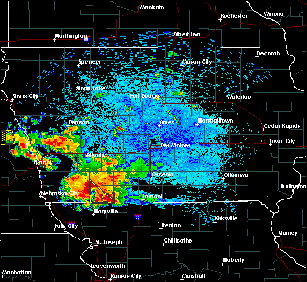 At 137 am cdt, a severe thunderstorm was located 7 miles northeast of clarinda, or 14 miles northwest of bedford, moving southeast at 25 mph (radar indicated). Hazards include 60 mph wind gusts and quarter size hail. Hail damage to vehicles is expected. Expect wind damage to roofs, siding, and trees. At 137 am cdt, a severe thunderstorm was located 7 miles northeast of clarinda, or 14 miles northwest of bedford, moving southeast at 25 mph (radar indicated). Hazards include 60 mph wind gusts and quarter size hail. Hail damage to vehicles is expected. Expect wind damage to roofs, siding, and trees.
|
| 7/18/2016 1:21 AM CDT |
 At 120 am cdt, a severe thunderstorm was located near bedford, moving east at 20 mph (radar indicated). Hazards include quarter size hail. damage to vehicles is expected At 120 am cdt, a severe thunderstorm was located near bedford, moving east at 20 mph (radar indicated). Hazards include quarter size hail. damage to vehicles is expected
|
| 7/7/2016 4:17 AM CDT |
 At 416 am cdt, severe thunderstorms were located along a line extending from near athelstan to near ravenwood to near stanberry to near union star, moving east at 45 mph (radar indicated). Hazards include 60 mph wind gusts. Expect damage to roofs. siding. and trees. Locations impacted include, maryville, savannah, albany, stanberry, maysville, king city, grant city, hopkins, ravenwood, union star, irena, barnard, conception junction, sheridan, parnell, bolckow, rosendale, darlington, weatherby and mcfall. At 416 am cdt, severe thunderstorms were located along a line extending from near athelstan to near ravenwood to near stanberry to near union star, moving east at 45 mph (radar indicated). Hazards include 60 mph wind gusts. Expect damage to roofs. siding. and trees. Locations impacted include, maryville, savannah, albany, stanberry, maysville, king city, grant city, hopkins, ravenwood, union star, irena, barnard, conception junction, sheridan, parnell, bolckow, rosendale, darlington, weatherby and mcfall.
|
| 7/7/2016 4:14 AM CDT |
 At 413 am cdt, severe thunderstorms were located along a line extending from near corning to near lenox to 6 miles east of hopkins, moving east at 45 mph (radar indicated). Hazards include 60 mph wind gusts. Expect damage to roofs. siding. And trees. At 413 am cdt, severe thunderstorms were located along a line extending from near corning to near lenox to 6 miles east of hopkins, moving east at 45 mph (radar indicated). Hazards include 60 mph wind gusts. Expect damage to roofs. siding. And trees.
|
| 7/7/2016 4:00 AM CDT |
 At 400 am cdt, severe thunderstorms were located along a line extending from near lenox to near hopkins, moving east at 55 mph (radar indicated). Hazards include 60 mph wind gusts and penny size hail. Expect damage to roofs. siding. and trees. these severe storms will be near, lenox around 410 am cdt. athelstan around 415 am cdt. Other locations impacted by these severe thunderstorms include sharpsburg, maloy, delphos, benton, gravity, redding, diagonal, blockton, new market and lake of three fires state park. At 400 am cdt, severe thunderstorms were located along a line extending from near lenox to near hopkins, moving east at 55 mph (radar indicated). Hazards include 60 mph wind gusts and penny size hail. Expect damage to roofs. siding. and trees. these severe storms will be near, lenox around 410 am cdt. athelstan around 415 am cdt. Other locations impacted by these severe thunderstorms include sharpsburg, maloy, delphos, benton, gravity, redding, diagonal, blockton, new market and lake of three fires state park.
|
| 7/7/2016 3:58 AM CDT |
 At 358 am cdt, severe thunderstorms were located along a line extending from hopkins to near maryville to 12 miles east of maitland to near savannah, moving east at 50 mph (radar indicated). Hazards include 70 mph wind gusts. Expect considerable tree damage. Damage is likely to mobile homes, roofs, and outbuildings. At 358 am cdt, severe thunderstorms were located along a line extending from hopkins to near maryville to 12 miles east of maitland to near savannah, moving east at 50 mph (radar indicated). Hazards include 70 mph wind gusts. Expect considerable tree damage. Damage is likely to mobile homes, roofs, and outbuildings.
|
| 7/7/2016 3:33 AM CDT |
 At 332 am cdt, severe thunderstorms were located along a line extending from near villisca to near blanchard, moving east at 60 mph (radar indicated). Hazards include 60 mph wind gusts and penny size hail. Expect damage to roofs. siding. and trees. severe thunderstorms will be near, lenox around 355 am cdt. bedford around 400 am cdt. athelstan around 405 am cdt. Other locations impacted by these severe thunderstorms include sharpsburg, maloy, delphos, benton, gravity, redding, diagonal, blockton, new market and lake of three fires state park. At 332 am cdt, severe thunderstorms were located along a line extending from near villisca to near blanchard, moving east at 60 mph (radar indicated). Hazards include 60 mph wind gusts and penny size hail. Expect damage to roofs. siding. and trees. severe thunderstorms will be near, lenox around 355 am cdt. bedford around 400 am cdt. athelstan around 405 am cdt. Other locations impacted by these severe thunderstorms include sharpsburg, maloy, delphos, benton, gravity, redding, diagonal, blockton, new market and lake of three fires state park.
|
| 6/26/2016 1:20 AM CDT |
 At 120 am cdt, severe thunderstorms were located along a line extending from near lenox to 8 miles west of mount ayr, moving east at 25 mph (radar indicated). Hazards include 60 mph wind gusts and penny size hail. Expect damage to roofs. siding. and trees. Locations impacted include, bedford, athelstan, clearfield, blockton, conway, lake of three fires state park and bedford municipal airport. At 120 am cdt, severe thunderstorms were located along a line extending from near lenox to 8 miles west of mount ayr, moving east at 25 mph (radar indicated). Hazards include 60 mph wind gusts and penny size hail. Expect damage to roofs. siding. and trees. Locations impacted include, bedford, athelstan, clearfield, blockton, conway, lake of three fires state park and bedford municipal airport.
|
| 6/26/2016 1:10 AM CDT |
 At 110 am cdt, severe thunderstorms were located along a line extending from near lenox to 8 miles north of athelstan, moving east at 25 mph (radar indicated). Hazards include 60 mph wind gusts. Expect damage to roofs. siding. and trees. Locations impacted include, bedford, athelstan, clearfield, blockton, conway, lake of three fires state park and bedford municipal airport. At 110 am cdt, severe thunderstorms were located along a line extending from near lenox to 8 miles north of athelstan, moving east at 25 mph (radar indicated). Hazards include 60 mph wind gusts. Expect damage to roofs. siding. and trees. Locations impacted include, bedford, athelstan, clearfield, blockton, conway, lake of three fires state park and bedford municipal airport.
|
| 6/26/2016 12:45 AM CDT |
 At 1244 am cdt, severe thunderstorms were located along a line extending from 9 miles south of corning to near bedford, moving east at 25 mph (radar indicated). Hazards include 60 mph wind gusts. Expect damage to roofs. siding. And trees. At 1244 am cdt, severe thunderstorms were located along a line extending from 9 miles south of corning to near bedford, moving east at 25 mph (radar indicated). Hazards include 60 mph wind gusts. Expect damage to roofs. siding. And trees.
|
| 5/26/2016 1:58 PM CDT |
 At 158 pm cdt, severe thunderstorms were located along a line extending from near fairfax to near maryville, moving northeast at 30 mph (radar indicated). Hazards include golf ball size hail and 60 mph wind gusts. People and animals outdoors will be injured. expect hail damage to roofs, siding, windows, and vehicles. expect wind damage to roofs, siding, and trees. Locations impacted include, maryville, fairfax, burlington junction, hopkins, ravenwood, skidmore, athelstan, conception junction, sheridan, parnell, clearmont, elmo, pickering, braddyville, clyde, arkoe, quitman, blanchard and conception. At 158 pm cdt, severe thunderstorms were located along a line extending from near fairfax to near maryville, moving northeast at 30 mph (radar indicated). Hazards include golf ball size hail and 60 mph wind gusts. People and animals outdoors will be injured. expect hail damage to roofs, siding, windows, and vehicles. expect wind damage to roofs, siding, and trees. Locations impacted include, maryville, fairfax, burlington junction, hopkins, ravenwood, skidmore, athelstan, conception junction, sheridan, parnell, clearmont, elmo, pickering, braddyville, clyde, arkoe, quitman, blanchard and conception.
|
| 5/26/2016 1:48 PM CDT |
 At 148 pm cdt, severe thunderstorms were located along a line extending from near fairfax to 7 miles south of maryville, moving northeast at 30 mph (radar indicated). Hazards include golf ball size hail and 60 mph wind gusts. People and animals outdoors will be injured. expect hail damage to roofs, siding, windows, and vehicles. Expect wind damage to roofs, siding, and trees. At 148 pm cdt, severe thunderstorms were located along a line extending from near fairfax to 7 miles south of maryville, moving northeast at 30 mph (radar indicated). Hazards include golf ball size hail and 60 mph wind gusts. People and animals outdoors will be injured. expect hail damage to roofs, siding, windows, and vehicles. Expect wind damage to roofs, siding, and trees.
|
| 8/2/2015 11:53 PM CDT |
 The severe thunderstorm warning for southwestern taylor county will expire at 1200 am cdt, the severe thunderstorm which prompted the warning has moved out of the warned area. therefore the warning will be allowed to expire. a severe thunderstorm watch remains in effect until midnight cdt for southwestern iowa. The severe thunderstorm warning for southwestern taylor county will expire at 1200 am cdt, the severe thunderstorm which prompted the warning has moved out of the warned area. therefore the warning will be allowed to expire. a severe thunderstorm watch remains in effect until midnight cdt for southwestern iowa.
|
| 8/2/2015 11:34 PM CDT |
 At 1134 pm cdt, a severe thunderstorm was located 5 miles west of bedford, moving southeast at 30 mph (radar indicated). Hazards include 60 mph wind gusts and quarter size hail. Hail damage to vehicles is expected. expect wind damage to roofs, siding and trees. Locations impacted include, bedford, new market, athelstan and bedford municipal airport. At 1134 pm cdt, a severe thunderstorm was located 5 miles west of bedford, moving southeast at 30 mph (radar indicated). Hazards include 60 mph wind gusts and quarter size hail. Hail damage to vehicles is expected. expect wind damage to roofs, siding and trees. Locations impacted include, bedford, new market, athelstan and bedford municipal airport.
|
| 8/2/2015 11:14 PM CDT |
 At 1113 pm cdt, a severe thunderstorm was located 5 miles northeast of clarinda, or 13 miles northwest of bedford, moving southeast at 30 mph (radar indicated). Hazards include 60 mph wind gusts and quarter size hail. Hail damage to vehicles is expected. Expect wind damage to roofs, siding and trees. At 1113 pm cdt, a severe thunderstorm was located 5 miles northeast of clarinda, or 13 miles northwest of bedford, moving southeast at 30 mph (radar indicated). Hazards include 60 mph wind gusts and quarter size hail. Hail damage to vehicles is expected. Expect wind damage to roofs, siding and trees.
|
| 8/2/2015 11:11 PM CDT |
 At 1111 pm cdt, a severe thunderstorm was located near hopkins, or 11 miles northeast of maryville, moving southeast at 20 mph (trained weather spotters). Hazards include 60 mph wind gusts and quarter size hail. Hail damage to vehicles is expected. expect wind damage to roofs, siding and trees. Locations impacted include, hopkins, ravenwood, athelstan, sheridan, parnell, pickering and worth. At 1111 pm cdt, a severe thunderstorm was located near hopkins, or 11 miles northeast of maryville, moving southeast at 20 mph (trained weather spotters). Hazards include 60 mph wind gusts and quarter size hail. Hail damage to vehicles is expected. expect wind damage to roofs, siding and trees. Locations impacted include, hopkins, ravenwood, athelstan, sheridan, parnell, pickering and worth.
|
| 8/2/2015 11:03 PM CDT |
 At 1102 pm cdt, a severe thunderstorm was located near hopkins, or 11 miles south of bedford, moving southeast at 20 mph (radar indicated). Hazards include 60 mph wind gusts and quarter size hail. Hail damage to vehicles is expected. Expect wind damage to roofs, siding and trees. At 1102 pm cdt, a severe thunderstorm was located near hopkins, or 11 miles south of bedford, moving southeast at 20 mph (radar indicated). Hazards include 60 mph wind gusts and quarter size hail. Hail damage to vehicles is expected. Expect wind damage to roofs, siding and trees.
|
| 8/2/2015 9:12 PM CDT | The severe thunderstorm warning for south central taylor county will expire at 915 pm cdt, the storm which prompted the warning has weakened below severe limits, and no longer pose an immediate threat to life or property. therefore the warning will be allowed to expire. however small. |
| 8/2/2015 8:59 PM CDT |
 At 859 pm cdt, a severe thunderstorm was located 5 miles southeast of bedford, moving south at 25 mph (radar indicated). Hazards include 60 mph wind gusts and quarter size hail. Hail damage to vehicles is expected. expect wind damage to roofs, siding and trees. Locations impacted include, bedford, athelstan, bedford municipal airport and lake of three fires state park. At 859 pm cdt, a severe thunderstorm was located 5 miles southeast of bedford, moving south at 25 mph (radar indicated). Hazards include 60 mph wind gusts and quarter size hail. Hail damage to vehicles is expected. expect wind damage to roofs, siding and trees. Locations impacted include, bedford, athelstan, bedford municipal airport and lake of three fires state park.
|
| 8/2/2015 8:29 PM CDT |
 At 828 pm cdt, a severe thunderstorm was located 4 miles west of bedford, moving south at 25 mph. a tornado warning continues for this storm as well (trained weather spotters). Hazards include golf ball size hail and 60 mph wind gusts. People and animals outdoors will be injured. expect hail damage to roofs, siding, windows and vehicles. Expect wind damage to roofs, siding and trees. At 828 pm cdt, a severe thunderstorm was located 4 miles west of bedford, moving south at 25 mph. a tornado warning continues for this storm as well (trained weather spotters). Hazards include golf ball size hail and 60 mph wind gusts. People and animals outdoors will be injured. expect hail damage to roofs, siding, windows and vehicles. Expect wind damage to roofs, siding and trees.
|
| 8/2/2015 8:03 PM CDT |
 At 802 pm cdt, a severe thunderstorm was located 10 miles northwest of bedford, moving southeast at 25 mph (radar indicated). Hazards include 60 mph wind gusts and quarter size hail. Hail damage to vehicles is expected. expect wind damage to roofs, siding and trees. Locations impacted include, bedford, new market, blockton, gravity, sharpsburg, conway, athelstan, lake of three fires state park and bedford municipal airport. At 802 pm cdt, a severe thunderstorm was located 10 miles northwest of bedford, moving southeast at 25 mph (radar indicated). Hazards include 60 mph wind gusts and quarter size hail. Hail damage to vehicles is expected. expect wind damage to roofs, siding and trees. Locations impacted include, bedford, new market, blockton, gravity, sharpsburg, conway, athelstan, lake of three fires state park and bedford municipal airport.
|
| 8/2/2015 7:42 PM CDT |
 At 741 pm cdt, a severe thunderstorm was located 8 miles southeast of villisca, or 11 miles southwest of corning, moving south at 25 mph (radar indicated). Hazards include 60 mph wind gusts and quarter size hail. Hail damage to vehicles is expected. Expect wind damage to roofs, siding and trees. At 741 pm cdt, a severe thunderstorm was located 8 miles southeast of villisca, or 11 miles southwest of corning, moving south at 25 mph (radar indicated). Hazards include 60 mph wind gusts and quarter size hail. Hail damage to vehicles is expected. Expect wind damage to roofs, siding and trees.
|
| 8/2/2015 7:01 PM CDT |
 At 701 pm cdt, a severe thunderstorm was located 5 miles east of villisca, or 8 miles southwest of corning, moving south at 45 mph (radar indicated). Hazards include 60 mph wind gusts and quarter size hail. Hail damage to vehicles is expected. Expect wind damage to roofs, siding and trees. At 701 pm cdt, a severe thunderstorm was located 5 miles east of villisca, or 8 miles southwest of corning, moving south at 45 mph (radar indicated). Hazards include 60 mph wind gusts and quarter size hail. Hail damage to vehicles is expected. Expect wind damage to roofs, siding and trees.
|
| 6/10/2015 5:03 PM CDT |
 At 501 pm cdt, a severe thunderstorm was located 8 miles northwest of irena, or 10 miles southeast of bedford, moving east at 30 mph (radar indicated). Hazards include 60 mph wind gusts and quarter size hail. Hail damage to vehicles is expected. expect wind damage to roofs, siding and trees. heavy rainfall is also associated with this storm. radar estimates between 1 to 2 inches of rain has fallen with this storm. Locations impacted include, bedford, new market, blockton, gravity, conway, athelstan, lake of three fires state park and bedford municipal airport. At 501 pm cdt, a severe thunderstorm was located 8 miles northwest of irena, or 10 miles southeast of bedford, moving east at 30 mph (radar indicated). Hazards include 60 mph wind gusts and quarter size hail. Hail damage to vehicles is expected. expect wind damage to roofs, siding and trees. heavy rainfall is also associated with this storm. radar estimates between 1 to 2 inches of rain has fallen with this storm. Locations impacted include, bedford, new market, blockton, gravity, conway, athelstan, lake of three fires state park and bedford municipal airport.
|
| 6/10/2015 4:39 PM CDT |
 At 414 pm cdt, a severe thunderstorm was located 9 miles west of grant city, and moving east at 15 mph (radar indicated). Hazards include 60 mph wind gusts and half dollar size hail. Hail damage to vehicles is expected. expect wind damage to roofs, siding and trees. Locations impacted include, mainly rural areas of central worth county. At 414 pm cdt, a severe thunderstorm was located 9 miles west of grant city, and moving east at 15 mph (radar indicated). Hazards include 60 mph wind gusts and half dollar size hail. Hail damage to vehicles is expected. expect wind damage to roofs, siding and trees. Locations impacted include, mainly rural areas of central worth county.
|
| 6/10/2015 4:23 PM CDT |
 At 423 pm cdt, a severe thunderstorm was located 8 miles southeast of clarinda, or 8 miles west of bedford, moving east at 30 mph (radar indicated). Hazards include 60 mph wind gusts and half dollar size hail. Hail damage to vehicles is expected. Expect wind damage to roofs, siding and trees. At 423 pm cdt, a severe thunderstorm was located 8 miles southeast of clarinda, or 8 miles west of bedford, moving east at 30 mph (radar indicated). Hazards include 60 mph wind gusts and half dollar size hail. Hail damage to vehicles is expected. Expect wind damage to roofs, siding and trees.
|
| 6/10/2015 4:17 PM CDT |
 At 414 pm cdt, a severe thunderstorm was located 9 miles west of grant city, and moving east at 15 mph (radar indicated). Hazards include 60 mph wind gusts and half dollar size hail. Hail damage to vehicles is expected. expect wind damage to roofs, siding and trees. Locations impacted include, mainly rural areas of central worth county. At 414 pm cdt, a severe thunderstorm was located 9 miles west of grant city, and moving east at 15 mph (radar indicated). Hazards include 60 mph wind gusts and half dollar size hail. Hail damage to vehicles is expected. expect wind damage to roofs, siding and trees. Locations impacted include, mainly rural areas of central worth county.
|
| 6/10/2015 3:58 PM CDT |
 At 357 pm cdt, a severe thunderstorm was located 9 miles northwest of grant city, and moving east at 10 mph (radar indicated). Hazards include 60 mph wind gusts and half dollar size hail. Hail damage to vehicles is expected. Expect wind damage to roofs, siding and trees. At 357 pm cdt, a severe thunderstorm was located 9 miles northwest of grant city, and moving east at 10 mph (radar indicated). Hazards include 60 mph wind gusts and half dollar size hail. Hail damage to vehicles is expected. Expect wind damage to roofs, siding and trees.
|
| 6/7/2015 3:58 PM CDT | At 357 pm cdt, a severe thunderstorm was located near grant city, and moving east at 30 mph (radar indicated). Hazards include 60 mph wind gusts and quarter size hail. Hail damage to vehicles is expected. Expect wind damage to roofs, siding and trees. |
| 5/25/2015 7:47 PM CDT | At 743 pm cdt, severe thunderstorms were located along a line extending from 10 miles northwest of grant city to stanberry, and moving east at 20 mph (radar indicated). Hazards include 60 mph wind gusts and quarter size hail. Hail damage to vehicles is expected. Expect wind damage to roofs, siding and trees. |
Hail Maps for Athelstan, MO
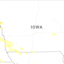
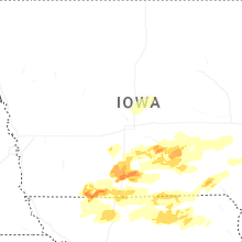

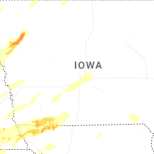
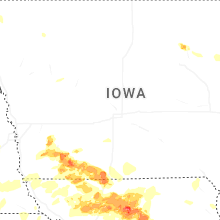
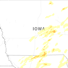
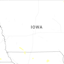

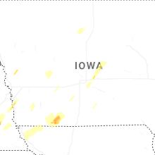


Connect with Interactive Hail Maps