

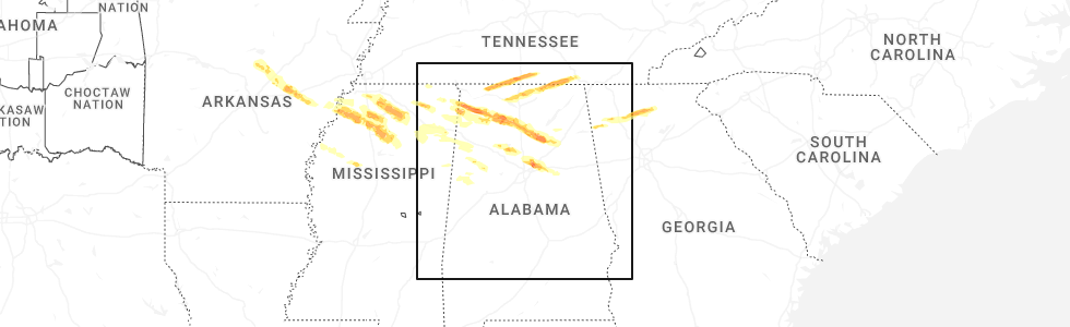
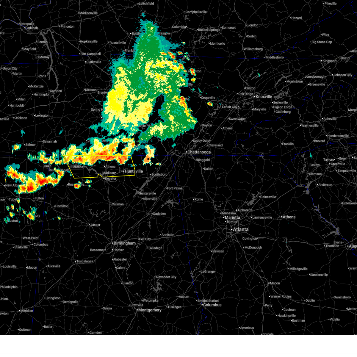
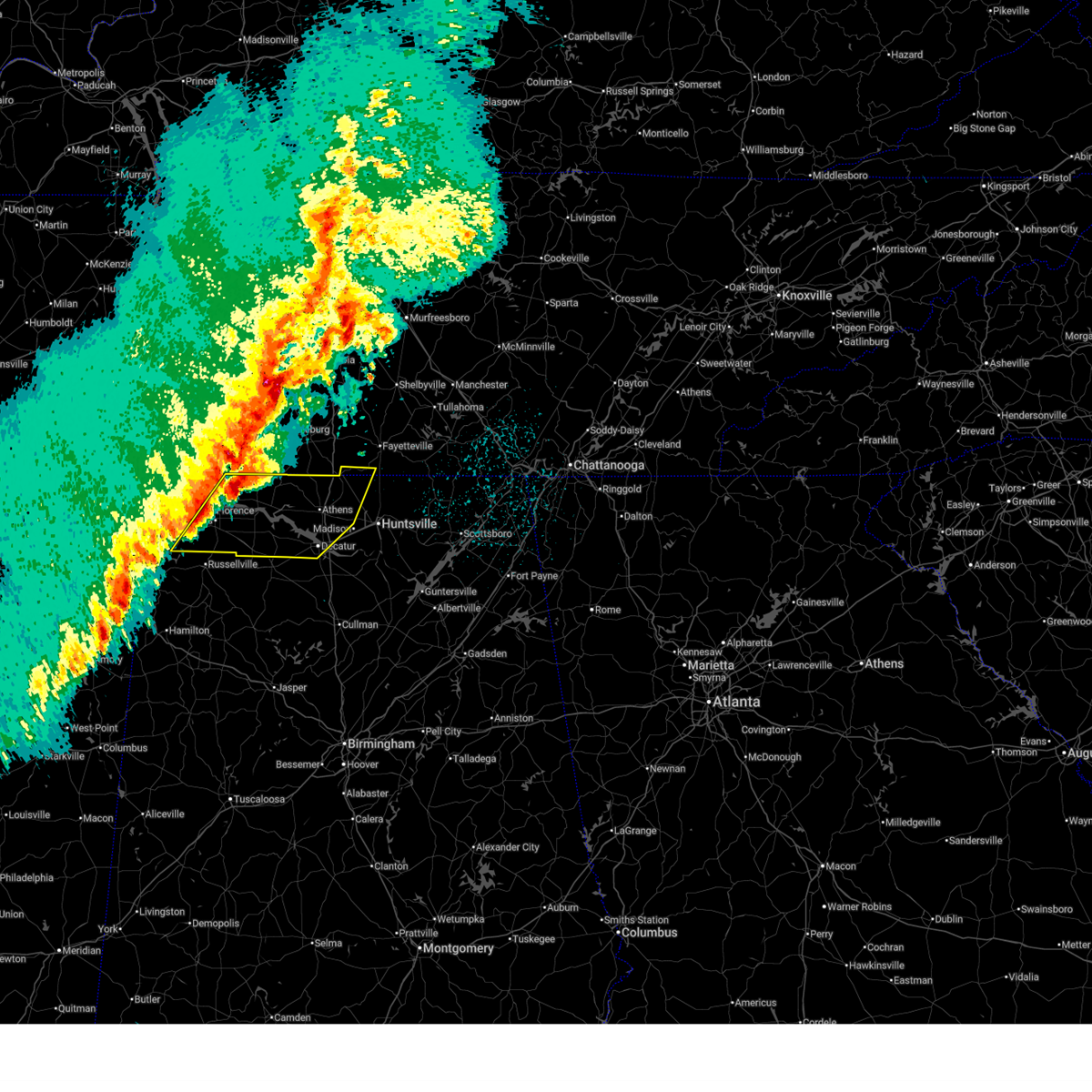
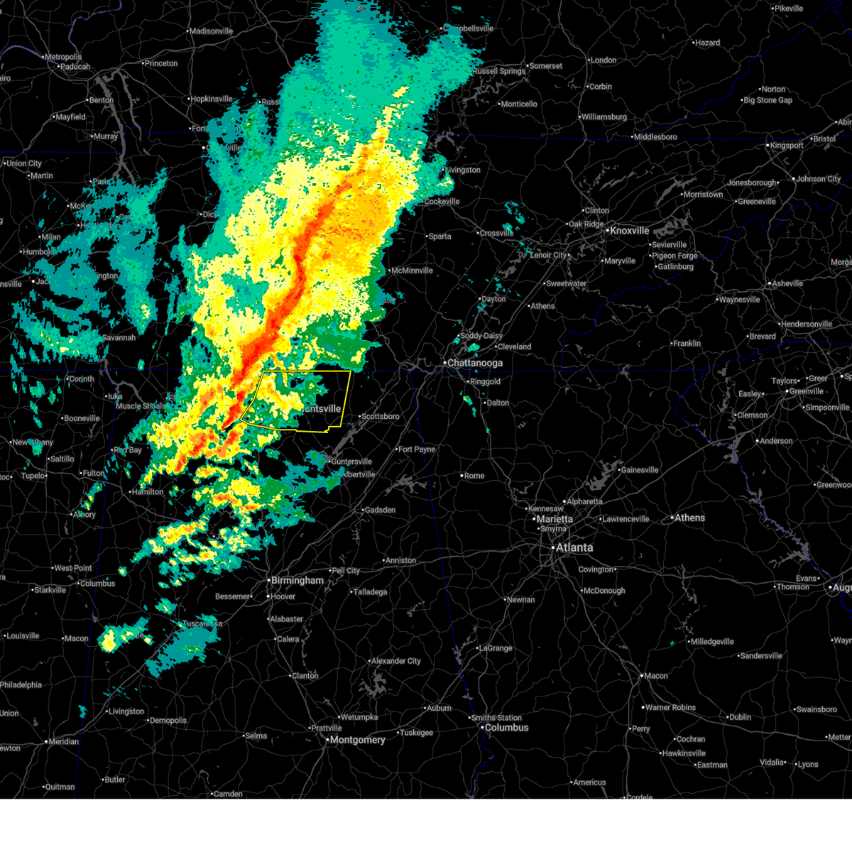
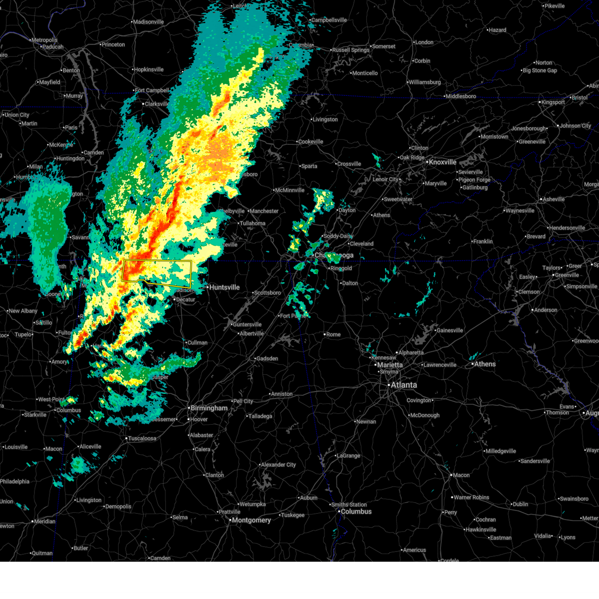
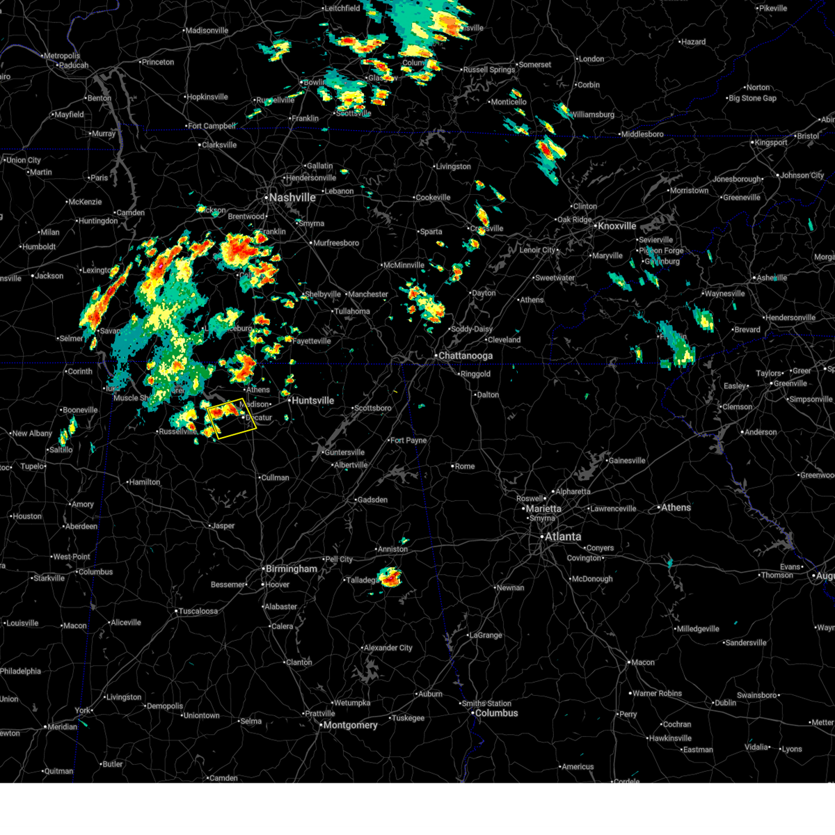
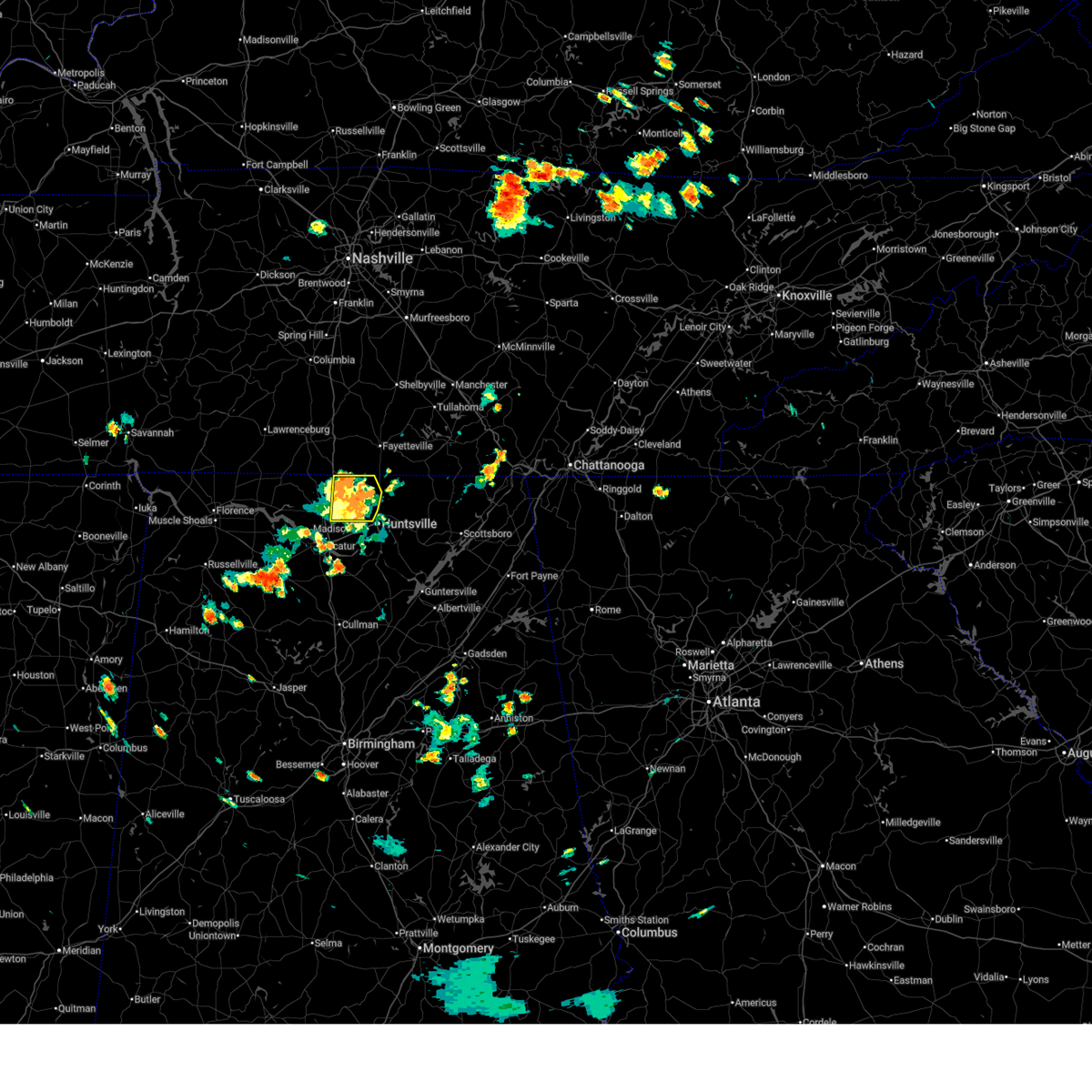
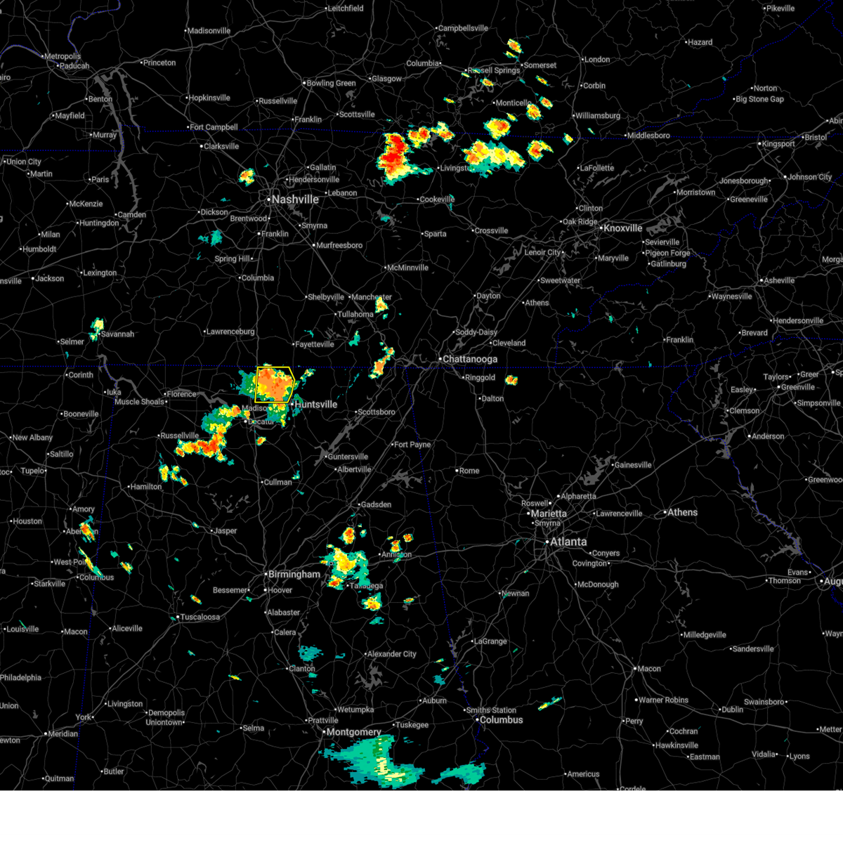
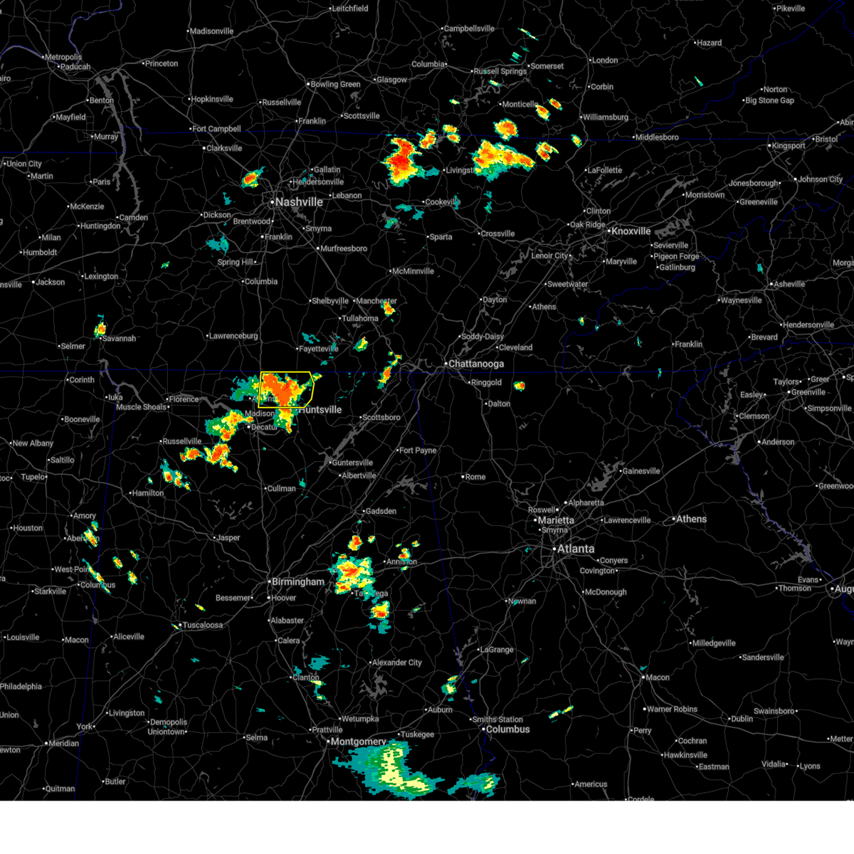
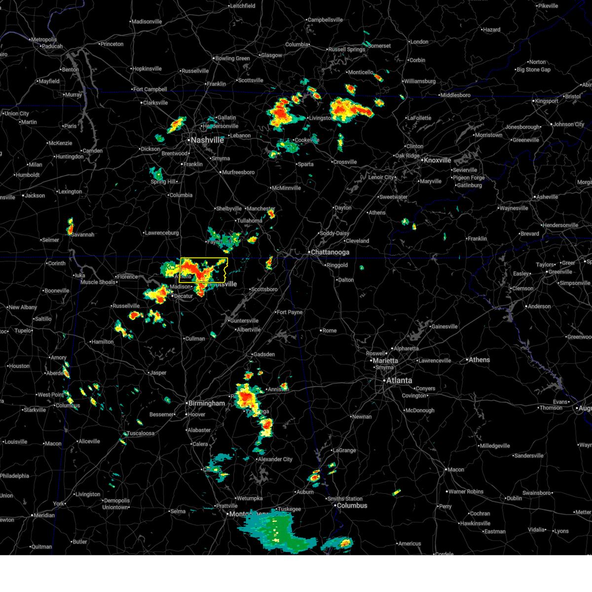
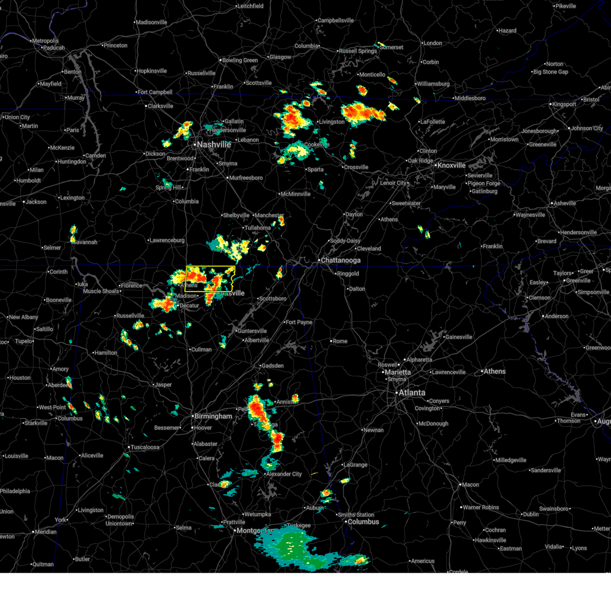
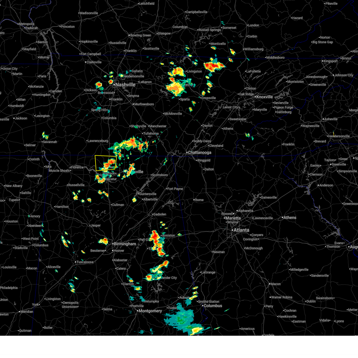
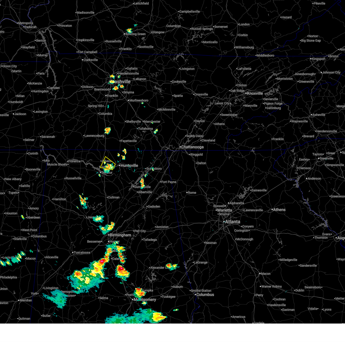
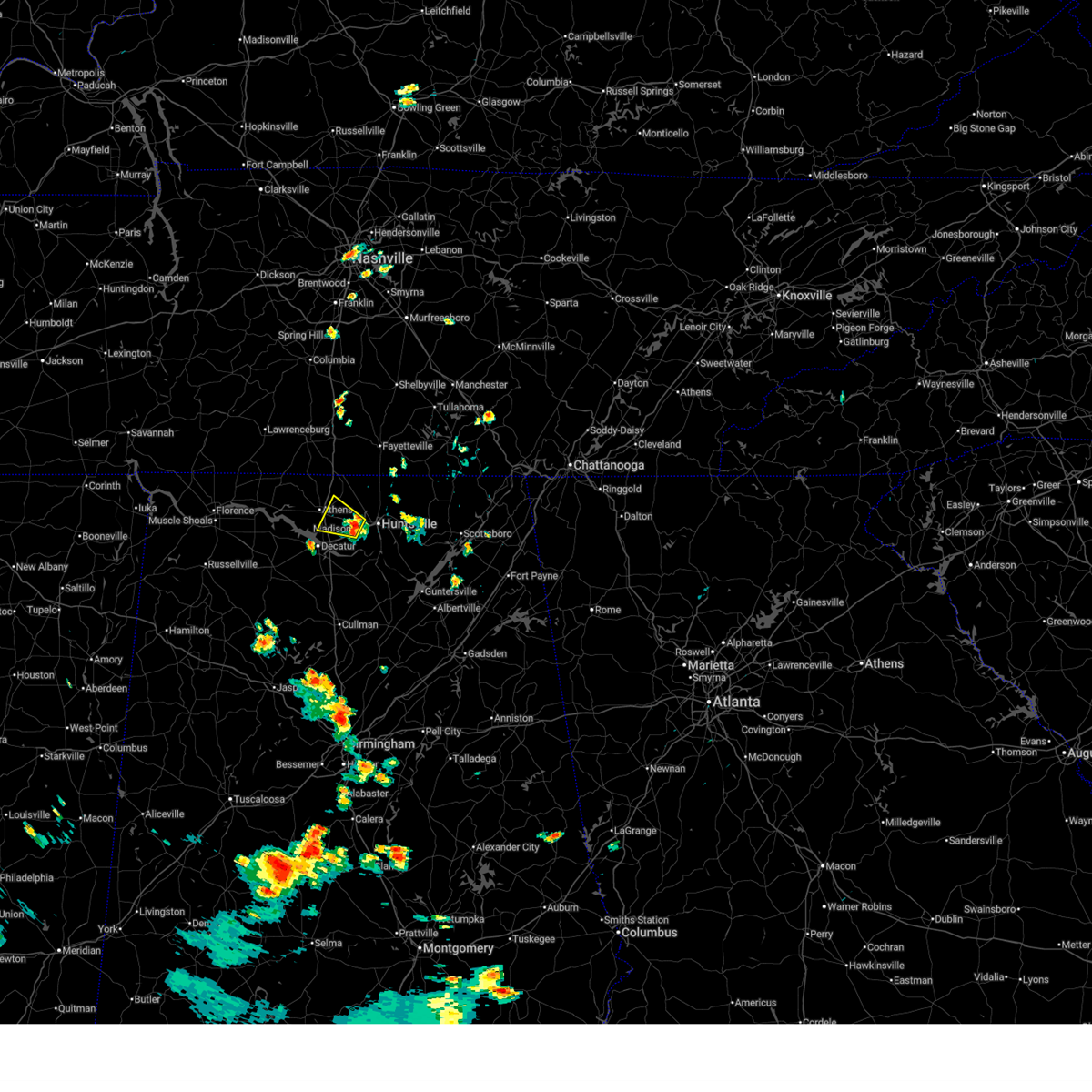
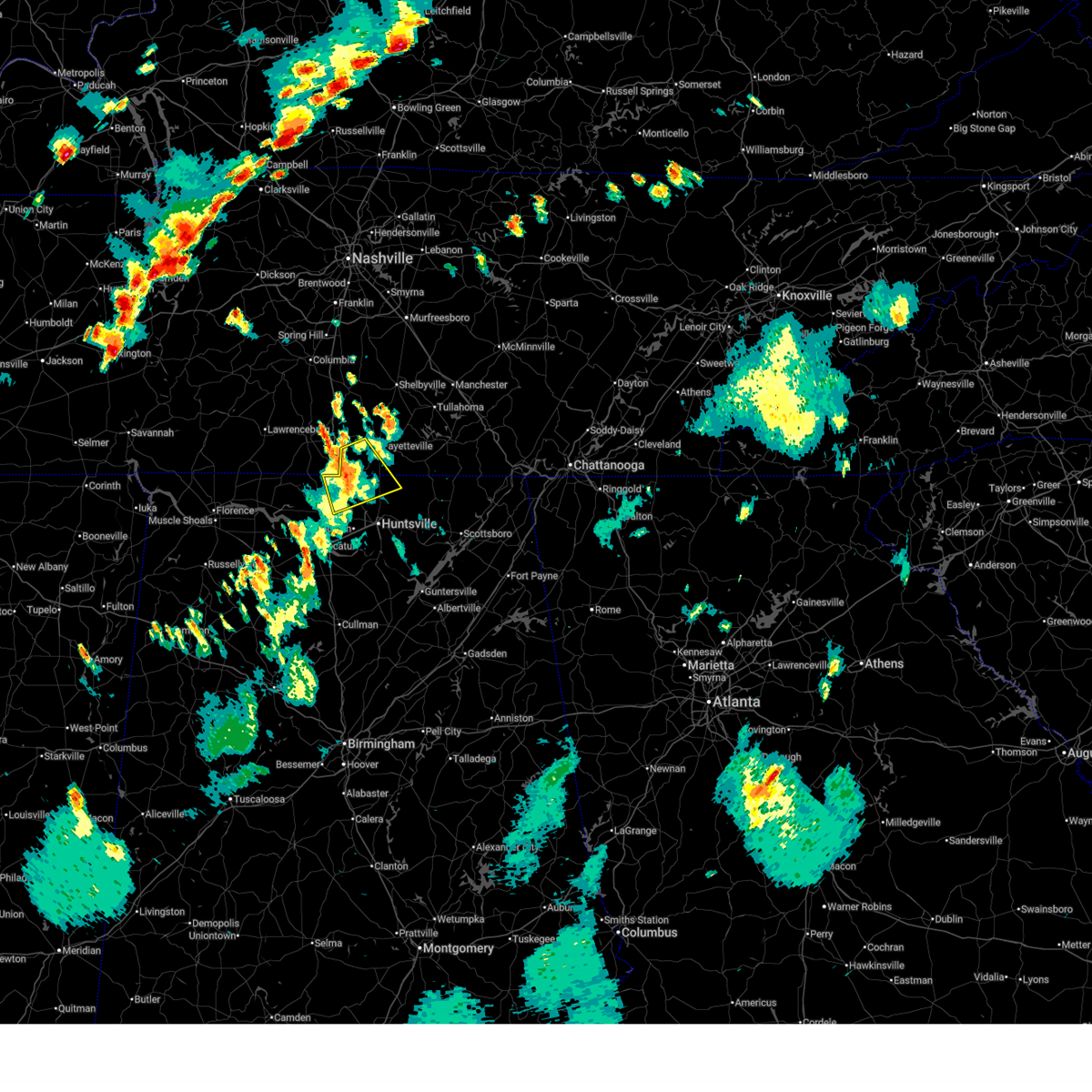
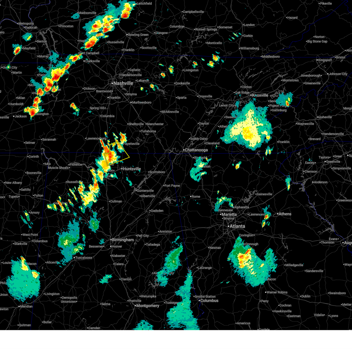
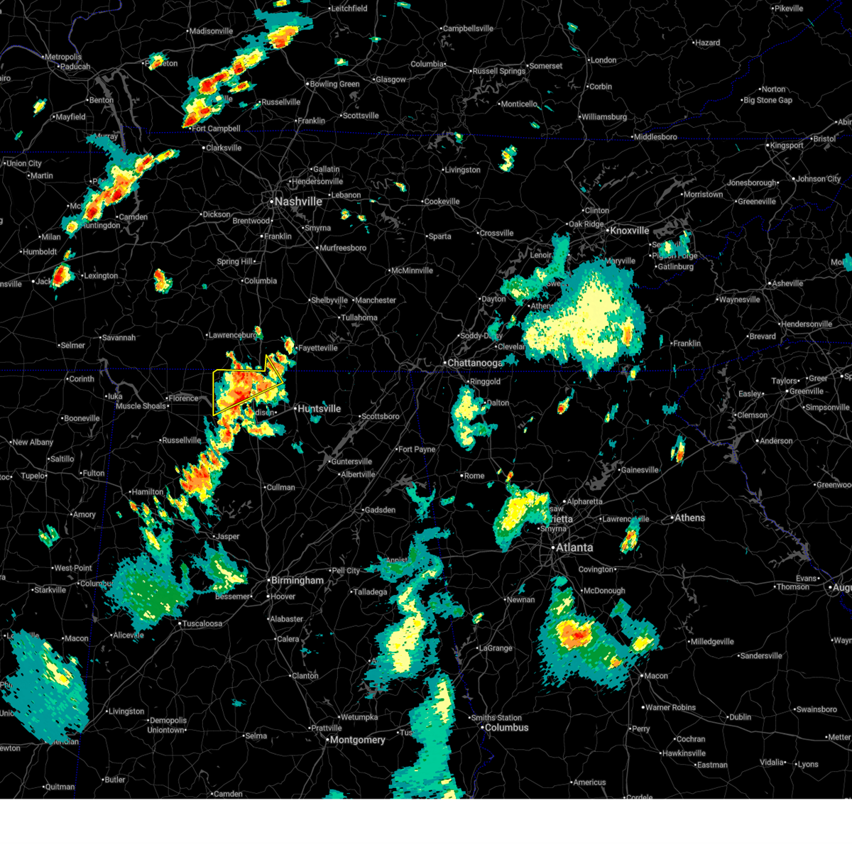
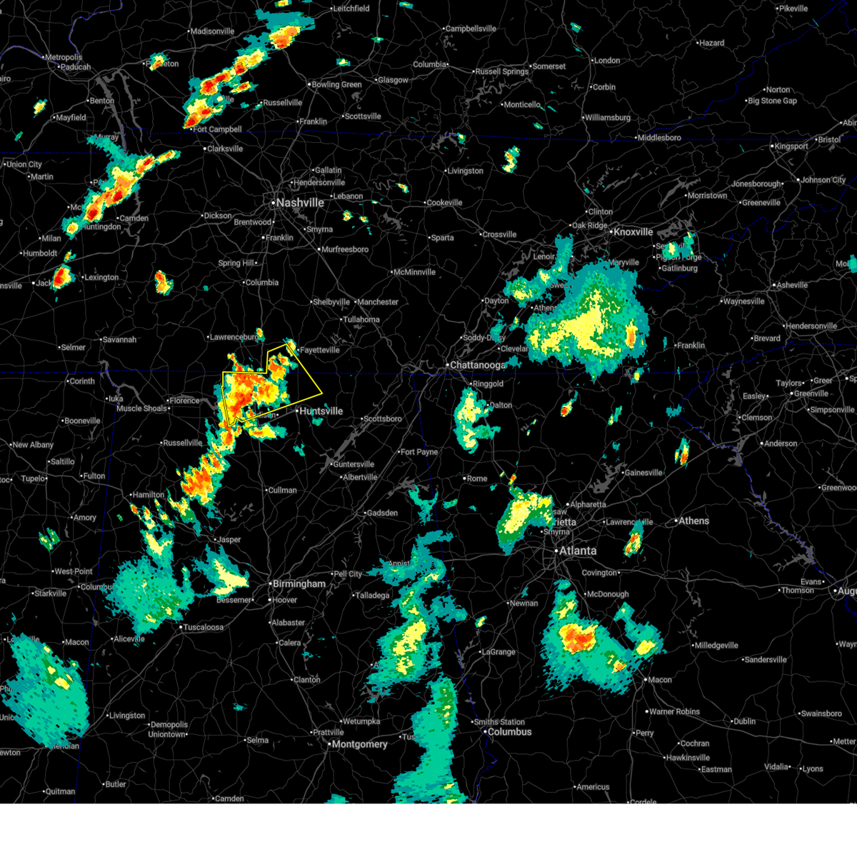
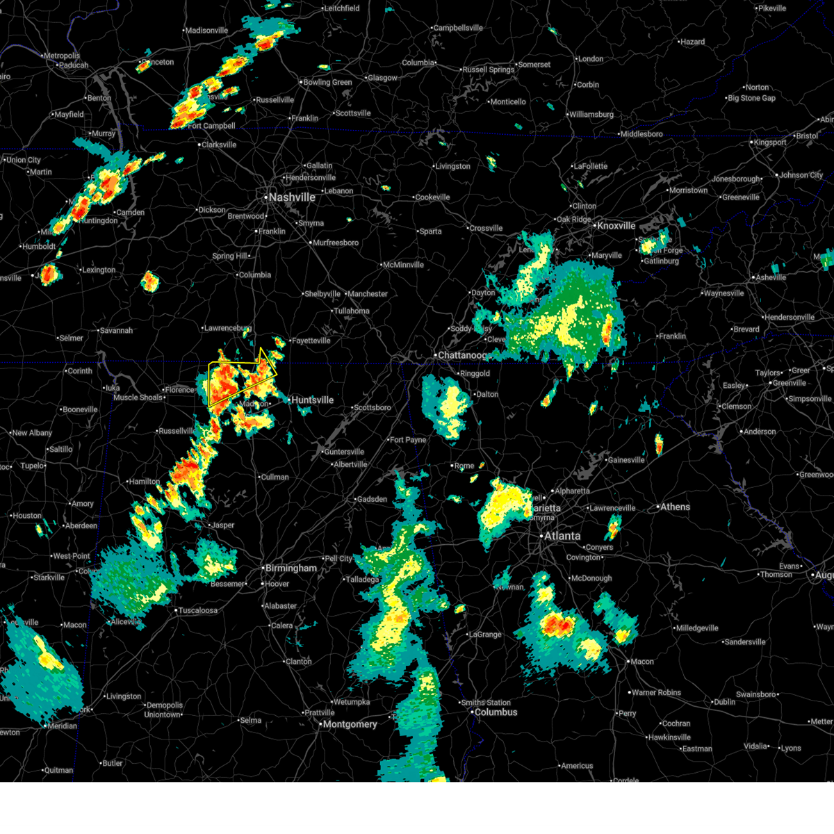
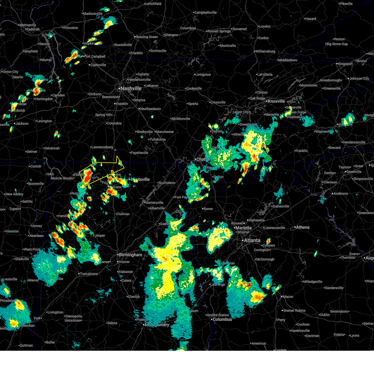
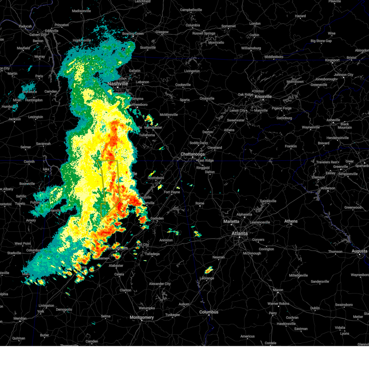
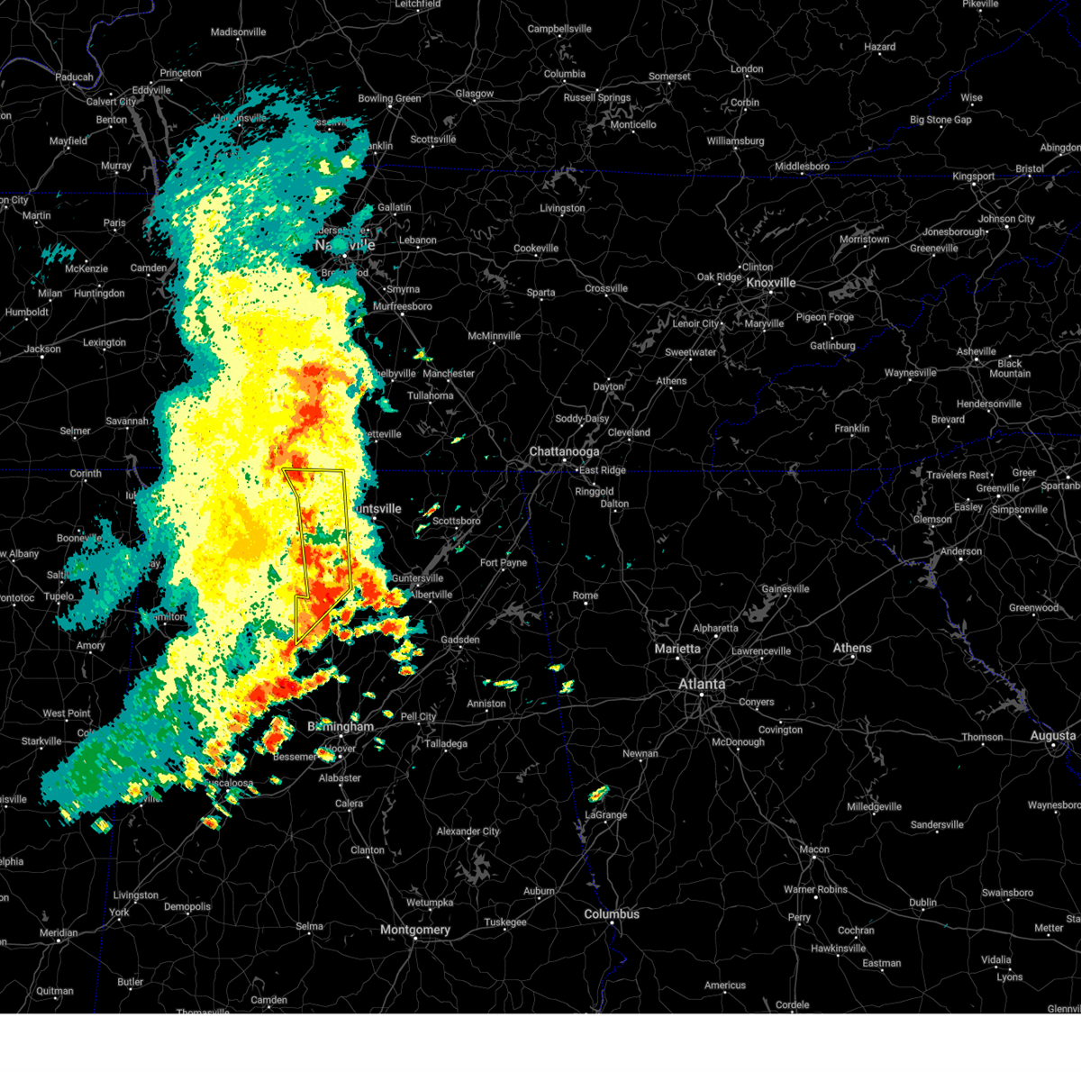
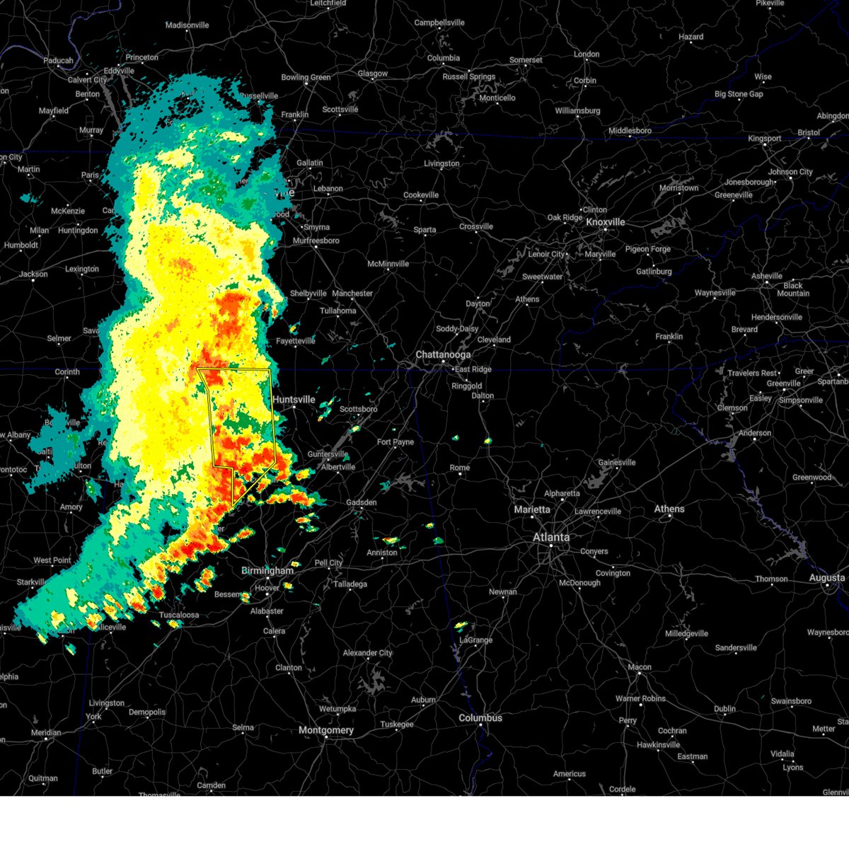
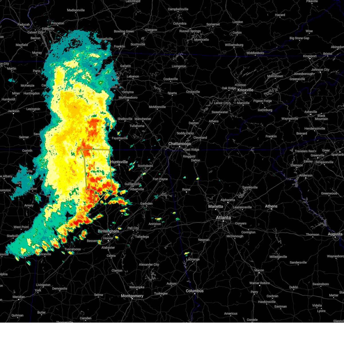
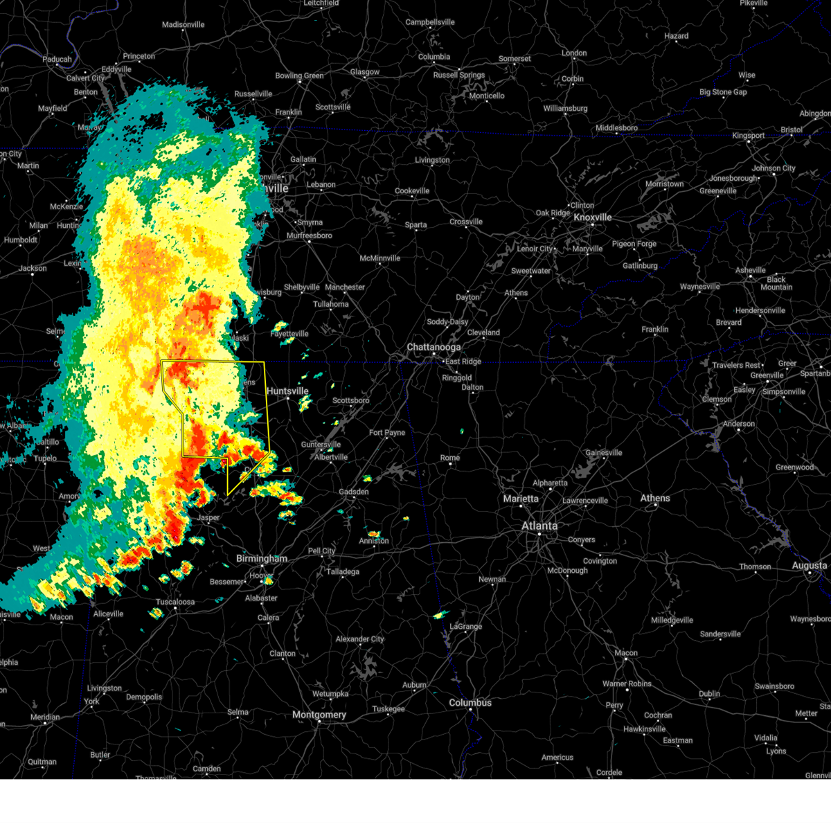
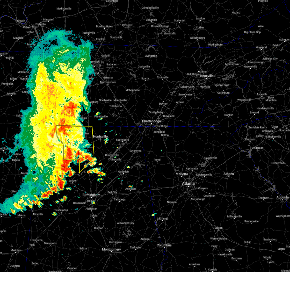
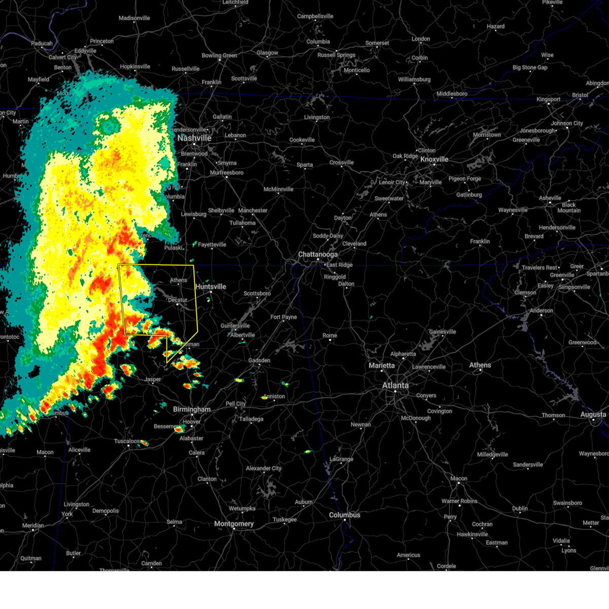
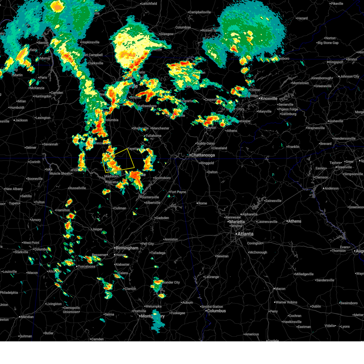
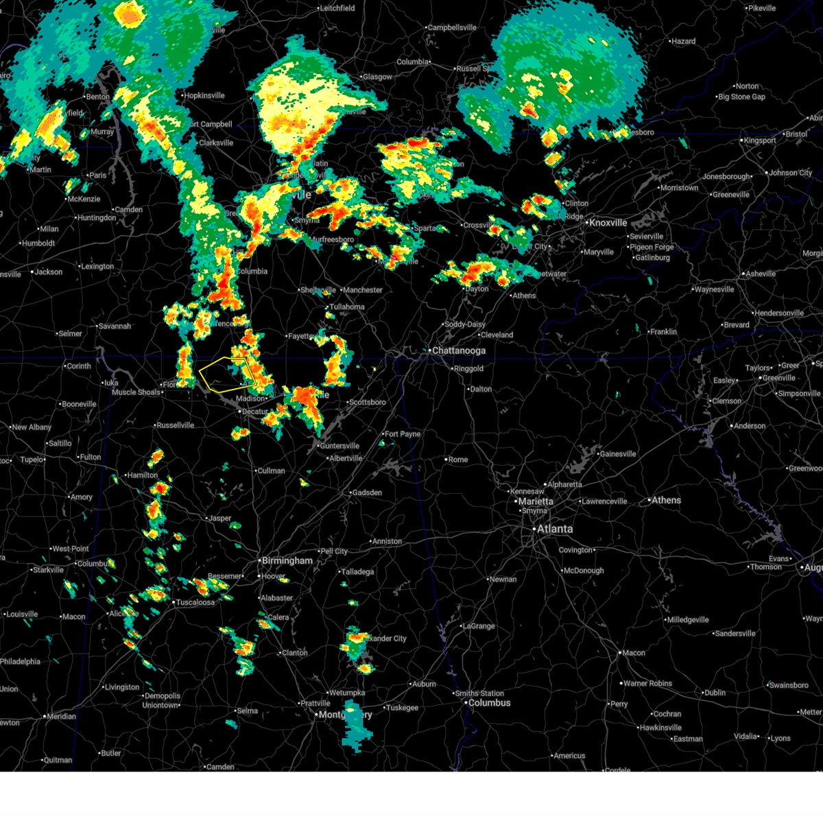
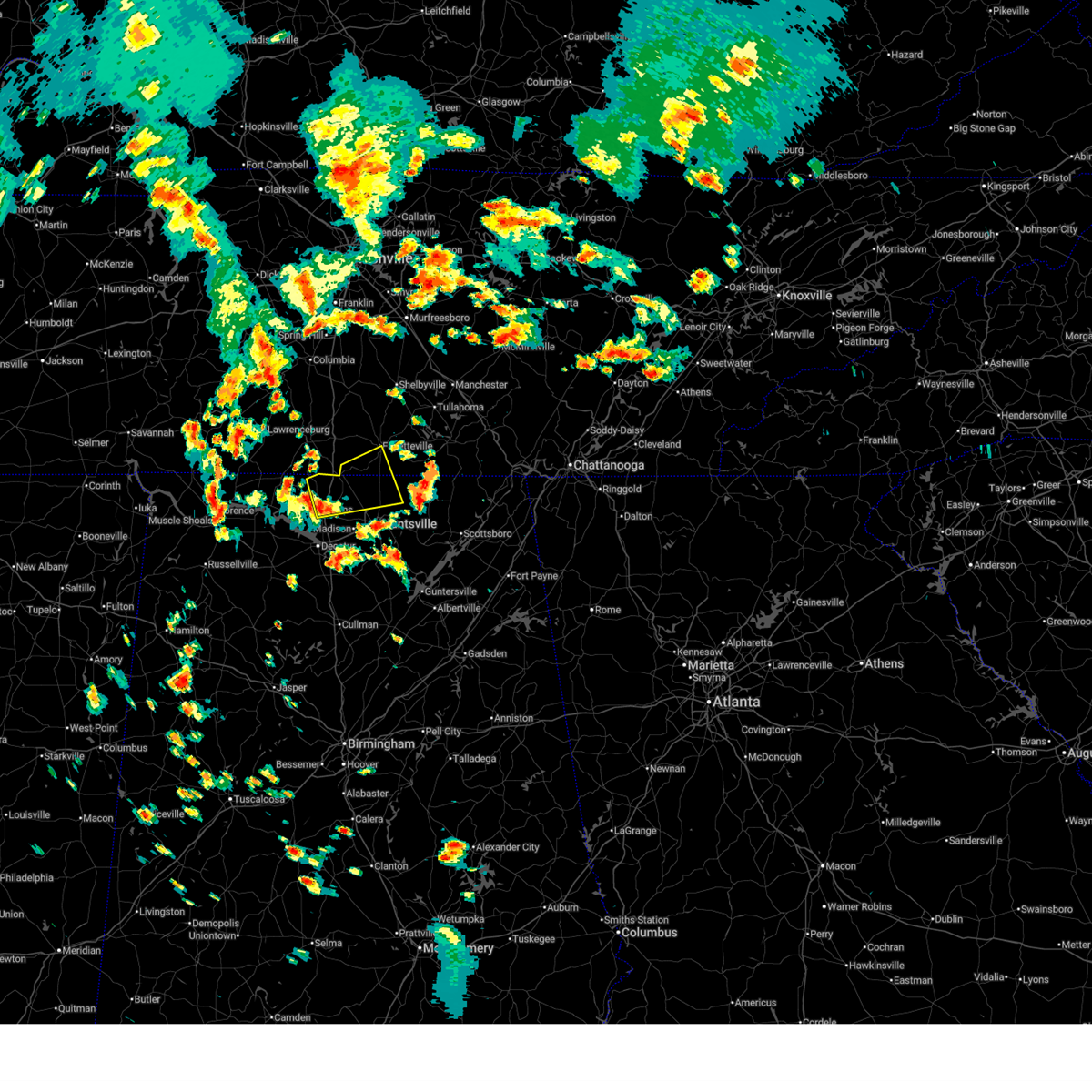
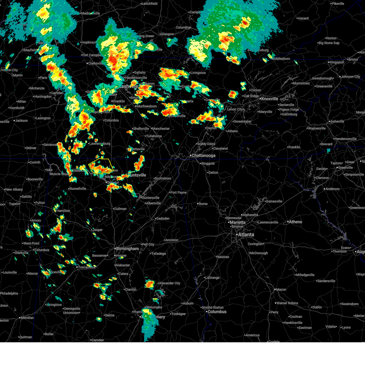
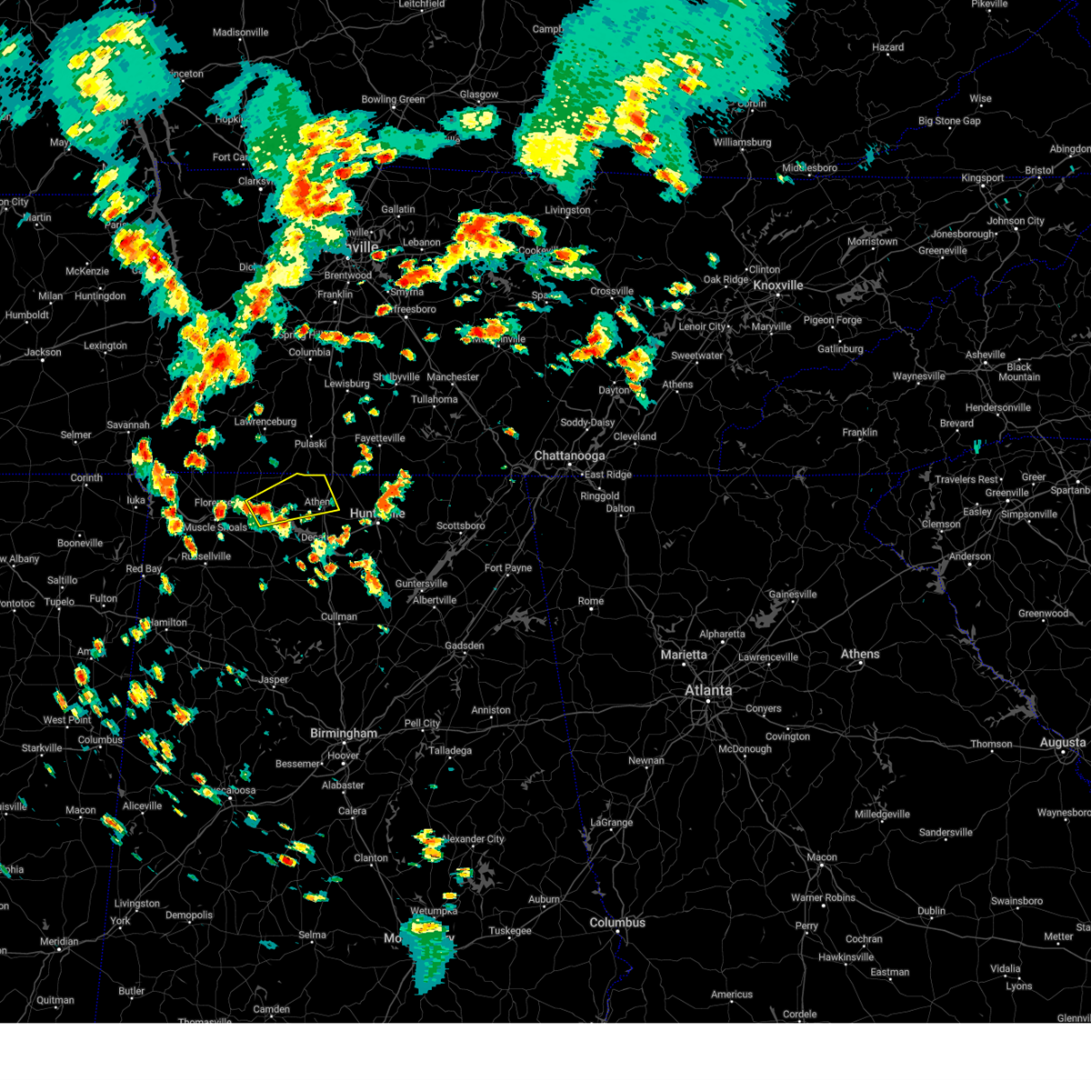
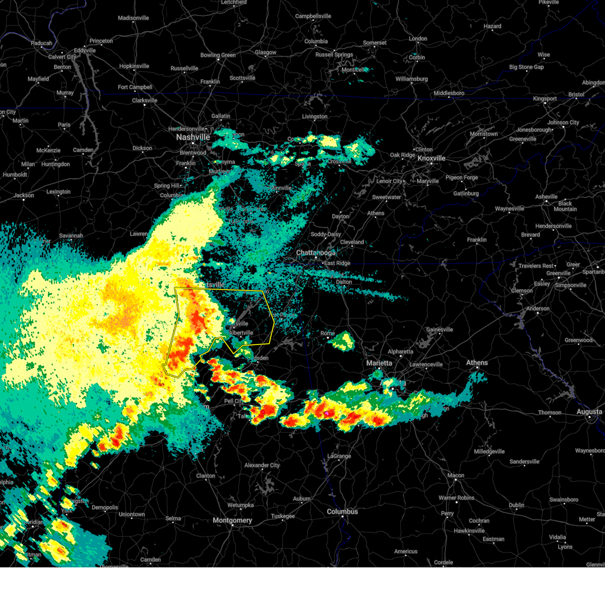
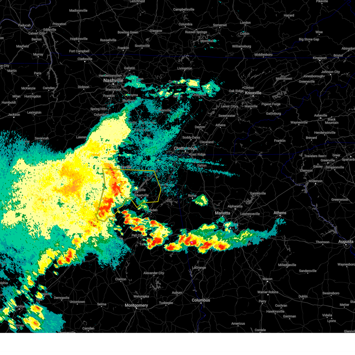
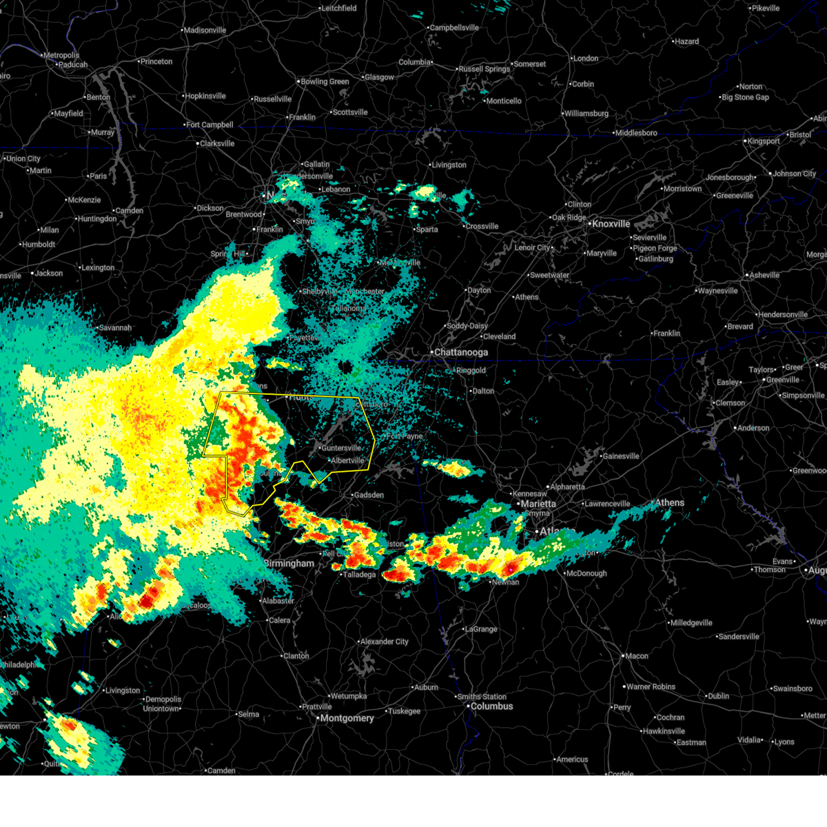
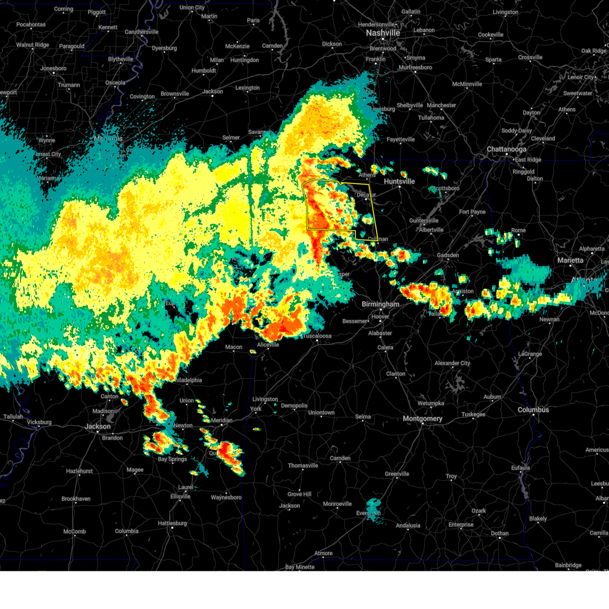
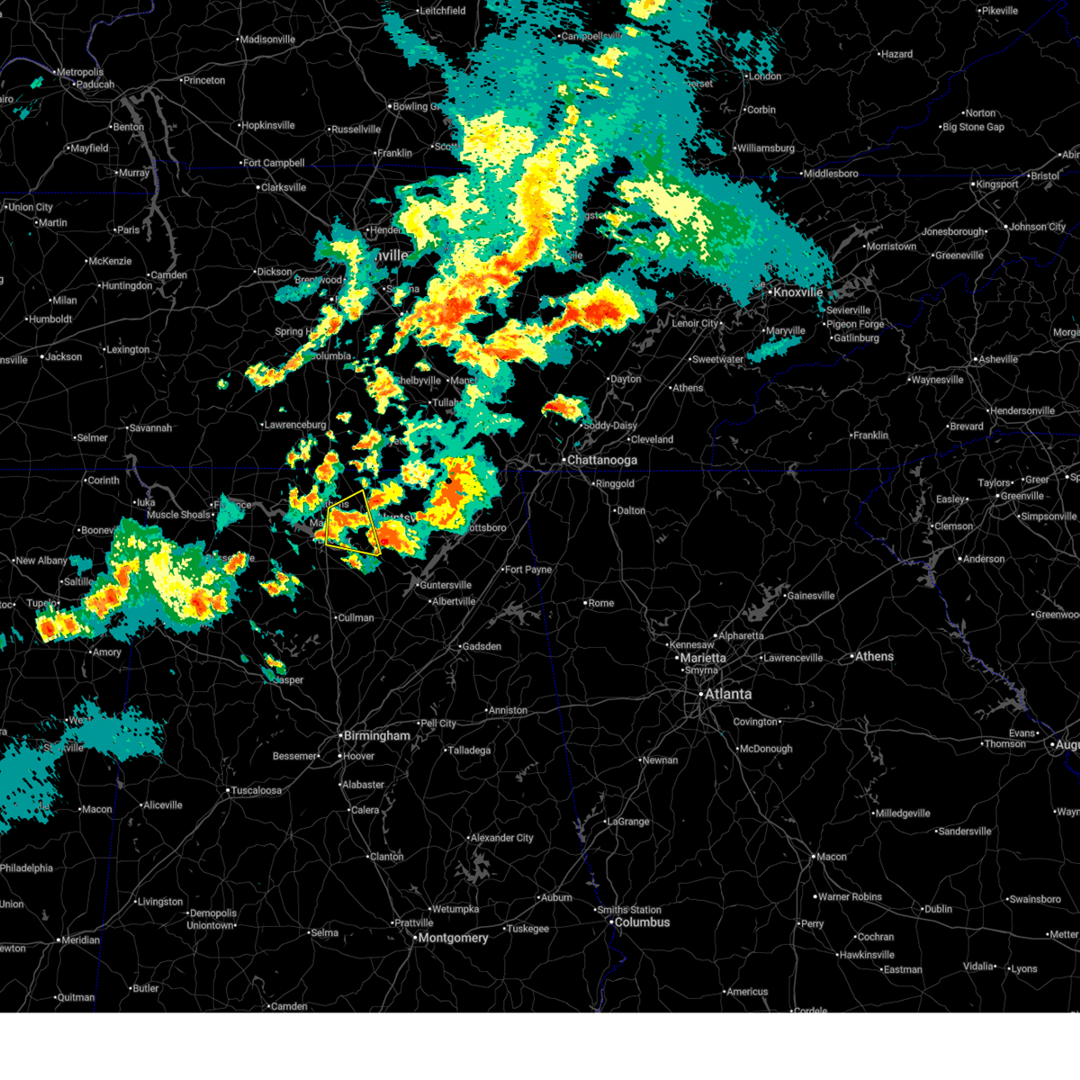
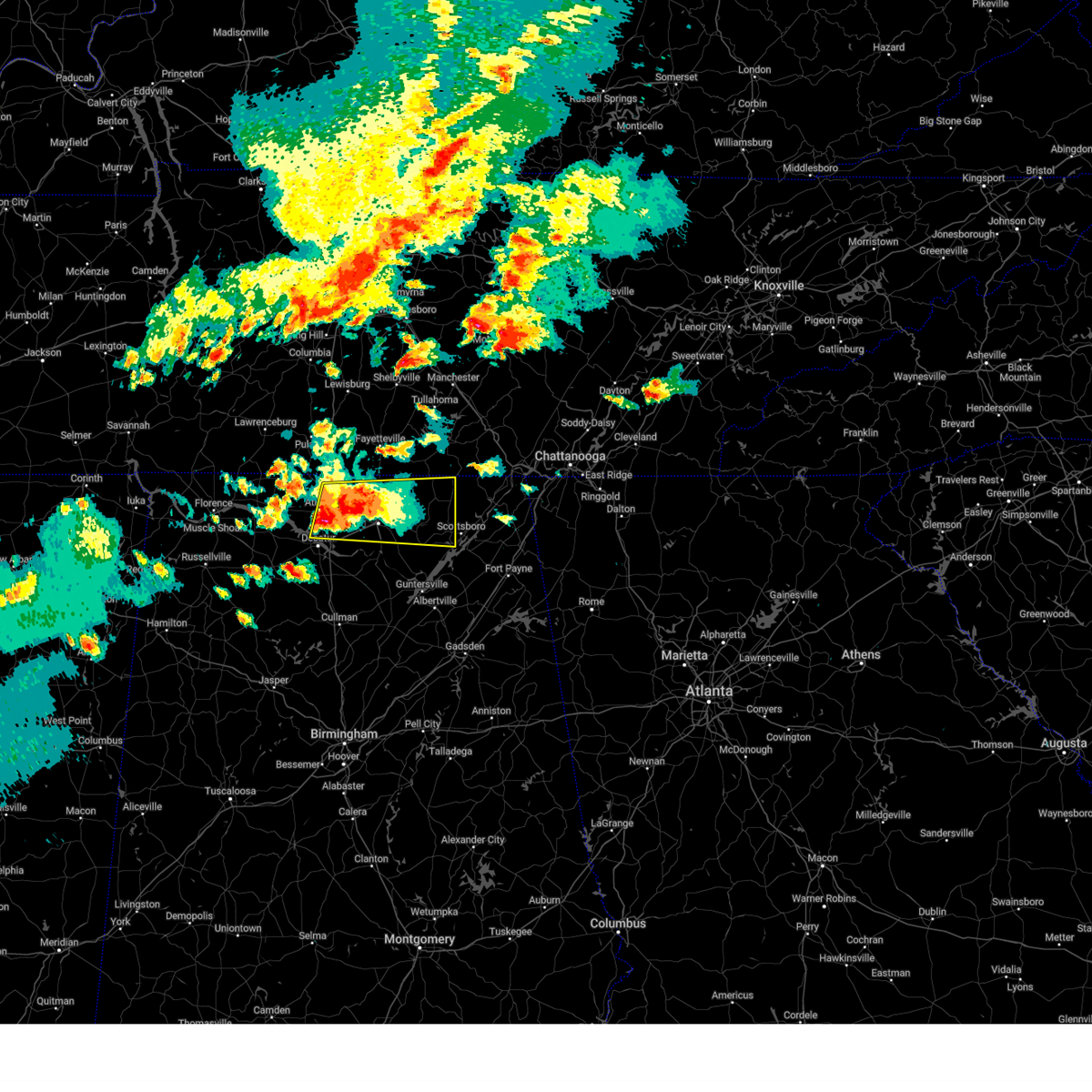
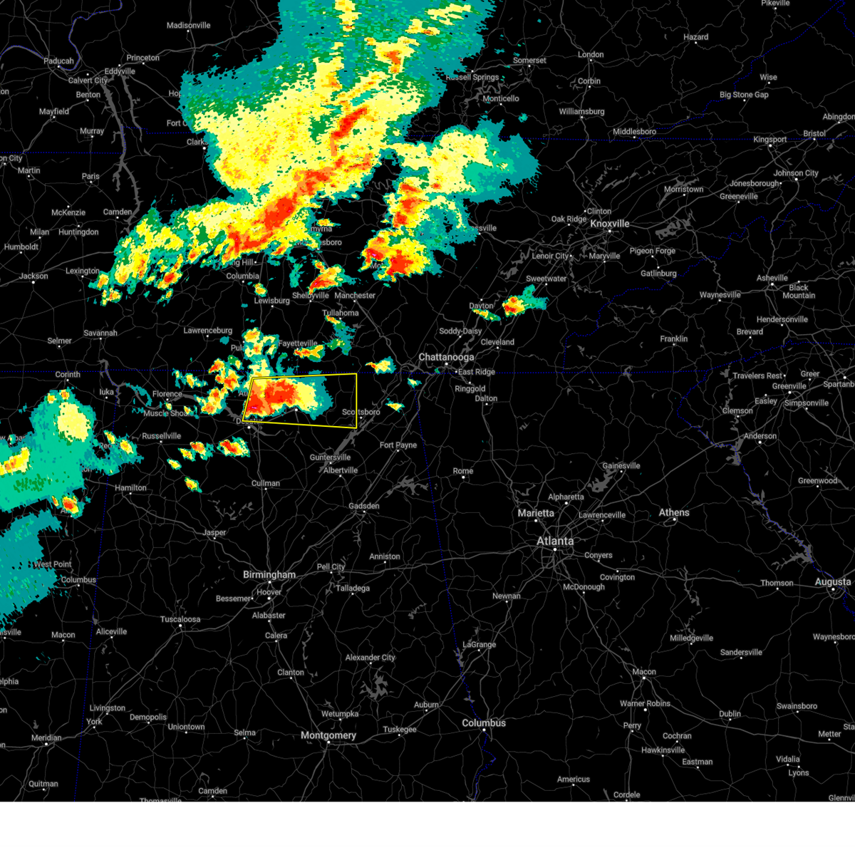
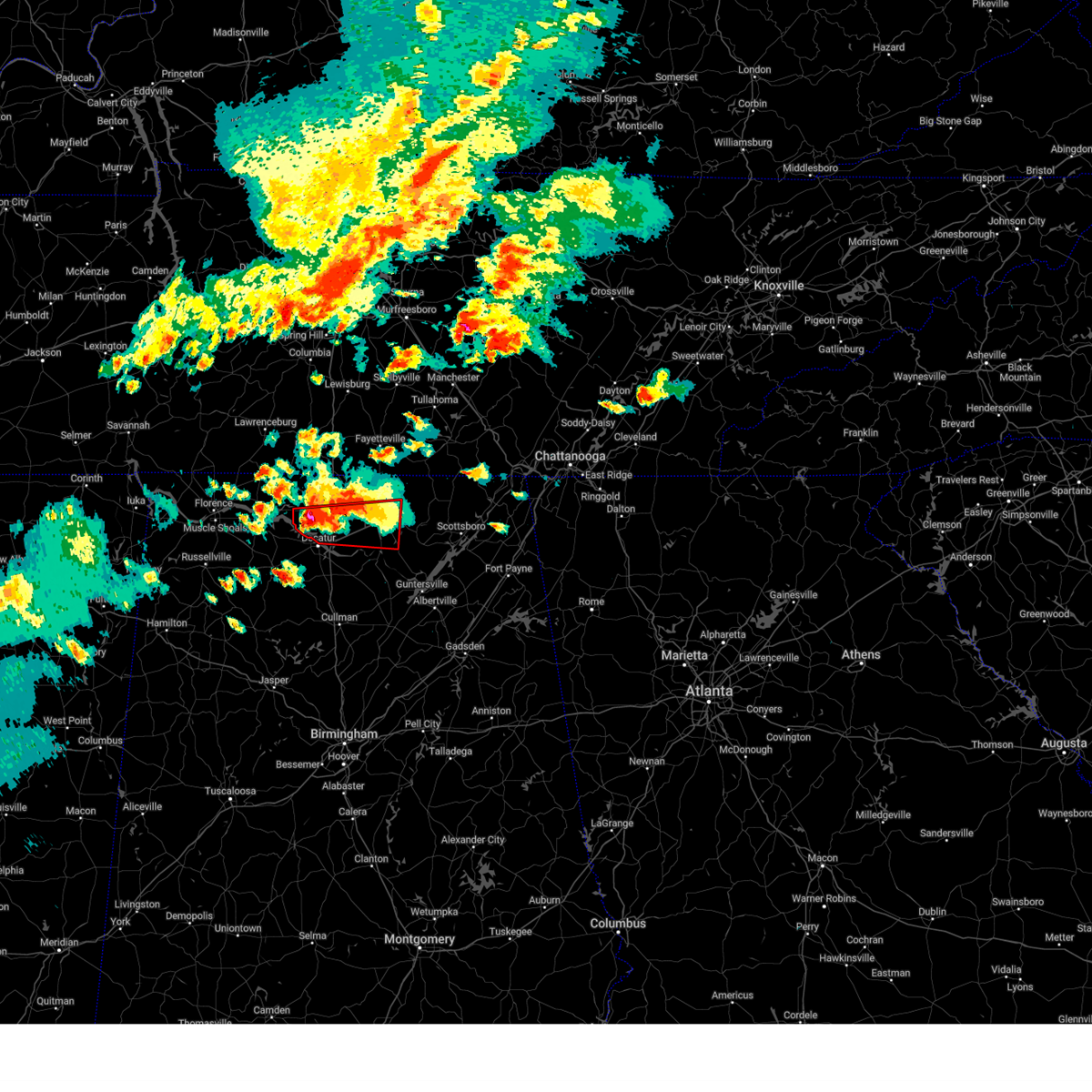
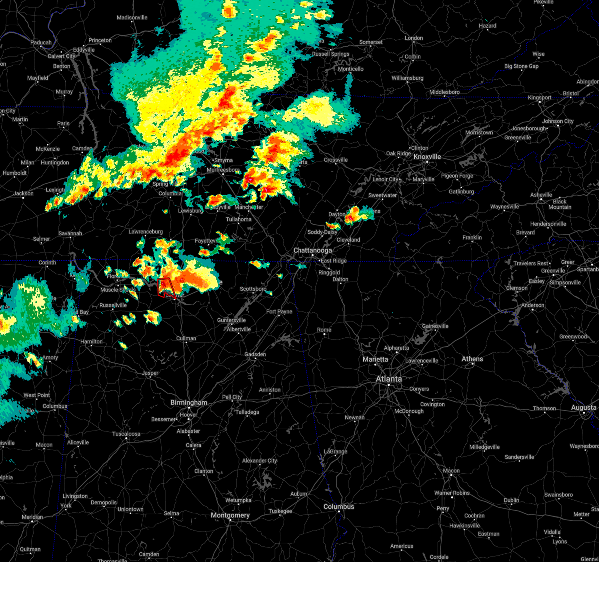
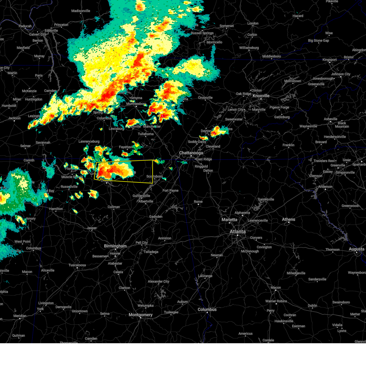
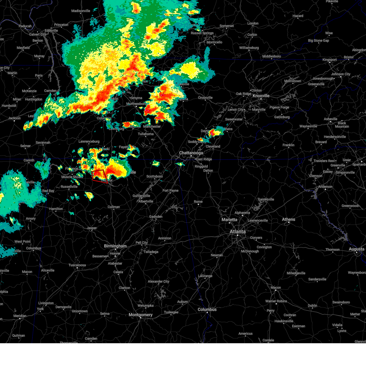
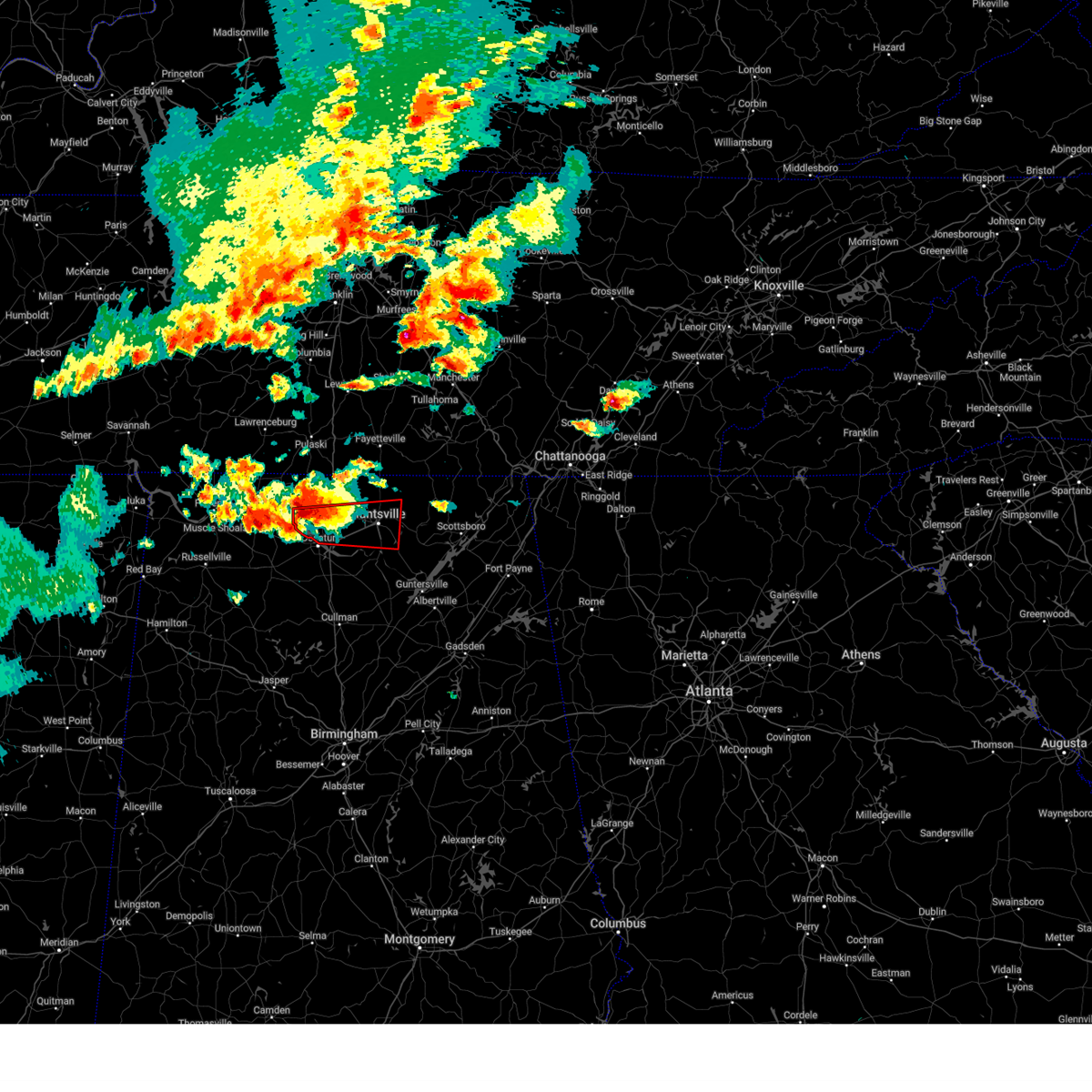
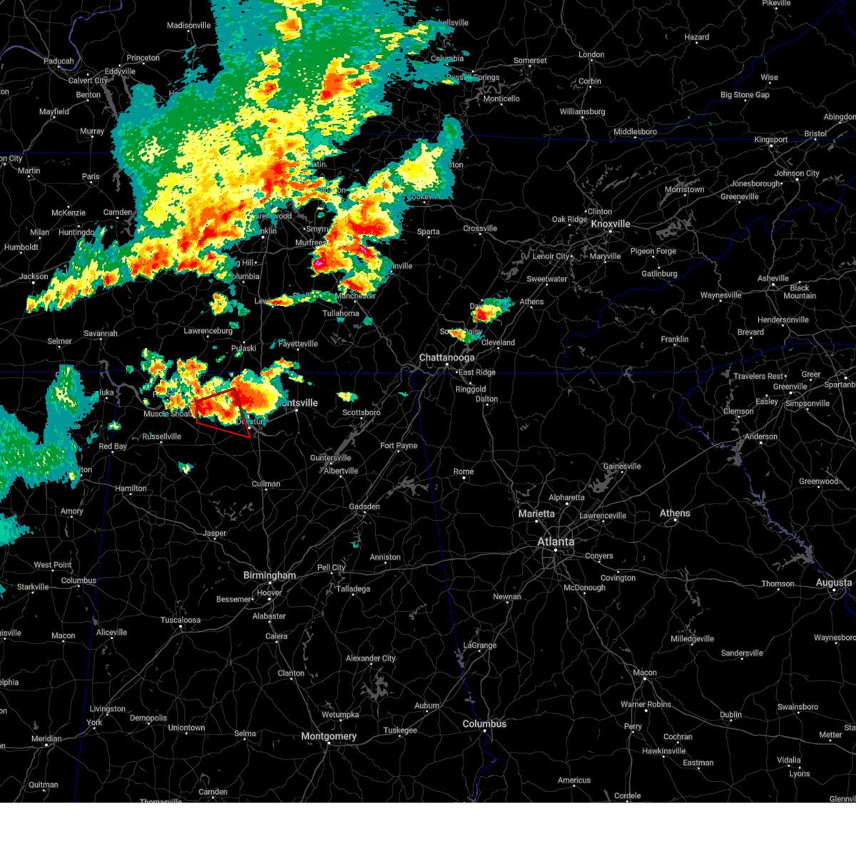
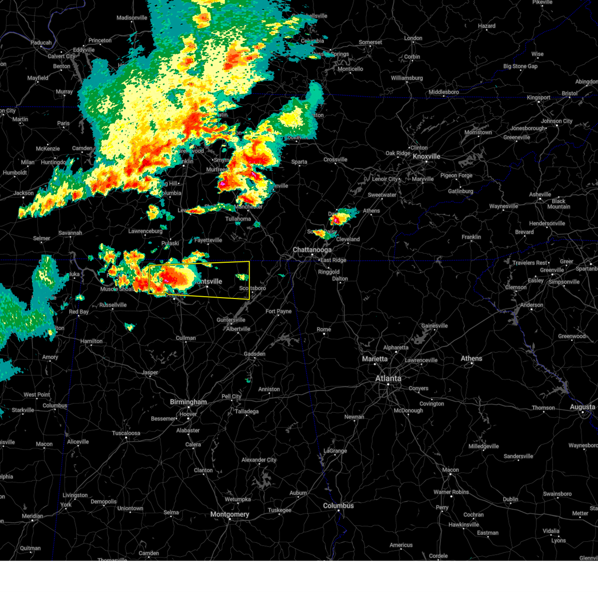
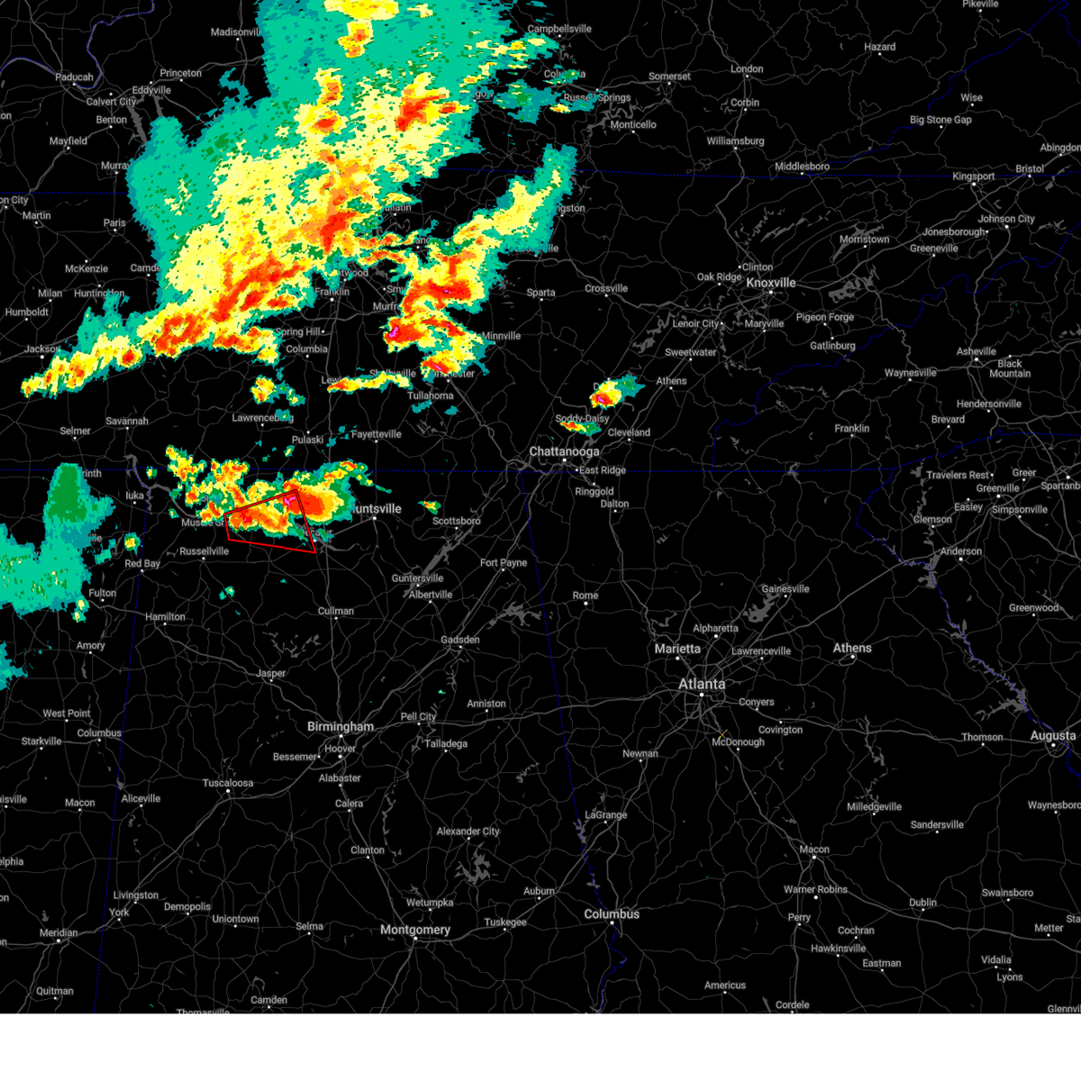
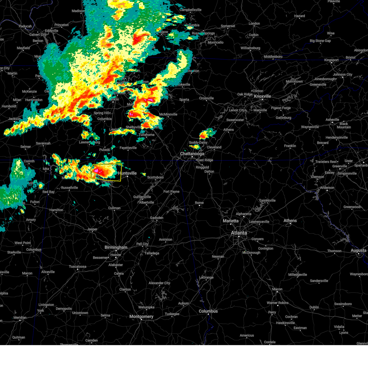
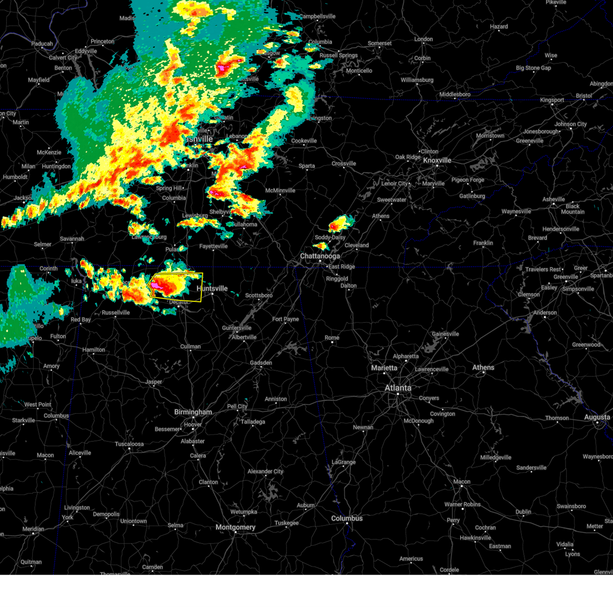
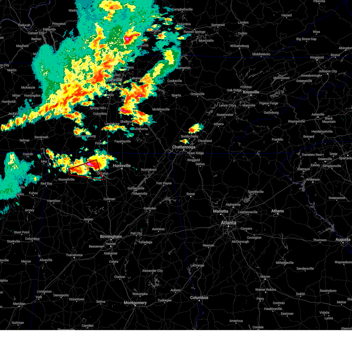
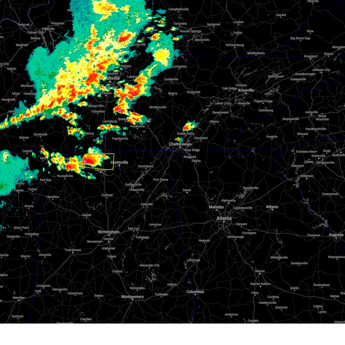
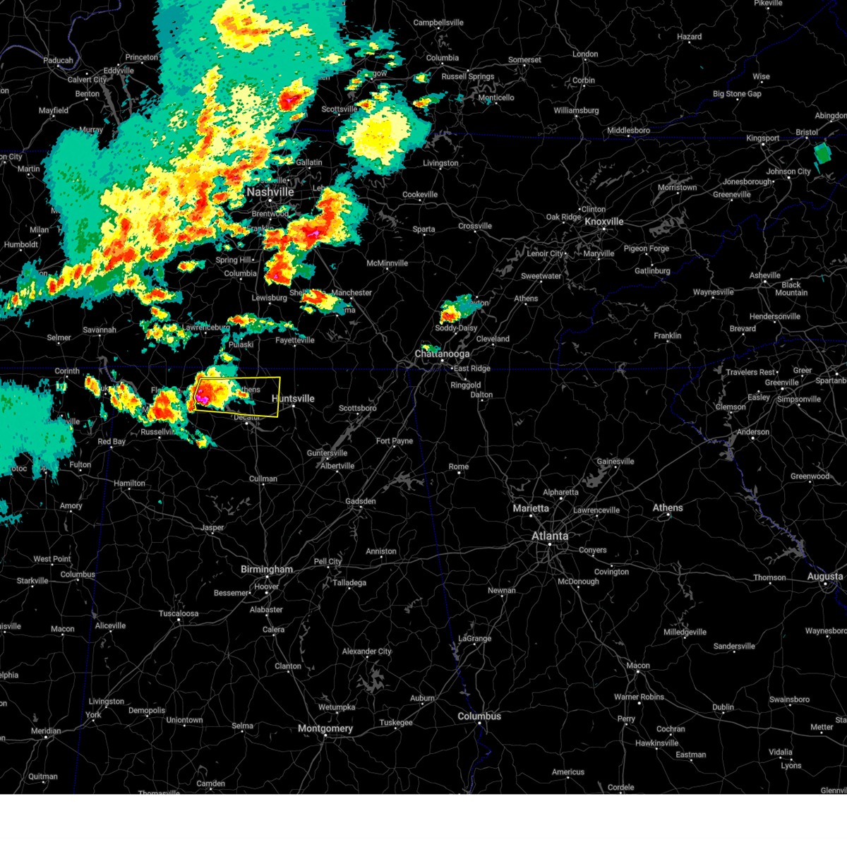
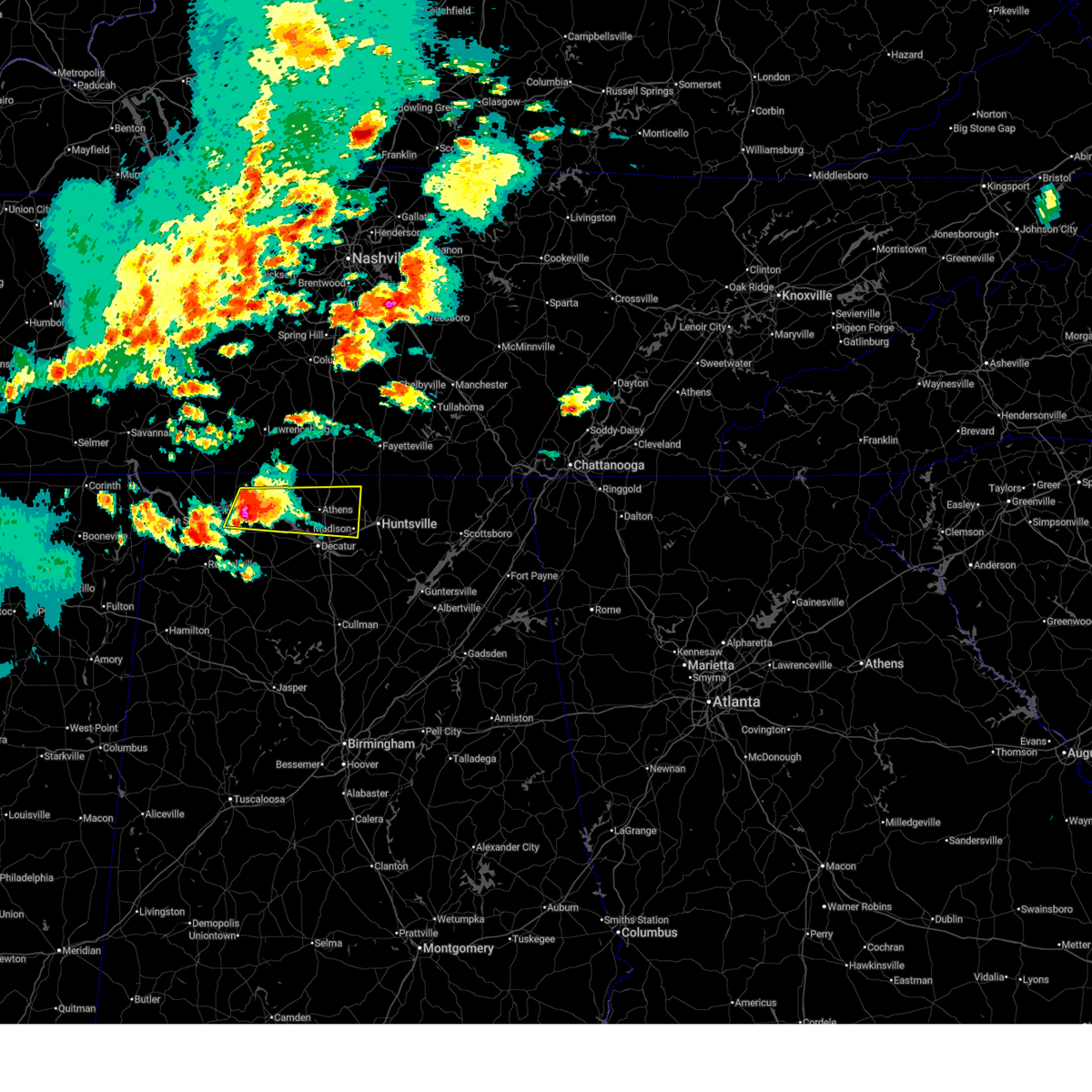
Hail Map for Athens, AL
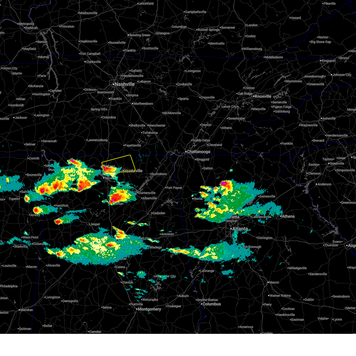
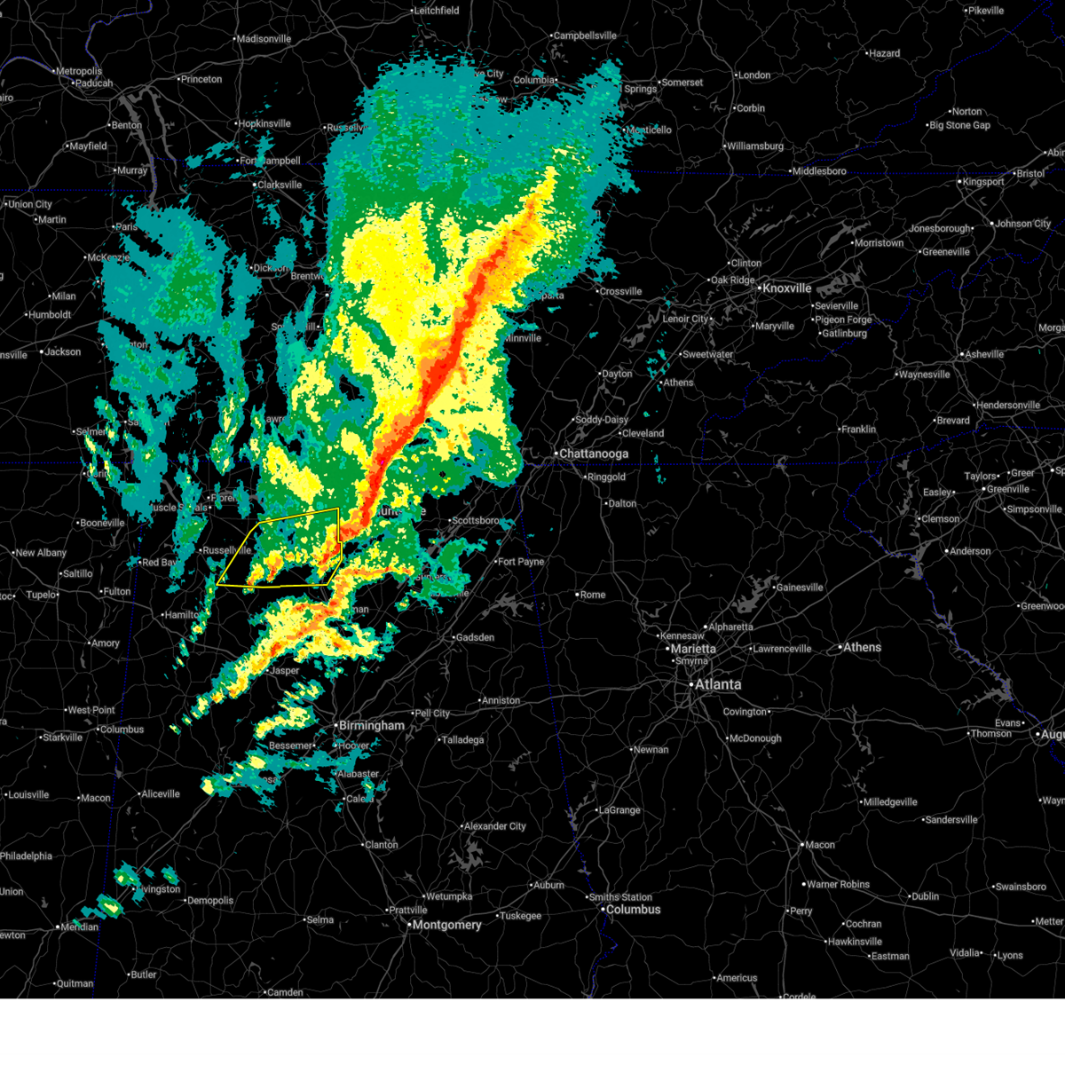
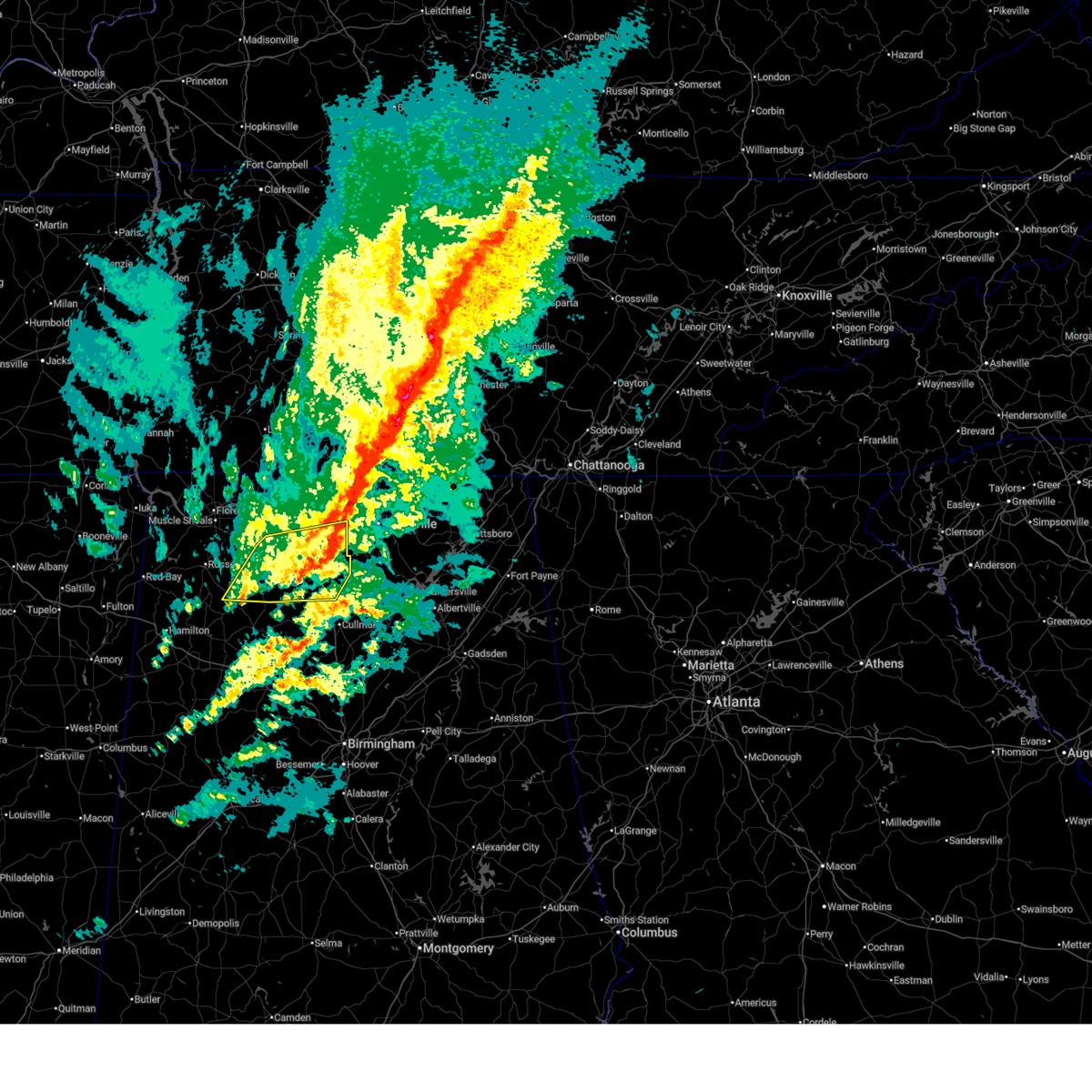
The Athens, AL area has had 43 reports of on-the-ground hail by trained spotters, and has been under severe weather warnings 31 times during the past 12 months. Doppler radar has detected hail at or near Athens, AL on 88 occasions, including 2 occasions during the past year.
| Name: | Athens, AL |
| Where Located: | 41.5 miles E of Florence, AL |
| Map: | Google Map for Athens, AL |
| Population: | 21897 |
| Housing Units: | 9862 |
| More Info: | Search Google for Athens, AL |
3
The Top Recent Hail Date for Athens, AL is Thursday, February 26, 2026 (2nd out of 88)
Hail and Wind Damage Spotted near Athens, AL
| Date / Time | Report Details |
|---|---|
| 6/1/2026 1:08 PM CDT |
 The storms which prompted the warning have moved out of the area. therefore, the warning will be allowed to expire. a severe thunderstorm watch remains in effect until 700 pm cdt for north central, northeastern and northwestern alabama. The storms which prompted the warning have moved out of the area. therefore, the warning will be allowed to expire. a severe thunderstorm watch remains in effect until 700 pm cdt for north central, northeastern and northwestern alabama.
|
| 6/1/2026 1:05 PM CDT | Trees down on a she in limestone county AL, 5.4 miles E of Athens, AL |
| 6/1/2026 12:55 PM CDT |
 At 1254 pm cdt, severe thunderstorms were located along a line extending from near gurley to near littleville, moving southeast at 25 mph. these storms have a history of producing damaging wind gusts and small hail (emergency management). Hazards include 60 mph wind gusts and penny size hail. Expect damage to roofs, siding, and trees. Locations impacted include, huntsville, decatur, madison, athens, muscle shoals, moores mill, meridianville, redstone arsenal, town creek, and gurley. At 1254 pm cdt, severe thunderstorms were located along a line extending from near gurley to near littleville, moving southeast at 25 mph. these storms have a history of producing damaging wind gusts and small hail (emergency management). Hazards include 60 mph wind gusts and penny size hail. Expect damage to roofs, siding, and trees. Locations impacted include, huntsville, decatur, madison, athens, muscle shoals, moores mill, meridianville, redstone arsenal, town creek, and gurley.
|
| 6/1/2026 12:50 PM CDT | Metal hay barn destroyed at a farm on snake road at shaw road on the nw side of that intersection. trees down also at this locatio in limestone county AL, 10.5 miles E of Athens, AL |
| 6/1/2026 12:45 PM CDT |
 At 1244 pm cdt, severe thunderstorms were located along a line extending from gurley to near littleville, moving southeast at 30 mph (emergency management reports numerous trees down across northwest alabama blocking roadways). Hazards include 60 mph wind gusts and penny size hail. Expect damage to roofs, siding, and trees. Locations impacted include, huntsville, decatur, madison, florence, athens, muscle shoals, sheffield, moores mill, meridianville, and redstone arsenal. At 1244 pm cdt, severe thunderstorms were located along a line extending from gurley to near littleville, moving southeast at 30 mph (emergency management reports numerous trees down across northwest alabama blocking roadways). Hazards include 60 mph wind gusts and penny size hail. Expect damage to roofs, siding, and trees. Locations impacted include, huntsville, decatur, madison, florence, athens, muscle shoals, sheffield, moores mill, meridianville, and redstone arsenal.
|
| 6/1/2026 12:20 PM CDT |
 Svrhun the national weather service in huntsville alabama has issued a * severe thunderstorm warning for, madison county in north central alabama, limestone county in north central alabama, eastern lauderdale county in northwestern alabama, southeastern colbert county in northwestern alabama, northern lawrence county in northwestern alabama, * until 115 pm cdt. * at 1220 pm cdt, severe thunderstorms were located along a line extending from near ardmore to near killen, moving southeast at 20 mph (emergency management). Hazards include 60 mph wind gusts and penny size hail. expect damage to roofs, siding, and trees Svrhun the national weather service in huntsville alabama has issued a * severe thunderstorm warning for, madison county in north central alabama, limestone county in north central alabama, eastern lauderdale county in northwestern alabama, southeastern colbert county in northwestern alabama, northern lawrence county in northwestern alabama, * until 115 pm cdt. * at 1220 pm cdt, severe thunderstorms were located along a line extending from near ardmore to near killen, moving southeast at 20 mph (emergency management). Hazards include 60 mph wind gusts and penny size hail. expect damage to roofs, siding, and trees
|
| 3/16/2026 12:19 AM CDT | Tree down at intersection of elkton rd. & bean r in limestone county AL, 5.6 miles S of Athens, AL |
| 3/16/2026 12:15 AM CDT |
 the severe thunderstorm warning has been cancelled and is no longer in effect the severe thunderstorm warning has been cancelled and is no longer in effect
|
| 3/16/2026 12:15 AM CDT |
 At 1213 am cdt, severe thunderstorms were located along a line extending from 6 miles north of new market to near priceville, moving east at 30 mph (radar indicated). Hazards include 60 mph wind gusts and penny size hail. Expect damage to roofs, siding, and trees. Locations impacted include, huntsville, decatur, madison, athens, moores mill, meridianville, redstone arsenal, hazel green, priceville, and trinity. At 1213 am cdt, severe thunderstorms were located along a line extending from 6 miles north of new market to near priceville, moving east at 30 mph (radar indicated). Hazards include 60 mph wind gusts and penny size hail. Expect damage to roofs, siding, and trees. Locations impacted include, huntsville, decatur, madison, athens, moores mill, meridianville, redstone arsenal, hazel green, priceville, and trinity.
|
| 3/15/2026 11:41 PM CDT |
 Svrhun the national weather service in huntsville alabama has issued a * severe thunderstorm warning for, northwestern marshall county in northeastern alabama, northwestern jackson county in northeastern alabama, madison county in north central alabama, limestone county in north central alabama, northern morgan county in north central alabama, northeastern lawrence county in northwestern alabama, * until 1245 am cdt. * at 1140 pm cdt, severe thunderstorms were located along a line extending from near ardmore to near moulton, moving east at 50 mph (radar indicated). Hazards include 60 mph wind gusts and penny size hail. expect damage to roofs, siding, and trees Svrhun the national weather service in huntsville alabama has issued a * severe thunderstorm warning for, northwestern marshall county in northeastern alabama, northwestern jackson county in northeastern alabama, madison county in north central alabama, limestone county in north central alabama, northern morgan county in north central alabama, northeastern lawrence county in northwestern alabama, * until 1245 am cdt. * at 1140 pm cdt, severe thunderstorms were located along a line extending from near ardmore to near moulton, moving east at 50 mph (radar indicated). Hazards include 60 mph wind gusts and penny size hail. expect damage to roofs, siding, and trees
|
| 3/15/2026 11:22 PM CDT |
 At 1121 pm cdt, severe thunderstorms were located along a line extending from 12 miles east of lexington to rogersville to 8 miles east of littleville, moving east at 40 mph (radar indicated). Hazards include 60 mph wind gusts and penny size hail. Expect damage to roofs, siding, and trees. Locations impacted include, decatur, madison, athens, muscle shoals, tuscumbia, trinity, rogersville, ardmore, killen, and town creek. At 1121 pm cdt, severe thunderstorms were located along a line extending from 12 miles east of lexington to rogersville to 8 miles east of littleville, moving east at 40 mph (radar indicated). Hazards include 60 mph wind gusts and penny size hail. Expect damage to roofs, siding, and trees. Locations impacted include, decatur, madison, athens, muscle shoals, tuscumbia, trinity, rogersville, ardmore, killen, and town creek.
|
| 3/15/2026 10:43 PM CDT |
 Svrhun the national weather service in huntsville alabama has issued a * severe thunderstorm warning for, northwestern madison county in north central alabama, limestone county in north central alabama, eastern lauderdale county in northwestern alabama, southeastern colbert county in northwestern alabama, northwestern morgan county in north central alabama, northern lawrence county in northwestern alabama, southwestern lincoln county in middle tennessee, * until 1145 pm cdt. * at 1043 pm cdt, severe thunderstorms were located along a line extending from near loretto to near florence to 6 miles north of belgreen, moving east at 45 mph (radar indicated). Hazards include 60 mph wind gusts and penny size hail. expect damage to roofs, siding, and trees Svrhun the national weather service in huntsville alabama has issued a * severe thunderstorm warning for, northwestern madison county in north central alabama, limestone county in north central alabama, eastern lauderdale county in northwestern alabama, southeastern colbert county in northwestern alabama, northwestern morgan county in north central alabama, northern lawrence county in northwestern alabama, southwestern lincoln county in middle tennessee, * until 1145 pm cdt. * at 1043 pm cdt, severe thunderstorms were located along a line extending from near loretto to near florence to 6 miles north of belgreen, moving east at 45 mph (radar indicated). Hazards include 60 mph wind gusts and penny size hail. expect damage to roofs, siding, and trees
|
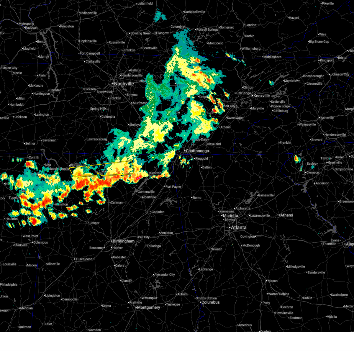
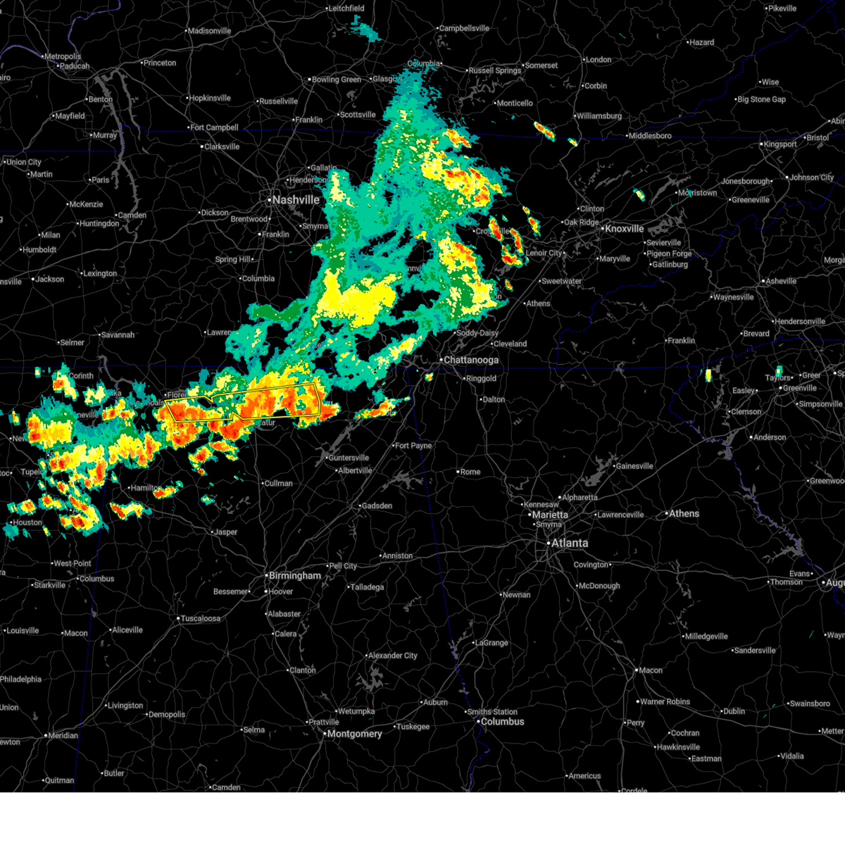
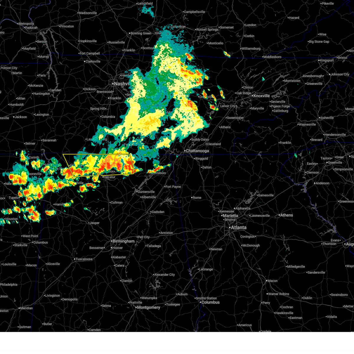
| 2/26/2026 7:10 PM CST | Quarter sized hail reported 6.9 miles SW of Athens, AL, hail was very spiky and was just over an inch big. |
| 2/26/2026 6:49 PM CST | Quarter sized hail reported 1.7 miles SSE of Athens, AL |
| 2/26/2026 6:48 PM CST |
 Svrhun the national weather service in huntsville alabama has issued a * severe thunderstorm warning for, northern madison county in north central alabama, east central limestone county in north central alabama, * until 745 pm cst. * at 647 pm cst, a severe thunderstorm was located near athens, moving east at 30 mph (radar indicated). Hazards include 60 mph wind gusts and quarter size hail. Hail damage to vehicles is expected. Expect wind damage to roofs, siding, and trees. Svrhun the national weather service in huntsville alabama has issued a * severe thunderstorm warning for, northern madison county in north central alabama, east central limestone county in north central alabama, * until 745 pm cst. * at 647 pm cst, a severe thunderstorm was located near athens, moving east at 30 mph (radar indicated). Hazards include 60 mph wind gusts and quarter size hail. Hail damage to vehicles is expected. Expect wind damage to roofs, siding, and trees.
|
| 2/26/2026 6:46 PM CST | Half Dollar sized hail reported 2.9 miles SE of Athens, AL |
| 2/26/2026 6:45 PM CST | Quarter sized hail reported 4.1 miles SSW of Athens, AL |
| 12/18/2025 8:13 PM CST |
 The storms which prompted the warning have weakened below severe limits, and no longer pose an immediate threat to life or property. therefore, the warning will be allowed to expire. however, gusty winds are still possible with these thunderstorms. a tornado watch remains in effect until 900 pm cst for north central and northwestern alabama. The storms which prompted the warning have weakened below severe limits, and no longer pose an immediate threat to life or property. therefore, the warning will be allowed to expire. however, gusty winds are still possible with these thunderstorms. a tornado watch remains in effect until 900 pm cst for north central and northwestern alabama.
|
| 12/18/2025 8:02 PM CST |
 the severe thunderstorm warning has been cancelled and is no longer in effect the severe thunderstorm warning has been cancelled and is no longer in effect
|
| 12/18/2025 8:02 PM CST |
 At 801 pm cst, severe thunderstorms were located along a line extending from near harvest to near huntsville international airport to 7 miles west of brushy lake, moving east at 40 mph. these storms have downed trees and powerlines in lawrence county (emergency management). Hazards include 60 mph wind gusts. Expect damage to roofs, siding, and trees. Locations impacted include, decatur, madison, hartselle, moulton, priceville, trinity, falkville, courtland, tanner, and somerville. At 801 pm cst, severe thunderstorms were located along a line extending from near harvest to near huntsville international airport to 7 miles west of brushy lake, moving east at 40 mph. these storms have downed trees and powerlines in lawrence county (emergency management). Hazards include 60 mph wind gusts. Expect damage to roofs, siding, and trees. Locations impacted include, decatur, madison, hartselle, moulton, priceville, trinity, falkville, courtland, tanner, and somerville.
|
| 12/18/2025 7:53 PM CST | Trees down in the 10000 block of upper snake roa in limestone county AL, 13.5 miles ESE of Athens, AL |
| 12/18/2025 7:48 PM CST |
 Svrhun the national weather service in huntsville alabama has issued a * severe thunderstorm warning for, northwestern jackson county in northeastern alabama, madison county in north central alabama, eastern limestone county in north central alabama, * until 830 pm cst. * at 747 pm cst, severe thunderstorms were located along a line extending from near ardmore to near madison to near tanner, moving east at 40 mph (radar indicated). Hazards include 60 mph wind gusts. expect damage to roofs, siding, and trees Svrhun the national weather service in huntsville alabama has issued a * severe thunderstorm warning for, northwestern jackson county in northeastern alabama, madison county in north central alabama, eastern limestone county in north central alabama, * until 830 pm cst. * at 747 pm cst, severe thunderstorms were located along a line extending from near ardmore to near madison to near tanner, moving east at 40 mph (radar indicated). Hazards include 60 mph wind gusts. expect damage to roofs, siding, and trees
|
| 12/18/2025 7:43 PM CST |
 the severe thunderstorm warning has been cancelled and is no longer in effect the severe thunderstorm warning has been cancelled and is no longer in effect
|
| 12/18/2025 7:43 PM CST |
 At 743 pm cst, a severe thunderstorm was located near ardmore, or 10 miles northeast of athens, moving east at 50 mph (radar indicated). Hazards include 60 mph wind gusts. Expect damage to roofs, siding, and trees. Locations impacted include, athens, ardmore, elkmont, cartwright, french mill, coxey, cairo, holland gin, mt rozell, and leggtown. At 743 pm cst, a severe thunderstorm was located near ardmore, or 10 miles northeast of athens, moving east at 50 mph (radar indicated). Hazards include 60 mph wind gusts. Expect damage to roofs, siding, and trees. Locations impacted include, athens, ardmore, elkmont, cartwright, french mill, coxey, cairo, holland gin, mt rozell, and leggtown.
|
| 12/18/2025 7:40 PM CST | Porch eave blown off of a home... producing roof damage at a home on cox road in the 19000 block. time estimated from rada in limestone county AL, 14.9 miles ESE of Athens, AL |
| 12/18/2025 7:30 PM CST |
 Svrhun the national weather service in huntsville alabama has issued a * severe thunderstorm warning for, southern limestone county in north central alabama, southeastern colbert county in northwestern alabama, eastern franklin county in northwestern alabama, morgan county in north central alabama, lawrence county in northwestern alabama, * until 815 pm cst. * at 730 pm cst, severe thunderstorms were located along a line extending from 6 miles west of tanner to 6 miles southwest of trinity to 7 miles north of needmore, moving east at 40 mph (radar indicated). Hazards include 70 mph wind gusts. Expect considerable tree damage. Damage is likely to mobile homes, roofs, and outbuildings. Svrhun the national weather service in huntsville alabama has issued a * severe thunderstorm warning for, southern limestone county in north central alabama, southeastern colbert county in northwestern alabama, eastern franklin county in northwestern alabama, morgan county in north central alabama, lawrence county in northwestern alabama, * until 815 pm cst. * at 730 pm cst, severe thunderstorms were located along a line extending from 6 miles west of tanner to 6 miles southwest of trinity to 7 miles north of needmore, moving east at 40 mph (radar indicated). Hazards include 70 mph wind gusts. Expect considerable tree damage. Damage is likely to mobile homes, roofs, and outbuildings.
|
| 12/18/2025 7:26 PM CST |
 At 725 pm cst, a severe thunderstorm was located 10 miles northwest of athens, moving east at 35 mph (radar indicated). Hazards include 60 mph wind gusts. Expect damage to roofs, siding, and trees. Locations impacted include, athens, rogersville, ardmore, killen, lexington, elkmont, anderson, lester, good springs, and cartwright. At 725 pm cst, a severe thunderstorm was located 10 miles northwest of athens, moving east at 35 mph (radar indicated). Hazards include 60 mph wind gusts. Expect damage to roofs, siding, and trees. Locations impacted include, athens, rogersville, ardmore, killen, lexington, elkmont, anderson, lester, good springs, and cartwright.
|
| 12/18/2025 6:53 PM CST |
 Svrhun the national weather service in huntsville alabama has issued a * severe thunderstorm warning for, limestone county in north central alabama, northeastern lauderdale county in northwestern alabama, east central colbert county in northwestern alabama, * until 800 pm cst. * at 653 pm cst, a severe thunderstorm was located over lexington, or 18 miles northeast of florence, moving east at 50 mph (radar indicated). Hazards include 60 mph wind gusts. expect damage to roofs, siding, and trees Svrhun the national weather service in huntsville alabama has issued a * severe thunderstorm warning for, limestone county in north central alabama, northeastern lauderdale county in northwestern alabama, east central colbert county in northwestern alabama, * until 800 pm cst. * at 653 pm cst, a severe thunderstorm was located over lexington, or 18 miles northeast of florence, moving east at 50 mph (radar indicated). Hazards include 60 mph wind gusts. expect damage to roofs, siding, and trees
|
| 9/11/2025 5:55 PM CDT | The storm which prompted the warning has weakened below severe limits, and no longer poses an immediate threat to life or property. therefore, the warning will be allowed to expire. however, small hail and gusty winds are still possible with this thunderstorm. |
| 9/11/2025 5:16 PM CDT | Svrhun the national weather service in huntsville alabama has issued a * severe thunderstorm warning for, central limestone county in north central alabama, eastern lauderdale county in northwestern alabama, northwestern morgan county in north central alabama, northeastern lawrence county in northwestern alabama, * until 600 pm cdt. * at 515 pm cdt, a severe thunderstorm was located 9 miles northeast of rogersville, or 13 miles northwest of athens, moving south at 20 mph (radar indicated). Hazards include 60 mph wind gusts and nickel size hail. expect damage to roofs, siding, and trees |
| 7/8/2025 2:20 PM CDT | Limestone ema reported several trees down and uprooted along poplar point roa in limestone county AL, 11.4 miles ENE of Athens, AL |
| 6/27/2025 1:15 PM CDT |
 the severe thunderstorm warning has been cancelled and is no longer in effect the severe thunderstorm warning has been cancelled and is no longer in effect
|
| 6/27/2025 12:47 PM CDT |
 Svrhun the national weather service in huntsville alabama has issued a * severe thunderstorm warning for, south central limestone county in north central alabama, northwestern morgan county in north central alabama, northeastern lawrence county in northwestern alabama, * until 145 pm cdt. * at 1246 pm cdt, a severe thunderstorm was located near trinity, or near decatur, drifting southeastward at 5-10 mph. a second severe thunderstorm was located to its immediate west, or near hillsboro, also drifting southeastward at 5-10 mph (radar indicated). Hazards include 60 mph wind gusts and penny size hail. expect damage to roofs, siding, and trees Svrhun the national weather service in huntsville alabama has issued a * severe thunderstorm warning for, south central limestone county in north central alabama, northwestern morgan county in north central alabama, northeastern lawrence county in northwestern alabama, * until 145 pm cdt. * at 1246 pm cdt, a severe thunderstorm was located near trinity, or near decatur, drifting southeastward at 5-10 mph. a second severe thunderstorm was located to its immediate west, or near hillsboro, also drifting southeastward at 5-10 mph (radar indicated). Hazards include 60 mph wind gusts and penny size hail. expect damage to roofs, siding, and trees
|
| 6/22/2025 5:37 PM CDT |
 the severe thunderstorm warning has been cancelled and is no longer in effect the severe thunderstorm warning has been cancelled and is no longer in effect
|
| 6/22/2025 5:26 PM CDT |
 At 525 pm cdt, a severe thunderstorm was located over harvest, or 8 miles west of meridianville, moving west at 5 mph (radar indicated). Hazards include 60 mph wind gusts. Expect damage to roofs, siding, and trees. Locations impacted include, northwestern huntsville, madison, athens, meridianville, hazel green, ardmore, harvest, french mill, toney, and elkwood. At 525 pm cdt, a severe thunderstorm was located over harvest, or 8 miles west of meridianville, moving west at 5 mph (radar indicated). Hazards include 60 mph wind gusts. Expect damage to roofs, siding, and trees. Locations impacted include, northwestern huntsville, madison, athens, meridianville, hazel green, ardmore, harvest, french mill, toney, and elkwood.
|
| 6/22/2025 5:17 PM CDT |
 At 517 pm cdt, a severe thunderstorm was located over harvest, or 8 miles west of meridianville, moving west at 5 mph (radar indicated). Hazards include 60 mph wind gusts and penny size hail. Expect damage to roofs, siding, and trees. Locations impacted include, northern huntsville, madison, athens, moores mill, meridianville, hazel green, ardmore, alabama a and m university, harvest, and new market. At 517 pm cdt, a severe thunderstorm was located over harvest, or 8 miles west of meridianville, moving west at 5 mph (radar indicated). Hazards include 60 mph wind gusts and penny size hail. Expect damage to roofs, siding, and trees. Locations impacted include, northern huntsville, madison, athens, moores mill, meridianville, hazel green, ardmore, alabama a and m university, harvest, and new market.
|
| 6/22/2025 5:03 PM CDT |
 At 503 pm cdt, a severe thunderstorm was located near harvest, or near meridianville, moving west at 5 mph (radar indicated). Hazards include 60 mph wind gusts and penny size hail. Expect damage to roofs, siding, and trees. Locations impacted include, northern huntsville, madison, athens, moores mill, meridianville, hazel green, ardmore, alabama a and m university, harvest, and new market. At 503 pm cdt, a severe thunderstorm was located near harvest, or near meridianville, moving west at 5 mph (radar indicated). Hazards include 60 mph wind gusts and penny size hail. Expect damage to roofs, siding, and trees. Locations impacted include, northern huntsville, madison, athens, moores mill, meridianville, hazel green, ardmore, alabama a and m university, harvest, and new market.
|
| 6/22/2025 5:01 PM CDT |
 At 501 pm cdt, a severe thunderstorm was located near harvest, or 8 miles northeast of athens, and is nearly stationary (radar indicated). Hazards include 60 mph wind gusts and penny size hail. Expect damage to roofs, siding, and trees. Locations impacted include, ardmore, harvest, capshaw, and french mill. At 501 pm cdt, a severe thunderstorm was located near harvest, or 8 miles northeast of athens, and is nearly stationary (radar indicated). Hazards include 60 mph wind gusts and penny size hail. Expect damage to roofs, siding, and trees. Locations impacted include, ardmore, harvest, capshaw, and french mill.
|
| 6/22/2025 5:00 PM CDT |
 Svrhun the national weather service in huntsville alabama has issued a * severe thunderstorm warning for, northern madison county in north central alabama, northeastern limestone county in north central alabama, * until 600 pm cdt. * at 459 pm cdt, a severe thunderstorm was located near harvest, or near meridianville, moving west at 5 mph (radar indicated). Hazards include 60 mph wind gusts and penny size hail. expect damage to roofs, siding, and trees Svrhun the national weather service in huntsville alabama has issued a * severe thunderstorm warning for, northern madison county in north central alabama, northeastern limestone county in north central alabama, * until 600 pm cdt. * at 459 pm cdt, a severe thunderstorm was located near harvest, or near meridianville, moving west at 5 mph (radar indicated). Hazards include 60 mph wind gusts and penny size hail. expect damage to roofs, siding, and trees
|
| 6/22/2025 4:48 PM CDT |
 At 448 pm cdt, a severe thunderstorm was located near athens, moving west at 10 mph (radar indicated). Hazards include 60 mph wind gusts and penny size hail. Expect damage to roofs, siding, and trees. Locations impacted include, athens, ardmore, harvest, elkmont, lester, cartwright, french mill, mt rozell, ripley, and cairo. At 448 pm cdt, a severe thunderstorm was located near athens, moving west at 10 mph (radar indicated). Hazards include 60 mph wind gusts and penny size hail. Expect damage to roofs, siding, and trees. Locations impacted include, athens, ardmore, harvest, elkmont, lester, cartwright, french mill, mt rozell, ripley, and cairo.
|
| 6/22/2025 4:47 PM CDT | Large trees downed and uprooted near looney road in athens. report and photos from social medi in limestone county AL, 6.3 miles S of Athens, AL |
| 6/22/2025 4:31 PM CDT |
 Svrhun the national weather service in huntsville alabama has issued a * severe thunderstorm warning for, northwestern madison county in north central alabama, northeastern limestone county in north central alabama, * until 515 pm cdt. * at 430 pm cdt, a severe thunderstorm was located near athens, moving west at 10 mph (radar indicated). Hazards include 60 mph wind gusts and penny size hail. expect damage to roofs, siding, and trees Svrhun the national weather service in huntsville alabama has issued a * severe thunderstorm warning for, northwestern madison county in north central alabama, northeastern limestone county in north central alabama, * until 515 pm cdt. * at 430 pm cdt, a severe thunderstorm was located near athens, moving west at 10 mph (radar indicated). Hazards include 60 mph wind gusts and penny size hail. expect damage to roofs, siding, and trees
|
| 6/21/2025 6:02 PM CDT |
 the severe thunderstorm warning has been cancelled and is no longer in effect the severe thunderstorm warning has been cancelled and is no longer in effect
|
| 6/21/2025 5:42 PM CDT |
 Svrhun the national weather service in huntsville alabama has issued a * severe thunderstorm warning for, west central madison county in north central alabama, east central limestone county in north central alabama, * until 615 pm cdt. * at 542 pm cdt, a severe thunderstorm was located over madison, moving west at 5 mph (radar indicated). Hazards include 60 mph wind gusts and penny size hail. expect damage to roofs, siding, and trees Svrhun the national weather service in huntsville alabama has issued a * severe thunderstorm warning for, west central madison county in north central alabama, east central limestone county in north central alabama, * until 615 pm cdt. * at 542 pm cdt, a severe thunderstorm was located over madison, moving west at 5 mph (radar indicated). Hazards include 60 mph wind gusts and penny size hail. expect damage to roofs, siding, and trees
|
| 6/18/2025 6:31 PM CDT |
 the severe thunderstorm warning has been cancelled and is no longer in effect the severe thunderstorm warning has been cancelled and is no longer in effect
|
| 6/18/2025 6:17 PM CDT |
 At 617 pm cdt, a severe thunderstorm was located near ardmore, or 11 miles west of meridianville, moving east at 25 mph (radar indicated). Hazards include 60 mph wind gusts and penny size hail. Expect damage to roofs, siding, and trees. Locations impacted include, meridianville, moores mill, hazel green, ardmore, harvest, new market, elkwood, dellrose, belleview, and cash point. At 617 pm cdt, a severe thunderstorm was located near ardmore, or 11 miles west of meridianville, moving east at 25 mph (radar indicated). Hazards include 60 mph wind gusts and penny size hail. Expect damage to roofs, siding, and trees. Locations impacted include, meridianville, moores mill, hazel green, ardmore, harvest, new market, elkwood, dellrose, belleview, and cash point.
|
| 6/18/2025 6:17 PM CDT |
 the severe thunderstorm warning has been cancelled and is no longer in effect the severe thunderstorm warning has been cancelled and is no longer in effect
|
| 6/18/2025 5:58 PM CDT |
 The storm which prompted the warning has moved out of the area. therefore, the warning will be allowed to expire. however, gusty winds are still possible with this thunderstorm. remember, a severe thunderstorm warning still remains in effect for portions of limestone, madison, and lincoln counties until 7 pm. The storm which prompted the warning has moved out of the area. therefore, the warning will be allowed to expire. however, gusty winds are still possible with this thunderstorm. remember, a severe thunderstorm warning still remains in effect for portions of limestone, madison, and lincoln counties until 7 pm.
|
| 6/18/2025 5:56 PM CDT |
 Svrhun the national weather service in huntsville alabama has issued a * severe thunderstorm warning for, northern madison county in north central alabama, limestone county in north central alabama, northeastern lawrence county in northwestern alabama, southwestern lincoln county in middle tennessee, * until 700 pm cdt. * at 555 pm cdt, a severe thunderstorm was located over athens, moving northeast at 30 mph (radar indicated). Hazards include 60 mph wind gusts and quarter size hail. Hail damage to vehicles is expected. Expect wind damage to roofs, siding, and trees. Svrhun the national weather service in huntsville alabama has issued a * severe thunderstorm warning for, northern madison county in north central alabama, limestone county in north central alabama, northeastern lawrence county in northwestern alabama, southwestern lincoln county in middle tennessee, * until 700 pm cdt. * at 555 pm cdt, a severe thunderstorm was located over athens, moving northeast at 30 mph (radar indicated). Hazards include 60 mph wind gusts and quarter size hail. Hail damage to vehicles is expected. Expect wind damage to roofs, siding, and trees.
|
| 6/18/2025 5:44 PM CDT |
 At 544 pm cdt, a severe thunderstorm was located 10 miles northwest of athens, moving northeast at 30 mph (radar indicated). Hazards include 60 mph wind gusts and quarter size hail. Hail damage to vehicles is expected. expect wind damage to roofs, siding, and trees. Locations impacted include, athens, rogersville, ardmore, harvest, elkmont, anderson, lester, good springs, cartwright, and coxey. At 544 pm cdt, a severe thunderstorm was located 10 miles northwest of athens, moving northeast at 30 mph (radar indicated). Hazards include 60 mph wind gusts and quarter size hail. Hail damage to vehicles is expected. expect wind damage to roofs, siding, and trees. Locations impacted include, athens, rogersville, ardmore, harvest, elkmont, anderson, lester, good springs, cartwright, and coxey.
|
| 6/18/2025 5:44 PM CDT |
 the severe thunderstorm warning has been cancelled and is no longer in effect the severe thunderstorm warning has been cancelled and is no longer in effect
|
| 6/18/2025 5:33 PM CDT | Tree down at hwy 72 and dement r in limestone county AL, 15.2 miles E of Athens, AL |
| 6/18/2025 5:20 PM CDT |
 Svrhun the national weather service in huntsville alabama has issued a * severe thunderstorm warning for, northwestern madison county in north central alabama, northern limestone county in north central alabama, southeastern lauderdale county in northwestern alabama, east central colbert county in northwestern alabama, northern lawrence county in northwestern alabama, southwestern lincoln county in middle tennessee, * until 600 pm cdt. * at 519 pm cdt, a severe thunderstorm was located over rogersville, or 18 miles east of muscle shoals, moving northeast at 30 mph (radar indicated). Hazards include 60 mph wind gusts and quarter size hail. Hail damage to vehicles is expected. Expect wind damage to roofs, siding, and trees. Svrhun the national weather service in huntsville alabama has issued a * severe thunderstorm warning for, northwestern madison county in north central alabama, northern limestone county in north central alabama, southeastern lauderdale county in northwestern alabama, east central colbert county in northwestern alabama, northern lawrence county in northwestern alabama, southwestern lincoln county in middle tennessee, * until 600 pm cdt. * at 519 pm cdt, a severe thunderstorm was located over rogersville, or 18 miles east of muscle shoals, moving northeast at 30 mph (radar indicated). Hazards include 60 mph wind gusts and quarter size hail. Hail damage to vehicles is expected. Expect wind damage to roofs, siding, and trees.
|
| 6/7/2025 2:09 PM CDT |
 The storms which prompted the warning have weakened below severe limits, and have exited the warned area. therefore, the warning will be allowed to expire. a severe thunderstorm watch remains in effect until 600 pm cdt for north central, northeastern and northwestern alabama, and middle tennessee. The storms which prompted the warning have weakened below severe limits, and have exited the warned area. therefore, the warning will be allowed to expire. a severe thunderstorm watch remains in effect until 600 pm cdt for north central, northeastern and northwestern alabama, and middle tennessee.
|
| 6/7/2025 2:04 PM CDT |
 the severe thunderstorm warning has been cancelled and is no longer in effect the severe thunderstorm warning has been cancelled and is no longer in effect
|
| 6/7/2025 2:04 PM CDT |
 At 204 pm cdt, severe thunderstorms were located along a line extending from near tanner to 7 miles southwest of falkville to near camp mcdowell, moving east at 45 mph (radar indicated). Hazards include 60 mph wind gusts. Expect damage to roofs, siding, and trees. Locations impacted include, decatur, madison, athens, hartselle, priceville, trinity, falkville, ardmore, tanner, and huntsville international airport. At 204 pm cdt, severe thunderstorms were located along a line extending from near tanner to 7 miles southwest of falkville to near camp mcdowell, moving east at 45 mph (radar indicated). Hazards include 60 mph wind gusts. Expect damage to roofs, siding, and trees. Locations impacted include, decatur, madison, athens, hartselle, priceville, trinity, falkville, ardmore, tanner, and huntsville international airport.
|
| 6/7/2025 1:49 PM CDT |
 At 148 pm cdt, severe thunderstorms were located along a line extending from near trinity to inmanfield to nauvoo, moving east at 45 mph (radar indicated). Hazards include 60 mph wind gusts. Expect damage to roofs, siding, and trees. Locations impacted include, decatur, madison, athens, hartselle, moulton, priceville, trinity, falkville, rogersville, and ardmore. At 148 pm cdt, severe thunderstorms were located along a line extending from near trinity to inmanfield to nauvoo, moving east at 45 mph (radar indicated). Hazards include 60 mph wind gusts. Expect damage to roofs, siding, and trees. Locations impacted include, decatur, madison, athens, hartselle, moulton, priceville, trinity, falkville, rogersville, and ardmore.
|
| 6/7/2025 1:49 PM CDT |
 the severe thunderstorm warning has been cancelled and is no longer in effect the severe thunderstorm warning has been cancelled and is no longer in effect
|
| 6/7/2025 1:36 PM CDT |
 the severe thunderstorm warning has been cancelled and is no longer in effect the severe thunderstorm warning has been cancelled and is no longer in effect
|
| 6/7/2025 1:36 PM CDT |
 At 135 pm cdt, severe thunderstorms were located along a line extending from near courtland to near moreland to eldridge, moving east at 45 mph (radar indicated). Hazards include 60 mph wind gusts. Expect damage to roofs, siding, and trees. Locations impacted include, decatur, madison, florence, athens, hartselle, muscle shoals, moulton, priceville, trinity, and falkville. At 135 pm cdt, severe thunderstorms were located along a line extending from near courtland to near moreland to eldridge, moving east at 45 mph (radar indicated). Hazards include 60 mph wind gusts. Expect damage to roofs, siding, and trees. Locations impacted include, decatur, madison, florence, athens, hartselle, muscle shoals, moulton, priceville, trinity, and falkville.
|
| 6/7/2025 1:08 PM CDT |
 Svrhun the national weather service in huntsville alabama has issued a * severe thunderstorm warning for, west central madison county in north central alabama, limestone county in north central alabama, eastern lauderdale county in northwestern alabama, southeastern colbert county in northwestern alabama, northwestern cullman county in north central alabama, eastern franklin county in northwestern alabama, morgan county in north central alabama, lawrence county in northwestern alabama, * until 215 pm cdt. * at 107 pm cdt, severe thunderstorms were located along a line extending from near littleville to near lake buttahatchee to near bluff, moving east at 45 mph (radar indicated). Hazards include 60 mph wind gusts. expect damage to roofs, siding, and trees Svrhun the national weather service in huntsville alabama has issued a * severe thunderstorm warning for, west central madison county in north central alabama, limestone county in north central alabama, eastern lauderdale county in northwestern alabama, southeastern colbert county in northwestern alabama, northwestern cullman county in north central alabama, eastern franklin county in northwestern alabama, morgan county in north central alabama, lawrence county in northwestern alabama, * until 215 pm cdt. * at 107 pm cdt, severe thunderstorms were located along a line extending from near littleville to near lake buttahatchee to near bluff, moving east at 45 mph (radar indicated). Hazards include 60 mph wind gusts. expect damage to roofs, siding, and trees
|
| 6/6/2025 3:17 PM CDT |
 the severe thunderstorm warning has been cancelled and is no longer in effect the severe thunderstorm warning has been cancelled and is no longer in effect
|
| 6/6/2025 3:15 PM CDT |
 the severe thunderstorm warning has been cancelled and is no longer in effect the severe thunderstorm warning has been cancelled and is no longer in effect
|
| 6/6/2025 3:04 PM CDT |
 Svrhun the national weather service in huntsville alabama has issued a * severe thunderstorm warning for, northwestern madison county in north central alabama, northeastern limestone county in north central alabama, southwestern lincoln county in middle tennessee, * until 400 pm cdt. * at 303 pm cdt, a severe thunderstorm was located 7 miles southwest of ardmore, or 8 miles north of athens, moving east at 30 mph. this storm has a history of producing wind damage and power outages (radar indicated). Hazards include 60 mph wind gusts and penny size hail. expect damage to roofs, siding, and trees Svrhun the national weather service in huntsville alabama has issued a * severe thunderstorm warning for, northwestern madison county in north central alabama, northeastern limestone county in north central alabama, southwestern lincoln county in middle tennessee, * until 400 pm cdt. * at 303 pm cdt, a severe thunderstorm was located 7 miles southwest of ardmore, or 8 miles north of athens, moving east at 30 mph. this storm has a history of producing wind damage and power outages (radar indicated). Hazards include 60 mph wind gusts and penny size hail. expect damage to roofs, siding, and trees
|
| 6/6/2025 2:52 PM CDT |
 At 251 pm cdt, a severe thunderstorm was located 8 miles east of rogersville, or 11 miles northwest of athens, moving east at 25 mph (public. at 245 pm wind damage and power outages were reported in the athens area). Hazards include 60 mph wind gusts and quarter size hail. Hail damage to vehicles is expected. expect wind damage to roofs, siding, and trees. Locations impacted include, athens, rogersville, elkmont, anderson, good springs, cartwright, coxey, oliver, mt rozell, and ripley. At 251 pm cdt, a severe thunderstorm was located 8 miles east of rogersville, or 11 miles northwest of athens, moving east at 25 mph (public. at 245 pm wind damage and power outages were reported in the athens area). Hazards include 60 mph wind gusts and quarter size hail. Hail damage to vehicles is expected. expect wind damage to roofs, siding, and trees. Locations impacted include, athens, rogersville, elkmont, anderson, good springs, cartwright, coxey, oliver, mt rozell, and ripley.
|
| 6/6/2025 2:52 PM CDT |
 the severe thunderstorm warning has been cancelled and is no longer in effect the severe thunderstorm warning has been cancelled and is no longer in effect
|
| 6/6/2025 2:26 PM CDT |
 Svrhun the national weather service in huntsville alabama has issued a * severe thunderstorm warning for, northern limestone county in north central alabama, southeastern lauderdale county in northwestern alabama, north central lawrence county in northwestern alabama, * until 330 pm cdt. * at 225 pm cdt, a severe thunderstorm was located over rogersville, or 19 miles east of muscle shoals, moving east at 25 mph (radar indicated). Hazards include 60 mph wind gusts and quarter size hail. Hail damage to vehicles is expected. Expect wind damage to roofs, siding, and trees. Svrhun the national weather service in huntsville alabama has issued a * severe thunderstorm warning for, northern limestone county in north central alabama, southeastern lauderdale county in northwestern alabama, north central lawrence county in northwestern alabama, * until 330 pm cdt. * at 225 pm cdt, a severe thunderstorm was located over rogersville, or 19 miles east of muscle shoals, moving east at 25 mph (radar indicated). Hazards include 60 mph wind gusts and quarter size hail. Hail damage to vehicles is expected. Expect wind damage to roofs, siding, and trees.
|
| 5/25/2025 9:54 PM CDT |
 the severe thunderstorm warning has been cancelled and is no longer in effect the severe thunderstorm warning has been cancelled and is no longer in effect
|
| 5/25/2025 9:54 PM CDT |
 At 953 pm cdt, severe thunderstorms were located along a line extending from near madison to 8 miles southwest of morgan city to near bangor, moving east at 50 mph (radar indicated). Hazards include 60 mph wind gusts. Expect damage to roofs, siding, and trees. Locations impacted include, wilburn, lim rock, valhermoso springs, crane hill, priceville, painter, union grove, rabbit town, whitesburg, and mcville. At 953 pm cdt, severe thunderstorms were located along a line extending from near madison to 8 miles southwest of morgan city to near bangor, moving east at 50 mph (radar indicated). Hazards include 60 mph wind gusts. Expect damage to roofs, siding, and trees. Locations impacted include, wilburn, lim rock, valhermoso springs, crane hill, priceville, painter, union grove, rabbit town, whitesburg, and mcville.
|
| 5/25/2025 9:37 PM CDT |
 Svrhun the national weather service in huntsville alabama has issued a * severe thunderstorm warning for, marshall county in northeastern alabama, southwestern jackson county in northeastern alabama, southern madison county in north central alabama, southern limestone county in north central alabama, southwestern dekalb county in northeastern alabama, cullman county in north central alabama, morgan county in north central alabama, eastern lawrence county in northwestern alabama, * until 1030 pm cdt. * at 937 pm cdt, severe thunderstorms were located along a line extending from near tanner to falkville to near dodge city, moving east at 50 mph (radar indicated). Hazards include 60 mph wind gusts. expect damage to roofs, siding, and trees Svrhun the national weather service in huntsville alabama has issued a * severe thunderstorm warning for, marshall county in northeastern alabama, southwestern jackson county in northeastern alabama, southern madison county in north central alabama, southern limestone county in north central alabama, southwestern dekalb county in northeastern alabama, cullman county in north central alabama, morgan county in north central alabama, eastern lawrence county in northwestern alabama, * until 1030 pm cdt. * at 937 pm cdt, severe thunderstorms were located along a line extending from near tanner to falkville to near dodge city, moving east at 50 mph (radar indicated). Hazards include 60 mph wind gusts. expect damage to roofs, siding, and trees
|
| 5/25/2025 9:22 PM CDT |
 At 922 pm cdt, severe thunderstorms were located along a line extending from 6 miles northwest of moulton to brushy lake, moving east at 35 mph (radar indicated). Hazards include 60 mph wind gusts. Expect damage to roofs, siding, and trees. Locations impacted include, mt hope, trinity, falkville, speake, ne smith, basham, wren, north courtland, landersville, and battleground. At 922 pm cdt, severe thunderstorms were located along a line extending from 6 miles northwest of moulton to brushy lake, moving east at 35 mph (radar indicated). Hazards include 60 mph wind gusts. Expect damage to roofs, siding, and trees. Locations impacted include, mt hope, trinity, falkville, speake, ne smith, basham, wren, north courtland, landersville, and battleground.
|
| 5/25/2025 9:16 PM CDT |
 the severe thunderstorm warning has been cancelled and is no longer in effect the severe thunderstorm warning has been cancelled and is no longer in effect
|
| 5/25/2025 9:16 PM CDT |
 At 915 pm cdt, severe thunderstorms were located along a line extending from 8 miles south of town creek to near brushy lake, moving east at 35 mph. trees and powerlines were reported down in the mount hope area around 912 pm cdt (radar indicated). Hazards include 70 mph wind gusts. Expect considerable tree damage. damage is likely to mobile homes, roofs, and outbuildings. Locations impacted include, mt hope, trinity, falkville, speake, ne smith, basham, wren, north courtland, landersville, and battleground. At 915 pm cdt, severe thunderstorms were located along a line extending from 8 miles south of town creek to near brushy lake, moving east at 35 mph. trees and powerlines were reported down in the mount hope area around 912 pm cdt (radar indicated). Hazards include 70 mph wind gusts. Expect considerable tree damage. damage is likely to mobile homes, roofs, and outbuildings. Locations impacted include, mt hope, trinity, falkville, speake, ne smith, basham, wren, north courtland, landersville, and battleground.
|
| 5/25/2025 8:58 PM CDT |
 Svrhun the national weather service in huntsville alabama has issued a * severe thunderstorm warning for, southwestern limestone county in north central alabama, southeastern colbert county in northwestern alabama, northwestern cullman county in north central alabama, eastern franklin county in northwestern alabama, western morgan county in north central alabama, lawrence county in northwestern alabama, * until 945 pm cdt. * at 858 pm cdt, severe thunderstorms were located along a line extending from near littleville to near ashridge, moving east at 35 mph (radar indicated). Hazards include 70 mph wind gusts. Expect considerable tree damage. Damage is likely to mobile homes, roofs, and outbuildings. Svrhun the national weather service in huntsville alabama has issued a * severe thunderstorm warning for, southwestern limestone county in north central alabama, southeastern colbert county in northwestern alabama, northwestern cullman county in north central alabama, eastern franklin county in northwestern alabama, western morgan county in north central alabama, lawrence county in northwestern alabama, * until 945 pm cdt. * at 858 pm cdt, severe thunderstorms were located along a line extending from near littleville to near ashridge, moving east at 35 mph (radar indicated). Hazards include 70 mph wind gusts. Expect considerable tree damage. Damage is likely to mobile homes, roofs, and outbuildings.
|
| 5/20/2025 7:41 PM CDT |
 At 741 pm cdt, a severe thunderstorm was located over huntsville international airport, or near madison, moving east at 45 mph (radar indicated). Hazards include 60 mph wind gusts and half dollar size hail. Hail damage to vehicles is expected. expect wind damage to roofs, siding, and trees. Locations impacted include, madison, belle mina, french mill, triana, marshall space flight center, university of alabama in huntsville, mooresville, redstone arsenal, laceys spring, and huntsville international airport. At 741 pm cdt, a severe thunderstorm was located over huntsville international airport, or near madison, moving east at 45 mph (radar indicated). Hazards include 60 mph wind gusts and half dollar size hail. Hail damage to vehicles is expected. expect wind damage to roofs, siding, and trees. Locations impacted include, madison, belle mina, french mill, triana, marshall space flight center, university of alabama in huntsville, mooresville, redstone arsenal, laceys spring, and huntsville international airport.
|
| 5/20/2025 7:27 PM CDT |
 Svrhun the national weather service in huntsville alabama has issued a * severe thunderstorm warning for, western madison county in north central alabama, southeastern limestone county in north central alabama, northern morgan county in north central alabama, * until 800 pm cdt. * at 727 pm cdt, a severe thunderstorm was located near decatur, moving east at 45 mph (radar indicated). Hazards include 60 mph wind gusts and quarter size hail. Hail damage to vehicles is expected. Expect wind damage to roofs, siding, and trees. Svrhun the national weather service in huntsville alabama has issued a * severe thunderstorm warning for, western madison county in north central alabama, southeastern limestone county in north central alabama, northern morgan county in north central alabama, * until 800 pm cdt. * at 727 pm cdt, a severe thunderstorm was located near decatur, moving east at 45 mph (radar indicated). Hazards include 60 mph wind gusts and quarter size hail. Hail damage to vehicles is expected. Expect wind damage to roofs, siding, and trees.
|
| 5/20/2025 7:12 PM CDT |
 Svrhun the national weather service in huntsville alabama has issued a * severe thunderstorm warning for, northwestern madison county in north central alabama, east central limestone county in north central alabama, * until 730 pm cdt. * at 712 pm cdt, a severe thunderstorm was located near harvest, or 7 miles northwest of madison, moving east at 40 mph (radar indicated). Hazards include 60 mph wind gusts and quarter size hail. Hail damage to vehicles is expected. Expect wind damage to roofs, siding, and trees. Svrhun the national weather service in huntsville alabama has issued a * severe thunderstorm warning for, northwestern madison county in north central alabama, east central limestone county in north central alabama, * until 730 pm cdt. * at 712 pm cdt, a severe thunderstorm was located near harvest, or 7 miles northwest of madison, moving east at 40 mph (radar indicated). Hazards include 60 mph wind gusts and quarter size hail. Hail damage to vehicles is expected. Expect wind damage to roofs, siding, and trees.
|
| 5/20/2025 6:59 PM CDT | Hen Egg sized hail reported 4.2 miles WNW of Athens, AL, report from mping: hen egg (2.00 in.). |
| 5/20/2025 6:41 PM CDT | Golf Ball sized hail reported 3.7 miles NE of Athens, AL, report from mping: golf ball (1.75 in.). |
| 5/20/2025 6:39 PM CDT | Half Dollar sized hail reported 5.1 miles WNW of Athens, AL, report from mping: half dollar (1.25 in.). |
| 5/20/2025 6:36 PM CDT |
 At 634 pm cdt, a confirmed large and destructive tornado was located near madison, moving east at 35 mph. tornado emergency for the huntsville area near highway 72 and jeff road. this is a particularly dangerous situation. take cover now! (radar confirmed tornado). Hazards include deadly tornado. You are in a life-threatening situation. flying debris may be deadly to those caught without shelter. mobile homes will be destroyed. considerable damage to homes, businesses, and vehicles is likely and complete destruction is possible. the tornado will be near, redstone arsenal, huntsville, university of alabama in huntsville, and alabama a and m university around 640 pm cdt. Other locations impacted by this tornadic thunderstorm include belle mina, capshaw, ryland, french mill, hampton cove, and brownsboro. At 634 pm cdt, a confirmed large and destructive tornado was located near madison, moving east at 35 mph. tornado emergency for the huntsville area near highway 72 and jeff road. this is a particularly dangerous situation. take cover now! (radar confirmed tornado). Hazards include deadly tornado. You are in a life-threatening situation. flying debris may be deadly to those caught without shelter. mobile homes will be destroyed. considerable damage to homes, businesses, and vehicles is likely and complete destruction is possible. the tornado will be near, redstone arsenal, huntsville, university of alabama in huntsville, and alabama a and m university around 640 pm cdt. Other locations impacted by this tornadic thunderstorm include belle mina, capshaw, ryland, french mill, hampton cove, and brownsboro.
|
| 5/20/2025 6:32 PM CDT |
 the tornado warning has been cancelled and is no longer in effect the tornado warning has been cancelled and is no longer in effect
|
| 5/20/2025 6:32 PM CDT |
 At 632 pm cdt, a severe thunderstorm was located near meridianville, moving east at 40 mph (radar indicated). Hazards include golf ball size hail and 60 mph wind gusts. People and animals outdoors will be injured. expect hail damage to roofs, siding, windows, and vehicles. expect wind damage to roofs, siding, and trees. Locations impacted include, madison, huntsville, french mill, lim rock, jericho, marshall space flight center, harvest, larkin, hazel green, and capshaw. At 632 pm cdt, a severe thunderstorm was located near meridianville, moving east at 40 mph (radar indicated). Hazards include golf ball size hail and 60 mph wind gusts. People and animals outdoors will be injured. expect hail damage to roofs, siding, windows, and vehicles. expect wind damage to roofs, siding, and trees. Locations impacted include, madison, huntsville, french mill, lim rock, jericho, marshall space flight center, harvest, larkin, hazel green, and capshaw.
|
| 5/20/2025 6:32 PM CDT |
 the severe thunderstorm warning has been cancelled and is no longer in effect the severe thunderstorm warning has been cancelled and is no longer in effect
|
| 5/20/2025 6:26 PM CDT | Golf Ball sized hail reported 2.8 miles NNE of Athens, AL, golfball size hail reported near tanner. time estimated by radar. |
| 5/20/2025 6:24 PM CDT |
 At 622 pm cdt, a confirmed large and destructive tornado was located near madison, moving east at 35 mph. tornado emergency for western madison and eastern limestone county. this is a particularly dangerous situation. take cover now! (radar confirmed tornado). Hazards include deadly tornado. You are in a life-threatening situation. flying debris may be deadly to those caught without shelter. mobile homes will be destroyed. considerable damage to homes, businesses, and vehicles is likely and complete destruction is possible. the tornado will be near, madison and huntsville around 630 pm cdt. university of alabama in huntsville and redstone arsenal around 635 pm cdt. alabama a and m university around 645 pm cdt. Other locations impacted by this tornadic thunderstorm include belle mina, french mill, mooresville, capshaw, ryland, hampton cove, ripley, brownsboro, and farley. At 622 pm cdt, a confirmed large and destructive tornado was located near madison, moving east at 35 mph. tornado emergency for western madison and eastern limestone county. this is a particularly dangerous situation. take cover now! (radar confirmed tornado). Hazards include deadly tornado. You are in a life-threatening situation. flying debris may be deadly to those caught without shelter. mobile homes will be destroyed. considerable damage to homes, businesses, and vehicles is likely and complete destruction is possible. the tornado will be near, madison and huntsville around 630 pm cdt. university of alabama in huntsville and redstone arsenal around 635 pm cdt. alabama a and m university around 645 pm cdt. Other locations impacted by this tornadic thunderstorm include belle mina, french mill, mooresville, capshaw, ryland, hampton cove, ripley, brownsboro, and farley.
|
| 5/20/2025 6:18 PM CDT |
 At 618 pm cdt, a confirmed tornado was located 7 miles north of trinity, or 10 miles southwest of athens, moving east at 45 mph (weather spotters confirmed tornado). Hazards include damaging tornado and half dollar size hail. Flying debris will be dangerous to those caught without shelter. mobile homes will be damaged or destroyed. damage to roofs, windows, and vehicles will occur. tree damage is likely. This tornadic thunderstorm will remain over mainly rural areas of central limestone and northeastern lawrence counties, including the following locations, coxey, ripley, and hillsboro. At 618 pm cdt, a confirmed tornado was located 7 miles north of trinity, or 10 miles southwest of athens, moving east at 45 mph (weather spotters confirmed tornado). Hazards include damaging tornado and half dollar size hail. Flying debris will be dangerous to those caught without shelter. mobile homes will be damaged or destroyed. damage to roofs, windows, and vehicles will occur. tree damage is likely. This tornadic thunderstorm will remain over mainly rural areas of central limestone and northeastern lawrence counties, including the following locations, coxey, ripley, and hillsboro.
|
| 5/20/2025 6:18 PM CDT |
 the tornado warning has been cancelled and is no longer in effect the tornado warning has been cancelled and is no longer in effect
|
| 5/20/2025 6:15 PM CDT |
 the severe thunderstorm warning has been cancelled and is no longer in effect the severe thunderstorm warning has been cancelled and is no longer in effect
|
| 5/20/2025 6:15 PM CDT |
 At 615 pm cdt, a severe thunderstorm was located near harvest, or 7 miles east of athens, moving east at 40 mph. this is a destructive storm for baseball (radar indicated). Hazards include baseball size hail and 60 mph wind gusts. People and animals outdoors will be severely injured. expect shattered windows, extensive damage to roofs, siding, and vehicles. Locations impacted include, madison, cartwright, huntsville, french mill, coxey, lim rock, jericho, marshall space flight center, harvest, and larkin. At 615 pm cdt, a severe thunderstorm was located near harvest, or 7 miles east of athens, moving east at 40 mph. this is a destructive storm for baseball (radar indicated). Hazards include baseball size hail and 60 mph wind gusts. People and animals outdoors will be severely injured. expect shattered windows, extensive damage to roofs, siding, and vehicles. Locations impacted include, madison, cartwright, huntsville, french mill, coxey, lim rock, jericho, marshall space flight center, harvest, and larkin.
|
| 5/20/2025 6:13 PM CDT |
 At 613 pm cdt, a confirmed tornado was located near tanner, or near athens, moving east at 35 mph (public confirmed tornado). Hazards include damaging tornado and two inch hail. Flying debris will be dangerous to those caught without shelter. mobile homes will be damaged or destroyed. damage to roofs, windows, and vehicles will occur. tree damage is likely. this tornado will be near, madison around 620 pm cdt. huntsville around 625 pm cdt. university of alabama in huntsville and redstone arsenal around 630 pm cdt. alabama a and m university around 635 pm cdt. Other locations impacted by this tornadic thunderstorm include belle mina, french mill, mooresville, capshaw, ryland, hampton cove, ripley, brownsboro, and farley. At 613 pm cdt, a confirmed tornado was located near tanner, or near athens, moving east at 35 mph (public confirmed tornado). Hazards include damaging tornado and two inch hail. Flying debris will be dangerous to those caught without shelter. mobile homes will be damaged or destroyed. damage to roofs, windows, and vehicles will occur. tree damage is likely. this tornado will be near, madison around 620 pm cdt. huntsville around 625 pm cdt. university of alabama in huntsville and redstone arsenal around 630 pm cdt. alabama a and m university around 635 pm cdt. Other locations impacted by this tornadic thunderstorm include belle mina, french mill, mooresville, capshaw, ryland, hampton cove, ripley, brownsboro, and farley.
|
| 5/20/2025 6:12 PM CDT | Several trees and powerlines down along sanderfer rd. time estimated from rada in limestone county AL, 2.6 miles ESE of Athens, AL |
| 5/20/2025 6:12 PM CDT | Tree down on a house behind the staples in athens. time estimated from rada in limestone county AL, 0.8 miles SSE of Athens, AL |
| 5/20/2025 6:10 PM CDT | Multiple downed power poles and poles snapped on lucas ferry rd just south of hwy 7 in limestone county AL, 3.2 miles ESE of Athens, AL |
| 5/20/2025 6:09 PM CDT | Tree down on hine street south. time estimated from rada in limestone county AL, 2.1 miles ESE of Athens, AL |
| 5/20/2025 6:09 PM CDT | Power lines down along grisby lane and brownsferry roads. time estimated from rada in limestone county AL, 4.3 miles E of Athens, AL |
| 5/20/2025 6:09 PM CDT |
 Torhun the national weather service in huntsville alabama has issued a * tornado warning for, southwestern limestone county in north central alabama, northwestern morgan county in north central alabama, northeastern lawrence county in northwestern alabama, * until 645 pm cdt. * at 609 pm cdt, a severe thunderstorm capable of producing a tornado was located near courtland, or 15 miles north of moulton, moving east at 45 mph (radar indicated rotation). Hazards include tornado and half dollar size hail. Flying debris will be dangerous to those caught without shelter. mobile homes will be damaged or destroyed. damage to roofs, windows, and vehicles will occur. tree damage is likely. this dangerous storm will be near, decatur around 615 pm cdt. Other locations impacted by this tornadic thunderstorm include coxey, wheeler, hillsboro, and ripley. Torhun the national weather service in huntsville alabama has issued a * tornado warning for, southwestern limestone county in north central alabama, northwestern morgan county in north central alabama, northeastern lawrence county in northwestern alabama, * until 645 pm cdt. * at 609 pm cdt, a severe thunderstorm capable of producing a tornado was located near courtland, or 15 miles north of moulton, moving east at 45 mph (radar indicated rotation). Hazards include tornado and half dollar size hail. Flying debris will be dangerous to those caught without shelter. mobile homes will be damaged or destroyed. damage to roofs, windows, and vehicles will occur. tree damage is likely. this dangerous storm will be near, decatur around 615 pm cdt. Other locations impacted by this tornadic thunderstorm include coxey, wheeler, hillsboro, and ripley.
|
| 5/20/2025 6:04 PM CDT | Tree down at hwy 72 and glaze rd. timer estimated from rada in limestone county AL, 5.5 miles ESE of Athens, AL |
| 5/20/2025 6:01 PM CDT |
 Torhun the national weather service in huntsville alabama has issued a * tornado warning for, southwestern madison county in north central alabama, southeastern limestone county in north central alabama, * until 645 pm cdt. * at 600 pm cdt, a confirmed tornado was located near brown's ferry, moving east at 35 mph (emergency management confirmed tornado). Hazards include damaging tornado. Flying debris will be dangerous to those caught without shelter. mobile homes will be damaged or destroyed. damage to roofs, windows, and vehicles will occur. tree damage is likely. the tornado will be near, athens and tanner around 605 pm cdt. madison around 615 pm cdt. huntsville around 625 pm cdt. university of alabama in huntsville and redstone arsenal around 630 pm cdt. alabama a and m university around 640 pm cdt. Other locations impacted by this tornadic thunderstorm include belle mina, french mill, mooresville, capshaw, ryland, hampton cove, ripley, brownsboro, and farley. Torhun the national weather service in huntsville alabama has issued a * tornado warning for, southwestern madison county in north central alabama, southeastern limestone county in north central alabama, * until 645 pm cdt. * at 600 pm cdt, a confirmed tornado was located near brown's ferry, moving east at 35 mph (emergency management confirmed tornado). Hazards include damaging tornado. Flying debris will be dangerous to those caught without shelter. mobile homes will be damaged or destroyed. damage to roofs, windows, and vehicles will occur. tree damage is likely. the tornado will be near, athens and tanner around 605 pm cdt. madison around 615 pm cdt. huntsville around 625 pm cdt. university of alabama in huntsville and redstone arsenal around 630 pm cdt. alabama a and m university around 640 pm cdt. Other locations impacted by this tornadic thunderstorm include belle mina, french mill, mooresville, capshaw, ryland, hampton cove, ripley, brownsboro, and farley.
|
| 5/20/2025 5:58 PM CDT |
 the tornado warning has been cancelled and is no longer in effect the tornado warning has been cancelled and is no longer in effect
|
| 5/20/2025 5:58 PM CDT |
 At 558 pm cdt, a severe thunderstorm capable of producing a tornado was located near courtland, or 17 miles east of muscle shoals, moving east at 45 mph (radar indicated rotation). Hazards include tornado and quarter size hail. Flying debris will be dangerous to those caught without shelter. mobile homes will be damaged or destroyed. damage to roofs, windows, and vehicles will occur. tree damage is likely. This tornadic thunderstorm will remain over mainly rural areas of southwestern limestone, southeastern lauderdale, northwestern morgan and northeastern lawrence counties, including the following locations, coxey, oliver, hillsboro, red bank, wheeler, north courtland, ripley, and cairo. At 558 pm cdt, a severe thunderstorm capable of producing a tornado was located near courtland, or 17 miles east of muscle shoals, moving east at 45 mph (radar indicated rotation). Hazards include tornado and quarter size hail. Flying debris will be dangerous to those caught without shelter. mobile homes will be damaged or destroyed. damage to roofs, windows, and vehicles will occur. tree damage is likely. This tornadic thunderstorm will remain over mainly rural areas of southwestern limestone, southeastern lauderdale, northwestern morgan and northeastern lawrence counties, including the following locations, coxey, oliver, hillsboro, red bank, wheeler, north courtland, ripley, and cairo.
|
| 5/20/2025 5:56 PM CDT |
 Svrhun the national weather service in huntsville alabama has issued a * severe thunderstorm warning for, northwestern jackson county in northeastern alabama, madison county in north central alabama, limestone county in north central alabama, southeastern lauderdale county in northwestern alabama, northeastern lawrence county in northwestern alabama, * until 700 pm cdt. * at 556 pm cdt, a severe thunderstorm was located near athens, moving east at 40 mph (radar indicated). Hazards include two inch hail and 60 mph wind gusts. People and animals outdoors will be injured. expect hail damage to roofs, siding, windows, and vehicles. Expect wind damage to roofs, siding, and trees. Svrhun the national weather service in huntsville alabama has issued a * severe thunderstorm warning for, northwestern jackson county in northeastern alabama, madison county in north central alabama, limestone county in north central alabama, southeastern lauderdale county in northwestern alabama, northeastern lawrence county in northwestern alabama, * until 700 pm cdt. * at 556 pm cdt, a severe thunderstorm was located near athens, moving east at 40 mph (radar indicated). Hazards include two inch hail and 60 mph wind gusts. People and animals outdoors will be injured. expect hail damage to roofs, siding, windows, and vehicles. Expect wind damage to roofs, siding, and trees.
|
| 5/20/2025 5:46 PM CDT |
 At 546 pm cdt, a severe thunderstorm capable of producing a tornado was located over leighton, or 9 miles east of muscle shoals, moving east at 45 mph (radar indicated rotation). Hazards include tornado and quarter size hail. Flying debris will be dangerous to those caught without shelter. mobile homes will be damaged or destroyed. damage to roofs, windows, and vehicles will occur. tree damage is likely. this dangerous storm will be near, town creek around 550 pm cdt. courtland around 555 pm cdt. Other locations impacted by this tornadic thunderstorm include coxey, oliver, hillsboro, cairo, red bank, ne smith, caddo, wheeler, whiteoak, and north courtland. At 546 pm cdt, a severe thunderstorm capable of producing a tornado was located over leighton, or 9 miles east of muscle shoals, moving east at 45 mph (radar indicated rotation). Hazards include tornado and quarter size hail. Flying debris will be dangerous to those caught without shelter. mobile homes will be damaged or destroyed. damage to roofs, windows, and vehicles will occur. tree damage is likely. this dangerous storm will be near, town creek around 550 pm cdt. courtland around 555 pm cdt. Other locations impacted by this tornadic thunderstorm include coxey, oliver, hillsboro, cairo, red bank, ne smith, caddo, wheeler, whiteoak, and north courtland.
|
| 5/20/2025 5:45 PM CDT |
 At 543 pm cdt, a severe thunderstorm was located near athens, moving east at 45 mph. this is a destructive storm for rogersville near and east of wheeler dam (radar indicated). Hazards include baseball size hail and 60 mph wind gusts. People and animals outdoors will be severely injured. expect shattered windows, extensive damage to roofs, siding, and vehicles. Locations impacted include, madison, cartwright, french mill, coxey, oliver, athens, harvest, ripley, toney, and cairo. At 543 pm cdt, a severe thunderstorm was located near athens, moving east at 45 mph. this is a destructive storm for rogersville near and east of wheeler dam (radar indicated). Hazards include baseball size hail and 60 mph wind gusts. People and animals outdoors will be severely injured. expect shattered windows, extensive damage to roofs, siding, and vehicles. Locations impacted include, madison, cartwright, french mill, coxey, oliver, athens, harvest, ripley, toney, and cairo.
|
| 5/20/2025 5:42 PM CDT | Trees and power lines down along little elk road. time estimated from rada in limestone county AL, 16.2 miles E of Athens, AL |
| 5/20/2025 5:40 PM CDT |
 At 539 pm cdt, a severe thunderstorm was located 9 miles west of athens, moving east at 45 mph (radar indicated). Hazards include tennis ball size hail and 60 mph wind gusts. this storm has a history of producing golfball size hail. People and animals outdoors will be injured. expect hail damage to roofs, siding, windows, and vehicles. expect wind damage to roofs, siding, and trees. Locations impacted include, madison, cartwright, french mill, coxey, oliver, athens, harvest, ripley, toney, and cairo. At 539 pm cdt, a severe thunderstorm was located 9 miles west of athens, moving east at 45 mph (radar indicated). Hazards include tennis ball size hail and 60 mph wind gusts. this storm has a history of producing golfball size hail. People and animals outdoors will be injured. expect hail damage to roofs, siding, windows, and vehicles. expect wind damage to roofs, siding, and trees. Locations impacted include, madison, cartwright, french mill, coxey, oliver, athens, harvest, ripley, toney, and cairo.
|
| 5/20/2025 5:36 PM CDT |
 Torhun the national weather service in huntsville alabama has issued a * tornado warning for, southwestern limestone county in north central alabama, southeastern lauderdale county in northwestern alabama, southeastern colbert county in northwestern alabama, northwestern morgan county in north central alabama, northern lawrence county in northwestern alabama, * until 615 pm cdt. * at 536 pm cdt, a severe thunderstorm capable of producing a tornado was located near muscle shoals, moving east at 45 mph (radar indicated rotation). Hazards include tornado and quarter size hail. Flying debris will be dangerous to those caught without shelter. mobile homes will be damaged or destroyed. damage to roofs, windows, and vehicles will occur. tree damage is likely. this dangerous storm will be near, muscle shoals and leighton around 540 pm cdt. town creek around 550 pm cdt. courtland around 555 pm cdt. Other locations impacted by this tornadic thunderstorm include northwest alabama regional airport, coxey, oliver, hillsboro, red bank, caddo, wheeler, whiteoak, north courtland, and ripley. Torhun the national weather service in huntsville alabama has issued a * tornado warning for, southwestern limestone county in north central alabama, southeastern lauderdale county in northwestern alabama, southeastern colbert county in northwestern alabama, northwestern morgan county in north central alabama, northern lawrence county in northwestern alabama, * until 615 pm cdt. * at 536 pm cdt, a severe thunderstorm capable of producing a tornado was located near muscle shoals, moving east at 45 mph (radar indicated rotation). Hazards include tornado and quarter size hail. Flying debris will be dangerous to those caught without shelter. mobile homes will be damaged or destroyed. damage to roofs, windows, and vehicles will occur. tree damage is likely. this dangerous storm will be near, muscle shoals and leighton around 540 pm cdt. town creek around 550 pm cdt. courtland around 555 pm cdt. Other locations impacted by this tornadic thunderstorm include northwest alabama regional airport, coxey, oliver, hillsboro, red bank, caddo, wheeler, whiteoak, north courtland, and ripley.
|
| 5/20/2025 5:35 PM CDT |
 At 535 pm cdt, a severe thunderstorm was located near rogersville, or 12 miles west of athens, moving east at 45 mph (radar indicated). Hazards include tennis ball size hail and 60 mph wind gusts. People and animals outdoors will be injured. expect hail damage to roofs, siding, windows, and vehicles. expect wind damage to roofs, siding, and trees. Locations impacted include, madison, cartwright, french mill, coxey, oliver, athens, anderson, harvest, ripley, and toney. At 535 pm cdt, a severe thunderstorm was located near rogersville, or 12 miles west of athens, moving east at 45 mph (radar indicated). Hazards include tennis ball size hail and 60 mph wind gusts. People and animals outdoors will be injured. expect hail damage to roofs, siding, windows, and vehicles. expect wind damage to roofs, siding, and trees. Locations impacted include, madison, cartwright, french mill, coxey, oliver, athens, anderson, harvest, ripley, and toney.
|
| 5/20/2025 5:27 PM CDT |
 At 527 pm cdt, a severe thunderstorm was located over rogersville, or 18 miles west of athens, moving east at 45 mph (radar indicated). Hazards include tennis ball size hail and 60 mph wind gusts. People and animals outdoors will be injured. expect hail damage to roofs, siding, windows, and vehicles. expect wind damage to roofs, siding, and trees. Locations impacted include, madison, cartwright, french mill, coxey, oliver, athens, anderson, harvest, ripley, and toney. At 527 pm cdt, a severe thunderstorm was located over rogersville, or 18 miles west of athens, moving east at 45 mph (radar indicated). Hazards include tennis ball size hail and 60 mph wind gusts. People and animals outdoors will be injured. expect hail damage to roofs, siding, windows, and vehicles. expect wind damage to roofs, siding, and trees. Locations impacted include, madison, cartwright, french mill, coxey, oliver, athens, anderson, harvest, ripley, and toney.
|
| 5/20/2025 5:27 PM CDT |
 the severe thunderstorm warning has been cancelled and is no longer in effect the severe thunderstorm warning has been cancelled and is no longer in effect
|
| 5/20/2025 5:18 PM CDT |
 At 518 pm cdt, a severe thunderstorm was located 7 miles west of rogersville, or 13 miles east of muscle shoals, moving east at 45 mph (radar indicated). Hazards include two inch hail and 60 mph wind gusts. People and animals outdoors will be injured. expect hail damage to roofs, siding, windows, and vehicles. expect wind damage to roofs, siding, and trees. Locations impacted include, madison, cartwright, french mill, coxey, harvest, killen, ford city, red bank, capshaw, and elgin. At 518 pm cdt, a severe thunderstorm was located 7 miles west of rogersville, or 13 miles east of muscle shoals, moving east at 45 mph (radar indicated). Hazards include two inch hail and 60 mph wind gusts. People and animals outdoors will be injured. expect hail damage to roofs, siding, windows, and vehicles. expect wind damage to roofs, siding, and trees. Locations impacted include, madison, cartwright, french mill, coxey, harvest, killen, ford city, red bank, capshaw, and elgin.
|
| 5/20/2025 5:12 PM CDT | Numerous trees down at exit 347 off of i-65 in limestone count in limestone county AL, 2.7 miles N of Athens, AL |
| 5/20/2025 5:09 PM CDT |
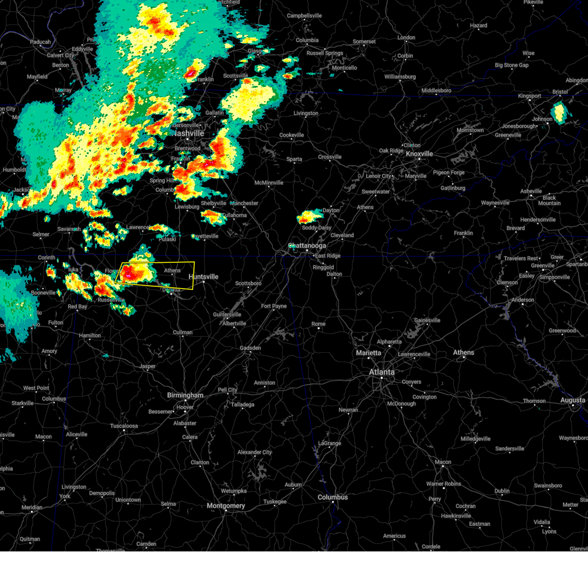 At 508 pm cdt, a severe thunderstorm was located near killen, or near muscle shoals, moving east at 45 mph (radar indicated). Hazards include golf ball size hail and 60 mph wind gusts. People and animals outdoors will be injured. expect hail damage to roofs, siding, windows, and vehicles. expect wind damage to roofs, siding, and trees. Locations impacted include, madison, cartwright, northwest alabama regional airport, french mill, coxey, harvest, killen, ford city, red bank, and capshaw. At 508 pm cdt, a severe thunderstorm was located near killen, or near muscle shoals, moving east at 45 mph (radar indicated). Hazards include golf ball size hail and 60 mph wind gusts. People and animals outdoors will be injured. expect hail damage to roofs, siding, windows, and vehicles. expect wind damage to roofs, siding, and trees. Locations impacted include, madison, cartwright, northwest alabama regional airport, french mill, coxey, harvest, killen, ford city, red bank, and capshaw.
|
| 5/20/2025 4:57 PM CDT |
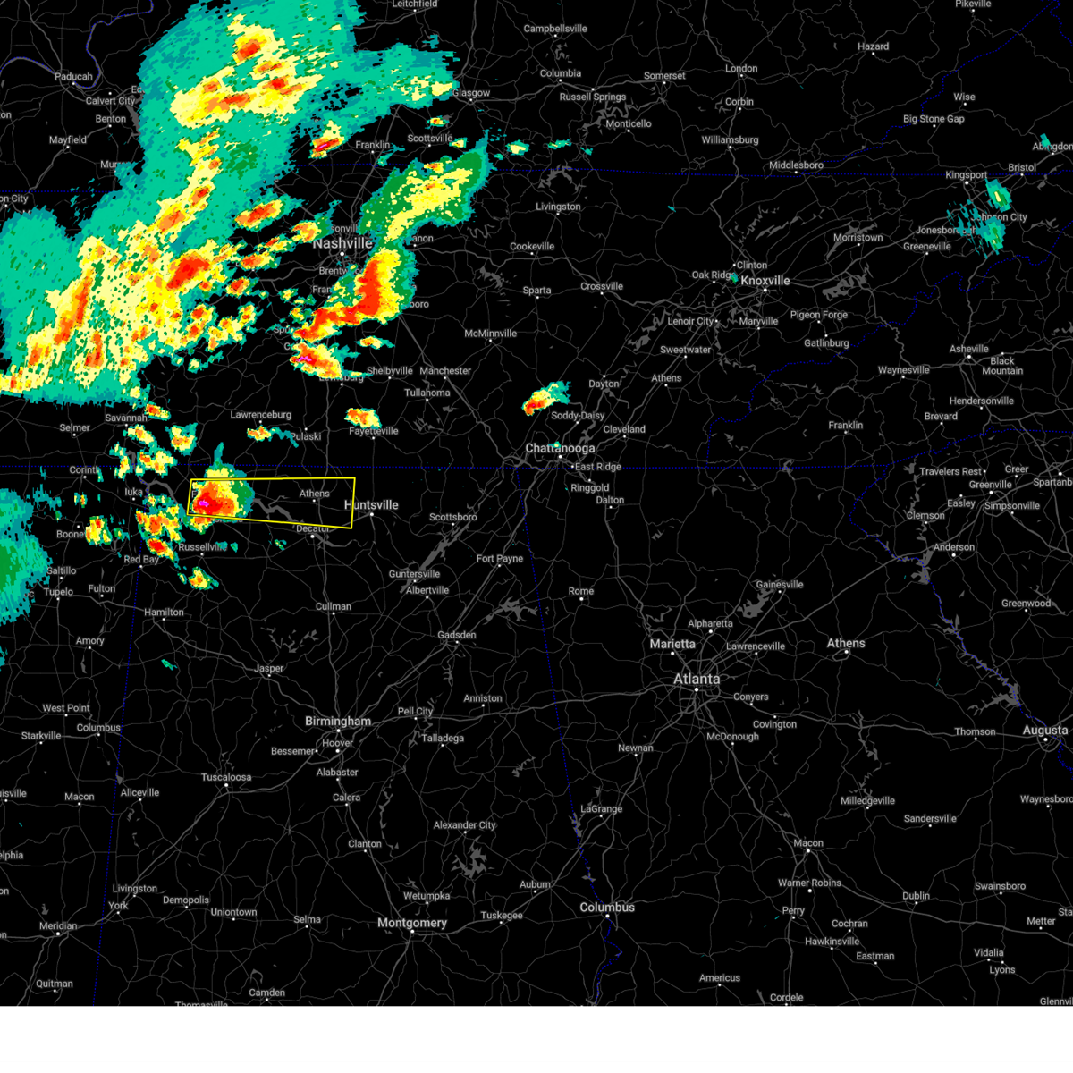 Svrhun the national weather service in huntsville alabama has issued a * severe thunderstorm warning for, northwestern madison county in north central alabama, limestone county in north central alabama, southeastern lauderdale county in northwestern alabama, east central colbert county in northwestern alabama, northeastern lawrence county in northwestern alabama, * until 600 pm cdt. * at 456 pm cdt, a severe thunderstorm was located over sheffield, moving east at 45 mph. this storm has previous history of producing golfball size hail (radar indicated). Hazards include golf ball size hail and 60 mph wind gusts. People and animals outdoors will be injured. expect hail damage to roofs, siding, windows, and vehicles. Expect wind damage to roofs, siding, and trees. Svrhun the national weather service in huntsville alabama has issued a * severe thunderstorm warning for, northwestern madison county in north central alabama, limestone county in north central alabama, southeastern lauderdale county in northwestern alabama, east central colbert county in northwestern alabama, northeastern lawrence county in northwestern alabama, * until 600 pm cdt. * at 456 pm cdt, a severe thunderstorm was located over sheffield, moving east at 45 mph. this storm has previous history of producing golfball size hail (radar indicated). Hazards include golf ball size hail and 60 mph wind gusts. People and animals outdoors will be injured. expect hail damage to roofs, siding, windows, and vehicles. Expect wind damage to roofs, siding, and trees.
|
| 5/2/2025 4:10 PM CDT |
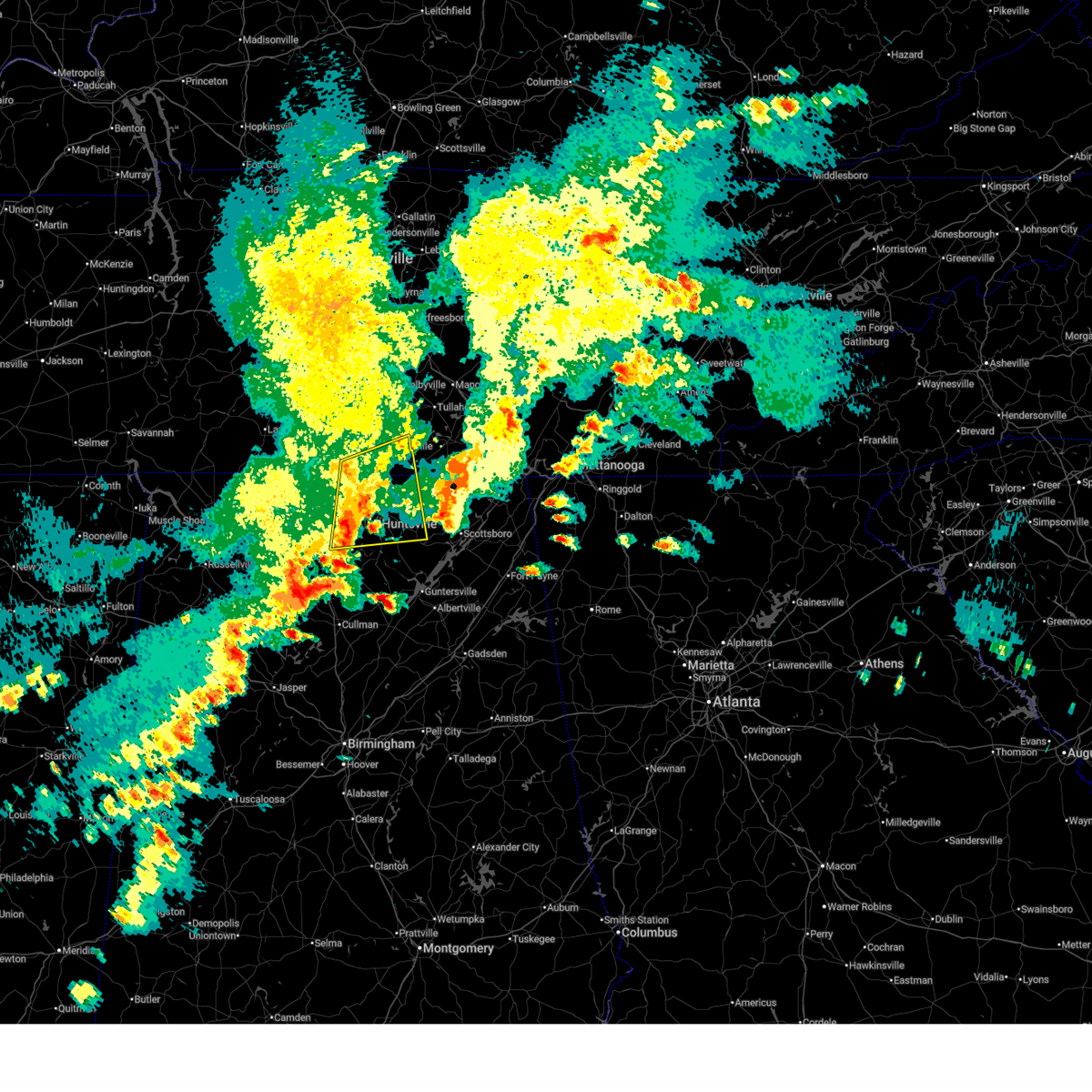 At 409 pm cdt, a severe thunderstorm was located over harvest, or 8 miles north of madison, moving east at 45 mph (radar indicated). Hazards include 60 mph wind gusts and quarter size hail. Hail damage to vehicles is expected. expect wind damage to roofs, siding, and trees. Locations impacted include, madison, huntsville, elkwood, marshall space flight center, elora, mooresville, harvest, smithland, hazel green, and coldwater. At 409 pm cdt, a severe thunderstorm was located over harvest, or 8 miles north of madison, moving east at 45 mph (radar indicated). Hazards include 60 mph wind gusts and quarter size hail. Hail damage to vehicles is expected. expect wind damage to roofs, siding, and trees. Locations impacted include, madison, huntsville, elkwood, marshall space flight center, elora, mooresville, harvest, smithland, hazel green, and coldwater.
|
| 5/2/2025 3:55 PM CDT |
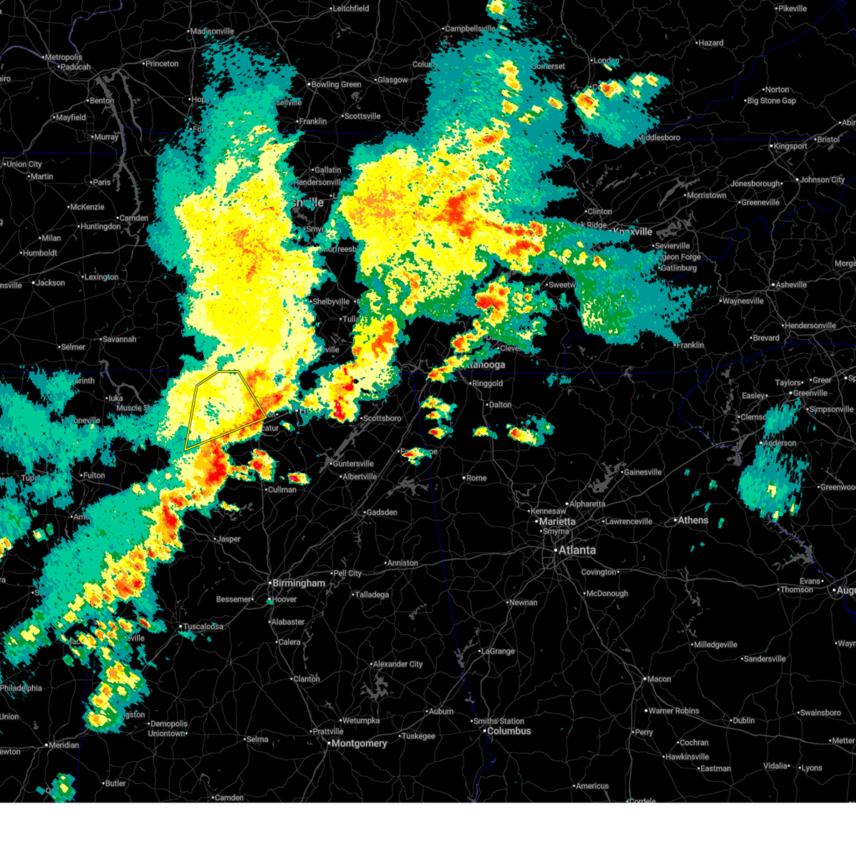 The storm which prompted the warning has moved out of the area. therefore, the warning will be allowed to expire. a severe thunderstorm watch remains in effect until 500 pm cdt for north central and northwestern alabama, and middle tennessee. a severe thunderstorm watch also remains in effect until 800 pm cdt for north central and northeastern alabama. The storm which prompted the warning has moved out of the area. therefore, the warning will be allowed to expire. a severe thunderstorm watch remains in effect until 500 pm cdt for north central and northwestern alabama, and middle tennessee. a severe thunderstorm watch also remains in effect until 800 pm cdt for north central and northeastern alabama.
|
| 5/2/2025 3:47 PM CDT |
 Svrhun the national weather service in huntsville alabama has issued a * severe thunderstorm warning for, west central jackson county in northeastern alabama, madison county in north central alabama, eastern limestone county in north central alabama, southern lincoln county in middle tennessee, * until 445 pm cdt. * at 347 pm cdt, a severe thunderstorm was located near athens, moving east at 45 mph (radar indicated). Hazards include 60 mph wind gusts and quarter size hail. Hail damage to vehicles is expected. Expect wind damage to roofs, siding, and trees. Svrhun the national weather service in huntsville alabama has issued a * severe thunderstorm warning for, west central jackson county in northeastern alabama, madison county in north central alabama, eastern limestone county in north central alabama, southern lincoln county in middle tennessee, * until 445 pm cdt. * at 347 pm cdt, a severe thunderstorm was located near athens, moving east at 45 mph (radar indicated). Hazards include 60 mph wind gusts and quarter size hail. Hail damage to vehicles is expected. Expect wind damage to roofs, siding, and trees.
|
| 5/2/2025 3:35 PM CDT |
 At 335 pm cdt, a severe thunderstorm was located near courtland, or 18 miles north of moulton, moving northeast at 50 mph (radar indicated). Hazards include 60 mph wind gusts and quarter size hail. Hail damage to vehicles is expected. expect wind damage to roofs, siding, and trees. Locations impacted include, good springs, cartwright, coxey, trinity, ne smith, north courtland, hatton, lester, red bank, and leggtown. At 335 pm cdt, a severe thunderstorm was located near courtland, or 18 miles north of moulton, moving northeast at 50 mph (radar indicated). Hazards include 60 mph wind gusts and quarter size hail. Hail damage to vehicles is expected. expect wind damage to roofs, siding, and trees. Locations impacted include, good springs, cartwright, coxey, trinity, ne smith, north courtland, hatton, lester, red bank, and leggtown.
|
| 5/2/2025 3:35 PM CDT |
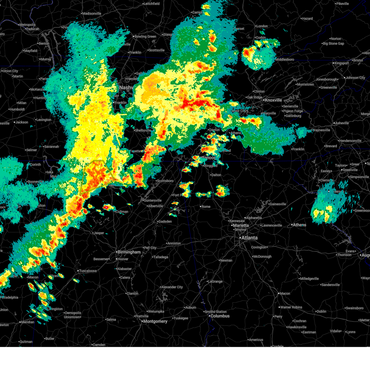 the severe thunderstorm warning has been cancelled and is no longer in effect the severe thunderstorm warning has been cancelled and is no longer in effect
|
| 5/2/2025 3:04 PM CDT |
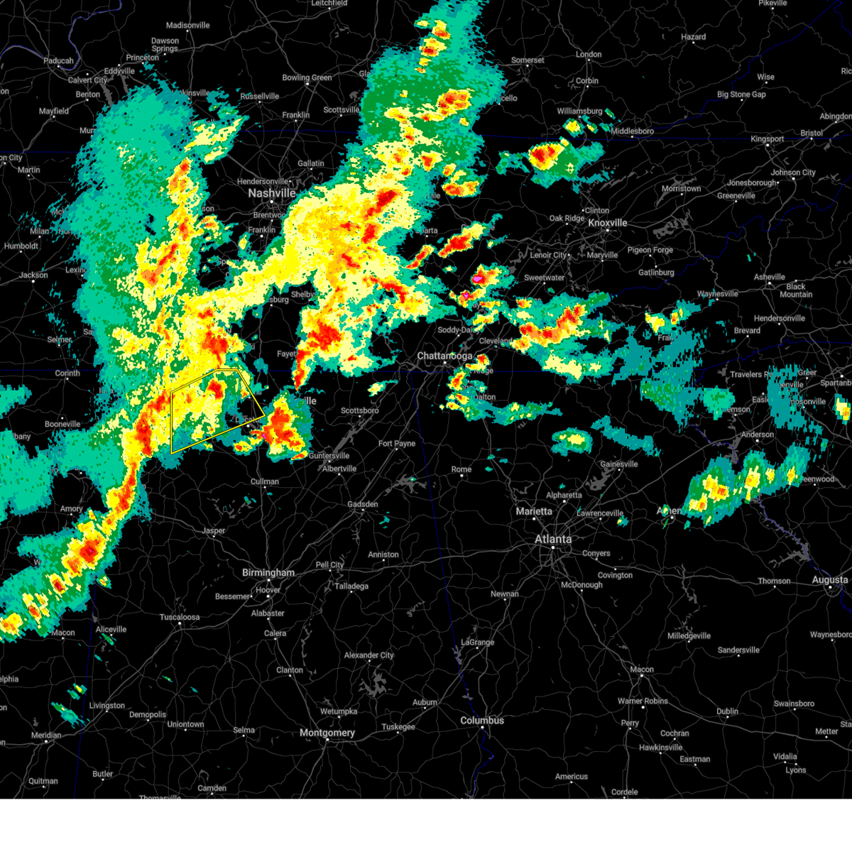 Svrhun the national weather service in huntsville alabama has issued a * severe thunderstorm warning for, central limestone county in north central alabama, southeastern lauderdale county in northwestern alabama, southeastern colbert county in northwestern alabama, northeastern franklin county in northwestern alabama, northwestern morgan county in north central alabama, northern lawrence county in northwestern alabama, * until 400 pm cdt. * at 304 pm cdt, a severe thunderstorm was located over littleville, or near russellville, moving northeast at 50 mph (radar indicated). Hazards include 60 mph wind gusts and quarter size hail. Hail damage to vehicles is expected. Expect wind damage to roofs, siding, and trees. Svrhun the national weather service in huntsville alabama has issued a * severe thunderstorm warning for, central limestone county in north central alabama, southeastern lauderdale county in northwestern alabama, southeastern colbert county in northwestern alabama, northeastern franklin county in northwestern alabama, northwestern morgan county in north central alabama, northern lawrence county in northwestern alabama, * until 400 pm cdt. * at 304 pm cdt, a severe thunderstorm was located over littleville, or near russellville, moving northeast at 50 mph (radar indicated). Hazards include 60 mph wind gusts and quarter size hail. Hail damage to vehicles is expected. Expect wind damage to roofs, siding, and trees.
|
| 5/2/2025 2:56 PM CDT |
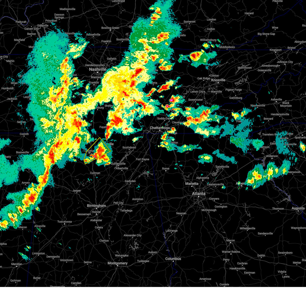 At 255 pm cdt, a severe thunderstorm was located over triana, or 7 miles west of redstone arsenal, moving northeast at 25 mph (public). Hazards include quarter size hail. Damage to vehicles is expected. Locations impacted include, madison, belle mina, huntsville, french mill, triana, marshall space flight center, university of alabama in huntsville, mooresville, basham, and redstone arsenal. At 255 pm cdt, a severe thunderstorm was located over triana, or 7 miles west of redstone arsenal, moving northeast at 25 mph (public). Hazards include quarter size hail. Damage to vehicles is expected. Locations impacted include, madison, belle mina, huntsville, french mill, triana, marshall space flight center, university of alabama in huntsville, mooresville, basham, and redstone arsenal.
|
| 5/2/2025 2:22 PM CDT |
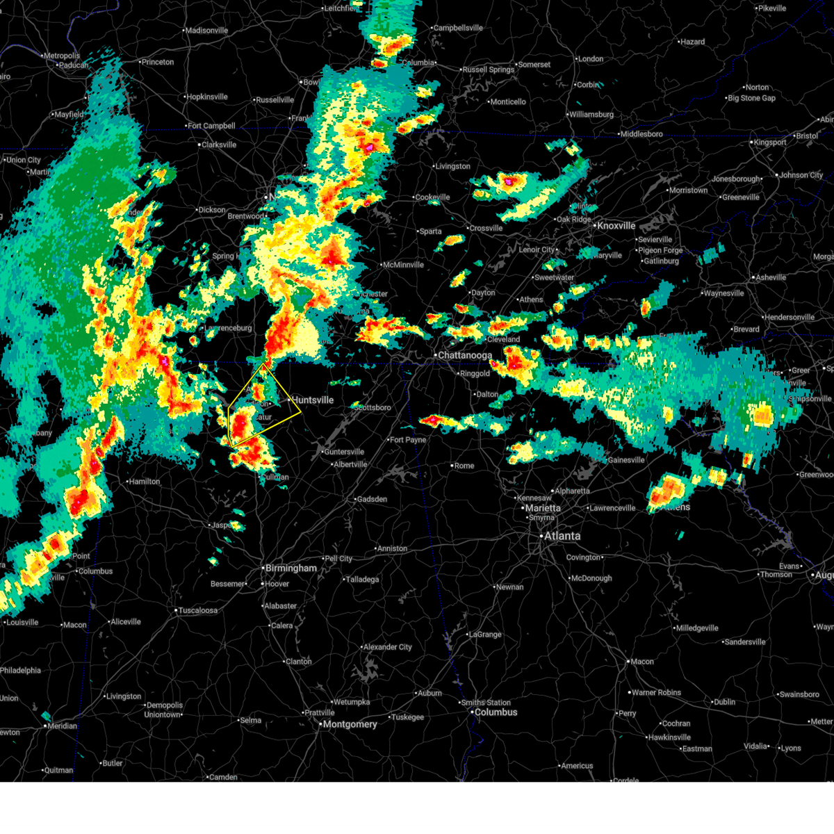 At 221 pm cdt, a severe thunderstorm was located over decatur, moving northeast at 30 mph (public). Hazards include 60 mph wind gusts and quarter size hail. Hail damage to vehicles is expected. expect wind damage to roofs, siding, and trees. Locations impacted include, madison, belle mina, huntsville, french mill, trinity, triana, marshall space flight center, university of alabama in huntsville, mooresville, and athens. At 221 pm cdt, a severe thunderstorm was located over decatur, moving northeast at 30 mph (public). Hazards include 60 mph wind gusts and quarter size hail. Hail damage to vehicles is expected. expect wind damage to roofs, siding, and trees. Locations impacted include, madison, belle mina, huntsville, french mill, trinity, triana, marshall space flight center, university of alabama in huntsville, mooresville, and athens.
|
| 5/2/2025 2:22 PM CDT |
 the severe thunderstorm warning has been cancelled and is no longer in effect the severe thunderstorm warning has been cancelled and is no longer in effect
|
| 5/2/2025 2:08 PM CDT |
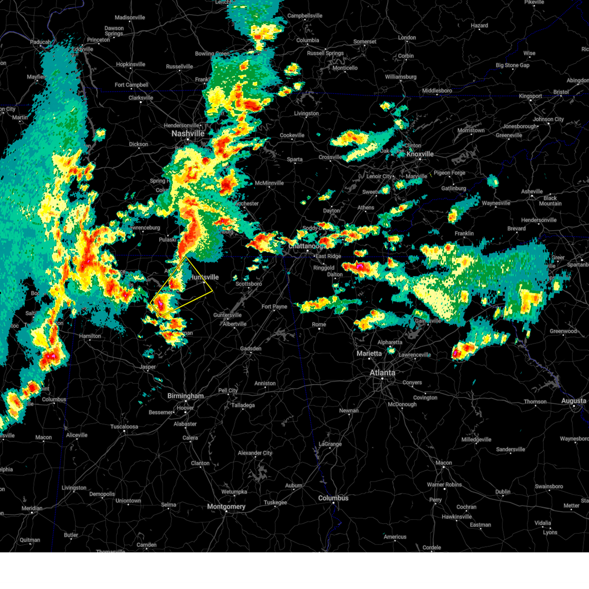 Svrhun the national weather service in huntsville alabama has issued a * severe thunderstorm warning for, southwestern madison county in north central alabama, eastern limestone county in north central alabama, northern morgan county in north central alabama, east central lawrence county in northwestern alabama, * until 315 pm cdt. * at 207 pm cdt, a severe thunderstorm was located near trinity, or 8 miles southwest of decatur, moving northeast at 30 mph (radar indicated). Hazards include 60 mph wind gusts and half dollar size hail. Hail damage to vehicles is expected. Expect wind damage to roofs, siding, and trees. Svrhun the national weather service in huntsville alabama has issued a * severe thunderstorm warning for, southwestern madison county in north central alabama, eastern limestone county in north central alabama, northern morgan county in north central alabama, east central lawrence county in northwestern alabama, * until 315 pm cdt. * at 207 pm cdt, a severe thunderstorm was located near trinity, or 8 miles southwest of decatur, moving northeast at 30 mph (radar indicated). Hazards include 60 mph wind gusts and half dollar size hail. Hail damage to vehicles is expected. Expect wind damage to roofs, siding, and trees.
|
| 4/23/2025 5:00 PM CDT |
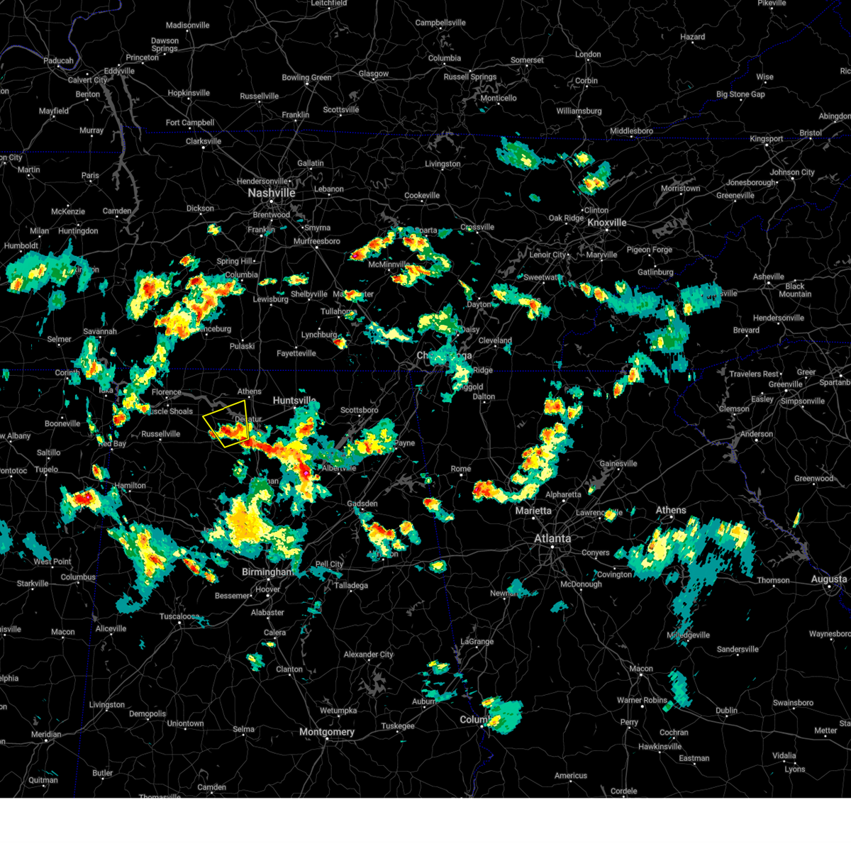 the severe thunderstorm warning has been cancelled and is no longer in effect the severe thunderstorm warning has been cancelled and is no longer in effect
|
| 4/23/2025 4:42 PM CDT |
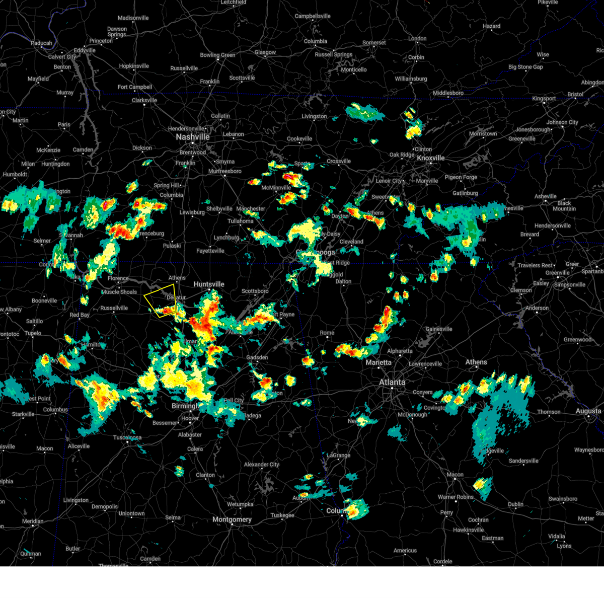 Svrhun the national weather service in huntsville alabama has issued a * severe thunderstorm warning for, south central limestone county in north central alabama, northwestern morgan county in north central alabama, northeastern lawrence county in northwestern alabama, * until 545 pm cdt. * at 441 pm cdt, a severe thunderstorm was located near trinity, or 7 miles southwest of decatur, moving north at 10 mph (radar indicated). Hazards include 60 mph wind gusts and quarter size hail. Hail damage to vehicles is expected. Expect wind damage to roofs, siding, and trees. Svrhun the national weather service in huntsville alabama has issued a * severe thunderstorm warning for, south central limestone county in north central alabama, northwestern morgan county in north central alabama, northeastern lawrence county in northwestern alabama, * until 545 pm cdt. * at 441 pm cdt, a severe thunderstorm was located near trinity, or 7 miles southwest of decatur, moving north at 10 mph (radar indicated). Hazards include 60 mph wind gusts and quarter size hail. Hail damage to vehicles is expected. Expect wind damage to roofs, siding, and trees.
|
| 4/10/2025 5:20 PM CDT | Quarter sized hail reported 12.9 miles E of Athens, AL, reports of quarter sized hail. |
| 4/10/2025 5:00 PM CDT |
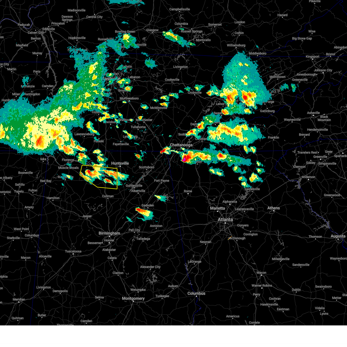 the severe thunderstorm warning has been cancelled and is no longer in effect the severe thunderstorm warning has been cancelled and is no longer in effect
|
| 4/10/2025 4:47 PM CDT |
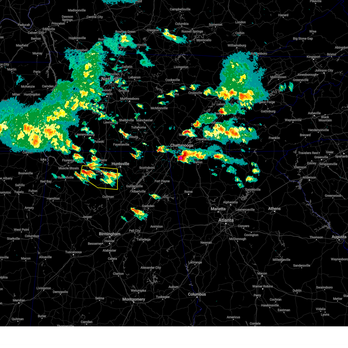 Svrhun the national weather service in huntsville alabama has issued a * severe thunderstorm warning for, southwestern madison county in north central alabama, southeastern limestone county in north central alabama, morgan county in north central alabama, northeastern lawrence county in northwestern alabama, * until 530 pm cdt. * at 446 pm cdt, a severe thunderstorm was located over courtland, or 11 miles north of moulton, moving east at 40 mph (radar indicated). Hazards include 60 mph wind gusts and quarter size hail. Hail damage to vehicles is expected. Expect wind damage to roofs, siding, and trees. Svrhun the national weather service in huntsville alabama has issued a * severe thunderstorm warning for, southwestern madison county in north central alabama, southeastern limestone county in north central alabama, morgan county in north central alabama, northeastern lawrence county in northwestern alabama, * until 530 pm cdt. * at 446 pm cdt, a severe thunderstorm was located over courtland, or 11 miles north of moulton, moving east at 40 mph (radar indicated). Hazards include 60 mph wind gusts and quarter size hail. Hail damage to vehicles is expected. Expect wind damage to roofs, siding, and trees.
|
| 3/23/2025 8:19 PM CDT |
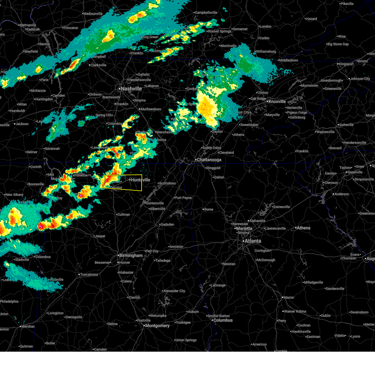 the severe thunderstorm warning has been cancelled and is no longer in effect the severe thunderstorm warning has been cancelled and is no longer in effect
|
| 3/23/2025 8:13 PM CDT |
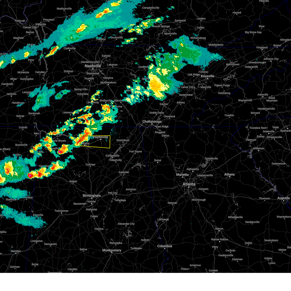 At 812 pm cdt, a severe thunderstorm was located near tanner, or near athens, moving east at 50 mph (radar indicated). Hazards include 60 mph wind gusts and quarter size hail. Hail damage to vehicles is expected. expect wind damage to roofs, siding, and trees. Locations impacted include, madison, maysville, belle mina, huntsville, french mill, trinity, alabama a and m university, triana, marshall space flight center, and university of alabama in huntsville. At 812 pm cdt, a severe thunderstorm was located near tanner, or near athens, moving east at 50 mph (radar indicated). Hazards include 60 mph wind gusts and quarter size hail. Hail damage to vehicles is expected. expect wind damage to roofs, siding, and trees. Locations impacted include, madison, maysville, belle mina, huntsville, french mill, trinity, alabama a and m university, triana, marshall space flight center, and university of alabama in huntsville.
|
| 3/23/2025 8:13 PM CDT |
 the severe thunderstorm warning has been cancelled and is no longer in effect the severe thunderstorm warning has been cancelled and is no longer in effect
|
| 3/23/2025 8:09 PM CDT |
 At 809 pm cdt, a severe thunderstorm was located over tanner, or near athens, moving east at 50 mph (radar indicated). Hazards include 60 mph wind gusts and quarter size hail. Hail damage to vehicles is expected. expect wind damage to roofs, siding, and trees. Locations impacted include, madison, huntsville, french mill, trinity, marshall space flight center, mooresville, capshaw, ryland, tanner, and whitesburg. At 809 pm cdt, a severe thunderstorm was located over tanner, or near athens, moving east at 50 mph (radar indicated). Hazards include 60 mph wind gusts and quarter size hail. Hail damage to vehicles is expected. expect wind damage to roofs, siding, and trees. Locations impacted include, madison, huntsville, french mill, trinity, marshall space flight center, mooresville, capshaw, ryland, tanner, and whitesburg.
|
| 3/23/2025 8:02 PM CDT |
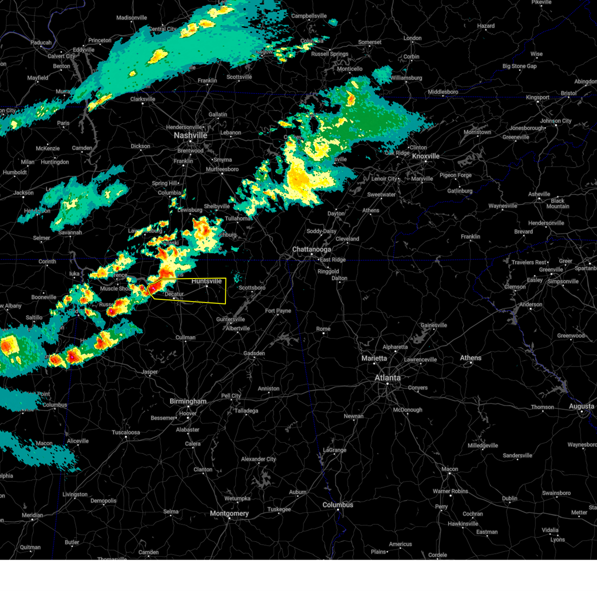 At 801 pm cdt, a severe thunderstorm was located near trinity, or 10 miles northwest of decatur, moving east at 50 mph (radar indicated). Hazards include 60 mph wind gusts and quarter size hail. Hail damage to vehicles is expected. expect wind damage to roofs, siding, and trees. Locations impacted include, madison, huntsville, french mill, trinity, marshall space flight center, mooresville, capshaw, ryland, tanner, and wheeler. At 801 pm cdt, a severe thunderstorm was located near trinity, or 10 miles northwest of decatur, moving east at 50 mph (radar indicated). Hazards include 60 mph wind gusts and quarter size hail. Hail damage to vehicles is expected. expect wind damage to roofs, siding, and trees. Locations impacted include, madison, huntsville, french mill, trinity, marshall space flight center, mooresville, capshaw, ryland, tanner, and wheeler.
|
| 3/23/2025 7:46 PM CDT |
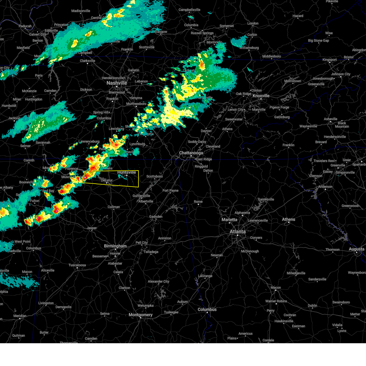 Svrhun the national weather service in huntsville alabama has issued a * severe thunderstorm warning for, central madison county in north central alabama, southern limestone county in north central alabama, northern morgan county in north central alabama, northern lawrence county in northwestern alabama, * until 845 pm cdt. * at 746 pm cdt, a severe thunderstorm was located over courtland, or 15 miles north of moulton, moving east at 50 mph (radar indicated). Hazards include 60 mph wind gusts and quarter size hail. Hail damage to vehicles is expected. Expect wind damage to roofs, siding, and trees. Svrhun the national weather service in huntsville alabama has issued a * severe thunderstorm warning for, central madison county in north central alabama, southern limestone county in north central alabama, northern morgan county in north central alabama, northern lawrence county in northwestern alabama, * until 845 pm cdt. * at 746 pm cdt, a severe thunderstorm was located over courtland, or 15 miles north of moulton, moving east at 50 mph (radar indicated). Hazards include 60 mph wind gusts and quarter size hail. Hail damage to vehicles is expected. Expect wind damage to roofs, siding, and trees.
|
| 3/15/2025 3:38 PM CDT |
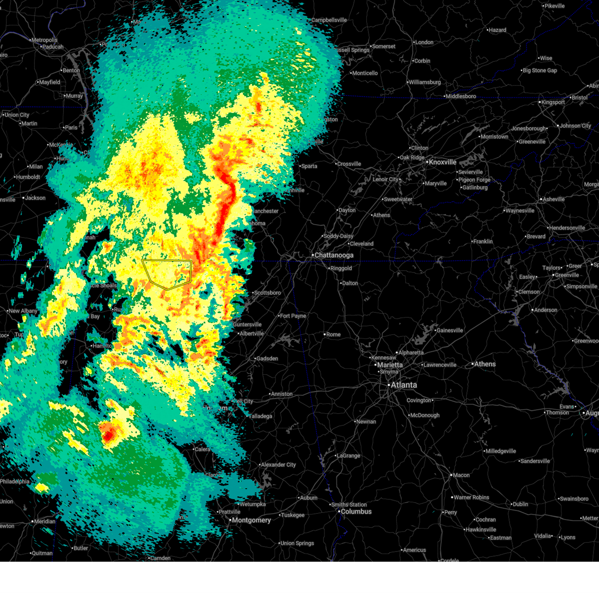 The severe thunderstorm which prompted the warning has moved out of the warned area. therefore, the warning will be allowed to expire. however, gusty winds are still possible with this thunderstorm. a tornado watch remains in effect until 800 pm cdt for north central, northeastern and northwestern alabama. a tornado watch also remains in effect until 900 pm cdt for middle tennessee. The severe thunderstorm which prompted the warning has moved out of the warned area. therefore, the warning will be allowed to expire. however, gusty winds are still possible with this thunderstorm. a tornado watch remains in effect until 800 pm cdt for north central, northeastern and northwestern alabama. a tornado watch also remains in effect until 900 pm cdt for middle tennessee.
|
| 3/15/2025 3:28 PM CDT |
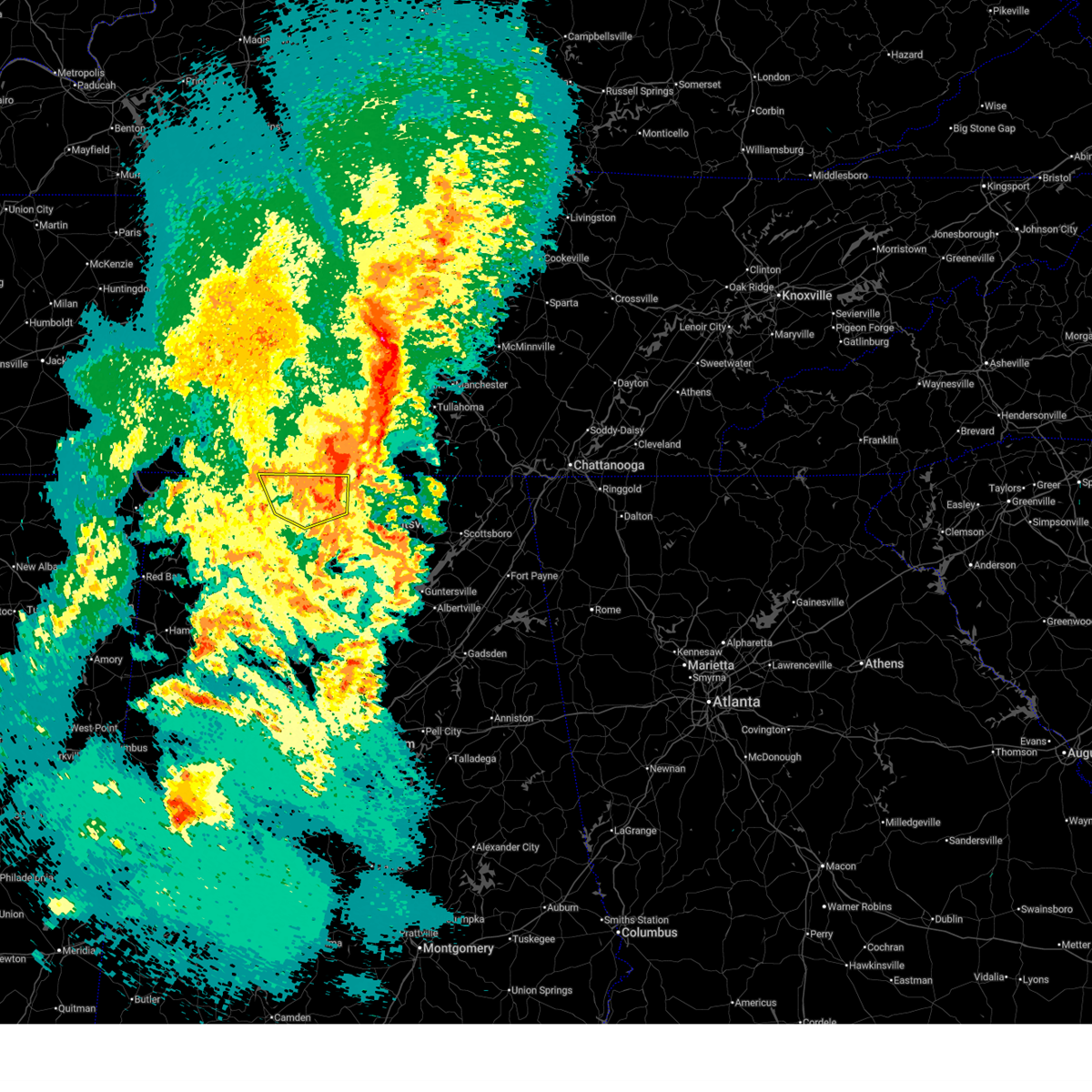 the severe thunderstorm warning has been cancelled and is no longer in effect the severe thunderstorm warning has been cancelled and is no longer in effect
|
| 3/15/2025 3:28 PM CDT |
 At 327 pm cdt, a severe thunderstorm was located over ardmore, or 15 miles north of athens, moving northeast at 40 mph (radar indicated). Hazards include 60 mph wind gusts and half dollar size hail. Hail damage to vehicles is expected. expect wind damage to roofs, siding, and trees. Locations impacted include, good springs, cartwright, french mill, coxey, oliver, mt rozell, athens, anderson, ripley, and lester. At 327 pm cdt, a severe thunderstorm was located over ardmore, or 15 miles north of athens, moving northeast at 40 mph (radar indicated). Hazards include 60 mph wind gusts and half dollar size hail. Hail damage to vehicles is expected. expect wind damage to roofs, siding, and trees. Locations impacted include, good springs, cartwright, french mill, coxey, oliver, mt rozell, athens, anderson, ripley, and lester.
|
| 3/15/2025 3:23 PM CDT |
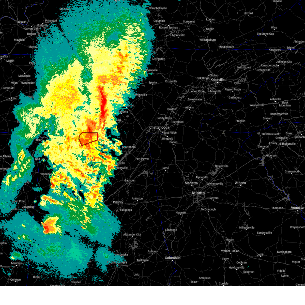 The tornadic thunderstorm which prompted the warning has weakened. therefore, the warning will be allowed to expire. a tornado watch remains in effect until 800 pm cdt for north central and northwestern alabama. a tornado watch also remains in effect until 900 pm cdt for middle tennessee. The tornadic thunderstorm which prompted the warning has weakened. therefore, the warning will be allowed to expire. a tornado watch remains in effect until 800 pm cdt for north central and northwestern alabama. a tornado watch also remains in effect until 900 pm cdt for middle tennessee.
|
| 3/15/2025 3:12 PM CDT |
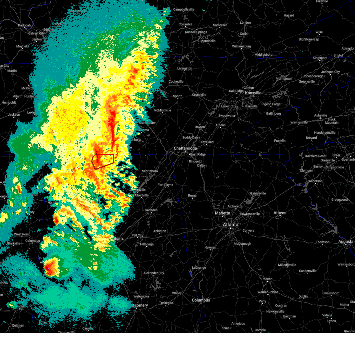 At 312 pm cdt, a severe thunderstorm capable of producing a tornado was located 8 miles northwest of athens, moving northeast at 40 mph (radar indicated rotation). Hazards include tornado. Flying debris will be dangerous to those caught without shelter. mobile homes will be damaged or destroyed. damage to roofs, windows, and vehicles will occur. tree damage is likely. this dangerous storm will be near, ardmore around 325 pm cdt. Other locations impacted by this tornadic thunderstorm include good springs, cartwright, coxey, cairo, holland gin, mt rozell, leggtown, elkmont, and ripley. At 312 pm cdt, a severe thunderstorm capable of producing a tornado was located 8 miles northwest of athens, moving northeast at 40 mph (radar indicated rotation). Hazards include tornado. Flying debris will be dangerous to those caught without shelter. mobile homes will be damaged or destroyed. damage to roofs, windows, and vehicles will occur. tree damage is likely. this dangerous storm will be near, ardmore around 325 pm cdt. Other locations impacted by this tornadic thunderstorm include good springs, cartwright, coxey, cairo, holland gin, mt rozell, leggtown, elkmont, and ripley.
|
| 3/15/2025 3:06 PM CDT |
 Torhun the national weather service in huntsville alabama has issued a * tornado warning for, northern limestone county in north central alabama, * until 330 pm cdt. * at 306 pm cdt, a severe thunderstorm capable of producing a tornado was located 9 miles northwest of athens, moving northeast at 35 mph (radar indicated rotation). Hazards include tornado. Flying debris will be dangerous to those caught without shelter. mobile homes will be damaged or destroyed. damage to roofs, windows, and vehicles will occur. tree damage is likely. this dangerous storm will be near, athens around 310 pm cdt. Other locations impacted by this tornadic thunderstorm include good springs, cartwright, coxey, cairo, holland gin, mt rozell, leggtown, elkmont, and ripley. Torhun the national weather service in huntsville alabama has issued a * tornado warning for, northern limestone county in north central alabama, * until 330 pm cdt. * at 306 pm cdt, a severe thunderstorm capable of producing a tornado was located 9 miles northwest of athens, moving northeast at 35 mph (radar indicated rotation). Hazards include tornado. Flying debris will be dangerous to those caught without shelter. mobile homes will be damaged or destroyed. damage to roofs, windows, and vehicles will occur. tree damage is likely. this dangerous storm will be near, athens around 310 pm cdt. Other locations impacted by this tornadic thunderstorm include good springs, cartwright, coxey, cairo, holland gin, mt rozell, leggtown, elkmont, and ripley.
|
| 3/15/2025 2:55 PM CDT |
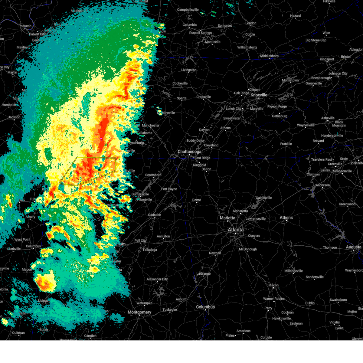 At 255 pm cdt, a severe thunderstorm was located near rogersville, or 15 miles northwest of athens, moving northeast at 40 mph (radar indicated). Hazards include ping pong ball size hail and 60 mph wind gusts. People and animals outdoors will be injured. expect hail damage to roofs, siding, windows, and vehicles. expect wind damage to roofs, siding, and trees. Locations impacted include, good springs, cartwright, northwest alabama regional airport, french mill, coxey, littleville, la grange, florence, ne smith, and north courtland. At 255 pm cdt, a severe thunderstorm was located near rogersville, or 15 miles northwest of athens, moving northeast at 40 mph (radar indicated). Hazards include ping pong ball size hail and 60 mph wind gusts. People and animals outdoors will be injured. expect hail damage to roofs, siding, windows, and vehicles. expect wind damage to roofs, siding, and trees. Locations impacted include, good springs, cartwright, northwest alabama regional airport, french mill, coxey, littleville, la grange, florence, ne smith, and north courtland.
|
| 3/15/2025 2:45 PM CDT |
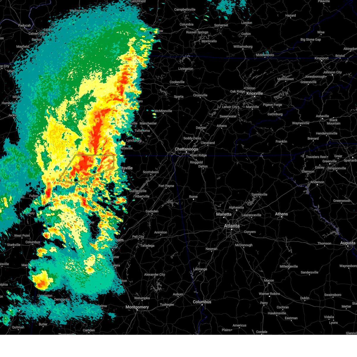 Svrhun the national weather service in huntsville alabama has issued a * severe thunderstorm warning for, limestone county in north central alabama, eastern lauderdale county in northwestern alabama, southeastern colbert county in northwestern alabama, northeastern franklin county in northwestern alabama, northern lawrence county in northwestern alabama, * until 345 pm cdt. * at 244 pm cdt, a severe thunderstorm was located over rogersville, or 18 miles east of muscle shoals, moving northeast at 40 mph (radar indicated). Hazards include golf ball size hail and 60 mph wind gusts. People and animals outdoors will be injured. expect hail damage to roofs, siding, windows, and vehicles. Expect wind damage to roofs, siding, and trees. Svrhun the national weather service in huntsville alabama has issued a * severe thunderstorm warning for, limestone county in north central alabama, eastern lauderdale county in northwestern alabama, southeastern colbert county in northwestern alabama, northeastern franklin county in northwestern alabama, northern lawrence county in northwestern alabama, * until 345 pm cdt. * at 244 pm cdt, a severe thunderstorm was located over rogersville, or 18 miles east of muscle shoals, moving northeast at 40 mph (radar indicated). Hazards include golf ball size hail and 60 mph wind gusts. People and animals outdoors will be injured. expect hail damage to roofs, siding, windows, and vehicles. Expect wind damage to roofs, siding, and trees.
|
| 3/15/2025 4:54 AM CDT |
 the severe thunderstorm warning has been cancelled and is no longer in effect the severe thunderstorm warning has been cancelled and is no longer in effect
|
| 3/15/2025 4:44 AM CDT |
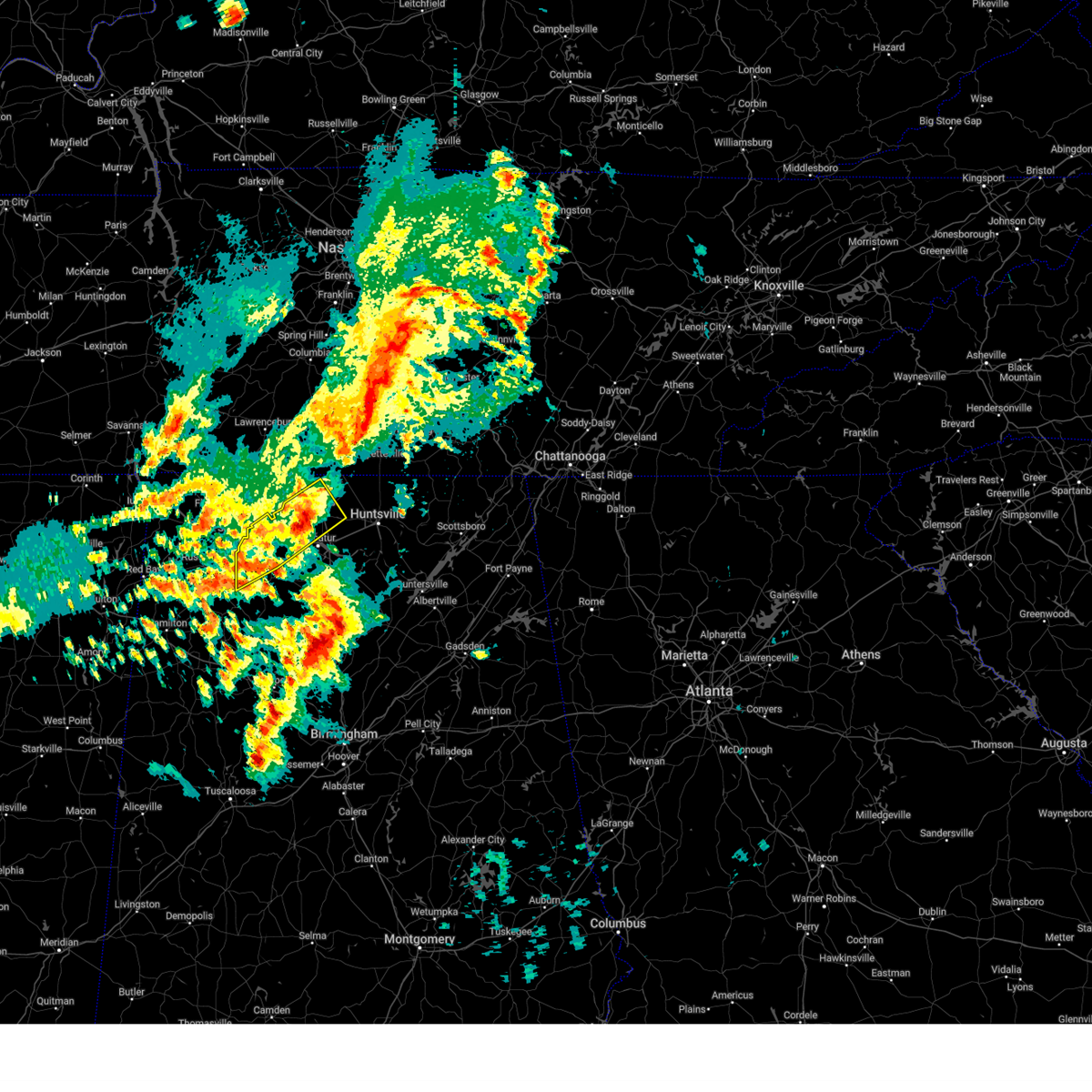 The severe thunderstorm which prompted the warning has moved out of the warned area. therefore, the warning will be allowed to expire. a tornado watch remains in effect until 1000 am cdt for north central and northwestern alabama, and middle tennessee. to report severe weather, contact your nearest law enforcement agency. they will relay your report to the national weather service huntsville alabama. The severe thunderstorm which prompted the warning has moved out of the warned area. therefore, the warning will be allowed to expire. a tornado watch remains in effect until 1000 am cdt for north central and northwestern alabama, and middle tennessee. to report severe weather, contact your nearest law enforcement agency. they will relay your report to the national weather service huntsville alabama.
|
| 3/15/2025 4:43 AM CDT |
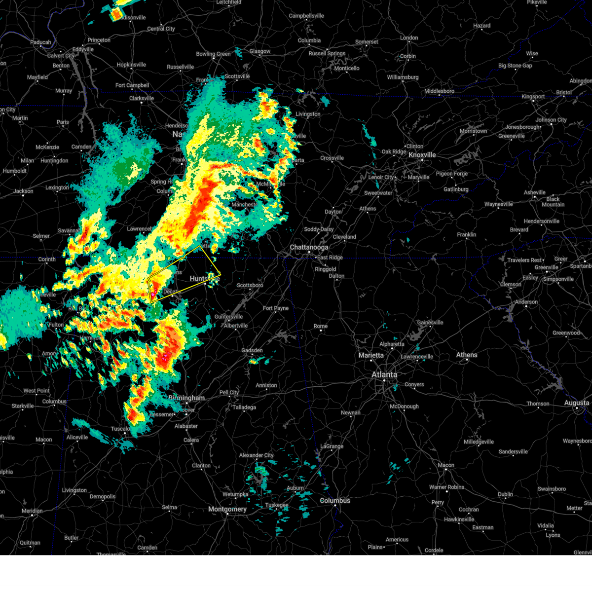 Svrhun the national weather service in huntsville alabama has issued a * severe thunderstorm warning for, northwestern madison county in north central alabama, limestone county in north central alabama, northwestern morgan county in north central alabama, northeastern lawrence county in northwestern alabama, southwestern lincoln county in middle tennessee, * until 545 am cdt. * at 442 am cdt, a severe thunderstorm was located 7 miles west of tanner, or 7 miles west of athens, moving northeast at 60 mph (radar indicated). Hazards include 60 mph wind gusts and quarter size hail. Hail damage to vehicles is expected. Expect wind damage to roofs, siding, and trees. Svrhun the national weather service in huntsville alabama has issued a * severe thunderstorm warning for, northwestern madison county in north central alabama, limestone county in north central alabama, northwestern morgan county in north central alabama, northeastern lawrence county in northwestern alabama, southwestern lincoln county in middle tennessee, * until 545 am cdt. * at 442 am cdt, a severe thunderstorm was located 7 miles west of tanner, or 7 miles west of athens, moving northeast at 60 mph (radar indicated). Hazards include 60 mph wind gusts and quarter size hail. Hail damage to vehicles is expected. Expect wind damage to roofs, siding, and trees.
|
| 3/15/2025 4:15 AM CDT |
 At 414 am cdt, a severe thunderstorm was located 9 miles south of leighton, or 13 miles east of russellville, moving northeast at 60 mph (radar indicated). Hazards include 60 mph wind gusts and quarter size hail. Hail damage to vehicles is expected. expect wind damage to roofs, siding, and trees. Locations impacted include, mt hope, cartwright, french mill, coxey, trinity, chalybeate springs, ne smith, athens, caddo, and north courtland. At 414 am cdt, a severe thunderstorm was located 9 miles south of leighton, or 13 miles east of russellville, moving northeast at 60 mph (radar indicated). Hazards include 60 mph wind gusts and quarter size hail. Hail damage to vehicles is expected. expect wind damage to roofs, siding, and trees. Locations impacted include, mt hope, cartwright, french mill, coxey, trinity, chalybeate springs, ne smith, athens, caddo, and north courtland.
|
| 3/15/2025 4:15 AM CDT |
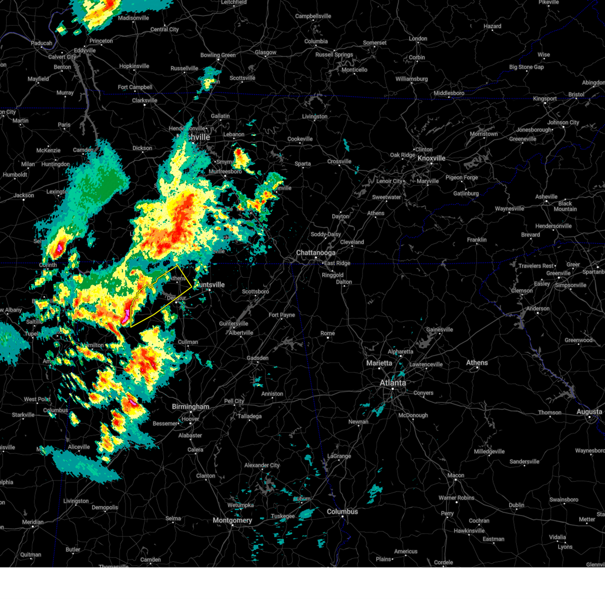 the severe thunderstorm warning has been cancelled and is no longer in effect the severe thunderstorm warning has been cancelled and is no longer in effect
|
| 3/15/2025 4:05 AM CDT |
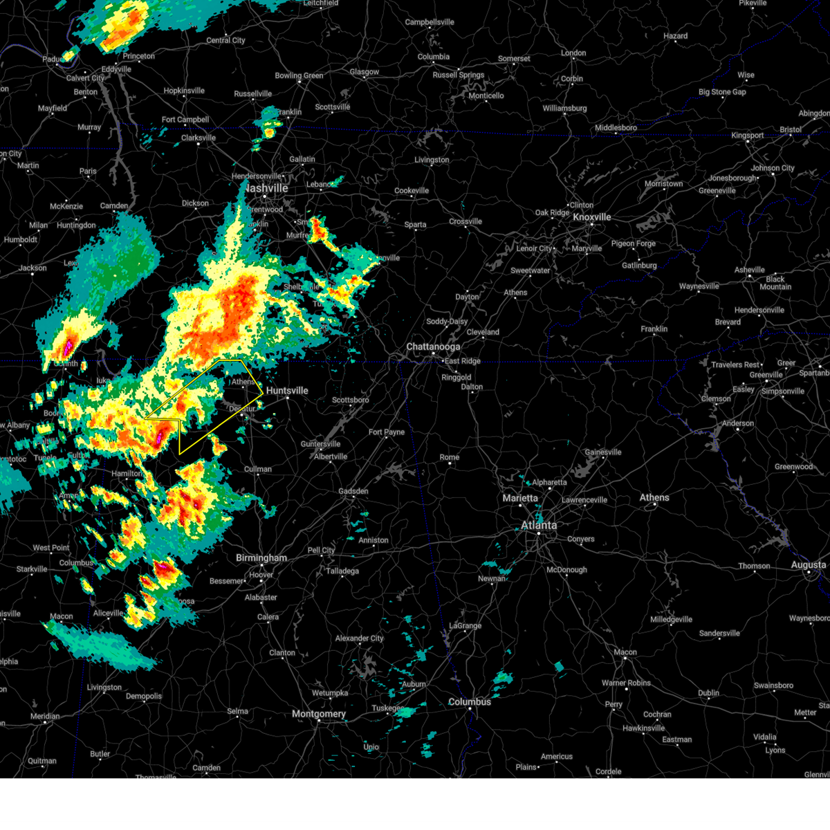 At 405 am cdt, a severe thunderstorm was located near russellville, moving northeast at 55 mph (radar indicated). Hazards include 60 mph wind gusts and quarter size hail. Hail damage to vehicles is expected. expect wind damage to roofs, siding, and trees. Locations impacted include, good springs, mt hope, cartwright, french mill, coxey, trinity, littleville, la grange, ne smith, and north courtland. At 405 am cdt, a severe thunderstorm was located near russellville, moving northeast at 55 mph (radar indicated). Hazards include 60 mph wind gusts and quarter size hail. Hail damage to vehicles is expected. expect wind damage to roofs, siding, and trees. Locations impacted include, good springs, mt hope, cartwright, french mill, coxey, trinity, littleville, la grange, ne smith, and north courtland.
|
| 3/15/2025 3:49 AM CDT |
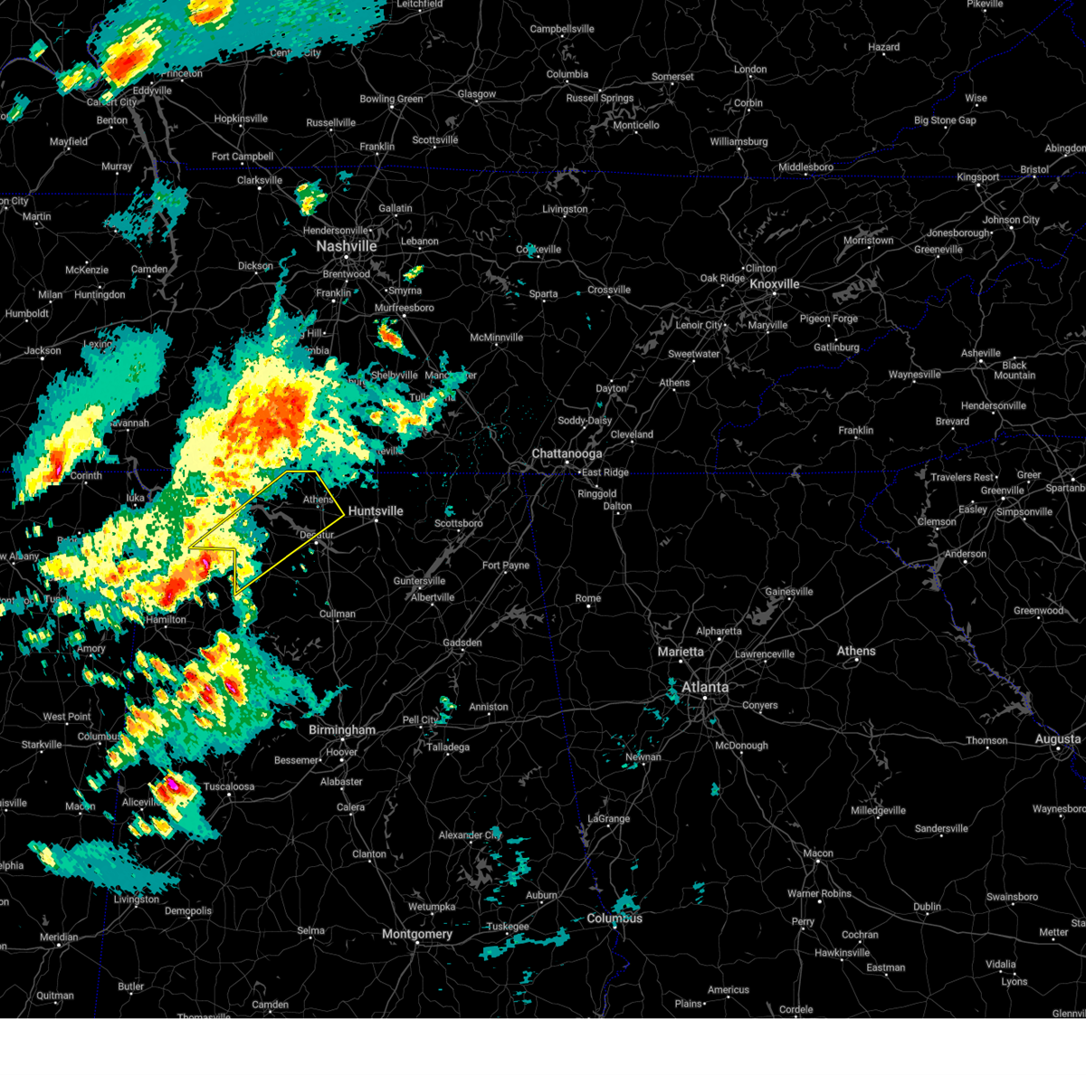 Svrhun the national weather service in huntsville alabama has issued a * severe thunderstorm warning for, limestone county in north central alabama, southeastern lauderdale county in northwestern alabama, southeastern colbert county in northwestern alabama, northwestern morgan county in north central alabama, lawrence county in northwestern alabama, * until 445 am cdt. * at 349 am cdt, a severe thunderstorm was located near russellville, moving northeast at 60 mph (radar indicated). Hazards include 60 mph wind gusts and quarter size hail. Hail damage to vehicles is expected. Expect wind damage to roofs, siding, and trees. Svrhun the national weather service in huntsville alabama has issued a * severe thunderstorm warning for, limestone county in north central alabama, southeastern lauderdale county in northwestern alabama, southeastern colbert county in northwestern alabama, northwestern morgan county in north central alabama, lawrence county in northwestern alabama, * until 445 am cdt. * at 349 am cdt, a severe thunderstorm was located near russellville, moving northeast at 60 mph (radar indicated). Hazards include 60 mph wind gusts and quarter size hail. Hail damage to vehicles is expected. Expect wind damage to roofs, siding, and trees.
|
| 2/16/2025 12:18 AM CST |
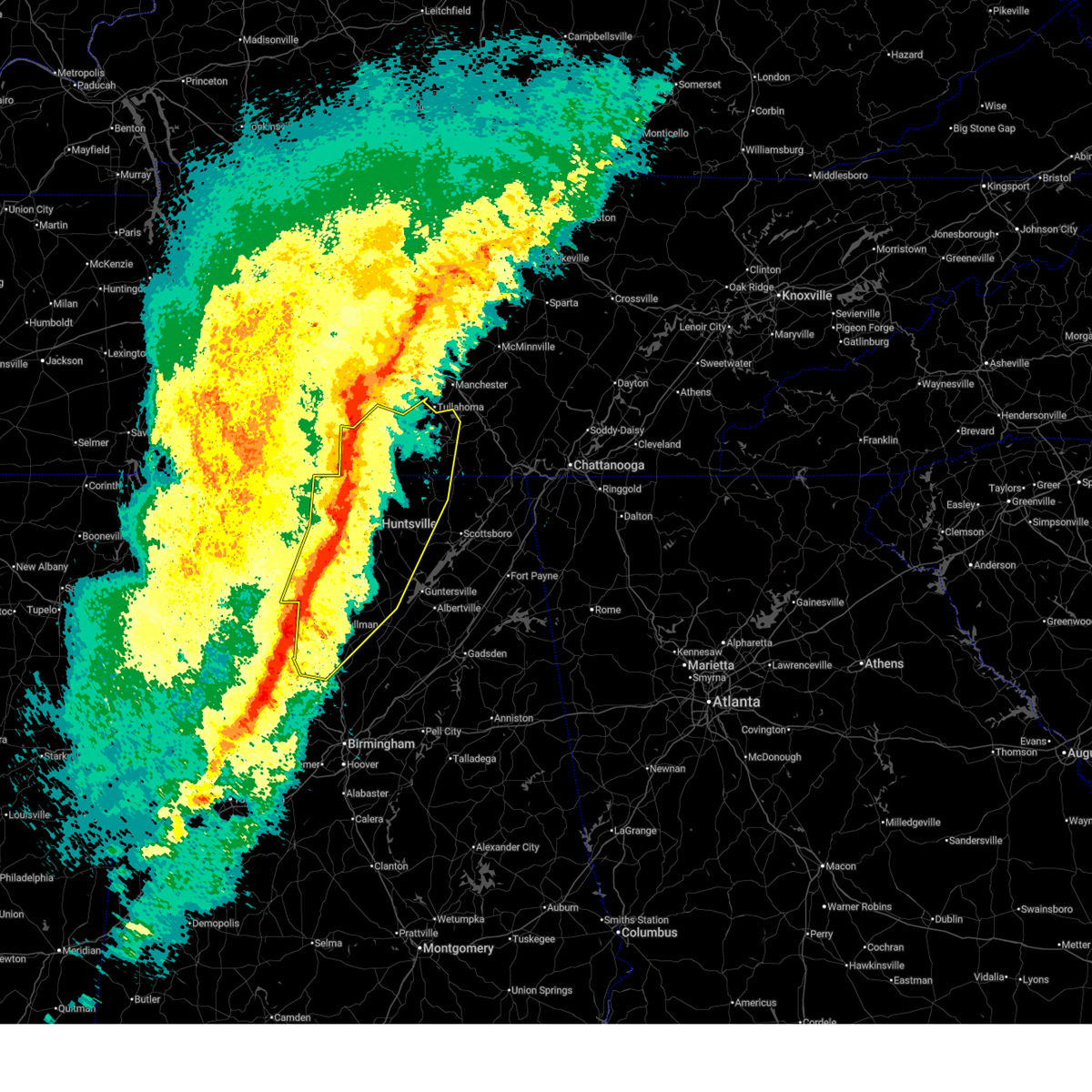 At 1215 am cst, severe thunderstorms were located along a line extending from lewisburg to near harvest to near hartselle to near camp mcdowell, moving northeast at 65 mph. multiple areas of rotation are present within this line. additionally, there have been confirmed reports of wind gusts of 60-65 mph along county line road in madison and at pryor field in decatur (radar indicated). Hazards include 60 mph wind gusts and quarter size hail. Hail damage to vehicles is expected. expect wind damage to roofs, siding, and trees. Locations impacted include, huntsville, decatur, madison, athens, cullman, hartselle, winchester, arab, fayetteville, and moores mill. At 1215 am cst, severe thunderstorms were located along a line extending from lewisburg to near harvest to near hartselle to near camp mcdowell, moving northeast at 65 mph. multiple areas of rotation are present within this line. additionally, there have been confirmed reports of wind gusts of 60-65 mph along county line road in madison and at pryor field in decatur (radar indicated). Hazards include 60 mph wind gusts and quarter size hail. Hail damage to vehicles is expected. expect wind damage to roofs, siding, and trees. Locations impacted include, huntsville, decatur, madison, athens, cullman, hartselle, winchester, arab, fayetteville, and moores mill.
|
| 2/16/2025 12:16 AM CST |
 At 1212 am cst, a line of severe thunderstorms capable of producing tornadoes was located from west of fayetteville southward through athens moving east at 60 mph. the best circulations with this line were located near ardmore and just south of athens (radar indicated rotation). Hazards include tornado. Flying debris will be dangerous to those caught without shelter. mobile homes will be damaged or destroyed. damage to roofs, windows, and vehicles will occur. tree damage is likely. this dangerous storm will be near, huntland around 1240 am cst. Other locations impacted by this tornadic thunderstorm include french mill, elkwood, elora, hurdlow, maxwell, larkin, smithland, francisco, beans creek, and holland gin. At 1212 am cst, a line of severe thunderstorms capable of producing tornadoes was located from west of fayetteville southward through athens moving east at 60 mph. the best circulations with this line were located near ardmore and just south of athens (radar indicated rotation). Hazards include tornado. Flying debris will be dangerous to those caught without shelter. mobile homes will be damaged or destroyed. damage to roofs, windows, and vehicles will occur. tree damage is likely. this dangerous storm will be near, huntland around 1240 am cst. Other locations impacted by this tornadic thunderstorm include french mill, elkwood, elora, hurdlow, maxwell, larkin, smithland, francisco, beans creek, and holland gin.
|
| 2/16/2025 12:16 AM CST |
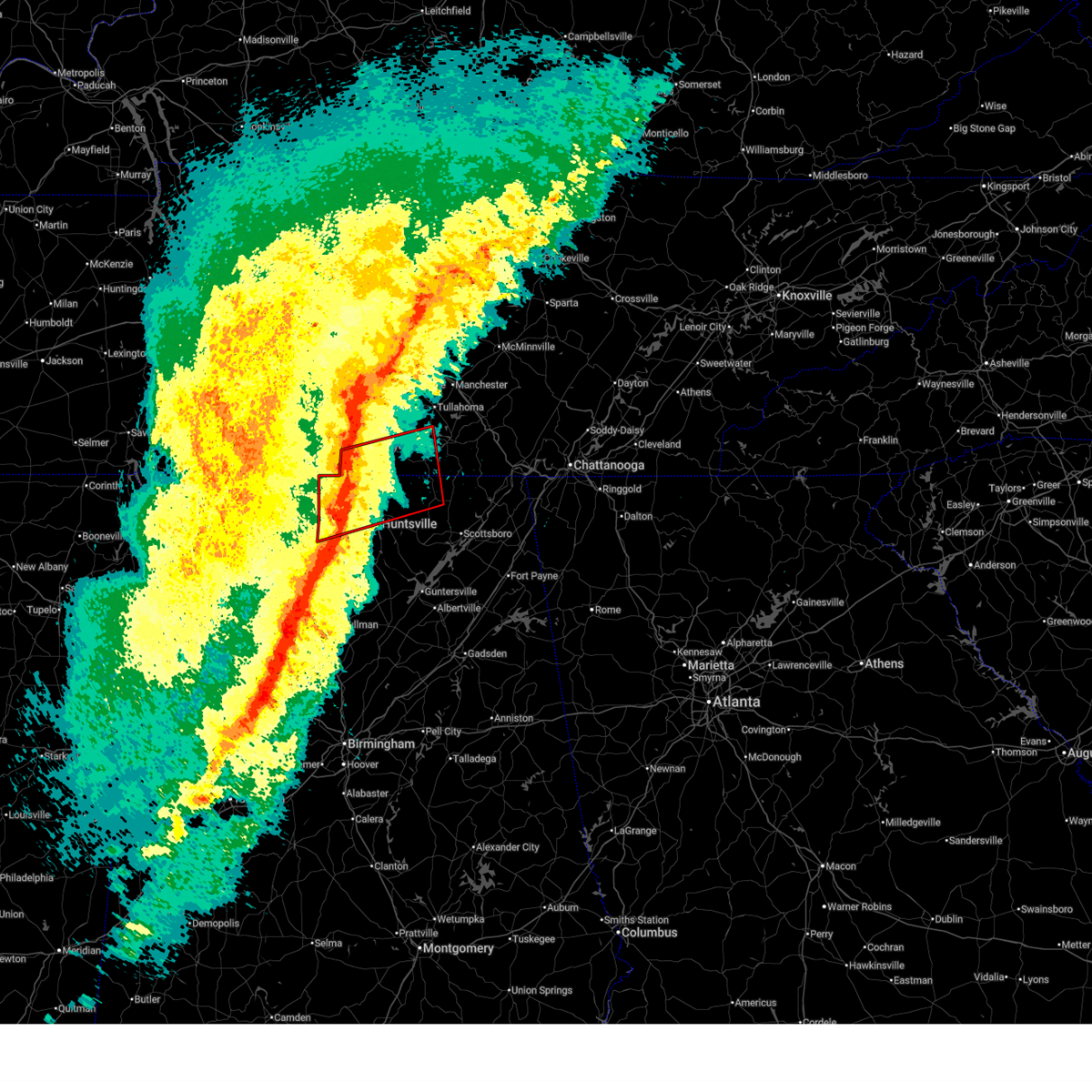 the tornado warning has been cancelled and is no longer in effect the tornado warning has been cancelled and is no longer in effect
|
| 2/16/2025 12:04 AM CST |
 Svrhun the national weather service in huntsville alabama has issued a * severe thunderstorm warning for, northwestern marshall county in northeastern alabama, northwestern jackson county in northeastern alabama, madison county in north central alabama, limestone county in north central alabama, cullman county in north central alabama, morgan county in north central alabama, southeastern lawrence county in northwestern alabama, moore county in middle tennessee, lincoln county in middle tennessee, western franklin county in middle tennessee, * until 1245 am cst. * at 1203 am cst, severe thunderstorms were located along a line extending from 11 miles southwest of lewisburg to tanner to 8 miles northeast of brushy lake to near carbon hill, moving northeast at 65 mph. multiple areas of rotation are present within this line. this line of storms has a history of producing wind damage (radar indicated). Hazards include 60 mph wind gusts and quarter size hail. Hail damage to vehicles is expected. Expect wind damage to roofs, siding, and trees. Svrhun the national weather service in huntsville alabama has issued a * severe thunderstorm warning for, northwestern marshall county in northeastern alabama, northwestern jackson county in northeastern alabama, madison county in north central alabama, limestone county in north central alabama, cullman county in north central alabama, morgan county in north central alabama, southeastern lawrence county in northwestern alabama, moore county in middle tennessee, lincoln county in middle tennessee, western franklin county in middle tennessee, * until 1245 am cst. * at 1203 am cst, severe thunderstorms were located along a line extending from 11 miles southwest of lewisburg to tanner to 8 miles northeast of brushy lake to near carbon hill, moving northeast at 65 mph. multiple areas of rotation are present within this line. this line of storms has a history of producing wind damage (radar indicated). Hazards include 60 mph wind gusts and quarter size hail. Hail damage to vehicles is expected. Expect wind damage to roofs, siding, and trees.
|
| 2/15/2025 11:59 PM CST |
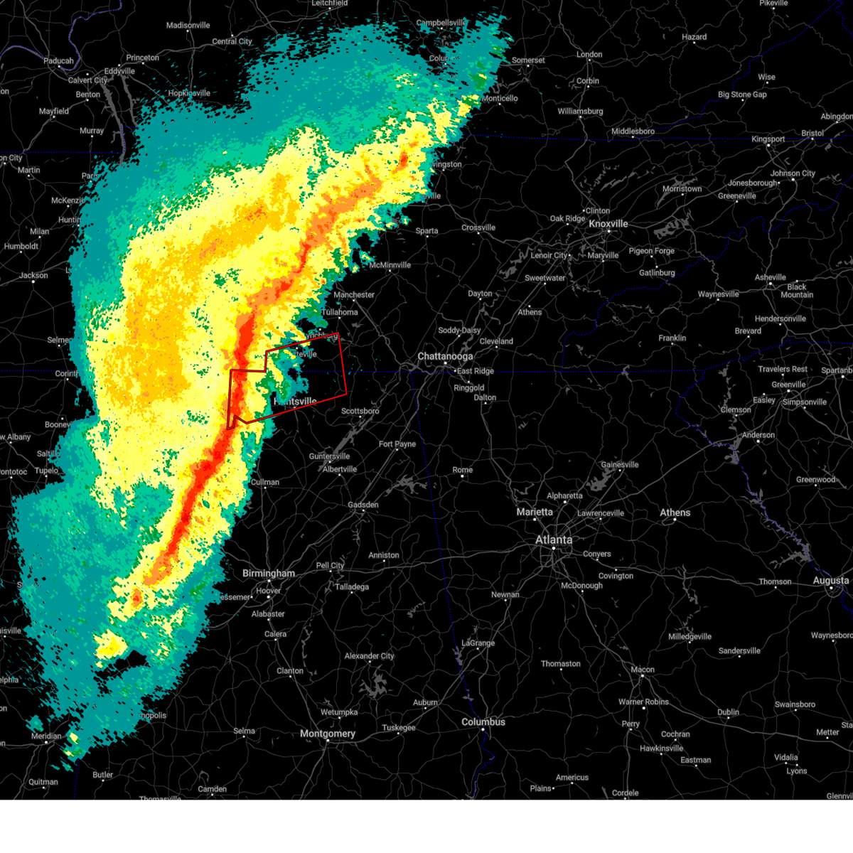 Torhun the national weather service in huntsville alabama has issued a * tornado warning for, northwestern jackson county in northeastern alabama, northern madison county in north central alabama, limestone county in north central alabama, east central lawrence county in northwestern alabama, southeastern moore county in middle tennessee, lincoln county in middle tennessee, southwestern franklin county in middle tennessee, * until 1245 am cst. * at 1159 pm cst, a severe thunderstorm capable of producing a tornado was located 8 miles northwest of athens, moving east at 60 mph. a funnel cloud has been spotted west of elkmont by spotters (radar indicated rotation). Hazards include tornado. Flying debris will be dangerous to those caught without shelter. mobile homes will be damaged or destroyed. damage to roofs, windows, and vehicles will occur. tree damage is likely. this dangerous storm will be near, ardmore around 1205 am cst. huntland around 1240 am cst. Other locations impacted by this tornadic thunderstorm include cartwright, french mill, elkwood, elora, hurdlow, maxwell, larkin, smithland, francisco, and beans creek. Torhun the national weather service in huntsville alabama has issued a * tornado warning for, northwestern jackson county in northeastern alabama, northern madison county in north central alabama, limestone county in north central alabama, east central lawrence county in northwestern alabama, southeastern moore county in middle tennessee, lincoln county in middle tennessee, southwestern franklin county in middle tennessee, * until 1245 am cst. * at 1159 pm cst, a severe thunderstorm capable of producing a tornado was located 8 miles northwest of athens, moving east at 60 mph. a funnel cloud has been spotted west of elkmont by spotters (radar indicated rotation). Hazards include tornado. Flying debris will be dangerous to those caught without shelter. mobile homes will be damaged or destroyed. damage to roofs, windows, and vehicles will occur. tree damage is likely. this dangerous storm will be near, ardmore around 1205 am cst. huntland around 1240 am cst. Other locations impacted by this tornadic thunderstorm include cartwright, french mill, elkwood, elora, hurdlow, maxwell, larkin, smithland, francisco, and beans creek.
|
| 2/15/2025 11:54 PM CST |
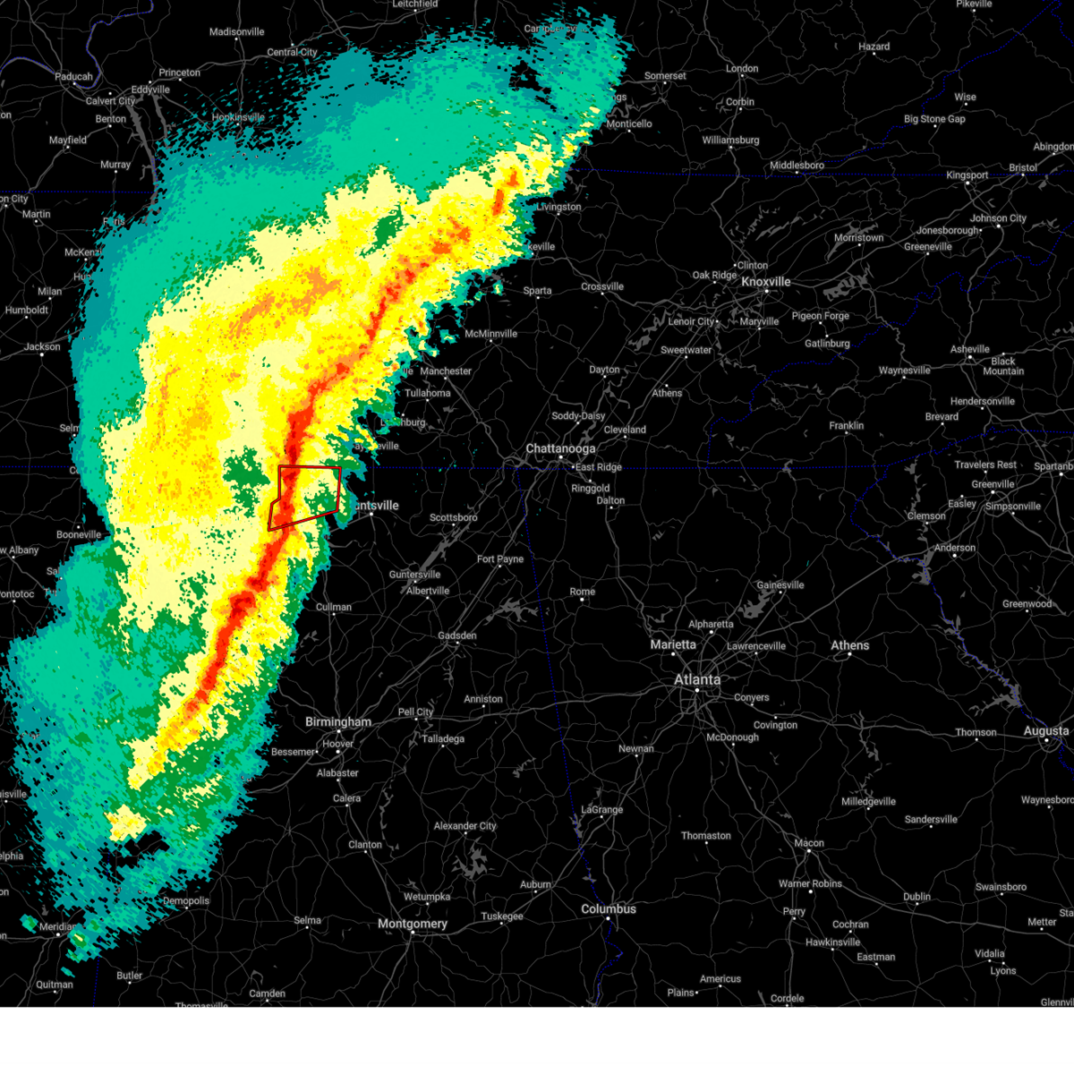 At 1152 pm cst, severe thunderstorms capable of producing tornadoes were located along a line extending from 14 miles south of pulaski to 8 miles east of courtland, moving east at 55 mph. the best area of circulation is moving towards the elkmont area (radar indicated rotation). Hazards include tornado and quarter size hail. Flying debris will be dangerous to those caught without shelter. mobile homes will be damaged or destroyed. damage to roofs, windows, and vehicles will occur. tree damage is likely. these dangerous storms will be near, athens around 1155 pm cst. tanner around 1200 am cst. ardmore around 1205 am cst. Other locations impacted by these tornadic storms include good springs, cartwright, lester, french mill, coxey, cairo, holland gin, mt rozell, leggtown, and elkmont. At 1152 pm cst, severe thunderstorms capable of producing tornadoes were located along a line extending from 14 miles south of pulaski to 8 miles east of courtland, moving east at 55 mph. the best area of circulation is moving towards the elkmont area (radar indicated rotation). Hazards include tornado and quarter size hail. Flying debris will be dangerous to those caught without shelter. mobile homes will be damaged or destroyed. damage to roofs, windows, and vehicles will occur. tree damage is likely. these dangerous storms will be near, athens around 1155 pm cst. tanner around 1200 am cst. ardmore around 1205 am cst. Other locations impacted by these tornadic storms include good springs, cartwright, lester, french mill, coxey, cairo, holland gin, mt rozell, leggtown, and elkmont.
|
| 2/15/2025 11:54 PM CST |
 At 1153 pm cst, severe thunderstorms were located along a line extending from near pulaski to 8 miles northeast of rogersville to near courtland to 8 miles southwest of moulton, moving east at 60 mph. multiple areas of rotation are present within this line. this line of storms has a history of producing wind damage (radar indicated). Hazards include 60 mph wind gusts and quarter size hail. Hail damage to vehicles is expected. expect wind damage to roofs, siding, and trees. Locations impacted include, decatur, athens, moulton, trinity, rogersville, ardmore, town creek, lexington, courtland, and tanner. At 1153 pm cst, severe thunderstorms were located along a line extending from near pulaski to 8 miles northeast of rogersville to near courtland to 8 miles southwest of moulton, moving east at 60 mph. multiple areas of rotation are present within this line. this line of storms has a history of producing wind damage (radar indicated). Hazards include 60 mph wind gusts and quarter size hail. Hail damage to vehicles is expected. expect wind damage to roofs, siding, and trees. Locations impacted include, decatur, athens, moulton, trinity, rogersville, ardmore, town creek, lexington, courtland, and tanner.
|
| 2/15/2025 11:54 PM CST |
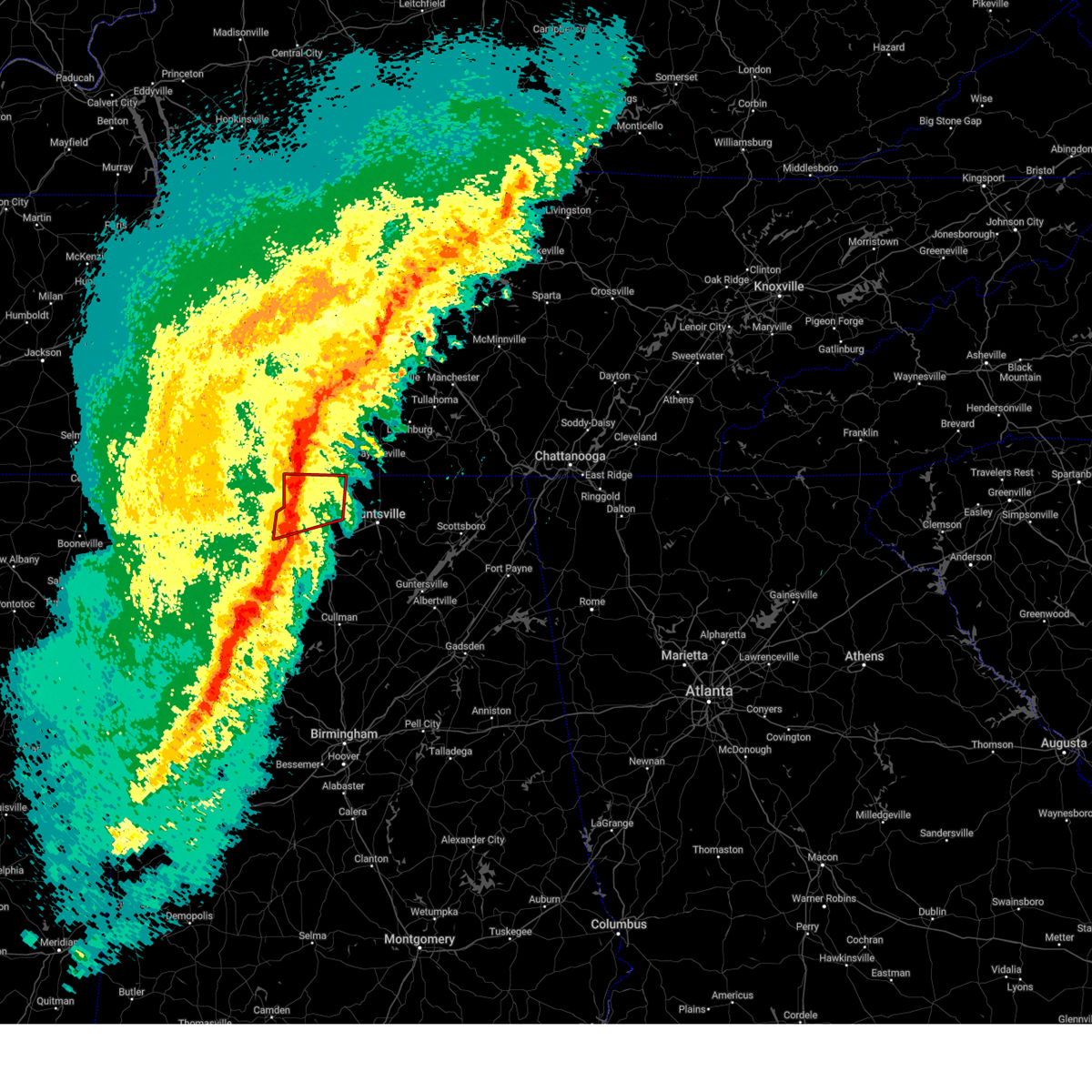 the tornado warning has been cancelled and is no longer in effect the tornado warning has been cancelled and is no longer in effect
|
| 2/15/2025 11:54 PM CST |
 the severe thunderstorm warning has been cancelled and is no longer in effect the severe thunderstorm warning has been cancelled and is no longer in effect
|
| 2/15/2025 11:50 PM CST |
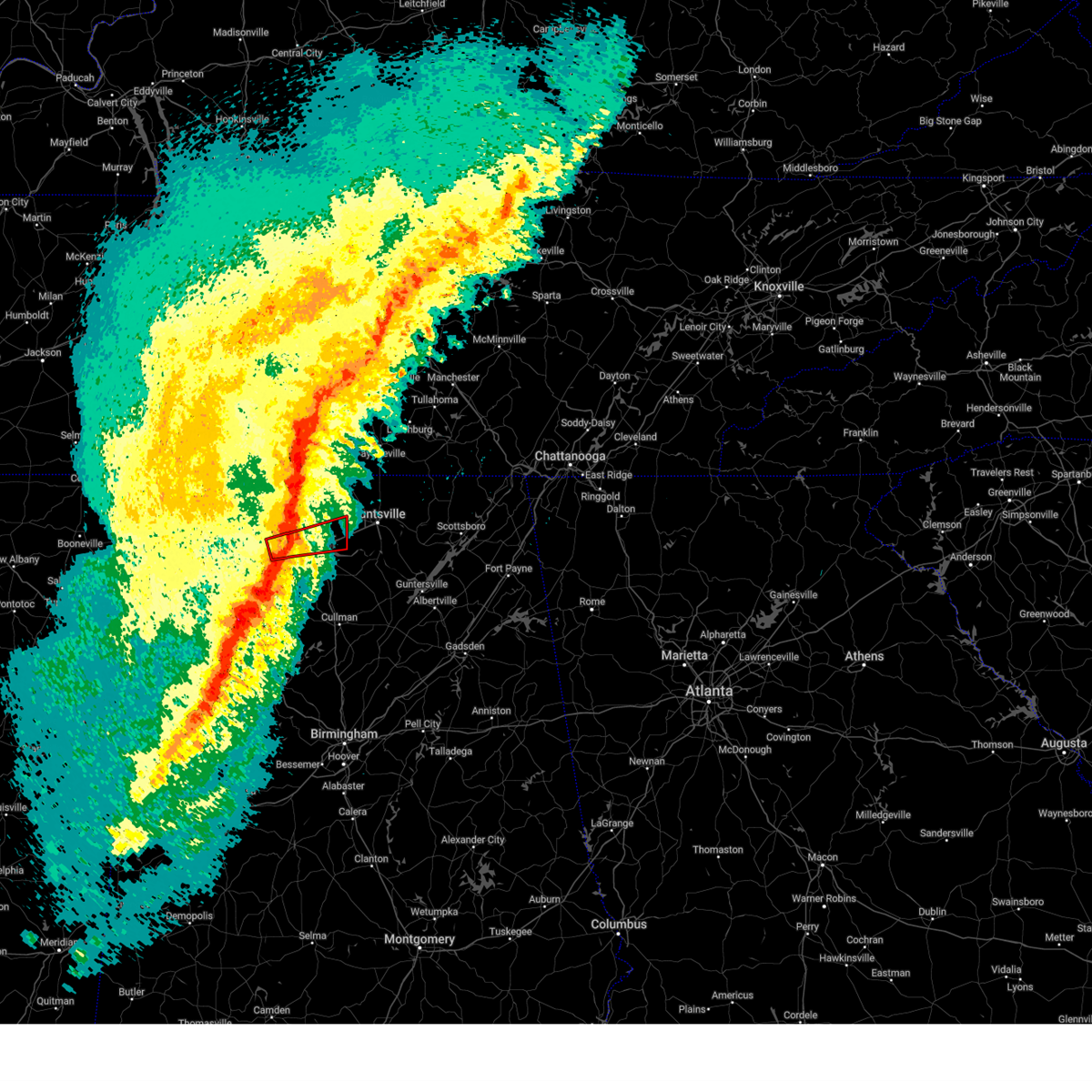 At 1149 pm cst, a severe thunderstorm capable of producing a tornado was located 7 miles west of trinity, or 9 miles northeast of moulton, moving east at 55 mph (radar indicated rotation). Hazards include tornado and quarter size hail. Flying debris will be dangerous to those caught without shelter. mobile homes will be damaged or destroyed. damage to roofs, windows, and vehicles will occur. tree damage is likely. this dangerous storm will be near, decatur and trinity around 1155 pm cst. tanner around 1205 am cst. madison around 1215 am cst. Other locations impacted by this tornadic thunderstorm include mooresville, belle mina, caddo, wheeler, chalybeate springs, and hillsboro. At 1149 pm cst, a severe thunderstorm capable of producing a tornado was located 7 miles west of trinity, or 9 miles northeast of moulton, moving east at 55 mph (radar indicated rotation). Hazards include tornado and quarter size hail. Flying debris will be dangerous to those caught without shelter. mobile homes will be damaged or destroyed. damage to roofs, windows, and vehicles will occur. tree damage is likely. this dangerous storm will be near, decatur and trinity around 1155 pm cst. tanner around 1205 am cst. madison around 1215 am cst. Other locations impacted by this tornadic thunderstorm include mooresville, belle mina, caddo, wheeler, chalybeate springs, and hillsboro.
|
| 2/15/2025 11:38 PM CST |
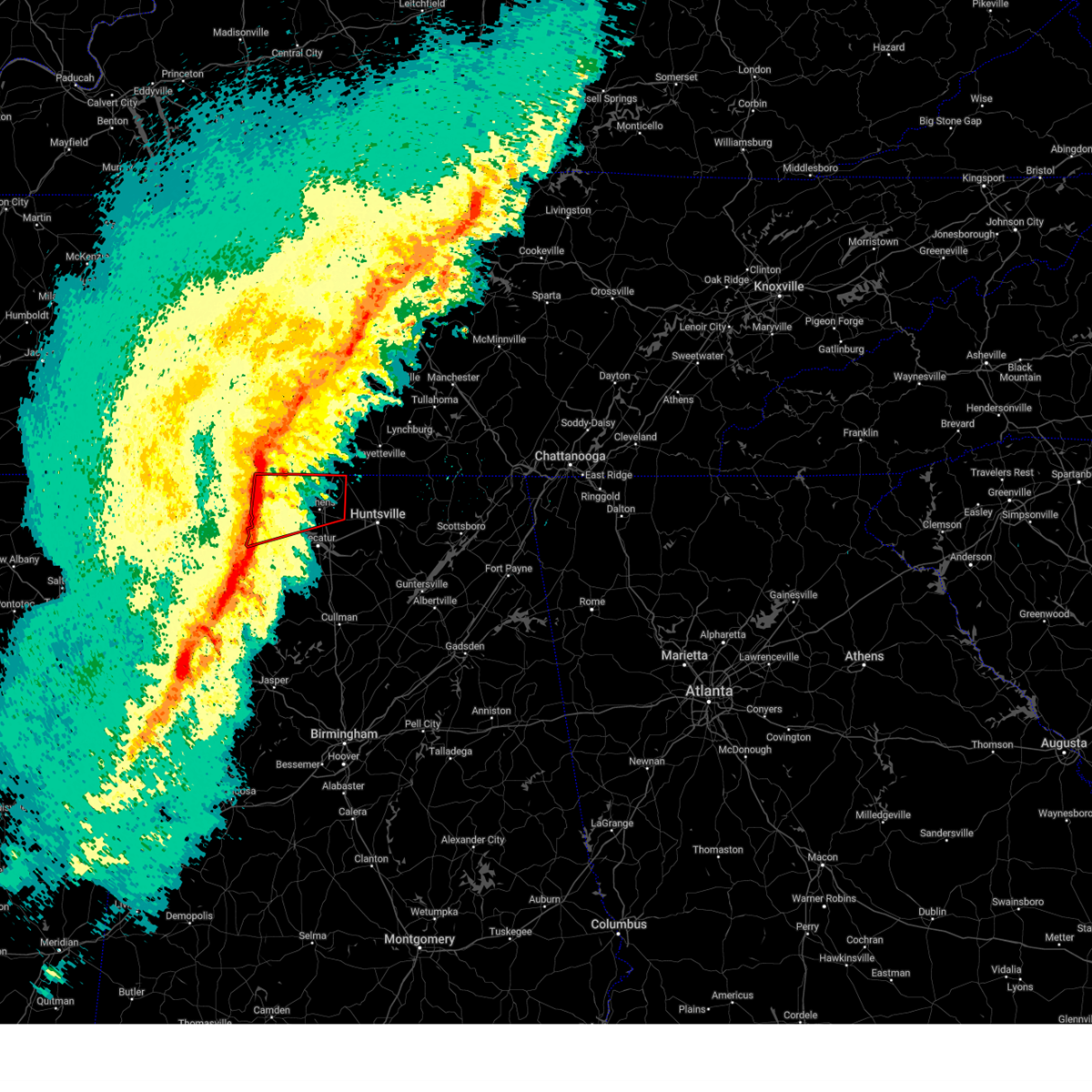 At 1137 pm cst, severe thunderstorms capable of producing tornadoes were located along a line extending from near lexington to near town creek, moving east at 60 mph (radar indicated rotation). Hazards include tornado and quarter size hail. Flying debris will be dangerous to those caught without shelter. mobile homes will be damaged or destroyed. damage to roofs, windows, and vehicles will occur. tree damage is likely. these dangerous storms will be near, rogersville, town creek, and courtland around 1140 pm cst. athens around 1155 pm cst. ardmore and tanner around 1200 am cst. Other locations impacted by these tornadic storms include good springs, cartwright, french mill, coxey, oliver, mt rozell, anderson, north courtland, ripley, and lester. At 1137 pm cst, severe thunderstorms capable of producing tornadoes were located along a line extending from near lexington to near town creek, moving east at 60 mph (radar indicated rotation). Hazards include tornado and quarter size hail. Flying debris will be dangerous to those caught without shelter. mobile homes will be damaged or destroyed. damage to roofs, windows, and vehicles will occur. tree damage is likely. these dangerous storms will be near, rogersville, town creek, and courtland around 1140 pm cst. athens around 1155 pm cst. ardmore and tanner around 1200 am cst. Other locations impacted by these tornadic storms include good springs, cartwright, french mill, coxey, oliver, mt rozell, anderson, north courtland, ripley, and lester.
|
| 2/15/2025 11:38 PM CST |
 the tornado warning has been cancelled and is no longer in effect the tornado warning has been cancelled and is no longer in effect
|
| 2/15/2025 11:35 PM CST |
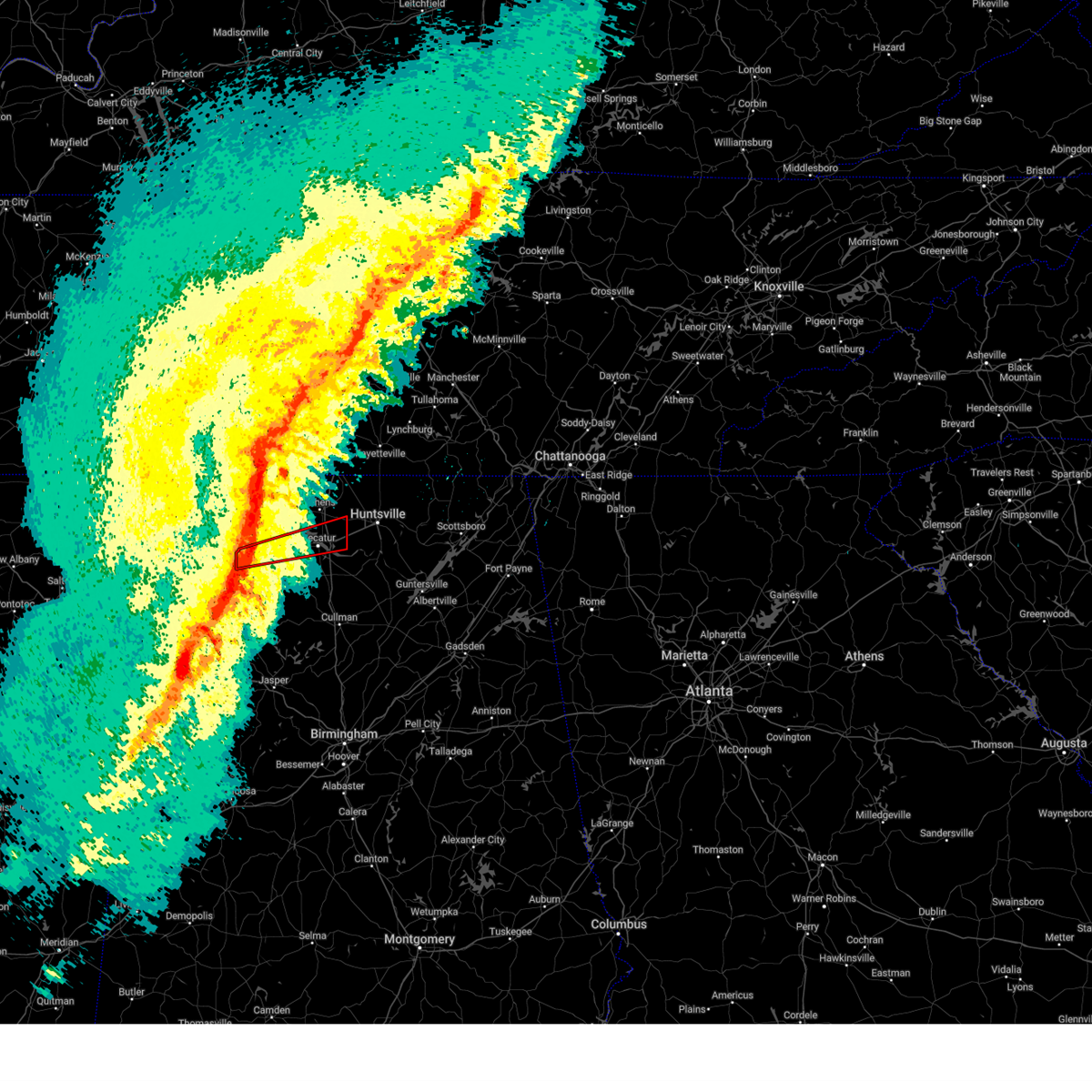 the tornado warning has been cancelled and is no longer in effect the tornado warning has been cancelled and is no longer in effect
|
| 2/15/2025 11:35 PM CST |
 At 1135 pm cst, a severe thunderstorm capable of producing a tornado was located 7 miles south of town creek, or 9 miles northwest of moulton, moving east at 60 mph (radar indicated rotation). Hazards include tornado and quarter size hail. Flying debris will be dangerous to those caught without shelter. mobile homes will be damaged or destroyed. damage to roofs, windows, and vehicles will occur. tree damage is likely. this dangerous storm will be near, decatur around 1150 pm cst. tanner around 1200 am cst. madison around 1210 am cst. Other locations impacted by this tornadic thunderstorm include belle mina, hatton, chalybeate springs, hillsboro, mooresville, ne smith, caddo, and wheeler. At 1135 pm cst, a severe thunderstorm capable of producing a tornado was located 7 miles south of town creek, or 9 miles northwest of moulton, moving east at 60 mph (radar indicated rotation). Hazards include tornado and quarter size hail. Flying debris will be dangerous to those caught without shelter. mobile homes will be damaged or destroyed. damage to roofs, windows, and vehicles will occur. tree damage is likely. this dangerous storm will be near, decatur around 1150 pm cst. tanner around 1200 am cst. madison around 1210 am cst. Other locations impacted by this tornadic thunderstorm include belle mina, hatton, chalybeate springs, hillsboro, mooresville, ne smith, caddo, and wheeler.
|
| 2/15/2025 11:28 PM CST |
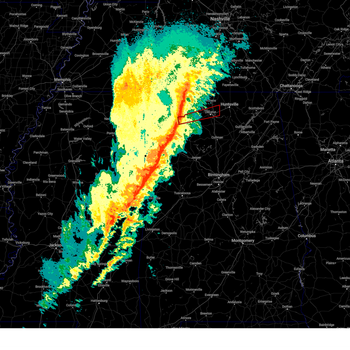 Torhun the national weather service in huntsville alabama has issued a * tornado warning for, southeastern limestone county in north central alabama, northeastern franklin county in northwestern alabama, northwestern morgan county in north central alabama, central lawrence county in northwestern alabama, * until 1215 am cst. * at 1127 pm cst, a severe thunderstorm capable of producing a tornado was located 8 miles southeast of littleville, or 9 miles east of russellville, moving east at 60 mph (radar indicated rotation). Hazards include tornado and quarter size hail. Flying debris will be dangerous to those caught without shelter. mobile homes will be damaged or destroyed. damage to roofs, windows, and vehicles will occur. tree damage is likely. this dangerous storm will be near, decatur and trinity around 1150 pm cst. tanner around 1200 am cst. madison around 1210 am cst. Other locations impacted by this tornadic thunderstorm include belle mina, hatton, newburg, chalybeate springs, hillsboro, tharptown, mooresville, ne smith, caddo, and wheeler. Torhun the national weather service in huntsville alabama has issued a * tornado warning for, southeastern limestone county in north central alabama, northeastern franklin county in northwestern alabama, northwestern morgan county in north central alabama, central lawrence county in northwestern alabama, * until 1215 am cst. * at 1127 pm cst, a severe thunderstorm capable of producing a tornado was located 8 miles southeast of littleville, or 9 miles east of russellville, moving east at 60 mph (radar indicated rotation). Hazards include tornado and quarter size hail. Flying debris will be dangerous to those caught without shelter. mobile homes will be damaged or destroyed. damage to roofs, windows, and vehicles will occur. tree damage is likely. this dangerous storm will be near, decatur and trinity around 1150 pm cst. tanner around 1200 am cst. madison around 1210 am cst. Other locations impacted by this tornadic thunderstorm include belle mina, hatton, newburg, chalybeate springs, hillsboro, tharptown, mooresville, ne smith, caddo, and wheeler.
|
| 2/15/2025 11:24 PM CST |
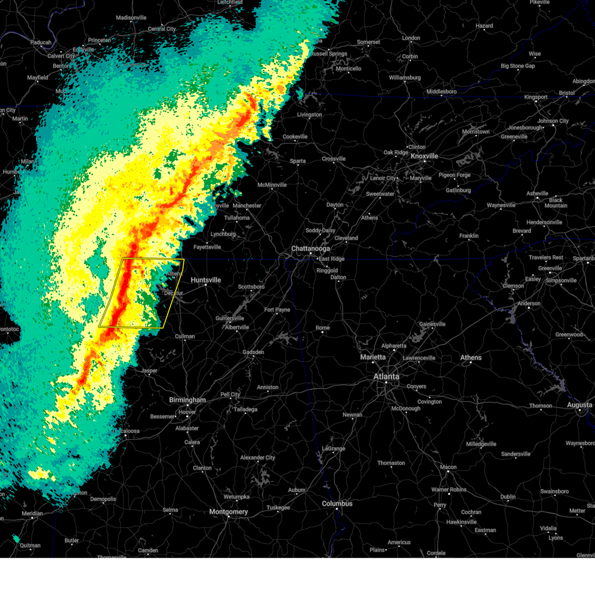 Svrhun the national weather service in huntsville alabama has issued a * severe thunderstorm warning for, limestone county in north central alabama, eastern lauderdale county in northwestern alabama, southeastern colbert county in northwestern alabama, eastern franklin county in northwestern alabama, northwestern morgan county in north central alabama, lawrence county in northwestern alabama, * until 1215 am cst. * at 1123 pm cst, severe thunderstorms were located along a line extending from near loretto to near muscle shoals to littleville to hackleburg, moving east at 60 mph. multiple areas of rotation are present within this line. this line of storms has a history of producing wind damage (radar indicated). Hazards include 60 mph wind gusts and quarter size hail. Hail damage to vehicles is expected. Expect wind damage to roofs, siding, and trees. Svrhun the national weather service in huntsville alabama has issued a * severe thunderstorm warning for, limestone county in north central alabama, eastern lauderdale county in northwestern alabama, southeastern colbert county in northwestern alabama, eastern franklin county in northwestern alabama, northwestern morgan county in north central alabama, lawrence county in northwestern alabama, * until 1215 am cst. * at 1123 pm cst, severe thunderstorms were located along a line extending from near loretto to near muscle shoals to littleville to hackleburg, moving east at 60 mph. multiple areas of rotation are present within this line. this line of storms has a history of producing wind damage (radar indicated). Hazards include 60 mph wind gusts and quarter size hail. Hail damage to vehicles is expected. Expect wind damage to roofs, siding, and trees.
|
| 2/15/2025 11:23 PM CST |
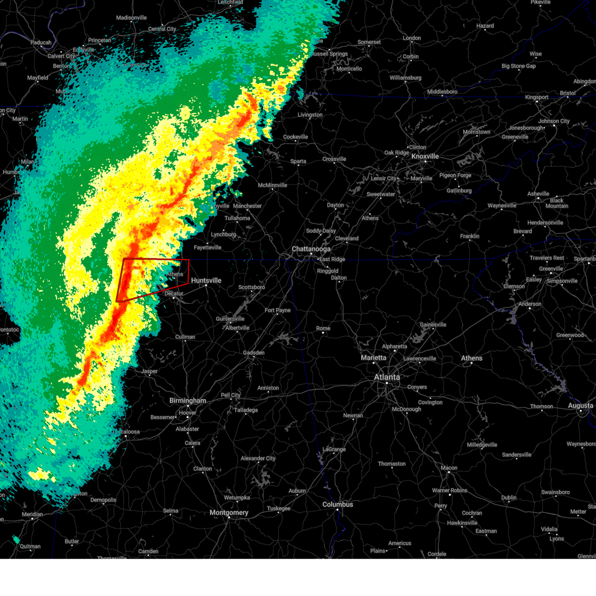 Torhun the national weather service in huntsville alabama has issued a * tornado warning for, limestone county in north central alabama, eastern lauderdale county in northwestern alabama, southeastern colbert county in northwestern alabama, northern lawrence county in northwestern alabama, * until midnight cst. * at 1122 pm cst, a line of severe thunderstorms capable of producing a tornado were located along a line extending from 8 miles north of killen to littleville, moving east at 60 mph. the best areas of rotation along the line were in areas from muscle shoals to killen (radar indicated rotation). Hazards include tornado and quarter size hail. Flying debris will be dangerous to those caught without shelter. mobile homes will be damaged or destroyed. damage to roofs, windows, and vehicles will occur. tree damage is likely. these dangerous storms will be near, killen, lexington, and leighton around 1125 pm cst. town creek around 1130 pm cst. rogersville and courtland around 1135 pm cst. athens around 1155 pm cst. Other locations impacted by these tornadic storms include good springs, cartwright, northwest alabama regional airport, french mill, coxey, north courtland, lester, holland gin, ford city, and red bank. Torhun the national weather service in huntsville alabama has issued a * tornado warning for, limestone county in north central alabama, eastern lauderdale county in northwestern alabama, southeastern colbert county in northwestern alabama, northern lawrence county in northwestern alabama, * until midnight cst. * at 1122 pm cst, a line of severe thunderstorms capable of producing a tornado were located along a line extending from 8 miles north of killen to littleville, moving east at 60 mph. the best areas of rotation along the line were in areas from muscle shoals to killen (radar indicated rotation). Hazards include tornado and quarter size hail. Flying debris will be dangerous to those caught without shelter. mobile homes will be damaged or destroyed. damage to roofs, windows, and vehicles will occur. tree damage is likely. these dangerous storms will be near, killen, lexington, and leighton around 1125 pm cst. town creek around 1130 pm cst. rogersville and courtland around 1135 pm cst. athens around 1155 pm cst. Other locations impacted by these tornadic storms include good springs, cartwright, northwest alabama regional airport, french mill, coxey, north courtland, lester, holland gin, ford city, and red bank.
|
| 12/28/2024 11:20 PM CST |
 the severe thunderstorm warning has been cancelled and is no longer in effect the severe thunderstorm warning has been cancelled and is no longer in effect
|
| 12/28/2024 11:20 PM CST |
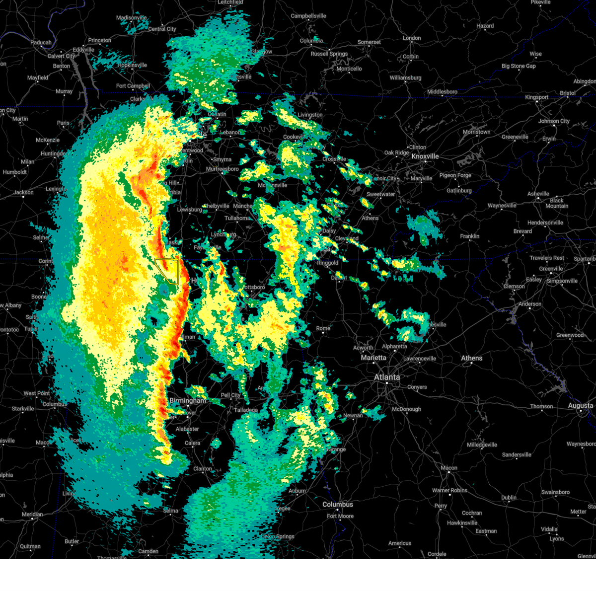 At 1120 pm cst, severe thunderstorms were located along a line extending from 12 miles east of lexington to 10 miles northwest of tanner to athens, moving northwest at 20 mph (public). Hazards include 60 mph wind gusts. Expect damage to roofs, siding, and trees. Locations impacted include, athens, elkmont, lester, good springs, cartwright, mt rozell, and leggtown. At 1120 pm cst, severe thunderstorms were located along a line extending from 12 miles east of lexington to 10 miles northwest of tanner to athens, moving northwest at 20 mph (public). Hazards include 60 mph wind gusts. Expect damage to roofs, siding, and trees. Locations impacted include, athens, elkmont, lester, good springs, cartwright, mt rozell, and leggtown.
|
| 12/28/2024 11:03 PM CST |
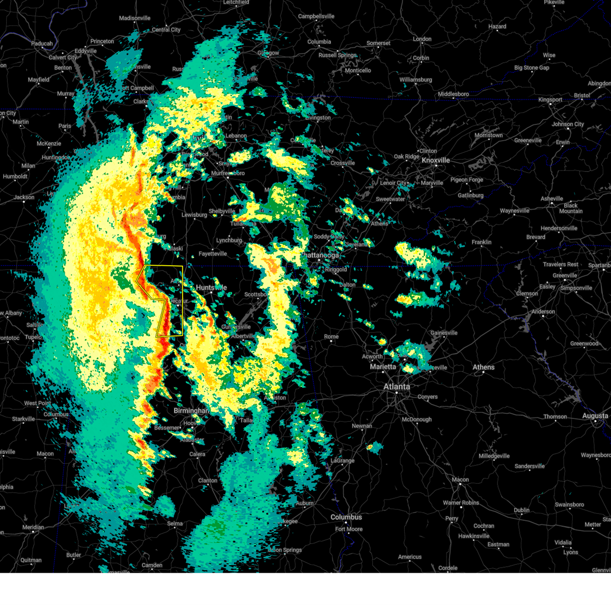 At 1102 pm cst, severe thunderstorms were located along a line extending from near rogersville to 7 miles west of tanner to near decatur, moving northeast at 60 mph. this has a history of causing power outages and wind damage across lawrence county (public). Hazards include 60 mph wind gusts. Expect damage to roofs, siding, and trees. Locations impacted include, decatur, athens, hartselle, trinity, rogersville, lexington, courtland, tanner, north courtland, and elkmont. At 1102 pm cst, severe thunderstorms were located along a line extending from near rogersville to 7 miles west of tanner to near decatur, moving northeast at 60 mph. this has a history of causing power outages and wind damage across lawrence county (public). Hazards include 60 mph wind gusts. Expect damage to roofs, siding, and trees. Locations impacted include, decatur, athens, hartselle, trinity, rogersville, lexington, courtland, tanner, north courtland, and elkmont.
|
| 12/28/2024 10:54 PM CST |
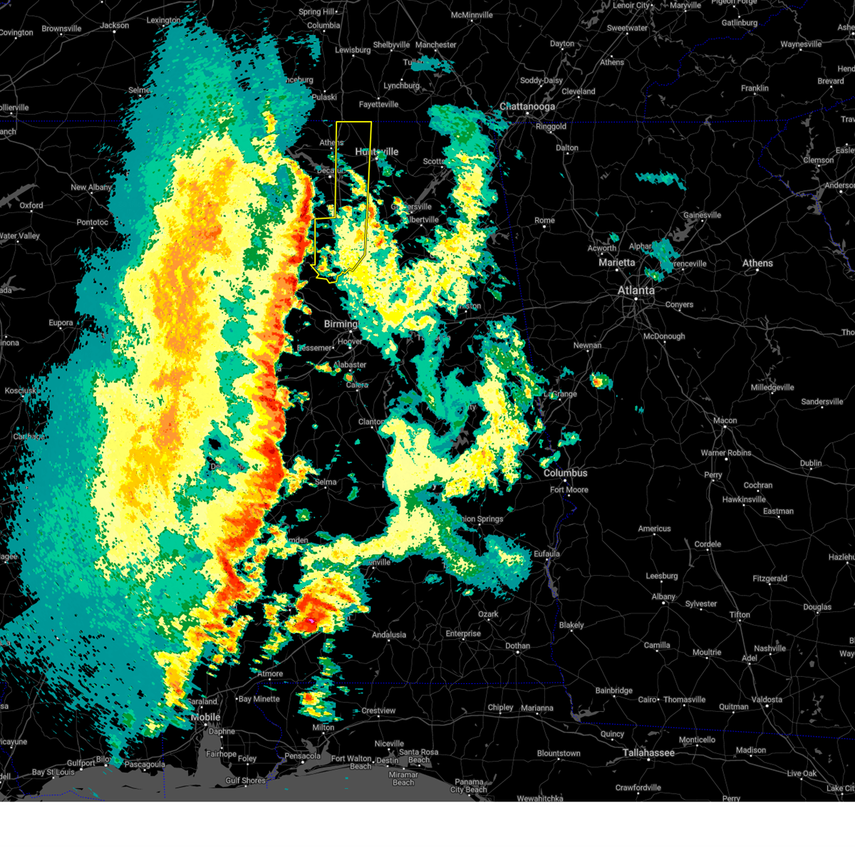 Svrhun the national weather service in huntsville alabama has issued a * severe thunderstorm warning for, western madison county in north central alabama, eastern limestone county in north central alabama, cullman county in north central alabama, southeastern morgan county in north central alabama, * until midnight cst. * at 1054 pm cst, a severe thunderstorm was located over nesmith, or 7 miles northeast of arley, moving east at 50 mph. this line of storms has a history of producing wind damage across northwest alabama (radar indicated). Hazards include 60 mph wind gusts. expect damage to roofs, siding, and trees Svrhun the national weather service in huntsville alabama has issued a * severe thunderstorm warning for, western madison county in north central alabama, eastern limestone county in north central alabama, cullman county in north central alabama, southeastern morgan county in north central alabama, * until midnight cst. * at 1054 pm cst, a severe thunderstorm was located over nesmith, or 7 miles northeast of arley, moving east at 50 mph. this line of storms has a history of producing wind damage across northwest alabama (radar indicated). Hazards include 60 mph wind gusts. expect damage to roofs, siding, and trees
|
| 12/28/2024 10:45 PM CST |
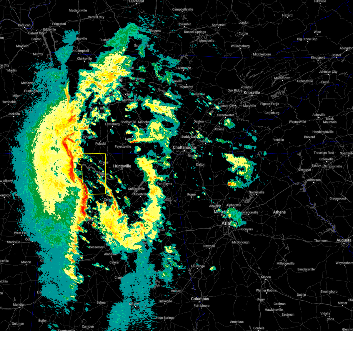 At 1044 pm cst, severe thunderstorms were located along a line extending from near town creek to near moulton to near brushy lake, moving northeast at 60 mph. these storms have a history of producing wind damage across franklin county alabama (public). Hazards include 60 mph wind gusts. Expect damage to roofs, siding, and trees. Locations impacted include, decatur, athens, hartselle, moulton, trinity, rogersville, town creek, lexington, courtland, and tanner. At 1044 pm cst, severe thunderstorms were located along a line extending from near town creek to near moulton to near brushy lake, moving northeast at 60 mph. these storms have a history of producing wind damage across franklin county alabama (public). Hazards include 60 mph wind gusts. Expect damage to roofs, siding, and trees. Locations impacted include, decatur, athens, hartselle, moulton, trinity, rogersville, town creek, lexington, courtland, and tanner.
|
| 12/28/2024 10:32 PM CST |
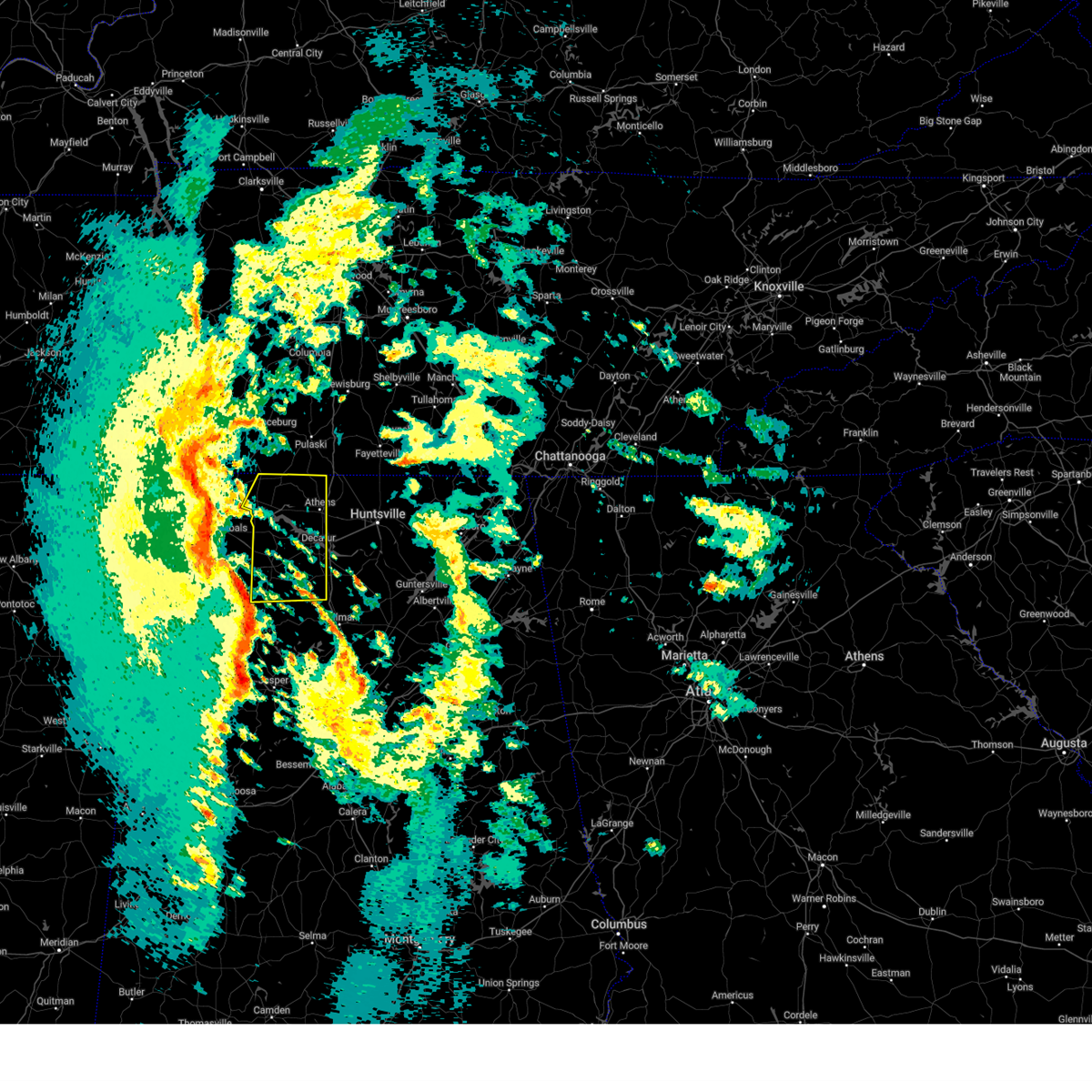 Svrhun the national weather service in huntsville alabama has issued a * severe thunderstorm warning for, central limestone county in north central alabama, eastern lauderdale county in northwestern alabama, western morgan county in north central alabama, lawrence county in northwestern alabama, * until 1130 pm cst. * at 1031 pm cst, a line of severe thunderstorms were located from near littleville to near winston free state barn, moving northeast at 70 mph. this line has a history of producing wind damage across marion county alabama (public). Hazards include 60 mph wind gusts. expect damage to roofs, siding, and trees Svrhun the national weather service in huntsville alabama has issued a * severe thunderstorm warning for, central limestone county in north central alabama, eastern lauderdale county in northwestern alabama, western morgan county in north central alabama, lawrence county in northwestern alabama, * until 1130 pm cst. * at 1031 pm cst, a line of severe thunderstorms were located from near littleville to near winston free state barn, moving northeast at 70 mph. this line has a history of producing wind damage across marion county alabama (public). Hazards include 60 mph wind gusts. expect damage to roofs, siding, and trees
|
| 9/13/2024 8:49 PM CDT | Tree reported down along lentzville road and lakeside estates near rogersvill in limestone county AL, 13.4 miles ESE of Athens, AL |
| 8/17/2024 1:44 PM CDT |
 At 143 pm cdt, a severe thunderstorm was located near decatur, moving east at 20 mph (radar indicated). Hazards include 60 mph wind gusts and penny size hail. Expect damage to roofs, siding, and trees. Locations impacted include, decatur, madison, priceville, trinity, tanner, somerville, mooresville, belle mina, and basham. At 143 pm cdt, a severe thunderstorm was located near decatur, moving east at 20 mph (radar indicated). Hazards include 60 mph wind gusts and penny size hail. Expect damage to roofs, siding, and trees. Locations impacted include, decatur, madison, priceville, trinity, tanner, somerville, mooresville, belle mina, and basham.
|
| 8/17/2024 1:44 PM CDT |
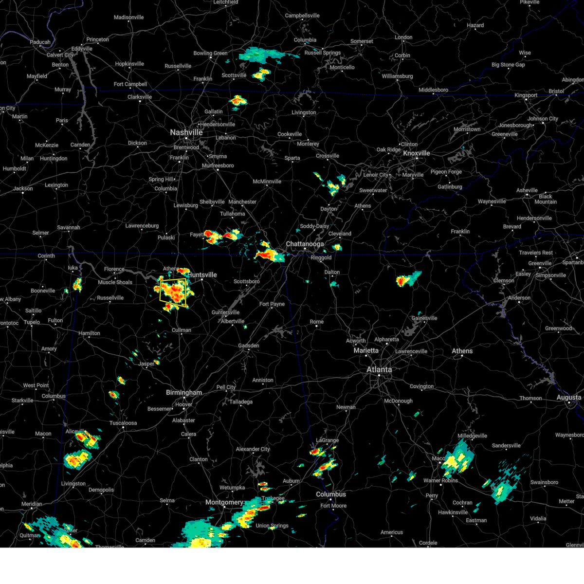 the severe thunderstorm warning has been cancelled and is no longer in effect the severe thunderstorm warning has been cancelled and is no longer in effect
|
| 8/17/2024 1:29 PM CDT |
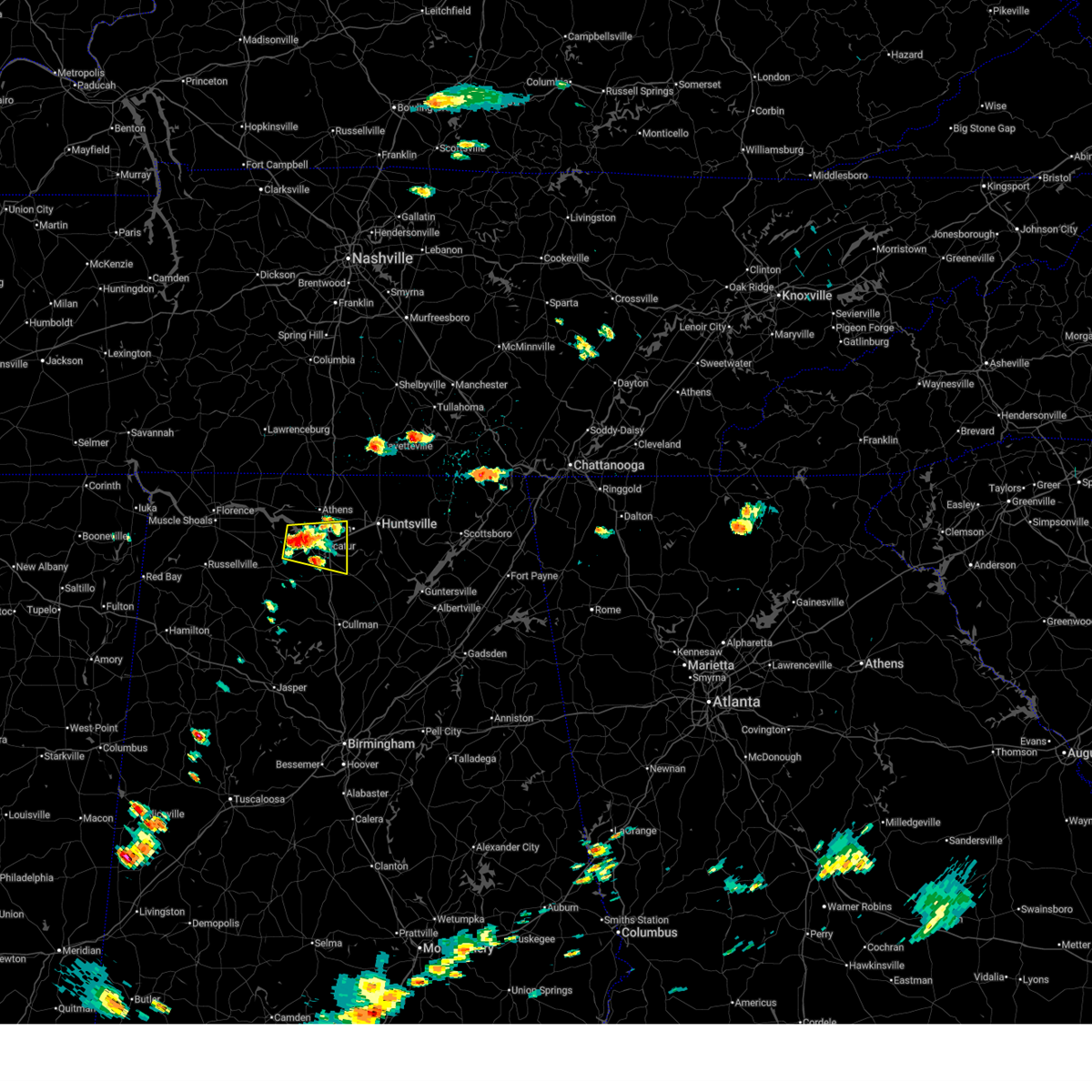 Svrhun the national weather service in huntsville alabama has issued a * severe thunderstorm warning for, southeastern limestone county in north central alabama, northwestern morgan county in north central alabama, northeastern lawrence county in northwestern alabama, * until 215 pm cdt. * at 129 pm cdt, a severe thunderstorm was located over trinity, or near decatur, moving east at 20 mph (radar indicated). Hazards include 60 mph wind gusts and penny size hail. expect damage to roofs, siding, and trees Svrhun the national weather service in huntsville alabama has issued a * severe thunderstorm warning for, southeastern limestone county in north central alabama, northwestern morgan county in north central alabama, northeastern lawrence county in northwestern alabama, * until 215 pm cdt. * at 129 pm cdt, a severe thunderstorm was located over trinity, or near decatur, moving east at 20 mph (radar indicated). Hazards include 60 mph wind gusts and penny size hail. expect damage to roofs, siding, and trees
|
| 7/29/2024 3:21 PM CDT |
 The storm which prompted the warning has weakened below severe limits, and no longer poses an immediate threat to life or property. therefore, the warning will be allowed to expire. The storm which prompted the warning has weakened below severe limits, and no longer poses an immediate threat to life or property. therefore, the warning will be allowed to expire.
|
| 7/29/2024 3:19 PM CDT |
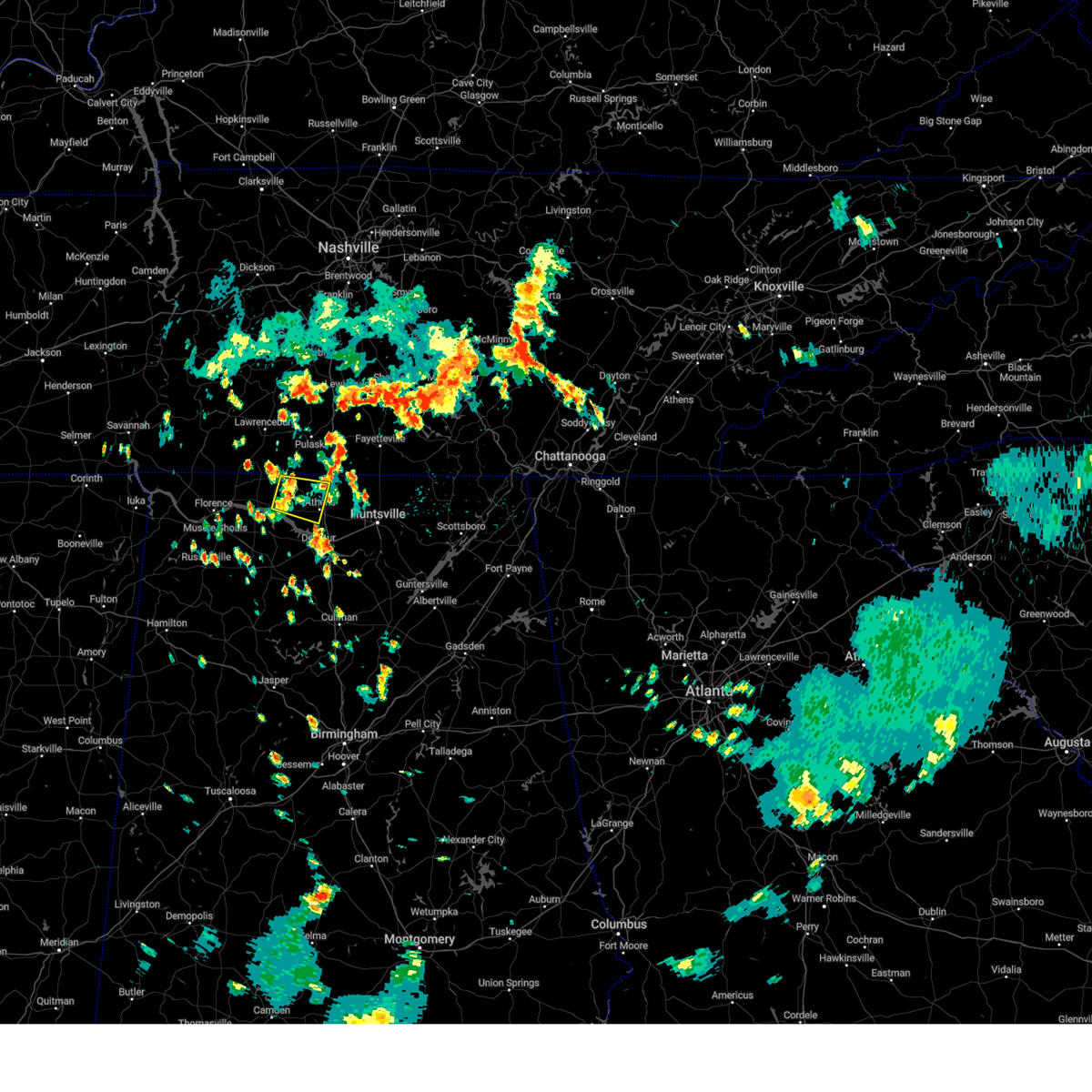 At 318 pm cdt, a severe thunderstorm was located near rogersville, or 16 miles west of athens, moving southeast at 20 mph (radar indicated). Hazards include 60 mph wind gusts and pea size hail. Expect damage to roofs, siding, and trees. Locations impacted include, athens, rogersville, elkmont, good springs, cartwright, coxey, oliver, cairo, mt rozell, and leggtown. At 318 pm cdt, a severe thunderstorm was located near rogersville, or 16 miles west of athens, moving southeast at 20 mph (radar indicated). Hazards include 60 mph wind gusts and pea size hail. Expect damage to roofs, siding, and trees. Locations impacted include, athens, rogersville, elkmont, good springs, cartwright, coxey, oliver, cairo, mt rozell, and leggtown.
|
| 7/29/2024 3:03 PM CDT |
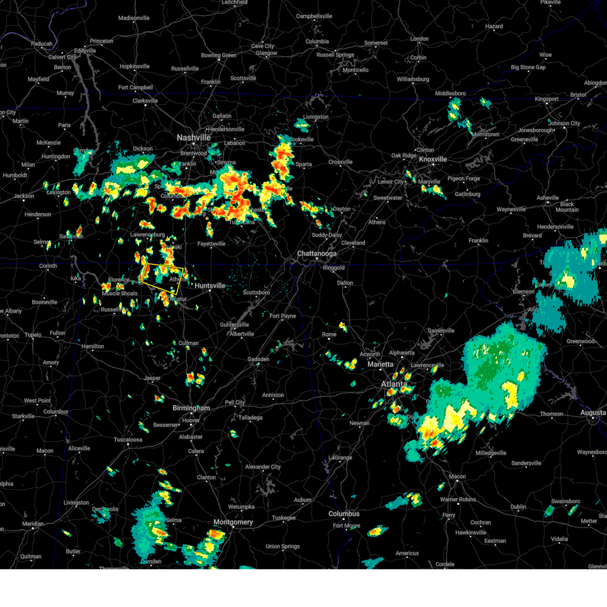 Svrhun the national weather service in huntsville alabama has issued a * severe thunderstorm warning for, northwestern limestone county in north central alabama, northeastern lauderdale county in northwestern alabama, * until 330 pm cdt. * at 303 pm cdt, a severe thunderstorm was located near rogersville, or 20 miles east of florence, moving southeast at 20 mph (radar indicated). Hazards include 60 mph wind gusts and quarter size hail. Hail damage to vehicles is expected. Expect wind damage to roofs, siding, and trees. Svrhun the national weather service in huntsville alabama has issued a * severe thunderstorm warning for, northwestern limestone county in north central alabama, northeastern lauderdale county in northwestern alabama, * until 330 pm cdt. * at 303 pm cdt, a severe thunderstorm was located near rogersville, or 20 miles east of florence, moving southeast at 20 mph (radar indicated). Hazards include 60 mph wind gusts and quarter size hail. Hail damage to vehicles is expected. Expect wind damage to roofs, siding, and trees.
|
| 7/21/2024 7:16 PM CDT |
 The storm which prompted the warning has moved out of the area. therefore, the warning has been allowed to expire. remember, a severe thunderstorm warning still remains in effect for portions or limestone, madison, morgan, and marshall counties until 8 pm. The storm which prompted the warning has moved out of the area. therefore, the warning has been allowed to expire. remember, a severe thunderstorm warning still remains in effect for portions or limestone, madison, morgan, and marshall counties until 8 pm.
|
| 7/21/2024 7:04 PM CDT |
 At 703 pm cdt, a severe thunderstorm was located over northern huntsville, moving northeast at 30 mph (radar indicated). Hazards include 60 mph wind gusts and quarter size hail. Hail damage to vehicles is expected. expect wind damage to roofs, siding, and trees. Locations impacted include, huntsville, decatur, madison, athens, hartselle, redstone arsenal, moores mill, priceville, trinity, and owens cross roads. At 703 pm cdt, a severe thunderstorm was located over northern huntsville, moving northeast at 30 mph (radar indicated). Hazards include 60 mph wind gusts and quarter size hail. Hail damage to vehicles is expected. expect wind damage to roofs, siding, and trees. Locations impacted include, huntsville, decatur, madison, athens, hartselle, redstone arsenal, moores mill, priceville, trinity, and owens cross roads.
|
| 7/21/2024 7:04 PM CDT |
 the severe thunderstorm warning has been cancelled and is no longer in effect the severe thunderstorm warning has been cancelled and is no longer in effect
|
| 7/21/2024 6:27 PM CDT |
 Svrhun the national weather service in huntsville alabama has issued a * severe thunderstorm warning for, northern marshall county in northeastern alabama, west central jackson county in northeastern alabama, madison county in north central alabama, southern limestone county in north central alabama, morgan county in north central alabama, eastern lawrence county in northwestern alabama, * until 715 pm cdt. * at 627 pm cdt, a severe thunderstorm was located near tanner, or 7 miles northeast of decatur, moving northeast at 30 mph (radar indicated). Hazards include 60 mph wind gusts and quarter size hail. Hail damage to vehicles is expected. Expect wind damage to roofs, siding, and trees. Svrhun the national weather service in huntsville alabama has issued a * severe thunderstorm warning for, northern marshall county in northeastern alabama, west central jackson county in northeastern alabama, madison county in north central alabama, southern limestone county in north central alabama, morgan county in north central alabama, eastern lawrence county in northwestern alabama, * until 715 pm cdt. * at 627 pm cdt, a severe thunderstorm was located near tanner, or 7 miles northeast of decatur, moving northeast at 30 mph (radar indicated). Hazards include 60 mph wind gusts and quarter size hail. Hail damage to vehicles is expected. Expect wind damage to roofs, siding, and trees.
|
| 7/17/2024 2:36 PM CDT | Multiple trees reported down along hwy 127 and hays mill roa in limestone county AL, 6.4 miles SSE of Athens, AL |
| 6/26/2024 2:55 PM CDT | Metal roofing was damaged at a home along wheeler lake near browns ferry nuclear plant (unspecified). time estimated by rada in limestone county AL, 11 miles ENE of Athens, AL |
| 6/5/2024 8:27 PM CDT |
 At 827 pm cdt, a severe thunderstorm was located over tanner, or over athens, moving northeast at 50 mph (radar indicated). Hazards include 60 mph wind gusts. Expect damage to roofs, siding, and trees. Locations impacted include, huntsville, decatur, madison, athens, redstone arsenal, priceville, triana, marshall space flight center, university of alabama in huntsville, and harvest. At 827 pm cdt, a severe thunderstorm was located over tanner, or over athens, moving northeast at 50 mph (radar indicated). Hazards include 60 mph wind gusts. Expect damage to roofs, siding, and trees. Locations impacted include, huntsville, decatur, madison, athens, redstone arsenal, priceville, triana, marshall space flight center, university of alabama in huntsville, and harvest.
|
| 6/5/2024 8:27 PM CDT |
 the severe thunderstorm warning has been cancelled and is no longer in effect the severe thunderstorm warning has been cancelled and is no longer in effect
|
| 5/27/2024 2:54 AM CDT |
 At 254 am cdt, a severe thunderstorm was located near moulton, moving east at 45 mph. at 254 am emergency management reported multiple trees and powerlines down in north decatur (emergency management). Hazards include 60 mph wind gusts and quarter size hail. Hail damage to vehicles is expected. expect wind damage to roofs, siding, and trees. Locations impacted include, huntsville, decatur, madison, athens, hartselle, moulton, redstone arsenal, meridianville, priceville, and trinity. At 254 am cdt, a severe thunderstorm was located near moulton, moving east at 45 mph. at 254 am emergency management reported multiple trees and powerlines down in north decatur (emergency management). Hazards include 60 mph wind gusts and quarter size hail. Hail damage to vehicles is expected. expect wind damage to roofs, siding, and trees. Locations impacted include, huntsville, decatur, madison, athens, hartselle, moulton, redstone arsenal, meridianville, priceville, and trinity.
|
| 5/27/2024 2:41 AM CDT |
 Svrhun the national weather service in huntsville alabama has issued a * severe thunderstorm warning for, western madison county in north central alabama, southeastern limestone county in north central alabama, northwestern cullman county in north central alabama, eastern franklin county in northwestern alabama, morgan county in north central alabama, lawrence county in northwestern alabama, * until 315 am cdt. * at 240 am cdt, a severe thunderstorm was located 10 miles west of moulton, moving east at 45 mph (radar indicated). Hazards include 60 mph wind gusts and quarter size hail. Hail damage to vehicles is expected. Expect wind damage to roofs, siding, and trees. Svrhun the national weather service in huntsville alabama has issued a * severe thunderstorm warning for, western madison county in north central alabama, southeastern limestone county in north central alabama, northwestern cullman county in north central alabama, eastern franklin county in northwestern alabama, morgan county in north central alabama, lawrence county in northwestern alabama, * until 315 am cdt. * at 240 am cdt, a severe thunderstorm was located 10 miles west of moulton, moving east at 45 mph (radar indicated). Hazards include 60 mph wind gusts and quarter size hail. Hail damage to vehicles is expected. Expect wind damage to roofs, siding, and trees.
|
| 5/27/2024 2:40 AM CDT |
 The storm which prompted the warning has moved out of the area. therefore, the warning will be allowed to expire. a tornado watch remains in effect until 500 am cdt for middle tennessee. a tornado watch also remains in effect until 800 am cdt for north central, northeastern and northwestern alabama. The storm which prompted the warning has moved out of the area. therefore, the warning will be allowed to expire. a tornado watch remains in effect until 500 am cdt for middle tennessee. a tornado watch also remains in effect until 800 am cdt for north central, northeastern and northwestern alabama.
|
| 5/27/2024 2:12 AM CDT |
 The storm which prompted the warning has moved out of the area. therefore, the warning will be allowed to expire. a tornado watch remains in effect until 500 am cdt for middle tennessee. a tornado watch also remains in effect until 800 am cdt for north central, northeastern and northwestern alabama. remember, a severe thunderstorm warning still remains in effect for northeast lawrence and northern morgan counties until 245 am. The storm which prompted the warning has moved out of the area. therefore, the warning will be allowed to expire. a tornado watch remains in effect until 500 am cdt for middle tennessee. a tornado watch also remains in effect until 800 am cdt for north central, northeastern and northwestern alabama. remember, a severe thunderstorm warning still remains in effect for northeast lawrence and northern morgan counties until 245 am.
|
| 5/27/2024 2:08 AM CDT |
 Svrhun the national weather service in huntsville alabama has issued a * severe thunderstorm warning for, western madison county in north central alabama, limestone county in north central alabama, central morgan county in north central alabama, northeastern lawrence county in northwestern alabama, * until 245 am cdt. * at 207 am cdt, a severe thunderstorm was located near courtland, or 10 miles north of moulton, moving east at 55 mph (radar indicated). Hazards include 60 mph wind gusts and quarter size hail. Hail damage to vehicles is expected. Expect wind damage to roofs, siding, and trees. Svrhun the national weather service in huntsville alabama has issued a * severe thunderstorm warning for, western madison county in north central alabama, limestone county in north central alabama, central morgan county in north central alabama, northeastern lawrence county in northwestern alabama, * until 245 am cdt. * at 207 am cdt, a severe thunderstorm was located near courtland, or 10 miles north of moulton, moving east at 55 mph (radar indicated). Hazards include 60 mph wind gusts and quarter size hail. Hail damage to vehicles is expected. Expect wind damage to roofs, siding, and trees.
|
| 5/27/2024 1:49 AM CDT |
 the severe thunderstorm warning has been cancelled and is no longer in effect the severe thunderstorm warning has been cancelled and is no longer in effect
|
| 5/27/2024 1:49 AM CDT |
 At 149 am cdt, a severe thunderstorm was located 7 miles west of moulton, moving east at 50 mph (radar indicated). Hazards include 60 mph wind gusts and quarter size hail. Hail damage to vehicles is expected. expect wind damage to roofs, siding, and trees. Locations impacted include, decatur, hartselle, moulton, trinity, falkville, tanner, hillsboro, mt hope, chalybeate springs, and speake. At 149 am cdt, a severe thunderstorm was located 7 miles west of moulton, moving east at 50 mph (radar indicated). Hazards include 60 mph wind gusts and quarter size hail. Hail damage to vehicles is expected. expect wind damage to roofs, siding, and trees. Locations impacted include, decatur, hartselle, moulton, trinity, falkville, tanner, hillsboro, mt hope, chalybeate springs, and speake.
|
| 5/27/2024 1:31 AM CDT |
 Svrhun the national weather service in huntsville alabama has issued a * severe thunderstorm warning for, south central limestone county in north central alabama, southeastern colbert county in northwestern alabama, northeastern franklin county in northwestern alabama, western morgan county in north central alabama, lawrence county in northwestern alabama, * until 215 am cdt. * at 130 am cdt, a severe thunderstorm was located near russellville, moving east at 50 mph (radar indicated). Hazards include 60 mph wind gusts and quarter size hail. Hail damage to vehicles is expected. Expect wind damage to roofs, siding, and trees. Svrhun the national weather service in huntsville alabama has issued a * severe thunderstorm warning for, south central limestone county in north central alabama, southeastern colbert county in northwestern alabama, northeastern franklin county in northwestern alabama, western morgan county in north central alabama, lawrence county in northwestern alabama, * until 215 am cdt. * at 130 am cdt, a severe thunderstorm was located near russellville, moving east at 50 mph (radar indicated). Hazards include 60 mph wind gusts and quarter size hail. Hail damage to vehicles is expected. Expect wind damage to roofs, siding, and trees.
|
| 5/27/2024 1:28 AM CDT |
 Svrhun the national weather service in huntsville alabama has issued a * severe thunderstorm warning for, western jackson county in northeastern alabama, madison county in north central alabama, limestone county in north central alabama, southeastern lincoln county in middle tennessee, southwestern franklin county in middle tennessee, * until 230 am cdt. * at 128 am cdt, a severe thunderstorm was located near athens, moving east at 40 mph (radar indicated). Hazards include 60 mph wind gusts and quarter size hail. Hail damage to vehicles is expected. Expect wind damage to roofs, siding, and trees. Svrhun the national weather service in huntsville alabama has issued a * severe thunderstorm warning for, western jackson county in northeastern alabama, madison county in north central alabama, limestone county in north central alabama, southeastern lincoln county in middle tennessee, southwestern franklin county in middle tennessee, * until 230 am cdt. * at 128 am cdt, a severe thunderstorm was located near athens, moving east at 40 mph (radar indicated). Hazards include 60 mph wind gusts and quarter size hail. Hail damage to vehicles is expected. Expect wind damage to roofs, siding, and trees.
|
| 5/27/2024 1:09 AM CDT |
 the severe thunderstorm warning has been cancelled and is no longer in effect the severe thunderstorm warning has been cancelled and is no longer in effect
|
| 5/27/2024 1:09 AM CDT |
 At 109 am cdt, a severe thunderstorm was located 8 miles west of athens, moving east at 35 mph (radar indicated). Hazards include 60 mph wind gusts and quarter size hail. Hail damage to vehicles is expected. expect wind damage to roofs, siding, and trees. Locations impacted include, huntsville, madison, athens, meridianville, moores mill, redstone arsenal, hazel green, rogersville, ardmore, and harvest. At 109 am cdt, a severe thunderstorm was located 8 miles west of athens, moving east at 35 mph (radar indicated). Hazards include 60 mph wind gusts and quarter size hail. Hail damage to vehicles is expected. expect wind damage to roofs, siding, and trees. Locations impacted include, huntsville, madison, athens, meridianville, moores mill, redstone arsenal, hazel green, rogersville, ardmore, and harvest.
|
| 5/27/2024 12:46 AM CDT |
 Svrhun the national weather service in huntsville alabama has issued a * severe thunderstorm warning for, northwestern madison county in north central alabama, limestone county in north central alabama, southeastern lauderdale county in northwestern alabama, northeastern lawrence county in northwestern alabama, southwestern lincoln county in middle tennessee, * until 130 am cdt. * at 1245 am cdt, a severe thunderstorm was located near town creek, or 15 miles east of muscle shoals, moving east at 35 mph (radar indicated). Hazards include 60 mph wind gusts and quarter size hail. Hail damage to vehicles is expected. Expect wind damage to roofs, siding, and trees. Svrhun the national weather service in huntsville alabama has issued a * severe thunderstorm warning for, northwestern madison county in north central alabama, limestone county in north central alabama, southeastern lauderdale county in northwestern alabama, northeastern lawrence county in northwestern alabama, southwestern lincoln county in middle tennessee, * until 130 am cdt. * at 1245 am cdt, a severe thunderstorm was located near town creek, or 15 miles east of muscle shoals, moving east at 35 mph (radar indicated). Hazards include 60 mph wind gusts and quarter size hail. Hail damage to vehicles is expected. Expect wind damage to roofs, siding, and trees.
|
| 5/25/2024 6:00 AM CDT |
 At 600 am cdt, severe thunderstorms were located along a line extending from near petersburg to triana, moving southeast at 50 mph (radar indicated). Hazards include 70 mph wind gusts and nickel size hail. Expect considerable tree damage. damage is likely to mobile homes, roofs, and outbuildings. Locations impacted include, huntsville, madison, athens, scottsboro, winchester, fayetteville, rainsville, moores mill, meridianville, and lynchburg. At 600 am cdt, severe thunderstorms were located along a line extending from near petersburg to triana, moving southeast at 50 mph (radar indicated). Hazards include 70 mph wind gusts and nickel size hail. Expect considerable tree damage. damage is likely to mobile homes, roofs, and outbuildings. Locations impacted include, huntsville, madison, athens, scottsboro, winchester, fayetteville, rainsville, moores mill, meridianville, and lynchburg.
|
| 5/25/2024 5:53 AM CDT |
 Svrhun the national weather service in huntsville alabama has issued a * severe thunderstorm warning for, northeastern marshall county in northeastern alabama, jackson county in northeastern alabama, madison county in north central alabama, limestone county in north central alabama, central dekalb county in northeastern alabama, moore county in middle tennessee, lincoln county in middle tennessee, franklin county in middle tennessee, * until 700 am cdt. * at 553 am cdt, severe thunderstorms were located along a line extending from petersburg to near huntsville international airport, moving southeast at 50 mph (radar indicated). Hazards include 60 mph wind gusts and nickel size hail. expect damage to roofs, siding, and trees Svrhun the national weather service in huntsville alabama has issued a * severe thunderstorm warning for, northeastern marshall county in northeastern alabama, jackson county in northeastern alabama, madison county in north central alabama, limestone county in north central alabama, central dekalb county in northeastern alabama, moore county in middle tennessee, lincoln county in middle tennessee, franklin county in middle tennessee, * until 700 am cdt. * at 553 am cdt, severe thunderstorms were located along a line extending from petersburg to near huntsville international airport, moving southeast at 50 mph (radar indicated). Hazards include 60 mph wind gusts and nickel size hail. expect damage to roofs, siding, and trees
|
| 5/8/2024 9:54 PM CDT |
 Torhun the national weather service in huntsville alabama has issued a * tornado warning for, southwestern madison county in north central alabama, east central limestone county in north central alabama, * until 1045 pm cdt. * at 954 pm cdt, a severe thunderstorm capable of producing a tornado was located over athens, moving east at 30 mph (radar indicated rotation). Hazards include tornado and ping pong ball size hail. Flying debris will be dangerous to those caught without shelter. mobile homes will be damaged or destroyed. damage to roofs, windows, and vehicles will occur. tree damage is likely. this dangerous storm will be near, athens around 1000 pm cdt. madison around 1005 pm cdt. huntsville and redstone arsenal around 1015 pm cdt. university of alabama in huntsville around 1020 pm cdt. marshall space flight center around 1025 pm cdt. Other locations impacted by this tornadic thunderstorm include french mill and capshaw. Torhun the national weather service in huntsville alabama has issued a * tornado warning for, southwestern madison county in north central alabama, east central limestone county in north central alabama, * until 1045 pm cdt. * at 954 pm cdt, a severe thunderstorm capable of producing a tornado was located over athens, moving east at 30 mph (radar indicated rotation). Hazards include tornado and ping pong ball size hail. Flying debris will be dangerous to those caught without shelter. mobile homes will be damaged or destroyed. damage to roofs, windows, and vehicles will occur. tree damage is likely. this dangerous storm will be near, athens around 1000 pm cdt. madison around 1005 pm cdt. huntsville and redstone arsenal around 1015 pm cdt. university of alabama in huntsville around 1020 pm cdt. marshall space flight center around 1025 pm cdt. Other locations impacted by this tornadic thunderstorm include french mill and capshaw.
|
| 5/8/2024 9:38 PM CDT |
 Svrhun the national weather service in huntsville alabama has issued a * severe thunderstorm warning for, central limestone county in north central alabama, * until 1030 pm cdt. * at 938 pm cdt, a severe thunderstorm was located near athens, moving east at 25 mph (radar indicated). Hazards include 60 mph wind gusts and quarter size hail. Hail damage to vehicles is expected. Expect wind damage to roofs, siding, and trees. Svrhun the national weather service in huntsville alabama has issued a * severe thunderstorm warning for, central limestone county in north central alabama, * until 1030 pm cdt. * at 938 pm cdt, a severe thunderstorm was located near athens, moving east at 25 mph (radar indicated). Hazards include 60 mph wind gusts and quarter size hail. Hail damage to vehicles is expected. Expect wind damage to roofs, siding, and trees.
|
| 5/8/2024 8:52 PM CDT |
 Torhun the national weather service in huntsville alabama has issued a * tornado warning for, northwestern madison county in north central alabama, east central limestone county in north central alabama, * until 930 pm cdt. * at 851 pm cdt, a severe thunderstorm capable of producing a tornado was located near tanner, or near athens, moving east at 30 mph. golf ball size hail has been confirmed with this storm (radar indicated rotation). Hazards include tornado and golf ball size hail. Flying debris will be dangerous to those caught without shelter. mobile homes will be damaged or destroyed. damage to roofs, windows, and vehicles will occur. tree damage is likely. this dangerous storm will be near, madison and athens around 855 pm cdt. harvest around 900 pm cdt. northern huntsville around 910 pm cdt. meridianville and alabama a and m university around 925 pm cdt. Other locations impacted by this tornadic thunderstorm include french mill and capshaw. Torhun the national weather service in huntsville alabama has issued a * tornado warning for, northwestern madison county in north central alabama, east central limestone county in north central alabama, * until 930 pm cdt. * at 851 pm cdt, a severe thunderstorm capable of producing a tornado was located near tanner, or near athens, moving east at 30 mph. golf ball size hail has been confirmed with this storm (radar indicated rotation). Hazards include tornado and golf ball size hail. Flying debris will be dangerous to those caught without shelter. mobile homes will be damaged or destroyed. damage to roofs, windows, and vehicles will occur. tree damage is likely. this dangerous storm will be near, madison and athens around 855 pm cdt. harvest around 900 pm cdt. northern huntsville around 910 pm cdt. meridianville and alabama a and m university around 925 pm cdt. Other locations impacted by this tornadic thunderstorm include french mill and capshaw.
|
| 5/8/2024 8:47 PM CDT | Golf Ball sized hail reported 1.1 miles NW of Athens, AL |
| 5/8/2024 8:29 PM CDT |
 Torhun the national weather service in huntsville alabama has issued a * tornado warning for, central limestone county in north central alabama, * until 900 pm cdt. * at 829 pm cdt, a tornado producing storm was located 8 miles southeast of rogersville, or 11 miles west of athens, moving east at 20 mph (radar confirmed tornado). Hazards include damaging tornado and ping pong ball size hail. Flying debris will be dangerous to those caught without shelter. mobile homes will be damaged or destroyed. damage to roofs, windows, and vehicles will occur. tree damage is likely. this tornadic storm will be near, athens around 840 pm cdt. Other locations impacted by this tornadic thunderstorm include ripley. Torhun the national weather service in huntsville alabama has issued a * tornado warning for, central limestone county in north central alabama, * until 900 pm cdt. * at 829 pm cdt, a tornado producing storm was located 8 miles southeast of rogersville, or 11 miles west of athens, moving east at 20 mph (radar confirmed tornado). Hazards include damaging tornado and ping pong ball size hail. Flying debris will be dangerous to those caught without shelter. mobile homes will be damaged or destroyed. damage to roofs, windows, and vehicles will occur. tree damage is likely. this tornadic storm will be near, athens around 840 pm cdt. Other locations impacted by this tornadic thunderstorm include ripley.
|
| 5/8/2024 8:25 PM CDT |
 At 825 pm cdt, a confirmed tornado was located 9 miles northwest of athens, moving east at 25 mph (emergency management confirmed tornado). Hazards include damaging tornado and ping pong ball size hail. Flying debris will be dangerous to those caught without shelter. mobile homes will be damaged or destroyed. damage to roofs, windows, and vehicles will occur. tree damage is likely. this tornado will be near, ardmore around 845 pm cdt. Other locations impacted by this tornadic thunderstorm include leggtown, cartwright, toney, elkmont, cairo, and holland gin. At 825 pm cdt, a confirmed tornado was located 9 miles northwest of athens, moving east at 25 mph (emergency management confirmed tornado). Hazards include damaging tornado and ping pong ball size hail. Flying debris will be dangerous to those caught without shelter. mobile homes will be damaged or destroyed. damage to roofs, windows, and vehicles will occur. tree damage is likely. this tornado will be near, ardmore around 845 pm cdt. Other locations impacted by this tornadic thunderstorm include leggtown, cartwright, toney, elkmont, cairo, and holland gin.
|
| 5/8/2024 8:17 PM CDT |
 Torhun the national weather service in huntsville alabama has issued a * tornado warning for, eastern limestone county in north central alabama, east central lawrence county in northwestern alabama, * until 845 pm cdt. * at 816 pm cdt, a severe thunderstorm capable of producing a tornado was located near trinity, or 8 miles northwest of decatur, moving northeast at 40 mph (radar indicated rotation). Hazards include tornado and ping pong ball size hail. Flying debris will be dangerous to those caught without shelter. mobile homes will be damaged or destroyed. damage to roofs, windows, and vehicles will occur. tree damage is likely. this dangerous storm will be near, athens and tanner around 825 pm cdt. Other locations impacted by this tornadic thunderstorm include french mill, hillsboro, and capshaw. Torhun the national weather service in huntsville alabama has issued a * tornado warning for, eastern limestone county in north central alabama, east central lawrence county in northwestern alabama, * until 845 pm cdt. * at 816 pm cdt, a severe thunderstorm capable of producing a tornado was located near trinity, or 8 miles northwest of decatur, moving northeast at 40 mph (radar indicated rotation). Hazards include tornado and ping pong ball size hail. Flying debris will be dangerous to those caught without shelter. mobile homes will be damaged or destroyed. damage to roofs, windows, and vehicles will occur. tree damage is likely. this dangerous storm will be near, athens and tanner around 825 pm cdt. Other locations impacted by this tornadic thunderstorm include french mill, hillsboro, and capshaw.
|
| 5/8/2024 8:10 PM CDT |
 Torhun the national weather service in huntsville alabama has issued a * tornado warning for, northwestern madison county in north central alabama, northern limestone county in north central alabama, * until 845 pm cdt. * at 810 pm cdt, a severe thunderstorm capable of producing a tornado was located 11 miles northeast of rogersville, or 11 miles northwest of athens, moving east at 40 mph (radar indicated rotation). Hazards include tornado and ping pong ball size hail. Flying debris will be dangerous to those caught without shelter. mobile homes will be damaged or destroyed. damage to roofs, windows, and vehicles will occur. tree damage is likely. this dangerous storm will be near, ardmore around 830 pm cdt. Other locations impacted by this tornadic thunderstorm include cartwright, coxey, toney, cairo, holland gin, mt rozell, leggtown, and elkmont. Torhun the national weather service in huntsville alabama has issued a * tornado warning for, northwestern madison county in north central alabama, northern limestone county in north central alabama, * until 845 pm cdt. * at 810 pm cdt, a severe thunderstorm capable of producing a tornado was located 11 miles northeast of rogersville, or 11 miles northwest of athens, moving east at 40 mph (radar indicated rotation). Hazards include tornado and ping pong ball size hail. Flying debris will be dangerous to those caught without shelter. mobile homes will be damaged or destroyed. damage to roofs, windows, and vehicles will occur. tree damage is likely. this dangerous storm will be near, ardmore around 830 pm cdt. Other locations impacted by this tornadic thunderstorm include cartwright, coxey, toney, cairo, holland gin, mt rozell, leggtown, and elkmont.
|
| 5/8/2024 8:04 PM CDT |
 Torhun the national weather service in huntsville alabama has issued a * tornado warning for, northwestern limestone county in north central alabama, southeastern lauderdale county in northwestern alabama, northeastern lawrence county in northwestern alabama, * until 845 pm cdt. * at 804 pm cdt, a severe thunderstorm capable of producing a tornado was located near courtland, or 17 miles north of moulton, moving northeast at 25 mph (radar indicated rotation). Hazards include tornado and ping pong ball size hail. Flying debris will be dangerous to those caught without shelter. mobile homes will be damaged or destroyed. damage to roofs, windows, and vehicles will occur. tree damage is likely. this dangerous storm will be near, rogersville around 810 pm cdt. Other locations impacted by this tornadic thunderstorm include good springs, cartwright, coxey, oliver, cairo, mt rozell, red bank, anderson, north courtland, and ripley. Torhun the national weather service in huntsville alabama has issued a * tornado warning for, northwestern limestone county in north central alabama, southeastern lauderdale county in northwestern alabama, northeastern lawrence county in northwestern alabama, * until 845 pm cdt. * at 804 pm cdt, a severe thunderstorm capable of producing a tornado was located near courtland, or 17 miles north of moulton, moving northeast at 25 mph (radar indicated rotation). Hazards include tornado and ping pong ball size hail. Flying debris will be dangerous to those caught without shelter. mobile homes will be damaged or destroyed. damage to roofs, windows, and vehicles will occur. tree damage is likely. this dangerous storm will be near, rogersville around 810 pm cdt. Other locations impacted by this tornadic thunderstorm include good springs, cartwright, coxey, oliver, cairo, mt rozell, red bank, anderson, north courtland, and ripley.
|
| 5/8/2024 7:55 PM CDT |
 Svrhun the national weather service in huntsville alabama has issued a * severe thunderstorm warning for, southwestern limestone county in north central alabama, northwestern morgan county in north central alabama, northeastern lawrence county in northwestern alabama, * until 845 pm cdt. * at 755 pm cdt, a severe thunderstorm was located near moulton, moving northeast at 20 mph (radar indicated). Hazards include 60 mph wind gusts and half dollar size hail. Hail damage to vehicles is expected. Expect wind damage to roofs, siding, and trees. Svrhun the national weather service in huntsville alabama has issued a * severe thunderstorm warning for, southwestern limestone county in north central alabama, northwestern morgan county in north central alabama, northeastern lawrence county in northwestern alabama, * until 845 pm cdt. * at 755 pm cdt, a severe thunderstorm was located near moulton, moving northeast at 20 mph (radar indicated). Hazards include 60 mph wind gusts and half dollar size hail. Hail damage to vehicles is expected. Expect wind damage to roofs, siding, and trees.
|
| 4/2/2024 6:30 PM CDT |
 The storm which prompted the warning has moved out of the area. therefore, the warning will be allowed to expire. a tornado watch remains in effect until 900 pm cdt for north central and northwestern alabama, and middle tennessee. remember, a tornado warning still remains in effect for madison and lincoln county until 7 pm. The storm which prompted the warning has moved out of the area. therefore, the warning will be allowed to expire. a tornado watch remains in effect until 900 pm cdt for north central and northwestern alabama, and middle tennessee. remember, a tornado warning still remains in effect for madison and lincoln county until 7 pm.
|
| 4/2/2024 6:26 PM CDT |
 The storm which prompted the warning has moved out of the area. therefore, the warning will be allowed to expire. a tornado watch remains in effect until 900 pm cdt for north central and northwestern alabama, and middle tennessee. remember, a tornado warning still remains in effect for portions of madison county. The storm which prompted the warning has moved out of the area. therefore, the warning will be allowed to expire. a tornado watch remains in effect until 900 pm cdt for north central and northwestern alabama, and middle tennessee. remember, a tornado warning still remains in effect for portions of madison county.
|
| 4/2/2024 6:14 PM CDT |
 At 613 pm cdt, a severe thunderstorm capable of producing a tornado was located over harvest, or 10 miles north of madison, moving east at 40 mph (radar indicated rotation). Hazards include tornado. Flying debris will be dangerous to those caught without shelter. mobile homes will be damaged or destroyed. damage to roofs, windows, and vehicles will occur. tree damage is likely. this dangerous storm will be near, northern huntsville and harvest around 620 pm cdt. meridianville and hazel green around 625 pm cdt. Other locations impacted by this tornadic thunderstorm include blanche, taft, toney, and elkwood. At 613 pm cdt, a severe thunderstorm capable of producing a tornado was located over harvest, or 10 miles north of madison, moving east at 40 mph (radar indicated rotation). Hazards include tornado. Flying debris will be dangerous to those caught without shelter. mobile homes will be damaged or destroyed. damage to roofs, windows, and vehicles will occur. tree damage is likely. this dangerous storm will be near, northern huntsville and harvest around 620 pm cdt. meridianville and hazel green around 625 pm cdt. Other locations impacted by this tornadic thunderstorm include blanche, taft, toney, and elkwood.
|
| 4/2/2024 6:10 PM CDT | Video reportedly showing a funnel cloud along piney chapel road and elkmont roa in limestone county AL, 5.7 miles SSE of Athens, AL |
| 4/2/2024 6:06 PM CDT |
 At 605 pm cdt, a severe thunderstorm was located near harvest, or near athens, moving northeast at 35 mph (radar indicated). Hazards include 60 mph wind gusts. Expect damage to roofs, siding, and trees. Locations impacted include, northwestern huntsville, athens, harvest, french mill, toney, elkwood, and capshaw. At 605 pm cdt, a severe thunderstorm was located near harvest, or near athens, moving northeast at 35 mph (radar indicated). Hazards include 60 mph wind gusts. Expect damage to roofs, siding, and trees. Locations impacted include, northwestern huntsville, athens, harvest, french mill, toney, elkwood, and capshaw.
|
| 4/2/2024 6:04 PM CDT | Trees snapped and reported down on power line in limestone county AL, 4.9 miles SSW of Athens, AL |
| 4/2/2024 6:01 PM CDT |
 At 600 pm cdt, a severe thunderstorm capable of producing a tornado was located near athens, moving northeast at 40 mph. at 6 pm public reported a funnel cloud east of athens (radar indicated rotation). Hazards include tornado. Flying debris will be dangerous to those caught without shelter. mobile homes will be damaged or destroyed. damage to roofs, windows, and vehicles will occur. tree damage is likely. this dangerous storm will be near, harvest around 605 pm cdt. hazel green around 625 pm cdt. Other locations impacted by this tornadic thunderstorm include blanche, taft, toney, and elkwood. At 600 pm cdt, a severe thunderstorm capable of producing a tornado was located near athens, moving northeast at 40 mph. at 6 pm public reported a funnel cloud east of athens (radar indicated rotation). Hazards include tornado. Flying debris will be dangerous to those caught without shelter. mobile homes will be damaged or destroyed. damage to roofs, windows, and vehicles will occur. tree damage is likely. this dangerous storm will be near, harvest around 605 pm cdt. hazel green around 625 pm cdt. Other locations impacted by this tornadic thunderstorm include blanche, taft, toney, and elkwood.
|
| 4/2/2024 5:55 PM CDT | Trees reported down on a power line along elm street and elton road in athen in limestone county AL, 3.6 miles SSE of Athens, AL |
| 4/2/2024 5:53 PM CDT |
 Torhun the national weather service in huntsville alabama has issued a * tornado warning for, northwestern madison county in north central alabama, northeastern limestone county in north central alabama, southwestern lincoln county in middle tennessee, * until 630 pm cdt. * at 553 pm cdt, a severe thunderstorm capable of producing a tornado was located over athens, moving northeast at 40 mph (radar indicated rotation). Hazards include tornado. Flying debris will be dangerous to those caught without shelter. mobile homes will be damaged or destroyed. damage to roofs, windows, and vehicles will occur. tree damage is likely. this dangerous storm will be near, athens around 600 pm cdt. harvest around 605 pm cdt. hazel green around 625 pm cdt. Other locations impacted by this tornadic thunderstorm include blanche, capshaw, french mill, taft, toney, and elkwood. Torhun the national weather service in huntsville alabama has issued a * tornado warning for, northwestern madison county in north central alabama, northeastern limestone county in north central alabama, southwestern lincoln county in middle tennessee, * until 630 pm cdt. * at 553 pm cdt, a severe thunderstorm capable of producing a tornado was located over athens, moving northeast at 40 mph (radar indicated rotation). Hazards include tornado. Flying debris will be dangerous to those caught without shelter. mobile homes will be damaged or destroyed. damage to roofs, windows, and vehicles will occur. tree damage is likely. this dangerous storm will be near, athens around 600 pm cdt. harvest around 605 pm cdt. hazel green around 625 pm cdt. Other locations impacted by this tornadic thunderstorm include blanche, capshaw, french mill, taft, toney, and elkwood.
|
| 4/2/2024 5:44 PM CDT |
 Svrhun the national weather service in huntsville alabama has issued a * severe thunderstorm warning for, northwestern madison county in north central alabama, northern limestone county in north central alabama, * until 630 pm cdt. * at 543 pm cdt, a severe thunderstorm was located near tanner, or 7 miles west of athens, moving northeast at 35 mph (radar indicated). Hazards include 60 mph wind gusts. expect damage to roofs, siding, and trees Svrhun the national weather service in huntsville alabama has issued a * severe thunderstorm warning for, northwestern madison county in north central alabama, northern limestone county in north central alabama, * until 630 pm cdt. * at 543 pm cdt, a severe thunderstorm was located near tanner, or 7 miles west of athens, moving northeast at 35 mph (radar indicated). Hazards include 60 mph wind gusts. expect damage to roofs, siding, and trees
|
| 3/15/2024 12:06 AM CDT |
 The storm which prompted the warning has weakened below severe limits, and no longer poses an immediate threat to life or property. therefore, the warning will be allowed to expire. The storm which prompted the warning has weakened below severe limits, and no longer poses an immediate threat to life or property. therefore, the warning will be allowed to expire.
|
| 3/14/2024 11:54 PM CDT |
 At 1153 pm cdt, a severe thunderstorm was located near huntsville international airport, or near madison, moving northeast at 35 mph (radar indicated). Hazards include 60 mph wind gusts and half dollar size hail. Hail damage to vehicles is expected. expect wind damage to roofs, siding, and trees. Locations impacted include, huntsville, madison, athens, redstone arsenal, triana, marshall space flight center, university of alabama in huntsville, harvest, huntsville international airport, and alabama a and m university. At 1153 pm cdt, a severe thunderstorm was located near huntsville international airport, or near madison, moving northeast at 35 mph (radar indicated). Hazards include 60 mph wind gusts and half dollar size hail. Hail damage to vehicles is expected. expect wind damage to roofs, siding, and trees. Locations impacted include, huntsville, madison, athens, redstone arsenal, triana, marshall space flight center, university of alabama in huntsville, harvest, huntsville international airport, and alabama a and m university.
|
| 3/14/2024 11:54 PM CDT |
 the severe thunderstorm warning has been cancelled and is no longer in effect the severe thunderstorm warning has been cancelled and is no longer in effect
|
| 3/14/2024 11:39 PM CDT |
 Svrhun the national weather service in huntsville alabama has issued a * severe thunderstorm warning for, northwestern madison county in north central alabama, southeastern limestone county in north central alabama, northwestern morgan county in north central alabama, * until 1215 am cdt. * at 1139 pm cdt, a severe thunderstorm was located near tanner, or near decatur, moving northeast at 30 mph (radar indicated). Hazards include 60 mph wind gusts and half dollar size hail. Hail damage to vehicles is expected. Expect wind damage to roofs, siding, and trees. Svrhun the national weather service in huntsville alabama has issued a * severe thunderstorm warning for, northwestern madison county in north central alabama, southeastern limestone county in north central alabama, northwestern morgan county in north central alabama, * until 1215 am cdt. * at 1139 pm cdt, a severe thunderstorm was located near tanner, or near decatur, moving northeast at 30 mph (radar indicated). Hazards include 60 mph wind gusts and half dollar size hail. Hail damage to vehicles is expected. Expect wind damage to roofs, siding, and trees.
|
| 3/14/2024 11:31 PM CDT |
 the severe thunderstorm warning has been cancelled and is no longer in effect the severe thunderstorm warning has been cancelled and is no longer in effect
|
| 3/14/2024 11:15 PM CDT |
 Svrhun the national weather service in huntsville alabama has issued a * severe thunderstorm warning for, west central limestone county in north central alabama, northern lawrence county in northwestern alabama, * until 1145 pm cdt. * at 1115 pm cdt, a severe thunderstorm was located over courtland, or 12 miles north of moulton, moving east at 30 mph (radar indicated). Hazards include quarter size hail. damage to vehicles is expected Svrhun the national weather service in huntsville alabama has issued a * severe thunderstorm warning for, west central limestone county in north central alabama, northern lawrence county in northwestern alabama, * until 1145 pm cdt. * at 1115 pm cdt, a severe thunderstorm was located over courtland, or 12 miles north of moulton, moving east at 30 mph (radar indicated). Hazards include quarter size hail. damage to vehicles is expected
|
| 3/14/2024 11:14 PM CDT |
 Svrhun the national weather service in huntsville alabama has issued a * severe thunderstorm warning for, southeastern limestone county in north central alabama, northwestern morgan county in north central alabama, east central lawrence county in northwestern alabama, * until 1145 pm cdt. * at 1114 pm cdt, a severe thunderstorm was located near trinity, or 7 miles northeast of moulton, moving east at 25 mph (radar indicated). Hazards include 60 mph wind gusts and half dollar size hail. Hail damage to vehicles is expected. Expect wind damage to roofs, siding, and trees. Svrhun the national weather service in huntsville alabama has issued a * severe thunderstorm warning for, southeastern limestone county in north central alabama, northwestern morgan county in north central alabama, east central lawrence county in northwestern alabama, * until 1145 pm cdt. * at 1114 pm cdt, a severe thunderstorm was located near trinity, or 7 miles northeast of moulton, moving east at 25 mph (radar indicated). Hazards include 60 mph wind gusts and half dollar size hail. Hail damage to vehicles is expected. Expect wind damage to roofs, siding, and trees.
|
| 2/28/2024 9:37 AM CST |
 At 937 am cst, severe thunderstorms were located along a line extending from near lynchburg to near harvest, moving east at 50 mph (radar indicated). Hazards include 60 mph wind gusts and quarter size hail. Hail damage to vehicles is expected. expect wind damage to roofs, siding, and trees. Locations impacted include, huntsville, decatur, madison, winchester, fayetteville, moores mill, meridianville, lynchburg, redstone arsenal, and hazel green. At 937 am cst, severe thunderstorms were located along a line extending from near lynchburg to near harvest, moving east at 50 mph (radar indicated). Hazards include 60 mph wind gusts and quarter size hail. Hail damage to vehicles is expected. expect wind damage to roofs, siding, and trees. Locations impacted include, huntsville, decatur, madison, winchester, fayetteville, moores mill, meridianville, lynchburg, redstone arsenal, and hazel green.
|
| 2/28/2024 9:20 AM CST |
 Svrhun the national weather service in huntsville alabama has issued a * severe thunderstorm warning for, northwestern jackson county in northeastern alabama, madison county in north central alabama, limestone county in north central alabama, northern morgan county in north central alabama, east central lawrence county in northwestern alabama, moore county in middle tennessee, lincoln county in middle tennessee, franklin county in middle tennessee, * until 945 am cst. * at 920 am cst, severe thunderstorms were located along a line extending from near fayetteville to near athens, moving east at 50 mph (radar indicated). Hazards include 60 mph wind gusts and quarter size hail. Hail damage to vehicles is expected. Expect wind damage to roofs, siding, and trees. Svrhun the national weather service in huntsville alabama has issued a * severe thunderstorm warning for, northwestern jackson county in northeastern alabama, madison county in north central alabama, limestone county in north central alabama, northern morgan county in north central alabama, east central lawrence county in northwestern alabama, moore county in middle tennessee, lincoln county in middle tennessee, franklin county in middle tennessee, * until 945 am cst. * at 920 am cst, severe thunderstorms were located along a line extending from near fayetteville to near athens, moving east at 50 mph (radar indicated). Hazards include 60 mph wind gusts and quarter size hail. Hail damage to vehicles is expected. Expect wind damage to roofs, siding, and trees.
|
| 12/9/2023 7:27 PM CST |
 The severe thunderstorm warning for northwestern limestone, southeastern lauderdale, east central colbert and northeastern lawrence counties will expire at 730 pm cst, the storm which prompted the warning has weakened below severe limits, and no longer poses an immediate threat to life or property. therefore, the warning will be allowed to expire. however, small hail and gusty winds are still possible with this thunderstorm. a tornado watch remains in effect until 1100 pm cst for north central and northwestern alabama, and middle tennessee. The severe thunderstorm warning for northwestern limestone, southeastern lauderdale, east central colbert and northeastern lawrence counties will expire at 730 pm cst, the storm which prompted the warning has weakened below severe limits, and no longer poses an immediate threat to life or property. therefore, the warning will be allowed to expire. however, small hail and gusty winds are still possible with this thunderstorm. a tornado watch remains in effect until 1100 pm cst for north central and northwestern alabama, and middle tennessee.
|
| 12/9/2023 7:07 PM CST |
 At 707 pm cst, a severe thunderstorm was located near killen, or 12 miles east of muscle shoals, moving east at 45 mph (radar indicated). Hazards include 60 mph wind gusts and quarter size hail. Hail damage to vehicles is expected. Expect wind damage to roofs, siding, and trees. At 707 pm cst, a severe thunderstorm was located near killen, or 12 miles east of muscle shoals, moving east at 45 mph (radar indicated). Hazards include 60 mph wind gusts and quarter size hail. Hail damage to vehicles is expected. Expect wind damage to roofs, siding, and trees.
|
| 8/14/2023 11:59 PM CDT |
 At 1159 pm cdt, a severe thunderstorm was located near ardmore, or 10 miles northeast of athens, moving east at 30 mph (radar indicated). Hazards include 60 mph wind gusts and nickel size hail. Expect damage to roofs, siding, and trees. locations impacted include, ardmore, harvest, elkmont, french mill, toney and holland gin. hail threat, radar indicated max hail size, 0. 88 in wind threat, radar indicated max wind gust, 60 mph. At 1159 pm cdt, a severe thunderstorm was located near ardmore, or 10 miles northeast of athens, moving east at 30 mph (radar indicated). Hazards include 60 mph wind gusts and nickel size hail. Expect damage to roofs, siding, and trees. locations impacted include, ardmore, harvest, elkmont, french mill, toney and holland gin. hail threat, radar indicated max hail size, 0. 88 in wind threat, radar indicated max wind gust, 60 mph.
|
| 8/14/2023 11:45 PM CDT |
 At 1145 pm cdt, a severe thunderstorm was located near athens, moving northeast at 40 mph (radar indicated). Hazards include 60 mph wind gusts and nickel size hail. expect damage to roofs, siding, and trees At 1145 pm cdt, a severe thunderstorm was located near athens, moving northeast at 40 mph (radar indicated). Hazards include 60 mph wind gusts and nickel size hail. expect damage to roofs, siding, and trees
|
| 8/13/2023 4:56 PM CDT |
 The severe thunderstorm warning for northwestern limestone, eastern lauderdale, southeastern colbert, franklin and central lawrence counties will expire at 500 pm cdt, the storms which prompted the warning have weakened. therefore, the warning will be allowed to expire. a severe thunderstorm watch remains in effect until 800 pm cdt for north central and northwestern alabama, and middle tennessee. The severe thunderstorm warning for northwestern limestone, eastern lauderdale, southeastern colbert, franklin and central lawrence counties will expire at 500 pm cdt, the storms which prompted the warning have weakened. therefore, the warning will be allowed to expire. a severe thunderstorm watch remains in effect until 800 pm cdt for north central and northwestern alabama, and middle tennessee.
|
| 8/13/2023 4:38 PM CDT |
 At 437 pm cdt, severe thunderstorms were located along a line extending from lester to trinity to russellville, moving east at 50 mph (radar indicated). Hazards include 60 mph wind gusts. Expect damage to roofs, siding, and trees. locations impacted include, athens, russellville, red bay, rogersville, phil campbell, town creek, littleville, courtland, belgreen and north courtland. hail threat, radar indicated max hail size, <. 75 in wind threat, radar indicated max wind gust, 60 mph. At 437 pm cdt, severe thunderstorms were located along a line extending from lester to trinity to russellville, moving east at 50 mph (radar indicated). Hazards include 60 mph wind gusts. Expect damage to roofs, siding, and trees. locations impacted include, athens, russellville, red bay, rogersville, phil campbell, town creek, littleville, courtland, belgreen and north courtland. hail threat, radar indicated max hail size, <. 75 in wind threat, radar indicated max wind gust, 60 mph.
|
| 8/13/2023 4:21 PM CDT |
 At 421 pm cdt, severe thunderstorms were located along a line extending from lexington to town creek to near red bay, moving east at 35 mph (radar indicated). Hazards include 60 mph wind gusts. Expect damage to roofs, siding, and trees. locations impacted include, athens, russellville, red bay, rogersville, phil campbell, killen, town creek, littleville, lexington and leighton. hail threat, radar indicated max hail size, <. 75 in wind threat, radar indicated max wind gust, 60 mph. At 421 pm cdt, severe thunderstorms were located along a line extending from lexington to town creek to near red bay, moving east at 35 mph (radar indicated). Hazards include 60 mph wind gusts. Expect damage to roofs, siding, and trees. locations impacted include, athens, russellville, red bay, rogersville, phil campbell, killen, town creek, littleville, lexington and leighton. hail threat, radar indicated max hail size, <. 75 in wind threat, radar indicated max wind gust, 60 mph.
|
| 8/13/2023 4:11 PM CDT |
 At 410 pm cdt, severe thunderstorms were located along a line extending from near lexington to near leighton to 7 miles northwest of belgreen, moving east at 40 mph (radar indicated). Hazards include 60 mph wind gusts. expect damage to roofs, siding, and trees At 410 pm cdt, severe thunderstorms were located along a line extending from near lexington to near leighton to 7 miles northwest of belgreen, moving east at 40 mph (radar indicated). Hazards include 60 mph wind gusts. expect damage to roofs, siding, and trees
|
| 8/9/2023 4:07 PM CDT |
 The severe thunderstorm warning for southwestern limestone, southeastern lauderdale, northwestern morgan and northeastern lawrence counties will expire at 415 pm cdt, the storm which prompted the warning has weakened below severe limits, and has exited the warned area. therefore, the warning will be allowed to expire. however gusty winds are still possible with this thunderstorm. a severe thunderstorm watch remains in effect until 800 pm cdt for north central and northwestern alabama, and middle tennessee. The severe thunderstorm warning for southwestern limestone, southeastern lauderdale, northwestern morgan and northeastern lawrence counties will expire at 415 pm cdt, the storm which prompted the warning has weakened below severe limits, and has exited the warned area. therefore, the warning will be allowed to expire. however gusty winds are still possible with this thunderstorm. a severe thunderstorm watch remains in effect until 800 pm cdt for north central and northwestern alabama, and middle tennessee.
|
| 8/9/2023 4:06 PM CDT | Powerlines and transformer dow in limestone county AL, 2.8 miles NNE of Athens, AL |
| 8/9/2023 3:45 PM CDT |
 At 344 pm cdt, a severe thunderstorm was located near courtland, or 16 miles north of moulton, moving east at 45 mph (radar indicated). Hazards include 60 mph wind gusts. Expect damage to roofs, siding, and trees. locations impacted include, decatur, athens, trinity, rogersville, town creek, courtland, north courtland, hillsboro, coxey and oliver. hail threat, radar indicated max hail size, <. 75 in wind threat, radar indicated max wind gust, 60 mph. At 344 pm cdt, a severe thunderstorm was located near courtland, or 16 miles north of moulton, moving east at 45 mph (radar indicated). Hazards include 60 mph wind gusts. Expect damage to roofs, siding, and trees. locations impacted include, decatur, athens, trinity, rogersville, town creek, courtland, north courtland, hillsboro, coxey and oliver. hail threat, radar indicated max hail size, <. 75 in wind threat, radar indicated max wind gust, 60 mph.
|
| 8/9/2023 3:28 PM CDT |
 At 327 pm cdt, a severe thunderstorm was located over leighton, or 7 miles east of muscle shoals, moving east at 45 mph (radar indicated). Hazards include 60 mph wind gusts. expect damage to roofs, siding, and trees At 327 pm cdt, a severe thunderstorm was located over leighton, or 7 miles east of muscle shoals, moving east at 45 mph (radar indicated). Hazards include 60 mph wind gusts. expect damage to roofs, siding, and trees
|
| 8/6/2023 3:20 PM CDT |
 At 319 pm cdt, severe thunderstorms were located along a line extending from near harvest to huntsville to near arab, moving east at 65 mph (emergency management. at 300 pm, widespread wind damage was reported in morgan county and these storms have a history of downing power lines). Hazards include 70 mph wind gusts and quarter size hail. Hail damage to vehicles is expected. expect considerable tree damage. wind damage is also likely to mobile homes, roofs, and outbuildings. locations impacted include, huntsville, decatur, madison, athens, arab, moores mill, redstone arsenal, meridianville, hazel green and priceville. thunderstorm damage threat, considerable hail threat, radar indicated max hail size, 1. 00 in wind threat, observed max wind gust, 70 mph. At 319 pm cdt, severe thunderstorms were located along a line extending from near harvest to huntsville to near arab, moving east at 65 mph (emergency management. at 300 pm, widespread wind damage was reported in morgan county and these storms have a history of downing power lines). Hazards include 70 mph wind gusts and quarter size hail. Hail damage to vehicles is expected. expect considerable tree damage. wind damage is also likely to mobile homes, roofs, and outbuildings. locations impacted include, huntsville, decatur, madison, athens, arab, moores mill, redstone arsenal, meridianville, hazel green and priceville. thunderstorm damage threat, considerable hail threat, radar indicated max hail size, 1. 00 in wind threat, observed max wind gust, 70 mph.
|
| 8/6/2023 3:10 PM CDT | A tree was knocked down across the road at pepper road west of mooresville road at the bridge. time estimated by rada in limestone county AL, 3.5 miles WSW of Athens, AL |
| 8/6/2023 3:09 PM CDT |
 At 307 pm cdt, severe thunderstorms were located along a line extending from 6 miles northeast of athens to marshall space flight center to 10 miles east of falkville, moving east at 65 mph (emergency management). Hazards include 70 mph wind gusts and quarter size hail. Hail damage to vehicles is expected. expect considerable tree damage. wind damage is also likely to mobile homes, roofs, and outbuildings. locations impacted include, huntsville, decatur, madison, athens, hartselle, arab, moores mill, meridianville, redstone arsenal and hazel green. thunderstorm damage threat, considerable hail threat, radar indicated max hail size, 1. 00 in wind threat, observed max wind gust, 70 mph. At 307 pm cdt, severe thunderstorms were located along a line extending from 6 miles northeast of athens to marshall space flight center to 10 miles east of falkville, moving east at 65 mph (emergency management). Hazards include 70 mph wind gusts and quarter size hail. Hail damage to vehicles is expected. expect considerable tree damage. wind damage is also likely to mobile homes, roofs, and outbuildings. locations impacted include, huntsville, decatur, madison, athens, hartselle, arab, moores mill, meridianville, redstone arsenal and hazel green. thunderstorm damage threat, considerable hail threat, radar indicated max hail size, 1. 00 in wind threat, observed max wind gust, 70 mph.
|
| 8/6/2023 2:58 PM CDT |
 At 256 pm cdt, severe thunderstorms were located along a line extending from near athens to near huntsville international airport to near falkville, moving east at 65 mph (emergency management. at at 240 pm, widespread wind damage was reported in lawrence, morgan, colbert, and franklin county). Hazards include 70 mph wind gusts and quarter size hail. Hail damage to vehicles is expected. expect considerable tree damage. Wind damage is also likely to mobile homes, roofs, and outbuildings. At 256 pm cdt, severe thunderstorms were located along a line extending from near athens to near huntsville international airport to near falkville, moving east at 65 mph (emergency management. at at 240 pm, widespread wind damage was reported in lawrence, morgan, colbert, and franklin county). Hazards include 70 mph wind gusts and quarter size hail. Hail damage to vehicles is expected. expect considerable tree damage. Wind damage is also likely to mobile homes, roofs, and outbuildings.
|
| 8/6/2023 2:56 PM CDT | Large trees were knocked down across the road at nuclear plant road at lucas ferry road. time estimated by rada in limestone county AL, 4.6 miles NE of Athens, AL |
| 8/6/2023 2:56 PM CDT | Tree across road at grubbs rd and zehner r in limestone county AL, 7.1 miles E of Athens, AL |
| 8/6/2023 2:55 PM CDT | Multiple trees down across harris station rd near sherry conn l in limestone county AL, 6.4 miles NNE of Athens, AL |
| 8/6/2023 2:55 PM CDT | A tree was knocked down across the orad at grubbs road at zehner road. time estimated by rada in limestone county AL, 7.1 miles E of Athens, AL |
| 8/6/2023 2:51 PM CDT | Tree and power lines down at elk river mills rd and hickory hills rd. time estimated from rada in limestone county AL, 9.9 miles SE of Athens, AL |
| 8/6/2023 2:51 PM CDT | A tree and power lines were knocked down on elk river mills road at hickory hills road. time estimated by rada in limestone county AL, 11.4 miles ESE of Athens, AL |
| 8/6/2023 2:51 PM CDT | A tree was knocked down onto the road at 8007 snake road. time estimated by rada in limestone county AL, 13.9 miles E of Athens, AL |
| 8/6/2023 2:50 PM CDT | Trees and power lines were knocked down at 10011 paradise shores. time estimated by rada in limestone county AL, 11.4 miles ENE of Athens, AL |
| 8/6/2023 2:47 PM CDT | A large tree was knocked down across the road at 11152 douglas drive. time estimated by rada in limestone county AL, 10.5 miles ENE of Athens, AL |
| 8/6/2023 2:47 PM CDT | Tree and power lines down at 9943 poplar point road. time estimated by rada in limestone county AL, 11.4 miles ENE of Athens, AL |
| 8/6/2023 2:41 PM CDT |
 At 240 pm cdt, severe thunderstorms were located along a line extending from near rogersville to 7 miles west of trinity to near brushy lake, moving east at 65 mph (emergency management). Hazards include 70 mph wind gusts and quarter size hail. Hail damage to vehicles is expected. expect considerable tree damage. wind damage is also likely to mobile homes, roofs, and outbuildings. locations impacted include, huntsville, decatur, madison, athens, hartselle, moulton, redstone arsenal, priceville, trinity and falkville. thunderstorm damage threat, considerable hail threat, radar indicated max hail size, 1. 00 in wind threat, observed max wind gust, 70 mph. At 240 pm cdt, severe thunderstorms were located along a line extending from near rogersville to 7 miles west of trinity to near brushy lake, moving east at 65 mph (emergency management). Hazards include 70 mph wind gusts and quarter size hail. Hail damage to vehicles is expected. expect considerable tree damage. wind damage is also likely to mobile homes, roofs, and outbuildings. locations impacted include, huntsville, decatur, madison, athens, hartselle, moulton, redstone arsenal, priceville, trinity and falkville. thunderstorm damage threat, considerable hail threat, radar indicated max hail size, 1. 00 in wind threat, observed max wind gust, 70 mph.
|
| 8/6/2023 2:33 PM CDT |
 At 232 pm cdt, severe thunderstorms were located along a line extending from 6 miles northeast of leighton to 6 miles north of moulton to near moreland, moving east at 65 mph (emergency management. at 220 pm, widespread wind damage was reported in both franklin and colbert counties). Hazards include 60 mph wind gusts and quarter size hail. Hail damage to vehicles is expected. Expect wind damage to roofs, siding, and trees. At 232 pm cdt, severe thunderstorms were located along a line extending from 6 miles northeast of leighton to 6 miles north of moulton to near moreland, moving east at 65 mph (emergency management. at 220 pm, widespread wind damage was reported in both franklin and colbert counties). Hazards include 60 mph wind gusts and quarter size hail. Hail damage to vehicles is expected. Expect wind damage to roofs, siding, and trees.
|
| 8/5/2023 8:24 PM CDT |
 The severe thunderstorm warning for limestone, eastern lauderdale, southeastern colbert, eastern franklin, northwestern morgan and lawrence counties will expire at 830 pm cdt, the storms which prompted the warning have weakened below severe limits, and no longer pose an immediate threat to life or property. therefore, the warning will be allowed to expire. however gusty winds and heavy rain are still possible with these thunderstorms. The severe thunderstorm warning for limestone, eastern lauderdale, southeastern colbert, eastern franklin, northwestern morgan and lawrence counties will expire at 830 pm cdt, the storms which prompted the warning have weakened below severe limits, and no longer pose an immediate threat to life or property. therefore, the warning will be allowed to expire. however gusty winds and heavy rain are still possible with these thunderstorms.
|
| 8/5/2023 8:04 PM CDT |
 At 804 pm cdt, severe thunderstorms were located along a line extending from near lexington to near leighton to 9 miles southeast of russellville, moving east at 35 mph (radar indicated). Hazards include 60 mph wind gusts. expect damage to roofs, siding, and trees At 804 pm cdt, severe thunderstorms were located along a line extending from near lexington to near leighton to 9 miles southeast of russellville, moving east at 35 mph (radar indicated). Hazards include 60 mph wind gusts. expect damage to roofs, siding, and trees
|
| 7/21/2023 5:43 PM CDT | Power lines down on ham roa in limestone county AL, 5.4 miles E of Athens, AL |
| 7/21/2023 5:41 PM CDT | Trees down on wales road... partially blocking the roadwa in limestone county AL, 6 miles ENE of Athens, AL |
| 7/21/2023 5:37 PM CDT | Tree down w/partial blockage on nuclear plant road... west of hatchett ridge in athen in limestone county AL, 6.8 miles ENE of Athens, AL |
| 7/21/2023 5:04 PM CDT | Shingles off a home at brownsferry and lucas ferry roads in athen in limestone county AL, 3.4 miles ESE of Athens, AL |
| 7/21/2023 5:00 PM CDT | Roof partially torn off school and upstairs classrooms flooded. athens renaissance middle school on clinton stree in limestone county AL, 2.5 miles SSE of Athens, AL |
| 7/18/2023 5:05 PM CDT | Storm damage reported in limestone county AL, 1.5 miles W of Athens, AL |
| 7/18/2023 5:05 PM CDT |
 At 504 pm cdt, severe thunderstorms were located along a line extending from 10 miles west of underwood-petersville to 6 miles east of killen to 7 miles southwest of ardmore, moving south at 35 mph (radar indicated). Hazards include 60 mph wind gusts and nickel size hail. expect damage to roofs, siding, and trees At 504 pm cdt, severe thunderstorms were located along a line extending from 10 miles west of underwood-petersville to 6 miles east of killen to 7 miles southwest of ardmore, moving south at 35 mph (radar indicated). Hazards include 60 mph wind gusts and nickel size hail. expect damage to roofs, siding, and trees
|
| 7/18/2023 4:50 PM CDT |
 At 449 pm cdt, severe thunderstorms were located along a line extending from 10 miles southwest of pulaski to near lexington to near walnut grove, moving southeast at 45 mph (radar indicated). Hazards include 70 mph wind gusts and quarter size hail. Hail damage to vehicles is expected. expect considerable tree damage. wind damage is also likely to mobile homes, roofs, and outbuildings. locations impacted include, florence, athens, rogersville, killen, lexington, st. florian, underwood-petersville, elkmont, anderson and good springs. thunderstorm damage threat, considerable hail threat, radar indicated max hail size, 1. 00 in wind threat, radar indicated max wind gust, 70 mph. At 449 pm cdt, severe thunderstorms were located along a line extending from 10 miles southwest of pulaski to near lexington to near walnut grove, moving southeast at 45 mph (radar indicated). Hazards include 70 mph wind gusts and quarter size hail. Hail damage to vehicles is expected. expect considerable tree damage. wind damage is also likely to mobile homes, roofs, and outbuildings. locations impacted include, florence, athens, rogersville, killen, lexington, st. florian, underwood-petersville, elkmont, anderson and good springs. thunderstorm damage threat, considerable hail threat, radar indicated max hail size, 1. 00 in wind threat, radar indicated max wind gust, 70 mph.
|
| 7/18/2023 4:30 PM CDT |
 At 430 pm cdt, severe thunderstorms were located along a line extending from near lawrenceburg to 8 miles northwest of loretto to near savannah, moving southeast at 45 mph (radar indicated). Hazards include 60 mph wind gusts and nickel size hail. expect damage to roofs, siding, and trees At 430 pm cdt, severe thunderstorms were located along a line extending from near lawrenceburg to 8 miles northwest of loretto to near savannah, moving southeast at 45 mph (radar indicated). Hazards include 60 mph wind gusts and nickel size hail. expect damage to roofs, siding, and trees
|
| 7/3/2023 1:37 PM CDT |
 At 137 pm cdt, a severe thunderstorm was located over trinity, or 7 miles west of decatur, moving east at 15 mph (radar indicated). Hazards include 60 mph wind gusts and quarter size hail. Hail damage to vehicles is expected. expect wind damage to roofs, siding, and trees. locations impacted include, decatur, madison, hartselle, moulton, priceville, trinity, tanner, somerville, hillsboro and mooresville. hail threat, radar indicated max hail size, 1. 00 in wind threat, radar indicated max wind gust, 60 mph. At 137 pm cdt, a severe thunderstorm was located over trinity, or 7 miles west of decatur, moving east at 15 mph (radar indicated). Hazards include 60 mph wind gusts and quarter size hail. Hail damage to vehicles is expected. expect wind damage to roofs, siding, and trees. locations impacted include, decatur, madison, hartselle, moulton, priceville, trinity, tanner, somerville, hillsboro and mooresville. hail threat, radar indicated max hail size, 1. 00 in wind threat, radar indicated max wind gust, 60 mph.
|
| 7/3/2023 1:12 PM CDT |
 At 111 pm cdt, a severe thunderstorm was located near trinity, or 8 miles northeast of moulton, moving east at 25 mph (radar indicated). Hazards include 60 mph wind gusts and quarter size hail. Hail damage to vehicles is expected. Expect wind damage to roofs, siding, and trees. At 111 pm cdt, a severe thunderstorm was located near trinity, or 8 miles northeast of moulton, moving east at 25 mph (radar indicated). Hazards include 60 mph wind gusts and quarter size hail. Hail damage to vehicles is expected. Expect wind damage to roofs, siding, and trees.
|
| 7/3/2023 12:54 PM CDT |
 At 1253 pm cdt, a severe thunderstorm was located near trinity, or 9 miles northwest of decatur, moving east at 20 mph (radar indicated). Hazards include 60 mph wind gusts and quarter size hail. Hail damage to vehicles is expected. expect wind damage to roofs, siding, and trees. locations impacted include, decatur, athens, trinity, tanner, hillsboro, chalybeate springs, wheeler and caddo. hail threat, radar indicated max hail size, 1. 00 in wind threat, radar indicated max wind gust, 60 mph. At 1253 pm cdt, a severe thunderstorm was located near trinity, or 9 miles northwest of decatur, moving east at 20 mph (radar indicated). Hazards include 60 mph wind gusts and quarter size hail. Hail damage to vehicles is expected. expect wind damage to roofs, siding, and trees. locations impacted include, decatur, athens, trinity, tanner, hillsboro, chalybeate springs, wheeler and caddo. hail threat, radar indicated max hail size, 1. 00 in wind threat, radar indicated max wind gust, 60 mph.
|
| 7/3/2023 12:43 PM CDT |
 At 1243 pm cdt, a severe thunderstorm was located near courtland, or 10 miles north of moulton, moving east at 15 mph (radar indicated). Hazards include 60 mph wind gusts and quarter size hail. Hail damage to vehicles is expected. expect wind damage to roofs, siding, and trees. locations impacted include, decatur, athens, trinity, courtland, tanner, north courtland, hillsboro, chalybeate springs, wheeler and caddo. hail threat, radar indicated max hail size, 1. 00 in wind threat, radar indicated max wind gust, 60 mph. At 1243 pm cdt, a severe thunderstorm was located near courtland, or 10 miles north of moulton, moving east at 15 mph (radar indicated). Hazards include 60 mph wind gusts and quarter size hail. Hail damage to vehicles is expected. expect wind damage to roofs, siding, and trees. locations impacted include, decatur, athens, trinity, courtland, tanner, north courtland, hillsboro, chalybeate springs, wheeler and caddo. hail threat, radar indicated max hail size, 1. 00 in wind threat, radar indicated max wind gust, 60 mph.
|
| 7/3/2023 12:29 PM CDT |
 At 1228 pm cdt, a severe thunderstorm was located near courtland, or 10 miles north of moulton, moving east at 15 mph (radar indicated). Hazards include 60 mph wind gusts and quarter size hail. Hail damage to vehicles is expected. Expect wind damage to roofs, siding, and trees. At 1228 pm cdt, a severe thunderstorm was located near courtland, or 10 miles north of moulton, moving east at 15 mph (radar indicated). Hazards include 60 mph wind gusts and quarter size hail. Hail damage to vehicles is expected. Expect wind damage to roofs, siding, and trees.
|
| 7/2/2023 3:34 PM CDT |
 At 333 pm cdt, a severe thunderstorm was located near athens, moving east at 30 mph (radar indicated). Hazards include 60 mph wind gusts and quarter size hail. Hail damage to vehicles is expected. Expect wind damage to roofs, siding, and trees. At 333 pm cdt, a severe thunderstorm was located near athens, moving east at 30 mph (radar indicated). Hazards include 60 mph wind gusts and quarter size hail. Hail damage to vehicles is expected. Expect wind damage to roofs, siding, and trees.
|
| 7/1/2023 3:06 PM CDT |
 The severe thunderstorm warning for eastern limestone and northwestern morgan counties will expire at 315 pm cdt, the storms which prompted the warning have moved out of the area. therefore the warning will be allowed to expire. a severe thunderstorm watch remains in effect until 800 pm cdt for north central, northeastern and northwestern alabama, and middle tennessee. The severe thunderstorm warning for eastern limestone and northwestern morgan counties will expire at 315 pm cdt, the storms which prompted the warning have moved out of the area. therefore the warning will be allowed to expire. a severe thunderstorm watch remains in effect until 800 pm cdt for north central, northeastern and northwestern alabama, and middle tennessee.
|
| 7/1/2023 2:49 PM CDT |
 At 248 pm cdt, severe thunderstorms were located along a line extending from 7 miles northwest of hazel green to madison to near priceville, moving east at 20 mph (radar indicated). Hazards include 60 mph wind gusts. Expect damage to roofs, siding, and trees. Locations impacted include, decatur, madison, athens, priceville, trinity, ardmore, tanner, harvest, mooresville and belle mina. At 248 pm cdt, severe thunderstorms were located along a line extending from 7 miles northwest of hazel green to madison to near priceville, moving east at 20 mph (radar indicated). Hazards include 60 mph wind gusts. Expect damage to roofs, siding, and trees. Locations impacted include, decatur, madison, athens, priceville, trinity, ardmore, tanner, harvest, mooresville and belle mina.
|
| 7/1/2023 1:59 PM CDT |
 At 159 pm cdt, severe thunderstorms were located along a line extending from 12 miles north of rogersville to near lexington to tuscumbia, moving east at 35 mph (radar indicated). Hazards include 60 mph wind gusts and quarter size hail. Hail damage to vehicles is expected. Expect wind damage to roofs, siding, and trees. At 159 pm cdt, severe thunderstorms were located along a line extending from 12 miles north of rogersville to near lexington to tuscumbia, moving east at 35 mph (radar indicated). Hazards include 60 mph wind gusts and quarter size hail. Hail damage to vehicles is expected. Expect wind damage to roofs, siding, and trees.
|
| 7/1/2023 12:35 PM CDT |
 At 1235 pm cdt, a severe thunderstorm was located near huntsville international airport, or 7 miles west of madison, moving east at 25 mph (radar indicated). Hazards include 60 mph wind gusts and quarter size hail. Hail damage to vehicles is expected. expect wind damage to roofs, siding, and trees. locations impacted include, western huntsville, madison, redstone arsenal, triana, marshall space flight center, huntsville international airport, tanner, mooresville and belle mina. hail threat, radar indicated max hail size, 1. 00 in wind threat, radar indicated max wind gust, 60 mph. At 1235 pm cdt, a severe thunderstorm was located near huntsville international airport, or 7 miles west of madison, moving east at 25 mph (radar indicated). Hazards include 60 mph wind gusts and quarter size hail. Hail damage to vehicles is expected. expect wind damage to roofs, siding, and trees. locations impacted include, western huntsville, madison, redstone arsenal, triana, marshall space flight center, huntsville international airport, tanner, mooresville and belle mina. hail threat, radar indicated max hail size, 1. 00 in wind threat, radar indicated max wind gust, 60 mph.
|
| 7/1/2023 12:22 PM CDT |
 At 1222 pm cdt, a severe thunderstorm was located near tanner, or near decatur, moving east at 25 mph (radar indicated). Hazards include 60 mph wind gusts and quarter size hail. Hail damage to vehicles is expected. Expect wind damage to roofs, siding, and trees. At 1222 pm cdt, a severe thunderstorm was located near tanner, or near decatur, moving east at 25 mph (radar indicated). Hazards include 60 mph wind gusts and quarter size hail. Hail damage to vehicles is expected. Expect wind damage to roofs, siding, and trees.
|
| 6/29/2023 5:09 PM CDT |
 The severe thunderstorm warning for southwestern limestone, southeastern colbert, northeastern franklin, northwestern morgan and central lawrence counties will expire at 515 pm cdt, this warning was replaced with an additional warning thus allowing this warning to expire at 515 pm. a severe thunderstorm watch remains in effect until 700 pm cdt for north central and northwestern alabama. The severe thunderstorm warning for southwestern limestone, southeastern colbert, northeastern franklin, northwestern morgan and central lawrence counties will expire at 515 pm cdt, this warning was replaced with an additional warning thus allowing this warning to expire at 515 pm. a severe thunderstorm watch remains in effect until 700 pm cdt for north central and northwestern alabama.
|
| 6/29/2023 4:48 PM CDT |
 At 448 pm cdt, a severe thunderstorm was located near courtland, or 13 miles north of moulton, moving south at 10 mph (radar indicated). Hazards include golf ball size hail and 60 mph wind gusts. People and animals outdoors will be injured. expect hail damage to roofs, siding, windows, and vehicles. Expect wind damage to roofs, siding, and trees. At 448 pm cdt, a severe thunderstorm was located near courtland, or 13 miles north of moulton, moving south at 10 mph (radar indicated). Hazards include golf ball size hail and 60 mph wind gusts. People and animals outdoors will be injured. expect hail damage to roofs, siding, windows, and vehicles. Expect wind damage to roofs, siding, and trees.
|
| 6/29/2023 4:32 PM CDT |
 At 431 pm cdt, a severe thunderstorm was located near courtland, or 15 miles north of moulton, moving south at 10 mph (radar indicated). Hazards include 60 mph wind gusts and quarter size hail. Hail damage to vehicles is expected. Expect wind damage to roofs, siding, and trees. At 431 pm cdt, a severe thunderstorm was located near courtland, or 15 miles north of moulton, moving south at 10 mph (radar indicated). Hazards include 60 mph wind gusts and quarter size hail. Hail damage to vehicles is expected. Expect wind damage to roofs, siding, and trees.
|
| 6/25/2023 2:31 PM CDT |
 At 230 pm cdt, a severe thunderstorm was located near huntsville international airport, or near madison, moving southeast at 15 mph (radar indicated. at 229 pm cdt, golf ball size hail was reported near mill road and county line road). Hazards include ping pong ball size hail and 60 mph wind gusts. People and animals outdoors will be injured. expect hail damage to roofs, siding, windows, and vehicles. expect wind damage to roofs, siding, and trees. locations impacted include, huntsville, madison, redstone arsenal, owens cross roads, triana, marshall space flight center, university of alabama in huntsville, morgan city, huntsville international airport and mooresville. hail threat, radar indicated max hail size, 1. 50 in wind threat, radar indicated max wind gust, 60 mph. At 230 pm cdt, a severe thunderstorm was located near huntsville international airport, or near madison, moving southeast at 15 mph (radar indicated. at 229 pm cdt, golf ball size hail was reported near mill road and county line road). Hazards include ping pong ball size hail and 60 mph wind gusts. People and animals outdoors will be injured. expect hail damage to roofs, siding, windows, and vehicles. expect wind damage to roofs, siding, and trees. locations impacted include, huntsville, madison, redstone arsenal, owens cross roads, triana, marshall space flight center, university of alabama in huntsville, morgan city, huntsville international airport and mooresville. hail threat, radar indicated max hail size, 1. 50 in wind threat, radar indicated max wind gust, 60 mph.
|
| 6/25/2023 2:26 PM CDT |
 At 226 pm cdt, a severe thunderstorm was located near huntsville international airport, or near madison, moving southeast at 15 mph (radar indicated). Hazards include ping pong ball size hail and 60 mph wind gusts. People and animals outdoors will be injured. expect hail damage to roofs, siding, windows, and vehicles. Expect wind damage to roofs, siding, and trees. At 226 pm cdt, a severe thunderstorm was located near huntsville international airport, or near madison, moving southeast at 15 mph (radar indicated). Hazards include ping pong ball size hail and 60 mph wind gusts. People and animals outdoors will be injured. expect hail damage to roofs, siding, windows, and vehicles. Expect wind damage to roofs, siding, and trees.
|
| 6/25/2023 2:16 PM CDT |
 At 215 pm cdt, a severe thunderstorm was located over madison, moving east at 20 mph (radar indicated). Hazards include ping pong ball size hail and 60 mph wind gusts. People and animals outdoors will be injured. expect hail damage to roofs, siding, windows, and vehicles. expect wind damage to roofs, siding, and trees. locations impacted include, western huntsville, madison, athens, triana, huntsville international airport, belle mina, french mill and capshaw. hail threat, radar indicated max hail size, 1. 50 in wind threat, radar indicated max wind gust, 60 mph. At 215 pm cdt, a severe thunderstorm was located over madison, moving east at 20 mph (radar indicated). Hazards include ping pong ball size hail and 60 mph wind gusts. People and animals outdoors will be injured. expect hail damage to roofs, siding, windows, and vehicles. expect wind damage to roofs, siding, and trees. locations impacted include, western huntsville, madison, athens, triana, huntsville international airport, belle mina, french mill and capshaw. hail threat, radar indicated max hail size, 1. 50 in wind threat, radar indicated max wind gust, 60 mph.
|
| 6/25/2023 2:10 PM CDT | Half Dollar sized hail reported 2.6 miles W of Athens, AL |
| 6/25/2023 2:08 PM CDT | Quarter sized hail reported 5.1 miles WNW of Athens, AL, report from mping: quarter (1.00 in.). |
| 6/25/2023 2:08 PM CDT |
 At 206 pm cdt, a severe thunderstorm was located near madison, moving east at 20 mph (radar indicated. at 205 pm cdt quarter size hail was reported 2 miles southeast of athens). Hazards include ping pong ball size hail and 60 mph wind gusts. People and animals outdoors will be injured. expect hail damage to roofs, siding, windows, and vehicles. expect wind damage to roofs, siding, and trees. locations impacted include, western huntsville, madison, athens, triana, huntsville international airport, tanner, belle mina, french mill and capshaw. hail threat, radar indicated max hail size, 1. 50 in wind threat, radar indicated max wind gust, 60 mph. At 206 pm cdt, a severe thunderstorm was located near madison, moving east at 20 mph (radar indicated. at 205 pm cdt quarter size hail was reported 2 miles southeast of athens). Hazards include ping pong ball size hail and 60 mph wind gusts. People and animals outdoors will be injured. expect hail damage to roofs, siding, windows, and vehicles. expect wind damage to roofs, siding, and trees. locations impacted include, western huntsville, madison, athens, triana, huntsville international airport, tanner, belle mina, french mill and capshaw. hail threat, radar indicated max hail size, 1. 50 in wind threat, radar indicated max wind gust, 60 mph.
|
| 6/25/2023 2:06 PM CDT | Quarter sized hail reported 2.7 miles WNW of Athens, AL, trained spotter reported quarter size hail near browns ferry and highway 72. time and location estimated by radar. |
| 6/25/2023 2:05 PM CDT | Half Dollar sized hail reported 1.6 miles WNW of Athens, AL, report from mping: half dollar (1.25 in.). |
| 6/25/2023 2:00 PM CDT |
 At 200 pm cdt, a severe thunderstorm was located near madison, moving east at 20 mph (radar indicated). Hazards include ping pong ball size hail and 60 mph wind gusts. People and animals outdoors will be injured. expect hail damage to roofs, siding, windows, and vehicles. expect wind damage to roofs, siding, and trees. locations impacted include, western huntsville, madison, athens, triana, huntsville international airport, tanner, belle mina, french mill and capshaw. hail threat, radar indicated max hail size, 1. 50 in wind threat, radar indicated max wind gust, 60 mph. At 200 pm cdt, a severe thunderstorm was located near madison, moving east at 20 mph (radar indicated). Hazards include ping pong ball size hail and 60 mph wind gusts. People and animals outdoors will be injured. expect hail damage to roofs, siding, windows, and vehicles. expect wind damage to roofs, siding, and trees. locations impacted include, western huntsville, madison, athens, triana, huntsville international airport, tanner, belle mina, french mill and capshaw. hail threat, radar indicated max hail size, 1. 50 in wind threat, radar indicated max wind gust, 60 mph.
|
| 6/25/2023 1:53 PM CDT |
 At 153 pm cdt, a severe thunderstorm was located near tanner, or near athens, moving east at 20 mph (radar indicated). Hazards include 60 mph wind gusts and quarter size hail. Hail damage to vehicles is expected. Expect wind damage to roofs, siding, and trees. At 153 pm cdt, a severe thunderstorm was located near tanner, or near athens, moving east at 20 mph (radar indicated). Hazards include 60 mph wind gusts and quarter size hail. Hail damage to vehicles is expected. Expect wind damage to roofs, siding, and trees.
|
| 6/25/2023 1:34 PM CDT |
 At 131 pm cdt, a severe thunderstorm was located over madison, moving east at 15 mph (radar indicated. at 127 pm cdt hail up to half dollar size was reported.on old railroad bed road and capshaw roads). Hazards include ping pong ball size hail and 60 mph wind gusts. People and animals outdoors will be injured. expect hail damage to roofs, siding, windows, and vehicles. expect wind damage to roofs, siding, and trees. locations impacted include, huntsville, madison, redstone arsenal, alabama a and m university, university of alabama in huntsville, marshall space flight center and capshaw. hail threat, radar indicated max hail size, 1. 50 in wind threat, radar indicated max wind gust, 60 mph. At 131 pm cdt, a severe thunderstorm was located over madison, moving east at 15 mph (radar indicated. at 127 pm cdt hail up to half dollar size was reported.on old railroad bed road and capshaw roads). Hazards include ping pong ball size hail and 60 mph wind gusts. People and animals outdoors will be injured. expect hail damage to roofs, siding, windows, and vehicles. expect wind damage to roofs, siding, and trees. locations impacted include, huntsville, madison, redstone arsenal, alabama a and m university, university of alabama in huntsville, marshall space flight center and capshaw. hail threat, radar indicated max hail size, 1. 50 in wind threat, radar indicated max wind gust, 60 mph.
|
| 6/25/2023 1:20 PM CDT | Ping Pong Ball sized hail reported 4.9 miles W of Athens, AL |
| 6/25/2023 1:19 PM CDT |
 At 119 pm cdt, a severe thunderstorm was located near madison, moving east at 15 mph (radar indicated). Hazards include ping pong ball size hail and 60 mph wind gusts. People and animals outdoors will be injured. expect hail damage to roofs, siding, windows, and vehicles. expect wind damage to roofs, siding, and trees. locations impacted include, huntsville, madison, athens, redstone arsenal, alabama a and m university, university of alabama in huntsville, marshall space flight center, french mill and capshaw. hail threat, radar indicated max hail size, 1. 50 in wind threat, radar indicated max wind gust, 60 mph. At 119 pm cdt, a severe thunderstorm was located near madison, moving east at 15 mph (radar indicated). Hazards include ping pong ball size hail and 60 mph wind gusts. People and animals outdoors will be injured. expect hail damage to roofs, siding, windows, and vehicles. expect wind damage to roofs, siding, and trees. locations impacted include, huntsville, madison, athens, redstone arsenal, alabama a and m university, university of alabama in huntsville, marshall space flight center, french mill and capshaw. hail threat, radar indicated max hail size, 1. 50 in wind threat, radar indicated max wind gust, 60 mph.
|
| 6/25/2023 1:12 PM CDT |
 At 112 pm cdt, a severe thunderstorm was located near athens, moving east at 15 mph (radar indicated). Hazards include 60 mph wind gusts and half dollar size hail. Hail damage to vehicles is expected. Expect wind damage to roofs, siding, and trees. At 112 pm cdt, a severe thunderstorm was located near athens, moving east at 15 mph (radar indicated). Hazards include 60 mph wind gusts and half dollar size hail. Hail damage to vehicles is expected. Expect wind damage to roofs, siding, and trees.
|
| 5/18/2023 4:44 PM CDT | Several trees down off of lentzville road in limestone county. time estimated based on rada in limestone county AL, 14.2 miles ESE of Athens, AL |
| 5/18/2023 4:40 PM CDT |
 At 439 pm cdt, a severe thunderstorm was located 9 miles northwest of athens, moving northwest at 10 mph (radar indicated). Hazards include 60 mph wind gusts and quarter size hail. Hail damage to vehicles is expected. expect wind damage to roofs, siding, and trees. locations impacted include, leggtown, good springs, cartwright, cairo and mt rozell. hail threat, radar indicated max hail size, 1. 00 in wind threat, radar indicated max wind gust, 60 mph. At 439 pm cdt, a severe thunderstorm was located 9 miles northwest of athens, moving northwest at 10 mph (radar indicated). Hazards include 60 mph wind gusts and quarter size hail. Hail damage to vehicles is expected. expect wind damage to roofs, siding, and trees. locations impacted include, leggtown, good springs, cartwright, cairo and mt rozell. hail threat, radar indicated max hail size, 1. 00 in wind threat, radar indicated max wind gust, 60 mph.
|
| 5/18/2023 4:30 PM CDT |
 At 430 pm cdt, a severe thunderstorm was located 8 miles west of athens, moving northwest at 10 mph (radar indicated). Hazards include 60 mph wind gusts and quarter size hail. Hail damage to vehicles is expected. Expect wind damage to roofs, siding, and trees. At 430 pm cdt, a severe thunderstorm was located 8 miles west of athens, moving northwest at 10 mph (radar indicated). Hazards include 60 mph wind gusts and quarter size hail. Hail damage to vehicles is expected. Expect wind damage to roofs, siding, and trees.
|
| 5/15/2023 3:27 PM CDT |
 At 327 pm cdt, a severe thunderstorm was located over courtland, or 14 miles north of moulton, moving east at 15 mph (radar indicated). Hazards include 60 mph wind gusts and quarter size hail. Hail damage to vehicles is expected. Expect wind damage to roofs, siding, and trees. At 327 pm cdt, a severe thunderstorm was located over courtland, or 14 miles north of moulton, moving east at 15 mph (radar indicated). Hazards include 60 mph wind gusts and quarter size hail. Hail damage to vehicles is expected. Expect wind damage to roofs, siding, and trees.
|
| 5/10/2023 6:21 PM CDT |
 At 621 pm cdt, a severe thunderstorm was located near harvest, or 8 miles north of madison, moving northeast at 5 mph (radar indicated). Hazards include 60 mph wind gusts and quarter size hail. Hail damage to vehicles is expected. expect wind damage to roofs, siding, and trees. locations impacted include, athens, ardmore, harvest, toney, elkwood, holland gin, blanche and cash point. hail threat, radar indicated max hail size, 1. 00 in wind threat, radar indicated max wind gust, 60 mph. At 621 pm cdt, a severe thunderstorm was located near harvest, or 8 miles north of madison, moving northeast at 5 mph (radar indicated). Hazards include 60 mph wind gusts and quarter size hail. Hail damage to vehicles is expected. expect wind damage to roofs, siding, and trees. locations impacted include, athens, ardmore, harvest, toney, elkwood, holland gin, blanche and cash point. hail threat, radar indicated max hail size, 1. 00 in wind threat, radar indicated max wind gust, 60 mph.
|
| 5/10/2023 5:54 PM CDT |
 At 554 pm cdt, a severe thunderstorm was located near athens, moving northeast at 10 mph (radar indicated). Hazards include 60 mph wind gusts and quarter size hail. Hail damage to vehicles is expected. Expect wind damage to roofs, siding, and trees. At 554 pm cdt, a severe thunderstorm was located near athens, moving northeast at 10 mph (radar indicated). Hazards include 60 mph wind gusts and quarter size hail. Hail damage to vehicles is expected. Expect wind damage to roofs, siding, and trees.
|
| 5/10/2023 5:52 PM CDT |
 At 552 pm cdt, severe thunderstorms were located along a line extending from near tanner to near priceville, moving northeast at 10 mph (radar indicated). Hazards include 60 mph wind gusts and quarter size hail. Hail damage to vehicles is expected. expect wind damage to roofs, siding, and trees. locations impacted include, decatur, madison, athens, redstone arsenal, priceville, trinity, triana, huntsville international airport, tanner and somerville. hail threat, radar indicated max hail size, 1. 00 in wind threat, radar indicated max wind gust, 60 mph. At 552 pm cdt, severe thunderstorms were located along a line extending from near tanner to near priceville, moving northeast at 10 mph (radar indicated). Hazards include 60 mph wind gusts and quarter size hail. Hail damage to vehicles is expected. expect wind damage to roofs, siding, and trees. locations impacted include, decatur, madison, athens, redstone arsenal, priceville, trinity, triana, huntsville international airport, tanner and somerville. hail threat, radar indicated max hail size, 1. 00 in wind threat, radar indicated max wind gust, 60 mph.
|
| 5/10/2023 5:28 PM CDT |
 At 528 pm cdt, severe thunderstorms were located along a line extending from trinity to 7 miles southeast of priceville, moving northeast at 10 mph (radar indicated). Hazards include 60 mph wind gusts and quarter size hail. Hail damage to vehicles is expected. Expect wind damage to roofs, siding, and trees. At 528 pm cdt, severe thunderstorms were located along a line extending from trinity to 7 miles southeast of priceville, moving northeast at 10 mph (radar indicated). Hazards include 60 mph wind gusts and quarter size hail. Hail damage to vehicles is expected. Expect wind damage to roofs, siding, and trees.
|
| 5/10/2023 5:22 PM CDT |
 At 522 pm cdt, a severe thunderstorm was located over decatur, moving north at 15 mph (radar indicated). Hazards include 60 mph wind gusts and quarter size hail. Hail damage to vehicles is expected. expect wind damage to roofs, siding, and trees. locations impacted include, decatur, hartselle, priceville, trinity, mooresville, neel and basham. hail threat, radar indicated max hail size, 1. 00 in wind threat, radar indicated max wind gust, 60 mph. At 522 pm cdt, a severe thunderstorm was located over decatur, moving north at 15 mph (radar indicated). Hazards include 60 mph wind gusts and quarter size hail. Hail damage to vehicles is expected. expect wind damage to roofs, siding, and trees. locations impacted include, decatur, hartselle, priceville, trinity, mooresville, neel and basham. hail threat, radar indicated max hail size, 1. 00 in wind threat, radar indicated max wind gust, 60 mph.
|
| 5/10/2023 5:06 PM CDT |
 At 506 pm cdt, a severe thunderstorm was located near hartselle, moving northeast at 15 mph (radar indicated). Hazards include 60 mph wind gusts and quarter size hail. Hail damage to vehicles is expected. Expect wind damage to roofs, siding, and trees. At 506 pm cdt, a severe thunderstorm was located near hartselle, moving northeast at 15 mph (radar indicated). Hazards include 60 mph wind gusts and quarter size hail. Hail damage to vehicles is expected. Expect wind damage to roofs, siding, and trees.
|
| 3/25/2023 12:13 AM CDT |
 At 1213 am cdt, a severe thunderstorm was located near moulton, moving east at 60 mph (radar indicated). Hazards include 60 mph wind gusts. expect damage to roofs, siding, and trees At 1213 am cdt, a severe thunderstorm was located near moulton, moving east at 60 mph (radar indicated). Hazards include 60 mph wind gusts. expect damage to roofs, siding, and trees
|
| 3/25/2023 12:06 AM CDT |
 At 1205 am cdt, severe thunderstorms were located along a line extending from near lynchburg to near fayetteville to near harvest to near tanner, moving east at 45 mph (radar indicated). Hazards include 60 mph wind gusts and quarter size hail. Hail damage to vehicles is expected. Expect wind damage to roofs, siding, and trees. At 1205 am cdt, severe thunderstorms were located along a line extending from near lynchburg to near fayetteville to near harvest to near tanner, moving east at 45 mph (radar indicated). Hazards include 60 mph wind gusts and quarter size hail. Hail damage to vehicles is expected. Expect wind damage to roofs, siding, and trees.
|
| 3/24/2023 11:57 PM CDT |
 At 1157 pm cdt, severe thunderstorms were located along a line extending from near fayetteville to near hazel green to near harvest, moving east at 60 mph (radar indicated). Hazards include 60 mph wind gusts and quarter size hail. Hail damage to vehicles is expected. expect wind damage to roofs, siding, and trees. Locations impacted include, northern huntsville, athens, fayetteville, moores mill, meridianville, hazel green, alabama a and m university, harvest, new market and lincoln. At 1157 pm cdt, severe thunderstorms were located along a line extending from near fayetteville to near hazel green to near harvest, moving east at 60 mph (radar indicated). Hazards include 60 mph wind gusts and quarter size hail. Hail damage to vehicles is expected. expect wind damage to roofs, siding, and trees. Locations impacted include, northern huntsville, athens, fayetteville, moores mill, meridianville, hazel green, alabama a and m university, harvest, new market and lincoln.
|
| 3/24/2023 11:49 PM CDT |
 At 1148 pm cdt, severe thunderstorms were located along a line extending from 10 miles west of fayetteville to near ardmore to near athens, moving east at 60 mph (radar indicated). Hazards include 60 mph wind gusts and quarter size hail. Hail damage to vehicles is expected. expect wind damage to roofs, siding, and trees. Locations impacted include, northern huntsville, athens, fayetteville, moores mill, meridianville, hazel green, ardmore, harvest, alabama a and m university and new market. At 1148 pm cdt, severe thunderstorms were located along a line extending from 10 miles west of fayetteville to near ardmore to near athens, moving east at 60 mph (radar indicated). Hazards include 60 mph wind gusts and quarter size hail. Hail damage to vehicles is expected. expect wind damage to roofs, siding, and trees. Locations impacted include, northern huntsville, athens, fayetteville, moores mill, meridianville, hazel green, ardmore, harvest, alabama a and m university and new market.
|
| 3/24/2023 11:40 PM CDT |
 The tornado warning for northern limestone and northeastern lauderdale counties will expire at 1145 pm cdt, the storm which prompted the warning has weakened below severe limits, and has exited the warned area. therefore, the warning will be allowed to expire. however severe winds up to 60 to 70 mph are still possible with this thunderstorm. a tornado watch remains in effect until 300 am cdt for north central and northwestern alabama, and middle tennessee. The tornado warning for northern limestone and northeastern lauderdale counties will expire at 1145 pm cdt, the storm which prompted the warning has weakened below severe limits, and has exited the warned area. therefore, the warning will be allowed to expire. however severe winds up to 60 to 70 mph are still possible with this thunderstorm. a tornado watch remains in effect until 300 am cdt for north central and northwestern alabama, and middle tennessee.
|
| 3/24/2023 11:33 PM CDT |
 At 1131 pm cdt, severe thunderstorms were located along a line extending from 9 miles northwest of ardmore to 9 miles north of athens to near rogersville, moving east at 60 mph (radar indicated). Hazards include 70 mph wind gusts and half dollar size hail. Hail damage to vehicles is expected. expect considerable tree damage. wind damage is also likely to mobile homes, roofs, and outbuildings. Locations impacted include, huntsville, madison, athens, fayetteville, moores mill, meridianville, redstone arsenal, hazel green, rogersville and ardmore. At 1131 pm cdt, severe thunderstorms were located along a line extending from 9 miles northwest of ardmore to 9 miles north of athens to near rogersville, moving east at 60 mph (radar indicated). Hazards include 70 mph wind gusts and half dollar size hail. Hail damage to vehicles is expected. expect considerable tree damage. wind damage is also likely to mobile homes, roofs, and outbuildings. Locations impacted include, huntsville, madison, athens, fayetteville, moores mill, meridianville, redstone arsenal, hazel green, rogersville and ardmore.
|
| 3/24/2023 11:29 PM CDT |
 At 1128 pm cdt, a severe thunderstorm capable of producing a tornado was located 12 miles northeast of rogersville, or near anderson, moving east at 55 mph (radar indicated rotation). Hazards include tornado and quarter size hail. Flying debris will be dangerous to those caught without shelter. mobile homes will be damaged or destroyed. damage to roofs, windows, and vehicles will occur. tree damage is likely. Locations impacted include, elkmont, lester, good springs, cartwright, cairo, mt rozell and leggtown. At 1128 pm cdt, a severe thunderstorm capable of producing a tornado was located 12 miles northeast of rogersville, or near anderson, moving east at 55 mph (radar indicated rotation). Hazards include tornado and quarter size hail. Flying debris will be dangerous to those caught without shelter. mobile homes will be damaged or destroyed. damage to roofs, windows, and vehicles will occur. tree damage is likely. Locations impacted include, elkmont, lester, good springs, cartwright, cairo, mt rozell and leggtown.
|
| 3/24/2023 11:14 PM CDT |
 At 1113 pm cdt, a severe thunderstorm capable of producing a tornado was located near rogersville, or 20 miles northeast of muscle shoals, moving east at 60 mph. a rotating funnel cloud was reported by trained spotters near rogersville! (radar indicated rotation). Hazards include tornado and quarter size hail. Flying debris will be dangerous to those caught without shelter. mobile homes will be damaged or destroyed. damage to roofs, windows, and vehicles will occur. tree damage is likely. Locations impacted include, athens, rogersville, lexington, elkmont, anderson, lester, good springs, cartwright, coxey and oliver. At 1113 pm cdt, a severe thunderstorm capable of producing a tornado was located near rogersville, or 20 miles northeast of muscle shoals, moving east at 60 mph. a rotating funnel cloud was reported by trained spotters near rogersville! (radar indicated rotation). Hazards include tornado and quarter size hail. Flying debris will be dangerous to those caught without shelter. mobile homes will be damaged or destroyed. damage to roofs, windows, and vehicles will occur. tree damage is likely. Locations impacted include, athens, rogersville, lexington, elkmont, anderson, lester, good springs, cartwright, coxey and oliver.
|
| 3/24/2023 11:12 PM CDT |
 At 1111 pm cdt, severe thunderstorms were located along a line extending from 6 miles east of lexington to rogersville to near leighton, moving east at 70 mph (radar indicated). Hazards include 70 mph wind gusts and half dollar size hail. Hail damage to vehicles is expected. expect considerable tree damage. Wind damage is also likely to mobile homes, roofs, and outbuildings. At 1111 pm cdt, severe thunderstorms were located along a line extending from 6 miles east of lexington to rogersville to near leighton, moving east at 70 mph (radar indicated). Hazards include 70 mph wind gusts and half dollar size hail. Hail damage to vehicles is expected. expect considerable tree damage. Wind damage is also likely to mobile homes, roofs, and outbuildings.
|
| 3/24/2023 10:58 PM CDT |
 At 1058 pm cdt, a severe thunderstorm capable of producing a tornado was located near st. florian, or near florence, moving east at 60 mph (radar indicated rotation). Hazards include tornado and half dollar size hail. Flying debris will be dangerous to those caught without shelter. mobile homes will be damaged or destroyed. damage to roofs, windows, and vehicles will occur. Tree damage is likely. At 1058 pm cdt, a severe thunderstorm capable of producing a tornado was located near st. florian, or near florence, moving east at 60 mph (radar indicated rotation). Hazards include tornado and half dollar size hail. Flying debris will be dangerous to those caught without shelter. mobile homes will be damaged or destroyed. damage to roofs, windows, and vehicles will occur. Tree damage is likely.
|
| 3/3/2023 11:25 AM CST |
 The severe thunderstorm warning for central limestone, western cullman, western morgan and southeastern lawrence counties will expire at 1130 am cst, the storms which prompted the warning have moved out of the area. therefore, the warning will be allowed to expire. however strong to damaging non thunderstorm winds are still possible with these thunderstorms. a tornado watch remains in effect until 100 pm cst for north central and northwestern alabama, and middle tennessee. a tornado watch also remains in effect until 400 pm cst for northeastern alabama. The severe thunderstorm warning for central limestone, western cullman, western morgan and southeastern lawrence counties will expire at 1130 am cst, the storms which prompted the warning have moved out of the area. therefore, the warning will be allowed to expire. however strong to damaging non thunderstorm winds are still possible with these thunderstorms. a tornado watch remains in effect until 100 pm cst for north central and northwestern alabama, and middle tennessee. a tornado watch also remains in effect until 400 pm cst for northeastern alabama.
|
| 3/3/2023 11:25 AM CST |
 The severe thunderstorm warning for northwestern madison, eastern limestone, central morgan, central moore and lincoln counties will expire at 1130 am cst, the storm which prompted the warning has moved out of the area. therefore, the warning will be allowed to expire. however strong to damaging non thunderstorm winds are still possible with this thunderstorm. a tornado watch remains in effect until 100 pm cst for north central and northwestern alabama, and middle tennessee. a tornado watch also remains in effect until 400 pm cst for northeastern alabama, and middle tennessee. The severe thunderstorm warning for northwestern madison, eastern limestone, central morgan, central moore and lincoln counties will expire at 1130 am cst, the storm which prompted the warning has moved out of the area. therefore, the warning will be allowed to expire. however strong to damaging non thunderstorm winds are still possible with this thunderstorm. a tornado watch remains in effect until 100 pm cst for north central and northwestern alabama, and middle tennessee. a tornado watch also remains in effect until 400 pm cst for northeastern alabama, and middle tennessee.
|
| 3/3/2023 11:12 AM CST |
 At 1111 am cst, severe thunderstorms were located along a line extending from lewisburg to near trinity, moving northeast at 75 mph (radar indicated). Hazards include 70 mph wind gusts and quarter size hail. Hail damage to vehicles is expected. expect considerable tree damage. wind damage is also likely to mobile homes, roofs, and outbuildings. locations impacted include, decatur, athens, hartselle, priceville, good hope, trinity, falkville, dodge city, tanner and baldwin. thunderstorm damage threat, considerable hail threat, radar indicated max hail size, 1. 00 in wind threat, radar indicated max wind gust, 70 mph. At 1111 am cst, severe thunderstorms were located along a line extending from lewisburg to near trinity, moving northeast at 75 mph (radar indicated). Hazards include 70 mph wind gusts and quarter size hail. Hail damage to vehicles is expected. expect considerable tree damage. wind damage is also likely to mobile homes, roofs, and outbuildings. locations impacted include, decatur, athens, hartselle, priceville, good hope, trinity, falkville, dodge city, tanner and baldwin. thunderstorm damage threat, considerable hail threat, radar indicated max hail size, 1. 00 in wind threat, radar indicated max wind gust, 70 mph.
|
| 3/3/2023 11:09 AM CST |
 At 1108 am cst, a severe thunderstorm was located near ardmore, or 11 miles north of athens, moving northeast at 60 mph (radar indicated). Hazards include 70 mph wind gusts. Expect considerable tree damage. Damage is likely to mobile homes, roofs, and outbuildings. At 1108 am cst, a severe thunderstorm was located near ardmore, or 11 miles north of athens, moving northeast at 60 mph (radar indicated). Hazards include 70 mph wind gusts. Expect considerable tree damage. Damage is likely to mobile homes, roofs, and outbuildings.
|
| 3/3/2023 10:55 AM CST |
 At 1054 am cst, severe thunderstorms were located along a line extending from near pulaski to near moulton, moving northeast at 75 mph. this line of storms have a history of producing wind damage (radar indicated). Hazards include 70 mph wind gusts and quarter size hail. Hail damage to vehicles is expected. expect considerable tree damage. wind damage is also likely to mobile homes, roofs, and outbuildings. locations impacted include, decatur, athens, hartselle, moulton, priceville, good hope, trinity, falkville, rogersville and courtland. thunderstorm damage threat, considerable hail threat, radar indicated max hail size, 1. 00 in wind threat, radar indicated max wind gust, 70 mph. At 1054 am cst, severe thunderstorms were located along a line extending from near pulaski to near moulton, moving northeast at 75 mph. this line of storms have a history of producing wind damage (radar indicated). Hazards include 70 mph wind gusts and quarter size hail. Hail damage to vehicles is expected. expect considerable tree damage. wind damage is also likely to mobile homes, roofs, and outbuildings. locations impacted include, decatur, athens, hartselle, moulton, priceville, good hope, trinity, falkville, rogersville and courtland. thunderstorm damage threat, considerable hail threat, radar indicated max hail size, 1. 00 in wind threat, radar indicated max wind gust, 70 mph.
|
| 3/3/2023 10:29 AM CST |
 At 1028 am cst, severe thunderstorms were located along a line extending from near lexington to near lake buttahatchee, moving northeast at 70 mph. there is widespread tree damage and powerlines down with this line of storms (radar indicated). Hazards include 60 mph wind gusts. expect damage to roofs, siding, and trees At 1028 am cst, severe thunderstorms were located along a line extending from near lexington to near lake buttahatchee, moving northeast at 70 mph. there is widespread tree damage and powerlines down with this line of storms (radar indicated). Hazards include 60 mph wind gusts. expect damage to roofs, siding, and trees
|
| 3/1/2023 10:11 PM CST |
 At 1011 pm cst, a severe thunderstorm capable of producing a tornado was located over madison, moving east at 30 mph (radar indicated rotation). Hazards include tornado. Flying debris will be dangerous to those caught without shelter. mobile homes will be damaged or destroyed. damage to roofs, windows, and vehicles will occur. tree damage is likely. this dangerous storm will be near, marshall space flight center around 1015 pm cst. redstone arsenal and university of alabama in huntsville around 1020 pm cst. alabama a and m university around 1030 pm cst. gurley around 1045 pm cst. Other locations impacted by this tornadic thunderstorm include paint rock, maysville, belle mina, french mill, mooresville, capshaw, garth, ryland, hampton cove and brownsboro. At 1011 pm cst, a severe thunderstorm capable of producing a tornado was located over madison, moving east at 30 mph (radar indicated rotation). Hazards include tornado. Flying debris will be dangerous to those caught without shelter. mobile homes will be damaged or destroyed. damage to roofs, windows, and vehicles will occur. tree damage is likely. this dangerous storm will be near, marshall space flight center around 1015 pm cst. redstone arsenal and university of alabama in huntsville around 1020 pm cst. alabama a and m university around 1030 pm cst. gurley around 1045 pm cst. Other locations impacted by this tornadic thunderstorm include paint rock, maysville, belle mina, french mill, mooresville, capshaw, garth, ryland, hampton cove and brownsboro.
|
| 3/1/2023 9:58 PM CST |
 At 957 pm cst, a severe thunderstorm capable of producing a tornado was located over marshall space flight center, or near redstone arsenal, moving east at 50 mph (radar indicated rotation). Hazards include tornado and quarter size hail. Flying debris will be dangerous to those caught without shelter. mobile homes will be damaged or destroyed. damage to roofs, windows, and vehicles will occur. tree damage is likely. this dangerous storm will be near, alabama a and m university around 1005 pm cst. Other locations impacted by this tornadic thunderstorm include belle mina, farley, mooresville, capshaw, ryland, hampton cove and brownsboro. At 957 pm cst, a severe thunderstorm capable of producing a tornado was located over marshall space flight center, or near redstone arsenal, moving east at 50 mph (radar indicated rotation). Hazards include tornado and quarter size hail. Flying debris will be dangerous to those caught without shelter. mobile homes will be damaged or destroyed. damage to roofs, windows, and vehicles will occur. tree damage is likely. this dangerous storm will be near, alabama a and m university around 1005 pm cst. Other locations impacted by this tornadic thunderstorm include belle mina, farley, mooresville, capshaw, ryland, hampton cove and brownsboro.
|
| 3/1/2023 9:55 PM CST |
 At 955 pm cst, a severe thunderstorm was located near harvest, or 10 miles northeast of athens, moving east at 30 mph (radar indicated). Hazards include 60 mph wind gusts. Expect damage to roofs, siding, and trees. Locations impacted include, northern huntsville, moores mill, meridianville, hazel green, ardmore, harvest, new market, lincoln, french mill and elkwood. At 955 pm cst, a severe thunderstorm was located near harvest, or 10 miles northeast of athens, moving east at 30 mph (radar indicated). Hazards include 60 mph wind gusts. Expect damage to roofs, siding, and trees. Locations impacted include, northern huntsville, moores mill, meridianville, hazel green, ardmore, harvest, new market, lincoln, french mill and elkwood.
|
| 3/1/2023 9:50 PM CST |
 At 949 pm cst, a severe thunderstorm capable of producing a tornado was located over huntsville international airport, or near madison, moving east at 50 mph (radar indicated rotation). Hazards include tornado and quarter size hail. Flying debris will be dangerous to those caught without shelter. mobile homes will be damaged or destroyed. damage to roofs, windows, and vehicles will occur. tree damage is likely. this dangerous storm will be near, redstone arsenal, marshall space flight center and university of alabama in huntsville around 1000 pm cst. alabama a and m university around 1005 pm cst. Other locations impacted by this tornadic thunderstorm include belle mina, farley, mooresville, ryland, hampton cove, brownsboro and capshaw. At 949 pm cst, a severe thunderstorm capable of producing a tornado was located over huntsville international airport, or near madison, moving east at 50 mph (radar indicated rotation). Hazards include tornado and quarter size hail. Flying debris will be dangerous to those caught without shelter. mobile homes will be damaged or destroyed. damage to roofs, windows, and vehicles will occur. tree damage is likely. this dangerous storm will be near, redstone arsenal, marshall space flight center and university of alabama in huntsville around 1000 pm cst. alabama a and m university around 1005 pm cst. Other locations impacted by this tornadic thunderstorm include belle mina, farley, mooresville, ryland, hampton cove, brownsboro and capshaw.
|
| 3/1/2023 9:46 PM CST |
 At 946 pm cst, a severe thunderstorm was located 7 miles northeast of athens, moving east at 30 mph (radar indicated). Hazards include 60 mph wind gusts. expect damage to roofs, siding, and trees At 946 pm cst, a severe thunderstorm was located 7 miles northeast of athens, moving east at 30 mph (radar indicated). Hazards include 60 mph wind gusts. expect damage to roofs, siding, and trees
|
| 3/1/2023 9:37 PM CST |
 At 937 pm cst, a severe thunderstorm capable of producing a tornado was located near tanner, or near decatur, moving east at 50 mph (radar indicated rotation). Hazards include tornado and quarter size hail. Flying debris will be dangerous to those caught without shelter. mobile homes will be damaged or destroyed. damage to roofs, windows, and vehicles will occur. tree damage is likely. this dangerous storm will be near, huntsville international airport around 950 pm cst. madison and triana around 955 pm cst. redstone arsenal, marshall space flight center and university of alabama in huntsville around 1000 pm cst. alabama a and m university around 1005 pm cst. Other locations impacted by this tornadic thunderstorm include belle mina, farley, mooresville, ryland, hampton cove, whitesburg, brownsboro and capshaw. At 937 pm cst, a severe thunderstorm capable of producing a tornado was located near tanner, or near decatur, moving east at 50 mph (radar indicated rotation). Hazards include tornado and quarter size hail. Flying debris will be dangerous to those caught without shelter. mobile homes will be damaged or destroyed. damage to roofs, windows, and vehicles will occur. tree damage is likely. this dangerous storm will be near, huntsville international airport around 950 pm cst. madison and triana around 955 pm cst. redstone arsenal, marshall space flight center and university of alabama in huntsville around 1000 pm cst. alabama a and m university around 1005 pm cst. Other locations impacted by this tornadic thunderstorm include belle mina, farley, mooresville, ryland, hampton cove, whitesburg, brownsboro and capshaw.
|
| 3/1/2023 9:27 PM CST |
 At 927 pm cst, a severe thunderstorm capable of producing a tornado was located near trinity, or 8 miles northwest of decatur, moving east at 50 mph (radar indicated rotation). Hazards include tornado. Flying debris will be dangerous to those caught without shelter. mobile homes will be damaged or destroyed. damage to roofs, windows, and vehicles will occur. tree damage is likely. this dangerous storm will be near, decatur around 930 pm cst. tanner around 940 pm cst. huntsville international airport around 950 pm cst. madison and triana around 955 pm cst. redstone arsenal, marshall space flight center and university of alabama in huntsville around 1000 pm cst. alabama a and m university around 1005 pm cst. owens cross roads around 1010 pm cst. Other locations impacted by this tornadic thunderstorm include belle mina, hillsboro, farley, mooresville, ryland, hampton cove, whitesburg, brownsboro and caddo. At 927 pm cst, a severe thunderstorm capable of producing a tornado was located near trinity, or 8 miles northwest of decatur, moving east at 50 mph (radar indicated rotation). Hazards include tornado. Flying debris will be dangerous to those caught without shelter. mobile homes will be damaged or destroyed. damage to roofs, windows, and vehicles will occur. tree damage is likely. this dangerous storm will be near, decatur around 930 pm cst. tanner around 940 pm cst. huntsville international airport around 950 pm cst. madison and triana around 955 pm cst. redstone arsenal, marshall space flight center and university of alabama in huntsville around 1000 pm cst. alabama a and m university around 1005 pm cst. owens cross roads around 1010 pm cst. Other locations impacted by this tornadic thunderstorm include belle mina, hillsboro, farley, mooresville, ryland, hampton cove, whitesburg, brownsboro and caddo.
|
| 3/1/2023 9:21 PM CST |
 The severe thunderstorm warning for limestone, southeastern lauderdale, northwestern morgan and northern lawrence counties will expire at 930 pm cst, the storms which prompted the warning have weakened below severe limits, and no longer pose an immediate threat to life or property. therefore, the warning will be allowed to expire. however small hail, gusty winds and heavy rain are still possible with these thunderstorms. a tornado watch remains in effect until 200 am cst for north central and northwestern alabama, and middle tennessee. The severe thunderstorm warning for limestone, southeastern lauderdale, northwestern morgan and northern lawrence counties will expire at 930 pm cst, the storms which prompted the warning have weakened below severe limits, and no longer pose an immediate threat to life or property. therefore, the warning will be allowed to expire. however small hail, gusty winds and heavy rain are still possible with these thunderstorms. a tornado watch remains in effect until 200 am cst for north central and northwestern alabama, and middle tennessee.
|
| 3/1/2023 9:10 PM CST |
 At 910 pm cst, severe thunderstorms were located along a line extending from 10 miles east of lexington to courtland to 7 miles south of town creek, moving east at 40 mph (radar indicated). Hazards include 60 mph wind gusts. Expect damage to roofs, siding, and trees. locations impacted include, decatur, athens, trinity, rogersville, ardmore, town creek, courtland, tanner, north courtland and hillsboro. hail threat, radar indicated max hail size, <. 75 in wind threat, radar indicated max wind gust, 60 mph. At 910 pm cst, severe thunderstorms were located along a line extending from 10 miles east of lexington to courtland to 7 miles south of town creek, moving east at 40 mph (radar indicated). Hazards include 60 mph wind gusts. Expect damage to roofs, siding, and trees. locations impacted include, decatur, athens, trinity, rogersville, ardmore, town creek, courtland, tanner, north courtland and hillsboro. hail threat, radar indicated max hail size, <. 75 in wind threat, radar indicated max wind gust, 60 mph.
|
| 3/1/2023 8:54 PM CST |
 At 854 pm cst, severe thunderstorms were located along a line extending from near lexington to leighton to near littleville, moving east at 40 mph (radar indicated). Hazards include 60 mph wind gusts. expect damage to roofs, siding, and trees At 854 pm cst, severe thunderstorms were located along a line extending from near lexington to leighton to near littleville, moving east at 40 mph (radar indicated). Hazards include 60 mph wind gusts. expect damage to roofs, siding, and trees
|
| 1/12/2023 8:46 AM CST |
 At 846 am cst, a severe thunderstorm capable of producing a tornado was located near tanner, or near athens, moving northeast at 45 mph (weather spotters reported a funnel cloud). Hazards include tornado and quarter size hail. Flying debris will be dangerous to those caught without shelter. mobile homes will be damaged or destroyed. damage to roofs, windows, and vehicles will occur. tree damage is likely. this dangerous storm will be near, huntsville international airport around 850 am cst. madison, redstone arsenal and harvest around 900 am cst. western huntsville around 910 am cst. Other locations impacted by this tornadic thunderstorm include mooresville, capshaw, belle mina and french mill. At 846 am cst, a severe thunderstorm capable of producing a tornado was located near tanner, or near athens, moving northeast at 45 mph (weather spotters reported a funnel cloud). Hazards include tornado and quarter size hail. Flying debris will be dangerous to those caught without shelter. mobile homes will be damaged or destroyed. damage to roofs, windows, and vehicles will occur. tree damage is likely. this dangerous storm will be near, huntsville international airport around 850 am cst. madison, redstone arsenal and harvest around 900 am cst. western huntsville around 910 am cst. Other locations impacted by this tornadic thunderstorm include mooresville, capshaw, belle mina and french mill.
|
| 1/12/2023 8:44 AM CST | Trees snapped near prior field in tanne in limestone county AL, 6.8 miles N of Athens, AL |
| 1/12/2023 8:35 AM CST |
 At 833 am cst, a severe thunderstorm capable of producing a tornado was located near trinity, or near decatur, moving northeast at 45 mph. this storm produced damage in moulton near the intersection of highways 157 and 24 (weather spotters reported funnel cloud in northeastern lawrence county). Hazards include tornado. Flying debris will be dangerous to those caught without shelter. mobile homes will be damaged or destroyed. damage to roofs, windows, and vehicles will occur. tree damage is likely. this dangerous storm will be near, tanner around 840 am cst. huntsville international airport around 850 am cst. western huntsville, madison, redstone arsenal and harvest around 900 am cst. Other locations impacted by this tornadic thunderstorm include mooresville, capshaw, belle mina and french mill. At 833 am cst, a severe thunderstorm capable of producing a tornado was located near trinity, or near decatur, moving northeast at 45 mph. this storm produced damage in moulton near the intersection of highways 157 and 24 (weather spotters reported funnel cloud in northeastern lawrence county). Hazards include tornado. Flying debris will be dangerous to those caught without shelter. mobile homes will be damaged or destroyed. damage to roofs, windows, and vehicles will occur. tree damage is likely. this dangerous storm will be near, tanner around 840 am cst. huntsville international airport around 850 am cst. western huntsville, madison, redstone arsenal and harvest around 900 am cst. Other locations impacted by this tornadic thunderstorm include mooresville, capshaw, belle mina and french mill.
|
| 1/12/2023 8:29 AM CST |
 At 829 am cst, a severe thunderstorm capable of producing a tornado was located over trinity, or near decatur, moving northeast at 50 mph (emergency management and weather spotters reported a funnel cloud northeast of moulton). Hazards include tornado and quarter size hail. Flying debris will be dangerous to those caught without shelter. mobile homes will be damaged or destroyed. damage to roofs, windows, and vehicles will occur. tree damage is likely. This tornadic thunderstorm will remain over mainly rural areas of south central limestone, northwestern morgan and east central lawrence counties, including the following locations, caddo and hillsboro. At 829 am cst, a severe thunderstorm capable of producing a tornado was located over trinity, or near decatur, moving northeast at 50 mph (emergency management and weather spotters reported a funnel cloud northeast of moulton). Hazards include tornado and quarter size hail. Flying debris will be dangerous to those caught without shelter. mobile homes will be damaged or destroyed. damage to roofs, windows, and vehicles will occur. tree damage is likely. This tornadic thunderstorm will remain over mainly rural areas of south central limestone, northwestern morgan and east central lawrence counties, including the following locations, caddo and hillsboro.
|
| 1/12/2023 8:23 AM CST |
 At 822 am cst, a severe thunderstorm capable of producing a tornado was located near trinity, or 9 miles west of decatur, moving northeast at 50 mph (emergency management and weather spotters reported a funnel cloud in moulton). Hazards include tornado and quarter size hail. Flying debris will be dangerous to those caught without shelter. mobile homes will be damaged or destroyed. damage to roofs, windows, and vehicles will occur. tree damage is likely. this dangerous storm will be near, decatur and trinity around 830 am cst. Other locations impacted by this tornadic thunderstorm include neel, caddo, basham, chalybeate springs and hillsboro. At 822 am cst, a severe thunderstorm capable of producing a tornado was located near trinity, or 9 miles west of decatur, moving northeast at 50 mph (emergency management and weather spotters reported a funnel cloud in moulton). Hazards include tornado and quarter size hail. Flying debris will be dangerous to those caught without shelter. mobile homes will be damaged or destroyed. damage to roofs, windows, and vehicles will occur. tree damage is likely. this dangerous storm will be near, decatur and trinity around 830 am cst. Other locations impacted by this tornadic thunderstorm include neel, caddo, basham, chalybeate springs and hillsboro.
|
| 1/12/2023 8:12 AM CST |
 At 811 am cst, a severe thunderstorm capable of producing a tornado was located over moulton, moving northeast at 50 mph (weather spotters reported funnel cloud). Hazards include tornado and quarter size hail. Flying debris will be dangerous to those caught without shelter. mobile homes will be damaged or destroyed. damage to roofs, windows, and vehicles will occur. tree damage is likely. this dangerous storm will be near, decatur and trinity around 830 am cst. Other locations impacted by this tornadic thunderstorm include chalybeate springs, hillsboro, neel, caddo, basham, wren, landersville and bankhead national forest. At 811 am cst, a severe thunderstorm capable of producing a tornado was located over moulton, moving northeast at 50 mph (weather spotters reported funnel cloud). Hazards include tornado and quarter size hail. Flying debris will be dangerous to those caught without shelter. mobile homes will be damaged or destroyed. damage to roofs, windows, and vehicles will occur. tree damage is likely. this dangerous storm will be near, decatur and trinity around 830 am cst. Other locations impacted by this tornadic thunderstorm include chalybeate springs, hillsboro, neel, caddo, basham, wren, landersville and bankhead national forest.
|
| 1/3/2023 11:50 AM CST | Tree down on powerline in limestone county AL, 4.3 miles WSW of Athens, AL |
| 1/3/2023 11:40 AM CST | Trees and powerlines dow in limestone county AL, 3.8 miles SSW of Athens, AL |
| 11/30/2022 12:20 AM CST |
 At 1219 am cst, severe thunderstorms were located along a line extending from near ardmore to near madison to near decatur, moving east at 50 mph (radar indicated). Hazards include 60 mph wind gusts and penny size hail. expect damage to roofs, siding, and trees At 1219 am cst, severe thunderstorms were located along a line extending from near ardmore to near madison to near decatur, moving east at 50 mph (radar indicated). Hazards include 60 mph wind gusts and penny size hail. expect damage to roofs, siding, and trees
|
| 11/29/2022 2:53 PM CST |
 The severe thunderstorm warning for central limestone, southeastern lauderdale, southeastern colbert and northern lawrence counties will expire at 300 pm cst, the storm which prompted the warning has weakened below severe limits, and has exited the warned area. therefore, the warning will be allowed to expire. The severe thunderstorm warning for central limestone, southeastern lauderdale, southeastern colbert and northern lawrence counties will expire at 300 pm cst, the storm which prompted the warning has weakened below severe limits, and has exited the warned area. therefore, the warning will be allowed to expire.
|
| 11/29/2022 2:16 PM CST |
 At 215 pm cst, a severe thunderstorm was located near leighton, or 8 miles southeast of muscle shoals, moving east at 55 mph (radar indicated). Hazards include 60 mph wind gusts and half dollar size hail. Hail damage to vehicles is expected. Expect wind damage to roofs, siding, and trees. At 215 pm cst, a severe thunderstorm was located near leighton, or 8 miles southeast of muscle shoals, moving east at 55 mph (radar indicated). Hazards include 60 mph wind gusts and half dollar size hail. Hail damage to vehicles is expected. Expect wind damage to roofs, siding, and trees.
|
| 11/29/2022 2:07 PM CST |
 The severe thunderstorm warning for northwestern limestone, southeastern lauderdale and northeastern lawrence counties will expire at 215 pm cst, the storm which prompted the warning has weakened below severe limits, and no longer poses an immediate threat to life or property. therefore, the warning will be allowed to expire. however gusty winds are still possible with this thunderstorm. to report severe weather, contact your nearest law enforcement agency. they will relay your report to the national weather service huntsville alabama. The severe thunderstorm warning for northwestern limestone, southeastern lauderdale and northeastern lawrence counties will expire at 215 pm cst, the storm which prompted the warning has weakened below severe limits, and no longer poses an immediate threat to life or property. therefore, the warning will be allowed to expire. however gusty winds are still possible with this thunderstorm. to report severe weather, contact your nearest law enforcement agency. they will relay your report to the national weather service huntsville alabama.
|
| 11/29/2022 1:51 PM CST |
 At 151 pm cst, a severe thunderstorm was located near rogersville, or 16 miles east of muscle shoals, moving east at 45 mph (radar indicated). Hazards include 60 mph wind gusts and quarter size hail. Hail damage to vehicles is expected. Expect wind damage to roofs, siding, and trees. At 151 pm cst, a severe thunderstorm was located near rogersville, or 16 miles east of muscle shoals, moving east at 45 mph (radar indicated). Hazards include 60 mph wind gusts and quarter size hail. Hail damage to vehicles is expected. Expect wind damage to roofs, siding, and trees.
|
| 8/6/2022 4:24 PM CDT |
 The severe thunderstorm warning for west central madison and east central limestone counties will expire at 430 pm cdt, the storm which prompted the warning has weakened below severe limits, and no longer poses an immediate threat to life or property. therefore, the warning will be allowed to expire. The severe thunderstorm warning for west central madison and east central limestone counties will expire at 430 pm cdt, the storm which prompted the warning has weakened below severe limits, and no longer poses an immediate threat to life or property. therefore, the warning will be allowed to expire.
|
| 8/6/2022 4:05 PM CDT | Shingles knocked off of roof near east limestone and nick davis rds. also hail to one-half dollar in size was reporte in limestone county AL, 6.9 miles WSW of Athens, AL |
| 8/6/2022 4:02 PM CDT |
 At 402 pm cdt, a severe thunderstorm was located near harvest, or 7 miles northwest of madison, and is nearly stationary (radar indicated). Hazards include 60 mph wind gusts. expect damage to roofs, siding, and trees At 402 pm cdt, a severe thunderstorm was located near harvest, or 7 miles northwest of madison, and is nearly stationary (radar indicated). Hazards include 60 mph wind gusts. expect damage to roofs, siding, and trees
|
| 5/22/2022 4:59 PM CDT |
 At 459 pm cdt, a severe thunderstorm was located over decatur, moving east at 15 mph (radar indicated). Hazards include 60 mph wind gusts and quarter size hail. Hail damage to vehicles is expected. expect wind damage to roofs, siding, and trees. locations impacted include, decatur, madison, athens, trinity, tanner, huntsville international airport, mooresville, belle mina, french mill and capshaw. hail threat, radar indicated max hail size, 1. 00 in wind threat, radar indicated max wind gust, 60 mph. At 459 pm cdt, a severe thunderstorm was located over decatur, moving east at 15 mph (radar indicated). Hazards include 60 mph wind gusts and quarter size hail. Hail damage to vehicles is expected. expect wind damage to roofs, siding, and trees. locations impacted include, decatur, madison, athens, trinity, tanner, huntsville international airport, mooresville, belle mina, french mill and capshaw. hail threat, radar indicated max hail size, 1. 00 in wind threat, radar indicated max wind gust, 60 mph.
|
| 5/22/2022 4:42 PM CDT |
 At 442 pm cdt, a severe thunderstorm was located over trinity, or near decatur, moving northeast at 25 mph (radar indicated). Hazards include 60 mph wind gusts and quarter size hail. Hail damage to vehicles is expected. Expect wind damage to roofs, siding, and trees. At 442 pm cdt, a severe thunderstorm was located over trinity, or near decatur, moving northeast at 25 mph (radar indicated). Hazards include 60 mph wind gusts and quarter size hail. Hail damage to vehicles is expected. Expect wind damage to roofs, siding, and trees.
|
| 5/21/2022 6:44 PM CDT |
 At 644 pm cdt, severe thunderstorms were located along a line extending from 14 miles west of ardmore to 8 miles east of rogersville, moving east at 30 mph (radar indicated). Hazards include 60 mph wind gusts and quarter size hail. Hail damage to vehicles is expected. Expect wind damage to roofs, siding, and trees. At 644 pm cdt, severe thunderstorms were located along a line extending from 14 miles west of ardmore to 8 miles east of rogersville, moving east at 30 mph (radar indicated). Hazards include 60 mph wind gusts and quarter size hail. Hail damage to vehicles is expected. Expect wind damage to roofs, siding, and trees.
|
| 5/2/2022 4:43 PM CDT | Tree down on the west side of athen in limestone county AL, 3.8 miles SE of Athens, AL |
| 5/2/2022 3:45 PM CDT |
 At 345 pm cdt, a severe thunderstorm was located over courtland, or 11 miles north of moulton, moving northeast at 15 mph (radar indicated). Hazards include 60 mph wind gusts and quarter size hail. Hail damage to vehicles is expected. Expect wind damage to roofs, siding, and trees. At 345 pm cdt, a severe thunderstorm was located over courtland, or 11 miles north of moulton, moving northeast at 15 mph (radar indicated). Hazards include 60 mph wind gusts and quarter size hail. Hail damage to vehicles is expected. Expect wind damage to roofs, siding, and trees.
|
| 4/16/2022 12:41 AM CDT | Half Dollar sized hail reported 2.3 miles SSE of Athens, AL, quarter to half dollar size hail in athens. time estimated from radar. |
| 4/16/2022 12:35 AM CDT |
 At 1234 am cdt, a severe thunderstorm was located near athens, moving northeast at 70 mph (radar indicated). Hazards include quarter size hail. damage to vehicles is expected At 1234 am cdt, a severe thunderstorm was located near athens, moving northeast at 70 mph (radar indicated). Hazards include quarter size hail. damage to vehicles is expected
|
| 4/13/2022 8:46 PM CDT |
 At 845 pm cdt, severe thunderstorms were located along a line extending from 6 miles north of new market to near harvest to near madison to near priceville, moving east at 45 mph (radar indicated). Hazards include 60 mph wind gusts. Expect damage to roofs, siding, and trees. locations impacted include, huntsville, madison, athens, redstone arsenal, meridianville, moores mill, hazel green, ardmore, triana and alabama a and m university. hail threat, radar indicated max hail size, <. 75 in wind threat, radar indicated max wind gust, 60 mph. At 845 pm cdt, severe thunderstorms were located along a line extending from 6 miles north of new market to near harvest to near madison to near priceville, moving east at 45 mph (radar indicated). Hazards include 60 mph wind gusts. Expect damage to roofs, siding, and trees. locations impacted include, huntsville, madison, athens, redstone arsenal, meridianville, moores mill, hazel green, ardmore, triana and alabama a and m university. hail threat, radar indicated max hail size, <. 75 in wind threat, radar indicated max wind gust, 60 mph.
|
| 4/13/2022 8:22 PM CDT |
 At 822 pm cdt, severe thunderstorms were located along a line extending from 6 miles northeast of ardmore to near athens to 7 miles west of tanner to 6 miles southeast of courtland, moving east at 55 mph (radar indicated). Hazards include 60 mph wind gusts. Expect damage to roofs, siding, and trees. locations impacted include, huntsville, decatur, madison, athens, hartselle, redstone arsenal, meridianville, moores mill, hazel green and priceville. hail threat, radar indicated max hail size, <. 75 in wind threat, radar indicated max wind gust, 60 mph. At 822 pm cdt, severe thunderstorms were located along a line extending from 6 miles northeast of ardmore to near athens to 7 miles west of tanner to 6 miles southeast of courtland, moving east at 55 mph (radar indicated). Hazards include 60 mph wind gusts. Expect damage to roofs, siding, and trees. locations impacted include, huntsville, decatur, madison, athens, hartselle, redstone arsenal, meridianville, moores mill, hazel green and priceville. hail threat, radar indicated max hail size, <. 75 in wind threat, radar indicated max wind gust, 60 mph.
|
| 4/13/2022 8:02 PM CDT |
 At 802 pm cdt, severe thunderstorms were located along a line extending from 14 miles southwest of pulaski to rogersville to town creek to 6 miles east of littleville, moving east at 40 mph (radar indicated). Hazards include 60 mph wind gusts. expect damage to roofs, siding, and trees At 802 pm cdt, severe thunderstorms were located along a line extending from 14 miles southwest of pulaski to rogersville to town creek to 6 miles east of littleville, moving east at 40 mph (radar indicated). Hazards include 60 mph wind gusts. expect damage to roofs, siding, and trees
|
| 3/30/2022 9:27 PM CDT |
 At 926 pm cdt, severe thunderstorms were located along a line extending from pulaski to near poplar springs, moving northeast at 55 mph (radar indicated). Hazards include 60 mph wind gusts. expect damage to roofs, siding, and trees At 926 pm cdt, severe thunderstorms were located along a line extending from pulaski to near poplar springs, moving northeast at 55 mph (radar indicated). Hazards include 60 mph wind gusts. expect damage to roofs, siding, and trees
|
| 3/22/2022 6:25 PM CDT |
 At 624 pm cdt, a severe thunderstorm was located over decatur, moving northeast at 45 mph (radar indicated). Hazards include 60 mph wind gusts and penny size hail. Expect damage to roofs, siding, and trees. locations impacted include, decatur, athens, hartselle, priceville, falkville, tanner, huntsville international airport, somerville, mooresville and belle mina. hail threat, radar indicated max hail size, 0. 75 in wind threat, radar indicated max wind gust, 60 mph. At 624 pm cdt, a severe thunderstorm was located over decatur, moving northeast at 45 mph (radar indicated). Hazards include 60 mph wind gusts and penny size hail. Expect damage to roofs, siding, and trees. locations impacted include, decatur, athens, hartselle, priceville, falkville, tanner, huntsville international airport, somerville, mooresville and belle mina. hail threat, radar indicated max hail size, 0. 75 in wind threat, radar indicated max wind gust, 60 mph.
|
| 3/22/2022 6:10 PM CDT |
 At 610 pm cdt, a severe thunderstorm was located near trinity, or 7 miles southwest of decatur, moving northeast at 45 mph (radar indicated). Hazards include 60 mph wind gusts and penny size hail. Expect damage to roofs, siding, and trees. locations impacted include, decatur, athens, hartselle, priceville, trinity, falkville, tanner, huntsville international airport, somerville and mooresville. hail threat, radar indicated max hail size, 0. 75 in wind threat, radar indicated max wind gust, 60 mph. At 610 pm cdt, a severe thunderstorm was located near trinity, or 7 miles southwest of decatur, moving northeast at 45 mph (radar indicated). Hazards include 60 mph wind gusts and penny size hail. Expect damage to roofs, siding, and trees. locations impacted include, decatur, athens, hartselle, priceville, trinity, falkville, tanner, huntsville international airport, somerville and mooresville. hail threat, radar indicated max hail size, 0. 75 in wind threat, radar indicated max wind gust, 60 mph.
|
| 3/22/2022 5:55 PM CDT |
 The severe thunderstorm warning for eastern lauderdale, limestone, western morgan and lawrence counties will expire at 600 pm cdt, the storms which prompted the warning have weakened below severe limits, and no longer pose an immediate threat to life or property. therefore, the warning will be allowed to expire. however gusty winds and heavy rain are still possible with these thunderstorms. a tornado watch remains in effect until 700 pm cdt for northwestern alabama. a tornado watch also remains in effect until 1100 pm cdt for north central alabama. The severe thunderstorm warning for eastern lauderdale, limestone, western morgan and lawrence counties will expire at 600 pm cdt, the storms which prompted the warning have weakened below severe limits, and no longer pose an immediate threat to life or property. therefore, the warning will be allowed to expire. however gusty winds and heavy rain are still possible with these thunderstorms. a tornado watch remains in effect until 700 pm cdt for northwestern alabama. a tornado watch also remains in effect until 1100 pm cdt for north central alabama.
|
| 3/22/2022 5:54 PM CDT |
 At 553 pm cdt, a severe thunderstorm was located near brushy lake, or 8 miles southeast of moulton, moving northeast at 45 mph. this storm has a broad area of circulation with it and could produce a tornado (radar indicated). Hazards include 60 mph wind gusts and penny size hail. expect damage to roofs, siding, and trees At 553 pm cdt, a severe thunderstorm was located near brushy lake, or 8 miles southeast of moulton, moving northeast at 45 mph. this storm has a broad area of circulation with it and could produce a tornado (radar indicated). Hazards include 60 mph wind gusts and penny size hail. expect damage to roofs, siding, and trees
|
| 3/22/2022 5:50 PM CDT | Trees down at intersection of little elk road and snake roa in limestone county AL, 16.7 miles E of Athens, AL |
| 3/22/2022 5:41 PM CDT |
 At 540 pm cdt, severe thunderstorms were located along a line extending from 7 miles northeast of lawrenceburg to 10 miles south of pulaski to near tanner, moving northeast at 60 mph (radar indicated). Hazards include 60 mph wind gusts and penny size hail. Expect damage to roofs, siding, and trees. Locations impacted include, decatur, athens, hartselle, moulton, priceville, trinity, falkville, rogersville, ardmore and lexington. At 540 pm cdt, severe thunderstorms were located along a line extending from 7 miles northeast of lawrenceburg to 10 miles south of pulaski to near tanner, moving northeast at 60 mph (radar indicated). Hazards include 60 mph wind gusts and penny size hail. Expect damage to roofs, siding, and trees. Locations impacted include, decatur, athens, hartselle, moulton, priceville, trinity, falkville, rogersville, ardmore and lexington.
|
| 3/22/2022 5:09 PM CDT |
 At 508 pm cdt, severe thunderstorms were located along a line extending from 10 miles north of underwood-petersville to near leighton to 9 miles southwest of moulton, moving northeast at 55 mph. this storm has a history of producing small hail, having several small, broad circulations, and numerous trees are down (radar indicated). Hazards include 60 mph wind gusts and penny size hail. expect damage to roofs, siding, and trees At 508 pm cdt, severe thunderstorms were located along a line extending from 10 miles north of underwood-petersville to near leighton to 9 miles southwest of moulton, moving northeast at 55 mph. this storm has a history of producing small hail, having several small, broad circulations, and numerous trees are down (radar indicated). Hazards include 60 mph wind gusts and penny size hail. expect damage to roofs, siding, and trees
|
| 2/22/2022 10:10 PM CST |
 The severe thunderstorm warning for west central madison and southeastern limestone counties will expire at 1015 pm cst, the storm which prompted the warning has weakened below severe limits, and no longer poses an immediate threat to life or property. therefore, the warning will be allowed to expire. however gusty winds are still possible with this thunderstorm. a tornado watch remains in effect until midnight cst for north central, northeastern and northwestern alabama. The severe thunderstorm warning for west central madison and southeastern limestone counties will expire at 1015 pm cst, the storm which prompted the warning has weakened below severe limits, and no longer poses an immediate threat to life or property. therefore, the warning will be allowed to expire. however gusty winds are still possible with this thunderstorm. a tornado watch remains in effect until midnight cst for north central, northeastern and northwestern alabama.
|
| 2/22/2022 9:57 PM CST |
 At 956 pm cst, a severe thunderstorm was located near phil campbell, or near russellville, moving northeast at 50 mph (radar indicated). Hazards include 60 mph wind gusts and quarter size hail. Hail damage to vehicles is expected. expect wind damage to roofs, siding, and trees. locations impacted include, western huntsville, madison, athens, redstone arsenal, marshall space flight center, huntsville international airport, tanner, harvest, mooresville and belle mina. hail threat, radar indicated max hail size, 1. 00 in wind threat, radar indicated max wind gust, 60 mph. At 956 pm cst, a severe thunderstorm was located near phil campbell, or near russellville, moving northeast at 50 mph (radar indicated). Hazards include 60 mph wind gusts and quarter size hail. Hail damage to vehicles is expected. expect wind damage to roofs, siding, and trees. locations impacted include, western huntsville, madison, athens, redstone arsenal, marshall space flight center, huntsville international airport, tanner, harvest, mooresville and belle mina. hail threat, radar indicated max hail size, 1. 00 in wind threat, radar indicated max wind gust, 60 mph.
|
| 2/22/2022 9:50 PM CST |
 At 949 pm cst, a severe thunderstorm was located near trinity, or near decatur, moving northeast at 50 mph (radar indicated). Hazards include 60 mph wind gusts and quarter size hail. Hail damage to vehicles is expected. Expect wind damage to roofs, siding, and trees. At 949 pm cst, a severe thunderstorm was located near trinity, or near decatur, moving northeast at 50 mph (radar indicated). Hazards include 60 mph wind gusts and quarter size hail. Hail damage to vehicles is expected. Expect wind damage to roofs, siding, and trees.
|
| 2/22/2022 9:44 PM CST |
 At 943 pm cst, a severe thunderstorm was located near hackleburg, or 11 miles southwest of russellville, moving northeast at 30 mph (radar indicated). Hazards include 60 mph wind gusts and quarter size hail. Hail damage to vehicles is expected. Expect wind damage to roofs, siding, and trees. At 943 pm cst, a severe thunderstorm was located near hackleburg, or 11 miles southwest of russellville, moving northeast at 30 mph (radar indicated). Hazards include 60 mph wind gusts and quarter size hail. Hail damage to vehicles is expected. Expect wind damage to roofs, siding, and trees.
|
| 2/22/2022 9:38 PM CST |
 At 938 pm cst, severe thunderstorms were located along a line extending from near athens to 6 miles west of trinity, moving east at 55 mph (radar indicated). Hazards include 60 mph wind gusts and quarter size hail. Hail damage to vehicles is expected. expect wind damage to roofs, siding, and trees. locations impacted include, decatur, athens, trinity, tanner, hillsboro, french mill, chalybeate springs and caddo. hail threat, radar indicated max hail size, 1. 00 in wind threat, radar indicated max wind gust, 60 mph. At 938 pm cst, severe thunderstorms were located along a line extending from near athens to 6 miles west of trinity, moving east at 55 mph (radar indicated). Hazards include 60 mph wind gusts and quarter size hail. Hail damage to vehicles is expected. expect wind damage to roofs, siding, and trees. locations impacted include, decatur, athens, trinity, tanner, hillsboro, french mill, chalybeate springs and caddo. hail threat, radar indicated max hail size, 1. 00 in wind threat, radar indicated max wind gust, 60 mph.
|
| 2/22/2022 9:33 PM CST |
 At 933 pm cst, severe thunderstorms were located along a line extending from near tanner to 6 miles northeast of moulton, moving east at 50 mph (radar indicated). Hazards include 60 mph wind gusts and quarter size hail. Hail damage to vehicles is expected. expect wind damage to roofs, siding, and trees. locations impacted include, decatur, athens, trinity, tanner, hillsboro, french mill, chalybeate springs, caddo and wheeler. hail threat, radar indicated max hail size, 1. 00 in wind threat, radar indicated max wind gust, 60 mph. At 933 pm cst, severe thunderstorms were located along a line extending from near tanner to 6 miles northeast of moulton, moving east at 50 mph (radar indicated). Hazards include 60 mph wind gusts and quarter size hail. Hail damage to vehicles is expected. expect wind damage to roofs, siding, and trees. locations impacted include, decatur, athens, trinity, tanner, hillsboro, french mill, chalybeate springs, caddo and wheeler. hail threat, radar indicated max hail size, 1. 00 in wind threat, radar indicated max wind gust, 60 mph.
|
| 2/22/2022 9:18 PM CST |
 At 917 pm cst, severe thunderstorms were located along a line extending from near courtland to 9 miles south of town creek, moving east at 55 mph (radar indicated). Hazards include 60 mph wind gusts and penny size hail. expect damage to roofs, siding, and trees At 917 pm cst, severe thunderstorms were located along a line extending from near courtland to 9 miles south of town creek, moving east at 55 mph (radar indicated). Hazards include 60 mph wind gusts and penny size hail. expect damage to roofs, siding, and trees
|
| 2/22/2022 8:00 PM CST |
 At 759 pm cst, a severe thunderstorm was located near harvest, or 9 miles west of meridianville, moving east at 50 mph (radar indicated). Hazards include 60 mph wind gusts and penny size hail. Expect damage to roofs, siding, and trees. Locations impacted include, northern huntsville, athens, moores mill, meridianville, hazel green, new market, harvest, toney, elkwood and plevna. At 759 pm cst, a severe thunderstorm was located near harvest, or 9 miles west of meridianville, moving east at 50 mph (radar indicated). Hazards include 60 mph wind gusts and penny size hail. Expect damage to roofs, siding, and trees. Locations impacted include, northern huntsville, athens, moores mill, meridianville, hazel green, new market, harvest, toney, elkwood and plevna.
|
| 2/22/2022 7:57 PM CST |
 At 754 pm cst, a severe thunderstorm was located near harvest, moving east at 50 mph (radar indicated). Hazards include 60 mph wind gusts and penny size hail. expect damage to roofs, siding, and trees At 754 pm cst, a severe thunderstorm was located near harvest, moving east at 50 mph (radar indicated). Hazards include 60 mph wind gusts and penny size hail. expect damage to roofs, siding, and trees
|
| 2/22/2022 7:50 PM CST |
 At 750 pm cst, a severe thunderstorm capable of producing a tornado was located near ardmore, or 9 miles northeast of athens, moving east at 50 mph (radar indicated rotation). Hazards include tornado and quarter size hail. Flying debris will be dangerous to those caught without shelter. mobile homes will be damaged or destroyed. damage to roofs, windows, and vehicles will occur. tree damage is likely. Locations impacted include, athens, elkmont and holland gin. At 750 pm cst, a severe thunderstorm capable of producing a tornado was located near ardmore, or 9 miles northeast of athens, moving east at 50 mph (radar indicated rotation). Hazards include tornado and quarter size hail. Flying debris will be dangerous to those caught without shelter. mobile homes will be damaged or destroyed. damage to roofs, windows, and vehicles will occur. tree damage is likely. Locations impacted include, athens, elkmont and holland gin.
|
| 2/22/2022 7:41 PM CST |
 At 741 pm cst, a severe thunderstorm capable of producing a tornado was located near athens, moving east at 50 mph (radar indicated rotation). Hazards include tornado and quarter size hail. Flying debris will be dangerous to those caught without shelter. mobile homes will be damaged or destroyed. damage to roofs, windows, and vehicles will occur. tree damage is likely. This tornadic thunderstorm will remain over mainly rural areas of northeastern limestone county, including the following locations, elkmont, holland gin and cartwright. At 741 pm cst, a severe thunderstorm capable of producing a tornado was located near athens, moving east at 50 mph (radar indicated rotation). Hazards include tornado and quarter size hail. Flying debris will be dangerous to those caught without shelter. mobile homes will be damaged or destroyed. damage to roofs, windows, and vehicles will occur. tree damage is likely. This tornadic thunderstorm will remain over mainly rural areas of northeastern limestone county, including the following locations, elkmont, holland gin and cartwright.
|
| 2/22/2022 7:26 PM CST |
 At 726 pm cst, a severe thunderstorm capable of producing a tornado was located near rogersville, or 14 miles west of athens, moving east at 50 mph (radar indicated rotation). Hazards include tornado and quarter size hail. Flying debris will be dangerous to those caught without shelter. mobile homes will be damaged or destroyed. damage to roofs, windows, and vehicles will occur. tree damage is likely. this dangerous storm will be near, athens around 740 pm cst. Other locations impacted by this tornadic thunderstorm include cartwright, french mill, coxey, cairo, holland gin, mt rozell, capshaw and elkmont. At 726 pm cst, a severe thunderstorm capable of producing a tornado was located near rogersville, or 14 miles west of athens, moving east at 50 mph (radar indicated rotation). Hazards include tornado and quarter size hail. Flying debris will be dangerous to those caught without shelter. mobile homes will be damaged or destroyed. damage to roofs, windows, and vehicles will occur. tree damage is likely. this dangerous storm will be near, athens around 740 pm cst. Other locations impacted by this tornadic thunderstorm include cartwright, french mill, coxey, cairo, holland gin, mt rozell, capshaw and elkmont.
|
| 1/1/2022 7:23 PM CST |
 At 722 pm cst, a severe thunderstorm was located over triana, or near redstone arsenal, moving east at 65 mph (radar indicated). Hazards include 60 mph wind gusts. Expect damage to roofs, siding, and trees. locations impacted include, huntsville, decatur, madison, athens, hartselle, moores mill, redstone arsenal, meridianville, priceville and owens cross roads. hail threat, radar indicated max hail size, <. 75 in wind threat, radar indicated max wind gust, 60 mph. At 722 pm cst, a severe thunderstorm was located over triana, or near redstone arsenal, moving east at 65 mph (radar indicated). Hazards include 60 mph wind gusts. Expect damage to roofs, siding, and trees. locations impacted include, huntsville, decatur, madison, athens, hartselle, moores mill, redstone arsenal, meridianville, priceville and owens cross roads. hail threat, radar indicated max hail size, <. 75 in wind threat, radar indicated max wind gust, 60 mph.
|
| 1/1/2022 6:55 PM CST |
 At 655 pm cst, a severe thunderstorm was located near moulton, moving east at 65 mph (radar indicated). Hazards include 60 mph wind gusts. expect damage to roofs, siding, and trees At 655 pm cst, a severe thunderstorm was located near moulton, moving east at 65 mph (radar indicated). Hazards include 60 mph wind gusts. expect damage to roofs, siding, and trees
|
| 1/1/2022 6:05 PM CST |
 The severe thunderstorm warning for northern limestone county will expire at 615 pm cst, the storm which prompted the warning has moved out of the area. therefore, the warning will be allowed to expire. a tornado watch remains in effect until 700 pm cst for north central and northwestern alabama, and middle tennessee. a tornado watch also remains in effect until 1000 pm cst for northeastern alabama. The severe thunderstorm warning for northern limestone county will expire at 615 pm cst, the storm which prompted the warning has moved out of the area. therefore, the warning will be allowed to expire. a tornado watch remains in effect until 700 pm cst for north central and northwestern alabama, and middle tennessee. a tornado watch also remains in effect until 1000 pm cst for northeastern alabama.
|
| 1/1/2022 6:00 PM CST |
 At 600 pm cst, severe thunderstorms were located along a line extending from near petersburg to near tanner, moving east at 50 mph (radar indicated). Hazards include 60 mph wind gusts. expect damage to roofs, siding, and trees At 600 pm cst, severe thunderstorms were located along a line extending from near petersburg to near tanner, moving east at 50 mph (radar indicated). Hazards include 60 mph wind gusts. expect damage to roofs, siding, and trees
|
| 1/1/2022 5:51 PM CST |
 At 551 pm cst, a severe thunderstorm was located 8 miles west of athens, moving northeast at 55 mph (radar indicated). Hazards include 60 mph wind gusts. Expect damage to roofs, siding, and trees. locations impacted include, athens, ardmore, elkmont, cartwright, cairo, holland gin, leggtown and ripley. hail threat, radar indicated max hail size, <. 75 in wind threat, radar indicated max wind gust, 60 mph. At 551 pm cst, a severe thunderstorm was located 8 miles west of athens, moving northeast at 55 mph (radar indicated). Hazards include 60 mph wind gusts. Expect damage to roofs, siding, and trees. locations impacted include, athens, ardmore, elkmont, cartwright, cairo, holland gin, leggtown and ripley. hail threat, radar indicated max hail size, <. 75 in wind threat, radar indicated max wind gust, 60 mph.
|
| 1/1/2022 5:30 PM CST |
 At 530 pm cst, a severe thunderstorm was located near town creek, or 13 miles east of muscle shoals, moving east at 55 mph (radar indicated). Hazards include 60 mph wind gusts. expect damage to roofs, siding, and trees At 530 pm cst, a severe thunderstorm was located near town creek, or 13 miles east of muscle shoals, moving east at 55 mph (radar indicated). Hazards include 60 mph wind gusts. expect damage to roofs, siding, and trees
|
| 12/11/2021 6:25 AM CST |
 At 624 am cst, severe thunderstorms were located along a line extending from 11 miles northeast of rogersville to 10 miles west of moulton to near hackleburg, moving east at 30 mph (trained weather spotters). Hazards include 60 mph wind gusts. Expect damage to roofs, siding, and trees. locations impacted include, decatur, athens, moulton, trinity, ardmore, phil campbell, courtland, tanner, north courtland and hillsboro. hail threat, radar indicated max hail size, <. 75 in wind threat, radar indicated max wind gust, 60 mph. At 624 am cst, severe thunderstorms were located along a line extending from 11 miles northeast of rogersville to 10 miles west of moulton to near hackleburg, moving east at 30 mph (trained weather spotters). Hazards include 60 mph wind gusts. Expect damage to roofs, siding, and trees. locations impacted include, decatur, athens, moulton, trinity, ardmore, phil campbell, courtland, tanner, north courtland and hillsboro. hail threat, radar indicated max hail size, <. 75 in wind threat, radar indicated max wind gust, 60 mph.
|
| 12/11/2021 6:20 AM CST |
 At 618 am cst, severe thunderstorms were located along a line extending from 10 miles northeast of rogersville to 9 miles southeast of littleville to near hackleburg, moving east at 30 mph (trained weather spotters reported a tree down in the town creek area alogn with roof damage and other tree damage in the quad cities area). Hazards include 60 mph wind gusts. Expect damage to roofs, siding, and trees. locations impacted include, decatur, athens, russellville, moulton, trinity, ardmore, phil campbell, town creek, leighton and courtland. hail threat, radar indicated max hail size, <. 75 in wind threat, radar indicated max wind gust, 60 mph. At 618 am cst, severe thunderstorms were located along a line extending from 10 miles northeast of rogersville to 9 miles southeast of littleville to near hackleburg, moving east at 30 mph (trained weather spotters reported a tree down in the town creek area alogn with roof damage and other tree damage in the quad cities area). Hazards include 60 mph wind gusts. Expect damage to roofs, siding, and trees. locations impacted include, decatur, athens, russellville, moulton, trinity, ardmore, phil campbell, town creek, leighton and courtland. hail threat, radar indicated max hail size, <. 75 in wind threat, radar indicated max wind gust, 60 mph.
|
| 12/11/2021 6:08 AM CST |
 At 605 am cst, severe thunderstorms were located along a line extending from near lexington to near littleville to 8 miles west of hackleburg, moving east at 30 mph (trained weather spotters reported roof damage and tree damage in the quad cities area with this storm). Hazards include 60 mph wind gusts. Expect damage to roofs, siding, and trees. locations impacted include, decatur, athens, russellville, moulton, trinity, rogersville, ardmore, phil campbell, town creek and littleville. hail threat, radar indicated max hail size, <. 75 in wind threat, radar indicated max wind gust, 60 mph. At 605 am cst, severe thunderstorms were located along a line extending from near lexington to near littleville to 8 miles west of hackleburg, moving east at 30 mph (trained weather spotters reported roof damage and tree damage in the quad cities area with this storm). Hazards include 60 mph wind gusts. Expect damage to roofs, siding, and trees. locations impacted include, decatur, athens, russellville, moulton, trinity, rogersville, ardmore, phil campbell, town creek and littleville. hail threat, radar indicated max hail size, <. 75 in wind threat, radar indicated max wind gust, 60 mph.
|
| 12/11/2021 6:02 AM CST |
 At 601 am cst, severe thunderstorms were located along a line extending from near lexington to near littleville to 8 miles west of hackleburg, moving east at 30 mph (radar indicated). Hazards include 60 mph wind gusts. Expect damage to roofs, siding, and trees. locations impacted include, decatur, athens, russellville, moulton, trinity, rogersville, ardmore, phil campbell, town creek and littleville. hail threat, radar indicated max hail size, <. 75 in wind threat, radar indicated max wind gust, 60 mph. At 601 am cst, severe thunderstorms were located along a line extending from near lexington to near littleville to 8 miles west of hackleburg, moving east at 30 mph (radar indicated). Hazards include 60 mph wind gusts. Expect damage to roofs, siding, and trees. locations impacted include, decatur, athens, russellville, moulton, trinity, rogersville, ardmore, phil campbell, town creek and littleville. hail threat, radar indicated max hail size, <. 75 in wind threat, radar indicated max wind gust, 60 mph.
|
| 12/11/2021 5:50 AM CST |
 At 550 am cst, severe thunderstorms were located along a line extending from lexington to near russellville to 8 miles southeast of red bay, moving east at 35 mph (radar indicated). Hazards include 60 mph wind gusts. expect damage to roofs, siding, and trees At 550 am cst, severe thunderstorms were located along a line extending from lexington to near russellville to 8 miles southeast of red bay, moving east at 35 mph (radar indicated). Hazards include 60 mph wind gusts. expect damage to roofs, siding, and trees
|
| 12/6/2021 7:02 AM CST |
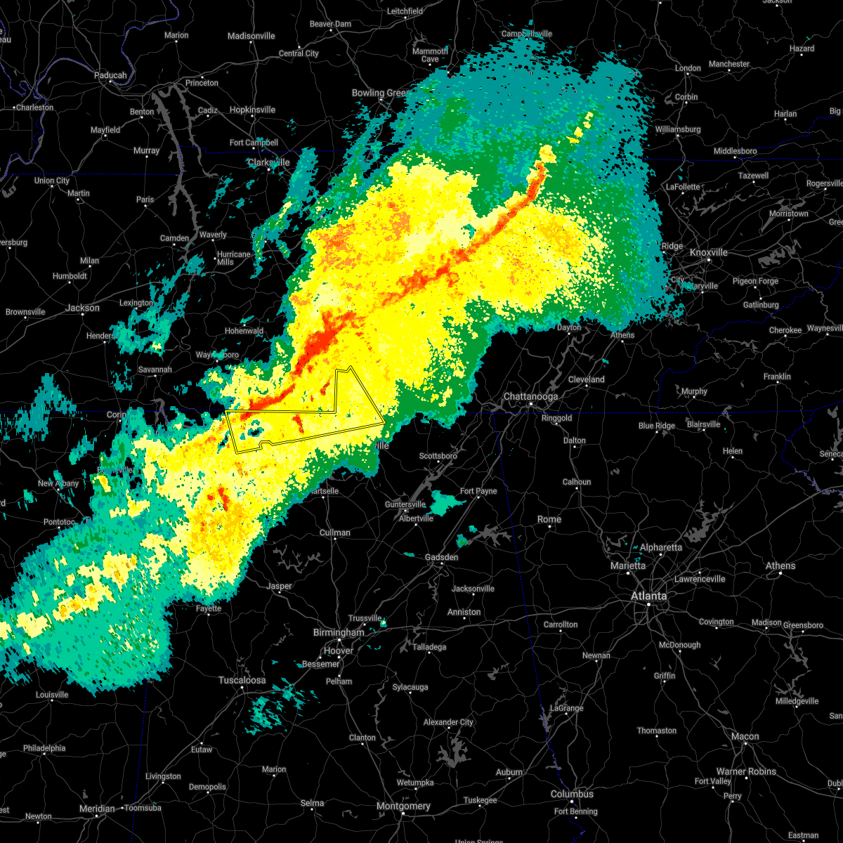 At 702 am cst, a severe thunderstorm was located 9 miles northeast of rogersville, or 15 miles northwest of athens, moving east at 65 mph (radar indicated). Hazards include 60 mph wind gusts. expect damage to roofs, siding, and trees At 702 am cst, a severe thunderstorm was located 9 miles northeast of rogersville, or 15 miles northwest of athens, moving east at 65 mph (radar indicated). Hazards include 60 mph wind gusts. expect damage to roofs, siding, and trees
|
| 8/18/2021 7:08 PM CDT |
 The tornado warning for east central limestone county will expire at 715 pm cdt, the storm which prompted the warning has weakened below severe limits, and no longer appears capable of producing a tornado. therefore, the warning will be allowed to expire. however gusty winds are still possible with this thunderstorm. The tornado warning for east central limestone county will expire at 715 pm cdt, the storm which prompted the warning has weakened below severe limits, and no longer appears capable of producing a tornado. therefore, the warning will be allowed to expire. however gusty winds are still possible with this thunderstorm.
|
| 8/18/2021 7:00 PM CDT | Delayed report. tree down across crestview st. time estimated on by rada in limestone county AL, 2.3 miles SSE of Athens, AL |
| 8/18/2021 6:47 PM CDT |
 At 647 pm cdt, a confirmed tornado was located over athens, moving east at 35 mph (weather spotters confirmed tornado). Hazards include damaging tornado. Flying debris will be dangerous to those caught without shelter. mobile homes will be damaged or destroyed. damage to roofs, windows, and vehicles will occur. tree damage is likely. the tornado will be near, harvest around 705 pm cdt. madison around 715 pm cdt. Other locations impacted by this tornadic thunderstorm include french mill and capshaw. At 647 pm cdt, a confirmed tornado was located over athens, moving east at 35 mph (weather spotters confirmed tornado). Hazards include damaging tornado. Flying debris will be dangerous to those caught without shelter. mobile homes will be damaged or destroyed. damage to roofs, windows, and vehicles will occur. tree damage is likely. the tornado will be near, harvest around 705 pm cdt. madison around 715 pm cdt. Other locations impacted by this tornadic thunderstorm include french mill and capshaw.
|
| 8/18/2021 6:45 PM CDT | Corrects previous tstm wnd dmg report from 2 nw athens. trees fell into powerlines along market st... between shannon st and hine st. time estimated from radar. possibl in limestone county AL, 3.4 miles SE of Athens, AL |
| 8/18/2021 6:36 PM CDT |
 At 636 pm cdt, a severe thunderstorm capable of producing a tornado was located 8 miles northwest of athens, moving east at 30 mph (radar indicated rotation). Hazards include tornado. Flying debris will be dangerous to those caught without shelter. mobile homes will be damaged or destroyed. damage to roofs, windows, and vehicles will occur. tree damage is likely. this dangerous storm will be near, athens around 650 pm cdt. Other locations impacted by this tornadic thunderstorm include cairo, cartwright and elkmont. At 636 pm cdt, a severe thunderstorm capable of producing a tornado was located 8 miles northwest of athens, moving east at 30 mph (radar indicated rotation). Hazards include tornado. Flying debris will be dangerous to those caught without shelter. mobile homes will be damaged or destroyed. damage to roofs, windows, and vehicles will occur. tree damage is likely. this dangerous storm will be near, athens around 650 pm cdt. Other locations impacted by this tornadic thunderstorm include cairo, cartwright and elkmont.
|
| 6/2/2021 4:51 PM CDT | Tree down east of downtown athens. time estimated based on rada in limestone county AL, 2.3 miles SSE of Athens, AL |
| 6/2/2021 4:49 PM CDT | Tree down off of cowford road in athens... al. time estimated based on rada in limestone county AL, 7.8 miles ENE of Athens, AL |
| 6/2/2021 4:18 PM CDT |
 At 418 pm cdt, a severe thunderstorm was located near town creek, or 16 miles east of muscle shoals, moving east at 25 mph (radar indicated). Hazards include 60 mph wind gusts and quarter size hail. Hail damage to vehicles is expected. Expect wind damage to roofs, siding, and trees. At 418 pm cdt, a severe thunderstorm was located near town creek, or 16 miles east of muscle shoals, moving east at 25 mph (radar indicated). Hazards include 60 mph wind gusts and quarter size hail. Hail damage to vehicles is expected. Expect wind damage to roofs, siding, and trees.
|
| 5/6/2021 6:27 PM CDT |
 At 625 pm cdt, severe thunderstorms were located along a line extending from near hazel green to near priceville to ashridge, moving southeast at 55 mph (emergency management and doppler radar). Hazards include 60 mph wind gusts. expect damage to roofs, siding, and trees At 625 pm cdt, severe thunderstorms were located along a line extending from near hazel green to near priceville to ashridge, moving southeast at 55 mph (emergency management and doppler radar). Hazards include 60 mph wind gusts. expect damage to roofs, siding, and trees
|
| 5/6/2021 6:23 PM CDT | Trees and power poles down on congress drive. time estimated from rada in limestone county AL, 0.8 miles SSE of Athens, AL |
| 5/6/2021 6:08 PM CDT | Tree down at the intersection of elk river mills rd and tillman mill rd. time estimated from rada in limestone county AL, 8.6 miles SE of Athens, AL |
| 5/6/2021 6:07 PM CDT |
 At 606 pm cdt, severe thunderstorms were located along a line extending from 8 miles northwest of athens to near courtland to near phil campbell to 8 miles north of weston, moving southeast at 45 mph (emergency management and doppler radar). Hazards include 60 mph wind gusts. Expect damage to roofs, siding, and trees. Locations impacted include, northwestern huntsville, decatur, madison, athens, hartselle, russellville, moulton, meridianville, moores mill and hazel green. At 606 pm cdt, severe thunderstorms were located along a line extending from 8 miles northwest of athens to near courtland to near phil campbell to 8 miles north of weston, moving southeast at 45 mph (emergency management and doppler radar). Hazards include 60 mph wind gusts. Expect damage to roofs, siding, and trees. Locations impacted include, northwestern huntsville, decatur, madison, athens, hartselle, russellville, moulton, meridianville, moores mill and hazel green.
|
| 5/6/2021 6:04 PM CDT | Tree down along us hwy 72 near clement in limestone county AL, 14 miles E of Athens, AL |
| 5/6/2021 5:31 PM CDT |
 At 529 pm cdt, severe thunderstorms were located along a line extending from near loretto to near underwood-petersville to 7 miles east of tishomingo state park to near sandy springs, moving southeast at 45 mph (radar indicated). Hazards include 60 mph wind gusts and nickel size hail. expect damage to roofs, siding, and trees At 529 pm cdt, severe thunderstorms were located along a line extending from near loretto to near underwood-petersville to 7 miles east of tishomingo state park to near sandy springs, moving southeast at 45 mph (radar indicated). Hazards include 60 mph wind gusts and nickel size hail. expect damage to roofs, siding, and trees
|
| 4/24/2021 4:39 PM CDT |
 At 438 pm cdt, a severe thunderstorm was located near madison, moving east at 55 mph (radar indicated). Hazards include 60 mph wind gusts and quarter size hail. Hail damage to vehicles is expected. Expect wind damage to roofs, siding, and trees. At 438 pm cdt, a severe thunderstorm was located near madison, moving east at 55 mph (radar indicated). Hazards include 60 mph wind gusts and quarter size hail. Hail damage to vehicles is expected. Expect wind damage to roofs, siding, and trees.
|
| 4/24/2021 4:24 PM CDT |
 At 424 pm cdt, a severe thunderstorm was located near trinity, or near decatur, moving east at 45 mph (radar indicated). Hazards include 60 mph wind gusts and quarter size hail. Hail damage to vehicles is expected. expect wind damage to roofs, siding, and trees. Locations impacted include, decatur, madison, athens, redstone arsenal, trinity, triana, huntsville international airport, tanner, harvest and mooresville. At 424 pm cdt, a severe thunderstorm was located near trinity, or near decatur, moving east at 45 mph (radar indicated). Hazards include 60 mph wind gusts and quarter size hail. Hail damage to vehicles is expected. expect wind damage to roofs, siding, and trees. Locations impacted include, decatur, madison, athens, redstone arsenal, trinity, triana, huntsville international airport, tanner, harvest and mooresville.
|
| 4/24/2021 4:10 PM CDT |
 At 410 pm cdt, a severe thunderstorm was located near courtland, or 10 miles north of moulton, moving east at 45 mph (radar indicated). Hazards include 60 mph wind gusts and quarter size hail. Hail damage to vehicles is expected. Expect wind damage to roofs, siding, and trees. At 410 pm cdt, a severe thunderstorm was located near courtland, or 10 miles north of moulton, moving east at 45 mph (radar indicated). Hazards include 60 mph wind gusts and quarter size hail. Hail damage to vehicles is expected. Expect wind damage to roofs, siding, and trees.
|
| 4/9/2021 4:08 PM CDT |
 At 407 pm cdt, a severe thunderstorm was located near tanner, or near decatur, moving east at 10 mph (radar indicated). Hazards include 60 mph wind gusts and quarter size hail. Hail damage to vehicles is expected. expect wind damage to roofs, siding, and trees. Locations impacted include, madison, athens, tanner, mooresville and belle mina. At 407 pm cdt, a severe thunderstorm was located near tanner, or near decatur, moving east at 10 mph (radar indicated). Hazards include 60 mph wind gusts and quarter size hail. Hail damage to vehicles is expected. expect wind damage to roofs, siding, and trees. Locations impacted include, madison, athens, tanner, mooresville and belle mina.
|
| 4/9/2021 3:52 PM CDT |
 At 352 pm cdt, a severe thunderstorm was located near tanner, or near decatur, moving east at 15 mph (radar indicated). Hazards include 60 mph wind gusts and quarter size hail. Hail damage to vehicles is expected. Expect wind damage to roofs, siding, and trees. At 352 pm cdt, a severe thunderstorm was located near tanner, or near decatur, moving east at 15 mph (radar indicated). Hazards include 60 mph wind gusts and quarter size hail. Hail damage to vehicles is expected. Expect wind damage to roofs, siding, and trees.
|
| 4/9/2021 2:07 PM CDT |
 The severe thunderstorm warning for central limestone and northeastern lawrence counties will expire at 215 pm cdt, the storm which prompted the warning has weakened below severe limits, and no longer poses an immediate threat to life or property. therefore, the warning will be allowed to expire. The severe thunderstorm warning for central limestone and northeastern lawrence counties will expire at 215 pm cdt, the storm which prompted the warning has weakened below severe limits, and no longer poses an immediate threat to life or property. therefore, the warning will be allowed to expire.
|
| 4/9/2021 1:51 PM CDT |
 At 150 pm cdt, a severe thunderstorm was located near courtland, or 13 miles north of moulton, moving northeast at 20 mph (radar indicated). Hazards include 60 mph wind gusts and quarter size hail. Hail damage to vehicles is expected. expect wind damage to roofs, siding, and trees. Locations impacted include, athens, courtland, north courtland, hillsboro, cartwright, coxey, chalybeate springs, cairo, mt rozell and wheeler. At 150 pm cdt, a severe thunderstorm was located near courtland, or 13 miles north of moulton, moving northeast at 20 mph (radar indicated). Hazards include 60 mph wind gusts and quarter size hail. Hail damage to vehicles is expected. expect wind damage to roofs, siding, and trees. Locations impacted include, athens, courtland, north courtland, hillsboro, cartwright, coxey, chalybeate springs, cairo, mt rozell and wheeler.
|
| 4/9/2021 1:41 PM CDT |
 At 141 pm cdt, a severe thunderstorm was located over courtland, or 11 miles north of moulton, moving northeast at 20 mph (radar indicated). Hazards include 60 mph wind gusts and half dollar size hail. Hail damage to vehicles is expected. Expect wind damage to roofs, siding, and trees. At 141 pm cdt, a severe thunderstorm was located over courtland, or 11 miles north of moulton, moving northeast at 20 mph (radar indicated). Hazards include 60 mph wind gusts and half dollar size hail. Hail damage to vehicles is expected. Expect wind damage to roofs, siding, and trees.
|
| 3/28/2021 3:58 AM CDT |
 At 358 am cdt, severe thunderstorms were located along a line extending from 7 miles southwest of harvest to near decatur to 6 miles northwest of brushy lake, moving east at 55 mph (radar indicated). Hazards include 60 mph wind gusts. expect damage to roofs, siding, and trees At 358 am cdt, severe thunderstorms were located along a line extending from 7 miles southwest of harvest to near decatur to 6 miles northwest of brushy lake, moving east at 55 mph (radar indicated). Hazards include 60 mph wind gusts. expect damage to roofs, siding, and trees
|
| 3/28/2021 3:34 AM CDT |
 At 333 am cdt, severe thunderstorms were located along a line extending from 6 miles east of courtland to near moulton to near needmore, moving east at 50 mph (radar indicated). Hazards include 60 mph wind gusts. expect damage to roofs, siding, and trees At 333 am cdt, severe thunderstorms were located along a line extending from 6 miles east of courtland to near moulton to near needmore, moving east at 50 mph (radar indicated). Hazards include 60 mph wind gusts. expect damage to roofs, siding, and trees
|
| 10/23/2020 2:22 PM CDT |
 At 222 pm cdt, a severe thunderstorm was located 8 miles northwest of athens, moving east at 10 mph (radar indicated). Hazards include 60 mph wind gusts. Expect damage to roofs, siding, and trees. Locations impacted include, athens, ripley and cartwright. At 222 pm cdt, a severe thunderstorm was located 8 miles northwest of athens, moving east at 10 mph (radar indicated). Hazards include 60 mph wind gusts. Expect damage to roofs, siding, and trees. Locations impacted include, athens, ripley and cartwright.
|
| 10/23/2020 2:09 PM CDT |
 At 209 pm cdt, a severe thunderstorm was located 9 miles northwest of athens, moving east at 10 mph (radar indicated). Hazards include 60 mph wind gusts. Expect damage to roofs, siding, and trees. Locations impacted include, athens, cartwright, coxey, cairo, mt rozell, leggtown and ripley. At 209 pm cdt, a severe thunderstorm was located 9 miles northwest of athens, moving east at 10 mph (radar indicated). Hazards include 60 mph wind gusts. Expect damage to roofs, siding, and trees. Locations impacted include, athens, cartwright, coxey, cairo, mt rozell, leggtown and ripley.
|
| 10/23/2020 1:53 PM CDT |
 At 153 pm cdt, a severe thunderstorm was located 7 miles east of rogersville, moving east at 10 mph (radar indicated). Hazards include 60 mph wind gusts and quarter size hail. expect damage to roofs, siding, and trees At 153 pm cdt, a severe thunderstorm was located 7 miles east of rogersville, moving east at 10 mph (radar indicated). Hazards include 60 mph wind gusts and quarter size hail. expect damage to roofs, siding, and trees
|
| 8/28/2020 3:46 PM CDT |
 At 345 pm cdt, a severe thunderstorm was located near killen, or 8 miles east of florence, moving northeast at 45 mph (radar indicated). Hazards include 60 mph wind gusts. expect damage to roofs, siding, and trees At 345 pm cdt, a severe thunderstorm was located near killen, or 8 miles east of florence, moving northeast at 45 mph (radar indicated). Hazards include 60 mph wind gusts. expect damage to roofs, siding, and trees
|
| 8/27/2020 3:41 PM CDT |
 The severe thunderstorm warning for northwestern madison and northeastern limestone counties will expire at 345 pm cdt, the storm which prompted the warning has weakened below severe limits, and no longer poses an immediate threat to life or property. therefore, the warning will be allowed to expire. The severe thunderstorm warning for northwestern madison and northeastern limestone counties will expire at 345 pm cdt, the storm which prompted the warning has weakened below severe limits, and no longer poses an immediate threat to life or property. therefore, the warning will be allowed to expire.
|
| 8/27/2020 3:21 PM CDT |
 At 320 pm cdt, a severe thunderstorm was located over harvest, moving north at 15 mph (radar indicated). Hazards include 60 mph wind gusts. expect damage to roofs, siding, and trees At 320 pm cdt, a severe thunderstorm was located over harvest, moving north at 15 mph (radar indicated). Hazards include 60 mph wind gusts. expect damage to roofs, siding, and trees
|
| 6/30/2020 5:40 PM CDT |
 At 540 pm cdt, a severe thunderstorm was located near harvest, or near madison, moving southeast at 30 mph (radar indicated). Hazards include 60 mph wind gusts. expect damage to roofs, siding, and trees At 540 pm cdt, a severe thunderstorm was located near harvest, or near madison, moving southeast at 30 mph (radar indicated). Hazards include 60 mph wind gusts. expect damage to roofs, siding, and trees
|
| 6/30/2020 5:33 PM CDT | Trees down... outdoor shed blown on its side at piney chapel elementary schoo in limestone county AL, 6.3 miles S of Athens, AL |
| 5/3/2020 5:36 PM CDT |
 At 535 pm cdt, severe thunderstorms were located along a line extending from 7 miles north of sewanee to near new market to near madison, moving southeast at 65 mph. this storm continues to produce widespread wind damage (radar indicated). Hazards include 70 mph wind gusts. Expect considerable tree damage. damage is likely to mobile homes, roofs, and outbuildings. Locations impacted include, huntsville, decatur, madison, athens, scottsboro, winchester, fayetteville, bridgeport, moores mill and meridianville. At 535 pm cdt, severe thunderstorms were located along a line extending from 7 miles north of sewanee to near new market to near madison, moving southeast at 65 mph. this storm continues to produce widespread wind damage (radar indicated). Hazards include 70 mph wind gusts. Expect considerable tree damage. damage is likely to mobile homes, roofs, and outbuildings. Locations impacted include, huntsville, decatur, madison, athens, scottsboro, winchester, fayetteville, bridgeport, moores mill and meridianville.
|
| 5/3/2020 5:23 PM CDT |
 At 522 pm cdt, severe thunderstorms were located along a line extending from near tullahoma to hazel green to near athens, moving southeast at 65 mph. this storm has a history of producing wind damage, most recently in northern limestone and madison county (radar indicated). Hazards include 70 mph wind gusts. Expect considerable tree damage. damage is likely to mobile homes, roofs, and outbuildings. Locations impacted include, huntsville, decatur, madison, athens, scottsboro, winchester, fayetteville, bridgeport, moores mill and meridianville. At 522 pm cdt, severe thunderstorms were located along a line extending from near tullahoma to hazel green to near athens, moving southeast at 65 mph. this storm has a history of producing wind damage, most recently in northern limestone and madison county (radar indicated). Hazards include 70 mph wind gusts. Expect considerable tree damage. damage is likely to mobile homes, roofs, and outbuildings. Locations impacted include, huntsville, decatur, madison, athens, scottsboro, winchester, fayetteville, bridgeport, moores mill and meridianville.
|
| 5/3/2020 5:15 PM CDT | Trees and powerlines were knocked down throughout limestone county. power outages reported in elk river... tanner... athens and elkmon in limestone county AL, 2.5 miles SSE of Athens, AL |
| 5/3/2020 5:13 PM CDT |
 At 512 pm cdt, severe thunderstorms were located along a line extending from near tullahoma to near ardmore to 7 miles east of rogersville, moving southeast at 65 mph (radar indicated. this storm has a history of producing wind damage). Hazards include 60 mph wind gusts and penny size hail. expect damage to roofs, siding, and trees At 512 pm cdt, severe thunderstorms were located along a line extending from near tullahoma to near ardmore to 7 miles east of rogersville, moving southeast at 65 mph (radar indicated. this storm has a history of producing wind damage). Hazards include 60 mph wind gusts and penny size hail. expect damage to roofs, siding, and trees
|
| 5/3/2020 5:07 PM CDT |
 At 506 pm cdt, severe thunderstorms were located along a line extending from shelbyville to near ardmore to near leighton, moving southeast at 65 mph. this storm has a history producing wind damage in eastern lauderdale county (radar indicated). Hazards include 60 mph wind gusts and quarter size hail. Hail damage to vehicles is expected. expect wind damage to roofs, siding, and trees. Locations impacted include, northwestern huntsville, decatur, madison, florence, athens, winchester, fayetteville, moores mill, meridianville and lynchburg. At 506 pm cdt, severe thunderstorms were located along a line extending from shelbyville to near ardmore to near leighton, moving southeast at 65 mph. this storm has a history producing wind damage in eastern lauderdale county (radar indicated). Hazards include 60 mph wind gusts and quarter size hail. Hail damage to vehicles is expected. expect wind damage to roofs, siding, and trees. Locations impacted include, northwestern huntsville, decatur, madison, florence, athens, winchester, fayetteville, moores mill, meridianville and lynchburg.
|
| 5/3/2020 4:30 PM CDT |
 At 430 pm cdt, severe thunderstorms were located along a line extending from near spring hill to 6 miles west of lawrenceburg to near walnut grove, moving southeast at 65 mph (radar indicated). Hazards include 60 mph wind gusts and quarter size hail. Hail damage to vehicles is expected. Expect wind damage to roofs, siding, and trees. At 430 pm cdt, severe thunderstorms were located along a line extending from near spring hill to 6 miles west of lawrenceburg to near walnut grove, moving southeast at 65 mph (radar indicated). Hazards include 60 mph wind gusts and quarter size hail. Hail damage to vehicles is expected. Expect wind damage to roofs, siding, and trees.
|
| 4/9/2020 2:06 AM CDT |
 The severe thunderstorm warning for southern limestone, western morgan and lawrence counties will expire at 215 am cdt, the storm which prompted the warning has weakened below severe limits, and no longer poses an immediate threat to life or property. therefore, the warning will be allowed to expire. however gusty winds are still possible with this thunderstorm. a severe thunderstorm watch remains in effect until 500 am cdt for north central, northeastern and northwestern alabama, and middle tennessee. additional thunderstorms, some of which may be strong to severe, will still be possible overnight. to report severe weather, contact your nearest law enforcement agency. they will relay your report to the national weather service huntsville alabama. The severe thunderstorm warning for southern limestone, western morgan and lawrence counties will expire at 215 am cdt, the storm which prompted the warning has weakened below severe limits, and no longer poses an immediate threat to life or property. therefore, the warning will be allowed to expire. however gusty winds are still possible with this thunderstorm. a severe thunderstorm watch remains in effect until 500 am cdt for north central, northeastern and northwestern alabama, and middle tennessee. additional thunderstorms, some of which may be strong to severe, will still be possible overnight. to report severe weather, contact your nearest law enforcement agency. they will relay your report to the national weather service huntsville alabama.
|
| 4/9/2020 1:54 AM CDT |
 At 153 am cdt, a severe thunderstorm was located near courtland, or 7 miles north of moulton, moving east at 60 mph (public). Hazards include 60 mph wind gusts and quarter size hail. Hail damage to vehicles is expected. expect wind damage to roofs, siding, and trees. Locations impacted include, decatur, hartselle, moulton, priceville, trinity, town creek, courtland, tanner, north courtland and hillsboro. At 153 am cdt, a severe thunderstorm was located near courtland, or 7 miles north of moulton, moving east at 60 mph (public). Hazards include 60 mph wind gusts and quarter size hail. Hail damage to vehicles is expected. expect wind damage to roofs, siding, and trees. Locations impacted include, decatur, hartselle, moulton, priceville, trinity, town creek, courtland, tanner, north courtland and hillsboro.
|
| 4/9/2020 1:35 AM CDT |
 At 133 am cdt, a severe thunderstorm was located over leighton, or near muscle shoals, moving east at 60 mph. this storm has a history of producing quarter to golf ball sized hail (public). Hazards include 60 mph wind gusts and half dollar size hail. Hail damage to vehicles is expected. Expect wind damage to roofs, siding, and trees. At 133 am cdt, a severe thunderstorm was located over leighton, or near muscle shoals, moving east at 60 mph. this storm has a history of producing quarter to golf ball sized hail (public). Hazards include 60 mph wind gusts and half dollar size hail. Hail damage to vehicles is expected. Expect wind damage to roofs, siding, and trees.
|
| 4/8/2020 7:10 PM CDT |
 The severe thunderstorm warning for southeastern lauderdale, central limestone, northwestern morgan and northeastern lawrence counties will expire at 715 pm cdt, the storm which prompted the warning has weakened below severe limits, and no longer poses an immediate threat to life or property. therefore, the warning will be allowed to expire. The severe thunderstorm warning for southeastern lauderdale, central limestone, northwestern morgan and northeastern lawrence counties will expire at 715 pm cdt, the storm which prompted the warning has weakened below severe limits, and no longer poses an immediate threat to life or property. therefore, the warning will be allowed to expire.
|
| 4/8/2020 6:39 PM CDT |
 At 639 pm cdt, a severe thunderstorm was located over rogersville, or 18 miles west of athens, moving southeast at 35 mph (radar indicated). Hazards include 60 mph wind gusts and penny size hail. expect damage to roofs, siding, and trees At 639 pm cdt, a severe thunderstorm was located over rogersville, or 18 miles west of athens, moving southeast at 35 mph (radar indicated). Hazards include 60 mph wind gusts and penny size hail. expect damage to roofs, siding, and trees
|
| 4/8/2020 6:26 PM CDT |
 At 625 pm cdt, a severe thunderstorm was located over harvest, or 11 miles west of meridianville, moving southeast at 40 mph (radar indicated). Hazards include 60 mph wind gusts and penny size hail. expect damage to roofs, siding, and trees At 625 pm cdt, a severe thunderstorm was located over harvest, or 11 miles west of meridianville, moving southeast at 40 mph (radar indicated). Hazards include 60 mph wind gusts and penny size hail. expect damage to roofs, siding, and trees
|
| 4/8/2020 6:05 PM CDT |
 At 605 pm cdt, a severe thunderstorm was located near ardmore, or 9 miles north of athens, moving southeast at 55 mph (radar indicated). Hazards include 60 mph wind gusts and penny size hail. expect damage to roofs, siding, and trees At 605 pm cdt, a severe thunderstorm was located near ardmore, or 9 miles north of athens, moving southeast at 55 mph (radar indicated). Hazards include 60 mph wind gusts and penny size hail. expect damage to roofs, siding, and trees
|
| 3/29/2020 2:20 AM CDT |
 At 220 am cdt, a severe thunderstorm was located near athens, moving northeast at 65 mph (radar indicated). Hazards include 60 mph wind gusts. expect damage to roofs, siding, and trees At 220 am cdt, a severe thunderstorm was located near athens, moving northeast at 65 mph (radar indicated). Hazards include 60 mph wind gusts. expect damage to roofs, siding, and trees
|
| 3/24/2020 7:06 PM CDT |
 At 705 pm cdt, a severe thunderstorm capable of producing a tornado was located over decatur, moving east at 45 mph (radar indicated rotation). Hazards include tornado and half dollar size hail. Flying debris will be dangerous to those caught without shelter. mobile homes will be damaged or destroyed. damage to roofs, windows, and vehicles will occur. tree damage is likely. Locations impacted include, decatur, madison, priceville, trinity, mooresville and belle mina. At 705 pm cdt, a severe thunderstorm capable of producing a tornado was located over decatur, moving east at 45 mph (radar indicated rotation). Hazards include tornado and half dollar size hail. Flying debris will be dangerous to those caught without shelter. mobile homes will be damaged or destroyed. damage to roofs, windows, and vehicles will occur. tree damage is likely. Locations impacted include, decatur, madison, priceville, trinity, mooresville and belle mina.
|
| 3/24/2020 6:55 PM CDT |
 The national weather service in huntsville alabama has issued a * tornado warning for. southeastern limestone county in north central alabama. northwestern morgan county in north central alabama. east central lawrence county in northwestern alabama. Until 730 pm cdt. The national weather service in huntsville alabama has issued a * tornado warning for. southeastern limestone county in north central alabama. northwestern morgan county in north central alabama. east central lawrence county in northwestern alabama. Until 730 pm cdt.
|
| 3/24/2020 6:43 PM CDT |
 At 642 pm cdt, a severe thunderstorm capable of producing a tornado was located near courtland, or 9 miles north of moulton, moving east at 40 mph (weather spotters reported a funnel cloud). Hazards include tornado and half dollar size hail. Flying debris will be dangerous to those caught without shelter. mobile homes will be damaged or destroyed. damage to roofs, windows, and vehicles will occur. tree damage is likely. Locations impacted include, decatur, athens, trinity, courtland, north courtland, hillsboro, chalybeate springs, caddo, wheeler and basham. At 642 pm cdt, a severe thunderstorm capable of producing a tornado was located near courtland, or 9 miles north of moulton, moving east at 40 mph (weather spotters reported a funnel cloud). Hazards include tornado and half dollar size hail. Flying debris will be dangerous to those caught without shelter. mobile homes will be damaged or destroyed. damage to roofs, windows, and vehicles will occur. tree damage is likely. Locations impacted include, decatur, athens, trinity, courtland, north courtland, hillsboro, chalybeate springs, caddo, wheeler and basham.
|
| 3/24/2020 6:34 PM CDT |
 At 634 pm cdt, a severe thunderstorm capable of producing a tornado was located near town creek, or 11 miles northwest of moulton, moving east at 45 mph (radar indicated rotation). Hazards include tornado and half dollar size hail. Flying debris will be dangerous to those caught without shelter. mobile homes will be damaged or destroyed. damage to roofs, windows, and vehicles will occur. Tree damage is likely. At 634 pm cdt, a severe thunderstorm capable of producing a tornado was located near town creek, or 11 miles northwest of moulton, moving east at 45 mph (radar indicated rotation). Hazards include tornado and half dollar size hail. Flying debris will be dangerous to those caught without shelter. mobile homes will be damaged or destroyed. damage to roofs, windows, and vehicles will occur. Tree damage is likely.
|
| 2/12/2020 6:02 PM CST | A large tree down on limestone square. relayed by social medi in limestone county AL, 3.1 miles SSE of Athens, AL |
| 2/12/2020 6:00 PM CST | Trees and power lines down in many places in southwest limestone county... including athens where power is out. large hail reporte in limestone county AL, 4 miles SSE of Athens, AL |
| 12/29/2019 7:03 PM CST | Partial roof damage of a gas station. report relayed via twitter. time estimated based on rada in limestone county AL, 4.5 miles ESE of Athens, AL |
| 12/29/2019 7:02 PM CST | U-haul trailer toppled and metal roof blown off of garage. report relayed via twitter. time estimated based on rada in limestone county AL, 4.3 miles E of Athens, AL |
| 12/29/2019 7:01 PM CST | Two mobile homes damaged on ham road in athens... al. time estimated based on rada in limestone county AL, 5.9 miles E of Athens, AL |
| 12/29/2019 6:55 PM CST | Corrects time of previous tstm wnd dmg report from 3 w athens. partial roof damage of a gas station. report relayed via twitter. time estimated based on rada in limestone county AL, 4.5 miles ESE of Athens, AL |
| 12/29/2019 6:54 PM CST | Corrects time of previous tstm wnd dmg report from 3 w athens. u-haul trailer toppled and metal roof blown off of garage. report relayed via twitter. time estimated bas in limestone county AL, 4.3 miles E of Athens, AL |
| 12/29/2019 6:52 PM CST | Corrects time of previous tstm wnd dmg report from 5 wsw athens. two mobile homes damaged on ham road in athens... al. time estimated based on rada in limestone county AL, 5.9 miles E of Athens, AL |
| 12/16/2019 6:09 PM CST |
 The severe thunderstorm warning for madison, eastern limestone, central morgan, west central moore and lincoln counties will expire at 615 pm cst, the storms which prompted the warning have moved out of the area. therefore, the warning will be allowed to expire. a tornado watch remains in effect until 1100 pm cst for north central, northeastern and northwestern alabama, and middle tennessee. remember, a severe thunderstorm warning still remains in effect for madison and lincoln counties until 7 pm cst. The severe thunderstorm warning for madison, eastern limestone, central morgan, west central moore and lincoln counties will expire at 615 pm cst, the storms which prompted the warning have moved out of the area. therefore, the warning will be allowed to expire. a tornado watch remains in effect until 1100 pm cst for north central, northeastern and northwestern alabama, and middle tennessee. remember, a severe thunderstorm warning still remains in effect for madison and lincoln counties until 7 pm cst.
|
| 12/16/2019 5:59 PM CST |
 At 559 pm cst, severe thunderstorms were located along a line extending from 7 miles east of petersburg to meridianville to near triana, moving northeast at 70 mph. in capshaw, 70 mph winds were observed (radar indicated). Hazards include 70 mph wind gusts and quarter size hail. Hail damage to vehicles is expected. expect considerable tree damage. wind damage is also likely to mobile homes, roofs, and outbuildings. Locations impacted include, huntsville, decatur, madison, athens, hartselle, fayetteville, moores mill, meridianville, redstone arsenal and hazel green. At 559 pm cst, severe thunderstorms were located along a line extending from 7 miles east of petersburg to meridianville to near triana, moving northeast at 70 mph. in capshaw, 70 mph winds were observed (radar indicated). Hazards include 70 mph wind gusts and quarter size hail. Hail damage to vehicles is expected. expect considerable tree damage. wind damage is also likely to mobile homes, roofs, and outbuildings. Locations impacted include, huntsville, decatur, madison, athens, hartselle, fayetteville, moores mill, meridianville, redstone arsenal and hazel green.
|
| 12/16/2019 5:54 PM CST |
 At 553 pm cst, a severe thunderstorm capable of producing a tornado was located over harvest, or 9 miles north of madison, moving northeast at 50 mph. this storm has a history of producing tornado damage (radar indicated rotation). Hazards include tornado and quarter size hail. Flying debris will be dangerous to those caught without shelter. mobile homes will be damaged or destroyed. damage to roofs, windows, and vehicles will occur. tree damage is likely. Locations impacted include, northern huntsville, madison, moores mill, meridianville, hazel green, alabama a and m university, harvest, new market, university of alabama in huntsville and maysville. At 553 pm cst, a severe thunderstorm capable of producing a tornado was located over harvest, or 9 miles north of madison, moving northeast at 50 mph. this storm has a history of producing tornado damage (radar indicated rotation). Hazards include tornado and quarter size hail. Flying debris will be dangerous to those caught without shelter. mobile homes will be damaged or destroyed. damage to roofs, windows, and vehicles will occur. tree damage is likely. Locations impacted include, northern huntsville, madison, moores mill, meridianville, hazel green, alabama a and m university, harvest, new market, university of alabama in huntsville and maysville.
|
| 12/16/2019 5:52 PM CST |
 At 551 pm cst, severe thunderstorms were located along a line extending from near fayetteville to 7 miles west of huntland to huntsville, moving east at 75 mph (radar indicated). Hazards include 60 mph wind gusts and quarter size hail. Hail damage to vehicles is expected. expect wind damage to roofs, siding, and trees. Locations impacted include, huntsville, decatur, madison, athens, hartselle, fayetteville, moores mill, meridianville, redstone arsenal and hazel green. At 551 pm cst, severe thunderstorms were located along a line extending from near fayetteville to 7 miles west of huntland to huntsville, moving east at 75 mph (radar indicated). Hazards include 60 mph wind gusts and quarter size hail. Hail damage to vehicles is expected. expect wind damage to roofs, siding, and trees. Locations impacted include, huntsville, decatur, madison, athens, hartselle, fayetteville, moores mill, meridianville, redstone arsenal and hazel green.
|
| 12/16/2019 5:44 PM CST |
 At 543 pm cst, a confirmed tornado was located near tanner, or near athens, moving northeast at 55 mph (emergency management confirmed tornado). Hazards include damaging tornado. Flying debris will be dangerous to those caught without shelter. mobile homes will be damaged or destroyed. damage to roofs, windows, and vehicles will occur. tree damage is likely. Locations impacted include, northern huntsville, madison, athens, moores mill, meridianville, hazel green, alabama a and m university, university of alabama in huntsville, harvest and new market. At 543 pm cst, a confirmed tornado was located near tanner, or near athens, moving northeast at 55 mph (emergency management confirmed tornado). Hazards include damaging tornado. Flying debris will be dangerous to those caught without shelter. mobile homes will be damaged or destroyed. damage to roofs, windows, and vehicles will occur. tree damage is likely. Locations impacted include, northern huntsville, madison, athens, moores mill, meridianville, hazel green, alabama a and m university, university of alabama in huntsville, harvest and new market.
|
| 12/16/2019 5:42 PM CST | Quarter sized hail reported 2.2 miles WSW of Athens, AL, report from mping: quarter (1.00 in.). |
| 12/16/2019 5:39 PM CST |
 At 539 pm cst, a severe thunderstorm capable of producing a tornado was located over tanner, or near athens, moving east at 55 mph (radar indicated rotation). Hazards include tornado. Flying debris will be dangerous to those caught without shelter. mobile homes will be damaged or destroyed. damage to roofs, windows, and vehicles will occur. Tree damage is likely. At 539 pm cst, a severe thunderstorm capable of producing a tornado was located over tanner, or near athens, moving east at 55 mph (radar indicated rotation). Hazards include tornado. Flying debris will be dangerous to those caught without shelter. mobile homes will be damaged or destroyed. damage to roofs, windows, and vehicles will occur. Tree damage is likely.
|
| 12/16/2019 5:32 PM CST |
 At 531 pm cst, a severe thunderstorm capable of producing a tornado was located over athens, moving east at 65 mph. this storm has a history of producing tornado damage (radar indicated rotation). Hazards include tornado. Flying debris will be dangerous to those caught without shelter. mobile homes will be damaged or destroyed. damage to roofs, windows, and vehicles will occur. tree damage is likely. Locations impacted include, decatur, athens, trinity, tanner, elkmont, mooresville, belle mina, cartwright, french mill and coxey. At 531 pm cst, a severe thunderstorm capable of producing a tornado was located over athens, moving east at 65 mph. this storm has a history of producing tornado damage (radar indicated rotation). Hazards include tornado. Flying debris will be dangerous to those caught without shelter. mobile homes will be damaged or destroyed. damage to roofs, windows, and vehicles will occur. tree damage is likely. Locations impacted include, decatur, athens, trinity, tanner, elkmont, mooresville, belle mina, cartwright, french mill and coxey.
|
| 12/16/2019 5:16 PM CST |
 At 515 pm cst, a confirmed dangerous tornado was located over courtland, or 15 miles north of moulton, moving east at 65 mph. this is a dangerous situation. take cover now! (radar confirmed tornado). Hazards include damaging tornado. You are in a life-threatening situation. flying debris may be deadly to those caught without shelter. mobile homes will be destroyed. considerable damage to homes, businesses, and vehicles is likely and complete destruction is possible. Locations impacted include, decatur, athens, trinity, rogersville, town creek, courtland, tanner, north courtland, hillsboro and elkmont. At 515 pm cst, a confirmed dangerous tornado was located over courtland, or 15 miles north of moulton, moving east at 65 mph. this is a dangerous situation. take cover now! (radar confirmed tornado). Hazards include damaging tornado. You are in a life-threatening situation. flying debris may be deadly to those caught without shelter. mobile homes will be destroyed. considerable damage to homes, businesses, and vehicles is likely and complete destruction is possible. Locations impacted include, decatur, athens, trinity, rogersville, town creek, courtland, tanner, north courtland, hillsboro and elkmont.
|
| 12/16/2019 5:13 PM CST |
 At 513 pm cst, severe thunderstorms were located along a line extending from lexington to 6 miles east of rogersville to near moulton, moving east at 30 mph (radar indicated). Hazards include 60 mph wind gusts. expect damage to roofs, siding, and trees At 513 pm cst, severe thunderstorms were located along a line extending from lexington to 6 miles east of rogersville to near moulton, moving east at 30 mph (radar indicated). Hazards include 60 mph wind gusts. expect damage to roofs, siding, and trees
|
| 12/16/2019 5:04 PM CST |
 At 504 pm cst, a confirmed tornado was located near town creek, or 13 miles southeast of muscle shoals, moving east at 65 mph. damage was reported in the colbert heights area at 500 pm (emergency management confirmed tornado). Hazards include damaging tornado. Flying debris will be dangerous to those caught without shelter. mobile homes will be damaged or destroyed. damage to roofs, windows, and vehicles will occur. tree damage is likely. Locations impacted include, decatur, athens, trinity, rogersville, killen, town creek, leighton, courtland, tanner and north courtland. At 504 pm cst, a confirmed tornado was located near town creek, or 13 miles southeast of muscle shoals, moving east at 65 mph. damage was reported in the colbert heights area at 500 pm (emergency management confirmed tornado). Hazards include damaging tornado. Flying debris will be dangerous to those caught without shelter. mobile homes will be damaged or destroyed. damage to roofs, windows, and vehicles will occur. tree damage is likely. Locations impacted include, decatur, athens, trinity, rogersville, killen, town creek, leighton, courtland, tanner and north courtland.
|
| 12/16/2019 4:56 PM CST |
 At 456 pm cst, a severe thunderstorm capable of producing a tornado was located near littleville, or 8 miles northeast of russellville, moving east at 65 mph (radar indicated rotation). Hazards include tornado. Flying debris will be dangerous to those caught without shelter. mobile homes will be damaged or destroyed. damage to roofs, windows, and vehicles will occur. Tree damage is likely. At 456 pm cst, a severe thunderstorm capable of producing a tornado was located near littleville, or 8 miles northeast of russellville, moving east at 65 mph (radar indicated rotation). Hazards include tornado. Flying debris will be dangerous to those caught without shelter. mobile homes will be damaged or destroyed. damage to roofs, windows, and vehicles will occur. Tree damage is likely.
|
| 11/22/2019 10:46 PM CST |
 At 1045 pm cst, a severe thunderstorm was located 7 miles northwest of athens, moving northeast at 60 mph (radar indicated). Hazards include 60 mph wind gusts and quarter size hail. Hail damage to vehicles is expected. expect wind damage to roofs, siding, and trees. Locations impacted include, athens, elkmont, cartwright, coxey, cairo, mt rozell, leggtown and ripley. At 1045 pm cst, a severe thunderstorm was located 7 miles northwest of athens, moving northeast at 60 mph (radar indicated). Hazards include 60 mph wind gusts and quarter size hail. Hail damage to vehicles is expected. expect wind damage to roofs, siding, and trees. Locations impacted include, athens, elkmont, cartwright, coxey, cairo, mt rozell, leggtown and ripley.
|
| 11/22/2019 10:26 PM CST |
 At 1025 pm cst, a severe thunderstorm was located near rogersville, or 17 miles east of muscle shoals, moving northeast at 60 mph. this storm has a history of producing dime to quarter size hail (radar indicated). Hazards include 60 mph wind gusts and quarter size hail. Hail damage to vehicles is expected. Expect wind damage to roofs, siding, and trees. At 1025 pm cst, a severe thunderstorm was located near rogersville, or 17 miles east of muscle shoals, moving northeast at 60 mph. this storm has a history of producing dime to quarter size hail (radar indicated). Hazards include 60 mph wind gusts and quarter size hail. Hail damage to vehicles is expected. Expect wind damage to roofs, siding, and trees.
|
| 8/7/2019 6:07 PM CDT |
 The severe thunderstorm warning for southwestern madison, southeastern limestone and central morgan counties will expire at 615 pm cdt, the storm which prompted the warning has weakened below severe limits, and no longer poses an immediate threat to life or property. therefore, the warning will be allowed to expire. however gusty winds and heavy rain are still possible with this thunderstorm. The severe thunderstorm warning for southwestern madison, southeastern limestone and central morgan counties will expire at 615 pm cdt, the storm which prompted the warning has weakened below severe limits, and no longer poses an immediate threat to life or property. therefore, the warning will be allowed to expire. however gusty winds and heavy rain are still possible with this thunderstorm.
|
| 8/7/2019 5:51 PM CDT |
 At 550 pm cdt, a severe thunderstorm was located near huntsville international airport, or 7 miles east of decatur, moving southeast at 35 mph. powerlines and trees have been reported down near decatur (radar indicated). Hazards include 60 mph wind gusts. Expect damage to roofs, siding, and trees. Locations impacted include, southern huntsville, decatur, madison, athens, redstone arsenal, priceville, trinity, owens cross roads, triana and marshall space flight center. At 550 pm cdt, a severe thunderstorm was located near huntsville international airport, or 7 miles east of decatur, moving southeast at 35 mph. powerlines and trees have been reported down near decatur (radar indicated). Hazards include 60 mph wind gusts. Expect damage to roofs, siding, and trees. Locations impacted include, southern huntsville, decatur, madison, athens, redstone arsenal, priceville, trinity, owens cross roads, triana and marshall space flight center.
|
| 8/7/2019 5:37 PM CDT |
 At 537 pm cdt, a severe thunderstorm was located near decatur, moving southeast at 35 mph (radar indicated). Hazards include 60 mph wind gusts and penny size hail. expect damage to roofs, siding, and trees At 537 pm cdt, a severe thunderstorm was located near decatur, moving southeast at 35 mph (radar indicated). Hazards include 60 mph wind gusts and penny size hail. expect damage to roofs, siding, and trees
|
| 7/13/2019 3:24 PM CDT |
 At 323 pm cdt, a severe thunderstorm was located near decatur, moving north at 15 mph (radar indicated). Hazards include 60 to 70 mph wind gusts. expect damage to roofs, siding, and trees At 323 pm cdt, a severe thunderstorm was located near decatur, moving north at 15 mph (radar indicated). Hazards include 60 to 70 mph wind gusts. expect damage to roofs, siding, and trees
|
| 7/4/2019 6:57 PM CDT |
 The severe thunderstorm warning for southwestern madison, southeastern limestone and northern morgan counties will expire at 700 pm cdt, the storm which prompted the warning has weakened below severe limits, and no longer poses an immediate threat to life or property. therefore, the warning will be allowed to expire. however gusty winds and frequent lightning are still possible with this thunderstorm. The severe thunderstorm warning for southwestern madison, southeastern limestone and northern morgan counties will expire at 700 pm cdt, the storm which prompted the warning has weakened below severe limits, and no longer poses an immediate threat to life or property. therefore, the warning will be allowed to expire. however gusty winds and frequent lightning are still possible with this thunderstorm.
|
| 7/4/2019 6:49 PM CDT |
 At 649 pm cdt, a severe thunderstorm was located near tanner, or 7 miles northeast of decatur, moving south at 10 mph (radar indicated). Hazards include 60 mph wind gusts. Expect damage to roofs, siding, and trees. Locations impacted include, decatur, madison, athens, redstone arsenal, priceville, triana, huntsville international airport, tanner, mooresville and belle mina. At 649 pm cdt, a severe thunderstorm was located near tanner, or 7 miles northeast of decatur, moving south at 10 mph (radar indicated). Hazards include 60 mph wind gusts. Expect damage to roofs, siding, and trees. Locations impacted include, decatur, madison, athens, redstone arsenal, priceville, triana, huntsville international airport, tanner, mooresville and belle mina.
|
| 7/4/2019 6:25 PM CDT |
 At 625 pm cdt, a severe thunderstorm was located near tanner, or near athens, moving south at 10 mph (radar indicated). Hazards include 60 mph wind gusts and penny size hail. expect damage to roofs, siding, and trees At 625 pm cdt, a severe thunderstorm was located near tanner, or near athens, moving south at 10 mph (radar indicated). Hazards include 60 mph wind gusts and penny size hail. expect damage to roofs, siding, and trees
|
| 6/22/2019 6:53 PM CDT |
 The severe thunderstorm warning for lauderdale, northwestern limestone, central colbert and northern lawrence counties will expire at 700 pm cdt, the storms which prompted the warning have weakened below severe limits, and no longer pose an immediate threat to life or property. therefore, the warning will be allowed to expire. however gusty winds and heavy rain are still possible with these thunderstorms. to report severe weather, contact your nearest law enforcement agency. they will relay your report to the national weather service huntsville alabama. The severe thunderstorm warning for lauderdale, northwestern limestone, central colbert and northern lawrence counties will expire at 700 pm cdt, the storms which prompted the warning have weakened below severe limits, and no longer pose an immediate threat to life or property. therefore, the warning will be allowed to expire. however gusty winds and heavy rain are still possible with these thunderstorms. to report severe weather, contact your nearest law enforcement agency. they will relay your report to the national weather service huntsville alabama.
|
| 6/22/2019 6:34 PM CDT |
 At 607 pm cdt, severe thunderstorms were located along a line extending from walnut grove to 9 miles east of lexington, moving southeast at 25 mph (radar indicated). Hazards include 60 mph wind gusts and penny size hail. expect damage to roofs, siding, and trees At 607 pm cdt, severe thunderstorms were located along a line extending from walnut grove to 9 miles east of lexington, moving southeast at 25 mph (radar indicated). Hazards include 60 mph wind gusts and penny size hail. expect damage to roofs, siding, and trees
|
| 6/22/2019 6:07 PM CDT |
 At 607 pm cdt, severe thunderstorms were located along a line extending from walnut grove to 9 miles east of lexington, moving southeast at 25 mph (radar indicated). Hazards include 60 mph wind gusts and penny size hail. expect damage to roofs, siding, and trees At 607 pm cdt, severe thunderstorms were located along a line extending from walnut grove to 9 miles east of lexington, moving southeast at 25 mph (radar indicated). Hazards include 60 mph wind gusts and penny size hail. expect damage to roofs, siding, and trees
|
| 6/22/2019 2:20 PM CDT |
 The severe thunderstorm warning for southeastern limestone, northwestern morgan and east central lawrence counties will expire at 230 pm cdt, the storms which prompted the warning have weakened. therefore, the warning will be allowed to expire. however gusty winds are still possible with these thunderstorms. a severe thunderstorm watch remains in effect until 900 pm cdt for north central, northeastern and northwestern alabama. The severe thunderstorm warning for southeastern limestone, northwestern morgan and east central lawrence counties will expire at 230 pm cdt, the storms which prompted the warning have weakened. therefore, the warning will be allowed to expire. however gusty winds are still possible with these thunderstorms. a severe thunderstorm watch remains in effect until 900 pm cdt for north central, northeastern and northwestern alabama.
|
| 6/22/2019 2:09 PM CDT |
 At 208 pm cdt, severe thunderstorms were located along a line extending from near tanner to near decatur to near speake, moving east at 35 mph (radar indicated). Hazards include 60 mph wind gusts and quarter size hail. Hail damage to vehicles is expected. expect wind damage to roofs, siding, and trees. Locations impacted include, decatur, hartselle, priceville, trinity, mooresville, belle mina, neel, caddo and basham. At 208 pm cdt, severe thunderstorms were located along a line extending from near tanner to near decatur to near speake, moving east at 35 mph (radar indicated). Hazards include 60 mph wind gusts and quarter size hail. Hail damage to vehicles is expected. expect wind damage to roofs, siding, and trees. Locations impacted include, decatur, hartselle, priceville, trinity, mooresville, belle mina, neel, caddo and basham.
|
| 6/22/2019 1:54 PM CDT |
 At 154 pm cdt, severe thunderstorms were located along a line extending from near tanner to near trinity to 7 miles northeast of moulton, moving southeast at 25 mph (radar indicated). Hazards include 60 mph wind gusts and quarter size hail. Hail damage to vehicles is expected. expect wind damage to roofs, siding, and trees. Locations impacted include, northwestern huntsville, decatur, madison, athens, hartselle, redstone arsenal, priceville, trinity, triana and marshall space flight center. At 154 pm cdt, severe thunderstorms were located along a line extending from near tanner to near trinity to 7 miles northeast of moulton, moving southeast at 25 mph (radar indicated). Hazards include 60 mph wind gusts and quarter size hail. Hail damage to vehicles is expected. expect wind damage to roofs, siding, and trees. Locations impacted include, northwestern huntsville, decatur, madison, athens, hartselle, redstone arsenal, priceville, trinity, triana and marshall space flight center.
|
| 6/22/2019 1:40 PM CDT |
 At 140 pm cdt, severe thunderstorms were located along a line extending from near athens to 6 miles north of trinity to near moulton, moving east at 30 mph (radar indicated). Hazards include 60 mph wind gusts and quarter size hail. Hail damage to vehicles is expected. Expect wind damage to roofs, siding, and trees. At 140 pm cdt, severe thunderstorms were located along a line extending from near athens to 6 miles north of trinity to near moulton, moving east at 30 mph (radar indicated). Hazards include 60 mph wind gusts and quarter size hail. Hail damage to vehicles is expected. Expect wind damage to roofs, siding, and trees.
|
| 6/22/2019 1:29 PM CDT |
 At 129 pm cdt, a severe thunderstorm was located 7 miles southeast of rogersville, or 13 miles west of athens, moving southeast at 20 mph (radar indicated). Hazards include 60 mph wind gusts and half dollar size hail. Hail damage to vehicles is expected. expect wind damage to roofs, siding, and trees. Locations impacted include, athens, rogersville, tanner, cartwright, coxey, oliver, cairo and ripley. At 129 pm cdt, a severe thunderstorm was located 7 miles southeast of rogersville, or 13 miles west of athens, moving southeast at 20 mph (radar indicated). Hazards include 60 mph wind gusts and half dollar size hail. Hail damage to vehicles is expected. expect wind damage to roofs, siding, and trees. Locations impacted include, athens, rogersville, tanner, cartwright, coxey, oliver, cairo and ripley.
|
| 6/22/2019 1:14 PM CDT |
 At 113 pm cdt, a severe thunderstorm was located over rogersville, or 18 miles west of athens, moving east at 20 mph (radar indicated). Hazards include 60 mph wind gusts and half dollar size hail. Hail damage to vehicles is expected. expect wind damage to roofs, siding, and trees. Locations impacted include, athens, rogersville, tanner, anderson, cartwright, coxey, oliver, ripley, center star and kingtown. At 113 pm cdt, a severe thunderstorm was located over rogersville, or 18 miles west of athens, moving east at 20 mph (radar indicated). Hazards include 60 mph wind gusts and half dollar size hail. Hail damage to vehicles is expected. expect wind damage to roofs, siding, and trees. Locations impacted include, athens, rogersville, tanner, anderson, cartwright, coxey, oliver, ripley, center star and kingtown.
|
| 6/22/2019 1:02 PM CDT |
 At 101 pm cdt, a severe thunderstorm was located near rogersville, or 17 miles east of florence, moving east at 20 mph (radar indicated). Hazards include 60 mph wind gusts and quarter size hail. Hail damage to vehicles is expected. Expect wind damage to roofs, siding, and trees. At 101 pm cdt, a severe thunderstorm was located near rogersville, or 17 miles east of florence, moving east at 20 mph (radar indicated). Hazards include 60 mph wind gusts and quarter size hail. Hail damage to vehicles is expected. Expect wind damage to roofs, siding, and trees.
|
| 6/21/2019 9:53 PM CDT |
 At 953 pm cdt, severe thunderstorms were located along a line extending from near harvest to near courtland, moving southeast at 35 mph. there have been several reports of downed trees and power lines with this line of storms (radar indicated). Hazards include 60 mph wind gusts. expect damage to roofs, siding, and trees At 953 pm cdt, severe thunderstorms were located along a line extending from near harvest to near courtland, moving southeast at 35 mph. there have been several reports of downed trees and power lines with this line of storms (radar indicated). Hazards include 60 mph wind gusts. expect damage to roofs, siding, and trees
|
| 6/21/2019 9:49 PM CDT | Power lines down within the athens communit in limestone county AL, 2.5 miles SSE of Athens, AL |
| 6/21/2019 9:33 PM CDT |
 At 932 pm cdt, severe thunderstorms were located along a line extending from 6 miles east of ardmore to tuscumbia, moving east at 30 mph. there have been numerous reports of tree damage in lauderdale county along the leading edge of the line of storms (radar indicated). Hazards include 60 mph wind gusts. Expect damage to roofs, siding, and trees. Locations impacted include, huntsville, decatur, madison, florence, athens, muscle shoals, sheffield, tuscumbia, moulton and redstone arsenal. At 932 pm cdt, severe thunderstorms were located along a line extending from 6 miles east of ardmore to tuscumbia, moving east at 30 mph. there have been numerous reports of tree damage in lauderdale county along the leading edge of the line of storms (radar indicated). Hazards include 60 mph wind gusts. Expect damage to roofs, siding, and trees. Locations impacted include, huntsville, decatur, madison, florence, athens, muscle shoals, sheffield, tuscumbia, moulton and redstone arsenal.
|
| 6/21/2019 9:19 PM CDT |
 The national weather service in huntsville alabama has issued a * severe thunderstorm warning for. west central madison county in north central alabama. southeastern lauderdale county in northwestern alabama. limestone county in north central alabama. Southeastern colbert county in northwestern alabama. The national weather service in huntsville alabama has issued a * severe thunderstorm warning for. west central madison county in north central alabama. southeastern lauderdale county in northwestern alabama. limestone county in north central alabama. Southeastern colbert county in northwestern alabama.
|
| 6/20/2019 3:19 AM CDT |
 At 318 am cdt, severe thunderstorms were located along a line extending from lewisburg to near mooresville, moving northeast at 45 mph. several downed trees and power lines have been reported with this activity (radar indicated). Hazards include 60 mph wind gusts. Expect damage to roofs, siding, and trees. Locations impacted include, huntsville, madison, athens, fayetteville, redstone arsenal, meridianville, moores mill, hazel green, ardmore and petersburg. At 318 am cdt, severe thunderstorms were located along a line extending from lewisburg to near mooresville, moving northeast at 45 mph. several downed trees and power lines have been reported with this activity (radar indicated). Hazards include 60 mph wind gusts. Expect damage to roofs, siding, and trees. Locations impacted include, huntsville, madison, athens, fayetteville, redstone arsenal, meridianville, moores mill, hazel green, ardmore and petersburg.
|
| 6/20/2019 2:44 AM CDT |
 At 244 am cdt, severe thunderstorms were located along a line extending from 12 miles southwest of pulaski to 8 miles northeast of inmanfield, moving northeast at 45 mph (radar indicated). Hazards include 60 mph wind gusts. expect damage to roofs, siding, and trees At 244 am cdt, severe thunderstorms were located along a line extending from 12 miles southwest of pulaski to 8 miles northeast of inmanfield, moving northeast at 45 mph (radar indicated). Hazards include 60 mph wind gusts. expect damage to roofs, siding, and trees
|
| 6/20/2019 2:33 AM CDT |
 At 229 am cdt, severe thunderstorms were located along a line extending from 6 miles northeast of lexington to near addison, moving east at 55 mph. tree damage has been reported with these storms (radar indicated). Hazards include 60 mph wind gusts. Expect damage to roofs, siding, and trees. Locations impacted include, decatur, madison, athens, cullman, hartselle, muscle shoals, moulton, hanceville, priceville and good hope. At 229 am cdt, severe thunderstorms were located along a line extending from 6 miles northeast of lexington to near addison, moving east at 55 mph. tree damage has been reported with these storms (radar indicated). Hazards include 60 mph wind gusts. Expect damage to roofs, siding, and trees. Locations impacted include, decatur, madison, athens, cullman, hartselle, muscle shoals, moulton, hanceville, priceville and good hope.
|
| 6/20/2019 2:03 AM CDT |
 At 202 am cdt, severe thunderstorms were located along a line extending from 9 miles north of underwood-petersville to near haleyville, moving east at 50 mph (radar indicated). Hazards include 60 mph wind gusts. expect damage to roofs, siding, and trees At 202 am cdt, severe thunderstorms were located along a line extending from 9 miles north of underwood-petersville to near haleyville, moving east at 50 mph (radar indicated). Hazards include 60 mph wind gusts. expect damage to roofs, siding, and trees
|
| 4/14/2019 2:53 AM CDT |
 At 252 am cdt, severe thunderstorms were located along a line extending from near trinity to near smith dam, moving east at 25 mph (radar indicated). Hazards include 60 mph wind gusts and quarter size hail. Hail damage to vehicles is expected. Expect wind damage to roofs, siding, and trees. At 252 am cdt, severe thunderstorms were located along a line extending from near trinity to near smith dam, moving east at 25 mph (radar indicated). Hazards include 60 mph wind gusts and quarter size hail. Hail damage to vehicles is expected. Expect wind damage to roofs, siding, and trees.
|
| 4/14/2019 2:30 AM CDT |
 At 230 am cdt, severe thunderstorms were located along a line extending from 13 miles northeast of rogersville to 9 miles west of tanner, moving northeast at 30 mph (radar indicated). Hazards include 60 mph wind gusts. Expect damage to roofs, siding, and trees. locations impacted include, athens, ardmore, tanner, elkmont, lester, good springs, cartwright, french mill, coxey and mt rozell. a tornado watch remains in effect until 300 am cdt for north central, northeastern and northwestern alabama. A tornado watch also remains in effect until 900 am cdt for middle tennessee. At 230 am cdt, severe thunderstorms were located along a line extending from 13 miles northeast of rogersville to 9 miles west of tanner, moving northeast at 30 mph (radar indicated). Hazards include 60 mph wind gusts. Expect damage to roofs, siding, and trees. locations impacted include, athens, ardmore, tanner, elkmont, lester, good springs, cartwright, french mill, coxey and mt rozell. a tornado watch remains in effect until 300 am cdt for north central, northeastern and northwestern alabama. A tornado watch also remains in effect until 900 am cdt for middle tennessee.
|
| 4/14/2019 2:06 AM CDT |
 At 205 am cdt, severe thunderstorms were located along a line extending from near rogersville to near courtland, moving northeast at 45 mph (radar indicated). Hazards include 60 mph wind gusts. expect damage to roofs, siding, and trees At 205 am cdt, severe thunderstorms were located along a line extending from near rogersville to near courtland, moving northeast at 45 mph (radar indicated). Hazards include 60 mph wind gusts. expect damage to roofs, siding, and trees
|
| 4/13/2019 8:25 PM CDT | Tennis Ball sized hail reported 13.5 miles E of Athens, AL |
| 4/13/2019 8:25 PM CDT | Tennis Ball sized hail reported 15 miles E of Athens, AL, relayed through broadcast media. just south of u.s. 72 near rogersville. |
| 4/13/2019 8:02 PM CDT |
 At 801 pm cdt, a severe thunderstorm was located near moulton, moving north at 55 mph. there have been several reports of dime- sized hail near the moulton area. this may increase in size and intensity (radar indicated). Hazards include 60 mph wind gusts and quarter size hail. Hail damage to vehicles is expected. expect wind damage to roofs, siding, and trees. locations impacted include, moulton, trinity, town creek, courtland, north courtland, hillsboro, chalybeate springs, caddo, wren and landersville. A tornado watch remains in effect until 300 am cdt for north central and northwestern alabama. At 801 pm cdt, a severe thunderstorm was located near moulton, moving north at 55 mph. there have been several reports of dime- sized hail near the moulton area. this may increase in size and intensity (radar indicated). Hazards include 60 mph wind gusts and quarter size hail. Hail damage to vehicles is expected. expect wind damage to roofs, siding, and trees. locations impacted include, moulton, trinity, town creek, courtland, north courtland, hillsboro, chalybeate springs, caddo, wren and landersville. A tornado watch remains in effect until 300 am cdt for north central and northwestern alabama.
|
| 4/13/2019 7:52 PM CDT |
 At 751 pm cdt, a severe thunderstorm was located near moulton, moving north at 50 mph (radar indicated). Hazards include 60 mph wind gusts and quarter size hail. Hail damage to vehicles is expected. Expect wind damage to roofs, siding, and trees. At 751 pm cdt, a severe thunderstorm was located near moulton, moving north at 50 mph (radar indicated). Hazards include 60 mph wind gusts and quarter size hail. Hail damage to vehicles is expected. Expect wind damage to roofs, siding, and trees.
|
| 3/9/2019 7:02 PM CDT |
 At 601 pm cst, a severe thunderstorm was located near underwood-petersville, or 8 miles north of florence, moving east at 55 mph (radar indicated). Hazards include 60 mph wind gusts. expect damage to roofs, siding, and trees At 601 pm cst, a severe thunderstorm was located near underwood-petersville, or 8 miles north of florence, moving east at 55 mph (radar indicated). Hazards include 60 mph wind gusts. expect damage to roofs, siding, and trees
|
| 2/19/2019 5:40 PM CST | Quarter sized hail reported 3.3 miles SE of Athens, AL, quarter sized hail reported just w of athens. |
| 12/31/2018 2:52 PM CST |
 The severe thunderstorm warning for western limestone and northeastern lawrence counties will expire at 300 pm cst, the storm which prompted the warning has weakened below severe limits, and no longer poses an immediate threat to life or property. therefore, the warning will be allowed to expire. a tornado watch remains in effect until 700 pm cst for north central and northwestern alabama, and middle tennessee. to report severe weather, contact your nearest law enforcement agency. they will relay your report to the national weather service huntsville alabama. The severe thunderstorm warning for western limestone and northeastern lawrence counties will expire at 300 pm cst, the storm which prompted the warning has weakened below severe limits, and no longer poses an immediate threat to life or property. therefore, the warning will be allowed to expire. a tornado watch remains in effect until 700 pm cst for north central and northwestern alabama, and middle tennessee. to report severe weather, contact your nearest law enforcement agency. they will relay your report to the national weather service huntsville alabama.
|
| 12/31/2018 2:49 PM CST |
 At 248 pm cst, a severe thunderstorm was located 7 miles east of rogersville, or 11 miles west of athens, moving northeast at 55 mph (radar indicated). Hazards include 60 mph wind gusts. Expect damage to roofs, siding, and trees. locations impacted include, athens, cartwright, coxey, cairo, mt rozell, leggtown and ripley. A tornado watch remains in effect until 700 pm cst for north central and northwestern alabama, and middle tennessee. At 248 pm cst, a severe thunderstorm was located 7 miles east of rogersville, or 11 miles west of athens, moving northeast at 55 mph (radar indicated). Hazards include 60 mph wind gusts. Expect damage to roofs, siding, and trees. locations impacted include, athens, cartwright, coxey, cairo, mt rozell, leggtown and ripley. A tornado watch remains in effect until 700 pm cst for north central and northwestern alabama, and middle tennessee.
|
| 12/31/2018 2:36 PM CST |
 At 236 pm cst, a severe thunderstorm was located over town creek, or 15 miles north of moulton, moving northeast at 40 mph (radar indicated). Hazards include 60 mph wind gusts. expect damage to roofs, siding, and trees At 236 pm cst, a severe thunderstorm was located over town creek, or 15 miles north of moulton, moving northeast at 40 mph (radar indicated). Hazards include 60 mph wind gusts. expect damage to roofs, siding, and trees
|
| 11/6/2018 1:27 AM CST |
 At 126 am cst, severe thunderstorms were located along a line extending from near athens to 6 miles northeast of sardis, moving east at 60 mph (radar indicated). Hazards include 60 mph wind gusts. expect damage to roofs, siding, and trees At 126 am cst, severe thunderstorms were located along a line extending from near athens to 6 miles northeast of sardis, moving east at 60 mph (radar indicated). Hazards include 60 mph wind gusts. expect damage to roofs, siding, and trees
|
| 11/6/2018 1:15 AM CST |
 At 115 am cst, severe thunderstorms were located along a line extending from 7 miles west of tanner to near brushy lake, moving east at 45 mph (radar indicated). Hazards include 60 mph wind gusts. Expect damage to roofs, siding, and trees. locations impacted include, decatur, athens, hartselle, moulton, trinity, tanner, hillsboro, french mill, coxey and chalybeate springs. A tornado watch remains in effect until 600 am cst for north central and northwestern alabama, and middle tennessee. At 115 am cst, severe thunderstorms were located along a line extending from 7 miles west of tanner to near brushy lake, moving east at 45 mph (radar indicated). Hazards include 60 mph wind gusts. Expect damage to roofs, siding, and trees. locations impacted include, decatur, athens, hartselle, moulton, trinity, tanner, hillsboro, french mill, coxey and chalybeate springs. A tornado watch remains in effect until 600 am cst for north central and northwestern alabama, and middle tennessee.
|
| 11/6/2018 12:56 AM CST |
 At 1255 am cst, severe thunderstorms were located along a line extending from near rogersville to 8 miles northeast of needmore, moving east at 45 mph (radar indicated). Hazards include 60 mph wind gusts. expect damage to roofs, siding, and trees At 1255 am cst, severe thunderstorms were located along a line extending from near rogersville to 8 miles northeast of needmore, moving east at 45 mph (radar indicated). Hazards include 60 mph wind gusts. expect damage to roofs, siding, and trees
|
| 11/5/2018 11:45 PM CST |
 At 1145 pm cst, a severe thunderstorm was located near lexington, or 17 miles northeast of florence, moving east at 55 mph (radar indicated). Hazards include 60 mph wind gusts. expect damage to roofs, siding, and trees At 1145 pm cst, a severe thunderstorm was located near lexington, or 17 miles northeast of florence, moving east at 55 mph (radar indicated). Hazards include 60 mph wind gusts. expect damage to roofs, siding, and trees
|
| 8/16/2018 6:27 PM CDT |
 The severe thunderstorm warning for southeastern limestone, northwestern morgan and southeastern lawrence counties will expire at 630 pm cdt, the storm which prompted the warning has weakened below severe limits, and no longer poses an immediate threat to life or property. therefore, the warning will be allowed to expire. The severe thunderstorm warning for southeastern limestone, northwestern morgan and southeastern lawrence counties will expire at 630 pm cdt, the storm which prompted the warning has weakened below severe limits, and no longer poses an immediate threat to life or property. therefore, the warning will be allowed to expire.
|
| 8/16/2018 6:19 PM CDT |
 At 618 pm cdt, a severe thunderstorm was located over trinity, moving east at 10 mph (radar indicated). Hazards include 60 mph wind gusts. Expect damage to roofs, siding, and trees. Locations impacted include, decatur, athens, hartselle, moulton, priceville, trinity, tanner, somerville, hillsboro and mooresville. At 618 pm cdt, a severe thunderstorm was located over trinity, moving east at 10 mph (radar indicated). Hazards include 60 mph wind gusts. Expect damage to roofs, siding, and trees. Locations impacted include, decatur, athens, hartselle, moulton, priceville, trinity, tanner, somerville, hillsboro and mooresville.
|
| 8/16/2018 5:59 PM CDT |
 At 558 pm cdt, a severe thunderstorm was located near courtland or 9 miles north of moulton, moving east at 15 mph (radar indicated). Hazards include 60 mph wind gusts. expect damage to roofs, siding, and trees At 558 pm cdt, a severe thunderstorm was located near courtland or 9 miles north of moulton, moving east at 15 mph (radar indicated). Hazards include 60 mph wind gusts. expect damage to roofs, siding, and trees
|
| 8/16/2018 5:53 PM CDT |
 At 553 pm cdt, a severe thunderstorm was located near courtland, or 8 miles north of moulton, moving east at 15 mph (radar indicated). Hazards include 60 mph wind gusts. expect damage to roofs, siding, and trees At 553 pm cdt, a severe thunderstorm was located near courtland, or 8 miles north of moulton, moving east at 15 mph (radar indicated). Hazards include 60 mph wind gusts. expect damage to roofs, siding, and trees
|
| 8/6/2018 4:37 PM CDT |
 The severe thunderstorm warning for western limestone county will expire at 445 pm cdt, the storm which prompted the warning has weakened below severe limits, and no longer poses an immediate threat to life or property. therefore, the warning will be allowed to expire. however gusty winds and heavy rainfall are still possible with this thunderstorm. The severe thunderstorm warning for western limestone county will expire at 445 pm cdt, the storm which prompted the warning has weakened below severe limits, and no longer poses an immediate threat to life or property. therefore, the warning will be allowed to expire. however gusty winds and heavy rainfall are still possible with this thunderstorm.
|
| 8/6/2018 4:13 PM CDT |
 At 412 pm cdt, a severe thunderstorm was located 8 miles west of athens, moving south at 10 mph (radar indicated). Hazards include 60 mph wind gusts and penny size hail. expect damage to roofs, siding, and trees At 412 pm cdt, a severe thunderstorm was located 8 miles west of athens, moving south at 10 mph (radar indicated). Hazards include 60 mph wind gusts and penny size hail. expect damage to roofs, siding, and trees
|
| 6/28/2018 3:25 PM CDT |
 At 324 pm cdt, an area of severe thunderstorms in eastern colbert and franklin counties and lawrence and morgan counties is continuing to move south southeast around 40 to 50 mph (radar indicated). Hazards include 60 mph wind gusts and quarter size hail. Hail damage to vehicles is expected. expect wind damage to roofs, siding, and trees. Locations impacted include, decatur, hartselle, muscle shoals, sheffield, tuscumbia, moulton, priceville, trinity, falkville and town creek. At 324 pm cdt, an area of severe thunderstorms in eastern colbert and franklin counties and lawrence and morgan counties is continuing to move south southeast around 40 to 50 mph (radar indicated). Hazards include 60 mph wind gusts and quarter size hail. Hail damage to vehicles is expected. expect wind damage to roofs, siding, and trees. Locations impacted include, decatur, hartselle, muscle shoals, sheffield, tuscumbia, moulton, priceville, trinity, falkville and town creek.
|
| 6/28/2018 3:06 PM CDT |
 The severe thunderstorm warning for southwestern madison, eastern lauderdale, limestone, northern morgan and northeastern lawrence counties will expire at 315 pm cdt, remember, a severe thunderstorm warning is still in effect for parts of limestone, morgan and lawrence counties. a severe thunderstorm watch remains in effect until 700 pm cdt for north central, northeastern and northwestern alabama, and middle tennessee. The severe thunderstorm warning for southwestern madison, eastern lauderdale, limestone, northern morgan and northeastern lawrence counties will expire at 315 pm cdt, remember, a severe thunderstorm warning is still in effect for parts of limestone, morgan and lawrence counties. a severe thunderstorm watch remains in effect until 700 pm cdt for north central, northeastern and northwestern alabama, and middle tennessee.
|
| 6/28/2018 3:03 PM CDT |
 At 303 pm cdt, a severe thunderstorm was located near moulton, moving south at 40 mph (radar indicated). Hazards include 60 mph wind gusts and quarter size hail. Hail damage to vehicles is expected. Expect wind damage to roofs, siding, and trees. At 303 pm cdt, a severe thunderstorm was located near moulton, moving south at 40 mph (radar indicated). Hazards include 60 mph wind gusts and quarter size hail. Hail damage to vehicles is expected. Expect wind damage to roofs, siding, and trees.
|
| 6/28/2018 2:24 PM CDT |
 At 224 pm cdt, a severe thunderstorm was located near rogersville, or 17 miles west of athens, moving southeast at 55 mph (radar indicated). Hazards include 60 mph wind gusts and nickel size hail. expect damage to roofs, siding, and trees At 224 pm cdt, a severe thunderstorm was located near rogersville, or 17 miles west of athens, moving southeast at 55 mph (radar indicated). Hazards include 60 mph wind gusts and nickel size hail. expect damage to roofs, siding, and trees
|
| 6/28/2018 2:10 PM CDT | Trees down at intersection of elkton road and myrtlewood driv in limestone county AL, 5.6 miles S of Athens, AL |
| 6/28/2018 2:00 PM CDT | The high school stadium bleachers at clements high school were heavily damage in limestone county AL, 13.5 miles E of Athens, AL |
| 6/28/2018 1:51 PM CDT |
 At 150 pm cdt, severe thunderstorms were located along a line extending from near lynchburg to 6 miles northeast of harvest to 6 miles east of rogersville, moving southeast at 55 mph (radar indicated). Hazards include 70 mph wind gusts and penny size hail. Expect considerable tree damage. Damage is likely to mobile homes, roofs, and outbuildings. At 150 pm cdt, severe thunderstorms were located along a line extending from near lynchburg to 6 miles northeast of harvest to 6 miles east of rogersville, moving southeast at 55 mph (radar indicated). Hazards include 70 mph wind gusts and penny size hail. Expect considerable tree damage. Damage is likely to mobile homes, roofs, and outbuildings.
|
| 6/28/2018 1:50 PM CDT | Mping report of 3 200 foot tall pine trees snapped east of athens. time estimated by rada in limestone county AL, 2.5 miles SW of Athens, AL |
| 6/28/2018 1:31 PM CDT |
 At 131 pm cdt, a severe thunderstorm was located 7 miles south of pulaski, moving south at 40 mph (radar indicated). Hazards include 70 mph wind gusts and nickel size hail. Expect considerable tree damage. Damage is likely to mobile homes, roofs, and outbuildings. At 131 pm cdt, a severe thunderstorm was located 7 miles south of pulaski, moving south at 40 mph (radar indicated). Hazards include 70 mph wind gusts and nickel size hail. Expect considerable tree damage. Damage is likely to mobile homes, roofs, and outbuildings.
|
| 6/28/2018 1:18 PM CDT |
 At 118 pm cdt, severe thunderstorms were located along a line extending from 7 miles southeast of ider to 6 miles south of triana, moving south at 30 mph (radar indicated). Hazards include 70 mph wind gusts. Expect considerable tree damage. damage is likely to mobile homes, roofs, and outbuildings. Locations impacted include, huntsville, madison, athens, scottsboro, redstone arsenal, henagar, owens cross roads, ardmore, powell and section. At 118 pm cdt, severe thunderstorms were located along a line extending from 7 miles southeast of ider to 6 miles south of triana, moving south at 30 mph (radar indicated). Hazards include 70 mph wind gusts. Expect considerable tree damage. damage is likely to mobile homes, roofs, and outbuildings. Locations impacted include, huntsville, madison, athens, scottsboro, redstone arsenal, henagar, owens cross roads, ardmore, powell and section.
|
| 6/28/2018 1:05 PM CDT |
 At 104 pm cdt, severe thunderstorms were located along a line extending from near ider to near huntsville international airport, moving south at 30 mph (radar indicated). Hazards include 70 mph wind gusts and penny size hail. Expect considerable tree damage. Damage is likely to mobile homes, roofs, and outbuildings. At 104 pm cdt, severe thunderstorms were located along a line extending from near ider to near huntsville international airport, moving south at 30 mph (radar indicated). Hazards include 70 mph wind gusts and penny size hail. Expect considerable tree damage. Damage is likely to mobile homes, roofs, and outbuildings.
|
| 6/28/2018 12:19 PM CDT |
 At 1218 pm cdt, a severe thunderstorm was located over ardmore, or 12 miles northeast of athens, moving southeast at 35 mph (radar indicated). Hazards include 60 mph wind gusts and quarter size hail. Hail damage to vehicles is expected. Expect wind damage to roofs, siding, and trees. At 1218 pm cdt, a severe thunderstorm was located over ardmore, or 12 miles northeast of athens, moving southeast at 35 mph (radar indicated). Hazards include 60 mph wind gusts and quarter size hail. Hail damage to vehicles is expected. Expect wind damage to roofs, siding, and trees.
|
| 6/23/2018 11:10 AM CDT |
 At 1110 am cdt, severe thunderstorms were located along a line extending from 7 miles southwest of ardmore to near decatur, moving east at 50 mph (radar indicated). Hazards include 60 mph wind gusts. expect damage to roofs, siding, and trees At 1110 am cdt, severe thunderstorms were located along a line extending from 7 miles southwest of ardmore to near decatur, moving east at 50 mph (radar indicated). Hazards include 60 mph wind gusts. expect damage to roofs, siding, and trees
|
| 6/23/2018 11:05 AM CDT |
 At 1104 am cdt, severe thunderstorms were located along a line extending from 10 miles east of lexington to trinity, moving east at 50 mph (radar indicated). Hazards include 60 mph wind gusts. Expect damage to roofs, siding, and trees. Locations impacted include, decatur, madison, athens, trinity, rogersville, ardmore, tanner, harvest, hillsboro and elkmont. At 1104 am cdt, severe thunderstorms were located along a line extending from 10 miles east of lexington to trinity, moving east at 50 mph (radar indicated). Hazards include 60 mph wind gusts. Expect damage to roofs, siding, and trees. Locations impacted include, decatur, madison, athens, trinity, rogersville, ardmore, tanner, harvest, hillsboro and elkmont.
|
| 6/23/2018 11:04 AM CDT | Large tree down across nuclear plant roa in limestone county AL, 5.9 miles NE of Athens, AL |
| 6/23/2018 10:47 AM CDT |
 At 1046 am cdt, severe thunderstorms were located along a line extending from 6 miles west of lexington to near courtland, moving east at 60 mph (radar indicated). Hazards include 60 mph wind gusts. expect damage to roofs, siding, and trees At 1046 am cdt, severe thunderstorms were located along a line extending from 6 miles west of lexington to near courtland, moving east at 60 mph (radar indicated). Hazards include 60 mph wind gusts. expect damage to roofs, siding, and trees
|
| 6/22/2018 12:25 PM CDT |
 At 1224 pm cdt, a severe thunderstorm was located near harvest, or 7 miles east of athens, moving east at 45 mph (radar indicated). Hazards include 60 mph wind gusts and quarter size hail. Hail damage to vehicles is expected. Expect wind damage to roofs, siding, and trees. At 1224 pm cdt, a severe thunderstorm was located near harvest, or 7 miles east of athens, moving east at 45 mph (radar indicated). Hazards include 60 mph wind gusts and quarter size hail. Hail damage to vehicles is expected. Expect wind damage to roofs, siding, and trees.
|
| 5/30/2018 6:29 PM CDT |
 At 629 pm cdt, a severe thunderstorm was located near athens, moving east at 35 mph (radar indicated). Hazards include 60 mph wind gusts and penny size hail. expect damage to roofs, siding, and trees At 629 pm cdt, a severe thunderstorm was located near athens, moving east at 35 mph (radar indicated). Hazards include 60 mph wind gusts and penny size hail. expect damage to roofs, siding, and trees
|
| 5/15/2018 5:39 PM CDT |
 The severe thunderstorm warning for southeastern limestone and northwestern morgan counties will expire at 545 pm cdt, the storm which prompted the warning has weakened below severe limits, and no longer poses an immediate threat to life or property. therefore, the warning will be allowed to expire. The severe thunderstorm warning for southeastern limestone and northwestern morgan counties will expire at 545 pm cdt, the storm which prompted the warning has weakened below severe limits, and no longer poses an immediate threat to life or property. therefore, the warning will be allowed to expire.
|
| 5/15/2018 5:30 PM CDT |
 At 530 pm cdt, a severe thunderstorm was located near decatur, and is nearly stationary (radar indicated). Hazards include 60 mph wind gusts and quarter size hail. Hail damage to vehicles is expected. expect wind damage to roofs, siding, and trees. Locations impacted include, decatur, priceville, tanner, mooresville and belle mina. At 530 pm cdt, a severe thunderstorm was located near decatur, and is nearly stationary (radar indicated). Hazards include 60 mph wind gusts and quarter size hail. Hail damage to vehicles is expected. expect wind damage to roofs, siding, and trees. Locations impacted include, decatur, priceville, tanner, mooresville and belle mina.
|
| 5/15/2018 5:15 PM CDT |
 At 515 pm cdt, a severe thunderstorm was located near decatur, and is nearly stationary (radar indicated). Hazards include 60 mph wind gusts and quarter size hail. Hail damage to vehicles is expected. Expect wind damage to roofs, siding, and trees. At 515 pm cdt, a severe thunderstorm was located near decatur, and is nearly stationary (radar indicated). Hazards include 60 mph wind gusts and quarter size hail. Hail damage to vehicles is expected. Expect wind damage to roofs, siding, and trees.
|
| 5/5/2018 11:41 AM CDT |
 The severe thunderstorm warning for northeastern limestone county will expire at 1145 am cdt, the storm which prompted the warning has weakened below severe limits, and no longer poses an immediate threat to life or property. therefore the warning will be allowed to expire. however heavy rain and occasional lightning is still possible with this thunderstorm. The severe thunderstorm warning for northeastern limestone county will expire at 1145 am cdt, the storm which prompted the warning has weakened below severe limits, and no longer poses an immediate threat to life or property. therefore the warning will be allowed to expire. however heavy rain and occasional lightning is still possible with this thunderstorm.
|
| 5/5/2018 11:29 AM CDT |
 At 1128 am cdt, a severe thunderstorm was located near ardmore, or 8 miles north of athens, moving east at 10 mph (radar indicated). Hazards include 60 mph wind gusts and quarter size hail. Hail damage to vehicles is expected. expect wind damage to roofs, siding, and trees. Locations impacted include, athens, ardmore, harvest, elkmont and holland gin. At 1128 am cdt, a severe thunderstorm was located near ardmore, or 8 miles north of athens, moving east at 10 mph (radar indicated). Hazards include 60 mph wind gusts and quarter size hail. Hail damage to vehicles is expected. expect wind damage to roofs, siding, and trees. Locations impacted include, athens, ardmore, harvest, elkmont and holland gin.
|
| 5/5/2018 11:16 AM CDT |
 At 1115 am cdt, a severe thunderstorm was located 7 miles north of athens, or near elkmont, moving east at 10 mph (radar indicated). Hazards include 60 mph wind gusts and quarter size hail. Hail damage to vehicles is expected. Expect wind damage to roofs, siding, and trees. At 1115 am cdt, a severe thunderstorm was located 7 miles north of athens, or near elkmont, moving east at 10 mph (radar indicated). Hazards include 60 mph wind gusts and quarter size hail. Hail damage to vehicles is expected. Expect wind damage to roofs, siding, and trees.
|
| 4/14/2018 8:50 AM CDT |
 At 832 am cdt, severe thunderstorms were located along a line extending from 8 miles southeast of rogersville to near moulton, moving east at 40 mph (radar indicated). Hazards include 60 mph wind gusts. expect damage to roofs, siding, and trees At 832 am cdt, severe thunderstorms were located along a line extending from 8 miles southeast of rogersville to near moulton, moving east at 40 mph (radar indicated). Hazards include 60 mph wind gusts. expect damage to roofs, siding, and trees
|
| 4/14/2018 8:32 AM CDT |
 At 832 am cdt, severe thunderstorms were located along a line extending from 8 miles southeast of rogersville to near moulton, moving east at 40 mph (radar indicated). Hazards include 60 mph wind gusts. expect damage to roofs, siding, and trees At 832 am cdt, severe thunderstorms were located along a line extending from 8 miles southeast of rogersville to near moulton, moving east at 40 mph (radar indicated). Hazards include 60 mph wind gusts. expect damage to roofs, siding, and trees
|
| 4/3/2018 10:46 PM CDT |
 At 1045 pm cdt, severe thunderstorms were located along a line extending from near toney to near eva, moving east at 50 mph (emergency management and trained weather spotters. at 1039 pm cdt, the huntsville airport reported a wind gust to 70 mph. at 1029 pm cdt, the decatur airport reported a wind gust to 72 mph). Hazards include 70 mph wind gusts and quarter size hail. Hail damage to vehicles is expected. expect considerable tree damage. wind damage is also likely to mobile homes, roofs, and outbuildings. Locations impacted include, huntsville, decatur, madison, athens, hartselle, arab, moores mill, meridianville, redstone arsenal and hazel green. At 1045 pm cdt, severe thunderstorms were located along a line extending from near toney to near eva, moving east at 50 mph (emergency management and trained weather spotters. at 1039 pm cdt, the huntsville airport reported a wind gust to 70 mph. at 1029 pm cdt, the decatur airport reported a wind gust to 72 mph). Hazards include 70 mph wind gusts and quarter size hail. Hail damage to vehicles is expected. expect considerable tree damage. wind damage is also likely to mobile homes, roofs, and outbuildings. Locations impacted include, huntsville, decatur, madison, athens, hartselle, arab, moores mill, meridianville, redstone arsenal and hazel green.
|
| 4/3/2018 10:37 PM CDT |
 At 1036 pm cdt, severe thunderstorms were located along a line extending from ardmore to near falkville, moving east at 55 mph (public. at 1029 pm cdt, the decatur airport reported a wind gust to 72 mph). Hazards include 70 mph wind gusts and quarter size hail. Hail damage to vehicles is expected. expect considerable tree damage. wind damage is also likely to mobile homes, roofs, and outbuildings. Locations impacted include, huntsville, decatur, madison, athens, hartselle, arab, moores mill, meridianville, redstone arsenal and hazel green. At 1036 pm cdt, severe thunderstorms were located along a line extending from ardmore to near falkville, moving east at 55 mph (public. at 1029 pm cdt, the decatur airport reported a wind gust to 72 mph). Hazards include 70 mph wind gusts and quarter size hail. Hail damage to vehicles is expected. expect considerable tree damage. wind damage is also likely to mobile homes, roofs, and outbuildings. Locations impacted include, huntsville, decatur, madison, athens, hartselle, arab, moores mill, meridianville, redstone arsenal and hazel green.
|
| 4/3/2018 10:33 PM CDT | Rm young anemometer on the university of alabama huntsville max radar unit recorded a 67 mph wind gust at exit 347 off of interstate 65 in limestone count in limestone county AL, 2.7 miles N of Athens, AL |
| 4/3/2018 10:29 PM CDT |
 At 1028 pm cdt, severe thunderstorms were located along a line extending from 6 miles southeast of pulaski to 8 miles southeast of moulton, moving east at 50 mph (radar indicated). Hazards include 60 mph wind gusts and penny size hail. Expect damage to roofs, siding, and trees. Locations impacted include, decatur, athens, hartselle, moulton, trinity, ardmore, tanner, hillsboro, elkmont and lester. At 1028 pm cdt, severe thunderstorms were located along a line extending from 6 miles southeast of pulaski to 8 miles southeast of moulton, moving east at 50 mph (radar indicated). Hazards include 60 mph wind gusts and penny size hail. Expect damage to roofs, siding, and trees. Locations impacted include, decatur, athens, hartselle, moulton, trinity, ardmore, tanner, hillsboro, elkmont and lester.
|
| 4/3/2018 10:26 PM CDT |
 At 1024 pm cdt, severe thunderstorms were located along a line extending from near elkmont to near inmanfield, moving east at 55 mph (emergency management. this line of storms has produced widespread wind damage across lauderdale and lawrence counties). Hazards include 60 mph wind gusts and quarter size hail. Hail damage to vehicles is expected. Expect wind damage to roofs, siding, and trees. At 1024 pm cdt, severe thunderstorms were located along a line extending from near elkmont to near inmanfield, moving east at 55 mph (emergency management. this line of storms has produced widespread wind damage across lauderdale and lawrence counties). Hazards include 60 mph wind gusts and quarter size hail. Hail damage to vehicles is expected. Expect wind damage to roofs, siding, and trees.
|
| 4/3/2018 10:09 PM CDT |
 At 1008 pm cdt, severe thunderstorms were located along a line extending from 9 miles northeast of lexington to 8 miles northwest of brushy lake, moving east at 50 mph (radar indicated. radar indicated. spotters and emergency managers have reported trees down and power outages across colbert and lauderdale counties, specifically in killen, florence, vina, and waterloo. a 64 miles per hour gust was also recorded at muscle shoals airport earlier in the evening). Hazards include 60 mph wind gusts and penny size hail. Expect damage to roofs, siding, and trees. Locations impacted include, decatur, athens, hartselle, moulton, trinity, rogersville, ardmore, town creek, lexington and courtland. At 1008 pm cdt, severe thunderstorms were located along a line extending from 9 miles northeast of lexington to 8 miles northwest of brushy lake, moving east at 50 mph (radar indicated. radar indicated. spotters and emergency managers have reported trees down and power outages across colbert and lauderdale counties, specifically in killen, florence, vina, and waterloo. a 64 miles per hour gust was also recorded at muscle shoals airport earlier in the evening). Hazards include 60 mph wind gusts and penny size hail. Expect damage to roofs, siding, and trees. Locations impacted include, decatur, athens, hartselle, moulton, trinity, rogersville, ardmore, town creek, lexington and courtland.
|
| 4/3/2018 10:05 PM CDT |
 At 1002 pm cdt, severe thunderstorms were located along a line extending from near lexington to 7 miles north of ashridge, moving east at 50 mph (radar indicated. spotters and emergency managers have reported trees down and power outages across colbert and lauderdale counties, specifically in killen, florence, vina, and waterloo. a 54kt/62mph gust was also recorded at muscle shoals airport earlier in the evening). Hazards include 60 mph wind gusts and penny size hail. expect damage to roofs, siding, and trees At 1002 pm cdt, severe thunderstorms were located along a line extending from near lexington to 7 miles north of ashridge, moving east at 50 mph (radar indicated. spotters and emergency managers have reported trees down and power outages across colbert and lauderdale counties, specifically in killen, florence, vina, and waterloo. a 54kt/62mph gust was also recorded at muscle shoals airport earlier in the evening). Hazards include 60 mph wind gusts and penny size hail. expect damage to roofs, siding, and trees
|
| 3/19/2018 2:49 PM CDT |
 At 248 pm cdt, a severe thunderstorm was located over harvest, or 10 miles east of athens, moving east at 45 mph (radar indicated). Hazards include 60 mph wind gusts and half dollar size hail. Hail damage to vehicles is expected. expect wind damage to roofs, siding, and trees. Locations impacted include, northern huntsville, moores mill, meridianville, hazel green, harvest, alabama a and m university, toney, elkwood and fisk. At 248 pm cdt, a severe thunderstorm was located over harvest, or 10 miles east of athens, moving east at 45 mph (radar indicated). Hazards include 60 mph wind gusts and half dollar size hail. Hail damage to vehicles is expected. expect wind damage to roofs, siding, and trees. Locations impacted include, northern huntsville, moores mill, meridianville, hazel green, harvest, alabama a and m university, toney, elkwood and fisk.
|
| 3/19/2018 2:41 PM CDT |
 At 241 pm cdt, a severe thunderstorm was located near athens, moving east at 45 mph (radar indicated). Hazards include 60 mph wind gusts and quarter size hail. Hail damage to vehicles is expected. Expect wind damage to roofs, siding, and trees. At 241 pm cdt, a severe thunderstorm was located near athens, moving east at 45 mph (radar indicated). Hazards include 60 mph wind gusts and quarter size hail. Hail damage to vehicles is expected. Expect wind damage to roofs, siding, and trees.
|
| 3/19/2018 1:30 PM CDT | Quarter sized hail reported 6.4 miles SSW of Athens, AL, public reports (and verified by ema) quarter size hail near black rd./i-65. |
| 2/25/2018 12:58 AM CST |
 At 1257 am cst, severe thunderstorms were located along a line extending from 6 miles west of athens to 9 miles northeast of needmore, moving east at 60 mph (radar indicated). Hazards include 60 mph wind gusts. Expect damage to roofs, siding, and trees. Locations impacted include, decatur, athens, moulton, trinity, town creek, courtland, tanner, north courtland, hillsboro and mt hope. At 1257 am cst, severe thunderstorms were located along a line extending from 6 miles west of athens to 9 miles northeast of needmore, moving east at 60 mph (radar indicated). Hazards include 60 mph wind gusts. Expect damage to roofs, siding, and trees. Locations impacted include, decatur, athens, moulton, trinity, town creek, courtland, tanner, north courtland, hillsboro and mt hope.
|
| 2/25/2018 12:24 AM CST |
 At 1223 am cst, severe thunderstorms were located along a line extending from near littleville to near weston, moving east at 60 mph (radar indicated). Hazards include 60 mph wind gusts. expect damage to roofs, siding, and trees At 1223 am cst, severe thunderstorms were located along a line extending from near littleville to near weston, moving east at 60 mph (radar indicated). Hazards include 60 mph wind gusts. expect damage to roofs, siding, and trees
|
| 12/20/2017 3:55 PM CST |
 At 354 pm cst, a severe thunderstorm was located near harvest, or 12 miles northeast of athens, moving east at 20 mph (radar indicated). Hazards include 60 mph wind gusts and quarter size hail. Hail damage to vehicles is expected. Expect wind damage to roofs, siding, and trees. At 354 pm cst, a severe thunderstorm was located near harvest, or 12 miles northeast of athens, moving east at 20 mph (radar indicated). Hazards include 60 mph wind gusts and quarter size hail. Hail damage to vehicles is expected. Expect wind damage to roofs, siding, and trees.
|
| 11/18/2017 5:50 PM CST |
 At 550 pm cst, a severe thunderstorm was located over tanner, or near athens, moving northeast at 55 mph (radar indicated). Hazards include 70 mph wind gusts. Expect considerable tree damage. damage is likely to mobile homes, roofs, and outbuildings. Locations impacted include, northwestern huntsville, decatur, madison, athens, redstone arsenal, priceville, triana, marshall space flight center, harvest and tanner. At 550 pm cst, a severe thunderstorm was located over tanner, or near athens, moving northeast at 55 mph (radar indicated). Hazards include 70 mph wind gusts. Expect considerable tree damage. damage is likely to mobile homes, roofs, and outbuildings. Locations impacted include, northwestern huntsville, decatur, madison, athens, redstone arsenal, priceville, triana, marshall space flight center, harvest and tanner.
|
| 11/18/2017 5:46 PM CST | Trees and power lines were reported down at the intersection of newby road and highway 7 in limestone county AL, 4.9 miles W of Athens, AL |
| 11/18/2017 5:40 PM CST |
 At 539 pm cst, a severe thunderstorm was located over trinity, or near decatur, moving northeast at 55 mph. this storm has a history of producing wind damage in lawrence county (radar indicated). Hazards include 60 mph wind gusts. expect damage to roofs, siding, and trees At 539 pm cst, a severe thunderstorm was located over trinity, or near decatur, moving northeast at 55 mph. this storm has a history of producing wind damage in lawrence county (radar indicated). Hazards include 60 mph wind gusts. expect damage to roofs, siding, and trees
|
| 11/18/2017 5:23 PM CST |
 At 522 pm cst, severe thunderstorms were located along a line extending from 11 miles east of lexington to near rogersville, moving east at 55 mph (radar indicated). Hazards include 60 mph wind gusts. expect damage to roofs, siding, and trees At 522 pm cst, severe thunderstorms were located along a line extending from 11 miles east of lexington to near rogersville, moving east at 55 mph (radar indicated). Hazards include 60 mph wind gusts. expect damage to roofs, siding, and trees
|
| 7/6/2017 4:25 PM CDT |
 The severe thunderstorm warning for southern limestone, northwestern morgan and northeastern lawrence counties will expire at 430 pm cdt, the storm which prompted the warning has weakened below severe limits, and no longer poses an immediate threat to life or property. therefore the warning will be allowed to expire. however gusty winds and heavy rain are still possible with this thunderstorm. The severe thunderstorm warning for southern limestone, northwestern morgan and northeastern lawrence counties will expire at 430 pm cdt, the storm which prompted the warning has weakened below severe limits, and no longer poses an immediate threat to life or property. therefore the warning will be allowed to expire. however gusty winds and heavy rain are still possible with this thunderstorm.
|
| 7/6/2017 3:58 PM CDT |
 At 357 pm cdt, a severe thunderstorm was located 7 miles east of courtland, or 13 miles northwest of decatur, moving east at 35 mph (radar indicated). Hazards include 60 to 70 mph wind gusts. expect damage to roofs, siding, and trees At 357 pm cdt, a severe thunderstorm was located 7 miles east of courtland, or 13 miles northwest of decatur, moving east at 35 mph (radar indicated). Hazards include 60 to 70 mph wind gusts. expect damage to roofs, siding, and trees
|
| 6/23/2017 2:15 PM CDT |
 At 215 pm cdt, a severe thunderstorm was located near tanner, or near athens, moving northeast at 50 mph (radar indicated). Hazards include 60 mph wind gusts. expect damage to roofs, siding, and trees At 215 pm cdt, a severe thunderstorm was located near tanner, or near athens, moving northeast at 50 mph (radar indicated). Hazards include 60 mph wind gusts. expect damage to roofs, siding, and trees
|
| 6/23/2017 2:08 PM CDT |
 At 207 pm cdt, a severe thunderstorm was located 7 miles southeast of moulton, moving northeast at 45 mph (radar indicated). Hazards include 60 mph wind gusts. expect damage to roofs, siding, and trees At 207 pm cdt, a severe thunderstorm was located 7 miles southeast of moulton, moving northeast at 45 mph (radar indicated). Hazards include 60 mph wind gusts. expect damage to roofs, siding, and trees
|
| 6/23/2017 1:40 PM CDT |
 At 140 pm cdt, a severe thunderstorm was located 7 miles south of town creek, or 9 miles northwest of moulton, moving northeast at 55 mph (radar indicated). Hazards include 60 mph wind gusts. expect damage to roofs, siding, and trees At 140 pm cdt, a severe thunderstorm was located 7 miles south of town creek, or 9 miles northwest of moulton, moving northeast at 55 mph (radar indicated). Hazards include 60 mph wind gusts. expect damage to roofs, siding, and trees
|
| 6/23/2017 1:28 PM CDT | Ema reported a large tree down across stewart rd... north of nuclear plant rd in tanne in limestone county AL, 3.7 miles NNE of Athens, AL |
| 6/15/2017 1:20 PM CDT | Several trees down near the intersection of nick davis rd. and mooresville rd. from outflow wind in limestone county AL, 4.3 miles WSW of Athens, AL |
| 6/15/2017 1:14 PM CDT | A dead tree down on highway 31 at pryor stree in limestone county AL, 2.8 miles S of Athens, AL |
| 5/28/2017 1:30 AM CDT |
 At 129 am cdt, severe thunderstorms were located along a line extending from near courtland to near needmore, moving east at 45 mph (radar indicated). Hazards include 60 mph wind gusts and penny size hail. expect damage to roofs, siding, and trees At 129 am cdt, severe thunderstorms were located along a line extending from near courtland to near needmore, moving east at 45 mph (radar indicated). Hazards include 60 mph wind gusts and penny size hail. expect damage to roofs, siding, and trees
|
| 5/28/2017 1:02 AM CDT |
 At 102 am cdt, severe thunderstorms were located along a line extending from near lexington to near red bay, moving southeast at 60 mph (radar indicated). Hazards include 70 to 80 mph wind gusts and penny size hail. Expect considerable tree damage. Damage is likely to mobile homes, roofs, and outbuildings. At 102 am cdt, severe thunderstorms were located along a line extending from near lexington to near red bay, moving southeast at 60 mph (radar indicated). Hazards include 70 to 80 mph wind gusts and penny size hail. Expect considerable tree damage. Damage is likely to mobile homes, roofs, and outbuildings.
|
| 4/30/2017 2:29 PM CDT |
 At 228 pm cdt, severe thunderstorms were located along a line extending from near ardmore to near blountsville, moving northeast at 35 mph (emergency management. at 223 pm cdt, cullman county emergency management reported numerous trees down in the city of cullman area). Hazards include 60 mph wind gusts. Expect damage to roofs, siding, and trees. locations impacted include, huntsville, madison, athens, albertville, boaz, guntersville, arab, fayetteville, moores mill and meridianville. a tornado watch remains in effect until 700 pm cdt for north central and northwestern alabama. A tornado watch also remains in effect until 700 pm cdt for north central and northeastern alabama, and middle tennessee. At 228 pm cdt, severe thunderstorms were located along a line extending from near ardmore to near blountsville, moving northeast at 35 mph (emergency management. at 223 pm cdt, cullman county emergency management reported numerous trees down in the city of cullman area). Hazards include 60 mph wind gusts. Expect damage to roofs, siding, and trees. locations impacted include, huntsville, madison, athens, albertville, boaz, guntersville, arab, fayetteville, moores mill and meridianville. a tornado watch remains in effect until 700 pm cdt for north central and northwestern alabama. A tornado watch also remains in effect until 700 pm cdt for north central and northeastern alabama, and middle tennessee.
|
| 4/30/2017 2:21 PM CDT |
 At 220 pm cdt, severe thunderstorms were located along a line extending from ardmore to holly pond, moving northeast at 35 mph (radar indicated. this line of storms has downed trees across portions of northwest alabama). Hazards include 60 mph wind gusts. expect damage to roofs, siding, and trees At 220 pm cdt, severe thunderstorms were located along a line extending from ardmore to holly pond, moving northeast at 35 mph (radar indicated. this line of storms has downed trees across portions of northwest alabama). Hazards include 60 mph wind gusts. expect damage to roofs, siding, and trees
|
| 4/30/2017 2:20 PM CDT |
 At 220 pm cdt, severe thunderstorms were located along a line extending from 8 miles south of pulaski to near tanner, moving northeast at 50 mph (radar indicated). Hazards include 70 mph wind gusts. Expect considerable tree damage. damage is likely to mobile homes, roofs, and outbuildings. locations impacted include, madison, athens, tanner, elkmont, lester, mooresville, cartwright, belle mina, french mill and holland gin. a tornado watch remains in effect until 700 pm cdt for north central and northwestern alabama. A tornado watch also remains in effect until 700 pm cdt for north central and northeastern alabama, and middle tennessee. At 220 pm cdt, severe thunderstorms were located along a line extending from 8 miles south of pulaski to near tanner, moving northeast at 50 mph (radar indicated). Hazards include 70 mph wind gusts. Expect considerable tree damage. damage is likely to mobile homes, roofs, and outbuildings. locations impacted include, madison, athens, tanner, elkmont, lester, mooresville, cartwright, belle mina, french mill and holland gin. a tornado watch remains in effect until 700 pm cdt for north central and northwestern alabama. A tornado watch also remains in effect until 700 pm cdt for north central and northeastern alabama, and middle tennessee.
|
| 4/30/2017 2:05 PM CDT |
 At 205 pm cdt, severe thunderstorms were located along a line extending from 10 miles northeast of rogersville to near trinity, moving northeast at 50 mph (radar indicated). Hazards include 70 mph wind gusts. Expect considerable tree damage. damage is likely to mobile homes, roofs, and outbuildings. locations impacted include, decatur, madison, athens, trinity, rogersville, tanner, hillsboro, elkmont, anderson and lester. a tornado watch remains in effect until 700 pm cdt for north central and northwestern alabama. A tornado watch also remains in effect until 700 pm cdt for north central and northeastern alabama, and middle tennessee. At 205 pm cdt, severe thunderstorms were located along a line extending from 10 miles northeast of rogersville to near trinity, moving northeast at 50 mph (radar indicated). Hazards include 70 mph wind gusts. Expect considerable tree damage. damage is likely to mobile homes, roofs, and outbuildings. locations impacted include, decatur, madison, athens, trinity, rogersville, tanner, hillsboro, elkmont, anderson and lester. a tornado watch remains in effect until 700 pm cdt for north central and northwestern alabama. A tornado watch also remains in effect until 700 pm cdt for north central and northeastern alabama, and middle tennessee.
|
| 4/30/2017 1:38 PM CDT |
 At 138 pm cdt, severe thunderstorms were located along a line extending from near town creek to near brushy lake, moving northeast at 50 mph (radar indicated). Hazards include 70 mph wind gusts. Expect considerable tree damage. Damage is likely to mobile homes, roofs, and outbuildings. At 138 pm cdt, severe thunderstorms were located along a line extending from near town creek to near brushy lake, moving northeast at 50 mph (radar indicated). Hazards include 70 mph wind gusts. Expect considerable tree damage. Damage is likely to mobile homes, roofs, and outbuildings.
|
| 3/27/2017 10:10 PM CDT |
 The severe thunderstorm warning for limestone and northern lawrence counties will expire at 1015 pm cdt, the storms which prompted the warning have moved out of the area. therefore, the warning will be allowed to expire. The severe thunderstorm warning for limestone and northern lawrence counties will expire at 1015 pm cdt, the storms which prompted the warning have moved out of the area. therefore, the warning will be allowed to expire.
|
| 3/27/2017 9:40 PM CDT |
 At 939 pm cdt, severe thunderstorms were located along a line extending from 7 miles southwest of ardmore to near athens to near courtland, moving east at 40 mph (radar indicated). Hazards include 60 mph wind gusts and quarter size hail. Hail damage to vehicles is expected. expect wind damage to roofs, siding, and trees. Locations impacted include, athens, ardmore, town creek, courtland, tanner, north courtland, hillsboro and elkmont. At 939 pm cdt, severe thunderstorms were located along a line extending from 7 miles southwest of ardmore to near athens to near courtland, moving east at 40 mph (radar indicated). Hazards include 60 mph wind gusts and quarter size hail. Hail damage to vehicles is expected. expect wind damage to roofs, siding, and trees. Locations impacted include, athens, ardmore, town creek, courtland, tanner, north courtland, hillsboro and elkmont.
|
| 3/27/2017 9:22 PM CDT |
 At 922 pm cdt, severe thunderstorms were located along a line extending from 12 miles east of lexington to near rogersville to near town creek, moving east at 40 mph (radar indicated). Hazards include 60 mph wind gusts and quarter size hail. Hail damage to vehicles is expected. Expect wind damage to roofs, siding, and trees. At 922 pm cdt, severe thunderstorms were located along a line extending from 12 miles east of lexington to near rogersville to near town creek, moving east at 40 mph (radar indicated). Hazards include 60 mph wind gusts and quarter size hail. Hail damage to vehicles is expected. Expect wind damage to roofs, siding, and trees.
|
| 3/27/2017 5:12 PM CDT |
 The severe thunderstorm warning for northwestern madison and southeastern limestone counties will expire at 515 pm cdt. the storm which prompted the warning has weakened below severe limits, and no longer pose an immediate threat to life or property. therefore, the warning will be allowed to expire. However small hail is still possible with this thunderstorm. The severe thunderstorm warning for northwestern madison and southeastern limestone counties will expire at 515 pm cdt. the storm which prompted the warning has weakened below severe limits, and no longer pose an immediate threat to life or property. therefore, the warning will be allowed to expire. However small hail is still possible with this thunderstorm.
|
| 3/27/2017 4:55 PM CDT |
 The severe thunderstorm warning for central limestone. northwestern morgan and northeastern lawrence counties will expire at 500 pm cdt. the storm which prompted the warning has moved out of the area. therefore, the warning will be allowed to expire. A severe thunderstorm watch remains in effect until 900 pm cdt for. The severe thunderstorm warning for central limestone. northwestern morgan and northeastern lawrence counties will expire at 500 pm cdt. the storm which prompted the warning has moved out of the area. therefore, the warning will be allowed to expire. A severe thunderstorm watch remains in effect until 900 pm cdt for.
|
| 3/27/2017 4:51 PM CDT |
 At 450 pm cdt, a severe thunderstorm was located near tanner, or near athens, moving northeast at 35 mph (radar indicated). Hazards include 60 mph wind gusts and quarter size hail. Hail damage to vehicles is expected. Expect wind damage to roofs, siding, and trees. At 450 pm cdt, a severe thunderstorm was located near tanner, or near athens, moving northeast at 35 mph (radar indicated). Hazards include 60 mph wind gusts and quarter size hail. Hail damage to vehicles is expected. Expect wind damage to roofs, siding, and trees.
|
| 3/27/2017 4:38 PM CDT |
 At 438 pm cdt, a severe thunderstorm was located near trinity, or 10 miles west of decatur, moving east at 25 mph. this storm produce quarter sized hail earlier near hatton (radar indicated). Hazards include 60 mph wind gusts and quarter size hail. Hail damage to vehicles is expected. expect wind damage to roofs, siding, and trees. Locations impacted include, decatur, athens, priceville, trinity, hillsboro, caddo and ripley. At 438 pm cdt, a severe thunderstorm was located near trinity, or 10 miles west of decatur, moving east at 25 mph. this storm produce quarter sized hail earlier near hatton (radar indicated). Hazards include 60 mph wind gusts and quarter size hail. Hail damage to vehicles is expected. expect wind damage to roofs, siding, and trees. Locations impacted include, decatur, athens, priceville, trinity, hillsboro, caddo and ripley.
|
| 3/27/2017 4:11 PM CDT |
 At 410 pm cdt, a severe thunderstorm was located near courtland, or 9 miles northwest of moulton, moving east at 30 mph (radar indicated). Hazards include 60 mph wind gusts and half dollar size hail. Hail damage to vehicles is expected. Expect wind damage to roofs, siding, and trees. At 410 pm cdt, a severe thunderstorm was located near courtland, or 9 miles northwest of moulton, moving east at 30 mph (radar indicated). Hazards include 60 mph wind gusts and half dollar size hail. Hail damage to vehicles is expected. Expect wind damage to roofs, siding, and trees.
|
| 3/21/2017 5:16 PM CDT |
 At 516 pm cdt, a severe thunderstorm was located near harvest, or 8 miles east of athens, moving southeast at 50 mph (radar indicated). Hazards include 60 mph wind gusts and quarter size hail. Hail damage to vehicles is expected. Expect wind damage to roofs, siding, and trees. At 516 pm cdt, a severe thunderstorm was located near harvest, or 8 miles east of athens, moving southeast at 50 mph (radar indicated). Hazards include 60 mph wind gusts and quarter size hail. Hail damage to vehicles is expected. Expect wind damage to roofs, siding, and trees.
|
| 3/10/2017 12:39 AM CST |
 The severe thunderstorm warning for northwestern madison, lauderdale, limestone, colbert and northern lawrence counties will expire at 1245 am cst, the storms which prompted the warning have weakened below severe limits, and no longer pose an immediate threat to life or property. therefore, the warning will be allowed to expire. a severe thunderstorm warning remains in effect for eastern madison county, al. a severe thunderstorm watch remains in effect until 400 am cst for north central, northeastern and northwestern alabama, and middle tennessee. The severe thunderstorm warning for northwestern madison, lauderdale, limestone, colbert and northern lawrence counties will expire at 1245 am cst, the storms which prompted the warning have weakened below severe limits, and no longer pose an immediate threat to life or property. therefore, the warning will be allowed to expire. a severe thunderstorm warning remains in effect for eastern madison county, al. a severe thunderstorm watch remains in effect until 400 am cst for north central, northeastern and northwestern alabama, and middle tennessee.
|
| 3/10/2017 12:00 AM CST |
 At 1159 pm cst, severe thunderstorms were located along a line extending from near tanner to near cherokee, moving south-southeast at 40 mph (radar indicated). Hazards include 60 mph wind gusts and quarter size hail. Hail damage to vehicles is expected. expect wind damage to roofs, siding, and trees. Locations impacted include, northwestern huntsville, madison, florence, athens, muscle shoals, sheffield, tuscumbia, j p coleman state park, meridianville and hazel green. At 1159 pm cst, severe thunderstorms were located along a line extending from near tanner to near cherokee, moving south-southeast at 40 mph (radar indicated). Hazards include 60 mph wind gusts and quarter size hail. Hail damage to vehicles is expected. expect wind damage to roofs, siding, and trees. Locations impacted include, northwestern huntsville, madison, florence, athens, muscle shoals, sheffield, tuscumbia, j p coleman state park, meridianville and hazel green.
|
| 3/9/2017 11:50 PM CST |
 At 1149 pm cst, severe thunderstorms were located along a line extending from near ardmore to 8 miles southeast of walnut grove, moving southwest at 85 mph (radar indicated). Hazards include 60 mph wind gusts and quarter size hail. Hail damage to vehicles is expected. Expect wind damage to roofs, siding, and trees. At 1149 pm cst, severe thunderstorms were located along a line extending from near ardmore to 8 miles southeast of walnut grove, moving southwest at 85 mph (radar indicated). Hazards include 60 mph wind gusts and quarter size hail. Hail damage to vehicles is expected. Expect wind damage to roofs, siding, and trees.
|
| 3/1/2017 1:07 PM CST |
 At 106 pm cst, a severe thunderstorm was located near trinity, or 7 miles northwest of decatur, moving east at 55 mph. this storm has produced widespread damage due to hail in the past 30 minutes (radar indicated). Hazards include ping pong ball size hail and 60 mph wind gusts. People and animals outdoors will be injured. expect hail damage to roofs, siding, windows, and vehicles. expect wind damage to roofs, siding, and trees. locations impacted include, decatur, madison, athens, trinity, tanner, mooresville, belle mina, french mill, ripley and capshaw. A tornado watch remains in effect until 600 pm cst for north central, northeastern and northwestern alabama, and middle tennessee. At 106 pm cst, a severe thunderstorm was located near trinity, or 7 miles northwest of decatur, moving east at 55 mph. this storm has produced widespread damage due to hail in the past 30 minutes (radar indicated). Hazards include ping pong ball size hail and 60 mph wind gusts. People and animals outdoors will be injured. expect hail damage to roofs, siding, windows, and vehicles. expect wind damage to roofs, siding, and trees. locations impacted include, decatur, madison, athens, trinity, tanner, mooresville, belle mina, french mill, ripley and capshaw. A tornado watch remains in effect until 600 pm cst for north central, northeastern and northwestern alabama, and middle tennessee.
|
| 3/1/2017 12:53 PM CST |
 At 1253 pm cst, a severe thunderstorm was located over courtland, or 13 miles north of moulton, moving east at 55 mph (radar indicated). Hazards include ping pong ball size hail and 60 mph wind gusts. People and animals outdoors will be injured. expect hail damage to roofs, siding, windows, and vehicles. Expect wind damage to roofs, siding, and trees. At 1253 pm cst, a severe thunderstorm was located over courtland, or 13 miles north of moulton, moving east at 55 mph (radar indicated). Hazards include ping pong ball size hail and 60 mph wind gusts. People and animals outdoors will be injured. expect hail damage to roofs, siding, windows, and vehicles. Expect wind damage to roofs, siding, and trees.
|
| 3/1/2017 12:44 PM CST |
 At 1243 pm cst, a severe thunderstorm was located near harvest, or 11 miles northeast of athens, moving east at 55 mph (radar indicated). Hazards include 60 mph wind gusts and quarter size hail. Hail damage to vehicles is expected. Expect wind damage to roofs, siding, and trees. At 1243 pm cst, a severe thunderstorm was located near harvest, or 11 miles northeast of athens, moving east at 55 mph (radar indicated). Hazards include 60 mph wind gusts and quarter size hail. Hail damage to vehicles is expected. Expect wind damage to roofs, siding, and trees.
|
| 3/1/2017 12:36 PM CST |
 The tornado warning for east central lauderdale and northwestern limestone counties will expire at 1245 pm cst, the storm which prompted the warning has weakened below severe limits, and no longer appears capable of producing a tornado. therefore, the warning will be allowed to expire. however small hail and gusty winds are still possible with this thunderstorm. a tornado watch remains in effect until 600 pm cst for north central and northwestern alabama, and middle tennessee. The tornado warning for east central lauderdale and northwestern limestone counties will expire at 1245 pm cst, the storm which prompted the warning has weakened below severe limits, and no longer appears capable of producing a tornado. therefore, the warning will be allowed to expire. however small hail and gusty winds are still possible with this thunderstorm. a tornado watch remains in effect until 600 pm cst for north central and northwestern alabama, and middle tennessee.
|
| 3/1/2017 12:25 PM CST | Golf Ball sized hail reported 14 miles ESE of Athens, AL, . |
| 3/1/2017 12:23 PM CST |
 At 1223 pm cst, a severe thunderstorm capable of producing a tornado was located 7 miles northeast of rogersville, or 12 miles northwest of athens, moving east at 60 mph (radar indicated rotation). Hazards include tornado and golf ball size hail. Flying debris will be dangerous to those caught without shelter. mobile homes will be damaged or destroyed. damage to roofs, windows, and vehicles will occur. tree damage is likely. this dangerous storm will be near, athens around 1235 pm cst. Other locations impacted by this tornadic thunderstorm include cartwright, oliver, mt rozell, anderson and cairo. At 1223 pm cst, a severe thunderstorm capable of producing a tornado was located 7 miles northeast of rogersville, or 12 miles northwest of athens, moving east at 60 mph (radar indicated rotation). Hazards include tornado and golf ball size hail. Flying debris will be dangerous to those caught without shelter. mobile homes will be damaged or destroyed. damage to roofs, windows, and vehicles will occur. tree damage is likely. this dangerous storm will be near, athens around 1235 pm cst. Other locations impacted by this tornadic thunderstorm include cartwright, oliver, mt rozell, anderson and cairo.
|
| 3/1/2017 12:10 PM CST |
 At 1210 pm cst, a severe thunderstorm capable of producing a tornado was located near rogersville, or 15 miles east of florence, moving east at 60 mph (radar indicated rotation). Hazards include tornado and golf ball size hail. Flying debris will be dangerous to those caught without shelter. mobile homes will be damaged or destroyed. damage to roofs, windows, and vehicles will occur. tree damage is likely. this dangerous storm will be near, rogersville around 1215 pm cst. athens around 1235 pm cst. Other locations impacted by this tornadic thunderstorm include cartwright, coxey, oliver, mt rozell and anderson. At 1210 pm cst, a severe thunderstorm capable of producing a tornado was located near rogersville, or 15 miles east of florence, moving east at 60 mph (radar indicated rotation). Hazards include tornado and golf ball size hail. Flying debris will be dangerous to those caught without shelter. mobile homes will be damaged or destroyed. damage to roofs, windows, and vehicles will occur. tree damage is likely. this dangerous storm will be near, rogersville around 1215 pm cst. athens around 1235 pm cst. Other locations impacted by this tornadic thunderstorm include cartwright, coxey, oliver, mt rozell and anderson.
|
| 2/8/2017 6:57 PM CST |
 The severe thunderstorm warning for northeastern limestone county will expire at 700 pm cst, the storm which prompted the warning has weakened below severe limits, and no longer pose an immediate threat to life or property. therefore, the warning will be allowed to expire. however gusty winds are still possible with this thunderstorm. a severe thunderstorm watch remains in effect until midnight cst for north central, northeastern and northwestern alabama, and middle tennessee. The severe thunderstorm warning for northeastern limestone county will expire at 700 pm cst, the storm which prompted the warning has weakened below severe limits, and no longer pose an immediate threat to life or property. therefore, the warning will be allowed to expire. however gusty winds are still possible with this thunderstorm. a severe thunderstorm watch remains in effect until midnight cst for north central, northeastern and northwestern alabama, and middle tennessee.
|
| 2/8/2017 6:39 PM CST |
 At 638 pm cst, a severe thunderstorm was located near tanner, or near athens, moving east at 45 mph (radar indicated). Hazards include 60 mph wind gusts and quarter size hail. Hail damage to vehicles is expected. expect wind damage to roofs, siding, and trees. Locations impacted include, athens, tanner, french mill and ripley. At 638 pm cst, a severe thunderstorm was located near tanner, or near athens, moving east at 45 mph (radar indicated). Hazards include 60 mph wind gusts and quarter size hail. Hail damage to vehicles is expected. expect wind damage to roofs, siding, and trees. Locations impacted include, athens, tanner, french mill and ripley.
|
| 2/8/2017 6:29 PM CST |
 At 628 pm cst, a severe thunderstorm was located 8 miles east of courtland, moving east at 45 mph (radar indicated). Hazards include 60 mph wind gusts and quarter size hail. Hail damage to vehicles is expected. Expect wind damage to roofs, siding, and trees. At 628 pm cst, a severe thunderstorm was located 8 miles east of courtland, moving east at 45 mph (radar indicated). Hazards include 60 mph wind gusts and quarter size hail. Hail damage to vehicles is expected. Expect wind damage to roofs, siding, and trees.
|
| 12/18/2016 1:48 AM CST |
 At 148 am cst, severe thunderstorms were located along a line extending from near harvest to near tanner to near trinity, moving northeast at 50 mph (radar indicated). Hazards include 60 mph wind gusts. expect damage to roofs, siding, and trees At 148 am cst, severe thunderstorms were located along a line extending from near harvest to near tanner to near trinity, moving northeast at 50 mph (radar indicated). Hazards include 60 mph wind gusts. expect damage to roofs, siding, and trees
|
| 12/18/2016 1:30 AM CST |
 At 129 am cst, severe thunderstorms were located along a line extending from 14 miles north of harvest to ardmore to 6 miles west of tanner, moving northeast at 60 mph (radar indicated). Hazards include 60 mph wind gusts. expect damage to roofs, siding, and trees At 129 am cst, severe thunderstorms were located along a line extending from 14 miles north of harvest to ardmore to 6 miles west of tanner, moving northeast at 60 mph (radar indicated). Hazards include 60 mph wind gusts. expect damage to roofs, siding, and trees
|
| 12/18/2016 1:13 AM CST |
 At 113 am cst, severe thunderstorms were located along a line extending from 6 miles northwest of ardmore to 9 miles northwest of athens to 6 miles southeast of rogersville, moving east at 55 mph (radar indicated). Hazards include 70 mph wind gusts. Expect considerable tree damage. damage is likely to mobile homes, roofs, and outbuildings. locations impacted include, athens, ardmore, harvest, elkmont, holland gin, toney, coxey, leggtown, cairo and elkwood. A tornado watch remains in effect until 300 am cst for north central and northwestern alabama, and middle tennessee. At 113 am cst, severe thunderstorms were located along a line extending from 6 miles northwest of ardmore to 9 miles northwest of athens to 6 miles southeast of rogersville, moving east at 55 mph (radar indicated). Hazards include 70 mph wind gusts. Expect considerable tree damage. damage is likely to mobile homes, roofs, and outbuildings. locations impacted include, athens, ardmore, harvest, elkmont, holland gin, toney, coxey, leggtown, cairo and elkwood. A tornado watch remains in effect until 300 am cst for north central and northwestern alabama, and middle tennessee.
|
| 12/18/2016 1:06 AM CST |
 At 106 am cst, severe thunderstorms were located along a line extending from 10 miles west of ardmore to 11 miles northwest of athens to near rogersville, moving east at 55 mph (radar indicated). Hazards include 70 mph wind gusts. Expect considerable tree damage. Damage is likely to mobile homes, roofs, and outbuildings. At 106 am cst, severe thunderstorms were located along a line extending from 10 miles west of ardmore to 11 miles northwest of athens to near rogersville, moving east at 55 mph (radar indicated). Hazards include 70 mph wind gusts. Expect considerable tree damage. Damage is likely to mobile homes, roofs, and outbuildings.
|
| 11/30/2016 1:06 AM CST |
 The severe thunderstorm warning for central limestone county will expire at 115 am cst, the severe thunderstorm which prompted the warning has moved out of the warned area. therefore, the warning will be allowed to expire. a tornado watch remains in effect until 300 am cst for north central and northwestern alabama, and middle tennessee. The severe thunderstorm warning for central limestone county will expire at 115 am cst, the severe thunderstorm which prompted the warning has moved out of the warned area. therefore, the warning will be allowed to expire. a tornado watch remains in effect until 300 am cst for north central and northwestern alabama, and middle tennessee.
|
| 11/30/2016 1:06 AM CST |
 At 106 am cst, a severe thunderstorm was located over priceville, or 7 miles northeast of hartselle, moving northeast at 50 mph (radar indicated). Hazards include 60 mph wind gusts. Expect damage to roofs. siding. and trees. locations impacted include, huntsville, decatur, madison, athens, hartselle, redstone arsenal, priceville, trinity, triana and huntsville international airport. A tornado watch remains in effect until 300 am cst for north central, northeastern and northwestern alabama, and middle tennessee. At 106 am cst, a severe thunderstorm was located over priceville, or 7 miles northeast of hartselle, moving northeast at 50 mph (radar indicated). Hazards include 60 mph wind gusts. Expect damage to roofs. siding. and trees. locations impacted include, huntsville, decatur, madison, athens, hartselle, redstone arsenal, priceville, trinity, triana and huntsville international airport. A tornado watch remains in effect until 300 am cst for north central, northeastern and northwestern alabama, and middle tennessee.
|
| 11/30/2016 12:57 AM CST |
 At 1257 am cst, a severe thunderstorm was located over athens, moving northeast at 55 mph (radar indicated). Hazards include 60 mph wind gusts. Expect damage to roofs. siding. and trees. locations impacted include, athens and ripley. A tornado watch remains in effect until 300 am cst for north central and northwestern alabama, and middle tennessee. At 1257 am cst, a severe thunderstorm was located over athens, moving northeast at 55 mph (radar indicated). Hazards include 60 mph wind gusts. Expect damage to roofs. siding. and trees. locations impacted include, athens and ripley. A tornado watch remains in effect until 300 am cst for north central and northwestern alabama, and middle tennessee.
|
| 11/30/2016 12:55 AM CST |
 At 1255 am cst, a severe thunderstorm was located near hartselle, moving northeast at 40 mph (radar indicated). Hazards include 60 mph wind gusts. Expect damage to roofs. siding. And trees. At 1255 am cst, a severe thunderstorm was located near hartselle, moving northeast at 40 mph (radar indicated). Hazards include 60 mph wind gusts. Expect damage to roofs. siding. And trees.
|
| 11/30/2016 12:37 AM CST |
 At 1237 am cst, a severe thunderstorm was located near trinity, or 10 miles west of decatur, moving northeast at 55 mph (radar indicated). Hazards include 60 mph wind gusts. Expect damage to roofs. siding. And trees. At 1237 am cst, a severe thunderstorm was located near trinity, or 10 miles west of decatur, moving northeast at 55 mph (radar indicated). Hazards include 60 mph wind gusts. Expect damage to roofs. siding. And trees.
|
| 11/29/2016 9:49 PM CST |
 At 948 pm cst, a severe thunderstorm capable of producing a tornado was located near tanner, or 7 miles southwest of athens, moving northeast at 50 mph (radar indicated rotation). Hazards include tornado. Flying debris will be dangerous to those caught without shelter. mobile homes will be damaged or destroyed. damage to roofs, windows, and vehicles will occur. tree damage is likely. this dangerous storm will be near, athens around 1000 pm cst. Other locations impacted by this tornadic thunderstorm include ripley. At 948 pm cst, a severe thunderstorm capable of producing a tornado was located near tanner, or 7 miles southwest of athens, moving northeast at 50 mph (radar indicated rotation). Hazards include tornado. Flying debris will be dangerous to those caught without shelter. mobile homes will be damaged or destroyed. damage to roofs, windows, and vehicles will occur. tree damage is likely. this dangerous storm will be near, athens around 1000 pm cst. Other locations impacted by this tornadic thunderstorm include ripley.
|
| 11/29/2016 9:41 PM CST |
 At 940 pm cst, a severe thunderstorm capable of producing a tornado was located near trinity, or 11 miles west of decatur, moving northeast at 40 mph (radar indicated rotation). Hazards include tornado. Flying debris will be dangerous to those caught without shelter. mobile homes will be damaged or destroyed. damage to roofs, windows, and vehicles will occur. tree damage is likely. this dangerous storm will be near, tanner around 955 pm cst. athens around 1000 pm cst. Other locations impacted by this tornadic thunderstorm include wheeler, hillsboro, ripley and cartwright. At 940 pm cst, a severe thunderstorm capable of producing a tornado was located near trinity, or 11 miles west of decatur, moving northeast at 40 mph (radar indicated rotation). Hazards include tornado. Flying debris will be dangerous to those caught without shelter. mobile homes will be damaged or destroyed. damage to roofs, windows, and vehicles will occur. tree damage is likely. this dangerous storm will be near, tanner around 955 pm cst. athens around 1000 pm cst. Other locations impacted by this tornadic thunderstorm include wheeler, hillsboro, ripley and cartwright.
|
| 11/29/2016 9:32 PM CST |
 At 932 pm cst, a severe thunderstorm was located near courtland, or 10 miles north of moulton, moving northeast at 55 mph (radar indicated). Hazards include 70 mph wind gusts. Expect considerable tree damage. Damage is likely to mobile homes, roofs, and outbuildings. At 932 pm cst, a severe thunderstorm was located near courtland, or 10 miles north of moulton, moving northeast at 55 mph (radar indicated). Hazards include 70 mph wind gusts. Expect considerable tree damage. Damage is likely to mobile homes, roofs, and outbuildings.
|
| 11/29/2016 8:44 PM CST |
 At 844 pm cst, a severe thunderstorm was located near hartselle, moving northeast at 50 mph (radar indicated). Hazards include 70 mph wind gusts and quarter size hail. Hail damage to vehicles is expected. expect considerable tree damage. Wind damage is also likely to mobile homes, roofs, and outbuildings. At 844 pm cst, a severe thunderstorm was located near hartselle, moving northeast at 50 mph (radar indicated). Hazards include 70 mph wind gusts and quarter size hail. Hail damage to vehicles is expected. expect considerable tree damage. Wind damage is also likely to mobile homes, roofs, and outbuildings.
|
| 11/29/2016 8:32 PM CST |
 At 831 pm cst, a severe thunderstorm was located 7 miles north of athens, moving east at 55 mph (radar indicated). Hazards include 60 to 70 mph wind gusts and nickel size hail. Expect damage to roofs. siding. And trees. At 831 pm cst, a severe thunderstorm was located 7 miles north of athens, moving east at 55 mph (radar indicated). Hazards include 60 to 70 mph wind gusts and nickel size hail. Expect damage to roofs. siding. And trees.
|
| 11/29/2016 7:59 PM CST |
 At 759 pm cst, a severe thunderstorm was located over rogersville, or 17 miles west of athens, moving east at 55 mph (radar indicated). Hazards include 70 mph wind gusts and quarter size hail. Hail damage to vehicles is expected. expect considerable tree damage. Wind damage is also likely to mobile homes, roofs, and outbuildings. At 759 pm cst, a severe thunderstorm was located over rogersville, or 17 miles west of athens, moving east at 55 mph (radar indicated). Hazards include 70 mph wind gusts and quarter size hail. Hail damage to vehicles is expected. expect considerable tree damage. Wind damage is also likely to mobile homes, roofs, and outbuildings.
|
| 8/26/2016 6:38 PM CDT |
 The severe thunderstorm warning for southwestern madison and southeastern limestone counties will expire at 645 pm cdt, the storm which prompted the warning has weakened below severe limits, and no longer pose an immediate threat to life or property. therefore, the warning will be allowed to expire. however gusty winds, heavy rain and frequent lightning are still possible with this thunderstorm. to report severe weather, contact your nearest law enforcement agency. they will relay your report to the national weather service huntsville alabama. The severe thunderstorm warning for southwestern madison and southeastern limestone counties will expire at 645 pm cdt, the storm which prompted the warning has weakened below severe limits, and no longer pose an immediate threat to life or property. therefore, the warning will be allowed to expire. however gusty winds, heavy rain and frequent lightning are still possible with this thunderstorm. to report severe weather, contact your nearest law enforcement agency. they will relay your report to the national weather service huntsville alabama.
|
| 8/26/2016 6:18 PM CDT |
 At 618 pm cdt, a severe thunderstorm was located over huntsville, moving west at 20 mph (radar indicated). Hazards include 60 mph wind gusts. Expect damage to roofs. siding. and trees. Locations impacted include, huntsville, madison, athens, redstone arsenal, owens cross roads, triana, huntsville international airport, university of alabama in huntsville, marshall space flight center and alabama a and m university. At 618 pm cdt, a severe thunderstorm was located over huntsville, moving west at 20 mph (radar indicated). Hazards include 60 mph wind gusts. Expect damage to roofs. siding. and trees. Locations impacted include, huntsville, madison, athens, redstone arsenal, owens cross roads, triana, huntsville international airport, university of alabama in huntsville, marshall space flight center and alabama a and m university.
|
| 8/26/2016 5:56 PM CDT |
 At 556 pm cdt, a severe thunderstorm was located over southeastern huntsville, moving west at 30 mph (radar indicated). Hazards include 60 mph wind gusts. Expect damage to roofs. siding. And trees. At 556 pm cdt, a severe thunderstorm was located over southeastern huntsville, moving west at 30 mph (radar indicated). Hazards include 60 mph wind gusts. Expect damage to roofs. siding. And trees.
|
| 7/22/2016 2:06 PM CDT |
 At 206 pm cdt, a severe thunderstorm was located over huntsville international airport, or near madison, moving south at 20 mph (radar indicated). Hazards include 60 mph wind gusts and nickel size hail. Expect damage to roofs. siding. and trees. Locations impacted include, western huntsville, decatur, madison, hartselle, redstone arsenal, priceville, triana, huntsville international airport, marshall space flight center and somerville. At 206 pm cdt, a severe thunderstorm was located over huntsville international airport, or near madison, moving south at 20 mph (radar indicated). Hazards include 60 mph wind gusts and nickel size hail. Expect damage to roofs. siding. and trees. Locations impacted include, western huntsville, decatur, madison, hartselle, redstone arsenal, priceville, triana, huntsville international airport, marshall space flight center and somerville.
|
| 7/22/2016 1:52 PM CDT |
 At 151 pm cdt, a severe thunderstorm was located over madison, moving south at 20 mph (radar indicated). Hazards include 60 mph wind gusts and nickel size hail. Expect damage to roofs. siding. And trees. At 151 pm cdt, a severe thunderstorm was located over madison, moving south at 20 mph (radar indicated). Hazards include 60 mph wind gusts and nickel size hail. Expect damage to roofs. siding. And trees.
|
| 7/14/2016 1:40 PM CDT | Power lines reported dow in limestone county AL, 4.6 miles NE of Athens, AL |
| 6/15/2016 6:27 PM CDT |
 The severe thunderstorm warning for northern limestone, northeastern lawrence and eastern lauderdale counties will expire at 630 pm cdt, the storms which prompted the warning have weakened below severe limits, and no longer pose an immediate threat to life or property. therefore the warning will be allowed to expire. however gusty winds and heavy rain are still possible with these thunderstorms. The severe thunderstorm warning for northern limestone, northeastern lawrence and eastern lauderdale counties will expire at 630 pm cdt, the storms which prompted the warning have weakened below severe limits, and no longer pose an immediate threat to life or property. therefore the warning will be allowed to expire. however gusty winds and heavy rain are still possible with these thunderstorms.
|
| 6/15/2016 6:17 PM CDT |
 At 615 pm cdt, a line of severe thunderstorms was located from near trinity to athens moving southeast at 25 mph (radar indicated). Hazards include 60 mph wind gusts and penny size hail. Expect damage to roofs. siding. And trees. At 615 pm cdt, a line of severe thunderstorms was located from near trinity to athens moving southeast at 25 mph (radar indicated). Hazards include 60 mph wind gusts and penny size hail. Expect damage to roofs. siding. And trees.
|
| 6/15/2016 6:05 PM CDT | Ema reports wind gusts of 60mp in limestone county AL, 1.7 miles SSE of Athens, AL |
| 6/15/2016 5:56 PM CDT |
 At 554 pm cdt, severe thunderstorms were located along a line extending from near pulaski to 9 miles north of underwood-petersville, moving southeast at 15 mph (emergency management officials reported two trees down in the green hill community at 546 pm). Hazards include 60 mph wind gusts and penny size hail. Expect damage to roofs. siding. and trees. Locations impacted include, athens, rogersville, killen, lexington, courtland, north courtland, hillsboro, elkmont, anderson and lester. At 554 pm cdt, severe thunderstorms were located along a line extending from near pulaski to 9 miles north of underwood-petersville, moving southeast at 15 mph (emergency management officials reported two trees down in the green hill community at 546 pm). Hazards include 60 mph wind gusts and penny size hail. Expect damage to roofs. siding. and trees. Locations impacted include, athens, rogersville, killen, lexington, courtland, north courtland, hillsboro, elkmont, anderson and lester.
|
| 6/15/2016 5:46 PM CDT |
 At 545 pm cdt, severe thunderstorms were located along a line extending from 7 miles north of pulaski to 9 miles south of collinwood, moving southeast at 15 mph (radar indicated). Hazards include 60 mph wind gusts and penny size hail. Expect damage to roofs. siding. And trees. At 545 pm cdt, severe thunderstorms were located along a line extending from 7 miles north of pulaski to 9 miles south of collinwood, moving southeast at 15 mph (radar indicated). Hazards include 60 mph wind gusts and penny size hail. Expect damage to roofs. siding. And trees.
|
| 6/12/2016 2:28 PM CDT |
 At 228 pm cdt, a severe thunderstorm was located over athens, moving southeast at 10 mph (radar indicated). Hazards include 60 mph wind gusts and penny size hail. Expect damage to roofs. siding. And trees. At 228 pm cdt, a severe thunderstorm was located over athens, moving southeast at 10 mph (radar indicated). Hazards include 60 mph wind gusts and penny size hail. Expect damage to roofs. siding. And trees.
|
| 5/12/2016 5:48 PM CDT |
 At 546 pm cdt, a severe thunderstorm was located near madison, moving east at 50 mph (trained weather spotters reported 60 mph measured wind gust). Hazards include 60 to 70 mph wind gusts and quarter size hail. Hail damage to vehicles is expected. expect wind damage to roofs, siding, and trees. Locations impacted include, huntsville, madison, athens, redstone arsenal, moores mill, triana, alabama a and m university, huntsville international airport, university of alabama in huntsville and marshall space flight center. At 546 pm cdt, a severe thunderstorm was located near madison, moving east at 50 mph (trained weather spotters reported 60 mph measured wind gust). Hazards include 60 to 70 mph wind gusts and quarter size hail. Hail damage to vehicles is expected. expect wind damage to roofs, siding, and trees. Locations impacted include, huntsville, madison, athens, redstone arsenal, moores mill, triana, alabama a and m university, huntsville international airport, university of alabama in huntsville and marshall space flight center.
|
| 5/12/2016 5:38 PM CDT |
 At 537 pm cdt, a severe thunderstorm was located near athens, moving east at 50 mph (radar indicated). Hazards include 60 to 70 mph wind gusts and quarter size hail. Hail damage to vehicles is expected. Expect wind damage to roofs, siding, and trees. At 537 pm cdt, a severe thunderstorm was located near athens, moving east at 50 mph (radar indicated). Hazards include 60 to 70 mph wind gusts and quarter size hail. Hail damage to vehicles is expected. Expect wind damage to roofs, siding, and trees.
|
| 5/12/2016 5:37 PM CDT | Trained spotter measured a wind gust of 62mph. he is located just north of athens state universit in limestone county AL, 2.9 miles SSE of Athens, AL |
| 5/12/2016 5:29 PM CDT |
 At 528 pm cdt, a severe thunderstorm was located near athens, moving east at 40 mph (radar indicated). Hazards include 60 mph wind gusts and quarter size hail. Hail damage to vehicles is expected. expect wind damage to roofs, siding, and trees. Locations impacted include, athens, tanner, elkmont, mooresville, leggtown, ripley, french mill, coxey, cairo and mt rozell. At 528 pm cdt, a severe thunderstorm was located near athens, moving east at 40 mph (radar indicated). Hazards include 60 mph wind gusts and quarter size hail. Hail damage to vehicles is expected. expect wind damage to roofs, siding, and trees. Locations impacted include, athens, tanner, elkmont, mooresville, leggtown, ripley, french mill, coxey, cairo and mt rozell.
|
| 5/12/2016 5:20 PM CDT |
 At 519 pm cdt, a severe thunderstorm was located 8 miles northwest of athens, moving east at 40 mph (radar indicated). Hazards include 60 mph wind gusts and penny size hail. Expect damage to roofs. siding. and trees. Locations impacted include, athens, rogersville, ardmore, tanner, elkmont, anderson, lester, mooresville, leggtown and good springs. At 519 pm cdt, a severe thunderstorm was located 8 miles northwest of athens, moving east at 40 mph (radar indicated). Hazards include 60 mph wind gusts and penny size hail. Expect damage to roofs. siding. and trees. Locations impacted include, athens, rogersville, ardmore, tanner, elkmont, anderson, lester, mooresville, leggtown and good springs.
|
| 5/12/2016 5:02 PM CDT |
 At 501 pm cdt, a severe thunderstorm was located near rogersville, moving east at 40 mph (radar indicated). Hazards include 60 mph wind gusts and penny size hail. Expect damage to roofs. siding. And trees. At 501 pm cdt, a severe thunderstorm was located near rogersville, moving east at 40 mph (radar indicated). Hazards include 60 mph wind gusts and penny size hail. Expect damage to roofs. siding. And trees.
|
| 5/4/2016 4:30 PM CDT | Tree down in the lake town area...just nw of athens in limestone county AL, 2.5 miles SSE of Athens, AL |
| 4/30/2016 4:32 PM CDT |
 At 432 pm cdt, a severe thunderstorm capable of producing a tornado was located over athens, moving northeast at 55 mph (radar indicated rotation). Hazards include tornado. Flying debris will be dangerous to those caught without shelter. mobile homes will be damaged or destroyed. damage to roofs, windows, and vehicles will occur. Tree damage is likely. At 432 pm cdt, a severe thunderstorm capable of producing a tornado was located over athens, moving northeast at 55 mph (radar indicated rotation). Hazards include tornado. Flying debris will be dangerous to those caught without shelter. mobile homes will be damaged or destroyed. damage to roofs, windows, and vehicles will occur. Tree damage is likely.
|
| 4/30/2016 4:28 PM CDT |
 At 428 pm cdt, a severe thunderstorm was located near athens, moving northeast at 55 mph (radar indicated). Hazards include 60 mph wind gusts and quarter size hail. Hail damage to vehicles is expected. Expect wind damage to roofs, siding, and trees. At 428 pm cdt, a severe thunderstorm was located near athens, moving northeast at 55 mph (radar indicated). Hazards include 60 mph wind gusts and quarter size hail. Hail damage to vehicles is expected. Expect wind damage to roofs, siding, and trees.
|
| 4/30/2016 4:01 PM CDT |
 At 401 pm cdt, a severe thunderstorm was located 9 miles northwest of moulton, moving northeast at 35 mph (radar indicated). Hazards include 60 mph wind gusts and quarter size hail. Hail damage to vehicles is expected. Expect wind damage to roofs, siding, and trees. At 401 pm cdt, a severe thunderstorm was located 9 miles northwest of moulton, moving northeast at 35 mph (radar indicated). Hazards include 60 mph wind gusts and quarter size hail. Hail damage to vehicles is expected. Expect wind damage to roofs, siding, and trees.
|
| 3/31/2016 8:15 PM CDT |
 At 814 pm cdt, a severe thunderstorm was located near decatur, moving northeast at 45 mph (radar indicated). Hazards include 60 mph wind gusts and quarter size hail. Hail damage to vehicles is expected. expect wind damage to roofs, siding, and trees. locations impacted include, decatur, madison, athens, tanner, mooresville, french mill and belle mina. A tornado watch remains in effect until 100 am cdt for northern alabama, and central tennessee. At 814 pm cdt, a severe thunderstorm was located near decatur, moving northeast at 45 mph (radar indicated). Hazards include 60 mph wind gusts and quarter size hail. Hail damage to vehicles is expected. expect wind damage to roofs, siding, and trees. locations impacted include, decatur, madison, athens, tanner, mooresville, french mill and belle mina. A tornado watch remains in effect until 100 am cdt for northern alabama, and central tennessee.
|
| 3/31/2016 8:06 PM CDT |
 At 806 pm cdt, a severe thunderstorm was located over trinity, or near decatur, moving northeast at 45 mph (radar indicated). Hazards include 60 mph wind gusts and quarter size hail. Hail damage to vehicles is expected. expect wind damage to roofs, siding, and trees. locations impacted include, decatur, madison, athens, trinity, tanner, mooresville, french mill, belle mina and basham. A tornado watch remains in effect until 100 am cdt for northern alabama, and central tennessee. At 806 pm cdt, a severe thunderstorm was located over trinity, or near decatur, moving northeast at 45 mph (radar indicated). Hazards include 60 mph wind gusts and quarter size hail. Hail damage to vehicles is expected. expect wind damage to roofs, siding, and trees. locations impacted include, decatur, madison, athens, trinity, tanner, mooresville, french mill, belle mina and basham. A tornado watch remains in effect until 100 am cdt for northern alabama, and central tennessee.
|
| 3/31/2016 7:55 PM CDT |
 At 754 pm cdt, a severe thunderstorm was located near trinity, or 8 miles east of moulton, moving northeast at 45 mph (radar indicated). Hazards include 60 mph wind gusts and quarter size hail. Hail damage to vehicles is expected. Expect wind damage to roofs, siding, and trees. At 754 pm cdt, a severe thunderstorm was located near trinity, or 8 miles east of moulton, moving northeast at 45 mph (radar indicated). Hazards include 60 mph wind gusts and quarter size hail. Hail damage to vehicles is expected. Expect wind damage to roofs, siding, and trees.
|
| 12/23/2015 10:28 PM CST | At 1027 pm cst, a severe thunderstorm was located near capshaw, or 7 miles east of athens, moving northeast at 55 mph (radar indicated). Hazards include 60 mph wind gusts and quarter size hail. Hail damage to vehicles is expected. expect wind damage to roofs, siding and trees. Locations impacted include, athens, meridianville, moores mill, hazel green, harvest, tanner, french mill, toney and capshaw. |
| 12/23/2015 10:10 PM CST | At 1009 pm cst, a cluster of severe thunderstorms extends from tanner to athens, moving northeast at 65 mph (radar indicated). Hazards include 60 mph wind gusts and quarter size hail. Hail damage to vehicles is expected. Expect wind damage to roofs, siding and trees. |
| 8/22/2015 5:45 PM CDT |
 At 544 pm cdt, a severe thunderstorm was located over athens, moving east at 30 mph (radar indicated). Hazards include 60 mph wind gusts and quarter size hail. Hail damage to vehicles is expected. expect wind damage to roofs, siding and trees. Locations impacted include, madison, athens, tanner, french mill and capshaw. At 544 pm cdt, a severe thunderstorm was located over athens, moving east at 30 mph (radar indicated). Hazards include 60 mph wind gusts and quarter size hail. Hail damage to vehicles is expected. expect wind damage to roofs, siding and trees. Locations impacted include, madison, athens, tanner, french mill and capshaw.
|
| 8/22/2015 5:25 PM CDT |
 At 525 pm cdt, a severe thunderstorm was located 8 miles southeast of rogersville, or 10 miles west of athens, moving east at 30 mph (radar indicated). Hazards include 60 mph wind gusts and quarter size hail. Hail damage to vehicles is expected. expect wind damage to roofs, siding and trees. Locations impacted include, madison, athens, tanner, elkmont, french mill, capshaw, coxey, cairo, ripley and cartwright. At 525 pm cdt, a severe thunderstorm was located 8 miles southeast of rogersville, or 10 miles west of athens, moving east at 30 mph (radar indicated). Hazards include 60 mph wind gusts and quarter size hail. Hail damage to vehicles is expected. expect wind damage to roofs, siding and trees. Locations impacted include, madison, athens, tanner, elkmont, french mill, capshaw, coxey, cairo, ripley and cartwright.
|
| 8/22/2015 5:04 PM CDT |
 At 504 pm cdt, a severe thunderstorm was located near rogersville, or 18 miles east of muscle shoals, moving east at 30 mph (radar indicated). Hazards include 60 mph wind gusts and quarter size hail. Hail damage to vehicles is expected. Expect wind damage to roofs, siding and trees. At 504 pm cdt, a severe thunderstorm was located near rogersville, or 18 miles east of muscle shoals, moving east at 30 mph (radar indicated). Hazards include 60 mph wind gusts and quarter size hail. Hail damage to vehicles is expected. Expect wind damage to roofs, siding and trees.
|
| 8/22/2015 4:54 PM CDT |
 The severe thunderstorm warning for northeastern limestone county will expire at 500 pm cdt, the storm which prompted the warning has weakened below severe limits, and no longer pose an immediate threat to life or property. therefore the warning will be allowed to expire. however small hail and gusty winds are still possible with this thunderstorm. The severe thunderstorm warning for northeastern limestone county will expire at 500 pm cdt, the storm which prompted the warning has weakened below severe limits, and no longer pose an immediate threat to life or property. therefore the warning will be allowed to expire. however small hail and gusty winds are still possible with this thunderstorm.
|
| 8/22/2015 4:43 PM CDT |
 At 443 pm cdt, a severe thunderstorm was located near athens, moving northeast at 20 mph (radar indicated). Hazards include 60 mph wind gusts and quarter size hail. Hail damage to vehicles is expected. expect wind damage to roofs, siding and trees. Locations impacted include, athens, ardmore, elkmont, holland gin, leggtown and cartwright. At 443 pm cdt, a severe thunderstorm was located near athens, moving northeast at 20 mph (radar indicated). Hazards include 60 mph wind gusts and quarter size hail. Hail damage to vehicles is expected. expect wind damage to roofs, siding and trees. Locations impacted include, athens, ardmore, elkmont, holland gin, leggtown and cartwright.
|
| 8/22/2015 4:11 PM CDT |
 At 409 pm cdt, a severe thunderstorm was located 7 miles east of rogersville, or 10 miles west of athens, moving northeast at 20 mph (trained weather spotters. at 345 pm...power poles were reported near rogersville in laurderdale county). Hazards include 60 mph wind gusts and quarter size hail. Hail damage to vehicles is expected. expect wind damage to roofs, siding and trees. Locations impacted include, athens, ardmore, elkmont, holland gin, coxey, leggtown, good springs, cairo, mt rozell and cartwright. At 409 pm cdt, a severe thunderstorm was located 7 miles east of rogersville, or 10 miles west of athens, moving northeast at 20 mph (trained weather spotters. at 345 pm...power poles were reported near rogersville in laurderdale county). Hazards include 60 mph wind gusts and quarter size hail. Hail damage to vehicles is expected. expect wind damage to roofs, siding and trees. Locations impacted include, athens, ardmore, elkmont, holland gin, coxey, leggtown, good springs, cairo, mt rozell and cartwright.
|
| 8/22/2015 3:54 PM CDT |
 At 354 pm cdt, a severe thunderstorm was located near rogersville, or 13 miles west of athens, moving northeast at 20 mph (radar indicated). Hazards include 60 mph wind gusts and quarter size hail. Hail damage to vehicles is expected. Expect wind damage to roofs, siding and trees. At 354 pm cdt, a severe thunderstorm was located near rogersville, or 13 miles west of athens, moving northeast at 20 mph (radar indicated). Hazards include 60 mph wind gusts and quarter size hail. Hail damage to vehicles is expected. Expect wind damage to roofs, siding and trees.
|
| 7/14/2015 6:31 PM CDT |
 At 631 pm cdt, a severe thunderstorm was located over northwestern huntsville, moving southeast at 40 mph (trained weather spotters). Hazards include 70 mph wind gusts and penny size hail. Expect considerable tree damage. damage is likely to mobile homes, roofs and outbuildings. Locations impacted include, huntsville, madison, athens, moores mill, redstone arsenal, meridianville, hazel green, triana, alabama a and m university and huntsville international airport. At 631 pm cdt, a severe thunderstorm was located over northwestern huntsville, moving southeast at 40 mph (trained weather spotters). Hazards include 70 mph wind gusts and penny size hail. Expect considerable tree damage. damage is likely to mobile homes, roofs and outbuildings. Locations impacted include, huntsville, madison, athens, moores mill, redstone arsenal, meridianville, hazel green, triana, alabama a and m university and huntsville international airport.
|
| 7/14/2015 6:26 PM CDT |
 At 626 pm cdt, a severe thunderstorm was located 8 miles west of tanner, or 9 miles southwest of athens, moving southeast at 45 mph (radar indicated). Hazards include 60 mph wind gusts. Expect damage to roofs. siding and trees. Locations impacted include, decatur, athens, trinity, tanner, hillsboro, mooresville, coxey, wheeler, ripley and cartwright. At 626 pm cdt, a severe thunderstorm was located 8 miles west of tanner, or 9 miles southwest of athens, moving southeast at 45 mph (radar indicated). Hazards include 60 mph wind gusts. Expect damage to roofs. siding and trees. Locations impacted include, decatur, athens, trinity, tanner, hillsboro, mooresville, coxey, wheeler, ripley and cartwright.
|
| 7/14/2015 6:20 PM CDT |
 At 620 pm cdt, a severe thunderstorm was located near harvest, or 7 miles southwest of meridianville, moving southeast at 30 mph (radar indicated). Hazards include 60 mph wind gusts and penny size hail. Expect damage to roofs. siding and trees. Locations impacted include, huntsville, madison, athens, moores mill, redstone arsenal, meridianville, hazel green, triana, alabama a and m university and huntsville international airport. At 620 pm cdt, a severe thunderstorm was located near harvest, or 7 miles southwest of meridianville, moving southeast at 30 mph (radar indicated). Hazards include 60 mph wind gusts and penny size hail. Expect damage to roofs. siding and trees. Locations impacted include, huntsville, madison, athens, moores mill, redstone arsenal, meridianville, hazel green, triana, alabama a and m university and huntsville international airport.
|
| 7/14/2015 6:08 PM CDT |
 At 608 pm cdt, a severe thunderstorm was located over rogersville, or 18 miles west of athens, moving southeast at 45 mph (radar indicated). Hazards include 60 mph wind gusts. Expect damage to roofs. Siding and trees. At 608 pm cdt, a severe thunderstorm was located over rogersville, or 18 miles west of athens, moving southeast at 45 mph (radar indicated). Hazards include 60 mph wind gusts. Expect damage to roofs. Siding and trees.
|
| 7/14/2015 5:55 PM CDT |
 At 555 pm cdt, a severe thunderstorm was located over ardmore, or 14 miles northeast of athens, moving southeast at 40 mph (radar indicated). Hazards include 60 mph wind gusts and penny size hail. Expect damage to roofs. Siding and trees. At 555 pm cdt, a severe thunderstorm was located over ardmore, or 14 miles northeast of athens, moving southeast at 40 mph (radar indicated). Hazards include 60 mph wind gusts and penny size hail. Expect damage to roofs. Siding and trees.
|
| 7/1/2015 2:00 PM CDT |
 At 159 pm cdt, a severe thunderstorm was located 7 miles northeast of athens, moving east at 35 mph (radar indicated). Hazards include 60 mph wind gusts. Expect damage to roofs. siding and trees. Locations impacted include, northern huntsville, athens, ardmore, harvest, elkmont, holland gin, toney and elkwood. At 159 pm cdt, a severe thunderstorm was located 7 miles northeast of athens, moving east at 35 mph (radar indicated). Hazards include 60 mph wind gusts. Expect damage to roofs. siding and trees. Locations impacted include, northern huntsville, athens, ardmore, harvest, elkmont, holland gin, toney and elkwood.
|
| 7/1/2015 1:46 PM CDT |
 At 146 pm cdt, a severe thunderstorm was located near athens, moving east at 35 mph (radar indicated). Hazards include 60 mph wind gusts. Expect damage to roofs. Siding and trees. At 146 pm cdt, a severe thunderstorm was located near athens, moving east at 35 mph (radar indicated). Hazards include 60 mph wind gusts. Expect damage to roofs. Siding and trees.
|
| 6/8/2015 3:55 PM CDT | At 354 pm cdt, a severe thunderstorm was located 7 miles west of harvest, or 7 miles northeast of athens, moving east at 40 mph (radar indicated). Hazards include 60 mph wind gusts. Expect damage to roofs. siding and trees. Locations impacted include, northern huntsville, athens, moores mill, meridianville, hazel green, ardmore, harvest, new market, elkmont and toney. |
| 6/8/2015 3:39 PM CDT | At 339 pm cdt, a severe thunderstorm was located near athens, moving east at 40 mph (radar indicated). Hazards include 60 mph wind gusts. Expect damage to roofs. Siding and trees. |
| 5/27/2015 6:01 PM CDT | At 601 pm cdt, a severe thunderstorm was located over priceville, or near decatur, moving east at 15 mph (radar indicated). Hazards include 60 mph wind gusts and quarter size hail. Hail damage to vehicles is expected. Expect wind damage to roofs, siding and trees. |
| 4/20/2015 2:11 AM CDT | Tree and power lines down on wooley springs roa in limestone county AL, 2.5 miles SSE of Athens, AL |
| 4/20/2015 2:08 AM CDT | Large tree down on oneal roa in limestone county AL, 2.5 miles SSE of Athens, AL |
| 4/20/2015 1:59 AM CDT | At 157 am cdt, severe thunderstorms were located along a line extending from 6 miles east of ardmore to near priceville to near falkville, moving east at 45 mph. 60 to 65 mph wind gusts were recently estimated by an amateur radio operator in southern morgan county with this line of storms, and trees were reported down in limestone county (radar indicated). Hazards include 60 mph wind gusts. Expect damage to roofs. siding and trees. these severe storms will be near, huntsville international airport and harvest around 200 am cdt. meridianville and triana around 205 am cdt. moores mill, hazel green and marshall space flight center around 210 am cdt. other locations impacted by these severe thunderstorms include toney, capshaw, laceys spring, cole springs, whitesburg, lacon, valhermoso springs, florette, somerville and belle mina. 75in. |
| 4/20/2015 1:28 AM CDT | At 128 am cdt, severe thunderstorms were located along a line extending from 12 miles northwest of athens to near trinity, moving east at 50 mph (radar indicated). Hazards include 60 mph wind gusts. Expect damage to roofs. siding and trees. severe thunderstorms will be near, decatur around 135 am cdt. hartselle around 140 am cdt. priceville, ardmore and tanner around 145 am cdt. harvest around 150 am cdt. triana and huntsville international airport around 155 am cdt. redstone arsenal, hazel green, marshall space flight center and university of alabama in huntsville around 205 am cdt. other locations impacted by these severe thunderstorms include lacon, good springs, leggtown, valhermoso springs, basham, florette, somerville, mooresville, elkmont and eva. 75in. |
| 4/3/2015 7:21 PM CST | Tree down on elkton street in athens. time estimated by rada in limestone county AL, 1.7 miles SSE of Athens, AL |
| 4/3/2015 8:02 PM CDT | A severe thunderstorm warning remains in effect until 815 pm cdt for northwestern madison and east central limestone counties. at 801 pm cdt. a severe thunderstorm was located over harvest. or 8 miles north of madison. moving east at 25 mph. hazard. 60 mph wind gusts and quarter size hail. source. Radar indicated. |
| 4/3/2015 6:50 PM CST | Tree down on elkton street in athens. time estimated by rada in limestone county AL, 1.7 miles SSE of Athens, AL |
| 4/3/2015 7:45 PM CDT | A severe thunderstorm warning remains in effect until 815 pm cdt for northwestern madison and northeastern limestone counties. at 744 pm cdt. a severe thunderstorm was located near athens. and is nearly stationary. hazard. 60 mph wind gusts and quarter size hail. source. Radar indicated. |
| 4/3/2015 6:38 PM CST | A few trees and powerlines were down on hayes mill road near piney chape in limestone county AL, 6.3 miles S of Athens, AL |
| 4/3/2015 7:29 PM CDT | The national weather service in huntsville has issued a * severe thunderstorm warning for. northwestern madison county in north central alabama. northeastern limestone county in north central alabama. until 815 pm cdt * at 729 pm cdt. A severe thunderstorm was located near athens. |
| 3/31/2015 8:18 PM CDT | A severe thunderstorm warning remains in effect until 830 pm cdt for west central limestone and northeastern lawrence counties. at 817 pm cdt. doppler radar indicated a severe thunderstorm capable of producing quarter size hail and damaging winds in excess of 60 mph. this storm was located near courtland. or 14 miles north of moulton. Moving southeast at 20 mph. |
| 3/31/2015 7:43 PM CDT | The national weather service in huntsville has issued a * severe thunderstorm warning for. east central colbert county in northwestern alabama. west central limestone county in north central alabama. northern lawrence county in northwestern alabama. Southeastern lauderdale county in northwestern alabama. |
| 10/13/2014 5:09 PM CDT | Large trees were reported uprooted and large tree limbs snapped. wind gusts were estimated at more than 70 mp in limestone county AL, 2.9 miles SSE of Athens, AL |
| 10/13/2014 5:00 PM CDT | A large tree limb was reported down and a mobile home underpinning was ripped off at this location. winds estimated at 65 mp in limestone county AL, 4.3 miles WSW of Athens, AL |
| 10/13/2014 4:59 PM CDT | Tree down on a carport and house near the corner of lindsay ln and nick davis rd east of athens. relayed via twitte in limestone county AL, 2.3 miles SSW of Athens, AL |
| 10/13/2014 4:57 PM CDT | Estimated 55-60 mph winds. shutters ripped off nearby hous in limestone county AL, 5.3 miles WSW of Athens, AL |
| 10/13/2014 4:57 PM CDT | Estimated 55-60 mph winds. shutters ripped off nearby hous in limestone county AL, 4.9 miles W of Athens, AL |
| 6/9/2014 9:10 PM CDT | Thunderstorm winds downed several trees and a transformer was blown near athen in limestone county AL, 3.1 miles ENE of Athens, AL |
| 6/7/2014 8:21 PM CDT | Four to five mobile homes were damaged in the coffman mobile home estates community. one mobile home had a good portion of its roof blown off. some steel tin was blown in limestone county AL, 9.1 miles SE of Athens, AL |
| 6/7/2014 8:04 PM CDT | Several trees were reported down on shaw roa in limestone county AL, 9.9 miles E of Athens, AL |
| 6/5/2014 4:51 PM CDT | Minor house damage /broken windows/...outbuilding blown over and carport detached to residence off winfred drive... near tanner. time estimated from rada in limestone county AL, 4.2 miles N of Athens, AL |
| 6/5/2014 4:50 PM CDT | Thunderstorm winds overturned a tractor trailer along i-65 near mm 347. reports from media. time estimate in limestone county AL, 2 miles N of Athens, AL |
| 4/28/2014 7:31 PM CDT | Tree reported down on a house on blackburn lan in limestone county AL, 5.8 miles ESE of Athens, AL |
| 4/28/2014 5:50 PM CDT | Partial roof torn off of a hom in limestone county AL, 9.4 miles E of Athens, AL |
| 4/28/2014 5:28 PM CDT | Quarter sized hail reported 4.6 miles SSE of Athens, AL, penny to quarter sized hail was reported at airport road. |
| 4/28/2014 5:25 PM CDT | Baseball sized hail reported 2.5 miles SSE of Athens, AL, baseball sized hail was reported. |
| 4/28/2014 5:15 PM CDT | 6 foot wide oak tree blown over and power lines dow in limestone county AL, 4.2 miles ESE of Athens, AL |
| 4/28/2014 5:12 PM CDT | Golf Ball sized hail reported 2.5 miles SSE of Athens, AL, golf ball sized hail was reported north of athens. |
| 4/28/2014 4:53 PM CDT | Damage reported at bay hill marina in limestone county AL, 15.6 miles E of Athens, AL |
| 6/17/2013 1:24 PM CDT | Power outage reported at baker hill and new cut roa in limestone county AL, 9.4 miles ESE of Athens, AL |
| 5/17/2013 2:06 PM CDT | One inch in diameter branches snapped off of trees at mcconnell cemetery. possible tornad in limestone county AL, 2.1 miles S of Athens, AL |
| 5/17/2013 2:05 PM CDT | Trees and powerlines down along moyers road. additional damage just northeast around steelcase inc. possible tornad in limestone county AL, 2.3 miles NE of Athens, AL |
| 5/17/2013 2:04 PM CDT | Power lines reported down. possible tornad in limestone county AL, 1.6 miles ESE of Athens, AL |
| 4/19/2013 1:14 AM CDT | A tree was blown down over the road on nuclear plant road just west of hatchet ridge roa in limestone county AL, 7.2 miles NE of Athens, AL |
| 3/18/2013 3:10 PM CDT | Roof damage to a mobile home on shaw roa in limestone county AL, 9.9 miles E of Athens, AL |
| 1/30/2013 4:50 AM CST | Roof damage at southern gayles golf cours in limestone county AL, 8.5 miles SSW of Athens, AL |
| 9/2/2012 4:05 PM CDT | Powerlines down at piney chapel road and elkton roa in limestone county AL, 5.6 miles S of Athens, AL |
| 9/2/2012 4:00 PM CDT | Trees and powerlines down along coleman avenue in athen in limestone county AL, 2.4 miles SE of Athens, AL |
| 9/2/2012 3:43 PM CDT | Trees and powerlines down near intersection of easter ferry road and myers road. time estimated from rada in limestone county AL, 7.6 miles SE of Athens, AL |
| 9/2/2012 3:34 PM CDT | Trees down across baker hill road near the intersection of elk river mills roa in limestone county AL, 10.5 miles ESE of Athens, AL |
| 7/18/2012 4:08 PM CDT | A sign was blown down in the parking lot of a radio statio in limestone county AL, 2.9 miles SE of Athens, AL |
| 7/18/2012 4:05 PM CDT | Two trees were blown down onto power pole in limestone county AL, 4.7 miles SE of Athens, AL |
| 7/18/2012 4:01 PM CDT | Multiple trees were reported down in the owens communit in limestone county AL, 2.9 miles SE of Athens, AL |
| 7/18/2012 4:00 PM CDT | Multiple trees were reported down in the athens are in limestone county AL, 2.5 miles SSE of Athens, AL |
| 7/18/2012 4:00 PM CDT | A tree and powerlines were blown down at carters trailer cour in limestone county AL, 5.1 miles SE of Athens, AL |
| 7/18/2012 3:57 PM CDT | Winds were estimated at 60 mp in limestone county AL, 0.8 miles SSW of Athens, AL |
| 7/18/2012 3:57 PM CDT | Trees and power poles were snapped on highway 9 in limestone county AL, 4.4 miles SSE of Athens, AL |
| 7/18/2012 3:57 PM CDT | Trees were blown down onto power poles on highway 9 in limestone county AL, 4.4 miles SSE of Athens, AL |
| 7/18/2012 3:55 PM CDT | Portions of the roof at athens bible school were blown of in limestone county AL, 2.3 miles SSE of Athens, AL |
| 6/4/2012 12:20 AM CDT | Quarter sized hail reported 9.9 miles E of Athens, AL, quarter size hail was reported. |
| 6/3/2012 10:40 PM CDT | A tree was downed onto a home and a car by thunderstorm wind in limestone county AL, 2.5 miles SSE of Athens, AL |
| 6/3/2012 10:40 PM CDT | A tree was downed onto a house and a car by thunderstorm wind in limestone county AL, 2.5 miles SSE of Athens, AL |
| 3/31/2012 5:39 PM CDT | Quarter sized hail reported 10.7 miles ESE of Athens, AL, quarter sized hail was reported at the intersection of new cut road and highway 72. |
| 3/31/2012 5:39 PM CDT | Half Dollar sized hail reported 11.7 miles SSW of Athens, AL, half dollar size hail reported 5 miles south of ardmore. |
| 3/31/2012 5:28 PM CDT | Quarter sized hail reported 10.7 miles ENE of Athens, AL, quarter sized hail was reported at browns ferry nuclear power plant. |
| 3/31/2012 5:07 PM CDT | Half Dollar sized hail reported 13.5 miles E of Athens, AL, half dollar size hail was reported. |
| 3/31/2012 5:05 PM CDT | Tennis Ball sized hail reported 9.9 miles E of Athens, AL, tennis ball size hail was reported. |
| 3/31/2012 4:57 PM CDT | Golf Ball sized hail reported 7.4 miles ESE of Athens, AL, golfball size hail was reported. |
| 3/31/2012 4:55 PM CDT | Hen Egg sized hail reported 10.7 miles ESE of Athens, AL, hail from quarter to hen egg size was reported covering the ground. |
| 3/31/2012 4:53 PM CDT | Golf Ball sized hail reported 14.6 miles E of Athens, AL, golfball size hail was reported. |
| 3/31/2012 4:52 PM CDT | Golf Ball sized hail reported 10.1 miles ESE of Athens, AL, golfball size reported. |
| 3/31/2012 4:50 PM CDT | Golf Ball sized hail reported 13.5 miles E of Athens, AL, golfball size hail was reported. |
| 3/31/2012 4:48 PM CDT | Half Dollar sized hail reported 4.7 miles SE of Athens, AL, quarter to half dollar size hail reported. |
| 3/15/2012 6:10 PM CDT | Quarter sized hail reported 9.3 miles E of Athens, AL, quarter hail in ripley |
| 3/2/2012 9:20 AM CST | Wind picking up debris with estimated wind gust of 50mph. rotation seen in storm. no injurie in limestone county AL, 3.2 miles W of Athens, AL |
| 3/2/2012 9:20 AM CST | Power lines and trees down and structural damage seen at craft road and mooresville roa in limestone county AL, 3.8 miles WSW of Athens, AL |
| 1/1/0001 12:00 AM | Quarter sized hail reported 9.3 miles E of Athens, AL, brief quarter sized hail was reported. |
| 1/1/0001 12:00 AM | Thunderstorm winds knocked trees down on nelson road and harris loop. one tree landed on a car on harris loop. gust front time estimated by rada in limestone county AL, 9.5 miles SE of Athens, AL |
| 1/1/0001 12:00 AM | Thunderstorm winds knocked a tree down on tillman mill road near new cut road. gust front time estimated by rada in limestone county AL, 6.9 miles ESE of Athens, AL |
| 1/1/0001 12:00 AM | Numerous reports of wind damage across limestone county. lightning has also started several fires...and power is out to a large portion of the count in limestone county AL, 2.5 miles SSE of Athens, AL |
| 1/1/0001 12:00 AM | 4inch diameter broken pear tree limbs at jarrod blvd and kim rd in limestone county AL, 6 miles W of Athens, AL |
| 1/1/0001 12:00 AM | Quarter sized hail reported 3.8 miles W of Athens, AL, in east limestone on capshaw rd |
| 1/1/0001 12:00 AM | Tree down on elkton rd and elm st in limestone county AL, 3.6 miles SSE of Athens, AL |
| 1/1/0001 12:00 AM | Quarter sized hail reported 2.5 miles SSE of Athens, AL, quarter size hail was reported on lucas ferry road. |
| 1/1/0001 12:00 AM | Trees blown down in downtown athens on lucas ferry roa in limestone county AL, 2.5 miles SSE of Athens, AL |
| 1/1/0001 12:00 AM | Storm damage reported in limestone county AL, 3 miles NNE of Athens, AL |
| 4/27/2011 5:10 PM CDT | Golf Ball sized hail reported 2.5 miles SSE of Athens, AL, hail sw side of athens. |
| 4/27/2011 11:43 AM CDT | Barn ripped off near the limestone county jail...and numerous trees reported down on sanderson road and capshaw in limestone county AL, 9.9 miles E of Athens, AL |
| 1/1/0001 12:00 AM | Trees and power lines down on highway 101...highway 33...and batts road in limestone county AL, 10 miles E of Athens, AL |
| 1/1/0001 12:00 AM | Quarter sized hail reported 3.4 miles ENE of Athens, AL, one inch hail was reported. |
| 1/1/0001 12:00 AM | A tree was blown down in athen in limestone county AL, 2.5 miles SSE of Athens, AL |
| 1/1/0001 12:00 AM | Power outages near the intersection of snake rd and parker r in limestone county AL, 9.9 miles E of Athens, AL |
| 1/1/0001 12:00 AM | Roof damage...and trees downed on poplar creek rd west of athens in limestone county AL, 9.9 miles E of Athens, AL |
Hail Maps for Athens, AL


Connect with Interactive Hail Maps