

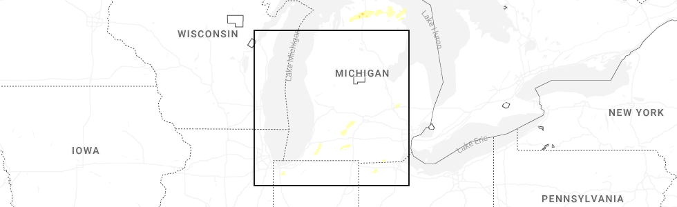
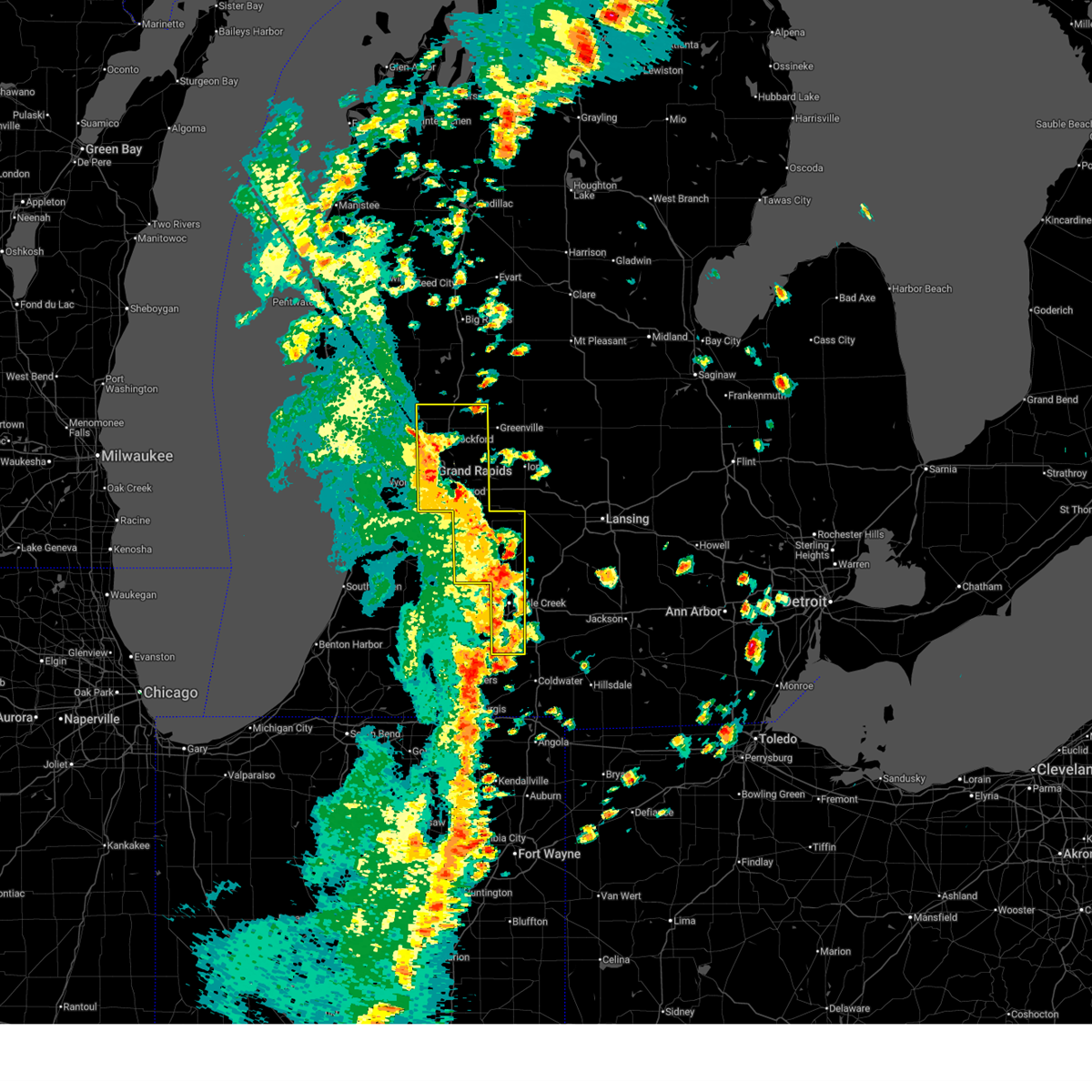
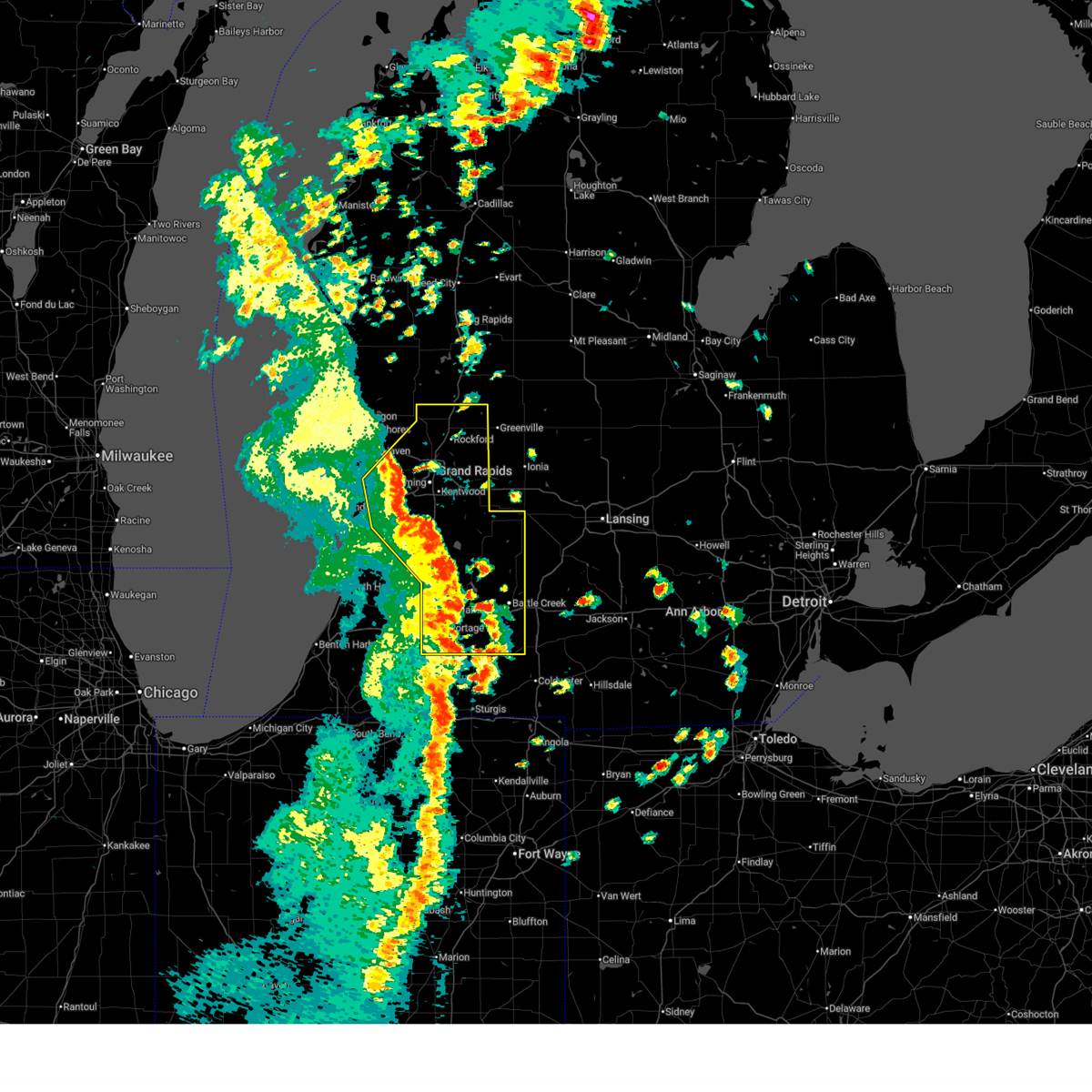
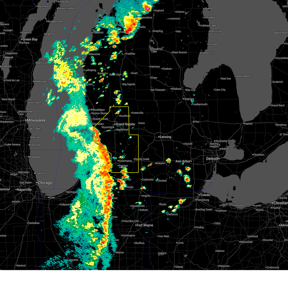
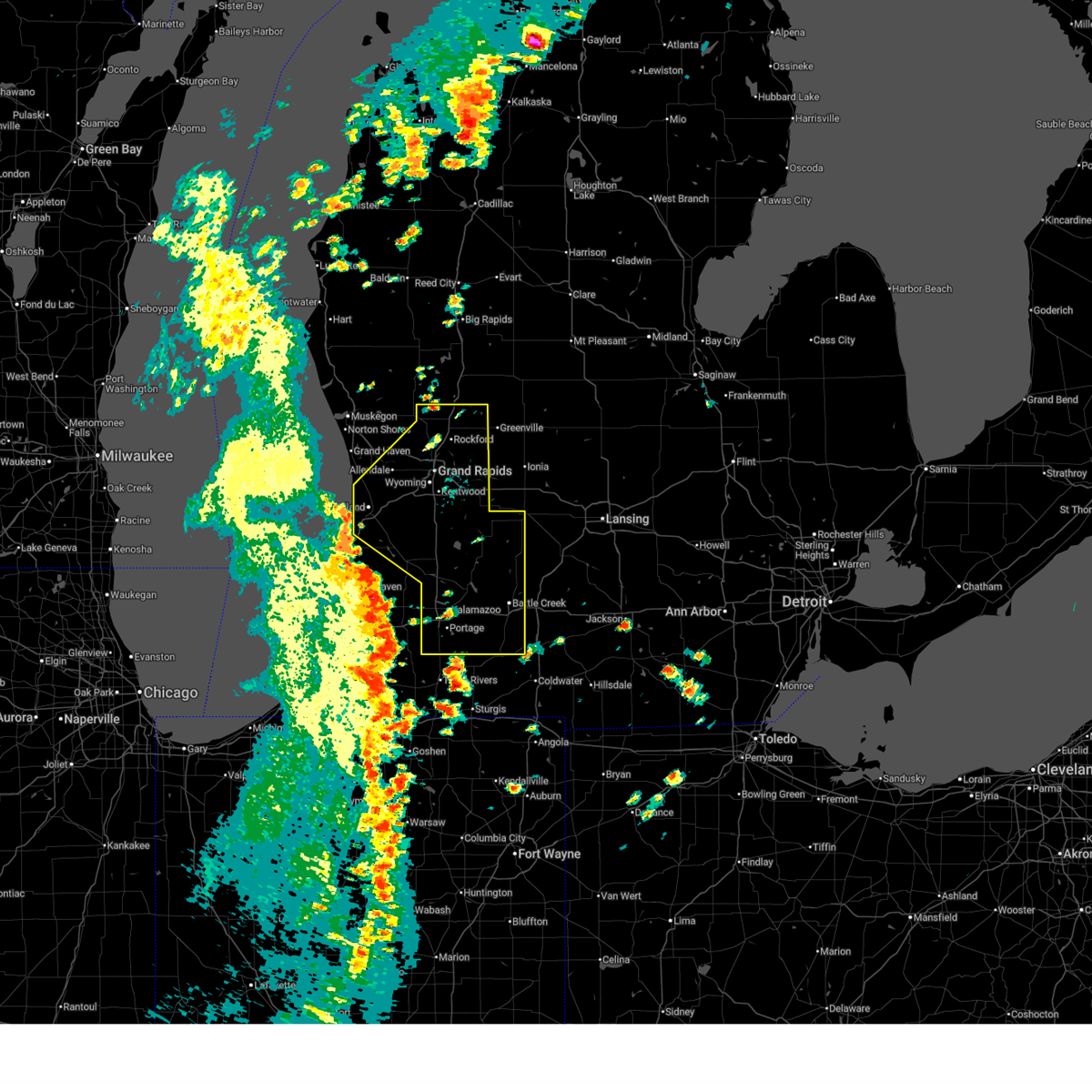
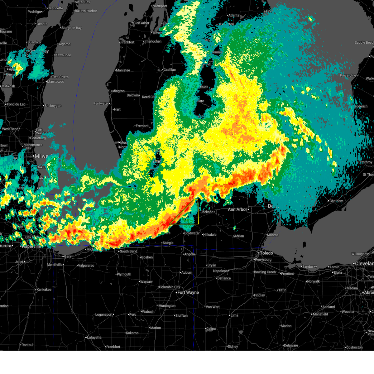
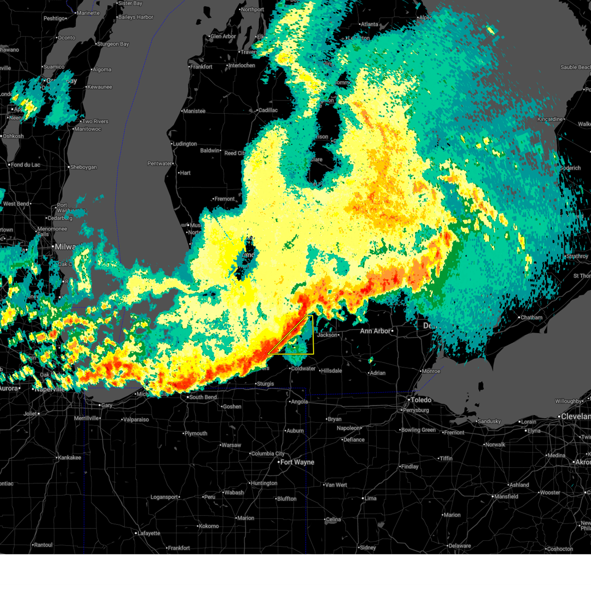
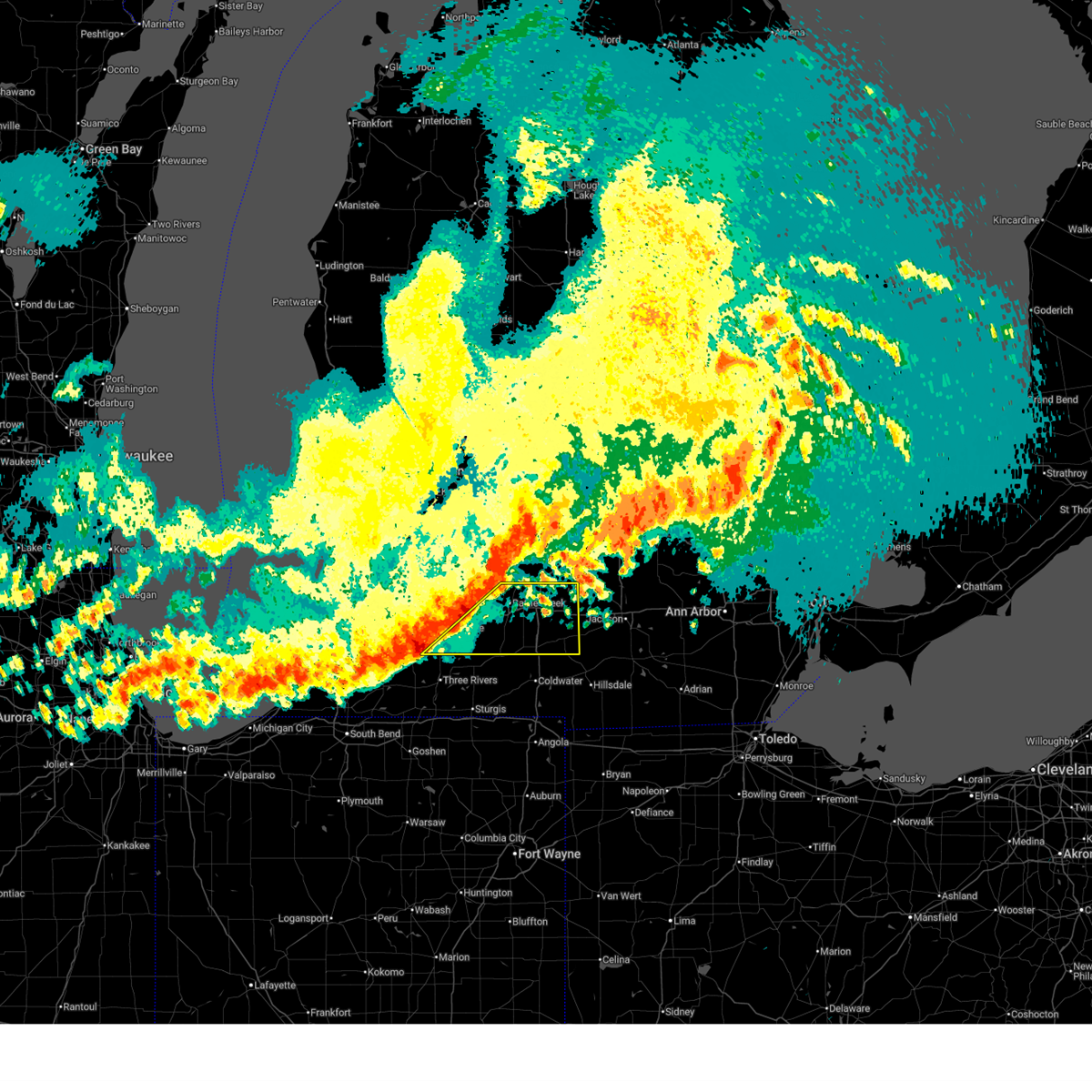
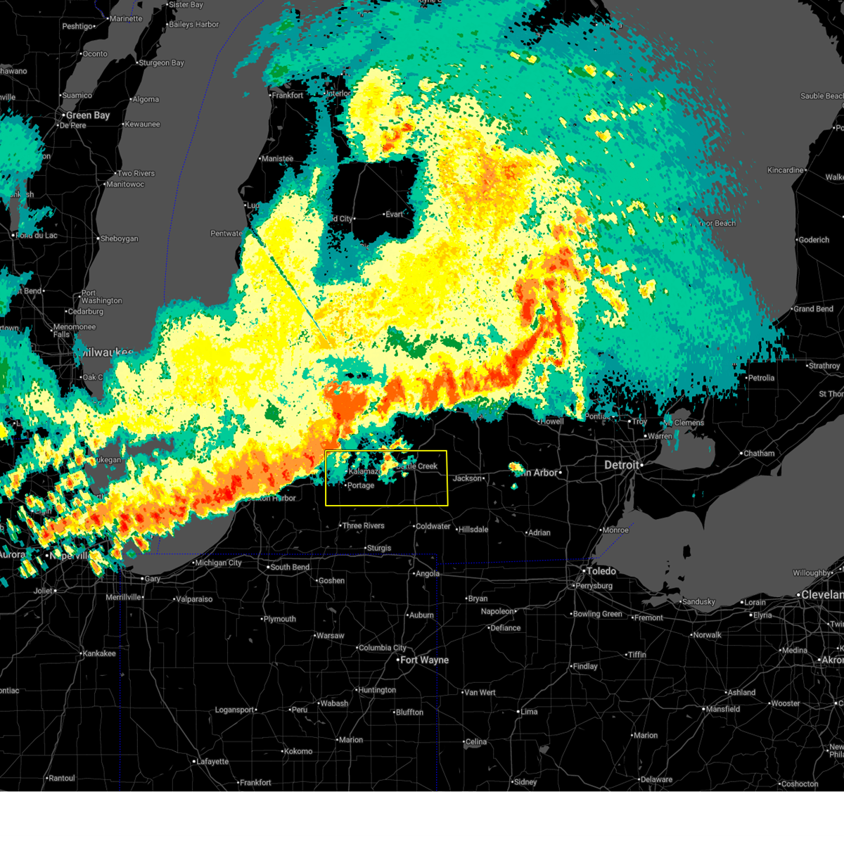
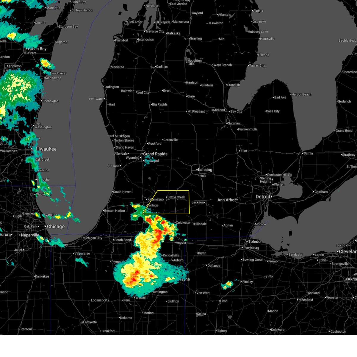
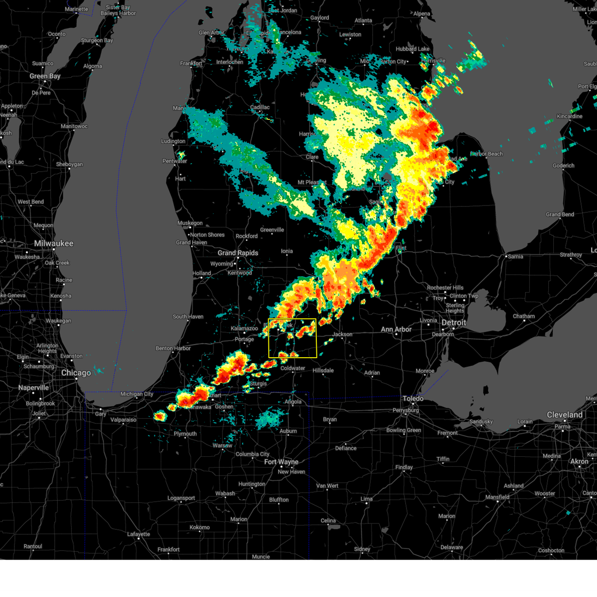
Hail Map for Athens, MI
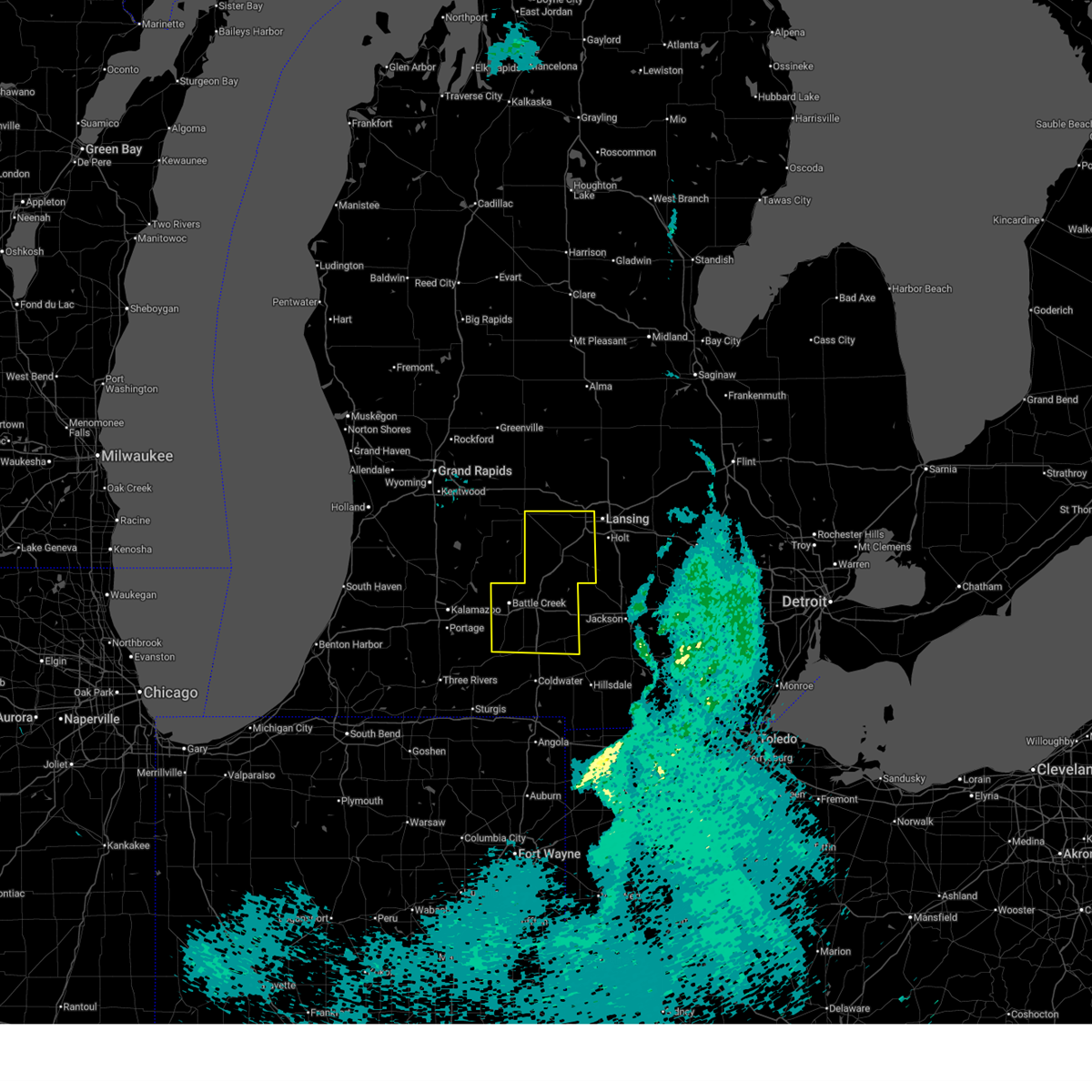
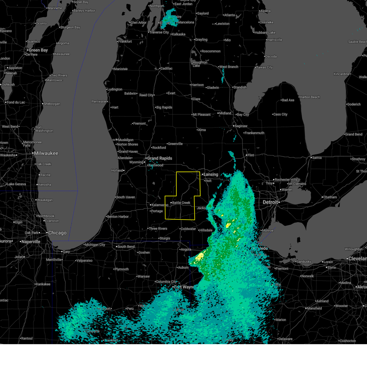
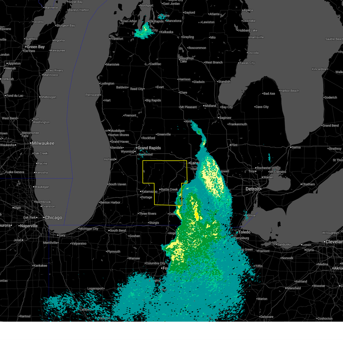
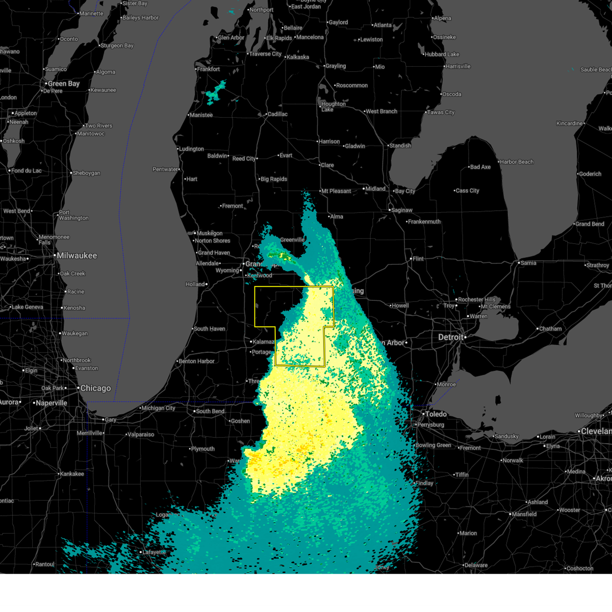
The Athens, MI area has had 3 reports of on-the-ground hail by trained spotters, and has been under severe weather warnings 21 times during the past 12 months. Doppler radar has detected hail at or near Athens, MI on 40 occasions, including 3 occasions during the past year.
| Name: | Athens, MI |
| Where Located: | 64.6 miles SSE of Grand Rapids, MI |
| Map: | Google Map for Athens, MI |
| Population: | 1024 |
| Housing Units: | 424 |
| More Info: | Search Google for Athens, MI |
2
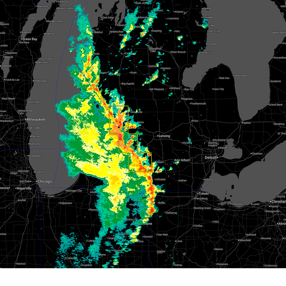
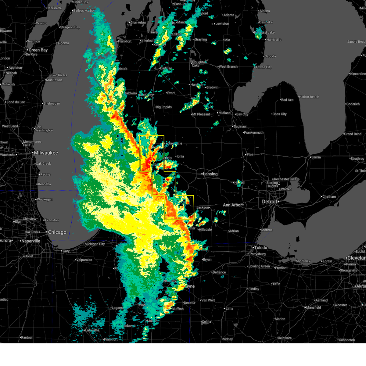
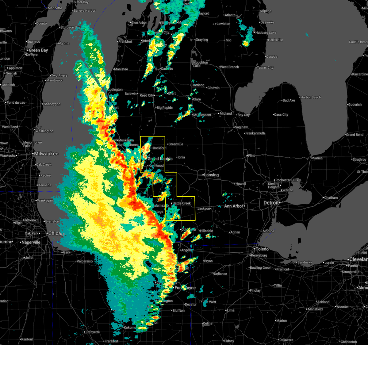
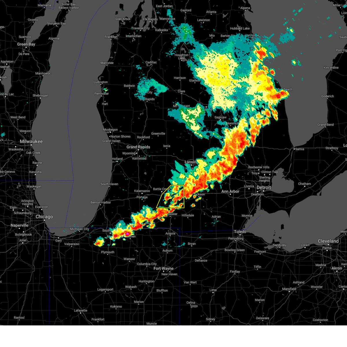
The Top Recent Hail Date for Athens, MI is Monday, May 18, 2026 (6th out of 40)
Hail and Wind Damage Spotted near Athens, MI
| Date / Time | Report Details |
|---|---|
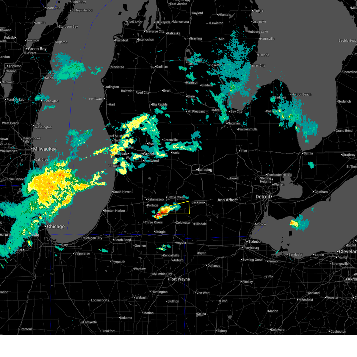
| 6/10/2026 7:44 PM EDT |
 At 744 pm edt, severe thunderstorms were located along a line extending from 8 miles east of edmore to 7 miles northeast of portland to near burlington, moving northeast at 35 mph (radar indicated). Hazards include 60 mph wind gusts. Expect damage to roofs, siding, and trees. Locations impacted include, lansing, ionia, charlotte, albion, marshall, battle creek, eaton rapids, portland, grand ledge, belding, potterville, lake odessa, homer, bellevue, burlington, brownlee park, edgemont park, orleans, marengo, kalamo,. At 744 pm edt, severe thunderstorms were located along a line extending from 8 miles east of edmore to 7 miles northeast of portland to near burlington, moving northeast at 35 mph (radar indicated). Hazards include 60 mph wind gusts. Expect damage to roofs, siding, and trees. Locations impacted include, lansing, ionia, charlotte, albion, marshall, battle creek, eaton rapids, portland, grand ledge, belding, potterville, lake odessa, homer, bellevue, burlington, brownlee park, edgemont park, orleans, marengo, kalamo,.
|
| 6/10/2026 7:12 PM EDT |
 Svrgrr the national weather service in grand rapids has issued a * severe thunderstorm warning for, calhoun county in south central michigan, ionia county in south central michigan, eaton county in south central michigan, * until 815 pm edt. * at 711 pm edt, severe thunderstorms were located along a line extending from near howard city to 7 miles southeast of climax, moving east at 55 mph. these storms have been leading to tens of thousands of power outages across west michigan along with observed wind gusts of 50 to 60 mph (radar indicated). Hazards include 60 mph wind gusts. expect damage to roofs, siding, and trees Svrgrr the national weather service in grand rapids has issued a * severe thunderstorm warning for, calhoun county in south central michigan, ionia county in south central michigan, eaton county in south central michigan, * until 815 pm edt. * at 711 pm edt, severe thunderstorms were located along a line extending from near howard city to 7 miles southeast of climax, moving east at 55 mph. these storms have been leading to tens of thousands of power outages across west michigan along with observed wind gusts of 50 to 60 mph (radar indicated). Hazards include 60 mph wind gusts. expect damage to roofs, siding, and trees
|
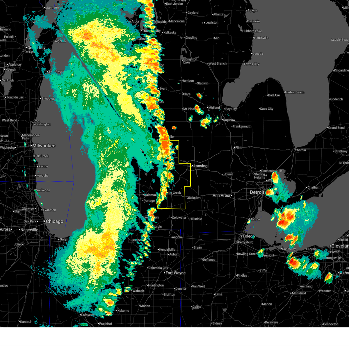
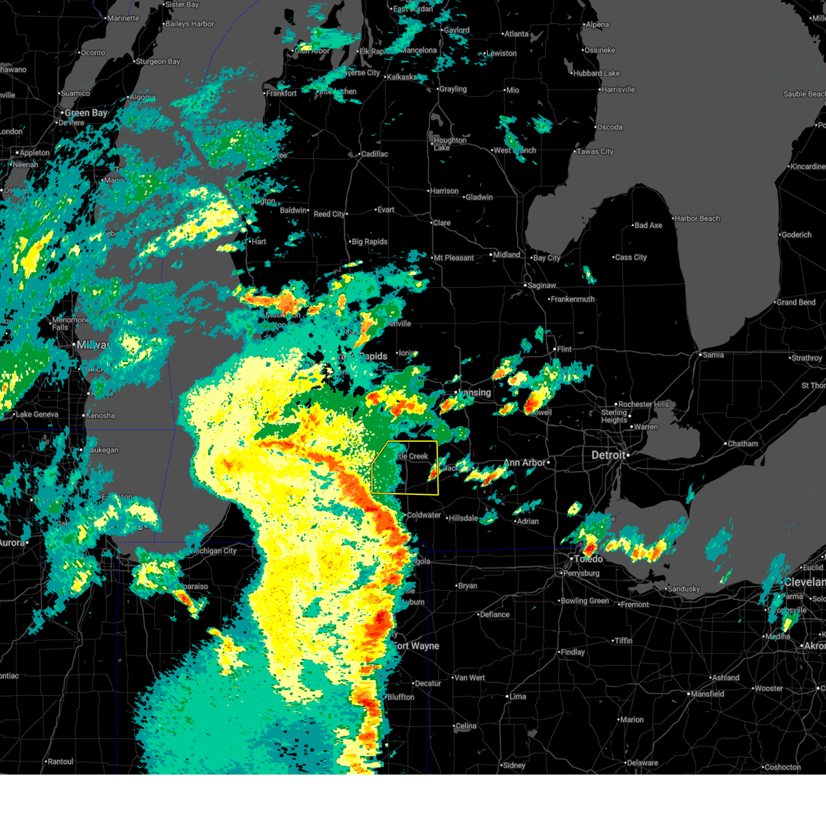
| 5/18/2026 2:52 PM EDT |
 At 251 pm edt, severe thunderstorms were located along a line extending from 8 miles northeast of sparta to near lowell to 5 miles east of bellevue, moving northeast at 55 mph (radar indicated). Hazards include 70 mph wind gusts and quarter size hail. Hail damage to vehicles is expected. expect considerable tree damage. wind damage is also likely to mobile homes, roofs, and outbuildings. locations impacted include, grand rapids, hastings, battle creek, wyoming, kentwood, walker, grandville, east grand rapids, rockford, sparta, lowell, middleville, nashville, union city, caledonia, freeport, burlington, brownlee park, gerald r. Ford inter, ada,. At 251 pm edt, severe thunderstorms were located along a line extending from 8 miles northeast of sparta to near lowell to 5 miles east of bellevue, moving northeast at 55 mph (radar indicated). Hazards include 70 mph wind gusts and quarter size hail. Hail damage to vehicles is expected. expect considerable tree damage. wind damage is also likely to mobile homes, roofs, and outbuildings. locations impacted include, grand rapids, hastings, battle creek, wyoming, kentwood, walker, grandville, east grand rapids, rockford, sparta, lowell, middleville, nashville, union city, caledonia, freeport, burlington, brownlee park, gerald r. Ford inter, ada,.
|
| 5/18/2026 2:44 PM EDT |
 At 242 pm edt, severe thunderstorms were located along a line extending from near sparta to near lowell to 6 miles south of bellevue, moving northeast at 65 mph (radar indicated). Hazards include 70 mph wind gusts. Expect considerable tree damage. damage is likely to mobile homes, roofs, and outbuildings. locations impacted include, grand rapids, hastings, battle creek, wyoming, kentwood, walker, grandville, east grand rapids, rockford, sparta, lowell, middleville, nashville, union city, caledonia, freeport, burlington, brownlee park, gerald r. Ford inter, ada,. At 242 pm edt, severe thunderstorms were located along a line extending from near sparta to near lowell to 6 miles south of bellevue, moving northeast at 65 mph (radar indicated). Hazards include 70 mph wind gusts. Expect considerable tree damage. damage is likely to mobile homes, roofs, and outbuildings. locations impacted include, grand rapids, hastings, battle creek, wyoming, kentwood, walker, grandville, east grand rapids, rockford, sparta, lowell, middleville, nashville, union city, caledonia, freeport, burlington, brownlee park, gerald r. Ford inter, ada,.
|
| 5/18/2026 2:44 PM EDT |
 the severe thunderstorm warning has been cancelled and is no longer in effect the severe thunderstorm warning has been cancelled and is no longer in effect
|
| 5/18/2026 2:21 PM EDT |
 At 221 pm edt, severe thunderstorms were located along a line extending from near coopersville to near wayland to 5 miles east of marcellus, moving northeast at 55 mph (radar indicated). Hazards include 70 mph wind gusts. Expect considerable tree damage. damage is likely to mobile homes, roofs, and outbuildings. Locations impacted include, grand rapids, kalamazoo, portage, holland, hastings, battle creek, allegan, wyoming, kentwood, walker, grandville, east grand rapids, hudsonville, rockford, zeeland, coopersville, sparta, wayland, otsego, plainwell,. At 221 pm edt, severe thunderstorms were located along a line extending from near coopersville to near wayland to 5 miles east of marcellus, moving northeast at 55 mph (radar indicated). Hazards include 70 mph wind gusts. Expect considerable tree damage. damage is likely to mobile homes, roofs, and outbuildings. Locations impacted include, grand rapids, kalamazoo, portage, holland, hastings, battle creek, allegan, wyoming, kentwood, walker, grandville, east grand rapids, hudsonville, rockford, zeeland, coopersville, sparta, wayland, otsego, plainwell,.
|
| 5/18/2026 2:05 PM EDT |
 At 205 pm edt, severe thunderstorms were located along a line extending from 6 miles north of beechwood to near allegan to 8 miles east of cassopolis, moving northeast at 55 mph (radar indicated). Hazards include 70 mph wind gusts. Expect considerable tree damage. damage is likely to mobile homes, roofs, and outbuildings. Locations impacted include, grand rapids, kalamazoo, portage, holland, hastings, battle creek, allegan, wyoming, kentwood, walker, grandville, east grand rapids, hudsonville, rockford, zeeland, coopersville, sparta, wayland, otsego, plainwell,. At 205 pm edt, severe thunderstorms were located along a line extending from 6 miles north of beechwood to near allegan to 8 miles east of cassopolis, moving northeast at 55 mph (radar indicated). Hazards include 70 mph wind gusts. Expect considerable tree damage. damage is likely to mobile homes, roofs, and outbuildings. Locations impacted include, grand rapids, kalamazoo, portage, holland, hastings, battle creek, allegan, wyoming, kentwood, walker, grandville, east grand rapids, hudsonville, rockford, zeeland, coopersville, sparta, wayland, otsego, plainwell,.
|
| 5/18/2026 1:58 PM EDT |
 Svrgrr the national weather service in grand rapids has issued a * severe thunderstorm warning for, western calhoun county in south central michigan, allegan county in southwestern michigan, kent county in southwestern michigan, ottawa county in southwestern michigan, barry county in southwestern michigan, kalamazoo county in southwestern michigan, * until 330 pm edt. * at 158 pm edt, severe thunderstorms were located along a line extending from holland state park to paw paw to cassopolis, moving northeast at 55 mph (radar indicated. at 120 pm, a 63 mph wind gust was reported at the benton harbor airport). Hazards include 60 mph wind gusts. expect damage to roofs, siding, and trees Svrgrr the national weather service in grand rapids has issued a * severe thunderstorm warning for, western calhoun county in south central michigan, allegan county in southwestern michigan, kent county in southwestern michigan, ottawa county in southwestern michigan, barry county in southwestern michigan, kalamazoo county in southwestern michigan, * until 330 pm edt. * at 158 pm edt, severe thunderstorms were located along a line extending from holland state park to paw paw to cassopolis, moving northeast at 55 mph (radar indicated. at 120 pm, a 63 mph wind gust was reported at the benton harbor airport). Hazards include 60 mph wind gusts. expect damage to roofs, siding, and trees
|
| 4/27/2026 6:25 PM EDT |
 The damaging winds which prompted the warning has moved out of the area.therefore, the warning will be allowed to expire. however, gusty winds upwards of 50 mph are still possible. a wind advisory remains in effect until 8 pm. The damaging winds which prompted the warning has moved out of the area.therefore, the warning will be allowed to expire. however, gusty winds upwards of 50 mph are still possible. a wind advisory remains in effect until 8 pm.
|
| 4/27/2026 6:13 PM EDT |
 At 608 pm edt, damaging winds behind an exiting area of precipitation will continue to affect much of the area. these winds will be blowing from the east or southeast and could persist for 30 minutes or more at any given location. widespread damage has been reported across battle creek (trained weather spotters). Hazards include 60 mph wind gusts. Expect damage to roofs, siding, and trees. Locations impacted include, lansing, charlotte, albion, marshall, battle creek, eaton rapids, grand ledge, potterville, homer, bellevue, burlington, brownlee park, marengo, kalamo, olivet, brookfield, dimondale, athens, vermontville, tekonsha,. At 608 pm edt, damaging winds behind an exiting area of precipitation will continue to affect much of the area. these winds will be blowing from the east or southeast and could persist for 30 minutes or more at any given location. widespread damage has been reported across battle creek (trained weather spotters). Hazards include 60 mph wind gusts. Expect damage to roofs, siding, and trees. Locations impacted include, lansing, charlotte, albion, marshall, battle creek, eaton rapids, grand ledge, potterville, homer, bellevue, burlington, brownlee park, marengo, kalamo, olivet, brookfield, dimondale, athens, vermontville, tekonsha,.
|
| 4/27/2026 5:50 PM EDT |
 At 545 pm edt, damaging winds behind an exiting area of precipitation will affect much of the area. damaging winds could persist for 30 minutes at any given location (trained weather spotters). Hazards include 60 mph wind gusts. Expect damage to roofs, siding, and trees. Locations impacted include, lansing, charlotte, albion, hastings, marshall, battle creek, eaton rapids, grand ledge, middleville, potterville, homer, nashville, bellevue, freeport, burlington, brownlee park, orangeville, irving, marengo, assyria,. At 545 pm edt, damaging winds behind an exiting area of precipitation will affect much of the area. damaging winds could persist for 30 minutes at any given location (trained weather spotters). Hazards include 60 mph wind gusts. Expect damage to roofs, siding, and trees. Locations impacted include, lansing, charlotte, albion, hastings, marshall, battle creek, eaton rapids, grand ledge, middleville, potterville, homer, nashville, bellevue, freeport, burlington, brownlee park, orangeville, irving, marengo, assyria,.
|
| 4/27/2026 5:07 PM EDT |
 Svrgrr the national weather service in grand rapids has issued a * severe thunderstorm warning for, calhoun county in south central michigan, barry county in southwestern michigan, eaton county in south central michigan, * until 630 pm edt. * at 504 pm edt, damaging winds behind an exiting area of precipitation will affect much of the area. damaging winds could persist for 30 minutes or more at any given location (trained weather spotters). Hazards include 60 mph wind gusts. expect damage to roofs, siding, and trees Svrgrr the national weather service in grand rapids has issued a * severe thunderstorm warning for, calhoun county in south central michigan, barry county in southwestern michigan, eaton county in south central michigan, * until 630 pm edt. * at 504 pm edt, damaging winds behind an exiting area of precipitation will affect much of the area. damaging winds could persist for 30 minutes or more at any given location (trained weather spotters). Hazards include 60 mph wind gusts. expect damage to roofs, siding, and trees
|
| 4/15/2026 12:53 AM EDT |
 At 1253 am edt, severe thunderstorms were located along a line extending from 8 miles south of eaton rapids to near union city, moving east at 60 mph (radar indicated). Hazards include 60 mph wind gusts. Expect damage to roofs, siding, and trees. these severe storms will be near, albion and homer around 100 am edt. Other locations impacted by these severe thunderstorms include athens, duck lake, marengo, and tekonsha. At 1253 am edt, severe thunderstorms were located along a line extending from 8 miles south of eaton rapids to near union city, moving east at 60 mph (radar indicated). Hazards include 60 mph wind gusts. Expect damage to roofs, siding, and trees. these severe storms will be near, albion and homer around 100 am edt. Other locations impacted by these severe thunderstorms include athens, duck lake, marengo, and tekonsha.
|
| 4/15/2026 12:53 AM EDT |
 the severe thunderstorm warning has been cancelled and is no longer in effect the severe thunderstorm warning has been cancelled and is no longer in effect
|
| 4/15/2026 12:24 AM EDT |
 At 1224 am edt, severe thunderstorms were located along a line extending from 6 miles north of brownlee park to 5 miles northeast of marcellus, moving east at 55 mph (radar indicated). Hazards include 70 mph wind gusts. Expect considerable tree damage. damage is likely to mobile homes, roofs, and outbuildings. these severe storms will be near, portage, battle creek, vicksburg, schoolcraft, climax, and brownlee park around 1230 am edt. marshall around 1235 am edt. union city and burlington around 1245 am edt. albion around 1250 am edt. homer around 100 am edt. Other locations impacted by these severe thunderstorms include fulton, augusta, pine creek, marengo, bedford, athens, ceresco, duck lake, scotts, and tekonsha. At 1224 am edt, severe thunderstorms were located along a line extending from 6 miles north of brownlee park to 5 miles northeast of marcellus, moving east at 55 mph (radar indicated). Hazards include 70 mph wind gusts. Expect considerable tree damage. damage is likely to mobile homes, roofs, and outbuildings. these severe storms will be near, portage, battle creek, vicksburg, schoolcraft, climax, and brownlee park around 1230 am edt. marshall around 1235 am edt. union city and burlington around 1245 am edt. albion around 1250 am edt. homer around 100 am edt. Other locations impacted by these severe thunderstorms include fulton, augusta, pine creek, marengo, bedford, athens, ceresco, duck lake, scotts, and tekonsha.
|
| 4/14/2026 11:51 PM EDT |
 Svrgrr the national weather service in grand rapids has issued a * severe thunderstorm warning for, calhoun county in south central michigan, kalamazoo county in southwestern michigan, * until 115 am edt. * at 1150 pm edt, severe thunderstorms were located along a line extending from 5 miles southwest of otsego to near hartford, moving east at 70 mph (radar indicated). Hazards include 60 mph wind gusts. expect damage to roofs, siding, and trees Svrgrr the national weather service in grand rapids has issued a * severe thunderstorm warning for, calhoun county in south central michigan, kalamazoo county in southwestern michigan, * until 115 am edt. * at 1150 pm edt, severe thunderstorms were located along a line extending from 5 miles southwest of otsego to near hartford, moving east at 70 mph (radar indicated). Hazards include 60 mph wind gusts. expect damage to roofs, siding, and trees
|
| 4/13/2026 6:11 PM EDT |
 Svrgrr the national weather service in grand rapids has issued a * severe thunderstorm warning for, calhoun county in south central michigan, eastern kalamazoo county in southwestern michigan, * until 715 pm edt. * at 611 pm edt, severe thunderstorms were located along a line extending from near vicksburg to near colon to near bronson, moving northeast at 45 mph (radar indicated). Hazards include 60 mph wind gusts and quarter size hail. Hail damage to vehicles is expected. Expect wind damage to roofs, siding, and trees. Svrgrr the national weather service in grand rapids has issued a * severe thunderstorm warning for, calhoun county in south central michigan, eastern kalamazoo county in southwestern michigan, * until 715 pm edt. * at 611 pm edt, severe thunderstorms were located along a line extending from near vicksburg to near colon to near bronson, moving northeast at 45 mph (radar indicated). Hazards include 60 mph wind gusts and quarter size hail. Hail damage to vehicles is expected. Expect wind damage to roofs, siding, and trees.
|
| 3/11/2026 12:39 AM EDT |
 Svrgrr the national weather service in grand rapids has issued a * severe thunderstorm warning for, calhoun county in south central michigan, * until 115 am edt. * at 1239 am edt, a severe thunderstorm was located near climax, or 9 miles southwest of battle creek, moving northeast at 60 mph (radar indicated). Hazards include 60 mph wind gusts. expect damage to roofs, siding, and trees Svrgrr the national weather service in grand rapids has issued a * severe thunderstorm warning for, calhoun county in south central michigan, * until 115 am edt. * at 1239 am edt, a severe thunderstorm was located near climax, or 9 miles southwest of battle creek, moving northeast at 60 mph (radar indicated). Hazards include 60 mph wind gusts. expect damage to roofs, siding, and trees
|
| 3/6/2026 4:44 PM EST |
 At 443 pm est, a confirmed tornado was located just north of union city and near burlington, moving east at 35 mph. seek shelter immediately! (weather spotters confirmed tornado). Hazards include damaging tornado and quarter size hail. Flying debris will be dangerous to those caught without shelter. mobile homes will be damaged or destroyed. damage to roofs, windows, and vehicles will occur. tree damage is likely. this tornado will be near, homer around 500 pm est. albion around 510 pm est. Other locations impacted by this tornadic thunderstorm include tekonsha and athens. At 443 pm est, a confirmed tornado was located just north of union city and near burlington, moving east at 35 mph. seek shelter immediately! (weather spotters confirmed tornado). Hazards include damaging tornado and quarter size hail. Flying debris will be dangerous to those caught without shelter. mobile homes will be damaged or destroyed. damage to roofs, windows, and vehicles will occur. tree damage is likely. this tornado will be near, homer around 500 pm est. albion around 510 pm est. Other locations impacted by this tornadic thunderstorm include tekonsha and athens.
|
| 3/6/2026 4:36 PM EST |
 Torgrr the national weather service in grand rapids has issued a * tornado warning for, southeastern calhoun county in south central michigan, * until 530 pm est. * at 435 pm est, a severe thunderstorm capable of producing a tornado was located over union city, or 12 miles northwest of coldwater, moving east at 35 mph (this storm has a history of producing tornadoes). Hazards include tornado and quarter size hail. Flying debris will be dangerous to those caught without shelter. mobile homes will be damaged or destroyed. damage to roofs, windows, and vehicles will occur. tree damage is likely. this dangerous storm will be near, union city and burlington around 440 pm est. homer around 500 pm est. albion around 510 pm est. Other locations impacted by this tornadic thunderstorm include tekonsha and athens. Torgrr the national weather service in grand rapids has issued a * tornado warning for, southeastern calhoun county in south central michigan, * until 530 pm est. * at 435 pm est, a severe thunderstorm capable of producing a tornado was located over union city, or 12 miles northwest of coldwater, moving east at 35 mph (this storm has a history of producing tornadoes). Hazards include tornado and quarter size hail. Flying debris will be dangerous to those caught without shelter. mobile homes will be damaged or destroyed. damage to roofs, windows, and vehicles will occur. tree damage is likely. this dangerous storm will be near, union city and burlington around 440 pm est. homer around 500 pm est. albion around 510 pm est. Other locations impacted by this tornadic thunderstorm include tekonsha and athens.
|
| 3/6/2026 4:27 PM EST | Half Dollar sized hail reported 0.6 miles NNW of Athens, MI |
| 3/6/2026 4:22 PM EST |
 Svrgrr the national weather service in grand rapids has issued a * severe thunderstorm warning for, southern calhoun county in south central michigan, * until 515 pm est. * at 422 pm est, a severe thunderstorm was located near union city, or 14 miles south of battle creek, moving east at 40 mph (radar indicated). Hazards include quarter size hail. damage to vehicles is expected Svrgrr the national weather service in grand rapids has issued a * severe thunderstorm warning for, southern calhoun county in south central michigan, * until 515 pm est. * at 422 pm est, a severe thunderstorm was located near union city, or 14 miles south of battle creek, moving east at 40 mph (radar indicated). Hazards include quarter size hail. damage to vehicles is expected
|
| 6/18/2025 5:37 PM EDT |
 Svrgrr the national weather service in grand rapids has issued a * severe thunderstorm warning for, calhoun county in south central michigan, * until 630 pm edt. * at 537 pm edt, severe thunderstorms were located along a line extending from 7 miles north of colon to 6 miles west of coldwater to near coldwater lake, moving northeast at 45 mph (radar indicated). Hazards include 60 mph wind gusts. Expect damage to roofs, siding, and trees. severe thunderstorms will be near, burlington around 545 pm edt. homer around 555 pm edt. marshall around 600 pm edt. albion around 605 pm edt. Other locations impacted by these severe thunderstorms include pine creek, athens, ceresco, duck lake, marengo, and tekonsha. Svrgrr the national weather service in grand rapids has issued a * severe thunderstorm warning for, calhoun county in south central michigan, * until 630 pm edt. * at 537 pm edt, severe thunderstorms were located along a line extending from 7 miles north of colon to 6 miles west of coldwater to near coldwater lake, moving northeast at 45 mph (radar indicated). Hazards include 60 mph wind gusts. Expect damage to roofs, siding, and trees. severe thunderstorms will be near, burlington around 545 pm edt. homer around 555 pm edt. marshall around 600 pm edt. albion around 605 pm edt. Other locations impacted by these severe thunderstorms include pine creek, athens, ceresco, duck lake, marengo, and tekonsha.
|
| 5/15/2025 11:01 PM EDT |
 Svrgrr the national weather service in grand rapids has issued a * severe thunderstorm warning for, calhoun county in south central michigan, * until midnight edt. * at 1101 pm edt, severe thunderstorms were located along a line extending from near freeport to near gull lake to vicksburg, moving east at 50 mph (radar indicated). Hazards include 60 mph wind gusts. expect damage to roofs, siding, and trees Svrgrr the national weather service in grand rapids has issued a * severe thunderstorm warning for, calhoun county in south central michigan, * until midnight edt. * at 1101 pm edt, severe thunderstorms were located along a line extending from near freeport to near gull lake to vicksburg, moving east at 50 mph (radar indicated). Hazards include 60 mph wind gusts. expect damage to roofs, siding, and trees
|
| 4/2/2025 8:55 PM EDT |
 Svrgrr the national weather service in grand rapids has issued a * severe thunderstorm warning for, southeastern calhoun county in south central michigan, jackson county in south central michigan, * until 945 pm edt. * at 855 pm edt, severe thunderstorms were located along a line extending from 6 miles south of union city to near coldwater to near fremont, moving northeast at 70 mph (radar indicated). Hazards include 70 mph wind gusts. Expect considerable tree damage. Damage is likely to mobile homes, roofs, and outbuildings. Svrgrr the national weather service in grand rapids has issued a * severe thunderstorm warning for, southeastern calhoun county in south central michigan, jackson county in south central michigan, * until 945 pm edt. * at 855 pm edt, severe thunderstorms were located along a line extending from 6 miles south of union city to near coldwater to near fremont, moving northeast at 70 mph (radar indicated). Hazards include 70 mph wind gusts. Expect considerable tree damage. Damage is likely to mobile homes, roofs, and outbuildings.
|
| 3/30/2025 5:56 PM EDT |
 At 554 pm edt, severe thunderstorms were located along a line extending from near sparta to 7 miles southwest of hastings to near marshall, moving northeast at 60 mph. these are destructive storms for southwest michigan (at 5:50 pm grand rapids asos reported 80 mph winds). Hazards include 80 mph wind gusts and penny size hail. Flying debris will be dangerous to those caught without shelter. mobile homes will be heavily damaged. expect considerable damage to roofs, windows, and vehicles. extensive tree damage and power outages are likely. Locations impacted include, cutlerville, wyoming, battle creek, belmont, grandville, duck lake, yankee springs, hickory corners, grattan, alto, brownlee park, dutton, sparta, banfield, comstock park, walker, marshall, nashville, athens, tekonsha,. At 554 pm edt, severe thunderstorms were located along a line extending from near sparta to 7 miles southwest of hastings to near marshall, moving northeast at 60 mph. these are destructive storms for southwest michigan (at 5:50 pm grand rapids asos reported 80 mph winds). Hazards include 80 mph wind gusts and penny size hail. Flying debris will be dangerous to those caught without shelter. mobile homes will be heavily damaged. expect considerable damage to roofs, windows, and vehicles. extensive tree damage and power outages are likely. Locations impacted include, cutlerville, wyoming, battle creek, belmont, grandville, duck lake, yankee springs, hickory corners, grattan, alto, brownlee park, dutton, sparta, banfield, comstock park, walker, marshall, nashville, athens, tekonsha,.
|
| 3/30/2025 5:48 PM EDT |
 At 547 pm edt, severe thunderstorms were located along a line extending from 6 miles southwest of sparta to 5 miles east of martin to near burlington, moving northeast at 60 mph (radar indicated). Hazards include 70 mph wind gusts and penny size hail. Expect considerable tree damage. damage is likely to mobile homes, roofs, and outbuildings. Locations impacted include, cutlerville, wyoming, battle creek, belmont, grandville, duck lake, yankee springs, hickory corners, grattan, alto, brownlee park, dutton, sparta, banfield, comstock park, walker, marshall, nashville, athens, tekonsha,. At 547 pm edt, severe thunderstorms were located along a line extending from 6 miles southwest of sparta to 5 miles east of martin to near burlington, moving northeast at 60 mph (radar indicated). Hazards include 70 mph wind gusts and penny size hail. Expect considerable tree damage. damage is likely to mobile homes, roofs, and outbuildings. Locations impacted include, cutlerville, wyoming, battle creek, belmont, grandville, duck lake, yankee springs, hickory corners, grattan, alto, brownlee park, dutton, sparta, banfield, comstock park, walker, marshall, nashville, athens, tekonsha,.
|
| 3/30/2025 5:24 PM EDT |
 Svrgrr the national weather service in grand rapids has issued a * severe thunderstorm warning for, calhoun county in south central michigan, kent county in southwestern michigan, barry county in southwestern michigan, * until 630 pm edt. * at 523 pm edt, severe thunderstorms were located along a line extending from near beechwood to near schoolcraft, moving northeast at 65 mph (radar indicated). Hazards include 70 mph wind gusts and penny size hail. Expect considerable tree damage. Damage is likely to mobile homes, roofs, and outbuildings. Svrgrr the national weather service in grand rapids has issued a * severe thunderstorm warning for, calhoun county in south central michigan, kent county in southwestern michigan, barry county in southwestern michigan, * until 630 pm edt. * at 523 pm edt, severe thunderstorms were located along a line extending from near beechwood to near schoolcraft, moving northeast at 65 mph (radar indicated). Hazards include 70 mph wind gusts and penny size hail. Expect considerable tree damage. Damage is likely to mobile homes, roofs, and outbuildings.
|
| 8/27/2024 5:12 PM EDT |
 At 512 pm edt, severe thunderstorms were located along a line extending from 8 miles south of eaton rapids to near marshall, moving east at 50 mph (radar indicated). Hazards include 60 mph wind gusts and penny size hail. Expect damage to roofs, siding, and trees. Locations impacted include, albion, marshall, homer, union city, burlington, marengo, athens, tekonsha, ceresco, duck lake,. At 512 pm edt, severe thunderstorms were located along a line extending from 8 miles south of eaton rapids to near marshall, moving east at 50 mph (radar indicated). Hazards include 60 mph wind gusts and penny size hail. Expect damage to roofs, siding, and trees. Locations impacted include, albion, marshall, homer, union city, burlington, marengo, athens, tekonsha, ceresco, duck lake,.
|
| 8/27/2024 4:50 PM EDT |
 Svrgrr the national weather service in grand rapids has issued a * severe thunderstorm warning for, calhoun county in south central michigan, * until 545 pm edt. * at 449 pm edt, severe thunderstorms were located along a line extending from bellevue to near climax, moving east at 45 mph. other scattered strong cells were developing out ahead of this line (radar indicated). Hazards include 60 mph wind gusts and penny size hail. expect damage to roofs, siding, and trees Svrgrr the national weather service in grand rapids has issued a * severe thunderstorm warning for, calhoun county in south central michigan, * until 545 pm edt. * at 449 pm edt, severe thunderstorms were located along a line extending from bellevue to near climax, moving east at 45 mph. other scattered strong cells were developing out ahead of this line (radar indicated). Hazards include 60 mph wind gusts and penny size hail. expect damage to roofs, siding, and trees
|
| 7/16/2024 1:04 AM EDT |
 the severe thunderstorm warning has been cancelled and is no longer in effect the severe thunderstorm warning has been cancelled and is no longer in effect
|
| 7/16/2024 12:51 AM EDT |
 At 1250 am edt, severe thunderstorms were located along a line extending from near battle creek to near union city, moving east at 35 mph (radar indicated). Hazards include 60 mph wind gusts. Expect damage to roofs, siding, and trees. Locations impacted include, battle creek, union city, burlington, brownlee park, athens, pine creek, bedford,. At 1250 am edt, severe thunderstorms were located along a line extending from near battle creek to near union city, moving east at 35 mph (radar indicated). Hazards include 60 mph wind gusts. Expect damage to roofs, siding, and trees. Locations impacted include, battle creek, union city, burlington, brownlee park, athens, pine creek, bedford,.
|
| 7/16/2024 12:51 AM EDT |
 the severe thunderstorm warning has been cancelled and is no longer in effect the severe thunderstorm warning has been cancelled and is no longer in effect
|
| 7/16/2024 12:25 AM EDT |
 Svrgrr the national weather service in grand rapids has issued a * severe thunderstorm warning for, western calhoun county in south central michigan, southeastern barry county in southwestern michigan, eastern kalamazoo county in southwestern michigan, * until 130 am edt. * at 1224 am edt, severe thunderstorms were located along a line extending from near richland to near galesburg to near vicksburg, moving northeast at 50 mph (radar indicated). Hazards include 60 mph wind gusts. expect damage to roofs, siding, and trees Svrgrr the national weather service in grand rapids has issued a * severe thunderstorm warning for, western calhoun county in south central michigan, southeastern barry county in southwestern michigan, eastern kalamazoo county in southwestern michigan, * until 130 am edt. * at 1224 am edt, severe thunderstorms were located along a line extending from near richland to near galesburg to near vicksburg, moving northeast at 50 mph (radar indicated). Hazards include 60 mph wind gusts. expect damage to roofs, siding, and trees
|
| 6/25/2024 8:09 AM EDT |
 The storms which prompted the warning were moving out of the area. therefore, the warning will be allowed to expire. a severe thunderstorm watch remains in effect until 900 am edt for south central and southwestern michigan. The storms which prompted the warning were moving out of the area. therefore, the warning will be allowed to expire. a severe thunderstorm watch remains in effect until 900 am edt for south central and southwestern michigan.
|
| 6/25/2024 8:03 AM EDT | At 801 am edt, severe thunderstorms were located along a line extending from 5 miles south of schoolcraft to near union city to near albion, moving southeast at 40 mph (radar indicated. at 735 am, battle creek executive airport the wind gusted to 60 mph.). Hazards include 60 mph wind gusts. Expect damage to roofs, siding, and trees. Locations impacted include, portage, albion, marshall, vicksburg, homer, union city, schoolcraft, burlington, fulton, athens, tekonsha, pine creek,. |
| 6/25/2024 7:51 AM EDT |
 At 751 am edt, severe thunderstorms were located along a line extending from near schoolcraft to near climax to near albion, moving southeast at 35 mph (radar indicated). Hazards include 60 mph wind gusts. Expect damage to roofs, siding, and trees. Locations impacted include, kalamazoo, portage, albion, marshall, battle creek, vicksburg, galesburg, homer, union city, schoolcraft, climax, burlington, westwood, brownlee park, comstock northwest, fulton, marengo, athens, augusta, tekonsha,. At 751 am edt, severe thunderstorms were located along a line extending from near schoolcraft to near climax to near albion, moving southeast at 35 mph (radar indicated). Hazards include 60 mph wind gusts. Expect damage to roofs, siding, and trees. Locations impacted include, kalamazoo, portage, albion, marshall, battle creek, vicksburg, galesburg, homer, union city, schoolcraft, climax, burlington, westwood, brownlee park, comstock northwest, fulton, marengo, athens, augusta, tekonsha,.
|
| 6/25/2024 7:27 AM EDT |
 Svrgrr the national weather service in grand rapids has issued a * severe thunderstorm warning for, calhoun county in south central michigan, kalamazoo county in southwestern michigan, * until 815 am edt. * at 726 am edt, severe thunderstorms were located along a line extending from near westwood to near bellevue, moving southeast at 40 mph (radar indicated). Hazards include 60 mph wind gusts. expect damage to roofs, siding, and trees Svrgrr the national weather service in grand rapids has issued a * severe thunderstorm warning for, calhoun county in south central michigan, kalamazoo county in southwestern michigan, * until 815 am edt. * at 726 am edt, severe thunderstorms were located along a line extending from near westwood to near bellevue, moving southeast at 40 mph (radar indicated). Hazards include 60 mph wind gusts. expect damage to roofs, siding, and trees
|
| 6/20/2024 7:00 PM EDT | Large tree uprooted and several large branches snapped. time estimated via rada in branch county MI, 1.4 miles NNE of Athens, MI |
| 6/17/2024 12:30 AM EDT |
 The storms which prompted the warning have weakened below severe limits, and no longer pose an immediate threat to life or property. therefore, the warning has been allowed to expire. The storms which prompted the warning have weakened below severe limits, and no longer pose an immediate threat to life or property. therefore, the warning has been allowed to expire.
|
| 6/16/2024 11:30 PM EDT |
 Svrgrr the national weather service in grand rapids has issued a * severe thunderstorm warning for, western calhoun county in south central michigan, eastern kalamazoo county in southwestern michigan, * until 1230 am edt. * at 1129 pm edt, severe thunderstorms were located along a line extending from near comstock northwest to near schoolcraft, moving northeast at 30 mph (radar indicated). Hazards include 60 mph wind gusts and penny size hail. expect damage to roofs, siding, and trees Svrgrr the national weather service in grand rapids has issued a * severe thunderstorm warning for, western calhoun county in south central michigan, eastern kalamazoo county in southwestern michigan, * until 1230 am edt. * at 1129 pm edt, severe thunderstorms were located along a line extending from near comstock northwest to near schoolcraft, moving northeast at 30 mph (radar indicated). Hazards include 60 mph wind gusts and penny size hail. expect damage to roofs, siding, and trees
|
| 6/16/2024 10:23 PM EDT |
 Svrgrr the national weather service in grand rapids has issued a * severe thunderstorm warning for, calhoun county in south central michigan, eaton county in south central michigan, * until 1130 pm edt. * at 1022 pm edt, severe thunderstorms were located along a line extending from 5 miles east of lake odessa to near vicksburg, moving east at 35 mph (radar indicated). Hazards include 60 mph wind gusts and penny size hail. expect damage to roofs, siding, and trees Svrgrr the national weather service in grand rapids has issued a * severe thunderstorm warning for, calhoun county in south central michigan, eaton county in south central michigan, * until 1130 pm edt. * at 1022 pm edt, severe thunderstorms were located along a line extending from 5 miles east of lake odessa to near vicksburg, moving east at 35 mph (radar indicated). Hazards include 60 mph wind gusts and penny size hail. expect damage to roofs, siding, and trees
|
| 5/7/2024 8:48 PM EDT |
 the severe thunderstorm warning has been cancelled and is no longer in effect the severe thunderstorm warning has been cancelled and is no longer in effect
|
| 5/7/2024 8:34 PM EDT |
 At 834 pm edt, a severe thunderstorm was located over homer, or 7 miles south of albion, moving east at 25 mph (radar indicated). Hazards include 60 mph wind gusts and quarter size hail. Hail damage to vehicles is expected. expect wind damage to roofs, siding, and trees. Locations impacted include, albion, marshall, homer, union city, burlington, marengo, tekonsha,. At 834 pm edt, a severe thunderstorm was located over homer, or 7 miles south of albion, moving east at 25 mph (radar indicated). Hazards include 60 mph wind gusts and quarter size hail. Hail damage to vehicles is expected. expect wind damage to roofs, siding, and trees. Locations impacted include, albion, marshall, homer, union city, burlington, marengo, tekonsha,.
|
| 5/7/2024 8:26 PM EDT |
 At 826 pm edt, a severe thunderstorm was located over homer, or 8 miles southwest of albion, moving east at 40 mph (radar indicated). Hazards include 60 mph wind gusts and quarter size hail. Hail damage to vehicles is expected. expect wind damage to roofs, siding, and trees. Locations impacted include, albion, marshall, battle creek, homer, union city, burlington, brownlee park, marengo, athens, tekonsha, duck lake, pine creek, ceresco,. At 826 pm edt, a severe thunderstorm was located over homer, or 8 miles southwest of albion, moving east at 40 mph (radar indicated). Hazards include 60 mph wind gusts and quarter size hail. Hail damage to vehicles is expected. expect wind damage to roofs, siding, and trees. Locations impacted include, albion, marshall, battle creek, homer, union city, burlington, brownlee park, marengo, athens, tekonsha, duck lake, pine creek, ceresco,.
|
| 5/7/2024 8:13 PM EDT |
 At 813 pm edt, a severe thunderstorm was located over marshall, moving northeast at 25 mph (radar indicated). Hazards include 60 mph wind gusts and quarter size hail. Hail damage to vehicles is expected. expect wind damage to roofs, siding, and trees. Locations impacted include, albion, marshall, battle creek, homer, union city, burlington, brownlee park, marengo, athens, tekonsha, duck lake, pine creek, bedford, ceresco,. At 813 pm edt, a severe thunderstorm was located over marshall, moving northeast at 25 mph (radar indicated). Hazards include 60 mph wind gusts and quarter size hail. Hail damage to vehicles is expected. expect wind damage to roofs, siding, and trees. Locations impacted include, albion, marshall, battle creek, homer, union city, burlington, brownlee park, marengo, athens, tekonsha, duck lake, pine creek, bedford, ceresco,.
|
| 5/7/2024 7:26 PM EDT |
 Svrgrr the national weather service in grand rapids has issued a * severe thunderstorm warning for, calhoun county in south central michigan, * until 900 pm edt. * at 725 pm edt, a severe thunderstorm was located near burlington, or 7 miles north of coldwater, moving northeast at 25 mph (radar indicated). Hazards include 60 mph wind gusts and quarter size hail. Hail damage to vehicles is expected. Expect wind damage to roofs, siding, and trees. Svrgrr the national weather service in grand rapids has issued a * severe thunderstorm warning for, calhoun county in south central michigan, * until 900 pm edt. * at 725 pm edt, a severe thunderstorm was located near burlington, or 7 miles north of coldwater, moving northeast at 25 mph (radar indicated). Hazards include 60 mph wind gusts and quarter size hail. Hail damage to vehicles is expected. Expect wind damage to roofs, siding, and trees.
|
| 5/7/2024 6:35 PM EDT |
 At 633 pm edt, a severe thunderstorm capable of producing a tornado was located near battle creek, moving northeast at 30 mph. a second severe thunderstorm in south central calhoun county was approaching homer. both of these storms have had a history of producing damaging tornadoes (radar indicated rotation). Hazards include tornado and golf ball size hail. Flying debris will be dangerous to those caught without shelter. mobile homes will be damaged or destroyed. damage to roofs, windows, and vehicles will occur. tree damage is likely. this dangerous storm will be near, battle creek and brownlee park around 640 pm edt. Other locations impacted by this tornadic thunderstorm include pine creek, marengo, bedford, athens, ceresco, duck lake, and tekonsha. At 633 pm edt, a severe thunderstorm capable of producing a tornado was located near battle creek, moving northeast at 30 mph. a second severe thunderstorm in south central calhoun county was approaching homer. both of these storms have had a history of producing damaging tornadoes (radar indicated rotation). Hazards include tornado and golf ball size hail. Flying debris will be dangerous to those caught without shelter. mobile homes will be damaged or destroyed. damage to roofs, windows, and vehicles will occur. tree damage is likely. this dangerous storm will be near, battle creek and brownlee park around 640 pm edt. Other locations impacted by this tornadic thunderstorm include pine creek, marengo, bedford, athens, ceresco, duck lake, and tekonsha.
|
| 5/7/2024 6:22 PM EDT |
 At 620 pm edt, a confirmed large and extremely dangerous tornado was located near burlington, or 11 miles south of marshall, moving northeast at 40 mph. this is a particularly dangerous situation. take cover now! (radar confirmed tornado). Hazards include damaging tornado. You are in a life-threatening situation. flying debris may be deadly to those caught without shelter. mobile homes will be destroyed. considerable damage to homes, businesses, and vehicles is likely and complete destruction is possible. the tornado will be near, albion, tekonsha and homer around 635 pm edt. Other locations impacted by this tornadic thunderstorm include pine creek, marengo, bedford, athens, ceresco, duck lake, and tekonsha. At 620 pm edt, a confirmed large and extremely dangerous tornado was located near burlington, or 11 miles south of marshall, moving northeast at 40 mph. this is a particularly dangerous situation. take cover now! (radar confirmed tornado). Hazards include damaging tornado. You are in a life-threatening situation. flying debris may be deadly to those caught without shelter. mobile homes will be destroyed. considerable damage to homes, businesses, and vehicles is likely and complete destruction is possible. the tornado will be near, albion, tekonsha and homer around 635 pm edt. Other locations impacted by this tornadic thunderstorm include pine creek, marengo, bedford, athens, ceresco, duck lake, and tekonsha.
|
| 5/7/2024 6:13 PM EDT |
 Torgrr the national weather service in grand rapids has issued a * tornado warning for, calhoun county in south central michigan, * until 715 pm edt. * at 613 pm edt, a confirmed large and extremely dangerous tornado was located near burlington, or 9 miles northwest of coldwater, moving northeast at 45 mph. this is a particularly dangerous situation. take cover now! (radar confirmed tornado). Hazards include damaging tornado. You are in a life-threatening situation. flying debris may be deadly to those caught without shelter. mobile homes will be destroyed. considerable damage to homes, businesses, and vehicles is likely and complete destruction is possible. the tornado will be near, homer around 630 pm edt. albion around 635 pm edt. Other locations impacted by this tornadic thunderstorm include pine creek, marengo, bedford, athens, ceresco, duck lake, and tekonsha. Torgrr the national weather service in grand rapids has issued a * tornado warning for, calhoun county in south central michigan, * until 715 pm edt. * at 613 pm edt, a confirmed large and extremely dangerous tornado was located near burlington, or 9 miles northwest of coldwater, moving northeast at 45 mph. this is a particularly dangerous situation. take cover now! (radar confirmed tornado). Hazards include damaging tornado. You are in a life-threatening situation. flying debris may be deadly to those caught without shelter. mobile homes will be destroyed. considerable damage to homes, businesses, and vehicles is likely and complete destruction is possible. the tornado will be near, homer around 630 pm edt. albion around 635 pm edt. Other locations impacted by this tornadic thunderstorm include pine creek, marengo, bedford, athens, ceresco, duck lake, and tekonsha.
|
| 5/7/2024 5:55 PM EDT |
 Svrgrr the national weather service in grand rapids has issued a * severe thunderstorm warning for, calhoun county in south central michigan, * until 730 pm edt. * at 555 pm edt, a severe thunderstorm was located near union city, or 14 miles south of battle creek, moving northeast at 55 mph (radar indicated). Hazards include golf ball size hail and 60 mph wind gusts. People and animals outdoors will be injured. expect hail damage to roofs, siding, windows, and vehicles. Expect wind damage to roofs, siding, and trees. Svrgrr the national weather service in grand rapids has issued a * severe thunderstorm warning for, calhoun county in south central michigan, * until 730 pm edt. * at 555 pm edt, a severe thunderstorm was located near union city, or 14 miles south of battle creek, moving northeast at 55 mph (radar indicated). Hazards include golf ball size hail and 60 mph wind gusts. People and animals outdoors will be injured. expect hail damage to roofs, siding, windows, and vehicles. Expect wind damage to roofs, siding, and trees.
|
| 7/26/2023 6:28 PM EDT |
 At 627 pm edt, a severe thunderstorm was located near burlington, or 10 miles north of coldwater, moving east at 40 mph (radar indicated). Hazards include 60 mph wind gusts and penny size hail. Expect damage to roofs, siding, and trees. Locations impacted include, albion, marshall, homer, union city, burlington, marengo, athens, tekonsha,. At 627 pm edt, a severe thunderstorm was located near burlington, or 10 miles north of coldwater, moving east at 40 mph (radar indicated). Hazards include 60 mph wind gusts and penny size hail. Expect damage to roofs, siding, and trees. Locations impacted include, albion, marshall, homer, union city, burlington, marengo, athens, tekonsha,.
|
| 7/26/2023 6:23 PM EDT | Trees and wires dow in calhoun county MI, 0.4 miles WSW of Athens, MI |
| 7/26/2023 6:06 PM EDT |
 At 606 pm edt, a severe thunderstorm was located 8 miles west of union city, or 16 miles southeast of portage, moving east at 40 mph (radar indicated). Hazards include 60 mph wind gusts. expect damage to roofs, siding, and trees At 606 pm edt, a severe thunderstorm was located 8 miles west of union city, or 16 miles southeast of portage, moving east at 40 mph (radar indicated). Hazards include 60 mph wind gusts. expect damage to roofs, siding, and trees
|
| 6/3/2023 6:12 PM EDT |
 At 611 pm edt, a severe thunderstorm was located near marshall, moving southwest at 15 mph (radar indicated). Hazards include 60 mph wind gusts and quarter size hail. Hail damage to vehicles is expected. expect wind damage to roofs, siding, and trees. locations impacted include, albion, marshall, homer, union city, burlington, fulton, marengo, athens, tekonsha, pine creek, ceresco, hail threat, radar indicated max hail size, 1. 00 in wind threat, radar indicated max wind gust, 60 mph. At 611 pm edt, a severe thunderstorm was located near marshall, moving southwest at 15 mph (radar indicated). Hazards include 60 mph wind gusts and quarter size hail. Hail damage to vehicles is expected. expect wind damage to roofs, siding, and trees. locations impacted include, albion, marshall, homer, union city, burlington, fulton, marengo, athens, tekonsha, pine creek, ceresco, hail threat, radar indicated max hail size, 1. 00 in wind threat, radar indicated max wind gust, 60 mph.
|
| 6/3/2023 5:50 PM EDT |
 At 549 pm edt, an area of severe thunderstorm was located near marshall and albion, moving southwest at 10 mph (radar indicated). Hazards include 60 mph wind gusts and quarter size hail. Hail damage to vehicles is expected. Expect wind damage to roofs, siding, and trees. At 549 pm edt, an area of severe thunderstorm was located near marshall and albion, moving southwest at 10 mph (radar indicated). Hazards include 60 mph wind gusts and quarter size hail. Hail damage to vehicles is expected. Expect wind damage to roofs, siding, and trees.
|
| 4/5/2023 11:50 AM EDT |
 At 1150 am edt, severe thunderstorms were located along a line extending from near union city to 7 miles north of albion, moving northeast at 55 mph (radar indicated). Hazards include 60 mph wind gusts. Expect damage to roofs, siding, and trees. locations impacted include, albion, marshall, homer, union city, burlington, marengo, athens, tekonsha, hail threat, radar indicated max hail size, <. 75 in wind threat, radar indicated max wind gust, 60 mph. At 1150 am edt, severe thunderstorms were located along a line extending from near union city to 7 miles north of albion, moving northeast at 55 mph (radar indicated). Hazards include 60 mph wind gusts. Expect damage to roofs, siding, and trees. locations impacted include, albion, marshall, homer, union city, burlington, marengo, athens, tekonsha, hail threat, radar indicated max hail size, <. 75 in wind threat, radar indicated max wind gust, 60 mph.
|
| 4/5/2023 11:26 AM EDT |
 At 1126 am edt, severe thunderstorms were located along a line extending from 5 miles southwest of climax to 8 miles northwest of union city to 7 miles northwest of colon, moving northeast at 60 mph (radar indicated). Hazards include 60 mph wind gusts. expect damage to roofs, siding, and trees At 1126 am edt, severe thunderstorms were located along a line extending from 5 miles southwest of climax to 8 miles northwest of union city to 7 miles northwest of colon, moving northeast at 60 mph (radar indicated). Hazards include 60 mph wind gusts. expect damage to roofs, siding, and trees
|
| 8/29/2022 4:37 PM EDT |
 The severe thunderstorm warning for western calhoun, southern barry and eastern kalamazoo counties will expire at 445 pm edt, the severe thunderstorm which prompted the warning has moved out of the warned area. therefore, the warning will be allowed to expire. a severe thunderstorm watch remains in effect until 800 pm edt for south central and southwestern michigan. The severe thunderstorm warning for western calhoun, southern barry and eastern kalamazoo counties will expire at 445 pm edt, the severe thunderstorm which prompted the warning has moved out of the warned area. therefore, the warning will be allowed to expire. a severe thunderstorm watch remains in effect until 800 pm edt for south central and southwestern michigan.
|
| 8/29/2022 4:35 PM EDT | Large tree dow in st. joseph county MI, 3.8 miles ENE of Athens, MI |
| 8/29/2022 4:19 PM EDT |
 At 418 pm edt, a severe thunderstorm was located near brownlee park, or 6 miles northeast of battle creek, moving east at 55 mph (radar indicated). Hazards include 60 mph wind gusts and quarter size hail. Expect wind damage to roofs, siding, and trees. locations impacted include, kalamazoo, portage, battle creek, vicksburg, galesburg, climax, richland, burlington, kalamazoo-battle cre, brownlee park, comstock northwest, level park-oak park, gull lake, fulton, assyria, athens, augusta, delton, pine creek, hickory corners, hail threat, radar indicated max hail size, 1. 00 in wind threat, observed max wind gust, 60 mph. At 418 pm edt, a severe thunderstorm was located near brownlee park, or 6 miles northeast of battle creek, moving east at 55 mph (radar indicated). Hazards include 60 mph wind gusts and quarter size hail. Expect wind damage to roofs, siding, and trees. locations impacted include, kalamazoo, portage, battle creek, vicksburg, galesburg, climax, richland, burlington, kalamazoo-battle cre, brownlee park, comstock northwest, level park-oak park, gull lake, fulton, assyria, athens, augusta, delton, pine creek, hickory corners, hail threat, radar indicated max hail size, 1. 00 in wind threat, observed max wind gust, 60 mph.
|
| 8/29/2022 3:40 PM EDT |
 At 340 pm edt, a severe thunderstorm was located near otsego, or 9 miles southeast of allegan, moving east at 45 mph (radar indicated). Hazards include 60 mph wind gusts and quarter size hail. Hail damage to vehicles is expected. Expect wind damage to roofs, siding, and trees. At 340 pm edt, a severe thunderstorm was located near otsego, or 9 miles southeast of allegan, moving east at 45 mph (radar indicated). Hazards include 60 mph wind gusts and quarter size hail. Hail damage to vehicles is expected. Expect wind damage to roofs, siding, and trees.
|
| 8/3/2022 5:47 PM EDT |
 At 546 pm edt, a severe thunderstorm was located near leslie, or 10 miles southeast of eaton rapids, moving east at 60 mph (radar indicated). Hazards include 60 mph wind gusts. Expect damage to roofs, siding, and trees. locations impacted include, albion, marshall, homer, union city, burlington, marengo, athens, tekonsha, hail threat, radar indicated max hail size, <. 75 in wind threat, radar indicated max wind gust, 60 mph. At 546 pm edt, a severe thunderstorm was located near leslie, or 10 miles southeast of eaton rapids, moving east at 60 mph (radar indicated). Hazards include 60 mph wind gusts. Expect damage to roofs, siding, and trees. locations impacted include, albion, marshall, homer, union city, burlington, marengo, athens, tekonsha, hail threat, radar indicated max hail size, <. 75 in wind threat, radar indicated max wind gust, 60 mph.
|
| 8/3/2022 5:05 PM EDT |
 At 505 pm edt, a severe thunderstorm was located near climax, or near battle creek, moving east at 60 mph (radar indicated). Hazards include 60 mph wind gusts. expect damage to roofs, siding, and trees At 505 pm edt, a severe thunderstorm was located near climax, or near battle creek, moving east at 60 mph (radar indicated). Hazards include 60 mph wind gusts. expect damage to roofs, siding, and trees
|
| 6/14/2022 12:54 AM EDT |
 At 1253 am edt, severe thunderstorms were located along a line extending from near albion to 8 miles south of climax to near hartford, moving east at 35 mph (radar indicated). Hazards include 60 mph wind gusts and quarter size hail. Hail damage to vehicles is expected. expect wind damage to roofs, siding, and trees. locations impacted include, portage, paw paw, vicksburg, hartford, mattawan, lawton, decatur, homer, union city, schoolcraft, burlington, fulton, keeler, athens, lawrence, tekonsha, pine creek, scotts, hail threat, radar indicated max hail size, 1. 00 in wind threat, radar indicated max wind gust, 60 mph. At 1253 am edt, severe thunderstorms were located along a line extending from near albion to 8 miles south of climax to near hartford, moving east at 35 mph (radar indicated). Hazards include 60 mph wind gusts and quarter size hail. Hail damage to vehicles is expected. expect wind damage to roofs, siding, and trees. locations impacted include, portage, paw paw, vicksburg, hartford, mattawan, lawton, decatur, homer, union city, schoolcraft, burlington, fulton, keeler, athens, lawrence, tekonsha, pine creek, scotts, hail threat, radar indicated max hail size, 1. 00 in wind threat, radar indicated max wind gust, 60 mph.
|
| 6/14/2022 12:33 AM EDT |
 At 1233 am edt, severe thunderstorms were located along a line extending from 5 miles southeast of bellevue to near galesburg to near paw paw lake, moving east at 40 mph (radar indicated). Hazards include 60 mph wind gusts and quarter size hail. Hail damage to vehicles is expected. expect wind damage to roofs, siding, and trees. locations impacted include, kalamazoo, portage, albion, marshall, battle creek, paw paw, vicksburg, hartford, galesburg, mattawan, lawton, bangor, decatur, homer, union city, schoolcraft, climax, richland, burlington, brownlee park, hail threat, radar indicated max hail size, 1. 00 in wind threat, radar indicated max wind gust, 60 mph. At 1233 am edt, severe thunderstorms were located along a line extending from 5 miles southeast of bellevue to near galesburg to near paw paw lake, moving east at 40 mph (radar indicated). Hazards include 60 mph wind gusts and quarter size hail. Hail damage to vehicles is expected. expect wind damage to roofs, siding, and trees. locations impacted include, kalamazoo, portage, albion, marshall, battle creek, paw paw, vicksburg, hartford, galesburg, mattawan, lawton, bangor, decatur, homer, union city, schoolcraft, climax, richland, burlington, brownlee park, hail threat, radar indicated max hail size, 1. 00 in wind threat, radar indicated max wind gust, 60 mph.
|
| 6/14/2022 12:21 AM EDT |
 At 1221 am edt, severe thunderstorms were located along a line extending from near bellevue to near galesburg to near van buren sp, moving southeast at 35 mph (radar indicated). Hazards include 60 mph wind gusts and quarter size hail. Hail damage to vehicles is expected. Expect wind damage to roofs, siding, and trees. At 1221 am edt, severe thunderstorms were located along a line extending from near bellevue to near galesburg to near van buren sp, moving southeast at 35 mph (radar indicated). Hazards include 60 mph wind gusts and quarter size hail. Hail damage to vehicles is expected. Expect wind damage to roofs, siding, and trees.
|
| 9/7/2021 5:13 PM EDT |
 At 512 pm edt, severe thunderstorms were located along a line extending from 5 miles northeast of gull lake to 5 miles southeast of vicksburg, moving east at 60 mph (radar indicated). Hazards include 60 mph wind gusts. expect damage to roofs, siding, and trees At 512 pm edt, severe thunderstorms were located along a line extending from 5 miles northeast of gull lake to 5 miles southeast of vicksburg, moving east at 60 mph (radar indicated). Hazards include 60 mph wind gusts. expect damage to roofs, siding, and trees
|
| 8/24/2021 8:37 PM EDT |
 At 837 pm edt, a severe thunderstorm was located near climax, or 8 miles east of portage, moving east at 35 mph (radar indicated). Hazards include 60 mph wind gusts. expect damage to roofs, siding, and trees At 837 pm edt, a severe thunderstorm was located near climax, or 8 miles east of portage, moving east at 35 mph (radar indicated). Hazards include 60 mph wind gusts. expect damage to roofs, siding, and trees
|
| 8/11/2021 1:56 PM EDT |
 At 155 pm edt, a severe thunderstorm was located over burlington, or 11 miles north of coldwater, moving northeast at 35 mph (radar indicated). Hazards include 60 mph wind gusts. Expect damage to roofs, siding, and trees. this severe thunderstorm will be near, marshall around 215 pm edt. other locations in the path of this severe thunderstorm include homer and albion. hail threat, radar indicated max hail size, <. 75 in wind threat, radar indicated max wind gust, 60 mph. At 155 pm edt, a severe thunderstorm was located over burlington, or 11 miles north of coldwater, moving northeast at 35 mph (radar indicated). Hazards include 60 mph wind gusts. Expect damage to roofs, siding, and trees. this severe thunderstorm will be near, marshall around 215 pm edt. other locations in the path of this severe thunderstorm include homer and albion. hail threat, radar indicated max hail size, <. 75 in wind threat, radar indicated max wind gust, 60 mph.
|
| 8/10/2021 11:35 PM EDT |
 The severe thunderstorm warning for calhoun, ionia, osceola, eaton, mecosta and montcalm counties will expire at 1145 pm edt, the storms which prompted the warning have moved out of the area. therefore, the warning will be allowed to expire. a severe thunderstorm watch remains in effect until 300 am edt for south central, central and southwestern michigan. The severe thunderstorm warning for calhoun, ionia, osceola, eaton, mecosta and montcalm counties will expire at 1145 pm edt, the storms which prompted the warning have moved out of the area. therefore, the warning will be allowed to expire. a severe thunderstorm watch remains in effect until 300 am edt for south central, central and southwestern michigan.
|
| 8/10/2021 10:41 PM EDT |
 At 1040 pm edt, severe thunderstorms were located along a line extending from near copemish to near reed city to near rockford to middleville to portage, moving east at 55 mph (radar indicated). Hazards include 60 mph wind gusts. expect damage to roofs, siding, and trees At 1040 pm edt, severe thunderstorms were located along a line extending from near copemish to near reed city to near rockford to middleville to portage, moving east at 55 mph (radar indicated). Hazards include 60 mph wind gusts. expect damage to roofs, siding, and trees
|
| 7/29/2021 5:41 AM EDT |
 The severe thunderstorm warning for southwestern calhoun and southeastern kalamazoo counties will expire at 545 am edt, the storms which prompted the warning have weakened below severe limits, and have exited the warned area. therefore, the warning will be allowed to expire. a severe thunderstorm watch remains in effect until 900 am edt for southwestern michigan. The severe thunderstorm warning for southwestern calhoun and southeastern kalamazoo counties will expire at 545 am edt, the storms which prompted the warning have weakened below severe limits, and have exited the warned area. therefore, the warning will be allowed to expire. a severe thunderstorm watch remains in effect until 900 am edt for southwestern michigan.
|
| 7/29/2021 5:31 AM EDT |
 At 531 am edt, severe thunderstorms were located along a line extending from near burlington to near union city to 6 miles southeast of vicksburg, moving southeast at 50 mph (radar indicated). Hazards include 60 mph wind gusts and penny size hail. Expect damage to roofs, siding, and trees. Locations impacted include, portage, battle creek, vicksburg, climax, burlington, fulton, athens, pine creek, scotts,. At 531 am edt, severe thunderstorms were located along a line extending from near burlington to near union city to 6 miles southeast of vicksburg, moving southeast at 50 mph (radar indicated). Hazards include 60 mph wind gusts and penny size hail. Expect damage to roofs, siding, and trees. Locations impacted include, portage, battle creek, vicksburg, climax, burlington, fulton, athens, pine creek, scotts,.
|
| 7/29/2021 4:47 AM EDT |
 At 446 am edt, severe thunderstorms were located along a line extending from 6 miles west of wayland to 9 miles southwest of otsego to near decatur, moving southeast at 45 mph (radar indicated). Hazards include 60 mph wind gusts. expect damage to roofs, siding, and trees At 446 am edt, severe thunderstorms were located along a line extending from 6 miles west of wayland to 9 miles southwest of otsego to near decatur, moving southeast at 45 mph (radar indicated). Hazards include 60 mph wind gusts. expect damage to roofs, siding, and trees
|
| 7/24/2021 8:25 PM EDT |
 At 825 pm edt, a severe thunderstorm was located near homer, or 8 miles south of marshall, moving east at 35 mph (radar indicated). Hazards include 60 mph wind gusts. Expect damage to roofs, siding, and trees. Locations impacted include, albion, marshall, homer, union city, burlington, athens, tekonsha, pine creek,. At 825 pm edt, a severe thunderstorm was located near homer, or 8 miles south of marshall, moving east at 35 mph (radar indicated). Hazards include 60 mph wind gusts. Expect damage to roofs, siding, and trees. Locations impacted include, albion, marshall, homer, union city, burlington, athens, tekonsha, pine creek,.
|
| 7/24/2021 8:07 PM EDT |
 At 806 pm edt, a severe thunderstorm was located 7 miles north of burlington, or 8 miles southwest of marshall, moving east at 30 mph (radar indicated). Hazards include 60 mph wind gusts. expect damage to roofs, siding, and trees At 806 pm edt, a severe thunderstorm was located 7 miles north of burlington, or 8 miles southwest of marshall, moving east at 30 mph (radar indicated). Hazards include 60 mph wind gusts. expect damage to roofs, siding, and trees
|
| 6/26/2021 6:18 PM EDT |
 At 618 pm edt, a severe thunderstorm capable of producing a tornado was located near marshall, moving northeast at 30 mph (radar indicated rotation). Hazards include tornado. Flying debris will be dangerous to those caught without shelter. mobile homes will be damaged or destroyed. damage to roofs, windows, and vehicles will occur. tree damage is likely. Locations impacted include, albion, marshall, union city, burlington, marengo, athens,. At 618 pm edt, a severe thunderstorm capable of producing a tornado was located near marshall, moving northeast at 30 mph (radar indicated rotation). Hazards include tornado. Flying debris will be dangerous to those caught without shelter. mobile homes will be damaged or destroyed. damage to roofs, windows, and vehicles will occur. tree damage is likely. Locations impacted include, albion, marshall, union city, burlington, marengo, athens,.
|
| 6/26/2021 5:58 PM EDT |
 A tornado warning remains in effect until 630 pm edt for calhoun county. at 558 pm edt, a severe thunderstorm capable of producing a tornado was located near marshall, moving northeast at 40 mph. hazard. tornado. source. Radar indicated rotation. A tornado warning remains in effect until 630 pm edt for calhoun county. at 558 pm edt, a severe thunderstorm capable of producing a tornado was located near marshall, moving northeast at 40 mph. hazard. tornado. source. Radar indicated rotation.
|
| 6/26/2021 5:29 PM EDT |
 At 528 pm edt, a severe thunderstorm capable of producing a tornado was located 9 miles south of climax, or 15 miles south of battle creek, moving northeast at 35 mph (radar indicated rotation). Hazards include tornado. Flying debris will be dangerous to those caught without shelter. mobile homes will be damaged or destroyed. damage to roofs, windows, and vehicles will occur. tree damage is likely. this dangerous storm will be near, union city around 540 pm edt. burlington around 545 pm edt. Other locations in the path of this tornadic thunderstorm include marshall and albion. At 528 pm edt, a severe thunderstorm capable of producing a tornado was located 9 miles south of climax, or 15 miles south of battle creek, moving northeast at 35 mph (radar indicated rotation). Hazards include tornado. Flying debris will be dangerous to those caught without shelter. mobile homes will be damaged or destroyed. damage to roofs, windows, and vehicles will occur. tree damage is likely. this dangerous storm will be near, union city around 540 pm edt. burlington around 545 pm edt. Other locations in the path of this tornadic thunderstorm include marshall and albion.
|
| 6/26/2021 4:55 PM EDT |
 At 454 pm edt, severe thunderstorms were located along a line extending from 8 miles southwest of portland to near vicksburg, moving northeast at 35 mph. another severe storm was located just northeast of battle creek (radar indicated). Hazards include 60 mph wind gusts. expect damage to roofs, siding, and trees At 454 pm edt, severe thunderstorms were located along a line extending from 8 miles southwest of portland to near vicksburg, moving northeast at 35 mph. another severe storm was located just northeast of battle creek (radar indicated). Hazards include 60 mph wind gusts. expect damage to roofs, siding, and trees
|
| 6/21/2021 2:27 AM EDT |
 The severe thunderstorm warning for calhoun county will expire at 230 am edt, the storm which prompted the warning has weakened below severe limits, and no longer poses an immediate threat to life or property. therefore, the warning will be allowed to expire. a severe thunderstorm watch remains in effect until 600 am edt for south central michigan. The severe thunderstorm warning for calhoun county will expire at 230 am edt, the storm which prompted the warning has weakened below severe limits, and no longer poses an immediate threat to life or property. therefore, the warning will be allowed to expire. a severe thunderstorm watch remains in effect until 600 am edt for south central michigan.
|
| 6/21/2021 1:44 AM EDT |
 At 144 am edt, a severe thunderstorm was located near burlington, or 12 miles southwest of marshall, moving east at 30 mph (radar indicated). Hazards include 60 mph wind gusts. Expect damage to roofs, siding, and trees. Locations impacted include, albion, marshall, battle creek, homer, union city, burlington, marengo, athens, tekonsha, pine creek, ceresco,. At 144 am edt, a severe thunderstorm was located near burlington, or 12 miles southwest of marshall, moving east at 30 mph (radar indicated). Hazards include 60 mph wind gusts. Expect damage to roofs, siding, and trees. Locations impacted include, albion, marshall, battle creek, homer, union city, burlington, marengo, athens, tekonsha, pine creek, ceresco,.
|
| 6/21/2021 1:33 AM EDT |
 At 133 am edt, a severe thunderstorm was located near union city, or 15 miles south of battle creek, moving east at 30 mph (radar indicated). Hazards include 60 mph wind gusts. expect damage to roofs, siding, and trees At 133 am edt, a severe thunderstorm was located near union city, or 15 miles south of battle creek, moving east at 30 mph (radar indicated). Hazards include 60 mph wind gusts. expect damage to roofs, siding, and trees
|
| 6/20/2021 8:24 PM EDT |
 At 824 pm edt, severe thunderstorms were located along a line extending from near allegan to near comstock northwest to near union city, moving northeast at 40 mph (radar indicated). Hazards include 60 mph wind gusts and quarter size hail. Hail damage to vehicles is expected. expect wind damage to roofs, siding, and trees. Locations impacted include, kalamazoo, portage, albion, hastings, marshall, battle creek, allegan, wayland, otsego, plainwell, galesburg, homer, union city, fennville, climax, richland, martin, burlington, brownlee park, comstock northwest,. At 824 pm edt, severe thunderstorms were located along a line extending from near allegan to near comstock northwest to near union city, moving northeast at 40 mph (radar indicated). Hazards include 60 mph wind gusts and quarter size hail. Hail damage to vehicles is expected. expect wind damage to roofs, siding, and trees. Locations impacted include, kalamazoo, portage, albion, hastings, marshall, battle creek, allegan, wayland, otsego, plainwell, galesburg, homer, union city, fennville, climax, richland, martin, burlington, brownlee park, comstock northwest,.
|
| 6/20/2021 7:56 PM EDT |
 At 755 pm edt, severe thunderstorms were located along a line extending from near south haven to near mattawan to 5 miles northeast of centreville, moving northeast at 35 mph (radar indicated). Hazards include 60 mph wind gusts and quarter size hail. Hail damage to vehicles is expected. Expect wind damage to roofs, siding, and trees. At 755 pm edt, severe thunderstorms were located along a line extending from near south haven to near mattawan to 5 miles northeast of centreville, moving northeast at 35 mph (radar indicated). Hazards include 60 mph wind gusts and quarter size hail. Hail damage to vehicles is expected. Expect wind damage to roofs, siding, and trees.
|
| 8/28/2020 11:53 PM EDT |
 At 1153 pm edt, severe thunderstorms were located along a line extending from near albion to 5 miles south of marshall to 6 miles northwest of union city, moving southeast at 35 mph (radar indicated). Hazards include 60 mph wind gusts and penny size hail. Expect damage to roofs, siding, and trees. Locations impacted include, albion, marshall, battle creek, homer, union city, burlington, marengo, athens, tekonsha, pine creek, ceresco,. At 1153 pm edt, severe thunderstorms were located along a line extending from near albion to 5 miles south of marshall to 6 miles northwest of union city, moving southeast at 35 mph (radar indicated). Hazards include 60 mph wind gusts and penny size hail. Expect damage to roofs, siding, and trees. Locations impacted include, albion, marshall, battle creek, homer, union city, burlington, marengo, athens, tekonsha, pine creek, ceresco,.
|
| 8/28/2020 11:25 PM EDT |
 At 1125 pm edt, severe thunderstorms were located along a line extending from near brownlee park to near battle creek to near kalamazoo, moving southeast at 40 mph (radar indicated). Hazards include 60 mph wind gusts and penny size hail. expect damage to roofs, siding, and trees At 1125 pm edt, severe thunderstorms were located along a line extending from near brownlee park to near battle creek to near kalamazoo, moving southeast at 40 mph (radar indicated). Hazards include 60 mph wind gusts and penny size hail. expect damage to roofs, siding, and trees
|
| 6/26/2020 9:54 PM EDT |
 At 953 pm edt, a severe thunderstorm was located near galesburg, or 9 miles east of kalamazoo, moving east at 50 mph (radar indicated). Hazards include 60 mph wind gusts. expect damage to roofs, siding, and trees At 953 pm edt, a severe thunderstorm was located near galesburg, or 9 miles east of kalamazoo, moving east at 50 mph (radar indicated). Hazards include 60 mph wind gusts. expect damage to roofs, siding, and trees
|
| 6/10/2020 2:43 PM EDT |
 At 242 pm edt, a severe thunderstorm was located near marshall, moving northeast at 65 mph. this is a very dangerous storm (radar indicated). Hazards include 85 mph wind gusts and quarter size hail. You are in a life-threatening situation. flying debris may be deadly to those caught without shelter. mobile homes will be heavily damaged or destroyed. homes and businesses will have substantial roof and window damage. expect extensive tree damage and power outages. Locations impacted include, albion, marshall, battle creek, homer, union city, burlington, brownlee park, marengo, concord, athens, springport, parma, tekonsha, tompkins, ceresco,. At 242 pm edt, a severe thunderstorm was located near marshall, moving northeast at 65 mph. this is a very dangerous storm (radar indicated). Hazards include 85 mph wind gusts and quarter size hail. You are in a life-threatening situation. flying debris may be deadly to those caught without shelter. mobile homes will be heavily damaged or destroyed. homes and businesses will have substantial roof and window damage. expect extensive tree damage and power outages. Locations impacted include, albion, marshall, battle creek, homer, union city, burlington, brownlee park, marengo, concord, athens, springport, parma, tekonsha, tompkins, ceresco,.
|
| 6/10/2020 2:25 PM EDT |
 At 225 pm edt, a severe thunderstorm was located near coldwater, moving northeast at 50 mph. this is a very dangerous storm (radar indicated). Hazards include 85 mph wind gusts. You are in a life-threatening situation. flying debris may be deadly to those caught without shelter. mobile homes will be heavily damaged or destroyed. homes and businesses will have substantial roof and window damage. Expect extensive tree damage and power outages. At 225 pm edt, a severe thunderstorm was located near coldwater, moving northeast at 50 mph. this is a very dangerous storm (radar indicated). Hazards include 85 mph wind gusts. You are in a life-threatening situation. flying debris may be deadly to those caught without shelter. mobile homes will be heavily damaged or destroyed. homes and businesses will have substantial roof and window damage. Expect extensive tree damage and power outages.
|
| 6/10/2020 2:02 PM EDT |
 At 201 pm edt, a severe thunderstorm was located near battle creek, moving northeast at 40 mph (radar indicated). Hazards include 60 mph wind gusts and quarter size hail. Hail damage to vehicles is expected. expect wind damage to roofs, siding, and trees. Locations impacted include, marshall, battle creek, union city, burlington, level park-oak park, brownlee park, athens, pine creek, bedford, ceresco,. At 201 pm edt, a severe thunderstorm was located near battle creek, moving northeast at 40 mph (radar indicated). Hazards include 60 mph wind gusts and quarter size hail. Hail damage to vehicles is expected. expect wind damage to roofs, siding, and trees. Locations impacted include, marshall, battle creek, union city, burlington, level park-oak park, brownlee park, athens, pine creek, bedford, ceresco,.
|
| 6/10/2020 1:47 PM EDT |
 At 146 pm edt, a severe thunderstorm was located 6 miles southeast of climax, or 12 miles south of battle creek, moving northeast at 50 mph (radar indicated). Hazards include 60 mph wind gusts. expect damage to roofs, siding, and trees At 146 pm edt, a severe thunderstorm was located 6 miles southeast of climax, or 12 miles south of battle creek, moving northeast at 50 mph (radar indicated). Hazards include 60 mph wind gusts. expect damage to roofs, siding, and trees
|
| 6/9/2020 5:45 PM EDT |
 At 544 pm edt, a severe thunderstorm was located 6 miles northwest of union city, or 11 miles south of battle creek, moving north at 45 mph (radar indicated). Hazards include 60 mph wind gusts. expect damage to roofs, siding, and trees At 544 pm edt, a severe thunderstorm was located 6 miles northwest of union city, or 11 miles south of battle creek, moving north at 45 mph (radar indicated). Hazards include 60 mph wind gusts. expect damage to roofs, siding, and trees
|
| 4/7/2020 9:44 PM EDT |
 At 943 pm edt, severe thunderstorms were located along a line extending from 5 miles north of marshall to 5 miles west of athens, moving southeast at 55 mph (radar indicated). Hazards include 60 mph wind gusts and quarter size hail. Hail damage to vehicles is expected. expect wind damage to roofs, siding, and trees. Locations impacted include, albion, marshall, battle creek, homer, union city, climax, burlington, brownlee park, fulton, marengo, athens, tekonsha, pine creek, ceresco,. At 943 pm edt, severe thunderstorms were located along a line extending from 5 miles north of marshall to 5 miles west of athens, moving southeast at 55 mph (radar indicated). Hazards include 60 mph wind gusts and quarter size hail. Hail damage to vehicles is expected. expect wind damage to roofs, siding, and trees. Locations impacted include, albion, marshall, battle creek, homer, union city, climax, burlington, brownlee park, fulton, marengo, athens, tekonsha, pine creek, ceresco,.
|
| 4/7/2020 9:29 PM EDT |
 At 927 pm edt, severe thunderstorms were located along a line extending from north of battle creek, to richland, to schoolcraft, moving southeast at 40 mph (radar indicated). Hazards include golf ball size hail and 60 mph wind gusts. People and animals outdoors will be injured. expect hail damage to roofs, siding, windows, and vehicles. expect wind damage to roofs, siding, and trees. Locations impacted include, kalamazoo, portage, albion, marshall, westwood, battle creek, vicksburg, galesburg, homer, union city, schoolcraft, climax, richland, burlington, brownlee park, comstock northwest, level park-oak park, south gull lake, fulton, marengo,. At 927 pm edt, severe thunderstorms were located along a line extending from north of battle creek, to richland, to schoolcraft, moving southeast at 40 mph (radar indicated). Hazards include golf ball size hail and 60 mph wind gusts. People and animals outdoors will be injured. expect hail damage to roofs, siding, windows, and vehicles. expect wind damage to roofs, siding, and trees. Locations impacted include, kalamazoo, portage, albion, marshall, westwood, battle creek, vicksburg, galesburg, homer, union city, schoolcraft, climax, richland, burlington, brownlee park, comstock northwest, level park-oak park, south gull lake, fulton, marengo,.
|
| 4/7/2020 9:13 PM EDT |
 At 913 pm edt, severe thunderstorms were located along a line extending from near hastings to 7 miles north of paw paw, moving southeast at 40 mph (radar indicated). Hazards include golf ball size hail and 60 mph wind gusts. People and animals outdoors will be injured. expect hail damage to roofs, siding, windows, and vehicles. Expect wind damage to roofs, siding, and trees. At 913 pm edt, severe thunderstorms were located along a line extending from near hastings to 7 miles north of paw paw, moving southeast at 40 mph (radar indicated). Hazards include golf ball size hail and 60 mph wind gusts. People and animals outdoors will be injured. expect hail damage to roofs, siding, windows, and vehicles. Expect wind damage to roofs, siding, and trees.
|
| 7/20/2019 3:26 AM EDT |
 The severe thunderstorm warning for calhoun, van buren, kalamazoo and southern eaton counties will expire at 330 am edt, the storms which prompted the warning have moved out of the area. therefore, the warning will be allowed to expire. The severe thunderstorm warning for calhoun, van buren, kalamazoo and southern eaton counties will expire at 330 am edt, the storms which prompted the warning have moved out of the area. therefore, the warning will be allowed to expire.
|
| 7/20/2019 2:58 AM EDT |
 At 257 am edt, severe thunderstorms were located along a line extending from 5 miles northwest of leslie to near dowagiac, moving southeast at 45 mph (mesonets and numerous reports of tree damage. a 57 mph wind gust was measured in kalamazoo. additionally, a large tree branch fell on a house in eaton rapids. you may not hear thunder with these damaging winds). Hazards include 60 mph wind gusts. Expect damage to roofs, siding, and trees. Locations impacted include, kalamazoo, portage, charlotte, albion, marshall, eaton rapids, south haven, paw paw, van buren sp, westwood, battle creek, vicksburg, hartford, galesburg, mattawan, lawton, bangor, decatur, homer, union city,. At 257 am edt, severe thunderstorms were located along a line extending from 5 miles northwest of leslie to near dowagiac, moving southeast at 45 mph (mesonets and numerous reports of tree damage. a 57 mph wind gust was measured in kalamazoo. additionally, a large tree branch fell on a house in eaton rapids. you may not hear thunder with these damaging winds). Hazards include 60 mph wind gusts. Expect damage to roofs, siding, and trees. Locations impacted include, kalamazoo, portage, charlotte, albion, marshall, eaton rapids, south haven, paw paw, van buren sp, westwood, battle creek, vicksburg, hartford, galesburg, mattawan, lawton, bangor, decatur, homer, union city,.
|
| 7/20/2019 2:39 AM EDT |
 At 238 am edt, severe thunderstorms were located along a line extending from near waverly to near hartford, moving southeast at 45 mph (radar indicated. there are numerous power outages across allegan and barry counties likely due to downed tree limbs on power lines). Hazards include 60 mph wind gusts. Expect damage to roofs, siding, and trees. Locations impacted include, lansing, kalamazoo, portage, charlotte, albion, marshall, eaton rapids, south haven, paw paw, waverly, van buren sp, westwood, grand ledge, battle creek, vicksburg, hartford, potterville, galesburg, mattawan, lawton,. At 238 am edt, severe thunderstorms were located along a line extending from near waverly to near hartford, moving southeast at 45 mph (radar indicated. there are numerous power outages across allegan and barry counties likely due to downed tree limbs on power lines). Hazards include 60 mph wind gusts. Expect damage to roofs, siding, and trees. Locations impacted include, lansing, kalamazoo, portage, charlotte, albion, marshall, eaton rapids, south haven, paw paw, waverly, van buren sp, westwood, grand ledge, battle creek, vicksburg, hartford, potterville, galesburg, mattawan, lawton,.
|
| 7/20/2019 2:05 AM EDT |
 At 203 am edt, severe thunderstorms were located along a line extending from 10 miles north of portland to 8 miles northwest of south haven, moving southeast at 45 mph (radar indicated). Hazards include 60 mph wind gusts. expect damage to roofs, siding, and trees At 203 am edt, severe thunderstorms were located along a line extending from 10 miles north of portland to 8 miles northwest of south haven, moving southeast at 45 mph (radar indicated). Hazards include 60 mph wind gusts. expect damage to roofs, siding, and trees
|
| 6/1/2019 7:24 PM EDT |
 At 721 pm edt, severe thunderstorms were located along a line extending from near albion to near burlington, moving east at 20 mph (radar indicated). Hazards include golf ball size hail and 60 mph wind gusts. People and animals outdoors will be injured. expect hail damage to roofs, siding, windows, and vehicles. Expect wind damage to roofs, siding, and trees. At 721 pm edt, severe thunderstorms were located along a line extending from near albion to near burlington, moving east at 20 mph (radar indicated). Hazards include golf ball size hail and 60 mph wind gusts. People and animals outdoors will be injured. expect hail damage to roofs, siding, windows, and vehicles. Expect wind damage to roofs, siding, and trees.
|
| 9/1/2018 7:27 PM EDT |
 At 727 pm edt, a severe thunderstorm capable of producing a tornado was located over union city, or 12 miles northwest of coldwater, moving east at 20 mph (radar indicated rotation). Hazards include tornado and quarter size hail. Flying debris will be dangerous to those caught without shelter. mobile homes will be damaged or destroyed. damage to roofs, windows, and vehicles will occur. tree damage is likely. this dangerous storm will be near, burlington around 735 pm edt. tekonsha around 750 pm edt. Albion and homer around 815 pm edt. At 727 pm edt, a severe thunderstorm capable of producing a tornado was located over union city, or 12 miles northwest of coldwater, moving east at 20 mph (radar indicated rotation). Hazards include tornado and quarter size hail. Flying debris will be dangerous to those caught without shelter. mobile homes will be damaged or destroyed. damage to roofs, windows, and vehicles will occur. tree damage is likely. this dangerous storm will be near, burlington around 735 pm edt. tekonsha around 750 pm edt. Albion and homer around 815 pm edt.
|
| 8/7/2018 10:47 PM EDT |
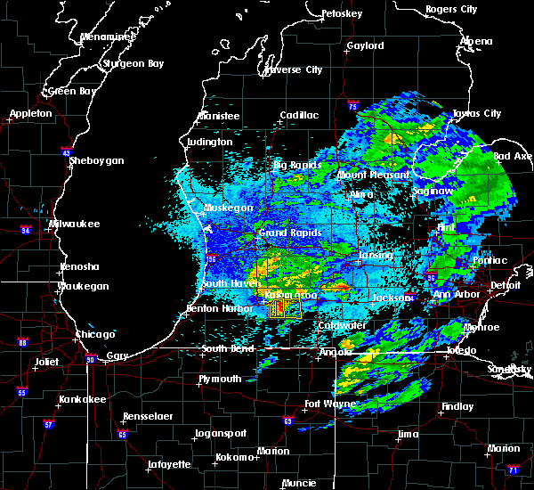 At 1047 pm edt, a severe thunderstorm was located near climax, or 11 miles east of portage, moving east at 20 mph (radar indicated). Hazards include 60 mph wind gusts. expect damage to roofs, siding, and trees At 1047 pm edt, a severe thunderstorm was located near climax, or 11 miles east of portage, moving east at 20 mph (radar indicated). Hazards include 60 mph wind gusts. expect damage to roofs, siding, and trees
|
| 4/20/2017 2:16 PM EDT |
 At 215 pm edt, a severe thunderstorm was located near burlington, moving east at 35 mph. this storm had already produced quarter sized hail around east leroy (trained weather spotters). Hazards include quarter size hail. Damage to vehicles is expected. Locations impacted include, albion, marshall, homer, union city, burlington, marengo, athens, tekonsha, pine creek,. At 215 pm edt, a severe thunderstorm was located near burlington, moving east at 35 mph. this storm had already produced quarter sized hail around east leroy (trained weather spotters). Hazards include quarter size hail. Damage to vehicles is expected. Locations impacted include, albion, marshall, homer, union city, burlington, marengo, athens, tekonsha, pine creek,.
|
| 4/20/2017 2:08 PM EDT | Quarter sized hail reported 5.8 miles S of Athens, MI, east leroy. |
| 4/20/2017 1:54 PM EDT |
 At 154 pm edt, a severe thunderstorm was located near climax, moving east at 40 mph (radar indicated). Hazards include quarter size hail. damage to vehicles is expected At 154 pm edt, a severe thunderstorm was located near climax, moving east at 40 mph (radar indicated). Hazards include quarter size hail. damage to vehicles is expected
|
| 2/28/2017 10:05 PM EST |
 At 1004 pm est, a severe thunderstorm was located over marshall, moving northeast at 60 mph. the marshall, marengo, and albion areas are at greatest risk for damaging winds (radar indicated). Hazards include 60 mph wind gusts. Expect damage to roofs, siding, and trees. Locations impacted include, albion, marshall, battle creek, homer, union city, burlington, brownlee park, marengo, athens, tekonsha, pine creek, ceresco,. At 1004 pm est, a severe thunderstorm was located over marshall, moving northeast at 60 mph. the marshall, marengo, and albion areas are at greatest risk for damaging winds (radar indicated). Hazards include 60 mph wind gusts. Expect damage to roofs, siding, and trees. Locations impacted include, albion, marshall, battle creek, homer, union city, burlington, brownlee park, marengo, athens, tekonsha, pine creek, ceresco,.
|
| 2/28/2017 9:50 PM EST |
 At 950 pm est, a severe thunderstorm was located near climax, moving northeast at 55 mph (radar indicated). Hazards include 60 mph wind gusts. expect damage to roofs, siding, and trees At 950 pm est, a severe thunderstorm was located near climax, moving northeast at 55 mph (radar indicated). Hazards include 60 mph wind gusts. expect damage to roofs, siding, and trees
|
| 7/18/2016 2:08 AM EDT |
 At 206 am edt, a severe thunderstorm was located near marshall, moving east at 40 mph (radar indicated). Hazards include 60 mph wind gusts. Expect damage to roofs. siding and trees. Locations impacted include, battle creek, springfield, union city, burlington, level park-oak park, brownlee park, athens, ceresco, pine creek, bedford,. At 206 am edt, a severe thunderstorm was located near marshall, moving east at 40 mph (radar indicated). Hazards include 60 mph wind gusts. Expect damage to roofs. siding and trees. Locations impacted include, battle creek, springfield, union city, burlington, level park-oak park, brownlee park, athens, ceresco, pine creek, bedford,.
|
| 7/18/2016 1:34 AM EDT |
 At 133 am edt, a severe thunderstorm was located near portage, moving east at 40 mph (radar indicated). Hazards include 60 mph wind gusts and quarter size hail. Hail damage to vehicles is expected. Expect wind damage to roofs, siding and trees. At 133 am edt, a severe thunderstorm was located near portage, moving east at 40 mph (radar indicated). Hazards include 60 mph wind gusts and quarter size hail. Hail damage to vehicles is expected. Expect wind damage to roofs, siding and trees.
|
| 7/13/2015 11:52 PM EDT |
 At 1152 pm edt, a severe thunderstorm was located 8 miles east of vicksburg, moving east at 25 mph (radar indicated). Hazards include 60 mph wind gusts and quarter size hail. Hail damage to vehicles is expected. Expect wind damage to roofs, siding and trees. At 1152 pm edt, a severe thunderstorm was located 8 miles east of vicksburg, moving east at 25 mph (radar indicated). Hazards include 60 mph wind gusts and quarter size hail. Hail damage to vehicles is expected. Expect wind damage to roofs, siding and trees.
|
| 6/22/2015 3:11 PM EDT |
 At 310 pm edt, severe thunderstorms were located along a line extending from 9 miles north of albion to near union city, moving east at 40 mph (radar indicated). Hazards include 60 mph wind gusts and quarter size hail. Hail damage to vehicles is expected. expect wind damage to roofs, siding and trees. Locations impacted include, albion, marshall, homer, burlington, marengo, athens, tekonsha, pine creek, ceresco,. At 310 pm edt, severe thunderstorms were located along a line extending from 9 miles north of albion to near union city, moving east at 40 mph (radar indicated). Hazards include 60 mph wind gusts and quarter size hail. Hail damage to vehicles is expected. expect wind damage to roofs, siding and trees. Locations impacted include, albion, marshall, homer, burlington, marengo, athens, tekonsha, pine creek, ceresco,.
|
| 6/22/2015 2:59 PM EDT |
 At 258 pm edt, severe thunderstorms were located along a line extending from 7 miles southeast of bellevue to 8 miles north of colon, moving east at 40 mph. the strongest storm was near fulton (radar indicated). Hazards include 60 mph wind gusts. Expect damage to roofs. Siding and trees. At 258 pm edt, severe thunderstorms were located along a line extending from 7 miles southeast of bellevue to 8 miles north of colon, moving east at 40 mph. the strongest storm was near fulton (radar indicated). Hazards include 60 mph wind gusts. Expect damage to roofs. Siding and trees.
|
| 6/13/2015 10:08 PM EDT |
 The severe thunderstorm warning for southern calhoun county will expire at 1015 pm edt, the storm which prompted the warning has weakened below severe limits, and no longer pose an immediate threat to life or property. therefore the warning will be allowed to expire. however gusty winds and heavy rain are still possible with this thunderstorm. The severe thunderstorm warning for southern calhoun county will expire at 1015 pm edt, the storm which prompted the warning has weakened below severe limits, and no longer pose an immediate threat to life or property. therefore the warning will be allowed to expire. however gusty winds and heavy rain are still possible with this thunderstorm.
|
| 6/13/2015 9:53 PM EDT |
 At 952 pm edt, a severe thunderstorm was located near burlington, moving east at 25 mph (radar indicated). Hazards include 60 mph wind gusts. Expect damage to roofs. siding and trees. Locations impacted include, albion, marshall, homer, burlington, athens, tekonsha, pine creek,. At 952 pm edt, a severe thunderstorm was located near burlington, moving east at 25 mph (radar indicated). Hazards include 60 mph wind gusts. Expect damage to roofs. siding and trees. Locations impacted include, albion, marshall, homer, burlington, athens, tekonsha, pine creek,.
|
| 6/13/2015 9:30 PM EDT |
 At 929 pm edt, a severe thunderstorm was located near burlington, moving east at 5 mph (radar indicated). Hazards include 60 mph wind gusts. Expect damage to roofs. siding and trees. Locations impacted include, southern battle cree, albion, marshall, homer, burlington, marengo, athens, tekonsha, pine creek, ceresco,. At 929 pm edt, a severe thunderstorm was located near burlington, moving east at 5 mph (radar indicated). Hazards include 60 mph wind gusts. Expect damage to roofs. siding and trees. Locations impacted include, southern battle cree, albion, marshall, homer, burlington, marengo, athens, tekonsha, pine creek, ceresco,.
|
| 6/13/2015 9:13 PM EDT |
 At 913 pm edt, a severe thunderstorm was located near burlington, moving east at 25 mph (radar indicated). Hazards include 60 mph wind gusts and quarter size hail. Hail damage to vehicles is expected. Expect wind damage to roofs, siding and trees. At 913 pm edt, a severe thunderstorm was located near burlington, moving east at 25 mph (radar indicated). Hazards include 60 mph wind gusts and quarter size hail. Hail damage to vehicles is expected. Expect wind damage to roofs, siding and trees.
|
| 5/27/2015 1:44 PM EDT | At 144 pm edt, a severe thunderstorm was located over marshall, moving east at 35 mph (radar indicated). Hazards include 60 mph wind gusts and quarter size hail. Hail damage to vehicles is expected. Expect wind damage to roofs, siding and trees. |
| 4/9/2015 7:00 PM EDT | A tornado warning remains in effect for north central branch county until 715 pm edt. at 658 pm edt. a severe thunderstorm capable of producing a tornado was located near union city. and moving east at 50 mph. hazard. tornado. source. Radar indicated rotation. |
| 4/9/2015 6:39 PM EDT | The national weather service in northern indiana has issued a * tornado warning for. northwestern branch county in southwest michigan. northeastern st. joseph county in southwest michigan. until 715 pm edt * at 636 pm edt. A severe thunderstorm capable of producing a. |
| 6/2/2014 4:59 PM EDT | 3 foot diameter tree down on house on m drive s between m66 and 2 mile rd in battle creek in calhoun county MI, 4.3 miles S of Athens, MI |
| 1/1/0001 12:00 AM | Multiple trees blocking m6 in calhoun county MI, 0.3 miles SE of Athens, MI |
| 1/1/0001 12:00 AM | Quarter sized hail reported 0.3 miles SE of Athens, MI |
| 1/1/0001 12:00 AM | Spotter estimated the winds of 75-80 mph just north of the kalamazoo/st. joseph county lin in kalamazoo county MI, 5.8 miles E of Athens, MI |
Hail Maps for Athens, MI


Connect with Interactive Hail Maps