

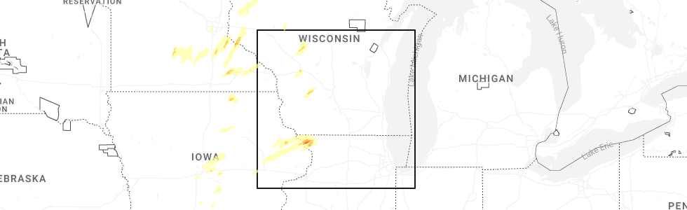
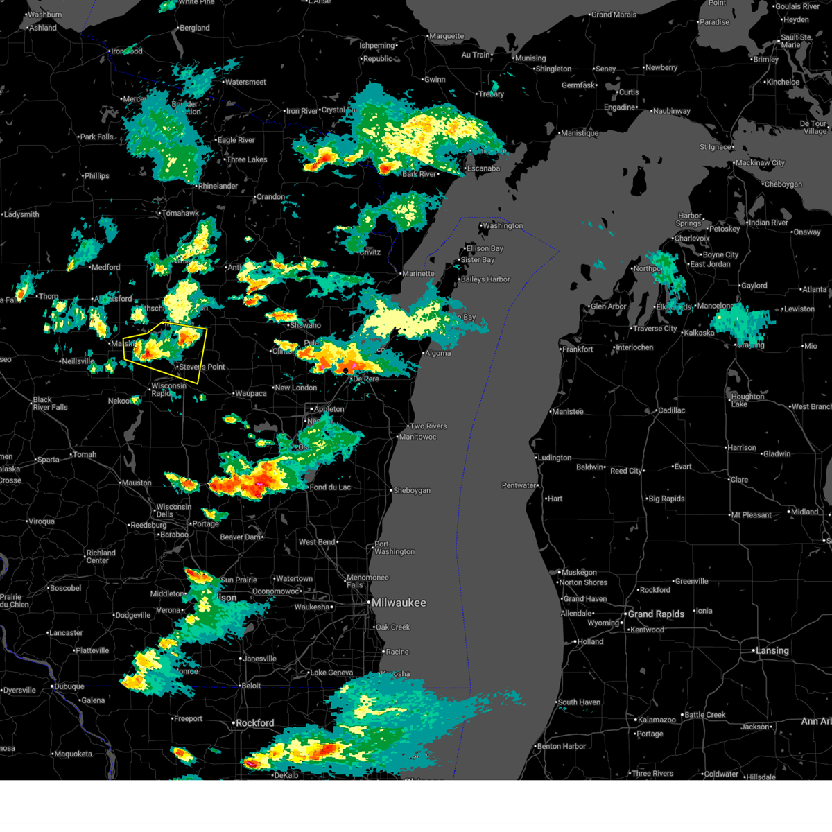
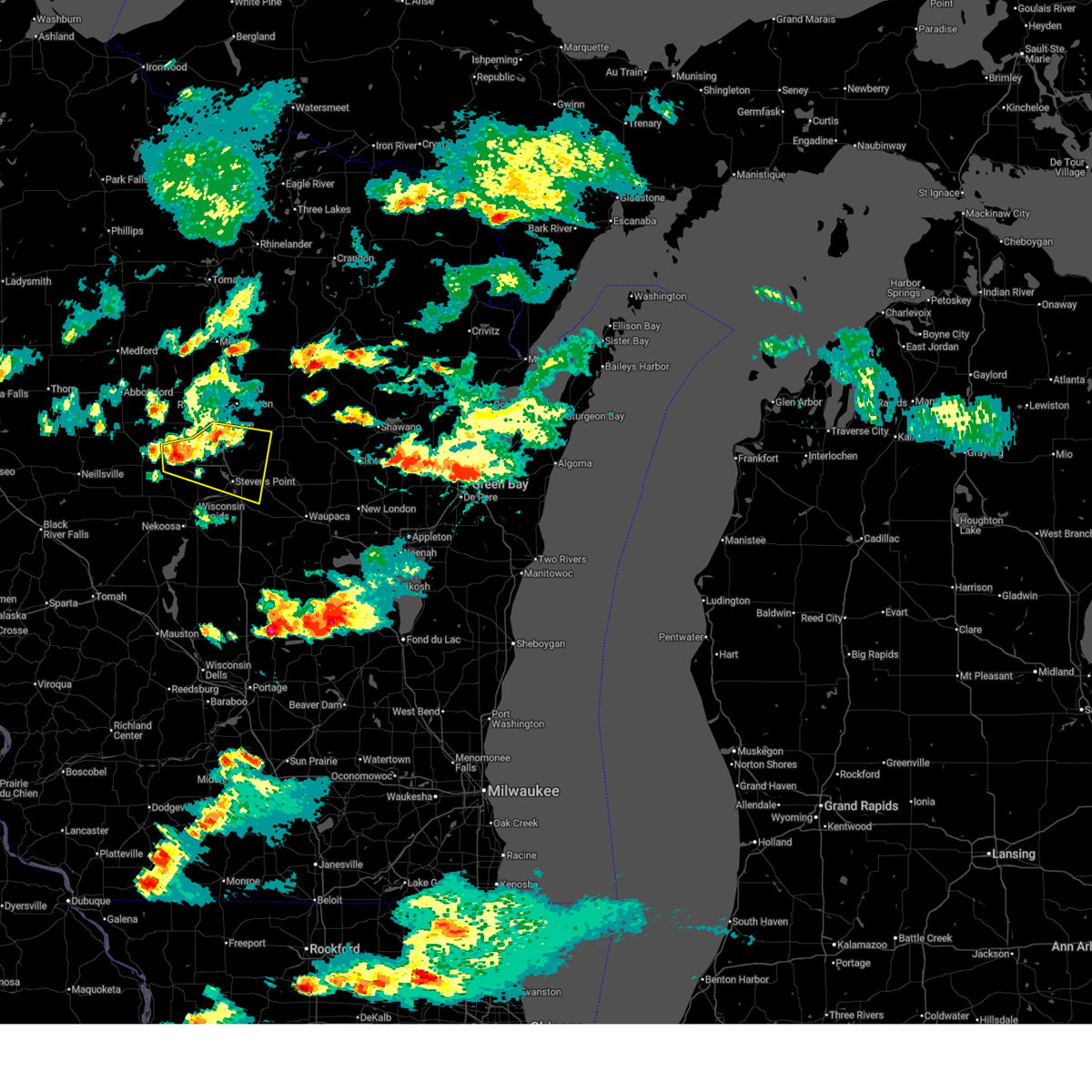
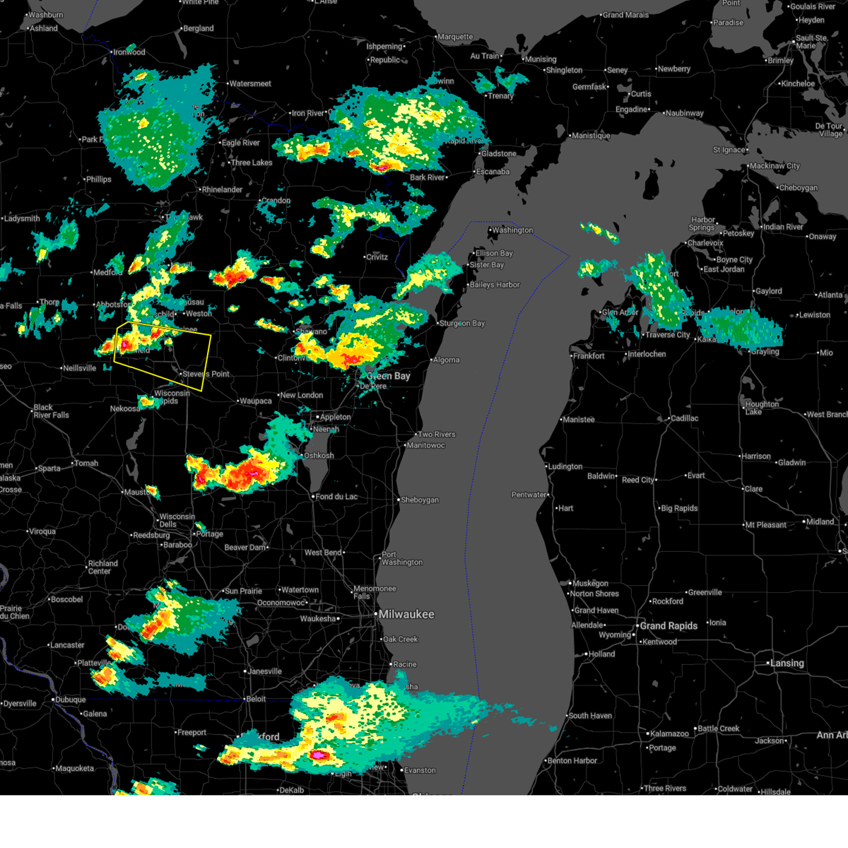
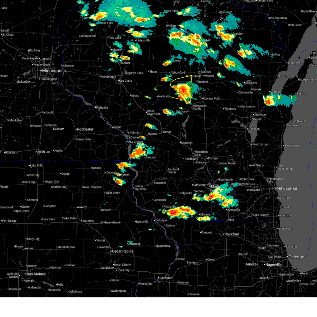
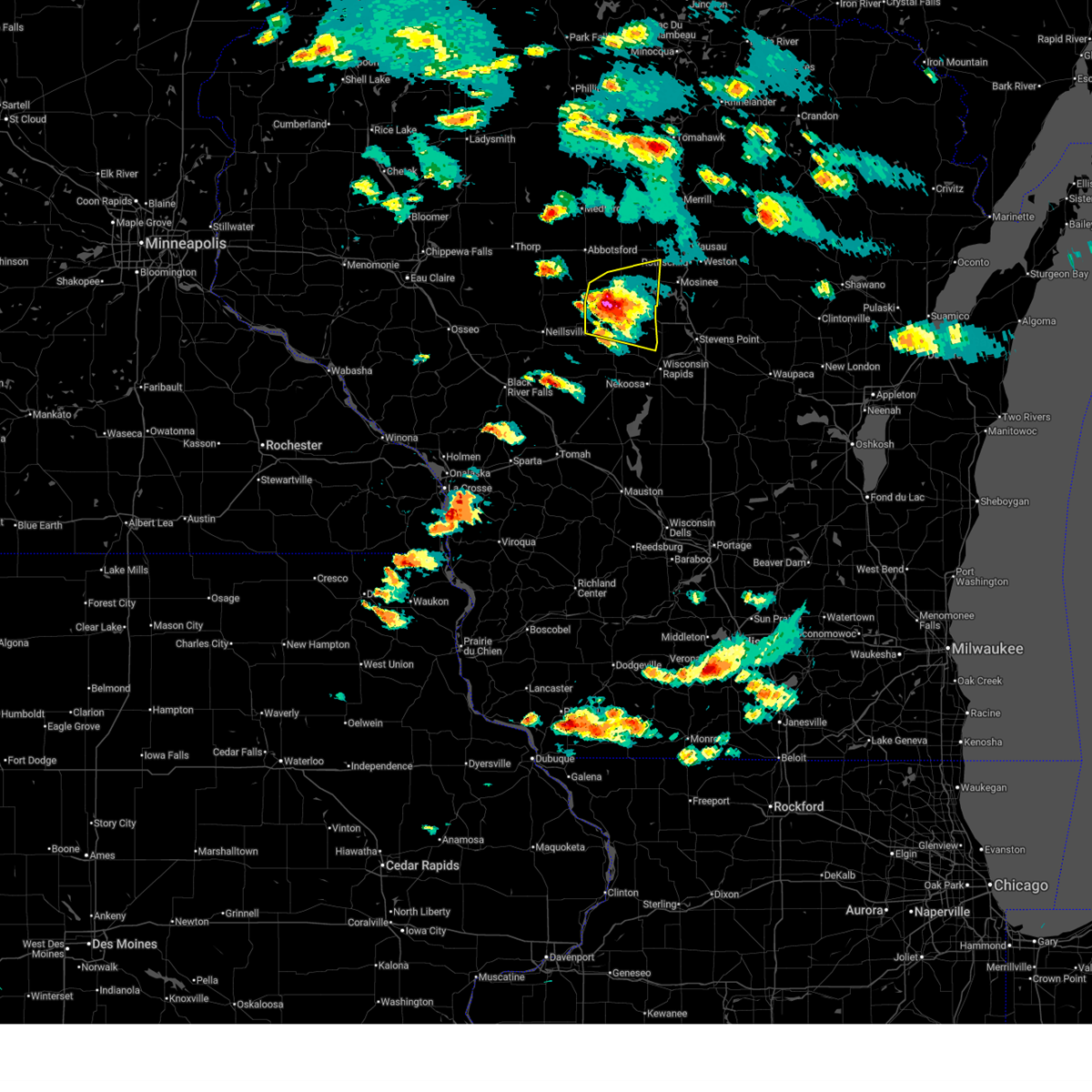
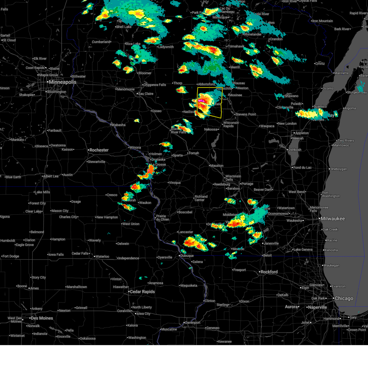
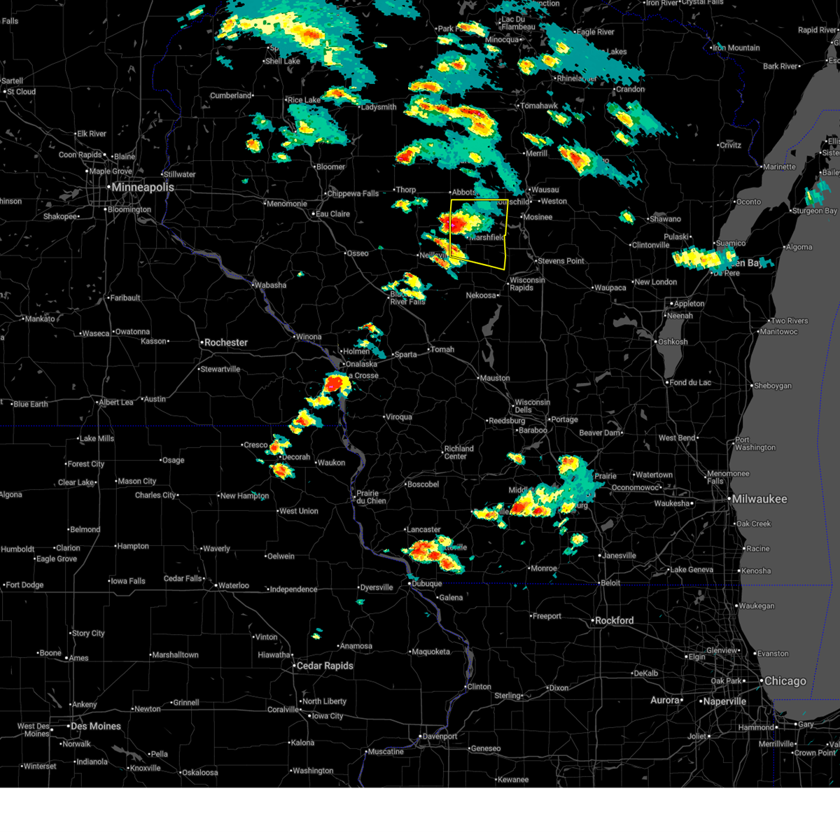
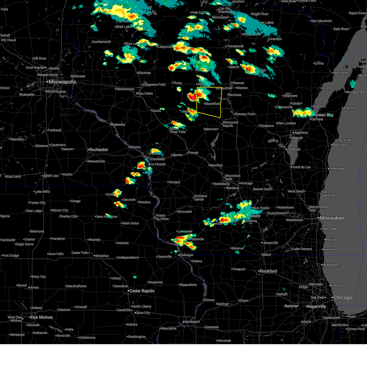
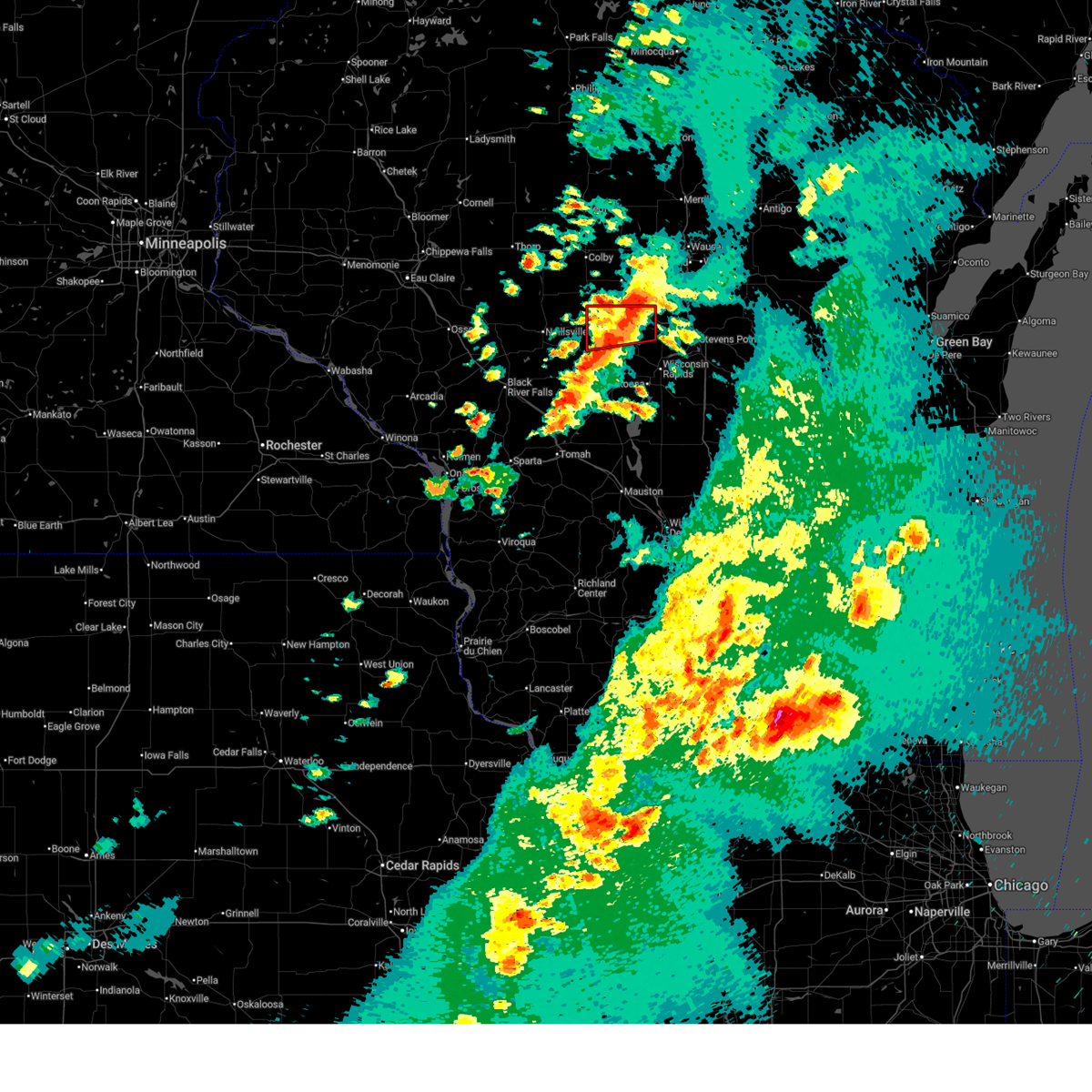
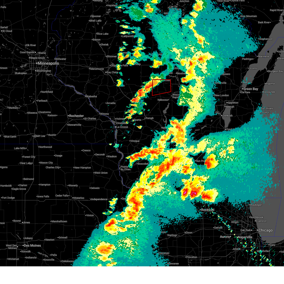
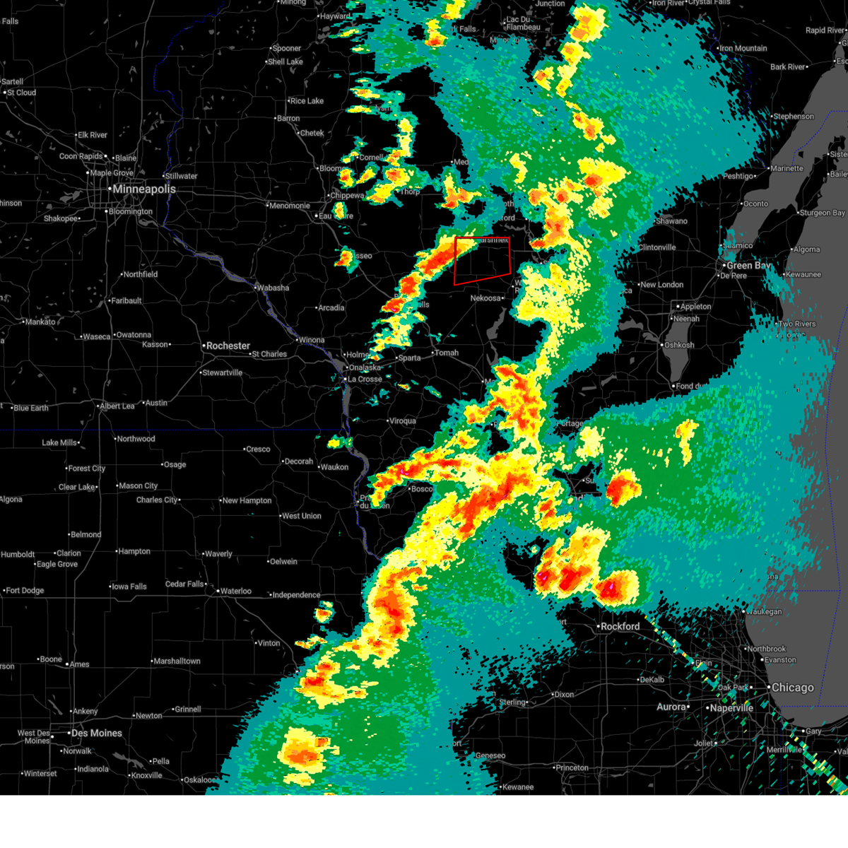
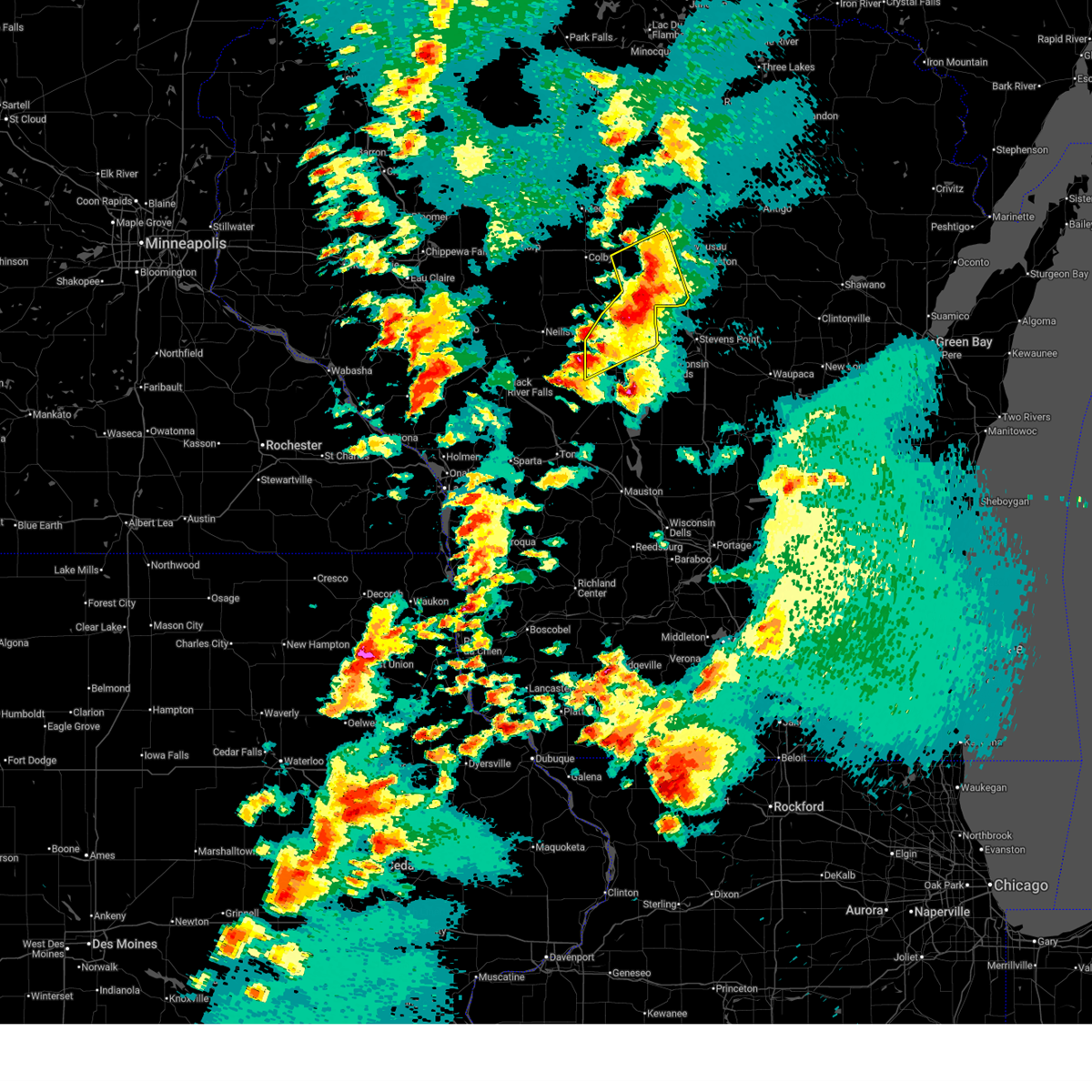
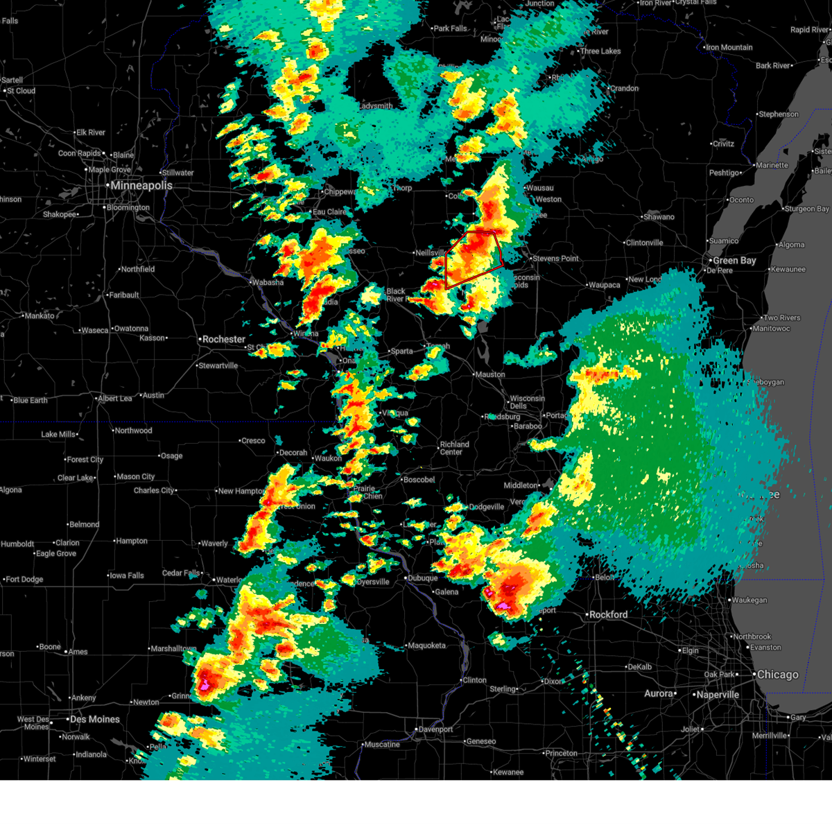
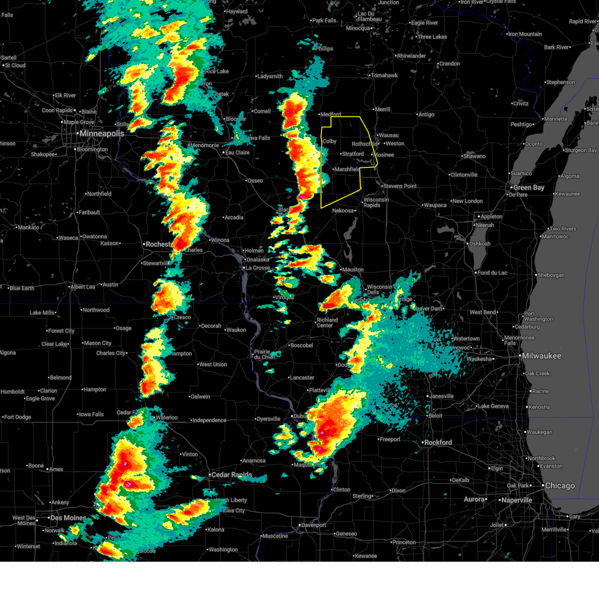
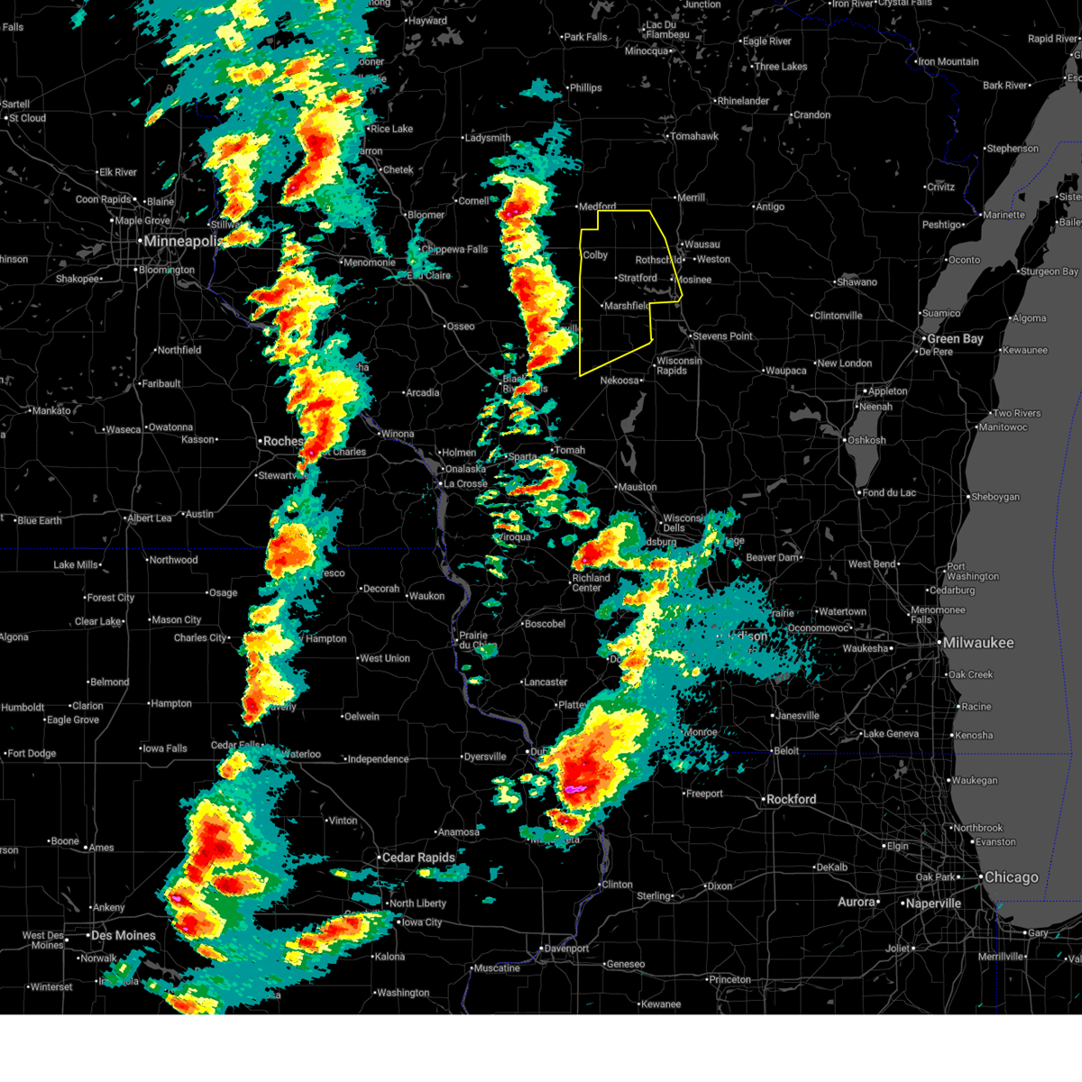
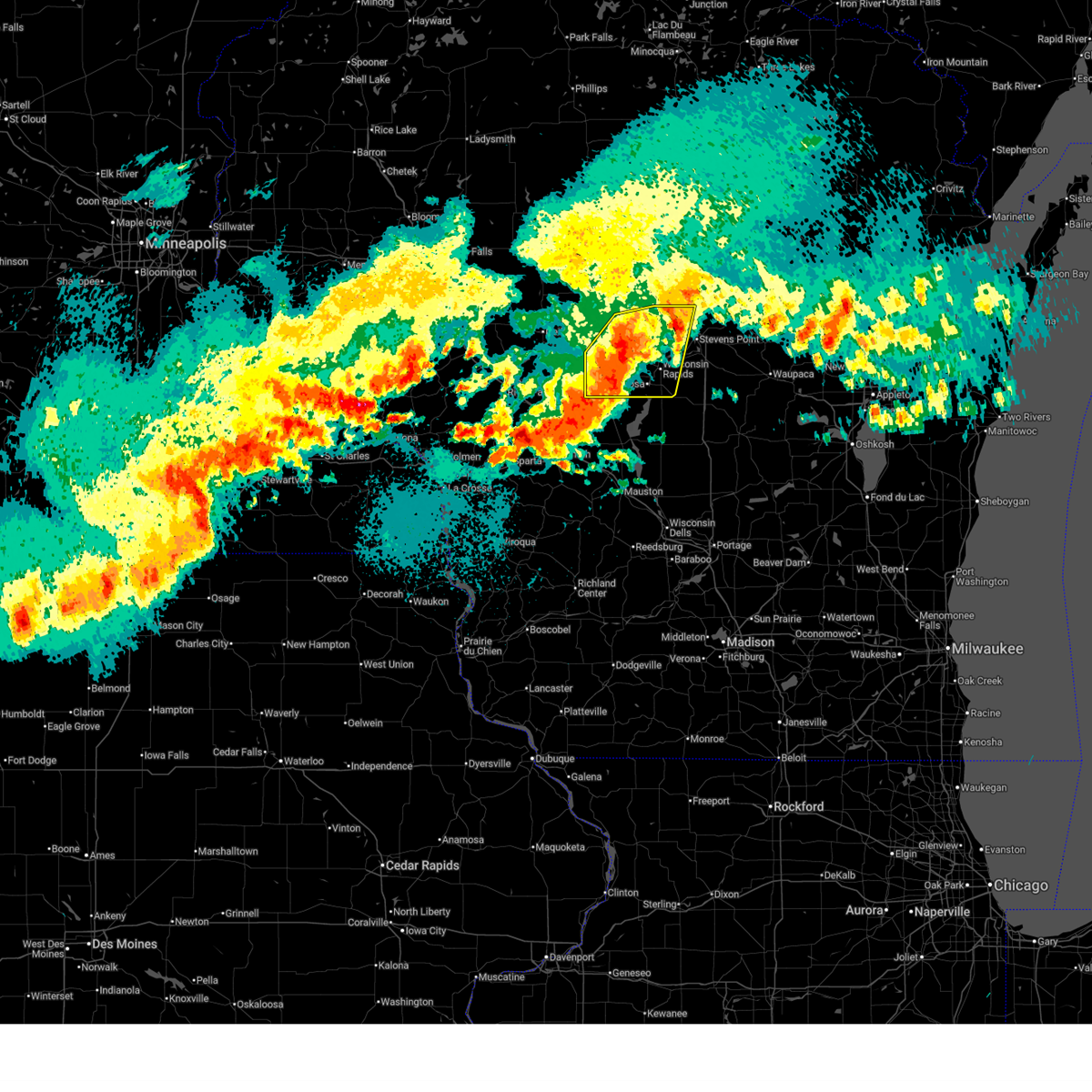
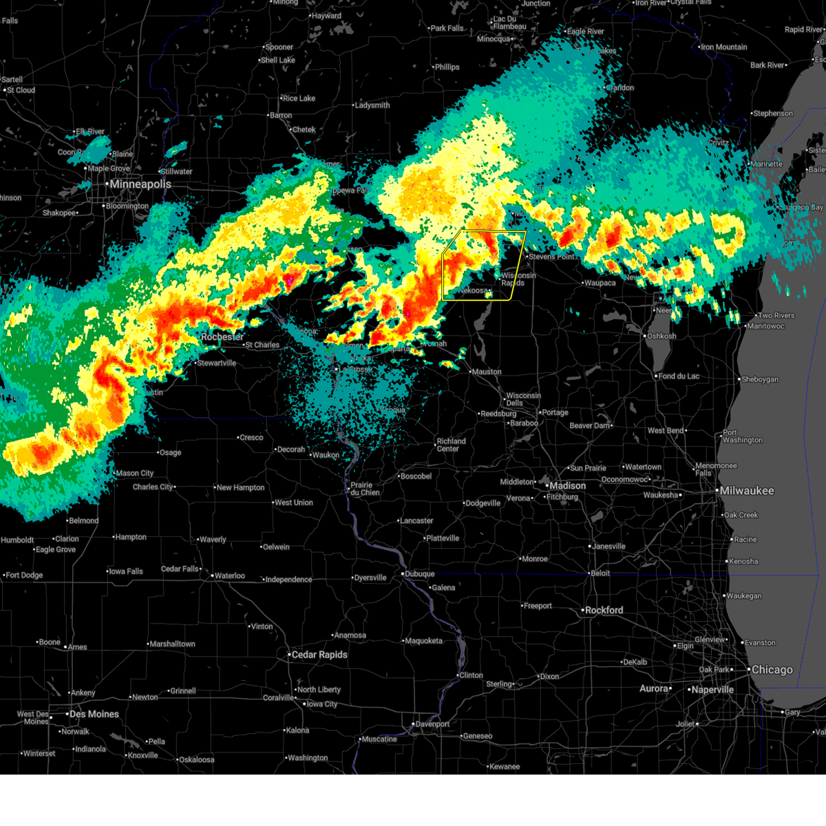
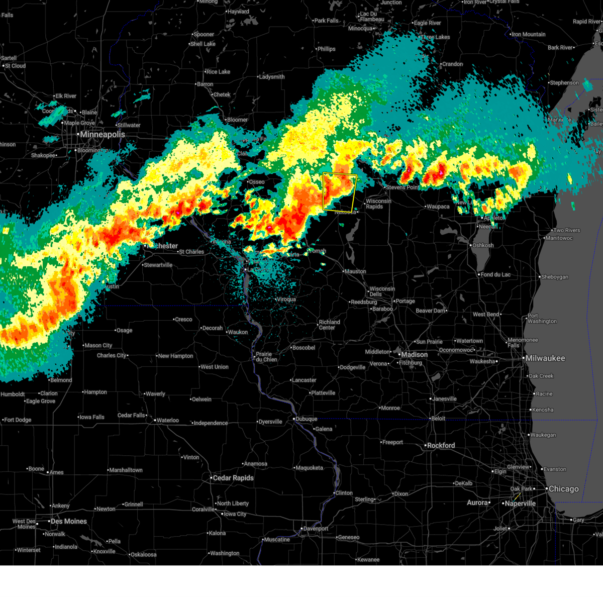
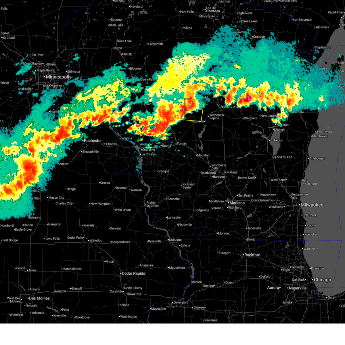
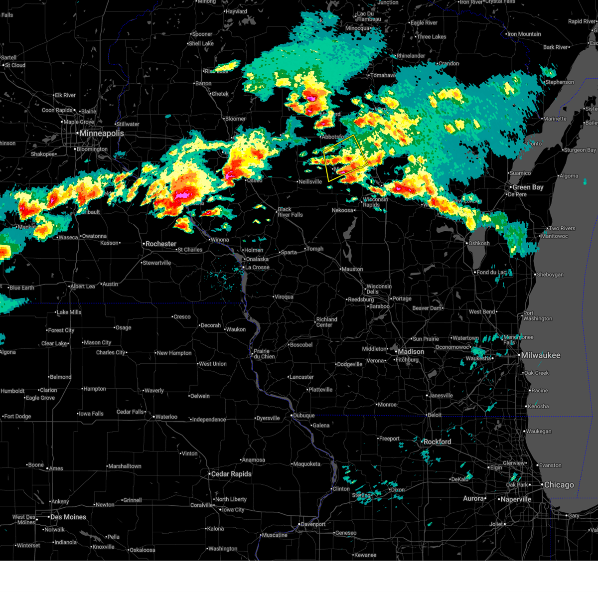
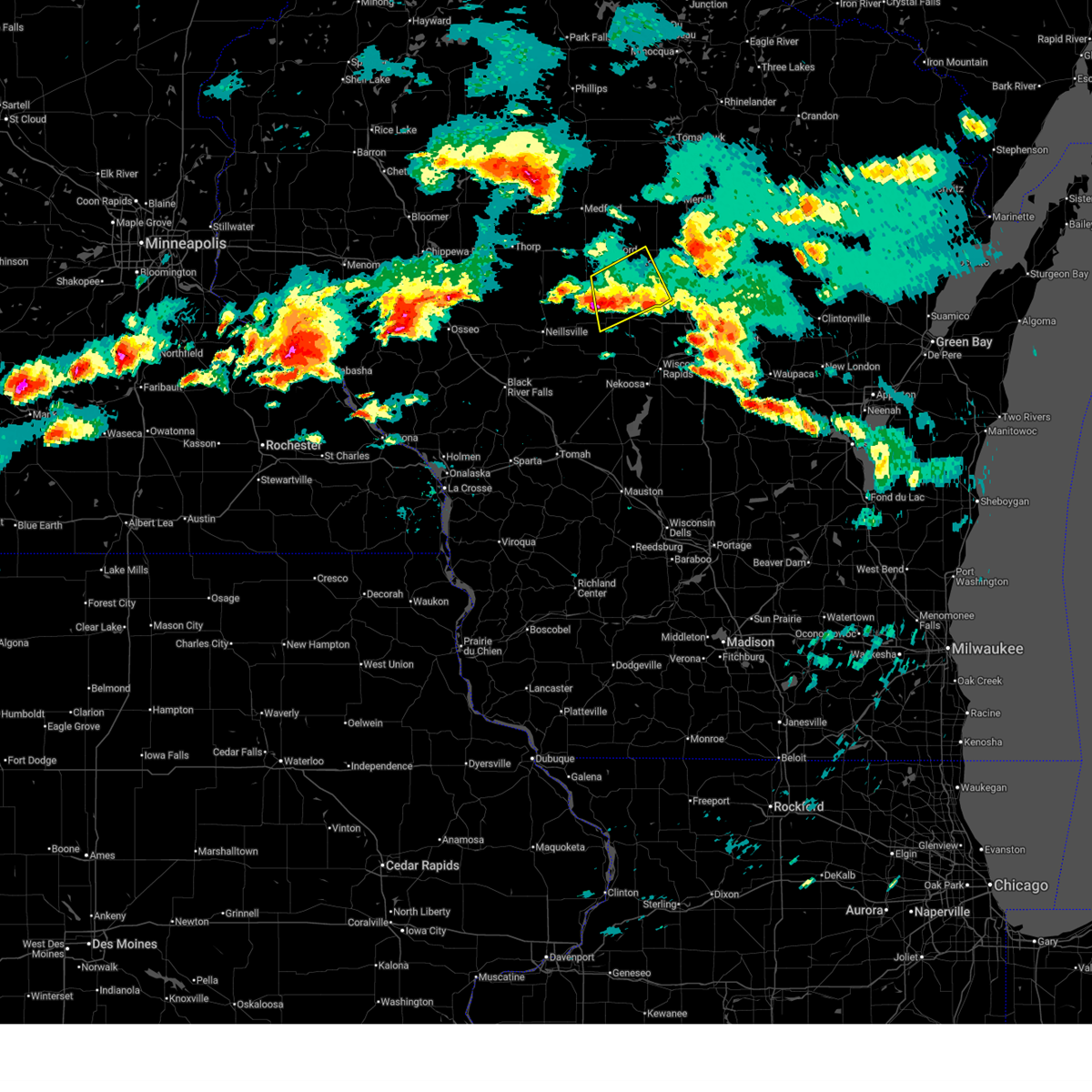
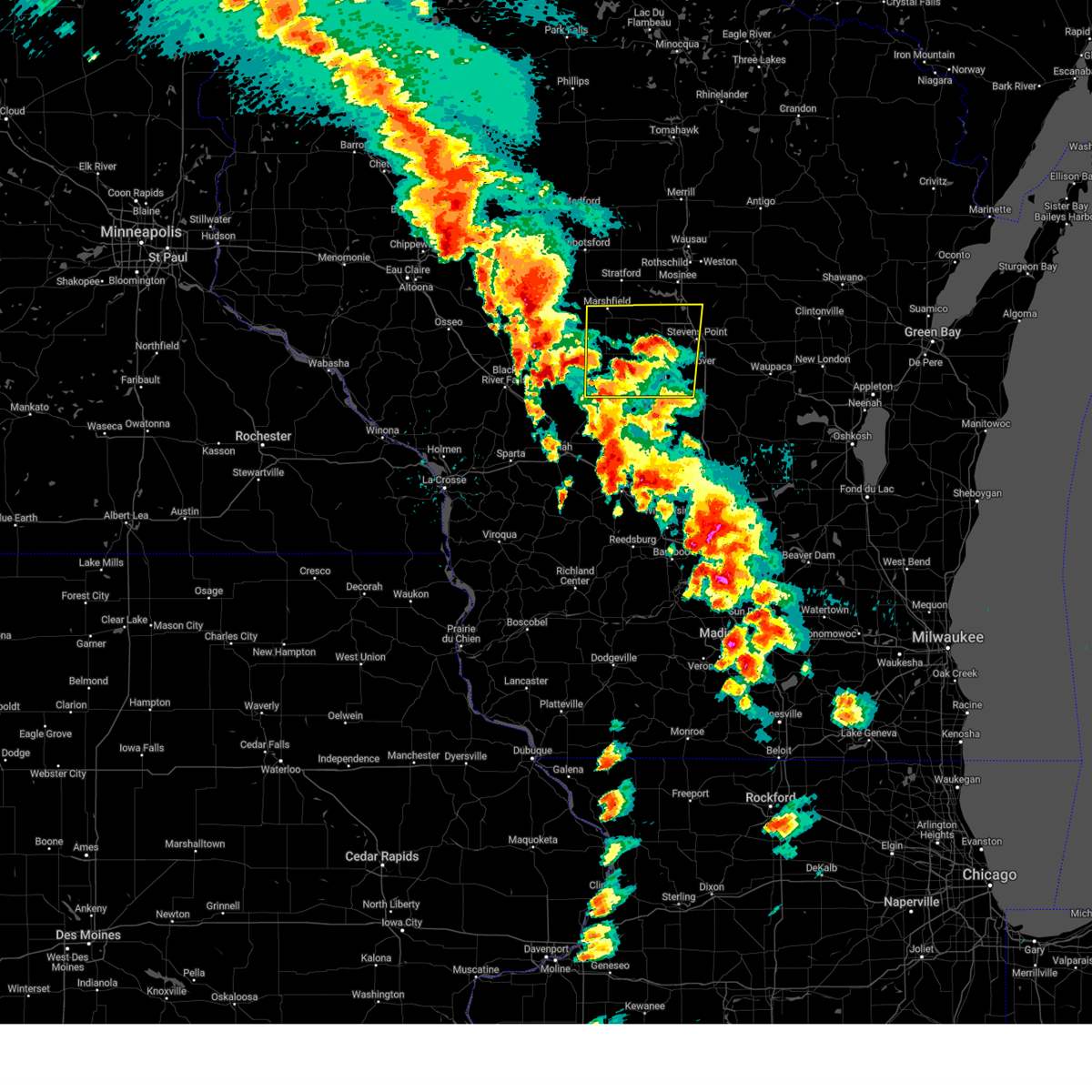
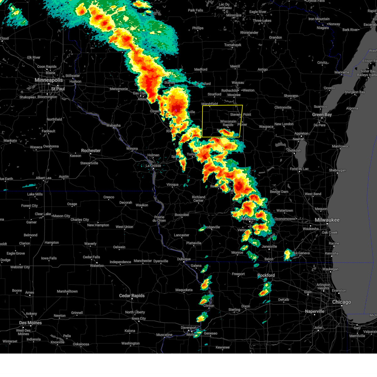
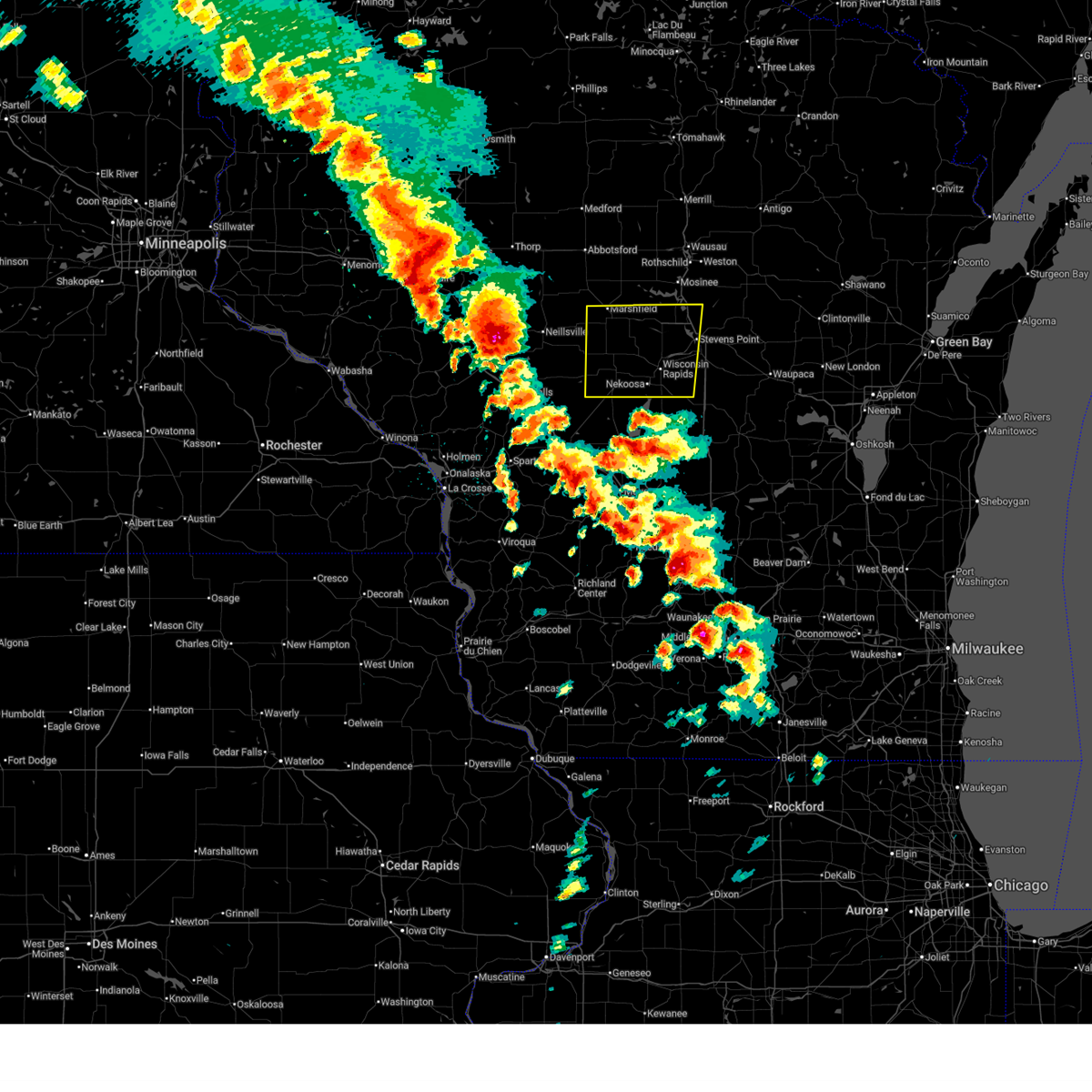
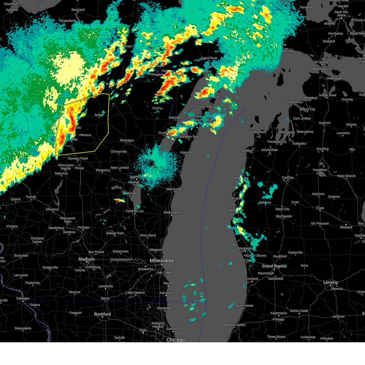
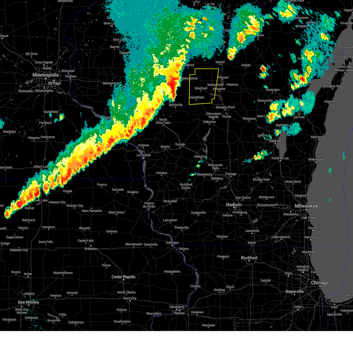
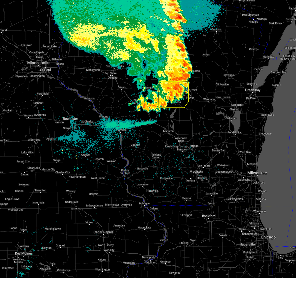
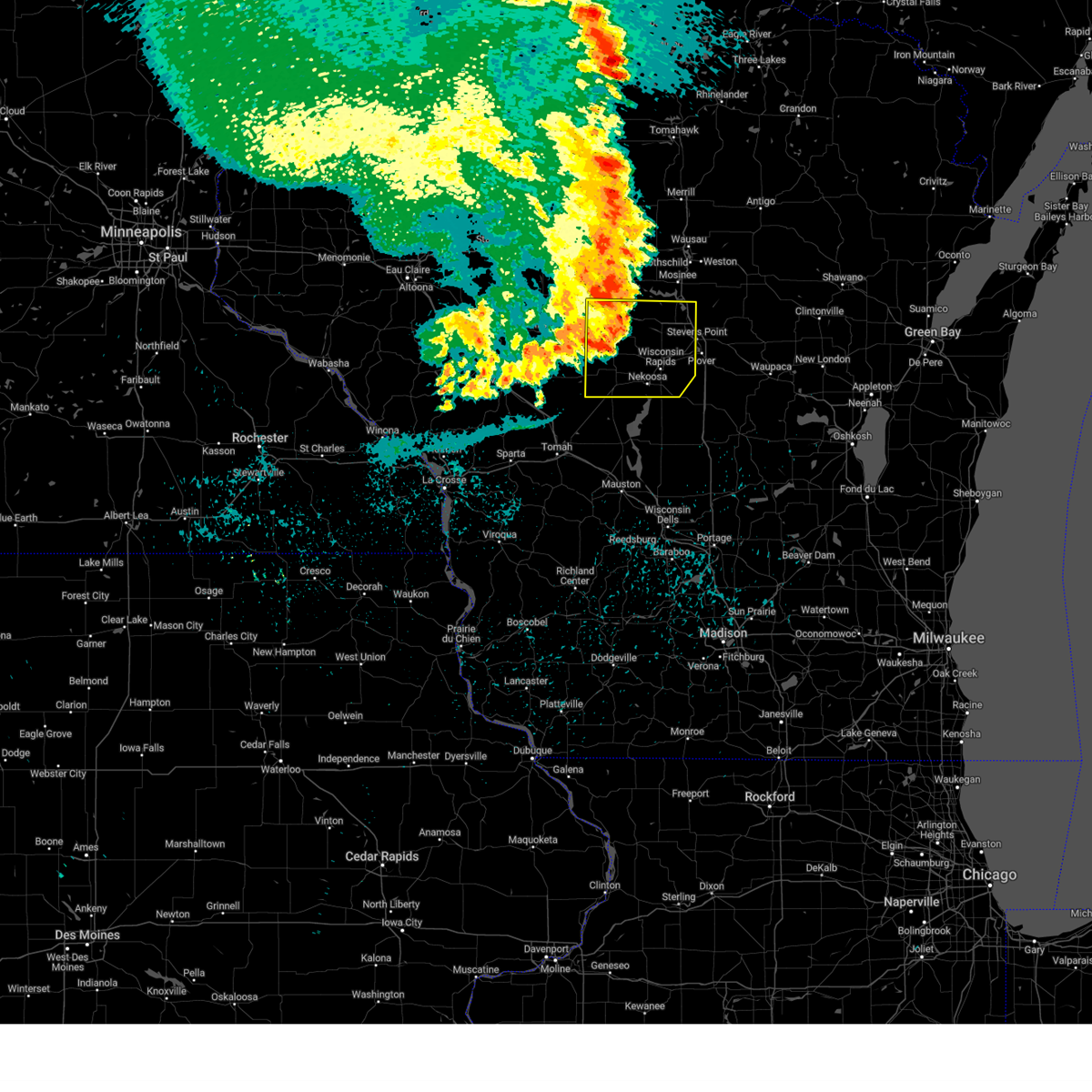
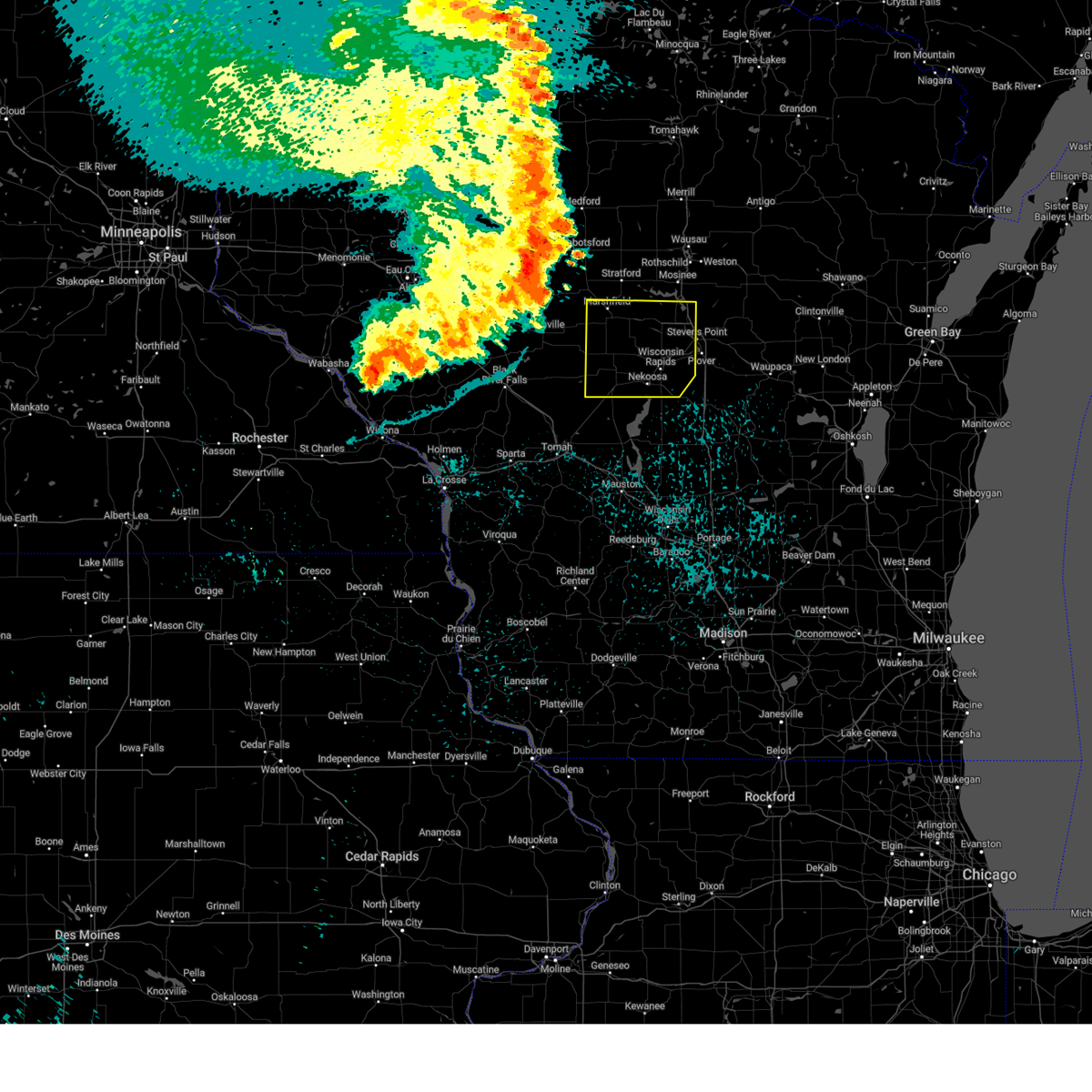
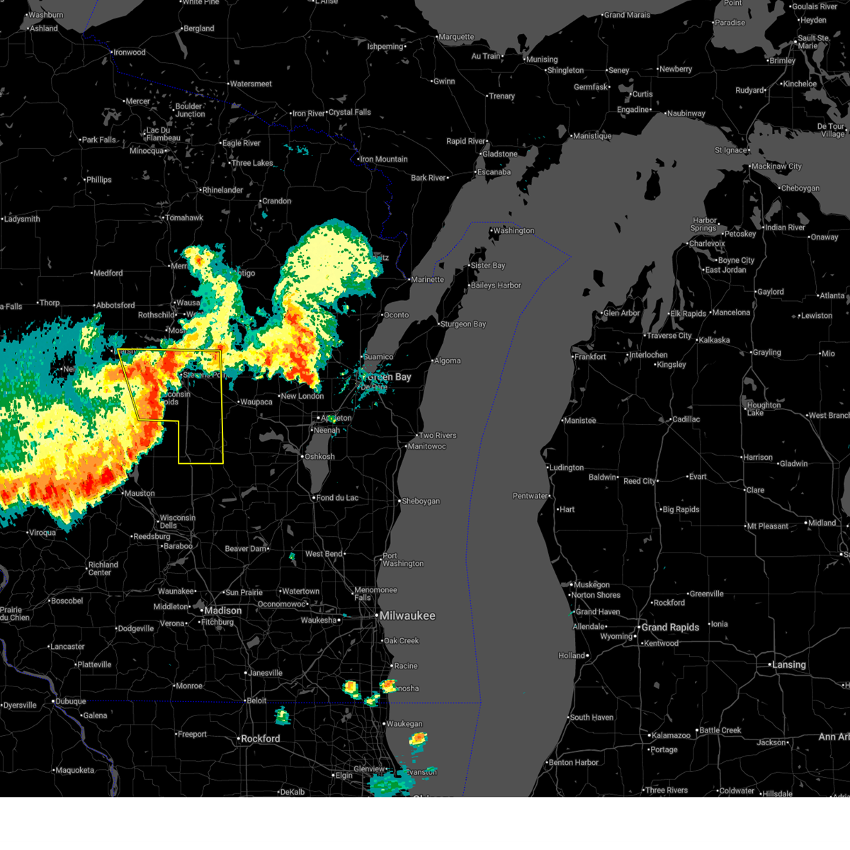
Hail Map for Auburndale, WI
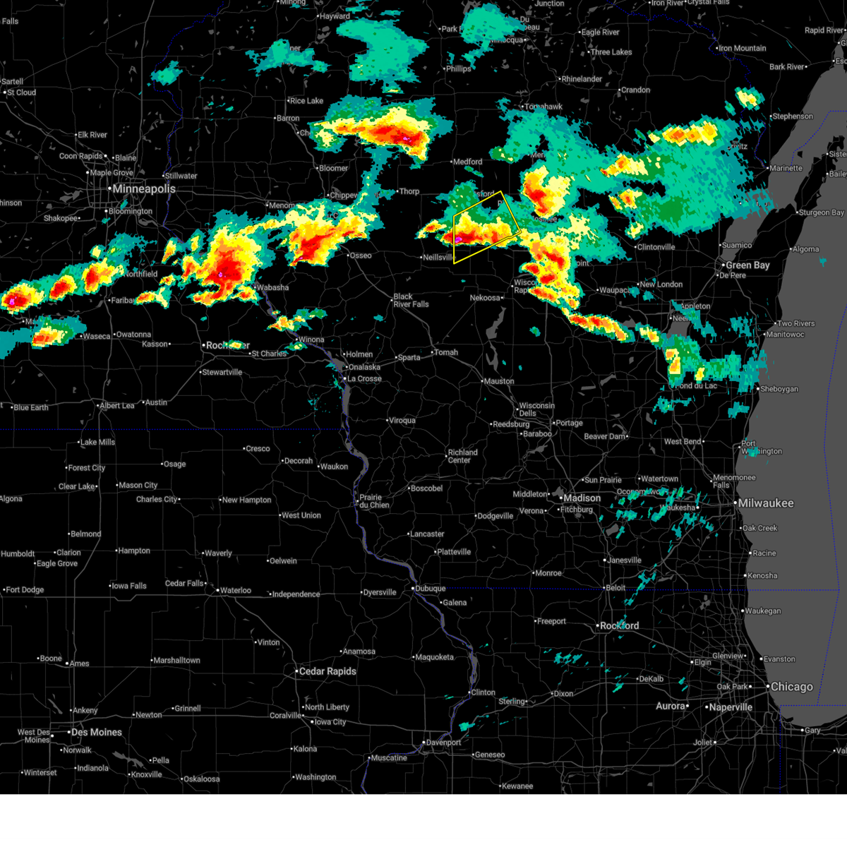
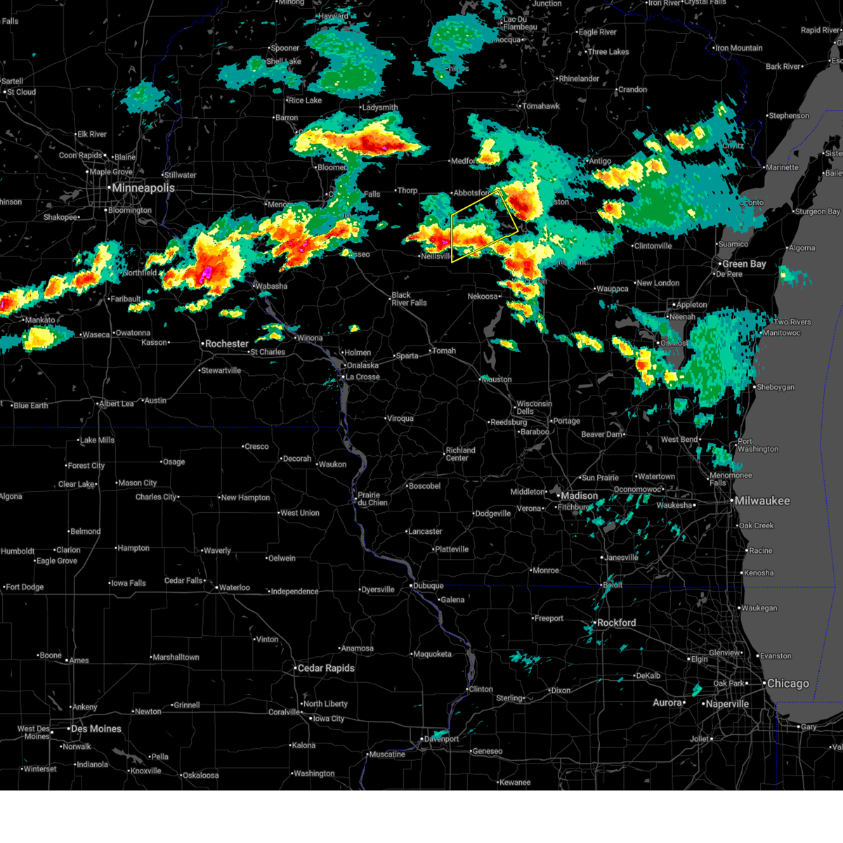
The Auburndale, WI area has had 0 reports of on-the-ground hail by trained spotters, and has been under severe weather warnings 45 times during the past 12 months. Doppler radar has detected hail at or near Auburndale, WI on 43 occasions, including 5 occasions during the past year.
| Name: | Auburndale, WI |
| Where Located: | 75.7 miles SSW of Rhinelander, WI |
| Map: | Google Map for Auburndale, WI |
| Population: | 703 |
| Housing Units: | 315 |
| More Info: | Search Google for Auburndale, WI |
3
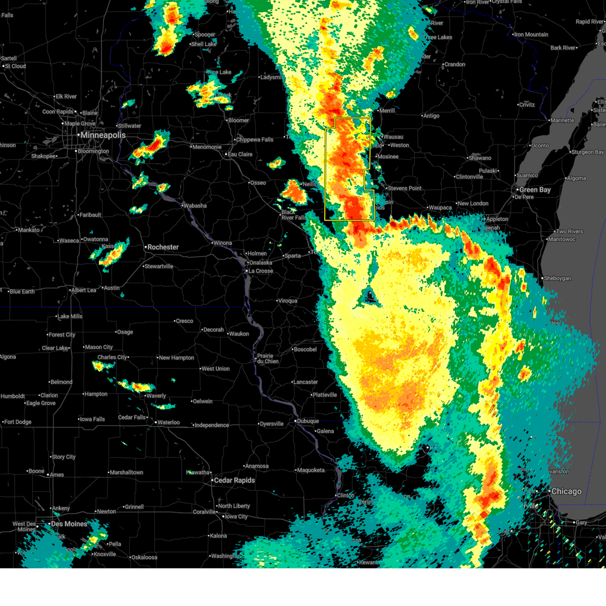
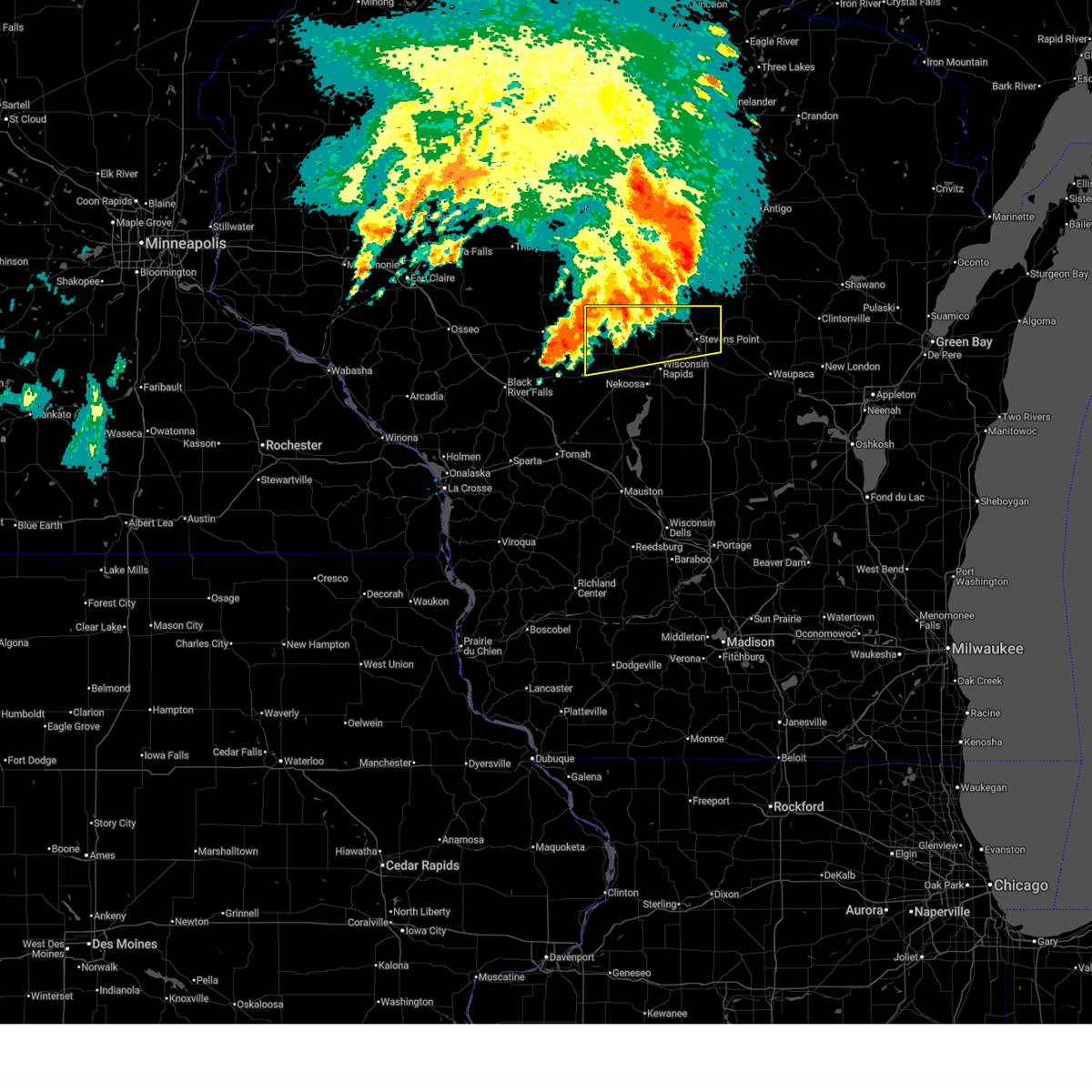
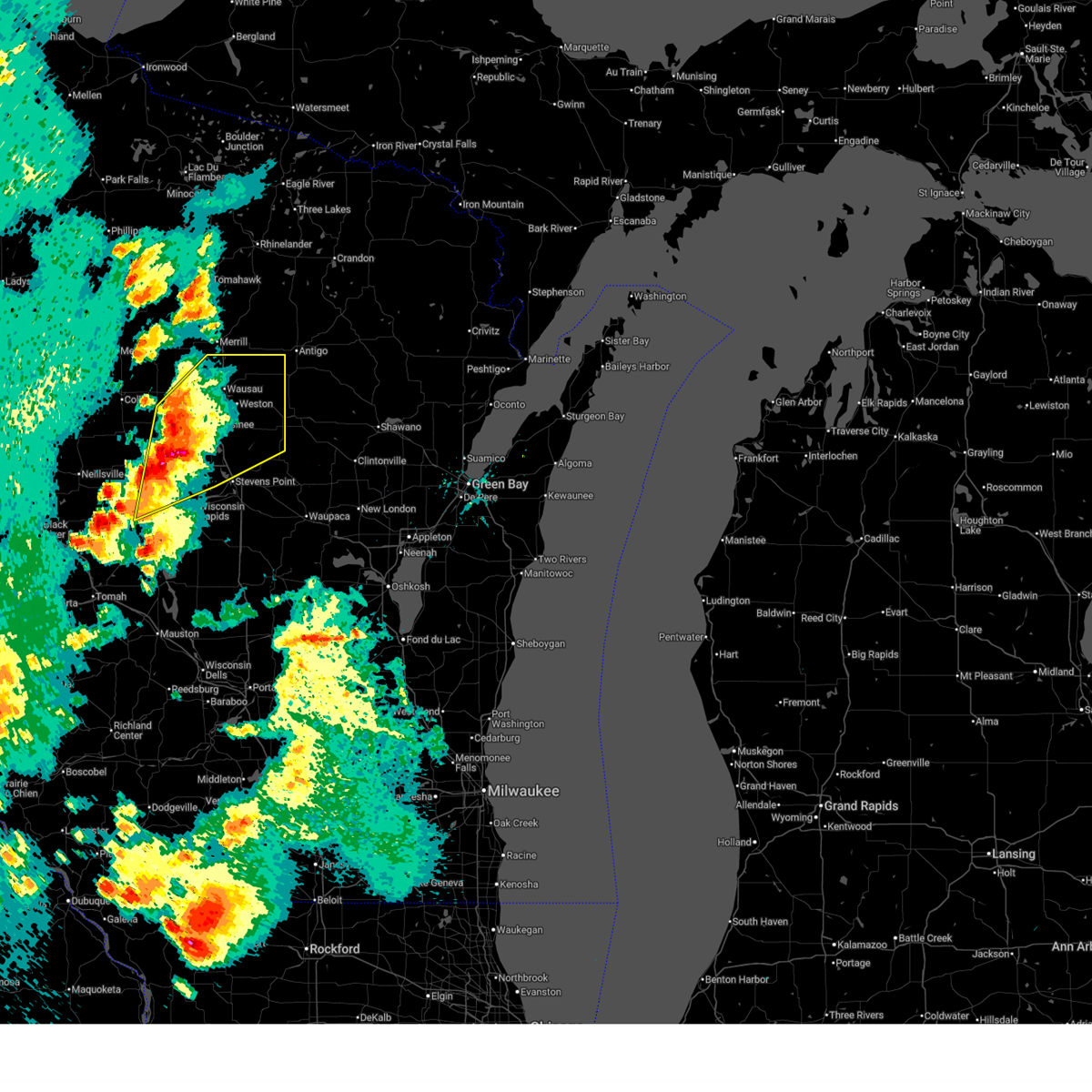
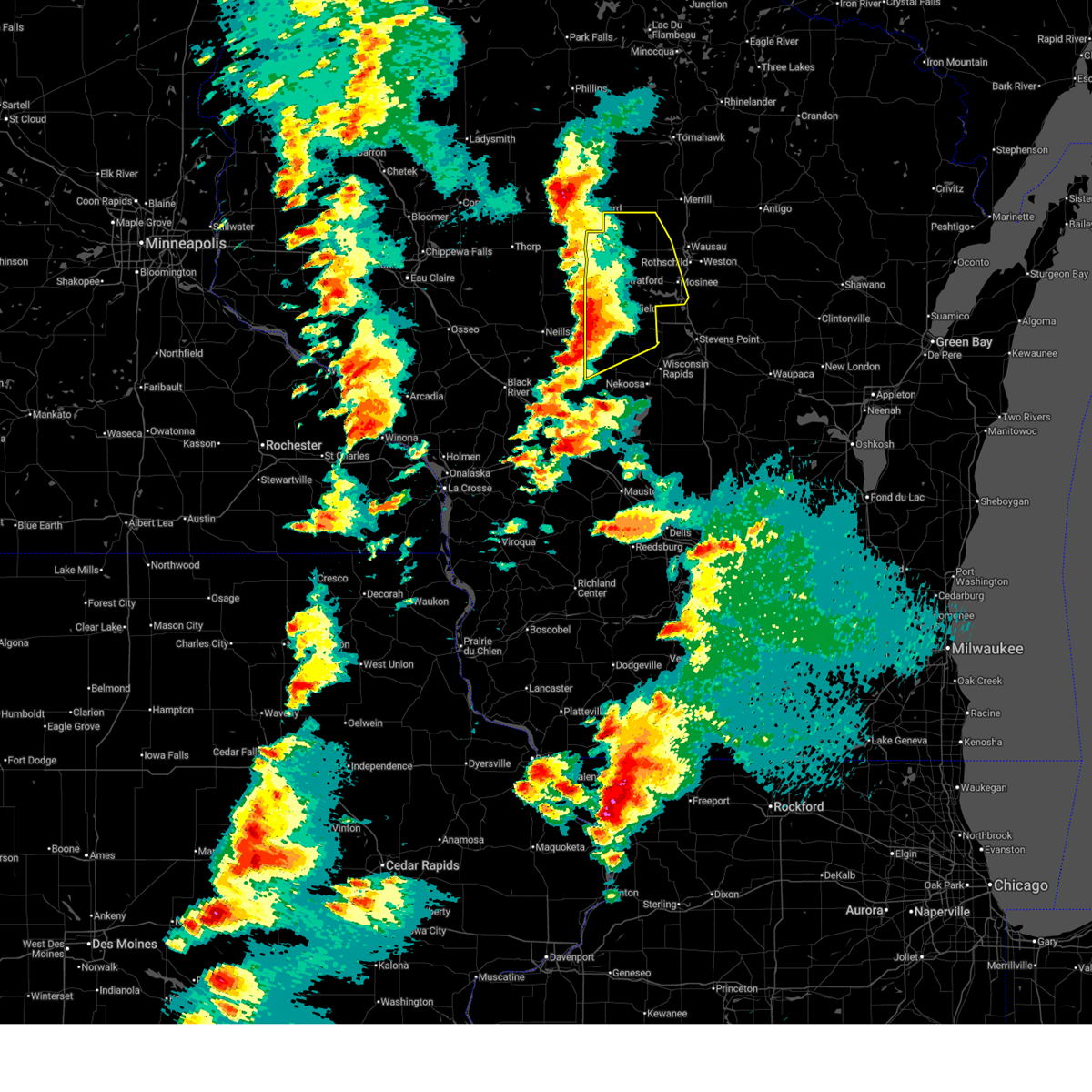
The Top Recent Hail Date for Auburndale, WI is Friday, April 17, 2026 (5th out of 43)
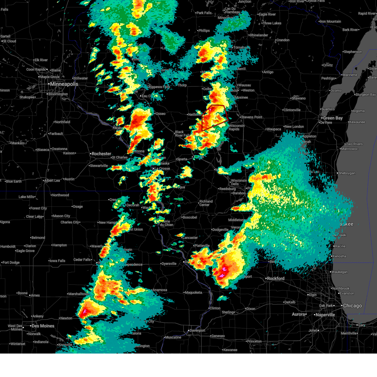
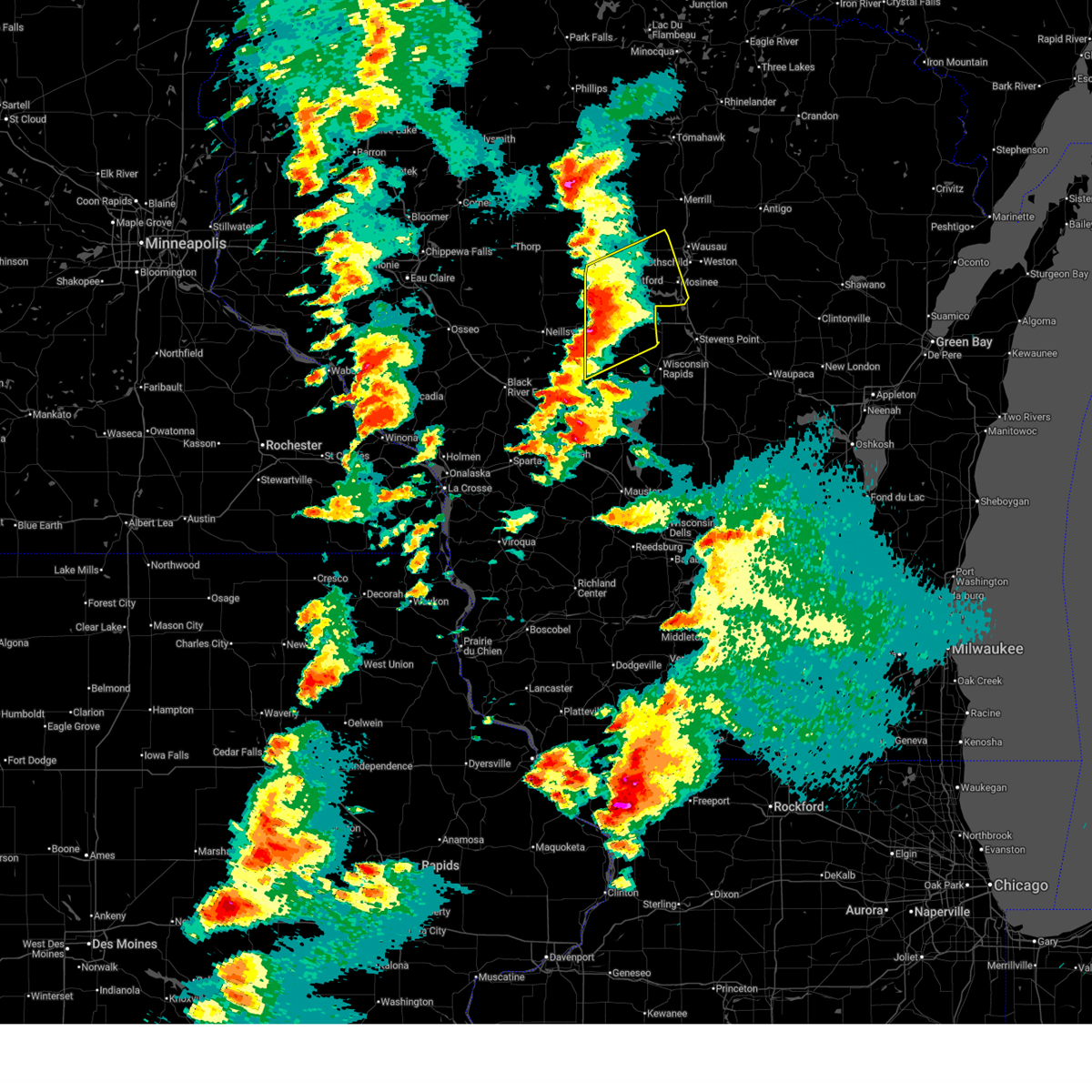
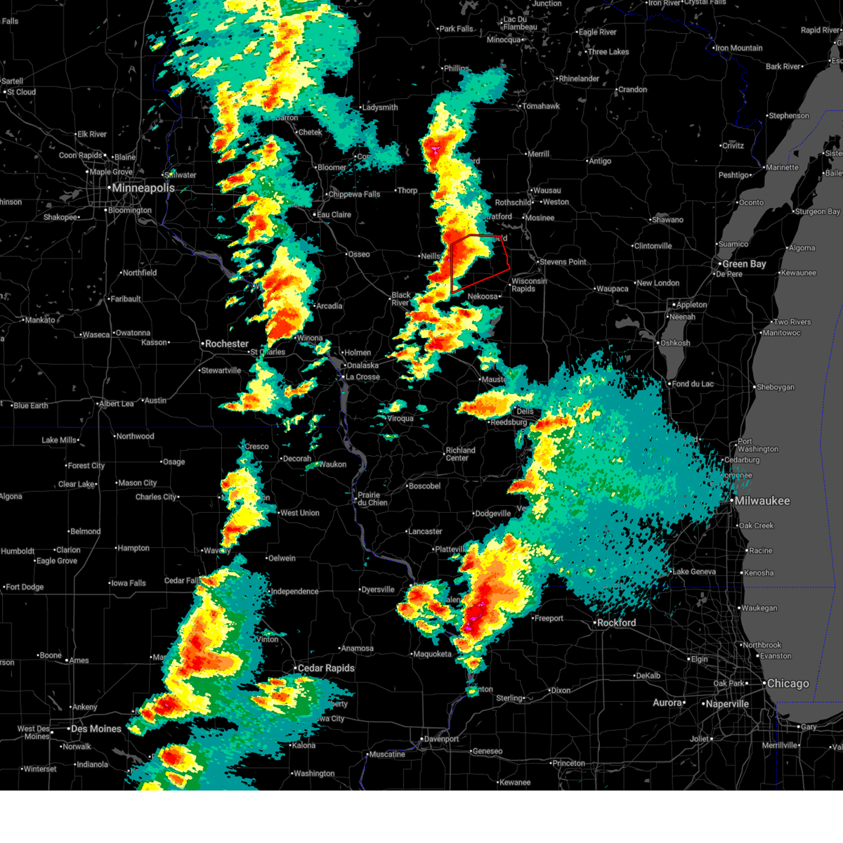
Hail and Wind Damage Spotted near Auburndale, WI
| Date / Time | Report Details |
|---|---|
| 6/30/2026 9:10 AM CDT |
 At 910 am cdt, a severe thunderstorm was located 9 miles east of marshfield, or 19 miles northwest of wisconsin rapids, moving northeast at 35 mph (radar indicated). Hazards include 60 mph wind gusts and half dollar size hail. Hail damage to vehicles is expected. expect wind damage to roofs, siding, and trees. Other locations impacted by the severe thunderstorm include blenker, auburndale, sherry and milladore. At 910 am cdt, a severe thunderstorm was located 9 miles east of marshfield, or 19 miles northwest of wisconsin rapids, moving northeast at 35 mph (radar indicated). Hazards include 60 mph wind gusts and half dollar size hail. Hail damage to vehicles is expected. expect wind damage to roofs, siding, and trees. Other locations impacted by the severe thunderstorm include blenker, auburndale, sherry and milladore.
|
| 6/30/2026 8:53 AM CDT |
 At 853 am cdt, a severe thunderstorm was located 6 miles south of marshfield, or 21 miles northwest of wisconsin rapids, moving northeast at 35 mph (radar indicated). Hazards include 60 mph wind gusts and half dollar size hail. Hail damage to vehicles is expected. expect wind damage to roofs, siding, and trees. this severe thunderstorm will be near, marshfield around 900 am cdt. Other locations impacted by the severe thunderstorm include bakerville, north wood county park, nasonville, lindsey, hewitt, bethel, powers bluff county park, arpin, auburndale and blenker. At 853 am cdt, a severe thunderstorm was located 6 miles south of marshfield, or 21 miles northwest of wisconsin rapids, moving northeast at 35 mph (radar indicated). Hazards include 60 mph wind gusts and half dollar size hail. Hail damage to vehicles is expected. expect wind damage to roofs, siding, and trees. this severe thunderstorm will be near, marshfield around 900 am cdt. Other locations impacted by the severe thunderstorm include bakerville, north wood county park, nasonville, lindsey, hewitt, bethel, powers bluff county park, arpin, auburndale and blenker.
|
| 6/30/2026 8:20 AM CDT |
 Svrgrb the national weather service in green bay has issued a * severe thunderstorm warning for, southwestern marathon county in central wisconsin, northern wood county in central wisconsin, * until 930 am cdt. * at 820 am cdt, a severe thunderstorm was located 25 miles southwest of spencer, or 35 miles west of wisconsin rapids, moving northeast at 35 mph (radar indicated). Hazards include 60 mph wind gusts and half dollar size hail. Hail damage to vehicles is expected. expect wind damage to roofs, siding, and trees. this severe thunderstorm will be near, marshfield around 900 am cdt. Other locations impacted by the severe thunderstorm include lindsey, nasonville, bakerville, north wood county park, hewitt, bethel, powers bluff county park, arpin, auburndale and blenker. Svrgrb the national weather service in green bay has issued a * severe thunderstorm warning for, southwestern marathon county in central wisconsin, northern wood county in central wisconsin, * until 930 am cdt. * at 820 am cdt, a severe thunderstorm was located 25 miles southwest of spencer, or 35 miles west of wisconsin rapids, moving northeast at 35 mph (radar indicated). Hazards include 60 mph wind gusts and half dollar size hail. Hail damage to vehicles is expected. expect wind damage to roofs, siding, and trees. this severe thunderstorm will be near, marshfield around 900 am cdt. Other locations impacted by the severe thunderstorm include lindsey, nasonville, bakerville, north wood county park, hewitt, bethel, powers bluff county park, arpin, auburndale and blenker.
|
| 6/24/2026 6:17 PM CDT |
 the severe thunderstorm warning has been cancelled and is no longer in effect the severe thunderstorm warning has been cancelled and is no longer in effect
|
| 6/24/2026 5:58 PM CDT |
 At 558 pm cdt, a severe thunderstorm was located 14 miles southwest of mosinee, or 19 miles north of wisconsin rapids, moving east at 30 mph (radar indicated). Hazards include quarter size hail. Damage to vehicles is expected. this severe thunderstorm will be near, stevens point and whiting around 640 pm cdt. Other locations impacted by the severe thunderstorm include blenker, sherry, auburndale, milladore, junction city, dancy, knowlton, rocky corners, dewey marsh wildlife area and jordan. At 558 pm cdt, a severe thunderstorm was located 14 miles southwest of mosinee, or 19 miles north of wisconsin rapids, moving east at 30 mph (radar indicated). Hazards include quarter size hail. Damage to vehicles is expected. this severe thunderstorm will be near, stevens point and whiting around 640 pm cdt. Other locations impacted by the severe thunderstorm include blenker, sherry, auburndale, milladore, junction city, dancy, knowlton, rocky corners, dewey marsh wildlife area and jordan.
|
| 6/24/2026 5:43 PM CDT |
 Svrgrb the national weather service in green bay has issued a * severe thunderstorm warning for, southern marathon county in central wisconsin, northern portage county in central wisconsin, northeastern wood county in central wisconsin, * until 645 pm cdt. * at 543 pm cdt, a severe thunderstorm was located 7 miles east of marshfield, or 23 miles northwest of wisconsin rapids, moving east at 30 mph (trained spotters reported). Hazards include quarter size hail. Damage to vehicles is expected. this severe thunderstorm will be near, marshfield around 545 pm cdt. stevens point and whiting around 640 pm cdt. Other locations impacted by the severe thunderstorm include rozellville, hewitt, auburndale, blenker, sherry, big eau pleine county park, milladore, junction city, dancy and knowlton. Svrgrb the national weather service in green bay has issued a * severe thunderstorm warning for, southern marathon county in central wisconsin, northern portage county in central wisconsin, northeastern wood county in central wisconsin, * until 645 pm cdt. * at 543 pm cdt, a severe thunderstorm was located 7 miles east of marshfield, or 23 miles northwest of wisconsin rapids, moving east at 30 mph (trained spotters reported). Hazards include quarter size hail. Damage to vehicles is expected. this severe thunderstorm will be near, marshfield around 545 pm cdt. stevens point and whiting around 640 pm cdt. Other locations impacted by the severe thunderstorm include rozellville, hewitt, auburndale, blenker, sherry, big eau pleine county park, milladore, junction city, dancy and knowlton.
|
| 6/24/2026 3:06 PM CDT |
 The storm which prompted the warning has weakened below severe limits, and no longer poses an immediate threat to life or property. therefore, the warning will be allowed to expire. however, small hail, gusty winds, and heavy rain are still possible with this thunderstorm. a severe thunderstorm watch remains in effect until 1000 pm cdt wednesday for a portion of central wisconsin. The storm which prompted the warning has weakened below severe limits, and no longer poses an immediate threat to life or property. therefore, the warning will be allowed to expire. however, small hail, gusty winds, and heavy rain are still possible with this thunderstorm. a severe thunderstorm watch remains in effect until 1000 pm cdt wednesday for a portion of central wisconsin.
|
| 6/24/2026 2:49 PM CDT |
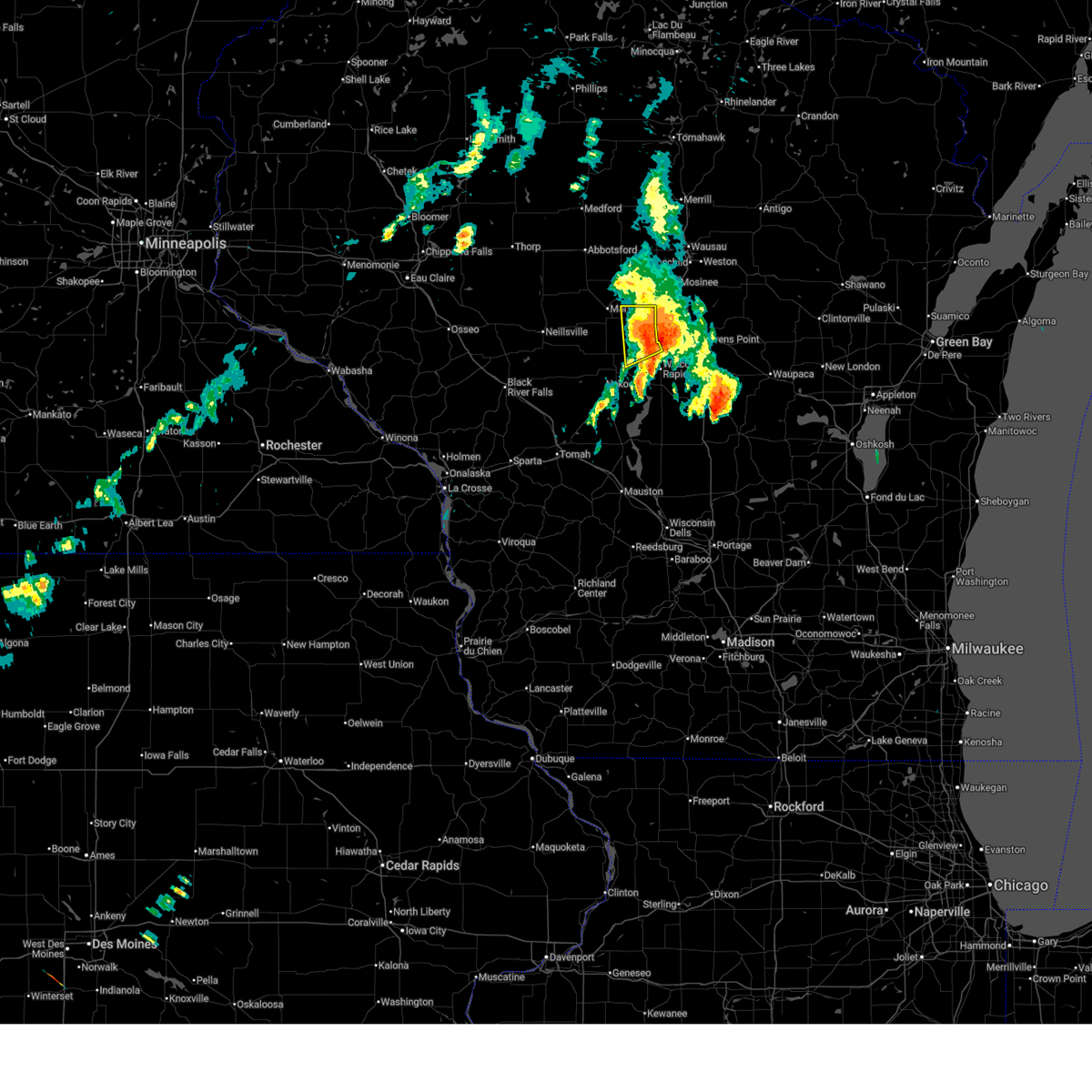
 At 249 pm cdt, a severe thunderstorm was located near marshfield, or 24 miles northwest of wisconsin rapids, moving east at 25 mph (public reported. at 243 pm, 1 inch hail was reported 3 miles northwest of marshfield). Hazards include ping pong ball size hail and 60 mph wind gusts. People and animals outdoors will be injured. expect hail damage to roofs, siding, windows, and vehicles. expect wind damage to roofs, siding, and trees. this severe thunderstorm will be near, marshfield around 250 pm cdt. Other locations impacted by the severe thunderstorm include hewitt, bakerville, rozellville, auburndale, blenker, milladore, sherry and big eau pleine county park. At 249 pm cdt, a severe thunderstorm was located near marshfield, or 24 miles northwest of wisconsin rapids, moving east at 25 mph (public reported. at 243 pm, 1 inch hail was reported 3 miles northwest of marshfield). Hazards include ping pong ball size hail and 60 mph wind gusts. People and animals outdoors will be injured. expect hail damage to roofs, siding, windows, and vehicles. expect wind damage to roofs, siding, and trees. this severe thunderstorm will be near, marshfield around 250 pm cdt. Other locations impacted by the severe thunderstorm include hewitt, bakerville, rozellville, auburndale, blenker, milladore, sherry and big eau pleine county park.
|
| 6/24/2026 2:38 PM CDT |
 At 238 pm cdt, a severe thunderstorm was located over marshfield, or 27 miles northwest of wisconsin rapids, moving east at 25 mph (radar indicated). Hazards include ping pong ball size hail and 60 mph wind gusts. People and animals outdoors will be injured. expect hail damage to roofs, siding, windows, and vehicles. expect wind damage to roofs, siding, and trees. this severe thunderstorm will be near, marshfield and spencer around 240 pm cdt. Other locations impacted by the severe thunderstorm include bakerville, hewitt, rozellville, auburndale, blenker, milladore, sherry and big eau pleine county park. At 238 pm cdt, a severe thunderstorm was located over marshfield, or 27 miles northwest of wisconsin rapids, moving east at 25 mph (radar indicated). Hazards include ping pong ball size hail and 60 mph wind gusts. People and animals outdoors will be injured. expect hail damage to roofs, siding, windows, and vehicles. expect wind damage to roofs, siding, and trees. this severe thunderstorm will be near, marshfield and spencer around 240 pm cdt. Other locations impacted by the severe thunderstorm include bakerville, hewitt, rozellville, auburndale, blenker, milladore, sherry and big eau pleine county park.
|
| 6/24/2026 2:30 PM CDT |
 At 230 pm cdt, a severe thunderstorm was located near spencer, or 30 miles northwest of wisconsin rapids, moving east at 20 mph (radar indicated). Hazards include 60 mph wind gusts and quarter size hail. Hail damage to vehicles is expected. expect wind damage to roofs, siding, and trees. this severe thunderstorm will be near, spencer around 235 pm cdt. marshfield around 245 pm cdt. Other locations impacted by the severe thunderstorm include nasonville, bakerville, hewitt, rozellville, auburndale, blenker, sherry and milladore. At 230 pm cdt, a severe thunderstorm was located near spencer, or 30 miles northwest of wisconsin rapids, moving east at 20 mph (radar indicated). Hazards include 60 mph wind gusts and quarter size hail. Hail damage to vehicles is expected. expect wind damage to roofs, siding, and trees. this severe thunderstorm will be near, spencer around 235 pm cdt. marshfield around 245 pm cdt. Other locations impacted by the severe thunderstorm include nasonville, bakerville, hewitt, rozellville, auburndale, blenker, sherry and milladore.
|
| 6/24/2026 2:17 PM CDT |
 Svrgrb the national weather service in green bay has issued a * severe thunderstorm warning for, southwestern marathon county in central wisconsin, northern wood county in central wisconsin, * until 315 pm cdt. * at 217 pm cdt, a severe thunderstorm was located near spencer, or 35 miles northwest of wisconsin rapids, moving east at 20 mph (radar indicated). Hazards include 60 mph wind gusts and quarter size hail. Hail damage to vehicles is expected. expect wind damage to roofs, siding, and trees. this severe thunderstorm will be near, spencer around 225 pm cdt. marshfield around 245 pm cdt. Other locations impacted by the severe thunderstorm include nasonville, bakerville, hewitt, rozellville, auburndale, blenker, sherry and milladore. Svrgrb the national weather service in green bay has issued a * severe thunderstorm warning for, southwestern marathon county in central wisconsin, northern wood county in central wisconsin, * until 315 pm cdt. * at 217 pm cdt, a severe thunderstorm was located near spencer, or 35 miles northwest of wisconsin rapids, moving east at 20 mph (radar indicated). Hazards include 60 mph wind gusts and quarter size hail. Hail damage to vehicles is expected. expect wind damage to roofs, siding, and trees. this severe thunderstorm will be near, spencer around 225 pm cdt. marshfield around 245 pm cdt. Other locations impacted by the severe thunderstorm include nasonville, bakerville, hewitt, rozellville, auburndale, blenker, sherry and milladore.
|
| 6/10/2026 3:28 PM CDT |
 The storms which prompted the warning have moved out of the area. therefore, the warning will be allowed to expire. however, gusty winds are still possible with these thunderstorms. a severe thunderstorm watch remains in effect until 700 pm cdt for central and north central wisconsin. remember, a severe thunderstorm warning still remains in effect for western wood and southeastern marathon counties!. The storms which prompted the warning have moved out of the area. therefore, the warning will be allowed to expire. however, gusty winds are still possible with these thunderstorms. a severe thunderstorm watch remains in effect until 700 pm cdt for central and north central wisconsin. remember, a severe thunderstorm warning still remains in effect for western wood and southeastern marathon counties!.
|
| 6/10/2026 2:58 PM CDT |
 At 257 pm cdt, severe thunderstorms were located along a line extending from dorchester to near marshfield to near babcock, moving east at 45 mph (radar indicated). Hazards include 70 mph wind gusts and quarter size hail. Hail damage to vehicles is expected. expect considerable tree damage. wind damage is also likely to mobile homes, roofs, and outbuildings. these severe storms will be near, marshfield, abbotsford, pittsville, and babcock around 300 pm cdt. wisconsin rapids around 310 pm cdt. lake wazeecha around 315 pm cdt. Other locations impacted by these severe thunderstorms include milladore, sandhill wildlife area, north wood county park, edgar, big eau pleine county park, moon, little chicago, auburndale, march rapids, and hamburg. At 257 pm cdt, severe thunderstorms were located along a line extending from dorchester to near marshfield to near babcock, moving east at 45 mph (radar indicated). Hazards include 70 mph wind gusts and quarter size hail. Hail damage to vehicles is expected. expect considerable tree damage. wind damage is also likely to mobile homes, roofs, and outbuildings. these severe storms will be near, marshfield, abbotsford, pittsville, and babcock around 300 pm cdt. wisconsin rapids around 310 pm cdt. lake wazeecha around 315 pm cdt. Other locations impacted by these severe thunderstorms include milladore, sandhill wildlife area, north wood county park, edgar, big eau pleine county park, moon, little chicago, auburndale, march rapids, and hamburg.
|
| 6/10/2026 2:25 PM CDT |
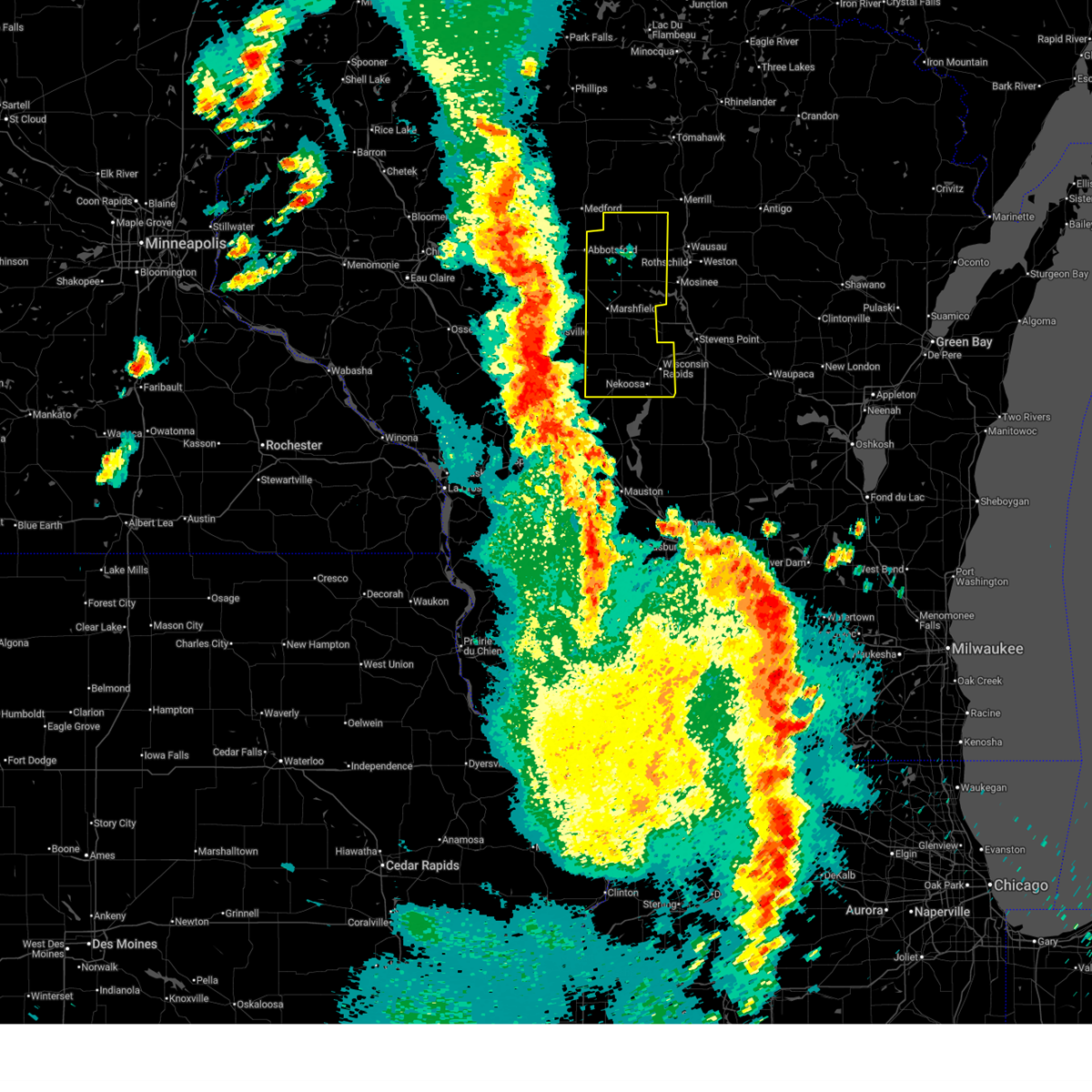 Svrgrb the national weather service in green bay has issued a * severe thunderstorm warning for, wood county in central wisconsin, western marathon county in central wisconsin, * until 330 pm cdt. * at 224 pm cdt, severe thunderstorms were located along a line extending from near thorp to near neillsville to 6 miles northeast of millston, moving east-northeast at 45 mph (radar indicated). Hazards include 70 mph wind gusts and quarter size hail. Hail damage to vehicles is expected. expect considerable tree damage. wind damage is also likely to mobile homes, roofs, and outbuildings. severe thunderstorms will be near, spencer around 235 pm cdt. marshfield around 240 pm cdt. abbotsford and pittsville around 245 pm cdt. babcock around 250 pm cdt. wisconsin rapids around 305 pm cdt. lake wazeecha around 315 pm cdt. Other locations impacted by these severe thunderstorms include milladore, sandhill wildlife area, north wood county park, edgar, big eau pleine county park, moon, little chicago, auburndale, march rapids, and hamburg. Svrgrb the national weather service in green bay has issued a * severe thunderstorm warning for, wood county in central wisconsin, western marathon county in central wisconsin, * until 330 pm cdt. * at 224 pm cdt, severe thunderstorms were located along a line extending from near thorp to near neillsville to 6 miles northeast of millston, moving east-northeast at 45 mph (radar indicated). Hazards include 70 mph wind gusts and quarter size hail. Hail damage to vehicles is expected. expect considerable tree damage. wind damage is also likely to mobile homes, roofs, and outbuildings. severe thunderstorms will be near, spencer around 235 pm cdt. marshfield around 240 pm cdt. abbotsford and pittsville around 245 pm cdt. babcock around 250 pm cdt. wisconsin rapids around 305 pm cdt. lake wazeecha around 315 pm cdt. Other locations impacted by these severe thunderstorms include milladore, sandhill wildlife area, north wood county park, edgar, big eau pleine county park, moon, little chicago, auburndale, march rapids, and hamburg.
|
| 6/10/2026 8:06 AM CDT |
 At 806 am cdt, severe thunderstorms were located along a line from 8 miles east of marshfield to near wisconsin rapids, or along a line from 22 miles northwest of wisconsin rapids to near wisconsin rapids, moving east at 40 mph (radar indicated). Hazards include 60 mph wind gusts and quarter size hail. Hail damage to vehicles is expected. expect wind damage to roofs, siding, and trees. this severe thunderstorm will be near, wisconsin rapids around 810 am cdt. stevens point and whiting around 825 am cdt. Other locations impacted by the severe thunderstorm include blenker, sherry, auburndale, vesper, arpin, hewitt, rudolph, milladore, biron and junction city. At 806 am cdt, severe thunderstorms were located along a line from 8 miles east of marshfield to near wisconsin rapids, or along a line from 22 miles northwest of wisconsin rapids to near wisconsin rapids, moving east at 40 mph (radar indicated). Hazards include 60 mph wind gusts and quarter size hail. Hail damage to vehicles is expected. expect wind damage to roofs, siding, and trees. this severe thunderstorm will be near, wisconsin rapids around 810 am cdt. stevens point and whiting around 825 am cdt. Other locations impacted by the severe thunderstorm include blenker, sherry, auburndale, vesper, arpin, hewitt, rudolph, milladore, biron and junction city.
|
| 6/10/2026 7:34 AM CDT |
 Svrgrb the national weather service in green bay has issued a * severe thunderstorm warning for, northwestern portage county in central wisconsin, wood county in central wisconsin, * until 830 am cdt. * at 734 am cdt, severe thunderstorms were located along a line from over marshfield to 21 miles west of pittsville, or along a line from 26 miles northwest of wisconsin rapids to 36 miles west of wisconsin rapids, moving east at 50 mph (radar indicated). Hazards include 60 mph wind gusts and quarter size hail. Hail damage to vehicles is expected. expect wind damage to roofs, siding, and trees. this severe thunderstorm will be near, marshfield around 735 am cdt. pittsville around 755 am cdt. wisconsin rapids and stevens point around 815 am cdt. whiting around 820 am cdt. Other locations impacted by the severe thunderstorm include bakerville, lindsey, nasonville, hewitt, north wood county park, auburndale, arpin, powers bluff county park, bethel and sherry. Svrgrb the national weather service in green bay has issued a * severe thunderstorm warning for, northwestern portage county in central wisconsin, wood county in central wisconsin, * until 830 am cdt. * at 734 am cdt, severe thunderstorms were located along a line from over marshfield to 21 miles west of pittsville, or along a line from 26 miles northwest of wisconsin rapids to 36 miles west of wisconsin rapids, moving east at 50 mph (radar indicated). Hazards include 60 mph wind gusts and quarter size hail. Hail damage to vehicles is expected. expect wind damage to roofs, siding, and trees. this severe thunderstorm will be near, marshfield around 735 am cdt. pittsville around 755 am cdt. wisconsin rapids and stevens point around 815 am cdt. whiting around 820 am cdt. Other locations impacted by the severe thunderstorm include bakerville, lindsey, nasonville, hewitt, north wood county park, auburndale, arpin, powers bluff county park, bethel and sherry.
|
| 6/10/2026 7:24 AM CDT |
 At 724 am cdt, severe thunderstorms were located along a line from near council grounds state park to over pittsville, or along a line from 18 miles northwest of wausau to 12 miles west of wisconsin rapids, moving east at 45 mph (radar indicated). Hazards include 60 mph wind gusts and quarter size hail. Hail damage to vehicles is expected. expect wind damage to roofs, siding, and trees. this severe thunderstorm will be near, mosinee and pittsville around 725 am cdt. Other locations impacted by the severe thunderstorm include blenker, moon, big eau pleine county park, sherry, vesper, arpin, milladore, halder, little chicago and powers bluff county park. At 724 am cdt, severe thunderstorms were located along a line from near council grounds state park to over pittsville, or along a line from 18 miles northwest of wausau to 12 miles west of wisconsin rapids, moving east at 45 mph (radar indicated). Hazards include 60 mph wind gusts and quarter size hail. Hail damage to vehicles is expected. expect wind damage to roofs, siding, and trees. this severe thunderstorm will be near, mosinee and pittsville around 725 am cdt. Other locations impacted by the severe thunderstorm include blenker, moon, big eau pleine county park, sherry, vesper, arpin, milladore, halder, little chicago and powers bluff county park.
|
| 6/10/2026 6:56 AM CDT |
 At 656 am cdt, severe thunderstorms were located along a line from 9 miles north of dorchester to 20 miles west of pittsville, or along a line from 33 miles west of wausau to 34 miles west of wisconsin rapids, moving east at 45 mph (radar indicated). Hazards include 60 mph wind gusts and quarter size hail. Hail damage to vehicles is expected. expect wind damage to roofs, siding, and trees. this severe thunderstorm will be near, marshfield, spencer and abbotsford around 700 am cdt. pittsville around 715 am cdt. mosinee around 725 am cdt. Other locations impacted by the severe thunderstorm include nasonville, lindsey, milan, march rapids, cherokee, athens, fenwood, stratford, bakerville and hewitt. At 656 am cdt, severe thunderstorms were located along a line from 9 miles north of dorchester to 20 miles west of pittsville, or along a line from 33 miles west of wausau to 34 miles west of wisconsin rapids, moving east at 45 mph (radar indicated). Hazards include 60 mph wind gusts and quarter size hail. Hail damage to vehicles is expected. expect wind damage to roofs, siding, and trees. this severe thunderstorm will be near, marshfield, spencer and abbotsford around 700 am cdt. pittsville around 715 am cdt. mosinee around 725 am cdt. Other locations impacted by the severe thunderstorm include nasonville, lindsey, milan, march rapids, cherokee, athens, fenwood, stratford, bakerville and hewitt.
|
| 6/10/2026 6:41 AM CDT |
 Svrgrb the national weather service in green bay has issued a * severe thunderstorm warning for, western marathon county in central wisconsin, northern wood county in central wisconsin, * until 730 am cdt. * at 641 am cdt, severe thunderstorms were located along a line from 10 miles northwest of dorchester to 29 miles west of babcock, or along a line from 42 miles west of wausau to 45 miles west of wisconsin rapids, moving east at 45 mph (radar indicated). Hazards include 60 mph wind gusts and quarter size hail. Hail damage to vehicles is expected. expect wind damage to roofs, siding, and trees. this severe thunderstorm will be near, spencer and abbotsford around 645 am cdt. marshfield around 650 am cdt. pittsville around 715 am cdt. mosinee around 720 am cdt. Other locations impacted by the severe thunderstorm include unity, colby, lindsey, nasonville, bakerville, milan, march rapids, cherokee, stratford and fenwood. Svrgrb the national weather service in green bay has issued a * severe thunderstorm warning for, western marathon county in central wisconsin, northern wood county in central wisconsin, * until 730 am cdt. * at 641 am cdt, severe thunderstorms were located along a line from 10 miles northwest of dorchester to 29 miles west of babcock, or along a line from 42 miles west of wausau to 45 miles west of wisconsin rapids, moving east at 45 mph (radar indicated). Hazards include 60 mph wind gusts and quarter size hail. Hail damage to vehicles is expected. expect wind damage to roofs, siding, and trees. this severe thunderstorm will be near, spencer and abbotsford around 645 am cdt. marshfield around 650 am cdt. pittsville around 715 am cdt. mosinee around 720 am cdt. Other locations impacted by the severe thunderstorm include unity, colby, lindsey, nasonville, bakerville, milan, march rapids, cherokee, stratford and fenwood.
|
| 4/17/2026 6:11 PM CDT |
 The storm which prompted the warning has weakened below severe limits, and no longer appears capable of producing a tornado. therefore, the warning will be allowed to expire. however, gusty winds and heavy rain are still possible with this thunderstorm. a tornado watch remains in effect until 800 pm cdt for central wisconsin. The storm which prompted the warning has weakened below severe limits, and no longer appears capable of producing a tornado. therefore, the warning will be allowed to expire. however, gusty winds and heavy rain are still possible with this thunderstorm. a tornado watch remains in effect until 800 pm cdt for central wisconsin.
|
| 4/17/2026 5:57 PM CDT |
 At 555 pm cdt, a severe thunderstorm capable of producing a tornado was located 3 miles south of marshfield, or 20 miles northwest of wisconsin rapids, moving east at 30 mph (radar indicated rotation). Hazards include tornado and quarter size hail. Flying debris will be dangerous to those caught without shelter. mobile homes will be damaged or destroyed. damage to roofs, windows, and vehicles will occur. tree damage is likely. this dangerous storm will be near, marshfield around 600 pm cdt. Other locations impacted by this tornadic thunderstorm include bakerville, milladore, north wood county park, sherry, powers bluff county park, auburndale, lindsey, bethel, blenker, and hewitt. At 555 pm cdt, a severe thunderstorm capable of producing a tornado was located 3 miles south of marshfield, or 20 miles northwest of wisconsin rapids, moving east at 30 mph (radar indicated rotation). Hazards include tornado and quarter size hail. Flying debris will be dangerous to those caught without shelter. mobile homes will be damaged or destroyed. damage to roofs, windows, and vehicles will occur. tree damage is likely. this dangerous storm will be near, marshfield around 600 pm cdt. Other locations impacted by this tornadic thunderstorm include bakerville, milladore, north wood county park, sherry, powers bluff county park, auburndale, lindsey, bethel, blenker, and hewitt.
|
| 4/17/2026 5:42 PM CDT |
 At 540 pm cdt, a severe thunderstorm capable of producing a tornado was located 10 miles southwest of marshfield, or near lindsey, moving northeast at 30 mph (radar indicated rotation). Hazards include tornado and half dollar size hail. Flying debris will be dangerous to those caught without shelter. mobile homes will be damaged or destroyed. damage to roofs, windows, and vehicles will occur. tree damage is likely. this dangerous storm will be near, lindsey around 545 pm cdt. marshfield around 600 pm cdt. Other locations impacted by this tornadic thunderstorm include bakerville, milladore, north wood county park, sherry, powers bluff county park, auburndale, lindsey, bethel, blenker, and hewitt. At 540 pm cdt, a severe thunderstorm capable of producing a tornado was located 10 miles southwest of marshfield, or near lindsey, moving northeast at 30 mph (radar indicated rotation). Hazards include tornado and half dollar size hail. Flying debris will be dangerous to those caught without shelter. mobile homes will be damaged or destroyed. damage to roofs, windows, and vehicles will occur. tree damage is likely. this dangerous storm will be near, lindsey around 545 pm cdt. marshfield around 600 pm cdt. Other locations impacted by this tornadic thunderstorm include bakerville, milladore, north wood county park, sherry, powers bluff county park, auburndale, lindsey, bethel, blenker, and hewitt.
|
| 4/17/2026 5:33 PM CDT |
 At 532 pm cdt, a severe thunderstorm capable of producing a tornado was located 9 miles east of shortville, or 12 miles east of neillsville, moving northeast at 30 mph (radar indicated rotation). Hazards include tornado and half dollar size hail. Flying debris will be dangerous to those caught without shelter. mobile homes will be damaged or destroyed. damage to roofs, windows, and vehicles will occur. tree damage is likely. this dangerous storm will be near, marshfield around 545 pm cdt. Other locations impacted by this tornadic thunderstorm include bakerville, milladore, north wood county park, sherry, powers bluff county park, auburndale, lindsey, bethel, blenker, and hewitt. At 532 pm cdt, a severe thunderstorm capable of producing a tornado was located 9 miles east of shortville, or 12 miles east of neillsville, moving northeast at 30 mph (radar indicated rotation). Hazards include tornado and half dollar size hail. Flying debris will be dangerous to those caught without shelter. mobile homes will be damaged or destroyed. damage to roofs, windows, and vehicles will occur. tree damage is likely. this dangerous storm will be near, marshfield around 545 pm cdt. Other locations impacted by this tornadic thunderstorm include bakerville, milladore, north wood county park, sherry, powers bluff county park, auburndale, lindsey, bethel, blenker, and hewitt.
|
| 4/17/2026 5:25 PM CDT |
 At 524 pm cdt, a severe thunderstorm capable of producing a tornado was located near shortville, or 10 miles southeast of neillsville, moving east at 30 mph (radar indicated rotation). Hazards include tornado and half dollar size hail. Flying debris will be dangerous to those caught without shelter. mobile homes will be damaged or destroyed. damage to roofs, windows, and vehicles will occur. tree damage is likely. This tornadic thunderstorm will remain over mainly rural areas of northern wood county, including the following locations, milladore, north wood county park, sherry, auburndale, blenker, hewitt, arpin, bakerville, powers bluff county park, and lindsey. At 524 pm cdt, a severe thunderstorm capable of producing a tornado was located near shortville, or 10 miles southeast of neillsville, moving east at 30 mph (radar indicated rotation). Hazards include tornado and half dollar size hail. Flying debris will be dangerous to those caught without shelter. mobile homes will be damaged or destroyed. damage to roofs, windows, and vehicles will occur. tree damage is likely. This tornadic thunderstorm will remain over mainly rural areas of northern wood county, including the following locations, milladore, north wood county park, sherry, auburndale, blenker, hewitt, arpin, bakerville, powers bluff county park, and lindsey.
|
| 4/17/2026 5:14 PM CDT |
 Torgrb the national weather service in green bay has issued a * tornado warning for, northern wood county in central wisconsin, * until 615 pm cdt. * at 513 pm cdt, a severe thunderstorm capable of producing a tornado was located over shortville, or 7 miles southeast of neillsville, moving east at 30 mph (radar indicated rotation). Hazards include tornado and ping pong ball size hail. Flying debris will be dangerous to those caught without shelter. mobile homes will be damaged or destroyed. damage to roofs, windows, and vehicles will occur. tree damage is likely. This tornadic thunderstorm will remain over mainly rural areas of northern wood county, including the following locations, milladore, north wood county park, sherry, auburndale, blenker, hewitt, arpin, bakerville, powers bluff county park, and lindsey. Torgrb the national weather service in green bay has issued a * tornado warning for, northern wood county in central wisconsin, * until 615 pm cdt. * at 513 pm cdt, a severe thunderstorm capable of producing a tornado was located over shortville, or 7 miles southeast of neillsville, moving east at 30 mph (radar indicated rotation). Hazards include tornado and ping pong ball size hail. Flying debris will be dangerous to those caught without shelter. mobile homes will be damaged or destroyed. damage to roofs, windows, and vehicles will occur. tree damage is likely. This tornadic thunderstorm will remain over mainly rural areas of northern wood county, including the following locations, milladore, north wood county park, sherry, auburndale, blenker, hewitt, arpin, bakerville, powers bluff county park, and lindsey.
|
| 4/17/2026 4:07 PM CDT |
 The severe thunderstorm warning that was previously in effect has been reissued for marathon and wood counties and is in effect until 445 pm cdt. please refer to that bulletin for the latest severe weather information. a tornado watch remains in effect until 800 pm cdt friday for a portion of central wisconsin. The severe thunderstorm warning that was previously in effect has been reissued for marathon and wood counties and is in effect until 445 pm cdt. please refer to that bulletin for the latest severe weather information. a tornado watch remains in effect until 800 pm cdt friday for a portion of central wisconsin.
|
| 4/17/2026 3:53 PM CDT |
 The storms which prompted the warning have weakened below severe limits, and no longer appear capable of producing a tornado. therefore, the warning will be allowed to expire. a severe thunderstorm warning still remains in effect for wood county. a tornado watch remains in effect until 800 pm cdt friday for a portion of central wisconsin. The storms which prompted the warning have weakened below severe limits, and no longer appear capable of producing a tornado. therefore, the warning will be allowed to expire. a severe thunderstorm warning still remains in effect for wood county. a tornado watch remains in effect until 800 pm cdt friday for a portion of central wisconsin.
|
| 4/17/2026 3:52 PM CDT |
 Svrgrb the national weather service in green bay has issued a * severe thunderstorm warning for, marathon county in central wisconsin, northern portage county in central wisconsin, northern wood county in central wisconsin, * until 445 pm cdt. * at 352 pm cdt, severe thunderstorms were located along a line from 10 miles west of rib mountain to 8 miles northeast of pittsville, or along a line from 13 miles southwest of wausau to 14 miles northwest of wisconsin rapids, moving northeast at 50 mph (radar indicated). Hazards include ping pong ball size hail and 60 mph wind gusts. People and animals outdoors will be injured. expect hail damage to roofs, siding, windows, and vehicles. expect wind damage to roofs, siding, and trees. this severe thunderstorm will be near, mosinee, rib mountain and wausau around 400 pm cdt. weston around 410 pm cdt. Other locations impacted by the severe thunderstorm include moon, blenker, arpin, marathon city, halder, big eau pleine county park, powers bluff county park, auburndale, bethel and vesper. Svrgrb the national weather service in green bay has issued a * severe thunderstorm warning for, marathon county in central wisconsin, northern portage county in central wisconsin, northern wood county in central wisconsin, * until 445 pm cdt. * at 352 pm cdt, severe thunderstorms were located along a line from 10 miles west of rib mountain to 8 miles northeast of pittsville, or along a line from 13 miles southwest of wausau to 14 miles northwest of wisconsin rapids, moving northeast at 50 mph (radar indicated). Hazards include ping pong ball size hail and 60 mph wind gusts. People and animals outdoors will be injured. expect hail damage to roofs, siding, windows, and vehicles. expect wind damage to roofs, siding, and trees. this severe thunderstorm will be near, mosinee, rib mountain and wausau around 400 pm cdt. weston around 410 pm cdt. Other locations impacted by the severe thunderstorm include moon, blenker, arpin, marathon city, halder, big eau pleine county park, powers bluff county park, auburndale, bethel and vesper.
|
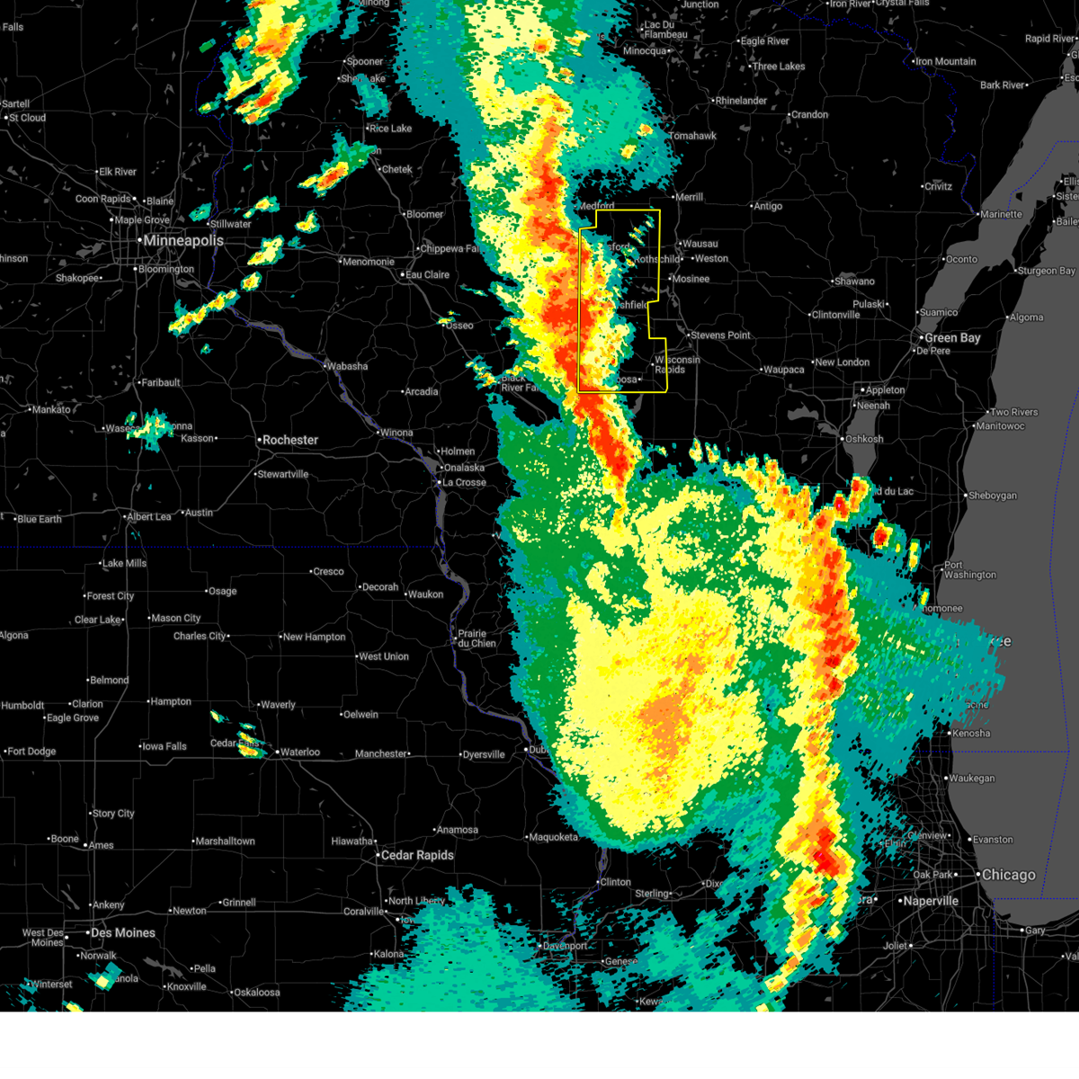
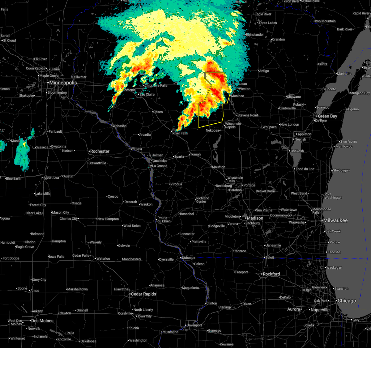
| 4/17/2026 3:48 PM CDT |
 At 348 pm cdt, severe thunderstorms were located along a line from 13 miles west of rib mountain to 9 miles northeast of pittsville, or along a line from 15 miles west of wausau to 14 miles northwest of wisconsin rapids, moving northeast at 50 mph (radar indicated). Hazards include ping pong ball size hail and 60 mph wind gusts. People and animals outdoors will be injured. expect hail damage to roofs, siding, windows, and vehicles. expect wind damage to roofs, siding, and trees. this severe thunderstorm will be near, marshfield around 350 pm cdt. mosinee and wausau around 400 pm cdt. rib mountain around 405 pm cdt. Other locations impacted by the severe thunderstorm include arpin, halder, big eau pleine county park, edgar, powers bluff county park, bethel, auburndale, fenwood, vesper and north wood county park. At 348 pm cdt, severe thunderstorms were located along a line from 13 miles west of rib mountain to 9 miles northeast of pittsville, or along a line from 15 miles west of wausau to 14 miles northwest of wisconsin rapids, moving northeast at 50 mph (radar indicated). Hazards include ping pong ball size hail and 60 mph wind gusts. People and animals outdoors will be injured. expect hail damage to roofs, siding, windows, and vehicles. expect wind damage to roofs, siding, and trees. this severe thunderstorm will be near, marshfield around 350 pm cdt. mosinee and wausau around 400 pm cdt. rib mountain around 405 pm cdt. Other locations impacted by the severe thunderstorm include arpin, halder, big eau pleine county park, edgar, powers bluff county park, bethel, auburndale, fenwood, vesper and north wood county park.
|
| 4/17/2026 3:40 PM CDT |
 At 340 pm cdt, severe thunderstorms capable of producing a tornado were located along a line from 12 miles southwest of mosinee to over pittsville, or along a line from 19 miles northwest of stevens point to 17 miles west of wisconsin rapids, moving northeast at 40 mph (radar indicated rotation). Hazards include tornado and ping pong ball size hail. Flying debris will be dangerous to those caught without shelter. mobile homes will be damaged or destroyed. damage to roofs, windows and vehicles will occur. tree damage is likely. Locations impacted include, marshfield, pittsville, hewitt, sherry, auburndale, vesper, arpin, milladore, bethel, powers bluff county park, north wood county park, veedum, bakerville, blenker, scranton and lindsey. At 340 pm cdt, severe thunderstorms capable of producing a tornado were located along a line from 12 miles southwest of mosinee to over pittsville, or along a line from 19 miles northwest of stevens point to 17 miles west of wisconsin rapids, moving northeast at 40 mph (radar indicated rotation). Hazards include tornado and ping pong ball size hail. Flying debris will be dangerous to those caught without shelter. mobile homes will be damaged or destroyed. damage to roofs, windows and vehicles will occur. tree damage is likely. Locations impacted include, marshfield, pittsville, hewitt, sherry, auburndale, vesper, arpin, milladore, bethel, powers bluff county park, north wood county park, veedum, bakerville, blenker, scranton and lindsey.
|
| 4/17/2026 3:31 PM CDT |
 At 331 pm cdt, severe thunderstorms were located along a line from 12 miles north of marshfield to near pittsville, or along a line from 25 miles west of wausau to 20 miles west of wisconsin rapids, moving northeast at 50 mph (radar indicated). Hazards include ping pong ball size hail and 60 mph wind gusts. People and animals outdoors will be injured. expect hail damage to roofs, siding, windows, and vehicles. expect wind damage to roofs, siding, and trees. this severe thunderstorm will be near, pittsville and marshfield around 335 pm cdt. rib mountain, mosinee and wausau around 355 pm cdt. Other locations impacted by the severe thunderstorm include north wood county park, rozellville, stratford, hewitt, march rapids, veedum, lindsey, bakerville, nasonville and auburndale. At 331 pm cdt, severe thunderstorms were located along a line from 12 miles north of marshfield to near pittsville, or along a line from 25 miles west of wausau to 20 miles west of wisconsin rapids, moving northeast at 50 mph (radar indicated). Hazards include ping pong ball size hail and 60 mph wind gusts. People and animals outdoors will be injured. expect hail damage to roofs, siding, windows, and vehicles. expect wind damage to roofs, siding, and trees. this severe thunderstorm will be near, pittsville and marshfield around 335 pm cdt. rib mountain, mosinee and wausau around 355 pm cdt. Other locations impacted by the severe thunderstorm include north wood county park, rozellville, stratford, hewitt, march rapids, veedum, lindsey, bakerville, nasonville and auburndale.
|
| 4/17/2026 3:19 PM CDT |
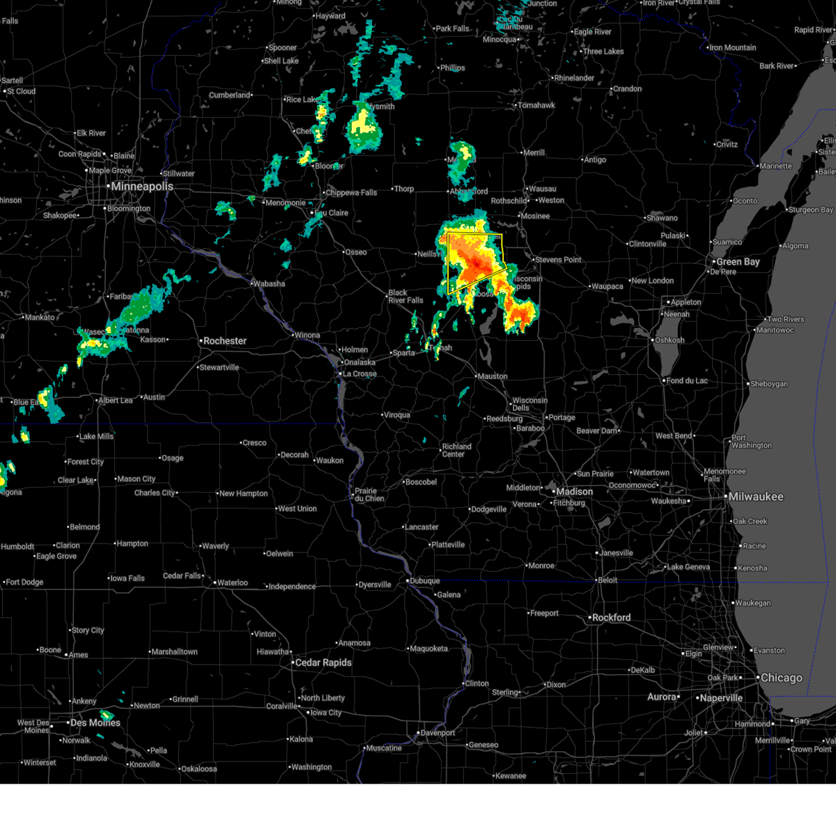
 At 319 pm cdt, severe thunderstorms capable of producing a tornado were located along a line from near spencer to 15 miles west of babcock, or along a line from 30 miles northwest of wisconsin rapids to 29 miles west of wisconsin rapids, moving northeast at 40 mph (radar indicated rotation). Hazards include tornado and golf ball size hail. Flying debris will be dangerous to those caught without shelter. mobile homes will be damaged or destroyed. damage to roofs, windows and vehicles will occur. tree damage is likely. this tornado will be near, marshfield around 320 pm cdt. pittsville around 340 pm cdt. Other locations impacted by the tornado include bakerville, lindsey, nasonville, hewitt, auburndale, scranton, north wood county park, veedum, bethel and powers bluff county park. At 319 pm cdt, severe thunderstorms capable of producing a tornado were located along a line from near spencer to 15 miles west of babcock, or along a line from 30 miles northwest of wisconsin rapids to 29 miles west of wisconsin rapids, moving northeast at 40 mph (radar indicated rotation). Hazards include tornado and golf ball size hail. Flying debris will be dangerous to those caught without shelter. mobile homes will be damaged or destroyed. damage to roofs, windows and vehicles will occur. tree damage is likely. this tornado will be near, marshfield around 320 pm cdt. pittsville around 340 pm cdt. Other locations impacted by the tornado include bakerville, lindsey, nasonville, hewitt, auburndale, scranton, north wood county park, veedum, bethel and powers bluff county park.
|
| 4/17/2026 3:18 PM CDT |
 At 318 pm cdt, severe thunderstorms were located along a line from over spencer to 13 miles west of pittsville, or along a line from 33 miles northwest of wisconsin rapids to 27 miles west of wisconsin rapids, moving northeast at 50 mph (radar indicated). Hazards include golf ball size hail and 60 mph wind gusts. People and animals outdoors will be injured. expect hail damage to roofs, siding, windows, and vehicles. expect wind damage to roofs, siding, and trees. this severe thunderstorm will be near, marshfield and spencer around 320 pm cdt. pittsville around 335 pm cdt. Other locations impacted by the severe thunderstorm include bakerville, lindsey, nasonville, unity, hewitt, scranton, march rapids, stratford, veedum and cherokee. At 318 pm cdt, severe thunderstorms were located along a line from over spencer to 13 miles west of pittsville, or along a line from 33 miles northwest of wisconsin rapids to 27 miles west of wisconsin rapids, moving northeast at 50 mph (radar indicated). Hazards include golf ball size hail and 60 mph wind gusts. People and animals outdoors will be injured. expect hail damage to roofs, siding, windows, and vehicles. expect wind damage to roofs, siding, and trees. this severe thunderstorm will be near, marshfield and spencer around 320 pm cdt. pittsville around 335 pm cdt. Other locations impacted by the severe thunderstorm include bakerville, lindsey, nasonville, unity, hewitt, scranton, march rapids, stratford, veedum and cherokee.
|
| 4/17/2026 3:05 PM CDT |
 At 305 pm cdt, a severe thunderstorm capable of producing a tornado was located 15 miles west of pittsville, or 30 miles west of wisconsin rapids, moving northeast at 40 mph (radar indicated rotation). Hazards include tornado and baseball size hail. Flying debris will be dangerous to those caught without shelter. mobile homes will be damaged or destroyed. damage to roofs, windows and vehicles will occur. tree damage is likely. this tornado will be near, pittsville around 325 pm cdt. marshfield around 335 pm cdt. Other locations impacted by the tornado include scranton, lindsey, veedum, nasonville, north wood county park, bakerville, powers bluff county park, bethel, arpin and hewitt. At 305 pm cdt, a severe thunderstorm capable of producing a tornado was located 15 miles west of pittsville, or 30 miles west of wisconsin rapids, moving northeast at 40 mph (radar indicated rotation). Hazards include tornado and baseball size hail. Flying debris will be dangerous to those caught without shelter. mobile homes will be damaged or destroyed. damage to roofs, windows and vehicles will occur. tree damage is likely. this tornado will be near, pittsville around 325 pm cdt. marshfield around 335 pm cdt. Other locations impacted by the tornado include scranton, lindsey, veedum, nasonville, north wood county park, bakerville, powers bluff county park, bethel, arpin and hewitt.
|
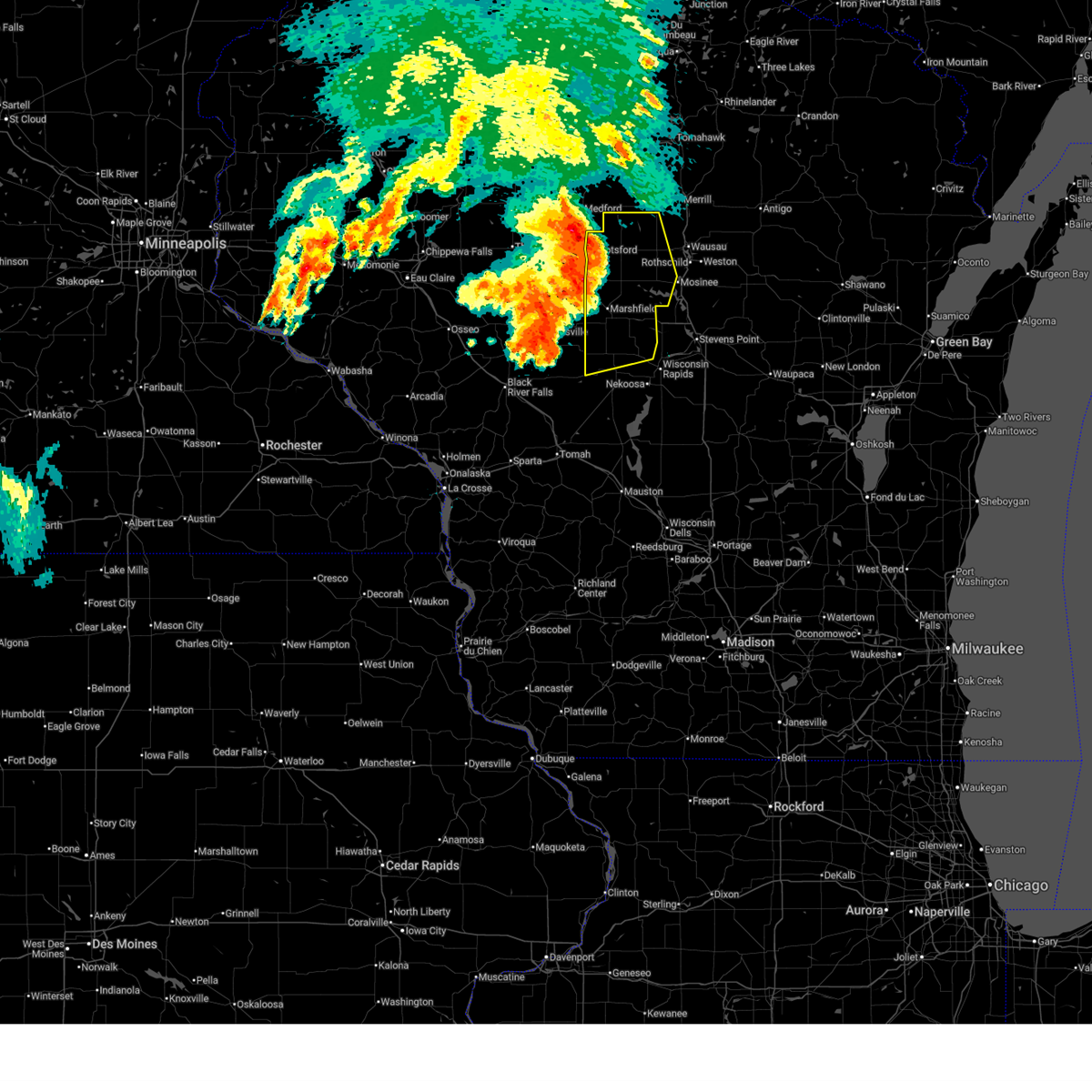
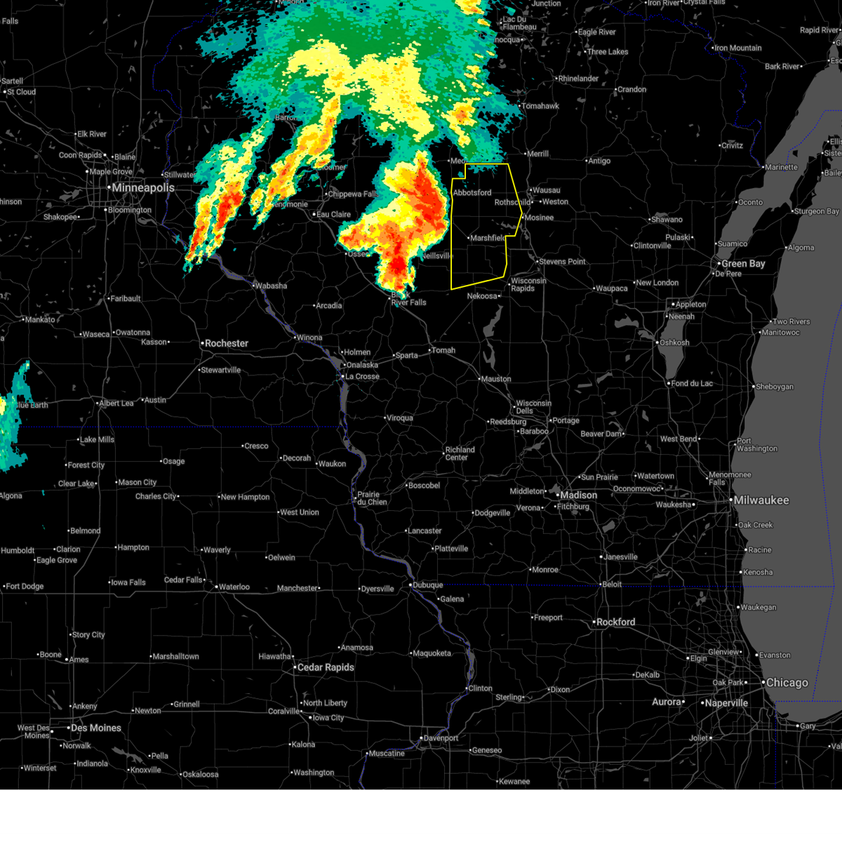
| 4/17/2026 3:04 PM CDT |
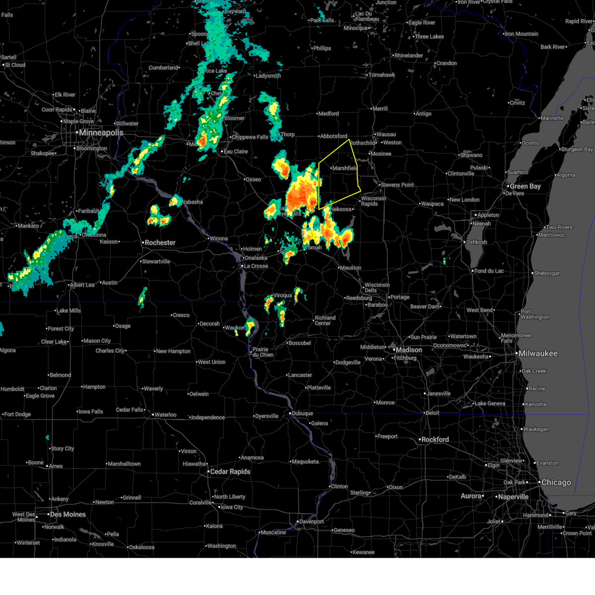
 At 304 pm cdt, severe thunderstorms were located along a line from 11 miles west of abbotsford to 11 miles west of pittsville, or along a line from 43 miles west of wausau to 26 miles west of wisconsin rapids, moving northeast at 50 mph. these are destructive storms for western wood and marathon counties (radar indicated). Hazards include baseball size hail and 60 mph wind gusts. People and animals outdoors will be severely injured. expect shattered windows, extensive damage to roofs, siding, and vehicles. this severe thunderstorm will be near, spencer around 310 pm cdt. marshfield, abbotsford and pittsville around 315 pm cdt. Other locations impacted by the severe thunderstorm include nasonville, lindsey, bakerville, unity, colby, north wood county park, cherokee, bethel, powers bluff county park and milan. At 304 pm cdt, severe thunderstorms were located along a line from 11 miles west of abbotsford to 11 miles west of pittsville, or along a line from 43 miles west of wausau to 26 miles west of wisconsin rapids, moving northeast at 50 mph. these are destructive storms for western wood and marathon counties (radar indicated). Hazards include baseball size hail and 60 mph wind gusts. People and animals outdoors will be severely injured. expect shattered windows, extensive damage to roofs, siding, and vehicles. this severe thunderstorm will be near, spencer around 310 pm cdt. marshfield, abbotsford and pittsville around 315 pm cdt. Other locations impacted by the severe thunderstorm include nasonville, lindsey, bakerville, unity, colby, north wood county park, cherokee, bethel, powers bluff county park and milan.
|
| 4/17/2026 2:53 PM CDT |
 Svrgrb the national weather service in green bay has issued a * severe thunderstorm warning for, western marathon county in central wisconsin, northern wood county in central wisconsin, * until 415 pm cdt. * at 253 pm cdt, severe thunderstorms were located along a line from 18 miles west of spencer to 17 miles west of pittsville, or along a line from 50 miles northwest of wisconsin rapids to 32 miles west of wisconsin rapids, moving northeast at 50 mph (radar indicated). Hazards include ping pong ball size hail and 60 mph wind gusts. People and animals outdoors will be injured. expect hail damage to roofs, siding, windows, and vehicles. expect wind damage to roofs, siding, and trees. this severe thunderstorm will be near, spencer around 310 pm cdt. marshfield, abbotsford and pittsville around 315 pm cdt. Other locations impacted by the severe thunderstorm include nasonville, lindsey, bakerville, unity, colby, north wood county park, cherokee, bethel, powers bluff county park and milan. Svrgrb the national weather service in green bay has issued a * severe thunderstorm warning for, western marathon county in central wisconsin, northern wood county in central wisconsin, * until 415 pm cdt. * at 253 pm cdt, severe thunderstorms were located along a line from 18 miles west of spencer to 17 miles west of pittsville, or along a line from 50 miles northwest of wisconsin rapids to 32 miles west of wisconsin rapids, moving northeast at 50 mph (radar indicated). Hazards include ping pong ball size hail and 60 mph wind gusts. People and animals outdoors will be injured. expect hail damage to roofs, siding, windows, and vehicles. expect wind damage to roofs, siding, and trees. this severe thunderstorm will be near, spencer around 310 pm cdt. marshfield, abbotsford and pittsville around 315 pm cdt. Other locations impacted by the severe thunderstorm include nasonville, lindsey, bakerville, unity, colby, north wood county park, cherokee, bethel, powers bluff county park and milan.
|
| 4/13/2026 8:51 PM CDT |
 At 851 pm cdt, severe thunderstorms were located along a line from 9 miles north of wisconsin rapids to 29 miles southwest of babcock, or along a line from 9 miles north of wisconsin rapids to 45 miles southwest of wisconsin rapids, moving east at 30 mph (radar indicated). Hazards include 60 mph wind gusts and quarter size hail. Hail damage to vehicles is expected. expect wind damage to roofs, siding, and trees. this severe thunderstorm will be near, wisconsin rapids and babcock around 855 pm cdt. lake wazeecha around 905 pm cdt. Other locations impacted by the severe thunderstorm include cranmoor, walker, vesper, sandhill wildlife area, sherry, milladore, dexterville, blenker, rudolph and junction city. At 851 pm cdt, severe thunderstorms were located along a line from 9 miles north of wisconsin rapids to 29 miles southwest of babcock, or along a line from 9 miles north of wisconsin rapids to 45 miles southwest of wisconsin rapids, moving east at 30 mph (radar indicated). Hazards include 60 mph wind gusts and quarter size hail. Hail damage to vehicles is expected. expect wind damage to roofs, siding, and trees. this severe thunderstorm will be near, wisconsin rapids and babcock around 855 pm cdt. lake wazeecha around 905 pm cdt. Other locations impacted by the severe thunderstorm include cranmoor, walker, vesper, sandhill wildlife area, sherry, milladore, dexterville, blenker, rudolph and junction city.
|
| 4/13/2026 8:36 PM CDT |
 Svrgrb the national weather service in green bay has issued a * severe thunderstorm warning for, western portage county in central wisconsin, wood county in central wisconsin, * until 915 pm cdt. * at 836 pm cdt, severe thunderstorms were located along a line from 7 miles northeast of pittsville to 35 miles southwest of babcock, or along a line from 14 miles northwest of wisconsin rapids to 52 miles southwest of wisconsin rapids, moving east at 30 mph (radar indicated). Hazards include 60 mph wind gusts and quarter size hail. Hail damage to vehicles is expected. expect wind damage to roofs, siding, and trees. this severe thunderstorm will be near, pittsville around 840 pm cdt. babcock around 845 pm cdt. wisconsin rapids around 855 pm cdt. lake wazeecha around 905 pm cdt. Other locations impacted by the severe thunderstorm include dexterville, sandhill wildlife area, arpin, powers bluff county park, bethel, veedum, scranton, north wood county park, auburndale and vesper. Svrgrb the national weather service in green bay has issued a * severe thunderstorm warning for, western portage county in central wisconsin, wood county in central wisconsin, * until 915 pm cdt. * at 836 pm cdt, severe thunderstorms were located along a line from 7 miles northeast of pittsville to 35 miles southwest of babcock, or along a line from 14 miles northwest of wisconsin rapids to 52 miles southwest of wisconsin rapids, moving east at 30 mph (radar indicated). Hazards include 60 mph wind gusts and quarter size hail. Hail damage to vehicles is expected. expect wind damage to roofs, siding, and trees. this severe thunderstorm will be near, pittsville around 840 pm cdt. babcock around 845 pm cdt. wisconsin rapids around 855 pm cdt. lake wazeecha around 905 pm cdt. Other locations impacted by the severe thunderstorm include dexterville, sandhill wildlife area, arpin, powers bluff county park, bethel, veedum, scranton, north wood county park, auburndale and vesper.
|
| 4/13/2026 8:26 PM CDT |
 At 826 pm cdt, a severe thunderstorm was located near pittsville, or 20 miles west of wisconsin rapids, moving east at 20 mph (radar indicated). Hazards include 60 mph wind gusts and quarter size hail. Hail damage to vehicles is expected. expect wind damage to roofs, siding, and trees. this severe thunderstorm will be near, pittsville around 840 pm cdt. Other locations impacted by the severe thunderstorm include scranton, veedum, north wood county park, dexterville, bethel, powers bluff county park, vesper, arpin and walker. At 826 pm cdt, a severe thunderstorm was located near pittsville, or 20 miles west of wisconsin rapids, moving east at 20 mph (radar indicated). Hazards include 60 mph wind gusts and quarter size hail. Hail damage to vehicles is expected. expect wind damage to roofs, siding, and trees. this severe thunderstorm will be near, pittsville around 840 pm cdt. Other locations impacted by the severe thunderstorm include scranton, veedum, north wood county park, dexterville, bethel, powers bluff county park, vesper, arpin and walker.
|
| 4/13/2026 8:13 PM CDT |
 At 813 pm cdt, a severe thunderstorm was located 8 miles west of pittsville, or 23 miles west of wisconsin rapids, moving east at 30 mph (radar indicated). Hazards include 60 mph wind gusts and quarter size hail. Hail damage to vehicles is expected. expect wind damage to roofs, siding, and trees. this severe thunderstorm will be near, pittsville around 830 pm cdt. Other locations impacted by the severe thunderstorm include lindsey, scranton, veedum, north wood county park, dexterville, powers bluff county park, bethel, vesper, walker and arpin. At 813 pm cdt, a severe thunderstorm was located 8 miles west of pittsville, or 23 miles west of wisconsin rapids, moving east at 30 mph (radar indicated). Hazards include 60 mph wind gusts and quarter size hail. Hail damage to vehicles is expected. expect wind damage to roofs, siding, and trees. this severe thunderstorm will be near, pittsville around 830 pm cdt. Other locations impacted by the severe thunderstorm include lindsey, scranton, veedum, north wood county park, dexterville, powers bluff county park, bethel, vesper, walker and arpin.
|
| 4/13/2026 7:58 PM CDT |
 Svrgrb the national weather service in green bay has issued a * severe thunderstorm warning for, western wood county in central wisconsin, * until 845 pm cdt. * at 758 pm cdt, a severe thunderstorm was located 15 miles west of pittsville, or 30 miles west of wisconsin rapids, moving east at 30 mph (radar indicated). Hazards include 60 mph wind gusts and quarter size hail. Hail damage to vehicles is expected. expect wind damage to roofs, siding, and trees. this severe thunderstorm will be near, pittsville around 830 pm cdt. Other locations impacted by the severe thunderstorm include lindsey, scranton, veedum, north wood county park, dexterville, powers bluff county park, bethel, vesper, walker and arpin. Svrgrb the national weather service in green bay has issued a * severe thunderstorm warning for, western wood county in central wisconsin, * until 845 pm cdt. * at 758 pm cdt, a severe thunderstorm was located 15 miles west of pittsville, or 30 miles west of wisconsin rapids, moving east at 30 mph (radar indicated). Hazards include 60 mph wind gusts and quarter size hail. Hail damage to vehicles is expected. expect wind damage to roofs, siding, and trees. this severe thunderstorm will be near, pittsville around 830 pm cdt. Other locations impacted by the severe thunderstorm include lindsey, scranton, veedum, north wood county park, dexterville, powers bluff county park, bethel, vesper, walker and arpin.
|
| 4/13/2026 6:21 PM CDT |
 At 621 pm cdt, a severe thunderstorm was located 8 miles east of marshfield, or 20 miles northwest of wisconsin rapids, moving northeast at 35 mph (radar indicated). Hazards include 60 mph wind gusts and quarter size hail. Hail damage to vehicles is expected. expect wind damage to roofs, siding, and trees. this severe thunderstorm will be near, marshfield around 625 pm cdt. Other locations impacted by the severe thunderstorm include auburndale, hewitt, rozellville, big eau pleine county park and halder. At 621 pm cdt, a severe thunderstorm was located 8 miles east of marshfield, or 20 miles northwest of wisconsin rapids, moving northeast at 35 mph (radar indicated). Hazards include 60 mph wind gusts and quarter size hail. Hail damage to vehicles is expected. expect wind damage to roofs, siding, and trees. this severe thunderstorm will be near, marshfield around 625 pm cdt. Other locations impacted by the severe thunderstorm include auburndale, hewitt, rozellville, big eau pleine county park and halder.
|
| 4/13/2026 6:05 PM CDT |
 At 605 pm cdt, a severe thunderstorm was located over marshfield, or 27 miles northwest of wisconsin rapids, moving east at 20 mph (trained spotters reported. at 600 pm, trained spotters reported half dollar size hail 2 miles north of marshfield). Hazards include ping pong ball size hail and 60 mph wind gusts. People and animals outdoors will be injured. expect hail damage to roofs, siding, windows, and vehicles. expect wind damage to roofs, siding, and trees. this severe thunderstorm will be near, marshfield around 610 pm cdt. Other locations impacted by the severe thunderstorm include hewitt, bakerville, stratford, auburndale, rozellville, halder and big eau pleine county park. At 605 pm cdt, a severe thunderstorm was located over marshfield, or 27 miles northwest of wisconsin rapids, moving east at 20 mph (trained spotters reported. at 600 pm, trained spotters reported half dollar size hail 2 miles north of marshfield). Hazards include ping pong ball size hail and 60 mph wind gusts. People and animals outdoors will be injured. expect hail damage to roofs, siding, windows, and vehicles. expect wind damage to roofs, siding, and trees. this severe thunderstorm will be near, marshfield around 610 pm cdt. Other locations impacted by the severe thunderstorm include hewitt, bakerville, stratford, auburndale, rozellville, halder and big eau pleine county park.
|
| 4/13/2026 5:51 PM CDT |
 At 551 pm cdt, a severe thunderstorm was located 6 miles south of spencer, or 29 miles northwest of wisconsin rapids, moving east at 20 mph (radar indicated). Hazards include ping pong ball size hail and 60 mph wind gusts. People and animals outdoors will be injured. expect hail damage to roofs, siding, windows, and vehicles. expect wind damage to roofs, siding, and trees. this severe thunderstorm will be near, spencer around 555 pm cdt. marshfield around 600 pm cdt. Other locations impacted by the severe thunderstorm include bakerville, nasonville, hewitt, stratford, auburndale, rozellville, halder and big eau pleine county park. At 551 pm cdt, a severe thunderstorm was located 6 miles south of spencer, or 29 miles northwest of wisconsin rapids, moving east at 20 mph (radar indicated). Hazards include ping pong ball size hail and 60 mph wind gusts. People and animals outdoors will be injured. expect hail damage to roofs, siding, windows, and vehicles. expect wind damage to roofs, siding, and trees. this severe thunderstorm will be near, spencer around 555 pm cdt. marshfield around 600 pm cdt. Other locations impacted by the severe thunderstorm include bakerville, nasonville, hewitt, stratford, auburndale, rozellville, halder and big eau pleine county park.
|
| 4/13/2026 5:41 PM CDT |
 Svrgrb the national weather service in green bay has issued a * severe thunderstorm warning for, southwestern marathon county in central wisconsin, northwestern wood county in central wisconsin, * until 645 pm cdt. * at 541 pm cdt, a severe thunderstorm was located 7 miles south of spencer, or 31 miles northwest of wisconsin rapids, moving northeast at 20 mph (radar indicated). Hazards include 60 mph wind gusts and quarter size hail. Hail damage to vehicles is expected. expect wind damage to roofs, siding, and trees. this severe thunderstorm will be near, spencer around 555 pm cdt. marshfield around 600 pm cdt. Other locations impacted by the severe thunderstorm include nasonville, bakerville, hewitt, march rapids, rozellville, stratford, halder, fenwood and big eau pleine county park. Svrgrb the national weather service in green bay has issued a * severe thunderstorm warning for, southwestern marathon county in central wisconsin, northwestern wood county in central wisconsin, * until 645 pm cdt. * at 541 pm cdt, a severe thunderstorm was located 7 miles south of spencer, or 31 miles northwest of wisconsin rapids, moving northeast at 20 mph (radar indicated). Hazards include 60 mph wind gusts and quarter size hail. Hail damage to vehicles is expected. expect wind damage to roofs, siding, and trees. this severe thunderstorm will be near, spencer around 555 pm cdt. marshfield around 600 pm cdt. Other locations impacted by the severe thunderstorm include nasonville, bakerville, hewitt, march rapids, rozellville, stratford, halder, fenwood and big eau pleine county park.
|
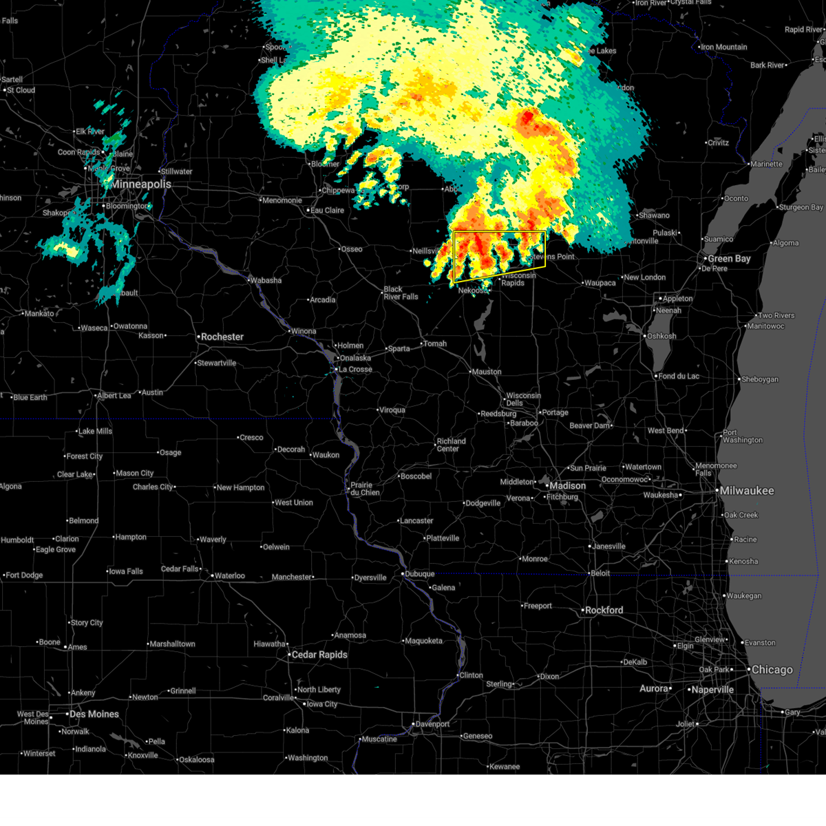
| 5/15/2025 5:51 PM CDT |
 Svrgrb the national weather service in green bay has issued a * severe thunderstorm warning for, northeastern wood county in central wisconsin, northern portage county in central wisconsin, lincoln county in north central wisconsin, marathon county in central wisconsin, western oneida county in north central wisconsin, west central langlade county in north central wisconsin, * until 630 pm cdt. * at 551 pm cdt, severe thunderstorms were located along a line extending from near ogema to 15 miles east of dorchester to 10 miles southeast of marshfield, moving northeast at 45 mph (radar indicated). Hazards include 60 mph wind gusts and quarter size hail. Hail damage to vehicles is expected. Expect wind damage to roofs, siding, and trees. Svrgrb the national weather service in green bay has issued a * severe thunderstorm warning for, northeastern wood county in central wisconsin, northern portage county in central wisconsin, lincoln county in north central wisconsin, marathon county in central wisconsin, western oneida county in north central wisconsin, west central langlade county in north central wisconsin, * until 630 pm cdt. * at 551 pm cdt, severe thunderstorms were located along a line extending from near ogema to 15 miles east of dorchester to 10 miles southeast of marshfield, moving northeast at 45 mph (radar indicated). Hazards include 60 mph wind gusts and quarter size hail. Hail damage to vehicles is expected. Expect wind damage to roofs, siding, and trees.
|
| 5/15/2025 4:42 PM CDT |
 At 441 pm cdt, severe thunderstorms were located along a line extending from near babcock to near wisconsin rapids, moving north at 55 mph (radar indicated). Hazards include 60 mph wind gusts and quarter size hail. Hail damage to vehicles is expected. expect wind damage to roofs, siding, and trees. Locations impacted include, stevens point, wisconsin rapids, marshfield, whiting, pittsville, babcock, lake wazeecha, plover, nekoosa, port edwards, biron, hewitt, sherry, auburndale, vesper, rudolph, junction city, arpin, milladore, and cranmoor. At 441 pm cdt, severe thunderstorms were located along a line extending from near babcock to near wisconsin rapids, moving north at 55 mph (radar indicated). Hazards include 60 mph wind gusts and quarter size hail. Hail damage to vehicles is expected. expect wind damage to roofs, siding, and trees. Locations impacted include, stevens point, wisconsin rapids, marshfield, whiting, pittsville, babcock, lake wazeecha, plover, nekoosa, port edwards, biron, hewitt, sherry, auburndale, vesper, rudolph, junction city, arpin, milladore, and cranmoor.
|
| 5/15/2025 4:34 PM CDT |
 At 434 pm cdt, severe thunderstorms were located along a line extending from near babcock to 8 miles southeast of new rome, moving north at 60 mph (radar indicated). Hazards include 60 mph wind gusts and quarter size hail. Hail damage to vehicles is expected. expect wind damage to roofs, siding, and trees. Locations impacted include, stevens point, wisconsin rapids, marshfield, whiting, pittsville, babcock, lake wazeecha, plover, nekoosa, port edwards, biron, hewitt, sherry, auburndale, vesper, rudolph, junction city, arpin, milladore, and cranmoor. At 434 pm cdt, severe thunderstorms were located along a line extending from near babcock to 8 miles southeast of new rome, moving north at 60 mph (radar indicated). Hazards include 60 mph wind gusts and quarter size hail. Hail damage to vehicles is expected. expect wind damage to roofs, siding, and trees. Locations impacted include, stevens point, wisconsin rapids, marshfield, whiting, pittsville, babcock, lake wazeecha, plover, nekoosa, port edwards, biron, hewitt, sherry, auburndale, vesper, rudolph, junction city, arpin, milladore, and cranmoor.
|
| 5/15/2025 4:20 PM CDT |
 Svrgrb the national weather service in green bay has issued a * severe thunderstorm warning for, wood county in central wisconsin, western portage county in central wisconsin, * until 515 pm cdt. * at 420 pm cdt, severe thunderstorms were located along a line extending from near necedah to near friendship, moving north at 60 mph (radar indicated). Hazards include 60 mph wind gusts and quarter size hail. Hail damage to vehicles is expected. Expect wind damage to roofs, siding, and trees. Svrgrb the national weather service in green bay has issued a * severe thunderstorm warning for, wood county in central wisconsin, western portage county in central wisconsin, * until 515 pm cdt. * at 420 pm cdt, severe thunderstorms were located along a line extending from near necedah to near friendship, moving north at 60 mph (radar indicated). Hazards include 60 mph wind gusts and quarter size hail. Hail damage to vehicles is expected. Expect wind damage to roofs, siding, and trees.
|
| 4/28/2025 9:37 PM CDT |
 At 936 pm cdt, severe thunderstorms were located along a line extending from dutch corners to near weston to 10 miles southwest of mosinee, moving northeast at 60 mph (radar indicated). Hazards include 60 mph wind gusts and quarter size hail. Hail damage to vehicles is expected. expect wind damage to roofs, siding, and trees. these severe storms will be near, wausau, weston, rib mountain, and mosinee around 940 pm cdt. antigo around 955 pm cdt. veterans memorial county park around 1000 pm cdt. pearson and ma ka ja wan scout reservation around 1005 pm cdt. Other locations impacted by these severe thunderstorms include big eau pleine county park, ackley wildlife area, mattoon, polar, moon, blenker, birnamwood, bavaria, deerbrook, and hogarty. At 936 pm cdt, severe thunderstorms were located along a line extending from dutch corners to near weston to 10 miles southwest of mosinee, moving northeast at 60 mph (radar indicated). Hazards include 60 mph wind gusts and quarter size hail. Hail damage to vehicles is expected. expect wind damage to roofs, siding, and trees. these severe storms will be near, wausau, weston, rib mountain, and mosinee around 940 pm cdt. antigo around 955 pm cdt. veterans memorial county park around 1000 pm cdt. pearson and ma ka ja wan scout reservation around 1005 pm cdt. Other locations impacted by these severe thunderstorms include big eau pleine county park, ackley wildlife area, mattoon, polar, moon, blenker, birnamwood, bavaria, deerbrook, and hogarty.
|
| 4/28/2025 9:33 PM CDT |
 Svrgrb the national weather service in green bay has issued a * severe thunderstorm warning for, north central wood county in central wisconsin, northern portage county in central wisconsin, southern lincoln county in north central wisconsin, marathon county in central wisconsin, langlade county in north central wisconsin, western shawano county in northeastern wisconsin, * until 1030 pm cdt. * at 932 pm cdt, severe thunderstorms were located along a line extending from near merrill to near rib mountain to 11 miles southwest of mosinee, moving east at 40 mph (radar indicated). Hazards include 60 mph wind gusts and quarter size hail. Hail damage to vehicles is expected. expect wind damage to roofs, siding, and trees. severe thunderstorms will be near, wausau, weston, rib mountain, mosinee, and dutch corners around 940 pm cdt. antigo around 1005 pm cdt. bevent and veterans memorial county park around 1010 pm cdt. Other locations impacted by these severe thunderstorms include big eau pleine county park, ackley wildlife area, mattoon, polar, moon, blenker, birnamwood, bavaria, deerbrook, and hogarty. Svrgrb the national weather service in green bay has issued a * severe thunderstorm warning for, north central wood county in central wisconsin, northern portage county in central wisconsin, southern lincoln county in north central wisconsin, marathon county in central wisconsin, langlade county in north central wisconsin, western shawano county in northeastern wisconsin, * until 1030 pm cdt. * at 932 pm cdt, severe thunderstorms were located along a line extending from near merrill to near rib mountain to 11 miles southwest of mosinee, moving east at 40 mph (radar indicated). Hazards include 60 mph wind gusts and quarter size hail. Hail damage to vehicles is expected. expect wind damage to roofs, siding, and trees. severe thunderstorms will be near, wausau, weston, rib mountain, mosinee, and dutch corners around 940 pm cdt. antigo around 1005 pm cdt. bevent and veterans memorial county park around 1010 pm cdt. Other locations impacted by these severe thunderstorms include big eau pleine county park, ackley wildlife area, mattoon, polar, moon, blenker, birnamwood, bavaria, deerbrook, and hogarty.
|
| 4/28/2025 8:41 PM CDT |
 Svrgrb the national weather service in green bay has issued a * severe thunderstorm warning for, northwestern wood county in central wisconsin, western marathon county in central wisconsin, * until 945 pm cdt. * at 841 pm cdt, severe thunderstorms were located along a line extending from near owen to near loyal, moving east at 40 mph (radar indicated). Hazards include 60 mph wind gusts and quarter size hail. Hail damage to vehicles is expected. expect wind damage to roofs, siding, and trees. severe thunderstorms will be near, abbotsford and spencer around 850 pm cdt. marshfield around 900 pm cdt. Other locations impacted by these severe thunderstorms include edgar, rozellville, big eau pleine county park, cherokee, little chicago, auburndale, stratford, march rapids, hamburg, and poniatowski. Svrgrb the national weather service in green bay has issued a * severe thunderstorm warning for, northwestern wood county in central wisconsin, western marathon county in central wisconsin, * until 945 pm cdt. * at 841 pm cdt, severe thunderstorms were located along a line extending from near owen to near loyal, moving east at 40 mph (radar indicated). Hazards include 60 mph wind gusts and quarter size hail. Hail damage to vehicles is expected. expect wind damage to roofs, siding, and trees. severe thunderstorms will be near, abbotsford and spencer around 850 pm cdt. marshfield around 900 pm cdt. Other locations impacted by these severe thunderstorms include edgar, rozellville, big eau pleine county park, cherokee, little chicago, auburndale, stratford, march rapids, hamburg, and poniatowski.
|
| 8/26/2024 11:13 PM CDT |
 The storms which prompted the warning have moved out of the area. therefore, the warning will be allowed to expire. however, gusty winds and heavy rain are still possible with these thunderstorms. a severe thunderstorm watch remains in effect until 400 am cdt for central wisconsin. remember, a severe thunderstorm warning still remains in effect for portions of wood and portage counties until 1215 am cdt. The storms which prompted the warning have moved out of the area. therefore, the warning will be allowed to expire. however, gusty winds and heavy rain are still possible with these thunderstorms. a severe thunderstorm watch remains in effect until 400 am cdt for central wisconsin. remember, a severe thunderstorm warning still remains in effect for portions of wood and portage counties until 1215 am cdt.
|
| 8/26/2024 10:45 PM CDT |
 At 1045 pm cdt, severe thunderstorms were located along a line extending from 10 miles northeast of marshfield to 8 miles northeast of pittsville to 11 miles northwest of babcock, moving east at 25 mph (radar indicated). Hazards include 60 mph wind gusts. Expect damage to roofs, siding, and trees. Locations impacted include, stevens point, wisconsin rapids, marshfield, whiting, pittsville, babcock, lake wazeecha, plover, nekoosa, and port edwards. At 1045 pm cdt, severe thunderstorms were located along a line extending from 10 miles northeast of marshfield to 8 miles northeast of pittsville to 11 miles northwest of babcock, moving east at 25 mph (radar indicated). Hazards include 60 mph wind gusts. Expect damage to roofs, siding, and trees. Locations impacted include, stevens point, wisconsin rapids, marshfield, whiting, pittsville, babcock, lake wazeecha, plover, nekoosa, and port edwards.
|
| 8/26/2024 10:12 PM CDT |
 Svrgrb the national weather service in green bay has issued a * severe thunderstorm warning for, wood county in central wisconsin, western portage county in central wisconsin, southwestern marathon county in central wisconsin, * until 1115 pm cdt. * at 1011 pm cdt, severe thunderstorms were located along a line extending from greenwood to near neillsville to 6 miles east of blair, moving east at 50 mph (radar indicated). Hazards include 60 mph wind gusts. expect damage to roofs, siding, and trees Svrgrb the national weather service in green bay has issued a * severe thunderstorm warning for, wood county in central wisconsin, western portage county in central wisconsin, southwestern marathon county in central wisconsin, * until 1115 pm cdt. * at 1011 pm cdt, severe thunderstorms were located along a line extending from greenwood to near neillsville to 6 miles east of blair, moving east at 50 mph (radar indicated). Hazards include 60 mph wind gusts. expect damage to roofs, siding, and trees
|
| 7/13/2024 6:06 PM CDT |
 At 606 pm cdt, severe thunderstorms were located along a line extending from 9 miles north of wisconsin rapids to near whiting to 11 miles southwest of plainfield, moving east at 45 mph (radar indicated). Hazards include 60 mph wind gusts. Expect damage to roofs, siding, and trees. Locations impacted include, stevens point, wisconsin rapids, wautoma, whiting, amherst, plainfield, lake wazeecha, plover, stockton, and nekoosa. At 606 pm cdt, severe thunderstorms were located along a line extending from 9 miles north of wisconsin rapids to near whiting to 11 miles southwest of plainfield, moving east at 45 mph (radar indicated). Hazards include 60 mph wind gusts. Expect damage to roofs, siding, and trees. Locations impacted include, stevens point, wisconsin rapids, wautoma, whiting, amherst, plainfield, lake wazeecha, plover, stockton, and nekoosa.
|
| 7/13/2024 5:52 PM CDT |
 A new severe thunderstorm warning has been issued for eastern wood county until 630 pm cdt. A new severe thunderstorm warning has been issued for eastern wood county until 630 pm cdt.
|
| 7/13/2024 5:51 PM CDT |
 Svrgrb the national weather service in green bay has issued a * severe thunderstorm warning for, eastern wood county in central wisconsin, portage county in central wisconsin, western waushara county in central wisconsin, * until 630 pm cdt. * at 550 pm cdt, severe thunderstorms were located along a line extending from 11 miles southeast of marshfield to near new rome to near dellwood, moving east at 50 mph (radar indicated). Hazards include 60 mph wind gusts. expect damage to roofs, siding, and trees Svrgrb the national weather service in green bay has issued a * severe thunderstorm warning for, eastern wood county in central wisconsin, portage county in central wisconsin, western waushara county in central wisconsin, * until 630 pm cdt. * at 550 pm cdt, severe thunderstorms were located along a line extending from 11 miles southeast of marshfield to near new rome to near dellwood, moving east at 50 mph (radar indicated). Hazards include 60 mph wind gusts. expect damage to roofs, siding, and trees
|
| 7/13/2024 5:45 PM CDT |
 At 544 pm cdt, severe thunderstorms were located along a line extending from 6 miles south of marshfield to near wisconsin rapids to near new rome, moving east at 40 mph (radar indicated). Hazards include 60 mph wind gusts. Expect damage to roofs, siding, and trees. Locations impacted include, wisconsin rapids, marshfield, pittsville, babcock, lake wazeecha, nekoosa, port edwards, biron, hewitt, and sherry. At 544 pm cdt, severe thunderstorms were located along a line extending from 6 miles south of marshfield to near wisconsin rapids to near new rome, moving east at 40 mph (radar indicated). Hazards include 60 mph wind gusts. Expect damage to roofs, siding, and trees. Locations impacted include, wisconsin rapids, marshfield, pittsville, babcock, lake wazeecha, nekoosa, port edwards, biron, hewitt, and sherry.
|
| 7/13/2024 5:34 PM CDT |
 At 534 pm cdt, severe thunderstorms were located along a line extending from 8 miles northwest of pittsville to near babcock to 6 miles north of necedah, moving east at 45 mph (radar indicated). Hazards include 60 mph wind gusts. Expect damage to roofs, siding, and trees. Locations impacted include, wisconsin rapids, marshfield, pittsville, babcock, lake wazeecha, nekoosa, port edwards, biron, hewitt, and sherry. At 534 pm cdt, severe thunderstorms were located along a line extending from 8 miles northwest of pittsville to near babcock to 6 miles north of necedah, moving east at 45 mph (radar indicated). Hazards include 60 mph wind gusts. Expect damage to roofs, siding, and trees. Locations impacted include, wisconsin rapids, marshfield, pittsville, babcock, lake wazeecha, nekoosa, port edwards, biron, hewitt, and sherry.
|
| 7/13/2024 5:19 PM CDT |
 At 519 pm cdt, severe thunderstorms were located along a line extending from near shortville to 7 miles northwest of babcock to 12 miles northwest of necedah, moving east at 45 mph (radar indicated). Hazards include 60 mph wind gusts. Expect damage to roofs, siding, and trees. Locations impacted include, wisconsin rapids, marshfield, pittsville, babcock, lake wazeecha, nekoosa, port edwards, biron, hewitt, and sherry. At 519 pm cdt, severe thunderstorms were located along a line extending from near shortville to 7 miles northwest of babcock to 12 miles northwest of necedah, moving east at 45 mph (radar indicated). Hazards include 60 mph wind gusts. Expect damage to roofs, siding, and trees. Locations impacted include, wisconsin rapids, marshfield, pittsville, babcock, lake wazeecha, nekoosa, port edwards, biron, hewitt, and sherry.
|
| 7/13/2024 5:00 PM CDT |
 Svrgrb the national weather service in green bay has issued a * severe thunderstorm warning for, wood county in central wisconsin, * until 600 pm cdt. * at 500 pm cdt, severe thunderstorms were located along a line extending from 7 miles north of hatfield to 6 miles south of shortville to near millston, moving east at 40 mph (radar indicated). Hazards include 60 mph wind gusts. expect damage to roofs, siding, and trees Svrgrb the national weather service in green bay has issued a * severe thunderstorm warning for, wood county in central wisconsin, * until 600 pm cdt. * at 500 pm cdt, severe thunderstorms were located along a line extending from 7 miles north of hatfield to 6 miles south of shortville to near millston, moving east at 40 mph (radar indicated). Hazards include 60 mph wind gusts. expect damage to roofs, siding, and trees
|
| 5/21/2024 7:54 PM CDT |
 At 753 pm cdt, a squall line capable of producing both tornadoes and damaging straight line winds was along a line extending from 15 miles west of rib mountain to 11 miles north of wisconsin rapids to 6 miles southwest of new rome, moving east at 55 mph (radar indicated). Hazards include 70 mph wind gusts. Expect considerable tree damage. damage is likely to mobile homes, roofs, and outbuildings. Locations impacted include, wausau, stevens point, wisconsin rapids, weston, rib mountain, mosinee, whiting, bevent, amherst, and lake wazeecha. At 753 pm cdt, a squall line capable of producing both tornadoes and damaging straight line winds was along a line extending from 15 miles west of rib mountain to 11 miles north of wisconsin rapids to 6 miles southwest of new rome, moving east at 55 mph (radar indicated). Hazards include 70 mph wind gusts. Expect considerable tree damage. damage is likely to mobile homes, roofs, and outbuildings. Locations impacted include, wausau, stevens point, wisconsin rapids, weston, rib mountain, mosinee, whiting, bevent, amherst, and lake wazeecha.
|
| 5/21/2024 7:44 PM CDT |
 This severe thunderstorm warning will expire; however, a new severe thunderstorm warning has been issued for wood, portage, and marathon counties. a tornado watch remains in effect until midnight cdt for central wisconsin. This severe thunderstorm warning will expire; however, a new severe thunderstorm warning has been issued for wood, portage, and marathon counties. a tornado watch remains in effect until midnight cdt for central wisconsin.
|
| 5/21/2024 7:41 PM CDT |
 Svrgrb the national weather service in green bay has issued a * severe thunderstorm warning for, wood county in central wisconsin, portage county in central wisconsin, marathon county in central wisconsin, * until 830 pm cdt. * at 740 pm cdt, severe thunderstorms capable of producing stragiht line winds and tornadoes were located along a line extending from 7 miles east of abbotsford to 8 miles northeast of pittsville to 7 miles north of necedah, moving east at 60 mph (radar indicated). Hazards include 70 mph wind gusts. Expect considerable tree damage. Damage is likely to mobile homes, roofs, and outbuildings. Svrgrb the national weather service in green bay has issued a * severe thunderstorm warning for, wood county in central wisconsin, portage county in central wisconsin, marathon county in central wisconsin, * until 830 pm cdt. * at 740 pm cdt, severe thunderstorms capable of producing stragiht line winds and tornadoes were located along a line extending from 7 miles east of abbotsford to 8 miles northeast of pittsville to 7 miles north of necedah, moving east at 60 mph (radar indicated). Hazards include 70 mph wind gusts. Expect considerable tree damage. Damage is likely to mobile homes, roofs, and outbuildings.
|
| 5/21/2024 7:31 PM CDT |
 At 730 pm cdt, a squall line capable of producing both tornadoes and damaging straight line winds was located along a line extending from near owen to 9 miles southwest of spencer to 10 miles southwest of pittsville to 8 miles northeast of tomah, moving east at 50 mph (radar indicated). Hazards include 70 mph wind gusts and quarter size hail. Hail damage to vehicles is expected. expect considerable tree damage. wind damage is also likely to mobile homes, roofs, and outbuildings. Locations impacted include, wisconsin rapids, marshfield, abbotsford, spencer, pittsville, babcock, lake wazeecha, nekoosa, colby, and port edwards. At 730 pm cdt, a squall line capable of producing both tornadoes and damaging straight line winds was located along a line extending from near owen to 9 miles southwest of spencer to 10 miles southwest of pittsville to 8 miles northeast of tomah, moving east at 50 mph (radar indicated). Hazards include 70 mph wind gusts and quarter size hail. Hail damage to vehicles is expected. expect considerable tree damage. wind damage is also likely to mobile homes, roofs, and outbuildings. Locations impacted include, wisconsin rapids, marshfield, abbotsford, spencer, pittsville, babcock, lake wazeecha, nekoosa, colby, and port edwards.
|
| 5/21/2024 7:19 PM CDT |
 Svrgrb the national weather service in green bay has issued a * severe thunderstorm warning for, wood county in central wisconsin, western marathon county in central wisconsin, * until 745 pm cdt. * at 718 pm cdt, a squall line capable of producing both tornadoes and damaging straight line winds was located near shortville, or 8 miles southeast of neillsville, moving east at 55 mph (radar indicated). Hazards include 70 mph wind gusts and quarter size hail. Hail damage to vehicles is expected. expect considerable tree damage. Wind damage is also likely to mobile homes, roofs, and outbuildings. Svrgrb the national weather service in green bay has issued a * severe thunderstorm warning for, wood county in central wisconsin, western marathon county in central wisconsin, * until 745 pm cdt. * at 718 pm cdt, a squall line capable of producing both tornadoes and damaging straight line winds was located near shortville, or 8 miles southeast of neillsville, moving east at 55 mph (radar indicated). Hazards include 70 mph wind gusts and quarter size hail. Hail damage to vehicles is expected. expect considerable tree damage. Wind damage is also likely to mobile homes, roofs, and outbuildings.
|
| 10/24/2023 10:00 AM CDT |
 At 959 am cdt, a severe thunderstorm was located 8 miles southwest of mosinee, or 14 miles northwest of stevens point, moving east at 50 mph. another severe storm was situated just north of hewitt, and moving east (radar indicated). Hazards include ping pong ball size hail. People and animals outdoors will be injured. expect damage to roofs, siding, windows, and vehicles. locations impacted include, stevens point, marshfield, mosinee, bevent, knowlton, norrie, hewitt, sherry, auburndale, and jordan. hail threat, radar indicated max hail size, 1. 50 in wind threat, radar indicated max wind gust, <50 mph. At 959 am cdt, a severe thunderstorm was located 8 miles southwest of mosinee, or 14 miles northwest of stevens point, moving east at 50 mph. another severe storm was situated just north of hewitt, and moving east (radar indicated). Hazards include ping pong ball size hail. People and animals outdoors will be injured. expect damage to roofs, siding, windows, and vehicles. locations impacted include, stevens point, marshfield, mosinee, bevent, knowlton, norrie, hewitt, sherry, auburndale, and jordan. hail threat, radar indicated max hail size, 1. 50 in wind threat, radar indicated max wind gust, <50 mph.
|
| 10/24/2023 9:47 AM CDT |
 At 945 am cdt, a severe thunderstorm was located 10 miles east of marshfield, or 2 miles north of auburndale, moving east at 50 mph. another severe storm was located about 5 miles southwest of marshfield. hail up to 1.5 inch diameter has been reported in the marshfield and hewitt areas (radar indicated). Hazards include ping pong ball size hail. People and animals outdoors will be injured. expect damage to roofs, siding, windows, and vehicles. locations impacted include, stevens point, marshfield, mosinee, bevent, knowlton, norrie, hewitt, sherry, auburndale, and jordan. hail threat, radar indicated max hail size, 1. 50 in wind threat, radar indicated max wind gust, <50 mph. At 945 am cdt, a severe thunderstorm was located 10 miles east of marshfield, or 2 miles north of auburndale, moving east at 50 mph. another severe storm was located about 5 miles southwest of marshfield. hail up to 1.5 inch diameter has been reported in the marshfield and hewitt areas (radar indicated). Hazards include ping pong ball size hail. People and animals outdoors will be injured. expect damage to roofs, siding, windows, and vehicles. locations impacted include, stevens point, marshfield, mosinee, bevent, knowlton, norrie, hewitt, sherry, auburndale, and jordan. hail threat, radar indicated max hail size, 1. 50 in wind threat, radar indicated max wind gust, <50 mph.
|
| 10/24/2023 9:41 AM CDT |
 At 939 am cdt, a severe thunderstorm was located near marshfield, or 20 miles northwest of wisconsin rapids, moving east at 50 mph. another strong to severe storm was situated about 10 miles west of marshfield, and moving east (radar indicated). Hazards include half dollar size hail. Damage to vehicles is expected. locations impacted include, stevens point, marshfield, mosinee, bevent, knowlton, norrie, hewitt, sherry, auburndale, and jordan. hail threat, radar indicated max hail size, 1. 25 in wind threat, radar indicated max wind gust, <50 mph. At 939 am cdt, a severe thunderstorm was located near marshfield, or 20 miles northwest of wisconsin rapids, moving east at 50 mph. another strong to severe storm was situated about 10 miles west of marshfield, and moving east (radar indicated). Hazards include half dollar size hail. Damage to vehicles is expected. locations impacted include, stevens point, marshfield, mosinee, bevent, knowlton, norrie, hewitt, sherry, auburndale, and jordan. hail threat, radar indicated max hail size, 1. 25 in wind threat, radar indicated max wind gust, <50 mph.
|
| 10/24/2023 9:28 AM CDT |
 At 928 am cdt, a severe thunderstorm was located near marshfield, or 17 miles east of neillsville, moving east at 55 mph (radar indicated). Hazards include quarter size hail. damage to vehicles is expected At 928 am cdt, a severe thunderstorm was located near marshfield, or 17 miles east of neillsville, moving east at 55 mph (radar indicated). Hazards include quarter size hail. damage to vehicles is expected
|
| 8/11/2023 7:32 PM CDT |
 At 732 pm cdt, severe thunderstorms were located along a line extending from near rib mountain to 7 miles northwest of stevens point to 7 miles west of wisconsin rapids, moving southeast at 50 mph (radar indicated). Hazards include 70 mph wind gusts and penny size hail. Expect considerable tree damage. damage is likely to mobile homes, roofs, and outbuildings. these severe storms will be near, stevens point around 740 pm cdt. whiting around 745 pm cdt. bevent around 755 pm cdt. other locations impacted by these severe thunderstorms include north wood county park, big eau pleine county park, moon, coddington, blenker, kellner, ellis, powers bluff county park, bethel and custer. thunderstorm damage threat, considerable hail threat, radar indicated max hail size, 0. 75 in wind threat, radar indicated max wind gust, 70 mph. At 732 pm cdt, severe thunderstorms were located along a line extending from near rib mountain to 7 miles northwest of stevens point to 7 miles west of wisconsin rapids, moving southeast at 50 mph (radar indicated). Hazards include 70 mph wind gusts and penny size hail. Expect considerable tree damage. damage is likely to mobile homes, roofs, and outbuildings. these severe storms will be near, stevens point around 740 pm cdt. whiting around 745 pm cdt. bevent around 755 pm cdt. other locations impacted by these severe thunderstorms include north wood county park, big eau pleine county park, moon, coddington, blenker, kellner, ellis, powers bluff county park, bethel and custer. thunderstorm damage threat, considerable hail threat, radar indicated max hail size, 0. 75 in wind threat, radar indicated max wind gust, 70 mph.
|
| 8/11/2023 7:15 PM CDT |
 At 715 pm cdt, severe thunderstorms were located along a line extending from 10 miles west of rib mountain to 8 miles east of marshfield to 8 miles west of pittsville, moving east at 40 mph (radar indicated). Hazards include 70 mph wind gusts and penny size hail. Expect considerable tree damage. damage is likely to mobile homes, roofs, and outbuildings. severe thunderstorms will be near, wausau around 725 pm cdt. rib mountain and mosinee around 730 pm cdt. weston around 735 pm cdt. stevens point, wisconsin rapids and bevent around 750 pm cdt. lake wazeecha around 755 pm cdt. whiting around 810 pm cdt. other locations impacted by these severe thunderstorms include north wood county park, big eau pleine county park, moon, coddington, blenker, fenwood, kellner, ellis, powers bluff county park and bethel. thunderstorm damage threat, considerable hail threat, radar indicated max hail size, 0. 75 in wind threat, radar indicated max wind gust, 70 mph. At 715 pm cdt, severe thunderstorms were located along a line extending from 10 miles west of rib mountain to 8 miles east of marshfield to 8 miles west of pittsville, moving east at 40 mph (radar indicated). Hazards include 70 mph wind gusts and penny size hail. Expect considerable tree damage. damage is likely to mobile homes, roofs, and outbuildings. severe thunderstorms will be near, wausau around 725 pm cdt. rib mountain and mosinee around 730 pm cdt. weston around 735 pm cdt. stevens point, wisconsin rapids and bevent around 750 pm cdt. lake wazeecha around 755 pm cdt. whiting around 810 pm cdt. other locations impacted by these severe thunderstorms include north wood county park, big eau pleine county park, moon, coddington, blenker, fenwood, kellner, ellis, powers bluff county park and bethel. thunderstorm damage threat, considerable hail threat, radar indicated max hail size, 0. 75 in wind threat, radar indicated max wind gust, 70 mph.
|
| 8/11/2023 7:05 PM CDT |
 At 705 pm cdt, severe thunderstorms were located along a line extending from 14 miles east of colby to marshfield to shortville, moving southeast at 50 mph (radar indicated). Hazards include 60 mph wind gusts and penny size hail. Expect damage to roofs, siding, and trees. These severe thunderstorms will remain over mainly rural areas of wood and marathon counties, including the following locations, milladore, sandhill wildlife area, edgar, north wood county park, big eau pleine county park, moon, little chicago, auburndale, march rapids and hamburg. At 705 pm cdt, severe thunderstorms were located along a line extending from 14 miles east of colby to marshfield to shortville, moving southeast at 50 mph (radar indicated). Hazards include 60 mph wind gusts and penny size hail. Expect damage to roofs, siding, and trees. These severe thunderstorms will remain over mainly rural areas of wood and marathon counties, including the following locations, milladore, sandhill wildlife area, edgar, north wood county park, big eau pleine county park, moon, little chicago, auburndale, march rapids and hamburg.
|
| 8/11/2023 6:40 PM CDT |
 At 640 pm cdt, severe thunderstorms were located along a line extending from near medford to 6 miles west of colby to 9 miles southwest of greenwood, moving southeast at 35 mph (radar indicated). Hazards include 60 mph wind gusts and quarter size hail. Hail damage to vehicles is expected. expect wind damage to roofs, siding, and trees. severe thunderstorms will be near, spencer around 655 pm cdt. other locations in the path of these severe thunderstorms include marshfield, wausau, rib mountain and pittsville. hail threat, radar indicated max hail size, 1. 00 in wind threat, radar indicated max wind gust, 60 mph. At 640 pm cdt, severe thunderstorms were located along a line extending from near medford to 6 miles west of colby to 9 miles southwest of greenwood, moving southeast at 35 mph (radar indicated). Hazards include 60 mph wind gusts and quarter size hail. Hail damage to vehicles is expected. expect wind damage to roofs, siding, and trees. severe thunderstorms will be near, spencer around 655 pm cdt. other locations in the path of these severe thunderstorms include marshfield, wausau, rib mountain and pittsville. hail threat, radar indicated max hail size, 1. 00 in wind threat, radar indicated max wind gust, 60 mph.
|
| 7/27/2023 8:57 PM CDT | The severe thunderstorm warning for northern wood, southwestern lincoln and western marathon counties will expire at 900 pm cdt, the storms which prompted the warning have weakened below severe limits, and no longer pose an immediate threat to life or property. therefore, the warning will be allowed to expire. however gusty winds up to 50 mph are still possible with these thunderstorms. a severe thunderstorm watch remains in effect until 1100 pm cdt for central and north central wisconsin. |
| 7/27/2023 8:50 PM CDT |
 At 849 pm cdt, severe thunderstorms were located along a line extending from 8 miles southwest of council grounds state park to 13 miles west of rib mountain to near marshfield, moving southeast at 45 mph (radar indicated). Hazards include 60 mph wind gusts and quarter size hail. Hail damage to vehicles is expected. expect wind damage to roofs, siding, and trees. locations impacted include, wausau, rib mountain and mosinee. hail threat, radar indicated max hail size, 1. 00 in wind threat, radar indicated max wind gust, 60 mph. At 849 pm cdt, severe thunderstorms were located along a line extending from 8 miles southwest of council grounds state park to 13 miles west of rib mountain to near marshfield, moving southeast at 45 mph (radar indicated). Hazards include 60 mph wind gusts and quarter size hail. Hail damage to vehicles is expected. expect wind damage to roofs, siding, and trees. locations impacted include, wausau, rib mountain and mosinee. hail threat, radar indicated max hail size, 1. 00 in wind threat, radar indicated max wind gust, 60 mph.
|
| 7/27/2023 8:21 PM CDT |
 At 820 pm cdt, severe thunderstorms were located along a line extending from near chelsea to dorchester to near greenwood, moving southeast at 45 mph. this storm has a history of producing quarter size hail and strong wind gusts (radar indicated). Hazards include 60 mph wind gusts and quarter size hail. Hail damage to vehicles is expected. expect wind damage to roofs, siding, and trees. severe thunderstorms will be near, abbotsford around 825 pm cdt. spencer around 840 pm cdt. other locations in the path of these severe thunderstorms include marshfield, wausau and mosinee. hail threat, radar indicated max hail size, 1. 00 in wind threat, radar indicated max wind gust, 60 mph. At 820 pm cdt, severe thunderstorms were located along a line extending from near chelsea to dorchester to near greenwood, moving southeast at 45 mph. this storm has a history of producing quarter size hail and strong wind gusts (radar indicated). Hazards include 60 mph wind gusts and quarter size hail. Hail damage to vehicles is expected. expect wind damage to roofs, siding, and trees. severe thunderstorms will be near, abbotsford around 825 pm cdt. spencer around 840 pm cdt. other locations in the path of these severe thunderstorms include marshfield, wausau and mosinee. hail threat, radar indicated max hail size, 1. 00 in wind threat, radar indicated max wind gust, 60 mph.
|
| 6/15/2022 5:03 PM CDT |
 At 503 pm cdt, severe thunderstorms were located along a line extending from 12 miles north of wisconsin rapids to near lake wazeecha to 9 miles east of new rome, moving east at 55 mph (radar indicated). Hazards include 60 mph wind gusts. Expect damage to roofs, siding, and trees. Locations impacted include, stevens point, wisconsin rapids, whiting, amherst, lake wazeecha, plover, stockton, nekoosa, port edwards and biron. At 503 pm cdt, severe thunderstorms were located along a line extending from 12 miles north of wisconsin rapids to near lake wazeecha to 9 miles east of new rome, moving east at 55 mph (radar indicated). Hazards include 60 mph wind gusts. Expect damage to roofs, siding, and trees. Locations impacted include, stevens point, wisconsin rapids, whiting, amherst, lake wazeecha, plover, stockton, nekoosa, port edwards and biron.
|
| 6/15/2022 4:48 PM CDT |
 At 448 pm cdt, severe thunderstorms were located along a line extending from near marshfield to near new rome, moving northeast at 45 mph (radar indicated). Hazards include 60 mph wind gusts. expect damage to roofs, siding, and trees At 448 pm cdt, severe thunderstorms were located along a line extending from near marshfield to near new rome, moving northeast at 45 mph (radar indicated). Hazards include 60 mph wind gusts. expect damage to roofs, siding, and trees
|
| 6/15/2022 4:33 PM CDT |
 At 432 pm cdt, a severe thunderstorm capable of producing a tornado was located near pittsville, or 20 miles southeast of neillsville, moving northeast at 45 mph (radar indicated rotation). Hazards include tornado. Flying debris will be dangerous to those caught without shelter. mobile homes will be damaged or destroyed. damage to roofs, windows, and vehicles will occur. tree damage is likely. Locations impacted include, pittsville. At 432 pm cdt, a severe thunderstorm capable of producing a tornado was located near pittsville, or 20 miles southeast of neillsville, moving northeast at 45 mph (radar indicated rotation). Hazards include tornado. Flying debris will be dangerous to those caught without shelter. mobile homes will be damaged or destroyed. damage to roofs, windows, and vehicles will occur. tree damage is likely. Locations impacted include, pittsville.
|
| 6/15/2022 4:19 PM CDT |
 At 419 pm cdt, a severe thunderstorm capable of producing a tornado was located 9 miles west of pittsville, or 15 miles southeast of neillsville, moving northeast at 55 mph (radar indicated rotation). Hazards include tornado. Flying debris will be dangerous to those caught without shelter. mobile homes will be damaged or destroyed. damage to roofs, windows, and vehicles will occur. tree damage is likely. This dangerous storm will be near, pittsville around 430 pm cdt. At 419 pm cdt, a severe thunderstorm capable of producing a tornado was located 9 miles west of pittsville, or 15 miles southeast of neillsville, moving northeast at 55 mph (radar indicated rotation). Hazards include tornado. Flying debris will be dangerous to those caught without shelter. mobile homes will be damaged or destroyed. damage to roofs, windows, and vehicles will occur. tree damage is likely. This dangerous storm will be near, pittsville around 430 pm cdt.
|
| 5/18/2022 9:50 PM CDT |
 At 950 pm cdt, a severe thunderstorm was located 7 miles northeast of pittsville, or 15 miles northwest of wisconsin rapids, moving southeast at 35 mph (radar indicated). Hazards include 60 mph wind gusts and quarter size hail. Hail damage to vehicles is expected. expect wind damage to roofs, siding, and trees. this severe storm will be near, wisconsin rapids around 1010 pm cdt. lake wazeecha around 1020 pm cdt. other locations impacted by this severe thunderstorm include north wood county park, powers bluff county park, nekoosa, auburndale, biron, walker, dexterville, bethel, arpin and cranmoor. hail threat, radar indicated max hail size, 1. 00 in wind threat, radar indicated max wind gust, 60 mph. At 950 pm cdt, a severe thunderstorm was located 7 miles northeast of pittsville, or 15 miles northwest of wisconsin rapids, moving southeast at 35 mph (radar indicated). Hazards include 60 mph wind gusts and quarter size hail. Hail damage to vehicles is expected. expect wind damage to roofs, siding, and trees. this severe storm will be near, wisconsin rapids around 1010 pm cdt. lake wazeecha around 1020 pm cdt. other locations impacted by this severe thunderstorm include north wood county park, powers bluff county park, nekoosa, auburndale, biron, walker, dexterville, bethel, arpin and cranmoor. hail threat, radar indicated max hail size, 1. 00 in wind threat, radar indicated max wind gust, 60 mph.
|
| 5/18/2022 9:29 PM CDT |
 At 928 pm cdt, a severe thunderstorm was located over marshfield, or 20 miles northeast of neillsville, moving southeast at 35 mph (radar indicated). Hazards include 60 mph wind gusts and quarter size hail. Hail damage to vehicles is expected. Expect wind damage to roofs, siding, and trees. At 928 pm cdt, a severe thunderstorm was located over marshfield, or 20 miles northeast of neillsville, moving southeast at 35 mph (radar indicated). Hazards include 60 mph wind gusts and quarter size hail. Hail damage to vehicles is expected. Expect wind damage to roofs, siding, and trees.
|
| 5/18/2022 9:19 PM CDT |
 At 919 pm cdt, a severe thunderstorm was located near spencer, or 23 miles northeast of neillsville, moving southeast at 40 mph (radar indicated). Hazards include 60 mph wind gusts and quarter size hail. Hail damage to vehicles is expected. expect wind damage to roofs, siding, and trees. this severe storm will be near, marshfield around 925 pm cdt. other locations impacted by this severe thunderstorm include bakerville, sherry, rozellville, powers bluff county park, auburndale, bethel, hewitt, blenker, arpin and unity. hail threat, radar indicated max hail size, 1. 00 in wind threat, radar indicated max wind gust, 60 mph. At 919 pm cdt, a severe thunderstorm was located near spencer, or 23 miles northeast of neillsville, moving southeast at 40 mph (radar indicated). Hazards include 60 mph wind gusts and quarter size hail. Hail damage to vehicles is expected. expect wind damage to roofs, siding, and trees. this severe storm will be near, marshfield around 925 pm cdt. other locations impacted by this severe thunderstorm include bakerville, sherry, rozellville, powers bluff county park, auburndale, bethel, hewitt, blenker, arpin and unity. hail threat, radar indicated max hail size, 1. 00 in wind threat, radar indicated max wind gust, 60 mph.
|
| 5/18/2022 9:00 PM CDT |
 At 859 pm cdt, a severe thunderstorm was located near owen, or 17 miles south of medford, moving southeast at 40 mph (radar indicated). Hazards include 60 mph wind gusts and half dollar size hail. Hail damage to vehicles is expected. expect wind damage to roofs, siding, and trees. this severe thunderstorm will be near, spencer around 920 pm cdt. marshfield around 930 pm cdt. other locations impacted by this severe thunderstorm include sherry, rozellville, auburndale, stratford, march rapids, hewitt, blenker, arpin, bakerville and powers bluff county park. hail threat, radar indicated max hail size, 1. 25 in wind threat, radar indicated max wind gust, 60 mph. At 859 pm cdt, a severe thunderstorm was located near owen, or 17 miles south of medford, moving southeast at 40 mph (radar indicated). Hazards include 60 mph wind gusts and half dollar size hail. Hail damage to vehicles is expected. expect wind damage to roofs, siding, and trees. this severe thunderstorm will be near, spencer around 920 pm cdt. marshfield around 930 pm cdt. other locations impacted by this severe thunderstorm include sherry, rozellville, auburndale, stratford, march rapids, hewitt, blenker, arpin, bakerville and powers bluff county park. hail threat, radar indicated max hail size, 1. 25 in wind threat, radar indicated max wind gust, 60 mph.
|
| 8/24/2021 9:21 AM CDT |
 The severe thunderstorm warning for wood, portage and eastern marathon counties will expire at 930 am cdt, the storms which prompted the warning have weakened below severe limits, and no longer pose an immediate threat to life or property. therefore, the warning will be allowed to expire. however gusty winds and heavy rain are still possible with these thunderstorms. The severe thunderstorm warning for wood, portage and eastern marathon counties will expire at 930 am cdt, the storms which prompted the warning have weakened below severe limits, and no longer pose an immediate threat to life or property. therefore, the warning will be allowed to expire. however gusty winds and heavy rain are still possible with these thunderstorms.
|
| 8/24/2021 8:57 AM CDT |
 At 857 am cdt, severe thunderstorms were located along a line extending from 6 miles south of dutch corners to 7 miles northeast of weston to near bevent to lake wazeecha, moving east at 45 mph (radar indicated). Hazards include 60 mph wind gusts. Expect damage to roofs, siding, and trees. these severe storms will be near, bevent around 905 am cdt. other locations in the path of these severe thunderstorms include whiting and amherst. hail threat, radar indicated max hail size, <. 75 in wind threat, radar indicated max wind gust, 60 mph. At 857 am cdt, severe thunderstorms were located along a line extending from 6 miles south of dutch corners to 7 miles northeast of weston to near bevent to lake wazeecha, moving east at 45 mph (radar indicated). Hazards include 60 mph wind gusts. Expect damage to roofs, siding, and trees. these severe storms will be near, bevent around 905 am cdt. other locations in the path of these severe thunderstorms include whiting and amherst. hail threat, radar indicated max hail size, <. 75 in wind threat, radar indicated max wind gust, 60 mph.
|
| 8/24/2021 8:47 AM CDT |
 At 846 am cdt, severe thunderstorms were located along a line extending from near merrill to near wausau to near mosinee to 6 miles southwest of wisconsin rapids, moving east at 45 mph (radar indicated). Hazards include 60 mph wind gusts. Expect damage to roofs, siding, and trees. these severe storms will be near, weston and rib mountain around 850 am cdt. other locations in the path of these severe thunderstorms include bevent, whiting and amherst. hail threat, radar indicated max hail size, <. 75 in wind threat, radar indicated max wind gust, 60 mph. At 846 am cdt, severe thunderstorms were located along a line extending from near merrill to near wausau to near mosinee to 6 miles southwest of wisconsin rapids, moving east at 45 mph (radar indicated). Hazards include 60 mph wind gusts. Expect damage to roofs, siding, and trees. these severe storms will be near, weston and rib mountain around 850 am cdt. other locations in the path of these severe thunderstorms include bevent, whiting and amherst. hail threat, radar indicated max hail size, <. 75 in wind threat, radar indicated max wind gust, 60 mph.
|
| 8/24/2021 8:38 AM CDT |
 At 838 am cdt, severe thunderstorms were located along a line extending from 8 miles southwest of council grounds state park to 6 miles southwest of mosinee to near babcock, moving east at 40 mph (radar indicated). Hazards include 60 mph wind gusts and quarter size hail. Hail damage to vehicles is expected. expect wind damage to roofs, siding, and trees. these severe storms will be near, mosinee around 845 am cdt. other locations in the path of these severe thunderstorms include wisconsin rapids, lake wazeecha, bevent, whiting and amherst. hail threat, radar indicated max hail size, 1. 00 in wind threat, radar indicated max wind gust, 60 mph. At 838 am cdt, severe thunderstorms were located along a line extending from 8 miles southwest of council grounds state park to 6 miles southwest of mosinee to near babcock, moving east at 40 mph (radar indicated). Hazards include 60 mph wind gusts and quarter size hail. Hail damage to vehicles is expected. expect wind damage to roofs, siding, and trees. these severe storms will be near, mosinee around 845 am cdt. other locations in the path of these severe thunderstorms include wisconsin rapids, lake wazeecha, bevent, whiting and amherst. hail threat, radar indicated max hail size, 1. 00 in wind threat, radar indicated max wind gust, 60 mph.
|
| 8/24/2021 8:27 AM CDT |
 At 826 am cdt, severe thunderstorms were located along a line extending from 13 miles southwest of council grounds state park to 11 miles southwest of mosinee to near babcock, moving east at 40 mph (radar indicated). Hazards include 60 mph wind gusts and quarter size hail. Hail damage to vehicles is expected. expect wind damage to roofs, siding, and trees. severe thunderstorms will be near, mosinee around 845 am cdt. other locations in the path of these severe thunderstorms include wisconsin rapids, lake wazeecha, bevent, whiting and amherst. hail threat, radar indicated max hail size, 1. 00 in wind threat, radar indicated max wind gust, 60 mph. At 826 am cdt, severe thunderstorms were located along a line extending from 13 miles southwest of council grounds state park to 11 miles southwest of mosinee to near babcock, moving east at 40 mph (radar indicated). Hazards include 60 mph wind gusts and quarter size hail. Hail damage to vehicles is expected. expect wind damage to roofs, siding, and trees. severe thunderstorms will be near, mosinee around 845 am cdt. other locations in the path of these severe thunderstorms include wisconsin rapids, lake wazeecha, bevent, whiting and amherst. hail threat, radar indicated max hail size, 1. 00 in wind threat, radar indicated max wind gust, 60 mph.
|
| 8/24/2021 8:18 AM CDT |
 At 816 am cdt, severe thunderstorms were located along a line extending from 6 miles southeast of medford to 11 miles northeast of marshfield to 12 miles west of babcock, moving east at 40 mph (airport observation. at 807 am a wind gust to 63 mph was measured at marshfield airport). Hazards include 60 mph wind gusts and quarter size hail. Hail damage to vehicles is expected. expect wind damage to roofs, siding, and trees. locations impacted include, babcock, mosinee, pittsville, wausau, rib mountain, wisconsin rapids and lake wazeecha. hail threat, radar indicated max hail size, 1. 00 in wind threat, observed max wind gust, 60 mph. At 816 am cdt, severe thunderstorms were located along a line extending from 6 miles southeast of medford to 11 miles northeast of marshfield to 12 miles west of babcock, moving east at 40 mph (airport observation. at 807 am a wind gust to 63 mph was measured at marshfield airport). Hazards include 60 mph wind gusts and quarter size hail. Hail damage to vehicles is expected. expect wind damage to roofs, siding, and trees. locations impacted include, babcock, mosinee, pittsville, wausau, rib mountain, wisconsin rapids and lake wazeecha. hail threat, radar indicated max hail size, 1. 00 in wind threat, observed max wind gust, 60 mph.
|
| 8/24/2021 8:12 AM CDT |
 At 811 am cdt, severe thunderstorms were located along a line extending from near medford to 8 miles northeast of marshfield to 12 miles northeast of millston, moving east at 40 mph (radar indicated). Hazards include 60 mph wind gusts and quarter size hail. Hail damage to vehicles is expected. expect wind damage to roofs, siding, and trees. locations impacted include, babcock, mosinee, pittsville, wausau, rib mountain, wisconsin rapids and lake wazeecha. hail threat, radar indicated max hail size, 1. 00 in wind threat, radar indicated max wind gust, 60 mph. At 811 am cdt, severe thunderstorms were located along a line extending from near medford to 8 miles northeast of marshfield to 12 miles northeast of millston, moving east at 40 mph (radar indicated). Hazards include 60 mph wind gusts and quarter size hail. Hail damage to vehicles is expected. expect wind damage to roofs, siding, and trees. locations impacted include, babcock, mosinee, pittsville, wausau, rib mountain, wisconsin rapids and lake wazeecha. hail threat, radar indicated max hail size, 1. 00 in wind threat, radar indicated max wind gust, 60 mph.
|
| 8/24/2021 7:56 AM CDT |
 At 756 am cdt, severe thunderstorms were located along a line extending from near owen to near spencer to near millston, moving east at 35 mph (radar indicated). Hazards include 60 mph wind gusts and quarter size hail. Hail damage to vehicles is expected. expect wind damage to roofs, siding, and trees. these severe storms will be near, marshfield and spencer around 800 am cdt. abbotsford around 815 am cdt. pittsville and babcock around 840 am cdt. mosinee around 845 am cdt. wisconsin rapids around 900 am cdt. lake wazeecha around 905 am cdt. other locations impacted by these severe thunderstorms include milladore, sandhill wildlife area, edgar, north wood county park, big eau pleine county park, moon, little chicago, auburndale, march rapids and hamburg. hail threat, radar indicated max hail size, 1. 00 in wind threat, radar indicated max wind gust, 60 mph. At 756 am cdt, severe thunderstorms were located along a line extending from near owen to near spencer to near millston, moving east at 35 mph (radar indicated). Hazards include 60 mph wind gusts and quarter size hail. Hail damage to vehicles is expected. expect wind damage to roofs, siding, and trees. these severe storms will be near, marshfield and spencer around 800 am cdt. abbotsford around 815 am cdt. pittsville and babcock around 840 am cdt. mosinee around 845 am cdt. wisconsin rapids around 900 am cdt. lake wazeecha around 905 am cdt. other locations impacted by these severe thunderstorms include milladore, sandhill wildlife area, edgar, north wood county park, big eau pleine county park, moon, little chicago, auburndale, march rapids and hamburg. hail threat, radar indicated max hail size, 1. 00 in wind threat, radar indicated max wind gust, 60 mph.
|
| 8/24/2021 7:44 AM CDT |
 At 743 am cdt, severe thunderstorms were located along a line extending from near thorp to near neillsville to black river falls, moving east at 35 mph (radar indicated). Hazards include 60 mph wind gusts and quarter size hail. Hail damage to vehicles is expected. expect wind damage to roofs, siding, and trees. severe thunderstorms will be near, abbotsford around 825 am cdt. babcock around 840 am cdt. lake wazeecha around 900 am cdt. other locations impacted by these severe thunderstorms include milladore, sandhill wildlife area, edgar, north wood county park, big eau pleine county park, moon, little chicago, auburndale, march rapids and hamburg. hail threat, radar indicated max hail size, 1. 00 in wind threat, radar indicated max wind gust, 60 mph. At 743 am cdt, severe thunderstorms were located along a line extending from near thorp to near neillsville to black river falls, moving east at 35 mph (radar indicated). Hazards include 60 mph wind gusts and quarter size hail. Hail damage to vehicles is expected. expect wind damage to roofs, siding, and trees. severe thunderstorms will be near, abbotsford around 825 am cdt. babcock around 840 am cdt. lake wazeecha around 900 am cdt. other locations impacted by these severe thunderstorms include milladore, sandhill wildlife area, edgar, north wood county park, big eau pleine county park, moon, little chicago, auburndale, march rapids and hamburg. hail threat, radar indicated max hail size, 1. 00 in wind threat, radar indicated max wind gust, 60 mph.
|
| 8/11/2021 12:38 PM CDT |
 At 1238 pm cdt, a severe thunderstorm was located 14 miles east of marshfield, or 15 miles north of wisconsin rapids, moving east at 50 mph (radar indicated). Hazards include 60 mph wind gusts and quarter size hail. Hail damage to vehicles is expected. Expect wind damage to roofs, siding, and trees. At 1238 pm cdt, a severe thunderstorm was located 14 miles east of marshfield, or 15 miles north of wisconsin rapids, moving east at 50 mph (radar indicated). Hazards include 60 mph wind gusts and quarter size hail. Hail damage to vehicles is expected. Expect wind damage to roofs, siding, and trees.
|
| 7/28/2021 10:49 PM CDT |
 At 1048 pm cdt, severe thunderstorms were located along a line extending from 6 miles northeast of babcock to 11 miles northwest of necedah, moving southeast at 50 mph (radar indicated). Hazards include 60 mph wind gusts. Expect damage to roofs, siding, and trees. These severe thunderstorms will remain over mainly rural areas of wood county, including the following locations, milladore, sandhill wildlife area, sherry, walker, dexterville, blenker, rudolph, arpin, port edwards and powers bluff county park. At 1048 pm cdt, severe thunderstorms were located along a line extending from 6 miles northeast of babcock to 11 miles northwest of necedah, moving southeast at 50 mph (radar indicated). Hazards include 60 mph wind gusts. Expect damage to roofs, siding, and trees. These severe thunderstorms will remain over mainly rural areas of wood county, including the following locations, milladore, sandhill wildlife area, sherry, walker, dexterville, blenker, rudolph, arpin, port edwards and powers bluff county park.
|
| 7/28/2021 10:34 PM CDT |
 At 1034 pm cdt, severe thunderstorms were located along a line extending from near pittsville to 10 miles east of millston, moving southeast at 45 mph (radar indicated). Hazards include 60 mph wind gusts. Expect damage to roofs, siding, and trees. Locations impacted include, wisconsin rapids, marshfield, pittsville, babcock, lake wazeecha, nekoosa, port edwards, biron, hewitt and sherry. At 1034 pm cdt, severe thunderstorms were located along a line extending from near pittsville to 10 miles east of millston, moving southeast at 45 mph (radar indicated). Hazards include 60 mph wind gusts. Expect damage to roofs, siding, and trees. Locations impacted include, wisconsin rapids, marshfield, pittsville, babcock, lake wazeecha, nekoosa, port edwards, biron, hewitt and sherry.
|
| 7/28/2021 10:18 PM CDT |
 At 1017 pm cdt, severe thunderstorms were located along a line extending from 6 miles west of marshfield to 7 miles south of shortville, moving southeast at 45 mph (radar indicated). Hazards include 60 mph wind gusts. expect damage to roofs, siding, and trees At 1017 pm cdt, severe thunderstorms were located along a line extending from 6 miles west of marshfield to 7 miles south of shortville, moving southeast at 45 mph (radar indicated). Hazards include 60 mph wind gusts. expect damage to roofs, siding, and trees
|
| 7/6/2021 4:52 PM CDT |
 At 450 pm cdt, severe thunderstorms were located along a line extending from near mosinee to 12 miles west of bevent to near stevens point to near wisconsin rapids, moving east at 50 mph. a wind gust of 63 mph was reported at the marshfield municipal airport in marshfield (radar indicated). Hazards include 60 mph wind gusts and penny size hail. Expect damage to roofs, siding, and trees. Locations impacted include, stevens point, weston, whiting, bevent and amherst. At 450 pm cdt, severe thunderstorms were located along a line extending from near mosinee to 12 miles west of bevent to near stevens point to near wisconsin rapids, moving east at 50 mph. a wind gust of 63 mph was reported at the marshfield municipal airport in marshfield (radar indicated). Hazards include 60 mph wind gusts and penny size hail. Expect damage to roofs, siding, and trees. Locations impacted include, stevens point, weston, whiting, bevent and amherst.
|
| 7/6/2021 4:28 PM CDT |
 At 427 pm cdt, severe thunderstorms were located along a line extending from 15 miles east of spencer to 11 miles east of marshfield to 13 miles northwest of wisconsin rapids to pittsville, moving east at 45 mph (radar indicated). Hazards include 60 mph wind gusts and penny size hail. Expect damage to roofs, siding, and trees. severe thunderstorms will be near, wisconsin rapids around 445 pm cdt. Other locations in the path of these severe thunderstorms include mosinee, lake wazeecha, stevens point, weston, whiting, bevent and amherst. At 427 pm cdt, severe thunderstorms were located along a line extending from 15 miles east of spencer to 11 miles east of marshfield to 13 miles northwest of wisconsin rapids to pittsville, moving east at 45 mph (radar indicated). Hazards include 60 mph wind gusts and penny size hail. Expect damage to roofs, siding, and trees. severe thunderstorms will be near, wisconsin rapids around 445 pm cdt. Other locations in the path of these severe thunderstorms include mosinee, lake wazeecha, stevens point, weston, whiting, bevent and amherst.
|
| 7/6/2021 4:10 PM CDT |
 At 409 pm cdt, severe thunderstorms were located along a line extending from 6 miles southeast of colby to near marshfield to 9 miles north of pittsville to 9 miles southeast of shortville, moving east at 50 mph (radar indicated). Hazards include 60 mph wind gusts and penny size hail. Expect damage to roofs, siding, and trees. Locations impacted include, marshfield, abbotsford, spencer, pittsville, colby, stratford, edgar, hewitt, sherry and auburndale. At 409 pm cdt, severe thunderstorms were located along a line extending from 6 miles southeast of colby to near marshfield to 9 miles north of pittsville to 9 miles southeast of shortville, moving east at 50 mph (radar indicated). Hazards include 60 mph wind gusts and penny size hail. Expect damage to roofs, siding, and trees. Locations impacted include, marshfield, abbotsford, spencer, pittsville, colby, stratford, edgar, hewitt, sherry and auburndale.
|
| 7/6/2021 3:52 PM CDT |
 At 351 pm cdt, severe thunderstorms were located along a line extending from near greenwood to loyal to near neillsville to 6 miles northeast of hatfield, moving east at 50 mph. other thunderstorms were located near spencer and west of pittsville (radar indicated). Hazards include 60 mph wind gusts and penny size hail. Expect damage to roofs, siding, and trees. Locations impacted include, marshfield, abbotsford, spencer, pittsville, colby, stratford, edgar, hewitt, sherry and auburndale. At 351 pm cdt, severe thunderstorms were located along a line extending from near greenwood to loyal to near neillsville to 6 miles northeast of hatfield, moving east at 50 mph. other thunderstorms were located near spencer and west of pittsville (radar indicated). Hazards include 60 mph wind gusts and penny size hail. Expect damage to roofs, siding, and trees. Locations impacted include, marshfield, abbotsford, spencer, pittsville, colby, stratford, edgar, hewitt, sherry and auburndale.
|
| 7/6/2021 3:38 PM CDT |
 At 337 pm cdt, severe thunderstorms were located along a line extending from 8 miles south of thorp to near greenwood to 7 miles west of neillsville to near hatfield, moving east at 45 mph (radar indicated). Hazards include 60 mph wind gusts and penny size hail. expect damage to roofs, siding, and trees At 337 pm cdt, severe thunderstorms were located along a line extending from 8 miles south of thorp to near greenwood to 7 miles west of neillsville to near hatfield, moving east at 45 mph (radar indicated). Hazards include 60 mph wind gusts and penny size hail. expect damage to roofs, siding, and trees
|
| 6/24/2021 5:52 PM CDT |
 At 551 pm cdt, a severe thunderstorm was located 9 miles north of wisconsin rapids, moving east at 25 mph. another thunderstorm was located northwest of pittsville (radar indicated). Hazards include 60 mph wind gusts and quarter size hail. Hail damage to vehicles is expected. expect wind damage to roofs, siding, and trees. this severe thunderstorm will be near, wisconsin rapids around 555 pm cdt. Other locations in the path of this severe thunderstorm include stevens point and whiting. At 551 pm cdt, a severe thunderstorm was located 9 miles north of wisconsin rapids, moving east at 25 mph. another thunderstorm was located northwest of pittsville (radar indicated). Hazards include 60 mph wind gusts and quarter size hail. Hail damage to vehicles is expected. expect wind damage to roofs, siding, and trees. this severe thunderstorm will be near, wisconsin rapids around 555 pm cdt. Other locations in the path of this severe thunderstorm include stevens point and whiting.
|
| 6/17/2021 7:40 PM CDT |
 At 738 pm cdt, a severe thunderstorm was located near marshfield, or 17 miles east of neillsville, moving east at 45 mph (radar indicated). Hazards include 60 mph wind gusts. Expect damage to roofs, siding, and trees. This severe thunderstorm will move across northern wood and southwestern marathon counties, including the following locations, marshfield, milladore, north wood county park, sherry, rozellville, auburndale, stratford, march rapids, hewitt, blenker and arpin. At 738 pm cdt, a severe thunderstorm was located near marshfield, or 17 miles east of neillsville, moving east at 45 mph (radar indicated). Hazards include 60 mph wind gusts. Expect damage to roofs, siding, and trees. This severe thunderstorm will move across northern wood and southwestern marathon counties, including the following locations, marshfield, milladore, north wood county park, sherry, rozellville, auburndale, stratford, march rapids, hewitt, blenker and arpin.
|
| 6/17/2021 7:24 PM CDT |
 At 723 pm cdt, a severe thunderstorm was located near loyal, or 13 miles northeast of neillsville, moving east at 45 mph (radar indicated). Hazards include 60 mph wind gusts and nickel size hail. Expect damage to roofs, siding, and trees. Locations impacted include, marshfield, spencer, stratford, hewitt, sherry, auburndale, vesper, unity, arpin and milladore. At 723 pm cdt, a severe thunderstorm was located near loyal, or 13 miles northeast of neillsville, moving east at 45 mph (radar indicated). Hazards include 60 mph wind gusts and nickel size hail. Expect damage to roofs, siding, and trees. Locations impacted include, marshfield, spencer, stratford, hewitt, sherry, auburndale, vesper, unity, arpin and milladore.
|
| 6/17/2021 7:09 PM CDT |
 At 709 pm cdt, a severe thunderstorm was located near greenwood, or 11 miles north of neillsville, moving east at 45 mph (radar indicated). Hazards include 60 mph wind gusts and penny size hail. expect damage to roofs, siding, and trees At 709 pm cdt, a severe thunderstorm was located near greenwood, or 11 miles north of neillsville, moving east at 45 mph (radar indicated). Hazards include 60 mph wind gusts and penny size hail. expect damage to roofs, siding, and trees
|
| 5/31/2021 6:48 PM CDT |
 At 647 pm cdt, a severe thunderstorm was located 7 miles northeast of marshfield, or 24 miles northwest of wisconsin rapids, moving east at 35 mph (radar indicated). Hazards include quarter size hail. Damage to vehicles is expected. this severe storm will be near, stevens point around 730 pm cdt. Other locations impacted by this severe thunderstorm include milladore, sherry, rozellville, big eau pleine county park, moon, auburndale, stratford, hewitt, blenker and dancy. At 647 pm cdt, a severe thunderstorm was located 7 miles northeast of marshfield, or 24 miles northwest of wisconsin rapids, moving east at 35 mph (radar indicated). Hazards include quarter size hail. Damage to vehicles is expected. this severe storm will be near, stevens point around 730 pm cdt. Other locations impacted by this severe thunderstorm include milladore, sherry, rozellville, big eau pleine county park, moon, auburndale, stratford, hewitt, blenker and dancy.
|
| 5/31/2021 6:32 PM CDT |
 At 632 pm cdt, a severe thunderstorm was located near marshfield, or 22 miles northeast of neillsville, moving east at 40 mph (radar indicated). Hazards include half dollar size hail. damage to vehicles is expected At 632 pm cdt, a severe thunderstorm was located near marshfield, or 22 miles northeast of neillsville, moving east at 40 mph (radar indicated). Hazards include half dollar size hail. damage to vehicles is expected
|
| 5/25/2021 6:26 PM CDT |
 The severe thunderstorm warning for wood, western portage and southwestern marathon counties will expire at 630 pm cdt, a severe thunderstorm warning has been reissued for wood, portage, and southeastern marathon counties until 715 pm. The severe thunderstorm warning for wood, western portage and southwestern marathon counties will expire at 630 pm cdt, a severe thunderstorm warning has been reissued for wood, portage, and southeastern marathon counties until 715 pm.
|
| 5/25/2021 6:18 PM CDT |
 At 618 pm cdt, severe thunderstorms were located along a line extending from 10 miles west of rib mountain to 12 miles east of marshfield to near pittsville to 12 miles east of millston, moving east at 50 mph (trained weather spotters). Hazards include 60 mph wind gusts and penny size hail. Expect damage to roofs, siding, and trees. severe thunderstorms will be near, wausau around 625 pm cdt. rib mountain and mosinee around 630 pm cdt. weston around 635 pm cdt. Other locations in the path of these severe thunderstorms include stevens point, wisconsin rapids, lake wazeecha, bevent, whiting and amherst. At 618 pm cdt, severe thunderstorms were located along a line extending from 10 miles west of rib mountain to 12 miles east of marshfield to near pittsville to 12 miles east of millston, moving east at 50 mph (trained weather spotters). Hazards include 60 mph wind gusts and penny size hail. Expect damage to roofs, siding, and trees. severe thunderstorms will be near, wausau around 625 pm cdt. rib mountain and mosinee around 630 pm cdt. weston around 635 pm cdt. Other locations in the path of these severe thunderstorms include stevens point, wisconsin rapids, lake wazeecha, bevent, whiting and amherst.
|
| 5/25/2021 6:13 PM CDT |
 At 613 pm cdt, severe thunderstorms were located along a line extending from 14 miles west of rib mountain to 9 miles southeast of marshfield to 8 miles southwest of pittsville to 8 miles east of millston, moving east at 50 mph (radar indicated). Hazards include 60 mph wind gusts and penny size hail. Expect damage to roofs, siding, and trees. Locations impacted include, mosinee, wisconsin rapids and lake wazeecha. At 613 pm cdt, severe thunderstorms were located along a line extending from 14 miles west of rib mountain to 9 miles southeast of marshfield to 8 miles southwest of pittsville to 8 miles east of millston, moving east at 50 mph (radar indicated). Hazards include 60 mph wind gusts and penny size hail. Expect damage to roofs, siding, and trees. Locations impacted include, mosinee, wisconsin rapids and lake wazeecha.
|
| 5/25/2021 6:02 PM CDT |
 At 601 pm cdt, severe thunderstorms were located along a line extending from 10 miles southeast of colby to near marshfield to 8 miles south of shortville to near millston, moving east at 45 mph (radar indicated). Hazards include 60 mph wind gusts and quarter size hail. Hail damage to vehicles is expected. expect wind damage to roofs, siding, and trees. Locations impacted include, marshfield, pittsville, mosinee, babcock, wisconsin rapids and lake wazeecha. At 601 pm cdt, severe thunderstorms were located along a line extending from 10 miles southeast of colby to near marshfield to 8 miles south of shortville to near millston, moving east at 45 mph (radar indicated). Hazards include 60 mph wind gusts and quarter size hail. Hail damage to vehicles is expected. expect wind damage to roofs, siding, and trees. Locations impacted include, marshfield, pittsville, mosinee, babcock, wisconsin rapids and lake wazeecha.
|
| 5/25/2021 5:34 PM CDT |
 At 533 pm cdt, severe thunderstorms were located along a line extending from near colby to near neillsville to near black river falls to 9 miles southeast of blair, moving east at 45 mph (radar indicated). Hazards include 60 mph wind gusts and quarter size hail. Hail damage to vehicles is expected. expect wind damage to roofs, siding, and trees. severe thunderstorms will be near, spencer around 540 pm cdt. Other locations in the path of these severe thunderstorms include marshfield, mosinee, pittsville and babcock. At 533 pm cdt, severe thunderstorms were located along a line extending from near colby to near neillsville to near black river falls to 9 miles southeast of blair, moving east at 45 mph (radar indicated). Hazards include 60 mph wind gusts and quarter size hail. Hail damage to vehicles is expected. expect wind damage to roofs, siding, and trees. severe thunderstorms will be near, spencer around 540 pm cdt. Other locations in the path of these severe thunderstorms include marshfield, mosinee, pittsville and babcock.
|
| 8/25/2020 3:09 AM CDT |
 The severe thunderstorm warning for wood county will expire at 315 am cdt, the storm which prompted the warning has moved out of the area. therefore, the warning will be allowed to expire. scattered thunderstorms will move across wood county through 4 am. gusty winds and heavy rain are still possible with this thunderstorm. The severe thunderstorm warning for wood county will expire at 315 am cdt, the storm which prompted the warning has moved out of the area. therefore, the warning will be allowed to expire. scattered thunderstorms will move across wood county through 4 am. gusty winds and heavy rain are still possible with this thunderstorm.
|
| 8/25/2020 2:46 AM CDT |
 At 245 am cdt, a severe thunderstorm was located near babcock, or 18 miles west of wisconsin rapids, moving southeast at 45 mph (radar indicated). Hazards include 60 mph wind gusts and half dollar size hail. Hail damage to vehicles is expected. expect wind damage to roofs, siding, and trees. this severe storm will be near, babcock around 250 am cdt. Other locations impacted by this severe thunderstorm include sandhill wildlife area, north wood county park, sherry, auburndale, walker, dexterville, hewitt, blenker, rudolph and arpin. At 245 am cdt, a severe thunderstorm was located near babcock, or 18 miles west of wisconsin rapids, moving southeast at 45 mph (radar indicated). Hazards include 60 mph wind gusts and half dollar size hail. Hail damage to vehicles is expected. expect wind damage to roofs, siding, and trees. this severe storm will be near, babcock around 250 am cdt. Other locations impacted by this severe thunderstorm include sandhill wildlife area, north wood county park, sherry, auburndale, walker, dexterville, hewitt, blenker, rudolph and arpin.
|
| 8/25/2020 2:31 AM CDT |
 At 213 am cdt, a severe thunderstorm was located over shortville, or near neillsville, moving southeast at 40 mph (radar indicated). Hazards include 60 mph wind gusts and half dollar size hail. Hail damage to vehicles is expected. expect wind damage to roofs, siding, and trees. this severe thunderstorm will be near, pittsville around 240 am cdt. babcock around 245 am cdt. lake wazeecha around 305 am cdt. Other locations impacted by this severe thunderstorm include sandhill wildlife area, north wood county park, sherry, auburndale, walker, dexterville, hewitt, blenker, rudolph and arpin. At 213 am cdt, a severe thunderstorm was located over shortville, or near neillsville, moving southeast at 40 mph (radar indicated). Hazards include 60 mph wind gusts and half dollar size hail. Hail damage to vehicles is expected. expect wind damage to roofs, siding, and trees. this severe thunderstorm will be near, pittsville around 240 am cdt. babcock around 245 am cdt. lake wazeecha around 305 am cdt. Other locations impacted by this severe thunderstorm include sandhill wildlife area, north wood county park, sherry, auburndale, walker, dexterville, hewitt, blenker, rudolph and arpin.
|
| 8/25/2020 2:14 AM CDT |
 At 213 am cdt, a severe thunderstorm was located over shortville, or near neillsville, moving southeast at 40 mph (radar indicated). Hazards include 60 mph wind gusts and half dollar size hail. Hail damage to vehicles is expected. expect wind damage to roofs, siding, and trees. this severe thunderstorm will be near, pittsville around 240 am cdt. babcock around 245 am cdt. lake wazeecha around 305 am cdt. Other locations impacted by this severe thunderstorm include sandhill wildlife area, north wood county park, sherry, auburndale, walker, dexterville, hewitt, blenker, rudolph and arpin. At 213 am cdt, a severe thunderstorm was located over shortville, or near neillsville, moving southeast at 40 mph (radar indicated). Hazards include 60 mph wind gusts and half dollar size hail. Hail damage to vehicles is expected. expect wind damage to roofs, siding, and trees. this severe thunderstorm will be near, pittsville around 240 am cdt. babcock around 245 am cdt. lake wazeecha around 305 am cdt. Other locations impacted by this severe thunderstorm include sandhill wildlife area, north wood county park, sherry, auburndale, walker, dexterville, hewitt, blenker, rudolph and arpin.
|
| 6/2/2020 6:36 PM CDT |
 At 636 pm cdt, a severe thunderstorm was located over new rome, or 9 miles south of wisconsin rapids, moving east at 20 mph (radar indicated). Hazards include 60 mph wind gusts and half dollar size hail. Hail damage to vehicles is expected. expect wind damage to roofs, siding, and trees. Locations impacted include, wisconsin rapids, pittsville, babcock, lake wazeecha, nekoosa, port edwards, biron, sherry, auburndale and vesper. At 636 pm cdt, a severe thunderstorm was located over new rome, or 9 miles south of wisconsin rapids, moving east at 20 mph (radar indicated). Hazards include 60 mph wind gusts and half dollar size hail. Hail damage to vehicles is expected. expect wind damage to roofs, siding, and trees. Locations impacted include, wisconsin rapids, pittsville, babcock, lake wazeecha, nekoosa, port edwards, biron, sherry, auburndale and vesper.
|
| 6/2/2020 6:24 PM CDT |
 At 624 pm cdt, a severe thunderstorm was located near new rome, or 10 miles southwest of wisconsin rapids, moving east at 35 mph (radar indicated). Hazards include 70 mph wind gusts and ping pong ball size hail. People and animals outdoors will be injured. expect hail damage to roofs, siding, windows, and vehicles. expect considerable tree damage. wind damage is also likely to mobile homes, roofs, and outbuildings. Locations impacted include, wisconsin rapids, marshfield, pittsville, babcock, lake wazeecha, nekoosa, port edwards, biron, hewitt and sherry. At 624 pm cdt, a severe thunderstorm was located near new rome, or 10 miles southwest of wisconsin rapids, moving east at 35 mph (radar indicated). Hazards include 70 mph wind gusts and ping pong ball size hail. People and animals outdoors will be injured. expect hail damage to roofs, siding, windows, and vehicles. expect considerable tree damage. wind damage is also likely to mobile homes, roofs, and outbuildings. Locations impacted include, wisconsin rapids, marshfield, pittsville, babcock, lake wazeecha, nekoosa, port edwards, biron, hewitt and sherry.
|
| 6/2/2020 6:11 PM CDT |
 At 611 pm cdt, a severe thunderstorm was located over babcock, or 17 miles southwest of wisconsin rapids, moving southeast at 25 mph (radar indicated). Hazards include 70 mph wind gusts and ping pong ball size hail. People and animals outdoors will be injured. expect hail damage to roofs, siding, windows, and vehicles. expect considerable tree damage. Wind damage is also likely to mobile homes, roofs, and outbuildings. At 611 pm cdt, a severe thunderstorm was located over babcock, or 17 miles southwest of wisconsin rapids, moving southeast at 25 mph (radar indicated). Hazards include 70 mph wind gusts and ping pong ball size hail. People and animals outdoors will be injured. expect hail damage to roofs, siding, windows, and vehicles. expect considerable tree damage. Wind damage is also likely to mobile homes, roofs, and outbuildings.
|
| 9/24/2019 9:42 PM CDT |
 The severe thunderstorm warning for wood, western portage and western marathon counties will expire at 945 pm cdt, the storms which prompted the warning have moved out of the warned area. therefore, the warning will be allowed to expire. a tornado watch remains in effect until midnight cdt for central wisconsin. a new severe thunderstorm warning has been issued. The severe thunderstorm warning for wood, western portage and western marathon counties will expire at 945 pm cdt, the storms which prompted the warning have moved out of the warned area. therefore, the warning will be allowed to expire. a tornado watch remains in effect until midnight cdt for central wisconsin. a new severe thunderstorm warning has been issued.
|
| 9/24/2019 9:21 PM CDT |
 At 921 pm cdt, severe thunderstorms were located along a line extending from near greenwood to 8 miles southwest of marshfield to near babcock, moving east at 55 mph (radar indicated). Hazards include 60 mph wind gusts and penny size hail. Expect damage to roofs, siding, and trees. severe thunderstorms will be near, babcock around 925 pm cdt. spencer around 935 pm cdt. abbotsford and lake wazeecha around 940 pm cdt. other locations impacted by these severe thunderstorms include north wood county park, big eau pleine county park, moon, coddington, blenker, fenwood, kellner, powers bluff county park, bethel and knowlton. A tornado watch remains in effect until midnight cdt for central wisconsin. At 921 pm cdt, severe thunderstorms were located along a line extending from near greenwood to 8 miles southwest of marshfield to near babcock, moving east at 55 mph (radar indicated). Hazards include 60 mph wind gusts and penny size hail. Expect damage to roofs, siding, and trees. severe thunderstorms will be near, babcock around 925 pm cdt. spencer around 935 pm cdt. abbotsford and lake wazeecha around 940 pm cdt. other locations impacted by these severe thunderstorms include north wood county park, big eau pleine county park, moon, coddington, blenker, fenwood, kellner, powers bluff county park, bethel and knowlton. A tornado watch remains in effect until midnight cdt for central wisconsin.
|
| 9/3/2019 1:17 AM CDT |
 At 117 am cdt, severe thunderstorms were located along a line extending from 6 miles south of weston to 8 miles southeast of mosinee to 11 miles northwest of stevens point, moving east at 60 mph (radar indicated). Hazards include 60 mph wind gusts. expect damage to roofs, siding, and trees At 117 am cdt, severe thunderstorms were located along a line extending from 6 miles south of weston to 8 miles southeast of mosinee to 11 miles northwest of stevens point, moving east at 60 mph (radar indicated). Hazards include 60 mph wind gusts. expect damage to roofs, siding, and trees
|
| 8/7/2019 7:13 PM CDT |
 The severe thunderstorm warning for wood, portage and northwestern waupaca counties will expire at 715 pm cdt, the storms which prompted the warning have weakened below severe limits, and no longer pose an immediate threat to life or property. therefore, the warning will be allowed to expire. however gusty winds up to 50 mph are still possible with these thunderstorms. funnel clouds have also been reported with these storms. to report severe weather, contact your nearest law enforcement agency. they will relay your report to the national weather service green bay. The severe thunderstorm warning for wood, portage and northwestern waupaca counties will expire at 715 pm cdt, the storms which prompted the warning have weakened below severe limits, and no longer pose an immediate threat to life or property. therefore, the warning will be allowed to expire. however gusty winds up to 50 mph are still possible with these thunderstorms. funnel clouds have also been reported with these storms. to report severe weather, contact your nearest law enforcement agency. they will relay your report to the national weather service green bay.
|
| 8/7/2019 6:51 PM CDT |
 At 651 pm cdt, severe thunderstorms were located along a line extending from near pittsville to 14 miles west of clintonville, moving southeast at 35 mph (radar indicated). Hazards include 60 mph wind gusts and penny size hail. Expect damage to roofs, siding, and trees. Locations impacted include, stevens point, wisconsin rapids, marshfield, whiting, amherst, pittsville, lake wazeecha, plover, stockton and nekoosa. At 651 pm cdt, severe thunderstorms were located along a line extending from near pittsville to 14 miles west of clintonville, moving southeast at 35 mph (radar indicated). Hazards include 60 mph wind gusts and penny size hail. Expect damage to roofs, siding, and trees. Locations impacted include, stevens point, wisconsin rapids, marshfield, whiting, amherst, pittsville, lake wazeecha, plover, stockton and nekoosa.
|
| 8/7/2019 6:38 PM CDT |
 At 637 pm cdt, severe thunderstorms were located along a line extending from near pittsville to 10 miles south of wittenberg, moving east at 35 mph (radar indicated. at 617 pm, a wind gust of 61 mph was reported at the marshfield airport). Hazards include 60 mph wind gusts and penny size hail. Expect damage to roofs, siding, and trees. Locations impacted include, stevens point, wisconsin rapids, marshfield, whiting, amherst, pittsville, lake wazeecha, plover, stockton and nekoosa. At 637 pm cdt, severe thunderstorms were located along a line extending from near pittsville to 10 miles south of wittenberg, moving east at 35 mph (radar indicated. at 617 pm, a wind gust of 61 mph was reported at the marshfield airport). Hazards include 60 mph wind gusts and penny size hail. Expect damage to roofs, siding, and trees. Locations impacted include, stevens point, wisconsin rapids, marshfield, whiting, amherst, pittsville, lake wazeecha, plover, stockton and nekoosa.
|
| 8/7/2019 6:23 PM CDT |
 At 622 pm cdt, severe thunderstorms were located along a line extending from 7 miles east of shortville to near bevent, moving southeast at 35 mph (radar indicated). Hazards include 60 mph wind gusts and penny size hail. expect damage to roofs, siding, and trees At 622 pm cdt, severe thunderstorms were located along a line extending from 7 miles east of shortville to near bevent, moving southeast at 35 mph (radar indicated). Hazards include 60 mph wind gusts and penny size hail. expect damage to roofs, siding, and trees
|
| 8/5/2019 6:39 PM CDT |
 At 638 pm cdt, severe thunderstorms were located along a line extending from 15 miles southwest of mosinee to 6 miles northwest of wisconsin rapids to near babcock, moving southeast at 50 mph. another severe storm with large hail was located 5 miles west of plover (radar indicated). Hazards include 60 mph wind gusts and half dollar size hail. Hail damage to vehicles is expected. expect wind damage to roofs, siding, and trees. Locations impacted include, stevens point, wisconsin rapids, whiting, amherst, pittsville, babcock, lake wazeecha, plover, stockton and nekoosa. At 638 pm cdt, severe thunderstorms were located along a line extending from 15 miles southwest of mosinee to 6 miles northwest of wisconsin rapids to near babcock, moving southeast at 50 mph. another severe storm with large hail was located 5 miles west of plover (radar indicated). Hazards include 60 mph wind gusts and half dollar size hail. Hail damage to vehicles is expected. expect wind damage to roofs, siding, and trees. Locations impacted include, stevens point, wisconsin rapids, whiting, amherst, pittsville, babcock, lake wazeecha, plover, stockton and nekoosa.
|
| 8/5/2019 6:23 PM CDT |
 At 622 pm cdt, severe thunderstorms were located along a line extending from 11 miles west of stevens point to 6 miles south of marshfield to 7 miles southeast of shortville, moving southeast at 50 mph (radar indicated). Hazards include 60 mph wind gusts and quarter size hail. Hail damage to vehicles is expected. expect wind damage to roofs, siding, and trees. Locations impacted include, stevens point, wisconsin rapids, marshfield, whiting, amherst, pittsville, babcock, lake wazeecha, plover and stockton. At 622 pm cdt, severe thunderstorms were located along a line extending from 11 miles west of stevens point to 6 miles south of marshfield to 7 miles southeast of shortville, moving southeast at 50 mph (radar indicated). Hazards include 60 mph wind gusts and quarter size hail. Hail damage to vehicles is expected. expect wind damage to roofs, siding, and trees. Locations impacted include, stevens point, wisconsin rapids, marshfield, whiting, amherst, pittsville, babcock, lake wazeecha, plover and stockton.
|
| 8/5/2019 6:11 PM CDT |
 At 611 pm cdt, severe thunderstorms were located along a line extending from 12 miles southwest of mosinee to near marshfield to near shortville, moving southeast at 55 mph (radar indicated). Hazards include 60 mph wind gusts and quarter size hail. Hail damage to vehicles is expected. Expect wind damage to roofs, siding, and trees. At 611 pm cdt, severe thunderstorms were located along a line extending from 12 miles southwest of mosinee to near marshfield to near shortville, moving southeast at 55 mph (radar indicated). Hazards include 60 mph wind gusts and quarter size hail. Hail damage to vehicles is expected. Expect wind damage to roofs, siding, and trees.
|
| 7/20/2019 10:17 AM CDT |
 At 1016 am cdt, severe thunderstorms were located along a line extending from near marshfield to near wisconsin rapids to 8 miles northwest of necedah, moving east at 65 mph (radar indicated). Hazards include 70 mph wind gusts and penny size hail. Expect considerable tree damage. damage is likely to mobile homes, roofs, and outbuildings. these severe storms will be near, wisconsin rapids around 1020 am cdt. lake wazeecha around 1025 am cdt. mosinee and whiting around 1035 am cdt. bevent and amherst around 1045 am cdt. other locations impacted by these severe thunderstorms include north wood county park, big eau pleine county park, moon, coddington, blenker, fenwood, kellner, ellis, nelsonville and powers bluff county park. people at lake wazeecha should seek safe shelter immediately! winds were estimated at 60 to 70 mph with many trees down near spencer. A wind gust of 64 mph was reported at marshfield around 1011 am. At 1016 am cdt, severe thunderstorms were located along a line extending from near marshfield to near wisconsin rapids to 8 miles northwest of necedah, moving east at 65 mph (radar indicated). Hazards include 70 mph wind gusts and penny size hail. Expect considerable tree damage. damage is likely to mobile homes, roofs, and outbuildings. these severe storms will be near, wisconsin rapids around 1020 am cdt. lake wazeecha around 1025 am cdt. mosinee and whiting around 1035 am cdt. bevent and amherst around 1045 am cdt. other locations impacted by these severe thunderstorms include north wood county park, big eau pleine county park, moon, coddington, blenker, fenwood, kellner, ellis, nelsonville and powers bluff county park. people at lake wazeecha should seek safe shelter immediately! winds were estimated at 60 to 70 mph with many trees down near spencer. A wind gust of 64 mph was reported at marshfield around 1011 am.
|
| 7/20/2019 10:04 AM CDT |
 At 1004 am cdt, severe thunderstorms were located along a line extending from 7 miles southwest of marshfield to near pittsville to 8 miles northeast of tomah, moving east at 60 mph (radar indicated). Hazards include 60 mph wind gusts. Expect damage to roofs, siding, and trees. these severe storms will be near, pittsville and babcock around 1010 am cdt. wisconsin rapids around 1020 am cdt. lake wazeecha around 1025 am cdt. stevens point and whiting around 1040 am cdt. amherst around 1045 am cdt. other locations impacted by these severe thunderstorms include north wood county park, big eau pleine county park, moon, coddington, blenker, fenwood, kellner, ellis, nelsonville and powers bluff county park. People at lake wazeecha should seek safe shelter immediately!. At 1004 am cdt, severe thunderstorms were located along a line extending from 7 miles southwest of marshfield to near pittsville to 8 miles northeast of tomah, moving east at 60 mph (radar indicated). Hazards include 60 mph wind gusts. Expect damage to roofs, siding, and trees. these severe storms will be near, pittsville and babcock around 1010 am cdt. wisconsin rapids around 1020 am cdt. lake wazeecha around 1025 am cdt. stevens point and whiting around 1040 am cdt. amherst around 1045 am cdt. other locations impacted by these severe thunderstorms include north wood county park, big eau pleine county park, moon, coddington, blenker, fenwood, kellner, ellis, nelsonville and powers bluff county park. People at lake wazeecha should seek safe shelter immediately!.
|
| 7/20/2019 9:51 AM CDT |
 The national weather service in green bay has issued a * severe thunderstorm warning for. wood county in central wisconsin. portage county in central wisconsin. southern marathon county in central wisconsin. Until 1045 am cdt. The national weather service in green bay has issued a * severe thunderstorm warning for. wood county in central wisconsin. portage county in central wisconsin. southern marathon county in central wisconsin. Until 1045 am cdt.
|
| 7/19/2019 8:23 PM CDT |
 At 823 pm cdt, severe thunderstorms were located along a line extending from 8 miles northeast of wausau to near rib mountain to 9 miles southwest of mosinee to 8 miles west of pittsville, moving east at 45 mph (radar indicated). Hazards include 70 mph wind gusts and quarter size hail. Hail damage to vehicles is expected. expect considerable tree damage. wind damage is also likely to mobile homes, roofs, and outbuildings. severe thunderstorms will be near, weston and mosinee around 830 pm cdt. stevens point and whiting around 845 pm cdt. bevent around 850 pm cdt. wisconsin rapids around 855 pm cdt. wittenberg and lake wazeecha around 900 pm cdt. amherst and neopit around 905 pm cdt. other locations impacted by these severe thunderstorms include schmidt corner, north wood county park, mattoon, moon, coddington, blenker, birnamwood, tigerton, kellner and ellis. People at lake wazeecha should seek safe shelter immediately!. At 823 pm cdt, severe thunderstorms were located along a line extending from 8 miles northeast of wausau to near rib mountain to 9 miles southwest of mosinee to 8 miles west of pittsville, moving east at 45 mph (radar indicated). Hazards include 70 mph wind gusts and quarter size hail. Hail damage to vehicles is expected. expect considerable tree damage. wind damage is also likely to mobile homes, roofs, and outbuildings. severe thunderstorms will be near, weston and mosinee around 830 pm cdt. stevens point and whiting around 845 pm cdt. bevent around 850 pm cdt. wisconsin rapids around 855 pm cdt. wittenberg and lake wazeecha around 900 pm cdt. amherst and neopit around 905 pm cdt. other locations impacted by these severe thunderstorms include schmidt corner, north wood county park, mattoon, moon, coddington, blenker, birnamwood, tigerton, kellner and ellis. People at lake wazeecha should seek safe shelter immediately!.
|
| 7/19/2019 8:14 PM CDT |
 A severe thunderstorm warning remains in effect until 830 pm cdt for central wood. western portage. southeastern lincoln. marathon and southwestern langlade counties. At 814 pm cdt, severe thunderstorms were located along a line extending from near veterans memorial county park to 10 miles southeast of dutch corners to 8 miles south of council grounds state. A severe thunderstorm warning remains in effect until 830 pm cdt for central wood. western portage. southeastern lincoln. marathon and southwestern langlade counties. At 814 pm cdt, severe thunderstorms were located along a line extending from near veterans memorial county park to 10 miles southeast of dutch corners to 8 miles south of council grounds state.
|
| 7/19/2019 7:59 PM CDT |
 At 759 pm cdt, severe thunderstorms were located along a line extending from 7 miles north of dutch corners to 7 miles southwest of council grounds state park to 13 miles east of abbotsford to near marshfield to 9 miles east of shortville, moving southeast at 50 mph (radar indicated). Hazards include 70 mph wind gusts and half dollar size hail. Hail damage to vehicles is expected. expect considerable tree damage. wind damage is also likely to mobile homes, roofs, and outbuildings. locations impacted include, wausau, stevens point, wisconsin rapids, antigo, marshfield, weston, merrill, rib mountain, mosinee and whiting. People at lake wazeecha should seek safe shelter immediately!. At 759 pm cdt, severe thunderstorms were located along a line extending from 7 miles north of dutch corners to 7 miles southwest of council grounds state park to 13 miles east of abbotsford to near marshfield to 9 miles east of shortville, moving southeast at 50 mph (radar indicated). Hazards include 70 mph wind gusts and half dollar size hail. Hail damage to vehicles is expected. expect considerable tree damage. wind damage is also likely to mobile homes, roofs, and outbuildings. locations impacted include, wausau, stevens point, wisconsin rapids, antigo, marshfield, weston, merrill, rib mountain, mosinee and whiting. People at lake wazeecha should seek safe shelter immediately!.
|
| 7/19/2019 7:43 PM CDT |
 At 716 pm cdt, severe thunderstorms were located along a line extending from near prentice to 7 miles east of jump river to 13 miles southeast of sheldon to 6 miles southeast of thorp to 9 miles north of fairchild, moving southeast at 50 mph (radar indicated). Hazards include 70 mph wind gusts and half dollar size hail. Hail damage to vehicles is expected. expect considerable tree damage. wind damage is also likely to mobile homes, roofs, and outbuildings. severe thunderstorms will be near, spencer and new wood wildlife area around 745 pm cdt. marshfield and abbotsford around 750 pm cdt. birch trails girl scout camp around 755 pm cdt. merrill and council grounds state park around 800 pm cdt. dutch corners around 805 pm cdt. pittsville around 810 pm cdt. wausau and rib mountain around 820 pm cdt. wisconsin rapids and mosinee around 825 pm cdt. other locations impacted by these severe thunderstorms include north wood county park, big eau pleine county park, ackley wildlife area, moon, coddington, blenker, bavaria, fenwood, kellner and deerbrook. People at lake wazeecha should seek safe shelter immediately!. At 716 pm cdt, severe thunderstorms were located along a line extending from near prentice to 7 miles east of jump river to 13 miles southeast of sheldon to 6 miles southeast of thorp to 9 miles north of fairchild, moving southeast at 50 mph (radar indicated). Hazards include 70 mph wind gusts and half dollar size hail. Hail damage to vehicles is expected. expect considerable tree damage. wind damage is also likely to mobile homes, roofs, and outbuildings. severe thunderstorms will be near, spencer and new wood wildlife area around 745 pm cdt. marshfield and abbotsford around 750 pm cdt. birch trails girl scout camp around 755 pm cdt. merrill and council grounds state park around 800 pm cdt. dutch corners around 805 pm cdt. pittsville around 810 pm cdt. wausau and rib mountain around 820 pm cdt. wisconsin rapids and mosinee around 825 pm cdt. other locations impacted by these severe thunderstorms include north wood county park, big eau pleine county park, ackley wildlife area, moon, coddington, blenker, bavaria, fenwood, kellner and deerbrook. People at lake wazeecha should seek safe shelter immediately!.
|
| 7/19/2019 7:17 PM CDT |
 The national weather service in green bay has issued a * severe thunderstorm warning for. wood county in central wisconsin. western portage county in central wisconsin. lincoln county in north central wisconsin. Marathon county in central wisconsin. The national weather service in green bay has issued a * severe thunderstorm warning for. wood county in central wisconsin. western portage county in central wisconsin. lincoln county in north central wisconsin. Marathon county in central wisconsin.
|
| 9/20/2018 10:23 PM CDT |
 At 1022 pm cdt, severe thunderstorms were located along a line extending from 12 miles north of wisconsin rapids to near necedah, moving east at 55 mph (radar indicated). Hazards include 60 mph wind gusts. Expect damage to roofs, siding, and trees. locations impacted include, stevens point, wisconsin rapids, whiting, bevent, amherst, pittsville, babcock, lake wazeecha, plover and stockton. A tornado watch remains in effect until midnight cdt for central wisconsin. At 1022 pm cdt, severe thunderstorms were located along a line extending from 12 miles north of wisconsin rapids to near necedah, moving east at 55 mph (radar indicated). Hazards include 60 mph wind gusts. Expect damage to roofs, siding, and trees. locations impacted include, stevens point, wisconsin rapids, whiting, bevent, amherst, pittsville, babcock, lake wazeecha, plover and stockton. A tornado watch remains in effect until midnight cdt for central wisconsin.
|
| 9/20/2018 10:09 PM CDT |
 At 1009 pm cdt, severe thunderstorms were located along a line extending from 6 miles north of pittsville to 12 miles west of necedah to 8 miles south of tomah, moving east at 60 mph (radar indicated). Hazards include 60 mph wind gusts. expect damage to roofs, siding, and trees At 1009 pm cdt, severe thunderstorms were located along a line extending from 6 miles north of pittsville to 12 miles west of necedah to 8 miles south of tomah, moving east at 60 mph (radar indicated). Hazards include 60 mph wind gusts. expect damage to roofs, siding, and trees
|
| 9/20/2018 9:35 PM CDT |
 At 934 pm cdt, severe thunderstorms were located along a line extending from 10 miles southwest of council grounds state park to 6 miles northeast of marshfield, moving east at 60 mph (radar indicated). Hazards include 60 mph wind gusts. Expect damage to roofs, siding, and trees. locations impacted include, wausau, marshfield, weston, rib mountain, mosinee, abbotsford, spencer, rothschild, schofield and knowlton. A tornado watch remains in effect until midnight cdt for central and north central wisconsin. At 934 pm cdt, severe thunderstorms were located along a line extending from 10 miles southwest of council grounds state park to 6 miles northeast of marshfield, moving east at 60 mph (radar indicated). Hazards include 60 mph wind gusts. Expect damage to roofs, siding, and trees. locations impacted include, wausau, marshfield, weston, rib mountain, mosinee, abbotsford, spencer, rothschild, schofield and knowlton. A tornado watch remains in effect until midnight cdt for central and north central wisconsin.
|
| 9/20/2018 9:17 PM CDT |
 At 916 pm cdt, severe thunderstorms were located along a line extending from 11 miles east of medford to spencer, moving east at 60 mph (radar indicated). Hazards include 60 mph wind gusts. Expect damage to roofs, siding, and trees. locations impacted include, wausau, marshfield, weston, rib mountain, mosinee, abbotsford, spencer, rothschild, schofield and knowlton. A tornado watch remains in effect until midnight cdt for central and north central wisconsin. At 916 pm cdt, severe thunderstorms were located along a line extending from 11 miles east of medford to spencer, moving east at 60 mph (radar indicated). Hazards include 60 mph wind gusts. Expect damage to roofs, siding, and trees. locations impacted include, wausau, marshfield, weston, rib mountain, mosinee, abbotsford, spencer, rothschild, schofield and knowlton. A tornado watch remains in effect until midnight cdt for central and north central wisconsin.
|
| 9/20/2018 8:57 PM CDT |
 At 856 pm cdt, severe thunderstorms were located along a line extending from 7 miles north of owen to near loyal, moving northeast at 60 mph (radar indicated). Hazards include 60 mph wind gusts. expect damage to roofs, siding, and trees At 856 pm cdt, severe thunderstorms were located along a line extending from 7 miles north of owen to near loyal, moving northeast at 60 mph (radar indicated). Hazards include 60 mph wind gusts. expect damage to roofs, siding, and trees
|
| 9/4/2018 5:20 PM CDT |
 At 520 pm cdt, a severe thunderstorm was located 10 miles north of wisconsin rapids, moving northeast at 25 mph (radar indicated). Hazards include 60 mph wind gusts and penny size hail. expect damage to roofs, siding, and trees At 520 pm cdt, a severe thunderstorm was located 10 miles north of wisconsin rapids, moving northeast at 25 mph (radar indicated). Hazards include 60 mph wind gusts and penny size hail. expect damage to roofs, siding, and trees
|
| 8/27/2018 8:21 PM CDT |
 At 821 pm cdt, severe thunderstorms were located along a line extending from 7 miles south of council grounds state park to 7 miles west of mosinee to near babcock, moving northeast at 55 mph (radar indicated). Hazards include 60 mph wind gusts. Expect damage to roofs, siding, and trees. these severe storms will be near, wausau and mosinee around 830 pm cdt. wisconsin rapids and rib mountain around 835 pm cdt. lake wazeecha around 840 pm cdt. Other locations impacted by these severe thunderstorms include milladore, sandhill wildlife area, edgar, north wood county park, big eau pleine county park, moon, little chicago, auburndale, hamburg and hewitt. At 821 pm cdt, severe thunderstorms were located along a line extending from 7 miles south of council grounds state park to 7 miles west of mosinee to near babcock, moving northeast at 55 mph (radar indicated). Hazards include 60 mph wind gusts. Expect damage to roofs, siding, and trees. these severe storms will be near, wausau and mosinee around 830 pm cdt. wisconsin rapids and rib mountain around 835 pm cdt. lake wazeecha around 840 pm cdt. Other locations impacted by these severe thunderstorms include milladore, sandhill wildlife area, edgar, north wood county park, big eau pleine county park, moon, little chicago, auburndale, hamburg and hewitt.
|
| 8/27/2018 8:05 PM CDT |
 At 748 pm cdt, severe thunderstorms were located along a line extending from near greenwood to 8 miles northeast of shortville to near cataract, moving northeast at 60 mph (radar indicated). Hazards include 60 mph wind gusts. Expect damage to roofs, siding, and trees. severe thunderstorms will be near, marshfield around 800 pm cdt. abbotsford around 805 pm cdt. babcock around 820 pm cdt. mosinee and pittsville around 825 pm cdt. wisconsin rapids and lake wazeecha around 840 pm cdt. Other locations impacted by these severe thunderstorms include milladore, sandhill wildlife area, edgar, north wood county park, big eau pleine county park, moon, little chicago, auburndale, march rapids and hamburg. At 748 pm cdt, severe thunderstorms were located along a line extending from near greenwood to 8 miles northeast of shortville to near cataract, moving northeast at 60 mph (radar indicated). Hazards include 60 mph wind gusts. Expect damage to roofs, siding, and trees. severe thunderstorms will be near, marshfield around 800 pm cdt. abbotsford around 805 pm cdt. babcock around 820 pm cdt. mosinee and pittsville around 825 pm cdt. wisconsin rapids and lake wazeecha around 840 pm cdt. Other locations impacted by these severe thunderstorms include milladore, sandhill wildlife area, edgar, north wood county park, big eau pleine county park, moon, little chicago, auburndale, march rapids and hamburg.
|
| 8/27/2018 7:48 PM CDT |
 At 748 pm cdt, severe thunderstorms were located along a line extending from near greenwood to 8 miles northeast of shortville to near cataract, moving northeast at 60 mph (radar indicated). Hazards include 60 mph wind gusts. Expect damage to roofs, siding, and trees. severe thunderstorms will be near, marshfield around 800 pm cdt. abbotsford around 805 pm cdt. babcock around 820 pm cdt. mosinee and pittsville around 825 pm cdt. wisconsin rapids and lake wazeecha around 840 pm cdt. Other locations impacted by these severe thunderstorms include milladore, sandhill wildlife area, edgar, north wood county park, big eau pleine county park, moon, little chicago, auburndale, march rapids and hamburg. At 748 pm cdt, severe thunderstorms were located along a line extending from near greenwood to 8 miles northeast of shortville to near cataract, moving northeast at 60 mph (radar indicated). Hazards include 60 mph wind gusts. Expect damage to roofs, siding, and trees. severe thunderstorms will be near, marshfield around 800 pm cdt. abbotsford around 805 pm cdt. babcock around 820 pm cdt. mosinee and pittsville around 825 pm cdt. wisconsin rapids and lake wazeecha around 840 pm cdt. Other locations impacted by these severe thunderstorms include milladore, sandhill wildlife area, edgar, north wood county park, big eau pleine county park, moon, little chicago, auburndale, march rapids and hamburg.
|
| 7/25/2018 7:09 PM CDT |
 At 709 pm cdt, a severe thunderstorm was located 9 miles northwest of wisconsin rapids, moving east at 35 mph (radar indicated). Hazards include 60 mph wind gusts. Expect damage to roofs, siding, and trees. this severe storm will be near, wisconsin rapids around 715 pm cdt. Other locations impacted by this severe thunderstorm include milladore, north wood county park, sherry, auburndale, hewitt, blenker, arpin, rudolph, bakerville and powers bluff county park. At 709 pm cdt, a severe thunderstorm was located 9 miles northwest of wisconsin rapids, moving east at 35 mph (radar indicated). Hazards include 60 mph wind gusts. Expect damage to roofs, siding, and trees. this severe storm will be near, wisconsin rapids around 715 pm cdt. Other locations impacted by this severe thunderstorm include milladore, north wood county park, sherry, auburndale, hewitt, blenker, arpin, rudolph, bakerville and powers bluff county park.
|
| 7/25/2018 6:56 PM CDT |
 At 655 pm cdt, a severe thunderstorm was located 7 miles northeast of pittsville, or 13 miles northwest of wisconsin rapids, moving east at 35 mph (radar indicated). Hazards include 60 mph wind gusts and quarter size hail. Hail damage to vehicles is expected. expect wind damage to roofs, siding, and trees. This severe thunderstorm will remain over mainly rural areas of central wood county, including the following locations, milladore, north wood county park, sherry, auburndale, hewitt, blenker, arpin, rudolph, powers bluff county park and lindsey. At 655 pm cdt, a severe thunderstorm was located 7 miles northeast of pittsville, or 13 miles northwest of wisconsin rapids, moving east at 35 mph (radar indicated). Hazards include 60 mph wind gusts and quarter size hail. Hail damage to vehicles is expected. expect wind damage to roofs, siding, and trees. This severe thunderstorm will remain over mainly rural areas of central wood county, including the following locations, milladore, north wood county park, sherry, auburndale, hewitt, blenker, arpin, rudolph, powers bluff county park and lindsey.
|
| 7/25/2018 6:44 PM CDT |
 At 644 pm cdt, a severe thunderstorm was located near pittsville, or 19 miles east of neillsville, moving east at 40 mph (radar indicated). Hazards include 60 mph wind gusts and quarter size hail. Hail damage to vehicles is expected. expect wind damage to roofs, siding, and trees. This severe thunderstorm will remain over mainly rural areas of central wood county, including the following locations, milladore, north wood county park, sherry, auburndale, hewitt, blenker, arpin, rudolph, powers bluff county park and lindsey. At 644 pm cdt, a severe thunderstorm was located near pittsville, or 19 miles east of neillsville, moving east at 40 mph (radar indicated). Hazards include 60 mph wind gusts and quarter size hail. Hail damage to vehicles is expected. expect wind damage to roofs, siding, and trees. This severe thunderstorm will remain over mainly rural areas of central wood county, including the following locations, milladore, north wood county park, sherry, auburndale, hewitt, blenker, arpin, rudolph, powers bluff county park and lindsey.
|
| 7/12/2018 9:35 PM CDT |
 At 935 pm cdt, severe thunderstorms were located along a line extending from 13 miles north of wisconsin rapids to 6 miles southeast of pittsville to 8 miles west of babcock, moving east at 40 mph (radar indicated). Hazards include 60 mph wind gusts. Expect damage to roofs, siding, and trees. these severe storms will be near, wisconsin rapids around 950 pm cdt. lake wazeecha around 955 pm cdt. stevens point and whiting around 1000 pm cdt. Other locations impacted by these severe thunderstorms include milladore, sandhill wildlife area, north wood county park, park ridge, auburndale, coddington, north star, blenker, kellner and ellis. At 935 pm cdt, severe thunderstorms were located along a line extending from 13 miles north of wisconsin rapids to 6 miles southeast of pittsville to 8 miles west of babcock, moving east at 40 mph (radar indicated). Hazards include 60 mph wind gusts. Expect damage to roofs, siding, and trees. these severe storms will be near, wisconsin rapids around 950 pm cdt. lake wazeecha around 955 pm cdt. stevens point and whiting around 1000 pm cdt. Other locations impacted by these severe thunderstorms include milladore, sandhill wildlife area, north wood county park, park ridge, auburndale, coddington, north star, blenker, kellner and ellis.
|
| 7/12/2018 9:15 PM CDT |
 At 914 pm cdt, severe thunderstorms were located along a line extending from near merrill to near rib mountain to near millston, moving east at 35 mph (radar indicated). Hazards include 60 mph wind gusts. Expect damage to roofs, siding, and trees. severe thunderstorms will be near, wausau and rib mountain around 920 pm cdt. weston around 930 pm cdt. babcock around 955 pm cdt. other locations impacted by these severe thunderstorms include north wood county park, big eau pleine county park, moon, coddington, blenker, kellner, ellis, powers bluff county park, hogarty and brokaw. This warning replaces the warning already in effect for portions of marathon and wood counties. At 914 pm cdt, severe thunderstorms were located along a line extending from near merrill to near rib mountain to near millston, moving east at 35 mph (radar indicated). Hazards include 60 mph wind gusts. Expect damage to roofs, siding, and trees. severe thunderstorms will be near, wausau and rib mountain around 920 pm cdt. weston around 930 pm cdt. babcock around 955 pm cdt. other locations impacted by these severe thunderstorms include north wood county park, big eau pleine county park, moon, coddington, blenker, kellner, ellis, powers bluff county park, hogarty and brokaw. This warning replaces the warning already in effect for portions of marathon and wood counties.
|
| 7/12/2018 8:55 PM CDT |
 At 855 pm cdt, severe thunderstorms were located along a line extending from near tripoli to 10 miles east of abbotsford to 8 miles northeast of shortville to near cataract, moving east at 35 mph (radar indicated). Hazards include 60 mph wind gusts. Expect damage to roofs, siding, and trees. these severe storms will be near, tripoli around 900 pm cdt. tomahawk around 915 pm cdt. wausau around 925 pm cdt. other locations impacted by these severe thunderstorms include edgar, north wood county park, bradley, little chicago, auburndale, march rapids, hamburg, otis, hewitt and rib falls. People at farm technology days near marshfield should seek safe shelter immediately!. At 855 pm cdt, severe thunderstorms were located along a line extending from near tripoli to 10 miles east of abbotsford to 8 miles northeast of shortville to near cataract, moving east at 35 mph (radar indicated). Hazards include 60 mph wind gusts. Expect damage to roofs, siding, and trees. these severe storms will be near, tripoli around 900 pm cdt. tomahawk around 915 pm cdt. wausau around 925 pm cdt. other locations impacted by these severe thunderstorms include edgar, north wood county park, bradley, little chicago, auburndale, march rapids, hamburg, otis, hewitt and rib falls. People at farm technology days near marshfield should seek safe shelter immediately!.
|
| 7/12/2018 8:42 PM CDT |
 At 842 pm cdt, severe thunderstorms were located along a line extending from near spirit to near dorchester to near neillsville to 8 miles northeast of north bend, moving east at 45 mph (radar indicated). Hazards include 60 mph wind gusts. Expect damage to roofs, siding, and trees. these severe storms will be near, abbotsford around 845 pm cdt. tripoli around 850 pm cdt. marshfield and tomahawk around 905 pm cdt. wausau around 920 pm cdt. other locations impacted by these severe thunderstorms include edgar, north wood county park, bradley, little chicago, auburndale, march rapids, hamburg, otis, hewitt and rib falls. People at farm technology days near marshfield should seek safe shelter immediately!. At 842 pm cdt, severe thunderstorms were located along a line extending from near spirit to near dorchester to near neillsville to 8 miles northeast of north bend, moving east at 45 mph (radar indicated). Hazards include 60 mph wind gusts. Expect damage to roofs, siding, and trees. these severe storms will be near, abbotsford around 845 pm cdt. tripoli around 850 pm cdt. marshfield and tomahawk around 905 pm cdt. wausau around 920 pm cdt. other locations impacted by these severe thunderstorms include edgar, north wood county park, bradley, little chicago, auburndale, march rapids, hamburg, otis, hewitt and rib falls. People at farm technology days near marshfield should seek safe shelter immediately!.
|
| 7/12/2018 8:23 PM CDT |
 At 822 pm cdt, severe thunderstorms were located along a line extending from near ogema to near owen to near humbird to 7 miles northeast of galesville, moving east at 40 mph (radar indicated). Hazards include 60 mph wind gusts and penny size hail. Expect damage to roofs, siding, and trees. severe thunderstorms will be near, abbotsford around 840 pm cdt. tripoli around 850 pm cdt. marshfield and tomahawk around 905 pm cdt. wausau around 920 pm cdt. other locations impacted by these severe thunderstorms include edgar, north wood county park, bradley, little chicago, auburndale, march rapids, hamburg, otis, hewitt and rib falls. People at farm technology days near marshfield should seek safe shelter immediately!. At 822 pm cdt, severe thunderstorms were located along a line extending from near ogema to near owen to near humbird to 7 miles northeast of galesville, moving east at 40 mph (radar indicated). Hazards include 60 mph wind gusts and penny size hail. Expect damage to roofs, siding, and trees. severe thunderstorms will be near, abbotsford around 840 pm cdt. tripoli around 850 pm cdt. marshfield and tomahawk around 905 pm cdt. wausau around 920 pm cdt. other locations impacted by these severe thunderstorms include edgar, north wood county park, bradley, little chicago, auburndale, march rapids, hamburg, otis, hewitt and rib falls. People at farm technology days near marshfield should seek safe shelter immediately!.
|
| 6/17/2018 7:52 PM CDT |
 At 752 pm cdt, severe thunderstorms were located along a line extending from 11 miles west of wausau to 6 miles southwest of rib mountain to 9 miles east of marshfield, moving east at 55 mph (trained weather spotters). Hazards include 70 mph wind gusts. Expect considerable tree damage. damage is likely to mobile homes, roofs, and outbuildings. these severe storms will be near, wausau and mosinee around 800 pm cdt. weston and rib mountain around 805 pm cdt. bevent around 825 pm cdt. Other locations impacted by these severe thunderstorms include big eau pleine county park, moon, blenker, fenwood, ellis, hogarty, brokaw, knowlton, glandon and ringle. At 752 pm cdt, severe thunderstorms were located along a line extending from 11 miles west of wausau to 6 miles southwest of rib mountain to 9 miles east of marshfield, moving east at 55 mph (trained weather spotters). Hazards include 70 mph wind gusts. Expect considerable tree damage. damage is likely to mobile homes, roofs, and outbuildings. these severe storms will be near, wausau and mosinee around 800 pm cdt. weston and rib mountain around 805 pm cdt. bevent around 825 pm cdt. Other locations impacted by these severe thunderstorms include big eau pleine county park, moon, blenker, fenwood, ellis, hogarty, brokaw, knowlton, glandon and ringle.
|
| 6/17/2018 7:35 PM CDT |
 At 734 pm cdt, severe thunderstorms were located along a line extending from 6 miles east of abbotsford to 10 miles southeast of colby to near spencer, moving east at 55 mph (trained weather spotters. at 726 pm, wind damage was reported in spencer). Hazards include 70 mph wind gusts. Expect considerable tree damage. damage is likely to mobile homes, roofs, and outbuildings. these severe storms will be near, wausau and mosinee around 800 pm cdt. weston and rib mountain around 805 pm cdt. bevent around 825 pm cdt. Other locations impacted by these severe thunderstorms include north wood county park, big eau pleine county park, moon, blenker, fenwood, ellis, nelsonville, powers bluff county park, hogarty and brokaw. At 734 pm cdt, severe thunderstorms were located along a line extending from 6 miles east of abbotsford to 10 miles southeast of colby to near spencer, moving east at 55 mph (trained weather spotters. at 726 pm, wind damage was reported in spencer). Hazards include 70 mph wind gusts. Expect considerable tree damage. damage is likely to mobile homes, roofs, and outbuildings. these severe storms will be near, wausau and mosinee around 800 pm cdt. weston and rib mountain around 805 pm cdt. bevent around 825 pm cdt. Other locations impacted by these severe thunderstorms include north wood county park, big eau pleine county park, moon, blenker, fenwood, ellis, nelsonville, powers bluff county park, hogarty and brokaw.
|
| 6/17/2018 7:17 PM CDT |
 At 716 pm cdt, severe thunderstorms were located along a line extending from near abbotsford to near shortville, moving east at 55 mph (radar indicated). Hazards include 70 mph wind gusts. Expect considerable tree damage. damage is likely to mobile homes, roofs, and outbuildings. severe thunderstorms will be near, abbotsford around 725 pm cdt. wausau and rib mountain around 755 pm cdt. weston around 800 pm cdt. stevens point around 810 pm cdt. Other locations impacted by these severe thunderstorms include north wood county park, big eau pleine county park, moon, blenker, fenwood, ellis, nelsonville, powers bluff county park, hogarty and brokaw. At 716 pm cdt, severe thunderstorms were located along a line extending from near abbotsford to near shortville, moving east at 55 mph (radar indicated). Hazards include 70 mph wind gusts. Expect considerable tree damage. damage is likely to mobile homes, roofs, and outbuildings. severe thunderstorms will be near, abbotsford around 725 pm cdt. wausau and rib mountain around 755 pm cdt. weston around 800 pm cdt. stevens point around 810 pm cdt. Other locations impacted by these severe thunderstorms include north wood county park, big eau pleine county park, moon, blenker, fenwood, ellis, nelsonville, powers bluff county park, hogarty and brokaw.
|
| 6/14/2017 2:37 PM CDT |
 At 236 pm cdt, severe thunderstorms were located along a line extending from near wisconsin rapids to 7 miles north of plainfield to 7 miles northwest of wautoma, moving northeast at 35 mph (radar indicated). Hazards include 60 mph wind gusts and quarter size hail. Hail damage to vehicles is expected. expect wind damage to roofs, siding, and trees. Locations impacted include, stevens point, wisconsin rapids, wautoma, redgranite, randolph, whiting, amherst, plainfield, lake wazeecha and plover. At 236 pm cdt, severe thunderstorms were located along a line extending from near wisconsin rapids to 7 miles north of plainfield to 7 miles northwest of wautoma, moving northeast at 35 mph (radar indicated). Hazards include 60 mph wind gusts and quarter size hail. Hail damage to vehicles is expected. expect wind damage to roofs, siding, and trees. Locations impacted include, stevens point, wisconsin rapids, wautoma, redgranite, randolph, whiting, amherst, plainfield, lake wazeecha and plover.
|
| 6/14/2017 2:14 PM CDT |
 At 213 pm cdt, severe thunderstorms were located along a line extending from near new rome to 11 miles northeast of friendship, moving northeast at 35 mph (radar indicated). Hazards include 60 mph wind gusts and quarter size hail. Hail damage to vehicles is expected. Expect wind damage to roofs, siding, and trees. At 213 pm cdt, severe thunderstorms were located along a line extending from near new rome to 11 miles northeast of friendship, moving northeast at 35 mph (radar indicated). Hazards include 60 mph wind gusts and quarter size hail. Hail damage to vehicles is expected. Expect wind damage to roofs, siding, and trees.
|
| 6/12/2017 6:13 PM CDT |
 At 612 pm cdt, severe thunderstorms were located along a line extending from 11 miles west of mosinee to near amherst to near wautoma, moving east at 50 mph (radar indicated). Hazards include 60 mph wind gusts and penny size hail. Expect damage to roofs, siding, and trees. these severe storms will be near, amherst around 615 pm cdt. mosinee around 625 pm cdt. other locations impacted by these severe thunderstorms include big eau pleine county park, moon, coddington, blenker, fenwood, kellner, ellis, nelsonville, custer and knowlton. At 611 pm, trees were reported down in stevens point. At 612 pm cdt, severe thunderstorms were located along a line extending from 11 miles west of mosinee to near amherst to near wautoma, moving east at 50 mph (radar indicated). Hazards include 60 mph wind gusts and penny size hail. Expect damage to roofs, siding, and trees. these severe storms will be near, amherst around 615 pm cdt. mosinee around 625 pm cdt. other locations impacted by these severe thunderstorms include big eau pleine county park, moon, coddington, blenker, fenwood, kellner, ellis, nelsonville, custer and knowlton. At 611 pm, trees were reported down in stevens point.
|
| 6/12/2017 5:57 PM CDT |
 At 557 pm cdt, severe thunderstorms were located along a line extending from near marshfield to near whiting to 8 miles west of wautoma, moving northeast at 55 mph (radar indicated). Hazards include 60 mph wind gusts and penny size hail. Expect damage to roofs, siding, and trees. these severe storms will be near, stevens point and whiting around 605 pm cdt. randolph around 615 pm cdt. bevent around 620 pm cdt. Other locations impacted by these severe thunderstorms include north wood county park, big eau pleine county park, moon, coddington, blenker, fenwood, kellner, ellis, nelsonville and powers bluff county park. At 557 pm cdt, severe thunderstorms were located along a line extending from near marshfield to near whiting to 8 miles west of wautoma, moving northeast at 55 mph (radar indicated). Hazards include 60 mph wind gusts and penny size hail. Expect damage to roofs, siding, and trees. these severe storms will be near, stevens point and whiting around 605 pm cdt. randolph around 615 pm cdt. bevent around 620 pm cdt. Other locations impacted by these severe thunderstorms include north wood county park, big eau pleine county park, moon, coddington, blenker, fenwood, kellner, ellis, nelsonville and powers bluff county park.
|
| 6/12/2017 5:39 PM CDT |
 At 537 pm cdt, severe thunderstorms were located along a line extending from 7 miles south of marshfield to wisconsin rapids to near friendship, moving northeast at 45 mph (radar indicated). Hazards include 60 mph wind gusts and penny size hail. Expect damage to roofs, siding, and trees. severe thunderstorms will be near, wisconsin rapids and lake wazeecha around 540 pm cdt. marshfield around 545 pm cdt. whiting around 600 pm cdt. stevens point around 605 pm cdt. mosinee and randolph around 620 pm cdt. bevent around 625 pm cdt. weston and amherst around 630 pm cdt. other locations impacted by these severe thunderstorms include north wood county park, big eau pleine county park, moon, coddington, blenker, fenwood, kellner, ellis, nelsonville and powers bluff county park. This warning extends the warning already in effect for wood and western portage counties. At 537 pm cdt, severe thunderstorms were located along a line extending from 7 miles south of marshfield to wisconsin rapids to near friendship, moving northeast at 45 mph (radar indicated). Hazards include 60 mph wind gusts and penny size hail. Expect damage to roofs, siding, and trees. severe thunderstorms will be near, wisconsin rapids and lake wazeecha around 540 pm cdt. marshfield around 545 pm cdt. whiting around 600 pm cdt. stevens point around 605 pm cdt. mosinee and randolph around 620 pm cdt. bevent around 625 pm cdt. weston and amherst around 630 pm cdt. other locations impacted by these severe thunderstorms include north wood county park, big eau pleine county park, moon, coddington, blenker, fenwood, kellner, ellis, nelsonville and powers bluff county park. This warning extends the warning already in effect for wood and western portage counties.
|
| 6/12/2017 5:30 PM CDT |
 At 529 pm cdt, severe thunderstorms were located along a line extending from 10 miles east of shortville to 6 miles west of wisconsin rapids to near new rome to friendship, moving northeast at 50 mph (radar indicated). Hazards include 60 mph wind gusts and penny size hail. Expect damage to roofs, siding, and trees. these severe storms will be near, marshfield around 535 pm cdt. wisconsin rapids and lake wazeecha around 535 pm cdt. Other locations impacted by these severe thunderstorms include milladore, sandhill wildlife area, north wood county park, auburndale, hewitt, blenker, bakerville, kellner, powers bluff county park and biron. At 529 pm cdt, severe thunderstorms were located along a line extending from 10 miles east of shortville to 6 miles west of wisconsin rapids to near new rome to friendship, moving northeast at 50 mph (radar indicated). Hazards include 60 mph wind gusts and penny size hail. Expect damage to roofs, siding, and trees. these severe storms will be near, marshfield around 535 pm cdt. wisconsin rapids and lake wazeecha around 535 pm cdt. Other locations impacted by these severe thunderstorms include milladore, sandhill wildlife area, north wood county park, auburndale, hewitt, blenker, bakerville, kellner, powers bluff county park and biron.
|
| 6/12/2017 5:21 PM CDT |
 At 520 pm cdt, severe thunderstorms were located along a line extending from near shortville to near babcock to near new rome to near dellwood, moving east at 50 mph (radar indicated). Hazards include 70 mph wind gusts and penny size hail. Expect considerable tree damage. damage is likely to mobile homes, roofs, and outbuildings. these severe storms will be near, marshfield around 530 pm cdt. wisconsin rapids and lake wazeecha around 535 pm cdt. Other locations impacted by these severe thunderstorms include milladore, sandhill wildlife area, north wood county park, auburndale, hewitt, blenker, bakerville, kellner, powers bluff county park and biron. At 520 pm cdt, severe thunderstorms were located along a line extending from near shortville to near babcock to near new rome to near dellwood, moving east at 50 mph (radar indicated). Hazards include 70 mph wind gusts and penny size hail. Expect considerable tree damage. damage is likely to mobile homes, roofs, and outbuildings. these severe storms will be near, marshfield around 530 pm cdt. wisconsin rapids and lake wazeecha around 535 pm cdt. Other locations impacted by these severe thunderstorms include milladore, sandhill wildlife area, north wood county park, auburndale, hewitt, blenker, bakerville, kellner, powers bluff county park and biron.
|
| 6/12/2017 5:10 PM CDT |
 At 510 pm cdt, severe thunderstorms were located along a line extending from near neillsville to near babcock to necedah to 6 miles northeast of mauston, moving northeast at 50 mph (radar indicated). Hazards include 70 mph wind gusts and penny size hail. Expect considerable tree damage. damage is likely to mobile homes, roofs, and outbuildings. these severe storms will be near, babcock around 515 pm cdt. marshfield around 530 pm cdt. wisconsin rapids and lake wazeecha around 535 pm cdt. Other locations impacted by these severe thunderstorms include milladore, sandhill wildlife area, north wood county park, auburndale, hewitt, blenker, bakerville, kellner, powers bluff county park and biron. At 510 pm cdt, severe thunderstorms were located along a line extending from near neillsville to near babcock to necedah to 6 miles northeast of mauston, moving northeast at 50 mph (radar indicated). Hazards include 70 mph wind gusts and penny size hail. Expect considerable tree damage. damage is likely to mobile homes, roofs, and outbuildings. these severe storms will be near, babcock around 515 pm cdt. marshfield around 530 pm cdt. wisconsin rapids and lake wazeecha around 535 pm cdt. Other locations impacted by these severe thunderstorms include milladore, sandhill wildlife area, north wood county park, auburndale, hewitt, blenker, bakerville, kellner, powers bluff county park and biron.
|
| 6/12/2017 4:59 PM CDT |
 At 459 pm cdt, severe thunderstorms were located along a line extending from 8 miles northwest of neillsville to 13 miles southwest of babcock to near new lisbon to 6 miles northeast of la farge, moving northeast at 55 mph (radar indicated). Hazards include 70 mph wind gusts and penny size hail. Expect considerable tree damage. damage is likely to mobile homes, roofs, and outbuildings. these severe storms will be near, babcock around 515 pm cdt. pittsville around 525 pm cdt. wisconsin rapids and lake wazeecha around 540 pm cdt. Other locations impacted by these severe thunderstorms include milladore, sandhill wildlife area, north wood county park, auburndale, hewitt, blenker, bakerville, kellner, powers bluff county park and biron. At 459 pm cdt, severe thunderstorms were located along a line extending from 8 miles northwest of neillsville to 13 miles southwest of babcock to near new lisbon to 6 miles northeast of la farge, moving northeast at 55 mph (radar indicated). Hazards include 70 mph wind gusts and penny size hail. Expect considerable tree damage. damage is likely to mobile homes, roofs, and outbuildings. these severe storms will be near, babcock around 515 pm cdt. pittsville around 525 pm cdt. wisconsin rapids and lake wazeecha around 540 pm cdt. Other locations impacted by these severe thunderstorms include milladore, sandhill wildlife area, north wood county park, auburndale, hewitt, blenker, bakerville, kellner, powers bluff county park and biron.
|
| 6/12/2017 4:47 PM CDT |
 At 447 pm cdt, severe thunderstorms were located along a line extending from near fairchild to 7 miles east of tomah to near la farge, moving east at 50 mph (radar indicated). Hazards include 60 mph wind gusts and penny size hail. Expect damage to roofs, siding, and trees. severe thunderstorms will be near, marshfield around 525 pm cdt. Other locations impacted by these severe thunderstorms include milladore, sandhill wildlife area, north wood county park, auburndale, hewitt, blenker, bakerville, kellner, powers bluff county park and biron. At 447 pm cdt, severe thunderstorms were located along a line extending from near fairchild to 7 miles east of tomah to near la farge, moving east at 50 mph (radar indicated). Hazards include 60 mph wind gusts and penny size hail. Expect damage to roofs, siding, and trees. severe thunderstorms will be near, marshfield around 525 pm cdt. Other locations impacted by these severe thunderstorms include milladore, sandhill wildlife area, north wood county park, auburndale, hewitt, blenker, bakerville, kellner, powers bluff county park and biron.
|
| 5/17/2017 9:07 PM CDT |
 At 906 pm cdt, severe thunderstorms were located along a line extending from 6 miles northeast of humbird to 10 miles west of plainfield to 10 miles southeast of montello to near sun prairie, moving northeast at 55 mph (radar indicated). Hazards include 70 mph wind gusts. Expect considerable tree damage. damage is likely to mobile homes, roofs, and outbuildings. locations impacted include, stevens point, wisconsin rapids, wautoma, marshfield, mosinee, abbotsford, spencer, whiting, pittsville and plainfield. A tornado watch remains in effect until 100 am cdt for central and northeastern wisconsin. At 906 pm cdt, severe thunderstorms were located along a line extending from 6 miles northeast of humbird to 10 miles west of plainfield to 10 miles southeast of montello to near sun prairie, moving northeast at 55 mph (radar indicated). Hazards include 70 mph wind gusts. Expect considerable tree damage. damage is likely to mobile homes, roofs, and outbuildings. locations impacted include, stevens point, wisconsin rapids, wautoma, marshfield, mosinee, abbotsford, spencer, whiting, pittsville and plainfield. A tornado watch remains in effect until 100 am cdt for central and northeastern wisconsin.
|
| 5/17/2017 8:54 PM CDT |
 At 853 pm cdt, severe thunderstorms were located along a line extending from near humbird to 6 miles north of dellwood to portage to maple bluff, moving north at 55 mph (radar indicated). Hazards include 70 mph wind gusts. Expect considerable tree damage. Damage is likely to mobile homes, roofs, and outbuildings. At 853 pm cdt, severe thunderstorms were located along a line extending from near humbird to 6 miles north of dellwood to portage to maple bluff, moving north at 55 mph (radar indicated). Hazards include 70 mph wind gusts. Expect considerable tree damage. Damage is likely to mobile homes, roofs, and outbuildings.
|
| 5/17/2017 7:22 PM CDT |
 The severe thunderstorm warning for northern wood and western marathon counties will expire at 730 pm cdt, the storm which prompted the warning has moved out of the area. therefore the warning will be allowed to expire. a tornado watch remains in effect until 1100 pm cdt for central wisconsin. remember, a severe thunderstorm warning is in effect for central marathon county until 815 pm cdt. The severe thunderstorm warning for northern wood and western marathon counties will expire at 730 pm cdt, the storm which prompted the warning has moved out of the area. therefore the warning will be allowed to expire. a tornado watch remains in effect until 1100 pm cdt for central wisconsin. remember, a severe thunderstorm warning is in effect for central marathon county until 815 pm cdt.
|
| 5/17/2017 7:10 PM CDT |
 At 709 pm cdt, a severe thunderstorm was located 13 miles east of dorchester, or 16 miles southeast of medford, moving northeast at 50 mph (radar indicated). Hazards include 60 mph wind gusts. Expect damage to roofs, siding, and trees. locations impacted include, marshfield, abbotsford, spencer, colby, stratford, marathon city, edgar, athens, rib falls and hamburg. A tornado watch remains in effect until 1100 pm cdt for central wisconsin. At 709 pm cdt, a severe thunderstorm was located 13 miles east of dorchester, or 16 miles southeast of medford, moving northeast at 50 mph (radar indicated). Hazards include 60 mph wind gusts. Expect damage to roofs, siding, and trees. locations impacted include, marshfield, abbotsford, spencer, colby, stratford, marathon city, edgar, athens, rib falls and hamburg. A tornado watch remains in effect until 1100 pm cdt for central wisconsin.
|
| 5/17/2017 6:58 PM CDT |
 The severe thunderstorm warning for wood county will expire at 700 pm cdt, the storm which prompted the warning has moved out of the area. therefore, the warning will be allowed to expire. a tornado watch remains in effect until 1100 pm cdt for central wisconsin. remember, a severe thunderstorm warning is in effect for southeast wood county until 800 pm. The severe thunderstorm warning for wood county will expire at 700 pm cdt, the storm which prompted the warning has moved out of the area. therefore, the warning will be allowed to expire. a tornado watch remains in effect until 1100 pm cdt for central wisconsin. remember, a severe thunderstorm warning is in effect for southeast wood county until 800 pm.
|
| 5/17/2017 6:53 PM CDT |
 At 652 pm cdt, a severe thunderstorm was located 8 miles northeast of spencer, or 22 miles southeast of medford, moving northeast at 55 mph (radar indicated). Hazards include 70 mph wind gusts. Expect considerable tree damage. damage is likely to mobile homes, roofs, and outbuildings. locations impacted include, marshfield, abbotsford, spencer, colby, stratford, marathon city, edgar, athens, rib falls and hamburg. A tornado watch remains in effect until 1100 pm cdt for central wisconsin. At 652 pm cdt, a severe thunderstorm was located 8 miles northeast of spencer, or 22 miles southeast of medford, moving northeast at 55 mph (radar indicated). Hazards include 70 mph wind gusts. Expect considerable tree damage. damage is likely to mobile homes, roofs, and outbuildings. locations impacted include, marshfield, abbotsford, spencer, colby, stratford, marathon city, edgar, athens, rib falls and hamburg. A tornado watch remains in effect until 1100 pm cdt for central wisconsin.
|
| 5/17/2017 6:50 PM CDT |
 At 649 pm cdt, a severe thunderstorm was located near pittsville, or 14 miles northwest of wisconsin rapids, moving northeast at 60 mph (radar indicated). Hazards include 70 mph wind gusts and penny size hail. Expect considerable tree damage. damage is likely to mobile homes, roofs, and outbuildings. locations impacted include, wisconsin rapids, marshfield, lake wazeecha, nekoosa, port edwards, biron, hewitt and sherry. A tornado watch remains in effect until 1100 pm cdt for central wisconsin. At 649 pm cdt, a severe thunderstorm was located near pittsville, or 14 miles northwest of wisconsin rapids, moving northeast at 60 mph (radar indicated). Hazards include 70 mph wind gusts and penny size hail. Expect considerable tree damage. damage is likely to mobile homes, roofs, and outbuildings. locations impacted include, wisconsin rapids, marshfield, lake wazeecha, nekoosa, port edwards, biron, hewitt and sherry. A tornado watch remains in effect until 1100 pm cdt for central wisconsin.
|
| 5/17/2017 6:40 PM CDT |
 At 639 pm cdt, a severe thunderstorm was located over spencer, or 19 miles northeast of neillsville, moving north at 60 mph (radar indicated). Hazards include 70 mph wind gusts. Expect considerable tree damage. damage is likely to mobile homes, roofs, and outbuildings. locations impacted include, marshfield, abbotsford, spencer, colby, stratford, marathon city, edgar, athens, rib falls and hamburg. A tornado watch remains in effect until 1100 pm cdt for central wisconsin. At 639 pm cdt, a severe thunderstorm was located over spencer, or 19 miles northeast of neillsville, moving north at 60 mph (radar indicated). Hazards include 70 mph wind gusts. Expect considerable tree damage. damage is likely to mobile homes, roofs, and outbuildings. locations impacted include, marshfield, abbotsford, spencer, colby, stratford, marathon city, edgar, athens, rib falls and hamburg. A tornado watch remains in effect until 1100 pm cdt for central wisconsin.
|
| 5/17/2017 6:36 PM CDT |
 At 635 pm cdt, a severe thunderstorm was located near pittsville, or 18 miles west of wisconsin rapids, moving northeast at 60 mph (radar indicated). Hazards include 70 mph wind gusts and penny size hail. Expect considerable tree damage. damage is likely to mobile homes, roofs, and outbuildings. locations impacted include, wisconsin rapids, marshfield, pittsville, babcock, lake wazeecha, nekoosa, port edwards, biron, hewitt and sherry. A tornado watch remains in effect until 1100 pm cdt for central wisconsin. At 635 pm cdt, a severe thunderstorm was located near pittsville, or 18 miles west of wisconsin rapids, moving northeast at 60 mph (radar indicated). Hazards include 70 mph wind gusts and penny size hail. Expect considerable tree damage. damage is likely to mobile homes, roofs, and outbuildings. locations impacted include, wisconsin rapids, marshfield, pittsville, babcock, lake wazeecha, nekoosa, port edwards, biron, hewitt and sherry. A tornado watch remains in effect until 1100 pm cdt for central wisconsin.
|
| 5/17/2017 6:23 PM CDT |
 The national weather service in green bay has issued a * severe thunderstorm warning for. northern wood county in central wisconsin. western marathon county in central wisconsin. until 730 pm cdt. At 622 pm cdt, a severe thunderstorm was located near loyal, or 7. The national weather service in green bay has issued a * severe thunderstorm warning for. northern wood county in central wisconsin. western marathon county in central wisconsin. until 730 pm cdt. At 622 pm cdt, a severe thunderstorm was located near loyal, or 7.
|
| 5/17/2017 6:20 PM CDT |
 At 619 pm cdt, a severe thunderstorm was located 12 miles east of millston, or 16 miles north of tomah, moving northeast at 50 mph (radar indicated). Hazards include 70 mph wind gusts and penny size hail. Expect considerable tree damage. damage is likely to mobile homes, roofs, and outbuildings. locations impacted include, wisconsin rapids, marshfield, pittsville, babcock, lake wazeecha, nekoosa, port edwards, biron, hewitt and sherry. A tornado watch remains in effect until 1100 pm cdt for central wisconsin. At 619 pm cdt, a severe thunderstorm was located 12 miles east of millston, or 16 miles north of tomah, moving northeast at 50 mph (radar indicated). Hazards include 70 mph wind gusts and penny size hail. Expect considerable tree damage. damage is likely to mobile homes, roofs, and outbuildings. locations impacted include, wisconsin rapids, marshfield, pittsville, babcock, lake wazeecha, nekoosa, port edwards, biron, hewitt and sherry. A tornado watch remains in effect until 1100 pm cdt for central wisconsin.
|
| 5/17/2017 6:05 PM CDT |
 At 605 pm cdt, a severe thunderstorm was located near tomah, moving northeast at 60 mph (radar indicated). Hazards include 70 mph wind gusts and penny size hail. Expect considerable tree damage. Damage is likely to mobile homes, roofs, and outbuildings. At 605 pm cdt, a severe thunderstorm was located near tomah, moving northeast at 60 mph (radar indicated). Hazards include 70 mph wind gusts and penny size hail. Expect considerable tree damage. Damage is likely to mobile homes, roofs, and outbuildings.
|
| 5/17/2017 2:26 PM CDT |
 The severe thunderstorm warning for northeastern wood, northwestern portage and central marathon counties will expire at 230 pm cdt, this warning has been replaced by a new severe thunderstorm warning for lincoln and marathon counties. please see that bulletin for details. The severe thunderstorm warning for northeastern wood, northwestern portage and central marathon counties will expire at 230 pm cdt, this warning has been replaced by a new severe thunderstorm warning for lincoln and marathon counties. please see that bulletin for details.
|
| 5/17/2017 2:15 PM CDT |
 At 213 pm cdt, severe thunderstorms were located along a line extending from 10 miles east of dorchester to 14 miles east of abbotsford to 15 miles west of rib mountain to 11 miles west of mosinee to 11 miles east of marshfield, moving northeast at 50 mph (radar indicated). Hazards include 70 mph wind gusts and penny size hail. storm spotter reported small tree branches down in marshfield at 200 pm cdt. Expect considerable tree damage. damage is likely to mobile homes, roofs, and outbuildings. Locations impacted include, wausau, weston, rib mountain, mosinee, rothschild, schofield, knowlton, stratford, marathon city and edgar. At 213 pm cdt, severe thunderstorms were located along a line extending from 10 miles east of dorchester to 14 miles east of abbotsford to 15 miles west of rib mountain to 11 miles west of mosinee to 11 miles east of marshfield, moving northeast at 50 mph (radar indicated). Hazards include 70 mph wind gusts and penny size hail. storm spotter reported small tree branches down in marshfield at 200 pm cdt. Expect considerable tree damage. damage is likely to mobile homes, roofs, and outbuildings. Locations impacted include, wausau, weston, rib mountain, mosinee, rothschild, schofield, knowlton, stratford, marathon city and edgar.
|
| 5/17/2017 2:05 PM CDT |
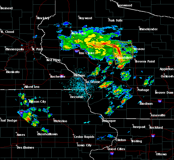 At 203 pm cdt, severe thunderstorms were located along a line extending from near dorchester to 9 miles east of colby to 11 miles east of spencer to near marshfield, moving northeast at 55 mph (radar indicated). Hazards include 70 mph wind gusts and penny size hail. a 66 mph wind gust was measured at marshfield asos at 159 pm cdt. Expect considerable tree damage. damage is likely to mobile homes, roofs, and outbuildings. Locations impacted include, wausau, marshfield, weston, rib mountain, mosinee, abbotsford, pittsville, rothschild, schofield and knowlton. At 203 pm cdt, severe thunderstorms were located along a line extending from near dorchester to 9 miles east of colby to 11 miles east of spencer to near marshfield, moving northeast at 55 mph (radar indicated). Hazards include 70 mph wind gusts and penny size hail. a 66 mph wind gust was measured at marshfield asos at 159 pm cdt. Expect considerable tree damage. damage is likely to mobile homes, roofs, and outbuildings. Locations impacted include, wausau, marshfield, weston, rib mountain, mosinee, abbotsford, pittsville, rothschild, schofield and knowlton.
|
| 5/17/2017 1:54 PM CDT |
 At 154 pm cdt, severe thunderstorms were located along a line extending from near colby to near spencer to near marshfield to near pittsville, moving northeast at 50 mph (radar indicated). Hazards include 60 mph wind gusts and penny size hail. Expect damage to roofs, siding, and trees. Locations impacted include, wausau, marshfield, weston, rib mountain, mosinee, abbotsford, spencer, pittsville, rothschild and schofield. At 154 pm cdt, severe thunderstorms were located along a line extending from near colby to near spencer to near marshfield to near pittsville, moving northeast at 50 mph (radar indicated). Hazards include 60 mph wind gusts and penny size hail. Expect damage to roofs, siding, and trees. Locations impacted include, wausau, marshfield, weston, rib mountain, mosinee, abbotsford, spencer, pittsville, rothschild and schofield.
|
| 5/17/2017 1:46 PM CDT |
 At 145 pm cdt, severe thunderstorms were located along a line extending from loyal to 8 miles southwest of spencer to 9 miles southwest of marshfield to 7 miles west of pittsville to 11 miles southeast of shortville, moving northeast at 50 mph (radar indicated). Hazards include 60 mph wind gusts and penny size hail. expect damage to roofs, siding, and trees At 145 pm cdt, severe thunderstorms were located along a line extending from loyal to 8 miles southwest of spencer to 9 miles southwest of marshfield to 7 miles west of pittsville to 11 miles southeast of shortville, moving northeast at 50 mph (radar indicated). Hazards include 60 mph wind gusts and penny size hail. expect damage to roofs, siding, and trees
|
| 7/21/2016 3:27 PM CDT |
 At 327 pm cdt, severe thunderstorms were located along a line extending from 9 miles northwest of wisconsin rapids to 7 miles southwest of pittsville, moving southeast at 25 mph (radar indicated). Hazards include 60 mph wind gusts and half dollar size hail. Hail damage to vehicles is expected. expect wind damage to roofs, siding, and trees. Locations impacted include, wisconsin rapids, marshfield, pittsville, babcock, lake wazeecha, nekoosa, port edwards, biron, hewitt and sherry. At 327 pm cdt, severe thunderstorms were located along a line extending from 9 miles northwest of wisconsin rapids to 7 miles southwest of pittsville, moving southeast at 25 mph (radar indicated). Hazards include 60 mph wind gusts and half dollar size hail. Hail damage to vehicles is expected. expect wind damage to roofs, siding, and trees. Locations impacted include, wisconsin rapids, marshfield, pittsville, babcock, lake wazeecha, nekoosa, port edwards, biron, hewitt and sherry.
|
| 7/21/2016 3:16 PM CDT |
 At 315 pm cdt, a severe thunderstorm was located 8 miles southwest of marshfield, or 14 miles east of neillsville, moving east at 30 mph (radar indicated). Hazards include 60 mph wind gusts and quarter size hail. Hail damage to vehicles is expected. Expect wind damage to roofs, siding, and trees. At 315 pm cdt, a severe thunderstorm was located 8 miles southwest of marshfield, or 14 miles east of neillsville, moving east at 30 mph (radar indicated). Hazards include 60 mph wind gusts and quarter size hail. Hail damage to vehicles is expected. Expect wind damage to roofs, siding, and trees.
|
| 7/21/2016 7:26 AM CDT |
 At 726 am cdt, severe thunderstorms were located along a line extending from near marshfield to near babcock, moving east at 40 mph (radar indicated). Hazards include 60 mph wind gusts and quarter size hail. Hail damage to vehicles is expected. expect wind damage to roofs, siding, and trees. Locations impacted include, stevens point, wisconsin rapids, marshfield, randolph, whiting, amherst, pittsville, babcock, lake wazeecha and plover. At 726 am cdt, severe thunderstorms were located along a line extending from near marshfield to near babcock, moving east at 40 mph (radar indicated). Hazards include 60 mph wind gusts and quarter size hail. Hail damage to vehicles is expected. expect wind damage to roofs, siding, and trees. Locations impacted include, stevens point, wisconsin rapids, marshfield, randolph, whiting, amherst, pittsville, babcock, lake wazeecha and plover.
|
| 7/21/2016 7:13 AM CDT |
 At 712 am cdt, severe thunderstorms were located along a line extending from near spencer to 10 miles southwest of pittsville, moving east at 35 mph (radar indicated). Hazards include 60 mph wind gusts and quarter size hail. Hail damage to vehicles is expected. Expect wind damage to roofs, siding, and trees. At 712 am cdt, severe thunderstorms were located along a line extending from near spencer to 10 miles southwest of pittsville, moving east at 35 mph (radar indicated). Hazards include 60 mph wind gusts and quarter size hail. Hail damage to vehicles is expected. Expect wind damage to roofs, siding, and trees.
|
| 6/10/2016 6:21 PM CDT |
 At 619 pm cdt, severe thunderstorms were located along a line extending from 12 miles west of mosinee to 6 miles northwest of new rome, moving east at 40 mph (radar indicated). Hazards include 60 mph wind gusts. Expect damage to roofs. siding. and trees. severe thunderstorms will be near, lake wazeecha around 635 pm cdt. mosinee around 640 pm cdt. bevent around 700 pm cdt. other locations impacted by these severe thunderstorms include kellner, ellis, peplin, big eau pleine county park, port edwards, polonia, rocky corners, jordan, blaine and north star. this warning replaces the warning already in effect for portions of marathon and wood counties. A tornado watch remains in effect until 900 pm cdt for central wisconsin. At 619 pm cdt, severe thunderstorms were located along a line extending from 12 miles west of mosinee to 6 miles northwest of new rome, moving east at 40 mph (radar indicated). Hazards include 60 mph wind gusts. Expect damage to roofs. siding. and trees. severe thunderstorms will be near, lake wazeecha around 635 pm cdt. mosinee around 640 pm cdt. bevent around 700 pm cdt. other locations impacted by these severe thunderstorms include kellner, ellis, peplin, big eau pleine county park, port edwards, polonia, rocky corners, jordan, blaine and north star. this warning replaces the warning already in effect for portions of marathon and wood counties. A tornado watch remains in effect until 900 pm cdt for central wisconsin.
|
| 6/10/2016 6:10 PM CDT |
 At 610 pm cdt, a severe thunderstorm was located near marshfield, or 19 miles northwest of wisconsin rapids, moving east at 40 mph (radar indicated). Hazards include 60 mph wind gusts and penny size hail. Expect damage to roofs. siding. and trees. this severe thunderstorm will remain over mainly rural areas of southwestern marathon and northern wood counties, including the following locations: bakerville, powers bluff county park, big eau pleine county park, bethel, milladore, march rapids, fenwood, hewitt, auburndale and walker. A tornado watch remains in effect until 900 pm cdt for central wisconsin. At 610 pm cdt, a severe thunderstorm was located near marshfield, or 19 miles northwest of wisconsin rapids, moving east at 40 mph (radar indicated). Hazards include 60 mph wind gusts and penny size hail. Expect damage to roofs. siding. and trees. this severe thunderstorm will remain over mainly rural areas of southwestern marathon and northern wood counties, including the following locations: bakerville, powers bluff county park, big eau pleine county park, bethel, milladore, march rapids, fenwood, hewitt, auburndale and walker. A tornado watch remains in effect until 900 pm cdt for central wisconsin.
|
| 6/10/2016 5:56 PM CDT |
 At 555 pm cdt, a severe thunderstorm was located near marshfield, or 15 miles east of neillsville, moving east at 40 mph (radar indicated). Hazards include 60 mph wind gusts. Expect damage to roofs. siding. and trees. this severe storm will be near, marshfield around 610 pm cdt. other locations impacted by this severe thunderstorm include bakerville, powers bluff county park, big eau pleine county park, lindsey, bethel, milladore, march rapids, fenwood, hewitt and auburndale. A tornado watch remains in effect until 900 pm cdt for central wisconsin. At 555 pm cdt, a severe thunderstorm was located near marshfield, or 15 miles east of neillsville, moving east at 40 mph (radar indicated). Hazards include 60 mph wind gusts. Expect damage to roofs. siding. and trees. this severe storm will be near, marshfield around 610 pm cdt. other locations impacted by this severe thunderstorm include bakerville, powers bluff county park, big eau pleine county park, lindsey, bethel, milladore, march rapids, fenwood, hewitt and auburndale. A tornado watch remains in effect until 900 pm cdt for central wisconsin.
|
| 6/10/2016 5:38 PM CDT |
 At 537 pm cdt, doppler radar indicated a line of severe thunderstorm located near loyal, or 10 miles northeast of neillsville, moving east at 45 mph (radar indicated). Hazards include 60 mph wind gusts. Expect damage to roofs. siding. and trees. this severe thunderstorm will be near, spencer around 550 pm cdt. marshfield around 555 pm cdt. other locations impacted by this severe thunderstorm include bakerville, powers bluff county park, big eau pleine county park, lindsey, bethel, milladore, march rapids, fenwood, hewitt and auburndale. A tornado watch remains in effect until 900 pm cdt for central wisconsin. At 537 pm cdt, doppler radar indicated a line of severe thunderstorm located near loyal, or 10 miles northeast of neillsville, moving east at 45 mph (radar indicated). Hazards include 60 mph wind gusts. Expect damage to roofs. siding. and trees. this severe thunderstorm will be near, spencer around 550 pm cdt. marshfield around 555 pm cdt. other locations impacted by this severe thunderstorm include bakerville, powers bluff county park, big eau pleine county park, lindsey, bethel, milladore, march rapids, fenwood, hewitt and auburndale. A tornado watch remains in effect until 900 pm cdt for central wisconsin.
|
| 6/3/2016 6:27 PM CDT |
 At 626 pm cdt, severe thunderstorms were located along a line extending from 6 miles northeast of dorchester to 12 miles northeast of marshfield to 7 miles east of pittsville, moving northeast at 35 mph (radar indicated). Hazards include 60 mph wind gusts and nickel size hail. Expect damage to roofs. siding. and trees. Locations impacted include, marshfield, abbotsford, pittsville, stratford, marathon city, edgar, athens, rib falls, hamburg and hewitt. At 626 pm cdt, severe thunderstorms were located along a line extending from 6 miles northeast of dorchester to 12 miles northeast of marshfield to 7 miles east of pittsville, moving northeast at 35 mph (radar indicated). Hazards include 60 mph wind gusts and nickel size hail. Expect damage to roofs. siding. and trees. Locations impacted include, marshfield, abbotsford, pittsville, stratford, marathon city, edgar, athens, rib falls, hamburg and hewitt.
|
| 6/3/2016 6:17 PM CDT | At least two trees and several branches down on shady road two miles north of highway 10. time estimated based on rada in wood county WI, 2.4 miles SSE of Auburndale, WI |
| 6/3/2016 6:17 PM CDT |
 At 617 pm cdt, severe thunderstorms were located along a line extending from dorchester to 6 miles northeast of marshfield to near pittsville, moving northeast at 35 mph (radar indicated). Hazards include 60 mph wind gusts and nickel size hail. Expect damage to roofs. siding. and trees. Locations impacted include, marshfield, abbotsford, spencer, pittsville, colby, stratford, marathon city, edgar, athens and rib falls. At 617 pm cdt, severe thunderstorms were located along a line extending from dorchester to 6 miles northeast of marshfield to near pittsville, moving northeast at 35 mph (radar indicated). Hazards include 60 mph wind gusts and nickel size hail. Expect damage to roofs. siding. and trees. Locations impacted include, marshfield, abbotsford, spencer, pittsville, colby, stratford, marathon city, edgar, athens and rib falls.
|
| 6/3/2016 6:15 PM CDT | Trees down in the township of day. report relayed via the marathon county sheriff office. time estimated based on rada in marathon county WI, 6.2 miles SSW of Auburndale, WI |
| 6/3/2016 6:00 PM CDT |
 At 600 pm cdt, severe thunderstorms were located along a line extending from owen to 6 miles west of marshfield to 9 miles northwest of babcock, moving northeast at 35 mph (radar indicated). Hazards include 60 mph wind gusts and nickel size hail. Expect damage to roofs. siding. and trees. Locations impacted include, marshfield, abbotsford, spencer, pittsville, colby, stratford, marathon city, edgar, athens and rib falls. At 600 pm cdt, severe thunderstorms were located along a line extending from owen to 6 miles west of marshfield to 9 miles northwest of babcock, moving northeast at 35 mph (radar indicated). Hazards include 60 mph wind gusts and nickel size hail. Expect damage to roofs. siding. and trees. Locations impacted include, marshfield, abbotsford, spencer, pittsville, colby, stratford, marathon city, edgar, athens and rib falls.
|
| 6/3/2016 5:40 PM CDT |
 At 539 pm cdt, severe thunderstorms were located along a line extending from 6 miles southwest of owen to 8 miles south of loyal to 8 miles southeast of hatfield, moving northeast at 35 mph (radar indicated). Hazards include 60 mph wind gusts and nickel size hail. Expect damage to roofs. siding. And trees. At 539 pm cdt, severe thunderstorms were located along a line extending from 6 miles southwest of owen to 8 miles south of loyal to 8 miles southeast of hatfield, moving northeast at 35 mph (radar indicated). Hazards include 60 mph wind gusts and nickel size hail. Expect damage to roofs. siding. And trees.
|
| 8/2/2015 2:33 PM CDT |
 At 233 pm cdt, a severe thunderstorm was located 11 miles east of marshfield, or 17 miles north of wisconsin rapids, moving east at 60 mph (radar indicated). Hazards include golf ball size hail and 70 mph wind gusts. People and animals outdoors will be injured. expect hail damage to roofs, siding, windows and vehicles. expect considerable tree damage. wind damage is also likely to mobile homes, roofs and outbuildings. this severe thunderstorm will be near, stevens point and whiting around 255 pm cdt. randolph around 300 pm cdt. Other locations impacted by this severe thunderstorm include arnott, peplin, nelsonville, blenker, custer, big eau pleine county park, rozellville, ellis, fancher and vesper. At 233 pm cdt, a severe thunderstorm was located 11 miles east of marshfield, or 17 miles north of wisconsin rapids, moving east at 60 mph (radar indicated). Hazards include golf ball size hail and 70 mph wind gusts. People and animals outdoors will be injured. expect hail damage to roofs, siding, windows and vehicles. expect considerable tree damage. wind damage is also likely to mobile homes, roofs and outbuildings. this severe thunderstorm will be near, stevens point and whiting around 255 pm cdt. randolph around 300 pm cdt. Other locations impacted by this severe thunderstorm include arnott, peplin, nelsonville, blenker, custer, big eau pleine county park, rozellville, ellis, fancher and vesper.
|
| 7/18/2015 3:42 AM CDT |
 At 341 am cdt, severe thunderstorms were located along a line extending from near rib lake to 9 miles east of colby to 13 miles southwest of babcock, moving east at 45 mph (radar indicated). Hazards include 60 mph wind gusts and nickel size hail. Expect damage to roofs. siding and trees. Locations impacted include, wausau, stevens point, wisconsin rapids, marshfield, weston, merrill, rib mountain, mosinee, abbotsford, spencer, whiting, pittsville, lake wazeecha, council grounds state park, babcock, new wood wildlife area, plover, rothschild, stockton and nekoosa. At 341 am cdt, severe thunderstorms were located along a line extending from near rib lake to 9 miles east of colby to 13 miles southwest of babcock, moving east at 45 mph (radar indicated). Hazards include 60 mph wind gusts and nickel size hail. Expect damage to roofs. siding and trees. Locations impacted include, wausau, stevens point, wisconsin rapids, marshfield, weston, merrill, rib mountain, mosinee, abbotsford, spencer, whiting, pittsville, lake wazeecha, council grounds state park, babcock, new wood wildlife area, plover, rothschild, stockton and nekoosa.
|
| 7/18/2015 3:22 AM CDT |
 At 320 am cdt, severe thunderstorms were located along a line extending from 11 miles west of chelsea to 7 miles southwest of colby to near millston, moving east at 55 mph (radar indicated). Hazards include 60 mph wind gusts and nickel size hail. Expect damage to roofs. siding and trees. these severe storms will be near, spencer around 325 am cdt. abbotsford around 330 am cdt. new wood wildlife area and babcock around 355 am cdt. wausau and mosinee around 400 am cdt. rib mountain around 405 am cdt. wisconsin rapids and weston around 410 am cdt. lake wazeecha around 415 am cdt. Other locations impacted by these severe thunderstorms include arnott, schofield, bill cross rapids wildlife area, nekoosa, custer, walker, big eau pleine county park, rozellville, rib falls and vesper. At 320 am cdt, severe thunderstorms were located along a line extending from 11 miles west of chelsea to 7 miles southwest of colby to near millston, moving east at 55 mph (radar indicated). Hazards include 60 mph wind gusts and nickel size hail. Expect damage to roofs. siding and trees. these severe storms will be near, spencer around 325 am cdt. abbotsford around 330 am cdt. new wood wildlife area and babcock around 355 am cdt. wausau and mosinee around 400 am cdt. rib mountain around 405 am cdt. wisconsin rapids and weston around 410 am cdt. lake wazeecha around 415 am cdt. Other locations impacted by these severe thunderstorms include arnott, schofield, bill cross rapids wildlife area, nekoosa, custer, walker, big eau pleine county park, rozellville, rib falls and vesper.
|
| 7/18/2015 3:11 AM CDT |
 At 310 am cdt, severe thunderstorms were located along a line extending from 9 miles southeast of jump river to near greenwood to near black river falls, moving east at 55 mph (radar indicated). Hazards include 60 mph wind gusts and nickel size hail. Expect damage to roofs. siding and trees. severe thunderstorms will be near, abbotsford and spencer around 325 am cdt. babcock and new wood wildlife area around 350 am cdt. mosinee around 355 am cdt. merrill, rib mountain and council grounds state park around 400 am cdt. weston around 405 am cdt. other locations impacted by these severe thunderstorms include arnott, schofield, bill cross rapids wildlife area, nekoosa, custer, walker, big eau pleine county park, rozellville, rib falls and vesper. People camping for the wisconsin aquaskier tournament should seek safe shelter immediately!. At 310 am cdt, severe thunderstorms were located along a line extending from 9 miles southeast of jump river to near greenwood to near black river falls, moving east at 55 mph (radar indicated). Hazards include 60 mph wind gusts and nickel size hail. Expect damage to roofs. siding and trees. severe thunderstorms will be near, abbotsford and spencer around 325 am cdt. babcock and new wood wildlife area around 350 am cdt. mosinee around 355 am cdt. merrill, rib mountain and council grounds state park around 400 am cdt. weston around 405 am cdt. other locations impacted by these severe thunderstorms include arnott, schofield, bill cross rapids wildlife area, nekoosa, custer, walker, big eau pleine county park, rozellville, rib falls and vesper. People camping for the wisconsin aquaskier tournament should seek safe shelter immediately!.
|
| 7/13/2015 2:42 AM CDT |
 At 241 am cdt, severe thunderstorms were located along a line extending from near merrill to 9 miles northwest of stevens point to near new rome, moving east at 40 mph (radar indicated). Hazards include 60 mph wind gusts and penny size hail. Expect damage to roofs. siding and trees. these severe storms will be near, stevens point around 255 am cdt. randolph and bevent around 310 am cdt. amherst around 320 am cdt. Other locations impacted by these severe thunderstorms include arnott, schofield, elderon, nekoosa, custer, walker, big eau pleine county park, vesper, rib mountain state park and ringle. At 241 am cdt, severe thunderstorms were located along a line extending from near merrill to 9 miles northwest of stevens point to near new rome, moving east at 40 mph (radar indicated). Hazards include 60 mph wind gusts and penny size hail. Expect damage to roofs. siding and trees. these severe storms will be near, stevens point around 255 am cdt. randolph and bevent around 310 am cdt. amherst around 320 am cdt. Other locations impacted by these severe thunderstorms include arnott, schofield, elderon, nekoosa, custer, walker, big eau pleine county park, vesper, rib mountain state park and ringle.
|
| 7/13/2015 2:23 AM CDT |
 At 223 am cdt, severe thunderstorms were located along a line extending from 6 miles southwest of council grounds state park to 10 miles north of wisconsin rapids to 6 miles southwest of babcock, moving northeast at 40 mph (radar indicated). Hazards include 60 mph wind gusts and penny size hail. Expect damage to roofs. siding and trees. these severe storms will be near, stevens point around 245 am cdt. wisconsin rapids around 250 am cdt. lake wazeecha around 255 am cdt. randolph and bevent around 300 am cdt. whiting around 315 am cdt. Other locations impacted by these severe thunderstorms include arnott, schofield, elderon, nekoosa, custer, walker, big eau pleine county park, rozellville, rib falls and vesper. At 223 am cdt, severe thunderstorms were located along a line extending from 6 miles southwest of council grounds state park to 10 miles north of wisconsin rapids to 6 miles southwest of babcock, moving northeast at 40 mph (radar indicated). Hazards include 60 mph wind gusts and penny size hail. Expect damage to roofs. siding and trees. these severe storms will be near, stevens point around 245 am cdt. wisconsin rapids around 250 am cdt. lake wazeecha around 255 am cdt. randolph and bevent around 300 am cdt. whiting around 315 am cdt. Other locations impacted by these severe thunderstorms include arnott, schofield, elderon, nekoosa, custer, walker, big eau pleine county park, rozellville, rib falls and vesper.
|
| 7/13/2015 2:10 AM CDT |
 At 209 am cdt, severe thunderstorms were located along a line extending from 11 miles southwest of council grounds state park to near pittsville to 12 miles west of babcock, moving east at 35 mph (radar indicated). Hazards include 60 mph wind gusts and quarter size hail. Hail damage to vehicles is expected. Expect wind damage to roofs, siding and trees. At 209 am cdt, severe thunderstorms were located along a line extending from 11 miles southwest of council grounds state park to near pittsville to 12 miles west of babcock, moving east at 35 mph (radar indicated). Hazards include 60 mph wind gusts and quarter size hail. Hail damage to vehicles is expected. Expect wind damage to roofs, siding and trees.
|
| 1/1/0001 12:00 AM | Trees down along highway h in wood county WI, 4.5 miles SW of Auburndale, WI |
Hail Maps for Auburndale, WI
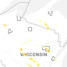
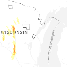

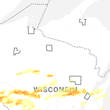

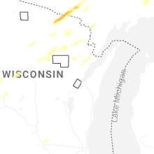


Connect with Interactive Hail Maps