

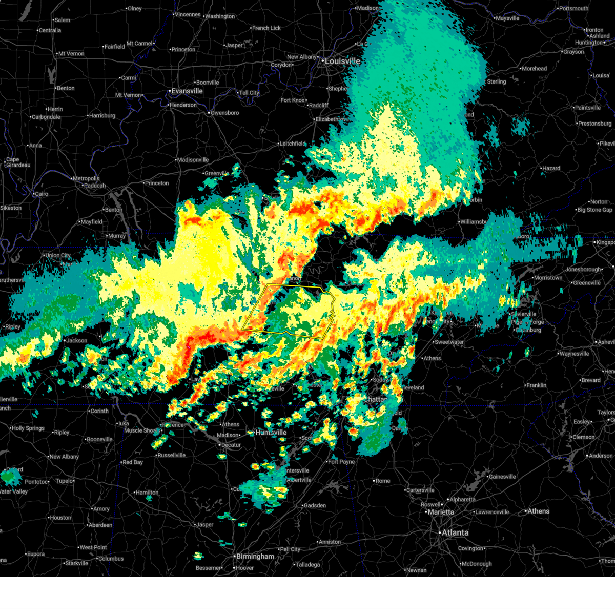
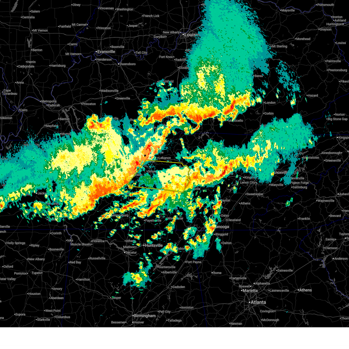
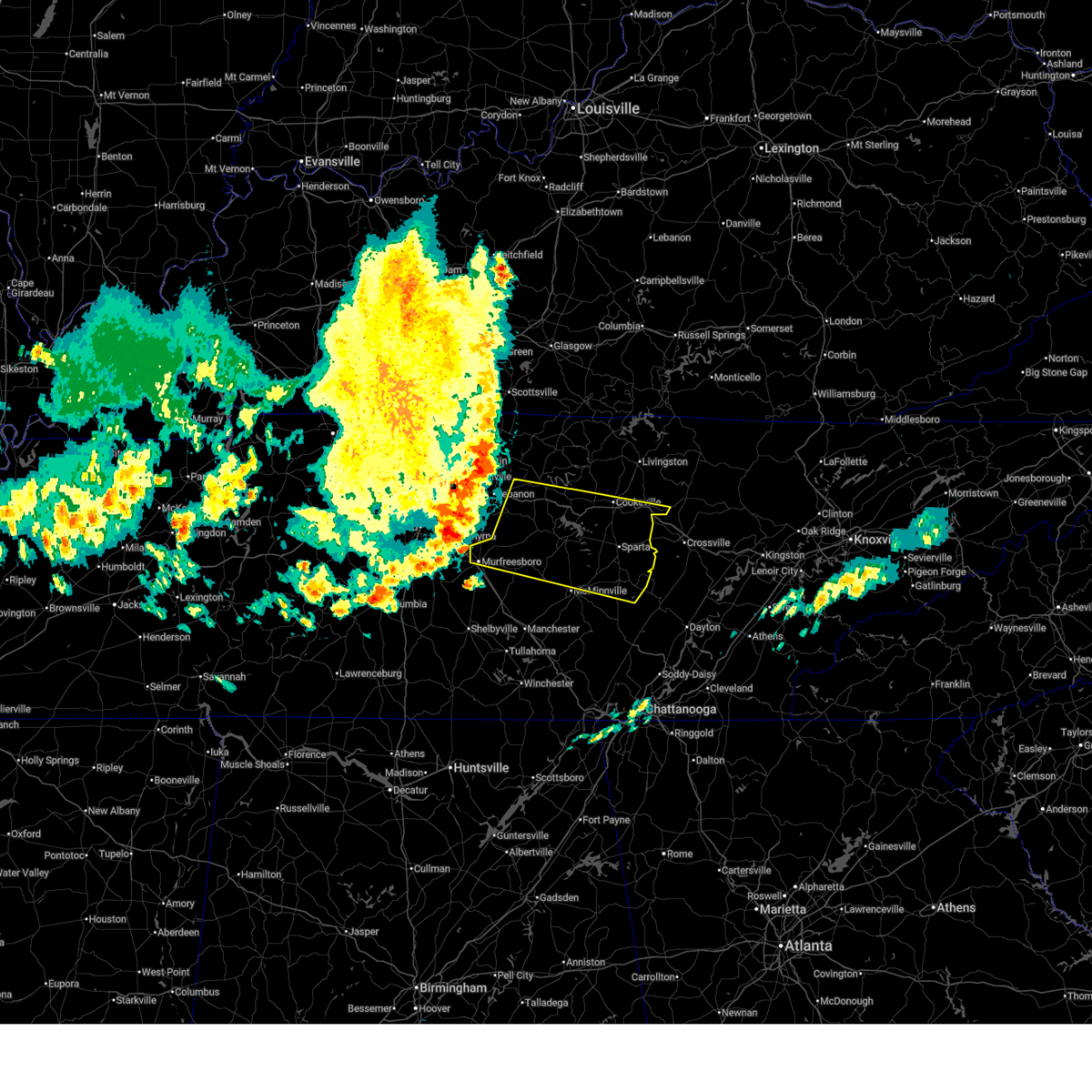
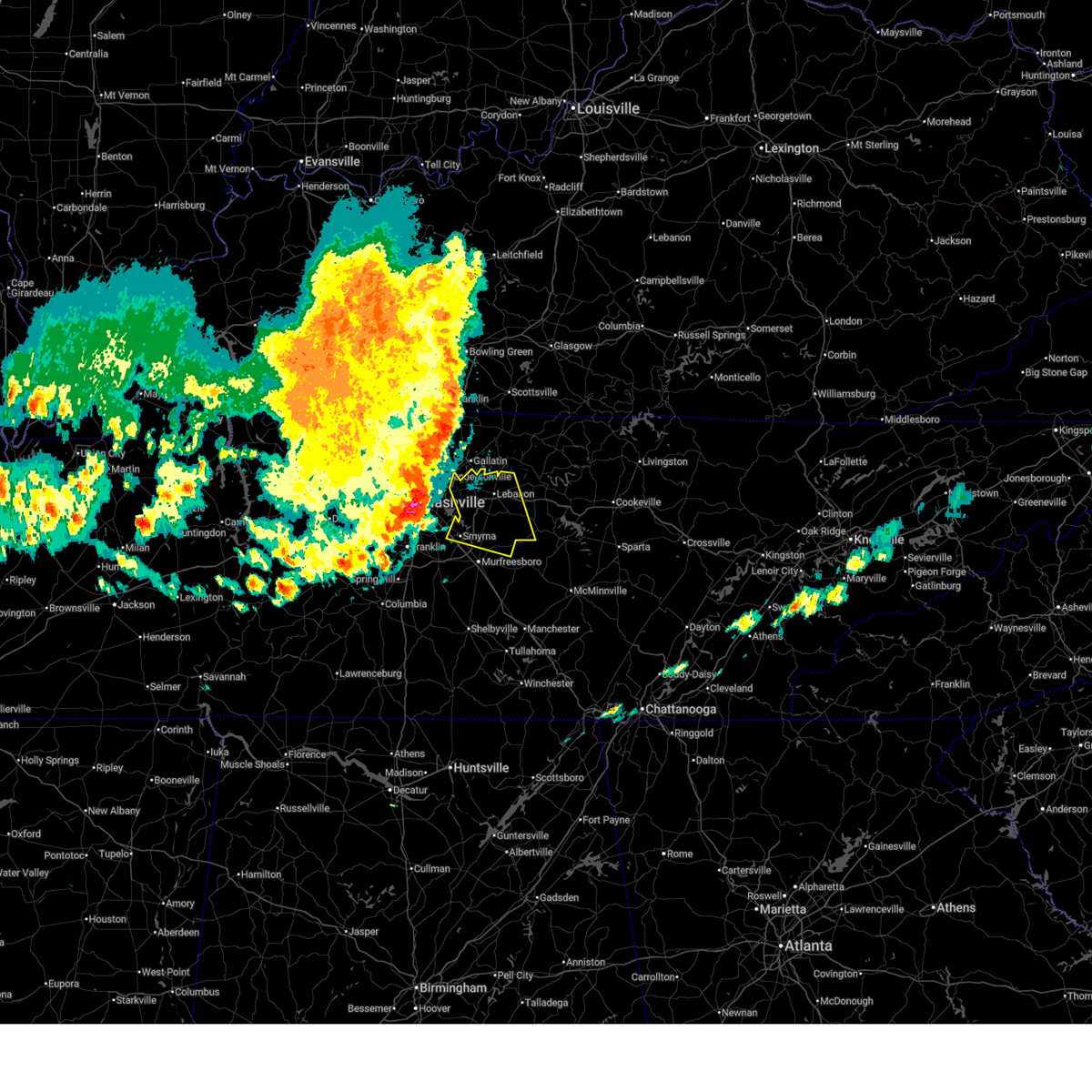
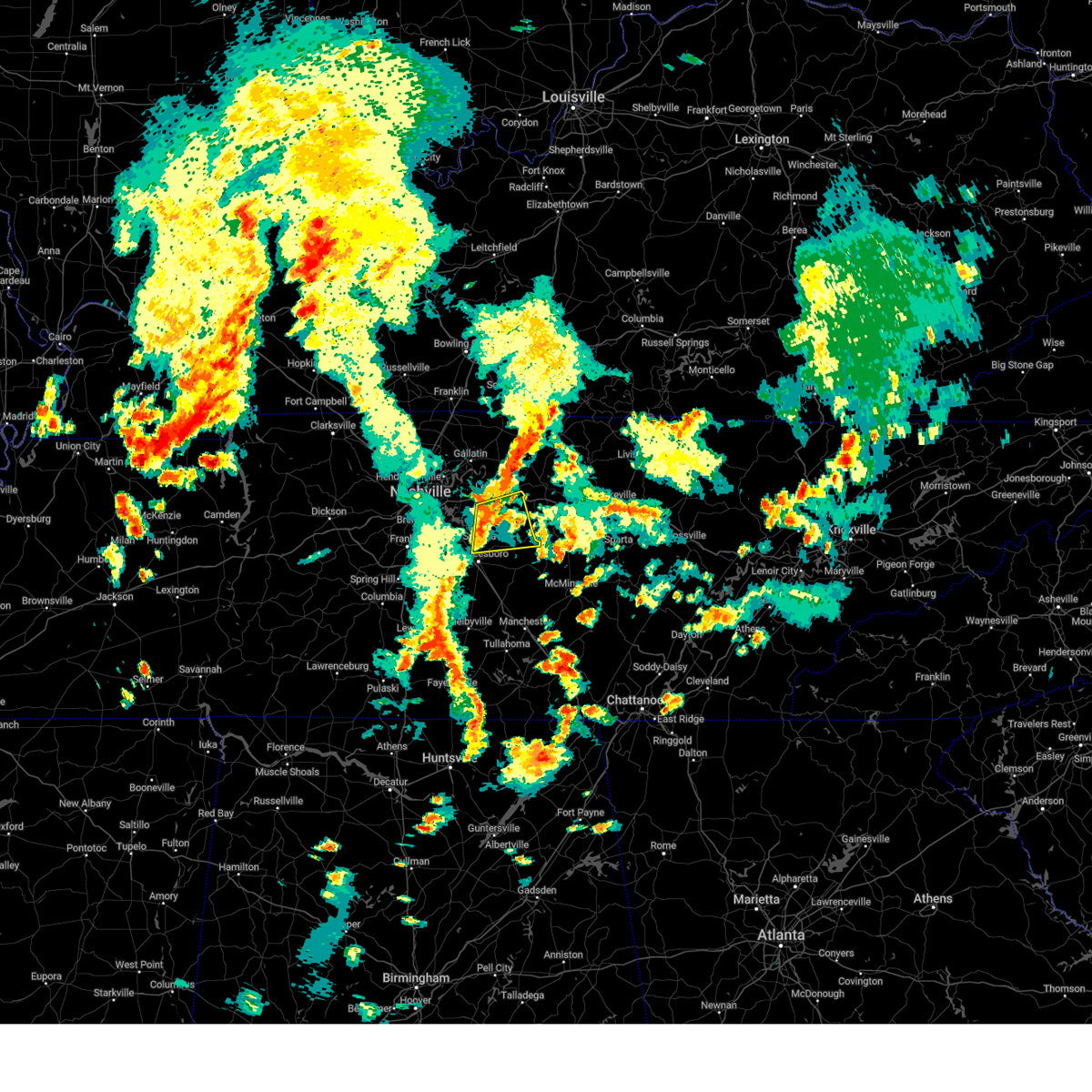
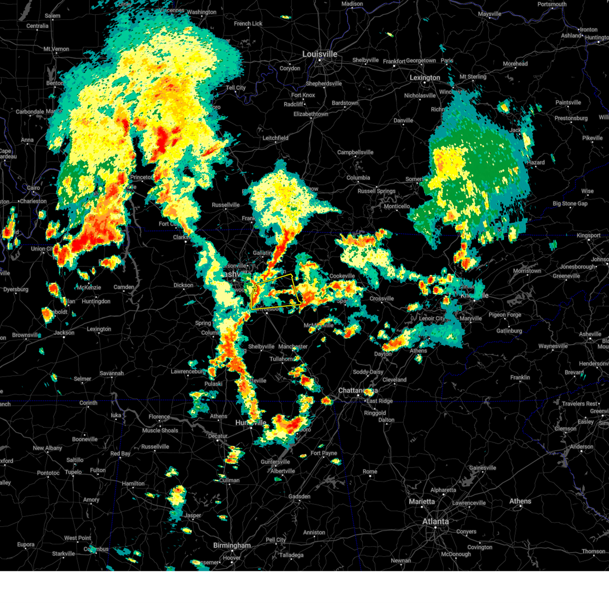
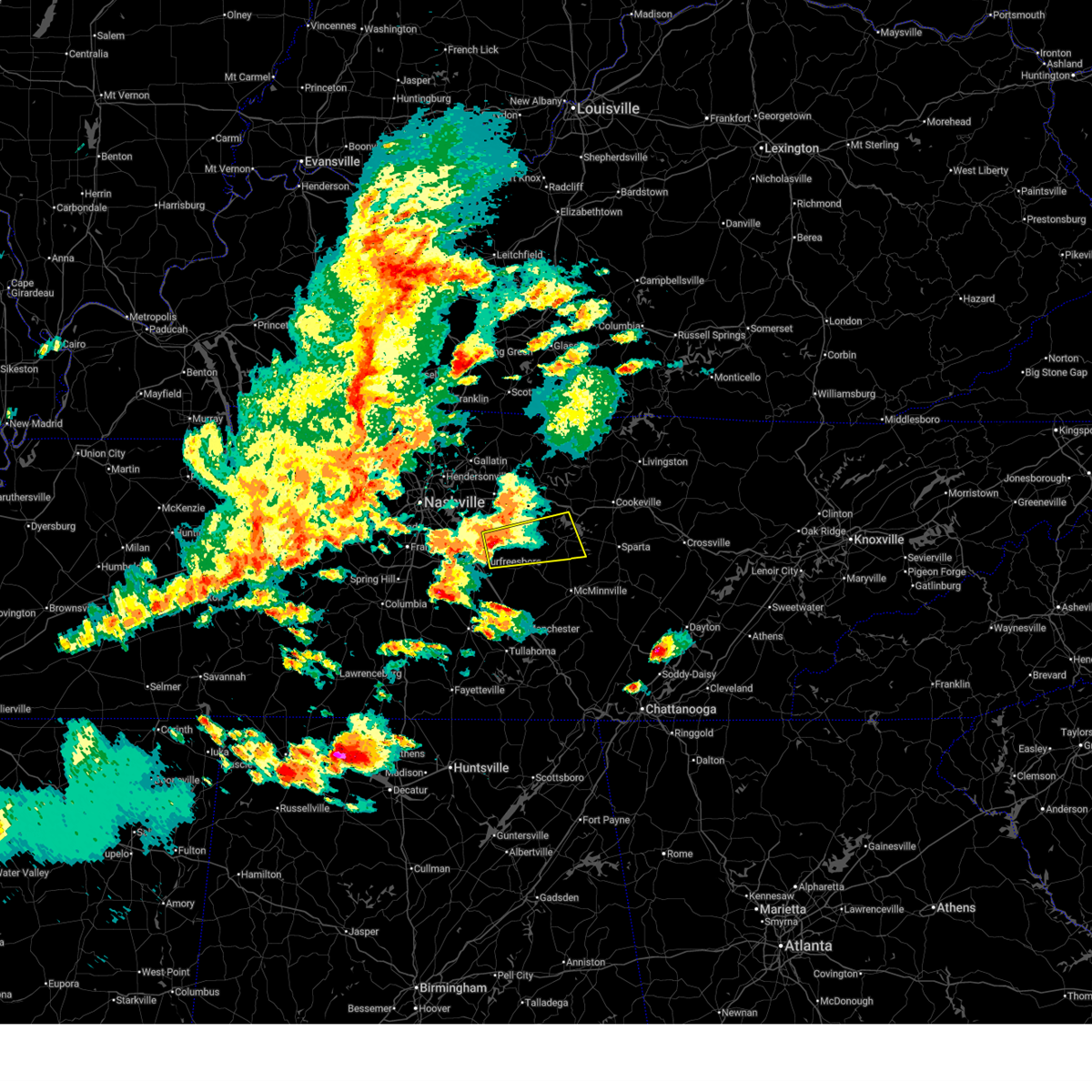
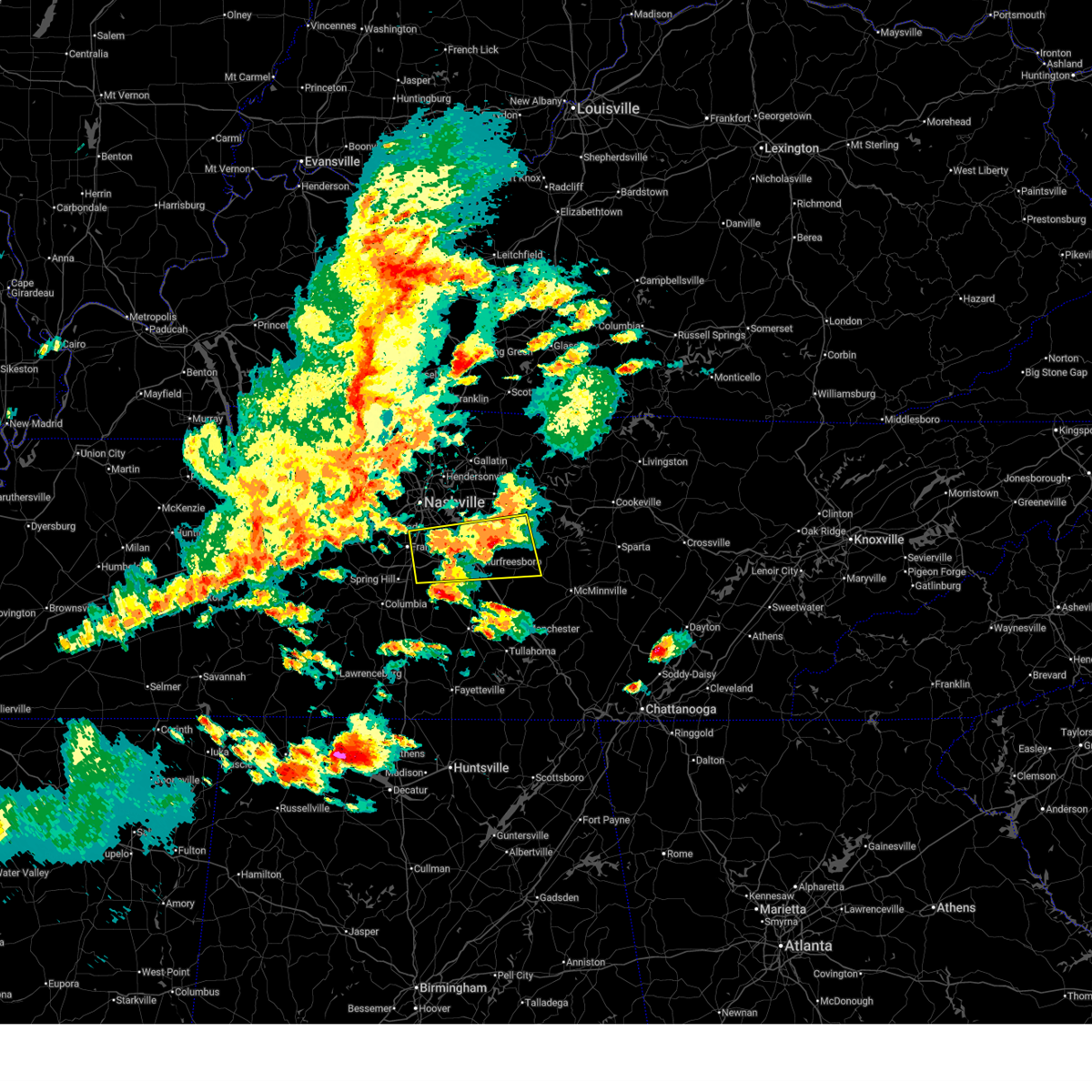
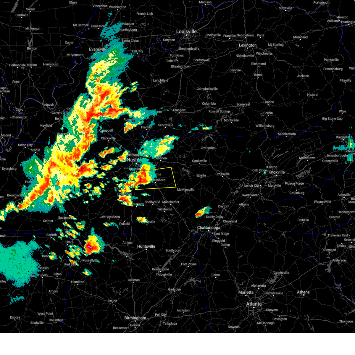
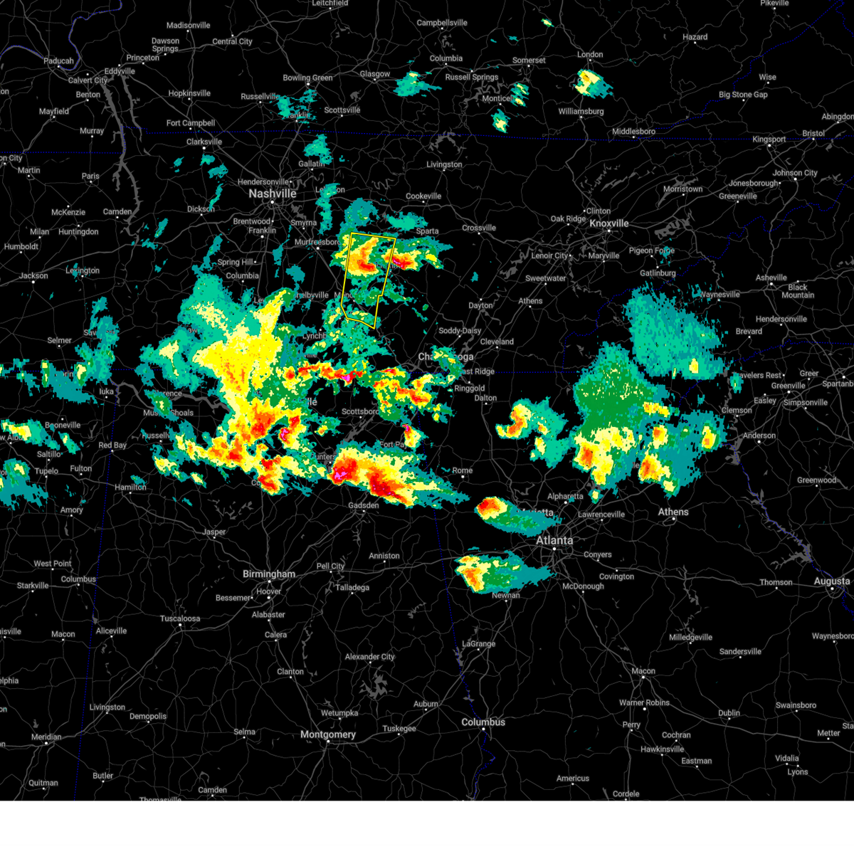
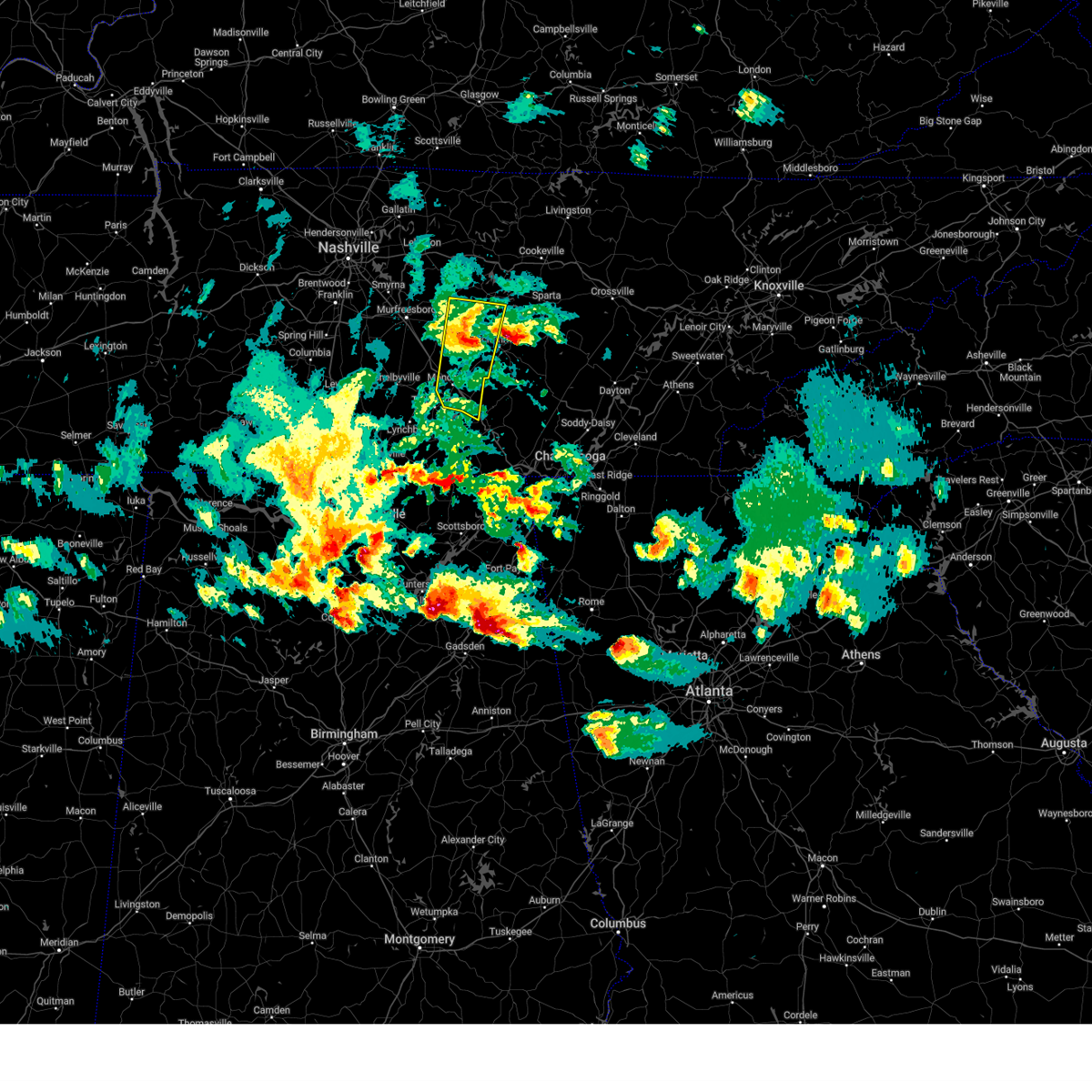
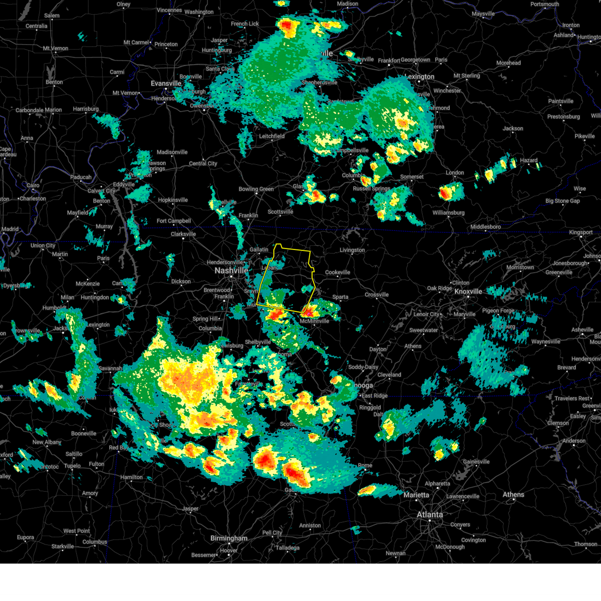
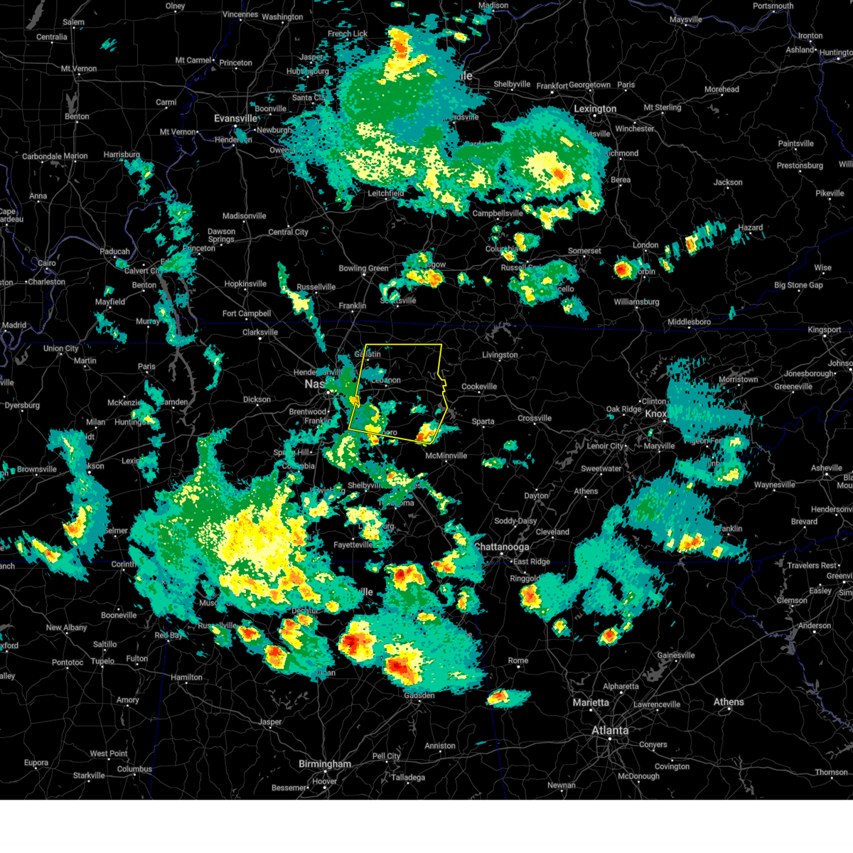
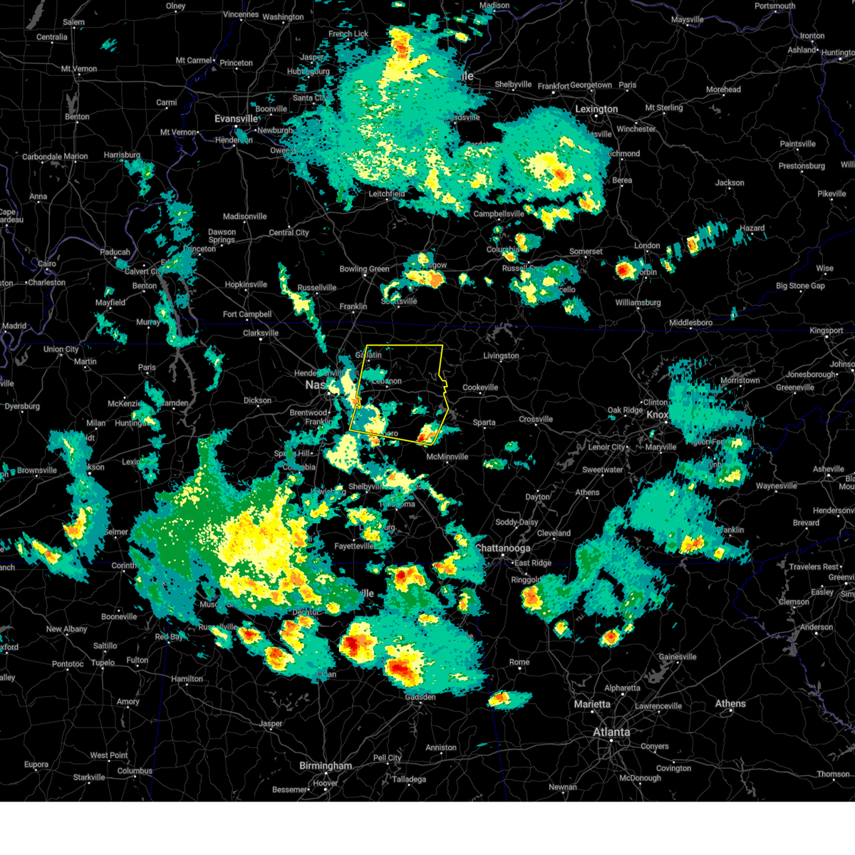
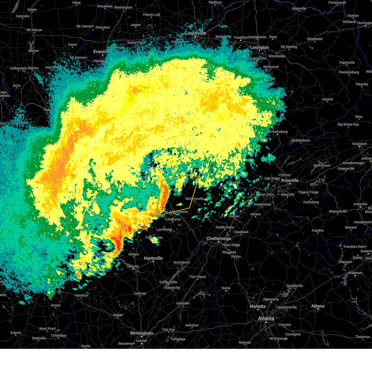
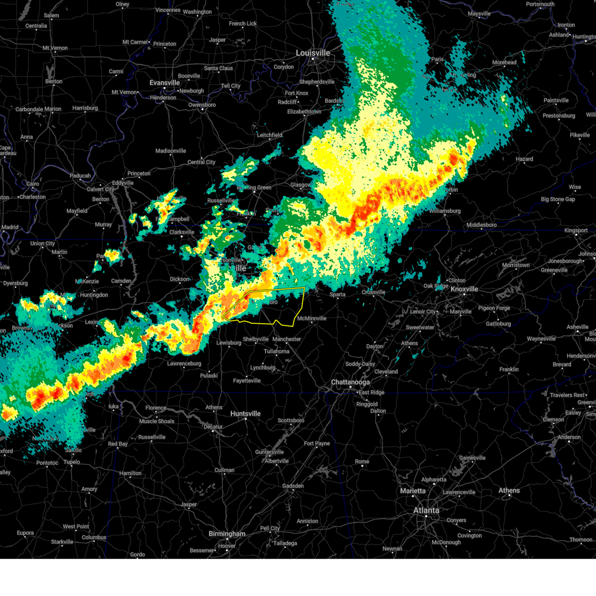
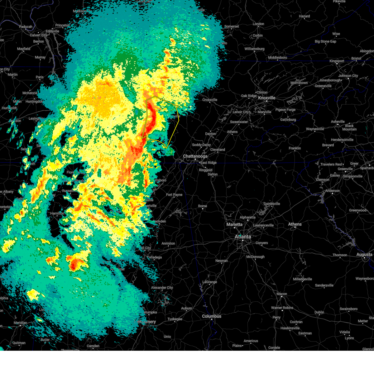
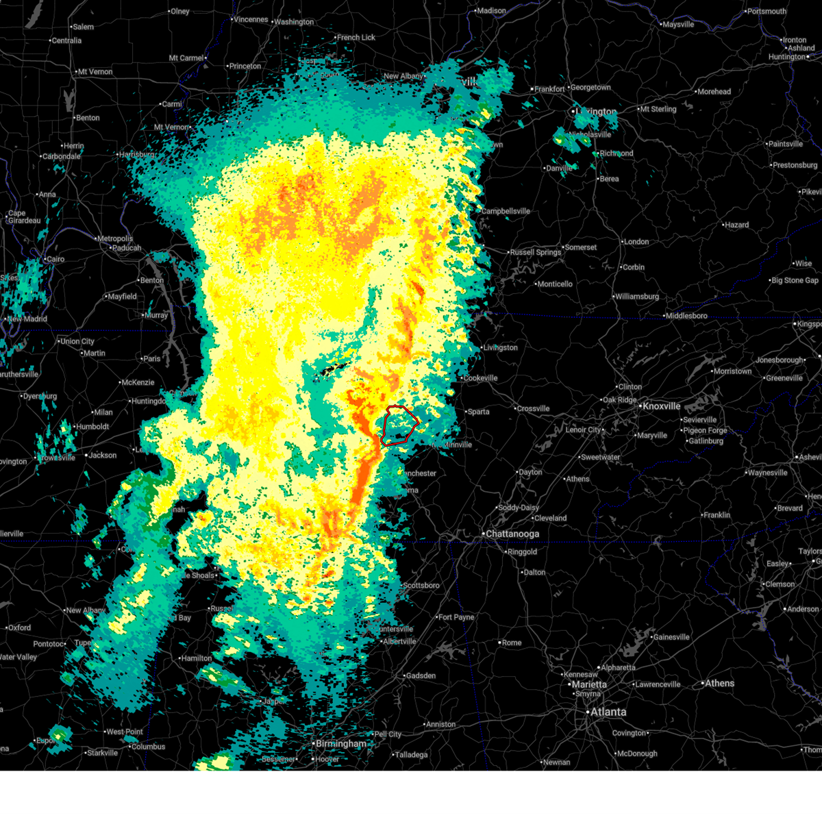
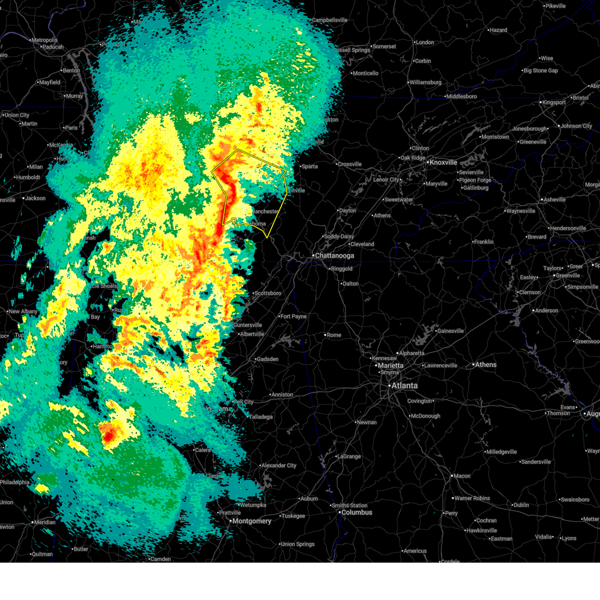
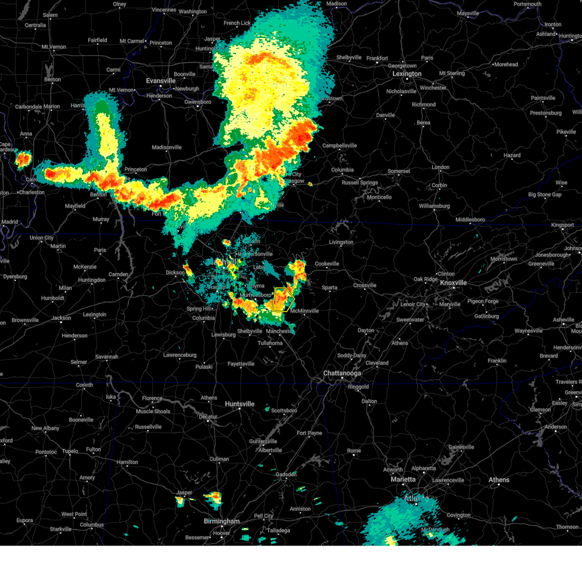
Hail Map for Auburntown, TN
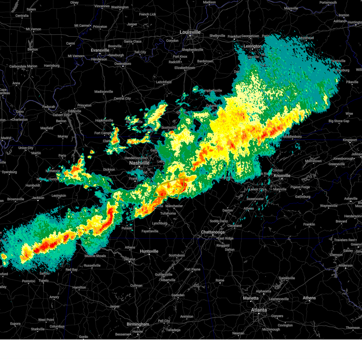
The Auburntown, TN area has had 2 reports of on-the-ground hail by trained spotters, and has been under severe weather warnings 14 times during the past 12 months. Doppler radar has detected hail at or near Auburntown, TN on 50 occasions, including 4 occasions during the past year.
| Name: | Auburntown, TN |
| Where Located: | 41.2 miles ESE of Nashville, TN |
| Map: | Google Map for Auburntown, TN |
| Population: | 269 |
| Housing Units: | 126 |
| More Info: | Search Google for Auburntown, TN |
2
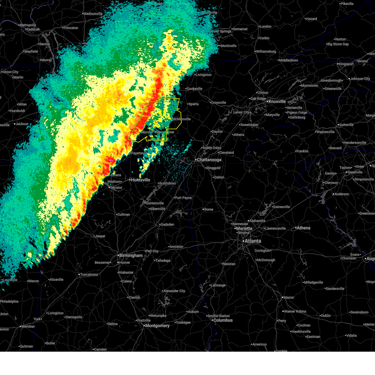
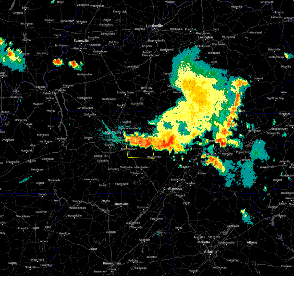
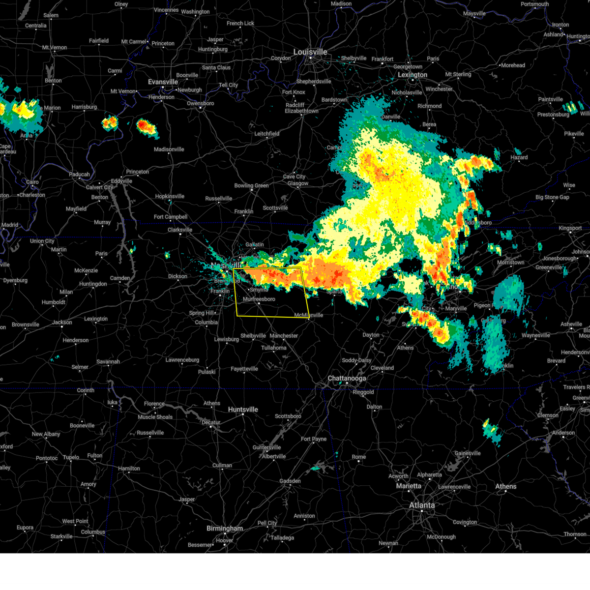
The Top Recent Hail Date for Auburntown, TN is Saturday, April 25, 2026 (13th out of 50)
Hail and Wind Damage Spotted near Auburntown, TN
| Date / Time | Report Details |
|---|---|
| 6/9/2026 5:24 PM CDT |
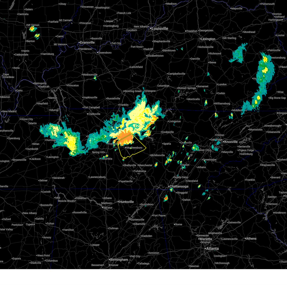 At 524 pm cdt, a severe thunderstorm was located near murfreesboro, moving southeast at 30 mph (radar indicated). Hazards include 70 mph wind gusts and penny size hail. Expect considerable tree damage. damage is likely to mobile homes, roofs, and outbuildings. locations impacted include, murfreesboro, woodbury, smyrna, la vergne, walterhill, auburntown, lascassas, christiana, fosterville, cedars of lebanon state park, rockvale, bradyville, milton, and readyville. this includes the following highways, interstate 24 between mile markers 66 and 93. Interstate 840 between mile markers 47 and 65. At 524 pm cdt, a severe thunderstorm was located near murfreesboro, moving southeast at 30 mph (radar indicated). Hazards include 70 mph wind gusts and penny size hail. Expect considerable tree damage. damage is likely to mobile homes, roofs, and outbuildings. locations impacted include, murfreesboro, woodbury, smyrna, la vergne, walterhill, auburntown, lascassas, christiana, fosterville, cedars of lebanon state park, rockvale, bradyville, milton, and readyville. this includes the following highways, interstate 24 between mile markers 66 and 93. Interstate 840 between mile markers 47 and 65.
|
| 6/9/2026 5:11 PM CDT |
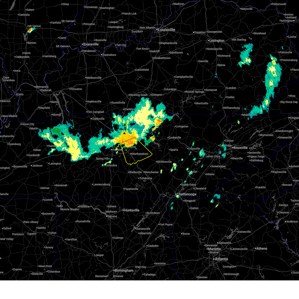 Svrohx the national weather service in nashville has issued a * severe thunderstorm warning for, southeastern davidson county in middle tennessee, rutherford county in middle tennessee, southern wilson county in middle tennessee, cannon county in middle tennessee, * until 615 pm cdt. * at 511 pm cdt, a severe thunderstorm was located near walterhill, or 8 miles north of murfreesboro, moving southeast at 30 mph (radar indicated). Hazards include 70 mph wind gusts and penny size hail. Expect considerable tree damage. Damage is likely to mobile homes, roofs, and outbuildings. Svrohx the national weather service in nashville has issued a * severe thunderstorm warning for, southeastern davidson county in middle tennessee, rutherford county in middle tennessee, southern wilson county in middle tennessee, cannon county in middle tennessee, * until 615 pm cdt. * at 511 pm cdt, a severe thunderstorm was located near walterhill, or 8 miles north of murfreesboro, moving southeast at 30 mph (radar indicated). Hazards include 70 mph wind gusts and penny size hail. Expect considerable tree damage. Damage is likely to mobile homes, roofs, and outbuildings.
|
| 4/28/2026 3:38 AM CDT |
 At 338 am cdt, severe thunderstorms were located along a line extending from 8 miles northwest of smithville to near woodbury, moving east at 60 mph (radar indicated). Hazards include 60 mph wind gusts and penny size hail. Expect damage to roofs, siding, and trees. locations impacted include, mcminnville, smithville, woodbury, dowelltown, liberty, auburntown, centertown, center hill lake, bradyville, edgar evins state park, and readyville. This includes interstate 24 between mile markers 89 and 91. At 338 am cdt, severe thunderstorms were located along a line extending from 8 miles northwest of smithville to near woodbury, moving east at 60 mph (radar indicated). Hazards include 60 mph wind gusts and penny size hail. Expect damage to roofs, siding, and trees. locations impacted include, mcminnville, smithville, woodbury, dowelltown, liberty, auburntown, centertown, center hill lake, bradyville, edgar evins state park, and readyville. This includes interstate 24 between mile markers 89 and 91.
|
| 4/28/2026 3:16 AM CDT |
 At 316 am cdt, severe thunderstorms were located along a line extending from near watertown to 8 miles southwest of murfreesboro, moving east at 70 mph (radar indicated). Hazards include 60 mph wind gusts and penny size hail. Expect damage to roofs, siding, and trees. locations impacted include, murfreesboro, mcminnville, smithville, woodbury, smyrna, watertown, walterhill, alexandria, eagleville, dowelltown, liberty, auburntown, centertown, lascassas, christiana, cedars of lebanon state park, center hill lake, rockvale, bradyville, and milton. this includes the following highways, interstate 24 between mile markers 68 and 91. Interstate 840 between mile markers 44 and 73. At 316 am cdt, severe thunderstorms were located along a line extending from near watertown to 8 miles southwest of murfreesboro, moving east at 70 mph (radar indicated). Hazards include 60 mph wind gusts and penny size hail. Expect damage to roofs, siding, and trees. locations impacted include, murfreesboro, mcminnville, smithville, woodbury, smyrna, watertown, walterhill, alexandria, eagleville, dowelltown, liberty, auburntown, centertown, lascassas, christiana, cedars of lebanon state park, center hill lake, rockvale, bradyville, and milton. this includes the following highways, interstate 24 between mile markers 68 and 91. Interstate 840 between mile markers 44 and 73.
|
| 4/28/2026 3:16 AM CDT |
 the severe thunderstorm warning has been cancelled and is no longer in effect the severe thunderstorm warning has been cancelled and is no longer in effect
|
| 4/28/2026 2:58 AM CDT |
 Svrohx the national weather service in nashville has issued a * severe thunderstorm warning for, south central smith county in middle tennessee, southeastern davidson county in middle tennessee, de kalb county in middle tennessee, rutherford county in middle tennessee, northwestern warren county in middle tennessee, eastern williamson county in middle tennessee, southern wilson county in middle tennessee, cannon county in middle tennessee, * until 400 am cdt. * at 258 am cdt, severe thunderstorms were located along a line extending from rural hill to near thompson's station, moving east at 70 mph (radar indicated). Hazards include 70 mph wind gusts and penny size hail. Expect considerable tree damage. Damage is likely to mobile homes, roofs, and outbuildings. Svrohx the national weather service in nashville has issued a * severe thunderstorm warning for, south central smith county in middle tennessee, southeastern davidson county in middle tennessee, de kalb county in middle tennessee, rutherford county in middle tennessee, northwestern warren county in middle tennessee, eastern williamson county in middle tennessee, southern wilson county in middle tennessee, cannon county in middle tennessee, * until 400 am cdt. * at 258 am cdt, severe thunderstorms were located along a line extending from rural hill to near thompson's station, moving east at 70 mph (radar indicated). Hazards include 70 mph wind gusts and penny size hail. Expect considerable tree damage. Damage is likely to mobile homes, roofs, and outbuildings.
|
| 4/16/2026 8:01 PM CDT |
 Svrohx the national weather service in nashville has issued a * severe thunderstorm warning for, southern smith county in middle tennessee, de kalb county in middle tennessee, east central rutherford county in middle tennessee, van buren county in middle tennessee, northern warren county in middle tennessee, eastern wilson county in middle tennessee, white county in middle tennessee, putnam county in middle tennessee, cannon county in middle tennessee, * until 900 pm cdt. * at 800 pm cdt, a severe thunderstorm was located near watertown, or 12 miles southwest of carthage, moving east at 60 mph (radar indicated). Hazards include 60 mph wind gusts and nickel size hail. expect damage to roofs, siding, and trees Svrohx the national weather service in nashville has issued a * severe thunderstorm warning for, southern smith county in middle tennessee, de kalb county in middle tennessee, east central rutherford county in middle tennessee, van buren county in middle tennessee, northern warren county in middle tennessee, eastern wilson county in middle tennessee, white county in middle tennessee, putnam county in middle tennessee, cannon county in middle tennessee, * until 900 pm cdt. * at 800 pm cdt, a severe thunderstorm was located near watertown, or 12 miles southwest of carthage, moving east at 60 mph (radar indicated). Hazards include 60 mph wind gusts and nickel size hail. expect damage to roofs, siding, and trees
|
| 4/16/2026 7:30 PM CDT |
 Svrohx the national weather service in nashville has issued a * severe thunderstorm warning for, northern rutherford county in middle tennessee, wilson county in middle tennessee, * until 815 pm cdt. * at 730 pm cdt, a severe thunderstorm was located near antioch, or near nashville, moving east at 55 mph (radar indicated). Hazards include 60 mph wind gusts and nickel size hail. expect damage to roofs, siding, and trees Svrohx the national weather service in nashville has issued a * severe thunderstorm warning for, northern rutherford county in middle tennessee, wilson county in middle tennessee, * until 815 pm cdt. * at 730 pm cdt, a severe thunderstorm was located near antioch, or near nashville, moving east at 55 mph (radar indicated). Hazards include 60 mph wind gusts and nickel size hail. expect damage to roofs, siding, and trees
|
| 3/15/2026 11:43 PM CDT |
 Svrohx the national weather service in nashville has issued a * severe thunderstorm warning for, de kalb county in middle tennessee, southeastern rutherford county in middle tennessee, warren county in middle tennessee, coffee county in middle tennessee, bedford county in middle tennessee, cannon county in middle tennessee, * until 1245 am cdt. * at 1142 pm cdt, severe thunderstorms were located along a line extending from 7 miles southeast of watertown to near petersburg, moving east at 40 mph (radar indicated). Hazards include 70 mph wind gusts. Expect considerable tree damage. Damage is likely to mobile homes, roofs, and outbuildings. Svrohx the national weather service in nashville has issued a * severe thunderstorm warning for, de kalb county in middle tennessee, southeastern rutherford county in middle tennessee, warren county in middle tennessee, coffee county in middle tennessee, bedford county in middle tennessee, cannon county in middle tennessee, * until 1245 am cdt. * at 1142 pm cdt, severe thunderstorms were located along a line extending from 7 miles southeast of watertown to near petersburg, moving east at 40 mph (radar indicated). Hazards include 70 mph wind gusts. Expect considerable tree damage. Damage is likely to mobile homes, roofs, and outbuildings.
|
| 3/15/2026 11:33 PM CDT |
 the severe thunderstorm warning has been cancelled and is no longer in effect the severe thunderstorm warning has been cancelled and is no longer in effect
|
| 3/15/2026 11:33 PM CDT |
 At 1133 pm cdt, severe thunderstorms were located along a line extending from 8 miles east of walterhill to ardmore, moving east at 50 mph (radar indicated). Hazards include 70 mph wind gusts. Expect considerable tree damage. damage is likely to mobile homes, roofs, and outbuildings. locations impacted include, murfreesboro, shelbyville, lewisburg, manchester, pulaski, woodbury, smyrna, tullahoma, walterhill, chapel hill, ardmore, cornersville, morrison, wartrace, eagleville, elkton, minor hill, bell buckle, auburntown, and normandy. this includes the following highways, interstate 65 between mile markers 1 and 36. interstate 24 between mile markers 67 and 127. Interstate 840 between mile markers 46 and 60. At 1133 pm cdt, severe thunderstorms were located along a line extending from 8 miles east of walterhill to ardmore, moving east at 50 mph (radar indicated). Hazards include 70 mph wind gusts. Expect considerable tree damage. damage is likely to mobile homes, roofs, and outbuildings. locations impacted include, murfreesboro, shelbyville, lewisburg, manchester, pulaski, woodbury, smyrna, tullahoma, walterhill, chapel hill, ardmore, cornersville, morrison, wartrace, eagleville, elkton, minor hill, bell buckle, auburntown, and normandy. this includes the following highways, interstate 65 between mile markers 1 and 36. interstate 24 between mile markers 67 and 127. Interstate 840 between mile markers 46 and 60.
|
| 3/15/2026 11:03 PM CDT |
 Svrohx the national weather service in nashville has issued a * severe thunderstorm warning for, marshall county in middle tennessee, rutherford county in middle tennessee, eastern maury county in middle tennessee, eastern williamson county in middle tennessee, coffee county in middle tennessee, giles county in middle tennessee, southeastern wilson county in middle tennessee, bedford county in middle tennessee, cannon county in middle tennessee, * until 1145 pm cdt. * at 1103 pm cdt, severe thunderstorms were located along a line extending from near nolensville to 8 miles northeast of rogersville, moving east at 75 mph (radar indicated). Hazards include 70 mph wind gusts. Expect considerable tree damage. Damage is likely to mobile homes, roofs, and outbuildings. Svrohx the national weather service in nashville has issued a * severe thunderstorm warning for, marshall county in middle tennessee, rutherford county in middle tennessee, eastern maury county in middle tennessee, eastern williamson county in middle tennessee, coffee county in middle tennessee, giles county in middle tennessee, southeastern wilson county in middle tennessee, bedford county in middle tennessee, cannon county in middle tennessee, * until 1145 pm cdt. * at 1103 pm cdt, severe thunderstorms were located along a line extending from near nolensville to 8 miles northeast of rogersville, moving east at 75 mph (radar indicated). Hazards include 70 mph wind gusts. Expect considerable tree damage. Damage is likely to mobile homes, roofs, and outbuildings.
|
| 9/16/2025 3:25 PM CDT | the severe thunderstorm warning has been cancelled and is no longer in effect |
| 9/16/2025 3:10 PM CDT | Svrohx the national weather service in nashville has issued a * severe thunderstorm warning for, western de kalb county in middle tennessee, southeastern wilson county in middle tennessee, northeastern cannon county in middle tennessee, * until 345 pm cdt. * at 310 pm cdt, a severe thunderstorm was located 10 miles southeast of watertown, or 10 miles northwest of smithville, moving south at 10 mph (radar indicated). Hazards include 60 mph wind gusts. expect damage to roofs, siding, and trees |
| 6/6/2025 4:06 PM CDT |
 the severe thunderstorm warning has been cancelled and is no longer in effect the severe thunderstorm warning has been cancelled and is no longer in effect
|
| 6/6/2025 3:56 PM CDT |
 At 356 pm cdt, a severe thunderstorm was located near walterhill, or 11 miles north of murfreesboro, moving east at 35 mph (radar indicated). Hazards include 60 mph wind gusts and penny size hail. Expect damage to roofs, siding, and trees. locations impacted include, murfreesboro, lebanon, watertown, walterhill, auburntown, cedars of lebanon state park, lascassas, tuckers crossroads, and milton. this includes the following highways, interstate 40 between mile markers 243 and 249. Interstate 840 between mile markers 70 and 74. At 356 pm cdt, a severe thunderstorm was located near walterhill, or 11 miles north of murfreesboro, moving east at 35 mph (radar indicated). Hazards include 60 mph wind gusts and penny size hail. Expect damage to roofs, siding, and trees. locations impacted include, murfreesboro, lebanon, watertown, walterhill, auburntown, cedars of lebanon state park, lascassas, tuckers crossroads, and milton. this includes the following highways, interstate 40 between mile markers 243 and 249. Interstate 840 between mile markers 70 and 74.
|
| 6/6/2025 3:40 PM CDT |
 Svrohx the national weather service in nashville has issued a * severe thunderstorm warning for, northern rutherford county in middle tennessee, southern wilson county in middle tennessee, north central cannon county in middle tennessee, * until 430 pm cdt. * at 339 pm cdt, a severe thunderstorm was located over smyrna, or 10 miles northwest of murfreesboro, moving east at 40 mph (radar indicated). Hazards include 60 mph wind gusts and penny size hail. expect damage to roofs, siding, and trees Svrohx the national weather service in nashville has issued a * severe thunderstorm warning for, northern rutherford county in middle tennessee, southern wilson county in middle tennessee, north central cannon county in middle tennessee, * until 430 pm cdt. * at 339 pm cdt, a severe thunderstorm was located over smyrna, or 10 miles northwest of murfreesboro, moving east at 40 mph (radar indicated). Hazards include 60 mph wind gusts and penny size hail. expect damage to roofs, siding, and trees
|
| 5/20/2025 6:19 PM CDT | Quarter sized hail reported 0.4 miles ENE of Auburntown, TN, estimated quarter size hail in auburntown. time estimated from radar. |
| 5/20/2025 5:39 PM CDT |
 Svrohx the national weather service in nashville has issued a * severe thunderstorm warning for, de kalb county in middle tennessee, northeastern rutherford county in middle tennessee, southeastern wilson county in middle tennessee, northern cannon county in middle tennessee, * until 645 pm cdt. * at 539 pm cdt, a severe thunderstorm was located 9 miles southeast of walterhill, or 10 miles east of murfreesboro, moving east at 35 mph (radar indicated). Hazards include golf ball size hail and 60 mph wind gusts. People and animals outdoors will be injured. expect hail damage to roofs, siding, windows, and vehicles. Expect wind damage to roofs, siding, and trees. Svrohx the national weather service in nashville has issued a * severe thunderstorm warning for, de kalb county in middle tennessee, northeastern rutherford county in middle tennessee, southeastern wilson county in middle tennessee, northern cannon county in middle tennessee, * until 645 pm cdt. * at 539 pm cdt, a severe thunderstorm was located 9 miles southeast of walterhill, or 10 miles east of murfreesboro, moving east at 35 mph (radar indicated). Hazards include golf ball size hail and 60 mph wind gusts. People and animals outdoors will be injured. expect hail damage to roofs, siding, windows, and vehicles. Expect wind damage to roofs, siding, and trees.
|
| 5/20/2025 5:34 PM CDT |
 At 533 pm cdt, a severe thunderstorm was located near walterhill, or 8 miles northeast of murfreesboro, moving east at 40 mph (radar indicated). Hazards include ping pong ball size hail and 60 mph wind gusts. People and animals outdoors will be injured. expect hail damage to roofs, siding, windows, and vehicles. expect wind damage to roofs, siding, and trees. Locations impacted include, lascassas, murfreesboro, nolensville, walterhill, brentwood, la vergne, triune, cedars of lebanon state park, auburntown, eagleville, woodbury, rockvale, smyrna, milton, readyville, and franklin. At 533 pm cdt, a severe thunderstorm was located near walterhill, or 8 miles northeast of murfreesboro, moving east at 40 mph (radar indicated). Hazards include ping pong ball size hail and 60 mph wind gusts. People and animals outdoors will be injured. expect hail damage to roofs, siding, windows, and vehicles. expect wind damage to roofs, siding, and trees. Locations impacted include, lascassas, murfreesboro, nolensville, walterhill, brentwood, la vergne, triune, cedars of lebanon state park, auburntown, eagleville, woodbury, rockvale, smyrna, milton, readyville, and franklin.
|
| 5/20/2025 4:49 PM CDT |
 Svrohx the national weather service in nashville has issued a * severe thunderstorm warning for, southeastern davidson county in middle tennessee, rutherford county in middle tennessee, eastern williamson county in middle tennessee, southeastern wilson county in middle tennessee, northwestern cannon county in middle tennessee, * until 545 pm cdt. * at 448 pm cdt, a severe thunderstorm was located near nolensville, or 7 miles southeast of franklin, moving east at 45 mph. this is a destructive storm for williamson and rutherford counties (trained weather spotters. at 445 pm cdt...numerous reports of golfball to tennis ball size hail were received in franklin). Hazards include baseball size hail and 60 mph wind gusts. People and animals outdoors will be severely injured. Expect shattered windows, extensive damage to roofs, siding, and vehicles. Svrohx the national weather service in nashville has issued a * severe thunderstorm warning for, southeastern davidson county in middle tennessee, rutherford county in middle tennessee, eastern williamson county in middle tennessee, southeastern wilson county in middle tennessee, northwestern cannon county in middle tennessee, * until 545 pm cdt. * at 448 pm cdt, a severe thunderstorm was located near nolensville, or 7 miles southeast of franklin, moving east at 45 mph. this is a destructive storm for williamson and rutherford counties (trained weather spotters. at 445 pm cdt...numerous reports of golfball to tennis ball size hail were received in franklin). Hazards include baseball size hail and 60 mph wind gusts. People and animals outdoors will be severely injured. Expect shattered windows, extensive damage to roofs, siding, and vehicles.
|
| 5/8/2025 4:43 PM CDT |
 At 443 pm cdt, a severe thunderstorm was located over watertown, or 14 miles southeast of lebanon, moving east at 30 mph (radar indicated). Hazards include 60 mph wind gusts and quarter size hail. Hail damage to vehicles is expected. expect wind damage to roofs, siding, and trees. Locations impacted include, watertown and auburntown. At 443 pm cdt, a severe thunderstorm was located over watertown, or 14 miles southeast of lebanon, moving east at 30 mph (radar indicated). Hazards include 60 mph wind gusts and quarter size hail. Hail damage to vehicles is expected. expect wind damage to roofs, siding, and trees. Locations impacted include, watertown and auburntown.
|
| 5/8/2025 4:31 PM CDT |
 the severe thunderstorm warning has been cancelled and is no longer in effect the severe thunderstorm warning has been cancelled and is no longer in effect
|
| 5/8/2025 4:31 PM CDT |
 At 430 pm cdt, a severe thunderstorm was located near walterhill, or 11 miles northeast of murfreesboro, moving east at 30 mph (radar indicated). Hazards include 60 mph wind gusts and quarter size hail. Hail damage to vehicles is expected. expect wind damage to roofs, siding, and trees. Locations impacted include, cedars of lebanon state park, watertown, and auburntown. At 430 pm cdt, a severe thunderstorm was located near walterhill, or 11 miles northeast of murfreesboro, moving east at 30 mph (radar indicated). Hazards include 60 mph wind gusts and quarter size hail. Hail damage to vehicles is expected. expect wind damage to roofs, siding, and trees. Locations impacted include, cedars of lebanon state park, watertown, and auburntown.
|
| 5/8/2025 4:15 PM CDT |
 Svrohx the national weather service in nashville has issued a * severe thunderstorm warning for, northeastern rutherford county in middle tennessee, southeastern wilson county in middle tennessee, north central cannon county in middle tennessee, * until 500 pm cdt. * at 415 pm cdt, a severe thunderstorm was located near smyrna, or 9 miles north of murfreesboro, moving east at 30 mph (radar indicated). Hazards include 60 mph wind gusts and quarter size hail. Hail damage to vehicles is expected. Expect wind damage to roofs, siding, and trees. Svrohx the national weather service in nashville has issued a * severe thunderstorm warning for, northeastern rutherford county in middle tennessee, southeastern wilson county in middle tennessee, north central cannon county in middle tennessee, * until 500 pm cdt. * at 415 pm cdt, a severe thunderstorm was located near smyrna, or 9 miles north of murfreesboro, moving east at 30 mph (radar indicated). Hazards include 60 mph wind gusts and quarter size hail. Hail damage to vehicles is expected. Expect wind damage to roofs, siding, and trees.
|
| 4/10/2025 6:30 PM CDT |
 At 630 pm cdt, severe thunderstorms were located along a line extending from near smithville to 6 miles northeast of estill springs, moving east at 40 mph (radar indicated). Hazards include 60 mph wind gusts. Expect damage to roofs, siding, and trees. locations impacted include, woodbury, morrison, hillsboro, centertown, manchester, viola, summitville, auburntown, arnold afb, and mcminnville. This includes interstate 24 between mile markers 104 and 126. At 630 pm cdt, severe thunderstorms were located along a line extending from near smithville to 6 miles northeast of estill springs, moving east at 40 mph (radar indicated). Hazards include 60 mph wind gusts. Expect damage to roofs, siding, and trees. locations impacted include, woodbury, morrison, hillsboro, centertown, manchester, viola, summitville, auburntown, arnold afb, and mcminnville. This includes interstate 24 between mile markers 104 and 126.
|
| 4/10/2025 6:30 PM CDT |
 the severe thunderstorm warning has been cancelled and is no longer in effect the severe thunderstorm warning has been cancelled and is no longer in effect
|
| 4/10/2025 6:15 PM CDT |
 At 614 pm cdt, severe thunderstorms were located along a line extending from 6 miles east of hartsville to near woodbury, moving east at 35 mph (radar indicated). Hazards include 60 mph wind gusts. Expect damage to roofs, siding, and trees. locations impacted include, gordonsville, hartsville, pleasant shade, dickerson chapel recreation area, liberty, cedars of lebanon state park, carthage, auburntown, center hill lake, alexandria, edgar evins state park, south carthage, lascassas, tuckers crossroads, hickman, walterhill, dixon springs, dowelltown, lebanon, and watertown. this includes the following highways, interstate 40 between mile markers 234 and 267. Interstate 840 between mile markers 54 and 76. At 614 pm cdt, severe thunderstorms were located along a line extending from 6 miles east of hartsville to near woodbury, moving east at 35 mph (radar indicated). Hazards include 60 mph wind gusts. Expect damage to roofs, siding, and trees. locations impacted include, gordonsville, hartsville, pleasant shade, dickerson chapel recreation area, liberty, cedars of lebanon state park, carthage, auburntown, center hill lake, alexandria, edgar evins state park, south carthage, lascassas, tuckers crossroads, hickman, walterhill, dixon springs, dowelltown, lebanon, and watertown. this includes the following highways, interstate 40 between mile markers 234 and 267. Interstate 840 between mile markers 54 and 76.
|
| 4/10/2025 6:15 PM CDT |
 the severe thunderstorm warning has been cancelled and is no longer in effect the severe thunderstorm warning has been cancelled and is no longer in effect
|
| 4/10/2025 5:59 PM CDT |
 the severe thunderstorm warning has been cancelled and is no longer in effect the severe thunderstorm warning has been cancelled and is no longer in effect
|
| 4/10/2025 5:59 PM CDT |
 At 558 pm cdt, severe thunderstorms were located along a line extending from near hartsville to 8 miles southeast of murfreesboro, moving east at 35 mph (radar indicated). Hazards include 60 mph wind gusts. Expect damage to roofs, siding, and trees. locations impacted include, gordonsville, hartsville, pleasant shade, la vergne, gallatin, bledsoe creek state park, dickerson chapel recreation area, liberty, cedars of lebanon state park, carthage, auburntown, center hill lake, mount juliet, alexandria, smyrna, edgar evins state park, south carthage, lascassas, tuckers crossroads, and hickman. this includes the following highways, interstate 40 between mile markers 225 and 267. interstate 24 between mile markers 66 and 73. Interstate 840 between mile markers 54 and 76. At 558 pm cdt, severe thunderstorms were located along a line extending from near hartsville to 8 miles southeast of murfreesboro, moving east at 35 mph (radar indicated). Hazards include 60 mph wind gusts. Expect damage to roofs, siding, and trees. locations impacted include, gordonsville, hartsville, pleasant shade, la vergne, gallatin, bledsoe creek state park, dickerson chapel recreation area, liberty, cedars of lebanon state park, carthage, auburntown, center hill lake, mount juliet, alexandria, smyrna, edgar evins state park, south carthage, lascassas, tuckers crossroads, and hickman. this includes the following highways, interstate 40 between mile markers 225 and 267. interstate 24 between mile markers 66 and 73. Interstate 840 between mile markers 54 and 76.
|
| 4/10/2025 5:52 PM CDT |
 Svrohx the national weather service in nashville has issued a * severe thunderstorm warning for, southwestern de kalb county in middle tennessee, southeastern rutherford county in middle tennessee, western warren county in middle tennessee, coffee county in middle tennessee, bedford county in middle tennessee, cannon county in middle tennessee, * until 645 pm cdt. * at 551 pm cdt, severe thunderstorms were located along a line extending from near walterhill to near petersburg, moving east at 25 mph (radar indicated). Hazards include 60 mph wind gusts. expect damage to roofs, siding, and trees Svrohx the national weather service in nashville has issued a * severe thunderstorm warning for, southwestern de kalb county in middle tennessee, southeastern rutherford county in middle tennessee, western warren county in middle tennessee, coffee county in middle tennessee, bedford county in middle tennessee, cannon county in middle tennessee, * until 645 pm cdt. * at 551 pm cdt, severe thunderstorms were located along a line extending from near walterhill to near petersburg, moving east at 25 mph (radar indicated). Hazards include 60 mph wind gusts. expect damage to roofs, siding, and trees
|
| 4/10/2025 5:41 PM CDT |
 Svrohx the national weather service in nashville has issued a * severe thunderstorm warning for, smith county in middle tennessee, southeastern davidson county in middle tennessee, western de kalb county in middle tennessee, northern rutherford county in middle tennessee, southern sumner county in middle tennessee, northeastern williamson county in middle tennessee, wilson county in middle tennessee, southern macon county in middle tennessee, trousdale county in middle tennessee, northern cannon county in middle tennessee, * until 630 pm cdt. * at 541 pm cdt, severe thunderstorms were located along a line extending from 6 miles northeast of gallatin to near murfreesboro, moving east at 35 mph (radar indicated). Hazards include 60 mph wind gusts. expect damage to roofs, siding, and trees Svrohx the national weather service in nashville has issued a * severe thunderstorm warning for, smith county in middle tennessee, southeastern davidson county in middle tennessee, western de kalb county in middle tennessee, northern rutherford county in middle tennessee, southern sumner county in middle tennessee, northeastern williamson county in middle tennessee, wilson county in middle tennessee, southern macon county in middle tennessee, trousdale county in middle tennessee, northern cannon county in middle tennessee, * until 630 pm cdt. * at 541 pm cdt, severe thunderstorms were located along a line extending from 6 miles northeast of gallatin to near murfreesboro, moving east at 35 mph (radar indicated). Hazards include 60 mph wind gusts. expect damage to roofs, siding, and trees
|
| 4/5/2025 11:41 PM CDT |
 the severe thunderstorm warning has been cancelled and is no longer in effect the severe thunderstorm warning has been cancelled and is no longer in effect
|
| 4/5/2025 11:29 PM CDT |
 At 1128 pm cdt, severe thunderstorms were located along a line extending from 6 miles southeast of watertown to 11 miles northwest of manchester, moving northeast at 40 mph (radar indicated). Hazards include 60 mph wind gusts and penny size hail. Expect damage to roofs, siding, and trees. locations impacted include, morrison, centertown, smithville, dowelltown, beechgrove, liberty, summitville, auburntown, center hill lake, woodbury, bradyville, alexandria, edgar evins state park, and readyville. This includes interstate 24 between mile markers 97 and 106. At 1128 pm cdt, severe thunderstorms were located along a line extending from 6 miles southeast of watertown to 11 miles northwest of manchester, moving northeast at 40 mph (radar indicated). Hazards include 60 mph wind gusts and penny size hail. Expect damage to roofs, siding, and trees. locations impacted include, morrison, centertown, smithville, dowelltown, beechgrove, liberty, summitville, auburntown, center hill lake, woodbury, bradyville, alexandria, edgar evins state park, and readyville. This includes interstate 24 between mile markers 97 and 106.
|
| 4/5/2025 11:29 PM CDT |
 the severe thunderstorm warning has been cancelled and is no longer in effect the severe thunderstorm warning has been cancelled and is no longer in effect
|
| 4/5/2025 11:08 PM CDT |
 Svrohx the national weather service in nashville has issued a * severe thunderstorm warning for, de kalb county in middle tennessee, eastern rutherford county in middle tennessee, western warren county in middle tennessee, northern coffee county in middle tennessee, southeastern wilson county in middle tennessee, northeastern bedford county in middle tennessee, cannon county in middle tennessee, * until 1215 am cdt. * at 1108 pm cdt, severe thunderstorms were located along a line extending from near walterhill to near shelbyville, moving northeast at 40 mph (radar indicated). Hazards include 60 mph wind gusts and penny size hail. expect damage to roofs, siding, and trees Svrohx the national weather service in nashville has issued a * severe thunderstorm warning for, de kalb county in middle tennessee, eastern rutherford county in middle tennessee, western warren county in middle tennessee, northern coffee county in middle tennessee, southeastern wilson county in middle tennessee, northeastern bedford county in middle tennessee, cannon county in middle tennessee, * until 1215 am cdt. * at 1108 pm cdt, severe thunderstorms were located along a line extending from near walterhill to near shelbyville, moving northeast at 40 mph (radar indicated). Hazards include 60 mph wind gusts and penny size hail. expect damage to roofs, siding, and trees
|
| 3/31/2025 1:05 AM CDT |
 the severe thunderstorm warning has been cancelled and is no longer in effect the severe thunderstorm warning has been cancelled and is no longer in effect
|
| 3/31/2025 1:05 AM CDT |
 At 105 am cdt, a severe thunderstorm was located 8 miles south of smithville, moving east at 40 mph (radar indicated). Hazards include 60 mph wind gusts and penny size hail. Expect damage to roofs, siding, and trees. locations impacted include, bradyville, christiana, murfreesboro, woodbury, readyville, and auburntown. This includes interstate 24 between mile markers 80 and 92. At 105 am cdt, a severe thunderstorm was located 8 miles south of smithville, moving east at 40 mph (radar indicated). Hazards include 60 mph wind gusts and penny size hail. Expect damage to roofs, siding, and trees. locations impacted include, bradyville, christiana, murfreesboro, woodbury, readyville, and auburntown. This includes interstate 24 between mile markers 80 and 92.
|
| 3/31/2025 12:44 AM CDT |
 the severe thunderstorm warning has been cancelled and is no longer in effect the severe thunderstorm warning has been cancelled and is no longer in effect
|
| 3/31/2025 12:44 AM CDT |
 At 1244 am cdt, a severe thunderstorm was located over woodbury, moving east at 40 mph (radar indicated). Hazards include ping pong ball size hail and 60 mph wind gusts. People and animals outdoors will be injured. expect hail damage to roofs, siding, windows, and vehicles. expect wind damage to roofs, siding, and trees. locations impacted include, auburntown, lascassas, christiana, eagleville, murfreesboro, woodbury, rockvale, dowelltown, bradyville, milton, liberty, and readyville. this includes the following highways, interstate 24 between mile markers 74 and 93. Interstate 840 between mile markers 47 and 55. At 1244 am cdt, a severe thunderstorm was located over woodbury, moving east at 40 mph (radar indicated). Hazards include ping pong ball size hail and 60 mph wind gusts. People and animals outdoors will be injured. expect hail damage to roofs, siding, windows, and vehicles. expect wind damage to roofs, siding, and trees. locations impacted include, auburntown, lascassas, christiana, eagleville, murfreesboro, woodbury, rockvale, dowelltown, bradyville, milton, liberty, and readyville. this includes the following highways, interstate 24 between mile markers 74 and 93. Interstate 840 between mile markers 47 and 55.
|
| 3/31/2025 12:11 AM CDT |
 Svrohx the national weather service in nashville has issued a * severe thunderstorm warning for, southwestern de kalb county in middle tennessee, rutherford county in middle tennessee, southeastern williamson county in middle tennessee, southeastern wilson county in middle tennessee, cannon county in middle tennessee, * until 115 am cdt. * at 1211 am cdt, a severe thunderstorm was located near murfreesboro, moving east at 40 mph (radar indicated). Hazards include ping pong ball size hail and 60 mph wind gusts. People and animals outdoors will be injured. expect hail damage to roofs, siding, windows, and vehicles. Expect wind damage to roofs, siding, and trees. Svrohx the national weather service in nashville has issued a * severe thunderstorm warning for, southwestern de kalb county in middle tennessee, rutherford county in middle tennessee, southeastern williamson county in middle tennessee, southeastern wilson county in middle tennessee, cannon county in middle tennessee, * until 115 am cdt. * at 1211 am cdt, a severe thunderstorm was located near murfreesboro, moving east at 40 mph (radar indicated). Hazards include ping pong ball size hail and 60 mph wind gusts. People and animals outdoors will be injured. expect hail damage to roofs, siding, windows, and vehicles. Expect wind damage to roofs, siding, and trees.
|
| 3/15/2025 3:55 PM CDT |
 At 355 pm cdt, severe thunderstorms were located along a line extending from 10 miles south of watertown to 7 miles southeast of woodbury to near manchester, moving east at 55 mph (radar indicated). Hazards include 60 mph wind gusts and penny size hail. Expect damage to roofs, siding, and trees. locations impacted include, morrison, centertown, tullahoma, beechgrove, raus, summitville, auburntown, woodbury, mcminnville, hillsboro, pelham, manchester, bradyville, normandy, milton, viola, readyville, liberty, altamont, and monteagle. This includes interstate 24 between mile markers 95 and 133. At 355 pm cdt, severe thunderstorms were located along a line extending from 10 miles south of watertown to 7 miles southeast of woodbury to near manchester, moving east at 55 mph (radar indicated). Hazards include 60 mph wind gusts and penny size hail. Expect damage to roofs, siding, and trees. locations impacted include, morrison, centertown, tullahoma, beechgrove, raus, summitville, auburntown, woodbury, mcminnville, hillsboro, pelham, manchester, bradyville, normandy, milton, viola, readyville, liberty, altamont, and monteagle. This includes interstate 24 between mile markers 95 and 133.
|
| 3/15/2025 3:40 PM CDT |
 Torohx the national weather service in nashville has issued a * tornado warning for, cannon county in middle tennessee, * until 430 pm cdt. * at 340 pm cdt, a severe thunderstorm capable of producing a tornado was located 9 miles southwest of woodbury, moving east at 55 mph (radar indicated rotation). Hazards include tornado. Flying debris will be dangerous to those caught without shelter. mobile homes will be damaged or destroyed. damage to roofs, windows, and vehicles will occur. tree damage is likely. this dangerous storm will be near, woodbury around 345 pm cdt. Other locations impacted by this tornadic thunderstorm include auburntown, bradyville, and readyville. Torohx the national weather service in nashville has issued a * tornado warning for, cannon county in middle tennessee, * until 430 pm cdt. * at 340 pm cdt, a severe thunderstorm capable of producing a tornado was located 9 miles southwest of woodbury, moving east at 55 mph (radar indicated rotation). Hazards include tornado. Flying debris will be dangerous to those caught without shelter. mobile homes will be damaged or destroyed. damage to roofs, windows, and vehicles will occur. tree damage is likely. this dangerous storm will be near, woodbury around 345 pm cdt. Other locations impacted by this tornadic thunderstorm include auburntown, bradyville, and readyville.
|
| 3/15/2025 3:38 PM CDT |
 Svrohx the national weather service in nashville has issued a * severe thunderstorm warning for, southern de kalb county in middle tennessee, eastern rutherford county in middle tennessee, warren county in middle tennessee, coffee county in middle tennessee, southeastern wilson county in middle tennessee, eastern bedford county in middle tennessee, western grundy county in middle tennessee, cannon county in middle tennessee, * until 430 pm cdt. * at 338 pm cdt, severe thunderstorms were located along a line extending from murfreesboro to 15 miles northeast of shelbyville to near lynchburg, moving east at 55 mph (radar indicated). Hazards include 60 mph wind gusts and penny size hail. expect damage to roofs, siding, and trees Svrohx the national weather service in nashville has issued a * severe thunderstorm warning for, southern de kalb county in middle tennessee, eastern rutherford county in middle tennessee, warren county in middle tennessee, coffee county in middle tennessee, southeastern wilson county in middle tennessee, eastern bedford county in middle tennessee, western grundy county in middle tennessee, cannon county in middle tennessee, * until 430 pm cdt. * at 338 pm cdt, severe thunderstorms were located along a line extending from murfreesboro to 15 miles northeast of shelbyville to near lynchburg, moving east at 55 mph (radar indicated). Hazards include 60 mph wind gusts and penny size hail. expect damage to roofs, siding, and trees
|
| 7/30/2024 8:46 PM CDT |
 the severe thunderstorm warning has been cancelled and is no longer in effect the severe thunderstorm warning has been cancelled and is no longer in effect
|
| 7/30/2024 8:40 PM CDT |
 the severe thunderstorm warning has been cancelled and is no longer in effect the severe thunderstorm warning has been cancelled and is no longer in effect
|
| 7/30/2024 8:40 PM CDT |
 At 840 pm cdt, a severe thunderstorm was located over woodbury, moving east at 35 mph (radar indicated). Hazards include 60 mph wind gusts and penny size hail. Expect damage to roofs, siding, and trees. Locations impacted include, woodbury, auburntown, and bradyville. At 840 pm cdt, a severe thunderstorm was located over woodbury, moving east at 35 mph (radar indicated). Hazards include 60 mph wind gusts and penny size hail. Expect damage to roofs, siding, and trees. Locations impacted include, woodbury, auburntown, and bradyville.
|
| 7/30/2024 8:11 PM CDT |
 Svrohx the national weather service in nashville has issued a * severe thunderstorm warning for, east central rutherford county in middle tennessee, cannon county in middle tennessee, * until 900 pm cdt. * at 811 pm cdt, a severe thunderstorm was located over murfreesboro, moving east at 35 mph (radar indicated). Hazards include 60 mph wind gusts and quarter size hail. Hail damage to vehicles is expected. Expect wind damage to roofs, siding, and trees. Svrohx the national weather service in nashville has issued a * severe thunderstorm warning for, east central rutherford county in middle tennessee, cannon county in middle tennessee, * until 900 pm cdt. * at 811 pm cdt, a severe thunderstorm was located over murfreesboro, moving east at 35 mph (radar indicated). Hazards include 60 mph wind gusts and quarter size hail. Hail damage to vehicles is expected. Expect wind damage to roofs, siding, and trees.
|
| 7/30/2024 4:20 PM CDT |
 At 420 pm cdt, severe thunderstorms were located along a line extending from mcminnville to near murfreesboro, moving south at 40 mph (radar indicated). Hazards include 60 mph wind gusts and quarter size hail. Hail damage to vehicles is expected. expect wind damage to roofs, siding, and trees. locations impacted include, murfreesboro, mcminnville, smithville, woodbury, walterhill, dowelltown, liberty, auburntown, centertown, lascassas, cedars of lebanon state park, bradyville, milton, and readyville. This includes interstate 24 between mile markers 80 and 89. At 420 pm cdt, severe thunderstorms were located along a line extending from mcminnville to near murfreesboro, moving south at 40 mph (radar indicated). Hazards include 60 mph wind gusts and quarter size hail. Hail damage to vehicles is expected. expect wind damage to roofs, siding, and trees. locations impacted include, murfreesboro, mcminnville, smithville, woodbury, walterhill, dowelltown, liberty, auburntown, centertown, lascassas, cedars of lebanon state park, bradyville, milton, and readyville. This includes interstate 24 between mile markers 80 and 89.
|
| 7/30/2024 4:20 PM CDT |
 the severe thunderstorm warning has been cancelled and is no longer in effect the severe thunderstorm warning has been cancelled and is no longer in effect
|
| 7/30/2024 4:01 PM CDT |
 At 401 pm cdt, severe thunderstorms were located along a line extending from smithville to near smyrna, moving south at 40 mph (radar indicated). Hazards include 60 mph wind gusts and quarter size hail. Hail damage to vehicles is expected. expect wind damage to roofs, siding, and trees. locations impacted include, murfreesboro, mcminnville, smithville, woodbury, watertown, walterhill, alexandria, dowelltown, liberty, auburntown, centertown, lascassas, cedars of lebanon state park, bradyville, milton, gladeville, and readyville. this includes the following highways, interstate 24 between mile markers 78 and 89. Interstate 840 between mile markers 55 and 72. At 401 pm cdt, severe thunderstorms were located along a line extending from smithville to near smyrna, moving south at 40 mph (radar indicated). Hazards include 60 mph wind gusts and quarter size hail. Hail damage to vehicles is expected. expect wind damage to roofs, siding, and trees. locations impacted include, murfreesboro, mcminnville, smithville, woodbury, watertown, walterhill, alexandria, dowelltown, liberty, auburntown, centertown, lascassas, cedars of lebanon state park, bradyville, milton, gladeville, and readyville. this includes the following highways, interstate 24 between mile markers 78 and 89. Interstate 840 between mile markers 55 and 72.
|
| 7/30/2024 4:01 PM CDT |
 the severe thunderstorm warning has been cancelled and is no longer in effect the severe thunderstorm warning has been cancelled and is no longer in effect
|
| 7/30/2024 3:42 PM CDT |
 Svrohx the national weather service in nashville has issued a * severe thunderstorm warning for, southwestern smith county in middle tennessee, southeastern davidson county in middle tennessee, western de kalb county in middle tennessee, rutherford county in middle tennessee, northwestern warren county in middle tennessee, east central williamson county in middle tennessee, wilson county in middle tennessee, cannon county in middle tennessee, * until 430 pm cdt. * at 342 pm cdt, severe thunderstorms were located along a line extending from percy priest lake to alexandria, moving south at 40 mph (radar indicated). Hazards include 60 mph wind gusts and quarter size hail. Hail damage to vehicles is expected. Expect wind damage to roofs, siding, and trees. Svrohx the national weather service in nashville has issued a * severe thunderstorm warning for, southwestern smith county in middle tennessee, southeastern davidson county in middle tennessee, western de kalb county in middle tennessee, rutherford county in middle tennessee, northwestern warren county in middle tennessee, east central williamson county in middle tennessee, wilson county in middle tennessee, cannon county in middle tennessee, * until 430 pm cdt. * at 342 pm cdt, severe thunderstorms were located along a line extending from percy priest lake to alexandria, moving south at 40 mph (radar indicated). Hazards include 60 mph wind gusts and quarter size hail. Hail damage to vehicles is expected. Expect wind damage to roofs, siding, and trees.
|
| 8/12/2023 12:32 PM CDT | Tspotter report of 5 mature trees blown down with one falling on a house causing moderate damag in cannon county TN, 0.2 miles NW of Auburntown, TN |
| 8/12/2023 12:26 PM CDT |
 At 1226 pm cdt, severe thunderstorms were located along a line extending from hartsville to woodbury to murfreesboro, moving east at 50 mph (radar indicated). Hazards include 70 mph wind gusts. Expect considerable tree damage. Damage is likely to mobile homes, roofs, and outbuildings. At 1226 pm cdt, severe thunderstorms were located along a line extending from hartsville to woodbury to murfreesboro, moving east at 50 mph (radar indicated). Hazards include 70 mph wind gusts. Expect considerable tree damage. Damage is likely to mobile homes, roofs, and outbuildings.
|
| 8/12/2023 12:21 PM CDT |
 At 1220 pm cdt, a line of severe thunderstorms capable of producing both brief tornadoes and extensive straight line wind damage were located along a line extending from near watertown to 7 miles east of walterhill, moving east at 45 mph (radar indicated rotation). Hazards include tornado. Flying debris will be dangerous to those caught without shelter. mobile homes will be damaged or destroyed. damage to roofs, windows, and vehicles will occur. tree damage is likely. these dangerous storms will be near, watertown around 1230 pm cdt. other locations impacted by these tornadic storms include cedars of lebanon state park, auburntown, lascassas, hickman, dowelltown, alexandria, milton and liberty. This includes interstate 40 between mile markers 249 and 250, near mile marker 252, and between mile markers 261 and 263. At 1220 pm cdt, a line of severe thunderstorms capable of producing both brief tornadoes and extensive straight line wind damage were located along a line extending from near watertown to 7 miles east of walterhill, moving east at 45 mph (radar indicated rotation). Hazards include tornado. Flying debris will be dangerous to those caught without shelter. mobile homes will be damaged or destroyed. damage to roofs, windows, and vehicles will occur. tree damage is likely. these dangerous storms will be near, watertown around 1230 pm cdt. other locations impacted by these tornadic storms include cedars of lebanon state park, auburntown, lascassas, hickman, dowelltown, alexandria, milton and liberty. This includes interstate 40 between mile markers 249 and 250, near mile marker 252, and between mile markers 261 and 263.
|
| 8/7/2023 11:54 AM CDT |
 At 1154 am cdt, a severe thunderstorm was located near woodbury, moving east at 55 mph (radar indicated). Hazards include 70 mph wind gusts and penny size hail. Expect considerable tree damage. Damage is likely to mobile homes, roofs, and outbuildings. At 1154 am cdt, a severe thunderstorm was located near woodbury, moving east at 55 mph (radar indicated). Hazards include 70 mph wind gusts and penny size hail. Expect considerable tree damage. Damage is likely to mobile homes, roofs, and outbuildings.
|
| 7/29/2023 5:21 PM CDT |
 At 521 pm cdt, a severe thunderstorm was located 8 miles southwest of watertown, or 14 miles northeast of murfreesboro, moving southeast at 20 mph (radar indicated). Hazards include 60 mph wind gusts. expect damage to roofs, siding, and trees At 521 pm cdt, a severe thunderstorm was located 8 miles southwest of watertown, or 14 miles northeast of murfreesboro, moving southeast at 20 mph (radar indicated). Hazards include 60 mph wind gusts. expect damage to roofs, siding, and trees
|
| 7/20/2023 1:51 PM CDT |
 The severe thunderstorm warning for smith, northeastern rutherford and southeastern wilson counties will expire at 200 pm cdt, the storm which prompted the warning has moved out of the area. therefore, the warning will be allowed to expire. however gusty winds and heavy rain are still possible with this thunderstorm. a severe thunderstorm watch remains in effect until 700 pm cdt for middle tennessee. The severe thunderstorm warning for smith, northeastern rutherford and southeastern wilson counties will expire at 200 pm cdt, the storm which prompted the warning has moved out of the area. therefore, the warning will be allowed to expire. however gusty winds and heavy rain are still possible with this thunderstorm. a severe thunderstorm watch remains in effect until 700 pm cdt for middle tennessee.
|
| 7/20/2023 1:50 PM CDT |
 At 149 pm cdt, severe thunderstorms were located along a line extending from 8 miles southeast of gordonsville to near woodbury, moving southeast at 50 mph (radar indicated). Hazards include 70 mph wind gusts and nickel size hail. Expect considerable tree damage. damage is likely to mobile homes, roofs, and outbuildings. locations impacted include, mcminnville, sparta, smithville, woodbury, alexandria, morrison, doyle, dowelltown, liberty, auburntown, centertown, viola, bakers crossroads, burgess falls state park, rock island state park, summitville, center hill lake, bradyville and edgar evans state park. this includes interstate 40 between mile markers 267 and 276. thunderstorm damage threat, considerable hail threat, radar indicated max hail size, 0. 88 in wind threat, radar indicated max wind gust, 70 mph. At 149 pm cdt, severe thunderstorms were located along a line extending from 8 miles southeast of gordonsville to near woodbury, moving southeast at 50 mph (radar indicated). Hazards include 70 mph wind gusts and nickel size hail. Expect considerable tree damage. damage is likely to mobile homes, roofs, and outbuildings. locations impacted include, mcminnville, sparta, smithville, woodbury, alexandria, morrison, doyle, dowelltown, liberty, auburntown, centertown, viola, bakers crossroads, burgess falls state park, rock island state park, summitville, center hill lake, bradyville and edgar evans state park. this includes interstate 40 between mile markers 267 and 276. thunderstorm damage threat, considerable hail threat, radar indicated max hail size, 0. 88 in wind threat, radar indicated max wind gust, 70 mph.
|
| 7/20/2023 1:42 PM CDT |
 At 141 pm cdt, a severe thunderstorm was located over watertown, or 13 miles southwest of carthage, moving southeast at 50 mph (radar indicated). Hazards include 70 mph wind gusts and nickel size hail. Expect considerable tree damage. damage is likely to mobile homes, roofs, and outbuildings. locations impacted include, carthage, watertown, gordonsville, walterhill, hickman, south carthage, auburntown, cedars of lebanon state park, lascassas, tuckers crossroads and milton. this includes the following highways, interstate 40 between mile markers 242 and 265. interstate 840 between mile markers 63 and 65. thunderstorm damage threat, considerable hail threat, radar indicated max hail size, 0. 88 in wind threat, radar indicated max wind gust, 70 mph. At 141 pm cdt, a severe thunderstorm was located over watertown, or 13 miles southwest of carthage, moving southeast at 50 mph (radar indicated). Hazards include 70 mph wind gusts and nickel size hail. Expect considerable tree damage. damage is likely to mobile homes, roofs, and outbuildings. locations impacted include, carthage, watertown, gordonsville, walterhill, hickman, south carthage, auburntown, cedars of lebanon state park, lascassas, tuckers crossroads and milton. this includes the following highways, interstate 40 between mile markers 242 and 265. interstate 840 between mile markers 63 and 65. thunderstorm damage threat, considerable hail threat, radar indicated max hail size, 0. 88 in wind threat, radar indicated max wind gust, 70 mph.
|
| 7/20/2023 1:35 PM CDT |
 At 134 pm cdt, severe thunderstorms were located along a line extending from near gordonsville to near murfreesboro, moving southeast at 50 mph (radar indicated). Hazards include 70 mph wind gusts and nickel size hail. Expect considerable tree damage. Damage is likely to mobile homes, roofs, and outbuildings. At 134 pm cdt, severe thunderstorms were located along a line extending from near gordonsville to near murfreesboro, moving southeast at 50 mph (radar indicated). Hazards include 70 mph wind gusts and nickel size hail. Expect considerable tree damage. Damage is likely to mobile homes, roofs, and outbuildings.
|
| 7/20/2023 1:27 PM CDT |
 At 125 pm cdt, a severe thunderstorm was located near lebanon, moving southeast at 45 mph. this is a destructive storm for the lebanon and watertown areas (radar indicated). Hazards include 80 mph wind gusts and nickel size hail. Flying debris will be dangerous to those caught without shelter. mobile homes will be heavily damaged. expect considerable damage to roofs, windows, and vehicles. extensive tree damage and power outages are likely. locations impacted include, lebanon, carthage, hartsville, hendersonville, la vergne, mount juliet, watertown, gordonsville, rural hill, belinda city, walterhill, hickman, south carthage, auburntown, green hill, lascassas, tuckers crossroads, dickerson chapel recreation area, cedars of lebanon state park and milton. this includes the following highways, interstate 40 between mile markers 224 and 265. interstate 840 between mile markers 63 and 76. thunderstorm damage threat, destructive hail threat, radar indicated max hail size, 0. 88 in wind threat, radar indicated max wind gust, 80 mph. At 125 pm cdt, a severe thunderstorm was located near lebanon, moving southeast at 45 mph. this is a destructive storm for the lebanon and watertown areas (radar indicated). Hazards include 80 mph wind gusts and nickel size hail. Flying debris will be dangerous to those caught without shelter. mobile homes will be heavily damaged. expect considerable damage to roofs, windows, and vehicles. extensive tree damage and power outages are likely. locations impacted include, lebanon, carthage, hartsville, hendersonville, la vergne, mount juliet, watertown, gordonsville, rural hill, belinda city, walterhill, hickman, south carthage, auburntown, green hill, lascassas, tuckers crossroads, dickerson chapel recreation area, cedars of lebanon state park and milton. this includes the following highways, interstate 40 between mile markers 224 and 265. interstate 840 between mile markers 63 and 76. thunderstorm damage threat, destructive hail threat, radar indicated max hail size, 0. 88 in wind threat, radar indicated max wind gust, 80 mph.
|
| 7/18/2023 5:38 PM CDT |
 The severe thunderstorm warning for de kalb, central coffee, van buren, warren, northwestern grundy, white, putnam and cannon counties will expire at 545 pm cdt, the storms which prompted the warning have weakened below severe limits, and no longer pose an immediate threat to life or property. therefore, the warning will be allowed to expire. however gusty winds and heavy rain are still possible with these thunderstorms. a severe thunderstorm watch remains in effect until 800 pm cdt for middle tennessee. The severe thunderstorm warning for de kalb, central coffee, van buren, warren, northwestern grundy, white, putnam and cannon counties will expire at 545 pm cdt, the storms which prompted the warning have weakened below severe limits, and no longer pose an immediate threat to life or property. therefore, the warning will be allowed to expire. however gusty winds and heavy rain are still possible with these thunderstorms. a severe thunderstorm watch remains in effect until 800 pm cdt for middle tennessee.
|
| 7/18/2023 5:27 PM CDT |
 At 526 pm cdt, severe thunderstorms were located along a line extending from 6 miles southwest of baxter to near smithville to 12 miles north of manchester, moving east at 50 mph (radar indicated). Hazards include 60 mph wind gusts and penny size hail. Expect damage to roofs, siding, and trees. locations impacted include, cookeville, mcminnville, manchester, sparta, smithville, woodbury, spencer, algood, monterey, gruetli-laager, baxter, altamont, alexandria, coalmont, morrison, doyle, beersheba springs, dowelltown, liberty and auburntown. this includes the following highways, interstate 40 between mile markers 268 and 305. interstate 24 between mile markers 97 and 113. hail threat, radar indicated max hail size, 0. 75 in wind threat, radar indicated max wind gust, 60 mph. At 526 pm cdt, severe thunderstorms were located along a line extending from 6 miles southwest of baxter to near smithville to 12 miles north of manchester, moving east at 50 mph (radar indicated). Hazards include 60 mph wind gusts and penny size hail. Expect damage to roofs, siding, and trees. locations impacted include, cookeville, mcminnville, manchester, sparta, smithville, woodbury, spencer, algood, monterey, gruetli-laager, baxter, altamont, alexandria, coalmont, morrison, doyle, beersheba springs, dowelltown, liberty and auburntown. this includes the following highways, interstate 40 between mile markers 268 and 305. interstate 24 between mile markers 97 and 113. hail threat, radar indicated max hail size, 0. 75 in wind threat, radar indicated max wind gust, 60 mph.
|
| 7/18/2023 5:15 PM CDT |
 At 515 pm cdt, severe thunderstorms were located along a line extending from near gordonsville to 7 miles north of woodbury to 12 miles southeast of murfreesboro, moving southeast at 40 mph (radar indicated). Hazards include 60 mph wind gusts and penny size hail. Expect damage to roofs, siding, and trees. locations impacted include, murfreesboro, cookeville, mcminnville, manchester, sparta, smithville, woodbury, spencer, algood, monterey, gruetli-laager, watertown, baxter, gordonsville, hickman, south carthage, altamont, alexandria, coalmont and morrison. this includes the following highways, interstate 40 between mile markers 247 and 305. interstate 24 between mile markers 81 and 113. hail threat, radar indicated max hail size, 0. 75 in wind threat, radar indicated max wind gust, 60 mph. At 515 pm cdt, severe thunderstorms were located along a line extending from near gordonsville to 7 miles north of woodbury to 12 miles southeast of murfreesboro, moving southeast at 40 mph (radar indicated). Hazards include 60 mph wind gusts and penny size hail. Expect damage to roofs, siding, and trees. locations impacted include, murfreesboro, cookeville, mcminnville, manchester, sparta, smithville, woodbury, spencer, algood, monterey, gruetli-laager, watertown, baxter, gordonsville, hickman, south carthage, altamont, alexandria, coalmont and morrison. this includes the following highways, interstate 40 between mile markers 247 and 305. interstate 24 between mile markers 81 and 113. hail threat, radar indicated max hail size, 0. 75 in wind threat, radar indicated max wind gust, 60 mph.
|
| 7/18/2023 5:00 PM CDT |
 At 459 pm cdt, severe thunderstorms were located along a line extending from near gordonsville to 7 miles east of watertown to 10 miles south of murfreesboro, moving east at 50 mph (radar indicated). Hazards include 60 mph wind gusts and penny size hail. expect damage to roofs, siding, and trees At 459 pm cdt, severe thunderstorms were located along a line extending from near gordonsville to 7 miles east of watertown to 10 miles south of murfreesboro, moving east at 50 mph (radar indicated). Hazards include 60 mph wind gusts and penny size hail. expect damage to roofs, siding, and trees
|
| 7/18/2023 4:43 PM CDT |
 At 443 pm cdt, severe thunderstorms were located along a line extending from near westmoreland to near lebanon to la vergne, moving east at 50 mph (radar indicated). Hazards include 60 mph wind gusts and penny size hail. Expect damage to roofs, siding, and trees. locations impacted include, murfreesboro, gallatin, lebanon, lafayette, carthage, hartsville, smyrna, la vergne, mount juliet, westmoreland, watertown, gordonsville, red boiling springs, walterhill, rural hill, belinda city, hickman, south carthage, alexandria and liberty. this includes the following highways, interstate 40 between mile markers 223 and 264. interstate 840 between mile markers 58 and 76. hail threat, radar indicated max hail size, 0. 75 in wind threat, radar indicated max wind gust, 60 mph. At 443 pm cdt, severe thunderstorms were located along a line extending from near westmoreland to near lebanon to la vergne, moving east at 50 mph (radar indicated). Hazards include 60 mph wind gusts and penny size hail. Expect damage to roofs, siding, and trees. locations impacted include, murfreesboro, gallatin, lebanon, lafayette, carthage, hartsville, smyrna, la vergne, mount juliet, westmoreland, watertown, gordonsville, red boiling springs, walterhill, rural hill, belinda city, hickman, south carthage, alexandria and liberty. this includes the following highways, interstate 40 between mile markers 223 and 264. interstate 840 between mile markers 58 and 76. hail threat, radar indicated max hail size, 0. 75 in wind threat, radar indicated max wind gust, 60 mph.
|
| 7/18/2023 4:28 PM CDT |
 At 428 pm cdt, severe thunderstorms were located along a line extending from 7 miles northwest of westmoreland to near lebanon to antioch, moving east at 50 mph (radar indicated). Hazards include 60 mph wind gusts and penny size hail. Expect damage to roofs, siding, and trees. locations impacted include, murfreesboro, gallatin, lebanon, lafayette, carthage, hartsville, nashville, hendersonville, smyrna, la vergne, mount juliet, lakewood, westmoreland, watertown, gordonsville, red boiling springs, hermitage, walterhill, rural hill and belinda city. this includes the following highways, interstate 40 between mile markers 207 and 264. interstate 65 between mile markers 82 and 88. interstate 24 between mile markers 47 and 54. interstate 840 between mile markers 58 and 76. hail threat, radar indicated max hail size, 0. 75 in wind threat, radar indicated max wind gust, 60 mph. At 428 pm cdt, severe thunderstorms were located along a line extending from 7 miles northwest of westmoreland to near lebanon to antioch, moving east at 50 mph (radar indicated). Hazards include 60 mph wind gusts and penny size hail. Expect damage to roofs, siding, and trees. locations impacted include, murfreesboro, gallatin, lebanon, lafayette, carthage, hartsville, nashville, hendersonville, smyrna, la vergne, mount juliet, lakewood, westmoreland, watertown, gordonsville, red boiling springs, hermitage, walterhill, rural hill and belinda city. this includes the following highways, interstate 40 between mile markers 207 and 264. interstate 65 between mile markers 82 and 88. interstate 24 between mile markers 47 and 54. interstate 840 between mile markers 58 and 76. hail threat, radar indicated max hail size, 0. 75 in wind threat, radar indicated max wind gust, 60 mph.
|
| 7/18/2023 4:13 PM CDT |
 At 413 pm cdt, severe thunderstorms were located along a line extending from 7 miles northeast of portland to near hendersonville to forest hills, moving east at 50 mph (radar indicated). Hazards include 60 mph wind gusts and penny size hail. expect damage to roofs, siding, and trees At 413 pm cdt, severe thunderstorms were located along a line extending from 7 miles northeast of portland to near hendersonville to forest hills, moving east at 50 mph (radar indicated). Hazards include 60 mph wind gusts and penny size hail. expect damage to roofs, siding, and trees
|
| 7/1/2023 2:15 PM CDT |
 At 214 pm cdt, severe thunderstorms were located along a line extending from near hartsville to near carthage to near gordonsville to near woodbury, moving east at 45 mph (emergency management). Hazards include 70 mph wind gusts. Expect considerable tree damage. Damage is likely to mobile homes, roofs, and outbuildings. At 214 pm cdt, severe thunderstorms were located along a line extending from near hartsville to near carthage to near gordonsville to near woodbury, moving east at 45 mph (emergency management). Hazards include 70 mph wind gusts. Expect considerable tree damage. Damage is likely to mobile homes, roofs, and outbuildings.
|
| 7/1/2023 2:03 PM CDT |
 At 202 pm cdt, severe thunderstorms were located along a line extending from near hartsville to 6 miles north of watertown to 6 miles northwest of woodbury, moving east at 50 mph (emergency management). Hazards include 70 mph wind gusts. Expect considerable tree damage. damage is likely to mobile homes, roofs, and outbuildings. locations impacted include, murfreesboro, gallatin, lebanon, smithville, carthage, hartsville, watertown, gordonsville, walterhill, hickman, south carthage, alexandria, dowelltown, liberty, auburntown, pleasant shade, bledsoe creek state park, dickerson chapel recreation area, cedars of lebanon state park and center hill lake. this includes the following highways, interstate 40 between mile markers 235 and 266. interstate 840 near mile marker 76. thunderstorm damage threat, considerable hail threat, radar indicated max hail size, <. 75 in wind threat, observed max wind gust, 70 mph. At 202 pm cdt, severe thunderstorms were located along a line extending from near hartsville to 6 miles north of watertown to 6 miles northwest of woodbury, moving east at 50 mph (emergency management). Hazards include 70 mph wind gusts. Expect considerable tree damage. damage is likely to mobile homes, roofs, and outbuildings. locations impacted include, murfreesboro, gallatin, lebanon, smithville, carthage, hartsville, watertown, gordonsville, walterhill, hickman, south carthage, alexandria, dowelltown, liberty, auburntown, pleasant shade, bledsoe creek state park, dickerson chapel recreation area, cedars of lebanon state park and center hill lake. this includes the following highways, interstate 40 between mile markers 235 and 266. interstate 840 near mile marker 76. thunderstorm damage threat, considerable hail threat, radar indicated max hail size, <. 75 in wind threat, observed max wind gust, 70 mph.
|
| 7/1/2023 1:49 PM CDT |
 At 148 pm cdt, severe thunderstorms were located along a line extending from 7 miles west of hartsville to 7 miles east of murfreesboro, moving east at 50 mph (emergency management). Hazards include 70 mph wind gusts. Expect considerable tree damage. Damage is likely to mobile homes, roofs, and outbuildings. At 148 pm cdt, severe thunderstorms were located along a line extending from 7 miles west of hartsville to 7 miles east of murfreesboro, moving east at 50 mph (emergency management). Hazards include 70 mph wind gusts. Expect considerable tree damage. Damage is likely to mobile homes, roofs, and outbuildings.
|
| 6/11/2023 6:37 PM CDT |
 The severe thunderstorm warning for western de kalb, central rutherford, southeastern wilson and northern cannon counties will expire at 645 pm cdt, the storm which prompted the warning has weakened below severe limits, and no longer poses an immediate threat to life or property. therefore, the warning will be allowed to expire. however gusty winds and heavy rain are still possible with this thunderstorm. a severe thunderstorm watch remains in effect until 1000 pm cdt for middle tennessee. The severe thunderstorm warning for western de kalb, central rutherford, southeastern wilson and northern cannon counties will expire at 645 pm cdt, the storm which prompted the warning has weakened below severe limits, and no longer poses an immediate threat to life or property. therefore, the warning will be allowed to expire. however gusty winds and heavy rain are still possible with this thunderstorm. a severe thunderstorm watch remains in effect until 1000 pm cdt for middle tennessee.
|
| 6/11/2023 6:21 PM CDT |
 At 620 pm cdt, a severe thunderstorm was located near walterhill, or near murfreesboro, moving east at 60 mph (radar indicated). Hazards include 60 mph wind gusts and penny size hail. expect damage to roofs, siding, and trees At 620 pm cdt, a severe thunderstorm was located near walterhill, or near murfreesboro, moving east at 60 mph (radar indicated). Hazards include 60 mph wind gusts and penny size hail. expect damage to roofs, siding, and trees
|
| 3/24/2023 11:55 PM CDT |
 The severe thunderstorm warning for smith, de kalb, northeastern rutherford, jackson, southeastern wilson, west central putnam and northern cannon counties will expire at midnight cdt, the storms which prompted the warning have weakened below severe limits, and no longer pose an immediate threat to life or property. therefore, the warning will be allowed to expire. a tornado watch remains in effect until 300 am cdt for middle tennessee. The severe thunderstorm warning for smith, de kalb, northeastern rutherford, jackson, southeastern wilson, west central putnam and northern cannon counties will expire at midnight cdt, the storms which prompted the warning have weakened below severe limits, and no longer pose an immediate threat to life or property. therefore, the warning will be allowed to expire. a tornado watch remains in effect until 300 am cdt for middle tennessee.
|
| 3/24/2023 11:26 PM CDT |
 At 1125 pm cdt, severe thunderstorms were located along a line extending from near hartsville to near watertown to 7 miles southeast of walterhill, moving northeast at 65 mph (radar indicated). Hazards include 60 mph wind gusts. expect damage to roofs, siding, and trees At 1125 pm cdt, severe thunderstorms were located along a line extending from near hartsville to near watertown to 7 miles southeast of walterhill, moving northeast at 65 mph (radar indicated). Hazards include 60 mph wind gusts. expect damage to roofs, siding, and trees
|
| 3/3/2023 12:10 PM CST |
 At 1209 pm cst, severe thunderstorms were located along a line extending from 9 miles south of watertown to near woodbury to 9 miles north of manchester, moving northeast at 65 mph (radar indicated). Hazards include 70 mph wind gusts. Expect considerable tree damage. damage is likely to mobile homes, roofs, and outbuildings. locations impacted include, mcminnville, manchester, smithville, woodbury, watertown, alexandria, morrison, dowelltown, liberty, auburntown, centertown, rock island state park, summitville, center hill lake and edgar evans state park. this includes interstate 24 between mile markers 103 and 111. thunderstorm damage threat, considerable hail threat, radar indicated max hail size, <. 75 in wind threat, radar indicated max wind gust, 70 mph. At 1209 pm cst, severe thunderstorms were located along a line extending from 9 miles south of watertown to near woodbury to 9 miles north of manchester, moving northeast at 65 mph (radar indicated). Hazards include 70 mph wind gusts. Expect considerable tree damage. damage is likely to mobile homes, roofs, and outbuildings. locations impacted include, mcminnville, manchester, smithville, woodbury, watertown, alexandria, morrison, dowelltown, liberty, auburntown, centertown, rock island state park, summitville, center hill lake and edgar evans state park. this includes interstate 24 between mile markers 103 and 111. thunderstorm damage threat, considerable hail threat, radar indicated max hail size, <. 75 in wind threat, radar indicated max wind gust, 70 mph.
|
| 3/3/2023 11:56 AM CST |
 At 1156 am cst, severe thunderstorms were located along a line extending from 8 miles east of murfreesboro to 14 miles southwest of woodbury to 9 miles east of shelbyville, moving northeast at 65 mph (radar indicated). Hazards include 70 mph wind gusts. Expect considerable tree damage. Damage is likely to mobile homes, roofs, and outbuildings. At 1156 am cst, severe thunderstorms were located along a line extending from 8 miles east of murfreesboro to 14 miles southwest of woodbury to 9 miles east of shelbyville, moving northeast at 65 mph (radar indicated). Hazards include 70 mph wind gusts. Expect considerable tree damage. Damage is likely to mobile homes, roofs, and outbuildings.
|
| 3/3/2023 11:41 AM CST |
 At 1141 am cst, severe thunderstorms were located along a line extending from 12 miles southwest of murfreesboro to near shelbyville, moving northeast at 75 mph (radar indicated). Hazards include 70 mph wind gusts. Expect considerable tree damage. damage is likely to mobile homes, roofs, and outbuildings. locations impacted include, murfreesboro, shelbyville, woodbury, wartrace, bell buckle, auburntown, christiana, beechgrove, fosterville, deason, bradyville, milton, unionville and readyville. this includes interstate 24 between mile markers 81 and 103. thunderstorm damage threat, considerable hail threat, radar indicated max hail size, <. 75 in wind threat, radar indicated max wind gust, 70 mph. At 1141 am cst, severe thunderstorms were located along a line extending from 12 miles southwest of murfreesboro to near shelbyville, moving northeast at 75 mph (radar indicated). Hazards include 70 mph wind gusts. Expect considerable tree damage. damage is likely to mobile homes, roofs, and outbuildings. locations impacted include, murfreesboro, shelbyville, woodbury, wartrace, bell buckle, auburntown, christiana, beechgrove, fosterville, deason, bradyville, milton, unionville and readyville. this includes interstate 24 between mile markers 81 and 103. thunderstorm damage threat, considerable hail threat, radar indicated max hail size, <. 75 in wind threat, radar indicated max wind gust, 70 mph.
|
| 3/3/2023 11:26 AM CST |
 At 1125 am cst, severe thunderstorms were located along a line extending from 6 miles northeast of lewisburg to 6 miles southwest of petersburg, moving northeast at 75 mph (radar indicated). Hazards include 70 mph wind gusts. Expect considerable tree damage. Damage is likely to mobile homes, roofs, and outbuildings. At 1125 am cst, severe thunderstorms were located along a line extending from 6 miles northeast of lewisburg to 6 miles southwest of petersburg, moving northeast at 75 mph (radar indicated). Hazards include 70 mph wind gusts. Expect considerable tree damage. Damage is likely to mobile homes, roofs, and outbuildings.
|
| 2/16/2023 5:28 PM CST |
 At 528 pm cst, a severe thunderstorm was located 9 miles north of woodbury, or 3 miles west of auburntown, moving northeast at 30 mph (radar indicated). Hazards include 60 mph wind gusts and penny size hail. expect damage to roofs, siding, and trees At 528 pm cst, a severe thunderstorm was located 9 miles north of woodbury, or 3 miles west of auburntown, moving northeast at 30 mph (radar indicated). Hazards include 60 mph wind gusts and penny size hail. expect damage to roofs, siding, and trees
|
| 2/16/2023 5:17 PM CST |
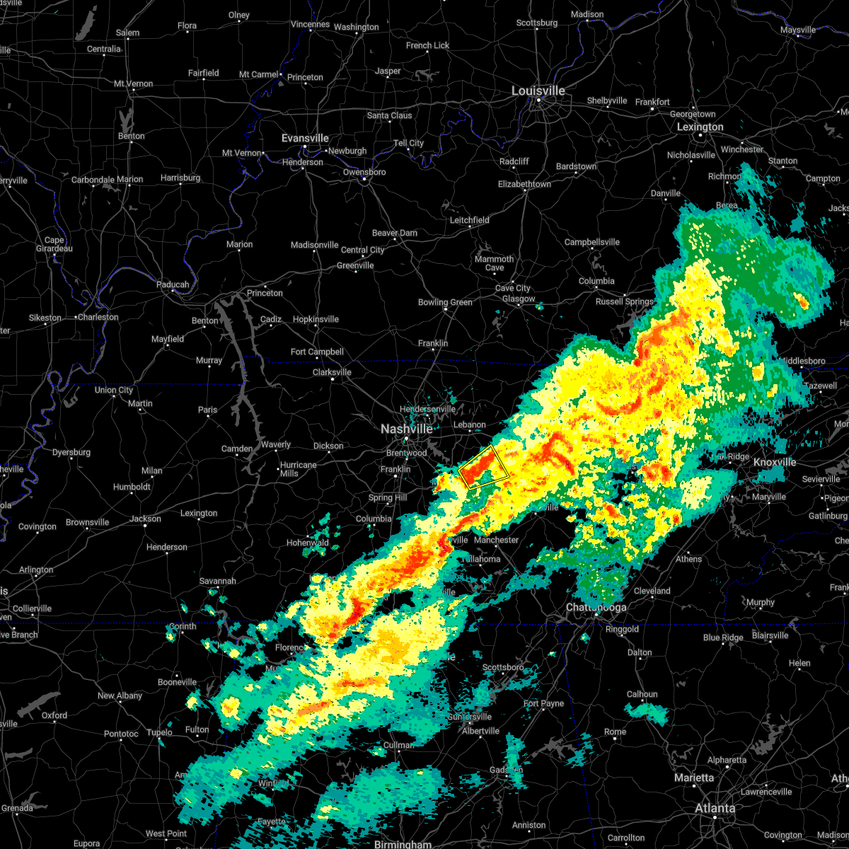 At 516 pm cst, a severe thunderstorm was located 9 miles east of walterhill, or 10 miles northwest of woodbury, moving northeast at 30 mph (radar indicated). Hazards include 60 mph wind gusts and penny size hail. Expect damage to roofs, siding, and trees. Locations impacted include, watertown, walterhill, auburntown, lascassas and milton. At 516 pm cst, a severe thunderstorm was located 9 miles east of walterhill, or 10 miles northwest of woodbury, moving northeast at 30 mph (radar indicated). Hazards include 60 mph wind gusts and penny size hail. Expect damage to roofs, siding, and trees. Locations impacted include, watertown, walterhill, auburntown, lascassas and milton.
|
| 2/16/2023 5:00 PM CST |
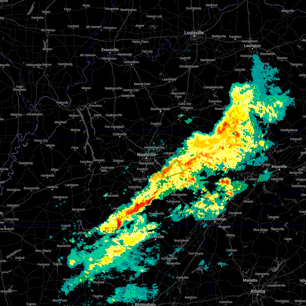 At 459 pm cst, a severe thunderstorm was located on the northeast side of murfreesboro, moving northeast at 35 mph (radar indicated). Hazards include 60 mph wind gusts and quarter size hail. Hail damage to vehicles is expected. Expect wind damage to roofs, siding, and trees. At 459 pm cst, a severe thunderstorm was located on the northeast side of murfreesboro, moving northeast at 35 mph (radar indicated). Hazards include 60 mph wind gusts and quarter size hail. Hail damage to vehicles is expected. Expect wind damage to roofs, siding, and trees.
|
| 10/12/2022 4:50 PM CDT |
 At 450 pm cdt, severe thunderstorms were located along a line extending from near belinda city to 12 miles southwest of murfreesboro, moving east at 40 mph (radar indicated). Hazards include 60 mph wind gusts and penny size hail. expect damage to roofs, siding, and trees At 450 pm cdt, severe thunderstorms were located along a line extending from near belinda city to 12 miles southwest of murfreesboro, moving east at 40 mph (radar indicated). Hazards include 60 mph wind gusts and penny size hail. expect damage to roofs, siding, and trees
|
| 8/20/2022 3:09 PM CDT |
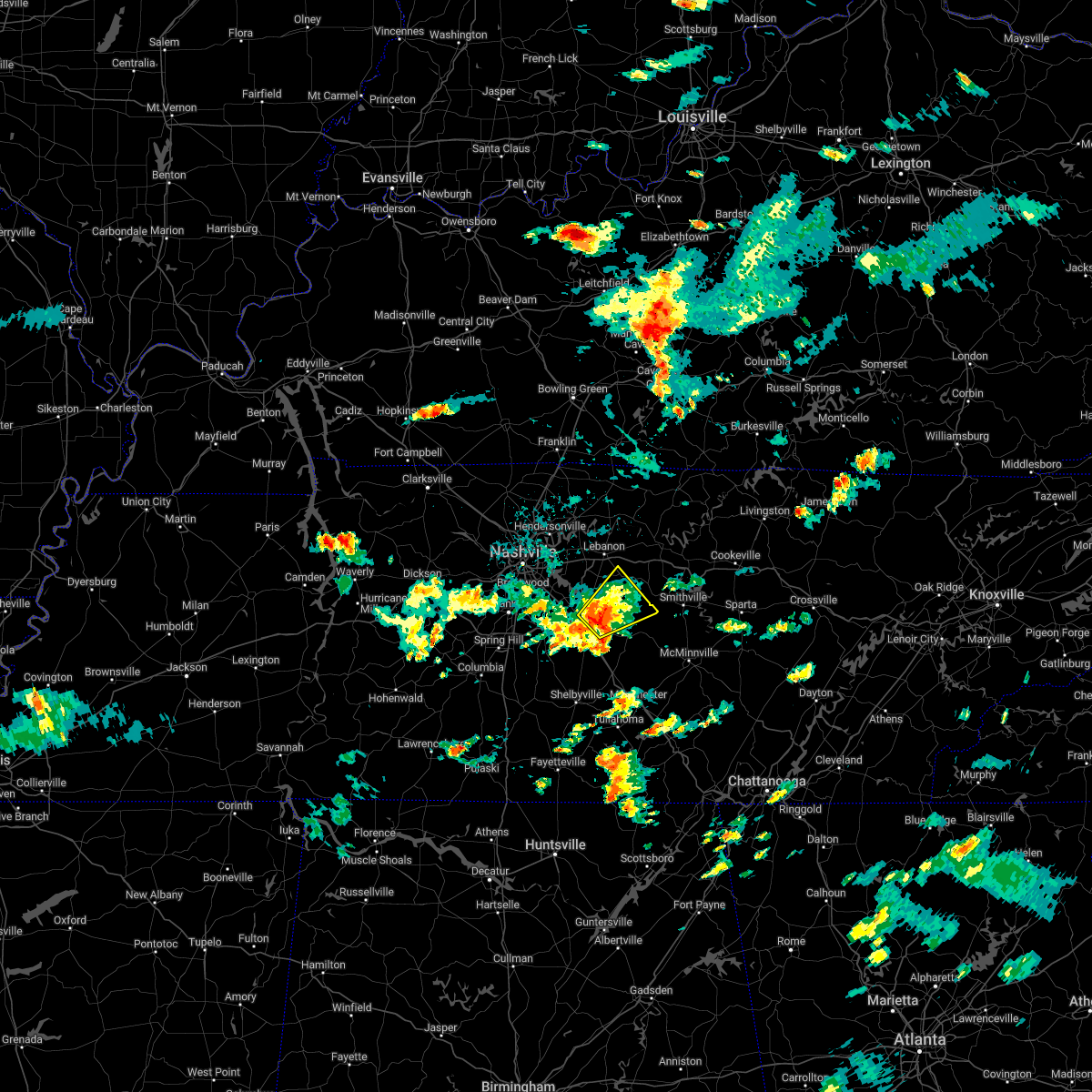 At 309 pm cdt, a severe thunderstorm was located near walterhill, or near murfreesboro, moving northeast at 20 mph (radar indicated). Hazards include 60 mph wind gusts and nickel size hail. expect damage to roofs, siding, and trees At 309 pm cdt, a severe thunderstorm was located near walterhill, or near murfreesboro, moving northeast at 20 mph (radar indicated). Hazards include 60 mph wind gusts and nickel size hail. expect damage to roofs, siding, and trees
|
| 7/28/2022 4:25 PM CDT |
 The severe thunderstorm warning for east central rutherford, southeastern wilson and northwestern cannon counties will expire at 430 pm cdt, the storm which prompted the warning has weakened below severe limits, and no longer poses an immediate threat to life or property. therefore, the warning will be allowed to expire. The severe thunderstorm warning for east central rutherford, southeastern wilson and northwestern cannon counties will expire at 430 pm cdt, the storm which prompted the warning has weakened below severe limits, and no longer poses an immediate threat to life or property. therefore, the warning will be allowed to expire.
|
| 7/28/2022 4:11 PM CDT |
 At 411 pm cdt, a severe thunderstorm was located 9 miles southeast of walterhill, or 10 miles east of murfreesboro, moving east at 30 mph (radar indicated). Hazards include 60 mph wind gusts. Expect damage to roofs, siding, and trees. locations impacted include, auburntown, lascassas, milton and readyville. hail threat, radar indicated max hail size, <. 75 in wind threat, radar indicated max wind gust, 60 mph. At 411 pm cdt, a severe thunderstorm was located 9 miles southeast of walterhill, or 10 miles east of murfreesboro, moving east at 30 mph (radar indicated). Hazards include 60 mph wind gusts. Expect damage to roofs, siding, and trees. locations impacted include, auburntown, lascassas, milton and readyville. hail threat, radar indicated max hail size, <. 75 in wind threat, radar indicated max wind gust, 60 mph.
|
| 7/28/2022 3:54 PM CDT |
 At 353 pm cdt, a severe thunderstorm was located near murfreesboro, moving east at 30 mph (radar indicated). Hazards include 60 mph wind gusts. expect damage to roofs, siding, and trees At 353 pm cdt, a severe thunderstorm was located near murfreesboro, moving east at 30 mph (radar indicated). Hazards include 60 mph wind gusts. expect damage to roofs, siding, and trees
|
| 7/21/2022 2:53 AM CDT |
 At 253 am cdt, a severe thunderstorm was located over watertown, or 13 miles southeast of lebanon, moving east at 40 mph (radar indicated). Hazards include 60 mph wind gusts and penny size hail. Expect damage to roofs, siding, and trees. locations impacted include, lebanon, watertown, gordonsville, hickman, alexandria, liberty, auburntown and tuckers crossroads. this includes interstate 40 between mile markers 237 and 260. hail threat, radar indicated max hail size, 0. 75 in wind threat, radar indicated max wind gust, 60 mph. At 253 am cdt, a severe thunderstorm was located over watertown, or 13 miles southeast of lebanon, moving east at 40 mph (radar indicated). Hazards include 60 mph wind gusts and penny size hail. Expect damage to roofs, siding, and trees. locations impacted include, lebanon, watertown, gordonsville, hickman, alexandria, liberty, auburntown and tuckers crossroads. this includes interstate 40 between mile markers 237 and 260. hail threat, radar indicated max hail size, 0. 75 in wind threat, radar indicated max wind gust, 60 mph.
|
| 7/21/2022 2:30 AM CDT |
 At 230 am cdt, a severe thunderstorm was located near belinda city, or near lebanon, moving east at 40 mph (radar indicated). Hazards include 60 mph wind gusts. expect damage to roofs, siding, and trees At 230 am cdt, a severe thunderstorm was located near belinda city, or near lebanon, moving east at 40 mph (radar indicated). Hazards include 60 mph wind gusts. expect damage to roofs, siding, and trees
|
| 7/12/2022 6:16 PM CDT |
 At 616 pm cdt, severe thunderstorms were located along a line extending from near monterey to auburntown, moving southeast at 25 mph (radar indicated). Hazards include 60 mph wind gusts and penny size hail. Expect damage to roofs, siding, and trees. locations impacted include, cookeville, smithville, gainesboro, algood, monterey, watertown, baxter, gordonsville, hickman, alexandria, dowelltown, liberty, auburntown, hamptons crossroads, bakers crossroads, burgess falls state park, rickman, center hill lake, crawford and edgar evans state park. event: dss-alexandria fair will also be impacted. this includes interstate 40 between mile markers 257 and 301. hail threat, radar indicated max hail size, 0. 75 in wind threat, radar indicated max wind gust, 60 mph. At 616 pm cdt, severe thunderstorms were located along a line extending from near monterey to auburntown, moving southeast at 25 mph (radar indicated). Hazards include 60 mph wind gusts and penny size hail. Expect damage to roofs, siding, and trees. locations impacted include, cookeville, smithville, gainesboro, algood, monterey, watertown, baxter, gordonsville, hickman, alexandria, dowelltown, liberty, auburntown, hamptons crossroads, bakers crossroads, burgess falls state park, rickman, center hill lake, crawford and edgar evans state park. event: dss-alexandria fair will also be impacted. this includes interstate 40 between mile markers 257 and 301. hail threat, radar indicated max hail size, 0. 75 in wind threat, radar indicated max wind gust, 60 mph.
|
| 7/12/2022 5:55 PM CDT |
 At 554 pm cdt, severe thunderstorms were located along a line extending from watertown to gainesboro, moving east at 25 mph (radar indicated). Hazards include 60 mph wind gusts and quarter size hail. Hail damage to vehicles is expected. Expect wind damage to roofs, siding, and trees. At 554 pm cdt, severe thunderstorms were located along a line extending from watertown to gainesboro, moving east at 25 mph (radar indicated). Hazards include 60 mph wind gusts and quarter size hail. Hail damage to vehicles is expected. Expect wind damage to roofs, siding, and trees.
|
| 7/12/2022 5:32 PM CDT |
 At 532 pm cdt, severe thunderstorms were located along a line extending from gainesboro to near smyrna, moving southeast at 25 mph (radar indicated). Hazards include 60 mph wind gusts and nickel size hail. expect damage to roofs, siding, and trees At 532 pm cdt, severe thunderstorms were located along a line extending from gainesboro to near smyrna, moving southeast at 25 mph (radar indicated). Hazards include 60 mph wind gusts and nickel size hail. expect damage to roofs, siding, and trees
|
| 7/9/2022 3:25 AM CDT |
 At 325 am cdt, severe thunderstorms were located along a line extending from near smithville to 10 miles southwest of murfreesboro, moving south at 45 mph (radar indicated). Hazards include 60 mph wind gusts. expect damage to roofs, siding, and trees At 325 am cdt, severe thunderstorms were located along a line extending from near smithville to 10 miles southwest of murfreesboro, moving south at 45 mph (radar indicated). Hazards include 60 mph wind gusts. expect damage to roofs, siding, and trees
|
| 7/9/2022 3:17 AM CDT |
 At 316 am cdt, a severe thunderstorm was located near murfreesboro, moving southeast at 40 mph (radar indicated). Hazards include 60 mph wind gusts. Expect damage to roofs, siding, and trees. locations impacted include, murfreesboro, woodbury, smyrna, la vergne, nolensville, walterhill, rural hill, auburntown, lascassas, christiana, fosterville, triune, cedars of lebanon state park, rockvale, milton, gladeville and readyville. this includes the following highways, interstate 24 between mile markers 64 and 93. interstate 840 between mile markers 42 and 72. hail threat, radar indicated max hail size, <. 75 in wind threat, radar indicated max wind gust, 60 mph. At 316 am cdt, a severe thunderstorm was located near murfreesboro, moving southeast at 40 mph (radar indicated). Hazards include 60 mph wind gusts. Expect damage to roofs, siding, and trees. locations impacted include, murfreesboro, woodbury, smyrna, la vergne, nolensville, walterhill, rural hill, auburntown, lascassas, christiana, fosterville, triune, cedars of lebanon state park, rockvale, milton, gladeville and readyville. this includes the following highways, interstate 24 between mile markers 64 and 93. interstate 840 between mile markers 42 and 72. hail threat, radar indicated max hail size, <. 75 in wind threat, radar indicated max wind gust, 60 mph.
|
| 7/9/2022 2:54 AM CDT |
 At 254 am cdt, a severe thunderstorm was located over rural hill, or 12 miles southwest of lebanon, moving south at 25 mph (radar indicated). Hazards include 60 mph wind gusts. expect damage to roofs, siding, and trees At 254 am cdt, a severe thunderstorm was located over rural hill, or 12 miles southwest of lebanon, moving south at 25 mph (radar indicated). Hazards include 60 mph wind gusts. expect damage to roofs, siding, and trees
|
| 7/7/2022 1:44 PM CDT |
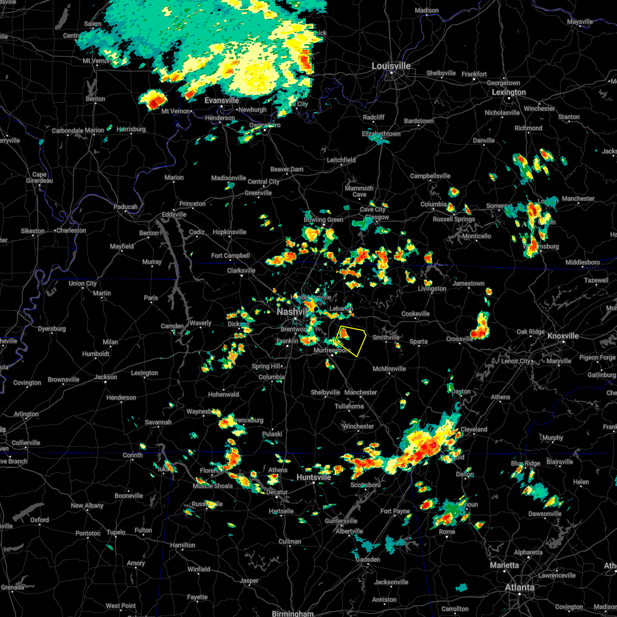 At 144 pm cdt, a severe thunderstorm was located 5 miles northeast of walterhill, or 13 miles northeast of murfreesboro, moving east at 5 mph (radar indicated). Hazards include 60 mph wind gusts and penny size hail. Expect damage to roofs, siding, and trees. locations impacted include, walterhill, auburntown, cedars of lebanon state park, lascassas and milton. hail threat, radar indicated max hail size, 0. 75 in wind threat, radar indicated max wind gust, 60 mph. At 144 pm cdt, a severe thunderstorm was located 5 miles northeast of walterhill, or 13 miles northeast of murfreesboro, moving east at 5 mph (radar indicated). Hazards include 60 mph wind gusts and penny size hail. Expect damage to roofs, siding, and trees. locations impacted include, walterhill, auburntown, cedars of lebanon state park, lascassas and milton. hail threat, radar indicated max hail size, 0. 75 in wind threat, radar indicated max wind gust, 60 mph.
|
| 7/7/2022 1:32 PM CDT |
 At 132 pm cdt, a severe thunderstorm was located 5 miles northeast of walterhill, or 13 miles northeast of murfreesboro, moving east at 10 mph (radar indicated). Hazards include 60 mph wind gusts and penny size hail. expect damage to roofs, siding, and trees At 132 pm cdt, a severe thunderstorm was located 5 miles northeast of walterhill, or 13 miles northeast of murfreesboro, moving east at 10 mph (radar indicated). Hazards include 60 mph wind gusts and penny size hail. expect damage to roofs, siding, and trees
|
| 7/6/2022 1:13 PM CDT |
 At 112 pm cdt, a cluster of severe thunderstorms were located along between walterhill and statesville, moving southeast at 10 mph (radar indicated). Hazards include 60 mph wind gusts and penny size hail. Expect damage to roofs, siding, and trees. locations impacted include, murfreesboro, walterhill, dowelltown, liberty, auburntown, lascassas, milton and readyville. this includes interstate 840 near mile marker 57. hail threat, radar indicated max hail size, 0. 75 in wind threat, radar indicated max wind gust, 60 mph. At 112 pm cdt, a cluster of severe thunderstorms were located along between walterhill and statesville, moving southeast at 10 mph (radar indicated). Hazards include 60 mph wind gusts and penny size hail. Expect damage to roofs, siding, and trees. locations impacted include, murfreesboro, walterhill, dowelltown, liberty, auburntown, lascassas, milton and readyville. this includes interstate 840 near mile marker 57. hail threat, radar indicated max hail size, 0. 75 in wind threat, radar indicated max wind gust, 60 mph.
|
| 7/6/2022 12:53 PM CDT |
 At 1253 pm cdt, a severe thunderstorm was located 7 miles south of watertown, or near statesville, moving southeast at 15 mph (radar indicated). Hazards include 60 mph wind gusts and penny size hail. expect damage to roofs, siding, and trees At 1253 pm cdt, a severe thunderstorm was located 7 miles south of watertown, or near statesville, moving southeast at 15 mph (radar indicated). Hazards include 60 mph wind gusts and penny size hail. expect damage to roofs, siding, and trees
|
| 6/17/2022 10:56 AM CDT |
 At 1056 am cdt, severe thunderstorms were located along a line extending from 8 miles northeast of walterhill to near murfreesboro to 11 miles south of nolensville, moving southeast at 40 mph (radar indicated). Hazards include 60 mph wind gusts and quarter size hail. Hail damage to vehicles is expected. Expect wind damage to roofs, siding, and trees. At 1056 am cdt, severe thunderstorms were located along a line extending from 8 miles northeast of walterhill to near murfreesboro to 11 miles south of nolensville, moving southeast at 40 mph (radar indicated). Hazards include 60 mph wind gusts and quarter size hail. Hail damage to vehicles is expected. Expect wind damage to roofs, siding, and trees.
|
| 4/13/2022 8:27 PM CDT |
 At 826 pm cdt, severe thunderstorms were located along a line extending from 8 miles southwest of watertown to 11 miles southeast of murfreesboro to near lynchburg, moving east at 55 mph (radar indicated). Hazards include 70 mph wind gusts. Expect considerable tree damage. Damage is likely to mobile homes, roofs, and outbuildings. At 826 pm cdt, severe thunderstorms were located along a line extending from 8 miles southwest of watertown to 11 miles southeast of murfreesboro to near lynchburg, moving east at 55 mph (radar indicated). Hazards include 70 mph wind gusts. Expect considerable tree damage. Damage is likely to mobile homes, roofs, and outbuildings.
|
| 4/13/2022 8:24 PM CDT |
 At 824 pm cdt, severe thunderstorms were located along a line extending from 6 miles east of hartsville to 6 miles west of gordonsville to 8 miles south of watertown, moving east at 65 mph (radar indicated). Hazards include 70 mph wind gusts. Expect considerable tree damage. Damage is likely to mobile homes, roofs, and outbuildings. At 824 pm cdt, severe thunderstorms were located along a line extending from 6 miles east of hartsville to 6 miles west of gordonsville to 8 miles south of watertown, moving east at 65 mph (radar indicated). Hazards include 70 mph wind gusts. Expect considerable tree damage. Damage is likely to mobile homes, roofs, and outbuildings.
|
| 4/13/2022 8:11 PM CDT |
 At 810 pm cdt, severe thunderstorms were located along a line extending from 7 miles northeast of lebanon to 8 miles southwest of murfreesboro, moving east at 65 mph (radar indicated). Hazards include 70 mph wind gusts. Expect considerable tree damage. damage is likely to mobile homes, roofs, and outbuildings. locations impacted include, murfreesboro, gallatin, lebanon, woodbury, carthage, hendersonville, smyrna, la vergne, mount juliet, watertown, gordonsville, walterhill, rural hill, belinda city, hickman, south carthage, alexandria, eagleville, dowelltown and liberty. this includes the following highways, interstate 40 between mile markers 223 and 263. interstate 24 between mile markers 65 and 91. Interstate 840 between mile markers 46 and 76. At 810 pm cdt, severe thunderstorms were located along a line extending from 7 miles northeast of lebanon to 8 miles southwest of murfreesboro, moving east at 65 mph (radar indicated). Hazards include 70 mph wind gusts. Expect considerable tree damage. damage is likely to mobile homes, roofs, and outbuildings. locations impacted include, murfreesboro, gallatin, lebanon, woodbury, carthage, hendersonville, smyrna, la vergne, mount juliet, watertown, gordonsville, walterhill, rural hill, belinda city, hickman, south carthage, alexandria, eagleville, dowelltown and liberty. this includes the following highways, interstate 40 between mile markers 223 and 263. interstate 24 between mile markers 65 and 91. Interstate 840 between mile markers 46 and 76.
|
| 4/13/2022 7:52 PM CDT |
 At 752 pm cdt, severe thunderstorms were located along a line extending from hendersonville to 6 miles east of spring hill, moving east at 65 mph (radar indicated). Hazards include 70 mph wind gusts. Expect considerable tree damage. Damage is likely to mobile homes, roofs, and outbuildings. At 752 pm cdt, severe thunderstorms were located along a line extending from hendersonville to 6 miles east of spring hill, moving east at 65 mph (radar indicated). Hazards include 70 mph wind gusts. Expect considerable tree damage. Damage is likely to mobile homes, roofs, and outbuildings.
|
| 5/6/2021 6:47 PM CDT |
 At 646 pm cdt, severe thunderstorms were located along a line extending from near gainesboro to 11 miles south of woodbury, moving east at 35 mph (radar indicated). Hazards include 60 mph wind gusts. Expect damage to roofs, siding, and trees. Locations impacted include, cookeville, mcminnville, smithville, woodbury, gainesboro, baxter, gordonsville, hickman, dowelltown, liberty, auburntown, centertown, center hill lake, bradyville, granville, edgar evans state park and cummins falls state park. At 646 pm cdt, severe thunderstorms were located along a line extending from near gainesboro to 11 miles south of woodbury, moving east at 35 mph (radar indicated). Hazards include 60 mph wind gusts. Expect damage to roofs, siding, and trees. Locations impacted include, cookeville, mcminnville, smithville, woodbury, gainesboro, baxter, gordonsville, hickman, dowelltown, liberty, auburntown, centertown, center hill lake, bradyville, granville, edgar evans state park and cummins falls state park.
|
| 5/6/2021 6:13 PM CDT |
 The national weather service in nashville has issued a * severe thunderstorm warning for. smith county in middle tennessee. de kalb county in middle tennessee. eastern rutherford county in middle tennessee. Jackson county in middle tennessee. The national weather service in nashville has issued a * severe thunderstorm warning for. smith county in middle tennessee. de kalb county in middle tennessee. eastern rutherford county in middle tennessee. Jackson county in middle tennessee.
|
| 5/3/2021 6:27 AM CDT |
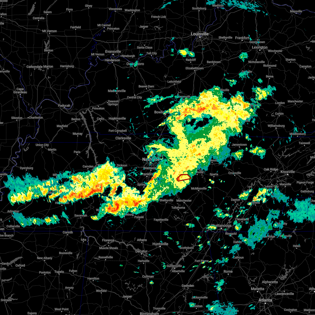 At 627 am cdt, a severe thunderstorm capable of producing a tornado was located 7 miles northwest of woodbury, or near milton, moving northeast at 30 mph (radar indicated rotation). Hazards include tornado. Flying debris will be dangerous to those caught without shelter. mobile homes will be damaged or destroyed. damage to roofs, windows, and vehicles will occur. Tree damage is likely. At 627 am cdt, a severe thunderstorm capable of producing a tornado was located 7 miles northwest of woodbury, or near milton, moving northeast at 30 mph (radar indicated rotation). Hazards include tornado. Flying debris will be dangerous to those caught without shelter. mobile homes will be damaged or destroyed. damage to roofs, windows, and vehicles will occur. Tree damage is likely.
|
| 3/28/2021 2:10 AM CDT |
 The severe thunderstorm warning for western de kalb, east central rutherford, southeastern wilson and northern cannon counties will expire at 215 am cdt, the storm which prompted the warning has weakened below severe limits, and no longer poses an immediate threat to life or property. therefore, the warning will be allowed to expire. The severe thunderstorm warning for western de kalb, east central rutherford, southeastern wilson and northern cannon counties will expire at 215 am cdt, the storm which prompted the warning has weakened below severe limits, and no longer poses an immediate threat to life or property. therefore, the warning will be allowed to expire.
|
| 3/28/2021 1:59 AM CDT |
 At 159 am cdt, a severe thunderstorm was located 8 miles northwest of woodbury, moving east at 45 mph (radar indicated). Hazards include 60 mph wind gusts. Expect damage to roofs, siding, and trees. Locations impacted include, woodbury, dowelltown, liberty, auburntown, milton and readyville. At 159 am cdt, a severe thunderstorm was located 8 miles northwest of woodbury, moving east at 45 mph (radar indicated). Hazards include 60 mph wind gusts. Expect damage to roofs, siding, and trees. Locations impacted include, woodbury, dowelltown, liberty, auburntown, milton and readyville.
|
| 3/28/2021 1:44 AM CDT |
 At 144 am cdt, a severe thunderstorm was located over walterhill, or near murfreesboro, moving east at 45 mph (radar indicated). Hazards include 60 mph wind gusts. expect damage to roofs, siding, and trees At 144 am cdt, a severe thunderstorm was located over walterhill, or near murfreesboro, moving east at 45 mph (radar indicated). Hazards include 60 mph wind gusts. expect damage to roofs, siding, and trees
|
| 3/25/2021 9:09 PM CDT |
 At 908 pm cdt, a severe thunderstorm was located 8 miles east of walterhill, or 11 miles northeast of murfreesboro, moving northeast at 55 mph (radar indicated). Hazards include 60 mph wind gusts and quarter size hail. Hail damage to vehicles is expected. Expect wind damage to roofs, siding, and trees. At 908 pm cdt, a severe thunderstorm was located 8 miles east of walterhill, or 11 miles northeast of murfreesboro, moving northeast at 55 mph (radar indicated). Hazards include 60 mph wind gusts and quarter size hail. Hail damage to vehicles is expected. Expect wind damage to roofs, siding, and trees.
|
| 7/31/2020 1:45 PM CDT |
 At 145 pm cdt, a severe thunderstorm was located 8 miles south of watertown, or 11 miles north of woodbury, moving east at 30 mph (radar indicated). Hazards include 60 mph wind gusts and penny size hail. expect damage to roofs, siding, and trees At 145 pm cdt, a severe thunderstorm was located 8 miles south of watertown, or 11 miles north of woodbury, moving east at 30 mph (radar indicated). Hazards include 60 mph wind gusts and penny size hail. expect damage to roofs, siding, and trees
|
| 5/3/2020 4:49 PM CDT |
 At 448 pm cdt, severe thunderstorms were located along a line extending from near nashville to near brentwood to 6 miles east of thompson`s station, moving east at 65 mph (radar indicated). Hazards include 70 mph wind gusts and penny size hail. Expect considerable tree damage. Damage is likely to mobile homes, roofs, and outbuildings. At 448 pm cdt, severe thunderstorms were located along a line extending from near nashville to near brentwood to 6 miles east of thompson`s station, moving east at 65 mph (radar indicated). Hazards include 70 mph wind gusts and penny size hail. Expect considerable tree damage. Damage is likely to mobile homes, roofs, and outbuildings.
|
| 4/8/2020 10:43 PM CDT |
 At 1042 pm cdt, severe thunderstorms were located along a line extending from near watertown to 14 miles northwest of woodbury to walterhill, moving southeast at 40 mph (radar indicated). Hazards include 60 mph wind gusts and nickel size hail. expect damage to roofs, siding, and trees At 1042 pm cdt, severe thunderstorms were located along a line extending from near watertown to 14 miles northwest of woodbury to walterhill, moving southeast at 40 mph (radar indicated). Hazards include 60 mph wind gusts and nickel size hail. expect damage to roofs, siding, and trees
|
| 4/8/2020 10:14 PM CDT |
 At 1014 pm cdt, severe thunderstorms were located along a line extending from near belinda city to near antioch, moving southeast at 30 mph (radar indicated). Hazards include 60 mph wind gusts and nickel size hail. expect damage to roofs, siding, and trees At 1014 pm cdt, severe thunderstorms were located along a line extending from near belinda city to near antioch, moving southeast at 30 mph (radar indicated). Hazards include 60 mph wind gusts and nickel size hail. expect damage to roofs, siding, and trees
|
| 4/8/2020 6:26 PM CDT |
 The severe thunderstorm warning for southwestern smith, northwestern de kalb and southeastern wilson counties will expire at 630 pm cdt, the storm which prompted the warning has weakened below severe limits, and no longer poses an immediate threat to life or property. therefore, the warning will be allowed to expire. however small hail and gusty winds are still possible with this thunderstorm. The severe thunderstorm warning for southwestern smith, northwestern de kalb and southeastern wilson counties will expire at 630 pm cdt, the storm which prompted the warning has weakened below severe limits, and no longer poses an immediate threat to life or property. therefore, the warning will be allowed to expire. however small hail and gusty winds are still possible with this thunderstorm.
|
| 4/8/2020 6:06 PM CDT |
 At 605 pm cdt, a severe thunderstorm was located over watertown, or 13 miles southeast of lebanon, moving east at 20 mph (radar indicated). Hazards include 60 mph wind gusts and penny size hail. Expect damage to roofs, siding, and trees. Locations impacted include, watertown, alexandria, dowelltown, liberty, auburntown and cedars of lebanon state park. At 605 pm cdt, a severe thunderstorm was located over watertown, or 13 miles southeast of lebanon, moving east at 20 mph (radar indicated). Hazards include 60 mph wind gusts and penny size hail. Expect damage to roofs, siding, and trees. Locations impacted include, watertown, alexandria, dowelltown, liberty, auburntown and cedars of lebanon state park.
|
| 4/8/2020 5:50 PM CDT |
 At 550 pm cdt, a severe thunderstorm was located near watertown, or 9 miles southeast of lebanon, moving east at 20 mph (radar indicated). Hazards include 60 mph wind gusts and penny size hail. expect damage to roofs, siding, and trees At 550 pm cdt, a severe thunderstorm was located near watertown, or 9 miles southeast of lebanon, moving east at 20 mph (radar indicated). Hazards include 60 mph wind gusts and penny size hail. expect damage to roofs, siding, and trees
|
| 1/11/2020 6:38 PM CST |
 At 638 pm cst, severe thunderstorms were located along a line extending from 6 miles west of carthage to 7 miles north of woodbury, moving east at 50 mph (radar indicated). Hazards include 60 mph wind gusts. Expect damage to roofs, siding, and trees. locations impacted include, smithville, watertown, gordonsville, hickman, south carthage, alexandria, dowelltown, liberty, auburntown, center hill lake, tuckers crossroads and edgar evans state park. This includes interstate 40 between mile markers 244 and 266. At 638 pm cst, severe thunderstorms were located along a line extending from 6 miles west of carthage to 7 miles north of woodbury, moving east at 50 mph (radar indicated). Hazards include 60 mph wind gusts. Expect damage to roofs, siding, and trees. locations impacted include, smithville, watertown, gordonsville, hickman, south carthage, alexandria, dowelltown, liberty, auburntown, center hill lake, tuckers crossroads and edgar evans state park. This includes interstate 40 between mile markers 244 and 266.
|
| 1/11/2020 6:20 PM CST |
 At 620 pm cst, severe thunderstorms were located along a line extending from lebanon to near walterhill, moving east at 50 mph (radar indicated). Hazards include 60 mph wind gusts. expect damage to roofs, siding, and trees At 620 pm cst, severe thunderstorms were located along a line extending from lebanon to near walterhill, moving east at 50 mph (radar indicated). Hazards include 60 mph wind gusts. expect damage to roofs, siding, and trees
|
| 1/11/2020 10:43 AM CST |
 At 1043 am cst, a severe thunderstorm was located 7 miles south of watertown, or 12 miles north of woodbury, moving east at 35 mph (radar indicated). Hazards include 60 mph wind gusts. expect damage to roofs, siding, and trees At 1043 am cst, a severe thunderstorm was located 7 miles south of watertown, or 12 miles north of woodbury, moving east at 35 mph (radar indicated). Hazards include 60 mph wind gusts. expect damage to roofs, siding, and trees
|
| 8/13/2019 4:15 PM CDT |
 At 415 pm cdt, severe thunderstorms were located along a line extending from 9 miles southeast of watertown to 6 miles northwest of woodbury to near murfreesboro, moving southeast at 50 mph (radar indicated). Hazards include 60 mph wind gusts. expect damage to roofs, siding, and trees At 415 pm cdt, severe thunderstorms were located along a line extending from 9 miles southeast of watertown to 6 miles northwest of woodbury to near murfreesboro, moving southeast at 50 mph (radar indicated). Hazards include 60 mph wind gusts. expect damage to roofs, siding, and trees
|
| 8/13/2019 4:00 PM CDT |
 At 400 pm cdt, severe thunderstorms were located along a line extending from 6 miles north of walterhill to near thompson`s station, moving east at 35 mph (radar indicated). Hazards include 60 mph wind gusts. expect damage to roofs, siding, and trees At 400 pm cdt, severe thunderstorms were located along a line extending from 6 miles north of walterhill to near thompson`s station, moving east at 35 mph (radar indicated). Hazards include 60 mph wind gusts. expect damage to roofs, siding, and trees
|
| 8/6/2019 9:07 PM CDT |
 At 907 pm cdt, severe thunderstorms were located along a line extending from 8 miles northwest of woodbury to 6 miles east of spring hill, moving southeast at 40 mph (radar indicated). Hazards include 60 mph wind gusts. expect damage to roofs, siding, and trees At 907 pm cdt, severe thunderstorms were located along a line extending from 8 miles northwest of woodbury to 6 miles east of spring hill, moving southeast at 40 mph (radar indicated). Hazards include 60 mph wind gusts. expect damage to roofs, siding, and trees
|
| 8/6/2019 8:34 PM CDT |
 At 834 pm cdt, severe thunderstorms were located along a line extending from near lebanon to near forest hills, moving southeast at 40 mph (radar indicated). Hazards include 60 mph wind gusts and penny size hail. expect damage to roofs, siding, and trees At 834 pm cdt, severe thunderstorms were located along a line extending from near lebanon to near forest hills, moving southeast at 40 mph (radar indicated). Hazards include 60 mph wind gusts and penny size hail. expect damage to roofs, siding, and trees
|
| 6/26/2019 11:28 PM CDT |
 At 1127 pm cdt, a severe thunderstorm was located near murfreesboro, moving northeast at 10 mph (radar indicated). Hazards include 60 mph wind gusts and penny size hail. expect damage to roofs, siding, and trees At 1127 pm cdt, a severe thunderstorm was located near murfreesboro, moving northeast at 10 mph (radar indicated). Hazards include 60 mph wind gusts and penny size hail. expect damage to roofs, siding, and trees
|
| 6/26/2019 11:07 PM CDT |
 At 1106 pm cdt, a severe thunderstorm was located near murfreesboro, moving east at 10 mph (radar indicated). Hazards include 60 mph wind gusts and quarter size hail. Hail damage to vehicles is expected. Expect wind damage to roofs, siding, and trees. At 1106 pm cdt, a severe thunderstorm was located near murfreesboro, moving east at 10 mph (radar indicated). Hazards include 60 mph wind gusts and quarter size hail. Hail damage to vehicles is expected. Expect wind damage to roofs, siding, and trees.
|
| 6/21/2019 9:01 PM CDT |
 At 900 pm cdt, severe thunderstorms were located along a line extending from baxter to smithville to 6 miles southeast of woodbury, moving east at 50 mph (radar indicated). Hazards include 70 mph wind gusts and quarter size hail. Hail damage to vehicles is expected. expect considerable tree damage. wind damage is also likely to mobile homes, roofs, and outbuildings. locations impacted include, cookeville, mcminnville, sparta, smithville, woodbury, baxter, alexandria, doyle, dowelltown, liberty, auburntown, centertown, hamptons crossroads, bakers crossroads, burgess falls state park, rock island state park, center hill lake, edgar evans state park, milton and readyville. This includes interstate 40 between mile markers 267 and 300. At 900 pm cdt, severe thunderstorms were located along a line extending from baxter to smithville to 6 miles southeast of woodbury, moving east at 50 mph (radar indicated). Hazards include 70 mph wind gusts and quarter size hail. Hail damage to vehicles is expected. expect considerable tree damage. wind damage is also likely to mobile homes, roofs, and outbuildings. locations impacted include, cookeville, mcminnville, sparta, smithville, woodbury, baxter, alexandria, doyle, dowelltown, liberty, auburntown, centertown, hamptons crossroads, bakers crossroads, burgess falls state park, rock island state park, center hill lake, edgar evans state park, milton and readyville. This includes interstate 40 between mile markers 267 and 300.
|
| 6/21/2019 8:38 PM CDT |
 At 838 pm cdt, severe thunderstorms were located along a line extending from gordonsville to 7 miles south of watertown to near murfreesboro, moving east at 50 mph (radar indicated). Hazards include 70 mph wind gusts and quarter size hail. Hail damage to vehicles is expected. expect considerable tree damage. Wind damage is also likely to mobile homes, roofs, and outbuildings. At 838 pm cdt, severe thunderstorms were located along a line extending from gordonsville to 7 miles south of watertown to near murfreesboro, moving east at 50 mph (radar indicated). Hazards include 70 mph wind gusts and quarter size hail. Hail damage to vehicles is expected. expect considerable tree damage. Wind damage is also likely to mobile homes, roofs, and outbuildings.
|
| 6/21/2019 8:26 PM CDT |
 At 825 pm cdt, severe thunderstorms were located along a line extending from near watertown to murfreesboro to spring hill, moving southeast at 50 mph. these are very dangerous storms (radar indicated). Hazards include 80 mph wind gusts and penny size hail. Flying debris will be dangerous to those caught without shelter. mobile homes will be heavily damaged. expect considerable damage to roofs, windows, and vehicles. extensive tree damage and power outages are likely. locations impacted include, murfreesboro, columbia, lewisburg, smyrna, la vergne, spring hill, nolensville, thompson`s station, walterhill, chapel hill, eagleville, auburntown, fosterville, triune, cedars of lebanon state park, rover, rockvale, unionville, readyville and lascassas. this includes the following highways, interstate 65 between mile markers 29 and 60. interstate 24 between mile markers 66 and 93. Interstate 840 between mile markers 29 and 70. At 825 pm cdt, severe thunderstorms were located along a line extending from near watertown to murfreesboro to spring hill, moving southeast at 50 mph. these are very dangerous storms (radar indicated). Hazards include 80 mph wind gusts and penny size hail. Flying debris will be dangerous to those caught without shelter. mobile homes will be heavily damaged. expect considerable damage to roofs, windows, and vehicles. extensive tree damage and power outages are likely. locations impacted include, murfreesboro, columbia, lewisburg, smyrna, la vergne, spring hill, nolensville, thompson`s station, walterhill, chapel hill, eagleville, auburntown, fosterville, triune, cedars of lebanon state park, rover, rockvale, unionville, readyville and lascassas. this includes the following highways, interstate 65 between mile markers 29 and 60. interstate 24 between mile markers 66 and 93. Interstate 840 between mile markers 29 and 70.
|
| 6/21/2019 8:05 PM CDT |
 The national weather service in nashville has issued a * severe thunderstorm warning for. southeastern davidson county in middle tennessee. central marshall county in middle tennessee. rutherford county in middle tennessee. Central maury county in middle tennessee. The national weather service in nashville has issued a * severe thunderstorm warning for. southeastern davidson county in middle tennessee. central marshall county in middle tennessee. rutherford county in middle tennessee. Central maury county in middle tennessee.
|
| 6/19/2019 8:31 PM CDT |
 At 830 pm cdt, severe thunderstorms were located along a line extending from alexandria to christiana, moving east at 25 mph (radar indicated. at 828 pm cdt...several trees were blown down with these storms across rutherford county). Hazards include 70 mph wind gusts and quarter size hail. Hail damage to vehicles is expected. expect considerable tree damage. Wind damage is also likely to mobile homes, roofs, and outbuildings. At 830 pm cdt, severe thunderstorms were located along a line extending from alexandria to christiana, moving east at 25 mph (radar indicated. at 828 pm cdt...several trees were blown down with these storms across rutherford county). Hazards include 70 mph wind gusts and quarter size hail. Hail damage to vehicles is expected. expect considerable tree damage. Wind damage is also likely to mobile homes, roofs, and outbuildings.
|
| 6/19/2019 8:23 PM CDT |
 At 823 pm cdt, severe thunderstorms were located along a line extending from watertown to near thompson`s station, moving east at 30 mph (radar indicated). Hazards include 70 mph wind gusts and quarter size hail. Hail damage to vehicles is expected. expect considerable tree damage. wind damage is also likely to mobile homes, roofs, and outbuildings. locations impacted include, murfreesboro, franklin, smyrna, brentwood, la vergne, spring hill, nolensville, thompson`s station, watertown, walterhill, eagleville, auburntown, lascassas, triune, cedars of lebanon state park, leipers fork and milton. this includes the following highways, interstate 65 between mile markers 55 and 72. interstate 24 between mile markers 60 and 81. Interstate 840 between mile markers 10 and 70. At 823 pm cdt, severe thunderstorms were located along a line extending from watertown to near thompson`s station, moving east at 30 mph (radar indicated). Hazards include 70 mph wind gusts and quarter size hail. Hail damage to vehicles is expected. expect considerable tree damage. wind damage is also likely to mobile homes, roofs, and outbuildings. locations impacted include, murfreesboro, franklin, smyrna, brentwood, la vergne, spring hill, nolensville, thompson`s station, watertown, walterhill, eagleville, auburntown, lascassas, triune, cedars of lebanon state park, leipers fork and milton. this includes the following highways, interstate 65 between mile markers 55 and 72. interstate 24 between mile markers 60 and 81. Interstate 840 between mile markers 10 and 70.
|
| 6/19/2019 8:16 PM CDT |
 At 815 pm cdt, severe thunderstorms were located along a line extending from near watertown to thompson`s station, moving east at 35 mph. these storms have produced numerous reports of quarter size hail and blown down trees in the southern nashville metro area (radar indicated). Hazards include 60 mph wind gusts and quarter size hail. Hail damage to vehicles is expected. expect wind damage to roofs, siding, and trees. locations impacted include, murfreesboro, franklin, smyrna, brentwood, la vergne, spring hill, nolensville, thompson`s station, watertown, walterhill, eagleville, auburntown, lascassas, triune, cedars of lebanon state park, leipers fork and milton. this includes the following highways, interstate 65 between mile markers 55 and 72. interstate 24 between mile markers 60 and 81. Interstate 840 between mile markers 10 and 70. At 815 pm cdt, severe thunderstorms were located along a line extending from near watertown to thompson`s station, moving east at 35 mph. these storms have produced numerous reports of quarter size hail and blown down trees in the southern nashville metro area (radar indicated). Hazards include 60 mph wind gusts and quarter size hail. Hail damage to vehicles is expected. expect wind damage to roofs, siding, and trees. locations impacted include, murfreesboro, franklin, smyrna, brentwood, la vergne, spring hill, nolensville, thompson`s station, watertown, walterhill, eagleville, auburntown, lascassas, triune, cedars of lebanon state park, leipers fork and milton. this includes the following highways, interstate 65 between mile markers 55 and 72. interstate 24 between mile markers 60 and 81. Interstate 840 between mile markers 10 and 70.
|
| 6/19/2019 7:58 PM CDT |
 At 757 pm cdt, severe thunderstorms were located along a line extending from near rural hill to nolensville to leipers fork, moving east at 30 mph (radar indicated. at 756 pm cdt...numerous reports of quarter size hail were received from brentwood with these storms). Hazards include 60 mph wind gusts and quarter size hail. Hail damage to vehicles is expected. Expect wind damage to roofs, siding, and trees. At 757 pm cdt, severe thunderstorms were located along a line extending from near rural hill to nolensville to leipers fork, moving east at 30 mph (radar indicated. at 756 pm cdt...numerous reports of quarter size hail were received from brentwood with these storms). Hazards include 60 mph wind gusts and quarter size hail. Hail damage to vehicles is expected. Expect wind damage to roofs, siding, and trees.
|
| 3/9/2019 8:24 PM CDT |
 The tornado warning for east central rutherford, southeastern wilson and northwestern cannon counties will expire at 730 pm cst, the tornado threat has diminished and the tornado warning has been cancelled. however, damaging winds remain likely and a severe thunderstorm warning remains in effect for the area. a tornado watch remains in effect until 900 pm cst for middle tennessee. The tornado warning for east central rutherford, southeastern wilson and northwestern cannon counties will expire at 730 pm cst, the tornado threat has diminished and the tornado warning has been cancelled. however, damaging winds remain likely and a severe thunderstorm warning remains in effect for the area. a tornado watch remains in effect until 900 pm cst for middle tennessee.
|
| 3/9/2019 8:23 PM CDT |
 At 722 pm cst, a severe thunderstorm was located 7 miles southeast of watertown, or near alexandria, moving east at 65 mph (radar indicated). Hazards include 60 mph wind gusts. expect damage to roofs, siding, and trees At 722 pm cst, a severe thunderstorm was located 7 miles southeast of watertown, or near alexandria, moving east at 65 mph (radar indicated). Hazards include 60 mph wind gusts. expect damage to roofs, siding, and trees
|
| 3/9/2019 8:15 PM CDT | Some vinyl siding was peeled back from a house in auburntow in cannon county TN, 0.2 miles NW of Auburntown, TN |
| 3/9/2019 8:15 PM CDT | Tree down in road on hwy 14 in cannon county TN, 0.4 miles ENE of Auburntown, TN |
| 3/9/2019 8:14 PM CDT |
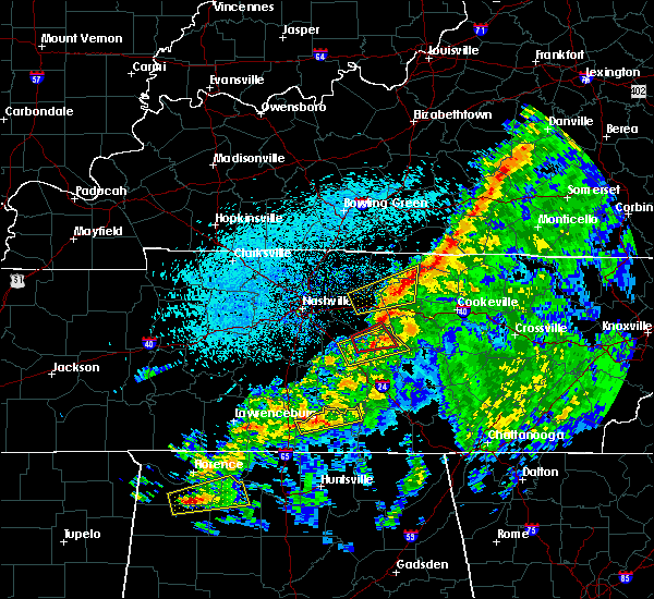 At 714 pm cst, a severe thunderstorm capable of producing a tornado was located 7 miles southeast of walterhill, or 8 miles northeast of murfreesboro, moving northeast at 60 mph (radar indicated rotation). Hazards include tornado. Flying debris will be dangerous to those caught without shelter. mobile homes will be damaged or destroyed. damage to roofs, windows, and vehicles will occur. tree damage is likely. This tornadic thunderstorm will remain over mainly rural areas of east central rutherford, southeastern wilson and northwestern cannon counties, including the following locations, milton, auburntown and lascassas. At 714 pm cst, a severe thunderstorm capable of producing a tornado was located 7 miles southeast of walterhill, or 8 miles northeast of murfreesboro, moving northeast at 60 mph (radar indicated rotation). Hazards include tornado. Flying debris will be dangerous to those caught without shelter. mobile homes will be damaged or destroyed. damage to roofs, windows, and vehicles will occur. tree damage is likely. This tornadic thunderstorm will remain over mainly rural areas of east central rutherford, southeastern wilson and northwestern cannon counties, including the following locations, milton, auburntown and lascassas.
|
| 3/9/2019 8:07 PM CDT |
 At 706 pm cst, a severe thunderstorm was located over murfreesboro, moving northeast at 55 mph (radar indicated). Hazards include 60 mph wind gusts. Expect damage to roofs, siding, and trees. locations impacted include, murfreesboro, woodbury, auburntown, lascassas, milton and readyville. this includes the following highways, interstate 24 between mile markers 75 and 88. Interstate 840 near mile marker 53. At 706 pm cst, a severe thunderstorm was located over murfreesboro, moving northeast at 55 mph (radar indicated). Hazards include 60 mph wind gusts. Expect damage to roofs, siding, and trees. locations impacted include, murfreesboro, woodbury, auburntown, lascassas, milton and readyville. this includes the following highways, interstate 24 between mile markers 75 and 88. Interstate 840 near mile marker 53.
|
| 3/9/2019 8:05 PM CDT |
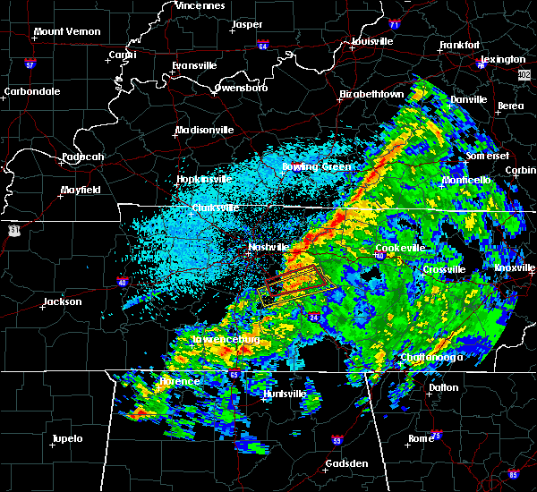 At 705 pm cst, a severe thunderstorm capable of producing a tornado was located over northwest murfreesboro, moving east at 45 mph (radar indicated rotation). Hazards include tornado. Flying debris will be dangerous to those caught without shelter. mobile homes will be damaged or destroyed. damage to roofs, windows, and vehicles will occur. tree damage is likely. this dangerous storm will be near, walterhill around 715 pm cst. other locations impacted by this tornadic thunderstorm include milton, auburntown and lascassas. this includes the following highways, interstate 24 between mile markers 73 and 83. Interstate 840 between mile markers 52 and 59. At 705 pm cst, a severe thunderstorm capable of producing a tornado was located over northwest murfreesboro, moving east at 45 mph (radar indicated rotation). Hazards include tornado. Flying debris will be dangerous to those caught without shelter. mobile homes will be damaged or destroyed. damage to roofs, windows, and vehicles will occur. tree damage is likely. this dangerous storm will be near, walterhill around 715 pm cst. other locations impacted by this tornadic thunderstorm include milton, auburntown and lascassas. this includes the following highways, interstate 24 between mile markers 73 and 83. Interstate 840 between mile markers 52 and 59.
|
| 3/9/2019 7:58 PM CDT |
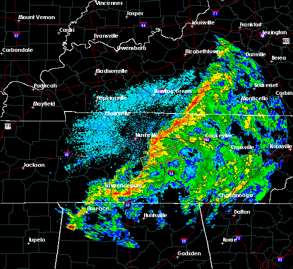 At 658 pm cst, a severe thunderstorm capable of producing a tornado was located about 5 miles west of murfreesboro, moving east at 45 mph (radar indicated rotation). Hazards include tornado. Flying debris will be dangerous to those caught without shelter. mobile homes will be damaged or destroyed. damage to roofs, windows, and vehicles will occur. tree damage is likely. this dangerous storm will be near, murfreesboro around 705 pm cst. walterhill around 715 pm cst. other locations impacted by this tornadic thunderstorm include auburntown, lascassas, milton and rockvale. this includes the following highways, interstate 24 between mile markers 71 and 83. Interstate 840 between mile markers 47 and 58. At 658 pm cst, a severe thunderstorm capable of producing a tornado was located about 5 miles west of murfreesboro, moving east at 45 mph (radar indicated rotation). Hazards include tornado. Flying debris will be dangerous to those caught without shelter. mobile homes will be damaged or destroyed. damage to roofs, windows, and vehicles will occur. tree damage is likely. this dangerous storm will be near, murfreesboro around 705 pm cst. walterhill around 715 pm cst. other locations impacted by this tornadic thunderstorm include auburntown, lascassas, milton and rockvale. this includes the following highways, interstate 24 between mile markers 71 and 83. Interstate 840 between mile markers 47 and 58.
|
| 3/9/2019 7:56 PM CDT |
 At 656 pm cst, a severe thunderstorm was located 8 miles southwest of murfreesboro, moving east at 55 mph (radar indicated). Hazards include 60 mph wind gusts. Expect damage to roofs, siding, and trees. locations impacted include, murfreesboro, woodbury, eagleville, auburntown, rover, lascassas, christiana, rockvale, milton and readyville. this includes the following highways, interstate 24 between mile markers 75 and 88. Interstate 840 between mile markers 48 and 53. At 656 pm cst, a severe thunderstorm was located 8 miles southwest of murfreesboro, moving east at 55 mph (radar indicated). Hazards include 60 mph wind gusts. Expect damage to roofs, siding, and trees. locations impacted include, murfreesboro, woodbury, eagleville, auburntown, rover, lascassas, christiana, rockvale, milton and readyville. this includes the following highways, interstate 24 between mile markers 75 and 88. Interstate 840 between mile markers 48 and 53.
|
| 3/9/2019 7:53 PM CDT |
 At 653 pm cst, a severe thunderstorm was located 11 miles southwest of murfreesboro, moving east at 55 mph (radar indicated). Hazards include 60 mph wind gusts. expect damage to roofs, siding, and trees At 653 pm cst, a severe thunderstorm was located 11 miles southwest of murfreesboro, moving east at 55 mph (radar indicated). Hazards include 60 mph wind gusts. expect damage to roofs, siding, and trees
|
| 2/6/2019 2:38 PM CST |
 At 238 pm cst, a severe thunderstorm capable of producing a tornado was located 8 miles northwest of woodbury, moving east at 30 mph (radar indicated rotation). Hazards include tornado. Flying debris will be dangerous to those caught without shelter. mobile homes will be damaged or destroyed. damage to roofs, windows, and vehicles will occur. tree damage is likely. This tornadic thunderstorm will remain over mainly rural areas of southwestern de kalb, northeastern rutherford, southeastern wilson and northern cannon counties, including the following locations, milton and auburntown. At 238 pm cst, a severe thunderstorm capable of producing a tornado was located 8 miles northwest of woodbury, moving east at 30 mph (radar indicated rotation). Hazards include tornado. Flying debris will be dangerous to those caught without shelter. mobile homes will be damaged or destroyed. damage to roofs, windows, and vehicles will occur. tree damage is likely. This tornadic thunderstorm will remain over mainly rural areas of southwestern de kalb, northeastern rutherford, southeastern wilson and northern cannon counties, including the following locations, milton and auburntown.
|
| 2/6/2019 2:36 PM CST | Carport on front of home destroyed. roof damage to double-wide home. scattered tree damage/minor debris near w trimble rd and halls hill pik in rutherford county TN, 5.1 miles ENE of Auburntown, TN |
| 11/6/2018 12:54 AM CST |
 At 1253 am cst, a confirmed tornado was located 9 miles north of woodbury, or just east of auburntown, moving east at 40 mph (radar confirmed tornado). Hazards include damaging tornado. Flying debris will be dangerous to those caught without shelter. mobile homes will be damaged or destroyed. damage to roofs, windows, and vehicles will occur. tree damage is likely. locations impacted include, smithville, dowelltown, liberty, auburntown, center hill lake and edgar evans state park. This includes interstate 40 between mile markers 264 and 266. At 1253 am cst, a confirmed tornado was located 9 miles north of woodbury, or just east of auburntown, moving east at 40 mph (radar confirmed tornado). Hazards include damaging tornado. Flying debris will be dangerous to those caught without shelter. mobile homes will be damaged or destroyed. damage to roofs, windows, and vehicles will occur. tree damage is likely. locations impacted include, smithville, dowelltown, liberty, auburntown, center hill lake and edgar evans state park. This includes interstate 40 between mile markers 264 and 266.
|
| 11/6/2018 12:43 AM CST |
 At 1243 am cst, a severe thunderstorm capable of producing a tornado was located 8 miles northwest of woodbury, or near readyville, moving east at 35 mph (radar indicated rotation). Hazards include tornado. Flying debris will be dangerous to those caught without shelter. mobile homes will be damaged or destroyed. damage to roofs, windows, and vehicles will occur. Tree damage is likely. At 1243 am cst, a severe thunderstorm capable of producing a tornado was located 8 miles northwest of woodbury, or near readyville, moving east at 35 mph (radar indicated rotation). Hazards include tornado. Flying debris will be dangerous to those caught without shelter. mobile homes will be damaged or destroyed. damage to roofs, windows, and vehicles will occur. Tree damage is likely.
|
| 11/6/2018 12:18 AM CST |
 At 1217 am cst, a severe thunderstorm capable of producing a tornado was located near walterhill, moving northeast at 35 mph (radar indicated rotation). Hazards include tornado. Flying debris will be dangerous to those caught without shelter. mobile homes will be damaged or destroyed. damage to roofs, windows, and vehicles will occur. Tree damage is likely. At 1217 am cst, a severe thunderstorm capable of producing a tornado was located near walterhill, moving northeast at 35 mph (radar indicated rotation). Hazards include tornado. Flying debris will be dangerous to those caught without shelter. mobile homes will be damaged or destroyed. damage to roofs, windows, and vehicles will occur. Tree damage is likely.
|
| 11/18/2017 5:09 PM CST |
 At 508 pm cst, severe thunderstorms were located along a line extending from lafayette to murfreesboro, moving east at 55 mph (radar indicated). Hazards include 70 mph wind gusts. Expect considerable tree damage. Damage is likely to mobile homes, roofs, and outbuildings. At 508 pm cst, severe thunderstorms were located along a line extending from lafayette to murfreesboro, moving east at 55 mph (radar indicated). Hazards include 70 mph wind gusts. Expect considerable tree damage. Damage is likely to mobile homes, roofs, and outbuildings.
|
| 8/22/2017 8:17 PM CDT |
 At 817 pm cdt, a severe thunderstorm was located over watertown, or 12 miles southeast of lebanon, moving east at 30 mph (radar indicated). Hazards include 60 mph wind gusts. Expect damage to roofs, siding, and trees. Locations impacted include, watertown, alexandria, liberty and auburntown. At 817 pm cdt, a severe thunderstorm was located over watertown, or 12 miles southeast of lebanon, moving east at 30 mph (radar indicated). Hazards include 60 mph wind gusts. Expect damage to roofs, siding, and trees. Locations impacted include, watertown, alexandria, liberty and auburntown.
|
| 8/22/2017 8:10 PM CDT |
 At 809 pm cdt, a severe thunderstorm was located near watertown, or 10 miles southeast of lebanon, moving east at 30 mph (radar indicated). Hazards include 60 mph wind gusts. Expect damage to roofs, siding, and trees. Locations impacted include, watertown, alexandria, liberty, auburntown and cedars of lebanon state park. At 809 pm cdt, a severe thunderstorm was located near watertown, or 10 miles southeast of lebanon, moving east at 30 mph (radar indicated). Hazards include 60 mph wind gusts. Expect damage to roofs, siding, and trees. Locations impacted include, watertown, alexandria, liberty, auburntown and cedars of lebanon state park.
|
| 8/22/2017 8:00 PM CDT |
 At 800 pm cdt, a severe thunderstorm was located near walterhill, or 10 miles south of lebanon, moving east at 30 mph (radar indicated). Hazards include 60 mph wind gusts. expect damage to roofs, siding, and trees At 800 pm cdt, a severe thunderstorm was located near walterhill, or 10 miles south of lebanon, moving east at 30 mph (radar indicated). Hazards include 60 mph wind gusts. expect damage to roofs, siding, and trees
|
| 8/4/2017 4:12 PM CDT |
 The severe thunderstorm warning for southwestern de kalb, east central rutherford, southeastern wilson and cannon counties will expire at 415 pm cdt, the storm which prompted the warning has weakened below severe limits, and no longer poses an immediate threat to life or property. therefore the warning will be allowed to expire. however gusty winds are still possible with this thunderstorm. The severe thunderstorm warning for southwestern de kalb, east central rutherford, southeastern wilson and cannon counties will expire at 415 pm cdt, the storm which prompted the warning has weakened below severe limits, and no longer poses an immediate threat to life or property. therefore the warning will be allowed to expire. however gusty winds are still possible with this thunderstorm.
|
| 8/4/2017 3:51 PM CDT |
 At 350 pm cdt, a severe thunderstorm was located 8 miles northwest of woodbury, moving southeast at 30 mph (radar indicated). Hazards include 60 mph wind gusts and penny size hail. expect damage to roofs, siding, and trees At 350 pm cdt, a severe thunderstorm was located 8 miles northwest of woodbury, moving southeast at 30 mph (radar indicated). Hazards include 60 mph wind gusts and penny size hail. expect damage to roofs, siding, and trees
|
| 7/23/2017 7:18 PM CDT |
 At 718 pm cdt, a severe thunderstorm was located near statesville, or 7 miles south of watertown, moving southeast at 15 mph (public. at 711 pm...tree limbs were blown down and hail was reported in watertown with this storm). Hazards include 60 mph wind gusts and penny size hail. Expect damage to roofs, siding, and trees. Locations impacted include, smithville, watertown, hickman, alexandria, dowelltown, liberty, auburntown, cedars of lebanon state park and milton. At 718 pm cdt, a severe thunderstorm was located near statesville, or 7 miles south of watertown, moving southeast at 15 mph (public. at 711 pm...tree limbs were blown down and hail was reported in watertown with this storm). Hazards include 60 mph wind gusts and penny size hail. Expect damage to roofs, siding, and trees. Locations impacted include, smithville, watertown, hickman, alexandria, dowelltown, liberty, auburntown, cedars of lebanon state park and milton.
|
| 7/23/2017 7:04 PM CDT |
 At 702 pm cdt, a large severe thunderstorm was located from watertown to near alexandria, or 14 miles southeast of lebanon, moving southeast at 10 mph (public. at 656 pm, trees and a power pole were blown down near gordonsville in smith county with these storms). Hazards include 60 mph wind gusts and penny size hail. Expect damage to roofs, siding, and trees. Locations impacted include, smithville, watertown, gordonsville, hickman, south carthage, alexandria, dowelltown, liberty, auburntown, cedars of lebanon state park, center hill lake, edgar evans state park and milton. At 702 pm cdt, a large severe thunderstorm was located from watertown to near alexandria, or 14 miles southeast of lebanon, moving southeast at 10 mph (public. at 656 pm, trees and a power pole were blown down near gordonsville in smith county with these storms). Hazards include 60 mph wind gusts and penny size hail. Expect damage to roofs, siding, and trees. Locations impacted include, smithville, watertown, gordonsville, hickman, south carthage, alexandria, dowelltown, liberty, auburntown, cedars of lebanon state park, center hill lake, edgar evans state park and milton.
|
| 7/23/2017 6:47 PM CDT |
 At 647 pm cdt, a severe thunderstorm was located over watertown, or 12 miles southeast of lebanon, moving southeast at 10 mph (radar indicated). Hazards include 60 mph wind gusts and penny size hail. expect damage to roofs, siding, and trees At 647 pm cdt, a severe thunderstorm was located over watertown, or 12 miles southeast of lebanon, moving southeast at 10 mph (radar indicated). Hazards include 60 mph wind gusts and penny size hail. expect damage to roofs, siding, and trees
|
| 5/27/2017 7:52 PM CDT |
 At 752 pm cdt, a severe thunderstorm was located near gordonsville, or 9 miles southwest of carthage, moving east at 70 mph (radar indicated). Hazards include 70 mph wind gusts and quarter size hail. Hail damage to vehicles is expected. expect considerable tree damage. wind damage is also likely to mobile homes, roofs, and outbuildings. Locations impacted include, murfreesboro, franklin, cookeville, smithville, woodbury, carthage, smyrna, brentwood, la vergne, nolensville, oak hill, algood, watertown, baxter, gordonsville, walterhill, antioch, rural hill, hickman and south carthage. At 752 pm cdt, a severe thunderstorm was located near gordonsville, or 9 miles southwest of carthage, moving east at 70 mph (radar indicated). Hazards include 70 mph wind gusts and quarter size hail. Hail damage to vehicles is expected. expect considerable tree damage. wind damage is also likely to mobile homes, roofs, and outbuildings. Locations impacted include, murfreesboro, franklin, cookeville, smithville, woodbury, carthage, smyrna, brentwood, la vergne, nolensville, oak hill, algood, watertown, baxter, gordonsville, walterhill, antioch, rural hill, hickman and south carthage.
|
| 5/27/2017 7:47 PM CDT |
 At 746 pm cdt, a severe thunderstorm was located near watertown, or 10 miles southeast of lebanon, moving east at 70 mph (radar indicated). Hazards include 70 mph wind gusts and quarter size hail. Hail damage to vehicles is expected. expect considerable tree damage. Wind damage is also likely to mobile homes, roofs, and outbuildings. At 746 pm cdt, a severe thunderstorm was located near watertown, or 10 miles southeast of lebanon, moving east at 70 mph (radar indicated). Hazards include 70 mph wind gusts and quarter size hail. Hail damage to vehicles is expected. expect considerable tree damage. Wind damage is also likely to mobile homes, roofs, and outbuildings.
|
| 4/5/2017 4:38 PM CDT |
 The severe thunderstorm warning for east central rutherford, southeastern wilson and northern cannon counties will expire at 445 pm cdt, the storm which prompted the warning has weakened below severe limits, and no longer poses an immediate threat to life or property. therefore the warning will be allowed to expire. a tornado watch remains in effect until 900 pm cdt for middle tennessee. The severe thunderstorm warning for east central rutherford, southeastern wilson and northern cannon counties will expire at 445 pm cdt, the storm which prompted the warning has weakened below severe limits, and no longer poses an immediate threat to life or property. therefore the warning will be allowed to expire. a tornado watch remains in effect until 900 pm cdt for middle tennessee.
|
| 4/5/2017 4:32 PM CDT |
 At 432 pm cdt, a severe thunderstorm was located near woodbury, moving northeast at 40 mph (radar indicated). Hazards include 60 mph wind gusts and quarter size hail. Hail damage to vehicles is expected. expect wind damage to roofs, siding, and trees. locations impacted include, woodbury, auburntown and readyville. A tornado watch remains in effect until 900 pm cdt for middle tennessee. At 432 pm cdt, a severe thunderstorm was located near woodbury, moving northeast at 40 mph (radar indicated). Hazards include 60 mph wind gusts and quarter size hail. Hail damage to vehicles is expected. expect wind damage to roofs, siding, and trees. locations impacted include, woodbury, auburntown and readyville. A tornado watch remains in effect until 900 pm cdt for middle tennessee.
|
| 4/5/2017 4:23 PM CDT |
 At 422 pm cdt, a severe thunderstorm was located near woodbury, moving northeast at 40 mph (radar indicated). Hazards include 60 mph wind gusts and quarter size hail. Hail damage to vehicles is expected. expect wind damage to roofs, siding, and trees. locations impacted include, woodbury, auburntown, bradyville, milton and readyville. A tornado watch remains in effect until 900 pm cdt for middle tennessee. At 422 pm cdt, a severe thunderstorm was located near woodbury, moving northeast at 40 mph (radar indicated). Hazards include 60 mph wind gusts and quarter size hail. Hail damage to vehicles is expected. expect wind damage to roofs, siding, and trees. locations impacted include, woodbury, auburntown, bradyville, milton and readyville. A tornado watch remains in effect until 900 pm cdt for middle tennessee.
|
| 4/5/2017 4:10 PM CDT |
 At 410 pm cdt, a severe thunderstorm was located 9 miles southeast of murfreesboro, moving northeast at 40 mph (radar indicated). Hazards include 60 mph wind gusts and quarter size hail. Hail damage to vehicles is expected. Expect wind damage to roofs, siding, and trees. At 410 pm cdt, a severe thunderstorm was located 9 miles southeast of murfreesboro, moving northeast at 40 mph (radar indicated). Hazards include 60 mph wind gusts and quarter size hail. Hail damage to vehicles is expected. Expect wind damage to roofs, siding, and trees.
|
| 3/21/2017 5:29 PM CDT |
 At 528 pm cdt, a severe thunderstorm was located over mcminnville, moving east at 55 mph (radar indicated). Hazards include 70 mph wind gusts and quarter size hail. Hail damage to vehicles is expected. expect considerable tree damage. Wind damage is also likely to mobile homes, roofs, and outbuildings. At 528 pm cdt, a severe thunderstorm was located over mcminnville, moving east at 55 mph (radar indicated). Hazards include 70 mph wind gusts and quarter size hail. Hail damage to vehicles is expected. expect considerable tree damage. Wind damage is also likely to mobile homes, roofs, and outbuildings.
|
| 3/21/2017 5:00 PM CDT |
 At 500 pm cdt, a severe thunderstorm was located 9 miles southwest of woodbury, moving east at 50 mph (radar indicated). Hazards include 70 mph wind gusts and quarter size hail. Hail damage to vehicles is expected. expect considerable tree damage. Wind damage is also likely to mobile homes, roofs, and outbuildings. At 500 pm cdt, a severe thunderstorm was located 9 miles southwest of woodbury, moving east at 50 mph (radar indicated). Hazards include 70 mph wind gusts and quarter size hail. Hail damage to vehicles is expected. expect considerable tree damage. Wind damage is also likely to mobile homes, roofs, and outbuildings.
|
| 3/9/2017 11:47 PM CST |
 At 1147 pm cst, a severe thunderstorm was located near woodbury, moving east at 50 mph (radar indicated). Hazards include 60 mph wind gusts. Expect damage to roofs, siding, and trees. Locations impacted include, shelbyville, manchester, smithville, woodbury, wartrace, bell buckle, dowelltown, liberty, auburntown, centertown, beechgrove, fosterville, summitville, deason, bradyville, readyville and milton. At 1147 pm cst, a severe thunderstorm was located near woodbury, moving east at 50 mph (radar indicated). Hazards include 60 mph wind gusts. Expect damage to roofs, siding, and trees. Locations impacted include, shelbyville, manchester, smithville, woodbury, wartrace, bell buckle, dowelltown, liberty, auburntown, centertown, beechgrove, fosterville, summitville, deason, bradyville, readyville and milton.
|
| 3/9/2017 11:33 PM CST |
 At 1133 pm cst, a severe thunderstorm was located over murfreesboro, moving east at 50 mph (radar indicated). Hazards include 60 mph wind gusts. expect damage to roofs, siding, and trees At 1133 pm cst, a severe thunderstorm was located over murfreesboro, moving east at 50 mph (radar indicated). Hazards include 60 mph wind gusts. expect damage to roofs, siding, and trees
|
| 3/9/2017 10:19 PM CST |
 At 1018 pm cst, a severe thunderstorm was located near woodbury, moving northeast at 60 mph (radar indicated). Hazards include 60 mph wind gusts and half dollar size hail. Hail damage to vehicles is expected. expect wind damage to roofs, siding, and trees. Locations impacted include, smithville, woodbury, alexandria, dowelltown, liberty and auburntown. At 1018 pm cst, a severe thunderstorm was located near woodbury, moving northeast at 60 mph (radar indicated). Hazards include 60 mph wind gusts and half dollar size hail. Hail damage to vehicles is expected. expect wind damage to roofs, siding, and trees. Locations impacted include, smithville, woodbury, alexandria, dowelltown, liberty and auburntown.
|
| 3/9/2017 10:08 PM CST |
 At 1007 pm cst, a severe thunderstorm was located 7 miles east of murfreesboro, moving northeast at 55 mph (radar indicated). Hazards include 60 mph wind gusts and half dollar size hail. Hail damage to vehicles is expected. Expect wind damage to roofs, siding, and trees. At 1007 pm cst, a severe thunderstorm was located 7 miles east of murfreesboro, moving northeast at 55 mph (radar indicated). Hazards include 60 mph wind gusts and half dollar size hail. Hail damage to vehicles is expected. Expect wind damage to roofs, siding, and trees.
|
| 3/1/2017 7:58 AM CST |
 At 758 am cst, severe thunderstorms were located along a line extending from 6 miles north of red boiling springs to 8 miles southwest of smithville, moving east at 75 mph (radar indicated). Hazards include 70 mph wind gusts and penny size hail. Expect considerable tree damage. Damage is likely to mobile homes, roofs, and outbuildings. At 758 am cst, severe thunderstorms were located along a line extending from 6 miles north of red boiling springs to 8 miles southwest of smithville, moving east at 75 mph (radar indicated). Hazards include 70 mph wind gusts and penny size hail. Expect considerable tree damage. Damage is likely to mobile homes, roofs, and outbuildings.
|
| 3/1/2017 7:26 AM CST |
 At 726 am cst, severe thunderstorms were located along a line extending from 7 miles northwest of westmoreland to near murfreesboro, moving east at 70 mph (radar indicated). Hazards include 60 mph wind gusts and penny size hail. expect damage to roofs, siding, and trees At 726 am cst, severe thunderstorms were located along a line extending from 7 miles northwest of westmoreland to near murfreesboro, moving east at 70 mph (radar indicated). Hazards include 60 mph wind gusts and penny size hail. expect damage to roofs, siding, and trees
|
| 2/7/2017 10:41 AM CST |
 The national weather service in nashville has issued a * severe thunderstorm warning for. western smith county in middle tennessee. rutherford county in middle tennessee. southeastern sumner county in middle tennessee. Wilson county in middle tennessee. The national weather service in nashville has issued a * severe thunderstorm warning for. western smith county in middle tennessee. rutherford county in middle tennessee. southeastern sumner county in middle tennessee. Wilson county in middle tennessee.
|
| 12/18/2016 12:54 AM CST |
 At 1254 am cst, a severe thunderstorm was located near murfreesboro, moving northeast at 60 mph (radar indicated). Hazards include 60 mph wind gusts. Expect damage to roofs, siding, and trees. locations impacted include, murfreesboro, woodbury, auburntown, milton, readyville and lascassas. A tornado watch remains in effect until 300 am cst for middle tennessee. At 1254 am cst, a severe thunderstorm was located near murfreesboro, moving northeast at 60 mph (radar indicated). Hazards include 60 mph wind gusts. Expect damage to roofs, siding, and trees. locations impacted include, murfreesboro, woodbury, auburntown, milton, readyville and lascassas. A tornado watch remains in effect until 300 am cst for middle tennessee.
|
| 12/18/2016 12:44 AM CST |
 At 1244 am cst, a severe thunderstorm was located 9 miles southwest of murfreesboro, moving northeast at 60 mph (radar indicated). Hazards include 60 mph wind gusts. expect damage to roofs, siding, and trees At 1244 am cst, a severe thunderstorm was located 9 miles southwest of murfreesboro, moving northeast at 60 mph (radar indicated). Hazards include 60 mph wind gusts. expect damage to roofs, siding, and trees
|
| 9/10/2016 5:47 PM CDT |
 At 547 pm cdt, severe thunderstorms were located along a line extending from near baxter to near woodbury, moving east at 45 mph (radar indicated). Hazards include 60 mph wind gusts. Expect damage to roofs. siding. and trees. Locations impacted include, murfreesboro, smithville, woodbury, carthage, baxter, gordonsville, hickman, south carthage, alexandria, dowelltown, liberty, auburntown, edgar evans state park, center hill lake, readyville and milton. At 547 pm cdt, severe thunderstorms were located along a line extending from near baxter to near woodbury, moving east at 45 mph (radar indicated). Hazards include 60 mph wind gusts. Expect damage to roofs. siding. and trees. Locations impacted include, murfreesboro, smithville, woodbury, carthage, baxter, gordonsville, hickman, south carthage, alexandria, dowelltown, liberty, auburntown, edgar evans state park, center hill lake, readyville and milton.
|
| 9/10/2016 5:35 PM CDT |
 At 535 pm cdt, severe thunderstorms were located along a line extending from near gordonsville to near murfreesboro, moving east at 45 mph (radar indicated). Hazards include 60 mph wind gusts. Expect damage to roofs. siding. and trees. Locations impacted include, murfreesboro, smithville, woodbury, carthage, watertown, baxter, gordonsville, walterhill, hickman, south carthage, alexandria, dowelltown, liberty, auburntown, edgar evans state park, cedars of lebanon state park, tuckers crossroads, center hill lake, readyville and milton. At 535 pm cdt, severe thunderstorms were located along a line extending from near gordonsville to near murfreesboro, moving east at 45 mph (radar indicated). Hazards include 60 mph wind gusts. Expect damage to roofs. siding. and trees. Locations impacted include, murfreesboro, smithville, woodbury, carthage, watertown, baxter, gordonsville, walterhill, hickman, south carthage, alexandria, dowelltown, liberty, auburntown, edgar evans state park, cedars of lebanon state park, tuckers crossroads, center hill lake, readyville and milton.
|
| 9/10/2016 5:18 PM CDT |
 At 517 pm cdt, severe thunderstorms were located along a line extending from carthage to near murfreesboro, moving east at 45 mph (radar indicated). Hazards include 60 mph wind gusts. Expect damage to roofs. siding. And trees. At 517 pm cdt, severe thunderstorms were located along a line extending from carthage to near murfreesboro, moving east at 45 mph (radar indicated). Hazards include 60 mph wind gusts. Expect damage to roofs. siding. And trees.
|
| 7/19/2016 2:43 PM CDT |
 At 243 pm cdt, a severe thunderstorm was located 9 miles southeast of watertown, or 11 miles north of woodbury, moving south at 25 mph (radar indicated). Hazards include 60 mph wind gusts and quarter size hail. Hail damage to vehicles is expected. Expect wind damage to roofs, siding, and trees. At 243 pm cdt, a severe thunderstorm was located 9 miles southeast of watertown, or 11 miles north of woodbury, moving south at 25 mph (radar indicated). Hazards include 60 mph wind gusts and quarter size hail. Hail damage to vehicles is expected. Expect wind damage to roofs, siding, and trees.
|
| 7/8/2016 9:46 PM CDT |
 At 945 pm cdt, severe thunderstorms were located along a line extending from gainesboro to near woodbury, moving east at 55 mph (radar indicated). Hazards include 60 mph wind gusts and penny size hail. Expect damage to roofs. siding. and trees. Locations impacted include, murfreesboro, lebanon, smithville, woodbury, carthage, smyrna, watertown, baxter, gordonsville, walterhill, hickman, south carthage, alexandria, dowelltown, liberty, auburntown, dickerson chapel recreation area, granville, edgar evans state park and cedars of lebanon state park. At 945 pm cdt, severe thunderstorms were located along a line extending from gainesboro to near woodbury, moving east at 55 mph (radar indicated). Hazards include 60 mph wind gusts and penny size hail. Expect damage to roofs. siding. and trees. Locations impacted include, murfreesboro, lebanon, smithville, woodbury, carthage, smyrna, watertown, baxter, gordonsville, walterhill, hickman, south carthage, alexandria, dowelltown, liberty, auburntown, dickerson chapel recreation area, granville, edgar evans state park and cedars of lebanon state park.
|
| 7/8/2016 9:25 PM CDT |
 At 925 pm cdt, severe thunderstorms were located along a line extending from near carthage to near walterhill, moving east at 55 mph (radar indicated). Hazards include 70 mph wind gusts and penny size hail. Expect considerable tree damage. Damage is likely to mobile homes, roofs, and outbuildings. At 925 pm cdt, severe thunderstorms were located along a line extending from near carthage to near walterhill, moving east at 55 mph (radar indicated). Hazards include 70 mph wind gusts and penny size hail. Expect considerable tree damage. Damage is likely to mobile homes, roofs, and outbuildings.
|
| 7/6/2016 5:13 PM CDT |
 At 512 pm cdt, severe thunderstorms were located along a line extending from baxter to murfreesboro, moving east at 50 mph (radar indicated). Hazards include 60 mph wind gusts and penny size hail. Expect damage to roofs. siding. and trees. Locations impacted include, murfreesboro, cookeville, smithville, woodbury, walterhill, dowelltown, liberty, auburntown, edgar evans state park, bradyville, burgess falls state park, hamptons crossroads, center hill lake, readyville, milton, bakers crossroads and lascassas. At 512 pm cdt, severe thunderstorms were located along a line extending from baxter to murfreesboro, moving east at 50 mph (radar indicated). Hazards include 60 mph wind gusts and penny size hail. Expect damage to roofs. siding. and trees. Locations impacted include, murfreesboro, cookeville, smithville, woodbury, walterhill, dowelltown, liberty, auburntown, edgar evans state park, bradyville, burgess falls state park, hamptons crossroads, center hill lake, readyville, milton, bakers crossroads and lascassas.
|
| 7/6/2016 4:55 PM CDT |
 At 454 pm cdt, severe thunderstorms were located along a line extending from gordonsville to smyrna, moving east at 50 mph (radar indicated). Hazards include 60 mph wind gusts and penny size hail. Expect damage to roofs. siding. And trees. At 454 pm cdt, severe thunderstorms were located along a line extending from gordonsville to smyrna, moving east at 50 mph (radar indicated). Hazards include 60 mph wind gusts and penny size hail. Expect damage to roofs. siding. And trees.
|
| 6/15/2016 5:12 PM CDT |
 At 511 pm cdt, severe thunderstorms were located along a line extending from 8 miles northeast of woodbury to 14 miles southeast of murfreesboro to 9 miles northwest of shelbyville, moving southeast at 35 mph (radar indicated). Hazards include 60 mph wind gusts. Expect damage to roofs. siding. and trees. Locations impacted include, murfreesboro, shelbyville, mcminnville, manchester, woodbury, morrison, wartrace, eagleville, bell buckle, auburntown, centertown, normandy, summitville, unionville, fosterville, readyville, beechgrove, deason, christiana and bradyville. At 511 pm cdt, severe thunderstorms were located along a line extending from 8 miles northeast of woodbury to 14 miles southeast of murfreesboro to 9 miles northwest of shelbyville, moving southeast at 35 mph (radar indicated). Hazards include 60 mph wind gusts. Expect damage to roofs. siding. and trees. Locations impacted include, murfreesboro, shelbyville, mcminnville, manchester, woodbury, morrison, wartrace, eagleville, bell buckle, auburntown, centertown, normandy, summitville, unionville, fosterville, readyville, beechgrove, deason, christiana and bradyville.
|
| 6/15/2016 4:53 PM CDT |
 At 452 pm cdt, severe thunderstorms were located along a line extending from near watertown to 6 miles east of murfreesboro to 13 miles east of spring hill, moving southeast at 45 mph (radar indicated). Hazards include 60 mph wind gusts. Expect damage to roofs. siding. And trees. At 452 pm cdt, severe thunderstorms were located along a line extending from near watertown to 6 miles east of murfreesboro to 13 miles east of spring hill, moving southeast at 45 mph (radar indicated). Hazards include 60 mph wind gusts. Expect damage to roofs. siding. And trees.
|
| 5/11/2016 1:26 AM CDT |
 At 126 am cdt, a severe thunderstorm was located 8 miles southeast of watertown, or 11 miles north of woodbury, moving southeast at 25 mph (radar indicated). Hazards include 60 mph wind gusts and quarter size hail. Hail damage to vehicles is expected. expect wind damage to roofs, siding, and trees. Locations impacted include, smithville, woodbury, watertown, alexandria, dowelltown, liberty, auburntown, milton and cedars of lebanon state park. At 126 am cdt, a severe thunderstorm was located 8 miles southeast of watertown, or 11 miles north of woodbury, moving southeast at 25 mph (radar indicated). Hazards include 60 mph wind gusts and quarter size hail. Hail damage to vehicles is expected. expect wind damage to roofs, siding, and trees. Locations impacted include, smithville, woodbury, watertown, alexandria, dowelltown, liberty, auburntown, milton and cedars of lebanon state park.
|
| 5/11/2016 1:10 AM CDT |
 At 109 am cdt, a severe thunderstorm was located near watertown, or 13 miles southeast of lebanon, moving southeast at 25 mph (radar indicated). Hazards include 60 mph wind gusts and half dollar size hail. Hail damage to vehicles is expected. Expect wind damage to roofs, siding, and trees. At 109 am cdt, a severe thunderstorm was located near watertown, or 13 miles southeast of lebanon, moving southeast at 25 mph (radar indicated). Hazards include 60 mph wind gusts and half dollar size hail. Hail damage to vehicles is expected. Expect wind damage to roofs, siding, and trees.
|
| 3/31/2016 6:44 PM CDT |
 At 643 pm cdt, a severe thunderstorm was located 8 miles west of smithville, moving east at 50 mph (radar indicated). Hazards include 60 mph wind gusts and quarter size hail. Hail damage to vehicles is expected. Expect wind damage to roofs, siding, and trees. At 643 pm cdt, a severe thunderstorm was located 8 miles west of smithville, moving east at 50 mph (radar indicated). Hazards include 60 mph wind gusts and quarter size hail. Hail damage to vehicles is expected. Expect wind damage to roofs, siding, and trees.
|
| 7/14/2015 3:51 PM CDT |
 At 350 pm cdt, a severe thunderstorm was located 8 miles west of woodbury, moving southeast at 40 mph (radar indicated). Hazards include 60 mph wind gusts and quarter size hail. Hail damage to vehicles is expected. expect wind damage to roofs, siding and trees. Locations impacted include, murfreesboro, woodbury, auburntown, christiana, fosterville, readyville, milton, bradyville and lascassas. At 350 pm cdt, a severe thunderstorm was located 8 miles west of woodbury, moving southeast at 40 mph (radar indicated). Hazards include 60 mph wind gusts and quarter size hail. Hail damage to vehicles is expected. expect wind damage to roofs, siding and trees. Locations impacted include, murfreesboro, woodbury, auburntown, christiana, fosterville, readyville, milton, bradyville and lascassas.
|
| 7/14/2015 3:38 PM CDT |
 At 337 pm cdt, a severe thunderstorm was located 11 miles southwest of sparta, moving southeast at 50 mph (radar indicated). Hazards include 70 mph wind gusts and quarter size hail. Hail damage to vehicles is expected. expect considerable tree damage. wind damage is also likely to mobile homes, roofs and outbuildings. Locations impacted include, mcminnville, sparta, smithville, dowelltown, liberty and rock island state park. At 337 pm cdt, a severe thunderstorm was located 11 miles southwest of sparta, moving southeast at 50 mph (radar indicated). Hazards include 70 mph wind gusts and quarter size hail. Hail damage to vehicles is expected. expect considerable tree damage. wind damage is also likely to mobile homes, roofs and outbuildings. Locations impacted include, mcminnville, sparta, smithville, dowelltown, liberty and rock island state park.
|
| 7/14/2015 3:35 PM CDT |
 At 334 pm cdt, a severe thunderstorm was located over murfreesboro, moving east at 25 mph (radar indicated). Hazards include 60 mph wind gusts and quarter size hail. Hail damage to vehicles is expected. expect wind damage to roofs, siding and trees. This severe thunderstorm will remain over mainly rural areas of southern wilson, cannon and rutherford counties, including the following locations, christiana, fosterville, readyville, auburntown, milton, bradyville, cedars of lebanon state park, gladeville and lascassas. At 334 pm cdt, a severe thunderstorm was located over murfreesboro, moving east at 25 mph (radar indicated). Hazards include 60 mph wind gusts and quarter size hail. Hail damage to vehicles is expected. expect wind damage to roofs, siding and trees. This severe thunderstorm will remain over mainly rural areas of southern wilson, cannon and rutherford counties, including the following locations, christiana, fosterville, readyville, auburntown, milton, bradyville, cedars of lebanon state park, gladeville and lascassas.
|
| 7/14/2015 3:18 PM CDT |
 At 317 pm cdt, a severe thunderstorm was located near smithville, moving southeast at 50 mph (radar indicated). Hazards include 70 mph wind gusts and quarter size hail. Hail damage to vehicles is expected. expect considerable tree damage. wind damage is also likely to mobile homes, roofs and outbuildings. This severe thunderstorm will remain over mainly rural areas of northern warren, northeastern cannon, de kalb and southwestern white counties, including the following locations, rock island state park, liberty and dowelltown. At 317 pm cdt, a severe thunderstorm was located near smithville, moving southeast at 50 mph (radar indicated). Hazards include 70 mph wind gusts and quarter size hail. Hail damage to vehicles is expected. expect considerable tree damage. wind damage is also likely to mobile homes, roofs and outbuildings. This severe thunderstorm will remain over mainly rural areas of northern warren, northeastern cannon, de kalb and southwestern white counties, including the following locations, rock island state park, liberty and dowelltown.
|
| 7/14/2015 3:12 PM CDT |
 At 312 pm cdt, a severe thunderstorm was located 10 miles southeast of watertown, or 10 miles west of smithville, moving southeast at 45 mph (radar indicated). Hazards include 60 mph wind gusts and quarter size hail. Hail damage to vehicles is expected. expect wind damage to roofs, siding and trees. This severe thunderstorm will remain over mainly rural areas of southeastern wilson, northwestern cannon, southern smith, northwestern de kalb and northeastern rutherford counties, including the following locations, center hill lake, readyville, liberty, alexandria, edgar evans state park, auburntown, milton, cedars of lebanon state park, lascassas and hickman. At 312 pm cdt, a severe thunderstorm was located 10 miles southeast of watertown, or 10 miles west of smithville, moving southeast at 45 mph (radar indicated). Hazards include 60 mph wind gusts and quarter size hail. Hail damage to vehicles is expected. expect wind damage to roofs, siding and trees. This severe thunderstorm will remain over mainly rural areas of southeastern wilson, northwestern cannon, southern smith, northwestern de kalb and northeastern rutherford counties, including the following locations, center hill lake, readyville, liberty, alexandria, edgar evans state park, auburntown, milton, cedars of lebanon state park, lascassas and hickman.
|
| 7/14/2015 3:01 PM CDT |
 At 301 pm cdt, a severe thunderstorm was located near watertown, or 8 miles southeast of lebanon, moving southeast at 40 mph (radar indicated). Hazards include 60 mph wind gusts and quarter size hail. Hail damage to vehicles is expected. expect wind damage to roofs, siding and trees. this severe thunderstorm will be near, watertown around 310 pm cdt. Other locations impacted by this severe thunderstorm include edgar evans state park, auburntown, cedars of lebanon state park, tuckers crossroads, dowelltown, center hill lake, readyville, liberty, alexandria and milton. At 301 pm cdt, a severe thunderstorm was located near watertown, or 8 miles southeast of lebanon, moving southeast at 40 mph (radar indicated). Hazards include 60 mph wind gusts and quarter size hail. Hail damage to vehicles is expected. expect wind damage to roofs, siding and trees. this severe thunderstorm will be near, watertown around 310 pm cdt. Other locations impacted by this severe thunderstorm include edgar evans state park, auburntown, cedars of lebanon state park, tuckers crossroads, dowelltown, center hill lake, readyville, liberty, alexandria and milton.
|
| 6/8/2015 1:33 PM CDT |
 At 128 pm cdt, a severe thunderstorm was located 6 miles northeast of woodbury, and moving east at 30 mph (radar indicated). Hazards include 60 mph wind gusts and nickel size hail. Expect damage to roofs. siding and trees. The severe thunderstorm will be near, smithville around 150 pm cdt. At 128 pm cdt, a severe thunderstorm was located 6 miles northeast of woodbury, and moving east at 30 mph (radar indicated). Hazards include 60 mph wind gusts and nickel size hail. Expect damage to roofs. siding and trees. The severe thunderstorm will be near, smithville around 150 pm cdt.
|
| 6/8/2015 1:22 PM CDT |
 At 120 pm cdt, a severe thunderstorm was located near woodbury, and moving east at 30 mph (radar indicated). Hazards include 60 mph wind gusts and nickel size hail. Expect damage to roofs. siding and trees. The severe thunderstorm will be near, smithville around 150 pm cdt. At 120 pm cdt, a severe thunderstorm was located near woodbury, and moving east at 30 mph (radar indicated). Hazards include 60 mph wind gusts and nickel size hail. Expect damage to roofs. siding and trees. The severe thunderstorm will be near, smithville around 150 pm cdt.
|
| 6/8/2015 1:14 PM CDT |
 At 112 pm cdt, a severe thunderstorm was located near woodbury, and moving east at 30 mph (radar indicated). Hazards include 60 mph wind gusts and nickel size hail. Expect damage to roofs. siding and trees. the severe thunderstorm will be near, woodbury around 120 pm cdt. smithville around 150 pm cdt. Other locations in the warning include auburntown. At 112 pm cdt, a severe thunderstorm was located near woodbury, and moving east at 30 mph (radar indicated). Hazards include 60 mph wind gusts and nickel size hail. Expect damage to roofs. siding and trees. the severe thunderstorm will be near, woodbury around 120 pm cdt. smithville around 150 pm cdt. Other locations in the warning include auburntown.
|
| 4/10/2015 3:43 AM CDT | A severe thunderstorm warning remains in effect for de kalb. northern cannon. southeastern wilson. eastern rutherford and western putnam counties until 400 am cdt. at 341 am cdt. severe thunderstorms were located along a line extending from watertown to 10 miles northwest of woodbury to 6 miles southeast of murfreesboro. And moving northeast at 50 mph. |
| 4/10/2015 3:35 AM CDT | The national weather service in nashville has issued a * severe thunderstorm warning for. northern cannon county in middle tennessee. de kalb county in middle tennessee. western putnam county in middle tennessee. Eastern rutherford county in middle tennessee. |
| 4/3/2015 6:02 PM CDT | The national weather service in nashville has issued a * severe thunderstorm warning for. northeastern cannon county in middle tennessee. de kalb county in middle tennessee. northwestern van buren county in middle tennessee. Northeastern warren county in middle tennessee. |
| 4/3/2015 5:40 PM CDT | The national weather service in nashville has issued a * severe thunderstorm warning for. northern cannon county in middle tennessee. south central de kalb county in middle tennessee. northeastern rutherford county in middle tennessee. Southern wilson county in middle tennessee. |
| 10/6/2014 6:43 PM CDT | Golf Ball sized hail reported 0.2 miles NW of Auburntown, TN, golf ball size hail reported in auburntown |
| 7/4/2012 7:16 PM CDT | The watertown fire chief reported trees downed over kennedy creek road in the statesville area of wilson count in wilson county TN, 6.7 miles E of Auburntown, TN |
| 7/4/2012 6:40 PM CDT | A 6 x 9 motor cycle trailer was blown around along with some debri on kennedy creek roa in wilson county TN, 6.7 miles E of Auburntown, TN |
Hail Maps for Auburntown, TN
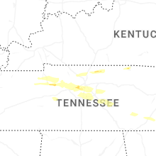
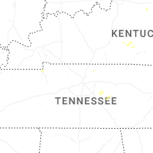


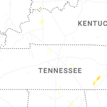


Connect with Interactive Hail Maps