

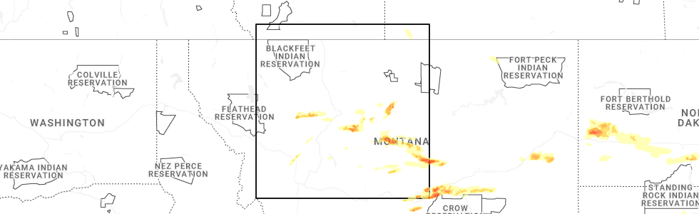
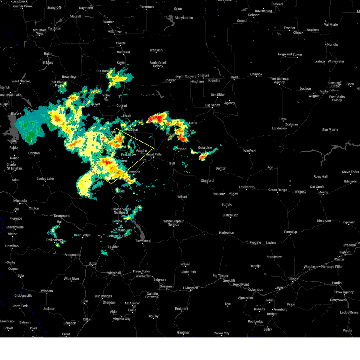
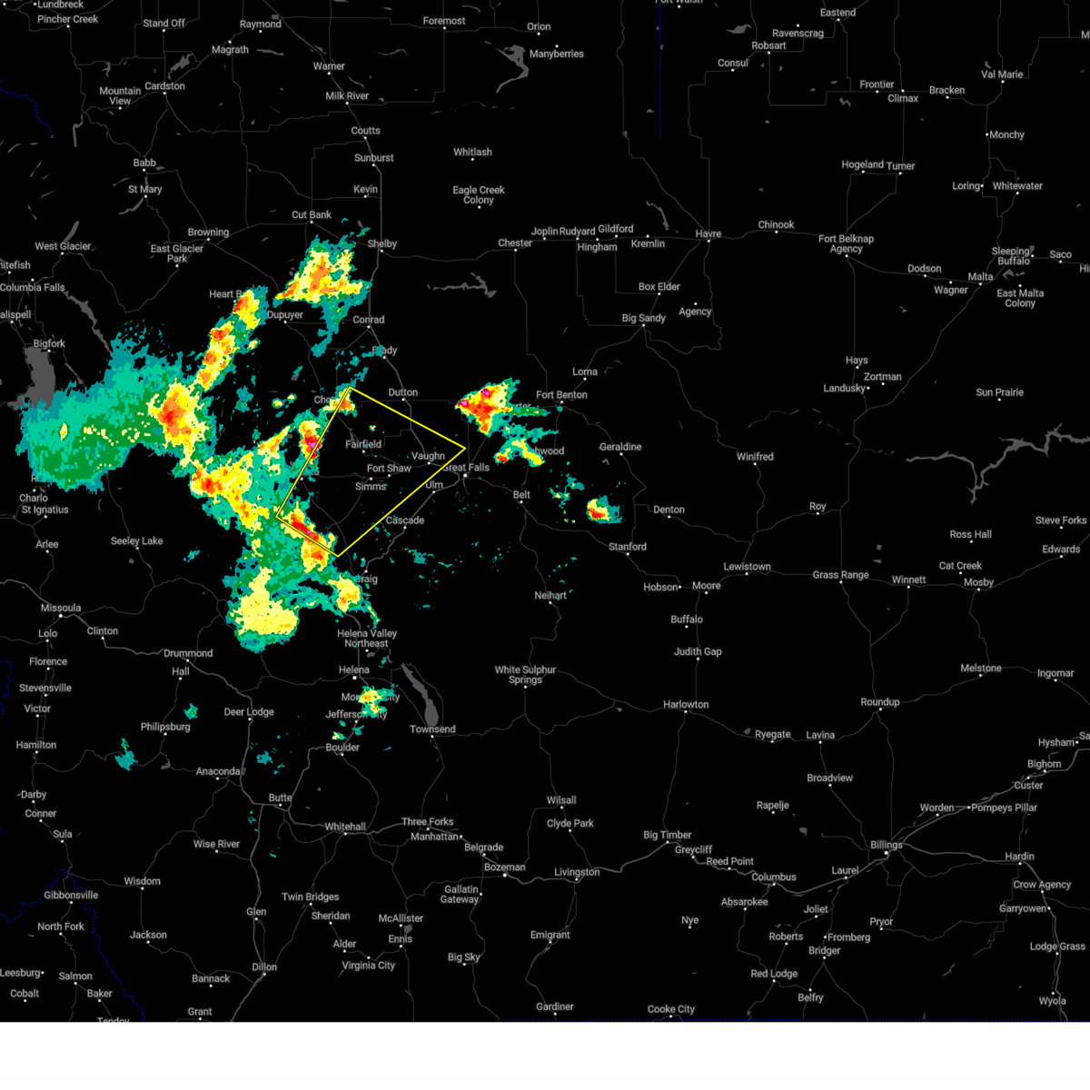
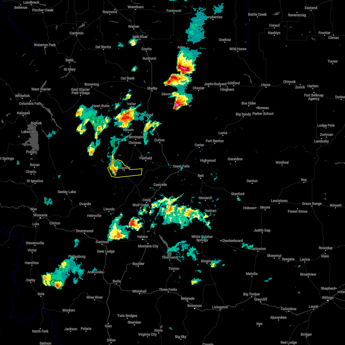
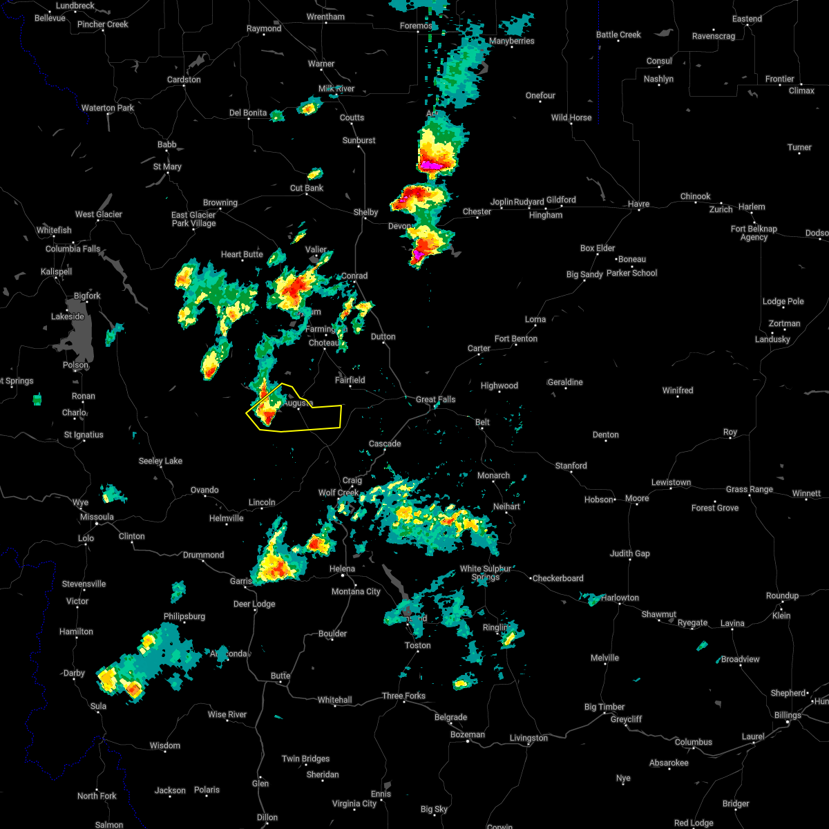
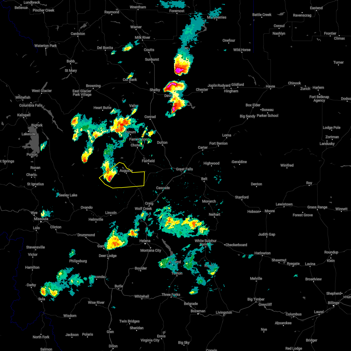
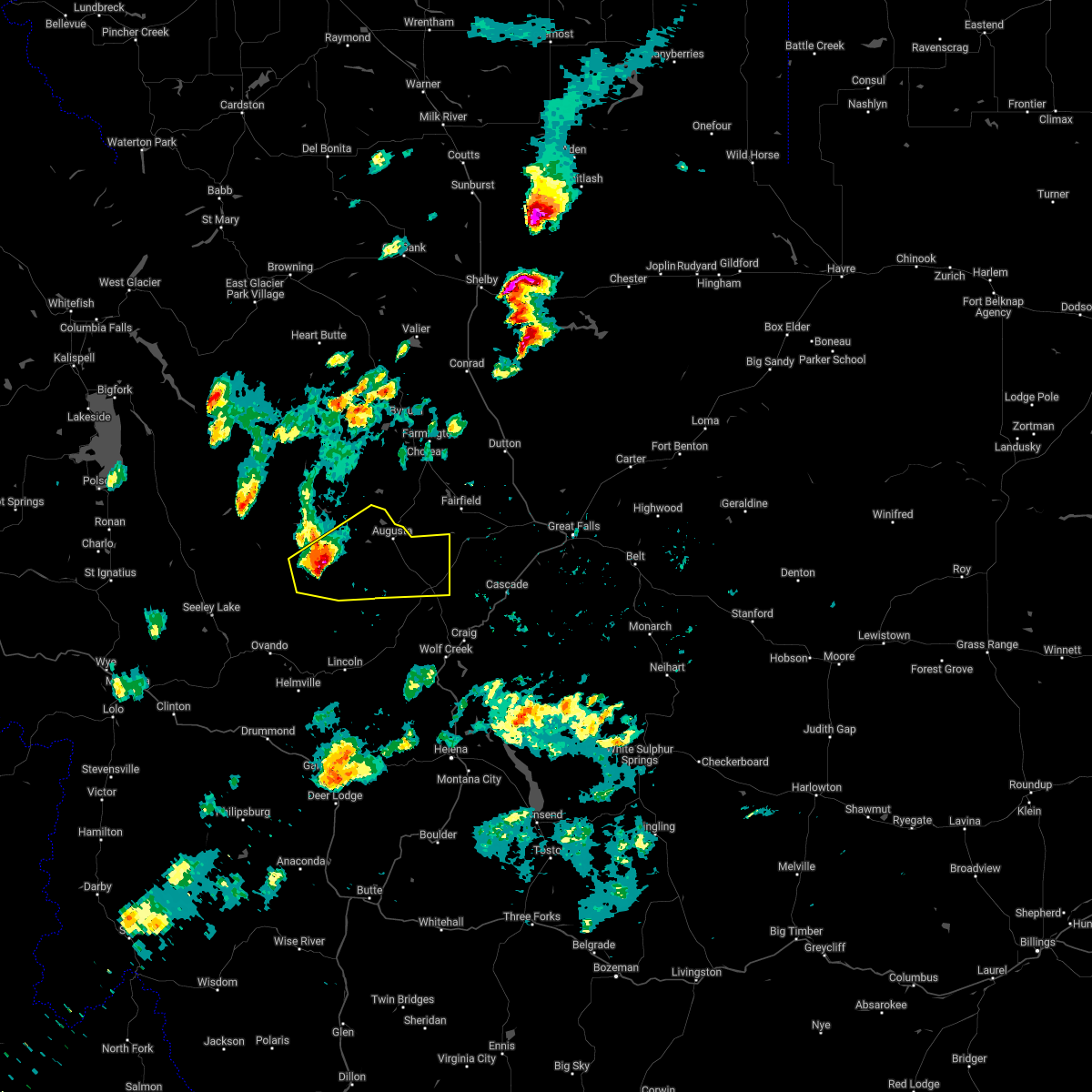
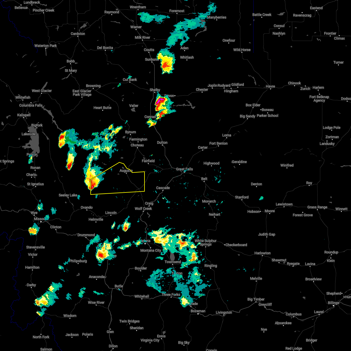
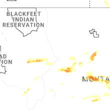
Hail Map for Augusta, MT
The Augusta, MT area has had 3 reports of on-the-ground hail by trained spotters, and has been under severe weather warnings 4 times during the past 12 months. Doppler radar has detected hail at or near Augusta, MT on 11 occasions, including 1 occasion during the past year.
| Name: | Augusta, MT |
| Where Located: | 50.6 miles W of Great Falls, MT |
| Map: | Google Map for Augusta, MT |
| Population: | 309 |
| Housing Units: | 218 |
| More Info: | Search Google for Augusta, MT |
2
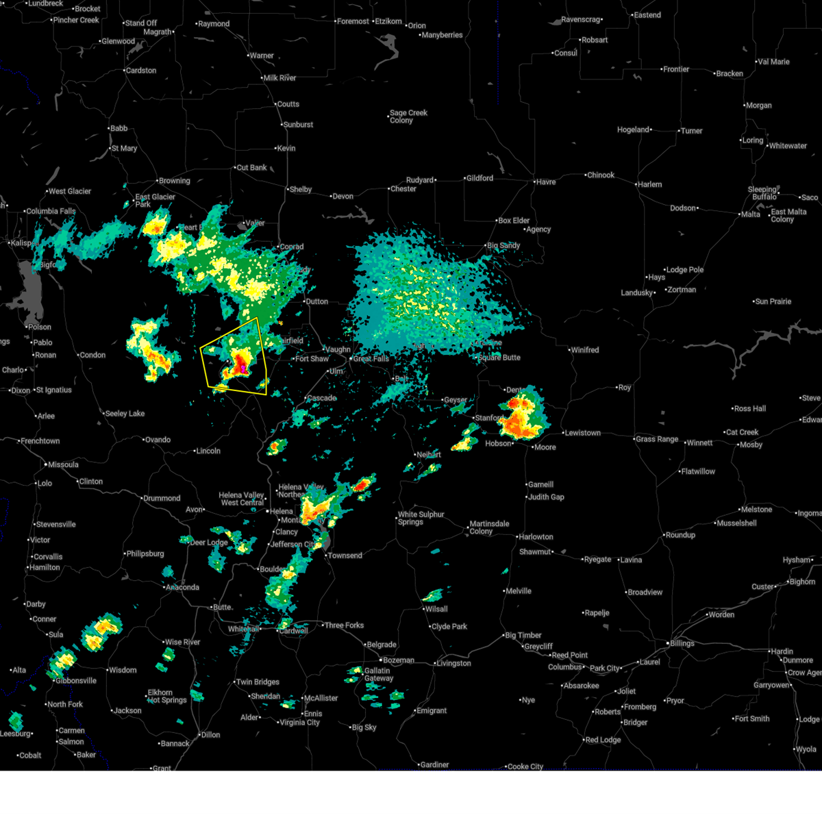
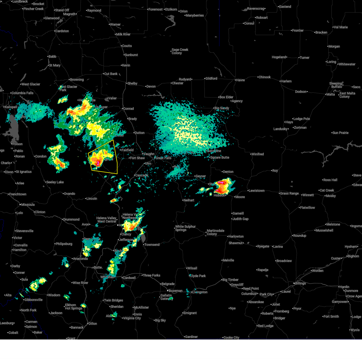
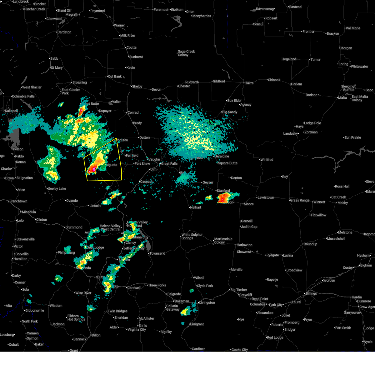
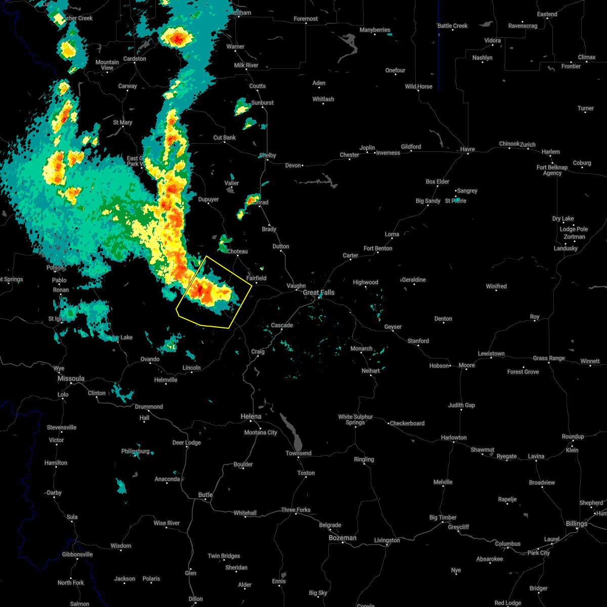
The Top Recent Hail Date for Augusta, MT is Monday, July 28, 2025 (3rd out of 11)
Hail and Wind Damage Spotted near Augusta, MT
| Date / Time | Report Details |
|---|---|
| 9/14/2025 8:07 PM MDT | Awos station k1gm golf. thunderstorm wind gust of 51 mp in lewis and clark county MT, 17.4 miles NW of Augusta, MT |
| 7/28/2025 3:13 PM MDT |
 The storm which prompted the warning has moved out of the area. therefore, the warning will be allowed to expire. a severe thunderstorm watch remains in effect until 900 pm mdt for north central and west central montana. remember, a severe thunderstorm warning still remains in effect for southern teton and northwestern lewis and clark county until 415 pm. The storm which prompted the warning has moved out of the area. therefore, the warning will be allowed to expire. a severe thunderstorm watch remains in effect until 900 pm mdt for north central and west central montana. remember, a severe thunderstorm warning still remains in effect for southern teton and northwestern lewis and clark county until 415 pm.
|
| 7/28/2025 2:50 PM MDT |
 At 250 pm mdt, a severe thunderstorm was located near augusta, or 28 miles southwest of choteau, moving east at 25 mph (radar indicated). Hazards include 60 mph wind gusts and half dollar size hail. Hail damage to vehicles is expected. expect wind damage to roofs, siding, and trees. Locations impacted include, augusta and nilan reservoir. At 250 pm mdt, a severe thunderstorm was located near augusta, or 28 miles southwest of choteau, moving east at 25 mph (radar indicated). Hazards include 60 mph wind gusts and half dollar size hail. Hail damage to vehicles is expected. expect wind damage to roofs, siding, and trees. Locations impacted include, augusta and nilan reservoir.
|
| 7/28/2025 2:33 PM MDT |
 At 233 pm mdt, a severe thunderstorm was located near augusta, or 28 miles southwest of choteau, moving east at 35 mph (radar indicated). Hazards include 60 mph wind gusts and half dollar size hail. Hail damage to vehicles is expected. expect wind damage to roofs, siding, and trees. Locations impacted include, choteau, augusta, bowmans corner, nilan reservoir, pishkun reservoir, and bean lake. At 233 pm mdt, a severe thunderstorm was located near augusta, or 28 miles southwest of choteau, moving east at 35 mph (radar indicated). Hazards include 60 mph wind gusts and half dollar size hail. Hail damage to vehicles is expected. expect wind damage to roofs, siding, and trees. Locations impacted include, choteau, augusta, bowmans corner, nilan reservoir, pishkun reservoir, and bean lake.
|
| 7/28/2025 2:13 PM MDT |
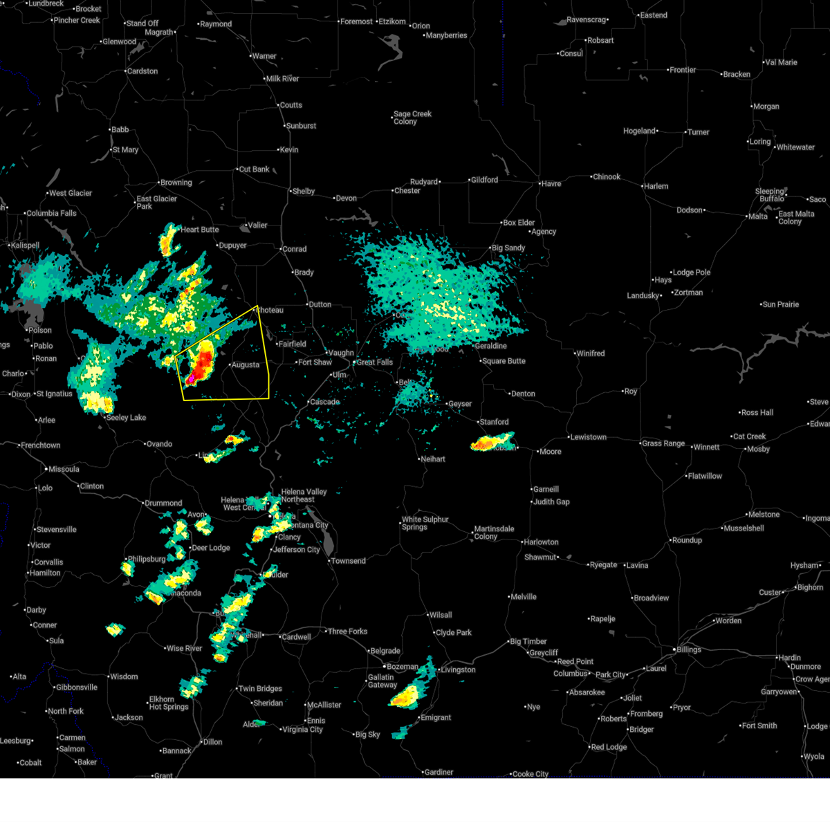 Svrtfx the national weather service in great falls has issued a * severe thunderstorm warning for, northwestern lewis and clark county in west central montana, southwestern teton county in north central montana, * until 315 pm mdt. * at 213 pm mdt, a severe thunderstorm was located 14 miles west of augusta, or 35 miles southwest of choteau, moving east at 25 mph (radar indicated). Hazards include 60 mph wind gusts and half dollar size hail. Hail damage to vehicles is expected. Expect wind damage to roofs, siding, and trees. Svrtfx the national weather service in great falls has issued a * severe thunderstorm warning for, northwestern lewis and clark county in west central montana, southwestern teton county in north central montana, * until 315 pm mdt. * at 213 pm mdt, a severe thunderstorm was located 14 miles west of augusta, or 35 miles southwest of choteau, moving east at 25 mph (radar indicated). Hazards include 60 mph wind gusts and half dollar size hail. Hail damage to vehicles is expected. Expect wind damage to roofs, siding, and trees.
|
| 7/2/2025 7:13 PM MDT | Awos station k1gm gol in lewis and clark county MT, 17.4 miles NW of Augusta, MT |
| 8/23/2024 4:55 PM MDT | Awos station k1gm gol in lewis and clark county MT, 17.4 miles NW of Augusta, MT |
| 8/23/2024 4:33 PM MDT | Awos station k1gm gol in lewis and clark county MT, 17.4 miles NW of Augusta, MT |
| 8/18/2024 8:30 PM MDT |
 The storms which prompted the warning have weakened below severe limits, and no longer pose an immediate threat to life or property. therefore, the warning has been allowed to expire. however, gusty winds are still possible with these thunderstorms. The storms which prompted the warning have weakened below severe limits, and no longer pose an immediate threat to life or property. therefore, the warning has been allowed to expire. however, gusty winds are still possible with these thunderstorms.
|
| 8/18/2024 8:04 PM MDT |
 Svrtfx the national weather service in great falls has issued a * severe thunderstorm warning for, central lewis and clark county in west central montana, southeastern teton county in north central montana, northwestern cascade county in central montana, * until 830 pm mdt. * at 804 pm mdt, severe thunderstorms were located along a line extending from 7 miles south of augusta to 14 miles west of cascade, moving northeast at 55 mph (radar indicated). Hazards include 70 mph wind gusts. Expect considerable tree damage. Damage is likely to mobile homes, roofs, and outbuildings. Svrtfx the national weather service in great falls has issued a * severe thunderstorm warning for, central lewis and clark county in west central montana, southeastern teton county in north central montana, northwestern cascade county in central montana, * until 830 pm mdt. * at 804 pm mdt, severe thunderstorms were located along a line extending from 7 miles south of augusta to 14 miles west of cascade, moving northeast at 55 mph (radar indicated). Hazards include 70 mph wind gusts. Expect considerable tree damage. Damage is likely to mobile homes, roofs, and outbuildings.
|
| 8/29/2023 6:15 PM MDT |
 At 615 pm mdt, severe thunderstorms were located along a line extending from 15 miles southwest of augusta to 10 miles north of wolf creek, moving north at 35 mph (radar indicated). Hazards include 60 mph wind gusts. hail up to one half inch in diameter. expect damage to roofs, siding, and trees At 615 pm mdt, severe thunderstorms were located along a line extending from 15 miles southwest of augusta to 10 miles north of wolf creek, moving north at 35 mph (radar indicated). Hazards include 60 mph wind gusts. hail up to one half inch in diameter. expect damage to roofs, siding, and trees
|
| 8/22/2023 4:39 PM MDT | Awos station k1gm gol in lewis and clark county MT, 17.4 miles NW of Augusta, MT |
| 9/7/2022 6:52 PM MDT | Awos station k1gm gol in lewis and clark county MT, 17.4 miles NW of Augusta, MT |
| 9/7/2022 5:21 PM MDT | Awos station k1gm gol in lewis and clark county MT, 17.4 miles NW of Augusta, MT |
| 7/8/2022 5:52 PM MDT |
 At 552 pm mdt, a severe thunderstorm was located 7 miles west of augusta, or 28 miles southwest of choteau, moving northeast at 40 mph (radar indicated). Hazards include 60 mph wind gusts and quarter size hail. Hail damage to vehicles is expected. expect wind damage to roofs, siding, and trees. locations impacted include, augusta and nilan reservoir. hail threat, radar indicated max hail size, 1. 00 in wind threat, radar indicated max wind gust, 60 mph. At 552 pm mdt, a severe thunderstorm was located 7 miles west of augusta, or 28 miles southwest of choteau, moving northeast at 40 mph (radar indicated). Hazards include 60 mph wind gusts and quarter size hail. Hail damage to vehicles is expected. expect wind damage to roofs, siding, and trees. locations impacted include, augusta and nilan reservoir. hail threat, radar indicated max hail size, 1. 00 in wind threat, radar indicated max wind gust, 60 mph.
|
| 7/8/2022 5:46 PM MDT |
 At 546 pm mdt, a severe thunderstorm was located 11 miles west of augusta, or 32 miles southwest of choteau, moving northeast at 35 mph (radar indicated). Hazards include 60 mph wind gusts and quarter size hail. Hail damage to vehicles is expected. expect wind damage to roofs, siding, and trees. locations impacted include, augusta and nilan reservoir. hail threat, radar indicated max hail size, 1. 00 in wind threat, radar indicated max wind gust, 60 mph. At 546 pm mdt, a severe thunderstorm was located 11 miles west of augusta, or 32 miles southwest of choteau, moving northeast at 35 mph (radar indicated). Hazards include 60 mph wind gusts and quarter size hail. Hail damage to vehicles is expected. expect wind damage to roofs, siding, and trees. locations impacted include, augusta and nilan reservoir. hail threat, radar indicated max hail size, 1. 00 in wind threat, radar indicated max wind gust, 60 mph.
|
| 7/8/2022 5:39 PM MDT |
 At 538 pm mdt, a severe thunderstorm was located 14 miles west of augusta, or 36 miles southwest of choteau, moving northeast at 40 mph (radar indicated). Hazards include 60 mph wind gusts and quarter size hail. Hail damage to vehicles is expected. expect wind damage to roofs, siding, and trees. locations impacted include, augusta and nilan reservoir. hail threat, radar indicated max hail size, 1. 00 in wind threat, radar indicated max wind gust, 60 mph. At 538 pm mdt, a severe thunderstorm was located 14 miles west of augusta, or 36 miles southwest of choteau, moving northeast at 40 mph (radar indicated). Hazards include 60 mph wind gusts and quarter size hail. Hail damage to vehicles is expected. expect wind damage to roofs, siding, and trees. locations impacted include, augusta and nilan reservoir. hail threat, radar indicated max hail size, 1. 00 in wind threat, radar indicated max wind gust, 60 mph.
|
| 7/8/2022 5:32 PM MDT |
 At 532 pm mdt, a severe thunderstorm was located 20 miles west of augusta, or 41 miles southwest of choteau, moving northeast at 35 mph (radar indicated). Hazards include 60 mph wind gusts and quarter size hail. Hail damage to vehicles is expected. expect wind damage to roofs, siding, and trees. locations impacted include, augusta, bowmans corner, nilan reservoir and bean lake. hail threat, radar indicated max hail size, 1. 00 in wind threat, radar indicated max wind gust, 60 mph. At 532 pm mdt, a severe thunderstorm was located 20 miles west of augusta, or 41 miles southwest of choteau, moving northeast at 35 mph (radar indicated). Hazards include 60 mph wind gusts and quarter size hail. Hail damage to vehicles is expected. expect wind damage to roofs, siding, and trees. locations impacted include, augusta, bowmans corner, nilan reservoir and bean lake. hail threat, radar indicated max hail size, 1. 00 in wind threat, radar indicated max wind gust, 60 mph.
|
| 7/8/2022 5:16 PM MDT |
 At 516 pm mdt, a severe thunderstorm was located 20 miles north of ovando, or 44 miles north of drummond, moving east at 35 mph (radar indicated). Hazards include 60 mph wind gusts and quarter size hail. Hail damage to vehicles is expected. Expect wind damage to roofs, siding, and trees. At 516 pm mdt, a severe thunderstorm was located 20 miles north of ovando, or 44 miles north of drummond, moving east at 35 mph (radar indicated). Hazards include 60 mph wind gusts and quarter size hail. Hail damage to vehicles is expected. Expect wind damage to roofs, siding, and trees.
|
| 6/18/2022 2:03 PM MDT |
 At 203 pm mdt, severe thunderstorms were located along a line extending from 13 miles south of augusta to 14 miles northwest of wolf creek to 13 miles east of lincoln, moving northeast at 40 mph (radar indicated). Hazards include 70 mph wind gusts and quarter size hail. Hail damage to vehicles is expected. expect considerable tree damage. Wind damage is also likely to mobile homes, roofs, and outbuildings. At 203 pm mdt, severe thunderstorms were located along a line extending from 13 miles south of augusta to 14 miles northwest of wolf creek to 13 miles east of lincoln, moving northeast at 40 mph (radar indicated). Hazards include 70 mph wind gusts and quarter size hail. Hail damage to vehicles is expected. expect considerable tree damage. Wind damage is also likely to mobile homes, roofs, and outbuildings.
|
| 7/21/2021 9:00 PM MDT | Quarter sized hail reported 18.6 miles ESE of Augusta, MT, co-op observer reports 1inch hail. |
| 7/21/2021 8:27 PM MDT | Quarter sized hail reported 23.7 miles E of Augusta, MT, forest service fire tower staff reports 1 inch hail. time estimated from radar. |
| 6/8/2017 6:28 PM MDT |
 The severe thunderstorm warning for northwestern lewis and clark and southwestern teton counties will expire at 630 pm mdt, the storm which prompted the warning has weakened below severe limits, and no longer poses an immediate threat to life or property. therefore the warning will be allowed to expire. however small hail and gusty winds are still possible with this thunderstorm. a severe thunderstorm watch remains in effect until 1100 pm mdt for north central and west central montana. The severe thunderstorm warning for northwestern lewis and clark and southwestern teton counties will expire at 630 pm mdt, the storm which prompted the warning has weakened below severe limits, and no longer poses an immediate threat to life or property. therefore the warning will be allowed to expire. however small hail and gusty winds are still possible with this thunderstorm. a severe thunderstorm watch remains in effect until 1100 pm mdt for north central and west central montana.
|
| 6/8/2017 6:15 PM MDT |
 At 615 pm mdt, a severe thunderstorm was located over augusta, or 23 miles southwest of choteau, moving northeast at 45 mph (radar indicated). Hazards include 60 mph wind gusts and quarter size hail. Hail damage to vehicles is expected. expect wind damage to roofs, siding, and trees. Locations impacted include, augusta, bean lake, pishkun reservoir and nilan reservoir. At 615 pm mdt, a severe thunderstorm was located over augusta, or 23 miles southwest of choteau, moving northeast at 45 mph (radar indicated). Hazards include 60 mph wind gusts and quarter size hail. Hail damage to vehicles is expected. expect wind damage to roofs, siding, and trees. Locations impacted include, augusta, bean lake, pishkun reservoir and nilan reservoir.
|
| 6/8/2017 5:57 PM MDT |
 At 557 pm mdt, a severe thunderstorm was located 12 miles southwest of augusta, or 36 miles southwest of choteau, moving northeast at 45 mph (radar indicated and trained weather spotters reported golf ball sized hail near lincoln). Hazards include golf ball size hail and 60 mph wind gusts. People and animals outdoors will be injured. expect hail damage to roofs, siding, windows, and vehicles. Expect wind damage to roofs, siding, and trees. At 557 pm mdt, a severe thunderstorm was located 12 miles southwest of augusta, or 36 miles southwest of choteau, moving northeast at 45 mph (radar indicated and trained weather spotters reported golf ball sized hail near lincoln). Hazards include golf ball size hail and 60 mph wind gusts. People and animals outdoors will be injured. expect hail damage to roofs, siding, windows, and vehicles. Expect wind damage to roofs, siding, and trees.
|
| 10/15/2014 3:00 PM MDT | Storm damage reported in teton county MT, 8.4 miles SSW of Augusta, MT |
| 6/17/2013 5:50 PM MDT | Golf Ball sized hail reported 17.7 miles ESE of Augusta, MT, hail up to golf balls. vehicle damage. roof damage to metal roofs. |
| 8/14/2012 8:15 PM MDT | Estimated 65 mph in the augusta are in lewis and clark county MT, 0.1 miles E of Augusta, MT |
| 1/1/0001 12:00 AM | 50-60 mph winds reported with a thunderstorm...along with pea sized hail and 0.30 inches of brief heavy rainfal in lewis and clark county MT, 2.1 miles NE of Augusta, MT |
Hail Maps for Augusta, MT


Connect with Interactive Hail Maps